Bonjour!
J'aimerais savoir s'il existe des chemins de randonnées en Lettonie, Lituanie et Estonie, du type sentiers de Grande Randonnée en France. Ou au moins s'il existe des cartes détaillées et des guides précis qui permettraient de créer un itinéraire.
Merci beaucoup pour vos lumières!
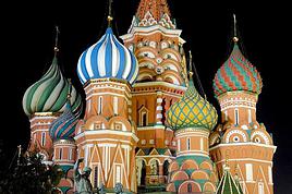
Je ne connais que l'Estonie mais voici déjà ce que je peux en dire. Il y a des chemins au sens où on l'entend en France (GR). Voici un site internet qui présente la carte de ces chemins balisés.
http://matkarajad.maaturism.ee/
je te donne un lien ci dessous malheureusement en russe ou en estonien, pour te donner une petite idée. Si tu as des besoins ou des questions, je peux te traduire grossièrement certains passage depuis l'estonien en français.
Merci beaucoup!
Bon, déjà, je sais que ça existe. Le problème c'est que je ne parle évidemment ni russe ni estonien, ce serait trop beau.
Et puis reste à savoir où trouver les cartes de ces chemins... Une petite idée?
Maintenant que j'en sais un peu plus, peut-être que je pourrais tenter le coup à l'ambassade, non? Ils pourraient me donner des informations touristiques?
Merci encore pour ces lumières bienfaisantes (mon projet a de l'espoir!)!
Oui, les gens de l'ambassade de France à Paris sont très sympathiques. Peut être pourront-ils te renseigner. En tout cas, ils ferront le maximum.
Voici le lien pour le site :
http://www.est-emb.fr/
Il sont tous estoniens et parlent couramment le français.
Sinon, je pense que ces cartes sont en vente en Estonie dans les librairies.
Si tu n'es pas pressé, il est possible que j'y retourne cet été, je peux jeter un oeil, voir te ramener qq chose si tu le souhaites. Mais c'est sous réserve ...
Sinon, je dois voir une copine estonienne avant la fin du mois, en transit à Paris. Je lui poserai la question.
Encore merci pour ces indications.
Je pense que j'irai d'ici peu faire un tour à l'ambassade.
Merci aussi pour ta proposition mais j'envisage de partir (si je peux) en juin, question de disponibilité.
Le problème est seulement qu'il est difficile de trouver des informations précises sur les sentiers, les hébergements possibles et ce genre de détails indispensables à part certainement, comme tu le suggères, dans les librairies estoniennes!
Quoi qu'il en soit, tes informations sont déjà importantes et intéressantes, je vais pouvoir commencer à organiser mon voyage un peu plus sérieusement!
Il donne des références précises pour les chemins de randonnées en vélo ainsi que les cartes disponibles sur le marché en Estonie.
Je pense que les chemins utilisables en vélo (très souvent non goudronnés, c'est la norme en Estonie), sont aussi adaptés à la marche à pieds.
et voici le lien d'Apollo, la chaine de librairies la plus populaire en Estonie.
Tu dois pouvoir commander par internet.
http://www.apollo.ee/product.php/0749018
je crois qu'il y a une version en anglais.
Encore une fois ces informations vont m'être très utiles. Après réflexion, je pense que c'est effectivement une bonne idée de m'inspirer des parcours cyclistes. J'ai trouvé une carte de l'un d'eux qui reprend en grande partie l'itinéraire qui me tentait. Ce qui est parfait, surtout si ces chemins ne sont pas goudronnés (bonne nouvelle pour mes pieds!)!
Prochaine étape: prendre mon curvimètre et voir comment je peux découper mon parcours!
Merci encore à toi, seule personne qui pour l'instant a pu m'apporter des réponses et grâce à qui mon périple prend forme!
Pour info, j'héberge un troupeau d'estoniens la 1ere quinzaine de mai :-), donc si tu as des questions précises, penses à les poster, je peux répercuter et peut être avoir des réponses appropriées.
Je sais, notamment, que tout bon estonien(e) qui se respecte, a presque toujours fait le tour d'Estonie en vélo entre 15 et 25 ans. Cela semble un rituel assez classique :-).
Penses à aller dans les îles, si cela ne fait pas exploser ton budget, elles sont toutes très belles.
Je crois que j'arrive trop tard... Je n'ai pas pu me connecter depuis le mois dernier (coincée à travailler dans un tout petit, petit village), et ton troupeau d'Estoniens doivent être repartis! Tant pis! De toute façon, j'en suis plutôt au fignolage de mon projet et je crois que dans l'ensemble, ça tient la route (c'est le cas de le dire!). Remarque, c'est toujours sur les détails qu'on se casse le nez et c'est vrai que ça aurait peut-être pu m'aider. A tout hasard, si tu as moyen de le savoir, saurais-tu si je pourrai trouver à Tallinn un magasin qui vendrait des cartouches de gaz pour réchauds (je pars en avion donc je ne peux pas en emmener) et des guides et cartes locales (je n'ai pas trouvé tout ce que je voulais sur internet)?
Je compte envoyer quelques bulletins réguliers de là-bas pour donner des nouvelles à mes amis. Si ça t'intéresse de voir quel itinéraire j'ai choisi ou ce que je rencontre sur ma route, ce sera un plaisir de te joindre tout ça. Evidemment, c'est juste une proposition, le seul moyen pour moi de te remercier!
Concernant les cartouches de gaz, je ne sais pas mais je pense que tu trouveras ça dans les stations services. Idem pour les cartes locales.
Sinon, à Tallinn, il ya notamment juste après l'entrée ''principale'' de la vieille ville fortifiée (très facile à trouver), une librairie Apollo où tu devrais trouver ton bonheur question cartes et guides.
Voici l'adresse :
Apollo Raamatumaja, Viru 23, Tallinn 10148
N'hésites pas à me tenir au courant de tes pérégrinations, je vais sûrement pouvoir te ''piquer'' tout un tas de bonnes adresses et bonnes idées de coins nouveaux à découvrir :-)
Concernant les cartouches de gaz, il n'est pas sûr finallement que les stations services en vendent.
Mais tu peux en acheter dans les magasins de camping spécialisés.
35 Tartu mantee (mantee = avenue)
Si tu clic sur le lien de l'adresse contenue dans le site web, tu auras un plan.
La Tartu mnt est très longue et très facile à trouver. Elle passe derrière la gare routière dans Tallinn.
Avatud = ouverture
E-R = du lundi au vendredi
L = samedi
P = dimanche (c'est fermé le dimanche )
Bon... Encore une fois je te remercie, pas de doute que je trouve tout ce dont j'ai besoin sur place grâce à tes précieux conseils.
Je pars demain (ou plutôt tout à l'heure) pour presqu'un mois. J'ai relevé ton adresse internet et je me ferai un plaisir de te mettre au courant de mes pérégrinations.
Merci pour tout et à très bientôt d'Estonie!
et peut être en Estonie d'ailleurs car il est plus que probable que je vais y faire un saut la première semaine de juillet.
Objectif : Saaremaa ou un peu de kayak dans le parc naturel de Soomaa.
Voyager à pied › Pologne / République Tchèque / Estonie · 9 replies
Je vais partir le 26 decembre dans les pays Baltes (Lettonie et Lituanie), en Pologne et Rep. Tchèque pour voyager en stop avec un ami. Nous sommes étudiants…
Je me demande quelles sont les plus belles randonnées des pays de l'Europe de l'est à marcher en juillet et août? Si je devais choisir un pays de l'est ou une…
Bien le bonjour à toutes et à tous, Alors voilà je fais appel à vos expériences diverses pour mon prochain trek. J'ai 2 mois pour randonnée au coeur des pays…
Je suis toute nouvelle sur ce site, je m'informe petit à petit mais voilà, je dépose mon propre sujet. Nous avons pour projet avec mon compagnon de partir deux…
Bonjour,
Nous souhaitons faire le trek de 4 jours reliant Mestia à Ushguli sans agence. Il est précisé dans les descriptifs qu'il existe des hébergement à chaque étape, mais on ne trouve pas d'info sur ces hébergements. Quelqu'un a-t-il des infos et un avis sur ce parcours?
We're planning to trek in Peru and Bolivia and would love to find some local agencies.
If you know any, could you share details on prices and, of course, the names of the agencies?
Which trek would you recommend?
Elocine
Je pars en autonomie totale sur un trek au Maroc (10jrs) Imilchil - Aghbalou.
Trouve t-on des cartouches gaz à vis (Coleman, Primus) à Marrakech (adresse) ou villages entre Imilchil - Aghbalou ?
Si non , trouve-t-on des cartouches Butagaz pour camping-gaz (petit volume 230 gr ...)
Merci d' avance pour vos réponses
Hello, I’d like to embark on a little trip in my home country, Switzerland. I’ll start walking from La Cure, heading toward Le Noirmont first, then I’ll improvise my route—but it’ll probably follow the French border... at least as far as Lac de Joux.
I’ll decide day by day how much farther to go after that. My goal is to stay in nature as much as possible, wander around for as long as I can, and restock food in villages or towns along the way.
I’m thinking of mostly camping, but we’ll see if I end up in a hotel or another campsite depending on my route.
I’d love to reach La Chaux-de-Fonds on foot... maybe even Delémont.
The whole thing should take about a week, give or take.
I’ll be bringing my dog, and I’m preparing for this as soon as I’m ready.
Any tips to make sure everything goes smoothly for us? Things I should know—or avoid? What about shepherds with their flocks of sheep? And isn’t hunting season open right now?
I’m not sure if what I’m planning is even doable, which is why I’m asking around.
This’ll be my first time doing something like this—wandering in nature *and* with a dog. I’m really excited for this adventure... and I need it. Thanks!
We’re really keen on ecosystems and want to hike in "natural" ancient forests—not planted woods or areas heavily degraded by human activity. Travel guides (like Lonely Planet) don’t provide much info on this. Could you point us to the most interesting spots?
Thanks in advance for your tips.
We wish you happy holidays and a fantastic 2026, full of discoveries!
Claire and Albert
Hi, this might not be the right section, but I’d like to know if it’s possible to start mountaineering with another person without necessarily hiring a guide. We’ve done quite a bit of hiking but not mountaineering—we’ll just do a half-day glacier course. After that, we were thinking of starting with La Grande Motte and the Pointe de la Traversière, which were recommended to us. Honestly, for things like roping up and knots, I’ll learn at home with lots of videos and a book.
Hi,
I don’t know Switzerland at all and was wondering if Vallée des Joux and especially Dent de Vaulion are packed early in the morning or late in the afternoon in July and September?
If so, do you have any quieter spots to recommend in the area, or in Luxembourg (yes, I know it’s not the same country 😉)?
Thanks a lot!
I’m starting this thread—lots of travelers here have done this trek.
When RMS is mentioned, it’s this agency: Ruwenzori Mountaineering Services (with an *s*), because there’s another one online called Ruwenzori Mountaineering Service (no *s*).
Their site:
www.rwenzorimountaineeringservices.com/
From what I gather, it’s the local mountain guide agency certified by the government?
Jaimerais savoir si quelqu'un aurait fait des treks sur le Ruwenzori et combien ça coute en moyenne, les infrastructures, les paysages la sécurité sur les lieux, merci beaucoup. J'attends avec impatience vos réponses.
We’re leaving in 9 days for a two-week trip to Madeira, mainly to hike.
From my research, I’ve found that since last year, access to most trails—and systematically for the most popular ones—is now paid. You have to pay an access fee of 4.50 € per person per classified hike in 2026, and even 10.50 € for the most iconic hike: Pico Arieiro to Pico Ruivo. When paying, you also have to choose a day and a 30-minute time slot for your start time. Of course, this reservation is neither changeable nor refundable, even if the weather that day is terrible.
Personally, given the massive influx of tourists to the island in recent years, I don’t mind paying a fee to help maintain the trails. Similarly, setting a limit on the number of people who can hike them per day is certainly preferable to preserve this priceless heritage.
However, what’s much less fair is that in reality, most of the available spots are reserved: 1/ for Madeira residents (which is normal); 2/ for "economic operators" (meaning local tour operators). For example, if you’re a non-resident (independent tourist), no booking is possible for the Pico Arieiro hike for an early morning start before September! So, unfortunately, we’ll have to skip this hike.
It’s the same issue for Ponta de São Lourenço, the 25 Fontes, Pico Ruivo... in short, all the most popular hikes. Oh well, we’ll skip those too!
So my question is: which hikes do you recommend where we won’t face the huge crowds that the others get? And where we can book the day before for the next day, taking the weather into account?
Finally, a quick accommodation question: we’ve booked the first week in Funchal, but I haven’t decided yet for the second week. Do you have any advice on where to stay in the south or north, preferably avoiding overly concrete-heavy and touristy spots?
I’m reposting about the logistics for Samaria Gorge.
I’d love to get recent info, especially about whether it’s possible to park my car in Omalos, do the hike, and then catch a bus back to my vehicle.
In theory, it’s doable, but when you check the KTEL website, there aren’t any feasible schedules listed. If anyone has recently organized this with reliable, verified details, I’d really appreciate it. Thanks in advance!
Hi there,
We’re flying from Montreal to Lyon this August to go hiking in the French Alps. We’ve rented a car and will be staying at campgrounds. We’re planning to do day hikes and want to stay a few days in one spot, do a few hikes, then move on to our next camping spot. Could you share your favorite spots or any recommendations for places to spend a few days with great hikes?
A few details:
We arrive in early August and leave in early September.
We’re looking for day hikes (or shorter), moderate difficulty, with a cumulative elevation gain of no more than 1000m, and of course, beautiful scenery!
We’d prefer not to drive too much—maybe it’s best not to head too far south and deal with unnecessary heat?
Along the same lines, if you know of any great campgrounds where we can start our hike directly without needing the car, we’d love to hear your suggestions!
Bonjour
Souhaitant faire de la randonnée sur cette île, je voudrais d'abord savoir quelle serait la période la plus favorable sachant que j'avais passé quelques jours en novembre 2018 pas pour cette activité mais plus pour une simple découverte de l'île et le temps n'était pas top notamment en montagne. Donc peut on choisir une organisation en étoile sachant que je louerai un véhicule avec éventuellement 2 points d'hébergement.
Je n'envisage pas d'intégrer une structure mais de partir à 2 et de s'organiser sauf si vous me conseillez une agence locale ou un guide local. Enfin même si je compte me procurer les différents supports, carte et topo guide plus gps je vous remercie de bien vouloir me communiquer les randos à faire en priorité
Merci beaucoup pour vos informations
I’m planning to do the Mercantour crossing following the Randoxygène route in mid-July.
I’m used to hiking in the mountains, but I sometimes get vertigo, for example on ridges with drops on both sides. I wanted to check if there are any T4 or T3-T4 sections and find out if there are any very exposed passages—and if so, where—so I can plan an alternative route.
Can anyone give me some info on this?
Thanks!
I’m planning a trip around Cap Corse and the AGRIATES in 2026, from May 8th to 15th (there are still 2 spots left, by the way! Just DM me if you're interested).
I’d love to know which hikes are worth prioritizing in the AGRIATES. We’ll be staying in SALECCIA for two days as our base—what should we focus on from there?
A round trip to IGNHU beach? Any other suggestions?
For Ostricano, I think it’s too far for a round trip...
Thanks for your tips!
Have a great day,
Anie, Toulouse
I’d like to get some info about the GR10 Pyrenees traverse. I need help planning the daily stages and accommodations—my wife isn’t an experienced hiker but walks a lot, so I’d like to schedule shorter walking days and thus a longer overall trip in terms of number of days.
Could anyone give me some help and advice?
Best regards,
New to this forum, I’m planning a pretty big project for 2028.
I’m heading to Nepal to do a trek from Kathmandu all the way to Everest Base Camp (a cool 5,300 m 😄).
This trek is a bit special because even though I’ll be part of a group, I’m going solo (so far, no problem—I’m used to it). But it’s my first real trek, and it’s also a humanitarian one: once I reach base camp, I’ll stay an extra week to help clean up the waste left by tens of thousands of climbers! Since I’m originally from South America, from two countries that share the Andes, I have a deep respect for mountains—they fascinate me. So Everest… it’s kind of the trip of a lifetime!
So, a little question for those who’ve done treks to Everest before… any tips for good mental preparation (I’m already working on the physical side)?
Hi there, I’m planning the Annapurna Circuit for March 2027 and I’m looking for a local agency with a local guide—preferably French-speaking—to arrange this trek for us. Any suggestions? Thanks
Hello!
We’re spending a few days in Toraja country at the end of May. We’d love to do a day trek—taking our time—on a route that’s stunning in terms of scenery, but not a level 5 in difficulty!
Any suggestions you can share, please?
Thanks in advance
I’d like to do the Mare a Mare Sud in May over 4 days. I’ve found quite a few places to stay along the route, but I’m stuck on the start and finish.
I’ll be arriving by plane on Sunday evening and would like to start pretty early on Monday morning. Ideally, accommodation right at the trailhead (Alzu di Gallina) would be amazing, but I can’t find anything. Any tips?
Also, for the transfer from Figari Airport to Porto Vecchio or Alzu di Gallina?
At the end, I’d like to pick up a rental car—any advice on that too?
I’m traveling solo by plane to Catania in May and plan to hike the northern side of Etna, starting from Linguaglossa where I’ll arrive by bus. After that, I’d love some info on how to get up to Piano Provenzana (shuttles or hitchhiking), since it seems there’s no public transport except in the summer. Can you sleep there in a free or cheap refuge, or camp? And how far up can you go without having to hire a guide? Thanks in advance. Bernard.
Bonjour a tous,
je pars en voyage au Maroc en aout et nous allons commencer par nous arrêter a Chefchaouen(nous sommes en voiture).
Ma question: quelqu'un peut il m'indiquer un itinéraire de rando en boucle d'entre 5 et 7 jours aux départ de Chefchaouen dans le parc de Talassemtane passant si possible par le pont de dieux?Ou un guide papier qui en reunis quelques uns?
Nous privilégions le camping sauvage et les gites.
Merci d'avance
Hi there, for those who’ve been recently—is it possible to find other solo travelers in March on the island to share transport or room costs? It doesn’t seem easy to travel on a budget.
If you have any recommendations for simple lodgings or places with dorms, I’d love to hear them.
For those who’ve done multi-day treks while moving around: do you need to bring your own sleeping bag? I’d love to hear about itineraries you’ve done without a guide, just with a map and GPS.
Thanks, and have a great day!
Hi everyone!
We’re planning a 15-day road trip to Scotland this summer, specifically to explore and hike on Lewis and Harris—places we’ve never been before. We’ve visited other islands on previous road trips in Scotland (we usually go in April for a week). This would be our first time in Scotland in the summer and for 15 days. We’re looking at late August to early September.
I’m currently drafting the itinerary. We’d be crossing from Ullapool and were thinking of spending 3 nights on Harris and 4 nights on Lewis.
Does that sound balanced to you? Is it better to keep the same accommodation on Harris and the same on Lewis to explore the area? I’d love to hear about any past experiences you’ve had on these islands.
Thanks!
Hi there, I’m trying to leave for 15 days very soon to São Vicente. I’m either looking to join an agency or figure things out on my own to go hiking on one of these islands or both. From what I’ve seen, it’s not easy to organize with local transport, so it gets expensive. Can I use the services of a small local agency? I’m looking for the simplest way to hike for several days. Also, how do you get from São Vicente to São Nicolau? Thanks in advance and have a great day!
Aichatou
I’ve been wanting to do this for several years, and this year’s the one. Next September, I’ll be trekking in Tusheti (Georgia), from Omalo to Shatili.
Of course, I won’t be renting a vehicle that’d just sit unused. No problem getting to Pshaveli, but from there to Omalo, it’s a dirt road (still the case?)
There must be some form of public transport since there are so many guesthouses, and not all travelers come in a 4x4.
If any of you have been to Omalo, could you confirm that these shared transports exist and how often they run?
we’re planning a trip to Yellowstone and hoping to do a three-day backcountry hike if we get a permit.
if any of you have done this before, could you let me know if it’s possible to find water along the way? And if we can transport it, are we allowed to use a stove?