je me rends à dumaguete la semaine prochaine. quelqu'un a-t-il des informations sur les éventuels dégats et l'accessibilité. pour l'instant je n'ai pas trouvé grand chose.
Je me rends à Camiguin samedi, en arrivant par Butuan. J'ai vu que Butuan etait en intensité 3 et Camiguin en intensité 2 sur le document que vous fournissez. Qu'est ce que cela signifie ? Pensez vous que des secousses aussi violentes peuvent survenir dans les prochains jours ?
Intensity
Phivolcs said the following intensities were felt in the following areas:Intensity VII - Dumaguete City; Vallehermoso, Negros OrientalIntensity VI - La Carlota City and La Castellana, Negros Occidental; Argao, CebuIntensity V - Roxas City; Dao and Ivisan, Capiz; Iloilo City; Ayungon, Negros Oriental; Kanlaon City; Lapu-lapu City; Guimaras; Cebu City; San Carlos City; Bacolod City; Sagay City; Tagbilaran City; Candoni, Binalbagan, Negros OccidentalIntensity IV - San Jose de Buenavista, Pandan, Anini-y, Patnungon, Antique; Kalibo, Aklan; Dipolog City; Sipalay, Negros Occidental; Ormoc CityIntensity III - Butuan City, Agusan del Norte; Legaspi City, Albay; Carmen, Cagayan de Oro; Tacloban City; Catbalogan; Saint Bernard, Southern Leyte; Masbate, Masbate; Cagayan de Oro CityIntensity II - Cabid-an, Sorsogon; Borongan, Eastern Samar; Mambajao, CamiguinIntensity I - Pagadian City
43 morts et des dégats aux dernières news; j'ai eu des news de Siquijor ils ont eu un ordre de se préparer en cas d'évacuation des côtes; finalement heureusement pas de tsunami en vu ce coup ci
Départ prévu la semaine prochaine pour Cébu et Négros, Siquijor....
Il y a t il des personnes sur places ou dans les environs qui peuvent nous dire si les lieux sont bcp touchés? routes...?? s'il est préférable que nous changions d'intineraire?aller sur Leyte au lieu de Negros????
Ou s'il faut simplement aller sur la cote ouest de Negros, faire le kalaon, redesecendre vers Siquijor puis Bohol et retour sur Cebu.
Par contre , il faut arrêter avec les tsunamis.....ça sert a rien de faire peur aux gens!
les Visayas, Palawan et toute la mer interne des Philippines est protégée des tsunamis idem la médittérannée.
Un tsunami développe son onde de choc sur sur plusieurs centaines de miles, c'est une vague sinusoïdale qui s"amplifie plus elle parcoure de miles nautiques.
La mer des Philippines est une mer fermée ou cette onde a aucune chance de se développer de manière significative et provoquer un raz de marée comme au Japon ou en Thailande;
les cote les plus exposées sonr celles de Luzon EST si séisme dans le Pacifique mais pas trop lointain tout de même;pas depuis le japon à 3000km
Des études en Médittérannée propice aux séismes , ont démontré que si d'un bout à l"autre de ces rivages un séisme développait un Tsunami , il engendrerait une vague de 2/3 mètres.....une broutille à Biarritz.....mais du coté de Nice ou cannes , ils ont toujours pas compris qu'il ne fallait construire sur le domaine maritime et que les bistrots au bas des digues se recevaient une vague de temps en temps....autre problème!!
Concernant le Earthquake;il peut toujours avoir des répliques et ce n'est pas le premier séisme sur Negros ou Cebu il s'en produit plusieurs par an.... même si celui ci à été plus violent....les philippines sont situées sur la ceinture volcanique du Pacifique..faut pas oublier.Les Philippins ont appris a vivre avec les catastrophes.
Même Santo Nino ne peut les prévoir... Santo.Philvoc surveille les volcans!
Nav
je n'arrive pas à avoir de contact avec mon hotel à dumaguete, tel ou mail. réseau saturé, endommagé ? pas d'info non plus concernant l'aéroport de dumaguete. j'y vais normalement le 16, et de là je vais aux camotes via cebu city. j'aviserai sur place.
Allez expliquer ça à Bandah Aceh ou sur l cote de Sumatra, à moins de 25 kms des épicentres. Où même au Japon, où la vague n'a pas parcouru plusieurs centaines de miles...
Par contre , il faut arrêter avec les tsunamis.....ça sert a rien de faire peur aux gens!
les Visayas, Palawan et toute la mer interne des Philippines est protégée des tsunamis idem la médittérannée.
Un tsunami développe son onde de choc sur sur plusieurs centaines de miles, c'est une vague sinusoïdale qui s"amplifie plus elle parcoure de miles nautiques.
La mer des Philippines est une mer fermée ou cette onde a aucune chance de se développer de manière significative et provoquer un raz de marée comme au Japon ou en Thailande;
les cote les plus exposées sonr celles de Luzon EST si séisme dans le Pacifique mais pas trop lointain tout de même;pas depuis le japon à 3000km
Des études en Médittérannée propice aux séismes , ont démontré que si d'un bout à l"autre de ces rivages un séisme développait un Tsunami , il engendrerait une vague de 2/3 mètres.....une broutille à Biarritz.....mais du coté de Nice ou cannes , ils ont toujours pas compris qu'il ne fallait construire sur le domaine maritime et que les bistrots au bas des digues se recevaient une vague de temps en temps....autre problème!!
Concernant le Earthquake;il peut toujours avoir des répliques et ce n'est pas le premier séisme sur Negros ou Cebu il s'en produit plusieurs par an.... même si celui ci à été plus violent....les philippines sont situées sur la ceinture volcanique du Pacifique..faut pas oublier.Les Philippins ont appris a vivre avec les catastrophes.
Même Santo Nino ne peut les prévoir... Santo.Philvoc surveille les volcans!
Nav
Ne pas y aller serait desservir l économie des philippines, surtout que si vous venez en qualité de touriste vous ne verrez pratiquement rien!
la région de l épicentre est dans un coin peu connu et pas trop touristique de la cote ouest Negros à 70km de Dumaguette ou il y a eu peu de dégats
nav
egardez les liens et lisez;
Aussi le journal inquijer et daily news
Bonjour
Je suis sur place, à thalatta 20km de dumaguete. Il n'y a pas de gros dégât (perso je n'a vu aucun dégâts) et aucuns problème de circulation. Aucune répliqes depuis hier soir. Je ne vois pas de raisons de ne pas venir à part un nouveau séisme , mais ça pas possible de prévoir.
merci pour ces infos. je n'ai pas prévu d'annuler mon déplacement à dumaguete, sauf bien sur si les avions ne pouvaient pas aterrir. j'étais simplement surpris de ne pas avoir de contact avec mon hotel.
je vais essayer à nouveau.
euh vous en êtes certains ???!!! la méditerranée "surtout vers nice cannes menton" peuvent avoir un tsunami... on nous tient relativement informé dans le sud est pour ça...faudrai peut être pas assurer certaines choses.. peut être pas de grande force mais tout de même......
Je donnais des news de personnes vivant sur place à Siquijor, des philippins; ils ont eu un ordre de se préparer en cas d'évacuation c'est tout. Je m'en fous des analyses nav je transmets juste les dernières news en ma possession,
Que certains voyageurs soient inquiet c'est un autre problème; ils le sont de toute façon et ça n'est pas anormal
"Comme tu peux le voir eux sur les photos ;ils ne paniquent pas les Philippins 🙂"
Euh c'est pas les news que j'ai ya bien eu mouvement de panique lors du tremblement; les photos sur le net le confirment; et d'ailleurs c'est normal; c'est humain comme comportement et je vois pas le rapport entre les philippins et les autres: tout le monde réagit pareil face à un tel drame.
on nous tient relativement informé dans le sud est pour ça...faudrai peut être pas assurer certaines choses.. peut être pas de grande force mais tout de même......
QUI on??? EH oui petite vague....Pas tsunami qui est une expression Japonaise plutôt liée aux séisme qui propagent leur onde de choc dans le Pacifique ou se produisent ces gigantesques raz de marée, rien à voir avec ce qui se passe dans le pacifique et l'océan Indien autour de la ceinture de feu!
Il faut des fonds importants puis de longs plateaux continentaux et de l'eau a courir pour que l'onde de la vague se propage comme un tsunami.
les vagues courtes en Médittérannée , déja ne ressemblent en rien a celles du pacifique ou de l' Islande, ni la configuration littorale.
Un peu comme la sardine qui bouchait l'entrée du port de Marseille....ton Tsunami:
Maintenant étudie ce que veux dire tsunami profite en pour voir si historiquement , on a déjà vu un Tsunami sur les plages .../les cailloux de Nice Cannes et autres
Voila monsieur désolé
Nav,
Tsunami
Tsunami transformée de fourier énergie mécanique onde stationnaire
Tsunami à Malé aux Maldives, le 26 décembre 2004.
Un tsunami (japonais : ? tsu, " port " et ? nami, " vague ") est une onde provoquée par un rapide mouvement d'un grand volume d'eau (océan ). Ce mouvement est en général dû à un séisme, à une éruption volcanique sous-marine de type explosive ou bien à un glissement de terrain sous-marin de grande ampleur. Un impact météoritique peut aussi en être la cause, de même qu'une explosion atomique sous-marine. Ainsi, contrairement aux vagues, un tsunamin'est pas créé par le vent.
Bien que les tsunamis atteignent une vitesse de 800 km/h quand le fond de l'océan est profond, ils sont imperceptibles au large car leuramplitude n'y dépasse que rarement le mètre pour une période (temps entre deux vagues successives) de plusieurs minutes à plusieurs heures ; il ne faut donc pas les confondre avec les vagues scélérates qui provoquent des naufrages en haute mer. En revanche, ils peuvent provoquer d'énormes dégâts sur les côtes où ils se manifestent par :une baisse du niveau de l'eau et un recul de la mer dans les quelques minutes qui le précèdent ;un raz-de-marée, à savoir une élévation rapide du niveau des eaux d'un mètre à plusieurs dizaines de mètres provoquant un courant puissant capable de pénétrer profondément à l'intérieur des terres lorsque lerelief est plat. La vague (max. 60 mètres de haut) ralentit près des côtes et prend de lahauteur. Ensuite, elle peut tout dévaster sur plusieurs kilomètres.Dans certains cas assez rares, le tsunami peut prendre la forme d'une vague déferlante ou, sur un fleuve, d'un mascaret. 75 % des raz-de-marée se produisent dans l'océan Pacifique, la plupart des autres dans l’océan Indien, en raison de la plus forte activité tectonique et sismique.
En fonction de l'intensité de l'action mécanique qui les génère et de la géométrie de l'océan, ils se propagent sur des milliers voire une dizaine de milliers de kilomètres et peuvent toucher plusieurs continents, dans des zones où le séisme ou l'éruption volcanique ne sont pas détectés. Lors d'un fort tremblement de terre en zone côtière, ils sont généralement plus meurtriers et destructeurs que la secousse elle-même.
Alex
peur relative oui selon les individus, panique réelle non, mais inquiétude et effet de panique transmis et amplifié par les voitures de sécurité......Les Philippins ne sont pas à leur premier tremblement de terre??
l épicentre du séisme sévère vu son importance sur l' Echelle de Richter s"est produit dans une région peu peuplée et heureusement éloignée de Cebu(80 Km) et de Dumaguette
voila l objet de mes propos relativiser en toute objectivité
Nav.
Visiblement tu n'as pas lu ou compris l'article: lis-le et tu verras qu'il contient essentiellement une énumération des dégâts localité par localité, ce qui à mon très humble avis est plus intéressant comme information pour le voyageur que ces longues diatribes vindicatives qui finissent par polluer de nombreux threads.
j'ai relayé moi même cet article des le début de l'information ici sur ce site je l'ai bien lu et compris en matiné;li'nquirer est ma page de garde;Il n'est pas ma seule source d'information;jai lu le sun et autres articles!
Je n'y ai fait aucun commentaires et chacun son avis n'est ce pas???
Te considéres tu comme un pollueur???...
Nav
Salut,
J'étais à Moalboal town durant le séisme, je n'ai vu aucun dégât, par contre cela à tout de même été impressionnant, la rue principale qui s'est remplie de monde qu'y se sont mis à courir en direction inverse le la côté (et oui, il arrive aux Philippins de paniquer, mais il est vrai que je n'ai vu aucune bousculade, ou excès de violence quelconque, tout le monde s'est comporté en être humain civilisé, ce qui ne serait pas forcement le cas partout.).
Des mouvements de foule (qu'y rejoignaient les hauteurs) pendant toute l'après midi.
Mais comme tu dis, le risque de tsunami était très peu probable (voir impossible).
Les rumeurs allaient bon train (comme par exemple l'explosion d'un volcan à Negros).
Une pensée pour les familles en deuil.
Bonjour,
Bien oui, tu étais en face de l''épicentre , un peu au dessous, surprenant, inquiétant oui , mais en fait la désinformation apporte plus de panique.
J"imagine à Malboal a la tarde que je connais bien
Cette de diatribe provient d(une photo amusante d'un Philipin grimpé sur un château d"eau guettant un tsunami😉😉trait d'humour
lles philippins des visayas sont tout de même trés cool
les tsunamis atteignent une vitesse de 800 km/h , vous auriez été vite servit vu la largeur du Tanon Strait en terrasse à Pagsama beach.
Ta dernière phrase est la plus importante et la chance ...si chance a été que cela arrive en mer sous l'eau dans un coin pas très peuplé....le bilan en terme de catastrophe sera plutôt léger comme disent les autorités.....
La derniere tempête tropicale Sendong a emporté plus de milles âmes.
Nav
garde ta science pour qui tu veux et calmos dans ton intervention.. si tu nes pas content c'est pas notre problème. chacun son avis.
sur la côte d'azur il ya deux ou trois ans une vague de plus de 6M a fait d'énormes dégats avant le festival de cannes. le coin aussi de la promenade des anglais a trinqué. détruisant le bord de mer et une fête foraine . les cailloux ont été projetés jusque de l'autre côté de la route et dans une rue proche. tous les plagistes étaient sinistrés (c pas un tsunami ok.
évidemment ça sera pas des grosses vagues comme en 2004 (je l'ai ai vu là bas nous y étions à phuket, ma fille est une miraculée , alors ne me décris pas le tsunami de 2004 j'étais hélas témoin de l'horreur et on n'oubliera jamais)cet évènement terrible et espérons exceptionnel ...
mais par contre plusieurs scientifiques parle que nous risquons dans ce coin de france du sud de la france un séisme majeur qui "pourrait provoquer un raz de marée".. surtout du côté de menton et monaco... il ya des tsunamis de différentes amplitudes bien sur.... mais ne pas dire que c'est impossible dans le sud est...
si tu n'es pas content c pareil.. fin de la conversation pour moi.... un forum évidemment il ya bcp de personnes qui ne sont pas d'accord avec d'autres interventions c comme ça.. c'est notre cas ... bonne continuation dans le sud -est....😉
J ai vu ta vague de 6 metres a la TV😉😉😉😉MDR mode de Marseille;on divise par deux😉Allez :3 metres et les plagistes zont qu'a mettre leur bazar ailleurs que sur le domaine maritime , jai vu aussi les images de ce restaurant sinistré pour deuxieme fois !
Tant mieux!
On était loin des vagues de Bretagne ou du pays Basque, ici on construit plus loin du littoral.
Respectez la mer et soyez moi prétentieux avant tout
Chez nous , il y a des vagues en Bretagne à la pointe du raz et 12 vrais metres eni Iroise et Islande
on ne construit pas sur le domaine maritime et on interdit ces concessions sur un domaine public. qui ne sont que des pots de vins municipaux!!
Je vous souhaite de vraies vagues et une destruction totale de ces Equipements polluants....Va te promener sur la cote Cantabrique en hiver , vers ST Sebastien , tu apprendras ce qu'est une vague
Tsunami sur la cote d"azur...😉😉😉😉😉.un sujet pour la presse locale, osez comparer au Pacifique et à l"ocean indien !!!mort de rire
Pagnolesque!re az de marée ;mascaret n'est pas Tsunami
La depeche de Baylet, journal hautement scientifique dans la rubrique cassoulet toulousain...............hors sujet tout celà!
Ici Philippines
Quand aux évènements de Thaïlande ;ils peuvent se reproduire du jour au lendemain, cause ceinture de feux du Pacifique et déplacements des plaques tectoniques dans ce coin!
les mêmes cause produisent les mêmes effets... d'ou la nécessite et la prudence de reculer les constructions et le betonnement hôtelier et de construire dans des zones sures et pas faire n'importe quoi....la mer reprendra toujours son estran.
nav
bonjour Alex
Voila la cause de la panique à Cebu;la désinformation et la rumeur;
Comme moi tu connais ou se trouve Cebu City et ou c"est produit le seisme, c'est a dire de l'autre coté de la cordillere........ De plus du coté ESt protégée par Mactani sland!
Tsunami rumor sparks panic in Cebu City streets
At the Fuente Osmeña area, it took only a few minutes for the panicked group of people to be followed by more panicked people rushing uptown— filling major streets of Cebu City such as the Osmeña Boulevard. The traffic went haywire as the rushing crowd occupied the streets. The fear spread as tsunami rumors were passed on among the panicked crowd.
The panicked crowd on the streets only calmed down after Police Supt. Tito Satira, Police Regional Office community relations chief, spoke through a loudspeaker outside his office at Jones Avenue informing them that the tsunami rumor was a “false alarm.
Voila pourquoi , il faut informer les gens sur ce qu est un tsunami et comment il peut se développer.....dur combat...ça evite la panique due à des rumeurs colportées par des rigolos
Nav
Oui:Ola que TAAL🙂
:à l"abri de l'eau mais pas du feu dans la cheminée.....;. achète un bon extincteur!
Comme onnnnnnnnnnnn dit ;"on arrête le feu mais pas l"eau...... et tout ce qui tombe du ciel est béni....."prévoit aussi un casque lourd en cas d' expulsion massive de blocs de lave par la cheminée!
Nav😉
mmmm suis un peu loin quand même....du cratère à Tagaytay, 8 kms à vol d' oiseau....de la cendre, oui, mais des blocs, je doute....
Par contre j'ai visité une ferme d'agriculture biologique, entre TaAgaytay et Silang, et le gars m'a montré : 30 cms de terre et en dessous de la lave solidifiée....
Intensity
Phivolcs said the following intensities were felt in the following areas:Intensity VII - Dumaguete City; Vallehermoso, Negros OrientalIntensity VI - La Carlota City and La Castellana, Negros Occidental; Argao, CebuIntensity V - Roxas City; Dao and Ivisan, Capiz; Iloilo City; Ayungon, Negros Oriental; Kanlaon City; Lapu-lapu City; Guimaras; Cebu City; San Carlos City; Bacolod City; Sagay City; Tagbilaran City; Candoni, Binalbagan, Negros OccidentalIntensity IV - San Jose de Buenavista, Pandan, Anini-y, Patnungon, Antique; Kalibo, Aklan; Dipolog City; Sipalay, Negros Occidental; Ormoc CityIntensity III - Butuan City, Agusan del Norte; Legaspi City, Albay; Carmen, Cagayan de Oro; Tacloban City; Catbalogan; Saint Bernard, Southern Leyte; Masbate, Masbate; Cagayan de Oro CityIntensity II - Cabid-an, Sorsogon; Borongan, Eastern Samar; Mambajao, CamiguinIntensity I - Pagadian City
Tu es sur de tes affirmations ? n'etant pas specialiste des tsunamis je ne veux pas te contredire mais j ai dejà vu des
photos de villes cotieres japonaises situées sur la MER INTERIEURE du Japon entre Honshu & shikoku , donc theoriquement protégées d'un tsunami venant du Pacifique : elles disposaient quand meme de refuges en hauteur en cas d'alerte .
Phivolcs a publié des cartes sur les risques de Tusnami basé sur des simulations et des données historiques de précédent tsunamis. A part les côtes situées dans des détroits (c'était le cas cette fois: tanon strait) quasiment toutes les côtes des philippines sont concernées.
Toutes les cartes sont là: http://www.phivolcs.dost.gov.ph/...12&Itemid=500027
Sur la carte principale la côte Est de Cebu est marquée "Historical tsunami, potentially high".
après ya l'effet psy ma cop est traumatisée alors qu'il n'y eu que des secousses chez elle; mais bon quand les angoisses prennent qqun c difficilement contrôlable😉
Bonjour Alex
La mienne sur Cebu et à Pinamungajan à 40 KM sa fille et fils ont le sourire. aprés une peur passagere...bahala na;
Son travail de nurse et helper ne lui laisse pas beaucoup de temps pour cogiter ;lavage, repassage, course, promener le baby et puis ..elle en a vu d'autres?
Les Philippins attendent toujours le tsunami annoncé l année dernière par philvolc suite au seisme japonais.
On buvait une biere ce soir la à Bantayan , cest cela aussi les philippines pas de surhomme ou surfemme..uniquement superman dans les malls qui ont repris leur activité à fond! business is business
Nav🙁
Allez expliquer ça à Bandah Aceh ou sur l cote de Sumatra, à moins de 25 kms des épicentres. Où même au Japon, où la vague n'a pas parcouru plusieurs centaines de miles...
25km et 250km c 'est pareil 😕
Ban dah Aceh rien de comparable ....
À l'origine du raz-de-marée : un séisme exceptionnel
Le 26 décembre 2004, à 7h58 (heure locale), l’Institut géologique américain (USGS) détecte dans l’océan Indien un séisme d’une magnitude exceptionnelle, 9 sur l’échelle de Richter.
Son épicentre se situe au large de l'île de Sumatra, plus exactement à 250 km au sud/sud-est de la ville de Banda Aceh, à une profondeur de 10 km
Vitesse, hauteur et longueur d'onde des vagues varient avec la profondeur
Mais la libération d’énergie qui a eu lieu le 26 décembre dépasse pratiquement tout ce qui a été observé jusqu’alors : elle équivaut en effet à l’explosion de 30 000 bombes
atomiques similaires à celle d’Hiroshima ! La zone du séisme s’est ainsi soulevée brusquement d’une vingtaine de mètres, déplaçant à son tour la colonne d’eau située à sa verticale.
Une série de vagues s’est alors formée à la surface : des vagues très rapides (500 à 800 km/h), d’une très grande longueur d’onde mais peu élevées.
Pour de nombreux bateaux navigant en pleine mer, le phénomène est ainsi passé inaperçu. C’est seulement en se rapprochant des côtes que le raz-de-marée ou tsunami (“vague portuaire“ en japonais) s'est formé : en raison de la faible profondeur des fonds côtiers, la hauteur des vagues a augmenté subitement, atteignant jusqu’à 15 m dans certaines régions. (voir schéma)
Il y a 50 millions d’années, la plaque indo-australienne est en effet entrée en collision avec la plaque eurasienne. Elle avance encore actuellement à la vitesse de 5 cm par an vers le nord. Or, au fil des ans, la tension entre les deux plaques s’accumule. Lorsque celle-ci devient trop forte, l’énergie est libérée brutalement sous forme de séismes.
Epicentre, Foyer, échelle de Richter...
Hi, We re heading to the Philippines in November and had planned to spend some time in Cebu, specifically Moalboal. What s the current situation with the roads…
Hello everyone! I’m heading off solo in February and wanted to share my rough itinerary with you. Does this sound doable?
PS: I’m not really into beaches.
D1 Departure on February 17, 2027
D2 Arrival in Kuala Lumpur – stroll through Chinatown and visit the Petronas Towers
D3: Kuala Lumpur – Chow Kit Market, Batu Caves, Little India, Bukit Bintang downtown area
D4: Early morning bus to Malacca. Explore Malacca in the afternoon and evening
D5: Another 2–3 hours in Malacca in the morning, then bus back to Kuala Lumpur. Merdeka Square area. Stay in Chinatown
D6: Bus trip to Kuala Tahan. Night tour
D7: Morning – canopy walk and Bukit Terisek hike. Afternoon – off to Lata Berkoh
D8 & D9: 2-day jungle trek in Taman Negara National Park
D10: Head to Cameron Highlands
D11: Morning hike through the plantations. Afternoon still to be decided
D12: Morning – excursion to Mossy Forest and Sungei Plantation. Afternoon bus to Ipoh
D13: Morning – Mirror Lake / Sam Poh Temple area. Afternoon – explore downtown Ipoh
D14: Morning train to Penang. Afternoon – wander around Georgetown
D15: Morning – Penang Hill and Keh Loh Temple. Afternoon – Georgetown
D16: Bus to Butterfly Garden and Spice Garden. Late afternoon – Burmese and Thai temples
D17: Morning flight to Singapore. Afternoon – Chinatown and Marina Bay tour
D18: Morning – Gardens by the Bay area. Afternoon – Boat Quay, Clarke Quay, Kampong Glam
D19: Morning – The Ridges area and Botanical Garden. Afternoon – Little India, then back to Chinatown before 11:15 PM return flight
D20: Morning arrival
Hi everyone,
I’ll be in western Malaysia for 20 days in January and February.
I’m coming from southern Thailand to Ipoh for the Thaipusam festivities.
Then it’s off to Pangkor Island.
I’ll finish up in Malacca for the Chinese New Year celebrations before heading to Singapore.
I’ve got a 6-day gap.
I was thinking of going to K.Lipis for the jungle train and heading to Dabong, but the caves might not be open.
Any suggestions around K.L.?
Day treks?
A stopover between K.L. and Malacca?
Thanks
Hi, I’ve read that these two volcanoes are super popular and that there are *tons* of people for sunrise, especially in July. I’m looking for firsthand accounts from anyone who’s done it later, around 9–10 a.m.
Thanks for your help!
Laëtitia
I’m heading to Cambodia at the end of December 2026 – January 2027 for 3-4 weeks. Since I’ve already visited Cambodia twice, my itinerary is a bit different this time—I’d love to explore Botum Sakor Park, Chi Pat, the Tatai region, and the Cardamom Mountains. I’m traveling solo. If you have any tips on transportation, excursions, treks, sights, or accommodations in the area, I’d really appreciate it. Thanks for your feedback!
Has anyone traveled with the Laos travel agency ADV ?
I’m planning a trip to Laos and have received several quotes. Among them, this agency’s seem very reasonable, and so far, the interactions have been positive.
I’ve found a few positive reviews online, but I’d love to hear from travelers who’ve actually booked with them: how’s the organization, guide quality, accommodations, on-the-ground responsiveness, etc.
Thanks for sharing your experiences!
First stop on our discovery of the peninsula: Amphawa. It’s our first night in Thailand (we arrived at Suvarnabhumi at 8:50 AM).
Our initial plan was to explore the area before heading further south. The Mae Klong Railway Market is tempting... but what else is there to do????
We’ll be there on a Wednesday, and from what I’ve read on the forum, some say there’s absolutely nothing to do during the week—no floating market, barely any shops open, no restaurants, etc.
Others, though, say the place is actually more charming without the weekend crowds.
Could you share your thoughts? Missing the floating market is one thing, but if it’s really a ghost town on Wednesdays, I might just drop our bags somewhere else.
Amphawa seemed like a good first stop, just 1.5 hours from the airport, but I’d still like to settle somewhere a bit lively for our first evening.
We’ll be there at the end of October.
Thanks!
Hi,
I wanted to visit the plantations in the morning with GetYourGuide or by just showing up.
How much time should I really plan for?
I’d like to catch either the 3 PM or 5 PM bus back to KL.
Thanks
Hi,
I wanted to get some info about the cable car and the bridge—I see lots of different options...
How much time should we allow for these two activities? If we arrive around 4 PM, will we have enough time to visit without rushing?
Thanks
Hi there,
I didn’t plan to return to Thailand this year, but my health conditions mean it’ll be the best place for me to stay between two trips to India. The tourism setup there is so well-organized that it’s the most "comfortable" country for a short visit. Thailand feels too sanitized for my taste, and there’s too much religion, Buddha, and the King, but it’s still the best option given how my health has been evolving. I’d considered two weeks in ThaTon for hiking, but I got too sick from the burn-offs during my trips to the mountains around Chiang Rai. So I’m not sure where to go this year. Definitely not the sea, touristy spots, or the mountains with burn-offs...
Hi,
On September 1st, we're heading to Kalimantan for six weeks, probably from Pontianak to the Derawan Islands.
I've scoured this site, which is usually my go-to 😉, and others like VoyageForum, but recent info is pretty scarce.
I'd love any tips on places you've visited—our itinerary is still a work in progress.
We're two couples traveling with backpacks, using buses, boats, guesthouses, and homestays.
Thanks in advance!
Hi fellow travelers,
First trip to Vietnam.
We’ll be arriving in Ho Chi Minh City during Tet.
Is it complicated to find accommodation and get around during this period?
Any tips would be welcome.
Thanks for your replies.
Hi! I’d like to split my trip into two parts: 15 days in Phuket and 15 days in Krabi. Do you know if I can rent a car and drop it off in Krabi when I fly back to France?
Thanks for your feedback!
Have a great Sunday!
Martine
Hello,
After 1 night in Khao Sok, I’d like to find a 2 Days 1 Night package on the lake.
After reading a lot, I decided to "break the bank" and treat ourselves to a private tour—mainly to avoid the crowds.
But after contacting several operators, they offer "private tours" that are very expensive (around 700 €), yet in the details, the boats can only leave from the pier at 10 AM like everyone else. (I was hoping to leave much earlier.) The morning program is the same for everyone too (private or not). They drop us off at noon at our floating hotel (I’d chosen Phupha Waree). Free afternoon (swimming or kayaking in front of the hotel). We head back by boat for a 1-hour sunset ride. And the next morning, we leave the hotel at 8 AM to be at the pier by 9:30 AM at the latest—end of the trip.
So basically, we’re paying a lot for a private tour just to do the same thing as everyone else at the same time.
Or maybe I just had bad luck in my search.
I contacted Panida Ladi, who’s very popular on forums. We’d agreed on a private tour that matched my request (departure from the pier at 8 AM, very personalized itinerary). We settled on the itinerary and price, she asked for a Wise transfer for a 30% deposit, confirmed receipt of the deposit. Then 30 minutes later, she messaged me to say she was canceling everything because it was impossible to do the requested tour—and promised a quick refund of my deposit.
So here’s my question: Who’s done a *real* private tour on this lake? Who can recommend a reliable agency? Is it even really possible to do a private tour here?
I’m searching for a real gem for my 3rd stay in Koh Lanta: a lovely, high-quality hotel right by an easily accessible beach in a lively spot.
If you know of anything that fits what I’m looking for and want to share, don’t hesitate!
Hi, is anyone there in Flores right now? According to some websites, everything is closed and the situation is tough. But our guide says it's fine. Who should we believe? We're supposed to leave on September 2nd. Thanks to anyone in Flores at the moment!
Hi dear community,
I'm planning to visit Cambodia this winter, right after Christmas, for my first solo trip and my first trip to Asia. For two weeks (yes, I know it's short, but I really can't do more...). I have two main desires: Siem Reap and the countryside, the villages, the Mekong...
What do you think of this itinerary? Arrival in Siem Reap, departure from Phnom Penh.
SR: 5 days (1 day for arrival, 3 for the temples, 1 for the lake and its villages)
Kratie (stop on the way to Mondolkiri): 3 days (1 day of travel, 2 days there)
Mondolkiri/Sen Monorom: 4 days (1 day of travel, 1 day there, 2 days of treks)
PP: 3 days (1 day of travel, 2 days of sightseeing)
I think I need to cut one day somewhere if I travel from Saturday to Saturday or Sunday to Sunday. In Kratie, maybe? Or in PP? And I'll miss the boat trip that everyone recommends (SR-Battambang), but I don't see where to fit it in. Unless I do a PP-PP loop starting in the east, skip Kratie or just stay one night, then SR, then PP.
In my timing, Mondolkiri seems closer than Ratanakiri, which also tempted me a lot! Will it be too complicated alone? I'm thinking of using local guides or a small local agency for a nature and village getaway.
I've read that Siem Reap is very crowded between Christmas and New Year's. I could also do the circuit in the opposite direction. But I thought it would be easier to get familiar with the country by arriving in a touristy area—I might be wrong...
Thanks for your advice and opinions!
Hi everyone.
I’m planning my trip, and based on all the posts I’ve read, this country is amazing.
Of course, I’ve got a ton of questions for you.
Here’s a possible itinerary: Vientiane - Vang Vieng - Phonsavan - Sam Neua - Nong Khiaw + villages - Phongsali - Luang Namtha and the area - Udomxai - Huay Xai - Luang Prabang and back to Vientiane.
What do you think?
We’re planning to prioritize local transport—is it possible to do this loop?
We’d also love to go kayaking, but I’m not sure if the season’s right or where the best spot is.
For trekking—I read that Phongsali is the most authentic spot to visit villages and see wildlife. Do you know of a reliable agency and a guesthouse with reasonable prices?
Is it worth taking a slow boat for a stretch on the Mekong, and if so, which route?
For accommodations, is it better to book through Booking.com and Agoda or look when we arrive?
Are mosquitoes bad in Laos, and should we take malaria prophylaxis?
What’s the average daily budget (accommodation, food, visits)?
Is renting scooters a good option for exploring towns, and if so, which ones?
From what I’ve read, it’s best to carry cash—euros or dollars? Is it risky to walk around with that much cash?
I’ve still got tons of questions. Thanks to anyone who can help, and I’m open to all tips, info, etc.
Thanks again
Hi there,
I’m planning a family trip (my wife and I, both 47, and our two sons, aged 5 and 12) to Malaysia for the last week of June and the first two weeks of July 2027.
We used to love road trips as a couple, then as a trio, but since our second child arrived, we’ve taken a break with "camping village" style trips.
Now feels like the right time to get back to our old habits, while adjusting the pace for the kids.
We’re craving Asia. We’ve been lucky enough to visit Thailand, Indonesia (Bali and Lombok), and Sri Lanka before.
Friends have raved about Malaysia, so we’re definitely tempted.
For those who know and love Malaysia, what would be a good itinerary starting from Kuala Lumpur, with a maximum of 3-4 stops? We’d like a mix of culture, nature, and relaxation (just to clarify, we’re not big beach fans). All of this without rushing, of course.
Hello,
We’re a family of four with two teens aged 16 and 18. We’re heading to Thailand this summer. We’ll arrive in Bangkok and plan to take a flight to Luang Prabang.
I’ve seen there are some great visits and excursions to do (temples, markets, waterfalls) and maybe even venture a bit north to places like Nong Khiaw, Muang Xay, Muang Ngoy, or Oudom Xay.
But I’ve also heard about the Bokeo region with the Gibbon Experience.
Since we won’t be able to do everything, I’d love to hear about your experiences, impressions, and advice on the two options I’m considering, especially since we’ll be meeting family in Chiang Mai, Thailand, afterward.
Option 1: A loop from Luang Prabang heading slightly north, then a flight from Luang Prabang to Chiang Mai.
Option 2: A few days in Luang Prabang, exploring within a few dozen kilometers around, then heading to Bokeo province for the 2-day/1-night Gibbon Experience. For this option, I saw on Rome2Rio that it’s possible to book a ferry trip on the Mekong from Luang Prabang to Huay Xay—they mention about 8 hours. But is that realistic? What type of boat is it?
Then, to get to Chiang Mai, there aren’t many options—bus or minivan—but how does crossing the border work?
Finally, for those of you who’ve been to Laos in August, what was the weather like?
We’ve already visited Thailand, Vietnam, and Cambodia during the same period over the past four years and weren’t really bothered by bad weather.
I’m starting a discussion about guides in the Mekong Delta because we’ve just finished our trip in this region and had a hard time finding a French-speaking guide. We had Thanh—she speaks French really well and travels all over the delta region, including Ho Chi Minh City. She’s super friendly and flexible. I recommend her wholeheartedly. If it can help someone...
Feel free to contact us for her number.
Hi everyone,
I couldn’t find any recent info on Kuching.
Can anyone recommend a hotel or guesthouse for under 100 RM that’s nice and affordable? No dorms, please.
Also, does it rain a lot in November, and is it still worth visiting Semenggoh or Bako?
We’ll be arriving in Phnom Penh this coming January and we’re thinking of starting our trip with a stop in Kampong Cham, then Kratie.
After Kratie, we’re considering heading toward Siem Reap with a stop in Kampong Thom.
That said, I’m not really sure how long the Kratie–Kampong Thom journey might take or how complicated it is.
Does this stop on the way to Siem Reap seem like a good idea to you?
If we don’t visit the Sambor Prei Kuk site, are there still any walks or sights worth checking out in Kampong Thom?
Silly question—backpack or hard-shell suitcase for the Sepilok, Kinabatangan, Tioman, KL trip?
I’m struggling to fit all my son’s and my stuff into the 70L backpack... and I’m thinking a suitcase would be easier, but I’m not sure if it’ll work for getting around.
After a stay on Koh Phayam this coming November, I’d like to spend 2 or 3 days on Koh Phra Thong before heading further south.
Do you think it’s doable to leave Koh Phayam early enough to catch the 10 AM boat from Khura Buri to Koh Phra Thong? The next one isn’t until 4 PM, which would cost me a whole day.
I’m planning a trip to Indonesia, specifically Sulawesi and Java, in September for 10 days.
I don’t know this part of the world at all—any advice is welcome!
I’ll be traveling solo and would also love tips on meeting other travelers or locals.
Hello everyone,
Not long ago, I used to travel as a couple, but my husband has since passed away, and I’ve decided to set off again. The trip I took to Cambodia in January 2025 did me a world of good.
I’m now considering Thailand, a destination we never included in our plans because even 15 years ago, people said it was too touristy. Still, I’m thinking about the itinerary below, but I don’t feel up to arranging buses, trains, or guides on my own while I’m there. I’m looking for one or more drivers and have been in touch with an agency, but their offers are just copy-paste group tours that I don’t want.
So, if you have any contacts, experiences, or advice, I’d be so grateful if you’d share them with me. Here’s my rough plan:
Arrival in Bangkok
Ayutthaya (2 nights)
Kanchanaburi (2 or 3 nights)
Sangkhlaburi/Sai Yok (3 nights)
Sukhothai (2 nights)
Lampang (I’ve planned 3 nights, but that might be a bit much—it depends on what time I arrive in the city)
Chiang Mai
Chiang Dao
Pai
Chiang Rai
I was thinking about the Mae Hong Son loop—thoughts?
What do you think about staying overnight at the Golden Triangle?
When I look online, of course, I can find agencies that organize tours to national parks, etc.
I’m retired but in great physical shape. I’d rather go hiking than sit in hot springs with crowds of tourists who’ve all arranged meet-ups. I don’t want to spend a day at an elephant camp, and I don’t want to visit Karen villages.
I’d love to hear your advice.
Thank you all,
Hi everyone,
Could you share your thoughts on my 3-week itinerary?
We’re a small group (family + friends) of 12 people, planning to leave around January 21, 2027.
Here’s my itinerary:
3 nights in Bangkok
4 nights in Chiang Mai
3 nights on Koh Samui
3 nights on Koh Phangan
4 nights in Krabi
4 nights in Phuket
I’m also open to any great tips you might have...
Thanks, everyone! Alain.
Hi there,
We’re planning a 3-week family trip next summer with our three kids, who’ll be 8, 8, and 7 years old.
After some research, we’re leaning toward Malaysia to combine nature/forests and paradise beaches. The idea is to introduce our kids to the country’s culture, nature, and wildlife.
We want a great trip but without splurging on luxury options like high-end lodges and resorts. We’re looking for comfort with a touch of authenticity—basically, a good middle ground.
I’ve started putting together an itinerary and would love your expert advice and tips to help us build this amazing trip with our little ones.
Day 1: Departure from France
Day 2: Kuala Lumpur
Stay at a hotel near the airport or KL Sentral.
Just one night.
Day 3: Morning flight to Sandakan (Borneo).
Stay in Sepilok
Day 4: Sepilok:
* Orangutan Center
* Malayan Sun Bear Center
* Rainforest Discovery Centre
Day 5: Depart for Kinabatangan.
Boat safari in the late afternoon.
Day 6: Sunrise safari.
Jungle walk.
Evening safari.
Day 7: Final safari.
Return to Sandakan.
Flight to Kuala Lumpur, then to Kota Bharu (or overnight transit depending on schedules).
Day 8: Transfer to the port.
Boat to the Perhentian Islands.
Days 9 to 13: Perhentian Besar
5 full days.
* Snorkeling
* Hiking
* Turtle watching
* Wild beaches
* Relaxation
Day 14: Return to the mainland.
Bus or private car to Taman Negara.



 Tsunami à Malé aux Maldives, le 26 décembre 2004.
Un tsunami (japonais : ? tsu, " port " et ? nami, " vague ") est une onde provoquée par un rapide mouvement d'un grand volume d'eau (océan ). Ce mouvement est en général dû à un séisme, à une éruption volcanique sous-marine de type explosive ou bien à un glissement de terrain sous-marin de grande ampleur. Un impact météoritique peut aussi en être la cause, de même qu'une explosion atomique sous-marine. Ainsi, contrairement aux vagues, un tsunamin'est pas créé par le vent.
Bien que les tsunamis atteignent une vitesse de 800 km/h quand le fond de l'océan est profond, ils sont imperceptibles au large car leuramplitude n'y dépasse que rarement le mètre pour une période (temps entre deux vagues successives) de plusieurs minutes à plusieurs heures ; il ne faut donc pas les confondre avec les vagues scélérates qui provoquent des naufrages en haute mer. En revanche, ils peuvent provoquer d'énormes dégâts sur les côtes où ils se manifestent par :une baisse du niveau de l'eau et un recul de la mer dans les quelques minutes qui le précèdent ;un raz-de-marée, à savoir une élévation rapide du niveau des eaux d'un mètre à plusieurs dizaines de mètres provoquant un courant puissant capable de pénétrer profondément à l'intérieur des terres lorsque lerelief est plat. La vague (max. 60 mètres de haut) ralentit près des côtes et prend de lahauteur. Ensuite, elle peut tout dévaster sur plusieurs kilomètres.Dans certains cas assez rares, le tsunami peut prendre la forme d'une vague déferlante ou, sur un fleuve, d'un mascaret. 75 % des raz-de-marée se produisent dans l'océan Pacifique, la plupart des autres dans l’océan Indien, en raison de la plus forte activité tectonique et sismique.
En fonction de l'intensité de l'action mécanique qui les génère et de la géométrie de l'océan, ils se propagent sur des milliers voire une dizaine de milliers de kilomètres et peuvent toucher plusieurs continents, dans des zones où le séisme ou l'éruption volcanique ne sont pas détectés. Lors d'un fort tremblement de terre en zone côtière, ils sont généralement plus meurtriers et destructeurs que la secousse elle-même.
Tsunami à Malé aux Maldives, le 26 décembre 2004.
Un tsunami (japonais : ? tsu, " port " et ? nami, " vague ") est une onde provoquée par un rapide mouvement d'un grand volume d'eau (océan ). Ce mouvement est en général dû à un séisme, à une éruption volcanique sous-marine de type explosive ou bien à un glissement de terrain sous-marin de grande ampleur. Un impact météoritique peut aussi en être la cause, de même qu'une explosion atomique sous-marine. Ainsi, contrairement aux vagues, un tsunamin'est pas créé par le vent.
Bien que les tsunamis atteignent une vitesse de 800 km/h quand le fond de l'océan est profond, ils sont imperceptibles au large car leuramplitude n'y dépasse que rarement le mètre pour une période (temps entre deux vagues successives) de plusieurs minutes à plusieurs heures ; il ne faut donc pas les confondre avec les vagues scélérates qui provoquent des naufrages en haute mer. En revanche, ils peuvent provoquer d'énormes dégâts sur les côtes où ils se manifestent par :une baisse du niveau de l'eau et un recul de la mer dans les quelques minutes qui le précèdent ;un raz-de-marée, à savoir une élévation rapide du niveau des eaux d'un mètre à plusieurs dizaines de mètres provoquant un courant puissant capable de pénétrer profondément à l'intérieur des terres lorsque lerelief est plat. La vague (max. 60 mètres de haut) ralentit près des côtes et prend de lahauteur. Ensuite, elle peut tout dévaster sur plusieurs kilomètres.Dans certains cas assez rares, le tsunami peut prendre la forme d'une vague déferlante ou, sur un fleuve, d'un mascaret. 75 % des raz-de-marée se produisent dans l'océan Pacifique, la plupart des autres dans l’océan Indien, en raison de la plus forte activité tectonique et sismique.
En fonction de l'intensité de l'action mécanique qui les génère et de la géométrie de l'océan, ils se propagent sur des milliers voire une dizaine de milliers de kilomètres et peuvent toucher plusieurs continents, dans des zones où le séisme ou l'éruption volcanique ne sont pas détectés. Lors d'un fort tremblement de terre en zone côtière, ils sont généralement plus meurtriers et destructeurs que la secousse elle-même.


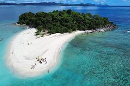 Trip report: Coron and Palawan in the Philippines
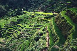 Adventures of a Bygone Era: The Philippines in 1984
 The Pearl of Africa - July-August 2026
 A little piece of Sulawesi with the family: Rantepao and Selayar
 Tanzania Classics (Safari & Zanzibar)
 Getting Away to Ireland
 On the Roads of Costa Rica
 Storm in the Canary Islands