Bonjour à tous,
Je suis à la recherche de carte pour GPS a télécharger sur mon samsung player addict autre que carte marine pour randonnée pédestre.
Actuellement je ne trouve rien sur le net.
Y-a-t'il quelqu'un qui possède un GPS en NC???
Merci pour vos contributions
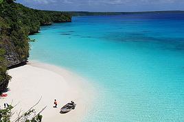
merci pour vos réponses, mais je pensais que lors de randonnée pédestre ce pourrait être utile, car l'an dernier lors de mon dernier passage et notamment dans le nord, j'ai voulu prendre une piste entre Ouègoa et Pouingam, mais je n'ai pas osé sans GPS qui m'aurait permis de me repérer car en plus il pleuvait beaucoup;
peux-tu me communiquer la marque de ton GPS à main, en-es-tu satisfait??
Merci de ta réponse
TATA
Mon GPS est un simple Garmin e-trex.
Pas de carte intégrée, juste lat / long
Entre Ouégoa et Poingam, il n'y a qu'une seule route (toujours celle qui fait le tour...).
Pas vraiment possible de se perdre. Mis à part qu'à un endroit c'est très boueux et le passage peut être difficile. C'est tout.
Mais une fois enfncé dans la boue, tu saura exactement où tu es ;-)
Enfin le Gps fonctionne en Calédonie.
la carte de Nouvelle Calédonie terrestre fonctionne avec les GPS garmin.
Nous vendons un GPS Garmin portable avec ventouse pour les voitures possédant la carte de Nouvelle-Calédonie ainsi que la Nouvelle-Zélande, L'Australie et toutes l'Europe à un excélent prix.
Nous vendons aussi les GPS autoradio mais actuellement nous avons des problèmes de compatibilités entre garmin et windows CE, mais on devraient résoudre le problème rapidement.
d'ou il y a aussi la possibilté d'acheter pour n'importe quelles voitures sont GPS autoradio DVD, Divx, Bluetooth intégré, sd, usb, ipod, en option caméra de recul et la télévision.
Contactez David au 754281
De plus, les données OpenStreetMap sont également disponible pour tout smartphone avec GPS, n'importe si c'est un iBidule ou un Android, aussi en utilisation sans connexion Internet.
Hé bien !
Hendrik75 féloches pour le travail sur les cartes et la transposition sur GPS. J'ai tenté sur un garmin Nüvi 1300 LM que j'avais acheté aux USA pour mon road trip et ça marche impeccable pour la Nouvelle-Calédonie.
Vraiment du bon boulot 🙂
Fred
Je viens de voir votre post qui date de 3 ans....
Je dois me rendre en Nouvelle Calédonie , et j'aurai aimé avoir un gps sur le véhicule que je vais louer
Je m'explique: je collectionne le sables des plages alors pour trouver les endroit ou je veux aller, je pense qu' un GPS peu me faire gagner du temps.
Pouvez vous me renseigner?
Faut 'il acheter un GPS en Nouvelle Calédonie?
Je possède un TOMTOM mais il non pas apparemment la carte de Nouvelle Calédonie
Euh, c'est pour quoi faire exactement un GPS à Nouméa et en Calédonie en général?
Parce qu'ici, les gens ne connaissent pas du tout le nom des rues pour t'indiquer la route... Ils vont plutôt te guider en ta disant que c'est à côté rond Point du Géant Sainte-Marie ou à côté de la Croix de Lorraine. C'est marrant en fait comme explications, car pas grand monde ne connait le nom des rues que tu cherches et on s'y habitue très vite...
Donc un GPS pour trouver une rue inconnue, t'es pas rendue...🤪
pour l'instant , ca me sert pour trouver les commerces par exemple. Ca me sert aussi car je suis a la recherche d'un logement et on me donne tout le temps le nom de la rue pour trouver :)
Apres, sur le long terme, quand je connaitrais la ville de noumea , j'en aurais moins besoin c'est sur
Bonjour Antoine,
Tout d'abord merci de m'avoir répondu, comme je te disais dans mon dernier message (la coutume) je suis un collectionneur de sables, et j'ai lu que les panneaux indicateurs étaient rare en NC...
C'est pour cela que je souhaiter m'équiper d'un GPS .
A bientôt
Chris
Bonjour Antoine,
Tout d'abord merci de m'avoir répondu, comme je te disais dans mon dernier message (la coutume) je suis un collectionneur de sables, et j'ai lu que les panneaux indicateurs étaient rare en NC...
C'est pour cela que je souhaiter m'équiper d'un GPS .
A bientôt
Chris
Tu as plusieurs possibilités si tu veux avoir un GPS:
1) Tu achètes un Garmin (sur Google "Garmin carte gratuite Nouvelle-Calédonie") et tu as la cartographie libre issue de www.openstreetmap.org toujours à jour et cela gratuitement et tu pourra même compléter cette carto, si tu en ressentait le besoin. Tu as aussi des GPS Garmin pour randonnée et les cartes que je met librement en téléchargement contiennent aussi les courbes de niveau.
2) Tu achètes un Garmin avec un prestataire privé qui te fournit une cartographie propriétaire. La mise à jour te sera facturée 5000F/an et tu ne l'aura pas vu avant d'acheter. Tu ne saura donc pas, si elle représente des plages et lieu-dits et petits chemin en terre.
3) Tu installes "Navigator" sur ton téléphone Android et tu aura gratuitement la carto OpenStreetMap sans connexion 3G avec une mise à jour gratuite tout les quelques mois.
4) tu installes OsmAnd sur ton téléphone Android et tu aura gratuitement la carto OpenStreetMap sans connexion 3G avec une mise à jour gratuite tout les quelques mois, mais tu dois acheter l'appli sur GooglePlay si tu as besoin de plus de 5 mises à jour, ce qui n'a jamais voulu marcher pour moi. Et OpenStreetMap sans justement les mises à jour c'est un peu dommage.
5) Tu cherches sur ton iBidule, et tu y trouves aussi des applis qui savent lire des cartes OpenStreetMap sans connexion.
N'hésite pas à redemander si çà ne veux pas fonctionner!
j'ai lu que les panneaux indicateurs étaient rare en NC...
Qui t'a dit cela ? Les grandes directions sont toujours indiquées et comme il n'y a que peu de route, impossible de se perdre ici !!!
Quand tu viendras en Calédonie, tu comprendras mieux pourquoi le GPS est inutile !
"Il faut faire aujourd'hui ce que tout le monde fera demain" Cocteau
Merci d'avoir répondu à mon message, concernant les panneaux j'ai puissé l'info sur les guides traitant de la NC qui précisaient que les panneaux de signalisation n' etaient pas nombreux .
C'est pour cela que je recherché un GPS fonctionnant en NC
Mais ton post me rassure
A bientôt
Chris
Perso, y'a encore mieux, car les appareils photos nouvelle génération possèdent la fonction GPS pour savoir où la photo a été prise, donc, à moindre coût et je t'assure qu'un GPS en Nouvelle-Calédonie ça ne sert à rien, tu en auras assez avec ton APN avec cette fonction.
J'ai un Lumix TZ10 et c'est suffisant.
Après si t'as un smartphone, y'a una appli qui s'appelle Waze et te permet de faire la fonction GPS aussi, gratuitement où tu te trouves, comptabiliser les km effectués, trouver un trajet, bref, un GPS gratuit, sauf à payer la fonction 3G sur ton forfait téléphonique, qui là est assez chère : welcome to caledonia ;-)
PS : si tu as de l'argent à jeter par les fenêtres, je veux bien l'adresse pour m'y mettre en dessous... 😛
En plus, je suis ou plutôt, j'ai été, car je ne le fais plus trop, arénophile aussi...
J'ai pas pu prendre les différents sables récupérés à droite, à gauche car trop lourd dans les valises, mais j'ai eu aussi cette envie d'avoir des sables des endroits où je me suis baigné...😛
C'est super génial, de trouver quelqu'un qui partage la même passion. Pour le non passionné, pour lui tous les sables sont pareils .Mais quand tu les passe sous une bino , que des merveilles....
Si tu veux des sables de la métropole, ne te gêne pas, nous en avons de sympa: sable avec grenats rouge, sable avec hématite etc , etc C'est avec plaisir que je te les enverrai ou te les apporterait lors de ma venue , je pense à Octobre ou Novembre 2015.
A bientôt
Chris
Merci pour ta proposition, mais c'est vrai que tout mes sables (Ile Maurice, Koh Samui, Phuket, Bora Bora, Huahine, Moorea, Punta Cana, Djerba, Saint-Martin, Iles Canaries, Malte, Bahamas...) sont en Métropole et je n'ai que ceux que j'ai récupéré de mes escapades en NC puisque j'y habite...
Mais dis moi, ton voyage en NC est pour octobre 2015?? Dans 1 an et demi? Waouw ça fait bien loin pour commencer à préparer, même si c'est bien d'avoir ces projets, tu ne pourras pas réserver grand chose avant la fin de 2014...
J4arrive après les échanges mais je rebondis en disant que pour un touriste qui vient sur le caillou pendant un laps de temps assez court, le GPS n'est pas aussi inutile que ça.
L'absence d'indication claire de rue est souvent problématique, Nouméa n'est pas super facile à appréhender de prime abord, il faut trouver son hôtel, son restaurant, sa plage sans trop perdre de temps...
Bref, le GPS bien que facultatif est franchement sécurisant.
Si on a le sien en métropole, tant qu'à faire, autant le prendre et installer la carte "open street map" (facile et sans risque pour l'appareil).
A titre privé j'en ai un et j'avoue (malgré mes 12 ans de présence sur le Caillou) qu'il m'arrive de m'en servir pour ne pas avoir à pinailler sur un coin de Nouméa que je ne connais pas.
F
Je suis d'accord avec toi, avec un peu de recul, ce n'est pas si inutile surtout dans les méandres de la ville où personne ne sait te dire où c exactement sauf que c'est "à côté de machin" et "après truc bidule"...
En tout cas, j'utilise un petit outil sur mon smartphone, bon il faut la 3G/4G sur le caillou, qui s'appelle WAZE et qui fonctionne très bien, il te parle et te fait le GPS inside...
Bonjour Fréderic
Merci tout d'abord pour ton mail. Effectivement le GPS peu paraître inutile mais en revanche que de temps gagné.
Merci encore pour ton aide
Chris
pour notre voyage de l'année passée, j'avais installé Osmand + carte NC dans mon tel.(idem Navigator)
Ca fonctionne très bien avec la fonction GPS activée sans besoin de 4G
On s'en est juste servi un peu pour Nouméa , après, comme dit CaroletDavid,
"comme il n'y a que peu de route, impossible de se perdre ici !!!"
Les cartes IGN sont par contre à mon avis indispensables.
Je possède des GPS Garmin et je charge les cartes les pays visités sur Open Street Map quel que soit le pays visité (Australie, Sicile, Nouvelle Calédonie, USA, Maroc..). Les cartes sont globalement correctes et parfois incomparablement plus détaillées que certaines cartes fournies avec les GPS.
Un petit truc : pensez à laisser à votre GPS, le temps de se localiser ; l a fallu plus d'une demi-heure à un Nuvi Garmin pour retrouver les satellites en Australie, à tel point que nous avions conclu qu'il était en panne).
J'ai une question concernant les retraits d'argent en Nouvelle Calédonie, j'ai lu plusieurs post mais je ne trouve pas une réponse sûre! et toujours valable en…
Quelle carte routière me conseillez-vous à l'achat pour faire le tour de la Grande Terre + les iles Loyauté? Y en a t'il une mieux qu'une autre? Merci TATATOU
Nous sommes en Amérique centrale et souhaitons envoyer une carte à Nouméa. Seule question, comment écrire l'adresse? On met quoi en pays, et surtout on l'écrit…
Sachant que la NOUVELLE CALEDONIE est un T.O.M, savez-vous si on paie des frais lorsqu'on utilise sa carte bancaire française? (mastercard) Merci TATATOU
J'ai un gros problème avec ma carte de la banque postale, je ne peux rien retirer dans aucune banque... même pas 1000 francs (8euros) il me met un message…
I'm feeling a bit overwhelmed with all the scattered info out there and I'm struggling to organize my solo trip to French Polynesia. I'm all about snorkeling—no hiking for me—so it's all about the water, water, water... I'd love to meet whales (what's the best season?), stay with locals or in budget guesthouses (I'm pretty low-key, no worries about comfort), and most importantly, be as close to the coral reefs as possible (all day long...).
I'm retired, so I've got plenty of time...
If you can help, it would mean the world to me.
Thanks everyone! !
Hi,
I'm planning a trip to this region in November. My initial plan was Adelaide-Darwin by van, but I'm worried about those critters. I'm now considering staying in hotels instead, but for the Red Centre, camping is more practical... if we overlook those pests.
What do you think? Thanks.
Bonjour,
Je viens vers vous car je réalise mon rêve en fin d'année, et j'ai besoin de vos conseils !
Le 26 décembre je m'envole pour Tahiti, Mooréa puis Bora-Bora.
Etant sur Bora-Bora plusieurs jours, je souhaiterai partir une journée en excursion sur une autre île : Maupiti ou Tahaa-Raiatea ( mes préférées ... )
Mon problème est que les horaires pour se rendre à Tahaa puis après pour se rendre à Raiatea, ne correspondent pas à mes attentes, je vous explique les 2 possibilités :
Soit excursion à la journée à Tahaa-Raiatea :
Le matin à 7h il y a un départ pour Tahaa, à partir de Vaitape, ( je serai logée sur un motu par conséquent il faut que je sache si une navette relie le motu à Vaitape assez tôt le matin )
Arrivée à 8h15 à Poutoru à Tahaa, tour de l’île, visite d’une vanillerie,
Faire appel à un bateau « privé » en direction de Raiatea vers les 12h-13h
Tour de l’île
Départ à 16h de Uturoa ( Raiatea ) pour Bora
Soit excursion à la journée à Maupiti :
Le matin départ de Bora à 8h30
Arrivée à Maupiti à 10h05, visite de l’île et des motus
Retour le soir à 16h
Mes questions :
Aurai-je le temps de visiter Tahaa-Raiatea de 8h a 16h ?
Location de voiture ? vélo ? pour les 3 îles ….
Temps perdus lors des locations ?
Distance entre les boîtes de location et les ports où j’arrive ?
Pour Tahaa et Raiatea, je dois prendre un guide ? qui sera mieux organisé et dans ce cas là pas de location de voiture, pour aller plus vite ou faire par moi-même le tour de l’île ?
Pour finir que pensez vous de ces 3 îles, leurs point d’intérêts ? Quel choix entre Maupiti et Tahaa-Raiatea ?
Vous qui pouvez m’éclairer, je vous remercie par avance !!!!!!!
J’attends avec impatience vos avis, vos remarques, vos suggestions et vos conseils !
Hello! We’re heading to the Marquesas in July-August and I’d love to know if it’s possible, for a fee, to do a leg of the journey on the Aranui—like from Hiva Oa to Fatu Hiva, or Nuku Hiva to Ua Pou, or even Ua Pou to Ua Huka? Sure, there are shuttles twice a week with Codim connecting these islands, but the schedules won’t be known until two months in advance, and I need to book flights and hotels much earlier than that. So, what’s the best way to handle this?
Looking forward to your replies—thanks in advance!
Elisabeth Marcel
babeth.marcel@yahoo.fr
Hi there,
I’d like to go to French Polynesia.
I found round-trip flights for 650 € with Air Caraïbes.
That seems really cheap—anyone here who can tell me about this airline if you’ve flown with them before?
Thanks in advance for your help!
Hi everyone. I’ve got a round-trip ticket to Perth for 4 weeks. Is it better to stay on the west coast the whole time?
Or should I grab a round-trip to the east coast?
Or even head over to NZ as well?
Thanks for your tips.
We’re crossing New Zealand next April and we’re wondering which to choose between exploring Milford Sound and Doubtful Sound.
The first is more well-known, famous, and popular, a UNESCO natural heritage site, while the second can be just as spectacular—bigger, harder to access, and less touristy.
Thanks for your thoughts!
I’ve blocked out 3 weeks at the end of March/beginning of April, arriving in Sydney and departing from Adelaide while following the coast.
Kangaroo Island is a bit of a question mark for me. If I go, I can dedicate 2.5 days to it. Is it worth the time and the cost? I’ve read plenty of travel journals highlighting the landscapes and wildlife, but I’m sure I’ll see plenty of that along my route anyway. I’m not factoring in the financial side (which isn’t negligible for KI), but I’d rather not be disappointed. What are the real added values of KI, especially since the island has been affected by fires? I’ve also come across people online calling it a tourist trap. For example, I ruled out Phillip Island because it felt too organized and structured. Sorry if I’m opening Pandora’s box here!
Bonjour je viens de passer un mois en nouvelle caledonie (sac a dos/ tente) et je sais que certains d'entre vous voulaient des infos sur les hebergements et l'itinéraire alors contactez moi si vous voulez que je vous fasse profitez de ma petite expérience. Entre parenthèse la nouvelle calédonie c'est FABULEUX!!!
Hi there,
I just got back from two weeks in Fiji, and I noticed the forum discussions here are a bit outdated (the most recent ones are from 2017).
So feel free to ask if you'd like an update!
Hi,
I’m heading to Viti Levu, the main island, for a few days’ vacation.
I usually rent a two-wheeler to keep some independence.
On several forums, people advised against it—first because it’s not really the local culture, and also because of the road conditions and local driving habits.
But I’m a bit wary of English-language forums where the typical vacation is just airport-resort-airport with a taxi in between.
Can you confirm if it’s really that risky compared to, say, Southeast Asia? What are the alternatives? Buses, taxis?
Thanks!
I’m planning and budgeting a trip to Australia for August 2026, lasting 40 days.
Here’s the current itinerary:
Arrival at Port Macquarie Airport in New South Wales and return from Cairns Airport in Queensland.
- South West Rock
- Cap Ridge Park
- Springbrook Park
- Stradbroke Island
- Maleny
- Noosa
- Rainbow Beach
- K’Gari
- Gladstone
- Heron Island
- Airlie Beach
- Townsville
- Magnetic Island
- Cairns
- Cape Tribulation
My main issue is transport to cover all of this.
The first leg is already tricky—I haven’t found a way to rent a car in Port Macquarie and drop it off in South West Rock.
And if we keep the vehicle until Cleveland (8 days) before taking the ferry to Stradbroke Island, it’s already around 1000 €.
- Are there any systems where we could buy a vehicle in Port Macquarie and be sure it’s bought back at the end of the trip in Cairns?
- Do you know of any Australian online car rental sites?
As for trains, they’re not really an option for our stay in New South Wales.
In Queensland, I found the Queensland Rail Travel website with a Brisbane–Cairns line, but trains don’t run every day.
- Do you know of any other train companies in Queensland that connect coastal cities from Brisbane to Cairns?
For flights, I checked Queensland with Qantas, and most routes require a stopover in Brisbane, which wastes a lot of time, and the prices are still high.
Do you know of any low-cost airlines for domestic flights in Australia?
2025 is shaping up to be amazing, as I’m lucky enough to be planning a 6-week trip to Polynesia.
I wanted to buy the *Guide du Routard* (my favorite), but I discovered there isn’t one for this destination. And the *Lonely Planet* is from 2022, which I feel is already a bit outdated.
So I’m looking for other resources: in your opinion, what’s the best paper guide, and most importantly, what online resources have you used to prepare a trip to Polynesia?
My wife, our 3-year-old son, and I are planning a trip along Australia’s East Coast, leaving in early October and returning in mid-November. The plan is to do a 4-week road trip in a campervan, then settle down for about ten days.
The question I’m asking myself is: which way should we go? From Sydney to Cairns or the other way around? Despite all the documentation I’ve read, I’m still struggling to decide the best direction based on the climate at that time and swimming conditions.
Up north, the weather will be warmer, and the water too, unlike the south. However, in the north, there are swimming restrictions, especially because of jellyfish, whereas in the south, there seems to be less danger (apart from sharks, maybe). Are there many protected beaches in the north where we can swim safely?
Also, I should consider that in the south, the Great Barrier Reef no longer protects the beaches, so I imagine there are fewer calm spots for swimming?
I’d love any tips or advice you can share, and thanks in advance!
Bonjour
pour 6 mois Australie NZ à compter de NOVEMBRE je voudrais faire un tour en PNG ET Iles Salomon, qui a déja visite ces 2 pays,
comment peut on y voyager en solo, transport, logement, banque, securité, le meilleur moyen d yaller depuis l AUST
merci de vos infos, s il y des sites en français
à+
jps
Hi there,
I’m leaving on March 4th for Australia from Réunion Island, landing in Perth, then a road trip down to Melbourne before flying out to Vietnam on April 15th.
I’d like to visit Perth and the surrounding area, then head southwest to Margaret River, Albany, Esperance, and back to Perth to catch a flight to Adelaide. From there, I’ll make my way to Melbourne.
1/ What do you think of this itinerary?
2/ For flights, are there any domestic airlines worth prioritizing for good prices?
3/ I’m planning to rent a car after exploring Perth and the area—I’m traveling solo. Any rental companies you’d recommend, as well as nice hotels, B&Bs, or hostels?
4/ Any tips, good deals, or info are welcome—don’t hesitate to share!
Thanks in advance.
I’m planning a solo trip from April 16th to June 2nd!
I have to work for 3 weeks in Papeete when I arrive in French Polynesia, so I can only explore on the weekends (3-day weekends). For my first weekend, I’ll visit Tahiti; my second weekend will be dedicated to Moorea, and the last weekend to Huahine.
After my work period, I’ll continue with my vacation and keep exploring:
Maupiti - 4 nights
Raiatea - 3 nights (including a day trip to Tahaa)
Bora Bora - 3 nights
Rangiroa - 4 nights (could do 3)
Tikehau - 2 nights (could do 3)
Fakarava - 3 nights
For activities, I’m mostly interested in discovering the islands, hiking, and observing wildlife.
I’m not a diver, but I plan to do a beginner’s dive once I’m there. I love snorkeling, though, and I’m wondering if I’m spending too much time in the Tuamotus, which are famous for diving from what I’ve seen.
For travel between the islands, I’ve already looked into the Bora Tuamotu Max pass, which seems like the best option, but I’d love advice on replacing it with one or more ferries.
What do you think? I’m struggling to finalize my itinerary.
We’ll be in Adelaide from February 24th to March 4th and we’d like to spend 3 days and 2 nights on Kangaroo Island.
Any recommendations?
We always travel with simple accommodations
Bonjour nous partons pour l'Australie le mois prochain.Nous avons 7 jours pour aller d'Adelaide à Melbourne par la Great Ocean Road.Faut-il aller sur Kangaroo island ou pas?Nous n'arrivons pas à nous decider ! Merci pour vos avis.Nous voulons surtout voir des kangourous et des koalas dans leur milieu naturel.
Hi everyone,
I’m heading to NZ at the end of January.
It’s peak season—do you think it’s necessary to book activities in advance (like a cruise to Milford Sound), or is it not essential?
Thanks
We’ll be in New Zealand starting March 15th. We’re considering renting a car from Christchurch to Auckland. We’ve read that a lot of ferries have been canceled—is that true? Would it be better to rent one car in the South Island and another in the North Island? Thanks, and happy New Year!
Hi,
When I hear our French friends talk about them, they’re the most beautiful islands in the world.
For those of you who’ve traveled extensively, is that really the case?
Are the prices for accommodation, even basic ones, justified? Isn’t a room in a family-run guesthouse at 150/200 € a bit much?
Are there other islands in Polynesia (non-French) that are just as "paradise-like" but more affordable?
I’d love to hear your thoughts.
Bonjour à tous
Une petite présentation rapide. J'ai 27 ans, j'habite en Picardie et je vais me marier en 2017. Nous souhaitons faire un voyage de noces en Polynésie Française pour une durée de 3 semaines.
je suis donc preneuse de tout conseils de tout ordre!!!
je pense que nous allons faire appel à une agence de voyage car nos plannings de boulot ne nous permettent pas de prendre du temps pour organiser ce voyage.. A moins que je ne change d'avis! ;-)
Mais nous ne voulons pas que le voyage tourne aux clichés touristiques, nous detestons ça. Mais ce n'est pas pour ça que nous ne voulons pas voir les plages et paysages de carte postale!!
Nous ne plongeons pas mais je pense que l'on fera un baptême de plongée et pourquoi pas passer le niveau 1 en fonction (j'ai lu certains commentaire sur ce forum qui en parlé)
Bref je suis à la recherche de toutes informations et liens internet pour que ce voyage soit réussi.
C'est LE voyage que l'on ne fait qu'une fois dans sa vie et il faut qu'il soit au top!!
Merci de votre aide!
je regarde en parallèle les différents sujets sur la Polynésie sur ce forum ;-)
Hi everyone,
What great news to read that Voyage Forum is back up and running—I’m so happy! 🙂 I need some advice for a trip we’re planning in 2025: New Caledonia and Australia.
We’ll arrive in Australia on September 1, 2025, and the plan is to spend 2 nights in Melbourne to explore the city, then rent a car to drive from Melbourne to Sydney, where we’ll arrive on September 12. Unfortunately, we won’t have time for the Great Ocean Road
I’ve checked several blogs for this route and here’s the itinerary I’ve put together:
9/4: Melbourne to Philip Island (140 km) – 1 night
9/5: Philip Island to Wilsons Promontory National Park – 2 nights
9/7: Raymond Island (free ferry to cross a 200 m sea channel) – Lakes Entrance – 1 night
9/8: Drive to Narooma (stop at Quarry Beach) – 1 night at "Bodalla Park Forest Rest Area"
9/9: Batemans Bay – Pebbly Beach – Dolphin Point – Jervis Bay – 1 night (to be found)
9/10: Jervis Bay and surroundings – 1 night at Bendeela Picnic Area
9/11: Blue Mountains National Park (1 hour from Sydney) – 1 night (to be found)
9/12: Arrival in Sydney
I know we won’t be able to see everything, and this 9-day route is just a starting point. The goal is to avoid rushing—if we see a place we like, we’ll stop, even if it means seeing less. A vacation where we don’t watch the clock too much! 🙂
Does this route (a mix of several blogs where not all stops are noted) seem realistic or too ambitious? Are there certain spots that are more worth prioritizing over the ones I’ve listed? For example, in one of the blogs I read, travelers skipped Blue Mountains National Park because they chose another site (which I’ve forgotten 😎).
For accommodation, we’ll likely be camping (free or paid), so if you have any suggestions, I’d love to hear them! 😎
Our arrival in Sydney on September 12 depends on my hope to participate in the marathon on September 15, 2025. After that, we’ll leave Sydney on September 17 for Ayers Rock.
Thanks in advance for your tips and ideas—it’s always tricky to plan a route from a distance when time is limited.
And long live this site, which I’ve missed so much since 2020! 😎🙂