Hi there.
I'd like to change the chainring on my Riverside 5 with trigger shifters.
I’m attaching a photo for advice. I’m lacking power and want a larger chainring for road use because I’m spinning out on the highest gear even though I still have power to give on flat terrain.
At Decathlon, they were supposed to get back to me after checking it out in the workshop but never did. It was outside their standards, and the salesperson clearly forgot about me...
What are your recommendations and suitable products for purchase, please?
Thanks.
Best regards,
671 similar discussions in English
Hello fellow cycling friends,
I’m heading out very soon for a few weeks in France and elsewhere on my trusty two-wheeled steel steed, with a total of me + luggage = around 120 kg gross weight, and I’ve never really tackled mountain passes before—something I’ll definitely be facing this time...
Currently, I’m running 700c wheels and a Deore XT 10-speed drivetrain (long-cage derailleur) with a 26/36/48 chainring setup and an 11-36 cassette. I’m considering two options (and possible modifications) to get a lower gear ratio (currently 0.72) and spin more easily on steep and mountainous climbs...
1 – Install an 11-42 cassette This would give me a gear ratio of 0.61. Would this be feasible with my current rear derailleur, please?
I have several new chains with 116 links—would these work for this cassette, which would have 6 more teeth on the largest cog, or would I need a longer chain?
2 – Swap the 26-tooth small chainring for a 24-tooth one This would give me a gear ratio of 0.66. Would this be feasible, please?
When switching to a 24T, will the gap be accepted by the 36-tooth middle chainring, and will shifting remain as smooth as it is now? Will this setup (24/36/48 + 11-36 cassette) still work well together, in your opinion?
Which of these two options do you think would be more feasible and preferable?
What drivetrain and gearing do you use on your bikes for loaded touring that sometimes involves climbing mountain passes and other steep ascents?
So many questions... Thanks for your answers and advice! Have a great day,
Spady
Some people have questions about choosing a touring bike, so those who are equipped can post a photo here and describe their ride—its strengths and, of course, its flaws.
I’ll go first!
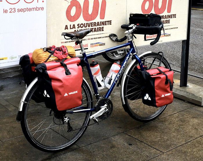
Here’s the beast: a Ridgeback Panorama model, around 10 years old, bought second-hand from a cyclist who’d picked the wrong size. Steel frame in Reynolds 725 (it’s written on it, but I doubt the whole set is that series). Gear ranges from XT for the rear derailleur to some cheaper parts. Three chainrings and sturdy but heavy wheels. Here with 35mm tires—plenty for gravel paths and the occasional rougher trail (as long as you don’t ride like a sausage!).
What I’ve modified: - Upgraded from 9 to 10 speeds when I changed the cassette - Installed two Tubus racks—the rear replaced the original aluminum one (which got bent) - Moved the shifters to the frame instead of the brake/shift combos, which were getting in the way of my handlebar bag - Swapped the saddle for a Brooks B17 (the original one didn’t suit me at all) Over time, some wear-and-tear parts have been replaced.
It’s comfy and sturdy but heavy (almost 14kg). Downsides? It’s a bit sluggish when you stand up to pedal—the chainring rubs against the front derailleur cage (the bottom bracket lacks rigidity). Definitely not a climber’s bike! The cantilever brakes are a tad weak—you get used to them, but you’ve gotta anticipate.
We’ve had some great rides together, but it’ll soon be on the market since I’m replacing it with a custom Cattin. I won’t sell it for much—it’ll make someone happy...
I’ll go first!
Here’s the beast: a Ridgeback Panorama model, around 10 years old, bought second-hand from a cyclist who’d picked the wrong size. Steel frame in Reynolds 725 (it’s written on it, but I doubt the whole set is that series). Gear ranges from XT for the rear derailleur to some cheaper parts. Three chainrings and sturdy but heavy wheels. Here with 35mm tires—plenty for gravel paths and the occasional rougher trail (as long as you don’t ride like a sausage!).
What I’ve modified: - Upgraded from 9 to 10 speeds when I changed the cassette - Installed two Tubus racks—the rear replaced the original aluminum one (which got bent) - Moved the shifters to the frame instead of the brake/shift combos, which were getting in the way of my handlebar bag - Swapped the saddle for a Brooks B17 (the original one didn’t suit me at all) Over time, some wear-and-tear parts have been replaced.
It’s comfy and sturdy but heavy (almost 14kg). Downsides? It’s a bit sluggish when you stand up to pedal—the chainring rubs against the front derailleur cage (the bottom bracket lacks rigidity). Definitely not a climber’s bike! The cantilever brakes are a tad weak—you get used to them, but you’ve gotta anticipate.
We’ve had some great rides together, but it’ll soon be on the market since I’m replacing it with a custom Cattin. I won’t sell it for much—it’ll make someone happy...
Why bike (MTB) along the canal between the Two Seas: the lateral canal of the Garonne from Bordeaux to Toulouse, and the Midi Canal from Toulouse to the Mediterranean?
This canal was created to connect the Mediterranean to the Atlantic without going around Spain, and along its entire length, there’s an old towpath (used to pull barges). Since this path is closed to traffic (except for service vehicles from Voies Navigables de France), no cars drive on it—it’s dangerous, noisy, and polluting. The Canal between the Two Seas was built for transporting goods, so it passes through many towns you can explore without dealing with traffic. You can stock up on supplies or spend the night. You’ll discover the varied landscapes of the countryside, always in the serenity brought by the calm and slow flow of the canal’s water. Most of the time, you’ll be in the shade of trees planted to stabilize the banks with their roots. All you have to do is follow this blue—or rather green—ribbon without needing to consult a map. But the biggest advantage is that it’s flat! Of course, on the Canal du Midi, water flows from the watershed divide at Naurouze eastward to the Mediterranean and westward to Toulouse. On the lateral canal of the Garonne, water flows toward Bordeaux. But this slope is almost imperceptible, which is a huge plus when you want to travel by bike for several days with luggage.
When I say "bike," I really mean MTB because, while the towpath has been replaced in some places by a paved bike path, it mostly resembles a dirt trail—sometimes smooth, sometimes rocky, and often cluttered with roots from the magnificent trees lining it. Since the canal was classified as a UNESCO World Heritage site, improvements have been underway, but it won’t be tomorrow that you’ll be able to ride from Bordeaux to Sète on a road bike. And I’m afraid the first sections of the path will be worn out before the rest is finished. You might even run into construction work for this bike path. That’s what happened to me during the spring of 2007.
Sunday, 03/11 – Valence d'Agen 08:15 to Toulouse (Rangueil) 16:30 97 km in 8h15 (6h on the bike) I started on the recently paved path along the lateral canal of the Garonne. The first locks appeared, and as I approached Moissac, the path turned into a billiard table until Castelsarrasin. After the Cousteau port, I was back on the classic dirt towpath with its rocks, roots, and nutria holes. But not for long—soon, I hit ruts left by backhoes and bulldozers, which, fortunately, were resting for the Sunday. A pile of rubble taller than me blocked the entire width of the path. I didn’t want to turn back to find the previous bridge and ride on the other bank, which was just as impassable (dense grass). It wasn’t easy to carry a bike with full panniers, so I lifted it over several mounds. I kept going, sometimes on foot, unsure how far the construction extended. Another bulldozer—luckily, the ground was dry. The work went all the way to Montech, making the path impassable. I recommend taking the N113, which runs parallel (that’s what I did on the way back). In Montech, the famous water slope was at rest, waiting for tourists. For many kilometers, I was back on the traditional towpath. The closer I got to Toulouse, the better the surface became, and the more cyclists and pedestrians I saw—until the city center, where there was nonstop bike traffic, especially students heading to Rangueil.
Monday, 03/12 – Rangueil 09:10 to Revel 16:30 86 km in 7h20 (5h30 on the bike) As soon as you reach Toulouse, you make a 90° turn to follow the connection between the lateral canal and the Canal du Midi. Heading east, you pass the barge selling the famous Toulouse violet souvenirs. A real bike path has been built for 50 km to Port Lauragais. It’s a true joy for Toulousains and travelers. Restrooms have been installed or shared with highway rest areas, allowing you to refill water (of course, bikes are banned from ASF rest areas, but cleverly placed racks let you secure your bike and walk in). At Port Lauragais, it’s another rest area shared by highway users, cyclists, and boaters. You’ll find a cafeteria, restaurant, hotel, and a shop selling regional souvenirs. But the real pleasure is reaching the watershed divide at Naurouze, where water flows toward the Mediterranean on one side and the Atlantic on the other. There, I decided to leave the Canal du Midi, which continues toward Castelnaudary with a much rougher towpath, to follow the *Rigole* that feeds the canal with water from the Saint-Ferréol basin. For me, it was like returning to the source—a bit like a pilgrimage in honor of the brilliant Pierre-Paul Riquet, the designer of this magnificent work. I followed the service trail along the *Rigole*. It’s actually a variant of the GR 653, leading to Revel alongside this artificial waterway. It’s fed by water from the Montagne Noire, and I was worried about a steep climb. But that wasn’t the case—the *Rigole* winds for 40 km, flowing gently under the trees. It was better than a dream: a smooth dirt path with the crunch of pine needles under the wheels, where I only crossed paths with a few fishermen... And to soothe sore buns, the last kilometers were on packed earth—a paradise (ATVs, stay away!). More walkers and cyclists appeared there.
Tuesday, 03/13 After a restful night in Revel, I started the morning with a walk around Lake Saint-Ferréol. A very pleasant 10 km hike, but I don’t recommend it for mountain bikers unless you’re used to mountain terrain and have strong calves. Otherwise, you can take the road—there are at least two hotels near the lake. In the afternoon, I began the return trip to Tarn-et-Garonne via the same path, with the same pleasure.
Total: 378 km of suffering and bliss, for which I must thank the departmental and regional councils for their funding, Voies Navigables de France for maintenance, and the volunteers who mark the hiking trails. And don’t you think you’re exaggerating a bit with your 378 km of bliss and the paradise of the *Rigole*?
Okay, fine—it wasn’t always idyllic. Sometimes the path was downright *pierrique*... but I had great weather, and the landscapes were so beautiful (water, sun, vegetation). In the rain or mud, it would’ve been less fun. What does *pierrique* even mean?
*Pierrique* is worse than rocky. I know a Pierrick, and he’s tough. And why *Facteur4*?
It’s France’s goal to reduce greenhouse gas emissions by a factor of 4 by 2050. I’m doing my part by biking to work 3 out of 4 times. And your cassoulet?
Guilty as charged. I ate the best cassoulet of my life at the Hôtel du Midi in Revel. But it was very productive in methane. My stomach hurt so much I couldn’t sleep and ended up writing my postcards between 3 and 4 AM. So many great memories!
April 11 – Day 1
It was winter, a winter with beautiful weather, A season that only exists in the southwest of America, I remember very well what I told you that morning A month ago... A century ago, an eternity ago... We’ll go... wherever you want, whenever you want...
Well, yeah, back from our adventure in our enchanting American West just a month ago, we’re already taking a bite out of one of its lesser-known competitors. "Flo, if you had to pick just one reason to justify your love for the U.S., what would it be?" The greasy, dripping burgers? No, I don’t think I’m going out on a limb by saying it’d be the wide-open spaces... And that’s exactly what our new quest is taking us to—a land on the other side of the globe where the horizon also seems endless, where silence tastes like salty wind and sand, where freedom is measured in kilometers of desert tracks, where the GPS is mostly there to confirm you’re lost in the middle of nowhere... Add to that magic formula the fact that you’ll see more zebras, giraffes, wildebeest, and elephants than people per square kilometer, and you can imagine us setting foot in Southern Africa for the first time, more precisely at the small airport in Windhoek, capital of... of...? Brush up on your geography, damn it! We’re landing in Namibia!!!
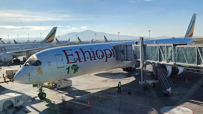
To be honest, Namibian landscapes have been flirting with me for ages. So how did I resist this island of temptation for so long? First, the budget. Let’s just say that for the same amount of effort (and kidneys), the bank lets you choose two other adventures almost anywhere else on the planet. Then there were my girls. Yeah, back then, they were too little to dose up on Malarone, the only malaria remedy at the time... Long story short, ten years later, all the planets have aligned. First, I won the Euromillions! Well, almost... Let’s just say my girls are now old enough... not to take Malarone, but to stop following me on all my adventures! Jackpot! "Flo, how about a little two-person caprice, just the two of us, tackling the Namibian tracks?"
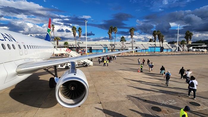
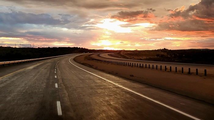
As we landed on the runway, first wow effect: The horizon is immense. It’s flat as can be, incredibly flat... So much flat space! Did I mention it was flat?... Looking into the distance, it feels like your gaze could circle the Earth without hitting a single obstacle—until you end up staring at your own backside. "Oh, what a nice view!" Well, it’s the first time I’ve seen my butt from this angle! Touching moment... Sorry, I’m rambling—must be the exhaustion from the three-flight marathon we just powered through via Ethiopia and South Africa... And yet, no time to philosophize about my anatomy. As usual, we want to rack up our first kilometers to be front and center at dawn tomorrow. After wrapping up the tedious Namibian immigration formalities and meeting the 4x4 that’ll be our companion day and night for the next fifteen days, we’re off! We’re not exactly fresh, but we’re ready to tackle the next five hundred kilometers in night mode, cruise control set due south! Just outside Windhoek, the local wildlife—a jackal—welcomes us with a smile: "Welcome to Namibia!" That’s what it said! Honest... Okay, first endless straight road, first flaming sunset, first corrugated dirt track, first Milky Way with zero light pollution... You get it—it’s definitely the day of firsts... First night camping, too, in the big trunk of our Toyota Fortuner parked by the side of the track... The real adventure, the kind that smells under the arms, can finally begin...
It was winter, a winter with beautiful weather, A season that only exists in the southwest of America, I remember very well what I told you that morning A month ago... A century ago, an eternity ago... We’ll go... wherever you want, whenever you want...
Well, yeah, back from our adventure in our enchanting American West just a month ago, we’re already taking a bite out of one of its lesser-known competitors. "Flo, if you had to pick just one reason to justify your love for the U.S., what would it be?" The greasy, dripping burgers? No, I don’t think I’m going out on a limb by saying it’d be the wide-open spaces... And that’s exactly what our new quest is taking us to—a land on the other side of the globe where the horizon also seems endless, where silence tastes like salty wind and sand, where freedom is measured in kilometers of desert tracks, where the GPS is mostly there to confirm you’re lost in the middle of nowhere... Add to that magic formula the fact that you’ll see more zebras, giraffes, wildebeest, and elephants than people per square kilometer, and you can imagine us setting foot in Southern Africa for the first time, more precisely at the small airport in Windhoek, capital of... of...? Brush up on your geography, damn it! We’re landing in Namibia!!!
To be honest, Namibian landscapes have been flirting with me for ages. So how did I resist this island of temptation for so long? First, the budget. Let’s just say that for the same amount of effort (and kidneys), the bank lets you choose two other adventures almost anywhere else on the planet. Then there were my girls. Yeah, back then, they were too little to dose up on Malarone, the only malaria remedy at the time... Long story short, ten years later, all the planets have aligned. First, I won the Euromillions! Well, almost... Let’s just say my girls are now old enough... not to take Malarone, but to stop following me on all my adventures! Jackpot! "Flo, how about a little two-person caprice, just the two of us, tackling the Namibian tracks?"
As we landed on the runway, first wow effect: The horizon is immense. It’s flat as can be, incredibly flat... So much flat space! Did I mention it was flat?... Looking into the distance, it feels like your gaze could circle the Earth without hitting a single obstacle—until you end up staring at your own backside. "Oh, what a nice view!" Well, it’s the first time I’ve seen my butt from this angle! Touching moment... Sorry, I’m rambling—must be the exhaustion from the three-flight marathon we just powered through via Ethiopia and South Africa... And yet, no time to philosophize about my anatomy. As usual, we want to rack up our first kilometers to be front and center at dawn tomorrow. After wrapping up the tedious Namibian immigration formalities and meeting the 4x4 that’ll be our companion day and night for the next fifteen days, we’re off! We’re not exactly fresh, but we’re ready to tackle the next five hundred kilometers in night mode, cruise control set due south! Just outside Windhoek, the local wildlife—a jackal—welcomes us with a smile: "Welcome to Namibia!" That’s what it said! Honest... Okay, first endless straight road, first flaming sunset, first corrugated dirt track, first Milky Way with zero light pollution... You get it—it’s definitely the day of firsts... First night camping, too, in the big trunk of our Toyota Fortuner parked by the side of the track... The real adventure, the kind that smells under the arms, can finally begin...
I'm currently converting a DAF/HEULIEZ MB205 bus.
Cheaper and more spacious than a regular vehicle, the paperwork (in France) isn't too difficult for approval.
I'm ready to help anyone who wants to tackle this kind of project. Those who know, help those who want to....
Cheaper and more spacious than a regular vehicle, the paperwork (in France) isn't too difficult for approval.
I'm ready to help anyone who wants to tackle this kind of project. Those who know, help those who want to....
Hi there,
I’m currently looking for a bike to do my first bike trip across France, with the ultimate goal of cycling through Latin America. I’ve got a lot of questions and I’d love to hear if you have any answers or advice to share. First off, I’ve been through this before with hiking. I want to get top-quality gear right away. When I started hiking, I ended up buying everything three times—first beginner gear, then intermediate, then expert, etc. For biking, I’d prefer to skip that process and invest right now in a bike that could ideally handle Latin America. I’ve set a total max budget of around 5000 € (roughly 4000–4500 € for the bike and the rest for accessories: panniers, helmet, cycling shorts, etc.).
So, I’ve got quite a few questions:
* I’ve read in several places that some people recommend buying the bike directly in Latin America. Since I need a first bike to train in Europe, would it be better to buy an entry-level bike in France (and sell it before the big departure)? Or is it preferable to start right away with my final bike to get used to it? Is buying it there just to save a bit of money?
* For a long-term trip (around six months) in Latin America, is it better to go for a gravel bike or a mountain bike?
* Should I buy a new bike or a refurbished one? Even more so given that I’m planning a long trip—could a refurbished bike end up causing more breakdowns?
If you have any advice on models, technical features to prioritize, or recommended sellers or resellers, I’d love to hear it. I’m a total beginner—I’ve only just started watching videos and reading up on the subject, and all the technical specs are new to me!
Thanks in advance for your help!
Who are you? Where are you from? Where are you going?
Like last year at this time, a post about bike travel ideas.
How many of us are preparing a trip planned for this year? Probably a lot.
What’s yours—the one you’ve been dying to do for so long, maybe too long? For us, it’s a modest PARIS-MARATHON by bike, followed by MARATHON-ATHENS on foot in June 2010. And you?
May the passion keep growing before, during, and after! Happy planning and safe travels to everyone.
Hello forum,
Did any of you feel the same things we did in China?
We spent a good twenty days there in August. First, we traveled solo around Chengdu, then joined an organized tour for 12 days (Beijing, Pingyao, Xi'an, Guilin, Xingping, Yangshuo, Shanghai, Wuzhen) and extended our stay by 4 extra days to visit Zhangjiajie.
The landscapes were stunning, and we have unforgettable memories... but we were really disappointed by the following points:
- The food: way too spicy. Lacking in flavor, not much taste. I’m speaking "in general" because we did enjoy some good steamed dumplings, smoked pork, and other dumplings... But compared to Thailand, Cambodia, or India, Chinese cuisine didn’t impress us at all.
- The behavior of the Chinese: disrespectful, rushed, agitated. You constantly have to fight—people push, crowd, and overwhelm you... At the entrance to the Terracotta Army (and other sites), it’s a human tidal wave... and I mean that literally. We were carried by the crowd without even touching the ground. It was like a situation where you have one bowl of rice and 20,000 starving people diving for it...
You’re at a ticket counter, and they cut in front of you. You’re in line for boarding, suitcase ready to go on the conveyor belt, and someone shows up out of nowhere to put THEIR suitcase down... even though they have a flight ticket with THEIR seat number and won’t be leaving before you!!!! You’re getting on the bus, and someone shoves past you just so they don’t end up behind you.
It’s like these people only think about themselves. I didn’t see a single person let someone else go first or even ask—it’s as if politeness and respect are completely foreign to them.
It’s honestly exhausting and draining...
- Communication: In every other country we’ve visited, whether in Asia or Europe, we always manage—with English, a few words of Italian, French, or Spanish. In China, I’ll be blunt: if you don’t speak Chinese, you’re screwed. And yet, a pair of kids around ten or twelve years old asked us in English where we were from :)
- Understanding: Here’s the rule. Even if the person you’re talking to speaks a little English and says they understand you... make sure they *really* do, because 9 times out of 10, they don’t. Out of pride or just cluelessness, they’ll give you a big smile and nod, but in reality, they didn’t get what you were saying.
Several times with our group, in the evening at a restaurant, if we hadn’t been helped by someone at another table who spoke a little English, we’d still be there. The classic example: the waiter brings one menu (for 10 people at the table), and we’re all trying to explain that we need 4 or more menus. Five minutes later, he’s still staring at us with that same blank smile...
In 3* or 4* hotels, you go to the front desk for a hot water or AC issue. Three or four staff members just stand there beaming at you. You try to explain with photos or a translator, but in the end, you leave with the problem unresolved.
They don’t speak—they shout... on buses, in hotels...
We were also surprised to find that self-service laundromats were almost nonexistent. We got scammed once at a hotel with an astronomical bill!
As for flights, we flew Air China on the way there and Austrian Airlines on the way back—no comparison. Air China had zero service and food that was "baby food" quality. Austrian Airlines had multiple services, a decent meal, and smiling flight attendants.
I don’t know if any of you had the same experience in this country, but I’m definitely not eager to go back. Whereas if someone offered me India, Thailand, or Vietnam tomorrow, I’d be there in a heartbeat!!!
Hi everyone,
Actually, we ended up going to Japan almost by chance. I’d caught glimpses of the country during business trips, and it had been on my “wish list” for a while, but I thought we’d go “when the kids were grown up.”
But this summer (2016), the kids couldn’t agree on a destination—their wishes were completely opposite. Then, realizing that flight tickets weren’t outrageously priced—and having read that Japan wasn’t as expensive as people think—we, the parents, suggested Japan… while warning that it would be scorching hot and humid and that no one should complain. Our eldest (18) was immediately thrilled: “Oh! Mom! I’ve always dreamed of going to Japan!” She convinced her brother (16) that it was the perfect destination. Deal sealed: we’re going to Japan, but no one complains about the heat.
After some forum discussions and family brainstorming, I settled on the following itinerary. One non-negotiable shaped part of our choices: being in Hiroshima on August 6th to attend the lantern floating ceremony. To avoid overloading the trip with extra transport, we skipped Nara, Nikko, and Kamakura.
Day 1 - Arrival at 8:30 AM in Osaka – Kyoto - around the station Day 2 - Kyoto - East - night: Kyoto Day 3 - Kyoto - North and center - night: Kyoto Day 4 - Osaka (stroll with Osaka Safari) - Fushimi Inari -night : Kyoto Day 5 - Train - Naoshima - night: Uno Day 6 - Teshima -night: Uno Day 7 - Naoshima – Hiroshima - night: Hiroshima Day 8 - Hiroshima – Commemorations - night: Hiroshima Day 10 - Miyajima- night: Miyajima Day 10 - Miyajima - Himeji Castle - night: Osaka Day 11 - Osaka - night: Osaka Day 12 - Kyoto - West -night: Osaka Day 13 - Kanazawa to Ainokura - night: Ainokura Day 14 - Shirakawa-go - Takayama - night: Takayama Day 15 - Kamikochi night: Takayama Day 16 - Takayama - return to Kanazawa night: Kanazawa Day 17 - Kanazawa -night: Kanazawa Day 18 - Travel to Tokyo (Shibuya) -night: Tokyo Day 19 - Tokyo (visit with Tokyo Free Guide – Yoyogi Park - Meiji Shrine - Harajuku - Takeshita-dori - Omote Sando - Odaiba) - night: Tokyo Day 20 - Tokyo (with Tokyo Safari) - night: Tokyo Day 21 - Tokyo (Tsukiji, Hama-Rikyu Onshi Teien, Asakusa and Senso-ji, Kappabashi, Ameyoko, and Ueno) - night: Tokyo Day 22 - Tokyo (Shibuya-Yoyogi Park again - Ikebukuro - Shinjuku (Tokyo Metropolitan Government Building, Omoide-yokocho, Golden Gai) - night: Tokyo Day 23 - Tokyo (Yanaka – Ueno – Edo-Tokyo Museum - Takashita-Dori again - back to Shibuya) - departure at 10:50 PM for Paris
(You can access the published days directly by clicking on them).
The itinerary perfectly matched our expectations: a good pace, a wide variety of visits, the must-sees, but also a first taste of rural Japan. If we were to do it again, I’d do exactly the same (except for the back-and-forth between Kyoto and Osaka on Days 4 and 12, which were due to my desire to explore Osaka with Osaka Safari). Of course, we had to skip some sights, especially in Kyoto where we missed a few “highlights,” but that was a deliberate choice—I’d limited our time in the city, which is known for being stifling in summer.
For accommodations, we mixed Airbnb apartments and quadruple rooms in guesthouses and ryokan. It worked out perfectly. The apartments gave us more space and the chance to dine in some evenings, while the guesthouses and ryokan helped us experience Japanese customs.
First, a quick recap: all four of us were enchanted by our trip. Japan is a constant source of wonder, just like the preface of *Tokyo Sanpo* by Florent Chavouet describes—I’ll take this opportunity to plug the book, which I read with great pleasure after our vacation. That’s exactly it: everything is a reason for amazement. Everything is so different from home. I wanted to photograph everything around me constantly. I promise, I won’t say “photograph like a Japanese” anymore—during this trip, *I* was the Japanese. And I better understand the culture shock Japanese travelers experience in Europe.
As a friend of mine put it: “It’s simple—they have ten fingers, so they count in base 10. Otherwise, they do everything differently from us.” Well summarized.
Another thing: everything is easy. Everything seems to have its place and be exactly where it should be. The smallest detail seems to have been thought out to make life easier. Things that come to mind: the incredibly well-designed signage in train stations and the subway, the ubiquitous public toilets, designated smoking areas, those hyper-detailed maps with all the useful information available at every place we visited… These maps are so well done that we got into the habit of picking them up systematically. It’s that simple: I came back to Paris with a complete collection. And when we arrived in Takayama by car, our first stop was at the train station to get THE map. But this order goes beyond all these practical elements. There’s a certain *je ne sais quoi* that makes you feel like everything is exactly where it should be. Even during rush hour, in the crowds, people manage to avoid each other in a smooth, collision-free flow—the opposite of the Paris metro. Anyone who’s experienced certain transfers in Paris at certain times will understand.
The exquisite politeness of the Japanese and their desire to be helpful are another highlight of the trip. Every person we met tried to help us and make our lives easier. It was really great.
Oh! I almost forgot: Japan’s hyper-safe side. I’ve rarely felt as safe as I did in Japan. No need to keep an eye on your belongings—they’re not going anywhere. One example among many: in Tokyo, Japanese women leave their bags open with their smartphones casually placed on top. Even I could’ve taken them without them noticing, let alone a pickpocket… No wonder France is seen as dangerous.
That said, I’m not claiming Japanese society is flawless. The role of women and gender relations are downright shocking and archaic from our European perspective. I also don’t think I could live in such a codified society, where the individual is so dissolved into the collective. But for a vacation, it’s simply delightful. On that note, I recommend *Nââânde?!* by Eriko Nakamura, which I discovered after our trip on the recommendation of our eldest’s friend. It’s the story of a Japanese woman married to a Frenchman living in Paris, recounting her astonishment at French habits and customs. Even though I tried to be careful, I’m sure I made quite a few blunders.
As for the climate, it didn’t stop us from enjoying our trip. Sure, we were hot—*really* hot—but by protecting ourselves from the sun (hat for me, caps for the others, plus umbrellas—Japanese-style parasols) and drinking liters and liters of water, it was manageable and didn’t bother us too much, even if we probably had a slower pace than we would’ve with milder weather. That said, with small children, we would’ve struggled more.
Last point before diving into the trip details: the cost. Despite what I’d read, traveling in Japan is still expensive. I’m not talking about our specific trip, where—using our daughter’s 18th birthday and our 20th wedding anniversary as an excuse—I splurged on a few extras that drove up the cost. I was particularly surprised by the price of quadruple rooms, which is roughly the same as two double rooms. So for a family, that’s a significant extra cost. The various paid sites in Kyoto also add up. As for food, it’s generally cheap, but it would be a shame not to budget for a few extras to try some less affordable specialties—like Hida beef in our case.
I'm looking for anyone who knew the old Amporaha holiday camp (north of Nosy Be).
We’re wrapping up our Sardinia tour by camper van. We stayed for 5 weeks, covered 2,150 km on this island, and will leave with mixed feelings!!
While the island is beautiful—especially for those who love beaches and all kinds of water sports—it’s also appealing for history buffs and archaeology enthusiasts. The mountains, scenic roads, and small villages are really lovely too.
That said, driving here can be pretty hazardous. Locals don’t respect speed limits or road rules, they roll through stops, zoom out of side streets, and often overtake without proper visibility. On top of that, the quality of roads and highways is really disappointing!! And service areas, whether paid or free, are few and far between and often poorly maintained.
One last thing: we’d heard Sardinians were welcoming... I don’t know if it’s because they’ve "endured" waves of tourists from all over during the summer months, but unfortunately, we didn’t find that to be true. Most seemed rather gloomy or even unwelcoming, with just a few exceptions saving Sardinia’s reputation!!
It’s a real shame for an island with so much potential. I think a serious review of how tourism is managed would be worth considering. That aside, we did notice some efforts and goodwill that were nice to see.
Well, here we go,
despite the lack of info on Zambia, I managed to pull off this pretty special trip.
I’d posted asking for tips but got very few replies. So I leaned heavily on Giradhino’s travel journal to plan the route.
The context: After visiting Kenya, then Namibia, then Botswana, I wanted to see another Southern African country—hence Zambia. This time, we’re two couples: us (of course) and our friends we’ve traveled with to the last two countries mentioned. The idea was to do a self-drive trip, picking up a 4x4 at the airport and figuring it out as we went.
We rented our fully equipped vehicle from Hemingways, an agency in Livingstone. Great agency (really), I’ll talk more about them later. It came with rooftop tents and all the gear for cooking and everything... However, our goal was to sleep in lodges and only use the tents as a last resort. Mission accomplished—we never even unfolded the tents. Guess we’re getting old 🙂
The route (summary): Lusaka - Kasanka NP - Bangweulu NP - Mutinondo - Kapishya - North Luangwa - South Luangwa and back to Lusaka.
That said, let’s hit the road for this travel journal of a pretty lively trip. Reminder: I’m more of a filmmaker, so I’ve got tons of footage but very few photos. The ones I have were taken on my phone, so they’re not great quality. My wife’s the one who handles that side of things.
Day 1:
At 9 a.m. sharp (or close enough), we leave the Lyon area, heading to Paris CDG. Our flight’s at 9:30 p.m., but it’s a busy Saturday with holiday traffic, so we play it safe to avoid jams—especially since the Olympics (hosted in Paris, in case you didn’t know) are causing extra traffic issues.
We’re relaxed and happy to be on our way. The drive goes smoothly. We take the eastern route around Paris to reach a hotel with parking at a better price than the airport lots. We leave the car there, and a shuttle takes us to Terminal 2. Bad luck—we’re actually flying from Terminal 1! The transfer between terminals is quick, though, so no stress.
After the usual formalities (with Rwandair), we end up in the Duty Free.
A rare rant-free moment: Usually, I let off steam in my travel journals now and then, but this time it’s the opposite. I had a terrible memory of CDG and had been avoiding it for years. But this time—Olympics effect? A big change? What a pleasant surprise! The staff were plentiful and super friendly at every pre-flight step, making everything easier. Comfortable seats for waiting to board. Well done, CDG!
We buy Ricard, Jack Daniel’s, and Get 27 to handle any situation that might come up. We board on time, and that’s when our adventures with Rwandair really begin. Yep, the first hiccup!
We’d booked our tickets back in October and (since we don’t hold back!) had paid extra for preferred seats on all our flights. Since October, we’d received emails about schedule changes—just a few minutes here and there. Unfortunately, we never got an email saying that *on top of* the schedule change, the plane’s configuration had also changed. So when we boarded with our seats (all four of us together at row 25), we were furious to see that the preferred seats were now row 23. We’d been *completely* scammed. We’d paid extra to end up in seats we’d been trying to avoid! You could say Rwandair double-dipped on the same seats. What a rip-off! We tried to negotiate an upgrade, but the flight was full. So our flight to Kigali started with a real sense of anger.
The +: We’re on our way The -: Rwandair
CORSICA From September 24, 2024 to October 9, 2024
Thank you, thank you, thank you for reactivating my favorite forum, which has given me so many ideas for my trips since... 2008—it’s been ages, as they say!
So, to celebrate its return, I’m sharing this little travel journal from our latest road trip, not too long ago, since it was Corsica in the autumn.
Autumn is the ideal season to visit Corsica: fewer tourists, perfect temperatures around 25°C, and, most importantly, less stress on the roads. You can feel it everywhere. Servers and shopkeepers are more relaxed and have time to chat (yes, Corsicans do talk... but not all of them!)
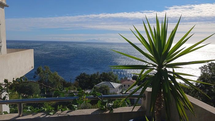
09/24 Arrival in Erbalunga Whether you're from northern France or Belgium, like us, the easiest way to reach the Isle of Beauty is by flying from Lille-Lesquin Airport. Volotea offers two destinations: Bastia and Ajaccio. Be careful, though—while the ticket prices are attractive, the airline makes up for it with baggage fees. A 25kg suitcase for 212 €—that really drives up the cost of transportation! For us, it’ll be Bastia. After this short flight and an arrival that lets you clearly see the east coast of Cap Corse, we’re welcomed by our friend Jean-Claude, who’s kindly hosting us for a few days. We met this Corsican and his wife during our four-year stay in French Guiana, and I have to say, he completely changed my opinion of Corsicans and even made me want to visit his island. The house, clinging to the rock above the sea, is stunning and offers a breathtaking view of the island of Elba. I’d always heard of Elba but must admit I wouldn’t have known where to place it before. We’ll stay here for five nights, long enough to explore the north of the island.
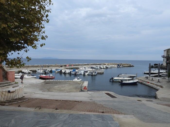
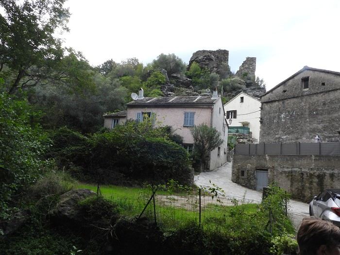
Since we’ve just arrived, Jean-Claude wants to show us his village, ERLALUNGA, a quiet little port, and the small village of CASTELLO above it, where he spent a lot of time in his childhood...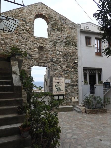
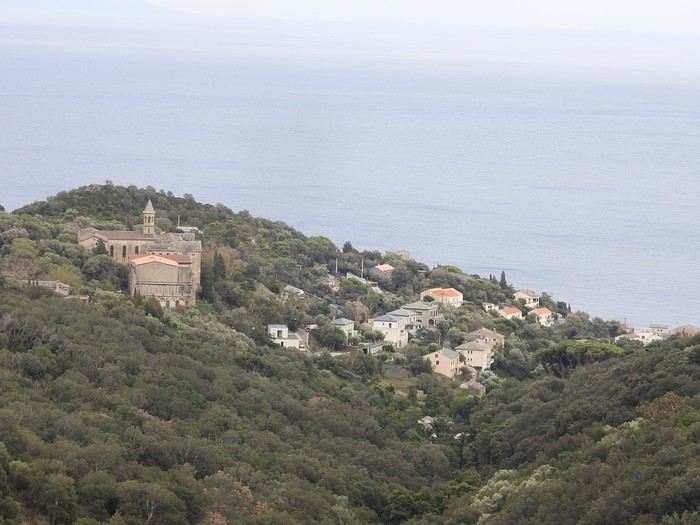

09/24 Arrival in Erbalunga Whether you're from northern France or Belgium, like us, the easiest way to reach the Isle of Beauty is by flying from Lille-Lesquin Airport. Volotea offers two destinations: Bastia and Ajaccio. Be careful, though—while the ticket prices are attractive, the airline makes up for it with baggage fees. A 25kg suitcase for 212 €—that really drives up the cost of transportation! For us, it’ll be Bastia. After this short flight and an arrival that lets you clearly see the east coast of Cap Corse, we’re welcomed by our friend Jean-Claude, who’s kindly hosting us for a few days. We met this Corsican and his wife during our four-year stay in French Guiana, and I have to say, he completely changed my opinion of Corsicans and even made me want to visit his island. The house, clinging to the rock above the sea, is stunning and offers a breathtaking view of the island of Elba. I’d always heard of Elba but must admit I wouldn’t have known where to place it before. We’ll stay here for five nights, long enough to explore the north of the island.
Since we’ve just arrived, Jean-Claude wants to show us his village, ERLALUNGA, a quiet little port, and the small village of CASTELLO above it, where he spent a lot of time in his childhood...
Hi everyone...
Must be around 5,000 photos to sort through!
Makes sense after 3 intense weeks in SA.
Anyway, to set the mood, here are a few photos... Well, yeah, they’re not amazing!
Suspense, suspense...
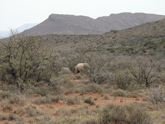
Must be around 5,000 photos to sort through!
Makes sense after 3 intense weeks in SA.
Anyway, to set the mood, here are a few photos... Well, yeah, they’re not amazing!
Suspense, suspense...
This adventure began during Covid... Yep, Covid turned a lot of things upside down, but most of all, it kept us cooped up for a few months and stopped us from traveling for a while—even longer for a die-hard fan of the American West like me.
While borders were closed, I started imagining what an ideal itinerary might look like—one that would string together all the Southwest must-sees in just two weeks, during the best time of year: September and October. When the U.S. announced in September 2021 that borders would reopen in the coming weeks, I regained hope and began scouting flight tickets for a departure in September 2022.
But here’s the thing: tackling solo hikes, each one tougher than the last, right in the heart of the Wilderness, could be a risky—even reckless—endeavor for a father of three. After a quick chat with some virtual friends who are just as passionate about the Southwest as I am, with good physical condition and nearly the same list of must-visit spots, Franck and his brother Sullivan were in! 🙂
In November, we snagged flight tickets from Nice to San Francisco for the modest sum of 400 €, and a few days later, I booked a Toyota Tacoma pickup for 840 € !
It’s not cheap for just 15 days, and a pickup isn’t exactly ideal for luggage, but the prices for full-size 4x4s have become totally outrageous! Due to border closures, rental companies had to offload a lot of these big 4x4s, which tourists love. Then, supply and demand did the rest !
Franck and I spent the winter and spring trying to cram the equivalent of three weeks of hikes into two. But even with physical limits, we had to stay reasonable! Three to four months before departure, we entered the lotteries for different must-see spots: The Subway, Coyote Buttes North (home to the famous Wave), and Coyote Buttes South (CBS).
The Wave is the holy grail for any Southwest enthusiast. Since 2015, we’ve tried our luck with the online and on-site lotteries about ten times, but the spots are unfortunately limited: just 20 per day. A glimmer of hope, though—since early 2022, that number has increased to 64 people allowed per day, with 48 spots awarded via the online lottery.
After all three of us tried our luck for The Wave, on June 1st at exactly 5 PM, I got an email that started with, "Congratulations! You were successful in the Coyote Buttes North (The Wave) September 2022 Permit Lottery at Coyote Buttes North (The Wave)...". At 5:01 PM, I called Franck, whose dream it’s been for over 20 years—ever since the first photos were published in a travel magazine! He didn’t believe me when I told him, and I had to forward the email for him to finally accept the unbelievable: we were going to The Wave and all the incredible spots scattered across the protected area of Coyote Buttes North.
I’ve already been to Coyote Buttes South twice, but there are areas I couldn’t explore in the middle of summer because they were too remote. So, I had no trouble letting my buddies convince me to go back for a third time. Plus, given how hard it is to access, we had no trouble securing a permit online as long as we logged in at exactly 8 PM on the dot!
For The Subway, all three of us struck out. No big deal—we won at CBN and CBS!
Among the sites to visit, there are two that I’m particularly attached to because I know my chances of wanting to see them again are slim. The first is Angel Arch, one of the most legendary arches in the Southwest, due to its remoteness from any trace of civilization. To get there, the recommended hike is Upper Salt Creek, and you’re looking at a 50 km round-trip in an area with no water (in September) and populated by bears.
The second site is the Hopi Salt Trail, in Navajo land, which, after a very tough hike, lets you marvel at the turquoise-blue waters of the Little Colorado before it meets the Colorado River. The Hopi Salt Trail is, like The Wave, the holy grail for any Southwest enthusiast, and the windows of opportunity to see the water in that magical color are very short each year. For this, you have to monitor the Little Colorado’s gauges downstream from Cameron: if the level stays at its lowest for 10 consecutive days—meaning no rain—you can hope for turquoise water. The ideal period rarely exceeds 30 days a year, and it’s usually in June that all the stars align.
But unfortunately, one month before departure, while the flow rate at Cameron looked promising, several storms in September dashed our hopes of doing the Hopi Salt Trail, even at the end of the road trip.
We still had two consolation prizes, though:
After a last-minute cancellation, while keeping an eye out for available spots for The Subway, it turned out that three spots opened up exactly on the day we’d planned to go—so we rushed to grab them!! Regarding the 4x4 rental, the prices for full-size models dropped by several hundred dollars, and we ended up finding a Chevrolet Tahoe for less than $1000. A steal and a serious boost in comfort, so we could store all our gear and food without worry!
Here’s the initial plan in a perfect world: D1 The White Domes - Camping D2 Sunrise at The White Domes - The Subway D3 Coyote Buttes North D4 Coyote Buttes South - White Pocket D5 Wahweap Hoodoos - Sidestep Canyon - Colourful Canyon - White Rocks - Sunset at Yellow Rock D6 Broken Bow Arch - Reflection Canyon D7 Coyote Gulch D8 The Volcano (or The Oasis - Zebra Slot Canyon if the weather’s good) - North Caineville Mesa D9 The Needles: Squaw Canyon - Lost Canyon combo - Druid Arch - Chesler Park D10 Upper Salt Creek Day 1 - Camping D11 Upper Salt Creek Day 2 D12 Hopi-Navajo Territory: Ha Ho No Geh Canyon, Coal Mine Canyon, Bends of the Little Colorado D13 Grand Canyon: South Kaibab Trail and Bright Angel Trail D14 Upper East Zion: East Temple Loop, Jughandle Arch, Center of the Universe, and Checkerboard Mesa Summit And several backup options in case of bad weather, including Spencer Trail, West Cove, and Buffington Pockets.
Enough talking—time for action!
Following my first trip from May 1st to 11th, 2025:
-Flight: easyJet Geneva-Olbia 11:50 AM-1:20 PM (306 € for 2) + 102 € for checked baggage (408 € total)
-Flight: easyJet Cagliari-Geneva 12:45 PM-2:25 PM (308 € for 2)
-Car rental: Olbia-Cagliari (rental: 338.31 € + 120 € for one-way drop-off) + 320 € mandatory insurance imposed by Centauro) 778.31 € total
*May 1st: ***OLBIA: arrived at the airport at 3:15 PM: 1-hour delay with EasyJet! 😕 Car rental issue** Big scam with B Rent (hard to find their counter because of poor signage—they demanded an extra 320 €! But after 5.5 hours, Centauro also charged 320 € for insurance!!!) On top of that, we only got the car at 6:30 PM. Due to the delay, we went straight to our accommodation after grocery shopping. -Bandi House via Mastru Giogliu, San Teodoro 0039 338 852 8569 70 € (very nice apartment, spacious, great welcome from Paola but hard to find) -Nearby: San Teodoro: stagno (birds) Lonely Planet p.159
*May 2nd: -Heading to Isola Tavolara: boat from San Paolo. It was a holiday weekend, and all the Sardinians plus tourists were heading to the island. Everyone wanted to visit the cave and all the beaches—so crowded we gave up. Plus, we had to wait for the first departure at 11 AM with a return no earlier than 2 PM, and all boats left at the same time, so everyone ended up at the cave simultaneously! GUIDES: Green Guide p.140 and Lonely Planet p.158 -Capo Coda Cavallo: beautiful spot with a stunning beach (reserve) -EAST COAST: Budoni, Posada, La Caletta (port) with many white sand beaches
*Orosei (Green Guide p.102, Lonely Planet p.201) and Galtelli (lovely medieval village) *Dorgali (Green Guide p.96, Lonely Planet p.205): don’t skip Pasticceria Mulas (exceptional pastries at very reasonable prices) -Agriturismo Nennelle in Loculi: great welcome at this fairly new site—a farm with sheep. Large room with private bathroom and outdoor tables/chairs. Small fridge, kettle, and coffee machine. 54 0039 3495343765 €
***May 3rd:*** -Hike to Gola Su Gorropu: magnificent 4-hour trek (Lonely Planet p.205, Green Guide p.96)
-Arbatax: Rocce Rosse: stunning red porphyry rocks at the end of the port (Green Guide p.87, Lonely Planet p.210) -Aer Sana in Arzana: a remote village with a very narrow, picturesque road (there’s actually a second one). Via Don Bosco No. 12. 68.60 € 0039 347 9601599 Great welcome from Bruna/message—decorated with lots of taste and care. One room with private bathroom and a super well-equipped shared kitchen.
***May 4th:*** -Supramonte National Park and Gulf of Orosei (Green Guide p.98, Lonely Planet p.201) -Arzana-Ussassai-Seui-Sadali-Goldoni -Aritzo: small village on a slope—very friendly locals -Antonio Mura Museum: Sardinian expressionist painter -Ethnographic Museum: quite comprehensive -Spanish Prison "Sa Bovida" (prison under Spanish rule where people were imprisoned for witchcraft) -Antico Restauro: Via Umberto 38, Fonni. Small Sardinian house in the village with little light but tastefully decorated. Warm welcome from Mario Loddo. 65.02 €
*May 5th: Gennargentu Massif and Supramonte -Orgosolo: Lonely Planet p.190, Green Guide p.123 -Nuraghe di Tiscali (Green Guide p.122, Lonely Planet p.207): allow over 1 hour of hiking to reach a slope with a cave (good shoes required) -Arrival in Nuoro: large city. Via Salvatore Manniri 39 (0039 33118617847). French expat living in Sardinia—very large, well-designed apartment on the 5th floor. 73 €
*May 6th: -NUORO (Lonely Planet p.186, Green Guide p.112) .Museum of Sardinian writer Grazia Deledda (1871-1936), Nobel Prize in Literature 1927 .Sardinian Ethnographic Museum -Ulassai: Stazione dell’Arte Maria Lai (1919-2013) (Lonely Planet p.212, Green Guide p.85). Major climbing spot in a charming little village -Jerzu: "La Finestra sulla Volla" Via Umberto I 551 0039 3403754751 72 € apartment with 1 bedroom, 1 bathroom, and 1 kitchen
*May 7th: OGLIASTRA: -Jerzu to Tortolì via Barisardo: quite difficult route through narrow streets in various villages! Return to Porto Corallo, Capo Ferrato (Green Guide p.64) -Hotel in San Vito: "Su Furriadroxiu" Via Lamarmora 35/37 0039 3501041432 61.20 € (Green Guide p.65)
*May 8th: -San Vito -Armungia (Green Guide p.65): small village at 566 m with nuraghe and museum + fresco "Homage to the Sassari Brigade" -Goni: cork oak forests and Nuraghe di Pranu Muteddu (60 aligned menhirs and tombs) (Green Guide p.66, Lonely Planet p.197) -San Vito: restaurant "La Capinera" Via Nazionale 80, 09040: very good -From Villasimius to Costa Rei: Lonely Planet p.65, Green Guide p.60 .Punta Molentis: white sand, rocks, but very touristy -Capo Carbonara: military zone, not much to see -Accommodation in Cagliari: Villa Volta 18, Monserrato 0039 3480640592: 74.70 € Well-equipped studio, city center, quiet
*May 9th: -Visit to Cagliari with underground tunnels Regina at the foot of the citadel (elevator) (Lonely Planet p.48, Green Guide p.32) .Castello, prefecture, San Maria church .Charming and picturesque Villanova district -Barumini (Green Guide p.70, Lonely Planet p.90): Nuraghe di Su Nuraxi, 1500 BC with its tower and fortifications—the largest Sardinian site (UNESCO) Entry: 15 € with mandatory guided tour -Parco della Giara di Gesturi (basaltic plateau): great for hiking Presence of the Sardinian pony: small Sardinian horse -Accommodation in Sanluri: 2 Via Giacomo Mozart 0039 3495343765: 80 €
*May 10th: -Beautiful Isola di San Pietro: ferry from Portovesme to Carloforte (round trip) 33.50 € with car (Green Guide p.318, Lonely Planet p.81) 15 km long and 15 km wide .Carloforte: peaceful little town with its palazzi and colorful houses .Tonnara della Punta: former tuna cannery—can be visited by reservation .Capo Sandalo: with its lighthouse (nice little trail to hike) .La Caletta: beaches and cliffs .Punta delle Colonne: 2 trachyte formations—very pretty
-TOTAL: 2432 € for 2 -1400 km by car: 160 € for gas (between 1.60 and 1.76 €/L) -Food, including 2 restaurants: 265 € -Accommodation via Booking: 685 € -Flights: 614 € for 2 -Car: 708.50 € + one-way drop-off: 120 € + mandatory insurance of 320 € (not planned!)
hi
Do you know of any travel insurance for someone with a pre-existing condition?
Can a person who’s had a heart attack and is on medication get travel insurance?
Thanks
An 80-Day Tour of Southern Africa
Back in South Africa
January 12, 2013, 5:30 AM, Flight BA043 London-Cape Town
Directly below, Windhoek glittered like a tangle of fairy lights still lit and tossed into a box.
The horizon, edged in purple, was setting up a backup fireworks display, and suddenly, like a cherry on the platter and with unbearable intensity, in less than two minutes the entire sun revealed a gray dam and then a vast, untouched massif.
A few more minutes and the glare to the east of the plane was total. In Africa, the sun is swift.
We still had a France to cross before landing, but it felt as if we were already there. To the west, the raking light revealed what looked like acne and long, swollen scars in a desert region that might be the Swartkloofberg. Further still, straight as far as the eye could see, the two parallel tracks of a dirt road.
At 11,500 meters altitude and 940 km/h, we had a sense of stillness until the Orange River appeared, an incongruous serpent, gray edged with green.
The first South African settlements were dotted with trees providing shade, then rivers highlighted by continuous lines of vegetation.
Water and shade that make life possible.
We’ll return here by the backroads.
Half an hour from Cape Town, the plane tilted toward the sea, crossing plantations (likely citrus) and then an explosion of cultivated greenery in circles on either side of an unruly river. Finally, the coastline was no longer just sand and water—a frothy hem, a suture?
A peninsula came into view, forming two magnificent bays, and... a flight attendant firmly instructed me to return to my seat: we’d arrived!
The Colors of Cape Town
The city was dressed up as I like them—deserted, fluid, free of its vendors.
In the parking lot of the endless beach next to the commercial port north of the city, about two hundred people were unloading their goods in front of their pickups or combis, none of which were from this century: mixed-race, ageless Black people, and white folks who looked like they’d stepped out of another era.
After a few minutes, intrigued, I played a game: first looking at the merchandise, then imagining who was selling it, and finally looking at who was actually manning the stall. Tall Black vendors were selling what they often sell in Europe—leather, sunglasses, watches; mixed-race folks offered discount bundles, and the tanned older white people seemed to have emptied their attics.
We left with an antique tin kettle for morning tea over an open fire, a pack of five exercise books (that’s 600 pages to fill), Bill Bryson’s earliest stories in English, some snoek rillettes (a local fish), and—never seen before—tuna biltong and snoek biltong.
In so-called advanced countries, Sunday is for sports: white cyclists dressed like pros sweating diligently, Black street vendors running in loops at red lights to sell trash bags that day; white golfers losing their balls, which a scantily clad Black man retrieves from the water; under the sails of kite surf boards, it’s all blondes, and in the foam, joyful splashes from a bunch of Black kids.
Searching for an unusual spot for lunch, we drove through the fishing port looking for a dive and, at the end of a dead-end road with no warning, we arrived at the Shimmy Beach Club—quite the program.
The place, open for just three weeks, aims to be ultra-trendy. You could be in San Francisco, Lisbon’s docks, or St. Barth. This time, the "visible" staff was diverse, but the clientele was exclusively white, except for one mixed-race couple.
For this Sunday lunch, the women had pulled out all the stops, and local starlets—who’d make ours look tame—were turning the terrace into a frenzy.
At Cape Town’s port, the girls have *port*. The trend seems to be crochet dresses over swimsuits.
For two hours, a team of employees watered and raked the sand, starting over when they finished. A child in a floaty pink dress and a gold headband, but a future adventurer, stepped onto the freshly raked artificial beach sand for the first time.
A lanky mixed-race man dragged a hose across the ground, followed by a white woman—enchanted?—who then started watering the sand herself, carelessly splashing the glass terrace her colleague had just swept. I suspect a tacit work arrangement to keep everyone employed.
A galleon packed with tourists (are there any in the hold? Does it take tourists to Robben Island?) left the port. A helicopter took off in its wake. Trawlers returned, cutting through a ballet of catamarans, their waterlines well above the water: a bad catch.
If there’s one country where you can’t pretend to ignore skin color, it’s this one. The question is in everyone’s mind, and here more than anywhere else, it’s a decisive economic and political factor.
Columbine of Brittany
200 km north of Cape Town and 9,000 km south of the Breton coast, but on the same cold ocean, we camped on the shore of the Columbine Cape Nature Reserve, sheltered by a rocky chaos that, at first light tomorrow, would transport us to Perros-Guirec.
Our first encounter with wild animals wouldn’t end well for them: it was crayfish season, and they were the size of lobsters at Lorient’s fish market. Bought for R60 (5.5 €) a pair from kids in Pater Noster, they’d end up between two rocks, over a fire. But first, we had to pair the Chenin blanc with some snoek biltong.
With no wood, I lit a fire at dawn with dried seaweed and kelp, as if petrified; it gave off a smell of court-bouillon and... tires. Two hundred fathoms away, on an outpost, an army of cormorants stood at attention, unmoved among the frolicking seals.
At the reserve’s exit, the guard spoke French; Patrick Mwanba had arrived from Congo three years earlier to study, but the cost of living here forced him to drop out. He’d like to return home because life is cheaper there, but the war made him hesitate.
Ding ding dong! Vroom! Arf arf, Woof! Buzz! (A night from hell!)
I’d long planned to visit Calvinia, the center of a region known for extensive sheep farming. An excellent provincial museum, run by an enthusiastic curator, kept us too late to start the drive north.
So we camped in a tiny, charming campsite set up in the garden of a house. A few trees, a patch of resilient grass, and a view of a pretty lit-up steeple—what else?
Well, it turned out to be a sound-and-light show, with the pretty steeple chiming the hours and half-hours. Then suddenly, we were in the VIP stands of the Karoo-Kalahari Truck Race: roaring trucks paraded under our canvas windows, and we realized we were on the main road through town. To top it off, we enjoyed an uninterrupted canine cacophony, from the *arf arf* of little dogs to the *woof* of a mastiff. Oh, and some mosquitoes—the first ones—insisted on keeping us company in the tent, and we hadn’t yet bought the arsenal to neutralize them.
I walked through Calvinia at night; the house gardens weren’t fenced, nor did they have the «Armed Response» signs so common in the country.
The Kalahari Trails
(No, no, I haven’t converted to hiking.)
North of Calvinia, in the south of the Northern Cape, small towns follow one another up to Upington, about a hundred kilometers apart—welcome havens. Between them, with no trees in sight, we stopped in the shade of a motionless cloud: the temperature exceeded 40°C in mid-January.
We were almost out of the High Karoo and into a region of pans drying up, until the first red dunes appeared, precursors of the Kalahari. In the sparse veld vegetation, gatherings of quiver trees in the kopjes, and a caravan of camels without a handler or packs, marching in perfect formation across a pan (no, I hadn’t overdone the Windhoek at the last stop, and no, I wasn’t dehydrated enough to hallucinate).
The historic part of these towns, European in style, was built on the same plans as those in the American Midwest or the Australian Outback: a grid of streets wide enough to turn a wagon pulled by eight pairs of oxen. The architecture was Dutch-inspired, tropicalized with awnings.
Then came more recent housing, functional in style, where the wealthier mixed-race people—who make up the majority of this state—lived, and further on, the township, an assemblage of corrugated iron and plastic, like everywhere else.
Orange, Right Bank
North of Augrabies Falls National Park, on the other side of the Orange River, stretches a rugged and wild territory the size of fifty Groix islands, crisscrossed by a few tracks—the Riemvasmaak.
The inhabitants were driven out half a century ago for a military base, and as soon as President Mandela was elected, he made it a symbol by allowing the exiled populations to return. Several ethnic groups live here on almost nothing, in government-built shacks.
A community camp is set up in a small cirque at the end of a canyon that, while not in the history books, offers a good descent. By mid-afternoon, the air was at 44°C, but luckily there was a spring... except it was a hot spring, with water at 38°C. And they haven’t invented a reversible spring yet. Once the birds and baboons had settled in, in absolute silence and far from any light pollution, we enjoyed the stars like nowhere else (well, that’s what they claim in the region).
The Orange didn’t choose the easy path: arriving from Lesotho, it was almost at the ocean. The terrain to the south and north of this massif seemed easier to cross. Was it to avoid the curse of the Okavango, whose waters disappear into the sands without ever seeing the sea, that it chose this rocky route, thinking that at least the granite wouldn’t steal its water?
I Love You, I Eat You
In the dry bed of the Auob, it lay panting, head raised, alert, between its paws but head-to-tail, a tawny springbok, motionless.
A few minutes earlier, their story had been written in a lightning-fast chase, captured in photos by the driver of the car that alerted us.
It would be a long time before it started eating at the groin without breaking its surveillance.
Earlier, there was a lion lounging in the shade and hundreds of antelopes: springboks and gemsboks (oryx) in herds, hartebeests and steenboks alone. Strange pairs, apart several times, formed by a springbok and a gemsbok.
A few solitary jackals moved slightly sideways, looking furtive. Ostriches, alone, looking a bit dazed.
It was a lucky morning in the Kgalagadi (KTP).
In and Out
Kgalagadi, Nossob Camp.
We were at the very end of the almost-empty camp, ten meters from the fence, whose structure wouldn’t resist an elephant (though there aren’t any here), but it was electrified.
At dusk, on the other side, ten meters away, three lions passed in a row, as if on parade, seemingly focused on their goal and indifferent to the camp, though they glanced at it.
A jackal had gotten into the camp and was trying to get out without success while scavenging. I offered it two pieces of snoek biltong (Don’t feed the animals!) from three meters away—it smelled strong and had bones (bones in biltong!). When it passed by again, it sniffed but didn’t dare approach. Curled up in the chair, motionless, by the faint moonlight, I finally saw it come closer, grab the nearest piece, and move ten meters away to enjoy it (how many jackals know the finer points of sea biltong?). A little reassured, it came back for the second piece.
Another Morning
By morning, the jackal was gone, but our luck hadn’t left us. Two cheetahs again, who found me in the way and slowly moved toward a calmer shadow. Enough birds of prey to form a squadron, but they’re solitary hunters. Two ostriches busy with their dozen unruly chicks. And while we’re at it, a group of four Kalahari lions, sprawled under a thorny bush. Lots of oryx crossing the dunes and herds of red hartebeest. Kori bustards and secretary birds.
It was the first time the Kgalagadi had spoiled us so much.
Hi everyone,
I’m starting to plan my next trip to Southeast Asia this winter (2.5 months, leaving in early December), and here’s a rough outline of my route—I’d love to share it with you and hear your thoughts and tips.
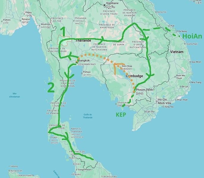
- I’ll start in Bangkok and already have three spots I’ve marked: Ayutthaya, Kanchanaburi, and Uthai Thani (I haven’t been to any of these places yet). - Next, I’d like to cross the country from west to east to reach the Laos border. I’d love suggestions for any interesting stops along this route—I don’t know this part of Thailand at all... - Then I’ll head into Laos, probably at Savannakhet (you can usually get a visa at the border). - > I’m tempted to spend a week in Hoi An, Vietnam, since I loved that city and the area when I visited two years ago. No visa needed for Vietnam now, so it could be a nice little detour. On the map, it doesn’t look too far, but I know you’ve got to be careful with these things, and I’m not sure if it’s a good idea. Any opinions on this? - Back to Laos (maybe via Dakta), and I’ll head south along the Mekong, probably doing the Bolaven Plateau loop that I missed last time. Then Paksé, the 4,000 Islands... I’ve been before, but I’d happily go back. - Crossing into Cambodia, I’ll follow the Mekong down to Phnom Penh (I know this area and love how untouristy it is). From there, I’ll probably spend a few days in Kep (quieter than Kampot). Still undecided, though. - Then back to Thailand (BKK), likely by plane from Phnom Penh since the borders between the two countries are currently closed (plus, let’s be honest, Cambodian roads... ;-). We’ll see how things look when the time comes. - After that, I’d like to explore southern Thailand, taking it slow with short hops. I’ve got my eye on Khao Sok National Park, and I’ve heard good things about Krabi... Again, I don’t know this region well, so any info or tips would be great.
So, I think this should be doable in 2.5 months, especially since I prefer short hops of 300 km max to avoid getting too tired, and I like staying 2-3 days in each place to explore. Plus, I’ll take a week off to relax if I find a spot I love—maybe by the sea for some real downtime.
Thanks for your feedback and for sharing your favorite spots! Pascal
Hi there,
I’m so glad the VoyageForum is back up. Reading 'Montagnard74’s' Laos trip report (which I read yesterday) made me want to share my own (which I already posted a year ago on another forum).
Here’s a little recap of our 3 weeks in northern Laos, plus a few days in Vientiane.
By the way, we could easily go back to the north—there’s so much to see and do; probably in a few years.
This was our 3rd trip to Laos after having already done:
1st trip in 2012 (3 weeks), a quick overview: Vientiane Vang Vieng Luang Prabang Plain of Jars
2nd trip in 2017 (1 month): Vientiane all the way to the 4,000 Islands via Thakhek, Kong Lor, the Bolaven Plateau, Savannakhet, Pakse...
Our 2023 itinerary (1 month): Vientiane Luang Prabang Muang Ngoi Nong Khiew Luang Namtha Muang Sing Boten Vang Vieng Vientiane
Some general info (2023): For those who’ve already been to Laos: everything has gone up a lot—I think prices have almost doubled for transport, accommodation, meals... everything. But Laos is still a budget-friendly country for us. As a couple, we spent 1,100 € for a month, all included (and we definitely didn’t skimp on massages :)).
Don’t trust the transport signs posted everywhere—at travel agencies, bus terminals, hotels... THEY’RE ALL WRONG (especially the schedules). They haven’t been updated since before Covid.
There are hardly any bikes for rent anymore, but scooters are easy to find everywhere. We switched our mode of transport toward the end of our stay: from bikes to scooters, which let us go farther. In Vientiane, we only saw one bike rental place, near Ong Teu Pagoda.
BCEL bank doesn’t charge a commission on foreign currency exchanges. Using ATMs is expensive due to fees. Outside Laos, Lao kip are basically worthless. There’s so much inflation that I couldn’t find a single bank or exchange office willing to swap the kip we had left. So, don’t exchange too much toward the end of your trip.
Some little tips from our experience (2023): The Muang Koua to Muang Ngoi boat still runs daily. At the dam, you have to get off and take a bus, then get back on the boat.
The boat from Muang Ngoi to Nong Khiew only leaves at 9:30 AM (don’t miss it or you’ll pay a lot for a private boat). From Nong Khiew to Muang Ngoi, there are at least two boats a day.
From Luang Namtha to Muang Sing: 4 to 5 buses a day, the last one leaves around 3:30 PM.
From Luang Namtha or Muang Sing to Nateuy or Boten (to catch the new train): 3 to 5 buses a day.
The new train is really hard to book—it’s often fully booked 48 hours in advance, even the local train (5 hours from Boten to Vientiane instead of 3 hours on the high-speed train). (That makes it tough to travel day by day, which we love... too bad.) For baggage checks: don’t bring anything flammable (sprays...) or sharp. My mosquito repellent (flammable but in a small plastic bottle) got through. Water bottles and a tiny pocketknife are okay. But it seems to depend on the station.
Some guesthouses prefer to be paid in dollars, otherwise the price is much higher.
If you’re entering Laos from Vietnam via Dien Bien Phu, you have to get your visa at the embassy in Hanoi—otherwise, you’ll be refused at the border (no e-visa or visa on arrival).
Apart from Luang Prabang, Vientiane, and Muang Ngoi/Nong Khiew, there are very few tourists.
Some bus prices (in addition to those mentioned in my trip report) (with pick-up) 2023: Luang Prabang to Luang Namtha: 320,000 kip per person, 9h LP to Phonesavan: 250,000 kip per person, 7h LP to Phongsaly: 450,000 kip per person, 13h LP to Huay Xai: 420,000 kip per person, 14h Train Nateuy to Vientiane: 400,000 kip per person LP to Chiang Rai: 780,000 kip per person, 18h LP to Hanoi: 900,000 kip per person, 24h LP to train station: 50,000 kip per person LP to airport: 100,000 kip per person Vientiane from train station: 180,000 kip by taxi
Boats: LP to Pak Beng: 300,000 kip per person, 1 day LP to Houay Xai: 500,000 kip per person, 2 days LP to Pak Ou: 180,000 kip per person, 5h
Hello everyone! 🙂
So many silent months, and now Voyage Forum is accessible again. That’s cool because we can pick up our discussions for our mutual enjoyment.
I hope everyone is doing well and that you’ve been able to take some great trips, whether to the USA or elsewhere.
In September 2020, we had planned a round trip to explore Colorado, but unfortunately, a nasty virus messed up our plans, closing borders and keeping us stuck at home. Luckily for us, canceling the car, flights, and accommodations didn’t cost us a thing—everything was refunded.
In 2023, a loop from Las Vegas let us revisit places we’d seen in 2017 and discover new ones, this time spending more time at each stop with some lovely hikes.
In 2024, we finally revisited the 2020 plan, and I’ll start with that.
However, unforeseen circumstances mean I have much less time than before, so I’ll keep my trip reports shorter (ha ha ha—you’ll have less of my prose to endure).
Another change: for those who remember the "Gang of Four crazy sixty-somethings," it was just DD and me this time. Our dear Mimi and Maumau left the Var to focus on raising horses and can’t leave their little green paradise to join us anymore. We were unfortunately much tamer without them.
We traveled from September 11 to October 3.
The itinerary
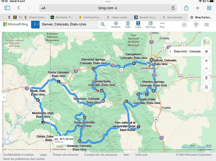
Day 1: Flight Marseille-Paris-Denver, then Manitou Springs (133 km) Day 2: Manitou Springs (49 km) Day 3: Cripple Creek (104 km) Day 4: Salida (254 km) Day 5: Great Sand Dunes (231 km) Day 6: Durango (283 km) Day 7: Durango (Durango-Silverton train) Day 8: Ouray (121 km) Day 9: Ouray (Perimeter Trail hike) Day 10: Cortez (213 km) Day 11: Cortez (Mesa Verde National Park, 134 km) Day 12: Monticello (268 km, detour to Chesler Park) Day 13: Moab (171 km, Delicate Arch) Day 14: Moab (98 km, Fisher Towers) Day 15: Moab (171 km, Canyonlands) Day 16: Fruita (210 km, Colorado National Monument) Day 17: Crested Butte (224 km via Kebler Pass) Day 18: Crested Butte (57 km) Day 19: Glenwood Springs (150 km) Day 20: Glenwood Springs (118 km, Rifle State Park) Day 21: Georgetown (258 km via Independence Pass) Day 22: Denver (123 km), then return flight
We speak very little English. We spent 21 nights there and covered a 3,400 km loop by car and 160 km on foot (we’re still trying to hike while we’re in shape) from Denver in September 2024. We wanted this road trip to help us explore Colorado a bit more—we’d only spent 6 nights there in 2019—and to see it during the fall foliage season. We also wanted to return to Utah (we love Moab) to enjoy its red rocks, which we adore.
In the prices you see (some in euros, others in dollars), I’ve included bank fees and exchange charges. The flights, car, and parking were paid by credit card when we booked in February. Usually, we book around November, but some obligations kept us from doing it earlier. We downloaded the MPC (Mobile Passport Control) app on our phone, which saved us time at immigration.
📊 **Budget: just under 8,500 € for both of us, all included**
📊 **Flights** Marseille-Paris (CDG)-Denver: 2,152 € for both of us, with one checked bag each
📊 **ESTA and America the Beautiful Pass** The ones from our 2023 road trip were still valid
📊 **Parking at Marseille airport: 122 €**
📊 **Car: Nissan Rogue (the French X-Trail) from Hertz: 1,165 €** By booking through Air France (and earning miles), we got a 15% discount. Hertz offers a free Hertz Gold Plus Rewards program, which gives us priority counter service.
📊 **Accommodation: 3,050 €** We stayed in motels and hotels of various ranges (from 100 € to 270 € per night, depending on the city), all booked through Hotels.com or Booking. Booking sometimes offers cheaper rates if you book via the "Booking mobile" app. We also got some preferential rates thanks to our Genius 2 status. Out of 21 nights, only one place didn’t include breakfast.
📊 **Other expenses (activities booked by credit card before leaving)** Durango-Silverton train: 210 € (we booked the enclosed vintage coach in March) Mesa Verde: Balcony House: 15.15 € (booked 14 days before the visit) Timed-entry passes for Arches National Park: 6 € for 3 days (booked June 1 for September entries via http://récreation.gov/). We booked three different days to play with the weather.
📊 **Supplementary insurance with AVA: 204 €** (due to our age 😅 and the high cost of medical consultations in the USA)
📊 **Cash: 1,540 €** We left with 1,000 € exchanged before departure and made two withdrawals (500 $ and 200 $). This cash was used to pay for: - Evening restaurants and tips (between 70 $ and 95 $ for two meals and two drinks) - Two state parks: Dead Horse State Park (20 $) and Rifle State Park (10 $) - The Monarch Pass gondola (24 $) - Midday picnics - Gas (slightly cheaper with cash): 204 $ for 3,400 km - Personal souvenirs and little treats.
Like in our previous road trips, we didn’t rent a GPS. We used the offline GPS app Here We Go, for which we’d downloaded maps of Colorado and Utah from France, as well as a new offline app called Organic Maps as a backup—though we didn’t end up needing it.
❤️❤️❤️ **Highlights (there are so many!)** 📍 The stunning landscapes of Colorado, especially with the fall colors 📍 A step back in time at the old farm in Florissant Fossil Beds National Monument 📍 The prairies of Cripple Creek and the mining remnants of the Vindicator Trail 📍 The cheeky chipmunks in the ghost town of St. Elmo 📍 Great Sand Dunes and its soft sand 📍 The steam train between Durango and Silverton: we’re glad we chose the round-trip because it rained heavily on the way there, but we got to enjoy the scenery on the way back when the sun came out 📍 The unexpected meet-up with Michèle from the group outside a restaurant in Durango 📍 The hot springs in Ouray 📍 Mesa Verde and its still-vibrant past 📍 The red rocks of Moab and Delicate Arch at sunset 📍 The lace-like Fisher Towers and the view from the end of the trail 📍 The gorgeous Route 128 leading to Colorado National Monument—small, easy to visit, and so beautiful 📍 The colors of the fabulous Kebler Pass, Crested Butte, and especially the hike through the golden aspens (Lower and Upper Loop) 📍 The waterfalls at Rifle State Park 📍 The tundra of Independence Pass 📍 The Halloween decorations in Georgetown and Idaho Springs
😞😞 **Flops (there are very few!)** 📍 The viewpoints we missed because they weren’t well-marked or we didn’t see the signs 📍 The closure of some hiking trails (Hanging Lake and parts of Canyonlands) and the Sal Mountain Loop road, which kept us from accessing it 📍😢 The Chesler Park hike we had to cut short due to poor time management—180 km between our stop in Cortez meant we didn’t arrive until 10:30 AM, way too late for a 17 km hike.
Hope this helps! Have a great evening, everyone, and see you soon! 😊
The itinerary
Day 1: Flight Marseille-Paris-Denver, then Manitou Springs (133 km) Day 2: Manitou Springs (49 km) Day 3: Cripple Creek (104 km) Day 4: Salida (254 km) Day 5: Great Sand Dunes (231 km) Day 6: Durango (283 km) Day 7: Durango (Durango-Silverton train) Day 8: Ouray (121 km) Day 9: Ouray (Perimeter Trail hike) Day 10: Cortez (213 km) Day 11: Cortez (Mesa Verde National Park, 134 km) Day 12: Monticello (268 km, detour to Chesler Park) Day 13: Moab (171 km, Delicate Arch) Day 14: Moab (98 km, Fisher Towers) Day 15: Moab (171 km, Canyonlands) Day 16: Fruita (210 km, Colorado National Monument) Day 17: Crested Butte (224 km via Kebler Pass) Day 18: Crested Butte (57 km) Day 19: Glenwood Springs (150 km) Day 20: Glenwood Springs (118 km, Rifle State Park) Day 21: Georgetown (258 km via Independence Pass) Day 22: Denver (123 km), then return flight
We speak very little English. We spent 21 nights there and covered a 3,400 km loop by car and 160 km on foot (we’re still trying to hike while we’re in shape) from Denver in September 2024. We wanted this road trip to help us explore Colorado a bit more—we’d only spent 6 nights there in 2019—and to see it during the fall foliage season. We also wanted to return to Utah (we love Moab) to enjoy its red rocks, which we adore.
In the prices you see (some in euros, others in dollars), I’ve included bank fees and exchange charges. The flights, car, and parking were paid by credit card when we booked in February. Usually, we book around November, but some obligations kept us from doing it earlier. We downloaded the MPC (Mobile Passport Control) app on our phone, which saved us time at immigration.
📊 **Budget: just under 8,500 € for both of us, all included**
📊 **Flights** Marseille-Paris (CDG)-Denver: 2,152 € for both of us, with one checked bag each
📊 **ESTA and America the Beautiful Pass** The ones from our 2023 road trip were still valid
📊 **Parking at Marseille airport: 122 €**
📊 **Car: Nissan Rogue (the French X-Trail) from Hertz: 1,165 €** By booking through Air France (and earning miles), we got a 15% discount. Hertz offers a free Hertz Gold Plus Rewards program, which gives us priority counter service.
📊 **Accommodation: 3,050 €** We stayed in motels and hotels of various ranges (from 100 € to 270 € per night, depending on the city), all booked through Hotels.com or Booking. Booking sometimes offers cheaper rates if you book via the "Booking mobile" app. We also got some preferential rates thanks to our Genius 2 status. Out of 21 nights, only one place didn’t include breakfast.
📊 **Other expenses (activities booked by credit card before leaving)** Durango-Silverton train: 210 € (we booked the enclosed vintage coach in March) Mesa Verde: Balcony House: 15.15 € (booked 14 days before the visit) Timed-entry passes for Arches National Park: 6 € for 3 days (booked June 1 for September entries via http://récreation.gov/). We booked three different days to play with the weather.
📊 **Supplementary insurance with AVA: 204 €** (due to our age 😅 and the high cost of medical consultations in the USA)
📊 **Cash: 1,540 €** We left with 1,000 € exchanged before departure and made two withdrawals (500 $ and 200 $). This cash was used to pay for: - Evening restaurants and tips (between 70 $ and 95 $ for two meals and two drinks) - Two state parks: Dead Horse State Park (20 $) and Rifle State Park (10 $) - The Monarch Pass gondola (24 $) - Midday picnics - Gas (slightly cheaper with cash): 204 $ for 3,400 km - Personal souvenirs and little treats.
Like in our previous road trips, we didn’t rent a GPS. We used the offline GPS app Here We Go, for which we’d downloaded maps of Colorado and Utah from France, as well as a new offline app called Organic Maps as a backup—though we didn’t end up needing it.
❤️❤️❤️ **Highlights (there are so many!)** 📍 The stunning landscapes of Colorado, especially with the fall colors 📍 A step back in time at the old farm in Florissant Fossil Beds National Monument 📍 The prairies of Cripple Creek and the mining remnants of the Vindicator Trail 📍 The cheeky chipmunks in the ghost town of St. Elmo 📍 Great Sand Dunes and its soft sand 📍 The steam train between Durango and Silverton: we’re glad we chose the round-trip because it rained heavily on the way there, but we got to enjoy the scenery on the way back when the sun came out 📍 The unexpected meet-up with Michèle from the group outside a restaurant in Durango 📍 The hot springs in Ouray 📍 Mesa Verde and its still-vibrant past 📍 The red rocks of Moab and Delicate Arch at sunset 📍 The lace-like Fisher Towers and the view from the end of the trail 📍 The gorgeous Route 128 leading to Colorado National Monument—small, easy to visit, and so beautiful 📍 The colors of the fabulous Kebler Pass, Crested Butte, and especially the hike through the golden aspens (Lower and Upper Loop) 📍 The waterfalls at Rifle State Park 📍 The tundra of Independence Pass 📍 The Halloween decorations in Georgetown and Idaho Springs
😞😞 **Flops (there are very few!)** 📍 The viewpoints we missed because they weren’t well-marked or we didn’t see the signs 📍 The closure of some hiking trails (Hanging Lake and parts of Canyonlands) and the Sal Mountain Loop road, which kept us from accessing it 📍😢 The Chesler Park hike we had to cut short due to poor time management—180 km between our stop in Cortez meant we didn’t arrive until 10:30 AM, way too late for a 17 km hike.
Hope this helps! Have a great evening, everyone, and see you soon! 😊
My wife and I are going on the "Christmas and Holiday Traditions" cruise from December 22 to January 5.
This is our first time with CFC.
We’ve done dozens of cruises over the past 35 years—including three world cruises with Costa—but we’re tired of the Italian attitude. We’ve also done 3 or 4 with MSC, Club Med 2, and a long time ago, the Mermoz with Croisières Paquet, in short…
Given the reviews, we’re wondering about the all-French aspect, since the Filipino crews are nice but French is complicated for them. And the comments about the food aren’t exactly reassuring. Yes, the drink packages are way too expensive. We’ll have to wait and see how much the excursions cost…
It’s an old ship, so let’s hope everything still works.
See you soon!
Hi there!
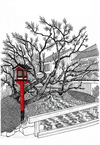 I’m inviting you on a stroll through my drawings—a completely subjective, far from exhaustive, and totally personal take, since it’s based on my own sketches. I put this travel journal together after returning in late 2024, mostly using felt-tip pens and pencils, with a few collages thrown in. I worked from our personal photos.
Let’s start with the shotengai...
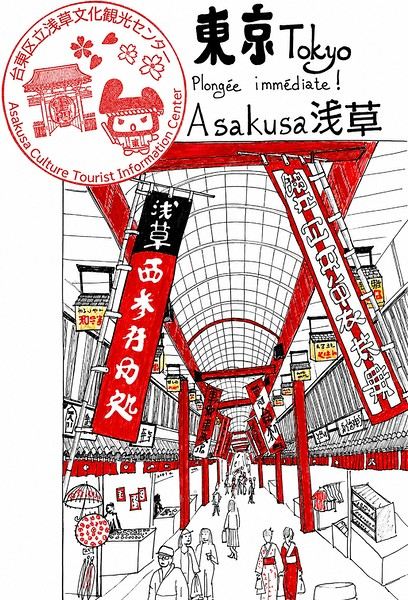
Our first "wow" moment came as we stepped out of the subway in Asakusa, the Tokyo neighborhood where we’d booked our hotel for our first five nights. Exhausted after our long flight, we finally arrived and took an exit that led straight into a shotengai—one of those covered shopping streets that pop up in city centers and flourished between the 1950s and 1980s.
It was an instant aesthetic shock, like a close encounter of the third kind between the modern city, a typical Asian market with its street stalls, the vintage vibe of the arcade, the sheer abundance of goods, and the bustling crowd—a mix of tourists, pilgrims (thanks to nearby Senso-ji Temple), and locals (it’s a very working-class area). In the end, it set the tone for a feeling we’d experience throughout the trip. Wherever we went, shotengai turned out to be fantastic spots for finding little restaurants, shops, or even fresh produce. Some are like real mazes, like in Kyoto, where we spent ages trying to relocate a restaurant we’d loved ;-)
In Kanazawa, the Omicho Market: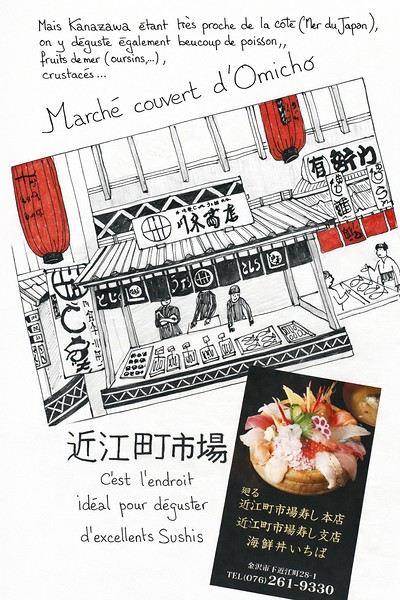 And in Kyoto, Nishiki Market:
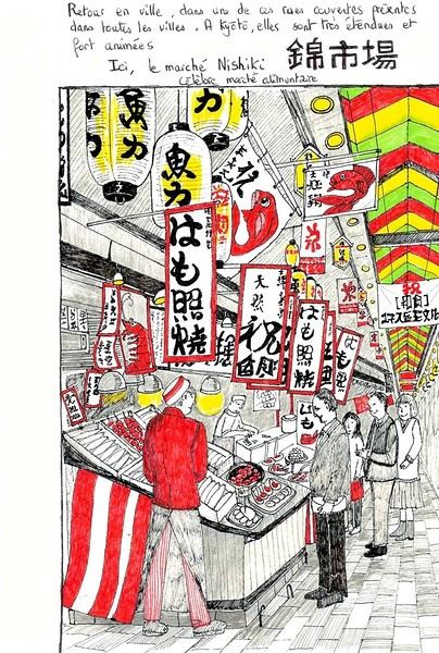
To be continued...
I’m inviting you on a stroll through my drawings—a completely subjective, far from exhaustive, and totally personal take, since it’s based on my own sketches. I put this travel journal together after returning in late 2024, mostly using felt-tip pens and pencils, with a few collages thrown in. I worked from our personal photos.Let’s start with the shotengai...
Our first "wow" moment came as we stepped out of the subway in Asakusa, the Tokyo neighborhood where we’d booked our hotel for our first five nights. Exhausted after our long flight, we finally arrived and took an exit that led straight into a shotengai—one of those covered shopping streets that pop up in city centers and flourished between the 1950s and 1980s.
It was an instant aesthetic shock, like a close encounter of the third kind between the modern city, a typical Asian market with its street stalls, the vintage vibe of the arcade, the sheer abundance of goods, and the bustling crowd—a mix of tourists, pilgrims (thanks to nearby Senso-ji Temple), and locals (it’s a very working-class area). In the end, it set the tone for a feeling we’d experience throughout the trip. Wherever we went, shotengai turned out to be fantastic spots for finding little restaurants, shops, or even fresh produce. Some are like real mazes, like in Kyoto, where we spent ages trying to relocate a restaurant we’d loved ;-)
In Kanazawa, the Omicho Market:
And in Kyoto, Nishiki Market:
To be continued...
Here we go—finally, the big day has arrived! A trip the whole family (my two kids, my husband, and me) had been looking forward to for so long.
To keep it short, we left from Nice, arrived in Namibia on June 25, 2025, and left again on the 21st—four weeks later.
We used an agency for all the camping reservations, activities, and the car rental. At least that side of things was taken care of. Michaël was our contact throughout the planning and the trip itself.
We spent our first night at Londiningi BB. A bit out of the city center but very quiet. The rooms were spacious and clean, and we could eat on-site that evening. Perfect for recovering from the flight.
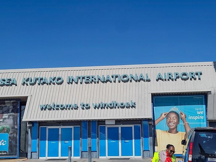
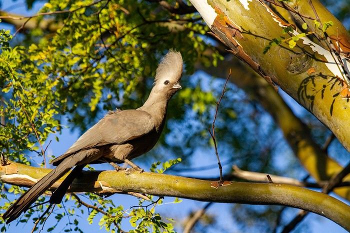
We spent our first night at Londiningi BB. A bit out of the city center but very quiet. The rooms were spacious and clean, and we could eat on-site that evening. Perfect for recovering from the flight.
Hi everyone,
I’m heading back to Montreal in early November after several years away. I’m so excited! I won’t be staying long, but I’ll have time to wander and explore.
I’d love to get your recommendations for great things to eat—restaurants, bakeries, all kinds of food. I’m open to all your suggestions and addresses. I’ll definitely hit up the market. And eat bagels, of course.
I’ll probably stay in the Quartier des Spectacles, but I’ll definitely be getting around the city.
Thanks in advance!
My buddy Christian and I (Patrick) are off for 28 days in Argentina in March.
We’ve already shared several trips as a duo (Bolivia Peru, Namibia, Laos, Costa Rica).
Since we’re starting from the idea that at our age (65) we won’t be coming back here—there are just too many other corners of the world to discover—we did the "grand tour" of Argentina, with 6 domestic flights to make the most of our 28 days.
Here are our stops:
1) Departure from Brussels to Buenos Aires via Madrid
2) Arrival and first contact with Buenos Aires
3) Early morning flight to Ushuaia. Boat trip on the Beagle Channel
4) Ushuaia: hikes in Tierra del Fuego National Park
5) Ushuaia: last hike and flight to El Calafate
6) El Calafate to El Chaltén by bus. First hike
7) El Chaltén: hike
8) El Chaltén: hike
9) El Chaltén: hike and bus back to El Calafate
10) El Calafate: Perito Moreno Glacier
11) Flight to Bariloche. Car rental and surrounding areas
12) Seven Lakes Region
13) Nahuel Huapi National Park region
14) Flight to Salta. Car rental
15) To Tilcara
16) To Humahuaca
17) To Purmamarca
18) To Jujuy via the salt flats
19) To Cafayate
20) Around Cafayate
21) To Cachi
22) Back to Salta
23) Flight to Iguazu
24) Waterfalls on the Argentine side
25) Waterfalls on the Brazilian side and flight to Buenos Aires
26) Buenos Aires
27) Return flight
28) Morning arrival
Happy reading!..
Hi there, 🙂
I’m thinking of taking a trip to these two countries in 2026 (late spring to early summer).
I’d arrive in Almaty and leave from Bishkek, and I’d be driving myself.
I plan to spend 1 week in Kazakhstan and 2 in Kyrgyzstan. The itinerary isn’t set yet.
My preliminary questions are about formalities, hassle levels, and the car.
From what I understand, no visa is needed, the passport must be valid for 6 months after entry, and there’s no longer a requirement to register with the authorities at each stop. In short, once you’re in, no administrative headaches.
Except for permits needed to drive in certain regions?
---/---
About crossing between the two countries:
- On foot - In a rental car
Quick? Easy?
---/---
Are both countries safe? (Meaning you don’t have to stay on guard all the time.) Are the cops corrupt? (A little, a lot, passionately, not at all?)
---/---
Is it better to rent a car for both countries or rent a vehicle in each country?
A 4x4 or something else?
Is accommodation plentiful enough that I can skip a rooftop tent, or is it better to rent a 4x4 with one?
I’ll definitely have more questions later...😉
Thanks for your answers !
Hi everyone,
I’m starting to think about a trip that’s really close to my heart: Algeria by motorcycle, specifically the southern part of the country. It’d be for January 2025, and I’ve got two main questions:
Is it possible for an individual on a motorcycle to travel freely, outside of any organized tour, or does the regulation require some kind of supervision in the Algerian Sahara region?
Is the Hoggar massif accessible by road or by (rideable) tracks?
Beyond the official recommendations, I’m really looking for your firsthand experiences. Thanks so much for your answers, and sorry if my questions are a bit newbie!
Ride safe! ✌️ Didier
New, seen on TV, you won't believe it. Click here.
During my recent trek, I found that my bike—and my luggage—were heavy. Until now, the weight of my gear hadn’t been an issue. Maybe I’m getting old, or maybe I just can’t handle the SNCF’s stairs anymore.
It hit me in Toulouse. A 3-minute stop turned into a 6-hour delay because of a fire that was hard to control between Toulouse and Montauban. Eventually, our train was canceled, and we were told to take another train that was also waiting for the same destination. It was my fourth train of the day. It was 9:30 PM, and I’d left at 9:30 AM that morning. Suddenly, exhaustion took over.
That’s when I met two bike-packers who, without hesitation, lifted their bikes with all their gear attached, carried them down the steps of the Corail train, and then down the stairs to the underground passage. They were young and fit (they smelled like warm sand), and I definitely wasn’t. It was in that scorching heat, struggling up and down all those stairs (Oh Toulouse, as Nougaro would say, may you be cursed for seven generations), that I decided to go on a diet.
It’s a diet anyone can do, it works, and it’s free. So I’m sharing it right away.
No need to exercise or restrict yourself. No, all you have to do is think and do some research. You need a chair, a table, a scale, a computer, and a spreadsheet. Make a list of everything you’ve brought and weigh it all. Set a goal based on the type of trek and your comfort level. Remove everything that doesn’t help you reach that goal.
My goal: - Trekking in France from May to September, in the plains or at most on a plateau like Mont Aubrac, where at 800 m altitude, it can drop to 10 °C at night even in the middle of summer.
- Sleeping in a tent on a good mattress in a sleeping bag (I’m not changing that). Someone suggested I could sleep under the stars on bubble wrap. No way, are you crazy?
- Not cooking. I buy lunch on the way in the morning and dinner on the way in the afternoon (I’m not changing that either). Someone suggested Ducasse delivers everywhere in France. Uh, have you been smoking lemon weed?
That’s how I lost 5 kg, going from 17.7 kg to 12.8 kg, including luggage but not food or water. But I also reduced the volume and quantity of my gear.
Here are the before photos:
https://photos.app.goo.gl/XDfKaoVvHFNxDXrq5
And after:
https://photos.app.goo.gl/STRVKaWuVcNVeCfS9
of my bike.
You can see that a duffel bag is gone, as well as the extra bags behind the panniers. I don’t even use the mesh pockets at the bottom of each pannier anymore. You can also see I’m still carrying my 1 kg U-lock. I know, it’s unforgivable. I’m on the verge of being banned.
So I might do another trek in September to validate my choices.
For the rear panniers, I can save between 1 and 1.5 kg depending on the solution: Arkel Dry-lites (28 L pair, 0.540 kg) or Vaude Aqua Light (38 L pair, 1.080 kg).
I also need to cut down on the tools I bring. I should be able to shave off about 0.5 kg.
And the bike? I’m thinking about it. Someone suggested the folding Savadeck Z2, which only weighs 10 kg. Carbon? Oh, don’t spread the word—it’s even more taboo than aluminum in some circles, and I won’t even mention the belt drive.