Discussions similar to: Crète Printemps 2024
FR

137 similar discussions in English

Mauritian Ti' Punch
The recipe for the cocktail: endless beaches, a dazzling palette of colors, some breathtaking hikes, and excellent cuisine...

For the tasting, follow along in the pages of this travel journal! 😉

Don’t forget your hiking shoes, a swimsuit, sunscreen, but also a sweater, your driver’s license, and your credit card...

Just over 11 hours of flight, and we’ll be setting foot on Mauritian soil!

Open
Langtang – Trekking in the Rain
We did the Langtang trek (hike) from September 10th to 17th, with the first and last days being the trip from Kathmandu and back—so 6 days of actual walking. It’s a fairly well-known trek but certainly not as famous or crowded as those in the Annapurna or Everest regions, which is why we chose it.

In theory, it’s mandatory to have a guide for this trek. In reality, it seems there are ways to bypass the regulations: we met at least two people hiking without a guide—a South Korean, a New Zealander, and possibly also a couple of English women and an American couple, though we’re not sure if they had a guide.

The agency we booked with had told us it was an affordable trek for relatively older people in good shape—which is our case (I’m 72 myself). I have to say upfront that we found it quite challenging, maybe because we didn’t have good weather—it was the end of the monsoon season. To be clear, no matter your fitness level, I’d say doing this trek in the middle of the monsoon season would be suicidal.

Day 1 – Journey from Kathmandu to Syapru Besi

On Monday, September 8th, there had been violent protests in Kathmandu against the government, which had, among other things, blocked access to social media and been accused of nepotism and corruption. There were 19 deaths. The situation was very tense on the day of our departure, Wednesday the 10th. The agency warned us that public transport was very unreliable. So, we decided to take a jeep, at an additional cost of $100 ($160 minus what was already budgeted for the bus).

We left a little before 7 a.m. and it took us a good hour just to reach the outskirts of Kathmandu. Along the way, we saw several houses and vehicles set on fire by protesters.

The road to Syapru Besi is only 120 km, but it’s frankly awful. It’s always narrow, winds through endless mountains, and the shoulders range from bad to confusing to nonexistent. Several sections are just dirt tracks. We didn’t regret opting for the jeep, as we could stop several times at our convenience—if only to let Y (my Thai partner) throw up everything she had. She’d taken her usual motion sickness medication, but the constant turns, accelerations, and braking eventually made her terribly carsick.

In Nuwakot, we stopped for breakfast at a nice little restaurant, Jimbu. It was around 8:30 a.m., and we’d barely covered 60 km. The restaurant has a lovely garden overlooking the Trishuli Ganga, the river flowing down from Syapru Besi. First photo: the river in the bottom right corner, mist and clouds over the mountain on the other side.

An hour later, my second photo: the hills along the Trishuli Ganga. You can see the different crops—lush green rice paddies in the lower right and corn, already yellowed and likely harvested, in the foreground on the left. And of course, the mist and clouds through which you can glimpse the mountain on the other side of the river.
Open
Slovak travel journal
Hello and welcome aboard this travel journal. We’re heading to Slovakia together! Why this country? After visiting Hungary, Slovenia, Romania, and Poland in recent years, I’ve fallen in love with Eastern European countries. I adore the Slavic soul, its Austro-Hungarian villages, the gentle landscapes, the Carpathian Mountains, and that slightly mysterious atmosphere. Slovakia evokes a certain imagination with its deep forests, medieval castles, and cobbled villages. After seeing photos of the High Tatras—especially Lake Štrbské Pleso and Spiš Castle—I thought, "Let’s do it! We’re going!" So, will Slovakia live up to what I imagine? We’ll find out together. We decided to travel as a group of six (five adults and a six-year-old child), by car (we needed two). Here’s the day-by-day itinerary for this family trip, which started with a 3-day stay in Vienna (see the dedicated travel journal):

The itinerary: Day 1: Drive from Vienna to Banská Štiavnica and visit the town, then drive to Handlová Day 2: Bojnice Castle, the village of Čičmany, and a walk in the treetops at Bojnice, return to Handlová Day 3: Depart for Orava, visit Orava Castle and the Orava Skansen, drive to Veľký Slavkov Day 4: Visit Slovak Paradise—its gorges, lakes, and ice cave—overnight in Veľký Slavkov Day 5: Visit Bardejov, the "Death Road," wooden churches, and Ľubovňa Castle, overnight in Veľký Slavkov Day 6: Walks and hikes in the High Tatras, Lake Štrbské Pleso, Solisko summit, treetop walk in Ždiar, overnight in Veľký Slavkov Day 7: Drive to Košice, visit Spiš Castle, Tokaj wine route in Veľká Trňa, overnight in Košice Day 8: Visit Košice, overnight in Košice Day 9: Drive to Bratislava, stop at the Aragonite Cave in the Slovak Karst, overnight in Bratislava Day 10: Visit Bratislava, overnight stay Day 11 and 12: Return to France

Budget: I’m giving prices for 2 adults / 1 child. Slovakia is more expensive than it seems, and some expenses shouldn’t be underestimated. Transportation: Tolls and gas from France: 500 € round trip Slovak vignette for one month: 17.10 € Gas is fixed at 1.49 € per liter (E10) Parking at sites (all paid by the day, even in the most remote villages, even if you stay for just an hour). Payment is often required in cash upon arrival: total 63 € We didn’t pay at Spiš (we arrived before the cashier) or Ľubovňa (we arrived after the cashier left). Parking at Orava Village was free. In Košice and Bratislava, we parked for free at our accommodations. Public transport in Bratislava and Košice: 1-1.2 € for a bus ticket. Vending machines are available at some stops; otherwise, buy via SMS (Slovak phones only) or official sales points.


Accommodation: We mostly chose houses so we could cook ourselves and save on food. I’ve rated our satisfaction with these accommodations from 1 to 5 stars. Padua: DC Hotel: 1 night, 77 € ***** Handlová: Chata Remata: 2 nights, 120 € ***** Veľký Slavkov: Aplend: 4 nights, 220 € ** Košice: Luxury Old Town Loft 320m²: 2 nights, 120 € ***** Bratislava: Hotel Viktor: 2 nights, 138 € *** Brescia: Hotel Antica Fonte: 1 night, 82 € ***** Total: 757 €

Food: Groceries at Lidl for 5 meals for 3: 100 € (really cheap) Restaurants: 10-15 € per dish, ice cream 1-2.4 € per scoop, crêpes 8-12 €, a glass of wine 6-10 €... total: 500 €

Visits: There are discounts for seniors and children, which is great. We spent nearly 600 € in total, which is a lot. However, it’s a cultural destination with many castles, museums, caves, wine cellars, and nature activities: cable cars, canopy walks, paid hikes (Slovak Paradise gorges)... In the end, this trip to Slovakia cost nearly 2500 € for 3. We also need to add the Vienna portion to that. Now, here’s the day-by-day account of this beautiful journey.
Open
Join me in discovering Gran Canaria
Introduction

We stayed on the island of Gran Canaria during the first three months of 2024. It’s the third Canary Island we’ve visited, after Tenerife and Lanzarote.

We rented an apartment in Temisas. By staying in the same place for such a long period, the total price dropped by 50%.

We also rented a vehicle to make getting around the island easier.

Why the Canary Islands, and Gran Canaria in particular? For its pleasant climate, the nature and diversity of its landscapes, the charming villages, and especially the beauty of its many beaches.

In this travel journal, you’ll find a list of the many activities we did during our stay to explore the different attractions of this island.

These attractions are categorized to make it easier to find what interests you.

Videos are included throughout the summary. Click on the image to start the video.

To jump to a specific post, here are the relevant links:

HIKES:

Roque Nublo Maspalomas Dunes - Part 1 Maspalomas Dunes - Part 2 Los Azulejos de Veneguera Barranco de Las Vacas Ventana del Bentayga (Arco del Aserrador) Caves of the King Ventana de Morro (Ventana de la Ganifa) The Dog of Bentayga Cave of the Four Doors Ventana del Nublo Artenera - Caves of Acusa Seca Temisas - El Gigante Cave Fortress of Ansite Puerto de Las Nieves - Roque de Las Nieves Temisas - Cuevas de la Audiencia Roque Bentayga Guayadeque Ravine (Guayadeque Hermitage) Guayadeque Ravine (Cueva de Bartalo) El Zumacal - Barranco Tauco Casablanca Dam (Los Dolores Dam) Ayagaures - La Angostura Dam & Gambuesa Dam Santa Brígida - Alonso Ravine & Centennial Dragon Tree Pino Santo Hike in the Azuaje Ravine Gáldar - Red Lands of Samarrita Tejeda - Charco de La Paloma Bandama Boiler (Camino Borde de Caldera Bandama) Teror - Alamo Ravine Trail – SL-4 Telde - Calasio Caves Special Natural Reserve of Los Tilos de Moya Los Azulejos - Charco de Las Aneas Fataga Ravine Arinaga Military Battery Trail Maspalomas - Las Fuentes and del Canizo Ravines Mogán - Tauro Mountain Trail Tamabada - Llanos de La Mimbre & Sobre la Cueva Viewpoints Trail Hike to the Coronadero Arch via Barranco Hondo Barranco de Silva - Hike to the Jerez Caves Gáldar - Samson Cave - La Atalaya Peak Agaete - Roque Guayedra and Guayedra Ravine Artenara - Caballero Caves Arucas - Bufadero Salt Flats Barranco de Pino Gordo - Natural Pools Telde - Los Cernícalos Ravine Las Cruces - Toba Caves & Picón Puerto de Las Nieves - Moro Cave Agüimes - Morros de Ávila Caves Juncalillo del Sur - Laguna & Salinas de Abajo Caves of Camino de San Felipe Cruz de Tejeda, Cruz Chico and Degollada Viewpoint Hike on the Patalavaca Circuit Motor Grande - Puerto Rico Arch El Montañón - Los Hornos Dam Seafront Walk - Amadores Beach – Puerto Rico Beach Las Niñas Dam El Hornillo - Omega & Omicron Caves Arteara Necropolis Mogán - El Mulato Dam Las Garzas - El Regante Dam La Plata Route - Cho Flores Dam & El Charco Hondo Vega de Acusa - La Candelaria Dam Candelaria Hermitage – Acusa Seca Viewpoint Valsequillo de Gran Canaria – Roque La Vela Ayagaures Dam – GC-602 Lomo del Palo - Monte Pavón Trail Lugar La Laguna - Levada Fataga Dam & Ravine

BEACHES:

Mogán Beach Taurito Beach Tauro Beach Amadores Beach Puerto Rico Beach Anfi del Mar Beach Patalavaca Beach Meloneras Beach Maspalomas Beach English Beach (Playa del Inglés) Las Burras Beach San Agustin Beach Las Alcaravaneras Beach Las Canteras Beach (La Cicer) Las Canteras Beach (La Puntilla) Las Canteras Beach (Santa Catalina) Aquamarina Beach El Agujero - Bocabarranco Beach Hoya Del Pozo Beach Hoya Del Pozo Beach - Lizard with amputated tail El Cabron Beach Ojos de Garza Beach El Burrero Beach

NATURAL POOLS:

Charco Azul - El Risco Agaete Salt Flats Charco de Los Espejos - Sardina del Norte Natural Pools of Punta de Gáldar Snorkeling in the natural pool of Punta de Gáldar Natural Pool La Furnia o El Clavo - Gáldar Natural Pool of Los Dos Roques Emiliano Natural Pool - El Agujero Natural Pool of El Agujero Natural Pools of Roque Prieto Natural Pool El Altillo Los Charcones de Bañaderos – Arucas Natural Pools of El Charco de Las Palomas – Arucas Natural Pools of La Laja - Las Palmas de Gran Canaria Cueva de la Reina Mora - La Garita Natural Pools of Castillo del Romeral

TOWNS:

Center

Santa Brigida Vega de San Mateo Tejeda Artenara Vallesco Teror

Southwest

Santa Lucia de Tirajana Fataga San Bartolomé de Tirajana Puerto de Mogán La Aldea de San Nicolas

North

Arucas Firgas Moya Santa Maria de Guia Gáldar Agaete Puerto de Las Nieves

East

Vegueta - Las Palmas de Gran Canaria Triana - Las Palmas de Gran Canaria Ciudad Jardin - Las Palmas de Gran Canaria Canteras - Las Palmas de Gran Canaria Telde Valsequillo de Gran Canaria Ingenio Agüimes Temisas

VIEWPOINTS:

GC-60 Route (or nearby) GC-210 Route (or nearby) GC-210 Route between the tunnel and La Aldea de San Nicolás GC-215 & GC-65 Routes (or nearby) GC-200 Route (or nearby) GC-130 Route (or nearby) & GC-605 GC-70 Route (or nearby) & GC-21 Sheep herd on GC-70 Route GC-150, GC-240, GC-305, GC-350 & GC-301 Routes GC-606, GC-295, GC-231 and GC-41 Routes (or nearby) Viewpoints – GC-1 Route (or nearby) Viewpoints - Las Palmas de Gran Canaria Viewpoints - GC-2, GC-21, GC-15, GC-216 and GC-132 Routes (or nearby) Viewpoints - GC-503 & GC-217 Routes Viewpoints - GC-604, GC-505, GC-132, GC-42 and GC-802 Routes

MISCELLANEOUS:

San Rafael Aqueduct - Telde Abandoned San Rafael Estate - La Higuera Cenobio de Valerón La Cesta - Tejeda Puerto de la Aldea Scenic Route GC-671 to El Espinillo Scenic Route GC-607 to El Chorrillo The Galdar Cube (Santiago Quarry) Scenic Route GC-504 to Ayagaures Abandoned seaside resort in the Azuaje Ravine El Bufadero de La Garita – Telde GC-505 Route Abandoned Finca Las Haciendas (Los Mocanes) – Las Vegas de Valsequillo Ruins of San Juan Battery - Las Palmas de Gran Canaria Viera y Clavijo Canarian Botanical Garden - Las Palmas de Gran Canaria Tenefé Salt Flats Los Pérez, Lugarejos & Las Hoyas Dams Monte Pavón, Gran Canaria’s little Ireland Valleseco Lagoon Recreational Area Climbing - Fataga Ravine Surfing – El Agujero El Cairete Restaurant - Carrizal de Tejeda Paragliding flight observation - Los Giles La Cuevita Ayagaures Restaurant Statues and Murals - Cruce de Arinaga Aviation Monument (Las Majoreras) & Murals – Carrizal Artistic recycling by Antonio Peñita - Ojos de Garza Rainbows
Open
Exploring the Lower North Shore and Labrador – Come Join the Adventure!
After visiting Newfoundland Island, we took the ferry to Blanc-Sablon, a municipality located on the Lower North Shore in Quebec, Canada.

Instead of heading back to Quebec via Sydney in Nova Scotia, we decided to explore the Lower North Shore—the least-known region of Quebec—as well as Labrador, which is part of the province of Newfoundland and Labrador.

From Blanc-Sablon, we drove to the municipality of Vieux-Fort via Route 138. This road ends in that municipality.

Afterward, we crossed Labrador to return to the Old Capital. Only one road allows this route. It wasn’t fully paved during our trip, but it is now.

We made stops in different areas to go on hikes that let us discover some incredible landscapes.

I hope this travel journal inspires you to venture into these stunning regions.

Videos are embedded throughout the summary. Click on the image to start the video.

Lower North Shore:

Lower North Shore - Blanc-Sablon - Brador Falls Lookout Lower North Shore - Blanc-Sablon - Astragalus Trail (Milk-Vetch Trail) Lower North Shore - Bonne-Espérance - Granny Hill Trail

Labrador:

Red Bay - Tracey Hill Trail Mary's Harbour - White Water Falls Trail Mary's Harbour - Gin Cove Hiking Trail Mary's Harbour - Dr. Moret Hiking Trail Happy Valley-Goose Bay - Birch Island Walk North West River - Sunday Hill Lookout Trail Churchill Falls - Bowdoin Canyon Nature Trail Labrador City - Tanya Lake Loop Trail Labrador City - Crystal Falls Hiking Trail

North Shore

North Shore - Manic 2, 3, 5 Hydroelectric Plants and Daniel-Johnson Dam Baie-Comeau - Pioneers Park Tadoussac Village

**********

More landscapes of the Lower North Shore, Labrador, and the North Shore
Open
A wonderful week around Tromsø, Kvaløya, and the Lyngen Alps
Hi everyone,

There haven’t been many recent stories about Norway in winter, and since I had trouble finding info on winter hikes, I thought I’d share a little travel journal.

Back in September 2024, while planning our summer 2025 trip to Norway, I joined some Facebook groups dedicated to travel in Scandinavia and started reading travel blogs. Since winter trips were being planned at the time, I came across posts with stunning photos of northern Norway in winter. I’d always pictured monotonous landscapes of pine forests and frozen lakes, so I was pleasantly surprised to see fjords, mountain ranges, and charming colorful cabins—just like in the Lofoten Islands. Turns out, the vast pine forests are more typical of Finnish Lapland. Norway, north of the Arctic Circle, is actually much more diverse. That was all it took to suggest this destination to my three guys for our winter vacation. After some research, early March seemed ideal—good weather, long enough daylight, and great chances for northern lights. A direct flight from Paris to Tromsø sealed the deal. The only downside? The cost of cars, accommodations, and activities nearly made us back out! Everything except flights is really expensive.

Since our oldest son had an important school deadline in June, he decided to skip the trip, so we ended up going as a trio. We took a Transavia round-trip flight from Orly to Tromsø for an amazing trip from March 1st to 8th.

Want to come along?
Open
Two Quebecers Attempting Mount Meru
In 2015, for my 50th birthday, my daughter and I went to Kenya and Tanzania for a safari. Ten years later, for my 60th, a new African adventure: returning to Tanzania, this time to attempt the ascent of Mount Meru.

After watching documentaries and films about Everest climbers, I’ve always been drawn to the idea of experiencing something like that. I’m impressed by those who risk their lives just to chase their dreams and push their limits (my partner would say they’re crazy). I’ve never pretended I could climb the roof of the world. My sights were set on Kilimanjaro instead. But when my daughter planned our adventure, she lowered my ambitions by a few meters by choosing Meru—and I get it. We’re both very active, but we’re not seasoned athletes. And our mountains in Quebec, as beautiful as they are, don’t offer the chance to climb very high to test our endurance against the lack of oxygen.

So, to prepare physically, I worked my 60-year-old legs daily by walking and climbing small hills near home. As for altitude sickness, I’ll have to trust my system and my old lungs, but it still stresses me out. The departure is approaching, and there’s no turning back—I tell myself that at worst, I’ll have tried.

February 2nd, departure day. We leave Montreal on an Air France flight as scheduled. Luckily, because we were worried, our flight times were delayed, and our layover at CDG will be tight. After a 6.5-hour flight to Paris, no messing around—we have just enough time to sit for about thirty minutes before boarding another 8.5-hour flight to Zanzibar, still with Air France. In Zanzibar, we stay on the plane while pale-faced passengers disembark, replaced by sun-kissed travelers (it’s sunny and warm in Zanzibar). We then take a short flight to Kilimanjaro Airport, our final destination. Exhausted but happy to step off the big metal bird, a driver from the agency we chose (Soaring Flamingo) waits to take us to our hotel, the Tulia in Arusha. It’s 2 AM when we finally collapse onto the mattress. Tomorrow, we’ll spend the day recovering from the sleepless flight, relaxing by a murky pool in a beautiful flower-filled courtyard, surrounded by palm trees and the everyday sounds of Africa. At that moment, I feel privileged to share this experience with my daughter, and I think about the mountain that awaits us.

To be continued...
Open
Tanzania 2019 - Polé Polé
KARIBUUU

Over 5 years later, I’m finally getting around to writing the travel journal for our first trip to East Africa: Tanzania. *Polé Polé*, as they say! 😎

A trip I’d started planning just 6 years ago, in February 2019, for my post-internship exam vacation. After returning to South Africa in July 2019 with my family, this trip, planned for September 2019, would be all about discovery and a few firsts: first trip with friends, first trek, first time in East Africa. I really wanted to attempt the Kilimanjaro ascent, try to still see some of its "eternal" ice, and Alison wanted to do as much safari as possible. Unlike with the Zulus, Himbas, or San, visiting a Maasai village wasn’t on the agenda. Thanks to the Kessy Brothers agency, who were super responsive, Sandy from VF, and other members who helped prepare our trip, we settled on the following itinerary:

Day -1 (8/30): Departure from Pointe-à-Pitre Day 0 (8/31): Departure from Paris Day 1 (9/01): Arrival at Kilimanjaro Airport / Ameg Lodge (Moshi) DAY 2 (9/02): Machame gate / Machame camp DAY 3 (9/03): Shira / Shira camp DAY 4 (9/04): Baranco / Baranco camp DAY 5 (9/05): Barafu / Barafu camp DAY 6 (9/06): Barafu + Summit at midnight / Mweka camp DAY 7 (9/07): Mweka gate / Sal Salnero Hotel (Moshi) DAY 8 (9/08): Arusha National Park / Kanga camp DAY 9 (9/09): Tarangire National Park / Kanga camp DAY 10 (9/10): Tarangire National Park / Twiga Lodge DAY 11 (9/11): Lake Manyara / Twiga Lodge DAY 12 (9/12): Ngorongoro Crater / Simba campsite DAY 13 (9/13): Serengeti National Park / Seronera campsite DAY 14 (9/14): Serengeti National Park - Uoga Kuria Camp DAY 15 (9/15): Serengeti National Park / Waso campsite DAY 16 (9/16): Lake Natron / Maasai Giraffe Ecolodge DAY 17 (9/17): Kilimanjaro Airport Day 18 (9/18): Zanzibar Day 19 (9/19): Zanzibar Day 20 (9/20): Zanzibar Day 21 (9/21): Zanzibar

As I mentioned in my first travel journal about our South Africa trip, I’ve had a special connection to Tanzania for a long time. Growing up in the Indian Ocean without ever visiting Africa, those wildlife documentaries on TV when I skipped my pharmacy classes... I imagined and dreamed about this land and country so much.

The original plan was to go just the two of us with Alison, but somehow—though I don’t quite remember how—we ended up organizing the trip with our friends Mélissa and Doriane, who joined us in Arusha after our Kilimanjaro trek for the last two weeks and their very first safari. I think it was Melissa who had the idea to crash our trip, and she was right to do so! 😉 Flights: Pointe-à-Pitre-Grand Case and Grand Case-Paris with Air Caraïbes. Flights: Paris-JRO and ZNZ-Paris with Kenya Airways (layover in Nairobi). Flight: JRO-ZNZ with Air Tanzania.


Safe travels! !
Open
Martine and DD in Colorado and Utah
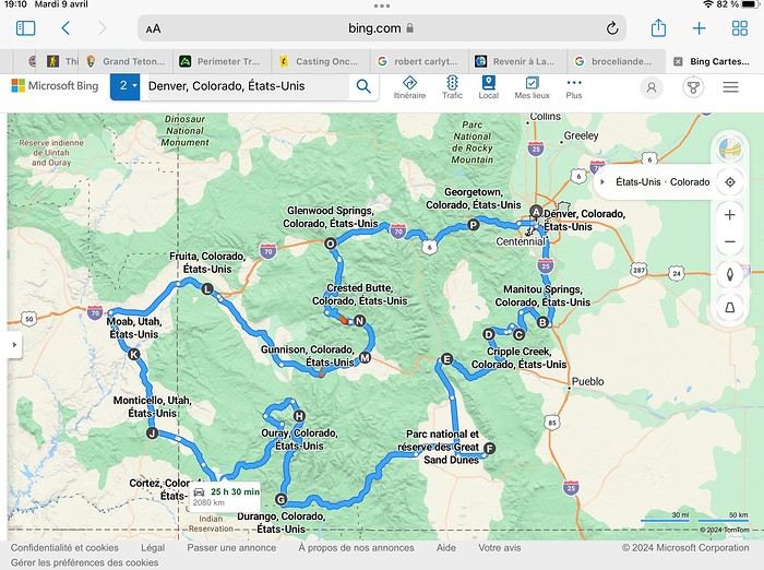
Hello everyone! 🙂 So many silent months, and now Voyage Forum is accessible again. That’s cool because we can pick up our discussions for our mutual enjoyment. I hope everyone is doing well and that you’ve been able to take some great trips, whether to the USA or elsewhere. In September 2020, we had planned a round trip to explore Colorado, but unfortunately, a nasty virus messed up our plans, closing borders and keeping us stuck at home. Luckily for us, canceling the car, flights, and accommodations didn’t cost us a thing—everything was refunded. In 2023, a loop from Las Vegas let us revisit places we’d seen in 2017 and discover new ones, this time spending more time at each stop with some lovely hikes. In 2024, we finally revisited the 2020 plan, and I’ll start with that. However, unforeseen circumstances mean I have much less time than before, so I’ll keep my trip reports shorter (ha ha ha—you’ll have less of my prose to endure). Another change: for those who remember the "Gang of Four crazy sixty-somethings," it was just DD and me this time. Our dear Mimi and Maumau left the Var to focus on raising horses and can’t leave their little green paradise to join us anymore. We were unfortunately much tamer without them. We traveled from September 11 to October 3.

The itinerary


Day 1: Flight Marseille-Paris-Denver, then Manitou Springs (133 km) Day 2: Manitou Springs (49 km) Day 3: Cripple Creek (104 km) Day 4: Salida (254 km) Day 5: Great Sand Dunes (231 km) Day 6: Durango (283 km) Day 7: Durango (Durango-Silverton train) Day 8: Ouray (121 km) Day 9: Ouray (Perimeter Trail hike) Day 10: Cortez (213 km) Day 11: Cortez (Mesa Verde National Park, 134 km) Day 12: Monticello (268 km, detour to Chesler Park) Day 13: Moab (171 km, Delicate Arch) Day 14: Moab (98 km, Fisher Towers) Day 15: Moab (171 km, Canyonlands) Day 16: Fruita (210 km, Colorado National Monument) Day 17: Crested Butte (224 km via Kebler Pass) Day 18: Crested Butte (57 km) Day 19: Glenwood Springs (150 km) Day 20: Glenwood Springs (118 km, Rifle State Park) Day 21: Georgetown (258 km via Independence Pass) Day 22: Denver (123 km), then return flight

We speak very little English. We spent 21 nights there and covered a 3,400 km loop by car and 160 km on foot (we’re still trying to hike while we’re in shape) from Denver in September 2024. We wanted this road trip to help us explore Colorado a bit more—we’d only spent 6 nights there in 2019—and to see it during the fall foliage season. We also wanted to return to Utah (we love Moab) to enjoy its red rocks, which we adore.

In the prices you see (some in euros, others in dollars), I’ve included bank fees and exchange charges. The flights, car, and parking were paid by credit card when we booked in February. Usually, we book around November, but some obligations kept us from doing it earlier. We downloaded the MPC (Mobile Passport Control) app on our phone, which saved us time at immigration.

📊 **Budget: just under 8,500 € for both of us, all included**

📊 **Flights** Marseille-Paris (CDG)-Denver: 2,152 € for both of us, with one checked bag each

📊 **ESTA and America the Beautiful Pass** The ones from our 2023 road trip were still valid

📊 **Parking at Marseille airport: 122 €**

📊 **Car: Nissan Rogue (the French X-Trail) from Hertz: 1,165 €** By booking through Air France (and earning miles), we got a 15% discount. Hertz offers a free Hertz Gold Plus Rewards program, which gives us priority counter service.

📊 **Accommodation: 3,050 €** We stayed in motels and hotels of various ranges (from 100 € to 270 € per night, depending on the city), all booked through Hotels.com or Booking. Booking sometimes offers cheaper rates if you book via the "Booking mobile" app. We also got some preferential rates thanks to our Genius 2 status. Out of 21 nights, only one place didn’t include breakfast.

📊 **Other expenses (activities booked by credit card before leaving)** Durango-Silverton train: 210 € (we booked the enclosed vintage coach in March) Mesa Verde: Balcony House: 15.15 € (booked 14 days before the visit) Timed-entry passes for Arches National Park: 6 € for 3 days (booked June 1 for September entries via http://récreation.gov/). We booked three different days to play with the weather.

📊 **Supplementary insurance with AVA: 204 €** (due to our age 😅 and the high cost of medical consultations in the USA)

📊 **Cash: 1,540 €** We left with 1,000 € exchanged before departure and made two withdrawals (500 $ and 200 $). This cash was used to pay for: - Evening restaurants and tips (between 70 $ and 95 $ for two meals and two drinks) - Two state parks: Dead Horse State Park (20 $) and Rifle State Park (10 $) - The Monarch Pass gondola (24 $) - Midday picnics - Gas (slightly cheaper with cash): 204 $ for 3,400 km - Personal souvenirs and little treats.

Like in our previous road trips, we didn’t rent a GPS. We used the offline GPS app Here We Go, for which we’d downloaded maps of Colorado and Utah from France, as well as a new offline app called Organic Maps as a backup—though we didn’t end up needing it.

❤️❤️❤️ **Highlights (there are so many!)** 📍 The stunning landscapes of Colorado, especially with the fall colors 📍 A step back in time at the old farm in Florissant Fossil Beds National Monument 📍 The prairies of Cripple Creek and the mining remnants of the Vindicator Trail 📍 The cheeky chipmunks in the ghost town of St. Elmo 📍 Great Sand Dunes and its soft sand 📍 The steam train between Durango and Silverton: we’re glad we chose the round-trip because it rained heavily on the way there, but we got to enjoy the scenery on the way back when the sun came out 📍 The unexpected meet-up with Michèle from the group outside a restaurant in Durango 📍 The hot springs in Ouray 📍 Mesa Verde and its still-vibrant past 📍 The red rocks of Moab and Delicate Arch at sunset 📍 The lace-like Fisher Towers and the view from the end of the trail 📍 The gorgeous Route 128 leading to Colorado National Monument—small, easy to visit, and so beautiful 📍 The colors of the fabulous Kebler Pass, Crested Butte, and especially the hike through the golden aspens (Lower and Upper Loop) 📍 The waterfalls at Rifle State Park 📍 The tundra of Independence Pass 📍 The Halloween decorations in Georgetown and Idaho Springs

😞😞 **Flops (there are very few!)** 📍 The viewpoints we missed because they weren’t well-marked or we didn’t see the signs 📍 The closure of some hiking trails (Hanging Lake and parts of Canyonlands) and the Sal Mountain Loop road, which kept us from accessing it 📍😢 The Chesler Park hike we had to cut short due to poor time management—180 km between our stop in Cortez meant we didn’t arrive until 10:30 AM, way too late for a 17 km hike.

Hope this helps! Have a great evening, everyone, and see you soon! 😊
Open
21-Day Trip to La Gomera and La Palma
Travel Journal: 21 Days in La Gomera and La Palma From February 6 to February 26, 2024

Tuesday, February 6 We left around 9 AM with our car, along with Pierre-Paul and Patricia, heading to the Bluepark parking lot in Bartenheim. As expected, we were awaited and left promptly for EuroAirport Basel. Took off at 12:25 PM for a 4-hour-15-minute flight under excellent conditions. Beautiful arrival in Tenerife with Teide in sight under a clear blue sky. Fifteen minutes later, we waited for bus No. 40 to Los Cristianos with quite a few other tourists, but we managed to find four seats. From the bus station, it was a 20-minute walk to our hotel. We checked into a lovely apartment for the four of us, complete with all the comforts. Outside, it was quite warm—at least 25°C! After dropping off our luggage, we went for a stroll. The immediate surroundings of the hotel held no interest for us: a modern, concrete area filled with hotels, bars, tourist agencies, and unappealing restaurants all offering the same bland international cuisine. Pat went to cool off at the pool, unfortunately overrun by loud, drunk English tourists. I took a walk to the paseo maritimo that leads to the port, skirting the seafront. The promenade was pleasant, but it could have been any seaside resort in the world—same old scene: a succession of bars with blaring music where many elderly people sipped cold beers waiting for the sunset, the backdrop a wall of resort-style hotels resembling rabbit hutches! Upon reaching the port, I scouted the route we’d take the next day to the Fred Olsen ferry. Back at the apartment, in the early evening, we looked for a non-touristy restaurant for dinner. Monique stopped a woman to ask her opinion! In this area, she told us, there’s no restaurant that serves Canarian or Spanish cuisine! The only place with decent restaurants is at the port. Off we went to the port, where we sat down at Al Bordo restaurant and ordered a seafood paella for four. Excellent, and at a very reasonable price (36 € for two). We returned to the hotel along the seafront.

Wednesday, February 7

Woke up at 6 AM. Had breakfast in the apartment with what we’d bought the day before at a supermarket. It was still dark when we left on foot toward the port, walking along the calm seafront at this early hour. Forty minutes later, we arrived and waited 10 minutes before the ferry docked. At 9:30 AM, we left the port of Los Cristianos for a 50-minute crossing on a calm sea under a beautiful blue sky. There were quite a few people on this large ferry, but many had no luggage, meaning they were visiting La Gomera for the day and would take the ferry back in the evening. Upon disembarking, we went straight to our rental car agency to pick up the car we’d booked online a few months earlier. It was a nice Peugeot 2008, spacious enough for the four of us and our luggage. We immediately took the beautiful road from San Sebastián that climbs directly into the mountains toward our rental in Vallehermoso. The road was in perfect condition—it seemed brand new, like all the others we’d take on this island later. This side of the island is very arid with little vegetation, and the terrain is particularly rugged, as it is throughout the island. We stopped at our first miradors, which would be followed by many more throughout our Canarian trip. Our first visit was to the small village of Agulo, perched on a promontory above the sea and at the foot of a high cliff. The village features typical Canarian houses with windows flush with the façade and black volcanic stone masonry on white or reddish-brown walls. The first recommended restaurant was already booked for a group, so we settled for the shaded terrace of the excellent El Alameda bar-restaurant. From Agulo, you can access the Abrante viewpoint via a winding road, where the view of Agulo, 600 meters below, is exceptional. A glass ledge over the void lets you test your fear of heights!

We drove to Vallehermoso to do our grocery shopping at the supermarket—a habit that would continue until the end of the trip. Our little house, "Casa rural El Encatadora," is located in a beautiful flower-filled valley a few kilometers west of Vallehermoso. Each of us had a bedroom with an en-suite bathroom, plus a living room, kitchen, and a small terrace overlooking the quiet street at the valley’s end, which didn’t bother us at all.

Thursday, February 8 The good weather seemed to follow us since our arrival in the Canary Islands. This morning, we took the road—still as beautiful and new—toward Arure, high up to the west. The landscape was magnificent, with breathtaking glimpses of the sea far below. In Arure, we parked in front of Conchita’s bar, where a hike (Rother No. 30) starts toward two viewpoints: Alojera, which we reached after 45 minutes on a lovely path. Monique, tired from the first steep climb, stopped at the first viewpoint and hitchhiked back to Arure. Meanwhile, we continued toward the second viewpoint, Los Barranquillos, where the view of the surroundings was partially hidden by misty clouds rising from the sea. The entire mountain is sculpted by ancient, endless terraces climbing until the slope becomes too steep for construction—visible traces of the hard work of past inhabitants trying to survive in a harsh environment. We had a decent lunch at La Conchita bar, then drove to the small seaside town of Puerto la Caleta, sheltered by an immense cliff plunging into the sea. Black sand beach, rough sea—despite our encouragement, Pat didn’t dare to swim! As for the old village of Caleta, it’s perched on the mountainside, and visiting it requires climbing steep, stair-filled alleys to discover a few traditional houses. Back at the casa, dinner in, and card games...
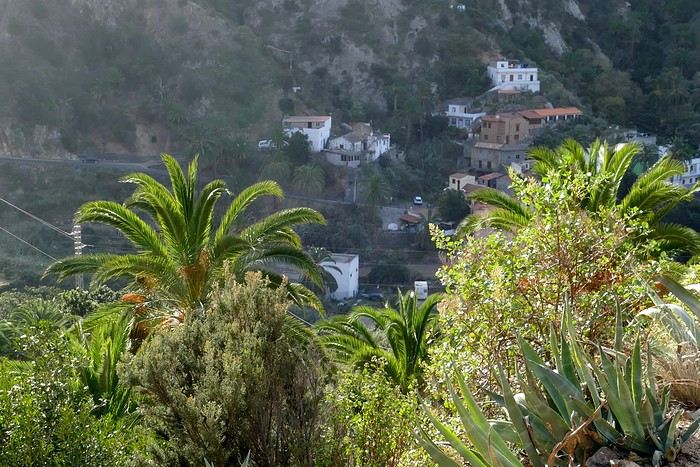
Vallehermoso

Friday, February 9 This morning, the sky was overcast, and the peaks around us were shrouded in clouds. We took the same road as yesterday to hike Las Creces. Quickly gaining altitude, we entered a thick fog—visibility was very limited. We stopped at the Las Creces parking lot; visibility improved, and the sun wasn’t far off. The hike is entirely within a beautiful laurel forest, with the sun playing hide-and-seek, but it wasn’t cold despite the altitude. After finishing the loop trail, we decided to picnic—not there, as it was too chilly—but on Vallehermoso’s beach, where we found a nice picnic area sheltered by large black rocks. A short digestive walk on the surrounding hill to admire the little beach from above. Back in Vallehermoso, we did some grocery shopping, then tried to return to the casa—only to find ourselves locked out because we’d left the key in the lock inside! After several attempts and with the help of Yéli, a relative of the owner we called for help, we were finally able to get back in!

Saturday, February 10

It rained last night, and the sky remained overcast. Monique decided to rest this morning. PP, Pat, and I set off on the hike that starts from the house toward the Marichal reservoir. The sun wasn’t far off, and by 11 AM, it was fully out. The pleasant hike passed by many flower-filled gardens and orchards—orange, lemon, and mandarin trees in fruit. The path climbed gently toward the reservoir, where the view of the Cano rock dominating the landscape was magnificent. The last part of the climb was a bit tough, overgrown with lush vegetation, and the trail was slippery from last night’s rain. We descended via a different, much more pleasant path and returned to the casa just in time for lunch, prepared by Monique. This valley is rich with its many farmers and market gardeners who’ve cultivated the entire valley, taking advantage of the water flowing down from the mountain, captured upstream and redistributed through countless pipes snaking along the paths. Numerous tanks also store water during dry periods. The houses are scattered across both sides of the valley, and these colorful little homes add a beautiful touch to the landscape. The many palm trees give this valley a distinctly tropical feel—you could almost imagine yourself in the Caribbean. Add to that some salsa music drifting from a hut where farmers were working, and the picture is complete. A well-chilled beer apéro capped off a lovely morning. The afternoon was dedicated to rest, relaxation, reading, and games.

Sunday, February 11 The blue sky returned, though a few clouds still capped the highest peaks. Today, we visited Garajonay National Park, which covers the highest central mountains. Up there, we were above the clouds, and the panoramas from the various viewpoints were stunning: first, Cherelepin, accessible from the Laguna Grande parking lot, then Alto de Garajonay, offering an exceptional view of Teide—over 3,000 meters high—emerging from the clouds on Tenerife, far in the distance. We continued to the Los Roques viewpoints, then stopped for lunch at the Degollada de Peraza restaurant, where the view of the barranco was impressive. We descended toward San Sebastián and checked into our new lodging, La Cabezada, located in the countryside about 3 km above San Sebastián. It’s a small apartment adjacent to the owner’s, with a lovely terrace overlooking the surrounding mountains and surrounded by a beautiful garden. Apéro, then dinner on our beautiful terrace.

Monday, February 12 This morning, we went down to visit San Sebastián de La Gomera: its old tower, main street with some beautiful traditional houses, and the Church of the Assumption. Back at the casa for lunch. In the afternoon, Pat, PP, and I set off on the short hike from San Sebastián beach to La Guancha beach. We drove down and parked on the beach. The path climbs along the hill overlooking San Sebastián, passes by the tall Christ statue dominating the landscape, and roughly follows the coast down to the isolated Guancha beach. A beautiful hike under a hot sun, and a swim was welcome, even if the beach and sea access weren’t very comfortable due to large pebbles and quickly deepening water. Apart from two nudist bathers, there was no one on this beach. We returned the same way.

Tuesday, February 13 Rest day. We went down to town to stroll and do some shopping. I took the opportunity to visit the parador, beautifully situated above the city in a lovely garden overlooking the port and town. Together, we went for a cuba libre at the "Cuba Libre" bar, then had lunch at Breñusca (mediocre paella!). Back at the casa, then we went back down to town to see a carnival parade, a "passacalles," which actually passed an hour earlier than scheduled. Oh well.

Wednesday, February 14 Each to their own program this morning. Pat went swimming at San Sebastián beach, Monique rested at the casa, and PP and I set off on the hike from Playa de Avalos to the Ermita de Guadalupe on Playa del Cangrejo. It wasn’t easy to find the right road or the parking spot, but we managed. The path seemed to have suffered landslides, according to a sign at the trailhead! We decided to check it out, ready to turn back if it seemed too dangerous. In the end, apart from one or two slightly tricky spots where we had to climb a pile of rocks, the trail remained passable, though a bit vertigo-inducing in places. The narrow path clings to very vertical cliffs nearly 300 meters above sea level! But what a magnificent view. At one point, the trail runs alongside a wall of basaltic pipes. We returned via the drivable track that parallels the trail a bit lower. Back at the house for lunch. In the late afternoon, we returned to town to attend the "Entierro de las Sardinas" (Burial of the Sardine), which closes the Canarian carnival festivities. While waiting, we strolled through the parador’s gardens and had mojitos in town. Around 9 PM, we heard the noise and cries of the mourners. The procession advanced, led by a large papier-mâché sardine on a float, surrounded by wailing mourners. The procession headed toward the sea, where the sardine was burned, and a mini fireworks display ended the procession. It was all very good-natured, and everyone had fun. We ended the evening with dinner at a good fish restaurant, El Pajar.
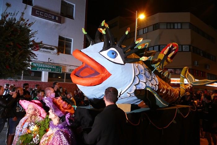
Entierro de la Sardina in San Sebastián de La Gomera

Thursday, February 15

Woke up at 5:15 AM. The only suitable ferry was at 7 AM, which would get us to La Palma by late morning rather than evening. We packed our bags, had breakfast, then headed to the port, left our rental car, and boarded the ferry to Tenerife, from where we’d continue to La Palma. Calm sea, beautiful sun—by 10:30 AM, we disembarked in La Palma. We picked up our car and immediately headed to our new apartment in Breña Alta. It’s a large apartment with a superb terrace facing the sea, fully equipped and very comfortable. The hosts recommended Casa Goyo restaurant, near the airport and close to us. It’s a restaurant with many small rooms, some of which can be reserved for families. The fish-based cuisine (chipirones, pulpo) was excellent, hearty, and reasonably priced. Since it’s in the airport’s flight path, we occasionally heard planes landing. Quick and efficient service. Afterward, we visited Santa Cruz de La Palma, which reminded us of the historic quarters of La Orotava in Tenerife or the capital of Gran Canaria.

Friday, February 16

Beautiful weather, blue sky. We headed to the San Bartolo viewpoint toward the northeast coast, then to the lovely village of San Andrés, which we explored. From there, we walked along the shore to the natural pools of Charco Azul, where we swam in the cool but "swimmable" sea. Back in San Andrés for lunch at the "San Andrés" restaurant on the beautiful church square. Very good fish-based meal. We got back in the car and continued along the north coast to the port of Espindola and the natural pools of Fajana near the Cumplida lighthouse. A fairly strong wind whipped up beautiful waves crashing onto the rocky coast in bursts of foam. Back in Santa Cruz, we stopped at the Mercadona supermarket to buy fresh shrimp for dinner. San Andrés
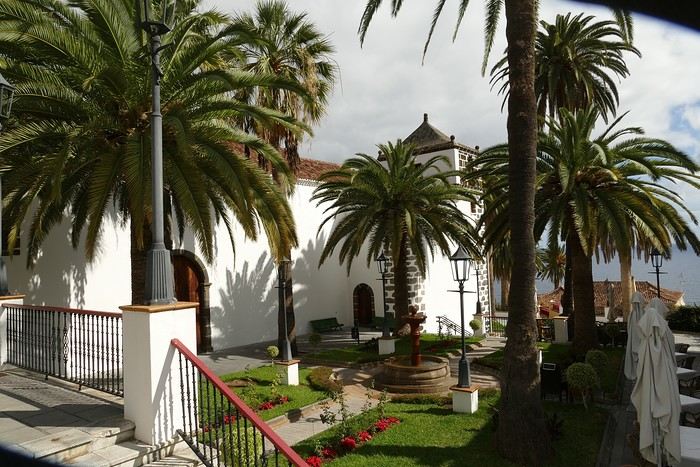
Saturday, February 17

Uniform blue sky, even on the heights. We took the beautiful road that winds up to the summit of the Caldera de Taburiente. Several viewpoints offer 360° views of the entire island and beyond: you can make out La Gomera, El Hierro, and, of course, Tenerife with the perfect triangle of Teide. We parked at the Los Andes viewpoint parking lot and started our hike to Pico de la Cruz along a trail following the ridge, offering superb views into the caldera. We got back in the car and passed by the Roque de los Muchachos astronomical complex, composed of numerous observatories, some with very aesthetic mirror telescopes. We hiked from the Roque de los Muchachos parking lot to the various viewpoints, always as impressive. Picnic on site, then back to Santa Cruz. We stopped by our car dealer because the oil warning light came on—better safe than sorry. The representative reassured us but preferred to give us a Fiat Cross SUV instead. The Caldera de Taburiente
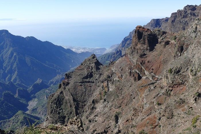
Sunday, February 18 The weather was a bit mixed, with cloudy patches. We set off to hike the Barranco de la Cuba de Galga. Unfortunately, the Los Tilos trail had been closed for several months due to a major landslide. The parking lot by the road was already quite full, and indeed, we crossed paths with many hikers along the way—it’s an easy hike with little elevation gain, which is rare here in La Palma! The beautiful path winds through a very narrow, deep gorge covered in lush tropical vegetation—you’d think you were in a Southeast Asian forest, especially with the humidity in the gorge bringing out earthy and floral scents. Halfway through, Monique turned back while the rest of us continued to the Cuba de Galga. A light drizzle accompanied us on the return. For lunch, we went to Chipi Chipi restaurant in the heights of Santa Cruz. The cool air forced us to leave the lovely terrace for the slightly noisy dining room. The meal was very good and hearty. Afternoon spent resting at our house.
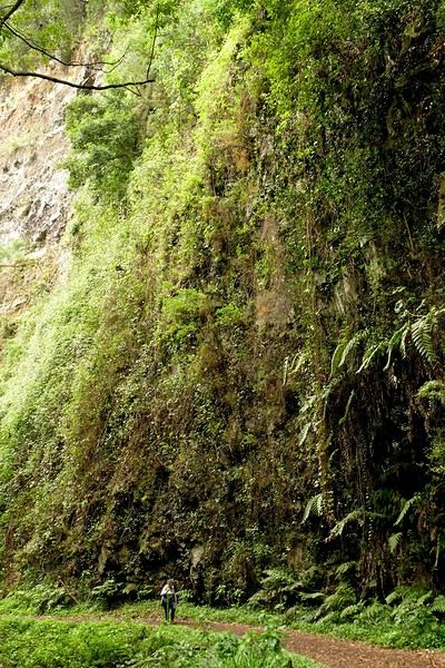
La Cuba de la Galga

Monday, February 19 A few clouds still clung to the nearby mountain peaks. We headed south to Los Canarios. We stopped in front of the small San Antonio Abad church, where a path leads to the viewpoint in 15 minutes. Then we visited the San Antonio Volcano Interpretation Center and climbed to the viewpoint via the trail along the crater’s edge, offering a plunging view into the crater. Then PP, Pat, and I headed toward the Teneguía volcano but turned back given the remaining distance and the intense heat bearing down on us! Plus, the landscape was rather arid and not very interesting. We got back in the car and drove down to the salt flats at the island’s southern tip. The ocean crashes here in large waves, exploding against the volcanic rocks and feeding a "blowhole" carved into the rock. We stopped for drinks at the salt flats restaurant, then headed home. The salt flats in Fuencaliente
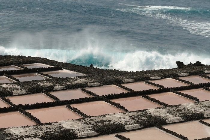
Tuesday, February 20 Beautiful weather with a few clouds clinging to the mountains, as usual. A relaxed morning since my parking reservation at La Cumbrecita didn’t start until 1 PM. It takes about 30 minutes from Santa Cruz to reach the valley floor via a beautiful but narrow road toward the end, though there’s very little traffic. Meanwhile, the clouds had disappeared, and the view from the La Cumbrecita viewpoint was superb. We recognized Pico de la Cruz in the distance, where we’d been a few days earlier. We then took the path leading to the Las Chozas viewpoint through a magnificent Canarian pine forest. We picnicked on site, then took the path to the Los Roques viewpoint. We returned the same way since the direct route was closed for construction. Back in Santa Cruz, we visited the Sanctuary of Las Nieves, with its beautiful golden Baroque altar. Hike from La Cumbrecita
Wednesday, February 21 After packing our things and loading the car, we left Santa Cruz under a very blue sky for Los Llanos de Aridane, where we stopped to visit this lovely town. The Church of Nuestra Señora de los Remedios has a beautiful coffered ceiling and an original papier-mâché Christ statue from the 16th century. Around it, colorful old Canarian houses brighten the streets of the town center. We took the opportunity to stroll, do some shopping, and finally sat down at La Pergola restaurant for a mediocre lunch. We got back in the car to check into our new house in Arecida. On the way, we stopped at the Mirador del Time, which once again offered an impressive panorama, allowing us—for the first time—to see the damage caused by the Tajogaite volcano eruption in 2021. You can clearly see the still-smoking crater and the large black lava flow covering the landscape down to the sea. We really liked our new accommodation: a local house that’s been renovated on the heights of Arecida, not far from the Canarian pine forest. From several terraces, we have a 360° view of the sea and mountains. We even have a private pool! There are two beautiful, brand-new bedrooms, each with its own bathroom—the best. Plus, we’re on the GR 131 trail that runs along the Barranco de las Angustias toward the northeast.
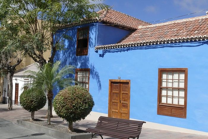
Los Llanos de Aridane

Thursday, February 22 Once again, beautiful weather greeted us when we woke up. We started the GR 131 with the goal of reaching the Torre del Time viewpoint—about 400 meters of elevation gain. The path, quite steep at first, winds through a superb Canarian pine forest. A few viewpoints let you appreciate the sheer drop of the Barranco de las Angustias—watch out for vertigo! At the Torre del Time viewpoint, there’s a nearly 1,000-meter vertical drop. We returned via another path, the PLP1, which meanders first through this beautiful forest, then along lovely flower-filled gardens adjacent to beautiful properties that cascade from the forest down to the road serving these neighborhoods. This afternoon, we tried to get closer to the area devastated by the 2021 lava flows. Several roads are still closed or reserved for residents, while others—brand new—have been rebuilt to open up this densely populated and cultivated region. In some places, the lava flow slightly diverted, sparing some properties that logically should have disappeared. Now, they’re encircled by a massive cooled lava field. In other spots, twisted and charred metal scraps or greenhouse remains protrude from the lava—all that’s left of the former banana plantations. A little higher up, you can see the slightly smoking crater of Tajogaite, responsible for this disaster. Back to Casa Barreros.
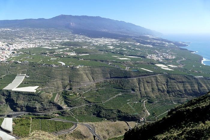
View of Los Llanos and, in the background, the 2021 lava flow

Friday, February 23

Though the sky was still blue, the temperature had dropped due to a chilly wind. By midday, it still rose to 22°C. Today, we headed north, specifically to the town of Tijarafe, where a very narrow road descends to the small port, Porís de Candelaria. The 3.7-kilometer road drops 700 meters in elevation, with gradients up to 30%—it was going to be intense! Indeed, the descent was scary, with the void right next to the very narrow road where passing was impossible except at a few rare spots. Everything went well—there was little traffic at this early hour. From the parking lot at the bottom, a path leads to Porís de Candelaria. It’s surprising to see this small fishing hamlet nestled in the shelter of an immense cave opening onto the sea, which was quite rough today. The sun, at this time of year, would appear late in the cave, which remained in shadow for much of the day. We returned via the same road, strolled through the small town of Puntagorda, and had lunch at El Jardín de los Naranjos restaurant—excellent meal. Fishing hamlet of Candelaria
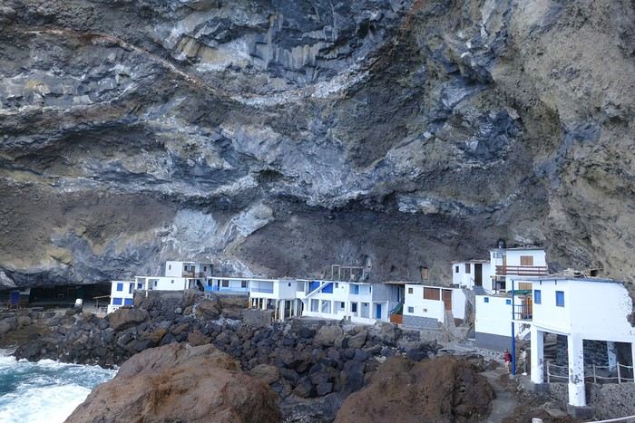
Saturday, February 24 The air was still cool, but the sun was beautiful. While Monique stayed home to rest, the three of us headed to the village of Las Tricias to hike the Buracas Caves trail. We left the car parked on the LP1 road and took the small paved road down to the sign marking the trail’s start. The signage for all the trails we took here, as in La Gomera, was very well done. The path descended steadily, then more steeply toward the caves where the island’s first inhabitants lived—some petroglyphs are still visible in certain caves. The path then climbed back up, passing magnificent dragon trees and more or less elaborate huts occupied by Germans who’ve lived here for many years. Back at Casa Barreros for some rest.

Sunday, February 25 The weather once again blessed us with a beautiful day. This morning, we visited the local produce market held on weekends in Puntagorda. You’ll find agricultural products, crafts, and food to keep you going. A little further on, there’s a glass viewpoint overlooking the barranco plunging toward the sea, with a view of the thrill-seekers trying the zip line right next to it. Lunch at Naranjos—definitely a good spot—with their shrimp and spice tagliatelle. Back home for an afternoon of relaxation.

Monday, February 26 We left Arecida under a cloudy sky. Driving up from Los Llanos de Aridane toward the east, an enormous cascade of clouds poured from the mountain peaks into the Los Llanos plain—very impressive. Arriving in Santa Cruz, we went for a stroll, did some last-minute shopping, then had a final good-quality paella at La Chalana on the paseo maritimo. We left the car in the parking lot and took the 5 PM Olsen ferry to Tenerife on a slightly choppy sea, but the ferry didn’t rock too much. Arriving at 7:15 PM, we dropped off our things near the port in our reserved apartment and went for dinner at Abordo—rubbery chipirones. A digestive stroll among the ever-increasing number of tourists in Los Cristianos—restaurants were packed to the brim, the season is in full swing here. Gone is the calm of La Gomera and La Palma, and the laid-back tourism of German hikers among whom a few French were hiding!

Tuesday, February 27 To make our homemade breakfast more enjoyable, we went to buy pastries at the local bakery, then took one last walk on the paseo along the beaches, mingling with the many mobility scooters driven by elderly or disabled people, joggers, and tourists. Last apéro near the bus station, then off to the airport. After a smooth 4-hour-30-minute flight, we arrived in Basel-Mulhouse at 10:20 PM.

THE END

Conclusion A fantastic trip to two islands with magnificent and diverse nature, where landscapes range from desert-like to tropical depending on exposure to winds and clouds. Thanks to the many beautiful viewpoints, you can truly appreciate these exceptionally dynamic reliefs. A hiker’s paradise, the trails are all very well marked, though the choice of easy or moderate paths for "casual walkers" is quite limited. Another notable advantage, in our opinion, is that these islands are very lightly developed—you’ll hardly see any of those ugly hotel blocks that spoil the landscapes of some other Canary Islands. It’s true that the beaches on these two islands don’t meet traditional international tourism criteria: they’re small, with black sand, and often difficult to access. Special mention for the quality of the road network (except for a few small local roads), which seems brand new, well-paved, and well-signposted. We also enjoyed exceptional weather for February, with fewer than three days of gray or rainy weather out of 21.

Almost all the accommodations we chose met or exceeded our expectations, often at reasonable prices: an average of 98 € per night for an apartment or house with two bedrooms for four people.

All photos can be viewed by clicking this link: https://photos.app.goo.gl/G44pPk4g9PW1rNzg8
Open
4 friends discover a piece of North India
Hello fellow travelers!

I’m adding my small contribution to the reopening celebration by posting this travel journal from India, made in January 2024. We’re 4 friends (2 couples), and we did a 3-week loop in Rajasthan, stopping by Delhi and Agra (which, as everyone knows, aren’t in Rajasthan 😛). Delhi - Agra - Jaipur - Bundi - Udaipur - Jodhpur - Jaisalmer - Delhi

We rented a car with a driver from Agra to Jaisalmer, 550 € for 14 days. https://chauffeurpriveeninde.com/fr/

We took the train from Delhi to Agra and the plane (Spicejet) from Jaisalmer to Delhi.

Most of the accommodations were booked on Booking before we left.

I’m sharing this story written by Richard and illustrated by me. We dedicate it to Nathalie and Bruno, our amazing travel companions.

Open
Breathtaking Kyrgyzstan!
This trip had been on my mind for about fifteen years.

But the discomfort of overnight stays, the difficulty of communication, and the prices of the few car rental options kept making me postpone the project.

And then, everything suddenly fell into place—I told myself, it’s time!

The preparations took longer than usual; the destination is still far from mainstream.

A bit of Kazakhstan? Not in the end.

The south or not the south? Yes, in the end.

Pre-book or go with the flow? Only two stops were a leap into the unknown.

To help me find the ideal route, I made great use of this forum (thanks to everyone for patiently answering my questions!), pored over travel journals and blogs (Christian, Jeff), zoomed in on Google Maps and Yandex, and bought the guide published by OunTravela about this destination (the guide has been updated since).

---/---

You’ve got your passport, international driver’s license, bank cards, and euros?

Off we go to Lyon—just one night left before our early morning flight.

Tomorrow night, we’ll be sleeping in Bishkek! (Steak for my partner’s mischievous nephews...)


You’ll find here a post with some practical information.

And here, the version of the travel journal without comments.

---/---

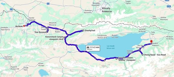
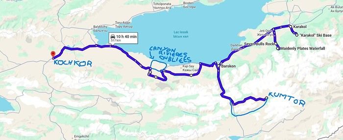
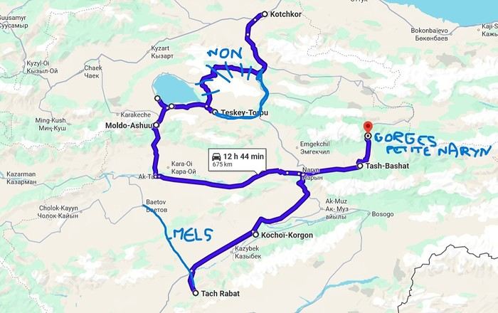
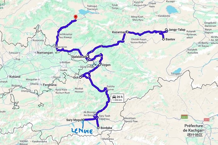
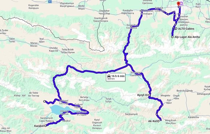
As a supplement, the route track. Not necessarily ultra-accurate since Google has serious gaps for this destination...

From Bishkek to Karakol:


From Karakol to Kochkor:


From Kochkor to Baetov:


From Baetov to Kara-Köl:


From Kara-Köl to Bishkek:


Open
Peru: A Childhood Dream Finally Fulfilled
Preamble

I could have titled my travel journal like Carmen: "Some trips are born twice." Indeed, we had considered this destination back in February 2020. However, an honest tour operator advised us against traveling at that time due to the climate. So, we gave up and opted for Guatemala instead (see "On the Mayan Lands" on this site).

So, why this title? When I was in primary school, over 65 years ago, the illustrations in my history books (Machu Picchu) and geography books (Lake Titicaca) made me dream, and those images stayed in my mind. It took until 2026 to finally make this dream come true!

We prepared our trip with Tout Pérou, a French-speaking "agency." Everything was handled via email and WhatsApp exchanges with our contact: Laurent, who was both competent, friendly, and full of good advice. For 200 €, Tout Pérou provided us with drivers and guides whenever we wanted, helped us buy our domestic flights (cheaper when purchased in Peru), booked shuttles between airports and hotels, and got us a discount on the train ride to Aguas Calientes, as well as on the buses between Chivay and Puno and between Puno and Cusco. In short, Laurent took care of all the logistics and the Machu Picchu tickets. It was up to us to book our hotels. Tout Pérou provided a list, but we weren’t obliged to follow it. Another advantage of the package: we didn’t have to pay in advance; we paid the service providers directly day by day.

We didn’t meet Laurent in person because he was on vacation in Europe. Before his departure, he gave us a briefing, provided a summary table with the entire program, the service providers, their phone numbers, their fees, the schedules, and gave us plenty of advice (money, exchange, safety, etc.). After returning at the end of our stay, he kept checking in on us.

Lastly, we had also gathered information from Arnaud Lagadec, who runs a hotel in Cusco and offers tours of the region. He gave us a lot of useful information. Another contact: Thomas Montaigne, very friendly, who runs an agency in Arequipa (Agence Pérou Exclusif).

Day 1 – Paris to Lima

Foreword I’ll share our trip without any pretension—I don’t have the talent of some contributors on this forum—and I’ll illustrate it with a few photos (taken with an ordinary smartphone). My comments are personal and only reflect my own views. So, please be kind! Feel free to comment on my story as you like, but let’s avoid pointless debates.

Even though we live in the south of the Paris region, true to our habits when the flight is in the morning, we chose to spend the night before our departure in a hotel near CDG and parked our car in a parking lot in Garches. This way, we avoid the stress that often comes with traveling around Paris (accidents, roadworks, traffic jams, etc.).

Check-in and border control went smoothly on that Sunday morning. Our Air France flight was uneventful. In Lima, border control took a particularly long time, and for the first time, we didn’t get an entry visa stamped in our passports.

As planned, a driver took us to the Miraflores district, where our hotel was located. We were surprised by the numerous signs about possible tsunamis, having forgotten that Peru is prone to such events and regularly experiences earthquakes. We’d see the consequences of these during our journey.

Exhausted from the early wake-up, the 13-hour flight, and the 7-hour time difference, we had dinner at the hotel before a restful night.

Note that this day was Peru’s presidential election day. As a result, we weren’t served beer—the sale of alcohol was banned that Sunday.
Open
Oman, at the edge of the sands and the horizon


If I close my eyes and think of the Sultanate of Oman, I first smell a light scent of incense, feel the warmth of a sunbeam on my skin, before sand slips through my fingers. I taste the sweetness of a date, a real candy, then the flavor of coffee with a hint of cardamom and rosewater... I hear the desert wind whistling in my ears, the distant call of a muezzin, then the murmur of water. I open my eyes to see smiles, welcoming gestures, a turquoise sea, rocks ranging from ochre to purple, deep wadis where torrents burst forth, orange dunes, white sandy beaches where tiny crabs scurry at full speed. I see incredible oases emerging between arid mountains. I see abandoned villages that I’d dream were full of life, imposing fortresses overlooking valleys, and lively souks where offers are delicate and negotiation is a mutual courtesy.

All that, and so much more.

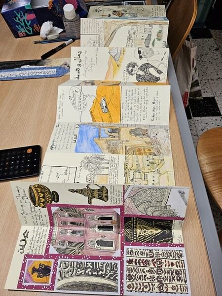
This is what I tried to capture in my illustrated travel journal, which I’ll fill in here and there with photos. I drew this journal “cold,” after my return (actually, I made it this summer, while our trip was last winter). It’s a pretty special format—I bought it in Japan without really knowing what I’d do with it. Well, it found its purpose! Below is a photo of this accordion-style journal: here, it’s only partially open, because when fully unfolded, it’s 5 meters long!


For drawing enthusiasts: The accordion format is both a constraint (each sheet is 9 cm x 27 cm) and a freedom (you can create a fresco). The paper is also a bit special: it doesn’t allow for fine lines, but it takes ink well (liner pen). However, everything has to be done almost in one go (with a very light pencil sketch) because it erases poorly. It absorbs too much water for coloring with markers or watercolors (unless you avoid soaking it), but it works well with oil pastels and their use with a brush and solvent. Since it’s yellowish, it allowed me to create contrasts even with white pastel.

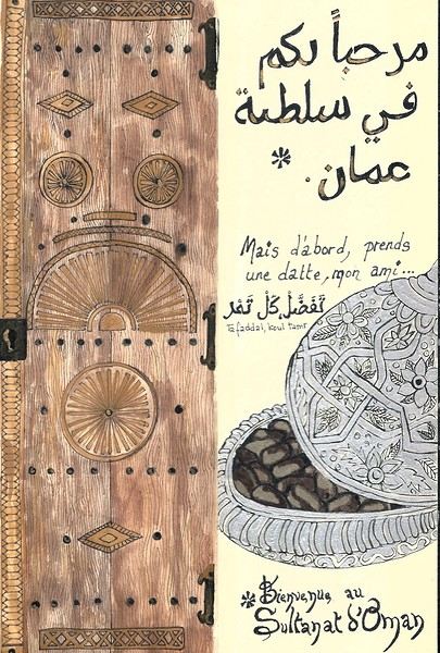
On the right, the "welcome marker"—those dates offered everywhere as a sign of hospitality. On the left, a tribute to those stunning doors worn by time, admired all over the old quarters, including the abandoned ones.
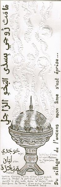


Oman is one of the world’s largest producers of frankincense resin. Incense burners are everywhere, from the simplest clay ones to the most precious handcrafted silver ones...

Hospitality will often lead you to accept a small coffee, an "Omani coffee," very light, subtly flavored with cardamom, maybe a touch of saffron, and occasionally rosewater. Here, I’ve depicted a man in the common everyday attire of Omanis: the dishdasha, mostly white (during the week and daytime; colors are more common in the evening or on Fridays and Saturdays). While you’ll see some men dressed in Western clothes, they’re very few. The white dishdasha is truly the shared attire of all men. The dishdasha, which has no hood, is distinguished by a small pom-pom attached to the collar, the furakha, which is soaked in perfume. And believe me, Omanis go overboard with it! "It smells like the pom-pom" is an expression that’s now part of our shared language, my husband and I. Another must of men’s attire is the kuma, a small round head covering, usually white with brightly colored patterns. The keffiyeh is also worn (but without the cord called an agal in Arab countries), and it’s mostly worn by those with roots in the desert, from what I understood. And what about the women, you might ask? Some are veiled, some in full black (but not a burka—more like a chador + abaya), due to the influence of Saudi Arabia and the United Arab Emirates, whereas the traditional outfit used to be a layering of very colorful dresses. Most of the women we saw wore neutral clothing, a plain veil over their hair, but with their faces uncovered. We also saw many saris and colorful veils—don’t forget that 40% of the population consists of Indian, Nepalese, and Bangladeshi immigrants, who work a lot in tourism, hospitality, restaurants, services, and construction. Just to clarify, as a tourist, there’s no pressure to wear a veil, and never any disapproving looks. Of course, you’ll save the mini shorts, plunging necklines, bare shoulders, and midriffs for the hotel terrace—but I’d say that’s the same for men and women, and with the sun being strong, it’s better for your skin too. Here’s the introduction! In the next post, I’ll tell you about my itinerary, and we can dive in!
Open
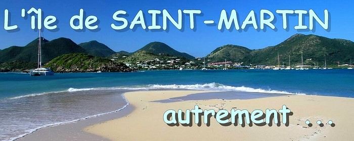
CARIBBEAN: The island of SAINT-MARTIN, a different perspective
When it comes to the Caribbean island of Saint-Martin, it's customary to praise its coastline and dreamy beaches—and they certainly deserve it. But in this story, I’d like to highlight other memories, aspects, and impressions for a slightly different change of scenery. Enjoy the read—some text and, above all, lots of photos. « Byenveni sou zile Sen Maten! » (Welcome to the island of Saint-Martin)
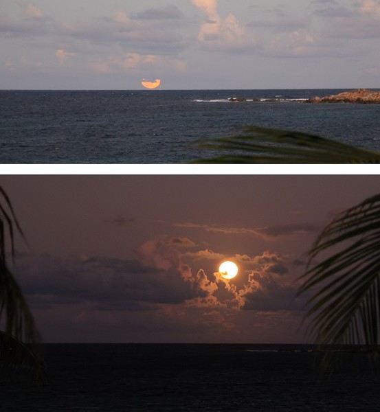
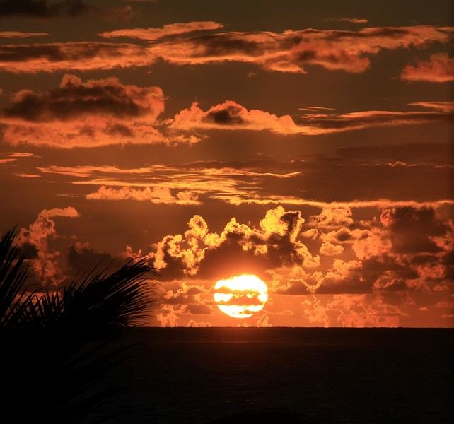
-- -- Full and luminous To avoid seeming too conventional at the start of this alternative take on Saint-Martin... here’s not a stunning sunrise over the sea but rather a moonrise—a less "typical" choice. And when you get to witness it, it’s a truly unique moment of contemplation. However, three conditions are essential for this spectacle: a full moon phase, a cloud-free horizon, and—most importantly—a moonrise at twilight. That early evening, all the conditions aligned—lucky us! Just above the sea, a strange glow gradually appeared. A huge moon was about to shine against a deep blue night sky.


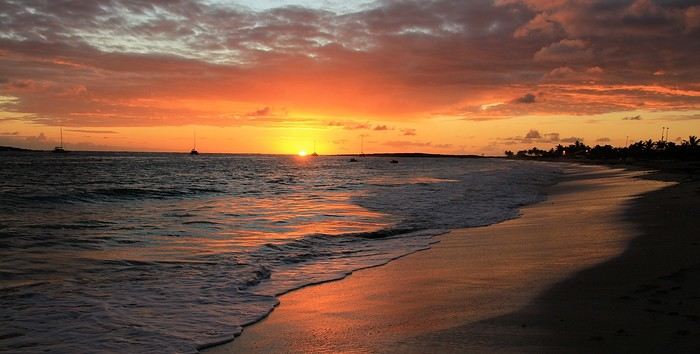
What’s more, its light sparkled on the water’s surface—gorgeous! But so fleeting. We’re on the east coast of the island, by the wide stretch of light sand at Baie Orientale, Saint-Martin’s own. Now, just because I wanted to start with something a little different doesn’t mean we should overlook the bright sunrises you can see on this bay. They’re far more common than a beautiful full moonrise, but they also require two things: being an early riser and a clear horizon without misty clouds. Views to soak in without restraint...


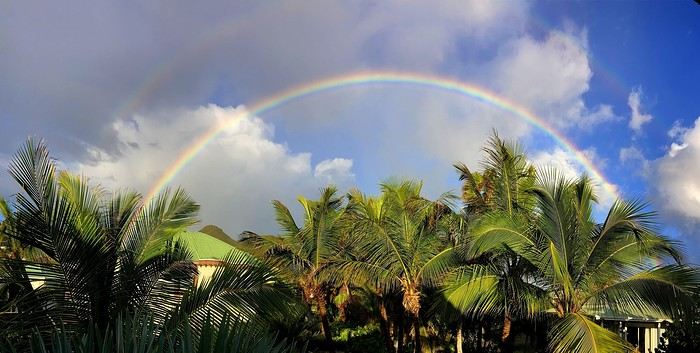
Other memories of beautiful lights and lovely colors—a morning when the sun had a brief meet-up with the rain, creating a stunning rainbow.


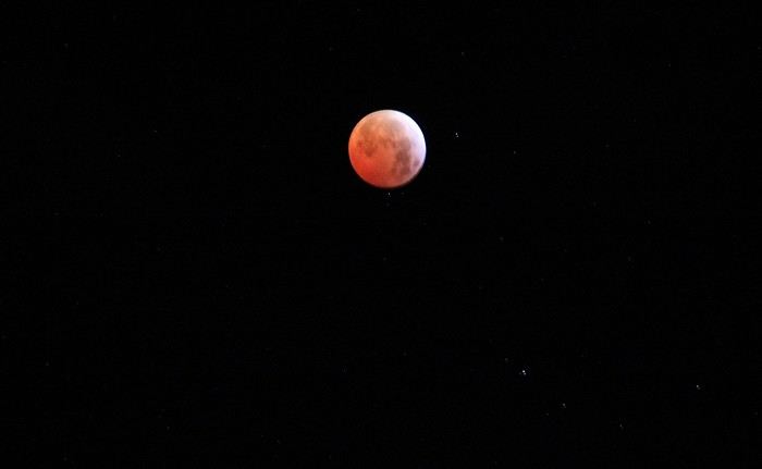
And let’s talk about the moon again... On a clear night, a "blood moon," the result of a lunar eclipse that had turned our familiar satellite red.


-- --

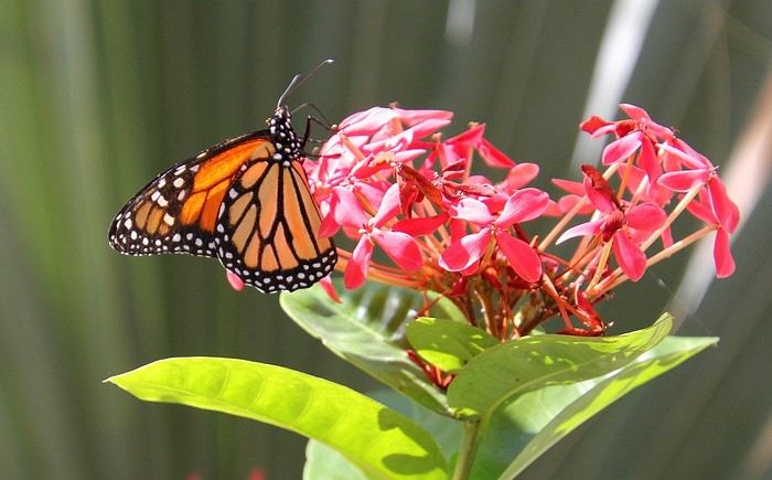
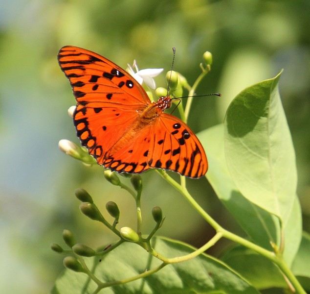
A butterfly with golden wings! In the tropics, swarms of butterflies flutter everywhere, from flower to flower. They sip the sweet nectar from stamens and blooming corollas with delight.


Here, a monarch, one of the great migratory butterflies, taking its time to enjoy the pollen of this Ixora coccinea—or Japanese hydrangea, but let’s stick to Saint-Martin.


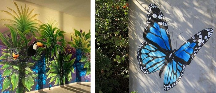
This one is an *Agraulis vanillae*, to be precise—and thanks to the internet for the ID. Photographing them isn’t always easy; these fearless butterflies often fly off before you can get a good focus, challenging both the framing eye and the autofocus! But on the island, I noticed some butterflies were much easier to shoot—those decorating a few murals. ;)


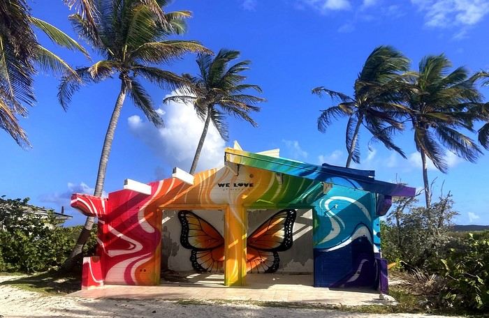
One of the graffiti artists behind several Saint-Martin murals has made it his signature. The talented Jimmy Sheik slips a little butterfly into each of his works, even if it’s not the main subject. It’s a nod to his home island, Guadeloupe, whose territory—with Basse-Terre and Grande-Terre—looks uncannily like a giant butterfly. In the photo above, a great initiative: turning this beach bungalow, abandoned after Hurricane Irma’s (2017) devastation, into a mural canvas—it’s a real success. Well done, artist!

To be continued >>>>>>
Open
7-Day Oman Itinerary
7 days in OMAN Day 1: Muscat for a few hours to gather info on diving near the Dimaniyat Islands. Then a tour of the souks and the corniche. The next day, we dropped our diving plans to focus on a "landscapes" vacation.

Day 2: Headed to the mountains with a picnic stop at Nakhal Fort (so renovated it feels like Disney, but really beautiful). In the afternoon, Maps led us astray on rocky paths—we got a flat, and by the time we fixed it, it was dark. We slept near WADI DAMM. Luckily, we stumbled upon a farm stay in the middle of nowhere, right by the wadi for the next day. We found a café selling amazing dhal with bread—but no utensils!—and a small shop for tea and pastries for the next morning. Day 3: WADI DAMM, a long hike up a canyon—gorgeous but very dry. On the way to Oman’s highest mountains, JEBEL SHAMS! But what Maps said would take 1.5 hours turned into hours on off-road trails. We arrived at the top at 4 PM—stunning, but the sun was already low. We hiked for 30 minutes along the corniche and turned back (Balcony Walk). We drove down to Al Hamra as night fell and found a cute hotel where the guy cooked us an incredible chicken. Day 4: Visited MISFAH, an old mountain village. We descended into the wadi and climbed up the other side for the view—absolutely breathtaking! *** Headed to NIZWA for its fort and souk—nice! Apparently, you should visit Friday morning for the camel market (to be confirmed).

Day 5: Headed to the desert, but first, a stop at WADI BANI KHALIL (great hike, even with crowds). The sandwich on the rocks and the swim before leaving were awesome. We reached the sand desert, left the car, and were taken to camp—just us and two young guys serving tea and meals. So beautiful! The walk around the camp in the dunes was fun, the photos were amazing—overall, a fantastic experience!

Day 6: Walked around the desert near camp after breakfast—gorgeous! They drove us back to the car, then we stopped at a shop for a picnic at WADI SHAB. Crossed by boat, but the hike afterward was great—had to swim in some spots, so bring a dry bag. Found a nice guesthouse by the sea nearby and a restaurant in Tiwi since it was already late.

Day 7: After a failed swimming attempt (the waves were too strong), we went to WADI TIWI—nothing special. Then WADI ARBEIEEN as we headed up the coast to the airport, where we crashed for 6 hours at a hotel before flying home!
Open
The Extraordinary Painted Houses Village of Tam Thanh near Hoi An
Not sure if I’ve already posted this, so here it is again!

https://hiddenhoian.com/travel/tam-thanh-mural-village/

Imagine a peaceful coastal fishing village completely transformed by artists who worked their magic on the walls of 100 residential houses. That’s the remarkable story of the Tam Thanh mural village in Quang Nam province. Once similar to many other coastal villages in the area, it now firmly stands out on the tourist map for day trips from Hoi An. In the summer of 2016, Tam Thanh was selected by a joint Korean-Vietnamese project called “Art For A Better Community.” The village was chosen to be their blank canvas, inspired by the success of mural villages in Korea. The project aimed to make Tam Thanh the first painted village of its kind in Vietnam. The team included five Korean artists and seven Vietnamese artists, along with local volunteers. Their goal was to show Vietnamese people that art could be part of everyday life, no matter their place in society. The effort began with about three weeks of wall washing, followed by painting the walls of over 100 residents’ homes. The project was a success, and the village came alive with the paintings. The entire village is now a breathtaking gallery just waiting to be explored. The murals capture the life and soul of the village, from young children playing to fishermen in the ocean. A mix of fantastic pieces offers stunning backdrops for photos. The painted art around the town hasn’t just had a visual impact—it’s also had a social one. The village was chosen not only for the layout of the houses but also to contribute to economic development opportunities in Tam Thanh. Tourists now visit the once-overlooked village, creating more income for locals and making it a successful “art for a cause” project. For example, one entrepreneurial resident who owned a small local café invested 000,000 VND (390 USD) in a sugarcane press a week before the paintings were completed. Sugarcane juice vendors then multiplied with the growth of tourism (5,000 VND - 0.20 USD). Walking down the village’s single street, it’s common to find locals selling refreshments and handmade crafts. In one house in particular, a tailor and his family are painted on an outer wall with incredible detail. The family started selling tote bags decorated by their young daughter. The price for the bags is 100,000 VND (4 USD). If you’re looking for a way to support the village’s economy, this is it. Since there’s no middleman here, you can be sure your money goes directly to the community. You can have lunch at a house with a terrace right by the beach at the edge of the village.

How to Get There Route No. 1: Cross the large Cua Đai bridge. Once you’ve crossed it, continue toward Duong 129/Duong Ven Bien. Stay on this road for 33 kilometers. Upside: this route has light traffic, no traffic lights, and no trucks or buses. It’s a great direct route to the village but offers little to see along the way. You’ll eventually reach a crossroads. Turn right toward Tam Ky town, while the left will take you toward the Tam Thanh mural village. Stay on Route 608 as it turns twice before reaching a bridge. Cross the bridge, and you’ll arrive at Thanh Nien Road. Finally, turn right to reach the village. This route takes about an hour. Use your best judgment. For reference, it costs about 5,000 VND (0.20 USD) to park a motorbike.

Route #2: Cross the large Cua Đai bridge. Once you’ve crossed it, continue toward Duong 129/Duong Ven Bien. Stay on this road for 12 kilometers, then turn left onto Route 613, where you’ll continue for 1.5 kilometers until you reach Thanh Nien Road. Finally, turn right and drive 23 kilometers to the painted village. For most of the trip, taking Thanh Nien Road will take you through a much more local part of the region. The journey takes about an hour and a half.
Open
First trip to Sardinia from 04/12/24 to 04/21/24
I just got back from Sardinia 2 and wanted to share my little recap with you. It’s a stunning country, and the people are so welcoming. We were lucky to see it at the end of April—I wouldn’t go in July or August because it gets overcrowded and loses its charm!!! SARDINIA 2: 10 days

-Departure from Geneva to Olbia on Friday, 04/12/24 with EasyJet: 1h30 flight -Return from Cagliari to Geneva on Sunday, 04/21/24 with EasyJet: 1h40 flight (Round-trip price: 314 €) -Car rental with Locauto: 250 €, including 51 € for "full" insurance + 87 € (drop-off at a different airport) -Accommodation every night via Booking 13: room + kitchen *OLBIA: Arrival at the airport… wasted time at Locauto because there was only one person at the desk (you can check in online and send the driver’s license and ID, but it was impossible to do!) Headed to our lodging. *COSTA SMERALDA: The part we liked the least… everything feels artificial since the billionaires moved in (Porto Rotondo, Porto Cervo, Baia di Sardinia). We regret not stopping at Golfo Aranci to see its underwater art museum, Mumart. *ARZACHENA and its archaeological park (Tomba dei Giganti: Coddu Ecchju, Li Muri, Nuraghe la Prisgiona) to see in beautiful nature. Coastal road toward Palau (lagoons with lots of birds). *PALAU: Ferries to La Maddalena Island every 15/30 minutes (37 € for 2 people + 1 car). *** La Maddalena is part of an archipelago with 7 large islands and small islets… absolutely stunning… views of Corsica! *** -La Maddalena: A charming little town with narrow streets. -Follow the scenic coastal road that loops around the island for 21 km (gorgeous). -On the east side of the island, take a 600m bridge to Caprera Island (lots of great hiking trails). -Lots of beaches with granite rocks and wild coves. -Return by ferry to Palau. *SANTA TERESA GALLURA: Departure for Bonifacio 2, 4 km to Capo Testa (cape with a lighthouse… granite rocks). Here, there were Roman quarries. *Drive down a beautiful road along the Costa Paradiso (red trachyte). *CASTELSARDO: A fortified hilltop town worth seeing. *PORTO TORRES: Visit the Basilica San Gavino. *STINTINO and its beaches, including La Pelosa with its Genoese tower… too crowded for us! *Viewpoint at Capo Falcone with a view of Parco dell’Asinara (we didn’t have time to go, but it’s a must). *Drive down to Argentiera via small coastal roads (old lead, zinc, and silver mines). A "ghost town" with a museum that’s apparently only open on weekends at this time of year. *Small road (with stunning sea views) toward Grotta di Nettuno (you get there by a long staircase, but it was too windy and closed!). Capo Caccia. *Drive down (along lagoons with birds, including pink flamingos) toward Alghero (historic center: ramparts, bell tower, churches). The city of coral and lobsters! *Drive along the sea to Bosa, a colorful little town (Malvasia vineyards) between the Temo River and the sea. *Road to Montiferru Castle on a volcanic massif—ruins of the castle with a beautiful panorama of rolling hills (cork oak forests, chestnut trees, oaks) and cultivated plots. *** Cuglieri: Olive oil museum *** *Santa Caterina di Pittinuri, S’Archittu (many beaches with limestone cliffs) (many archaeological sites). *SINIS PENINSULA: Cabras and its lagoons with lots of pink flamingos. Archaeological museum with its Nuragic giants. *Archaeological site of Tharros. *ORISTANO: Not much visited, but it has some beautiful buildings. A traditional Sardinian pastry shop—an absolute delight (DELIGIA, Via Figoli 61). *Road surrounded by marshes, along the coast with beautiful little beaches. *Arrival at Costa Verde: The Piscinas dunes and beaches are stunning. Miniera Montevecchio and the surrounding old mines (Iglesiente road) (Naracauli, Ingurtosu). *** Near Guspini, in the mountains, visit the village of Arbus, where many Sardinian knife makers are based. But make the detour to meet Paolo Pusceddu, the master knife maker who opens his workshop and created the *Museo del Coltello Sardo* Via Roma, 15 · +39 349 053 7765. Absolutely fascinating and super interesting… he also sells his knives at very reasonable prices. *Masua (mines) then Pan di Zucchero. *Porto Flavia: Transport of minerals from a port carved into the cliff with two 600m tunnels… the visit is a must. *IGLESIAS: Worth visiting. *ISOLA DI SANT’ANTIOCO: A bridge connects it to Sardinia 2. Drive around the island via small roads. Calasetta (white and blue houses), Nido del Passeri, Cala Lunga, Capo Sperone, Turri. Beautiful beaches and stunning views. *Road to Teulada, then Chia (see the small road from Chia to Tuerredda). *PULA: Archaeological site of Nora. *CAPOTERRA: We ended our trip with a night at an agriturismo in the middle of olive groves, "Azienda Agricola Corte degli Ulivi" (Pixina Sa Murta, Marco: +39 347 246 2361). Unforgettable welcome, eco-friendly place (wooden house with water and electricity self-sufficiency). *Cagliari airport. In total, 1000 km, and we still didn’t finish exploring (the area south of Olbia and the interior are still on the list). The Sardinians are very welcoming. Sardinia 2 is diverse (beaches, countryside, towns, archaeological sites…). We were lucky to visit at the end of April—summer must be awful with the heat and tourist crowds! Easy to visit with kids.
Open
Southwest Part 2: 55 Days in Colorado, New Mexico, Arizona, Nevada, and Utah
This travel journal is the second part of the trip whose first part you can find here: 1st part...

Sunday, August 7: the day we discover a magical place... Edmaier's Secret...

We got up at 8:00 AM, had breakfast on the terrace of our tiny house, and then set off again toward yesterday’s trail. This time, we stopped after 4.5 miles on House Rock Valley Road at the Buckskin Gulch Trail parking lot. We weren’t interested in that trail today—the slot canyon is muddy anyway after the recent storms...

Instead, we explored a lesser-known area that became our playground. And what a playground it was, folks—an out-of-this-world spot, THE highlight of our trip!!! 😏

Just imagine being in the middle of these landscapes, and the cherry on top... no one else around!!!!! Well, we did meet a couple who were coming back—it was 9:30 AM 😮. Did they camp there? Did they turn back? 🙁

After paying the entry permit online, we set off with plenty of water (6L for the four of us) plus a gallon we hid along the way for the return trip. 😉 After a one-hour approach hike along a wash, we reached the sea of sand.


We had to cross it to reach our goal: a strip about 2 km long and 1 km wide that you can explore freely since there’s no marked trail... We entered a few GPS points into our Garmin Etrex, and off we went!!! 😎 It was... magical, enchanting, a true love-at-first-sight moment!


Brain Rock, waves, fine and brittle rock, colors—it goes up, it goes down.


Just thinking about it gives me chills... I remember sitting still for two minutes, taking in these wonders with such emotion that I teared up...


Open
Bike trip: from Carcans Maubuisson to Plaisir (Yvelines)
Monday, August 21, 2023 - Rochefort - Marans

No journal for the first two days. Day 1 - CARCANS-ROYAN Day 2 - ROYAN - ROCHEFORT Tonight I'm in MARANS in the "dry marsh" according to the campsite manager—it’s the first time I’ve heard of a "dry marsh"?!

Photos from the first two days

My gear


The Landes region—nothing extraordinary, but the calm and serenity are nice.


Le Verdon


The wild coast


This marsh isn’t dry, though.

Today is the third day of my trip, and I’m writing to you from a campsite in Marans. I’ve set out to bike from Carcans Maubuisson back to Plaisir. Why Carcans? Because we spent a week there as a family—a great week that lets everyone reconnect for a long stretch. Also, on Saturday, we all headed home—some by car, and me by bike. This journey is about 850 km via bike paths and small cycling roads. It’s not a sporting feat, just a nice long ride for fun. As the old Chinese sage says, "The destination doesn’t matter—it’s the journey that counts." But he also told me, "Traveling is great, but what’s the point if you don’t share it?" You see, this old sage has told me a lot of things—he often keeps me company when I’m biking. Of course, he doesn’t pedal, but we travel in harmony. Sure, he can be a bit annoying sometimes, but we still get along. All this to say I’ve created a group to share my story. I’d be happy to share this experience with you—it’s an adventure for me. On Saturday, I wasn’t sure I’d even leave because I’d been dealing with sciatica for days. Luckily, Juliette, a friend of the old Chinese sage, recommended a lifesaving remedy: Alternately stretching your legs with an elastic band under your foot. Obviously, a jam jar rubber band won’t cut it.

From Marans - The mosquitoes are attacking; time to head back to shelter.

The first two legs took me to Royan and then Rochefort. The Sèvre Niortaise flows nearby, and I followed a canal from La Rochelle. You could say the area is as dry as the marsh, judging by the state of the crops.


As I mentioned, it’s the third day, and if Jesus rose again on this day, for me it was more like the crucifixion. The scorching heat—only bearable when you’re moving—combined with rough trail conditions, and the old Chinese sage says, "Terrible roads, slow speed, and watch your limbs." I set out to do 60 km but ended up doing 80, and the last 20 were tough. I kept checking the GPS to see how much farther until the campsite. Today: Rochefort to Marans, sticking to the coast until La Rochelle, then no notable towns after that—just a constant canal. But since the sky isn’t too low, it hasn’t gotten lost. I’ve still got plenty of anecdotes to share, but it’s pitch black out, and the mosquitoes are still around. This morning, I counted ten in my tent, all full of my blood. Yesterday, at the end of the leg to Rochefort, I was really looking forward to crossing the Charente using the transporter bridge, but a sneaky GPS conspiracy led me far from it. I ended up crossing the Charente on a completely ordinary bridge, watching the transporter bridge in the distance with disappointment.

End of the first episode. Until tomorrow, if you’d like!
Open
Turkey 2026: Riviera, Antalya, and Cappadocia
Hi everyone!

If you're looking for great tips and offbeat spots, if you love exploring uncharted parts of a country, if the exotic is your adrenaline, then move along!

Our 15 days in early May in this part of Turkey (a country I first discovered during a city trip to Istanbul in 2017) will only tread well-worn paths and revisit popular routes. Simply because I kept hoping until the very end that our flight to Jordan wouldn’t be canceled. Events in the Gulf proved me wrong, so we left with: Zero preparation. Not a single hotel booked (well, except the first one), no visits planned, just a flight ticket bought three weeks earlier. No guidebook, no app—just the desire to explore southern Turkey and Cappadocia, whose images and the chance to stretch our legs had caught my eye.

Oh, wait—I did bring along a new guide: Gemini! Yes, my friends, generative AI was my chief advisor throughout the trip for sites to visit, accommodations, routes, and even restaurants! An experiment I wanted to try to form my own opinion on using this new technology. And what better way to test it than a Turkish getaway?

The verdict? You’ll have to wait for the trip recap to find out!

The main idea of the trip is also relaxation.

So, the plan is Antalya for a few days, the Turkish Riviera for a few more, Cappadocia as the highlight, and a return via Antalya to wrap up the trip. And it was all planned by AI!

So, if you're ready, fasten your seatbelts—cabin crew, doors to automatic and cross check—boarding for Turkey now!

A little sneak peek?
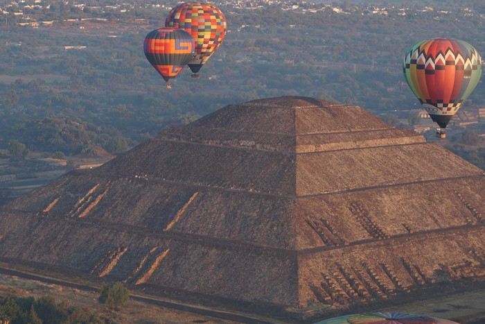
Open
Second trip to Curaçao Island
Returning to Curaçao is a bit like reopening a book whose pages still smell of sun and salt.

As soon as the plane descends toward the island, the familiar colors reappear: the dazzling turquoise of the sea, the pastel facades of Willemstad, and that unique light that seems to soften everything.

For this second trip, we no longer arrive as hesitant explorers, but as confirmed lovers of this warm island.

We already know that the warm wind will welcome us as soon as we step out of the airport, that the beaches will once again offer their infinite shades of blue, and that each day will have that unhurried pace that makes you forget the rest of the world.

Yet, despite this sense of déjà vu, Curaçao always manages to surprise. A new cove to discover, a different sunset, a smile shared with a local...

The island has that rare talent for reinventing itself without ever betraying what makes it so endearing.

This second trip isn’t a repetition, then, but a reunion: a chance to rediscover Curaçao with more attentive, more connected, and perhaps even more amazed eyes.

I invite you to keep reading this travel journal and watch the videos that will help you learn a little more about the island’s different attractions.

Just click on the video image to start watching.

To go to a specific post, here are the appropriate links:

Exploring Willemstad’s colorful neighborhoods The Most Beautiful Beaches in Curaçao Hike at Boka Sint Michiel | Flamingos & panoramic views Climbing Christoffel Mountain Den Dunki & Flamingos of Jan Thiel Must-see spots in Curaçao Snorkeling at Playa Kenepa Chiki: Turquoise Water & Tropical Fish Snorkeling at Porto Mari: One of Curaçao’s Best Spots Snorkeling at Mambo Beach, the Perfect Spot Snorkeling at Daaibooi Beach, a diverse marine world
Open
Densha Otaku - Lesser-Known Regions
Autumn 2025 marks my 11th trip to Japan. I’ve neglected the south for too long, so like last year, it’s my main destination again.

We’ll revisit some familiar spots, but of course, we’ll also try plenty of new things. This trip feels a bit strange—no more of that initial magic, but on the other hand, we’ve really explored some off-the-beaten-path and private locations. The variety of regions, landscapes, and vehicles I’ve photographed is pretty remarkable. In search of vintage trains and threatened lines, I think my future trips will follow the same vibe.

After the 2017 and 2024 travel journals, it’s time to dive into Japan’s lesser-known side—all by public transport, of course. Day 1, arrival in Tokyo

The timing won’t be like other years since we arrive at Narita in the mid-afternoon after a layover in Hong Kong.

The only real mission for this afternoon is picking up tickets for the next day. And already, the first travel stress: I’ll have to rewrite the entire day because the Revaty Kinu 109 to Kinugawaonsen is fully booked, just like all the morning trains. So instead of a relaxed start exploring Ueno, I’m back to scrutinizing schedules. I manage to snag something last-minute after struggling for hours. Then, I wait for a message from Seiichi to meet up for dinner. Meeting friends on the first day and staying up late with jet lag—like I said, this trip isn’t like the others.

A great evening at a place I love.


Open
Off on a winter adventure in the American West!
Day 1 – February 14

We all have two lives. And the second one kicks off the day you realize you only have one, with the determination to spend the time you have left on what truly adds sparkle to your life, Kevin! I like to elegantly introduce a trip with a philosophical quote. First, it gives you the illusion that I’m some kind of deep thinker, and second, it lets me fill up the first few lines of my blank page when I don’t know how to tell you I’m diving back into what really lights up my life: another adventure beyond the horizon! And nearly every other year, like a toxic relationship, my horizon tends to take shape in Uncle Sam’s backyard. And this, despite his cousin Donald calling the shots. Speaking of which, it was partly that impulsive guy who pushed us to be just as impulsive and snag our four flight tickets at a ridiculously low price—a direct result of foreign tourism taking a hit from BetaMax’s repeated antics... Four tickets? Who are the other lucky ones? In this case, our lucky ones are actually lucky ladies: My Flo, always up for exploring the world with me on foot, camelback, or scooter, is obviously in on the fun. The other two seats went to our daughters, Sasha and Luna, both thrilled to be part of this new American adventure...

But what’s the American West like in February?... A gamble. Let’s call it Russian roulette since we’re not landing during peak weather season. That’s why we encouraged our transportation and accommodation to get cozy and produce a little camper van, so we can stay ultra-flexible in the face of any weather tantrums. We’ll be roaming in Kara the van with the motto "Follow the sun!" Bad weather? We bolt. Snow? We speed up. Sunny? We act like it was the plan all along and soak it up.

"Okay, but why keep coming back to the same corner of the globe? After ten American adventures, you must be tired of seeing the same things, right?" But I’m not crazy, you know!... The American West is like making love to your gorgeous wife over and over, always enjoying it just as much. And contrary to what you might think, the American West isn’t just the Grand Canyon, Monument Valley, Las Vegas, and Bryce Canyon. Proof is, after ten trips to the U.S., my retinas are still untouched by three-quarters of the places I scribbled on a napkin for this adventure... Oh, and add to that my wife, who I’ve easily converted to my religion, and boom... relapse is even easier! Because yes, we’ve landed in Los Angeles after a sunny flight over Greenland, still under Danish flag for now. And we’re already heading east through the XXL traffic of L.A.’s eight-lane highways, eager to dive into our first discoveries. But first, night is taking over the sky, and second, we’ve been officially awake for 24 hours, so I suggest wrapping up this intro. I’ll tell you more tomorrow morning. Sound good?


Open
USA Road Trip - November 2023
After staying in Aruba in November 2023, we picked up our camper van, which we had left in a hotel parking lot in Miami, Florida.

This isn’t our first road trip across the United States. Since we’re retired, we took the opportunity to travel along the American West Coast, starting with the Everglades in Florida to visit a few parks where we could spot alligators.

We also made a few stops in Mississippi and Texas to explore the most important cities in those states.

Did you know that Austin is home to the world’s largest urban bat colony? It’s truly impressive to see thousands of them take flight at dusk.

I invite you to keep reading this travel journal and watch the videos that’ll give you a little more insight into these different destinations.

Videos are embedded throughout the summary. Just click on the image to start the video.

To jump to a specific post, here are the relevant links:

FLORIDA:

Big Cypress National Preserve - Ochopee Captain Mitch's Everglades Airboat Tours Marco Island

MISSISSIPPI:

Exploring Biloxi

TEXAS:

Downtown Houston Corpus Christi San Antonio Attractions McNutt Sculpture Garden - San Antonio Mission San José - San Antonio Austin Attractions The World’s Largest Urban Bat Colony - Austin Downtown Fort Worth Attractions Downtown Dallas
Open
Storm in the Canary Islands
15 days across Gran Canaria, El Hierro, and a dash of Tenerife under the storm Thérèse!

The planned itinerary will be slightly disrupted...

(The version without discussions is here)
Open
From Avignon to Casamance Without Flying
Hi there,

Last February, I made a trip using "public transport" from France to southern Senegal via Spain, Morocco, Western Sahara, and Mauritania.

It’s a journey of about 5,000 km, where I took trains (as far as Marrakech), ferries (to cross Gibraltar and then to reach Casamance from Dakar), and mostly buses on the long desert straightaways. I hadn’t planned any stops in advance or booked any hotels, except for the very first train to Spain, which left plenty of room for the unexpected. Why travel by land and sea? In recent years, flight-free travel has been gaining popularity. On social media, posts explaining how to cross Europe by train as quickly as possible go viral. Traveling without flying—and making sure people know about it—has become a great way to earn a badge of eco-responsibility: an essential totem for anyone wanting to prove both their dedication to the ecological cause and the wisdom of slow travel. I haven’t flown in years, and this journey to West Africa could easily be filed under "responsible travel." But it wouldn’t be honest to say that: in reality, it wasn’t really my aversion to flying that motivated this long trek. I see overland travel primarily as a way to experience the world’s geography at a grounded, earthly pace—the pace of the locals. Besides, I’ll be flying back, which disqualifies any claim to being a model of sustainability. So no eco-badge, and no adventurer’s badge either: you won’t find any heroic tales of camel rides in lost lands or mineral train wagons in this account (popular with influencers, the Mauritania iron ore train now attracts tourists from all over the world, turning "the experience" into something you "have to do at least once in your life"). This five-part story, written on the road, has no other ambition than to recount a journey through places and people, and to share the thoughts they inspire in me. As simply and, I hope, as humbly as possible.

I’m posting the episodes here, which you can also find on my blog (with more photos) at the following links:

Episode 1: Spain, from Avignon to Algeciras

Episode 2: Morocco, from Tangier to Tarfaya

Episode 3: Western Sahara, from Tarfaya to Guerguerat

Episode 4: Mauritania, from Guerguerat to Nouakchott

Episode 5: Senegal, from Rosso to Saloulou

To help those who might want to make the same trip, I’ve also put together a summary of the route with recommendations—you can read it at the end of the story and on the blog: From France to Senegal Without Flying: Route and Itinerary Recommendations

Happy reading, and safe travels!
Open
A Brief A to Z of Peru
Foreword This text has been proofread many times. Sorry if some points in this A to Z have already been covered on this forum. Text and drawings by the author.

Peru is still a very vast country, with so much to see, and obviously this text can't list all the attractions of the country.

*Abiseo (River) A national park that's very hard to access and doesn’t seem open to visitors. Includes the Gran Pajaten site (see below). Personally, it really sparks my imagination (not visited personally)

*Aguas Calientes the town next to Machu Picchu, more precisely below the archaeological site. As far as I know, you can only get there by train. Reminds me of the market where stalls line both sides of the tracks near Bangkok. I love it

*Altiplano: somewhere the "heart" of the Andes. I was able to trek across it on foot, starting from Caracollo in Bolivia, and of course, it’s vast plains to explore. This is where people live in a very rural way. Andean populations are quite austere compared to those in the lowlands or on the coast. You really have to appreciate the harshness of life to live there. Life is anything but superficial. I set a compass heading and found myself walking west toward the expanse of water near a place called La Joya. For pitching the tent, the nights were still chilly

*Canyon del Colca One of the deepest canyons in the world. Personally, I hiked down and back up on foot. The toughest stretch I’ve ever covered in my life.

*Ceviche More or less the national dish. A marinade of fish, shellfish, and lime. But you can find it in some restaurants in Europe, France, and certainly in Belgium or Switzerland. In the small restaurants of Pisco, you can eat excellent ceviche

*Cerro Sechín: Mostly bas-reliefs. A site little known to travelers in the Casma province. The first vestiges of a pre-Inca civilization with iconography similar to that of Chavín (not visited personally)

*Chan Chan A large city of the Chimú civilization and relatively vast to visit. You can see adobe walls with bas-reliefs. Visit from Trujillo, take a colectivo. Plan for the whole day

*Charango: a small guitar widely used in Andean music

*Chauchilla A necropolis near Nazca where you can see mummies exposed on the ground. YouTubers can do paranormal experiments there. And for anyone wondering about the fate of the soul and body after death, here’s the answer: the body remains after death. You can imagine your own flesh and body exposed to the winds of the Pampa and before eternity... (not visited personally)


*Chavín de Huántar (Lanzón) The site’s appeal lies in its mountainous surroundings, the Lanzón stela, and the sculpted heads on the façades. What few people know is that the Chavín civilization began its expansion centuries before the Incas. Unfortunately, you can’t get too close to see the Lanzón—the day I was there, it was protected by grilles. To get there: minibus from Huaraz or trek from Olleros. Then cross a high pass (over 5,000m). If you do it solo on foot, be careful—the path isn’t obvious from Olleros

*Chullpa: funerary tower, notably at Sillustani in the Lake Titicaca region

*Chimú: pre-Inca civilization whose center was Chan Chan.

*Chola/Cholitas (Bolivia): typical clothing style of women from the Andean plateaus


*Chompa: pronounce it *Chompaaa!* A common term for a wool sweater with vicuña patterns, often knitted from alpaca wool. If you dress like this, it’s a bit kitschy around the edges

*Cuy That one isn’t a guinea pig like in Guyana but an actual guinea pig. During a trip to Peru, I was hiking near a village north of Quillabamba (the terminus of the train line that passes through Aguas Calientes), and I was invited to stay in a house. The family raised a few of these pets. Apparently, the locals eat them. Since I’m not much of a meat-eater, it doesn’t really tempt me. How about you?

*Pacific Coast or how to talk about a place you haven’t visited? Except for the coast near Pisco and San Andrés, I haven’t visited any coastal cities. But that doesn’t mean these places lack interest or poetry. For fans of clichéd images, pelicans, seabirds, and fishing boats appear by the sea.

*Gran Pajaten: also closed to the public. Features anthropomorphic bas-reliefs. (not visited personally)

*Huaca. Visit the Huaca del Sol and Huaca de la Luna, especially near Trujillo. However, you can skip them—Chan Chan is still more interesting. Don’t forget to spend time visiting Chan Chan

*Huacachina A small oasis in the desert near Ica. Yes, we’re talking about an oasis because for those who’ve never traveled to Peru, the coastal strip along the Pacific is almost entirely desert, from north to south. Peru is territorially made up of three different regions: the desert coast, the Altiplano stretching north to south with mountain ranges (the Cordilleras), and the Amazon basin to the east. (not visited personally)

*Inca Kola It’s neither Coca-Cola nor Pepsi but a unique cola with a slightly orange color. Tastes like bubble gum

*Intiwatana: a carved rock shaped like a parallelepiped. Is it a sundial?

*Ballestas Islands: a highlight in Peru, though very touristy. You can only get there by boat from the port of San Andrés, a few kilometers from Pisco. It’s a surreal place to me—actually islets with cavities where sea lions and fur seals live. Since it’s a protected area, you’re not allowed to disembark. Guano is harvested there, which can be used as fertilizer.

*Kuelap: a fortress built by the Chachapoyas people. Rarely visited by travelers. (not visited personally)

*Larco Museum: an iconic museum in Lima with a large collection of pieces from archaeological and pre-Columbian sites. From what I remember, it has many pieces from the Moche civilization. As for the Moche statuettes, the prudish might look away. Probably a veneration of the god Priapus without knowing it.

*Nazca Lines Discovered by German archaeologist Maria Reiche, they stretch for kilometers. The designs in the desert around Nazca depict animals and cabalistic signs. The question I ask myself is why the creators of these lines represented a monkey and a hummingbird—species endemic to the tropical forest, not the desert plains around Nazca.

*Machu Picchu: means "old mountain" in Quechua. There’s also Wayna Picchu. The ruins of the site emerge from a sort of small plateau above Aguas Calientes. When the mist rises above the site and the bend of the Urubamba River, it’s truly magical... Also the starting point of the Inca Trail.


*Coca tea A decoction/infusion of the coca plant, meant to ease altitude sickness or *soroche*

*Chullo A rough translation would be a Peruvian wool hat.

*Moche: a civilization established in the Moche Valley, hence the term *Mochica*. What characterizes this civilization are the distinctive clay pieces representing faces and erotic statuettes

*Papa a la Huancaína A local potato dish

*Pisac: a typical market near Cusco

*Pisco Sour: perhaps the Peruvian equivalent of the *caipirinha* you drink in Brazil.

*Puya Raimondii A Bromeliaceae that still looks like a cactus, endemic to the Altiplano

*Quechua The language spoken by the indigenous people of the high plateaus (as well as Aymara in Bolivia)

*Quipu A knotted string used for counting. Widely used by the Inca administration.

*Sacsayhuamán (Q’enqo, Inca Bath) From Cusco’s Plaza de Armas, take the streets that climb above the city. Sacsayhuamán is called a fortress and is made up of large stone blocks. You wonder how the Incas could cut such huge blocks to assemble them—just like some streets in Cusco. The Q’enqo block is enigmatic; no one really knows what it represents.

*Savia Andina An Andean folk group.

*Tambo (=> Ollantaytambo) The Inca emperor (Atahualpa, Manco Capac) had the mission of controlling a vast empire. An empire that was still very extensive. Hence the importance of these *tambos* or relay stations. Napoleon created the civil code; the Incas invented the *tambos* and *quipus*.

*Tawantinsuyu: the Inca Empire

*Tinku: a warrior dance practiced mainly in Bolivia

*Golden Tumi: a sacrificial weapon. Often featured in Peru travel guides. See illustration


*Terra X: a documentary series from the German TV channel that aired on Arte. Some episodes focused on pre-Inca and Inca Peru. I must have some old recording tapes. In memory of Gottfried Kirchner as a source of inspiration.

*Uros: I checked—it actually refers to the people who live on these floating islands. Even if it’s touristy, it’s a must-visit because it’s incredible how people can live on islets made from nothing. Take the boat from Puno

*Vicuña, llama, guanaco: camelids characteristic of the Altiplano


*Wayna Picchu The young Picchu mountain. In the first minutes of *Aguirre, the Wrath of God*, you see Klaus Kinski—well, Aguirre—making his way along the Inca Trail. Werner Herzog must have broken his back filming those sequences.

*Zampoña: pan flute
Open
From Mexico to the Wonderful Chiapas


This one-month trip, from January 18 to February 17, 2026, allowed us to visit Mexico City and travel through the states of Puebla, Oaxaca, and Chiapas. We mainly used buses (ADO company) for medium and long distances and colectivos or taxis (or Uber) for shorter trips. Before leaving, I had contacted several people on the ground: Harry, a Vendéan settled in Oaxaca offering, among other things, discoveries of artisan villages or the Monte Albán site, and Oscar in Comitán de Domínguez. I’ll come back to our meeting with Oscar, who runs a local agency (CVL Travel Turismo Alternativo & Corre la voz) and owns a very pleasant hostel, a real highlight of our trip. Our journey took place in 8 stages on a loop starting from Mexico City. The connections between each were made by day or night buses depending on the trip duration. I had booked our seats in advance, either directly on the ADO company’s website or through booking platforms depending on the rates offered. Note that by planning ahead, I was able to benefit from very interesting "Early Booking" rates. There are several comfort classes. For all our trips, I had booked seats in Primera class buses, except for two in GL (Grand Luxe) class. The rates are very reasonable, and the buses turned out to be comfortable or even very comfortable (only the basic seat recline might surprise you).

Our itinerary and number of days per stage: Stage 1 – Mexico City: 4 days Stage 2 – Puebla: 2 days Stage 3 – Oaxaca: 4 days Stage 4 – San Agustinillo: 4 days Stage 5 – San Cristóbal de las Casas: 3 days Stage 6 – Comitán de Domínguez: 6 days Stage 7 – Palenque: 4 days Stage 8 – Mexico City: 2 days If I were to do it again, I’d remove one day from Palenque and add it either to Puebla or San Cristóbal to visit nearby sites or villages, or to San Agustinillo to enjoy one more day by the Pacific Ocean.

Stage 1: Mexico City (2,200 m / 9.2 million inhabitants) We arrived in the Mexican capital around 10:00 PM. The simplified customs process was very quick. After exchanging some money at the airport, we took a taxi to our youth hostel. We got around the capital on foot, of course, but also by metro. Signs are very rare, and we took the train in the wrong direction several times. After a few mistakes, we systematically asked on the platform if we were going the right way. The metro is very affordable. You need to get a rechargeable card (the Tarjeta de Movilidad Integrada) and top it up as needed. This card (less than 1 €) isn’t personal, so there’s no need to get one per person.

Mexico City: Day 1.


Visits and walks of the day (note: many museums are closed on Mondays): The Zócalo or Constitution Square: it’s one of the most beautiful, largest (195m x 240m), and oldest squares in the world. This is where Cortés decided to build the center of the new Spanish city on the site of the former Tenochtitlan market. Stones from the pyramids were used to pave the esplanade and build the surrounding colonial churches and buildings. During our visit, the huge square was covered with (resin) cacti, the theme of the temporary exhibition at the time. Indeed, temporary events or exhibitions take place here throughout the year. It’s also the endpoint for many protest marches.


The cathedral: it’s sinking by one centimeter per year despite massive stabilization work (the collapse of many Mexican buildings—30 cm/year—is due to groundwater pumping). It was built starting in 1571 and completed in... 1813. The modest remains of the Templo Mayor (exterior view): they have high symbolic value, as this monument was the most important in the Mexica Empire.

We then walked through the streets of the historic center to the Santísima Church, unfortunately closed for renovation work. Next, we took the metro to visit one of Mexico’s most important pilgrimage sites: the Insigne y Nacional Basílicas de Santa María de Guadalupe, as well as the Capilla del Cerrito on the hill. The first, dating from the colonial era, is really leaning a lot.
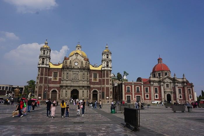


The second, shaped like a rotunda, is very impressive from the inside.


In the basement, there’s a sacred tunic where, in 1531, an image of the Virgin Mary is said to have appeared. A real mystery for scientists, the garment has never deteriorated since that date. Slow-moving conveyor belts allow pilgrims to admire it, preventing crowds from gathering in front of the image for hours. Well thought out!

From the top of the Capilla del Cerrito, you get beautiful views of huge Mexico City.
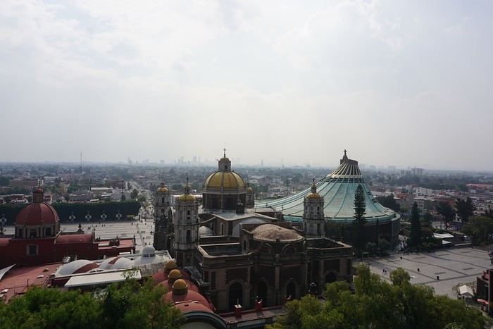
Open
Costa Rica: The dry season isn't what it used to be!
Introduction: For years, I’ve heard about Costa Rica, which seems like a country "made for me"—nature, not cities. I almost went in 2019, but a family issue made me cancel. Initially, I wanted to spend at least three weeks there, planning to go in our summer despite it being the rainy season. Then I realized what I wanted to do could fit into two weeks, so I ended up going in February. Plus, January’s weather was so awful that some sunshine should do me good. I found a flight at a decent price, but with two downsides. The first is that it leaves from Paris CDG, and the second is that it’s with Air France—a airline I’d sworn off after my misadventures with them back in 2008. We’ll see how it goes!
Open

You might also like