Discussions similar to: Crète Printemps 2024
FR

137 similar discussions in English

Spring getaway in search of Moroccan sunshine
Hey fellow travelers!

This isn’t meant to be a full-on travel journal—just a little springtime dip into the Moroccan coast (and maybe a bit more if we click).

For our third trip to this country, we set off for 8 days in early June 2025, *sure* we’d be greeted by non-stop sunshine...


...and well, that didn’t happen! The gray stuck around for a day, then two, then three (while back home in the Landes, we had gorgeous sunshine 🤦‍♂️😂).

Now, unlike us, the Morocco experts here probably already know this, but apparently, it’s pretty common—especially in spring—when the warm air from inland meets the cool ocean breeze. Locals even have to warm up with hot water bottles, can you believe it? 😄!


And of course, it had to happen now, since our plan is to follow the coast from Essaouira to Mirleft!!

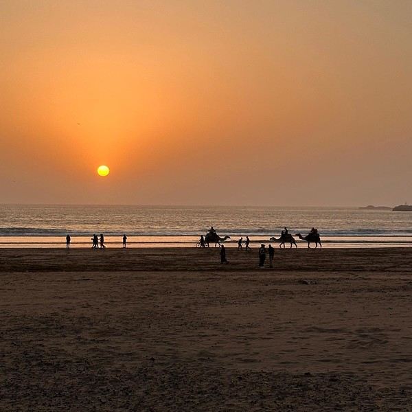
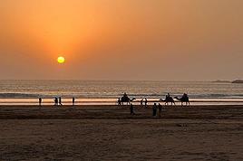
Oh well, we’ll see how it goes—but luckily, this first stunning sunset made up for the weather 🌅.


See you soon to anyone who’s up for it! 😊
Open
Biking Across New York State on the Empire State Trail
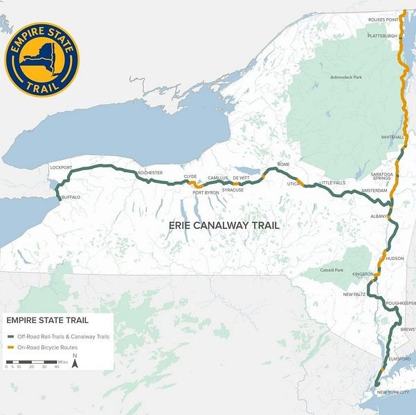
From Buffalo to New York City, the Empire State Trail is a 900 km route specifically designed for biking, with 75% on dedicated bike paths.


A special train with bike spaces runs almost the entire route. First along the Erie Canal to Albany, then through the Hudson Valley all the way to the tip of Manhattan. This lets you skip sections and also return to your starting point without having to take a flight. Just be aware that bike spaces need to be reserved and can fill up during peak times. In June, no problem though.

This aspect really appealed to me, since my last trip had kinda put me off biking in the US. But here, 75% on dedicated paths, plus that legendary finish in NYC with your bike—I couldn’t resist celebrating my 70th birthday this way.

https://empiretrail.ny.gov/map Two branches to reach NYC: from Buffalo (mostly on dedicated paths) or from Montreal (mostly on roads) The route was developed in just three years. While it’s popular with cyclists on certain stretches near cities, those who bike the whole thing are still pretty rare. It’s true that the scenery isn’t exactly breathtaking, and some sections—especially along the Erie Canal—can feel a bit tedious, though they’re very easy since there’s no elevation.

The trail starts in Buffalo, but since my bus from Toronto goes straight to Niagara, I’ll be starting at the falls instead. Plus, that’s where the direct train to NYC departs from (and arrives at).
Open
Climbing Haut-Folin via the southern route, in stages
Hello everyone,

I’m so happy to share my climb with you, and if it inspires you to take it on, then it’ll be a success. Sometimes I’ll use the local language because I think it’s essential to connect with the people we meet along the way.

This adventure took place last year, just before winter, right after summer, and smack in the middle of autumn. That really sets the time of year. After climbing Mont-Beuvray—a story I shared here ages ago—I decided to tackle a much more adventurous peak: the summit of Haut-Folin, which rises to 901 m, and that’s no small feat, let’s be honest. It’s located in the Bois du Roi massif. Up there, you often brush against the clouds, which seem to take a mischievous pleasure in wrapping around you.

I’m going fully self-sufficient—no porters, no guide, no cook. I’m just treating myself to a very short approach flight. The flight is early in the morning on a small plane, the *Spirit of St Bernadette*, and it’s perfect. I’ll enjoy watching it deliver mail in the mountains. The pilot will drop me off at the hamlet of *La Pierre en Eau*, near Anost, a small village at the foot of this forest-covered giant.

Physical condition I’m now really seasoned for such an expedition because I’ve trained every day by walking to the village grocery store—round trip, in all weather, that’s 2.1 km. The 451 m elevation gain won’t be a problem for me. .../...

Open
Two weeks under the Puglia sun
After a pretty disastrous weather-wise trip to Gran Canaria, we’re hoping this time the sun will shine in Puglia. It’s not a sure thing, though—the weather’s been awful all over Europe in early May.

For those who’d like to (re)read the story without the digressions, it’s here.

Saturday, May 16: This time we’re flying out of Charleroi (Brussels South): the ticket prices, flight times, and proximity all worked for us. The airport (Ryanair) was recently renovated... but it’s still not very well organized. There are hardly any seats in the boarding areas, and... the restrooms cost money!!! The flight goes smoothly, though, and we land in Bari a little late.

We quickly pick up our rental car, a very local-looking Pandina (even more so than the Fiat 500 in this region), and hit the Italian roads... and their unique driving quirks (like the fact that the countless road signs along the streets and in towns are purely decorative 😏, and that Italian cars don’t have turn signals 😮... except for rental cars).

About an hour later, we arrive at our first accommodation, right in the middle of the countryside near Monopoli. The owner isn’t there, but they’ve left us a ton of info via messages and even turned on the space heater, which is a nice touch. We explore the property:


And the next morning before breakfast, its immediate surroundings:


Sunday, May 17: After our "seaside" experience in Gran Canaria last weekend (packed with people and locals), we decide to start inland. After a hearty breakfast,


we head toward Alberobello, a super touristy village famous for its trulli—those stone houses with conical roofs. We easily find a free parking spot on a street near the Aia Piccola district, where some trulli are still lived in year-round.


We almost immediately come across the Trullo Sovrano (the only two-story one), which you can visit (but we skip it—it’s opening time, and there’s already a line).


From there, we head down toward the Basilica of Cosma e Damiano... but we don’t go in because there’s a mass.


Now we’re on the main Piazza del Popolo, which connects the two districts of Alberobello: Rione Aia Piccola and Rione Monti, the more touristy one.
Open
A Bold Combo: Southern Peru, Bolivia, and Northern Chile
Hello everyone,

For our latest 3-week family trip (yes, the kids are growing up, and two of them are about to enter the working world), we’re heading to South America! For our first time on this continent, I had planned a classic 3-week loop in Peru.

But since we won’t be returning to this part of the world anytime soon, I thought: why not follow in the footsteps of Franck, aka Bibouns51, who, in 18 days, didn’t just stick to Peru but also added two of the planet’s most stunning landscapes to his itinerary... the Salar de Uyuni in Bolivia and its neighbor, the fabulous Atacama Desert in northern Chile !!

So, I set about the tricky task of limiting the regions we’d visit in Peru to those we considered must-sees, to avoid rushing too much. The visit schedules were optimized, including several comfortable overnight buses that have the huge advantage of letting us hop between regions.

So, we’re off on a somewhat adventurous trip with three domestic flights (two on the first day and one on the last), two overnight buses for quick hops, several car rentals, the services of a few drivers to make the trip more comfortable, and even a tour operator for crossing the Salar...

Our main concern is altitude sickness, and we’re bringing Diamox, aspirin, etc., just in case.

Our second worry before departure was not even getting off the ground... Yes, for once, we’re leaving from France—Marseille, to be exact. The week before our departure, with the surprise air traffic controllers’ strike, I remembered why we usually prefer to leave from abroad, like Turin or Barcelona... In the end, it wasn’t the air traffic controllers who made us nervous but the early July wildfires that paralyzed the airport a few days before our departure. Fortunately, the fires were quickly brought under control, and on the big day, everything was smooth sailing!

Detailed itinerary (which changed on Day 1 due to departure hiccups): Day 0: Flight Marseille - Madrid - Lima PERU Theoretical and abandoned Day 1: Flight Lima - Cuzco and visit Cuzco (Puka Pukara, Tambomachay, Cristo Blanco Observatory, Sacsayhuaman sunset) - Night in Cuzco Day 2: Taxi -> Chinchero - Moray - Maras Salt Mines - Ollantaytambo - Train to Aguas Calientes Day 3: Machu Picchu - Return train to Ollantaytambo Day 4: 2-day taxi -> Pisac - Tipon - Andahuaylillas - Huaro - Night in San Pedro Day 5: Palcoyo - Checacupe - Vinicunca - Return and night in Cuzco Day 6: Day in Cuzco (catch-up on Sacsayhuaman, San Blas district, Temple of the Sun) - Overnight bus to Arequipa Day 7: Rental car -> On the road to Colca Canyon, night in Cabanaconde Day 8: Descent to the bottom of Colca Canyon, night at Oasis Sangalle Day 9: Ascent from the canyon - Maca - Chivay - Return and night in Arequipa Day 10: Visit Arequipa (Santa Catalina Convent, La Recoleta Church and Monastery, La Compañía Church, Cathedral) - Overnight bus to Puno Day 11: Lake Titicaca - Night in Puno BOLIVIA Day 12: Shared taxi -> Road to La Paz, visit downtown La Paz - Night 1 in La Paz Day 13: Moon Valley and Las Animas Valley - Night 2 in La Paz Day 14: Day in La Paz - Night 3 in La Paz Day 15: Flight to Uyuni - Day 1 of Salar de Uyuni tour - Night at the edge of the Salar Day 16: Crossing the Lipez region and lagoons - Night near Laguna Colorada Day 17: Sol de Mañana CHILE Day 17 cont.: Pre-booked transfer to SPDA - 4x4 rental - Pukara de Quitor - Stargazing tour - Night 1 in SPDA Day 18: Death Valley and Moon Valley - Night 2 in SPDA Day 19: Miscanti and Miniques Lagoons, Salar de Aguas Calientes and its Piedra Roja, Tebenquiche Lagoon and Quebrada del Diablo - Night 3 in SPDA Day 20: Rainbow Valley and swim in the Puritama River - Night 4 in SPDA Day 21: Tebenquiche Lagoon - Bus to Calama - Flight to Santiago Day 22: Return Santiago - Madrid - Marseille

Day 0 - 11/07: Destination Lima

Our first flight from Marseille went smoothly to our Iberia layover in Madrid.

In Madrid, just after getting off the plane around 8 PM, and as we were walking through the terminal, we got a rude awakening!!

We saw the word "Cancelled" next to our flight number on the display boards. Thinking it must be a glitch, we checked another screen, but the system was stubborn, and the same dreaded word appeared !

So, we headed to the Iberia counter, where an agent confirmed that our Friday evening flight was canceled and rescheduled for the next morning. The reason? A breakdown and no replacement plane, even though we were in Madrid, Iberia’s home base!

To make matters worse, I remembered our super-tight schedule, planned to the minute, with no buffer day in Lima. Since I’m a bit phobic of megacities and hadn’t found anything appealing in the Peruvian capital in our guidebooks, we’d planned to leave Lima as soon as possible for Cusco, the heart of the Sacred Valley, to spend our first day there.

Bad idea, because we already knew the 4-hour buffer wouldn’t be enough, and we’d miss the domestic flight, which was, of course, non-refundable and non-changeable. So, we had to call LATAM from Madrid to find another flight for Saturday evening and negotiate a rate to recover some of our initial outlay.

After an hour on the phone with customer service, several endless holds, and three failed attempts to dictate our credit card number over the phone to a Spaniard speaking English with a thick accent, we finally managed to confirm the transaction, securing our new flight tickets for a moderate extra cost of just 150 € total.

At first, we were pretty bummed about losing a day and incurring extra fees to reschedule the domestic flight, but then, when we learned from an Iberia customer service rep that we’d receive the max compensation of 600 € per traveler, we even ended up grinning... because 3000 € in refunds for only losing the first day in Cusco? We’d sign up for that 10 times over!!

Iberia then took care of us, putting us up in a hotel where we had dinner before a short 5-hour night and an early morning departure. I took the opportunity to improvise a quick day of sightseeing in Lima, focusing on the Barranco and Miraflores districts.
Open
7 weeks and 150 years between us on a southern Morocco road trip
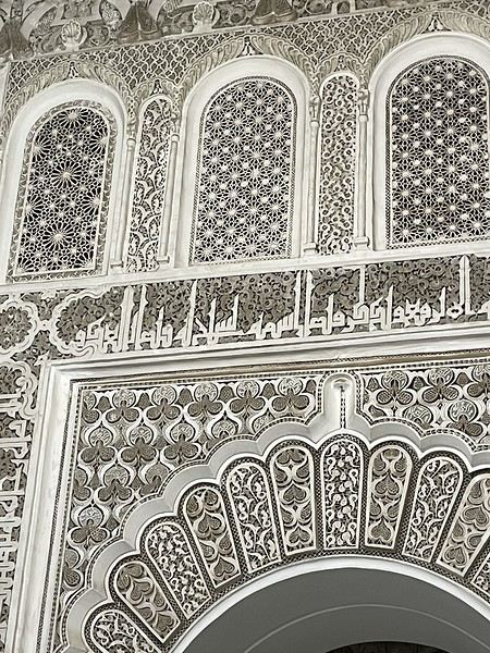
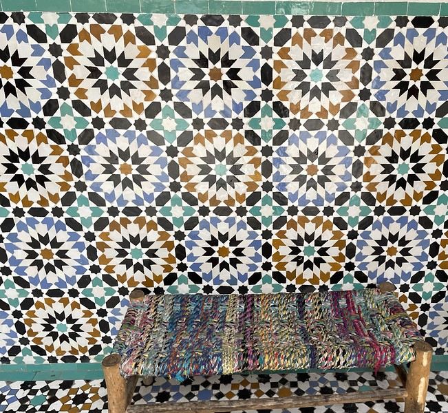
We arrive in the evening in Marrakesh, and a taxi arranged by our friendly Riad is waiting for us. The driver takes us to the door, where we’re briefly greeted by our hosts. The room is heated—phew—because it’s really cold on this January 17th for our arrival. Riad Alisma, where we’re staying for 2 nights. The next morning, it’s pouring rain when we wake up, but after a good breakfast, the rain has calmed down. Off we go to the medersa, which allows for a relatively sheltered visit. We’d visited this palace 15 years ago—it’s been renovated since then.


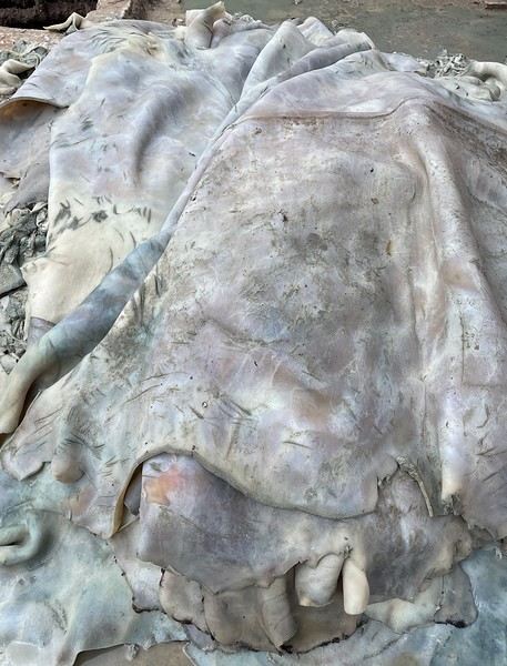
From there, without the rain, we wander aimlessly and eventually end up near the tanneries, but it’s Sunday, and there’s very little activity. Of course, we get hassled by a tout.


Here, the hides after being treated with lime—I love the colors.

We part ways a bit annoyed. He gets a little revenge by giving us bad directions, and we end up outside the city walls. We decide to take a taxi to the new modern art museum—60 dirhams for the 5 km, which is nothing when you think about it. That tout, who we didn’t ask for anything and made it clear we weren’t buying anything, dragged us into a shop supposedly only open that day and demanded 50 dirhams for his "services"! Let’s forget that bad moment and enjoy the exhibition at the MACAL.


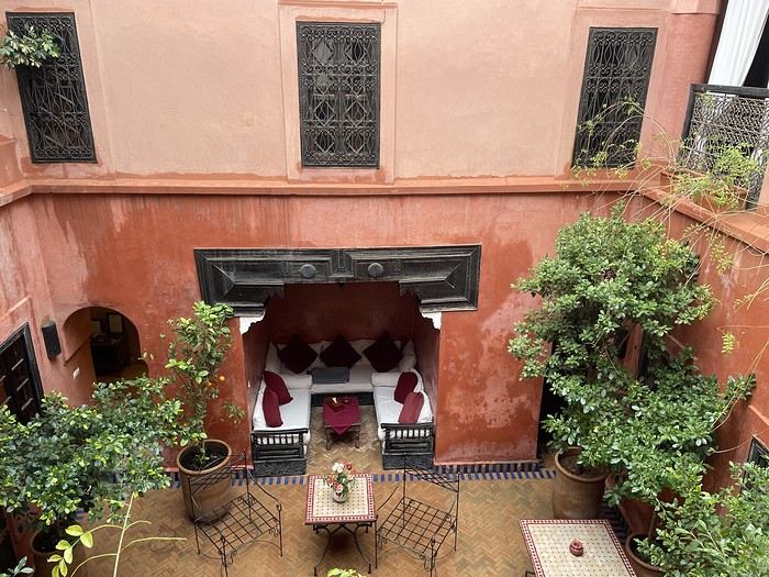
The taxi on the way back drops us off at Place des Ferblantiers, not far from our Riad. We’re a little peckish—it’s worth mentioning that at lunchtime, we only ate a plate of beans from a street vendor. So, we buy a bunch of little sweets, each more delicious than the last, at Ajar. We snack while sipping mint tea and watching life go by around us. A final visit to the Museum of Moroccan Cuisine on our way back helps us dodge a few more showers. Then it’s back to the Riad. The atmosphere in the city is heating up—it’s the AFCON final tonight. The temperatures, though? Not so much. We ordered a meal at the Riad, and it was a good call—not only was it really tasty, but the rain also picked up again. Our day in Marrakesh ends under the covers with a good book and some photo sorting. Still, we managed 10,750 steps. View of our Riad


Tomorrow, we’ll pick up our rental car from Medloc and head to Essaouira.
Open
Road Trip USA 2023 - Part 2
HIGHWAY 1

Highway 1 runs along the Pacific coast of California from Leggett in the north to Dana Point in the south. It's the longest state route in California, stretching 1,050 km.

It's famous for its breathtaking ocean views. That’s actually why it’s become such a popular route for road trips, with tons of attractions and points of interest all along the way.

After crossing the U.S. interior on our way out (see Road Trip USA 2023 - Part 1), we’re starting our return trip along this route from Leggett.

Videos are embedded throughout the summary. Please click on the image to start the video. To jump to a specific post, here are the appropriate links:

CALIFORNIA:

Scenic Overlooks on Route 1 Between Leggett and Fort Bragg The Pudding Creek Trestle Bridge in Fort Bragg Glass Beach - Fort Bragg Jenner Lookout Point - Highway 1 Goat Rock Beach - Sonoma Coast State Park - Jenner Point Reyes National Seashore - White House Pool Trail Point Reyes National Seashore - Limantour Beach Point Reyes National Seashore - Point Reyes Shipwreck Point Reyes National Seashore - Kehoe Beach Trail Point Reyes National Seashore - McClures Beach Trail Point Reyes National Seashore - Cypress Tree Tunnel Point Reyes National Seashore - Point Reyes Beach North Point Reyes National Seashore - Elephant Seals on Drakes Beach Point Reyes National Seashore - Point Reyes Beach South Point Reyes National Seashore – Elephant Seals Overlooks Point Reyes National Seashore - Chimney Rock Trail Point Reyes National Seashore - Point Reyes Lighthouse Trail Point Reyes National Seashore – Tule Elk Observation Point Bonita Lighthouse Trail - Sausalito Hawk Hill - Sausalito Battery Spencer Trail - Sausalito Rodeo Beach - Sausalito Point Cavallo - Golden Gate View - Sausalito Exploring Downtown Sausalito Visiting Sausalito’s Houseboats Crossing the Golden Gate Bridge - San Francisco Golden Gate Bridge Viewpoints - San Francisco Cruise to Alcatraz Island - San Francisco Visiting Alcatraz Island - San Francisco Civic Center - Downtown San Francisco Market Street & Yerba Buena Gardens - Downtown San Francisco Union Square & Financial District - Downtown San Francisco Fisherman's Wharf, Pier 39 & Embarcadero - San Francisco Sea Lion Observation - Pier 39 - San Francisco Lombard Street & Cable Car - Russian Hill - San Francisco Macondray Lane Historic District - Russian Hill - San Francisco Grace Cathedral & Huntington Park - Nob Hill - San Francisco Telegraph Hill - San Francisco Chinatown - San Francisco Alamo Square & Painted Ladies - Western Addition - San Francisco Palace of Fine Arts - Marina District - San Francisco Presidio of San Francisco California Coastal Trail - Lincoln Park - San Francisco California Palace of the Legion of Honor - Lincoln Park - San Francisco Sutro Baths - Lincoln Park - San Francisco Queen Wilhelmina Garden - Golden Gate Park - San Francisco Bison Paddock - Golden Gate Park - San Francisco Portals of the Past - Golden Gate Park - San Francisco Strawberry Hill - Golden Gate Park – San Francisco Prayerbook Cross & Robin Williams Meadow - Golden Gate Park - San Francisco Hidden Garden Steps & 16th Avenue Tiled Steps - San Francisco Grandview Park - San Francisco Hike - Twin Peaks Three Summits - San Francisco Longboarding Down Twin Peaks Blvd in San Francisco Haight-Ashbury - San Francisco Corona Heights Park - San Francisco Mission Dolores - San Francisco Mural Frescoes (Part 1) - Mission District - San Francisco Mural Frescoes (Part 2) - Mission District - San Francisco Devil's Slide Bunker - Pacifica Mavericks Beach - Half Moon Bay Martins Beach - Half Moon Bay Pigeon Point Lighthouse State Historic Park - Pescadero What to See in Santa Cruz Visiting Capitola What to See in Monterey Carmel-by-the-Sea Lovers Point Park - Pacific Grove Castle Rock, Hurricane Point & Little Sur River Viewpoints Pfeiffer Falls Trail Julia Pfeiffer Burns State Park Vista Point & McWay Falls Highway 1 - Big Sur Viewpoints Salmon Creek Falls San Carpoforo Creek Trail Elephant Seal Vista Point - San Simeon San Simeon Pier Moonstone Beach Boardwalk Shipwreck - Estero Bluffs State Park Surfing Competition in Morro Bay Port San Luis Pier - San Luis Obispo Pismo Beach Monarch Butterfly Grove - Pismo State Beach Nojoqui Falls Park - Solvang Arroyo Hondo Vista Point Solvang, a Charming Danish Town in California Chumash Painted Cave - Santa Barbara Goleta San Marcos Rd & Cachuma Lake Vista Points - Santa Barbara Old Santa Barbara Mission Walking Tour of Santa Barbara’s Historic Downtown West Beach - Santa Barbara What to See in Ventura Paradise Falls - Wildwood Regional Park - Thousand Oaks Sandy Dune & El Matador State Beach - Malibu Point Dume Nature Reserve - Malibu Malibu Pier Road Trip in the Malibu Mountains Los Liones Trail - Santa Monica Santa Monica Pier Rodeo Drive - Beverly Hills Greystone Mansion - Beverly Hills Hollywood Walk of Fame - Los Angeles Griffith Observatory - Los Angeles Hollywood Forever Cemetery - Los Angeles What to See in Venice Beach Venice Beach Skatepark ShoreLine Aquatic Park - Long Beach Alamitos Beach - Long Beach Naples Island - Long Beach Crescent Bay Point Park & Helser Park Kiosk - Laguna Beach Shell Beach at Twin Points - Laguna Beach Prairie Dogs at Agra Vista Point Top Gun House & Oceanside Pier Annie's Canyon Trail - Solana Beach (Via North Rios Trailhead Loop) Old Town San Diego La Jolla Coastal Trail - San Diego Balboa Park - San Diego Pacific Beach - San Diego Mission Beach - San Diego Ocean Beach Tide Pools - San Diego Sunset Cliffs Natural Park - San Diego Tuna Harbor Park - San Diego Seaport Village & Embarcadero Marina Park - San Diego Gaslamp Quarter - Downtown San Diego Coronado Island - San Diego Dead Dolly Lane - Alpine Galleta Meadows Metal Sculptures - Borrego Springs What to See in Palm Springs Robolights - Palm Springs Andreas Canyon Trail - Indian Canyons - Palm Springs Palm Canyon Trail - Indian Canyons - Palm Springs West Fork Falls Trail - Indian Canyons - Palm Springs Tahquitz Canyon Loop Trail - Indian Canyons - Palm Springs Desert Christ Park - Yucca Valley Pioneertown Salvation Mountain - Niland Slab City - Niland
Open
Travel Journal - 28 Days in China in August 2025
Hi everyone! I’m sharing a modest travel journal from my trip to China in August 2025.

There wasn’t much room for improvisation on this trip—everything was planned in advance. Since August is peak season, I decided to book train tickets early, and once that was set, I reserved all the accommodations too. I got everything on Trip.com.

I bought the flight tickets back in March from Hainan Airlines. They were super expensive, but with these travel dates, I couldn’t exactly dream of a bargain!

I picked up e-SIMs valid for a month from Free just before departure: 10 € for the e-SIM + 19.90 € for a one-month plan with 35 GB of data abroad.

No need for a VPN with these e-SIMs, but D. still got one—a multi-device plan for 5 € with a discount from Let’s VPN, valid for a month. It was for evenings at the hotel on Wi-Fi to avoid burning through the 35 GB with video.

I downloaded Alipay, WeChat, Amap (Baidu Maps), and Trip.com. We also have Google Translate and Maps.me—absolute must-haves.

We’re ready to go!

I’ve been waiting for this day for nearly 15 years!! I travel a lot, but this one—this is MY TRIP 🙂 It’s been postponed so many times: because I wanted to do it with the right person, because I have a Turkish stamp in my passport and heard they don’t issue visas with that, because of COVID... and then China introduced a 30-day visa exemption, and that was the green light! Ugh, they forced us to take our vacation in August this year—far from ideal—but no more delays. Saturday, August 2, 2025: it’s finally the big day!

Days 1 and 2: We got dropped off at Charles de Gaulle at 9:30 AM. I supposedly checked in online, but only for the first flight and without getting the boarding pass... Might as well scrap online check-in in that case. So, we spent over an hour in line at the counter to get them. We didn’t have any checked luggage—just our backpacks as carry-ons—so this was a step we’d never had to deal with before, but whatever, it’s done. No wait at passport control, 5 minutes through security, a quick walk around the terminal, 10 minutes in the boarding area, and it was already time to board. Departure around 12:45 PM, arrival in Chongqing at 4:50 AM. We had a few hours of layover before our next flight. Went through immigration, connecting flight control, and security. Pro tip: check your next flight’s boarding gate right after immigration. We never saw it displayed again anywhere in the terminal.

The Free e-SIMs work—phew!

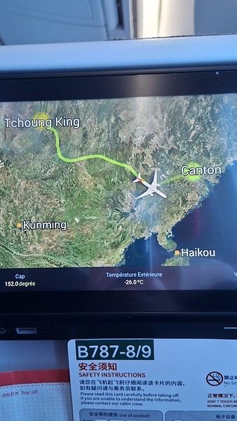
Took off at 9:30 AM, arrived in Guangzhou (Canton) at 11:20 AM in the rain. I love how Chongqing is translated as "Tchoung King" on the screens in the plane—very French!


During my first two trips to China, we paid for everything in cash, but this time, we’re going all-in on Alipay and WeChat. I still brought the leftover change from previous trips—it might come in handy. At the metro station, they showed us a QR code to buy tickets via WeChat. There were probably machines and even a ticket counter, but we didn’t see them, and buying via WeChat was pretty simple. 8 yuan to Changshu Lu, which is 22 stops. So far, so good. Then, we had to find the hotel, which wasn’t on Google Maps, Maps.me, or Amap... Easy 😎! We found it without too much hassle, though. Dropped off our stuff and went out to eat. 55 yuan for two claypots with fish/eel, rice, cabbage, and purple eggplant. When we left, it was pouring. We grabbed our umbrellas and set off to explore the neighborhood: Enning Road (we’ll come back later to check out a specific spot), Shangxiajiu (the pedestrian shopping street), Baohua Road... The area is pretty diverse—one street to the next, it’s like stepping into a different world.


There weren’t many people around, probably because of the rain. We grabbed a quick street food dinner and went to bed—we were exhausted. We struggled to stay awake until 11 PM to adjust to the time change as quickly as possible. There’s a 6-hour time difference.
Open
Second trip to Iceland
We stayed in Iceland from August 27 to September 13, 2023. Actually, this was our second trip to the island.

During our first visit, we rented a camper van from Snail Motorhome Rental, a family-run business that provided outstanding service.

Unfortunately, we discovered that this company no longer exists.

So, we rented a camper van through a third party, specifically via the Nordic Travel Group website.

We chose City Car Rental, located near Keflavik Airport, because the rental cost was really appealing.

Apart from the quality of the sleeping bags and the size of the pillows we rented, our experience with this company was very positive.

We noticed a significant increase in tourism since our last trip in 2015.

Several sites have been redeveloped, and parking is now paid in many places.

Accommodations have multiplied, not only near major cities but also in remote areas.

One notable advantage, however, was discovering the wide variety of food products available in supermarkets. In 2015, the selection was very limited.

I invite you to continue reading this travel journal and watch the videos that will let you explore this destination, which has everything to charm outdoor enthusiasts.

Videos are embedded throughout the summary. Click on the image to start the video.

To jump to a specific post, here are the relevant links:

Hlauptungufoss, Midfoss and Bruarfoss Geysir, Blesi and Strokkur Gullfoss Brúarhlöð Canyon Faxafoss Kiðjabergsvöllur – Belvedere Kerið Crater Reykjadalur Valley – Hike to the hot springs Seljalandsfoss Gljúfrabúi Waterfall Seljavallalaug – One of Iceland’s oldest geothermal pools Skógafoss – Fimmvörðuháls hiking trail (partial) Kvernufoss Plane wreck at Solheimasandur Dyrhólaey Peninsula Reynisfjara Beach – Puffins and seals Vík í Mýrdal Fjaðrárgljúfur Canyon Skaftafell National Park – Svartifoss, Magnusarfoss & Hundafoss Svínafellsjökull Glacier Hofskirkja Church Fjallsárlón Glacial Lagoon (West) Fjallsárlón Glacial Lagoon (East) Jökulsárlón Glacial Lagoon Litlanefsfoss and Hengifoss Rjúkandi (Rjúkandafoss) Stuðlagil Canyon Selfoss and Dettifoss Krafla – Viti Crater Lake Krafla – Leirhnjúkur Lava Field Hverir Geothermal Site (Námafjall) Hverir – Hverarönd Geothermal Site – Blue Lagoon Grjótagjá – Hot Spring Cave Stóragjá – Hot Spring Cave Goðafoss Akureyri Zipline Hofsós – Pool by the Skagafjörður Fjord Víðimýrarkirkja Church Hvítserkur Rock – The Troll of Northwest Iceland Gislahellir (Gisli's Cave) Dynjandi (Fjallfoss) – One of Iceland’s most beautiful waterfalls Hellulaug (Natural hot spring pool) Stykkishólmur – Stykkishólmshöfn Port Kirkjufell & Kirkjufellsfoss Ólafsvík – Bugsfoss Lóndrangar Basalt Columns Arnarstapi Ytri-Tunga Farm – Seal watching Deildartunguhver Hot Spring Hraunfossar & Barnafoss Exploring Reykjavik Reykjavik – Whale Safari – Whale watching Raufarholshellir Lava Tunnel Gígvatnsvatn Lake (Green Lake/Graenevatn) Seltún Geothermal Site (Krýsuvík) Kleifarvatn Lake Blue Lagoon Thermal Spa Gunnuhver Geothermal Site Reykjanes Peninsula – Reykjanesviti Lighthouse Reykjanes Peninsula – Valahnúkamöl – Reykjanestá Ægissíðufoss Super Jeep excursion to Landmannalaugar Hiking in Landmannalaugar Scenery along the way
Open
USA 2022 Road Trip
During our first road trip across the United States, we covered 23,000 km and crossed 28 states in 53 days.

Originally, we had planned to drive Route 66 all the way to Oatman in Arizona and visit various national parks in the American West over a two-month period.

This itinerary was planned before our departure, and all the relevant information had been gathered to stick to the schedule.

Everything went so smoothly that we finished visiting the national parks well ahead of our planned return date.

It helped that having a bed, a portable toilet, and a cooler in our vehicle gave us some autonomy since we didn’t have to worry about accommodation.

So, we decided to extend our road trip to the cities of Nashville and Memphis in Tennessee.

We then headed to Louisiana to visit Baton Rouge and New Orleans.

We crossed Mississippi and Alabama before driving along Florida’s west coast all the way to Key West.

We returned via Florida’s east coast and then crossed the eastern U.S. states to get back to Quebec through the Jackman border crossing in Maine.

So, I invite you to keep reading this long recap, which will let you discover the different attractions we visited throughout this amazing journey.

Videos are included throughout the recap. Click on the image to start the video.

To jump to a specific post, here are the relevant links:

Route 66 - Illinois & Missouri Route 66 - St. Louis (Missouri) - Gateway Arch National Park Route 66 - Cuba (Missouri) - City Murals Route 66 - Springfield (Missouri) - Fantastic Caverns Route 66 - Kansas & Oklahoma Route 66 - Texas & Arizona Route 66 - Texas - The Stations of the Cross in Groom Route 66 - Texas - Panhandle - VW Slug Bug Ranch Texas - Palo Duro Canyon State Park - Juniper Trails Texas - Palo Duro Canyon State Park - The Lighthouse Trail Route 66 - Texas - Amarillo - Cadillac Ranch Route 66 - New Mexico - Santa Rosa Blue Hole New Mexico - Bandelier National Monument - Alcove House Trail via Main Loop Trail New Mexico - Bandelier National Monument - Tsankawi Ruins Trail New Mexico - White Rock Overlook Route 66 - New Mexico - Albuquerque - Old Town New Mexico - White Sands National Park New Mexico - White Sands National Park - Dune Life Nature Trail New Mexico - White Sands National Park - Playa Trail New Mexico - White Sands National Park - Interdune Boardwalk New Mexico - Gila Cliff Dwellings National Monument New Mexico - Grants - Ice Cave & Bandera Volcano New Mexico - Gallup - Pyramide Rock Trail & Church Rock Trail Arizona - Holbrook - Painted Desert Arizona - Petrified Forest National Park - Puerco Pueblo & Newspaper Rock Viewpoint Arizona - Petrified Forest National Park - Blue Mesa Arizona - Petrified Forest National Park - The Teepees, Agate Bridge & Jasper Forest Overlook Arizona - Petrified Forest National Park - Crystal Forest Trail Arizona - Petrified Forest National Park - Giant Logs Trail Arizona - Winslow - Two Guns Ghost Town Arizona - Cameron - Little Colorado River Gorge Overlooks Arizona - Grand Canyon National Park - Shoshone Point Trail Arizona - Grand Canyon National Park - Desert View Drive Arizona - Grand Canyon National Park - Rim Route (Orange) & Village Route (Blue) Arizona - Grand Canyon National Park - Hermit Route (Red Line) Route 66 - Arizona - Historic Town of Oatman Arizona - Bullhead City Community Park Nevada - Red Rock Canyon - Calico I & II & Sandstone Quarry Nevada - Red Rock Canyon - Willow Springs Nevada - Red Rock Canyon Lookouts Nevada - Valley of Fire State Park - White Domes Trail Nevada - Valley of Fire State Park - Seven Wonders Trail, Pink Canyon, Fire Wave Nevada - Valley of Fire State Park - Rainbow Vista Trail Nevada - Valley of Fire State Park - Mouse's Tank Trail Nevada - Valley of Fire State Park - Rock Formations Nevada - Valley of Fire State Park - Scenic Routes Nevada - Cathedral Gorge State Park - Slot Canyons Nevada - Cathedral Gorge State Park - Eagle Point & Miller Point Utah - Bryce Canyon National Park - Mossy Cave & Tropic Ditch Waterfall Trail Utah - Bryce Canyon National Park - Scenic Drive Utah - Zion National Park - Pa'rus Trail Utah - Zion National Park - Sand Bench Trail Utah - Zion National Park - Emerald Pools Trail Utah - Zion National Park - West Rim Trail (Trail connecting to Angels Landing) Utah - Zion National Park - Riverside Walk Utah - Zion National Park - Court of The Patriarchs & Big Bend Utah - Zion National Park - Mount Carmel Highway Scenic Drive Utah - Kanab - Jackson Flat Reservoir Utah - Toadstools Trail in Grand Staircase-Escalante National Monument Arizona - Page - Glen Canyon Dam Overlook Arizona - Page - Glen Canyon National Recreation Area Arizona - Page - Horseshoe Bend Overlook Arizona - Page - Upper Antelope Canyon Arizona - Page - Navajo Canyon Boat Tour at Lake Powell Arizona - Page - Antelope Canyon X Arizona - Canyon de Chelly National Monument - Chelly Canyon Arizona - Canyon de Chelly National Monument - Canyon del Muerto Arizona - Monument Valley Navajo Tribal Park Utah - Mexican Hat Utah - Mexican Hat - Goosenecks State Park Utah - Mexican Hat - Valley of the Gods Utah - The Moki Dugway Scenic Backway Utah - Blanding - Natural Bridges National Monument Utah - Lake Powell - Hite Crossing Bridge Utah - Lake Powell - Glen Canyon National Recreation Area - Hite Overlook Utah - Capitol Reef National Park - Chimney Rock Loop Trail Utah - Capitol Reef National Park - Hickman Bridge Trail Utah - Capitol Reef National Park - Grand Wash Trail Utah - Capitol Reef National Park - Sunset Point Trail Utah - Capitol Reef National Park - Goosenecks Trail Utah - Capitol Reef National Park - Viewpoints - Fruita Area Utah - Capitol Reef National Park - Viewpoints - Scenic Drive Utah - Capitol Reef National Park - Cassidy Arch Trail Utah - Capitol Reef National Park - On the way to Capitol Gorge Trailhead Utah - Capitol Reef National Park - Capitol Gorge Trailhead Utah - Monroe - Mystic Hot Springs Utah - Scenic Overlooks on UT-24, UT-119 & I-70 Utah - Arches National Park - Park Avenue Trail Utah - Arches National Park - Courthouse Towers Section's Viewpoints Utah - Arches National Park - Balanced Rock, Pothole Arch, Ham Rock & Garden of Eden Utah - Arches National Park - Double Arch Trail, Cove Arch, Cove of Caves & Panorama Point Utah - Arches National Park - Windows Loop & Turret Arch Trail Utah - Arches National Park - Delicate Arch Trail Utah - Arches National Park - Upper Delicate Arch Viewpoint Trail Utah - Arches National Park - Fiery Furnace Section - Viewpoints Utah - Arches National Park - Sand Dune Arch Trail Utah - Arches National Park - Skyline Arch Trail Utah - Arches National Park - Devils Garden Trail Utah - Dead Horse Point State Park - West Rim Trail Utah - Dead Horse Point State Park - East Rim Trail Utah - Moab - Utah State Route 279 (Potash Road) Utah - Moab - Shafer Trail - Potash Evaporation Ponds Utah - Moab - Potash Road Dinosaur Tracks and Petroglyphs Utah - Moab - Potash Road - Corona, Bowtie & Pinto Arches Trail Utah - Moab - Potash Road - Wall Street Climbing Area Utah - Moab - Kane Springs Road Utah - Moab - Kane Springs Road - Side By Side Adventure Utah - Moab - Kane Springs Road to Moab Utah - Canyonlands National Park - Island in the Sky - Mesa Arch Trail Utah - Canyonlands National Park - Island in the Sky - Aztec Butte Trail Utah - Canyonlands National Park - Island in the Sky - Whale Rock Trail Utah - Canyonlands National Park - Island in the Sky - Upheaval Dome Trail Utah - Canyonlands National Park - Island in the Sky - Grand View Point Overlook Trail Utah - Canyonlands National Park - Island in the Sky - White Rim Overlook Trail Utah - Canyonlands National Park - Island in the Sky - Overlooks Utah - Moab - Wilson Arch Utah - Monticello - Newspaper Rock State Historical Monument Utah - Canyonlands National Park - The Needles - Road Side Ruin Trail Utah - Canyonlands National Park - The Needles - Cave Spring Trail Utah - Canyonlands National Park - The Needles - Pothole Point Trail Utah - Canyonlands National Park - The Needles - Big Spring Canyon Overlook Trail Utah - Canyonlands National Park - The Needles - Overlooks Colorado - Mesa Verde National Park - Mesa Top Ruins Road Colorado - Mesa Verde National Park - Chapin Mesa Road Colorado - Mesa Verde National Park - Mesa Top Loop Colorado - Mesa Verde National Park - Wetherill Mesa Road Colorado - Great Sand Dunes National Park Colorado - Mosca - Zapata Falls Colorado - Colorado Springs - Garden of the Gods Colorado - Black Canyon of the Gunnison National Park Colorado - Gunnison - Curecanti National Recreation Area Colorado - Gunnison - Blue Mesa Dam & Reservoir Colorado - Lake Pueblo State Park (Pueblo Reservoir) Kentucky - Mayfield, 5 months after an EF4 tornado Tennessee - Nashville - Downtown Walking Tour Tennessee - Graceland Mansion - Home of Elvis Presley Tennessee - Graceland - Lisa Marie & Hound Dog II Jets Tennessee - Graceland - Elvis Presley Automobile Museum & Exhibits Tennessee - Exploring Memphis Louisiana - Exploring Baton Rouge Louisiana - Exploring Lafayette Louisiana - Exploring Houma Louisiana - New Orleans - French Quarter Tour Louisiana - New Orleans - Garden District Tour Louisiana - New Orleans - Creole Queen Mississippi River Cruise Florida - Clearwater Beach Florida - Sanibel Island - Bowman's Beach Florida - Siesta Key Beach Florida - Captiva Island - Turner Beach Florida - Key Largo - Sunset Florida - Key West - Smathers Beach Florida - Miami Beach - Art Deco District Florida - Miami Beach South Carolina - Myrtle Beach Virginia - Virginia Beach Maine - Scarborough - Pine Point Beach
Open
Uzbek notes
The Afrosiyob races through a premature twilight, lashed by a blizzard of thick snow. In the endless gray, a monumental industrial complex occasionally emerges, ghostly. Here and there, in the middle of nowhere, a human silhouette appears (a soldier?), standing motionless by the tracks. On the screen mounted in the middle of the ceiling, a dashing Bollywood cat in vibrant colors writhes in all directions, throwing smoldering glances at a dancer on the verge of fainting. A server moves down the central aisle, offering crepes for sale—ones I suspect are stuffed with ground beef. I’m in Central Asia, in Uzbekistan, somewhere between Bukhara and Samarkand.

I chose the title "notes"—scattered thoughts, rough drafts. I’m not sure what I’ll write, but one thing’s certain: this won’t be a linear travel journal.

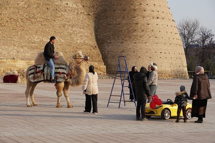
And a photo... there must be a photo, so here:


Local tourists between a Bactrian camel and an electric car, in front of ancient walls—it’ll do.
Open
New adventures from Perpignan to Ranchi (Jharkhand)
March 2nd — Departure by bus from Latour at 6:50 AM. The journey isn’t direct: we pass through Elne then Corneilla. In Perpignan, I switch to a BlablaBus heading to Barcelona’s northern bus station. Before reaching Le Perthus, French police stop us to check IDs. Several people aren’t in order, but after about fifteen minutes, we’re on our way again. We’re checked again at La Jonquera: this time, the wait lasts almost forty-five minutes while police identify those in violation and wait for a vehicle to pick them up. The driver then tries to make up for lost time; we finally arrive at our destination half an hour late.

I quickly head to the Arc de Triomphe metro station, located 200 meters away: you have to cross the bridge along the bus parking lot, then walk through a large garden; the station is on the right before the garden entrance. The trip to the airport isn’t direct: I have to change at Tomasso and take the line to the airport, where I arrive at 1 PM.

At the Emirates counter, I learn my flight was just canceled due to the war in Iran; they offer me another flight for the next day. I have to wait at the airport until 7 PM before being taken to a hotel; the next morning, I’ll take a flight to Vienna (with an 8-hour layover), then an Air India flight to Delhi, and finally a flight to Kolkata. I agree: I don’t know Vienna, so it’ll be an unexpected discovery.

At 7 PM, a small group is taken to the hotel, 35 minutes from the airport, where we’re served a light dinner upon arrival.

March 3rd — A taxi picks me up at 6:30 AM; the flight to Vienna takes off at 9:30 AM and arrives at noon. I’m free until 7 PM; the metro is direct to the city center. The weather is pleasant and not too cold, luckily, since my clothes are light.

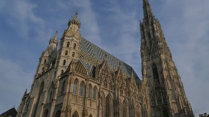
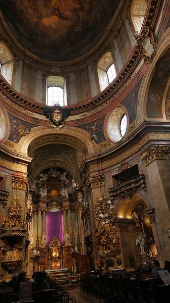
When I exit the metro, I spot the St. Stephen’s Cathedral tower in the distance and approach it: the roof, made of glazed tiles, is remarkable.


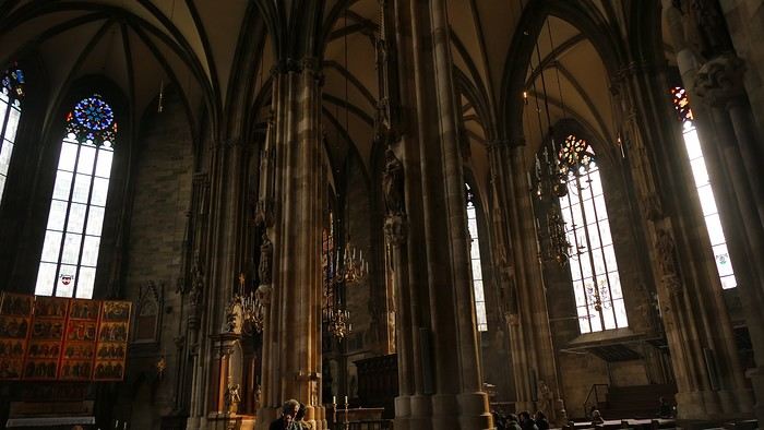
Entry is free, and the interior, a mix of Gothic and Baroque styles in the center, is stunning.


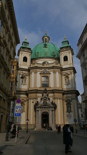
Not far from there is St. Anne’s Church


, also Baroque, adorned with beautiful frescoes


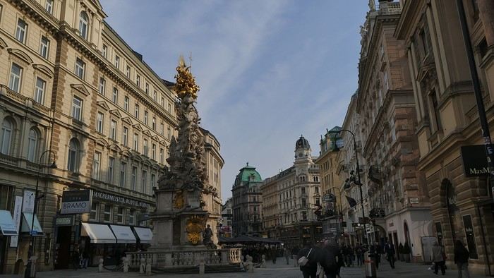
—a music concert adds an enchanting atmosphere to the visit. I continue my walk at random through the pedestrian streets lined with magnificent buildings: I’m charmed by the city.


Before heading back to the airport, I stop at a lovely tea salon. My flight will eventually leave with a delay.

Wednesday, March 4th — Delhi and a little luggage scare We arrive in Delhi shortly after noon. Immigration is quick, and good news: my bag was checked through from Barcelona to Kolkata. I head to the connecting terminal and arrive half an hour before boarding: the flight goes smoothly. Upon arrival, the luggage comes out quickly… except mine. After filing a report, I’m told my bag is in Delhi—I have to retrieve it before taking another flight. I didn’t know (or had forgotten): with the delays, I wouldn’t have had time to pick it up and make the connection.

I take a taxi to the Ichamati Hotel. The welcome is warm, and the room is clean but very small. Without my bag, I feel a bit lost—I have nothing to change into.

Tonight, I’m dining with Raja and his friends at a beautiful restaurant, an old colonial house turned into a hotel.


We’re happy to see each other and have a comforting evening together.
Open
Villages around Hazaribagh in West Bengal
Wednesday, April 1st

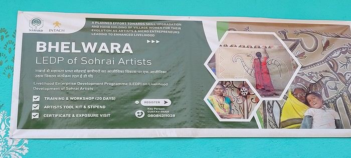
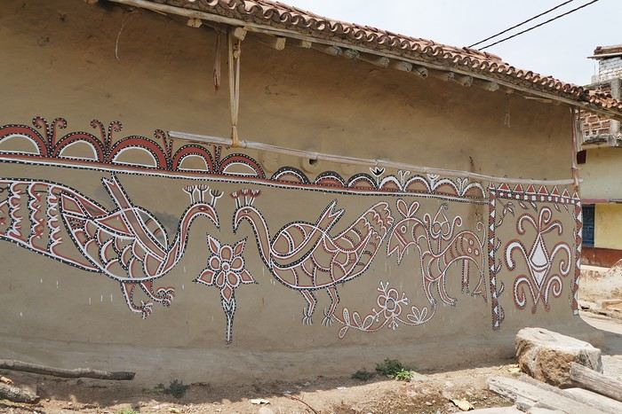
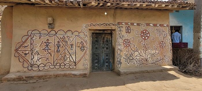
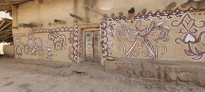
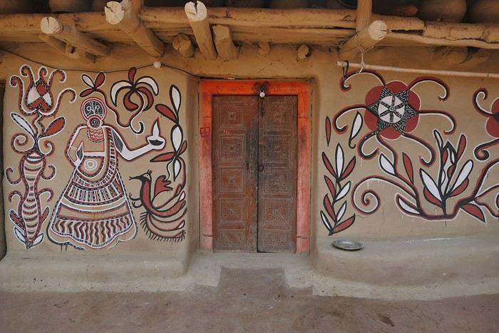
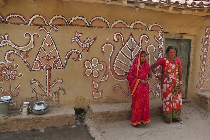
Hazaribagh I’ve got a meet-up with Adam Iman, a guide and painter. He picks me up from the hotel at 10 AM. Another traveler from Bangalore is supposed to join us, but while we wait for him to arrive, Adam takes me to see the paintings his mother and sister created at Hazaribagh station. The town became famous thanks to these murals, which can also be found in several surrounding villages. This art form has earned recognition and is now protected, a sign of its cultural importance. Once the visit is over, we go to pick up the other traveler and then head to our first village: Belwara, where Sohrai art is practiced. At the entrance, a sign proudly announces that we’re entering an artists’ village, where this art is created by women organized into micro-enterprises. Some even offer workshops for those who’d like to learn this tradition.


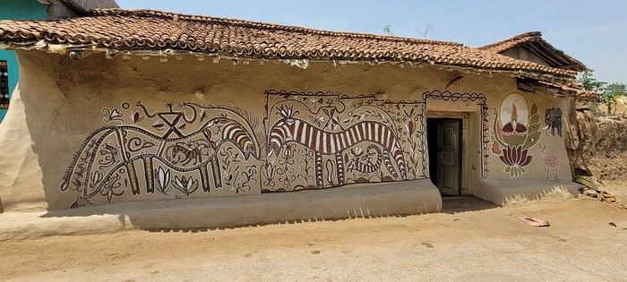
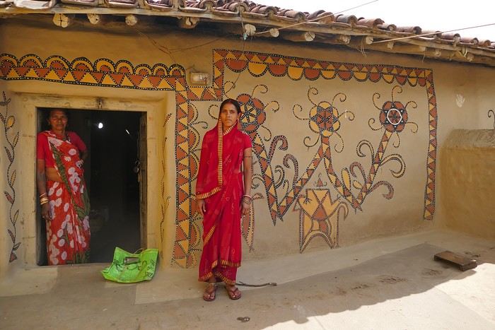
Sohrai art is tied to the harvest season, from October to mid-November. The motifs, in natural colors, celebrate fertility and abundance. The artists use pigments from the earth: red oxides, ochre, white kaolin, and black manganese. On the walls, you’ll see animals, fish, birds—all symbols of life and prosperity. As I look closer at the murals, I start to realize that each motif tells a story. Large animals like cows or bulls often take center stage. Their bodies are filled with intricate, almost hypnotic patterns. They symbolize wealth and prosperity for the household, as well as the deep respect for cattle, which are essential to daily life. On some facades, elephants stand out—massive and decorated with the same precision. They evoke quiet strength and protection. But it’s when I stop in front of one of the houses that I really take the time to look. The wall, a soft ochre, is entirely covered in murals. Two large animals stretch out on either side of the door, their elongated bodies fitting the length of the wall. Their silhouettes are filled with geometric patterns and incredibly fine curved lines, as if every space was patiently filled. Around them, stylized plants, flowers, and small decorative elements fill every gap. The door, dark and worn, becomes almost the silent center of the composition, framed by these living, protective forms. To the right, a more colorful motif catches the eye—a flower or a stylized lamp—like a touch of light on the earth. The whole thing gives an impression of perfect balance, between the rigor of the patterns and the freedom of the gesture.


Elsewhere, birds and freer forms bring movement. Peacocks, recognizable by their stylized silhouettes, embody beauty and vitality, while fish symbolize water, fertility, and the continuity of life.

On some paintings, the scenes become almost narrative: you can make out figures, everyday gestures, like a memory of the village inscribed in the walls. The decorative frames around the doors aren’t left to chance either—they symbolically protect the house, like a boundary between the inside and the outside world.


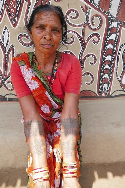
During the Sohrai festival, cattle are led into the jungle in the morning. Meanwhile, the women finish the *aripans*—these floor paintings—and continue the wall murals. Around noon, the animals return to the village, and the bulls’ horns are anointed with oil and vermilion in a gesture of gratitude, amid the vibrant colors adorning the houses. We visit several artists, including Parvat Devi, a well-known woman who has received many awards. Her arms are adorned with intriguing tattoos, which I’ll talk about in more detail later.


On another wall, the style changes completely. Here, no massive animals—just birds occupying the space, light and graceful, as if caught in mid-movement. Two silhouettes face each other, their long necks arched almost like mirrors, while their outstretched wings seem to vibrate with the patterns that compose them.


The design is more graphic, almost airy. The lines are smoother, more fluid, as if drawn in one confident stroke. The birds’ bodies aren’t solid—they’re filled with repetitive motifs like scales, stylized feathers, and spirals, giving a sense of continuous movement. Around them, everything comes to life: flowers burst open, arabesques swirl, and even the simplest shapes seem alive. What strikes me here is the sense of lightness. Where the large animals evoked stability and grounding, these birds bring something freer, almost joyful. They seem to embody movement, the circulation of life, like a breath flowing through the village.


The colors remain the same—deep reds, intense blacks, and chalky white—but the rhythm is different. Faster, more spontaneous. As if each wall had its own personality, while still speaking the same language.

That’s probably why I’m so moved. I’d heard about these paintings from my friend Raja, and last year, I saw an exhibition in a village near my home. That first encounter made me want to come here. But seeing them in person is a whole different experience. These paintings are unique. This ancient art is passed down from mother to daughter, or mother-in-law to daughter-in-law, in a quiet, deeply living continuity. At first glance, it might seem almost childlike in its simplicity and pared-down forms. And yet, everything is thought out, balanced, mastered. Nothing is left to chance.


That apparent simplicity, combined with such rich symbolism, touches me deeply. There’s something sincere and essential in these walls—and that’s what moves me.
Open
A Slightly Less Touristy Japan
Hi everyone, I’m Patrick, 67 years old, a seasoned traveler (already 22 trips outside Europe). In autumn 2025, I took my first 3-week trip to Japan, with stops in Tokyo, Kamakura, Matsumoto, Kamikochi, Takayama, Kanazawa, Kyoto, Nara, Osaka, Koyasan, Tokyo again, and Nikko. I wanted to go back in May 2026 and explore some lesser-known places to complement my first trip. Last year, there were four of us traveling together to discover Japan (a fairly classic itinerary). This time, I’ll be traveling solo for part of the trip and with a couple of French friends for the rest. The weather was gorgeous in May, averaging around 25°C, with two very hot days in Kyoto and only two rainy days. As usual, I organized everything myself, gathering plenty of information from various sites, including this one.

Transportation: An ICOCA card is essential. I got a 5-day Kansai-Hiroshima pass because I took the shinkansen between Hiroshima and Osaka three times, and it paid for itself quickly.

Accommodations: Mostly through Booking. No issues at all. Average cost was 46 € per night.

Meals: For breakfast, I alternated between buying food at a konbini to eat in my room or on the train and grabbing something at local cafés. For lunch and dinner, I tried to vary my meals as much as possible—lots of sashimi, sushi, and ramen. Okonomiyaki in Osaka and Hiroshima. Oysters in every form (raw, grilled, fried) in Onomichi and Hiroshima. A variety of seafood (shrimp, shellfish) in Hiroshima and Matsumoto. Fish whose names often escaped me, but notably mackerel and eel (unagi). Tempura and gyoza. Chicken skewers (yakitori) and one teppanyaki meal. One omakase meal (9 different dishes). In the end, not much meat aside from a few yakitori skewers. No splurges on super expensive wagyu or Kobe beef. Average dinner cost: 4,800 yen, drinks included.

The Itinerary: Day 1: Departure from Brussels Day 2: Arrival in Osaka Day 3: To Himeji, then Kurashiki Day 4: To Fukuyama, then Tomo no Ura, then Onomichi Day 5: Cycling the Shimanami Kaido Day 6: To Takahara, then Hiroshima Day 7: To Kyoto to attend the Aoi Matsuri parade Day 8: To Miyajima Day 9: Hiroshima, then Kyoto Day 10: Southern Kyoto Day 11: Northern Kyoto Day 12: Final day in Kyoto, then to Nagatsugawa Day 13: Start of the Nakasendo Trail (Magome to Tsumago) Day 14: Second day of the trail (Kiso Fukushima) Day 15: Third day of the trail (Narai), then Matsumoto Day 16: To Mt. Fuji (Kawaguchiko) Day 17: To Tokyo Day 18: Excursion to Enoshima and Kamakura Day 19: Flight home, with a 10-hour layover in Hong Kong Day 20: Arrival in Brussels
Open
The 2026 Southwest USA Road Trip
Hi everyone, we're back from a DIY USA road trip we organized from July 31, 2026, to August 26, 2026.

The destination: The Southwest USA, including Texas, Arizona, and New Mexico. Roughly 7,000 kilometers covered.

The car: A Chevrolet Equinox for two, rented through BSP Auto and Avis. Inside, we had 2 suitcases, a travel bag, two carry-on bags, a Walmart cooler, photo gear, and water bottles (a 40-pack).

The route: Dallas DFW, Fort Worth, Houston, Austin, San Antonio, Alpine, El Paso, Tucson, Sedona, Albuquerque, Amarillo, and back to Dallas to finish with a departure from DFW.

The travelers: Two seniors well advanced in years (73 and 75) but still active (nothing too physically demanding—to stay alive and fund our trips), fully independent physically, though a bit less so mentally. Big USA fans, a country where anything is possible. More walkers than hikers, preferring 3-star hotels over roadside motels, Italian restaurants over US food, frequent stops for photos, museums over nothing, naps over forced marches. Not too whiny, just enough to stay French in the land of the "great Satan," as they say. Not great with languages—street English (but handy), and my Spanish is non-existent except for: "Hola! Una cerveza por favor!" That’s about it. My wife understands everything but refuses to speak.

The cost of the road trip: Around 12,000 €, including AF flights, the car, gas, gifts, visits, and everything else. Well managed, since we’d budgeted 13,500 € initially.

The positive side: A delight, with those endless open roads. Museums to discover. The realization of the Hispanic presence and its important history in this part of America. Lovely locals. Tourists who were more or less friendly. A terrible Texan accent that was hard to understand. Gas stations that were like real stores, with prepared food, alcohol sold in Arizona and New Mexico, and employees who were always up for a laugh!

The negative side: The heat throughout the trip... 43°C in Dallas at the end. Impossible to walk the streets. Lots of homeless people in downtown Dallas. Hotel breakfasts that were always the same. You get used to it.

So, it was positive overall, but the concept is starting to wear us out. We might rethink the DIY road trip model for next time. If the man upstairs grants us more time.

Next up, we’ll wait for the first batch of sorted photos to go through the wringer.

See you soon.
Open
Travel Journal - 28 Days in China in August 2026
Hi everyone,

I’m sharing a little recap of this new 4-week trip to China—nothing fancy, just my experience.

We’re taking advantage of the extended visa exemption to return to China for the 4th time. I loved last summer’s trip so much that I’m a bit worried about being disappointed this year. Plus, I’ve had a few hiccups before this departure: my WeChat account got blocked, and I couldn’t recover it (luckily, Alipay still works fine); I couldn’t verify my 12306 account for weeks; Trip.com failed to book our second train; and I’ve got an injury that’ll slow me down during the trip... Ugh, I hate starting a trip with these kinds of issues. Then, oh surprise! Just before leaving, my 12306 account got verified! Super easy to use from that point on—I could book a few train tickets without fees.

We’re sticking with Free’s e-SIMs, which work great in China.

August 2–3

Anyway, on the morning of August 2nd, we took the RER to CDG. As usual, we couldn’t check in online. It’s always a bit frustrating, especially since we didn’t have any checked luggage. We flew with Air China. We arrived at the check-in counter at 9:50 AM, 2 hours and 40 minutes before the flight. The line for our check-in stretched 300 meters across the airport in both directions. What a joke!! We spent 1 hour and 45 minutes in that line just to reach the counter and get our boarding passes. By then, it was 11:35 AM, and boarding had already started at 11:20 AM. The screens showed a 25-minute walk to our gate—on the other side of the airport, of course—plus we had to go through passport control and security... Long story short, the plane didn’t leave without us 🙂 We boarded among the last passengers, and we took off at 12:30 PM. We’d flown Air China four times before, but this time, it felt *really* low-cost. The check-in chaos, the cramped seats (12 seats per row), no music by artists known outside China, mediocre food, and a boarding area at Beijing Airport with only 10 seats—worthy of Ryanair or EasyJet. And yet, the price was sky-high. Again, D.’s vacation requests were denied outside of July and August, so we’re traveling from August 2nd to 30th. We couldn’t have picked a worse time for inflated prices, and with the situation in Iran, we got hit with a 390 € fuel surcharge. I’ve never paid so much for flights—I felt like I’d bought business class, but nope, far from it!!

We landed in Beijing around 4:15 AM. It was 28°C with thick fog. We drove and drove and drove for 20 minutes, as usual in Beijing. Then we went through a first check, a second check, a third check, and waited for our connecting flight at 6:40 AM. A small Airbus A320, but way more space than in the Boeing 777 from the first flight. We landed in Kunming, Yunnan, around 10:15 AM in the rain.

We headed to the subway. You can’t pay at the machines with Alipay here either, so we set up the transport QR code directly in Alipay to scan at the subway gates. The process is a bit long the first time if you haven’t entered your info before, but once it’s done, it’s *so* much easier! We took Line 6 to the terminus for 6 yuan each.

We’d booked a hotel nearby, on the 16th floor. It’s actually studios on different floors of a huge residential building. The view’s pretty nice from here. We settled in quickly—back to those wooden beds, or rather, mattresses as hard as wood, which we *hadn’t* missed... Then we went out for our first bowl of noodles of the trip and wandered through the shopping streets of the old town.


It was crowded, and the weather was cool—around 19–20°C. We tried a local specialty: milk skin, thick, dried, then grilled with rose jam. Yeah... we won’t be having that again. The taste and texture of the milk skin... no thanks.


We saw a lot of wild mushroom hotpot too. It’s on our list for later. We also passed through the Jinma and Biji gates, where I played with reflections in puddles. I *love* doing that 🙂


At the end of the day, we headed to a temple advertised as open 24/7 on Amap. Of course, when we got there, it was closed. We’ll go back tomorrow. That was the first of many disappointments with Amap this trip—I hadn’t had that issue on previous visits.

We were exhausted after that sleepless flight. Night was falling, and we decided to grab a quick bite without much appetite. We shared a delicious vegetable fried rice for 12 yuan—we even left half of it. The portions are *huge*.

After a couple of small purchases, we headed back at 9 PM, wiped out, after walking 17 km between the airports and these first steps in Kunming. I expected to see quite a few Western travelers here, but we didn’t spot a single one. Instead, we met lots of curious Chinese people, many of them super friendly and helpful—almost *too* eager, like when they’d run to serve us as fast as possible. It’s a bit much, but it’s great to be back!
Open
Southwest USA Road Trip Part II
Here we go with this second travel journal dedicated to the American West! It’s a must when you love it! 😊

We had left off in the charming town of Bisbee, which once thrived thanks to its copper mines. Today, mining is a thing of the past, and the town seems a bit sleepy.

Unfortunately, I didn’t dig deep enough on-site to answer all the questions my observations raised. Guess I’ll have to *dig* into the subject a bit more... no pun intended! 😊

Let’s hop back in the car and head a little further south to check out the esplanade that offers a view—if you can call it that—of the impressive open-pit mine. Then, it’s off to the Lowell neighborhood.

Preserved almost exactly as it was, this area must’ve been bustling in its heyday. The vintage cars are still around, storefronts and signs look like they’re straight out of another era, and the whole place has a pretty amazing vibe. You’d almost think you were on Route 66!

Here, we’re not just discovering an old neighborhood—it’s a little slice of American history. And, a detail that’s great for my physical health: the area isn’t too spread out. Lucky me! 😊

I won’t post too many photos here since I think I can turn them into a future photo exhibit. Between these and some shots from Route 66, I should have more than enough material! So, let’s keep a few under wraps... to preserve the surprise. 😊

Open
Great Divide Mountain Bike Route
Hello, Following our trip on the Great Divide Mountain Bike Route this summer, we’re sharing our experience in this travel journal. We’re Richard and Bernadette, both 64 years old, and we’re gravel bike-packing cyclists. We’ve completed several gravel bike trips in France and neighboring countries, and Richard has also done some in South America. We left on July 22, 2026, from Geneva to Calgary via Frankfurt with our bikes carefully packed in boxes, and we returned on October 8 from El Paso to Geneva via Chicago and Frankfurt.

The GDMBR is a mountain route that closely follows the Pacific/Atlantic continental divide, starting in Banff, Canada, and ending at the Mexican border in Antelope Wells, New Mexico. This crossing of the American West is one of the longest mountain biking routes in the world, winding through wild valleys, mountain ranges, and desert plateaus. It stretches about 4,400 km with a total elevation gain of around 60,000 m. The average altitude is 2,000 m, and the highest point reaches 3,600 m. The route is 80% off-pavement (gravel roads, dirt, and a few trail segments). It’s also known for the annual Tour Divide race, which brings together the best riders in the discipline every June and follows roughly the same route.

We prepared for this trip over several months, using a few websites and an older guidebook (the 2013 English edition).


With this, we were able to organize our journey with as much information as possible, a GPS track, and gear suited to the weather conditions, terrain, and sparse resupply points in remote areas.

Once we arrived in Banff, we picked up bear spray to handle a particular challenge: the wildlife we weren’t familiar with.


After landing in Calgary, we assembled and equipped our bikes at the airport. That first evening, we were welcomed by Mike, who invited us to his place when we were looking for a spot to pitch our tent. Then we made our way to Banff over two days, taking a fairly quiet road to Canmore and then a bike path.


A visit to Banff, a charming tourist town in the national park. Its famous Fairmont Hotel.


The starting point of the GDMBR at the arch of this hotel complex.


Here we are, immersed in the wilderness—just a few pedal strokes away from the town, the contrast is striking. Powerful rivers, vast landscapes, and our first encounter with a mule deer.


Spray Lake, our first basic campsite: no showers, dry toilets, no water fountain—we filter lake water. Most GDMBR campsites are like this.


We took the west side of the lake—a longer and wilder route. A few fallen trees blocked the path, forcing us to carry our bikes. But the stunning landscapes made it all worth it!


Our first single track through a forest marked by past wildfires.


Most campgrounds have tables and metal fire rings for safe campfires, which makes setting up camp much easier—especially nice after a long, tiring day! During this trip, we mostly slept in our tent, either in established campgrounds or wild bivouacs.

To be continued...
Open
Eastern Crete in September 2024
Travel journal in Eastern Crete from September 8th to 29th, 2024
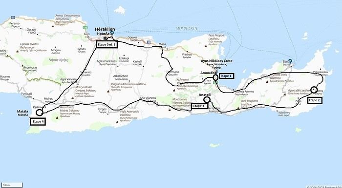
Our 21-day itinerary

Sunday, 08/09: Once again—and this is the eighth time—we’re setting off, the four of us: Patrick, Michelle, Jacques, and Monique, for the Greek islands. This time, we’ve chosen Crete. No need to wake up at 3 or 4 a.m. to reach Basel-Mulhouse Airport at dawn to catch the first flight to Greece at 6 a.m.! Given the prohibitive prices charged by EasyJet, we found flights that were half the price from Zurich Airport, which is accessible in 3 hours by train from Colmar. Pierre-Paul drives all four of us to Colmar train station, where we take the train to Basel and then, 20 minutes later, the direct train to Zurich Airport. After wandering around the airport, we go for a coffee at 6 € each! We’re in Switzerland, after all. The other dining areas all have vending machines for selecting and paying for meals—soon, there won’t be anyone left to serve you! After a short wait, we take off at 7:45 p.m. (20 minutes late) in an Aegean Airbus A321. Free in-flight meal service isn’t bad either! We land in Heraklion around 11:15 p.m. We pick up our rental car (a red Seat Ibiza) at the airport and head straight to our apartment, located 2 km from the city center. Thanks to the GPS, we find it quickly. It’s a beautiful, fully renovated apartment with all the comforts and well-equipped. On the table, there’s wine, bottles of water, jam, coffee, etc. Given the late hour, we won’t stay up long.

Monday, 09/09: To enhance our breakfast, Michelle and Monique set off to find a bakery nearby. They return with croissants and donuts—yum... Then we head to the west coast. The highway follows the coastline, but we prefer taking the old road to Malia, our first stop. We visit the major archaeological site of this Minoan city under the hot sun. The site covers a vast area, but the ruins aren’t very evocative except for a few beautiful amphorae scattered around. The explanations in a small house at the entrance are interesting and help us better understand the organization of the ancient city with its different districts. From there, we head toward the nearby mountains to see the thousand-year-old plane tree in the village of Krasi. We take the opportunity to enjoy an excellent lunch of moussaka and delicious gemista at the Krassopsychia taverna in the village center. Pleasant surprise: the prices are still reasonable, with a bill of 70 € for four, including wine and water. The friendly tradition of complimentary dessert and glasses of raki continues—great! We’ve set the bar high right away! Let’s hope the rest lives up to it! On the way back toward the Lassithi Plateau, we stop at the Kardiotisa Monastery perched high on the mountain to enjoy a magnificent view of the entire region. Just a little further, we arrive at the Lassithi Plateau: the presence of small windmills used to pump water from the ground is the typical feature of this plateau. We complete a full loop around the plateau, passing by numerous orchards and vegetable gardens that occupy the entire space. At the end of the plateau, we once again cross mountain passes via winding roads that bring us near Agios Nikolaos. Our apartment is located about ten kilometers further south in Amoudhara. The owner, who was notified, waits for us and shows us her superb apartment, whose large terrace overlooks the entire Mirabello Bay. She then gives us valuable information about the different beaches in the area. Dinner will be frugal, given our hearty lunch in Krasi!
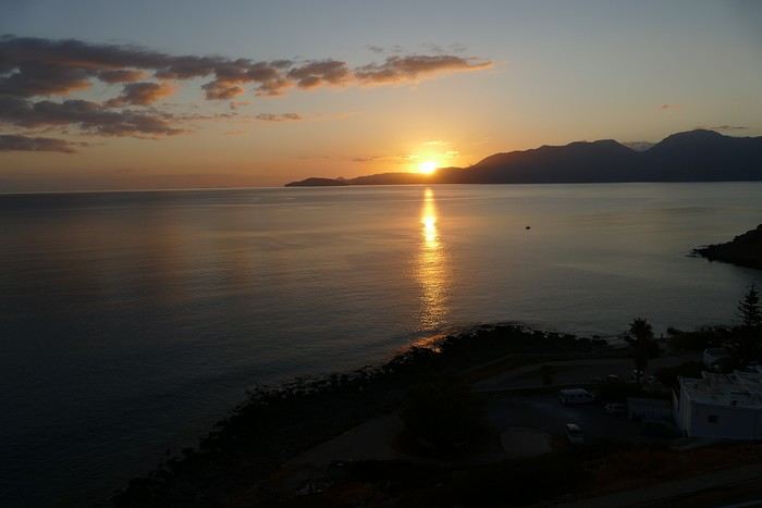
Sunset over Mirabello Bay

Tuesday, 10/09: A bit of a gray sky when we wake up around 8 a.m., but the sun will soon triumph over the scattered clouds. For our first swim, we opt for Voulisma Beach, even though our host warned us it was a bit “crowdy.” That’s understandable given the beautiful emerald color of the sea and the lovely curve of the beach. To avoid the big crowds, we move toward the eastern part of the beach, accessible via a steep staircase. The water is very warm, and this first dip is very pleasant. Before returning to the apartment, we stop at the bakery to buy spinach pies, essential ingredients to accompany our Greek salad for lunch. Of course, everything will be washed down with ouzo, which will remain our favorite drink for the next three weeks—but in moderation!!! A nap is in order after all that effort. In the late afternoon, we drive to Agios Nikolaos, the main seaside resort in Crete. We’re not too enthusiastic about visiting this mass-tourism resort, but the center of Agios, concentrated around the small inner harbor, is pleasant to see despite the plethora of shops and restaurants. We dine a little outside the harbor in the shaded courtyard of the Avli taverna: the oven-baked lamb, squid with spinach, and cuttlefish ink orzo pasta are all highly appreciated. We still stay under a 75 € bill for four.
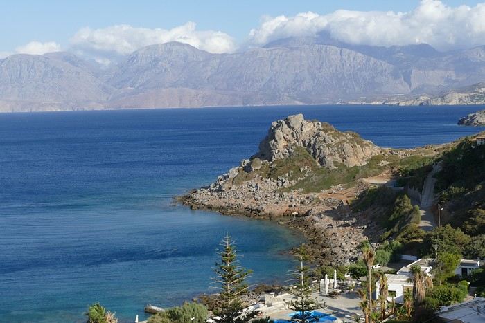
Mirabello Bay seen from our terrace

Wednesday, 11/09: At 8 a.m., the terrace is already bathed in sunlight, and it’s already quite hot. The small parasol barely gives us enough shade, but we’re not complaining! For our second swim, we head to a tiny beach recommended by our host, just 3 minutes by car from our place. The path leading to it is very discreet, and we don’t find it right away! It’s a small sandy cove with a few welcome tamarisk trees for shade. When we arrive, there are two swimmers, and there won’t be more than five or six in the morning. After lunch and a nap, we head to the beautiful village of Kritsa, just a few kilometers away. It’s too late to visit the beautiful church of Kera Panagia, which is already closed. We settle for the exterior, which is worth a look. The weather is clouding over, and big clouds are gathering. Upon arriving in Kritsa, a heavy shower forces us to take shelter in the Platanos taverna in the village center, and since it’s nearly 7 p.m., we decide to stay and dine there. Good choice—excellent meze: croquettes and stuffed zucchini flowers, gigantes beans, grilled tomatoes and feta, and pancetta as the main dish. The rain stops just as we decide to head back.
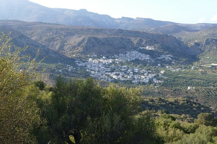
Village of Kritsa

Thursday, 12/09: Our terrace faces east, so we get to watch the sunrise around 7 a.m.—it’s truly a beautiful sight we never tire of. Around 9 a.m., we head to the village of Plaka, where boats depart for the island of Spinalonga, located north of Agios Nikolaos. We board the first boat, which sets sail at 10 a.m., and we’re not alone—the boat is practically full. After 10 minutes, we land on the island at the same time as several other boats from Elounda or Agios. Needless to say, there are already quite a few people walking through the streets of the leper village. The visit remains interesting and moving as we read the explanatory panels recounting the island’s history under Byzantine and then Turkish rule, followed by its transformation into a leper colony. As soon as we climb toward the top of the island via more or less maintained paths, there’s almost no one left. The 360° view from up there is stunning.
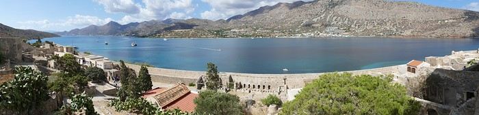


Spinalonga Island

The heat is now unbearable, and we can’t wait to get back home to have lunch on our terrace and rest. In the late afternoon, we go grocery shopping at the AB supermarket at the entrance of Agios. We had spotted another nice restaurant in our guide, but unfortunately, there’s a different one at the indicated location that doesn’t inspire us. So, we return to the Avli taverna for another dinner just as good as the first.

Friday, 13/09: We repeat yesterday’s successful program: a swim in our little cove, lunch on the terrace, a nap, and then, in the late afternoon, we discover another nearby village, Kroustas, nestled in the olive groves near Kritsa. Much less touristy than Kritsa, it’s mostly inhabited by locals, especially the elderly who are enjoying the cool air on their chairs—if you can call it cool given the still-high temperatures in the late afternoon! We then return to visit Kritsa, which we hadn’t been able to explore due to the rain. Dinner at a taverna in the village center at a very reasonable price.

Saturday, 14/09: Today, we move to our new base further east. We start with a high viewpoint at the Faneromeni Monastery, which overlooks Mirabello Bay. The monastery itself is of little interest as it’s under renovation with excessive concrete work. We continue to the village of Kavoussi to see another exceptional tree after a few kilometers on a dusty, bumpy track. It’s an olive tree said to be about 3,200 years old—impressive, and the countryside is very beautiful. It’s time to find a place for lunch. We find one in the charming little port of Mohlos, where a few tavernas surround a very nice small beach. Our choice falls on the Bogazzi taverna, where we enjoy fried fish. To reach our new base in Zakros, we still have to drive through the mountains before reaching Sitia, Paleokastro, and finally Zakros. The region is beautiful, with olive groves and rows of wind turbines taking advantage of the strong wind near the northern tip of the island. In Zakros, we’re greeted by our very friendly host. Here too, we have all the comforts and a beautiful terrace overlooking the village. The apartment has reversible air conditioners, but the overly simple instructions leave us puzzled. Thinking we’ve set it correctly, we realize a little too late that it’s blowing hot air over 30°C! After numerous attempts and testing several confusing programs, we finally succeed! Dinner on our new terrace.

Sunday, 15/09: This morning, we get up early to hike in the “Gorge of the Dead” while it’s still cool. The sky is blue as usual! We park in the nearest parking lot and start our descent via a beautiful path winding through the olive groves. A little further on, the landscape opens up, and the path, now a stony trail, begins the descent to the dry riverbed. On either side of the riverbed rise beautiful reddish cliffs.
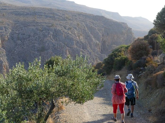
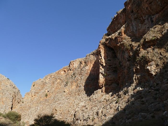


Gorge of the Dead

The trail winds its way through this narrow gorge with difficulty. It was in the many caves visible halfway up the slope that the Minoans buried their dead, hence the name “Gorge of the Dead.” The gorge opens onto a beautiful small pebble beach. A swim is welcome after this hike that made us sweat. The hike took us 1 hour and 25 minutes, and a little less on the way back. Meanwhile, Monique did some shopping and prepared an excellent lunch. In the late afternoon, we go down to dine at Platanakis, a taverna in the small village of Kato Zakros.

Monday, 16/09: This morning, we explore the northern part of the east coast near Palekastro. We start with a dip at the beautiful Hionia Beach near Palekastro. The water is still just as nice, but a light breeze is blowing—not enough to spoil our fun! Seeing all the wind turbines lining the ridges, it’s no surprise.

Grocery shopping in Palekastro and return to Zakros. A little rain in the late afternoon and an excellent dinner at Iannis Mitsakakis’ Taverna in Adravastis. These are the kind of small tavernas we love—unpretentious, a few tables on a terrace, a warm welcome, a short menu guaranteeing freshness, tasty dishes prepared by the server’s mom, and a light bill. What more could you ask for!

Tuesday, 17/09: We head back toward Palekastro to do some shopping, but it’s also the road to the Toplou Monastery. There, we see a collection of magnificent icons dating from the 15th to the 20th century. We can also admire drawings of Orthodox religious architecture. We continue toward the Mavros Akrotiri headland to enjoy the view of the sea and rocky capes. On the way back to our place, we make a small detour to see the famous Vai palm grove. Meh... As for Vai Beach, it’s filled with paid umbrellas and sunbeds, and there are so many people that we flee. Plus, having to pay for parking is another reason to snub this trendy beach. We prefer our Hionia Beach, which we already appreciated the other day. In the late afternoon, Pat and I start the trail that begins at Kato Zakros Beach heading south. The poorly marked path crosses a plateau of sharp limestone. The paint and cairn markings are no longer very visible, and with dusk approaching, we turn back toward Kato Zakros. Dinner at the Platanakis taverna—less good than last time.

Wednesday, 18/09: To avoid the scorching sun, Pat, Mimi, and I get up earlier than usual to hike the Hohlakies Gorge. At this early hour, the sky is quite cloudy, and it’s drizzling. When we arrive in the village of Hohlakies, we park in front of a small chapel, the start of the hike. The sky is now completely clear. The trail starts among the olive groves, then after passing through a gate, we descend into the gorge filled with large rocks. We’re alone in the world, and the landscape is magnificent. A few wild goats clinging to the cliff watch us from above. After 1 hour and 15 minutes, we emerge onto the wonderful Karoumès Beach. A pleasant swim, then back to civilization! A walk in the late afternoon in Zakros to discover the beautiful springs route. Dinner in Adravastis.

Thursday, 19/09: Another move: Before heading to our next stop, we make a detour to see the beautiful Keratokampos Beach and can’t resist a swim in the still-warm, clear water. We continue our journey via Ziros, then reach the south coast and have lunch at the Stephi taverna in Ferma—excellent meal! The south coast is quite urbanized and has much less charm than the east coast we’ve just left! The numerous plastic greenhouses are partly to blame. We stop for groceries in Ierapetra. Around 3 p.m., we arrive at our destination in the small perched village of Anatoli. Our lodging is at the top of the village, and from the path leading to it, we have a magnificent view of the coastal plain, unfortunately overloaded with plastic greenhouses. It reminds us of the landscapes of El Ejido in Andalusia.
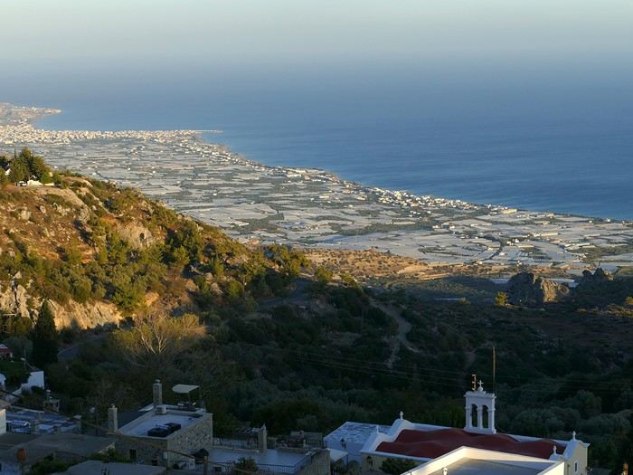
View of the Ierapetra coast from Anatoli

Friday, 20/09: A walk and discovery of the hamlet of Anatoli. There are few services—a tiny grocery store, a taverna, and that’s it. Fortunately, the traveling baker arrives and honks. We take the opportunity to buy fresh bread. Leaving the village, we take a path that should lead us to the hamlet of Drygies. The landscape is beautiful. We walk through a lovely pine forest before arriving at the hamlet. The path continues to a taverna that’s closed today, with a superb terrace overlooking the coast. Luckily, the owner arrives and informs us that the taverna will be open next Sunday and that we can enjoy barbecued meat. Noted! We head back to Anatoli via the small paved road with, fortunately, very limited traffic. Lunch on our terrace, then a dip in our private pool! The water is noticeably cooler than at the beach. Dinner at the village taverna: there’s only one menu—meze starters, souvlaki, water, wine, and bread—all for 35 €! We think we’re dreaming—was there a mistake? No.

Saturday, 21/09: We discover the beach of the village of Myrtos, a small seaside resort that’s quite touristy but on a human scale. We swim in the western part of the beach, and once again, we’re alone in the water. The best part: warm water and tamarisk trees for welcome shade. There’s even a shower to rinse off! In the late afternoon, Pat and I decide to go for a hike in the Selakano pine forest. To get there, we take a narrow, winding, and poorly paved road after the village of Christos. Plus, at this altitude, we encounter clouds clinging to the mountain, so it’s drizzling, and visibility is reduced. We decide to turn back and return to Anatoli. As compensation, we take the path that passes in front of the lodging and leads us to the Timios Stavros chapel, which crowns the summit of the nearby mountain. We arrive at the summit just in time for the sunset at 7 p.m. Breathtaking 360° panorama and magnificent colors!
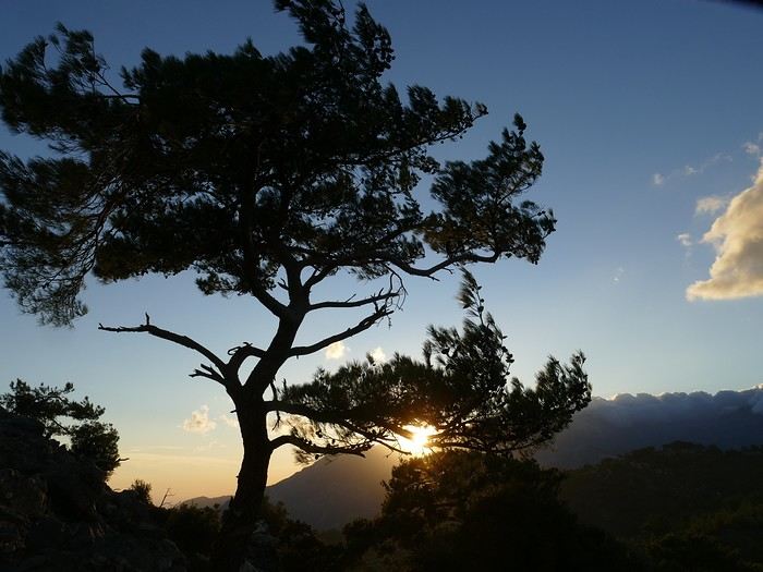
Sunset from Anatoli

Sunday, 22/09: This morning, Pat, Mimi, and I go for a hike in the Sarakina Gorge, located about 12 km from Anatoli via a beautiful road winding through irrigated olive groves. We park in the small parking lot before the trail. At the start, the path follows a levada (small irrigation canal) and quickly enters a very narrow gorge flanked by high cliffs. The riverbed is cluttered with huge rocks blocking the passage. No matter—in the technical sections, ropes or ladders allow us to overcome these obstacles with a bit of skill. You can imagine how quickly the riverbed must rise during a storm, given the narrowness of the gorge!

We progress slowly through this magnificent and impressive rocky chaos. At the exit of the gorge, we take another return path that partly follows the paved road. Back in Anatoli, we go to lunch at the Drygies taverna. We sit at the edge of the terrace under a huge tree that covers almost the entire terrace and order grilled lamb dishes prepared according to the ancient “antikristo” method.

Monday, 23/09: Departure for our last stop before Heraklion. We thought about swimming at Tertsa Beach, but it turns out to be less pleasant than expected, with pebbles and an uneven rocky plateau. So, we return to Myrtos Beach, which we know well and suits us perfectly. We head west, leaving the coast a bit. Around 3:30 p.m., we arrive at our destination in the village of Kamilari, near the famous Matala spot. We’ve rented a beautiful, modern, well-equipped apartment with a lovely shaded terrace. The owner is very friendly and explains everything necessary for a good stay. We explore the quite touristy village with its few tavernas, all full of tourists, mostly Germans.

Tuesday, 24/09: Visit to the village of Sivas, well restored thanks to the Germans, who have invested a lot here. We take the opportunity to scout out “friendly” tavernas, then go for a swim at Kalamaki Beach. Apart from a small sandy access, you have to enter the water via a chaotic limestone plateau—proof of this is that Monique trips slightly when entering the water. A group of very unfriendly German women blocks the sandy passage and doesn’t hesitate to push swimmers they deem too close. Back home, lunch, and a nap. In the late afternoon, we drive to visit the nearby Phaistos site. We benefit from very beautiful lighting. From the elevated site, we overlook the Messara Plain with a beautiful view of the olive grove checkerboards highlighted by the late afternoon sun. The site itself is quite vast, but to appreciate it, it’s better to read the explanatory panels placed throughout the different quarters. At this hour, the site is almost empty, and the beautiful light adds charm to the visit.

Wednesday, 25/09: Departure for the village of Matala, which doesn’t interest us in itself, having been there during the “hippie” era in 1976. However, going to Red Beach, only accessible by taking a path overlooking this area, appeals to us much more. We park in the large parking lot just outside the village and start our climb, which brings us to a pass from where we can admire this beautiful red-sand beach framed by beautiful cliffs plunging into the sea. The weather is magnificent, and at this early hour, there aren’t many people yet. We swim in the free part located near the cliff on the right when arriving at the beach. The sea is like glass, warm, and without a single ripple—a real treat! After half an hour, we turn back, and now there are many people rushing on this path, not at all made for feet in sandals or flip-flops, yet many vacationers venture out like this! Matala lives up to its image—a trendy place, full of shops, bars, and restaurants. You could be in any seaside resort with a standard global urbanism, lacking particular charm. Back home. In the late afternoon, a walk through the olive groves surrounding Kamilari, then dinner at Evangelina’s, who runs the Minoan Parassies taverna in the middle of the olive groves. Evangelina is quite a character: we came to reserve a table for 8 p.m. when it was only 7 p.m., but since we lingered near her restaurant, she prepares a table for us and urges us to sit down! And there she takes our order, and a little later, the meze arrive, followed by the main dishes. We finish this good dinner with several generous glasses of raki, accompanied by Evangelina’s encouragements, repeating “poya poya bravo bravo” in a loop. We’re in great shape too, by the way! We return in the middle of the night, on foot, fortunately, with the path vaguely lit by our phones...

Thursday, 26/09: This morning, we discover a new beach, Kommos Beach, not far from Kamilari either. It’s a long sandy beach, a small part of which is dedicated to paid umbrellas and sunbeds, and the rest is free. We spot a tamarisk tree to take shelter from the still-hot sun, and once again, we enjoy clear, warm water. The few swimmers spread out easily over nearly 500 meters of beach. In the late afternoon, Pat and I go to admire the sunset from the hill near our lodging. The hill, covered with olive trees, is threatened by a planned housing development of large cubic villas—trends dictate. Concrete never stops...

Friday, 27/09: We thought about leaving the car at the Odiyitria Monastery, the end of the paved road, but since the track descending to the cave remains drivable, we park 3 km further at the junction of the track leading to Kali Limenes Beach. We still have to walk for half an hour on a less drivable track, and then we’re at the entrance of the Farango Gorge. It’s a beautiful, easy hike since we follow the dry pebble riverbed. Before arriving at the beach, there’s a very beautiful small chapel sheltered under a large cliff, beautifully lit at this early hour.
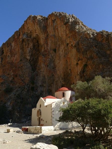


Agio Farango Chapel

A few climbers are scaling the cliff, and about ten swimmers are enjoying the sea. Return to the car under the hot sun. In the late afternoon, we all return to visit the interesting Odiyitria Monastery. Last swim at Kommos Beach and an excellent dinner at the Sigelakis taverna in Sivas.

Saturday, 28/09: There’s an end-of-vacation atmosphere... We pack our bags and head north. A short stop to see the village of Vorri, and a little over an hour later, we arrive in the big city of Heraklion. Since it’s too early to check into the apartment, we park in the city center to visit the famous archaeological museum. It’s indeed a must-see highlight of our stay in Crete. All four of us are amazed by the quantity and quality of the objects presented from the Minoan civilization. After more than 2 hours, we come out without having seen everything, but we’re a bit overwhelmed by all these wonders. Lunch at a nice little taverna very close to the Titus Church. We go to take possession of our apartment—the same as on the way there, still just as satisfying. In the late afternoon, I go alone for a walk in the historic district of the city, passing by the Morosini Fountain, which is bustling with people—some seated at café terraces, others standing and chatting. There’s a lively atmosphere here. A little further on are the Venetian loggia and the Agios Titos Church. I walk down to the old Venetian port to stroll along the jetty and admire the fortifications under beautiful late-afternoon lighting, then return to the apartment. Dinner near our place at Kiriakis, a “chic” restaurant but with very reasonable prices and excellent cuisine.

Sunday, 29/09: Wake-up at 3:30 a.m., quick coffee, and drive to the nearby airport. We leave the car in the parking lot. Already a lot of people at this early hour. Since we don’t have checked luggage, we go straight to security, which goes fairly quickly, then it’s waiting time and takeoff on time in an Airbus A321 for a 45-minute flight to Athens. We take off again in another Airbus A321 with a 50-minute delay to arrive in Zurich at 11:10 a.m. local time. Then we have to take the train to Basel and then the one to Colmar. With fewer Sunday services, we won’t arrive in Colmar until around 4 p.m.

Conclusion All four of us returned very satisfied with this stay in Crete for several reasons: - We found superb beaches with clear, warm water and often very few vacationers. - The few hikes we did were magnificent, especially those where the trails went through gorges leading to deserted beaches. - We greatly appreciated Cretan gastronomy—there were so few disappointments that we can count them on one hand. - All the accommodations we booked turned out to be superb, with the icing on the cake being the very friendly welcome from our hosts. - Generally, contacts with Cretans were always very warm despite the language barrier—we speak a little Greek. - We also appreciated the diversity of landscapes in this eastern part of Crete, with plateaus and mountains with splendid rugged reliefs.

Note: The photo album is available by clicking on this link: https://photos.app.goo.gl/hfdjQndA5eXkL5k7 Captions are only visible per photo by clicking on the circled “i” in the top right. Budget: approximately 3,300 € per couple for 21 days, including train and flights Budget details per couple: - Flight Zurich-Heraklion: 440 € - Trains Colmar-Basel-Zurich round trip for 4: 442.40 € (221 € per couple) - Accommodation: 2,431 € / 21 = 115.80 € per night for 4 (1,216 € per couple) - Car rental for 21 days: 684 € + 145 € fuel (1,150 km) (414 € per couple) - Restaurants, food, etc.: 1,009 €
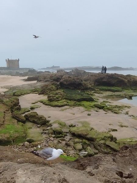
Open
Australia 2025: Discovering the 5th Continent
Hi everyone. Because that’s also what sparks the desire in every traveler (well, at least for me) to set foot on Australian soil: discovering a new continent.

Right now, I’ve got some time on my hands—those who follow me know that. A nasty muscle tear (which really doesn’t want to heal) is keeping me grounded for another week, so I’ve decided to open a new travel journal, recounting my recent trip from December 14, 2024, to January 12, 2025, in Australia.

The origins of this trip started last May in Crete, an island I chose for a 10-day break. It’s really lovely, by the way, but that’s not the point… It’s around this time every year that we decide on our next winter destination, and Argentina was at the top of the list—Sydney wasn’t even on the radar… I’d been looking at flights to Buenos Aires for a while, and the prices were shocking… But by the pool one lazy afternoon, scrolling on my iPhone, a promo from Geneva to Sydney caught my eye. The deal ticked two boxes on my traveler’s bucket list: a flight to Australia and a flight with Singapore Airlines, often ranked as the world’s best airline. A quick chat with the missus (well, of course!) and the decision was made: off to the land of kangaroos! Now, once you add luggage and Economy Plus, it still comes to 1600 € per person, but that’s a reasonable price. Either way, we already know what we’re in for—Australia is a budget commitment!


Thanks to 123rf for the image loan 😛
Open
Dream Islands: Greece, French Polynesia, Mauritius...
Hello,

Who among us hasn’t dreamed of having a ticket to Tahiti, Bora Bora, or the Marquesas in their pocket—preferably a one-way ticket to “paradise”?

Idyllic landscape of a dream island, but difficult to access: the Bay of Virgins in Fatu Hiva, Marquesas Islands

Among the values conveyed by literature, tourism, and advertising is the quest for “elsewhere,” for a change of scenery, in the truest sense of the word—that is, the need to leave one’s country. This need for otherness, for difference, is projected onto dreamlike, idealized, even mythicized places. In our imaginary world, the island is often that place.

Yet we forget that islands have also been ideal prisons. The examples are numerous: Elba and Saint Helena, Alcatraz and Poulo Condor, If and Yeu, the Devil’s Islands and Leros. The latter, located in Greece in the Dodecanese, hosted a sinister forced labor camp during the colonels’ dictatorship as well as a psychiatric hospital. Despite the beauty of its bay, tourism has remained marginal there due to its bad reputation, unlike the neighboring island of Patmos.

I’d like to share a selection of about a dozen islands from across the world’s seas and oceans. For dreaming...

°°°°°°°°°°°°°°°

SANTORINI


July 27, 1967

At dawn, the ferry from Agios Nikolaos (Crete) enters the immense caldera of Santorini. From the ship’s deck, Rainer, my travel companion, and I are left in awe by the sight of these towering, multicolored cliffs looming over us. We disembark and begin the steep climb on foot via the winding mule path up to the village of Fira, the capital perched above the cliff. Though it’s still very early, we head to the youth hostel. There wasn’t a soul in the alleys that morning—or rather, there were only cats! I have a fond memory of that encounter with Santorini: a sensory shock, a breathtaking volcanic site, a harmony of blue, ochre-red, and white. A welcoming island, as it was traditional to welcome the xénou, an island that hadn’t yet fully recovered from the terrible 1956 earthquake, a Cycladic architectural marvel where local life was still preserved.

It’s easy to see why, in antiquity, the island was named Kallisté (καλλίστη), “the most beautiful,” as it’s nearly impossible to resist gazing at this landscape shaped by tectonic forces. Indeed, a massive volcanic cataclysm—the Minoan eruption—shaped this scenery in the 17th century BCE, creating a caldera that was quickly filled by the sea. The enormous tsunamis that followed reached Crete, leading to the disappearance of the Minoan civilization.

A cliffside path along the caldera leads us to the peaceful village of Oia, at the northern tip of the island. Blue-domed churches and flower-filled villages with whitewashed houses line the way. This walk is a continuous marvel, offering splendid views of the caldera and the neighboring islands formed by the breakup of the ancient volcano (Thirissa, Nea Kameni). Oia is a large, picturesque village, like Fira perched on the cliff’s edge, which was severely damaged by the 1956 earthquake, and its scars are still visible. Its cave-like houses with vaulted roofs haven’t yet been turned into luxury hotels or shops. Absolute tranquility reigns here.

Oia in 1967—a peaceful village overlooking the caldera. But where are the pools and trendy bars?

A lush countryside covered in olive trees and vineyards welcomes us for a pleasant hike, interrupted by the kindness of a friendly islander who gives us a lift in his truck for a few kilometers. He’s off to harvest his tomatoes, which he grows at the foot of Pyrgos Hill. The delicious little cherry tomato of Santorini earned an EU Protected Designation of Origin (PDO) in 2013. We climb up to the village of Pyrgos, perched on a hill and dominated by the elegant bell tower of its church. Finally, we reach the black sand beach of Kamari on the island’s eastern coast to enjoy a swim.

{...} To be continued


°°°°°°°°°°°°°°°°°

RAIVAVAE (French Polynesia)


November 15, 2007

Éléonore from Pension Tama welcomes us with traditional flower leis, as if she’d been waiting for old friends she hadn’t seen in ages. The small airport terminal is lively, the atmosphere warm—people hugging, rejoicing in reunions, all under kilos of flowers. Then, just as quickly, the place empties until the next flight... in a few days.


In the Austral Islands, a ninety-minute flight from Tahiti, Raivavae is a world away from the frenetic pace of Papeete or the tourist crowds of the Leeward Islands. The true paradise of the South Seas can still be savored here—it’s a bit like Bora Bora half a century ago. Our first feeling upon arriving on this island is wonder, with smiles that could melt even the gloomiest among us, landscapes so stunning they take your breath away, and above all, a sense of disorientation and fulfillment. Picture a mountainous island, about ten kilometers by three and a half, encircled by a coral reef and wild motu, cradling a lagoon with shades of blue that would make Bora Bora green with envy.

The roughly one thousand inhabitants of Raivavae are spread across four villages around the island. Children are everywhere, as is typical in Polynesia, and they greet you with open, genuine smiles. Here, ancestral values have survived progress. The predominantly Protestant population is very devout, as evidenced by the several temples built across the island. Religious fervor sets the rhythm of daily life. Sundays are reserved for worship and Sunday school (catechism). Work is forbidden on that day, and tourist activities are suspended. These rules are strict and respected.

Hat contest for the worship celebration

Yet a sense of resignation is ever-present. The people of Raivavae know they are—and will remain—isolated. Despite the construction of an airstrip in 2004 and a few weekly flights to Tahiti and its nearest neighbor, Tubuai (200 km away), the island remains on the fringes of the world. One painful aspect is the separation of children from their parents when they leave for middle school in Tubuai starting in fifth grade. Television brings daily images of a world the islanders will likely never know, but one they often aspire to.

We are privileged. We have the pristine white-sand beaches of the motu and some of the most beautiful bays in Polynesia all to ourselves. The jewel in the crown, the island’s emblematic spot, is the “motu-pool,” about twenty minutes by boat. A natural, exquisite basin with crystal-clear water, gradients of blue, and white sand. And best of all, there’s almost no one there. In fact, lounging on the beach is frowned upon, especially for young women. Religion looks very unfavorably on sunbathing and lazing around. And yet, everything here leans toward that philosophy of life.


The "motu-pool"

{...} To be continued
Open
Trek in Norway: Jotunheimen and Dovrefjell, you’ll adapt to the rain...
In the summer of 2026, we packed our backpacks again to wander around Jotunheimen National Park in Norway.

We’d never heard of this park just a few months earlier—we discovered it by following threads online.

It’s billed as the most mountainous park in the country, which really appealed to us after scrapping our original plan further north.

Unfortunately, it’s also the most crowded, which immediately made it less appealing! The presence of the highest peak in the Scandinavian Alps and the "famous" Bessengen ridge (famous because it’s apparently well-known across the country) probably has a lot to do with that.

Since we’d managed to avoid the crowds on the Kungsleden trails by camping away from the huts and timing our hike to miss the biggest groups of walkers, we figured we had the formula down and gave in to the call of the Norwegian mountains.

It’s the most mountainous park, sure, but also quite challenging in terms of progress, as we’d soon discover during the trek. And with uncooperative weather, we got the winning combo of a demanding hike. But I’m getting ahead of myself...

For the end of the trip, we planned a few days in Dovrefjell National Park—these two parks are easily connected by public transport—to see something different and, most importantly, to try and spot the musk oxen that live there.

My 04/08 - Arrival in Oslo Wed 05/08 - Bygdin – Torfinsbu Thu 06/08 - Torfinsbu - Gjendebu Fri 07/08 - Gjendebu - Fondsbu Sat 08/08 - Day hike to Slotafjellet Sun 09/08 - Day hike to Lake Kvitevatnet Mon 10/08 - Fondsbu - Gjendebu Tue 11/08 - Gjendebu - Before the Bessengen ridge Wed 12/08 - Bessengen ridge – Maurvangen campsite Thu 13/08 - Knutshoe ridge Fri 14/08 - Bus transfer to Spiterstulen hut via Lom Sat 15/08 - Day hike to Galdhøpiggen Sun 16/08 to Wed 19/08: Dovrefjell End of the trip and wrap-up
Open
Caribbean - Saint Martin Island: On the Beach and on Horseback
A horseback ride by the sea on the Caribbean island of Saint Martin or ... on the beach, but at a walk and trot! It was probably these visions that gave me the irresistible urge to do this horseback trek—to walk on the sand, but as a rider, and also enjoy a swim that was anything but ordinary.


From wish to reality ... all it took was heading to Ranch du Galion. Here we are, on the heights of the east coast of the charming island of Saint Martin, in the heart of the Caribbean.


After a first horseback ride that we really enjoyed, with a simple trip to the beach, it didn’t take much to make us want to repeat the pleasant experience. My daughter Emma had been dreaming of it too—so why not share this change of scenery, but this time opting for a slightly longer trek? It’s the big day. And Jess is there to greet us this morning with a big smile. Jess—or Jessica—is the one who runs this tropical ranch with passion; she looks after a whole little family of horses. This morning, she’ll be our guide and companion for this seaside horseback ride.


So, we set off along the wild shores of the stunning Anse du Galion.

In the enclosures, behind the fences and ropes, some stallions already seem impatient to stretch their legs! They know the place, the routines, and the trails ... and the soothing reward halfway through—a dip in the sea. Maybe that’s what’s causing a little excitement among these mounts!


Horses and ... an iguana slipping into the bushes. Given its appearance—its crest, its parched skin, and the dewlap hanging under its head—you’d think it wasn’t exactly young.


Anyway, back to the horses. Among the mares and stallions, I try to spot "Avenir" and his elegant gait—he was "my" horse during my last trek here, on the trails and sands of Galion. Well, spotting him isn’t going to be easy! My memories are a bit fuzzy, and several of these horses look like him ... -- Before setting off on the trek, it’s time for Jess to choose our mounts. For riders with little experience ... it’ll be calm horses, well-used to trekking—definitely easier and more enjoyable. Titia, a beautiful white mare for my daughter, and Prince, a gentle stallion for me. A little anecdote along the way: we’re really staying in the family for this horseback ride—these two horses are actually related: "my" Prince is the son of the lovely Titia!


to be continued -->
Open
Scotland - Skye Trail and a little extra
After our amazing experience in the Lofoten Islands in summer 2023, I suggested to Jean Marie another trek I’d been wanting to do for a long time: the Skye Trail in Scotland.

A few photos of this stunning island and he was sold and ready to go.

The route is available on the excellent WalkHighlands site HERE (there’s also a Cicerone guide on the subject). And since I thought it was a shame it avoided the Black Cuillins, I added a 3-day detour in that area.

We took advantage of the May bank holidays in 2024, partly to avoid the peak tourist season and also the midge period—because for some reason, mosquitoes love me 😠!!

27/04 – Day 1 – Transfer to Skye and start of the trek: Rubha Hunish - Flodigarry 28/04 – Day 2 – Flodigarry – just before the Old Man of Storr 29/04 – Day 3 – Old Man of Storr – Portree, then bus to Sligachan 30/04 - Day 4 - Sligachan - Glenbrittle campsite via the Fairy Pools 01/05 – Day 5 – Round trip to Sgùrr na Banachdich from Glenbrittle campsite 02/05 – Day 6 – Round trip to Coire Lagan and walk on the Rubh an Dùnain peninsula 03/05 – Day 7 – Return (hitchhiking) to Sligachan campsite and hike in the Red Cuillins 04/05 – Day 8 – Resuming the Skye Trail – Sligachan – Elgol 05/05 – Day 9 – Elgol – Somewhere on the climb to Bla Bheinn 06/05 – Day 10 – Somewhere on the climb to Bla Bheinn - Broadford 07/05 – Day 11 – Visit to the Armadale Castle and park 08 & 09/05 – Return to Glasgow, visit the city, and return flight And here’s the summary
Open
South Africa in safari mode: February/March 2026
Hi everyone,

With my girlfriend Christelle, we’ve chosen South Africa for our first trip to Southern Africa, focusing on safaris—after a long debate with a Cape Town/Kruger combo. But that would’ve meant cutting out St Lucia, which would’ve been harder to fit into another trip. And St Lucia—thanks to Michel and all those travel journals—we really wanted to go there.

So our 11-night itinerary ended up like this, mostly shaped by school holidays: - 3 nights in St Lucia - 1 night in Hluhluwe - 1 night at Mkhaya Game Reserve (Eswatini) - 1 night at Hlane Royal National Park (Eswatini) - 3 nights in Kruger (Berg en Dal / Satara / Tamboti) - 1 night at Shindzela Tented Camp in the Timbavati private reserve - 1 final night in Kruger at Lower Sabie

All of this in the off-season and rainy season, just a month after catastrophic floods that killed over 150 people and seriously damaged Kruger’s infrastructure.

I’ll jump straight to St Lucia and skip the loooong journey to get there (with a layover in Frankfurt, landing in Johannesburg, a domestic flight to Durban, and the rest by rental SUV—First Car Rental, perfect, no complaints).

To motivate readers—especially some familiar faces here—I’ll drop in a first photo.

Open
Tanzania: Discovering Ruaha and Nyerere (formerly Selous)
Hello,

We got back from Tanzania a month ago, on March 5th. I’ve started this trip report at the link the moderator asked me to use:

https://voyageforum.com/forum/decouverte-ruaha-nyerere-ex-selous-en-fevrier-mars-2026-d11466010/

You’ll find a video of our trip on my YouTube channel there.

Now I’ll tell you about our 10-night trip in Tanzania, with 8 nights spent in two parks we didn’t know. Tanzania isn’t new to us—it was even our first African safari destination back in 2012. https://www.youtube.com/@lolodetoul54 Since then, we’ve visited several East and Southern African countries: Kenya, South Africa, Namibia, Botswana, some of them multiple times. We usually travel in September during the dry season. We tried March 2024 for nine nights in the Okavango and loved it, except everything was dry, which wasn’t normal for the rainy season.

So for this second March trip during the wet season, we really got what we asked for… rain. But before that, we had to fight just to get to Tanzania.

Saturday, February 21, 2026:

It’s D-Day—the departure. What a hassle to organize flights to and within Tanzania! I’ll tell you all about it in another post: https://voyageforum.com/forum/toutes-compagnies-aeriennes-tanzaniennes-interdites-d10758360/ On top of that, Rwandair canceled our outbound flight a month before departure. They offered to reschedule us 3-4 days later—ridiculous for a 10-night trip we’d already booked. We had to cancel our tickets and buy new ones with Kenya Airways. We’re still waiting for our refund from Rwandair!!!!!!! So on Saturday, February 1st, our bags were packed. We headed to the Lorraine TGV station, about 30 km from home. Direct train to Roissy—just 1h15. Quick and efficient. All that was left was to wait for our overnight flight. We took off on time, just before 11 PM. Smooth flight, nothing unusual. Arrived in Nairobi around 9 AM. A few hours’ wait, then a flight to Dar es Salaam, landing at our first destination around 12:45 PM. Our local contact, Anne from Asanterra agency, picked us up at the airport. It was hot and humid—it was raining.
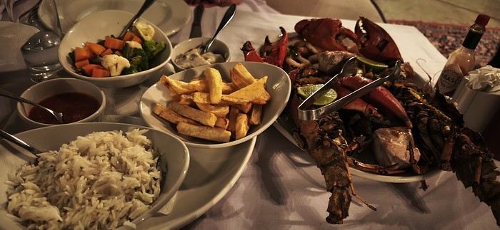
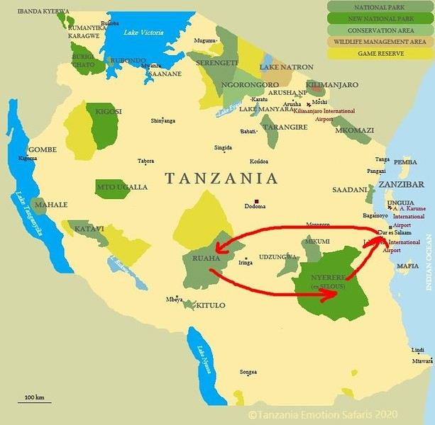
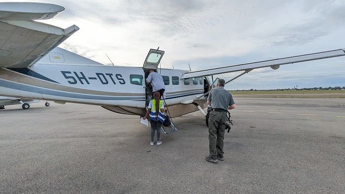
Our first night was at the Alexander Hotel. That evening, we treated ourselves to fish and shellfish at the hotel restaurant:


Sunday, February 22, 2026:

A driver picked us up at dawn to take us to the domestic airport so we could finally head to our first destination: Ruaha National Park. We flew with Auric.air for a 2-hour flight with two stops (Nyerere and Zkima airstrips).


I’m always amazed at how easily these Cessnas take off and land on dirt runways—especially when they’re wet:


Aerial view of Zkima airstrip, where we’d landed just minutes earlier:


Flyover of Iringa, a "big" city in the country near Ruaha National Park:


We’re getting close. The plane descends and flies over the Ruaha River, which gave the park its name:


We land for the third and final time that day, reaching our destination: Msembe airstrip, the gateway to Ruaha.

Open
In the midst of Kenya's wildlife, October 2025
Hello everyone,

After sharing some safari photos from southern Tanzania, I’d like to show you those from our latest safari in Kenya in October 2025.

First, I’d like to thank Sylvie56, whose previous travel journals about this country inspired our trip choices. Thanks also for the info you sent us via PM. THANK YOU!

The following account is from a simple wildlife enthusiast. You won’t find anything here but images of landscapes, mammals, and birds. The stated purpose of this trip was purely and solely wildlife-focused. (It was in no way a discovery of the country or its people).

This stay/safari began (and ended) in Nairobi, with flights between France and Kenya operated by Qatar Airways departing from Nice.

Over two weeks, we first visited the reserves of Tsavo West and Tsavo East, then after a long road trip, the two reserves of Buffalo Springs and Samburu.

= Please wait until the end of the journal to ask any specific questions (or send them via PM) to keep the story flowing without interruptions or off-topic comments.

Thanks for your understanding.

...

Previous Kenya safari trip in 2017, here:

http://www.image-nature.com/forum/viewtopic.php?f=162&t=61119

...
Open
Nisyros: Greece’s most beautiful island?
Hi everyone,

I hesitated for a long time before publishing this travel journal since it’s been 8 months now since I left Nisyros. But in the end, I found it too beautiful to keep quiet about. So here we go—I finally got around to writing it. Nisyros is a stunning little Greek island, and luckily, it’s well hidden. Located a good twenty hours by boat from Athens, its distance from the Greek mainland deters most tourists from visiting. That’s what makes it an off-the-beaten-path destination. So much for the general info.


Before diving into the details, I should mention that I visited by bike (despite its severe and constant volcanic elevation) as part of a solo trip from France to Turkey. Why this detail? Because out of the ten countries I crossed and the dozens of sites I saw, Nisyros is one of my top three favorites (along with Pag Island, off-season, in Croatia, and Albania for its overall beauty—stunning natural landscapes and the incredible hospitality of its people). Anyway, welcome to this travel journal dedicated to the lovely little volcanic island of Nisyros…


I arrived one beautiful morning in Mandraki, the island’s main port. The twenty-hour boat ride from Athens went by like a breeze. I slept on the deck for three or four hours, sprawled on a bench that was more or less sheltered from the wind. At this time of year (it’s May 2nd), tourists aren’t exactly flocking here, so the boat was far from full. My first glimpse of Nisyros is classic Greek island scenery: blazing sun, an azure sky, and an even deeper blue sea. The trip is off to a great start. I quickly found a small, out-of-the-way hotel (I’m one of those people who avoids crowds as much as possible when traveling, which is getting harder and harder to do). While everyone else from the boat turned right out of the port toward the center of Mandraki, I went left! My nice little hotel was just a hundred meters away, facing a pretty little Orthodox church whose red color contrasted beautifully with the deep blue sea.


I dropped off my panniers in my room so I could ride light for once, then headed toward the next village: Pali. It’s a small fishing village that apparently comes to life a bit in the summer with a few tourists.


As I pedaled along the dock, I passed right by a guy sitting in a chair in full sun. Unfazed despite the sweat pouring down his forehead, he untangled his fishing net with a precision that commanded respect. I gave him the obligatory kalimera (good morning), but he reacted like a deaf-mute—no response at all. On the other hand, his employee answered me kindly from the trawler docked right next to him. Standing on deck, he was also untangling a mess of nets and invited me aboard to chat. That’s Mohamed.


Communication wasn’t easy since he only spoke Greek and I didn’t, but he was cheerful, and his joy was contagious. He proudly showed off their catch of the day: two beautiful rays and a few brightly colored fish. We chatted like that for about fifteen minutes.


When it was time to hit the road again, I said goodbye to Mohamed, who smiled back. But this time, his boss—still dripping sweat in his chair under the scorching sun—greeted me too. Turns out he wasn’t deaf or mute after all.


I continued along the coast since that’s where most of Nisyros’ beaches are. They start lining up just outside Pali. These are black sand beaches, which can’t hide their volcanic origins.


Yesterday afternoon in Athens, I met Peter and Michelle, a Dutch-French couple, while we were waiting for the ferry to depart. The Greek sailors were on strike, so we ended up waiting about twelve hours before setting off. Anyway, we had plenty of time to chat, and Peter, who’s lived on Tilos—a small island near Nisyros—for about twenty years, told me that many migrants pass through these two islands. Most come from Afghanistan and Syria, fleeing authoritarian regimes and the massacres that come with them. They’re looking for *anywhere* else where the future can’t possibly be worse. Peter explained that you often find their belongings on the local beaches. And sure enough, I didn’t have to look far to spot some—clothes, life jackets…


I glanced around, hoping to see one of them to maybe exchange a few words, but no—no one. I was completely alone.


I got back on my bike and spent the rest of the day wandering aimlessly, just exploring this beautiful part of Nisyros. I also picked up some supplies because tomorrow, I’d be heading inland for two days, deep into its four-kilometer-wide caldera to explore the volcano. I’d be sleeping in a tent, so I needed to stock up on food. After a restful night in a real bed—something rare on this bike trip (and I won’t even mention the shower…)—I finally set off for the volcano (I’ll share details about that charming little hotel with the amazing breakfasts at the end of the journal). To reach Stefanos (the name of the main crater), I had to climb to the top of the caldera. It was hot, and some of the slopes were between 10 and 15%, which is steep, especially with a 54 kg bike. But who cares? I was admiring the scenery, and I have to say, I was surprised by how green it was. The higher I climbed, the more beautiful the vegetation became. It stood out against the blue of the sea, and the landscapes inside the island were truly stunning. So, I stopped every five minutes to take photos. Every now and then, I’d come across cows in the middle of the road—or goats in the trees! They climbed with the agility of monkeys to munch on the leaves. I couldn’t get a photo of them because they’d all scatter before I got close. It was actually the noise they made climbing down that tipped me off to their presence. Two villages sit at the top of the caldera: Emporios and Nikia. I passed the first one without climbing up to it, then continued to the second. And let me tell you, Nikia was love at first sight! I found myself pedaling through tiny streets, some barely wider than my bike with its panniers. The walls were white, and the doors were painted in all sorts of colors—green, blue, red… The streets were empty, and silence reigned. But it wasn’t a dead silence. It was more like the kind you find in small, secret, peaceful places. The village exuded tranquility, calm, and well-being. I leaned my bike—with all its gear—against a wall without locking it. It was the first time on this trip that I’d done that. Sure, its weight made it more like a tank than a bike, so you’d have to be *really* motivated to steal it, but here, for some reason, I felt completely at ease. Maybe it wasn’t the smartest move, but I go a lot by instinct, and here, it felt right. So I left my bike there and went to eat a little farther away, at a small restaurant on the village’s main square. It’s famous all over Greece for the beautiful mosaic that covers and decorates the floor. Once I’d eaten and drunk my fill, I hopped back on my bike, which had waited patiently without running off. And the best part? After riding uphill all morning to reach the top of the caldera, all I had to do now was coast downhill to the volcano. Pure bliss in such breathtaking scenery.

Open
Exploring Senja Island and the Lofoten Archipelago
Hi everyone,

We traveled to Norway in the summer of 2025, from July 17 to 29, to visit Senja Island and the Lofoten archipelago with a rental car. The common thread of these twelve days was clearly hiking, along with a few visits and experiences, and nights spent in a tent or in the car (which made it possible). We chose Narvik Airport for both arrival and departure for several complementary reasons: the desire to visit nearby Senja Island, slightly more affordable airfare, and finally, the rental price of the vehicle—especially the car model we were looking for. We only made one reservation, for the first campsite, as sleeping in a tent made things much easier. But we had the whole structure of the trip planned, a flexible outline that could adapt to the weather conditions we’d encounter. Senja Island isn’t part of the Lofoten archipelago, and during the early stages of planning this trip, we hadn’t planned to visit it. But its relative proximity to Narvik Airport and, above all, its unique geography definitely made us change our minds. We arrived in Evenes, where Narvik Airport is located, nearly 60 km from the city itself. Our first stop was 40 km further in Bjerkvik on the way to Senja, where there’s a Rema 1000 (a very common supermarket chain in Norway). We needed to buy some food and a gas cartridge for our stove. I’d emailed the store manager beforehand, who told me they didn’t sell them but that the two gas stations in the village were likely to have some in stock.

It was only at the Esso station that I found what I needed, but unfortunately, only one cartridge. Luckily, we quickly realized that most campsites (like in Iceland) have a shared kitchen with hotplates. That single small cartridge was just enough for the few nights we spent outside of campsites... We got our first taste of Norway’s characteristic landscapes:

When we arrived at the Senja campsite, it was already 9:30 PM. A sign announced it was full, but luckily, I’d booked it 10 days earlier. By 10:30 PM, as we settled in to eat, it was still broad daylight, and the thermometer read 25°C—despite being at a latitude of 69° North! We went to bed around midnight, exhausted but under the light of a sun that was still very much present. Thanks to Earth’s tilted axis. We’d anticipated this by buying opaque sleep masks because, yes, at this time of year, it’s daylight all the time.

Friday, July 18:

Today, we planned two hikes on the island and a few stops along the way. The map clearly shows that the deepest fjords are in the north and west. Due to time and accessibility, we focused on the northern part of the island. Our first stop was at the viewing platform in Bergbotn:


Then we headed toward Skaland, the starting point for our first hike. Along the way, we found plenty of reasons to stop—especially since, on this first day of travel, our thirst for Nordic landscapes was far from quenched.


The town of Skaland is very practical: free parking, picnic tables for after the hike, and a Joker convenience store right next door. Our goal was the summit of Husfjellet: 670 m of elevation gain, between 8 and 9 km in length, and an estimated 4 hours and 30 minutes.

This hike offers two major viewpoints. The first overlooks the Bergsoyan islands to the west:


At the summit, the view shifts to the Steinfjorden fjord:


You can even clearly see the "Devil’s Teeth," which we’d see from below later:


In total, the hike took us 4 hours and 30 minutes, including all the breaks. We treated ourselves to an ice cream in Skaland to recharge for the next hike. We hit the road again and stopped at Tungeneset to get a closer look at the Devil’s Teeth:


We continued to Fjordgard, the starting point for our second hike. Fjordgard isn’t very welcoming. There was a time when you could park right at the start of the hike up Mount Segla. Now, everything’s blocked off, and locals have even taken to blocking all possible parking spots nearby. You now have to park outside the town at a paid parking lot (90 NOK for 3 hours), adding an extra 2 km (round trip) of walking. Still, that was just a minor inconvenience because the hike that followed quickly made us forget all about it. The hike is fairly short (2 hours) but still has 520 m of elevation gain. This hike was a stark contrast to the first. This morning, we had sweeping views of the vast landscape. Here, Mount Segla, perched on the edge of the cliff, dominates the foreground:
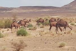
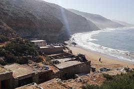



For those prone to vertigo, it might be best to stay at the foot of the mountain, as the trail climbs right along the cliff edge. And from that point on, you quickly understand what verticality really means...


In total, we took 2 hours and 50 minutes, including breaks and the extra walk to the parking lot. The day was already well underway, and with 1,200 m of cumulative elevation gain, it was time to find a spot to eat and sleep. Since we hadn’t made any reservations, we’d planned to bivouac for the night. We weren’t too picky—just practical—so we decided to sleep in the car at the parking lot for tomorrow morning’s hike, just 5 km from Fjordgard.
Open
A summer in the sun in... Iceland!!
Ah, Iceland and us—it’s quite the story, or rather, a long wait... The first time we considered going was already 7-8 years ago, after reading travel journals describing breathtaking landscapes, countless active and dormant volcanoes, glaciers, and waterfalls with extraordinary flows. In short, this island, made of fire and ice, right at Europe’s doorstep with its own unique culture, had nothing but advantages, and it was urgent to visit without delay 😇

My *Routard* guidebook is actually from 2016. So why did Iceland make us wait so long before we finally gave in to its charms? Yes, why indeed?

Simply because reading other travel journals revealed the cost of living there—and especially the harsh climate, even in the middle of July 🤪! Some journals described entire weeks of rain and foggy weather, making it tricky to explore the island. The budget wasn’t spared either, because in the most touristy areas, especially in the south and around Myvatn, accommodation prices are downright indecent—even outright robbery. 😕

Plus, in the Highlands, there’s literally no permanent lodging, and the only way to spend several nights there is to camp. And camping in winter conditions wasn’t exactly part of our plans... 😄

So, year after year, this trip kept getting postponed...

until August 2023, when prices for Southern Africa, North or South America, or even Asia were all way too high for summer 2024!

That’s when I turned my attention back to the Land of Fire and Ice and scoured all the comparison sites for the best accommodation deals across the country. Planning for 20 nights, I found 13 nights in "proper" lodging for 5 people at an average cost of under 200 €! A miracle, considering that in the southern glacier region, around Vik or Myvatn, prices range from 300 to 1000 € per night 😮 😮!

Still, that means we’ll have to camp for 7 nights, mostly in the Highlands, near Askja or Landmannalaugar. 😎

For once, I built the daily itinerary entirely around the decently priced lodgings I found 11 months in advance! The shortage of places to stay in some areas forced me to plan a few long transition days and make some tough choices. No big deal, though—there’s so much to do on this island 🙂!

Once the main itinerary was set, everyone agreed to the plan: 2/3 in proper lodging and 1/3 camping, even the most camping-averse among us! *Follow my gaze...*

By the time we bought the flight tickets, I had to tweak the itinerary a bit because one or two places were already booked! Plus, it was impossible to wait for a more refined plan to adjust reservations, since almost all bookings are non-refundable!! The harsh law of supply and demand...

For the car rental, we booked a Hyundai Tucson, approved for the Highlands, from Lava Car Rental—a company I’d read good reviews about in a Facebook group—for a cool 2500 € with full insurance. A real 4x4, like a Defender, would’ve been more than double...! Welcome to Iceland 😕...

Activities and excursions also required some tough choices. We had two must-dos: whale watching in Húsavík (60 € pp on Getyourguide) and a Glacier and Summer Treasure Glacier Walk with BlueIceland (165 € pp with discount codes on Getyourguide).

For the baths, we skipped the Blue Lagoon—too expensive—in favor of the Secret Lagoon and the Myvatn Baths, the Blue Lagoon’s equivalent but half the price.

Two baths for the price of one... and even more, since I spotted several free hot-water swimming spots.

Itinerary: Day 1: Arrival in Reykjavik - Hraunfossar Waterfall - Surtshellir Cave Day 2: Grábrók Crater - Snæfellsnes Peninsula Day 3: Stykkishólmur - Sturlungalaug Hot Springs Day 4: Northwest Coast - Akureyri - Goðafoss Day 5: Myvatn Day 6: Myvatn - Dettifoss - Selfoss - Rauðhólar Day 7: Húsavík Whale Watching - Dettifoss - Selfoss Day 8: Stuðlagil Canyon - Seyðisfjörður Day 9: Puffin colony - Störurð Hike Day 10: Hengifoss - East Fjords, Mjóifjörður Day 11: Viking Village - Jökulsárlón - Fjallsárlón Day 12: Glacier Excursion - Svartifoss Day 13: Fjaðrárgljúfur Canyon - Vík Day 14: Þakgil - Lava Show Vík Day 15: Southern Waterfalls Day Day 16: Landmannalaugar - Skalli Hike Day 17: Landmannalaugar - Bláhnjúkur - Brennisteinsalda Day 18: Secret Lagoon, Kerlingarfjöll, and Gullfoss Day 19: Geysir - Reykjavik Day 20: Bruarfoss - Þingvellir - Kerid Crater - Krýsuvík Geothermal Area Day 21: Reykjanes Peninsula

Friday, July 5, 2024, is our last workday before driving up to Alsace overnight to leave the cockers at Grandpa’s for boarding. Then, at 1:30 AM, we’ll head to Frankfurt, where a direct flight to Iceland awaits.

We arrive at 4 AM. Since we leave at 7 AM, the "night" will only last the equivalent of a 30-minute nap 🤪... just enough to get us in the road-trip mood 😏!!
Open

You might also like