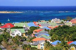
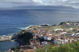
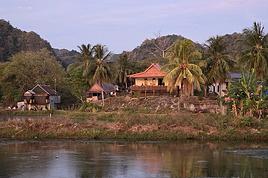
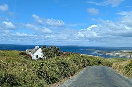
The Eastern region is a landscape of protected coasts and bays, charming little fishing villages, exceptional scenic routes, and hiking trails in the heart of preserved habitats where many migratory bird species live, including puffins.
Stretching from Cape Bonavista in the north, where John Cabot landed in 1497, to Fortune and Grand Bank in the south, this part of Newfoundland was the first to be discovered and settled.
Visiting this region is like stepping back in time and discovering the cultural and artistic richness of this province, all at a more relaxed pace.
Source: https://www.exploretnl.ca/region-est
Videos are embedded throughout the summary. Please click on the image to start the video.
Bonavista Peninsula - Trinity - Gun Hill Trail
Bonavista Peninsula - Trinity East - Skerwink Trail
Bonavista Peninsula - Elliston - Puffin viewing site
Bonavista Peninsula - Elliston - Spillars Cove (Cable John Cove)
Bonavista - Dungeon Provincial Park
Bonavista - John Cabot Municipal Park
Bonavista Peninsula - Cape Bonavista Lighthouse
St. Lawrence - Cape Chapeau Rouge Trail
26 similar discussions in English
A land of adventure, the central region of Newfoundland is a vast area of dense forests and rugged coastlines.
To the north, between April and June, icebergs from Greenland drift along the famous "Iceberg Alley."
Inland, forests, lakes, and rivers dominate—once precious resources for Indigenous peoples and European settlers.
To the east lies Terra-Nova National Park and its typical habitat, made up of islands, ponds, bogs, and forests.
Finally, the southern coast, dotted with spectacular fjords, is home to several isolated fishing villages as well as the Miawpukek First Nation of Conne River, the province’s only recognized reserve.
Source: https://www.exploretnl.ca/region-centre
Below is a list of the hikes we did in this region. Each hike has a link attached so you can quickly access more information about it.
Videos are embedded throughout the summary. Click on the image to start the video.
King's Point - Alexander Murray Trail Grand Falls-Windsor - Thunder Brook Falls Trail King's Point - Rattling Brook Falls Trail Harbour Breton - Gun Hill Lookout Trail Harbour Breton - Deadman's Cove Trail Harbour Breton - Rocky Point Lighthouse Trail Harbour Breton Community Dildo Run Provincial Park - Black Head Trail Twillingate - Lower Little Harbour Trail Twillingate - Rockcut Twillingate Trails Twillingate - Lower Head Loop Trail Twillingate - Cuckhold's Point Trail Twillingate - Top of Twillingate Trail Terra-Nova National Park - Mill Cove Lookout Trail Eastport - Sandy Cove Lookout Trail
INTRODUCTION
Creating a masterpiece like Gros Morne National Park wasn’t done overnight. So, when you first discover this extraordinary place, it’s easy to understand why Mother Nature took over 485 million years to bring it to life.
Here, glacial valleys, forests, rugged coastline, beaches, and peat bogs follow one another and intertwine to form a unique ecosystem, one that’s rare in the world. After all, this is where geologists found tangible evidence of the theory of continental drift, and it’s one of the few places on Earth where you can see—and even walk on—the Earth’s mantle. This site is a true celebration of the raw, enigmatic power and beauty of the physical world.
Designated a national park in 1973 and later a UNESCO World Heritage Site in 1987, it’s an 1,805 km² playground just waiting for the adventurer in you. Whether you’re traveling solo, with family, or with friends, for a few days or several weeks, you won’t run out of things to do here.
Source: https://www.exploretnl.ca/parc-national-gros-morne
The hikes we did in this region are listed below. Each hike has a link so you can quickly access more information about it.
Videos are embedded throughout the summary. Click on the image to start the video.
Stanleyville Trail Trout River Pond Trail Trout River Pond Trail (Return) Green Gardens Trail Tablelands Trail Scenic Route 431 Lookout Hills Trail Southeast Brook Falls Trail Gros Morne Mountain Trail (James Callaghan Trail) Berry Hill Trail Baker's Brook Falls Trail Berry Hill Pond Trail Western Brook Pond Trail Boat Tour on Western Brook Pond Steve’s Trail Shallow Bay Beach
INTRODUCTION
Trip taken in 2021, but still relevant for exploring the island of Newfoundland.
We went on multiple hikes in this Canadian province, which offers a unique and breathtaking landscape.
GPS coordinates: 46.20884, -60.24498 Marine Atlantic Ferry
To do this, we traveled to North Sydney, Nova Scotia, to board a Marine Atlantic ferry that took us to Port aux Basques in Newfoundland. The crossing takes about 7 hours.
The ferry *Highlanders* features spacious cabins for two or four people, a restaurant, a retail store, and a play area for kids.
The reclining seats are comfortable and include a headphone jack and a USB charging port.
We went out on the open-air panoramic observation deck several times to admire the Atlantic Ocean, hoping to spot some marine wildlife. Unfortunately, we didn’t see any.
This short video gives you an overview of the facilities. For more details, I invite you to check out Marine Atlantic’s website at the following address: https://www.marineatlantique.ca/.
https://youtu.be/oV9_7AcJnEQ
The Avalon Peninsula, located in the southeast of Newfoundland Island, isn't just a picturesque place—it's also teeming with natural wonders: icebergs, whales, migratory seabirds, and wild caribou.
It was the first region of the province to be settled. Moreover, it's rich in legends, traditions, and the history of the early adventurers who conquered the New World.
St. John's, the capital, is one of the oldest and easternmost cities in North America. With its colorful houses nestled in the heart of steep rocky hills, it has the traditional charm of a small port town.
Below are the hikes we did in this region. A link is attached to each hike to give you quicker access to the relevant information.
Videos are embedded throughout the summary. Please click on the image to start the video.
Chance Cove Coastal Hiking Trail Cape St. Mary's Ecological Reserve Holyrood - Salmonier Nature Park La Manche Provincial Park - Suspension Bridge Trail Cape Spear - Lighthouse Trail St. John's - Deadman's Bay Trail Quidi Vidi - Sugarloaf Trail St. John's - Signal Hill National Historic Site St. John's - North Head Trail Loop - Signal Hill Salmon Cove - Salmon Cove Sands Provincial Park
After visiting Newfoundland Island, we took the ferry to Blanc-Sablon, a municipality located on the Lower North Shore in Quebec, Canada.
Instead of heading back to Quebec via Sydney in Nova Scotia, we decided to explore the Lower North Shore—the least-known region of Quebec—as well as Labrador, which is part of the province of Newfoundland and Labrador.
From Blanc-Sablon, we drove to the municipality of Vieux-Fort via Route 138. This road ends in that municipality.
Afterward, we crossed Labrador to return to the Old Capital. Only one road allows this route. It wasn’t fully paved during our trip, but it is now.
We made stops in different areas to go on hikes that let us discover some incredible landscapes.
I hope this travel journal inspires you to venture into these stunning regions.
Videos are embedded throughout the summary. Click on the image to start the video.
Lower North Shore:
Lower North Shore - Blanc-Sablon - Brador Falls Lookout Lower North Shore - Blanc-Sablon - Astragalus Trail (Milk-Vetch Trail) Lower North Shore - Bonne-Espérance - Granny Hill Trail
Labrador:
Red Bay - Tracey Hill Trail Mary's Harbour - White Water Falls Trail Mary's Harbour - Gin Cove Hiking Trail Mary's Harbour - Dr. Moret Hiking Trail Happy Valley-Goose Bay - Birch Island Walk North West River - Sunday Hill Lookout Trail Churchill Falls - Bowdoin Canyon Nature Trail Labrador City - Tanya Lake Loop Trail Labrador City - Crystal Falls Hiking Trail
North Shore
North Shore - Manic 2, 3, 5 Hydroelectric Plants and Daniel-Johnson Dam Baie-Comeau - Pioneers Park Tadoussac Village
**********
More landscapes of the Lower North Shore, Labrador, and the North Shore
Eastern Canada: the Eastern Townships, Gaspésie, New Brunswick, Acadia, and Nova Scotia.
Forests, lakes, lighthouses, parks, and encounters. To sum up this trip: amazing encounters, stunning parks, wildlife, and passionate, fascinating Parks Rangers. Bic Park, Gaspésie, Forillon, Bonaventure Island, Cape Breton Highlands Park, Hopewell Rock
My tips:
Don’t hesitate to chat with the park rangers and check out the activities they organize—it’s really interesting.
If you want to see wildlife, get up early.
The kilometers go by pretty easily; driving 500 km in Canada with an automatic car on long, straight roads with light traffic isn’t much more tiring than doing 120 km on Ireland’s narrow roads...
Try to catch a Quebecois film at the cinema or on TV.
For the ferry, plan ahead. Taking it at least once is a great experience.
For the rest, once you know what you want to see, just go with your gut—it’s easy.
The Trip:
Arrived in Montreal on 09/02. Family meal where we tried homemade *pouding chômeur*.
We spent 3 days exploring the Eastern Townships: the Abbey of Saint-Benoît-du-Lac, Bolton, Magog (its wine fair and thunderstorms), Granby, Bromont and its little lake, and its spa…
Gaspésie, New Brunswick, Nova Scotia:
We didn’t stop in Quebec City or at the Montmorency Falls, as we’d already visited them on a previous trip. Otherwise, plan an extra day and a stop in the lovely city of Quebec.
Day 1: Left on 09/05 for Saint-Fabien and Bic Park, famous for its coastline, marshy landscapes, and harbor seals (brochure). About 500 km. Stayed overnight in Saint-Fabien.
Along the way, we saw *barachois*—bodies of water usually at the mouth of a river, separated from the sea by a gravel, sand, or pebble barrier. They can be freshwater or saltwater. The fresh water of the St. Lawrence River mixes with the sea up to Orléans Island. And there’s a measurable tide up to the Trois-Rivières bridge. Visited Bic Park and observed seals molting with the park rangers. More park photos.
Days 2 & 3: Headed to Sainte-Anne-des-Monts (about 200 km). The lighthouse route guided us 😊.
Two nights in Sainte-Anne-des-Monts for a short hike in Gaspésie Park (brochure) and its stunning landscapes between mountains, forests, rivers, and lakes. We didn’t see any caribou or moose, but from the top of Xalibu (a well-marked 5-hour round-trip hike), we had a 360° view of Mont Jacques-Cartier and Mont Albert. More photos. This was Muriel’s favorite park—it’s exactly what she imagined Canadian forests, rivers, and lakes to be. You can also stay overnight in the park (especially by Lac Cascapédia), which is better but pricier 😢.
Days 4 to 6: Left for Forillon Park (brochure) near Gaspé (200 km). Magical... We were lucky—we came face-to-face with a mother bear and her cubs (brown bears). It was incredible. We also saw beavers at work...
Our lodging was out of the ordinary—what luck! A ranch in the middle of the woods. We stayed 3 nights. This is my favorite park. More Forillon photos.
Gaspé in Mi’gmaq means "end of the land." But for Jacques Cartier, it was the beginning of the country. On July 6, 1534, he and his crew made contact with the first Indigenous people of the Mi’gmaq Nation off the Baie des Chaleurs. On July 24, 1534, he landed in Gaspé, planted a 30-foot cross, and claimed the region for the King of France, where they met the St. Lawrence Iroquoians. Visited Bonaventure Island (brochure) and its 100,000 northern gannets. Bonaventure Park photos.
Not to mention our first freshly caught and cooked lobster, bought at a fish market on the port.
Day 7: Finished the Gaspésie loop with a stop in Campbellton (300 km) before crossing into New Brunswick. Stopped at Bourdage Tradition farm. We could’ve gone as far as Caraquet, which would’ve been better. Rain all day.
Day 8: Headed to Cape Breton Highlands National Park in Nova Scotia. Overnight in Moncton to split the drive (500 km). We stopped in Acadia, a truly unique region with incredibly friendly and open people. New Brunswick is over 80% forest—it’s impressive how many trucks and dead raccoons you see on the side of the road.
Sunset at Hopewell Rock—bring mosquito repellent! There are thousands, it’s awful. Photos.
Days 9 to 11: Left for Sydney (500 km) for 3 days exploring Cape Breton Highlands Park. If you have time, stop at the "Train Station Inn in Tatamagouche"—I love the concept. You can eat there, sleep there, or just visit.
The Cape Breton Highlands Park loop is over 300 km. Photos. Our apartment was in North Sydney, a bit far from Chéticamp (2-hour drive) and 1.5 hours from the park entrance. But the road itself is beautiful. We should’ve found lodging in Chéticamp or Ingonish. At the time, we were also planning to visit Louisbourg, but it was too much.
Day 12: Time to head back, but there were still over 1,500 km to go. We’d planned to stop at "Le Pays de la Sagouine," a local heroine from Antonine Maillet’s imagination, played by the wonderful local actress Viola Léger. A fantastic place for shows and passion—don’t miss it if you get the chance. Another overnight in Moncton to split the trip (550 km).
Returned through Gaspésie and the Matapédia Valley, famous for its salmon fishing. We met a guy from Haute-Savoie who’d been living there for 15 years, making a living from fishing (he runs a shop) and dog sledding in winter.
Day 13: Things didn’t go exactly as planned. We were supposed to take the ferry from Rimouski to Tadoussac and the Saguenay Fjord. But due to Storm Florence, all boats were docked. We tried the ferry from Trois-Pistoles, but all crossings were canceled. The only other way was a 500 km detour to Quebec City. So we decided to spend the night of 09/17 in Trois-Pistoles (we’d already driven 600–700 km that day).
Days 14 & 15: We changed our plans, heading to Trois-Rivières and La Mauricie Park for a quick seaplane tour. There, we had an amazing encounter at the "Gîte de la Vieille Caisse" (the Old Bank Inn). The welcome was warm, breakfast was hearty, and the outdoor spa in the rain was great. We took our flight with Hydravion Aventure—the team was super friendly, and it was close to our inn. We’ll be back to explore this side of the St. Lawrence 😊.
Returned to family for a quiet end to the trip, with a little hike on Bromont Mountain, a visit to the Bombardier Museum, and a detour to local vineyards to buy a few bottles as souvenirs.
Bromont is the local ski resort, open until midnight on weekends.
We were 10 days too early for the fall colors and the cranberry harvest. I think it’s worth seeing.
If we go back, we’ll try to combine a trip to the north shore of the St. Lawrence (Mauricie, Lac Saint-Jean, Saguenay), the cranberry harvest, and a day at the Saint-Tite Festival. It must be amazing...
In summary: Parks, forests, but also plains, fields, farms, lighthouses, beaches, small fishing ports, hikes, family moments, and encounters...
Trip Cost:
We spent 3,400 € total for two, including souvenirs. The exchange rate with the Canadian dollar was pretty good.
Flights: 830 € for two.
Accommodations: 750 € for 14 nights, averaging 54 € per night in B&Bs and Airbnbs (family stays not included).
Car rental: 600 € for 3 weeks + 350 € for gas. We drove over 6,000 km—it’s a lot but doable. We wanted to go to New Brunswick and Nova Scotia.
Park entry fees were about 8 CAD per person. We didn’t get a pass because some parks are national (Forillon), others are Quebec national parks, and some are neither.
The seaplane cost 99 CAD per person for 30 minutes.
For meals, we had a cooler to do some basic cooking in apartments or hostels. We ate out 4 evenings.
FOREWORD
In July 2018, we decided to go on a road trip to Prince Edward Island. We had four days off, so it was the perfect opportunity to set off on an adventure.
This time, I hadn’t had much time to prepare an itinerary. I’d only done a bit of research online to try and find tourist attractions that might interest us.
I should say that it wasn’t our first visit to the island, and since our stay was quite short, we decided to complete the island loop by making stops along the coast to admire the lighthouses, small fishing villages, beaches, and the stunning steep cliffs.
We also made a few stops at lookouts along the road and even went for a hike in Greenwich National Park.
Our trip was more of an escape into nature. When we travel, we feel best when we’re far from the noise and crowds.
So, I invite you to discover the fabulous landscapes of Prince Edward Island.
To get there, we had to cover nearly 1,000 km. It took us a full day, and we had to cross parts of Quebec and New Brunswick.
The roads are beautiful. However, there isn’t much to see except the vast forests lining the highways.
The Confederation Bridge, which is 12.9 kilometers long, connects New Brunswick to Prince Edward Island.
There’s no fee to enter the island when you cross this bridge. However, a toll must be paid when leaving the island.
https://www.confederationbridge.com/fr/tolls-fees
https://youtu.be/UWhn5bqLONU
After exploring Dawson City, the final stop on our incredible road trip to the Yukon (see travel journal), it was time to head back to Quebec.
Instead of returning directly, we took advantage of this cross-country drive to make several stops in British Columbia and Alberta.
This part of the trip allowed us to discover some of the most beautiful attractions in Western Canada, from breathtaking landscapes to iconic natural sites that are must-sees in Canada.
Between majestic mountains, turquoise lakes, and jaw-dropping panoramas, every stop added a memorable touch to this already exceptional adventure.
A wonderful way to wrap up this journey across Canada while fully enjoying the richness and diversity of its vast landscapes.
In the upcoming posts, you’ll discover the highlights that marked our journey through Western Canada.
I invite you to watch the associated videos to fully experience the atmosphere, landscapes, and attractions we were lucky enough to explore.
To navigate to a specific post, here are the appropriate links:
Adventure on the Alaska Highway: Bald Eagles, Bison & Moose Adventure on the Alaska Highway: Bison, Caribou & Bears Yellowhead Highway (Alberta): Roche Miette, Jasper Lake & Emerald Pond Maligne Lake Road (Jasper) | Moose and Elk Exploring Mount Robson Provincial Park (BC) Must-Sees on the Icefields Parkway - Alberta David Thompson Highway11 (AB): A Stunning Scenic Route What to See in Yoho National Park (BC) Johnston Canyon: Hike to the Lower & Upper Falls Iconic Sites of East Kootenay, BC Lundbreck Falls - A Spectacular Waterfall in Southern Alberta Trails of Red Rock Canyon & Blakiston Falls - Waterton Waterton Village Under the Snow - A Unique Place Writing-on-Stone: A Park Famous for Its Hoodoos Red Rock Coulee Natural Area Alberta – A Supernatural Landscape Dinosaur Provincial Park Alberta - Mysterious Badlands Drumheller: Dinos, Hoodoos & Badlands Interpretive Trail Hike at Horsethief Canyon | Drumheller Badlands Red Deer: Public Art & Murals Downtown Calgary | Public Art, Skyline & Iconic Spots Medicine Hat | Public Art & Iconic Spots
For a long time, the Yukon had been one of those dream travel destinations for us. Its vast wilderness, majestic mountains, and fascinating history tied to the gold rush irresistibly drew us in.
We finally made this ambitious project a reality: a road trip across Canada heading toward the Yukon.
Since the journey from Quebec is considerable, we chose to turn the trip itself into a series of adventures.
Instead of just racking up the kilometers, we made plenty of stops to discover several tourist attractions spread across different provinces.
Along the way, each province offered its share of landscapes and discoveries. We crossed vast forests, admired beautiful lakes, explored historic sites, and visited several local attractions that helped us better appreciate Canada’s diversity.
These breaks made the trip much more enjoyable and allowed us to take the time to fully enjoy each region we visited.
One of the great pleasures of a road trip is the freedom it provides. We could adjust our itinerary based on our mood, extend a visit we particularly enjoyed, or stop spontaneously at a spectacular viewpoint.
Often, it’s these unexpected discoveries that become the best memories.
As we moved northwest, the landscapes became more and more impressive. The roads seemed endless, the mountains drew closer, and nature took on an even greater presence. Traffic gradually thinned out, giving way to a sense of freedom that’s hard to describe.
Arriving in the Yukon marked the culmination of several days of travel. From the first kilometers, we were amazed by the vastness of the territory.
The breathtaking panoramas, the wildlife everywhere, and the unique atmosphere of the Canadian North more than made up for all the kilometers we’d covered.
This road trip to the Yukon reminded us that the destination is important, but the journey is just as much a part of it.
The many stops we made along the way allowed us to discover extraordinary places we probably never would’ve visited otherwise.
Every province we crossed helped make this adventure even more memorable.
The Yukon will certainly remain one of the highlights of our travels, but the memories we gathered along the way hold a special place in our hearts too.
That’s what makes a great Canadian road trip so magical: every kilometer tells a story.
In the upcoming posts, you’ll discover the places that caught our attention throughout this road trip.
Don’t hesitate to watch the videos to complete the experience and explore these attractions as if you were there.
To jump to a specific post, here are the appropriate links:
Roland Lake Falls - Lac-Pythonga (Quebec) | First Stop on the Way to the Yukon Must-See Stops in Ontario Stop at the Center of Canada | Manitoba Stop in Winnipeg (Manitoba) Discovering Regina (Saskatchewan) Stops in Moose Jaw, Chaplin & Saskatoon (Saskatchewan) Stops in Vegreville & Edmonton (Alberta) Stop at West Edmonton Mall, a World of Attractions Under One Roof Stops in Beaverlodge (AB) & Dawson Creek (BC) Adventure on the Alaska Highway: Between Dawson Creek and Liard River (BC) Discovering Liard River Hot Springs (BC) The Sign Post Forest (Watson Lake) Stops at Rancheria Falls, Teslin, and Tagish Discovering Carcross and Its Must-See Spots Carcross Desert Yukon: A Surprising Desert in the Heart of Canada Must-See Stop at Emerald Lake (Yukon) Hike at Miles Canyon (Whitehorse) - Yukon Discovering Whitehorse Spectacular Northern Lights - Fish Lake - Whitehorse (Yukon) Must-See Stops Between Whitehorse and Dawson City Road Trip on the Dempster Highway (Yukon) - 100 km of Adventure Complete Visit of the Historic Town of Dawson City in the Yukon Midnight Dome Dawson City - Magical Northern Lights in the Yukon
Hi there, here are some practical details that might help with planning a future trip to Québec-Ontario.
3 weeks as a couple from September 21 to October 15, 2024.
Lyon-Montréal flight with Air Transat: 850 €
Accommodation: We only booked the first two nights at a hotel in Montréal. After that, we reserved the day before or even the same afternoon for the next night, going with the flow of the trip. No availability issues—there are plenty of motels. Accommodation is expensive, though; budget around 80-100 € per night on average. -Car rental with Authentik/Thrifty: 760 € for 20 days. Picked up at the downtown branch and returned at the airport. Smooth, quick, competent staff, and a recent car. Added extra insurance with SereniZen. We drove 5,000 km, and gas was less than 1 € per liter. -Food: We’ll keep it short—expensive and not great. -Health: Medical costs seem very high, so on top of credit card insurance, we were advised to get additional coverage. We went with Heymondo. -Tap water is drinkable everywhere. -SIM card: 4GB with unlimited calls for 1 month: 17 € -Our favorite spots for fall colors: the Eastern Townships, Algonquin Park, and Mont Tremblant. Happy travels!
Accommodation: We only booked the first two nights at a hotel in Montréal. After that, we reserved the day before or even the same afternoon for the next night, going with the flow of the trip. No availability issues—there are plenty of motels. Accommodation is expensive, though; budget around 80-100 € per night on average. -Car rental with Authentik/Thrifty: 760 € for 20 days. Picked up at the downtown branch and returned at the airport. Smooth, quick, competent staff, and a recent car. Added extra insurance with SereniZen. We drove 5,000 km, and gas was less than 1 € per liter. -Food: We’ll keep it short—expensive and not great. -Health: Medical costs seem very high, so on top of credit card insurance, we were advised to get additional coverage. We went with Heymondo. -Tap water is drinkable everywhere. -SIM card: 4GB with unlimited calls for 1 month: 17 € -Our favorite spots for fall colors: the Eastern Townships, Algonquin Park, and Mont Tremblant. Happy travels!
Hi everyone,
We’re planning to head to Québec on June 11th (departing from CDG) and return around July 3rd, leaving from Toronto—so about 3 weeks there, traveling by rental car.
We’re thinking of stopping in Ottawa to visit a friend.
We’d love to see the "must-see" spots, but not *too* many, along with nature, parks, some short hikes, canoeing, a seaplane ride, and wrapping up with Niagara Falls.
Do you think we can fit all that into the time we have?
What are the spots you’d recommend not missing along our route?
Is a short trip to Gaspésie at the start of our trip worth considering?
Anyway, as you’ve probably guessed, we’re still in the early planning stages and aren’t quite sure how to organize everything 🤪
Thanks in advance for your thoughts and advice!
hi everyone, I’m asking for advice from those who know the area well
I’m thinking of taking a little gamble and I’d love your opinion—I’ll have an 8-hour layover at Toronto airport
I was thinking of making a quick trip to Niagara Falls!
booking a round-trip taxi—3 hours of driving there and back, 3 hours to get out of and back into the airport
that leaves us 2 hours on site!
I know it’s a stretch, but do you think it’s doable?
thanks in advance
Cécile
Hi,
I’m heading to Seattle next week. We’ve got our ESTAs (we’re French). We’d like to spend a day in Vancouver. Do we need the I-94 form to re-enter the U.S., or are our ESTAs enough? I’ve read conflicting info everywhere... Any recent experiences? We can’t be the only ones...
Thanks.
Hi everyone,
I’m planning a trip to Canada this fall. I have 19 days total. The trip will start in Quebec, then continue to Gaspésie, New Brunswick, and finally Nova Scotia. I’ve already mapped out my itinerary, and it only leaves me with 3 days (including the departure day) in Nova Scotia. We’ll be flying out of Halifax for the return. That’s really not much time—just enough to see Halifax and the surrounding area.
I’d love to hear your thoughts: would it be better to cut some days from Gaspésie or New Brunswick to have more time in Nova Scotia? Do you think I’d be missing out by not spending more time in the region?
Thanks in advance to anyone who’s visited these parts and takes the time to reply.
Hello!
We’ll be arriving in Montreal on October 21st for a 3-day stay.
After that, we’re heading to Sherbrooke to visit our daughter, who’s studying at the university there. We’ll spend 3 days with her, and then, since she has a break that week, we’re taking her along for 3 days in Quebec City.
We’ve planned to visit Montmorency Falls and Île d'Orléans.
I’d love to hear what route you’d recommend for the drive from Sherbrooke to Quebec City—we’ll have the whole day to take it easy.
If you have any other recommendations, I’m all ears!
A little disappointed that the fall colors will be over by then, but the dates couldn’t be helped. Thanks in advance for your tips!
Hi everyone!
Let me introduce us quickly—I’m Matteo (21, originally from Paris, but I’ve been living near the Pyrenees and the Alps for the past 3 years), and my girlfriend Justine (21, grew up in the Alps). We’re starting to get really fed up with being cooped up and sitting in chairs (yep, we’re studying physics and geography at the École Normale Supérieure in Lyon). So, we’re taking a gap year to make a slightly crazy project happen: hitting the road, meeting people, and most importantly—climbing, skiing, and exploring the mountains!
We’ve always been into the mountains: •🧗♂️ 6c-7a/b sport climbing, 6b trad •❄️ Skiing and ice climbing (grade 4/5) •🏔️ Alpine climbing in the Alps (Chamonix, Écrins…) and the Pyrenees—I’m training to become a High Mountain Guide
Our project in a nutshell: •Buying a van (or 4x4) converted in British Columbia around September/October 2025. Ideally, we’d go straight to the US to buy the vehicle there (but reselling might be easier if we buy in Canada). •Heading down to the US to climb at legendary spots like Yosemite, Tuolumne (if it’s too hot), Indian Creek, Moab, and Joshua Tree. •Heading back up to the Canadian Rockies around December for skiing, ice climbing, and winter alpine climbing (might be easier to buy skis there). •Selling the vehicle in Canada at the end of the trip (we need to be back in France by early March 2026 because Justine is preparing for the AMM). I’ve already been to the Rockies, but I want to go back in winter for ice climbing. It’ll probably be too cold to sleep in the van, so we’re hoping to find a small cabin, lodge, or chalet (ideally alone or shared to cut costs). Otherwise, we could work for a month or two at a hostel or something to get free accommodation and earn money to rent a place another month just for climbing. •Visa-wise: we’re hoping to get our Working Holiday Visa (WHV) (still waiting for a response) so we can work there during the trip. For the US, we’ll stay as tourists (no work visa—too complicated and expensive). Any feedback on the WHV or differences from a regular work visa would be great. •With our savings (we’re working in mountain huts this summer), we should be able to buy the van. For daily expenses, I’m hoping to tutor online (math and physics). We live pretty simply and resourcefully: we plan to sleep mostly in the van, cook for ourselves, wash in rivers, and make the most of free nature spots. We’re super motivated, pretty well-rounded when it comes to mountain sports, and we’re not afraid to live simply for a year (we’ve got other projects too: biking to Greece with our climbing gear, a trip to Patagonia for alpine climbing).
Questions and advice: Of course, a road trip like this raises a lot of practical questions. This is our first time embarking on an adventure of this scale, so we’d love to hear your experiences and tips. If any of you have done a long van trip in North America or a WHV in Canada, your insights would be incredibly helpful! Here are some of the questions we’ve got: How do we buy (and later sell) a converted van in British Columbia? We’ll probably land in Vancouver. Is it better to look for a vehicle on online classifieds, Facebook groups, or used car dealerships? Are there any pitfalls to avoid when buying? And for selling it a year later, any tips to make it go smoothly (best time to sell, paperwork, etc.)? What budget should we plan for van life in North America and Canada? If you’ve got any info or feedback on the cost of living in a van in Canada/the US, we’d love to hear it. We’re thinking about expenses like gas (a big one, I imagine!), van maintenance, car insurance, possible tolls, campgrounds or paid spots, etc. We’d like to get an idea of a daily or monthly budget so we’re not too tight. In France, we never stay at campgrounds—we prefer being alone or going where we want. Is that possible in the US and Canada? Any tips for saving money (free camping spots, useful apps…) would be great! Visas, borders, and paperwork: We’re hoping to get a WHV for Canada, but in the US, we’ll be on a tourist visa (90 days max with ESTA, I think). Has anyone combined a WHV in Canada with a trip to the US on the same trip? Anything we should know about crossing the border in a van (insurance, customs, how long we’re allowed in the US, etc.)? We want to avoid any administrative hassles, so any advice on this would be super helpful. Route and seasonality for climbing and skiing: We’re thinking of starting climbing in the US around fall 2025 (probably September/October). Is that the right season for Yosemite, Indian Creek, and Moab? Any must-see spots along the way? For winter, we’re aiming for December to March in the Canadian Rockies (Banff, Jasper, Golden…) for skiing and ice climbing. Any tips on ice climbs or major backcountry skiing spots? We’ve got all our climbing, skiing, and alpine gear—should we bring it all or buy some stuff there? Is the “Wilderness Season Pass” for winter in the Rockies worth it? We came across this pass that offers 7 months of unlimited nights in HI mountain hostels in the Rockies. Has anyone here tried it? Are the dorms usually crowded? Working on the road: To fund the trip, we’re planning to work a bit along the way. Any tips for finding work in Canada while traveling (peak seasons at ski resorts, WWOOFing, odd jobs…)? That’s it for our (many) questions 😅! If you’ve done a similar trip—or even just parts of it (van life, climbing tour, winter in Canada…)—we’d love to hear your experiences, or even if you’re in the area and want to share a few days of climbing. All your contacts, advice, and tips will be a huge help.
Thanks in advance! We can’t wait to read your replies and refine our project with your help.
Matteo & Justine
PS: I’m looking for a summer job from August to September, preferably in a mountain hut (extra help, replacements, etc.). If you’ve got any contacts, don’t hesitate! I’ve also posted on another forum about this with my CV and cover letter (DEMANDE dxsdxsdsxdsx - Forum de www.refuges.info).
Hi there,
Our son is in Canada for a year on a Working Holiday Visa, and we’re planning to join him around September 20th for a 15-day campervan road trip in Nova Scotia.
I was thinking of going with Canadream, but if you have other rental companies to recommend, don’t hesitate!
Here’s the itinerary I’ve been considering—I tried not to cram in too many stops so we’re not just driving the whole time.
Day 1: Pick up campervan in Halifax at 3 PM. Stop at Peggy’s Cove, then drive to Lunenburg and Blue Rocks (151 km) Day 2: Explore Lunenburg, then head to Kejimkujik National Park for hikes or other activities. Overnight in the park (91 km) Day 3: Drive to Annapolis Royal (visit), Port-Royal National Historic Site, then on to Digby (111 km) Day 4: Ferry to Saint John (visit Reversing Falls), then drive to St. Andrews (103 km) Day 5: Whale-watching excursion and explore St. Andrews Day 6: Drive to Alma and Fundy National Park (233 km—we’ll probably leave St. Andrews the night before to split the drive and arrive earlier in Alma) Day 7: Hopewell Rocks (check tides) (43 km) Day 8: Hopewell Rocks—Tatamagouche (dinner train)—Pictou (237 km). Any suggestions for this day? Day 9: Drive to Baddeck, Cabot Trail to Chéticamp (317 km). Ideas for breaking up the drive? I thought of Pomquet Beach Provincial Park for a walk on the boardwalks, but any other suggestions are welcome. Day 10–11: Cape Breton Highlands National Park for hikes and Cabot Trail to Baddeck (208 km) Day 12: Explore Baddeck, Graham Bell Museum, and Bras d’Or Lake Drive. Drive to Louisbourg (118 km) Day 13: Fortress of Louisbourg, then drive to Liscomb (302 km) Day 14: Drive back to Halifax via Lawrencetown Beach (or other suggestions?). Fisherman’s Cove (205 km) Day 15: Return campervan by 10 AM
- All suggestions are welcome, as long as they don’t add too much detour from the main stops. We’d rather skip some places to fully enjoy the ones we visit. We love hiking in beautiful landscapes, charming and lively towns or villages, etc. - I wanted to add a museum dedicated to Acadian culture, but I didn’t find anything along the route—or they’re closed this time of year. Maybe there are places to listen to folk music? - If you have any campgrounds or wild camping spots to recommend, I’d love to hear about them. - Do we need to book the ferry this time of year?
Thanks in advance for your ideas and suggestions!
Claire
Hi everyone,
We’re heading to the Pacific Northwest (USA) and Western Canada this summer. We’ve made some progress planning, but we still have a few questions.
Our trip is mostly nature-focused—hiking, wildlife spotting (ideally bears, orcas/whales, otters, etc.), mountains, forests—and a few days in cities, though we’re not big on museums.
We’re looking at flying into Seattle (cheaper than Vancouver), then renting a car and staying in Airbnbs.
A few years ago, we traveled through eastern Canada/USA (Halifax/Montréal/Boston/Halifax) and ended up driving *way* too much and switching accommodations too often. This time, we’d like to settle in a bit more.
Here’s our current plan:
- 2 nights in Seattle to avoid hitting the road right after the flight. One day for a quick city visit, then we’ll leave early after the second night. -> Heading to Olympic National Park from the south.
- 4 nights near Olympic National Park, likely around Forks. -> Then to Port Angeles and a ferry to Vancouver Island via Victoria (maybe 1 night there).
- 7 nights in Port Alberni, which seems like a central base for exploring Vancouver Island (Tofino, Pacific Rim, Cathedral Grove, etc.). We really want to enjoy the area without constantly packing and unpacking.
The issue is, that brings us to 13–14 nights, and we’d like to spend 2 in Vancouver.
We’re wondering if we should head farther north on the island and add a few more days, or reduce our stay in Port Alberni to explore the north as well.
After that, we’d have about a week left. We’re considering a detour near the Canadian Rockies, then slowly making our way back to Seattle via North Cascades National Park.
Anyway, we’d love your input on all this!
Thanks for your suggestions,
Emilie and Thomas
Hi everyone,
I’m a bit embarrassed because I need to travel to Quebec from February 27th to March 13th. I’m a regular visitor to Canada—this will be my 10th trip since 1997, plus a year as a permanent resident (2000–2001) and a cross-country run from Vancouver to Halifax in 2011. So, I’m definitely not a terrorist! But since our last trip in July 2015, they’ve introduced this eTA thing. Seems more like a way to make money than to actually secure Canada, if you ask me, but anyway, that’s not the point. I applied for an eTA for myself, my wife, and our two kids. They all got approved within hours, but not me! I was asked to create a GC key and then an IRCC account, which I did. Normally, you get news within 72 hours, but since Monday, January 15th, nothing! In the "message" section of the account, it says "explanation letter (required)" with a deadline of January 25th, but I can’t find any explanation anywhere—despite searching the Canadian government website and Google. No links, nothing! I’ve emailed them but haven’t heard back yet. I’m thinking of calling the Canadian embassy in Paris tomorrow. Even though I’m not stressing yet, it’d be a bummer if everyone else got to go without me! If anyone’s had this issue before or knows what this explanation letter is about, I’d love to hear more.
I’m a bit embarrassed because I need to travel to Quebec from February 27th to March 13th. I’m a regular visitor to Canada—this will be my 10th trip since 1997, plus a year as a permanent resident (2000–2001) and a cross-country run from Vancouver to Halifax in 2011. So, I’m definitely not a terrorist! But since our last trip in July 2015, they’ve introduced this eTA thing. Seems more like a way to make money than to actually secure Canada, if you ask me, but anyway, that’s not the point. I applied for an eTA for myself, my wife, and our two kids. They all got approved within hours, but not me! I was asked to create a GC key and then an IRCC account, which I did. Normally, you get news within 72 hours, but since Monday, January 15th, nothing! In the "message" section of the account, it says "explanation letter (required)" with a deadline of January 25th, but I can’t find any explanation anywhere—despite searching the Canadian government website and Google. No links, nothing! I’ve emailed them but haven’t heard back yet. I’m thinking of calling the Canadian embassy in Paris tomorrow. Even though I’m not stressing yet, it’d be a bummer if everyone else got to go without me! If anyone’s had this issue before or knows what this explanation letter is about, I’d love to hear more.
Hi there,
I know there are similar topics here and elsewhere, but they’re a few years old, and I need an up-to-date answer to make sure I don’t throw over 1000 € out the window. Thanks for your patience.
I’m planning a trip from France to Alberta/British Columbia, and I’m unsure about which bank card to use for the security deposit with the rental company (I’m thinking of going with AVIS).
I contacted Avis Canada, and they told me a credit card is absolutely required. I asked my bank for a credit card (a *real* credit card), but they only offered me a deferred debit card.
My question: For a rental with Avis Canada, is a Gold International Mastercard deferred debit card usable for the security deposit needed to finalize the rental? Is the "CREDIT" label enough? (Some cards say "CREDIT" and others say "CARTE DE CREDIT"—seems minor, but it’s actually a big deal in how the card works.)
I’ve seen conflicting info everywhere I look... My bank says it’s *usually* okay (the deferred debit card), while Avis Canada insists it *must* be a credit card, not debit—even when I mention the deferred debit card.
I know the whole credit card concept is already confusing, and on top of that, some sites say a deferred debit card counts as a credit card, while others say it doesn’t.
Thanks to anyone who can share a recent experience! Have a great day
Hi,
I’m looking for any info or experiences (good or bad) about this agency.
Thanks
I’m looking for any info or experiences (good or bad) about this agency.
Thanks
hi,
I’m traveling to the United States via Canada. I’ve already arranged an AVE for the Canadian transit,
but I’ve lost the email with the AVE number.
Could you tell me how to retrieve this AVE number?
Thanks in advance for your help
Hi everyone,
I’m finally heading to the Yukon in May-June 2025 and also Alaska.
My flight is booked, the truck camper too, but I’m a bit stuck on visas:
I’ll arrive in Canada by plane, drive to Alaska by road, and return to Canada by road before flying out again. Is the eTA sufficient?
I’d also love to hear from people who’ve done this trip—great tips, places to stay, warnings, or personal experiences!
What about bear spray? Where can I find it, and how much does it cost?
I’ll be spending a few days in Whitehorse when I arrive on May 8th, and again the weekend of June 20th—any suggestions for accommodation are welcome.
I’m Belgian and flying out of Germany.
Hi fellow travelers, do you think there’s a real benefit to spending 2-3 days in Yosemite when I’ll already be spending a week in Banff and Jasper in the Canadian Rockies? Won’t it feel a bit redundant? I’m asking because Yosemite is expensive (I’d go with an agency from SF, staying in a cabin, since I’ll be solo and without a car) and apparently packed.
Thanks for your feedback!
Hi everyone,
Here’s the itinerary I’ve planned for this summer. I’d love to get your thoughts and recommendations on it. We’ll be 2 adults and a 15-year-old teen.
11/07 Calgary - arrival around 9 PM 12/07 Calgary - exploring the city 13/07 Calgary : Stampede 14/07 (Canmore) Banff - Kananaskis Valley - Town of Canmore - Banff Centre - Upper Hot Spring (pool) 15/07 Banff - Johnston Canyon - Lake Louise - Moraine Lake 16/07 Banff - Banff Gondola with ridge walk (1 km) - Lake Minnewanka 17/07 Yoho (Field) - Herbert Lake - Yoho Valley Road (before Field) - Field - Natural Bridge - Emerald Lake + hike to Takakkaw Falls - night at The Crossing 18/07 Jasper - Icefields Parkway - Herbert Lake - Bow Lake - Peyto Lake viewpoint (15 min from the parking lot) - Saskatchewan River Crossing - Columbia Icefield with the Skywalk - Sunwapta Falls - Goat and Glacier Lookout - Athabasca Falls 19/07 Jasper - Maligne Valley - Medicine Lake - Maligne Lake 20/07 Jasper - Whistlers Peak - Miette Hot Springs 21/07 Wells Gray - Yellowhead Highway 22/07 Wells Gray - Helmcken Falls - Dawson Falls - Spahats Falls - Clearwater Lake 23/07 Hat Creek Ranch 24/07 Whistler 25/07 Whistler 26/07 Nanaimo - Sea to Sky Highway - 1.5-hour ferry 27/07 Nanaimo - North Coast - Rathtrevor Beach Provincial Park - Old Country Market - Goats on Roof - McMillan Provincial Park - Cathedral Grove 28/07 Victoria - Kinsol Trestle - Malahat Skywalk 29/07 Victoria - whale watching 30/07 Victoria - Inner Harbour - Chinatown - Fisherman’s Wharf floating houses 31/07 Vancouver - 3-hour ferry 01/08 Vancouver 02/08 Departure
We’re being really careful not to spend more than 3 to 4 hours driving between stops. We want to take our time. Thanks for your input....