Hi there,
I’ve been road cycling for several years, and I’m about to switch to gravel in the next few days—I’m waiting for my bike, which should arrive this week.
I’m planning a bikepacking trip in a few weeks along the Véloroute V81, also known as the Vélosud, from Biarritz to Le Barcarès.
Has anyone here already done this route? Any info is welcome, whether it’s about the route itself, gear, or accommodation. I’ll prioritize staying with locals as much as possible. On that note, I just signed up for the brand-new site *Guidon et Couette* ((www.guidon-et-couette.fr)), which offers free accommodation between cyclists across the country, but there’s almost no one listed along my route!
Thanks in advance.
Laurent.
27 similar discussions in English
Hi,
We crossed the Pyrenees by e-bike last July, from Bayonne to Perpignan, taking small roads as close to the border as possible (25 mountain passes in 10 days). It was an absolute delight, and we can share tips with anyone interested in this experience.
Hi everyone,
I usually travel abroad in the summer, but given the circumstances, I think this year I’ll be staying in France. I’d love to know which places you’d recommend for the most stunning mountain landscapes and the best hikes.
Thanks in advance for your help!
😉
I usually travel abroad in the summer, but given the circumstances, I think this year I’ll be staying in France. I’d love to know which places you’d recommend for the most stunning mountain landscapes and the best hikes.
Thanks in advance for your help!
😉
Why bike (MTB) along the canal between the Two Seas: the lateral canal of the Garonne from Bordeaux to Toulouse, and the Midi Canal from Toulouse to the Mediterranean?
This canal was created to connect the Mediterranean to the Atlantic without going around Spain, and along its entire length, there’s an old towpath (used to pull barges). Since this path is closed to traffic (except for service vehicles from Voies Navigables de France), no cars drive on it—it’s dangerous, noisy, and polluting. The Canal between the Two Seas was built for transporting goods, so it passes through many towns you can explore without dealing with traffic. You can stock up on supplies or spend the night. You’ll discover the varied landscapes of the countryside, always in the serenity brought by the calm and slow flow of the canal’s water. Most of the time, you’ll be in the shade of trees planted to stabilize the banks with their roots. All you have to do is follow this blue—or rather green—ribbon without needing to consult a map. But the biggest advantage is that it’s flat! Of course, on the Canal du Midi, water flows from the watershed divide at Naurouze eastward to the Mediterranean and westward to Toulouse. On the lateral canal of the Garonne, water flows toward Bordeaux. But this slope is almost imperceptible, which is a huge plus when you want to travel by bike for several days with luggage.
When I say "bike," I really mean MTB because, while the towpath has been replaced in some places by a paved bike path, it mostly resembles a dirt trail—sometimes smooth, sometimes rocky, and often cluttered with roots from the magnificent trees lining it. Since the canal was classified as a UNESCO World Heritage site, improvements have been underway, but it won’t be tomorrow that you’ll be able to ride from Bordeaux to Sète on a road bike. And I’m afraid the first sections of the path will be worn out before the rest is finished. You might even run into construction work for this bike path. That’s what happened to me during the spring of 2007.
Sunday, 03/11 – Valence d'Agen 08:15 to Toulouse (Rangueil) 16:30 97 km in 8h15 (6h on the bike) I started on the recently paved path along the lateral canal of the Garonne. The first locks appeared, and as I approached Moissac, the path turned into a billiard table until Castelsarrasin. After the Cousteau port, I was back on the classic dirt towpath with its rocks, roots, and nutria holes. But not for long—soon, I hit ruts left by backhoes and bulldozers, which, fortunately, were resting for the Sunday. A pile of rubble taller than me blocked the entire width of the path. I didn’t want to turn back to find the previous bridge and ride on the other bank, which was just as impassable (dense grass). It wasn’t easy to carry a bike with full panniers, so I lifted it over several mounds. I kept going, sometimes on foot, unsure how far the construction extended. Another bulldozer—luckily, the ground was dry. The work went all the way to Montech, making the path impassable. I recommend taking the N113, which runs parallel (that’s what I did on the way back). In Montech, the famous water slope was at rest, waiting for tourists. For many kilometers, I was back on the traditional towpath. The closer I got to Toulouse, the better the surface became, and the more cyclists and pedestrians I saw—until the city center, where there was nonstop bike traffic, especially students heading to Rangueil.
Monday, 03/12 – Rangueil 09:10 to Revel 16:30 86 km in 7h20 (5h30 on the bike) As soon as you reach Toulouse, you make a 90° turn to follow the connection between the lateral canal and the Canal du Midi. Heading east, you pass the barge selling the famous Toulouse violet souvenirs. A real bike path has been built for 50 km to Port Lauragais. It’s a true joy for Toulousains and travelers. Restrooms have been installed or shared with highway rest areas, allowing you to refill water (of course, bikes are banned from ASF rest areas, but cleverly placed racks let you secure your bike and walk in). At Port Lauragais, it’s another rest area shared by highway users, cyclists, and boaters. You’ll find a cafeteria, restaurant, hotel, and a shop selling regional souvenirs. But the real pleasure is reaching the watershed divide at Naurouze, where water flows toward the Mediterranean on one side and the Atlantic on the other. There, I decided to leave the Canal du Midi, which continues toward Castelnaudary with a much rougher towpath, to follow the *Rigole* that feeds the canal with water from the Saint-Ferréol basin. For me, it was like returning to the source—a bit like a pilgrimage in honor of the brilliant Pierre-Paul Riquet, the designer of this magnificent work. I followed the service trail along the *Rigole*. It’s actually a variant of the GR 653, leading to Revel alongside this artificial waterway. It’s fed by water from the Montagne Noire, and I was worried about a steep climb. But that wasn’t the case—the *Rigole* winds for 40 km, flowing gently under the trees. It was better than a dream: a smooth dirt path with the crunch of pine needles under the wheels, where I only crossed paths with a few fishermen... And to soothe sore buns, the last kilometers were on packed earth—a paradise (ATVs, stay away!). More walkers and cyclists appeared there.
Tuesday, 03/13 After a restful night in Revel, I started the morning with a walk around Lake Saint-Ferréol. A very pleasant 10 km hike, but I don’t recommend it for mountain bikers unless you’re used to mountain terrain and have strong calves. Otherwise, you can take the road—there are at least two hotels near the lake. In the afternoon, I began the return trip to Tarn-et-Garonne via the same path, with the same pleasure.
Total: 378 km of suffering and bliss, for which I must thank the departmental and regional councils for their funding, Voies Navigables de France for maintenance, and the volunteers who mark the hiking trails. And don’t you think you’re exaggerating a bit with your 378 km of bliss and the paradise of the *Rigole*?
Okay, fine—it wasn’t always idyllic. Sometimes the path was downright *pierrique*... but I had great weather, and the landscapes were so beautiful (water, sun, vegetation). In the rain or mud, it would’ve been less fun. What does *pierrique* even mean?
*Pierrique* is worse than rocky. I know a Pierrick, and he’s tough. And why *Facteur4*?
It’s France’s goal to reduce greenhouse gas emissions by a factor of 4 by 2050. I’m doing my part by biking to work 3 out of 4 times. And your cassoulet?
Guilty as charged. I ate the best cassoulet of my life at the Hôtel du Midi in Revel. But it was very productive in methane. My stomach hurt so much I couldn’t sleep and ended up writing my postcards between 3 and 4 AM. So many great memories!
Hi there,
New to bike touring,
I’d love to start with a section of the Via Rhona to explore and share (route to be decided).
Looking forward to exchanging tips!
hi,
I'm planning a recumbent bike trip from the Pyrenees to Greece. On the EuroVelo 8 route, it doesn't specify the path through the Alps.
Are there any experienced cyclists here who can tell me where they go to avoid climbing too high?
Also, is there another traveler/bike forum better suited for broadening the responses?
thanks
A shout-out to a cycling colleague from Savoie
Claudio specializes in the route of the Savoie lakes Here are his travels Between Bornes, Chartreuse, the Savoie foothills, and Dauphiné Five lakes: Léman, Annecy, Paladru, Aiguebelette, Bourget, not to mention a few ponds along the way Plenty of accommodation options: camping, hotels, and more...
A lovely route not far from his place Rural and quite peaceful A road cycling route created by Serge B...
N+1 reconnaissance trips on a loop of about 400 km This way, he avoids the SNCF and its troubles http://cbandiera.free.fr/vv/lacs-savoie/recos.php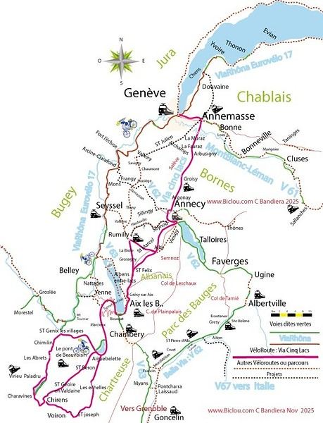
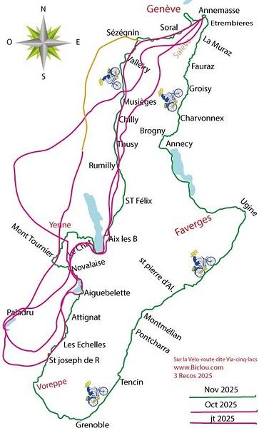
The latest reconnaissance trip from April to May 2026 http://cbandiera.free.fr/recits/2026-grenoble-H/index.php
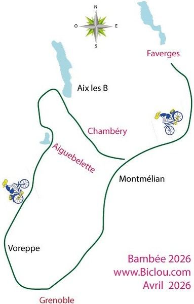
Claudio specializes in the route of the Savoie lakes Here are his travels Between Bornes, Chartreuse, the Savoie foothills, and Dauphiné Five lakes: Léman, Annecy, Paladru, Aiguebelette, Bourget, not to mention a few ponds along the way Plenty of accommodation options: camping, hotels, and more...
A lovely route not far from his place Rural and quite peaceful A road cycling route created by Serge B...
N+1 reconnaissance trips on a loop of about 400 km This way, he avoids the SNCF and its troubles http://cbandiera.free.fr/vv/lacs-savoie/recos.php
The latest reconnaissance trip from April to May 2026 http://cbandiera.free.fr/recits/2026-grenoble-H/index.php
Monday, August 21, 2023 - Rochefort - Marans
No journal for the first two days. Day 1 - CARCANS-ROYAN Day 2 - ROYAN - ROCHEFORT Tonight I'm in MARANS in the "dry marsh" according to the campsite manager—it’s the first time I’ve heard of a "dry marsh"?!
Photos from the first two days
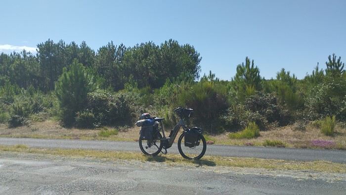 My gear
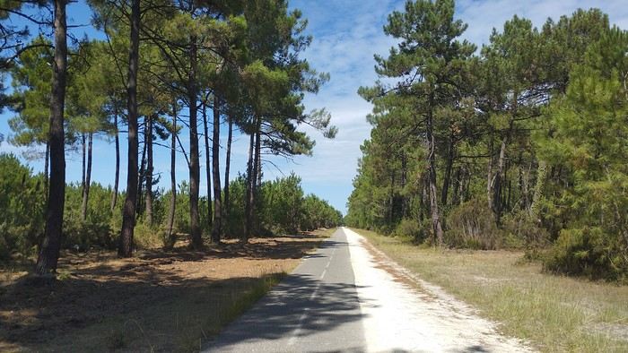
The Landes region—nothing extraordinary, but the calm and serenity are nice.

Le Verdon
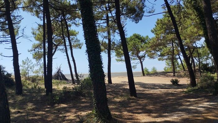
The wild coast
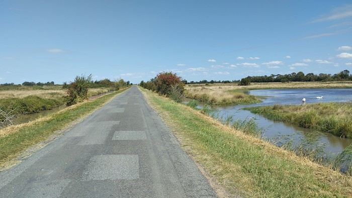
This marsh isn’t dry, though.
Today is the third day of my trip, and I’m writing to you from a campsite in Marans. I’ve set out to bike from Carcans Maubuisson back to Plaisir. Why Carcans? Because we spent a week there as a family—a great week that lets everyone reconnect for a long stretch. Also, on Saturday, we all headed home—some by car, and me by bike. This journey is about 850 km via bike paths and small cycling roads. It’s not a sporting feat, just a nice long ride for fun. As the old Chinese sage says, "The destination doesn’t matter—it’s the journey that counts." But he also told me, "Traveling is great, but what’s the point if you don’t share it?" You see, this old sage has told me a lot of things—he often keeps me company when I’m biking. Of course, he doesn’t pedal, but we travel in harmony. Sure, he can be a bit annoying sometimes, but we still get along. All this to say I’ve created a group to share my story. I’d be happy to share this experience with you—it’s an adventure for me. On Saturday, I wasn’t sure I’d even leave because I’d been dealing with sciatica for days. Luckily, Juliette, a friend of the old Chinese sage, recommended a lifesaving remedy: Alternately stretching your legs with an elastic band under your foot. Obviously, a jam jar rubber band won’t cut it.
From Marans - The mosquitoes are attacking; time to head back to shelter.
The first two legs took me to Royan and then Rochefort. The Sèvre Niortaise flows nearby, and I followed a canal from La Rochelle. You could say the area is as dry as the marsh, judging by the state of the crops.
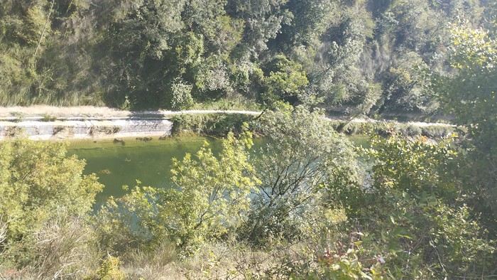
As I mentioned, it’s the third day, and if Jesus rose again on this day, for me it was more like the crucifixion. The scorching heat—only bearable when you’re moving—combined with rough trail conditions, and the old Chinese sage says, "Terrible roads, slow speed, and watch your limbs." I set out to do 60 km but ended up doing 80, and the last 20 were tough. I kept checking the GPS to see how much farther until the campsite. Today: Rochefort to Marans, sticking to the coast until La Rochelle, then no notable towns after that—just a constant canal. But since the sky isn’t too low, it hasn’t gotten lost. I’ve still got plenty of anecdotes to share, but it’s pitch black out, and the mosquitoes are still around. This morning, I counted ten in my tent, all full of my blood. Yesterday, at the end of the leg to Rochefort, I was really looking forward to crossing the Charente using the transporter bridge, but a sneaky GPS conspiracy led me far from it. I ended up crossing the Charente on a completely ordinary bridge, watching the transporter bridge in the distance with disappointment.
End of the first episode. Until tomorrow, if you’d like!
No journal for the first two days. Day 1 - CARCANS-ROYAN Day 2 - ROYAN - ROCHEFORT Tonight I'm in MARANS in the "dry marsh" according to the campsite manager—it’s the first time I’ve heard of a "dry marsh"?!
Photos from the first two days
My gearThe Landes region—nothing extraordinary, but the calm and serenity are nice.
Le Verdon
The wild coast
This marsh isn’t dry, though.
Today is the third day of my trip, and I’m writing to you from a campsite in Marans. I’ve set out to bike from Carcans Maubuisson back to Plaisir. Why Carcans? Because we spent a week there as a family—a great week that lets everyone reconnect for a long stretch. Also, on Saturday, we all headed home—some by car, and me by bike. This journey is about 850 km via bike paths and small cycling roads. It’s not a sporting feat, just a nice long ride for fun. As the old Chinese sage says, "The destination doesn’t matter—it’s the journey that counts." But he also told me, "Traveling is great, but what’s the point if you don’t share it?" You see, this old sage has told me a lot of things—he often keeps me company when I’m biking. Of course, he doesn’t pedal, but we travel in harmony. Sure, he can be a bit annoying sometimes, but we still get along. All this to say I’ve created a group to share my story. I’d be happy to share this experience with you—it’s an adventure for me. On Saturday, I wasn’t sure I’d even leave because I’d been dealing with sciatica for days. Luckily, Juliette, a friend of the old Chinese sage, recommended a lifesaving remedy: Alternately stretching your legs with an elastic band under your foot. Obviously, a jam jar rubber band won’t cut it.
From Marans - The mosquitoes are attacking; time to head back to shelter.
The first two legs took me to Royan and then Rochefort. The Sèvre Niortaise flows nearby, and I followed a canal from La Rochelle. You could say the area is as dry as the marsh, judging by the state of the crops.
As I mentioned, it’s the third day, and if Jesus rose again on this day, for me it was more like the crucifixion. The scorching heat—only bearable when you’re moving—combined with rough trail conditions, and the old Chinese sage says, "Terrible roads, slow speed, and watch your limbs." I set out to do 60 km but ended up doing 80, and the last 20 were tough. I kept checking the GPS to see how much farther until the campsite. Today: Rochefort to Marans, sticking to the coast until La Rochelle, then no notable towns after that—just a constant canal. But since the sky isn’t too low, it hasn’t gotten lost. I’ve still got plenty of anecdotes to share, but it’s pitch black out, and the mosquitoes are still around. This morning, I counted ten in my tent, all full of my blood. Yesterday, at the end of the leg to Rochefort, I was really looking forward to crossing the Charente using the transporter bridge, but a sneaky GPS conspiracy led me far from it. I ended up crossing the Charente on a completely ordinary bridge, watching the transporter bridge in the distance with disappointment.
End of the first episode. Until tomorrow, if you’d like!
Hey everyone, travelers! Here’s a little post to share our bike trip this summer. We did the Via Rhôna from Geneva all the way to the Mediterranean Sea. It was a truly amazing adventure—no hitches, lots of independent greenways, and we felt like we had the Rhône all to ourselves as our guide for 700 km over 7 days. That averages out to 100 km a day. We thought we’d do less, but the Via Rhôna is flat and not too tiring, which let us push to around 100 km each day!
Here’s the full video of our route: www.youtube.com/watch?v=x_cpBro6Df8
We’re not seasoned cyclists—we just love biking, and this trip was our first big bike touring adventure. As for our bikes (see photo), we had road bikes, sturdy ones with fairly large wheels and rear racks for our gear.
Speaking of gear, here’s what we brought: just the essentials for 7 days of biking and camping—1 tent for 2, two sleeping bags, a few clothes (not too many), 1 book each, toiletries, phone chargers, a basic bike repair kit... and maybe 2 or 3 things I’m forgetting. The idea is to travel light so you’re carrying as little as possible!
We camped every night. Along the Rhône, it’s pretty easy to find campgrounds, and they’re cheap too! Each morning, we’d decide on our destination for the evening (usually based on available campgrounds) and call during the day to book. We always managed to get a spot right away (except when we reached the Mediterranean coast, but we should’ve seen that coming 😛).
For expenses, we slept at campgrounds (between 15 and 25 € per site for 2) and either picnicked or ate at restaurants. Other than that, there weren’t really any other costs besides a few small souvenirs here and there. In total, we spent about 500 € for two over 7 days (so 35 € per person per day). I think it’s possible to spend even less—we decided not to restrict ourselves when it came to restaurants and campground prices.
For us, the most beautiful part was between Geneva and Lyon! The Rhône is still a bit wild there, as are its banks. Not too many roads, highways, trains, or factories around—just nature and peace. You gradually leave the Alps behind and head further south. It was truly stunning. We also loved the "Rhône Valley" after Lyon. The succession of dozens of suspension bridges and little villages, each more charming than the last, really enchanted us.
The trickiest part was leaving Lyon... The Via Rhôna disappears for a long stretch, forcing you to alternate between roads, traffic, danger, and pollution. We had to wait until Givors, further south, to finally get back to the quiet bike path and the Rhône showing us the way. Also, after Lyon, the Rhône becomes a bit more industrial—you pass by dams, factories, and power plants more often. But it’s really just a small detail, the exception that proves the rule of this magnificent Via Rhôna.
The Via Rhôna is a fantastic way to see how water from the mountains of Lake Geneva flows, travels, and winds its way for hundreds of kilometers to reach the sea. With this trip, you get closer to the Rhône—it becomes your accomplice, your guide. Plus, you cross a beautiful part of France, with its charm and little villages. It’s the France we love, and it’s great to explore your own country like a tourist.
That’s it for our little travel journal. I didn’t go into too much detail about our days since everyone will follow the same route, and everyone can go at their own pace :) But I’m happy to answer any questions (logistics, technical stuff, routes, etc.)—I’d be glad to help!
Here’s the video of our route again—I also composed the music, so I hope you’ll like it: www.youtube.com/watch?v=x_cpBro6Df8
Happy travels,
Flo
Hi there, I’m struggling to get back into hiking and I’m considering tackling the GR5 from Lake Geneva to the Mediterranean shores in August-September.
Since I can’t plan daily distances in advance, I’ll be bringing gear to bivouac.
I’m not familiar with this route and wanted to get an idea of water resupply options before setting off: are sources and streams still flowing easily in late summer on this GR, or should I prepare for long dry stretches? 😐
Hello everyone,
Lozère seems like a department that’s been forgotten on this forum—just like in real life, actually.
So if you love strolling through peaceful, exotic places, landscapes that remind you of Mongolia in some spots and of ruiniform shapes in others, and watching the flight of large griffon vultures in the Gorges de la Jonte and the Tarn, I’d like to share a few photos of these places I love. I’ve been exploring here for about thirty years, and I recently took a walk in mid-April with a few detours to the Larzac plateau, which straddles Aveyron and Lozère.
.
We head straight to the start of the Gorges de la Jonte. Our accommodation is right in the middle of these gorges, between Le Rozier and Meyrueis.
Le Rozier, a small village where the Jonte meets the Gorges du Tarn:

The village has three campsites side by side, with a beautiful view:

The Gorges de la Jonte at a spot called Les Douzes:


Lozère seems like a department that’s been forgotten on this forum—just like in real life, actually.
So if you love strolling through peaceful, exotic places, landscapes that remind you of Mongolia in some spots and of ruiniform shapes in others, and watching the flight of large griffon vultures in the Gorges de la Jonte and the Tarn, I’d like to share a few photos of these places I love. I’ve been exploring here for about thirty years, and I recently took a walk in mid-April with a few detours to the Larzac plateau, which straddles Aveyron and Lozère.
.
We head straight to the start of the Gorges de la Jonte. Our accommodation is right in the middle of these gorges, between Le Rozier and Meyrueis.
Le Rozier, a small village where the Jonte meets the Gorges du Tarn:
The village has three campsites side by side, with a beautiful view:
The Gorges de la Jonte at a spot called Les Douzes:
Hi there,
Last summer, I cycled through the Lot and Célé Valleys. There were two couples of us, in "camping mode," with hybrid bikes (except for one road bike with tires that weren’t hybrid at all (!) plus a Bob trailer). We completed the route in the first half of July in just under 15 days (allowing time to explore along the way). The odometer totaled 550 km. We started in Aiguillon on the Lot River and finished in Saint-Geniez-d’Olt. It was an absolute delight. First off, a big thank you to everyone who helped us plan this trip by sharing tips, favorite spots, and practical guides—there were many, and some will recognize themselves (a Jakez from Brittany, a local postman, etc.). A major project seemed to have been launched, but since 2011, not much has materialized beyond Cahors (a signposted cycle route). Don’t let that stop you—it’s totally worth it! In return for the great tips we received, I’m happy to help anyone considering the same route with details on the itinerary, stages, road conditions and traffic, campsites, highlights, and more. Best regards,
Pierre from Lorient
Hi everyone,
I’m planning to leave Nice for Toulouse around 10/15 and I’m looking for tips / great deals regarding: - The route: I was thinking of taking Nice - Grasse - Draguignan - Salernes - Cadarache - Cavaillon - Arles, then the Camargue, Sète, and the Canal du Midi to Toulouse. The idea is to avoid high-traffic roads and too many steep climbs. Are there any spots to avoid or must-see stops? Since it’s been a while since I’ve been on the road, I was thinking that sleeping indoors might be preferable. If you have any budget-friendly accommodation suggestions along part of the route, don’t hesitate!
Thanks in advance, and if you’re in the area around that time, we could ride together... Ciao.
Calling all travelers.
We’ll be landing at Lyon Airport and want to bike to La Verpillière train station (with panniers and camping gear, etc.) to catch a TER to Voreppe.
What’s the safest route for this bike trip?
Thanks in advance
Hi,
My boyfriend and I are looking to spend a week in the Alps at the end of August. But since we only know the region in winter, I have no idea where to start!
I’d like to avoid the big resorts with apartment blocks and instead head for a typical village, with great hikes (on foot and by bike) and ideally near a lake, river, or water spot.
All suggestions are welcome!!! :)
Morgane.
All suggestions are welcome!!! :)
Morgane.
hello fellow cycling enthusiasts
here’s a travel journal of the cycling tour through the Rhône-Alpes Auvergne region by Claudio
zouli
it was the plan
http://cbandiera.free.fr/parcours/auvergne-Ralpes/
the trip was completed story being posted online soon 1100 km in 11 days beautiful and varied regions
claudio
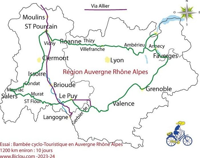
the trip was completed story being posted online soon 1100 km in 11 days beautiful and varied regions
claudio
Another long-time dream of Claudio’s: the Petit Mont Cenis pass and the dam at the eponymous lake.
A place where many Italians, including my father, worked in the 1950s–60s.
Faverges → St-Michel-de-Maurienne → Lanslebourg → Petit Mont Cenis → return. 315 km, 3 days. Bivouac at St-Michel-de-M.
Brouter link
Leg One: Faverges → St-Michel-de-Maurienne Leg Two: St-Michel → Lanslebourg → Mont Cenis Lake → St-Michel Leg Three: St-Michel → Faverges
And it finally happened in August 2026: in the Maurienne Valley about the famous cycle route known as the V67
Leg One: Faverges → St-Michel-de-Maurienne Leg Two: St-Michel → Lanslebourg → Mont Cenis Lake → St-Michel Leg Three: St-Michel → Faverges
And it finally happened in August 2026: in the Maurienne Valley about the famous cycle route known as the V67
I'm looking for hikers to walk the Saint-Guilhem Way in spring 2026 from May 17th to 30th and form a small group of 4 to 5 people.
Full route of the Saint-Guilhem Way starting from Aumont-Aubrac to Saint-Guilhem-le-Désert, passing through the Tarn and Jonte gorges (so taking the variant via Le Rozier).
Daily stages of 17 to 28 km depending on difficulty, places to visit, and accommodations. Around 260 km over 12 days of hiking and about 6 to 7 hours of walking per day.
Duration: 14 days (12 days of hiking + 1 arrival day / 1 departure day). No performance goals—just taking the time to see, discover, and enjoy the scenery.
I'm a 62-year-old man from the Alsace region. Contact me if interested! Rémy
Hi there,
We’d like to spend 2 days in Lyon in May with our 8- and 12-year-old kids, exploring the city on foot.
We’ll arrive on day 1 around 11 AM and leave on day 2 around 6 PM.
I’ve mapped out two routes and was wondering if they’re doable in our 2 days, and if you have any tips or info on visit prices.
We’re not sure where to stay yet, but we’d like to optimize by booking accommodation (hotel or Airbnb) between the two routes, maybe?
Thanks for your help!
I’ve mapped out two routes and was wondering if they’re doable in our 2 days, and if you have any tips or info on visit prices.
We’re not sure where to stay yet, but we’d like to optimize by booking accommodation (hotel or Airbnb) between the two routes, maybe?
Thanks for your help!
Is wild camping possible? Are there campsites and places to restock along the way, and is water available?
Thanks for your answers!
Pierrick
Hi there,
This summer, my sister and I would like to do part of the tour of old Chaillol. We’re thinking of leaving our car at Chapelle en Valgaudemar and going hiking for three days with two nights in a mountain refuge. At the end of the third day, do you know if it’s possible to take a bus or coach to get back to Chapelle en Valgaudemar? From Pont du Fossé or Chabottes. If not, would you have another more suitable route to suggest?
Thanks in advance.
Hi everyone.
I’ve been doing brisk walking every day for years (an hour every morning at dawn) through forests, along rivers, on trails, tracks, and pavement. I wanted to try Nordic walking, so I bought the poles (apparently, they work your abs extra). I lasted 5 days 😄 And I’m stopping because, for me, it’s incompatible with how I combine sport and wildlife. I tried all the tips (rubber and steel), and they all make a racket that scares off every animal 😅
I get that some athletes go from point A to point B without paying attention to what’s in between, but that’s not me. I love intense exercise, but whenever something’s beautiful, I stop to enjoy it for a few moments (same when I spot an animal). With the poles, it’s impossible—they’re too noisy, even if you don’t press hard.
Oh well, I wasted 20 € on this purchase (though they might come in handy for scrambling, for example).
Anyway, for the brisk walking I do, the poles I totally mastered by the second day (syncing the movement) actually slow me down. Plus, it’s annoying to hear that constant noise in a dreamy landscape when my shoes barely make a sound. And on roads (pavement), they make all the dogs in their houses bark 😅
As for working the abs, brisk walking without poles lets you engage your core if you want, so it works those muscles too.
Into the bin go my poles and their tips, already dead after 5 days (long live wildlife and nature!) 🤘
...
After Southern Tanzania, I’m sharing a travel story about the Cantal region with you...
...
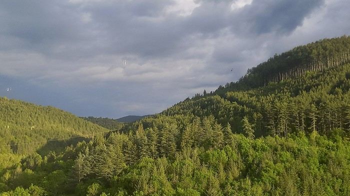
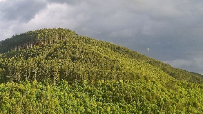
For us, at the start of 2025, Le CANTAL was a true “Terra Incognita”!!
After seeing some tempting TV reports, we decided to fill this gap—especially in terms of landscapes. On the same trip, we’ll also head to the Arcachon Basin, the International Seaplane Gathering in Biscarrosse, and my native Landes region...
So, on May 20th, we left Marseille in the rain and thunder, heading toward Nîmes, Saint-Hippolyte, Mont Aigoual, Florac, and stopping in Marvejols to give my arthritic back a break for the night.
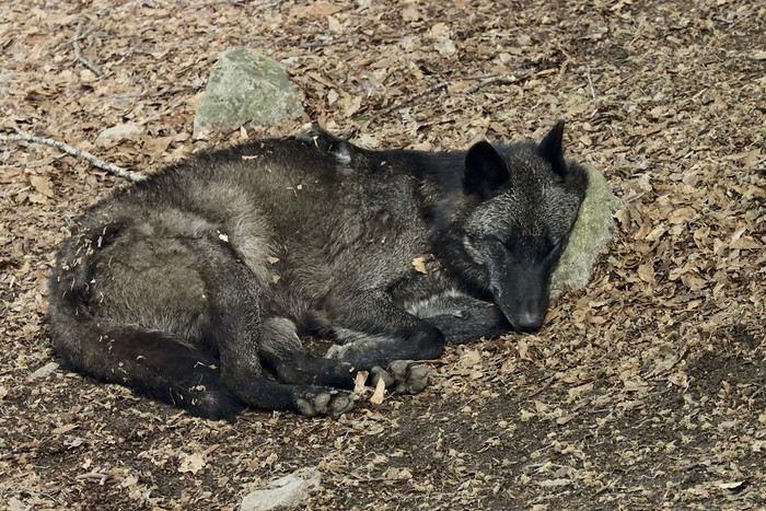
The next morning, we decided to revisit the Parc aux Loups du Gévaudan (Europe’s largest wolf park). As someone used to photo safaris in the wilds of East Africa, I’m not a fan of zoos at all—but I *do* have a deep admiration for wolves!!
Since it’s pretty unlikely I’ll ever see one in the wild, I’ll settle for this Parc aux Loups in Marvejols. This will be our third visit to this incredible gathering of these fascinating canines.
Some are still finishing their chilly night...
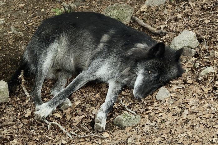
...
After Southern Tanzania, I’m sharing a travel story about the Cantal region with you...
...
For us, at the start of 2025, Le CANTAL was a true “Terra Incognita”!!
After seeing some tempting TV reports, we decided to fill this gap—especially in terms of landscapes. On the same trip, we’ll also head to the Arcachon Basin, the International Seaplane Gathering in Biscarrosse, and my native Landes region...
So, on May 20th, we left Marseille in the rain and thunder, heading toward Nîmes, Saint-Hippolyte, Mont Aigoual, Florac, and stopping in Marvejols to give my arthritic back a break for the night.
The next morning, we decided to revisit the Parc aux Loups du Gévaudan (Europe’s largest wolf park). As someone used to photo safaris in the wilds of East Africa, I’m not a fan of zoos at all—but I *do* have a deep admiration for wolves!!
Since it’s pretty unlikely I’ll ever see one in the wild, I’ll settle for this Parc aux Loups in Marvejols. This will be our third visit to this incredible gathering of these fascinating canines.
Some are still finishing their chilly night...
...
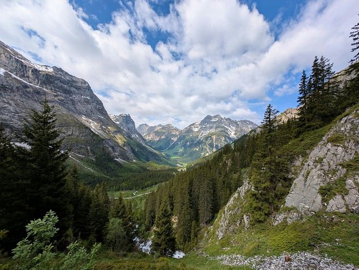
I’ve lived in Savoie long enough to tell you one thing: Vanoise National Park isn’t just a pretty postcard. Here, nature is vast, untamed, and incredibly alive. Whether you're visiting for a holiday or live in a nearby valley, here are my top picks you shouldn’t miss.
Sleeping in a mountain hut—the best way to experience the mountains
Hiking in Vanoise National Park is already magical, but spending a night in a refuge? That’s sacred. I recommend the glacier tour, a 4- to 7-day trek with stops at huts like L’Arpont, Dent Parrachée, or Leisse. The food’s great, you’ll meet other hikers, and in the early morning, when the sun lights up the peaks, I guarantee you won’t be thinking about your emails. Even a single night at Refuge du Fond d’Aussois or La Valette is enough to unplug.
High-altitude lakes: when the peaks reflect in the water
High-altitude lakes are a bit like my madeleine de Proust. I love climbing up early in the morning when everything’s still quiet. Lac Blanc, starting from Termignon, is a pretty accessible hike, often punctuated by the whistling of marmots. Wilder, Lac de la Glière near Champagny-en-Vanoise is one of my favorite spots for a picnic far from everything.
Glacial valleys—my breath of fresh air
I often go there to reconnect with the mountains, especially when I want a spectacular setting without hours of climbing. The Orgère valley, starting from Saint-André in Maurienne, is a gem. Easy to access, super wild, with its Swiss pine trees and singing streams... You’re instantly immersed in the alpine atmosphere. A little higher up, from Val Cenis/Termignon, I recommend the Cirque du Génépy. It’s an old glacial landscape just the way we love it: rocks smoothed by ice, near-total silence, and a real sense of the end of the world.
Glacier mountaineering at the heart of the ice
For the more athletic (and always with a guide, of course), climbing the Grande Casse, 3,855 m, remains a legendary goal. I’ve only done it once, but what a rush! You’ll need crampons, an ice axe, and good fitness, but the view up there is indescribable. There are also more accessible glacial routes around Pointe de la Réchasse or the Dôme de Chasseforêt.
Gateways to Vanoise National Park
Bonneval-sur-Arc... this little village perched at 1,835 meters, I never get tired of it. It’s kept its charm: stone houses, slate roofs, fountains... It’s simple, everything’s beautiful. It’s also a great base for hiking in the park. And then there’s Pralognan-la-Vanoise, my favorite gateway. It’s a mountain village just the way I like them—quiet streets, typical chalets, and above all, direct access to incredible landscapes.
Sleeping in a mountain hut—the best way to experience the mountains
Hiking in Vanoise National Park is already magical, but spending a night in a refuge? That’s sacred. I recommend the glacier tour, a 4- to 7-day trek with stops at huts like L’Arpont, Dent Parrachée, or Leisse. The food’s great, you’ll meet other hikers, and in the early morning, when the sun lights up the peaks, I guarantee you won’t be thinking about your emails. Even a single night at Refuge du Fond d’Aussois or La Valette is enough to unplug.
High-altitude lakes: when the peaks reflect in the water
High-altitude lakes are a bit like my madeleine de Proust. I love climbing up early in the morning when everything’s still quiet. Lac Blanc, starting from Termignon, is a pretty accessible hike, often punctuated by the whistling of marmots. Wilder, Lac de la Glière near Champagny-en-Vanoise is one of my favorite spots for a picnic far from everything.
Glacial valleys—my breath of fresh air
I often go there to reconnect with the mountains, especially when I want a spectacular setting without hours of climbing. The Orgère valley, starting from Saint-André in Maurienne, is a gem. Easy to access, super wild, with its Swiss pine trees and singing streams... You’re instantly immersed in the alpine atmosphere. A little higher up, from Val Cenis/Termignon, I recommend the Cirque du Génépy. It’s an old glacial landscape just the way we love it: rocks smoothed by ice, near-total silence, and a real sense of the end of the world.
Glacier mountaineering at the heart of the ice
For the more athletic (and always with a guide, of course), climbing the Grande Casse, 3,855 m, remains a legendary goal. I’ve only done it once, but what a rush! You’ll need crampons, an ice axe, and good fitness, but the view up there is indescribable. There are also more accessible glacial routes around Pointe de la Réchasse or the Dôme de Chasseforêt.
Gateways to Vanoise National Park
Bonneval-sur-Arc... this little village perched at 1,835 meters, I never get tired of it. It’s kept its charm: stone houses, slate roofs, fountains... It’s simple, everything’s beautiful. It’s also a great base for hiking in the park. And then there’s Pralognan-la-Vanoise, my favorite gateway. It’s a mountain village just the way I like them—quiet streets, typical chalets, and above all, direct access to incredible landscapes.
Hi there
I’m traveling from Geneva to Marseille in May and only have 18 minutes to change trains in Lyon. Do you think that’s doable?
Thanks and have a great day
I’m traveling from Geneva to Marseille in May and only have 18 minutes to change trains in Lyon. Do you think that’s doable?
Thanks and have a great day
A few years ago, I walked the Camino de Santiago from Le Puy-en-Velay to Aumont-Aubrac with every intention of continuing my journey the following year. Life had other plans, and it was several years before I picked up my "pilgrim’s staff" again on this legendary trail, starting from Aumont-Aubrac, which I did last September 30th.
Reaching Aumont-Aubrac wasn’t easy since I come from Brittany: first a TGV from Brittany to Paris, then an overnight train from Austerlitz to Rodez, followed by a bus from Rodez to Millau, and finally a TER from Millau to Aumont-Aubrac. I eventually arrived on Sunday, September 30th at 1:30 PM to begin a first stage of 15 km, reaching the Gentianes hostel in Finieyrols, halfway between Aumont and Nasbinals.
Reaching Aumont-Aubrac wasn’t easy since I come from Brittany: first a TGV from Brittany to Paris, then an overnight train from Austerlitz to Rodez, followed by a bus from Rodez to Millau, and finally a TER from Millau to Aumont-Aubrac. I eventually arrived on Sunday, September 30th at 1:30 PM to begin a first stage of 15 km, reaching the Gentianes hostel in Finieyrols, halfway between Aumont and Nasbinals.
Hi everyone,
I’m planning our very first trip to mainland France in January 2027. There’ll be 2 adults and 2 kids, and we’ll mostly be traveling by train.
Here’s our itinerary:
Paris Rouen (Normandy) Lyon Aix-les-Bains (with day trips to Annecy and Geneva) Saint-Gervais-les-Bains (with Chamonix and a day in Aosta) Back to Paris
Do you think this itinerary is well-balanced? Any tips, must-see spots, or mistakes to avoid for a first-time visit?
Thanks in advance for your advice! !