Hi everyone.
I wanted to share a little feedback from our trip to Guatemala—we got back a month ago, and I really appreciated the well-commented posts here that helped us out.
So, in turn, I wanted to share our own little recap.
We’ve traveled quite a bit together (we’re 38 and 42), and Guatemala had been on our radar for a while. But with so much info out there, it was hard to sort through it all—especially since we only had 3 weeks on the ground and didn’t want to waste time.
Here’s the itinerary we followed: Antigua, the Pacific coast, Lake Atitlán, a private coffee and bird reserve, Chichicastenango, Sayaxché, El Remate, Río Dulce, and Lake Izabal.
We rented a 4x4, which was essential given the state of some roads.
Our highlights:
* **Pacific coast**: So authentic and preserved. We met sea turtles, cooked and baked coconut bread with a women’s community—such a meaningful exchange—and kayaked through a pristine mangrove full of birds.
* **Lake Atitlán**: Even though we were worried it might feel too touristy, a private tour let us discover local crafts, hidden workshops (weaving, pottery), and the stunning views from the boat.
* **Sayaxché**: The starting point for the Aguateca and Dos Pilas sites—one of our favorite outings. The site is breathtaking: walking through the canyon and jungle-covered ruins with almost no one around. We stayed in a little bungalow on an island, totally off the grid.
* **In Petén**, we met an Itza Maya tribe—an unforgettable day sharing a meal and plant-based healing rituals. Wow. This tribe resisted the conquistadors and still lives traditionally.
We also took a tour on Lake Petén and swam at hidden little beaches.
Tikal was nice, but we preferred Yaxhá.
* **Río Dulce**: A day at a private cocoa plantation—an adventure in a buggy with the owner himself. We harvested cocoa and ate the chocolate paste afterward, then swam in a waterfall on the property. Since it’s private, there was no one else around. A real privilege.
* **Boat tour on the Río Dulce**: For us, the highlight. We visited a school where they’re committed to giving kids a solid education while blending Maya rituals.
* **Lake Izabal**: A peaceful end to the trip in a magical setting. We visited Quiriguá.
We went through an organizer who knows the country really well. We weren’t initially planning on that, but thanks to her, we had experiences we never would’ve found on our own.
On top of that, we actually paid less for the trip overall because of her local rates.
I’m not getting anything out of this—I just think it could help other travelers.
Her business is Secretplaceincostarica (she also does Costa Rica, which we’re now eager to explore).
On the ground, we felt completely safe. The people are lovely, the roads can be a little chaotic at times, but we loved every minute of it.
Happy travels to all!
Marie
2,421 similar discussions in English
Hello,
I need some advice because I can't decide on an itinerary. We're going to join our son around September 20th, who's spending a year in Canada on a working holiday visa. I did the classic Quebec loop over 30 years ago, so I’m ruling out the Saguenay Fjord and Lac Saint-Jean right away. Here are the stops (overnights) I’ve tentatively planned:
D1-2-3: Quebec City D4: Malbaie Gorges National Park via Routes 360 and 362 D5: Malbaie Gorges National Park (fishing and canoeing) D6: Tadoussac (walks and whale watching from the shore, hiking up to Cap du Bon Désir) D7: Whale-watching zodiac excursion – ferry – Bic National Park D8: Bic National Park D9: Carleton-sur-Mer via the Matapedia Valley D10: Percé D11: Percé (Bonaventure Island excursion) D12: Forillon National Park D13: Forillon National Park D14: Sainte-Anne-des-Monts via Route 132 D15: Sainte-Anne-des-Monts (Gaspésie National Park) D16: Kamouraska D17: Quebec City D18-19-20: Montreal
I feel like one night in Tadoussac is too short. Wouldn’t it be better to add another night there and only spend one night in Sainte-Anne-des-Monts, skipping Gaspésie National Park? Just to clarify, we love nature and hiking but limit ourselves to about 10 km per day.
Also, I’m wondering about the distances (even though I tried to keep them reasonable), the short stops (max 2 nights except in Quebec City and Montreal, so not much time to settle in), and the weather in Gaspésie in late September-October (my husband doesn’t handle the cold well). Maybe it’d be better to only go as far as Bic National Park, then head back, and add more nights at Malbaie Gorges National Park (I didn’t stay in a park on my first trip, and my son, who got his fishing license, would be proud to bring us dinner 😊), Tadoussac, and maybe around Bic/Rimouski?
One last detail: the plan is to land in Quebec City, rent a car on D4, return it on D17, and take the train or bus to Montreal the next day, where we’ll catch our flight 4 days later. This is to cut down on rental costs and avoid having a car in Quebec City.
Thanks for reading this far—I hope I can count on your advice! 😊
Claire
This trip is a more budget-friendly—and shorter—alternative to the 14-day Aranui 5 cruise, which includes a few days at sea and a detour to Bora Bora in the Leeward Islands on the way back. The advantage of the cruise is that it lets you see and visit (though far too quickly) the two islands of Tahuata and Fatu Hiva, which don’t have airports. By plane, you’ll only be able to land on 4 of the 6 islands. However, Tahuata is accessible from Hiva Oa via a day trip (or two-day trip) shuttle. Plan for two extra days in your total time dedicated to the Marquesas Islands (called *Fenua Enata* in Marquesan language).
Our itinerary is perfect for those who aren’t excited by cruises and prefer to get closer to the local communities. This 9-day trip cost us around 2500 € all-inclusive. For a 14-day cruise on the Aranui, expect to pay 2300 € per person for a basic cabin for four, or 3800 € per person for a superior double cabin.
Air Tahiti offers a 4-island Marquesas Pass (Nuku Hiva, Ua Pou, Ua Huka, and Hiva Oa) for 86,000 XPF (about 700 €). The journey is made on an ATR 72 from Tahiti to Nuku Hiva or Hiva Oa, and on a 19-seat Twin Otter between the islands (often only 13 or 15 seats are available due to cargo, so book well in advance). We’re traveling as a couple. We booked our family-run guesthouse stays at the Tourism Fair in early February, where you can meet the owners and make your choice. Stays are almost always half-board or breakfast-only. Transfers are usually included, but you can always book a car or taxi.
**NUKU HIVA**
**A LITTLE GEOGRAPHY** Nuku Hiva (NH) is located about 1,500 km from Tahiti, in the north of French Polynesia. At 387 km², it’s the second-largest island in French Polynesia after Tahiti. It was formed by incredible volcanic phenomena and cataclysms between 1 and 6 million years ago, which lifted the island thousands of meters above the sea. Even after millennia of slow erosion, collapses, and settling, NH remains the most majestic of the Marquesas, with its sheer cliffs, deep valleys featuring immense waterfalls, and black walls that were once the inner walls of enormous volcanoes.
**A LITTLE HISTORY** The first contact between NH’s inhabitants and Europeans was in 1595 with Spanish navigators who only stayed briefly. It wasn’t until the late 18th century that Europeans arrived in greater numbers on NH (and the other Marquesas Islands), disrupting a very fragile social and cultural balance. It’s believed that nearly 100,000 people lived on Nuku Hiva at that time—a population decimated over the decades by epidemics, diseases brought by Europeans, and alcohol used for barter. The disastrous result: by the 1930s, only 2,500 people remained, having largely lost their identity and living in poverty. Today, the island has about 2,600 inhabitants spread across several villages, with Taiohae as the main one.
**NUKU HIVA IN LITERATURE**
1 / One of the famous writers who visited NH and stayed there was Herman Melville, who arrived in July 1842, the author of *Moby Dick*. The island had just come under French protectorate. Seduced by the enchanting *vahinés* and dazzled by his paradisiacal vision of the place, Melville deserted his ship. He ended up a prisoner of a local tribe, the Taipi, in Taipivai, where he stayed for a month and a half until an Australian ship captain secured his release in exchange for a musket and a roll of cotton fabric! Melville wrote a novel about this tumultuous episode in his life, considered a classic of travel literature. The book, *Typee: A Peep at Polynesian Life*, published in 1846 in the United States, was a huge success.
2 / Another famous Scottish writer, Robert Louis Stevenson, arrived in NH aboard a yacht that anchored in Anaho Bay, the island’s most beautiful, in July 1888. Stevenson was already known for two magnificent novels that marked their era: *Treasure Island* and *Dr. Jekyll & Mr. Hyde*. Stevenson, too, was captivated by the island’s natural beauty, though he also noted the devastating decline in identity, socio-cultural life, and physical health of a population ravaged by disease and alcohol. His account of his stay, *In the South Seas: An Account of Experiences and Observations in the Marquesas, Paumotus, and Gilbert Islands During Two Cruises on the Yacht Casco (1888) and the Schooner Equator (1889)*, was published in 1896 in New York, four years after his death in Apia, Western Samoa, where he had settled. It was also published in London in 1900.
3 / In August 1903, Victor Segalen, a French naval doctor, ethnologist, and archaeologist, landed in NH from the ship *La Durance*, sent to Polynesia to recover the possessions of the painter Paul Gauguin, who had died in April of that year. He, too, was enthralled by the Marquesas but lamented the loss of identity, dignity, and pride of the Māori, alienated by a Christianization that destroyed their culture and customs, denied their gods, and erased their past. He wrote about his experience, doubts, and fears in *Les Immémoriaux*.
4 / In December 1907, Jack London arrived in NH aboard the sailboat *Stark*, following in the footsteps of his illustrious predecessor, Herman Melville. London was in poor physical condition, exhausted from his relentless travels that had taken him from the Klondike in Canada to Japan, Australia, and London in Europe. He was appalled and shocked by Nuku Hiva’s degraded health situation: where Melville had encountered over 2,000 vigorous and healthy Marquesan warriors, London found only 12 suffering from various diseases—the rest had been wiped out by tuberculosis! His approach remained humanistic, and he maintained a sharp geopolitical awareness of these traditional Polynesian cultures, weakened by the inexorable advance of modernity in the early 20th century. He continued his journey to the Tuamotu Islands and Tahiti, publishing *Martin Eden*, the moving account of his initiatory voyage in the South Pacific, in 1911.
5 / Finally, Alain Gerbault, a writer, linguist, ethnologist, and tireless traveler, arrived in the Marquesas via the Panama Canal in December 1933. He was completely exhausted after an endless crossing on a small sailboat, the *Firecrest*. Enthralled by his stay in the Marquesas, he continued to the Tuamotu Islands in 1934, then Tahiti in 1935. Gerbault fought for the preservation of traditions, as well as the songs and dances banned by the Churches and the French Administration (these bans lasted over 50 years, mind you...!!!). Bora Bora remained his favorite island. A staunch Pétainist during World War II, he was forced to flee Bora Bora for Samoa, then Tonga, and finally Timor, a half-Portuguese island and thus neutral during the war. His travel accounts, *In Pursuit of the Sun: Logbook from New York to Tahiti* and *A Paradise Is Dying*, were published in the late 1940s. He died in Timor in 1941, and his ashes were repatriated to Bora Bora.
Back to our trip and stay.
**Day 1: April 27**
Departure from Papeete at 6:30 AM—we had to wake up two hours earlier and reach the airport in the dark. Takeoff at dawn, good weather en route, flight duration: 4 hours.
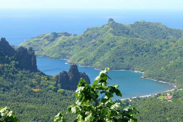
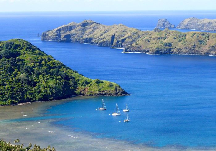
Arrival around 10:30 AM in Nuku Hiva, the first stop of this trip. We booked two nights in half-board at Pension Koku’u, transfers included. Maybe not such a great idea, those included transfers, especially on this unique island where the airport is located on *Terre Déserte*, on the other side of the mountain, opposite and about 45 km from the main village of Taiohae. They’re charged at a steep price. Expect 6,000 XPF round-trip by taxi, but 15,000 XPF charged by guesthouses or hotels. The difference is notable. It wasn’t the best idea, but we can’t go back. Even for residents like us who know how to travel in Polynesia, the Air Tahiti employee who sold me the Pass couldn’t give any useful advice about the stay itself—probably because he’d never been to the Marquesas. It’s really annoying! In short, the good idea to remember is renting a car (like a Suzuki) to be free to manage your time and stop at leisure. The road signage is a bit basic, but you’ll manage just fine. Our host Alvane waits for us—without a sign (sic!)—and after searching for each other for 5 minutes, we’re off on a journey of over an hour (with photo stops) in a Land Rover with smooth tires (luckily, it’s not raining!). The recently paved and marked mountain road is impeccable. No time to catch our breath at the guesthouse; we leave immediately (not a great idea after waking up at dawn plus 4 hours on a plane) for a half-day hike that was also included in the prepaid stay. A sandwich was provided (really pathetic for the physical effort required), we have water, and we fill a few bottles at the spring near the ceremonial site of Taipivai, our first stop. Then the hike begins in the Hanaheu Valley, descending toward Anaho Bay and its namesake beach. A magnificent and wild spot, a few sailboats anchored, we swim—the water is really warm, over 30°C at the shore. That warm is rare and not necessarily pleasant. We then have to climb a very steep slope; this hike is actually quite tough. The air is still, humid, and stifling under the foliage, there’s a bit of mud, and tiny ants (which don’t bite, I’ll have you know), locally called *fofolles*, running over shoes, ankles, and calves. Not very pleasant...! On top of that, there are mosquitoes to protect against! In hindsight, it seems wise to bring energy bars from Papeete if you plan to hike on the afternoon of your arrival day. We weren’t careful... Result: a moment of weakness for me and a hyperventilation attack climbing back up from Anaho Bay!!! We return to the guesthouse at night. There we find Claudine and her four children—Marquesan-style atmosphere, friendly and casual. We share family life. Very simple room with a bathroom, no mosquitoes, we can sleep with the window open, but the night will be noisy, as is often the case in Polynesia. Roosters are everywhere and don’t sleep, dogs bark or whine. So we end up waking up early... like everyone else.
**Day 2: April 28**
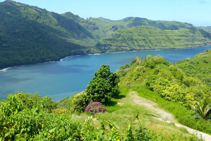
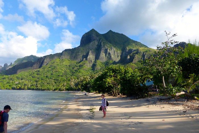
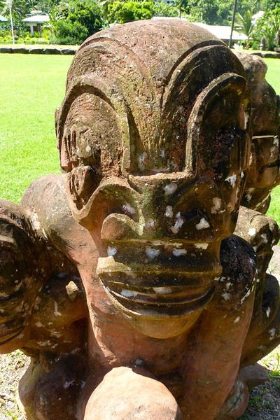
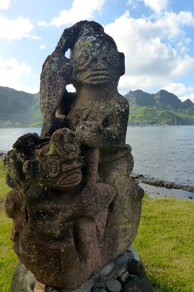
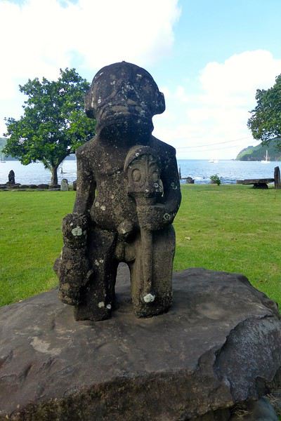
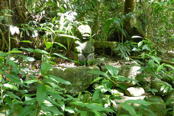
We booked a full-day excursion with Thierry: it starts with a 45-minute boat ride to reach Hakatea Beach, hidden in a small secret bay like many along Nuku Hiva’s coasts. From there, the hike lasts all day—11 km round-trip on flat but also rugged terrain (ancient paved and elevated paths over 1,000 years old)—and river crossings. Bring the right shoes (like plastic Crocs with high socks—not very stylish but practical). We cross the former village of Hakaui, walk along the foundations of dwellings, and there are still weathered tikis in the lush vegetation. The ultimate goal of this hike is to reach the tall Vaipo waterfall. The place is magical, with openings in the vegetation and immense trees allowing photos of the treetops and caves where funeral canoes containing the bones of chiefs or great warriors were once placed. We return the same way to the beach and take another boat ride to reach Taihoae’s port. Back at the guesthouse after a glimpse of Taihoae’s waterfront.
**UA POU**
**Day 3: April 29**
Back to the airport in the late morning for the second flight of the trip to Ua Pou. 20-minute crossing in a Twin Otter (18 seats but only 13 occupied due to cargo between the islands). Beautiful weather, blue sea, nice photos to take upon departure from NH and arrival in UP. We’re greeted by Jérôme, a former military man turned tourism professional, who runs Pension Pukue’e with his wife Elisa, a native of UP. We’re in for two exceptional days. The guesthouse is comfortable, Jérôme and Elisa are very professional and pleasant. Jérôme is also a professional hiker, and Elisa is an excellent cook. We leave quickly for a half-day excursion to Hohoi, after a stop at the archaeological, cultural, and religious site of Maui’a, the Tavaka tribe’s territory. Jérôme is there to explain how Marquesan society functioned at the time and the events that took place on a site still largely buried under vegetation. Then we visit a flower-stone sculptor he knows—the only place in the Marquesas where you’ll find these stones. They’re collected in the river flowing into the sea at Hohoi, sometimes on the beach itself. Back to the guesthouse.
**Day 4: April 30**
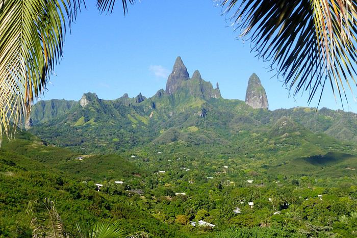
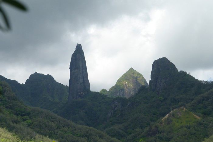
A nature hike in the mountains—moderately difficult—toward the Vaiea waterfall is on our program for a good 4 hours. It’s hot, there are mosquitoes, and the dip in the pool under the waterfall (24°C water) is a rare pleasure. Lunch at a friend of Jérôme’s, a former chef for French minister François Fillon, who prepares delicious food. Elisa picks us up by car to return to the guesthouse. Ua Pou is a beautiful and elegant island with its sharp peaks and wild nature. Our favorite, thanks to Jérôme and his wife.
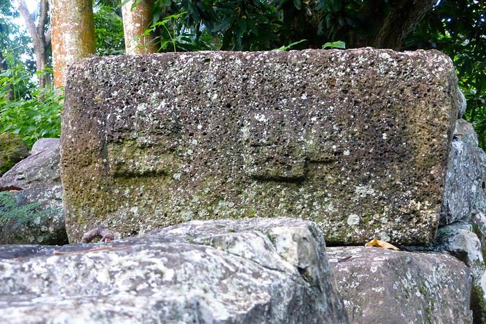
**UA HUKA**
**Day 4: May 1**
Departure for Ua Huka, the smallest inhabited island in the northern group of the Marquesas, located about 1,300 km northeast of Tahiti. Landing is at the oldest airfield in the Marquesas, built in 1972, between the villages of Vaipaee and Hane. Ua Huka has about 680 inhabitants, according to the last census, spread across 3 villages (since the 1870s): Vaipaee, Hane, and Hokatu. The island peaks at Mount Hitikau at only 884 meters. Its origin: a Hawaiian-type shield volcano that—over a few million years—collapsed to become a caldera (or elliptical depression) in which two small volcanoes appeared, the craters of Tahoatikiau and Teepoepo, now part of the Vaikivi Park. The island is rugged and wild, lower than the others, so less cloud-covered and drier. The bays are jagged, the coastline in ochre tones above the intense blue of the sea, and the beaches are constantly disturbed by the powerful surf. The village of Hokatu is only a few kilometers away (just 14 km of road on the island), but Maurice, our host, drives slowly, and it takes time to go up and down. The road is entirely paved or concreted, which isn’t the case on Ua Pou, for example. The guesthouse is disappointing, perched above the village and thus isolated. Beautiful view of the famous Hane motu and the sparkling sea under the bright sun. Apart from that, there are mosquitoes and cockroaches, the bungalow isn’t clean. Meals are taken with Maurice and Delphine in the village—fine dining isn’t on the menu! Ouch!!! We didn’t luck out...
**Day 5: May 2**
Early in the morning, after breakfast, Delphine takes us to the craft center, which turns out to be a letdown—the items for sale are, in my opinion, crude and poorly carved. Nothing like what’s offered at the Marquesas Fair, held twice a year in Papeete, where you can admire and buy small wonders: wood carvings, flower stone, and coral. Delphine is disappointed we’re not interested, and it shows... She’s a bit sulky! These are items meant for Aranui cruise passengers who land on Ua Huka once every two weeks... Solo travelers like us don’t seem to interest her much. The rest of the day—spent with Maurice—is dedicated to visiting cultural centers and small museums, like the Sea Museum in Hane with its ancient canoes, the municipal archaeological museum on the Te Tumu site above the airfield, the petroglyph house near Hokatu Beach, and finally the Papuakeikaraa arboretum, which gathers endemic plants from all over Polynesia and an impressive citrus collection. No excursion planned to Vaikivi Park, toward the previously mentioned craters that recall the island’s volcanic past. Also missing are the viewpoints, the unique endemic vegetation, and especially the petroglyphs. Too bad... at that price!!! Still, in the evening, we go fishing—with sandwiches and drinks in coolers—with other villagers from the dock at the end of the paved road. It’s cool, windy, no mosquitoes, lots of fish caught, and a great atmosphere. Plus, magnificently starry skies.
Ua Huka is one of the rare islands not invaded by the black rat, which has preserved its birdlife, particularly the ultramarine lorikeet (or *pihiti* in Marquesan), which feeds almost exclusively on flower nectar (banana, coconut, hibiscus, mango, guava trees). A dog imported from New Zealand has been specially trained to detect rats: it inspects cargo unloaded from boats and the docks.
I recommend spending two full days on the island—one for visiting the various museums, the other for hiking in the island’s center park, where the archaeological sites are in their raw state: foundations of agricultural terrace walls, gathering places (or *tohua*), dwelling pavements (or *paepae*), sacred sites (or *me’ae* in Marquesan, *marae* in Tahitian) with their tikis and petroglyphs.
To finish, a bit of info on the island’s name, tied to Marquesan oral culture: according to the legend of the creation of the six Marquesas Islands, Ua Huka is the one that puts the finishing touch on the construction of the god Oatea’s house, each island having a defined architectural function. Ua Huka represents the hole (*ua*) where the god deposits what’s left (*huka* in Marquesan) of the unused materials during construction.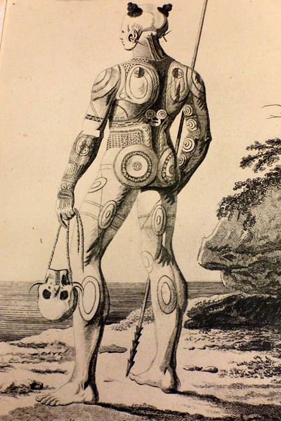
**HIVA OA**
**Day 6: May 3**
Departure in the late morning for Hiva Oa. Maurice—who had other things to do—dropped us off at the airfield 3 hours early... so this stop is a bit of a flop, even if we decided to stay positive! Hiva Oa is the third-largest island in French Polynesia after Tahiti and Nuku Hiva, and before Raiatea in the Leeward Islands. The island is beautiful, lush, verdant, and jagged. The mountains soar into the sky, the sea views are grand, the light is sublime—we’re lucky. Beautiful weather. Tania from Pension Kanahau waits for us at the airport. We’re in for two wonderful days with her. Tania is welcoming, smiling, and dynamic. What a pleasure to be with her, at her place—she cooks divinely and serves the best tuna in the world (the Big Eye reserved for the Japanese) and croquettes made with lobster, shrimp, and crab with breadfruit cubes, for example. Comfortable bungalow, no mosquitoes at night, we can sleep with the window open. It’s fantastic! After settling in, Tania takes us to town in Atuona, a pleasant and well-laid-out little village. We start with lunch—a delicious raw fish in coconut milk—then continue with the must-see attractions: the Catholic cemetery where Paul Gauguin and Jacques Brel’s graves are, overlooking the town; the abandoned Protestant cemetery, reclaimed by the bush, with impressive Marquesan warrior tombs made of huge coral slabs and adorned with a tiki head (harder to find, as no one goes there... ask for directions!); the craft center; the Gauguin Museum (and the Jacques Brel Museum); and the waterfront. While we stroll peacefully, Tania organizes an excursion for the next day, May 4, a full day with Pifa O’Connor, a 36-year-old who knows his island inside out, is passionate about local history, and with whom we’ll hit it off.
**Day 7: May 4**
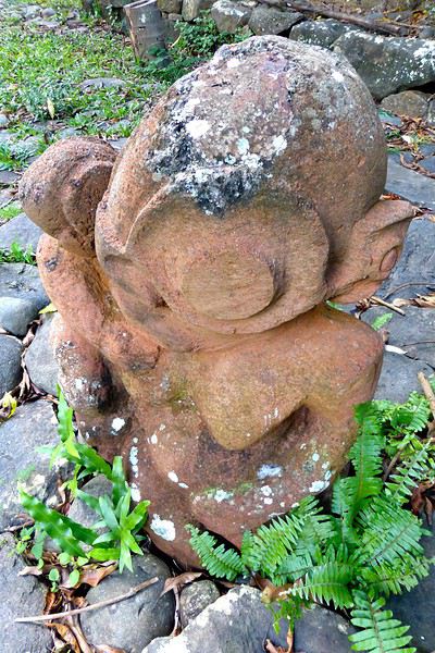
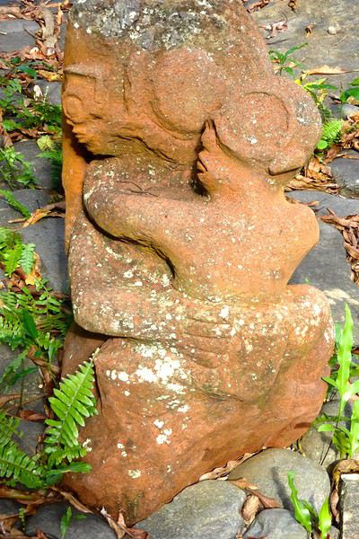
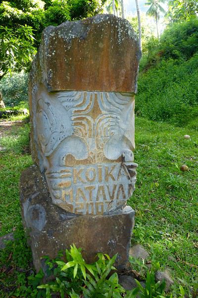
Pifa arrives at 8 AM sharp at the guesthouse, and we immediately buy sandwiches and water at a small supermarket in Atuona. First, we make a brief stop by the roadside at an unmarked spot, from which we descend a small path through dense vegetation leading to the famous smiling tiki—the only one of its kind in the Marquesas and Polynesia. The place is improbable, the tiki isn’t huge, but it’s beautiful and impressive. Then we’re off on the road that, dizzyingly, runs along and overlooks the island’s northern coast, at the edge of the ancient volcano. Few vehicles pass, the road—now a rocky track—is full of potholes, and we proceed slowly. (Note that this road has been fully paved since 2018.) The panoramas are majestic, with every shade of green against the blue sea. We stop again at the top of a cliff adorned with a huge stone, the *sacrifice stone*, from which young virgin girls were once thrown into the sea to appease angry gods. Another pause for lunch this time, at a small restaurant near the exceptional archaeological site of Puamau. We’ll experience the highlights of this trip during this excursion with our guide, Pifa, who spares no explanations. We discover, on a vast esplanade, the ceremonial complexes of Ta’a Oa and Meae Te I’Ipona, the latter featuring superb tikis, particularly the reclining tiki—or *Maki Taua Pepe*—representing Motherhood, a woman giving birth in a squatting position, as was often the case in many civilizations. Also notable is the *Takaii*, the largest tiki recorded in Polynesia to date. There’s also a huge stone with a now-blunt edge, on which the circumcision of chiefs’ and notables’ pre-adolescent sons was performed. A tough ordeal! But that’s not all! It seems there are more on the mountainside rising steeply behind the archaeological site—overturned tikis, platforms, and, apparently, a giant tiki at the top, which must have fallen but was visible from afar on the sea 30 or 40 years ago, according to the island’s elders. This meeting, worship, and living place—it was actually a small town—is immense. Thousands of people once lived in this part of the island. The site—a religious, social, and cultural sanctuary—would be the size of the largest Mayan sites in Yucatán, but the few concerned owners—two or three families who own the mountainside—don’t want to hear about intensive clearing or tree cutting for now. UNESCO rightly asks for some compliance efforts to grant special treatment to Hiva Oa in particular and the Marquesas in general. We’re not there yet, unfortunately, due to insurmountable local rigidities! This kind of attitude is quite typical in Polynesia: people are afraid to uncover *marae* buried under vegetation—they’re taboo and sometimes said to emit negative and deadly waves, so it’s better not to disturb or anger the ancient spirits or gods who might take revenge. The old religion is never far away in Polynesia, despite the successes of the missionaries.
We return to the guesthouse in the late afternoon. Last night in the Marquesas with Tania, who prepares a fine and delicious meal. Note that dinner costs 2,500 XPF per person.
**Day 8: May 5**
We take the plane as planned, via Nuku Hiva (short stopover). Arrival on time in Papeete.
May this travel journal inspire many of you to visit the Marquesas one day. It’s far, it’s expensive, it’s the trip of a lifetime—it’s unforgettable and unmissable.
Our itinerary is perfect for those who aren’t excited by cruises and prefer to get closer to the local communities. This 9-day trip cost us around 2500 € all-inclusive. For a 14-day cruise on the Aranui, expect to pay 2300 € per person for a basic cabin for four, or 3800 € per person for a superior double cabin.
Air Tahiti offers a 4-island Marquesas Pass (Nuku Hiva, Ua Pou, Ua Huka, and Hiva Oa) for 86,000 XPF (about 700 €). The journey is made on an ATR 72 from Tahiti to Nuku Hiva or Hiva Oa, and on a 19-seat Twin Otter between the islands (often only 13 or 15 seats are available due to cargo, so book well in advance). We’re traveling as a couple. We booked our family-run guesthouse stays at the Tourism Fair in early February, where you can meet the owners and make your choice. Stays are almost always half-board or breakfast-only. Transfers are usually included, but you can always book a car or taxi.
**NUKU HIVA**
**A LITTLE GEOGRAPHY** Nuku Hiva (NH) is located about 1,500 km from Tahiti, in the north of French Polynesia. At 387 km², it’s the second-largest island in French Polynesia after Tahiti. It was formed by incredible volcanic phenomena and cataclysms between 1 and 6 million years ago, which lifted the island thousands of meters above the sea. Even after millennia of slow erosion, collapses, and settling, NH remains the most majestic of the Marquesas, with its sheer cliffs, deep valleys featuring immense waterfalls, and black walls that were once the inner walls of enormous volcanoes.
**A LITTLE HISTORY** The first contact between NH’s inhabitants and Europeans was in 1595 with Spanish navigators who only stayed briefly. It wasn’t until the late 18th century that Europeans arrived in greater numbers on NH (and the other Marquesas Islands), disrupting a very fragile social and cultural balance. It’s believed that nearly 100,000 people lived on Nuku Hiva at that time—a population decimated over the decades by epidemics, diseases brought by Europeans, and alcohol used for barter. The disastrous result: by the 1930s, only 2,500 people remained, having largely lost their identity and living in poverty. Today, the island has about 2,600 inhabitants spread across several villages, with Taiohae as the main one.
**NUKU HIVA IN LITERATURE**
1 / One of the famous writers who visited NH and stayed there was Herman Melville, who arrived in July 1842, the author of *Moby Dick*. The island had just come under French protectorate. Seduced by the enchanting *vahinés* and dazzled by his paradisiacal vision of the place, Melville deserted his ship. He ended up a prisoner of a local tribe, the Taipi, in Taipivai, where he stayed for a month and a half until an Australian ship captain secured his release in exchange for a musket and a roll of cotton fabric! Melville wrote a novel about this tumultuous episode in his life, considered a classic of travel literature. The book, *Typee: A Peep at Polynesian Life*, published in 1846 in the United States, was a huge success.
2 / Another famous Scottish writer, Robert Louis Stevenson, arrived in NH aboard a yacht that anchored in Anaho Bay, the island’s most beautiful, in July 1888. Stevenson was already known for two magnificent novels that marked their era: *Treasure Island* and *Dr. Jekyll & Mr. Hyde*. Stevenson, too, was captivated by the island’s natural beauty, though he also noted the devastating decline in identity, socio-cultural life, and physical health of a population ravaged by disease and alcohol. His account of his stay, *In the South Seas: An Account of Experiences and Observations in the Marquesas, Paumotus, and Gilbert Islands During Two Cruises on the Yacht Casco (1888) and the Schooner Equator (1889)*, was published in 1896 in New York, four years after his death in Apia, Western Samoa, where he had settled. It was also published in London in 1900.
3 / In August 1903, Victor Segalen, a French naval doctor, ethnologist, and archaeologist, landed in NH from the ship *La Durance*, sent to Polynesia to recover the possessions of the painter Paul Gauguin, who had died in April of that year. He, too, was enthralled by the Marquesas but lamented the loss of identity, dignity, and pride of the Māori, alienated by a Christianization that destroyed their culture and customs, denied their gods, and erased their past. He wrote about his experience, doubts, and fears in *Les Immémoriaux*.
4 / In December 1907, Jack London arrived in NH aboard the sailboat *Stark*, following in the footsteps of his illustrious predecessor, Herman Melville. London was in poor physical condition, exhausted from his relentless travels that had taken him from the Klondike in Canada to Japan, Australia, and London in Europe. He was appalled and shocked by Nuku Hiva’s degraded health situation: where Melville had encountered over 2,000 vigorous and healthy Marquesan warriors, London found only 12 suffering from various diseases—the rest had been wiped out by tuberculosis! His approach remained humanistic, and he maintained a sharp geopolitical awareness of these traditional Polynesian cultures, weakened by the inexorable advance of modernity in the early 20th century. He continued his journey to the Tuamotu Islands and Tahiti, publishing *Martin Eden*, the moving account of his initiatory voyage in the South Pacific, in 1911.
5 / Finally, Alain Gerbault, a writer, linguist, ethnologist, and tireless traveler, arrived in the Marquesas via the Panama Canal in December 1933. He was completely exhausted after an endless crossing on a small sailboat, the *Firecrest*. Enthralled by his stay in the Marquesas, he continued to the Tuamotu Islands in 1934, then Tahiti in 1935. Gerbault fought for the preservation of traditions, as well as the songs and dances banned by the Churches and the French Administration (these bans lasted over 50 years, mind you...!!!). Bora Bora remained his favorite island. A staunch Pétainist during World War II, he was forced to flee Bora Bora for Samoa, then Tonga, and finally Timor, a half-Portuguese island and thus neutral during the war. His travel accounts, *In Pursuit of the Sun: Logbook from New York to Tahiti* and *A Paradise Is Dying*, were published in the late 1940s. He died in Timor in 1941, and his ashes were repatriated to Bora Bora.
Back to our trip and stay.
**Day 1: April 27**
Departure from Papeete at 6:30 AM—we had to wake up two hours earlier and reach the airport in the dark. Takeoff at dawn, good weather en route, flight duration: 4 hours.
Arrival around 10:30 AM in Nuku Hiva, the first stop of this trip. We booked two nights in half-board at Pension Koku’u, transfers included. Maybe not such a great idea, those included transfers, especially on this unique island where the airport is located on *Terre Déserte*, on the other side of the mountain, opposite and about 45 km from the main village of Taiohae. They’re charged at a steep price. Expect 6,000 XPF round-trip by taxi, but 15,000 XPF charged by guesthouses or hotels. The difference is notable. It wasn’t the best idea, but we can’t go back. Even for residents like us who know how to travel in Polynesia, the Air Tahiti employee who sold me the Pass couldn’t give any useful advice about the stay itself—probably because he’d never been to the Marquesas. It’s really annoying! In short, the good idea to remember is renting a car (like a Suzuki) to be free to manage your time and stop at leisure. The road signage is a bit basic, but you’ll manage just fine. Our host Alvane waits for us—without a sign (sic!)—and after searching for each other for 5 minutes, we’re off on a journey of over an hour (with photo stops) in a Land Rover with smooth tires (luckily, it’s not raining!). The recently paved and marked mountain road is impeccable. No time to catch our breath at the guesthouse; we leave immediately (not a great idea after waking up at dawn plus 4 hours on a plane) for a half-day hike that was also included in the prepaid stay. A sandwich was provided (really pathetic for the physical effort required), we have water, and we fill a few bottles at the spring near the ceremonial site of Taipivai, our first stop. Then the hike begins in the Hanaheu Valley, descending toward Anaho Bay and its namesake beach. A magnificent and wild spot, a few sailboats anchored, we swim—the water is really warm, over 30°C at the shore. That warm is rare and not necessarily pleasant. We then have to climb a very steep slope; this hike is actually quite tough. The air is still, humid, and stifling under the foliage, there’s a bit of mud, and tiny ants (which don’t bite, I’ll have you know), locally called *fofolles*, running over shoes, ankles, and calves. Not very pleasant...! On top of that, there are mosquitoes to protect against! In hindsight, it seems wise to bring energy bars from Papeete if you plan to hike on the afternoon of your arrival day. We weren’t careful... Result: a moment of weakness for me and a hyperventilation attack climbing back up from Anaho Bay!!! We return to the guesthouse at night. There we find Claudine and her four children—Marquesan-style atmosphere, friendly and casual. We share family life. Very simple room with a bathroom, no mosquitoes, we can sleep with the window open, but the night will be noisy, as is often the case in Polynesia. Roosters are everywhere and don’t sleep, dogs bark or whine. So we end up waking up early... like everyone else.
**Day 2: April 28**
We booked a full-day excursion with Thierry: it starts with a 45-minute boat ride to reach Hakatea Beach, hidden in a small secret bay like many along Nuku Hiva’s coasts. From there, the hike lasts all day—11 km round-trip on flat but also rugged terrain (ancient paved and elevated paths over 1,000 years old)—and river crossings. Bring the right shoes (like plastic Crocs with high socks—not very stylish but practical). We cross the former village of Hakaui, walk along the foundations of dwellings, and there are still weathered tikis in the lush vegetation. The ultimate goal of this hike is to reach the tall Vaipo waterfall. The place is magical, with openings in the vegetation and immense trees allowing photos of the treetops and caves where funeral canoes containing the bones of chiefs or great warriors were once placed. We return the same way to the beach and take another boat ride to reach Taihoae’s port. Back at the guesthouse after a glimpse of Taihoae’s waterfront.
**UA POU**
**Day 3: April 29**
Back to the airport in the late morning for the second flight of the trip to Ua Pou. 20-minute crossing in a Twin Otter (18 seats but only 13 occupied due to cargo between the islands). Beautiful weather, blue sea, nice photos to take upon departure from NH and arrival in UP. We’re greeted by Jérôme, a former military man turned tourism professional, who runs Pension Pukue’e with his wife Elisa, a native of UP. We’re in for two exceptional days. The guesthouse is comfortable, Jérôme and Elisa are very professional and pleasant. Jérôme is also a professional hiker, and Elisa is an excellent cook. We leave quickly for a half-day excursion to Hohoi, after a stop at the archaeological, cultural, and religious site of Maui’a, the Tavaka tribe’s territory. Jérôme is there to explain how Marquesan society functioned at the time and the events that took place on a site still largely buried under vegetation. Then we visit a flower-stone sculptor he knows—the only place in the Marquesas where you’ll find these stones. They’re collected in the river flowing into the sea at Hohoi, sometimes on the beach itself. Back to the guesthouse.
**Day 4: April 30**
A nature hike in the mountains—moderately difficult—toward the Vaiea waterfall is on our program for a good 4 hours. It’s hot, there are mosquitoes, and the dip in the pool under the waterfall (24°C water) is a rare pleasure. Lunch at a friend of Jérôme’s, a former chef for French minister François Fillon, who prepares delicious food. Elisa picks us up by car to return to the guesthouse. Ua Pou is a beautiful and elegant island with its sharp peaks and wild nature. Our favorite, thanks to Jérôme and his wife.
**UA HUKA**
**Day 4: May 1**
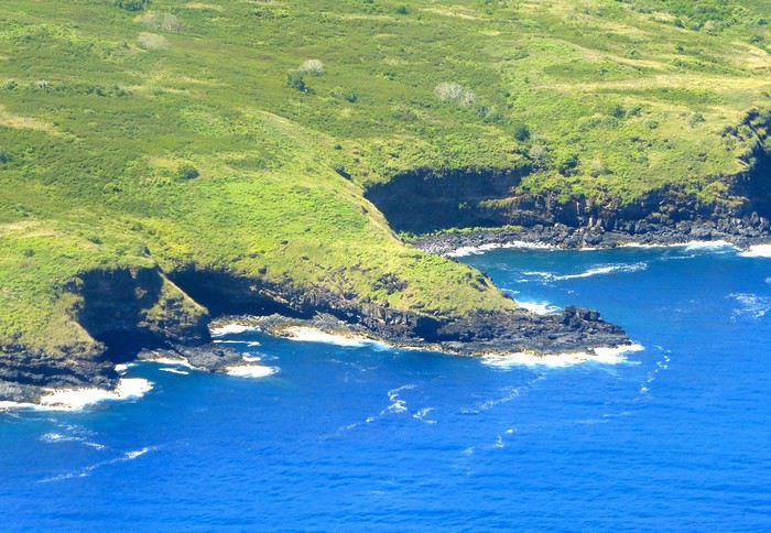
Departure for Ua Huka, the smallest inhabited island in the northern group of the Marquesas, located about 1,300 km northeast of Tahiti. Landing is at the oldest airfield in the Marquesas, built in 1972, between the villages of Vaipaee and Hane. Ua Huka has about 680 inhabitants, according to the last census, spread across 3 villages (since the 1870s): Vaipaee, Hane, and Hokatu. The island peaks at Mount Hitikau at only 884 meters. Its origin: a Hawaiian-type shield volcano that—over a few million years—collapsed to become a caldera (or elliptical depression) in which two small volcanoes appeared, the craters of Tahoatikiau and Teepoepo, now part of the Vaikivi Park. The island is rugged and wild, lower than the others, so less cloud-covered and drier. The bays are jagged, the coastline in ochre tones above the intense blue of the sea, and the beaches are constantly disturbed by the powerful surf. The village of Hokatu is only a few kilometers away (just 14 km of road on the island), but Maurice, our host, drives slowly, and it takes time to go up and down. The road is entirely paved or concreted, which isn’t the case on Ua Pou, for example. The guesthouse is disappointing, perched above the village and thus isolated. Beautiful view of the famous Hane motu and the sparkling sea under the bright sun. Apart from that, there are mosquitoes and cockroaches, the bungalow isn’t clean. Meals are taken with Maurice and Delphine in the village—fine dining isn’t on the menu! Ouch!!! We didn’t luck out...
**Day 5: May 2**
Early in the morning, after breakfast, Delphine takes us to the craft center, which turns out to be a letdown—the items for sale are, in my opinion, crude and poorly carved. Nothing like what’s offered at the Marquesas Fair, held twice a year in Papeete, where you can admire and buy small wonders: wood carvings, flower stone, and coral. Delphine is disappointed we’re not interested, and it shows... She’s a bit sulky! These are items meant for Aranui cruise passengers who land on Ua Huka once every two weeks... Solo travelers like us don’t seem to interest her much. The rest of the day—spent with Maurice—is dedicated to visiting cultural centers and small museums, like the Sea Museum in Hane with its ancient canoes, the municipal archaeological museum on the Te Tumu site above the airfield, the petroglyph house near Hokatu Beach, and finally the Papuakeikaraa arboretum, which gathers endemic plants from all over Polynesia and an impressive citrus collection. No excursion planned to Vaikivi Park, toward the previously mentioned craters that recall the island’s volcanic past. Also missing are the viewpoints, the unique endemic vegetation, and especially the petroglyphs. Too bad... at that price!!! Still, in the evening, we go fishing—with sandwiches and drinks in coolers—with other villagers from the dock at the end of the paved road. It’s cool, windy, no mosquitoes, lots of fish caught, and a great atmosphere. Plus, magnificently starry skies.
Ua Huka is one of the rare islands not invaded by the black rat, which has preserved its birdlife, particularly the ultramarine lorikeet (or *pihiti* in Marquesan), which feeds almost exclusively on flower nectar (banana, coconut, hibiscus, mango, guava trees). A dog imported from New Zealand has been specially trained to detect rats: it inspects cargo unloaded from boats and the docks.
I recommend spending two full days on the island—one for visiting the various museums, the other for hiking in the island’s center park, where the archaeological sites are in their raw state: foundations of agricultural terrace walls, gathering places (or *tohua*), dwelling pavements (or *paepae*), sacred sites (or *me’ae* in Marquesan, *marae* in Tahitian) with their tikis and petroglyphs.
To finish, a bit of info on the island’s name, tied to Marquesan oral culture: according to the legend of the creation of the six Marquesas Islands, Ua Huka is the one that puts the finishing touch on the construction of the god Oatea’s house, each island having a defined architectural function. Ua Huka represents the hole (*ua*) where the god deposits what’s left (*huka* in Marquesan) of the unused materials during construction.
**HIVA OA**
**Day 6: May 3**
Departure in the late morning for Hiva Oa. Maurice—who had other things to do—dropped us off at the airfield 3 hours early... so this stop is a bit of a flop, even if we decided to stay positive! Hiva Oa is the third-largest island in French Polynesia after Tahiti and Nuku Hiva, and before Raiatea in the Leeward Islands. The island is beautiful, lush, verdant, and jagged. The mountains soar into the sky, the sea views are grand, the light is sublime—we’re lucky. Beautiful weather. Tania from Pension Kanahau waits for us at the airport. We’re in for two wonderful days with her. Tania is welcoming, smiling, and dynamic. What a pleasure to be with her, at her place—she cooks divinely and serves the best tuna in the world (the Big Eye reserved for the Japanese) and croquettes made with lobster, shrimp, and crab with breadfruit cubes, for example. Comfortable bungalow, no mosquitoes at night, we can sleep with the window open. It’s fantastic! After settling in, Tania takes us to town in Atuona, a pleasant and well-laid-out little village. We start with lunch—a delicious raw fish in coconut milk—then continue with the must-see attractions: the Catholic cemetery where Paul Gauguin and Jacques Brel’s graves are, overlooking the town; the abandoned Protestant cemetery, reclaimed by the bush, with impressive Marquesan warrior tombs made of huge coral slabs and adorned with a tiki head (harder to find, as no one goes there... ask for directions!); the craft center; the Gauguin Museum (and the Jacques Brel Museum); and the waterfront. While we stroll peacefully, Tania organizes an excursion for the next day, May 4, a full day with Pifa O’Connor, a 36-year-old who knows his island inside out, is passionate about local history, and with whom we’ll hit it off.
**Day 7: May 4**
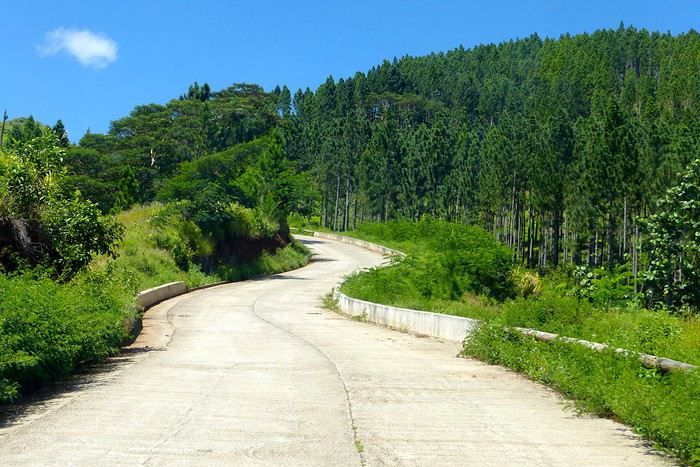
Pifa arrives at 8 AM sharp at the guesthouse, and we immediately buy sandwiches and water at a small supermarket in Atuona. First, we make a brief stop by the roadside at an unmarked spot, from which we descend a small path through dense vegetation leading to the famous smiling tiki—the only one of its kind in the Marquesas and Polynesia. The place is improbable, the tiki isn’t huge, but it’s beautiful and impressive. Then we’re off on the road that, dizzyingly, runs along and overlooks the island’s northern coast, at the edge of the ancient volcano. Few vehicles pass, the road—now a rocky track—is full of potholes, and we proceed slowly. (Note that this road has been fully paved since 2018.) The panoramas are majestic, with every shade of green against the blue sea. We stop again at the top of a cliff adorned with a huge stone, the *sacrifice stone*, from which young virgin girls were once thrown into the sea to appease angry gods. Another pause for lunch this time, at a small restaurant near the exceptional archaeological site of Puamau. We’ll experience the highlights of this trip during this excursion with our guide, Pifa, who spares no explanations. We discover, on a vast esplanade, the ceremonial complexes of Ta’a Oa and Meae Te I’Ipona, the latter featuring superb tikis, particularly the reclining tiki—or *Maki Taua Pepe*—representing Motherhood, a woman giving birth in a squatting position, as was often the case in many civilizations. Also notable is the *Takaii*, the largest tiki recorded in Polynesia to date. There’s also a huge stone with a now-blunt edge, on which the circumcision of chiefs’ and notables’ pre-adolescent sons was performed. A tough ordeal! But that’s not all! It seems there are more on the mountainside rising steeply behind the archaeological site—overturned tikis, platforms, and, apparently, a giant tiki at the top, which must have fallen but was visible from afar on the sea 30 or 40 years ago, according to the island’s elders. This meeting, worship, and living place—it was actually a small town—is immense. Thousands of people once lived in this part of the island. The site—a religious, social, and cultural sanctuary—would be the size of the largest Mayan sites in Yucatán, but the few concerned owners—two or three families who own the mountainside—don’t want to hear about intensive clearing or tree cutting for now. UNESCO rightly asks for some compliance efforts to grant special treatment to Hiva Oa in particular and the Marquesas in general. We’re not there yet, unfortunately, due to insurmountable local rigidities! This kind of attitude is quite typical in Polynesia: people are afraid to uncover *marae* buried under vegetation—they’re taboo and sometimes said to emit negative and deadly waves, so it’s better not to disturb or anger the ancient spirits or gods who might take revenge. The old religion is never far away in Polynesia, despite the successes of the missionaries.
We return to the guesthouse in the late afternoon. Last night in the Marquesas with Tania, who prepares a fine and delicious meal. Note that dinner costs 2,500 XPF per person.
**Day 8: May 5**
We take the plane as planned, via Nuku Hiva (short stopover). Arrival on time in Papeete.
May this travel journal inspire many of you to visit the Marquesas one day. It’s far, it’s expensive, it’s the trip of a lifetime—it’s unforgettable and unmissable.
Hi, I’m traveling to Greece in May and landing in Athens. I need to book a rental car—could you recommend a rental agency? Also, where are the free shuttles that take you to the agency? Thanks for your help!
hi everyone,
my flight’s all booked (Sept 19–Oct 4), with 1.5 days in Montreal + 1.5 days in Quebec City...
then I’ve got 11 days starting from Quebec City for a road trip—what route do you recommend?
(I’ve seen these stops come up a lot: Parc Omega, Charlevoix, Tadoussac, Bas-Saint-Laurent, Saguenay, Parc de la Gaspésie, Parc Forillon, Mauricie...)
The idea is no more than 2–3 hours of driving per day on average.
I’m traveling solo :-( (if you’re in the area around the same dates, hit me up!)
45 years old, I love sports (so I’m hoping to do hikes, kayaking, and other activities, see whales...discover beautiful landscapes). I’m not sure if there are any events in the area during those dates, but I’d also like to meet some people...
Thanks in advance for your tips!
We just spent three weeks in Yunnan.
I’ve started writing up a travel journal about the trip.
Hi there,
We have the opportunity to get away for a little two-week trip at the very beginning of January, just the two of us, without our kids. Because of the kids, we haven’t traveled much in Asia, so we’d love to take advantage of their absence to explore Thailand. Even though I’m used to planning our trips, I’m feeling a bit overwhelmed this time.
We’d like to visit Bangkok and head south by renting a car (we have an international driver’s license, and my husband has driven on the left before). I’ve managed to sketch out a rough itinerary that might work for us, and I’d love to hear your thoughts.
To set the scene: we haven’t booked anything yet, we don’t like spending hours on the beach (though a little time at the end of the day is fine), we love walking and sightseeing, and what we enjoy most is being independent (so if we can avoid group tours, that’s ideal).
After that intro, here’s the rough outline of our itinerary: Day 0: Paris-Bangkok flight Days 1, 2, and 3: Bangkok (Wat Pho, Grand Palace, Wat Arun, markets, boat ride through the khlongs, Jim Thompson House) Day 4: Ayutthaya Day 5: Pick up a rental car and head to Sam Roi Yot Day 6: Sam Roi Yot and Prachuap Khiri Khan Day 7: Drive south – overnight near Surat Thani Day 8: Uthayan Tham Khao Na Nai, then drive to Ao Nang (staying near Tubkaek) Days 9 and 10: Boat trips (Railay, Ko Hong, etc.) Day 11: Drive to Phang Nga with a few stops along the way Day 12: Boat tour (mangroves and Ko Tapu) Day 13: Drive to Phuket Airport and return flight
A few questions and doubts: - I’d considered Cheow Lan Lake but read some not-so-great reviews (crowds, just 3 viewpoints, and the rest was meh). What do you think? - Can we start from Ao Thalane Pier for trips to Ko Hong and Ko Tapu? - I’m not thrilled about driving through Bangkok, but I’m not sure where to rent a car west of the city (since we won’t return it to the same place, I assume it’s best to target rental companies at airports).
Thanks in advance for any tips or feedback you can share to help me (or not 😛) refine this plan before I start booking!
Hello,
We’ll be arriving in Montreal on Sunday, September 21st for a Quebec road trip. Do you have any car rental agencies to recommend (or avoid)? A favorite search engine? Are all agencies open on Sundays? Should we book the car in advance? And finally, is there still a Voyage Forum discount code with Hertz, like there used to be? I know, that’s a lot of questions , thanks for answering them! 🙂
Claire
Hi there,
We’re heading to Costa Rica in March 2025 for a road trip from north to south. What type of vehicle would be best? And, based on your experience, which rental company would you recommend doing business with?
Thanks!
Denis, from Quebec
Hi everyone,
I’m planning a road trip in Kenya and I’m wondering about renting a vehicle. I’d like to know if a 4x4 is really necessary if I book safaris directly through the lodges in the reserves. If I only need a vehicle for long trips (e.g., Nairobi->Masai Mara and Masai Mara->Amboseli, then later to Mombasa), is it worth renting a 4x4?
Thanks in advance for your feedback—I’m not sure about the road conditions here! !
Hello,
My teenage daughter and I are heading to Sulawesi in July-August for 5 weeks. We don’t know Indonesia at all—this will be our first time. When we travel, we’re not used to booking accommodations in advance because we love improvising based on our mood and what comes up in the moment... For Sulawesi, though, from what I’ve read, I’m a little worried we might get stuck here and there, especially in more touristy spots, if we leave everything open... So, advice from those in the know—what do you think? Should we plan a bit ahead? Thanks a million for your feedback!
A'
Hello,
Thinking this might be useful for VF members who, like me, want to get their French driver’s license translated for a car rental in Japan, here’s the email I received this morning from the consular authorities in Tokyo:
Dear Sir,
You can obtain the translation from the Japan Automobile Federation (JAF). Address: 2-2-17 Shiba, Minato-ku, Tokyo 105-8562 Phone: 81-3-6833-9100 Email: kchosa@jaf.or.jp Website: http://www.jaf.or.jp/e/trans_f.htm (To find their office in Sapporo: http://www.jaf.or.jp/e/list_translation.htm)
Information about driver’s licenses is available on our website: http://www.ambafrance-jp.org/spip.php?article781&var_recherche=driver’s%20license The consular section can no longer provide driver’s license translation services.
Best regards,
Consular Section
So, according to this message, no more mail-in translations through the consular authorities.
Sayonara.
Hi there,
I’ve just booked our flight tickets for my family.
We’re heading to Ireland for a week between July and August—it’s our first time (with 1 teen and 2 younger kids).
We’ll be landing in Cork where we’ve rented a car. Initially, I was planning to focus our visits and walks on the Ring of Kerry and Dingle, but it looks like the roads get pretty busy in the summer.
So now I’m thinking of sticking to the "West Cork" area (Beara, Sheep’s Head, Mizen Head), which seems quieter.
For those who know the area, is this a good idea, or are we at risk of missing out on more spectacular landscapes? Thanks in advance! Best regards
Hi there,
I’d like to book a few nights at the Ramabanta Trading Post in November, but I’m running into a lot of issues. They don’t work with the usual booking platforms. Their website is flagged as unsafe, but I took the risk and accessed it anyway—after each visit, our server was massively attacked... I’ve sent them several emails and received a response with prices, but no reply or confirmation once I specified my choices. My English isn’t great, so I’m not keen on calling (plus, I prefer having a written record of my bookings). Has anyone been in the area recently and have any info on what’s going on and how to book?
Thanks in advance for your help and tips!
Fabienne
Hello,
My partner and I are heading to Crete for 17 days this summer, from July 25 to August 11, with a rental car. We’ll book the first night or the first two nights, but our plan is to explore the east—and only the east—with no set itinerary and no other reservations.
For those in the know, are we being reckless? 🤣
We’ve had some experience with this kind of travel in Greece before: 10 days in western Crete in 2021 (though that was post-Covid) and 10 days in the Peloponnese in 2024. We only booked the first night each time, and it wasn’t really an issue. Even if we didn’t always find a place in the exact spot we were aiming for, we’d just stay a little further out, a bit less touristy, and it was great!
Do you think this style of travel is still doable in Crete in August by 2026?
Thanks for any insights if you’ve had this experience!
Best,
Hey everyone,
we’re heading to the American West for 21 days in August.
Two options for us:
renting a regular car and staying in motels, or going with an RV.
We’ve traveled a lot in Southern Africa on our own with a 4x4 roof-top tent, but the US is a whole different story.
I’d love to hear your thoughts—budget-wise, we’re probably looking at similar costs.
Thanks for your input!
Thierry
Happy New Year 2026!
We’re planning a trip to Botswana.
Thanks in advance for your tips on getting from Maun to Kasane (or the other way around) by road (taxi or rental car) or by air.
Is it possible by road? If so, which route is best?
And by air, what do you think of Air Botswana? Mackair seems really expensive to us.
Best regards
Does visiting Albania (combined with Greece) require renting a 4x4?
If you have any tips on beautiful routes, we’d love to hear them.
Thanks in advance.
Thanks in advance.
This trip had been on my mind for about fifteen years.
But the discomfort of overnight stays, the difficulty of communication, and the prices of the few car rental options kept making me postpone the project.
And then, everything suddenly fell into place—I told myself, it’s time!
The preparations took longer than usual; the destination is still far from mainstream.
A bit of Kazakhstan? Not in the end.
The south or not the south? Yes, in the end.
Pre-book or go with the flow? Only two stops were a leap into the unknown.
To help me find the ideal route, I made great use of this forum (thanks to everyone for patiently answering my questions!), pored over travel journals and blogs (Christian, Jeff), zoomed in on Google Maps and Yandex, and bought the guide published by OunTravela about this destination (the guide has been updated since).
---/---
You’ve got your passport, international driver’s license, bank cards, and euros?
Off we go to Lyon—just one night left before our early morning flight.
Tomorrow night, we’ll be sleeping in Bishkek! (Steak for my partner’s mischievous nephews...)
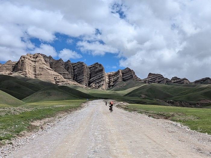
You’ll find here a post with some practical information.
And here, the version of the travel journal without comments.
---/---
As a supplement, the route track. Not necessarily ultra-accurate since Google has serious gaps for this destination...
From Bishkek to Karakol:
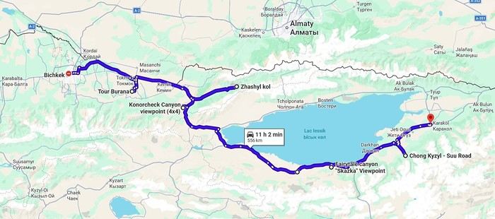
From Karakol to Kochkor:
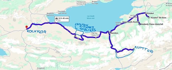
From Kochkor to Baetov:
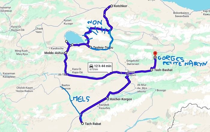
From Baetov to Kara-Köl:
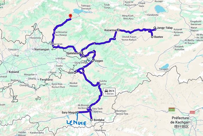
From Kara-Köl to Bishkek:
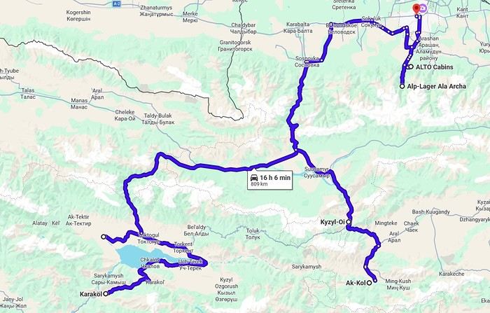

But the discomfort of overnight stays, the difficulty of communication, and the prices of the few car rental options kept making me postpone the project.
And then, everything suddenly fell into place—I told myself, it’s time!
The preparations took longer than usual; the destination is still far from mainstream.
A bit of Kazakhstan? Not in the end.
The south or not the south? Yes, in the end.
Pre-book or go with the flow? Only two stops were a leap into the unknown.
To help me find the ideal route, I made great use of this forum (thanks to everyone for patiently answering my questions!), pored over travel journals and blogs (Christian, Jeff), zoomed in on Google Maps and Yandex, and bought the guide published by OunTravela about this destination (the guide has been updated since).
---/---
You’ve got your passport, international driver’s license, bank cards, and euros?
Off we go to Lyon—just one night left before our early morning flight.
Tomorrow night, we’ll be sleeping in Bishkek! (Steak for my partner’s mischievous nephews...)
You’ll find here a post with some practical information.
And here, the version of the travel journal without comments.
---/---
As a supplement, the route track. Not necessarily ultra-accurate since Google has serious gaps for this destination...
From Bishkek to Karakol:
From Karakol to Kochkor:
From Kochkor to Baetov:
From Baetov to Kara-Köl:
From Kara-Köl to Bishkek:
Some trips are born twice.
Ours was supposed to happen in 2020. Everything was ready: the itinerary, the flight tickets, hotel reservations and Machu Picchu, the rental car, dreams of high altitudes and wide-open spaces. And then the world stopped.
Like so many other plans, our trip to Peru was put on hold. Disappointment was followed by a more concrete reality: paperwork, endless back-and-forth, and battles to recover some of the costs we’d already paid.
The years went by. Life moved on, with its shifting priorities and unexpected twists. Rescheduling this trip wasn’t possible until 2025.
The itinerary stayed mostly true to what we’d imagined five years earlier. One major difference, though—in 2020, we’d planned to rent a car and explore the roads completely independently. Most importantly, we hadn’t included the three-day Ausangate trek, due to lack of time.
For 2025, our plans evolved. 4x4 rental prices had skyrocketed, and when we looked at our schedule more closely, we realized quite a few days didn’t actually need a vehicle. So we made a different choice and opted for private drivers instead. A decision we never regretted. Always punctual, thoughtful, and available... they were so much more than just drivers.
All our reservations were made in January, except for the trek, which we booked in February.
Finding reliable drivers on our own was tough, so we asked Laurent from Tout Pérou to handle it for us. Going through Tout Pérou also gave us a discount on the train ride to Aguas Calientes, so Laurent booked those tickets too. He also bought our Machu Picchu entrance tickets at the same price we would’ve paid on the official website. When comparing domestic flight prices, we found it was cheaper to book from Peru, so Laurent took care of those as well.
This time, nothing was going to stop us. Peru was waiting. And we were ready. 🙂
Hello,
We’re torn between a riad in the medina and one on the outskirts (south of Marrakech) with the advantage of peace and quiet, a big pool for the kids, but it’s far (10 km).
We’ll have a rental car. Is it easy to park near Jemaa el-Fna square, for example? Are the rates public (so we know what to expect)?
This would save us from taking taxis multiple times a day since we’ve been told it’d cost around 12 € each way. The bill could add up quickly.
Generally speaking, would you recommend staying in Marrakech itself, in the old city, or in the surrounding area? We’ll only be there for two nights with a 10-year-old girl and a 14-year-old teen who both want to explore the city but also enjoy the pool.
Thanks
Hi there,
We’re heading to Puglia from July 30 to August 31, 2020. I’ve booked a rental with a pool in Locorontondo.
But the more I read guides and forums, the more I regret booking the flight to Bari. I can still cancel the other reservations, but I’d face penalties for the flight.
It’s packed, avoid August at all costs—traffic jams, stifling heat, price hikes… I’m really having second thoughts. Our goal isn’t necessarily to hit the beach. I’m thinking we’ll get up early to go where we want and head back during the hottest part of the day.
Is it *that* bad? Thanks for sharing your experiences.
Hi everyone,
We're planning a trip to southern Chile in November. Here's our tentative itinerary:
Day 1: Arrival in Santiago, then a flight the next day to Balmaceda where we'll pick up a rental car to reach Coyhaique.
Day 3: Walk in the Coyhaique National Reserve, then continue to Puerto Chacabuco. Return to Coyhaique for the second night.
Day 4: Drive to Villa Cerro Castillo for a hike in the national park. Continue to Puerto Tranquilo and stay there for 3 nights.
Day 5: Boat tour on Laguna San Rafael.
Day 6: Day trip to Monte San Valentin Glacier.
Day 7: Excursion to the Marble Chapels, then drive to Puerto Guadal. We'll stay there for 3 nights.
Day 8: Walk along Lago Carrera and return to Puerto Guadal.
Day 9: Rio Baker Valley and, if possible, a glacier excursion.
Day 10: Drive to Cochrane and hike in Tamango National Reserve. We'll stay 2 nights in Cochrane.
Day 11: Walk in the Chacabuco Valley.
Day 12: Drive to Caleta Tortel. We'll stay there for 2 nights.
Day 13: Cruise in the Rio Baker delta.
Day 14: Return to Cochrane.
Day 15: Return to Balmaceda in two stages.
Day 16: Continue the return journey.
Day 17: Return the rental car and head back to Santiago.
After this, we're also planning to explore northern Santiago. I'll post about that part once I have a clearer idea of the route.
What do you think of this itinerary? Is it doable in 17 days? Thanks in advance for your tips and recommendations. martine
After this, we're also planning to explore northern Santiago. I'll post about that part once I have a clearer idea of the route.
What do you think of this itinerary? Is it doable in 17 days? Thanks in advance for your tips and recommendations. martine
Hi there,
We’re arriving as a group of three in Tokyo on Saturday, October 17th, then heading straight to Kyoto by direct train. On Sunday and Monday, we’ll explore Kyoto, and in the evening, we’ll take a train to Osaka to spend the night. On Tuesday, we’ll pick up a rental car at Itami Airport for a 6-day/5-night road trip around Shikoku: - 2 nights in the Iya Valley - Thursday morning, we’ll head to Matsuyama for 2 nights. - Saturday, we’ll visit Mima (town, a few temples + overnight stay) and return on Sunday to drop off the car in Osaka. We’ll leave very early on Monday the 26th by plane for Aomori in northern Honshu, where we’ll pick up another rental car at the airport for a 5-day/4-night trip: - Day 1: Tsugaru Peninsula (Takayam Inari, Cape Tappi, Kanita); overnight in Kanita - Day 2: Ferry transfer to the Mutsu Peninsula (cliffs, Lake Usori); overnight in Shimofuro - Day 3: Head to the Hakkoda Mountains and onsens galore; overnight TBD - Day 4: Return the car in Aomori by noon and explore the city before taking the train to Tokyo in the evening We’ll spend Friday night in Tokyo, wander around on Saturday, and head home on Sunday.
Thoughts on the road feasibility of this trip? We’ll be there right in the middle of Koyo season, so it’ll be busy... I know it’s a lot of driving, but there are two of us who can take turns. We’re not afraid of driving, even in the mountains and on the left side! Just wondering, are we going to be rushing, or is this manageable? AI says it’s all good, but it’s not the one driving... Any tips for booking accommodations in the Iya Valley? Not many places have email addresses or websites (I know Booking.com exists, but not all listings are on there... and given the season, I think it’s better to book ahead!). Same question applies for northern Honshu. For the rental car, I’m thinking of going with Alamo since at least it’s in French and straightforward, but are there any direct rental companies with user-friendly websites (Toyota Rentacar, ugh... 🏴☠️)? Another question: With so many trains, is it even necessary to book them in advance? Can we just go to the ticket counter and grab seats on the spot? For paying for the rental car, do we need a credit or debit card?
Thanks for your help!
Hi everyone,
We traveled to Norway in the summer of 2025, from July 17 to 29, to visit Senja Island and the Lofoten archipelago with a rental car. The common thread of these twelve days was clearly hiking, along with a few visits and experiences, and nights spent in a tent or in the car (which made it possible). We chose Narvik Airport for both arrival and departure for several complementary reasons: the desire to visit nearby Senja Island, slightly more affordable airfare, and finally, the rental price of the vehicle—especially the car model we were looking for. We only made one reservation, for the first campsite, as sleeping in a tent made things much easier. But we had the whole structure of the trip planned, a flexible outline that could adapt to the weather conditions we’d encounter. Senja Island isn’t part of the Lofoten archipelago, and during the early stages of planning this trip, we hadn’t planned to visit it. But its relative proximity to Narvik Airport and, above all, its unique geography definitely made us change our minds. We arrived in Evenes, where Narvik Airport is located, nearly 60 km from the city itself. Our first stop was 40 km further in Bjerkvik on the way to Senja, where there’s a Rema 1000 (a very common supermarket chain in Norway). We needed to buy some food and a gas cartridge for our stove. I’d emailed the store manager beforehand, who told me they didn’t sell them but that the two gas stations in the village were likely to have some in stock.
It was only at the Esso station that I found what I needed, but unfortunately, only one cartridge. Luckily, we quickly realized that most campsites (like in Iceland) have a shared kitchen with hotplates. That single small cartridge was just enough for the few nights we spent outside of campsites... We got our first taste of Norway’s characteristic landscapes: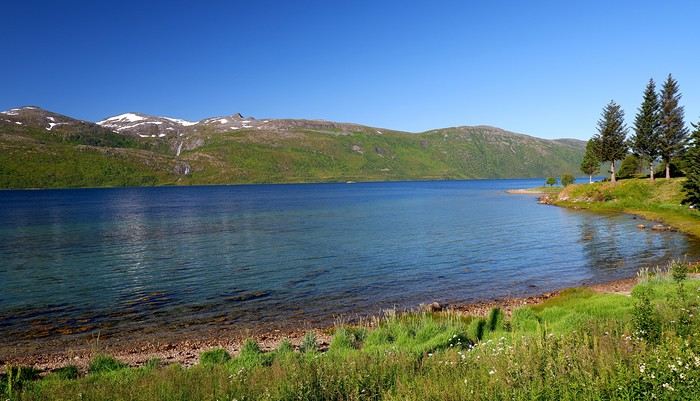
When we arrived at the Senja campsite, it was already 9:30 PM. A sign announced it was full, but luckily, I’d booked it 10 days earlier. By 10:30 PM, as we settled in to eat, it was still broad daylight, and the thermometer read 25°C—despite being at a latitude of 69° North! We went to bed around midnight, exhausted but under the light of a sun that was still very much present. Thanks to Earth’s tilted axis. We’d anticipated this by buying opaque sleep masks because, yes, at this time of year, it’s daylight all the time.
Friday, July 18:
Today, we planned two hikes on the island and a few stops along the way. The map clearly shows that the deepest fjords are in the north and west. Due to time and accessibility, we focused on the northern part of the island. Our first stop was at the viewing platform in Bergbotn:
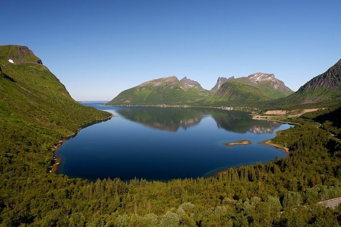
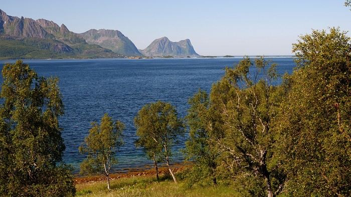
Then we headed toward Skaland, the starting point for our first hike. Along the way, we found plenty of reasons to stop—especially since, on this first day of travel, our thirst for Nordic landscapes was far from quenched.
The town of Skaland is very practical: free parking, picnic tables for after the hike, and a Joker convenience store right next door. Our goal was the summit of Husfjellet: 670 m of elevation gain, between 8 and 9 km in length, and an estimated 4 hours and 30 minutes.
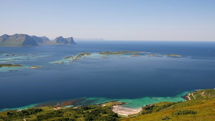
This hike offers two major viewpoints. The first overlooks the Bergsoyan islands to the west:
At the summit, the view shifts to the Steinfjorden fjord:
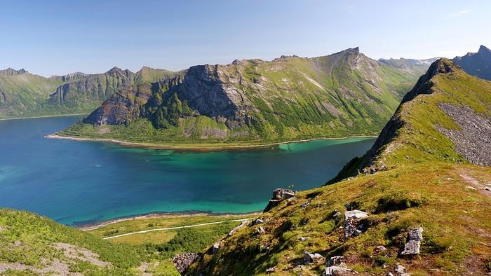
You can even clearly see the "Devil’s Teeth," which we’d see from below later:
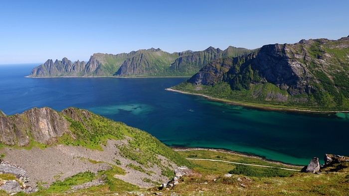
In total, the hike took us 4 hours and 30 minutes, including all the breaks. We treated ourselves to an ice cream in Skaland to recharge for the next hike. We hit the road again and stopped at Tungeneset to get a closer look at the Devil’s Teeth:
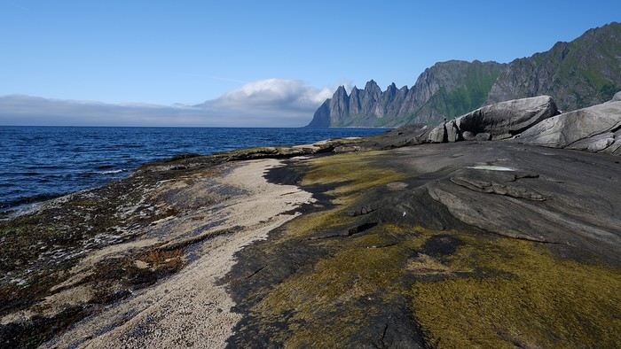
We continued to Fjordgard, the starting point for our second hike. Fjordgard isn’t very welcoming. There was a time when you could park right at the start of the hike up Mount Segla. Now, everything’s blocked off, and locals have even taken to blocking all possible parking spots nearby. You now have to park outside the town at a paid parking lot (90 NOK for 3 hours), adding an extra 2 km (round trip) of walking. Still, that was just a minor inconvenience because the hike that followed quickly made us forget all about it. The hike is fairly short (2 hours) but still has 520 m of elevation gain. This hike was a stark contrast to the first. This morning, we had sweeping views of the vast landscape. Here, Mount Segla, perched on the edge of the cliff, dominates the foreground:
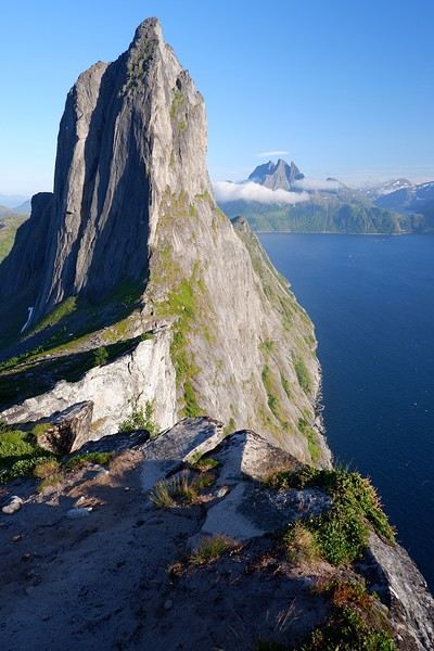
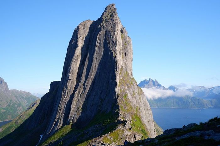
For those prone to vertigo, it might be best to stay at the foot of the mountain, as the trail climbs right along the cliff edge. And from that point on, you quickly understand what verticality really means...
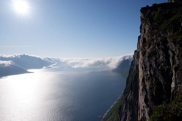
In total, we took 2 hours and 50 minutes, including breaks and the extra walk to the parking lot. The day was already well underway, and with 1,200 m of cumulative elevation gain, it was time to find a spot to eat and sleep. Since we hadn’t made any reservations, we’d planned to bivouac for the night. We weren’t too picky—just practical—so we decided to sleep in the car at the parking lot for tomorrow morning’s hike, just 5 km from Fjordgard.
We traveled to Norway in the summer of 2025, from July 17 to 29, to visit Senja Island and the Lofoten archipelago with a rental car. The common thread of these twelve days was clearly hiking, along with a few visits and experiences, and nights spent in a tent or in the car (which made it possible). We chose Narvik Airport for both arrival and departure for several complementary reasons: the desire to visit nearby Senja Island, slightly more affordable airfare, and finally, the rental price of the vehicle—especially the car model we were looking for. We only made one reservation, for the first campsite, as sleeping in a tent made things much easier. But we had the whole structure of the trip planned, a flexible outline that could adapt to the weather conditions we’d encounter. Senja Island isn’t part of the Lofoten archipelago, and during the early stages of planning this trip, we hadn’t planned to visit it. But its relative proximity to Narvik Airport and, above all, its unique geography definitely made us change our minds. We arrived in Evenes, where Narvik Airport is located, nearly 60 km from the city itself. Our first stop was 40 km further in Bjerkvik on the way to Senja, where there’s a Rema 1000 (a very common supermarket chain in Norway). We needed to buy some food and a gas cartridge for our stove. I’d emailed the store manager beforehand, who told me they didn’t sell them but that the two gas stations in the village were likely to have some in stock.
It was only at the Esso station that I found what I needed, but unfortunately, only one cartridge. Luckily, we quickly realized that most campsites (like in Iceland) have a shared kitchen with hotplates. That single small cartridge was just enough for the few nights we spent outside of campsites... We got our first taste of Norway’s characteristic landscapes:
When we arrived at the Senja campsite, it was already 9:30 PM. A sign announced it was full, but luckily, I’d booked it 10 days earlier. By 10:30 PM, as we settled in to eat, it was still broad daylight, and the thermometer read 25°C—despite being at a latitude of 69° North! We went to bed around midnight, exhausted but under the light of a sun that was still very much present. Thanks to Earth’s tilted axis. We’d anticipated this by buying opaque sleep masks because, yes, at this time of year, it’s daylight all the time.
Friday, July 18:
Today, we planned two hikes on the island and a few stops along the way. The map clearly shows that the deepest fjords are in the north and west. Due to time and accessibility, we focused on the northern part of the island. Our first stop was at the viewing platform in Bergbotn:
Then we headed toward Skaland, the starting point for our first hike. Along the way, we found plenty of reasons to stop—especially since, on this first day of travel, our thirst for Nordic landscapes was far from quenched.
The town of Skaland is very practical: free parking, picnic tables for after the hike, and a Joker convenience store right next door. Our goal was the summit of Husfjellet: 670 m of elevation gain, between 8 and 9 km in length, and an estimated 4 hours and 30 minutes.
This hike offers two major viewpoints. The first overlooks the Bergsoyan islands to the west:
At the summit, the view shifts to the Steinfjorden fjord:
You can even clearly see the "Devil’s Teeth," which we’d see from below later:
In total, the hike took us 4 hours and 30 minutes, including all the breaks. We treated ourselves to an ice cream in Skaland to recharge for the next hike. We hit the road again and stopped at Tungeneset to get a closer look at the Devil’s Teeth:
We continued to Fjordgard, the starting point for our second hike. Fjordgard isn’t very welcoming. There was a time when you could park right at the start of the hike up Mount Segla. Now, everything’s blocked off, and locals have even taken to blocking all possible parking spots nearby. You now have to park outside the town at a paid parking lot (90 NOK for 3 hours), adding an extra 2 km (round trip) of walking. Still, that was just a minor inconvenience because the hike that followed quickly made us forget all about it. The hike is fairly short (2 hours) but still has 520 m of elevation gain. This hike was a stark contrast to the first. This morning, we had sweeping views of the vast landscape. Here, Mount Segla, perched on the edge of the cliff, dominates the foreground:
For those prone to vertigo, it might be best to stay at the foot of the mountain, as the trail climbs right along the cliff edge. And from that point on, you quickly understand what verticality really means...
In total, we took 2 hours and 50 minutes, including breaks and the extra walk to the parking lot. The day was already well underway, and with 1,200 m of cumulative elevation gain, it was time to find a spot to eat and sleep. Since we hadn’t made any reservations, we’d planned to bivouac for the night. We weren’t too picky—just practical—so we decided to sleep in the car at the parking lot for tomorrow morning’s hike, just 5 km from Fjordgard.
Hi there,
I’m spending 2 days in Athens in July with my two daughters, aged 10 and 13, during our Greek trip. I’ve seen there’s a multi-day pass for all the major sites in Athens. Is it worth it? I’d love to know if there are any must-see spots (we’ll obviously do the Acropolis, even if it seems like a hassle) and any places to avoid?
I’m also visiting Meteora for 1 to 2 days... which monasteries and caves should we prioritize?
Finally, a few days on Sifnos and Serifos. Should I book a car in advance, or is it easy and quick to rent one when we arrive by ferry?
Thanks for your tips! 😎
Hey everyone!
So, I'm in the middle of planning a 3-week road trip, and of course, I have a ton of questions. But first, maybe I should start with the basics:
When: July 5–28, 2025. Who: 4 people (2 teens and 2 adults). How: Flight tickets already booked (LH and United).
Where (overnights): 07/05: Arrival in SF. Night in SF. 07/06: SF. 07/07: SF. 07/08: Early departure? for Yosemite (Mariposa) – question 1. 07/09: Yosemite. 07/10: Mammoth Lake? (Accommodation in the area? Or somewhere else like 2 nights in Death Valley?) – question 2. 07/11: Death Valley. 07/12: LV. 07/13: LV. 07/14: Zion. 07/15: Bryce Canyon. 07/16: Bryce Canyon. 07/17: Moab. 07/18: Moab. 07/19: Moab. 07/20: Monument Valley. 07/21: Page. 07/22: Grand Canyon (better to stay 2 nights in Page or Grand Canyon?) – question 3. 07/23: Grand Canyon. 07/24: Kingman. 07/25: LA. 07/26: LA. 07/27: LA. 07/28: Return to France.
And question 4: For the car rental, I think it’s better to pick it up right when we arrive (to save time). But once we get to LA, should we drop it off at the airport or earlier to avoid being stuck with it (and paying extra for parking)? (We’re staying near Venice Beach for now.)
Anyway, if you spot any other inconsistencies, let me know! But I think it should work—I’ve already read 5 or 6 travel journals, so I’m feeling pretty set. :)
Right now, I’m deep into researching the rental car. I’m tempted to go for the Tahoe, but I’m not sure which site to use... So far, it’s hovering around 2000 €—quite the budget!
Hello,
I’m really interested in traveling to South Africa in September 2020. My question is whether I should go on an organized tour or plan my own itinerary. Organized trips are pretty expensive $$$$, but the security aspect reassures me. I’d love to hear your thoughts on safety in South Africa and whether it’s easy to arrange activities like visiting vineyards, Cape Town, and going on a safari on our own. Which is better in terms of cost—booking an organized trip or doing it ourselves? It’s definitely less exciting to follow a group for 10 days. We’re a couple in our 50s who love nature. 😊🦁
I’m really interested in traveling to South Africa in September 2020. My question is whether I should go on an organized tour or plan my own itinerary. Organized trips are pretty expensive $$$$, but the security aspect reassures me. I’d love to hear your thoughts on safety in South Africa and whether it’s easy to arrange activities like visiting vineyards, Cape Town, and going on a safari on our own. Which is better in terms of cost—booking an organized trip or doing it ourselves? It’s definitely less exciting to follow a group for 10 days. We’re a couple in our 50s who love nature. 😊🦁
Hello,
Summer 2026 hasn’t even arrived yet, and I’m already thinking about summer 2027! We’re a family with two kids, who will be 9.5 and 4.5 years old next summer (turning 5 at the end of October 2027, actually). We’d love to spend 19 nights in Uzbekistan and Kyrgyzstan—a part of the world that’s completely new to us. We enjoy traveling, do it often, and the kids are used to it (though we still need a bit of organization and comfort!). Here’s the rough outline of our itinerary: Day 1 - Arrival in Tashkent (ideally in the late afternoon). Head to the train station (by taxi?) to take the overnight sleeper train to Urgench (1 night). Day 2 - Khiva (2 nights): Taxi transfer from the station to the city. Visit Itchan Kala, the walls, and sunset. Day 4 - Head to Bukhara (3 nights) by train (about 6 hours). Visit the historic center, domes, and workshops. Day 7 - On to Samarkand (2 nights), but this time with a private driver. Visit Registan, the necropolis, and local crafts. Day 9 - Head to Osh (1 night) in Kyrgyzstan with the private driver, who’ll drop us at the border. Long transition day (including border crossing). If it’s not too late, visit Osh’s market (otherwise, the next morning). Day 10 - Pick up our rental car (4x4 without a driver this time) and drive to Toktogul (2 nights) and the Suusamyr Valley. Day 12 - Head to the Kochkor region (350 km - 4 nights): Tash Rabat, Song-Kul Lake (yurt stay), and Aigliers. Day 16 - Depart for Karakol/Issyk-Kul (250 km - 4 nights): Jeti-Oguz, Altyn Arashan, beaches, and hot springs. Day 20: Fly home. TOTAL = 19 nights What do you think? Budget-wise:
Flight tickets: 3000 € Uzbekistan logistics (accommodation ideally with a pool for the kids and vehicle): 1600 € Kyrgyzstan logistics (accommodation and 4x4 vehicle like a Pajero/Land Cruiser): 1600 € Living & food: 800 € TOTAL: 7000 €
Does this seem reasonable? Not overestimated or underestimated? Thanks for any feedback or tips from your own experiences.
Hi everyone,
The idea of traveling to Bolivia came to me after seeing Jean-François (Max68)’s photos on his website. I thought we *had* to see those stunning landscapes with the colorful lagoons for ourselves. But a self-drive trip didn’t seem doable at first. A few years ago, everyone advised against going to the South Lipez with just one car.
 Laguna Kara
It was only after reading Laurent (Lolobe) and Pascal (Pepe874)’s travel journals—who explored the South Lipez solo with a car from Biz Rent a Car—that I thought we might be able to do the same. Meanwhile, we’d already contacted a local agency to organize a trip with a driver and guide. But the idea of a self-drive adventure really appealed to us. With encouragement and tips from Thierry (Tbernay) and Jean-François (Max68), we decided to plan our own self-drive trip. I’d like to thank them for their advice—it was *super* helpful. And a big thanks to all the other forum members for the info shared during our prep!
 Laguna Colorada
Planning this trip happened during a tough time for our family. My mother-in-law’s illness and passing, plus a few health issues of my own, made us doubt the trip multiple times and nearly scrap the whole thing.
We booked our international flights in February with Swiss. They offered the best balance of travel time and price from Switzerland. Swiss operates Zurich–São Paulo with their own fleet, and São Paulo–Santa Cruz with GOL. In June, GOL canceled the Saturday flight and rebooked us on Sunday. Spending over 24 hours in that huge Brazilian city didn’t work for us at all, so we asked Swiss to put us on the next Zurich–São Paulo flight. Too bad—we lost a day in Bolivia and had to skip the Tarabucco market on Sunday.
Right after, we also booked the car in February. After contacting Imbex and Biz, we went with Biz. Not speaking Spanish, we were relieved to communicate with Alejandra in French. The contact was great—she answered all our questions patiently. Sometimes it took a few days to get a reply, but we could also reach her on WhatsApp. After our trip, we can *only* recommend Biz for rentals in Bolivia. The cars are well-prepped for the South Lipez tracks. The agency is reliable, and the vehicles are new and well-maintained.
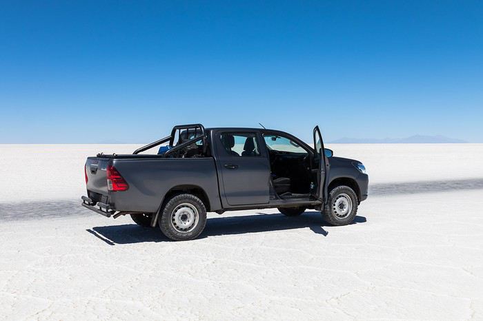 “Our” car, a Toyota Hilux
While planning, we realized the presidential elections would happen while we were in Bolivia. The risk of *bloqueos* (roadblocks and protests) was very real. But in Bolivia, *bloqueos* seem common—you always have to account for that kind of hassle. In late August/early September, Uyuni and the Salar region were blocked for days, leading to food, fuel, and cash shortages. Worried about a blockade in Uyuni and missing the Salar, we decided to visit it first *just in case*.
On election day, the whole country shut down. Planes were grounded, buses and taxis couldn’t circulate, and private cars were banned. There were a few exceptions—ambulances, police, or certain professions—but as tourists, we couldn’t get permission to drive. We asked the embassy, and Biz even requested a permit from the electoral office. So we had to plan to be somewhere with things to do *without* the car.
We decided not to book any accommodations in advance—a first for us. Usually, we plan our stops and reserve lodges, hotels, or campgrounds well ahead. This time, only the room in Sucre was booked, so we’d have a base when we arrived.
In July, Alex (Delhenry) reached out to propose joining part of the trip. He didn’t realize we were leaving in October. Still, we got fresh updates when he returned from the South Lipez. Thanks, Alex—your tips, especially about the Guadalupe–Tupiza stretch, were *super* useful.
In September, we connected with Jean-Louis (Avx) and Anne (Xeta), who were also heading to Bolivia in October, one and two weeks after us. We had dinner with Jean-Louis and his friend after our South Lipez trip and stayed in touch with Anne. It was great to chat with them! Unfortunately, Anne and her husband had a much rockier trip—they got hit hard by post-election issues.
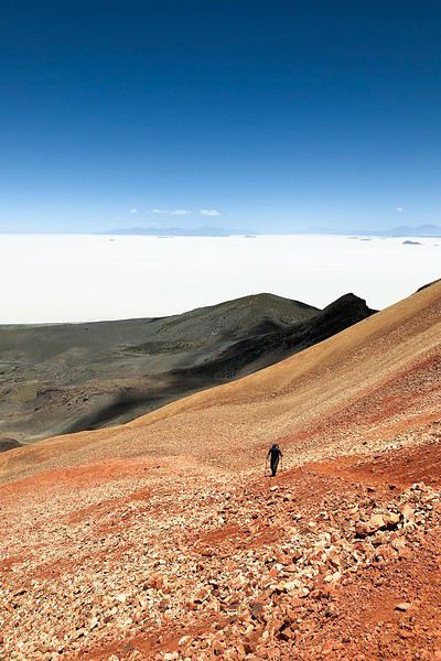 Climbing Volcán Tunupa
Our itinerary wasn’t set in stone—we decided to wing it on the spot. Two weeks before departure, I reconnected with Alejandra at Biz to move the car rental up by a day. With the elections, we wanted to leave Sucre ASAP and focus on the South Lipez. Outside Uyuni and Tupiza, the risk of blockades was zero. We also planned a two-night buffer in Sucre before our flights, just in case. It might sound overcautious, but in hindsight, we made the right call. If we’d left Sucre a day later, we wouldn’t have made it to Potosí—it was completely blocked. On the way back, we *just* dodged blockades in Potosí and elsewhere. Sometimes, you’ve gotta trust your gut.
Here’s our route—only the first two nights in Sucre were booked ahead:
D1 Departure from Switzerland
D2 Sucre (La Selenita)
D3 Sucre (La Selenita)
D4 Colchani (Hotel de Sal Luna Salada)
D5 Jirira (Auberge Doña Lupe)
D6 On the Salar (in the car)
D7 A few kilometers from Estancia Catal (in the car)
D8 Laguna Hedionda (Hotel Los Flamencos)
D9 Laguna Colorada (Lodge by the lagoon)
D10 Middle of nowhere, en route Laguna Verde–Mina Horsu–Quetena Chico (in the car)
D11 Quetena Chico (Lamphaya Lodge Andino)
D12 Quetena Chico (Lamphaya Lodge Andino)
D13 Guadalupe (Guest room at Celia’s)
D14 Along the Rio Grande (in the car)
D15 Tupiza (Hotel Mitru)
D16 Tupiza (Hotel Mitru)
D17 Sucre (La Selenita)
D18 Sucre (La Selenita)
D19 Santa Cruz (Hotel Sun)
D20 Departure from Santa Cruz
D21 Arrival in Switzerland
As you can see, we spent 13 nights in the South Lipez. Initially, we’d planned for nine, but Jean-François (Max68) suggested staying longer. Great advice—we didn’t regret it one bit. We could’ve even added 2–3 more days without getting bored.
Self-driving in the South Lipez takes some prep and a good GPS. We kept it simple and used maps.me to navigate. It’s a solid app—just save your waypoints ahead of time. For some stretches, I used Google Earth to visualize the tracks and sites. If you stick to the tour operator routes, you *almost* can’t get lost. But we often veered off the beaten path and took different routes. Some days, we didn’t see another car. So in case of a breakdown, it’s key to have water and food for several days. In some spots, there’s *zero* signal—your phone won’t work. Another must: it gets *cold* in the South Lipez, and a good sleeping bag is essential. We brought down sleeping bags rated for -10°C and didn’t regret it during our car nights.
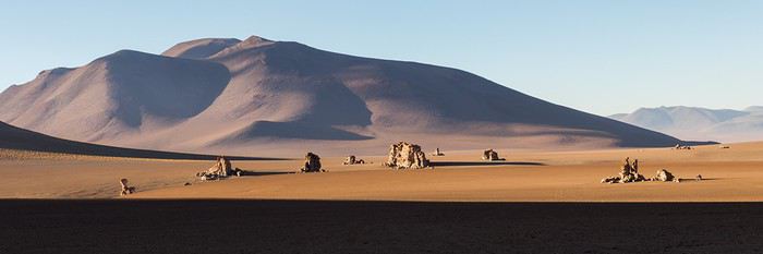 The Dalí Desert
Some tracks are *super* rocky—flat tires are a real risk. On those stretches, maps.me’s estimated travel time was way off. Some sections barely let us go over 15 km/h.
Lots of forum members recommend doing the South Lipez “loop” from Tupiza to Uyuni—ending with the Salar—to avoid Uyuni’s crowds. That might work for organized tours, but for self-drive, the direction *doesn’t* matter. I’ll say this: the few vehicles we saw mostly came from Tupiza and Chile, not Uyuni. So if starting from Uyuni works better for you, go for it! Ending in Tupiza means heading toward warmer weather. For our planned stops and climbs, starting in Uyuni helped with acclimatization. Spending a few nights between 3,600–3,800 m before going over 4,000 m is a smart move.
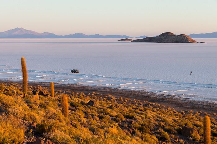 Uyuni Salt Flats in the morning
Overall, we barely saw anyone—except at Laguna Hedionda and Chalviri. There were several tour groups at Hotel Los Flamencos (Laguna Hedionda), but we didn’t cross paths during the day. Hardly anyone on the Salar, on the roads, or at the lodges in the evenings. The *only* place that shocked us was Chalviri. We’d planned to stay there, but it was fully booked—and we counted *forty* tour jeeps on-site. This was around noon! At the Polques hot springs (Chalviri), it was *packed*—we quickly nixed the idea of a dip. Plus, the vibe wasn’t great: soaking right by the road with lodges and restaurants in the background? Meh. Still, lots of tourists love it, so it’s up to you.
For the photos, I kept the colors and mood we saw. The lagoons’ hues are often stunning, but some online photos are *way* over-edited and oversaturated. The South Lipez’s landscapes are breathtaking—no need for excessive retouching.
If you don’t want to read all the details, the start of the travel journal is here: https://voyageforum.com/v.f?post=9888761;a=9888761
The idea of traveling to Bolivia came to me after seeing Jean-François (Max68)’s photos on his website. I thought we *had* to see those stunning landscapes with the colorful lagoons for ourselves. But a self-drive trip didn’t seem doable at first. A few years ago, everyone advised against going to the South Lipez with just one car.
Laguna KaraIt was only after reading Laurent (Lolobe) and Pascal (Pepe874)’s travel journals—who explored the South Lipez solo with a car from Biz Rent a Car—that I thought we might be able to do the same. Meanwhile, we’d already contacted a local agency to organize a trip with a driver and guide. But the idea of a self-drive adventure really appealed to us. With encouragement and tips from Thierry (Tbernay) and Jean-François (Max68), we decided to plan our own self-drive trip. I’d like to thank them for their advice—it was *super* helpful. And a big thanks to all the other forum members for the info shared during our prep!
Laguna ColoradaPlanning this trip happened during a tough time for our family. My mother-in-law’s illness and passing, plus a few health issues of my own, made us doubt the trip multiple times and nearly scrap the whole thing.
We booked our international flights in February with Swiss. They offered the best balance of travel time and price from Switzerland. Swiss operates Zurich–São Paulo with their own fleet, and São Paulo–Santa Cruz with GOL. In June, GOL canceled the Saturday flight and rebooked us on Sunday. Spending over 24 hours in that huge Brazilian city didn’t work for us at all, so we asked Swiss to put us on the next Zurich–São Paulo flight. Too bad—we lost a day in Bolivia and had to skip the Tarabucco market on Sunday.
Right after, we also booked the car in February. After contacting Imbex and Biz, we went with Biz. Not speaking Spanish, we were relieved to communicate with Alejandra in French. The contact was great—she answered all our questions patiently. Sometimes it took a few days to get a reply, but we could also reach her on WhatsApp. After our trip, we can *only* recommend Biz for rentals in Bolivia. The cars are well-prepped for the South Lipez tracks. The agency is reliable, and the vehicles are new and well-maintained.
“Our” car, a Toyota HiluxWhile planning, we realized the presidential elections would happen while we were in Bolivia. The risk of *bloqueos* (roadblocks and protests) was very real. But in Bolivia, *bloqueos* seem common—you always have to account for that kind of hassle. In late August/early September, Uyuni and the Salar region were blocked for days, leading to food, fuel, and cash shortages. Worried about a blockade in Uyuni and missing the Salar, we decided to visit it first *just in case*.
On election day, the whole country shut down. Planes were grounded, buses and taxis couldn’t circulate, and private cars were banned. There were a few exceptions—ambulances, police, or certain professions—but as tourists, we couldn’t get permission to drive. We asked the embassy, and Biz even requested a permit from the electoral office. So we had to plan to be somewhere with things to do *without* the car.
We decided not to book any accommodations in advance—a first for us. Usually, we plan our stops and reserve lodges, hotels, or campgrounds well ahead. This time, only the room in Sucre was booked, so we’d have a base when we arrived.
In July, Alex (Delhenry) reached out to propose joining part of the trip. He didn’t realize we were leaving in October. Still, we got fresh updates when he returned from the South Lipez. Thanks, Alex—your tips, especially about the Guadalupe–Tupiza stretch, were *super* useful.
In September, we connected with Jean-Louis (Avx) and Anne (Xeta), who were also heading to Bolivia in October, one and two weeks after us. We had dinner with Jean-Louis and his friend after our South Lipez trip and stayed in touch with Anne. It was great to chat with them! Unfortunately, Anne and her husband had a much rockier trip—they got hit hard by post-election issues.
Climbing Volcán TunupaOur itinerary wasn’t set in stone—we decided to wing it on the spot. Two weeks before departure, I reconnected with Alejandra at Biz to move the car rental up by a day. With the elections, we wanted to leave Sucre ASAP and focus on the South Lipez. Outside Uyuni and Tupiza, the risk of blockades was zero. We also planned a two-night buffer in Sucre before our flights, just in case. It might sound overcautious, but in hindsight, we made the right call. If we’d left Sucre a day later, we wouldn’t have made it to Potosí—it was completely blocked. On the way back, we *just* dodged blockades in Potosí and elsewhere. Sometimes, you’ve gotta trust your gut.
Here’s our route—only the first two nights in Sucre were booked ahead:
D1 Departure from Switzerland
D2 Sucre (La Selenita)
D3 Sucre (La Selenita)
D4 Colchani (Hotel de Sal Luna Salada)
D5 Jirira (Auberge Doña Lupe)
D6 On the Salar (in the car)
D7 A few kilometers from Estancia Catal (in the car)
D8 Laguna Hedionda (Hotel Los Flamencos)
D9 Laguna Colorada (Lodge by the lagoon)
D10 Middle of nowhere, en route Laguna Verde–Mina Horsu–Quetena Chico (in the car)
D11 Quetena Chico (Lamphaya Lodge Andino)
D12 Quetena Chico (Lamphaya Lodge Andino)
D13 Guadalupe (Guest room at Celia’s)
D14 Along the Rio Grande (in the car)
D15 Tupiza (Hotel Mitru)
D16 Tupiza (Hotel Mitru)
D17 Sucre (La Selenita)
D18 Sucre (La Selenita)
D19 Santa Cruz (Hotel Sun)
D20 Departure from Santa Cruz
D21 Arrival in Switzerland
As you can see, we spent 13 nights in the South Lipez. Initially, we’d planned for nine, but Jean-François (Max68) suggested staying longer. Great advice—we didn’t regret it one bit. We could’ve even added 2–3 more days without getting bored.
Self-driving in the South Lipez takes some prep and a good GPS. We kept it simple and used maps.me to navigate. It’s a solid app—just save your waypoints ahead of time. For some stretches, I used Google Earth to visualize the tracks and sites. If you stick to the tour operator routes, you *almost* can’t get lost. But we often veered off the beaten path and took different routes. Some days, we didn’t see another car. So in case of a breakdown, it’s key to have water and food for several days. In some spots, there’s *zero* signal—your phone won’t work. Another must: it gets *cold* in the South Lipez, and a good sleeping bag is essential. We brought down sleeping bags rated for -10°C and didn’t regret it during our car nights.
The Dalí DesertSome tracks are *super* rocky—flat tires are a real risk. On those stretches, maps.me’s estimated travel time was way off. Some sections barely let us go over 15 km/h.
Lots of forum members recommend doing the South Lipez “loop” from Tupiza to Uyuni—ending with the Salar—to avoid Uyuni’s crowds. That might work for organized tours, but for self-drive, the direction *doesn’t* matter. I’ll say this: the few vehicles we saw mostly came from Tupiza and Chile, not Uyuni. So if starting from Uyuni works better for you, go for it! Ending in Tupiza means heading toward warmer weather. For our planned stops and climbs, starting in Uyuni helped with acclimatization. Spending a few nights between 3,600–3,800 m before going over 4,000 m is a smart move.
Uyuni Salt Flats in the morningOverall, we barely saw anyone—except at Laguna Hedionda and Chalviri. There were several tour groups at Hotel Los Flamencos (Laguna Hedionda), but we didn’t cross paths during the day. Hardly anyone on the Salar, on the roads, or at the lodges in the evenings. The *only* place that shocked us was Chalviri. We’d planned to stay there, but it was fully booked—and we counted *forty* tour jeeps on-site. This was around noon! At the Polques hot springs (Chalviri), it was *packed*—we quickly nixed the idea of a dip. Plus, the vibe wasn’t great: soaking right by the road with lodges and restaurants in the background? Meh. Still, lots of tourists love it, so it’s up to you.
For the photos, I kept the colors and mood we saw. The lagoons’ hues are often stunning, but some online photos are *way* over-edited and oversaturated. The South Lipez’s landscapes are breathtaking—no need for excessive retouching.
If you don’t want to read all the details, the start of the travel journal is here: https://voyageforum.com/v.f?post=9888761;a=9888761