Results for "Norvège+souvenir+artisanat"
About 6,679 results.
More options
Many results are in French, the community’s main language. English translations are added over time.
Search results
Oslo, Cap Nord, Helsinski en deux mois à vélo: est-ce réalisable?
Salut a tous, est il possible de faire Oslo Cap Nord Helsinski en 2mois a velo? Mon projet serait de remonter la cote ouest de la norvege a velo( je sais c'est loin d'être plat) mais je prends le risque de souffrir sur ma selle pour ne pas manquer les fjord! Je pense que remonter la Norvege en un mois est faisable! J'aurais voulu savoir egalement le climat debut aout au Cap Nord?? on se caille vraiment ou avec une bonne polaire c'est bon? et redescendre par le pays aux 1000 lacs la finlande? est ce realisable comme projet ou totalement utopique? Sachant que j'ai une tres bonne condition physique, une motivation enorme et un zest de folie! J'attend vos reponses! et bon vent a tous!
Croisière Hurtigruten en Norvège mi-novembre
Bonjour!!
nous envisageons de partir en croisiere avec l' Hurtigruten vers mi novembre.
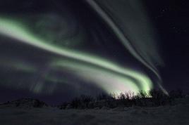
Nous ne sommes pas surs que ce soit le bon moment pour y aller car nous avons lu que les jours sont tres courts et les aurores boreales pas toujours au rendez vous. Quelqu'un y est il allé à cette pèriode et pourrai nous renseigner? Merci d'avance pour vos conseils Marnu
Nous ne sommes pas surs que ce soit le bon moment pour y aller car nous avons lu que les jours sont tres courts et les aurores boreales pas toujours au rendez vous. Quelqu'un y est il allé à cette pèriode et pourrai nous renseigner? Merci d'avance pour vos conseils Marnu
Trois jours au Spitzberg mi-septembre
Bonjour à tous
Je suis entrain d'organiser un voyage en Norvège et je termine par 3 jours au Spitzberg du 14 au 17 septembre J'aimerais savoir si le circuit que je veux faire est possible parce que j ai trouve bcq d'excursion mais pas celle que je veux faire
J'aimerais la première journée aller voir la ville de Barentsburg (matin) et puis reprendre un bateau de la pour Pyramiden (L'apres midi) Et la 2éme journée aller à Ny Alensud et faire un petit trek dans les environs Je sais pas si on peut rester sur place le temps de visiter chaque ville (une heure par ville minimum)
Je ne trouve pas de renseginement sur les differents bateaux qu'il faudra pour rejoindre les villes (le temps qu'il faut pour aller à chaque ville ni les prix)
Merci à tous
Je suis entrain d'organiser un voyage en Norvège et je termine par 3 jours au Spitzberg du 14 au 17 septembre J'aimerais savoir si le circuit que je veux faire est possible parce que j ai trouve bcq d'excursion mais pas celle que je veux faire
J'aimerais la première journée aller voir la ville de Barentsburg (matin) et puis reprendre un bateau de la pour Pyramiden (L'apres midi) Et la 2éme journée aller à Ny Alensud et faire un petit trek dans les environs Je sais pas si on peut rester sur place le temps de visiter chaque ville (une heure par ville minimum)
Je ne trouve pas de renseginement sur les differents bateaux qu'il faudra pour rejoindre les villes (le temps qu'il faut pour aller à chaque ville ni les prix)
Merci à tous
Norvège: coût du tunnel Mageroya en camping-car?
Bonjour à tous,
nous partons prochainement en Norvège avec un camping car dont la longueur est inférieure à 6 métres. Nous n'arrivons pas à trouver le coût du tunnel de Mageroya qui méne au Cap Nord pour notre véhicule. Quelqu'un peut-il nous aider ? Merci, Anita
nous partons prochainement en Norvège avec un camping car dont la longueur est inférieure à 6 métres. Nous n'arrivons pas à trouver le coût du tunnel de Mageroya qui méne au Cap Nord pour notre véhicule. Quelqu'un peut-il nous aider ? Merci, Anita
Croisière Hurtigruten en Norvège au mois d'avril
Bonjour,
Nous envisageons une croisière Hurtigruten en Norvège (Bergen-Kirkenes-Bergen) par l'Express Côtier et ce pour 2009. Notre choix s'est porté sur la croisière demi-pension en avril, voire tout début mai. Nous aimerions avoir des infos sur ce voyage et la façon de l'aborder bien que nous ayons déjà contacté l'agence de voyage mais il est toujours intéressant d'avoir des avis extérieurs : excursions indispensables, possibilité de faire des visites lors des escales (hors excursion), etc ... enfin tout ce que vous pourrez nous dire sur cette destination et l'ambiance à bord, y compris les points négatifs. De plus, et dans la mesure du possible, nous souhaiterions être à bord d'un bateau de petite capacité.
Merci à tous ceux et celles qui pourront nous répondre.
Mireille0711
Croisière au Cap Nord (Norvège)
Nous partons le 14 juillet 2008 pour une croisière : Cap Nord, Spitzberg, islande sur le princess Danaé.nous sommes à la recherche d' informations concernant les escales, , le bateau.Nous partons avec 2 de nos fils de 15 et 10 ans. Merci d'avance pour nous faire partager vos expériences et vos conseils pratiques.
Circuit en Norvège à la fin août
Bonjour,
Je pars fin août en Norvège pour une semaine. Je souhaiterais faire Oslo et la région de Bergen autour.
Sur un guide, ils proposent le circuit suivant pour une semaine (voir ci-dessous) mais ça me parait un peu juste de faire tout ça en une semaine.
Pourriez-vous me dire pour ceux qui connaissent si c'est réalisable et sinon que privilégier? Sinon j'hésite entre une location de voiture (mais l'essence est à 1, 60 euros le litre je crois) ou un combinatour (pass bateau, train, bus). Est-ce que vous sauriez pour ce genre de parcours ce qui revient le moins cher comme transport?
Merci! :-) Premier jour = Oslo, L'Akershus Festning (château, musée de la Résistance et musée des Forces armées), le Munchmuseet, l'Historiskmuseum, le musée des Beaux Arts ; dîner à Aker Brygge Deuxième jour = La prequ'île de Bygdoy : musée du Framm, musée Kon Tiki, musée de la Marine, musée Viking, Norsk Folkemuseum Troisième jour = la Route du Numedal d’Oslo à Bergen (500 km) : Kongsberg : le Nusée national des Mines de Norvège, l'église / L'église en bois-debout de Rollag, celle de Rolle et celle de Uvdal / Geilo / Eidfjord Quatrième jour = Bergen : Le marché au poisson et aux fruits, le quai de Bryggen et le Musée hanséatique, Mariakirken, le musée d'Art, la colline Floyfjellet (télésiège), l'aquarium Cinquième jour = départ pour les Fjords jusqu'à Trondheim (jours 5, 6, 7), Voss : Folkemuseum, La ligne ferroviaire Myrdal, Flam Sixième Deuxième jour = Croisière sur le Naeroyfjord, Visite des nombreuses églises en bois debout dans les environs, Breheimsenteret (le centre glaciaire), Fjaerland : musée des glaciers, Balestrand Septième jour = Stryn, Olden : le glacier de Briksdal, Geiranger Fjord et Dalsnibba, retour vers Oslo par la route de l'est par Dombas et Lillehammer
Je pars fin août en Norvège pour une semaine. Je souhaiterais faire Oslo et la région de Bergen autour.
Sur un guide, ils proposent le circuit suivant pour une semaine (voir ci-dessous) mais ça me parait un peu juste de faire tout ça en une semaine.
Pourriez-vous me dire pour ceux qui connaissent si c'est réalisable et sinon que privilégier? Sinon j'hésite entre une location de voiture (mais l'essence est à 1, 60 euros le litre je crois) ou un combinatour (pass bateau, train, bus). Est-ce que vous sauriez pour ce genre de parcours ce qui revient le moins cher comme transport?
Merci! :-) Premier jour = Oslo, L'Akershus Festning (château, musée de la Résistance et musée des Forces armées), le Munchmuseet, l'Historiskmuseum, le musée des Beaux Arts ; dîner à Aker Brygge Deuxième jour = La prequ'île de Bygdoy : musée du Framm, musée Kon Tiki, musée de la Marine, musée Viking, Norsk Folkemuseum Troisième jour = la Route du Numedal d’Oslo à Bergen (500 km) : Kongsberg : le Nusée national des Mines de Norvège, l'église / L'église en bois-debout de Rollag, celle de Rolle et celle de Uvdal / Geilo / Eidfjord Quatrième jour = Bergen : Le marché au poisson et aux fruits, le quai de Bryggen et le Musée hanséatique, Mariakirken, le musée d'Art, la colline Floyfjellet (télésiège), l'aquarium Cinquième jour = départ pour les Fjords jusqu'à Trondheim (jours 5, 6, 7), Voss : Folkemuseum, La ligne ferroviaire Myrdal, Flam Sixième Deuxième jour = Croisière sur le Naeroyfjord, Visite des nombreuses églises en bois debout dans les environs, Breheimsenteret (le centre glaciaire), Fjaerland : musée des glaciers, Balestrand Septième jour = Stryn, Olden : le glacier de Briksdal, Geiranger Fjord et Dalsnibba, retour vers Oslo par la route de l'est par Dombas et Lillehammer
Le Cap Nord en Norvège
bonjour,
Je pars en norvege cet été et je compte terminer mon periple au cap nord. Mais j'ai lu plusieurs articles qui disent que le site est vraiment nul .
Qu'en pensez vous ? Ca vaut vraiment le detour ?
Voila j'attend vos avis.
P.S: Pour rentrer du cap nord quel est le meilleur trajet. Retour vers BODO puis OSLO ? Narvik - Stockholm? Ou par la finlande?
Je pars en norvege cet été et je compte terminer mon periple au cap nord. Mais j'ai lu plusieurs articles qui disent que le site est vraiment nul .
Qu'en pensez vous ? Ca vaut vraiment le detour ?
Voila j'attend vos avis.
P.S: Pour rentrer du cap nord quel est le meilleur trajet. Retour vers BODO puis OSLO ? Narvik - Stockholm? Ou par la finlande?
Croisière dans les fjords de la Norvège sur le Costa Classica
Nous envisageons une croisière sur la Costa Classica et aimerions avoir votre avis sur le bateau (nourriture, confort, animation...)
d'autre part, le départ est de Kiel, donc si vous avez pris l'avion jusqu'à Hambourg, comment avez vous fait pour vous rendre ensuite à Kiel (train ?)
Avez vous des conseils de visite à faire soi même à Stavanger, Eidfjord, Rosendal, Bergen, Vik, Flam.
Pour le petit train à Vik. pouvons nous le prendre par nos propres moyens ?
Merci pour vos réponses et vos conseils
Norvège à moto en juillet 2007
Bonjour,
Nous partons en Norvège à moto cet été (2 semaines)
Nous partons de la Belgique, avec une étape au Danemark avant de prendre le ferry à Hirtshals pour Bergen.
Y a-t-il des membres VF qui ont déjà fait ce genre de périple (nous prévoyaons de faire la "Norvège des fjords", peut-être jusque Alesund et Kristiansund...) ?
Merci d'avance pour les bons plans logements et autre 😉
Norvège en été 2007: tunnels interdits aux vélos
😉 Bonjour à tous les amoureux de cyclocamping !
Je recherche pour un voyage cet été en Norvège la liste des tunnels interdits aux vélos dans la région Nordsland ainsi que des informations sur les vols qui nous permettraient d'atteindre Bodo de Paris, sans trop de problème.... histoire d'avoir le temps de récupérer nos vélos entre deux vols... 😛 Merci à tous
Pamicafa
Je recherche pour un voyage cet été en Norvège la liste des tunnels interdits aux vélos dans la région Nordsland ainsi que des informations sur les vols qui nous permettraient d'atteindre Bodo de Paris, sans trop de problème.... histoire d'avoir le temps de récupérer nos vélos entre deux vols... 😛 Merci à tous
Pamicafa
Norvège (Cap Nord) à moto
Bonjour
Pour tous les amoureux de ce beau pays, voici quelques pages racontant mon aventure à moto au milieu des fjords et des rennes jusqu' au cap nord
http://www.trackandroad.net/Cap_Nord_2005.html
Si d'autres seraient tentés par l'aventure l'été prochain, n'hésitez pas à me poser vos questions !!
Merci 🙂
Thomas
Pour tous les amoureux de ce beau pays, voici quelques pages racontant mon aventure à moto au milieu des fjords et des rennes jusqu' au cap nord
http://www.trackandroad.net/Cap_Nord_2005.html
Si d'autres seraient tentés par l'aventure l'été prochain, n'hésitez pas à me poser vos questions !!
Merci 🙂
Thomas
Norvège du Nord en août
Bonjour à tous les fans de Laponie,
Je vais en août passer quelques jours à Alta et Tromso. Je suis à pied (ou en vélo). Je voulais un peu connaître les bons plans dans ce coin, que ce soit au niveau bouffe, logements, randos pédestres ou vélos, coins savages coups de coeurs, transports d'Alta à Tromso, bus pour aller d'Alta au Cap Nord...
Même si j'ai cru comprendre que le Cap Nord, c'était pas top, je me disais tant qu'à être en Laponie, c'est peut-être con de pas y passer. En plus je parle du vrai Cap nord, pas le Cap Nord à touristes...
Voilà, merci bien de vos conseils.
Bonne semaine à tous.
PS : Pour les aéroports (que ce soit Alta ou Tromso) ils sont prêts des villes?
Je vais en août passer quelques jours à Alta et Tromso. Je suis à pied (ou en vélo). Je voulais un peu connaître les bons plans dans ce coin, que ce soit au niveau bouffe, logements, randos pédestres ou vélos, coins savages coups de coeurs, transports d'Alta à Tromso, bus pour aller d'Alta au Cap Nord...
Même si j'ai cru comprendre que le Cap Nord, c'était pas top, je me disais tant qu'à être en Laponie, c'est peut-être con de pas y passer. En plus je parle du vrai Cap nord, pas le Cap Nord à touristes...
Voilà, merci bien de vos conseils.
Bonne semaine à tous.
PS : Pour les aéroports (que ce soit Alta ou Tromso) ils sont prêts des villes?
Croisière dans les fjords (Norvège) à bord du Lirica
Bonjour à toutes et tous,
Nous partons au mois d'aout à bord du Lirica pour une croisière dans les fjords en Norvège.
départ de Copenhague, canal de Kiel, Oslo, Stavanger, Flam, Geiranger et retour
Ce sera pour nos une première découverte de la norvège.
Nous aimerions avoir plus d'informations sur les possibilités d'excursions. que faire et que voir? et comment le faire? La compagnie de croisière propose des excursions qui semblent plutôt chères Au port en escale y a t'il possibilité d'organiser par taxi ou autre une excursion "personnalisée" Ou bien vaut il mieux acheter ses excursions de la Cie de croisière à bord?
Merci
Ce sera pour nos une première découverte de la norvège.
Nous aimerions avoir plus d'informations sur les possibilités d'excursions. que faire et que voir? et comment le faire? La compagnie de croisière propose des excursions qui semblent plutôt chères Au port en escale y a t'il possibilité d'organiser par taxi ou autre une excursion "personnalisée" Ou bien vaut il mieux acheter ses excursions de la Cie de croisière à bord?
Merci
Gastronomie norvégienne
Nous envisageons d'aller en Norvège cet été. Existe-t-il des spécialités culinaires intéressantes, de bonnes adresses de restaurants et de magasins d'alimentation remarquables ?
Norvège à vélo: difficultés des routes, campings, vol intérieur
Bonjour à tous,
je suis nouveau sur ce forum, j'ai lu avec grande attention tous vos posts sur la norvège à vélo, j'ai pourtant encore quelques interrogations : où puis-je savoir les détours possibles à effectuer en vélo pour eviter les tunnels (internet, brochures ...) ? connaissez vous des brochures ou des sites répertoriant les rorbus et les campings en Norvège ? Pendant la période estivale est-il préférable de réserver depuis la France ou bien y'a-t-il toujours de la place de libre ? concernant les routes : j'ai passé le Parc des Grands Jardins et le Fjord du Saguenay l'année passée au Québec avec des côtes jusqu'à 18 et 19% (photos à l'appui), et inutile de vous direque le plaisir du cyclotourisme s'estompe très rapidement 😛 !!! S'agit-il de la même chose en Norvège ??? Je compte faire les îles du Nord et la région des fjords vers Bergen et Stavanger. Je compte prendre un vol interieur entre Tromso et Bergen avec obligatoirement une escale à Oslo, et ce avec nos vélos !!!! Quelqu'un l'a-t-il déjà fait ??? Si oui, ça se passe comment (pour les vélos biensûr !!!) ???
Merci d'avance.
Greg
je suis nouveau sur ce forum, j'ai lu avec grande attention tous vos posts sur la norvège à vélo, j'ai pourtant encore quelques interrogations : où puis-je savoir les détours possibles à effectuer en vélo pour eviter les tunnels (internet, brochures ...) ? connaissez vous des brochures ou des sites répertoriant les rorbus et les campings en Norvège ? Pendant la période estivale est-il préférable de réserver depuis la France ou bien y'a-t-il toujours de la place de libre ? concernant les routes : j'ai passé le Parc des Grands Jardins et le Fjord du Saguenay l'année passée au Québec avec des côtes jusqu'à 18 et 19% (photos à l'appui), et inutile de vous direque le plaisir du cyclotourisme s'estompe très rapidement 😛 !!! S'agit-il de la même chose en Norvège ??? Je compte faire les îles du Nord et la région des fjords vers Bergen et Stavanger. Je compte prendre un vol interieur entre Tromso et Bergen avec obligatoirement une escale à Oslo, et ce avec nos vélos !!!! Quelqu'un l'a-t-il déjà fait ??? Si oui, ça se passe comment (pour les vélos biensûr !!!) ???
Merci d'avance.
Greg
Votre avis sur itinéraire en Norvège et déplacements
Bonjour, nous sommes une bande de copains (6) a partir en Norvège, dans 1 mois. On a juste pris les billets d'avion pour Oslo. Je voudrais des infos sur ce pays, meme si j'en ai deja pas mal, (vie chere, froid, nature etc...), et plein d'autres renseingnements concernant le transport en Norvège, car ceux ci determinera notre parcours pour ces 8 jours. On voudrait faire ce parcours en 8 jours, dites moi ce que vous en pensez : 3 JOURS OSLO (visites musées + ski ), puis départ pour Bergen (je voudrais bien des infos sur cette ville aussi svp) avec le train qui relie OSLO BERGEN (Prix?), puis rester a Bergen ballader 2, 3 jours, puis rentrer a Oslo pour enfin repartir. Voila dites moi vos suggestions, remarques, n'hésitez pas, je suis interressé par toute personne ayant deja été en Norvège, toutes les infos que je peux prendre me satisferont, merci d'avance, cieuuuuuuuuuu !😎
Spitsbergen – A Night with the Walruses on Lågøya
Spitsbergen, 80° North latitude. A lost archipelago on the edge of the world, northeast of Greenland, the last lands before the pole. I’m aboard the *Grigoriy Mikheev*, a Russian ship from the Murmansk Polar Research Institute. Russian flag, Russian crew. Chartered by OceanWide Expeditions.
Last night, we were stuck in drifting pack ice in the long Hinlopen Strait. This incident led to an unforgettable barbecue and party on the ship’s foredeck, but we had to abandon our plan to head south and circle Spitsbergen. This summer, there’s too much ice in the strait, and it’s too thick. At dawn, the tide turned, allowing us to break free and head north again. The ship is now moving slowly through sea ice density that satellite maps estimate at around five-tenths. Our progress is punctuated by dull thuds: the ship’s bow constantly shoves and fractures enormous ice floes.
At breakfast, Tarik, our expedition leader, informs us that our program will be significantly altered. Since we can’t cross the strait, we’ll turn back and head north. To kick off our Plan B, Tarik plans a landing tonight on the small island of Låg (Lågøya), at 80°10' North. Last summer, he saw a large walrus colony there and hopes we’ll find them again. The weather is perfect—glorious sunshine—and walruses are truly addicted to sunbathing on the beaches.
We’ve now exited the strait and are sailing far from the coast. In case the walrus colony is there, we don’t want the ship’s approach to scare them into the water before we even see them. So, we scan the shore methodically with binoculars. We pass several bays, round a cape, and examine several shorelines littered with driftwood, but no walruses in sight. Several times, clusters of large rounded rocks trigger false alarms… but no, they’re just rocks…
Suddenly, Tarik spots them through his binoculars! On an isolated peninsula, our expedition leader’s highly trained eye has picked out, among those brown masses, the shape and white color of the enormous tusks of what he calls "the heavyweights of the Arctic!" Now, fifteen or twenty pairs of binoculars are pointed in the indicated direction… Sure enough, I see them now! They’re there, huge, sprawled in the sun on the beach. Without Tarik’s sharp eye, we might have missed them. They’re so tightly packed together that they really look like a mass of brown rocks. Only the white, saber-shaped tusks and the occasional furtive movements hint that they’re animals.
It’s 11 PM, and on the deck of the *Grigoriy Mikheev*, as you can imagine, excitement has ramped up several notches. Several of us have already rushed to our cabins to gear up, pulling on boots and life jackets in anticipation of a landing that promises to be absolutely amazing. Tarik reins in our enthusiasm a bit: Okay, so we were lucky to find them, but now we need to think about how to approach them. Not that they’re dangerous—at least not on land… Their enormous bulk and their pseudo-feet (flippers) only allow for very limited mobility. But when they feel threatened, their first instinct is to head for the water, where their perfect ease keeps them safe. So, the challenge will be not to scare them off, to avoid them bolting into the water in the first few seconds! That’s exactly what would happen if we arrived by Zodiac right in front of them.
So, Tarik decides we’ll make a wide detour to land on the other side of the peninsula where they are. From there, we’ll leave the Zodiacs on the beach and cross the peninsula on foot, about a kilometer and a half. That way, we’ll approach the herd from behind. This approach will also keep us downwind of them. There you go—with a few precautions, they shouldn’t hear us coming or catch our scent.
Everyone is geared up now and practically bursting with impatience… While the Zodiacs are being lowered into the water, Tarik and Delphine recap the approach rules: absolute silence, communication only by signs, no dragging feet on the rocks, watch your step, and strict coordination with slow movements.
Here we go… we’re off now! Spray flying from the Zodiac’s bow, icy air whipping our faces, gloves gripping the side ropes, freezing splashes, pure emotion… Ahh, I love this! We describe a wide curve offshore to round the peninsula. Ahead of us, the magnificent landscape of this intensely blue sea unfolds, with the hills of Lågøya and, in the distance, the ice-covered mountains of Nordaustlandet under the sun. It’s midnight now. In July, at 80 degrees North, the sun is just like midday.
This navigation takes us far from the walruses, on the other side of the cape. Easy landing on a shoreline of large pebbles covered in giant seaweed brought in by the currents. They look like long strips of plastic—sometimes translucent, sometimes white, beige, or orange. In places, there are huge tangled layers of it. Our boots sink into this material, which gives off a strong iodine smell. Unfortunately, there’s also some plastic waste—fishing floats and net debris. Seeing this here is crazy… A little farther on, in a cove, tides and storms have piled up numerous tree trunks from Siberia.
We begin crossing the peninsula on foot, staying close together. We’re walking on a nearly deserted polar tundra. We’re only ten degrees of latitude from the North Pole here. The violent winds and extreme temperatures that dominate this island for nine months of the year allow only a few rare plants to grow, close to the ground, between the rocks. In places, rocks are covered with large patches of black lichen.
Gérard, rifle slung over his shoulder, constantly scans the terrain. Tarik and Delphine are also very vigilant. We know no one ever lands here, and although this environment isn’t ideal for bears, you never know—better to be cautious. The terrain is mostly flat, but whenever a small rise blocks our view, Gérard moves ahead and only signals us to proceed when he’s sure there’s no "big man in fur" (tradition dictates we don’t name the polar bear).
After a few hundred meters, we find an enormous whale vertebra. Judging by the state of the bone, it’s likely a relic from the whaling era that ravaged this area in the 17th century and all over northern Spitsbergen. A little farther on, the remains of a grave catch our attention. The only human trace on this remote island, this burial is surely very old, also likely dating from the whalers’ time. But this whaler’s final resting place didn’t shelter him for long—there’s not much left, just a piece of skull and a few broken bones. Due to the permafrost, the body could only be buried a few dozen centimeters deep, between some planks held in place by large stones. This makeshift grave was probably ravaged by a bear shortly after the burial. Several stone blocks are overturned, the planks are broken open. We only linger for a minute to pay our respects to this whaler, whose poor remains now merge with the mineral landscape.
A slight rise bulges in the center of the peninsula, and here we are at the highest point. If our orientation is correct, we’re heading straight for the walrus colony. A moment of emotion… my heart’s pounding. Yes, they’re there, about three hundred meters ahead of us! They haven’t moved since we spotted them from the *Grigoriy Mikheev*’s deck. They’re sprawled in a heap, packed tightly together in the sun, on the shingle beach. The light breeze blowing in our faces confirms we’re on the right track—not to be sniffed out from afar by the big beasts.
By signs, Tarik tells us we’ll approach slowly, in stages, moving about thirty meters at a time, making as little noise as possible with our boots, then freezing completely for a minute or two, crouching down to let them forget us. This strategy proves excellent. We’re now less than a hundred meters away, and it doesn’t seem like our presence is perceived as a threat by the "heavyweights of the Arctic." At this distance, let’s not kid ourselves: we’re certainly spotted, but our way of approaching must seem reassuring—or at least manageable—since they’re only a few meters from the water and know they could dash into it in seconds if they felt the need.
We now advance in shorter stages—twenty meters at a time, then just ten, crouching, then freezing like statues, our breathing nearly held from emotion and concentration. We’re now thirty meters from the mastodons. Our presence must be starting to stress them because they’re moving more. While still sprawled against each other, some suddenly rear up on their flipper-feet, grunting and snorting like monstrous pigs. Their head shakes make their two enormous ivory sabers sway. They jab them into the fat of their neighbors, who in turn stir and emit irritated snorts.
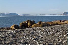
At Tarik’s signal, we move a few more meters, "on velvet paws"… We’re right there now. I hold my breath, throat tight… Intense emotion, a fantastic spectacle—these enormous Arctic animals sprawled in the sun, with the magnificent backdrop of snow-covered mountains across the sound. I think to myself: *I’m here… this can’t be real!* It’s nearly 2 AM now, the air is crystal clear, and the Arctic sun bathes this scene in what might be the most beautiful light I’ve ever seen. We’re about fifteen meters away now. Tarik signals that we won’t go any closer. The walruses are still lying down, but occasionally, our close presence and the clicking of cameras trigger bouts of agitation that ripple through the herd, causing some jostling. They’re so tightly packed and tangled that it’s a bit hard to count them. In the end, we tally sixteen, plus one "little one," half-crushed in the general mass.
Seen from here, they’re truly impressive! The "sumo wrestlers of the Arctic!" According to Tarik, they must weigh about a ton—slightly more for the males than the females—and the "little one" must already be around 200 kg. When the weather’s nice like today, they love sprawling on the beaches to soak up the sun.
Walruses are marvels of Arctic adaptation. They can modify their blood circulation depending on thermal conditions. They withstand extreme cold by directing most of their circulation to vital organs (heart, lungs) and minimizing peripheral blood flow (skin and limbs) to prevent heat loss. Conversely, when they sunbathe, they direct most of their blood flow to the skin, turning themselves into true solar collectors.
At this latitude, there’s practically no difference in sunlight between day and night. Noon or midnight, the sun’s angle barely changes. Walruses make the most of these fair-weather phases by sprawling in the sun 23 hours out of 24… Enough to make siesta lovers dream, right? Twenty-three hours of lounging… and the twenty-fourth for eating!
And when we say "eating," what a feast! The proverb *"Who sleeps dines"* is fully justified here: when a walrus decides to feed, it gulps down between 50 and 60 kg of shellfish in an hour! Its food consists of large bivalve mollusks, which it tears from the seabed with its tusks and sucks up nonstop! A 50 kg meal certainly justifies a 23-hour nap for digestion, right? And speaking of digestion—it’s what the "big guys" in front of us are doing right now! You might wonder how we know this… Well, I’ll tell you: if you were here, downwind (or should I say *down the winds!*) of these marine giants, you’d have no doubt! Pfft… what flatulence! I can confirm that today’s scent is called *"Morsanus, from the North"* (*"Because I’m worth it!"*). Mmm, yeah… Tarik, you had a great idea putting us upwind… at least *they* can’t smell us, but we sure can!
But… heepp! Delphine discreetly signals to get our attention—she’s just spotted something: in the smooth water of the bay, a small V-shaped ripple runs along the beach, then turns toward the shore… So the colony wasn’t complete on the beach… Here’s an 800 kg bather stepping ashore now, right before our astonished eyes! She lifts her head and stays like that for a long moment, her enormous tusks half out of the water. She looks exhausted, resting a bit before coming out. Or more likely, she’s hesitating to climb onto the beach because she’s seen us… The shapeless head stays still for a moment, then violently snorts like a clogged drain! A misshapen head where you can’t make out anything that usually makes a head! No eyes, no ears, no mouth… A sort of monstrous cabbage! But the temptation to join the warmth of the "sunbathers" is too strong! Here’s our pachyderm bather climbing the few meters of the shore and sprawling right in the middle of her companions, who greet her with jostling, grunts, and tusk jabs! Then everything settles back into order—800 kg of fat and flesh added to the fifteen or so tons of local biomass. Welcome to the club!
It seems the walruses have gotten a bit used to us now. They’re moving and grunting much less. I realize it wasn’t obvious to approach them like this without scaring them into the water… It’s thanks to Tarik and Delphine’s advice that we managed it. It’s also, let’s be honest, because we’re all passionate here, and there’s been total discipline and cohesion from the start of this approach.
It’s past 2 AM now—time to head back… We’ll leave them to their wild world, to their life at the beginning of the world. We’re happy to have disturbed them as little as possible and not to have disrupted their nap too much. We leave stealthily, first backing up a few meters, then turning around and crossing the peninsula again, walking slowly, avoiding making noise with our boots as long as we’re still close.
We find the Zodiacs on the shoreline with the giant kelp. The sea is like a lake—easy boarding. We make another wide loop to round the cape, passing offshore. The sharp cold stings my cheeks and ears again—I put my hat back on. The cold—I hadn’t thought about it at all during our encounter with the walruses. In the Zodiac, with the engine noise, no one speaks. The faces and smiles are those of men and women who’ve just crossed an inner frontier—the one that separates dream from reality. But tonight, that frontier was porous, and the dream entered reality.
We return to the *Grigoriy Mikheev*, waiting at anchor. It’s past 3 AM, but I don’t feel any fatigue. A few minutes later, I’m in my bunk, rocked by a gentle swell and the hum of the engines. In the soft warmth of the blanket, a strange sleep overtakes me… A sleep filled with luminous, icy landscapes, with large beasts bearing saber-like tusks. Large beasts that sleep, snore, snort, grunt, and jostle in their sleep… in *my* sleep. An unforgettable memory. It was July 2004, in Spitsbergen.
Chris51.
Last night, we were stuck in drifting pack ice in the long Hinlopen Strait. This incident led to an unforgettable barbecue and party on the ship’s foredeck, but we had to abandon our plan to head south and circle Spitsbergen. This summer, there’s too much ice in the strait, and it’s too thick. At dawn, the tide turned, allowing us to break free and head north again. The ship is now moving slowly through sea ice density that satellite maps estimate at around five-tenths. Our progress is punctuated by dull thuds: the ship’s bow constantly shoves and fractures enormous ice floes.
At breakfast, Tarik, our expedition leader, informs us that our program will be significantly altered. Since we can’t cross the strait, we’ll turn back and head north. To kick off our Plan B, Tarik plans a landing tonight on the small island of Låg (Lågøya), at 80°10' North. Last summer, he saw a large walrus colony there and hopes we’ll find them again. The weather is perfect—glorious sunshine—and walruses are truly addicted to sunbathing on the beaches.
We’ve now exited the strait and are sailing far from the coast. In case the walrus colony is there, we don’t want the ship’s approach to scare them into the water before we even see them. So, we scan the shore methodically with binoculars. We pass several bays, round a cape, and examine several shorelines littered with driftwood, but no walruses in sight. Several times, clusters of large rounded rocks trigger false alarms… but no, they’re just rocks…
Suddenly, Tarik spots them through his binoculars! On an isolated peninsula, our expedition leader’s highly trained eye has picked out, among those brown masses, the shape and white color of the enormous tusks of what he calls "the heavyweights of the Arctic!" Now, fifteen or twenty pairs of binoculars are pointed in the indicated direction… Sure enough, I see them now! They’re there, huge, sprawled in the sun on the beach. Without Tarik’s sharp eye, we might have missed them. They’re so tightly packed together that they really look like a mass of brown rocks. Only the white, saber-shaped tusks and the occasional furtive movements hint that they’re animals.
It’s 11 PM, and on the deck of the *Grigoriy Mikheev*, as you can imagine, excitement has ramped up several notches. Several of us have already rushed to our cabins to gear up, pulling on boots and life jackets in anticipation of a landing that promises to be absolutely amazing. Tarik reins in our enthusiasm a bit: Okay, so we were lucky to find them, but now we need to think about how to approach them. Not that they’re dangerous—at least not on land… Their enormous bulk and their pseudo-feet (flippers) only allow for very limited mobility. But when they feel threatened, their first instinct is to head for the water, where their perfect ease keeps them safe. So, the challenge will be not to scare them off, to avoid them bolting into the water in the first few seconds! That’s exactly what would happen if we arrived by Zodiac right in front of them.
So, Tarik decides we’ll make a wide detour to land on the other side of the peninsula where they are. From there, we’ll leave the Zodiacs on the beach and cross the peninsula on foot, about a kilometer and a half. That way, we’ll approach the herd from behind. This approach will also keep us downwind of them. There you go—with a few precautions, they shouldn’t hear us coming or catch our scent.
Everyone is geared up now and practically bursting with impatience… While the Zodiacs are being lowered into the water, Tarik and Delphine recap the approach rules: absolute silence, communication only by signs, no dragging feet on the rocks, watch your step, and strict coordination with slow movements.
Here we go… we’re off now! Spray flying from the Zodiac’s bow, icy air whipping our faces, gloves gripping the side ropes, freezing splashes, pure emotion… Ahh, I love this! We describe a wide curve offshore to round the peninsula. Ahead of us, the magnificent landscape of this intensely blue sea unfolds, with the hills of Lågøya and, in the distance, the ice-covered mountains of Nordaustlandet under the sun. It’s midnight now. In July, at 80 degrees North, the sun is just like midday.
This navigation takes us far from the walruses, on the other side of the cape. Easy landing on a shoreline of large pebbles covered in giant seaweed brought in by the currents. They look like long strips of plastic—sometimes translucent, sometimes white, beige, or orange. In places, there are huge tangled layers of it. Our boots sink into this material, which gives off a strong iodine smell. Unfortunately, there’s also some plastic waste—fishing floats and net debris. Seeing this here is crazy… A little farther on, in a cove, tides and storms have piled up numerous tree trunks from Siberia.
We begin crossing the peninsula on foot, staying close together. We’re walking on a nearly deserted polar tundra. We’re only ten degrees of latitude from the North Pole here. The violent winds and extreme temperatures that dominate this island for nine months of the year allow only a few rare plants to grow, close to the ground, between the rocks. In places, rocks are covered with large patches of black lichen.
Gérard, rifle slung over his shoulder, constantly scans the terrain. Tarik and Delphine are also very vigilant. We know no one ever lands here, and although this environment isn’t ideal for bears, you never know—better to be cautious. The terrain is mostly flat, but whenever a small rise blocks our view, Gérard moves ahead and only signals us to proceed when he’s sure there’s no "big man in fur" (tradition dictates we don’t name the polar bear).
After a few hundred meters, we find an enormous whale vertebra. Judging by the state of the bone, it’s likely a relic from the whaling era that ravaged this area in the 17th century and all over northern Spitsbergen. A little farther on, the remains of a grave catch our attention. The only human trace on this remote island, this burial is surely very old, also likely dating from the whalers’ time. But this whaler’s final resting place didn’t shelter him for long—there’s not much left, just a piece of skull and a few broken bones. Due to the permafrost, the body could only be buried a few dozen centimeters deep, between some planks held in place by large stones. This makeshift grave was probably ravaged by a bear shortly after the burial. Several stone blocks are overturned, the planks are broken open. We only linger for a minute to pay our respects to this whaler, whose poor remains now merge with the mineral landscape.
A slight rise bulges in the center of the peninsula, and here we are at the highest point. If our orientation is correct, we’re heading straight for the walrus colony. A moment of emotion… my heart’s pounding. Yes, they’re there, about three hundred meters ahead of us! They haven’t moved since we spotted them from the *Grigoriy Mikheev*’s deck. They’re sprawled in a heap, packed tightly together in the sun, on the shingle beach. The light breeze blowing in our faces confirms we’re on the right track—not to be sniffed out from afar by the big beasts.
By signs, Tarik tells us we’ll approach slowly, in stages, moving about thirty meters at a time, making as little noise as possible with our boots, then freezing completely for a minute or two, crouching down to let them forget us. This strategy proves excellent. We’re now less than a hundred meters away, and it doesn’t seem like our presence is perceived as a threat by the "heavyweights of the Arctic." At this distance, let’s not kid ourselves: we’re certainly spotted, but our way of approaching must seem reassuring—or at least manageable—since they’re only a few meters from the water and know they could dash into it in seconds if they felt the need.
We now advance in shorter stages—twenty meters at a time, then just ten, crouching, then freezing like statues, our breathing nearly held from emotion and concentration. We’re now thirty meters from the mastodons. Our presence must be starting to stress them because they’re moving more. While still sprawled against each other, some suddenly rear up on their flipper-feet, grunting and snorting like monstrous pigs. Their head shakes make their two enormous ivory sabers sway. They jab them into the fat of their neighbors, who in turn stir and emit irritated snorts.
At Tarik’s signal, we move a few more meters, "on velvet paws"… We’re right there now. I hold my breath, throat tight… Intense emotion, a fantastic spectacle—these enormous Arctic animals sprawled in the sun, with the magnificent backdrop of snow-covered mountains across the sound. I think to myself: *I’m here… this can’t be real!* It’s nearly 2 AM now, the air is crystal clear, and the Arctic sun bathes this scene in what might be the most beautiful light I’ve ever seen. We’re about fifteen meters away now. Tarik signals that we won’t go any closer. The walruses are still lying down, but occasionally, our close presence and the clicking of cameras trigger bouts of agitation that ripple through the herd, causing some jostling. They’re so tightly packed and tangled that it’s a bit hard to count them. In the end, we tally sixteen, plus one "little one," half-crushed in the general mass.
Seen from here, they’re truly impressive! The "sumo wrestlers of the Arctic!" According to Tarik, they must weigh about a ton—slightly more for the males than the females—and the "little one" must already be around 200 kg. When the weather’s nice like today, they love sprawling on the beaches to soak up the sun.
Walruses are marvels of Arctic adaptation. They can modify their blood circulation depending on thermal conditions. They withstand extreme cold by directing most of their circulation to vital organs (heart, lungs) and minimizing peripheral blood flow (skin and limbs) to prevent heat loss. Conversely, when they sunbathe, they direct most of their blood flow to the skin, turning themselves into true solar collectors.
At this latitude, there’s practically no difference in sunlight between day and night. Noon or midnight, the sun’s angle barely changes. Walruses make the most of these fair-weather phases by sprawling in the sun 23 hours out of 24… Enough to make siesta lovers dream, right? Twenty-three hours of lounging… and the twenty-fourth for eating!
And when we say "eating," what a feast! The proverb *"Who sleeps dines"* is fully justified here: when a walrus decides to feed, it gulps down between 50 and 60 kg of shellfish in an hour! Its food consists of large bivalve mollusks, which it tears from the seabed with its tusks and sucks up nonstop! A 50 kg meal certainly justifies a 23-hour nap for digestion, right? And speaking of digestion—it’s what the "big guys" in front of us are doing right now! You might wonder how we know this… Well, I’ll tell you: if you were here, downwind (or should I say *down the winds!*) of these marine giants, you’d have no doubt! Pfft… what flatulence! I can confirm that today’s scent is called *"Morsanus, from the North"* (*"Because I’m worth it!"*). Mmm, yeah… Tarik, you had a great idea putting us upwind… at least *they* can’t smell us, but we sure can!
But… heepp! Delphine discreetly signals to get our attention—she’s just spotted something: in the smooth water of the bay, a small V-shaped ripple runs along the beach, then turns toward the shore… So the colony wasn’t complete on the beach… Here’s an 800 kg bather stepping ashore now, right before our astonished eyes! She lifts her head and stays like that for a long moment, her enormous tusks half out of the water. She looks exhausted, resting a bit before coming out. Or more likely, she’s hesitating to climb onto the beach because she’s seen us… The shapeless head stays still for a moment, then violently snorts like a clogged drain! A misshapen head where you can’t make out anything that usually makes a head! No eyes, no ears, no mouth… A sort of monstrous cabbage! But the temptation to join the warmth of the "sunbathers" is too strong! Here’s our pachyderm bather climbing the few meters of the shore and sprawling right in the middle of her companions, who greet her with jostling, grunts, and tusk jabs! Then everything settles back into order—800 kg of fat and flesh added to the fifteen or so tons of local biomass. Welcome to the club!
It seems the walruses have gotten a bit used to us now. They’re moving and grunting much less. I realize it wasn’t obvious to approach them like this without scaring them into the water… It’s thanks to Tarik and Delphine’s advice that we managed it. It’s also, let’s be honest, because we’re all passionate here, and there’s been total discipline and cohesion from the start of this approach.
It’s past 2 AM now—time to head back… We’ll leave them to their wild world, to their life at the beginning of the world. We’re happy to have disturbed them as little as possible and not to have disrupted their nap too much. We leave stealthily, first backing up a few meters, then turning around and crossing the peninsula again, walking slowly, avoiding making noise with our boots as long as we’re still close.
We find the Zodiacs on the shoreline with the giant kelp. The sea is like a lake—easy boarding. We make another wide loop to round the cape, passing offshore. The sharp cold stings my cheeks and ears again—I put my hat back on. The cold—I hadn’t thought about it at all during our encounter with the walruses. In the Zodiac, with the engine noise, no one speaks. The faces and smiles are those of men and women who’ve just crossed an inner frontier—the one that separates dream from reality. But tonight, that frontier was porous, and the dream entered reality.
We return to the *Grigoriy Mikheev*, waiting at anchor. It’s past 3 AM, but I don’t feel any fatigue. A few minutes later, I’m in my bunk, rocked by a gentle swell and the hum of the engines. In the soft warmth of the blanket, a strange sleep overtakes me… A sleep filled with luminous, icy landscapes, with large beasts bearing saber-like tusks. Large beasts that sleep, snore, snort, grunt, and jostle in their sleep… in *my* sleep. An unforgettable memory. It was July 2004, in Spitsbergen.
Chris51.
Exploring Senja Island and the Lofoten Archipelago
Hi everyone,
We traveled to Norway in the summer of 2025, from July 17 to 29, to visit Senja Island and the Lofoten archipelago with a rental car. The common thread of these twelve days was clearly hiking, along with a few visits and experiences, and nights spent in a tent or in the car (which made it possible). We chose Narvik Airport for both arrival and departure for several complementary reasons: the desire to visit nearby Senja Island, slightly more affordable airfare, and finally, the rental price of the vehicle—especially the car model we were looking for. We only made one reservation, for the first campsite, as sleeping in a tent made things much easier. But we had the whole structure of the trip planned, a flexible outline that could adapt to the weather conditions we’d encounter. Senja Island isn’t part of the Lofoten archipelago, and during the early stages of planning this trip, we hadn’t planned to visit it. But its relative proximity to Narvik Airport and, above all, its unique geography definitely made us change our minds. We arrived in Evenes, where Narvik Airport is located, nearly 60 km from the city itself. Our first stop was 40 km further in Bjerkvik on the way to Senja, where there’s a Rema 1000 (a very common supermarket chain in Norway). We needed to buy some food and a gas cartridge for our stove. I’d emailed the store manager beforehand, who told me they didn’t sell them but that the two gas stations in the village were likely to have some in stock.
It was only at the Esso station that I found what I needed, but unfortunately, only one cartridge. Luckily, we quickly realized that most campsites (like in Iceland) have a shared kitchen with hotplates. That single small cartridge was just enough for the few nights we spent outside of campsites... We got our first taste of Norway’s characteristic landscapes: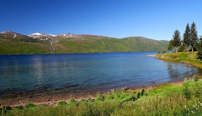
When we arrived at the Senja campsite, it was already 9:30 PM. A sign announced it was full, but luckily, I’d booked it 10 days earlier. By 10:30 PM, as we settled in to eat, it was still broad daylight, and the thermometer read 25°C—despite being at a latitude of 69° North! We went to bed around midnight, exhausted but under the light of a sun that was still very much present. Thanks to Earth’s tilted axis. We’d anticipated this by buying opaque sleep masks because, yes, at this time of year, it’s daylight all the time.
Friday, July 18:
Today, we planned two hikes on the island and a few stops along the way. The map clearly shows that the deepest fjords are in the north and west. Due to time and accessibility, we focused on the northern part of the island. Our first stop was at the viewing platform in Bergbotn:
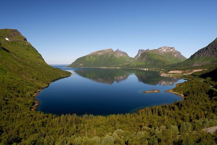
Then we headed toward Skaland, the starting point for our first hike. Along the way, we found plenty of reasons to stop—especially since, on this first day of travel, our thirst for Nordic landscapes was far from quenched.
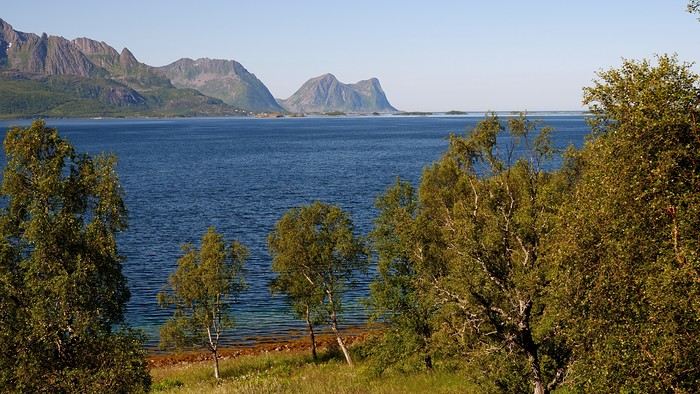
The town of Skaland is very practical: free parking, picnic tables for after the hike, and a Joker convenience store right next door. Our goal was the summit of Husfjellet: 670 m of elevation gain, between 8 and 9 km in length, and an estimated 4 hours and 30 minutes.
This hike offers two major viewpoints. The first overlooks the Bergsoyan islands to the west:
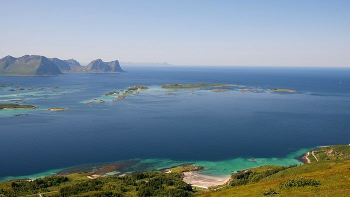
At the summit, the view shifts to the Steinfjorden fjord:
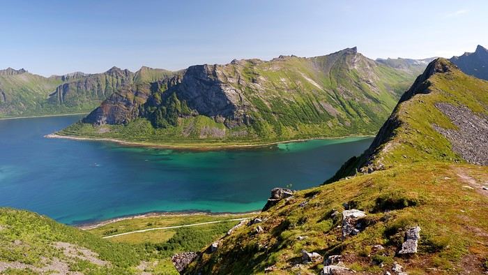
You can even clearly see the "Devil’s Teeth," which we’d see from below later:
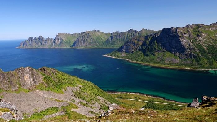
In total, the hike took us 4 hours and 30 minutes, including all the breaks. We treated ourselves to an ice cream in Skaland to recharge for the next hike. We hit the road again and stopped at Tungeneset to get a closer look at the Devil’s Teeth:
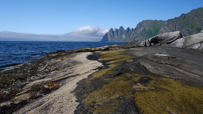
We continued to Fjordgard, the starting point for our second hike. Fjordgard isn’t very welcoming. There was a time when you could park right at the start of the hike up Mount Segla. Now, everything’s blocked off, and locals have even taken to blocking all possible parking spots nearby. You now have to park outside the town at a paid parking lot (90 NOK for 3 hours), adding an extra 2 km (round trip) of walking. Still, that was just a minor inconvenience because the hike that followed quickly made us forget all about it. The hike is fairly short (2 hours) but still has 520 m of elevation gain. This hike was a stark contrast to the first. This morning, we had sweeping views of the vast landscape. Here, Mount Segla, perched on the edge of the cliff, dominates the foreground:
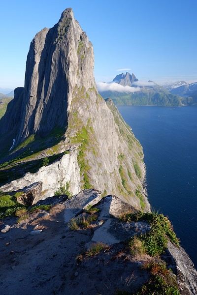
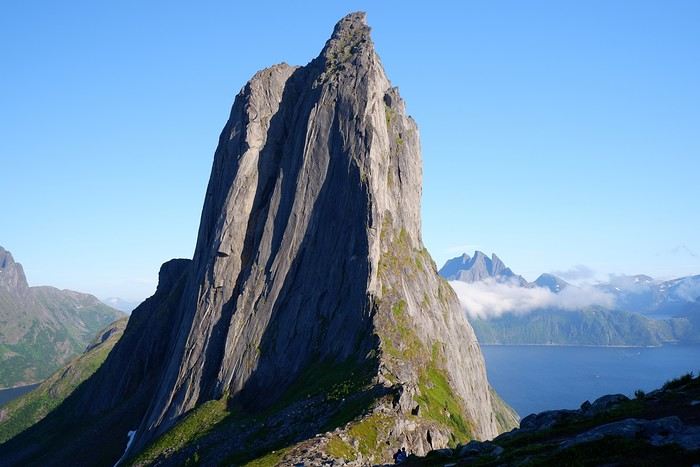
For those prone to vertigo, it might be best to stay at the foot of the mountain, as the trail climbs right along the cliff edge. And from that point on, you quickly understand what verticality really means...
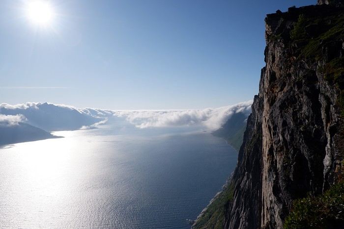
In total, we took 2 hours and 50 minutes, including breaks and the extra walk to the parking lot. The day was already well underway, and with 1,200 m of cumulative elevation gain, it was time to find a spot to eat and sleep. Since we hadn’t made any reservations, we’d planned to bivouac for the night. We weren’t too picky—just practical—so we decided to sleep in the car at the parking lot for tomorrow morning’s hike, just 5 km from Fjordgard.
We traveled to Norway in the summer of 2025, from July 17 to 29, to visit Senja Island and the Lofoten archipelago with a rental car. The common thread of these twelve days was clearly hiking, along with a few visits and experiences, and nights spent in a tent or in the car (which made it possible). We chose Narvik Airport for both arrival and departure for several complementary reasons: the desire to visit nearby Senja Island, slightly more affordable airfare, and finally, the rental price of the vehicle—especially the car model we were looking for. We only made one reservation, for the first campsite, as sleeping in a tent made things much easier. But we had the whole structure of the trip planned, a flexible outline that could adapt to the weather conditions we’d encounter. Senja Island isn’t part of the Lofoten archipelago, and during the early stages of planning this trip, we hadn’t planned to visit it. But its relative proximity to Narvik Airport and, above all, its unique geography definitely made us change our minds. We arrived in Evenes, where Narvik Airport is located, nearly 60 km from the city itself. Our first stop was 40 km further in Bjerkvik on the way to Senja, where there’s a Rema 1000 (a very common supermarket chain in Norway). We needed to buy some food and a gas cartridge for our stove. I’d emailed the store manager beforehand, who told me they didn’t sell them but that the two gas stations in the village were likely to have some in stock.
It was only at the Esso station that I found what I needed, but unfortunately, only one cartridge. Luckily, we quickly realized that most campsites (like in Iceland) have a shared kitchen with hotplates. That single small cartridge was just enough for the few nights we spent outside of campsites... We got our first taste of Norway’s characteristic landscapes:
When we arrived at the Senja campsite, it was already 9:30 PM. A sign announced it was full, but luckily, I’d booked it 10 days earlier. By 10:30 PM, as we settled in to eat, it was still broad daylight, and the thermometer read 25°C—despite being at a latitude of 69° North! We went to bed around midnight, exhausted but under the light of a sun that was still very much present. Thanks to Earth’s tilted axis. We’d anticipated this by buying opaque sleep masks because, yes, at this time of year, it’s daylight all the time.
Friday, July 18:
Today, we planned two hikes on the island and a few stops along the way. The map clearly shows that the deepest fjords are in the north and west. Due to time and accessibility, we focused on the northern part of the island. Our first stop was at the viewing platform in Bergbotn:
Then we headed toward Skaland, the starting point for our first hike. Along the way, we found plenty of reasons to stop—especially since, on this first day of travel, our thirst for Nordic landscapes was far from quenched.
The town of Skaland is very practical: free parking, picnic tables for after the hike, and a Joker convenience store right next door. Our goal was the summit of Husfjellet: 670 m of elevation gain, between 8 and 9 km in length, and an estimated 4 hours and 30 minutes.
This hike offers two major viewpoints. The first overlooks the Bergsoyan islands to the west:
At the summit, the view shifts to the Steinfjorden fjord:
You can even clearly see the "Devil’s Teeth," which we’d see from below later:
In total, the hike took us 4 hours and 30 minutes, including all the breaks. We treated ourselves to an ice cream in Skaland to recharge for the next hike. We hit the road again and stopped at Tungeneset to get a closer look at the Devil’s Teeth:
We continued to Fjordgard, the starting point for our second hike. Fjordgard isn’t very welcoming. There was a time when you could park right at the start of the hike up Mount Segla. Now, everything’s blocked off, and locals have even taken to blocking all possible parking spots nearby. You now have to park outside the town at a paid parking lot (90 NOK for 3 hours), adding an extra 2 km (round trip) of walking. Still, that was just a minor inconvenience because the hike that followed quickly made us forget all about it. The hike is fairly short (2 hours) but still has 520 m of elevation gain. This hike was a stark contrast to the first. This morning, we had sweeping views of the vast landscape. Here, Mount Segla, perched on the edge of the cliff, dominates the foreground:
For those prone to vertigo, it might be best to stay at the foot of the mountain, as the trail climbs right along the cliff edge. And from that point on, you quickly understand what verticality really means...
In total, we took 2 hours and 50 minutes, including breaks and the extra walk to the parking lot. The day was already well underway, and with 1,200 m of cumulative elevation gain, it was time to find a spot to eat and sleep. Since we hadn’t made any reservations, we’d planned to bivouac for the night. We weren’t too picky—just practical—so we decided to sleep in the car at the parking lot for tomorrow morning’s hike, just 5 km from Fjordgard.
Norway Cruise: Sightseeing Ideas
Hi, we're going on a cruise to Norway departing from Dunkirk and sailing up the coast—can you share some ideas on what to visit? Thanks!
Gigi