Results for "Australie+souvenir+artisanat"
About 30,324 results.
More options
Many results are in French, the community’s main language. English translations are added over time.
Search results
Népal - octobre 2011
Le mois d'octobre est une saison propice pour un voyage au Népal.
La mousson vient de se terminer et les récoltes de riz et de blé commencent. Les paysages sont encore verdoyants.
Le soleil est toujours présent et les températures restent très agréables.
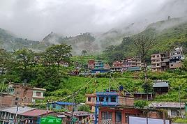
La ville de Kathmandu, point d'arrivée au Népal, est grouillante de voitures, bus et motos. Les piétons doivent faire preuve de prudence. Malgré tout il y a peu d'accidents. L'atmosphère est Indienne. On retrouve les incessants bruits de Klaxon, les embouteillages continuels, les odeurs et les couleurs. Parfois la saleté aussi...😐 Une très grande majorité de touristes logent dans un quartier appelé "THAMEL." Un endroit qui concentre tout ce que l'on peut faire de pire, à mes yeux, pour le tourisme. Les boutiques qui ne vendent que du faux, les restaurants aux prix très "touristiques", les hôtels et les agences de voyage se succèdent. Tous vendent ou proposent les mêmes produits et cela devient vite lassant.😕 Plus un gramme d'authenticité dans ce quartier où défilent des milliers de touristes chaque année. Les rues étroites du quartier sont très fréquentées et il faut parfois avoir des yeux dans le dos pour éviter les motos qui roulent trop vite sur une chaussée bien souvent en mauvais état. Le tout, je le répète, dans un brouhaha continuel qui finit par être pénible, Et il faut ajouter les chiens... En surpopulation au Népal, parfois en meute, qui prennent un malin plaisir à gâcher vos nuits par de continuels aboiements. Une calamité.!!
En résumé, cette ville devient vite fatigante et quand les principaux points touristiques sont visités, on la quitte sans trop de regret.
A propos des sites touristiques...
Quelques uns sont en ville, et les autres dans la grande périphérie de Kathmandu. Faciles d'accès en taxi ou en moto de location. ( compter 5 euros par jour pour un scooter) Ils sont tous payants. Et parfois, le prix d'entrée exigé semble exorbitant par rapport au niveau de vie du pays. Il est vrai que le touriste paye toujours plus cher. Dont acte. Mais quand même.!! Parfois la différence est énorme et peut atteindre 20 à 30 fois le prix local. Cela incite à la tricherie.
La ville de Kathmandu, point d'arrivée au Népal, est grouillante de voitures, bus et motos. Les piétons doivent faire preuve de prudence. Malgré tout il y a peu d'accidents. L'atmosphère est Indienne. On retrouve les incessants bruits de Klaxon, les embouteillages continuels, les odeurs et les couleurs. Parfois la saleté aussi...😐 Une très grande majorité de touristes logent dans un quartier appelé "THAMEL." Un endroit qui concentre tout ce que l'on peut faire de pire, à mes yeux, pour le tourisme. Les boutiques qui ne vendent que du faux, les restaurants aux prix très "touristiques", les hôtels et les agences de voyage se succèdent. Tous vendent ou proposent les mêmes produits et cela devient vite lassant.😕 Plus un gramme d'authenticité dans ce quartier où défilent des milliers de touristes chaque année. Les rues étroites du quartier sont très fréquentées et il faut parfois avoir des yeux dans le dos pour éviter les motos qui roulent trop vite sur une chaussée bien souvent en mauvais état. Le tout, je le répète, dans un brouhaha continuel qui finit par être pénible, Et il faut ajouter les chiens... En surpopulation au Népal, parfois en meute, qui prennent un malin plaisir à gâcher vos nuits par de continuels aboiements. Une calamité.!!
En résumé, cette ville devient vite fatigante et quand les principaux points touristiques sont visités, on la quitte sans trop de regret.
A propos des sites touristiques...
Quelques uns sont en ville, et les autres dans la grande périphérie de Kathmandu. Faciles d'accès en taxi ou en moto de location. ( compter 5 euros par jour pour un scooter) Ils sont tous payants. Et parfois, le prix d'entrée exigé semble exorbitant par rapport au niveau de vie du pays. Il est vrai que le touriste paye toujours plus cher. Dont acte. Mais quand même.!! Parfois la différence est énorme et peut atteindre 20 à 30 fois le prix local. Cela incite à la tricherie.
Voyages maintenus au Japon
Salut à tous 🙂
En ce lundi matin, je démarre une nouvelle discussion pour réunir ceux qui pour l'instant n'ont pas annulé leur voyage au Japon et qui hésitent, ceux qui partiront quoi qu'il en soit et pkoi pas ceux qui y sont en ce moment !
Bien évidemment la situation est toujours très instable et c'est à chacun de prendre sa décision, sans juger ce que va faire l'autre.
Sont aussi les bienvenues, les infos concernant les modifications de dates pour les remboursements des vols.
http://www.irsn.fr/FR/Documents/home.htm http://www.asn.fr/ http://www.criirad.org/ http://www.lejapon.fr/blog/http://twitter.com/lejapon
Merci à tous ceux à tous ceux qui participeront 🙂 bonne journée !
En ce lundi matin, je démarre une nouvelle discussion pour réunir ceux qui pour l'instant n'ont pas annulé leur voyage au Japon et qui hésitent, ceux qui partiront quoi qu'il en soit et pkoi pas ceux qui y sont en ce moment !
Bien évidemment la situation est toujours très instable et c'est à chacun de prendre sa décision, sans juger ce que va faire l'autre.
Sont aussi les bienvenues, les infos concernant les modifications de dates pour les remboursements des vols.
http://www.irsn.fr/FR/Documents/home.htm http://www.asn.fr/ http://www.criirad.org/ http://www.lejapon.fr/blog/http://twitter.com/lejapon
Merci à tous ceux à tous ceux qui participeront 🙂 bonne journée !
Sourires du Cambodge de novembre et décembre 2009
Début du Carnet de Voyage Partie 1
 Voici notre circuit : Arrivée Phnom -Penh (2 jours) Battambang (2 jours) Siem Reap, site d'Angkor, Roluos, Phnom Khulen (6 jours) Kompong-Cham (2 jours) Kratie, dauphins, ile Cham (2 jours) retour par Phnom Penh puis Kep, ile aux Lapins (3 jours) Phnom Penh, visite école (2 jours)
Le 22 novembre 2009 Pau - Paris
Premier départ raté en gare de Pau où le TGV nous recrache sur le quai pour cause «de problèmes sur la voie»… nous prenons le train suivant dans la soirée, nous passons la nuit tant bien que mal allongés sur des banquettes, heureusement nous avons prévu large et nous serons à l’heure pour l’avion…. Nous avons même le temps de nous plonger dans l’art khmer au Musée Guimet avant de partir Paris est sous la pluie, dans ses couleurs automnales, il fait bien frisquet mais dans nos sacs se trouvent nos tee-shirts d’été auprès du maillot de bain ! Quelle chance d’aller au chaud et au soleil !
Trois semaines au Cambodge… voilà quelques années que nous ne sommes pas partis aussi longtemps, la maison est bouclée, les RTT posées auprès des petits-enfants et nos compagnons de voyage aussi pressés que nous de partir… Nous avons une fois de plus reconstitué notre petit groupe de 4, c'est une affaire qui marche, pourquoi s'en priver !!!! Les billets d’avion ont été pris depuis plusieurs mois sur Internet, via le comparateur de VF, nous voyageons avec la Korean Airlines (750 euros) bon OK, nous allons jusqu’à Séoul pour revenir ensuite sur Phnom Penh, c’est un peu long ! Plusieurs heures de transit en Corée, ah ! si j’avais su avant que des visites étaient organisées pour les gens en escale, dommage !
Lundi 23 Novembre - dans l'avion
Nous arrivons à 23 h à Phnom Penh, le taxi réservé en même temps que l’hôtel est bien là, nous avions pris nos visas à Paris, nous sommes très vite hors de l’aéroport dans la chaleur moite du Cambodge. Le « Frangipani Villas »(40 $ pt-déj + eau + laverie) est très chouette, les chambres spacieuses, beaucoup de charme, une maison ancienne au milieu d’un jardin, dans une petite rue bien calme, pratiquement à l’angle du Bd Sihanouk et du Monivong, mais nous verrons tout cela demain, pour l’instant pas besoin de berceuses !

Mardi 24 Novembre Phnom Penh
Il est finalement près de 10 heures quand nous nous mettons en route à la découverte de Phnom Penh, nous avons laborieusement commandé nos tickets de bus vers Battambang pour le lendemain matin (toujours mon anglais très approximatif !) pas toujours d’accord avec la compagnie, l’heure ou le prix annoncés, réservés aussi les tuk-tuk qui nous amèneront à la station et même choisi nos plats sur la carte du restaurant de l’hôtel pour ce soir !… bon, on peut y aller, la journée est à nous !
Il fait 32 ou 33 °, l’air est très humide, ce sont les températures que nous aurons pendant tout le voyage, heureusement les nuits sont fraiches et en quelques jours nous nous sommes habitués…
Nous découvrons d’abord un quartier bien populaire avec petits restos sur le trottoir, stands de fruits, de boissons, beaucoup de petits commerçants puis en rejoignant le Bd Sihanouk avec le monument de l’Indépendance dans notre visée, les trottoirs s’élargissent, de belles villas font place aux immeubles décrépis, c’est nickel… belles pelouses, énormes pots de fleurs, peu de circulation et peu de monde… c’est le quartier des Ministères…


Nous avons beaucoup de propositions de chauffeurs de tuk-tuk mais nous voulons marcher, flâner, regarder tout autour de nous… nous remontons une grande esplanade vers le Palais Royal, un vendeur de cerfs-volants un peu esseulé tente d’attirer les enfants, de grands immeubles modernes entourent la place, leurs façades vitrées reflètent les toits rouges et biscornus des bâtiments royaux. Une pagode entourée d’immenses stupas attire notre curiosité, allons voir… C’est le Vat Batum, notre première approche de la religion bouddhiste, nous observons l’organisation autour de la Pagode sans pouvoir nous empêcher de la comparer à nos édifices religieux… Un grand mur d’enceinte protège les lieux, les stupas recueillent les restes de la crémation des défunts (l’équivalent de nos tombes), les bonzes et les nones vivent autour de la Pagode (un peu comme un monastère) donc salles de prières, de repas, dortoirs etc… c’est toute une communauté qui vit ici. Nous nous asseyons un peu à l’ombre, des bonzes viennent discuter, ils préparent leur repas à côté.
Nous repartons vers le Palais Royal et la Pagode d’Argent… les grilles ferment sous notre nez ! il faudra attendre 14 h, nous nous préparons à aller jusqu’au Musée un peu plus haut mais le Lonely nous l’annonce aussi fermé à l’heure de midi… un chauffeur de tuk-tuk, profitant de l’aubaine et voyant notre embarras se propose de nous conduire jusqu’au Musée du Génocide, le seul ouvert à cette heure… on se met vite d’accord sur le prix (nous sommes 4, il nous attendra pendant la visite, ce sera 6 $) et voilà notre première balade en tuk-tuk…. C’est super agréable, enfin un peu de fraicheur, il va lentement, nous avons le temps de regarder, d’admirer, le chauffeur est prudent et d’ailleurs la circulation est raisonnable.
Ce Musée se situe dans un ancien lycée, les bâtiments ont servi de prison et de salles de torture pendant la période de Pol Pot de 1975 à 1979. C’est un endroit chargé de terreur, des milliers de Cambodgien ont été exterminés à cette époque toute proche… nous avons senti combien ce peuple avait été touché, presque chaque famille a perdu des proches, beaucoup « d’anciens », pratiquant encore un peu le français, nous en ont parlé… L’histoire du Cambodge est compliquée, période Angkorienne faste, riche et prospère jusqu’au 14 ième siècle, déclin de l’Empire khmer puis partage du pays entre Thaïlandais et Vietnamiens, protectorat français pendant 100 ans , puis Norodom Sihanouk qui tente l’indépendance à partir de 1953, ensuite Pol Pot et ses khmers rouges dévastent le pays qui devient un immense camp de concentration, le Vietnam envahit le pays et installe un régime à sa solde jusqu’en 1993 (période de boycott de la communauté internationale et période des terrains minés) puis tentatives d’élections démocratiques, les derniers Khmers rouges rendent les armes en 1998 ! Ce n’est que depuis cette période que le Cambodge se reconstruit vraiment avec l’aide de nombreux pays.
La visite du S-21 (quartier de sécurité 21) se fait en silence, difficile de soutenir les regards des centaines de portraits d’hommes, de femmes et surtout d’enfants affichés dans les salles… Nous ne nous attardons pas…


Nous demandons à notre chauffeur de nous déposer sur le quai Sisowath au bord du fleuve, il doit penser que nous avons faim car il s’arrête juste devant un restaurant ami... tiens, tiens… et pourquoi pas ! Nous ne cherchons pas plus loin et goutons pour la première fois à la cuisine cambodgienne.
Nous aurons généralement, tout le long du trajet d’agréables surprises et nous nous régalerons souvent… parfois la cuisine sera moins savoureuse ou la cuisinière moins expérimentée ? nous sommes 4 et la plupart du temps nous commanderons 4 plats différents dans lesquels nous piochons tous ; ceci nous a permis de gouter à plein de bonnes choses, toujours accompagnés de riz ou de nouilles quand nous en avions assez ! mais de nouilles à la farine de riz bien sûr !!
Aujourd’hui sur une terrasse face au Tonlé Sap nous laissons le serveur choisir pour nous et devant le poisson grillé, les légumes frits, les rouleaux de printemps et le porc à l’ananas nous sommes gâtés ! Premières bières locales aussi, l’Angkor, en grandes bouteilles comme il se doit ! le repas se termine avec le thé et une grande assiette de fruits savamment découpés, du riz gluant et une compotée de pastèque en petits paquets de feuilles de bananiers tressés… hum ! Une petite marche sur le quai avant de nous diriger vers le Musée National, passage par le Vat Ounalom où nous guide la jolie musique de violons… deux européens ont choisi cet endroit tout calme au milieu de l’agitation de la ville pour s’entrainer… nous faisons donc le tour de la Pagode accompagnés de sonates. Par curiosité Yolande et moi entrons dans un petit temple où un bonze nous tend de l’encens et nous asperge copieusement d’eau sacrée à l’aide de fleurs de lotus, il récite quelques incantations… Et voilà ! Nous sommes parées pour le voyage, Bouddha va veiller sur nous !


Nous prenons notre temps au Musée, le bâtiment est superbe, tout rouge dans un splendide jardin. Après avoir arpenté les salles et admiré les magnifiques pièces, mais nous manquons un peu d’explications, nous apprécions un long moment le jardin intérieur ; la chaleur, le voyage, le décalage horaire, le repas ont eu raison de nous et nous avons du mal à décoller de notre banc, à l’ombre, devant les bassins plein de lotus… Allez, un peu de courage si nous voulons voir le Palais Royal et la Pagode d’Argent avant ce soir !


Le Palais Royal est comme il se doit la résidence du Roi, il est possible de visiter la Salle du Trône, les jardins, la salle des Cérémonies, le Pavillon des Danses, le Pavillon de Fer (genre Baltard) offert par Napoléon III et dans la même enceinte se trouve la fameuse Pagode dite d’Argent car son sol est recouvert de 5 000 plaques d’argent, s’y trouvent aussi des Bouddhas couverts de pierres précieuses, en or ou en argent. Aujourd’hui c’est mardi, tous les guides officiels sont habillés en couleur fushia, chaque jour a sa couleur comme dans les anciennes cours royales. Nous n’avons guère qu’une heure pour tout voir, dès 17 h il commence à faire sombre, à 18 h c’est la nuit…
Nous profitons bien de cette fin d’après-midi, la couleur est très belle, je trouve les fresques intérieures de l’enceinte de la Pagode retraçant le récit du Ramayana particulièrement superbes, le jardin est très soigné, bonzaïs, buissons finement taillés, les stupas renfermant les restes des rois dressent leurs flèches vers le ciel, l’endroit est calme, très peu de monde, je crois que nous sommes les derniers à quitter les lieux… nous venons de passer un très bon moment.


C’est toujours à pied que nous rejoignons l’hôtel et nous faisons bien car l’ambiance du matin n’est plus du tout la même… les rues, les trottoirs, la grande esplanade grouillent de monde ! à croire que tous les habitants sont de sortie… la musique est à fond, des centaines de personnes bougent et dansent sur des rythmes d’aérobic, jeunes, vieux, tous s’y mettent ! et moi qui espérais surprendre quelques personnes âgées faisant tôt le matin leurs exercices de Qi Cong ou de Thaï Chi comme au Vietnam…. Les temps ont changé !!
Les familles sont installées à même le sol et prennent le repas du soir acheté à un marchand ambulant, des groupes de jeunes jouent au foot, des amoureux seuls au monde, des enfants tiennent fortement leurs cerfs-volants, c’est joyeux, bon enfant, souriant…

Une bonne douche pour enlever la poussière, la sueur et la fatigue de la journée… le repas du soir commandé le matin à l’hôtel est bien apprécié et nous permet de ne pas ressortir, nous sommes crevés, quelques kms déjà dans les jambes ; nous éteignons à 21 h 30 (hé oui !) mais nous sommes réveillés à 3 h (décalage !) Impossible de se rendormir
Mercredi 25 Novembre Battambang
Pas de problème donc pour se lever aux aurores, le bus est à 7 h, longue attente pour le petit déj. Les tuk-tuk sont là à l’heure, nous voyageons avec la Cie Paramount (5 $), la station est dans une petite rue près de la Poste, du coup nous avons un aperçu de ce quartier, plus au Nord de celui que nous avions arpenté hier. Petit à petit les voyageurs arrivent et, avant le notre, les bus pour Siem Reap ou Sihanoukville. Nous nous amusons à regarder une bande de macaques qui se faufilent sous les toits, qui font de l’équilibre sur les fils électriques quand soudain, je me rends compte que je suis juste devant la maison d’enfance de Claudie, une copine internaute… hé oui ! je reconnais les fenêtres à petits carreaux rouges... vite, des photos !
Nous assistons au chargement de mobylettes dans les soutes des bus, des marchands ambulants viennent nous proposer de quoi nous sustenter pendant le voyage, tout cela nous occupe jusqu’au départ qui n’a finalement lieu qu’à 8 h ! Nous en avons pour 5 h, autant prendre notre mal en patience ! le bus est plein mais pas surchargé, rapidement nous avons droit à des clips vidéos : soit des sketchs comiques avec le Coluche local soit des clips musicaux d’une mièvrerie déconcertante (on s’aime mais le père ne veut pas ou le fiancé part à la guerre etc…) Seul avantage : c’est à notre niveau de compréhension !!!!
Premier arrêt pipi, y’a une série de toilettes, basiques (un trou et de l’eau) mais propres, rien à dire d’ailleurs tout le long du voyage, c’est généralement bien plus propre qu’en Afrique ! Deuxième arrêt presque à midi devant une série de gargotes, il y a déjà deux ou trois bus arrêtés, les gens sont attablés devant des bols de soupe. Le temps que nous comprenions comment et quoi commander, un quart d’heure est passé, nous nous installons devant nos bols de soupe aux nouilles (2 pour 4) et nous nous apprêtons à partager une espèce de gâteau frit quand nous nous rendons compte que nous sommes seuls à table ! Tout le monde est déjà remonté dans les bus…. Le notre nous attend patiemment !


Arrivée à Battambang vers 13 h, nous ne sommes même pas sortis du bus que les chauffeurs de tuk-tuk nous assaillent déjà, notre hôtel n’est pas bien loin mais avec les bagages nous sommes ravis de nous laisser transporter… L’hôtel Royal n’a rien de typique, l’accueil est chaleureux, les chambres propres et spacieuses quant au restaurant sur la terrasse il est à recommander pour sa très bonne cuisine. C’est ici que nous devons retrouver notre guide car à partir de maintenant nous avons demandé à "Terre Cambodge" de Siem-Reap de nous organiser notre séjour. A aucun moment nous n’avons regretté ce choix car nous avons, grâce à eux, fait un voyage particulièrement varié et original. Au niveau du coût nous avons payé pour les 18 j ce qu'une agence en France nous aurait demandé pour 12 j et tout était compris : transport, hébergement, repas, visites, musées etc... sans que nous ayons à nous en soucier. Ceci nous a permis de manger dans des restaurants locaux et très typiques, parfois chez l'habitant ou de se faire plaisir dans un bon restaurant, même chose pour les nuits, parfois du très basique, parfois de jolis hôtels de charme Channara nous propose d’emblée de louer des vélos pour nous promener dans la campagne environnante, j’avoue ne pas me sentir en forme du tout pour affronter la chaleur, la circulation et les quelques 20 kms qu’il se propose de nous faire faire… ce sera une autre fois !
Nous partons donc en tuk-tuk vers le Vat Ek, un temple du XI iè siècle en grande partie effondré. Nous traversons plein de petits villages avec chacun sa spécialité. Les tuktuk s’arrêtent, nous laissent au bord de la route pour nous reprendre 2 ou 3 kms plus loin et cela nous permet, en plus de bien nous dégourdir les jambes, d’admirer tout le savoir-faire des familles car c’est toujours un travail en famille. Ici c’est la cuisson de galettes en farine de riz, elles cuisent sur un four chauffé avec l’enveloppe du riz (rien ne se perd), puis posées sur une grille en bambou et elles sèchent au soleil devant la porte. Tout est manuel. Un peu plus loin c’est justement à la fabrication de la farine de riz que nous assistons. Une dame nous dépasse avec son vélo chargé de kralan. Ce sont des tubes de bambou dans lesquels elle a fait cuire du riz gluant avec du lait de coco, on ouvre ce tube comme une peau de banane et on mange le riz légèrement caramélisé… c’est très bon et nous nous régalons d’autant plus que le bol de soupe du midi est resté sur la table !!! nous en mangerons à d’autres moments, parfois c’est un peu salé, ceux-là nous ont semblé particulièrement succulents.


Nous arrivons au Temple, proche d’une pagode et d’un immense Bouddha debout. C’est ici que nous entendons pour la première fois le récit du « Barattage de la mer de lait ». Cette scène d’un mythe hindouiste est très joliment représentée sur un linteau d’une des tours ; sur le montant des portes en grès est gravée en sanscrit toute la symbolique des sculptures du temple. La religion cambodgienne est un mélange de religions hindouiste et bouddhiste, et il faut sans cesse faire référence aux trois divinités hindoues ainsi qu’à Bouddha dans toutes ses représentations… je ne suis pas sûre d’avoir encore tout saisi ! Nouvel arrêt au retour pour regarder le séchage des lamelles de bananes., un papillon se régale du suc des fruits.


A l’hôtel un couple de Suisses fait sensation en arrivant à vélo, un tandem sur lequel Madame est couchée à l’avant ! avec leurs sacoches, ils doivent faire avancer près de 260 kgs ! quel courage de se lancer dans un tel périple, ils ont une bonne soixantaine d’années et ils comptent faire plus de 6 000 kms à travers la Thaïlande, le Laos, le Cambodge et le Vietnam ! Demain matin, avec une bonne vingtaine de supporters cambodgiens nous assisterons à leur départ.

Avant le repas nous faisons un tour au marché tout proche à la recherche de petits citrons verts que nous pressons dans nos bouteilles d’eau – c’est notre élixir en voyage – , c’est un excellent antiseptique et c’est très efficace pour prévenir les problèmes de tourista !
Les marchés ici sont très colorés, ils débordent de fruits et de légumes vendus directement par les producteurs. Les femmes sont soit assises sur de petits tabourets derrière leur marchandise soit en tailleur sur la table qui présente leurs produits. Il est possible de tout acheter, des poissons encore vivants ou séchés, des brochettes de crevettes juste grillées, du canard laqué encore tout chaud, des épices, et surtout de délicieux fruits que pour l’instant nous ne connaissons pas mais qui nous tentent et que nous gouterons avant de repartir…. Nous continuons notre promenade le long de la rivière Stung Sangker, les rives sont aménagées, les gens font comme nous, ils prennent l’air, font une balade ou leur jogging, certains pêchent en contrebas des ponts ce qui nous vaut de belles images de pêcheurs lançant leurs filets à la volée… nous marchons une petite heure… Au repas nous nous régalons de notre premier « amok fish » poisson cuit dans du lait de coco, c’est le plat cambodgien que nous avons préféré.
Nous nous couchons avec de la musique plein pot sur la ville… c’est la période des mariages, ça dure trois jours, jusqu’à 22 h et à partir de 5 h du matin !!!


Jeudi 26 Novembre Battambang
Les Suisses sont bien partis à 8 h tapantes sous les applaudissements de la rue et nous les suivons jusqu’à la sortie de la ville confortablement installés dans un minibus.
Nous allons jusqu’à Phnom Sampeau, un ensemble de pagodes et de temples en haut d’une colline en forme de bateau. Nous rejoignons le village du bas par une piste de latérite rouge dont la poussière recouvre les habitations et tous les arbres aux alentours… dans quelques mois, en saison sèche ce doit être intenable !
Nous laissons l’escalier bien raide qui part au pied d’un immense Bouddha que des ouvriers finissent de sculpter dans le rocher pour gravir doucement la colline par un chemin ombragé. Il fait toujours aussi chaud, aussi humide mais on survit !!
Des stèles sur les cotés énumèrent les noms des généreux donateurs, ces temples sont récents, tous plus kitsch les uns que les autres mais la présence des bonzes et des nonnes qui vivent eux dans des maisons en bois, leurs réfectoires et leurs cuisines, les bandes de petits drapeaux qui flottent au vent, la jolie vue sur les rizières font que le lieu est bien agréable… moins agréables sont les grottes et les charniers qui contiennent des ossements laissés derrière les Khmers rouges.


Nous continuons sur la crête de la colline, ça monte, ça descend, des escaliers, encore des escaliers vers une autre pagode qui brille de toute sa peinture or. Là nous passons un bon moment avec un gamin d’une douzaine d’années qui veut nous énumérer toutes les phrases qu’il connaît en français ! pour l’instant il apprend l’anglais avec un bonze, il est dégourdi comme tout, il a un sourire adorable - comme je lui souhaite un bel avenir !! Nous redescendons par l’escalier et après cette belle balade nous restons manger dans un des petits restaurants sur place. Nous avons chacun une belle assiette de nouilles aux légumes surmontée d’une omelette, de l’ananas en dessert, quoi demander de plus ?
Un peu plus tard nous voici à Phnom Banan, entre deux lions de pierre qui gardent un immmmmense escalier dont on ne voit pas la fin ! 358 marches sont annoncées d’emblée ! marches de pierre très irrégulières et plutôt hautes ! bon, courage, c’est parti… tranquillement jusqu’en haut ! yes ! et comme toujours la récompense est au bout ! là-haut c’est un ensemble de cinq tours assez abimées du XI iè siècle, des linteaux superbement sculptés surmontent les portes de grès, les sculptures des gardiennes des temples sont à peu près intactes, l’endroit est très apaisant et serein…


Nous rentrons vers Battambang en traversant à nouveau des villages, les femmes s’affairent à couper des bottes de riz, nous visitons une ancienne maison khmère, nous avons la surprise de découvrir de la vigne et un viticulteur qui propose des dégustations de vins… des français investissent déjà les lieux et nous ne nous incitent pas à les gouter !! Près d’une pagode des centaines de roussettes (chauve-souris) font l’attraction du coin ; devant une maison dont la famille tisse des kramas, une fillette file des bobines de coton avec une roue de vélo, sur les bords de la rivière, dont le niveau a déjà bien baissé, les paysans se sont empressés de planter quelques cultures qu’ils arrosent méticuleusement dans le soleil couchant… les images sont belles, elles sont fixées dans l’appareil photo mais surtout dans notre mémoire avec les bruits, les odeurs, la chaleur, les regards, les sourires…


Nous mangeons à nouveau à l’hôtel et nous éteignons à 21 h 30 après une sacrée belle journée !
Vendredi 27 Novembre sur la rivière - village flottant
Ce matin départ à 7 h en bateau vers le lac Tonlé Sap en navigant d’abord sur la rivière Stung Sangker. (en début de post vous avez la carte pour nous suivre…)
Ici je me dois d’une petite digression géographique concernant l’eau au Cambodge… le Cambodge est un pays extrêmement plat en son centre et qui subit une longue saison des pluies, de plus ce lac d’eau douce d’une superficie de 2 500 km2 est relié au Mékong par le Tonlé Bati ; il y a entre ces deux réservoirs d’eau un système de vases communicants qui fait que le trop plein du Mékong, lors de la fonte des neiges de l’Himalaya et des pluies, se déverse dans le lac –celui-ci passe alors à 13 000 km2- et en novembre, avec le retour de la saison sèche, le niveau du lac redescend, le cours de l’eau se renverse et le lac revient à sa surface initiale. C’est d’ailleurs l’occasion de grandes fêtes à Phnom Penh avec courses de pirogues « la fête des Eaux ».
L’eau s’étant retirée, les paysans s’empressent de planter le riz (alors que dans d’autres régions on en est à la récolte !) et beaucoup de légumes (souvent deux récoltes)
Les villages en bord du fleuve et du lac sont donc soit sur pilotis, soit des villages flottants pour accompagner le niveau de l’eau. En cette fin novembre, l’eau a tout juste commencé à descendre et la surface du lac est encore imposante.
Le bateau n’est pas surchargé, en fait nous sommes une trentaine de touristes au milieu des cambodgiens qui se rendent à Siem Reap. Le départ se fait dans la brume du petit matin, les villages se réveillent mais les pêcheurs sont déjà en pleine activité…


Au début, je déplore toutes ces bouteilles en plastique qui flottent à la surface de l’eau jusqu’à ce que je me rende compte qu’elles servent justement de flotteurs aux filets ! La pêche fait vivre une grande partie de la population du Cambodge, sur les marchés nous avons vu des tonnes et des tonnes de crustacés, de poissons petits et grands, souvent vendus vivants… c’est avec le riz une des plus grandes ressources du pays.
Les images sont belles, d’autant plus que le soleil s’est mis de la partie… Les maisons colorées qui se reflètent dans l’eau, les barques plates où les pêcheurs tiennent en équilibre, les filets que l’on jette ou que l’on remonte plein de friture brillant dans la lumière, le passage du bateau sur les routes encore inondées, à hauteur des branches d’arbres pour couper les méandres de la rivière, les carrelets qui montent et descendent régulièrement à contre-jour, les bateaux que l’on croise régulièrement et que l’on pourrait toucher et surtout les sourires, les « hello », les coucous des enfants… cette journée a été un de mes plus beaux moments du voyage…


Un arrêt-pipi épique dans une épicerie-bar flottante (deux planches sur l’eau, s’agit de bien poser les pieds ! des tôles à mi-hauteur et les petits poissons qui attendent l’offrande !) à côté des toilettes un radeau qui sert de potager et une cage pour élever un cochon…


Nous continuons le trajet, les pagodes et les écoles sont sur pilotis, ici c’est une région de musulmans et nous voyons les premières mosquées. Toujours plein de pêcheurs partout et le pilote du bateau doit souvent slalomer pour éviter les filets…
Channara nous demande de préparer nos bagages, nous descendons au prochain arrêt à Kaoh Chireang.
Nos compagnons de voyage nous envient de rester passer la nuit dans la maison flottante toute bleue où on vient de nous déposer ! Nous voici tous les 4 sur la terrasse au bord du fleuve à regarder le bateau continuer sa route…


La table est mise sur le côté, un grand lit dans la pièce principale, un cabinet de toilette avec WC et jarre d’eau à l’arrière, parés pour rester ici jusqu’à la fin des vacances !
Le repas est bien agréable, poisson grillé tout frais, légumes frits dont des racines de jacinthes d’eau qui poussent ici à profusion.
Il fait chaud, nous nous sommes levés tôt et nous apprécions une bonne sieste comme tous les habitants des lieux… Je vais quand même assez rapidement avec mon appareil photo à la recherche de quelques clichés mais l’espace de promenade est assez limité !
A l’arrière de la maison une dame est déjà occupée à éplucher et tailler les légumes pour ce soir, elle vient de finir la vaisselle directement dans l’eau du fleuve qui sert maintenant à laver les légumes… ce soir nous verrons la famille y faire sa toilette et nous-mêmes nous y cracherons notre eau (en bouteille) de brossage des dents, de toutes façons, les crocodiles y trempent déjà… alors !
Je passe un petit moment avec elle, la communication passe avec des gestes et des sourires…

Un peu plus tard un petit bateau vient nous chercher et nous partons pour une balade dans les rues du village…Il y a ici certainement près de 1000 habitants, tous sur des maisons flottantes, la spécialité c’est l’élevage des crocodiles et presque tous, y compris là où nous logeons, ont d’immenses cages dans l’eau avec des centaines de ces bestioles ! Sinon, comme partout nous passons devant l’épicerie, le tailleur, la station-service, le pressing… et nous croisons plein de marchandes ambulantes sur leurs pirogues qui vendent en porte à porte de l’épicerie, des légumes, voire des plats tout faits… nous profitons pleinement de cette promenade sur l’eau, nous ne savons plus où regarder tellement chaque image est pleine de vie, de couleur, de beauté… ici c’est le coucou des enfants, là c’est une marchande qui nous aborde, là encore deux pitchouns traversent seuls le fleuve, ici les enfants rentrent de l’école, là encore le linge en ribambelle sur un fil… tout nous émerveille !


Nous abordons un centre d’artisanat où les femmes tressent les tiges de jacinthes d’eau séchées, elles en font des nattes, des dessous de plats, de jolies boites… Nous y faisons nos premiers petits achats. Un responsable local est justement en train de motiver un groupe pour s’impliquer dans le tourisme… ce village a tous les atouts pour attirer quelques voyageurs et d’ici peu de temps il y aura certainement d’autres maisons d’hôtes dans le coin ! sa formation porte sur la propreté des lieux, sur l’accueil, sur la nourriture… ce peut être une façon de résoudre certains problèmes d’hygiène pour les habitants eux-mêmes mais en même temps il ne faudrait pas que ce village se dénature !
Samedi 28 Novembre village flottant - Siem Reap
Quelle nuit ! comme d’habitude, quand nous sommes dans un village, nous avons eu droit à tous les bruits : les coqs, les chiens… pas d’ânes comme en Afrique mais les margouillats qui sifflent sur les cloisons en bois, les crocodiles qui se battent et agitent la maison, les chats qui profitent de l’absence de portes et de fenêtres pour rôder autour de nous… heureusement, nous sommes bien à l’abri sous les moustiquaires et ça rassure les courageuses que nous sommes !!
Sommeil entrecoupé, du coup aucun problème pour se lever aux aurores avec la famille, dès 5 h les femmes sont en cuisine (c’est qu’elles n’ont rien de moderne ni pour faire chauffer l’eau ni pour cuire le repas – une grande partie de la journée est consacrée à la préparation des plats-) puis les hommes partent à la pêche et les enfants se préparent pour l’école. Les filles, comme partout, sont coquettes et agrémentent leur coiffure avec moult pinces, chouchous et bandeaux, les garçons ajustent leurs uniformes qui leur donnent l’air de petits communiants et dès qu’ils sont prêts ils attendent les copains qui passent les prendre en barque ! ils sont ainsi quatre ou cinq à partir vers l’école sans un adulte pour les encadrer !

D’ailleurs nous ferions bien nous aussi de nous occuper de nos affaires mais il y a tant à regarder ! Petit déjeuner au lever du soleil, c’est chouette aussi… A 7 h nous sommes tous les 4 sur un bateau qui nous emmène vers Siem Reap, nous allons vers l’embouchure de la rivière, près de nous la mangrove, quelques oiseaux ci et là, puis nous traversons les plaines encore inondées au milieu de la cime des arbres, ensuite le lac et nous arrivons à l’embarcadère de Chong Knies. Un minibus nous attend, nous faisons la connaissance de Taèm qui sera notre chauffeur jusqu’au départ.


Nous nous arrêtons au milieu des rizières, dans certaines parcelles les paysans labourent, dans d’autres ils plantent et ailleurs c’est la récolte ! A l’entrée de la ville nous visitons un endroit incontournable pour les touristes « Les Artisans d’Angkor » une association qui forme des jeunes aux métiers divers de l’artisanat : peinture sur soie, laque, travail de l’argent, sculpture sur bois ou sur pierre, tressage, couture… ces jeunes reçoivent un salaire décent, sont nourris et logés ; ils sont nombreux parait-il à vouloir intégrer ce centre professionnel. La visite est bien organisée, en français pour nous ; elle se termine par un passage dans les boutiques de vente. Il y a là de très jolies choses, de bonne qualité… nous venons d’arriver, nous n’avons pas encore envie de nous lancer dans de gros achats… et je le regrette car c’est là que nous avons vu les plus jolies choses ! (il y a un stand à l’aéroport de Phnom Penh au départ mais moins fourni)

Nous passons ensuite un bon moment avec Laurent le responsable de « Terre Cambodge » ; j’avais eu beaucoup d’échanges Internet pour organiser le séjour… heureux de se connaître. Je lui fais part de mon souci de ne pas passer assez de temps à l’école, du coup changement, nous n’irons pas à Koh Dach, un détour trop long, nous privilégions l’école (pour rien finalement puisque Théa, le directeur, a changé le rendez-vous au dernier moment ! on ne pouvait pas savoir !) Avant de nous rendre à l’hôtel nous passons par une très ancienne pagode de Siem Reap, le Vat Bô. Elle est effectivement très belle, déjà de l’extérieur, avec beaucoup d’éléments en bois ; un petit vieux nous ouvre les portes et à l’intérieur nous admirons les plus jolies peintures que nous avons vues dans une pagode, en particulier de beaux détails de « l’armée des singes ».


Très bon repas avec des plats dont la présentation est particulièrement raffinée et nous nous installons aux « Mystères d’Angkor » très joli petit hôtel plein de charme, jardin luxuriant, piscine, jolies chambres…
le tour du coeur est en lamelles de concombre
Après-midi libre… Nous terminons tranquillement la journée en allant jusqu’au vieux marché le long de la rivière, passage à la Poste pour les premières cartes et les timbres. Le vieux marché est couvert, il y fait chaud, étouffant, rapidement Pierre nous attend dehors ! je ne m’y attarde pas non plus, c’est la réplique asiatique des souks de Marrakech ou d’Istanbul, beaucoup de choses « made in China » mais c’est typique, l’ambiance y est sympathique, pas trop de pression commerçante, avec le sourire, pas de problème !! Nous nous promenons dans les rues aux alentours. Beaucoup de cafés pour européens, quelques boutiques sympas, sur le trottoir deux australiens, assis au bord d’un bassin, se font « masser » les pieds par des petits poissons… manifestement ça chatouille !


Retour par le même chemin, balade très agréable, les chauffeurs de tuk-tuk ne comprennent pas qu’on préfère marcher !
Nous cherchons une « Laundry » il est temps de penser lessive… nous trouvons cela chez une petite coiffeuse adorable !
Une nouvelle fois nous ne trainons pas pour nous coucher ! Les journées sont longues et bien remplies ! Ce n’est pas au Cambodge que nous jouerons aux oiseaux de nuit ! Dimanche 29 Novembre Siem Reap - Roluos
Nous sommes tout près des temples d’Angkor mais si nous voulons suivre un ordre chronologique dans la construction de ces temples et en comprendre l’évolution il faudra attendre encore quelques jours pour aller sur le site.
Ce matin, dès 8 h nous sommes devant les guichets pour obtenir le sésame qui va, pendant 6 jours, nous ouvrir les portes d’une des merveilles du monde ! un petit sourire devant l’objectif et 5 minutes après nous avons notre photo sur le pass, pas question de le perdre ni de l’oublier, dans les jours qui viennent nous le sortirons plus d’une fois !
Départ vers Roluos par la RN 6 au Sud de Siem Reap mais très rapidement nous nous perdons (volontairement) dans la campagne environnante... 2 heures de marche sur une piste, en fait c'est l'ancienne route royale qui reliait Angkor de Roluos, tantôt au milieu des rizières, tantôt au milieu des villages…. Heureusement peu de circulation sinon des vélos et quelques mobylettes accompagnées à chaque fois d’un nuage de poussière rouge.


Ce sont des villages de paysans et dans presque chaque cour de maison on s’affaire soit au décorticage du riz, soit à la fabrication d’un alcool de riz (genre de saké), soit une moissonneuse-batteuse fait son tri, la même que chez mes grands-parents il y a 50 ans ! à chaque fois on nous accueille avec de grands sourires, on nous propose de boire, de gouter…
Nous sommes curieux de tout : l’architecture des maisons, très hautes pour permettre une bonne ventilation du bas, à l’ombre où sont installés les hamacs, les cultures dans les jardins, les arbres, ici un jacquier, ici des noix d’arec, là un frangipanier, un champ de papayes, partout des bananiers, devant nous un troupeau de buffles, plus loin une dame qui pose devant sa maison, une petite mare couverte de nénuphars encore ouverts avant que le soleil ne tape trop fort…


Et c’est ainsi que nous arrivons au temple de Preah Kô (le sanctuaire du bœuf sacré) édifié à la fin du IX ièm siècle, six tours alignées en deux rangées et comportant des ornements en stucs bien conservés. Nous cherchons les pierres à l’ombre qui nous permettent de nous asseoir pendant que Channara fait son cours magistral !
En sortant nous passons par un atelier de découpage du cuir, très rapidement.
Puis nous nous dirigeons vers le Bakong, c’est le premier temple montagne en grès gris que nous voyons, il est imposant avec ses cinq terrasses superposées, à chaque angle des sculptures d’éléphants en plus ou moins bon état. Nous le gravissons, nous en faisons le tour, des lions gardent fièrement l’accès aux escaliers de pierre. Quelques stupas (tombes) tiennent encore debout et donnent de la couleur à l’ensemble. Le Lolei est le plus petit des temples du groupe de Roluos, 4 tours vite visitées….


Nous mangeons un plat de nouilles frites dans une gargote en bord de route et il fait sacrément chaud quand nous repartons. Nous sommes toujours sur une jolie piste rouge dans la campagne et nous prenons plaisir à marcher surtout quand il y a de l’ombre.

A nouveau nous faisons plein de rencontres : une dame vient de remonter de sa mare quelques centaines de grammes de minuscules poissons qu’elle va rajouter à sa soupe, quelques bonzes nous croisent à l’abri de leur parapluie, un groupe de femmes, les lèvres et les dents noires de mâchouiller du bétel nous interpelle, elles nous montrent la fabrication de leur « drogue », une feuille de bétel + une pâte à base de chaux + de la noix d’arec pilée … elles rient beaucoup devant notre refus d’y gouter et tiennent à se faire prendre en photo, un peu plus loin un marchand de cochons qui veut nous doubler nous oblige presque à descendre dans les rizières, il lui reste 3 cochonnets sur les vingt qu’il a essayé de vendre dans les villages tout au long de la journée…scènes de la vie quotidienne…


Nous remontons dans le minibus pour arriver au temple Chau Strei Vibol. Il est en haut d’une colline et c’est à nouveau l’occasion de marcher un peu. C’est un très joli endroit, au milieu d’une forêt, ce temple est en partie envahi par les arbres. Nous y voyons pour la première fois des déambulatoires effondrés ce qui nous vaut un « cours » d’architecture sur les encorbellements et les clés de voute ! ça fait du bien quelques rappels scolaires et se cultiver sous les frangipaniers ce n’est pas le plus désagréable ! Nous reprenons le bus après avoir fait le tour du mur d’enceinte.


Nous traversons un village dont la spécialité est la fabrication des fameux kralans, on en vend partout ! Il est à peu près 5 h quand nous arrivons chez Mr Pô au village de Dam Daek, nous dormons chez lui ce soir. Sa maison est magnifique, tout en bois, une belle terrasse dont les cloisons sont décorées de toutes ses photos de famille (dont il est très fier !), une grande salle où nous dormirons, quelques alcôves où se répartit la famille, la cuisine à l’arrière où Mme s’active et un cabinet de toilette (réserve d’eau, casserole, WC) C’est une famille très sympathique, très accueillante, le fils, la belle-fille et les petits-enfants vivent avec eux. Un enfant reste toujours dans la maison paternelle pour s’occuper des parents. Mr Pô est ravi d’avoir beaucoup de filles car dit-il « quand je suis malade elles me font de bons massages » ! Ce qu’il ne dit pas c’est qu’au Cambodge on préfère avoir des filles car elles coûtent moins cher et elles rapportent une dot. C’est le mari qui paye toute la noce. Mr Pô a connu l’époque de Pol Pot mais, hormis la famine dont il a souffert, il a pu rester dans son village, en famille, car étant un paysan il n’a pas fait partie des gens déplacés.
Nous passons un très agréable moment en leur compagnie, grâce aussi à Channara qui fait le traducteur, cela nous permet de communiquer ! Après un très bon repas, très copieux, et avant de nous coucher nous prenons une douche « au bol » car c’est indispensable d’enlever la poussière et la sueur de la journée !


Ce soir nous dormirons bien car la police veille !!! Hé oui, incidemment nous demandons au chauffeur où il dort, il nous répond « en bas avec la police ! » quoi la police ? qu’est-ce-qu’elle vient faire dans l’histoire ? Hé bien tout simplement, le gouverneur de Siem Reap (équivalent de notre préfet de région) n’a donné l’autorisation à Terre Cambodge de faire dormir les touristes en dehors des hôtels qu’à condition que des mesures de sécurité soient prises pour nous protéger d’une éventuelle incursion des thaïlandais au Cambodge –nous sommes à 40 kms à peu près de la frontière mais effectivement il y a régulièrement des échauffourées entre les deux pays- donc, dès que nous sommes chez l’habitant et plus tard dans une pagode, trois policiers viennent installer leur hamac à proximité ! manquait plus que ça !!!!
En plus ce n’est qu’une histoire de gros sous ( corruption) car ils ont un gros bakchich !
Fou-rire en nous couchant en imaginant un enlèvement ! surtout qu'on a déjà donné !!!
Lundi 30 Novembre Phnom Kulen et pagode
Bonne nuit, nous nous levons avec la famille vers 5 h30 Petit déjeuner, rangement et nous voilà prêts dès 7 h Devant la maison qui jouxte une école la belle-fille a installé une boutique de bonbons et avant de partir, nous voyons les écoliers qui viennent y dépenser 4 sous. Petite photo-souvenir avec nos hôtes qui ont été charmants !


Nous nous dirigeons vers le temple de Beng Mealea au nord de Dam Daek. Il y a peu de circulation sur ces pistes éloignées des routes principales. Parfois quelques centaines de mètres sont goudronnées puis très vite on retrouve cette terre rouge. Peu de voiture plutôt des mobylettes , dont nous observons avec étonnement le lourd chargement, encombrent la chaussée ! Ici ce sont des noix de cocos ou des bananes, là des poulets ou des cochons, ensuite des meubles ou des matelas et fréquemment nous voyons une famille de 4 voire 5 personnes chevaucher une pétoire ! C’est vraiment un spectacle de tous les moments que de croiser ou de dépasser toutes sortes de chargements en équilibre instable !
A l’heure des écoliers ce sont aussi des dizaines de vélos qui roulent sur les bas-côtés, les plus jeunes avec souvent un vélo trois fois trop grand et un copain, ou deux, sur la selle, les plus grands, surtout les filles, avec une allure très digne, bien droite, l’uniforme impeccable, un joli chapeau sur la tête les protégeant du soleil, les cheveux noués en queue de cheval, sont plus prudents. C’est l’heure aussi où les bonzes passent de maison en maison quêter leur repas de la journée et nous les avons vus souvent attendre l’obole sur le bord du chemin, belle image ! Les villages sont installés le long de tous ces axes de circulation et cela génère une grande activité.


Le temple Beng Mealea est perdu dans la jungle, il date du XII ièm siècle, après le groupe de Roluos. La forêt autour n’a pas été dégagée, le temple est envahi par les ficus étrangleurs, beaucoup de déambulatoires sont effondrés mais subsistent encore de belles balustrades aux fausses fenêtres. Dans le site, le circuit est largement facilité depuis le passage de J.J Annaud qui a fait construire une passerelle en bois pour le tournage du film « Deux frères ». Il n’est plus nécessaire de franchir de gros blocs de pierres et ce n’est que pour le plaisir qu’il est possible de se perdre dans les décombres et la végétation. Nous avons beaucoup aimé cet endroit serein, calme et en même temps plein de présences…


Nous voici au pied de la montagne sacrée de Phnom Kulen « la montagne aux litchis » dommage, ce n’est pas la saison ! Ce soir nous allons dormir là-haut dans une pagode, en attendant il faut monter les 350 m de dénivelée sous forme d’escaliers et sous 33°… nous empruntons le chemin des pèlerins, nous atteindrons notre Nirvana ! En y allant doucement, ça doit le faire ! à mi-pente une pagode avec une source où l’on vient de loin récupérer l’eau sacrée (tiens ça me rappelle quelque chose !), nous nous reposons un peu, puis les escaliers sont plus raides mais à l’ombre et au bout d’une heure et demie nous sommes sur un chemin de crête dans la forêt, encore une petite heure de marche pendant laquelle Channara nous fait découvrir toutes les espèces d'arbres sur le passage : gommier, fromager, rotin....
Nous traversons une première rivière aux lingas, en fait il y a deux sites. Ici, les lingas (symbole phallique) ne sont sculptés que dans le fond de la rivière, il y en a sur des centaines de m2, la trentaine de cm d’eau limpide permet de bien les voir. Des enfants s’amusent dans le courant.
Plus loin deux belles cascades avec une aire de pique-nique… beaucoup de cambodgiens sont là en ce dimanche, facile d’y accéder, il y a une belle route ! Ils sont en famille, c’est à la fois un lieu de détente mais aussi de baignade car la rivière est sacrée. Quelques petits restaurants de l’autre coté d’une passerelle suspendue, des boutiques qui vendent des brochettes, des bananes grillées, du kralan… nous mangeons ici et une bonne sieste sur des nattes au bord de l’eau est la bienvenue !
Channara, qui accompagne souvent des groupes, nous fait un beau compliment en nous disant que c’est la première fois que des gens de notre âge (!) viennent à pied jusqu’ici !


Nous marchons encore un peu pour atteindre un temple (encore des escaliers !) avec un immense Bouddha couché. Des familles sont là en pèlerinage, l’une d’entre elles veut absolument que nous posions sur leurs photos souvenirs, nous devons le mériter car nous y sommes montés !


Le minibus nous a rejoints et nous nous dirigeons vers le Vat Preah Kral où nous devons dormir. Channara, un peu ennuyé, nous annonce qu’il y a là-bas un rassemblement pour la fête de la pleine lune, ce n’était pas prévu, il y a beaucoup de monde, est-ce-que nous acceptons quand même d’y dormir, normalement nous devons poser les matelas dans le réfectoire des bonzes… Ben, allons-y, tentons l’expérience, on verra bien !
Il y a en effet un monde fou ! des tentes un peu partout, de la musique à fond, le son strident des criquets… ce devait être une nuit au calme ! ça nous fait plutôt rire… un peu moins quand nous arrivons au réfectoire… une cinquantaine de nonnes, d’hommes et de femmes, au milieu de montagnes de feuilles de palmier et de noix de cocos fabriquent des offrandes pour la grande cérémonie du lendemain… on se met où ??? En moins de deux les matelas et les moustiquaires sont installés sur une estrade à côté d’un autel à Bouddha (Pierre aura une vingtaine d’yeux qui vont l’observer toute la nuit !) au milieu de l’encens, des bougies… nous sommes à la fois gênés de notre intrusion et du manque d’intimité !
Pourtant ils nous ont tous accueillis avec plein de sourires et de gestes amicaux, nous nous mélangeons à eux pour essayer de transformer avec autant de dextérité en jolis bouquets les lamelles de feuilles… bien sûr notre maladresse les fait bien rire ! les offrandes sont surprenantes : des cigarettes (des fois que dans l’au-delà les ancêtres veuillent fumer) des noix d’arec, des fleurs, de l’encens, le tout en magnifiques compositions.
Nous montons au-dessus du temple, au milieu de bouddhas et de stupas tous plus dorés ou peinturlurés les uns que les autres pour essayer de voir le coucher de soleil sur le Tonlé Sap à l’horizon… malheureusement ce soir il y a de la brume, le spectacle est beau quand même dans cette ambiance surréaliste !


 Des gens viennent nous parler en anglais, en fait ce rassemblement c’est pour célébrer les ancêtres de la famille des donateurs qui a construit ce lieu. Ils ont immigrés en Californie, ils font des dons importants et reviennent ici chaque année.
Il fait juste nuit quand nous pique-niquons rapidement, nos policiers sont là !!! oui, oui !!! ils ont installés leur hamac entre les arbres devant le réfectoire !
Nous voyons tous les gens se diriger vers la pagode, c’est l’heure des prières. Nous restons un moment écouter ces mélopées, les bonzes devant, les nonnes et les civils à l’arrière, les chiens couchés un peu partout. « Nos » américains nous proposent d’y participer au milieu du groupe. Yolande et moi les rejoignons.
Ce ne sont pas les mêmes prières mais ne serait-ce pas le même Dieu ?
Difficile pour nous de rester longtemps assises en tailleur, après un quart d’heure nous nous échappons… les prières dureront encore longtemps !
Dans un coin du site une série de wc et de douches (au bol) communes. Les cambodgiennes se lavent avec leur sarong, bien pratique dans ces circonstances ! Nous arrivons malgré tout à nous rafraichir, après une journée de marche ça fait du bien !
Il n’est même pas huit heures quand nous sommes allongés sous la moustiquaire ! jamais aussi tôt ! un grand néon au-dessus de nous, les générateurs juste à l’arrière, la prière est terminée, les gens sont revenus dans la salle et terminent les offrandes…
Et c’est dans le brouhaha des discussions, dans le cri strident des criquets, dans le ronronnement des générateurs, dans l’odeur de l’encens, à la lumière des néons et des bougies que nous nous endormons malgré tout !
Il est près de minuit quand tout se calme et le silence nous réveille, plein de gens sont installés sur des nattes autour de nous et entament leur nuit…
Nous vivons un moment unique, exceptionnel…
Bouddha veille sur nous !
Des gens viennent nous parler en anglais, en fait ce rassemblement c’est pour célébrer les ancêtres de la famille des donateurs qui a construit ce lieu. Ils ont immigrés en Californie, ils font des dons importants et reviennent ici chaque année.
Il fait juste nuit quand nous pique-niquons rapidement, nos policiers sont là !!! oui, oui !!! ils ont installés leur hamac entre les arbres devant le réfectoire !
Nous voyons tous les gens se diriger vers la pagode, c’est l’heure des prières. Nous restons un moment écouter ces mélopées, les bonzes devant, les nonnes et les civils à l’arrière, les chiens couchés un peu partout. « Nos » américains nous proposent d’y participer au milieu du groupe. Yolande et moi les rejoignons.
Ce ne sont pas les mêmes prières mais ne serait-ce pas le même Dieu ?
Difficile pour nous de rester longtemps assises en tailleur, après un quart d’heure nous nous échappons… les prières dureront encore longtemps !
Dans un coin du site une série de wc et de douches (au bol) communes. Les cambodgiennes se lavent avec leur sarong, bien pratique dans ces circonstances ! Nous arrivons malgré tout à nous rafraichir, après une journée de marche ça fait du bien !
Il n’est même pas huit heures quand nous sommes allongés sous la moustiquaire ! jamais aussi tôt ! un grand néon au-dessus de nous, les générateurs juste à l’arrière, la prière est terminée, les gens sont revenus dans la salle et terminent les offrandes…
Et c’est dans le brouhaha des discussions, dans le cri strident des criquets, dans le ronronnement des générateurs, dans l’odeur de l’encens, à la lumière des néons et des bougies que nous nous endormons malgré tout !
Il est près de minuit quand tout se calme et le silence nous réveille, plein de gens sont installés sur des nattes autour de nous et entament leur nuit…
Nous vivons un moment unique, exceptionnel…
Bouddha veille sur nous !
Mardi l ier Décembre Siem Reap
La première nonne est venue ce matin dès 4 h et demie faire des offrandes d’encens pratiquement au pied de nos moustiquaires… à 5 h tout le monde est debout, il ne nous reste plus qu’à faire pareil !
Tout est vite bouclé, petit déjeuner rapidement pris et il est tout juste 7 h quand nous partons à pied vers une clairière, le site de Sra Damrei daté au XI ièm siècle. C’est un endroit magique ! après pas loin de deux heures de marche, d’abord sur un plateau schisteux puis sur d’agréables sentiers dans la forêt, nous débouchons face à un énorme éléphant, grandeur nature, sculpté dans la roche. A côté de lui deux lions et une grenouille et un peu plus bas un bœuf bien abimé lui. C’est vraiment impressionnant, inattendu ! Quelques religieux entretiennent cet ancien site qui ne doit pas avoir beaucoup de visiteurs.
Nous rentrons à travers une autre clairière dont les parois abruptes sont couvertes de lianes et de racines vertigineuses.


Quant nous arrivons à la pagode, la cérémonie a commencé. Tous les gens sont assis devant un autel couvert d’offrandes. Un religieux psalmodie des prières dans un haut parleur, des musiciens nous font entendre des instruments que nous ne connaissons pas, la musique est cristalline, entrecoupée du tambour retentissant, les femmes sont en blanc, certaines avec le krama en travers du corps, d’autres plus coquettes et parées de bijoux. Les bonzes ne sont pas présents, c’est essentiellement la famille qui rend hommage à ses morts.


Nous restons un moment à regarder la scène mais il nous faut partir de cet endroit que nous ne sommes pas prêts d’oublier !
Passage par la cascade d’hier pour y prendre le repas –nous goutons des bananes au riz gluant cuites dans des feuilles de bananiers, c’est bon !- et descente de la montagne vers Siem Reap en minibus.
Assez vite nous nous arrêtons au site de Kbal Spean – la rivière aux 1000 lingas- la plus connue des deux. Ici c’est bien touristique, le chemin est bien tracé, bien entretenu, il monte en pente légère mais encore 2 h de marche aller/retour… j’en ai plein les pattes !!! Pas trop de monde cependant… Il fait toujours aussi chaud et nous buvons des litres et des litres d’eau.
La balade est agréable, nombreuses pierres sculptées le long du lit des la rivière et dans le fond du cours d’eau toujours ces fameux lingas, des lianes surprenantes, de drôles de rochers…


Dernier arrêt à l’adorable petit temple de Bantey Srei commencé au X ièm siècle. C’est comme une miniature, tout en grès rose, posé au milieu de ses douves, tout de guingois, d’une finesse extrême…. Chaque sculpture est une découverte, chaque encadrement de porte ouvre une nouvelle perspective, c’est un véritable bonheur d’être dans cet endroit….. mais nous ne sommes pas seuls ! Et puis nous avons vu et fait tellement de choses ces derniers jours que je suis un peu assommée, je mélange tout, je suis fatiguée aussi certainement ! J’ai l’impression de ne pas avoir assez apprécié le moment…
Nous faisons tranquillement, au calme, le tour du fossé d’enceinte pour prendre quelques photos au soleil couchant. J’essaye de savourer ces instants, je sais que je n’y reviendrais jamais et je voudrais tout imprimer, les couleurs, les odeurs, l’atmosphère… C'est tellement beau !


Nous retrouvons notre chouette hôtel, un bon restaurant, un petit tour dans un cyber-café pour donner des nouvelles, à côté se prépare une soirée de mariage, nous admirons l’élégance des cambodgiennes, elles sont adorables dans des robes-bustiers de couleur vive brodées de mille paillettes !
Nous rentrons à pied un peu dans le noir, un peu dans les trous et les flaques !
Hop ! Au lit !
Voici notre circuit : Arrivée Phnom -Penh (2 jours) Battambang (2 jours) Siem Reap, site d'Angkor, Roluos, Phnom Khulen (6 jours) Kompong-Cham (2 jours) Kratie, dauphins, ile Cham (2 jours) retour par Phnom Penh puis Kep, ile aux Lapins (3 jours) Phnom Penh, visite école (2 jours)Le 22 novembre 2009 Pau - Paris
Premier départ raté en gare de Pau où le TGV nous recrache sur le quai pour cause «de problèmes sur la voie»… nous prenons le train suivant dans la soirée, nous passons la nuit tant bien que mal allongés sur des banquettes, heureusement nous avons prévu large et nous serons à l’heure pour l’avion…. Nous avons même le temps de nous plonger dans l’art khmer au Musée Guimet avant de partir Paris est sous la pluie, dans ses couleurs automnales, il fait bien frisquet mais dans nos sacs se trouvent nos tee-shirts d’été auprès du maillot de bain ! Quelle chance d’aller au chaud et au soleil !
Trois semaines au Cambodge… voilà quelques années que nous ne sommes pas partis aussi longtemps, la maison est bouclée, les RTT posées auprès des petits-enfants et nos compagnons de voyage aussi pressés que nous de partir… Nous avons une fois de plus reconstitué notre petit groupe de 4, c'est une affaire qui marche, pourquoi s'en priver !!!! Les billets d’avion ont été pris depuis plusieurs mois sur Internet, via le comparateur de VF, nous voyageons avec la Korean Airlines (750 euros) bon OK, nous allons jusqu’à Séoul pour revenir ensuite sur Phnom Penh, c’est un peu long ! Plusieurs heures de transit en Corée, ah ! si j’avais su avant que des visites étaient organisées pour les gens en escale, dommage !
Lundi 23 Novembre - dans l'avion
Nous arrivons à 23 h à Phnom Penh, le taxi réservé en même temps que l’hôtel est bien là, nous avions pris nos visas à Paris, nous sommes très vite hors de l’aéroport dans la chaleur moite du Cambodge. Le « Frangipani Villas »(40 $ pt-déj + eau + laverie) est très chouette, les chambres spacieuses, beaucoup de charme, une maison ancienne au milieu d’un jardin, dans une petite rue bien calme, pratiquement à l’angle du Bd Sihanouk et du Monivong, mais nous verrons tout cela demain, pour l’instant pas besoin de berceuses !
Mardi 24 Novembre Phnom Penh
Il est finalement près de 10 heures quand nous nous mettons en route à la découverte de Phnom Penh, nous avons laborieusement commandé nos tickets de bus vers Battambang pour le lendemain matin (toujours mon anglais très approximatif !) pas toujours d’accord avec la compagnie, l’heure ou le prix annoncés, réservés aussi les tuk-tuk qui nous amèneront à la station et même choisi nos plats sur la carte du restaurant de l’hôtel pour ce soir !… bon, on peut y aller, la journée est à nous !
Il fait 32 ou 33 °, l’air est très humide, ce sont les températures que nous aurons pendant tout le voyage, heureusement les nuits sont fraiches et en quelques jours nous nous sommes habitués…
Nous découvrons d’abord un quartier bien populaire avec petits restos sur le trottoir, stands de fruits, de boissons, beaucoup de petits commerçants puis en rejoignant le Bd Sihanouk avec le monument de l’Indépendance dans notre visée, les trottoirs s’élargissent, de belles villas font place aux immeubles décrépis, c’est nickel… belles pelouses, énormes pots de fleurs, peu de circulation et peu de monde… c’est le quartier des Ministères…
Nous avons beaucoup de propositions de chauffeurs de tuk-tuk mais nous voulons marcher, flâner, regarder tout autour de nous… nous remontons une grande esplanade vers le Palais Royal, un vendeur de cerfs-volants un peu esseulé tente d’attirer les enfants, de grands immeubles modernes entourent la place, leurs façades vitrées reflètent les toits rouges et biscornus des bâtiments royaux. Une pagode entourée d’immenses stupas attire notre curiosité, allons voir… C’est le Vat Batum, notre première approche de la religion bouddhiste, nous observons l’organisation autour de la Pagode sans pouvoir nous empêcher de la comparer à nos édifices religieux… Un grand mur d’enceinte protège les lieux, les stupas recueillent les restes de la crémation des défunts (l’équivalent de nos tombes), les bonzes et les nones vivent autour de la Pagode (un peu comme un monastère) donc salles de prières, de repas, dortoirs etc… c’est toute une communauté qui vit ici. Nous nous asseyons un peu à l’ombre, des bonzes viennent discuter, ils préparent leur repas à côté.
Nous repartons vers le Palais Royal et la Pagode d’Argent… les grilles ferment sous notre nez ! il faudra attendre 14 h, nous nous préparons à aller jusqu’au Musée un peu plus haut mais le Lonely nous l’annonce aussi fermé à l’heure de midi… un chauffeur de tuk-tuk, profitant de l’aubaine et voyant notre embarras se propose de nous conduire jusqu’au Musée du Génocide, le seul ouvert à cette heure… on se met vite d’accord sur le prix (nous sommes 4, il nous attendra pendant la visite, ce sera 6 $) et voilà notre première balade en tuk-tuk…. C’est super agréable, enfin un peu de fraicheur, il va lentement, nous avons le temps de regarder, d’admirer, le chauffeur est prudent et d’ailleurs la circulation est raisonnable.
Ce Musée se situe dans un ancien lycée, les bâtiments ont servi de prison et de salles de torture pendant la période de Pol Pot de 1975 à 1979. C’est un endroit chargé de terreur, des milliers de Cambodgien ont été exterminés à cette époque toute proche… nous avons senti combien ce peuple avait été touché, presque chaque famille a perdu des proches, beaucoup « d’anciens », pratiquant encore un peu le français, nous en ont parlé… L’histoire du Cambodge est compliquée, période Angkorienne faste, riche et prospère jusqu’au 14 ième siècle, déclin de l’Empire khmer puis partage du pays entre Thaïlandais et Vietnamiens, protectorat français pendant 100 ans , puis Norodom Sihanouk qui tente l’indépendance à partir de 1953, ensuite Pol Pot et ses khmers rouges dévastent le pays qui devient un immense camp de concentration, le Vietnam envahit le pays et installe un régime à sa solde jusqu’en 1993 (période de boycott de la communauté internationale et période des terrains minés) puis tentatives d’élections démocratiques, les derniers Khmers rouges rendent les armes en 1998 ! Ce n’est que depuis cette période que le Cambodge se reconstruit vraiment avec l’aide de nombreux pays.
La visite du S-21 (quartier de sécurité 21) se fait en silence, difficile de soutenir les regards des centaines de portraits d’hommes, de femmes et surtout d’enfants affichés dans les salles… Nous ne nous attardons pas…
Nous demandons à notre chauffeur de nous déposer sur le quai Sisowath au bord du fleuve, il doit penser que nous avons faim car il s’arrête juste devant un restaurant ami... tiens, tiens… et pourquoi pas ! Nous ne cherchons pas plus loin et goutons pour la première fois à la cuisine cambodgienne.
Nous aurons généralement, tout le long du trajet d’agréables surprises et nous nous régalerons souvent… parfois la cuisine sera moins savoureuse ou la cuisinière moins expérimentée ? nous sommes 4 et la plupart du temps nous commanderons 4 plats différents dans lesquels nous piochons tous ; ceci nous a permis de gouter à plein de bonnes choses, toujours accompagnés de riz ou de nouilles quand nous en avions assez ! mais de nouilles à la farine de riz bien sûr !!
Aujourd’hui sur une terrasse face au Tonlé Sap nous laissons le serveur choisir pour nous et devant le poisson grillé, les légumes frits, les rouleaux de printemps et le porc à l’ananas nous sommes gâtés ! Premières bières locales aussi, l’Angkor, en grandes bouteilles comme il se doit ! le repas se termine avec le thé et une grande assiette de fruits savamment découpés, du riz gluant et une compotée de pastèque en petits paquets de feuilles de bananiers tressés… hum ! Une petite marche sur le quai avant de nous diriger vers le Musée National, passage par le Vat Ounalom où nous guide la jolie musique de violons… deux européens ont choisi cet endroit tout calme au milieu de l’agitation de la ville pour s’entrainer… nous faisons donc le tour de la Pagode accompagnés de sonates. Par curiosité Yolande et moi entrons dans un petit temple où un bonze nous tend de l’encens et nous asperge copieusement d’eau sacrée à l’aide de fleurs de lotus, il récite quelques incantations… Et voilà ! Nous sommes parées pour le voyage, Bouddha va veiller sur nous !
Nous prenons notre temps au Musée, le bâtiment est superbe, tout rouge dans un splendide jardin. Après avoir arpenté les salles et admiré les magnifiques pièces, mais nous manquons un peu d’explications, nous apprécions un long moment le jardin intérieur ; la chaleur, le voyage, le décalage horaire, le repas ont eu raison de nous et nous avons du mal à décoller de notre banc, à l’ombre, devant les bassins plein de lotus… Allez, un peu de courage si nous voulons voir le Palais Royal et la Pagode d’Argent avant ce soir !
Le Palais Royal est comme il se doit la résidence du Roi, il est possible de visiter la Salle du Trône, les jardins, la salle des Cérémonies, le Pavillon des Danses, le Pavillon de Fer (genre Baltard) offert par Napoléon III et dans la même enceinte se trouve la fameuse Pagode dite d’Argent car son sol est recouvert de 5 000 plaques d’argent, s’y trouvent aussi des Bouddhas couverts de pierres précieuses, en or ou en argent. Aujourd’hui c’est mardi, tous les guides officiels sont habillés en couleur fushia, chaque jour a sa couleur comme dans les anciennes cours royales. Nous n’avons guère qu’une heure pour tout voir, dès 17 h il commence à faire sombre, à 18 h c’est la nuit…
Nous profitons bien de cette fin d’après-midi, la couleur est très belle, je trouve les fresques intérieures de l’enceinte de la Pagode retraçant le récit du Ramayana particulièrement superbes, le jardin est très soigné, bonzaïs, buissons finement taillés, les stupas renfermant les restes des rois dressent leurs flèches vers le ciel, l’endroit est calme, très peu de monde, je crois que nous sommes les derniers à quitter les lieux… nous venons de passer un très bon moment.
C’est toujours à pied que nous rejoignons l’hôtel et nous faisons bien car l’ambiance du matin n’est plus du tout la même… les rues, les trottoirs, la grande esplanade grouillent de monde ! à croire que tous les habitants sont de sortie… la musique est à fond, des centaines de personnes bougent et dansent sur des rythmes d’aérobic, jeunes, vieux, tous s’y mettent ! et moi qui espérais surprendre quelques personnes âgées faisant tôt le matin leurs exercices de Qi Cong ou de Thaï Chi comme au Vietnam…. Les temps ont changé !!
Les familles sont installées à même le sol et prennent le repas du soir acheté à un marchand ambulant, des groupes de jeunes jouent au foot, des amoureux seuls au monde, des enfants tiennent fortement leurs cerfs-volants, c’est joyeux, bon enfant, souriant…
Une bonne douche pour enlever la poussière, la sueur et la fatigue de la journée… le repas du soir commandé le matin à l’hôtel est bien apprécié et nous permet de ne pas ressortir, nous sommes crevés, quelques kms déjà dans les jambes ; nous éteignons à 21 h 30 (hé oui !) mais nous sommes réveillés à 3 h (décalage !) Impossible de se rendormir
Mercredi 25 Novembre Battambang
Pas de problème donc pour se lever aux aurores, le bus est à 7 h, longue attente pour le petit déj. Les tuk-tuk sont là à l’heure, nous voyageons avec la Cie Paramount (5 $), la station est dans une petite rue près de la Poste, du coup nous avons un aperçu de ce quartier, plus au Nord de celui que nous avions arpenté hier. Petit à petit les voyageurs arrivent et, avant le notre, les bus pour Siem Reap ou Sihanoukville. Nous nous amusons à regarder une bande de macaques qui se faufilent sous les toits, qui font de l’équilibre sur les fils électriques quand soudain, je me rends compte que je suis juste devant la maison d’enfance de Claudie, une copine internaute… hé oui ! je reconnais les fenêtres à petits carreaux rouges... vite, des photos !
Nous assistons au chargement de mobylettes dans les soutes des bus, des marchands ambulants viennent nous proposer de quoi nous sustenter pendant le voyage, tout cela nous occupe jusqu’au départ qui n’a finalement lieu qu’à 8 h ! Nous en avons pour 5 h, autant prendre notre mal en patience ! le bus est plein mais pas surchargé, rapidement nous avons droit à des clips vidéos : soit des sketchs comiques avec le Coluche local soit des clips musicaux d’une mièvrerie déconcertante (on s’aime mais le père ne veut pas ou le fiancé part à la guerre etc…) Seul avantage : c’est à notre niveau de compréhension !!!!
Premier arrêt pipi, y’a une série de toilettes, basiques (un trou et de l’eau) mais propres, rien à dire d’ailleurs tout le long du voyage, c’est généralement bien plus propre qu’en Afrique ! Deuxième arrêt presque à midi devant une série de gargotes, il y a déjà deux ou trois bus arrêtés, les gens sont attablés devant des bols de soupe. Le temps que nous comprenions comment et quoi commander, un quart d’heure est passé, nous nous installons devant nos bols de soupe aux nouilles (2 pour 4) et nous nous apprêtons à partager une espèce de gâteau frit quand nous nous rendons compte que nous sommes seuls à table ! Tout le monde est déjà remonté dans les bus…. Le notre nous attend patiemment !
Arrivée à Battambang vers 13 h, nous ne sommes même pas sortis du bus que les chauffeurs de tuk-tuk nous assaillent déjà, notre hôtel n’est pas bien loin mais avec les bagages nous sommes ravis de nous laisser transporter… L’hôtel Royal n’a rien de typique, l’accueil est chaleureux, les chambres propres et spacieuses quant au restaurant sur la terrasse il est à recommander pour sa très bonne cuisine. C’est ici que nous devons retrouver notre guide car à partir de maintenant nous avons demandé à "Terre Cambodge" de Siem-Reap de nous organiser notre séjour. A aucun moment nous n’avons regretté ce choix car nous avons, grâce à eux, fait un voyage particulièrement varié et original. Au niveau du coût nous avons payé pour les 18 j ce qu'une agence en France nous aurait demandé pour 12 j et tout était compris : transport, hébergement, repas, visites, musées etc... sans que nous ayons à nous en soucier. Ceci nous a permis de manger dans des restaurants locaux et très typiques, parfois chez l'habitant ou de se faire plaisir dans un bon restaurant, même chose pour les nuits, parfois du très basique, parfois de jolis hôtels de charme Channara nous propose d’emblée de louer des vélos pour nous promener dans la campagne environnante, j’avoue ne pas me sentir en forme du tout pour affronter la chaleur, la circulation et les quelques 20 kms qu’il se propose de nous faire faire… ce sera une autre fois !
Nous partons donc en tuk-tuk vers le Vat Ek, un temple du XI iè siècle en grande partie effondré. Nous traversons plein de petits villages avec chacun sa spécialité. Les tuktuk s’arrêtent, nous laissent au bord de la route pour nous reprendre 2 ou 3 kms plus loin et cela nous permet, en plus de bien nous dégourdir les jambes, d’admirer tout le savoir-faire des familles car c’est toujours un travail en famille. Ici c’est la cuisson de galettes en farine de riz, elles cuisent sur un four chauffé avec l’enveloppe du riz (rien ne se perd), puis posées sur une grille en bambou et elles sèchent au soleil devant la porte. Tout est manuel. Un peu plus loin c’est justement à la fabrication de la farine de riz que nous assistons. Une dame nous dépasse avec son vélo chargé de kralan. Ce sont des tubes de bambou dans lesquels elle a fait cuire du riz gluant avec du lait de coco, on ouvre ce tube comme une peau de banane et on mange le riz légèrement caramélisé… c’est très bon et nous nous régalons d’autant plus que le bol de soupe du midi est resté sur la table !!! nous en mangerons à d’autres moments, parfois c’est un peu salé, ceux-là nous ont semblé particulièrement succulents.
Nous arrivons au Temple, proche d’une pagode et d’un immense Bouddha debout. C’est ici que nous entendons pour la première fois le récit du « Barattage de la mer de lait ». Cette scène d’un mythe hindouiste est très joliment représentée sur un linteau d’une des tours ; sur le montant des portes en grès est gravée en sanscrit toute la symbolique des sculptures du temple. La religion cambodgienne est un mélange de religions hindouiste et bouddhiste, et il faut sans cesse faire référence aux trois divinités hindoues ainsi qu’à Bouddha dans toutes ses représentations… je ne suis pas sûre d’avoir encore tout saisi ! Nouvel arrêt au retour pour regarder le séchage des lamelles de bananes., un papillon se régale du suc des fruits.
A l’hôtel un couple de Suisses fait sensation en arrivant à vélo, un tandem sur lequel Madame est couchée à l’avant ! avec leurs sacoches, ils doivent faire avancer près de 260 kgs ! quel courage de se lancer dans un tel périple, ils ont une bonne soixantaine d’années et ils comptent faire plus de 6 000 kms à travers la Thaïlande, le Laos, le Cambodge et le Vietnam ! Demain matin, avec une bonne vingtaine de supporters cambodgiens nous assisterons à leur départ.
Avant le repas nous faisons un tour au marché tout proche à la recherche de petits citrons verts que nous pressons dans nos bouteilles d’eau – c’est notre élixir en voyage – , c’est un excellent antiseptique et c’est très efficace pour prévenir les problèmes de tourista !
Les marchés ici sont très colorés, ils débordent de fruits et de légumes vendus directement par les producteurs. Les femmes sont soit assises sur de petits tabourets derrière leur marchandise soit en tailleur sur la table qui présente leurs produits. Il est possible de tout acheter, des poissons encore vivants ou séchés, des brochettes de crevettes juste grillées, du canard laqué encore tout chaud, des épices, et surtout de délicieux fruits que pour l’instant nous ne connaissons pas mais qui nous tentent et que nous gouterons avant de repartir…. Nous continuons notre promenade le long de la rivière Stung Sangker, les rives sont aménagées, les gens font comme nous, ils prennent l’air, font une balade ou leur jogging, certains pêchent en contrebas des ponts ce qui nous vaut de belles images de pêcheurs lançant leurs filets à la volée… nous marchons une petite heure… Au repas nous nous régalons de notre premier « amok fish » poisson cuit dans du lait de coco, c’est le plat cambodgien que nous avons préféré.
Nous nous couchons avec de la musique plein pot sur la ville… c’est la période des mariages, ça dure trois jours, jusqu’à 22 h et à partir de 5 h du matin !!!
Jeudi 26 Novembre Battambang
Les Suisses sont bien partis à 8 h tapantes sous les applaudissements de la rue et nous les suivons jusqu’à la sortie de la ville confortablement installés dans un minibus.
Nous allons jusqu’à Phnom Sampeau, un ensemble de pagodes et de temples en haut d’une colline en forme de bateau. Nous rejoignons le village du bas par une piste de latérite rouge dont la poussière recouvre les habitations et tous les arbres aux alentours… dans quelques mois, en saison sèche ce doit être intenable !
Nous laissons l’escalier bien raide qui part au pied d’un immense Bouddha que des ouvriers finissent de sculpter dans le rocher pour gravir doucement la colline par un chemin ombragé. Il fait toujours aussi chaud, aussi humide mais on survit !!
Des stèles sur les cotés énumèrent les noms des généreux donateurs, ces temples sont récents, tous plus kitsch les uns que les autres mais la présence des bonzes et des nonnes qui vivent eux dans des maisons en bois, leurs réfectoires et leurs cuisines, les bandes de petits drapeaux qui flottent au vent, la jolie vue sur les rizières font que le lieu est bien agréable… moins agréables sont les grottes et les charniers qui contiennent des ossements laissés derrière les Khmers rouges.
Nous continuons sur la crête de la colline, ça monte, ça descend, des escaliers, encore des escaliers vers une autre pagode qui brille de toute sa peinture or. Là nous passons un bon moment avec un gamin d’une douzaine d’années qui veut nous énumérer toutes les phrases qu’il connaît en français ! pour l’instant il apprend l’anglais avec un bonze, il est dégourdi comme tout, il a un sourire adorable - comme je lui souhaite un bel avenir !! Nous redescendons par l’escalier et après cette belle balade nous restons manger dans un des petits restaurants sur place. Nous avons chacun une belle assiette de nouilles aux légumes surmontée d’une omelette, de l’ananas en dessert, quoi demander de plus ?
Un peu plus tard nous voici à Phnom Banan, entre deux lions de pierre qui gardent un immmmmense escalier dont on ne voit pas la fin ! 358 marches sont annoncées d’emblée ! marches de pierre très irrégulières et plutôt hautes ! bon, courage, c’est parti… tranquillement jusqu’en haut ! yes ! et comme toujours la récompense est au bout ! là-haut c’est un ensemble de cinq tours assez abimées du XI iè siècle, des linteaux superbement sculptés surmontent les portes de grès, les sculptures des gardiennes des temples sont à peu près intactes, l’endroit est très apaisant et serein…
Nous rentrons vers Battambang en traversant à nouveau des villages, les femmes s’affairent à couper des bottes de riz, nous visitons une ancienne maison khmère, nous avons la surprise de découvrir de la vigne et un viticulteur qui propose des dégustations de vins… des français investissent déjà les lieux et nous ne nous incitent pas à les gouter !! Près d’une pagode des centaines de roussettes (chauve-souris) font l’attraction du coin ; devant une maison dont la famille tisse des kramas, une fillette file des bobines de coton avec une roue de vélo, sur les bords de la rivière, dont le niveau a déjà bien baissé, les paysans se sont empressés de planter quelques cultures qu’ils arrosent méticuleusement dans le soleil couchant… les images sont belles, elles sont fixées dans l’appareil photo mais surtout dans notre mémoire avec les bruits, les odeurs, la chaleur, les regards, les sourires…
Nous mangeons à nouveau à l’hôtel et nous éteignons à 21 h 30 après une sacrée belle journée !
Vendredi 27 Novembre sur la rivière - village flottant
Ce matin départ à 7 h en bateau vers le lac Tonlé Sap en navigant d’abord sur la rivière Stung Sangker. (en début de post vous avez la carte pour nous suivre…)
Ici je me dois d’une petite digression géographique concernant l’eau au Cambodge… le Cambodge est un pays extrêmement plat en son centre et qui subit une longue saison des pluies, de plus ce lac d’eau douce d’une superficie de 2 500 km2 est relié au Mékong par le Tonlé Bati ; il y a entre ces deux réservoirs d’eau un système de vases communicants qui fait que le trop plein du Mékong, lors de la fonte des neiges de l’Himalaya et des pluies, se déverse dans le lac –celui-ci passe alors à 13 000 km2- et en novembre, avec le retour de la saison sèche, le niveau du lac redescend, le cours de l’eau se renverse et le lac revient à sa surface initiale. C’est d’ailleurs l’occasion de grandes fêtes à Phnom Penh avec courses de pirogues « la fête des Eaux ».
L’eau s’étant retirée, les paysans s’empressent de planter le riz (alors que dans d’autres régions on en est à la récolte !) et beaucoup de légumes (souvent deux récoltes)
Les villages en bord du fleuve et du lac sont donc soit sur pilotis, soit des villages flottants pour accompagner le niveau de l’eau. En cette fin novembre, l’eau a tout juste commencé à descendre et la surface du lac est encore imposante.
Le bateau n’est pas surchargé, en fait nous sommes une trentaine de touristes au milieu des cambodgiens qui se rendent à Siem Reap. Le départ se fait dans la brume du petit matin, les villages se réveillent mais les pêcheurs sont déjà en pleine activité…
Au début, je déplore toutes ces bouteilles en plastique qui flottent à la surface de l’eau jusqu’à ce que je me rende compte qu’elles servent justement de flotteurs aux filets ! La pêche fait vivre une grande partie de la population du Cambodge, sur les marchés nous avons vu des tonnes et des tonnes de crustacés, de poissons petits et grands, souvent vendus vivants… c’est avec le riz une des plus grandes ressources du pays.
Les images sont belles, d’autant plus que le soleil s’est mis de la partie… Les maisons colorées qui se reflètent dans l’eau, les barques plates où les pêcheurs tiennent en équilibre, les filets que l’on jette ou que l’on remonte plein de friture brillant dans la lumière, le passage du bateau sur les routes encore inondées, à hauteur des branches d’arbres pour couper les méandres de la rivière, les carrelets qui montent et descendent régulièrement à contre-jour, les bateaux que l’on croise régulièrement et que l’on pourrait toucher et surtout les sourires, les « hello », les coucous des enfants… cette journée a été un de mes plus beaux moments du voyage…
Un arrêt-pipi épique dans une épicerie-bar flottante (deux planches sur l’eau, s’agit de bien poser les pieds ! des tôles à mi-hauteur et les petits poissons qui attendent l’offrande !) à côté des toilettes un radeau qui sert de potager et une cage pour élever un cochon…
Nous continuons le trajet, les pagodes et les écoles sont sur pilotis, ici c’est une région de musulmans et nous voyons les premières mosquées. Toujours plein de pêcheurs partout et le pilote du bateau doit souvent slalomer pour éviter les filets…
Channara nous demande de préparer nos bagages, nous descendons au prochain arrêt à Kaoh Chireang.
Nos compagnons de voyage nous envient de rester passer la nuit dans la maison flottante toute bleue où on vient de nous déposer ! Nous voici tous les 4 sur la terrasse au bord du fleuve à regarder le bateau continuer sa route…
La table est mise sur le côté, un grand lit dans la pièce principale, un cabinet de toilette avec WC et jarre d’eau à l’arrière, parés pour rester ici jusqu’à la fin des vacances !
Le repas est bien agréable, poisson grillé tout frais, légumes frits dont des racines de jacinthes d’eau qui poussent ici à profusion.
Il fait chaud, nous nous sommes levés tôt et nous apprécions une bonne sieste comme tous les habitants des lieux… Je vais quand même assez rapidement avec mon appareil photo à la recherche de quelques clichés mais l’espace de promenade est assez limité !
A l’arrière de la maison une dame est déjà occupée à éplucher et tailler les légumes pour ce soir, elle vient de finir la vaisselle directement dans l’eau du fleuve qui sert maintenant à laver les légumes… ce soir nous verrons la famille y faire sa toilette et nous-mêmes nous y cracherons notre eau (en bouteille) de brossage des dents, de toutes façons, les crocodiles y trempent déjà… alors !
Je passe un petit moment avec elle, la communication passe avec des gestes et des sourires…
Un peu plus tard un petit bateau vient nous chercher et nous partons pour une balade dans les rues du village…Il y a ici certainement près de 1000 habitants, tous sur des maisons flottantes, la spécialité c’est l’élevage des crocodiles et presque tous, y compris là où nous logeons, ont d’immenses cages dans l’eau avec des centaines de ces bestioles ! Sinon, comme partout nous passons devant l’épicerie, le tailleur, la station-service, le pressing… et nous croisons plein de marchandes ambulantes sur leurs pirogues qui vendent en porte à porte de l’épicerie, des légumes, voire des plats tout faits… nous profitons pleinement de cette promenade sur l’eau, nous ne savons plus où regarder tellement chaque image est pleine de vie, de couleur, de beauté… ici c’est le coucou des enfants, là c’est une marchande qui nous aborde, là encore deux pitchouns traversent seuls le fleuve, ici les enfants rentrent de l’école, là encore le linge en ribambelle sur un fil… tout nous émerveille !
Nous abordons un centre d’artisanat où les femmes tressent les tiges de jacinthes d’eau séchées, elles en font des nattes, des dessous de plats, de jolies boites… Nous y faisons nos premiers petits achats. Un responsable local est justement en train de motiver un groupe pour s’impliquer dans le tourisme… ce village a tous les atouts pour attirer quelques voyageurs et d’ici peu de temps il y aura certainement d’autres maisons d’hôtes dans le coin ! sa formation porte sur la propreté des lieux, sur l’accueil, sur la nourriture… ce peut être une façon de résoudre certains problèmes d’hygiène pour les habitants eux-mêmes mais en même temps il ne faudrait pas que ce village se dénature !
Samedi 28 Novembre village flottant - Siem Reap
Quelle nuit ! comme d’habitude, quand nous sommes dans un village, nous avons eu droit à tous les bruits : les coqs, les chiens… pas d’ânes comme en Afrique mais les margouillats qui sifflent sur les cloisons en bois, les crocodiles qui se battent et agitent la maison, les chats qui profitent de l’absence de portes et de fenêtres pour rôder autour de nous… heureusement, nous sommes bien à l’abri sous les moustiquaires et ça rassure les courageuses que nous sommes !!
Sommeil entrecoupé, du coup aucun problème pour se lever aux aurores avec la famille, dès 5 h les femmes sont en cuisine (c’est qu’elles n’ont rien de moderne ni pour faire chauffer l’eau ni pour cuire le repas – une grande partie de la journée est consacrée à la préparation des plats-) puis les hommes partent à la pêche et les enfants se préparent pour l’école. Les filles, comme partout, sont coquettes et agrémentent leur coiffure avec moult pinces, chouchous et bandeaux, les garçons ajustent leurs uniformes qui leur donnent l’air de petits communiants et dès qu’ils sont prêts ils attendent les copains qui passent les prendre en barque ! ils sont ainsi quatre ou cinq à partir vers l’école sans un adulte pour les encadrer !
D’ailleurs nous ferions bien nous aussi de nous occuper de nos affaires mais il y a tant à regarder ! Petit déjeuner au lever du soleil, c’est chouette aussi… A 7 h nous sommes tous les 4 sur un bateau qui nous emmène vers Siem Reap, nous allons vers l’embouchure de la rivière, près de nous la mangrove, quelques oiseaux ci et là, puis nous traversons les plaines encore inondées au milieu de la cime des arbres, ensuite le lac et nous arrivons à l’embarcadère de Chong Knies. Un minibus nous attend, nous faisons la connaissance de Taèm qui sera notre chauffeur jusqu’au départ.
Nous nous arrêtons au milieu des rizières, dans certaines parcelles les paysans labourent, dans d’autres ils plantent et ailleurs c’est la récolte ! A l’entrée de la ville nous visitons un endroit incontournable pour les touristes « Les Artisans d’Angkor » une association qui forme des jeunes aux métiers divers de l’artisanat : peinture sur soie, laque, travail de l’argent, sculpture sur bois ou sur pierre, tressage, couture… ces jeunes reçoivent un salaire décent, sont nourris et logés ; ils sont nombreux parait-il à vouloir intégrer ce centre professionnel. La visite est bien organisée, en français pour nous ; elle se termine par un passage dans les boutiques de vente. Il y a là de très jolies choses, de bonne qualité… nous venons d’arriver, nous n’avons pas encore envie de nous lancer dans de gros achats… et je le regrette car c’est là que nous avons vu les plus jolies choses ! (il y a un stand à l’aéroport de Phnom Penh au départ mais moins fourni)
Nous passons ensuite un bon moment avec Laurent le responsable de « Terre Cambodge » ; j’avais eu beaucoup d’échanges Internet pour organiser le séjour… heureux de se connaître. Je lui fais part de mon souci de ne pas passer assez de temps à l’école, du coup changement, nous n’irons pas à Koh Dach, un détour trop long, nous privilégions l’école (pour rien finalement puisque Théa, le directeur, a changé le rendez-vous au dernier moment ! on ne pouvait pas savoir !) Avant de nous rendre à l’hôtel nous passons par une très ancienne pagode de Siem Reap, le Vat Bô. Elle est effectivement très belle, déjà de l’extérieur, avec beaucoup d’éléments en bois ; un petit vieux nous ouvre les portes et à l’intérieur nous admirons les plus jolies peintures que nous avons vues dans une pagode, en particulier de beaux détails de « l’armée des singes ».
Très bon repas avec des plats dont la présentation est particulièrement raffinée et nous nous installons aux « Mystères d’Angkor » très joli petit hôtel plein de charme, jardin luxuriant, piscine, jolies chambres…
le tour du coeur est en lamelles de concombre
Après-midi libre… Nous terminons tranquillement la journée en allant jusqu’au vieux marché le long de la rivière, passage à la Poste pour les premières cartes et les timbres. Le vieux marché est couvert, il y fait chaud, étouffant, rapidement Pierre nous attend dehors ! je ne m’y attarde pas non plus, c’est la réplique asiatique des souks de Marrakech ou d’Istanbul, beaucoup de choses « made in China » mais c’est typique, l’ambiance y est sympathique, pas trop de pression commerçante, avec le sourire, pas de problème !! Nous nous promenons dans les rues aux alentours. Beaucoup de cafés pour européens, quelques boutiques sympas, sur le trottoir deux australiens, assis au bord d’un bassin, se font « masser » les pieds par des petits poissons… manifestement ça chatouille !
Retour par le même chemin, balade très agréable, les chauffeurs de tuk-tuk ne comprennent pas qu’on préfère marcher !
Nous cherchons une « Laundry » il est temps de penser lessive… nous trouvons cela chez une petite coiffeuse adorable !
Une nouvelle fois nous ne trainons pas pour nous coucher ! Les journées sont longues et bien remplies ! Ce n’est pas au Cambodge que nous jouerons aux oiseaux de nuit ! Dimanche 29 Novembre Siem Reap - Roluos
Nous sommes tout près des temples d’Angkor mais si nous voulons suivre un ordre chronologique dans la construction de ces temples et en comprendre l’évolution il faudra attendre encore quelques jours pour aller sur le site.
Ce matin, dès 8 h nous sommes devant les guichets pour obtenir le sésame qui va, pendant 6 jours, nous ouvrir les portes d’une des merveilles du monde ! un petit sourire devant l’objectif et 5 minutes après nous avons notre photo sur le pass, pas question de le perdre ni de l’oublier, dans les jours qui viennent nous le sortirons plus d’une fois !
Départ vers Roluos par la RN 6 au Sud de Siem Reap mais très rapidement nous nous perdons (volontairement) dans la campagne environnante... 2 heures de marche sur une piste, en fait c'est l'ancienne route royale qui reliait Angkor de Roluos, tantôt au milieu des rizières, tantôt au milieu des villages…. Heureusement peu de circulation sinon des vélos et quelques mobylettes accompagnées à chaque fois d’un nuage de poussière rouge.
Ce sont des villages de paysans et dans presque chaque cour de maison on s’affaire soit au décorticage du riz, soit à la fabrication d’un alcool de riz (genre de saké), soit une moissonneuse-batteuse fait son tri, la même que chez mes grands-parents il y a 50 ans ! à chaque fois on nous accueille avec de grands sourires, on nous propose de boire, de gouter…
Nous sommes curieux de tout : l’architecture des maisons, très hautes pour permettre une bonne ventilation du bas, à l’ombre où sont installés les hamacs, les cultures dans les jardins, les arbres, ici un jacquier, ici des noix d’arec, là un frangipanier, un champ de papayes, partout des bananiers, devant nous un troupeau de buffles, plus loin une dame qui pose devant sa maison, une petite mare couverte de nénuphars encore ouverts avant que le soleil ne tape trop fort…
Et c’est ainsi que nous arrivons au temple de Preah Kô (le sanctuaire du bœuf sacré) édifié à la fin du IX ièm siècle, six tours alignées en deux rangées et comportant des ornements en stucs bien conservés. Nous cherchons les pierres à l’ombre qui nous permettent de nous asseoir pendant que Channara fait son cours magistral !
En sortant nous passons par un atelier de découpage du cuir, très rapidement.
Puis nous nous dirigeons vers le Bakong, c’est le premier temple montagne en grès gris que nous voyons, il est imposant avec ses cinq terrasses superposées, à chaque angle des sculptures d’éléphants en plus ou moins bon état. Nous le gravissons, nous en faisons le tour, des lions gardent fièrement l’accès aux escaliers de pierre. Quelques stupas (tombes) tiennent encore debout et donnent de la couleur à l’ensemble. Le Lolei est le plus petit des temples du groupe de Roluos, 4 tours vite visitées….
Nous mangeons un plat de nouilles frites dans une gargote en bord de route et il fait sacrément chaud quand nous repartons. Nous sommes toujours sur une jolie piste rouge dans la campagne et nous prenons plaisir à marcher surtout quand il y a de l’ombre.
A nouveau nous faisons plein de rencontres : une dame vient de remonter de sa mare quelques centaines de grammes de minuscules poissons qu’elle va rajouter à sa soupe, quelques bonzes nous croisent à l’abri de leur parapluie, un groupe de femmes, les lèvres et les dents noires de mâchouiller du bétel nous interpelle, elles nous montrent la fabrication de leur « drogue », une feuille de bétel + une pâte à base de chaux + de la noix d’arec pilée … elles rient beaucoup devant notre refus d’y gouter et tiennent à se faire prendre en photo, un peu plus loin un marchand de cochons qui veut nous doubler nous oblige presque à descendre dans les rizières, il lui reste 3 cochonnets sur les vingt qu’il a essayé de vendre dans les villages tout au long de la journée…scènes de la vie quotidienne…
Nous remontons dans le minibus pour arriver au temple Chau Strei Vibol. Il est en haut d’une colline et c’est à nouveau l’occasion de marcher un peu. C’est un très joli endroit, au milieu d’une forêt, ce temple est en partie envahi par les arbres. Nous y voyons pour la première fois des déambulatoires effondrés ce qui nous vaut un « cours » d’architecture sur les encorbellements et les clés de voute ! ça fait du bien quelques rappels scolaires et se cultiver sous les frangipaniers ce n’est pas le plus désagréable ! Nous reprenons le bus après avoir fait le tour du mur d’enceinte.
Nous traversons un village dont la spécialité est la fabrication des fameux kralans, on en vend partout ! Il est à peu près 5 h quand nous arrivons chez Mr Pô au village de Dam Daek, nous dormons chez lui ce soir. Sa maison est magnifique, tout en bois, une belle terrasse dont les cloisons sont décorées de toutes ses photos de famille (dont il est très fier !), une grande salle où nous dormirons, quelques alcôves où se répartit la famille, la cuisine à l’arrière où Mme s’active et un cabinet de toilette (réserve d’eau, casserole, WC) C’est une famille très sympathique, très accueillante, le fils, la belle-fille et les petits-enfants vivent avec eux. Un enfant reste toujours dans la maison paternelle pour s’occuper des parents. Mr Pô est ravi d’avoir beaucoup de filles car dit-il « quand je suis malade elles me font de bons massages » ! Ce qu’il ne dit pas c’est qu’au Cambodge on préfère avoir des filles car elles coûtent moins cher et elles rapportent une dot. C’est le mari qui paye toute la noce. Mr Pô a connu l’époque de Pol Pot mais, hormis la famine dont il a souffert, il a pu rester dans son village, en famille, car étant un paysan il n’a pas fait partie des gens déplacés.
Nous passons un très agréable moment en leur compagnie, grâce aussi à Channara qui fait le traducteur, cela nous permet de communiquer ! Après un très bon repas, très copieux, et avant de nous coucher nous prenons une douche « au bol » car c’est indispensable d’enlever la poussière et la sueur de la journée !
Ce soir nous dormirons bien car la police veille !!! Hé oui, incidemment nous demandons au chauffeur où il dort, il nous répond « en bas avec la police ! » quoi la police ? qu’est-ce-qu’elle vient faire dans l’histoire ? Hé bien tout simplement, le gouverneur de Siem Reap (équivalent de notre préfet de région) n’a donné l’autorisation à Terre Cambodge de faire dormir les touristes en dehors des hôtels qu’à condition que des mesures de sécurité soient prises pour nous protéger d’une éventuelle incursion des thaïlandais au Cambodge –nous sommes à 40 kms à peu près de la frontière mais effectivement il y a régulièrement des échauffourées entre les deux pays- donc, dès que nous sommes chez l’habitant et plus tard dans une pagode, trois policiers viennent installer leur hamac à proximité ! manquait plus que ça !!!!
En plus ce n’est qu’une histoire de gros sous ( corruption) car ils ont un gros bakchich !
Fou-rire en nous couchant en imaginant un enlèvement ! surtout qu'on a déjà donné !!!
Lundi 30 Novembre Phnom Kulen et pagode
Bonne nuit, nous nous levons avec la famille vers 5 h30 Petit déjeuner, rangement et nous voilà prêts dès 7 h Devant la maison qui jouxte une école la belle-fille a installé une boutique de bonbons et avant de partir, nous voyons les écoliers qui viennent y dépenser 4 sous. Petite photo-souvenir avec nos hôtes qui ont été charmants !
Nous nous dirigeons vers le temple de Beng Mealea au nord de Dam Daek. Il y a peu de circulation sur ces pistes éloignées des routes principales. Parfois quelques centaines de mètres sont goudronnées puis très vite on retrouve cette terre rouge. Peu de voiture plutôt des mobylettes , dont nous observons avec étonnement le lourd chargement, encombrent la chaussée ! Ici ce sont des noix de cocos ou des bananes, là des poulets ou des cochons, ensuite des meubles ou des matelas et fréquemment nous voyons une famille de 4 voire 5 personnes chevaucher une pétoire ! C’est vraiment un spectacle de tous les moments que de croiser ou de dépasser toutes sortes de chargements en équilibre instable !
A l’heure des écoliers ce sont aussi des dizaines de vélos qui roulent sur les bas-côtés, les plus jeunes avec souvent un vélo trois fois trop grand et un copain, ou deux, sur la selle, les plus grands, surtout les filles, avec une allure très digne, bien droite, l’uniforme impeccable, un joli chapeau sur la tête les protégeant du soleil, les cheveux noués en queue de cheval, sont plus prudents. C’est l’heure aussi où les bonzes passent de maison en maison quêter leur repas de la journée et nous les avons vus souvent attendre l’obole sur le bord du chemin, belle image ! Les villages sont installés le long de tous ces axes de circulation et cela génère une grande activité.
Le temple Beng Mealea est perdu dans la jungle, il date du XII ièm siècle, après le groupe de Roluos. La forêt autour n’a pas été dégagée, le temple est envahi par les ficus étrangleurs, beaucoup de déambulatoires sont effondrés mais subsistent encore de belles balustrades aux fausses fenêtres. Dans le site, le circuit est largement facilité depuis le passage de J.J Annaud qui a fait construire une passerelle en bois pour le tournage du film « Deux frères ». Il n’est plus nécessaire de franchir de gros blocs de pierres et ce n’est que pour le plaisir qu’il est possible de se perdre dans les décombres et la végétation. Nous avons beaucoup aimé cet endroit serein, calme et en même temps plein de présences…
Nous voici au pied de la montagne sacrée de Phnom Kulen « la montagne aux litchis » dommage, ce n’est pas la saison ! Ce soir nous allons dormir là-haut dans une pagode, en attendant il faut monter les 350 m de dénivelée sous forme d’escaliers et sous 33°… nous empruntons le chemin des pèlerins, nous atteindrons notre Nirvana ! En y allant doucement, ça doit le faire ! à mi-pente une pagode avec une source où l’on vient de loin récupérer l’eau sacrée (tiens ça me rappelle quelque chose !), nous nous reposons un peu, puis les escaliers sont plus raides mais à l’ombre et au bout d’une heure et demie nous sommes sur un chemin de crête dans la forêt, encore une petite heure de marche pendant laquelle Channara nous fait découvrir toutes les espèces d'arbres sur le passage : gommier, fromager, rotin....
Nous traversons une première rivière aux lingas, en fait il y a deux sites. Ici, les lingas (symbole phallique) ne sont sculptés que dans le fond de la rivière, il y en a sur des centaines de m2, la trentaine de cm d’eau limpide permet de bien les voir. Des enfants s’amusent dans le courant.
Plus loin deux belles cascades avec une aire de pique-nique… beaucoup de cambodgiens sont là en ce dimanche, facile d’y accéder, il y a une belle route ! Ils sont en famille, c’est à la fois un lieu de détente mais aussi de baignade car la rivière est sacrée. Quelques petits restaurants de l’autre coté d’une passerelle suspendue, des boutiques qui vendent des brochettes, des bananes grillées, du kralan… nous mangeons ici et une bonne sieste sur des nattes au bord de l’eau est la bienvenue !
Channara, qui accompagne souvent des groupes, nous fait un beau compliment en nous disant que c’est la première fois que des gens de notre âge (!) viennent à pied jusqu’ici !
Nous marchons encore un peu pour atteindre un temple (encore des escaliers !) avec un immense Bouddha couché. Des familles sont là en pèlerinage, l’une d’entre elles veut absolument que nous posions sur leurs photos souvenirs, nous devons le mériter car nous y sommes montés !
Le minibus nous a rejoints et nous nous dirigeons vers le Vat Preah Kral où nous devons dormir. Channara, un peu ennuyé, nous annonce qu’il y a là-bas un rassemblement pour la fête de la pleine lune, ce n’était pas prévu, il y a beaucoup de monde, est-ce-que nous acceptons quand même d’y dormir, normalement nous devons poser les matelas dans le réfectoire des bonzes… Ben, allons-y, tentons l’expérience, on verra bien !
Il y a en effet un monde fou ! des tentes un peu partout, de la musique à fond, le son strident des criquets… ce devait être une nuit au calme ! ça nous fait plutôt rire… un peu moins quand nous arrivons au réfectoire… une cinquantaine de nonnes, d’hommes et de femmes, au milieu de montagnes de feuilles de palmier et de noix de cocos fabriquent des offrandes pour la grande cérémonie du lendemain… on se met où ??? En moins de deux les matelas et les moustiquaires sont installés sur une estrade à côté d’un autel à Bouddha (Pierre aura une vingtaine d’yeux qui vont l’observer toute la nuit !) au milieu de l’encens, des bougies… nous sommes à la fois gênés de notre intrusion et du manque d’intimité !
Pourtant ils nous ont tous accueillis avec plein de sourires et de gestes amicaux, nous nous mélangeons à eux pour essayer de transformer avec autant de dextérité en jolis bouquets les lamelles de feuilles… bien sûr notre maladresse les fait bien rire ! les offrandes sont surprenantes : des cigarettes (des fois que dans l’au-delà les ancêtres veuillent fumer) des noix d’arec, des fleurs, de l’encens, le tout en magnifiques compositions.
Nous montons au-dessus du temple, au milieu de bouddhas et de stupas tous plus dorés ou peinturlurés les uns que les autres pour essayer de voir le coucher de soleil sur le Tonlé Sap à l’horizon… malheureusement ce soir il y a de la brume, le spectacle est beau quand même dans cette ambiance surréaliste !
Des gens viennent nous parler en anglais, en fait ce rassemblement c’est pour célébrer les ancêtres de la famille des donateurs qui a construit ce lieu. Ils ont immigrés en Californie, ils font des dons importants et reviennent ici chaque année.
Il fait juste nuit quand nous pique-niquons rapidement, nos policiers sont là !!! oui, oui !!! ils ont installés leur hamac entre les arbres devant le réfectoire !
Nous voyons tous les gens se diriger vers la pagode, c’est l’heure des prières. Nous restons un moment écouter ces mélopées, les bonzes devant, les nonnes et les civils à l’arrière, les chiens couchés un peu partout. « Nos » américains nous proposent d’y participer au milieu du groupe. Yolande et moi les rejoignons.
Ce ne sont pas les mêmes prières mais ne serait-ce pas le même Dieu ?
Difficile pour nous de rester longtemps assises en tailleur, après un quart d’heure nous nous échappons… les prières dureront encore longtemps !
Dans un coin du site une série de wc et de douches (au bol) communes. Les cambodgiennes se lavent avec leur sarong, bien pratique dans ces circonstances ! Nous arrivons malgré tout à nous rafraichir, après une journée de marche ça fait du bien !
Il n’est même pas huit heures quand nous sommes allongés sous la moustiquaire ! jamais aussi tôt ! un grand néon au-dessus de nous, les générateurs juste à l’arrière, la prière est terminée, les gens sont revenus dans la salle et terminent les offrandes…
Et c’est dans le brouhaha des discussions, dans le cri strident des criquets, dans le ronronnement des générateurs, dans l’odeur de l’encens, à la lumière des néons et des bougies que nous nous endormons malgré tout !
Il est près de minuit quand tout se calme et le silence nous réveille, plein de gens sont installés sur des nattes autour de nous et entament leur nuit…
Nous vivons un moment unique, exceptionnel…
Bouddha veille sur nous !Mardi l ier Décembre Siem Reap
La première nonne est venue ce matin dès 4 h et demie faire des offrandes d’encens pratiquement au pied de nos moustiquaires… à 5 h tout le monde est debout, il ne nous reste plus qu’à faire pareil !
Tout est vite bouclé, petit déjeuner rapidement pris et il est tout juste 7 h quand nous partons à pied vers une clairière, le site de Sra Damrei daté au XI ièm siècle. C’est un endroit magique ! après pas loin de deux heures de marche, d’abord sur un plateau schisteux puis sur d’agréables sentiers dans la forêt, nous débouchons face à un énorme éléphant, grandeur nature, sculpté dans la roche. A côté de lui deux lions et une grenouille et un peu plus bas un bœuf bien abimé lui. C’est vraiment impressionnant, inattendu ! Quelques religieux entretiennent cet ancien site qui ne doit pas avoir beaucoup de visiteurs.
Nous rentrons à travers une autre clairière dont les parois abruptes sont couvertes de lianes et de racines vertigineuses.
Quant nous arrivons à la pagode, la cérémonie a commencé. Tous les gens sont assis devant un autel couvert d’offrandes. Un religieux psalmodie des prières dans un haut parleur, des musiciens nous font entendre des instruments que nous ne connaissons pas, la musique est cristalline, entrecoupée du tambour retentissant, les femmes sont en blanc, certaines avec le krama en travers du corps, d’autres plus coquettes et parées de bijoux. Les bonzes ne sont pas présents, c’est essentiellement la famille qui rend hommage à ses morts.
Nous restons un moment à regarder la scène mais il nous faut partir de cet endroit que nous ne sommes pas prêts d’oublier !
Passage par la cascade d’hier pour y prendre le repas –nous goutons des bananes au riz gluant cuites dans des feuilles de bananiers, c’est bon !- et descente de la montagne vers Siem Reap en minibus.
Assez vite nous nous arrêtons au site de Kbal Spean – la rivière aux 1000 lingas- la plus connue des deux. Ici c’est bien touristique, le chemin est bien tracé, bien entretenu, il monte en pente légère mais encore 2 h de marche aller/retour… j’en ai plein les pattes !!! Pas trop de monde cependant… Il fait toujours aussi chaud et nous buvons des litres et des litres d’eau.
La balade est agréable, nombreuses pierres sculptées le long du lit des la rivière et dans le fond du cours d’eau toujours ces fameux lingas, des lianes surprenantes, de drôles de rochers…
Dernier arrêt à l’adorable petit temple de Bantey Srei commencé au X ièm siècle. C’est comme une miniature, tout en grès rose, posé au milieu de ses douves, tout de guingois, d’une finesse extrême…. Chaque sculpture est une découverte, chaque encadrement de porte ouvre une nouvelle perspective, c’est un véritable bonheur d’être dans cet endroit….. mais nous ne sommes pas seuls ! Et puis nous avons vu et fait tellement de choses ces derniers jours que je suis un peu assommée, je mélange tout, je suis fatiguée aussi certainement ! J’ai l’impression de ne pas avoir assez apprécié le moment…
Nous faisons tranquillement, au calme, le tour du fossé d’enceinte pour prendre quelques photos au soleil couchant. J’essaye de savourer ces instants, je sais que je n’y reviendrais jamais et je voudrais tout imprimer, les couleurs, les odeurs, l’atmosphère… C'est tellement beau !
Nous retrouvons notre chouette hôtel, un bon restaurant, un petit tour dans un cyber-café pour donner des nouvelles, à côté se prépare une soirée de mariage, nous admirons l’élégance des cambodgiennes, elles sont adorables dans des robes-bustiers de couleur vive brodées de mille paillettes !
Nous rentrons à pied un peu dans le noir, un peu dans les trous et les flaques !
Hop ! Au lit !
Repainting a van in Morocco: recommendations?
Hi there,
I’m heading to Morocco soon and I’d like to get the bodywork and paint on my van redone. Do you know any good places or contacts?
Thanks in advance!
Maloubo!!!
I’m heading to Morocco soon and I’d like to get the bodywork and paint on my van redone. Do you know any good places or contacts?
Thanks in advance!
Maloubo!!!
Aimez-vous la France et les Francais?
Voyager pourquoi?
1- Pour quitter ce pays
Pour ma part, je commence vraiment à prendre la France et les francais en grippe.....En effet, ce pays me gonfle de part ce conformisme, ce conservatisme et cet immobilisme qui l'habite, cette impossibilité de se renouveler et de changer les choses.....on baigne dans une consommation outrancière et une société d'apparat ou les gens te jugent en fonction de ta catégorie socio professionnelle....dans qu'elle case vont-ils pouvoir te mettre !!!! Donc tu n'existes pas pour ce que tu es mais bien plus pour ce que tu représente.... Alors moi j'ai décidé de ne faire partie d'aucune case..... Les francais m'emmerdent, je les trouve BOF...je n'ai plus rien à voir avec mes potes (de longues date pourtant..) qui ne me parlent que de leurs gamins, des couches, des bib, et leur SACRO SAINT boulot!!!! PASSIONANT!!!! D'ailleurs il suffit de voir la réputation que l'on a à l'étranger.....de gens désagréables, jamais contents, agréssifs qui font toujours la geule.....il faudra écrire un post là dessus!!! Je m'emmerde royal ici. Je part m'expatrier l'année prochaine en amérique centrale, ou je trouve les gens nettement plus ouverts, tolérants, AGREABLE..... Les voyages, c'est tellement passionant...une vraie quète intérieure pour ma part, c'est ma raison de vivre. Sans voyage, je meurt. On découvre tellement de choses, de gens, on fait des rencontres extraordinaires, ca nous remet en place quelques fois et ca fait du bien, c'est ce que je veux...être remise à ma place. Apprendre à relativiser, apprendre à comprendre les différences, la nature humaine dans toute sa complexité, diversité....expériences humaines qui te mènent vers une autre dimension: celle où tu es à la source, à l'essentiel. Un voyage c'est avant tout quelque chose de vrai ou tu es tout nu face au monde...tu es toi et non pas le directeur d'entreprise, la secrétaire, le commercial.....En voyage tu ne peux pas te mentir à toi même, tu ne peux pas mentir non plus. C'est toi face au monde. Et lorsque les rencontres sont là au rendez vous, alors là tu sais que ces moments magiques sont d'une intense vérité car tu auras était toi même et tu auras été apprécié pour ce que tu es réellement au plus profond de toi....et ca n'a pas de prix.
Et vous aimez vous votre pays?????????????????????????????????????????????????????????
1- Pour quitter ce pays
Pour ma part, je commence vraiment à prendre la France et les francais en grippe.....En effet, ce pays me gonfle de part ce conformisme, ce conservatisme et cet immobilisme qui l'habite, cette impossibilité de se renouveler et de changer les choses.....on baigne dans une consommation outrancière et une société d'apparat ou les gens te jugent en fonction de ta catégorie socio professionnelle....dans qu'elle case vont-ils pouvoir te mettre !!!! Donc tu n'existes pas pour ce que tu es mais bien plus pour ce que tu représente.... Alors moi j'ai décidé de ne faire partie d'aucune case..... Les francais m'emmerdent, je les trouve BOF...je n'ai plus rien à voir avec mes potes (de longues date pourtant..) qui ne me parlent que de leurs gamins, des couches, des bib, et leur SACRO SAINT boulot!!!! PASSIONANT!!!! D'ailleurs il suffit de voir la réputation que l'on a à l'étranger.....de gens désagréables, jamais contents, agréssifs qui font toujours la geule.....il faudra écrire un post là dessus!!! Je m'emmerde royal ici. Je part m'expatrier l'année prochaine en amérique centrale, ou je trouve les gens nettement plus ouverts, tolérants, AGREABLE..... Les voyages, c'est tellement passionant...une vraie quète intérieure pour ma part, c'est ma raison de vivre. Sans voyage, je meurt. On découvre tellement de choses, de gens, on fait des rencontres extraordinaires, ca nous remet en place quelques fois et ca fait du bien, c'est ce que je veux...être remise à ma place. Apprendre à relativiser, apprendre à comprendre les différences, la nature humaine dans toute sa complexité, diversité....expériences humaines qui te mènent vers une autre dimension: celle où tu es à la source, à l'essentiel. Un voyage c'est avant tout quelque chose de vrai ou tu es tout nu face au monde...tu es toi et non pas le directeur d'entreprise, la secrétaire, le commercial.....En voyage tu ne peux pas te mentir à toi même, tu ne peux pas mentir non plus. C'est toi face au monde. Et lorsque les rencontres sont là au rendez vous, alors là tu sais que ces moments magiques sont d'une intense vérité car tu auras était toi même et tu auras été apprécié pour ce que tu es réellement au plus profond de toi....et ca n'a pas de prix.
Et vous aimez vous votre pays?????????????????????????????????????????????????????????
Mianarantsoa - Manakara: excursion incontournable? (Madagascar)
Bonjour à tous et toutes,
Nous partons 3 semaines en septembre, et comptons faire le circuit de la RN7. L'itinéraire en train de FIANARANTSOA à MANAKARA serait de 8 heures à l'aller et, le lendemain de 9 à 10heures Pouvez-vous me dire si c'est incontournable comme excursion et pourquoi ? Ma question c'est pour pouvoir faire notre circuit sans se presser. J'aurais aimé commencé par l'ile de Ste Marie, et ensuite faire la RN 7 en restant 4 jours sur Anakao. Si je fais l'excursion en train, je pense que nous supprimerons l'Ile de Ste Marie. Qu'en pensez-vous, et quel serait votre choix Merci pour vos réponses 😊
Nous partons 3 semaines en septembre, et comptons faire le circuit de la RN7. L'itinéraire en train de FIANARANTSOA à MANAKARA serait de 8 heures à l'aller et, le lendemain de 9 à 10heures Pouvez-vous me dire si c'est incontournable comme excursion et pourquoi ? Ma question c'est pour pouvoir faire notre circuit sans se presser. J'aurais aimé commencé par l'ile de Ste Marie, et ensuite faire la RN 7 en restant 4 jours sur Anakao. Si je fais l'excursion en train, je pense que nous supprimerons l'Ile de Ste Marie. Qu'en pensez-vous, et quel serait votre choix Merci pour vos réponses 😊
Inde, enfin! et Katmandou
1er voyage sur le sol indien -
Quelques mois n'ont pas été de trop pour préparer l'aventure... Des amis, jeunes ou moins jeunes, nous ont tellement parlé de l'Inde, ajoutant leurs récits à mes nombreuses lectures consacrées à l'histoire du sous-continent.
Un jeune couple d'amis, grands voyageurs, nous ont encouragés à partir seuls, en organisant par nous-mêmes tous nos déplacements avec la bible des routards et le Lonely Planet, indispensable. En quatre semaines, nous avions eu la prétention de voir le nord... et le sud ! C'est là que les copains éclatent de rire devant ce programme irréaliste : il faut revoir notre copie, trancher et alléger les étapes... On va se "limiter" au nord, plus une incursion à Katmandou, à ne pas manquer.
Départ prévu : octobre 1994... Quelques jours avant, une bombe éclate dans tous les médias : "Epidémie de peste en Inde du nord", déjà des centaines de morts dans le Gujarat (ouest), médecins "sans frontière" réquisitionnés pour porter secours aux toubibs indiens débordés par les ravages de la terrible maladie. Qu'allez vous faire? demandent nos proches... Nous partons, bien sûr ! Inch Allah ! Vol Nice-Londres, puis Boeing British Airways Londres-Delhi. Nous sommes encastrés dans cette énorme boîte à sardines, entre un sujet de Sa Majesté E. II et un bedonnant citoyen indien. Durant tout le voyage, une série de films débiles va faire la joie des passagers, qui poussent des rugissements de plaisir à la vue des comics diffusés en boucle. Aucun répit : l'équipage, indifférent, se replie dans le fond de l'avion...
Le cauchemar prend fin à l'atterrissage sur le sol de Delhi : le hall de l'aéroport grouille d'une foule bigarrée, colorée, odorante : parfums inconnus, mélange bizarre d'épices et de poussière. Un digne personnage coiffé d'un turban (un Sikh barbu de haute taille) émet un énorme rot sans avoir l'air le moins du monde confus... On s'extrait non sans peine des dizaines de chauffeurs de taxi qui veulent tous nous emmener vers leurs hôtels, plus extraordinaires et cheap que celui qu'on a déjà retenu... Mais nous avons choisi la formule "prepaid", et l'élu embarque nos bagages en toisant ses collègues déçus.
Une petite folie : l'hôtel "Imperial" dont le Routard disait, cette année-là, -confort d'un 5 étoiles pour un prix très raisonnable-... Le taxi quitte la grande avenue pour entrer dans le parc boisé et fleuri, une allée privée qui conduit au palace tout blanc : un superbe portier revêtu de lin blanc ouvre royalement la portière et nous souhaite la bienvenue : "Welcome, Sir" (et moi, je n'existe pas ?)...
Ce n'est pas une chambre, mais une suite, que l'agence Nouvelles Frontières nous a réservée (400 Frs pour 2 la nuit): meublée d'acajou, immense, une climatisation bourdonne et nous berce pendant quelques heures d'une sieste délicieuse.
Un calme étrange règne dans cet immense hall, lorsque nous redescendons dîner : deux serveurs se précipitent vers nous, une carte de plats exotiques inconnus... avec un lexique à l'usage des nouveaux venus.. L'arrivée bruyante d'un groupe de clients vient distraire le personnel : c'est une équipe de "médecins sans frontière" qui vient se refaire une santé dans l'espace paradisiaque de l'Imperial-Garden coffee-shop.
Quatre touristes français sortent de table en drapant un masque de tissu sur le nez et la bouche avant de quitter l'hôtel... "Because of the plague (la peste...)" !!! Ah bon ? On verra bien, demain est un autre jour...
Nuit exquise, petit déjeuner copieux dans les jardins, sous les parasols, pelouses d'épais gazon vert arrosées par des jardiniers appliqués. Il fait déjà chaud, le ciel est uniformément bleu, de grands oiseaux survolent nos têtes en surveillant nos assiettes. Soudain, un des "aigles" fonce en piqué sur une tartine qu'il emporte à grands coups d'ailes vers les toits des immeubles environnants. Les indiens aiment les animaux, tous les animaux : ils vivent en harmonie avec la nature, même en plein centre de cette mégapole.
Repus, harnachés de nos besaces, nous sortons de notre paradis pour découvrir la ville et ses habitants.. Argh !! Une nuée humaine fonce sur nous pour de multiples propositions : "Taxi, Sir ?" - "Come, please and see my shop" - "I am a good guide, I am studiant" - "Give me some coins for my collection" - "Roupies, roupies"..........Bain de foule, et quelle foule ! Nous sommes les deux seuls étrangers sur ce trottoir, les autres sont restés peureusement dans leur pays, peste oblige...Harcelés de tous côtés, sur cette longue avenue dont les pavements sont encombrés de motos, vélos, charrettes, mendiants, marchands, flâneurs, taxis et rickshaws. Ces étranges scooters à trois roues, noir et jaune, surmontés d'une caisse recouverte d'une capote, zigzaguent comme des auto-tamponneuses dans un magma de véhicules pétaradants, crachant d'âcres fumées bleues. Sous la capote, une banquette de moleskine crevée où peuvent prendre place deux ou trois clients, voire davantage. Pourquoi pas un rickshaw ? Emotion garantie : nous n'avons peur de rien, en avant pour le Red Fort dans le quartier Old-Delhi, notre premier rendez-vous avec l'Inde des Grands Moghols...
Quelques mois n'ont pas été de trop pour préparer l'aventure... Des amis, jeunes ou moins jeunes, nous ont tellement parlé de l'Inde, ajoutant leurs récits à mes nombreuses lectures consacrées à l'histoire du sous-continent.
Un jeune couple d'amis, grands voyageurs, nous ont encouragés à partir seuls, en organisant par nous-mêmes tous nos déplacements avec la bible des routards et le Lonely Planet, indispensable. En quatre semaines, nous avions eu la prétention de voir le nord... et le sud ! C'est là que les copains éclatent de rire devant ce programme irréaliste : il faut revoir notre copie, trancher et alléger les étapes... On va se "limiter" au nord, plus une incursion à Katmandou, à ne pas manquer.
Départ prévu : octobre 1994... Quelques jours avant, une bombe éclate dans tous les médias : "Epidémie de peste en Inde du nord", déjà des centaines de morts dans le Gujarat (ouest), médecins "sans frontière" réquisitionnés pour porter secours aux toubibs indiens débordés par les ravages de la terrible maladie. Qu'allez vous faire? demandent nos proches... Nous partons, bien sûr ! Inch Allah ! Vol Nice-Londres, puis Boeing British Airways Londres-Delhi. Nous sommes encastrés dans cette énorme boîte à sardines, entre un sujet de Sa Majesté E. II et un bedonnant citoyen indien. Durant tout le voyage, une série de films débiles va faire la joie des passagers, qui poussent des rugissements de plaisir à la vue des comics diffusés en boucle. Aucun répit : l'équipage, indifférent, se replie dans le fond de l'avion...
Le cauchemar prend fin à l'atterrissage sur le sol de Delhi : le hall de l'aéroport grouille d'une foule bigarrée, colorée, odorante : parfums inconnus, mélange bizarre d'épices et de poussière. Un digne personnage coiffé d'un turban (un Sikh barbu de haute taille) émet un énorme rot sans avoir l'air le moins du monde confus... On s'extrait non sans peine des dizaines de chauffeurs de taxi qui veulent tous nous emmener vers leurs hôtels, plus extraordinaires et cheap que celui qu'on a déjà retenu... Mais nous avons choisi la formule "prepaid", et l'élu embarque nos bagages en toisant ses collègues déçus.
Une petite folie : l'hôtel "Imperial" dont le Routard disait, cette année-là, -confort d'un 5 étoiles pour un prix très raisonnable-... Le taxi quitte la grande avenue pour entrer dans le parc boisé et fleuri, une allée privée qui conduit au palace tout blanc : un superbe portier revêtu de lin blanc ouvre royalement la portière et nous souhaite la bienvenue : "Welcome, Sir" (et moi, je n'existe pas ?)...
Ce n'est pas une chambre, mais une suite, que l'agence Nouvelles Frontières nous a réservée (400 Frs pour 2 la nuit): meublée d'acajou, immense, une climatisation bourdonne et nous berce pendant quelques heures d'une sieste délicieuse.
Un calme étrange règne dans cet immense hall, lorsque nous redescendons dîner : deux serveurs se précipitent vers nous, une carte de plats exotiques inconnus... avec un lexique à l'usage des nouveaux venus.. L'arrivée bruyante d'un groupe de clients vient distraire le personnel : c'est une équipe de "médecins sans frontière" qui vient se refaire une santé dans l'espace paradisiaque de l'Imperial-Garden coffee-shop.
Quatre touristes français sortent de table en drapant un masque de tissu sur le nez et la bouche avant de quitter l'hôtel... "Because of the plague (la peste...)" !!! Ah bon ? On verra bien, demain est un autre jour...
Nuit exquise, petit déjeuner copieux dans les jardins, sous les parasols, pelouses d'épais gazon vert arrosées par des jardiniers appliqués. Il fait déjà chaud, le ciel est uniformément bleu, de grands oiseaux survolent nos têtes en surveillant nos assiettes. Soudain, un des "aigles" fonce en piqué sur une tartine qu'il emporte à grands coups d'ailes vers les toits des immeubles environnants. Les indiens aiment les animaux, tous les animaux : ils vivent en harmonie avec la nature, même en plein centre de cette mégapole.
Repus, harnachés de nos besaces, nous sortons de notre paradis pour découvrir la ville et ses habitants.. Argh !! Une nuée humaine fonce sur nous pour de multiples propositions : "Taxi, Sir ?" - "Come, please and see my shop" - "I am a good guide, I am studiant" - "Give me some coins for my collection" - "Roupies, roupies"..........Bain de foule, et quelle foule ! Nous sommes les deux seuls étrangers sur ce trottoir, les autres sont restés peureusement dans leur pays, peste oblige...Harcelés de tous côtés, sur cette longue avenue dont les pavements sont encombrés de motos, vélos, charrettes, mendiants, marchands, flâneurs, taxis et rickshaws. Ces étranges scooters à trois roues, noir et jaune, surmontés d'une caisse recouverte d'une capote, zigzaguent comme des auto-tamponneuses dans un magma de véhicules pétaradants, crachant d'âcres fumées bleues. Sous la capote, une banquette de moleskine crevée où peuvent prendre place deux ou trois clients, voire davantage. Pourquoi pas un rickshaw ? Emotion garantie : nous n'avons peur de rien, en avant pour le Red Fort dans le quartier Old-Delhi, notre premier rendez-vous avec l'Inde des Grands Moghols...
Mice in Switzerland, the Other Cheese Country!
I'm starting my first travel journal since VF reopened!
This will mostly be to share my impressions and some photos, with a few days' delay, but I'm starting this journal while I'm still here.
First, I'd like to thank those who helped me prepare for this trip.
I was able to organize this stay in one of the most expensive countries in the world thanks to the home-exchange principle. Not necessarily a direct swap, but through a points system, which is more practical for choosing where you want to go without it having to be a reciprocal exchange.
For this trip, there will already be two different accommodations. We'll see how it goes after that.
The first place is near Yverdon-les-Bains, close to Lake Neuchâtel.
So, we're going to explore this area!
We arrived under capricious weather that won’t leave us for the next few days!
We had dinner at a pizzeria recommended by *Le Routard* in Yverdon, then took a little nighttime stroll through the town center before heading inland to settle into our accommodation.
We discovered a very large, quiet house—and especially the cat that stayed behind! Funny for a couple of mice! He’ll be sleeping with us 😹
This will mostly be to share my impressions and some photos, with a few days' delay, but I'm starting this journal while I'm still here.
First, I'd like to thank those who helped me prepare for this trip.
I was able to organize this stay in one of the most expensive countries in the world thanks to the home-exchange principle. Not necessarily a direct swap, but through a points system, which is more practical for choosing where you want to go without it having to be a reciprocal exchange.
For this trip, there will already be two different accommodations. We'll see how it goes after that.
The first place is near Yverdon-les-Bains, close to Lake Neuchâtel.
So, we're going to explore this area!
We arrived under capricious weather that won’t leave us for the next few days!
We had dinner at a pizzeria recommended by *Le Routard* in Yverdon, then took a little nighttime stroll through the town center before heading inland to settle into our accommodation.
We discovered a very large, quiet house—and especially the cat that stayed behind! Funny for a couple of mice! He’ll be sleeping with us 😹
Namibia Travel Journal: May 2025 - Trip Review
NAMIBIA TRIP 2025: April 24 to May 20: Feel free to comment or ask us any questions about this amazing journey.
>> Find all our photos and videos for each day on our website here: www.montagne-aventure.net
**DAY 1: Thursday, April 24, 2025: Outbound Flights from Lyon to Windhoek via Munich - Visit to Munich:**

Off we go on a new adventure. The alarm rings at 6:30 AM, the travel bags are packed, and we head to Lyon Airport. We booked our flight tickets with Lufthansa. The first leg to Munich, Germany, is operated by AirBaltic. Departure at 1:05 PM for a 1-hour and 20-minute flight. We arrive at 2:30 PM.
**We now have a 7-hour layover, so we take the opportunity to get some fresh air and explore Munich.** We quickly exit Terminal 2 of the airport and head towards the subway. We buy a group day ticket "Airport-city Day Zone M-5," valid for 2 to 5 people at a price of 30.50 € (instead of 16.30 € per person). We take the S8 line to **Marienplatz** in 35 minutes. **This is the heart of the city.** The weather is overcast, quite cool, but dry. Perfect for a little city trip between two flights while leaving our large luggage in transit at the airport. **Munich is the third-largest German city after Berlin and Hamburg, in the Bavaria region.** **The center has a lot of charm and brings together several religious buildings, easy to explore on foot.** We are impressed by the number of people enjoying these 100% pedestrian streets, which are very pleasant. After Marienplatz, the most famous square with the town hall, we head to the Cathedral of Our Lady, a Gothic church, then continue to **Karlsplatz** and move on to **the food market offering a wide selection of high-end food products in an atmosphere where a certain art of living prevails.** We also visit St. Peter's Church before grabbing a bite to eat. Two good hours were enough for this 10 km city walk. It's time to take the subway back: by 6:30 PM, we are back at the airport. Now, it's time for a bit of waiting and rest. Our second flight is scheduled for 9:35 PM for a 9-hour and 30-minute journey to our final destination in Namibia: **Windhoek.**
> Round-trip flight tickets with Lufthansa from Lyon: 2029 €, or 1,014.50 € per person.
> Lyon Airport parking: 120 €
> Today's expenses: 7 € for 2 pizzas in France / 14 € for the restaurant in Munich / 30.50 € for the daily subway ticket in Munich.
**DAY 2: Friday, April 25, 2024: Arrival in Windhoek, Visit to the Namibian Capital:**
After a 9-hour and 30-minute overnight flight with Discover Airlines, we finally land on Namibian soil just before 7:30 AM. The day is breaking, and the colors are already stunning. We are eager despite the usual fatigue from the flight. The airline was punctual, with friendly staff and good meals, though a bit light. We are the first flight of the day to land, with no more than 15 flights per day here, from 7 AM to 8 PM. We disembark on the tarmac at this airport located in the middle of nowhere, **I finally set foot on African soil for the first time.** We exit among the first from the aircraft to go through the long formalities at the front of the line, as the wait can quickly become endless. Allow at least 5 minutes per person for e-visas. We still wait 45 minutes despite only about twenty people ahead of us. Phew, it's done. We collect our luggage and then withdraw money from an ATM. We make 4 withdrawals of the maximum amount, 2000 NAD $ per withdrawal, for a total of 380 €, or 95.33 € per withdrawal.
Our driver arrives at the same time, perfect timing, we were quick.
We leave the airport at 8:45 AM. By 9:30 AM, we arrive at the **Gracious Whisp vehicle rental agency**, located at the entrance of Windhoek, small and human-sized with a fleet of recent vehicles. More formalities, then a short wait as our vehicle is not yet ready. Time to decompress, catch our breath, and enjoy the very pleasant morning temperature. Not a cloud in sight. Next, a briefing on the vehicle, always with a bit of apprehension due to our approximate English. Allow 45 minutes of explanations, including setting up the roof tent, camping equipment, technical information in case of a flat tire, driving tips in Namibia, and a tour of the 4x4. We have all the necessary equipment for camping: mattresses, sleeping bags, pillows, table, chairs, gas stove, BBQ grill... as well as 2 spare tires, a compressor, a dual tank, and accessories for removing wheels. Off we go, it's time to muster our courage and get behind the wheel. **Heading to SuperSpar Maerua**, fortunately located less than 10 minutes away. We park with the help of a parking attendant; it's very crowded, the space is narrow, but everything goes well despite the cursed right-hand drive. Today's new mission: stock up on groceries. The store is well-stocked with local and imported products, catering to all tastes. We spend 114 € on groceries, from pasta to meat, BBQ lighters to dishwashing products. Two people load our groceries into two carts and transfer them to our vehicle; we feel compelled to leave a tip, 50 NAD $, as we don't have change yet. Now, we head to the hotel, 15 minutes away. Traffic is difficult at a complicated intersection; this will likely be the only traffic jam in Namibia. **We arrive at Kate's Nest Guesthouse & Backpackers around 1:15 PM, quite tired.** We take some well-deserved rest at this recent establishment, quite calm with secure private parking. After a short nap, we enjoy the quiet by the hotel pool. Night falls between 6:30 PM and 7 PM. We eat quietly in our room tonight before starting this long 4x4 road trip in camping mode in the heart of Namibia.
> Today's grocery expenses: 114 € at Super Spar Marua (2395.21 NAD $).
> Round-trip flight tickets with Lufthansa from Lyon: 2029 €, or 1,014.50 € per person.
> Vehicle rental: 4x4 Toyota with roof tent for 24 days: Gracious Whisp Car Rentals: 2,638 € (N$50,640) or **1,319 €** per person - (https://gwcarrentals.com/)
> Distance driven today: 15 km.
> Accommodation: Kate's Nest Guesthouse & Backpackers - 4 Aristotles Street Academia, 9000 Windhoek - 36 € for two for one night.
> Windhoek International Airport website: (https://www.airports.com.na/)
**DAY 3: Saturday, April 26, 2025: Windhoek to Hardap: Mariental Region - Kalahari Desert:**
After a good, restful night, we wake up leisurely around 7 AM. We enjoy the comfort provided by this first and last hotel before 24 nights under the tent.
**We leave Kate's Nest Guesthouse at 8:30 AM to tackle the Namibian roads.** We quickly leave the capital; in just 30 minutes, we find ourselves almost alone in the world. The landscape is dotted with small domes. We leave the **paved B1** quickly to turn left onto the **C15**. **From there, we won't see more than 10 vehicles all day.** After passing through the few houses of **Lekkerwaterpoort**, we tackle our first gravel road. These road sections are limited to 100 km/h, but even at 70 km/h, I find it already challenging. However, I quickly get used to it and gradually pick up speed to reach my cruising speed of around 80 to 90 km/h. **We are on immense straight lines crossing wild expanses as far as the eye can see.** **We come across two baboons, a few ostriches, and numerous cattle and sheep farms.** We pass through the charming village of **Uhlenhorst** with its typical houses and children with broad smiles waving at us. Life here is already very different from Windhoek. **The thermometer rises quickly from 16°C at 8:30 AM to over 28°C in the early afternoon.**
**We arrive at the Hardap Dam reserve at 2 PM.** We stop at the toll booth at the park entrance to pay the entrance fee: 250 NAD $ for 2 people and 1 vehicle. We continue to the dam and then the camp entrance, located a bit further. We had booked in advance, but this place remains little frequented by foreigners.
We take advantage of the hottest hours to rest by the large pool overlooking the immense lake, a very enjoyable moment. Would this be a bit of a vacation?
Around 4:30 PM, we head to the campsite. We overlook this vast water reserve. We arrive first; we will be only 3 vehicles spending the night here. It's time to get to work and set up our equipment for the first time. It takes us a good 20 minutes to set everything up, with a slight apprehension about unfolding the tent. Once this task is done, which we will have to repeat for almost a month, we will become much more efficient over time. Time for rest and contemplation in total silence. The sun gradually sets, and the heat quickly becomes bearable again. Bliss! **This dam is located 20 km northwest of Mariental in an area dotted with conical hills topped with dolerite buttons (Hardap means "hillock" in Nama). It captures the Fish River, which flows south, creating a large lake in the middle of an arid environment. The contrast is striking.** We enjoy our first sunset facing this 360° otherworldly landscape.
Around 7 PM, we start our first BBQ, or "braai" as it's called here. The temperature is perfect. The sun sets, giving way to a star-filled sky of incredible beauty thanks to the absence of any light pollution. The Milky Way will lull us throughout the evening. After some good sausages and potatoes on the BBQ, we head to our roof tent around 9:30 PM with a complete change of scenery in just 24 hours. France already seems so far away...
This campsite has shared showers and toilets, quite clean and functional, as well as a central area with several BBQs and tables. The sites are arranged in a semicircle, each with an electrical outlet. The sites are close to each other but spacious, some slightly shaded. We are only three vehicles tonight, so it's perfectly comfortable and quiet. Not to mention the large pool near the restaurant. Our trip is off to a great start.
> Today's road itinerary: Windhoek > Head south on the B1 to Rehoboth > Turn left onto the C25 then C15 to Stampriet > C20 to Hardap > Full north on the B1 > Then turn left onto the M93 - 5 hours of driving.
> Distance driven today: 354 km.
> Accommodation: Hardap Recreation Resort - 23.3 € for two - Large pool - GR6W+3M2, Hardap Game Reserve, Mariental, Namibia - (http://www.nwr.com.na/resorts/hardap-resort/)
**DAY 4: Sunday, April 27, 2025: Hardap - Brukkaros Volcano - Keetmanshoop - Quivertree Forest Rest Camp**
Our first night under the tent was very pleasant; the little wind quickly calmed down, giving way to absolute silence. The mattress is decent, more comfortable than some nights in Nepal. The length and width give us enough space for maximum comfort, despite my height (1.91 m). We wake up a little before 7 AM as the sun rises, and the lights dazzle us from the start of the day. We pack up the equipment in 30 minutes, quite easily. Then we enjoy the sun, which warms up quickly while we keep our light fleece on.
At 8:30 AM, **we hit the road again, heading south** to our first stop in **Mariental**. We want to do some shopping at SuperSpar, but once we arrive in the parking lot, a young local is fighting with the supermarket security guards and then threatens to throw stones. We don't want to take any risks right at the start, so despite the baton blows he receives, he doesn't stop. We leave empty-handed but fill up with fuel at the Shell station 1 km further. The price per liter is 21.33 NAD $, we fill our 107-liter tank for 107 €. In Namibia, you get served, and they bring the card machine to the window to pay. It's then customary to leave a tip.
We then take the B1 heading due south on a recently renovated road. Around 11:30 AM, we leave it on our right to take **a wild gravel road, the M98**. Just before **Berseba**, we turn right onto a small track, the **D3904 towards Brukkaros Crater up to a camp at 1588 m altitude**. The track then becomes too bumpy. We stop on the counter-slopes where **a wide panorama unfolds over these immense plains as far as the eye can see**. It's 12:15 PM, time for us to eat a rice and tuna salad facing this landscape.
**We are alone in the world until a vehicle arrives and parks next to us.** A bit of apprehension, 4 men head towards us. It turns out to be 4 shepherds looking for a lost foal. The conversation is pleasant, lost in the middle of nowhere. We find ourselves alone again in this absolute silence. **The heat becomes stifling with a good 30°C**. We get back on the road around 1 PM. Back on the B1, **we continue due south to Keetmanshoop**, which we reach around 3 PM. We stop there to do some shopping for 262 NAD $ (12 eggs, a can of tuna, a can of corn, bread, a soda, and a 5-liter water container), or 12.48 €. Two quite insistent children ask us for money or candy at the store exit, yet we give them a small tip, but they continue to cling to the car. Locals parked next to us tell them to leave us alone. Anyway, we finish the trip to **Quivertree Forest**, 15 km away. We will spend the night in this **pleasant farm run by a German**. Upon arrival, as the day before, and as I suppose in the future, we dive straight into the cool pool to relax after all these kilometers. A bliss. Then we take our 4x4 and choose a spot near these famous trees. After the 33°C this afternoon, once 4 PM passed, the temperature drops again and becomes very pleasant. **We are in the middle of the Kokerboom, one of the most interesting and characteristic plants of hot and arid regions. It's not really a tree but a variant of the aloe plant whose botanical name is Aloe Dichotoma. This Kokerboom has a smooth and thick trunk reaching up to 1 m in thickness and 9 m in height. They bloom for the first time at the age of 20 to 30 years.** The flowers are yellow and reach about thirty centimeters during the season between June and July. **They grow mainly in an environment with a high concentration of black rocks absorbing a large amount of heat (38°C). The rocks also serve to anchor the tree with its tentacle-like roots. It also resists frost. Each is between 200 and 300 years old.**
Around 5 PM, we walk to the farm reception to watch the feeding of **two cheetahs**. Magnificent carnivores taking their time to savor their piece of meat. **Then we return near our campsite to enjoy the sunset among these trees. The colors are sublime, as every evening apparently. A magnificent spectacle with colors evolving from yellow to orange then to pink, before giving way once again to a sky filled with thousands of stars.** Our campsite at Quiver Tree Forest Camp is very comfortable; we have a water supply, a stone table, a small lamp, an electrical outlet, a small tree for shade, and a BBQ that we won't use tonight; we'll cook on gas. The sites are far apart, with some shared facilities scattered around, a very beautiful setting. No reservation possible, no need, just show up directly. **The campsite accommodation for 2 people costs 28 €, including the reserve entrance fee of 5 €**. We finish this second bivouac evening around 9:30 PM, time for some reading and sleep in peaceful silence without wind.
> Today's road itinerary: Mariental > B1 heading south to Brukkaros > At Tses turn right towards Berseba via the M98 > Turn right onto the D3904 > 8 km > Brukkaros Volcano (stop at the lower camp as the track is difficult for 1 hour) > Keetmanshoop > Turn left onto the M29 > Quivertree Forest - 4 hours of driving.
> Distance driven today: 371 km.
> Distance walked today: 6 km.
> Today's expenses: Groceries for 12.48 € (262 NAD $) / Fuel for 107 € (1 liter of diesel for 21.33 NAD $).
> Accommodation: Quivertree Forest Rest Camp, P.O. Box 262, Keetmanshoop, Namibia - BBQ, hot showers, toilets, and electricity - No reservation - Pool - 18 €/Person (N$ 340.00 with park entrance) - (http://www.quivertreeforest.com/)
**DAY 5: Monday, April 28, 2025: Quivertree Forest Rest Camp - Giant's Playground - Keetmanshoop - Fish River Canyon - Canyon Roadhouse:**
After an excellent start to the night, we are woken up by the wind shortly before 6 AM, but the sunrise is not far off. We get up at 6:30 AM to enjoy it. The atmosphere is a bit cooler this morning, but the reward is already here.
The adventure continues. At 7:45 AM, we head towards **Giant's Playground**, 4 km away. We take a 3-kilometer walk through this expanse of blocks and igneous rocks.
We continue south at 8:45 AM, passing through Keetmanshoop again where we do some shopping for 25 €, a big stock-up for a good part of the trip: meats, canned goods, pasta, fruits... At 9:30 AM, we take the B4 to Fish River Canyon.
At 11:30 AM, we arrive at the entrance to the NWR park (350 NAD $ entrance for 2 people and 1 vehicle). The track becomes bumpy immediately upon entering the park. After about ten kilometers, we come upon this landscape carved by nature. In the end, it's well worth the detour. We were at the Grand Canyon in the USA exactly (https://www.montagne-aventure.net/2024/04/29/j21-3-juin-2024-grand-canyon-et-lac-powell/) and can thus confirm that this Fish River Canyon is comparable. We make several stops along the southern flank. **Here, nothing is developed; nature is almost in the wild state.** **With 160 km in length, up to 27 km in width, and a depth of 150 m, it is indeed the second-largest canyon in the world.** The history of the canyon is apparent in its different earth layers and stratification: the antiquity of the place is tangible, and the absence of vegetation is surprising. **It consists of two nested canyons, formed at distinct periods. The first distinct layer of schist, sandstone, and eruptive material surrounding the canyon was formed a few two billion years ago, then transformed due to heat and pressure into more solid rock such as gneiss. The inner canyon, carved more recently by the Fish River, has a depth of 270 m.**
We have a picnic once again alone in the world facing this grand panorama at the **Sulphur Spring View Point**. This is where the hiking trail begins, plunging into this narrow canyon, but it is forbidden to venture there alone without a guide. It's 30°C, but a slight wind makes the atmosphere bearable. At 1 PM, we retrace our steps and continue to the **Main View Point** then to the **Hikers View Point**.
In the south of Namibia, the Fish River Canyon, 160 km long, is a true geological wonder: a canyon nested within another canyon, one of the largest in the world. The first sedimentary layers formed two billion years ago; 500 million years ago, a period of tectonic activity caused these layers to crack and tilt, opening a vast canyon in the Earth's crust. The second canyon, with a depth of 270 m, was carved over time by the passage of the Fish River in this new valley.
At 3 PM, we arrive at our very charming camp for the evening, the **Canyon Road House**. We fill up with fuel right away because tomorrow we have a long day of isolated driving: 55 liters for 1240 NAD $. Then we settle into the campsite we had previously reserved in France. We are assigned site 2, very well set up under a tree with its BBQ and stone table just steps from the pool. We quickly set up the tent and jump straight into the pool for the relaxation moment of the day. As usual, the water is quite cool, but it's a real pleasure. Then we stroll around this Canyon Road House, which recreates the atmosphere of the roadside inns of the 1950s with old car wrecks and vintage gas pumps in a bygone era. **Around 5:45 PM, we start a short walk leading us to the top of a hill overlooking the wide plateau where we are to watch the sunset.**
And finally, to end this beautiful day, it's time for the braai, with grilled sausages and white beans on the evening menu.
> Park entrance: 150 DN/person + 50 DN/vehicle (18 € for two). It is possible to enter at two access points: Hobas in the north and Ai-Ais in the south.
> Today's road itinerary: M29 > Keetmanshoop > B1 > B4 > C12 (track) > After Holoog turn right onto the D601 (C37 track) > Accommodation on our right (stop just to check in before 6 PM) > Continue 30 km (30 minutes of track) to the viewpoints after Hobas where you must pay the entrance fee. Sunset View Point to the left > Return before sunset as the park closes (best lights at sunrise). 3 hours.
> Distance driven today: 228 km.
> Distance walked today: 10 km.
> Today's expenses: 25 € for groceries / 17 € for the Fish River Canyon park entrance / 58 € for fuel.
> Accommodation: Canyon Roadhouse, Gondwana Collection Namibia – 34.4 € for two - Pool - Near Hobas - (http://www.gondwana-collection.com/fr/accommodation/canyon-road-campsite)
**DAY 6: Tuesday, April 29, 2025: Canyon Roadhouse - Orange River - South African Border - Vista Trail - Gondwana Sperrgebiet Park - Aus:**
The night was excellent in this very comfortable campsite. **We wake up to the sound of birds** before the alarm at 6:45 AM. Our little morning routine starts as the sun rises. **A big day of driving awaits us to the South African border. This will be the southernmost point of our journey.** We hit the road at 8 AM via the C37, pass through **Hobas**, then turn onto the D207 to **Aussenkehr.** **We cross a mountainous barrier with some high peaks and perfect cones. The rock varies from orange to pink to black.**
We then cross a lunar desert as far as the eye can see on a giant dome; the track winds through nowhere without meeting anyone for hours. The landscapes are surprising. **We spot several ostriches and a gemsbok.** In the middle of this endless expanse, we come to an improbable intersection and continue right onto the D278.
In the middle of these arid lands, we come across a green zone: a vast vineyard. At 10:30 AM, **we come across a "Road closed" sign, fortunately, a local resident waves us to continue; a bit stressed, we proceed.** We start to follow the beautiful Orange River. On the other side of the bank, just a few meters away, South Africa is there. It is the second-longest river in Southern Africa, after the Zambezi. It flows over 2,000 km to the Atlantic. After passing through narrow gorges, we regain altitude before starting the descent, gently heading back north.
**We now cross and follow the Fish River, which joins the Orange River further south** **along this gorge dating back millennia.** At exactly noon, we take a lunch break by the Fish River, still without meeting a soul in this landscape between greenery and aridity. The temperature here is cooler with a pleasant 23°C on the banks, the perfect spot. **We continue on the track to Rosh Pinah**, where we find a paved road again. **The section along the Orange River and the Fish River was officially closed, but we were able to pass without any issues, avoiding a detour of at least 3 hours.** Phew. We now drive at high speed (limited to 120 km/h) through these vast spaces. We come across many ostriches after the **dozens of monkeys along the Fish River**. Around 3 PM, 3 km after the very small town of **Aus**, we reach **our campsite for the evening at Klein Aus Vista**. A new **small peaceful haven very well set up**. As usual, after checking in at reception, we jump straight into the beautiful pool to get our well-deserved dose of coolness, another good thermal shock that our bodies appreciate. Once this moment of relaxation is over, we take our 4x4 to reach the campsite located a bit higher, set apart at the foot of a hill that overlooks us.
After setting up, **around 5 PM, we head to the Vista Trail to climb to the top of a mountain overlooking the vast plain that surrounds us at 360°**. It takes about 30 minutes to climb. The place is just magical, **the perfect viewpoint to admire the sunset**. **We fully savor the moment. We also spot one of the few wild horses in the world capable of living in the desert.** Their numbers have decreased in recent years due to predation and drought (around 100 to 150). At 7 PM, we return to the camp, time for the braai and preparing the meal in this peaceful little camp.
In the south of Namibia, the Fish River Canyon, 160 km long, is a true geological wonder: a canyon nested within another canyon, one of the largest in the world. The first sedimentary layers formed two billion years ago; 500 million years ago, a period of tectonic activity caused these layers to crack and tilt, opening a vast canyon in the Earth's crust. The second canyon, with a depth of 270 m, was carved over time by the passage of the Fish River in this new valley.
> Today's road itinerary: 5 hours of driving: D324 heading south (track) > turn right onto the C10 (track) > D316 heading south > turn right onto the C13 > In Aus turn left onto the B4 > Campsite via a track on the left.
> Fuel station: Solitaire or Aus.
> Distance driven today: 398 km.
> Distance walked today: 7 km.
> Accommodation: Klein-Aus Vista Desert Horse Campsite - Farm Klein-Aus No 8 on the B4 main road to Luederitz Aus 9000, Aus, Namibia - (http://www.klein-aus-vista.com/accommodation/desert-horse-campsite/) 17908 420 DN - Water + Shared shower (hot water). No electricity.
**DAY 7: Wednesday, April 30, 2025: Aus - Kolmanskop - Diaz Point - Luderitz - Kanaan Desert:**
We wake up around 6:45 AM, with partly cloudy weather for once; we feel the ocean's influence gradually. But the sun isn't far off. At 7 AM, we leave the campsite heading west towards Luderitz via the B4. **First stop of the day: Kolmanskop, the ghost town we reach at 8:30 AM**, entry costs 180 NAD $ per person. We discover this **timeless place** in 1.5 hours, moving from building to building amidst violent sand-laden gusts of wind. There's a lot of charm in these different living spaces. **The sand quickly reclaimed the place after this mining town was abandoned.** This was once the headquarters of Consolidated Diamond Mines. It's hard to believe that this former town, where the diamond industry once flourished, had a hospital, a bowling alley, and a theater. The decline in diamond sales after World War II and the discovery of richer deposits put an end to this golden age. By 1956, the town was already completely deserted, and the sand had reclaimed its rights. **These dilapidated buildings swallowed by shifting dunes have something surreal about them.**
At 10:15 AM, we hit the road again **heading to Luderitz, 22 km away**, and first to **Diaz Point** **facing the Atlantic Ocean**. It's a wind-swept peninsula with its characteristic red and white lighthouse. There's a campsite and a coffee shop on site, but the place doesn't inspire rest without shade or shelter from the wind. We return to the city via the D701 track that runs along the ocean, be careful at low tide. We come across **a few fishermen and a fox as well as flamingos.**
We walk through the few streets of the city, much smaller than I imagined, then climb to the **famous little Lutheran church that overlooks the city, the Felsenkirchr.** **The wind blows very strongly here, and the sand is omnipresent, surrounded by the Namib Desert and the southern Atlantic coast.** **A German colonial relic barely touched by the 21st century, Luderitz seems frozen in the past, giving it both a gloomy and a certain charm. In short, it's certainly one of the most incongruous places in Africa.**
At 1:15 PM, just before leaving Luderitz, we do some shopping for 20.50 € and fill up with fuel: 61.50 €, 1290 NAD $ for 61 liters (21.18 $ per liter).
**We return via the B4 to Aus** (paved), **then via rougher tracks**, the C13 then the D707, magnificent as it runs along a mountain range with multiple colors on our right and an endless flat desert on the other side.
To access our campsite for the evening, we must take a **narrow private track for 7 km** on our right to emerge, in this total vastness, at the **isolated Kanaan Desert Retreat on a small hill**. I don't have time today to jump into the pool near the reception; we arrive at 5 PM at 8 small, isolated, and unique sites with a small kitchen, a shower, and a private toilet under a small tarp shelter. **A crazy charm with a unique view...** **This will be my favorite accommodation of this trip. The photos speak for themselves.** We jump into the outdoor shower while savoring the landscape, then prepare our evening braai while enjoying the colors fading, facing this plateau with bushes turning a vivid orange. **A moment that will remain etched for life.** **Savanna atmosphere under a thin emerging moon. Every minute offers different colors. Facing our meal, we have a natural giant screen.**
We end this day contemplating the stars and admire this thin orange moon setting on the horizon (8:42 PM).
**Ghost town just before Luderitz: Kolmanskop** (open from 8 AM to 3 PM - N$ 180 p.p – 9 €). Once, Kolmanskoppe was organized around diamond mining. After finding new, more prolific spots, the town was abandoned and is now a ghost town. The sand and dunes have reclaimed their rights and buried everything humans had built. Houses, train station, bakery, everything has been covered by sand, which passes through the windows, even though they are 1 meter high.
> Today's road itinerary: 5h30: B4 to Luderitz (paved) > Round trip > Kolmanskop on the left > Return via the previous campsite > Then C13 (track) > Turn left D707 (track) > Then track to the right to the campsite.
> Distance driven today: 438 km.
> Distance walked today: 8 km.
> Today's expenses: Groceries at the Spar in Luderitz for 20.50 € / Fuel fill-up in Luderitz for 61.50 €.
> Official Kolmanskop website: (https://kolmanskuppe.com) (open from 8 AM to 1 PM - N$ 180 p.p – 9 €).
> Accommodation: Night at the south of the Namibrand Nature Reserve: Kanaan Desert Retreat – 26.5 € for two - (http://www.kanaannamibia.com/) - Farm 104 Karas 9000 - Sanitary facilities + BBQ + Water + Pool - No electricity - My favorite accommodation of this trip.
**DAY 8: Thursday, May 1, 2025: Kanaan Desert Retreat - Namib Desert - Crossing the Namibrand Nature Reserve – Sesriem Canyon - Elim Dune - Little Sossus Lodge**
After a cooler night than the previous ones with about 10°C, we wake up around 7 AM. We admire, as usual, the sunrise between the desert and the mountains. **The spot from last night was truly perfect, isolated from the world, in total serenity, with a wake-up call to the sound of birds.**
We hit the road a little after 8 AM, heading north via the D707 to Spes Bona, then the gravel road C27 via Betta to Sesriem. **The landscapes roll by and dazzle us.** **We are right in the heart of the Namibrand reserve**, coming across numerous **zebras**, **impalas**, **ruminants that reproduce in large numbers**, and **gemsboks**. At noon, we stop in the shade of a tree to eat. The spot is so romantic facing orange arid mountains and a vast green plateau. **A landscape full of contrasts, timeless and silent.**
**The Namib Desert is the oldest on the planet; its name means "vast arid plain," and it also gave its name to the entire country: Namibia.** The majority of these arid and semi-arid lands dotted with viewpoints are part of the Namib-Naukluft National Park, which covers 23,000 km².
At 1 PM, we enter the Sossusvlei park. We start with the **Sesriem Canyon**, which is 3 km long and 30 m deep. We enter it with a short 1-hour hike into its depths. **It was carved by the Tsauchab River in an agglomerate of sand and pebbles over 15 million years old.** We retrace our steps back to Sesriem, which means "six belts," referring to the number of leather belts (from ox wagons) needed to draw water from the canyon. This remote locality is mainly the gateway to Sossusvlei but offers a gas station and some accommodations. For our part, we sleep 40 km away tonight.
**We then move on to Elim Dune.** It takes about 45 minutes of walking to reach its summit, and the climb is very breath-taking as we progress in the sand where we almost slide back with each step. **A first grand 360° panorama unfolds. The ochre color of the sand contrasts completely with the yellow plain and the brown and black mountains in the distance.**
At 3:15 PM, we start the descent facing Sesriem. We were completely alone once again on this dune. **These Namib dunes are composed of colored quartzite sand, presenting hues ranging from cream to orange and from red to purple. Unlike the ancient dunes of the Kalahari, these move with the wind and adopt distinct, ever-changing shapes.** Star dunes resemble stars seen from above, while transverse dunes, like those on the coast south of Walvis Bay, stand perpendicular to the prevailing southwest wind. The most stable dunes, which thus have the most vegetation, are parabolic dunes, due to the variability of the winds. Longitudinal (seif) dunes measure up to 100 m in height, while barchan dunes, crescent-shaped and predominant at the extreme north of the Skeleton Coast and south of Luderitz, are the most mobile, created by unidirectional winds.
**We get back on the road for 45 minutes to our campsite for the evening, Little Sossus, which we reach at 5 PM**, via C27 then right onto C19. As often upon our arrival, I jump into the cool pool to relax after all this driving, then we proceed to set up the camp. As the day before, the campsite consists of 10 fairly distant sites, with private sanitary facilities and a small roof. We are delighted with this crazy charm. The hot water for our shower is wood-heated: a Namibian lights it every evening around 5 PM.
For a change, or not, the menu features a small BBQ with pork ribs and pasta, facing another sunset, this time with partial cloud cover giving equally splendid colors. Time for a well-deserved rest after long corrugated tracks covered in our 4x4 today.
> Today's road itinerary: 4h45 of driving: Find the D707 and head north (track) > At Spesbona turn left onto the C27 (track) > At Sesriem after entering the park, turn left following View Point Sesriem > Continue 4.5 km to the Sesriem Canyon Parking > Return then head towards Elim Dune > Exit the park then take the D826 > Turn right onto the C19 heading SE > Turn right facing the D854 to the campsite (campsite closes at 7 PM).
> Distance driven today: 272 km.
> Distance walked today: 8 km.
> Today's expenses: Entry to the Sossusvlei Namib-Naukluft Park: 17 € for two (with one car).
> Accommodation: Little Sossus Lodge – 35 € for two - At the junction of the C19 and D854 roads Maltahohe 9000, Maltahohe, Namibia - (http://www.littlesossus.net/) - Pool + Private bathroom + Hot water + Electricity + BBQ + Grocery store (bread to order the day before).
**DAY 9: Friday, May 2, 2025: Little Sossus Lodge - Namib-Naukluft National Park – Sesriem - Sossusvlei - Big Daddy – Deadvlei - Tsauchab River Camp**
Today we start the day early to tackle **the famous dunes of Sossusvlei at first light**. The alarm goes off at 6 AM to leave the camp at 6:45 AM. The wind is blowing quite strongly in gusts this morning, but it only woke us up a quarter of an hour before sunrise. The park opens at 7:15 AM. We start with a small encounter: a friendly **jackal lounging by the roadside.**
We first have to cover the 40 km of track to Sesriem, pay the entrance fee (350 NAD $), and drive 65 km on a paved road this time to reach the **vast salt pan (a lake whose sediments are made of salts) of Sossusvlei**. **It appears amidst the gigantic red dunes that rise on either side. The wind constantly changes the shape of the dunes, as well as their colors, which vary with the light. The setting is breathtaking, giving an impression of immensity and timeless grandeur.**
The paved road ends; the last 4 kilometers become technical and are reserved for 4x4s. Phew, I pass without any problems, though not without stress, switching to L4 mode. **We start the ascent to Big Daddy at 8:45 AM, 325 m of elevation gain in the sand nonetheless.** We climb at an excellent speed despite the strong wind, in exactly 1 hour. At 9:45 AM, we are at the summit of what will remain etched for a long time. The 360° view is simply unimaginable; you have to experience it to believe it. The wind blows violently up there, **it feels like being in the high mountains, on a snow ridge, with a strong transport of sand. The atmosphere is magical.** We start the descent running barefoot in the steep sand.
**We then move on to its neighbor, Deadvlei.** **Here, petrified trees stand in the "vlei" (basin) with their dried branches casting desolate shadows on the white ground. The juxtaposition of the deep blue sky and the towering dunes is captivating.**
We return to the 4x4 parking at 11 AM, the stress rises again for the sandy track passage. We retrace our steps and stop at **Dune 45**.
At noon, we take the opportunity to picnic at the foot of **the beautiful Dune 40**, where there is already no one left. We enjoy the quiet again, well, almost, as the wind remains omnipresent.
At 1 PM, we return to **Sesriem**, where we fill up with fuel (21.15 NAD $ per liter), totaling 1630 for 77 liters (78 €), and do some shopping for 245 NAD $ (two nice pieces of pork, 2 cans, 2 sandwiches for tomorrow, and 1 soda), which is 12.48 €. It's 27°C. We hit the road again, heading to a new destination at 2 PM. We take the C19 back to Little Sossus where we spent the night, then turn left onto the gravel road D854 for about 40 km to **Tsauchab River camp**. Finally, we won't be sleeping here; we are redirected 7 km downstream to **Naukluft View Camp**, which also belongs to Tsauchab River Camp.
We arrive at 4 PM, and thankfully, the fatigue was starting to set in. **Our campsite is located under a small forest, providing some protection from the wind that blew strongly all day. The calm does us a world of good. Once again, a lot of charm**, with very spaced-out sites without any visibility. We can't wait to take our shower. It will be possible from 5 PM with, as the day before, water heated by a wood fire. Time to prepare the campsite for the night. And on the menu, a braai with two superb pieces of pork bought in Sesriem and fries!!!!
**The Namib Desert**
An impressive coastal desert stretching from the Atlantic to a high plateau inland, the narrow Namib Desert runs along the southwest African coast for about 1,300 km. **Considered one of the oldest deserts in the world**, it is bordered to the north by the Kaokoland Desert, which extends into Angola, and to the south by South Africa's Karoo. The narrow Namib is mostly less than 160 km wide. Despite this, it is considered to consist of three sections: the coastal strip influenced by the Atlantic; the Outer Namib, occupying what remains of the western half; and the Inner Namib, comprising the eastern half of the desert. Generally called the Skeleton Coast, the coastal Namib receives almost no rain and depends on regular marine fogs for moisture. From sea level, the terrain rises to 900 m, where the desert meets the base of the Great Escarpment to the east. In the Inner Namib, average annual rainfall is only about 50 mm.
The dryness is such a characteristic of the Namib that it is thought to have been in this arid state for at least 55 million years. It is all the more surprising to learn that animals such as vipers, geckos, zebras, and elephants live in this desert. Some areas of the Namib are also rich in flora, including Welwitschia mirabilis, which grows near the ground with seemingly exhausted leaves, extracting moisture from marine fogs and can live over 1,000 years. In the southern Namib, some dunes are up to 32 km long and 240 m high.
**The frequent fog of the Skeleton Coast:** Driving north along the coast of Namibia, the cold Benguela Current in the Atlantic cools the moist air above the ocean, which, upon meeting the warm desert air, leads to the formation of thick fog banks that drift up to 100 km into the center of the Namib before evaporating under the sun.
> Today's road itinerary: 4 hours of driving: C19 towards Sesriem (track) > D826 (paved) > Foot of Big Daddy via a technical sandy track > Return via the same route > D854 to Tsauchab.
> Gas station: Sesriem.
> Distance driven today: 254 km.
> Distance walked today: 12 km.
> Today's expenses: Park entry at Sesriem for 2 people: 17 € / Fuel fill-up: 78 € / Groceries at Sesriem gas station: 12 € (245 NAD $).
> Accommodation: Tsauchab River Camp - Naukluft View Camp - D054 & D850 GPS: S24 26' 37" E16 10' 11" Sossusvlei 22007, Maltahohe, Namibia - BBQ + Private sanitary facilities + Water - www.tsauchab.com
**DAY 10: Saturday, May 3, 2025: Tsauchab River Camp - Naukluft National Park - Olive Trail Hike (10 km) - Ababis Guest Farm**
We pack up the camp at 8 AM and continue our road trip north via the D854, a bumpy track with many corrugated sections. It's cool this morning, 12°C.
**We enter the Naukluft massif, discovering landscapes with very different terrain than before.** We first need to check in at the campsite, 13 km from the entrance at the end of the track: 350 NAD $ for 2 people and 1 vehicle, then return 4 km back. **On the agenda is the lovely Olive Trail, a 10 km hiking loop that starts 4 km northwest of the park office**, along the D854 that we follow. At 9:45 AM, the hike begins with a fairly steep ascent (about 45 minutes) among the **wild olive trees** from which the trail gets its name. **At the summit, we enjoy a view that embraces the Naukluft Valley.** We then turn east and gradually descend into a deep valley, passing over sometimes slippery rocks. We have a snack around 11:30 AM in these small gorges. **Further on, to cross the wall of a canyon in front of us, some chains are fixed to the rock to help us pass.** We finish this superb loop clockwise at 1:15 PM, taking 3.5 hours including 30 minutes of breaks. We only crossed a small group of 3 people on this wild adventure far from everything. At 1:45 PM, we exit the park and take the **D854 track north to Bullsport**. From there, we turn left and take the C14, which **runs along the bed of the Tsondab River.**
**We arrive at our campsite for the evening, Ababis Guest Farm, at 3 PM.** Quite early for once, allowing us to rest a bit in this peaceful farm where many sheep wander around us. We also enjoy the pool under a magnificent sun, less hot than the previous days, it's 22°C. The camp has only 4 spaced-out sites around shared sanitary facilities. **We are in the middle of a vast plain facing the Naukluft massif mountains.** We will have another beautiful sunset on these mountains. For the first time on this trip, **we will be completely alone at this campsite.** **We haven't encountered many people today**, just 3 during the hike and fewer than 10 vehicles all day.
> Today's road itinerary: Head north on the D854 (track) > Turn left to enter the Naukfluft National Park > Continue on the track then turn right to the Olive Trail hike parking lot (1 hour for 45 km). Return to the D854 and continue north > At Bullsport turn left onto the C14 to Ababis (still a track) > The camp is located on the left facing the D1261 (1 hour for 60 km from Olive Trail). Total: 2 hours of driving for 100 km.
> Gas station: No gas station on the route, except in Solitaire.
> Distance driven today: 115 km.
> Distance walked today: 13 km.
> Accommodation: Ababis Gaestefarm - Night booked by email – payment on site: (https://www.ababis-gaestefarm.de/) - P.O.Box 1004, Maltahöhe - N$ 300.00 per person
**DAY 11: Sunday, May 4, 2025: Ababis Gaestefarm - Namib-Naukluft National Park – Solitaire - Gaub Pass - Kuiseb Canyon - Moon Landscape - Walvis Bay**
The night was, for the first time since the start of this road trip, quite difficult. A strong wind accompanied us all night, making the tent flap constantly. A racket that drove us crazy. We still managed to sleep a few hours. The morning sun brings back our smiles. We hit the road for this new stage a little before 7:45 AM.
We start the day with a first stop less than 15 km away **on the C14 in Solitaire** at 8:15 AM. **This town is lost in the middle of nowhere with its small gas station with a western atmosphere adorned with rusted and sand-covered car wrecks.** After a quick supply stop: 86 NAD $, or 4 € for 1 water container and a box of cookies, we continue north still on the C14, **crossing the Tropic of Capricorn** then devouring this **magnificent track up to Gaub Pass**. **A succession of narrow gorges, turns, climbs, and descents breaking the monotony of the previous long straight lines.** We are right in the heart of no man's land for 200 km. We then start the descent to the **Kuiseb Canyon. It houses the wide bed of the eponymous river, dry almost all year.** Even when it flows for 2 to 3 weeks during the rainy season, it doesn't go beyond Gobabeb and then seeps into the sand. **The drinking water that supplies Walvis Bay is pumped at Rooibank from this underground water table.** **We now cross the Kuiseb Desert where impressive dunes roll down.** We make a short stop at a **natural rock arch** reminding us of our (https://www.montagne-aventure.net/2024/04/29/j19-1-juin-2024-canyonlands-national-park-et-arches-national-park/). Then we gradually descend towards **Walvis Bay** where we will spend the night. At noon, we enter the **Dorob National Park**. The thermometer drops 10°C in 10 minutes as we get closer to the Atlantic Ocean.
At 12:45 PM, much earlier than initially planned, we arrive at the **Moon Landscape** (View Point 4, free) to have a snack, via a very recent surprising dual carriageway in the middle of nowhere, then via the C28. We are again in the hinterlands, the temperature has soared: 30°C without a bit of shade. Even if the colors and the panorama must be exceptional at sunrise or sunset, the detour for this 360° panorama is still worth it. Extreme aridity as far as the eye can see. The place lives up to its name; it really feels like being on the moon. We get back on the road at 1:30 PM via the D1991, C28, then again the A2, which is very new. The latter runs along the beautiful dunes up to the **Dune 7**, where we make another stop.
Then we head towards our final destination of the day, **Walvis Bay. Its port is sheltered by a sand spit, a natural breakwater that protects the city from the powerful assaults of the ocean. Its port was long a strategic place: claimed by the Cape Colony in 1795, it was officially annexed by the British in 1878 to counter Germany's ambitions in the region. A colony of fur seals, pelicans, flamingos, and whale terns have made it their home.**
We do a big grocery shopping at the Spar located in the center for 66 €; it's very easy to park there. Then we fill up with fuel at an Engen station right across for 1117 NAD $ for 54 liters (20.6 NAD $ per liter), which is 54 €. We then **enjoy the seaside in the Lagoon neighborhood**, where it's also easy to park. After kilometers in the desert, **this cool break is more than welcome. The outside temperature is 22°C. In the distance, we can clearly see the clouds lingering over Swakopmund.**
We take the 4x4 one last time to the **Lagoon Chalets where we will spend the night**. The spot is well set up and surprising in the heart of a residential neighborhood. The sites are quite large, separated by fences around very comfortable shared sanitary facilities. BBQ, electricity, and shaded area. We settle in quietly before going out on foot to watch the **sunset over the Pacific Ocean along Lagoon Promenade Road**. We can still see this impressive persistent mist in the distance. The neighborhood is very peaceful, certainly without much charm, but with a very well-developed seafront that inspires relaxation after kilometers without meeting anyone in inhospitable lands. We end the day with our traditional braai: grilled chicken thighs and sautéed potatoes in the coolness of a starry sky.
> Today's road itinerary: 5h30 of driving (or 3h30 of driving for 250 km without the Moon Landscape): Head north on the C14 > Cross the Tropic of Capricorn > Gaub Pass > Kuiseb Canyon on our left in a round trip > Continue to Green Valley and leave the C14 to the right on the D1984 > Turn right on the C28 > Then left D1991 to Moon Landscape D1991 View Point 4 > Return via the same road and stop at Dune 7 for sunset > Walvis Bay.
> Gas station: Solitaire or Walvis Bay.
> Distance driven today: 372 km.
> Distance walked today: 5 km.
> Today's expenses: Fuel fill-up for 54 € + Groceries for 66 € at Spar.
> Accommodation: Walvis Bay: Lagoon Chalets – 36.6 € for two - (http://www.lagoonchaletswb.com/) - 8th Road West, Meersig Meersig 9000, Walvis Bay, Namibia - BBQ – Electricity – Shared sanitary facilities.

**DAY 12: Monday, May 5, 2025: Walvis Bay - Swakopmund - Round Trip to Cape Cross (seals) - Wreck of the Zeila en route - Henties Bay - Spitzkoppe Tented Camp & Campsite**
After an excellent night, a bit cooler and more humid than usual, we wake up around 7 AM and leave the camp at 7:45 AM to **follow the Atlantic coast heading north**. We thus leave **Walvis Bay**, a very pleasant stopover town, and follow the ocean via the B2. **We enter the mist and Swakopmund** at 8:40 AM, parking **near the lighthouse**. The atmosphere is very quiet, the streets seem dead with large empty parking lots and very little traffic, but the few open shops are filled with expatriates enjoying their breakfasts, French bakeries, cafes, travel agencies... **We are in this Benguela Current, a fast cold ocean current that flows from South Africa, up the coasts of Namibia and Angola, towards the northwest to join a warm equatorial current. Hence the supply of very fish-rich waters and this tenacious mist depending on the seasons. In the northern part of the Namib Desert, fogs are frequent during the southern winter. It's almost the only source of moisture since the city of Swakopmund receives, on average, only 11 liters of water per m² in December and January.**
**Swakopmund is wedged between the dunes and the Atlantic rollers. It is the Namibian capital of adventure activities and has a ghostly colonial remnant. With its German architecture, its seaside promenade, it resembles a seaside town of the North Sea or the Baltic.** It is also a bustling African city. **Nearly two-thirds of Swakopmund's population live in Mondesa, a township created during apartheid, northeast of the city center, a legacy of the South African mandate.** The heart of the city is located in the area of the pier, at the foot of the lighthouse, better known as the Mole. During the South African occupation of Swakopmund, the port took a back seat to Walvis Bay.
Continuing on this C34, sometimes on salt, we come across the famous **wreck of the Zeila, stranded in 2008**, on our left. We can see it through the thick fog, being very close to the beach. It's 10:15 AM. Further on, Henties Bay is a bay that attracts many fishermen; it's teeming with vehicles equipped with fishing rods. Besides its fish-rich waters, it enjoys a relaxed atmosphere and a large beach suitable for walks.
We continue further north, heading to Cape Cross, this time a round trip because we will turn off later here in Henties Bay to reach Spitzkoppe via good gravel roads that are quiet alternatives to the very busy paved B2 further south. **Henties Bay is part of the Dorob National Park, a multi-purpose park protecting coastal ecosystems and hosting the many renowned recreational activities of the region. The part of the coast north of Swakopmund up to the Ugab is particularly popular with fishermen who come in droves to fish for saltwater fish.** The small concrete buildings spaced at regular intervals are actually toilets for fishermen and campers. The coastline is also dotted with world-renowned surf spots.
Even before arriving, we can already smell it before we come across thousands of seals (population in 2021: 1.5 million). **The Cape Cross Seal Reserve, the most renowned on the Namibian coast, is home to the most famous breeding colony of fur seals, which seems to take full advantage of the high concentrations of fish present in the icy waters of the Benguela Current. We are impressed by the sight of these 100,000 pinnipeds lounging on the beach and frolicking in the waves.** We have a picnic a little away from the smells facing the ocean in the sun.
At 12:45 PM, it's time to hit the road again. We retrace our steps back to Henties Bay. We stop there to do another big grocery run before not encountering any big cities for many days. We will only buy fresh items day by day until the end of the trip; we have 23 € worth. **In the space of 30 minutes, we go from 15 to 36°C. The thermal shock with an amplitude of more than 20°C.** At 1:45 PM, we hit the road again via the D1918, then we try a very small track on our left, the D1925. It becomes narrow and rough; I have a bit of apprehension. We arrive at a gate to open in the middle of nowhere, then young children run up to us asking for water or food... We then drive to **Spitzkoppe. The arrival right in front of the mountains is majestic, off the beaten path. This mountain appears in the distance like a mirage above the dusty plains of southern Damaraland.** We come across a second gate held by a guard. We enter the "Community Camp" campsite without realizing it through the west entrance. We are given a small paper, then we go to the reception passing **at the foot of these gigantic, magnificent rocks.** Once at the reception, we are informed that this is not the camp we had booked. Ours is located just a little further, and in the end, it's better because the latter was packed. We were able to cross the park very close to these rocks without paying. We exit through the main entrance; 5 Himba children cling to our doors and trunk asking for bread and food again. We continue despite them staying attached, worried about hurting them. Phew, more fear than harm. We cross the few houses and arrive at the right camp at 4:30 PM, the Spitzkoppe Tented & Campsite. The spot is much quieter and well set up. We have site C12, cozy to perfection with its sink, a private shower and toilet, as well as electricity, under the shade of a tree and facing the mountains. The sunset and sunrise will be perfect. We set up the tent and, without delay, head to the pool for a big dose of coolness. Then it's time to prepare the BBQ and **contemplate the fading lights on the Spitzkoppe massif.**
> Today's road itinerary: 5 hours of driving: Head north on the B2 (paved) along the ocean > Swakopmund > C34 (paved) still heading north > On the left, the wreck of the Zeila before Henties Bay > Cape Cross round trip > Henties Bay > D1916 heading east (track) > Turn left onto D3716 > Turn left to the campsite.
> Gas station: Swakopmund or Henties Bay.
> Distance driven today: 344 km.
> Distance walked today: 6 km.
> Today's expenses: Groceries in Henties Bay: 23 € + Cape Cross park entry: 17 €.
> Accommodation: Spitzkoppe Tented Camp & Campsite - Spitzkoppe River Valley 00000, Spitzkoppe river valley, Namibia - (http://spitzkoppemountaincamp.com/) - 26 € - Pool - BBQ - Shower and toilet.
**DAY 13: Tuesday, May 6, 2025: Spitzkoppe - Rock Pools - Uis**
It's 6:45 AM, **we wake up at the foot of one of the most emblematic landscapes of the country, Spitzkoppe, which towers over the valley at 1,728 m.** **The Spitzkoppe massif, "pointed hat" in Afrikaans, is actually a set of three rock formations: Big Spitzkoppe, the granite domes of the Pontok Mountains that surround it, and Little Spitzkoppe, to the southwest. It was first climbed in 1946 and has never stopped attracting experienced climbers; it remains one of the most challenging ascents in the country. The climate in the region is hot**, so try to visit during the cooler months, as it can quickly reach 36°C in the sun in the afternoon. **Spitzkoppe is particularly striking at dusk, as it was last night, and at dawn this morning when the low light sets the rocks ablaze with red and orange hues. The spectacle is unique.**
We re-enter the park managed by the local community (160 NAD $ per person), then start with the **arch sector**. We quietly enjoy all the viewpoints under perfect orange colors. We leave this magnificent spot, reminding us of (https://www.montagne-aventure.net/2024/04/29/j19-1-juin-2024-canyonlands-national-park-et-arches-national-park/), but with much less crowding here. Around 10 AM, we head closer to these mythical peaks, including the main one nicknamed the Matterhorn of Namibia. Then we finish with the **ascent of the rock above Rock Pool. The 360° view of the park is a must-see. Small natural pools carved into the rock bring a bit of water to this arid and rocky landscape.** The wind blows strongly up there, and during a photo shoot with a tripod, it falls forward right onto the lens glass, cracking it... Frustration and shouts, these will be the last quality photos of this trip, and a new bill to pay when we return to replace it... Disgusted.
We continue to **Bushmans Paradise**, have a lunch break in the shade of a rock before hitting the road again around 12:30 PM after thoroughly exploring the park, feeling weakened and sad about my passion: photography...
We fill up with fuel as soon as we arrive in Uis at the price of 21 NAD $ per liter, a total of 1021 NAD $ for 50 liters (52 € by card). **Uis is a former mining town. Tin mining ceased in the early 1990s, but the high white mountain where the ore was dumped is clearly visible. The region is rich in amethysts, Brandberg crystals, and other semi-precious stones; we come across many vendors on the roadside.**
We then head to our final destination of the day, the **Daureb Isib Restcamp**. We arrive quite early for once at 2:45 PM in the heat, but the camp is just perfectly set up, surely the most upscale we will have during this trip. We are in a fortunately shaded area under palm leaves, with a table, chairs with cushions, a sink, a hot shower, toilets, a beautiful pool, and of course our private BBQ. Perfect for regaining a bit of a smile after the fall of my DSLR camera. **We are facing the Brandberg massif, the "fire mountain" in Afrikaans, dominated by Königstein (2,573 m), the highest peak in Namibia.** **The Brandberg owes its name to the reddish-orange glow that forms on its slopes at dawn and dusk, when the sun's rays awaken its red granite faces studded with crystals. It also hides a real treasure inside, as it contains an exceptional concentration of prehistoric rock art**, mainly paintings and some petroglyphs, including the most famous of them, the **White Lady in the Tsisab Gorge**. There are over 43,000 in total, dating back 2,000 to 4,000 years, scattered in hundreds of crevices around the mountain.
Time for the usual swim, laundry, and evening cooking. On the braai menu, local sausages with cheese pasta and leftovers for a good salad the next day.
> Today's road itinerary: 1h45: Head north on the D3716 > Then D1930 (gravel and sand track) to Uis.
> Gas station: Uis.
> Distance driven today: 113 km.
> Distance walked today: 6 km.
> Today's expenses: Fuel fill-up in Uis for 52 € (1,021 NAD $).

> Accommodation: Daureb Isib Restcamp - Erf 672 C/O 3rd & 4th Avenue Uis 9000, Uis, Namibia - (http://www.daurebisib.com/) – 31 € - Pool. Comfort with private bathroom + electricity + Wi-Fi at the restaurant. Clear sky for a beautiful starry night.
**DAY 14: Wednesday, May 7, 2025: Brandberg (Namibia's Highest Mountain) - Damaraland:**
**The Brandberg massif is an isolated, dome-shaped mountain, an inselberg, that towers over the gravel plains scorched by the sun of the Namib Desert to the northwest. It measures 23 km long and 20 km wide. It is the highest point in Namibia at 2,573 meters.**
This massif formed about 130 million years ago when a gigantic viscous mass of magma from deep within the Earth's crust rose through the surrounding rock layers before solidifying. Later, the granite mass was exposed by the erosion of the surrounding rocks.
**The Brandberg is the highest mountain in Namibia, peaking at an altitude of 2,573 m. The indigenous San people call it the "burning mountain," as it appears to glow with a red light at sunset. With its considerable height and width, this massif influences the local climate, attracting more rain on its slopes than the desert below.** The rain seeps through the springs. Unique animal and plant species thrive in this high-altitude environment, and prehistoric paintings adorn the rock faces hidden in the ravines around the base of the mountain.
The first night was also hot since the start of this trip, the thermometer did not drop below 20°C. We wake up gently around 8 AM, a pleasant sleep-in, the sun is already out. After a quick morning cleanup of the 4x4, we have time today, we hit the road at 9:30 AM, getting lost in the Brandberg massif. We are now in the **Damaraland, which stretches from the majestic rock formations of the Brandberg in the south, where we are today, to the bushy expanses at the foot of the rugged mountains of Sesfontein in the north, where we will be tomorrow. It is the perfect destination for wildlife and flora observation.**
We take the track heading towards the **White Lady**, but we want an alternative to this guided visit only. So, just before arriving, we turn right towards a viewpoint named on Google Maps **Rastplatz**. We come across **small Himba villages, living in extreme poverty with no natural resources; the inhabitants ask for water with every passing vehicle...** A bit further, we encounter about ten **ostriches** in the middle of the track, magnificent, as we get closer to the mountains in the background, and a few meters further, **a herd of Oryx**. Then we approach the **bed of the Ugab River**. We then go back and have a snack in the middle of nowhere, under the shade of our 4x4, facing the mountainous massif. We get back on the road around noon, while the temperature is at its peak in this very hot region, 35°C on the gauge with very dry air. We go up the C35 slightly then turn left onto the small track D2319 until we reach the Ugab bed again. Back to Uis in the mid-afternoon.
We did not book the same campsite as the previous night; today we are at the Brandberg Rest Camp. Unfortunately, the camp is not at the same level as the previous one, which was perfect. But the price is also much lower. The sites are next to each other, separated by small fences behind the main building. But it will do just fine. We have our BBQ and electricity, the shared sanitary facilities are decent. We then lounge in the large pool. We will then buy some water for 10 € at the supermarket located right across.
> Gas station: Uis.
> Distance driven today: 118 km.
> Today's expenses: Groceries in Uis: 10 €.
> Accommodation: Brandberg Rest Camp Uis - No 3 Uis Street Namibia 9000, Damaraland, Namibia - (http://www.brandbergrestcamp.com/) - Large pool – Shower – Electricity
**DAY 15: Thursday, May 8, 2025: Damaraland: Petrified Forest - Ugab Valley - Palmwag**
The night was excellent and slightly cooler than the previous one. We wake up around 7 AM and hit the road just before 7:45 AM heading to a new destination as we continue this Namibian road trip. **We cross Damaraland today from south to north.** First via the C35 to **Khorixas**, then turning left onto the C39. **We come across some villagers walking kilometers under the scorching sun with only a small water container in their hand... What a tough life, light-years away from ours.** About 40 km west of this town, we arrive at the **Petrified Forest National Monument**. It is a vast expanse of veld (open vegetation area), dotted with petrified tree trunks that can reach 34 m in length and 6 m in circumference, estimated to be over 260 million years old. These trees belonged to the Gymnospermae family, conifers among which we find today's cycads and welwitschias. The absence of roots and branches suggests that the trunks were deposited here during a significant flood. The site has about fifty trees, some half-buried in sandstone, others perfectly petrified in silica with their bark and growth rings. A guide is mandatory at the entrance to visit the site.
We then continue on this C39 due west to the junction of the D2612. We make a round trip to the south to **Twyfelfontein, which means "uncertain spring" or "bubbling spring" in Damara**. The site is a UNESCO World Heritage site, located at the entrance of the grassy Aba Huab Valley and houses one of the largest collections of rock art on the continent. More than **2,500 petroglyphs** have been discovered on over 200 stones, as well as some rock paintings. They date back about 6,000 years and others 2,500 years. Many engravings depict species that have since disappeared from the region, such as elephants, rhinoceroses, giraffes, and lions. The presence of a seal attests to the existence of links with the coastline at the time, now over 100 km away. It is here, as well as at Brandberg, that the human history of Namibia began with these testimonies of ritual and economic practices among hunter-gatherer peoples.
We continue a bit further south on the D3214 then D3254 to visit the **Organ Pipes, "organ pipes"**. The entrance is also paid, much to our regret... 500 NAD $ for two. We take a well-marked trail leading to a small gorge containing dolerite (coarse-grained basalt) columns 4 m high and aligned on an astonishing 100 m long wall. We are in a volcanic chain stretching over a dozen kilometers, a pile of scoria that seems to have been exposed to fire, the Burnt Mountain "burnt mountain" stands in a bleak and desolate landscape where almost nothing grows.
We head back north and return to the C39 then the C43 to **Palmwag where we will spend the night**. **This concession, covering an area of 5,500 km², is a region of red hills and plains, remarkable for its rolling landscapes as well as its rich fauna and flora**. The region serves as a **buffer zone between Etosha and the Skeleton Coast**. We have a good chance of encountering black rhinos, desert elephants, and lions, as well as spotted hyenas, giraffes, gemsboks, and other antelopes.
We pass the sanitary control barrier at 4 PM, just before entering Palmwag. In our direction, from south to north, we are simply asked about our future destinations and to present my French driver's license. A few meters further, there is a small gas station, then on our left our final destination of the day: the Palmwag Lodge Campsites. We are happy to arrive after this long journey. The welcome is very pleasant, and the site is very comfortable with a real brick shelter housing our shower and toilet, as well as water and electricity. We always have a BBQ available, but today we unfortunately no longer have meat due to concerns about the sanitary control, but we were not sure if it was rather in the other direction that the transport of fresh meat and dairy products is prohibited. We now cross our fingers to be able to observe some different animals, as the place is renowned for elephants, giraffes, and rhinos. We first take some time to relax in the pool before going for a walk around the reserve, without encountering anything unfortunately this evening, but the wake-up will be up to par... Time for the sunset, which is always one of the highlights of the day.
> Today's road itinerary: 5h30 of driving: C35 heading north > Then turn left onto the C39 > Petrified Forest > Go down on the D3612 in a round trip to Twyfelfontain (rock paintings and Organ Pipes) > Go back up on the C39 then C43 to Palmwag > Round trip on the C40 to Mount Grootberg Pass.
For info on the C43, there is a sanitary control at the entrance and exit (transporting raw meat is prohibited).
Palmwag: black rhinos (guided or free visit? at sunrise or sunset).
> Gas station: Twyfelfontain or Palmwag (07:00 – 19:00) – Tire repair in Palmwag.
> Distance driven today: 349 km.
> Distance walked today: km.
> Accommodation: North of Palmwag Lodge Campsites - GPS Coordinates -19.88556°, 13.93694° - Pool – Water and electricity – 34 € - (https://gondwana-collection.com/accommodation/palmwag-campsite?LodgeName=PALMWAG%20CAMPSITE)
**DAY 16: Friday, May 9, 2025: Palmwag - Sesfontein - Entry into Kaokoland - Opuwo**
This morning, we take our time watching for wildlife. We can finally observe our first **kudus** as the sun begins to illuminate the plain in front of us (see video and time-lapse of the day). A few minutes later, we also spot **a couple of giraffes with their calf**, moving calmly and serenely.
**We leave Palmwag** at 9 AM, heading to the northernmost point of Damaraland via the C43 to Sesfontein.
A few kilometers on the track, and we come across **a herd of zebras**, 11 to be exact, in the middle of green hills. Even further, it's more than twenty that cross right in front of us, a treat for our eyes. Their gait is majestic; they are very sensitive to noise. Some are more curious than others and don't hesitate to stay close if we remain quiet. We then cross numerous rough riverbeds. We must always stay very attentive at the wheel because we can drive at over 80 km/h on straight lines and then suddenly have to brake to cross these small streams, usually already dry at this time of year. Many antelopes are still present by the side of the track; the heat is already rising, and they are often lying on the ground at this hour.
**We arrive in Sesfontein at 11:15 AM**, just as the children are leaving school. Transportation is done by donkey-drawn carts. The villagers spend their time in the shade of the trees and in front of the few small shops. The atmosphere of its streets is dusty with a laid-back pace; this town has the feel of an oasis located **by the Hoanib River**, the town of six springs from which it gets its name. Founded in 1896, it was a military outpost built after a cattle plague epidemic. This page of its history is reflected in Fort Sesfontein, erected in 1905 to fight cattle diseases, arms smuggling, and poaching.
We take a lunch break at the exit of the village around 11:30 AM in the shade of a tree, so peaceful, it's 32°C. We continue further north, away from the usual tourist routes, and **enter the Kunene region, also called Kaokoland**. The track becomes narrower and more winding. **These are now vast solitary spaces largely devoid of roads, simply crossed by sandy tracks opened by the South African army just a few decades ago.** The fauna and flora have managed to adapt to this harsh and dry environment, like the desert elephant, an endangered species whose slender legs are perfectly suited to the long journeys the animal must make to find water, a rare resource. This region is also the territory of the Himba people, emblematic of the country. Its name comes from the Kunene River, which marks a narrow belt of vegetation at the Angolan border.
**We arrive in Opuwo at 3 PM**, **this town is the capital of the Kunene region**. Its name means "the end" in the Herero language, a fitting term for this dusty collection of commercial buildings surrounded by traditional huts with round thatched roofs.
**Opuwo is a strong cultural moment of this trip in Himba territory, this semi-nomadic people traditionally settles in an onganda (small village), moving if necessary to find access to water. Himba women are known for their ochre-colored cream, otjize, a mixture of butterfat and ochre powder, applied to protect and moisturize the skin and hair. Fire and smoke play an important role in their culture.** Smoke, often scented with herbs, is used by women for purification. It can also convey prayers to the supreme being, Muluru. In traditional celebrations, there is always a sacred fire that remains lit between the main hut and the animal enclosure, to maintain ties with the ancestors.
Right upon arrival, we fill up with fuel at the Shell station at the price of 21.48 NAD $ per liter, or 67 liters for 1454 NAD $ (72 €) by card. We then quickly stock up on meat at the Spar **where Himba women with bare breasts mix with us, the only white people shopping in the aisles**. **Since the beginning of this trip, this is where life is most bustling**. There are many people on these dusty streets, after kilometers without seeing anyone, the shock is brutal. There are small markets, poverty but also wealth. The town is quite spread out. There are no white people left, **we finally discover the true, harsh African life.**
We arrive at the **Opuwo Country Lodge at 3:30 PM**, located slightly on the heights. We have site 9 at the end of the property for maximum isolation as we like. Once again, we have private sanitary facilities, a BBQ, and electricity. Once settled, we walk 10 minutes to the reception where the pool is located to cool off. An infinity pool that is just magnificent facing the vast landscape before us. But this contrast between this little comfort and the town below makes us uneasy. The employees walk back down. A guard is present at the entrance of the lodge to ensure security; the park where we are is fenced. We enjoy a good braai, then enjoy the few lights of the town gradually lighting up. The night will be quite noisy for once with very loud music rising from a party below until 2:30 AM... And yet it comes from far away... Maybe a bar? In any case, we rule out what we thought was just a party during our visit here on Friday.
> Today's road itinerary: 4 hours of track: Return via the C43 heading south to Opuwo.
> Gas station: Okangwati or Opuwo
> Distance driven today: 261 km.
> Today's expenses: Fuel fill-up in Opuwo for 72 € + Groceries in Opuwo for 21 €.
> Accommodation: Opuwo Country Hotel - Opuwo Hilltop Opuwo 9000, Opuwo, Namibia - -18.044682 / 13.833861 - (http://www.opuwolodge.com/) - N$600.00 - Pool / Water / Private sanitary facilities / Electricity / BBQ.
**DAY 17: Saturday, May 10, 2025: Opuwo to Epupa Falls:**
We take our time this morning by the **Kunene River**, then we hit the road at 8:45 AM. This is our return trip to Opuwo.
After 4 good hours of driving, **we return to the bustling life of Opuwo**. We refill with fuel at the Shell station (21.48 NAD $ per liter) 820 NAD $ (40 €) for 38 liters and do a quick grocery run at the Spar for 488 NAD $ (24 €). We don't take any meat because we have the **sanitary barrier** to cross tomorrow before entering Etosha Park. We pay for these two expenses in cash for the first time; until now, the credit card was always accepted, so we now have to use the cash we withdrew at the airport. Then we head back to the Opuwo Country Lodge, arriving at the campsite at 2 PM. We are the first to arrive, we rest for a moment before heading to the pool and then end the day around our traditional BBQ with sausages and sautéed potatoes. The full moon accompanies us, perfect for nighttime observations in Etosha starting tomorrow.
The campsite's location should be avoided because we again have infernal music that gets louder from 7 PM to 2:30 AM... And yet it comes from far away... Maybe a bar? In any case, we eliminate what we thought was just a party during our visit here on Friday.
> Today's road itinerary: 4 hours of track: Return via the C43 heading south to Opuwo.
> Gas station: Okangwati or Opuwo
> Distance driven today: 180 km.
> Accommodation: Opuwo Country Hotel - Opuwo Hilltop Opuwo 9000, Opuwo, Namibia - -18.044682 / 13.833861 - (http://www.opuwolodge.com/) - N$600.00 - Pool / Water / Electricity / BBQ
**DAY 18: Sunday, May 11, 2025: Epupa Falls:**
Time for a "vacation" day; we wake up leisurely at 8 AM and take our time this morning. Breakfast and even coffee. The night was good, lulled by the sound of the waterfalls.
In the late morning, we head out on the small path along the banks of the Kunene River, which offers magnificent landscapes. We have a beautiful view of Angola from the opposite bank. The falls extend over about 1.5 km and flow over a series of promontories, the highest of which reaches 37 m.
At noon, we return to our campsite to eat in the shade of the palm trees. On the menu: fried eggs and pasta. We take advantage of this afternoon to rest before the last part of this road trip, with reading, writing, and pool time on the agenda.
In the late afternoon, we return to one of the viewpoints overlooking Epupa Falls to once again enjoy the sunset colors from a different angle. We are over the moon; our thoughts wander in all directions. We discuss future trips, adventures, reminisce about our memories, and think about the world around us... We savor the luck of being here. On the way back, a Himba woman asks if we can give her a ride in our 4x4 to Opuwo tomorrow.
Tonight, we dine on our traditional braai with white beans by the Kunene River. We are lulled by the sound of this powerful river flowing under the song of insects. The coolness sets in, and we fall asleep under the stars.
> Distance driven today: 0 km.
> Distance walked today: 10 km.
> Accommodation: Omarunga Lodge Campsites - 68 € for two nights - Site by the river - (https://gondwana-collection.com/fr/accommodation/omarunga-epupa-falls-campsite?LodgeName=OMARUNGA%20EPUPA-FALLS%20CAMPSITE&hsLang=en)

**DAY 19: Monday, May 12, 2025: Epupa to Opuwo**
We enjoy the morning a bit more by the **Kunene River**, then we hit the road at 8:45 AM. This is our return trip to Opuwo.
After 4 good hours on the road, **we return to the bustling life of Opuwo**. We refill with fuel at the Shell station (21.48 NAD $ per liter) for 820 NAD $ (40 €) for 38 liters and do a quick grocery run at the Spar for 488 NAD $ (24 €). We don't take any meat because we have the **sanitary barrier** to cross tomorrow before entering Etosha Park. We pay in cash for these two expenses for the first time; until now, the credit card was always accepted, so we have to use the cash we withdrew at the airport. Then we head back to the Opuwo Country Lodge, arriving at the campsite at 2:30 PM. We are the first to arrive, rest for a moment before heading to the pool, and then end the day with our traditional BBQ: sausages and sautéed potatoes. The full moon accompanies us, perfect for nighttime observations in Etosha starting tomorrow.
The campsite's location should be avoided, as we again have loud music until 2:30 AM... And it comes from far away... Maybe a bar? In any case, we rule out what we thought was just a party during our visit here on Friday.
> Today's road itinerary: 4 hours of track: Return via the C43 heading south to Opuwo.
> Gas station: Okangwati or Opuwo
> Distance driven today: 180 km.
> Accommodation: Opuwo Country Hotel - Opuwo Hilltop Opuwo 9000, Opuwo, Namibia - -18.044682 / 13.833861 - (http://www.opuwolodge.com/) - N$600.00 - Pool / Water / Private sanitary facilities / Electricity / BBQ
**DAY 20: Tuesday, May 13, 2025: Opuwo – Etosha - Olifantsrus**
We wake up before dawn around 6:30 AM. We pack up the camp at 7:15 AM heading to a first waterhole to watch the sunrise and start our day of observations and discoveries. It's 11°C, and as soon as we leave the campsite, we come across numerous zebras, foxes, and springboks with the sun rising on the horizon. Magnificent images.
**At 8:30 AM, we are still alone**, we witness **one of the most beautiful scenes of this trip: 3 lionesses hunting springboks**. It's thanks to the latter, slowing down, that we manage to spot 4 lionesses' heads barely above the tall grass. They hide, stand up, move slowly... We wait without moving. This is their perfect terrain for camouflage. **We are on the lookout and try to be discreet during this hunting scene**. We leave the area to let them finish their remarkable work and continue the track towards the East. The terrain becomes completely flat. It's now been 3 hours since we left the campsite without noticing the time passing, and especially without meeting anyone. Around 10 AM, near a waterhole, we come across a solitary elephant mixed with zebras, buffaloes, and springboks.
Around 11 AM, we take a lunch break; here, it's us who are enclosed in enclosures. Whether in the campsites or the few small equipped areas, we are fenced in by a gate. The animals are free on their territory. The wind has picked up again, just like the sun. We eat alone in absolute calm in the heart of this incredible, unique park; there are no words to describe what nature offers us here, far from any human activity. We start to see some safari vehicles arriving, but the attendance remains much lower than I had imagined. At most, a total of fifteen throughout the day.
Etosha is also a wonderful reserve of vegetation; you can find multiple mopane groves. But also acacias and other trees appreciated by ruminants. The south and east of the park have the most waterholes, which is where most animals gather. In the West, the vegetation is denser, and the wildlife is harder to spot, but it is well present, especially the black-faced impala and Hartmann's mountain zebra, which are found almost nowhere else. The area being less frequented, the bush feeling is more pronounced.
30 minutes of track after eating, **we come across a solitary male lion. The build compared to the females this morning is noticeable from afar**, even though this one is quite far from us unfortunately, unlike this morning when they were right on top of us.
**Etosha is the preferred habitat of lions in Namibia, with about 330 individuals roaming the park's plains, nearly half of the country's wild lions.** The big cats rest under the trees near waterholes, especially the one at Okaukuejo where we arrive today, but it's also a good spot for elephants and rhinos.
We then enter the territory of buffaloes, which we come across by the dozens now. Wow, the encounters keep coming. Then around 2 PM, we follow this immense **Etosha Pan** for the first time, which we will follow for a good part of tomorrow's day.
We arrive at our campsite at 3:30 PM after more than 8 hours of self-safari filled with discoveries. We sleep tonight at the **Olifantsrus Camp**, which we had previously booked in France. We had to wait and click several times for a spot to open up, as the camp has very few sites, and that's a good thing. It is located in one of the wildest areas of Etosha and has a practical observation tower overlooking a waterhole, offering us great opportunities to spot wildlife after nightfall (see photos). **The sunset is once again memorable.** In the guestbook at the reception, where each visitor can note their observations, 3 lions were seen the day before just a few steps from here (1 male, 1 female, and their cub), on a part of the track we didn't cover today; it will be on tomorrow morning's program. We cross our fingers for these predators.
> Today's road itinerary: 6 hours of driving: Leave Opuwo via the C41 (paved road) > Turn right onto the C35 (paved road) to the Galton Gate > Enter Etosha Park.
> Gas station: Opuwo.
> Distance driven today: 369 km.
> Accommodation: Olifantsrus Camping site - 53.4 € for two – Shared sanitary facilities – Electricity – BBQ – No grocery store - (https://www.etoshanationalpark.org/fr/accommodation/olifantsrus-camp)

**DAY 21: Wednesday, May 14, 2025: Etosha National Park: From Olifantsrus to Okaukuejo:**
We wake up before dawn around 6:30 AM. We pack up the camp at 7:15 AM as the gates open, heading to a first waterhole to watch the sunrise and start our day of observations. It's 11°C, and just outside the campsite, we come across numerous zebras, foxes, and springboks with the sun rising on the horizon. Magnificent scenes.
**At 8:30 AM, we are still alone**, and we witness **one of the most beautiful moments of this trip: three lionesses hunting springboks**. Thanks to the springboks slowing down, we manage to spot four lionesses' heads barely above the tall grass. They hide, stand up, and move slowly... We wait without moving. This is their perfect terrain for camouflage. **We stay alert and try to be discreet during this hunting scene**. We leave the area to let them finish their remarkable work and continue the track towards the east. The terrain becomes completely flat. It's been 3 hours since we left the campsite without noticing the time, and especially without meeting anyone. Around 10 AM, near a waterhole, we come across a solitary elephant mixed with zebras, buffaloes, and springboks.
Around 11 AM, we take a lunch break; here, it's us who are enclosed in enclosures. Whether in the campsites or the few small equipped areas, we are fenced in by a gate. The animals are free on their territory. The wind has picked up again, just like the sun. We eat alone in absolute calm in the heart of this incredible, unique park; there are no words to describe what nature offers us here, far from any human activity. We start to see some safari vehicles arriving, but the attendance remains much lower than I had imagined. At most, a total of fifteen throughout the day.
Etosha is also a wonderful reserve of vegetation; you can find multiple mopane groves. But also acacias and other trees appreciated by ruminants. The south and east of the park have the most waterholes, which is where most animals gather. In the west, the vegetation is denser, and the wildlife is harder to spot, but it is well present, especially the black-faced impala and Hartmann's mountain zebra, which are found almost nowhere else. The area being less frequented, the bush feeling is more pronounced.
Thirty minutes of track after eating, **we come across a solitary male lion. The build compared to the females this morning is noticeable from afar**, even though this one is quite far from us unfortunately, unlike this morning when they were right on top of us.
**Etosha is the preferred habitat of lions in Namibia, with about 330 individuals roaming the park's plains, nearly half of the country's wild lions.** The big cats rest under the trees near waterholes, especially the one at Okaukuejo where we arrive today, but it's also a good spot for elephants and rhinos.
We then enter the territory of buffaloes, which we come across by the dozens now. Wow, the encounters keep coming. Then around 2 PM, we follow this immense **Etosha Pan** for the first time, which we will follow for a good part of tomorrow's day.
We arrive at our campsite at 3:30 PM after more than 8 hours of self-safari filled with discoveries. We sleep tonight at the **Okaukuejo Resort**. Upon arrival, this impression of a small town in the middle of hundreds of kilometers without infrastructure remains shocking. **The atmosphere is quite different from last night in our small wild campsite**. However, even though the attendance is higher, we are lucky to get a site in a corner (number 46). **The lit waterhole will also be a reward**. After checking in, we take advantage of the small grocery store to buy two meats for our next BBQs in the park, 3 pork chops and sausages, as well as a cold drink for 252 NAD $. This locality also offers a gas station, a restaurant, and a nice pool, but our goal during this park stay remains focused on the wildlife, so I won't give in this time. Time to set up, followed by a short rest, then our toilette before heading to the "waterhole" for the sunset around 6 PM. **A new grand spectacle unfolds before us, a hundred zebras come to hydrate right before our eyes at the water reserve facing the sunset in a cloud of dust. Then a couple of lions approach stealthily without managing to fill their stomachs. A third guest arrives, a second male lion also comes to drink. The waterhole now becomes the territory of the lions... We are speechless facing what nature offers us, we savor for over an hour scrutinizing the smallest details. What an intense day, images that will remain forever etched in our minds.** It's our turn to have our meal with three beautiful pork chops on the BBQ accompanied by curry vegetables.
At 9 PM, we decide to return to the waterhole, a wonderful idea because we find **an elephant and two black rhinos courting in the water. The male has a hard time seducing his sweetheart and eventually leaves, but a third rhino appears out of nowhere to join her. The scenes unfold under the spotlights** accompanied by a sky full of stars. We eventually go to bed. Looking forward to the rest of the story tomorrow.
> Today's road itinerary: Camp Olifantsrus > Camp Okaukuejo.
> Gas station: Okaukuejo camp.
> Distance driven today: 229 km. > Today's expenses: Groceries for 12 €.
> Accommodation: Okaukuejo Camping Site - 48.12 € for two - Pool - Gas station - Lit waterhole - Grocery store - (https://www.etoshanationalpark.org/fr/accommodation/okaukuejo)

**DAY 22: Thursday, May 15, 2025: Etosha National Park: From Okaukuejo to Halali:**
We wake up around 5:30 AM to a strange noise getting closer, a few thunderclaps, then heavy rain pours down on us! The first since the start of this trip, we had forgotten its sound and smell. We leave the campsite quickly at 7:13 AM as the gates open, the rain stops just in time!
We are right in the heart of the park today. We arrive at the Etosha Pan, an immense flat salt desert that, a few days a year, transforms into a shallow expanse teeming with flamingos and pelicans. At the end of the dry season, everything, from elephants to grasslands, is covered in the white, chalky dust of Etosha.
Around noon, at the Riedfontein waterhole, we spot two male lions in this picturesque savannah. As we've noticed, the females hunt while the males protect the territory. The males and cubs will benefit first.
The day was less emotional than the previous one. We encounter far fewer animals, often at a greater distance. Is it because of the stormy rain we had at dawn this morning, or is it the area? The tracks were also more exhausting, especially the Rhino Drive without meeting a soul. But the view over the immense salt pan as far as the eye can see is worth seeing. Maybe the waterhole at the campsite will surprise us tonight as it did yesterday?
We arrive at 4 PM at the Halali Resort for our last night in the park. We still have a lit waterhole, more intimate than yesterday's, and we can walk around the park thanks to a hiking trail. The sanitary facilities are shared and quite recent, with each site offering its own BBQ and electrical outlet. After setting up and a quick wash, we head on foot to the Halali waterhole for sunset. Tonight's menu features local sausages (beef and pork) with curry pasta.
> Today's road itinerary: Camp Okaukuejo > Camp Halali.
> Gas station: Halali Camp.
> Distance driven today: 242 km.
> Accommodation: Halali Camping Site - 48.12 € for two - Pool - Gas station - Lit waterhole - Grocery store - (https://www.nwr.com.na/resorts/halali-resort/)

**DAY 23: Friday, May 16, 2025: Etosha National Park: From Halali to Namutoni - Waterberg Park:**
We pack up the camp at 7:15 AM as the gates open. It's 17°C, and the sun is out as usual. **We follow the Etosha Pan, still quite wet at this time of year.** The small track offers different viewpoints under a sun gradually rising higher.
The further east we go, the more we encounter gnus, kudus, and impalas. **We are once again spoiled and delighted by everything we discover this morning.** A majestic **giraffe** appears before our eyes just before arriving at **Namutoni** around 9:45 AM, quickly followed by 4 other companions. From there, we change plans, do the **Fischer's Pan** loop, and then decide to exit through the northern gate, allowing us to cover the entire park. Our last encounters will be with these tallest animals, the giraffes, and what a spectacle to see them spread their legs to hydrate, followed by gnus.
Just before the exit, we take a lunch break at an equipped area at 11:30 AM.
**We leave Etosha National Park with a touch of nostalgia through the King Nehale Iya Mpingana gate** at 12:30 PM. We find the beautiful paved B1 road, which is a great relief. Cows and goats take over; driving at 120 km/h on these single-lane, two-way roads with these animals we brush past requires constant vigilance. We fill up with fuel at 1:30 PM in **Oshivelo** (21.33 $ per liter), 93 liters for 99 € by card. Since we hadn't planned to go so far north out of Etosha, we are surprised to go through a **sanitary check** at the exit of the town, but it turns out to be even quicker than the previous one, a simple glance in the fridge by very smiling women, much more pleasant than the staff at the Etosha entrances and exits.
We pass **near Lake Otjikoto** ("deep hole" in Herero), which is **one of the only two natural lakes in Namibia along with its neighbor Lake Guinas**. In 1851, explorers Charles Andersson and Francis Galton came across this karst lake occupying a limestone cauldron 100 m long, 150 m wide, and 55 m deep. Its steep walls, about 20 m high, are the result of the collapse of the rock roof of the sinkhole under water pressure. This lake is also known for the large quantity of weapons and ammunition found in its depths. Remnants of the region's violent past, they were dumped there in 1915 by the retreating German army, refusing to let South African troops get their hands on them. Unfortunately, it's paid entry, and given the late hour, we continue on our way. To our great surprise, there is a lot of traffic on this B1, including many trucks, the first time we've seen so many people in this country. The landscapes change; we even discover deciduous trees taking on their autumn colors.
We pass through **Tsumeb**, and the road continues to **Otjiwarongo**, which means "pleasant place" in the Herero language, and the town lives up to its name. Prosperous and peaceful, with wide avenues and a relaxed atmosphere, we stop there to do some shopping. We buy some local meat to treat ourselves during these last two remaining camping nights: skewers, pork, and sausages, as well as biscuits, a last water tank, and yogurt for Mimi; 388 NAD $ - 20 €. We get back on the road heading south via the B1 for 15 minutes, then turn left onto the C42, still paved, for 30 minutes and 41 km, then left again onto the D2512, a wavy sandy track for 15 minutes.
**We enter the Waterberg National Park this evening.** The arrival facing this mountainous massif in the middle of the plains under the end-of-day lights of a deep red makes us even more eager to discover it. **Composed of impressive sandstone cliffs, tangles of vines, a canopy teeming with birds, elusive wildlife, and improbable dinosaur footprints. The Waterberg occupies a large sandstone plateau 50 km long and 16 km wide, at an altitude of 150 m above the plain.** It is possible to encounter elands, black wildebeests, roan antelopes, buffaloes, and red hartebeests, and with luck, leopards, as well as 200 identified bird species.
We arrive at the NWR campsite at 6 PM, the first time we arrive so late, just before nightfall. It's from here that various hiking trails start for tomorrow's day, including the **Mountain View Trail** that climbs to the edge of the plateau. We quickly settle into this peaceful camp where calm reigns, no more than 5 vehicles tonight. The place is shaded, with fairly recent shared sanitary facilities, electricity, and a BBQ for each. We savor our second-to-last braai under the stars, hearing our plane that brought us to Frankfurt fly over, every day at the same time over the Waterberg then Etosha. Very rare, as there are very few flights that land or fly over Namibian skies.
> Today's road itinerary: 10 hours of driving: B1 then C42 then D2512.
> Gas station: Exit of Etosha Park, Tsumeb, Otavi, or Waterberg Park.
> Distance driven today: 616 km.
> Accommodation: NWR Waterberg Camping Site - Pool - Water - 45 € for two - (https://www.nwr.com.na/resorts/waterberg-resort/#1577510913112-8f243e49-35a647e7-1997)

**DAY 24: Saturday, May 17, 2025: Waterberg Park - Otjiwa:**
We wake up around 7 AM after a very cool night.
**At sunrise, the cliffs appear even redder, and the cries of baboons echo around us.** We come across about thirty of them. We start the hike around 8:15 AM. **The Mountain View Trail will take us to the Waterberg Plateau.** The temperature is pleasant for walking. **The trail starts in a thick forest where the song of birds resonates.** The path is little frequented, so progress is slow and irregular; we regularly have to duck, step over, and climb rocks. However, in 35 minutes, we reach the top of the plateau. We are once again alone in the world in this Namibian nature. **The 360° panorama extends over a wide plain of green shrubs below, then over these steep red cliffs** giving access to this suspended plateau of the Waterberg. To enter, unfortunately, a special permit is required, and you must be accompanied by a guide. We savor the moment under the already hot sun at 9 AM. After an hour reminiscing about our journey on our rocky promontory, we start the descent at 10 AM, completing a loop back to our starting point. **At 10:30 AM, we pass by the small cemetery of German fighters who died in 1904**, then we hit the road back to the B1. We take a lunch break at noon at one of the tables scattered regularly along the paved roads. We are watched by **baboons** perched in their tree. We then decide to make a **detour through the town of Otjiwarongo**, which we didn't have time to explore properly yesterday. **A quick visit to the train station is a must to see locomotive No. 41, built in 1912 by the German company Henschel. It was transported to Namibia to carry ore between the mines of Tsumeb and the port of Swakopmund before being decommissioned in 1960 when the tracks were modified.**
We return to do some shopping and bring back some souvenirs for 300 NAD $ (14 €). We then take the road south on the B1. I start to feel the end of this immense loop through Namibia. Morale is gradually dropping. But we still have plenty of beautiful things to discover. We arrive at 3 PM at the **Otjiwa Safari Lodge. This will be our last night camping after 22 nights sleeping in the wild to the sound of animals.** The nostalgia is palpable. We enter this high-end private park; we don't really feel at home upon arrival. The reception, the pool, the restaurant, everything is very upscale, unlike anything we've experienced during this road trip. However, the reserve has its charm; we come across our beautiful antelopes again. The 10 sites are very comfortable, spaced apart under some bushes. Each has, of course, its BBQ, electricity, lighting, and sink. Before enjoying our last evening, we need to do a thorough dusting of the 4x4 and a good cleaning and organizing of our belongings. Then it's time for our last perfect braai: chicken and pork skewers, as well as tomato-flavored white beans.
> Today's road itinerary: 1h30 of driving: Waterberg > Otjiwarongo > Okonjima wildlife reserve - D2512 then C22 then B1 then turn right onto a 3 km track.
> Gas station: Waterberg Park.
> Distance driven today: 135 km.
> Distance walked today: 6 km.
> Today's expenses: Souvenirs for 14 €.
> Accommodation: Otjiwa Safari Lodge - B1 main road, west side Otjiwarongo 12001, Otjiwarongo, Namibia - (http://www.otjiwa.com.na/) – 40 € for two – From 3 PM.
**DAY 25: Sunday, May 18, 2025: Otjiwa - Windhoek:**
For this last leg of our Namibian journey, we complete the loop back to our starting point, Windhoek. We leave our last campsite at Otjiwa, later than usual, at 10 AM. We head due south on the B1 in less than 3 hours to the country's capital, not without a touch of nostalgia after all these kilometers traveled through Namibia. The landscapes roll by with a lot of melancholy. We make a stop 60 km north, in Okahandja. We take the opportunity to fill up with fuel (21.10 $ per liter), 500 NAD $ for 23 liters; the card machine wasn't working, so we had to withdraw from an ATM at the next gas station. A local was quite insistent at my window, asking for food or money. Anyway, after 15 minutes, we get back on the road.
From here, we take the new A1, a 2x2 lane highway limited, like the previous roads, to 120 km/h. Then we gradually see some of the country's industries before entering the capital in the blink of an eye. We arrive at 1:45 PM at Chameleon Backpackers. It's a small hostel-style hotel with a central pool, a shared kitchen, secure indoor parking, and a restaurant. They also organize tours (3 Day Express, 3 Day Link, 4 Days Etosha, 7 Day Norbert Adventure), very different from everything we've encountered so far, a kind of atmosphere like in Thailand. There are dormitories, rooms with shared bathrooms, and our little cocoon, the Love Bird, a room located alone on the upper floor with its small balcony, a swing, its bathroom, and its large bed with a thatched roof. A lot of charm while overlooking the pool. We eat before setting off to explore the capital.
Windhoek is a modern and well-maintained city, contrasting completely with the rest of the country. It is heavily influenced by its German colonial heritage, still very present in some streets of the capital. The architecture is colorful and surprising. The skyline is shared between the spires of a neo-baroque cathedral, the unusual silhouette of three castles from the German colonial era, and glass and steel skyscrapers. Office workers head to Zoo Park at lunchtime.
We enjoy the smell of grills at some street corners lined with small single-story houses with zinc roofs.
We first head to Windhoek's emblematic monument, its unofficial symbol: Christuskirche, just a 10-minute walk away. This German Lutheran church rises above the traffic at the center of an intersection. Built in 1907 with local sandstone. The roof and other elements were imported from Europe. The result evokes a gingerbread house.
We then walk along the pedestrian shopping street of **Post Street Mall** to admire African crafts, but on this Sunday, most shops are closed; we'll come back tomorrow. We return via the Wernhil shopping center.
> Today's road itinerary: Return to Windhoek in 3 hours via the B1 then the A1. In the capital, turn left onto Florence Nightingale, then right onto Beethoven Street then C28 then B6, then Bismarck Street. Take Church Street and Trift Street towards Voight Street.
> Gas station: Okahandja or Windhoek.
> Distance driven today: 245 km.
> Accommodation: Chameleon Backpackers & Guesthouse – 49 € for two - 5-7 Voigt St, North Windhoek Central, 9000 Windhoek
**DAY 26: Monday, May 19, 2025: Windhoek, Visit to the Namibian Capital:**
Our last sleep in Namibia... The wake-up is a bit sad; we still enjoy this return to comfort in a real bed. After a hearty breakfast, we check out of our little cocoon at 10 AM. We leave our vehicle in the secure parking lot and return for a walk in the center of Windhoek. On this Monday, the center is immediately livelier while still remaining extremely calm for a capital. The pace of life is slow; employees move slowly without rushing, each task is performed with a slowness that is almost surprising. A few skyscrapers further on, we quickly leave the hyper-center. We retrace our steps to the shopping gallery where we linger for a while. We eat around noon with African music in the background, making us even more nostalgic. Then the trip will gradually come to an end, unfortunately, until the moment when we will have to, not without regret, return our rental vehicle around 3 PM... We stop by the hotel again and then head to the rental agency and then to the airport by shuttle, included in our contract.
At 4:20 PM, we are back at the airport. We see ourselves upon arrival as if it were yesterday... Tears are not far off; we wait, the formalities are much quicker than upon arrival. **We board by walking across the tarmac on foot, escorted by about fifteen Namibians, facing the sunset. It will be there until the end, beautifully drawn on the horizon, to say goodbye to Namibia...**
> Round-trip flight tickets with Lufthansa from Lyon: 2029 €, or **1,014.50 €** per person.
> Vehicle rental: 4x4 Toyota with roof tent for 24 days: Gracious Whisp Car Rentals: 2,638 € (N$50,640) or **1,319 €** per person - (https://gwcarrentals.com/)
**DAY 27: Tuesday, May 20, 2025:** Flight FRA 8:15 AM -> 9:35 AM LYS (Air Dolomite No. 1074)
Total expenses including flight tickets + vehicle rental + visa + Lyon parking + food + fuel:
Cost per person: 3467 € Cost for two: 6935 €
>> All our photos and videos for each day on our website here: (https://www.montagne-aventure.net/voyages-découvertes/namibie-2025/)
>> Find all our photos and videos for each day on our website here: www.montagne-aventure.net
**DAY 1: Thursday, April 24, 2025: Outbound Flights from Lyon to Windhoek via Munich - Visit to Munich:**
Off we go on a new adventure. The alarm rings at 6:30 AM, the travel bags are packed, and we head to Lyon Airport. We booked our flight tickets with Lufthansa. The first leg to Munich, Germany, is operated by AirBaltic. Departure at 1:05 PM for a 1-hour and 20-minute flight. We arrive at 2:30 PM.
**We now have a 7-hour layover, so we take the opportunity to get some fresh air and explore Munich.** We quickly exit Terminal 2 of the airport and head towards the subway. We buy a group day ticket "Airport-city Day Zone M-5," valid for 2 to 5 people at a price of 30.50 € (instead of 16.30 € per person). We take the S8 line to **Marienplatz** in 35 minutes. **This is the heart of the city.** The weather is overcast, quite cool, but dry. Perfect for a little city trip between two flights while leaving our large luggage in transit at the airport. **Munich is the third-largest German city after Berlin and Hamburg, in the Bavaria region.** **The center has a lot of charm and brings together several religious buildings, easy to explore on foot.** We are impressed by the number of people enjoying these 100% pedestrian streets, which are very pleasant. After Marienplatz, the most famous square with the town hall, we head to the Cathedral of Our Lady, a Gothic church, then continue to **Karlsplatz** and move on to **the food market offering a wide selection of high-end food products in an atmosphere where a certain art of living prevails.** We also visit St. Peter's Church before grabbing a bite to eat. Two good hours were enough for this 10 km city walk. It's time to take the subway back: by 6:30 PM, we are back at the airport. Now, it's time for a bit of waiting and rest. Our second flight is scheduled for 9:35 PM for a 9-hour and 30-minute journey to our final destination in Namibia: **Windhoek.**
> Round-trip flight tickets with Lufthansa from Lyon: 2029 €, or 1,014.50 € per person.
> Lyon Airport parking: 120 €
> Today's expenses: 7 € for 2 pizzas in France / 14 € for the restaurant in Munich / 30.50 € for the daily subway ticket in Munich.
**DAY 2: Friday, April 25, 2024: Arrival in Windhoek, Visit to the Namibian Capital:**
After a 9-hour and 30-minute overnight flight with Discover Airlines, we finally land on Namibian soil just before 7:30 AM. The day is breaking, and the colors are already stunning. We are eager despite the usual fatigue from the flight. The airline was punctual, with friendly staff and good meals, though a bit light. We are the first flight of the day to land, with no more than 15 flights per day here, from 7 AM to 8 PM. We disembark on the tarmac at this airport located in the middle of nowhere, **I finally set foot on African soil for the first time.** We exit among the first from the aircraft to go through the long formalities at the front of the line, as the wait can quickly become endless. Allow at least 5 minutes per person for e-visas. We still wait 45 minutes despite only about twenty people ahead of us. Phew, it's done. We collect our luggage and then withdraw money from an ATM. We make 4 withdrawals of the maximum amount, 2000 NAD $ per withdrawal, for a total of 380 €, or 95.33 € per withdrawal.
Our driver arrives at the same time, perfect timing, we were quick.
We leave the airport at 8:45 AM. By 9:30 AM, we arrive at the **Gracious Whisp vehicle rental agency**, located at the entrance of Windhoek, small and human-sized with a fleet of recent vehicles. More formalities, then a short wait as our vehicle is not yet ready. Time to decompress, catch our breath, and enjoy the very pleasant morning temperature. Not a cloud in sight. Next, a briefing on the vehicle, always with a bit of apprehension due to our approximate English. Allow 45 minutes of explanations, including setting up the roof tent, camping equipment, technical information in case of a flat tire, driving tips in Namibia, and a tour of the 4x4. We have all the necessary equipment for camping: mattresses, sleeping bags, pillows, table, chairs, gas stove, BBQ grill... as well as 2 spare tires, a compressor, a dual tank, and accessories for removing wheels. Off we go, it's time to muster our courage and get behind the wheel. **Heading to SuperSpar Maerua**, fortunately located less than 10 minutes away. We park with the help of a parking attendant; it's very crowded, the space is narrow, but everything goes well despite the cursed right-hand drive. Today's new mission: stock up on groceries. The store is well-stocked with local and imported products, catering to all tastes. We spend 114 € on groceries, from pasta to meat, BBQ lighters to dishwashing products. Two people load our groceries into two carts and transfer them to our vehicle; we feel compelled to leave a tip, 50 NAD $, as we don't have change yet. Now, we head to the hotel, 15 minutes away. Traffic is difficult at a complicated intersection; this will likely be the only traffic jam in Namibia. **We arrive at Kate's Nest Guesthouse & Backpackers around 1:15 PM, quite tired.** We take some well-deserved rest at this recent establishment, quite calm with secure private parking. After a short nap, we enjoy the quiet by the hotel pool. Night falls between 6:30 PM and 7 PM. We eat quietly in our room tonight before starting this long 4x4 road trip in camping mode in the heart of Namibia.
> Today's grocery expenses: 114 € at Super Spar Marua (2395.21 NAD $).
> Round-trip flight tickets with Lufthansa from Lyon: 2029 €, or 1,014.50 € per person.
> Vehicle rental: 4x4 Toyota with roof tent for 24 days: Gracious Whisp Car Rentals: 2,638 € (N$50,640) or **1,319 €** per person - (https://gwcarrentals.com/)
> Distance driven today: 15 km.
> Accommodation: Kate's Nest Guesthouse & Backpackers - 4 Aristotles Street Academia, 9000 Windhoek - 36 € for two for one night.
> Windhoek International Airport website: (https://www.airports.com.na/)
**DAY 3: Saturday, April 26, 2025: Windhoek to Hardap: Mariental Region - Kalahari Desert:**
After a good, restful night, we wake up leisurely around 7 AM. We enjoy the comfort provided by this first and last hotel before 24 nights under the tent.
**We leave Kate's Nest Guesthouse at 8:30 AM to tackle the Namibian roads.** We quickly leave the capital; in just 30 minutes, we find ourselves almost alone in the world. The landscape is dotted with small domes. We leave the **paved B1** quickly to turn left onto the **C15**. **From there, we won't see more than 10 vehicles all day.** After passing through the few houses of **Lekkerwaterpoort**, we tackle our first gravel road. These road sections are limited to 100 km/h, but even at 70 km/h, I find it already challenging. However, I quickly get used to it and gradually pick up speed to reach my cruising speed of around 80 to 90 km/h. **We are on immense straight lines crossing wild expanses as far as the eye can see.** **We come across two baboons, a few ostriches, and numerous cattle and sheep farms.** We pass through the charming village of **Uhlenhorst** with its typical houses and children with broad smiles waving at us. Life here is already very different from Windhoek. **The thermometer rises quickly from 16°C at 8:30 AM to over 28°C in the early afternoon.**
**We arrive at the Hardap Dam reserve at 2 PM.** We stop at the toll booth at the park entrance to pay the entrance fee: 250 NAD $ for 2 people and 1 vehicle. We continue to the dam and then the camp entrance, located a bit further. We had booked in advance, but this place remains little frequented by foreigners.
We take advantage of the hottest hours to rest by the large pool overlooking the immense lake, a very enjoyable moment. Would this be a bit of a vacation?
Around 4:30 PM, we head to the campsite. We overlook this vast water reserve. We arrive first; we will be only 3 vehicles spending the night here. It's time to get to work and set up our equipment for the first time. It takes us a good 20 minutes to set everything up, with a slight apprehension about unfolding the tent. Once this task is done, which we will have to repeat for almost a month, we will become much more efficient over time. Time for rest and contemplation in total silence. The sun gradually sets, and the heat quickly becomes bearable again. Bliss! **This dam is located 20 km northwest of Mariental in an area dotted with conical hills topped with dolerite buttons (Hardap means "hillock" in Nama). It captures the Fish River, which flows south, creating a large lake in the middle of an arid environment. The contrast is striking.** We enjoy our first sunset facing this 360° otherworldly landscape.
Around 7 PM, we start our first BBQ, or "braai" as it's called here. The temperature is perfect. The sun sets, giving way to a star-filled sky of incredible beauty thanks to the absence of any light pollution. The Milky Way will lull us throughout the evening. After some good sausages and potatoes on the BBQ, we head to our roof tent around 9:30 PM with a complete change of scenery in just 24 hours. France already seems so far away...
This campsite has shared showers and toilets, quite clean and functional, as well as a central area with several BBQs and tables. The sites are arranged in a semicircle, each with an electrical outlet. The sites are close to each other but spacious, some slightly shaded. We are only three vehicles tonight, so it's perfectly comfortable and quiet. Not to mention the large pool near the restaurant. Our trip is off to a great start.
> Today's road itinerary: Windhoek > Head south on the B1 to Rehoboth > Turn left onto the C25 then C15 to Stampriet > C20 to Hardap > Full north on the B1 > Then turn left onto the M93 - 5 hours of driving.
> Distance driven today: 354 km.
> Accommodation: Hardap Recreation Resort - 23.3 € for two - Large pool - GR6W+3M2, Hardap Game Reserve, Mariental, Namibia - (http://www.nwr.com.na/resorts/hardap-resort/)
**DAY 4: Sunday, April 27, 2025: Hardap - Brukkaros Volcano - Keetmanshoop - Quivertree Forest Rest Camp**
Our first night under the tent was very pleasant; the little wind quickly calmed down, giving way to absolute silence. The mattress is decent, more comfortable than some nights in Nepal. The length and width give us enough space for maximum comfort, despite my height (1.91 m). We wake up a little before 7 AM as the sun rises, and the lights dazzle us from the start of the day. We pack up the equipment in 30 minutes, quite easily. Then we enjoy the sun, which warms up quickly while we keep our light fleece on.
At 8:30 AM, **we hit the road again, heading south** to our first stop in **Mariental**. We want to do some shopping at SuperSpar, but once we arrive in the parking lot, a young local is fighting with the supermarket security guards and then threatens to throw stones. We don't want to take any risks right at the start, so despite the baton blows he receives, he doesn't stop. We leave empty-handed but fill up with fuel at the Shell station 1 km further. The price per liter is 21.33 NAD $, we fill our 107-liter tank for 107 €. In Namibia, you get served, and they bring the card machine to the window to pay. It's then customary to leave a tip.
We then take the B1 heading due south on a recently renovated road. Around 11:30 AM, we leave it on our right to take **a wild gravel road, the M98**. Just before **Berseba**, we turn right onto a small track, the **D3904 towards Brukkaros Crater up to a camp at 1588 m altitude**. The track then becomes too bumpy. We stop on the counter-slopes where **a wide panorama unfolds over these immense plains as far as the eye can see**. It's 12:15 PM, time for us to eat a rice and tuna salad facing this landscape.
**We are alone in the world until a vehicle arrives and parks next to us.** A bit of apprehension, 4 men head towards us. It turns out to be 4 shepherds looking for a lost foal. The conversation is pleasant, lost in the middle of nowhere. We find ourselves alone again in this absolute silence. **The heat becomes stifling with a good 30°C**. We get back on the road around 1 PM. Back on the B1, **we continue due south to Keetmanshoop**, which we reach around 3 PM. We stop there to do some shopping for 262 NAD $ (12 eggs, a can of tuna, a can of corn, bread, a soda, and a 5-liter water container), or 12.48 €. Two quite insistent children ask us for money or candy at the store exit, yet we give them a small tip, but they continue to cling to the car. Locals parked next to us tell them to leave us alone. Anyway, we finish the trip to **Quivertree Forest**, 15 km away. We will spend the night in this **pleasant farm run by a German**. Upon arrival, as the day before, and as I suppose in the future, we dive straight into the cool pool to relax after all these kilometers. A bliss. Then we take our 4x4 and choose a spot near these famous trees. After the 33°C this afternoon, once 4 PM passed, the temperature drops again and becomes very pleasant. **We are in the middle of the Kokerboom, one of the most interesting and characteristic plants of hot and arid regions. It's not really a tree but a variant of the aloe plant whose botanical name is Aloe Dichotoma. This Kokerboom has a smooth and thick trunk reaching up to 1 m in thickness and 9 m in height. They bloom for the first time at the age of 20 to 30 years.** The flowers are yellow and reach about thirty centimeters during the season between June and July. **They grow mainly in an environment with a high concentration of black rocks absorbing a large amount of heat (38°C). The rocks also serve to anchor the tree with its tentacle-like roots. It also resists frost. Each is between 200 and 300 years old.**
Around 5 PM, we walk to the farm reception to watch the feeding of **two cheetahs**. Magnificent carnivores taking their time to savor their piece of meat. **Then we return near our campsite to enjoy the sunset among these trees. The colors are sublime, as every evening apparently. A magnificent spectacle with colors evolving from yellow to orange then to pink, before giving way once again to a sky filled with thousands of stars.** Our campsite at Quiver Tree Forest Camp is very comfortable; we have a water supply, a stone table, a small lamp, an electrical outlet, a small tree for shade, and a BBQ that we won't use tonight; we'll cook on gas. The sites are far apart, with some shared facilities scattered around, a very beautiful setting. No reservation possible, no need, just show up directly. **The campsite accommodation for 2 people costs 28 €, including the reserve entrance fee of 5 €**. We finish this second bivouac evening around 9:30 PM, time for some reading and sleep in peaceful silence without wind.
> Today's road itinerary: Mariental > B1 heading south to Brukkaros > At Tses turn right towards Berseba via the M98 > Turn right onto the D3904 > 8 km > Brukkaros Volcano (stop at the lower camp as the track is difficult for 1 hour) > Keetmanshoop > Turn left onto the M29 > Quivertree Forest - 4 hours of driving.
> Distance driven today: 371 km.
> Distance walked today: 6 km.
> Today's expenses: Groceries for 12.48 € (262 NAD $) / Fuel for 107 € (1 liter of diesel for 21.33 NAD $).
> Accommodation: Quivertree Forest Rest Camp, P.O. Box 262, Keetmanshoop, Namibia - BBQ, hot showers, toilets, and electricity - No reservation - Pool - 18 €/Person (N$ 340.00 with park entrance) - (http://www.quivertreeforest.com/)
**DAY 5: Monday, April 28, 2025: Quivertree Forest Rest Camp - Giant's Playground - Keetmanshoop - Fish River Canyon - Canyon Roadhouse:**
After an excellent start to the night, we are woken up by the wind shortly before 6 AM, but the sunrise is not far off. We get up at 6:30 AM to enjoy it. The atmosphere is a bit cooler this morning, but the reward is already here.
The adventure continues. At 7:45 AM, we head towards **Giant's Playground**, 4 km away. We take a 3-kilometer walk through this expanse of blocks and igneous rocks.
We continue south at 8:45 AM, passing through Keetmanshoop again where we do some shopping for 25 €, a big stock-up for a good part of the trip: meats, canned goods, pasta, fruits... At 9:30 AM, we take the B4 to Fish River Canyon.
At 11:30 AM, we arrive at the entrance to the NWR park (350 NAD $ entrance for 2 people and 1 vehicle). The track becomes bumpy immediately upon entering the park. After about ten kilometers, we come upon this landscape carved by nature. In the end, it's well worth the detour. We were at the Grand Canyon in the USA exactly (https://www.montagne-aventure.net/2024/04/29/j21-3-juin-2024-grand-canyon-et-lac-powell/) and can thus confirm that this Fish River Canyon is comparable. We make several stops along the southern flank. **Here, nothing is developed; nature is almost in the wild state.** **With 160 km in length, up to 27 km in width, and a depth of 150 m, it is indeed the second-largest canyon in the world.** The history of the canyon is apparent in its different earth layers and stratification: the antiquity of the place is tangible, and the absence of vegetation is surprising. **It consists of two nested canyons, formed at distinct periods. The first distinct layer of schist, sandstone, and eruptive material surrounding the canyon was formed a few two billion years ago, then transformed due to heat and pressure into more solid rock such as gneiss. The inner canyon, carved more recently by the Fish River, has a depth of 270 m.**
We have a picnic once again alone in the world facing this grand panorama at the **Sulphur Spring View Point**. This is where the hiking trail begins, plunging into this narrow canyon, but it is forbidden to venture there alone without a guide. It's 30°C, but a slight wind makes the atmosphere bearable. At 1 PM, we retrace our steps and continue to the **Main View Point** then to the **Hikers View Point**.
In the south of Namibia, the Fish River Canyon, 160 km long, is a true geological wonder: a canyon nested within another canyon, one of the largest in the world. The first sedimentary layers formed two billion years ago; 500 million years ago, a period of tectonic activity caused these layers to crack and tilt, opening a vast canyon in the Earth's crust. The second canyon, with a depth of 270 m, was carved over time by the passage of the Fish River in this new valley.
At 3 PM, we arrive at our very charming camp for the evening, the **Canyon Road House**. We fill up with fuel right away because tomorrow we have a long day of isolated driving: 55 liters for 1240 NAD $. Then we settle into the campsite we had previously reserved in France. We are assigned site 2, very well set up under a tree with its BBQ and stone table just steps from the pool. We quickly set up the tent and jump straight into the pool for the relaxation moment of the day. As usual, the water is quite cool, but it's a real pleasure. Then we stroll around this Canyon Road House, which recreates the atmosphere of the roadside inns of the 1950s with old car wrecks and vintage gas pumps in a bygone era. **Around 5:45 PM, we start a short walk leading us to the top of a hill overlooking the wide plateau where we are to watch the sunset.**
And finally, to end this beautiful day, it's time for the braai, with grilled sausages and white beans on the evening menu.
> Park entrance: 150 DN/person + 50 DN/vehicle (18 € for two). It is possible to enter at two access points: Hobas in the north and Ai-Ais in the south.
> Today's road itinerary: M29 > Keetmanshoop > B1 > B4 > C12 (track) > After Holoog turn right onto the D601 (C37 track) > Accommodation on our right (stop just to check in before 6 PM) > Continue 30 km (30 minutes of track) to the viewpoints after Hobas where you must pay the entrance fee. Sunset View Point to the left > Return before sunset as the park closes (best lights at sunrise). 3 hours.
> Distance driven today: 228 km.
> Distance walked today: 10 km.
> Today's expenses: 25 € for groceries / 17 € for the Fish River Canyon park entrance / 58 € for fuel.
> Accommodation: Canyon Roadhouse, Gondwana Collection Namibia – 34.4 € for two - Pool - Near Hobas - (http://www.gondwana-collection.com/fr/accommodation/canyon-road-campsite)
**DAY 6: Tuesday, April 29, 2025: Canyon Roadhouse - Orange River - South African Border - Vista Trail - Gondwana Sperrgebiet Park - Aus:**
The night was excellent in this very comfortable campsite. **We wake up to the sound of birds** before the alarm at 6:45 AM. Our little morning routine starts as the sun rises. **A big day of driving awaits us to the South African border. This will be the southernmost point of our journey.** We hit the road at 8 AM via the C37, pass through **Hobas**, then turn onto the D207 to **Aussenkehr.** **We cross a mountainous barrier with some high peaks and perfect cones. The rock varies from orange to pink to black.**
We then cross a lunar desert as far as the eye can see on a giant dome; the track winds through nowhere without meeting anyone for hours. The landscapes are surprising. **We spot several ostriches and a gemsbok.** In the middle of this endless expanse, we come to an improbable intersection and continue right onto the D278.
In the middle of these arid lands, we come across a green zone: a vast vineyard. At 10:30 AM, **we come across a "Road closed" sign, fortunately, a local resident waves us to continue; a bit stressed, we proceed.** We start to follow the beautiful Orange River. On the other side of the bank, just a few meters away, South Africa is there. It is the second-longest river in Southern Africa, after the Zambezi. It flows over 2,000 km to the Atlantic. After passing through narrow gorges, we regain altitude before starting the descent, gently heading back north.
**We now cross and follow the Fish River, which joins the Orange River further south** **along this gorge dating back millennia.** At exactly noon, we take a lunch break by the Fish River, still without meeting a soul in this landscape between greenery and aridity. The temperature here is cooler with a pleasant 23°C on the banks, the perfect spot. **We continue on the track to Rosh Pinah**, where we find a paved road again. **The section along the Orange River and the Fish River was officially closed, but we were able to pass without any issues, avoiding a detour of at least 3 hours.** Phew. We now drive at high speed (limited to 120 km/h) through these vast spaces. We come across many ostriches after the **dozens of monkeys along the Fish River**. Around 3 PM, 3 km after the very small town of **Aus**, we reach **our campsite for the evening at Klein Aus Vista**. A new **small peaceful haven very well set up**. As usual, after checking in at reception, we jump straight into the beautiful pool to get our well-deserved dose of coolness, another good thermal shock that our bodies appreciate. Once this moment of relaxation is over, we take our 4x4 to reach the campsite located a bit higher, set apart at the foot of a hill that overlooks us.
After setting up, **around 5 PM, we head to the Vista Trail to climb to the top of a mountain overlooking the vast plain that surrounds us at 360°**. It takes about 30 minutes to climb. The place is just magical, **the perfect viewpoint to admire the sunset**. **We fully savor the moment. We also spot one of the few wild horses in the world capable of living in the desert.** Their numbers have decreased in recent years due to predation and drought (around 100 to 150). At 7 PM, we return to the camp, time for the braai and preparing the meal in this peaceful little camp.
In the south of Namibia, the Fish River Canyon, 160 km long, is a true geological wonder: a canyon nested within another canyon, one of the largest in the world. The first sedimentary layers formed two billion years ago; 500 million years ago, a period of tectonic activity caused these layers to crack and tilt, opening a vast canyon in the Earth's crust. The second canyon, with a depth of 270 m, was carved over time by the passage of the Fish River in this new valley.
> Today's road itinerary: 5 hours of driving: D324 heading south (track) > turn right onto the C10 (track) > D316 heading south > turn right onto the C13 > In Aus turn left onto the B4 > Campsite via a track on the left.
> Fuel station: Solitaire or Aus.
> Distance driven today: 398 km.
> Distance walked today: 7 km.
> Accommodation: Klein-Aus Vista Desert Horse Campsite - Farm Klein-Aus No 8 on the B4 main road to Luederitz Aus 9000, Aus, Namibia - (http://www.klein-aus-vista.com/accommodation/desert-horse-campsite/) 17908 420 DN - Water + Shared shower (hot water). No electricity.
**DAY 7: Wednesday, April 30, 2025: Aus - Kolmanskop - Diaz Point - Luderitz - Kanaan Desert:**
We wake up around 6:45 AM, with partly cloudy weather for once; we feel the ocean's influence gradually. But the sun isn't far off. At 7 AM, we leave the campsite heading west towards Luderitz via the B4. **First stop of the day: Kolmanskop, the ghost town we reach at 8:30 AM**, entry costs 180 NAD $ per person. We discover this **timeless place** in 1.5 hours, moving from building to building amidst violent sand-laden gusts of wind. There's a lot of charm in these different living spaces. **The sand quickly reclaimed the place after this mining town was abandoned.** This was once the headquarters of Consolidated Diamond Mines. It's hard to believe that this former town, where the diamond industry once flourished, had a hospital, a bowling alley, and a theater. The decline in diamond sales after World War II and the discovery of richer deposits put an end to this golden age. By 1956, the town was already completely deserted, and the sand had reclaimed its rights. **These dilapidated buildings swallowed by shifting dunes have something surreal about them.**
At 10:15 AM, we hit the road again **heading to Luderitz, 22 km away**, and first to **Diaz Point** **facing the Atlantic Ocean**. It's a wind-swept peninsula with its characteristic red and white lighthouse. There's a campsite and a coffee shop on site, but the place doesn't inspire rest without shade or shelter from the wind. We return to the city via the D701 track that runs along the ocean, be careful at low tide. We come across **a few fishermen and a fox as well as flamingos.**
We walk through the few streets of the city, much smaller than I imagined, then climb to the **famous little Lutheran church that overlooks the city, the Felsenkirchr.** **The wind blows very strongly here, and the sand is omnipresent, surrounded by the Namib Desert and the southern Atlantic coast.** **A German colonial relic barely touched by the 21st century, Luderitz seems frozen in the past, giving it both a gloomy and a certain charm. In short, it's certainly one of the most incongruous places in Africa.**
At 1:15 PM, just before leaving Luderitz, we do some shopping for 20.50 € and fill up with fuel: 61.50 €, 1290 NAD $ for 61 liters (21.18 $ per liter).
**We return via the B4 to Aus** (paved), **then via rougher tracks**, the C13 then the D707, magnificent as it runs along a mountain range with multiple colors on our right and an endless flat desert on the other side.
To access our campsite for the evening, we must take a **narrow private track for 7 km** on our right to emerge, in this total vastness, at the **isolated Kanaan Desert Retreat on a small hill**. I don't have time today to jump into the pool near the reception; we arrive at 5 PM at 8 small, isolated, and unique sites with a small kitchen, a shower, and a private toilet under a small tarp shelter. **A crazy charm with a unique view...** **This will be my favorite accommodation of this trip. The photos speak for themselves.** We jump into the outdoor shower while savoring the landscape, then prepare our evening braai while enjoying the colors fading, facing this plateau with bushes turning a vivid orange. **A moment that will remain etched for life.** **Savanna atmosphere under a thin emerging moon. Every minute offers different colors. Facing our meal, we have a natural giant screen.**
We end this day contemplating the stars and admire this thin orange moon setting on the horizon (8:42 PM).
**Ghost town just before Luderitz: Kolmanskop** (open from 8 AM to 3 PM - N$ 180 p.p – 9 €). Once, Kolmanskoppe was organized around diamond mining. After finding new, more prolific spots, the town was abandoned and is now a ghost town. The sand and dunes have reclaimed their rights and buried everything humans had built. Houses, train station, bakery, everything has been covered by sand, which passes through the windows, even though they are 1 meter high.
> Today's road itinerary: 5h30: B4 to Luderitz (paved) > Round trip > Kolmanskop on the left > Return via the previous campsite > Then C13 (track) > Turn left D707 (track) > Then track to the right to the campsite.
> Distance driven today: 438 km.
> Distance walked today: 8 km.
> Today's expenses: Groceries at the Spar in Luderitz for 20.50 € / Fuel fill-up in Luderitz for 61.50 €.
> Official Kolmanskop website: (https://kolmanskuppe.com) (open from 8 AM to 1 PM - N$ 180 p.p – 9 €).
> Accommodation: Night at the south of the Namibrand Nature Reserve: Kanaan Desert Retreat – 26.5 € for two - (http://www.kanaannamibia.com/) - Farm 104 Karas 9000 - Sanitary facilities + BBQ + Water + Pool - No electricity - My favorite accommodation of this trip.
**DAY 8: Thursday, May 1, 2025: Kanaan Desert Retreat - Namib Desert - Crossing the Namibrand Nature Reserve – Sesriem Canyon - Elim Dune - Little Sossus Lodge**
After a cooler night than the previous ones with about 10°C, we wake up around 7 AM. We admire, as usual, the sunrise between the desert and the mountains. **The spot from last night was truly perfect, isolated from the world, in total serenity, with a wake-up call to the sound of birds.**
We hit the road a little after 8 AM, heading north via the D707 to Spes Bona, then the gravel road C27 via Betta to Sesriem. **The landscapes roll by and dazzle us.** **We are right in the heart of the Namibrand reserve**, coming across numerous **zebras**, **impalas**, **ruminants that reproduce in large numbers**, and **gemsboks**. At noon, we stop in the shade of a tree to eat. The spot is so romantic facing orange arid mountains and a vast green plateau. **A landscape full of contrasts, timeless and silent.**
**The Namib Desert is the oldest on the planet; its name means "vast arid plain," and it also gave its name to the entire country: Namibia.** The majority of these arid and semi-arid lands dotted with viewpoints are part of the Namib-Naukluft National Park, which covers 23,000 km².
At 1 PM, we enter the Sossusvlei park. We start with the **Sesriem Canyon**, which is 3 km long and 30 m deep. We enter it with a short 1-hour hike into its depths. **It was carved by the Tsauchab River in an agglomerate of sand and pebbles over 15 million years old.** We retrace our steps back to Sesriem, which means "six belts," referring to the number of leather belts (from ox wagons) needed to draw water from the canyon. This remote locality is mainly the gateway to Sossusvlei but offers a gas station and some accommodations. For our part, we sleep 40 km away tonight.
**We then move on to Elim Dune.** It takes about 45 minutes of walking to reach its summit, and the climb is very breath-taking as we progress in the sand where we almost slide back with each step. **A first grand 360° panorama unfolds. The ochre color of the sand contrasts completely with the yellow plain and the brown and black mountains in the distance.**
At 3:15 PM, we start the descent facing Sesriem. We were completely alone once again on this dune. **These Namib dunes are composed of colored quartzite sand, presenting hues ranging from cream to orange and from red to purple. Unlike the ancient dunes of the Kalahari, these move with the wind and adopt distinct, ever-changing shapes.** Star dunes resemble stars seen from above, while transverse dunes, like those on the coast south of Walvis Bay, stand perpendicular to the prevailing southwest wind. The most stable dunes, which thus have the most vegetation, are parabolic dunes, due to the variability of the winds. Longitudinal (seif) dunes measure up to 100 m in height, while barchan dunes, crescent-shaped and predominant at the extreme north of the Skeleton Coast and south of Luderitz, are the most mobile, created by unidirectional winds.
**We get back on the road for 45 minutes to our campsite for the evening, Little Sossus, which we reach at 5 PM**, via C27 then right onto C19. As often upon our arrival, I jump into the cool pool to relax after all this driving, then we proceed to set up the camp. As the day before, the campsite consists of 10 fairly distant sites, with private sanitary facilities and a small roof. We are delighted with this crazy charm. The hot water for our shower is wood-heated: a Namibian lights it every evening around 5 PM.
For a change, or not, the menu features a small BBQ with pork ribs and pasta, facing another sunset, this time with partial cloud cover giving equally splendid colors. Time for a well-deserved rest after long corrugated tracks covered in our 4x4 today.
> Today's road itinerary: 4h45 of driving: Find the D707 and head north (track) > At Spesbona turn left onto the C27 (track) > At Sesriem after entering the park, turn left following View Point Sesriem > Continue 4.5 km to the Sesriem Canyon Parking > Return then head towards Elim Dune > Exit the park then take the D826 > Turn right onto the C19 heading SE > Turn right facing the D854 to the campsite (campsite closes at 7 PM).
> Distance driven today: 272 km.
> Distance walked today: 8 km.
> Today's expenses: Entry to the Sossusvlei Namib-Naukluft Park: 17 € for two (with one car).
> Accommodation: Little Sossus Lodge – 35 € for two - At the junction of the C19 and D854 roads Maltahohe 9000, Maltahohe, Namibia - (http://www.littlesossus.net/) - Pool + Private bathroom + Hot water + Electricity + BBQ + Grocery store (bread to order the day before).
**DAY 9: Friday, May 2, 2025: Little Sossus Lodge - Namib-Naukluft National Park – Sesriem - Sossusvlei - Big Daddy – Deadvlei - Tsauchab River Camp**
Today we start the day early to tackle **the famous dunes of Sossusvlei at first light**. The alarm goes off at 6 AM to leave the camp at 6:45 AM. The wind is blowing quite strongly in gusts this morning, but it only woke us up a quarter of an hour before sunrise. The park opens at 7:15 AM. We start with a small encounter: a friendly **jackal lounging by the roadside.**
We first have to cover the 40 km of track to Sesriem, pay the entrance fee (350 NAD $), and drive 65 km on a paved road this time to reach the **vast salt pan (a lake whose sediments are made of salts) of Sossusvlei**. **It appears amidst the gigantic red dunes that rise on either side. The wind constantly changes the shape of the dunes, as well as their colors, which vary with the light. The setting is breathtaking, giving an impression of immensity and timeless grandeur.**
The paved road ends; the last 4 kilometers become technical and are reserved for 4x4s. Phew, I pass without any problems, though not without stress, switching to L4 mode. **We start the ascent to Big Daddy at 8:45 AM, 325 m of elevation gain in the sand nonetheless.** We climb at an excellent speed despite the strong wind, in exactly 1 hour. At 9:45 AM, we are at the summit of what will remain etched for a long time. The 360° view is simply unimaginable; you have to experience it to believe it. The wind blows violently up there, **it feels like being in the high mountains, on a snow ridge, with a strong transport of sand. The atmosphere is magical.** We start the descent running barefoot in the steep sand.
**We then move on to its neighbor, Deadvlei.** **Here, petrified trees stand in the "vlei" (basin) with their dried branches casting desolate shadows on the white ground. The juxtaposition of the deep blue sky and the towering dunes is captivating.**
We return to the 4x4 parking at 11 AM, the stress rises again for the sandy track passage. We retrace our steps and stop at **Dune 45**.
At noon, we take the opportunity to picnic at the foot of **the beautiful Dune 40**, where there is already no one left. We enjoy the quiet again, well, almost, as the wind remains omnipresent.
At 1 PM, we return to **Sesriem**, where we fill up with fuel (21.15 NAD $ per liter), totaling 1630 for 77 liters (78 €), and do some shopping for 245 NAD $ (two nice pieces of pork, 2 cans, 2 sandwiches for tomorrow, and 1 soda), which is 12.48 €. It's 27°C. We hit the road again, heading to a new destination at 2 PM. We take the C19 back to Little Sossus where we spent the night, then turn left onto the gravel road D854 for about 40 km to **Tsauchab River camp**. Finally, we won't be sleeping here; we are redirected 7 km downstream to **Naukluft View Camp**, which also belongs to Tsauchab River Camp.
We arrive at 4 PM, and thankfully, the fatigue was starting to set in. **Our campsite is located under a small forest, providing some protection from the wind that blew strongly all day. The calm does us a world of good. Once again, a lot of charm**, with very spaced-out sites without any visibility. We can't wait to take our shower. It will be possible from 5 PM with, as the day before, water heated by a wood fire. Time to prepare the campsite for the night. And on the menu, a braai with two superb pieces of pork bought in Sesriem and fries!!!!
**The Namib Desert**
An impressive coastal desert stretching from the Atlantic to a high plateau inland, the narrow Namib Desert runs along the southwest African coast for about 1,300 km. **Considered one of the oldest deserts in the world**, it is bordered to the north by the Kaokoland Desert, which extends into Angola, and to the south by South Africa's Karoo. The narrow Namib is mostly less than 160 km wide. Despite this, it is considered to consist of three sections: the coastal strip influenced by the Atlantic; the Outer Namib, occupying what remains of the western half; and the Inner Namib, comprising the eastern half of the desert. Generally called the Skeleton Coast, the coastal Namib receives almost no rain and depends on regular marine fogs for moisture. From sea level, the terrain rises to 900 m, where the desert meets the base of the Great Escarpment to the east. In the Inner Namib, average annual rainfall is only about 50 mm.
The dryness is such a characteristic of the Namib that it is thought to have been in this arid state for at least 55 million years. It is all the more surprising to learn that animals such as vipers, geckos, zebras, and elephants live in this desert. Some areas of the Namib are also rich in flora, including Welwitschia mirabilis, which grows near the ground with seemingly exhausted leaves, extracting moisture from marine fogs and can live over 1,000 years. In the southern Namib, some dunes are up to 32 km long and 240 m high.
**The frequent fog of the Skeleton Coast:** Driving north along the coast of Namibia, the cold Benguela Current in the Atlantic cools the moist air above the ocean, which, upon meeting the warm desert air, leads to the formation of thick fog banks that drift up to 100 km into the center of the Namib before evaporating under the sun.
> Today's road itinerary: 4 hours of driving: C19 towards Sesriem (track) > D826 (paved) > Foot of Big Daddy via a technical sandy track > Return via the same route > D854 to Tsauchab.
> Gas station: Sesriem.
> Distance driven today: 254 km.
> Distance walked today: 12 km.
> Today's expenses: Park entry at Sesriem for 2 people: 17 € / Fuel fill-up: 78 € / Groceries at Sesriem gas station: 12 € (245 NAD $).
> Accommodation: Tsauchab River Camp - Naukluft View Camp - D054 & D850 GPS: S24 26' 37" E16 10' 11" Sossusvlei 22007, Maltahohe, Namibia - BBQ + Private sanitary facilities + Water - www.tsauchab.com
**DAY 10: Saturday, May 3, 2025: Tsauchab River Camp - Naukluft National Park - Olive Trail Hike (10 km) - Ababis Guest Farm**
We pack up the camp at 8 AM and continue our road trip north via the D854, a bumpy track with many corrugated sections. It's cool this morning, 12°C.
**We enter the Naukluft massif, discovering landscapes with very different terrain than before.** We first need to check in at the campsite, 13 km from the entrance at the end of the track: 350 NAD $ for 2 people and 1 vehicle, then return 4 km back. **On the agenda is the lovely Olive Trail, a 10 km hiking loop that starts 4 km northwest of the park office**, along the D854 that we follow. At 9:45 AM, the hike begins with a fairly steep ascent (about 45 minutes) among the **wild olive trees** from which the trail gets its name. **At the summit, we enjoy a view that embraces the Naukluft Valley.** We then turn east and gradually descend into a deep valley, passing over sometimes slippery rocks. We have a snack around 11:30 AM in these small gorges. **Further on, to cross the wall of a canyon in front of us, some chains are fixed to the rock to help us pass.** We finish this superb loop clockwise at 1:15 PM, taking 3.5 hours including 30 minutes of breaks. We only crossed a small group of 3 people on this wild adventure far from everything. At 1:45 PM, we exit the park and take the **D854 track north to Bullsport**. From there, we turn left and take the C14, which **runs along the bed of the Tsondab River.**
**We arrive at our campsite for the evening, Ababis Guest Farm, at 3 PM.** Quite early for once, allowing us to rest a bit in this peaceful farm where many sheep wander around us. We also enjoy the pool under a magnificent sun, less hot than the previous days, it's 22°C. The camp has only 4 spaced-out sites around shared sanitary facilities. **We are in the middle of a vast plain facing the Naukluft massif mountains.** We will have another beautiful sunset on these mountains. For the first time on this trip, **we will be completely alone at this campsite.** **We haven't encountered many people today**, just 3 during the hike and fewer than 10 vehicles all day.
> Today's road itinerary: Head north on the D854 (track) > Turn left to enter the Naukfluft National Park > Continue on the track then turn right to the Olive Trail hike parking lot (1 hour for 45 km). Return to the D854 and continue north > At Bullsport turn left onto the C14 to Ababis (still a track) > The camp is located on the left facing the D1261 (1 hour for 60 km from Olive Trail). Total: 2 hours of driving for 100 km.
> Gas station: No gas station on the route, except in Solitaire.
> Distance driven today: 115 km.
> Distance walked today: 13 km.
> Accommodation: Ababis Gaestefarm - Night booked by email – payment on site: (https://www.ababis-gaestefarm.de/) - P.O.Box 1004, Maltahöhe - N$ 300.00 per person
**DAY 11: Sunday, May 4, 2025: Ababis Gaestefarm - Namib-Naukluft National Park – Solitaire - Gaub Pass - Kuiseb Canyon - Moon Landscape - Walvis Bay**
The night was, for the first time since the start of this road trip, quite difficult. A strong wind accompanied us all night, making the tent flap constantly. A racket that drove us crazy. We still managed to sleep a few hours. The morning sun brings back our smiles. We hit the road for this new stage a little before 7:45 AM.
We start the day with a first stop less than 15 km away **on the C14 in Solitaire** at 8:15 AM. **This town is lost in the middle of nowhere with its small gas station with a western atmosphere adorned with rusted and sand-covered car wrecks.** After a quick supply stop: 86 NAD $, or 4 € for 1 water container and a box of cookies, we continue north still on the C14, **crossing the Tropic of Capricorn** then devouring this **magnificent track up to Gaub Pass**. **A succession of narrow gorges, turns, climbs, and descents breaking the monotony of the previous long straight lines.** We are right in the heart of no man's land for 200 km. We then start the descent to the **Kuiseb Canyon. It houses the wide bed of the eponymous river, dry almost all year.** Even when it flows for 2 to 3 weeks during the rainy season, it doesn't go beyond Gobabeb and then seeps into the sand. **The drinking water that supplies Walvis Bay is pumped at Rooibank from this underground water table.** **We now cross the Kuiseb Desert where impressive dunes roll down.** We make a short stop at a **natural rock arch** reminding us of our (https://www.montagne-aventure.net/2024/04/29/j19-1-juin-2024-canyonlands-national-park-et-arches-national-park/). Then we gradually descend towards **Walvis Bay** where we will spend the night. At noon, we enter the **Dorob National Park**. The thermometer drops 10°C in 10 minutes as we get closer to the Atlantic Ocean.
At 12:45 PM, much earlier than initially planned, we arrive at the **Moon Landscape** (View Point 4, free) to have a snack, via a very recent surprising dual carriageway in the middle of nowhere, then via the C28. We are again in the hinterlands, the temperature has soared: 30°C without a bit of shade. Even if the colors and the panorama must be exceptional at sunrise or sunset, the detour for this 360° panorama is still worth it. Extreme aridity as far as the eye can see. The place lives up to its name; it really feels like being on the moon. We get back on the road at 1:30 PM via the D1991, C28, then again the A2, which is very new. The latter runs along the beautiful dunes up to the **Dune 7**, where we make another stop.
Then we head towards our final destination of the day, **Walvis Bay. Its port is sheltered by a sand spit, a natural breakwater that protects the city from the powerful assaults of the ocean. Its port was long a strategic place: claimed by the Cape Colony in 1795, it was officially annexed by the British in 1878 to counter Germany's ambitions in the region. A colony of fur seals, pelicans, flamingos, and whale terns have made it their home.**
We do a big grocery shopping at the Spar located in the center for 66 €; it's very easy to park there. Then we fill up with fuel at an Engen station right across for 1117 NAD $ for 54 liters (20.6 NAD $ per liter), which is 54 €. We then **enjoy the seaside in the Lagoon neighborhood**, where it's also easy to park. After kilometers in the desert, **this cool break is more than welcome. The outside temperature is 22°C. In the distance, we can clearly see the clouds lingering over Swakopmund.**
We take the 4x4 one last time to the **Lagoon Chalets where we will spend the night**. The spot is well set up and surprising in the heart of a residential neighborhood. The sites are quite large, separated by fences around very comfortable shared sanitary facilities. BBQ, electricity, and shaded area. We settle in quietly before going out on foot to watch the **sunset over the Pacific Ocean along Lagoon Promenade Road**. We can still see this impressive persistent mist in the distance. The neighborhood is very peaceful, certainly without much charm, but with a very well-developed seafront that inspires relaxation after kilometers without meeting anyone in inhospitable lands. We end the day with our traditional braai: grilled chicken thighs and sautéed potatoes in the coolness of a starry sky.
> Today's road itinerary: 5h30 of driving (or 3h30 of driving for 250 km without the Moon Landscape): Head north on the C14 > Cross the Tropic of Capricorn > Gaub Pass > Kuiseb Canyon on our left in a round trip > Continue to Green Valley and leave the C14 to the right on the D1984 > Turn right on the C28 > Then left D1991 to Moon Landscape D1991 View Point 4 > Return via the same road and stop at Dune 7 for sunset > Walvis Bay.
> Gas station: Solitaire or Walvis Bay.
> Distance driven today: 372 km.
> Distance walked today: 5 km.
> Today's expenses: Fuel fill-up for 54 € + Groceries for 66 € at Spar.
> Accommodation: Walvis Bay: Lagoon Chalets – 36.6 € for two - (http://www.lagoonchaletswb.com/) - 8th Road West, Meersig Meersig 9000, Walvis Bay, Namibia - BBQ – Electricity – Shared sanitary facilities.
**DAY 12: Monday, May 5, 2025: Walvis Bay - Swakopmund - Round Trip to Cape Cross (seals) - Wreck of the Zeila en route - Henties Bay - Spitzkoppe Tented Camp & Campsite**
After an excellent night, a bit cooler and more humid than usual, we wake up around 7 AM and leave the camp at 7:45 AM to **follow the Atlantic coast heading north**. We thus leave **Walvis Bay**, a very pleasant stopover town, and follow the ocean via the B2. **We enter the mist and Swakopmund** at 8:40 AM, parking **near the lighthouse**. The atmosphere is very quiet, the streets seem dead with large empty parking lots and very little traffic, but the few open shops are filled with expatriates enjoying their breakfasts, French bakeries, cafes, travel agencies... **We are in this Benguela Current, a fast cold ocean current that flows from South Africa, up the coasts of Namibia and Angola, towards the northwest to join a warm equatorial current. Hence the supply of very fish-rich waters and this tenacious mist depending on the seasons. In the northern part of the Namib Desert, fogs are frequent during the southern winter. It's almost the only source of moisture since the city of Swakopmund receives, on average, only 11 liters of water per m² in December and January.**
**Swakopmund is wedged between the dunes and the Atlantic rollers. It is the Namibian capital of adventure activities and has a ghostly colonial remnant. With its German architecture, its seaside promenade, it resembles a seaside town of the North Sea or the Baltic.** It is also a bustling African city. **Nearly two-thirds of Swakopmund's population live in Mondesa, a township created during apartheid, northeast of the city center, a legacy of the South African mandate.** The heart of the city is located in the area of the pier, at the foot of the lighthouse, better known as the Mole. During the South African occupation of Swakopmund, the port took a back seat to Walvis Bay.
Continuing on this C34, sometimes on salt, we come across the famous **wreck of the Zeila, stranded in 2008**, on our left. We can see it through the thick fog, being very close to the beach. It's 10:15 AM. Further on, Henties Bay is a bay that attracts many fishermen; it's teeming with vehicles equipped with fishing rods. Besides its fish-rich waters, it enjoys a relaxed atmosphere and a large beach suitable for walks.
We continue further north, heading to Cape Cross, this time a round trip because we will turn off later here in Henties Bay to reach Spitzkoppe via good gravel roads that are quiet alternatives to the very busy paved B2 further south. **Henties Bay is part of the Dorob National Park, a multi-purpose park protecting coastal ecosystems and hosting the many renowned recreational activities of the region. The part of the coast north of Swakopmund up to the Ugab is particularly popular with fishermen who come in droves to fish for saltwater fish.** The small concrete buildings spaced at regular intervals are actually toilets for fishermen and campers. The coastline is also dotted with world-renowned surf spots.
Even before arriving, we can already smell it before we come across thousands of seals (population in 2021: 1.5 million). **The Cape Cross Seal Reserve, the most renowned on the Namibian coast, is home to the most famous breeding colony of fur seals, which seems to take full advantage of the high concentrations of fish present in the icy waters of the Benguela Current. We are impressed by the sight of these 100,000 pinnipeds lounging on the beach and frolicking in the waves.** We have a picnic a little away from the smells facing the ocean in the sun.
At 12:45 PM, it's time to hit the road again. We retrace our steps back to Henties Bay. We stop there to do another big grocery run before not encountering any big cities for many days. We will only buy fresh items day by day until the end of the trip; we have 23 € worth. **In the space of 30 minutes, we go from 15 to 36°C. The thermal shock with an amplitude of more than 20°C.** At 1:45 PM, we hit the road again via the D1918, then we try a very small track on our left, the D1925. It becomes narrow and rough; I have a bit of apprehension. We arrive at a gate to open in the middle of nowhere, then young children run up to us asking for water or food... We then drive to **Spitzkoppe. The arrival right in front of the mountains is majestic, off the beaten path. This mountain appears in the distance like a mirage above the dusty plains of southern Damaraland.** We come across a second gate held by a guard. We enter the "Community Camp" campsite without realizing it through the west entrance. We are given a small paper, then we go to the reception passing **at the foot of these gigantic, magnificent rocks.** Once at the reception, we are informed that this is not the camp we had booked. Ours is located just a little further, and in the end, it's better because the latter was packed. We were able to cross the park very close to these rocks without paying. We exit through the main entrance; 5 Himba children cling to our doors and trunk asking for bread and food again. We continue despite them staying attached, worried about hurting them. Phew, more fear than harm. We cross the few houses and arrive at the right camp at 4:30 PM, the Spitzkoppe Tented & Campsite. The spot is much quieter and well set up. We have site C12, cozy to perfection with its sink, a private shower and toilet, as well as electricity, under the shade of a tree and facing the mountains. The sunset and sunrise will be perfect. We set up the tent and, without delay, head to the pool for a big dose of coolness. Then it's time to prepare the BBQ and **contemplate the fading lights on the Spitzkoppe massif.**
> Today's road itinerary: 5 hours of driving: Head north on the B2 (paved) along the ocean > Swakopmund > C34 (paved) still heading north > On the left, the wreck of the Zeila before Henties Bay > Cape Cross round trip > Henties Bay > D1916 heading east (track) > Turn left onto D3716 > Turn left to the campsite.
> Gas station: Swakopmund or Henties Bay.
> Distance driven today: 344 km.
> Distance walked today: 6 km.
> Today's expenses: Groceries in Henties Bay: 23 € + Cape Cross park entry: 17 €.
> Accommodation: Spitzkoppe Tented Camp & Campsite - Spitzkoppe River Valley 00000, Spitzkoppe river valley, Namibia - (http://spitzkoppemountaincamp.com/) - 26 € - Pool - BBQ - Shower and toilet.
**DAY 13: Tuesday, May 6, 2025: Spitzkoppe - Rock Pools - Uis**
It's 6:45 AM, **we wake up at the foot of one of the most emblematic landscapes of the country, Spitzkoppe, which towers over the valley at 1,728 m.** **The Spitzkoppe massif, "pointed hat" in Afrikaans, is actually a set of three rock formations: Big Spitzkoppe, the granite domes of the Pontok Mountains that surround it, and Little Spitzkoppe, to the southwest. It was first climbed in 1946 and has never stopped attracting experienced climbers; it remains one of the most challenging ascents in the country. The climate in the region is hot**, so try to visit during the cooler months, as it can quickly reach 36°C in the sun in the afternoon. **Spitzkoppe is particularly striking at dusk, as it was last night, and at dawn this morning when the low light sets the rocks ablaze with red and orange hues. The spectacle is unique.**
We re-enter the park managed by the local community (160 NAD $ per person), then start with the **arch sector**. We quietly enjoy all the viewpoints under perfect orange colors. We leave this magnificent spot, reminding us of (https://www.montagne-aventure.net/2024/04/29/j19-1-juin-2024-canyonlands-national-park-et-arches-national-park/), but with much less crowding here. Around 10 AM, we head closer to these mythical peaks, including the main one nicknamed the Matterhorn of Namibia. Then we finish with the **ascent of the rock above Rock Pool. The 360° view of the park is a must-see. Small natural pools carved into the rock bring a bit of water to this arid and rocky landscape.** The wind blows strongly up there, and during a photo shoot with a tripod, it falls forward right onto the lens glass, cracking it... Frustration and shouts, these will be the last quality photos of this trip, and a new bill to pay when we return to replace it... Disgusted.
We continue to **Bushmans Paradise**, have a lunch break in the shade of a rock before hitting the road again around 12:30 PM after thoroughly exploring the park, feeling weakened and sad about my passion: photography...
We fill up with fuel as soon as we arrive in Uis at the price of 21 NAD $ per liter, a total of 1021 NAD $ for 50 liters (52 € by card). **Uis is a former mining town. Tin mining ceased in the early 1990s, but the high white mountain where the ore was dumped is clearly visible. The region is rich in amethysts, Brandberg crystals, and other semi-precious stones; we come across many vendors on the roadside.**
We then head to our final destination of the day, the **Daureb Isib Restcamp**. We arrive quite early for once at 2:45 PM in the heat, but the camp is just perfectly set up, surely the most upscale we will have during this trip. We are in a fortunately shaded area under palm leaves, with a table, chairs with cushions, a sink, a hot shower, toilets, a beautiful pool, and of course our private BBQ. Perfect for regaining a bit of a smile after the fall of my DSLR camera. **We are facing the Brandberg massif, the "fire mountain" in Afrikaans, dominated by Königstein (2,573 m), the highest peak in Namibia.** **The Brandberg owes its name to the reddish-orange glow that forms on its slopes at dawn and dusk, when the sun's rays awaken its red granite faces studded with crystals. It also hides a real treasure inside, as it contains an exceptional concentration of prehistoric rock art**, mainly paintings and some petroglyphs, including the most famous of them, the **White Lady in the Tsisab Gorge**. There are over 43,000 in total, dating back 2,000 to 4,000 years, scattered in hundreds of crevices around the mountain.
Time for the usual swim, laundry, and evening cooking. On the braai menu, local sausages with cheese pasta and leftovers for a good salad the next day.
> Today's road itinerary: 1h45: Head north on the D3716 > Then D1930 (gravel and sand track) to Uis.
> Gas station: Uis.
> Distance driven today: 113 km.
> Distance walked today: 6 km.
> Today's expenses: Fuel fill-up in Uis for 52 € (1,021 NAD $).
> Accommodation: Daureb Isib Restcamp - Erf 672 C/O 3rd & 4th Avenue Uis 9000, Uis, Namibia - (http://www.daurebisib.com/) – 31 € - Pool. Comfort with private bathroom + electricity + Wi-Fi at the restaurant. Clear sky for a beautiful starry night.
**DAY 14: Wednesday, May 7, 2025: Brandberg (Namibia's Highest Mountain) - Damaraland:**
**The Brandberg massif is an isolated, dome-shaped mountain, an inselberg, that towers over the gravel plains scorched by the sun of the Namib Desert to the northwest. It measures 23 km long and 20 km wide. It is the highest point in Namibia at 2,573 meters.**
This massif formed about 130 million years ago when a gigantic viscous mass of magma from deep within the Earth's crust rose through the surrounding rock layers before solidifying. Later, the granite mass was exposed by the erosion of the surrounding rocks.
**The Brandberg is the highest mountain in Namibia, peaking at an altitude of 2,573 m. The indigenous San people call it the "burning mountain," as it appears to glow with a red light at sunset. With its considerable height and width, this massif influences the local climate, attracting more rain on its slopes than the desert below.** The rain seeps through the springs. Unique animal and plant species thrive in this high-altitude environment, and prehistoric paintings adorn the rock faces hidden in the ravines around the base of the mountain.
The first night was also hot since the start of this trip, the thermometer did not drop below 20°C. We wake up gently around 8 AM, a pleasant sleep-in, the sun is already out. After a quick morning cleanup of the 4x4, we have time today, we hit the road at 9:30 AM, getting lost in the Brandberg massif. We are now in the **Damaraland, which stretches from the majestic rock formations of the Brandberg in the south, where we are today, to the bushy expanses at the foot of the rugged mountains of Sesfontein in the north, where we will be tomorrow. It is the perfect destination for wildlife and flora observation.**
We take the track heading towards the **White Lady**, but we want an alternative to this guided visit only. So, just before arriving, we turn right towards a viewpoint named on Google Maps **Rastplatz**. We come across **small Himba villages, living in extreme poverty with no natural resources; the inhabitants ask for water with every passing vehicle...** A bit further, we encounter about ten **ostriches** in the middle of the track, magnificent, as we get closer to the mountains in the background, and a few meters further, **a herd of Oryx**. Then we approach the **bed of the Ugab River**. We then go back and have a snack in the middle of nowhere, under the shade of our 4x4, facing the mountainous massif. We get back on the road around noon, while the temperature is at its peak in this very hot region, 35°C on the gauge with very dry air. We go up the C35 slightly then turn left onto the small track D2319 until we reach the Ugab bed again. Back to Uis in the mid-afternoon.
We did not book the same campsite as the previous night; today we are at the Brandberg Rest Camp. Unfortunately, the camp is not at the same level as the previous one, which was perfect. But the price is also much lower. The sites are next to each other, separated by small fences behind the main building. But it will do just fine. We have our BBQ and electricity, the shared sanitary facilities are decent. We then lounge in the large pool. We will then buy some water for 10 € at the supermarket located right across.
> Gas station: Uis.
> Distance driven today: 118 km.
> Today's expenses: Groceries in Uis: 10 €.
> Accommodation: Brandberg Rest Camp Uis - No 3 Uis Street Namibia 9000, Damaraland, Namibia - (http://www.brandbergrestcamp.com/) - Large pool – Shower – Electricity
**DAY 15: Thursday, May 8, 2025: Damaraland: Petrified Forest - Ugab Valley - Palmwag**
The night was excellent and slightly cooler than the previous one. We wake up around 7 AM and hit the road just before 7:45 AM heading to a new destination as we continue this Namibian road trip. **We cross Damaraland today from south to north.** First via the C35 to **Khorixas**, then turning left onto the C39. **We come across some villagers walking kilometers under the scorching sun with only a small water container in their hand... What a tough life, light-years away from ours.** About 40 km west of this town, we arrive at the **Petrified Forest National Monument**. It is a vast expanse of veld (open vegetation area), dotted with petrified tree trunks that can reach 34 m in length and 6 m in circumference, estimated to be over 260 million years old. These trees belonged to the Gymnospermae family, conifers among which we find today's cycads and welwitschias. The absence of roots and branches suggests that the trunks were deposited here during a significant flood. The site has about fifty trees, some half-buried in sandstone, others perfectly petrified in silica with their bark and growth rings. A guide is mandatory at the entrance to visit the site.
We then continue on this C39 due west to the junction of the D2612. We make a round trip to the south to **Twyfelfontein, which means "uncertain spring" or "bubbling spring" in Damara**. The site is a UNESCO World Heritage site, located at the entrance of the grassy Aba Huab Valley and houses one of the largest collections of rock art on the continent. More than **2,500 petroglyphs** have been discovered on over 200 stones, as well as some rock paintings. They date back about 6,000 years and others 2,500 years. Many engravings depict species that have since disappeared from the region, such as elephants, rhinoceroses, giraffes, and lions. The presence of a seal attests to the existence of links with the coastline at the time, now over 100 km away. It is here, as well as at Brandberg, that the human history of Namibia began with these testimonies of ritual and economic practices among hunter-gatherer peoples.
We continue a bit further south on the D3214 then D3254 to visit the **Organ Pipes, "organ pipes"**. The entrance is also paid, much to our regret... 500 NAD $ for two. We take a well-marked trail leading to a small gorge containing dolerite (coarse-grained basalt) columns 4 m high and aligned on an astonishing 100 m long wall. We are in a volcanic chain stretching over a dozen kilometers, a pile of scoria that seems to have been exposed to fire, the Burnt Mountain "burnt mountain" stands in a bleak and desolate landscape where almost nothing grows.
We head back north and return to the C39 then the C43 to **Palmwag where we will spend the night**. **This concession, covering an area of 5,500 km², is a region of red hills and plains, remarkable for its rolling landscapes as well as its rich fauna and flora**. The region serves as a **buffer zone between Etosha and the Skeleton Coast**. We have a good chance of encountering black rhinos, desert elephants, and lions, as well as spotted hyenas, giraffes, gemsboks, and other antelopes.
We pass the sanitary control barrier at 4 PM, just before entering Palmwag. In our direction, from south to north, we are simply asked about our future destinations and to present my French driver's license. A few meters further, there is a small gas station, then on our left our final destination of the day: the Palmwag Lodge Campsites. We are happy to arrive after this long journey. The welcome is very pleasant, and the site is very comfortable with a real brick shelter housing our shower and toilet, as well as water and electricity. We always have a BBQ available, but today we unfortunately no longer have meat due to concerns about the sanitary control, but we were not sure if it was rather in the other direction that the transport of fresh meat and dairy products is prohibited. We now cross our fingers to be able to observe some different animals, as the place is renowned for elephants, giraffes, and rhinos. We first take some time to relax in the pool before going for a walk around the reserve, without encountering anything unfortunately this evening, but the wake-up will be up to par... Time for the sunset, which is always one of the highlights of the day.
> Today's road itinerary: 5h30 of driving: C35 heading north > Then turn left onto the C39 > Petrified Forest > Go down on the D3612 in a round trip to Twyfelfontain (rock paintings and Organ Pipes) > Go back up on the C39 then C43 to Palmwag > Round trip on the C40 to Mount Grootberg Pass.
For info on the C43, there is a sanitary control at the entrance and exit (transporting raw meat is prohibited).
Palmwag: black rhinos (guided or free visit? at sunrise or sunset).
> Gas station: Twyfelfontain or Palmwag (07:00 – 19:00) – Tire repair in Palmwag.
> Distance driven today: 349 km.
> Distance walked today: km.
> Accommodation: North of Palmwag Lodge Campsites - GPS Coordinates -19.88556°, 13.93694° - Pool – Water and electricity – 34 € - (https://gondwana-collection.com/accommodation/palmwag-campsite?LodgeName=PALMWAG%20CAMPSITE)
**DAY 16: Friday, May 9, 2025: Palmwag - Sesfontein - Entry into Kaokoland - Opuwo**
This morning, we take our time watching for wildlife. We can finally observe our first **kudus** as the sun begins to illuminate the plain in front of us (see video and time-lapse of the day). A few minutes later, we also spot **a couple of giraffes with their calf**, moving calmly and serenely.
**We leave Palmwag** at 9 AM, heading to the northernmost point of Damaraland via the C43 to Sesfontein.
A few kilometers on the track, and we come across **a herd of zebras**, 11 to be exact, in the middle of green hills. Even further, it's more than twenty that cross right in front of us, a treat for our eyes. Their gait is majestic; they are very sensitive to noise. Some are more curious than others and don't hesitate to stay close if we remain quiet. We then cross numerous rough riverbeds. We must always stay very attentive at the wheel because we can drive at over 80 km/h on straight lines and then suddenly have to brake to cross these small streams, usually already dry at this time of year. Many antelopes are still present by the side of the track; the heat is already rising, and they are often lying on the ground at this hour.
**We arrive in Sesfontein at 11:15 AM**, just as the children are leaving school. Transportation is done by donkey-drawn carts. The villagers spend their time in the shade of the trees and in front of the few small shops. The atmosphere of its streets is dusty with a laid-back pace; this town has the feel of an oasis located **by the Hoanib River**, the town of six springs from which it gets its name. Founded in 1896, it was a military outpost built after a cattle plague epidemic. This page of its history is reflected in Fort Sesfontein, erected in 1905 to fight cattle diseases, arms smuggling, and poaching.
We take a lunch break at the exit of the village around 11:30 AM in the shade of a tree, so peaceful, it's 32°C. We continue further north, away from the usual tourist routes, and **enter the Kunene region, also called Kaokoland**. The track becomes narrower and more winding. **These are now vast solitary spaces largely devoid of roads, simply crossed by sandy tracks opened by the South African army just a few decades ago.** The fauna and flora have managed to adapt to this harsh and dry environment, like the desert elephant, an endangered species whose slender legs are perfectly suited to the long journeys the animal must make to find water, a rare resource. This region is also the territory of the Himba people, emblematic of the country. Its name comes from the Kunene River, which marks a narrow belt of vegetation at the Angolan border.
**We arrive in Opuwo at 3 PM**, **this town is the capital of the Kunene region**. Its name means "the end" in the Herero language, a fitting term for this dusty collection of commercial buildings surrounded by traditional huts with round thatched roofs.
**Opuwo is a strong cultural moment of this trip in Himba territory, this semi-nomadic people traditionally settles in an onganda (small village), moving if necessary to find access to water. Himba women are known for their ochre-colored cream, otjize, a mixture of butterfat and ochre powder, applied to protect and moisturize the skin and hair. Fire and smoke play an important role in their culture.** Smoke, often scented with herbs, is used by women for purification. It can also convey prayers to the supreme being, Muluru. In traditional celebrations, there is always a sacred fire that remains lit between the main hut and the animal enclosure, to maintain ties with the ancestors.
Right upon arrival, we fill up with fuel at the Shell station at the price of 21.48 NAD $ per liter, or 67 liters for 1454 NAD $ (72 €) by card. We then quickly stock up on meat at the Spar **where Himba women with bare breasts mix with us, the only white people shopping in the aisles**. **Since the beginning of this trip, this is where life is most bustling**. There are many people on these dusty streets, after kilometers without seeing anyone, the shock is brutal. There are small markets, poverty but also wealth. The town is quite spread out. There are no white people left, **we finally discover the true, harsh African life.**
We arrive at the **Opuwo Country Lodge at 3:30 PM**, located slightly on the heights. We have site 9 at the end of the property for maximum isolation as we like. Once again, we have private sanitary facilities, a BBQ, and electricity. Once settled, we walk 10 minutes to the reception where the pool is located to cool off. An infinity pool that is just magnificent facing the vast landscape before us. But this contrast between this little comfort and the town below makes us uneasy. The employees walk back down. A guard is present at the entrance of the lodge to ensure security; the park where we are is fenced. We enjoy a good braai, then enjoy the few lights of the town gradually lighting up. The night will be quite noisy for once with very loud music rising from a party below until 2:30 AM... And yet it comes from far away... Maybe a bar? In any case, we rule out what we thought was just a party during our visit here on Friday.
> Today's road itinerary: 4 hours of track: Return via the C43 heading south to Opuwo.
> Gas station: Okangwati or Opuwo
> Distance driven today: 261 km.
> Today's expenses: Fuel fill-up in Opuwo for 72 € + Groceries in Opuwo for 21 €.
> Accommodation: Opuwo Country Hotel - Opuwo Hilltop Opuwo 9000, Opuwo, Namibia - -18.044682 / 13.833861 - (http://www.opuwolodge.com/) - N$600.00 - Pool / Water / Private sanitary facilities / Electricity / BBQ.
**DAY 17: Saturday, May 10, 2025: Opuwo to Epupa Falls:**
We take our time this morning by the **Kunene River**, then we hit the road at 8:45 AM. This is our return trip to Opuwo.
After 4 good hours of driving, **we return to the bustling life of Opuwo**. We refill with fuel at the Shell station (21.48 NAD $ per liter) 820 NAD $ (40 €) for 38 liters and do a quick grocery run at the Spar for 488 NAD $ (24 €). We don't take any meat because we have the **sanitary barrier** to cross tomorrow before entering Etosha Park. We pay for these two expenses in cash for the first time; until now, the credit card was always accepted, so we now have to use the cash we withdrew at the airport. Then we head back to the Opuwo Country Lodge, arriving at the campsite at 2 PM. We are the first to arrive, we rest for a moment before heading to the pool and then end the day around our traditional BBQ with sausages and sautéed potatoes. The full moon accompanies us, perfect for nighttime observations in Etosha starting tomorrow.
The campsite's location should be avoided because we again have infernal music that gets louder from 7 PM to 2:30 AM... And yet it comes from far away... Maybe a bar? In any case, we eliminate what we thought was just a party during our visit here on Friday.
> Today's road itinerary: 4 hours of track: Return via the C43 heading south to Opuwo.
> Gas station: Okangwati or Opuwo
> Distance driven today: 180 km.
> Accommodation: Opuwo Country Hotel - Opuwo Hilltop Opuwo 9000, Opuwo, Namibia - -18.044682 / 13.833861 - (http://www.opuwolodge.com/) - N$600.00 - Pool / Water / Electricity / BBQ
**DAY 18: Sunday, May 11, 2025: Epupa Falls:**
Time for a "vacation" day; we wake up leisurely at 8 AM and take our time this morning. Breakfast and even coffee. The night was good, lulled by the sound of the waterfalls.
In the late morning, we head out on the small path along the banks of the Kunene River, which offers magnificent landscapes. We have a beautiful view of Angola from the opposite bank. The falls extend over about 1.5 km and flow over a series of promontories, the highest of which reaches 37 m.
At noon, we return to our campsite to eat in the shade of the palm trees. On the menu: fried eggs and pasta. We take advantage of this afternoon to rest before the last part of this road trip, with reading, writing, and pool time on the agenda.
In the late afternoon, we return to one of the viewpoints overlooking Epupa Falls to once again enjoy the sunset colors from a different angle. We are over the moon; our thoughts wander in all directions. We discuss future trips, adventures, reminisce about our memories, and think about the world around us... We savor the luck of being here. On the way back, a Himba woman asks if we can give her a ride in our 4x4 to Opuwo tomorrow.
Tonight, we dine on our traditional braai with white beans by the Kunene River. We are lulled by the sound of this powerful river flowing under the song of insects. The coolness sets in, and we fall asleep under the stars.
> Distance driven today: 0 km.
> Distance walked today: 10 km.
> Accommodation: Omarunga Lodge Campsites - 68 € for two nights - Site by the river - (https://gondwana-collection.com/fr/accommodation/omarunga-epupa-falls-campsite?LodgeName=OMARUNGA%20EPUPA-FALLS%20CAMPSITE&hsLang=en)
**DAY 19: Monday, May 12, 2025: Epupa to Opuwo**
We enjoy the morning a bit more by the **Kunene River**, then we hit the road at 8:45 AM. This is our return trip to Opuwo.
After 4 good hours on the road, **we return to the bustling life of Opuwo**. We refill with fuel at the Shell station (21.48 NAD $ per liter) for 820 NAD $ (40 €) for 38 liters and do a quick grocery run at the Spar for 488 NAD $ (24 €). We don't take any meat because we have the **sanitary barrier** to cross tomorrow before entering Etosha Park. We pay in cash for these two expenses for the first time; until now, the credit card was always accepted, so we have to use the cash we withdrew at the airport. Then we head back to the Opuwo Country Lodge, arriving at the campsite at 2:30 PM. We are the first to arrive, rest for a moment before heading to the pool, and then end the day with our traditional BBQ: sausages and sautéed potatoes. The full moon accompanies us, perfect for nighttime observations in Etosha starting tomorrow.
The campsite's location should be avoided, as we again have loud music until 2:30 AM... And it comes from far away... Maybe a bar? In any case, we rule out what we thought was just a party during our visit here on Friday.
> Today's road itinerary: 4 hours of track: Return via the C43 heading south to Opuwo.
> Gas station: Okangwati or Opuwo
> Distance driven today: 180 km.
> Accommodation: Opuwo Country Hotel - Opuwo Hilltop Opuwo 9000, Opuwo, Namibia - -18.044682 / 13.833861 - (http://www.opuwolodge.com/) - N$600.00 - Pool / Water / Private sanitary facilities / Electricity / BBQ
**DAY 20: Tuesday, May 13, 2025: Opuwo – Etosha - Olifantsrus**
We wake up before dawn around 6:30 AM. We pack up the camp at 7:15 AM heading to a first waterhole to watch the sunrise and start our day of observations and discoveries. It's 11°C, and as soon as we leave the campsite, we come across numerous zebras, foxes, and springboks with the sun rising on the horizon. Magnificent images.
**At 8:30 AM, we are still alone**, we witness **one of the most beautiful scenes of this trip: 3 lionesses hunting springboks**. It's thanks to the latter, slowing down, that we manage to spot 4 lionesses' heads barely above the tall grass. They hide, stand up, move slowly... We wait without moving. This is their perfect terrain for camouflage. **We are on the lookout and try to be discreet during this hunting scene**. We leave the area to let them finish their remarkable work and continue the track towards the East. The terrain becomes completely flat. It's now been 3 hours since we left the campsite without noticing the time passing, and especially without meeting anyone. Around 10 AM, near a waterhole, we come across a solitary elephant mixed with zebras, buffaloes, and springboks.
Around 11 AM, we take a lunch break; here, it's us who are enclosed in enclosures. Whether in the campsites or the few small equipped areas, we are fenced in by a gate. The animals are free on their territory. The wind has picked up again, just like the sun. We eat alone in absolute calm in the heart of this incredible, unique park; there are no words to describe what nature offers us here, far from any human activity. We start to see some safari vehicles arriving, but the attendance remains much lower than I had imagined. At most, a total of fifteen throughout the day.
Etosha is also a wonderful reserve of vegetation; you can find multiple mopane groves. But also acacias and other trees appreciated by ruminants. The south and east of the park have the most waterholes, which is where most animals gather. In the West, the vegetation is denser, and the wildlife is harder to spot, but it is well present, especially the black-faced impala and Hartmann's mountain zebra, which are found almost nowhere else. The area being less frequented, the bush feeling is more pronounced.
30 minutes of track after eating, **we come across a solitary male lion. The build compared to the females this morning is noticeable from afar**, even though this one is quite far from us unfortunately, unlike this morning when they were right on top of us.
**Etosha is the preferred habitat of lions in Namibia, with about 330 individuals roaming the park's plains, nearly half of the country's wild lions.** The big cats rest under the trees near waterholes, especially the one at Okaukuejo where we arrive today, but it's also a good spot for elephants and rhinos.
We then enter the territory of buffaloes, which we come across by the dozens now. Wow, the encounters keep coming. Then around 2 PM, we follow this immense **Etosha Pan** for the first time, which we will follow for a good part of tomorrow's day.
We arrive at our campsite at 3:30 PM after more than 8 hours of self-safari filled with discoveries. We sleep tonight at the **Olifantsrus Camp**, which we had previously booked in France. We had to wait and click several times for a spot to open up, as the camp has very few sites, and that's a good thing. It is located in one of the wildest areas of Etosha and has a practical observation tower overlooking a waterhole, offering us great opportunities to spot wildlife after nightfall (see photos). **The sunset is once again memorable.** In the guestbook at the reception, where each visitor can note their observations, 3 lions were seen the day before just a few steps from here (1 male, 1 female, and their cub), on a part of the track we didn't cover today; it will be on tomorrow morning's program. We cross our fingers for these predators.
> Today's road itinerary: 6 hours of driving: Leave Opuwo via the C41 (paved road) > Turn right onto the C35 (paved road) to the Galton Gate > Enter Etosha Park.
> Gas station: Opuwo.
> Distance driven today: 369 km.
> Accommodation: Olifantsrus Camping site - 53.4 € for two – Shared sanitary facilities – Electricity – BBQ – No grocery store - (https://www.etoshanationalpark.org/fr/accommodation/olifantsrus-camp)
**DAY 21: Wednesday, May 14, 2025: Etosha National Park: From Olifantsrus to Okaukuejo:**
We wake up before dawn around 6:30 AM. We pack up the camp at 7:15 AM as the gates open, heading to a first waterhole to watch the sunrise and start our day of observations. It's 11°C, and just outside the campsite, we come across numerous zebras, foxes, and springboks with the sun rising on the horizon. Magnificent scenes.
**At 8:30 AM, we are still alone**, and we witness **one of the most beautiful moments of this trip: three lionesses hunting springboks**. Thanks to the springboks slowing down, we manage to spot four lionesses' heads barely above the tall grass. They hide, stand up, and move slowly... We wait without moving. This is their perfect terrain for camouflage. **We stay alert and try to be discreet during this hunting scene**. We leave the area to let them finish their remarkable work and continue the track towards the east. The terrain becomes completely flat. It's been 3 hours since we left the campsite without noticing the time, and especially without meeting anyone. Around 10 AM, near a waterhole, we come across a solitary elephant mixed with zebras, buffaloes, and springboks.
Around 11 AM, we take a lunch break; here, it's us who are enclosed in enclosures. Whether in the campsites or the few small equipped areas, we are fenced in by a gate. The animals are free on their territory. The wind has picked up again, just like the sun. We eat alone in absolute calm in the heart of this incredible, unique park; there are no words to describe what nature offers us here, far from any human activity. We start to see some safari vehicles arriving, but the attendance remains much lower than I had imagined. At most, a total of fifteen throughout the day.
Etosha is also a wonderful reserve of vegetation; you can find multiple mopane groves. But also acacias and other trees appreciated by ruminants. The south and east of the park have the most waterholes, which is where most animals gather. In the west, the vegetation is denser, and the wildlife is harder to spot, but it is well present, especially the black-faced impala and Hartmann's mountain zebra, which are found almost nowhere else. The area being less frequented, the bush feeling is more pronounced.
Thirty minutes of track after eating, **we come across a solitary male lion. The build compared to the females this morning is noticeable from afar**, even though this one is quite far from us unfortunately, unlike this morning when they were right on top of us.
**Etosha is the preferred habitat of lions in Namibia, with about 330 individuals roaming the park's plains, nearly half of the country's wild lions.** The big cats rest under the trees near waterholes, especially the one at Okaukuejo where we arrive today, but it's also a good spot for elephants and rhinos.
We then enter the territory of buffaloes, which we come across by the dozens now. Wow, the encounters keep coming. Then around 2 PM, we follow this immense **Etosha Pan** for the first time, which we will follow for a good part of tomorrow's day.
We arrive at our campsite at 3:30 PM after more than 8 hours of self-safari filled with discoveries. We sleep tonight at the **Okaukuejo Resort**. Upon arrival, this impression of a small town in the middle of hundreds of kilometers without infrastructure remains shocking. **The atmosphere is quite different from last night in our small wild campsite**. However, even though the attendance is higher, we are lucky to get a site in a corner (number 46). **The lit waterhole will also be a reward**. After checking in, we take advantage of the small grocery store to buy two meats for our next BBQs in the park, 3 pork chops and sausages, as well as a cold drink for 252 NAD $. This locality also offers a gas station, a restaurant, and a nice pool, but our goal during this park stay remains focused on the wildlife, so I won't give in this time. Time to set up, followed by a short rest, then our toilette before heading to the "waterhole" for the sunset around 6 PM. **A new grand spectacle unfolds before us, a hundred zebras come to hydrate right before our eyes at the water reserve facing the sunset in a cloud of dust. Then a couple of lions approach stealthily without managing to fill their stomachs. A third guest arrives, a second male lion also comes to drink. The waterhole now becomes the territory of the lions... We are speechless facing what nature offers us, we savor for over an hour scrutinizing the smallest details. What an intense day, images that will remain forever etched in our minds.** It's our turn to have our meal with three beautiful pork chops on the BBQ accompanied by curry vegetables.
At 9 PM, we decide to return to the waterhole, a wonderful idea because we find **an elephant and two black rhinos courting in the water. The male has a hard time seducing his sweetheart and eventually leaves, but a third rhino appears out of nowhere to join her. The scenes unfold under the spotlights** accompanied by a sky full of stars. We eventually go to bed. Looking forward to the rest of the story tomorrow.
> Today's road itinerary: Camp Olifantsrus > Camp Okaukuejo.
> Gas station: Okaukuejo camp.
> Distance driven today: 229 km. > Today's expenses: Groceries for 12 €.
> Accommodation: Okaukuejo Camping Site - 48.12 € for two - Pool - Gas station - Lit waterhole - Grocery store - (https://www.etoshanationalpark.org/fr/accommodation/okaukuejo)
**DAY 22: Thursday, May 15, 2025: Etosha National Park: From Okaukuejo to Halali:**
We wake up around 5:30 AM to a strange noise getting closer, a few thunderclaps, then heavy rain pours down on us! The first since the start of this trip, we had forgotten its sound and smell. We leave the campsite quickly at 7:13 AM as the gates open, the rain stops just in time!
We are right in the heart of the park today. We arrive at the Etosha Pan, an immense flat salt desert that, a few days a year, transforms into a shallow expanse teeming with flamingos and pelicans. At the end of the dry season, everything, from elephants to grasslands, is covered in the white, chalky dust of Etosha.
Around noon, at the Riedfontein waterhole, we spot two male lions in this picturesque savannah. As we've noticed, the females hunt while the males protect the territory. The males and cubs will benefit first.
The day was less emotional than the previous one. We encounter far fewer animals, often at a greater distance. Is it because of the stormy rain we had at dawn this morning, or is it the area? The tracks were also more exhausting, especially the Rhino Drive without meeting a soul. But the view over the immense salt pan as far as the eye can see is worth seeing. Maybe the waterhole at the campsite will surprise us tonight as it did yesterday?
We arrive at 4 PM at the Halali Resort for our last night in the park. We still have a lit waterhole, more intimate than yesterday's, and we can walk around the park thanks to a hiking trail. The sanitary facilities are shared and quite recent, with each site offering its own BBQ and electrical outlet. After setting up and a quick wash, we head on foot to the Halali waterhole for sunset. Tonight's menu features local sausages (beef and pork) with curry pasta.
> Today's road itinerary: Camp Okaukuejo > Camp Halali.
> Gas station: Halali Camp.
> Distance driven today: 242 km.
> Accommodation: Halali Camping Site - 48.12 € for two - Pool - Gas station - Lit waterhole - Grocery store - (https://www.nwr.com.na/resorts/halali-resort/)
**DAY 23: Friday, May 16, 2025: Etosha National Park: From Halali to Namutoni - Waterberg Park:**
We pack up the camp at 7:15 AM as the gates open. It's 17°C, and the sun is out as usual. **We follow the Etosha Pan, still quite wet at this time of year.** The small track offers different viewpoints under a sun gradually rising higher.
The further east we go, the more we encounter gnus, kudus, and impalas. **We are once again spoiled and delighted by everything we discover this morning.** A majestic **giraffe** appears before our eyes just before arriving at **Namutoni** around 9:45 AM, quickly followed by 4 other companions. From there, we change plans, do the **Fischer's Pan** loop, and then decide to exit through the northern gate, allowing us to cover the entire park. Our last encounters will be with these tallest animals, the giraffes, and what a spectacle to see them spread their legs to hydrate, followed by gnus.
Just before the exit, we take a lunch break at an equipped area at 11:30 AM.
**We leave Etosha National Park with a touch of nostalgia through the King Nehale Iya Mpingana gate** at 12:30 PM. We find the beautiful paved B1 road, which is a great relief. Cows and goats take over; driving at 120 km/h on these single-lane, two-way roads with these animals we brush past requires constant vigilance. We fill up with fuel at 1:30 PM in **Oshivelo** (21.33 $ per liter), 93 liters for 99 € by card. Since we hadn't planned to go so far north out of Etosha, we are surprised to go through a **sanitary check** at the exit of the town, but it turns out to be even quicker than the previous one, a simple glance in the fridge by very smiling women, much more pleasant than the staff at the Etosha entrances and exits.
We pass **near Lake Otjikoto** ("deep hole" in Herero), which is **one of the only two natural lakes in Namibia along with its neighbor Lake Guinas**. In 1851, explorers Charles Andersson and Francis Galton came across this karst lake occupying a limestone cauldron 100 m long, 150 m wide, and 55 m deep. Its steep walls, about 20 m high, are the result of the collapse of the rock roof of the sinkhole under water pressure. This lake is also known for the large quantity of weapons and ammunition found in its depths. Remnants of the region's violent past, they were dumped there in 1915 by the retreating German army, refusing to let South African troops get their hands on them. Unfortunately, it's paid entry, and given the late hour, we continue on our way. To our great surprise, there is a lot of traffic on this B1, including many trucks, the first time we've seen so many people in this country. The landscapes change; we even discover deciduous trees taking on their autumn colors.
We pass through **Tsumeb**, and the road continues to **Otjiwarongo**, which means "pleasant place" in the Herero language, and the town lives up to its name. Prosperous and peaceful, with wide avenues and a relaxed atmosphere, we stop there to do some shopping. We buy some local meat to treat ourselves during these last two remaining camping nights: skewers, pork, and sausages, as well as biscuits, a last water tank, and yogurt for Mimi; 388 NAD $ - 20 €. We get back on the road heading south via the B1 for 15 minutes, then turn left onto the C42, still paved, for 30 minutes and 41 km, then left again onto the D2512, a wavy sandy track for 15 minutes.
**We enter the Waterberg National Park this evening.** The arrival facing this mountainous massif in the middle of the plains under the end-of-day lights of a deep red makes us even more eager to discover it. **Composed of impressive sandstone cliffs, tangles of vines, a canopy teeming with birds, elusive wildlife, and improbable dinosaur footprints. The Waterberg occupies a large sandstone plateau 50 km long and 16 km wide, at an altitude of 150 m above the plain.** It is possible to encounter elands, black wildebeests, roan antelopes, buffaloes, and red hartebeests, and with luck, leopards, as well as 200 identified bird species.
We arrive at the NWR campsite at 6 PM, the first time we arrive so late, just before nightfall. It's from here that various hiking trails start for tomorrow's day, including the **Mountain View Trail** that climbs to the edge of the plateau. We quickly settle into this peaceful camp where calm reigns, no more than 5 vehicles tonight. The place is shaded, with fairly recent shared sanitary facilities, electricity, and a BBQ for each. We savor our second-to-last braai under the stars, hearing our plane that brought us to Frankfurt fly over, every day at the same time over the Waterberg then Etosha. Very rare, as there are very few flights that land or fly over Namibian skies.
> Today's road itinerary: 10 hours of driving: B1 then C42 then D2512.
> Gas station: Exit of Etosha Park, Tsumeb, Otavi, or Waterberg Park.
> Distance driven today: 616 km.
> Accommodation: NWR Waterberg Camping Site - Pool - Water - 45 € for two - (https://www.nwr.com.na/resorts/waterberg-resort/#1577510913112-8f243e49-35a647e7-1997)
**DAY 24: Saturday, May 17, 2025: Waterberg Park - Otjiwa:**
We wake up around 7 AM after a very cool night.
**At sunrise, the cliffs appear even redder, and the cries of baboons echo around us.** We come across about thirty of them. We start the hike around 8:15 AM. **The Mountain View Trail will take us to the Waterberg Plateau.** The temperature is pleasant for walking. **The trail starts in a thick forest where the song of birds resonates.** The path is little frequented, so progress is slow and irregular; we regularly have to duck, step over, and climb rocks. However, in 35 minutes, we reach the top of the plateau. We are once again alone in the world in this Namibian nature. **The 360° panorama extends over a wide plain of green shrubs below, then over these steep red cliffs** giving access to this suspended plateau of the Waterberg. To enter, unfortunately, a special permit is required, and you must be accompanied by a guide. We savor the moment under the already hot sun at 9 AM. After an hour reminiscing about our journey on our rocky promontory, we start the descent at 10 AM, completing a loop back to our starting point. **At 10:30 AM, we pass by the small cemetery of German fighters who died in 1904**, then we hit the road back to the B1. We take a lunch break at noon at one of the tables scattered regularly along the paved roads. We are watched by **baboons** perched in their tree. We then decide to make a **detour through the town of Otjiwarongo**, which we didn't have time to explore properly yesterday. **A quick visit to the train station is a must to see locomotive No. 41, built in 1912 by the German company Henschel. It was transported to Namibia to carry ore between the mines of Tsumeb and the port of Swakopmund before being decommissioned in 1960 when the tracks were modified.**
We return to do some shopping and bring back some souvenirs for 300 NAD $ (14 €). We then take the road south on the B1. I start to feel the end of this immense loop through Namibia. Morale is gradually dropping. But we still have plenty of beautiful things to discover. We arrive at 3 PM at the **Otjiwa Safari Lodge. This will be our last night camping after 22 nights sleeping in the wild to the sound of animals.** The nostalgia is palpable. We enter this high-end private park; we don't really feel at home upon arrival. The reception, the pool, the restaurant, everything is very upscale, unlike anything we've experienced during this road trip. However, the reserve has its charm; we come across our beautiful antelopes again. The 10 sites are very comfortable, spaced apart under some bushes. Each has, of course, its BBQ, electricity, lighting, and sink. Before enjoying our last evening, we need to do a thorough dusting of the 4x4 and a good cleaning and organizing of our belongings. Then it's time for our last perfect braai: chicken and pork skewers, as well as tomato-flavored white beans.
> Today's road itinerary: 1h30 of driving: Waterberg > Otjiwarongo > Okonjima wildlife reserve - D2512 then C22 then B1 then turn right onto a 3 km track.
> Gas station: Waterberg Park.
> Distance driven today: 135 km.
> Distance walked today: 6 km.
> Today's expenses: Souvenirs for 14 €.
> Accommodation: Otjiwa Safari Lodge - B1 main road, west side Otjiwarongo 12001, Otjiwarongo, Namibia - (http://www.otjiwa.com.na/) – 40 € for two – From 3 PM.
**DAY 25: Sunday, May 18, 2025: Otjiwa - Windhoek:**
For this last leg of our Namibian journey, we complete the loop back to our starting point, Windhoek. We leave our last campsite at Otjiwa, later than usual, at 10 AM. We head due south on the B1 in less than 3 hours to the country's capital, not without a touch of nostalgia after all these kilometers traveled through Namibia. The landscapes roll by with a lot of melancholy. We make a stop 60 km north, in Okahandja. We take the opportunity to fill up with fuel (21.10 $ per liter), 500 NAD $ for 23 liters; the card machine wasn't working, so we had to withdraw from an ATM at the next gas station. A local was quite insistent at my window, asking for food or money. Anyway, after 15 minutes, we get back on the road.
From here, we take the new A1, a 2x2 lane highway limited, like the previous roads, to 120 km/h. Then we gradually see some of the country's industries before entering the capital in the blink of an eye. We arrive at 1:45 PM at Chameleon Backpackers. It's a small hostel-style hotel with a central pool, a shared kitchen, secure indoor parking, and a restaurant. They also organize tours (3 Day Express, 3 Day Link, 4 Days Etosha, 7 Day Norbert Adventure), very different from everything we've encountered so far, a kind of atmosphere like in Thailand. There are dormitories, rooms with shared bathrooms, and our little cocoon, the Love Bird, a room located alone on the upper floor with its small balcony, a swing, its bathroom, and its large bed with a thatched roof. A lot of charm while overlooking the pool. We eat before setting off to explore the capital.
Windhoek is a modern and well-maintained city, contrasting completely with the rest of the country. It is heavily influenced by its German colonial heritage, still very present in some streets of the capital. The architecture is colorful and surprising. The skyline is shared between the spires of a neo-baroque cathedral, the unusual silhouette of three castles from the German colonial era, and glass and steel skyscrapers. Office workers head to Zoo Park at lunchtime.
We enjoy the smell of grills at some street corners lined with small single-story houses with zinc roofs.
We first head to Windhoek's emblematic monument, its unofficial symbol: Christuskirche, just a 10-minute walk away. This German Lutheran church rises above the traffic at the center of an intersection. Built in 1907 with local sandstone. The roof and other elements were imported from Europe. The result evokes a gingerbread house.
We then walk along the pedestrian shopping street of **Post Street Mall** to admire African crafts, but on this Sunday, most shops are closed; we'll come back tomorrow. We return via the Wernhil shopping center.
> Today's road itinerary: Return to Windhoek in 3 hours via the B1 then the A1. In the capital, turn left onto Florence Nightingale, then right onto Beethoven Street then C28 then B6, then Bismarck Street. Take Church Street and Trift Street towards Voight Street.
> Gas station: Okahandja or Windhoek.
> Distance driven today: 245 km.
> Accommodation: Chameleon Backpackers & Guesthouse – 49 € for two - 5-7 Voigt St, North Windhoek Central, 9000 Windhoek
**DAY 26: Monday, May 19, 2025: Windhoek, Visit to the Namibian Capital:**
Our last sleep in Namibia... The wake-up is a bit sad; we still enjoy this return to comfort in a real bed. After a hearty breakfast, we check out of our little cocoon at 10 AM. We leave our vehicle in the secure parking lot and return for a walk in the center of Windhoek. On this Monday, the center is immediately livelier while still remaining extremely calm for a capital. The pace of life is slow; employees move slowly without rushing, each task is performed with a slowness that is almost surprising. A few skyscrapers further on, we quickly leave the hyper-center. We retrace our steps to the shopping gallery where we linger for a while. We eat around noon with African music in the background, making us even more nostalgic. Then the trip will gradually come to an end, unfortunately, until the moment when we will have to, not without regret, return our rental vehicle around 3 PM... We stop by the hotel again and then head to the rental agency and then to the airport by shuttle, included in our contract.
At 4:20 PM, we are back at the airport. We see ourselves upon arrival as if it were yesterday... Tears are not far off; we wait, the formalities are much quicker than upon arrival. **We board by walking across the tarmac on foot, escorted by about fifteen Namibians, facing the sunset. It will be there until the end, beautifully drawn on the horizon, to say goodbye to Namibia...**
> Round-trip flight tickets with Lufthansa from Lyon: 2029 €, or **1,014.50 €** per person.
> Vehicle rental: 4x4 Toyota with roof tent for 24 days: Gracious Whisp Car Rentals: 2,638 € (N$50,640) or **1,319 €** per person - (https://gwcarrentals.com/)
**DAY 27: Tuesday, May 20, 2025:** Flight FRA 8:15 AM -> 9:35 AM LYS (Air Dolomite No. 1074)
Total expenses including flight tickets + vehicle rental + visa + Lyon parking + food + fuel:
Cost per person: 3467 € Cost for two: 6935 €
>> All our photos and videos for each day on our website here: (https://www.montagne-aventure.net/voyages-découvertes/namibie-2025/)
2 weeks in the Cyclades
Hi everyone!
Blue skies (lots of them), whitewashed villages with steep alleyways, hundreds of churches, and... thousands of stairs? Welcome to the Cyclades! 🙂
We’d been dreaming about this for a while, but in July-August—with the crowds—no way! Now that I can travel outside school holidays, the Cyclades are back on the agenda. And so begins a loooong period of planning and second-guessing, with countless itinerary changes: the Cyclades, yes, but which ones? I was fixated on Folegandros (we won’t be going after all) and really wanted to visit Delos. So, for this first trip, it’ll be: Mykonos (and Delos)-Naxos-Amorgos-Santorini.
Saturday 24/05: Departure from Orly on a Transavia flight, arriving in Mykonos in the late afternoon. We found a hotel that offers free transfers (pretty rare and not insignificant—it’s 25 € each way for just a few kilometers 😠) and at a reasonable price (83 € per night for B&B). Time for dinner already: Greek salad and souvlaki (we’re in Greece, right?)
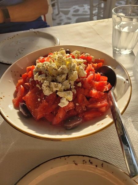 (Okay, this is actually a dakos with Naxos cheese, but I don’t have a photo of a Greek salad 😏).
Blue skies (lots of them), whitewashed villages with steep alleyways, hundreds of churches, and... thousands of stairs? Welcome to the Cyclades! 🙂
We’d been dreaming about this for a while, but in July-August—with the crowds—no way! Now that I can travel outside school holidays, the Cyclades are back on the agenda. And so begins a loooong period of planning and second-guessing, with countless itinerary changes: the Cyclades, yes, but which ones? I was fixated on Folegandros (we won’t be going after all) and really wanted to visit Delos. So, for this first trip, it’ll be: Mykonos (and Delos)-Naxos-Amorgos-Santorini.
Saturday 24/05: Departure from Orly on a Transavia flight, arriving in Mykonos in the late afternoon. We found a hotel that offers free transfers (pretty rare and not insignificant—it’s 25 € each way for just a few kilometers 😠) and at a reasonable price (83 € per night for B&B). Time for dinner already: Greek salad and souvlaki (we’re in Greece, right?)
(Okay, this is actually a dakos with Naxos cheese, but I don’t have a photo of a Greek salad 😏).Brazil 2020: Amazon, Northeast, Chapada, and Boipeba – a winning combo!
Hello everyone.
Preamble:
Sooner or later, you’ve got to take the plunge! I thought lockdown would be the perfect time to start this travel journal, but between working from home and gardening, I just didn’t have the time (or the motivation). Plus, long-haul trips weren’t really on the cards back then... But then I stumbled upon my photos and thought, "I’ve got to share my latest adventure in Brazil—you guessed it!"
First, a little flashback: some of you (yes, really, in DMs!) pointed out the big gaps in my travel journals—India in 2019, Vietnam in 2018, so many missed opportunities!
Truth is, for India, I traveled with a private guide and honestly didn’t have much to add to the tons of well-documented journals already out there. Plus, I still haven’t decided if I love or hate India... So, how do you share your feelings when you’re not even sure yourself? As for Vietnam, I had plenty to say—even though the itinerary was pretty classic—but I’ll admit the vibe on this part of the forum at the time kinda put me off for a while... And time flies, and memories fade... Anyway, just wanted to clear that up for my (many or few) readers. *Tudo bem*, let’s get started!!
Preamble:
Sooner or later, you’ve got to take the plunge! I thought lockdown would be the perfect time to start this travel journal, but between working from home and gardening, I just didn’t have the time (or the motivation). Plus, long-haul trips weren’t really on the cards back then... But then I stumbled upon my photos and thought, "I’ve got to share my latest adventure in Brazil—you guessed it!"
First, a little flashback: some of you (yes, really, in DMs!) pointed out the big gaps in my travel journals—India in 2019, Vietnam in 2018, so many missed opportunities!
Truth is, for India, I traveled with a private guide and honestly didn’t have much to add to the tons of well-documented journals already out there. Plus, I still haven’t decided if I love or hate India... So, how do you share your feelings when you’re not even sure yourself? As for Vietnam, I had plenty to say—even though the itinerary was pretty classic—but I’ll admit the vibe on this part of the forum at the time kinda put me off for a while... And time flies, and memories fade... Anyway, just wanted to clear that up for my (many or few) readers. *Tudo bem*, let’s get started!!
A quand l'ouverture des frontières dans l'espace Schengen? (à vélo)
Hello,
C'est un peu la question qu'on se pose et qui nous oblige à revoir nos plans, pour l'instant c'est très flou, visiblement ce ne serait pas avant Septembre voir même pas envisageable cette année, mais si vous avez des infos de ce côté là n'hésitez pas à les partager.
Gilles
C'est un peu la question qu'on se pose et qui nous oblige à revoir nos plans, pour l'instant c'est très flou, visiblement ce ne serait pas avant Septembre voir même pas envisageable cette année, mais si vous avez des infos de ce côté là n'hésitez pas à les partager.
Gilles
Cape Town and Kruger: 12 days in February with teens
Hi everyone,
I’d love to share a little travel journal from our 14-day/12-night road trip with our two teens (14 and 17) in February/March 2020. A huge thank you to all of you who helped me plan this trip to South Africa—your patience with my endless questions was amazing!
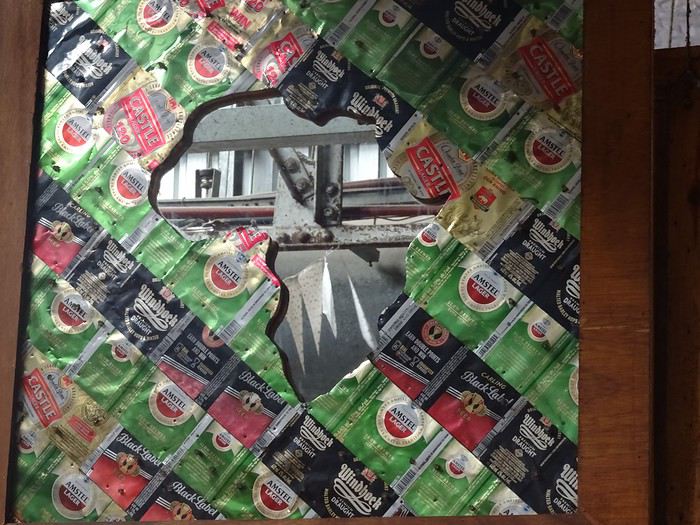
We left Lyon on Saturday, February 22 at 7:00 AM and arrived in Johannesburg at 10:00 PM after a short layover in Amsterdam. Flights cost 440 € per person (booked in October), with carry-on luggage. We added just one checked bag for the whole family (80 € round-trip with the free Flying Blue membership). Since we’d be moving around a lot, we packed light! In Lyon, we reserved parking at P5 in advance for 70 € for 14 days. The Air France/KLM flight was smooth. When we landed, we picked up our bags and had booked a night at the Aero Guest Lodge, just 5 minutes from the airport, with a free shuttle and breakfast. All you have to do is send a WhatsApp message when you arrive at the airport to let the shuttle driver know. The tricky part? Finding him in the terminal—he wasn’t holding a sign with the hotel’s name. 🤪 A South African called him for me since my English wasn’t great (and I had to get used to the accent 😛), and helped us spot the driver (who was actually less than 5 meters away!) with other guests. When we got to the hotel: all good, except we were 10 people in a van meant for 7. The room was spacious—one king-size bed and two single beds for the kids—with a simple but clean bathroom, a garden, pool, and breakfast (which we didn’t try). All for 65 €, so an awesome value!
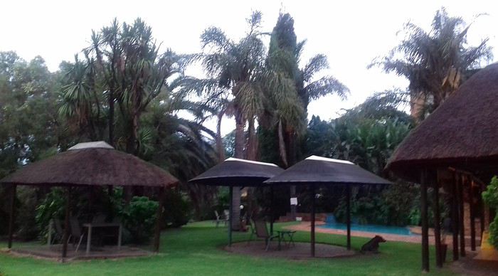 After a restful night, we woke up at 6:00 AM to catch the shuttle back to the airport. Just a heads-up: there’s only one shuttle per hour in the morning, and Kulula canceled our 9:00 AM flight, moving it to 8:00 AM—so no time for breakfast (it starts at 6:30).
We waited 15 minutes in the lovely garden for the driver, who dropped us off at the airport in 5 minutes.
We checked in for our flight to Cape Town, which cost around 40 € (including two checked bags per person).
We grabbed breakfast at the airport instead (less than 20 € for all four of us—one of the nice surprises of South Africa!), and arrived in Cape Town at 10:20 AM.
After a restful night, we woke up at 6:00 AM to catch the shuttle back to the airport. Just a heads-up: there’s only one shuttle per hour in the morning, and Kulula canceled our 9:00 AM flight, moving it to 8:00 AM—so no time for breakfast (it starts at 6:30).
We waited 15 minutes in the lovely garden for the driver, who dropped us off at the airport in 5 minutes.
We checked in for our flight to Cape Town, which cost around 40 € (including two checked bags per person).
We grabbed breakfast at the airport instead (less than 20 € for all four of us—one of the nice surprises of South Africa!), and arrived in Cape Town at 10:20 AM.
 After quickly picking up our bags, we headed to the Avis counter and left with a Toyota Corolla for 80 € for 4 days (rented with the Flying Blue card—free additional driver).
Everything’s on the left... not easy, but it works if you plan your route well.
We drove to our Airbnb in Constantia. We were surprised to see animals, bikes, and pedestrians on the highway!
We arrived around 11:30 AM at our rental—a huge house in the vineyards, in a super secure neighborhood, about 15-20 minutes from Hout Bay. It felt like Beverly Hills, but with super-high walls and barbed wire around the villas. 😕
After quickly picking up our bags, we headed to the Avis counter and left with a Toyota Corolla for 80 € for 4 days (rented with the Flying Blue card—free additional driver).
Everything’s on the left... not easy, but it works if you plan your route well.
We drove to our Airbnb in Constantia. We were surprised to see animals, bikes, and pedestrians on the highway!
We arrived around 11:30 AM at our rental—a huge house in the vineyards, in a super secure neighborhood, about 15-20 minutes from Hout Bay. It felt like Beverly Hills, but with super-high walls and barbed wire around the villas. 😕

We dropped off our bags, changed into shorts (it was around 30°C/86°F), and headed to the Bay Harbour Market in Hout Bay. We had lunch there—such a great vibe! We wandered through the stalls, everyone picked their own dish, and we sat down on the terrace. There was music, artisans of all kinds... a really nice moment.

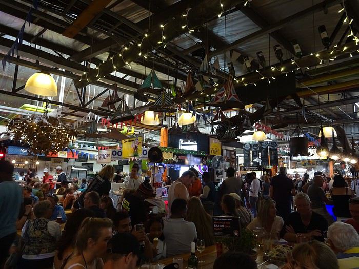
I’d withdrawn 50 € before leaving... and that gave me change to pay the parking attendant. Lunch cost around 30 € for four, including food and drinks.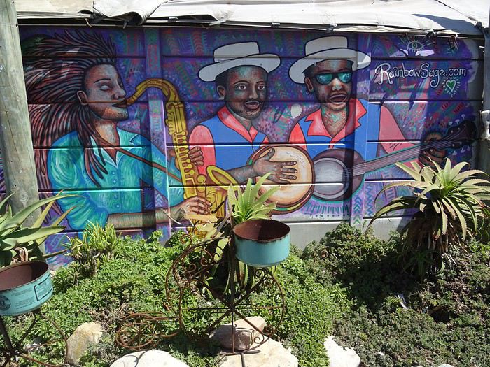

After browsing the artisan stalls, we headed to Hout Bay Beach near the restaurant, Marina Wharf (another small tip for the parking attendant—we’d have to get used to that!). We stopped to admire the sea lions. An ice cream for 1 €? No way we were saying no! 🙂
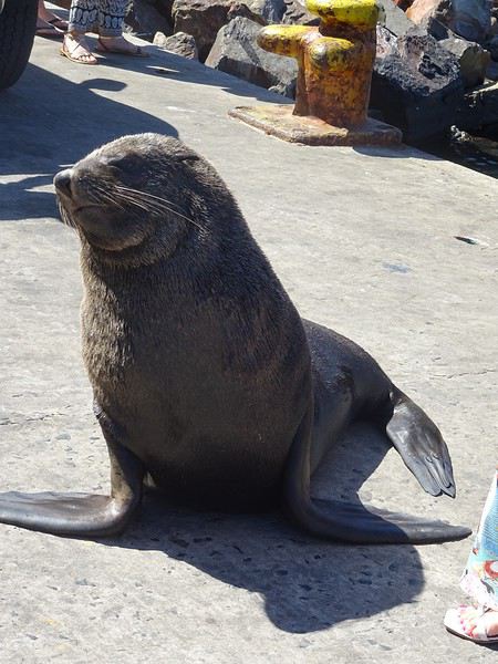
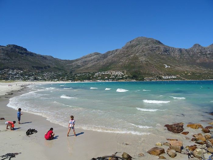
The fatigue was starting to hit, so we headed to the grocery store 10 minutes away (Constantia shopping center) and then had an aperitif in front of the vineyards, opening a delicious bottle of white wine.
I’d love to share a little travel journal from our 14-day/12-night road trip with our two teens (14 and 17) in February/March 2020. A huge thank you to all of you who helped me plan this trip to South Africa—your patience with my endless questions was amazing!
We left Lyon on Saturday, February 22 at 7:00 AM and arrived in Johannesburg at 10:00 PM after a short layover in Amsterdam. Flights cost 440 € per person (booked in October), with carry-on luggage. We added just one checked bag for the whole family (80 € round-trip with the free Flying Blue membership). Since we’d be moving around a lot, we packed light! In Lyon, we reserved parking at P5 in advance for 70 € for 14 days. The Air France/KLM flight was smooth. When we landed, we picked up our bags and had booked a night at the Aero Guest Lodge, just 5 minutes from the airport, with a free shuttle and breakfast. All you have to do is send a WhatsApp message when you arrive at the airport to let the shuttle driver know. The tricky part? Finding him in the terminal—he wasn’t holding a sign with the hotel’s name. 🤪 A South African called him for me since my English wasn’t great (and I had to get used to the accent 😛), and helped us spot the driver (who was actually less than 5 meters away!) with other guests. When we got to the hotel: all good, except we were 10 people in a van meant for 7. The room was spacious—one king-size bed and two single beds for the kids—with a simple but clean bathroom, a garden, pool, and breakfast (which we didn’t try). All for 65 €, so an awesome value!
After a restful night, we woke up at 6:00 AM to catch the shuttle back to the airport. Just a heads-up: there’s only one shuttle per hour in the morning, and Kulula canceled our 9:00 AM flight, moving it to 8:00 AM—so no time for breakfast (it starts at 6:30).
We waited 15 minutes in the lovely garden for the driver, who dropped us off at the airport in 5 minutes.
We checked in for our flight to Cape Town, which cost around 40 € (including two checked bags per person).
We grabbed breakfast at the airport instead (less than 20 € for all four of us—one of the nice surprises of South Africa!), and arrived in Cape Town at 10:20 AM.
After quickly picking up our bags, we headed to the Avis counter and left with a Toyota Corolla for 80 € for 4 days (rented with the Flying Blue card—free additional driver).
Everything’s on the left... not easy, but it works if you plan your route well.
We drove to our Airbnb in Constantia. We were surprised to see animals, bikes, and pedestrians on the highway!
We arrived around 11:30 AM at our rental—a huge house in the vineyards, in a super secure neighborhood, about 15-20 minutes from Hout Bay. It felt like Beverly Hills, but with super-high walls and barbed wire around the villas. 😕We dropped off our bags, changed into shorts (it was around 30°C/86°F), and headed to the Bay Harbour Market in Hout Bay. We had lunch there—such a great vibe! We wandered through the stalls, everyone picked their own dish, and we sat down on the terrace. There was music, artisans of all kinds... a really nice moment.
I’d withdrawn 50 € before leaving... and that gave me change to pay the parking attendant. Lunch cost around 30 € for four, including food and drinks.
After browsing the artisan stalls, we headed to Hout Bay Beach near the restaurant, Marina Wharf (another small tip for the parking attendant—we’d have to get used to that!). We stopped to admire the sea lions. An ice cream for 1 €? No way we were saying no! 🙂
The fatigue was starting to hit, so we headed to the grocery store 10 minutes away (Constantia shopping center) and then had an aperitif in front of the vineyards, opening a delicious bottle of white wine.
Self-drive in southwestern Uganda, February 2020
Since I used this forum a lot to prepare our trip, here’s a little feedback from our 15-day self-drive adventure in southwestern Uganda.
For those who have questions, don’t hesitate! I’ll do my best to answer them 😉
We’d already traveled quite a bit in South Africa and once in Namibia, always self-driving. When the idea of visiting Uganda came up, we debated—especially me 😛—whether to go solo or with a guide. My husband quickly convinced me to do it self-drive, so I started planning and organizing the trip accordingly. We began preparations and bookings in June 2019 for a trip scheduled during the first two weeks of February 2020. We deliberately chose to explore just a small part of Uganda and take our time. We traveled as a group of four, with our oldest son and his partner.
Here’s our itinerary: - February 1: Departure from Brussels, arrival and overnight in Entebbe - February 2: Drive to Lake Mburo and overnight there - February 3: Drive to Lake Bunyonyi and overnight there - February 4: Boat ride on the lake, then departure for Kisoro. Overnight there - February 5: Trek in Mount Mgahinga National Park for the youngsters. Overnight in Kisoro - February 6: Drive to Bwindi Impenetrable Forest. Overnight in Rushaga - February 7: Gorilla tracking in Rushaga. Overnight in Rushaga - February 8: Drive to Queen Elizabeth National Park – Southern sector – Overnight on the park’s edge - February 9: Morning in the southern sector of the park, then crossing to the northern part – Short safari in the late afternoon – Overnight by the Kazinga Channel - February 10: Safari and boat cruise – Second night on site - February 11: Drive to Kibale Forest – Overnight there - February 12: Chimpanzee tracking in the morning – Bigodi swamps in the afternoon – Second night there - February 13: Scenic drive to see the crater lakes + walk at Lake Nkuruba Nature Reserve – Third night there - February 14: Return to Entebbe - February 15: Morning boat ride in the Mabamba swamps – Afternoon by Lake Victoria and midnight flight to Brussels. That’s the broad outline of our trip.
We fell in love with this country: the people, the kids shouting "muzungu," the colors, the landscapes, the wildlife... But we were also saddened by the poverty in some villages and the child labor, especially in "quarries."
I’ll try to post a day-by-day account if it interests anyone.
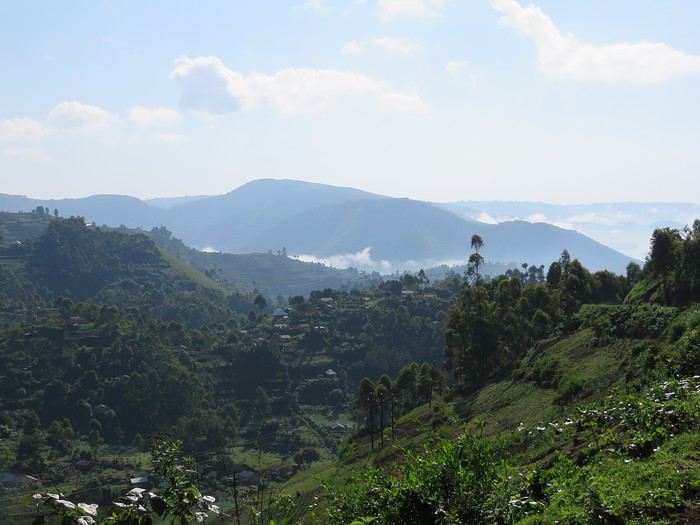
We’d already traveled quite a bit in South Africa and once in Namibia, always self-driving. When the idea of visiting Uganda came up, we debated—especially me 😛—whether to go solo or with a guide. My husband quickly convinced me to do it self-drive, so I started planning and organizing the trip accordingly. We began preparations and bookings in June 2019 for a trip scheduled during the first two weeks of February 2020. We deliberately chose to explore just a small part of Uganda and take our time. We traveled as a group of four, with our oldest son and his partner.
Here’s our itinerary: - February 1: Departure from Brussels, arrival and overnight in Entebbe - February 2: Drive to Lake Mburo and overnight there - February 3: Drive to Lake Bunyonyi and overnight there - February 4: Boat ride on the lake, then departure for Kisoro. Overnight there - February 5: Trek in Mount Mgahinga National Park for the youngsters. Overnight in Kisoro - February 6: Drive to Bwindi Impenetrable Forest. Overnight in Rushaga - February 7: Gorilla tracking in Rushaga. Overnight in Rushaga - February 8: Drive to Queen Elizabeth National Park – Southern sector – Overnight on the park’s edge - February 9: Morning in the southern sector of the park, then crossing to the northern part – Short safari in the late afternoon – Overnight by the Kazinga Channel - February 10: Safari and boat cruise – Second night on site - February 11: Drive to Kibale Forest – Overnight there - February 12: Chimpanzee tracking in the morning – Bigodi swamps in the afternoon – Second night there - February 13: Scenic drive to see the crater lakes + walk at Lake Nkuruba Nature Reserve – Third night there - February 14: Return to Entebbe - February 15: Morning boat ride in the Mabamba swamps – Afternoon by Lake Victoria and midnight flight to Brussels. That’s the broad outline of our trip.
We fell in love with this country: the people, the kids shouting "muzungu," the colors, the landscapes, the wildlife... But we were also saddened by the poverty in some villages and the child labor, especially in "quarries."
I’ll try to post a day-by-day account if it interests anyone.
Oman, le pays des Mille moins Une Merveilles
Bonjour à tous,
Petit clin d'oeil au carnet d'Isabelle (Rouquine 38) quant au choix du titre 😉.
Pourquoi "mille moins une"? Tout simplement parce qu'en 10 jours, on en voit moins qu'en 14 et qu'en berline on en voit (un peu) moins qu'en 4x4. Exit donc le Dhofar et le Jebel Akhdar. Pour ce qui est des 999 autres merveilles, c'est pas faute de ne pas vous avoir prévenus: il va y avoir des redites!
C'est parti.... Muriel
Petit clin d'oeil au carnet d'Isabelle (Rouquine 38) quant au choix du titre 😉.
Pourquoi "mille moins une"? Tout simplement parce qu'en 10 jours, on en voit moins qu'en 14 et qu'en berline on en voit (un peu) moins qu'en 4x4. Exit donc le Dhofar et le Jebel Akhdar. Pour ce qui est des 999 autres merveilles, c'est pas faute de ne pas vous avoir prévenus: il va y avoir des redites!
C'est parti.... Muriel
In the Land of Mountain Gorillas: The Story of an "Epic" Trip
Passionate about travel, animals (furry, feathered, scaly), and my partner’s love for photography, it was in 2014, after encountering orangutans in Gunung Leuser National Park in Sumatra, that I felt the urge to see other great apes in their natural habitat and in the wild. For my 40th birthday, I dreamed of only one thing... seeing gorillas. I still had four years to wait and four years to save up.
At the time, I had only heard of the Virunga Mountains, particularly the part in Rwanda. To be honest, Uganda had never really struck me as a destination I’d ever set foot in, and the DRC, for security reasons, didn’t particularly appeal to me.
But then, one day, I heard that Rwanda was going to increase the price of gorilla permits to USD 1,500 per person. Ouch... that seemed way overpriced, especially since we were going as a couple and I really wanted to see them twice. $6,000 for two days... Okay, it’s for my 40th birthday, but still...
At the end of 2017, I started looking more closely into our trip planned for December 2018. A stroke of luck in my schedule meant my former English teacher sent me a link to an article she’d written for her travel agency about her encounter with gorillas in Uganda. Hmm, Uganda? It was the first time I’d read about the country. Why not?
I scoured various forums in French and English and re-discovered voyageforum.com. And most importantly, I came across Ticapi’s travel journal, which I devoured in one evening, and a few months later, Muriel18’s, whose release I eagerly awaited. Wow!!! Not only can you see gorillas in Uganda, but also chimpanzees and the shoebill, not to mention the savannah and the chance to go on more classic safaris.
All that’s left is to convince my better half that Uganda is a safe country...
Usually, and now more than ever, we prefer independent travel and self-drive trips in particular. But given the proximity to the DRC border, the potentially impassable roads after rain, and rental cars that aren’t always in the best condition, we hired a guide for two weeks in December 2018. The months passed, and the excitement grew.
Three weeks before departure, I fell ill after a work trip to Asia. Darn! This time, I didn’t waste any time—I quickly saw a doctor and got rid of that virus. That was the plan! Flu or malaria? (I’d been to the Amazon six months earlier.) The doctor didn’t know; the cough only appeared a few days later. We did blood tests two days in a row to rule out malaria. So it was the flu or... pneumonia :-( ...?
The X-rays spoke for themselves—it was pneumonia, and it was already quite advanced. No big deal, I still had two weeks to recover! I religiously took my antibiotics, downed loads of vitamin C, but nothing worked—the antibiotics didn’t seem to be doing anything. I was coughing so hard I thought my lungs would come up, I was short of breath, exhausted. I’d dreamed of this trip for so long... it seemed unthinkable not to go. Five days before departure, my doctor hospitalized me—the pneumonia had worsened, and my blood oxygen levels were dangerously low. I was in tears but still in denial about what was happening to me. Besides, I’d still taken my anti-malarial, because I was determined to leave.
I spent the first day in the emergency room on oxygen 24/7. The germ causing my pneumonia was unknown to the infectious disease and pulmonary specialists. They tried a combination of antibiotics. No big deal, in four days, I’d be leaving. I harassed the doctor, who must have thought I was crazy, to find out when I could be discharged—"because, you see, doctor, I have a flight to Uganda on Saturday." On Thursday, the doctor was firm: I’d still be hospitalized on Saturday... deep down, I knew it but didn’t want to admit it. My partner handled canceling the flights, contacted our travel insurance (thankfully we had some), and I wrote to our guide (who, in the meantime, had become our tour operator) who could hardly believe it. And neither could I! We told ourselves it was just postponed and that we’d take this long-awaited trip at the end of 2019!
March 2019, the tour operator reached out to us: "Didn’t you say you wanted to go to Uganda this year? You’d better hurry and book the gorilla permits before they run out."
Oh yes, we wanted to see the gorillas. But we hesitated about rebooking. I still hoped to do this trip as a self-drive. The thing is, this year, we managed to take three weeks off, and we also wanted to spend a week in Rwanda. My partner still didn’t feel comfortable driving there. Yet, he’s driven all over the world. I respected his feelings, especially since he’s the only one who drives.
Anyway, we went back and forth but neither of us really said what we were thinking: "What if we used someone else to organize our trip?" In the end, we went with him again, made a first deposit for four gorilla permits (two days each) (not the best idea we’ve ever had), and looked into adding Rwanda to our itinerary. We’d have a guide/driver for the whole trip with mid-range accommodations.
After several back-and-forths, the itinerary was supposed to look something like this. To be honest, I got fed up after a while.
Day 1: Arrival in Kigali in the evening Day 2: Transfer from Kigali to Akagera NP Day 3: Safari in Akagera NP Day 4: Akagera NP and night in Nyagatare Day 5: Transfer from Nyagatare to Nyungwe Forest Day 6: Nyungwe Day 7: Nyungwe Day 8: Transfer from Nyungwe to Lake Kivu, Rubavu/Gisenyi Day 9: Transfer from Rubavu/Gisenyi to Kisoro/Uganda via the Cyanika border Day 10: Gorilla tracking in Mgahinga NP Day 11: Golden Monkey tracking in Mgahinga NP, night at Lake Mutanda Day 12: Gorilla tracking in Bwindi, Ruhija (later changed to Rushaga) Day 13: Queen Elizabeth NP, Ishasha sector in the morning and Kazinga Channel in the afternoon Day 14: No clear answer on activities for that day. After three attempts, I gave up. I shouldn’t have... Day 15: Chimpanzee tracking in Kyambura Gorge, night at Lake Nkuruba Day 16: Lake Nkuruba, morning activities around the lake and Bigodi Swamps in the afternoon Day 17: Transfer from Lake Nkuruba to Murchison Falls Day 18: Murchison Falls Day 19: Murchison Falls Day 20: Transfer from Murchison Falls via Ziwa Rhino Sanctuary, night in Entebbe Day 21: Entebbe – Mabamba Swamps Day 22: Mabamba Swamps in the morning, Botanical Garden in Entebbe in the afternoon, and transfer to the airport for the overnight return flight.
In April, he asked us for a substantial deposit for the accommodations and some park activities, as one of his colleagues was doing the same tour in May and it would be good if he could secure the already-made reservations by paying the bill.
A week before departure, just like in 2018, we paid the remaining balance of the agreed amount. Three days later, since I hadn’t heard from him (the TO is based in Germany), I sent him a message to confirm he’d received the payment.
My partner joked, "And that’s when he tells us he closed the account we sent the money to." I forced a laugh... and even more so when the TO asked me which account I’d sent the balance to... "Uh, the same one as before." And then he told me he’d closed that account and maybe should’ve mentioned it earlier... uh, you think?! And of course, he needed the money sent again quickly. "Well, buddy, you’ll have to wait until I get it back!!!
It was already late, and my bank had been closed for hours. The next morning, first thing, I called my bank and explained the situation.
"Unfortunately, we can’t do anything for you; you’ll have to wait for the money to be returned." "But how long will that take?" "A few days or weeks, depending on the banks, and you should expect transfer fees."
Brilliant! :-(
After nearly 10 years of traveling almost exclusively without traditional travel agencies, had we just been scammed? I went back to the forums to reread posts about this TO from other travelers. They were all positive; no one mentioned a scam.
The next day, I searched online for the contact details of his bank in Germany. I wrote to the generic email address in English, explaining that I’d made a transfer without knowing that this gentleman had closed his bank account. The employee replied in impeccable English that the bank only responded to emails written in German. Grrr! I used a well-known translator since my German is, let’s say, rusty, and resent my email in German. The same agent replied in German that unfortunately, they couldn’t do anything for me—that if the account had been closed, an automatic rule would return the money to the sender... period, end of story!
Well, our money is lost somewhere in the "cloud," or so we hope! Wait and see!
No news from our TO, and we didn’t reach out either—we were too annoyed by the whole situation.
At the time, I had only heard of the Virunga Mountains, particularly the part in Rwanda. To be honest, Uganda had never really struck me as a destination I’d ever set foot in, and the DRC, for security reasons, didn’t particularly appeal to me.
But then, one day, I heard that Rwanda was going to increase the price of gorilla permits to USD 1,500 per person. Ouch... that seemed way overpriced, especially since we were going as a couple and I really wanted to see them twice. $6,000 for two days... Okay, it’s for my 40th birthday, but still...
At the end of 2017, I started looking more closely into our trip planned for December 2018. A stroke of luck in my schedule meant my former English teacher sent me a link to an article she’d written for her travel agency about her encounter with gorillas in Uganda. Hmm, Uganda? It was the first time I’d read about the country. Why not?
I scoured various forums in French and English and re-discovered voyageforum.com. And most importantly, I came across Ticapi’s travel journal, which I devoured in one evening, and a few months later, Muriel18’s, whose release I eagerly awaited. Wow!!! Not only can you see gorillas in Uganda, but also chimpanzees and the shoebill, not to mention the savannah and the chance to go on more classic safaris.
All that’s left is to convince my better half that Uganda is a safe country...
Usually, and now more than ever, we prefer independent travel and self-drive trips in particular. But given the proximity to the DRC border, the potentially impassable roads after rain, and rental cars that aren’t always in the best condition, we hired a guide for two weeks in December 2018. The months passed, and the excitement grew.
Three weeks before departure, I fell ill after a work trip to Asia. Darn! This time, I didn’t waste any time—I quickly saw a doctor and got rid of that virus. That was the plan! Flu or malaria? (I’d been to the Amazon six months earlier.) The doctor didn’t know; the cough only appeared a few days later. We did blood tests two days in a row to rule out malaria. So it was the flu or... pneumonia :-( ...?
The X-rays spoke for themselves—it was pneumonia, and it was already quite advanced. No big deal, I still had two weeks to recover! I religiously took my antibiotics, downed loads of vitamin C, but nothing worked—the antibiotics didn’t seem to be doing anything. I was coughing so hard I thought my lungs would come up, I was short of breath, exhausted. I’d dreamed of this trip for so long... it seemed unthinkable not to go. Five days before departure, my doctor hospitalized me—the pneumonia had worsened, and my blood oxygen levels were dangerously low. I was in tears but still in denial about what was happening to me. Besides, I’d still taken my anti-malarial, because I was determined to leave.
I spent the first day in the emergency room on oxygen 24/7. The germ causing my pneumonia was unknown to the infectious disease and pulmonary specialists. They tried a combination of antibiotics. No big deal, in four days, I’d be leaving. I harassed the doctor, who must have thought I was crazy, to find out when I could be discharged—"because, you see, doctor, I have a flight to Uganda on Saturday." On Thursday, the doctor was firm: I’d still be hospitalized on Saturday... deep down, I knew it but didn’t want to admit it. My partner handled canceling the flights, contacted our travel insurance (thankfully we had some), and I wrote to our guide (who, in the meantime, had become our tour operator) who could hardly believe it. And neither could I! We told ourselves it was just postponed and that we’d take this long-awaited trip at the end of 2019!
March 2019, the tour operator reached out to us: "Didn’t you say you wanted to go to Uganda this year? You’d better hurry and book the gorilla permits before they run out."
Oh yes, we wanted to see the gorillas. But we hesitated about rebooking. I still hoped to do this trip as a self-drive. The thing is, this year, we managed to take three weeks off, and we also wanted to spend a week in Rwanda. My partner still didn’t feel comfortable driving there. Yet, he’s driven all over the world. I respected his feelings, especially since he’s the only one who drives.
Anyway, we went back and forth but neither of us really said what we were thinking: "What if we used someone else to organize our trip?" In the end, we went with him again, made a first deposit for four gorilla permits (two days each) (not the best idea we’ve ever had), and looked into adding Rwanda to our itinerary. We’d have a guide/driver for the whole trip with mid-range accommodations.
After several back-and-forths, the itinerary was supposed to look something like this. To be honest, I got fed up after a while.
Day 1: Arrival in Kigali in the evening Day 2: Transfer from Kigali to Akagera NP Day 3: Safari in Akagera NP Day 4: Akagera NP and night in Nyagatare Day 5: Transfer from Nyagatare to Nyungwe Forest Day 6: Nyungwe Day 7: Nyungwe Day 8: Transfer from Nyungwe to Lake Kivu, Rubavu/Gisenyi Day 9: Transfer from Rubavu/Gisenyi to Kisoro/Uganda via the Cyanika border Day 10: Gorilla tracking in Mgahinga NP Day 11: Golden Monkey tracking in Mgahinga NP, night at Lake Mutanda Day 12: Gorilla tracking in Bwindi, Ruhija (later changed to Rushaga) Day 13: Queen Elizabeth NP, Ishasha sector in the morning and Kazinga Channel in the afternoon Day 14: No clear answer on activities for that day. After three attempts, I gave up. I shouldn’t have... Day 15: Chimpanzee tracking in Kyambura Gorge, night at Lake Nkuruba Day 16: Lake Nkuruba, morning activities around the lake and Bigodi Swamps in the afternoon Day 17: Transfer from Lake Nkuruba to Murchison Falls Day 18: Murchison Falls Day 19: Murchison Falls Day 20: Transfer from Murchison Falls via Ziwa Rhino Sanctuary, night in Entebbe Day 21: Entebbe – Mabamba Swamps Day 22: Mabamba Swamps in the morning, Botanical Garden in Entebbe in the afternoon, and transfer to the airport for the overnight return flight.
In April, he asked us for a substantial deposit for the accommodations and some park activities, as one of his colleagues was doing the same tour in May and it would be good if he could secure the already-made reservations by paying the bill.
A week before departure, just like in 2018, we paid the remaining balance of the agreed amount. Three days later, since I hadn’t heard from him (the TO is based in Germany), I sent him a message to confirm he’d received the payment.
My partner joked, "And that’s when he tells us he closed the account we sent the money to." I forced a laugh... and even more so when the TO asked me which account I’d sent the balance to... "Uh, the same one as before." And then he told me he’d closed that account and maybe should’ve mentioned it earlier... uh, you think?! And of course, he needed the money sent again quickly. "Well, buddy, you’ll have to wait until I get it back!!!
It was already late, and my bank had been closed for hours. The next morning, first thing, I called my bank and explained the situation.
"Unfortunately, we can’t do anything for you; you’ll have to wait for the money to be returned." "But how long will that take?" "A few days or weeks, depending on the banks, and you should expect transfer fees."
Brilliant! :-(
After nearly 10 years of traveling almost exclusively without traditional travel agencies, had we just been scammed? I went back to the forums to reread posts about this TO from other travelers. They were all positive; no one mentioned a scam.
The next day, I searched online for the contact details of his bank in Germany. I wrote to the generic email address in English, explaining that I’d made a transfer without knowing that this gentleman had closed his bank account. The employee replied in impeccable English that the bank only responded to emails written in German. Grrr! I used a well-known translator since my German is, let’s say, rusty, and resent my email in German. The same agent replied in German that unfortunately, they couldn’t do anything for me—that if the account had been closed, an automatic rule would return the money to the sender... period, end of story!
Well, our money is lost somewhere in the "cloud," or so we hope! Wait and see!
No news from our TO, and we didn’t reach out either—we were too annoyed by the whole situation.
Oman, le pays des Mille et Une Merveilles
Qui n’a jamais eu envie de vivre les aventures de Sindbad le marin, qui n’a jamais rêvé de Shéhérazade lors de ses lectures des contes Les Mille et Une Nuits? Ou encore de la reine de Saba...
Eh bien! En parcourant le Sultanat d’Oman, nous allons à leur recherche ou plutôt découvrir ce pays des Mille et Une Merveilles décrites dans les célèbres contes persans dont a fait partie l’actuel Sultanat.
Voici l’itinéraire prévu pour ces deux semaines :
21/12 Lyon – Mascate 22/12 Mascate 23/12 Mascate – Wadi Tiwi 24/12 Wadi Shab – Sour 25/12 Ras Al Jinz – Wadi Bani Kalid 26/12 Wahiba Sands 27/12 Sugar Dunes – Sanctuaire Oryx 28/12 Mirbat 29/12 Wadi Darbat – Salalah 30/12 Mughsayl – Rakyut 31/12 Rub Al Khali - Haima 01/01 Jabreen - Nizwa 02/01 Tanuf - Bahla – Jebel Shams 03/01 Jebel Shams – Al Hamra - Misfat 04/01 Bilad Sayt – Wadi Bani Awf – Mascate 05/01 Mascate - Lyon
Montagnes, Wadis, déserts et plages, chacun y trouvera son bonheur. Voici un petit aperçu de ce qui vous attend.
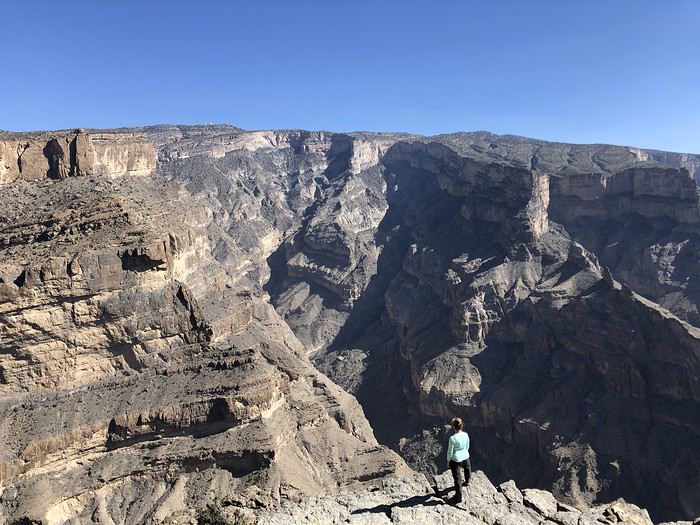
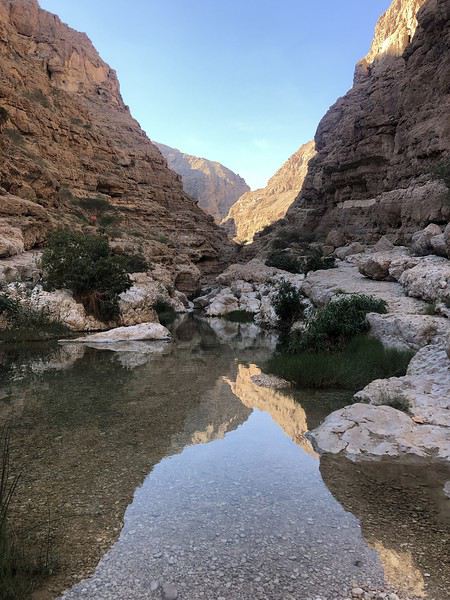
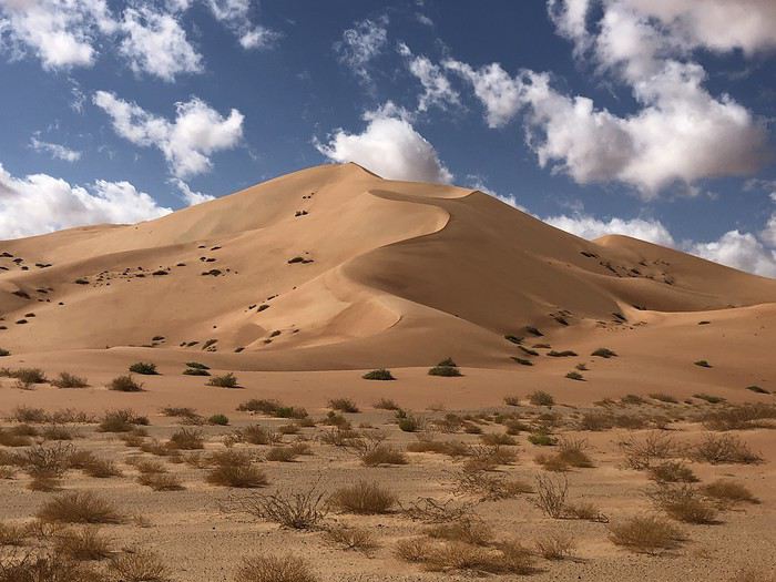
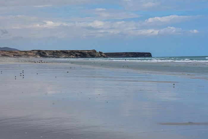
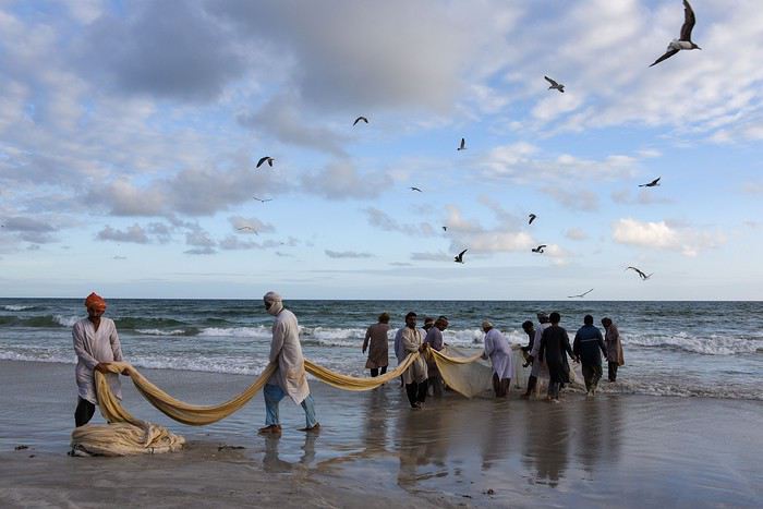
Alors si vous voulez bien me suivre...
Eh bien! En parcourant le Sultanat d’Oman, nous allons à leur recherche ou plutôt découvrir ce pays des Mille et Une Merveilles décrites dans les célèbres contes persans dont a fait partie l’actuel Sultanat.
Voici l’itinéraire prévu pour ces deux semaines :
21/12 Lyon – Mascate 22/12 Mascate 23/12 Mascate – Wadi Tiwi 24/12 Wadi Shab – Sour 25/12 Ras Al Jinz – Wadi Bani Kalid 26/12 Wahiba Sands 27/12 Sugar Dunes – Sanctuaire Oryx 28/12 Mirbat 29/12 Wadi Darbat – Salalah 30/12 Mughsayl – Rakyut 31/12 Rub Al Khali - Haima 01/01 Jabreen - Nizwa 02/01 Tanuf - Bahla – Jebel Shams 03/01 Jebel Shams – Al Hamra - Misfat 04/01 Bilad Sayt – Wadi Bani Awf – Mascate 05/01 Mascate - Lyon
Montagnes, Wadis, déserts et plages, chacun y trouvera son bonheur. Voici un petit aperçu de ce qui vous attend.
Alors si vous voulez bien me suivre...
État d'urgence à Santiago (Chili)
Bonjour,
Une hausse des tarifs de transport en début du mois a provoqué de nombreuses manifestations plus ou moins spontanées dans le métro de Santiago.
Le phénomène a pris de l'ampleur et des pillages de grandes surfaces ont maintenant eu lieu aussi.
L'État d'Urgence a été déclaré, pour le moment, UNIQUEMENT EN CE QUI CONCERNE LA RÉGION MÉTROPOLITAINE, càd Santiago et les environs immédiats.
Mais. des manifestations ont actuellement lieu dans d'autres villes du Chili et la situation pourrait empirer encore.
La situation s'est fort dégradée ces dernières heures.
Restez particulièrement attentifs.
Bonne chance.
Thierry
Une hausse des tarifs de transport en début du mois a provoqué de nombreuses manifestations plus ou moins spontanées dans le métro de Santiago.
Le phénomène a pris de l'ampleur et des pillages de grandes surfaces ont maintenant eu lieu aussi.
L'État d'Urgence a été déclaré, pour le moment, UNIQUEMENT EN CE QUI CONCERNE LA RÉGION MÉTROPOLITAINE, càd Santiago et les environs immédiats.
Mais. des manifestations ont actuellement lieu dans d'autres villes du Chili et la situation pourrait empirer encore.
La situation s'est fort dégradée ces dernières heures.
Restez particulièrement attentifs.
Bonne chance.
Thierry
Pérégrinations namibiennes: orange is the new black?
 Encore un carnet sur la Namibie…. Purée ça saoule un peu à la fin….
Je vous répondrai : qu’importe le voyage pourvu qu’on ait l’ivresse.
En tout cas, soyez rassurés (ou pas) ce récit ne sera pas aussi « en direct » que celui de Tidju, pas aussi « fleuri d’expressions » que celui de Tahie (j’adore ton Nom di chtoupette), pas aussi « exhaustif et documenté » que celui de Rouquine…
Sans parler de toutes les magnifiques photos que ces trois là (et bien d’autres avant eux) ont déjà balancées sur ce forum. Bref il sera, je pense, à notre image, un peu dilettante….🤪 Soyez indulgents...
Nous avons voyager en juillet août et aussi en couple (59 et 55); l'un n'empêchant pas l'autre.😉
Et contrairement à la plupart des membres participant au VF Namibie nous n’avons pas opté pour le logement en tente sur le toit.
Nous dormirons les 30 nuits en « dur » dans différents lodges, guestfarms ou guesthouses
De plus nous avons choisi d’adopter un rythme peu soutenu (nous restons quasi chaque fois 2 nuits au même endroit) et des étapes courtes.
Voici notre itinéraire (5550 km quand même) :
Windhoek - Mariental - -Luderitz 2 nuits - Tirasberge 2 nuits - Sesriem 2 nuits
Rantberge 2 nuits - Swakopmund 2 nuits - Brandberg 2 nuits - Grootberg 2 nuits
Camp Aussicht - Opuwo - Epupa Falls 2 nuits - Kunene River Lodge 2 nuits - Kamanjab
Etosha Okaukuejo 2 nuits - Etosha Namutomi 2 nuits - Otjiwarango - Okondjima - Windhoek
Encore un carnet sur la Namibie…. Purée ça saoule un peu à la fin….
Je vous répondrai : qu’importe le voyage pourvu qu’on ait l’ivresse.
En tout cas, soyez rassurés (ou pas) ce récit ne sera pas aussi « en direct » que celui de Tidju, pas aussi « fleuri d’expressions » que celui de Tahie (j’adore ton Nom di chtoupette), pas aussi « exhaustif et documenté » que celui de Rouquine…
Sans parler de toutes les magnifiques photos que ces trois là (et bien d’autres avant eux) ont déjà balancées sur ce forum. Bref il sera, je pense, à notre image, un peu dilettante….🤪 Soyez indulgents...
Nous avons voyager en juillet août et aussi en couple (59 et 55); l'un n'empêchant pas l'autre.😉
Et contrairement à la plupart des membres participant au VF Namibie nous n’avons pas opté pour le logement en tente sur le toit.
Nous dormirons les 30 nuits en « dur » dans différents lodges, guestfarms ou guesthouses
De plus nous avons choisi d’adopter un rythme peu soutenu (nous restons quasi chaque fois 2 nuits au même endroit) et des étapes courtes.
Voici notre itinéraire (5550 km quand même) :
Windhoek - Mariental - -Luderitz 2 nuits - Tirasberge 2 nuits - Sesriem 2 nuits
Rantberge 2 nuits - Swakopmund 2 nuits - Brandberg 2 nuits - Grootberg 2 nuits
Camp Aussicht - Opuwo - Epupa Falls 2 nuits - Kunene River Lodge 2 nuits - Kamanjab
Etosha Okaukuejo 2 nuits - Etosha Namutomi 2 nuits - Otjiwarango - Okondjima - WindhoekVos "regrets" en voyage?
Bonjour !
Un petit sujet qui m'est venu à l'esprit ! Vous est-il arrivé d'avoir des "regrets" lors d'un voyage, c'est-à-dire des choses que vous vouliez voir et faire et que vous n'avez pas pu ? Et pourquoi ? Je parle plutôt de "malheureux concours de circonstances" et pas juste le manque de temps.
Récemment quelques regrets en Russie :
- A Moscou le musée des Cosmonautes. Je voulais vraiment le voir, mais mauvais concours de circonstances. On est arrivé un peu tard sur place, ayant fait une balade plus longue que prévu avant. Après vérification sur Internet, il était ouvert les jours suivants. En fait non, j'ai vu plus tard sur la page en russe qu'il fermait pile 4 jours pour travaux... 🤪
- Le dernier jour, nous étions dans le "centre", nous pensions faire un tour au parc Zariadié, récemment ouvert, avec sa plateforme suspendue sur la Moskova, mais pas le temps... on a dû faire une pause toilettes à cause de moi, et accessoirement manger un peu car j'allais tomber dans les pommes, ça a pris plus de temps que prévu. On avait un train à prendre ensuite (mauvais calcul du temps de notre part, je l'admets).
Bon, je compte y retourner à Moscou, ça va !
- Un survol en hélicoptère de Saint-Pétersbourg. Ceci n'a lieu que le week-end, seulement par "beau temps" (c'est relatif là-bas), et forcément après des jours de soleil, temps pourri le week-end. Pour finir, on a donc fait autre chose le dimanche, et il y a eu une éclaircie, on a vu les hélicos décoller en face... Bon, dur de prévoir exactement les éclaircies. Dans la mesure où j'aimerais y retourner l'hiver et que les vols n'ont lieu qu'en saison, c'est pas gagné... Puis avec la météo, c'est jamais gagné là-bas 😛
- A Cracovie, dernier jour, on voulait voir les mines de sel. On allait à pied prendre le bus, gros orage, très violent, et pas prévu. On avait pas de parapluie, on a fini tremper jusqu'aux os et à devoir se réfugier dans un magasin (ils vendaient des parapluies 😛) puis Mcdo, pendant deux bonnes heures car ça se calmait pas. Ensuite c'était tard, et vu la différence de température entre les mines et l'extérieur, pas question d'y aller trempés... Bon au final comme ça a l'air très "usine à touristes", ce n'est qu'un semi-regrets. J'aimerais bien les voir un jour quand même on va dire.
- A Trapani en Sicile, un seul jour plein sur place, on voulait grimper à Erice en téléphérique. On arrive, c'est fermé pour cause de vent... le téléphérique n'étant pas pile à côté du centre, deux heures perdues, et on n'a pas vu Erice. Je plaide coupable, j'avais pas vérifié sur le site avant de partir de l'appart...
- Lors d'un énième séjour à Madrid, cette fois nous voulions passer une grosse après-midi à Tolède. On s'est rendu un samedi à la gare, pas pu les jours avant car il avait pas mal plu et qu'on voulait surtout se balader (on était donc resté à Madrid dans les musées). On arrive 40 mn avant le départ du train, il était complet !!! Seulement un train toutes les 2h le samedi. Le suivant nous aurait fait arriver tard, ça ne valait pas le coup...
Ensuite le dimanche et le lundi les quelques musées ou monuments qui nous intéressaient étaient fermés (ou fermaient trop tôt le dimanche), on a préféré reporter à un futur séjour. Même coup pour Ségovie, donc l'Alcazar était ouvert le lundi. On déjeune, je regarde les bus sur Internet, la gare routière étant loin d'où on était, et forcément celui qu'on voulait était complet, le seul de la journée à l'être. Après ça faisait un peu tard selon monsieur.
Bon sur le moment on est un peu énervé mais comme ça reste une destination proche et où aime aller régulièrement, on sait qu'on y retournera donc ce n'est pas bien grave !
- A Belgrade, on voulait passer une journée à Novi Sad, mais les jours où on avait envie, il pleuvait vraiment beaucoup, donc justement, ça valait pas le coup... Je savais que j'allais pas y retourner de suite, mais tant pis.
Je dois en avoir d'autres mais c'est ce qui me vient à l'esprit. Bien sûr il y a toujours des choses que je voulais voir en voyage, mais pas eu le temps (j'ai tendance à vouloir tout voir, ou presque !), mais c'est un peu différent. S'il y a encore assez à voir, j'y retourne !! Évidemment au bout du monde c'est plus dur... Plus la destination est difficile d'accès plus c'est "rageant" c'est sûr !
A vous !
Un petit sujet qui m'est venu à l'esprit ! Vous est-il arrivé d'avoir des "regrets" lors d'un voyage, c'est-à-dire des choses que vous vouliez voir et faire et que vous n'avez pas pu ? Et pourquoi ? Je parle plutôt de "malheureux concours de circonstances" et pas juste le manque de temps.
Récemment quelques regrets en Russie :
- A Moscou le musée des Cosmonautes. Je voulais vraiment le voir, mais mauvais concours de circonstances. On est arrivé un peu tard sur place, ayant fait une balade plus longue que prévu avant. Après vérification sur Internet, il était ouvert les jours suivants. En fait non, j'ai vu plus tard sur la page en russe qu'il fermait pile 4 jours pour travaux... 🤪
- Le dernier jour, nous étions dans le "centre", nous pensions faire un tour au parc Zariadié, récemment ouvert, avec sa plateforme suspendue sur la Moskova, mais pas le temps... on a dû faire une pause toilettes à cause de moi, et accessoirement manger un peu car j'allais tomber dans les pommes, ça a pris plus de temps que prévu. On avait un train à prendre ensuite (mauvais calcul du temps de notre part, je l'admets).
Bon, je compte y retourner à Moscou, ça va !
- Un survol en hélicoptère de Saint-Pétersbourg. Ceci n'a lieu que le week-end, seulement par "beau temps" (c'est relatif là-bas), et forcément après des jours de soleil, temps pourri le week-end. Pour finir, on a donc fait autre chose le dimanche, et il y a eu une éclaircie, on a vu les hélicos décoller en face... Bon, dur de prévoir exactement les éclaircies. Dans la mesure où j'aimerais y retourner l'hiver et que les vols n'ont lieu qu'en saison, c'est pas gagné... Puis avec la météo, c'est jamais gagné là-bas 😛
- A Cracovie, dernier jour, on voulait voir les mines de sel. On allait à pied prendre le bus, gros orage, très violent, et pas prévu. On avait pas de parapluie, on a fini tremper jusqu'aux os et à devoir se réfugier dans un magasin (ils vendaient des parapluies 😛) puis Mcdo, pendant deux bonnes heures car ça se calmait pas. Ensuite c'était tard, et vu la différence de température entre les mines et l'extérieur, pas question d'y aller trempés... Bon au final comme ça a l'air très "usine à touristes", ce n'est qu'un semi-regrets. J'aimerais bien les voir un jour quand même on va dire.
- A Trapani en Sicile, un seul jour plein sur place, on voulait grimper à Erice en téléphérique. On arrive, c'est fermé pour cause de vent... le téléphérique n'étant pas pile à côté du centre, deux heures perdues, et on n'a pas vu Erice. Je plaide coupable, j'avais pas vérifié sur le site avant de partir de l'appart...
- Lors d'un énième séjour à Madrid, cette fois nous voulions passer une grosse après-midi à Tolède. On s'est rendu un samedi à la gare, pas pu les jours avant car il avait pas mal plu et qu'on voulait surtout se balader (on était donc resté à Madrid dans les musées). On arrive 40 mn avant le départ du train, il était complet !!! Seulement un train toutes les 2h le samedi. Le suivant nous aurait fait arriver tard, ça ne valait pas le coup...
Ensuite le dimanche et le lundi les quelques musées ou monuments qui nous intéressaient étaient fermés (ou fermaient trop tôt le dimanche), on a préféré reporter à un futur séjour. Même coup pour Ségovie, donc l'Alcazar était ouvert le lundi. On déjeune, je regarde les bus sur Internet, la gare routière étant loin d'où on était, et forcément celui qu'on voulait était complet, le seul de la journée à l'être. Après ça faisait un peu tard selon monsieur.
Bon sur le moment on est un peu énervé mais comme ça reste une destination proche et où aime aller régulièrement, on sait qu'on y retournera donc ce n'est pas bien grave !
- A Belgrade, on voulait passer une journée à Novi Sad, mais les jours où on avait envie, il pleuvait vraiment beaucoup, donc justement, ça valait pas le coup... Je savais que j'allais pas y retourner de suite, mais tant pis.
Je dois en avoir d'autres mais c'est ce qui me vient à l'esprit. Bien sûr il y a toujours des choses que je voulais voir en voyage, mais pas eu le temps (j'ai tendance à vouloir tout voir, ou presque !), mais c'est un peu différent. S'il y a encore assez à voir, j'y retourne !! Évidemment au bout du monde c'est plus dur... Plus la destination est difficile d'accès plus c'est "rageant" c'est sûr !
A vous !