Results for "Îles+Marmara+|+123+>+233"
54451 results found.
les Iles Santorin en Grèce fin avril English translation pending
Bonjour,
😛Fin avril je souhaiterais voyager qq jours a Santorini, je n'y suis jamais aller et je me demande si fin avril je pourrais profiter de la plage et de son soleil ? quelle est la meilleure facon de se loger ? je voudrais un petit hotel typique rien a voir avec les luxueux hotels 4/5 etoiles et 300 ch, pas pour faire des economies mais pour profiter d'une ambiance, d'un acceuil personaliser et familier... je voudrais etre le plus proche de la plage parcequ'en ce moment je suis a Madrid et l'hiver ce fait trop long 😠... est-ce que la vie quotidienne est chere, les transports, les restaurants, les boites de nuits etc etc etc... quels sont les souvenirs a acheter sans tomber dans les "embuscades"... je ne parle que qq mots d'anglais, les habitants sont-ils reserves ? en fait je voudrais "tout" savoir !
Merci infiniment pour vos messages, je vous reserverais de tres belles photos...
😛Fin avril je souhaiterais voyager qq jours a Santorini, je n'y suis jamais aller et je me demande si fin avril je pourrais profiter de la plage et de son soleil ? quelle est la meilleure facon de se loger ? je voudrais un petit hotel typique rien a voir avec les luxueux hotels 4/5 etoiles et 300 ch, pas pour faire des economies mais pour profiter d'une ambiance, d'un acceuil personaliser et familier... je voudrais etre le plus proche de la plage parcequ'en ce moment je suis a Madrid et l'hiver ce fait trop long 😠... est-ce que la vie quotidienne est chere, les transports, les restaurants, les boites de nuits etc etc etc... quels sont les souvenirs a acheter sans tomber dans les "embuscades"... je ne parle que qq mots d'anglais, les habitants sont-ils reserves ? en fait je voudrais "tout" savoir !
Merci infiniment pour vos messages, je vous reserverais de tres belles photos...
Donne infos sur l'Ile des Canaries English translation pending
bonjour,
si quelqu un souhaite des infos sur des hotels sur l ile de gran Canaria j pourrais peut etre vous aider dans le cadre de mon travail j y ai passé une semaine à visiter des hotels!!
si quelqu un souhaite des infos sur des hotels sur l ile de gran Canaria j pourrais peut etre vous aider dans le cadre de mon travail j y ai passé une semaine à visiter des hotels!!
Les Iles Greques avec des enfants English translation pending
Après réflexion, je rebondis sur ma propre question :
Les iles, c'est bien ?
Est-il facile de visiter plusieurs iles avec des enfants ? N'y a t-il pas trop d'attente aux ferries ?
Quelles iles visiter (je n'en connais aucune) ?
Comment procéder ?
Merci de m'éclairer.😎
Les iles, c'est bien ?
Est-il facile de visiter plusieurs iles avec des enfants ? N'y a t-il pas trop d'attente aux ferries ?
Quelles iles visiter (je n'en connais aucune) ?
Comment procéder ?
Merci de m'éclairer.😎
Les Iles Trang en mai (Thaïlande) English translation pending
Pour commencer bonne année à toutes et tous !!!
Serait-il possible d'avoir de plus amples informations sur les iles de Trang ?(moyens d'y accéder, hebergements, bons plans etc...)
Je compte y faire un saut en Mai ou Juin de cette année meme si j'ai des doutes sur la possibilitée de rejoindre ces iles durant cette période.(la mer devenant plus agitée) svp renseignez-moi!!!
Merci d'avance
Kemai
Serait-il possible d'avoir de plus amples informations sur les iles de Trang ?(moyens d'y accéder, hebergements, bons plans etc...)
Je compte y faire un saut en Mai ou Juin de cette année meme si j'ai des doutes sur la possibilitée de rejoindre ces iles durant cette période.(la mer devenant plus agitée) svp renseignez-moi!!!
Merci d'avance
Kemai
Quelles îles visiter en Indonésie? English translation pending
Bonjour, je pars un mois en Indonésie en juillet 2004
et j'aimerais savoir quelles iles et quels coins de ces iles vous me conseillez
sachant que Bali sera incontournable dans mon programme(je dois partir de Dempasar apres) et que j'adore les plans natures(genre volcans, montagnes
rizieres...)
Merci de vos réponses...
Les Iles Andamans, un reportage rare... English translation pending
J'ai lu qu'il y aura un Reportage sur les Iles ANDAMANS dans l'émission "Thalassa" de Georges Pernoud le Vendredi soir 14 Novembre 2003 vers 20h55 sur FRANCE-3 ... Ce sont des îles indiennes peu connues et peu visitées au large de Calcutta à la hauteur de Madras de la Mer Andaman. On ne voit pas souvent ces Iles dans un reportage à la télévision...
Les îles du Pacifique sud au départ de l'Australie English translation pending
bonjour, je voudrais voyager a moindre frais dans les iles du pacifique sud en janvier 2004; je pensais prendre un billet pour l'australie et une fois la bas, est ce que quelqu'un peut me donner des infos pour les billets d'avion à destination des iles (fidji, noumea vanuatu etc) ou alors prendre un pass avec quantas mais ce n'est pas tres interessant, j'attends vos suggestions merci
Quelles îles de Thaïlande visiter en novembre? English translation pending
Bonjour!
Avec une amie, nous partons sur Chiang Mai le 15 nov et quitterons la thailande le 3 décembre... Entre temps, nous aimerions faire un trek au nord, visiter, descendre au sud puis finir à Bangkok. Qui aurait des adresses sympas de guest house, des coins magiques à visiter et ceux à ne pas manquer et surtout, quelles iles en novembre?!?!
merci, merci😏
Les îles Malouines English translation pending
Récit de voyage aux île Malouines (long... très long...)
(et pour voir les photos de ce voyage: http://www.mysterra.org/reportage/iles_malouines.html)
La visite des Malouines est motivée, pour la majorité des visiteurs, par l’intérêt pour la nature et la faune. Pour une plus petite partie des touristes, c’est un conflit vieux de 20 ans, mais encore étonnamment présent dans la mémoire de tous, qui attire les amateurs d’histoire.
Le premier sentiment qui frappe notre esprit c’est l’isolement, la solitude presque jusqu’à l’angoisse, la toute puissance de la nature sur l’homme, qui pour se rassurer tente de reproduire les modèles d’organisation propre à nos amis anglo-saxons où tout est codifié.
C’est aussi des îles uniquement composées de terres privées dont les droits ont été acquis, il y a plus de 100 ans. Des terres sauvages mais étroitement contrôlées où le moindre profit peut être réalisé.
Des gens simples comme des agriculteurs vivant proche de la nature, doivent depuis 1982 composer avec un développement trop rapide et artificiel: la présence militaire a permis la modernisation et l’extension des infrastructures des îles. Economiquement, l’activité traditionnelle (l’élevage de moutons pour la laine) est en perte de vitesse. A court terme la vente de licences pour la pêche industrielle fournit au Gouvernement des ressources suffisantes. A moyen terme, il ne semble pas exister d’autres possibilités que le développement du tourisme, sous quelle forme et avec quels moyens la question reste ouverte. A plus long terme l’avenir reste flou; certains rêvent aux revenus de l’or noir, sans penser aux nuisances. La prospérité de ces îles passe par la normalisation des rapports avec ses grands voisins d’Amérique du sud et l’établissement de relations commerciales. L’avenir nous le dira!
Cette société vit sans réel avenir, sous perfusion d’un état éloigné de 14’000 km, coupé d’une Amérique latine et particulièrement de l’Argentine, si proche, qui pourrait beaucoup lui apporter.
Visiter ces îles laisse beaucoup d’images fortes: de terre, de mer, de lumière, de faune mais trop peu de souvenirs de ses habitants qui se cachent derrière une identité nationale héritée d’un conflit bien actuel. Il faudrait sûrement plus de temps pour percer cette méfiance latente, elle aussi héritée de ce conflit.
Le voyage
Dès notre arrivée à l’aéroport de Brize Norton (Angleterre) et jusqu’à notre sortie de l’aérogare de Mont Pleasant aux Malouines nous sommes complètement pris en charge, dirigés, nourris et logés (à Brize Norton la nuit avant le départ et lors du transit à l’île de l’Ascension) par la Royal Air Force. Il n’est pas nécessaire de penser à quoique que ce soit, pire, penser ne ferait que nous poser des problèmes bien inutiles, nous suivons donc comme des moutons les instructions fournies par des membres de la RAF. L’impression qui subsiste est un voyage agréable avec comme seul stress la stratégie à employer pour ne pas avoir à payer de surtaxe pour le poids excessif de nos bagages (100kg)!
L’omniprésence de l’armée saute aux yeux à l’arrivée aux Malouines. Tout de suite l’histoire nous rattrape et le conflit, vieux de près de 20 ans, est bien présent. Avant d’atterrir sur l’aéroport de Mount Pleasant, nous sommes escortés par deux jets “tornado” qui vont nous accompagner pour les 15 dernières minutes de vol. A peine foulé le sol des Malouines et avant les formalités douanières, un sergent de la RAF nous informe des dangers des mines et autres munitions qui peuvent encore être présentes sur l’île. Il est intéressant de savoir que cette mise en garde très militaire n’est faite qu’aux voyageurs arrivant avec le Tristar de la RAF et non à ceux en provenance du Chili (avec Lan Chile)! En fait, nous supposons que ces informations sont surtout destinée aux soldats qui constituent la majorité des passagers de l’avion. Pour nous l’ambiance est quand même un peu particulière et nous montre bien que ces îles vivent encore dans la réalité du conflit anglo-argentin.
Premières impressions
Sur la route entre Mont Pleasant et la “ville” de Stanley, nous prenons enfin conscience d’être arrivés. Le temps est gris et la température fraîche. L’isolement de ces îles au bout du monde engendre presque de l’angoisse et des questions du genre “que va-t-on bien pouvoir faire pendant trois semaines ici?” ou “était-ce vraiment une bonne idée de venir ici?”. De plus cette route est interminable, le seul décor des paysages arides et monotones augmente la sensation de terre perdue et de désolation. On se demande aussi ce qui a bien pu pousser des hommes à venir se battre dans cette région, il y a 20 ans. Rien ici ne peut attiser la convoitise, la nature sauvage pousserait plutôt l’homme à s’unir pour survivre.
Stanley, la capitale de 2’000 habitants est très calme, presque déserte, mais bien organisée, trop peut être. Des interdits, des signaux de danger partout, une police bon enfant mais très présente. Une micro-société impersonnelle est qui semble, de prime abord, impénétrable. Dans la baie, plusieurs épaves, vestiges d'un port beaucoup plus actif, renforce l'atmosphère assez sinistre du site. Plus loin, étrange surprise, dans la vitrine d’un commerce un texte écrit en grosses lettres sur une pancarte s’adresse au peuple argentin, comme si le conflit ne s’était terminé que la veille. Un pamphlet qui invite les Argentins à rester chez eux, tant que leur gouvernement et la population n’aura pas officiellement reconnu la souveraineté britannique sur les îles Malouines. Cette pancarte est-elle le fait d’un individu isolé ou alors le reflet de la mentalité qui règne ici? Une chose est sûre, vu le nombre de drapeaux britanniques flottants à Stanley, l’attachement et le patriotisme de la population envers la Grande-Bretagne est évident, mais quel est le degré de tolérance vis-à-vis de l’Argentine?
Rencontre avec les gens
Pas facile ! Bien que petite, cette société a ses propres règles, elle considère le touriste plus comme une vache à lait que comme un partenaire avec qui l’on peut partagé un moment de vie (cette remarque est d’ailleurs aussi applicable à certaines régions de notre pays!). Cette impression nous l’avions déjà eue lors de nos contacts par Internet pour la préparation du voyage. La majorité de ces contacts n’étaient que commerciaux et pas faciles. Il semble que peu d’autochtones aient la bosse des affaires et du tourisme.
Si cette difficulté d’approche resta présente lors de tout notre séjour, elle nous permit d’apprécier d’autant plus nos rencontres avec des personnes qui tranchent complètement avec l’impression générale. Nous ne pouvons ici que remercier ces personnes et conseiller à tous les futurs visiteurs de conserver un peu de temps pour les rencontrer. Kay, cette grand-mère qui tient un Bed&Breakfast, accueille ses hôtes sans affectation, avec une simplicité qui met tout le monde à l’aise dès les premières minutes. Mick, le plongeur, et ses amis qui sans nous connaître nous prêteront un matériel très onéreux sans aucune hésitation. Nick, l’agriculteur qui nous reçoit avec enthousiasme et nous ouvre ses terres, alors que d’autres ont fait du droit de passage leur principal revenu. Robin, en pleine tonte de moutons, n’hésitera pas à nous consacrer du temps pour nous expliquer avec chaleur son activité, ses difficultés et ses projets. Mais aussi d’autres rencontres, plus brèves, avec des gens accueillants et ravis de pouvoir échanger quelques paroles avec des étrangers. Après avoir rencontrés toutes ces personnes nous constatons l'existence de deux types de mentalités opposées: l’une liée à des valeurs de simplicité et de spontanéité, l’autre obnubilée par l'exploitation mercantile des touristes.
Découverte des terres
Notre première exploration se déroule sur la “presque-île” à l’Est de Stanley. Etonnant d’observer sur une si petite surface (environ 7 kilomètres de longueur sur 2 kilomètres de largeur) une telle variété de paysages: terres arides, champs d'herbe ou de broussaille, étangs, rochers, falaises, plages et dunes de sable.
De grandes plages de sable blanc donnent à cet endroit un petit air paradisiaque, il ne manque que les palmiers. Malheureusement, elles ne sont pas accessibles, les Argentins craignant un débarquement anglais aux alentours de Stanley les ont truffées des mines lors du conflit de 1982. Toutes sont clairement signalées et clôturées et ne semblent pas poser de problème à la population.
La découverte du trois mats “Lady Elisabeth” nous fait faire un bond dans le passé. Jadis, au temps de la marine à voile, Stanley était un port d’intense activité. Une escale, d’où l’on embarquait des vivres frais, mais aussi un terminus pour les navires venus s’échouer dans un état déplorable, après avoir lutté des semaines pour franchir le Cap Horn. Aujourd’hui, en témoignage de cette époque, de nombreuses épaves jonchent les côtes des Malouines. Un parfum d’aventure hante chacun de ces navires. Explorer ces carcasses de rouille chatoyante et découvrir leur histoire rocambolesque est une expérience inoubliable.
En s’éloignant de Stanley et des côtes, les paysages dans les terres deviennent plus monotones. Landes en fleurs et pâturages d’un vert éclatant donnent aux Malouines un petit air d’Irlande. Nous roulons des heures sans croiser le moindre véhicule et sans apercevoir âme qui vive. Sensation d’être les seules personnes en vie dans cet immense paysage mais ceci toujours dans un sentiment de totale sécurité, lequel est malheureusement de plus en plus rare dans notre monde.
A l’approche d’une colonie de fermes (“settlement”) perdues au milieu de nullepart, l’élevage des moutons prédomine. Ces animaux peureux broutent en toute liberté l’herbes des plaines jusqu’au bord des côtes, quelque fois en compagnie de manchots. Les fermes sont modestes et semblent d’une autre époque mais les domaines sont si grands que les bergers se déplacent à moto, en quad ou à l’aide de 4x4.
Lors de nos explorations dans les terres nous constatons que le réseau routier est limité et que l’état des pistes impose un véhicule 4x4. La solitude des grands espaces balayés par les vents est notre compagne de voyage. Où se cachent donc les gens? Certains “settlements” nous offrent un spectacle de désolation, bâtiments délabrés et habitants invisibles, véritable ville fantôme! Les îles portent encore les cicatrices du conflit de 1982, à tout moments des symboles de cette guerre, qui refuse de se faire oublier, sont bien présents: monuments, cimetières, carcasses d’avions, d’hélicoptères et plus de 150 champs de mines protégés par des barbelés.
Découverte de la faune
Si un animal devait figurer sur le drapeau des Malouines se serait sans hésitation le manchot. On le trouve un peu partout sur l'île où son observation est toujours un plaisir rafraîchissant. Mais ce n'est de loin pas sur la plage qu'il est le plus présent, il est le sujet incontournable de toutes les conversations. Gare à celui qui n'aura pas révisé son manuel d'ornithologie car il sera vite perdu dans les discussions d'initiés entre ornithologues professionnels et amateurs. L'ornithologue est d'ailleurs en nombre la deuxième “espèce” vivant sur les îles et la seule qui ne soit pas menacée d'extinction! Plus sérieusement, les Malouines offrent une occasion exceptionnelle d'observer des animaux comme les lions de mer, éléphants de mer, manchots, cormorans et albatros pour ne citer que les plus connus. La relative difficulté d'accès - la plupart des colonies se trouvent soit dans des lieux éloignés des routes soit sur de petites Îles atteignables uniquement par avion - limite le nombre de touristes et permet d'approcher en toute tranquillité une faune peu méfiante.
En arrivant aux Malouines nous pensions trouver des manchots partout. En réalité, mis à part la réserve de Gypsy Cove, proche de Stanley, la faune se cache dans des lieux éloignés et difficilement accessibles. Pour l’observer un puissant 4x4 ou un bateau s’impose; à notre grand regret, notre petite jeep Suzuki, pourtant très maniable, ne suffira pas. Le désir d’observer la plus grande colonie de manchots royaux des Malouines, située à Volunteer Point, nous a obligés à louer les services d’un chauffeur et de son véhicule. Lors de cette excursion pour une des destinations les plus touristiques de l’île nous avons eu l’occasion d’assister à un événement assez insolite: ce matin-là, trois véhicules doivent se rendre à Volunteer Point, mais les trois chauffeurs n’ont pas eu l’idée d’organiser un déplacement en commun. Bob, notre guide, a même fait venir son fils avec un deuxième véhicule pour nous dépanner en cas d’embourbement. Ce n’est qu’après deux heures de route et de nombreuses discussions par radio que les 3 chauffeurs décident de s’attendre et de se regrouper! Sagesse bien récompensée puisqu’au retour chaque véhicule s’enlisa à tour de rôle. Sans l’aide d’un deuxième véhicule nous serions encore en train d’essayer d’extraire notre jeep d’un terrain complètement détrempé. Cette anecdote démontre bien que l’organisation du tourisme s’avère défaillante et irrationnelle.
Bien que Volunteer Point soit d’un intérêt certain, le fait de dépendre d’une tierce personne pour s’y rendre, réduit considérablement notre liberté d’action: horaire à respecter, lieu d’arrivée imposé, temps sur place trop court pour bien explorer la région et dépendance d’une météo capricieuse sans possibilité d’annuler ou de repousser l’excursion. L’idéal aurait été de séjourner quelques jours sur place, mais le seul toit pouvant nous abriter est loué à des prix totalement prohibitifs par les propriétaires des lieux, qui soit dit en passant demandent déjà un droit de passage de 10£ par personne (chauffeur compris!) juste pour traverser leurs terres. La seule solution est, comme l’a expérimenté un couple de Français rencontré sur place, le camping. Au vu de l’état déplorable de nos deux amis et de leur matériel, il était difficilement envisageable d’exposer notre équipement photo et vidéo aux violentes intempéries.
Revenons à nos moutons, ou plutôt à nos manchots! Pour observer en toute liberté la faune des Malouines, un séjour sur une petite île éloignée s’avère être la solution idéale. Nous avons eu la chance de nous rendre sur l’île de Sealion. Après avoir survolé quelques bras de mer dans notre petit avion de la “Figas”, nous arrivons à l’extrémité sud de l’archipel. Quelques sueurs à l’attérissage sur une piste de terre et nous voilà déjà en train de parcourir cette petite île de sept kilomètres de long sur environ deux de large. Sept habitants, une quinzaine de touristes et des milliers d’animaux.
Pendant notre séjour, nous allons découvrir à quelques pas de notre confortable logement une faune surprenante. De nombreux oiseaux dont le “caracara austral”, ce rapace, d’une agilité et rapidité saisissante, prendra un malin plaisir à nous voler nos bonnets. Parmi trois espèces de manchots, le “papou” est notre favori, assez méfiant, il nous observe prêt à déguerpir clopin-clopant vers l’océan. Mais si nous nous couchons immobiles sur le sol, il accourt, curieux d’observer ces étranges créatures que nous sommes. Une fois extirpé d’un champ de “tussock” (une touffe d’herbe des îles sub-antarctiques), nous marchons le long d’une falaise érodée par les vents et la puissance de la mer. Le paysage est très beau, sauvage et aride. Au bas des falaises, des lions de mer menaçants nous observent. Ce grand phoque mérite bien son nom: crinière imposante, rapidité étonnante et rugissement tonitruant. Pas question d’entrer dans leur territoire, ils protègent leurs petits. Sealion Island devrait plutôt se nommer Elephant Seal Island, en raison du nombre considérable d’éléphants de mer présents sur cette île. Impressionnants par leur poids mais attachants par leurs attitudes, les éléphants de mer sont très amusants à observer. Couchés dans l’eau ou dans le sable, ils se grattent avec délicatesse en prenant des attitudes très humaines! Sous ses airs de gros pataud on découvre un animal sensible, quelquefois timide ou même peureux.
Sealion offre un très bel aperçu de la faune des Malouines, la proximité des colonies d’animaux en fait un lieu idéal d’observation. Les quatre jours passés sur cette île nous ont suffi pour effectuer la quasi totalité des photos animalières, preuve de la richesse des lieux.
Conclusion
Lors de notre départ, sur le chemin de l’aéroport, nous redécouvrons la route qui nous amena 20 jours plus tôt à Stanley. La sensations de malaise a disparu, des sentiments de bonheur et des regrets persistent. La découverte de ces terres inconnues et de leur faune exceptionnelle nous a procuré d’intenses moments d’émotion. Les regrets sont aussi présents: trop peu de souvenirs de leurs habitants. Une organisation différente de notre voyage aurait peut-être permis une meilleure approche des autochtones, mais comment le deviner avant, si ce n’est avec l’aide des organismes de tourisme installés sur place ou en Angleterre? Malheureusement, ceux-ci considèrent les Malouines comme une terre intéressante à visiter pour sa nature et sa faune, et non pour ses habitants au mode de vie trop proche de notre monde occidental. Et s’ils avaient raison?
Vous avez lu jusqu'au bout?!? Merci!!!
😉
Fabrice
(et pour voir les photos de ce voyage: http://www.mysterra.org/reportage/iles_malouines.html)
La visite des Malouines est motivée, pour la majorité des visiteurs, par l’intérêt pour la nature et la faune. Pour une plus petite partie des touristes, c’est un conflit vieux de 20 ans, mais encore étonnamment présent dans la mémoire de tous, qui attire les amateurs d’histoire.
Le premier sentiment qui frappe notre esprit c’est l’isolement, la solitude presque jusqu’à l’angoisse, la toute puissance de la nature sur l’homme, qui pour se rassurer tente de reproduire les modèles d’organisation propre à nos amis anglo-saxons où tout est codifié.
C’est aussi des îles uniquement composées de terres privées dont les droits ont été acquis, il y a plus de 100 ans. Des terres sauvages mais étroitement contrôlées où le moindre profit peut être réalisé.
Des gens simples comme des agriculteurs vivant proche de la nature, doivent depuis 1982 composer avec un développement trop rapide et artificiel: la présence militaire a permis la modernisation et l’extension des infrastructures des îles. Economiquement, l’activité traditionnelle (l’élevage de moutons pour la laine) est en perte de vitesse. A court terme la vente de licences pour la pêche industrielle fournit au Gouvernement des ressources suffisantes. A moyen terme, il ne semble pas exister d’autres possibilités que le développement du tourisme, sous quelle forme et avec quels moyens la question reste ouverte. A plus long terme l’avenir reste flou; certains rêvent aux revenus de l’or noir, sans penser aux nuisances. La prospérité de ces îles passe par la normalisation des rapports avec ses grands voisins d’Amérique du sud et l’établissement de relations commerciales. L’avenir nous le dira!
Cette société vit sans réel avenir, sous perfusion d’un état éloigné de 14’000 km, coupé d’une Amérique latine et particulièrement de l’Argentine, si proche, qui pourrait beaucoup lui apporter.
Visiter ces îles laisse beaucoup d’images fortes: de terre, de mer, de lumière, de faune mais trop peu de souvenirs de ses habitants qui se cachent derrière une identité nationale héritée d’un conflit bien actuel. Il faudrait sûrement plus de temps pour percer cette méfiance latente, elle aussi héritée de ce conflit.
Le voyage
Dès notre arrivée à l’aéroport de Brize Norton (Angleterre) et jusqu’à notre sortie de l’aérogare de Mont Pleasant aux Malouines nous sommes complètement pris en charge, dirigés, nourris et logés (à Brize Norton la nuit avant le départ et lors du transit à l’île de l’Ascension) par la Royal Air Force. Il n’est pas nécessaire de penser à quoique que ce soit, pire, penser ne ferait que nous poser des problèmes bien inutiles, nous suivons donc comme des moutons les instructions fournies par des membres de la RAF. L’impression qui subsiste est un voyage agréable avec comme seul stress la stratégie à employer pour ne pas avoir à payer de surtaxe pour le poids excessif de nos bagages (100kg)!
L’omniprésence de l’armée saute aux yeux à l’arrivée aux Malouines. Tout de suite l’histoire nous rattrape et le conflit, vieux de près de 20 ans, est bien présent. Avant d’atterrir sur l’aéroport de Mount Pleasant, nous sommes escortés par deux jets “tornado” qui vont nous accompagner pour les 15 dernières minutes de vol. A peine foulé le sol des Malouines et avant les formalités douanières, un sergent de la RAF nous informe des dangers des mines et autres munitions qui peuvent encore être présentes sur l’île. Il est intéressant de savoir que cette mise en garde très militaire n’est faite qu’aux voyageurs arrivant avec le Tristar de la RAF et non à ceux en provenance du Chili (avec Lan Chile)! En fait, nous supposons que ces informations sont surtout destinée aux soldats qui constituent la majorité des passagers de l’avion. Pour nous l’ambiance est quand même un peu particulière et nous montre bien que ces îles vivent encore dans la réalité du conflit anglo-argentin.
Premières impressions
Sur la route entre Mont Pleasant et la “ville” de Stanley, nous prenons enfin conscience d’être arrivés. Le temps est gris et la température fraîche. L’isolement de ces îles au bout du monde engendre presque de l’angoisse et des questions du genre “que va-t-on bien pouvoir faire pendant trois semaines ici?” ou “était-ce vraiment une bonne idée de venir ici?”. De plus cette route est interminable, le seul décor des paysages arides et monotones augmente la sensation de terre perdue et de désolation. On se demande aussi ce qui a bien pu pousser des hommes à venir se battre dans cette région, il y a 20 ans. Rien ici ne peut attiser la convoitise, la nature sauvage pousserait plutôt l’homme à s’unir pour survivre.
Stanley, la capitale de 2’000 habitants est très calme, presque déserte, mais bien organisée, trop peut être. Des interdits, des signaux de danger partout, une police bon enfant mais très présente. Une micro-société impersonnelle est qui semble, de prime abord, impénétrable. Dans la baie, plusieurs épaves, vestiges d'un port beaucoup plus actif, renforce l'atmosphère assez sinistre du site. Plus loin, étrange surprise, dans la vitrine d’un commerce un texte écrit en grosses lettres sur une pancarte s’adresse au peuple argentin, comme si le conflit ne s’était terminé que la veille. Un pamphlet qui invite les Argentins à rester chez eux, tant que leur gouvernement et la population n’aura pas officiellement reconnu la souveraineté britannique sur les îles Malouines. Cette pancarte est-elle le fait d’un individu isolé ou alors le reflet de la mentalité qui règne ici? Une chose est sûre, vu le nombre de drapeaux britanniques flottants à Stanley, l’attachement et le patriotisme de la population envers la Grande-Bretagne est évident, mais quel est le degré de tolérance vis-à-vis de l’Argentine?
Rencontre avec les gens
Pas facile ! Bien que petite, cette société a ses propres règles, elle considère le touriste plus comme une vache à lait que comme un partenaire avec qui l’on peut partagé un moment de vie (cette remarque est d’ailleurs aussi applicable à certaines régions de notre pays!). Cette impression nous l’avions déjà eue lors de nos contacts par Internet pour la préparation du voyage. La majorité de ces contacts n’étaient que commerciaux et pas faciles. Il semble que peu d’autochtones aient la bosse des affaires et du tourisme.
Si cette difficulté d’approche resta présente lors de tout notre séjour, elle nous permit d’apprécier d’autant plus nos rencontres avec des personnes qui tranchent complètement avec l’impression générale. Nous ne pouvons ici que remercier ces personnes et conseiller à tous les futurs visiteurs de conserver un peu de temps pour les rencontrer. Kay, cette grand-mère qui tient un Bed&Breakfast, accueille ses hôtes sans affectation, avec une simplicité qui met tout le monde à l’aise dès les premières minutes. Mick, le plongeur, et ses amis qui sans nous connaître nous prêteront un matériel très onéreux sans aucune hésitation. Nick, l’agriculteur qui nous reçoit avec enthousiasme et nous ouvre ses terres, alors que d’autres ont fait du droit de passage leur principal revenu. Robin, en pleine tonte de moutons, n’hésitera pas à nous consacrer du temps pour nous expliquer avec chaleur son activité, ses difficultés et ses projets. Mais aussi d’autres rencontres, plus brèves, avec des gens accueillants et ravis de pouvoir échanger quelques paroles avec des étrangers. Après avoir rencontrés toutes ces personnes nous constatons l'existence de deux types de mentalités opposées: l’une liée à des valeurs de simplicité et de spontanéité, l’autre obnubilée par l'exploitation mercantile des touristes.
Découverte des terres
Notre première exploration se déroule sur la “presque-île” à l’Est de Stanley. Etonnant d’observer sur une si petite surface (environ 7 kilomètres de longueur sur 2 kilomètres de largeur) une telle variété de paysages: terres arides, champs d'herbe ou de broussaille, étangs, rochers, falaises, plages et dunes de sable.
De grandes plages de sable blanc donnent à cet endroit un petit air paradisiaque, il ne manque que les palmiers. Malheureusement, elles ne sont pas accessibles, les Argentins craignant un débarquement anglais aux alentours de Stanley les ont truffées des mines lors du conflit de 1982. Toutes sont clairement signalées et clôturées et ne semblent pas poser de problème à la population.
La découverte du trois mats “Lady Elisabeth” nous fait faire un bond dans le passé. Jadis, au temps de la marine à voile, Stanley était un port d’intense activité. Une escale, d’où l’on embarquait des vivres frais, mais aussi un terminus pour les navires venus s’échouer dans un état déplorable, après avoir lutté des semaines pour franchir le Cap Horn. Aujourd’hui, en témoignage de cette époque, de nombreuses épaves jonchent les côtes des Malouines. Un parfum d’aventure hante chacun de ces navires. Explorer ces carcasses de rouille chatoyante et découvrir leur histoire rocambolesque est une expérience inoubliable.
En s’éloignant de Stanley et des côtes, les paysages dans les terres deviennent plus monotones. Landes en fleurs et pâturages d’un vert éclatant donnent aux Malouines un petit air d’Irlande. Nous roulons des heures sans croiser le moindre véhicule et sans apercevoir âme qui vive. Sensation d’être les seules personnes en vie dans cet immense paysage mais ceci toujours dans un sentiment de totale sécurité, lequel est malheureusement de plus en plus rare dans notre monde.
A l’approche d’une colonie de fermes (“settlement”) perdues au milieu de nullepart, l’élevage des moutons prédomine. Ces animaux peureux broutent en toute liberté l’herbes des plaines jusqu’au bord des côtes, quelque fois en compagnie de manchots. Les fermes sont modestes et semblent d’une autre époque mais les domaines sont si grands que les bergers se déplacent à moto, en quad ou à l’aide de 4x4.
Lors de nos explorations dans les terres nous constatons que le réseau routier est limité et que l’état des pistes impose un véhicule 4x4. La solitude des grands espaces balayés par les vents est notre compagne de voyage. Où se cachent donc les gens? Certains “settlements” nous offrent un spectacle de désolation, bâtiments délabrés et habitants invisibles, véritable ville fantôme! Les îles portent encore les cicatrices du conflit de 1982, à tout moments des symboles de cette guerre, qui refuse de se faire oublier, sont bien présents: monuments, cimetières, carcasses d’avions, d’hélicoptères et plus de 150 champs de mines protégés par des barbelés.
Découverte de la faune
Si un animal devait figurer sur le drapeau des Malouines se serait sans hésitation le manchot. On le trouve un peu partout sur l'île où son observation est toujours un plaisir rafraîchissant. Mais ce n'est de loin pas sur la plage qu'il est le plus présent, il est le sujet incontournable de toutes les conversations. Gare à celui qui n'aura pas révisé son manuel d'ornithologie car il sera vite perdu dans les discussions d'initiés entre ornithologues professionnels et amateurs. L'ornithologue est d'ailleurs en nombre la deuxième “espèce” vivant sur les îles et la seule qui ne soit pas menacée d'extinction! Plus sérieusement, les Malouines offrent une occasion exceptionnelle d'observer des animaux comme les lions de mer, éléphants de mer, manchots, cormorans et albatros pour ne citer que les plus connus. La relative difficulté d'accès - la plupart des colonies se trouvent soit dans des lieux éloignés des routes soit sur de petites Îles atteignables uniquement par avion - limite le nombre de touristes et permet d'approcher en toute tranquillité une faune peu méfiante.
En arrivant aux Malouines nous pensions trouver des manchots partout. En réalité, mis à part la réserve de Gypsy Cove, proche de Stanley, la faune se cache dans des lieux éloignés et difficilement accessibles. Pour l’observer un puissant 4x4 ou un bateau s’impose; à notre grand regret, notre petite jeep Suzuki, pourtant très maniable, ne suffira pas. Le désir d’observer la plus grande colonie de manchots royaux des Malouines, située à Volunteer Point, nous a obligés à louer les services d’un chauffeur et de son véhicule. Lors de cette excursion pour une des destinations les plus touristiques de l’île nous avons eu l’occasion d’assister à un événement assez insolite: ce matin-là, trois véhicules doivent se rendre à Volunteer Point, mais les trois chauffeurs n’ont pas eu l’idée d’organiser un déplacement en commun. Bob, notre guide, a même fait venir son fils avec un deuxième véhicule pour nous dépanner en cas d’embourbement. Ce n’est qu’après deux heures de route et de nombreuses discussions par radio que les 3 chauffeurs décident de s’attendre et de se regrouper! Sagesse bien récompensée puisqu’au retour chaque véhicule s’enlisa à tour de rôle. Sans l’aide d’un deuxième véhicule nous serions encore en train d’essayer d’extraire notre jeep d’un terrain complètement détrempé. Cette anecdote démontre bien que l’organisation du tourisme s’avère défaillante et irrationnelle.
Bien que Volunteer Point soit d’un intérêt certain, le fait de dépendre d’une tierce personne pour s’y rendre, réduit considérablement notre liberté d’action: horaire à respecter, lieu d’arrivée imposé, temps sur place trop court pour bien explorer la région et dépendance d’une météo capricieuse sans possibilité d’annuler ou de repousser l’excursion. L’idéal aurait été de séjourner quelques jours sur place, mais le seul toit pouvant nous abriter est loué à des prix totalement prohibitifs par les propriétaires des lieux, qui soit dit en passant demandent déjà un droit de passage de 10£ par personne (chauffeur compris!) juste pour traverser leurs terres. La seule solution est, comme l’a expérimenté un couple de Français rencontré sur place, le camping. Au vu de l’état déplorable de nos deux amis et de leur matériel, il était difficilement envisageable d’exposer notre équipement photo et vidéo aux violentes intempéries.
Revenons à nos moutons, ou plutôt à nos manchots! Pour observer en toute liberté la faune des Malouines, un séjour sur une petite île éloignée s’avère être la solution idéale. Nous avons eu la chance de nous rendre sur l’île de Sealion. Après avoir survolé quelques bras de mer dans notre petit avion de la “Figas”, nous arrivons à l’extrémité sud de l’archipel. Quelques sueurs à l’attérissage sur une piste de terre et nous voilà déjà en train de parcourir cette petite île de sept kilomètres de long sur environ deux de large. Sept habitants, une quinzaine de touristes et des milliers d’animaux.
Pendant notre séjour, nous allons découvrir à quelques pas de notre confortable logement une faune surprenante. De nombreux oiseaux dont le “caracara austral”, ce rapace, d’une agilité et rapidité saisissante, prendra un malin plaisir à nous voler nos bonnets. Parmi trois espèces de manchots, le “papou” est notre favori, assez méfiant, il nous observe prêt à déguerpir clopin-clopant vers l’océan. Mais si nous nous couchons immobiles sur le sol, il accourt, curieux d’observer ces étranges créatures que nous sommes. Une fois extirpé d’un champ de “tussock” (une touffe d’herbe des îles sub-antarctiques), nous marchons le long d’une falaise érodée par les vents et la puissance de la mer. Le paysage est très beau, sauvage et aride. Au bas des falaises, des lions de mer menaçants nous observent. Ce grand phoque mérite bien son nom: crinière imposante, rapidité étonnante et rugissement tonitruant. Pas question d’entrer dans leur territoire, ils protègent leurs petits. Sealion Island devrait plutôt se nommer Elephant Seal Island, en raison du nombre considérable d’éléphants de mer présents sur cette île. Impressionnants par leur poids mais attachants par leurs attitudes, les éléphants de mer sont très amusants à observer. Couchés dans l’eau ou dans le sable, ils se grattent avec délicatesse en prenant des attitudes très humaines! Sous ses airs de gros pataud on découvre un animal sensible, quelquefois timide ou même peureux.
Sealion offre un très bel aperçu de la faune des Malouines, la proximité des colonies d’animaux en fait un lieu idéal d’observation. Les quatre jours passés sur cette île nous ont suffi pour effectuer la quasi totalité des photos animalières, preuve de la richesse des lieux.
Conclusion
Lors de notre départ, sur le chemin de l’aéroport, nous redécouvrons la route qui nous amena 20 jours plus tôt à Stanley. La sensations de malaise a disparu, des sentiments de bonheur et des regrets persistent. La découverte de ces terres inconnues et de leur faune exceptionnelle nous a procuré d’intenses moments d’émotion. Les regrets sont aussi présents: trop peu de souvenirs de leurs habitants. Une organisation différente de notre voyage aurait peut-être permis une meilleure approche des autochtones, mais comment le deviner avant, si ce n’est avec l’aide des organismes de tourisme installés sur place ou en Angleterre? Malheureusement, ceux-ci considèrent les Malouines comme une terre intéressante à visiter pour sa nature et sa faune, et non pour ses habitants au mode de vie trop proche de notre monde occidental. Et s’ils avaient raison?
Vous avez lu jusqu'au bout?!? Merci!!!
😉
Fabrice
Split between La Palma and El Hierro for 15 full days
We're planning to go at the end of November/beginning of December to visit (with a rental car) and hike on La Palma and El Hierro for 15 full days, including 1 day for inter-island ferry transfers. What’s the best split between the two islands—8 days on La Palma and 6 on El Hierro, or even more time for La Palma? Should we have one or two home bases on La Palma? Thanks for your tips!
Annie
A Week in Lanzarote in Late September
Lanzarote Travel Journal
Trip Planning My partner and I are heading to the Canary Islands for a week at the end of September, specifically to Lanzarote. We chose this island over the more crowded ones for its volcanic landscape and the variety of hikes it offers. I booked everything through Expedia: our hotel stay, car rental, and Ryanair flight tickets departing from Marseille. It was the only way to get a direct flight. To make getting around easier during our stay, I picked a hotel located in the center of the island from the wide selection available. It’s part of the Barceló chain, specifically the "Barceló Teguise Beach Adults Only" in Teguise Beach, which turned out to be an excellent choice.
The Trip
Sunday, September 21 - Monday, September 22 Departure It’s 2:15 PM, and we’re at the Avignon TGV station. Danielle picked us up earlier due to the weather—thunderstorms and heavy rain all the way to the station. The TGV was on time, and it only took 30 minutes to reach Marseille Saint-Charles. The shuttle to the airport is quick and convenient, right behind the station. The bus leaves for the airport in the middle of the storm, with flooded roads and cars stuck in some spots. We get soaked making our way to the terminal. Two hours to wait before the flight. The plane finally takes off at midnight, but just before landing, the pilot announces that the destination airport is closed, and we’re being diverted to Tenerife. Ryanair will re-route us as soon as possible. We end up waiting 2 hours, and Ryanair kindly gives us a 4 € voucher. We re-board around 5:15 AM and take off at 6:00 AM. About 45 minutes to reach Lanzarote. After collecting our luggage, we head to the car rental desk. The counter in the terminal is closed, and we’re directed to parking lot P4—it takes us a while to find it. I’m a bit worried about the rental company’s reaction since the car was supposed to be picked up 7 hours earlier, but it’s not a problem. A woman next to us is furious because she’s in the same situation, and her rental was canceled. Anne-Marie translates for her, but nothing changes. We pick up a brand-new Toyota Aigo and head to the hotel. After checking in, we cross the garden, walking alongside the large pool to reach our room. A lovely first-floor room with a jacuzzi and a sea view. It’s early, so we head to breakfast—a generously stocked and varied buffet with everything you could want. Afterward, we drive to Cueva de los Verdes, but it’s packed with people and a long wait. We decide to come back another day. Next, we visit Mirador Del Rio. This rocky viewpoint at the edge of the island has breathtaking cliffs plunging 500 meters into the ocean. The view is stunning and impressive. A panoramic bar lets you cool off while enjoying the scenery. We return to the hotel for a short walk around the neighborhood and enjoy the beautiful pool with its pleasant water temperature. Relaxing by the pool, sun loungers, and all. In the evening, a very varied buffet at the restaurant. Then early to bed to recover from the sleepless night before.
Tuesday, September 23 After a restful night, we enjoy another varied and hearty breakfast. The terrace seating is very pleasant. We take an inland road leading to Timanfaya National Park. The road near the park runs alongside vineyards where the vines are surrounded by lava stone walls to protect them from the prevailing winds. Our first stop is at the visitor center, where the island’s volcanic activity is well-documented. Next, we stop at an area where you can take a short camel ride—two seats are installed on either side of the camel’s hump. This little ride offers a great view of the volcanic landscape from a higher vantage point. A fair price of 11 € per seat for a 20-minute ride. We then head to the park entrance via the road leading to the parking lot, where only authorized buses can take the winding route inside the park. It’s crowded, and we wait about 45 minutes with several stops before reaching the parking lot. We board the bus, and the route offers beautiful views of this volcanic area and its many craters. The journey is very interesting, with several stops for photos. At the parking lot, a guide shows us how the heat from the rocks beneath the surface can ignite dry vegetation. Water poured into holes in the ground immediately creates geysers and jets of steam. The building next to the parking lot has a restaurant where meat is cooked using the heat from a well dug into the volcanic rock. On our way back, we drive to Playa Blanca, a seaside town with a small sandy beach.
Back at the hotel in the late afternoon for dinner.
Wednesday, September 24 We wake up early and have a quick breakfast—few people are around at this hour. Two days ago, we booked a 10:00 AM visit to Los Verdes, lava tunnels created by eruptions and lava flows from the La Corona volcano, which extended all the way to the coast. When the lava came into contact with the air, it solidified on the surface while continuing to flow underneath. The lava tunnels stretch for 8 kilometers to the volcano, but we only walk one kilometer. The inside of the tunnel is impressive, with narrow passages and larger chambers. You can see traces left by the flowing liquid lava—varied colors and twisted shapes. At the end of the path, a large chamber has been turned into a concert hall with perfect acoustics. Next, we visit Jameo Del Agua. This is a continuation of the lava tunnel, developed by Manrique. There are beautifully designed bar and restaurant areas, as well as an underground lake where you can see small blind white crabs—a protected species in this very pure water. Higher up, there’s a lovely space with a central pool that could double as a swimming area, surrounded by beautifully designed white pathways that contrast with the blue water. Further on, you reach a large space inside the lava tunnel, set up as a performance hall with perfect acoustics. Stairs let you view this beautiful space from above. A gap in the lava landscape reveals the ocean on the horizon. We head back toward the village of Yé, at the foot of the La Corona volcano. A 160-meter walk from the church, a path crosses vineyard plots and then climbs to the top of the volcano’s crater in about 30 minutes. It’s the island’s highest volcano. When you reach the edge of the crater, you see how deep it is, with steep slopes inside forming a large circular opening. The place is breathtaking and awe-inspiring. We drive back to the hotel via a road that climbs quickly, offering a beautiful view of the island’s northern part.
Thursday, September 25 After another enjoyable and varied breakfast, we head to the center of the island toward the volcano park and stop at a roadside parking lot where a path leads to the Montana Cuervo volcano. This is a crater that opened on one side. During an eruption, an explosion created a breach in the crater. Huge blocks of rock were thrown dozens of meters away. The path goes through the breach and descends into the crater, allowing you to walk around it. It’s impressive, and you really feel small and fragile in this environment. The crater walls, with their different colors, highlight the rock formations. The crater is surrounded by a sea of lava with sharp, jagged rocks. You can walk around the outside of the crater, but it’s not very interesting. We then head to the west coast, stopping at a spot with a small green lake next to a beautiful black sand beach. Next, we stop at Salinas de Janubio, a lovely viewpoint overlooking the salt marshes with different water colors. A small shop sells various local products. We then head to the famous Papagayo beach. The road ends at a booth where they charge 3 € to continue. From here, the land is private, and you have to pay to drive down a 3-kilometer rocky dirt road. Quite a few cars are driving along it, kicking up clouds of dust. The car gets a dusty makeover. We arrive at a large parking area, with several paths leading to different small beaches. We go to Papagayo, a small blonde sand beach surrounded by red rocks. The beach slopes gently into the water, which is a pleasant temperature. The setting is charming and peaceful. We stay for a while before heading back to the hotel.
Friday, September 26 We start with a visit to the César Manrique Foundation in Tahiche. This was originally one of his homes. The modern construction spans several levels and is integrated into the lava flow, using the gaps to create living spaces. Large windows make the rooms bright and open to the scenery. The place is pleasant, with flower-filled gardens outside. It’s well worth a visit. Next, we drive to Las Grietas, where a path leads to a narrow crack in the volcanic rock, forming a tight passage where only one person can walk at a time. The passage isn’t very long, but progress is slow due to the endless selfies being taken here. We then stop at Casa Del Camposino, a renovated farm that houses several artisan shops. We taste a local wine recommended by a charming woman and buy two bottles of Lanzarote red wine on her advice. Now, we head to Tamara beach, a beautiful and wide beach at the foot of high cliffs. There are always great waves here, making it a surfer’s paradise. On the way back to the hotel, we stop at the cactus garden, César Manrique’s final creation. Designed with a great sense of aesthetics around an old windmill, it features 4,500 varieties of cacti in various shapes, all in a beautiful setting. We return to the hotel in the late afternoon for the evening.
Saturday, September 27 After another hearty breakfast, we head north to Haria. We stumble upon another of César Manrique’s homes, where he lived for a long time. This house is more traditional than the previous one but still has large, modern, and very pleasant rooms. At the back of the garden is his large studio, where he created his works. Next, we visit the craft market—this was our original plan. Various stalls offer local items, and it’s very crowded. No room at the café terraces to sit down. We then return to Famara beach for a long stay. There are always great waves here, much to the surfers’ delight. The water temperature is pleasant, and we enjoy it. On the way back to the hotel, we stop at a gas station to refill the car, which has been very fuel-efficient. Gas is also much cheaper here than in France—1.16 € per liter of SP95. We also wash the car, which was very dusty after the long dirt road to Papagayo beach. At the hotel, we enjoy a farewell cocktail before dinner.
Sunday, September 28 We spend the morning by the hotel pool before checking out at noon. For lunch, we go to a restaurant called "Dona Lola," near the hotel, with a terrace offering a view of the coast. We order tuna carpaccio, which is delicious. We then head to the airport, just 15 minutes away. We return the rental car and go to the airport. A long line to check in our luggage. The return flight is on time. A shuttle bus takes us to Saint-Charles station. We then head to our overnight rental. The boulevard slopes down, making it easier with the suitcases. The rental is between the old port and the train station. Once there, we pick up the keys and make one last effort to carry the luggage up to the third floor. The studio is nice, clean, and simply equipped—perfect for one night.
Trip Planning My partner and I are heading to the Canary Islands for a week at the end of September, specifically to Lanzarote. We chose this island over the more crowded ones for its volcanic landscape and the variety of hikes it offers. I booked everything through Expedia: our hotel stay, car rental, and Ryanair flight tickets departing from Marseille. It was the only way to get a direct flight. To make getting around easier during our stay, I picked a hotel located in the center of the island from the wide selection available. It’s part of the Barceló chain, specifically the "Barceló Teguise Beach Adults Only" in Teguise Beach, which turned out to be an excellent choice.
The Trip
Sunday, September 21 - Monday, September 22 Departure It’s 2:15 PM, and we’re at the Avignon TGV station. Danielle picked us up earlier due to the weather—thunderstorms and heavy rain all the way to the station. The TGV was on time, and it only took 30 minutes to reach Marseille Saint-Charles. The shuttle to the airport is quick and convenient, right behind the station. The bus leaves for the airport in the middle of the storm, with flooded roads and cars stuck in some spots. We get soaked making our way to the terminal. Two hours to wait before the flight. The plane finally takes off at midnight, but just before landing, the pilot announces that the destination airport is closed, and we’re being diverted to Tenerife. Ryanair will re-route us as soon as possible. We end up waiting 2 hours, and Ryanair kindly gives us a 4 € voucher. We re-board around 5:15 AM and take off at 6:00 AM. About 45 minutes to reach Lanzarote. After collecting our luggage, we head to the car rental desk. The counter in the terminal is closed, and we’re directed to parking lot P4—it takes us a while to find it. I’m a bit worried about the rental company’s reaction since the car was supposed to be picked up 7 hours earlier, but it’s not a problem. A woman next to us is furious because she’s in the same situation, and her rental was canceled. Anne-Marie translates for her, but nothing changes. We pick up a brand-new Toyota Aigo and head to the hotel. After checking in, we cross the garden, walking alongside the large pool to reach our room. A lovely first-floor room with a jacuzzi and a sea view. It’s early, so we head to breakfast—a generously stocked and varied buffet with everything you could want. Afterward, we drive to Cueva de los Verdes, but it’s packed with people and a long wait. We decide to come back another day. Next, we visit Mirador Del Rio. This rocky viewpoint at the edge of the island has breathtaking cliffs plunging 500 meters into the ocean. The view is stunning and impressive. A panoramic bar lets you cool off while enjoying the scenery. We return to the hotel for a short walk around the neighborhood and enjoy the beautiful pool with its pleasant water temperature. Relaxing by the pool, sun loungers, and all. In the evening, a very varied buffet at the restaurant. Then early to bed to recover from the sleepless night before.
Tuesday, September 23 After a restful night, we enjoy another varied and hearty breakfast. The terrace seating is very pleasant. We take an inland road leading to Timanfaya National Park. The road near the park runs alongside vineyards where the vines are surrounded by lava stone walls to protect them from the prevailing winds. Our first stop is at the visitor center, where the island’s volcanic activity is well-documented. Next, we stop at an area where you can take a short camel ride—two seats are installed on either side of the camel’s hump. This little ride offers a great view of the volcanic landscape from a higher vantage point. A fair price of 11 € per seat for a 20-minute ride. We then head to the park entrance via the road leading to the parking lot, where only authorized buses can take the winding route inside the park. It’s crowded, and we wait about 45 minutes with several stops before reaching the parking lot. We board the bus, and the route offers beautiful views of this volcanic area and its many craters. The journey is very interesting, with several stops for photos. At the parking lot, a guide shows us how the heat from the rocks beneath the surface can ignite dry vegetation. Water poured into holes in the ground immediately creates geysers and jets of steam. The building next to the parking lot has a restaurant where meat is cooked using the heat from a well dug into the volcanic rock. On our way back, we drive to Playa Blanca, a seaside town with a small sandy beach.
Back at the hotel in the late afternoon for dinner.
Wednesday, September 24 We wake up early and have a quick breakfast—few people are around at this hour. Two days ago, we booked a 10:00 AM visit to Los Verdes, lava tunnels created by eruptions and lava flows from the La Corona volcano, which extended all the way to the coast. When the lava came into contact with the air, it solidified on the surface while continuing to flow underneath. The lava tunnels stretch for 8 kilometers to the volcano, but we only walk one kilometer. The inside of the tunnel is impressive, with narrow passages and larger chambers. You can see traces left by the flowing liquid lava—varied colors and twisted shapes. At the end of the path, a large chamber has been turned into a concert hall with perfect acoustics. Next, we visit Jameo Del Agua. This is a continuation of the lava tunnel, developed by Manrique. There are beautifully designed bar and restaurant areas, as well as an underground lake where you can see small blind white crabs—a protected species in this very pure water. Higher up, there’s a lovely space with a central pool that could double as a swimming area, surrounded by beautifully designed white pathways that contrast with the blue water. Further on, you reach a large space inside the lava tunnel, set up as a performance hall with perfect acoustics. Stairs let you view this beautiful space from above. A gap in the lava landscape reveals the ocean on the horizon. We head back toward the village of Yé, at the foot of the La Corona volcano. A 160-meter walk from the church, a path crosses vineyard plots and then climbs to the top of the volcano’s crater in about 30 minutes. It’s the island’s highest volcano. When you reach the edge of the crater, you see how deep it is, with steep slopes inside forming a large circular opening. The place is breathtaking and awe-inspiring. We drive back to the hotel via a road that climbs quickly, offering a beautiful view of the island’s northern part.
Thursday, September 25 After another enjoyable and varied breakfast, we head to the center of the island toward the volcano park and stop at a roadside parking lot where a path leads to the Montana Cuervo volcano. This is a crater that opened on one side. During an eruption, an explosion created a breach in the crater. Huge blocks of rock were thrown dozens of meters away. The path goes through the breach and descends into the crater, allowing you to walk around it. It’s impressive, and you really feel small and fragile in this environment. The crater walls, with their different colors, highlight the rock formations. The crater is surrounded by a sea of lava with sharp, jagged rocks. You can walk around the outside of the crater, but it’s not very interesting. We then head to the west coast, stopping at a spot with a small green lake next to a beautiful black sand beach. Next, we stop at Salinas de Janubio, a lovely viewpoint overlooking the salt marshes with different water colors. A small shop sells various local products. We then head to the famous Papagayo beach. The road ends at a booth where they charge 3 € to continue. From here, the land is private, and you have to pay to drive down a 3-kilometer rocky dirt road. Quite a few cars are driving along it, kicking up clouds of dust. The car gets a dusty makeover. We arrive at a large parking area, with several paths leading to different small beaches. We go to Papagayo, a small blonde sand beach surrounded by red rocks. The beach slopes gently into the water, which is a pleasant temperature. The setting is charming and peaceful. We stay for a while before heading back to the hotel.
Friday, September 26 We start with a visit to the César Manrique Foundation in Tahiche. This was originally one of his homes. The modern construction spans several levels and is integrated into the lava flow, using the gaps to create living spaces. Large windows make the rooms bright and open to the scenery. The place is pleasant, with flower-filled gardens outside. It’s well worth a visit. Next, we drive to Las Grietas, where a path leads to a narrow crack in the volcanic rock, forming a tight passage where only one person can walk at a time. The passage isn’t very long, but progress is slow due to the endless selfies being taken here. We then stop at Casa Del Camposino, a renovated farm that houses several artisan shops. We taste a local wine recommended by a charming woman and buy two bottles of Lanzarote red wine on her advice. Now, we head to Tamara beach, a beautiful and wide beach at the foot of high cliffs. There are always great waves here, making it a surfer’s paradise. On the way back to the hotel, we stop at the cactus garden, César Manrique’s final creation. Designed with a great sense of aesthetics around an old windmill, it features 4,500 varieties of cacti in various shapes, all in a beautiful setting. We return to the hotel in the late afternoon for the evening.
Saturday, September 27 After another hearty breakfast, we head north to Haria. We stumble upon another of César Manrique’s homes, where he lived for a long time. This house is more traditional than the previous one but still has large, modern, and very pleasant rooms. At the back of the garden is his large studio, where he created his works. Next, we visit the craft market—this was our original plan. Various stalls offer local items, and it’s very crowded. No room at the café terraces to sit down. We then return to Famara beach for a long stay. There are always great waves here, much to the surfers’ delight. The water temperature is pleasant, and we enjoy it. On the way back to the hotel, we stop at a gas station to refill the car, which has been very fuel-efficient. Gas is also much cheaper here than in France—1.16 € per liter of SP95. We also wash the car, which was very dusty after the long dirt road to Papagayo beach. At the hotel, we enjoy a farewell cocktail before dinner.
Sunday, September 28 We spend the morning by the hotel pool before checking out at noon. For lunch, we go to a restaurant called "Dona Lola," near the hotel, with a terrace offering a view of the coast. We order tuna carpaccio, which is delicious. We then head to the airport, just 15 minutes away. We return the rental car and go to the airport. A long line to check in our luggage. The return flight is on time. A shuttle bus takes us to Saint-Charles station. We then head to our overnight rental. The boulevard slopes down, making it easier with the suitcases. The rental is between the old port and the train station. Once there, we pick up the keys and make one last effort to carry the luggage up to the third floor. The studio is nice, clean, and simply equipped—perfect for one night.
16 days with family in La Gomera (Canary Islands)
Preamble: Why La Gomera?
When we started looking for a summer destination a few months ago, our first criterion was to avoid extreme heat and heatwaves. We had already been to Norway two years ago and are considering going back in the future for other occasions. So, we had some fun asking ChatGPT which destinations enjoyed a mild climate during the summer without going too far. Among the list provided by the AI were the Canary Islands... The idea of a place we wouldn’t have thought of first, both not too far away and exotic enough, appealed to us: “Hmm, why not?”
This destination had never really attracted me, though Magali was a bit more interested. Five years earlier, COVID had caused a short break in my professional activity, and I had planned a trip because the flight price was attractive, and I was looking for a destination different from what usually appeals to me, more than out of deep interest. From a distance and with a social judgment I acknowledge (it’s not great, but it’s not completely wrong), I had the image of a destination for party-goers enjoying the sun without the slightest interest in local culture, with concrete coastlines and denatured landscapes—everything I detest the most. Still, I had done some quick research on the different islands and spotted Lanzarote for its beautiful volcanic landscapes, hiking trails, beaches, and the impression of a good balance between activity and fewer crowds than Tenerife or Gran Canaria. Then I dropped the idea of going, without ever reconsidering traveling to the Canaries...
Until now! Because we started researching the different islands of the archipelago to see which ones might appeal to us the most. It was La Gomera, the third smallest island of the archipelago, more praised for its hiking trails and preserved nature than for its beaches, away from mass tourism (fifty times fewer tourists than Tenerife) but still a bit more developed than its wild neighbor El Hierro, that caught our attention. Contrary to what might be suggested later, I’m not at all addicted to AI, but I use it from time to time to synthesize quick research or simply for experimentation. Since ChatGPT had started anticipating my tastes lately as if it had become my buddy (often successfully, sometimes off the mark), I asked which Canary Island would suit me best for a trip with my family. The tool answered first with... La Gomera. So, I tested it and teased it a bit to see if this suggestion was well-founded, as the method sometimes makes it contradict itself. But no luck: “You’d appreciate the wild nature of El Hierro, but with family, you’ll find little activity for the kids. You won’t like the touristy vibe of the big islands like Tenerife, Gran Canaria, Lanzarote, and Fuerteventura. You could consider La Palma, but it’s really La Gomera that will suit you best, based on your interests and the criteria given.” So, we dug deeper into our research and were convinced without a shadow of a doubt that this island was the one waiting for us.
Without knowing it, we had Canarians in our circle who revealed their origins when they heard about our travel plans. One from Tenerife insisted we’d be better off choosing Tenerife (obviously...) because it also has preserved spots and that La Gomera, “you can explore it in two or three days, you’ll get bored quickly...” The other, a colleague from Gran Canaria who had never visited La Gomera, still recommended it without hesitation because it turned out her parents had just gone there on vacation: they loved it and had encountered few tourists. She also tended to think this destination was usually the subject of short stays, but according to what her parents told her, taking your time there was also a great idea. However, in our research, the idea that La Gomera is an island you can explore in three or four days max kept coming up. So, we considered combining its visit with La Palma or El Hierro, the other two that caught our eye. But hopping between islands by ferry represents a significant budget for non-Canarians, even more so for a family of four. Then, scrutinizing Google Maps, it seemed obvious that two weeks were too short to discover two islands as they deserve, and that there seemed to be plenty to see in La Gomera, given its very unique culture. After all, we read that some people spend several months a year there, others never even leave... Finally, these landscapes and this atmosphere, which seemed to us a mix of Europe, North Africa, and Latin America, tempted us. So, it would be two weeks in La Gomera, deal!
La Gomera is therefore the second... well, the third smallest island of the Canaries since La Graciosa was recently recognized as a fully inhabited island. It has the shape of a rough circle about 20 to 25 kilometers in diameter and has just over 20,000 inhabitants, half of them in its capital, San Sebastián de la Gomera, the only real town. Like its Canarian sisters, La Gomera is a volcanic formation that rose about 10 million years ago. The island is very mountainous and rugged, covered with red and black rocky landscapes. Geological activity has shaped, between the sprawling massifs that end in steep cliffs in the ocean, six coastal valleys with tropical vegetation that have favored human settlement. They divide the island like slices of a cake; from the north clockwise: the agricultural Vallehermoso, the rustic Agulo, the green, humid, and fertile Hermigua, the sunny capital San Sebastián de la Gomera, the southern and isolated Alajeró-Santiago, and the seaside Valle Gran Rey. They constitute the six municipalities (more like cantons to our French understanding) of the territory. The large solidified magma massifs that shape the heart of the island have created a large depression more protected from the sun at its center, allowing the growth of a vast laurel forest, today grouped within the Garajonay National Park, La Gomera’s green lung, which has earned it the status of a World Biosphere Reserve. Its completely European appearance contrasts sharply with the rocky and tropical landscapes of the rest of the island. Thus, the climate varies greatly from one point to another on the island: in summer, you can quickly go from a dry and sunny valley at 35°C to a humid forest area at altitude at 18°C.
La Gomera was populated late. As with the rest of the Canaries, human presence is thought to have begun about 2,000 years ago. Groups of animist Berbers, probably fleeing persecution, gradually populated the archipelago, especially the western islands and La Gomera, becoming its small aboriginal population: the Guanches (or later Gomeros). The animist and pastoral civilization of the Guanches thrived until the Spanish takeover in the 15th century, which, after a short period of harmony and mixing with the indigenous people, suddenly ended in bloodshed... La Gomera later became the “Columbus Island” after Christopher Columbus’s stopover, increasing the blending of populations. In the 20th century, many Gomeros emigrated to Cuba and other Latin American countries in search of a better life, bringing back a mix of cultures and traits quite palpable in today’s Gomeran culture. It is, however, in La Gomera that the vestiges of Guanche culture seem to have left the most traces, in the language, gastronomy, social practices... Moreover, most Gomeros, especially in remote villages, have a particular identifiable type and proudly claim their ancestral roots, even making La Gomera a bit exotic in the eyes of other Canarians.
Perhaps that’s why it has never really wanted to develop its tourist infrastructure too much. If we set aside the tourists who visit for the day by bus or boat from Tenerife on a marked itinerary (and whom we ultimately rarely encounter), La Gomera has remained a hidden gem, a destination focused on nature discovery that attracts hikers, nature-loving divers, and scientists for its fauna and flora, and to a lesser extent, beachgoers who don’t seek overly developed coastlines. Tourist activity is therefore limited. Roughly speaking, you’ll find a majority of Spaniards, including a substantial number of residents from other Canary Islands, many Germans who have a particular fondness for La Gomera and spend long stays there or own second homes, to the point that the German cultural footprint is clearly noticeable in some places (it’s said to be Angela Merkel’s favorite holiday spot), and still quite a few French. The presence of other nationalities seemed negligible to us. Most travelers come mainly for hiking, but it’s also a prime spot for whale watching. Additionally, the seaside resorts of La Gomera—San Sebastián, Santiago, and especially Valle Gran Rey—are well-known destinations for hippies, especially German ones, ranging from chic boho hippies to old-school hippies who’ve been there for decades, quite similar to those you’d meet in India in Goa, Rishikesh, or Paharganj. Thus, practices like naturism, vegetarianism, and local organic production are quite well established in some areas.
Some practical info: - The round-trip flight from Paris to Tenerife cost us 365 € per person (outbound with Transavia, return with EasyJet), including checked luggage and three seats reserved side by side. - We chose two bases to explore the island: one week in Valle Gran Rey, reputed to be the most pleasant of the three seaside resorts, and one week in Hermigua, more mountainous and close to the natural park. We booked two houses with balconies and views: the first at 120 € per night, the second at 99 €. - The round-trip ferry between Tenerife and La Gomera cost us 270 € with the company Baleària Canarias, including discounts for children aged 4 and 12, but I don’t have the exact details. It was a bit cheaper than with the other company, Fred Olsen. - Finally, we rented a car through the agency Cicar for 360 € for 16 days, which comes to 22.50 € per day. - Apart from that, we didn’t plan anything and decided the day before or even the morning of what we wanted to do. We didn’t invest in any paper guide on the Canaries, as information on La Gomera was scarce, but we used the very comprehensive site La Gomera Travel, a travel guide published by the Canary Islands Tourism Council, a real goldmine of almost exhaustive information on the island.
Alright, off we go for 16 days of adventure discovering La Gomera!

And we start the trip with music!
We start the trip with music!
When we started looking for a summer destination a few months ago, our first criterion was to avoid extreme heat and heatwaves. We had already been to Norway two years ago and are considering going back in the future for other occasions. So, we had some fun asking ChatGPT which destinations enjoyed a mild climate during the summer without going too far. Among the list provided by the AI were the Canary Islands... The idea of a place we wouldn’t have thought of first, both not too far away and exotic enough, appealed to us: “Hmm, why not?”
This destination had never really attracted me, though Magali was a bit more interested. Five years earlier, COVID had caused a short break in my professional activity, and I had planned a trip because the flight price was attractive, and I was looking for a destination different from what usually appeals to me, more than out of deep interest. From a distance and with a social judgment I acknowledge (it’s not great, but it’s not completely wrong), I had the image of a destination for party-goers enjoying the sun without the slightest interest in local culture, with concrete coastlines and denatured landscapes—everything I detest the most. Still, I had done some quick research on the different islands and spotted Lanzarote for its beautiful volcanic landscapes, hiking trails, beaches, and the impression of a good balance between activity and fewer crowds than Tenerife or Gran Canaria. Then I dropped the idea of going, without ever reconsidering traveling to the Canaries...
Until now! Because we started researching the different islands of the archipelago to see which ones might appeal to us the most. It was La Gomera, the third smallest island of the archipelago, more praised for its hiking trails and preserved nature than for its beaches, away from mass tourism (fifty times fewer tourists than Tenerife) but still a bit more developed than its wild neighbor El Hierro, that caught our attention. Contrary to what might be suggested later, I’m not at all addicted to AI, but I use it from time to time to synthesize quick research or simply for experimentation. Since ChatGPT had started anticipating my tastes lately as if it had become my buddy (often successfully, sometimes off the mark), I asked which Canary Island would suit me best for a trip with my family. The tool answered first with... La Gomera. So, I tested it and teased it a bit to see if this suggestion was well-founded, as the method sometimes makes it contradict itself. But no luck: “You’d appreciate the wild nature of El Hierro, but with family, you’ll find little activity for the kids. You won’t like the touristy vibe of the big islands like Tenerife, Gran Canaria, Lanzarote, and Fuerteventura. You could consider La Palma, but it’s really La Gomera that will suit you best, based on your interests and the criteria given.” So, we dug deeper into our research and were convinced without a shadow of a doubt that this island was the one waiting for us.
Without knowing it, we had Canarians in our circle who revealed their origins when they heard about our travel plans. One from Tenerife insisted we’d be better off choosing Tenerife (obviously...) because it also has preserved spots and that La Gomera, “you can explore it in two or three days, you’ll get bored quickly...” The other, a colleague from Gran Canaria who had never visited La Gomera, still recommended it without hesitation because it turned out her parents had just gone there on vacation: they loved it and had encountered few tourists. She also tended to think this destination was usually the subject of short stays, but according to what her parents told her, taking your time there was also a great idea. However, in our research, the idea that La Gomera is an island you can explore in three or four days max kept coming up. So, we considered combining its visit with La Palma or El Hierro, the other two that caught our eye. But hopping between islands by ferry represents a significant budget for non-Canarians, even more so for a family of four. Then, scrutinizing Google Maps, it seemed obvious that two weeks were too short to discover two islands as they deserve, and that there seemed to be plenty to see in La Gomera, given its very unique culture. After all, we read that some people spend several months a year there, others never even leave... Finally, these landscapes and this atmosphere, which seemed to us a mix of Europe, North Africa, and Latin America, tempted us. So, it would be two weeks in La Gomera, deal!
La Gomera is therefore the second... well, the third smallest island of the Canaries since La Graciosa was recently recognized as a fully inhabited island. It has the shape of a rough circle about 20 to 25 kilometers in diameter and has just over 20,000 inhabitants, half of them in its capital, San Sebastián de la Gomera, the only real town. Like its Canarian sisters, La Gomera is a volcanic formation that rose about 10 million years ago. The island is very mountainous and rugged, covered with red and black rocky landscapes. Geological activity has shaped, between the sprawling massifs that end in steep cliffs in the ocean, six coastal valleys with tropical vegetation that have favored human settlement. They divide the island like slices of a cake; from the north clockwise: the agricultural Vallehermoso, the rustic Agulo, the green, humid, and fertile Hermigua, the sunny capital San Sebastián de la Gomera, the southern and isolated Alajeró-Santiago, and the seaside Valle Gran Rey. They constitute the six municipalities (more like cantons to our French understanding) of the territory.
The large solidified magma massifs that shape the heart of the island have created a large depression more protected from the sun at its center, allowing the growth of a vast laurel forest, today grouped within the Garajonay National Park, La Gomera’s green lung, which has earned it the status of a World Biosphere Reserve. Its completely European appearance contrasts sharply with the rocky and tropical landscapes of the rest of the island. Thus, the climate varies greatly from one point to another on the island: in summer, you can quickly go from a dry and sunny valley at 35°C to a humid forest area at altitude at 18°C.La Gomera was populated late. As with the rest of the Canaries, human presence is thought to have begun about 2,000 years ago. Groups of animist Berbers, probably fleeing persecution, gradually populated the archipelago, especially the western islands and La Gomera, becoming its small aboriginal population: the Guanches (or later Gomeros). The animist and pastoral civilization of the Guanches thrived until the Spanish takeover in the 15th century, which, after a short period of harmony and mixing with the indigenous people, suddenly ended in bloodshed... La Gomera later became the “Columbus Island” after Christopher Columbus’s stopover, increasing the blending of populations. In the 20th century, many Gomeros emigrated to Cuba and other Latin American countries in search of a better life, bringing back a mix of cultures and traits quite palpable in today’s Gomeran culture. It is, however, in La Gomera that the vestiges of Guanche culture seem to have left the most traces, in the language, gastronomy, social practices... Moreover, most Gomeros, especially in remote villages, have a particular identifiable type and proudly claim their ancestral roots, even making La Gomera a bit exotic in the eyes of other Canarians.
Perhaps that’s why it has never really wanted to develop its tourist infrastructure too much. If we set aside the tourists who visit for the day by bus or boat from Tenerife on a marked itinerary (and whom we ultimately rarely encounter), La Gomera has remained a hidden gem, a destination focused on nature discovery that attracts hikers, nature-loving divers, and scientists for its fauna and flora, and to a lesser extent, beachgoers who don’t seek overly developed coastlines. Tourist activity is therefore limited. Roughly speaking, you’ll find a majority of Spaniards, including a substantial number of residents from other Canary Islands, many Germans who have a particular fondness for La Gomera and spend long stays there or own second homes, to the point that the German cultural footprint is clearly noticeable in some places (it’s said to be Angela Merkel’s favorite holiday spot), and still quite a few French. The presence of other nationalities seemed negligible to us. Most travelers come mainly for hiking, but it’s also a prime spot for whale watching. Additionally, the seaside resorts of La Gomera—San Sebastián, Santiago, and especially Valle Gran Rey—are well-known destinations for hippies, especially German ones, ranging from chic boho hippies to old-school hippies who’ve been there for decades, quite similar to those you’d meet in India in Goa, Rishikesh, or Paharganj. Thus, practices like naturism, vegetarianism, and local organic production are quite well established in some areas.
Some practical info: - The round-trip flight from Paris to Tenerife cost us 365 € per person (outbound with Transavia, return with EasyJet), including checked luggage and three seats reserved side by side. - We chose two bases to explore the island: one week in Valle Gran Rey, reputed to be the most pleasant of the three seaside resorts, and one week in Hermigua, more mountainous and close to the natural park. We booked two houses with balconies and views: the first at 120 € per night, the second at 99 €. - The round-trip ferry between Tenerife and La Gomera cost us 270 € with the company Baleària Canarias, including discounts for children aged 4 and 12, but I don’t have the exact details. It was a bit cheaper than with the other company, Fred Olsen. - Finally, we rented a car through the agency Cicar for 360 € for 16 days, which comes to 22.50 € per day. - Apart from that, we didn’t plan anything and decided the day before or even the morning of what we wanted to do. We didn’t invest in any paper guide on the Canaries, as information on La Gomera was scarce, but we used the very comprehensive site La Gomera Travel, a travel guide published by the Canary Islands Tourism Council, a real goldmine of almost exhaustive information on the island.
Alright, off we go for 16 days of adventure discovering La Gomera!
And we start the trip with music!
We start the trip with music!
Cape Verde island duo: which to choose based on my criteria?
Hi there,
I’ve been looking for a destination for a 2-week trip early next spring, and Cape Verde has been growing on me. (The flight isn’t too long, the temperatures are more than pleasant, and it’s an unknown country for me.)
The thing is, Cape Verde is pretty complicated when it comes to inter-island transfers, and I don’t want to spend my time in airports or on ferries—especially since those transfers aren’t exactly known for their reliability...
So, I’d like to limit internal flights to just 2, meaning the island I arrive on plus one other.
I’ve ruled out the all-inclusive islands: Sal and Boa Vista.
I’m torn between combining Santo Antão + São Vicente or Fogo + Santiago.
The goal of the trip is to see beautiful landscapes, go on day hikes (nothing multi-day), swim a little—though I prefer quiet spots—and enjoy 1 or 2 days in a city, but not much more than that!
In your opinion, which option would be the best, and why?
Thanks! :)
I’ve been looking for a destination for a 2-week trip early next spring, and Cape Verde has been growing on me. (The flight isn’t too long, the temperatures are more than pleasant, and it’s an unknown country for me.)
The thing is, Cape Verde is pretty complicated when it comes to inter-island transfers, and I don’t want to spend my time in airports or on ferries—especially since those transfers aren’t exactly known for their reliability...
So, I’d like to limit internal flights to just 2, meaning the island I arrive on plus one other.
I’ve ruled out the all-inclusive islands: Sal and Boa Vista.
I’m torn between combining Santo Antão + São Vicente or Fogo + Santiago.
The goal of the trip is to see beautiful landscapes, go on day hikes (nothing multi-day), swim a little—though I prefer quiet spots—and enjoy 1 or 2 days in a city, but not much more than that!
In your opinion, which option would be the best, and why?
Thanks! :)
Boats for visiting the islands of Lake Titicaca
Hi there,
I’m desperately looking for info on the schedules and routes of (shared) boats to visit the islands of Lake Titicaca.
From what I’ve found, there’s a *combi* (bus) that leaves from Puno to go to Llachon. Where do you catch it? What are the schedules and frequency? Does it take about 1 hour?
Then in Llachon, you can take a boat to Amantani (45 min). Same question—where do you check for frequency and schedule? After that, from Amantani, boats go to Taquile and then Uros. Do you have enough time to visit the islands between two boats? Frequency and schedule?
The goal is to do this tour independently (no agency) over 2 days. Thanks for any tips you might have!
Then in Llachon, you can take a boat to Amantani (45 min). Same question—where do you check for frequency and schedule? After that, from Amantani, boats go to Taquile and then Uros. Do you have enough time to visit the islands between two boats? Frequency and schedule?
The goal is to do this tour independently (no agency) over 2 days. Thanks for any tips you might have!
Combined trip to the two islands: Mauritius and Réunion
Hi everyone, we’re planning a trip to Réunion for 6 nights and Mauritius for 7 nights in March 2027. I’m starting to look into it now. We’re not hikers, so I’d love to hear your thoughts!
Should we book flights and small hotels separately, or go for a flight-and-stay package? We don’t want to blow our budget (around 2800 € per person). Thanks! Gigi
Should we book flights and small hotels separately, or go for a flight-and-stay package? We don’t want to blow our budget (around 2800 € per person). Thanks! Gigi
Cruise around the islands of Komodo
5-day cruise around Komodo
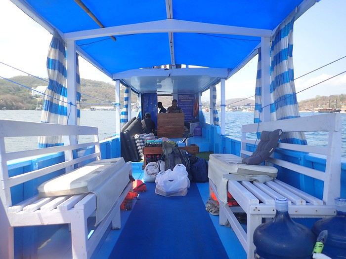 Not usually a fan of organized trips, during my stay in Labuan Bajo on Flores in May 2024, I started looking for a fisherman who could show me the islands around Komodo. At the port, I met Ari, a former freediver who knows the islands well, especially the best spots for fish and coral.
At the Bohême guest house, I proposed this outing, and one of the activity leaders was happy to join. We headed to Angel Island, where Ari took us snorkeling around the island. During this beautiful day, we appreciated his professionalism, and I suggested coming back the following year for a 5-day cruise. We had to agree on a budget and the period to consider.
Over the next year, we kept in touch via WhatsApp.
However, a month before departure, Ari told me he had lent his boat to a friend, who ran it aground on a rock, causing it to sink. No boat, no cruise! Since we had an agreement, I asked him to find another solution. His searches in the port, where everyone knows each other, turned out to be fruitful.
A certain "Captain" Kambar agreed to take us. He sometimes charters his boat for local travel agencies and could free up the requested period.
Not usually a fan of organized trips, during my stay in Labuan Bajo on Flores in May 2024, I started looking for a fisherman who could show me the islands around Komodo. At the port, I met Ari, a former freediver who knows the islands well, especially the best spots for fish and coral.
At the Bohême guest house, I proposed this outing, and one of the activity leaders was happy to join. We headed to Angel Island, where Ari took us snorkeling around the island. During this beautiful day, we appreciated his professionalism, and I suggested coming back the following year for a 5-day cruise. We had to agree on a budget and the period to consider.
Over the next year, we kept in touch via WhatsApp.
However, a month before departure, Ari told me he had lent his boat to a friend, who ran it aground on a rock, causing it to sink. No boat, no cruise! Since we had an agreement, I asked him to find another solution. His searches in the port, where everyone knows each other, turned out to be fruitful.
A certain "Captain" Kambar agreed to take us. He sometimes charters his boat for local travel agencies and could free up the requested period.
There will be six of us on board, as in the meantime, my daughter’s friend, Amandine, could join us for the cruise. Ari will act as a guide, and a mechanic will also be present. To reserve the boat for September 4th, Ari asked me to transfer a deposit of 5 million IDR to his account. After some hesitation, I decided to trust him and made the transfer. A few days later, he confirmed receipt of the amount.
In early September, we arrived in Labuan Bajo. Our first mission was to check the boat’s condition, the presence of life jackets, what we would eat, and if there were any restrictions on drinks. Everything was in order and met our expectations.
The day before departure, we met a 26-year-old Czech woman traveling alone after a stay in New Zealand. The description of our cruise excited her, and she got Ari’s number. That evening, at the restaurant, while we discussed the final preparations, Thérèsa joined us and asked if she could come along for the five-day cruise. Since she seemed like good company, I gladly accepted. However, following Indonesian custom, I negotiated firmly with Ari for a discount, and he agreed to lower the price by 2 million.
On September 4th, we set sail to explore the islands of Komodo and, above all, the seabeds, equipped with fins, masks, and snorkels. We had brought a board game for the trips between islands or for the evenings. In the end, it wasn’t used: the crossings rarely lasted more than an hour, except for two two-hour trips, and the conditions on board weren’t suitable for playing.
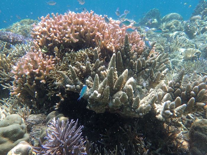
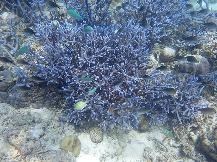 The first island we visited is north of Labuan Bajo: Seraya Small.
We didn’t disembark but anchored a short distance away. The coral reef, between 5 and 10 meters deep, offered visibility of 8 to 10 meters. We started with a few dives from the boat, as the water was so inviting. As with most of the upcoming sites, we were the only ones enjoying this little paradise.
Over about a kilometer along the drop-off, colorful corals and fish abound. As long as you don’t go past the rocky point on the right, the currents remain very weak, and the spot is accessible to beginners. After enjoying the sea enough, we returned to the boat, where Ari had prepared a good meal of rice, chicken, and vegetables. It was simple but excellent after all that effort.
The first island we visited is north of Labuan Bajo: Seraya Small.
We didn’t disembark but anchored a short distance away. The coral reef, between 5 and 10 meters deep, offered visibility of 8 to 10 meters. We started with a few dives from the boat, as the water was so inviting. As with most of the upcoming sites, we were the only ones enjoying this little paradise.
Over about a kilometer along the drop-off, colorful corals and fish abound. As long as you don’t go past the rocky point on the right, the currents remain very weak, and the spot is accessible to beginners. After enjoying the sea enough, we returned to the boat, where Ari had prepared a good meal of rice, chicken, and vegetables. It was simple but excellent after all that effort.
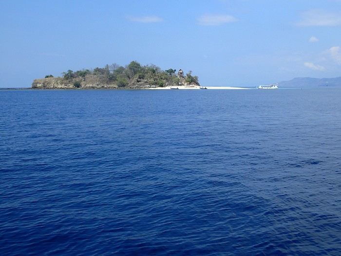 In the afternoon, we discovered Bero Island, where it was very hot. There were fewer fish and corals than at Seraya, but the corals were on white sand, allowing for beautiful, bright photos.
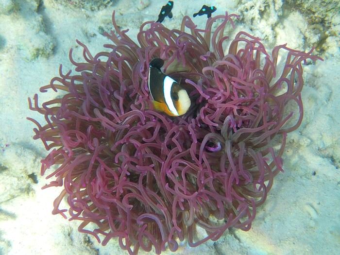 In the evening, we visited Hatamin, a fishing village. The population is very young and curious about our visit. At our request, we could have watched a local dance, but it would have taken some time to organize, and we didn’t plan to return. Ari asked if we wanted to take a shower, as on the boat, we could only rinse off with a little water from a basin.
On the second day, snorkeling near Hatamin, a small paradise island with white sand like in a travel brochure. A small temple is located in the middle of the island. In the water, we saw our first small reef sharks, some clownfish, and a sergeant major fish that followed us throughout our swim. The most beautiful part to explore is opposite the beach. Many corals and fish of all colors. A sailboat was anchored a short distance away, but we didn’t see anyone except an old man who apparently lived in the temple above.
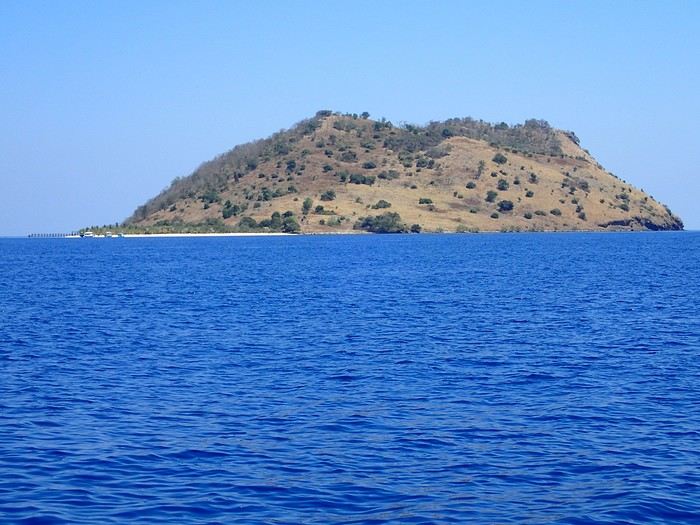
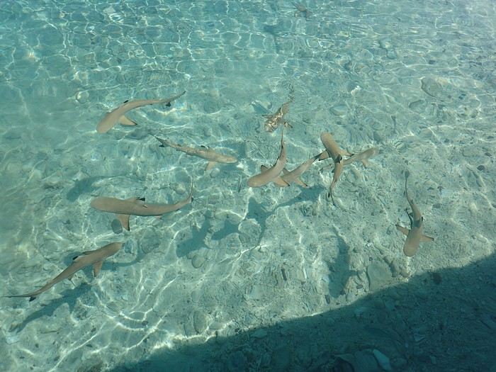
In the afternoon, we headed to the nearby island of Sabolong Besar. It’s a pretty little island with a harmonious resort made up of luxury huts that don’t spoil the landscape. In some places, the water is very clear with good visibility, and some schools of very young blacktip reef sharks swirl near the boat. There are beautiful corals on the left side of the resort and a bit of current when you approach the drop-off. Since the area to explore wasn’t very large, we had time to head to Sabolong Kecil. Then we went to the fishing village of Messah, where a Muslim celebration was taking place. There were people everywhere with many food offerings—what activity! It was like an anthill.
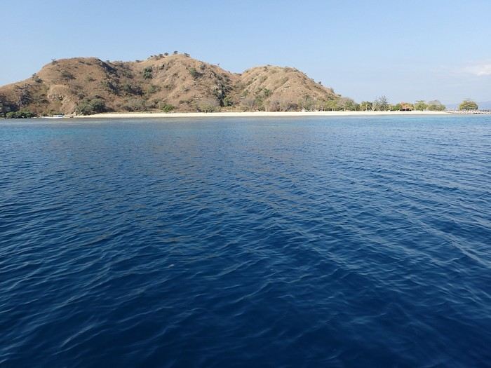
And at the end of the day, we anchored near Kanawa with a beautiful sunset.
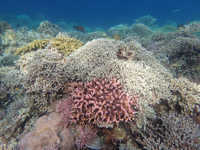 On the third day, we discovered Kanawa and some hawksbill turtles. There were many colorful corals, but we didn’t stay long. During this day, the stops were close together, making it intense with four visits.
Then we arrived at Sebayur Besar with a different snorkeling approach: Ari dropped us in the current, and we drifted for over a kilometer before he came to pick us up. At first, it seemed a bit worrying to see the boat move away while we were offshore, but we were quickly carried by the current and passed almost too quickly by so many corals and fish to see. What a pleasure to drift and freedive with little effort.
On the third day, we discovered Kanawa and some hawksbill turtles. There were many colorful corals, but we didn’t stay long. During this day, the stops were close together, making it intense with four visits.
Then we arrived at Sebayur Besar with a different snorkeling approach: Ari dropped us in the current, and we drifted for over a kilometer before he came to pick us up. At first, it seemed a bit worrying to see the boat move away while we were offshore, but we were quickly carried by the current and passed almost too quickly by so many corals and fish to see. What a pleasure to drift and freedive with little effort.
The drift lasted a good hour, and we reached Siaba Island, where the water was colder. There were many boats, and we had quickly lost the habit of seeing other tourists. Visibility was average—it was a nice spot, but after the drift at Sebayur, we liked it less. Around 1 p.m., we anchored with other boats because Ari met up with some friends, and we ate heartily since the cool water had whetted our appetites.
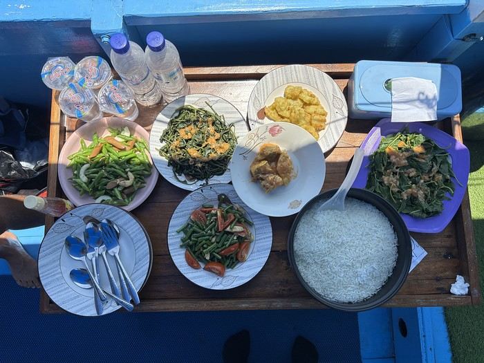
In the afternoon, we were at Manta Point. The water was cool, and there was a lot of excitement trying to follow the giant manta rays. We managed to dive down and get close to them, but it took a lot of effort and breath because, despite their leisurely appearance, they move quite fast for us little swimmers. Here, they come to feed and then return to the depths, and it’s not always certain you’ll encounter them. We ended the day at Makassar with a two-hour sail. There was a lot of wind and swell, the boat rocked, and we hoped there wouldn’t be an engine breakdown. We had to take down the tent on the boat’s roof, which had also been used for sleeping. Makassar’s beach is pink, caused by microorganisms called foraminifera. There are many beach huts along the shore, and we were alone, though it must get busy here during the day. On the fourth day, we visited Padar Island for its viewpoint amid hordes of tourists, then headed to Rinca and its Komodo dragons. Rinca is much less crowded than Komodo, which is why we chose this visit. We saw a few and took the usual photos. In the late afternoon, we snorkeled at Pempend Island, where the sea was choppy and the water a bit murky. And on the last day, we visited Strawberry Rock, named after the reddish rock overlooking the sea. There were many corals, but the water was rough with reduced visibility, and then we went to Kelor with its tourist "bars" and the pretty viewpoint.
In conclusion, we shared amazing moments and managed to complete our program. Luckily, the weather was very kind, and not a drop of rain fell in early September, except just upon returning to the port. It’s worth noting that after five intense days in the water from morning to night, we were glad to return to dry land because we were exhausted.
My daughter and her friend were so thrilled that, in return, they developed a website for Ari to help him get known, and I can share the link if you’d like. I visit Voyage Forum from time to time, so if you have any questions, don’t hesitate—I’ll answer them.
Not usually a fan of organized trips, during my stay in Labuan Bajo on Flores in May 2024, I started looking for a fisherman who could show me the islands around Komodo. At the port, I met Ari, a former freediver who knows the islands well, especially the best spots for fish and coral.
At the Bohême guest house, I proposed this outing, and one of the activity leaders was happy to join. We headed to Angel Island, where Ari took us snorkeling around the island. During this beautiful day, we appreciated his professionalism, and I suggested coming back the following year for a 5-day cruise. We had to agree on a budget and the period to consider.
Over the next year, we kept in touch via WhatsApp.
However, a month before departure, Ari told me he had lent his boat to a friend, who ran it aground on a rock, causing it to sink. No boat, no cruise! Since we had an agreement, I asked him to find another solution. His searches in the port, where everyone knows each other, turned out to be fruitful.
A certain "Captain" Kambar agreed to take us. He sometimes charters his boat for local travel agencies and could free up the requested period.There will be six of us on board, as in the meantime, my daughter’s friend, Amandine, could join us for the cruise. Ari will act as a guide, and a mechanic will also be present. To reserve the boat for September 4th, Ari asked me to transfer a deposit of 5 million IDR to his account. After some hesitation, I decided to trust him and made the transfer. A few days later, he confirmed receipt of the amount.
In early September, we arrived in Labuan Bajo. Our first mission was to check the boat’s condition, the presence of life jackets, what we would eat, and if there were any restrictions on drinks. Everything was in order and met our expectations.
The day before departure, we met a 26-year-old Czech woman traveling alone after a stay in New Zealand. The description of our cruise excited her, and she got Ari’s number. That evening, at the restaurant, while we discussed the final preparations, Thérèsa joined us and asked if she could come along for the five-day cruise. Since she seemed like good company, I gladly accepted. However, following Indonesian custom, I negotiated firmly with Ari for a discount, and he agreed to lower the price by 2 million.
On September 4th, we set sail to explore the islands of Komodo and, above all, the seabeds, equipped with fins, masks, and snorkels. We had brought a board game for the trips between islands or for the evenings. In the end, it wasn’t used: the crossings rarely lasted more than an hour, except for two two-hour trips, and the conditions on board weren’t suitable for playing.
The first island we visited is north of Labuan Bajo: Seraya Small.
We didn’t disembark but anchored a short distance away. The coral reef, between 5 and 10 meters deep, offered visibility of 8 to 10 meters. We started with a few dives from the boat, as the water was so inviting. As with most of the upcoming sites, we were the only ones enjoying this little paradise.
Over about a kilometer along the drop-off, colorful corals and fish abound. As long as you don’t go past the rocky point on the right, the currents remain very weak, and the spot is accessible to beginners. After enjoying the sea enough, we returned to the boat, where Ari had prepared a good meal of rice, chicken, and vegetables. It was simple but excellent after all that effort.
In the afternoon, we discovered Bero Island, where it was very hot. There were fewer fish and corals than at Seraya, but the corals were on white sand, allowing for beautiful, bright photos.
In the evening, we visited Hatamin, a fishing village. The population is very young and curious about our visit. At our request, we could have watched a local dance, but it would have taken some time to organize, and we didn’t plan to return. Ari asked if we wanted to take a shower, as on the boat, we could only rinse off with a little water from a basin.On the second day, snorkeling near Hatamin, a small paradise island with white sand like in a travel brochure. A small temple is located in the middle of the island. In the water, we saw our first small reef sharks, some clownfish, and a sergeant major fish that followed us throughout our swim. The most beautiful part to explore is opposite the beach. Many corals and fish of all colors. A sailboat was anchored a short distance away, but we didn’t see anyone except an old man who apparently lived in the temple above.
In the afternoon, we headed to the nearby island of Sabolong Besar. It’s a pretty little island with a harmonious resort made up of luxury huts that don’t spoil the landscape. In some places, the water is very clear with good visibility, and some schools of very young blacktip reef sharks swirl near the boat. There are beautiful corals on the left side of the resort and a bit of current when you approach the drop-off. Since the area to explore wasn’t very large, we had time to head to Sabolong Kecil. Then we went to the fishing village of Messah, where a Muslim celebration was taking place. There were people everywhere with many food offerings—what activity! It was like an anthill.
And at the end of the day, we anchored near Kanawa with a beautiful sunset.
On the third day, we discovered Kanawa and some hawksbill turtles. There were many colorful corals, but we didn’t stay long. During this day, the stops were close together, making it intense with four visits.
Then we arrived at Sebayur Besar with a different snorkeling approach: Ari dropped us in the current, and we drifted for over a kilometer before he came to pick us up. At first, it seemed a bit worrying to see the boat move away while we were offshore, but we were quickly carried by the current and passed almost too quickly by so many corals and fish to see. What a pleasure to drift and freedive with little effort.The drift lasted a good hour, and we reached Siaba Island, where the water was colder. There were many boats, and we had quickly lost the habit of seeing other tourists. Visibility was average—it was a nice spot, but after the drift at Sebayur, we liked it less. Around 1 p.m., we anchored with other boats because Ari met up with some friends, and we ate heartily since the cool water had whetted our appetites.
In the afternoon, we were at Manta Point. The water was cool, and there was a lot of excitement trying to follow the giant manta rays. We managed to dive down and get close to them, but it took a lot of effort and breath because, despite their leisurely appearance, they move quite fast for us little swimmers. Here, they come to feed and then return to the depths, and it’s not always certain you’ll encounter them. We ended the day at Makassar with a two-hour sail. There was a lot of wind and swell, the boat rocked, and we hoped there wouldn’t be an engine breakdown. We had to take down the tent on the boat’s roof, which had also been used for sleeping. Makassar’s beach is pink, caused by microorganisms called foraminifera. There are many beach huts along the shore, and we were alone, though it must get busy here during the day. On the fourth day, we visited Padar Island for its viewpoint amid hordes of tourists, then headed to Rinca and its Komodo dragons. Rinca is much less crowded than Komodo, which is why we chose this visit. We saw a few and took the usual photos. In the late afternoon, we snorkeled at Pempend Island, where the sea was choppy and the water a bit murky. And on the last day, we visited Strawberry Rock, named after the reddish rock overlooking the sea. There were many corals, but the water was rough with reduced visibility, and then we went to Kelor with its tourist "bars" and the pretty viewpoint.
In conclusion, we shared amazing moments and managed to complete our program. Luckily, the weather was very kind, and not a drop of rain fell in early September, except just upon returning to the port. It’s worth noting that after five intense days in the water from morning to night, we were glad to return to dry land because we were exhausted.
My daughter and her friend were so thrilled that, in return, they developed a website for Ari to help him get known, and I can share the link if you’d like. I visit Voyage Forum from time to time, so if you have any questions, don’t hesitate—I’ll answer them.
Ferry between the islands in Guadeloupe
Hi everyone,
I need your help!
We’re planning to visit Guadeloupe and take the opportunity to explore the islands La Désirade, Marie-Galante, and Les Saintes.
I initially planned to rent a car to get around the main island and then take the ferry from Trois-Rivières to Les Saintes, from Pointe-à-Pitre to Marie-Galante, and finally from Saint-François to La Désirade, following that route.
But when I look at it, the car would sit unused for at least 5 days—that’s paying for nothing🙁.
Is it possible to go from LES SAINTES to MARIE-GALANTE and then on to LA DÉSIRADE? We’d only rent a car once we arrive in Saint-François to continue exploring Guadeloupe. What do you think—is that doable?
This trip is planned for April.
Thanks so much for your help
Crossing the border from 4000 Islands (Laos) to Cambodia and ongoing conflict
Hi,
I’m arriving soon in southern Laos and the 4000 Islands, with plans to head to Cambodia next.
The latest news I got this morning (Paksé, La Boulange) isn’t great—the Cambodian border is also in a latent conflict with Laos for the same reasons as with Thailand...
So, what’s the best site to check for updates on the border opening? Since the situation isn’t stable right now and could change from one day to the next?
Thanks for your input.
So, what’s the best site to check for updates on the border opening? Since the situation isn’t stable right now and could change from one day to the next?
Thanks for your input.
Booking Timing for the Marquesas Islands and Shuttle Schedules
Hello! We’re heading to the Marquesas in July-August and I’d love to know if it’s possible, for a fee, to do a leg of the journey on the Aranui—like from Hiva Oa to Fatu Hiva, or Nuku Hiva to Ua Pou, or even Ua Pou to Ua Huka? Sure, there are shuttles twice a week with Codim connecting these islands, but the schedules won’t be known until two months in advance, and I need to book flights and hotels much earlier than that. So, what’s the best way to handle this?
Looking forward to your replies—thanks in advance! Elisabeth Marcel babeth.marcel@yahoo.fr
Looking forward to your replies—thanks in advance! Elisabeth Marcel babeth.marcel@yahoo.fr
Are the Celebes and Togian Islands still exceptional destinations?
Hey everyone,
I travel quite a bit, and I’m here to share my thoughts about an upcoming trip to Indonesia, specifically the Togian Islands.
I’m planning to go for 3 or 4 weeks in July-August and looking for a sunny destination that’s not too expensive (flights + cost of living), with varied points of interest. About fifteen years ago, I had planned a trip to the Togian Islands, but it didn’t happen, so I’m revisiting this destination (Sulawesi, Toraja country) + maybe others? Given that in Indonesia, I’ve already done volcanoes in Java, Bali, part of Lombok, and the Gili Islands. The issue is that I’ve read some posts about the plastic waste problems around the Togians, and it seems like they’re not the paradise islands they once were.
So, I have a few questions: I’d love to hear recent feedback from travelers who’ve been to the Togians to get an objective opinion (?) or if you’d recommend other paradise-like islands in Indonesia (not overcrowded).
If you confirm that it’s still an exceptional destination, what did you pair it with? The Moluccas and which islands in particular? Or Flores/Komodo? For my part, I don’t scuba dive—just snorkeling.
Finally, if you have other dream-island destinations (affordable and sunny), I’m all ears.
Thanks in advance!
I’m planning to go for 3 or 4 weeks in July-August and looking for a sunny destination that’s not too expensive (flights + cost of living), with varied points of interest. About fifteen years ago, I had planned a trip to the Togian Islands, but it didn’t happen, so I’m revisiting this destination (Sulawesi, Toraja country) + maybe others? Given that in Indonesia, I’ve already done volcanoes in Java, Bali, part of Lombok, and the Gili Islands. The issue is that I’ve read some posts about the plastic waste problems around the Togians, and it seems like they’re not the paradise islands they once were.
So, I have a few questions: I’d love to hear recent feedback from travelers who’ve been to the Togians to get an objective opinion (?) or if you’d recommend other paradise-like islands in Indonesia (not overcrowded).
If you confirm that it’s still an exceptional destination, what did you pair it with? The Moluccas and which islands in particular? Or Flores/Komodo? For my part, I don’t scuba dive—just snorkeling.
Finally, if you have other dream-island destinations (affordable and sunny), I’m all ears.
Thanks in advance!
Visiting Fam and Rufas Islands from Gam and Mansuar
hi there
I’m planning a trip focused mainly on snorkeling and diving in Raja Ampat, covering two islands: Gam and Mansuar.
I’d also like to spend a few days on Fam and Rufas Islands. Is it cheaper to depart from Gam or Mansuar? Do you have any info on the budget I should expect?
If you’ve got any great tips, I’d love to hear them!
Thanks in advance
Tips for island-hopping in Cape Verde: plane or ferry?
Hi there,
I’m leaving for Cape Verde at the end of the week. I’ve heard that transportation isn’t very reliable, so I’d love your advice:
- My return flight is from Sal on the night of August 13–14
- I’ll be in São Vicente until August 10
- I found an indirect flight (São Vicente–Praia–Sal) on August 9–10 and a ferry on August 10 as well
- I’m traveling alone with two kids, ages 6 and 9
In your opinion, which option is more reliable and comfortable?
Thanks!
In your opinion, which option is more reliable and comfortable?
Thanks!
Cruise to the Marquesas Islands with Aranui
Hi there,
Has anyone here taken the cruise to the Marquesas Islands in French Polynesia with the cruise line Aranui?
Has anyone here taken the cruise to the Marquesas Islands in French Polynesia with the cruise line Aranui?
Looking for travel companions
Hi there, I’m looking for one or more travel companions for this summer. I’m 32 and open to all ideas—feel free to message me to discuss our plans. Thanks!
Kayaking in the Lofoten Islands, Norway
Thirty-seven years ago, I crossed Lapland on skis in winter...
Four years later, I returned by bike to the Lofoten Islands.
Now, I’d like to go back to this stunning country by sea kayak—a sport I’ve been practicing for the past 10 years. If it’s possible to meet up with one or more people for this little trip this year, it’s pretty quick to organize. Otherwise, in 2026, I’d love to kayak around Norway as well. If you’d like to join me for part of the route, that’d be awesome. Some sections require solid kayaking skills and excellent physical condition.
I’m 58 and retired this year—in September—due to disability.
Looking forward to your questions and/or interest in joining!
Improvisation is often part of the plan!!
Transatlantic Cruise Review: Oceania Rio to Santa Cruz de Tenerife
Hello everyone!
Booked the cruise a year in advance for a departure from Rio on April 5th.
Air France flight to Rio on April 3rd, arriving at the Windsor Plaza hotel, very well located just 300 meters from Copacabana Beach, with a pool on the 15th floor offering a view of Rio.
The next morning, a behind-the-scenes visit to Rio’s Carnival—there were still some floats not yet dismantled and a little samba session. At noon, lunch on Copacabana Beach, which was deserted due to rain and gray skies all day.
Saturday, April 5th, boarding the *Marina*—still raining :( To get around Rio, we used Uber, which was really cheap—5 euros for a 15-minute ride, while taxis cost double... Arrived at the cruise terminal, boarding was very quick as usual with Oceania. The cabins would be ready around 3 PM, with luggage at the cabin door. We had booked an inside cabin. Despite numerous offers from Oceania to upgrade (with a supplement, of course), we stuck with our first choice. It’s worth noting that at least 200 cabins remained unoccupied—about 800 passengers for this transatlantic crossing... Last September, since the cruise wasn’t filling up well, Oceania lowered the price by 1,000 euros per person for an inside cabin—a great deal for us, as they adjusted the rate downward when we asked.
For this cruise, weekends and drinks at the table were included—champagne, wine, beer...—plus an onboard credit that’s now only for excursions (before, it was more flexible—another downgrade, lol).
Headed to the Terrace Café for our first meal, and what a surprise when we saw the changes... No more staff mixing your chosen salad, and way fewer options: big bowls of salad, trays of potato salad, beets, lentils—I don’t remember seeing that before—thin slices of cold cuts and cheese. On the meat side, not much choice and lower quality. Desserts also had fewer options. Well, we’ll make up for it at Jacques on the first night ;) The menu hasn’t changed much—it’s still top-notch. The seasoning is average, but it’s a safe bet.
A little note on the 15-day cruise: we ate at 11 different restaurants—3 at Jacques, 3 at Polo Grill, 3 at Toscana, and 2 at Red Ginger. Not bad for two weeks ;) A French officer invited us to Toscana, which was really nice of her. Polo Grill is still amazing—I’d rank it second after Jacques, with Toscana third and Red Ginger last. I think since the ship wasn’t full, it was easier to get into these restaurants ;)
The staff was, as always, excellent. There were 3 French employees on the *Marina*: 1 waiter at Jacques, 1 manager at Wave, and 1 officer in the offices.
In the afternoon, Tea Time had way fewer pastry choices than before... Cost-cutting seems to be happening at every level. We met people who used to stay in Penthouse Suites—before, they got a bottle of champagne in their suite every night, but since January, it’s been Prosecco instead... Just a small example of Oceania’s cost reductions. At the Terrace Café in the evening, there was no more lobster on this cruise :(
Still, the value for money on this cruise was excellent given the price we paid per person. This transatlantic crossing had 4 stops in Brazil, 1 in the Cape Verde Islands, then Dakar in Senegal, and ended in the Canary Islands.
Mich74
Saturday, April 5th, boarding the *Marina*—still raining :( To get around Rio, we used Uber, which was really cheap—5 euros for a 15-minute ride, while taxis cost double... Arrived at the cruise terminal, boarding was very quick as usual with Oceania. The cabins would be ready around 3 PM, with luggage at the cabin door. We had booked an inside cabin. Despite numerous offers from Oceania to upgrade (with a supplement, of course), we stuck with our first choice. It’s worth noting that at least 200 cabins remained unoccupied—about 800 passengers for this transatlantic crossing... Last September, since the cruise wasn’t filling up well, Oceania lowered the price by 1,000 euros per person for an inside cabin—a great deal for us, as they adjusted the rate downward when we asked.
For this cruise, weekends and drinks at the table were included—champagne, wine, beer...—plus an onboard credit that’s now only for excursions (before, it was more flexible—another downgrade, lol).
Headed to the Terrace Café for our first meal, and what a surprise when we saw the changes... No more staff mixing your chosen salad, and way fewer options: big bowls of salad, trays of potato salad, beets, lentils—I don’t remember seeing that before—thin slices of cold cuts and cheese. On the meat side, not much choice and lower quality. Desserts also had fewer options. Well, we’ll make up for it at Jacques on the first night ;) The menu hasn’t changed much—it’s still top-notch. The seasoning is average, but it’s a safe bet.
A little note on the 15-day cruise: we ate at 11 different restaurants—3 at Jacques, 3 at Polo Grill, 3 at Toscana, and 2 at Red Ginger. Not bad for two weeks ;) A French officer invited us to Toscana, which was really nice of her. Polo Grill is still amazing—I’d rank it second after Jacques, with Toscana third and Red Ginger last. I think since the ship wasn’t full, it was easier to get into these restaurants ;)
The staff was, as always, excellent. There were 3 French employees on the *Marina*: 1 waiter at Jacques, 1 manager at Wave, and 1 officer in the offices.
In the afternoon, Tea Time had way fewer pastry choices than before... Cost-cutting seems to be happening at every level. We met people who used to stay in Penthouse Suites—before, they got a bottle of champagne in their suite every night, but since January, it’s been Prosecco instead... Just a small example of Oceania’s cost reductions. At the Terrace Café in the evening, there was no more lobster on this cruise :(
Still, the value for money on this cruise was excellent given the price we paid per person. This transatlantic crossing had 4 stops in Brazil, 1 in the Cape Verde Islands, then Dakar in Senegal, and ended in the Canary Islands.
Mich74
Hotel recommendations for the Andaman Islands
Hi,
I’ve booked tickets to Phuket to stay in the Andaman Islands (Ko Phi Phi, Ko Lanta Yai Noi, etc.).
I’m really struggling to book our hotels because the reviews are so bad.
We’re looking for mid-range to upscale hotels.
Any tips or recommendations would be super welcome!!! Thank youuuu
Indonesia trip: which islands for a small budget?
Hi everyone!
I’m heading to Indonesia in September with 3 friends, and we’re starting to plan our itinerary, but we’re still not sure which islands to prioritize. We love nature, road trips, and want to avoid mass tourism. If you have any tips on less touristy but equally stunning islands, I’d love to hear them! 😊
Also, our budget is pretty tight, so we’re looking for ways to manage money during the trip. What are your tips for saving money while still making the most of the experience? And if you have any tricks for tracking and sharing expenses between us, I’m really interested! We tried Excel, but it’s not always easy to manage.
Thanks in advance for your recommendations and great tips!
Also, our budget is pretty tight, so we’re looking for ways to manage money during the trip. What are your tips for saving money while still making the most of the experience? And if you have any tricks for tracking and sharing expenses between us, I’m really interested! We tried Excel, but it’s not always easy to manage.
Thanks in advance for your recommendations and great tips!
Traveling to the San Blas Islands from Panama
Hi there,
I have a few questions about Panama. I’ve heard that it’s possible to travel from Panama to the San Blas Islands.
1- Does anyone have information about small plane transport to the islands? I understand it’s possible to fly to one of the main islands, but there might also be other drop-off points for visiting more remote islands. We’re traveling with kids and would prefer to avoid a 5 AM wake-up and a mountain car ride if possible.
2- Regarding our route through the country: we’ve noted the issues with renting a car. We’ve seen that a common itinerary is to fly directly to Bocas del Toro afterward, then return in stages by bus or rental car.
We imagine taking the bus would be really long and tiring (especially with a child). If we rent a car all the way to the west of the country, do you have any recommendations? (e.g., options to rent there and drop it off at the airport or in Panama City, names of local agencies?)
Thanks in advance!
I have a few questions about Panama. I’ve heard that it’s possible to travel from Panama to the San Blas Islands.
1- Does anyone have information about small plane transport to the islands? I understand it’s possible to fly to one of the main islands, but there might also be other drop-off points for visiting more remote islands. We’re traveling with kids and would prefer to avoid a 5 AM wake-up and a mountain car ride if possible.
2- Regarding our route through the country: we’ve noted the issues with renting a car. We’ve seen that a common itinerary is to fly directly to Bocas del Toro afterward, then return in stages by bus or rental car.
We imagine taking the bus would be really long and tiring (especially with a child). If we rent a car all the way to the west of the country, do you have any recommendations? (e.g., options to rent there and drop it off at the airport or in Panama City, names of local agencies?)
Thanks in advance!
12 days in the Shetland Islands between May 9 and May 24 (Great Britain)
Hello!
I’m Mélanie, I’m 49. Since my partner isn’t available, I’m looking for a female travel companion between 35 and 60 to join me in the Shetland Islands.
Traveling alone is less fun.
I’ll be going for 12 or 13 days between May 9 and May 24, 2025.
I plan to fly to Sumburgh and then rent a vehicle to get around the islands. I’d like to stay in B&Bs or with locals, and if possible, I’d prefer to have my own room (I snore and don’t want anyone to hold it against me!). But if that’s not possible, we’ll just have to arm ourselves with earplugs!
If the weather isn’t too bad, I’d like to do some easy hikes (around 3 to 4 hours of walking per day). I’ll go at my own pace—I love sketching in my travel journal, so I’ll take breaks sometimes.
And if we can go pet some ponies and sheep, I’ll be in heaven.
What else? Oh right, I speak English, I’ve never driven on the left, and I prefer going to bed early so I can wake up early and make the most of the day. I live in the Paris area and I’m available to meet interested people if they’re nearby too.
I want to book my flight and accommodations as soon as possible, so let me know quickly if you’re interested!