Results for "téléphone+ou+internet+|+9+>+231"
42377 results found.
Marsans!! English translation pending
On lit tout et n'importe quoi!! J'aimerais avoir votre avis sur ce TO qui a l'air d'être compétent et bien placé pour la RD.
Merci de vos réponses et de vos expériences😉
@+
Merci de vos réponses et de vos expériences😉
@+
Est-ce si dangereux le Mexique? English translation pending
Bonjour bande de voyageurs,
Je me prépare à partir pour le mexique avec ma copine et nous comptons bien faire le tour de ce pays. Nous y allons en voiture... et cela semble plus dangereux que nous le croyions.
Récemment en me renseignant auprès de plusieurs personnes, j'ai eu de nombreux bons commentaires, mais également plusieurs commentaires plutôt négatif et je cherche à distinguer les mythes des réalités...
Est-ce dangereux de se faire voler sa voiture ? Même si c'est un vieux tacot ?? Est-ce que les voitures blanches appartiennent habituellement à des passeurs de drogues / mafioso mexicains et sont suceptibles d'être vandalisés ? Combien ça coûte faire entrer une auto sur le territoire mexicain ? Les barrages routiers sont-ils fréquents ? La police mexicaine est-elle véritablement si corrompue ? Doit-on se méfier des stations d'essence trop fréquenté par des jeunes ?
J'attends vos réponses impatiement !
Merci !!
Je me prépare à partir pour le mexique avec ma copine et nous comptons bien faire le tour de ce pays. Nous y allons en voiture... et cela semble plus dangereux que nous le croyions.
Récemment en me renseignant auprès de plusieurs personnes, j'ai eu de nombreux bons commentaires, mais également plusieurs commentaires plutôt négatif et je cherche à distinguer les mythes des réalités...
Est-ce dangereux de se faire voler sa voiture ? Même si c'est un vieux tacot ?? Est-ce que les voitures blanches appartiennent habituellement à des passeurs de drogues / mafioso mexicains et sont suceptibles d'être vandalisés ? Combien ça coûte faire entrer une auto sur le territoire mexicain ? Les barrages routiers sont-ils fréquents ? La police mexicaine est-elle véritablement si corrompue ? Doit-on se méfier des stations d'essence trop fréquenté par des jeunes ?
J'attends vos réponses impatiement !
Merci !!
Remorque vélo pour voyager avec bébé English translation pending
Bonjour,
Nous avons un petit garçon de 6 mois et souhaitons voyager avec lui à vélo.
Nous souhaitons avoir des retours d'expérience de parents ayant trimbalé leur enfant comme ça (sur de longs parcours). à partir de quel âge y avez-vous mis votre enfant, et avez-vous prévu un adaptateur pour un bébé qui ne tient pas encore bien assis ? votre remorque comporte-t-elle des amortisseurs, pour diminuer les vibrations ? est-ce mieux que l'ouverture regarde face ou dos à la route (poussières)? remorque tout tissu (légèreté) ou coque plastique (plus sécuritaire ?) ? quelle est la marque/modèle de votre remorque et à quel prix avez-vous déniché votre merveille ? quels inconvénients avez-vous noté : par temps de pluie, par grosses chaleurs... BB s'est-il ennuyé, et combien de temps rouliez-vous par jour ?
Merci beaucoup pour vos réponses.
Nous avons un petit garçon de 6 mois et souhaitons voyager avec lui à vélo.
Nous souhaitons avoir des retours d'expérience de parents ayant trimbalé leur enfant comme ça (sur de longs parcours). à partir de quel âge y avez-vous mis votre enfant, et avez-vous prévu un adaptateur pour un bébé qui ne tient pas encore bien assis ? votre remorque comporte-t-elle des amortisseurs, pour diminuer les vibrations ? est-ce mieux que l'ouverture regarde face ou dos à la route (poussières)? remorque tout tissu (légèreté) ou coque plastique (plus sécuritaire ?) ? quelle est la marque/modèle de votre remorque et à quel prix avez-vous déniché votre merveille ? quels inconvénients avez-vous noté : par temps de pluie, par grosses chaleurs... BB s'est-il ennuyé, et combien de temps rouliez-vous par jour ?
Merci beaucoup pour vos réponses.
Retour d'un voyage en Transsibérien English translation pending
Nous revenons d'un voyage dans le Transsibérien, voyage hors de l'espace et du temps... voyage inoubliable et personnel à chacun... Nous l'avions préparé pendant environ dix-huit mois, et nous avons largement puisé des renseignements dans forum voyage. Nous avons beaucoup apprécié les commentaires si bien écrit de Loopkin. Aussi, nous voulons à notre tour, aider ceux qui aimeraient avoir des renseignements pratiques. D'abord, on se situe : Deux amies, dont les maris n'aiment pas le train, et qui ont préféré ne pas nous accompagner, à notre regret ! Pour nous c'était un rêve de longue date, et en parlant entre nous, on s'est aperçu de notre rêve commun, et on s'est dit alors, " pourquoi pas " ? Mon amie à 56 ans, et moi-même, 72 ans. Nous ne voulions pas partir avec un voyage organisé, mais nous avons demandé à une agence de nous aider à préparer le périple que nous voulions faire, avec les dates qui nous arrangeaient. Nous avions décidé de partir en mai 2004, cela nous semblait bien loin, on avait semble t'il le temps de nous y préparer mentalement, financièrement, etc... On peut vous assurer maintenant, que le temps va vite et que mai 2004 est vite arrivé ! Et c'est déjà passé ! Mais pas dans notre tête... Donc, l'agence a assuré les transferts à l'aéroport de Moscou, via un hôtel, transfert jusque devant la gare de Iaroslavl, et une visite guidée à Vladivostok. Elle nous a réservé les billets d'avion, l'hôtel à Moscou, et Vladivostok, et séjour chez l'habitant à Irkutsk, et également les billets de train, et les démarches pour les visas. ; Nous ne sommes peut-être pas si aventureuses que les jeunes, qui réservent eux-mêmes leurs billets de train, etc. mais on était plus rassuré comme ça, et nos maris également ! Nous avons fait le trajet, Moscou-Vladivostok, et Vladivostok - Irkutsk en train, puis retour en Avion, Irkutsk - Moscou et Moscou-Paris. Au départ, jusque Moscou, avec Aéroflot, ainsi que de lrkustk jusque Moscou au retour. Et, de Moscou à Paris, c'était un " combiné, Aéroflot - Air France ", mais avec avion Air France. Nous avons trouvé que les atterrissages avec Aéroflot étaient très doux et progressifs ; Dans le train, " le Rossya N°2 ", nous étions dans un compartiment à quatre, et avons, au départ, été deux fois trois nuits à trois, et une nuit à quatre. Et toujours avec des Russes. Même si l'on est un peu à l'étroit, les contacts sont toujours sympathiques et chaleureux, et intéressants. Nous pensons que s'il y a un problème avec certains, la provodnista peut nous changer de compartiment, s'il n'est pas trop plein. Nous sommes revenues par le train " Sibir " N°7 jusque Irkutsk, où l'une de nous a de la famille proche. Nous y sommes restées cinq jours, dans une famille qui loge des touristes. Début mai, il y avait très peu de touristes. Le temps était très agréable et même varié. Chaleur à Moscou, neige aux environs de Chita, pluie et brouillard quelquefois, mais dans l'ensemble, beau temps. Nous avons vu le côté Est du Lac Baïkal, en le longeant avec le train, encore gelé, et de toute beauté ! Par contre, à Listvianka, il était dégelé.
Le téléphone est très cher dans les hôtels !!! Les cartes de téléphone, sont différentes soit pour utiliser chez l'habitant, avec numéro code, soit cartes pour téléphone public, utilisable selon le district. Les cartes achetées à Moscou, ne fonctionnaient pas pour ltkutsk, et vice-versa... Et difficile à trouver des cartes, à Moscou, c'est au guichet du métro que nous les avons trouvées. N'hésitez pas à nous poser des questions
Le téléphone est très cher dans les hôtels !!! Les cartes de téléphone, sont différentes soit pour utiliser chez l'habitant, avec numéro code, soit cartes pour téléphone public, utilisable selon le district. Les cartes achetées à Moscou, ne fonctionnaient pas pour ltkutsk, et vice-versa... Et difficile à trouver des cartes, à Moscou, c'est au guichet du métro que nous les avons trouvées. N'hésitez pas à nous poser des questions
Mauritanie 20 ans déjà English translation pending
DEJA 20 ANS !
En Avril 1984, nous découvrions la Mauritanie. 37 % de la population était nomade. Les seuls véhicules, de marque Peugeot essentiellement, se cantonnaient dans les quelques très grosses villes dont Atar ne faisait pas partie. Nous avons connu la piste d’atterrissage de Nouadhibou ( ! ), le train minéralier qui nous acheminait à Choum à travers 460 kilomètres de désert, l’ambiance « bourgade » d’Atar où ne circulaient que les charrettes à âne.
A l’époque, nous aurions presque pu partir d’Atar-même en selle sur nos chameaux car les passes (et non pas encore les pistes) qui menaient sur les plateaux de l’Adrar étaient encore des voies caravanières ! Ah ! Nous pouvons nous réjouir d’avoir connu l’Authentique que tellement de touristes croient saisir aujourd’hui… C’était l’époque où Atar, donc, ne connaissait ni bitume, ni voiture, ni téléphone (qui fonctionnait à peine à Nouakchott !), ni vol international… Nous arrivions presque d’une autre planète et étions fortement conscients de la réserve que nous devions avoir dans nos comportements de chaque instant. C’est ainsi que nous avons eu des exigences qui soulèveraient aujourd’hui des mutineries, et qui n’étaient pourtant que l’indispensable recette du « passage sans pollution ». Pas un seul d’entre nous ne portait de lunettes de soleil ou une montre. PAS UN SEUL. Le chech était de rigueur, ainsi que les vêtements de brousse du pays que nous portions non pas comme cache-misère, mais cache-richesse, par-dessus nos vêtements européens. Nous faisions vraiment le maximum pour ne pas choquer, à tel point que l’année où arrivèrent les premiers touristes, nous furent pris ( et filmés ! ) pour des bergers nomades ! Mais ces attentions avaient un prix : nos intendances étaient extrêmement spartiates avec des menus répétitifs et souvent à l’opposé de nos envies ! Les bagages transportés devaient rester discrets (enfournés dans des sacs de jute) et « tolérables » puisque les chameliers nous accompagnant les manipulaient ; de nombreux articles n’ont donc jamais vu la bosse de nos chameaux, à commencer par le plus insignifiant des matelas de randonneur… Nous nous sommes « autorisé » l’usage des « vaches à eau » après avoir vu certains nomades connaître, voire utiliser les tonnelets de 50 litres. Mais notre baptême méhariste avait été une longue descente aux enfers abreuvée avec l’unique eau des guerbas en peau de chèvre lors de la 7ème année consécutive de grande sécheresse : autant dire que la « bouillie » des guerbas calmait bien des appétits…
En 2004, après le passage de plusieurs années de Progrès que nous ne pouvons refuser (il faut lui reconnaître certains avantages), beaucoup de choses ont changé évidemment. Le progrès, c’est le début de la fin, on en reçoit tout ou rien, sans tri possible.
L’automobile a pénétré la brousse au fur et à mesure que des pistes s’aménageaient (et ce n’est pas fini), les moyens de communication de toutes sortes ont littéralement explosé et imbibé partie du pays. L’enseignement touche de plus en plus d’enfants, la santé et la possibilité de l’influencer est une notion qui évolue dans les esprits. Avec l’arrivée de quelques facilités matérielles pour la population (qui existent mais ne sont pas forcément accessibles pour des raisons de coût), la vie mauritanienne s’est un peu décolorée en cachant son bronzage saharien derrière du goudron, des Toyota, des lunettes de soleil, des auberges, des enseignes ronflantes de commerce en tout genre… en échangeant la sandale des sables (qui a pourtant une bonne raison d’exister) contre les chaussures de marche, le « Tassoufra » des grands nomades contre le sac-à dos des guides ( ! ) pour Tour Operator, la guerba contre la gourde isotherme…
Tout cela a coûté son prix car tout se paie : augmentation du prix du pain, du riz, de la farine, apparition de la délinquance, dévaluation de l’Ouguya, disparition presque totale à ce jour des vrais nomades, ceux qui furent parmi les meilleurs éleveurs de camélidés de la planète. « Hier », Louis Chardon suppliait les hommes français qui nous accompagnaient de se mettre accroupis pour uriner, comme les Mauritaniens, et de ne pas offrir nos cigarettes d’importation à ces bergers qui ne connaissaient encore que leur pipe (souvent un simple os creux de chèvre) et leur tabac en poudre.
Aujourd’hui, nous passerions sans doute pour des illuminés en tenant un tel discours, de toute façon obsolète. Car nous sommes en 2004. Vingt années sont passées sur nos premières empreintes dans les dunes roses et blanches de l’Ouarane. Notre amour pour ce désert d’il y a 20 ans nous conduit peut-être aux portes du fanatisme quand nous évoquons, tels des « vieux schnocks », cette grande époque. Il faut nous pardonner ces élans et comprendre que nous sommes à jamais en manque d’un trésor perdu.
Nous savons que des choses sont encore inchangées, certaines pour l’éternité peut-être, d’autres… allez savoir. Mais lorsque nous observons l’évolution de la Mauritanie au cours de ces 20 dernières années, nous avons souvent l’impression que le Progrès a raté sa cible, qu’il n’a pas changé ce qui avait besoin de l’être pour le bien de l’humanité. Car l’idée, puis la certitude (apportées par la télévision d’abord, puis par les Touristes) qu’ « on » peut vivre autrement ont fait leur chemin. Nous pouvons nous incliner alors devant l’esprit brillant d’Albert Einstein, décédé en 1955, mais qui avait toutefois eu le temps d’écrire :
« Cette explosion de la matière est la plus faible des trois explosions auxquelles l’humanité sera nécessairement confrontée. Avec les progrès de la médecine, l’humanité va bientôt assister à l’explosion de la vie qui apportera plus de bouleversements que celle de la matière. Mais l’explosion la plus lourde de conséquences pour l’humanité sera celle de l’information. D’ici peu, par toutes sortes de techniques, les plus pauvres, les plus malheureux auront connaissance de ce que l’humanité est capable de faire et des moyens qui pourraient les sortir de la misère, de leur détresse. Partout sur la planète et pour la première fois de son histoire, l’homme saura l’absurdité de sa souffrance et donc souffrira de savoir qu’il souffre. L’humanité se trouvera ainsi acculée, sans dérobade possible, à de nouveaux partages. »
Croyez, toutes et tous, à mes meilleurs sentiments.
Lysiane Pradines.
Vous pourrez retrouver ce texte, avec d'autres infos, dans la circulaire d'avril 2004 qui est dans le site Internet de l'association Liberté par les Chamelles, dont Lysiane est la présidente : http://libertechamelles.free.fr
En Avril 1984, nous découvrions la Mauritanie. 37 % de la population était nomade. Les seuls véhicules, de marque Peugeot essentiellement, se cantonnaient dans les quelques très grosses villes dont Atar ne faisait pas partie. Nous avons connu la piste d’atterrissage de Nouadhibou ( ! ), le train minéralier qui nous acheminait à Choum à travers 460 kilomètres de désert, l’ambiance « bourgade » d’Atar où ne circulaient que les charrettes à âne.
A l’époque, nous aurions presque pu partir d’Atar-même en selle sur nos chameaux car les passes (et non pas encore les pistes) qui menaient sur les plateaux de l’Adrar étaient encore des voies caravanières ! Ah ! Nous pouvons nous réjouir d’avoir connu l’Authentique que tellement de touristes croient saisir aujourd’hui… C’était l’époque où Atar, donc, ne connaissait ni bitume, ni voiture, ni téléphone (qui fonctionnait à peine à Nouakchott !), ni vol international… Nous arrivions presque d’une autre planète et étions fortement conscients de la réserve que nous devions avoir dans nos comportements de chaque instant. C’est ainsi que nous avons eu des exigences qui soulèveraient aujourd’hui des mutineries, et qui n’étaient pourtant que l’indispensable recette du « passage sans pollution ». Pas un seul d’entre nous ne portait de lunettes de soleil ou une montre. PAS UN SEUL. Le chech était de rigueur, ainsi que les vêtements de brousse du pays que nous portions non pas comme cache-misère, mais cache-richesse, par-dessus nos vêtements européens. Nous faisions vraiment le maximum pour ne pas choquer, à tel point que l’année où arrivèrent les premiers touristes, nous furent pris ( et filmés ! ) pour des bergers nomades ! Mais ces attentions avaient un prix : nos intendances étaient extrêmement spartiates avec des menus répétitifs et souvent à l’opposé de nos envies ! Les bagages transportés devaient rester discrets (enfournés dans des sacs de jute) et « tolérables » puisque les chameliers nous accompagnant les manipulaient ; de nombreux articles n’ont donc jamais vu la bosse de nos chameaux, à commencer par le plus insignifiant des matelas de randonneur… Nous nous sommes « autorisé » l’usage des « vaches à eau » après avoir vu certains nomades connaître, voire utiliser les tonnelets de 50 litres. Mais notre baptême méhariste avait été une longue descente aux enfers abreuvée avec l’unique eau des guerbas en peau de chèvre lors de la 7ème année consécutive de grande sécheresse : autant dire que la « bouillie » des guerbas calmait bien des appétits…
En 2004, après le passage de plusieurs années de Progrès que nous ne pouvons refuser (il faut lui reconnaître certains avantages), beaucoup de choses ont changé évidemment. Le progrès, c’est le début de la fin, on en reçoit tout ou rien, sans tri possible.
L’automobile a pénétré la brousse au fur et à mesure que des pistes s’aménageaient (et ce n’est pas fini), les moyens de communication de toutes sortes ont littéralement explosé et imbibé partie du pays. L’enseignement touche de plus en plus d’enfants, la santé et la possibilité de l’influencer est une notion qui évolue dans les esprits. Avec l’arrivée de quelques facilités matérielles pour la population (qui existent mais ne sont pas forcément accessibles pour des raisons de coût), la vie mauritanienne s’est un peu décolorée en cachant son bronzage saharien derrière du goudron, des Toyota, des lunettes de soleil, des auberges, des enseignes ronflantes de commerce en tout genre… en échangeant la sandale des sables (qui a pourtant une bonne raison d’exister) contre les chaussures de marche, le « Tassoufra » des grands nomades contre le sac-à dos des guides ( ! ) pour Tour Operator, la guerba contre la gourde isotherme…
Tout cela a coûté son prix car tout se paie : augmentation du prix du pain, du riz, de la farine, apparition de la délinquance, dévaluation de l’Ouguya, disparition presque totale à ce jour des vrais nomades, ceux qui furent parmi les meilleurs éleveurs de camélidés de la planète. « Hier », Louis Chardon suppliait les hommes français qui nous accompagnaient de se mettre accroupis pour uriner, comme les Mauritaniens, et de ne pas offrir nos cigarettes d’importation à ces bergers qui ne connaissaient encore que leur pipe (souvent un simple os creux de chèvre) et leur tabac en poudre.
Aujourd’hui, nous passerions sans doute pour des illuminés en tenant un tel discours, de toute façon obsolète. Car nous sommes en 2004. Vingt années sont passées sur nos premières empreintes dans les dunes roses et blanches de l’Ouarane. Notre amour pour ce désert d’il y a 20 ans nous conduit peut-être aux portes du fanatisme quand nous évoquons, tels des « vieux schnocks », cette grande époque. Il faut nous pardonner ces élans et comprendre que nous sommes à jamais en manque d’un trésor perdu.
Nous savons que des choses sont encore inchangées, certaines pour l’éternité peut-être, d’autres… allez savoir. Mais lorsque nous observons l’évolution de la Mauritanie au cours de ces 20 dernières années, nous avons souvent l’impression que le Progrès a raté sa cible, qu’il n’a pas changé ce qui avait besoin de l’être pour le bien de l’humanité. Car l’idée, puis la certitude (apportées par la télévision d’abord, puis par les Touristes) qu’ « on » peut vivre autrement ont fait leur chemin. Nous pouvons nous incliner alors devant l’esprit brillant d’Albert Einstein, décédé en 1955, mais qui avait toutefois eu le temps d’écrire :
« Cette explosion de la matière est la plus faible des trois explosions auxquelles l’humanité sera nécessairement confrontée. Avec les progrès de la médecine, l’humanité va bientôt assister à l’explosion de la vie qui apportera plus de bouleversements que celle de la matière. Mais l’explosion la plus lourde de conséquences pour l’humanité sera celle de l’information. D’ici peu, par toutes sortes de techniques, les plus pauvres, les plus malheureux auront connaissance de ce que l’humanité est capable de faire et des moyens qui pourraient les sortir de la misère, de leur détresse. Partout sur la planète et pour la première fois de son histoire, l’homme saura l’absurdité de sa souffrance et donc souffrira de savoir qu’il souffre. L’humanité se trouvera ainsi acculée, sans dérobade possible, à de nouveaux partages. »
Croyez, toutes et tous, à mes meilleurs sentiments.
Lysiane Pradines.
Vous pourrez retrouver ce texte, avec d'autres infos, dans la circulaire d'avril 2004 qui est dans le site Internet de l'association Liberté par les Chamelles, dont Lysiane est la présidente : http://libertechamelles.free.fr
On the Roads of Costa Rica
Hello everyone, I’m happy to welcome you to this new travel journal.
We’re heading to Costa Rica together—a Central American destination that dreams are made of for many French travelers and attracts crowds from France.
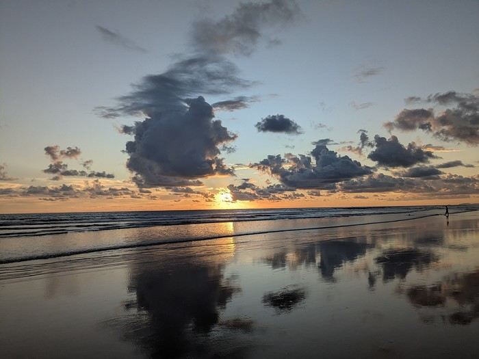
It was the country’s wild nature and safety that convinced us to go, since we’re traveling with our 7-year-old little one. We didn’t have much vacation time in February 2026 (only 12 days), so we optimized as much as possible.
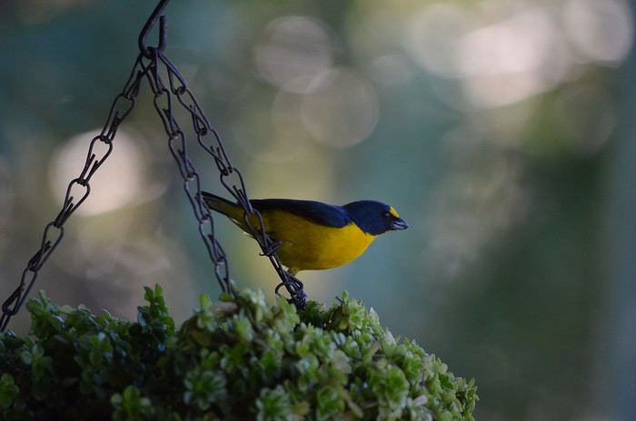
Here’s the itinerary: Wednesday, February 11: Flight from Marseille to San Jose via Paris and Atlanta Thursday, February 12: Pick up the car, drive to Poas Volcano, visit La Paz Waterfall Gardens Friday, February 13: Poas Volcano and drive to Manuel Antonio Saturday, February 14: Manuel Antonio National Park Sunday, February 15: Nauyaca Waterfall and Playa Linda Monday, February 16: Drive to Monte Verde and Santa Elena Reserve Tuesday, February 17: El Tigre Waterfall Reserve and Treetopia Park Wednesday, February 18: Monte Verde Reserve with a guide and drive to La Fortuna Thursday, February 19: Sloth guided tour, Observatory Lodge Park Friday, February 20: Arenal Volcano National Park, Termalistas del Arenal hot springs, and night tour Saturday, February 21: Return to San Jose, flight to Paris via Atlanta Sunday, February 22: Arrival in Paris and flight to Marseille. That gives us a solid 9 days in the country.
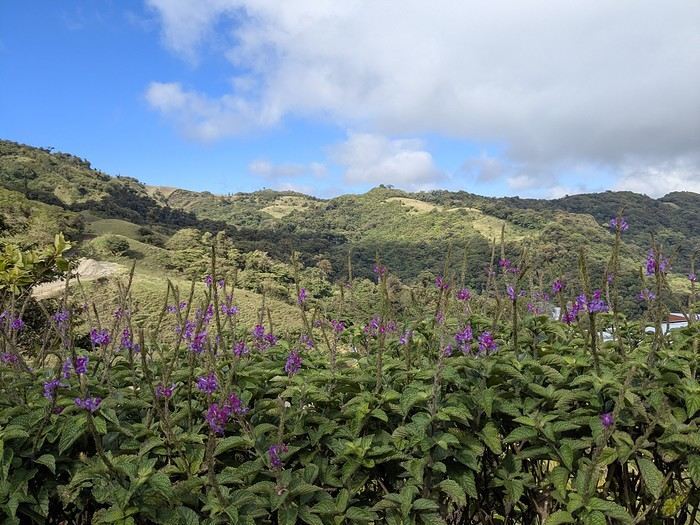
Budget breakdown: Costa Rica is an expensive country, but no more so than France. However, almost all hikes and waterfalls are paid entry, which can really add up. For meals, sodas (6–10 €) are cheaper than restaurants (10–20 € per dish).
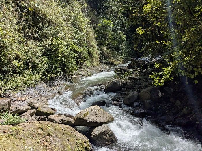
Flights: We chose Delta Airlines for the price: Marseille to San Jose was 740 € per person (modifiable, with checked baggage and seat selection included). Other direct flights from Europe were priced between 1200 € and 1600 € with more restrictive conditions. That’s 2220 € for the family.
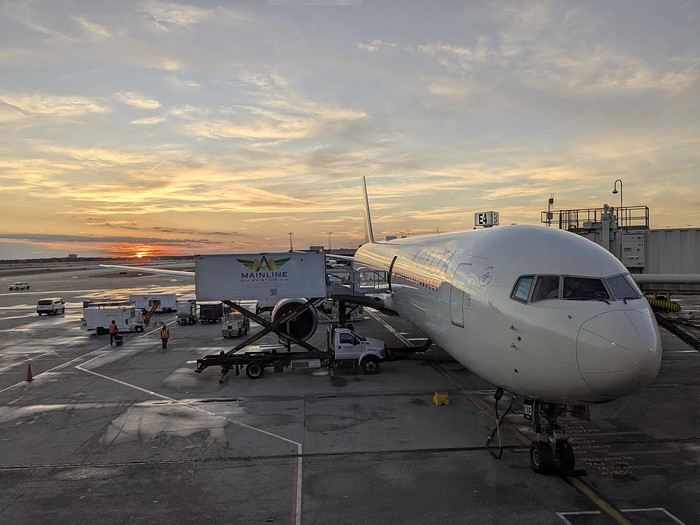
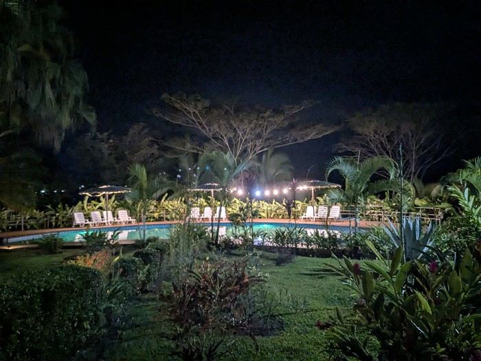
Accommodations: Alajuela, first night: 139 € (1 night) at Rodeo Estancia Boutique Hotel, with personalized airport pickup, transfer to the hotel, and a briefing from Vert Costa Rica agency the next day. Poas: 66 € (1 night) at Cabañas Tierra Fértil (entire apartment). Manuel Antonio: 394 € (3 nights) at La Palapa Ecolodge (hotel in the jungle). Monte Verde: Chalet Aloha Monteverde Cloud Forest (2 bedrooms): 125 € (2 nights). La Fortuna: Arenal Dream Garden (1 bedroom): 217 € (3 nights). Total: 941 €.
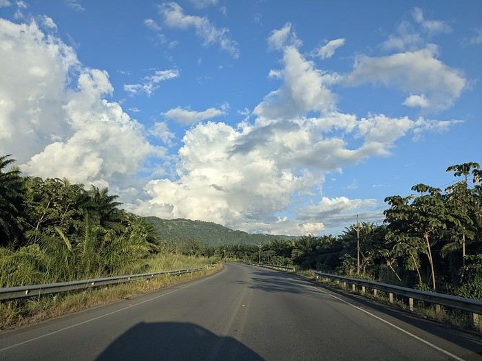
Car rental: I went through Vert Costa Rica agency (Vincent is a French expat who set up the agency in Costa Rica and makes great YouTube videos with useful tips). I rented a 4x4 that was delivered to the hotel the day after arrival and returned at the airport before the flight. The total was 772 €, including full insurance (zero deductible), a child seat, and a phone with a Costa Rican SIM and WhatsApp. The rental company was Poas Rent a Car. The vehicle was well-maintained—no complaints. Gas: 100 € for the whole trip (3 fill-ups).
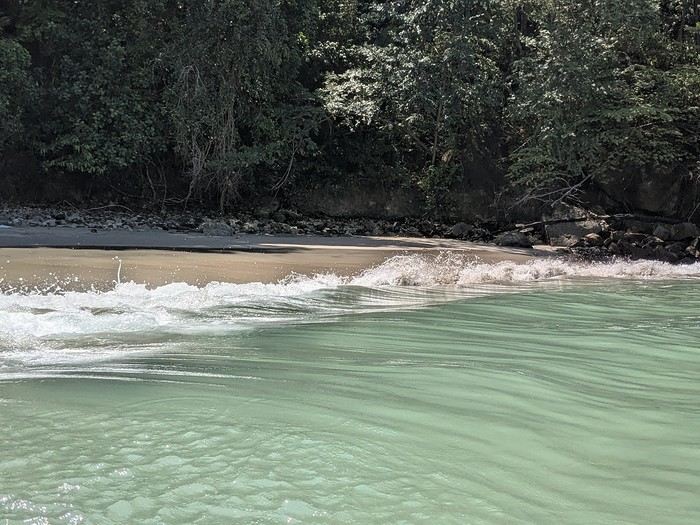
Activities: To get discounts, I bought the pass offered by Vincent, which paid for itself after just one activity. It cost me 30 € (promo since I rented the car through him). Prices are for 3 people. I’ve added stars to rate them: La Paz Waterfall Gardens ****: 112 € Poas Volcano National Park *: 33 € Manuel Antonio National Park ****: 35 € Nauyaca Waterfall ***: 25 € Santa Elena Reserve **: 45 € El Tigre Waterfall Reserve ****: 141 € (with meal) Treetopia (ziplining, suspension bridges) **: 250 € Guided tour of Monte Verde Reserve ***: 113 € Sloth guided tour (with breakfast) ***: 115 € Arenal Observatory Lodge (with meal) ****: 102 € Arenal Volcano National Park *: 34 € Termalistas del Arenal ****: 20 € Night tour ***: 116 € Total: 1171 €.
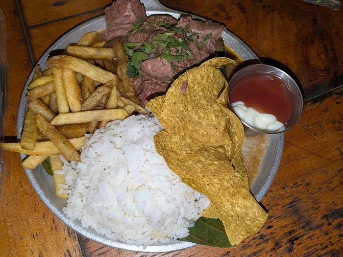
Meals: 600 € My favorite restaurants: Poas: Food court Mercaditas in Fraijanes Manuel Antonio (near La Palapa): La Langosta and also El Patio Near Nauyaca Waterfall: Ricar2 el Avión Between Manuel Antonio and Monte Verde: Soda D’Calle Santa Elena: HG’s Food Guadalupe (between Monte Verde and La Fortuna): Soda Río Piedras Arenal Observatory Lodge restaurant Arenal Oasis Ecolodge restaurant
Other expenses: 300 € (groceries for breakfast, drinks, ice cream, souvenirs, etc.) Total overall: 6065 € (about 2020 € per person).
Now, here’s the day-by-day account of this beautiful trip.
https://voyageforum.com/images/posts/small/1772295011-z8mILBEUXHU8Ajz.jpg
It was the country’s wild nature and safety that convinced us to go, since we’re traveling with our 7-year-old little one. We didn’t have much vacation time in February 2026 (only 12 days), so we optimized as much as possible.
Here’s the itinerary: Wednesday, February 11: Flight from Marseille to San Jose via Paris and Atlanta Thursday, February 12: Pick up the car, drive to Poas Volcano, visit La Paz Waterfall Gardens Friday, February 13: Poas Volcano and drive to Manuel Antonio Saturday, February 14: Manuel Antonio National Park Sunday, February 15: Nauyaca Waterfall and Playa Linda Monday, February 16: Drive to Monte Verde and Santa Elena Reserve Tuesday, February 17: El Tigre Waterfall Reserve and Treetopia Park Wednesday, February 18: Monte Verde Reserve with a guide and drive to La Fortuna Thursday, February 19: Sloth guided tour, Observatory Lodge Park Friday, February 20: Arenal Volcano National Park, Termalistas del Arenal hot springs, and night tour Saturday, February 21: Return to San Jose, flight to Paris via Atlanta Sunday, February 22: Arrival in Paris and flight to Marseille. That gives us a solid 9 days in the country.
Budget breakdown: Costa Rica is an expensive country, but no more so than France. However, almost all hikes and waterfalls are paid entry, which can really add up. For meals, sodas (6–10 €) are cheaper than restaurants (10–20 € per dish).
Flights: We chose Delta Airlines for the price: Marseille to San Jose was 740 € per person (modifiable, with checked baggage and seat selection included). Other direct flights from Europe were priced between 1200 € and 1600 € with more restrictive conditions. That’s 2220 € for the family.
Accommodations: Alajuela, first night: 139 € (1 night) at Rodeo Estancia Boutique Hotel, with personalized airport pickup, transfer to the hotel, and a briefing from Vert Costa Rica agency the next day. Poas: 66 € (1 night) at Cabañas Tierra Fértil (entire apartment). Manuel Antonio: 394 € (3 nights) at La Palapa Ecolodge (hotel in the jungle). Monte Verde: Chalet Aloha Monteverde Cloud Forest (2 bedrooms): 125 € (2 nights). La Fortuna: Arenal Dream Garden (1 bedroom): 217 € (3 nights). Total: 941 €.
Car rental: I went through Vert Costa Rica agency (Vincent is a French expat who set up the agency in Costa Rica and makes great YouTube videos with useful tips). I rented a 4x4 that was delivered to the hotel the day after arrival and returned at the airport before the flight. The total was 772 €, including full insurance (zero deductible), a child seat, and a phone with a Costa Rican SIM and WhatsApp. The rental company was Poas Rent a Car. The vehicle was well-maintained—no complaints. Gas: 100 € for the whole trip (3 fill-ups).
Activities: To get discounts, I bought the pass offered by Vincent, which paid for itself after just one activity. It cost me 30 € (promo since I rented the car through him). Prices are for 3 people. I’ve added stars to rate them: La Paz Waterfall Gardens ****: 112 € Poas Volcano National Park *: 33 € Manuel Antonio National Park ****: 35 € Nauyaca Waterfall ***: 25 € Santa Elena Reserve **: 45 € El Tigre Waterfall Reserve ****: 141 € (with meal) Treetopia (ziplining, suspension bridges) **: 250 € Guided tour of Monte Verde Reserve ***: 113 € Sloth guided tour (with breakfast) ***: 115 € Arenal Observatory Lodge (with meal) ****: 102 € Arenal Volcano National Park *: 34 € Termalistas del Arenal ****: 20 € Night tour ***: 116 € Total: 1171 €.
Meals: 600 € My favorite restaurants: Poas: Food court Mercaditas in Fraijanes Manuel Antonio (near La Palapa): La Langosta and also El Patio Near Nauyaca Waterfall: Ricar2 el Avión Between Manuel Antonio and Monte Verde: Soda D’Calle Santa Elena: HG’s Food Guadalupe (between Monte Verde and La Fortuna): Soda Río Piedras Arenal Observatory Lodge restaurant Arenal Oasis Ecolodge restaurant
Other expenses: 300 € (groceries for breakfast, drinks, ice cream, souvenirs, etc.) Total overall: 6065 € (about 2020 € per person).
Now, here’s the day-by-day account of this beautiful trip.
https://voyageforum.com/images/posts/small/1772295011-z8mILBEUXHU8Ajz.jpg
Annapurna Circuit trek: when to book accommodations?
hi,
we’d like to do a trek in Nepal, and we’re thinking of the Annapurna Circuit—it’s cheaper than the Everest trek.
Our plan is to do it without a guide or porter. We’re used to the mountains, not so much to high altitude, but if we acclimate well, there’s no reason it should go wrong ;)
No guide = handling permits, transport, and accommodation on our own...
So my question is: is it possible to book lodges in advance before departure? Or, even better, day by day?
I’ve read some older posts, so I’m asking again to get up-to-date info on what’s happening now. We’re planning to go mid-November 2026 or March 2027.
Thanks for your tips! :)
No guide = handling permits, transport, and accommodation on our own...
So my question is: is it possible to book lodges in advance before departure? Or, even better, day by day?
I’ve read some older posts, so I’m asking again to get up-to-date info on what’s happening now. We’re planning to go mid-November 2026 or March 2027.
Thanks for your tips! :)
Madagascar - June 2025
Five years of an unintended break... The closure of VF, COVID... What a joy to rediscover the pleasure of sharing!
I’ve stayed true to my habits: the following account is a collection of practical tips rather than a travel journal...
Madagascar is as big as France and Belgium combined. In three weeks, choices have to be made! It was the Great Tsingy that inspired our trip. We decided to focus on the southwest and the RN7. We skipped the Deep South and the North. Oh well...
OUR ITINERARY IN 3 WEEKS:
Fri 6 June – Direct AF flight to Tana – Flight arrives at 10:30 PM – Tana Sat – Antsirabe Sun – Miandrivazo Mon – Drive to the Masiakampy pier – Descent of the Tsiribihina River by pirogue - Bivouac Tue – Descent of the Tsiribihina River by pirogue - Bivouac Wed – Descent of the Tsiribihina River by pirogue – Bekopaka Thu – Pirogue on the Manambolo River and Small Tsingy of Bemaraha – Bekopaka Fri – Great Tsingy of Bemaraha – Bekopaka Sat – Avenue of the Baobabs – Morondava Sun – Belo sur Mer Mon – Free day – Belo sur Mer Tue – Manja Wed – Andavadoaka Thu – Free day – Andavadoaka Fri – Salary Lagoon – Mangily Sat – Ranohira Sun – Isalo National Park - Ranohira Mon – Anja Reserve - Ambalavao - Fianarantsoa Tue – FCE train canceled – Visit to a Tanala village - Manakara Wed – Pirogue on the Pangalanes Canal – Ranomafana Thu – Ranomafana NP – Ranomafana Fri – Ambositra – Antsirabe Sat 28 June – AF flight to Paris – Flight departs at 11:55 PM
TRIP ORGANIZATION: I prepared my trip using the usual guides (LP and Rough Guide), the internet, and the Freytag & Berndt map (1:1,000,000). I’m old-school—I still love visualizing my route on a paper map, even though in Madagascar, it’s misleading because some National Roads are only national in name!...
The agency: Since we couldn’t deal directly with a driver-guide (we lacked reliable info to take the plunge), we went through an agency to organize the logistics of our trip. We didn’t feel like using bush taxis (not enough time) or driving a 4x4 ourselves (neither the skills nor the boldness). The French agency connected us with a local agency, to whom I sent my detailed itinerary by email. A few exchanges via email and WhatsApp calls allowed us to finalize everything quickly after some adjustments. As you’ve gathered... we multiplied the commissions, which inflated the budget. That said, in the end, we were thrilled with our decision and our choice. Our trip was booked by the end of 2024, and reservations were made immediately. No bad surprises: the bookings in the planned hotels were honored, often with one of the best rooms. On our last day in Tana, before departure, we were lucky enough to meet the director I’d been communicating with, who helped build and validate our circuit. A very warm debriefing.
The driver-guide: The agency assigned us Faly, 33, a driver-guide for over 10 years. He stayed with us from start to finish: he picked us up at the airport on arrival and dropped us off 23 days later. A very experienced driver (which is important here), an open and cultured guide, reliable, punctual, and a great companion. And a provider of good advice throughout the trip. We made the most of the long stretches on dirt roads or highways to listen to him talk about daily life, rituals, wildlife, and flora... No time wasted! With a great playlist in the background, we combined business with pleasure! Faly’s accommodation and meals were included (quite often, hotels offer free lodging and meals to driver-guides who bring clients), as was the fuel. That didn’t stop us from inviting Faly to share a beer or our evening meal sometimes. He didn’t always accept, wanting to let us "enjoy our romantic evenings," as he put it. Present without being intrusive! Faly is fully capable of organizing a tailor-made trip directly. I recommend him without any hesitation—we were delighted with his service. I’ll gladly share his contact details via PM to anyone who asks.
Local guides: It’s the national guide’s prerogative to choose the local guides (mandatory in the parks). Thanks to his experience, Faly always booked us amazing, competent, and interesting local guides.
Hotels: I told the agency I wanted charming, comfortable accommodations, without falling into flashy luxury. We loved all the hotels (except the Hôtel Kanto in Manja). The rooms, mostly bungalows, were always spacious and clean. Unfortunately, I can’t give the prices—I didn’t get the details. Breakfast is always included, usually fresh and hearty. Very often, a small bottle of water is provided in the room.
Tana Hôtel Les 3 Métis Power cuts are common (!) in Tana. Bring a headlamp.
Antsirabe Ecolodge – Les chambres du voyageur Maybe our favorite! A few bungalows, beautifully arranged in a splendid tropical garden. The dog Kodak welcomes us warmly.
Miandrivazo Hôtel Princesse Tsiribihina Magnificent view of the valley.
Bekopaka Hôtel Orchidée du Bemaraha 2 (yes, 2) beautiful pools, a large open common room.
Morondava Hôtel Baobab Café Brand new or at least, according to Faly, just renovated. Very comfortable but without much charm (international style).
Belo sur Mer Ecolodge du Menabe The bungalows, all made of wood, bamboo, and thatch, are set on the beach. Very spacious and fully equipped! Large open-air restaurant by the sea. No hot water from the tap—it’s available in plastic bottles heated by the sun in front of each bungalow. Actually, we never used it... Another very, very beautiful spot.
Manja Hôtel Kanto The only hotel on this leg of the journey, so no choice. The owner knows it and, as a result, doesn’t bother. It’s a real dive! Tiny, dark room, a sordid bathroom with only a trickle of water—we skipped the shower! Clean sheets, though. Obviously, no Wi-Fi. The only place where I didn’t leave a tip. We were well warned about the discomfort of this stop, both by the agency and Faly. We weren’t surprised, and it even became a running joke during the trip. On the other hand, we found a nice little market in town.
Andavadoaka Manga Lodge What bliss! Especially after the horrible Hôtel Kanto. A paradise-like spot, overlooking three beautiful deserted white-sand beaches. Meals are served on the terrace facing the sea. Stunning sunset. We loved spending a day lounging here! We were the only guests and were pampered.
Mangily (Ifaty) Mangily is the "suburb" of Ifaty. Hôtel Vovo Telo A large beachfront bungalow complex. More touristy but pleasant—we spent a lovely evening there with our feet in the sand.
Ranohira Le Relais de la Reine A splendid resort built by a Frenchman, at the foot of the rocks, very well integrated into the environment. Beautiful marked trail starting from the garden.
Fianarantsoa Villa Sylvestre Contrary to what its name suggests, it’s a hotel right in the city center. Quite decent, though.
Manakara Parthenay Club Pretty bungalows in a large garden by the sea, but swimming isn’t safe—the water is too dangerous and rough.
Ranomafana Hôtel Thermal Very spacious rooms.
Meals: Not all our meals were included. It’s really not expensive. 1 meat or fish dish: around 35,000 Ar 1 full menu (starter, main, dessert): around 70,000 Ar 1 large THB beer (65 cl): between 8,000 and 12,000 Ar 1 piña colada: 15,000 Ar 1 flavored rum: 6,000 Ar (sometimes free) 1 glass of baobab juice (!): 5,000 Ar
We always ate very well. Rice is everywhere, served in large quantities. Zebu meat is quite good if not overcooked. Personally, I prefer fish, and I feasted: grouper, captain, crab, small lobsters...
We happily discovered baobab juice (especially in Belo, on the west coast). And of course, flavored rums!
We bought 2 packs of 6 bottles of mineral water at Carrefour (!) (about 5,000 Ar per large bottle) at the start of our trip. That was enough, especially since we often got water in the bungalows.
We had a few picnics included in our trip. Instead of picking up the hotel’s lunchbox, Faly prepared delicious, fresh, and varied picnics for us: tuna pasta salad, fried rice with eggs, grilled vegetables, and avocado...
An exceptional address not to miss: Mad Zébu – Belo sur Tsiribihina A highly reputed restaurant, a favorite of LP and Rough Guide, and rightly so! Gourmet cuisine, refined and elegant. Barely more expensive than elsewhere, and it’s worth it. We stopped there on our way up to Bekopaka and the Tsingy NP. Fully booked! So Faly reserved for our return, three days later. We’re still thanking him! What a treat!
THE BUDGET: Ariary exchange rate: 5,000 Ar = 1 €
Pre-trip expenses: Direct Air France flights: 930 € per person round trip Cost of the circuit with the agency: 2,880 € per person
The visa: Issued on arrival, very quickly. 35 € per person for a stay under 30 days. Super simple. Super fast.
On-site expenses: As soon as we arrived at the airport (it was nearly midnight), Faly advised us to exchange our euros for all our needs. There are few opportunities on our route to find an ATM or an open bank with a good rate. To be more comfortable, he took us to a small office under military protection just outside the airport. I exchanged 1,200 € (I had asked the agency for advice on the amount to bring) at a rate of 4,750 Ar and became a millionaire. Faly recounted all the stacks. That covered all our expenses (meals, drinks, tips) without ever feeling deprived. Personal purchases were made at the end of the trip. Convenient—it served as an adjustment variable. We spent our last million (200 €) on marquetry and vanilla. Tip: We asked for 200,000 Ar in 5,000 Ar bills for tips. That wasn’t too much—I even ran short of small bills in the last two days.
Tips: Madagascar is a poor country where every service deserves a small reward. While not mandatory, it’s customary. But no one ever demanded or expected it openly. On the contrary, I sometimes had to remind a porter to give them my small bill. We never carried our luggage—porters were always present when the car arrived or waiting at our door to watch for our departure. I gave each of them 5,000 Ar. In restaurants, I rounded up to the nearest ten and left the change. Local guides also expect a tip: I gave around 20,000 Ar per day for the two of us. Finally, the national guide also expects a gratuity. I had read online to budget 5 € per day per person. I added more since we were so happy with his services. The tip was given at the end of the trip, in euros, outside the budget.
Total budget all included (excluding personal purchases): 8,690 € Clearly, Madagascar is a country where life isn’t expensive, but travel costs add up quickly due to the need to rent a 4x4 with a driver.
HIGHLIGHTS:
· The dirt roads Yes, I’m listing them among the highlights! We loved those long hours spent driving at 20 km/h on rocky, muddy, white, red, or gray sand tracks... surrounded by tropical vegetation, palm trees, pandanus, mango trees... The experiences were sometimes thrilling: crossing a river on a ferry (just planks of wood fixed on two motorized pirogues side by side) or crossing a river without a ferry, with just a kid running ahead of the 4x4 to show the way; soft sand where the 4x4 easily gets stuck... The tracks are quite narrow, and crossing paths with a bush taxi, a zebu cart, or a herd of goats is always epic. So many beautiful images, so many beautiful photos! Much more beautiful than on asphalt. So yes, we loved those long stretches on dirt roads. For us, it was clearly part of the journey. Faly was particularly careful, and the 4x4 was comfortable. No injuries, no fatigue, even after 7 or 8 hours on rough tracks. The national roads (including the famous RN7) are badly damaged by cyclones, huge trucks, and lack of maintenance. Potholes have turned into ostrich nests, and we didn’t drive much faster than on the dirt roads.
· The landscapes, villages, encounters... We crossed a variety of stunning landscapes: mountains with slopes covered in terraced crops, rice fields from apple green to emerald green, sugarcane fields, then tropical forests, baobab forests (they deserve a special paragraph below), traveler’s tree forests. And then coastlines with white sand dunes against a backdrop of blue hues!... Magical! We also passed through many villages with houses whose architecture varied by region. The Betsileo houses display beautiful decorative brick reliefs. On the west coast, the houses are more precarious, made of bamboo with palm-thatched roofs. In the Highlands region, we found solid houses with pastel plaster. Each region has its own landscape, crops, habitat, and clothing. Zebu carts are often the only means of transport in remote villages. We saw them very frequently. Again, the cart’s decoration depends on the region. And then, we met many villagers coming out of the bush and walking to the next market, carrying their crops on their heads or shoulders. More beautiful photos!
· The descent of the Tsiribihina River We boarded around 9 AM in a long pirogue with Gana, the local guide, and two pirogue men. So, five of us. The pirogue is long but narrow, about 65 cm wide. We sat one behind the other at the front on seats padded with what would become our mattresses during the bivouacs. We only took the bare essentials for two nights. A little goodbye to Faly, whom we’d see again in three days! Don’t forget us! The river is silty—meaning orange, opaque but clean. We glided along silently. Gana showed us the trees, birds, crocodiles (we saw five—apparently, we were lucky). The pirogue men rowed to get us as close as possible to these crocs sunbathing on the roots of big trees. Yeah, right!... as soon as we got too close, *splash*, they disappeared into the water. We marveled at the mini rice fields lining the river. Every tiny plot, no matter how small, is cultivated. Above them, banana fields. And on the water, a whole life of fishermen and villagers living with and from the river. Gana warned us we’d eat on the pirogue because the journey was long. So, I expected chips... But no—fried rice and zebu steak, cooked right in the pirogue!! Incredible! In the middle of the afternoon, we reached a small beach where we disembarked. Gana led us about a hundred meters to a sublime waterfall. We were alone there. We had time to swim. We’d brought our swimsuits and a towel (bought at the Carrefour in Antsirabe on Faly’s wise advice!). This swim in this paradise-like spot remains one of our best memories. We found our pirogue again and set off until our first bivouac. We’d sailed for 7 hours today. The tents were set up on a wide beach, without a single tree. A moment of solitude... Uh, where can we go to the bathroom?... Especially since it was a full moon, so we felt like we were in the spotlight. Anyway... we did as everyone else—walked away, dug a hole, and the others turned their backs. A hearty meal on the beach before a comfortable and silent night. The next day, same program, with slightly different landscapes. The gorges widened, the trees were different. But still many colorful birds. Again, we ate on the pirogue: grilled chicken and vegetables. 9 hours of sailing. A similar bivouac. This time, we got it. On the third day, we finished the descent with 5 hours of sailing. So, 7 hours, 9 hours, 5 hours... doing nothing. It might sound boring... but it wasn’t. Like the dirt roads, these were contemplative moments. It glides, it’s calm, relaxing, and there’s a lot of life on this river, animal and human. Contemplation. Suspended time. On arrival, we disembarked at a sort of joyful, bustling river port. Of course, Faly was already there to pick us up.
· The Tsingy de Bemaraha NP (Small and Great) I have vertigo. During my research, several agencies advised me against visiting the Great Tsingy. "Stick to the Small ones," they said. Grrr, no, not what I wanted—we’ve dreamed of this for years! The agency we chose also warned me but didn’t discourage me. So we started with the Small Tsingy, quite close to Bekopaka, guided by Alisha. This forest of sharp limestone rocks is impressive. No vertigo issues here. The day was completed with a short pirogue ride on the Manambolo River and a visit to two caves with pretty formations. The next day, Faly and Alisha drove us to the Great Tsingy (a good hour on a terrible track). Arriving at the park entrance, Alisha equipped us with harnesses, carabiners, and gave us some safety instructions. Faly was also equipped. Wait? He’s coming with us? I quickly understood he was there for me—if I got stuck, he could go back with me, and Philippe could continue with Alisha. A wise precaution that delighted and reassured me. In the end, it was unnecessary since the famous bridge crossing was fully secured by the harness and carabiners. 18 meters on planks, one by one, it didn’t sway too much—I walked looking straight ahead, not a glance down. I even managed to smile in the middle of the crossing—I have a photo to prove it! I was overjoyed! The circuit in the Great Tsingy is a loop, so we didn’t have to cross the bridge again. We climbed to viewpoints offering breathtaking panoramic views. It’s extraordinary, unique, incredible. All this to say that if you have vertigo, don’t hesitate! It’s doable! It’s completely safe and really worth pushing your limits a bit! For those who’ve done treetop adventure courses, it’s similar. Also, no need to be a great athlete—just a bit of agility to climb a few ladders and high steps. Don’t censor yourself! I even had a small regret—the loop was a bit short (about 2 hours). I would’ve liked to continue or even redo it, with less apprehension. Tip: Do the Small Tsingy before the Great ones, or not at all. And if you can only do one, do the Great ones without hesitation.
· Canoeing in the Belo mangrove The Belo sur Mer ecolodge lends small individual canoes for free to go to the mangrove. We left at high tide, paddled for about twenty minutes to reach a fairly sparse forest where we could easily venture in. Very shallow water, crystal clear—we could see the roots of all these trees, schools of tiny fish... It was quite surprising. Until then, I only knew impenetrable, tangled mangroves. Here, nothing like that—we walked through an aquatic forest. We loved this adventure so much we left a bit late. The tide had gone out, and we had to carry our canoes for the last few meters... Of course, the staff came to help (probably laughing silently!). The lodge owners gave all the necessary explanations and lent a waterproof bag for the phone (because yes, it’s worth taking photos!). A very useful precaution—the canoes are small, low in the water, and paddling quickly soaks you. Again, this isn’t just for Tony Estanguet! It didn’t cause us any problems, not even sore muscles the next day. A great experience. It’ll take about 2 hours.
· Isalo NP Big surprise when we saw this huge rocky massif appear on the RN7! A massif of colored sandstone, carved with crevasses giving it a ruined look. Le Relais de la Reine is a little gem cleverly nestled in the heart of these rocks. A small marked trail starts from the garden. We picked up the description at reception and set off. Without a guide, alone following the markers, it took us 2 hours to complete this magnificent little trail, giving us a first glimpse of the massif before the hike the next day. And we enjoyed being completely alone for this walk. It’s free, easy, and well-signposted. Don’t miss it. In the evening, Faly took us to the so-called Isalo Window site—a hole in a wall through which we could see the sunset. We met all the tourists in the area here. We weren’t blown away by the show... The next day, we left early to reach the start of the hike. We met Zozoly at the guides’ office in the small town of Ranohira. During this hike, we climbed through the rocks to a viewpoint offering stunning 360° views of the massif. Then we reached a site called the "natural pool," breathtakingly beautiful, especially since we were alone again. A sort of oasis, a cascading waterfall, palm trees and tree ferns, fine sand, all nestled at the bottom of a small canyon. Paradise-like. We resisted swimming, but it was really tempting. A long walk on the plateaus then led us to a well-equipped picnic site where a local team prepared grills. Concrete tables were tiered in a spacious, shady clearing where a whole family of ring-tailed lemurs frolicked. They knew the tourists’ habits and tried to snatch food. Playful and not very shy, they amused us with their antics! We had to resist not luring them with a piece of banana!! Thousands of photos!! After the meal, we set off again with Zozoly for another landscape. This time, we were by a small river at the bottom of a canyon with high walls covered in vegetation. The trail was narrow and slippery, on a ledge of the wall. We progressed carefully. No danger, though. We first reached the Blue Pool, which only turns blue in photos (surprise!), then the Black Pool fed by a shower of waterfalls. Two magnificent spots that showed us a completely different aspect of the massif.
· Anja Reserve This ficus forest is home to many groups of lemurs. Used to humans, whom they don’t fear, they move around us, ignoring us completely. It’s almost annoying... The best place on our trip to see lemurs.
· The FCE train To the great regret of Manakara’s inhabitants, the FCE train hasn’t reached here for over a year and a half. As a result, there are far fewer tourists—the train was part of the experience. We drove there and didn’t regret coming to this port on the east coast.
· Visit to a Tanala village This visit wasn’t part of our program—it was added by the agency to compensate for the train not running. Which was the case. Not big fans of this kind of visit, where we feel like we’re at a zoo, voyeuristic, lacking authenticity, we followed the local guide with some skepticism and exchanged dubious looks. And yet... the guide’s explanations about village life and the warm, smiling welcome from the villagers charmed us and dispelled all our concerns. We learned a lot, met smiling families, and were able to enter these beautiful bamboo houses. A very pleasant surprise, rich in lessons.
· The Pangalanes Canal Arriving in Manakara, we crossed a bridge overlooking the Pangalanes Canal. A cry of surprise: the water is turquoise! We took a short pirogue ride with a team of three pirogue men and Joël, a local guide who explained the drama caused by the train’s halt. We stopped in a fishing village where Joël bought fish for the barbecue. We ended up on a beach where the team prepared the meal while we went to watch the fishermen return on the nearby beach. We admired the fishermen’s dexterity in untangling their nets, sorting their fish, cleaning their gear. On our return, we found a small table set up on the beach, in the shade of palm trees and casuarinas. Lobsters, captain fish, grilled vegetables, sautéed potatoes. A real feast (included in the trip cost).
· Ranomafana NP A 4-5 hour hike (some climbing) in a dense secondary forest to look for lemurs. As usual, we were accompanied by a local guide who, while waiting to find our furry friends, gave us lots of info on the vegetation, birds, and Tanala ethnic rituals. In the forest, we met 4 or 5 trackers, armed with radios to alert guides of their findings. In the end, we saw several lemurs of different types. Quite far, quite high... A nice complement to our lemur encounters in Isalo. Here, it rains 200 days a year. We started the hike in thick fog, but the forest’s density protected us from the humidity. Be careful—it can be a bit frustrating to see the lemurs so far away, so high. Nothing like the Anja Reserve or Isalo NP. Here, what’s fun is the hunt.
· The baobabs We were captivated by these kings of the forest, noble, imposing, majestic. We spotted them from very far away, towering over the rest of the vegetation. Alone, in small groups, or in forests, our trip allowed us to see hundreds of them! Mainly on the west coast. All different—bald, hairy, shaggy, short and stout, tall and thin, like Laurel and Hardy. Philippe took to naming them. Respectfully!
OUR FAVORITES: · The variety of landscapes. · The Tsingy NP.
OUR DISAPPOINTMENTS: · The Avenue of the Baobabs, very overrated and the only place where we saw crowds. We saw many other "forests" of baobabs that were much more impressive. · It’s hard to approach the population calmly as swarms of children run up as soon as we arrive, asking for sweets. Without any aggression, their smiles and laughter quickly made us forget this small inconvenience. We never gave out candy, clothes, or money. We left pens at a school and clothes with Faly.
IF WE WERE TO DO IT AGAIN: · Same period, same duration, same pace, same itinerary, but if we were to do it again today, I’d go through Faly directly! · Maybe we should’ve stayed in Ambalavao instead of Fianarantsoa. · Plan a longer loop in the Great Tsingy—it felt a bit too short.
MISCELLANEOUS: The welcome: ‘Samala Vazaha,’ there are many, many kids, sometimes overwhelming, never aggressive. We were impressed by the villagers’ smiles and good humor, towards us or even among themselves—laughter was everywhere. Safety: No problems. Out of (excessive?) caution, we spread all our money across several bags that we padlocked whenever we left the hotel. Bribes: We were stopped several times on the road by police or gendarmes. They checked our papers, sometimes our passports. Faly was perfectly in order. No discussion, no bribes, a cordial greeting from the officers. However, several times we found ourselves at small "tolls" on the tracks for villagers who had leveled the road or filled a hole, or for the young guy who ran through the river to show the way... Faly complied without discussion: every service deserves a small bill. Language: French is still widely spoken. Credit card: Unused. Cash: You need it! The climate at this time: Ideal—blue skies, sunshine, and mild temperatures (20-25°C) throughout our trip. Temperatures started to drop by our departure—winter was setting in. Clothing: T-shirt or polo and a vest sometimes in the evening, sandals on our feet, hiking shoes for all the hikes. Tip: We left a bag in the car (completely safe) with things we didn’t need daily and dirty laundry. The two bags to take out at each stop were much lighter. Before leaving, we left several polos and T-shirts with Faly, which, once washed, will make a few people happy. Tourist crowds at this time: Low—we were sometimes the only guests at the hotel. Faly explained that at the Isalo picnic site, in high season, you have to queue for a table, whereas we had our pick. Photos: Lots! Too many! That’s the problem with digital—we take so many! Health issues: Nothing serious, just the usual mild traveler’s diarrhea. Mosquitoes: They’re voracious. We took anti-malaria treatment. I’m still not sure if it was the right thing to do... I’m always very skeptical about such precautions. Internet: Free Wi-Fi at the lodges’ reception (except at Hôtel Kanto!), sometimes (rarely) in the bungalows. Phone: We didn’t try to get a local SIM card—the evening Wi-Fi was enough for us to make calls and send messages via WhatsApp. Make sure to turn off mobile data and switch to airplane mode (I activated it a bit late—received calls, spam ones at that, were charged...). Electricity: French plugs. Personal purchases: Beautiful wooden objects (sculptures and marquetry) or zebu horn items in Ambositra. 1 kg of vanilla (400,000 Ar – 80 € per kg) in Tana.
IN CONCLUSION: A trip of contemplation. A pause for admiration, as our local guide in Isalo NP said. Nothing else to do but walk, look, and enjoy. Here, there are no old stones, no museums—it’s a trip where nature reigns supreme. And what nature!
I’ve stayed true to my habits: the following account is a collection of practical tips rather than a travel journal...
Madagascar is as big as France and Belgium combined. In three weeks, choices have to be made! It was the Great Tsingy that inspired our trip. We decided to focus on the southwest and the RN7. We skipped the Deep South and the North. Oh well...
OUR ITINERARY IN 3 WEEKS:
Fri 6 June – Direct AF flight to Tana – Flight arrives at 10:30 PM – Tana Sat – Antsirabe Sun – Miandrivazo Mon – Drive to the Masiakampy pier – Descent of the Tsiribihina River by pirogue - Bivouac Tue – Descent of the Tsiribihina River by pirogue - Bivouac Wed – Descent of the Tsiribihina River by pirogue – Bekopaka Thu – Pirogue on the Manambolo River and Small Tsingy of Bemaraha – Bekopaka Fri – Great Tsingy of Bemaraha – Bekopaka Sat – Avenue of the Baobabs – Morondava Sun – Belo sur Mer Mon – Free day – Belo sur Mer Tue – Manja Wed – Andavadoaka Thu – Free day – Andavadoaka Fri – Salary Lagoon – Mangily Sat – Ranohira Sun – Isalo National Park - Ranohira Mon – Anja Reserve - Ambalavao - Fianarantsoa Tue – FCE train canceled – Visit to a Tanala village - Manakara Wed – Pirogue on the Pangalanes Canal – Ranomafana Thu – Ranomafana NP – Ranomafana Fri – Ambositra – Antsirabe Sat 28 June – AF flight to Paris – Flight departs at 11:55 PM
TRIP ORGANIZATION: I prepared my trip using the usual guides (LP and Rough Guide), the internet, and the Freytag & Berndt map (1:1,000,000). I’m old-school—I still love visualizing my route on a paper map, even though in Madagascar, it’s misleading because some National Roads are only national in name!...
The agency: Since we couldn’t deal directly with a driver-guide (we lacked reliable info to take the plunge), we went through an agency to organize the logistics of our trip. We didn’t feel like using bush taxis (not enough time) or driving a 4x4 ourselves (neither the skills nor the boldness). The French agency connected us with a local agency, to whom I sent my detailed itinerary by email. A few exchanges via email and WhatsApp calls allowed us to finalize everything quickly after some adjustments. As you’ve gathered... we multiplied the commissions, which inflated the budget. That said, in the end, we were thrilled with our decision and our choice. Our trip was booked by the end of 2024, and reservations were made immediately. No bad surprises: the bookings in the planned hotels were honored, often with one of the best rooms. On our last day in Tana, before departure, we were lucky enough to meet the director I’d been communicating with, who helped build and validate our circuit. A very warm debriefing.
The driver-guide: The agency assigned us Faly, 33, a driver-guide for over 10 years. He stayed with us from start to finish: he picked us up at the airport on arrival and dropped us off 23 days later. A very experienced driver (which is important here), an open and cultured guide, reliable, punctual, and a great companion. And a provider of good advice throughout the trip. We made the most of the long stretches on dirt roads or highways to listen to him talk about daily life, rituals, wildlife, and flora... No time wasted! With a great playlist in the background, we combined business with pleasure! Faly’s accommodation and meals were included (quite often, hotels offer free lodging and meals to driver-guides who bring clients), as was the fuel. That didn’t stop us from inviting Faly to share a beer or our evening meal sometimes. He didn’t always accept, wanting to let us "enjoy our romantic evenings," as he put it. Present without being intrusive! Faly is fully capable of organizing a tailor-made trip directly. I recommend him without any hesitation—we were delighted with his service. I’ll gladly share his contact details via PM to anyone who asks.
Local guides: It’s the national guide’s prerogative to choose the local guides (mandatory in the parks). Thanks to his experience, Faly always booked us amazing, competent, and interesting local guides.
Hotels: I told the agency I wanted charming, comfortable accommodations, without falling into flashy luxury. We loved all the hotels (except the Hôtel Kanto in Manja). The rooms, mostly bungalows, were always spacious and clean. Unfortunately, I can’t give the prices—I didn’t get the details. Breakfast is always included, usually fresh and hearty. Very often, a small bottle of water is provided in the room.
Tana Hôtel Les 3 Métis Power cuts are common (!) in Tana. Bring a headlamp.
Antsirabe Ecolodge – Les chambres du voyageur Maybe our favorite! A few bungalows, beautifully arranged in a splendid tropical garden. The dog Kodak welcomes us warmly.
Miandrivazo Hôtel Princesse Tsiribihina Magnificent view of the valley.
Bekopaka Hôtel Orchidée du Bemaraha 2 (yes, 2) beautiful pools, a large open common room.
Morondava Hôtel Baobab Café Brand new or at least, according to Faly, just renovated. Very comfortable but without much charm (international style).
Belo sur Mer Ecolodge du Menabe The bungalows, all made of wood, bamboo, and thatch, are set on the beach. Very spacious and fully equipped! Large open-air restaurant by the sea. No hot water from the tap—it’s available in plastic bottles heated by the sun in front of each bungalow. Actually, we never used it... Another very, very beautiful spot.
Manja Hôtel Kanto The only hotel on this leg of the journey, so no choice. The owner knows it and, as a result, doesn’t bother. It’s a real dive! Tiny, dark room, a sordid bathroom with only a trickle of water—we skipped the shower! Clean sheets, though. Obviously, no Wi-Fi. The only place where I didn’t leave a tip. We were well warned about the discomfort of this stop, both by the agency and Faly. We weren’t surprised, and it even became a running joke during the trip. On the other hand, we found a nice little market in town.
Andavadoaka Manga Lodge What bliss! Especially after the horrible Hôtel Kanto. A paradise-like spot, overlooking three beautiful deserted white-sand beaches. Meals are served on the terrace facing the sea. Stunning sunset. We loved spending a day lounging here! We were the only guests and were pampered.
Mangily (Ifaty) Mangily is the "suburb" of Ifaty. Hôtel Vovo Telo A large beachfront bungalow complex. More touristy but pleasant—we spent a lovely evening there with our feet in the sand.
Ranohira Le Relais de la Reine A splendid resort built by a Frenchman, at the foot of the rocks, very well integrated into the environment. Beautiful marked trail starting from the garden.
Fianarantsoa Villa Sylvestre Contrary to what its name suggests, it’s a hotel right in the city center. Quite decent, though.
Manakara Parthenay Club Pretty bungalows in a large garden by the sea, but swimming isn’t safe—the water is too dangerous and rough.
Ranomafana Hôtel Thermal Very spacious rooms.
Meals: Not all our meals were included. It’s really not expensive. 1 meat or fish dish: around 35,000 Ar 1 full menu (starter, main, dessert): around 70,000 Ar 1 large THB beer (65 cl): between 8,000 and 12,000 Ar 1 piña colada: 15,000 Ar 1 flavored rum: 6,000 Ar (sometimes free) 1 glass of baobab juice (!): 5,000 Ar
We always ate very well. Rice is everywhere, served in large quantities. Zebu meat is quite good if not overcooked. Personally, I prefer fish, and I feasted: grouper, captain, crab, small lobsters...
We happily discovered baobab juice (especially in Belo, on the west coast). And of course, flavored rums!
We bought 2 packs of 6 bottles of mineral water at Carrefour (!) (about 5,000 Ar per large bottle) at the start of our trip. That was enough, especially since we often got water in the bungalows.
We had a few picnics included in our trip. Instead of picking up the hotel’s lunchbox, Faly prepared delicious, fresh, and varied picnics for us: tuna pasta salad, fried rice with eggs, grilled vegetables, and avocado...
An exceptional address not to miss: Mad Zébu – Belo sur Tsiribihina A highly reputed restaurant, a favorite of LP and Rough Guide, and rightly so! Gourmet cuisine, refined and elegant. Barely more expensive than elsewhere, and it’s worth it. We stopped there on our way up to Bekopaka and the Tsingy NP. Fully booked! So Faly reserved for our return, three days later. We’re still thanking him! What a treat!
THE BUDGET: Ariary exchange rate: 5,000 Ar = 1 €
Pre-trip expenses: Direct Air France flights: 930 € per person round trip Cost of the circuit with the agency: 2,880 € per person
The visa: Issued on arrival, very quickly. 35 € per person for a stay under 30 days. Super simple. Super fast.
On-site expenses: As soon as we arrived at the airport (it was nearly midnight), Faly advised us to exchange our euros for all our needs. There are few opportunities on our route to find an ATM or an open bank with a good rate. To be more comfortable, he took us to a small office under military protection just outside the airport. I exchanged 1,200 € (I had asked the agency for advice on the amount to bring) at a rate of 4,750 Ar and became a millionaire. Faly recounted all the stacks. That covered all our expenses (meals, drinks, tips) without ever feeling deprived. Personal purchases were made at the end of the trip. Convenient—it served as an adjustment variable. We spent our last million (200 €) on marquetry and vanilla. Tip: We asked for 200,000 Ar in 5,000 Ar bills for tips. That wasn’t too much—I even ran short of small bills in the last two days.
Tips: Madagascar is a poor country where every service deserves a small reward. While not mandatory, it’s customary. But no one ever demanded or expected it openly. On the contrary, I sometimes had to remind a porter to give them my small bill. We never carried our luggage—porters were always present when the car arrived or waiting at our door to watch for our departure. I gave each of them 5,000 Ar. In restaurants, I rounded up to the nearest ten and left the change. Local guides also expect a tip: I gave around 20,000 Ar per day for the two of us. Finally, the national guide also expects a gratuity. I had read online to budget 5 € per day per person. I added more since we were so happy with his services. The tip was given at the end of the trip, in euros, outside the budget.
Total budget all included (excluding personal purchases): 8,690 € Clearly, Madagascar is a country where life isn’t expensive, but travel costs add up quickly due to the need to rent a 4x4 with a driver.
HIGHLIGHTS:
· The dirt roads Yes, I’m listing them among the highlights! We loved those long hours spent driving at 20 km/h on rocky, muddy, white, red, or gray sand tracks... surrounded by tropical vegetation, palm trees, pandanus, mango trees... The experiences were sometimes thrilling: crossing a river on a ferry (just planks of wood fixed on two motorized pirogues side by side) or crossing a river without a ferry, with just a kid running ahead of the 4x4 to show the way; soft sand where the 4x4 easily gets stuck... The tracks are quite narrow, and crossing paths with a bush taxi, a zebu cart, or a herd of goats is always epic. So many beautiful images, so many beautiful photos! Much more beautiful than on asphalt. So yes, we loved those long stretches on dirt roads. For us, it was clearly part of the journey. Faly was particularly careful, and the 4x4 was comfortable. No injuries, no fatigue, even after 7 or 8 hours on rough tracks. The national roads (including the famous RN7) are badly damaged by cyclones, huge trucks, and lack of maintenance. Potholes have turned into ostrich nests, and we didn’t drive much faster than on the dirt roads.
· The landscapes, villages, encounters... We crossed a variety of stunning landscapes: mountains with slopes covered in terraced crops, rice fields from apple green to emerald green, sugarcane fields, then tropical forests, baobab forests (they deserve a special paragraph below), traveler’s tree forests. And then coastlines with white sand dunes against a backdrop of blue hues!... Magical! We also passed through many villages with houses whose architecture varied by region. The Betsileo houses display beautiful decorative brick reliefs. On the west coast, the houses are more precarious, made of bamboo with palm-thatched roofs. In the Highlands region, we found solid houses with pastel plaster. Each region has its own landscape, crops, habitat, and clothing. Zebu carts are often the only means of transport in remote villages. We saw them very frequently. Again, the cart’s decoration depends on the region. And then, we met many villagers coming out of the bush and walking to the next market, carrying their crops on their heads or shoulders. More beautiful photos!
· The descent of the Tsiribihina River We boarded around 9 AM in a long pirogue with Gana, the local guide, and two pirogue men. So, five of us. The pirogue is long but narrow, about 65 cm wide. We sat one behind the other at the front on seats padded with what would become our mattresses during the bivouacs. We only took the bare essentials for two nights. A little goodbye to Faly, whom we’d see again in three days! Don’t forget us! The river is silty—meaning orange, opaque but clean. We glided along silently. Gana showed us the trees, birds, crocodiles (we saw five—apparently, we were lucky). The pirogue men rowed to get us as close as possible to these crocs sunbathing on the roots of big trees. Yeah, right!... as soon as we got too close, *splash*, they disappeared into the water. We marveled at the mini rice fields lining the river. Every tiny plot, no matter how small, is cultivated. Above them, banana fields. And on the water, a whole life of fishermen and villagers living with and from the river. Gana warned us we’d eat on the pirogue because the journey was long. So, I expected chips... But no—fried rice and zebu steak, cooked right in the pirogue!! Incredible! In the middle of the afternoon, we reached a small beach where we disembarked. Gana led us about a hundred meters to a sublime waterfall. We were alone there. We had time to swim. We’d brought our swimsuits and a towel (bought at the Carrefour in Antsirabe on Faly’s wise advice!). This swim in this paradise-like spot remains one of our best memories. We found our pirogue again and set off until our first bivouac. We’d sailed for 7 hours today. The tents were set up on a wide beach, without a single tree. A moment of solitude... Uh, where can we go to the bathroom?... Especially since it was a full moon, so we felt like we were in the spotlight. Anyway... we did as everyone else—walked away, dug a hole, and the others turned their backs. A hearty meal on the beach before a comfortable and silent night. The next day, same program, with slightly different landscapes. The gorges widened, the trees were different. But still many colorful birds. Again, we ate on the pirogue: grilled chicken and vegetables. 9 hours of sailing. A similar bivouac. This time, we got it. On the third day, we finished the descent with 5 hours of sailing. So, 7 hours, 9 hours, 5 hours... doing nothing. It might sound boring... but it wasn’t. Like the dirt roads, these were contemplative moments. It glides, it’s calm, relaxing, and there’s a lot of life on this river, animal and human. Contemplation. Suspended time. On arrival, we disembarked at a sort of joyful, bustling river port. Of course, Faly was already there to pick us up.
· The Tsingy de Bemaraha NP (Small and Great) I have vertigo. During my research, several agencies advised me against visiting the Great Tsingy. "Stick to the Small ones," they said. Grrr, no, not what I wanted—we’ve dreamed of this for years! The agency we chose also warned me but didn’t discourage me. So we started with the Small Tsingy, quite close to Bekopaka, guided by Alisha. This forest of sharp limestone rocks is impressive. No vertigo issues here. The day was completed with a short pirogue ride on the Manambolo River and a visit to two caves with pretty formations. The next day, Faly and Alisha drove us to the Great Tsingy (a good hour on a terrible track). Arriving at the park entrance, Alisha equipped us with harnesses, carabiners, and gave us some safety instructions. Faly was also equipped. Wait? He’s coming with us? I quickly understood he was there for me—if I got stuck, he could go back with me, and Philippe could continue with Alisha. A wise precaution that delighted and reassured me. In the end, it was unnecessary since the famous bridge crossing was fully secured by the harness and carabiners. 18 meters on planks, one by one, it didn’t sway too much—I walked looking straight ahead, not a glance down. I even managed to smile in the middle of the crossing—I have a photo to prove it! I was overjoyed! The circuit in the Great Tsingy is a loop, so we didn’t have to cross the bridge again. We climbed to viewpoints offering breathtaking panoramic views. It’s extraordinary, unique, incredible. All this to say that if you have vertigo, don’t hesitate! It’s doable! It’s completely safe and really worth pushing your limits a bit! For those who’ve done treetop adventure courses, it’s similar. Also, no need to be a great athlete—just a bit of agility to climb a few ladders and high steps. Don’t censor yourself! I even had a small regret—the loop was a bit short (about 2 hours). I would’ve liked to continue or even redo it, with less apprehension. Tip: Do the Small Tsingy before the Great ones, or not at all. And if you can only do one, do the Great ones without hesitation.
· Canoeing in the Belo mangrove The Belo sur Mer ecolodge lends small individual canoes for free to go to the mangrove. We left at high tide, paddled for about twenty minutes to reach a fairly sparse forest where we could easily venture in. Very shallow water, crystal clear—we could see the roots of all these trees, schools of tiny fish... It was quite surprising. Until then, I only knew impenetrable, tangled mangroves. Here, nothing like that—we walked through an aquatic forest. We loved this adventure so much we left a bit late. The tide had gone out, and we had to carry our canoes for the last few meters... Of course, the staff came to help (probably laughing silently!). The lodge owners gave all the necessary explanations and lent a waterproof bag for the phone (because yes, it’s worth taking photos!). A very useful precaution—the canoes are small, low in the water, and paddling quickly soaks you. Again, this isn’t just for Tony Estanguet! It didn’t cause us any problems, not even sore muscles the next day. A great experience. It’ll take about 2 hours.
· Isalo NP Big surprise when we saw this huge rocky massif appear on the RN7! A massif of colored sandstone, carved with crevasses giving it a ruined look. Le Relais de la Reine is a little gem cleverly nestled in the heart of these rocks. A small marked trail starts from the garden. We picked up the description at reception and set off. Without a guide, alone following the markers, it took us 2 hours to complete this magnificent little trail, giving us a first glimpse of the massif before the hike the next day. And we enjoyed being completely alone for this walk. It’s free, easy, and well-signposted. Don’t miss it. In the evening, Faly took us to the so-called Isalo Window site—a hole in a wall through which we could see the sunset. We met all the tourists in the area here. We weren’t blown away by the show... The next day, we left early to reach the start of the hike. We met Zozoly at the guides’ office in the small town of Ranohira. During this hike, we climbed through the rocks to a viewpoint offering stunning 360° views of the massif. Then we reached a site called the "natural pool," breathtakingly beautiful, especially since we were alone again. A sort of oasis, a cascading waterfall, palm trees and tree ferns, fine sand, all nestled at the bottom of a small canyon. Paradise-like. We resisted swimming, but it was really tempting. A long walk on the plateaus then led us to a well-equipped picnic site where a local team prepared grills. Concrete tables were tiered in a spacious, shady clearing where a whole family of ring-tailed lemurs frolicked. They knew the tourists’ habits and tried to snatch food. Playful and not very shy, they amused us with their antics! We had to resist not luring them with a piece of banana!! Thousands of photos!! After the meal, we set off again with Zozoly for another landscape. This time, we were by a small river at the bottom of a canyon with high walls covered in vegetation. The trail was narrow and slippery, on a ledge of the wall. We progressed carefully. No danger, though. We first reached the Blue Pool, which only turns blue in photos (surprise!), then the Black Pool fed by a shower of waterfalls. Two magnificent spots that showed us a completely different aspect of the massif.
· Anja Reserve This ficus forest is home to many groups of lemurs. Used to humans, whom they don’t fear, they move around us, ignoring us completely. It’s almost annoying... The best place on our trip to see lemurs.
· The FCE train To the great regret of Manakara’s inhabitants, the FCE train hasn’t reached here for over a year and a half. As a result, there are far fewer tourists—the train was part of the experience. We drove there and didn’t regret coming to this port on the east coast.
· Visit to a Tanala village This visit wasn’t part of our program—it was added by the agency to compensate for the train not running. Which was the case. Not big fans of this kind of visit, where we feel like we’re at a zoo, voyeuristic, lacking authenticity, we followed the local guide with some skepticism and exchanged dubious looks. And yet... the guide’s explanations about village life and the warm, smiling welcome from the villagers charmed us and dispelled all our concerns. We learned a lot, met smiling families, and were able to enter these beautiful bamboo houses. A very pleasant surprise, rich in lessons.
· The Pangalanes Canal Arriving in Manakara, we crossed a bridge overlooking the Pangalanes Canal. A cry of surprise: the water is turquoise! We took a short pirogue ride with a team of three pirogue men and Joël, a local guide who explained the drama caused by the train’s halt. We stopped in a fishing village where Joël bought fish for the barbecue. We ended up on a beach where the team prepared the meal while we went to watch the fishermen return on the nearby beach. We admired the fishermen’s dexterity in untangling their nets, sorting their fish, cleaning their gear. On our return, we found a small table set up on the beach, in the shade of palm trees and casuarinas. Lobsters, captain fish, grilled vegetables, sautéed potatoes. A real feast (included in the trip cost).
· Ranomafana NP A 4-5 hour hike (some climbing) in a dense secondary forest to look for lemurs. As usual, we were accompanied by a local guide who, while waiting to find our furry friends, gave us lots of info on the vegetation, birds, and Tanala ethnic rituals. In the forest, we met 4 or 5 trackers, armed with radios to alert guides of their findings. In the end, we saw several lemurs of different types. Quite far, quite high... A nice complement to our lemur encounters in Isalo. Here, it rains 200 days a year. We started the hike in thick fog, but the forest’s density protected us from the humidity. Be careful—it can be a bit frustrating to see the lemurs so far away, so high. Nothing like the Anja Reserve or Isalo NP. Here, what’s fun is the hunt.
· The baobabs We were captivated by these kings of the forest, noble, imposing, majestic. We spotted them from very far away, towering over the rest of the vegetation. Alone, in small groups, or in forests, our trip allowed us to see hundreds of them! Mainly on the west coast. All different—bald, hairy, shaggy, short and stout, tall and thin, like Laurel and Hardy. Philippe took to naming them. Respectfully!
OUR FAVORITES: · The variety of landscapes. · The Tsingy NP.
OUR DISAPPOINTMENTS: · The Avenue of the Baobabs, very overrated and the only place where we saw crowds. We saw many other "forests" of baobabs that were much more impressive. · It’s hard to approach the population calmly as swarms of children run up as soon as we arrive, asking for sweets. Without any aggression, their smiles and laughter quickly made us forget this small inconvenience. We never gave out candy, clothes, or money. We left pens at a school and clothes with Faly.
IF WE WERE TO DO IT AGAIN: · Same period, same duration, same pace, same itinerary, but if we were to do it again today, I’d go through Faly directly! · Maybe we should’ve stayed in Ambalavao instead of Fianarantsoa. · Plan a longer loop in the Great Tsingy—it felt a bit too short.
MISCELLANEOUS: The welcome: ‘Samala Vazaha,’ there are many, many kids, sometimes overwhelming, never aggressive. We were impressed by the villagers’ smiles and good humor, towards us or even among themselves—laughter was everywhere. Safety: No problems. Out of (excessive?) caution, we spread all our money across several bags that we padlocked whenever we left the hotel. Bribes: We were stopped several times on the road by police or gendarmes. They checked our papers, sometimes our passports. Faly was perfectly in order. No discussion, no bribes, a cordial greeting from the officers. However, several times we found ourselves at small "tolls" on the tracks for villagers who had leveled the road or filled a hole, or for the young guy who ran through the river to show the way... Faly complied without discussion: every service deserves a small bill. Language: French is still widely spoken. Credit card: Unused. Cash: You need it! The climate at this time: Ideal—blue skies, sunshine, and mild temperatures (20-25°C) throughout our trip. Temperatures started to drop by our departure—winter was setting in. Clothing: T-shirt or polo and a vest sometimes in the evening, sandals on our feet, hiking shoes for all the hikes. Tip: We left a bag in the car (completely safe) with things we didn’t need daily and dirty laundry. The two bags to take out at each stop were much lighter. Before leaving, we left several polos and T-shirts with Faly, which, once washed, will make a few people happy. Tourist crowds at this time: Low—we were sometimes the only guests at the hotel. Faly explained that at the Isalo picnic site, in high season, you have to queue for a table, whereas we had our pick. Photos: Lots! Too many! That’s the problem with digital—we take so many! Health issues: Nothing serious, just the usual mild traveler’s diarrhea. Mosquitoes: They’re voracious. We took anti-malaria treatment. I’m still not sure if it was the right thing to do... I’m always very skeptical about such precautions. Internet: Free Wi-Fi at the lodges’ reception (except at Hôtel Kanto!), sometimes (rarely) in the bungalows. Phone: We didn’t try to get a local SIM card—the evening Wi-Fi was enough for us to make calls and send messages via WhatsApp. Make sure to turn off mobile data and switch to airplane mode (I activated it a bit late—received calls, spam ones at that, were charged...). Electricity: French plugs. Personal purchases: Beautiful wooden objects (sculptures and marquetry) or zebu horn items in Ambositra. 1 kg of vanilla (400,000 Ar – 80 € per kg) in Tana.
IN CONCLUSION: A trip of contemplation. A pause for admiration, as our local guide in Isalo NP said. Nothing else to do but walk, look, and enjoy. Here, there are no old stones, no museums—it’s a trip where nature reigns supreme. And what nature!
Mixed (even disappointed) review of the NCL Sky Indian Ocean cruise from April 19 to May 3, 2025
Hi everyone,
I’m back from this “mixed” two-week cruise in the Indian Ocean on the Norwegian Sky.
Originally, I had booked a cruise with AIDA (also in the Indian Ocean), but unfortunately, the company decided to cancel it and offered us other options, which we declined because the dates didn’t work for us.
Since my wife really wants to do a cruise in the Indian Ocean, but very few companies offer this destination, it’s a bit complicated—especially when the dates don’t line up. Finding a good compromise between companies and timing is tough. Retirement can’t come soon enough!!!
After some research, I found a really great itinerary with Silversea (a luxury cruise line) for a 19-day cruise from Cape Town to Victoria, stopping in Madagascar (2 days), Praslin, La Digue... But my wife couldn’t get the time off. Not only was the itinerary amazing, but the price was unbeatable (5,200 € per person for a balcony suite, all-inclusive). What a shame—I would’ve loved to try this company, but maybe next time (if we’re lucky enough to have the chance).
My wife tried to take unpaid leave but wasn’t successful... Oh well!
On my end, I have more flexibility with vacation time since I travel a lot for work, so I can accumulate my days off and take them when it suits me.
So, we settled for this cruise (the only one that matched my wife’s vacation dates). Sure, we weren’t thrilled about the ship, but the itinerary wasn’t bad. We figured, why not?
I requested a quote from Logitravel, and after a discount, we paid 2,600 € per person for a balcony cabin (category BA) with the More At Sea package, which includes: 300 minutes of internet, premium drinks, 5 restaurants, and discounts on excursions...
The itinerary:
Day 1 Dubai (UAE) Boarding 11:59 PM Day 2 Abu Dhabi (UAE) 7:00 AM Day 3 Abu Dhabi (UAE) 2:00 PM Day 4 Sea day Day 5 Sea day Day 6 Sea day Day 7 Sea day Day 8 La Digue (Seychelles) 10:00 AM 8:00 PM Day 9 Mahé (Seychelles) 7:00 AM 8:00 PM Day 10 Sea day Day 11 Antsiranana (Madagascar) 7:00 AM 6:00 PM Day 12 Sea day Day 13 Pointe des Galets (Réunion) 8:00 AM 9:00 PM Day 14 Port Louis (Mauritius) 7:00 AM Day 15 Port Louis (Mauritius) 8:00 AM
After booking the cruise, I started looking for flights (Paris/Dubai and Mauritius/Paris). It’s peak Easter vacation time, so tickets are crazy expensive... I ran several simulations on Skyscanner and was shocked by the prices.
A direct flight from Paris to Dubai with Emirates is 1,400 € per person (one way), and the return from Mauritius to Paris (also with Emirates via Dubai) is 1,350 € per person.
Given these outrageous prices, I decided to book a flight with a layover. The best value I found was with Qatar (via Doha) for 650 € per person, with a 2.5-hour layover in Doha, and a direct flight from Mauritius to Paris with Corsair for 750 € per person.
With the More At Sea package, we had a 300 € credit per person for flight tickets (as long as we booked through NCL).
I requested a quote, and they offered: OUTBOUND: April 18, 2025 – Egyptair CDG-CAIRO 10:05 PM-2:30 AM February 19, 2025 – CAIRO-DUBAI 5:30 AM-10:55 AM RETURN: May 3, 2025 – Kenya Airways Port Louis-Nairobi 6:50 PM-10:10 PM, Nairobi-CDG 11:50 PM(+1)-7:30 AM (price: 950 € per person).
Sure, the price was good, but we didn’t want to fly with those airlines, and NCL didn’t have any other options. So, we booked our flights ourselves.
D-Day: Departure from Paris on April 18 with Qatar via Doha:
Two days before leaving, I checked in online and took the opportunity to buy seats near the emergency exits since my wife tends to get swollen legs on long flights. So, she prefers having extra legroom (cost: 132 € per person). It’s a bit pricey, but peace of mind is priceless.
Usually, when I have an early flight from Roissy, I always book a hotel the night before (near the airport) to avoid stress and not miss my flight. But since it was school vacation time and Good Friday, we decided to leave very early from home...
The flight was scheduled for 9:05 AM. We live 70 km from the airport and had to be there by 7:05 AM.
We barely slept... Up at 4:30 AM, and by 5:45 AM, our Uber was outside. We arrived at the airport (Roissy Terminal 1) by 6:50 AM.
Check-in was smooth—less than 10 minutes, and our bags were dropped off with boarding passes in hand.
This was my first time flying out of Roissy Terminal 1 since it was renovated for the Olympics. Wow, it’s a huge improvement—nothing like the old “camembert box” we used to know!
A few photos:
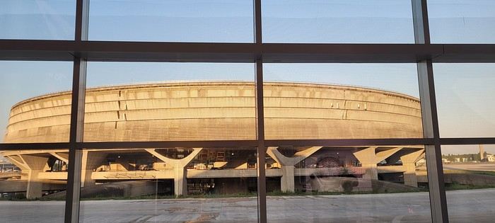
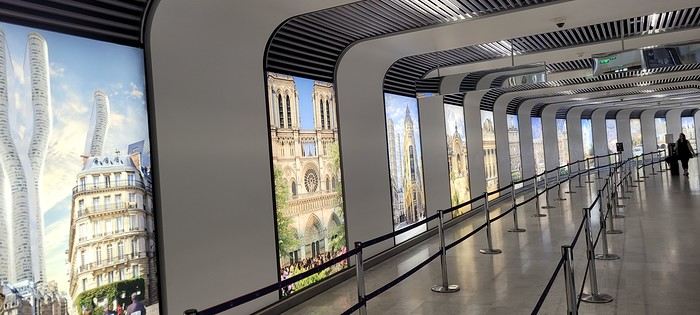
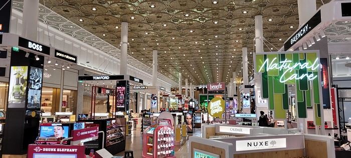
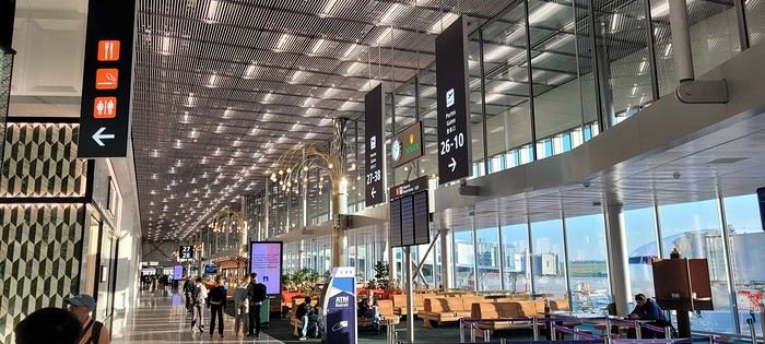
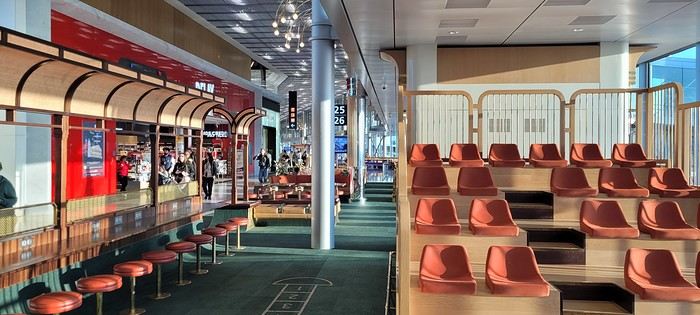
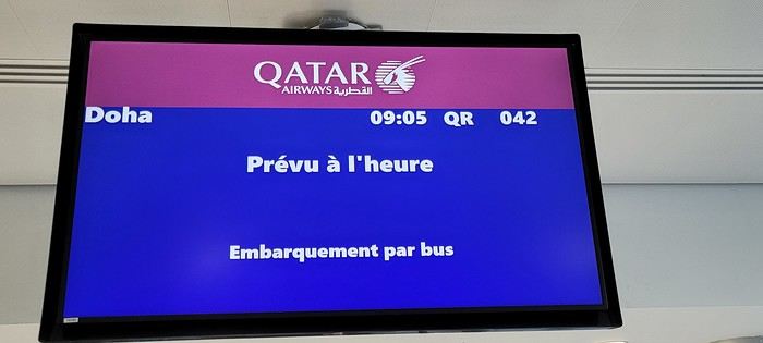
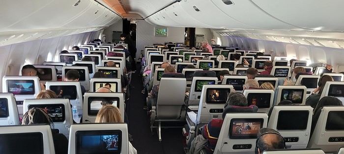
Coming up: Layover in Doha
I’m back from this “mixed” two-week cruise in the Indian Ocean on the Norwegian Sky.
Originally, I had booked a cruise with AIDA (also in the Indian Ocean), but unfortunately, the company decided to cancel it and offered us other options, which we declined because the dates didn’t work for us.
Since my wife really wants to do a cruise in the Indian Ocean, but very few companies offer this destination, it’s a bit complicated—especially when the dates don’t line up. Finding a good compromise between companies and timing is tough. Retirement can’t come soon enough!!!
After some research, I found a really great itinerary with Silversea (a luxury cruise line) for a 19-day cruise from Cape Town to Victoria, stopping in Madagascar (2 days), Praslin, La Digue... But my wife couldn’t get the time off. Not only was the itinerary amazing, but the price was unbeatable (5,200 € per person for a balcony suite, all-inclusive). What a shame—I would’ve loved to try this company, but maybe next time (if we’re lucky enough to have the chance).
My wife tried to take unpaid leave but wasn’t successful... Oh well!
On my end, I have more flexibility with vacation time since I travel a lot for work, so I can accumulate my days off and take them when it suits me.
So, we settled for this cruise (the only one that matched my wife’s vacation dates). Sure, we weren’t thrilled about the ship, but the itinerary wasn’t bad. We figured, why not?
I requested a quote from Logitravel, and after a discount, we paid 2,600 € per person for a balcony cabin (category BA) with the More At Sea package, which includes: 300 minutes of internet, premium drinks, 5 restaurants, and discounts on excursions...
The itinerary:
Day 1 Dubai (UAE) Boarding 11:59 PM Day 2 Abu Dhabi (UAE) 7:00 AM Day 3 Abu Dhabi (UAE) 2:00 PM Day 4 Sea day Day 5 Sea day Day 6 Sea day Day 7 Sea day Day 8 La Digue (Seychelles) 10:00 AM 8:00 PM Day 9 Mahé (Seychelles) 7:00 AM 8:00 PM Day 10 Sea day Day 11 Antsiranana (Madagascar) 7:00 AM 6:00 PM Day 12 Sea day Day 13 Pointe des Galets (Réunion) 8:00 AM 9:00 PM Day 14 Port Louis (Mauritius) 7:00 AM Day 15 Port Louis (Mauritius) 8:00 AM
After booking the cruise, I started looking for flights (Paris/Dubai and Mauritius/Paris). It’s peak Easter vacation time, so tickets are crazy expensive... I ran several simulations on Skyscanner and was shocked by the prices.
A direct flight from Paris to Dubai with Emirates is 1,400 € per person (one way), and the return from Mauritius to Paris (also with Emirates via Dubai) is 1,350 € per person.
Given these outrageous prices, I decided to book a flight with a layover. The best value I found was with Qatar (via Doha) for 650 € per person, with a 2.5-hour layover in Doha, and a direct flight from Mauritius to Paris with Corsair for 750 € per person.
With the More At Sea package, we had a 300 € credit per person for flight tickets (as long as we booked through NCL).
I requested a quote, and they offered: OUTBOUND: April 18, 2025 – Egyptair CDG-CAIRO 10:05 PM-2:30 AM February 19, 2025 – CAIRO-DUBAI 5:30 AM-10:55 AM RETURN: May 3, 2025 – Kenya Airways Port Louis-Nairobi 6:50 PM-10:10 PM, Nairobi-CDG 11:50 PM(+1)-7:30 AM (price: 950 € per person).
Sure, the price was good, but we didn’t want to fly with those airlines, and NCL didn’t have any other options. So, we booked our flights ourselves.
D-Day: Departure from Paris on April 18 with Qatar via Doha:
Two days before leaving, I checked in online and took the opportunity to buy seats near the emergency exits since my wife tends to get swollen legs on long flights. So, she prefers having extra legroom (cost: 132 € per person). It’s a bit pricey, but peace of mind is priceless.
Usually, when I have an early flight from Roissy, I always book a hotel the night before (near the airport) to avoid stress and not miss my flight. But since it was school vacation time and Good Friday, we decided to leave very early from home...
The flight was scheduled for 9:05 AM. We live 70 km from the airport and had to be there by 7:05 AM.
We barely slept... Up at 4:30 AM, and by 5:45 AM, our Uber was outside. We arrived at the airport (Roissy Terminal 1) by 6:50 AM.
Check-in was smooth—less than 10 minutes, and our bags were dropped off with boarding passes in hand.
This was my first time flying out of Roissy Terminal 1 since it was renovated for the Olympics. Wow, it’s a huge improvement—nothing like the old “camembert box” we used to know!
A few photos:
Coming up: Layover in Doha
A lovely wander at the mercy of the wind in this amazing Rajasthan
Hey there, forum friends 😉
Some of you have mentioned missing the activity on this Indian "page," so let’s try to liven things up a bit—with joy and good vibes (mandatory with me 😜). Plus, it’ll make Jojoone happy 😊.
As big lovers of India—we’ve been six times—my co-traveler husband and I decided to explore Rajasthan this time around. The reason we waited so long to come here? We were dreading the tourist crowds in this state. But thanks to the timing (late March to early April 2024, which is starting to get pretty hot) and Aleph’s great tips, we were *very* far from mass tourism.
We spent three weeks getting around on our own for transport: mostly taxis and trains.
And I’ll admit, we had a rather "Arabian Nights" experience, far from the "real" India (Marien, if you’re reading this 😉). So this travel journal makes no claims other than to share what we saw, experienced, and felt—with all our ignorance about this country (which I’m fully aware of).
But fair warning: I go overboard with emojis, and this journal is super casual because it’s the one I share, almost in "live" mode, with our loved ones.
So, if you’re here, consider yourself almost part of the family 😄.
See you soon and....
Some of you have mentioned missing the activity on this Indian "page," so let’s try to liven things up a bit—with joy and good vibes (mandatory with me 😜). Plus, it’ll make Jojoone happy 😊.
As big lovers of India—we’ve been six times—my co-traveler husband and I decided to explore Rajasthan this time around. The reason we waited so long to come here? We were dreading the tourist crowds in this state. But thanks to the timing (late March to early April 2024, which is starting to get pretty hot) and Aleph’s great tips, we were *very* far from mass tourism.
We spent three weeks getting around on our own for transport: mostly taxis and trains.
And I’ll admit, we had a rather "Arabian Nights" experience, far from the "real" India (Marien, if you’re reading this 😉). So this travel journal makes no claims other than to share what we saw, experienced, and felt—with all our ignorance about this country (which I’m fully aware of).
But fair warning: I go overboard with emojis, and this journal is super casual because it’s the one I share, almost in "live" mode, with our loved ones.
So, if you’re here, consider yourself almost part of the family 😄.
See you soon and....
A trip to Australia: the Northern Territory.
Thursday, November 2, 2023
Lake Argyle – Katherine
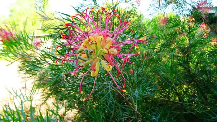
We had a great time. Now we’ve got to pay the price. We’re down one stop before Katherine. Gotta do the whole trip in one go—6 hours of driving. Let’s go! We’re a bit low on fuel with only 300 kilometers of range. The only station at the lake doesn’t open until 9 a.m., and the next (and only) one is 227 kilometers away… Should we risk it? Except for a magnificent frilled-neck lizard darting across the road on its big hind legs and an emu quickly disappearing into the bush, we didn’t see much. Oh—there was also a donkey, lost and panicked in the middle of the road… A quiet road with some beautiful scenery,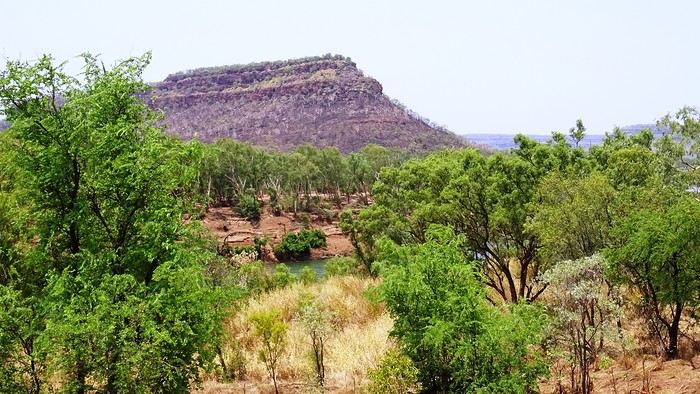 some worrying bushfires
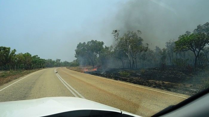
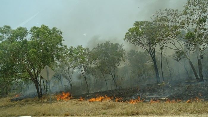 and a few opportunities to stop for a "warrior’s rest" (never go beyond the first second of the thought that starts drifting off the road…)
We cross an invisible border as we enter the Northern Territory, which comes with consequences—we immediately lose an hour and a half by changing time zones. The speed limit goes from 110 to 130.
and a few opportunities to stop for a "warrior’s rest" (never go beyond the first second of the thought that starts drifting off the road…)
We cross an invisible border as we enter the Northern Territory, which comes with consequences—we immediately lose an hour and a half by changing time zones. The speed limit goes from 110 to 130.
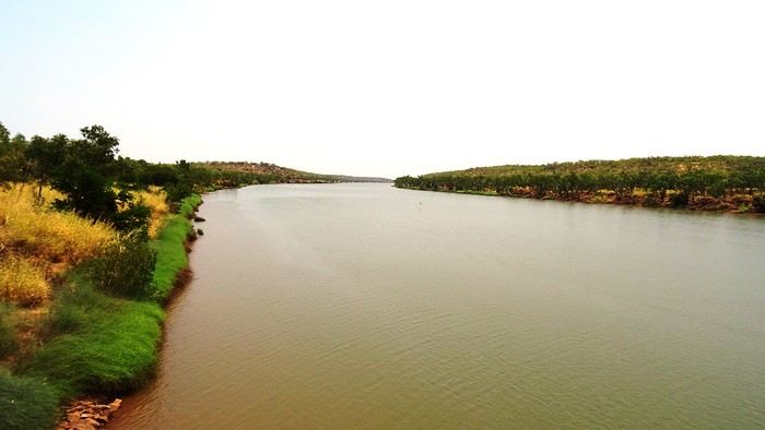
We arrive at the self check-in in Katherine. As usual, we’re a little taken aback at first. The noise, for starters. There’s a group rehearsing, it seems. We go check it out. We pass through the doors separating "The Stuart" from the adjoining bar and stumble upon what feels like collective hysteria. Turns out, it’s a concert. Aboriginal musicians completely fired up by some incredible music! There are just three of them, but they’re delivering a wall of sound that reminds us of South Africa’s finest neo-techno with a trance-like vibe. The crowd is wild! They’re singing in unison, screaming with joy. We get gently kicked out by security because we’re carrying our groceries, and they’re not having it. We promise ourselves we’ll come back once we’ve put them away in our little fridge.
Then we land. We end up finding plenty of nice things. It’s very possible we’ll like this place!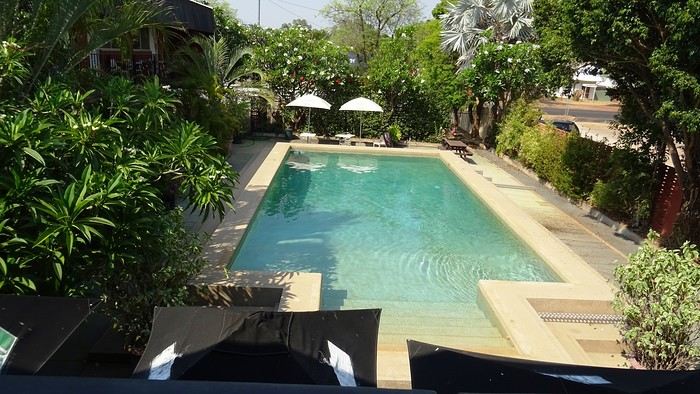
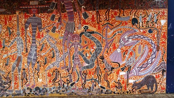 We head back to enjoy our post-battle Happy Hour.
 The concert’s over, but the crowd’s still riding the high. It’s indescribable. People are shouting across the room, screaming just for the fun of it—men and women alike. There’s pool, some beat-up arcade games being shaken like coconut trees. Dom and I feel like anthropologists. We’re pretty blown away. It’s epic! And the beer’s half the price it is elsewhere! We’ll definitely be back—that’s for sure!
We give up on finding a restaurant. Not sure they even exist, at least not this season. So, we’ve got a microwave—we eat at home on our little terrace, with a musical accompaniment from a massive orchestra of birds. It sounds amazing!
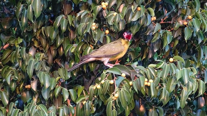
We had a great time. Now we’ve got to pay the price. We’re down one stop before Katherine. Gotta do the whole trip in one go—6 hours of driving. Let’s go! We’re a bit low on fuel with only 300 kilometers of range. The only station at the lake doesn’t open until 9 a.m., and the next (and only) one is 227 kilometers away… Should we risk it? Except for a magnificent frilled-neck lizard darting across the road on its big hind legs and an emu quickly disappearing into the bush, we didn’t see much. Oh—there was also a donkey, lost and panicked in the middle of the road… A quiet road with some beautiful scenery,
some worrying bushfires
and a few opportunities to stop for a "warrior’s rest" (never go beyond the first second of the thought that starts drifting off the road…)
We cross an invisible border as we enter the Northern Territory, which comes with consequences—we immediately lose an hour and a half by changing time zones. The speed limit goes from 110 to 130.
We arrive at the self check-in in Katherine. As usual, we’re a little taken aback at first. The noise, for starters. There’s a group rehearsing, it seems. We go check it out. We pass through the doors separating "The Stuart" from the adjoining bar and stumble upon what feels like collective hysteria. Turns out, it’s a concert. Aboriginal musicians completely fired up by some incredible music! There are just three of them, but they’re delivering a wall of sound that reminds us of South Africa’s finest neo-techno with a trance-like vibe. The crowd is wild! They’re singing in unison, screaming with joy. We get gently kicked out by security because we’re carrying our groceries, and they’re not having it. We promise ourselves we’ll come back once we’ve put them away in our little fridge.
Then we land. We end up finding plenty of nice things. It’s very possible we’ll like this place!
We head back to enjoy our post-battle Happy Hour.
The concert’s over, but the crowd’s still riding the high. It’s indescribable. People are shouting across the room, screaming just for the fun of it—men and women alike. There’s pool, some beat-up arcade games being shaken like coconut trees. Dom and I feel like anthropologists. We’re pretty blown away. It’s epic! And the beer’s half the price it is elsewhere! We’ll definitely be back—that’s for sure!We give up on finding a restaurant. Not sure they even exist, at least not this season. So, we’ve got a microwave—we eat at home on our little terrace, with a musical accompaniment from a massive orchestra of birds.
It sounds amazing!
Three weeks in Norway (July 2022): fantastic memories despite the rain
Our trip to Norway was two years ago already, but I thought it might still be of interest—and it’ll let me relive it a bit by proxy.
Before booking our flight tickets, we debated the route: should we prioritize the north with the Lofoten and Senja islands, or the south with its countless fjords? I was tempted to stay in the south—the country is so vast, and the drive north is long... but my husband really didn’t want to miss the Lofoten. In the end, we figured that since Norway is known for being expensive, we might only visit once (funny how we said the same thing before our first trip to the American West, and look how that turned out 😎), so we didn’t want to skip anything. That meant a 2–3 day drive up north. With 22 days on the ground, it was doable. Especially since, as usual, we skip big cities and gave Oslo a pass.
Practical details: - Flight tickets: 1195 € for 4 with Air France (Paris–Oslo outbound, Tromsø–Bergen–Paris return) - Car rental: 2020 € for 21 days (including the outrageous drop-off fee between Oslo and Tromsø—about 1000 €) - Tolls and ferries: 250 € for the portion billed directly by the rental company. Some ferries required advance booking and payment at the time of reservation—I’ll note their prices as I go through the story. - Hotels: 4135 €, averaging 188 € per night. We blew past our usual budgets from trips to the U.S., but oh well... - Food: 1570 €, averaging 71 € per day for 4 in a country where everything’s expensive... How’d we manage? We rarely ate out, mostly grocery shopped, and even packed half a suitcase with non-perishables: pasta, rice, a few cans, and even some cured sausage! We also stayed 3 nights at Clarion Collection hotels, where an evening buffet was included in the room rate.
Before booking our flight tickets, we debated the route: should we prioritize the north with the Lofoten and Senja islands, or the south with its countless fjords? I was tempted to stay in the south—the country is so vast, and the drive north is long... but my husband really didn’t want to miss the Lofoten. In the end, we figured that since Norway is known for being expensive, we might only visit once (funny how we said the same thing before our first trip to the American West, and look how that turned out 😎), so we didn’t want to skip anything. That meant a 2–3 day drive up north. With 22 days on the ground, it was doable. Especially since, as usual, we skip big cities and gave Oslo a pass.
Practical details: - Flight tickets: 1195 € for 4 with Air France (Paris–Oslo outbound, Tromsø–Bergen–Paris return) - Car rental: 2020 € for 21 days (including the outrageous drop-off fee between Oslo and Tromsø—about 1000 €) - Tolls and ferries: 250 € for the portion billed directly by the rental company. Some ferries required advance booking and payment at the time of reservation—I’ll note their prices as I go through the story. - Hotels: 4135 €, averaging 188 € per night. We blew past our usual budgets from trips to the U.S., but oh well... - Food: 1570 €, averaging 71 € per day for 4 in a country where everything’s expensive... How’d we manage? We rarely ate out, mostly grocery shopped, and even packed half a suitcase with non-perishables: pasta, rice, a few cans, and even some cured sausage! We also stayed 3 nights at Clarion Collection hotels, where an evening buffet was included in the room rate.
21-Day Trip to La Gomera and La Palma
Travel Journal: 21 Days in La Gomera and La Palma
From February 6 to February 26, 2024
Tuesday, February 6 We left around 9 AM with our car, along with Pierre-Paul and Patricia, heading to the Bluepark parking lot in Bartenheim. As expected, we were awaited and left promptly for EuroAirport Basel. Took off at 12:25 PM for a 4-hour-15-minute flight under excellent conditions. Beautiful arrival in Tenerife with Teide in sight under a clear blue sky. Fifteen minutes later, we waited for bus No. 40 to Los Cristianos with quite a few other tourists, but we managed to find four seats. From the bus station, it was a 20-minute walk to our hotel. We checked into a lovely apartment for the four of us, complete with all the comforts. Outside, it was quite warm—at least 25°C! After dropping off our luggage, we went for a stroll. The immediate surroundings of the hotel held no interest for us: a modern, concrete area filled with hotels, bars, tourist agencies, and unappealing restaurants all offering the same bland international cuisine. Pat went to cool off at the pool, unfortunately overrun by loud, drunk English tourists. I took a walk to the paseo maritimo that leads to the port, skirting the seafront. The promenade was pleasant, but it could have been any seaside resort in the world—same old scene: a succession of bars with blaring music where many elderly people sipped cold beers waiting for the sunset, the backdrop a wall of resort-style hotels resembling rabbit hutches! Upon reaching the port, I scouted the route we’d take the next day to the Fred Olsen ferry. Back at the apartment, in the early evening, we looked for a non-touristy restaurant for dinner. Monique stopped a woman to ask her opinion! In this area, she told us, there’s no restaurant that serves Canarian or Spanish cuisine! The only place with decent restaurants is at the port. Off we went to the port, where we sat down at Al Bordo restaurant and ordered a seafood paella for four. Excellent, and at a very reasonable price (36 € for two). We returned to the hotel along the seafront.
Wednesday, February 7
Woke up at 6 AM. Had breakfast in the apartment with what we’d bought the day before at a supermarket. It was still dark when we left on foot toward the port, walking along the calm seafront at this early hour. Forty minutes later, we arrived and waited 10 minutes before the ferry docked. At 9:30 AM, we left the port of Los Cristianos for a 50-minute crossing on a calm sea under a beautiful blue sky. There were quite a few people on this large ferry, but many had no luggage, meaning they were visiting La Gomera for the day and would take the ferry back in the evening. Upon disembarking, we went straight to our rental car agency to pick up the car we’d booked online a few months earlier. It was a nice Peugeot 2008, spacious enough for the four of us and our luggage. We immediately took the beautiful road from San Sebastián that climbs directly into the mountains toward our rental in Vallehermoso. The road was in perfect condition—it seemed brand new, like all the others we’d take on this island later. This side of the island is very arid with little vegetation, and the terrain is particularly rugged, as it is throughout the island. We stopped at our first miradors, which would be followed by many more throughout our Canarian trip. Our first visit was to the small village of Agulo, perched on a promontory above the sea and at the foot of a high cliff. The village features typical Canarian houses with windows flush with the façade and black volcanic stone masonry on white or reddish-brown walls. The first recommended restaurant was already booked for a group, so we settled for the shaded terrace of the excellent El Alameda bar-restaurant. From Agulo, you can access the Abrante viewpoint via a winding road, where the view of Agulo, 600 meters below, is exceptional. A glass ledge over the void lets you test your fear of heights!
We drove to Vallehermoso to do our grocery shopping at the supermarket—a habit that would continue until the end of the trip. Our little house, "Casa rural El Encatadora," is located in a beautiful flower-filled valley a few kilometers west of Vallehermoso. Each of us had a bedroom with an en-suite bathroom, plus a living room, kitchen, and a small terrace overlooking the quiet street at the valley’s end, which didn’t bother us at all.
Thursday, February 8 The good weather seemed to follow us since our arrival in the Canary Islands. This morning, we took the road—still as beautiful and new—toward Arure, high up to the west. The landscape was magnificent, with breathtaking glimpses of the sea far below. In Arure, we parked in front of Conchita’s bar, where a hike (Rother No. 30) starts toward two viewpoints: Alojera, which we reached after 45 minutes on a lovely path. Monique, tired from the first steep climb, stopped at the first viewpoint and hitchhiked back to Arure. Meanwhile, we continued toward the second viewpoint, Los Barranquillos, where the view of the surroundings was partially hidden by misty clouds rising from the sea. The entire mountain is sculpted by ancient, endless terraces climbing until the slope becomes too steep for construction—visible traces of the hard work of past inhabitants trying to survive in a harsh environment. We had a decent lunch at La Conchita bar, then drove to the small seaside town of Puerto la Caleta, sheltered by an immense cliff plunging into the sea. Black sand beach, rough sea—despite our encouragement, Pat didn’t dare to swim! As for the old village of Caleta, it’s perched on the mountainside, and visiting it requires climbing steep, stair-filled alleys to discover a few traditional houses. Back at the casa, dinner in, and card games...
 Vallehermoso
Friday, February 9 This morning, the sky was overcast, and the peaks around us were shrouded in clouds. We took the same road as yesterday to hike Las Creces. Quickly gaining altitude, we entered a thick fog—visibility was very limited. We stopped at the Las Creces parking lot; visibility improved, and the sun wasn’t far off. The hike is entirely within a beautiful laurel forest, with the sun playing hide-and-seek, but it wasn’t cold despite the altitude. After finishing the loop trail, we decided to picnic—not there, as it was too chilly—but on Vallehermoso’s beach, where we found a nice picnic area sheltered by large black rocks. A short digestive walk on the surrounding hill to admire the little beach from above. Back in Vallehermoso, we did some grocery shopping, then tried to return to the casa—only to find ourselves locked out because we’d left the key in the lock inside! After several attempts and with the help of Yéli, a relative of the owner we called for help, we were finally able to get back in!
Saturday, February 10
It rained last night, and the sky remained overcast. Monique decided to rest this morning. PP, Pat, and I set off on the hike that starts from the house toward the Marichal reservoir. The sun wasn’t far off, and by 11 AM, it was fully out. The pleasant hike passed by many flower-filled gardens and orchards—orange, lemon, and mandarin trees in fruit. The path climbed gently toward the reservoir, where the view of the Cano rock dominating the landscape was magnificent. The last part of the climb was a bit tough, overgrown with lush vegetation, and the trail was slippery from last night’s rain. We descended via a different, much more pleasant path and returned to the casa just in time for lunch, prepared by Monique. This valley is rich with its many farmers and market gardeners who’ve cultivated the entire valley, taking advantage of the water flowing down from the mountain, captured upstream and redistributed through countless pipes snaking along the paths. Numerous tanks also store water during dry periods. The houses are scattered across both sides of the valley, and these colorful little homes add a beautiful touch to the landscape. The many palm trees give this valley a distinctly tropical feel—you could almost imagine yourself in the Caribbean. Add to that some salsa music drifting from a hut where farmers were working, and the picture is complete. A well-chilled beer apéro capped off a lovely morning. The afternoon was dedicated to rest, relaxation, reading, and games.
Sunday, February 11 The blue sky returned, though a few clouds still capped the highest peaks. Today, we visited Garajonay National Park, which covers the highest central mountains. Up there, we were above the clouds, and the panoramas from the various viewpoints were stunning: first, Cherelepin, accessible from the Laguna Grande parking lot, then Alto de Garajonay, offering an exceptional view of Teide—over 3,000 meters high—emerging from the clouds on Tenerife, far in the distance. We continued to the Los Roques viewpoints, then stopped for lunch at the Degollada de Peraza restaurant, where the view of the barranco was impressive. We descended toward San Sebastián and checked into our new lodging, La Cabezada, located in the countryside about 3 km above San Sebastián. It’s a small apartment adjacent to the owner’s, with a lovely terrace overlooking the surrounding mountains and surrounded by a beautiful garden. Apéro, then dinner on our beautiful terrace.
Monday, February 12 This morning, we went down to visit San Sebastián de La Gomera: its old tower, main street with some beautiful traditional houses, and the Church of the Assumption. Back at the casa for lunch. In the afternoon, Pat, PP, and I set off on the short hike from San Sebastián beach to La Guancha beach. We drove down and parked on the beach. The path climbs along the hill overlooking San Sebastián, passes by the tall Christ statue dominating the landscape, and roughly follows the coast down to the isolated Guancha beach. A beautiful hike under a hot sun, and a swim was welcome, even if the beach and sea access weren’t very comfortable due to large pebbles and quickly deepening water. Apart from two nudist bathers, there was no one on this beach. We returned the same way.
Tuesday, February 13 Rest day. We went down to town to stroll and do some shopping. I took the opportunity to visit the parador, beautifully situated above the city in a lovely garden overlooking the port and town. Together, we went for a cuba libre at the "Cuba Libre" bar, then had lunch at Breñusca (mediocre paella!). Back at the casa, then we went back down to town to see a carnival parade, a "passacalles," which actually passed an hour earlier than scheduled. Oh well.
Wednesday, February 14 Each to their own program this morning. Pat went swimming at San Sebastián beach, Monique rested at the casa, and PP and I set off on the hike from Playa de Avalos to the Ermita de Guadalupe on Playa del Cangrejo. It wasn’t easy to find the right road or the parking spot, but we managed. The path seemed to have suffered landslides, according to a sign at the trailhead! We decided to check it out, ready to turn back if it seemed too dangerous. In the end, apart from one or two slightly tricky spots where we had to climb a pile of rocks, the trail remained passable, though a bit vertigo-inducing in places. The narrow path clings to very vertical cliffs nearly 300 meters above sea level! But what a magnificent view. At one point, the trail runs alongside a wall of basaltic pipes. We returned via the drivable track that parallels the trail a bit lower. Back at the house for lunch. In the late afternoon, we returned to town to attend the "Entierro de las Sardinas" (Burial of the Sardine), which closes the Canarian carnival festivities. While waiting, we strolled through the parador’s gardens and had mojitos in town. Around 9 PM, we heard the noise and cries of the mourners. The procession advanced, led by a large papier-mâché sardine on a float, surrounded by wailing mourners. The procession headed toward the sea, where the sardine was burned, and a mini fireworks display ended the procession. It was all very good-natured, and everyone had fun. We ended the evening with dinner at a good fish restaurant, El Pajar.
 Entierro de la Sardina in San Sebastián de La Gomera
Thursday, February 15
Woke up at 5:15 AM. The only suitable ferry was at 7 AM, which would get us to La Palma by late morning rather than evening. We packed our bags, had breakfast, then headed to the port, left our rental car, and boarded the ferry to Tenerife, from where we’d continue to La Palma. Calm sea, beautiful sun—by 10:30 AM, we disembarked in La Palma. We picked up our car and immediately headed to our new apartment in Breña Alta. It’s a large apartment with a superb terrace facing the sea, fully equipped and very comfortable. The hosts recommended Casa Goyo restaurant, near the airport and close to us. It’s a restaurant with many small rooms, some of which can be reserved for families. The fish-based cuisine (chipirones, pulpo) was excellent, hearty, and reasonably priced. Since it’s in the airport’s flight path, we occasionally heard planes landing. Quick and efficient service. Afterward, we visited Santa Cruz de La Palma, which reminded us of the historic quarters of La Orotava in Tenerife or the capital of Gran Canaria.
Friday, February 16
Beautiful weather, blue sky. We headed to the San Bartolo viewpoint toward the northeast coast, then to the lovely village of San Andrés, which we explored. From there, we walked along the shore to the natural pools of Charco Azul, where we swam in the cool but "swimmable" sea. Back in San Andrés for lunch at the "San Andrés" restaurant on the beautiful church square. Very good fish-based meal. We got back in the car and continued along the north coast to the port of Espindola and the natural pools of Fajana near the Cumplida lighthouse. A fairly strong wind whipped up beautiful waves crashing onto the rocky coast in bursts of foam. Back in Santa Cruz, we stopped at the Mercadona supermarket to buy fresh shrimp for dinner. San Andrés
Saturday, February 17
Uniform blue sky, even on the heights. We took the beautiful road that winds up to the summit of the Caldera de Taburiente. Several viewpoints offer 360° views of the entire island and beyond: you can make out La Gomera, El Hierro, and, of course, Tenerife with the perfect triangle of Teide. We parked at the Los Andes viewpoint parking lot and started our hike to Pico de la Cruz along a trail following the ridge, offering superb views into the caldera. We got back in the car and passed by the Roque de los Muchachos astronomical complex, composed of numerous observatories, some with very aesthetic mirror telescopes. We hiked from the Roque de los Muchachos parking lot to the various viewpoints, always as impressive. Picnic on site, then back to Santa Cruz. We stopped by our car dealer because the oil warning light came on—better safe than sorry. The representative reassured us but preferred to give us a Fiat Cross SUV instead. The Caldera de Taburiente
Sunday, February 18 The weather was a bit mixed, with cloudy patches. We set off to hike the Barranco de la Cuba de Galga. Unfortunately, the Los Tilos trail had been closed for several months due to a major landslide. The parking lot by the road was already quite full, and indeed, we crossed paths with many hikers along the way—it’s an easy hike with little elevation gain, which is rare here in La Palma! The beautiful path winds through a very narrow, deep gorge covered in lush tropical vegetation—you’d think you were in a Southeast Asian forest, especially with the humidity in the gorge bringing out earthy and floral scents. Halfway through, Monique turned back while the rest of us continued to the Cuba de Galga. A light drizzle accompanied us on the return. For lunch, we went to Chipi Chipi restaurant in the heights of Santa Cruz. The cool air forced us to leave the lovely terrace for the slightly noisy dining room. The meal was very good and hearty. Afternoon spent resting at our house.
 La Cuba de la Galga
Monday, February 19 A few clouds still clung to the nearby mountain peaks. We headed south to Los Canarios. We stopped in front of the small San Antonio Abad church, where a path leads to the viewpoint in 15 minutes. Then we visited the San Antonio Volcano Interpretation Center and climbed to the viewpoint via the trail along the crater’s edge, offering a plunging view into the crater. Then PP, Pat, and I headed toward the Teneguía volcano but turned back given the remaining distance and the intense heat bearing down on us! Plus, the landscape was rather arid and not very interesting. We got back in the car and drove down to the salt flats at the island’s southern tip. The ocean crashes here in large waves, exploding against the volcanic rocks and feeding a "blowhole" carved into the rock. We stopped for drinks at the salt flats restaurant, then headed home. The salt flats in Fuencaliente
Tuesday, February 20 Beautiful weather with a few clouds clinging to the mountains, as usual. A relaxed morning since my parking reservation at La Cumbrecita didn’t start until 1 PM. It takes about 30 minutes from Santa Cruz to reach the valley floor via a beautiful but narrow road toward the end, though there’s very little traffic. Meanwhile, the clouds had disappeared, and the view from the La Cumbrecita viewpoint was superb. We recognized Pico de la Cruz in the distance, where we’d been a few days earlier. We then took the path leading to the Las Chozas viewpoint through a magnificent Canarian pine forest. We picnicked on site, then took the path to the Los Roques viewpoint. We returned the same way since the direct route was closed for construction. Back in Santa Cruz, we visited the Sanctuary of Las Nieves, with its beautiful golden Baroque altar. Hike from La Cumbrecita
Wednesday, February 21 After packing our things and loading the car, we left Santa Cruz under a very blue sky for Los Llanos de Aridane, where we stopped to visit this lovely town. The Church of Nuestra Señora de los Remedios has a beautiful coffered ceiling and an original papier-mâché Christ statue from the 16th century. Around it, colorful old Canarian houses brighten the streets of the town center. We took the opportunity to stroll, do some shopping, and finally sat down at La Pergola restaurant for a mediocre lunch. We got back in the car to check into our new house in Arecida. On the way, we stopped at the Mirador del Time, which once again offered an impressive panorama, allowing us—for the first time—to see the damage caused by the Tajogaite volcano eruption in 2021. You can clearly see the still-smoking crater and the large black lava flow covering the landscape down to the sea. We really liked our new accommodation: a local house that’s been renovated on the heights of Arecida, not far from the Canarian pine forest. From several terraces, we have a 360° view of the sea and mountains. We even have a private pool! There are two beautiful, brand-new bedrooms, each with its own bathroom—the best. Plus, we’re on the GR 131 trail that runs along the Barranco de las Angustias toward the northeast.
 Los Llanos de Aridane
Thursday, February 22 Once again, beautiful weather greeted us when we woke up. We started the GR 131 with the goal of reaching the Torre del Time viewpoint—about 400 meters of elevation gain. The path, quite steep at first, winds through a superb Canarian pine forest. A few viewpoints let you appreciate the sheer drop of the Barranco de las Angustias—watch out for vertigo! At the Torre del Time viewpoint, there’s a nearly 1,000-meter vertical drop. We returned via another path, the PLP1, which meanders first through this beautiful forest, then along lovely flower-filled gardens adjacent to beautiful properties that cascade from the forest down to the road serving these neighborhoods. This afternoon, we tried to get closer to the area devastated by the 2021 lava flows. Several roads are still closed or reserved for residents, while others—brand new—have been rebuilt to open up this densely populated and cultivated region. In some places, the lava flow slightly diverted, sparing some properties that logically should have disappeared. Now, they’re encircled by a massive cooled lava field. In other spots, twisted and charred metal scraps or greenhouse remains protrude from the lava—all that’s left of the former banana plantations. A little higher up, you can see the slightly smoking crater of Tajogaite, responsible for this disaster. Back to Casa Barreros.
 View of Los Llanos and, in the background, the 2021 lava flow
Friday, February 23
Though the sky was still blue, the temperature had dropped due to a chilly wind. By midday, it still rose to 22°C. Today, we headed north, specifically to the town of Tijarafe, where a very narrow road descends to the small port, Porís de Candelaria. The 3.7-kilometer road drops 700 meters in elevation, with gradients up to 30%—it was going to be intense! Indeed, the descent was scary, with the void right next to the very narrow road where passing was impossible except at a few rare spots. Everything went well—there was little traffic at this early hour. From the parking lot at the bottom, a path leads to Porís de Candelaria. It’s surprising to see this small fishing hamlet nestled in the shelter of an immense cave opening onto the sea, which was quite rough today. The sun, at this time of year, would appear late in the cave, which remained in shadow for much of the day. We returned via the same road, strolled through the small town of Puntagorda, and had lunch at El Jardín de los Naranjos restaurant—excellent meal. Fishing hamlet of Candelaria
Saturday, February 24 The air was still cool, but the sun was beautiful. While Monique stayed home to rest, the three of us headed to the village of Las Tricias to hike the Buracas Caves trail. We left the car parked on the LP1 road and took the small paved road down to the sign marking the trail’s start. The signage for all the trails we took here, as in La Gomera, was very well done. The path descended steadily, then more steeply toward the caves where the island’s first inhabitants lived—some petroglyphs are still visible in certain caves. The path then climbed back up, passing magnificent dragon trees and more or less elaborate huts occupied by Germans who’ve lived here for many years. Back at Casa Barreros for some rest.
Sunday, February 25 The weather once again blessed us with a beautiful day. This morning, we visited the local produce market held on weekends in Puntagorda. You’ll find agricultural products, crafts, and food to keep you going. A little further on, there’s a glass viewpoint overlooking the barranco plunging toward the sea, with a view of the thrill-seekers trying the zip line right next to it. Lunch at Naranjos—definitely a good spot—with their shrimp and spice tagliatelle. Back home for an afternoon of relaxation.
Monday, February 26 We left Arecida under a cloudy sky. Driving up from Los Llanos de Aridane toward the east, an enormous cascade of clouds poured from the mountain peaks into the Los Llanos plain—very impressive. Arriving in Santa Cruz, we went for a stroll, did some last-minute shopping, then had a final good-quality paella at La Chalana on the paseo maritimo. We left the car in the parking lot and took the 5 PM Olsen ferry to Tenerife on a slightly choppy sea, but the ferry didn’t rock too much. Arriving at 7:15 PM, we dropped off our things near the port in our reserved apartment and went for dinner at Abordo—rubbery chipirones. A digestive stroll among the ever-increasing number of tourists in Los Cristianos—restaurants were packed to the brim, the season is in full swing here. Gone is the calm of La Gomera and La Palma, and the laid-back tourism of German hikers among whom a few French were hiding!
Tuesday, February 27 To make our homemade breakfast more enjoyable, we went to buy pastries at the local bakery, then took one last walk on the paseo along the beaches, mingling with the many mobility scooters driven by elderly or disabled people, joggers, and tourists. Last apéro near the bus station, then off to the airport. After a smooth 4-hour-30-minute flight, we arrived in Basel-Mulhouse at 10:20 PM.
THE END
Conclusion A fantastic trip to two islands with magnificent and diverse nature, where landscapes range from desert-like to tropical depending on exposure to winds and clouds. Thanks to the many beautiful viewpoints, you can truly appreciate these exceptionally dynamic reliefs. A hiker’s paradise, the trails are all very well marked, though the choice of easy or moderate paths for "casual walkers" is quite limited. Another notable advantage, in our opinion, is that these islands are very lightly developed—you’ll hardly see any of those ugly hotel blocks that spoil the landscapes of some other Canary Islands. It’s true that the beaches on these two islands don’t meet traditional international tourism criteria: they’re small, with black sand, and often difficult to access. Special mention for the quality of the road network (except for a few small local roads), which seems brand new, well-paved, and well-signposted. We also enjoyed exceptional weather for February, with fewer than three days of gray or rainy weather out of 21.
Almost all the accommodations we chose met or exceeded our expectations, often at reasonable prices: an average of 98 € per night for an apartment or house with two bedrooms for four people.
All photos can be viewed by clicking this link: https://photos.app.goo.gl/G44pPk4g9PW1rNzg8
Tuesday, February 6 We left around 9 AM with our car, along with Pierre-Paul and Patricia, heading to the Bluepark parking lot in Bartenheim. As expected, we were awaited and left promptly for EuroAirport Basel. Took off at 12:25 PM for a 4-hour-15-minute flight under excellent conditions. Beautiful arrival in Tenerife with Teide in sight under a clear blue sky. Fifteen minutes later, we waited for bus No. 40 to Los Cristianos with quite a few other tourists, but we managed to find four seats. From the bus station, it was a 20-minute walk to our hotel. We checked into a lovely apartment for the four of us, complete with all the comforts. Outside, it was quite warm—at least 25°C! After dropping off our luggage, we went for a stroll. The immediate surroundings of the hotel held no interest for us: a modern, concrete area filled with hotels, bars, tourist agencies, and unappealing restaurants all offering the same bland international cuisine. Pat went to cool off at the pool, unfortunately overrun by loud, drunk English tourists. I took a walk to the paseo maritimo that leads to the port, skirting the seafront. The promenade was pleasant, but it could have been any seaside resort in the world—same old scene: a succession of bars with blaring music where many elderly people sipped cold beers waiting for the sunset, the backdrop a wall of resort-style hotels resembling rabbit hutches! Upon reaching the port, I scouted the route we’d take the next day to the Fred Olsen ferry. Back at the apartment, in the early evening, we looked for a non-touristy restaurant for dinner. Monique stopped a woman to ask her opinion! In this area, she told us, there’s no restaurant that serves Canarian or Spanish cuisine! The only place with decent restaurants is at the port. Off we went to the port, where we sat down at Al Bordo restaurant and ordered a seafood paella for four. Excellent, and at a very reasonable price (36 € for two). We returned to the hotel along the seafront.
Wednesday, February 7
Woke up at 6 AM. Had breakfast in the apartment with what we’d bought the day before at a supermarket. It was still dark when we left on foot toward the port, walking along the calm seafront at this early hour. Forty minutes later, we arrived and waited 10 minutes before the ferry docked. At 9:30 AM, we left the port of Los Cristianos for a 50-minute crossing on a calm sea under a beautiful blue sky. There were quite a few people on this large ferry, but many had no luggage, meaning they were visiting La Gomera for the day and would take the ferry back in the evening. Upon disembarking, we went straight to our rental car agency to pick up the car we’d booked online a few months earlier. It was a nice Peugeot 2008, spacious enough for the four of us and our luggage. We immediately took the beautiful road from San Sebastián that climbs directly into the mountains toward our rental in Vallehermoso. The road was in perfect condition—it seemed brand new, like all the others we’d take on this island later. This side of the island is very arid with little vegetation, and the terrain is particularly rugged, as it is throughout the island. We stopped at our first miradors, which would be followed by many more throughout our Canarian trip. Our first visit was to the small village of Agulo, perched on a promontory above the sea and at the foot of a high cliff. The village features typical Canarian houses with windows flush with the façade and black volcanic stone masonry on white or reddish-brown walls. The first recommended restaurant was already booked for a group, so we settled for the shaded terrace of the excellent El Alameda bar-restaurant. From Agulo, you can access the Abrante viewpoint via a winding road, where the view of Agulo, 600 meters below, is exceptional. A glass ledge over the void lets you test your fear of heights!
We drove to Vallehermoso to do our grocery shopping at the supermarket—a habit that would continue until the end of the trip. Our little house, "Casa rural El Encatadora," is located in a beautiful flower-filled valley a few kilometers west of Vallehermoso. Each of us had a bedroom with an en-suite bathroom, plus a living room, kitchen, and a small terrace overlooking the quiet street at the valley’s end, which didn’t bother us at all.
Thursday, February 8 The good weather seemed to follow us since our arrival in the Canary Islands. This morning, we took the road—still as beautiful and new—toward Arure, high up to the west. The landscape was magnificent, with breathtaking glimpses of the sea far below. In Arure, we parked in front of Conchita’s bar, where a hike (Rother No. 30) starts toward two viewpoints: Alojera, which we reached after 45 minutes on a lovely path. Monique, tired from the first steep climb, stopped at the first viewpoint and hitchhiked back to Arure. Meanwhile, we continued toward the second viewpoint, Los Barranquillos, where the view of the surroundings was partially hidden by misty clouds rising from the sea. The entire mountain is sculpted by ancient, endless terraces climbing until the slope becomes too steep for construction—visible traces of the hard work of past inhabitants trying to survive in a harsh environment. We had a decent lunch at La Conchita bar, then drove to the small seaside town of Puerto la Caleta, sheltered by an immense cliff plunging into the sea. Black sand beach, rough sea—despite our encouragement, Pat didn’t dare to swim! As for the old village of Caleta, it’s perched on the mountainside, and visiting it requires climbing steep, stair-filled alleys to discover a few traditional houses. Back at the casa, dinner in, and card games...
VallehermosoFriday, February 9 This morning, the sky was overcast, and the peaks around us were shrouded in clouds. We took the same road as yesterday to hike Las Creces. Quickly gaining altitude, we entered a thick fog—visibility was very limited. We stopped at the Las Creces parking lot; visibility improved, and the sun wasn’t far off. The hike is entirely within a beautiful laurel forest, with the sun playing hide-and-seek, but it wasn’t cold despite the altitude. After finishing the loop trail, we decided to picnic—not there, as it was too chilly—but on Vallehermoso’s beach, where we found a nice picnic area sheltered by large black rocks. A short digestive walk on the surrounding hill to admire the little beach from above. Back in Vallehermoso, we did some grocery shopping, then tried to return to the casa—only to find ourselves locked out because we’d left the key in the lock inside! After several attempts and with the help of Yéli, a relative of the owner we called for help, we were finally able to get back in!
Saturday, February 10
It rained last night, and the sky remained overcast. Monique decided to rest this morning. PP, Pat, and I set off on the hike that starts from the house toward the Marichal reservoir. The sun wasn’t far off, and by 11 AM, it was fully out. The pleasant hike passed by many flower-filled gardens and orchards—orange, lemon, and mandarin trees in fruit. The path climbed gently toward the reservoir, where the view of the Cano rock dominating the landscape was magnificent. The last part of the climb was a bit tough, overgrown with lush vegetation, and the trail was slippery from last night’s rain. We descended via a different, much more pleasant path and returned to the casa just in time for lunch, prepared by Monique. This valley is rich with its many farmers and market gardeners who’ve cultivated the entire valley, taking advantage of the water flowing down from the mountain, captured upstream and redistributed through countless pipes snaking along the paths. Numerous tanks also store water during dry periods. The houses are scattered across both sides of the valley, and these colorful little homes add a beautiful touch to the landscape. The many palm trees give this valley a distinctly tropical feel—you could almost imagine yourself in the Caribbean. Add to that some salsa music drifting from a hut where farmers were working, and the picture is complete. A well-chilled beer apéro capped off a lovely morning. The afternoon was dedicated to rest, relaxation, reading, and games.
Sunday, February 11 The blue sky returned, though a few clouds still capped the highest peaks. Today, we visited Garajonay National Park, which covers the highest central mountains. Up there, we were above the clouds, and the panoramas from the various viewpoints were stunning: first, Cherelepin, accessible from the Laguna Grande parking lot, then Alto de Garajonay, offering an exceptional view of Teide—over 3,000 meters high—emerging from the clouds on Tenerife, far in the distance. We continued to the Los Roques viewpoints, then stopped for lunch at the Degollada de Peraza restaurant, where the view of the barranco was impressive. We descended toward San Sebastián and checked into our new lodging, La Cabezada, located in the countryside about 3 km above San Sebastián. It’s a small apartment adjacent to the owner’s, with a lovely terrace overlooking the surrounding mountains and surrounded by a beautiful garden. Apéro, then dinner on our beautiful terrace.
Monday, February 12 This morning, we went down to visit San Sebastián de La Gomera: its old tower, main street with some beautiful traditional houses, and the Church of the Assumption. Back at the casa for lunch. In the afternoon, Pat, PP, and I set off on the short hike from San Sebastián beach to La Guancha beach. We drove down and parked on the beach. The path climbs along the hill overlooking San Sebastián, passes by the tall Christ statue dominating the landscape, and roughly follows the coast down to the isolated Guancha beach. A beautiful hike under a hot sun, and a swim was welcome, even if the beach and sea access weren’t very comfortable due to large pebbles and quickly deepening water. Apart from two nudist bathers, there was no one on this beach. We returned the same way.
Tuesday, February 13 Rest day. We went down to town to stroll and do some shopping. I took the opportunity to visit the parador, beautifully situated above the city in a lovely garden overlooking the port and town. Together, we went for a cuba libre at the "Cuba Libre" bar, then had lunch at Breñusca (mediocre paella!). Back at the casa, then we went back down to town to see a carnival parade, a "passacalles," which actually passed an hour earlier than scheduled. Oh well.
Wednesday, February 14 Each to their own program this morning. Pat went swimming at San Sebastián beach, Monique rested at the casa, and PP and I set off on the hike from Playa de Avalos to the Ermita de Guadalupe on Playa del Cangrejo. It wasn’t easy to find the right road or the parking spot, but we managed. The path seemed to have suffered landslides, according to a sign at the trailhead! We decided to check it out, ready to turn back if it seemed too dangerous. In the end, apart from one or two slightly tricky spots where we had to climb a pile of rocks, the trail remained passable, though a bit vertigo-inducing in places. The narrow path clings to very vertical cliffs nearly 300 meters above sea level! But what a magnificent view. At one point, the trail runs alongside a wall of basaltic pipes. We returned via the drivable track that parallels the trail a bit lower. Back at the house for lunch. In the late afternoon, we returned to town to attend the "Entierro de las Sardinas" (Burial of the Sardine), which closes the Canarian carnival festivities. While waiting, we strolled through the parador’s gardens and had mojitos in town. Around 9 PM, we heard the noise and cries of the mourners. The procession advanced, led by a large papier-mâché sardine on a float, surrounded by wailing mourners. The procession headed toward the sea, where the sardine was burned, and a mini fireworks display ended the procession. It was all very good-natured, and everyone had fun. We ended the evening with dinner at a good fish restaurant, El Pajar.
Entierro de la Sardina in San Sebastián de La GomeraThursday, February 15
Woke up at 5:15 AM. The only suitable ferry was at 7 AM, which would get us to La Palma by late morning rather than evening. We packed our bags, had breakfast, then headed to the port, left our rental car, and boarded the ferry to Tenerife, from where we’d continue to La Palma. Calm sea, beautiful sun—by 10:30 AM, we disembarked in La Palma. We picked up our car and immediately headed to our new apartment in Breña Alta. It’s a large apartment with a superb terrace facing the sea, fully equipped and very comfortable. The hosts recommended Casa Goyo restaurant, near the airport and close to us. It’s a restaurant with many small rooms, some of which can be reserved for families. The fish-based cuisine (chipirones, pulpo) was excellent, hearty, and reasonably priced. Since it’s in the airport’s flight path, we occasionally heard planes landing. Quick and efficient service. Afterward, we visited Santa Cruz de La Palma, which reminded us of the historic quarters of La Orotava in Tenerife or the capital of Gran Canaria.
Friday, February 16
Beautiful weather, blue sky. We headed to the San Bartolo viewpoint toward the northeast coast, then to the lovely village of San Andrés, which we explored. From there, we walked along the shore to the natural pools of Charco Azul, where we swam in the cool but "swimmable" sea. Back in San Andrés for lunch at the "San Andrés" restaurant on the beautiful church square. Very good fish-based meal. We got back in the car and continued along the north coast to the port of Espindola and the natural pools of Fajana near the Cumplida lighthouse. A fairly strong wind whipped up beautiful waves crashing onto the rocky coast in bursts of foam. Back in Santa Cruz, we stopped at the Mercadona supermarket to buy fresh shrimp for dinner.
San AndrésSaturday, February 17
Uniform blue sky, even on the heights. We took the beautiful road that winds up to the summit of the Caldera de Taburiente. Several viewpoints offer 360° views of the entire island and beyond: you can make out La Gomera, El Hierro, and, of course, Tenerife with the perfect triangle of Teide. We parked at the Los Andes viewpoint parking lot and started our hike to Pico de la Cruz along a trail following the ridge, offering superb views into the caldera. We got back in the car and passed by the Roque de los Muchachos astronomical complex, composed of numerous observatories, some with very aesthetic mirror telescopes. We hiked from the Roque de los Muchachos parking lot to the various viewpoints, always as impressive. Picnic on site, then back to Santa Cruz. We stopped by our car dealer because the oil warning light came on—better safe than sorry. The representative reassured us but preferred to give us a Fiat Cross SUV instead.
The Caldera de TaburienteSunday, February 18 The weather was a bit mixed, with cloudy patches. We set off to hike the Barranco de la Cuba de Galga. Unfortunately, the Los Tilos trail had been closed for several months due to a major landslide. The parking lot by the road was already quite full, and indeed, we crossed paths with many hikers along the way—it’s an easy hike with little elevation gain, which is rare here in La Palma! The beautiful path winds through a very narrow, deep gorge covered in lush tropical vegetation—you’d think you were in a Southeast Asian forest, especially with the humidity in the gorge bringing out earthy and floral scents. Halfway through, Monique turned back while the rest of us continued to the Cuba de Galga. A light drizzle accompanied us on the return. For lunch, we went to Chipi Chipi restaurant in the heights of Santa Cruz. The cool air forced us to leave the lovely terrace for the slightly noisy dining room. The meal was very good and hearty. Afternoon spent resting at our house.
La Cuba de la GalgaMonday, February 19 A few clouds still clung to the nearby mountain peaks. We headed south to Los Canarios. We stopped in front of the small San Antonio Abad church, where a path leads to the viewpoint in 15 minutes. Then we visited the San Antonio Volcano Interpretation Center and climbed to the viewpoint via the trail along the crater’s edge, offering a plunging view into the crater. Then PP, Pat, and I headed toward the Teneguía volcano but turned back given the remaining distance and the intense heat bearing down on us! Plus, the landscape was rather arid and not very interesting. We got back in the car and drove down to the salt flats at the island’s southern tip. The ocean crashes here in large waves, exploding against the volcanic rocks and feeding a "blowhole" carved into the rock. We stopped for drinks at the salt flats restaurant, then headed home.
The salt flats in FuencalienteTuesday, February 20 Beautiful weather with a few clouds clinging to the mountains, as usual. A relaxed morning since my parking reservation at La Cumbrecita didn’t start until 1 PM. It takes about 30 minutes from Santa Cruz to reach the valley floor via a beautiful but narrow road toward the end, though there’s very little traffic. Meanwhile, the clouds had disappeared, and the view from the La Cumbrecita viewpoint was superb. We recognized Pico de la Cruz in the distance, where we’d been a few days earlier. We then took the path leading to the Las Chozas viewpoint through a magnificent Canarian pine forest. We picnicked on site, then took the path to the Los Roques viewpoint. We returned the same way since the direct route was closed for construction. Back in Santa Cruz, we visited the Sanctuary of Las Nieves, with its beautiful golden Baroque altar.
Hike from La CumbrecitaWednesday, February 21 After packing our things and loading the car, we left Santa Cruz under a very blue sky for Los Llanos de Aridane, where we stopped to visit this lovely town. The Church of Nuestra Señora de los Remedios has a beautiful coffered ceiling and an original papier-mâché Christ statue from the 16th century. Around it, colorful old Canarian houses brighten the streets of the town center. We took the opportunity to stroll, do some shopping, and finally sat down at La Pergola restaurant for a mediocre lunch. We got back in the car to check into our new house in Arecida. On the way, we stopped at the Mirador del Time, which once again offered an impressive panorama, allowing us—for the first time—to see the damage caused by the Tajogaite volcano eruption in 2021. You can clearly see the still-smoking crater and the large black lava flow covering the landscape down to the sea. We really liked our new accommodation: a local house that’s been renovated on the heights of Arecida, not far from the Canarian pine forest. From several terraces, we have a 360° view of the sea and mountains. We even have a private pool! There are two beautiful, brand-new bedrooms, each with its own bathroom—the best. Plus, we’re on the GR 131 trail that runs along the Barranco de las Angustias toward the northeast.
Los Llanos de AridaneThursday, February 22 Once again, beautiful weather greeted us when we woke up. We started the GR 131 with the goal of reaching the Torre del Time viewpoint—about 400 meters of elevation gain. The path, quite steep at first, winds through a superb Canarian pine forest. A few viewpoints let you appreciate the sheer drop of the Barranco de las Angustias—watch out for vertigo! At the Torre del Time viewpoint, there’s a nearly 1,000-meter vertical drop. We returned via another path, the PLP1, which meanders first through this beautiful forest, then along lovely flower-filled gardens adjacent to beautiful properties that cascade from the forest down to the road serving these neighborhoods. This afternoon, we tried to get closer to the area devastated by the 2021 lava flows. Several roads are still closed or reserved for residents, while others—brand new—have been rebuilt to open up this densely populated and cultivated region. In some places, the lava flow slightly diverted, sparing some properties that logically should have disappeared. Now, they’re encircled by a massive cooled lava field. In other spots, twisted and charred metal scraps or greenhouse remains protrude from the lava—all that’s left of the former banana plantations. A little higher up, you can see the slightly smoking crater of Tajogaite, responsible for this disaster. Back to Casa Barreros.
View of Los Llanos and, in the background, the 2021 lava flowFriday, February 23
Though the sky was still blue, the temperature had dropped due to a chilly wind. By midday, it still rose to 22°C. Today, we headed north, specifically to the town of Tijarafe, where a very narrow road descends to the small port, Porís de Candelaria. The 3.7-kilometer road drops 700 meters in elevation, with gradients up to 30%—it was going to be intense! Indeed, the descent was scary, with the void right next to the very narrow road where passing was impossible except at a few rare spots. Everything went well—there was little traffic at this early hour. From the parking lot at the bottom, a path leads to Porís de Candelaria. It’s surprising to see this small fishing hamlet nestled in the shelter of an immense cave opening onto the sea, which was quite rough today. The sun, at this time of year, would appear late in the cave, which remained in shadow for much of the day. We returned via the same road, strolled through the small town of Puntagorda, and had lunch at El Jardín de los Naranjos restaurant—excellent meal.
Fishing hamlet of CandelariaSaturday, February 24 The air was still cool, but the sun was beautiful. While Monique stayed home to rest, the three of us headed to the village of Las Tricias to hike the Buracas Caves trail. We left the car parked on the LP1 road and took the small paved road down to the sign marking the trail’s start. The signage for all the trails we took here, as in La Gomera, was very well done. The path descended steadily, then more steeply toward the caves where the island’s first inhabitants lived—some petroglyphs are still visible in certain caves. The path then climbed back up, passing magnificent dragon trees and more or less elaborate huts occupied by Germans who’ve lived here for many years. Back at Casa Barreros for some rest.
Sunday, February 25 The weather once again blessed us with a beautiful day. This morning, we visited the local produce market held on weekends in Puntagorda. You’ll find agricultural products, crafts, and food to keep you going. A little further on, there’s a glass viewpoint overlooking the barranco plunging toward the sea, with a view of the thrill-seekers trying the zip line right next to it. Lunch at Naranjos—definitely a good spot—with their shrimp and spice tagliatelle. Back home for an afternoon of relaxation.
Monday, February 26 We left Arecida under a cloudy sky. Driving up from Los Llanos de Aridane toward the east, an enormous cascade of clouds poured from the mountain peaks into the Los Llanos plain—very impressive. Arriving in Santa Cruz, we went for a stroll, did some last-minute shopping, then had a final good-quality paella at La Chalana on the paseo maritimo. We left the car in the parking lot and took the 5 PM Olsen ferry to Tenerife on a slightly choppy sea, but the ferry didn’t rock too much. Arriving at 7:15 PM, we dropped off our things near the port in our reserved apartment and went for dinner at Abordo—rubbery chipirones. A digestive stroll among the ever-increasing number of tourists in Los Cristianos—restaurants were packed to the brim, the season is in full swing here. Gone is the calm of La Gomera and La Palma, and the laid-back tourism of German hikers among whom a few French were hiding!
Tuesday, February 27 To make our homemade breakfast more enjoyable, we went to buy pastries at the local bakery, then took one last walk on the paseo along the beaches, mingling with the many mobility scooters driven by elderly or disabled people, joggers, and tourists. Last apéro near the bus station, then off to the airport. After a smooth 4-hour-30-minute flight, we arrived in Basel-Mulhouse at 10:20 PM.
THE END
Conclusion A fantastic trip to two islands with magnificent and diverse nature, where landscapes range from desert-like to tropical depending on exposure to winds and clouds. Thanks to the many beautiful viewpoints, you can truly appreciate these exceptionally dynamic reliefs. A hiker’s paradise, the trails are all very well marked, though the choice of easy or moderate paths for "casual walkers" is quite limited. Another notable advantage, in our opinion, is that these islands are very lightly developed—you’ll hardly see any of those ugly hotel blocks that spoil the landscapes of some other Canary Islands. It’s true that the beaches on these two islands don’t meet traditional international tourism criteria: they’re small, with black sand, and often difficult to access. Special mention for the quality of the road network (except for a few small local roads), which seems brand new, well-paved, and well-signposted. We also enjoyed exceptional weather for February, with fewer than three days of gray or rainy weather out of 21.
Almost all the accommodations we chose met or exceeded our expectations, often at reasonable prices: an average of 98 € per night for an apartment or house with two bedrooms for four people.
All photos can be viewed by clicking this link: https://photos.app.goo.gl/G44pPk4g9PW1rNzg8
Les Cyclades en juillet: Anafi, Amorgos, Astypaléa English translation pending
GENESE
Comme tous, le COVID a chamboulé nos plans. Normalement nous devions aller à Madagascar pendant un mois, projet reporté à l’année prochaine. Seulement, n’ayant jamais arrêté de travailler, malgré le confinement et le Covid j’avais réellement besoin de faire une « pause ».
Souhaitant limiter les risques de restrictions de déplacements nous ne quitterons pas l’Europe en nous centrant sur des endroits que nous avons toujours voulu visiter, mais habituellement trop fréquentés pour nous. Il y avait la Suisse avec ses montagnes et ses trains de légende, l’Islande et les îles Grecques.
Au final c’est l’attrait du soleil qui l’a emporté … enfin surtout auprès de madame ! Nous avions « entrevu » Santorin et Myconos lors d’une croisière en méditerranée en 2007 avec les enfants. Nous avions adoré … sauf la fréquentation !
Le premier élément à choisir est le point d’entrée, accessible en avion. Il y a Santorin et Myconos dans les Cyclades. Comme je rêvais de revoir la caldera de Santorin, le choix fut rapide. Ensuite je voulais des îles peu fréquentées ne nécessitant pas de trop long trajet en ferry. Sur 2 semaines 3 îles m’a paru être le bon choix. Avec le recul je confirme que c’est un bon dosage. Je me suis beaucoup servi du site Hellenica et Cycladen.be, qui sont très bien, pour faire mes choix.
La première sera Anafi, dans la catégorie « peu fréquentée » elle est très bien placée, en plus elle est petite, montagneuse et avec de belles plages. Une des raisons de sa faible fréquentation est le peu de liaison maritimes, ce sera donc à partir de cette contrainte que s’articulera le voyage.
Le second choix sera Astypalea car il y a un aéroport pour repartir, en plus c’est aussi une île peu fréquentée par les étrangers. Elle fait partie des Dodécanèse mais géographique se trouve proche des Cyclades.
Amorgos se glissera très naturellement entre les deux.
Une fois le planning établi j’ai réservé les vols chez Volotea qui a le bon goût de partir de Strasbourg … mauvais choix car les vols seront annulés 2 semaines plus tard.🏴☠️ Je me suis retourné vers Easy Jet qui part de Bâle Mulhouse, finalement tout aussi proche de chez nous que Strasbourg. Il faut dire qu’en Alsace nous avons la chance d’avoir pas mal d’aéroports dans un rayon de 3 heures autour de chez nous (en plus des deux précités il y a surtout Zurich et Frankfurt). Nous ferons donc BSL – Athènes – Santorin puis Astypalea – Athènes – BSL.
J’ai réservé par internet en direct les pensions : Villa Kalamiotissa pour Anafi Emprostiada Traditional Guest House et Pano Gitonia pour Amorgos Studio Killindra pour Astypalea Je réserve aussi une voiture à Amorgos puisque l’île est assez grande … et au final, suite à un échange avec mon logeur, également à Anafi.
Le roadbook sera assez rapide à établir … tant mieux car je n’ai que très peu de temps disponible, relancer mon entreprise suite au Covid-19 a accaparé tout mon temps.
En voiture ... pour ceux qui veulent 🙂
Comme tous, le COVID a chamboulé nos plans. Normalement nous devions aller à Madagascar pendant un mois, projet reporté à l’année prochaine. Seulement, n’ayant jamais arrêté de travailler, malgré le confinement et le Covid j’avais réellement besoin de faire une « pause ».
Souhaitant limiter les risques de restrictions de déplacements nous ne quitterons pas l’Europe en nous centrant sur des endroits que nous avons toujours voulu visiter, mais habituellement trop fréquentés pour nous. Il y avait la Suisse avec ses montagnes et ses trains de légende, l’Islande et les îles Grecques.
Au final c’est l’attrait du soleil qui l’a emporté … enfin surtout auprès de madame ! Nous avions « entrevu » Santorin et Myconos lors d’une croisière en méditerranée en 2007 avec les enfants. Nous avions adoré … sauf la fréquentation !
Le premier élément à choisir est le point d’entrée, accessible en avion. Il y a Santorin et Myconos dans les Cyclades. Comme je rêvais de revoir la caldera de Santorin, le choix fut rapide. Ensuite je voulais des îles peu fréquentées ne nécessitant pas de trop long trajet en ferry. Sur 2 semaines 3 îles m’a paru être le bon choix. Avec le recul je confirme que c’est un bon dosage. Je me suis beaucoup servi du site Hellenica et Cycladen.be, qui sont très bien, pour faire mes choix.
La première sera Anafi, dans la catégorie « peu fréquentée » elle est très bien placée, en plus elle est petite, montagneuse et avec de belles plages. Une des raisons de sa faible fréquentation est le peu de liaison maritimes, ce sera donc à partir de cette contrainte que s’articulera le voyage.
Le second choix sera Astypalea car il y a un aéroport pour repartir, en plus c’est aussi une île peu fréquentée par les étrangers. Elle fait partie des Dodécanèse mais géographique se trouve proche des Cyclades.
Amorgos se glissera très naturellement entre les deux.
Une fois le planning établi j’ai réservé les vols chez Volotea qui a le bon goût de partir de Strasbourg … mauvais choix car les vols seront annulés 2 semaines plus tard.🏴☠️ Je me suis retourné vers Easy Jet qui part de Bâle Mulhouse, finalement tout aussi proche de chez nous que Strasbourg. Il faut dire qu’en Alsace nous avons la chance d’avoir pas mal d’aéroports dans un rayon de 3 heures autour de chez nous (en plus des deux précités il y a surtout Zurich et Frankfurt). Nous ferons donc BSL – Athènes – Santorin puis Astypalea – Athènes – BSL.
J’ai réservé par internet en direct les pensions : Villa Kalamiotissa pour Anafi Emprostiada Traditional Guest House et Pano Gitonia pour Amorgos Studio Killindra pour Astypalea Je réserve aussi une voiture à Amorgos puisque l’île est assez grande … et au final, suite à un échange avec mon logeur, également à Anafi.
Le roadbook sera assez rapide à établir … tant mieux car je n’ai que très peu de temps disponible, relancer mon entreprise suite au Covid-19 a accaparé tout mon temps.
En voiture ... pour ceux qui veulent 🙂
Suisse, pays de lacs et montagnes du 16 au 28 mai 2020 English translation pending
Bonjour,
Comme pour beaucoup de voyageurs, le Coronavirus a perturbé nos plans pour cette année. Notre road trip au Pérou est tombé à l’eau et la fermeture des frontières ne nous permettait pas de quitter la Suisse.
Heureusement, en Suisse, nous n’avons pas subi un confinement strict et nous pouvions nous déplacer librement dans le pays, en respectant certaines règles (distance de 2 mètres entres les personnes, rassemblements de maximum 5 personnes). De plus, une semaine avant notre départ, les magasins, restaurants et musées pouvaient ouvrir. Par contre, les campings, télécabines et télésièges sont restés fermés jusqu’au 6 juin.
Nous avons décidé de ne pas préparer un itinéraire fixe. Le but principal était le canton des Grisons que nous connaissions très peu. Pour y aller et pour revenir, nous avons traversé d’autres cantons où nous avons profité de faire des visites et randonnées. Certains endroits nous étaient bien connus, mais les voir sans les touristes habituels, asiatiques, indiens et américains, change complètement la perception des lieux. Imaginez, le fameux pont de la Chapelle à Lucerne, sans les hordes de touristes asiatiques qui l’envahissent tous les jours.
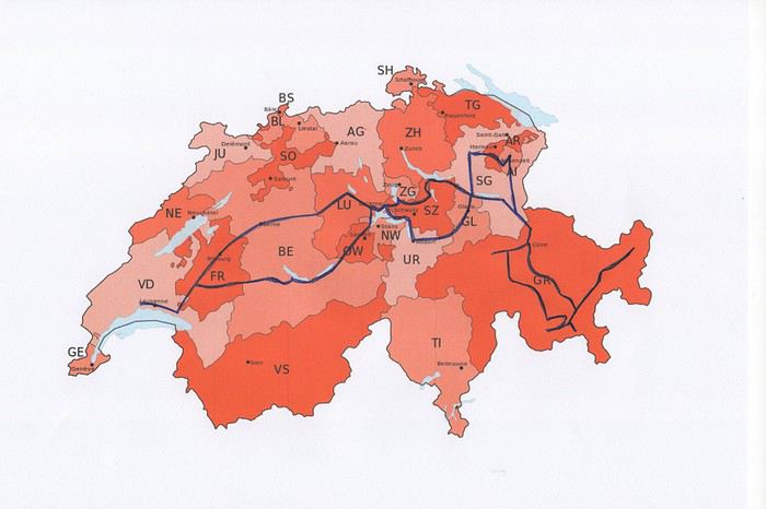
Nous avons loué un van, afin d’être autonome et libre. Notre choix s’est porté sur le VW California Ocean. Ce van est passe-partout, on peut facilement emprunter toutes les petites routes de montagnes et se parquer partout. Seul inconvénient, il n’a pas de salle de bain. La douche se fait à l’extérieur (eau froide), mais nous avons des toilettes portables. Le California Ocean est équipé avec une petite cuisine (un réchaud à gaz avec deux feux, un frigo de 42 litres, un petit évier). Il y a des placards sous la cuisine, au-dessus de la banquette et à l’arrière, ainsi qu’un grand tiroir sous la banquette. Les sièges avant se tournent, il y a deux tables, une à l’intérieur et une autre, encastrée dans la portière, pour l’extérieur. Les deux chaises pour l’extérieur sont encastrées dans la porte du coffre. Le toit se lève, on peut donc se mettre debout à l’intérieur du van. Le lit sous le toit est confortable, avec son sommier sur lequel sont fixé des ressorts. Un store extérieur nous protège du soleil lorsqu’on est à l’arrêt. Le chauffage stationnaire est bien agréable pour chauffer l’habitacle lorsqu’il fait froid. Il y a aussi plusieurs prises, dont une qui fonctionne avec la deuxième batterie et permet de charger le téléphone, tablette, etc. la nuit. Bref, ce petit van est vraiment fonctionnel.
Au dernier moment, nous avons décidé de prendre notre chien Tidou avec nous. Il a fallu adapter nos randonnées et visites. Eh oui, notre Tidou n’est plus tout jeune et il a des soucis avec son dos. Nous avons acheté un sac à dos spécifique, pour pouvoir le porter en terrain abrupte et lorsqu’il sera trop fatigué.
Nous avons chargé l’application park4night sur nos iPhones. Cette application est bien utile pour trouver des emplacements pour passer la nuit. Contrairement, à ce que l’on peut souvent lire, nous n’avons rencontré aucune difficulté pour passer la nuit. Le camping sauvage est donc possible en Suisse, si on ne s’installe pas pour plusieurs jours au même endroit. Concernant l’eau potable, on trouve de nombreuses fontaines, le plus souvent avec de l’eau potable.
Comme pour beaucoup de voyageurs, le Coronavirus a perturbé nos plans pour cette année. Notre road trip au Pérou est tombé à l’eau et la fermeture des frontières ne nous permettait pas de quitter la Suisse.
Heureusement, en Suisse, nous n’avons pas subi un confinement strict et nous pouvions nous déplacer librement dans le pays, en respectant certaines règles (distance de 2 mètres entres les personnes, rassemblements de maximum 5 personnes). De plus, une semaine avant notre départ, les magasins, restaurants et musées pouvaient ouvrir. Par contre, les campings, télécabines et télésièges sont restés fermés jusqu’au 6 juin.
Nous avons décidé de ne pas préparer un itinéraire fixe. Le but principal était le canton des Grisons que nous connaissions très peu. Pour y aller et pour revenir, nous avons traversé d’autres cantons où nous avons profité de faire des visites et randonnées. Certains endroits nous étaient bien connus, mais les voir sans les touristes habituels, asiatiques, indiens et américains, change complètement la perception des lieux. Imaginez, le fameux pont de la Chapelle à Lucerne, sans les hordes de touristes asiatiques qui l’envahissent tous les jours.
Nous avons loué un van, afin d’être autonome et libre. Notre choix s’est porté sur le VW California Ocean. Ce van est passe-partout, on peut facilement emprunter toutes les petites routes de montagnes et se parquer partout. Seul inconvénient, il n’a pas de salle de bain. La douche se fait à l’extérieur (eau froide), mais nous avons des toilettes portables. Le California Ocean est équipé avec une petite cuisine (un réchaud à gaz avec deux feux, un frigo de 42 litres, un petit évier). Il y a des placards sous la cuisine, au-dessus de la banquette et à l’arrière, ainsi qu’un grand tiroir sous la banquette. Les sièges avant se tournent, il y a deux tables, une à l’intérieur et une autre, encastrée dans la portière, pour l’extérieur. Les deux chaises pour l’extérieur sont encastrées dans la porte du coffre. Le toit se lève, on peut donc se mettre debout à l’intérieur du van. Le lit sous le toit est confortable, avec son sommier sur lequel sont fixé des ressorts. Un store extérieur nous protège du soleil lorsqu’on est à l’arrêt. Le chauffage stationnaire est bien agréable pour chauffer l’habitacle lorsqu’il fait froid. Il y a aussi plusieurs prises, dont une qui fonctionne avec la deuxième batterie et permet de charger le téléphone, tablette, etc. la nuit. Bref, ce petit van est vraiment fonctionnel.
Au dernier moment, nous avons décidé de prendre notre chien Tidou avec nous. Il a fallu adapter nos randonnées et visites. Eh oui, notre Tidou n’est plus tout jeune et il a des soucis avec son dos. Nous avons acheté un sac à dos spécifique, pour pouvoir le porter en terrain abrupte et lorsqu’il sera trop fatigué.
Nous avons chargé l’application park4night sur nos iPhones. Cette application est bien utile pour trouver des emplacements pour passer la nuit. Contrairement, à ce que l’on peut souvent lire, nous n’avons rencontré aucune difficulté pour passer la nuit. Le camping sauvage est donc possible en Suisse, si on ne s’installe pas pour plusieurs jours au même endroit. Concernant l’eau potable, on trouve de nombreuses fontaines, le plus souvent avec de l’eau potable.
Vos photos du Maroc English translation pending
bonjour
merci de partager si vous le voulez , vos photos et adresses sympa !
en premier évidemment mon village préféré !
AÏt Benhaddou , découvert en 202015 ...2 ou 3 auberges à l'époque ! j'étais à la Baraka ! à l'entrée du village ! c'était tellement cool à cette époque ! je faisais la cuisine avec Mohamed le cuisinier , dans la cuisine de l'auberge !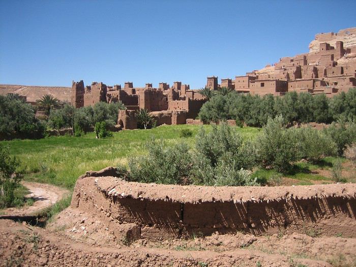
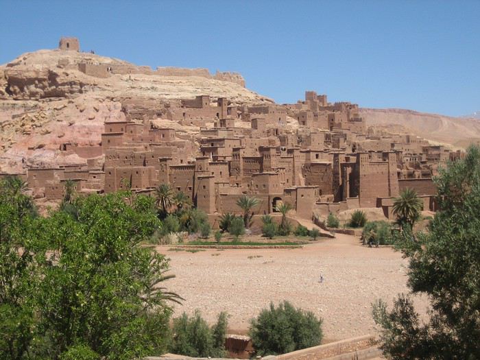
l'équipe de l'auberge " la baraka "
 A gauche , Brahim Bolkaid qui est le patron de l'auberge actuelle " maison d'hôtes panoramic "
en bas à droite le cuisinier !
j'en ai passer des heures dans la cuisine !
à cette période , il y avait des énormes bus d'Allemands , qui arrivaient avec toute leur nourriture !
ils consommaient très peu !
mais on leur servaient surtout des salades fraiches , des boisons ...
ils restaient 3 heures : boissons , pipi , visite du ksar et hop ils repartaient !
A gauche , Brahim Bolkaid qui est le patron de l'auberge actuelle " maison d'hôtes panoramic "
en bas à droite le cuisinier !
j'en ai passer des heures dans la cuisine !
à cette période , il y avait des énormes bus d'Allemands , qui arrivaient avec toute leur nourriture !
ils consommaient très peu !
mais on leur servaient surtout des salades fraiches , des boisons ...
ils restaient 3 heures : boissons , pipi , visite du ksar et hop ils repartaient !
la fresque chez Brahim !
AÏt Benhaddou , découvert en 202015 ...2 ou 3 auberges à l'époque ! j'étais à la Baraka ! à l'entrée du village ! c'était tellement cool à cette époque ! je faisais la cuisine avec Mohamed le cuisinier , dans la cuisine de l'auberge !
l'équipe de l'auberge " la baraka "
A gauche , Brahim Bolkaid qui est le patron de l'auberge actuelle " maison d'hôtes panoramic "
en bas à droite le cuisinier !
j'en ai passer des heures dans la cuisine !
à cette période , il y avait des énormes bus d'Allemands , qui arrivaient avec toute leur nourriture !
ils consommaient très peu !
mais on leur servaient surtout des salades fraiches , des boisons ...
ils restaient 3 heures : boissons , pipi , visite du ksar et hop ils repartaient !la fresque chez Brahim !
Voyage Texas et Louisiane en novembre-décembre 2019 English translation pending
Hello tous.
En cette période de disette de voyage , je vais me replonger dans notre voyage (road trip ..avec beaucoup de road.. (route).. Surement un avec le plus de miles.. il est vrai que le Texas c’est vaste.. et la Louisiane aussi..
Donc vous l’aurez compris c’est un voyage à travers le Texas (avec des villes comme Dallas bien sur !, San Antonio (la petite Venise), Austin (la capitale), un super parc (coup de cœur) , la Louisiane avec la nouvelle Orléans bien sûr, le pays cajun, une petite incursion aussi dans le Mississipi et bâton rouge et Lafayette.
Bon ce road trip est « un dernière minute »..Décidé en novembre pour novembre… A peine rentré d’Alaska.. je n’avais qu’une seule envie. Repartir… Alain moins… il me disait on a déjà un gros truc prévu en février. Faut pas abuser.. Je m’étais résignée.. et voilà qu’air France fait des promos en miles pour Los Angeles.. Je finis par le convaincre même s’il me dit qu’on connait déjà ce coin. Pas grave toujours tellement de chose à découvrir ! Mais voilà ces prix miles promos…ben en fait faut cliquer direct parce que le lendemain y’a plus rien ..ou plus rien qui va.. ou alors on part et ne revient pas. Ou le contraire ! Mais maintenant j’ai la tête à partir ! Un vieux rêves (bon pas si vieux).. Je veux aller en Louisiane.. Pas de vol direct pour « N O (nouvelle Orléans).. on fera du coup Houston Houston.. Et me voilà entrain d’organiser tout cela… Vols ok.. Voiture ok. (hertz) et les hôtels…qu’il faut organiser dans ces trois semaines.. Parce que pour moi le grand plaisir d’un road trip c’est de tout organiser. Surtout pas de voyage organisé.. C’est l’inverse d’une croisière pour nous. Et même si je m’efforce de trouver des hôtels « correct » dans ces trips on ne recherche pas le luxe.. Bon pas le bui bui non plus. Aller je vous emmène ?
En cette période de disette de voyage , je vais me replonger dans notre voyage (road trip ..avec beaucoup de road.. (route).. Surement un avec le plus de miles.. il est vrai que le Texas c’est vaste.. et la Louisiane aussi..
Donc vous l’aurez compris c’est un voyage à travers le Texas (avec des villes comme Dallas bien sur !, San Antonio (la petite Venise), Austin (la capitale), un super parc (coup de cœur) , la Louisiane avec la nouvelle Orléans bien sûr, le pays cajun, une petite incursion aussi dans le Mississipi et bâton rouge et Lafayette.
Bon ce road trip est « un dernière minute »..Décidé en novembre pour novembre… A peine rentré d’Alaska.. je n’avais qu’une seule envie. Repartir… Alain moins… il me disait on a déjà un gros truc prévu en février. Faut pas abuser.. Je m’étais résignée.. et voilà qu’air France fait des promos en miles pour Los Angeles.. Je finis par le convaincre même s’il me dit qu’on connait déjà ce coin. Pas grave toujours tellement de chose à découvrir ! Mais voilà ces prix miles promos…ben en fait faut cliquer direct parce que le lendemain y’a plus rien ..ou plus rien qui va.. ou alors on part et ne revient pas. Ou le contraire ! Mais maintenant j’ai la tête à partir ! Un vieux rêves (bon pas si vieux).. Je veux aller en Louisiane.. Pas de vol direct pour « N O (nouvelle Orléans).. on fera du coup Houston Houston.. Et me voilà entrain d’organiser tout cela… Vols ok.. Voiture ok. (hertz) et les hôtels…qu’il faut organiser dans ces trois semaines.. Parce que pour moi le grand plaisir d’un road trip c’est de tout organiser. Surtout pas de voyage organisé.. C’est l’inverse d’une croisière pour nous. Et même si je m’efforce de trouver des hôtels « correct » dans ces trips on ne recherche pas le luxe.. Bon pas le bui bui non plus. Aller je vous emmène ?
Un petit tour au bout du monde: Ushuaïa English translation pending
Un libro como un viaje se comienza con inquietud y se termina con melancolía. José Vasconcelos Calderón
CHAPITRE 1 : USHUAÏA
Me voici à Londres, où m’attends une journée d’escale. Située assez loin dans ma liste personnelle des lieux à visiter, je suis quand même heureuse de pouvoir découvrir une nouvelle ville, pour le peu de temps que j’ai à y passer. Elle me fait penser à un Paris version Britannique. Je visite le British Museum : c’est une mine d’or historique et culturelle ( en plus on m’offre le guide audio ) ! Je vois Big Ben en travaux de loin, ainsi que Buckingham Palace. Je monte dans un des fameux bus rouge à étages, et m’arrête boire une bière locale dans un pub : en bref, je fais ma touriste de base.
Je comprends que l’on puisse aimer les grandes villes ( diversité et abondance culturelle, ambiance, tout à disposition, animation.. ), mais il m’est compliqué de faire abstraction du brouhaha incessant, des bruits de voitures, du mauvais temps, du stress qui pourrait se couper au couteau, et du béton omniprésent.
Je me dirige vers l’aéroport, et, 13h de vol, la sympathisation avec une française, 3h d’escale à Buenos Aires, et 4h de vol plus tard, me voici enfin à Ushuaïa ! Je suis heureuse d’avoir un pied sur le continent, et de pouvoir enfin démarrer mon voyage.
À l’atterrissage, je peux distinguer la Terre de Feu sous les nuages, avec ses îles et ses sommets enneigés. Ushuaïa est une petite ville dont le centre compte de petits chalets mignons, même si j’avoue, il y plane une odeur pesante de machine à fric. Le soir, je regarde la ville s’endormir avec le soleil, spectacle que je dois avouer très agréable.
Le lendemain, je me réveille tôt, auberge de jeunesse tmtc, on paie moins cher car on offre sa promiscuité. Je vais me faire tamponner le passeport à l’Office du tourisme, après avoir dégusté le petit déjeuner copieux de l’auberge ( avec du pain fait maison ! ).
Dans la matinée, je vais au Musée Maritime de l’Antarctique dans l’ancienne prison d’Ushuaia. Un prisonnier avait dessiné son portrait sur les murs de sa cellule. Toute une aile du musée est dédiée à l’entreprise Total, dont l’apologie est faite ( ils sauveraient les pingouins en Antarctique, et contribueraient à leur protection ). Je ris jaune très fort dans ma tête.
Dans l’après-midi, je teste l’Icebar. Le concept : un congélateur géant à -18 degrés, orné de sculptures de glace ( maintenues telles quelles depuis deux ans ), de la musique, et un vrai bar avec boissons à volonté. Je me bois trois cocktails dans des verres de glace, en papotant avec le barman. Je ne vois pas le temps passer, à part mes doigts qui commencent à se congeler : je reste en tout 40min, grand maximum pour la santé.
Je rentre à l’auberge frigorifiée, en pensant prendre une douche brûlante avant de dormir. Que Neni, je tombe sur une Suisse dans mon dortoir, paniquée car elle venait de se rendre compte qu’elle s’était faite voler sa carte bleue ! On accroche de suite et je me prends d’une envie de l’aider. On part donc en ville pour essayer de régler son problème, alors qu’on se connaît depuis à peine dix minutes. On va dans différentes institutions, réussit à appeler sa banque aux Etats Unis, et finalement, après quelques montagnes russes, on réussit à régler son problème. On va donc boire un coup pour se détendre, dans un bar Irlandais, où je recroise un français avec qui j’avais papoté. On parle durant des heures. Cette fille est incroyable, elle a une vie hors du commun. Elle me raconte ses péripéties, et on part dans de grandes conversations. Je passe une très bonne soirée.
Le lendemain, je pars pour la Estancia Tunel. Le colectivo ( minibus, ( attend d’être plein avant de partir selon les endroits )) n’accepte que la carte » Sube « , et pas le liquide. La conductrice, adorable, me laisse passer gratuitement. Je marche environ 45 minutes, avant d’arriver à la balise qui est malheureusement en travaux; on ne peut pas accéder à la forêt. Tant pis, je trouve un coin isolé et désert, entre la forêt et le bord du canal. Les pics enneigés, la verdure, les lacs : c’est magnifique et très agréable. Je pique-nique et me pose toute l’après-midi avant de rentrer. Un local très gentil passe sa carte Sube pour moi, et refuse que je le rembourse en liquide.
À l’auberge, je retrouve la Suisse qui a passé une sale journée. On fait le tour des hostals, pour qu’elle puisse trouver un volontariat afin de rester, seulement, on est entre deux périodes touristiques, et aucune auberge ne recherche de volontaires. On se boit une bouteille de vin au bord du lac, et rentre assez éméchées. Nos rires ont l’air d’agacer les deux autres personnes du dortoir, qui écoutent leurs telenovelas sans écouteurs H24 : ça leur fait les pieds un peu.
Le lendemain, incroyable en Amérique latine : le car arrive en avance. Je pars dans le parc national Tierra del Fuego. Cela fait trois jours que ma cheville droite me fait souffrir et a doublé de volume: après 1h30 de marche je fais du stop pour aller sur mon lieu de campement. J’avais prévu de faire le trek du Hito XXIV, le seul qui n’est pas enseveli sous la neige, mais ça ne sera pas possible pour aujourd’hui. En montant ma tente, je me rend compte que le problème vient de mes chaussures, qui sont devenues bien trop petites pour moi, et que l’os de mon pied creuse le cuir de la chaussure haha, c’est pour ça que ma cheville a autant gonflé.
Il y a un petit ruisseau, le coin est très agréable, et une fois tous les touristes partis, sachant que je suis la seule campeuse du parc, personne à des kilomètres, j’en profite pour chanter à tue-tête.
Je dors à peine ( des rafales de vent à 100km/h ça fait du bruit contre une tente ), mais je n’ai pas froid, mon sac de couchage a une température maximale de -5°.
Je fais le Hito XXIV en chaussettes, et 2h30 de marche plus tard, j’arrive à à la frontière officielle Chilienne, délimitée par un simple panneau et la fin du sentier. Avec la fonte des neiges, je suis trempée, mais bon, j’aurai vu le joli lac. Je croise deux magnifiques chevaux dans la forêt. Il y a un petit restau à côté de l’arrêt de bus, où le patron m’offre un thé, sûrement car j’ai été la seule idiote à camper par ce temps haha.
En rentrant, j’achète des baskets de piètre qualité, mais qui tiendront tous mes treks des quatre prochains mois.
En rentrant à l’auberge, j’apprends que la Suisse a pu trouver un couchsurfing. Je suis contente pour elle, même si on a pas échangé nos contacts.
Le lendemain, je me fais réveiller par une brésilienne, paniquée car des clients nous avaient enfermées à clé sans faire exprès. J’appelle mes proches, le lendemain je pars pour le Chili.
J'alimente régulièrement mon blog de mes récits de voyage également ! Si ça peut vous intéresser : lacobayeailee.com
CHAPITRE 1 : USHUAÏA
Me voici à Londres, où m’attends une journée d’escale. Située assez loin dans ma liste personnelle des lieux à visiter, je suis quand même heureuse de pouvoir découvrir une nouvelle ville, pour le peu de temps que j’ai à y passer. Elle me fait penser à un Paris version Britannique. Je visite le British Museum : c’est une mine d’or historique et culturelle ( en plus on m’offre le guide audio ) ! Je vois Big Ben en travaux de loin, ainsi que Buckingham Palace. Je monte dans un des fameux bus rouge à étages, et m’arrête boire une bière locale dans un pub : en bref, je fais ma touriste de base.
Je comprends que l’on puisse aimer les grandes villes ( diversité et abondance culturelle, ambiance, tout à disposition, animation.. ), mais il m’est compliqué de faire abstraction du brouhaha incessant, des bruits de voitures, du mauvais temps, du stress qui pourrait se couper au couteau, et du béton omniprésent.
Je me dirige vers l’aéroport, et, 13h de vol, la sympathisation avec une française, 3h d’escale à Buenos Aires, et 4h de vol plus tard, me voici enfin à Ushuaïa ! Je suis heureuse d’avoir un pied sur le continent, et de pouvoir enfin démarrer mon voyage.
À l’atterrissage, je peux distinguer la Terre de Feu sous les nuages, avec ses îles et ses sommets enneigés. Ushuaïa est une petite ville dont le centre compte de petits chalets mignons, même si j’avoue, il y plane une odeur pesante de machine à fric. Le soir, je regarde la ville s’endormir avec le soleil, spectacle que je dois avouer très agréable.
Le lendemain, je me réveille tôt, auberge de jeunesse tmtc, on paie moins cher car on offre sa promiscuité. Je vais me faire tamponner le passeport à l’Office du tourisme, après avoir dégusté le petit déjeuner copieux de l’auberge ( avec du pain fait maison ! ).
Dans la matinée, je vais au Musée Maritime de l’Antarctique dans l’ancienne prison d’Ushuaia. Un prisonnier avait dessiné son portrait sur les murs de sa cellule. Toute une aile du musée est dédiée à l’entreprise Total, dont l’apologie est faite ( ils sauveraient les pingouins en Antarctique, et contribueraient à leur protection ). Je ris jaune très fort dans ma tête.
Dans l’après-midi, je teste l’Icebar. Le concept : un congélateur géant à -18 degrés, orné de sculptures de glace ( maintenues telles quelles depuis deux ans ), de la musique, et un vrai bar avec boissons à volonté. Je me bois trois cocktails dans des verres de glace, en papotant avec le barman. Je ne vois pas le temps passer, à part mes doigts qui commencent à se congeler : je reste en tout 40min, grand maximum pour la santé.
Je rentre à l’auberge frigorifiée, en pensant prendre une douche brûlante avant de dormir. Que Neni, je tombe sur une Suisse dans mon dortoir, paniquée car elle venait de se rendre compte qu’elle s’était faite voler sa carte bleue ! On accroche de suite et je me prends d’une envie de l’aider. On part donc en ville pour essayer de régler son problème, alors qu’on se connaît depuis à peine dix minutes. On va dans différentes institutions, réussit à appeler sa banque aux Etats Unis, et finalement, après quelques montagnes russes, on réussit à régler son problème. On va donc boire un coup pour se détendre, dans un bar Irlandais, où je recroise un français avec qui j’avais papoté. On parle durant des heures. Cette fille est incroyable, elle a une vie hors du commun. Elle me raconte ses péripéties, et on part dans de grandes conversations. Je passe une très bonne soirée.
Le lendemain, je pars pour la Estancia Tunel. Le colectivo ( minibus, ( attend d’être plein avant de partir selon les endroits )) n’accepte que la carte » Sube « , et pas le liquide. La conductrice, adorable, me laisse passer gratuitement. Je marche environ 45 minutes, avant d’arriver à la balise qui est malheureusement en travaux; on ne peut pas accéder à la forêt. Tant pis, je trouve un coin isolé et désert, entre la forêt et le bord du canal. Les pics enneigés, la verdure, les lacs : c’est magnifique et très agréable. Je pique-nique et me pose toute l’après-midi avant de rentrer. Un local très gentil passe sa carte Sube pour moi, et refuse que je le rembourse en liquide.
À l’auberge, je retrouve la Suisse qui a passé une sale journée. On fait le tour des hostals, pour qu’elle puisse trouver un volontariat afin de rester, seulement, on est entre deux périodes touristiques, et aucune auberge ne recherche de volontaires. On se boit une bouteille de vin au bord du lac, et rentre assez éméchées. Nos rires ont l’air d’agacer les deux autres personnes du dortoir, qui écoutent leurs telenovelas sans écouteurs H24 : ça leur fait les pieds un peu.
Le lendemain, incroyable en Amérique latine : le car arrive en avance. Je pars dans le parc national Tierra del Fuego. Cela fait trois jours que ma cheville droite me fait souffrir et a doublé de volume: après 1h30 de marche je fais du stop pour aller sur mon lieu de campement. J’avais prévu de faire le trek du Hito XXIV, le seul qui n’est pas enseveli sous la neige, mais ça ne sera pas possible pour aujourd’hui. En montant ma tente, je me rend compte que le problème vient de mes chaussures, qui sont devenues bien trop petites pour moi, et que l’os de mon pied creuse le cuir de la chaussure haha, c’est pour ça que ma cheville a autant gonflé.
Il y a un petit ruisseau, le coin est très agréable, et une fois tous les touristes partis, sachant que je suis la seule campeuse du parc, personne à des kilomètres, j’en profite pour chanter à tue-tête.
Je dors à peine ( des rafales de vent à 100km/h ça fait du bruit contre une tente ), mais je n’ai pas froid, mon sac de couchage a une température maximale de -5°.
Je fais le Hito XXIV en chaussettes, et 2h30 de marche plus tard, j’arrive à à la frontière officielle Chilienne, délimitée par un simple panneau et la fin du sentier. Avec la fonte des neiges, je suis trempée, mais bon, j’aurai vu le joli lac. Je croise deux magnifiques chevaux dans la forêt. Il y a un petit restau à côté de l’arrêt de bus, où le patron m’offre un thé, sûrement car j’ai été la seule idiote à camper par ce temps haha.
En rentrant, j’achète des baskets de piètre qualité, mais qui tiendront tous mes treks des quatre prochains mois.
En rentrant à l’auberge, j’apprends que la Suisse a pu trouver un couchsurfing. Je suis contente pour elle, même si on a pas échangé nos contacts.
Le lendemain, je me fais réveiller par une brésilienne, paniquée car des clients nous avaient enfermées à clé sans faire exprès. J’appelle mes proches, le lendemain je pars pour le Chili.
J'alimente régulièrement mon blog de mes récits de voyage également ! Si ça peut vous intéresser : lacobayeailee.com
Norway to hell English translation pending
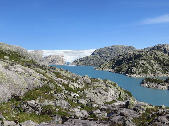
En ces temps coronatroublés, rien ne vaut de se remémorer le dernier voyage touristique que l’on a fait avant le plongeon dans le néant sanitaro-économique. La Norvège, plus précisément sa côte ouest et ses fjords, sera donc le sujet de ce carnet en 31 épisodes dotés chacun d’une bande-son, plutôt rock d’ailleurs. Attention, lecteur, vous vous exposez à un certain nombre de clichés pas du tout exagérés et de blagues pourries. I have nothing to offer but fjord, joy, tears (of the sky) and sweat.
Donc la Norvège, c’est l’apocalypse budgétaire dans votre portefeuille. D’où le titre (c’est tiré par les cheveux mais je ne refuse jamais un jeu de mots). Mais ce n’est pas que cela, c’est aussi fort joli, propre, policé et réellement rempli de charmantes têtes blondes. La Norvège, c’est également une monarchie pétrolière du golfe persique qui s’est égarée sur des terres glacées. Eh oui, c’est tout de suite plus facile d’être riche quand ils ont du pétrole (« mais ils n’ont que ça » aurait ajouté un jaloux), qu’ils sont peu nombreux et pas très partageurs. Allez, quelques détails pour commencer sur un plan aussi bien techeunique que tacqueutique
Le trajet En voiture Simone ! Depuis le Massif Central jusqu’à la Norvège avec une C3. J’avais décrété 2019, année sans avion. Donc c’était la voiture, certes petite mais costaude, où l’on a pu entasser notre matériel de camping. On en a profité pour prendre un covoitureur qui allait se perdre en Norvège pour l’été. Plus on est de fous entassés, plus on rit. Sur place, j'ai limité fortement notre aire d'action géographique. Je le connais le piège de faire une liste longue comme le bras et de courir tout le voyage tel un chien de ferme après un mollet cycliste. Il s'agissait de se cantonner au riz euh pardon à la façade sud-ouest du pays sans aller plus haut qu'Ålesund. Et comme il y avait un certain nombre de lieux qui me faisaient de l’œil, nous avons quand même eu un trajet digne d’une otarie bourrée essayant d’échapper à une orque affamée. On a finalement fait l’essuie-glace obliquement dans l’Ouest : à gauche, à droite, à gauche, à droite, à droite, A DROITE . Il faut dire que les fjords et les montagnes n’arrangent pas les affaires du voyageur adepte des routes rectilignes, et cela malgré la passion tunnelière locale.
Le lien vers la carte du trajet : http://u.osmfr.org/m/434267/
Les Norvégiens Les Norvégiens sont des êtres blonds aux yeux bleus, parfois d’un blond tellement blond qu’on dirait qu’ils ont appliqué de la javel sur leurs cheveux. Effet secondaire qui donne la chair de poule, cela fait disparaître les sourcils… Le Norvégien est réservé et poli. L’été, soit il se balade torse nu, soit il quitte le pays pour des horizons plus propices au rougeoiement de sa peau laiteuse où il pourra faire valoir son pouvoir d’achat dément. La Norvégienne quant à elle a une prédisposition naturelle à se promener en sous-tif ou brassière dès le premier rayon de soleil. Le dimanche, jour du Seigneur et de l’hypocrisie, le Norvégienne ne boit pas (vente d’alcool interdit !) les autres jours, iel se cache pour boire puis déambule cahin-caha entre les maisons de bois à la pelouse verdoyante. La Norvégien apprécie également les sorties familiales du dimanche après-midi où il peut effectuer 1000 mètres de dénivelé en 3,5km avec ses enfants de 7 et 9 ans. Le tout les doigts dans le nez.
Le logement Le logement, c’était principalement notre tente de 2 m² que nous avons montée/démontée dans des campings de qualité très variable pour un prix pas donné. Souvent les sites sont jolis mais plantés en bordure de route malgré l’espace qu’offre le pays. Ca manque quand même d’arbres ou arbustes et d’emplacements un tant soit peu délimités. Ce dernier point permet pendant les nuits les plus chaudes de l’été d’entasser les touristes de passage dans une promiscuité certaine et de rentabiliser un maximum l’espace. Malynx le Norvégynx ! Par contre, les sanitaires sont en général en bon état mais avec douche payante. Bref, le camping c’est le moyen de logement le plus abordable hors camping sauvage mais en général, la qualité est moyennasse au vu des prix. J’ai séché une petite larme en pensant à feus les campings des parcs nationaux et provinciaux canadiens. Requiescat in pace. Pour reprendre notre souffle, nous avons quand même varié les plaisirs avec des logements en b&b, du camping sauvage, des hytter (des petites cabanes souvent présentes dans les campings mais également ailleurs, très pratiques, pas trop chères pour la Norvège et aux prestations variables : électricité, eaux courantes en option par exemple) et une nuit en « refuge ». Les refuges, il y en a partout la plupart sont accessibles à pied, non gardés avec parfois une sorte de self-service payant.
La bouffe Courez en Norvège (ah mince vous êtes confinés) et vous me direz des nouvelles du Brunost . Sinon c’est cher mais pas mauvais globalement, peu porté sur le poisson hors saumon d’élevage et assez roboratif. Et bonne surprise pour moi, il y a quand même une tradition boulangère et même s’il y a peu de boulangeries, on peut trouver pleins de pains et de sorte de viennoiseries dans les supermarchés. Cela égaie les multiples piques-niques.
Avant de commencer le carnet proprement dit, entamons notre hymne norvégien : So many stop signs Speed limit Curves’ gonna slow me down Like a wheel Gonna spin it Tourists’ gonna mess me around Hey, Satan Payin' my tolls Bein’ among sheepin' bands Hey, mamma Look at me I'm on the way to the promised land
Jour 1,5 60 mph – New Order Clermont-Ferrand - Neumünster A nous les petites autoroutes allemandes tant prisées de ce côté du Rhin pour l’absence de limites de vitesse. Parcours Montbéliard – Fribourg – Karlsruhe – Francfort – Kassel – Hannovre – Hambourg – Neumünster. C’est long et pénible avec des travaux publics pas très deutsche Qualität tous les 20 kms, un trafic chargé et des zones limitées sans limite de vitesse qui rendent la conduite dangereuse : à droite ça roule à 90, à gauche à 200 pour les plus fous et comme c’est saturé, ça donne un résultat sportif et désagréable. Je me demande comment ils font pour avoir aussi peu de morts sur les routes en Allemagne. A part ça, le voyage est sans histoire, le colis covoitureur est livré à Fribourg et on arrive entiers et fatigués à Cathédraleneuve.
Jour 2 Seemann – Rammstein Neumünster - Kristiansand
Les autoroutes allemandes c’est rapidement fini, on revient à de la tranquillité avec le Danemark. Nous avons choisi de prendre le ferry Hirtshals-Kristiansand qui permet d'arriver plus rapidement sur la côte ouest Et comme on a beaucoup d’avance sur l’horaire du ferry Hirtshals-Kristiansand, on se permet un détour vers une dune danoise dominant la mer du Nord. Le temps est pas idéal et le coin est assez fréquenté. Bof. Le voyage en ferry est sans histoire, les Norvégiens en profitent pour faire des réserves d’alcool et de legos (les deux produits les plus présents dans les magasins du bateau). Nous voilà enfin en Norvège, 1900 kilomètres plus tard, sur la plage de Christian. Sacré Clavier qui a fait des fidèles un peu partout en Scandinavie.
Jour 3 Why does it always rain on me? - Travis 180 km Kristiansand – Hauge Notre premier jour en Norvège et ça ne s’annonce pas glorieux, plutôt gris tendance pluie. Nous commençons par un rapide passage par un bout de zone payante de Kristiansand juste pour le plaisir et accessoirement quitter cette ville. Je me suis inscrit, par honnêteté, sur le site internet des péages norvégiens (gérés d’ailleurs par une société anglaise) et par la grâce de caméras bien placées, nous allons devoir payer quelques euros pour à peu près 100 mètres dans ladite ville. Pfff. Quant au programme aujourd’hui, nous allons à la conquête de l’ouest, l’ouest de Kristiansand et nos plans capotent très largement. Ca tombe, ça tombe, ça dégouline, dégringole, s’abat, déverse, pleuvoche, tantôt torrentiel, tantôt bruineux. Pas question de faire une rando ou toute autre activité de plein air. Je m’aperçois en plus dans la journée que mon imper n’est plus imperméable et que j’ai oublié mon surpantalon. Prions, mes bien chers Frères, mes bien chères Sœurs pour que la météo soit clémente. Sinon ça va être long. Dans un premier temps, jusqu’à Flekkefjord, nous nous mouvons plus ou moins le long de la côte sans l’apercevoir, d’une parce que c’est complètement bouché, de deux parce qu’il est difficile de distinguer ce qui tient d’un lac ou d’un fjord, de trois parce que la route principale ne suit pas la côte. Nous nous rabattons donc sur la visite sans trop musarder des petites villes blanches du sud de la Norvège, leurs villages blancs andalous à eux mais en différent : avec du bois, de la pluie et de la mer. Premier arrêt à Mandal, un vrai coup dans le cœur. Deuxième arrêt : Flekkefjord, très mignon. Troisième arrêt version hameau, Stornes en entrée de fjord, très, très mignon. Quatrième arrêt : Sognalstranda, très, très, très mignon. C’est le règne de la mignonitude humide. Une maison en bois par ci, un entrepôt en bois par-là, et des garages à bateau à foison.
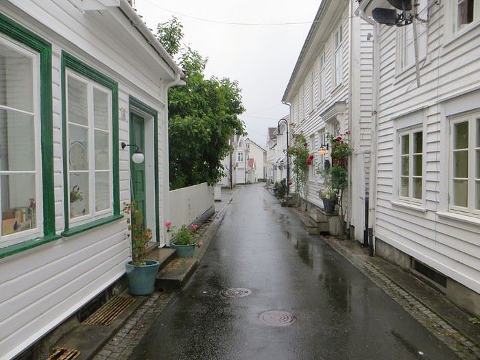 Pas un temps à mettre un chat norvégien dehors (Flekkefjord)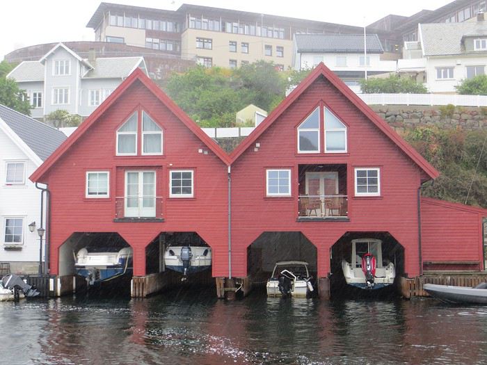
Pas un temps à mettre un bateau norvégien dehors
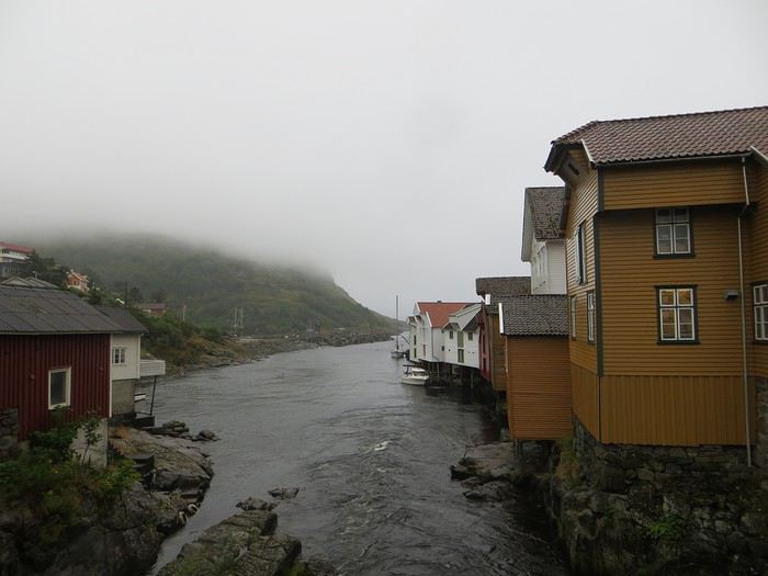 Mais pourquoi on est dehors nous alors ? (Sognalstranda)
Interlude de pipeau très intéressant : ces villes/villages, souvent fondés aux 17ème et 18ème siècle, sont les témoins de la politique mercantiliste du royaume du Danemark. L’État balbutiant entend organiser la production, la commercialisation et l’exportation des ressources comme le bois, les poissons et certains métaux de Norvège. Cette politique passe par la mise en place d’exploitations/manufactures à tendance monopolistique et la spécialisation des ports avec monopole des marchands d’abord hanséatiques (16ème siècle) puis néerlandais (17ème siècle) et enfin danois (17-18ème siècle). C’est d’ailleurs pour cela que le vieux centre de Flekkefjord est surnommé la ville hollandaise. Ce système mercantiliste fera par ailleurs les malheurs de l’Islande forcée de se soumettre pendant deux siècles à une compagnie royale danoise monopolistique à même d’imposer ses tarifs et ses conditions d’échange de marchandise. Les siècles sombres comme les appellent les Islandais ont en grande partie comme origine cette organisation économique très profitable pour la royauté danoise, beaucoup moins pour les habitants de l’île. La route 44 après Flekkefjord vaut par ailleurs son pesant de cacahuètes même si les conditions ne sont pas optimales pour en profiter. Tout le coin a été nommé magma geopark (patrimoine de l’UNESCO) dans une poussée de marketing touristique, des roches de la croûte terrestre d’une zone de subduction ayant fini par apparaître sous l’effet de l’érosion si j’ai bien compris. Point de volcan donc mais des effleurements d’anorthosites qui forment des paysage rocailleux arrondis et stériles comme autour d’Helleren et d’Åna Sira où devait se dérouler notre première randonnée norvégienne, projet qui tombe à l’eau (ahahah), noyé sous les larmes du ciel (ahahah). La partie la plus spectaculaire du trajet se trouve entre Åna Sira et Hauge où la route serpente tant bien mal entre les rochers. Nous goûtons le soir venu à la douceur des campings norvégiens : une espèce de carrière dans un espace réduit entre deux collines, un sol gravillonneux, pas de végétation et roule ma poule. Le seul avantage réside dans la vue en bout de carrière sur la côte. Pas vraiment de cuisine aménagée, des douches payantes : prometteur ! Le coupable aujourd’hui est le Vågan camping (garanti sans viande).
Jour 4 Sous le soleil exactement – Serge Gainsbourg 186km Hauge – Lysebotn Nuit et brouillard ce matin sur la Norvège et pourtant nous gardons espoir, le soleil vaincra. Nous continuons la route côtière pour faire une petite balade (4km aller-retour) jusqu’au Hådyr. C’est humide, boueux, bourbeux, fangeux, marécageux, tourbeux, machineux. C’est également l’occasion de compter la deuxième victime du voyage : le terrain a raison de mes chaussures de marche basses. Flap flap, bain de pieds et macération. Décidément, je suis équipé pour affronter l’humidité scandinave ! Arrivés au rocher censé donner un point de vue sympa sur la côte, c’est la douche froide (avec beaucoup de vapeur d’eau, la douche) : à gauche, du brouillard, à droite, du brouillard, droit devant, du brouillard, derrière, du brouillard et un bruit de ressac à nos pieds. Comme on est patient et qu’on croit en dame météo, nous nous asseyons pour attendre la percée du soleil. Une heure et quelques hésitations plus tard, ça se déchire (très) petit à petit, de quoi entrapercevoir une côte que je qualifierai de dantesque. J’adore ces rochers granitiques usés par les siècles, qui forment des forêts de sentinelles face à la mer.
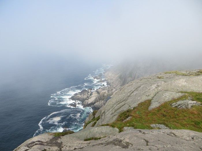 Les portes de l'Hådyr s'ouvrent et pas de cerbères à l'horizon
Et ça tombe bien que j’adore ce paysage puisque pour l’étape suivante (décidément le gentil organisateur a tout prévu !), nous traversons sans s’arrêter Egersund, autre petite ville en bois, pour Eigerøya, son phare et son paysage rocailleux sous le soleil exactement, un soleil de plomb je dirais même plus. La baladounette de l’après-midi de 4 km est sans difficulté sur une autoroute pédestre et permet d’accéder à un point de vue maousse costaud sur l’île d’Eiger et son phare.
Les portes de l'Hådyr s'ouvrent et pas de cerbères à l'horizon
Et ça tombe bien que j’adore ce paysage puisque pour l’étape suivante (décidément le gentil organisateur a tout prévu !), nous traversons sans s’arrêter Egersund, autre petite ville en bois, pour Eigerøya, son phare et son paysage rocailleux sous le soleil exactement, un soleil de plomb je dirais même plus. La baladounette de l’après-midi de 4 km est sans difficulté sur une autoroute pédestre et permet d’accéder à un point de vue maousse costaud sur l’île d’Eiger et son phare.
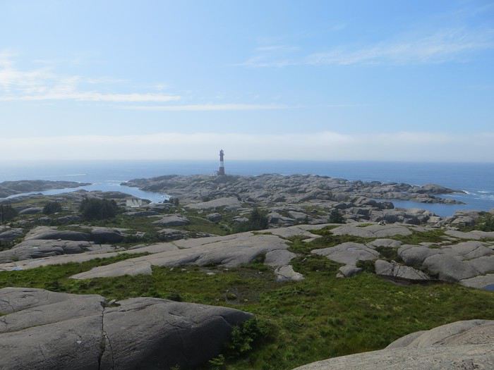 C'est un roc ! C'est un pic ! C'est un cap ! Que dis-je c'est une péninsule !
 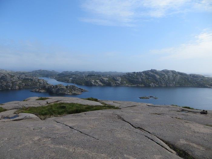 Eigerøya en beauté
Si j’ai bien compris le norvégien, øy est le suffixe pour île et a celui pour « la » en général, même si la langue se scinde en deux types distincts nynorsk et bokmål et en de nombreuses variantes dialectiques locales qui provoquent des orthographes changeantes des panneaux et des cartes. Par exemple, kirke (église en bokmål) s’écrit aussi kyrkje en nynorsk, voire a d’autres déclinaisons locales plus obscures. Le nynorsk, pour ceux qui ne connaissent pas, est issu d’une (re)création linguistique du 19ème siècle type occitan ou breton en France : pour donner à la Norvège une langue pure de toute saleté étrangère, danoise plus particulièrement, des linguistes ont construit une langue sur un mélange des dialectes considérés comme les moins viciés par l’outre-Skagerrak, c’est-à-dire ceux du Telemark et des fjords du sud-ouest. A contrario, le bokmål est un dérivé dédanoiïsé de la langue parlée (du danois grosso modo) dans les villes comme Oslo au début du 19ème siècle. De nos jours, il y a donc deux langues officielles et le nynorsk est très connoté nationaliste et perd du terrain : 13% des Norvégiens, principalement dans l’ouest, le parlent comme langue maternelle. Nous nous dirigeons ensuite vers l’intérieur des terres en direction de Lysebotn, le paysage change, pâturage, forêt et lacs avant de rentrer dans des zones à l’environnement plus âpre et tourmenté. Gloppedalsura (à vos souhaits) est l’occasion d’un arrêt bienvenu pour un point de vue sur un chaos de rochers impressionnant et son lac attenant.
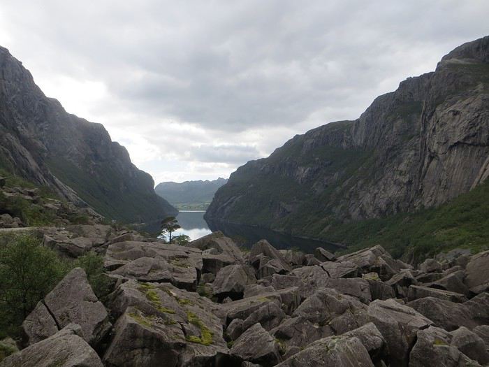 Gloppedalsura, lieu de franche rigolade entre Allemands et Norvégiens pendant la Seconde Guerre Mondiale
Nous remontons ensuite la Øvstabødalen, vallée glaciaire à citer dans toute conférence de géologie de bon niveau pour la perfection de sa forme en auge. Le parcours est varié, peu fréquenté et plaisant avant de plonger sur une zone moins sympa bien dotée en stations de ski et en habitat folklorico-traditionnel, ici des immeubles/chalets en bois sombre et toit végétalisé. L’avantage, au-delà du côté très artificiel des stations, c’est que les bâtiments se fondent dans la végétation.
Gloppedalsura, lieu de franche rigolade entre Allemands et Norvégiens pendant la Seconde Guerre Mondiale
Nous remontons ensuite la Øvstabødalen, vallée glaciaire à citer dans toute conférence de géologie de bon niveau pour la perfection de sa forme en auge. Le parcours est varié, peu fréquenté et plaisant avant de plonger sur une zone moins sympa bien dotée en stations de ski et en habitat folklorico-traditionnel, ici des immeubles/chalets en bois sombre et toit végétalisé. L’avantage, au-delà du côté très artificiel des stations, c’est que les bâtiments se fondent dans la végétation.La dernière partie du trajet, très belle mais pas très agréable à conduire tant la petite route est saturée par la circulation, traverse un plateau rocailleux avant de plonger vers le Lysefjord. Malheureusement, la route de descente, assez connue (elle est le lieu d’une compétition estivale de ski sur route très cotée) une fois passée le restaurant et bien que sûrement impressionnante vue d’un drone, n’offre quasiment aucune vue sur la vallée et le fjord. Ce qu’elle offre par contre, c’est un tunnel en épingle à cheveux, un classique que l’on retrouvera à plusieurs reprises dans les fantaisies souterraines norvégiennes. Le camping du soir, bonsoir, le Kjerag Lysebotn camping, jouit d’un site splendide et est bien équipé (cuisine, sanitaire). Malheureusement, comme on est en Norvège, il n’y a aucun arbre/arbuste et une promiscuité assez forte et accentuée par l’affluence d’un jour de juillet ensoleillé. Bref on se marche dessus comme des manchots en période de reproduction dans leur colonie.
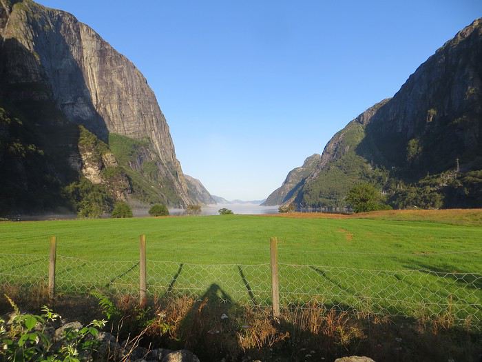 Quand je vous dis que le site est splendide...
Jour 5 Highway song – System of a Down 78km Lysebotn - Hjelmeland Aujourd’hui, c’est notre journée rando de masse dit trek pour ceux qui se sentent une âme d’aventurier, juste une âme, il ne faut pas trop abuser de l’aventure. Donc aujourd’hui, c’est le Kjeragbolten, concession faite à la liste des randonnées obligatoires. La Norvège fait partie de ces pays où la randonnée est l’une des activités touristiques obligatoires y compris pour des personnes qui ne marchent jamais par ailleurs. Pour la Norvège, l’activité s’effectue bien sûr en masse sur les mêmes chemins en cochant les fameuses cases de la to do list comprenant dans l’Ouest Preikestolen, Trolltunga, Kjeragbolten, Bessegen et Aurlandsdalen. Nous nous sommes contentés du rocher suspendu Kjerag, choisi car dans mon esprit, moins facilement accessible au commun du touriste (et moi je suis un touriste hors du commun, un tourista). C’est sûrement vrai mais cela n’empêche pas le monde… Je le savais, je le savais, j’étais prévenu, j’ai râlé avant, j’ai râlé pendant, je râle encore après et pourtant je n’ai pas d’oiseau dans la gorge et il n’y avait pas de genêts dans la balade (cf le râle des gen��ts pour comprendre la blagounette). La randonnée commence par un parking gigantesque au tarif prohibitif. Nous payons sans moufter nos 30 euros (un repas dans un resto semi gastro en France pour ceux qui n’ont pas le sens des valeurs). J’espère que personne ne s’arrête juste pour voir la vue car de vue il n’y en a point : le point de vue est occupé par un restaurant qui met un point d’honneur à boucher accessoirement la vue. Et pour accéder à sa terrasse/point de vue, il faut payer. Bon, nous, on a du pain sur la planche et quelques montées raidasses en attente. Dont acte. Trafic fluide en ce début de matinée, quelques problèmes de surchauffe moteur pour la première montée puis la vitesse de croisière est atteinte pour une arrivée prévue à 10h30. Ce n’est pas encore un bouchon au niveau du rocher mais la circulation est déjà dense à l’approche. Au retour, le trafic est extrêmement chargé et les comportements touristico-idiots se multiplient (équipement inadéquat, coupage des routes à travers champs, ralentissements dus aux selfies intempestifs. Ne pas utiliser votre téléphone en conduisant, que la sécurité routière vous dit !).
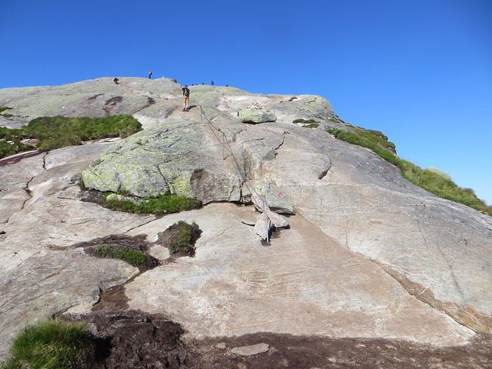
Pas un coin où amener sa traban
Sur le fond, la rando, 12 km et 700 mètres de dénivelée, est très chouette avec de belles vues sur le fjord et Lysebotn en particulier au début de la 3ème montée et tout au bout.
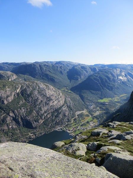
Le Lysefjord
Le caillou est flippant et spectaculaire tout comme la plateforme juste à côté. Une queue au bord d'un à pic de 1000 mètres se forme pour monter dessus (même pas en rêve, je fais un truc pareil).
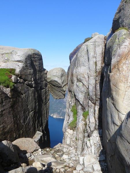 Le mythe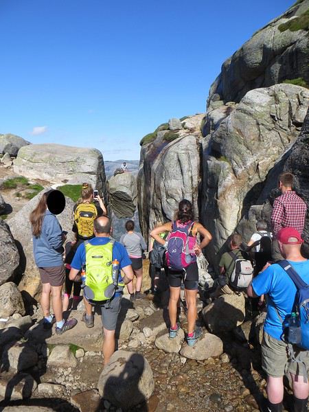
La réalité
Il est loisible d’explorer les environs du Kjeragbolten pour profiter d’un peu de la tranquillité des avancées rocheuses spectaculaires et des vues majestueuses sur le fjord. Bref ça claque grave.
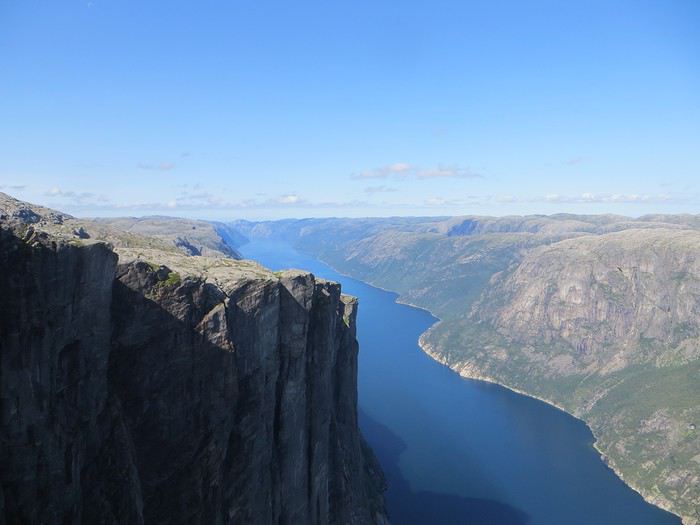 Le Lysefjord n'a pas bougé
On redescend à Lysebotn pour prendre un ferry réservé à l’avance. Et quand on voit le « ferry » arriver, on se dit que la réservation était une bonne idée. Rentrée en marche arrière et tassage de voitures dans un espace réduit pour notre mini-croisière sur le Lysefjord. Très bien la mini-croisière qui permet de s’apercevoir de la hauteur des falaises entourant le Kjeragbolten et d’apercevoir le Preikestolen où nous n’irons pas.
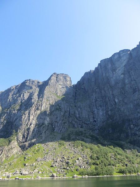
Le Kjeragbolten vu d'en bas. Les 1000 mètres de vide y sont bien
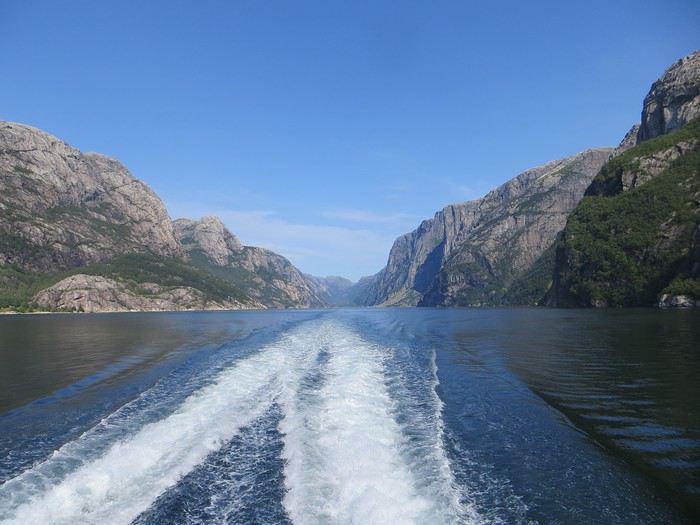 La croisière s'amuse
Le camping du soir se trouve à Hjelmeland et est ingénieusement intitulé Hjelmeland camping. Celui-ci fait dans l’original puisque nous avons planté notre tente dans le parc arboré d’une sorte de manoir qui sert de dortoir. Une chouette vue, une cuisine bien équipée et assez d’espace pour ne pas se marcher dessus (en principe, avec les Norvégiens, on ne sait jamais, ils pourraient parquer votre tente ou votre van à 50 cm du voisin), voilà pour les avantages. Pour les inconvénients, les sanitaires sont peu nombreux, peu pratiques et se salissent vite (forcément).
On the Silk Road: Chronicles of a Sixty-Something Traveling Completely Independently
From Beijing to Khiva: China, Kyrgyzstan, Tajikistan, Uzbekistan
Chronicle of anecdotes, highlights, and other adventures that marked this eight-week journey in 2018.
The Chinese Far West More than 30 years after my first trip to eastern China, I finally fulfilled an old dream: traveling solo from Beijing to the far west, discovering Xinjiang, the Uyghur people and the oppression they endure, the oases of Turpan and Kashgar, the Taklamakan Desert, the end of the Great Wall... The route was covered by train.
MENU PART 1: CHINA
1- Beijing (Jiankou) : the authentic Great Wall, without tourists 2- Cycling in Beijing, the best way to get around 3- Beijing : departure for the far west 4- Jiayuguan : getting by without English 5- Jiayuguan : scams and heritage 6- Dunhuang : abundance in the middle of the desert 7- Turpan : the Uyghurs under heavy surveillance 8- Kashgar : love at first sight for the old city 9- Kashgar : China’s recipe for controlling the populace 10- Tashkurgan : what on earth was I thinking going there! Kyrgyz border: a surreal epic Photo album from the 80s, contributions from other travelers (page 2)
1- JIANKOU Finding the authentic Great Wall, without tourists or a guide Friday, August 24, 2018 Thirty years later, I didn’t feel like revisiting the Great Wall at Badaling or any other overcrowded site. I chose to explore it at Jiankou, in its wildest, most authentic, and unrestored section, starting from a lost village deep in a valley—though it wasn’t *that* lost, since it had everything for communication.
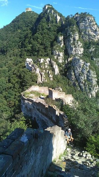
No need to pay for a taxi to get there—by timing it right, you can take the bus for just a few yuan. You have to get off at Xizhazi, the bus terminus. Be careful, there are only two buses a day in each direction. At the Xizhazi bus stop, I met a young couple who’d arrived with zero information about what to expect. We hiked the three of us toward the restored section of Mutianyu.
Still, be cautious With GPS and a topographic map (OpenTopoMap), you can set off without a problem or guide. The trail up to Jiankou is easy and well-marked. The trails down are too. But be careful—once you’re on the Wall, it’s real mountain hiking, with easy but dangerous climbing sections (over sheer drops). Not for amateurs or those afraid of heights! But what a reward. The Wall all to yourself, where it’s at its most daring. Truly mesmerizing.
More photos...
2- BEIJING The best way to get around the capital Sunday, August 26 The best way to explore the city is still by bike. Most are in a bike-share system, but you need to use an app—WeChat, the app that does everything, like monitoring your every move. No way I was installing that.
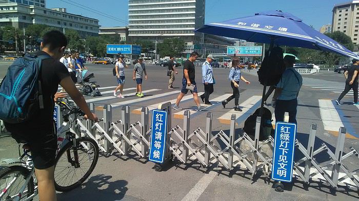
I found one at a rental shop near the hostel. The key is to quickly learn local traffic customs to minimize risks. Bike lanes are wide along the avenues.
But you still have to: - Watch out for anything parked on the bike paths—the most annoying are people napping or talking on the phone in their cars - Keep an eye on everything coming the wrong way—the list is long - The worst is right turns on red, which in Chinese traffic rules seem to have priority Once you get the hang of it, it’s fine. The city is huge but flat, so you can just wing it.
3- BEIJING By train to the far west Sunday, August 26 Beijing West Station is the size and operates like an airport. With your e-ticket from the agency, you first have to pick up your ticket at the special "English" counter, after passing through security. With your ticket in hand, you have to exit and enter through the boarding waiting area—not the platform—after a second security check.
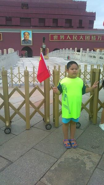 Then you find the right hall and wait for the sign to finally access the platform. In the end, it works pretty well given the incredible number of passengers to manage. Everywhere in Beijing, I saw that the Chinese have mastered crowd flow management.
Nice surprise: second-class carriages are clean, air-conditioned, and bright. Perfect, since I was in for 20 hours. One uniformed attendant per carriage, mobile meal service—luxury! Small downside: no luggage space. Hauling your suitcase up to the top bunk is quite a workout. I was in the middle, so it wasn’t too bad. The landscape, though, whether rural or urban, is pretty bleak. That should change once we leave the eastern plains.
Of course, I got my first police visit, with a thorough passport check and bag search. I was warned—going to the Chinese far west exposes you to this kind of hassle. But they were polite and respectful.
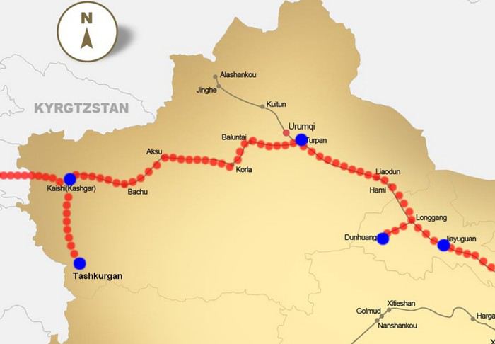 The Chinese Far West
4- JIAYUGUAN Getting by without English Monday, August 27 At the gates of two deserts (Gobi and Taklamakan) and at the foot of the Tibetan highlands, the Great Wall ends at Jiayuguan. Here, I found the deeper China I’d somewhat rediscovered during my bike ride, even if now everyone gets around on electric bikes and I’m no longer stared at like an alien.
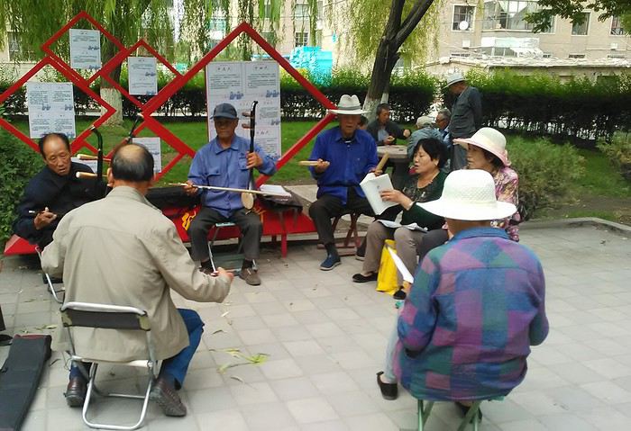
Prices are nothing like Beijing: you can find a full meal for 2 €, and my bike cost 7 € for two days. Plus, few people speak English—neither the owner of the HI hostel where I stayed, nor the ticket sellers at the sites, let alone the servers at the small eateries where I ate. Everything is written in Chinese. So I had to use the little Chinese I know to communicate about essentials. It makes the locals laugh to see a European trying to speak their language, but it earns respect. With Google Translate’s help, I managed.
Rant: With their avenues blocked for construction for kilometers without warning, and new roads not yet on maps, I must’ve taken 15 km of detours. More photos...
5- JIAYUGUAN Scams and heritage Tuesday, August 28 The Great Wall doesn’t exactly end at the fort I visited yesterday but 10 km further, at the entrance to a river gorge at the foot of the mountains. All that’s left is a badly damaged tower (more like a mound of earth) and a section of clay wall, similar to the one I biked yesterday.
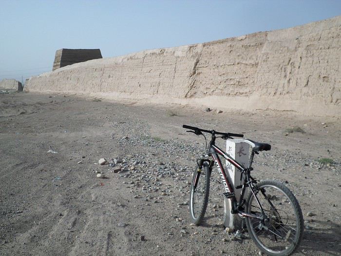
This morning, I hopped on my bike, determined to venture into the desert to see this highly symbolic site. First, you access it via a wide, brand-new road with not a soul in sight. Just before the site, I came across a grand welcome gate, very period-style, but it’s actually the inevitable toll booth.
Behind the gate, the road continues straight to the site, which you can see in the distance—at least 2 km away—the remains of the tower and wall. I had to leave my bike here. Fine. I went to the ticket counter and asked the price: 120 yuan! I couldn’t believe it—over 15 € for a simple mound of earth.
I showed my displeasure to the attendant, who couldn’t care less, and immediately turned back. 120 yuan—that’s the price for a new road, a fancy gate planted 2 km before the site just to force you to take a shuttle, and employees with nothing to do all day... Now I understand why I didn’t meet anyone!
Heritage China is a bit pricey Generally, sites are expensive for the country’s standard of living, but travelers are supposed to have money, so why hold back? I even gave up on the Forbidden City—reservations required days in advance (or on the black market at an impossible price). I prefer to keep the memory of my first visit, when entry must’ve cost a few dozen cents, and there were only a handful of visitors.
This morning, I took a taxi to see remarkable tombs of common people from the 3rd to 6th centuries. They’re small vaulted caves made of painted bricks, depicting scenes of daily life. Very pretty and moving. But even here, though the price was more reasonable, I was left wanting—only one of the 16 tombs is open to visitors, and it’s apparently not the most beautiful.
The authentic China—at least what’s left of it... Wandering the impersonal avenues of the city, you stumble upon a market. There, you still find traditional China—small shops with questionable hygiene, Go players, musicians, and even a dental prosthetist. The last refuge for those untouched by modernity. More photos...
6- DUNHUANG Abundance in the middle of the desert Wednesday, August 29 Well, I thought the landscape would be less bleak as I headed west. Nope. The only distraction in this expanse of dark, clayey sand is the forests of pylons and wind turbines, plus wild camels racing each other.
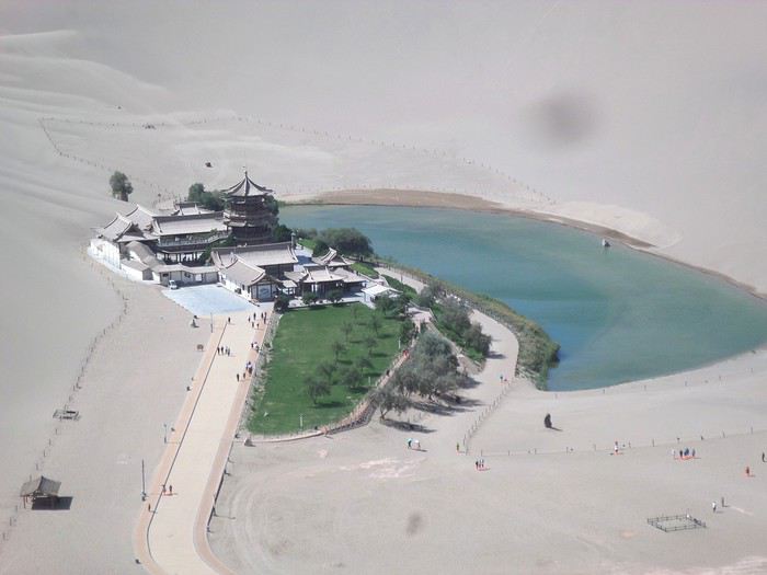 However, Dunhuang, the gateway to the Taklamakan, is by far the most pleasant Chinese city I know. There’s a real city center you can explore on foot. It’s hot but not unbearable, with a light, dry breeze. Much nicer than Beijing. The Han Chinese are still the majority, but the Muslim Uyghurs are more numerous, and the muezzin’s call to prayer echoes around the mosque.
The most surprising thing is the abundance and diversity of fruits and vegetables. You wonder how it all grows here. Well-irrigated, the desert sands are very fertile. Here, raisins have subtle, mysterious flavors, and the lamb really tastes like lamb.
Today, I visited the must-see Mingshashan, a dune complex next to which Pila is a molehill. The Basque Country, but covered in sand... More photos...
7- TURPAN The Uyghurs under heavy surveillance Friday, August 31 Surveillance cameras everywhere in the city, armed police stationed at intersections, in front of public buildings, at the entrance and inside tourist sites, police stations on every corner, patrols on foot or by car, khaki uniforms even for middle schoolers... here, the Han Chinese are in the minority, and you can feel it. Turpan feels like a city under siege.
To enter the youth hostel where I stayed, there’s even a security gate, and the receptionist (a Han, like everyone in tourism) wears a bulletproof vest! Reassuring. Still, you don’t feel particularly threatened here, especially as a European. The troublemakers are the Chinese, not the Uyghurs. Generally, China is a very safe country for visitors.
Smile, you’re on camera! I was biking on an avenue when the car in front of me got flashed for driving slowly. I quickly understood why when I got flashed too.
Here, the official time is Beijing time, but it gets dark two hours later. It’ll be even worse in Kashgar. Trickier to manage: everything is displayed in Chinese and Arabic. Nothing in English. Choosing a menu is a shot in the dark. Apart from a few young Chinese, no one here speaks English, and my Chinese doesn’t seem very understandable...
Mogao, the end of the road for the Han Yesterday, near Dunhuang, I went to Mogao, a complex of decorated caves with Buddha sculptures and paintings. Stunning, but so crowded! Luckily, here in Turpan, Chinese tourists barely venture out. So I visited a Silk Road ghost town with only a handful of other visitors and under a howling wind.
The modern Chinese city is swallowing up the old Uyghur neighborhoods—only a museum-like district remains in the center, and pockets of resistance on the outskirts are doomed to disappear soon. More photos...
8- KASHGAR A (relative) love at first sight for the old city Sunday, September 2 After three overnight trains, here I am in the far west of China, nearly 4,000 km from the capital. Despite the omnipresent police and an old city preserved UNESCO-style, Kashgar is my Chinese love at first sight.
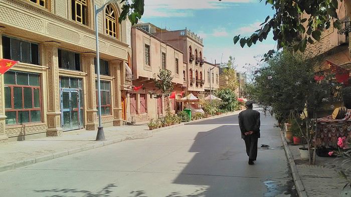
Finally, Chinese... well, sort of, because we’re in Uyghur territory here—a Turkic people with nothing culturally in common with the Han, the eastern Chinese. It started badly yesterday at Turfan station, where after three security gate passes, at least five passport checks, and a bag search, three adorable policewomen confiscated my antibacterial lotion because it had a flammable logo...
Then came the welcoming committee of armed cops at Kashgar station. Once all that was over, they left me alone—except you still have to go through security checks like everyone else to enter the old city, the bazaar, the livestock market... The further west you go, the more the siege mentality is evident. Luckily, the border isn’t far...
Despite the inevitable destruction-reconstruction, the city center has been well preserved. Thankfully, because it’s a very original style, a mix of local and colonial. I love it, even if it’s a bit too artificial, sanitized, and watered-down, and rather empty of residents. On the Silk Road, the city was famous for its great food. And it still is—rarely have I seen such richness and abundance of food! And not just scorpions or snakes. More photos...
9- KASHGAR China’s recipe for controlling the populace Saturday, September 1 Xinjiang, along with Tibet, is a "sensitive" area of rebellion in the eyes of Chinese authorities. As a result, the state has these regions and their populations under total control. Tourists also feel the consequences, even if they’re not at risk of re-education camps.
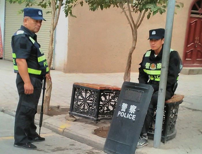 - Putting barbed wire and anti-ramming barriers around sensitive sites (schools, big hotels, government buildings...)
- Installing traffic surveillance gates with cameras and photo flashes (for all vehicles passing, including bikes) throughout the city and even in the countryside
- Posting uniformed guards with tasers, batons, or huge baseball bats every 100 meters
- Training the Han population (ethnic Chinese) in self-defense with sticks, preferably in the morning on the street. Men and women of all ages
- Starting school with the national anthem, doing military exercises, and receiving political indoctrination, all neatly lined up in the courtyard. (The dream school for any teacher)
- Placing a snitch in uniform (a pseudo-guard) in public gathering places, like youth hostels. Mine spends the day loafing around the courtyard
- Putting Chinese flags everywhere on the streets to remind everyone who’s in charge
- Installing security gates at every entrance to areas frequented by tourists (thanks for that) but not just there
- Never photographing cops, or else! I tried, but it’s not easy...
- Putting barbed wire and anti-ramming barriers around sensitive sites (schools, big hotels, government buildings...)
- Installing traffic surveillance gates with cameras and photo flashes (for all vehicles passing, including bikes) throughout the city and even in the countryside
- Posting uniformed guards with tasers, batons, or huge baseball bats every 100 meters
- Training the Han population (ethnic Chinese) in self-defense with sticks, preferably in the morning on the street. Men and women of all ages
- Starting school with the national anthem, doing military exercises, and receiving political indoctrination, all neatly lined up in the courtyard. (The dream school for any teacher)
- Placing a snitch in uniform (a pseudo-guard) in public gathering places, like youth hostels. Mine spends the day loafing around the courtyard
- Putting Chinese flags everywhere on the streets to remind everyone who’s in charge
- Installing security gates at every entrance to areas frequented by tourists (thanks for that) but not just there
- Never photographing cops, or else! I tried, but it’s not easy...
With all that, you can stroll around safely Not much crime! As for the amount the Chinese state spends to maintain such a system, it’s staggering! A third of the Han living in Xinjiang work in security. Today, I wandered freely around old Kashgar, which is quite large after all. More photos...
10- TASHKURGAN What on earth was I thinking going there! Wednesday, September 5 First, there’s the taxi—pretty crappy, with a driver who doesn’t speak a word of English and won’t stop smoking. Over six hours in that... shared with a completely out-of-it American.
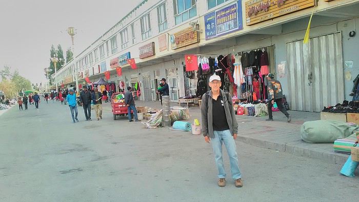
Then there are all the checkpoints along the way. I won’t go on—you know the drill by now.
After that, there’s Tashkurgan—a town with nothing to see, nothing to do. Deserted as soon as night falls. There’s this huge youth hostel and a few lost Chinese tapping away on their smartphones, chain-smoking. This lost American-European crowd, swapping tips on how to enter Pakistan or Tajikistan.
Luckily, there’s the Chinese Pamir Highway, lined with peaks over 7,000m. There’s the feeling of no longer being in China, with a population whose features are Middle Eastern. And these Tajik women with their stunning hairstyles and vibrant costumes. There’s the fact of having reached the westernmost Chinese city, far from crowds and tourist sites. A sort of end of the world. More photos...
11- KYRGYZ BORDER A surreal epic Thursday, September 6 The road from Kashgar to the Kyrgyzstan border is a little over 200 km and passes through beautiful landscapes of colorful, desert-like mountains with acrobatic folds. That’s the bucolic part of the trip.
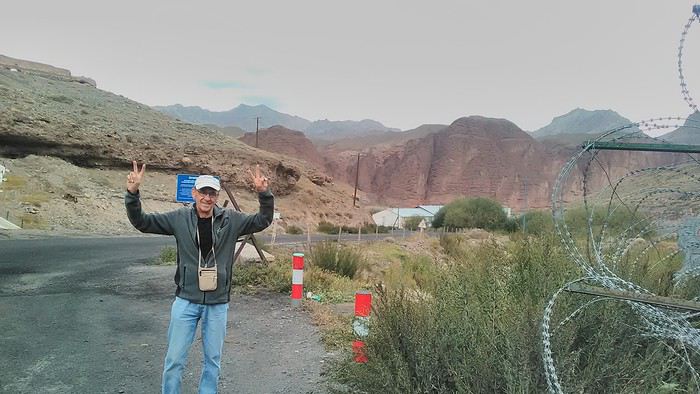 Yesterday, I managed to gather four people to rent a minibus to reach the border more easily: a Spaniard and an Argentine I’d already met in Turpan, and two New Zealanders who responded to the ad left at the hostel.
Absurdity and paranoia of Chinese authorities The highlight was crossing the town of Wuqia, 50 km past Kashgar. After tallying up with my fellow sufferers, we must’ve passed about ten checkpoints with: - Passport checks: 14 times, sometimes by two cops side by side - Bag checks: 4 times - Smartphone checks: 2 times, with deletion of "non-compliant" photos, and registration of your IMEI in the exit log!... Absurd and surreal at the same time, since my camera stayed in my bag, my apps are in French, and my photos have been online for ages...
With all that, we arrived just as the last checkpoint before the no man’s land marking the border between the two countries was on lunch break. And bam! Another 1.5-hour wait, alongside truckers who were much more used to this than we were.
What to think? The cops themselves aren’t fooled. They play the role they’re asked to, but sometimes you can coax a smile out of them—they realize how ridiculous the situation is.
What’s the point? That’s the big question my companions and I were tempted to answer with "to piss people off." To show you your place isn’t here, but with the other tourists, over there in the east, in Shanghai, Xi’an, or Guangzhou.
As for you, a traveler from a democratic country, you really experience this as aggression, humiliation, a violation of your private space. And yet, I’m respected, they speak to me properly. Today, I better understand what a Palestinian or a citizen of an occupied country might feel daily. A unique experience! Thanks, China.
And to top it off, the cherry on the cake! It’s still this glowing button you press to rate your passage after clearing the last obstacle before the exit stamp. I was so surprised it turned off before I could react. The Spaniard, with great humor and irony, had time to vote "excellent." In the end, he wasn’t wrong—you can hardly do better!
PS: I ditched my buddies at the border. They didn’t want to pay for a taxi to continue. So I took a direct taxi to Osh. The first 100 km are fabulous. I couldn’t take many photos, but I’ll be back on Monday to go to Tajikistan.
More photos...
The rest of the Silk Road, Part 2, in these travel journals: Kyrgyzstan, Tajikistan, Uzbekistan.
The Chinese Far West More than 30 years after my first trip to eastern China, I finally fulfilled an old dream: traveling solo from Beijing to the far west, discovering Xinjiang, the Uyghur people and the oppression they endure, the oases of Turpan and Kashgar, the Taklamakan Desert, the end of the Great Wall... The route was covered by train.
MENU PART 1: CHINA
1- Beijing (Jiankou) : the authentic Great Wall, without tourists 2- Cycling in Beijing, the best way to get around 3- Beijing : departure for the far west 4- Jiayuguan : getting by without English 5- Jiayuguan : scams and heritage 6- Dunhuang : abundance in the middle of the desert 7- Turpan : the Uyghurs under heavy surveillance 8- Kashgar : love at first sight for the old city 9- Kashgar : China’s recipe for controlling the populace 10- Tashkurgan : what on earth was I thinking going there! Kyrgyz border: a surreal epic Photo album from the 80s, contributions from other travelers (page 2)
1- JIANKOU Finding the authentic Great Wall, without tourists or a guide Friday, August 24, 2018 Thirty years later, I didn’t feel like revisiting the Great Wall at Badaling or any other overcrowded site. I chose to explore it at Jiankou, in its wildest, most authentic, and unrestored section, starting from a lost village deep in a valley—though it wasn’t *that* lost, since it had everything for communication.
No need to pay for a taxi to get there—by timing it right, you can take the bus for just a few yuan. You have to get off at Xizhazi, the bus terminus. Be careful, there are only two buses a day in each direction. At the Xizhazi bus stop, I met a young couple who’d arrived with zero information about what to expect. We hiked the three of us toward the restored section of Mutianyu.
Still, be cautious With GPS and a topographic map (OpenTopoMap), you can set off without a problem or guide. The trail up to Jiankou is easy and well-marked. The trails down are too. But be careful—once you’re on the Wall, it’s real mountain hiking, with easy but dangerous climbing sections (over sheer drops). Not for amateurs or those afraid of heights! But what a reward. The Wall all to yourself, where it’s at its most daring. Truly mesmerizing.
More photos...
2- BEIJING The best way to get around the capital Sunday, August 26 The best way to explore the city is still by bike. Most are in a bike-share system, but you need to use an app—WeChat, the app that does everything, like monitoring your every move. No way I was installing that.
I found one at a rental shop near the hostel. The key is to quickly learn local traffic customs to minimize risks. Bike lanes are wide along the avenues.
But you still have to: - Watch out for anything parked on the bike paths—the most annoying are people napping or talking on the phone in their cars - Keep an eye on everything coming the wrong way—the list is long - The worst is right turns on red, which in Chinese traffic rules seem to have priority Once you get the hang of it, it’s fine. The city is huge but flat, so you can just wing it.
3- BEIJING By train to the far west Sunday, August 26 Beijing West Station is the size and operates like an airport. With your e-ticket from the agency, you first have to pick up your ticket at the special "English" counter, after passing through security. With your ticket in hand, you have to exit and enter through the boarding waiting area—not the platform—after a second security check.
Then you find the right hall and wait for the sign to finally access the platform. In the end, it works pretty well given the incredible number of passengers to manage. Everywhere in Beijing, I saw that the Chinese have mastered crowd flow management.Nice surprise: second-class carriages are clean, air-conditioned, and bright. Perfect, since I was in for 20 hours. One uniformed attendant per carriage, mobile meal service—luxury! Small downside: no luggage space. Hauling your suitcase up to the top bunk is quite a workout. I was in the middle, so it wasn’t too bad. The landscape, though, whether rural or urban, is pretty bleak. That should change once we leave the eastern plains.
Of course, I got my first police visit, with a thorough passport check and bag search. I was warned—going to the Chinese far west exposes you to this kind of hassle. But they were polite and respectful.
The Chinese Far West4- JIAYUGUAN Getting by without English Monday, August 27 At the gates of two deserts (Gobi and Taklamakan) and at the foot of the Tibetan highlands, the Great Wall ends at Jiayuguan. Here, I found the deeper China I’d somewhat rediscovered during my bike ride, even if now everyone gets around on electric bikes and I’m no longer stared at like an alien.
Prices are nothing like Beijing: you can find a full meal for 2 €, and my bike cost 7 € for two days. Plus, few people speak English—neither the owner of the HI hostel where I stayed, nor the ticket sellers at the sites, let alone the servers at the small eateries where I ate. Everything is written in Chinese. So I had to use the little Chinese I know to communicate about essentials. It makes the locals laugh to see a European trying to speak their language, but it earns respect. With Google Translate’s help, I managed.
Rant: With their avenues blocked for construction for kilometers without warning, and new roads not yet on maps, I must’ve taken 15 km of detours. More photos...
5- JIAYUGUAN Scams and heritage Tuesday, August 28 The Great Wall doesn’t exactly end at the fort I visited yesterday but 10 km further, at the entrance to a river gorge at the foot of the mountains. All that’s left is a badly damaged tower (more like a mound of earth) and a section of clay wall, similar to the one I biked yesterday.
This morning, I hopped on my bike, determined to venture into the desert to see this highly symbolic site. First, you access it via a wide, brand-new road with not a soul in sight. Just before the site, I came across a grand welcome gate, very period-style, but it’s actually the inevitable toll booth.
Behind the gate, the road continues straight to the site, which you can see in the distance—at least 2 km away—the remains of the tower and wall. I had to leave my bike here. Fine. I went to the ticket counter and asked the price: 120 yuan! I couldn’t believe it—over 15 € for a simple mound of earth.
I showed my displeasure to the attendant, who couldn’t care less, and immediately turned back. 120 yuan—that’s the price for a new road, a fancy gate planted 2 km before the site just to force you to take a shuttle, and employees with nothing to do all day... Now I understand why I didn’t meet anyone!
Heritage China is a bit pricey Generally, sites are expensive for the country’s standard of living, but travelers are supposed to have money, so why hold back? I even gave up on the Forbidden City—reservations required days in advance (or on the black market at an impossible price). I prefer to keep the memory of my first visit, when entry must’ve cost a few dozen cents, and there were only a handful of visitors.
This morning, I took a taxi to see remarkable tombs of common people from the 3rd to 6th centuries. They’re small vaulted caves made of painted bricks, depicting scenes of daily life. Very pretty and moving. But even here, though the price was more reasonable, I was left wanting—only one of the 16 tombs is open to visitors, and it’s apparently not the most beautiful.
The authentic China—at least what’s left of it... Wandering the impersonal avenues of the city, you stumble upon a market. There, you still find traditional China—small shops with questionable hygiene, Go players, musicians, and even a dental prosthetist. The last refuge for those untouched by modernity. More photos...
6- DUNHUANG Abundance in the middle of the desert Wednesday, August 29 Well, I thought the landscape would be less bleak as I headed west. Nope. The only distraction in this expanse of dark, clayey sand is the forests of pylons and wind turbines, plus wild camels racing each other.
However, Dunhuang, the gateway to the Taklamakan, is by far the most pleasant Chinese city I know. There’s a real city center you can explore on foot. It’s hot but not unbearable, with a light, dry breeze. Much nicer than Beijing. The Han Chinese are still the majority, but the Muslim Uyghurs are more numerous, and the muezzin’s call to prayer echoes around the mosque.The most surprising thing is the abundance and diversity of fruits and vegetables. You wonder how it all grows here. Well-irrigated, the desert sands are very fertile. Here, raisins have subtle, mysterious flavors, and the lamb really tastes like lamb.
Today, I visited the must-see Mingshashan, a dune complex next to which Pila is a molehill. The Basque Country, but covered in sand... More photos...
7- TURPAN The Uyghurs under heavy surveillance Friday, August 31 Surveillance cameras everywhere in the city, armed police stationed at intersections, in front of public buildings, at the entrance and inside tourist sites, police stations on every corner, patrols on foot or by car, khaki uniforms even for middle schoolers... here, the Han Chinese are in the minority, and you can feel it. Turpan feels like a city under siege.
To enter the youth hostel where I stayed, there’s even a security gate, and the receptionist (a Han, like everyone in tourism) wears a bulletproof vest! Reassuring. Still, you don’t feel particularly threatened here, especially as a European. The troublemakers are the Chinese, not the Uyghurs. Generally, China is a very safe country for visitors.
Smile, you’re on camera! I was biking on an avenue when the car in front of me got flashed for driving slowly. I quickly understood why when I got flashed too.
Here, the official time is Beijing time, but it gets dark two hours later. It’ll be even worse in Kashgar. Trickier to manage: everything is displayed in Chinese and Arabic. Nothing in English. Choosing a menu is a shot in the dark. Apart from a few young Chinese, no one here speaks English, and my Chinese doesn’t seem very understandable...
Mogao, the end of the road for the Han Yesterday, near Dunhuang, I went to Mogao, a complex of decorated caves with Buddha sculptures and paintings. Stunning, but so crowded! Luckily, here in Turpan, Chinese tourists barely venture out. So I visited a Silk Road ghost town with only a handful of other visitors and under a howling wind.
The modern Chinese city is swallowing up the old Uyghur neighborhoods—only a museum-like district remains in the center, and pockets of resistance on the outskirts are doomed to disappear soon. More photos...
8- KASHGAR A (relative) love at first sight for the old city Sunday, September 2 After three overnight trains, here I am in the far west of China, nearly 4,000 km from the capital. Despite the omnipresent police and an old city preserved UNESCO-style, Kashgar is my Chinese love at first sight.
Finally, Chinese... well, sort of, because we’re in Uyghur territory here—a Turkic people with nothing culturally in common with the Han, the eastern Chinese. It started badly yesterday at Turfan station, where after three security gate passes, at least five passport checks, and a bag search, three adorable policewomen confiscated my antibacterial lotion because it had a flammable logo...
Then came the welcoming committee of armed cops at Kashgar station. Once all that was over, they left me alone—except you still have to go through security checks like everyone else to enter the old city, the bazaar, the livestock market... The further west you go, the more the siege mentality is evident. Luckily, the border isn’t far...
Despite the inevitable destruction-reconstruction, the city center has been well preserved. Thankfully, because it’s a very original style, a mix of local and colonial. I love it, even if it’s a bit too artificial, sanitized, and watered-down, and rather empty of residents. On the Silk Road, the city was famous for its great food. And it still is—rarely have I seen such richness and abundance of food! And not just scorpions or snakes. More photos...
9- KASHGAR China’s recipe for controlling the populace Saturday, September 1 Xinjiang, along with Tibet, is a "sensitive" area of rebellion in the eyes of Chinese authorities. As a result, the state has these regions and their populations under total control. Tourists also feel the consequences, even if they’re not at risk of re-education camps.
- Putting barbed wire and anti-ramming barriers around sensitive sites (schools, big hotels, government buildings...)
- Installing traffic surveillance gates with cameras and photo flashes (for all vehicles passing, including bikes) throughout the city and even in the countryside
- Posting uniformed guards with tasers, batons, or huge baseball bats every 100 meters
- Training the Han population (ethnic Chinese) in self-defense with sticks, preferably in the morning on the street. Men and women of all ages
- Starting school with the national anthem, doing military exercises, and receiving political indoctrination, all neatly lined up in the courtyard. (The dream school for any teacher)
- Placing a snitch in uniform (a pseudo-guard) in public gathering places, like youth hostels. Mine spends the day loafing around the courtyard
- Putting Chinese flags everywhere on the streets to remind everyone who’s in charge
- Installing security gates at every entrance to areas frequented by tourists (thanks for that) but not just there
- Never photographing cops, or else! I tried, but it’s not easy...With all that, you can stroll around safely Not much crime! As for the amount the Chinese state spends to maintain such a system, it’s staggering! A third of the Han living in Xinjiang work in security. Today, I wandered freely around old Kashgar, which is quite large after all. More photos...
10- TASHKURGAN What on earth was I thinking going there! Wednesday, September 5 First, there’s the taxi—pretty crappy, with a driver who doesn’t speak a word of English and won’t stop smoking. Over six hours in that... shared with a completely out-of-it American.
Then there are all the checkpoints along the way. I won’t go on—you know the drill by now.
After that, there’s Tashkurgan—a town with nothing to see, nothing to do. Deserted as soon as night falls. There’s this huge youth hostel and a few lost Chinese tapping away on their smartphones, chain-smoking. This lost American-European crowd, swapping tips on how to enter Pakistan or Tajikistan.
Luckily, there’s the Chinese Pamir Highway, lined with peaks over 7,000m. There’s the feeling of no longer being in China, with a population whose features are Middle Eastern. And these Tajik women with their stunning hairstyles and vibrant costumes. There’s the fact of having reached the westernmost Chinese city, far from crowds and tourist sites. A sort of end of the world. More photos...
11- KYRGYZ BORDER A surreal epic Thursday, September 6 The road from Kashgar to the Kyrgyzstan border is a little over 200 km and passes through beautiful landscapes of colorful, desert-like mountains with acrobatic folds. That’s the bucolic part of the trip.
Yesterday, I managed to gather four people to rent a minibus to reach the border more easily: a Spaniard and an Argentine I’d already met in Turpan, and two New Zealanders who responded to the ad left at the hostel.Absurdity and paranoia of Chinese authorities The highlight was crossing the town of Wuqia, 50 km past Kashgar. After tallying up with my fellow sufferers, we must’ve passed about ten checkpoints with: - Passport checks: 14 times, sometimes by two cops side by side - Bag checks: 4 times - Smartphone checks: 2 times, with deletion of "non-compliant" photos, and registration of your IMEI in the exit log!... Absurd and surreal at the same time, since my camera stayed in my bag, my apps are in French, and my photos have been online for ages...
With all that, we arrived just as the last checkpoint before the no man’s land marking the border between the two countries was on lunch break. And bam! Another 1.5-hour wait, alongside truckers who were much more used to this than we were.
What to think? The cops themselves aren’t fooled. They play the role they’re asked to, but sometimes you can coax a smile out of them—they realize how ridiculous the situation is.
What’s the point? That’s the big question my companions and I were tempted to answer with "to piss people off." To show you your place isn’t here, but with the other tourists, over there in the east, in Shanghai, Xi’an, or Guangzhou.
As for you, a traveler from a democratic country, you really experience this as aggression, humiliation, a violation of your private space. And yet, I’m respected, they speak to me properly. Today, I better understand what a Palestinian or a citizen of an occupied country might feel daily. A unique experience! Thanks, China.
And to top it off, the cherry on the cake! It’s still this glowing button you press to rate your passage after clearing the last obstacle before the exit stamp. I was so surprised it turned off before I could react. The Spaniard, with great humor and irony, had time to vote "excellent." In the end, he wasn’t wrong—you can hardly do better!
PS: I ditched my buddies at the border. They didn’t want to pay for a taxi to continue. So I took a direct taxi to Osh. The first 100 km are fabulous. I couldn’t take many photos, but I’ll be back on Monday to go to Tajikistan.
More photos...
The rest of the Silk Road, Part 2, in these travel journals: Kyrgyzstan, Tajikistan, Uzbekistan.
Compte rendu croisière aux Antilles sur Costa Favolosa janvier 2020 English translation pending
bonjour
Notre Itinéraire 25 janv départ de Pointe à Pitre 26 janv en mer 27 janv la Romana 28 janv Catalina (ile face à la Romana) 29 janv Tortola 30 janv St Martin 31 janv Martinique Fort de France 1 fev Pointe à pitre
Nous avions réservé début 2019 cette croisière pour deux personnes et nous avions comme à l’habitude acheté nos vols A/R séparément au départ de Roissy avec la compagnie Xl airways.🤪
Malheureusement la compagnie ayant fait faillite en novembre nous avons dû remplacer nos transferts vers la Guadeloupe avec la compagnie Corsair avec un départ de Orly.
Un inconvénient supplémentaire pour nous qui demeurons près de Lille, car nous avons un accès direct à l’aéroport Charles de gaule via le TGV. Étant donné l’horaire de départ de notre vol à Orly nous avons donc réservé une chambre à Ibis cœur de Paris.
Finalement nous sommes partis avec un couple d’amis ayant l’opportunité d’avoir une cabine sur le même bateau à un bon prix.😎
Nos transferts : Nous sommes partis donc le 21 janv en TGV de Lille vers Paris Charles de Gaulle et pensions prendre le RER B et l’Orlyval pour rejoindre Orly.
Mais en cette période de grève nous avons finalement opté pour le Bus Direct assurant la liaison CDG ligne 3 vers Orly, ce que nous n’avons pas regretté, car pas de bousculade et les valises posées une fois pour toutes dans le coffre du bus. 22€ l’aller mais 19€ si vous êtes 4 en payant au chauffeur.
Arrivé à Orly T4 , nous avons pris l’ascenseur de la passerelle qui nous conduisait directement vers l’ibis cœur de Paris.
Aucun problème d’enregistrement à notre arrivée pour nous, mais pour mes amis, la réceptionniste ne trouvant pas leur réservation sur internet, une erreur sur la date (21/2 au lieu de 21/1) les taxa de 50% du prix de la chambre. Pas très commercial comme accueil surtout qu’il restait bien des chambres de libres.🤪
Nous passerons l’après-midi dans cet hôtel, et prendrons l’apéro au bar en attendant le dîner de 19H. La chambre bien insonorisée malgré la proximité de l’aéroport est confortable, la literie aussi. Le choix des repas est assez limité, c’est un hôtel de transit, les plats sont corrects le service à table efficace si vous ne prenez pas les formules buffets, malgré tout il y a pas mal de monde et trouver une place pour 4 c’est laborieux.
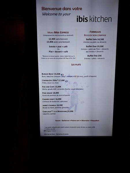
Une bonne nuit et nous prendrons notre petit-déjeuner vers 7H compris dans notre réservation , que nos amis devront eux repayer, leur réservation ayant été annulée.🤪
Nous reprendrons la grande passerelle couverte vers le terminal 4 juste en face pour déposer nos bagages pour le vol Corsair.
Notre enregistrement ayant déjà été fait la veille sur internet, il nous manquait seulement les porte étiquettes pour les valises, afin de glisser dedans nos feuilles comportant le code-barres relatif à notre vol vers Pointe à pitre. Une hôtesse Corsair devant les caisses d’enregistrement automatique nous donna les porte étiquettes plastifiés afin de déposer les valises sur le tapis d’enregistrement vite fait bien fait.
Notre vol a eu quand même une petite heure de retard au décollage mais nous étions déjà assis dans l’avion et pouvions profiter des écrans et films vidéo (j’ai donc prévenu notre taxi Ruddy à Pointe à pitre de notre probable retard).
Retard final de 15mn à l’atterrissage avec un vol très correct, nous étions assis derrière l’espace central où sont distribuées les boissons. J’en profitais pour demander s’il était possible d’avoir le seul « kit apéro payant » avant le repas que nous avons eu tout loisir de déguster.😉
Le plateau est correct, poulet ou poisson, servit avec du vin ou de la bière ou des sodas et de l’eau. Les boissons au repas sont incluses dans le prix du billet, un plus par rapport à XLairways où tout était payant sauf l’eau.
à suivre
Notre Itinéraire 25 janv départ de Pointe à Pitre 26 janv en mer 27 janv la Romana 28 janv Catalina (ile face à la Romana) 29 janv Tortola 30 janv St Martin 31 janv Martinique Fort de France 1 fev Pointe à pitre
Nous avions réservé début 2019 cette croisière pour deux personnes et nous avions comme à l’habitude acheté nos vols A/R séparément au départ de Roissy avec la compagnie Xl airways.🤪
Malheureusement la compagnie ayant fait faillite en novembre nous avons dû remplacer nos transferts vers la Guadeloupe avec la compagnie Corsair avec un départ de Orly.
Un inconvénient supplémentaire pour nous qui demeurons près de Lille, car nous avons un accès direct à l’aéroport Charles de gaule via le TGV. Étant donné l’horaire de départ de notre vol à Orly nous avons donc réservé une chambre à Ibis cœur de Paris.
Finalement nous sommes partis avec un couple d’amis ayant l’opportunité d’avoir une cabine sur le même bateau à un bon prix.😎
Nos transferts : Nous sommes partis donc le 21 janv en TGV de Lille vers Paris Charles de Gaulle et pensions prendre le RER B et l’Orlyval pour rejoindre Orly.
Mais en cette période de grève nous avons finalement opté pour le Bus Direct assurant la liaison CDG ligne 3 vers Orly, ce que nous n’avons pas regretté, car pas de bousculade et les valises posées une fois pour toutes dans le coffre du bus. 22€ l’aller mais 19€ si vous êtes 4 en payant au chauffeur.
Arrivé à Orly T4 , nous avons pris l’ascenseur de la passerelle qui nous conduisait directement vers l’ibis cœur de Paris.
Aucun problème d’enregistrement à notre arrivée pour nous, mais pour mes amis, la réceptionniste ne trouvant pas leur réservation sur internet, une erreur sur la date (21/2 au lieu de 21/1) les taxa de 50% du prix de la chambre. Pas très commercial comme accueil surtout qu’il restait bien des chambres de libres.🤪
Nous passerons l’après-midi dans cet hôtel, et prendrons l’apéro au bar en attendant le dîner de 19H. La chambre bien insonorisée malgré la proximité de l’aéroport est confortable, la literie aussi. Le choix des repas est assez limité, c’est un hôtel de transit, les plats sont corrects le service à table efficace si vous ne prenez pas les formules buffets, malgré tout il y a pas mal de monde et trouver une place pour 4 c’est laborieux.
Une bonne nuit et nous prendrons notre petit-déjeuner vers 7H compris dans notre réservation , que nos amis devront eux repayer, leur réservation ayant été annulée.🤪
Nous reprendrons la grande passerelle couverte vers le terminal 4 juste en face pour déposer nos bagages pour le vol Corsair.
Notre enregistrement ayant déjà été fait la veille sur internet, il nous manquait seulement les porte étiquettes pour les valises, afin de glisser dedans nos feuilles comportant le code-barres relatif à notre vol vers Pointe à pitre. Une hôtesse Corsair devant les caisses d’enregistrement automatique nous donna les porte étiquettes plastifiés afin de déposer les valises sur le tapis d’enregistrement vite fait bien fait.
Notre vol a eu quand même une petite heure de retard au décollage mais nous étions déjà assis dans l’avion et pouvions profiter des écrans et films vidéo (j’ai donc prévenu notre taxi Ruddy à Pointe à pitre de notre probable retard).
Retard final de 15mn à l’atterrissage avec un vol très correct, nous étions assis derrière l’espace central où sont distribuées les boissons. J’en profitais pour demander s’il était possible d’avoir le seul « kit apéro payant » avant le repas que nous avons eu tout loisir de déguster.😉
Le plateau est correct, poulet ou poisson, servit avec du vin ou de la bière ou des sodas et de l’eau. Les boissons au repas sont incluses dans le prix du billet, un plus par rapport à XLairways où tout était payant sauf l’eau.
à suivre
Petit compte rendu de 19 jours à Cuba en janvier English translation pending
Bonjour à tous,
Je reviens de 19 jours à Cuba, voici un rapide compte rendu :
J'ai 66 ans, je suis une femme et je voyage en solo. Je parle un peu espagnol.
Vol Iberia Bordeaux- La Havane via Madrid sans problème.
Hébergement : Tous mes hébergements avaient été réservés sur Airbnb, je sais que ça crée polémique, mais quand on n'est plus trop jeune en voyage solo, on devient moins aventureuse et les commissions du site ne sont pas plus importantes que celles prises par les propriétaires de Casa qui font jouer leur réseau. Evidemment, cela ôte la possibilité d'improviser. Chacun fera son choix. Toutes les casas étaient très conformes aux annonces, aucune mauvaise surprise, j'étais attendue. J'avais pris soin de confirmer mon arrivée une quinzaine de jours avant depuis la France, puis la veille de mon arrivée pour chaque Casa.
Transports : J'ai utilisé les bus Viazul, la plupart des trajets ayant été réservés en ligne avant mon départ. Là encore, aucun problème. En arrivant une heure avant à la station, j'ai obtenu mon billet et même à Playa Larga où il n'y a pas de bureau, le eticket et la confirmation de paiement ont suffi pour monter dans le bus. Comme souvent dit par d'autres membres, les bus sont souvent pleins et il est prudent de réserver sa place deux ou trois jours avant. Bus très ponctuels même si un peu vétustes. Un trajet en collectivo entre Habana et Varadero, payé 20 CUC. On peut sans doute obtenir meilleur tarif, j'ai eu le sentiment de n'avoir pas été très efficace sur ce coup là ;-)))
Itinéraire : j'avais délibérément décidé de prendre mon temps et de m'offrir pas mal de parenthèses plage
Habana 3 nuits: Casa Maria Elena, Centro Habana à 5 minutes de marche du Capitol. Grande chambre, mais mais avec seulement des fenêtres intérieures, bon petit déjeuner et hôte très agréable. 18 CUC/nuit Varadero 3 nuits : Casa La Collina. Grande chambre, le meilleur petit déjeuner de mon séjour et des hôtes Gladys et son père adorables. Bien située. a l'ouest de la zone hôtelière. Juste la rue à traverser pour aller à la plage. 28 CUC/nuit Playa Larga 3 nuits : Casa Amenecer in Bahia. Un peu excentrée donc j'y ai pris tous mes dîners. Hôte adorable, repas très copieux et bon marché. Chambre de plain pied quasiment sur la plage. Prêt de vélos possible. 28 CUC/nuit Trinidad 3 nuits : Casa Hostal El Pedregal. Jolie chambre, situation parfaite à 3 minutes de Plaza Mayor et Casa de la Musica. Terrasse dominant la ville pour le petit déjeuner. 25 CUC/nuit La Boca-Playa Ancon 3 nuits : ma meilleure casa. Très jolie chambre, vue sur mer. Terrasse face à la mer et très joli jardin. Dîner et petit déjeuner excellents et TRES copieux. 30 CUC/nuit Cienfuegos 2 nuits : casa Hostal Navarro, très centrale, chambre immense + une cuisine attenante hôte très accueillant et petit déjeuner à la carte avec choix des ingrédients. 17 CUC/nuit Habana 2 nuits : Retour chez Maria Elena avec plaisir.
Budget : Espèces : Je suis partie avec seulement 220€ en espèces, changés à l'aéroport, j'ai retiré en plus 370 CUC dans des ATM avec carte Master Card. Sachant que toutes mes casas sauf une étaient payées avant le départ et mes trajets Viazul aussi. Donc :
Billet d'avion : 540 € Casas sur Airbnb : 420 € Bus Viazul : 50 € Sur place : 550 € nourriture, taxis divers (aréroport-centro Habana 25CUC x 2) mojitos ;-)))) -- TOTAL 1565 €
Mes impressions générales :
Voyage très agréable, Cubains charmants, aucun sentiment d'insécurité pour une femme seule.
Habana : mérite 4 ou 5 jours. Beaucoup de galeries d'art cubain dans Habana Vieja. Ville très contrastée entre la vitrine (Habana Vieja) et le reste... Varadero : cela reste une très belle plage si on ne va pas dans la zone hôtelière, mer turquoise et très transparente. Playa Larga : une jolie petite plage où il n'y a rien à faire mais c'était le but ! Mer un peu trouble et pas mal de vent. Trinidad : certes beaucoup de monde, mais ce n'est pas sans raison. Une ville unique et très festive. La Boca : plage pas très jolie mais petit village de pêcheurs agéable et reposant à 5 km de Trinidad. Playa Ancon, jolie plage mais pas de casa, seulement des hôtels et des touristes enduits d'huile solaire... Cienfuegos : très jolie ville coloniale.
Argent : Changer quelques CUC en CUP (tant que les deux existent) , J'avais changé 10 CUC. Utile pour des petits achats dans la rue mais m'ont surtout servis à faire l'appoint car les taxis ou bicytaxis en particulier, n'ont pas souvent la monnaie. Donc toujours "craquer" au plus vite le moindre billet même de 5 CUC. Les taxis ont une sacrée tendance à gonfler les prix, négociez !
Voilà, bon voyage à ceux qui partent !
Vol Iberia Bordeaux- La Havane via Madrid sans problème.
Hébergement : Tous mes hébergements avaient été réservés sur Airbnb, je sais que ça crée polémique, mais quand on n'est plus trop jeune en voyage solo, on devient moins aventureuse et les commissions du site ne sont pas plus importantes que celles prises par les propriétaires de Casa qui font jouer leur réseau. Evidemment, cela ôte la possibilité d'improviser. Chacun fera son choix. Toutes les casas étaient très conformes aux annonces, aucune mauvaise surprise, j'étais attendue. J'avais pris soin de confirmer mon arrivée une quinzaine de jours avant depuis la France, puis la veille de mon arrivée pour chaque Casa.
Transports : J'ai utilisé les bus Viazul, la plupart des trajets ayant été réservés en ligne avant mon départ. Là encore, aucun problème. En arrivant une heure avant à la station, j'ai obtenu mon billet et même à Playa Larga où il n'y a pas de bureau, le eticket et la confirmation de paiement ont suffi pour monter dans le bus. Comme souvent dit par d'autres membres, les bus sont souvent pleins et il est prudent de réserver sa place deux ou trois jours avant. Bus très ponctuels même si un peu vétustes. Un trajet en collectivo entre Habana et Varadero, payé 20 CUC. On peut sans doute obtenir meilleur tarif, j'ai eu le sentiment de n'avoir pas été très efficace sur ce coup là ;-)))
Itinéraire : j'avais délibérément décidé de prendre mon temps et de m'offrir pas mal de parenthèses plage
Habana 3 nuits: Casa Maria Elena, Centro Habana à 5 minutes de marche du Capitol. Grande chambre, mais mais avec seulement des fenêtres intérieures, bon petit déjeuner et hôte très agréable. 18 CUC/nuit Varadero 3 nuits : Casa La Collina. Grande chambre, le meilleur petit déjeuner de mon séjour et des hôtes Gladys et son père adorables. Bien située. a l'ouest de la zone hôtelière. Juste la rue à traverser pour aller à la plage. 28 CUC/nuit Playa Larga 3 nuits : Casa Amenecer in Bahia. Un peu excentrée donc j'y ai pris tous mes dîners. Hôte adorable, repas très copieux et bon marché. Chambre de plain pied quasiment sur la plage. Prêt de vélos possible. 28 CUC/nuit Trinidad 3 nuits : Casa Hostal El Pedregal. Jolie chambre, situation parfaite à 3 minutes de Plaza Mayor et Casa de la Musica. Terrasse dominant la ville pour le petit déjeuner. 25 CUC/nuit La Boca-Playa Ancon 3 nuits : ma meilleure casa. Très jolie chambre, vue sur mer. Terrasse face à la mer et très joli jardin. Dîner et petit déjeuner excellents et TRES copieux. 30 CUC/nuit Cienfuegos 2 nuits : casa Hostal Navarro, très centrale, chambre immense + une cuisine attenante hôte très accueillant et petit déjeuner à la carte avec choix des ingrédients. 17 CUC/nuit Habana 2 nuits : Retour chez Maria Elena avec plaisir.
Budget : Espèces : Je suis partie avec seulement 220€ en espèces, changés à l'aéroport, j'ai retiré en plus 370 CUC dans des ATM avec carte Master Card. Sachant que toutes mes casas sauf une étaient payées avant le départ et mes trajets Viazul aussi. Donc :
Billet d'avion : 540 € Casas sur Airbnb : 420 € Bus Viazul : 50 € Sur place : 550 € nourriture, taxis divers (aréroport-centro Habana 25CUC x 2) mojitos ;-)))) -- TOTAL 1565 €
Mes impressions générales :
Voyage très agréable, Cubains charmants, aucun sentiment d'insécurité pour une femme seule.
Habana : mérite 4 ou 5 jours. Beaucoup de galeries d'art cubain dans Habana Vieja. Ville très contrastée entre la vitrine (Habana Vieja) et le reste... Varadero : cela reste une très belle plage si on ne va pas dans la zone hôtelière, mer turquoise et très transparente. Playa Larga : une jolie petite plage où il n'y a rien à faire mais c'était le but ! Mer un peu trouble et pas mal de vent. Trinidad : certes beaucoup de monde, mais ce n'est pas sans raison. Une ville unique et très festive. La Boca : plage pas très jolie mais petit village de pêcheurs agéable et reposant à 5 km de Trinidad. Playa Ancon, jolie plage mais pas de casa, seulement des hôtels et des touristes enduits d'huile solaire... Cienfuegos : très jolie ville coloniale.
Argent : Changer quelques CUC en CUP (tant que les deux existent) , J'avais changé 10 CUC. Utile pour des petits achats dans la rue mais m'ont surtout servis à faire l'appoint car les taxis ou bicytaxis en particulier, n'ont pas souvent la monnaie. Donc toujours "craquer" au plus vite le moindre billet même de 5 CUC. Les taxis ont une sacrée tendance à gonfler les prix, négociez !
Voilà, bon voyage à ceux qui partent !
Oman, le pays des Mille et Une Merveilles English translation pending
Qui n’a jamais eu envie de vivre les aventures de Sindbad le marin, qui n’a jamais rêvé de Shéhérazade lors de ses lectures des contes Les Mille et Une Nuits? Ou encore de la reine de Saba...
Eh bien! En parcourant le Sultanat d’Oman, nous allons à leur recherche ou plutôt découvrir ce pays des Mille et Une Merveilles décrites dans les célèbres contes persans dont a fait partie l’actuel Sultanat.
Voici l’itinéraire prévu pour ces deux semaines :
21/12 Lyon – Mascate 22/12 Mascate 23/12 Mascate – Wadi Tiwi 24/12 Wadi Shab – Sour 25/12 Ras Al Jinz – Wadi Bani Kalid 26/12 Wahiba Sands 27/12 Sugar Dunes – Sanctuaire Oryx 28/12 Mirbat 29/12 Wadi Darbat – Salalah 30/12 Mughsayl – Rakyut 31/12 Rub Al Khali - Haima 01/01 Jabreen - Nizwa 02/01 Tanuf - Bahla – Jebel Shams 03/01 Jebel Shams – Al Hamra - Misfat 04/01 Bilad Sayt – Wadi Bani Awf – Mascate 05/01 Mascate - Lyon
Montagnes, Wadis, déserts et plages, chacun y trouvera son bonheur. Voici un petit aperçu de ce qui vous attend.
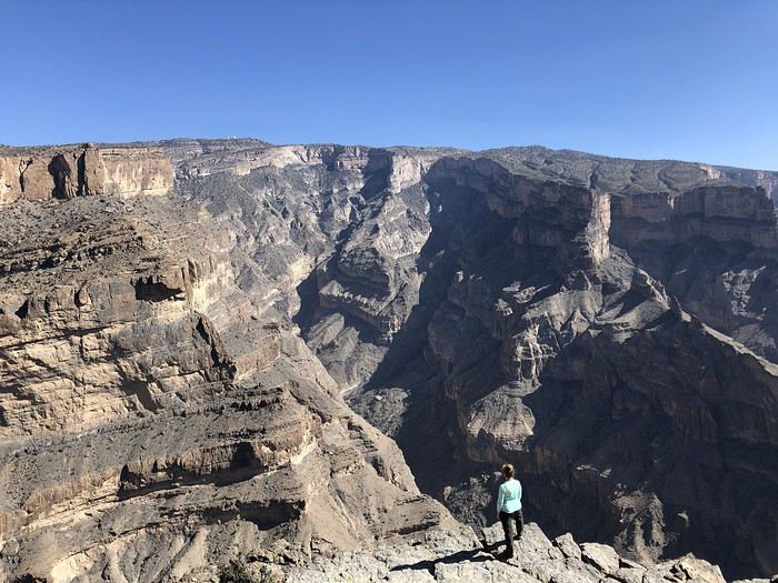
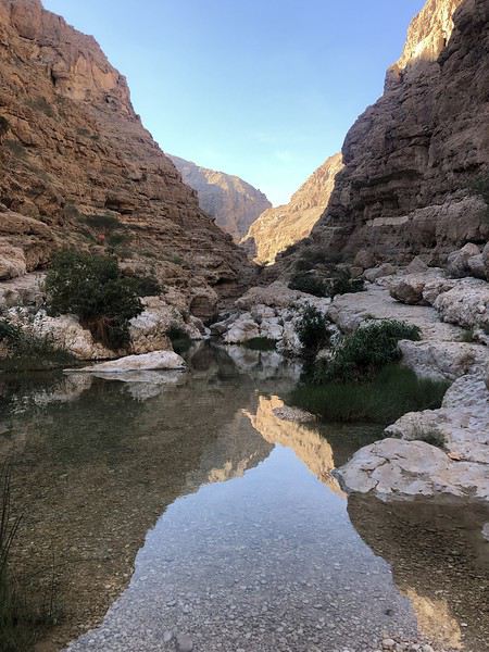
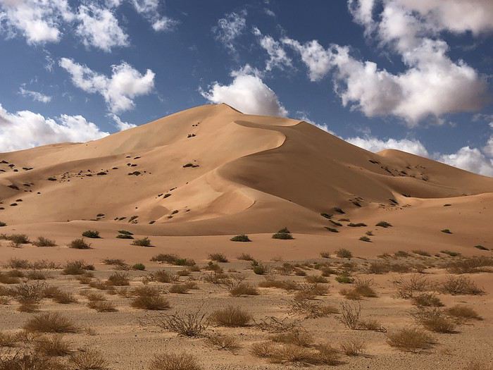
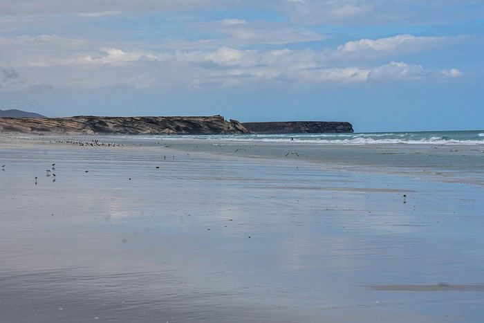
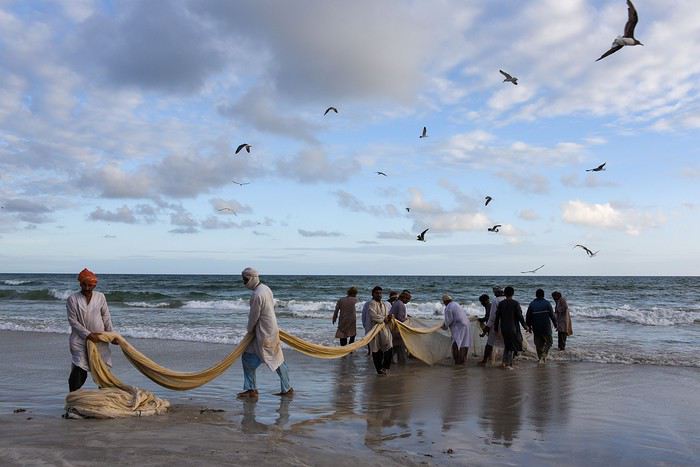
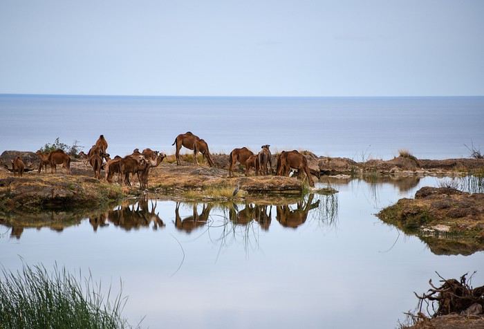
Alors si vous voulez bien me suivre...
Eh bien! En parcourant le Sultanat d’Oman, nous allons à leur recherche ou plutôt découvrir ce pays des Mille et Une Merveilles décrites dans les célèbres contes persans dont a fait partie l’actuel Sultanat.
Voici l’itinéraire prévu pour ces deux semaines :
21/12 Lyon – Mascate 22/12 Mascate 23/12 Mascate – Wadi Tiwi 24/12 Wadi Shab – Sour 25/12 Ras Al Jinz – Wadi Bani Kalid 26/12 Wahiba Sands 27/12 Sugar Dunes – Sanctuaire Oryx 28/12 Mirbat 29/12 Wadi Darbat – Salalah 30/12 Mughsayl – Rakyut 31/12 Rub Al Khali - Haima 01/01 Jabreen - Nizwa 02/01 Tanuf - Bahla – Jebel Shams 03/01 Jebel Shams – Al Hamra - Misfat 04/01 Bilad Sayt – Wadi Bani Awf – Mascate 05/01 Mascate - Lyon
Montagnes, Wadis, déserts et plages, chacun y trouvera son bonheur. Voici un petit aperçu de ce qui vous attend.
Alors si vous voulez bien me suivre...
Puglia in August (Locorontondo)
Hi there,
We’re heading to Puglia from July 30 to August 31, 2020. I’ve booked a rental with a pool in Locorontondo.
But the more I read guides and forums, the more I regret booking the flight to Bari. I can still cancel the other reservations, but I’d face penalties for the flight.
It’s packed, avoid August at all costs—traffic jams, stifling heat, price hikes… I’m really having second thoughts. Our goal isn’t necessarily to hit the beach. I’m thinking we’ll get up early to go where we want and head back during the hottest part of the day.
Is it *that* bad? Thanks for sharing your experiences.
We’re heading to Puglia from July 30 to August 31, 2020. I’ve booked a rental with a pool in Locorontondo.
But the more I read guides and forums, the more I regret booking the flight to Bari. I can still cancel the other reservations, but I’d face penalties for the flight.
It’s packed, avoid August at all costs—traffic jams, stifling heat, price hikes… I’m really having second thoughts. Our goal isn’t necessarily to hit the beach. I’m thinking we’ll get up early to go where we want and head back during the hottest part of the day.
Is it *that* bad? Thanks for sharing your experiences.
Brelan d'as dans les Stans: Kirghizistan, Tadjikistan et Ouzbekistan English translation pending
Hello tous,
C'est avec plaisir que je vous fait partager notre voyage de l'été 2019 dans les pays en stan.🙂
La version complète est ici, elle se construit au même rythme que je fais paraitre mes posts
GENESE Mais quelle idée d’aller dans les stan ! En fait, à l’origine cela devait être le Ladakh (joliment raconté par Diamina et Ticapi que je salue). Mais la crainte de ne pas arriver à tenir sur des treks de longues durées et le fait de ne pas pouvoir conduire moi-même m’ont incité à chercher une alternative. C’est là que Marie(Mlefevre) a eu le bon goût de publier un carnet sur le Kirghizistan et Perju de relater son voyage dans les stans, les deux en self drive …. C’est bon on tient notre destination 2019 ! Au niveau pays, ambiance, c’est d‘abord le corridor de Wakham et le Pamir qui m’ont séduit et ce sera le « centre » du voyage. En revanche je n’ai pas trouvé grand-chose au niveau véhicule de location au Tadjikistan. Comme ce voyage se faisait avec des amis de longues dates (avec qui on a déjà sillonné la Bolivie et le nord-ouest de la Namibie) j’ai trouvé intéressant d’y adjoindre un petit bout de Kirghizistan qui leur permettait de voir un autre type de paysage et en plus il est beaucoup plus facile de louer un véhicule à Bishkek. Lorsque ma chère et tendre a vu que nous n’étions pas loin de Samarcande (qu’on avait admiré en 2007) elle a souhaité y retourner. Du coup cela nous a fait un voyage avec 3 ambiances différentes, ce qui est génial pour nous. Niveau durée il a fallu rajouter un petit bout aux 3 semaines initialement prévues pour arriver à tout faire tenir.

PREPARATION
A partir de là j’ai commencé à construire notre parcours. En parallèle j’ai fait des recherches (et demandes) pour le véhicule. Au final, j’ai retenu une agence Ouzbek francophone qui a tout de suite compris nos problématiques d’Européens (véhicule récent, avec matériel de camping, avec les différents transferts et qui prend en charge les quelques réservations d’hôtels, guides, etc, ..). Le véhicule sera donc un Toyota Prado de 2012. La compagnie aérienne sera Turkish Airline qui dessert très bien les pays en Stan (même un vol Samarcande - Istanbul) Visas: pour le Kirghizistan il est délivré directement à l'aéroport, en revanche pour le Tadjikistan il faut le demander à l'avance. ATTENTION, le Pamir nécessite un permis particulier (comme c'est une région semi-autonome), il faut le demander en même temps que le visa en cochant la case permit GBAO (région autonome duHaut-Badakhchan).
OUTILS Comme c'est une destination encore peu couru en self drive je vais développer un peu plus que d'hab. Au niveau guide papier: Je n'ai pas mis de "S" car il n’y en a eu quasiment qu’un, mais qui pour le coup est parfait pour qui veut voyager comme nous : le nouveau guide de Cecile Miramont et Laurent Bendel : KIRGHIZISTAN TADJIKISTAN, qui a été écrit à destination des self-drivers et qui propose différents itinéraires commentés. Mon conseil, après le voyage : le guide n’enjolive pas les choses et s’adresse plutôt aux personnes ayant déjà des notions de « off road » ou de voyage « solitaire », donc quand ils écrivent "difficile" ça l’est vraiment, même "moyen" c’est déjà costaud. Par forcément au niveau difficulté de la piste elle-même mais par la dangerosité liée à la solitude, le peu de traces et le risque de croiser des gués plus ou moins remplis. Au niveau carte: il y en a une très belle et complète pour le Pamir, il s'agit de celle de Markus Hauser édité par Gekco Maps.
Comme je suis très GPS j'ai fait pas mal de recherches. Pour Garmin je n'ai pas été plus séduit que ça. Du coup je me suis penché sur les applications Android. Je connaissais déjà MAPS.ME qui est très bien mais sans courbe de niveaux, j'ai donc aussi testé GAIA, OSMAND, TERRA MAP et SOVIET MILITARY MAPS. Cette dernière est celle qui offre le plus de possibilités de cartographie plus ou moins détaillée, dont les fameuses cartes militaires Russes ultra détaillées. Mais au final c'est OSMAND que j'ai utilisé le plus pendant le voyage, je pense même que cette application remplacera GARMIN dans mon véhicule. MAPS.ME est très bien, mais au niveau topographie elle est un cran en dessous et je l'ai trouvé moins pratique pour gérer les itinéraires. Ce qui est dommage, c'est que toutes ces applications n'ont pas leur pendant sur PC, ce qui aurait été pratique pour préparer le voyage. Du coup je fais tout sur Mapsource et je transfers ensuite les waypoints sur les applications. J'ai aussi utilisé une application où les voyageurs indiquent les lieux de bivouac (ou autre) qui leur ont plu. Il s'agit de IOVERLANDER, très bonne application également. Dernier outil et non des moindres: les CBT, ce sont les offices de tourisme version Kirghize, il y en a dans les principales villes touristiques. Ils sont du grande aide et ont bien souvent un site internet, par exemple sur celui de Nryn on peut acheter, à l'avance, les permis pour la zone frontalière. Ils peuvent aussi vous indiquer des randonnées, en organiser avec des guides, gérer les hébergements, ... Pour le Pamir vous avez l'équivalent qui se nomme PECTA, nous y achèterons les permis pour circuler dans le parc de Zorgul. Il y a aussi le site visitpamirs.com qui regroupe un certain nombre d'informations.
RAVITAILLEMENT et EQUIPEMENT : au Kirghizistan aucun problème, en revanche au Tadjikistan c’est une autre histoire, sur les hauts plateaux très peu de choses disponibles, mais comme on s’y attendait on avait amené des « sachets de graines ». Au niveau vestimentaire il faut de quoi résister au froid (polaire, doudoune, bonnet) mais sans que ce soit extrême non plus (je crois que nous n'avons jamais eu des températures négatives). EN revanche pour la nuit vaut mieux avoir de bon duvets, il a fait entre 0° et 15° suivant l'altitude et la localisation.
Compagnie Turkish Airline qui dessert très bien les pays en Stan (même un vol Samarcande - Istanbul)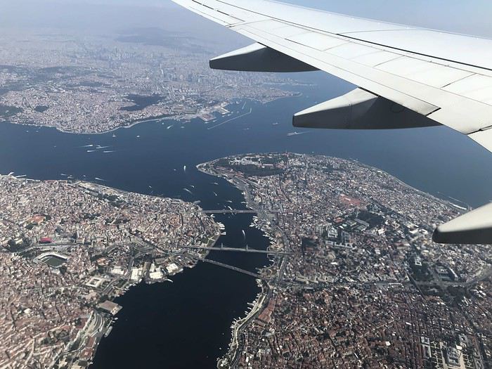
GENESE Mais quelle idée d’aller dans les stan ! En fait, à l’origine cela devait être le Ladakh (joliment raconté par Diamina et Ticapi que je salue). Mais la crainte de ne pas arriver à tenir sur des treks de longues durées et le fait de ne pas pouvoir conduire moi-même m’ont incité à chercher une alternative. C’est là que Marie(Mlefevre) a eu le bon goût de publier un carnet sur le Kirghizistan et Perju de relater son voyage dans les stans, les deux en self drive …. C’est bon on tient notre destination 2019 ! Au niveau pays, ambiance, c’est d‘abord le corridor de Wakham et le Pamir qui m’ont séduit et ce sera le « centre » du voyage. En revanche je n’ai pas trouvé grand-chose au niveau véhicule de location au Tadjikistan. Comme ce voyage se faisait avec des amis de longues dates (avec qui on a déjà sillonné la Bolivie et le nord-ouest de la Namibie) j’ai trouvé intéressant d’y adjoindre un petit bout de Kirghizistan qui leur permettait de voir un autre type de paysage et en plus il est beaucoup plus facile de louer un véhicule à Bishkek. Lorsque ma chère et tendre a vu que nous n’étions pas loin de Samarcande (qu’on avait admiré en 2007) elle a souhaité y retourner. Du coup cela nous a fait un voyage avec 3 ambiances différentes, ce qui est génial pour nous. Niveau durée il a fallu rajouter un petit bout aux 3 semaines initialement prévues pour arriver à tout faire tenir.
PREPARATION
A partir de là j’ai commencé à construire notre parcours. En parallèle j’ai fait des recherches (et demandes) pour le véhicule. Au final, j’ai retenu une agence Ouzbek francophone qui a tout de suite compris nos problématiques d’Européens (véhicule récent, avec matériel de camping, avec les différents transferts et qui prend en charge les quelques réservations d’hôtels, guides, etc, ..). Le véhicule sera donc un Toyota Prado de 2012. La compagnie aérienne sera Turkish Airline qui dessert très bien les pays en Stan (même un vol Samarcande - Istanbul) Visas: pour le Kirghizistan il est délivré directement à l'aéroport, en revanche pour le Tadjikistan il faut le demander à l'avance. ATTENTION, le Pamir nécessite un permis particulier (comme c'est une région semi-autonome), il faut le demander en même temps que le visa en cochant la case permit GBAO (région autonome duHaut-Badakhchan).
OUTILS Comme c'est une destination encore peu couru en self drive je vais développer un peu plus que d'hab. Au niveau guide papier: Je n'ai pas mis de "S" car il n’y en a eu quasiment qu’un, mais qui pour le coup est parfait pour qui veut voyager comme nous : le nouveau guide de Cecile Miramont et Laurent Bendel : KIRGHIZISTAN TADJIKISTAN, qui a été écrit à destination des self-drivers et qui propose différents itinéraires commentés. Mon conseil, après le voyage : le guide n’enjolive pas les choses et s’adresse plutôt aux personnes ayant déjà des notions de « off road » ou de voyage « solitaire », donc quand ils écrivent "difficile" ça l’est vraiment, même "moyen" c’est déjà costaud. Par forcément au niveau difficulté de la piste elle-même mais par la dangerosité liée à la solitude, le peu de traces et le risque de croiser des gués plus ou moins remplis. Au niveau carte: il y en a une très belle et complète pour le Pamir, il s'agit de celle de Markus Hauser édité par Gekco Maps.
Comme je suis très GPS j'ai fait pas mal de recherches. Pour Garmin je n'ai pas été plus séduit que ça. Du coup je me suis penché sur les applications Android. Je connaissais déjà MAPS.ME qui est très bien mais sans courbe de niveaux, j'ai donc aussi testé GAIA, OSMAND, TERRA MAP et SOVIET MILITARY MAPS. Cette dernière est celle qui offre le plus de possibilités de cartographie plus ou moins détaillée, dont les fameuses cartes militaires Russes ultra détaillées. Mais au final c'est OSMAND que j'ai utilisé le plus pendant le voyage, je pense même que cette application remplacera GARMIN dans mon véhicule. MAPS.ME est très bien, mais au niveau topographie elle est un cran en dessous et je l'ai trouvé moins pratique pour gérer les itinéraires. Ce qui est dommage, c'est que toutes ces applications n'ont pas leur pendant sur PC, ce qui aurait été pratique pour préparer le voyage. Du coup je fais tout sur Mapsource et je transfers ensuite les waypoints sur les applications. J'ai aussi utilisé une application où les voyageurs indiquent les lieux de bivouac (ou autre) qui leur ont plu. Il s'agit de IOVERLANDER, très bonne application également. Dernier outil et non des moindres: les CBT, ce sont les offices de tourisme version Kirghize, il y en a dans les principales villes touristiques. Ils sont du grande aide et ont bien souvent un site internet, par exemple sur celui de Nryn on peut acheter, à l'avance, les permis pour la zone frontalière. Ils peuvent aussi vous indiquer des randonnées, en organiser avec des guides, gérer les hébergements, ... Pour le Pamir vous avez l'équivalent qui se nomme PECTA, nous y achèterons les permis pour circuler dans le parc de Zorgul. Il y a aussi le site visitpamirs.com qui regroupe un certain nombre d'informations.
RAVITAILLEMENT et EQUIPEMENT : au Kirghizistan aucun problème, en revanche au Tadjikistan c’est une autre histoire, sur les hauts plateaux très peu de choses disponibles, mais comme on s’y attendait on avait amené des « sachets de graines ». Au niveau vestimentaire il faut de quoi résister au froid (polaire, doudoune, bonnet) mais sans que ce soit extrême non plus (je crois que nous n'avons jamais eu des températures négatives). EN revanche pour la nuit vaut mieux avoir de bon duvets, il a fait entre 0° et 15° suivant l'altitude et la localisation.
Compagnie Turkish Airline qui dessert très bien les pays en Stan (même un vol Samarcande - Istanbul)
Itinéraire de onze jours en voiture dans l'Ouest américain English translation pending
Bonjour la communauté,
Je viens solliciter votre aide et vos précieux conseils pour une idée de road trip dans l'Ouest Américain prévu en avril 2020. Une chose est figé actuellement le VOL: => On arrive à LA et repart de SF. En tout, nous restons 11 jours sur place grosso modo.
Notre séjour est certes court mais avons d'une part l'habitude et d'autre part, nous y reviendrons. Nous partons en avril et ma femme est enseignante (déjà dit sur d'autre topic), d'ou le créneau disponible de 15 jours lié aux vacances scolaires.
Du coup, nous avons décidé de faire court à LA. Nous ne sommes pas intéressés plus que ça et nous pensons ainsi faire le premier après-midi sur LA puis une partie de la matinée avant de partir sur la route 66 vers le GC.
Autre concession, Yosémite et Death Valley. Ce sont évidemment des incontournables, mais au vu de la distance entre LV et San Francisco, il nous semble préférable de s'attarder (par exemple) une demi-journée suppl à Bryce ou Zion et ensuite depuis LV, prendre un vol direction SF. Nous avons vu des vols abordable avec SouthWest qui partent tôt et en moins de 2heures, on a rejoint San Fr. La route dans Yosemite et Death Valley est pour le coup très longue si j'ai bien compris surtout si c'est pour visiter ces 2 régions en 2 jours. Nous remettons ces sites pour notre prochaine venue (sniff, faut savoir faire des concessions dans la vie héhé).
Nous rendrons la voiture de location à l'aéroport de LAS Vegas (on la récupère dès le premier jour à LA). Qu'en pensez-vous ?
A San Francisco, nous avons noté que la voiture n'est une obligation pour visiter (contrairement à LA). Nous y passerons les 2 derniers jours avant de reprendre notre vol le samedi en fin d'après-midi pour Londres.
Ci-dessous le résumé
JOUR x MATIN--APRES-MIDI
DAY 1 - VOL -- LOS ANGELES DAY 2 - LOS ANGELES -- ROUTE 66 DAY 3 - ROUTE 66 -- GRAND CANYON DAY 4 - GRAND CANYON -- MONUMENT VALLEY DAY 5 - MONUMENT VALLEY -- ANTELOPE CANYON DAY 6 - ANTELOPE CANYON -- HORSEHOE BEND DAY 7 - BRYCE CANYON -- BRYCE CANYON DAY 8 - ZION -- ZION DAY 9 - VALLEY OF FIRE-- LAS VEGAS DAY 10 - VOL LV->SF -- SAN FRANCISCO DAY 11 - SAN FRANCISCO -- SAN FRANCISCO DAY 12 - SAN FRANCISCO -- VOL
En jour 3, possible qu'on passe l'après midi au GC et le soir qu'on reste sur Flagstaff pour dormir (à moindre coût qu'au Grand Canyon où c'est hors de prix). Et le matin du DAY4, on reste sur Flagstaff avant de partir vers MV. Bref, ce sont des ajustement que je n'ai pas indiqués sur l'itinéraire ci-dessus à ce stade. Je m'occuperai des détails dans un second temps, une fois que cet itinéraire semble ... okay.
Je suis preneur de vos conseils et avis. Merci d'avance pour vos retours.
Ne soyez pas surpris si vous avez déjà vu mon planning récemment sur un autre forum (j'ai aussi demandé conseils sur un autre forum de voyage).
Je viens solliciter votre aide et vos précieux conseils pour une idée de road trip dans l'Ouest Américain prévu en avril 2020. Une chose est figé actuellement le VOL: => On arrive à LA et repart de SF. En tout, nous restons 11 jours sur place grosso modo.
Notre séjour est certes court mais avons d'une part l'habitude et d'autre part, nous y reviendrons. Nous partons en avril et ma femme est enseignante (déjà dit sur d'autre topic), d'ou le créneau disponible de 15 jours lié aux vacances scolaires.
Du coup, nous avons décidé de faire court à LA. Nous ne sommes pas intéressés plus que ça et nous pensons ainsi faire le premier après-midi sur LA puis une partie de la matinée avant de partir sur la route 66 vers le GC.
Autre concession, Yosémite et Death Valley. Ce sont évidemment des incontournables, mais au vu de la distance entre LV et San Francisco, il nous semble préférable de s'attarder (par exemple) une demi-journée suppl à Bryce ou Zion et ensuite depuis LV, prendre un vol direction SF. Nous avons vu des vols abordable avec SouthWest qui partent tôt et en moins de 2heures, on a rejoint San Fr. La route dans Yosemite et Death Valley est pour le coup très longue si j'ai bien compris surtout si c'est pour visiter ces 2 régions en 2 jours. Nous remettons ces sites pour notre prochaine venue (sniff, faut savoir faire des concessions dans la vie héhé).
Nous rendrons la voiture de location à l'aéroport de LAS Vegas (on la récupère dès le premier jour à LA). Qu'en pensez-vous ?
A San Francisco, nous avons noté que la voiture n'est une obligation pour visiter (contrairement à LA). Nous y passerons les 2 derniers jours avant de reprendre notre vol le samedi en fin d'après-midi pour Londres.
Ci-dessous le résumé
JOUR x MATIN--APRES-MIDI
DAY 1 - VOL -- LOS ANGELES DAY 2 - LOS ANGELES -- ROUTE 66 DAY 3 - ROUTE 66 -- GRAND CANYON DAY 4 - GRAND CANYON -- MONUMENT VALLEY DAY 5 - MONUMENT VALLEY -- ANTELOPE CANYON DAY 6 - ANTELOPE CANYON -- HORSEHOE BEND DAY 7 - BRYCE CANYON -- BRYCE CANYON DAY 8 - ZION -- ZION DAY 9 - VALLEY OF FIRE-- LAS VEGAS DAY 10 - VOL LV->SF -- SAN FRANCISCO DAY 11 - SAN FRANCISCO -- SAN FRANCISCO DAY 12 - SAN FRANCISCO -- VOL
En jour 3, possible qu'on passe l'après midi au GC et le soir qu'on reste sur Flagstaff pour dormir (à moindre coût qu'au Grand Canyon où c'est hors de prix). Et le matin du DAY4, on reste sur Flagstaff avant de partir vers MV. Bref, ce sont des ajustement que je n'ai pas indiqués sur l'itinéraire ci-dessus à ce stade. Je m'occuperai des détails dans un second temps, une fois que cet itinéraire semble ... okay.
Je suis preneur de vos conseils et avis. Merci d'avance pour vos retours.
Ne soyez pas surpris si vous avez déjà vu mon planning récemment sur un autre forum (j'ai aussi demandé conseils sur un autre forum de voyage).
Retard vol American Airlines CDG - New York English translation pending
Bonjour,
J’ai récemment eu un retard de vol avec la compagnie American Airlines. Vol CDG -> New York prévu à 11h50. Après avoir embarqué, le vol a été retardé à 3 reprises, avant qu’on nous demande de quitter l’avion car le vol sera reprogrammé.
Embarquement et départ finalement reprogrammé à 15h30. Quasiment 4h de retard donc.
Cependant je ne sais pas comment et s’il est possible d’obtenir/éligible de remboursement ou d’indemnités de la part d’American Airlines pour un retard +3h sur un vol long courrier
Possibilité d’aide ? Merci
J’ai récemment eu un retard de vol avec la compagnie American Airlines. Vol CDG -> New York prévu à 11h50. Après avoir embarqué, le vol a été retardé à 3 reprises, avant qu’on nous demande de quitter l’avion car le vol sera reprogrammé.
Embarquement et départ finalement reprogrammé à 15h30. Quasiment 4h de retard donc.
Cependant je ne sais pas comment et s’il est possible d’obtenir/éligible de remboursement ou d’indemnités de la part d’American Airlines pour un retard +3h sur un vol long courrier
Possibilité d’aide ? Merci
Mon premier Yacht Club MSC Fantasia (20 octobre 2019) English translation pending
Bonjour à tous
Depuis longtemps je voulais essayer le YACHT club, ici beaucoup apprécient. Au mois de juillet, suite une vente flash, nous nous sommes décidés.
Il s’agit d’une croisière de repositionnement avec un jour de moins, d’où le tarif intéressant.
J’ai choisi avec l’aide de Azur ma cabine, la 16023, aucunes n’étaient dispo au pont 15.
Dimanche 20 octobre, nous sommes arrivés au terminal vers 11h20, nous repérons aussitôt le petit accueil du YACHT club, on vient nous récupérer les valises assez rapidement, on nous demande d’attendre un peu, ensuite nous montons ou un petit buffet est dressé, un verre nous est offert, l’hôtesse nous demande ensuite nos passeports et documents d’embarquement, chouette, tout est fait à notre place 😄
Nous patientons avec 3 autres familles, à midi pile, l’embarquement commence, nous suivons l’hôtesse, nous voilà enfin sur le bateau, prise de photos, nous traversons une bonne partie du pont et montons au pont 15 ou se trouve la conciergerie.
Elle nous explique le fonctionnement, quel journal nous souhaitons, puis nous demande à quelle heure nous souhaitons dîner, en disant qu’ils doivent s’organiser, nous optons pour 21h avec l’intention de moduler ...
La famille à côté de nous souhaite dîner à 20h, on lui dit que ce n’est pas possible qu’il y a du monde à cet horaire, mais plutôt à 20h15, la 2 eme famille voulait 19h, on leur dit non aussi, je croyais que c’était horaires libres ...
On nous emmène ensuite à nôtre « suite » qui comme l’a dit Sylvianne est plus une belle cabine balcon.
Une corbeille de fruits et une bouteille de PROSECO nous attendent.
Nous partons déjeuner à la ONE pool ou un petit buffet est dressé, quelques crudités, un poisson et une ou viande ou deux, des légumes, et de la salade de fruits, c’est suffisant et bon, le service est rapide et c’est bien abrité du vent, c’était inespéré de déjeuner dehors 😏
Ensuite rangement des affaires dans les placards, pas énormément de place, mais tout rentre.
Nous partons ensuite explorer le bateau, pas trop de monde pour le moment, nous le trouvons agréable, la décoration de bon ton, ça nous fait bizarre, nous qui avons davantage l’habitude des compagnies us, d’entendre parler français partout 😉, nous essayons de trouver nôtre restaurant attitré, ce sera chose faite 😄
Nous enchaînons avec l’exercice, vite fait, remontons boire notre coupe de mousseux pas terrible du tout, et admirons le départ de Marseille de notre balcon, c’est enfin parti 😀😀
Notre majordome se présente et nous redemande notre heure de repas, décidément ils insistent, ce n’est pas du vrai ANYTIME DINING ... Il nous dit aussi que c’est soirée élégante, heureusement car sur le programme je trouve que ce n’est pas mis en valeur
Premier apéro au TOP SAIL LOUNGE, en effet ce lieu est très agréable, très calme avec ses baies vitrées d’où on peut admirer la mer, on se sert au petit buffet 2 ou 3 bricoles, nous demandons ensuite à la conciergerie si traverser le pont 7 est le plus court pour aller au restaurant, elle nous confirme que oui et nous propose d’y être accompagnés, mais souhaitant aller au théâtre et ne pas remonter, nous lui disons que nous irons nous mêmes.
Spectacle pas mal, mais musique trop forte
Notre premier repas n’est pas une réussite, le serveur nous propose seulement 2 vins blancs italiens, nous en choisissons un, pas terrible du tout, il a fallu réclamer le pain, nous prenons tout les deux : médaillon de lotte, vraiment pas bon car enrobé d’une friture qui gâche tout le goût.
Beaucoup d’ambiance dans les salons, ou tout le monde danse.
Au lit, demain Palma
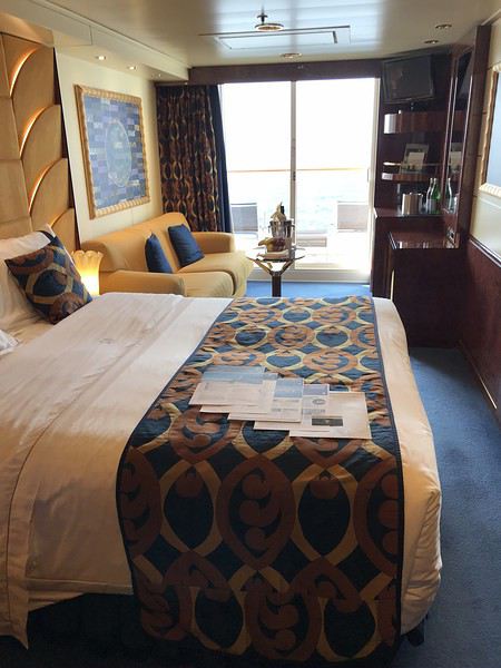
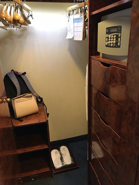
Depuis longtemps je voulais essayer le YACHT club, ici beaucoup apprécient. Au mois de juillet, suite une vente flash, nous nous sommes décidés.
Il s’agit d’une croisière de repositionnement avec un jour de moins, d’où le tarif intéressant.
J’ai choisi avec l’aide de Azur ma cabine, la 16023, aucunes n’étaient dispo au pont 15.
Dimanche 20 octobre, nous sommes arrivés au terminal vers 11h20, nous repérons aussitôt le petit accueil du YACHT club, on vient nous récupérer les valises assez rapidement, on nous demande d’attendre un peu, ensuite nous montons ou un petit buffet est dressé, un verre nous est offert, l’hôtesse nous demande ensuite nos passeports et documents d’embarquement, chouette, tout est fait à notre place 😄
Nous patientons avec 3 autres familles, à midi pile, l’embarquement commence, nous suivons l’hôtesse, nous voilà enfin sur le bateau, prise de photos, nous traversons une bonne partie du pont et montons au pont 15 ou se trouve la conciergerie.
Elle nous explique le fonctionnement, quel journal nous souhaitons, puis nous demande à quelle heure nous souhaitons dîner, en disant qu’ils doivent s’organiser, nous optons pour 21h avec l’intention de moduler ...
La famille à côté de nous souhaite dîner à 20h, on lui dit que ce n’est pas possible qu’il y a du monde à cet horaire, mais plutôt à 20h15, la 2 eme famille voulait 19h, on leur dit non aussi, je croyais que c’était horaires libres ...
On nous emmène ensuite à nôtre « suite » qui comme l’a dit Sylvianne est plus une belle cabine balcon.
Une corbeille de fruits et une bouteille de PROSECO nous attendent.
Nous partons déjeuner à la ONE pool ou un petit buffet est dressé, quelques crudités, un poisson et une ou viande ou deux, des légumes, et de la salade de fruits, c’est suffisant et bon, le service est rapide et c’est bien abrité du vent, c’était inespéré de déjeuner dehors 😏
Ensuite rangement des affaires dans les placards, pas énormément de place, mais tout rentre.
Nous partons ensuite explorer le bateau, pas trop de monde pour le moment, nous le trouvons agréable, la décoration de bon ton, ça nous fait bizarre, nous qui avons davantage l’habitude des compagnies us, d’entendre parler français partout 😉, nous essayons de trouver nôtre restaurant attitré, ce sera chose faite 😄
Nous enchaînons avec l’exercice, vite fait, remontons boire notre coupe de mousseux pas terrible du tout, et admirons le départ de Marseille de notre balcon, c’est enfin parti 😀😀
Notre majordome se présente et nous redemande notre heure de repas, décidément ils insistent, ce n’est pas du vrai ANYTIME DINING ... Il nous dit aussi que c’est soirée élégante, heureusement car sur le programme je trouve que ce n’est pas mis en valeur
Premier apéro au TOP SAIL LOUNGE, en effet ce lieu est très agréable, très calme avec ses baies vitrées d’où on peut admirer la mer, on se sert au petit buffet 2 ou 3 bricoles, nous demandons ensuite à la conciergerie si traverser le pont 7 est le plus court pour aller au restaurant, elle nous confirme que oui et nous propose d’y être accompagnés, mais souhaitant aller au théâtre et ne pas remonter, nous lui disons que nous irons nous mêmes.
Spectacle pas mal, mais musique trop forte
Notre premier repas n’est pas une réussite, le serveur nous propose seulement 2 vins blancs italiens, nous en choisissons un, pas terrible du tout, il a fallu réclamer le pain, nous prenons tout les deux : médaillon de lotte, vraiment pas bon car enrobé d’une friture qui gâche tout le goût.
Beaucoup d’ambiance dans les salons, ou tout le monde danse.
Au lit, demain Palma
Compte rendu croisière Iles du soleil (4 au 15 octobre 2019) English translation pending
Bonsoir à tous,
Nous voila de retour après un passage dans les Canaries, c'était Super.
je vais vous raconter notre petit périple.
Pour Rappel;
1° 04/10/19 Marseille (embarq) 17h00
2° 05/10/19 Plaisirs en Mer
3° 06/10/19 Plaisirs en Mer
4° 07/10/19 Arrecife Canaries 13H00 19h00
5° 08/10/19 Santa Cruz de Ténerife 08H00 17H00
6° 09/10/19 FUNCHAL (Madére) 08H00 17H00
7° 10/10/19 Plaisirs en Mer
8° 11/10/19 MALAGA 08H00 13H00
9° 12/10/19 Plaisirs en Mer
10° 13/10/19 CIVITAVECCHIA (ROME) 09H00 20H00
11° 14/10/19 SAVONE 08H00 17H00
12° 15/10/19 Marseille (Débarq) sniff sniff 08H00
Nous voilà parti pour 12 jours.On va coucher sur Marseille. Vendredi 04 Octobre, on se lève 7h30 petit déjeuner et hop nous prenons la route. Nous arrivons au port, on se gare au parking puis allons déposer les bagages et enregistrements au terminal À A 13h15, Appel du N°1. bateau. Pour nous ce sera à 13h45, on a le N° 3 . On a déjà voyagé avec le Pacifica, on va à la cabine récupérer la Costa Card et après on va rentrer la CB comme ça on peut boire un verre en déjeunant. C’est la course à la place libre tout le monde fait la queue. On réussi à trouver 2 place à une table de 6. On déjeune rapide et on va voir si nos valises sont arrivées. Elles sont là bien. Donc on va au spa prendre un forfait pour la croisière 133 €. A 16h30 exercice de sécurité + le baratin habituel sur le bateau.La française qui explique les conditions à bord et les excursions à du retard donc on décide de s’éclipser pour aller au spa se faire relaxer. On part chacun notre tour discrètement, 😉 Bon je sais c’est pas bien mais comme c’est toujours le même baratin et en plus on le fait au théâtre
Nous voilà parti pour 12 jours.On va coucher sur Marseille. Vendredi 04 Octobre, on se lève 7h30 petit déjeuner et hop nous prenons la route. Nous arrivons au port, on se gare au parking puis allons déposer les bagages et enregistrements au terminal À A 13h15, Appel du N°1. bateau. Pour nous ce sera à 13h45, on a le N° 3 . On a déjà voyagé avec le Pacifica, on va à la cabine récupérer la Costa Card et après on va rentrer la CB comme ça on peut boire un verre en déjeunant. C’est la course à la place libre tout le monde fait la queue. On réussi à trouver 2 place à une table de 6. On déjeune rapide et on va voir si nos valises sont arrivées. Elles sont là bien. Donc on va au spa prendre un forfait pour la croisière 133 €. A 16h30 exercice de sécurité + le baratin habituel sur le bateau.La française qui explique les conditions à bord et les excursions à du retard donc on décide de s’éclipser pour aller au spa se faire relaxer. On part chacun notre tour discrètement, 😉 Bon je sais c’est pas bien mais comme c’est toujours le même baratin et en plus on le fait au théâtre
Croisière Océan Indien avec Costa Mediterranea English translation pending
Bonjour
Nous faisons la croisière Océan Indien avec Costa Méditerranéa le 27/02/2020.
15 jours , en partance de la Réunion .
Es ce que quelqu’un la fait aussi à cette période ?