Results for "Mirador+|+46+>+93"
1645 results found.
Logement bon marché à Corcovado au Costa Rica? English translation pending
Tout est dit dans le titre.. Avais vous eu l'expérience d'un logement pas trop cher à Corcovado? Il me semble qu'il y a beaucoup de camp ou lodge qui visent une clientèle assez aisée, qu'en est-il pour le routard? Aussi qu'en est-il du camping?
Mille merci
Mille merci
Logement agréable à Lisbonne English translation pending
nous partons en week-end en amoureux, nous chechons pensions sympas. merci de vos bons plans.
Hébergement près du parc de Corcovado au Costa Rica English translation pending
bonjour,
ou vaut il mieux loger ? vers Drake ou vers Carate ?
il me semble que l' on serait plus autonomme en étant près de Carate ( pas besoin de bateaux), mais l' offre en hébergement est peu importante
avez vous des adresses pour un budget raisonnable dans l' un ou l' autre de ces lieux?
ou même ailleurs ?
merci
Payer d'avance une agence ( Pérou) English translation pending
Salut.
Je vais dans la région de Colca et j'ai cru bon réserver un trek de 3 jours avec l'agence tamboviejo. Ils me demandent, comme deux autres agences à qui j'ai demandé) de payer d'avance ces treks par Western Union. Pensez-vous que je vais voir la couleur de ce trek sans le repayer une autre fois? Est-ce une pratique courante? Serais-je mieux de tout simplement trouver une place pour un trek là-bas considérant que nous n'avons pas de liberté de changer de jours rendu là-bas?
Merci.
JF
Je vais dans la région de Colca et j'ai cru bon réserver un trek de 3 jours avec l'agence tamboviejo. Ils me demandent, comme deux autres agences à qui j'ai demandé) de payer d'avance ces treks par Western Union. Pensez-vous que je vais voir la couleur de ce trek sans le repayer une autre fois? Est-ce une pratique courante? Serais-je mieux de tout simplement trouver une place pour un trek là-bas considérant que nous n'avons pas de liberté de changer de jours rendu là-bas?
Merci.
JF
Logement à Hong Kong English translation pending
bonjour a tous,
je serai a hong kong pendant 1 semaine et je cherche avec mon copain un bon plan logement: pas cher (maxi 30 eruos pour 2), propre et pas dans des coins paumes (soit hong kong island, plutot kennedy town d ailleurs, soit sur TST ou Mongkok mais pas les autres iles). je connais bien sur la chunking mansion mais je cherche d autres endroits plus agreables meme si petits. si vous avez recemment loges dans la chunking mansion, je veux bien des commentaires, je ne suis pas retrounee a hong kong depuis 4 ans. merci a tous!😉
je serai a hong kong pendant 1 semaine et je cherche avec mon copain un bon plan logement: pas cher (maxi 30 eruos pour 2), propre et pas dans des coins paumes (soit hong kong island, plutot kennedy town d ailleurs, soit sur TST ou Mongkok mais pas les autres iles). je connais bien sur la chunking mansion mais je cherche d autres endroits plus agreables meme si petits. si vous avez recemment loges dans la chunking mansion, je veux bien des commentaires, je ne suis pas retrounee a hong kong depuis 4 ans. merci a tous!😉
Flores au Guatemala English translation pending
Salut je pars pour flores au guatemala le 08 juin 2006 pour faire du benevolat pour l'association arcaz dans la jungle du peten. savoir les sites les plus importants à voir a proximité ainsi que l'etat d'esprit dans cette régions, les risque, les endroits à voir absolument et ceux a éviter.
merci de bien vouloir me répondre. A+
Aller à Nasca et ne pas survoler les lignes: ça en vaut la peine? (Pérou) English translation pending
Bonjour,
Je me demandais si ça valait la peine d'aller à Nasca et de NE PAS survoler les lignes. Est ce que les 2 lignes qu'on peut voir à partir du sommet de collines valent vraiment un arrêt dans cette ville?
Merci!
Je me demandais si ça valait la peine d'aller à Nasca et de NE PAS survoler les lignes. Est ce que les 2 lignes qu'on peut voir à partir du sommet de collines valent vraiment un arrêt dans cette ville?
Merci!
"Elephants Nature Park" à Chiang Mai English translation pending
Bpnsoir
Cet été, je souhaite partir en famille en Thailande et à Chiang Mai, j'aimerais visiter un camp d'éléphants.
J'ai vu sur le net un parc d'éléphants qui a l'air très intéressant et différent des autres camps d'éléphants. Il s'appelle "Le Nature elephant park" à 60 km au nord de Chiang Mai (www.elephantnaturepark.org)
Est ce quelqu'un connait et peut donner son avis sur ce parc ?
Merci bcp
Cet été, je souhaite partir en famille en Thailande et à Chiang Mai, j'aimerais visiter un camp d'éléphants.
J'ai vu sur le net un parc d'éléphants qui a l'air très intéressant et différent des autres camps d'éléphants. Il s'appelle "Le Nature elephant park" à 60 km au nord de Chiang Mai (www.elephantnaturepark.org)
Est ce quelqu'un connait et peut donner son avis sur ce parc ?
Merci bcp
Logement à Isla Mujeres, Playa del Carmen, Tulum au Mexique English translation pending
Bonjour à tous !!!
Ma copine et moi partons bientôt effectuer notre premier voyage "Back-Paker"... Notre trajet: Isla Mujeres, Playa del Carmen, Tulum. Selon vous, devrions nous réserver des endroits où dormir à l'avance (hotels, auberges, etc) ??? Ou ??? Afin de pas être mal pris, voir sans endroit où dormir... Devrions nous apporter notre tente ??? Parce que, il est important de dire que nous serons en vacances EN MARS, LORS DU " SPRING BREAK " DONC, IL Y AURA PROBABLEMENT BEAUCOUP D'ACHALANDAGE... ??? ...
Si vous croyez qu'il est mieux pour nous de réserver, avez-vous des suggestions ???
Voilà, si vous avez des conseils autres, ne vous gênez surtout pas :-)
Merci !!!
So & J-S
Ma copine et moi partons bientôt effectuer notre premier voyage "Back-Paker"... Notre trajet: Isla Mujeres, Playa del Carmen, Tulum. Selon vous, devrions nous réserver des endroits où dormir à l'avance (hotels, auberges, etc) ??? Ou ??? Afin de pas être mal pris, voir sans endroit où dormir... Devrions nous apporter notre tente ??? Parce que, il est important de dire que nous serons en vacances EN MARS, LORS DU " SPRING BREAK " DONC, IL Y AURA PROBABLEMENT BEAUCOUP D'ACHALANDAGE... ??? ...
Si vous croyez qu'il est mieux pour nous de réserver, avez-vous des suggestions ???
Voilà, si vous avez des conseils autres, ne vous gênez surtout pas :-)
Merci !!!
So & J-S
Conseils de logement à Cusco English translation pending
Bonjour !
Si vous avez des bons plans, pas trop chers pour se loger à Cusco je suis preneuse 😉
Hotel, auberge ....
Merci
Chloé
Si vous avez des bons plans, pas trop chers pour se loger à Cusco je suis preneuse 😉
Hotel, auberge ....
Merci
Chloé
Randonnées dans le Torres depuis l'hosteria (Chili) English translation pending
Salut !!!
Pour préparer un futur voyage au chili, je cherche qq infos:
D'après vos expériences, est-il possible depuis une hosteria (pas le refuge), par exemple l'hosteria pehoe qui semble être au centre du parc, de faire des randonnées en étoile sur un jour ? En effet sur certains sites, il est décrit un aller et retour sur la journée vers le camp de base des torres, et même un approche de la vallée del francès en utilisant le bateau le matin et en fin d'aprè-midi....Sûr que le rythme doit être soutenu, mais est-ce faisable d'apès vous? Faut-il être un grand marcheur pour cela ???
Merci pour vos réponses!
D'après vos expériences, est-il possible depuis une hosteria (pas le refuge), par exemple l'hosteria pehoe qui semble être au centre du parc, de faire des randonnées en étoile sur un jour ? En effet sur certains sites, il est décrit un aller et retour sur la journée vers le camp de base des torres, et même un approche de la vallée del francès en utilisant le bateau le matin et en fin d'aprè-midi....Sûr que le rythme doit être soutenu, mais est-ce faisable d'apès vous? Faut-il être un grand marcheur pour cela ???
Merci pour vos réponses!
Points GPS pour le Pérou et la Bolivie English translation pending
Pour mon voyage de cet été, je suis à la recherche de points GPS pour le Pérou et la Bolivie.
Si vous avez des coordonnées, de sources chaudes, de monuments perdus dans un coin, de lieus incontournables… enfin je prends tout…
Je serais dans les 2 zones suivantes : Pérou : de Lima à Puno et de Nasca à Cusco Bolivie : de Copacabana à Uyuni et de Sajama à Sucre
Merci, Vic.
Je serais dans les 2 zones suivantes : Pérou : de Lima à Puno et de Nasca à Cusco Bolivie : de Copacabana à Uyuni et de Sajama à Sucre
Merci, Vic.
Le tourisme menace-t-il le berceau Maya? English translation pending
Ami(e)s voyageurs d'Amérique Centrale, voici un article intéressant qui peut faire réfléchir / hésiter sur ce que doit devenir le tourisme dans un pays qui s'ouvre comme le Guatemala... Un nouveau Machu Pichu avec tout ce que cela suppose ou pas ?
Vos réactions ?
Mano
Le tourisme menace le berceau maya
Guatemala : Anne Vigna [28 mars 2005]
Selon Richard Hansen, un complexe touristique permettrait d'assurer des revenus pour restaurer le site, endiguer le pillage archéologique et préserver les ressources naturelles.
Le site du Mirador, l'une des plus importantes cités mayas encore enfouies au Guatemala, est-il menacé par un important projet touristique ? La question ravive les rapports conflictuels qu'entretiennent l'archéologie et le tourisme, et relance dans ce pays la demande des descendants des Indiens à gérer leur patrimoine culturel.
L'histoire, qui divise autant qu'elle passionne les Guatémaltèques, se déroule au Petén, région du Nord qui abrite la plus importante aire protégée d'Amérique centrale, la réserve biosphère maya (RBM) et plusieurs centres mayas d'envergure dont celui de Tikal.
L'archéologue américain Richard Hansen travaille depuis 25 ans sur le site du Mirador qui regroupe 26 cités mayas, datant de la période préclassique et antérieures de 1 000 à 1 800 ans aux autres sites mayas les plus prestigieux tels que ceux de Tikal, Copan (Honduras) et Palenque (Mexique). «Il s'agit des plus hautes pyramides jamais construites en Méso-Amérique, jusqu'à 147 mètres de haut, et encore enfouies. La cité du Mirador peut être considérée comme le berceau de la civilisation maya. Nous avons ici une combinaison unique de forêt tropicale et de sites archéologiques d'une valeur inestimable, qui créent un potentiel touristique énorme», affirme Richard Hansen. Selon l'archéologue, un complexe touristique permettrait d'assurer des revenus pour à la fois restaurer le site, endiguer le pillage archéologique et préserver les ressources naturelles.
Ce projet, qui a reçu l'appui du président Oscar Berger et de son prédécesseur, est âprement combattu par les ONG et les communautés locales : initialement, le projet prévoyait un aéroport et une route pour acheminer les touristes dans une zone de la RBM encore préservée, grâce à sa difficulté d'accès. «Aujourd'hui ces infrastructures ont disparu pour l'idée d'un train et un héliport suite au tollé général. Mais M. Hansen n'a encore fourni aucune étude d'impact ni posé la question de l'eau. Or il sait que cette cité a sûrement été abandonnée par manque d'eau, s'emporte Claudia Sanchez, membre de l'ONG Tropico verde. Pour les fouilles actuelles, l'eau est amenée par voie aérienne. Vous imaginez combien il en faudra pour les touristes !»
L'impact économique du complexe est également contesté : Richard Hansen table sur 120 000 touristes par an, ou encore annonce dans la presse locale des bénéfices de l'ordre de 600 millions de dollars par an à partir de 2010. «Des chiffres fantaisistes. Le site récemment restauré de Yaxha, d'un accès beaucoup plus facile et d'une richesse culturelle comparable, est un échec touristique», explique Véronique Breuil, archéologue rattachée au Cemca et qui travaille depuis douze ans au Guatemala.
«Le problème est que nous ne voulons pas 120 000 touristes. C'est le contraire du développement bien orienté pour lequel nous luttons depuis des années. Et, s'il a lieu, à qui va vraiment profiter cette arrivée ?», demande Fredy Molina de l'organisation Acofop, qui regroupe 22 communautés forestières à l'intérieur de la RBM. Même analyse chez les Mayas Itza, pour qui le projet est vécu comme un affront : «Nous avons appris ce projet par la presse alors que nous avons toujours conservé ce patrimoine bien avant l'arrivée de Richard Hansen. C'est devenu son «bébé» et bientôt un produit commercial», affirme Reginaldo Huex, représentant des Mayas Itza.
La question de la privatisation des sites archéologiques est bien d'actualité au Guatemala où l'Institut d'anthropologie et d'histoire a déjà réalisé plusieurs études sur le sujet. Ce petit pays d'Amérique centrale a sur son territoire plus de 3 000 sites archéologiques répertoriés. Pour donner une autre idée du phénomène, sur les 331 communes, seules trois ne disposent d'aucun site archéologique. Si aujourd'hui le projet du Mirador attire nombre de convoitises privées, il est vu également dans la sphère publique comme un moyen de gérer un patrimoine coûteux. D'après un diagnostic réalisé par Véronique Breuil à Tikal à la demande du Guatemala, «après cinquante ans d'exposition, la pierre devient friable et se pulvérise. En outre, malgré sa renommée, ce site ne s'autofinance toujours pas. Pour le Mirador le dilemme est encore plus complexe puisqu'il s'agit de structures stuquées qu'on ne sait pas conserver».
En dépit de ces difficultés – restauration impérative du site, opposition locale, manque d'eau –, financeurs (Banque interaméricaine de développement) et fondations privées (National Geography Society, Global Heritage Fund, Counterpart International, etc.) ont déjà répondu à l'appel de Richard Hansen et le gouvernement va présenter prochainement le Mirador pour un classement auprès de l'Unesco. Interrogé, le bureau de l'Unesco au Guatemala n'a pas souhaité s'exprimer sur la question du projet touristique. Mais sur son site Internet, l'institution insiste déjà dans ses nouvelles directives concernant le «développement du tourisme pour financer les sites classés Patrimoine de l'Humanité».
Site du projet de Richard Hansen : www.miradorbasin.com Site de l'association opposée : www.acofop.org
Vos réactions ?
Mano
Le tourisme menace le berceau maya
Guatemala : Anne Vigna [28 mars 2005]
Selon Richard Hansen, un complexe touristique permettrait d'assurer des revenus pour restaurer le site, endiguer le pillage archéologique et préserver les ressources naturelles.
Le site du Mirador, l'une des plus importantes cités mayas encore enfouies au Guatemala, est-il menacé par un important projet touristique ? La question ravive les rapports conflictuels qu'entretiennent l'archéologie et le tourisme, et relance dans ce pays la demande des descendants des Indiens à gérer leur patrimoine culturel.
L'histoire, qui divise autant qu'elle passionne les Guatémaltèques, se déroule au Petén, région du Nord qui abrite la plus importante aire protégée d'Amérique centrale, la réserve biosphère maya (RBM) et plusieurs centres mayas d'envergure dont celui de Tikal.
L'archéologue américain Richard Hansen travaille depuis 25 ans sur le site du Mirador qui regroupe 26 cités mayas, datant de la période préclassique et antérieures de 1 000 à 1 800 ans aux autres sites mayas les plus prestigieux tels que ceux de Tikal, Copan (Honduras) et Palenque (Mexique). «Il s'agit des plus hautes pyramides jamais construites en Méso-Amérique, jusqu'à 147 mètres de haut, et encore enfouies. La cité du Mirador peut être considérée comme le berceau de la civilisation maya. Nous avons ici une combinaison unique de forêt tropicale et de sites archéologiques d'une valeur inestimable, qui créent un potentiel touristique énorme», affirme Richard Hansen. Selon l'archéologue, un complexe touristique permettrait d'assurer des revenus pour à la fois restaurer le site, endiguer le pillage archéologique et préserver les ressources naturelles.
Ce projet, qui a reçu l'appui du président Oscar Berger et de son prédécesseur, est âprement combattu par les ONG et les communautés locales : initialement, le projet prévoyait un aéroport et une route pour acheminer les touristes dans une zone de la RBM encore préservée, grâce à sa difficulté d'accès. «Aujourd'hui ces infrastructures ont disparu pour l'idée d'un train et un héliport suite au tollé général. Mais M. Hansen n'a encore fourni aucune étude d'impact ni posé la question de l'eau. Or il sait que cette cité a sûrement été abandonnée par manque d'eau, s'emporte Claudia Sanchez, membre de l'ONG Tropico verde. Pour les fouilles actuelles, l'eau est amenée par voie aérienne. Vous imaginez combien il en faudra pour les touristes !»
L'impact économique du complexe est également contesté : Richard Hansen table sur 120 000 touristes par an, ou encore annonce dans la presse locale des bénéfices de l'ordre de 600 millions de dollars par an à partir de 2010. «Des chiffres fantaisistes. Le site récemment restauré de Yaxha, d'un accès beaucoup plus facile et d'une richesse culturelle comparable, est un échec touristique», explique Véronique Breuil, archéologue rattachée au Cemca et qui travaille depuis douze ans au Guatemala.
«Le problème est que nous ne voulons pas 120 000 touristes. C'est le contraire du développement bien orienté pour lequel nous luttons depuis des années. Et, s'il a lieu, à qui va vraiment profiter cette arrivée ?», demande Fredy Molina de l'organisation Acofop, qui regroupe 22 communautés forestières à l'intérieur de la RBM. Même analyse chez les Mayas Itza, pour qui le projet est vécu comme un affront : «Nous avons appris ce projet par la presse alors que nous avons toujours conservé ce patrimoine bien avant l'arrivée de Richard Hansen. C'est devenu son «bébé» et bientôt un produit commercial», affirme Reginaldo Huex, représentant des Mayas Itza.
La question de la privatisation des sites archéologiques est bien d'actualité au Guatemala où l'Institut d'anthropologie et d'histoire a déjà réalisé plusieurs études sur le sujet. Ce petit pays d'Amérique centrale a sur son territoire plus de 3 000 sites archéologiques répertoriés. Pour donner une autre idée du phénomène, sur les 331 communes, seules trois ne disposent d'aucun site archéologique. Si aujourd'hui le projet du Mirador attire nombre de convoitises privées, il est vu également dans la sphère publique comme un moyen de gérer un patrimoine coûteux. D'après un diagnostic réalisé par Véronique Breuil à Tikal à la demande du Guatemala, «après cinquante ans d'exposition, la pierre devient friable et se pulvérise. En outre, malgré sa renommée, ce site ne s'autofinance toujours pas. Pour le Mirador le dilemme est encore plus complexe puisqu'il s'agit de structures stuquées qu'on ne sait pas conserver».
En dépit de ces difficultés – restauration impérative du site, opposition locale, manque d'eau –, financeurs (Banque interaméricaine de développement) et fondations privées (National Geography Society, Global Heritage Fund, Counterpart International, etc.) ont déjà répondu à l'appel de Richard Hansen et le gouvernement va présenter prochainement le Mirador pour un classement auprès de l'Unesco. Interrogé, le bureau de l'Unesco au Guatemala n'a pas souhaité s'exprimer sur la question du projet touristique. Mais sur son site Internet, l'institution insiste déjà dans ses nouvelles directives concernant le «développement du tourisme pour financer les sites classés Patrimoine de l'Humanité».
Site du projet de Richard Hansen : www.miradorbasin.com Site de l'association opposée : www.acofop.org
demander un visa Chinois à Hong Kong English translation pending
Bonjour, bonjour,
J'arrive mi Avril à HK, et je voudrais demander un visa chinois sur place. Ca se fait ? Et où ? Et pour dormir pas cher, en attendant les dénouements administratifs, qu'est qu'il y a comme possibilité qui ne soit pas à l'autre bout de la ville ? ...je crois que j'ai vraiment besoin d'un coup de main pour ce petit détail de début de voyage.
Tout plein de merci d'avance
Antoine
J'arrive mi Avril à HK, et je voudrais demander un visa chinois sur place. Ca se fait ? Et où ? Et pour dormir pas cher, en attendant les dénouements administratifs, qu'est qu'il y a comme possibilité qui ne soit pas à l'autre bout de la ville ? ...je crois que j'ai vraiment besoin d'un coup de main pour ce petit détail de début de voyage.
Tout plein de merci d'avance
Antoine
Sécheresse Holguin English translation pending
Allo,
Nous partons le 22 mars pour le Playa Costa Verde / Holguin et nous aimerions avoir les plus récentes nouvelles au sujet de la sécheresse.... est-ce que quelqu'un sait si tout est rentré dans l'ordre.... ?
merci :-)
Soda
Nous partons le 22 mars pour le Playa Costa Verde / Holguin et nous aimerions avoir les plus récentes nouvelles au sujet de la sécheresse.... est-ce que quelqu'un sait si tout est rentré dans l'ordre.... ?
merci :-)
Soda
Ile de Chiloé au Chili English translation pending
je me rend avec ma fée clochette fin juillet et aout 2005 en bolivie et chili
nous souhaiterions avoir des tuyaux et avis sur l'ile de Chiloé
merci
nous souhaiterions avoir des tuyaux et avis sur l'ile de Chiloé
merci
Hôtels à Hong Kong English translation pending
pouvez vous me renseigner les prix d'hotels moin cheres à Hongkong
merci d'avance
à+++++
merci d'avance
à+++++
Faisabilité itinéraire Patagonie English translation pending
Bonjour à tous!
voici une proposition d'itinéraire élaborée par ami avec qui je pars prochainement en Argentine sachant que notre arrivée et départ de El Calafate sont fixes. Qu'en pensez-vous? Je sais que ça doit paraitre serré mais est-ce qd même jouable nivo timing? Y a-t-il des priorités à donner? Avez-vous des auberges et refuges à nous conseiller? Des agences pour les treks (si nécessaires)?
Jour 1 : Arrivée le soir à El Calafate en avion. Auberge
J2 : Glacier Perito Moreno (Agence ?) + Nuit en auberge
J3 : Départ El Calafate (1er bus). Arrivée à El Chalten puis commencement du trekking nuit au campement Bridwell
J4 : Trekking Fitz Roy
Trekking d’une journée sur le glacier (Agence obligatoire !)
J5 : Départ tôt le matin pour prendre le chemin Hieja y Madre puis continuation jusqu’à la Laguna de Los Tres puis retour à El chalten puis bus pour El Calafate. Nuit en auberge
J6 : Départ 8h00 Journée de Transfert vers Torre del Paines en bus. Nuit dans le Torre del Paines. Il y a 3 arrêts de bus dans le parc :
1) Laguna Amarga (entrée du parc)
2) Poste du Lac Pehoe
3) Administration du Parc
Nuit en refuge
J7 : Nous allons au Mirador Las Torres jusqu’à la lagune puis nous redescendons. Nuit en refuge
J8 : Nous partons pour la vallée del Frances. Nous laissons nos sacs à dos au campamento italiano avant d’entamer la montée jusqu’au Mirador Frances puis redescente, récupération des sacs à dos et continuation jusqu’au refuge Pehoe (nuit)
J9 : A/R jusqu’au Glaciar Grey (retour possible en bateau à confirmer) et nuit à nouveau au refuge Pehoe
J10 : . S’assurer des horaires des bus au stop du Poste Pehoe et retour vers El Calafate (nuit à El Calafate : auberge)
J11 : Lago Argentino+ Glacier Upsala (Agence?)
Départ de El Calafate 20.33 (avion)
Merci d'avance pour vos remarques et suggestions!
Ciao
Stef
voici une proposition d'itinéraire élaborée par ami avec qui je pars prochainement en Argentine sachant que notre arrivée et départ de El Calafate sont fixes. Qu'en pensez-vous? Je sais que ça doit paraitre serré mais est-ce qd même jouable nivo timing? Y a-t-il des priorités à donner? Avez-vous des auberges et refuges à nous conseiller? Des agences pour les treks (si nécessaires)?
Jour 1 : Arrivée le soir à El Calafate en avion. Auberge
J2 : Glacier Perito Moreno (Agence ?) + Nuit en auberge
J3 : Départ El Calafate (1er bus). Arrivée à El Chalten puis commencement du trekking nuit au campement Bridwell
J4 : Trekking Fitz Roy
Trekking d’une journée sur le glacier (Agence obligatoire !)
J5 : Départ tôt le matin pour prendre le chemin Hieja y Madre puis continuation jusqu’à la Laguna de Los Tres puis retour à El chalten puis bus pour El Calafate. Nuit en auberge
J6 : Départ 8h00 Journée de Transfert vers Torre del Paines en bus. Nuit dans le Torre del Paines. Il y a 3 arrêts de bus dans le parc :
1) Laguna Amarga (entrée du parc)
2) Poste du Lac Pehoe
3) Administration du Parc
Nuit en refuge
J7 : Nous allons au Mirador Las Torres jusqu’à la lagune puis nous redescendons. Nuit en refuge
J8 : Nous partons pour la vallée del Frances. Nous laissons nos sacs à dos au campamento italiano avant d’entamer la montée jusqu’au Mirador Frances puis redescente, récupération des sacs à dos et continuation jusqu’au refuge Pehoe (nuit)
J9 : A/R jusqu’au Glaciar Grey (retour possible en bateau à confirmer) et nuit à nouveau au refuge Pehoe
J10 : . S’assurer des horaires des bus au stop du Poste Pehoe et retour vers El Calafate (nuit à El Calafate : auberge)
J11 : Lago Argentino+ Glacier Upsala (Agence?)
Départ de El Calafate 20.33 (avion)
Merci d'avance pour vos remarques et suggestions!
Ciao
Stef
Adresses d'hôtels ou cabinas au Costa Rica English translation pending
Bonjour,
ma femme et moi partons mi aout au CR😎, et nous sommes à la recherche de bonnes adresses d'hotels ou de cabinas à prix raisonnable. nous recherchons dans les secteurs de San josé ou les environs (arrivée par avion) ensuite Volcan de poas et arenal, tortuguero, Puerto viejo et cahuita pour le reste ont est pas encore fixé. Donc si vous avez de bonnes adresses à nous proposer pour ces destinations et pour d'autres on est client. D'avance merçi Yann
ma femme et moi partons mi aout au CR😎, et nous sommes à la recherche de bonnes adresses d'hotels ou de cabinas à prix raisonnable. nous recherchons dans les secteurs de San josé ou les environs (arrivée par avion) ensuite Volcan de poas et arenal, tortuguero, Puerto viejo et cahuita pour le reste ont est pas encore fixé. Donc si vous avez de bonnes adresses à nous proposer pour ces destinations et pour d'autres on est client. D'avance merçi Yann
Hôtel cabanes à Tulum au Mexique English translation pending
Bonjour,
qui peut m'aider à retrouver le nom d'un petit hotel cabañas qui se trouve sur le plage de Tulum ?
C'est un des premier quand on arrive sur la plage, il est peint avec plein de couleur, hamac sur les terrasses, super joli.
Merci
qui peut m'aider à retrouver le nom d'un petit hotel cabañas qui se trouve sur le plage de Tulum ?
C'est un des premier quand on arrive sur la plage, il est peint avec plein de couleur, hamac sur les terrasses, super joli.
Merci
Vos conseils sur le Guatemala et le Belize English translation pending
🙂 Salut à tous !
Me revoilà pour vous redemander quelques infos de "dernières minutes" et oui dans moins d'un mois c'est le départ du 15/11 au 15/12, avec mon ami et nos sacs à dos ...
- Nous arrivons à Guatemala ciudad vers 19H30, y a t-il encore des navettes pour ANTIGUA et sinon y a t-il des taxis, comment reconnaître les taxis officiels et donc sécurisés ????
- Est ce que les Fuentes Georginas à QUETZALTENANGO valent le coup ?
- Pour visiter le site de COPAN au Honduras doit on prendre une navette ou mini bus par une agence de voyages ou y aller par nos propres moyens ? Mais combien de bus doit on prendre ? Doit on visiter les tunnels à COPAN ou le site en lui même suffit ?
- Et de Copan Ruinas à LIVINGSTON ? On pense à prendre un bus pour Chiquimula puis puertos barrios puis ferry pour Livingston ? est OK ?
- A LIVINGSTON, que faire ? Est ce intéressant de faire une excursion au Siete Altares ?
- A RIO DULCE, el castillo de san felipe c'est bien ? et la Finca el Paraiso organise des ballades à cheval ou pas ?
- On pense à faire un circuit de 3 jours "encadrés " par une agence pour aller dans la jungle : TIKAL (on le fait seul ou pas ?), ceibal, dos pilas, el peru, el zotz, rio azul, yaxja, mirador ... Connaissez vous une agence sympa qui organise ça ???
- Au BELIZE, on voudrait juste passer quelques jours de détente au bord de mer, on pense à CAY CAULKER ou AMBERGIS CAY ou un autre coin sympa ou l'on peut plonger ?
- on a juste notre bapteme de plongée et on aimerait passer le PADI - OPEN WATER pour après pouvoir vraiment plonger ? Est ce qu'il y a des clubs qui font passer ce "diplome" et si oui combien ça coute ?
- Au Belize que doit on surtout pas manquer ??
- Et pour notre retour on aimerait faire en avion BELIZE CITY - GUATEMALA CIUDAD ? Quels sont les prix ?
Merci d'avance de votre aide à tous ...
Hasta luego...
Me revoilà pour vous redemander quelques infos de "dernières minutes" et oui dans moins d'un mois c'est le départ du 15/11 au 15/12, avec mon ami et nos sacs à dos ...
- Nous arrivons à Guatemala ciudad vers 19H30, y a t-il encore des navettes pour ANTIGUA et sinon y a t-il des taxis, comment reconnaître les taxis officiels et donc sécurisés ????
- Est ce que les Fuentes Georginas à QUETZALTENANGO valent le coup ?
- Pour visiter le site de COPAN au Honduras doit on prendre une navette ou mini bus par une agence de voyages ou y aller par nos propres moyens ? Mais combien de bus doit on prendre ? Doit on visiter les tunnels à COPAN ou le site en lui même suffit ?
- Et de Copan Ruinas à LIVINGSTON ? On pense à prendre un bus pour Chiquimula puis puertos barrios puis ferry pour Livingston ? est OK ?
- A LIVINGSTON, que faire ? Est ce intéressant de faire une excursion au Siete Altares ?
- A RIO DULCE, el castillo de san felipe c'est bien ? et la Finca el Paraiso organise des ballades à cheval ou pas ?
- On pense à faire un circuit de 3 jours "encadrés " par une agence pour aller dans la jungle : TIKAL (on le fait seul ou pas ?), ceibal, dos pilas, el peru, el zotz, rio azul, yaxja, mirador ... Connaissez vous une agence sympa qui organise ça ???
- Au BELIZE, on voudrait juste passer quelques jours de détente au bord de mer, on pense à CAY CAULKER ou AMBERGIS CAY ou un autre coin sympa ou l'on peut plonger ?
- on a juste notre bapteme de plongée et on aimerait passer le PADI - OPEN WATER pour après pouvoir vraiment plonger ? Est ce qu'il y a des clubs qui font passer ce "diplome" et si oui combien ça coute ?
- Au Belize que doit on surtout pas manquer ??
- Et pour notre retour on aimerait faire en avion BELIZE CITY - GUATEMALA CIUDAD ? Quels sont les prix ?
Merci d'avance de votre aide à tous ...
Hasta luego...
Off to find Andalusian spring (Granada, Ronda, Seville)
It's been 39 years since we last came back to Andalusia...
For this last week of March, we waited until the end of the "votes" in France to go soak up some sun in southern Spain. And spring is the ideal season.
Our itinerary was a very (very) classic loop: Seville / Granada / Ronda and the white villages / Seville (with the start of Holy Week as a bonus gift!).
We flew from Lyon with Transavia (no issues) and landed in Seville on Monday. We rented a car (Goldcar), drove for 3 hours, and there we were in Granada, charmed by its ZTL (limited traffic zone) that Waze made us discover in detail (a nightmare!). Our hotel: Hotel Monjas del Carmen (perfectly located and with parking).
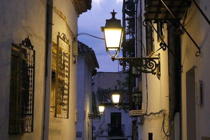
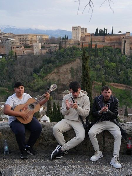
The weather was overcast, but a little stroll through the Albaicín district was a must. In the evening, we had dinner at "Restaurant Arabe Ambar" to get into the Nasrid atmosphere—we recommend it!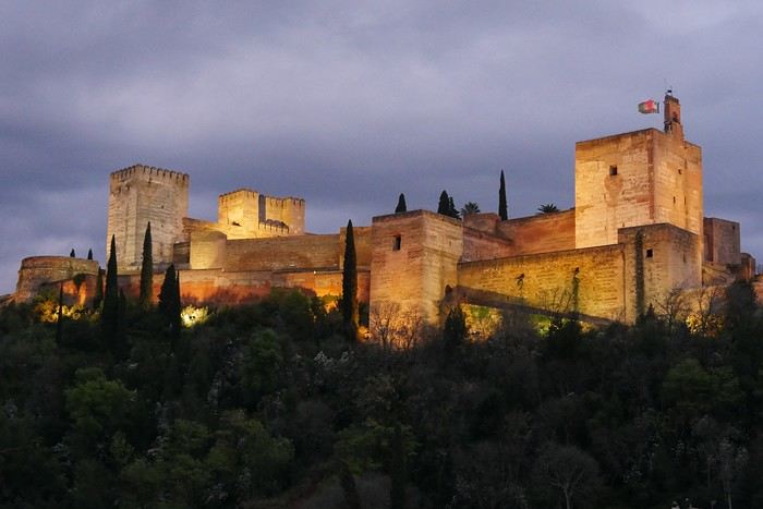
For this last week of March, we waited until the end of the "votes" in France to go soak up some sun in southern Spain. And spring is the ideal season.
Our itinerary was a very (very) classic loop: Seville / Granada / Ronda and the white villages / Seville (with the start of Holy Week as a bonus gift!).
We flew from Lyon with Transavia (no issues) and landed in Seville on Monday. We rented a car (Goldcar), drove for 3 hours, and there we were in Granada, charmed by its ZTL (limited traffic zone) that Waze made us discover in detail (a nightmare!). Our hotel: Hotel Monjas del Carmen (perfectly located and with parking).
The weather was overcast, but a little stroll through the Albaicín district was a must. In the evening, we had dinner at "Restaurant Arabe Ambar" to get into the Nasrid atmosphere—we recommend it!
Ideas for a one-week Andalusia itinerary
Hi everyone,
I’m sharing my draft itinerary with you because I just booked our flight tickets, and I feel like it’s quite late in the season. So, I’d like to be sure about my stops before reserving the hotels. I’ll be traveling alone with my two adult children. We want to prioritize outdoor walks, avoid too many indoor visits (both for budget and preference), and not spend too much time on the road.
D1: Arrival at 9 AM in Malaga, day in Malaga and overnight stay D2: Head straight to Nerja (1-hour drive) and spend the night there D3: Head straight to Granada (1.5-hour drive), spend the day and night there D4: Granada. Visit the Alhambra (Nasrid Palaces tour at 5 PM) and spend the night D5: Head to Ronda (2.5-hour drive) and spend the night D6: White Villages and overnight in Ronda D7: Head straight to the Costa del Sol (e.g., Estepona), spend the day and night there D8: Return to Malaga to catch our flight
There you go! This itinerary takes into account that we’d like to do a circuit starting from Seville in a few years. That said, it’d be a shame to miss something doable from Malaga.
Questions: Since the Alhambra visit is only at 5 PM, and we’d already have the day to explore Granada, would arriving the day before be a mistake? Or should we skip this day and dedicate it elsewhere (Costa del Sol? Head toward Tabernas?)? The old town appeals to me, but maybe the Sacromonte neighborhood isn’t essential... Same question for Ronda: should we dedicate a full day to it, or combine Ronda and the White Villages in one day? Note that we love wandering around villages outside, so that might answer my question! :)
Final question: Is it better to rent the car at Malaga Airport or in the city? If we rent at the airport, we’d need a hotel with parking, which doesn’t seem easy. Or stay outside the city and park for free near the center if possible? I’ve read comments about taking a taxi to Malaga and then picking up the rental car at the airport the next morning. The taxi would really need to be affordable...
Thanks so much for your feedback and suggestions for visits during this little circuit. Have a great day, everyone! Christine
D1: Arrival at 9 AM in Malaga, day in Malaga and overnight stay D2: Head straight to Nerja (1-hour drive) and spend the night there D3: Head straight to Granada (1.5-hour drive), spend the day and night there D4: Granada. Visit the Alhambra (Nasrid Palaces tour at 5 PM) and spend the night D5: Head to Ronda (2.5-hour drive) and spend the night D6: White Villages and overnight in Ronda D7: Head straight to the Costa del Sol (e.g., Estepona), spend the day and night there D8: Return to Malaga to catch our flight
There you go! This itinerary takes into account that we’d like to do a circuit starting from Seville in a few years. That said, it’d be a shame to miss something doable from Malaga.
Questions: Since the Alhambra visit is only at 5 PM, and we’d already have the day to explore Granada, would arriving the day before be a mistake? Or should we skip this day and dedicate it elsewhere (Costa del Sol? Head toward Tabernas?)? The old town appeals to me, but maybe the Sacromonte neighborhood isn’t essential... Same question for Ronda: should we dedicate a full day to it, or combine Ronda and the White Villages in one day? Note that we love wandering around villages outside, so that might answer my question! :)
Final question: Is it better to rent the car at Malaga Airport or in the city? If we rent at the airport, we’d need a hotel with parking, which doesn’t seem easy. Or stay outside the city and park for free near the center if possible? I’ve read comments about taking a taxi to Malaga and then picking up the rental car at the airport the next morning. The taxi would really need to be affordable...
Thanks so much for your feedback and suggestions for visits during this little circuit. Have a great day, everyone! Christine
Need advice to finalize Malaysia itinerary
Hey everyone,
I’m over in East Borneo in mid-July.
I’m struggling to wrap up the end of my itinerary, even though it’s pretty straightforward (long but simple).
Last year, we did Malaysia (KL and the mainland + around Kuching).
Day 1 – Arrive in Kota Kinabalu early, stroll around town and hit the must-sees. Day 2 – Excursion to Tunku Abdul Rahman Park, snorkeling at 3 islands. Day 3 – Hike around Mount Kinabalu without summiting (450 per person, no way). Day 4 – Poring Hot Springs + evening flight to Sandakan. Day 5-6-7 – Kinabatangan River (still looking for the right guide). Day 8 – Sepilok for the orangutans, the Sun Bear Centre, and Rainforest Discovery Centre. Day 9 – Selingan, turtle island. Day 10 – Head to Semporna. Day 11-12-13-14 – Sipadan, Mabul, Kapalai. Day 15 – Bohey Dulang. Day 16 to Day 25: I’M STUCK.
I looked into Danum Valley, but for 3 days/2 nights, they’re quoting 650 € per person—come on, that’s ridiculous. I checked out a detour into Indonesia (still East Borneo), but I’m having trouble deciding what would be amazing. I read about Sangalaki + Kakaban (2 islands, 1 base) / Mahakam Delta - Kutai (orangutans and river) / Sungai Boh (Dayak Kayan) – jungle & culture. But honestly, I’m struggling to finalize this itinerary. If we venture that way, we’d head back to KK from Balikpapan.
What do you all think? Thanks in advance!
Day 1 – Arrive in Kota Kinabalu early, stroll around town and hit the must-sees. Day 2 – Excursion to Tunku Abdul Rahman Park, snorkeling at 3 islands. Day 3 – Hike around Mount Kinabalu without summiting (450 per person, no way). Day 4 – Poring Hot Springs + evening flight to Sandakan. Day 5-6-7 – Kinabatangan River (still looking for the right guide). Day 8 – Sepilok for the orangutans, the Sun Bear Centre, and Rainforest Discovery Centre. Day 9 – Selingan, turtle island. Day 10 – Head to Semporna. Day 11-12-13-14 – Sipadan, Mabul, Kapalai. Day 15 – Bohey Dulang. Day 16 to Day 25: I’M STUCK.
I looked into Danum Valley, but for 3 days/2 nights, they’re quoting 650 € per person—come on, that’s ridiculous. I checked out a detour into Indonesia (still East Borneo), but I’m having trouble deciding what would be amazing. I read about Sangalaki + Kakaban (2 islands, 1 base) / Mahakam Delta - Kutai (orangutans and river) / Sungai Boh (Dayak Kayan) – jungle & culture. But honestly, I’m struggling to finalize this itinerary. If we venture that way, we’d head back to KK from Balikpapan.
What do you all think? Thanks in advance!
Last-minute trip to Guatemala with kids
Hi there,
We’ve had to change our plans, so we’re heading to Guatemala from October 16 to 25, 2025 (in just 6 days 😱 😊😕), with two kids aged 8 and 10. No time difference for us.
Here’s our itinerary: Day 1: Morning: Arrival in Guatemala City at 9 AM. Drive to Antigua (1-hour shuttle) / Afternoon: Stroll around Antigua / Night: Antigua Day 2: Explore Antigua / Night: Antigua Day 3: Visit the area around Antigua OR hike a volcano (Acatenango?) / Night: Antigua Day 4: Drive to Chichicastenango for the big market (how many hours?) / Afternoon: Iximche ruins? Or the hanging bridges at Atitlán Reserve? Or spend the day in Chichicastenango / Night: Panajachel Day 5: A day by boat visiting villages around the lake and checking out local crafts (which villages to pick?), Night: Panajachel Day 6: Drive to Flores with 1 stop? Should we go to Semuc Champey? (how many hours?), Night: ?? Day 7: Drive to Flores (how many hours?), Night: Flores Day 8: Yaxha (1.5-hour drive each way with a driver), Night: Flores Day 9: Day trip to Tikal, Night: Flores Day 10:: Flight from Flores to Guatemala City, then departure at 4:30 PM
About hiking a volcano, I’ve read mixed reviews. Some say it’s easy, others say it’s tough. Is there a kid-friendly hike where we could see lava from a volcano? Is it only visible at night? Do we *have* to sleep at the top and come down the next day? I’ve heard of people doing it with 2-year-olds by carrying them, and others using horses—but I guess the horses don’t go all the way up? Seeing a real volcano would be amazing! I think it’d be a memorable experience for the kids. It’d be so cool to say, "We did that as a family!" But maybe it’s way too hard and a bad idea...
I’m struggling to find reliable info on travel times: - How long is the drive from Antigua to Chichicastenango, please? I’ve read shuttles leave at 7 AM and arrive at the market by 8:30 AM, but I’ve also seen people say it’s a 4-hour trip 😕. Are the times on Google Maps reliable?
A blog mentioned visiting Chichicastenango’s market in the morning and Iximché in the afternoon. That seems like a lot of driving, especially after leaving Antigua in the morning. What should we do in the afternoon instead?
Days 6 and 7: The trip from Panajachel to Flores. Any advice on taking an overnight bus? Should we go during the day with a stop at Semuc Champey? Or fly and spend the extra day somewhere else?
Day 8: Is a full day at Yaxha too much?
Thanks so much for your help—it’s *so* valuable with such short notice! 😅 😅 😅 THANK YOU PS: If you have recommendations for private drivers, shuttle services, or any firsthand experience, I’d love to hear it!
Here’s our itinerary: Day 1: Morning: Arrival in Guatemala City at 9 AM. Drive to Antigua (1-hour shuttle) / Afternoon: Stroll around Antigua / Night: Antigua Day 2: Explore Antigua / Night: Antigua Day 3: Visit the area around Antigua OR hike a volcano (Acatenango?) / Night: Antigua Day 4: Drive to Chichicastenango for the big market (how many hours?) / Afternoon: Iximche ruins? Or the hanging bridges at Atitlán Reserve? Or spend the day in Chichicastenango / Night: Panajachel Day 5: A day by boat visiting villages around the lake and checking out local crafts (which villages to pick?), Night: Panajachel Day 6: Drive to Flores with 1 stop? Should we go to Semuc Champey? (how many hours?), Night: ?? Day 7: Drive to Flores (how many hours?), Night: Flores Day 8: Yaxha (1.5-hour drive each way with a driver), Night: Flores Day 9: Day trip to Tikal, Night: Flores Day 10:: Flight from Flores to Guatemala City, then departure at 4:30 PM
About hiking a volcano, I’ve read mixed reviews. Some say it’s easy, others say it’s tough. Is there a kid-friendly hike where we could see lava from a volcano? Is it only visible at night? Do we *have* to sleep at the top and come down the next day? I’ve heard of people doing it with 2-year-olds by carrying them, and others using horses—but I guess the horses don’t go all the way up? Seeing a real volcano would be amazing! I think it’d be a memorable experience for the kids. It’d be so cool to say, "We did that as a family!" But maybe it’s way too hard and a bad idea...
I’m struggling to find reliable info on travel times: - How long is the drive from Antigua to Chichicastenango, please? I’ve read shuttles leave at 7 AM and arrive at the market by 8:30 AM, but I’ve also seen people say it’s a 4-hour trip 😕. Are the times on Google Maps reliable?
A blog mentioned visiting Chichicastenango’s market in the morning and Iximché in the afternoon. That seems like a lot of driving, especially after leaving Antigua in the morning. What should we do in the afternoon instead?
Days 6 and 7: The trip from Panajachel to Flores. Any advice on taking an overnight bus? Should we go during the day with a stop at Semuc Champey? Or fly and spend the extra day somewhere else?
Day 8: Is a full day at Yaxha too much?
Thanks so much for your help—it’s *so* valuable with such short notice! 😅 😅 😅 THANK YOU PS: If you have recommendations for private drivers, shuttle services, or any firsthand experience, I’d love to hear it!
Two-week family trip to Colombia in August with 8-year-olds
Hi everyone,
I’d like to share my family trip to Colombia with kids aged 8. After spending hours browsing the forum and only having two weeks there, we decided to focus on two regions: the Coffee Zone for one week and the Caribbean coast for another. We traveled from August 8 to 23.
Day 1 – First stop: Bogotá
We arrived in Bogotá in the evening on an Air France flight—nothing to complain about, decent service, comfortable, and on time. However, the first night was a miss. We’d booked a hotel near the airport (Abitel Prime) for convenience, but the soundproofing was almost nonexistent; we heard planes as if we were on the runway. Luckily, exhaustion helped us sleep well anyway.
Day 2 – Off to the Coffee Zone and Salento
The next morning, we headed to the airport for a domestic flight to Pereira with LATAM. No issues: punctual and efficient, and in 30 minutes, we landed in Pereira. The landing already set a different mood: lush valleys, endless plantations, and humid air. We picked up our rental car from Localiza. Unfortunately, the experience wasn’t smooth—the paperwork took forever, and the wait tested our patience. Finally free, we hit the road to Salento, one of Quindío’s gems. We arrived in the late afternoon and discovered a colorful village bustling with artisan shops and cafés. Our first stroll helped us soak in the atmosphere before dinner at Bambú restaurant—a great surprise with careful cooking and local flavors. We spent the night at Casa Serafín, a charming little hotel, nicely decorated and well-located… but unfortunately very noisy.
Day 3 – The magic of Cocora Valley
This was one of the trip’s highlights. We set off early for Cocora Valley, famous for its giant wax palms, Colombia’s emblem. We chose the 12 km loop recommended by the *Routard*. The landscapes were spectacular: towering palms, rivers, suspension bridges. It felt like walking through a postcard. The weather was perfect. That evening, we dined at Barnabé restaurant—pleasant setting, decent food, but the bill was a bit steep for what it was. Back to Casa Serafín.
Day 4 – Coffee and panoramic views
The plan was a visit to Finca El Ocaso. For 1.5 hours, we followed a passionate guide who explained the entire coffee process, from harvest to cup. Very educational, accessible for both kids and adults, all in a stunning setting. The tour was in English for us, and we translated for our kids, who aren’t bilingual yet. In the afternoon, we climbed to Salento’s viewpoint. The valley view was superb. That evening, we ate at Veggie Garden, a simple and pleasant spot that was a nice change from the heavier meals of previous days.
Day 5 – Horseback ride to Santa Rita Waterfall
We booked a horseback ride with Cocora Magic. It was a real success: calm horses, a beautiful trail, mountain and meadow landscapes, and finally the refreshing and wild Santa Rita Waterfall. Without a doubt, one of the best moments of our time in the region. We even got a bonus ride up a 300-meter hill. We then headed to Filandia, less known than Salento but just as charming. We spent the late afternoon enjoying the pool at MuchoSur Filandia. The hotel is beautiful, in an idyllic setting. However, we also had soundproofing issues and could hear our neighbors.
Day 6 – Rainy detour through Filandia and Manizales
Rain caught up with us in the early morning: torrents of water made it impossible to go out. We stayed at the hotel, reading quietly. By noon, the rain let up: a quick walk in Filandia, a quick lunch, then off to Manizales. We chose to stay at El Otoño hot springs. Great choice: as soon as we arrived, we plunged into the hot pools, perfect after hours on the road.
Day 7 – Hiking and hot springs
In the morning, we hiked the Camino de Super Coco (found somewhat randomly on Google). A pleasant trail with mountain views and a peaceful atmosphere. The afternoon was spent in the hotel’s thermal pools, with a short marked hike down to the river. Dinner on-site at the hot springs’ restaurant. A simple but very relaxing day.
Day 8 – Rain, jacuzzi, and games
We continued to Finca Los Alpes. The rain greeted us again, but this time it turned into an asset: nothing like a steaming jacuzzi with a view of the misty mountains. The kids enjoyed the facilities too: mini-golf, ping-pong, billiards. Dinner and night at the hotel, cozy vibes.
Day 9 – Off to the Caribbean coast
Back to the airport to return the car (still a bit long). Flight to Cartagena with Avianca: punctual and comfortable. Upon arrival, we picked up another car and headed straight to the Hyatt Regency, a modern hotel with a pool. That evening, we dined at the hotel—practical after a travel day.
Day 10 – Colonial Cartagena
We set off to explore Cartagena’s old town. It was enchanting: colorful facades, flowered balconies, colonial charm—just magical. However, the heat was stifling and very humid. Afternoon relaxation by the pool. Dinner at Gestlani, a good restaurant in town.
Day 11 – Road to Barú
A hearty breakfast, then one last swim in the pool before heading to Barú. We checked into Las Islas Hotel. The setting was enchanting: wooden cabins nestled in the vegetation, a private beach, turquoise sea, impeccable service. Dinner at the hotel’s restaurant.
Day 12 – Beach and relaxation
A full beach day in Barú. Warm water, white sand, coconut trees, peace and quiet. A real postcard scene with iguanas and birds.
Day 13 – On to Santa Marta
Another morning at the beach before hitting the road to Santa Marta. The drive was a bit long (6 hours), especially with traffic jams in Barranquilla. It was the longest car ride of the trip. We spent the night at Villa María Tayrona, a beautiful place near the park.
Day 14 – Tayrona Park
We left early for Tayrona Park. We entered through **El Zaino**, parked the car, and set off on a hike to La Piscina (about 2 hours). We stopped along the way at Playa Arenilla, a stunning little beach, to rest. Lunch on-site, a swim, then back by 4 PM. The hike was a bit tiring, but the nature was spectacular: dense jungle, the sound of waves, and even a monkey encounter along the way. Evening and dinner at the hotel.
Day 15 – Last swim and return flight to Bogotá
Our last morning was split between the pool and the beach (the hotel has direct access via a 7-minute trail through vegetation and flowers)—hard to leave this paradise. We drove to Santa Marta’s airport to return the car, then flew back to Bogotá. We spent the night at Casa Dann Carlton, a comfortable hotel. We simply ordered room service, arriving too late to go out.
Day 16 – Bogotá and the end of the trip
Our last day in Colombia. After a good breakfast, we explored La Candelaria. Its cobbled streets and colorful houses were worth the visit. We visited the Botero Museum (free) and the Gold Museum, both fascinating. Back to the airport for our 11:55 PM Air France flight.
That’s a wrap on a varied trip—lush mountains, colorful villages, dream beaches, and tropical jungle. The pace was pretty relaxed, well-suited for our kids. They absolutely loved the trip to Colombia. Driving in Colombia was very easy, and we didn’t regret renting a car at all—it gave us more freedom to get around.
If I were to do it again, here’s what I’d change: - I’d spend less time in the Coffee Zone to stay a bit longer on the Caribbean coast, which was more relaxing for the kids. Or I’d head to Medellín, but I didn’t think the city was very kid-friendly. - Bogotá is a city that deserves a day’s visit, but it’s not a must-see. Maybe I’d have taken the KLM flight from Cartagena to Amsterdam instead.
If you have any questions, don’t hesitate!
Antoine
I’d like to share my family trip to Colombia with kids aged 8. After spending hours browsing the forum and only having two weeks there, we decided to focus on two regions: the Coffee Zone for one week and the Caribbean coast for another. We traveled from August 8 to 23.
Day 1 – First stop: Bogotá
We arrived in Bogotá in the evening on an Air France flight—nothing to complain about, decent service, comfortable, and on time. However, the first night was a miss. We’d booked a hotel near the airport (Abitel Prime) for convenience, but the soundproofing was almost nonexistent; we heard planes as if we were on the runway. Luckily, exhaustion helped us sleep well anyway.
Day 2 – Off to the Coffee Zone and Salento
The next morning, we headed to the airport for a domestic flight to Pereira with LATAM. No issues: punctual and efficient, and in 30 minutes, we landed in Pereira. The landing already set a different mood: lush valleys, endless plantations, and humid air. We picked up our rental car from Localiza. Unfortunately, the experience wasn’t smooth—the paperwork took forever, and the wait tested our patience. Finally free, we hit the road to Salento, one of Quindío’s gems. We arrived in the late afternoon and discovered a colorful village bustling with artisan shops and cafés. Our first stroll helped us soak in the atmosphere before dinner at Bambú restaurant—a great surprise with careful cooking and local flavors. We spent the night at Casa Serafín, a charming little hotel, nicely decorated and well-located… but unfortunately very noisy.
Day 3 – The magic of Cocora Valley
This was one of the trip’s highlights. We set off early for Cocora Valley, famous for its giant wax palms, Colombia’s emblem. We chose the 12 km loop recommended by the *Routard*. The landscapes were spectacular: towering palms, rivers, suspension bridges. It felt like walking through a postcard. The weather was perfect. That evening, we dined at Barnabé restaurant—pleasant setting, decent food, but the bill was a bit steep for what it was. Back to Casa Serafín.
Day 4 – Coffee and panoramic views
The plan was a visit to Finca El Ocaso. For 1.5 hours, we followed a passionate guide who explained the entire coffee process, from harvest to cup. Very educational, accessible for both kids and adults, all in a stunning setting. The tour was in English for us, and we translated for our kids, who aren’t bilingual yet. In the afternoon, we climbed to Salento’s viewpoint. The valley view was superb. That evening, we ate at Veggie Garden, a simple and pleasant spot that was a nice change from the heavier meals of previous days.
Day 5 – Horseback ride to Santa Rita Waterfall
We booked a horseback ride with Cocora Magic. It was a real success: calm horses, a beautiful trail, mountain and meadow landscapes, and finally the refreshing and wild Santa Rita Waterfall. Without a doubt, one of the best moments of our time in the region. We even got a bonus ride up a 300-meter hill. We then headed to Filandia, less known than Salento but just as charming. We spent the late afternoon enjoying the pool at MuchoSur Filandia. The hotel is beautiful, in an idyllic setting. However, we also had soundproofing issues and could hear our neighbors.
Day 6 – Rainy detour through Filandia and Manizales
Rain caught up with us in the early morning: torrents of water made it impossible to go out. We stayed at the hotel, reading quietly. By noon, the rain let up: a quick walk in Filandia, a quick lunch, then off to Manizales. We chose to stay at El Otoño hot springs. Great choice: as soon as we arrived, we plunged into the hot pools, perfect after hours on the road.
Day 7 – Hiking and hot springs
In the morning, we hiked the Camino de Super Coco (found somewhat randomly on Google). A pleasant trail with mountain views and a peaceful atmosphere. The afternoon was spent in the hotel’s thermal pools, with a short marked hike down to the river. Dinner on-site at the hot springs’ restaurant. A simple but very relaxing day.
Day 8 – Rain, jacuzzi, and games
We continued to Finca Los Alpes. The rain greeted us again, but this time it turned into an asset: nothing like a steaming jacuzzi with a view of the misty mountains. The kids enjoyed the facilities too: mini-golf, ping-pong, billiards. Dinner and night at the hotel, cozy vibes.
Day 9 – Off to the Caribbean coast
Back to the airport to return the car (still a bit long). Flight to Cartagena with Avianca: punctual and comfortable. Upon arrival, we picked up another car and headed straight to the Hyatt Regency, a modern hotel with a pool. That evening, we dined at the hotel—practical after a travel day.
Day 10 – Colonial Cartagena
We set off to explore Cartagena’s old town. It was enchanting: colorful facades, flowered balconies, colonial charm—just magical. However, the heat was stifling and very humid. Afternoon relaxation by the pool. Dinner at Gestlani, a good restaurant in town.
Day 11 – Road to Barú
A hearty breakfast, then one last swim in the pool before heading to Barú. We checked into Las Islas Hotel. The setting was enchanting: wooden cabins nestled in the vegetation, a private beach, turquoise sea, impeccable service. Dinner at the hotel’s restaurant.
Day 12 – Beach and relaxation
A full beach day in Barú. Warm water, white sand, coconut trees, peace and quiet. A real postcard scene with iguanas and birds.
Day 13 – On to Santa Marta
Another morning at the beach before hitting the road to Santa Marta. The drive was a bit long (6 hours), especially with traffic jams in Barranquilla. It was the longest car ride of the trip. We spent the night at Villa María Tayrona, a beautiful place near the park.
Day 14 – Tayrona Park
We left early for Tayrona Park. We entered through **El Zaino**, parked the car, and set off on a hike to La Piscina (about 2 hours). We stopped along the way at Playa Arenilla, a stunning little beach, to rest. Lunch on-site, a swim, then back by 4 PM. The hike was a bit tiring, but the nature was spectacular: dense jungle, the sound of waves, and even a monkey encounter along the way. Evening and dinner at the hotel.
Day 15 – Last swim and return flight to Bogotá
Our last morning was split between the pool and the beach (the hotel has direct access via a 7-minute trail through vegetation and flowers)—hard to leave this paradise. We drove to Santa Marta’s airport to return the car, then flew back to Bogotá. We spent the night at Casa Dann Carlton, a comfortable hotel. We simply ordered room service, arriving too late to go out.
Day 16 – Bogotá and the end of the trip
Our last day in Colombia. After a good breakfast, we explored La Candelaria. Its cobbled streets and colorful houses were worth the visit. We visited the Botero Museum (free) and the Gold Museum, both fascinating. Back to the airport for our 11:55 PM Air France flight.
That’s a wrap on a varied trip—lush mountains, colorful villages, dream beaches, and tropical jungle. The pace was pretty relaxed, well-suited for our kids. They absolutely loved the trip to Colombia. Driving in Colombia was very easy, and we didn’t regret renting a car at all—it gave us more freedom to get around.
If I were to do it again, here’s what I’d change: - I’d spend less time in the Coffee Zone to stay a bit longer on the Caribbean coast, which was more relaxing for the kids. Or I’d head to Medellín, but I didn’t think the city was very kid-friendly. - Bogotá is a city that deserves a day’s visit, but it’s not a must-see. Maybe I’d have taken the KLM flight from Cartagena to Amsterdam instead.
If you have any questions, don’t hesitate!
Antoine
Join me in discovering Gran Canaria
Introduction
We stayed on the island of Gran Canaria during the first three months of 2024. It’s the third Canary Island we’ve visited, after Tenerife and Lanzarote.
We rented an apartment in Temisas. By staying in the same place for such a long period, the total price dropped by 50%.
We also rented a vehicle to make getting around the island easier.
Why the Canary Islands, and Gran Canaria in particular? For its pleasant climate, the nature and diversity of its landscapes, the charming villages, and especially the beauty of its many beaches.
In this travel journal, you’ll find a list of the many activities we did during our stay to explore the different attractions of this island.
These attractions are categorized to make it easier to find what interests you.
Videos are included throughout the summary. Click on the image to start the video.
To jump to a specific post, here are the relevant links:
HIKES:
Roque Nublo Maspalomas Dunes - Part 1 Maspalomas Dunes - Part 2 Los Azulejos de Veneguera Barranco de Las Vacas Ventana del Bentayga (Arco del Aserrador) Caves of the King Ventana de Morro (Ventana de la Ganifa) The Dog of Bentayga Cave of the Four Doors Ventana del Nublo Artenera - Caves of Acusa Seca Temisas - El Gigante Cave Fortress of Ansite Puerto de Las Nieves - Roque de Las Nieves Temisas - Cuevas de la Audiencia Roque Bentayga Guayadeque Ravine (Guayadeque Hermitage) Guayadeque Ravine (Cueva de Bartalo) El Zumacal - Barranco Tauco Casablanca Dam (Los Dolores Dam) Ayagaures - La Angostura Dam & Gambuesa Dam Santa Brígida - Alonso Ravine & Centennial Dragon Tree Pino Santo Hike in the Azuaje Ravine Gáldar - Red Lands of Samarrita Tejeda - Charco de La Paloma Bandama Boiler (Camino Borde de Caldera Bandama) Teror - Alamo Ravine Trail – SL-4 Telde - Calasio Caves Special Natural Reserve of Los Tilos de Moya Los Azulejos - Charco de Las Aneas Fataga Ravine Arinaga Military Battery Trail Maspalomas - Las Fuentes and del Canizo Ravines Mogán - Tauro Mountain Trail Tamabada - Llanos de La Mimbre & Sobre la Cueva Viewpoints Trail Hike to the Coronadero Arch via Barranco Hondo Barranco de Silva - Hike to the Jerez Caves Gáldar - Samson Cave - La Atalaya Peak Agaete - Roque Guayedra and Guayedra Ravine Artenara - Caballero Caves Arucas - Bufadero Salt Flats Barranco de Pino Gordo - Natural Pools Telde - Los Cernícalos Ravine Las Cruces - Toba Caves & Picón Puerto de Las Nieves - Moro Cave Agüimes - Morros de Ávila Caves Juncalillo del Sur - Laguna & Salinas de Abajo Caves of Camino de San Felipe Cruz de Tejeda, Cruz Chico and Degollada Viewpoint Hike on the Patalavaca Circuit Motor Grande - Puerto Rico Arch El Montañón - Los Hornos Dam Seafront Walk - Amadores Beach – Puerto Rico Beach Las Niñas Dam El Hornillo - Omega & Omicron Caves Arteara Necropolis Mogán - El Mulato Dam Las Garzas - El Regante Dam La Plata Route - Cho Flores Dam & El Charco Hondo Vega de Acusa - La Candelaria Dam Candelaria Hermitage – Acusa Seca Viewpoint Valsequillo de Gran Canaria – Roque La Vela Ayagaures Dam – GC-602 Lomo del Palo - Monte Pavón Trail Lugar La Laguna - Levada Fataga Dam & Ravine
BEACHES:
Mogán Beach Taurito Beach Tauro Beach Amadores Beach Puerto Rico Beach Anfi del Mar Beach Patalavaca Beach Meloneras Beach Maspalomas Beach English Beach (Playa del Inglés) Las Burras Beach San Agustin Beach Las Alcaravaneras Beach Las Canteras Beach (La Cicer) Las Canteras Beach (La Puntilla) Las Canteras Beach (Santa Catalina) Aquamarina Beach El Agujero - Bocabarranco Beach Hoya Del Pozo Beach Hoya Del Pozo Beach - Lizard with amputated tail El Cabron Beach Ojos de Garza Beach El Burrero Beach
NATURAL POOLS:
Charco Azul - El Risco Agaete Salt Flats Charco de Los Espejos - Sardina del Norte Natural Pools of Punta de Gáldar Snorkeling in the natural pool of Punta de Gáldar Natural Pool La Furnia o El Clavo - Gáldar Natural Pool of Los Dos Roques Emiliano Natural Pool - El Agujero Natural Pool of El Agujero Natural Pools of Roque Prieto Natural Pool El Altillo Los Charcones de Bañaderos – Arucas Natural Pools of El Charco de Las Palomas – Arucas Natural Pools of La Laja - Las Palmas de Gran Canaria Cueva de la Reina Mora - La Garita Natural Pools of Castillo del Romeral
TOWNS:
Center
Santa Brigida Vega de San Mateo Tejeda Artenara Vallesco Teror
Southwest
Santa Lucia de Tirajana Fataga San Bartolomé de Tirajana Puerto de Mogán La Aldea de San Nicolas
North
Arucas Firgas Moya Santa Maria de Guia Gáldar Agaete Puerto de Las Nieves
East
Vegueta - Las Palmas de Gran Canaria Triana - Las Palmas de Gran Canaria Ciudad Jardin - Las Palmas de Gran Canaria Canteras - Las Palmas de Gran Canaria Telde Valsequillo de Gran Canaria Ingenio Agüimes Temisas
VIEWPOINTS:
GC-60 Route (or nearby) GC-210 Route (or nearby) GC-210 Route between the tunnel and La Aldea de San Nicolás GC-215 & GC-65 Routes (or nearby) GC-200 Route (or nearby) GC-130 Route (or nearby) & GC-605 GC-70 Route (or nearby) & GC-21 Sheep herd on GC-70 Route GC-150, GC-240, GC-305, GC-350 & GC-301 Routes GC-606, GC-295, GC-231 and GC-41 Routes (or nearby) Viewpoints – GC-1 Route (or nearby) Viewpoints - Las Palmas de Gran Canaria Viewpoints - GC-2, GC-21, GC-15, GC-216 and GC-132 Routes (or nearby) Viewpoints - GC-503 & GC-217 Routes Viewpoints - GC-604, GC-505, GC-132, GC-42 and GC-802 Routes
MISCELLANEOUS:
San Rafael Aqueduct - Telde Abandoned San Rafael Estate - La Higuera Cenobio de Valerón La Cesta - Tejeda Puerto de la Aldea Scenic Route GC-671 to El Espinillo Scenic Route GC-607 to El Chorrillo The Galdar Cube (Santiago Quarry) Scenic Route GC-504 to Ayagaures Abandoned seaside resort in the Azuaje Ravine El Bufadero de La Garita – Telde GC-505 Route Abandoned Finca Las Haciendas (Los Mocanes) – Las Vegas de Valsequillo Ruins of San Juan Battery - Las Palmas de Gran Canaria Viera y Clavijo Canarian Botanical Garden - Las Palmas de Gran Canaria Tenefé Salt Flats Los Pérez, Lugarejos & Las Hoyas Dams Monte Pavón, Gran Canaria’s little Ireland Valleseco Lagoon Recreational Area Climbing - Fataga Ravine Surfing – El Agujero El Cairete Restaurant - Carrizal de Tejeda Paragliding flight observation - Los Giles La Cuevita Ayagaures Restaurant Statues and Murals - Cruce de Arinaga Aviation Monument (Las Majoreras) & Murals – Carrizal Artistic recycling by Antonio Peñita - Ojos de Garza Rainbows
We stayed on the island of Gran Canaria during the first three months of 2024. It’s the third Canary Island we’ve visited, after Tenerife and Lanzarote.
We rented an apartment in Temisas. By staying in the same place for such a long period, the total price dropped by 50%.
We also rented a vehicle to make getting around the island easier.
Why the Canary Islands, and Gran Canaria in particular? For its pleasant climate, the nature and diversity of its landscapes, the charming villages, and especially the beauty of its many beaches.
In this travel journal, you’ll find a list of the many activities we did during our stay to explore the different attractions of this island.
These attractions are categorized to make it easier to find what interests you.
Videos are included throughout the summary. Click on the image to start the video.
To jump to a specific post, here are the relevant links:
HIKES:
Roque Nublo Maspalomas Dunes - Part 1 Maspalomas Dunes - Part 2 Los Azulejos de Veneguera Barranco de Las Vacas Ventana del Bentayga (Arco del Aserrador) Caves of the King Ventana de Morro (Ventana de la Ganifa) The Dog of Bentayga Cave of the Four Doors Ventana del Nublo Artenera - Caves of Acusa Seca Temisas - El Gigante Cave Fortress of Ansite Puerto de Las Nieves - Roque de Las Nieves Temisas - Cuevas de la Audiencia Roque Bentayga Guayadeque Ravine (Guayadeque Hermitage) Guayadeque Ravine (Cueva de Bartalo) El Zumacal - Barranco Tauco Casablanca Dam (Los Dolores Dam) Ayagaures - La Angostura Dam & Gambuesa Dam Santa Brígida - Alonso Ravine & Centennial Dragon Tree Pino Santo Hike in the Azuaje Ravine Gáldar - Red Lands of Samarrita Tejeda - Charco de La Paloma Bandama Boiler (Camino Borde de Caldera Bandama) Teror - Alamo Ravine Trail – SL-4 Telde - Calasio Caves Special Natural Reserve of Los Tilos de Moya Los Azulejos - Charco de Las Aneas Fataga Ravine Arinaga Military Battery Trail Maspalomas - Las Fuentes and del Canizo Ravines Mogán - Tauro Mountain Trail Tamabada - Llanos de La Mimbre & Sobre la Cueva Viewpoints Trail Hike to the Coronadero Arch via Barranco Hondo Barranco de Silva - Hike to the Jerez Caves Gáldar - Samson Cave - La Atalaya Peak Agaete - Roque Guayedra and Guayedra Ravine Artenara - Caballero Caves Arucas - Bufadero Salt Flats Barranco de Pino Gordo - Natural Pools Telde - Los Cernícalos Ravine Las Cruces - Toba Caves & Picón Puerto de Las Nieves - Moro Cave Agüimes - Morros de Ávila Caves Juncalillo del Sur - Laguna & Salinas de Abajo Caves of Camino de San Felipe Cruz de Tejeda, Cruz Chico and Degollada Viewpoint Hike on the Patalavaca Circuit Motor Grande - Puerto Rico Arch El Montañón - Los Hornos Dam Seafront Walk - Amadores Beach – Puerto Rico Beach Las Niñas Dam El Hornillo - Omega & Omicron Caves Arteara Necropolis Mogán - El Mulato Dam Las Garzas - El Regante Dam La Plata Route - Cho Flores Dam & El Charco Hondo Vega de Acusa - La Candelaria Dam Candelaria Hermitage – Acusa Seca Viewpoint Valsequillo de Gran Canaria – Roque La Vela Ayagaures Dam – GC-602 Lomo del Palo - Monte Pavón Trail Lugar La Laguna - Levada Fataga Dam & Ravine
BEACHES:
Mogán Beach Taurito Beach Tauro Beach Amadores Beach Puerto Rico Beach Anfi del Mar Beach Patalavaca Beach Meloneras Beach Maspalomas Beach English Beach (Playa del Inglés) Las Burras Beach San Agustin Beach Las Alcaravaneras Beach Las Canteras Beach (La Cicer) Las Canteras Beach (La Puntilla) Las Canteras Beach (Santa Catalina) Aquamarina Beach El Agujero - Bocabarranco Beach Hoya Del Pozo Beach Hoya Del Pozo Beach - Lizard with amputated tail El Cabron Beach Ojos de Garza Beach El Burrero Beach
NATURAL POOLS:
Charco Azul - El Risco Agaete Salt Flats Charco de Los Espejos - Sardina del Norte Natural Pools of Punta de Gáldar Snorkeling in the natural pool of Punta de Gáldar Natural Pool La Furnia o El Clavo - Gáldar Natural Pool of Los Dos Roques Emiliano Natural Pool - El Agujero Natural Pool of El Agujero Natural Pools of Roque Prieto Natural Pool El Altillo Los Charcones de Bañaderos – Arucas Natural Pools of El Charco de Las Palomas – Arucas Natural Pools of La Laja - Las Palmas de Gran Canaria Cueva de la Reina Mora - La Garita Natural Pools of Castillo del Romeral
TOWNS:
Center
Santa Brigida Vega de San Mateo Tejeda Artenara Vallesco Teror
Southwest
Santa Lucia de Tirajana Fataga San Bartolomé de Tirajana Puerto de Mogán La Aldea de San Nicolas
North
Arucas Firgas Moya Santa Maria de Guia Gáldar Agaete Puerto de Las Nieves
East
Vegueta - Las Palmas de Gran Canaria Triana - Las Palmas de Gran Canaria Ciudad Jardin - Las Palmas de Gran Canaria Canteras - Las Palmas de Gran Canaria Telde Valsequillo de Gran Canaria Ingenio Agüimes Temisas
VIEWPOINTS:
GC-60 Route (or nearby) GC-210 Route (or nearby) GC-210 Route between the tunnel and La Aldea de San Nicolás GC-215 & GC-65 Routes (or nearby) GC-200 Route (or nearby) GC-130 Route (or nearby) & GC-605 GC-70 Route (or nearby) & GC-21 Sheep herd on GC-70 Route GC-150, GC-240, GC-305, GC-350 & GC-301 Routes GC-606, GC-295, GC-231 and GC-41 Routes (or nearby) Viewpoints – GC-1 Route (or nearby) Viewpoints - Las Palmas de Gran Canaria Viewpoints - GC-2, GC-21, GC-15, GC-216 and GC-132 Routes (or nearby) Viewpoints - GC-503 & GC-217 Routes Viewpoints - GC-604, GC-505, GC-132, GC-42 and GC-802 Routes
MISCELLANEOUS:
San Rafael Aqueduct - Telde Abandoned San Rafael Estate - La Higuera Cenobio de Valerón La Cesta - Tejeda Puerto de la Aldea Scenic Route GC-671 to El Espinillo Scenic Route GC-607 to El Chorrillo The Galdar Cube (Santiago Quarry) Scenic Route GC-504 to Ayagaures Abandoned seaside resort in the Azuaje Ravine El Bufadero de La Garita – Telde GC-505 Route Abandoned Finca Las Haciendas (Los Mocanes) – Las Vegas de Valsequillo Ruins of San Juan Battery - Las Palmas de Gran Canaria Viera y Clavijo Canarian Botanical Garden - Las Palmas de Gran Canaria Tenefé Salt Flats Los Pérez, Lugarejos & Las Hoyas Dams Monte Pavón, Gran Canaria’s little Ireland Valleseco Lagoon Recreational Area Climbing - Fataga Ravine Surfing – El Agujero El Cairete Restaurant - Carrizal de Tejeda Paragliding flight observation - Los Giles La Cuevita Ayagaures Restaurant Statues and Murals - Cruce de Arinaga Aviation Monument (Las Majoreras) & Murals – Carrizal Artistic recycling by Antonio Peñita - Ojos de Garza Rainbows
5 weeks in Guatemala in November 2024
A fantastic trip, dominated by the Altiplano, volcanoes, and especially the Mayan people!
Our route: Antigua – San Lucas de Toliman (Lake Atitlán) – Chichicastenango – Sayaxché – El Remate – Flores – Río Dulce – Livingston – Antigua I won’t describe our trip in detail but will highlight a few points that go beyond the usual routes and really won us over. In Antigua, it’s easy to take a chicken bus from the bus station next to the central market in the eastern part of the city to visit nearby villages. We went to Santa María de Jesús on a Sunday without seeing any other Westerners. We got lost in its colorful market, ate at a *comedor* with local dishes we didn’t find anywhere else, and were surrounded by incredibly welcoming Mayans. Several villages around Lake Atitlán are well-covered by travelers and guides like *Routard* and *Lonely Planet*, but if you want to stay somewhere more authentic, I recommend San Lucas de Toliman (we stayed at *Casa Qatzil*—great place!). It’s in the southeast of the lake, with a market on Tuesdays and Fridays, a central square full of locals (more of those super-friendly Mayans!), and the option to visit other villages by *lancha* (boat) for the day. A walk toward the lake lets you pass by the washhouses, and there are hikes accessible by *pick-up* (shared transport), like the twin volcanoes Tolimán and Atitlán or Cerro del Oro (less challenging!). We loved visiting Santa Catarina Palopó—get lost in its maze of steep alleys, admiring the blue facades with their characteristic paintings. There are direct *chicken bus* connections to Chichicastenango in 1.5 hours. Cheap and convenient, though a bit bumpy! Chichicastenango is famous for its market, described as the largest in Central America, on Thursdays and Sundays. A flood of tourists arrives between 10 AM and 1 PM, shuttled in by organized buses from Lake Atitlán and Antigua. But if you have time, stay overnight the day before and enjoy the market before 10 AM or in the afternoon. This little town (more of those welcoming Mayans!) is worth lingering in for a day or two to visit the cemetery, extraordinarily colorful and a site of Mayan rituals. Also take time to go to *Plaza Baktun*, a site considered sacred in Mayan culture where religious ceremonies take place around seven sculptures several meters tall. The ruins of Aguateca are barely excavated (most structures are still covered in vegetation) and are only accessible by boat, traveling up a tributary of the Río de la Pasión to the sound of howler monkeys and birdsong (1.5 hours from Sayaxché). We felt like we got a sense of daily life in the ancient city—not just its religious dimension—with its ravine for sheltering women and children during attacks, its cliff, and defensive walls. Alone with our *lancha* driver, who acted as our guide in the barely cleared jungle, this site doesn’t overlap with Tikal at all—the vibe is completely different. We stayed in El Remate instead of Flores to visit Yaxhá and Tikal, at *Posada Ixchel* (great place!). This quiet little town lets you stroll along the lake and hike in *Cerro Cahui*, a protected biotope leading to a viewpoint. Plus, it’s on the way to the sites, saving 45 minutes per trip.
Feel free to ask me questions about the places, accommodations, etc.—I’d be happy to answer!
Our route: Antigua – San Lucas de Toliman (Lake Atitlán) – Chichicastenango – Sayaxché – El Remate – Flores – Río Dulce – Livingston – Antigua I won’t describe our trip in detail but will highlight a few points that go beyond the usual routes and really won us over. In Antigua, it’s easy to take a chicken bus from the bus station next to the central market in the eastern part of the city to visit nearby villages. We went to Santa María de Jesús on a Sunday without seeing any other Westerners. We got lost in its colorful market, ate at a *comedor* with local dishes we didn’t find anywhere else, and were surrounded by incredibly welcoming Mayans. Several villages around Lake Atitlán are well-covered by travelers and guides like *Routard* and *Lonely Planet*, but if you want to stay somewhere more authentic, I recommend San Lucas de Toliman (we stayed at *Casa Qatzil*—great place!). It’s in the southeast of the lake, with a market on Tuesdays and Fridays, a central square full of locals (more of those super-friendly Mayans!), and the option to visit other villages by *lancha* (boat) for the day. A walk toward the lake lets you pass by the washhouses, and there are hikes accessible by *pick-up* (shared transport), like the twin volcanoes Tolimán and Atitlán or Cerro del Oro (less challenging!). We loved visiting Santa Catarina Palopó—get lost in its maze of steep alleys, admiring the blue facades with their characteristic paintings. There are direct *chicken bus* connections to Chichicastenango in 1.5 hours. Cheap and convenient, though a bit bumpy! Chichicastenango is famous for its market, described as the largest in Central America, on Thursdays and Sundays. A flood of tourists arrives between 10 AM and 1 PM, shuttled in by organized buses from Lake Atitlán and Antigua. But if you have time, stay overnight the day before and enjoy the market before 10 AM or in the afternoon. This little town (more of those welcoming Mayans!) is worth lingering in for a day or two to visit the cemetery, extraordinarily colorful and a site of Mayan rituals. Also take time to go to *Plaza Baktun*, a site considered sacred in Mayan culture where religious ceremonies take place around seven sculptures several meters tall. The ruins of Aguateca are barely excavated (most structures are still covered in vegetation) and are only accessible by boat, traveling up a tributary of the Río de la Pasión to the sound of howler monkeys and birdsong (1.5 hours from Sayaxché). We felt like we got a sense of daily life in the ancient city—not just its religious dimension—with its ravine for sheltering women and children during attacks, its cliff, and defensive walls. Alone with our *lancha* driver, who acted as our guide in the barely cleared jungle, this site doesn’t overlap with Tikal at all—the vibe is completely different. We stayed in El Remate instead of Flores to visit Yaxhá and Tikal, at *Posada Ixchel* (great place!). This quiet little town lets you stroll along the lake and hike in *Cerro Cahui*, a protected biotope leading to a viewpoint. Plus, it’s on the way to the sites, saving 45 minutes per trip.
Feel free to ask me questions about the places, accommodations, etc.—I’d be happy to answer!
16 days in Peru in August 2023
Hi everyone,
The years go by and Machu Picchu has been on our "to-do list" for a few decades now...
But Peru is, fortunately, so much more than this legendary site...
We went as a couple for a 15-day trip. For the first time, we delegated the logistics to a local agency (Paprika in Arequipa). This agency offers "classic" small-group tours and the option to do it privately, which we chose.
No complaints—they were perfect for organizing transportation, hotels, and French-speaking guides.
The "classic" southern Peru loop is: Lima, Paracas, Nazca, Arequipa, Colca, Titicaca, Cusco, Sacred Valley, Cusco. Nothing very original... but why get creative when there’s already so much beauty to discover?
We opted for a shorter loop, skipping Paracas/Nazca because the small planes in Nazca weren’t a unanimous hit, and it saved us dozens of hours on the bus. But we added a stop at Palccoyo (the rainbow mountains) between Titicaca and Cusco.
It might seem like a shame, but we don’t regret it at all.
We went as a couple for a 15-day trip. For the first time, we delegated the logistics to a local agency (Paprika in Arequipa). This agency offers "classic" small-group tours and the option to do it privately, which we chose.
No complaints—they were perfect for organizing transportation, hotels, and French-speaking guides.
The "classic" southern Peru loop is: Lima, Paracas, Nazca, Arequipa, Colca, Titicaca, Cusco, Sacred Valley, Cusco. Nothing very original... but why get creative when there’s already so much beauty to discover?
We opted for a shorter loop, skipping Paracas/Nazca because the small planes in Nazca weren’t a unanimous hit, and it saved us dozens of hours on the bus. But we added a stop at Palccoyo (the rainbow mountains) between Titicaca and Cusco.
It might seem like a shame, but we don’t regret it at all.
21-Day Trip to La Gomera and La Palma
Travel Journal: 21 Days in La Gomera and La Palma
From February 6 to February 26, 2024
Tuesday, February 6 We left around 9 AM with our car, along with Pierre-Paul and Patricia, heading to the Bluepark parking lot in Bartenheim. As expected, we were awaited and left promptly for EuroAirport Basel. Took off at 12:25 PM for a 4-hour-15-minute flight under excellent conditions. Beautiful arrival in Tenerife with Teide in sight under a clear blue sky. Fifteen minutes later, we waited for bus No. 40 to Los Cristianos with quite a few other tourists, but we managed to find four seats. From the bus station, it was a 20-minute walk to our hotel. We checked into a lovely apartment for the four of us, complete with all the comforts. Outside, it was quite warm—at least 25°C! After dropping off our luggage, we went for a stroll. The immediate surroundings of the hotel held no interest for us: a modern, concrete area filled with hotels, bars, tourist agencies, and unappealing restaurants all offering the same bland international cuisine. Pat went to cool off at the pool, unfortunately overrun by loud, drunk English tourists. I took a walk to the paseo maritimo that leads to the port, skirting the seafront. The promenade was pleasant, but it could have been any seaside resort in the world—same old scene: a succession of bars with blaring music where many elderly people sipped cold beers waiting for the sunset, the backdrop a wall of resort-style hotels resembling rabbit hutches! Upon reaching the port, I scouted the route we’d take the next day to the Fred Olsen ferry. Back at the apartment, in the early evening, we looked for a non-touristy restaurant for dinner. Monique stopped a woman to ask her opinion! In this area, she told us, there’s no restaurant that serves Canarian or Spanish cuisine! The only place with decent restaurants is at the port. Off we went to the port, where we sat down at Al Bordo restaurant and ordered a seafood paella for four. Excellent, and at a very reasonable price (36 € for two). We returned to the hotel along the seafront.
Wednesday, February 7
Woke up at 6 AM. Had breakfast in the apartment with what we’d bought the day before at a supermarket. It was still dark when we left on foot toward the port, walking along the calm seafront at this early hour. Forty minutes later, we arrived and waited 10 minutes before the ferry docked. At 9:30 AM, we left the port of Los Cristianos for a 50-minute crossing on a calm sea under a beautiful blue sky. There were quite a few people on this large ferry, but many had no luggage, meaning they were visiting La Gomera for the day and would take the ferry back in the evening. Upon disembarking, we went straight to our rental car agency to pick up the car we’d booked online a few months earlier. It was a nice Peugeot 2008, spacious enough for the four of us and our luggage. We immediately took the beautiful road from San Sebastián that climbs directly into the mountains toward our rental in Vallehermoso. The road was in perfect condition—it seemed brand new, like all the others we’d take on this island later. This side of the island is very arid with little vegetation, and the terrain is particularly rugged, as it is throughout the island. We stopped at our first miradors, which would be followed by many more throughout our Canarian trip. Our first visit was to the small village of Agulo, perched on a promontory above the sea and at the foot of a high cliff. The village features typical Canarian houses with windows flush with the façade and black volcanic stone masonry on white or reddish-brown walls. The first recommended restaurant was already booked for a group, so we settled for the shaded terrace of the excellent El Alameda bar-restaurant. From Agulo, you can access the Abrante viewpoint via a winding road, where the view of Agulo, 600 meters below, is exceptional. A glass ledge over the void lets you test your fear of heights!
We drove to Vallehermoso to do our grocery shopping at the supermarket—a habit that would continue until the end of the trip. Our little house, "Casa rural El Encatadora," is located in a beautiful flower-filled valley a few kilometers west of Vallehermoso. Each of us had a bedroom with an en-suite bathroom, plus a living room, kitchen, and a small terrace overlooking the quiet street at the valley’s end, which didn’t bother us at all.
Thursday, February 8 The good weather seemed to follow us since our arrival in the Canary Islands. This morning, we took the road—still as beautiful and new—toward Arure, high up to the west. The landscape was magnificent, with breathtaking glimpses of the sea far below. In Arure, we parked in front of Conchita’s bar, where a hike (Rother No. 30) starts toward two viewpoints: Alojera, which we reached after 45 minutes on a lovely path. Monique, tired from the first steep climb, stopped at the first viewpoint and hitchhiked back to Arure. Meanwhile, we continued toward the second viewpoint, Los Barranquillos, where the view of the surroundings was partially hidden by misty clouds rising from the sea. The entire mountain is sculpted by ancient, endless terraces climbing until the slope becomes too steep for construction—visible traces of the hard work of past inhabitants trying to survive in a harsh environment. We had a decent lunch at La Conchita bar, then drove to the small seaside town of Puerto la Caleta, sheltered by an immense cliff plunging into the sea. Black sand beach, rough sea—despite our encouragement, Pat didn’t dare to swim! As for the old village of Caleta, it’s perched on the mountainside, and visiting it requires climbing steep, stair-filled alleys to discover a few traditional houses. Back at the casa, dinner in, and card games...
 Vallehermoso
Friday, February 9 This morning, the sky was overcast, and the peaks around us were shrouded in clouds. We took the same road as yesterday to hike Las Creces. Quickly gaining altitude, we entered a thick fog—visibility was very limited. We stopped at the Las Creces parking lot; visibility improved, and the sun wasn’t far off. The hike is entirely within a beautiful laurel forest, with the sun playing hide-and-seek, but it wasn’t cold despite the altitude. After finishing the loop trail, we decided to picnic—not there, as it was too chilly—but on Vallehermoso’s beach, where we found a nice picnic area sheltered by large black rocks. A short digestive walk on the surrounding hill to admire the little beach from above. Back in Vallehermoso, we did some grocery shopping, then tried to return to the casa—only to find ourselves locked out because we’d left the key in the lock inside! After several attempts and with the help of Yéli, a relative of the owner we called for help, we were finally able to get back in!
Saturday, February 10
It rained last night, and the sky remained overcast. Monique decided to rest this morning. PP, Pat, and I set off on the hike that starts from the house toward the Marichal reservoir. The sun wasn’t far off, and by 11 AM, it was fully out. The pleasant hike passed by many flower-filled gardens and orchards—orange, lemon, and mandarin trees in fruit. The path climbed gently toward the reservoir, where the view of the Cano rock dominating the landscape was magnificent. The last part of the climb was a bit tough, overgrown with lush vegetation, and the trail was slippery from last night’s rain. We descended via a different, much more pleasant path and returned to the casa just in time for lunch, prepared by Monique. This valley is rich with its many farmers and market gardeners who’ve cultivated the entire valley, taking advantage of the water flowing down from the mountain, captured upstream and redistributed through countless pipes snaking along the paths. Numerous tanks also store water during dry periods. The houses are scattered across both sides of the valley, and these colorful little homes add a beautiful touch to the landscape. The many palm trees give this valley a distinctly tropical feel—you could almost imagine yourself in the Caribbean. Add to that some salsa music drifting from a hut where farmers were working, and the picture is complete. A well-chilled beer apéro capped off a lovely morning. The afternoon was dedicated to rest, relaxation, reading, and games.
Sunday, February 11 The blue sky returned, though a few clouds still capped the highest peaks. Today, we visited Garajonay National Park, which covers the highest central mountains. Up there, we were above the clouds, and the panoramas from the various viewpoints were stunning: first, Cherelepin, accessible from the Laguna Grande parking lot, then Alto de Garajonay, offering an exceptional view of Teide—over 3,000 meters high—emerging from the clouds on Tenerife, far in the distance. We continued to the Los Roques viewpoints, then stopped for lunch at the Degollada de Peraza restaurant, where the view of the barranco was impressive. We descended toward San Sebastián and checked into our new lodging, La Cabezada, located in the countryside about 3 km above San Sebastián. It’s a small apartment adjacent to the owner’s, with a lovely terrace overlooking the surrounding mountains and surrounded by a beautiful garden. Apéro, then dinner on our beautiful terrace.
Monday, February 12 This morning, we went down to visit San Sebastián de La Gomera: its old tower, main street with some beautiful traditional houses, and the Church of the Assumption. Back at the casa for lunch. In the afternoon, Pat, PP, and I set off on the short hike from San Sebastián beach to La Guancha beach. We drove down and parked on the beach. The path climbs along the hill overlooking San Sebastián, passes by the tall Christ statue dominating the landscape, and roughly follows the coast down to the isolated Guancha beach. A beautiful hike under a hot sun, and a swim was welcome, even if the beach and sea access weren’t very comfortable due to large pebbles and quickly deepening water. Apart from two nudist bathers, there was no one on this beach. We returned the same way.
Tuesday, February 13 Rest day. We went down to town to stroll and do some shopping. I took the opportunity to visit the parador, beautifully situated above the city in a lovely garden overlooking the port and town. Together, we went for a cuba libre at the "Cuba Libre" bar, then had lunch at Breñusca (mediocre paella!). Back at the casa, then we went back down to town to see a carnival parade, a "passacalles," which actually passed an hour earlier than scheduled. Oh well.
Wednesday, February 14 Each to their own program this morning. Pat went swimming at San Sebastián beach, Monique rested at the casa, and PP and I set off on the hike from Playa de Avalos to the Ermita de Guadalupe on Playa del Cangrejo. It wasn’t easy to find the right road or the parking spot, but we managed. The path seemed to have suffered landslides, according to a sign at the trailhead! We decided to check it out, ready to turn back if it seemed too dangerous. In the end, apart from one or two slightly tricky spots where we had to climb a pile of rocks, the trail remained passable, though a bit vertigo-inducing in places. The narrow path clings to very vertical cliffs nearly 300 meters above sea level! But what a magnificent view. At one point, the trail runs alongside a wall of basaltic pipes. We returned via the drivable track that parallels the trail a bit lower. Back at the house for lunch. In the late afternoon, we returned to town to attend the "Entierro de las Sardinas" (Burial of the Sardine), which closes the Canarian carnival festivities. While waiting, we strolled through the parador’s gardens and had mojitos in town. Around 9 PM, we heard the noise and cries of the mourners. The procession advanced, led by a large papier-mâché sardine on a float, surrounded by wailing mourners. The procession headed toward the sea, where the sardine was burned, and a mini fireworks display ended the procession. It was all very good-natured, and everyone had fun. We ended the evening with dinner at a good fish restaurant, El Pajar.
 Entierro de la Sardina in San Sebastián de La Gomera
Thursday, February 15
Woke up at 5:15 AM. The only suitable ferry was at 7 AM, which would get us to La Palma by late morning rather than evening. We packed our bags, had breakfast, then headed to the port, left our rental car, and boarded the ferry to Tenerife, from where we’d continue to La Palma. Calm sea, beautiful sun—by 10:30 AM, we disembarked in La Palma. We picked up our car and immediately headed to our new apartment in Breña Alta. It’s a large apartment with a superb terrace facing the sea, fully equipped and very comfortable. The hosts recommended Casa Goyo restaurant, near the airport and close to us. It’s a restaurant with many small rooms, some of which can be reserved for families. The fish-based cuisine (chipirones, pulpo) was excellent, hearty, and reasonably priced. Since it’s in the airport’s flight path, we occasionally heard planes landing. Quick and efficient service. Afterward, we visited Santa Cruz de La Palma, which reminded us of the historic quarters of La Orotava in Tenerife or the capital of Gran Canaria.
Friday, February 16
Beautiful weather, blue sky. We headed to the San Bartolo viewpoint toward the northeast coast, then to the lovely village of San Andrés, which we explored. From there, we walked along the shore to the natural pools of Charco Azul, where we swam in the cool but "swimmable" sea. Back in San Andrés for lunch at the "San Andrés" restaurant on the beautiful church square. Very good fish-based meal. We got back in the car and continued along the north coast to the port of Espindola and the natural pools of Fajana near the Cumplida lighthouse. A fairly strong wind whipped up beautiful waves crashing onto the rocky coast in bursts of foam. Back in Santa Cruz, we stopped at the Mercadona supermarket to buy fresh shrimp for dinner. San Andrés
Saturday, February 17
Uniform blue sky, even on the heights. We took the beautiful road that winds up to the summit of the Caldera de Taburiente. Several viewpoints offer 360° views of the entire island and beyond: you can make out La Gomera, El Hierro, and, of course, Tenerife with the perfect triangle of Teide. We parked at the Los Andes viewpoint parking lot and started our hike to Pico de la Cruz along a trail following the ridge, offering superb views into the caldera. We got back in the car and passed by the Roque de los Muchachos astronomical complex, composed of numerous observatories, some with very aesthetic mirror telescopes. We hiked from the Roque de los Muchachos parking lot to the various viewpoints, always as impressive. Picnic on site, then back to Santa Cruz. We stopped by our car dealer because the oil warning light came on—better safe than sorry. The representative reassured us but preferred to give us a Fiat Cross SUV instead. The Caldera de Taburiente
Sunday, February 18 The weather was a bit mixed, with cloudy patches. We set off to hike the Barranco de la Cuba de Galga. Unfortunately, the Los Tilos trail had been closed for several months due to a major landslide. The parking lot by the road was already quite full, and indeed, we crossed paths with many hikers along the way—it’s an easy hike with little elevation gain, which is rare here in La Palma! The beautiful path winds through a very narrow, deep gorge covered in lush tropical vegetation—you’d think you were in a Southeast Asian forest, especially with the humidity in the gorge bringing out earthy and floral scents. Halfway through, Monique turned back while the rest of us continued to the Cuba de Galga. A light drizzle accompanied us on the return. For lunch, we went to Chipi Chipi restaurant in the heights of Santa Cruz. The cool air forced us to leave the lovely terrace for the slightly noisy dining room. The meal was very good and hearty. Afternoon spent resting at our house.
 La Cuba de la Galga
Monday, February 19 A few clouds still clung to the nearby mountain peaks. We headed south to Los Canarios. We stopped in front of the small San Antonio Abad church, where a path leads to the viewpoint in 15 minutes. Then we visited the San Antonio Volcano Interpretation Center and climbed to the viewpoint via the trail along the crater’s edge, offering a plunging view into the crater. Then PP, Pat, and I headed toward the Teneguía volcano but turned back given the remaining distance and the intense heat bearing down on us! Plus, the landscape was rather arid and not very interesting. We got back in the car and drove down to the salt flats at the island’s southern tip. The ocean crashes here in large waves, exploding against the volcanic rocks and feeding a "blowhole" carved into the rock. We stopped for drinks at the salt flats restaurant, then headed home. The salt flats in Fuencaliente
Tuesday, February 20 Beautiful weather with a few clouds clinging to the mountains, as usual. A relaxed morning since my parking reservation at La Cumbrecita didn’t start until 1 PM. It takes about 30 minutes from Santa Cruz to reach the valley floor via a beautiful but narrow road toward the end, though there’s very little traffic. Meanwhile, the clouds had disappeared, and the view from the La Cumbrecita viewpoint was superb. We recognized Pico de la Cruz in the distance, where we’d been a few days earlier. We then took the path leading to the Las Chozas viewpoint through a magnificent Canarian pine forest. We picnicked on site, then took the path to the Los Roques viewpoint. We returned the same way since the direct route was closed for construction. Back in Santa Cruz, we visited the Sanctuary of Las Nieves, with its beautiful golden Baroque altar. Hike from La Cumbrecita
Wednesday, February 21 After packing our things and loading the car, we left Santa Cruz under a very blue sky for Los Llanos de Aridane, where we stopped to visit this lovely town. The Church of Nuestra Señora de los Remedios has a beautiful coffered ceiling and an original papier-mâché Christ statue from the 16th century. Around it, colorful old Canarian houses brighten the streets of the town center. We took the opportunity to stroll, do some shopping, and finally sat down at La Pergola restaurant for a mediocre lunch. We got back in the car to check into our new house in Arecida. On the way, we stopped at the Mirador del Time, which once again offered an impressive panorama, allowing us—for the first time—to see the damage caused by the Tajogaite volcano eruption in 2021. You can clearly see the still-smoking crater and the large black lava flow covering the landscape down to the sea. We really liked our new accommodation: a local house that’s been renovated on the heights of Arecida, not far from the Canarian pine forest. From several terraces, we have a 360° view of the sea and mountains. We even have a private pool! There are two beautiful, brand-new bedrooms, each with its own bathroom—the best. Plus, we’re on the GR 131 trail that runs along the Barranco de las Angustias toward the northeast.
 Los Llanos de Aridane
Thursday, February 22 Once again, beautiful weather greeted us when we woke up. We started the GR 131 with the goal of reaching the Torre del Time viewpoint—about 400 meters of elevation gain. The path, quite steep at first, winds through a superb Canarian pine forest. A few viewpoints let you appreciate the sheer drop of the Barranco de las Angustias—watch out for vertigo! At the Torre del Time viewpoint, there’s a nearly 1,000-meter vertical drop. We returned via another path, the PLP1, which meanders first through this beautiful forest, then along lovely flower-filled gardens adjacent to beautiful properties that cascade from the forest down to the road serving these neighborhoods. This afternoon, we tried to get closer to the area devastated by the 2021 lava flows. Several roads are still closed or reserved for residents, while others—brand new—have been rebuilt to open up this densely populated and cultivated region. In some places, the lava flow slightly diverted, sparing some properties that logically should have disappeared. Now, they’re encircled by a massive cooled lava field. In other spots, twisted and charred metal scraps or greenhouse remains protrude from the lava—all that’s left of the former banana plantations. A little higher up, you can see the slightly smoking crater of Tajogaite, responsible for this disaster. Back to Casa Barreros.
 View of Los Llanos and, in the background, the 2021 lava flow
Friday, February 23
Though the sky was still blue, the temperature had dropped due to a chilly wind. By midday, it still rose to 22°C. Today, we headed north, specifically to the town of Tijarafe, where a very narrow road descends to the small port, Porís de Candelaria. The 3.7-kilometer road drops 700 meters in elevation, with gradients up to 30%—it was going to be intense! Indeed, the descent was scary, with the void right next to the very narrow road where passing was impossible except at a few rare spots. Everything went well—there was little traffic at this early hour. From the parking lot at the bottom, a path leads to Porís de Candelaria. It’s surprising to see this small fishing hamlet nestled in the shelter of an immense cave opening onto the sea, which was quite rough today. The sun, at this time of year, would appear late in the cave, which remained in shadow for much of the day. We returned via the same road, strolled through the small town of Puntagorda, and had lunch at El Jardín de los Naranjos restaurant—excellent meal. Fishing hamlet of Candelaria
Saturday, February 24 The air was still cool, but the sun was beautiful. While Monique stayed home to rest, the three of us headed to the village of Las Tricias to hike the Buracas Caves trail. We left the car parked on the LP1 road and took the small paved road down to the sign marking the trail’s start. The signage for all the trails we took here, as in La Gomera, was very well done. The path descended steadily, then more steeply toward the caves where the island’s first inhabitants lived—some petroglyphs are still visible in certain caves. The path then climbed back up, passing magnificent dragon trees and more or less elaborate huts occupied by Germans who’ve lived here for many years. Back at Casa Barreros for some rest.
Sunday, February 25 The weather once again blessed us with a beautiful day. This morning, we visited the local produce market held on weekends in Puntagorda. You’ll find agricultural products, crafts, and food to keep you going. A little further on, there’s a glass viewpoint overlooking the barranco plunging toward the sea, with a view of the thrill-seekers trying the zip line right next to it. Lunch at Naranjos—definitely a good spot—with their shrimp and spice tagliatelle. Back home for an afternoon of relaxation.
Monday, February 26 We left Arecida under a cloudy sky. Driving up from Los Llanos de Aridane toward the east, an enormous cascade of clouds poured from the mountain peaks into the Los Llanos plain—very impressive. Arriving in Santa Cruz, we went for a stroll, did some last-minute shopping, then had a final good-quality paella at La Chalana on the paseo maritimo. We left the car in the parking lot and took the 5 PM Olsen ferry to Tenerife on a slightly choppy sea, but the ferry didn’t rock too much. Arriving at 7:15 PM, we dropped off our things near the port in our reserved apartment and went for dinner at Abordo—rubbery chipirones. A digestive stroll among the ever-increasing number of tourists in Los Cristianos—restaurants were packed to the brim, the season is in full swing here. Gone is the calm of La Gomera and La Palma, and the laid-back tourism of German hikers among whom a few French were hiding!
Tuesday, February 27 To make our homemade breakfast more enjoyable, we went to buy pastries at the local bakery, then took one last walk on the paseo along the beaches, mingling with the many mobility scooters driven by elderly or disabled people, joggers, and tourists. Last apéro near the bus station, then off to the airport. After a smooth 4-hour-30-minute flight, we arrived in Basel-Mulhouse at 10:20 PM.
THE END
Conclusion A fantastic trip to two islands with magnificent and diverse nature, where landscapes range from desert-like to tropical depending on exposure to winds and clouds. Thanks to the many beautiful viewpoints, you can truly appreciate these exceptionally dynamic reliefs. A hiker’s paradise, the trails are all very well marked, though the choice of easy or moderate paths for "casual walkers" is quite limited. Another notable advantage, in our opinion, is that these islands are very lightly developed—you’ll hardly see any of those ugly hotel blocks that spoil the landscapes of some other Canary Islands. It’s true that the beaches on these two islands don’t meet traditional international tourism criteria: they’re small, with black sand, and often difficult to access. Special mention for the quality of the road network (except for a few small local roads), which seems brand new, well-paved, and well-signposted. We also enjoyed exceptional weather for February, with fewer than three days of gray or rainy weather out of 21.
Almost all the accommodations we chose met or exceeded our expectations, often at reasonable prices: an average of 98 € per night for an apartment or house with two bedrooms for four people.
All photos can be viewed by clicking this link: https://photos.app.goo.gl/G44pPk4g9PW1rNzg8
Tuesday, February 6 We left around 9 AM with our car, along with Pierre-Paul and Patricia, heading to the Bluepark parking lot in Bartenheim. As expected, we were awaited and left promptly for EuroAirport Basel. Took off at 12:25 PM for a 4-hour-15-minute flight under excellent conditions. Beautiful arrival in Tenerife with Teide in sight under a clear blue sky. Fifteen minutes later, we waited for bus No. 40 to Los Cristianos with quite a few other tourists, but we managed to find four seats. From the bus station, it was a 20-minute walk to our hotel. We checked into a lovely apartment for the four of us, complete with all the comforts. Outside, it was quite warm—at least 25°C! After dropping off our luggage, we went for a stroll. The immediate surroundings of the hotel held no interest for us: a modern, concrete area filled with hotels, bars, tourist agencies, and unappealing restaurants all offering the same bland international cuisine. Pat went to cool off at the pool, unfortunately overrun by loud, drunk English tourists. I took a walk to the paseo maritimo that leads to the port, skirting the seafront. The promenade was pleasant, but it could have been any seaside resort in the world—same old scene: a succession of bars with blaring music where many elderly people sipped cold beers waiting for the sunset, the backdrop a wall of resort-style hotels resembling rabbit hutches! Upon reaching the port, I scouted the route we’d take the next day to the Fred Olsen ferry. Back at the apartment, in the early evening, we looked for a non-touristy restaurant for dinner. Monique stopped a woman to ask her opinion! In this area, she told us, there’s no restaurant that serves Canarian or Spanish cuisine! The only place with decent restaurants is at the port. Off we went to the port, where we sat down at Al Bordo restaurant and ordered a seafood paella for four. Excellent, and at a very reasonable price (36 € for two). We returned to the hotel along the seafront.
Wednesday, February 7
Woke up at 6 AM. Had breakfast in the apartment with what we’d bought the day before at a supermarket. It was still dark when we left on foot toward the port, walking along the calm seafront at this early hour. Forty minutes later, we arrived and waited 10 minutes before the ferry docked. At 9:30 AM, we left the port of Los Cristianos for a 50-minute crossing on a calm sea under a beautiful blue sky. There were quite a few people on this large ferry, but many had no luggage, meaning they were visiting La Gomera for the day and would take the ferry back in the evening. Upon disembarking, we went straight to our rental car agency to pick up the car we’d booked online a few months earlier. It was a nice Peugeot 2008, spacious enough for the four of us and our luggage. We immediately took the beautiful road from San Sebastián that climbs directly into the mountains toward our rental in Vallehermoso. The road was in perfect condition—it seemed brand new, like all the others we’d take on this island later. This side of the island is very arid with little vegetation, and the terrain is particularly rugged, as it is throughout the island. We stopped at our first miradors, which would be followed by many more throughout our Canarian trip. Our first visit was to the small village of Agulo, perched on a promontory above the sea and at the foot of a high cliff. The village features typical Canarian houses with windows flush with the façade and black volcanic stone masonry on white or reddish-brown walls. The first recommended restaurant was already booked for a group, so we settled for the shaded terrace of the excellent El Alameda bar-restaurant. From Agulo, you can access the Abrante viewpoint via a winding road, where the view of Agulo, 600 meters below, is exceptional. A glass ledge over the void lets you test your fear of heights!
We drove to Vallehermoso to do our grocery shopping at the supermarket—a habit that would continue until the end of the trip. Our little house, "Casa rural El Encatadora," is located in a beautiful flower-filled valley a few kilometers west of Vallehermoso. Each of us had a bedroom with an en-suite bathroom, plus a living room, kitchen, and a small terrace overlooking the quiet street at the valley’s end, which didn’t bother us at all.
Thursday, February 8 The good weather seemed to follow us since our arrival in the Canary Islands. This morning, we took the road—still as beautiful and new—toward Arure, high up to the west. The landscape was magnificent, with breathtaking glimpses of the sea far below. In Arure, we parked in front of Conchita’s bar, where a hike (Rother No. 30) starts toward two viewpoints: Alojera, which we reached after 45 minutes on a lovely path. Monique, tired from the first steep climb, stopped at the first viewpoint and hitchhiked back to Arure. Meanwhile, we continued toward the second viewpoint, Los Barranquillos, where the view of the surroundings was partially hidden by misty clouds rising from the sea. The entire mountain is sculpted by ancient, endless terraces climbing until the slope becomes too steep for construction—visible traces of the hard work of past inhabitants trying to survive in a harsh environment. We had a decent lunch at La Conchita bar, then drove to the small seaside town of Puerto la Caleta, sheltered by an immense cliff plunging into the sea. Black sand beach, rough sea—despite our encouragement, Pat didn’t dare to swim! As for the old village of Caleta, it’s perched on the mountainside, and visiting it requires climbing steep, stair-filled alleys to discover a few traditional houses. Back at the casa, dinner in, and card games...
VallehermosoFriday, February 9 This morning, the sky was overcast, and the peaks around us were shrouded in clouds. We took the same road as yesterday to hike Las Creces. Quickly gaining altitude, we entered a thick fog—visibility was very limited. We stopped at the Las Creces parking lot; visibility improved, and the sun wasn’t far off. The hike is entirely within a beautiful laurel forest, with the sun playing hide-and-seek, but it wasn’t cold despite the altitude. After finishing the loop trail, we decided to picnic—not there, as it was too chilly—but on Vallehermoso’s beach, where we found a nice picnic area sheltered by large black rocks. A short digestive walk on the surrounding hill to admire the little beach from above. Back in Vallehermoso, we did some grocery shopping, then tried to return to the casa—only to find ourselves locked out because we’d left the key in the lock inside! After several attempts and with the help of Yéli, a relative of the owner we called for help, we were finally able to get back in!
Saturday, February 10
It rained last night, and the sky remained overcast. Monique decided to rest this morning. PP, Pat, and I set off on the hike that starts from the house toward the Marichal reservoir. The sun wasn’t far off, and by 11 AM, it was fully out. The pleasant hike passed by many flower-filled gardens and orchards—orange, lemon, and mandarin trees in fruit. The path climbed gently toward the reservoir, where the view of the Cano rock dominating the landscape was magnificent. The last part of the climb was a bit tough, overgrown with lush vegetation, and the trail was slippery from last night’s rain. We descended via a different, much more pleasant path and returned to the casa just in time for lunch, prepared by Monique. This valley is rich with its many farmers and market gardeners who’ve cultivated the entire valley, taking advantage of the water flowing down from the mountain, captured upstream and redistributed through countless pipes snaking along the paths. Numerous tanks also store water during dry periods. The houses are scattered across both sides of the valley, and these colorful little homes add a beautiful touch to the landscape. The many palm trees give this valley a distinctly tropical feel—you could almost imagine yourself in the Caribbean. Add to that some salsa music drifting from a hut where farmers were working, and the picture is complete. A well-chilled beer apéro capped off a lovely morning. The afternoon was dedicated to rest, relaxation, reading, and games.
Sunday, February 11 The blue sky returned, though a few clouds still capped the highest peaks. Today, we visited Garajonay National Park, which covers the highest central mountains. Up there, we were above the clouds, and the panoramas from the various viewpoints were stunning: first, Cherelepin, accessible from the Laguna Grande parking lot, then Alto de Garajonay, offering an exceptional view of Teide—over 3,000 meters high—emerging from the clouds on Tenerife, far in the distance. We continued to the Los Roques viewpoints, then stopped for lunch at the Degollada de Peraza restaurant, where the view of the barranco was impressive. We descended toward San Sebastián and checked into our new lodging, La Cabezada, located in the countryside about 3 km above San Sebastián. It’s a small apartment adjacent to the owner’s, with a lovely terrace overlooking the surrounding mountains and surrounded by a beautiful garden. Apéro, then dinner on our beautiful terrace.
Monday, February 12 This morning, we went down to visit San Sebastián de La Gomera: its old tower, main street with some beautiful traditional houses, and the Church of the Assumption. Back at the casa for lunch. In the afternoon, Pat, PP, and I set off on the short hike from San Sebastián beach to La Guancha beach. We drove down and parked on the beach. The path climbs along the hill overlooking San Sebastián, passes by the tall Christ statue dominating the landscape, and roughly follows the coast down to the isolated Guancha beach. A beautiful hike under a hot sun, and a swim was welcome, even if the beach and sea access weren’t very comfortable due to large pebbles and quickly deepening water. Apart from two nudist bathers, there was no one on this beach. We returned the same way.
Tuesday, February 13 Rest day. We went down to town to stroll and do some shopping. I took the opportunity to visit the parador, beautifully situated above the city in a lovely garden overlooking the port and town. Together, we went for a cuba libre at the "Cuba Libre" bar, then had lunch at Breñusca (mediocre paella!). Back at the casa, then we went back down to town to see a carnival parade, a "passacalles," which actually passed an hour earlier than scheduled. Oh well.
Wednesday, February 14 Each to their own program this morning. Pat went swimming at San Sebastián beach, Monique rested at the casa, and PP and I set off on the hike from Playa de Avalos to the Ermita de Guadalupe on Playa del Cangrejo. It wasn’t easy to find the right road or the parking spot, but we managed. The path seemed to have suffered landslides, according to a sign at the trailhead! We decided to check it out, ready to turn back if it seemed too dangerous. In the end, apart from one or two slightly tricky spots where we had to climb a pile of rocks, the trail remained passable, though a bit vertigo-inducing in places. The narrow path clings to very vertical cliffs nearly 300 meters above sea level! But what a magnificent view. At one point, the trail runs alongside a wall of basaltic pipes. We returned via the drivable track that parallels the trail a bit lower. Back at the house for lunch. In the late afternoon, we returned to town to attend the "Entierro de las Sardinas" (Burial of the Sardine), which closes the Canarian carnival festivities. While waiting, we strolled through the parador’s gardens and had mojitos in town. Around 9 PM, we heard the noise and cries of the mourners. The procession advanced, led by a large papier-mâché sardine on a float, surrounded by wailing mourners. The procession headed toward the sea, where the sardine was burned, and a mini fireworks display ended the procession. It was all very good-natured, and everyone had fun. We ended the evening with dinner at a good fish restaurant, El Pajar.
Entierro de la Sardina in San Sebastián de La GomeraThursday, February 15
Woke up at 5:15 AM. The only suitable ferry was at 7 AM, which would get us to La Palma by late morning rather than evening. We packed our bags, had breakfast, then headed to the port, left our rental car, and boarded the ferry to Tenerife, from where we’d continue to La Palma. Calm sea, beautiful sun—by 10:30 AM, we disembarked in La Palma. We picked up our car and immediately headed to our new apartment in Breña Alta. It’s a large apartment with a superb terrace facing the sea, fully equipped and very comfortable. The hosts recommended Casa Goyo restaurant, near the airport and close to us. It’s a restaurant with many small rooms, some of which can be reserved for families. The fish-based cuisine (chipirones, pulpo) was excellent, hearty, and reasonably priced. Since it’s in the airport’s flight path, we occasionally heard planes landing. Quick and efficient service. Afterward, we visited Santa Cruz de La Palma, which reminded us of the historic quarters of La Orotava in Tenerife or the capital of Gran Canaria.
Friday, February 16
Beautiful weather, blue sky. We headed to the San Bartolo viewpoint toward the northeast coast, then to the lovely village of San Andrés, which we explored. From there, we walked along the shore to the natural pools of Charco Azul, where we swam in the cool but "swimmable" sea. Back in San Andrés for lunch at the "San Andrés" restaurant on the beautiful church square. Very good fish-based meal. We got back in the car and continued along the north coast to the port of Espindola and the natural pools of Fajana near the Cumplida lighthouse. A fairly strong wind whipped up beautiful waves crashing onto the rocky coast in bursts of foam. Back in Santa Cruz, we stopped at the Mercadona supermarket to buy fresh shrimp for dinner.
San AndrésSaturday, February 17
Uniform blue sky, even on the heights. We took the beautiful road that winds up to the summit of the Caldera de Taburiente. Several viewpoints offer 360° views of the entire island and beyond: you can make out La Gomera, El Hierro, and, of course, Tenerife with the perfect triangle of Teide. We parked at the Los Andes viewpoint parking lot and started our hike to Pico de la Cruz along a trail following the ridge, offering superb views into the caldera. We got back in the car and passed by the Roque de los Muchachos astronomical complex, composed of numerous observatories, some with very aesthetic mirror telescopes. We hiked from the Roque de los Muchachos parking lot to the various viewpoints, always as impressive. Picnic on site, then back to Santa Cruz. We stopped by our car dealer because the oil warning light came on—better safe than sorry. The representative reassured us but preferred to give us a Fiat Cross SUV instead.
The Caldera de TaburienteSunday, February 18 The weather was a bit mixed, with cloudy patches. We set off to hike the Barranco de la Cuba de Galga. Unfortunately, the Los Tilos trail had been closed for several months due to a major landslide. The parking lot by the road was already quite full, and indeed, we crossed paths with many hikers along the way—it’s an easy hike with little elevation gain, which is rare here in La Palma! The beautiful path winds through a very narrow, deep gorge covered in lush tropical vegetation—you’d think you were in a Southeast Asian forest, especially with the humidity in the gorge bringing out earthy and floral scents. Halfway through, Monique turned back while the rest of us continued to the Cuba de Galga. A light drizzle accompanied us on the return. For lunch, we went to Chipi Chipi restaurant in the heights of Santa Cruz. The cool air forced us to leave the lovely terrace for the slightly noisy dining room. The meal was very good and hearty. Afternoon spent resting at our house.
La Cuba de la GalgaMonday, February 19 A few clouds still clung to the nearby mountain peaks. We headed south to Los Canarios. We stopped in front of the small San Antonio Abad church, where a path leads to the viewpoint in 15 minutes. Then we visited the San Antonio Volcano Interpretation Center and climbed to the viewpoint via the trail along the crater’s edge, offering a plunging view into the crater. Then PP, Pat, and I headed toward the Teneguía volcano but turned back given the remaining distance and the intense heat bearing down on us! Plus, the landscape was rather arid and not very interesting. We got back in the car and drove down to the salt flats at the island’s southern tip. The ocean crashes here in large waves, exploding against the volcanic rocks and feeding a "blowhole" carved into the rock. We stopped for drinks at the salt flats restaurant, then headed home.
The salt flats in FuencalienteTuesday, February 20 Beautiful weather with a few clouds clinging to the mountains, as usual. A relaxed morning since my parking reservation at La Cumbrecita didn’t start until 1 PM. It takes about 30 minutes from Santa Cruz to reach the valley floor via a beautiful but narrow road toward the end, though there’s very little traffic. Meanwhile, the clouds had disappeared, and the view from the La Cumbrecita viewpoint was superb. We recognized Pico de la Cruz in the distance, where we’d been a few days earlier. We then took the path leading to the Las Chozas viewpoint through a magnificent Canarian pine forest. We picnicked on site, then took the path to the Los Roques viewpoint. We returned the same way since the direct route was closed for construction. Back in Santa Cruz, we visited the Sanctuary of Las Nieves, with its beautiful golden Baroque altar.
Hike from La CumbrecitaWednesday, February 21 After packing our things and loading the car, we left Santa Cruz under a very blue sky for Los Llanos de Aridane, where we stopped to visit this lovely town. The Church of Nuestra Señora de los Remedios has a beautiful coffered ceiling and an original papier-mâché Christ statue from the 16th century. Around it, colorful old Canarian houses brighten the streets of the town center. We took the opportunity to stroll, do some shopping, and finally sat down at La Pergola restaurant for a mediocre lunch. We got back in the car to check into our new house in Arecida. On the way, we stopped at the Mirador del Time, which once again offered an impressive panorama, allowing us—for the first time—to see the damage caused by the Tajogaite volcano eruption in 2021. You can clearly see the still-smoking crater and the large black lava flow covering the landscape down to the sea. We really liked our new accommodation: a local house that’s been renovated on the heights of Arecida, not far from the Canarian pine forest. From several terraces, we have a 360° view of the sea and mountains. We even have a private pool! There are two beautiful, brand-new bedrooms, each with its own bathroom—the best. Plus, we’re on the GR 131 trail that runs along the Barranco de las Angustias toward the northeast.
Los Llanos de AridaneThursday, February 22 Once again, beautiful weather greeted us when we woke up. We started the GR 131 with the goal of reaching the Torre del Time viewpoint—about 400 meters of elevation gain. The path, quite steep at first, winds through a superb Canarian pine forest. A few viewpoints let you appreciate the sheer drop of the Barranco de las Angustias—watch out for vertigo! At the Torre del Time viewpoint, there’s a nearly 1,000-meter vertical drop. We returned via another path, the PLP1, which meanders first through this beautiful forest, then along lovely flower-filled gardens adjacent to beautiful properties that cascade from the forest down to the road serving these neighborhoods. This afternoon, we tried to get closer to the area devastated by the 2021 lava flows. Several roads are still closed or reserved for residents, while others—brand new—have been rebuilt to open up this densely populated and cultivated region. In some places, the lava flow slightly diverted, sparing some properties that logically should have disappeared. Now, they’re encircled by a massive cooled lava field. In other spots, twisted and charred metal scraps or greenhouse remains protrude from the lava—all that’s left of the former banana plantations. A little higher up, you can see the slightly smoking crater of Tajogaite, responsible for this disaster. Back to Casa Barreros.
View of Los Llanos and, in the background, the 2021 lava flowFriday, February 23
Though the sky was still blue, the temperature had dropped due to a chilly wind. By midday, it still rose to 22°C. Today, we headed north, specifically to the town of Tijarafe, where a very narrow road descends to the small port, Porís de Candelaria. The 3.7-kilometer road drops 700 meters in elevation, with gradients up to 30%—it was going to be intense! Indeed, the descent was scary, with the void right next to the very narrow road where passing was impossible except at a few rare spots. Everything went well—there was little traffic at this early hour. From the parking lot at the bottom, a path leads to Porís de Candelaria. It’s surprising to see this small fishing hamlet nestled in the shelter of an immense cave opening onto the sea, which was quite rough today. The sun, at this time of year, would appear late in the cave, which remained in shadow for much of the day. We returned via the same road, strolled through the small town of Puntagorda, and had lunch at El Jardín de los Naranjos restaurant—excellent meal.
Fishing hamlet of CandelariaSaturday, February 24 The air was still cool, but the sun was beautiful. While Monique stayed home to rest, the three of us headed to the village of Las Tricias to hike the Buracas Caves trail. We left the car parked on the LP1 road and took the small paved road down to the sign marking the trail’s start. The signage for all the trails we took here, as in La Gomera, was very well done. The path descended steadily, then more steeply toward the caves where the island’s first inhabitants lived—some petroglyphs are still visible in certain caves. The path then climbed back up, passing magnificent dragon trees and more or less elaborate huts occupied by Germans who’ve lived here for many years. Back at Casa Barreros for some rest.
Sunday, February 25 The weather once again blessed us with a beautiful day. This morning, we visited the local produce market held on weekends in Puntagorda. You’ll find agricultural products, crafts, and food to keep you going. A little further on, there’s a glass viewpoint overlooking the barranco plunging toward the sea, with a view of the thrill-seekers trying the zip line right next to it. Lunch at Naranjos—definitely a good spot—with their shrimp and spice tagliatelle. Back home for an afternoon of relaxation.
Monday, February 26 We left Arecida under a cloudy sky. Driving up from Los Llanos de Aridane toward the east, an enormous cascade of clouds poured from the mountain peaks into the Los Llanos plain—very impressive. Arriving in Santa Cruz, we went for a stroll, did some last-minute shopping, then had a final good-quality paella at La Chalana on the paseo maritimo. We left the car in the parking lot and took the 5 PM Olsen ferry to Tenerife on a slightly choppy sea, but the ferry didn’t rock too much. Arriving at 7:15 PM, we dropped off our things near the port in our reserved apartment and went for dinner at Abordo—rubbery chipirones. A digestive stroll among the ever-increasing number of tourists in Los Cristianos—restaurants were packed to the brim, the season is in full swing here. Gone is the calm of La Gomera and La Palma, and the laid-back tourism of German hikers among whom a few French were hiding!
Tuesday, February 27 To make our homemade breakfast more enjoyable, we went to buy pastries at the local bakery, then took one last walk on the paseo along the beaches, mingling with the many mobility scooters driven by elderly or disabled people, joggers, and tourists. Last apéro near the bus station, then off to the airport. After a smooth 4-hour-30-minute flight, we arrived in Basel-Mulhouse at 10:20 PM.
THE END
Conclusion A fantastic trip to two islands with magnificent and diverse nature, where landscapes range from desert-like to tropical depending on exposure to winds and clouds. Thanks to the many beautiful viewpoints, you can truly appreciate these exceptionally dynamic reliefs. A hiker’s paradise, the trails are all very well marked, though the choice of easy or moderate paths for "casual walkers" is quite limited. Another notable advantage, in our opinion, is that these islands are very lightly developed—you’ll hardly see any of those ugly hotel blocks that spoil the landscapes of some other Canary Islands. It’s true that the beaches on these two islands don’t meet traditional international tourism criteria: they’re small, with black sand, and often difficult to access. Special mention for the quality of the road network (except for a few small local roads), which seems brand new, well-paved, and well-signposted. We also enjoyed exceptional weather for February, with fewer than three days of gray or rainy weather out of 21.
Almost all the accommodations we chose met or exceeded our expectations, often at reasonable prices: an average of 98 € per night for an apartment or house with two bedrooms for four people.
All photos can be viewed by clicking this link: https://photos.app.goo.gl/G44pPk4g9PW1rNzg8