Results for "Citerne+|+123+>+233"
978 results found.
Koh Samet en Thaïlande (ou île Kaeo Phitsaden) English translation pending
"Situé à 40 minutes de "ferry-botte" au large du port de Ban Phé, à 15 km de Rayong et une heure de route de Pattaya, ce havre de paix relatif peut constituer une alternative à l'agitation enveloppante des stations balnéaires pendant les fêtes. L'atmosphère y a une… gueule plus sereine. Les restaurants et bungalows à louer permettent des séjours prolongés. L'accès est facilité par un service
de navettes opérant de 9h30 à 17h au départ de Ban Phé.
Et si vous venez directement de Bangkok, cela ne peut-être que l'antidote idéal. L'île a été déclarée partie intégrante du Parc National de Koh Samet afin de repousser les promoteurs immobiliers.
De ce fait, les plages sont préservées et peuvent rivaliser avantageusement avec Phuket et Koh Samui. Le sable (particulièrement riche en silice) y est d'une telle qualité qu'il est utilisé pour la fabrication du verre. Les collines plantées de cocotiers abritent une faune encore sauvage. La plupart des plages longent les
côtes du nord de l'île et surtout de l'Est, alors que la majeure partie de la côte ouest est caractérisée par des falaises rocheuses.
Activités possibles : sports de plage (masques, tubas et palmes disponibles à la location), planche à voile, pêche en mer, farniente, balades pédestres, lecture, écriture, introspection (n'allez pas au bout, mais au fond de vous-même).
L'esprit de Sunthon Phu (1786-1855), géant de la littérature thaïe, élevé en 1986 par l'UNESCO au rang de "Grand Poète Classique", qui vécut sur l'île et en fit le cadre de son célèbre roman "Phra Aphaimani", habite encore les lieux. Vous vous sentirez vous-même une âme de poète rien qu'en assistant aux couchers de soleil et à l'éternel rituel des étoiles qui s'allument, une à une…
Les hébergements sur les plages de l'île sont nombreux et variés, allant des petits bungalows au confort très précaire aux chambres luxueuses avec climatisation."
Je me permet de faire un peu de publicité, ..., pour une des îles de Thaïlande relativement peu abordée dans vos discutions.
Je pense que vous ne m'en voudrais pas et que cela pourras vous donner quelques occasions de réagir.
Je me permet de copier ici l'article d'un ami qui écris beaucoup mieux que moi et qui ne m'en voudras pas je pense.
Je me permet de faire un peu de publicité, ..., pour une des îles de Thaïlande relativement peu abordée dans vos discutions.
Je pense que vous ne m'en voudrais pas et que cela pourras vous donner quelques occasions de réagir.
Je me permet de copier ici l'article d'un ami qui écris beaucoup mieux que moi et qui ne m'en voudras pas je pense.
Vos avis sur itinéraire de trois semaines en janvier au Maroc English translation pending
salut à tous,
fin décembre nous nous envolons pour un voyage au maroc de 3 semaines en sac. Aprés avoir bouquiné quelques guides, nous avons repéré un parcours de base qui nous parait pas mal et on aimerai avoir l'avis des initiés sur les villes à ne pas manquer, les transports en bus ou en train sur les villes qu on veut traverser et puis les températures..... Nous atterissons donc à casablanca, ensuite nous pensons filer en train sur fés, puis méknés et ensuite l'idée serait de redescendre sur Marrakech via Azrou, , Knenifra et Beni mellal. on pense passer 2 ou 3 jours à marrakech et puis filer sur essaouira pour finir par remonter sur casablanca ou si il nous reste du temps aller à ouarzazate ou agadir, tiznit..... Merci d'avance pour vous tuyaux A+
fin décembre nous nous envolons pour un voyage au maroc de 3 semaines en sac. Aprés avoir bouquiné quelques guides, nous avons repéré un parcours de base qui nous parait pas mal et on aimerai avoir l'avis des initiés sur les villes à ne pas manquer, les transports en bus ou en train sur les villes qu on veut traverser et puis les températures..... Nous atterissons donc à casablanca, ensuite nous pensons filer en train sur fés, puis méknés et ensuite l'idée serait de redescendre sur Marrakech via Azrou, , Knenifra et Beni mellal. on pense passer 2 ou 3 jours à marrakech et puis filer sur essaouira pour finir par remonter sur casablanca ou si il nous reste du temps aller à ouarzazate ou agadir, tiznit..... Merci d'avance pour vous tuyaux A+
Séjourner à l'Ile de Pâques English translation pending
Bonjour !
Je pars au Chili au mois d'aout avec des amis. Nous allons également faire le nord de l'Argentine et la Bolivie. 🙂
Je reste une semaine de plus (du 21 au 30 août), seule, pour aller faire un petit tour sur l'Ile de Paques...
Avez-vous des plans (logements, tour opérator, sites internet, pistons ?) pour aller sur l'Ile avec un AR de Santiago du Chili ?
Est-ce que ça craint que je sois seule ? 🤪
Merci pour vos réponses et bon vent ! 😉
DjuDju.
Je pars au Chili au mois d'aout avec des amis. Nous allons également faire le nord de l'Argentine et la Bolivie. 🙂
Je reste une semaine de plus (du 21 au 30 août), seule, pour aller faire un petit tour sur l'Ile de Paques...
Avez-vous des plans (logements, tour opérator, sites internet, pistons ?) pour aller sur l'Ile avec un AR de Santiago du Chili ?
Est-ce que ça craint que je sois seule ? 🤪
Merci pour vos réponses et bon vent ! 😉
DjuDju.
GPL: traction, mais chauffage et cuisson? English translation pending
Bonjour,
Quelqu'un aurait il un exemple de véhicule genre fourgon aménagé, alimenté en GPL, et dont le qaz servirait aussi pour le chauffage et alimenter un appareil de cuisson ?
Bonne soirée.
Quelqu'un aurait il un exemple de véhicule genre fourgon aménagé, alimenté en GPL, et dont le qaz servirait aussi pour le chauffage et alimenter un appareil de cuisson ?
Bonne soirée.
les fetes judeo chretiennes et autres aux antipodes English translation pending
Bonsoir à tous et à toutes de part le monde,
Suite à la réponse de Loopkin sur mon billet de bonne humeur, j'ai cogité un max, enfin pas trop fort quand meme.
Nous venons de féter Paques, enfin moi je bossais j'ai pas fait la chasse aux oeufs en chocolat, ni aux lapins, mais vous qui avaient déjà voyagé aux quatres coins du monde, quels sont vos souvenirs, votre vécu de ces fétes" religieuses" telque Paque, Noel, je me souviens pas si y en à d'autres, ou bien nouvel an, ou pourquoi pas, la fete nationale de votre pays, si vous avez rencontrés des compatriotes à cette occasion.
Avez vous le souvenir de fétes religieuses ou autres dans des pays comme l'Inde, le Groendland, le Mali, le ou la......ça serait sympa d'avoir un échange sur ce sujet, sans partit pris religieux ou politique biensur.
Moi c'est seulement à la fin de l'année que je découvrirais comment se fete Noel et Nouvel an en Australie, je me réjouis d'avance, je n'ose imaginer.
Suite à la réponse de Loopkin sur mon billet de bonne humeur, j'ai cogité un max, enfin pas trop fort quand meme.
Nous venons de féter Paques, enfin moi je bossais j'ai pas fait la chasse aux oeufs en chocolat, ni aux lapins, mais vous qui avaient déjà voyagé aux quatres coins du monde, quels sont vos souvenirs, votre vécu de ces fétes" religieuses" telque Paque, Noel, je me souviens pas si y en à d'autres, ou bien nouvel an, ou pourquoi pas, la fete nationale de votre pays, si vous avez rencontrés des compatriotes à cette occasion.
Avez vous le souvenir de fétes religieuses ou autres dans des pays comme l'Inde, le Groendland, le Mali, le ou la......ça serait sympa d'avoir un échange sur ce sujet, sans partit pris religieux ou politique biensur.
Moi c'est seulement à la fin de l'année que je découvrirais comment se fete Noel et Nouvel an en Australie, je me réjouis d'avance, je n'ose imaginer.
Lever du blocus à Kathmandou English translation pending
Népal: les maoïstes mettent fin à leur blocus  ATS, le 26 février 2005 à 14:31
 KATMANDOU - Les rebelles maoïstes népalais ont mis fin à deux semaines de blocus installé pour protester contre le coup de force du roi Gyanendra. Une trentaine d'entre eux ont été tués depuis 48 heures lors d'affrontements avec les forces de sécurités.
"Afin de montrer notre grande responsabilité à l'égard du public, nous avons décidé de mettre fin au blocus des transports à partir de samedi", indique un communiqué du chef de la rébellion, connu sous le nom de Prachanda.
Le blocus imposé depuis le 12 février pour protester contre le roi Gyanendra qui a pris les pleins pouvoirs le 1er février paralysait les routes de province, notamment celles en provenance d'Inde, principale source d'approvisionnement, et toutes celles menant à la capitale, isolée.
Prachanda a toutefois averti qu'une grève générale serait décrétée le 14 mars si le roi ne renonce pas à ses pouvoirs exceptionnels. Le monarque avait proposé aux maoïstes de rouvrir des négociations de paix mais ils lui ont répondu par la mise en place du blocus.
La fin du blocus intervient alors que le Népal connaît son plus net regain de violence depuis le 1 février. "Au moins trois douzaines de maoïstes" ont été tués dans cinq affrontements "violents" jeudi et vendredi avec les forces de sécurité dans le district de Kailali (ouest), ont annoncé vendredi les autorités militaires locales dans un communiqué
ATS, le 26 février 2005 à 14:31 KATMANDOU - Les rebelles maoïstes népalais ont mis fin à deux semaines de blocus installé pour protester contre le coup de force du roi Gyanendra. Une trentaine d'entre eux ont été tués depuis 48 heures lors d'affrontements avec les forces de sécurités."Afin de montrer notre grande responsabilité à l'égard du public, nous avons décidé de mettre fin au blocus des transports à partir de samedi", indique un communiqué du chef de la rébellion, connu sous le nom de Prachanda.
Le blocus imposé depuis le 12 février pour protester contre le roi Gyanendra qui a pris les pleins pouvoirs le 1er février paralysait les routes de province, notamment celles en provenance d'Inde, principale source d'approvisionnement, et toutes celles menant à la capitale, isolée.
Prachanda a toutefois averti qu'une grève générale serait décrétée le 14 mars si le roi ne renonce pas à ses pouvoirs exceptionnels. Le monarque avait proposé aux maoïstes de rouvrir des négociations de paix mais ils lui ont répondu par la mise en place du blocus.
La fin du blocus intervient alors que le Népal connaît son plus net regain de violence depuis le 1 février. "Au moins trois douzaines de maoïstes" ont été tués dans cinq affrontements "violents" jeudi et vendredi avec les forces de sécurité dans le district de Kailali (ouest), ont annoncé vendredi les autorités militaires locales dans un communiqué
Voyager avec des enfants de façon économique English translation pending
Bonjour,
j aimerais savoir sil existe des facon de voyager avec 2enfants de facon economique...???
En tout cass plus economique que de loger ds des hotels a chaque jours ...
Existe t il des facon ...des echanges de familles...je ne sais pas ..pour pouvoir voyager souvent et sans que ca coute la peau de fesses???!!🤪
merci et bonne journee
j aimerais savoir sil existe des facon de voyager avec 2enfants de facon economique...???
En tout cass plus economique que de loger ds des hotels a chaque jours ...
Existe t il des facon ...des echanges de familles...je ne sais pas ..pour pouvoir voyager souvent et sans que ca coute la peau de fesses???!!🤪
merci et bonne journee
Visas et transports de Syrie en Égypte English translation pending
Je sais bien que les reponses viennent les unes apres les autres en voyage, je sais aussi que je pourrai trouver toutes mes reponses en dechiffrant tous les messages mais voila si vous pouvez me repondre direct - que de temps gagne...
Alors j'ai quitte la France voila 6 mois tout doucement et je suis en Bulgarie avec mon sac. Je desire continuer d'avancer cet hiver mais vers le Sud. Peut-on avoir les visas Syrie-Liban-Jordanie (je crois qu'on peut avoir ce visa a la frontiere)-Egypte a Ankara (ou Istanbul) ? excusez mon ignorance-premiers visas. Existe-t-il un passage a Agapa pour l'Egypte ? ou sinon un bateau Berouth-Alexandrie ? Puis un bateau Egypte-Crete ou grece ?
et enfin tant que j'y suis, quelqu'un connait-il une petite adresse sympa et evidement prix cheaper a Istanbul, c'est grand et avec 20 kilos sur le dos, c'est chiant de chercher.
Evidement je n'ai pas de routard ni autre guide...trop de pays, trop de circonstances. Je prefere etre guide par les gens...
merci d'avance et bien content d'apprendre a voyager aujourd'hui!
Embudu-Maldives English translation pending
Bonjour à tous,
après avoir largement bénéficié de vos retours d'expériences à tous sur les Maldives, j'ai décidé à mon tour de mettre en ligne un maximum d'informations sur mon séjour qui vient de s'achever.
http://voyages.pascale.free.fr/maldives
Même si mes photos ne sont pas à la hauteur de mes espérances (trop de soleil ou trop de nuages !), j'espère que vous trouverez là un certains nombres de réponses aux questions que vous vous posez sur Embudu.
Pascale
après avoir largement bénéficié de vos retours d'expériences à tous sur les Maldives, j'ai décidé à mon tour de mettre en ligne un maximum d'informations sur mon séjour qui vient de s'achever.
http://voyages.pascale.free.fr/maldives
Même si mes photos ne sont pas à la hauteur de mes espérances (trop de soleil ou trop de nuages !), j'espère que vous trouverez là un certains nombres de réponses aux questions que vous vous posez sur Embudu.
Pascale
Quel tourisme en Côte d'Ivoire? English translation pending
je pars à San Pedro fin octobre rendre visite à un expatrié
puis-je espérer faire un peu de tourisme dans les environs, dans quelles conditions?
j'attends vraiment des réponses de personnes ayant voyagé récemment là-bas
je vous promets un petit compte-rendu au retour (fin nov.)
merci
puis-je espérer faire un peu de tourisme dans les environs, dans quelles conditions?
j'attends vraiment des réponses de personnes ayant voyagé récemment là-bas
je vous promets un petit compte-rendu au retour (fin nov.)
merci
Itinéraire et santé au Madagascar avec enfants English translation pending
Retour du costa rica, nous pensons à notre prochain voyage pour l'été prochain, peut être madagascar avec nos 3 enfants qui auront 5 ans 7 ans et 15 ans.
Ils sont vaccinés pour tout même rage et nous prendrons le traitement antipalu plus une énorme trousse de médicaments.
A part cela vu l'état des routes que nous conseillez vous comme itinéraire avec des petits ?Avion, location avec chauffeur(cela a l'air obligatoire ???)etc...Ma fille peut elle faire du surf et où ?A quel moment faut il acheter ses billets ?Le climat l'été ?Possibilité de louer une maison une semaine à un endroit reposant ?
Merci pour tous vos conseils et bon voyage à tous
ml
Turquie en avril (séjour organisé ou billet sec) English translation pending
Bonsoir à tous
Nous aimerons découvrir la Turquie la dernière semaine d'avril et nous sommes dans le début de nos recherches. Nous nous demandions s'il est préférable de partir en voyage organisé ou uniquement de prendre le billet d'avion et de faire son circuit soi-meme. Nous sommes interessés de tous les conseils que vous pouvez nous donner.
Merci à tous
Nous aimerons découvrir la Turquie la dernière semaine d'avril et nous sommes dans le début de nos recherches. Nous nous demandions s'il est préférable de partir en voyage organisé ou uniquement de prendre le billet d'avion et de faire son circuit soi-meme. Nous sommes interessés de tous les conseils que vous pouvez nous donner.
Merci à tous
Two weeks under the Puglia sun
After a pretty disastrous weather-wise trip to Gran Canaria, we’re hoping this time the sun will shine in Puglia.
It’s not a sure thing, though—the weather’s been awful all over Europe in early May.
For those who’d like to (re)read the story without the digressions, it’s here.
Saturday, May 16: This time we’re flying out of Charleroi (Brussels South): the ticket prices, flight times, and proximity all worked for us. The airport (Ryanair) was recently renovated... but it’s still not very well organized. There are hardly any seats in the boarding areas, and... the restrooms cost money!!! The flight goes smoothly, though, and we land in Bari a little late.
We quickly pick up our rental car, a very local-looking Pandina (even more so than the Fiat 500 in this region), and hit the Italian roads... and their unique driving quirks (like the fact that the countless road signs along the streets and in towns are purely decorative 😏, and that Italian cars don’t have turn signals 😮... except for rental cars).
About an hour later, we arrive at our first accommodation, right in the middle of the countryside near Monopoli. The owner isn’t there, but they’ve left us a ton of info via messages and even turned on the space heater, which is a nice touch. We explore the property:

And the next morning before breakfast, its immediate surroundings:


Sunday, May 17: After our "seaside" experience in Gran Canaria last weekend (packed with people and locals), we decide to start inland. After a hearty breakfast,

we head toward Alberobello, a super touristy village famous for its trulli—those stone houses with conical roofs. We easily find a free parking spot on a street near the Aia Piccola district, where some trulli are still lived in year-round.


We almost immediately come across the Trullo Sovrano (the only two-story one), which you can visit (but we skip it—it’s opening time, and there’s already a line).

From there, we head down toward the Basilica of Cosma e Damiano... but we don’t go in because there’s a mass.

Now we’re on the main Piazza del Popolo, which connects the two districts of Alberobello: Rione Aia Piccola and Rione Monti, the more touristy one.
For those who’d like to (re)read the story without the digressions, it’s here.
Saturday, May 16: This time we’re flying out of Charleroi (Brussels South): the ticket prices, flight times, and proximity all worked for us. The airport (Ryanair) was recently renovated... but it’s still not very well organized. There are hardly any seats in the boarding areas, and... the restrooms cost money!!! The flight goes smoothly, though, and we land in Bari a little late.
We quickly pick up our rental car, a very local-looking Pandina (even more so than the Fiat 500 in this region), and hit the Italian roads... and their unique driving quirks (like the fact that the countless road signs along the streets and in towns are purely decorative 😏, and that Italian cars don’t have turn signals 😮... except for rental cars).
About an hour later, we arrive at our first accommodation, right in the middle of the countryside near Monopoli. The owner isn’t there, but they’ve left us a ton of info via messages and even turned on the space heater, which is a nice touch. We explore the property:
And the next morning before breakfast, its immediate surroundings:
Sunday, May 17: After our "seaside" experience in Gran Canaria last weekend (packed with people and locals), we decide to start inland. After a hearty breakfast,
we head toward Alberobello, a super touristy village famous for its trulli—those stone houses with conical roofs. We easily find a free parking spot on a street near the Aia Piccola district, where some trulli are still lived in year-round.
We almost immediately come across the Trullo Sovrano (the only two-story one), which you can visit (but we skip it—it’s opening time, and there’s already a line).
From there, we head down toward the Basilica of Cosma e Damiano... but we don’t go in because there’s a mass.
Now we’re on the main Piazza del Popolo, which connects the two districts of Alberobello: Rione Aia Piccola and Rione Monti, the more touristy one.
Trip to Morocco in September-October 2025, in our camper van
Hi everyone,
We’re just back from a month-long trip to Morocco in our camper van.
After crossing France (we left from the Nantes area) and Spain, we arrived in Algeciras where we bought our boat tickets to Tangier. When we got to Tangier, as we were going through customs, you can imagine our surprise when the customs officer took our road map of Morocco and pointed out the label "Western Sahara" (just like in the forum’s destination section, by the way!).
He wanted it to say "Moroccan Sahara" instead!!! But there was nothing we could do—it was an old map... He wouldn’t listen, and after long discussions with the other (younger) customs officers, he finally gave it back and let us through... Unbelievable! Later, we heard that other travelers had their maps confiscated outright.
So, hide it well if you want to keep yours!!!
Anyway, we skirted around Tangier’s suburbs—pretty grim—and finally arrived in Asilah.
Following the coast and the long promenade along the beach, we reached the campsite. It was a bit crowded, not much shade, but it wasn’t far from the medina or the beach, and it wasn’t expensive. There’s some life here: Moroccan families seem to live on-site, in tents or basic bungalows. A woman was cooking tagine on a brazier—we were right in the atmosphere! The night was quiet, and we slept well. We set off on foot, walking along the seafront to the medina... We’d already been here in 2009. It was less touristy back then! Still, at this early hour, the little streets inside were very quiet. The walls had been freshly whitewashed, and there were even more murals than before. Around 11:30 AM, we strolled along the ramparts by the sea. There was a nice breeze! And a lot more people around. We enjoyed a milkshake on the terrace of a café overlooking the beach that stretches out at the foot of the medina. Some young guys were having fun diving off the rocks—and even off the top of the wall!
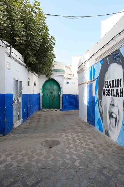
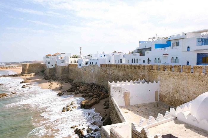
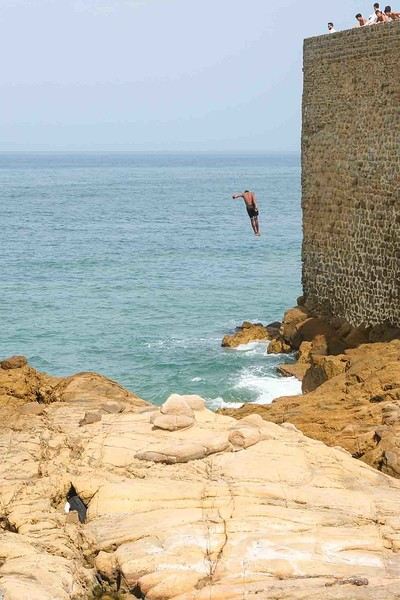
Anyway, we skirted around Tangier’s suburbs—pretty grim—and finally arrived in Asilah.
Following the coast and the long promenade along the beach, we reached the campsite. It was a bit crowded, not much shade, but it wasn’t far from the medina or the beach, and it wasn’t expensive. There’s some life here: Moroccan families seem to live on-site, in tents or basic bungalows. A woman was cooking tagine on a brazier—we were right in the atmosphere! The night was quiet, and we slept well. We set off on foot, walking along the seafront to the medina... We’d already been here in 2009. It was less touristy back then! Still, at this early hour, the little streets inside were very quiet. The walls had been freshly whitewashed, and there were even more murals than before. Around 11:30 AM, we strolled along the ramparts by the sea. There was a nice breeze! And a lot more people around. We enjoyed a milkshake on the terrace of a café overlooking the beach that stretches out at the foot of the medina. Some young guys were having fun diving off the rocks—and even off the top of the wall!
The Two of Us in Istanbul: A Turkish Blue Round
Hello everyone,
I’m not really a regular contributor to VoyageForum, but every time Kate and I travel, she encourages me to write a travel journal and publish it. And I must admit, it’s a very enjoyable intellectual exercise, though not always easy. As a VF contributor whose journals I’ve read once said, this retrospective work not only helps preserve memories but also provides a fruitful moment of introspection by bringing back emotions and feelings.
Kate and I spent a week in Istanbul. For her, who had already visited, it was a return; for me, it was a discovery.
As we’ve now made a habit of, I write the texts, and she posts her photos. We hope this illustrated story, crafted together, will revive beautiful sensations for those who know the city and inspire others to discover it. Here we go!
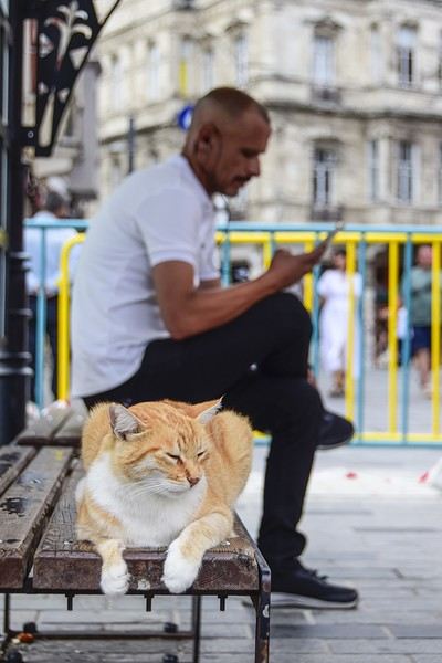
I’m not really a regular contributor to VoyageForum, but every time Kate and I travel, she encourages me to write a travel journal and publish it. And I must admit, it’s a very enjoyable intellectual exercise, though not always easy. As a VF contributor whose journals I’ve read once said, this retrospective work not only helps preserve memories but also provides a fruitful moment of introspection by bringing back emotions and feelings.
Kate and I spent a week in Istanbul. For her, who had already visited, it was a return; for me, it was a discovery.
As we’ve now made a habit of, I write the texts, and she posts her photos. We hope this illustrated story, crafted together, will revive beautiful sensations for those who know the city and inspire others to discover it. Here we go!
Namibia Travel Journal: May 2025 - Trip Review
NAMIBIA TRIP 2025: April 24 to May 20: Feel free to comment or ask us any questions about this amazing journey.
>> Find all our photos and videos for each day on our website here: www.montagne-aventure.net
**DAY 1: Thursday, April 24, 2025: Outbound Flights from Lyon to Windhoek via Munich - Visit to Munich:**

Off we go on a new adventure. The alarm rings at 6:30 AM, the travel bags are packed, and we head to Lyon Airport. We booked our flight tickets with Lufthansa. The first leg to Munich, Germany, is operated by AirBaltic. Departure at 1:05 PM for a 1-hour and 20-minute flight. We arrive at 2:30 PM.
**We now have a 7-hour layover, so we take the opportunity to get some fresh air and explore Munich.** We quickly exit Terminal 2 of the airport and head towards the subway. We buy a group day ticket "Airport-city Day Zone M-5," valid for 2 to 5 people at a price of 30.50 € (instead of 16.30 € per person). We take the S8 line to **Marienplatz** in 35 minutes. **This is the heart of the city.** The weather is overcast, quite cool, but dry. Perfect for a little city trip between two flights while leaving our large luggage in transit at the airport. **Munich is the third-largest German city after Berlin and Hamburg, in the Bavaria region.** **The center has a lot of charm and brings together several religious buildings, easy to explore on foot.** We are impressed by the number of people enjoying these 100% pedestrian streets, which are very pleasant. After Marienplatz, the most famous square with the town hall, we head to the Cathedral of Our Lady, a Gothic church, then continue to **Karlsplatz** and move on to **the food market offering a wide selection of high-end food products in an atmosphere where a certain art of living prevails.** We also visit St. Peter's Church before grabbing a bite to eat. Two good hours were enough for this 10 km city walk. It's time to take the subway back: by 6:30 PM, we are back at the airport. Now, it's time for a bit of waiting and rest. Our second flight is scheduled for 9:35 PM for a 9-hour and 30-minute journey to our final destination in Namibia: **Windhoek.**
> Round-trip flight tickets with Lufthansa from Lyon: 2029 €, or 1,014.50 € per person.
> Lyon Airport parking: 120 €
> Today's expenses: 7 € for 2 pizzas in France / 14 € for the restaurant in Munich / 30.50 € for the daily subway ticket in Munich.
**DAY 2: Friday, April 25, 2024: Arrival in Windhoek, Visit to the Namibian Capital:**
After a 9-hour and 30-minute overnight flight with Discover Airlines, we finally land on Namibian soil just before 7:30 AM. The day is breaking, and the colors are already stunning. We are eager despite the usual fatigue from the flight. The airline was punctual, with friendly staff and good meals, though a bit light. We are the first flight of the day to land, with no more than 15 flights per day here, from 7 AM to 8 PM. We disembark on the tarmac at this airport located in the middle of nowhere, **I finally set foot on African soil for the first time.** We exit among the first from the aircraft to go through the long formalities at the front of the line, as the wait can quickly become endless. Allow at least 5 minutes per person for e-visas. We still wait 45 minutes despite only about twenty people ahead of us. Phew, it's done. We collect our luggage and then withdraw money from an ATM. We make 4 withdrawals of the maximum amount, 2000 NAD $ per withdrawal, for a total of 380 €, or 95.33 € per withdrawal.
Our driver arrives at the same time, perfect timing, we were quick.
We leave the airport at 8:45 AM. By 9:30 AM, we arrive at the **Gracious Whisp vehicle rental agency**, located at the entrance of Windhoek, small and human-sized with a fleet of recent vehicles. More formalities, then a short wait as our vehicle is not yet ready. Time to decompress, catch our breath, and enjoy the very pleasant morning temperature. Not a cloud in sight. Next, a briefing on the vehicle, always with a bit of apprehension due to our approximate English. Allow 45 minutes of explanations, including setting up the roof tent, camping equipment, technical information in case of a flat tire, driving tips in Namibia, and a tour of the 4x4. We have all the necessary equipment for camping: mattresses, sleeping bags, pillows, table, chairs, gas stove, BBQ grill... as well as 2 spare tires, a compressor, a dual tank, and accessories for removing wheels. Off we go, it's time to muster our courage and get behind the wheel. **Heading to SuperSpar Maerua**, fortunately located less than 10 minutes away. We park with the help of a parking attendant; it's very crowded, the space is narrow, but everything goes well despite the cursed right-hand drive. Today's new mission: stock up on groceries. The store is well-stocked with local and imported products, catering to all tastes. We spend 114 € on groceries, from pasta to meat, BBQ lighters to dishwashing products. Two people load our groceries into two carts and transfer them to our vehicle; we feel compelled to leave a tip, 50 NAD $, as we don't have change yet. Now, we head to the hotel, 15 minutes away. Traffic is difficult at a complicated intersection; this will likely be the only traffic jam in Namibia. **We arrive at Kate's Nest Guesthouse & Backpackers around 1:15 PM, quite tired.** We take some well-deserved rest at this recent establishment, quite calm with secure private parking. After a short nap, we enjoy the quiet by the hotel pool. Night falls between 6:30 PM and 7 PM. We eat quietly in our room tonight before starting this long 4x4 road trip in camping mode in the heart of Namibia.
> Today's grocery expenses: 114 € at Super Spar Marua (2395.21 NAD $).
> Round-trip flight tickets with Lufthansa from Lyon: 2029 €, or 1,014.50 € per person.
> Vehicle rental: 4x4 Toyota with roof tent for 24 days: Gracious Whisp Car Rentals: 2,638 € (N$50,640) or **1,319 €** per person - (https://gwcarrentals.com/)
> Distance driven today: 15 km.
> Accommodation: Kate's Nest Guesthouse & Backpackers - 4 Aristotles Street Academia, 9000 Windhoek - 36 € for two for one night.
> Windhoek International Airport website: (https://www.airports.com.na/)
**DAY 3: Saturday, April 26, 2025: Windhoek to Hardap: Mariental Region - Kalahari Desert:**
After a good, restful night, we wake up leisurely around 7 AM. We enjoy the comfort provided by this first and last hotel before 24 nights under the tent.
**We leave Kate's Nest Guesthouse at 8:30 AM to tackle the Namibian roads.** We quickly leave the capital; in just 30 minutes, we find ourselves almost alone in the world. The landscape is dotted with small domes. We leave the **paved B1** quickly to turn left onto the **C15**. **From there, we won't see more than 10 vehicles all day.** After passing through the few houses of **Lekkerwaterpoort**, we tackle our first gravel road. These road sections are limited to 100 km/h, but even at 70 km/h, I find it already challenging. However, I quickly get used to it and gradually pick up speed to reach my cruising speed of around 80 to 90 km/h. **We are on immense straight lines crossing wild expanses as far as the eye can see.** **We come across two baboons, a few ostriches, and numerous cattle and sheep farms.** We pass through the charming village of **Uhlenhorst** with its typical houses and children with broad smiles waving at us. Life here is already very different from Windhoek. **The thermometer rises quickly from 16°C at 8:30 AM to over 28°C in the early afternoon.**
**We arrive at the Hardap Dam reserve at 2 PM.** We stop at the toll booth at the park entrance to pay the entrance fee: 250 NAD $ for 2 people and 1 vehicle. We continue to the dam and then the camp entrance, located a bit further. We had booked in advance, but this place remains little frequented by foreigners.
We take advantage of the hottest hours to rest by the large pool overlooking the immense lake, a very enjoyable moment. Would this be a bit of a vacation?
Around 4:30 PM, we head to the campsite. We overlook this vast water reserve. We arrive first; we will be only 3 vehicles spending the night here. It's time to get to work and set up our equipment for the first time. It takes us a good 20 minutes to set everything up, with a slight apprehension about unfolding the tent. Once this task is done, which we will have to repeat for almost a month, we will become much more efficient over time. Time for rest and contemplation in total silence. The sun gradually sets, and the heat quickly becomes bearable again. Bliss! **This dam is located 20 km northwest of Mariental in an area dotted with conical hills topped with dolerite buttons (Hardap means "hillock" in Nama). It captures the Fish River, which flows south, creating a large lake in the middle of an arid environment. The contrast is striking.** We enjoy our first sunset facing this 360° otherworldly landscape.
Around 7 PM, we start our first BBQ, or "braai" as it's called here. The temperature is perfect. The sun sets, giving way to a star-filled sky of incredible beauty thanks to the absence of any light pollution. The Milky Way will lull us throughout the evening. After some good sausages and potatoes on the BBQ, we head to our roof tent around 9:30 PM with a complete change of scenery in just 24 hours. France already seems so far away...
This campsite has shared showers and toilets, quite clean and functional, as well as a central area with several BBQs and tables. The sites are arranged in a semicircle, each with an electrical outlet. The sites are close to each other but spacious, some slightly shaded. We are only three vehicles tonight, so it's perfectly comfortable and quiet. Not to mention the large pool near the restaurant. Our trip is off to a great start.
> Today's road itinerary: Windhoek > Head south on the B1 to Rehoboth > Turn left onto the C25 then C15 to Stampriet > C20 to Hardap > Full north on the B1 > Then turn left onto the M93 - 5 hours of driving.
> Distance driven today: 354 km.
> Accommodation: Hardap Recreation Resort - 23.3 € for two - Large pool - GR6W+3M2, Hardap Game Reserve, Mariental, Namibia - (http://www.nwr.com.na/resorts/hardap-resort/)
**DAY 4: Sunday, April 27, 2025: Hardap - Brukkaros Volcano - Keetmanshoop - Quivertree Forest Rest Camp**
Our first night under the tent was very pleasant; the little wind quickly calmed down, giving way to absolute silence. The mattress is decent, more comfortable than some nights in Nepal. The length and width give us enough space for maximum comfort, despite my height (1.91 m). We wake up a little before 7 AM as the sun rises, and the lights dazzle us from the start of the day. We pack up the equipment in 30 minutes, quite easily. Then we enjoy the sun, which warms up quickly while we keep our light fleece on.
At 8:30 AM, **we hit the road again, heading south** to our first stop in **Mariental**. We want to do some shopping at SuperSpar, but once we arrive in the parking lot, a young local is fighting with the supermarket security guards and then threatens to throw stones. We don't want to take any risks right at the start, so despite the baton blows he receives, he doesn't stop. We leave empty-handed but fill up with fuel at the Shell station 1 km further. The price per liter is 21.33 NAD $, we fill our 107-liter tank for 107 €. In Namibia, you get served, and they bring the card machine to the window to pay. It's then customary to leave a tip.
We then take the B1 heading due south on a recently renovated road. Around 11:30 AM, we leave it on our right to take **a wild gravel road, the M98**. Just before **Berseba**, we turn right onto a small track, the **D3904 towards Brukkaros Crater up to a camp at 1588 m altitude**. The track then becomes too bumpy. We stop on the counter-slopes where **a wide panorama unfolds over these immense plains as far as the eye can see**. It's 12:15 PM, time for us to eat a rice and tuna salad facing this landscape.
**We are alone in the world until a vehicle arrives and parks next to us.** A bit of apprehension, 4 men head towards us. It turns out to be 4 shepherds looking for a lost foal. The conversation is pleasant, lost in the middle of nowhere. We find ourselves alone again in this absolute silence. **The heat becomes stifling with a good 30°C**. We get back on the road around 1 PM. Back on the B1, **we continue due south to Keetmanshoop**, which we reach around 3 PM. We stop there to do some shopping for 262 NAD $ (12 eggs, a can of tuna, a can of corn, bread, a soda, and a 5-liter water container), or 12.48 €. Two quite insistent children ask us for money or candy at the store exit, yet we give them a small tip, but they continue to cling to the car. Locals parked next to us tell them to leave us alone. Anyway, we finish the trip to **Quivertree Forest**, 15 km away. We will spend the night in this **pleasant farm run by a German**. Upon arrival, as the day before, and as I suppose in the future, we dive straight into the cool pool to relax after all these kilometers. A bliss. Then we take our 4x4 and choose a spot near these famous trees. After the 33°C this afternoon, once 4 PM passed, the temperature drops again and becomes very pleasant. **We are in the middle of the Kokerboom, one of the most interesting and characteristic plants of hot and arid regions. It's not really a tree but a variant of the aloe plant whose botanical name is Aloe Dichotoma. This Kokerboom has a smooth and thick trunk reaching up to 1 m in thickness and 9 m in height. They bloom for the first time at the age of 20 to 30 years.** The flowers are yellow and reach about thirty centimeters during the season between June and July. **They grow mainly in an environment with a high concentration of black rocks absorbing a large amount of heat (38°C). The rocks also serve to anchor the tree with its tentacle-like roots. It also resists frost. Each is between 200 and 300 years old.**
Around 5 PM, we walk to the farm reception to watch the feeding of **two cheetahs**. Magnificent carnivores taking their time to savor their piece of meat. **Then we return near our campsite to enjoy the sunset among these trees. The colors are sublime, as every evening apparently. A magnificent spectacle with colors evolving from yellow to orange then to pink, before giving way once again to a sky filled with thousands of stars.** Our campsite at Quiver Tree Forest Camp is very comfortable; we have a water supply, a stone table, a small lamp, an electrical outlet, a small tree for shade, and a BBQ that we won't use tonight; we'll cook on gas. The sites are far apart, with some shared facilities scattered around, a very beautiful setting. No reservation possible, no need, just show up directly. **The campsite accommodation for 2 people costs 28 €, including the reserve entrance fee of 5 €**. We finish this second bivouac evening around 9:30 PM, time for some reading and sleep in peaceful silence without wind.
> Today's road itinerary: Mariental > B1 heading south to Brukkaros > At Tses turn right towards Berseba via the M98 > Turn right onto the D3904 > 8 km > Brukkaros Volcano (stop at the lower camp as the track is difficult for 1 hour) > Keetmanshoop > Turn left onto the M29 > Quivertree Forest - 4 hours of driving.
> Distance driven today: 371 km.
> Distance walked today: 6 km.
> Today's expenses: Groceries for 12.48 € (262 NAD $) / Fuel for 107 € (1 liter of diesel for 21.33 NAD $).
> Accommodation: Quivertree Forest Rest Camp, P.O. Box 262, Keetmanshoop, Namibia - BBQ, hot showers, toilets, and electricity - No reservation - Pool - 18 €/Person (N$ 340.00 with park entrance) - (http://www.quivertreeforest.com/)
**DAY 5: Monday, April 28, 2025: Quivertree Forest Rest Camp - Giant's Playground - Keetmanshoop - Fish River Canyon - Canyon Roadhouse:**
After an excellent start to the night, we are woken up by the wind shortly before 6 AM, but the sunrise is not far off. We get up at 6:30 AM to enjoy it. The atmosphere is a bit cooler this morning, but the reward is already here.
The adventure continues. At 7:45 AM, we head towards **Giant's Playground**, 4 km away. We take a 3-kilometer walk through this expanse of blocks and igneous rocks.
We continue south at 8:45 AM, passing through Keetmanshoop again where we do some shopping for 25 €, a big stock-up for a good part of the trip: meats, canned goods, pasta, fruits... At 9:30 AM, we take the B4 to Fish River Canyon.
At 11:30 AM, we arrive at the entrance to the NWR park (350 NAD $ entrance for 2 people and 1 vehicle). The track becomes bumpy immediately upon entering the park. After about ten kilometers, we come upon this landscape carved by nature. In the end, it's well worth the detour. We were at the Grand Canyon in the USA exactly (https://www.montagne-aventure.net/2024/04/29/j21-3-juin-2024-grand-canyon-et-lac-powell/) and can thus confirm that this Fish River Canyon is comparable. We make several stops along the southern flank. **Here, nothing is developed; nature is almost in the wild state.** **With 160 km in length, up to 27 km in width, and a depth of 150 m, it is indeed the second-largest canyon in the world.** The history of the canyon is apparent in its different earth layers and stratification: the antiquity of the place is tangible, and the absence of vegetation is surprising. **It consists of two nested canyons, formed at distinct periods. The first distinct layer of schist, sandstone, and eruptive material surrounding the canyon was formed a few two billion years ago, then transformed due to heat and pressure into more solid rock such as gneiss. The inner canyon, carved more recently by the Fish River, has a depth of 270 m.**
We have a picnic once again alone in the world facing this grand panorama at the **Sulphur Spring View Point**. This is where the hiking trail begins, plunging into this narrow canyon, but it is forbidden to venture there alone without a guide. It's 30°C, but a slight wind makes the atmosphere bearable. At 1 PM, we retrace our steps and continue to the **Main View Point** then to the **Hikers View Point**.
In the south of Namibia, the Fish River Canyon, 160 km long, is a true geological wonder: a canyon nested within another canyon, one of the largest in the world. The first sedimentary layers formed two billion years ago; 500 million years ago, a period of tectonic activity caused these layers to crack and tilt, opening a vast canyon in the Earth's crust. The second canyon, with a depth of 270 m, was carved over time by the passage of the Fish River in this new valley.
At 3 PM, we arrive at our very charming camp for the evening, the **Canyon Road House**. We fill up with fuel right away because tomorrow we have a long day of isolated driving: 55 liters for 1240 NAD $. Then we settle into the campsite we had previously reserved in France. We are assigned site 2, very well set up under a tree with its BBQ and stone table just steps from the pool. We quickly set up the tent and jump straight into the pool for the relaxation moment of the day. As usual, the water is quite cool, but it's a real pleasure. Then we stroll around this Canyon Road House, which recreates the atmosphere of the roadside inns of the 1950s with old car wrecks and vintage gas pumps in a bygone era. **Around 5:45 PM, we start a short walk leading us to the top of a hill overlooking the wide plateau where we are to watch the sunset.**
And finally, to end this beautiful day, it's time for the braai, with grilled sausages and white beans on the evening menu.
> Park entrance: 150 DN/person + 50 DN/vehicle (18 € for two). It is possible to enter at two access points: Hobas in the north and Ai-Ais in the south.
> Today's road itinerary: M29 > Keetmanshoop > B1 > B4 > C12 (track) > After Holoog turn right onto the D601 (C37 track) > Accommodation on our right (stop just to check in before 6 PM) > Continue 30 km (30 minutes of track) to the viewpoints after Hobas where you must pay the entrance fee. Sunset View Point to the left > Return before sunset as the park closes (best lights at sunrise). 3 hours.
> Distance driven today: 228 km.
> Distance walked today: 10 km.
> Today's expenses: 25 € for groceries / 17 € for the Fish River Canyon park entrance / 58 € for fuel.
> Accommodation: Canyon Roadhouse, Gondwana Collection Namibia – 34.4 € for two - Pool - Near Hobas - (http://www.gondwana-collection.com/fr/accommodation/canyon-road-campsite)
**DAY 6: Tuesday, April 29, 2025: Canyon Roadhouse - Orange River - South African Border - Vista Trail - Gondwana Sperrgebiet Park - Aus:**
The night was excellent in this very comfortable campsite. **We wake up to the sound of birds** before the alarm at 6:45 AM. Our little morning routine starts as the sun rises. **A big day of driving awaits us to the South African border. This will be the southernmost point of our journey.** We hit the road at 8 AM via the C37, pass through **Hobas**, then turn onto the D207 to **Aussenkehr.** **We cross a mountainous barrier with some high peaks and perfect cones. The rock varies from orange to pink to black.**
We then cross a lunar desert as far as the eye can see on a giant dome; the track winds through nowhere without meeting anyone for hours. The landscapes are surprising. **We spot several ostriches and a gemsbok.** In the middle of this endless expanse, we come to an improbable intersection and continue right onto the D278.
In the middle of these arid lands, we come across a green zone: a vast vineyard. At 10:30 AM, **we come across a "Road closed" sign, fortunately, a local resident waves us to continue; a bit stressed, we proceed.** We start to follow the beautiful Orange River. On the other side of the bank, just a few meters away, South Africa is there. It is the second-longest river in Southern Africa, after the Zambezi. It flows over 2,000 km to the Atlantic. After passing through narrow gorges, we regain altitude before starting the descent, gently heading back north.
**We now cross and follow the Fish River, which joins the Orange River further south** **along this gorge dating back millennia.** At exactly noon, we take a lunch break by the Fish River, still without meeting a soul in this landscape between greenery and aridity. The temperature here is cooler with a pleasant 23°C on the banks, the perfect spot. **We continue on the track to Rosh Pinah**, where we find a paved road again. **The section along the Orange River and the Fish River was officially closed, but we were able to pass without any issues, avoiding a detour of at least 3 hours.** Phew. We now drive at high speed (limited to 120 km/h) through these vast spaces. We come across many ostriches after the **dozens of monkeys along the Fish River**. Around 3 PM, 3 km after the very small town of **Aus**, we reach **our campsite for the evening at Klein Aus Vista**. A new **small peaceful haven very well set up**. As usual, after checking in at reception, we jump straight into the beautiful pool to get our well-deserved dose of coolness, another good thermal shock that our bodies appreciate. Once this moment of relaxation is over, we take our 4x4 to reach the campsite located a bit higher, set apart at the foot of a hill that overlooks us.
After setting up, **around 5 PM, we head to the Vista Trail to climb to the top of a mountain overlooking the vast plain that surrounds us at 360°**. It takes about 30 minutes to climb. The place is just magical, **the perfect viewpoint to admire the sunset**. **We fully savor the moment. We also spot one of the few wild horses in the world capable of living in the desert.** Their numbers have decreased in recent years due to predation and drought (around 100 to 150). At 7 PM, we return to the camp, time for the braai and preparing the meal in this peaceful little camp.
In the south of Namibia, the Fish River Canyon, 160 km long, is a true geological wonder: a canyon nested within another canyon, one of the largest in the world. The first sedimentary layers formed two billion years ago; 500 million years ago, a period of tectonic activity caused these layers to crack and tilt, opening a vast canyon in the Earth's crust. The second canyon, with a depth of 270 m, was carved over time by the passage of the Fish River in this new valley.
> Today's road itinerary: 5 hours of driving: D324 heading south (track) > turn right onto the C10 (track) > D316 heading south > turn right onto the C13 > In Aus turn left onto the B4 > Campsite via a track on the left.
> Fuel station: Solitaire or Aus.
> Distance driven today: 398 km.
> Distance walked today: 7 km.
> Accommodation: Klein-Aus Vista Desert Horse Campsite - Farm Klein-Aus No 8 on the B4 main road to Luederitz Aus 9000, Aus, Namibia - (http://www.klein-aus-vista.com/accommodation/desert-horse-campsite/) 17908 420 DN - Water + Shared shower (hot water). No electricity.
**DAY 7: Wednesday, April 30, 2025: Aus - Kolmanskop - Diaz Point - Luderitz - Kanaan Desert:**
We wake up around 6:45 AM, with partly cloudy weather for once; we feel the ocean's influence gradually. But the sun isn't far off. At 7 AM, we leave the campsite heading west towards Luderitz via the B4. **First stop of the day: Kolmanskop, the ghost town we reach at 8:30 AM**, entry costs 180 NAD $ per person. We discover this **timeless place** in 1.5 hours, moving from building to building amidst violent sand-laden gusts of wind. There's a lot of charm in these different living spaces. **The sand quickly reclaimed the place after this mining town was abandoned.** This was once the headquarters of Consolidated Diamond Mines. It's hard to believe that this former town, where the diamond industry once flourished, had a hospital, a bowling alley, and a theater. The decline in diamond sales after World War II and the discovery of richer deposits put an end to this golden age. By 1956, the town was already completely deserted, and the sand had reclaimed its rights. **These dilapidated buildings swallowed by shifting dunes have something surreal about them.**
At 10:15 AM, we hit the road again **heading to Luderitz, 22 km away**, and first to **Diaz Point** **facing the Atlantic Ocean**. It's a wind-swept peninsula with its characteristic red and white lighthouse. There's a campsite and a coffee shop on site, but the place doesn't inspire rest without shade or shelter from the wind. We return to the city via the D701 track that runs along the ocean, be careful at low tide. We come across **a few fishermen and a fox as well as flamingos.**
We walk through the few streets of the city, much smaller than I imagined, then climb to the **famous little Lutheran church that overlooks the city, the Felsenkirchr.** **The wind blows very strongly here, and the sand is omnipresent, surrounded by the Namib Desert and the southern Atlantic coast.** **A German colonial relic barely touched by the 21st century, Luderitz seems frozen in the past, giving it both a gloomy and a certain charm. In short, it's certainly one of the most incongruous places in Africa.**
At 1:15 PM, just before leaving Luderitz, we do some shopping for 20.50 € and fill up with fuel: 61.50 €, 1290 NAD $ for 61 liters (21.18 $ per liter).
**We return via the B4 to Aus** (paved), **then via rougher tracks**, the C13 then the D707, magnificent as it runs along a mountain range with multiple colors on our right and an endless flat desert on the other side.
To access our campsite for the evening, we must take a **narrow private track for 7 km** on our right to emerge, in this total vastness, at the **isolated Kanaan Desert Retreat on a small hill**. I don't have time today to jump into the pool near the reception; we arrive at 5 PM at 8 small, isolated, and unique sites with a small kitchen, a shower, and a private toilet under a small tarp shelter. **A crazy charm with a unique view...** **This will be my favorite accommodation of this trip. The photos speak for themselves.** We jump into the outdoor shower while savoring the landscape, then prepare our evening braai while enjoying the colors fading, facing this plateau with bushes turning a vivid orange. **A moment that will remain etched for life.** **Savanna atmosphere under a thin emerging moon. Every minute offers different colors. Facing our meal, we have a natural giant screen.**
We end this day contemplating the stars and admire this thin orange moon setting on the horizon (8:42 PM).
**Ghost town just before Luderitz: Kolmanskop** (open from 8 AM to 3 PM - N$ 180 p.p – 9 €). Once, Kolmanskoppe was organized around diamond mining. After finding new, more prolific spots, the town was abandoned and is now a ghost town. The sand and dunes have reclaimed their rights and buried everything humans had built. Houses, train station, bakery, everything has been covered by sand, which passes through the windows, even though they are 1 meter high.
> Today's road itinerary: 5h30: B4 to Luderitz (paved) > Round trip > Kolmanskop on the left > Return via the previous campsite > Then C13 (track) > Turn left D707 (track) > Then track to the right to the campsite.
> Distance driven today: 438 km.
> Distance walked today: 8 km.
> Today's expenses: Groceries at the Spar in Luderitz for 20.50 € / Fuel fill-up in Luderitz for 61.50 €.
> Official Kolmanskop website: (https://kolmanskuppe.com) (open from 8 AM to 1 PM - N$ 180 p.p – 9 €).
> Accommodation: Night at the south of the Namibrand Nature Reserve: Kanaan Desert Retreat – 26.5 € for two - (http://www.kanaannamibia.com/) - Farm 104 Karas 9000 - Sanitary facilities + BBQ + Water + Pool - No electricity - My favorite accommodation of this trip.
**DAY 8: Thursday, May 1, 2025: Kanaan Desert Retreat - Namib Desert - Crossing the Namibrand Nature Reserve – Sesriem Canyon - Elim Dune - Little Sossus Lodge**
After a cooler night than the previous ones with about 10°C, we wake up around 7 AM. We admire, as usual, the sunrise between the desert and the mountains. **The spot from last night was truly perfect, isolated from the world, in total serenity, with a wake-up call to the sound of birds.**
We hit the road a little after 8 AM, heading north via the D707 to Spes Bona, then the gravel road C27 via Betta to Sesriem. **The landscapes roll by and dazzle us.** **We are right in the heart of the Namibrand reserve**, coming across numerous **zebras**, **impalas**, **ruminants that reproduce in large numbers**, and **gemsboks**. At noon, we stop in the shade of a tree to eat. The spot is so romantic facing orange arid mountains and a vast green plateau. **A landscape full of contrasts, timeless and silent.**
**The Namib Desert is the oldest on the planet; its name means "vast arid plain," and it also gave its name to the entire country: Namibia.** The majority of these arid and semi-arid lands dotted with viewpoints are part of the Namib-Naukluft National Park, which covers 23,000 km².
At 1 PM, we enter the Sossusvlei park. We start with the **Sesriem Canyon**, which is 3 km long and 30 m deep. We enter it with a short 1-hour hike into its depths. **It was carved by the Tsauchab River in an agglomerate of sand and pebbles over 15 million years old.** We retrace our steps back to Sesriem, which means "six belts," referring to the number of leather belts (from ox wagons) needed to draw water from the canyon. This remote locality is mainly the gateway to Sossusvlei but offers a gas station and some accommodations. For our part, we sleep 40 km away tonight.
**We then move on to Elim Dune.** It takes about 45 minutes of walking to reach its summit, and the climb is very breath-taking as we progress in the sand where we almost slide back with each step. **A first grand 360° panorama unfolds. The ochre color of the sand contrasts completely with the yellow plain and the brown and black mountains in the distance.**
At 3:15 PM, we start the descent facing Sesriem. We were completely alone once again on this dune. **These Namib dunes are composed of colored quartzite sand, presenting hues ranging from cream to orange and from red to purple. Unlike the ancient dunes of the Kalahari, these move with the wind and adopt distinct, ever-changing shapes.** Star dunes resemble stars seen from above, while transverse dunes, like those on the coast south of Walvis Bay, stand perpendicular to the prevailing southwest wind. The most stable dunes, which thus have the most vegetation, are parabolic dunes, due to the variability of the winds. Longitudinal (seif) dunes measure up to 100 m in height, while barchan dunes, crescent-shaped and predominant at the extreme north of the Skeleton Coast and south of Luderitz, are the most mobile, created by unidirectional winds.
**We get back on the road for 45 minutes to our campsite for the evening, Little Sossus, which we reach at 5 PM**, via C27 then right onto C19. As often upon our arrival, I jump into the cool pool to relax after all this driving, then we proceed to set up the camp. As the day before, the campsite consists of 10 fairly distant sites, with private sanitary facilities and a small roof. We are delighted with this crazy charm. The hot water for our shower is wood-heated: a Namibian lights it every evening around 5 PM.
For a change, or not, the menu features a small BBQ with pork ribs and pasta, facing another sunset, this time with partial cloud cover giving equally splendid colors. Time for a well-deserved rest after long corrugated tracks covered in our 4x4 today.
> Today's road itinerary: 4h45 of driving: Find the D707 and head north (track) > At Spesbona turn left onto the C27 (track) > At Sesriem after entering the park, turn left following View Point Sesriem > Continue 4.5 km to the Sesriem Canyon Parking > Return then head towards Elim Dune > Exit the park then take the D826 > Turn right onto the C19 heading SE > Turn right facing the D854 to the campsite (campsite closes at 7 PM).
> Distance driven today: 272 km.
> Distance walked today: 8 km.
> Today's expenses: Entry to the Sossusvlei Namib-Naukluft Park: 17 € for two (with one car).
> Accommodation: Little Sossus Lodge – 35 € for two - At the junction of the C19 and D854 roads Maltahohe 9000, Maltahohe, Namibia - (http://www.littlesossus.net/) - Pool + Private bathroom + Hot water + Electricity + BBQ + Grocery store (bread to order the day before).
**DAY 9: Friday, May 2, 2025: Little Sossus Lodge - Namib-Naukluft National Park – Sesriem - Sossusvlei - Big Daddy – Deadvlei - Tsauchab River Camp**
Today we start the day early to tackle **the famous dunes of Sossusvlei at first light**. The alarm goes off at 6 AM to leave the camp at 6:45 AM. The wind is blowing quite strongly in gusts this morning, but it only woke us up a quarter of an hour before sunrise. The park opens at 7:15 AM. We start with a small encounter: a friendly **jackal lounging by the roadside.**
We first have to cover the 40 km of track to Sesriem, pay the entrance fee (350 NAD $), and drive 65 km on a paved road this time to reach the **vast salt pan (a lake whose sediments are made of salts) of Sossusvlei**. **It appears amidst the gigantic red dunes that rise on either side. The wind constantly changes the shape of the dunes, as well as their colors, which vary with the light. The setting is breathtaking, giving an impression of immensity and timeless grandeur.**
The paved road ends; the last 4 kilometers become technical and are reserved for 4x4s. Phew, I pass without any problems, though not without stress, switching to L4 mode. **We start the ascent to Big Daddy at 8:45 AM, 325 m of elevation gain in the sand nonetheless.** We climb at an excellent speed despite the strong wind, in exactly 1 hour. At 9:45 AM, we are at the summit of what will remain etched for a long time. The 360° view is simply unimaginable; you have to experience it to believe it. The wind blows violently up there, **it feels like being in the high mountains, on a snow ridge, with a strong transport of sand. The atmosphere is magical.** We start the descent running barefoot in the steep sand.
**We then move on to its neighbor, Deadvlei.** **Here, petrified trees stand in the "vlei" (basin) with their dried branches casting desolate shadows on the white ground. The juxtaposition of the deep blue sky and the towering dunes is captivating.**
We return to the 4x4 parking at 11 AM, the stress rises again for the sandy track passage. We retrace our steps and stop at **Dune 45**.
At noon, we take the opportunity to picnic at the foot of **the beautiful Dune 40**, where there is already no one left. We enjoy the quiet again, well, almost, as the wind remains omnipresent.
At 1 PM, we return to **Sesriem**, where we fill up with fuel (21.15 NAD $ per liter), totaling 1630 for 77 liters (78 €), and do some shopping for 245 NAD $ (two nice pieces of pork, 2 cans, 2 sandwiches for tomorrow, and 1 soda), which is 12.48 €. It's 27°C. We hit the road again, heading to a new destination at 2 PM. We take the C19 back to Little Sossus where we spent the night, then turn left onto the gravel road D854 for about 40 km to **Tsauchab River camp**. Finally, we won't be sleeping here; we are redirected 7 km downstream to **Naukluft View Camp**, which also belongs to Tsauchab River Camp.
We arrive at 4 PM, and thankfully, the fatigue was starting to set in. **Our campsite is located under a small forest, providing some protection from the wind that blew strongly all day. The calm does us a world of good. Once again, a lot of charm**, with very spaced-out sites without any visibility. We can't wait to take our shower. It will be possible from 5 PM with, as the day before, water heated by a wood fire. Time to prepare the campsite for the night. And on the menu, a braai with two superb pieces of pork bought in Sesriem and fries!!!!
**The Namib Desert**
An impressive coastal desert stretching from the Atlantic to a high plateau inland, the narrow Namib Desert runs along the southwest African coast for about 1,300 km. **Considered one of the oldest deserts in the world**, it is bordered to the north by the Kaokoland Desert, which extends into Angola, and to the south by South Africa's Karoo. The narrow Namib is mostly less than 160 km wide. Despite this, it is considered to consist of three sections: the coastal strip influenced by the Atlantic; the Outer Namib, occupying what remains of the western half; and the Inner Namib, comprising the eastern half of the desert. Generally called the Skeleton Coast, the coastal Namib receives almost no rain and depends on regular marine fogs for moisture. From sea level, the terrain rises to 900 m, where the desert meets the base of the Great Escarpment to the east. In the Inner Namib, average annual rainfall is only about 50 mm.
The dryness is such a characteristic of the Namib that it is thought to have been in this arid state for at least 55 million years. It is all the more surprising to learn that animals such as vipers, geckos, zebras, and elephants live in this desert. Some areas of the Namib are also rich in flora, including Welwitschia mirabilis, which grows near the ground with seemingly exhausted leaves, extracting moisture from marine fogs and can live over 1,000 years. In the southern Namib, some dunes are up to 32 km long and 240 m high.
**The frequent fog of the Skeleton Coast:** Driving north along the coast of Namibia, the cold Benguela Current in the Atlantic cools the moist air above the ocean, which, upon meeting the warm desert air, leads to the formation of thick fog banks that drift up to 100 km into the center of the Namib before evaporating under the sun.
> Today's road itinerary: 4 hours of driving: C19 towards Sesriem (track) > D826 (paved) > Foot of Big Daddy via a technical sandy track > Return via the same route > D854 to Tsauchab.
> Gas station: Sesriem.
> Distance driven today: 254 km.
> Distance walked today: 12 km.
> Today's expenses: Park entry at Sesriem for 2 people: 17 € / Fuel fill-up: 78 € / Groceries at Sesriem gas station: 12 € (245 NAD $).
> Accommodation: Tsauchab River Camp - Naukluft View Camp - D054 & D850 GPS: S24 26' 37" E16 10' 11" Sossusvlei 22007, Maltahohe, Namibia - BBQ + Private sanitary facilities + Water - www.tsauchab.com
**DAY 10: Saturday, May 3, 2025: Tsauchab River Camp - Naukluft National Park - Olive Trail Hike (10 km) - Ababis Guest Farm**
We pack up the camp at 8 AM and continue our road trip north via the D854, a bumpy track with many corrugated sections. It's cool this morning, 12°C.
**We enter the Naukluft massif, discovering landscapes with very different terrain than before.** We first need to check in at the campsite, 13 km from the entrance at the end of the track: 350 NAD $ for 2 people and 1 vehicle, then return 4 km back. **On the agenda is the lovely Olive Trail, a 10 km hiking loop that starts 4 km northwest of the park office**, along the D854 that we follow. At 9:45 AM, the hike begins with a fairly steep ascent (about 45 minutes) among the **wild olive trees** from which the trail gets its name. **At the summit, we enjoy a view that embraces the Naukluft Valley.** We then turn east and gradually descend into a deep valley, passing over sometimes slippery rocks. We have a snack around 11:30 AM in these small gorges. **Further on, to cross the wall of a canyon in front of us, some chains are fixed to the rock to help us pass.** We finish this superb loop clockwise at 1:15 PM, taking 3.5 hours including 30 minutes of breaks. We only crossed a small group of 3 people on this wild adventure far from everything. At 1:45 PM, we exit the park and take the **D854 track north to Bullsport**. From there, we turn left and take the C14, which **runs along the bed of the Tsondab River.**
**We arrive at our campsite for the evening, Ababis Guest Farm, at 3 PM.** Quite early for once, allowing us to rest a bit in this peaceful farm where many sheep wander around us. We also enjoy the pool under a magnificent sun, less hot than the previous days, it's 22°C. The camp has only 4 spaced-out sites around shared sanitary facilities. **We are in the middle of a vast plain facing the Naukluft massif mountains.** We will have another beautiful sunset on these mountains. For the first time on this trip, **we will be completely alone at this campsite.** **We haven't encountered many people today**, just 3 during the hike and fewer than 10 vehicles all day.
> Today's road itinerary: Head north on the D854 (track) > Turn left to enter the Naukfluft National Park > Continue on the track then turn right to the Olive Trail hike parking lot (1 hour for 45 km). Return to the D854 and continue north > At Bullsport turn left onto the C14 to Ababis (still a track) > The camp is located on the left facing the D1261 (1 hour for 60 km from Olive Trail). Total: 2 hours of driving for 100 km.
> Gas station: No gas station on the route, except in Solitaire.
> Distance driven today: 115 km.
> Distance walked today: 13 km.
> Accommodation: Ababis Gaestefarm - Night booked by email – payment on site: (https://www.ababis-gaestefarm.de/) - P.O.Box 1004, Maltahöhe - N$ 300.00 per person
**DAY 11: Sunday, May 4, 2025: Ababis Gaestefarm - Namib-Naukluft National Park – Solitaire - Gaub Pass - Kuiseb Canyon - Moon Landscape - Walvis Bay**
The night was, for the first time since the start of this road trip, quite difficult. A strong wind accompanied us all night, making the tent flap constantly. A racket that drove us crazy. We still managed to sleep a few hours. The morning sun brings back our smiles. We hit the road for this new stage a little before 7:45 AM.
We start the day with a first stop less than 15 km away **on the C14 in Solitaire** at 8:15 AM. **This town is lost in the middle of nowhere with its small gas station with a western atmosphere adorned with rusted and sand-covered car wrecks.** After a quick supply stop: 86 NAD $, or 4 € for 1 water container and a box of cookies, we continue north still on the C14, **crossing the Tropic of Capricorn** then devouring this **magnificent track up to Gaub Pass**. **A succession of narrow gorges, turns, climbs, and descents breaking the monotony of the previous long straight lines.** We are right in the heart of no man's land for 200 km. We then start the descent to the **Kuiseb Canyon. It houses the wide bed of the eponymous river, dry almost all year.** Even when it flows for 2 to 3 weeks during the rainy season, it doesn't go beyond Gobabeb and then seeps into the sand. **The drinking water that supplies Walvis Bay is pumped at Rooibank from this underground water table.** **We now cross the Kuiseb Desert where impressive dunes roll down.** We make a short stop at a **natural rock arch** reminding us of our (https://www.montagne-aventure.net/2024/04/29/j19-1-juin-2024-canyonlands-national-park-et-arches-national-park/). Then we gradually descend towards **Walvis Bay** where we will spend the night. At noon, we enter the **Dorob National Park**. The thermometer drops 10°C in 10 minutes as we get closer to the Atlantic Ocean.
At 12:45 PM, much earlier than initially planned, we arrive at the **Moon Landscape** (View Point 4, free) to have a snack, via a very recent surprising dual carriageway in the middle of nowhere, then via the C28. We are again in the hinterlands, the temperature has soared: 30°C without a bit of shade. Even if the colors and the panorama must be exceptional at sunrise or sunset, the detour for this 360° panorama is still worth it. Extreme aridity as far as the eye can see. The place lives up to its name; it really feels like being on the moon. We get back on the road at 1:30 PM via the D1991, C28, then again the A2, which is very new. The latter runs along the beautiful dunes up to the **Dune 7**, where we make another stop.
Then we head towards our final destination of the day, **Walvis Bay. Its port is sheltered by a sand spit, a natural breakwater that protects the city from the powerful assaults of the ocean. Its port was long a strategic place: claimed by the Cape Colony in 1795, it was officially annexed by the British in 1878 to counter Germany's ambitions in the region. A colony of fur seals, pelicans, flamingos, and whale terns have made it their home.**
We do a big grocery shopping at the Spar located in the center for 66 €; it's very easy to park there. Then we fill up with fuel at an Engen station right across for 1117 NAD $ for 54 liters (20.6 NAD $ per liter), which is 54 €. We then **enjoy the seaside in the Lagoon neighborhood**, where it's also easy to park. After kilometers in the desert, **this cool break is more than welcome. The outside temperature is 22°C. In the distance, we can clearly see the clouds lingering over Swakopmund.**
We take the 4x4 one last time to the **Lagoon Chalets where we will spend the night**. The spot is well set up and surprising in the heart of a residential neighborhood. The sites are quite large, separated by fences around very comfortable shared sanitary facilities. BBQ, electricity, and shaded area. We settle in quietly before going out on foot to watch the **sunset over the Pacific Ocean along Lagoon Promenade Road**. We can still see this impressive persistent mist in the distance. The neighborhood is very peaceful, certainly without much charm, but with a very well-developed seafront that inspires relaxation after kilometers without meeting anyone in inhospitable lands. We end the day with our traditional braai: grilled chicken thighs and sautéed potatoes in the coolness of a starry sky.
> Today's road itinerary: 5h30 of driving (or 3h30 of driving for 250 km without the Moon Landscape): Head north on the C14 > Cross the Tropic of Capricorn > Gaub Pass > Kuiseb Canyon on our left in a round trip > Continue to Green Valley and leave the C14 to the right on the D1984 > Turn right on the C28 > Then left D1991 to Moon Landscape D1991 View Point 4 > Return via the same road and stop at Dune 7 for sunset > Walvis Bay.
> Gas station: Solitaire or Walvis Bay.
> Distance driven today: 372 km.
> Distance walked today: 5 km.
> Today's expenses: Fuel fill-up for 54 € + Groceries for 66 € at Spar.
> Accommodation: Walvis Bay: Lagoon Chalets – 36.6 € for two - (http://www.lagoonchaletswb.com/) - 8th Road West, Meersig Meersig 9000, Walvis Bay, Namibia - BBQ – Electricity – Shared sanitary facilities.

**DAY 12: Monday, May 5, 2025: Walvis Bay - Swakopmund - Round Trip to Cape Cross (seals) - Wreck of the Zeila en route - Henties Bay - Spitzkoppe Tented Camp & Campsite**
After an excellent night, a bit cooler and more humid than usual, we wake up around 7 AM and leave the camp at 7:45 AM to **follow the Atlantic coast heading north**. We thus leave **Walvis Bay**, a very pleasant stopover town, and follow the ocean via the B2. **We enter the mist and Swakopmund** at 8:40 AM, parking **near the lighthouse**. The atmosphere is very quiet, the streets seem dead with large empty parking lots and very little traffic, but the few open shops are filled with expatriates enjoying their breakfasts, French bakeries, cafes, travel agencies... **We are in this Benguela Current, a fast cold ocean current that flows from South Africa, up the coasts of Namibia and Angola, towards the northwest to join a warm equatorial current. Hence the supply of very fish-rich waters and this tenacious mist depending on the seasons. In the northern part of the Namib Desert, fogs are frequent during the southern winter. It's almost the only source of moisture since the city of Swakopmund receives, on average, only 11 liters of water per m² in December and January.**
**Swakopmund is wedged between the dunes and the Atlantic rollers. It is the Namibian capital of adventure activities and has a ghostly colonial remnant. With its German architecture, its seaside promenade, it resembles a seaside town of the North Sea or the Baltic.** It is also a bustling African city. **Nearly two-thirds of Swakopmund's population live in Mondesa, a township created during apartheid, northeast of the city center, a legacy of the South African mandate.** The heart of the city is located in the area of the pier, at the foot of the lighthouse, better known as the Mole. During the South African occupation of Swakopmund, the port took a back seat to Walvis Bay.
Continuing on this C34, sometimes on salt, we come across the famous **wreck of the Zeila, stranded in 2008**, on our left. We can see it through the thick fog, being very close to the beach. It's 10:15 AM. Further on, Henties Bay is a bay that attracts many fishermen; it's teeming with vehicles equipped with fishing rods. Besides its fish-rich waters, it enjoys a relaxed atmosphere and a large beach suitable for walks.
We continue further north, heading to Cape Cross, this time a round trip because we will turn off later here in Henties Bay to reach Spitzkoppe via good gravel roads that are quiet alternatives to the very busy paved B2 further south. **Henties Bay is part of the Dorob National Park, a multi-purpose park protecting coastal ecosystems and hosting the many renowned recreational activities of the region. The part of the coast north of Swakopmund up to the Ugab is particularly popular with fishermen who come in droves to fish for saltwater fish.** The small concrete buildings spaced at regular intervals are actually toilets for fishermen and campers. The coastline is also dotted with world-renowned surf spots.
Even before arriving, we can already smell it before we come across thousands of seals (population in 2021: 1.5 million). **The Cape Cross Seal Reserve, the most renowned on the Namibian coast, is home to the most famous breeding colony of fur seals, which seems to take full advantage of the high concentrations of fish present in the icy waters of the Benguela Current. We are impressed by the sight of these 100,000 pinnipeds lounging on the beach and frolicking in the waves.** We have a picnic a little away from the smells facing the ocean in the sun.
At 12:45 PM, it's time to hit the road again. We retrace our steps back to Henties Bay. We stop there to do another big grocery run before not encountering any big cities for many days. We will only buy fresh items day by day until the end of the trip; we have 23 € worth. **In the space of 30 minutes, we go from 15 to 36°C. The thermal shock with an amplitude of more than 20°C.** At 1:45 PM, we hit the road again via the D1918, then we try a very small track on our left, the D1925. It becomes narrow and rough; I have a bit of apprehension. We arrive at a gate to open in the middle of nowhere, then young children run up to us asking for water or food... We then drive to **Spitzkoppe. The arrival right in front of the mountains is majestic, off the beaten path. This mountain appears in the distance like a mirage above the dusty plains of southern Damaraland.** We come across a second gate held by a guard. We enter the "Community Camp" campsite without realizing it through the west entrance. We are given a small paper, then we go to the reception passing **at the foot of these gigantic, magnificent rocks.** Once at the reception, we are informed that this is not the camp we had booked. Ours is located just a little further, and in the end, it's better because the latter was packed. We were able to cross the park very close to these rocks without paying. We exit through the main entrance; 5 Himba children cling to our doors and trunk asking for bread and food again. We continue despite them staying attached, worried about hurting them. Phew, more fear than harm. We cross the few houses and arrive at the right camp at 4:30 PM, the Spitzkoppe Tented & Campsite. The spot is much quieter and well set up. We have site C12, cozy to perfection with its sink, a private shower and toilet, as well as electricity, under the shade of a tree and facing the mountains. The sunset and sunrise will be perfect. We set up the tent and, without delay, head to the pool for a big dose of coolness. Then it's time to prepare the BBQ and **contemplate the fading lights on the Spitzkoppe massif.**
> Today's road itinerary: 5 hours of driving: Head north on the B2 (paved) along the ocean > Swakopmund > C34 (paved) still heading north > On the left, the wreck of the Zeila before Henties Bay > Cape Cross round trip > Henties Bay > D1916 heading east (track) > Turn left onto D3716 > Turn left to the campsite.
> Gas station: Swakopmund or Henties Bay.
> Distance driven today: 344 km.
> Distance walked today: 6 km.
> Today's expenses: Groceries in Henties Bay: 23 € + Cape Cross park entry: 17 €.
> Accommodation: Spitzkoppe Tented Camp & Campsite - Spitzkoppe River Valley 00000, Spitzkoppe river valley, Namibia - (http://spitzkoppemountaincamp.com/) - 26 € - Pool - BBQ - Shower and toilet.
**DAY 13: Tuesday, May 6, 2025: Spitzkoppe - Rock Pools - Uis**
It's 6:45 AM, **we wake up at the foot of one of the most emblematic landscapes of the country, Spitzkoppe, which towers over the valley at 1,728 m.** **The Spitzkoppe massif, "pointed hat" in Afrikaans, is actually a set of three rock formations: Big Spitzkoppe, the granite domes of the Pontok Mountains that surround it, and Little Spitzkoppe, to the southwest. It was first climbed in 1946 and has never stopped attracting experienced climbers; it remains one of the most challenging ascents in the country. The climate in the region is hot**, so try to visit during the cooler months, as it can quickly reach 36°C in the sun in the afternoon. **Spitzkoppe is particularly striking at dusk, as it was last night, and at dawn this morning when the low light sets the rocks ablaze with red and orange hues. The spectacle is unique.**
We re-enter the park managed by the local community (160 NAD $ per person), then start with the **arch sector**. We quietly enjoy all the viewpoints under perfect orange colors. We leave this magnificent spot, reminding us of (https://www.montagne-aventure.net/2024/04/29/j19-1-juin-2024-canyonlands-national-park-et-arches-national-park/), but with much less crowding here. Around 10 AM, we head closer to these mythical peaks, including the main one nicknamed the Matterhorn of Namibia. Then we finish with the **ascent of the rock above Rock Pool. The 360° view of the park is a must-see. Small natural pools carved into the rock bring a bit of water to this arid and rocky landscape.** The wind blows strongly up there, and during a photo shoot with a tripod, it falls forward right onto the lens glass, cracking it... Frustration and shouts, these will be the last quality photos of this trip, and a new bill to pay when we return to replace it... Disgusted.
We continue to **Bushmans Paradise**, have a lunch break in the shade of a rock before hitting the road again around 12:30 PM after thoroughly exploring the park, feeling weakened and sad about my passion: photography...
We fill up with fuel as soon as we arrive in Uis at the price of 21 NAD $ per liter, a total of 1021 NAD $ for 50 liters (52 € by card). **Uis is a former mining town. Tin mining ceased in the early 1990s, but the high white mountain where the ore was dumped is clearly visible. The region is rich in amethysts, Brandberg crystals, and other semi-precious stones; we come across many vendors on the roadside.**
We then head to our final destination of the day, the **Daureb Isib Restcamp**. We arrive quite early for once at 2:45 PM in the heat, but the camp is just perfectly set up, surely the most upscale we will have during this trip. We are in a fortunately shaded area under palm leaves, with a table, chairs with cushions, a sink, a hot shower, toilets, a beautiful pool, and of course our private BBQ. Perfect for regaining a bit of a smile after the fall of my DSLR camera. **We are facing the Brandberg massif, the "fire mountain" in Afrikaans, dominated by Königstein (2,573 m), the highest peak in Namibia.** **The Brandberg owes its name to the reddish-orange glow that forms on its slopes at dawn and dusk, when the sun's rays awaken its red granite faces studded with crystals. It also hides a real treasure inside, as it contains an exceptional concentration of prehistoric rock art**, mainly paintings and some petroglyphs, including the most famous of them, the **White Lady in the Tsisab Gorge**. There are over 43,000 in total, dating back 2,000 to 4,000 years, scattered in hundreds of crevices around the mountain.
Time for the usual swim, laundry, and evening cooking. On the braai menu, local sausages with cheese pasta and leftovers for a good salad the next day.
> Today's road itinerary: 1h45: Head north on the D3716 > Then D1930 (gravel and sand track) to Uis.
> Gas station: Uis.
> Distance driven today: 113 km.
> Distance walked today: 6 km.
> Today's expenses: Fuel fill-up in Uis for 52 € (1,021 NAD $).

> Accommodation: Daureb Isib Restcamp - Erf 672 C/O 3rd & 4th Avenue Uis 9000, Uis, Namibia - (http://www.daurebisib.com/) – 31 € - Pool. Comfort with private bathroom + electricity + Wi-Fi at the restaurant. Clear sky for a beautiful starry night.
**DAY 14: Wednesday, May 7, 2025: Brandberg (Namibia's Highest Mountain) - Damaraland:**
**The Brandberg massif is an isolated, dome-shaped mountain, an inselberg, that towers over the gravel plains scorched by the sun of the Namib Desert to the northwest. It measures 23 km long and 20 km wide. It is the highest point in Namibia at 2,573 meters.**
This massif formed about 130 million years ago when a gigantic viscous mass of magma from deep within the Earth's crust rose through the surrounding rock layers before solidifying. Later, the granite mass was exposed by the erosion of the surrounding rocks.
**The Brandberg is the highest mountain in Namibia, peaking at an altitude of 2,573 m. The indigenous San people call it the "burning mountain," as it appears to glow with a red light at sunset. With its considerable height and width, this massif influences the local climate, attracting more rain on its slopes than the desert below.** The rain seeps through the springs. Unique animal and plant species thrive in this high-altitude environment, and prehistoric paintings adorn the rock faces hidden in the ravines around the base of the mountain.
The first night was also hot since the start of this trip, the thermometer did not drop below 20°C. We wake up gently around 8 AM, a pleasant sleep-in, the sun is already out. After a quick morning cleanup of the 4x4, we have time today, we hit the road at 9:30 AM, getting lost in the Brandberg massif. We are now in the **Damaraland, which stretches from the majestic rock formations of the Brandberg in the south, where we are today, to the bushy expanses at the foot of the rugged mountains of Sesfontein in the north, where we will be tomorrow. It is the perfect destination for wildlife and flora observation.**
We take the track heading towards the **White Lady**, but we want an alternative to this guided visit only. So, just before arriving, we turn right towards a viewpoint named on Google Maps **Rastplatz**. We come across **small Himba villages, living in extreme poverty with no natural resources; the inhabitants ask for water with every passing vehicle...** A bit further, we encounter about ten **ostriches** in the middle of the track, magnificent, as we get closer to the mountains in the background, and a few meters further, **a herd of Oryx**. Then we approach the **bed of the Ugab River**. We then go back and have a snack in the middle of nowhere, under the shade of our 4x4, facing the mountainous massif. We get back on the road around noon, while the temperature is at its peak in this very hot region, 35°C on the gauge with very dry air. We go up the C35 slightly then turn left onto the small track D2319 until we reach the Ugab bed again. Back to Uis in the mid-afternoon.
We did not book the same campsite as the previous night; today we are at the Brandberg Rest Camp. Unfortunately, the camp is not at the same level as the previous one, which was perfect. But the price is also much lower. The sites are next to each other, separated by small fences behind the main building. But it will do just fine. We have our BBQ and electricity, the shared sanitary facilities are decent. We then lounge in the large pool. We will then buy some water for 10 € at the supermarket located right across.
> Gas station: Uis.
> Distance driven today: 118 km.
> Today's expenses: Groceries in Uis: 10 €.
> Accommodation: Brandberg Rest Camp Uis - No 3 Uis Street Namibia 9000, Damaraland, Namibia - (http://www.brandbergrestcamp.com/) - Large pool – Shower – Electricity
**DAY 15: Thursday, May 8, 2025: Damaraland: Petrified Forest - Ugab Valley - Palmwag**
The night was excellent and slightly cooler than the previous one. We wake up around 7 AM and hit the road just before 7:45 AM heading to a new destination as we continue this Namibian road trip. **We cross Damaraland today from south to north.** First via the C35 to **Khorixas**, then turning left onto the C39. **We come across some villagers walking kilometers under the scorching sun with only a small water container in their hand... What a tough life, light-years away from ours.** About 40 km west of this town, we arrive at the **Petrified Forest National Monument**. It is a vast expanse of veld (open vegetation area), dotted with petrified tree trunks that can reach 34 m in length and 6 m in circumference, estimated to be over 260 million years old. These trees belonged to the Gymnospermae family, conifers among which we find today's cycads and welwitschias. The absence of roots and branches suggests that the trunks were deposited here during a significant flood. The site has about fifty trees, some half-buried in sandstone, others perfectly petrified in silica with their bark and growth rings. A guide is mandatory at the entrance to visit the site.
We then continue on this C39 due west to the junction of the D2612. We make a round trip to the south to **Twyfelfontein, which means "uncertain spring" or "bubbling spring" in Damara**. The site is a UNESCO World Heritage site, located at the entrance of the grassy Aba Huab Valley and houses one of the largest collections of rock art on the continent. More than **2,500 petroglyphs** have been discovered on over 200 stones, as well as some rock paintings. They date back about 6,000 years and others 2,500 years. Many engravings depict species that have since disappeared from the region, such as elephants, rhinoceroses, giraffes, and lions. The presence of a seal attests to the existence of links with the coastline at the time, now over 100 km away. It is here, as well as at Brandberg, that the human history of Namibia began with these testimonies of ritual and economic practices among hunter-gatherer peoples.
We continue a bit further south on the D3214 then D3254 to visit the **Organ Pipes, "organ pipes"**. The entrance is also paid, much to our regret... 500 NAD $ for two. We take a well-marked trail leading to a small gorge containing dolerite (coarse-grained basalt) columns 4 m high and aligned on an astonishing 100 m long wall. We are in a volcanic chain stretching over a dozen kilometers, a pile of scoria that seems to have been exposed to fire, the Burnt Mountain "burnt mountain" stands in a bleak and desolate landscape where almost nothing grows.
We head back north and return to the C39 then the C43 to **Palmwag where we will spend the night**. **This concession, covering an area of 5,500 km², is a region of red hills and plains, remarkable for its rolling landscapes as well as its rich fauna and flora**. The region serves as a **buffer zone between Etosha and the Skeleton Coast**. We have a good chance of encountering black rhinos, desert elephants, and lions, as well as spotted hyenas, giraffes, gemsboks, and other antelopes.
We pass the sanitary control barrier at 4 PM, just before entering Palmwag. In our direction, from south to north, we are simply asked about our future destinations and to present my French driver's license. A few meters further, there is a small gas station, then on our left our final destination of the day: the Palmwag Lodge Campsites. We are happy to arrive after this long journey. The welcome is very pleasant, and the site is very comfortable with a real brick shelter housing our shower and toilet, as well as water and electricity. We always have a BBQ available, but today we unfortunately no longer have meat due to concerns about the sanitary control, but we were not sure if it was rather in the other direction that the transport of fresh meat and dairy products is prohibited. We now cross our fingers to be able to observe some different animals, as the place is renowned for elephants, giraffes, and rhinos. We first take some time to relax in the pool before going for a walk around the reserve, without encountering anything unfortunately this evening, but the wake-up will be up to par... Time for the sunset, which is always one of the highlights of the day.
> Today's road itinerary: 5h30 of driving: C35 heading north > Then turn left onto the C39 > Petrified Forest > Go down on the D3612 in a round trip to Twyfelfontain (rock paintings and Organ Pipes) > Go back up on the C39 then C43 to Palmwag > Round trip on the C40 to Mount Grootberg Pass.
For info on the C43, there is a sanitary control at the entrance and exit (transporting raw meat is prohibited).
Palmwag: black rhinos (guided or free visit? at sunrise or sunset).
> Gas station: Twyfelfontain or Palmwag (07:00 – 19:00) – Tire repair in Palmwag.
> Distance driven today: 349 km.
> Distance walked today: km.
> Accommodation: North of Palmwag Lodge Campsites - GPS Coordinates -19.88556°, 13.93694° - Pool – Water and electricity – 34 € - (https://gondwana-collection.com/accommodation/palmwag-campsite?LodgeName=PALMWAG%20CAMPSITE)
**DAY 16: Friday, May 9, 2025: Palmwag - Sesfontein - Entry into Kaokoland - Opuwo**
This morning, we take our time watching for wildlife. We can finally observe our first **kudus** as the sun begins to illuminate the plain in front of us (see video and time-lapse of the day). A few minutes later, we also spot **a couple of giraffes with their calf**, moving calmly and serenely.
**We leave Palmwag** at 9 AM, heading to the northernmost point of Damaraland via the C43 to Sesfontein.
A few kilometers on the track, and we come across **a herd of zebras**, 11 to be exact, in the middle of green hills. Even further, it's more than twenty that cross right in front of us, a treat for our eyes. Their gait is majestic; they are very sensitive to noise. Some are more curious than others and don't hesitate to stay close if we remain quiet. We then cross numerous rough riverbeds. We must always stay very attentive at the wheel because we can drive at over 80 km/h on straight lines and then suddenly have to brake to cross these small streams, usually already dry at this time of year. Many antelopes are still present by the side of the track; the heat is already rising, and they are often lying on the ground at this hour.
**We arrive in Sesfontein at 11:15 AM**, just as the children are leaving school. Transportation is done by donkey-drawn carts. The villagers spend their time in the shade of the trees and in front of the few small shops. The atmosphere of its streets is dusty with a laid-back pace; this town has the feel of an oasis located **by the Hoanib River**, the town of six springs from which it gets its name. Founded in 1896, it was a military outpost built after a cattle plague epidemic. This page of its history is reflected in Fort Sesfontein, erected in 1905 to fight cattle diseases, arms smuggling, and poaching.
We take a lunch break at the exit of the village around 11:30 AM in the shade of a tree, so peaceful, it's 32°C. We continue further north, away from the usual tourist routes, and **enter the Kunene region, also called Kaokoland**. The track becomes narrower and more winding. **These are now vast solitary spaces largely devoid of roads, simply crossed by sandy tracks opened by the South African army just a few decades ago.** The fauna and flora have managed to adapt to this harsh and dry environment, like the desert elephant, an endangered species whose slender legs are perfectly suited to the long journeys the animal must make to find water, a rare resource. This region is also the territory of the Himba people, emblematic of the country. Its name comes from the Kunene River, which marks a narrow belt of vegetation at the Angolan border.
**We arrive in Opuwo at 3 PM**, **this town is the capital of the Kunene region**. Its name means "the end" in the Herero language, a fitting term for this dusty collection of commercial buildings surrounded by traditional huts with round thatched roofs.
**Opuwo is a strong cultural moment of this trip in Himba territory, this semi-nomadic people traditionally settles in an onganda (small village), moving if necessary to find access to water. Himba women are known for their ochre-colored cream, otjize, a mixture of butterfat and ochre powder, applied to protect and moisturize the skin and hair. Fire and smoke play an important role in their culture.** Smoke, often scented with herbs, is used by women for purification. It can also convey prayers to the supreme being, Muluru. In traditional celebrations, there is always a sacred fire that remains lit between the main hut and the animal enclosure, to maintain ties with the ancestors.
Right upon arrival, we fill up with fuel at the Shell station at the price of 21.48 NAD $ per liter, or 67 liters for 1454 NAD $ (72 €) by card. We then quickly stock up on meat at the Spar **where Himba women with bare breasts mix with us, the only white people shopping in the aisles**. **Since the beginning of this trip, this is where life is most bustling**. There are many people on these dusty streets, after kilometers without seeing anyone, the shock is brutal. There are small markets, poverty but also wealth. The town is quite spread out. There are no white people left, **we finally discover the true, harsh African life.**
We arrive at the **Opuwo Country Lodge at 3:30 PM**, located slightly on the heights. We have site 9 at the end of the property for maximum isolation as we like. Once again, we have private sanitary facilities, a BBQ, and electricity. Once settled, we walk 10 minutes to the reception where the pool is located to cool off. An infinity pool that is just magnificent facing the vast landscape before us. But this contrast between this little comfort and the town below makes us uneasy. The employees walk back down. A guard is present at the entrance of the lodge to ensure security; the park where we are is fenced. We enjoy a good braai, then enjoy the few lights of the town gradually lighting up. The night will be quite noisy for once with very loud music rising from a party below until 2:30 AM... And yet it comes from far away... Maybe a bar? In any case, we rule out what we thought was just a party during our visit here on Friday.
> Today's road itinerary: 4 hours of track: Return via the C43 heading south to Opuwo.
> Gas station: Okangwati or Opuwo
> Distance driven today: 261 km.
> Today's expenses: Fuel fill-up in Opuwo for 72 € + Groceries in Opuwo for 21 €.
> Accommodation: Opuwo Country Hotel - Opuwo Hilltop Opuwo 9000, Opuwo, Namibia - -18.044682 / 13.833861 - (http://www.opuwolodge.com/) - N$600.00 - Pool / Water / Private sanitary facilities / Electricity / BBQ.
**DAY 17: Saturday, May 10, 2025: Opuwo to Epupa Falls:**
We take our time this morning by the **Kunene River**, then we hit the road at 8:45 AM. This is our return trip to Opuwo.
After 4 good hours of driving, **we return to the bustling life of Opuwo**. We refill with fuel at the Shell station (21.48 NAD $ per liter) 820 NAD $ (40 €) for 38 liters and do a quick grocery run at the Spar for 488 NAD $ (24 €). We don't take any meat because we have the **sanitary barrier** to cross tomorrow before entering Etosha Park. We pay for these two expenses in cash for the first time; until now, the credit card was always accepted, so we now have to use the cash we withdrew at the airport. Then we head back to the Opuwo Country Lodge, arriving at the campsite at 2 PM. We are the first to arrive, we rest for a moment before heading to the pool and then end the day around our traditional BBQ with sausages and sautéed potatoes. The full moon accompanies us, perfect for nighttime observations in Etosha starting tomorrow.
The campsite's location should be avoided because we again have infernal music that gets louder from 7 PM to 2:30 AM... And yet it comes from far away... Maybe a bar? In any case, we eliminate what we thought was just a party during our visit here on Friday.
> Today's road itinerary: 4 hours of track: Return via the C43 heading south to Opuwo.
> Gas station: Okangwati or Opuwo
> Distance driven today: 180 km.
> Accommodation: Opuwo Country Hotel - Opuwo Hilltop Opuwo 9000, Opuwo, Namibia - -18.044682 / 13.833861 - (http://www.opuwolodge.com/) - N$600.00 - Pool / Water / Electricity / BBQ
**DAY 18: Sunday, May 11, 2025: Epupa Falls:**
Time for a "vacation" day; we wake up leisurely at 8 AM and take our time this morning. Breakfast and even coffee. The night was good, lulled by the sound of the waterfalls.
In the late morning, we head out on the small path along the banks of the Kunene River, which offers magnificent landscapes. We have a beautiful view of Angola from the opposite bank. The falls extend over about 1.5 km and flow over a series of promontories, the highest of which reaches 37 m.
At noon, we return to our campsite to eat in the shade of the palm trees. On the menu: fried eggs and pasta. We take advantage of this afternoon to rest before the last part of this road trip, with reading, writing, and pool time on the agenda.
In the late afternoon, we return to one of the viewpoints overlooking Epupa Falls to once again enjoy the sunset colors from a different angle. We are over the moon; our thoughts wander in all directions. We discuss future trips, adventures, reminisce about our memories, and think about the world around us... We savor the luck of being here. On the way back, a Himba woman asks if we can give her a ride in our 4x4 to Opuwo tomorrow.
Tonight, we dine on our traditional braai with white beans by the Kunene River. We are lulled by the sound of this powerful river flowing under the song of insects. The coolness sets in, and we fall asleep under the stars.
> Distance driven today: 0 km.
> Distance walked today: 10 km.
> Accommodation: Omarunga Lodge Campsites - 68 € for two nights - Site by the river - (https://gondwana-collection.com/fr/accommodation/omarunga-epupa-falls-campsite?LodgeName=OMARUNGA%20EPUPA-FALLS%20CAMPSITE&hsLang=en)

**DAY 19: Monday, May 12, 2025: Epupa to Opuwo**
We enjoy the morning a bit more by the **Kunene River**, then we hit the road at 8:45 AM. This is our return trip to Opuwo.
After 4 good hours on the road, **we return to the bustling life of Opuwo**. We refill with fuel at the Shell station (21.48 NAD $ per liter) for 820 NAD $ (40 €) for 38 liters and do a quick grocery run at the Spar for 488 NAD $ (24 €). We don't take any meat because we have the **sanitary barrier** to cross tomorrow before entering Etosha Park. We pay in cash for these two expenses for the first time; until now, the credit card was always accepted, so we have to use the cash we withdrew at the airport. Then we head back to the Opuwo Country Lodge, arriving at the campsite at 2:30 PM. We are the first to arrive, rest for a moment before heading to the pool, and then end the day with our traditional BBQ: sausages and sautéed potatoes. The full moon accompanies us, perfect for nighttime observations in Etosha starting tomorrow.
The campsite's location should be avoided, as we again have loud music until 2:30 AM... And it comes from far away... Maybe a bar? In any case, we rule out what we thought was just a party during our visit here on Friday.
> Today's road itinerary: 4 hours of track: Return via the C43 heading south to Opuwo.
> Gas station: Okangwati or Opuwo
> Distance driven today: 180 km.
> Accommodation: Opuwo Country Hotel - Opuwo Hilltop Opuwo 9000, Opuwo, Namibia - -18.044682 / 13.833861 - (http://www.opuwolodge.com/) - N$600.00 - Pool / Water / Private sanitary facilities / Electricity / BBQ
**DAY 20: Tuesday, May 13, 2025: Opuwo – Etosha - Olifantsrus**
We wake up before dawn around 6:30 AM. We pack up the camp at 7:15 AM heading to a first waterhole to watch the sunrise and start our day of observations and discoveries. It's 11°C, and as soon as we leave the campsite, we come across numerous zebras, foxes, and springboks with the sun rising on the horizon. Magnificent images.
**At 8:30 AM, we are still alone**, we witness **one of the most beautiful scenes of this trip: 3 lionesses hunting springboks**. It's thanks to the latter, slowing down, that we manage to spot 4 lionesses' heads barely above the tall grass. They hide, stand up, move slowly... We wait without moving. This is their perfect terrain for camouflage. **We are on the lookout and try to be discreet during this hunting scene**. We leave the area to let them finish their remarkable work and continue the track towards the East. The terrain becomes completely flat. It's now been 3 hours since we left the campsite without noticing the time passing, and especially without meeting anyone. Around 10 AM, near a waterhole, we come across a solitary elephant mixed with zebras, buffaloes, and springboks.
Around 11 AM, we take a lunch break; here, it's us who are enclosed in enclosures. Whether in the campsites or the few small equipped areas, we are fenced in by a gate. The animals are free on their territory. The wind has picked up again, just like the sun. We eat alone in absolute calm in the heart of this incredible, unique park; there are no words to describe what nature offers us here, far from any human activity. We start to see some safari vehicles arriving, but the attendance remains much lower than I had imagined. At most, a total of fifteen throughout the day.
Etosha is also a wonderful reserve of vegetation; you can find multiple mopane groves. But also acacias and other trees appreciated by ruminants. The south and east of the park have the most waterholes, which is where most animals gather. In the West, the vegetation is denser, and the wildlife is harder to spot, but it is well present, especially the black-faced impala and Hartmann's mountain zebra, which are found almost nowhere else. The area being less frequented, the bush feeling is more pronounced.
30 minutes of track after eating, **we come across a solitary male lion. The build compared to the females this morning is noticeable from afar**, even though this one is quite far from us unfortunately, unlike this morning when they were right on top of us.
**Etosha is the preferred habitat of lions in Namibia, with about 330 individuals roaming the park's plains, nearly half of the country's wild lions.** The big cats rest under the trees near waterholes, especially the one at Okaukuejo where we arrive today, but it's also a good spot for elephants and rhinos.
We then enter the territory of buffaloes, which we come across by the dozens now. Wow, the encounters keep coming. Then around 2 PM, we follow this immense **Etosha Pan** for the first time, which we will follow for a good part of tomorrow's day.
We arrive at our campsite at 3:30 PM after more than 8 hours of self-safari filled with discoveries. We sleep tonight at the **Olifantsrus Camp**, which we had previously booked in France. We had to wait and click several times for a spot to open up, as the camp has very few sites, and that's a good thing. It is located in one of the wildest areas of Etosha and has a practical observation tower overlooking a waterhole, offering us great opportunities to spot wildlife after nightfall (see photos). **The sunset is once again memorable.** In the guestbook at the reception, where each visitor can note their observations, 3 lions were seen the day before just a few steps from here (1 male, 1 female, and their cub), on a part of the track we didn't cover today; it will be on tomorrow morning's program. We cross our fingers for these predators.
> Today's road itinerary: 6 hours of driving: Leave Opuwo via the C41 (paved road) > Turn right onto the C35 (paved road) to the Galton Gate > Enter Etosha Park.
> Gas station: Opuwo.
> Distance driven today: 369 km.
> Accommodation: Olifantsrus Camping site - 53.4 € for two – Shared sanitary facilities – Electricity – BBQ – No grocery store - (https://www.etoshanationalpark.org/fr/accommodation/olifantsrus-camp)

**DAY 21: Wednesday, May 14, 2025: Etosha National Park: From Olifantsrus to Okaukuejo:**
We wake up before dawn around 6:30 AM. We pack up the camp at 7:15 AM as the gates open, heading to a first waterhole to watch the sunrise and start our day of observations. It's 11°C, and just outside the campsite, we come across numerous zebras, foxes, and springboks with the sun rising on the horizon. Magnificent scenes.
**At 8:30 AM, we are still alone**, and we witness **one of the most beautiful moments of this trip: three lionesses hunting springboks**. Thanks to the springboks slowing down, we manage to spot four lionesses' heads barely above the tall grass. They hide, stand up, and move slowly... We wait without moving. This is their perfect terrain for camouflage. **We stay alert and try to be discreet during this hunting scene**. We leave the area to let them finish their remarkable work and continue the track towards the east. The terrain becomes completely flat. It's been 3 hours since we left the campsite without noticing the time, and especially without meeting anyone. Around 10 AM, near a waterhole, we come across a solitary elephant mixed with zebras, buffaloes, and springboks.
Around 11 AM, we take a lunch break; here, it's us who are enclosed in enclosures. Whether in the campsites or the few small equipped areas, we are fenced in by a gate. The animals are free on their territory. The wind has picked up again, just like the sun. We eat alone in absolute calm in the heart of this incredible, unique park; there are no words to describe what nature offers us here, far from any human activity. We start to see some safari vehicles arriving, but the attendance remains much lower than I had imagined. At most, a total of fifteen throughout the day.
Etosha is also a wonderful reserve of vegetation; you can find multiple mopane groves. But also acacias and other trees appreciated by ruminants. The south and east of the park have the most waterholes, which is where most animals gather. In the west, the vegetation is denser, and the wildlife is harder to spot, but it is well present, especially the black-faced impala and Hartmann's mountain zebra, which are found almost nowhere else. The area being less frequented, the bush feeling is more pronounced.
Thirty minutes of track after eating, **we come across a solitary male lion. The build compared to the females this morning is noticeable from afar**, even though this one is quite far from us unfortunately, unlike this morning when they were right on top of us.
**Etosha is the preferred habitat of lions in Namibia, with about 330 individuals roaming the park's plains, nearly half of the country's wild lions.** The big cats rest under the trees near waterholes, especially the one at Okaukuejo where we arrive today, but it's also a good spot for elephants and rhinos.
We then enter the territory of buffaloes, which we come across by the dozens now. Wow, the encounters keep coming. Then around 2 PM, we follow this immense **Etosha Pan** for the first time, which we will follow for a good part of tomorrow's day.
We arrive at our campsite at 3:30 PM after more than 8 hours of self-safari filled with discoveries. We sleep tonight at the **Okaukuejo Resort**. Upon arrival, this impression of a small town in the middle of hundreds of kilometers without infrastructure remains shocking. **The atmosphere is quite different from last night in our small wild campsite**. However, even though the attendance is higher, we are lucky to get a site in a corner (number 46). **The lit waterhole will also be a reward**. After checking in, we take advantage of the small grocery store to buy two meats for our next BBQs in the park, 3 pork chops and sausages, as well as a cold drink for 252 NAD $. This locality also offers a gas station, a restaurant, and a nice pool, but our goal during this park stay remains focused on the wildlife, so I won't give in this time. Time to set up, followed by a short rest, then our toilette before heading to the "waterhole" for the sunset around 6 PM. **A new grand spectacle unfolds before us, a hundred zebras come to hydrate right before our eyes at the water reserve facing the sunset in a cloud of dust. Then a couple of lions approach stealthily without managing to fill their stomachs. A third guest arrives, a second male lion also comes to drink. The waterhole now becomes the territory of the lions... We are speechless facing what nature offers us, we savor for over an hour scrutinizing the smallest details. What an intense day, images that will remain forever etched in our minds.** It's our turn to have our meal with three beautiful pork chops on the BBQ accompanied by curry vegetables.
At 9 PM, we decide to return to the waterhole, a wonderful idea because we find **an elephant and two black rhinos courting in the water. The male has a hard time seducing his sweetheart and eventually leaves, but a third rhino appears out of nowhere to join her. The scenes unfold under the spotlights** accompanied by a sky full of stars. We eventually go to bed. Looking forward to the rest of the story tomorrow.
> Today's road itinerary: Camp Olifantsrus > Camp Okaukuejo.
> Gas station: Okaukuejo camp.
> Distance driven today: 229 km. > Today's expenses: Groceries for 12 €.
> Accommodation: Okaukuejo Camping Site - 48.12 € for two - Pool - Gas station - Lit waterhole - Grocery store - (https://www.etoshanationalpark.org/fr/accommodation/okaukuejo)

**DAY 22: Thursday, May 15, 2025: Etosha National Park: From Okaukuejo to Halali:**
We wake up around 5:30 AM to a strange noise getting closer, a few thunderclaps, then heavy rain pours down on us! The first since the start of this trip, we had forgotten its sound and smell. We leave the campsite quickly at 7:13 AM as the gates open, the rain stops just in time!
We are right in the heart of the park today. We arrive at the Etosha Pan, an immense flat salt desert that, a few days a year, transforms into a shallow expanse teeming with flamingos and pelicans. At the end of the dry season, everything, from elephants to grasslands, is covered in the white, chalky dust of Etosha.
Around noon, at the Riedfontein waterhole, we spot two male lions in this picturesque savannah. As we've noticed, the females hunt while the males protect the territory. The males and cubs will benefit first.
The day was less emotional than the previous one. We encounter far fewer animals, often at a greater distance. Is it because of the stormy rain we had at dawn this morning, or is it the area? The tracks were also more exhausting, especially the Rhino Drive without meeting a soul. But the view over the immense salt pan as far as the eye can see is worth seeing. Maybe the waterhole at the campsite will surprise us tonight as it did yesterday?
We arrive at 4 PM at the Halali Resort for our last night in the park. We still have a lit waterhole, more intimate than yesterday's, and we can walk around the park thanks to a hiking trail. The sanitary facilities are shared and quite recent, with each site offering its own BBQ and electrical outlet. After setting up and a quick wash, we head on foot to the Halali waterhole for sunset. Tonight's menu features local sausages (beef and pork) with curry pasta.
> Today's road itinerary: Camp Okaukuejo > Camp Halali.
> Gas station: Halali Camp.
> Distance driven today: 242 km.
> Accommodation: Halali Camping Site - 48.12 € for two - Pool - Gas station - Lit waterhole - Grocery store - (https://www.nwr.com.na/resorts/halali-resort/)

**DAY 23: Friday, May 16, 2025: Etosha National Park: From Halali to Namutoni - Waterberg Park:**
We pack up the camp at 7:15 AM as the gates open. It's 17°C, and the sun is out as usual. **We follow the Etosha Pan, still quite wet at this time of year.** The small track offers different viewpoints under a sun gradually rising higher.
The further east we go, the more we encounter gnus, kudus, and impalas. **We are once again spoiled and delighted by everything we discover this morning.** A majestic **giraffe** appears before our eyes just before arriving at **Namutoni** around 9:45 AM, quickly followed by 4 other companions. From there, we change plans, do the **Fischer's Pan** loop, and then decide to exit through the northern gate, allowing us to cover the entire park. Our last encounters will be with these tallest animals, the giraffes, and what a spectacle to see them spread their legs to hydrate, followed by gnus.
Just before the exit, we take a lunch break at an equipped area at 11:30 AM.
**We leave Etosha National Park with a touch of nostalgia through the King Nehale Iya Mpingana gate** at 12:30 PM. We find the beautiful paved B1 road, which is a great relief. Cows and goats take over; driving at 120 km/h on these single-lane, two-way roads with these animals we brush past requires constant vigilance. We fill up with fuel at 1:30 PM in **Oshivelo** (21.33 $ per liter), 93 liters for 99 € by card. Since we hadn't planned to go so far north out of Etosha, we are surprised to go through a **sanitary check** at the exit of the town, but it turns out to be even quicker than the previous one, a simple glance in the fridge by very smiling women, much more pleasant than the staff at the Etosha entrances and exits.
We pass **near Lake Otjikoto** ("deep hole" in Herero), which is **one of the only two natural lakes in Namibia along with its neighbor Lake Guinas**. In 1851, explorers Charles Andersson and Francis Galton came across this karst lake occupying a limestone cauldron 100 m long, 150 m wide, and 55 m deep. Its steep walls, about 20 m high, are the result of the collapse of the rock roof of the sinkhole under water pressure. This lake is also known for the large quantity of weapons and ammunition found in its depths. Remnants of the region's violent past, they were dumped there in 1915 by the retreating German army, refusing to let South African troops get their hands on them. Unfortunately, it's paid entry, and given the late hour, we continue on our way. To our great surprise, there is a lot of traffic on this B1, including many trucks, the first time we've seen so many people in this country. The landscapes change; we even discover deciduous trees taking on their autumn colors.
We pass through **Tsumeb**, and the road continues to **Otjiwarongo**, which means "pleasant place" in the Herero language, and the town lives up to its name. Prosperous and peaceful, with wide avenues and a relaxed atmosphere, we stop there to do some shopping. We buy some local meat to treat ourselves during these last two remaining camping nights: skewers, pork, and sausages, as well as biscuits, a last water tank, and yogurt for Mimi; 388 NAD $ - 20 €. We get back on the road heading south via the B1 for 15 minutes, then turn left onto the C42, still paved, for 30 minutes and 41 km, then left again onto the D2512, a wavy sandy track for 15 minutes.
**We enter the Waterberg National Park this evening.** The arrival facing this mountainous massif in the middle of the plains under the end-of-day lights of a deep red makes us even more eager to discover it. **Composed of impressive sandstone cliffs, tangles of vines, a canopy teeming with birds, elusive wildlife, and improbable dinosaur footprints. The Waterberg occupies a large sandstone plateau 50 km long and 16 km wide, at an altitude of 150 m above the plain.** It is possible to encounter elands, black wildebeests, roan antelopes, buffaloes, and red hartebeests, and with luck, leopards, as well as 200 identified bird species.
We arrive at the NWR campsite at 6 PM, the first time we arrive so late, just before nightfall. It's from here that various hiking trails start for tomorrow's day, including the **Mountain View Trail** that climbs to the edge of the plateau. We quickly settle into this peaceful camp where calm reigns, no more than 5 vehicles tonight. The place is shaded, with fairly recent shared sanitary facilities, electricity, and a BBQ for each. We savor our second-to-last braai under the stars, hearing our plane that brought us to Frankfurt fly over, every day at the same time over the Waterberg then Etosha. Very rare, as there are very few flights that land or fly over Namibian skies.
> Today's road itinerary: 10 hours of driving: B1 then C42 then D2512.
> Gas station: Exit of Etosha Park, Tsumeb, Otavi, or Waterberg Park.
> Distance driven today: 616 km.
> Accommodation: NWR Waterberg Camping Site - Pool - Water - 45 € for two - (https://www.nwr.com.na/resorts/waterberg-resort/#1577510913112-8f243e49-35a647e7-1997)

**DAY 24: Saturday, May 17, 2025: Waterberg Park - Otjiwa:**
We wake up around 7 AM after a very cool night.
**At sunrise, the cliffs appear even redder, and the cries of baboons echo around us.** We come across about thirty of them. We start the hike around 8:15 AM. **The Mountain View Trail will take us to the Waterberg Plateau.** The temperature is pleasant for walking. **The trail starts in a thick forest where the song of birds resonates.** The path is little frequented, so progress is slow and irregular; we regularly have to duck, step over, and climb rocks. However, in 35 minutes, we reach the top of the plateau. We are once again alone in the world in this Namibian nature. **The 360° panorama extends over a wide plain of green shrubs below, then over these steep red cliffs** giving access to this suspended plateau of the Waterberg. To enter, unfortunately, a special permit is required, and you must be accompanied by a guide. We savor the moment under the already hot sun at 9 AM. After an hour reminiscing about our journey on our rocky promontory, we start the descent at 10 AM, completing a loop back to our starting point. **At 10:30 AM, we pass by the small cemetery of German fighters who died in 1904**, then we hit the road back to the B1. We take a lunch break at noon at one of the tables scattered regularly along the paved roads. We are watched by **baboons** perched in their tree. We then decide to make a **detour through the town of Otjiwarongo**, which we didn't have time to explore properly yesterday. **A quick visit to the train station is a must to see locomotive No. 41, built in 1912 by the German company Henschel. It was transported to Namibia to carry ore between the mines of Tsumeb and the port of Swakopmund before being decommissioned in 1960 when the tracks were modified.**
We return to do some shopping and bring back some souvenirs for 300 NAD $ (14 €). We then take the road south on the B1. I start to feel the end of this immense loop through Namibia. Morale is gradually dropping. But we still have plenty of beautiful things to discover. We arrive at 3 PM at the **Otjiwa Safari Lodge. This will be our last night camping after 22 nights sleeping in the wild to the sound of animals.** The nostalgia is palpable. We enter this high-end private park; we don't really feel at home upon arrival. The reception, the pool, the restaurant, everything is very upscale, unlike anything we've experienced during this road trip. However, the reserve has its charm; we come across our beautiful antelopes again. The 10 sites are very comfortable, spaced apart under some bushes. Each has, of course, its BBQ, electricity, lighting, and sink. Before enjoying our last evening, we need to do a thorough dusting of the 4x4 and a good cleaning and organizing of our belongings. Then it's time for our last perfect braai: chicken and pork skewers, as well as tomato-flavored white beans.
> Today's road itinerary: 1h30 of driving: Waterberg > Otjiwarongo > Okonjima wildlife reserve - D2512 then C22 then B1 then turn right onto a 3 km track.
> Gas station: Waterberg Park.
> Distance driven today: 135 km.
> Distance walked today: 6 km.
> Today's expenses: Souvenirs for 14 €.
> Accommodation: Otjiwa Safari Lodge - B1 main road, west side Otjiwarongo 12001, Otjiwarongo, Namibia - (http://www.otjiwa.com.na/) – 40 € for two – From 3 PM.
**DAY 25: Sunday, May 18, 2025: Otjiwa - Windhoek:**
For this last leg of our Namibian journey, we complete the loop back to our starting point, Windhoek. We leave our last campsite at Otjiwa, later than usual, at 10 AM. We head due south on the B1 in less than 3 hours to the country's capital, not without a touch of nostalgia after all these kilometers traveled through Namibia. The landscapes roll by with a lot of melancholy. We make a stop 60 km north, in Okahandja. We take the opportunity to fill up with fuel (21.10 $ per liter), 500 NAD $ for 23 liters; the card machine wasn't working, so we had to withdraw from an ATM at the next gas station. A local was quite insistent at my window, asking for food or money. Anyway, after 15 minutes, we get back on the road.
From here, we take the new A1, a 2x2 lane highway limited, like the previous roads, to 120 km/h. Then we gradually see some of the country's industries before entering the capital in the blink of an eye. We arrive at 1:45 PM at Chameleon Backpackers. It's a small hostel-style hotel with a central pool, a shared kitchen, secure indoor parking, and a restaurant. They also organize tours (3 Day Express, 3 Day Link, 4 Days Etosha, 7 Day Norbert Adventure), very different from everything we've encountered so far, a kind of atmosphere like in Thailand. There are dormitories, rooms with shared bathrooms, and our little cocoon, the Love Bird, a room located alone on the upper floor with its small balcony, a swing, its bathroom, and its large bed with a thatched roof. A lot of charm while overlooking the pool. We eat before setting off to explore the capital.
Windhoek is a modern and well-maintained city, contrasting completely with the rest of the country. It is heavily influenced by its German colonial heritage, still very present in some streets of the capital. The architecture is colorful and surprising. The skyline is shared between the spires of a neo-baroque cathedral, the unusual silhouette of three castles from the German colonial era, and glass and steel skyscrapers. Office workers head to Zoo Park at lunchtime.
We enjoy the smell of grills at some street corners lined with small single-story houses with zinc roofs.
We first head to Windhoek's emblematic monument, its unofficial symbol: Christuskirche, just a 10-minute walk away. This German Lutheran church rises above the traffic at the center of an intersection. Built in 1907 with local sandstone. The roof and other elements were imported from Europe. The result evokes a gingerbread house.
We then walk along the pedestrian shopping street of **Post Street Mall** to admire African crafts, but on this Sunday, most shops are closed; we'll come back tomorrow. We return via the Wernhil shopping center.
> Today's road itinerary: Return to Windhoek in 3 hours via the B1 then the A1. In the capital, turn left onto Florence Nightingale, then right onto Beethoven Street then C28 then B6, then Bismarck Street. Take Church Street and Trift Street towards Voight Street.
> Gas station: Okahandja or Windhoek.
> Distance driven today: 245 km.
> Accommodation: Chameleon Backpackers & Guesthouse – 49 € for two - 5-7 Voigt St, North Windhoek Central, 9000 Windhoek
**DAY 26: Monday, May 19, 2025: Windhoek, Visit to the Namibian Capital:**
Our last sleep in Namibia... The wake-up is a bit sad; we still enjoy this return to comfort in a real bed. After a hearty breakfast, we check out of our little cocoon at 10 AM. We leave our vehicle in the secure parking lot and return for a walk in the center of Windhoek. On this Monday, the center is immediately livelier while still remaining extremely calm for a capital. The pace of life is slow; employees move slowly without rushing, each task is performed with a slowness that is almost surprising. A few skyscrapers further on, we quickly leave the hyper-center. We retrace our steps to the shopping gallery where we linger for a while. We eat around noon with African music in the background, making us even more nostalgic. Then the trip will gradually come to an end, unfortunately, until the moment when we will have to, not without regret, return our rental vehicle around 3 PM... We stop by the hotel again and then head to the rental agency and then to the airport by shuttle, included in our contract.
At 4:20 PM, we are back at the airport. We see ourselves upon arrival as if it were yesterday... Tears are not far off; we wait, the formalities are much quicker than upon arrival. **We board by walking across the tarmac on foot, escorted by about fifteen Namibians, facing the sunset. It will be there until the end, beautifully drawn on the horizon, to say goodbye to Namibia...**
> Round-trip flight tickets with Lufthansa from Lyon: 2029 €, or **1,014.50 €** per person.
> Vehicle rental: 4x4 Toyota with roof tent for 24 days: Gracious Whisp Car Rentals: 2,638 € (N$50,640) or **1,319 €** per person - (https://gwcarrentals.com/)
**DAY 27: Tuesday, May 20, 2025:** Flight FRA 8:15 AM -> 9:35 AM LYS (Air Dolomite No. 1074)
Total expenses including flight tickets + vehicle rental + visa + Lyon parking + food + fuel:
Cost per person: 3467 € Cost for two: 6935 €
>> All our photos and videos for each day on our website here: (https://www.montagne-aventure.net/voyages-découvertes/namibie-2025/)
>> Find all our photos and videos for each day on our website here: www.montagne-aventure.net
**DAY 1: Thursday, April 24, 2025: Outbound Flights from Lyon to Windhoek via Munich - Visit to Munich:**
Off we go on a new adventure. The alarm rings at 6:30 AM, the travel bags are packed, and we head to Lyon Airport. We booked our flight tickets with Lufthansa. The first leg to Munich, Germany, is operated by AirBaltic. Departure at 1:05 PM for a 1-hour and 20-minute flight. We arrive at 2:30 PM.
**We now have a 7-hour layover, so we take the opportunity to get some fresh air and explore Munich.** We quickly exit Terminal 2 of the airport and head towards the subway. We buy a group day ticket "Airport-city Day Zone M-5," valid for 2 to 5 people at a price of 30.50 € (instead of 16.30 € per person). We take the S8 line to **Marienplatz** in 35 minutes. **This is the heart of the city.** The weather is overcast, quite cool, but dry. Perfect for a little city trip between two flights while leaving our large luggage in transit at the airport. **Munich is the third-largest German city after Berlin and Hamburg, in the Bavaria region.** **The center has a lot of charm and brings together several religious buildings, easy to explore on foot.** We are impressed by the number of people enjoying these 100% pedestrian streets, which are very pleasant. After Marienplatz, the most famous square with the town hall, we head to the Cathedral of Our Lady, a Gothic church, then continue to **Karlsplatz** and move on to **the food market offering a wide selection of high-end food products in an atmosphere where a certain art of living prevails.** We also visit St. Peter's Church before grabbing a bite to eat. Two good hours were enough for this 10 km city walk. It's time to take the subway back: by 6:30 PM, we are back at the airport. Now, it's time for a bit of waiting and rest. Our second flight is scheduled for 9:35 PM for a 9-hour and 30-minute journey to our final destination in Namibia: **Windhoek.**
> Round-trip flight tickets with Lufthansa from Lyon: 2029 €, or 1,014.50 € per person.
> Lyon Airport parking: 120 €
> Today's expenses: 7 € for 2 pizzas in France / 14 € for the restaurant in Munich / 30.50 € for the daily subway ticket in Munich.
**DAY 2: Friday, April 25, 2024: Arrival in Windhoek, Visit to the Namibian Capital:**
After a 9-hour and 30-minute overnight flight with Discover Airlines, we finally land on Namibian soil just before 7:30 AM. The day is breaking, and the colors are already stunning. We are eager despite the usual fatigue from the flight. The airline was punctual, with friendly staff and good meals, though a bit light. We are the first flight of the day to land, with no more than 15 flights per day here, from 7 AM to 8 PM. We disembark on the tarmac at this airport located in the middle of nowhere, **I finally set foot on African soil for the first time.** We exit among the first from the aircraft to go through the long formalities at the front of the line, as the wait can quickly become endless. Allow at least 5 minutes per person for e-visas. We still wait 45 minutes despite only about twenty people ahead of us. Phew, it's done. We collect our luggage and then withdraw money from an ATM. We make 4 withdrawals of the maximum amount, 2000 NAD $ per withdrawal, for a total of 380 €, or 95.33 € per withdrawal.
Our driver arrives at the same time, perfect timing, we were quick.
We leave the airport at 8:45 AM. By 9:30 AM, we arrive at the **Gracious Whisp vehicle rental agency**, located at the entrance of Windhoek, small and human-sized with a fleet of recent vehicles. More formalities, then a short wait as our vehicle is not yet ready. Time to decompress, catch our breath, and enjoy the very pleasant morning temperature. Not a cloud in sight. Next, a briefing on the vehicle, always with a bit of apprehension due to our approximate English. Allow 45 minutes of explanations, including setting up the roof tent, camping equipment, technical information in case of a flat tire, driving tips in Namibia, and a tour of the 4x4. We have all the necessary equipment for camping: mattresses, sleeping bags, pillows, table, chairs, gas stove, BBQ grill... as well as 2 spare tires, a compressor, a dual tank, and accessories for removing wheels. Off we go, it's time to muster our courage and get behind the wheel. **Heading to SuperSpar Maerua**, fortunately located less than 10 minutes away. We park with the help of a parking attendant; it's very crowded, the space is narrow, but everything goes well despite the cursed right-hand drive. Today's new mission: stock up on groceries. The store is well-stocked with local and imported products, catering to all tastes. We spend 114 € on groceries, from pasta to meat, BBQ lighters to dishwashing products. Two people load our groceries into two carts and transfer them to our vehicle; we feel compelled to leave a tip, 50 NAD $, as we don't have change yet. Now, we head to the hotel, 15 minutes away. Traffic is difficult at a complicated intersection; this will likely be the only traffic jam in Namibia. **We arrive at Kate's Nest Guesthouse & Backpackers around 1:15 PM, quite tired.** We take some well-deserved rest at this recent establishment, quite calm with secure private parking. After a short nap, we enjoy the quiet by the hotel pool. Night falls between 6:30 PM and 7 PM. We eat quietly in our room tonight before starting this long 4x4 road trip in camping mode in the heart of Namibia.
> Today's grocery expenses: 114 € at Super Spar Marua (2395.21 NAD $).
> Round-trip flight tickets with Lufthansa from Lyon: 2029 €, or 1,014.50 € per person.
> Vehicle rental: 4x4 Toyota with roof tent for 24 days: Gracious Whisp Car Rentals: 2,638 € (N$50,640) or **1,319 €** per person - (https://gwcarrentals.com/)
> Distance driven today: 15 km.
> Accommodation: Kate's Nest Guesthouse & Backpackers - 4 Aristotles Street Academia, 9000 Windhoek - 36 € for two for one night.
> Windhoek International Airport website: (https://www.airports.com.na/)
**DAY 3: Saturday, April 26, 2025: Windhoek to Hardap: Mariental Region - Kalahari Desert:**
After a good, restful night, we wake up leisurely around 7 AM. We enjoy the comfort provided by this first and last hotel before 24 nights under the tent.
**We leave Kate's Nest Guesthouse at 8:30 AM to tackle the Namibian roads.** We quickly leave the capital; in just 30 minutes, we find ourselves almost alone in the world. The landscape is dotted with small domes. We leave the **paved B1** quickly to turn left onto the **C15**. **From there, we won't see more than 10 vehicles all day.** After passing through the few houses of **Lekkerwaterpoort**, we tackle our first gravel road. These road sections are limited to 100 km/h, but even at 70 km/h, I find it already challenging. However, I quickly get used to it and gradually pick up speed to reach my cruising speed of around 80 to 90 km/h. **We are on immense straight lines crossing wild expanses as far as the eye can see.** **We come across two baboons, a few ostriches, and numerous cattle and sheep farms.** We pass through the charming village of **Uhlenhorst** with its typical houses and children with broad smiles waving at us. Life here is already very different from Windhoek. **The thermometer rises quickly from 16°C at 8:30 AM to over 28°C in the early afternoon.**
**We arrive at the Hardap Dam reserve at 2 PM.** We stop at the toll booth at the park entrance to pay the entrance fee: 250 NAD $ for 2 people and 1 vehicle. We continue to the dam and then the camp entrance, located a bit further. We had booked in advance, but this place remains little frequented by foreigners.
We take advantage of the hottest hours to rest by the large pool overlooking the immense lake, a very enjoyable moment. Would this be a bit of a vacation?
Around 4:30 PM, we head to the campsite. We overlook this vast water reserve. We arrive first; we will be only 3 vehicles spending the night here. It's time to get to work and set up our equipment for the first time. It takes us a good 20 minutes to set everything up, with a slight apprehension about unfolding the tent. Once this task is done, which we will have to repeat for almost a month, we will become much more efficient over time. Time for rest and contemplation in total silence. The sun gradually sets, and the heat quickly becomes bearable again. Bliss! **This dam is located 20 km northwest of Mariental in an area dotted with conical hills topped with dolerite buttons (Hardap means "hillock" in Nama). It captures the Fish River, which flows south, creating a large lake in the middle of an arid environment. The contrast is striking.** We enjoy our first sunset facing this 360° otherworldly landscape.
Around 7 PM, we start our first BBQ, or "braai" as it's called here. The temperature is perfect. The sun sets, giving way to a star-filled sky of incredible beauty thanks to the absence of any light pollution. The Milky Way will lull us throughout the evening. After some good sausages and potatoes on the BBQ, we head to our roof tent around 9:30 PM with a complete change of scenery in just 24 hours. France already seems so far away...
This campsite has shared showers and toilets, quite clean and functional, as well as a central area with several BBQs and tables. The sites are arranged in a semicircle, each with an electrical outlet. The sites are close to each other but spacious, some slightly shaded. We are only three vehicles tonight, so it's perfectly comfortable and quiet. Not to mention the large pool near the restaurant. Our trip is off to a great start.
> Today's road itinerary: Windhoek > Head south on the B1 to Rehoboth > Turn left onto the C25 then C15 to Stampriet > C20 to Hardap > Full north on the B1 > Then turn left onto the M93 - 5 hours of driving.
> Distance driven today: 354 km.
> Accommodation: Hardap Recreation Resort - 23.3 € for two - Large pool - GR6W+3M2, Hardap Game Reserve, Mariental, Namibia - (http://www.nwr.com.na/resorts/hardap-resort/)
**DAY 4: Sunday, April 27, 2025: Hardap - Brukkaros Volcano - Keetmanshoop - Quivertree Forest Rest Camp**
Our first night under the tent was very pleasant; the little wind quickly calmed down, giving way to absolute silence. The mattress is decent, more comfortable than some nights in Nepal. The length and width give us enough space for maximum comfort, despite my height (1.91 m). We wake up a little before 7 AM as the sun rises, and the lights dazzle us from the start of the day. We pack up the equipment in 30 minutes, quite easily. Then we enjoy the sun, which warms up quickly while we keep our light fleece on.
At 8:30 AM, **we hit the road again, heading south** to our first stop in **Mariental**. We want to do some shopping at SuperSpar, but once we arrive in the parking lot, a young local is fighting with the supermarket security guards and then threatens to throw stones. We don't want to take any risks right at the start, so despite the baton blows he receives, he doesn't stop. We leave empty-handed but fill up with fuel at the Shell station 1 km further. The price per liter is 21.33 NAD $, we fill our 107-liter tank for 107 €. In Namibia, you get served, and they bring the card machine to the window to pay. It's then customary to leave a tip.
We then take the B1 heading due south on a recently renovated road. Around 11:30 AM, we leave it on our right to take **a wild gravel road, the M98**. Just before **Berseba**, we turn right onto a small track, the **D3904 towards Brukkaros Crater up to a camp at 1588 m altitude**. The track then becomes too bumpy. We stop on the counter-slopes where **a wide panorama unfolds over these immense plains as far as the eye can see**. It's 12:15 PM, time for us to eat a rice and tuna salad facing this landscape.
**We are alone in the world until a vehicle arrives and parks next to us.** A bit of apprehension, 4 men head towards us. It turns out to be 4 shepherds looking for a lost foal. The conversation is pleasant, lost in the middle of nowhere. We find ourselves alone again in this absolute silence. **The heat becomes stifling with a good 30°C**. We get back on the road around 1 PM. Back on the B1, **we continue due south to Keetmanshoop**, which we reach around 3 PM. We stop there to do some shopping for 262 NAD $ (12 eggs, a can of tuna, a can of corn, bread, a soda, and a 5-liter water container), or 12.48 €. Two quite insistent children ask us for money or candy at the store exit, yet we give them a small tip, but they continue to cling to the car. Locals parked next to us tell them to leave us alone. Anyway, we finish the trip to **Quivertree Forest**, 15 km away. We will spend the night in this **pleasant farm run by a German**. Upon arrival, as the day before, and as I suppose in the future, we dive straight into the cool pool to relax after all these kilometers. A bliss. Then we take our 4x4 and choose a spot near these famous trees. After the 33°C this afternoon, once 4 PM passed, the temperature drops again and becomes very pleasant. **We are in the middle of the Kokerboom, one of the most interesting and characteristic plants of hot and arid regions. It's not really a tree but a variant of the aloe plant whose botanical name is Aloe Dichotoma. This Kokerboom has a smooth and thick trunk reaching up to 1 m in thickness and 9 m in height. They bloom for the first time at the age of 20 to 30 years.** The flowers are yellow and reach about thirty centimeters during the season between June and July. **They grow mainly in an environment with a high concentration of black rocks absorbing a large amount of heat (38°C). The rocks also serve to anchor the tree with its tentacle-like roots. It also resists frost. Each is between 200 and 300 years old.**
Around 5 PM, we walk to the farm reception to watch the feeding of **two cheetahs**. Magnificent carnivores taking their time to savor their piece of meat. **Then we return near our campsite to enjoy the sunset among these trees. The colors are sublime, as every evening apparently. A magnificent spectacle with colors evolving from yellow to orange then to pink, before giving way once again to a sky filled with thousands of stars.** Our campsite at Quiver Tree Forest Camp is very comfortable; we have a water supply, a stone table, a small lamp, an electrical outlet, a small tree for shade, and a BBQ that we won't use tonight; we'll cook on gas. The sites are far apart, with some shared facilities scattered around, a very beautiful setting. No reservation possible, no need, just show up directly. **The campsite accommodation for 2 people costs 28 €, including the reserve entrance fee of 5 €**. We finish this second bivouac evening around 9:30 PM, time for some reading and sleep in peaceful silence without wind.
> Today's road itinerary: Mariental > B1 heading south to Brukkaros > At Tses turn right towards Berseba via the M98 > Turn right onto the D3904 > 8 km > Brukkaros Volcano (stop at the lower camp as the track is difficult for 1 hour) > Keetmanshoop > Turn left onto the M29 > Quivertree Forest - 4 hours of driving.
> Distance driven today: 371 km.
> Distance walked today: 6 km.
> Today's expenses: Groceries for 12.48 € (262 NAD $) / Fuel for 107 € (1 liter of diesel for 21.33 NAD $).
> Accommodation: Quivertree Forest Rest Camp, P.O. Box 262, Keetmanshoop, Namibia - BBQ, hot showers, toilets, and electricity - No reservation - Pool - 18 €/Person (N$ 340.00 with park entrance) - (http://www.quivertreeforest.com/)
**DAY 5: Monday, April 28, 2025: Quivertree Forest Rest Camp - Giant's Playground - Keetmanshoop - Fish River Canyon - Canyon Roadhouse:**
After an excellent start to the night, we are woken up by the wind shortly before 6 AM, but the sunrise is not far off. We get up at 6:30 AM to enjoy it. The atmosphere is a bit cooler this morning, but the reward is already here.
The adventure continues. At 7:45 AM, we head towards **Giant's Playground**, 4 km away. We take a 3-kilometer walk through this expanse of blocks and igneous rocks.
We continue south at 8:45 AM, passing through Keetmanshoop again where we do some shopping for 25 €, a big stock-up for a good part of the trip: meats, canned goods, pasta, fruits... At 9:30 AM, we take the B4 to Fish River Canyon.
At 11:30 AM, we arrive at the entrance to the NWR park (350 NAD $ entrance for 2 people and 1 vehicle). The track becomes bumpy immediately upon entering the park. After about ten kilometers, we come upon this landscape carved by nature. In the end, it's well worth the detour. We were at the Grand Canyon in the USA exactly (https://www.montagne-aventure.net/2024/04/29/j21-3-juin-2024-grand-canyon-et-lac-powell/) and can thus confirm that this Fish River Canyon is comparable. We make several stops along the southern flank. **Here, nothing is developed; nature is almost in the wild state.** **With 160 km in length, up to 27 km in width, and a depth of 150 m, it is indeed the second-largest canyon in the world.** The history of the canyon is apparent in its different earth layers and stratification: the antiquity of the place is tangible, and the absence of vegetation is surprising. **It consists of two nested canyons, formed at distinct periods. The first distinct layer of schist, sandstone, and eruptive material surrounding the canyon was formed a few two billion years ago, then transformed due to heat and pressure into more solid rock such as gneiss. The inner canyon, carved more recently by the Fish River, has a depth of 270 m.**
We have a picnic once again alone in the world facing this grand panorama at the **Sulphur Spring View Point**. This is where the hiking trail begins, plunging into this narrow canyon, but it is forbidden to venture there alone without a guide. It's 30°C, but a slight wind makes the atmosphere bearable. At 1 PM, we retrace our steps and continue to the **Main View Point** then to the **Hikers View Point**.
In the south of Namibia, the Fish River Canyon, 160 km long, is a true geological wonder: a canyon nested within another canyon, one of the largest in the world. The first sedimentary layers formed two billion years ago; 500 million years ago, a period of tectonic activity caused these layers to crack and tilt, opening a vast canyon in the Earth's crust. The second canyon, with a depth of 270 m, was carved over time by the passage of the Fish River in this new valley.
At 3 PM, we arrive at our very charming camp for the evening, the **Canyon Road House**. We fill up with fuel right away because tomorrow we have a long day of isolated driving: 55 liters for 1240 NAD $. Then we settle into the campsite we had previously reserved in France. We are assigned site 2, very well set up under a tree with its BBQ and stone table just steps from the pool. We quickly set up the tent and jump straight into the pool for the relaxation moment of the day. As usual, the water is quite cool, but it's a real pleasure. Then we stroll around this Canyon Road House, which recreates the atmosphere of the roadside inns of the 1950s with old car wrecks and vintage gas pumps in a bygone era. **Around 5:45 PM, we start a short walk leading us to the top of a hill overlooking the wide plateau where we are to watch the sunset.**
And finally, to end this beautiful day, it's time for the braai, with grilled sausages and white beans on the evening menu.
> Park entrance: 150 DN/person + 50 DN/vehicle (18 € for two). It is possible to enter at two access points: Hobas in the north and Ai-Ais in the south.
> Today's road itinerary: M29 > Keetmanshoop > B1 > B4 > C12 (track) > After Holoog turn right onto the D601 (C37 track) > Accommodation on our right (stop just to check in before 6 PM) > Continue 30 km (30 minutes of track) to the viewpoints after Hobas where you must pay the entrance fee. Sunset View Point to the left > Return before sunset as the park closes (best lights at sunrise). 3 hours.
> Distance driven today: 228 km.
> Distance walked today: 10 km.
> Today's expenses: 25 € for groceries / 17 € for the Fish River Canyon park entrance / 58 € for fuel.
> Accommodation: Canyon Roadhouse, Gondwana Collection Namibia – 34.4 € for two - Pool - Near Hobas - (http://www.gondwana-collection.com/fr/accommodation/canyon-road-campsite)
**DAY 6: Tuesday, April 29, 2025: Canyon Roadhouse - Orange River - South African Border - Vista Trail - Gondwana Sperrgebiet Park - Aus:**
The night was excellent in this very comfortable campsite. **We wake up to the sound of birds** before the alarm at 6:45 AM. Our little morning routine starts as the sun rises. **A big day of driving awaits us to the South African border. This will be the southernmost point of our journey.** We hit the road at 8 AM via the C37, pass through **Hobas**, then turn onto the D207 to **Aussenkehr.** **We cross a mountainous barrier with some high peaks and perfect cones. The rock varies from orange to pink to black.**
We then cross a lunar desert as far as the eye can see on a giant dome; the track winds through nowhere without meeting anyone for hours. The landscapes are surprising. **We spot several ostriches and a gemsbok.** In the middle of this endless expanse, we come to an improbable intersection and continue right onto the D278.
In the middle of these arid lands, we come across a green zone: a vast vineyard. At 10:30 AM, **we come across a "Road closed" sign, fortunately, a local resident waves us to continue; a bit stressed, we proceed.** We start to follow the beautiful Orange River. On the other side of the bank, just a few meters away, South Africa is there. It is the second-longest river in Southern Africa, after the Zambezi. It flows over 2,000 km to the Atlantic. After passing through narrow gorges, we regain altitude before starting the descent, gently heading back north.
**We now cross and follow the Fish River, which joins the Orange River further south** **along this gorge dating back millennia.** At exactly noon, we take a lunch break by the Fish River, still without meeting a soul in this landscape between greenery and aridity. The temperature here is cooler with a pleasant 23°C on the banks, the perfect spot. **We continue on the track to Rosh Pinah**, where we find a paved road again. **The section along the Orange River and the Fish River was officially closed, but we were able to pass without any issues, avoiding a detour of at least 3 hours.** Phew. We now drive at high speed (limited to 120 km/h) through these vast spaces. We come across many ostriches after the **dozens of monkeys along the Fish River**. Around 3 PM, 3 km after the very small town of **Aus**, we reach **our campsite for the evening at Klein Aus Vista**. A new **small peaceful haven very well set up**. As usual, after checking in at reception, we jump straight into the beautiful pool to get our well-deserved dose of coolness, another good thermal shock that our bodies appreciate. Once this moment of relaxation is over, we take our 4x4 to reach the campsite located a bit higher, set apart at the foot of a hill that overlooks us.
After setting up, **around 5 PM, we head to the Vista Trail to climb to the top of a mountain overlooking the vast plain that surrounds us at 360°**. It takes about 30 minutes to climb. The place is just magical, **the perfect viewpoint to admire the sunset**. **We fully savor the moment. We also spot one of the few wild horses in the world capable of living in the desert.** Their numbers have decreased in recent years due to predation and drought (around 100 to 150). At 7 PM, we return to the camp, time for the braai and preparing the meal in this peaceful little camp.
In the south of Namibia, the Fish River Canyon, 160 km long, is a true geological wonder: a canyon nested within another canyon, one of the largest in the world. The first sedimentary layers formed two billion years ago; 500 million years ago, a period of tectonic activity caused these layers to crack and tilt, opening a vast canyon in the Earth's crust. The second canyon, with a depth of 270 m, was carved over time by the passage of the Fish River in this new valley.
> Today's road itinerary: 5 hours of driving: D324 heading south (track) > turn right onto the C10 (track) > D316 heading south > turn right onto the C13 > In Aus turn left onto the B4 > Campsite via a track on the left.
> Fuel station: Solitaire or Aus.
> Distance driven today: 398 km.
> Distance walked today: 7 km.
> Accommodation: Klein-Aus Vista Desert Horse Campsite - Farm Klein-Aus No 8 on the B4 main road to Luederitz Aus 9000, Aus, Namibia - (http://www.klein-aus-vista.com/accommodation/desert-horse-campsite/) 17908 420 DN - Water + Shared shower (hot water). No electricity.
**DAY 7: Wednesday, April 30, 2025: Aus - Kolmanskop - Diaz Point - Luderitz - Kanaan Desert:**
We wake up around 6:45 AM, with partly cloudy weather for once; we feel the ocean's influence gradually. But the sun isn't far off. At 7 AM, we leave the campsite heading west towards Luderitz via the B4. **First stop of the day: Kolmanskop, the ghost town we reach at 8:30 AM**, entry costs 180 NAD $ per person. We discover this **timeless place** in 1.5 hours, moving from building to building amidst violent sand-laden gusts of wind. There's a lot of charm in these different living spaces. **The sand quickly reclaimed the place after this mining town was abandoned.** This was once the headquarters of Consolidated Diamond Mines. It's hard to believe that this former town, where the diamond industry once flourished, had a hospital, a bowling alley, and a theater. The decline in diamond sales after World War II and the discovery of richer deposits put an end to this golden age. By 1956, the town was already completely deserted, and the sand had reclaimed its rights. **These dilapidated buildings swallowed by shifting dunes have something surreal about them.**
At 10:15 AM, we hit the road again **heading to Luderitz, 22 km away**, and first to **Diaz Point** **facing the Atlantic Ocean**. It's a wind-swept peninsula with its characteristic red and white lighthouse. There's a campsite and a coffee shop on site, but the place doesn't inspire rest without shade or shelter from the wind. We return to the city via the D701 track that runs along the ocean, be careful at low tide. We come across **a few fishermen and a fox as well as flamingos.**
We walk through the few streets of the city, much smaller than I imagined, then climb to the **famous little Lutheran church that overlooks the city, the Felsenkirchr.** **The wind blows very strongly here, and the sand is omnipresent, surrounded by the Namib Desert and the southern Atlantic coast.** **A German colonial relic barely touched by the 21st century, Luderitz seems frozen in the past, giving it both a gloomy and a certain charm. In short, it's certainly one of the most incongruous places in Africa.**
At 1:15 PM, just before leaving Luderitz, we do some shopping for 20.50 € and fill up with fuel: 61.50 €, 1290 NAD $ for 61 liters (21.18 $ per liter).
**We return via the B4 to Aus** (paved), **then via rougher tracks**, the C13 then the D707, magnificent as it runs along a mountain range with multiple colors on our right and an endless flat desert on the other side.
To access our campsite for the evening, we must take a **narrow private track for 7 km** on our right to emerge, in this total vastness, at the **isolated Kanaan Desert Retreat on a small hill**. I don't have time today to jump into the pool near the reception; we arrive at 5 PM at 8 small, isolated, and unique sites with a small kitchen, a shower, and a private toilet under a small tarp shelter. **A crazy charm with a unique view...** **This will be my favorite accommodation of this trip. The photos speak for themselves.** We jump into the outdoor shower while savoring the landscape, then prepare our evening braai while enjoying the colors fading, facing this plateau with bushes turning a vivid orange. **A moment that will remain etched for life.** **Savanna atmosphere under a thin emerging moon. Every minute offers different colors. Facing our meal, we have a natural giant screen.**
We end this day contemplating the stars and admire this thin orange moon setting on the horizon (8:42 PM).
**Ghost town just before Luderitz: Kolmanskop** (open from 8 AM to 3 PM - N$ 180 p.p – 9 €). Once, Kolmanskoppe was organized around diamond mining. After finding new, more prolific spots, the town was abandoned and is now a ghost town. The sand and dunes have reclaimed their rights and buried everything humans had built. Houses, train station, bakery, everything has been covered by sand, which passes through the windows, even though they are 1 meter high.
> Today's road itinerary: 5h30: B4 to Luderitz (paved) > Round trip > Kolmanskop on the left > Return via the previous campsite > Then C13 (track) > Turn left D707 (track) > Then track to the right to the campsite.
> Distance driven today: 438 km.
> Distance walked today: 8 km.
> Today's expenses: Groceries at the Spar in Luderitz for 20.50 € / Fuel fill-up in Luderitz for 61.50 €.
> Official Kolmanskop website: (https://kolmanskuppe.com) (open from 8 AM to 1 PM - N$ 180 p.p – 9 €).
> Accommodation: Night at the south of the Namibrand Nature Reserve: Kanaan Desert Retreat – 26.5 € for two - (http://www.kanaannamibia.com/) - Farm 104 Karas 9000 - Sanitary facilities + BBQ + Water + Pool - No electricity - My favorite accommodation of this trip.
**DAY 8: Thursday, May 1, 2025: Kanaan Desert Retreat - Namib Desert - Crossing the Namibrand Nature Reserve – Sesriem Canyon - Elim Dune - Little Sossus Lodge**
After a cooler night than the previous ones with about 10°C, we wake up around 7 AM. We admire, as usual, the sunrise between the desert and the mountains. **The spot from last night was truly perfect, isolated from the world, in total serenity, with a wake-up call to the sound of birds.**
We hit the road a little after 8 AM, heading north via the D707 to Spes Bona, then the gravel road C27 via Betta to Sesriem. **The landscapes roll by and dazzle us.** **We are right in the heart of the Namibrand reserve**, coming across numerous **zebras**, **impalas**, **ruminants that reproduce in large numbers**, and **gemsboks**. At noon, we stop in the shade of a tree to eat. The spot is so romantic facing orange arid mountains and a vast green plateau. **A landscape full of contrasts, timeless and silent.**
**The Namib Desert is the oldest on the planet; its name means "vast arid plain," and it also gave its name to the entire country: Namibia.** The majority of these arid and semi-arid lands dotted with viewpoints are part of the Namib-Naukluft National Park, which covers 23,000 km².
At 1 PM, we enter the Sossusvlei park. We start with the **Sesriem Canyon**, which is 3 km long and 30 m deep. We enter it with a short 1-hour hike into its depths. **It was carved by the Tsauchab River in an agglomerate of sand and pebbles over 15 million years old.** We retrace our steps back to Sesriem, which means "six belts," referring to the number of leather belts (from ox wagons) needed to draw water from the canyon. This remote locality is mainly the gateway to Sossusvlei but offers a gas station and some accommodations. For our part, we sleep 40 km away tonight.
**We then move on to Elim Dune.** It takes about 45 minutes of walking to reach its summit, and the climb is very breath-taking as we progress in the sand where we almost slide back with each step. **A first grand 360° panorama unfolds. The ochre color of the sand contrasts completely with the yellow plain and the brown and black mountains in the distance.**
At 3:15 PM, we start the descent facing Sesriem. We were completely alone once again on this dune. **These Namib dunes are composed of colored quartzite sand, presenting hues ranging from cream to orange and from red to purple. Unlike the ancient dunes of the Kalahari, these move with the wind and adopt distinct, ever-changing shapes.** Star dunes resemble stars seen from above, while transverse dunes, like those on the coast south of Walvis Bay, stand perpendicular to the prevailing southwest wind. The most stable dunes, which thus have the most vegetation, are parabolic dunes, due to the variability of the winds. Longitudinal (seif) dunes measure up to 100 m in height, while barchan dunes, crescent-shaped and predominant at the extreme north of the Skeleton Coast and south of Luderitz, are the most mobile, created by unidirectional winds.
**We get back on the road for 45 minutes to our campsite for the evening, Little Sossus, which we reach at 5 PM**, via C27 then right onto C19. As often upon our arrival, I jump into the cool pool to relax after all this driving, then we proceed to set up the camp. As the day before, the campsite consists of 10 fairly distant sites, with private sanitary facilities and a small roof. We are delighted with this crazy charm. The hot water for our shower is wood-heated: a Namibian lights it every evening around 5 PM.
For a change, or not, the menu features a small BBQ with pork ribs and pasta, facing another sunset, this time with partial cloud cover giving equally splendid colors. Time for a well-deserved rest after long corrugated tracks covered in our 4x4 today.
> Today's road itinerary: 4h45 of driving: Find the D707 and head north (track) > At Spesbona turn left onto the C27 (track) > At Sesriem after entering the park, turn left following View Point Sesriem > Continue 4.5 km to the Sesriem Canyon Parking > Return then head towards Elim Dune > Exit the park then take the D826 > Turn right onto the C19 heading SE > Turn right facing the D854 to the campsite (campsite closes at 7 PM).
> Distance driven today: 272 km.
> Distance walked today: 8 km.
> Today's expenses: Entry to the Sossusvlei Namib-Naukluft Park: 17 € for two (with one car).
> Accommodation: Little Sossus Lodge – 35 € for two - At the junction of the C19 and D854 roads Maltahohe 9000, Maltahohe, Namibia - (http://www.littlesossus.net/) - Pool + Private bathroom + Hot water + Electricity + BBQ + Grocery store (bread to order the day before).
**DAY 9: Friday, May 2, 2025: Little Sossus Lodge - Namib-Naukluft National Park – Sesriem - Sossusvlei - Big Daddy – Deadvlei - Tsauchab River Camp**
Today we start the day early to tackle **the famous dunes of Sossusvlei at first light**. The alarm goes off at 6 AM to leave the camp at 6:45 AM. The wind is blowing quite strongly in gusts this morning, but it only woke us up a quarter of an hour before sunrise. The park opens at 7:15 AM. We start with a small encounter: a friendly **jackal lounging by the roadside.**
We first have to cover the 40 km of track to Sesriem, pay the entrance fee (350 NAD $), and drive 65 km on a paved road this time to reach the **vast salt pan (a lake whose sediments are made of salts) of Sossusvlei**. **It appears amidst the gigantic red dunes that rise on either side. The wind constantly changes the shape of the dunes, as well as their colors, which vary with the light. The setting is breathtaking, giving an impression of immensity and timeless grandeur.**
The paved road ends; the last 4 kilometers become technical and are reserved for 4x4s. Phew, I pass without any problems, though not without stress, switching to L4 mode. **We start the ascent to Big Daddy at 8:45 AM, 325 m of elevation gain in the sand nonetheless.** We climb at an excellent speed despite the strong wind, in exactly 1 hour. At 9:45 AM, we are at the summit of what will remain etched for a long time. The 360° view is simply unimaginable; you have to experience it to believe it. The wind blows violently up there, **it feels like being in the high mountains, on a snow ridge, with a strong transport of sand. The atmosphere is magical.** We start the descent running barefoot in the steep sand.
**We then move on to its neighbor, Deadvlei.** **Here, petrified trees stand in the "vlei" (basin) with their dried branches casting desolate shadows on the white ground. The juxtaposition of the deep blue sky and the towering dunes is captivating.**
We return to the 4x4 parking at 11 AM, the stress rises again for the sandy track passage. We retrace our steps and stop at **Dune 45**.
At noon, we take the opportunity to picnic at the foot of **the beautiful Dune 40**, where there is already no one left. We enjoy the quiet again, well, almost, as the wind remains omnipresent.
At 1 PM, we return to **Sesriem**, where we fill up with fuel (21.15 NAD $ per liter), totaling 1630 for 77 liters (78 €), and do some shopping for 245 NAD $ (two nice pieces of pork, 2 cans, 2 sandwiches for tomorrow, and 1 soda), which is 12.48 €. It's 27°C. We hit the road again, heading to a new destination at 2 PM. We take the C19 back to Little Sossus where we spent the night, then turn left onto the gravel road D854 for about 40 km to **Tsauchab River camp**. Finally, we won't be sleeping here; we are redirected 7 km downstream to **Naukluft View Camp**, which also belongs to Tsauchab River Camp.
We arrive at 4 PM, and thankfully, the fatigue was starting to set in. **Our campsite is located under a small forest, providing some protection from the wind that blew strongly all day. The calm does us a world of good. Once again, a lot of charm**, with very spaced-out sites without any visibility. We can't wait to take our shower. It will be possible from 5 PM with, as the day before, water heated by a wood fire. Time to prepare the campsite for the night. And on the menu, a braai with two superb pieces of pork bought in Sesriem and fries!!!!
**The Namib Desert**
An impressive coastal desert stretching from the Atlantic to a high plateau inland, the narrow Namib Desert runs along the southwest African coast for about 1,300 km. **Considered one of the oldest deserts in the world**, it is bordered to the north by the Kaokoland Desert, which extends into Angola, and to the south by South Africa's Karoo. The narrow Namib is mostly less than 160 km wide. Despite this, it is considered to consist of three sections: the coastal strip influenced by the Atlantic; the Outer Namib, occupying what remains of the western half; and the Inner Namib, comprising the eastern half of the desert. Generally called the Skeleton Coast, the coastal Namib receives almost no rain and depends on regular marine fogs for moisture. From sea level, the terrain rises to 900 m, where the desert meets the base of the Great Escarpment to the east. In the Inner Namib, average annual rainfall is only about 50 mm.
The dryness is such a characteristic of the Namib that it is thought to have been in this arid state for at least 55 million years. It is all the more surprising to learn that animals such as vipers, geckos, zebras, and elephants live in this desert. Some areas of the Namib are also rich in flora, including Welwitschia mirabilis, which grows near the ground with seemingly exhausted leaves, extracting moisture from marine fogs and can live over 1,000 years. In the southern Namib, some dunes are up to 32 km long and 240 m high.
**The frequent fog of the Skeleton Coast:** Driving north along the coast of Namibia, the cold Benguela Current in the Atlantic cools the moist air above the ocean, which, upon meeting the warm desert air, leads to the formation of thick fog banks that drift up to 100 km into the center of the Namib before evaporating under the sun.
> Today's road itinerary: 4 hours of driving: C19 towards Sesriem (track) > D826 (paved) > Foot of Big Daddy via a technical sandy track > Return via the same route > D854 to Tsauchab.
> Gas station: Sesriem.
> Distance driven today: 254 km.
> Distance walked today: 12 km.
> Today's expenses: Park entry at Sesriem for 2 people: 17 € / Fuel fill-up: 78 € / Groceries at Sesriem gas station: 12 € (245 NAD $).
> Accommodation: Tsauchab River Camp - Naukluft View Camp - D054 & D850 GPS: S24 26' 37" E16 10' 11" Sossusvlei 22007, Maltahohe, Namibia - BBQ + Private sanitary facilities + Water - www.tsauchab.com
**DAY 10: Saturday, May 3, 2025: Tsauchab River Camp - Naukluft National Park - Olive Trail Hike (10 km) - Ababis Guest Farm**
We pack up the camp at 8 AM and continue our road trip north via the D854, a bumpy track with many corrugated sections. It's cool this morning, 12°C.
**We enter the Naukluft massif, discovering landscapes with very different terrain than before.** We first need to check in at the campsite, 13 km from the entrance at the end of the track: 350 NAD $ for 2 people and 1 vehicle, then return 4 km back. **On the agenda is the lovely Olive Trail, a 10 km hiking loop that starts 4 km northwest of the park office**, along the D854 that we follow. At 9:45 AM, the hike begins with a fairly steep ascent (about 45 minutes) among the **wild olive trees** from which the trail gets its name. **At the summit, we enjoy a view that embraces the Naukluft Valley.** We then turn east and gradually descend into a deep valley, passing over sometimes slippery rocks. We have a snack around 11:30 AM in these small gorges. **Further on, to cross the wall of a canyon in front of us, some chains are fixed to the rock to help us pass.** We finish this superb loop clockwise at 1:15 PM, taking 3.5 hours including 30 minutes of breaks. We only crossed a small group of 3 people on this wild adventure far from everything. At 1:45 PM, we exit the park and take the **D854 track north to Bullsport**. From there, we turn left and take the C14, which **runs along the bed of the Tsondab River.**
**We arrive at our campsite for the evening, Ababis Guest Farm, at 3 PM.** Quite early for once, allowing us to rest a bit in this peaceful farm where many sheep wander around us. We also enjoy the pool under a magnificent sun, less hot than the previous days, it's 22°C. The camp has only 4 spaced-out sites around shared sanitary facilities. **We are in the middle of a vast plain facing the Naukluft massif mountains.** We will have another beautiful sunset on these mountains. For the first time on this trip, **we will be completely alone at this campsite.** **We haven't encountered many people today**, just 3 during the hike and fewer than 10 vehicles all day.
> Today's road itinerary: Head north on the D854 (track) > Turn left to enter the Naukfluft National Park > Continue on the track then turn right to the Olive Trail hike parking lot (1 hour for 45 km). Return to the D854 and continue north > At Bullsport turn left onto the C14 to Ababis (still a track) > The camp is located on the left facing the D1261 (1 hour for 60 km from Olive Trail). Total: 2 hours of driving for 100 km.
> Gas station: No gas station on the route, except in Solitaire.
> Distance driven today: 115 km.
> Distance walked today: 13 km.
> Accommodation: Ababis Gaestefarm - Night booked by email – payment on site: (https://www.ababis-gaestefarm.de/) - P.O.Box 1004, Maltahöhe - N$ 300.00 per person
**DAY 11: Sunday, May 4, 2025: Ababis Gaestefarm - Namib-Naukluft National Park – Solitaire - Gaub Pass - Kuiseb Canyon - Moon Landscape - Walvis Bay**
The night was, for the first time since the start of this road trip, quite difficult. A strong wind accompanied us all night, making the tent flap constantly. A racket that drove us crazy. We still managed to sleep a few hours. The morning sun brings back our smiles. We hit the road for this new stage a little before 7:45 AM.
We start the day with a first stop less than 15 km away **on the C14 in Solitaire** at 8:15 AM. **This town is lost in the middle of nowhere with its small gas station with a western atmosphere adorned with rusted and sand-covered car wrecks.** After a quick supply stop: 86 NAD $, or 4 € for 1 water container and a box of cookies, we continue north still on the C14, **crossing the Tropic of Capricorn** then devouring this **magnificent track up to Gaub Pass**. **A succession of narrow gorges, turns, climbs, and descents breaking the monotony of the previous long straight lines.** We are right in the heart of no man's land for 200 km. We then start the descent to the **Kuiseb Canyon. It houses the wide bed of the eponymous river, dry almost all year.** Even when it flows for 2 to 3 weeks during the rainy season, it doesn't go beyond Gobabeb and then seeps into the sand. **The drinking water that supplies Walvis Bay is pumped at Rooibank from this underground water table.** **We now cross the Kuiseb Desert where impressive dunes roll down.** We make a short stop at a **natural rock arch** reminding us of our (https://www.montagne-aventure.net/2024/04/29/j19-1-juin-2024-canyonlands-national-park-et-arches-national-park/). Then we gradually descend towards **Walvis Bay** where we will spend the night. At noon, we enter the **Dorob National Park**. The thermometer drops 10°C in 10 minutes as we get closer to the Atlantic Ocean.
At 12:45 PM, much earlier than initially planned, we arrive at the **Moon Landscape** (View Point 4, free) to have a snack, via a very recent surprising dual carriageway in the middle of nowhere, then via the C28. We are again in the hinterlands, the temperature has soared: 30°C without a bit of shade. Even if the colors and the panorama must be exceptional at sunrise or sunset, the detour for this 360° panorama is still worth it. Extreme aridity as far as the eye can see. The place lives up to its name; it really feels like being on the moon. We get back on the road at 1:30 PM via the D1991, C28, then again the A2, which is very new. The latter runs along the beautiful dunes up to the **Dune 7**, where we make another stop.
Then we head towards our final destination of the day, **Walvis Bay. Its port is sheltered by a sand spit, a natural breakwater that protects the city from the powerful assaults of the ocean. Its port was long a strategic place: claimed by the Cape Colony in 1795, it was officially annexed by the British in 1878 to counter Germany's ambitions in the region. A colony of fur seals, pelicans, flamingos, and whale terns have made it their home.**
We do a big grocery shopping at the Spar located in the center for 66 €; it's very easy to park there. Then we fill up with fuel at an Engen station right across for 1117 NAD $ for 54 liters (20.6 NAD $ per liter), which is 54 €. We then **enjoy the seaside in the Lagoon neighborhood**, where it's also easy to park. After kilometers in the desert, **this cool break is more than welcome. The outside temperature is 22°C. In the distance, we can clearly see the clouds lingering over Swakopmund.**
We take the 4x4 one last time to the **Lagoon Chalets where we will spend the night**. The spot is well set up and surprising in the heart of a residential neighborhood. The sites are quite large, separated by fences around very comfortable shared sanitary facilities. BBQ, electricity, and shaded area. We settle in quietly before going out on foot to watch the **sunset over the Pacific Ocean along Lagoon Promenade Road**. We can still see this impressive persistent mist in the distance. The neighborhood is very peaceful, certainly without much charm, but with a very well-developed seafront that inspires relaxation after kilometers without meeting anyone in inhospitable lands. We end the day with our traditional braai: grilled chicken thighs and sautéed potatoes in the coolness of a starry sky.
> Today's road itinerary: 5h30 of driving (or 3h30 of driving for 250 km without the Moon Landscape): Head north on the C14 > Cross the Tropic of Capricorn > Gaub Pass > Kuiseb Canyon on our left in a round trip > Continue to Green Valley and leave the C14 to the right on the D1984 > Turn right on the C28 > Then left D1991 to Moon Landscape D1991 View Point 4 > Return via the same road and stop at Dune 7 for sunset > Walvis Bay.
> Gas station: Solitaire or Walvis Bay.
> Distance driven today: 372 km.
> Distance walked today: 5 km.
> Today's expenses: Fuel fill-up for 54 € + Groceries for 66 € at Spar.
> Accommodation: Walvis Bay: Lagoon Chalets – 36.6 € for two - (http://www.lagoonchaletswb.com/) - 8th Road West, Meersig Meersig 9000, Walvis Bay, Namibia - BBQ – Electricity – Shared sanitary facilities.
**DAY 12: Monday, May 5, 2025: Walvis Bay - Swakopmund - Round Trip to Cape Cross (seals) - Wreck of the Zeila en route - Henties Bay - Spitzkoppe Tented Camp & Campsite**
After an excellent night, a bit cooler and more humid than usual, we wake up around 7 AM and leave the camp at 7:45 AM to **follow the Atlantic coast heading north**. We thus leave **Walvis Bay**, a very pleasant stopover town, and follow the ocean via the B2. **We enter the mist and Swakopmund** at 8:40 AM, parking **near the lighthouse**. The atmosphere is very quiet, the streets seem dead with large empty parking lots and very little traffic, but the few open shops are filled with expatriates enjoying their breakfasts, French bakeries, cafes, travel agencies... **We are in this Benguela Current, a fast cold ocean current that flows from South Africa, up the coasts of Namibia and Angola, towards the northwest to join a warm equatorial current. Hence the supply of very fish-rich waters and this tenacious mist depending on the seasons. In the northern part of the Namib Desert, fogs are frequent during the southern winter. It's almost the only source of moisture since the city of Swakopmund receives, on average, only 11 liters of water per m² in December and January.**
**Swakopmund is wedged between the dunes and the Atlantic rollers. It is the Namibian capital of adventure activities and has a ghostly colonial remnant. With its German architecture, its seaside promenade, it resembles a seaside town of the North Sea or the Baltic.** It is also a bustling African city. **Nearly two-thirds of Swakopmund's population live in Mondesa, a township created during apartheid, northeast of the city center, a legacy of the South African mandate.** The heart of the city is located in the area of the pier, at the foot of the lighthouse, better known as the Mole. During the South African occupation of Swakopmund, the port took a back seat to Walvis Bay.
Continuing on this C34, sometimes on salt, we come across the famous **wreck of the Zeila, stranded in 2008**, on our left. We can see it through the thick fog, being very close to the beach. It's 10:15 AM. Further on, Henties Bay is a bay that attracts many fishermen; it's teeming with vehicles equipped with fishing rods. Besides its fish-rich waters, it enjoys a relaxed atmosphere and a large beach suitable for walks.
We continue further north, heading to Cape Cross, this time a round trip because we will turn off later here in Henties Bay to reach Spitzkoppe via good gravel roads that are quiet alternatives to the very busy paved B2 further south. **Henties Bay is part of the Dorob National Park, a multi-purpose park protecting coastal ecosystems and hosting the many renowned recreational activities of the region. The part of the coast north of Swakopmund up to the Ugab is particularly popular with fishermen who come in droves to fish for saltwater fish.** The small concrete buildings spaced at regular intervals are actually toilets for fishermen and campers. The coastline is also dotted with world-renowned surf spots.
Even before arriving, we can already smell it before we come across thousands of seals (population in 2021: 1.5 million). **The Cape Cross Seal Reserve, the most renowned on the Namibian coast, is home to the most famous breeding colony of fur seals, which seems to take full advantage of the high concentrations of fish present in the icy waters of the Benguela Current. We are impressed by the sight of these 100,000 pinnipeds lounging on the beach and frolicking in the waves.** We have a picnic a little away from the smells facing the ocean in the sun.
At 12:45 PM, it's time to hit the road again. We retrace our steps back to Henties Bay. We stop there to do another big grocery run before not encountering any big cities for many days. We will only buy fresh items day by day until the end of the trip; we have 23 € worth. **In the space of 30 minutes, we go from 15 to 36°C. The thermal shock with an amplitude of more than 20°C.** At 1:45 PM, we hit the road again via the D1918, then we try a very small track on our left, the D1925. It becomes narrow and rough; I have a bit of apprehension. We arrive at a gate to open in the middle of nowhere, then young children run up to us asking for water or food... We then drive to **Spitzkoppe. The arrival right in front of the mountains is majestic, off the beaten path. This mountain appears in the distance like a mirage above the dusty plains of southern Damaraland.** We come across a second gate held by a guard. We enter the "Community Camp" campsite without realizing it through the west entrance. We are given a small paper, then we go to the reception passing **at the foot of these gigantic, magnificent rocks.** Once at the reception, we are informed that this is not the camp we had booked. Ours is located just a little further, and in the end, it's better because the latter was packed. We were able to cross the park very close to these rocks without paying. We exit through the main entrance; 5 Himba children cling to our doors and trunk asking for bread and food again. We continue despite them staying attached, worried about hurting them. Phew, more fear than harm. We cross the few houses and arrive at the right camp at 4:30 PM, the Spitzkoppe Tented & Campsite. The spot is much quieter and well set up. We have site C12, cozy to perfection with its sink, a private shower and toilet, as well as electricity, under the shade of a tree and facing the mountains. The sunset and sunrise will be perfect. We set up the tent and, without delay, head to the pool for a big dose of coolness. Then it's time to prepare the BBQ and **contemplate the fading lights on the Spitzkoppe massif.**
> Today's road itinerary: 5 hours of driving: Head north on the B2 (paved) along the ocean > Swakopmund > C34 (paved) still heading north > On the left, the wreck of the Zeila before Henties Bay > Cape Cross round trip > Henties Bay > D1916 heading east (track) > Turn left onto D3716 > Turn left to the campsite.
> Gas station: Swakopmund or Henties Bay.
> Distance driven today: 344 km.
> Distance walked today: 6 km.
> Today's expenses: Groceries in Henties Bay: 23 € + Cape Cross park entry: 17 €.
> Accommodation: Spitzkoppe Tented Camp & Campsite - Spitzkoppe River Valley 00000, Spitzkoppe river valley, Namibia - (http://spitzkoppemountaincamp.com/) - 26 € - Pool - BBQ - Shower and toilet.
**DAY 13: Tuesday, May 6, 2025: Spitzkoppe - Rock Pools - Uis**
It's 6:45 AM, **we wake up at the foot of one of the most emblematic landscapes of the country, Spitzkoppe, which towers over the valley at 1,728 m.** **The Spitzkoppe massif, "pointed hat" in Afrikaans, is actually a set of three rock formations: Big Spitzkoppe, the granite domes of the Pontok Mountains that surround it, and Little Spitzkoppe, to the southwest. It was first climbed in 1946 and has never stopped attracting experienced climbers; it remains one of the most challenging ascents in the country. The climate in the region is hot**, so try to visit during the cooler months, as it can quickly reach 36°C in the sun in the afternoon. **Spitzkoppe is particularly striking at dusk, as it was last night, and at dawn this morning when the low light sets the rocks ablaze with red and orange hues. The spectacle is unique.**
We re-enter the park managed by the local community (160 NAD $ per person), then start with the **arch sector**. We quietly enjoy all the viewpoints under perfect orange colors. We leave this magnificent spot, reminding us of (https://www.montagne-aventure.net/2024/04/29/j19-1-juin-2024-canyonlands-national-park-et-arches-national-park/), but with much less crowding here. Around 10 AM, we head closer to these mythical peaks, including the main one nicknamed the Matterhorn of Namibia. Then we finish with the **ascent of the rock above Rock Pool. The 360° view of the park is a must-see. Small natural pools carved into the rock bring a bit of water to this arid and rocky landscape.** The wind blows strongly up there, and during a photo shoot with a tripod, it falls forward right onto the lens glass, cracking it... Frustration and shouts, these will be the last quality photos of this trip, and a new bill to pay when we return to replace it... Disgusted.
We continue to **Bushmans Paradise**, have a lunch break in the shade of a rock before hitting the road again around 12:30 PM after thoroughly exploring the park, feeling weakened and sad about my passion: photography...
We fill up with fuel as soon as we arrive in Uis at the price of 21 NAD $ per liter, a total of 1021 NAD $ for 50 liters (52 € by card). **Uis is a former mining town. Tin mining ceased in the early 1990s, but the high white mountain where the ore was dumped is clearly visible. The region is rich in amethysts, Brandberg crystals, and other semi-precious stones; we come across many vendors on the roadside.**
We then head to our final destination of the day, the **Daureb Isib Restcamp**. We arrive quite early for once at 2:45 PM in the heat, but the camp is just perfectly set up, surely the most upscale we will have during this trip. We are in a fortunately shaded area under palm leaves, with a table, chairs with cushions, a sink, a hot shower, toilets, a beautiful pool, and of course our private BBQ. Perfect for regaining a bit of a smile after the fall of my DSLR camera. **We are facing the Brandberg massif, the "fire mountain" in Afrikaans, dominated by Königstein (2,573 m), the highest peak in Namibia.** **The Brandberg owes its name to the reddish-orange glow that forms on its slopes at dawn and dusk, when the sun's rays awaken its red granite faces studded with crystals. It also hides a real treasure inside, as it contains an exceptional concentration of prehistoric rock art**, mainly paintings and some petroglyphs, including the most famous of them, the **White Lady in the Tsisab Gorge**. There are over 43,000 in total, dating back 2,000 to 4,000 years, scattered in hundreds of crevices around the mountain.
Time for the usual swim, laundry, and evening cooking. On the braai menu, local sausages with cheese pasta and leftovers for a good salad the next day.
> Today's road itinerary: 1h45: Head north on the D3716 > Then D1930 (gravel and sand track) to Uis.
> Gas station: Uis.
> Distance driven today: 113 km.
> Distance walked today: 6 km.
> Today's expenses: Fuel fill-up in Uis for 52 € (1,021 NAD $).
> Accommodation: Daureb Isib Restcamp - Erf 672 C/O 3rd & 4th Avenue Uis 9000, Uis, Namibia - (http://www.daurebisib.com/) – 31 € - Pool. Comfort with private bathroom + electricity + Wi-Fi at the restaurant. Clear sky for a beautiful starry night.
**DAY 14: Wednesday, May 7, 2025: Brandberg (Namibia's Highest Mountain) - Damaraland:**
**The Brandberg massif is an isolated, dome-shaped mountain, an inselberg, that towers over the gravel plains scorched by the sun of the Namib Desert to the northwest. It measures 23 km long and 20 km wide. It is the highest point in Namibia at 2,573 meters.**
This massif formed about 130 million years ago when a gigantic viscous mass of magma from deep within the Earth's crust rose through the surrounding rock layers before solidifying. Later, the granite mass was exposed by the erosion of the surrounding rocks.
**The Brandberg is the highest mountain in Namibia, peaking at an altitude of 2,573 m. The indigenous San people call it the "burning mountain," as it appears to glow with a red light at sunset. With its considerable height and width, this massif influences the local climate, attracting more rain on its slopes than the desert below.** The rain seeps through the springs. Unique animal and plant species thrive in this high-altitude environment, and prehistoric paintings adorn the rock faces hidden in the ravines around the base of the mountain.
The first night was also hot since the start of this trip, the thermometer did not drop below 20°C. We wake up gently around 8 AM, a pleasant sleep-in, the sun is already out. After a quick morning cleanup of the 4x4, we have time today, we hit the road at 9:30 AM, getting lost in the Brandberg massif. We are now in the **Damaraland, which stretches from the majestic rock formations of the Brandberg in the south, where we are today, to the bushy expanses at the foot of the rugged mountains of Sesfontein in the north, where we will be tomorrow. It is the perfect destination for wildlife and flora observation.**
We take the track heading towards the **White Lady**, but we want an alternative to this guided visit only. So, just before arriving, we turn right towards a viewpoint named on Google Maps **Rastplatz**. We come across **small Himba villages, living in extreme poverty with no natural resources; the inhabitants ask for water with every passing vehicle...** A bit further, we encounter about ten **ostriches** in the middle of the track, magnificent, as we get closer to the mountains in the background, and a few meters further, **a herd of Oryx**. Then we approach the **bed of the Ugab River**. We then go back and have a snack in the middle of nowhere, under the shade of our 4x4, facing the mountainous massif. We get back on the road around noon, while the temperature is at its peak in this very hot region, 35°C on the gauge with very dry air. We go up the C35 slightly then turn left onto the small track D2319 until we reach the Ugab bed again. Back to Uis in the mid-afternoon.
We did not book the same campsite as the previous night; today we are at the Brandberg Rest Camp. Unfortunately, the camp is not at the same level as the previous one, which was perfect. But the price is also much lower. The sites are next to each other, separated by small fences behind the main building. But it will do just fine. We have our BBQ and electricity, the shared sanitary facilities are decent. We then lounge in the large pool. We will then buy some water for 10 € at the supermarket located right across.
> Gas station: Uis.
> Distance driven today: 118 km.
> Today's expenses: Groceries in Uis: 10 €.
> Accommodation: Brandberg Rest Camp Uis - No 3 Uis Street Namibia 9000, Damaraland, Namibia - (http://www.brandbergrestcamp.com/) - Large pool – Shower – Electricity
**DAY 15: Thursday, May 8, 2025: Damaraland: Petrified Forest - Ugab Valley - Palmwag**
The night was excellent and slightly cooler than the previous one. We wake up around 7 AM and hit the road just before 7:45 AM heading to a new destination as we continue this Namibian road trip. **We cross Damaraland today from south to north.** First via the C35 to **Khorixas**, then turning left onto the C39. **We come across some villagers walking kilometers under the scorching sun with only a small water container in their hand... What a tough life, light-years away from ours.** About 40 km west of this town, we arrive at the **Petrified Forest National Monument**. It is a vast expanse of veld (open vegetation area), dotted with petrified tree trunks that can reach 34 m in length and 6 m in circumference, estimated to be over 260 million years old. These trees belonged to the Gymnospermae family, conifers among which we find today's cycads and welwitschias. The absence of roots and branches suggests that the trunks were deposited here during a significant flood. The site has about fifty trees, some half-buried in sandstone, others perfectly petrified in silica with their bark and growth rings. A guide is mandatory at the entrance to visit the site.
We then continue on this C39 due west to the junction of the D2612. We make a round trip to the south to **Twyfelfontein, which means "uncertain spring" or "bubbling spring" in Damara**. The site is a UNESCO World Heritage site, located at the entrance of the grassy Aba Huab Valley and houses one of the largest collections of rock art on the continent. More than **2,500 petroglyphs** have been discovered on over 200 stones, as well as some rock paintings. They date back about 6,000 years and others 2,500 years. Many engravings depict species that have since disappeared from the region, such as elephants, rhinoceroses, giraffes, and lions. The presence of a seal attests to the existence of links with the coastline at the time, now over 100 km away. It is here, as well as at Brandberg, that the human history of Namibia began with these testimonies of ritual and economic practices among hunter-gatherer peoples.
We continue a bit further south on the D3214 then D3254 to visit the **Organ Pipes, "organ pipes"**. The entrance is also paid, much to our regret... 500 NAD $ for two. We take a well-marked trail leading to a small gorge containing dolerite (coarse-grained basalt) columns 4 m high and aligned on an astonishing 100 m long wall. We are in a volcanic chain stretching over a dozen kilometers, a pile of scoria that seems to have been exposed to fire, the Burnt Mountain "burnt mountain" stands in a bleak and desolate landscape where almost nothing grows.
We head back north and return to the C39 then the C43 to **Palmwag where we will spend the night**. **This concession, covering an area of 5,500 km², is a region of red hills and plains, remarkable for its rolling landscapes as well as its rich fauna and flora**. The region serves as a **buffer zone between Etosha and the Skeleton Coast**. We have a good chance of encountering black rhinos, desert elephants, and lions, as well as spotted hyenas, giraffes, gemsboks, and other antelopes.
We pass the sanitary control barrier at 4 PM, just before entering Palmwag. In our direction, from south to north, we are simply asked about our future destinations and to present my French driver's license. A few meters further, there is a small gas station, then on our left our final destination of the day: the Palmwag Lodge Campsites. We are happy to arrive after this long journey. The welcome is very pleasant, and the site is very comfortable with a real brick shelter housing our shower and toilet, as well as water and electricity. We always have a BBQ available, but today we unfortunately no longer have meat due to concerns about the sanitary control, but we were not sure if it was rather in the other direction that the transport of fresh meat and dairy products is prohibited. We now cross our fingers to be able to observe some different animals, as the place is renowned for elephants, giraffes, and rhinos. We first take some time to relax in the pool before going for a walk around the reserve, without encountering anything unfortunately this evening, but the wake-up will be up to par... Time for the sunset, which is always one of the highlights of the day.
> Today's road itinerary: 5h30 of driving: C35 heading north > Then turn left onto the C39 > Petrified Forest > Go down on the D3612 in a round trip to Twyfelfontain (rock paintings and Organ Pipes) > Go back up on the C39 then C43 to Palmwag > Round trip on the C40 to Mount Grootberg Pass.
For info on the C43, there is a sanitary control at the entrance and exit (transporting raw meat is prohibited).
Palmwag: black rhinos (guided or free visit? at sunrise or sunset).
> Gas station: Twyfelfontain or Palmwag (07:00 – 19:00) – Tire repair in Palmwag.
> Distance driven today: 349 km.
> Distance walked today: km.
> Accommodation: North of Palmwag Lodge Campsites - GPS Coordinates -19.88556°, 13.93694° - Pool – Water and electricity – 34 € - (https://gondwana-collection.com/accommodation/palmwag-campsite?LodgeName=PALMWAG%20CAMPSITE)
**DAY 16: Friday, May 9, 2025: Palmwag - Sesfontein - Entry into Kaokoland - Opuwo**
This morning, we take our time watching for wildlife. We can finally observe our first **kudus** as the sun begins to illuminate the plain in front of us (see video and time-lapse of the day). A few minutes later, we also spot **a couple of giraffes with their calf**, moving calmly and serenely.
**We leave Palmwag** at 9 AM, heading to the northernmost point of Damaraland via the C43 to Sesfontein.
A few kilometers on the track, and we come across **a herd of zebras**, 11 to be exact, in the middle of green hills. Even further, it's more than twenty that cross right in front of us, a treat for our eyes. Their gait is majestic; they are very sensitive to noise. Some are more curious than others and don't hesitate to stay close if we remain quiet. We then cross numerous rough riverbeds. We must always stay very attentive at the wheel because we can drive at over 80 km/h on straight lines and then suddenly have to brake to cross these small streams, usually already dry at this time of year. Many antelopes are still present by the side of the track; the heat is already rising, and they are often lying on the ground at this hour.
**We arrive in Sesfontein at 11:15 AM**, just as the children are leaving school. Transportation is done by donkey-drawn carts. The villagers spend their time in the shade of the trees and in front of the few small shops. The atmosphere of its streets is dusty with a laid-back pace; this town has the feel of an oasis located **by the Hoanib River**, the town of six springs from which it gets its name. Founded in 1896, it was a military outpost built after a cattle plague epidemic. This page of its history is reflected in Fort Sesfontein, erected in 1905 to fight cattle diseases, arms smuggling, and poaching.
We take a lunch break at the exit of the village around 11:30 AM in the shade of a tree, so peaceful, it's 32°C. We continue further north, away from the usual tourist routes, and **enter the Kunene region, also called Kaokoland**. The track becomes narrower and more winding. **These are now vast solitary spaces largely devoid of roads, simply crossed by sandy tracks opened by the South African army just a few decades ago.** The fauna and flora have managed to adapt to this harsh and dry environment, like the desert elephant, an endangered species whose slender legs are perfectly suited to the long journeys the animal must make to find water, a rare resource. This region is also the territory of the Himba people, emblematic of the country. Its name comes from the Kunene River, which marks a narrow belt of vegetation at the Angolan border.
**We arrive in Opuwo at 3 PM**, **this town is the capital of the Kunene region**. Its name means "the end" in the Herero language, a fitting term for this dusty collection of commercial buildings surrounded by traditional huts with round thatched roofs.
**Opuwo is a strong cultural moment of this trip in Himba territory, this semi-nomadic people traditionally settles in an onganda (small village), moving if necessary to find access to water. Himba women are known for their ochre-colored cream, otjize, a mixture of butterfat and ochre powder, applied to protect and moisturize the skin and hair. Fire and smoke play an important role in their culture.** Smoke, often scented with herbs, is used by women for purification. It can also convey prayers to the supreme being, Muluru. In traditional celebrations, there is always a sacred fire that remains lit between the main hut and the animal enclosure, to maintain ties with the ancestors.
Right upon arrival, we fill up with fuel at the Shell station at the price of 21.48 NAD $ per liter, or 67 liters for 1454 NAD $ (72 €) by card. We then quickly stock up on meat at the Spar **where Himba women with bare breasts mix with us, the only white people shopping in the aisles**. **Since the beginning of this trip, this is where life is most bustling**. There are many people on these dusty streets, after kilometers without seeing anyone, the shock is brutal. There are small markets, poverty but also wealth. The town is quite spread out. There are no white people left, **we finally discover the true, harsh African life.**
We arrive at the **Opuwo Country Lodge at 3:30 PM**, located slightly on the heights. We have site 9 at the end of the property for maximum isolation as we like. Once again, we have private sanitary facilities, a BBQ, and electricity. Once settled, we walk 10 minutes to the reception where the pool is located to cool off. An infinity pool that is just magnificent facing the vast landscape before us. But this contrast between this little comfort and the town below makes us uneasy. The employees walk back down. A guard is present at the entrance of the lodge to ensure security; the park where we are is fenced. We enjoy a good braai, then enjoy the few lights of the town gradually lighting up. The night will be quite noisy for once with very loud music rising from a party below until 2:30 AM... And yet it comes from far away... Maybe a bar? In any case, we rule out what we thought was just a party during our visit here on Friday.
> Today's road itinerary: 4 hours of track: Return via the C43 heading south to Opuwo.
> Gas station: Okangwati or Opuwo
> Distance driven today: 261 km.
> Today's expenses: Fuel fill-up in Opuwo for 72 € + Groceries in Opuwo for 21 €.
> Accommodation: Opuwo Country Hotel - Opuwo Hilltop Opuwo 9000, Opuwo, Namibia - -18.044682 / 13.833861 - (http://www.opuwolodge.com/) - N$600.00 - Pool / Water / Private sanitary facilities / Electricity / BBQ.
**DAY 17: Saturday, May 10, 2025: Opuwo to Epupa Falls:**
We take our time this morning by the **Kunene River**, then we hit the road at 8:45 AM. This is our return trip to Opuwo.
After 4 good hours of driving, **we return to the bustling life of Opuwo**. We refill with fuel at the Shell station (21.48 NAD $ per liter) 820 NAD $ (40 €) for 38 liters and do a quick grocery run at the Spar for 488 NAD $ (24 €). We don't take any meat because we have the **sanitary barrier** to cross tomorrow before entering Etosha Park. We pay for these two expenses in cash for the first time; until now, the credit card was always accepted, so we now have to use the cash we withdrew at the airport. Then we head back to the Opuwo Country Lodge, arriving at the campsite at 2 PM. We are the first to arrive, we rest for a moment before heading to the pool and then end the day around our traditional BBQ with sausages and sautéed potatoes. The full moon accompanies us, perfect for nighttime observations in Etosha starting tomorrow.
The campsite's location should be avoided because we again have infernal music that gets louder from 7 PM to 2:30 AM... And yet it comes from far away... Maybe a bar? In any case, we eliminate what we thought was just a party during our visit here on Friday.
> Today's road itinerary: 4 hours of track: Return via the C43 heading south to Opuwo.
> Gas station: Okangwati or Opuwo
> Distance driven today: 180 km.
> Accommodation: Opuwo Country Hotel - Opuwo Hilltop Opuwo 9000, Opuwo, Namibia - -18.044682 / 13.833861 - (http://www.opuwolodge.com/) - N$600.00 - Pool / Water / Electricity / BBQ
**DAY 18: Sunday, May 11, 2025: Epupa Falls:**
Time for a "vacation" day; we wake up leisurely at 8 AM and take our time this morning. Breakfast and even coffee. The night was good, lulled by the sound of the waterfalls.
In the late morning, we head out on the small path along the banks of the Kunene River, which offers magnificent landscapes. We have a beautiful view of Angola from the opposite bank. The falls extend over about 1.5 km and flow over a series of promontories, the highest of which reaches 37 m.
At noon, we return to our campsite to eat in the shade of the palm trees. On the menu: fried eggs and pasta. We take advantage of this afternoon to rest before the last part of this road trip, with reading, writing, and pool time on the agenda.
In the late afternoon, we return to one of the viewpoints overlooking Epupa Falls to once again enjoy the sunset colors from a different angle. We are over the moon; our thoughts wander in all directions. We discuss future trips, adventures, reminisce about our memories, and think about the world around us... We savor the luck of being here. On the way back, a Himba woman asks if we can give her a ride in our 4x4 to Opuwo tomorrow.
Tonight, we dine on our traditional braai with white beans by the Kunene River. We are lulled by the sound of this powerful river flowing under the song of insects. The coolness sets in, and we fall asleep under the stars.
> Distance driven today: 0 km.
> Distance walked today: 10 km.
> Accommodation: Omarunga Lodge Campsites - 68 € for two nights - Site by the river - (https://gondwana-collection.com/fr/accommodation/omarunga-epupa-falls-campsite?LodgeName=OMARUNGA%20EPUPA-FALLS%20CAMPSITE&hsLang=en)
**DAY 19: Monday, May 12, 2025: Epupa to Opuwo**
We enjoy the morning a bit more by the **Kunene River**, then we hit the road at 8:45 AM. This is our return trip to Opuwo.
After 4 good hours on the road, **we return to the bustling life of Opuwo**. We refill with fuel at the Shell station (21.48 NAD $ per liter) for 820 NAD $ (40 €) for 38 liters and do a quick grocery run at the Spar for 488 NAD $ (24 €). We don't take any meat because we have the **sanitary barrier** to cross tomorrow before entering Etosha Park. We pay in cash for these two expenses for the first time; until now, the credit card was always accepted, so we have to use the cash we withdrew at the airport. Then we head back to the Opuwo Country Lodge, arriving at the campsite at 2:30 PM. We are the first to arrive, rest for a moment before heading to the pool, and then end the day with our traditional BBQ: sausages and sautéed potatoes. The full moon accompanies us, perfect for nighttime observations in Etosha starting tomorrow.
The campsite's location should be avoided, as we again have loud music until 2:30 AM... And it comes from far away... Maybe a bar? In any case, we rule out what we thought was just a party during our visit here on Friday.
> Today's road itinerary: 4 hours of track: Return via the C43 heading south to Opuwo.
> Gas station: Okangwati or Opuwo
> Distance driven today: 180 km.
> Accommodation: Opuwo Country Hotel - Opuwo Hilltop Opuwo 9000, Opuwo, Namibia - -18.044682 / 13.833861 - (http://www.opuwolodge.com/) - N$600.00 - Pool / Water / Private sanitary facilities / Electricity / BBQ
**DAY 20: Tuesday, May 13, 2025: Opuwo – Etosha - Olifantsrus**
We wake up before dawn around 6:30 AM. We pack up the camp at 7:15 AM heading to a first waterhole to watch the sunrise and start our day of observations and discoveries. It's 11°C, and as soon as we leave the campsite, we come across numerous zebras, foxes, and springboks with the sun rising on the horizon. Magnificent images.
**At 8:30 AM, we are still alone**, we witness **one of the most beautiful scenes of this trip: 3 lionesses hunting springboks**. It's thanks to the latter, slowing down, that we manage to spot 4 lionesses' heads barely above the tall grass. They hide, stand up, move slowly... We wait without moving. This is their perfect terrain for camouflage. **We are on the lookout and try to be discreet during this hunting scene**. We leave the area to let them finish their remarkable work and continue the track towards the East. The terrain becomes completely flat. It's now been 3 hours since we left the campsite without noticing the time passing, and especially without meeting anyone. Around 10 AM, near a waterhole, we come across a solitary elephant mixed with zebras, buffaloes, and springboks.
Around 11 AM, we take a lunch break; here, it's us who are enclosed in enclosures. Whether in the campsites or the few small equipped areas, we are fenced in by a gate. The animals are free on their territory. The wind has picked up again, just like the sun. We eat alone in absolute calm in the heart of this incredible, unique park; there are no words to describe what nature offers us here, far from any human activity. We start to see some safari vehicles arriving, but the attendance remains much lower than I had imagined. At most, a total of fifteen throughout the day.
Etosha is also a wonderful reserve of vegetation; you can find multiple mopane groves. But also acacias and other trees appreciated by ruminants. The south and east of the park have the most waterholes, which is where most animals gather. In the West, the vegetation is denser, and the wildlife is harder to spot, but it is well present, especially the black-faced impala and Hartmann's mountain zebra, which are found almost nowhere else. The area being less frequented, the bush feeling is more pronounced.
30 minutes of track after eating, **we come across a solitary male lion. The build compared to the females this morning is noticeable from afar**, even though this one is quite far from us unfortunately, unlike this morning when they were right on top of us.
**Etosha is the preferred habitat of lions in Namibia, with about 330 individuals roaming the park's plains, nearly half of the country's wild lions.** The big cats rest under the trees near waterholes, especially the one at Okaukuejo where we arrive today, but it's also a good spot for elephants and rhinos.
We then enter the territory of buffaloes, which we come across by the dozens now. Wow, the encounters keep coming. Then around 2 PM, we follow this immense **Etosha Pan** for the first time, which we will follow for a good part of tomorrow's day.
We arrive at our campsite at 3:30 PM after more than 8 hours of self-safari filled with discoveries. We sleep tonight at the **Olifantsrus Camp**, which we had previously booked in France. We had to wait and click several times for a spot to open up, as the camp has very few sites, and that's a good thing. It is located in one of the wildest areas of Etosha and has a practical observation tower overlooking a waterhole, offering us great opportunities to spot wildlife after nightfall (see photos). **The sunset is once again memorable.** In the guestbook at the reception, where each visitor can note their observations, 3 lions were seen the day before just a few steps from here (1 male, 1 female, and their cub), on a part of the track we didn't cover today; it will be on tomorrow morning's program. We cross our fingers for these predators.
> Today's road itinerary: 6 hours of driving: Leave Opuwo via the C41 (paved road) > Turn right onto the C35 (paved road) to the Galton Gate > Enter Etosha Park.
> Gas station: Opuwo.
> Distance driven today: 369 km.
> Accommodation: Olifantsrus Camping site - 53.4 € for two – Shared sanitary facilities – Electricity – BBQ – No grocery store - (https://www.etoshanationalpark.org/fr/accommodation/olifantsrus-camp)
**DAY 21: Wednesday, May 14, 2025: Etosha National Park: From Olifantsrus to Okaukuejo:**
We wake up before dawn around 6:30 AM. We pack up the camp at 7:15 AM as the gates open, heading to a first waterhole to watch the sunrise and start our day of observations. It's 11°C, and just outside the campsite, we come across numerous zebras, foxes, and springboks with the sun rising on the horizon. Magnificent scenes.
**At 8:30 AM, we are still alone**, and we witness **one of the most beautiful moments of this trip: three lionesses hunting springboks**. Thanks to the springboks slowing down, we manage to spot four lionesses' heads barely above the tall grass. They hide, stand up, and move slowly... We wait without moving. This is their perfect terrain for camouflage. **We stay alert and try to be discreet during this hunting scene**. We leave the area to let them finish their remarkable work and continue the track towards the east. The terrain becomes completely flat. It's been 3 hours since we left the campsite without noticing the time, and especially without meeting anyone. Around 10 AM, near a waterhole, we come across a solitary elephant mixed with zebras, buffaloes, and springboks.
Around 11 AM, we take a lunch break; here, it's us who are enclosed in enclosures. Whether in the campsites or the few small equipped areas, we are fenced in by a gate. The animals are free on their territory. The wind has picked up again, just like the sun. We eat alone in absolute calm in the heart of this incredible, unique park; there are no words to describe what nature offers us here, far from any human activity. We start to see some safari vehicles arriving, but the attendance remains much lower than I had imagined. At most, a total of fifteen throughout the day.
Etosha is also a wonderful reserve of vegetation; you can find multiple mopane groves. But also acacias and other trees appreciated by ruminants. The south and east of the park have the most waterholes, which is where most animals gather. In the west, the vegetation is denser, and the wildlife is harder to spot, but it is well present, especially the black-faced impala and Hartmann's mountain zebra, which are found almost nowhere else. The area being less frequented, the bush feeling is more pronounced.
Thirty minutes of track after eating, **we come across a solitary male lion. The build compared to the females this morning is noticeable from afar**, even though this one is quite far from us unfortunately, unlike this morning when they were right on top of us.
**Etosha is the preferred habitat of lions in Namibia, with about 330 individuals roaming the park's plains, nearly half of the country's wild lions.** The big cats rest under the trees near waterholes, especially the one at Okaukuejo where we arrive today, but it's also a good spot for elephants and rhinos.
We then enter the territory of buffaloes, which we come across by the dozens now. Wow, the encounters keep coming. Then around 2 PM, we follow this immense **Etosha Pan** for the first time, which we will follow for a good part of tomorrow's day.
We arrive at our campsite at 3:30 PM after more than 8 hours of self-safari filled with discoveries. We sleep tonight at the **Okaukuejo Resort**. Upon arrival, this impression of a small town in the middle of hundreds of kilometers without infrastructure remains shocking. **The atmosphere is quite different from last night in our small wild campsite**. However, even though the attendance is higher, we are lucky to get a site in a corner (number 46). **The lit waterhole will also be a reward**. After checking in, we take advantage of the small grocery store to buy two meats for our next BBQs in the park, 3 pork chops and sausages, as well as a cold drink for 252 NAD $. This locality also offers a gas station, a restaurant, and a nice pool, but our goal during this park stay remains focused on the wildlife, so I won't give in this time. Time to set up, followed by a short rest, then our toilette before heading to the "waterhole" for the sunset around 6 PM. **A new grand spectacle unfolds before us, a hundred zebras come to hydrate right before our eyes at the water reserve facing the sunset in a cloud of dust. Then a couple of lions approach stealthily without managing to fill their stomachs. A third guest arrives, a second male lion also comes to drink. The waterhole now becomes the territory of the lions... We are speechless facing what nature offers us, we savor for over an hour scrutinizing the smallest details. What an intense day, images that will remain forever etched in our minds.** It's our turn to have our meal with three beautiful pork chops on the BBQ accompanied by curry vegetables.
At 9 PM, we decide to return to the waterhole, a wonderful idea because we find **an elephant and two black rhinos courting in the water. The male has a hard time seducing his sweetheart and eventually leaves, but a third rhino appears out of nowhere to join her. The scenes unfold under the spotlights** accompanied by a sky full of stars. We eventually go to bed. Looking forward to the rest of the story tomorrow.
> Today's road itinerary: Camp Olifantsrus > Camp Okaukuejo.
> Gas station: Okaukuejo camp.
> Distance driven today: 229 km. > Today's expenses: Groceries for 12 €.
> Accommodation: Okaukuejo Camping Site - 48.12 € for two - Pool - Gas station - Lit waterhole - Grocery store - (https://www.etoshanationalpark.org/fr/accommodation/okaukuejo)
**DAY 22: Thursday, May 15, 2025: Etosha National Park: From Okaukuejo to Halali:**
We wake up around 5:30 AM to a strange noise getting closer, a few thunderclaps, then heavy rain pours down on us! The first since the start of this trip, we had forgotten its sound and smell. We leave the campsite quickly at 7:13 AM as the gates open, the rain stops just in time!
We are right in the heart of the park today. We arrive at the Etosha Pan, an immense flat salt desert that, a few days a year, transforms into a shallow expanse teeming with flamingos and pelicans. At the end of the dry season, everything, from elephants to grasslands, is covered in the white, chalky dust of Etosha.
Around noon, at the Riedfontein waterhole, we spot two male lions in this picturesque savannah. As we've noticed, the females hunt while the males protect the territory. The males and cubs will benefit first.
The day was less emotional than the previous one. We encounter far fewer animals, often at a greater distance. Is it because of the stormy rain we had at dawn this morning, or is it the area? The tracks were also more exhausting, especially the Rhino Drive without meeting a soul. But the view over the immense salt pan as far as the eye can see is worth seeing. Maybe the waterhole at the campsite will surprise us tonight as it did yesterday?
We arrive at 4 PM at the Halali Resort for our last night in the park. We still have a lit waterhole, more intimate than yesterday's, and we can walk around the park thanks to a hiking trail. The sanitary facilities are shared and quite recent, with each site offering its own BBQ and electrical outlet. After setting up and a quick wash, we head on foot to the Halali waterhole for sunset. Tonight's menu features local sausages (beef and pork) with curry pasta.
> Today's road itinerary: Camp Okaukuejo > Camp Halali.
> Gas station: Halali Camp.
> Distance driven today: 242 km.
> Accommodation: Halali Camping Site - 48.12 € for two - Pool - Gas station - Lit waterhole - Grocery store - (https://www.nwr.com.na/resorts/halali-resort/)
**DAY 23: Friday, May 16, 2025: Etosha National Park: From Halali to Namutoni - Waterberg Park:**
We pack up the camp at 7:15 AM as the gates open. It's 17°C, and the sun is out as usual. **We follow the Etosha Pan, still quite wet at this time of year.** The small track offers different viewpoints under a sun gradually rising higher.
The further east we go, the more we encounter gnus, kudus, and impalas. **We are once again spoiled and delighted by everything we discover this morning.** A majestic **giraffe** appears before our eyes just before arriving at **Namutoni** around 9:45 AM, quickly followed by 4 other companions. From there, we change plans, do the **Fischer's Pan** loop, and then decide to exit through the northern gate, allowing us to cover the entire park. Our last encounters will be with these tallest animals, the giraffes, and what a spectacle to see them spread their legs to hydrate, followed by gnus.
Just before the exit, we take a lunch break at an equipped area at 11:30 AM.
**We leave Etosha National Park with a touch of nostalgia through the King Nehale Iya Mpingana gate** at 12:30 PM. We find the beautiful paved B1 road, which is a great relief. Cows and goats take over; driving at 120 km/h on these single-lane, two-way roads with these animals we brush past requires constant vigilance. We fill up with fuel at 1:30 PM in **Oshivelo** (21.33 $ per liter), 93 liters for 99 € by card. Since we hadn't planned to go so far north out of Etosha, we are surprised to go through a **sanitary check** at the exit of the town, but it turns out to be even quicker than the previous one, a simple glance in the fridge by very smiling women, much more pleasant than the staff at the Etosha entrances and exits.
We pass **near Lake Otjikoto** ("deep hole" in Herero), which is **one of the only two natural lakes in Namibia along with its neighbor Lake Guinas**. In 1851, explorers Charles Andersson and Francis Galton came across this karst lake occupying a limestone cauldron 100 m long, 150 m wide, and 55 m deep. Its steep walls, about 20 m high, are the result of the collapse of the rock roof of the sinkhole under water pressure. This lake is also known for the large quantity of weapons and ammunition found in its depths. Remnants of the region's violent past, they were dumped there in 1915 by the retreating German army, refusing to let South African troops get their hands on them. Unfortunately, it's paid entry, and given the late hour, we continue on our way. To our great surprise, there is a lot of traffic on this B1, including many trucks, the first time we've seen so many people in this country. The landscapes change; we even discover deciduous trees taking on their autumn colors.
We pass through **Tsumeb**, and the road continues to **Otjiwarongo**, which means "pleasant place" in the Herero language, and the town lives up to its name. Prosperous and peaceful, with wide avenues and a relaxed atmosphere, we stop there to do some shopping. We buy some local meat to treat ourselves during these last two remaining camping nights: skewers, pork, and sausages, as well as biscuits, a last water tank, and yogurt for Mimi; 388 NAD $ - 20 €. We get back on the road heading south via the B1 for 15 minutes, then turn left onto the C42, still paved, for 30 minutes and 41 km, then left again onto the D2512, a wavy sandy track for 15 minutes.
**We enter the Waterberg National Park this evening.** The arrival facing this mountainous massif in the middle of the plains under the end-of-day lights of a deep red makes us even more eager to discover it. **Composed of impressive sandstone cliffs, tangles of vines, a canopy teeming with birds, elusive wildlife, and improbable dinosaur footprints. The Waterberg occupies a large sandstone plateau 50 km long and 16 km wide, at an altitude of 150 m above the plain.** It is possible to encounter elands, black wildebeests, roan antelopes, buffaloes, and red hartebeests, and with luck, leopards, as well as 200 identified bird species.
We arrive at the NWR campsite at 6 PM, the first time we arrive so late, just before nightfall. It's from here that various hiking trails start for tomorrow's day, including the **Mountain View Trail** that climbs to the edge of the plateau. We quickly settle into this peaceful camp where calm reigns, no more than 5 vehicles tonight. The place is shaded, with fairly recent shared sanitary facilities, electricity, and a BBQ for each. We savor our second-to-last braai under the stars, hearing our plane that brought us to Frankfurt fly over, every day at the same time over the Waterberg then Etosha. Very rare, as there are very few flights that land or fly over Namibian skies.
> Today's road itinerary: 10 hours of driving: B1 then C42 then D2512.
> Gas station: Exit of Etosha Park, Tsumeb, Otavi, or Waterberg Park.
> Distance driven today: 616 km.
> Accommodation: NWR Waterberg Camping Site - Pool - Water - 45 € for two - (https://www.nwr.com.na/resorts/waterberg-resort/#1577510913112-8f243e49-35a647e7-1997)
**DAY 24: Saturday, May 17, 2025: Waterberg Park - Otjiwa:**
We wake up around 7 AM after a very cool night.
**At sunrise, the cliffs appear even redder, and the cries of baboons echo around us.** We come across about thirty of them. We start the hike around 8:15 AM. **The Mountain View Trail will take us to the Waterberg Plateau.** The temperature is pleasant for walking. **The trail starts in a thick forest where the song of birds resonates.** The path is little frequented, so progress is slow and irregular; we regularly have to duck, step over, and climb rocks. However, in 35 minutes, we reach the top of the plateau. We are once again alone in the world in this Namibian nature. **The 360° panorama extends over a wide plain of green shrubs below, then over these steep red cliffs** giving access to this suspended plateau of the Waterberg. To enter, unfortunately, a special permit is required, and you must be accompanied by a guide. We savor the moment under the already hot sun at 9 AM. After an hour reminiscing about our journey on our rocky promontory, we start the descent at 10 AM, completing a loop back to our starting point. **At 10:30 AM, we pass by the small cemetery of German fighters who died in 1904**, then we hit the road back to the B1. We take a lunch break at noon at one of the tables scattered regularly along the paved roads. We are watched by **baboons** perched in their tree. We then decide to make a **detour through the town of Otjiwarongo**, which we didn't have time to explore properly yesterday. **A quick visit to the train station is a must to see locomotive No. 41, built in 1912 by the German company Henschel. It was transported to Namibia to carry ore between the mines of Tsumeb and the port of Swakopmund before being decommissioned in 1960 when the tracks were modified.**
We return to do some shopping and bring back some souvenirs for 300 NAD $ (14 €). We then take the road south on the B1. I start to feel the end of this immense loop through Namibia. Morale is gradually dropping. But we still have plenty of beautiful things to discover. We arrive at 3 PM at the **Otjiwa Safari Lodge. This will be our last night camping after 22 nights sleeping in the wild to the sound of animals.** The nostalgia is palpable. We enter this high-end private park; we don't really feel at home upon arrival. The reception, the pool, the restaurant, everything is very upscale, unlike anything we've experienced during this road trip. However, the reserve has its charm; we come across our beautiful antelopes again. The 10 sites are very comfortable, spaced apart under some bushes. Each has, of course, its BBQ, electricity, lighting, and sink. Before enjoying our last evening, we need to do a thorough dusting of the 4x4 and a good cleaning and organizing of our belongings. Then it's time for our last perfect braai: chicken and pork skewers, as well as tomato-flavored white beans.
> Today's road itinerary: 1h30 of driving: Waterberg > Otjiwarongo > Okonjima wildlife reserve - D2512 then C22 then B1 then turn right onto a 3 km track.
> Gas station: Waterberg Park.
> Distance driven today: 135 km.
> Distance walked today: 6 km.
> Today's expenses: Souvenirs for 14 €.
> Accommodation: Otjiwa Safari Lodge - B1 main road, west side Otjiwarongo 12001, Otjiwarongo, Namibia - (http://www.otjiwa.com.na/) – 40 € for two – From 3 PM.
**DAY 25: Sunday, May 18, 2025: Otjiwa - Windhoek:**
For this last leg of our Namibian journey, we complete the loop back to our starting point, Windhoek. We leave our last campsite at Otjiwa, later than usual, at 10 AM. We head due south on the B1 in less than 3 hours to the country's capital, not without a touch of nostalgia after all these kilometers traveled through Namibia. The landscapes roll by with a lot of melancholy. We make a stop 60 km north, in Okahandja. We take the opportunity to fill up with fuel (21.10 $ per liter), 500 NAD $ for 23 liters; the card machine wasn't working, so we had to withdraw from an ATM at the next gas station. A local was quite insistent at my window, asking for food or money. Anyway, after 15 minutes, we get back on the road.
From here, we take the new A1, a 2x2 lane highway limited, like the previous roads, to 120 km/h. Then we gradually see some of the country's industries before entering the capital in the blink of an eye. We arrive at 1:45 PM at Chameleon Backpackers. It's a small hostel-style hotel with a central pool, a shared kitchen, secure indoor parking, and a restaurant. They also organize tours (3 Day Express, 3 Day Link, 4 Days Etosha, 7 Day Norbert Adventure), very different from everything we've encountered so far, a kind of atmosphere like in Thailand. There are dormitories, rooms with shared bathrooms, and our little cocoon, the Love Bird, a room located alone on the upper floor with its small balcony, a swing, its bathroom, and its large bed with a thatched roof. A lot of charm while overlooking the pool. We eat before setting off to explore the capital.
Windhoek is a modern and well-maintained city, contrasting completely with the rest of the country. It is heavily influenced by its German colonial heritage, still very present in some streets of the capital. The architecture is colorful and surprising. The skyline is shared between the spires of a neo-baroque cathedral, the unusual silhouette of three castles from the German colonial era, and glass and steel skyscrapers. Office workers head to Zoo Park at lunchtime.
We enjoy the smell of grills at some street corners lined with small single-story houses with zinc roofs.
We first head to Windhoek's emblematic monument, its unofficial symbol: Christuskirche, just a 10-minute walk away. This German Lutheran church rises above the traffic at the center of an intersection. Built in 1907 with local sandstone. The roof and other elements were imported from Europe. The result evokes a gingerbread house.
We then walk along the pedestrian shopping street of **Post Street Mall** to admire African crafts, but on this Sunday, most shops are closed; we'll come back tomorrow. We return via the Wernhil shopping center.
> Today's road itinerary: Return to Windhoek in 3 hours via the B1 then the A1. In the capital, turn left onto Florence Nightingale, then right onto Beethoven Street then C28 then B6, then Bismarck Street. Take Church Street and Trift Street towards Voight Street.
> Gas station: Okahandja or Windhoek.
> Distance driven today: 245 km.
> Accommodation: Chameleon Backpackers & Guesthouse – 49 € for two - 5-7 Voigt St, North Windhoek Central, 9000 Windhoek
**DAY 26: Monday, May 19, 2025: Windhoek, Visit to the Namibian Capital:**
Our last sleep in Namibia... The wake-up is a bit sad; we still enjoy this return to comfort in a real bed. After a hearty breakfast, we check out of our little cocoon at 10 AM. We leave our vehicle in the secure parking lot and return for a walk in the center of Windhoek. On this Monday, the center is immediately livelier while still remaining extremely calm for a capital. The pace of life is slow; employees move slowly without rushing, each task is performed with a slowness that is almost surprising. A few skyscrapers further on, we quickly leave the hyper-center. We retrace our steps to the shopping gallery where we linger for a while. We eat around noon with African music in the background, making us even more nostalgic. Then the trip will gradually come to an end, unfortunately, until the moment when we will have to, not without regret, return our rental vehicle around 3 PM... We stop by the hotel again and then head to the rental agency and then to the airport by shuttle, included in our contract.
At 4:20 PM, we are back at the airport. We see ourselves upon arrival as if it were yesterday... Tears are not far off; we wait, the formalities are much quicker than upon arrival. **We board by walking across the tarmac on foot, escorted by about fifteen Namibians, facing the sunset. It will be there until the end, beautifully drawn on the horizon, to say goodbye to Namibia...**
> Round-trip flight tickets with Lufthansa from Lyon: 2029 €, or **1,014.50 €** per person.
> Vehicle rental: 4x4 Toyota with roof tent for 24 days: Gracious Whisp Car Rentals: 2,638 € (N$50,640) or **1,319 €** per person - (https://gwcarrentals.com/)
**DAY 27: Tuesday, May 20, 2025:** Flight FRA 8:15 AM -> 9:35 AM LYS (Air Dolomite No. 1074)
Total expenses including flight tickets + vehicle rental + visa + Lyon parking + food + fuel:
Cost per person: 3467 € Cost for two: 6935 €
>> All our photos and videos for each day on our website here: (https://www.montagne-aventure.net/voyages-découvertes/namibie-2025/)
A month in Cambodia in November 2024
Here we go!!!
I left home at 4 AM on October 31st and headed to Barcelona. Driving through Barcelona on the ring road stresses me out a bit, but at 6 AM the traffic is smooth, and I arrive at the airport without any issues. I call the valet, who quickly comes to pick up my car. He takes photos of it from all angles before letting me go.
Baggage check-in hasn’t started yet, and there are already several of us waiting.
Once free, everything happens very quickly. The flight to Abu Dhabi is on time and goes smoothly. I’ve never had any problems with this airline, which I’ve been using for several years.
The flight to Bangkok arrives at 7 AM as scheduled. This is my first time in Thailand and Bangkok. I’m used to traveling in India, and I notice that everything here is well organized—the customs process is quick, and the luggage is already on the carousel.
I booked a taxi on Booking. All I have to do is find the right exit and door based on the agency’s instructions. A large sign with the names of people who booked is posted on a wall. A hostess greets me and calls the taxi, which arrives 5 minutes later. I booked one night at the Lost Inn BKK hotel in the Phra Nakhon district, and we arrive at 9 AM. The welcome isn’t warm, and I have to wait until noon, sitting on a chair, before I can check into my room. I’m exhausted, and sleeping sitting up isn’t ideal. Noon finally arrives—the room is small but clean, which is fine for one night. I quickly take a shower to wake up because I plan to spend the afternoon visiting the Grand Palace. First, I need to exchange some money, and the banks are all close together on the same street, which is very convenient. When I enter one, a hostess gives me a ticket and invites me to sit down. There are about twenty counters, and I wait quietly until my number is called. The exchange is quick, so I can head out to find the Royal Palace. It’s actually very easy, and the walk is pleasant.
Entry to the Royal Palace (500 baht).
It’s magnificent and grand, and there are quite a few of us visiting. The sky is gray, it’s very humid, and a shower interrupts the visit. It’s a vast complex of temples and palaces. The buildings are colorful and sparkling, with a great sense of serenity (without the tourists, of course). I quietly enjoy the place and try to take photos without tourists, which isn’t easy.
Very close to the Grand Palace is Wat Pho, one of the oldest Buddhist temples in the capital.
It’s very famous for its 46-meter-long reclining Buddha statue.
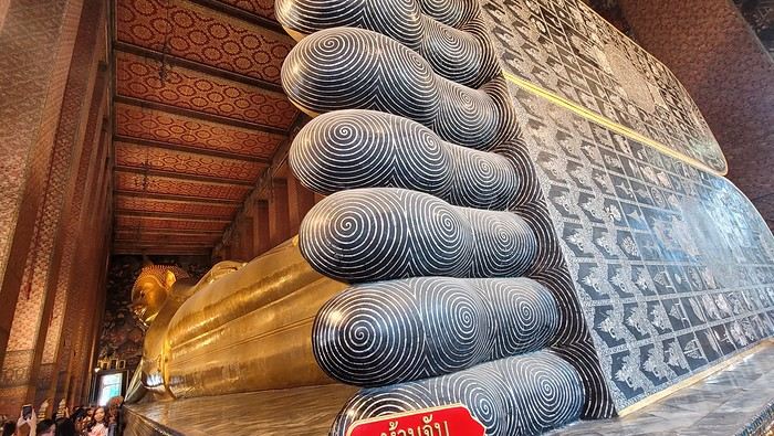
Walking around the temple, you can see different representations of Buddha, all covered in gold leaf.
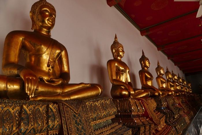
Inside the temple, on one side, monks recite their prayers, while the other side is reserved for tourists who come to meditate in silence.
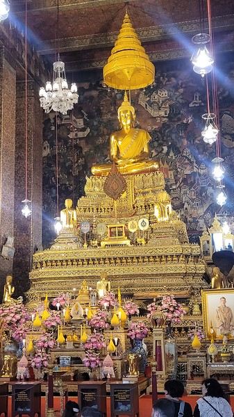
Before returning to the hotel, I have dinner at an Indian restaurant. I go to bed early because tomorrow’s wake-up call will be very early again.
Saturday, November 2nd Wake-up at 4 AM, departure from the hotel at 4:30 AM. The taxi I booked via Booking is waiting for me and takes me to the airport. The trip is fairly quick—he takes small roads, and at this hour, there’s no traffic.
The flight to Phnom Penh is on time. Before boarding, I realize I left my fleece jacket on the carousel, but it’s too late to go back for it.
The flight goes well, and customs is quick.
At the exit, I take a tuk-tuk to Julieka’s GH near the museum. The welcome is friendly. I won’t be able to check into my room until noon, so I take the opportunity to exchange some euros on the market street. The street is lined with restaurants, and I’ll have my first meal there.
The museum is right across the street, so I don’t waste any time visiting it.
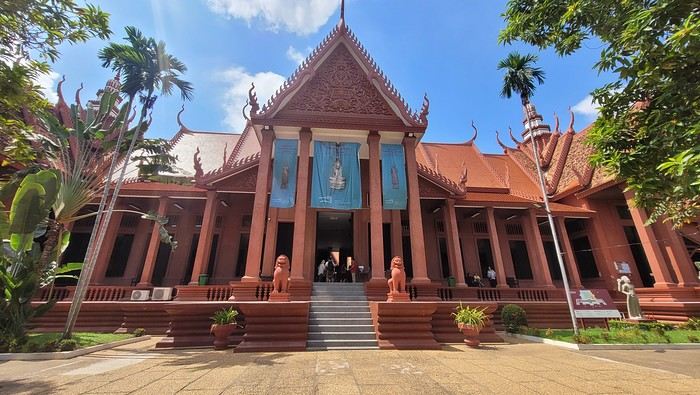
The representations of Hindu deities are very different from those in India, and I don’t recognize them. Many beautiful Buddhas are on display.
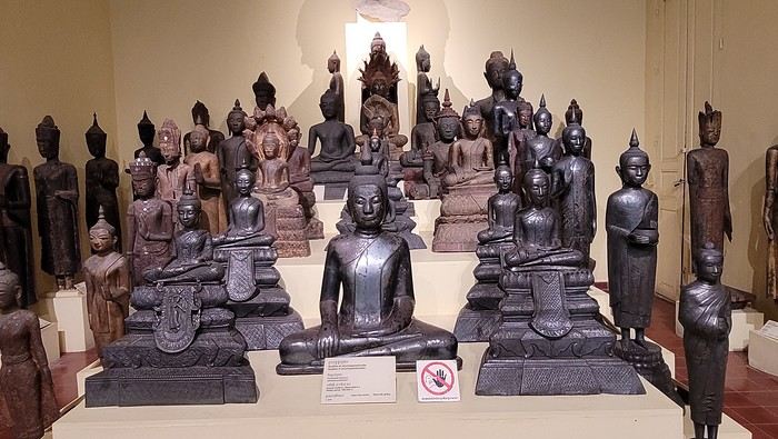
The museum is very pleasant, and there aren’t too many people, which is a plus.
At the exit, I return to the GH, settle into my room—which is decent and clean.
The Royal Palace is 1 km away. I walk along a garden, and at the end of the street is the Tonlé Sap, but I turn right. I arrive at a large esplanade and see the buildings with tiered roofs and glazed tiles. The entrance to the palace is a little further away.
At the entrance, I notice there isn’t the same crowd as at the one in BKK.
Khmer architecture is magnificent. The complex consists of gardens, palaces, pagodas with golden roofs, and slender spires.
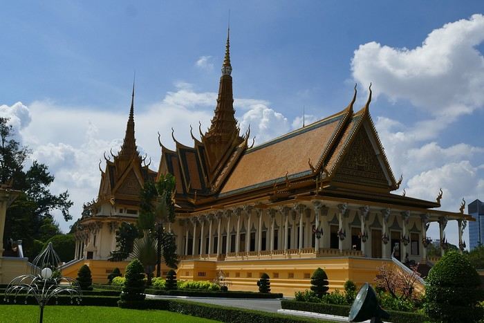
The Silver Pagoda houses the small Emerald Buddha, which is actually made of jade. The silver flooring is covered with carpets. Photos are not allowed.
The walls surrounding the pagoda are covered with frescoes depicting scenes from the Ramayana.
Baggage check-in hasn’t started yet, and there are already several of us waiting.
Once free, everything happens very quickly. The flight to Abu Dhabi is on time and goes smoothly. I’ve never had any problems with this airline, which I’ve been using for several years.
The flight to Bangkok arrives at 7 AM as scheduled. This is my first time in Thailand and Bangkok. I’m used to traveling in India, and I notice that everything here is well organized—the customs process is quick, and the luggage is already on the carousel.
I booked a taxi on Booking. All I have to do is find the right exit and door based on the agency’s instructions. A large sign with the names of people who booked is posted on a wall. A hostess greets me and calls the taxi, which arrives 5 minutes later. I booked one night at the Lost Inn BKK hotel in the Phra Nakhon district, and we arrive at 9 AM. The welcome isn’t warm, and I have to wait until noon, sitting on a chair, before I can check into my room. I’m exhausted, and sleeping sitting up isn’t ideal. Noon finally arrives—the room is small but clean, which is fine for one night. I quickly take a shower to wake up because I plan to spend the afternoon visiting the Grand Palace. First, I need to exchange some money, and the banks are all close together on the same street, which is very convenient. When I enter one, a hostess gives me a ticket and invites me to sit down. There are about twenty counters, and I wait quietly until my number is called. The exchange is quick, so I can head out to find the Royal Palace. It’s actually very easy, and the walk is pleasant.
Entry to the Royal Palace (500 baht).
It’s magnificent and grand, and there are quite a few of us visiting. The sky is gray, it’s very humid, and a shower interrupts the visit. It’s a vast complex of temples and palaces. The buildings are colorful and sparkling, with a great sense of serenity (without the tourists, of course). I quietly enjoy the place and try to take photos without tourists, which isn’t easy.
Very close to the Grand Palace is Wat Pho, one of the oldest Buddhist temples in the capital.
It’s very famous for its 46-meter-long reclining Buddha statue.
Walking around the temple, you can see different representations of Buddha, all covered in gold leaf.
Inside the temple, on one side, monks recite their prayers, while the other side is reserved for tourists who come to meditate in silence.
Before returning to the hotel, I have dinner at an Indian restaurant. I go to bed early because tomorrow’s wake-up call will be very early again.
Saturday, November 2nd Wake-up at 4 AM, departure from the hotel at 4:30 AM. The taxi I booked via Booking is waiting for me and takes me to the airport. The trip is fairly quick—he takes small roads, and at this hour, there’s no traffic.
The flight to Phnom Penh is on time. Before boarding, I realize I left my fleece jacket on the carousel, but it’s too late to go back for it.
The flight goes well, and customs is quick.
At the exit, I take a tuk-tuk to Julieka’s GH near the museum. The welcome is friendly. I won’t be able to check into my room until noon, so I take the opportunity to exchange some euros on the market street. The street is lined with restaurants, and I’ll have my first meal there.
The museum is right across the street, so I don’t waste any time visiting it.
The representations of Hindu deities are very different from those in India, and I don’t recognize them. Many beautiful Buddhas are on display.
The museum is very pleasant, and there aren’t too many people, which is a plus.
At the exit, I return to the GH, settle into my room—which is decent and clean.
The Royal Palace is 1 km away. I walk along a garden, and at the end of the street is the Tonlé Sap, but I turn right. I arrive at a large esplanade and see the buildings with tiered roofs and glazed tiles. The entrance to the palace is a little further away.
At the entrance, I notice there isn’t the same crowd as at the one in BKK.
Khmer architecture is magnificent. The complex consists of gardens, palaces, pagodas with golden roofs, and slender spires.
The Silver Pagoda houses the small Emerald Buddha, which is actually made of jade. The silver flooring is covered with carpets. Photos are not allowed.
The walls surrounding the pagoda are covered with frescoes depicting scenes from the Ramayana.
A Turquoise Dream Come True in Uzbekistan - 2022
We took this trip from September 12 to October 7, 2022. I didn’t post this travel journal earlier in Voyage Forum because the site wasn’t back up yet (and also because I was short on time).
Then, at the end of 2024, I made a promise to a friend: to publish my travel journal on VF. So here it is!
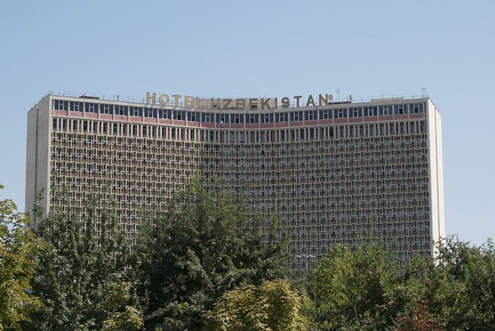 We took off from Paris in the late afternoon on September 12 and arrived in Tashkent around 7:15 AM on the 13th.
This trip was the result of long contemplation and preparation (it was originally planned for the year of the lockdown (2020) and was prepared with the help and advice of Nasrullo Jumanov from Turquoise Travel.
Stages and Itinerary
Stage 1: Tashkent - September 13 and 14
Stage 2: Ferghana Valley – September 15 to 17
Stage 3: Nukus and Moynaq - September 18 and 19
Stage 4: Mysterious Khiva - September 20 to 22
Stage 5: Holy Bukhara - September 23 to 26
Stage 6: Asraf - September 27 and 28
Stage 7: Mythical Samarkand - September 29 to October 2
Stage 8: Tersak (via Shakhrisabz and Urgut) – October 3 and 4
Stage 9: Samarkand – October 5 and 6
Stage 10: Tashkent/Istanbul/Paris – October 6 and 7
Stage 1: Tashkent
September 13
At the airport exit, we were greeted by the owner of our B&B (B&B Gulnara).
Today was all about recovery and our first steps in the capital. Our first currency exchange made us feel like sudden millionaires.
Our first stroll down the avenue leading to Chorsu Market introduced us to the fact that 80 to 90% of the cars here are white Chevrolets.
A walk under the arcades facing Chorsu: hardware stores, cabinetmakers, lute makers (one of them gave me a little concert/demo of a few string instruments).
We took off from Paris in the late afternoon on September 12 and arrived in Tashkent around 7:15 AM on the 13th.
This trip was the result of long contemplation and preparation (it was originally planned for the year of the lockdown (2020) and was prepared with the help and advice of Nasrullo Jumanov from Turquoise Travel.
Stages and Itinerary
Stage 1: Tashkent - September 13 and 14
Stage 2: Ferghana Valley – September 15 to 17
Stage 3: Nukus and Moynaq - September 18 and 19
Stage 4: Mysterious Khiva - September 20 to 22
Stage 5: Holy Bukhara - September 23 to 26
Stage 6: Asraf - September 27 and 28
Stage 7: Mythical Samarkand - September 29 to October 2
Stage 8: Tersak (via Shakhrisabz and Urgut) – October 3 and 4
Stage 9: Samarkand – October 5 and 6
Stage 10: Tashkent/Istanbul/Paris – October 6 and 7
Stage 1: Tashkent
September 13
At the airport exit, we were greeted by the owner of our B&B (B&B Gulnara).
Today was all about recovery and our first steps in the capital. Our first currency exchange made us feel like sudden millionaires.
Our first stroll down the avenue leading to Chorsu Market introduced us to the fact that 80 to 90% of the cars here are white Chevrolets.
A walk under the arcades facing Chorsu: hardware stores, cabinetmakers, lute makers (one of them gave me a little concert/demo of a few string instruments).
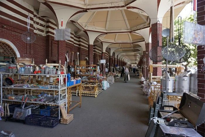
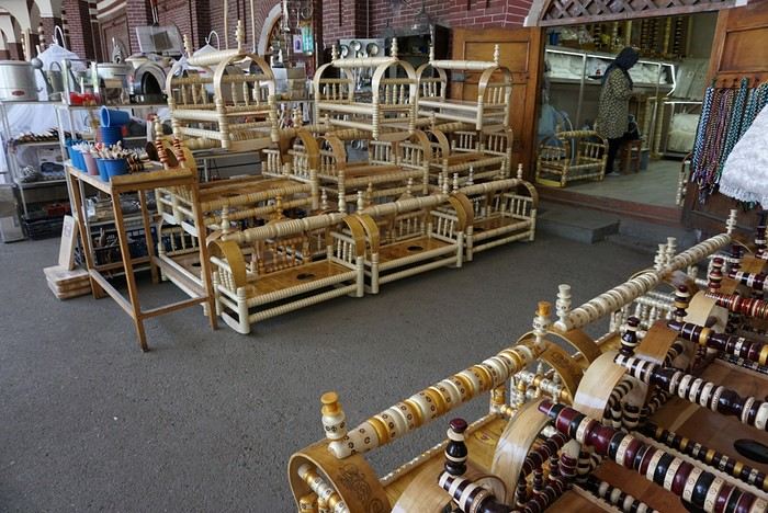
As we entered the market, many vendors called out to us, including this florist who asked where we were from: ‘France? Ah! Macron! PSG!’ He then recited a list of players from the Parisian team as well as past (Platini, Zidane, etc.) and current (Giroud, Griezmann, Mbappé, etc.) French national team players. Since we’re more into rugby (we live near Toulouse), he knew more players than I did!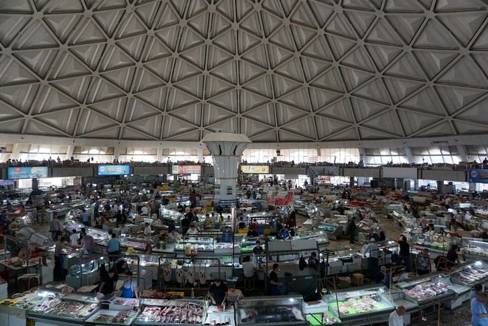
The market sprawls outside around the large circular, multi-story hall. We bought some grapes and bottles of freshly squeezed pomegranate juice for just a few sums. This evening, we had a meet-up with Nasrullo. The reunion was very warm: we’d been exchanging messages for over two years, and I’d been ‘torturing’ him with changes to our itinerary and trip duration. We were finally eager to meet, and honestly, I wasn’t disappointed—in fact, it was the opposite. Nasrullo was very attentive throughout our trip and always made sure, even from a distance (and most often from a distance!), that everything went smoothly. His goal was for us to leave delighted with our trip and, why not, indirectly become ambassadors for this destination. September 14 Breakfast with Nasrullo, then we set off with him by taxi to explore some of the capital’s sites.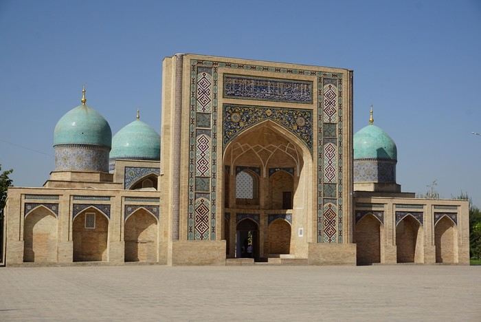
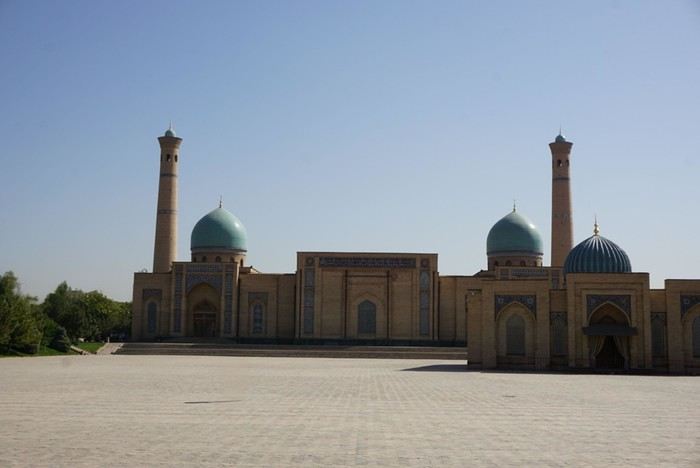
We started by visiting the Khazrati Imam complex, which includes the mausoleum of Kaffal Shashi, the Barak Khan and Muyi Muborak madrasas, and the great Khazrati Imam Mosque with its immense prayer hall.
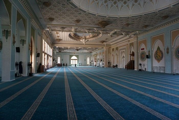
In the Muyi Muborak madrasa, now a museum, you can see the oldest Quran in the world. It was written by three religious scholars, including the secretary of the Prophet Muhammad, on large ‘pages’ made of antelope skin. Next, we explored Soviet-era Tashkent, discovering its parks, canals, and squares: Independence Square with its storks and phoenixes, Amir Temur Square with its large statue and, in the background, the massive Soviet-era hotel that has become one of Tashkent’s iconic buildings. Nasrullo took us through Broadway Boulevard and along what he calls ‘Tashkent’s Montmartre’… Well, it’s far, very far from Montmartre (in every sense of the word!). Then we took the metro to Chorsu station. Rush hour is pretty much the same everywhere in the metro… When we arrived at Chorsu, it was time to say goodbye. Nasrullo had to head back to Samarkand. Before leaving, he recommended some chaikhanas at the end of the galleries facing the market. We ate there for just a few euros (2 or 3 € for two people). After eating, we headed back to our room to cool off (our B&B is about a 10-minute walk away).
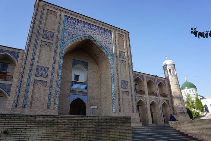
Around 4 PM, we set off to visit the Kokeldash Madrasa, which is still active. On the way, we stopped to watch some bread vendors and take a few photos. We were hesitating about buying some for our evening picnic when a young woman approached us. In perfect English, she asked: ‘Are you looking for something? Do you want to buy bread? Which one? How much?’ She then spoke to one of the vendors and negotiated the price. ‘Do you want one?’ And she took two. She paid directly. I took out my wallet to reimburse her, but she refused. It’s on the house! Then the vendor asked where we were from. And off we went again: Macron, PSG, football players… We’ll have to get used to it. The young woman smiled at the questions and comments, barely gave us time to thank her, and left as quickly as she had approached us.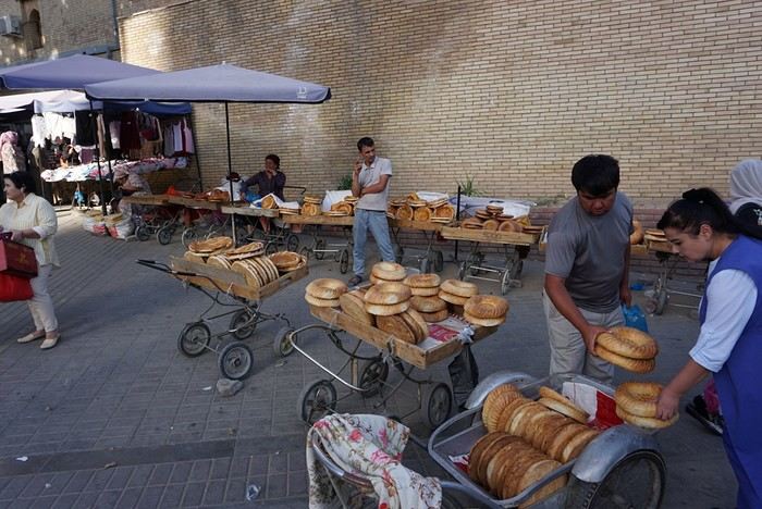
We continued our walk. Visited the madrasa. Then we crossed the boulevard to see the Tashkent Circus. I would’ve loved to go in and visit, but the ticket seller wouldn’t hear of it. We carried on around what should’ve been a park with old-fashioned rides and attractions. All we found was a construction site. Oh well! Back at our hotel, a message from Nasrullo was waiting for us. He had managed to change our train ticket for the next day. Instead of taking the 6:00 AM train, we’d take the 8:00 AM one. And instead of second class, we’d be in first class! Great! This evening, we had a picnic at one of the breakfast tables in the B&B courtyard. Under a shelter, the owner and his family were celebrating a birthday. The owner started by offering us some tea. Then they brought us some fruit (watermelon and melon). Finally, after the song, candles, and cake cutting, they brought us two generous slices of that beautiful birthday cake. Delicious!
We took off from Paris in the late afternoon on September 12 and arrived in Tashkent around 7:15 AM on the 13th.
This trip was the result of long contemplation and preparation (it was originally planned for the year of the lockdown (2020) and was prepared with the help and advice of Nasrullo Jumanov from Turquoise Travel.
Stages and Itinerary
Stage 1: Tashkent - September 13 and 14
Stage 2: Ferghana Valley – September 15 to 17
Stage 3: Nukus and Moynaq - September 18 and 19
Stage 4: Mysterious Khiva - September 20 to 22
Stage 5: Holy Bukhara - September 23 to 26
Stage 6: Asraf - September 27 and 28
Stage 7: Mythical Samarkand - September 29 to October 2
Stage 8: Tersak (via Shakhrisabz and Urgut) – October 3 and 4
Stage 9: Samarkand – October 5 and 6
Stage 10: Tashkent/Istanbul/Paris – October 6 and 7
Stage 1: Tashkent
September 13
At the airport exit, we were greeted by the owner of our B&B (B&B Gulnara).
Today was all about recovery and our first steps in the capital. Our first currency exchange made us feel like sudden millionaires.
Our first stroll down the avenue leading to Chorsu Market introduced us to the fact that 80 to 90% of the cars here are white Chevrolets.
A walk under the arcades facing Chorsu: hardware stores, cabinetmakers, lute makers (one of them gave me a little concert/demo of a few string instruments).As we entered the market, many vendors called out to us, including this florist who asked where we were from: ‘France? Ah! Macron! PSG!’ He then recited a list of players from the Parisian team as well as past (Platini, Zidane, etc.) and current (Giroud, Griezmann, Mbappé, etc.) French national team players. Since we’re more into rugby (we live near Toulouse), he knew more players than I did!
The market sprawls outside around the large circular, multi-story hall. We bought some grapes and bottles of freshly squeezed pomegranate juice for just a few sums. This evening, we had a meet-up with Nasrullo. The reunion was very warm: we’d been exchanging messages for over two years, and I’d been ‘torturing’ him with changes to our itinerary and trip duration. We were finally eager to meet, and honestly, I wasn’t disappointed—in fact, it was the opposite. Nasrullo was very attentive throughout our trip and always made sure, even from a distance (and most often from a distance!), that everything went smoothly. His goal was for us to leave delighted with our trip and, why not, indirectly become ambassadors for this destination. September 14 Breakfast with Nasrullo, then we set off with him by taxi to explore some of the capital’s sites.
We started by visiting the Khazrati Imam complex, which includes the mausoleum of Kaffal Shashi, the Barak Khan and Muyi Muborak madrasas, and the great Khazrati Imam Mosque with its immense prayer hall.
In the Muyi Muborak madrasa, now a museum, you can see the oldest Quran in the world. It was written by three religious scholars, including the secretary of the Prophet Muhammad, on large ‘pages’ made of antelope skin. Next, we explored Soviet-era Tashkent, discovering its parks, canals, and squares: Independence Square with its storks and phoenixes, Amir Temur Square with its large statue and, in the background, the massive Soviet-era hotel that has become one of Tashkent’s iconic buildings. Nasrullo took us through Broadway Boulevard and along what he calls ‘Tashkent’s Montmartre’… Well, it’s far, very far from Montmartre (in every sense of the word!). Then we took the metro to Chorsu station. Rush hour is pretty much the same everywhere in the metro… When we arrived at Chorsu, it was time to say goodbye. Nasrullo had to head back to Samarkand. Before leaving, he recommended some chaikhanas at the end of the galleries facing the market. We ate there for just a few euros (2 or 3 € for two people). After eating, we headed back to our room to cool off (our B&B is about a 10-minute walk away).
Around 4 PM, we set off to visit the Kokeldash Madrasa, which is still active. On the way, we stopped to watch some bread vendors and take a few photos. We were hesitating about buying some for our evening picnic when a young woman approached us. In perfect English, she asked: ‘Are you looking for something? Do you want to buy bread? Which one? How much?’ She then spoke to one of the vendors and negotiated the price. ‘Do you want one?’ And she took two. She paid directly. I took out my wallet to reimburse her, but she refused. It’s on the house! Then the vendor asked where we were from. And off we went again: Macron, PSG, football players… We’ll have to get used to it. The young woman smiled at the questions and comments, barely gave us time to thank her, and left as quickly as she had approached us.
We continued our walk. Visited the madrasa. Then we crossed the boulevard to see the Tashkent Circus. I would’ve loved to go in and visit, but the ticket seller wouldn’t hear of it. We carried on around what should’ve been a park with old-fashioned rides and attractions. All we found was a construction site. Oh well! Back at our hotel, a message from Nasrullo was waiting for us. He had managed to change our train ticket for the next day. Instead of taking the 6:00 AM train, we’d take the 8:00 AM one. And instead of second class, we’d be in first class! Great! This evening, we had a picnic at one of the breakfast tables in the B&B courtyard. Under a shelter, the owner and his family were celebrating a birthday. The owner started by offering us some tea. Then they brought us some fruit (watermelon and melon). Finally, after the song, candles, and cake cutting, they brought us two generous slices of that beautiful birthday cake. Delicious!
From Caño Cristales to Tayrona Park
After about 12 hours of flying from Toulouse (via Paris), we landed in Bogotá six years after our first trip to Colombia. This time, our journey will be very different, with only this stop in the Colombian capital in common.
Our travel itinerary
Bogotá / La Macarena (Caño Cristales) / Villa de Leyva / Barichara / San Gil / Girón / Mompox / Ciénaga and the Santa Marta lagoon / Minca / Los Naranjos (Tayrona Park) / Bogotá.
Step 1: Bogotá (and Nemecon)
Bogotá (1/3)
This morning, we had a meet-up with Flora from Aventure Colombia, who helped me organize one of our stops, a few transfers, and tomorrow’s day trip, the program of which I changed at the last minute after deciding to skip the visit to the Salt Cathedral of Zipaquirá. Flora is a kind and lovely person, always available, and she did everything to answer my questions and give me advice.
She’s a local contact I highly recommend. Flora can help you plan your trip, whether you want a fully organized tour or, like us, just need assistance with a specific stop or one or more transfers between cities.
We left Flora after setting a meet-up for our return to Bogotá in a month. As we walked out of her agency, we headed to the wonderful Gold Museum, located just a hundred meters away. I was excited to revisit this amazing museum.
Note: Free entry for those over 60, regardless of nationality. Just show your passport.
Like six years ago, I was amazed by its museography, the beauty of the pieces on display, and that breathtaking shamanic room.
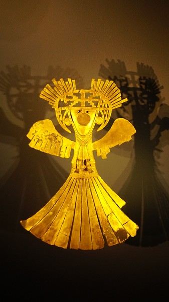
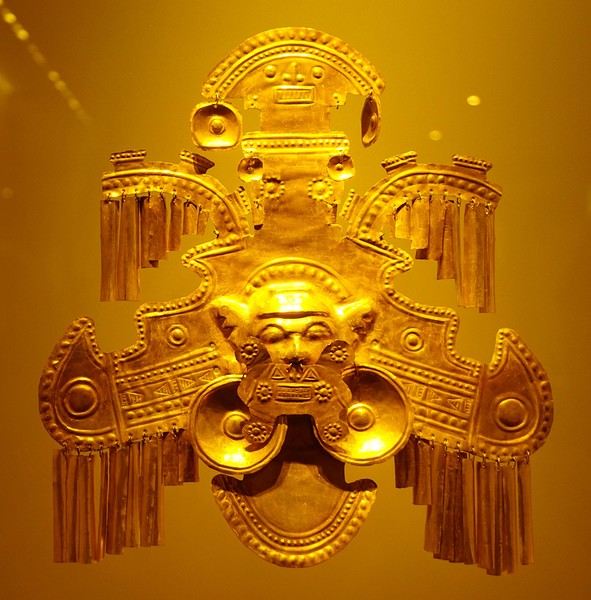
About two hours later, we decided to walk (careful, it’s a climb!) to the Monserrate cable car (3152m). Long wait to buy tickets and board the cable car! Once we arrived, a few raindrops, an impressive panoramic view of Bogotá’s vastness, a quick visit to the basilica (a pilgrimage site for Colombians), a walk through the tourist market, and at the top, plenty of small restaurants where we had our first Colombian meal. After our hearty lunch, we were lucky to see the sun return! No line for the descent. We then headed back to the hotel because Justine wanted to rest and recover from the trip. As for me, I continued my walk. I discovered a really nice craft market recommended by Flora, Pasaje Rivas, returned to Bolívar Square, and wandered through different streets, including the main pedestrian avenue (Calle 7), where there’s always something to see.
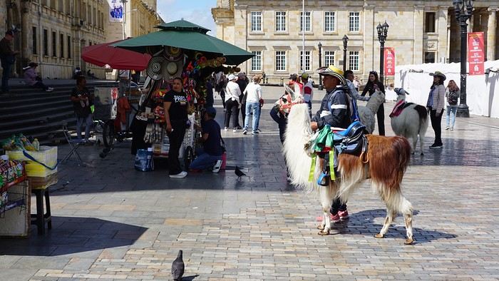
Tomorrow, a change of scenery as we head out for a hike in a small desert (Desierto de Chueca), located about 2 hours from Bogotá in the village of Nemecon. For this outing from Bogotá, with Flora’s help, we booked a car with a driver for the day. Flora also took care of booking the guide (since the site can only be visited with one). Nemecon (2/3) Today, we went to Nemecon to hike about 7.5 km in the ‘Desert of Checua.’ It’s nothing like sandy deserts! Instead, it’s geological formations sculpted by time, wind, and water. After two hours on the road—almost one of them spent navigating traffic jams with cars, trucks, buses, and a continuous flow of motorcycles on either side of our taxi—we reached Nemecon! The village center is really (too?) quiet. We met up with Deisy and headed toward the ‘desert,’ about twenty minutes away on a bumpy dirt road. Once there, a quick briefing, and off we went! Deisy didn’t stop talking (in Spanish) for over 3 hours!!! She told us so much about her region (flower farming, water management, traditions, songs, etc.), the origin of the site, and even mentioned Antonio Banderas, who filmed *The 33* in the village’s salt mine (the story of the survival of 33 Chilean miners after a collapse in their copper and gold mine). One hour of walking to reach the site, one hour to explore it, and one hour to return.
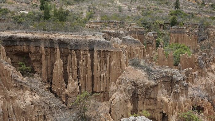
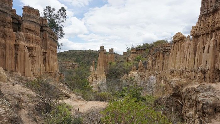
The advantage of this non-stop chatter was that it forced us to brush up on our Spanish at lightning speed. I even wondered if the effort to concentrate wasn’t more exhausting than the physical effort! Especially since on the way back, I got an oral quiz. Deisy wanted to make sure I remembered some of the information she’d given me during the visit: why is this rock white, that one red, and that one black? Back in the village, we had lunch at a restaurant recommended by Deisy before visiting the Nemecon salt mine. Before entering, a guide spent a good half-hour explaining the origin of the salt and the presence of many fossils in the area. Again, concentrating was tough because all the comments were exclusively in Spanish! An hour and a half wandering through the tunnels with a ‘lovely miner’s helmet’ on our heads!
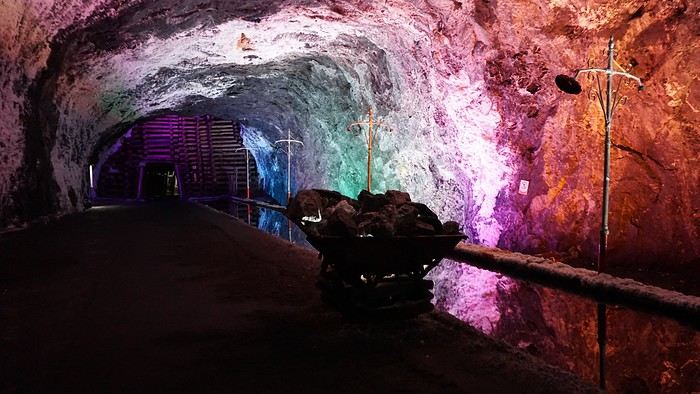
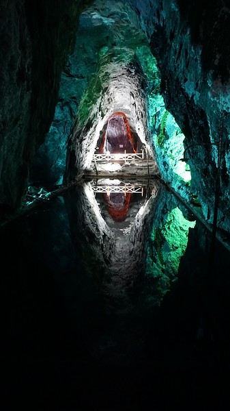
We met our driver at the mine entrance. The return to Bogotá was a bit faster, but traffic in the city center was still heavy! We arrived in front of our hotel between 8:00 and 8:30 PM. It’s been a pretty intense start to the trip! Tonight, our legs are tired. Hopefully, tomorrow will be a bit more relaxed! Bogotá (3/3) We started the day by visiting the Santa Clara Church Museum, located next to the presidential palace. Alejandra (from the local agency ‘Gaia Tours Colombia,’ which organized our stay in Caño Cristales (La Macarena)) had recommended this visit for its rich mural paintings.
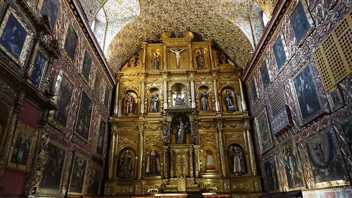
A few hundred meters further, after crossing the Plaza Mayor again, we visited the cultural complex housing the Botero Museum, the Mint Museum, and the Bank of the Republic Art Museum. Note that entry is free for all three museums. Botero Museum: There are fewer works by Botero here than in the Medellín museum, but more paintings and sculptures by other artists, all from Botero’s private collection (donated to Colombia). Mint Museum: We limited ourselves to visiting one room (on Flora’s advice) where three gold and gemstone monstrances and a Christ with a crown of emerald thorns are displayed. Photos are not allowed. Art Museum: We visited two temporary exhibitions. Lunchtime came quickly. We had a good meal at a reasonably priced small restaurant in the La Candelaria micro-district, near the Chorro de Quevedo square. We decided to spend the afternoon wandering the streets and alleys of the historic center to discover local street art.
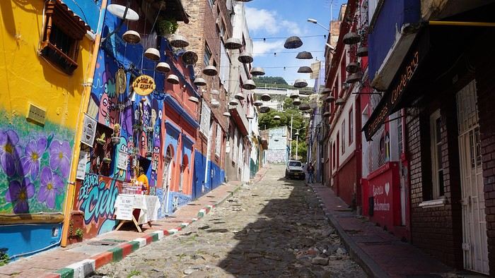
We also passed through very lively pedestrian streets. I also decided to revisit Pasaje Rivas to show Justine all the shops selling more or less artisanal products. Tomorrow morning, we fly to La Macarena at 10:30 AM. Not to dance (you’d be surprised if I told you we were going to take a South American dance class, right?!), but to visit the fabulous Caño Cristales, a river naturally colored by aquatic plants. The planned program includes hiking, horseback riding, canoeing, and swimming among these plants. This site was long inaccessible because the area was controlled by the FARC. Access and tourism development became possible after agreements and amnesty measures between the Colombian government and paramilitary groups. As in other regions, former FARC members have been able to transition into various tourism-related activities.
About two hours later, we decided to walk (careful, it’s a climb!) to the Monserrate cable car (3152m). Long wait to buy tickets and board the cable car! Once we arrived, a few raindrops, an impressive panoramic view of Bogotá’s vastness, a quick visit to the basilica (a pilgrimage site for Colombians), a walk through the tourist market, and at the top, plenty of small restaurants where we had our first Colombian meal. After our hearty lunch, we were lucky to see the sun return! No line for the descent. We then headed back to the hotel because Justine wanted to rest and recover from the trip. As for me, I continued my walk. I discovered a really nice craft market recommended by Flora, Pasaje Rivas, returned to Bolívar Square, and wandered through different streets, including the main pedestrian avenue (Calle 7), where there’s always something to see.
Tomorrow, a change of scenery as we head out for a hike in a small desert (Desierto de Chueca), located about 2 hours from Bogotá in the village of Nemecon. For this outing from Bogotá, with Flora’s help, we booked a car with a driver for the day. Flora also took care of booking the guide (since the site can only be visited with one). Nemecon (2/3) Today, we went to Nemecon to hike about 7.5 km in the ‘Desert of Checua.’ It’s nothing like sandy deserts! Instead, it’s geological formations sculpted by time, wind, and water. After two hours on the road—almost one of them spent navigating traffic jams with cars, trucks, buses, and a continuous flow of motorcycles on either side of our taxi—we reached Nemecon! The village center is really (too?) quiet. We met up with Deisy and headed toward the ‘desert,’ about twenty minutes away on a bumpy dirt road. Once there, a quick briefing, and off we went! Deisy didn’t stop talking (in Spanish) for over 3 hours!!! She told us so much about her region (flower farming, water management, traditions, songs, etc.), the origin of the site, and even mentioned Antonio Banderas, who filmed *The 33* in the village’s salt mine (the story of the survival of 33 Chilean miners after a collapse in their copper and gold mine). One hour of walking to reach the site, one hour to explore it, and one hour to return.
The advantage of this non-stop chatter was that it forced us to brush up on our Spanish at lightning speed. I even wondered if the effort to concentrate wasn’t more exhausting than the physical effort! Especially since on the way back, I got an oral quiz. Deisy wanted to make sure I remembered some of the information she’d given me during the visit: why is this rock white, that one red, and that one black? Back in the village, we had lunch at a restaurant recommended by Deisy before visiting the Nemecon salt mine. Before entering, a guide spent a good half-hour explaining the origin of the salt and the presence of many fossils in the area. Again, concentrating was tough because all the comments were exclusively in Spanish! An hour and a half wandering through the tunnels with a ‘lovely miner’s helmet’ on our heads!
We met our driver at the mine entrance. The return to Bogotá was a bit faster, but traffic in the city center was still heavy! We arrived in front of our hotel between 8:00 and 8:30 PM. It’s been a pretty intense start to the trip! Tonight, our legs are tired. Hopefully, tomorrow will be a bit more relaxed! Bogotá (3/3) We started the day by visiting the Santa Clara Church Museum, located next to the presidential palace. Alejandra (from the local agency ‘Gaia Tours Colombia,’ which organized our stay in Caño Cristales (La Macarena)) had recommended this visit for its rich mural paintings.
A few hundred meters further, after crossing the Plaza Mayor again, we visited the cultural complex housing the Botero Museum, the Mint Museum, and the Bank of the Republic Art Museum. Note that entry is free for all three museums. Botero Museum: There are fewer works by Botero here than in the Medellín museum, but more paintings and sculptures by other artists, all from Botero’s private collection (donated to Colombia). Mint Museum: We limited ourselves to visiting one room (on Flora’s advice) where three gold and gemstone monstrances and a Christ with a crown of emerald thorns are displayed. Photos are not allowed. Art Museum: We visited two temporary exhibitions. Lunchtime came quickly. We had a good meal at a reasonably priced small restaurant in the La Candelaria micro-district, near the Chorro de Quevedo square. We decided to spend the afternoon wandering the streets and alleys of the historic center to discover local street art.
We also passed through very lively pedestrian streets. I also decided to revisit Pasaje Rivas to show Justine all the shops selling more or less artisanal products. Tomorrow morning, we fly to La Macarena at 10:30 AM. Not to dance (you’d be surprised if I told you we were going to take a South American dance class, right?!), but to visit the fabulous Caño Cristales, a river naturally colored by aquatic plants. The planned program includes hiking, horseback riding, canoeing, and swimming among these plants. This site was long inaccessible because the area was controlled by the FARC. Access and tourism development became possible after agreements and amnesty measures between the Colombian government and paramilitary groups. As in other regions, former FARC members have been able to transition into various tourism-related activities.
To the Top West End
In this time of general travel-journal scarcity, I’m stepping up to tell you about a far-too-short getaway to the Top West End, a local term for the very northern part of Western Australia, right on the border ( ;) ) with the Northern Territory.
As usual, I didn’t manage to keep it short, but this time I’ve got photos to go with it!
August 2020. Since the opportunities to explore the world are extremely limited right now, all we (R&X) can do is explore our own island! Well, just a part of it, because with the state borders still closed, we’re stuck in Western Australia (WA).
Luckily, we’re pretty fortunate because this state is huge: over 2.5 million km² (that’s more than four times the size of France or 1.5 times Quebec). What’s more, stretching over 20 degrees of latitude between the Antarctic Ocean and the Timor Sea, you’ll find climates ranging from Mediterranean to arid to tropical. That’s actually why we decided to head as far north as possible. Sick of the endless rainy winter in Perth, bring on the heat of the Kimberley... way up Nooorth!
Friday. At the airport, the main terminal was closed (not enough flights), so we ended up in the annex (where flights to the various mines usually depart from). There was no crowd at the gate, and in this huge, single departure lounge, empty seats were plentiful. Only three flights were listed on the screens for the rest of the morning: the first to Coondewanna (?), the second to Darwin, and ours to Kununurra (code KNX).
A cool breeze swept through the half-open corridors along the runways. At the top of the walkway leading to the Fokker 100 (the Airbuses and Boeings are now parked!), a flight attendant greeted us with a basket full of sanitary masks. We were actually the only masked passengers (the staff weren’t wearing them either). With zero Covid-19 cases in WA at the time, the only rule was to maintain social distancing—something pretty hard to do on a full plane!
It was also my first time wearing a mask—it felt weird, pretty uncomfortable, and after a while, painful behind the ears. I really feel for those who have to wear one all day, every day. The flight lasted three long hours, but luckily, I had a good book. From the window, I watched an endless expanse of salt lakes in all shapes and sizes—round, elongated, gray, white, sometimes blue and green—and an infinity of winding, capricious meanders, along with long straight lines that led nowhere. The last half-hour got more interesting as rocky, swollen formations and long, sloping plateaus appeared. Against the vast ochre landscape, green patches became more frequent.
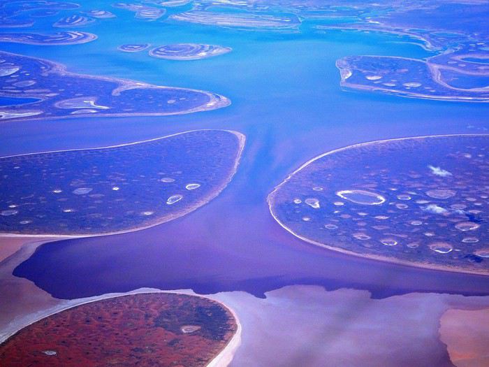
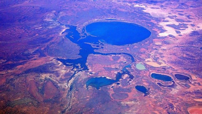
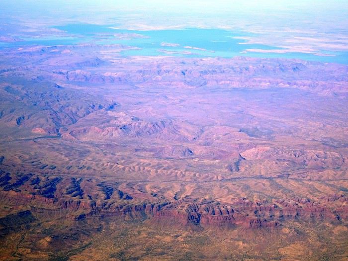
Just before landing, rows of green fields briefly appeared, along with an surprisingly wide river—but we were already rolling down the tarmac. A few hangars, a myriad of small, stationary planes, and a tiny terminal topped with a sign: “Welcome to Kununurra.”
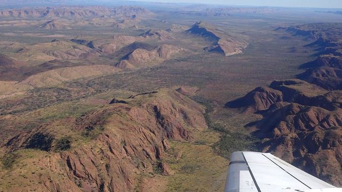
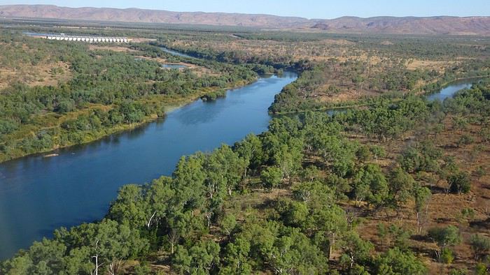
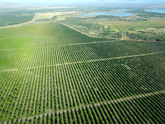
We wanted heat, and here it was—34°C the moment we stepped off the plane! We felt alive again and totally ridiculous in our jeans and sweaters. We quickly grabbed our suitcase and picked up the 4x4 we’d rented—more out of necessity, since only that type of vehicle can access the national parks we planned to visit.
Just four kilometers separated us from Kununurra, a town of 5,000 people founded in 1961 during the construction of the Lake Argyle Dam and the development of the Ord River Irrigation Area Scheme (more on that later). On the horizon, mountain ranges (a bit of an exaggeration, since we know Mt. Meharry, WA’s highest ‘mountain,’ doesn’t even reach 1,250 meters!) and closer to the road, a few irrigation canals cutting through stretches of bush, then a huge park overlooking a small lake lined with reeds.
A row of baobabs (yes, there are baobabs in Australia too!), a series of motels with immaculate lawns, a gas station, and there’s the main street leading to the town center—that is, the parking lots of the two supermarkets, the bottleshop, the pub, the Town Hall, the municipal pool, and the Tourist Office (already closed!), and at the next roundabout, another park, the Presbyterian church, and a few other shops. In short, two or three green blocks that you can explore in no time.
One road leads to the small industrial area and one of the town’s three or four campgrounds, while another heads toward the residential neighborhoods, which look just like the typical suburbs you find in any Australian city—except with tropical vegetation. We stocked up at Coles, an identical copy of the one near our place, and—surprise—the prices were practically the same.
We checked into one of the motels. The receptionist listed the town’s three or four restaurants, insisting that it’s always better to book a table. She recommended the Pump House, a bit outside town on the lake’s edge. “Best spot to watch the sunset, but hurry up.” she told us. It was only 5:00 PM!
When we got there half an hour later, the place was packed, and the sun had already disappeared behind a row of trees! Sure enough, we’d see a few days later that the sunset can be a stunning spectacle—if you wait a bit for the sky (especially if it’s cloudy) to blaze and reflect in the lake’s calm waters. A little disappointed, we headed back into town, where we easily found the other lively spot in town: the pub (nothing like an old English pub). Above the long L-shaped bar, several giant screens (thankfully muted) were broadcasting live footy, rugby league, etc. In one corner, players circled the pool table, while in another, customers were digging into plates of the day’s special. Instead of rooms, there were various patios where groups of friends and coworkers (easily recognizable by the fluoro vests they were still wearing) were gathered. We found a table under a mango tree—unfortunately, a little too close to the guitarist strumming his entire Country Music repertoire, complete with Keith Urban-style tremolos. Guaranteed culture shock!
Since it’s the custom here, we called the Country Club to book a table before the kitchen closed! The CC is the town’s—and even the region’s—fancy spot. Dark decor, modern furniture, dim lighting, and the air conditioning blasting. The twenty or so customers had taken refuge on the vast terrace, lit by torches. The view of the tall eucalyptus trees, illuminated by spotlights shifting from red to blue, was breathtaking.
The menu was minimal, but the grilled salmon was excellent, and the Pavlova (the meringue dessert Kiwis and Aussies have been arguing over since 1906) with melon and watermelon was absolutely divine.
It wasn’t even 9:00 PM, and we were already in bed. Had we already adopted the Top West End’s chicken schedule?!
To be continued... Journal dedicated to Attila
As usual, I didn’t manage to keep it short, but this time I’ve got photos to go with it!
August 2020. Since the opportunities to explore the world are extremely limited right now, all we (R&X) can do is explore our own island! Well, just a part of it, because with the state borders still closed, we’re stuck in Western Australia (WA).
Luckily, we’re pretty fortunate because this state is huge: over 2.5 million km² (that’s more than four times the size of France or 1.5 times Quebec). What’s more, stretching over 20 degrees of latitude between the Antarctic Ocean and the Timor Sea, you’ll find climates ranging from Mediterranean to arid to tropical. That’s actually why we decided to head as far north as possible. Sick of the endless rainy winter in Perth, bring on the heat of the Kimberley... way up Nooorth!
Friday. At the airport, the main terminal was closed (not enough flights), so we ended up in the annex (where flights to the various mines usually depart from). There was no crowd at the gate, and in this huge, single departure lounge, empty seats were plentiful. Only three flights were listed on the screens for the rest of the morning: the first to Coondewanna (?), the second to Darwin, and ours to Kununurra (code KNX).
A cool breeze swept through the half-open corridors along the runways. At the top of the walkway leading to the Fokker 100 (the Airbuses and Boeings are now parked!), a flight attendant greeted us with a basket full of sanitary masks. We were actually the only masked passengers (the staff weren’t wearing them either). With zero Covid-19 cases in WA at the time, the only rule was to maintain social distancing—something pretty hard to do on a full plane!
It was also my first time wearing a mask—it felt weird, pretty uncomfortable, and after a while, painful behind the ears. I really feel for those who have to wear one all day, every day. The flight lasted three long hours, but luckily, I had a good book. From the window, I watched an endless expanse of salt lakes in all shapes and sizes—round, elongated, gray, white, sometimes blue and green—and an infinity of winding, capricious meanders, along with long straight lines that led nowhere. The last half-hour got more interesting as rocky, swollen formations and long, sloping plateaus appeared. Against the vast ochre landscape, green patches became more frequent.
Just before landing, rows of green fields briefly appeared, along with an surprisingly wide river—but we were already rolling down the tarmac. A few hangars, a myriad of small, stationary planes, and a tiny terminal topped with a sign: “Welcome to Kununurra.”
We wanted heat, and here it was—34°C the moment we stepped off the plane! We felt alive again and totally ridiculous in our jeans and sweaters. We quickly grabbed our suitcase and picked up the 4x4 we’d rented—more out of necessity, since only that type of vehicle can access the national parks we planned to visit.
Just four kilometers separated us from Kununurra, a town of 5,000 people founded in 1961 during the construction of the Lake Argyle Dam and the development of the Ord River Irrigation Area Scheme (more on that later). On the horizon, mountain ranges (a bit of an exaggeration, since we know Mt. Meharry, WA’s highest ‘mountain,’ doesn’t even reach 1,250 meters!) and closer to the road, a few irrigation canals cutting through stretches of bush, then a huge park overlooking a small lake lined with reeds.
A row of baobabs (yes, there are baobabs in Australia too!), a series of motels with immaculate lawns, a gas station, and there’s the main street leading to the town center—that is, the parking lots of the two supermarkets, the bottleshop, the pub, the Town Hall, the municipal pool, and the Tourist Office (already closed!), and at the next roundabout, another park, the Presbyterian church, and a few other shops. In short, two or three green blocks that you can explore in no time.
One road leads to the small industrial area and one of the town’s three or four campgrounds, while another heads toward the residential neighborhoods, which look just like the typical suburbs you find in any Australian city—except with tropical vegetation. We stocked up at Coles, an identical copy of the one near our place, and—surprise—the prices were practically the same.
We checked into one of the motels. The receptionist listed the town’s three or four restaurants, insisting that it’s always better to book a table. She recommended the Pump House, a bit outside town on the lake’s edge. “Best spot to watch the sunset, but hurry up.” she told us. It was only 5:00 PM!
When we got there half an hour later, the place was packed, and the sun had already disappeared behind a row of trees! Sure enough, we’d see a few days later that the sunset can be a stunning spectacle—if you wait a bit for the sky (especially if it’s cloudy) to blaze and reflect in the lake’s calm waters. A little disappointed, we headed back into town, where we easily found the other lively spot in town: the pub (nothing like an old English pub). Above the long L-shaped bar, several giant screens (thankfully muted) were broadcasting live footy, rugby league, etc. In one corner, players circled the pool table, while in another, customers were digging into plates of the day’s special. Instead of rooms, there were various patios where groups of friends and coworkers (easily recognizable by the fluoro vests they were still wearing) were gathered. We found a table under a mango tree—unfortunately, a little too close to the guitarist strumming his entire Country Music repertoire, complete with Keith Urban-style tremolos. Guaranteed culture shock!
Since it’s the custom here, we called the Country Club to book a table before the kitchen closed! The CC is the town’s—and even the region’s—fancy spot. Dark decor, modern furniture, dim lighting, and the air conditioning blasting. The twenty or so customers had taken refuge on the vast terrace, lit by torches. The view of the tall eucalyptus trees, illuminated by spotlights shifting from red to blue, was breathtaking.
The menu was minimal, but the grilled salmon was excellent, and the Pavlova (the meringue dessert Kiwis and Aussies have been arguing over since 1906) with melon and watermelon was absolutely divine.
It wasn’t even 9:00 PM, and we were already in bed. Had we already adopted the Top West End’s chicken schedule?!
To be continued... Journal dedicated to Attila
Petit tour dans le Péloponnèse English translation pending
Tous nos séjours en Grèce nous ont enchantées alors, après un séjour en Crète, à Rhodes, à Zakynthos et en Grèce centrale, pourquoi pas un tour du Péloponnèse?
Nous avons quelques hésitations quant à la chaleur possible (notamment pour les randonnées) mais finalement, hop! la réservation des billets d'avion est faite fin janvier: ce sera un départ de Bruxelles (avec Brussels airlines) le 05/07 à 7h30. Puis arrive le (la) Covid avec son lot d'incertitudes: partira? Partira pas? Partira? Partira pas? Faut-il tout annuler, reporter? Au mois de juin les règles d'ouverture des frontières changent en permanence mais il arrive un moment où il faut bien se décider car certains hébergements ne sont plus annulables. Les frontières de la Grèce doivent théoriquement ouvrir totalement le 1er juillet (sous réserve de...) on doit partir le 5 ...alors, c'est décidé, on part! ...enfin, si tout se passe comme prévu!
L'ouest du Péloponnèse ne m'inspire pas plus que ça. Par contre Cythère me tente bien, alors voilà à quoi ressemblera notre circuit (on prendra le bateau pour Cythère à Neapoli):
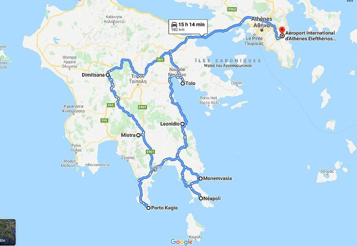 Muriel
Nous avons quelques hésitations quant à la chaleur possible (notamment pour les randonnées) mais finalement, hop! la réservation des billets d'avion est faite fin janvier: ce sera un départ de Bruxelles (avec Brussels airlines) le 05/07 à 7h30. Puis arrive le (la) Covid avec son lot d'incertitudes: partira? Partira pas? Partira? Partira pas? Faut-il tout annuler, reporter? Au mois de juin les règles d'ouverture des frontières changent en permanence mais il arrive un moment où il faut bien se décider car certains hébergements ne sont plus annulables. Les frontières de la Grèce doivent théoriquement ouvrir totalement le 1er juillet (sous réserve de...) on doit partir le 5 ...alors, c'est décidé, on part! ...enfin, si tout se passe comme prévu!
L'ouest du Péloponnèse ne m'inspire pas plus que ça. Par contre Cythère me tente bien, alors voilà à quoi ressemblera notre circuit (on prendra le bateau pour Cythère à Neapoli):
MurielConcours photo de juillet 2020: Verticale(s) English translation pending
Bonjour 🙂
Après déjà dix ans depuis la première édition, nous voici au lancement du 120ème concours.
J’aime l'idée de garder la surprise des photos qui pourront être proposées, c’est pourquoi j’ai choisi un thème ouvert : Verticale(s). Il n’y aura pas de contrôle au fil à plomb, ça pourra pencher un peu mais raisonnablement. Pour accompagner le démarrage du concours, vous trouverez quelques pistes en bas de ce message.
Vous pourrez participer jusqu’au samedi 25 juillet à 23h59, heure de Paris. Chaque participant est autorisé à poster jusqu’à trois photos, numérotées de 1 à 3, en précisant le lieu de prise de vue. N’hésitez pas à accompagner vos photos de quelques lignes.
Le vote aura lieu du dimanche 26 juillet 0h01 au jeudi 30 juillet à 22h. Il est accessible à tous, participants ou non, dans la limite d’un vote, et se fera par l’attribution d’un total de six points répartis sur 3 ou 4 photos : Photo n°1 : 3 points Photo n°2 : 2 points Photo n°3 : 1 point - OU - Photo n°3A et photo n°3B : 1/2 point chacune
La photo gagnante sera celle qui aura remporté le plus de points. En cas d’égalité pour la première position, les photos seront départagées par le nombre de votes à 3 points, puis , si l'égalité persiste, par le nombre de votes à 2 points, etc.
Le ou la gagnant(e) aura le privilège d’organiser le concours suivant.
Ce fil est réservé aux photos participantes et aux votes. Pour le blabla ça se passe ici ! Le diaporama arrivera dans quelques jours et figurera dans ma signature.
C’est parti 🙂
Après déjà dix ans depuis la première édition, nous voici au lancement du 120ème concours.
J’aime l'idée de garder la surprise des photos qui pourront être proposées, c’est pourquoi j’ai choisi un thème ouvert : Verticale(s). Il n’y aura pas de contrôle au fil à plomb, ça pourra pencher un peu mais raisonnablement. Pour accompagner le démarrage du concours, vous trouverez quelques pistes en bas de ce message.
Vous pourrez participer jusqu’au samedi 25 juillet à 23h59, heure de Paris. Chaque participant est autorisé à poster jusqu’à trois photos, numérotées de 1 à 3, en précisant le lieu de prise de vue. N’hésitez pas à accompagner vos photos de quelques lignes.
Le vote aura lieu du dimanche 26 juillet 0h01 au jeudi 30 juillet à 22h. Il est accessible à tous, participants ou non, dans la limite d’un vote, et se fera par l’attribution d’un total de six points répartis sur 3 ou 4 photos : Photo n°1 : 3 points Photo n°2 : 2 points Photo n°3 : 1 point - OU - Photo n°3A et photo n°3B : 1/2 point chacune
La photo gagnante sera celle qui aura remporté le plus de points. En cas d’égalité pour la première position, les photos seront départagées par le nombre de votes à 3 points, puis , si l'égalité persiste, par le nombre de votes à 2 points, etc.
Le ou la gagnant(e) aura le privilège d’organiser le concours suivant.
Ce fil est réservé aux photos participantes et aux votes. Pour le blabla ça se passe ici ! Le diaporama arrivera dans quelques jours et figurera dans ma signature.
C’est parti 🙂
En Inde du Sud juste avant le confinement English translation pending
Bonjour à tous,
Nous étions en Inde du Sud en février-mars 2020 (25 jours sur place). Comme nous avons passé les 70 ans nous avons pensé que nous ne reviendrons plus en Inde (il y a encore tant d'autres pays encore à aller visiter et il nous reste finalement assez peu d'années pour cela). Du coup à l'Inde du Sud nous avons rajouté Hampi ainsi que les sites d'Ajanta et Ellora. Programme ambitieux !
Le plus difficile en Inde c'est de décider de ce que l'on ne pourra pas voir parmi les "incontournables" en tous genres qui sont annoncés dans tous les guides, forums et carnets de voyage divers. Que les adeptes des "hors des sentiers battus" se rassurent, s'ils veulent aller en Inde il n'y a que ça dans tout le pays aussi.
Donc après une première liste de ce qu'il fallait absolument ne pas rater, mon estimation de la durée du voyage s'est établie à 35 jours. Trop pour nous. Deuxième liste réduite avec beaucoup de difficulté : 25 jours sur place. OK ! Il n'y a plus qu'à organiser le circuit et vérifier sa faisabilité car l'Inde du Sud c'est très grand et les endroits que nous avons choisis sont répartis sur une vaste zone :
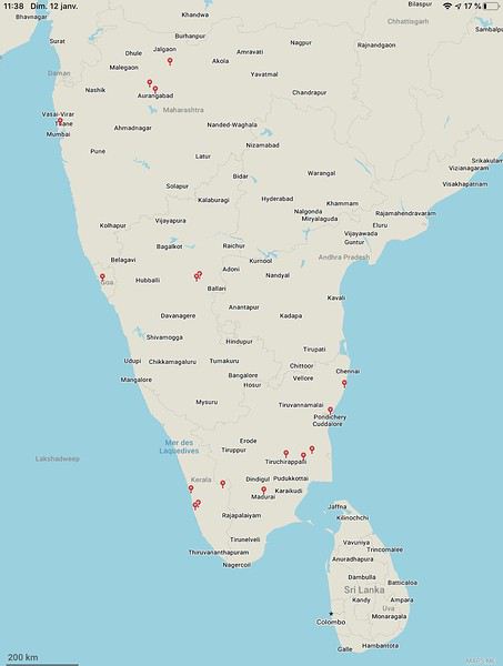
Moyens de transports : dans un premier temps j'avais pensé combiner bus de luxe, train et taxi. Compte tenu désormais de notre âge mon épouse a été catégorique : ce sera voiture avec chauffeur et si besoin avion (lignes intérieures). Effectivement les trajets en bus et en train relatés dans différents carnets de voyage le sont par des gens qui ont 15 à 20 ans de moins que nous. Et des bus et trains de toutes sortes nous les avons pratiqués un peu partout dans le monde ces dernières décennies - nous connaissons donc bien et ne le regrettons pas. Par ailleurs la formule voiture avec chauffeur est finalement assez courante en Inde et financièrement abordable.
Merci aux différents carnets de voyage de VoyageForum pour l'aide précieuse apportée, et particulièrement merci à Xiongmao, que je salue, qui nous a bien aidé à choisir notre principal prestataire. Le circuit fut donc choisi comme suit :
Arrivés à CHENNAI le 14 février 2020 (vol Air India avec escale à Delhi), Repartis de BOMBAY le 10 mars 2020 (vol Air India avec escale et contrôle immigration à Delhi), et arrivés ce même 10 mars chez nous à 21h00 . . . et confinés le 17 mars à 12h00
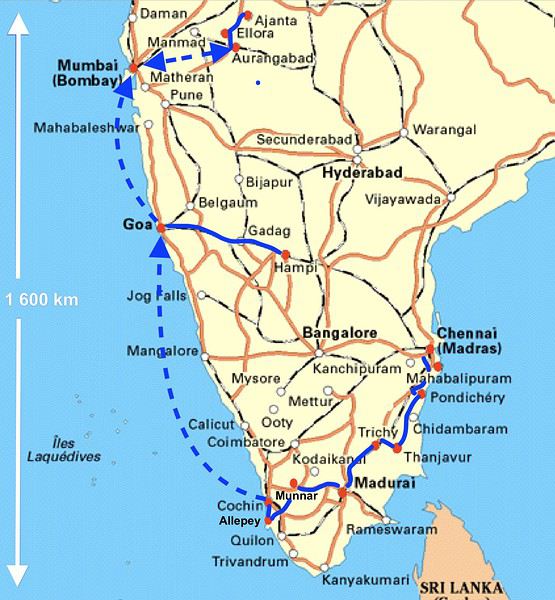
NOTA : 4 400 photos prises par ma femme et moi (un vrai délire !). On a beau se dire qu'il faut se limiter à l'essentiel, comme du temps où chaque photo était payante, il est tellement facile d'en faire avec les appareils numériques et les smartphones qui maintenant sont très corrects qu'on se laisse aller. Choix drastique, nous n'avons retenu que 250 photos pour ce carnet de voyage (et c'est déjà trop, je m'en excuse par avance).
Formalités : e-visas envoyés le 20 janvier et reçus "granted" le 21 ! Super rapide donc, mais par contre la rédaction extrêmement minutieuse du formulaire en ligne ainsi que la confection des pièces jointes selon les normes très strictes nécessite environ deux heures pour chaque demande.
Températures : pendant ces 3 ½ semaines la température moyenne en journée a été de 30°C, sauf à MUNNAR où elle est descendue vers 24°C et à HAMPI où elle était de 34°C.
Vendredi 14 février et samedi 15 Février 2020 Nous ne nous sommes pas arrêtés à CHENNAI. Nous avons immédiatement pris un taxi pour MAHABALIPURAM (nous avions demandé ce service à l'hôtel déjà réservé mais il aurait été possible facilement de prendre un "pré-paid taxi" juste à la sortie de l'aéroport). 15h15 : atterrissage à CHENNAI 16h20 : départ de notre taxi 18h00 : arrivée à l'hôtel à MAHABALIPURAM De 18h15 à 19h30 : change dans un bureau de change ( 100 € contre 7 750 INR soit 100 INR = 1,3 €) puis achat et mise en service d'une carte SIM indienne (valable dans toute l'Inde, pour appels en Inde pendant 28 jours avec 1,5 Go/jour de données internet, le tout pour 550 roupies, soit 7 € : autant dire rien pour un internet quasi illimité et une durée d'appels largement suffisante pour l'utilisation en local).
MAHABALIPURAM : Centre-ville sympa bien que très touristique. Tout peut se faire à pied (éventuellement retour en tuk-tuk de l'ensemble de temples des Cinq Rathas). Dès notre première visite au Shore Temple (Temple du rivage) nous découvrons la règle que nous verrons systématiquement par la suite : les indiens paient 15 fois moins cher que les étrangers :
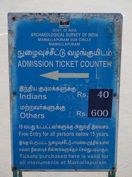
Vu notre niveau de vie comparé à celui moyen des indiens on ne va pas se plaindre. C'est juste qu'on n'est pas habitué à cette distinction (discrimination ?) en France. Le Shore Temple (temple du rivage) a un intérêt limité mais intéressant pour un premier contact avec cette culture et architecture :
En revanche l'ensemble de temples des Cinq Rathas est vraiment intéressant. Beaucoup de touristes indiens d'ailleurs. Sur le chemin, beaucoup de magasins de sculpteurs sur pierre. C'est apparemment une activité importante de cette ville:
et activités touristique et scolaire importantes aussi :
L'ensemble des temples des Cinq Rathas est assez compact mais riche en sculptures :
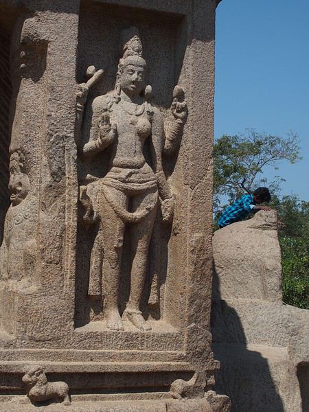
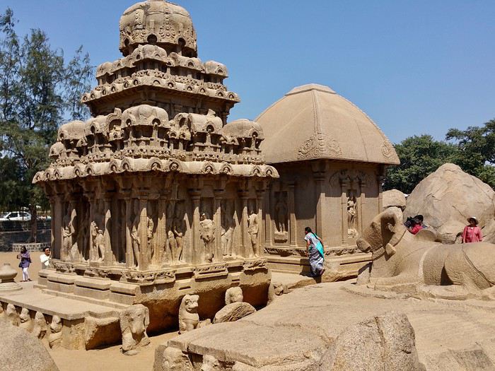
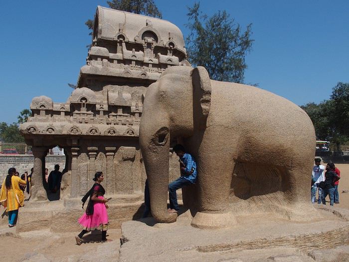
Nous étions en Inde du Sud en février-mars 2020 (25 jours sur place). Comme nous avons passé les 70 ans nous avons pensé que nous ne reviendrons plus en Inde (il y a encore tant d'autres pays encore à aller visiter et il nous reste finalement assez peu d'années pour cela). Du coup à l'Inde du Sud nous avons rajouté Hampi ainsi que les sites d'Ajanta et Ellora. Programme ambitieux !
Le plus difficile en Inde c'est de décider de ce que l'on ne pourra pas voir parmi les "incontournables" en tous genres qui sont annoncés dans tous les guides, forums et carnets de voyage divers. Que les adeptes des "hors des sentiers battus" se rassurent, s'ils veulent aller en Inde il n'y a que ça dans tout le pays aussi.
Donc après une première liste de ce qu'il fallait absolument ne pas rater, mon estimation de la durée du voyage s'est établie à 35 jours. Trop pour nous. Deuxième liste réduite avec beaucoup de difficulté : 25 jours sur place. OK ! Il n'y a plus qu'à organiser le circuit et vérifier sa faisabilité car l'Inde du Sud c'est très grand et les endroits que nous avons choisis sont répartis sur une vaste zone :
Moyens de transports : dans un premier temps j'avais pensé combiner bus de luxe, train et taxi. Compte tenu désormais de notre âge mon épouse a été catégorique : ce sera voiture avec chauffeur et si besoin avion (lignes intérieures). Effectivement les trajets en bus et en train relatés dans différents carnets de voyage le sont par des gens qui ont 15 à 20 ans de moins que nous. Et des bus et trains de toutes sortes nous les avons pratiqués un peu partout dans le monde ces dernières décennies - nous connaissons donc bien et ne le regrettons pas. Par ailleurs la formule voiture avec chauffeur est finalement assez courante en Inde et financièrement abordable.
Merci aux différents carnets de voyage de VoyageForum pour l'aide précieuse apportée, et particulièrement merci à Xiongmao, que je salue, qui nous a bien aidé à choisir notre principal prestataire. Le circuit fut donc choisi comme suit :
Arrivés à CHENNAI le 14 février 2020 (vol Air India avec escale à Delhi), Repartis de BOMBAY le 10 mars 2020 (vol Air India avec escale et contrôle immigration à Delhi), et arrivés ce même 10 mars chez nous à 21h00 . . . et confinés le 17 mars à 12h00
NOTA : 4 400 photos prises par ma femme et moi (un vrai délire !). On a beau se dire qu'il faut se limiter à l'essentiel, comme du temps où chaque photo était payante, il est tellement facile d'en faire avec les appareils numériques et les smartphones qui maintenant sont très corrects qu'on se laisse aller. Choix drastique, nous n'avons retenu que 250 photos pour ce carnet de voyage (et c'est déjà trop, je m'en excuse par avance).
Formalités : e-visas envoyés le 20 janvier et reçus "granted" le 21 ! Super rapide donc, mais par contre la rédaction extrêmement minutieuse du formulaire en ligne ainsi que la confection des pièces jointes selon les normes très strictes nécessite environ deux heures pour chaque demande.
Températures : pendant ces 3 ½ semaines la température moyenne en journée a été de 30°C, sauf à MUNNAR où elle est descendue vers 24°C et à HAMPI où elle était de 34°C.
Vendredi 14 février et samedi 15 Février 2020 Nous ne nous sommes pas arrêtés à CHENNAI. Nous avons immédiatement pris un taxi pour MAHABALIPURAM (nous avions demandé ce service à l'hôtel déjà réservé mais il aurait été possible facilement de prendre un "pré-paid taxi" juste à la sortie de l'aéroport). 15h15 : atterrissage à CHENNAI 16h20 : départ de notre taxi 18h00 : arrivée à l'hôtel à MAHABALIPURAM De 18h15 à 19h30 : change dans un bureau de change ( 100 € contre 7 750 INR soit 100 INR = 1,3 €) puis achat et mise en service d'une carte SIM indienne (valable dans toute l'Inde, pour appels en Inde pendant 28 jours avec 1,5 Go/jour de données internet, le tout pour 550 roupies, soit 7 € : autant dire rien pour un internet quasi illimité et une durée d'appels largement suffisante pour l'utilisation en local).
MAHABALIPURAM : Centre-ville sympa bien que très touristique. Tout peut se faire à pied (éventuellement retour en tuk-tuk de l'ensemble de temples des Cinq Rathas). Dès notre première visite au Shore Temple (Temple du rivage) nous découvrons la règle que nous verrons systématiquement par la suite : les indiens paient 15 fois moins cher que les étrangers :
Vu notre niveau de vie comparé à celui moyen des indiens on ne va pas se plaindre. C'est juste qu'on n'est pas habitué à cette distinction (discrimination ?) en France. Le Shore Temple (temple du rivage) a un intérêt limité mais intéressant pour un premier contact avec cette culture et architecture :
En revanche l'ensemble de temples des Cinq Rathas est vraiment intéressant. Beaucoup de touristes indiens d'ailleurs. Sur le chemin, beaucoup de magasins de sculpteurs sur pierre. C'est apparemment une activité importante de cette ville:
et activités touristique et scolaire importantes aussi :
L'ensemble des temples des Cinq Rathas est assez compact mais riche en sculptures :
Touristikis à la crème de solaris English translation pending
Comme j'ai un peu de temps, je vous livre le récit d'un voyage de 2018 qui traînait sur mon ordinateur :
Il était une fois, par delà les pandémies et les crises économiques, un temps où nous pouvions voyager : 2018. En cette année béni(t)e, il n’y eut pour nous point de virée nord-atlantique dans la chaleur estivale au programme, point de douches gratuites rafraîchissantes, point de températures vivifiantes, point de gastronomie douteuse et point de prix déments. En passant, félicitations à l’Islande et ses pizzas caoutchouteuse à 30 euros. En 2018, non, on va dans un vrai pays où l’on sait ce que signifie avoir chaud, manger et glander à une terrasse : la Grèce. Et comme nous ne sommes quand même pas des stakhanovistes du 40° à l’ombre, nous avons choisi le printemps, avril plus précisément. Pour le terrain de jeu, il s'agira d'Athènes et du Péloponnèse sur un peu plus de deux semaines. A nous, les petites églises, les ruines romantiques et les oliviers scintillants !
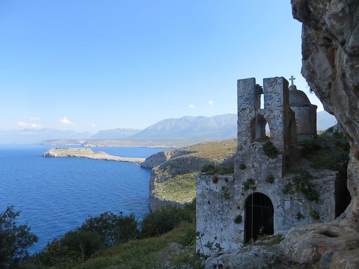 Bien choisir sa photo d'appel pour attirer le chaland. Un bon point et toute mon estime pour celui qui devine où c'est.
Avec la Grèce - pour ceux qui ont lu mes autres carnets qui sont tellement merveilleux qu’il faut les lire immédiatement et que votre vie s’en trouvera changée et éblouie - tout est chamboulé : fini les campings, les dortoirs et les piques-niques miteux de nos voyages dans le nord, place aux hôtels, aux b&b et aux restos. Et en plus, les Grecs ont le bon goût d’être accueillants.
Laissons la parole à du Ballay, parrainé par Alain Deloin et Jean-Michel Apeupré :
Heureux qui comme Ulysse a fait un beau voyage (en Grèce), Ou comme celui-là qui vit le Parthénon, Et puis est retourné, plein d'image et pâmoison, Vivre exubérant le reste de son âge
Et avant d'attaquer le vif du sujet, quelques annonces pour le public innocent : Avertissement : vous lisez ce compte-rendu à vos risques et périls. Toute indignation n’est pas de ma responsabilité. Avertissement bis : non je ne suis pas raciste non je n’ai rien contre les Néerlandais, j’ai d’ailleurs un ami néerlandais non les Grecs ne sont pas des feignants oui les Allemands ont pour passe-temps l’invasion… Ah mince une rechute.
Jour 1
Ayé, c’est parti pour une journée de transport translation Lyon-Athènes via Munich en empruntant la Lufthansa. Le vol est sans encombre, une conversation s’engage avec un voisin grec sympathique autour de la qualité douteuse de la bouffe allemande. J'en profite pour avoir une illumination : la nourriture, voilà ce qui unit les Européens (enfin ceux du sud) ! Eclair de génie, j’ai trouvé comment sauver l’Union européenne « tous unis contre la vie beurk ». Malheureusement, ça risque d’exclure les riches du nord. D’ailleurs c’est peut-être un signe : faut-il mal manger pour être riche ? Faudrait exclure les Japonais de l’équation mais sinon ça marche (pays germaniques, scandinaves et anglo-saxons même combat). Revenons au voisin grec, je tente de donner un tour sportif à la conversation mais malheureusement il n’aime pas le foot « football is shit »… Arrgghh, de quoi vais-je bien pouvoir parler alors ?! Du coup, je parle plus. Alors qu’un petit débat sur le scandale du moment, le président du PAOK Salonique et son flingue, ça, ça aurait été fun .
L’atterrissage se passe sans encombre dans cet aéroport d’Athènes qui a changé de place depuis mon unique passage dans le coin et s’est éloigné du centre-ville. Première prise de contact avec l’alphabet grec, on avait essayé pour le fun de potasser les équivalences mais c’est loin d’être évident ! Combien d'équivalents du O ont-ils dans cet alphabet ?!
Le trajet jusqu’au centre d’Athènes est long, très long et le métro/train se remplit progressivement jusqu’à être bondé à ras bord. Nous sommes tassés, compressés et pour sortir de cette fournaise, c’est la lutte finale, poussons-nous et demain, l’air sera le sauveur du genre humain (note à moi-même : éviter la prochaine fois d’arriver au moment de la sortie du travail)
La chambre chez l’habitant est bien placée, en plein centre sans être très bruyante. On profite de notre premier soir pour une approche de la cuisine grecque et un mauvais choix de commande (que de la friture…). On enchaîne sur une petite balade nocturne pour revenir sur l’impression née du voyage précédent (ie dans les années 90 la voiture reine, une ville bruyante et désagréable). Eh bien en fait, une partie du centre-ville s’est piétonnisé, il y a de la vie, des restos et des cafés avec des terrasses partout, c’est très agréable finalement.
Il était une fois, par delà les pandémies et les crises économiques, un temps où nous pouvions voyager : 2018. En cette année béni(t)e, il n’y eut pour nous point de virée nord-atlantique dans la chaleur estivale au programme, point de douches gratuites rafraîchissantes, point de températures vivifiantes, point de gastronomie douteuse et point de prix déments. En passant, félicitations à l’Islande et ses pizzas caoutchouteuse à 30 euros. En 2018, non, on va dans un vrai pays où l’on sait ce que signifie avoir chaud, manger et glander à une terrasse : la Grèce. Et comme nous ne sommes quand même pas des stakhanovistes du 40° à l’ombre, nous avons choisi le printemps, avril plus précisément. Pour le terrain de jeu, il s'agira d'Athènes et du Péloponnèse sur un peu plus de deux semaines. A nous, les petites églises, les ruines romantiques et les oliviers scintillants !
Bien choisir sa photo d'appel pour attirer le chaland. Un bon point et toute mon estime pour celui qui devine où c'est.Avec la Grèce - pour ceux qui ont lu mes autres carnets qui sont tellement merveilleux qu’il faut les lire immédiatement et que votre vie s’en trouvera changée et éblouie - tout est chamboulé : fini les campings, les dortoirs et les piques-niques miteux de nos voyages dans le nord, place aux hôtels, aux b&b et aux restos. Et en plus, les Grecs ont le bon goût d’être accueillants.
Laissons la parole à du Ballay, parrainé par Alain Deloin et Jean-Michel Apeupré :
Heureux qui comme Ulysse a fait un beau voyage (en Grèce), Ou comme celui-là qui vit le Parthénon, Et puis est retourné, plein d'image et pâmoison, Vivre exubérant le reste de son âge
Et avant d'attaquer le vif du sujet, quelques annonces pour le public innocent : Avertissement : vous lisez ce compte-rendu à vos risques et périls. Toute indignation n’est pas de ma responsabilité. Avertissement bis : non je ne suis pas raciste non je n’ai rien contre les Néerlandais, j’ai d’ailleurs un ami néerlandais non les Grecs ne sont pas des feignants oui les Allemands ont pour passe-temps l’invasion… Ah mince une rechute.
Jour 1
Ayé, c’est parti pour une journée de transport translation Lyon-Athènes via Munich en empruntant la Lufthansa. Le vol est sans encombre, une conversation s’engage avec un voisin grec sympathique autour de la qualité douteuse de la bouffe allemande. J'en profite pour avoir une illumination : la nourriture, voilà ce qui unit les Européens (enfin ceux du sud) ! Eclair de génie, j’ai trouvé comment sauver l’Union européenne « tous unis contre la vie beurk ». Malheureusement, ça risque d’exclure les riches du nord. D’ailleurs c’est peut-être un signe : faut-il mal manger pour être riche ? Faudrait exclure les Japonais de l’équation mais sinon ça marche (pays germaniques, scandinaves et anglo-saxons même combat). Revenons au voisin grec, je tente de donner un tour sportif à la conversation mais malheureusement il n’aime pas le foot « football is shit »… Arrgghh, de quoi vais-je bien pouvoir parler alors ?! Du coup, je parle plus. Alors qu’un petit débat sur le scandale du moment, le président du PAOK Salonique et son flingue, ça, ça aurait été fun .
L’atterrissage se passe sans encombre dans cet aéroport d’Athènes qui a changé de place depuis mon unique passage dans le coin et s’est éloigné du centre-ville. Première prise de contact avec l’alphabet grec, on avait essayé pour le fun de potasser les équivalences mais c’est loin d’être évident ! Combien d'équivalents du O ont-ils dans cet alphabet ?!
Le trajet jusqu’au centre d’Athènes est long, très long et le métro/train se remplit progressivement jusqu’à être bondé à ras bord. Nous sommes tassés, compressés et pour sortir de cette fournaise, c’est la lutte finale, poussons-nous et demain, l’air sera le sauveur du genre humain (note à moi-même : éviter la prochaine fois d’arriver au moment de la sortie du travail)
La chambre chez l’habitant est bien placée, en plein centre sans être très bruyante. On profite de notre premier soir pour une approche de la cuisine grecque et un mauvais choix de commande (que de la friture…). On enchaîne sur une petite balade nocturne pour revenir sur l’impression née du voyage précédent (ie dans les années 90 la voiture reine, une ville bruyante et désagréable). Eh bien en fait, une partie du centre-ville s’est piétonnisé, il y a de la vie, des restos et des cafés avec des terrasses partout, c’est très agréable finalement.
Vos photos du Maroc English translation pending
bonjour
merci de partager si vous le voulez , vos photos et adresses sympa !
en premier évidemment mon village préféré !
AÏt Benhaddou , découvert en 202015 ...2 ou 3 auberges à l'époque ! j'étais à la Baraka ! à l'entrée du village ! c'était tellement cool à cette époque ! je faisais la cuisine avec Mohamed le cuisinier , dans la cuisine de l'auberge !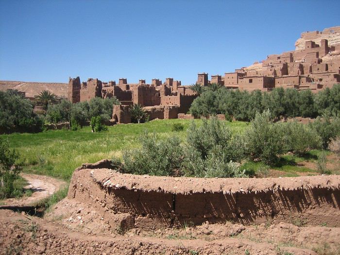
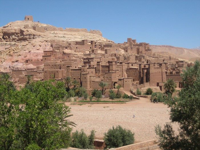
l'équipe de l'auberge " la baraka "
 A gauche , Brahim Bolkaid qui est le patron de l'auberge actuelle " maison d'hôtes panoramic "
en bas à droite le cuisinier !
j'en ai passer des heures dans la cuisine !
à cette période , il y avait des énormes bus d'Allemands , qui arrivaient avec toute leur nourriture !
ils consommaient très peu !
mais on leur servaient surtout des salades fraiches , des boisons ...
ils restaient 3 heures : boissons , pipi , visite du ksar et hop ils repartaient !
A gauche , Brahim Bolkaid qui est le patron de l'auberge actuelle " maison d'hôtes panoramic "
en bas à droite le cuisinier !
j'en ai passer des heures dans la cuisine !
à cette période , il y avait des énormes bus d'Allemands , qui arrivaient avec toute leur nourriture !
ils consommaient très peu !
mais on leur servaient surtout des salades fraiches , des boisons ...
ils restaient 3 heures : boissons , pipi , visite du ksar et hop ils repartaient !
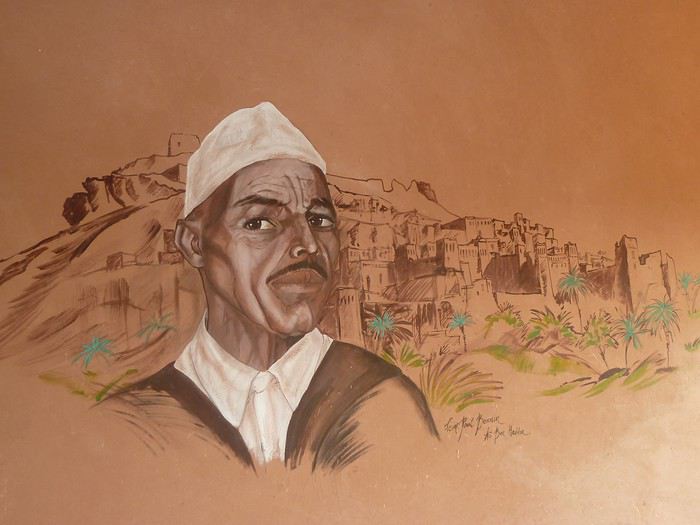
la fresque chez Brahim !
AÏt Benhaddou , découvert en 202015 ...2 ou 3 auberges à l'époque ! j'étais à la Baraka ! à l'entrée du village ! c'était tellement cool à cette époque ! je faisais la cuisine avec Mohamed le cuisinier , dans la cuisine de l'auberge !
l'équipe de l'auberge " la baraka "
A gauche , Brahim Bolkaid qui est le patron de l'auberge actuelle " maison d'hôtes panoramic "
en bas à droite le cuisinier !
j'en ai passer des heures dans la cuisine !
à cette période , il y avait des énormes bus d'Allemands , qui arrivaient avec toute leur nourriture !
ils consommaient très peu !
mais on leur servaient surtout des salades fraiches , des boisons ...
ils restaient 3 heures : boissons , pipi , visite du ksar et hop ils repartaient !la fresque chez Brahim !
Enjoy Jordan: 3 semaines inoubliables English translation pending
Je vais me lancer dans un énième carnet sur cette fabuleuse destination. Je ne prétends pas égaler le style humoristique de certaines ou certains (ils se reconnaîtront !). Je vais juste essayer de vous faire vivre ou revivre quelques-uns de nos beaux souvenirs en ces temps où l'on ne sait plus vraiment quand nous pourrons refaire nos bagages et pour quelle destination.
Allez c'est parti, embarquement immédiat !
Mi-octobre 2019, mon épouse et moi sommes revenus d'un beau voyage de 3 semaines en Jordanie et 3,5 jours à Jérusalem.
Mais pourquoi 3 semaines dans un aussi petit pays où la plupart des touristes en 'font le tour' en 8/10 jours ?
Parce que... C'est la meilleure réponse... Surtout parce que nous le pouvons (pas de vacances en juillet/août) et que nous aimons prendre notre temps, visiter des sites moins connus, faire des activités parfois surprenante à nos âges.
Nous avons parcouru la Jordanie de Madaba et des rives de la Mer Morte à Jerash en passant par les châteaux du désert, de Jerash à Dana en passant par Kerak, de Dana au sublime Wadi Rum en passant par la merveilleuse Petra. Pour terminer, je vous proposerai de flâner dans la vieille ville d'Aman. Et au bout du bout, je pourrai éventuellement vous raconter nos derniers jours de ce périple passés à Jérusalem.
Etape 1 : Madaba
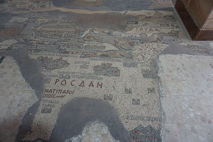
L’objectif de cette étape était de visiter tranquillement la ville et de voir les nombreuses mosaïques sur ses différents sites. Mais aussi de passer une journée au bord de la Mer Morte (objectif : repos dans un cadre sympa), de visiter quelques sites, villes ou villages tout autour et d’aller tenter le canyoning dans le wadi Mujib, nous qui n’avons jamais fait de canyoning ! Etape 2 : Jerash
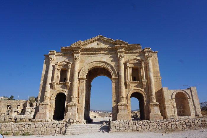
Etape à 100% culturelle avec au programme les châteaux du désert (petit détour pour relier Madaba à Jerash), les sites romains de Jerash, Um Qais et Pella, mais aussi le château médiéval d’Ajlun. Etape 3 : Kerak par la route du roi.
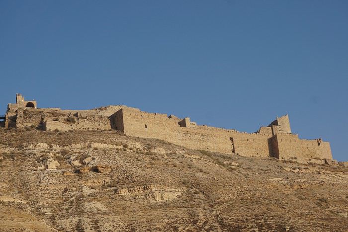
Nous ne passerons qu’une nuit à Kerak. Une demi-journée pour visiter le château, c’est très largement suffisant (même pour nous !) et donc cela va nous laisser du temps pour aller se balader dans des wadis faciles d’accès. Etape 4 : Dana
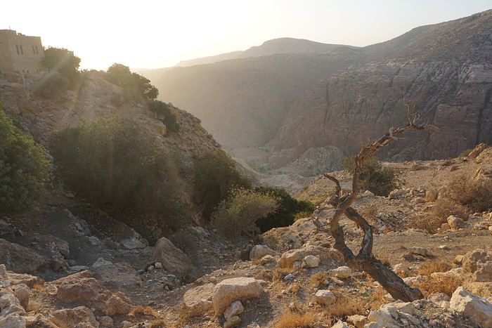
Ici aussi nous ne passerons qu’une nuit alors qu’au départ j’envisageai de passer plusieurs jours dans la réserve. Cela a été a priori un bon choix car si les randonnées y sont probablement très belles, Justine aurait eu beaucoup de mal compte-tenu du dénivelé. Et puis derrière, il y a Pétra et le trek dans le Wadi Rum. Il fallait donc se garder un peu d’énergie. Etape 5 : Pétra
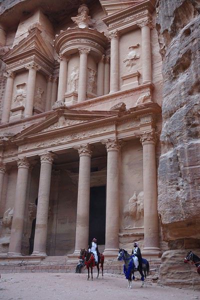
Que dire de cette étape ? Mon projet est de visiter le site en 4 journées complètes sans savoir si on pourra y rentrer 4 jours avec un Jordan Pass de 3 jours à Pétra. Si pas possible, on improvisera ! Etape 6 : Wadi Rum
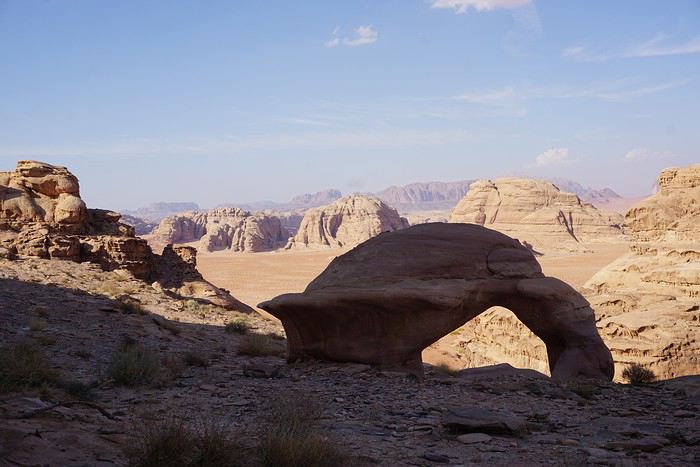
Nous allons y fêter notre anniversaire de mariage. Un trek de 3 jours, des camps itinérants et les nuits à la belle étoile. Et le jour de note anniversaire, le survol du désert au lever du soleil en montgolfière… projet sympa non ? Mais chut, c'est une surprise pour mon épouse ! Etape 7 : Amman
Dernière étape en Jordanie avant de traverser la frontière et terminer notre voyage à Jérusalem Etape 8 : Jérusalem
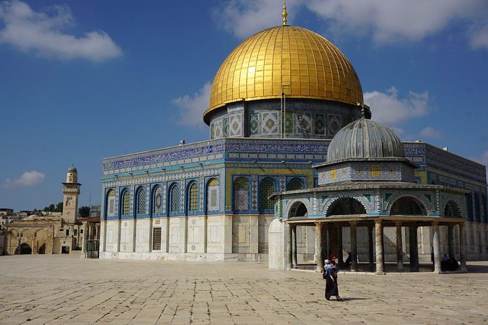
On ne présente plus cette destination : la vieille ville avec ses souks et les 4 quartiers (arabe, juif, chrétien et arménien), le Mont des Oliviers, le Mur des Lamentations, l’Esplanade des Mosquées. Mais aussi le mémorial de la Shoah.
L’objectif de cette étape était de visiter tranquillement la ville et de voir les nombreuses mosaïques sur ses différents sites. Mais aussi de passer une journée au bord de la Mer Morte (objectif : repos dans un cadre sympa), de visiter quelques sites, villes ou villages tout autour et d’aller tenter le canyoning dans le wadi Mujib, nous qui n’avons jamais fait de canyoning ! Etape 2 : Jerash
Etape à 100% culturelle avec au programme les châteaux du désert (petit détour pour relier Madaba à Jerash), les sites romains de Jerash, Um Qais et Pella, mais aussi le château médiéval d’Ajlun. Etape 3 : Kerak par la route du roi.
Nous ne passerons qu’une nuit à Kerak. Une demi-journée pour visiter le château, c’est très largement suffisant (même pour nous !) et donc cela va nous laisser du temps pour aller se balader dans des wadis faciles d’accès. Etape 4 : Dana
Ici aussi nous ne passerons qu’une nuit alors qu’au départ j’envisageai de passer plusieurs jours dans la réserve. Cela a été a priori un bon choix car si les randonnées y sont probablement très belles, Justine aurait eu beaucoup de mal compte-tenu du dénivelé. Et puis derrière, il y a Pétra et le trek dans le Wadi Rum. Il fallait donc se garder un peu d’énergie. Etape 5 : Pétra
Que dire de cette étape ? Mon projet est de visiter le site en 4 journées complètes sans savoir si on pourra y rentrer 4 jours avec un Jordan Pass de 3 jours à Pétra. Si pas possible, on improvisera ! Etape 6 : Wadi Rum
Nous allons y fêter notre anniversaire de mariage. Un trek de 3 jours, des camps itinérants et les nuits à la belle étoile. Et le jour de note anniversaire, le survol du désert au lever du soleil en montgolfière… projet sympa non ? Mais chut, c'est une surprise pour mon épouse ! Etape 7 : Amman
Dernière étape en Jordanie avant de traverser la frontière et terminer notre voyage à Jérusalem Etape 8 : Jérusalem
On ne présente plus cette destination : la vieille ville avec ses souks et les 4 quartiers (arabe, juif, chrétien et arménien), le Mont des Oliviers, le Mur des Lamentations, l’Esplanade des Mosquées. Mais aussi le mémorial de la Shoah.
Quatre mois dans les Balkans à vélo Venise - Istanbul English translation pending
Film résumé en 3m30 https://youtu.be/IpjdmmXR9Lo
Italie & Slovénie : Venise - Cortina - Ljubjana 800 km / 18200 md+
Arriver en bus à Venise (vélos en soute)... et mieux repartir plein nord dans le coeur des Dolomites (vélos sur le bitume). Impossible de parcourir les ruelles pavées ou naviguer sur une gondole, le but est de rejoindre Cortina d'Ampezzo avec 3 cols à plus de 2000 mètres. Aussi mythiques que sublimes : Monte Grappa, passo Rolle, Valles et di Giau (2236 m). Certains font le Giro, d'autres du cyclotourisme : dur de tenir la roue d'un vélo de route quand les sacoches sont remplies à ras bord de bonnes choses à manger... Au fil des grimpettes, le soleil nous quitte pour rester en bord de mer : le temps n'est franchement pas au rendez-vous ! Il pleut quand il ne neige pas, il fait surtout froid et humide. A Cortina (#3), la météo annonce 15 jours de mauvais, il faut avancer coûte que coûte. Très vite, on s'habitue à l'effort, au dénivelé et aux conditions hivernales d'un mois de mai : le col pour Sella Ciampigotto et Sauris est fermé : obligés de slalomer entre les congères et les blocs de pierre éparpillés sur la route. Peu à peu, le bitume laisse place aux pistes forestières, l'aventure peut commencer...
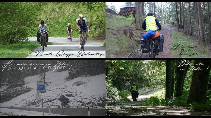
A Bovec, en Slovénie, l'ambiance devient plus minérale. La route qui entaille les Alpes Juliennes est chargée d'histoire : 25 km et 50 virages construits par des prisonniers russes. L'enfer au paradis... Le soleil fait briller les eaux cristallines de la Soca jusqu'au col de Vršic (1611 m), l'endroit est irréel. Après un court passage à Bled, le parc calcaire du Triglav donne une pause autour du lac de Bohinj (Bohinjsko jezero), rien de telle qu'une randonnée pour dégourdir les jambes. Ici, les vallées sont paisibles et les huttes traditionnelles en bois donnent du charme au pédalage. La météo redevient capricieuse, pas un jour ne passe sans pluie jusqu'à Ljubljana. La fin de l'arc alpin s'achève en douceur : quelle satisfaction personnelle, ce voyage a commencé il y a 4 ans... Genève-Nice ! La vie rêvée d'un cyclovoyageur...
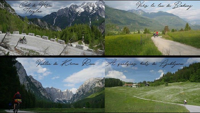
Après une journée de repos dans la capitale slovène (visite à 2 roues bien entendu), le cap est enfin mis sur le sud pour ouvrir la porte des Balkans. Les paysages deviennent plus vallonnés et les villages pittoresques : peu de touristes dans cette belle campagne de moyenne montagne. Croatie et Bosnie Herzégovine : Cabar - Delnice - Otocac - Senj - Makarska - Mostar 920 km / 13050 md+
La Croatie est l'étape détente et touristique de la traversée des Balkans : 300 km de route côtière de Senj à Makarska, que du bitume, peu de grimpettes... quoique ! Le soleil tape fort dès le matin, les journées commencent à 5 heures pour profiter de la fraîcheur et du peu de trafic. Mer bleue turquoise, papillons multicolores, villes historiques (Starigrad, Zadar, Sibenik, Togir, Split), longues pauses à l'ombre : tout y est pour des vacances paradisiaques ! Au nord, les parcs nationaux rythment l'itinéraire. Risnjak se fait au pas de course, la tête sous le pancho. Pas le temps d'apercevoir un lynx ou un ours : la forêt est peu engageante. Plitvice (Plitvicka jezera) accorde un peu de répit avec une belle rando entre lacs et cascades. Le parc du Velebit nord (Sjeverni Velebit) est une révélation karstique : la blancheur du calcaire tranche avec l'Adriatique. Les cabanes en bois amènent un peu de chaleur et de confort, au chaud près du poêle et dans un lit douillet. Plus au sud, Paklenica révèle un magnifique site d'escalade coincé dans un canyon étroit. Souvent, les vestiges de l'éclatement de la Yougoslavie sont toujours visibles 30 ans après la guerre : maisons éventrées et mines antipersonnelles signalées au bord du chemin. Impressionnant ! L'accueil en Bosnie est plus que chaleureux. Il n'y a que très peu de touristes, alors l'arrivée de deux cyclos est un véritable évènement. A Mostar, le vélo saute sur les pavés du Stari most, ce fameux pont médiéval détruit par les Serbes et reconstruit en 2003. Les mosquées et leurs minarets replacent soudainement les églises... le voyage à vélo permet de se plonger au coeur des religions et de l'histoire de ce petit bout d'Europe. Les routes sont étrangement désertes et les montées en plein cagnard sont étouffantes. Pas d'ombre ! Les gorges verdoyantes de la rivière Zalomka donnent accès au plateau de Gacko, à plus de 1000 mètres d'altitude. Les montagnes du Monténégro pointent leur nez, le pays est à cinq kilomètres à vol d'oiseau, mais à bien regarder la carte, le poste frontière rallonge par le nord d'au moins 150 km... Un chemin existe bel et bien, il coupe à travers les champs et quelques baraques en bois déglinguées. La frontière est marquée par un simple panneau, pas de barrière ni de garde. Facile de pénétrer illégalement dans le pays... en sera-t-il de même pour sortir ?
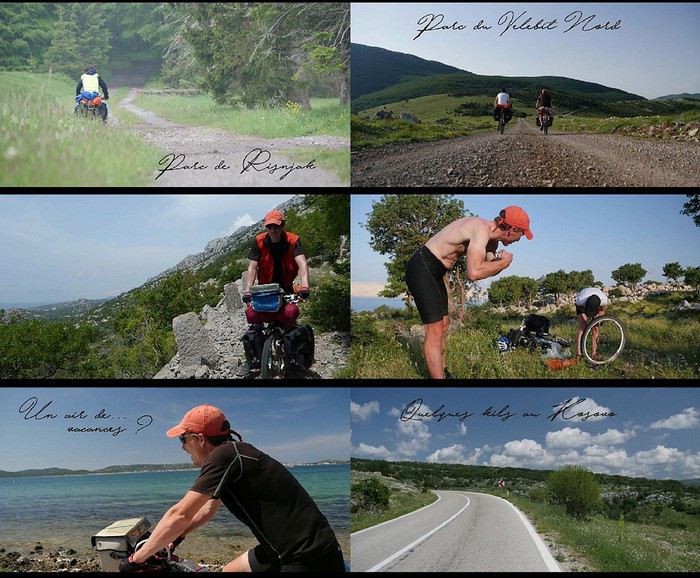
Monténégro, Albanie (1) & Kosovo : Pluzine - Zabljak - Savnik - Nikšic - Ostrog - Danilovgrad - Cetinje - Kotor - Podgorica - Plav - Rozaje - Pejë Le Monténégro est le royaume du vélo, surtout que le pays développe des circuits VTT de toute beauté. L'arrivée par le parc du Durmitor et le canyon de la Tara est une explosion de bonheur : l'endroit sauvage et préservé vaut à lui seul le détour. Peu de cyclos doivent prendre notre itinéraire, ça monte très fort tous les jours sur des chemins qui ne sont mêmes pas indiqués sur les cartes touristiques. L'expérience est géniale ! Parfois il faut pousser le vélo, souvent il faut mettre le poncho... ici, les orages sont violents et rapides. On échappe de peu à la grêle dans une étable providentielle : le paysage devient blanc en quelques minutes. On aura moins de chance sur un chemin transformé en torrent par des eaux en furie : l'expression "être rincé" prend tout son sens. Moments véritablement incroyables ! Voyager à vélo, c'est accepter cette incertitude, cet inconfort relatif et ce sentiment d'être livré à soi-même. Le contraste des couleurs est saisissant avec les montagnes environnantes : le Bobotov Kuk, point culminant à 2523 mètres, apparaît enneigé entre deux nuages. La baie de Kotor (Boka Kotorska) à 6 heures du matin est resplendissante, surtout avec 1200 m de dénivelé négatif effectués à la fraîche... le bonheur à portée de pédale ! Ce fjord de 30 km déchire d'un bleu profond un massif abrupt et tourmenté la route autour des deux péninsules (Luštica et Vrmac) permet de souffler un peu dans une ambiance méditerranéenne entre les oliviers et les grillons. Les villages traditionnels avec leur port de pêche et leur église alternent avec les pépites touristiques et autres stations balnéaires bétonnées : on roule ainsi de la très branchée Budva à la carte postale Sveti Stefan...
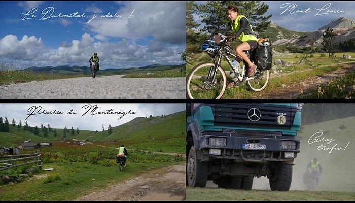
Après une journée de repos à Bar, les étapes de montagne ramènent en 3 jours dans le nord-est du pays par le lac de Skadar (Shkodër) et la magnifique vallée alpine de Kelmend en Albanie. De nouveaux panoramas entre 1000 et 1800 m défilent : les prairies (Katun). Quelques baraques ont été construites au milieu de nulle part et résistent au temps, tout comme ces bergers et ces bûcherons qui (sur)vivent loin de toute modernité. Pas de route, d'électricité, encore moins de touriste. La rencontre à vélo est exceptionnelle : il faut juste prendre le temps de s'arrêter. Au loin, le Kosovo apparaît comme creusé entre les montagnes, le pays est étonnamment plat. L'accueil est comme toujours chaleureux, d'autant plus que la pluie est au rendez-vous. Les spécialités culinaires comme les brochettes kefta ou les feuilletés byrek nécessitent un prochain voyage.
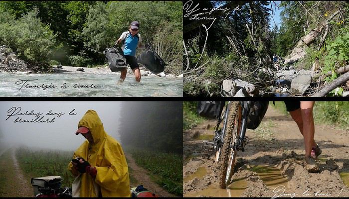
Albanie (2) : Bajram Curri - Fierzë - Fushë-Arrëz - Burrel - Divjakë - Fier - Vlora - Orikum - Saranda 640 km / 15000 md+ L'Albanie est un coup de coeur et une véritable surprise pour celui qui ne se limitera pas à la côte adriatique, la riviera albanaise. Les chemins de montagne exigeants et réservés aux aventuriers permettent de traverser le pays du nord au sud sans toucher le bitume. La vallée de la Valbona met directement dans l'ambiance : l'idée initiale était de passer le col de Valbonës à 1795 m pour rejoindre la vallée de Theth... c'est à pied finalement que l'on grimpera en aller-retour : le sentier est inroulable à VTT ! L'itinéraire s'adapte au jour le jour au gré du relief, du temps et des rencontres. La communication est plutôt bonne malgré un vocabulaire très limité... "rüga problem" est essentiel : les routes départementales qui coupent le pays est/ouest sont des pistes défoncées. Tous les Albanais se plaignent des politiques et de la corruption : le sentiment de misère et d'abandon revient sans cesse dans les conversations. En parlant de la France, certains yeux brillent avec l'espoir de changer de vie, les autres pleurent en souvenir d'un séjour à Calais ! Les bergers du parc de Lura (Parku Kombëtar Lurë) vivent dans des cabanes ouvertes au vent, constituées de 4 poteaux et d'une bâche en plastique en guise de toit. Leur quotidien est rythmé par la traite de leurs chèvres : le lait est transporté dans la vallée à dos d'âne. La vie est à la fois belle et tellement dure, moment terriblement émouvant !
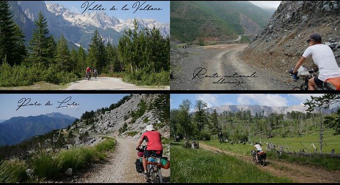
A l'est, le parc de Qafë-Shtamë évite les embouteillages de Tirana et rejoint la ville d'Elbasan. La piste déglinguée met à mal les bras et le matériel : l'essieu de la roue arrière casse net. La réparation tient au miracle car aucune pièce n'est en stock pour un VTT "récent" ! A deux reprises, le chemin n'existe plus... emporté par des glissements de terrain. Contourner un obstacle se paie par de gros efforts mais la providence amène un bivouac de luxe sous les étoiles ou une rencontre inoubliable : on n'est jamais à l'abri d'une invitation, d'un café albanais (surtout pas turc) et d'un verre de raki... voire les deux à la fois, même à 7 heures du matin. Au sud du pays, les pistes de sable au bord de la mer fatiguent plus que les cols : on roule même sur la plage... la chaîne du vélo s'en souvient encore. A Saranda, il est temps de prendre un ferry pour rejoindre la Grèce, Corfu : que les vacances commencent !
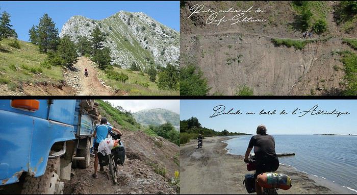
Grèce, Albanie (3) et Macédoine du Nord : Corfu - Igoumenítsa - Trikala - Metsovo - Konitsa - Kastoria - Presta - Bitola - Demir Kapija 1100 km / 24775 md+ Le tour de Corfu est un moment de détente au bord de mer ; l'ascension du grand Pantokrator (900 m) est l'unique étape de montagne de l'île. Les bivouacs sont posés face à l'Adriatique sous les oliviers, dans les herbes sauvages et les odeurs d'été, la plage n'est jamais très loin... le paradis ! La végétation est brûlée par le soleil, à 11 heures il fait déjà très chaud même à l'ombre des chapelles orthodoxes. Le retour sur le continent est rude : la chaleur étouffante rend les montées épuisantes. Dur de remonter sur selle avant 16 heures... les grimpettes se font à la fraîche. L'étape de Pramanta est difficile mais grandiose : chaque tour de roue est une victoire sur la caillasse, les virages s'enchaînent dans la douleur jusqu'au col à 1800 mètres. Il en va ainsi jusqu'à Kalambaka ; les chemins chaotiques se succèdent à un rythme d'enfer ! Aux Météores, la quiétude des monastères suspendus dans le ciel disparaît sous le flot des touristes déversés par bus entiers. L'endroit reste féerique et chargé de légendes mystérieuses. Ces poudingues géants semblent sortir de l'imagination des Dieux de la mythologie grecque... Istanbul se trouve à l'est, pourtant le cap est mis à l'ouest pour rejoindre les parcs Pindus et Tymphe, soit plus de 100 km à rouler dans la direction opposée, à ne plus rien comprendre... surtout que la pluie revient ! Après Kastoria, l'Albanie ouvre à nouveau ses frontières pour 50 km. Les bergers sont toujours là pour un coup de main : un fil de fer rouillé de clôture fixera mon porte-bagages jusqu'à l'arrivée. Merci les artistes ! Au lac de Prespa, la Macédoine se révèle être un véritable condensé des Balkans : les locaux parlent avec fierté de leur pays et leur vie : présence ottomane, religions, première guerre mondiale, migration, éclatement de la Yougoslavie, tout y est. J'oublie la traversée sans poste frontière au sommet du Mont Varos (2524 m), la situation est très tendue avec les Grecs : obligé d'improviser un circuit jusqu'à la frontière bulgare. Quelques âmes vivent dans des villages perdus, le temps s'est figé ! Il n'y a pas de bitume et les chemins sont difficilement praticables, peu empruntés... surtout gorgés d'eau !
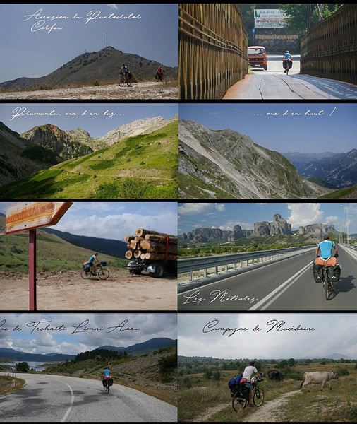
Bulgarie et Grèce (2) : Pétritch - Melnik - Bansko - Pamporovo - Plovdiv - Velingrad - Smoljan - Rudozem - Dzhebel - Komotini - Alexandroúpoli 850 km / 22375 md+ / 21900 md- Le parcours bulgare est intense et extrêmement varié. Curiosité géologique due l'érosion, Melnik est un village typique entouré de montagnes sablonneuses. Alors traverser un tunnel creusé dans du sable qui s'effrite au passage de la main, c'est comment dire... pas rassurant ! La piste remonte plein nord le long du parc du Pirin ; les locaux expliquent qu'il est impossible de rejoindre Bansko... alors le GPS aide à se repérer dans un dédalle de cul-de-sac et d'indications en cyrillique. L'entrée dans le massif des Rhodopes est magique : l'endroit est franchement beau même si les glaciers posés à plus de 2900 mètres font pâle figure ! C'est la saison des champignons : les chanterelles et les girolles cuisinées dans la popote donnent une saveur particulière aux pâtes 3 minutes. Les sources sont omniprésentes, quel bonheur de se ravitailler en eau fraîche plusieurs fois par jour. Mais l'atout principal des Rhodopes est la présence de cabanes plus ou moins luxueuses. On trouvera au minimum un toit, des bancs et des tables, un barbecue. Certains sont de véritables bijoux d'architecture en bois, on peut même y cuisiner ou passer la nuit... A partir de Dospat, une belle boucle en 8 se prépare : les cols et les vallées se succèdent. Il faut se perdre sur les sentiers pour visiter les monastères et les villages inaccessibles. Le vélo est posé pour découvrir les gorges de Trigrad, de la Trigradska et l'arche naturelle de Cudnite, merveilles de roches érodées. Les lacs de Batak et de Chiroka permettent de partager les vacances des Bulgares, caravaning, bbq, pêche, musique techno... la vie en toute simplicité ! L'essieu (cassé et réparé à grands coups de marteau en Albanie) fait trembler à nouveau le vélo, la roue sera changée à Pamporovo dans l'unique magasin de sports de la région, et par chance... le proprio est un ancien champion de VTT de descente ! Au sud du col de Rozen, l'influence turque redevient visible avec ses mosquées et minarets pointant vers le ciel. Après 60 km de route sinueuse le long de la rivière Arda, le bivouac est posé près du pont du Diable construit au XVIè siècle... la nuit y est douce contredisant les légendes d'antan ! De retour en Grèce, la mer Egée illumine nos journées alors les épines percent les chambres à air : quand il n'y a plus de rustine, il y a toujours un cyclo qui passe ! Les coups de pédale dans la forêt de Dadia Lefkimi amène une dernière teinte de verdure au voyage ; le fleuve de la péninsule balkanique, la Maritza marque net l'entrée dans une plaine aride... la Turquie.
Turquie : Ipsala - Gelibolu - Lapseki - Bandirma - Istanbul 590 km / 8225 md+ / 8825 md- Le passage de la frontière turque donne l'ambiance : c'est chaud ! Le soleil tape fort sur les premiers kilomètres, où les voitures chargées à ras bord attendent avec plus ou moins d'impatience devant des militaires, 4 par 4 et armés jusqu'aux dents. La poussière des pistes s'envole sous les roues : pas de bitume, pas d'air, pas d'ombre... sauf à la terrasse des cafés où les hommes s'agglutinent. La quiétude des villages s'arrête un court instant à notre passage : les mains se lèvent et les conversations fusent. Impossible de repartir sans une bouteille d'eau fraîche ou un sac de légumes, quel accueil ! Les canaux d'irrigation arrosent de grands champs déserts... personne n'ose s'y aventurer aux heures les plus chaudes de la journée. Jusqu'à Gelibolu, le bord de mer est moins monotone et plus montagneux, l'ambiance est plus festive. Pour éviter le trafic infernal d'Istanbul et 100 km d'urbanisation, la rive sud de la mer de Marmara semble être plus "agréable". La route asiatique permet de pédaler vite et bien sur une voie rapide... à quelques mètres des bolides ! Peu de variantes sont possibles jusqu'à Bandirma, où le ferry mène au coeur d'Istanbul sans effort.
Constantinople est évidemment merveilleuse, l'histoire du monde se joue devant nos yeux. Les vélo sont posés avec soulagement : dur de retrouver le rythme de la marche à pied car la fatigue se fait ressentir après 4 mois acharnés sur la selle. Ca fait mal de partout. Les visites sont riches et infinies, Grande Sophie, mosquée Bleue, palais de Topkapi, tour de Galata, grand Bazar, citerne basilique, quartier d’Ortaköy, pont sur le Bosphore, etc. Istanbul est une porte grande ouverte sur l'Asie... à bientôt !
A Bovec, en Slovénie, l'ambiance devient plus minérale. La route qui entaille les Alpes Juliennes est chargée d'histoire : 25 km et 50 virages construits par des prisonniers russes. L'enfer au paradis... Le soleil fait briller les eaux cristallines de la Soca jusqu'au col de Vršic (1611 m), l'endroit est irréel. Après un court passage à Bled, le parc calcaire du Triglav donne une pause autour du lac de Bohinj (Bohinjsko jezero), rien de telle qu'une randonnée pour dégourdir les jambes. Ici, les vallées sont paisibles et les huttes traditionnelles en bois donnent du charme au pédalage. La météo redevient capricieuse, pas un jour ne passe sans pluie jusqu'à Ljubljana. La fin de l'arc alpin s'achève en douceur : quelle satisfaction personnelle, ce voyage a commencé il y a 4 ans... Genève-Nice ! La vie rêvée d'un cyclovoyageur...
Après une journée de repos dans la capitale slovène (visite à 2 roues bien entendu), le cap est enfin mis sur le sud pour ouvrir la porte des Balkans. Les paysages deviennent plus vallonnés et les villages pittoresques : peu de touristes dans cette belle campagne de moyenne montagne. Croatie et Bosnie Herzégovine : Cabar - Delnice - Otocac - Senj - Makarska - Mostar 920 km / 13050 md+
La Croatie est l'étape détente et touristique de la traversée des Balkans : 300 km de route côtière de Senj à Makarska, que du bitume, peu de grimpettes... quoique ! Le soleil tape fort dès le matin, les journées commencent à 5 heures pour profiter de la fraîcheur et du peu de trafic. Mer bleue turquoise, papillons multicolores, villes historiques (Starigrad, Zadar, Sibenik, Togir, Split), longues pauses à l'ombre : tout y est pour des vacances paradisiaques ! Au nord, les parcs nationaux rythment l'itinéraire. Risnjak se fait au pas de course, la tête sous le pancho. Pas le temps d'apercevoir un lynx ou un ours : la forêt est peu engageante. Plitvice (Plitvicka jezera) accorde un peu de répit avec une belle rando entre lacs et cascades. Le parc du Velebit nord (Sjeverni Velebit) est une révélation karstique : la blancheur du calcaire tranche avec l'Adriatique. Les cabanes en bois amènent un peu de chaleur et de confort, au chaud près du poêle et dans un lit douillet. Plus au sud, Paklenica révèle un magnifique site d'escalade coincé dans un canyon étroit. Souvent, les vestiges de l'éclatement de la Yougoslavie sont toujours visibles 30 ans après la guerre : maisons éventrées et mines antipersonnelles signalées au bord du chemin. Impressionnant ! L'accueil en Bosnie est plus que chaleureux. Il n'y a que très peu de touristes, alors l'arrivée de deux cyclos est un véritable évènement. A Mostar, le vélo saute sur les pavés du Stari most, ce fameux pont médiéval détruit par les Serbes et reconstruit en 2003. Les mosquées et leurs minarets replacent soudainement les églises... le voyage à vélo permet de se plonger au coeur des religions et de l'histoire de ce petit bout d'Europe. Les routes sont étrangement désertes et les montées en plein cagnard sont étouffantes. Pas d'ombre ! Les gorges verdoyantes de la rivière Zalomka donnent accès au plateau de Gacko, à plus de 1000 mètres d'altitude. Les montagnes du Monténégro pointent leur nez, le pays est à cinq kilomètres à vol d'oiseau, mais à bien regarder la carte, le poste frontière rallonge par le nord d'au moins 150 km... Un chemin existe bel et bien, il coupe à travers les champs et quelques baraques en bois déglinguées. La frontière est marquée par un simple panneau, pas de barrière ni de garde. Facile de pénétrer illégalement dans le pays... en sera-t-il de même pour sortir ?
Monténégro, Albanie (1) & Kosovo : Pluzine - Zabljak - Savnik - Nikšic - Ostrog - Danilovgrad - Cetinje - Kotor - Podgorica - Plav - Rozaje - Pejë Le Monténégro est le royaume du vélo, surtout que le pays développe des circuits VTT de toute beauté. L'arrivée par le parc du Durmitor et le canyon de la Tara est une explosion de bonheur : l'endroit sauvage et préservé vaut à lui seul le détour. Peu de cyclos doivent prendre notre itinéraire, ça monte très fort tous les jours sur des chemins qui ne sont mêmes pas indiqués sur les cartes touristiques. L'expérience est géniale ! Parfois il faut pousser le vélo, souvent il faut mettre le poncho... ici, les orages sont violents et rapides. On échappe de peu à la grêle dans une étable providentielle : le paysage devient blanc en quelques minutes. On aura moins de chance sur un chemin transformé en torrent par des eaux en furie : l'expression "être rincé" prend tout son sens. Moments véritablement incroyables ! Voyager à vélo, c'est accepter cette incertitude, cet inconfort relatif et ce sentiment d'être livré à soi-même. Le contraste des couleurs est saisissant avec les montagnes environnantes : le Bobotov Kuk, point culminant à 2523 mètres, apparaît enneigé entre deux nuages. La baie de Kotor (Boka Kotorska) à 6 heures du matin est resplendissante, surtout avec 1200 m de dénivelé négatif effectués à la fraîche... le bonheur à portée de pédale ! Ce fjord de 30 km déchire d'un bleu profond un massif abrupt et tourmenté la route autour des deux péninsules (Luštica et Vrmac) permet de souffler un peu dans une ambiance méditerranéenne entre les oliviers et les grillons. Les villages traditionnels avec leur port de pêche et leur église alternent avec les pépites touristiques et autres stations balnéaires bétonnées : on roule ainsi de la très branchée Budva à la carte postale Sveti Stefan...
Après une journée de repos à Bar, les étapes de montagne ramènent en 3 jours dans le nord-est du pays par le lac de Skadar (Shkodër) et la magnifique vallée alpine de Kelmend en Albanie. De nouveaux panoramas entre 1000 et 1800 m défilent : les prairies (Katun). Quelques baraques ont été construites au milieu de nulle part et résistent au temps, tout comme ces bergers et ces bûcherons qui (sur)vivent loin de toute modernité. Pas de route, d'électricité, encore moins de touriste. La rencontre à vélo est exceptionnelle : il faut juste prendre le temps de s'arrêter. Au loin, le Kosovo apparaît comme creusé entre les montagnes, le pays est étonnamment plat. L'accueil est comme toujours chaleureux, d'autant plus que la pluie est au rendez-vous. Les spécialités culinaires comme les brochettes kefta ou les feuilletés byrek nécessitent un prochain voyage.
Albanie (2) : Bajram Curri - Fierzë - Fushë-Arrëz - Burrel - Divjakë - Fier - Vlora - Orikum - Saranda 640 km / 15000 md+ L'Albanie est un coup de coeur et une véritable surprise pour celui qui ne se limitera pas à la côte adriatique, la riviera albanaise. Les chemins de montagne exigeants et réservés aux aventuriers permettent de traverser le pays du nord au sud sans toucher le bitume. La vallée de la Valbona met directement dans l'ambiance : l'idée initiale était de passer le col de Valbonës à 1795 m pour rejoindre la vallée de Theth... c'est à pied finalement que l'on grimpera en aller-retour : le sentier est inroulable à VTT ! L'itinéraire s'adapte au jour le jour au gré du relief, du temps et des rencontres. La communication est plutôt bonne malgré un vocabulaire très limité... "rüga problem" est essentiel : les routes départementales qui coupent le pays est/ouest sont des pistes défoncées. Tous les Albanais se plaignent des politiques et de la corruption : le sentiment de misère et d'abandon revient sans cesse dans les conversations. En parlant de la France, certains yeux brillent avec l'espoir de changer de vie, les autres pleurent en souvenir d'un séjour à Calais ! Les bergers du parc de Lura (Parku Kombëtar Lurë) vivent dans des cabanes ouvertes au vent, constituées de 4 poteaux et d'une bâche en plastique en guise de toit. Leur quotidien est rythmé par la traite de leurs chèvres : le lait est transporté dans la vallée à dos d'âne. La vie est à la fois belle et tellement dure, moment terriblement émouvant !
A l'est, le parc de Qafë-Shtamë évite les embouteillages de Tirana et rejoint la ville d'Elbasan. La piste déglinguée met à mal les bras et le matériel : l'essieu de la roue arrière casse net. La réparation tient au miracle car aucune pièce n'est en stock pour un VTT "récent" ! A deux reprises, le chemin n'existe plus... emporté par des glissements de terrain. Contourner un obstacle se paie par de gros efforts mais la providence amène un bivouac de luxe sous les étoiles ou une rencontre inoubliable : on n'est jamais à l'abri d'une invitation, d'un café albanais (surtout pas turc) et d'un verre de raki... voire les deux à la fois, même à 7 heures du matin. Au sud du pays, les pistes de sable au bord de la mer fatiguent plus que les cols : on roule même sur la plage... la chaîne du vélo s'en souvient encore. A Saranda, il est temps de prendre un ferry pour rejoindre la Grèce, Corfu : que les vacances commencent !
Grèce, Albanie (3) et Macédoine du Nord : Corfu - Igoumenítsa - Trikala - Metsovo - Konitsa - Kastoria - Presta - Bitola - Demir Kapija 1100 km / 24775 md+ Le tour de Corfu est un moment de détente au bord de mer ; l'ascension du grand Pantokrator (900 m) est l'unique étape de montagne de l'île. Les bivouacs sont posés face à l'Adriatique sous les oliviers, dans les herbes sauvages et les odeurs d'été, la plage n'est jamais très loin... le paradis ! La végétation est brûlée par le soleil, à 11 heures il fait déjà très chaud même à l'ombre des chapelles orthodoxes. Le retour sur le continent est rude : la chaleur étouffante rend les montées épuisantes. Dur de remonter sur selle avant 16 heures... les grimpettes se font à la fraîche. L'étape de Pramanta est difficile mais grandiose : chaque tour de roue est une victoire sur la caillasse, les virages s'enchaînent dans la douleur jusqu'au col à 1800 mètres. Il en va ainsi jusqu'à Kalambaka ; les chemins chaotiques se succèdent à un rythme d'enfer ! Aux Météores, la quiétude des monastères suspendus dans le ciel disparaît sous le flot des touristes déversés par bus entiers. L'endroit reste féerique et chargé de légendes mystérieuses. Ces poudingues géants semblent sortir de l'imagination des Dieux de la mythologie grecque... Istanbul se trouve à l'est, pourtant le cap est mis à l'ouest pour rejoindre les parcs Pindus et Tymphe, soit plus de 100 km à rouler dans la direction opposée, à ne plus rien comprendre... surtout que la pluie revient ! Après Kastoria, l'Albanie ouvre à nouveau ses frontières pour 50 km. Les bergers sont toujours là pour un coup de main : un fil de fer rouillé de clôture fixera mon porte-bagages jusqu'à l'arrivée. Merci les artistes ! Au lac de Prespa, la Macédoine se révèle être un véritable condensé des Balkans : les locaux parlent avec fierté de leur pays et leur vie : présence ottomane, religions, première guerre mondiale, migration, éclatement de la Yougoslavie, tout y est. J'oublie la traversée sans poste frontière au sommet du Mont Varos (2524 m), la situation est très tendue avec les Grecs : obligé d'improviser un circuit jusqu'à la frontière bulgare. Quelques âmes vivent dans des villages perdus, le temps s'est figé ! Il n'y a pas de bitume et les chemins sont difficilement praticables, peu empruntés... surtout gorgés d'eau !
Bulgarie et Grèce (2) : Pétritch - Melnik - Bansko - Pamporovo - Plovdiv - Velingrad - Smoljan - Rudozem - Dzhebel - Komotini - Alexandroúpoli 850 km / 22375 md+ / 21900 md- Le parcours bulgare est intense et extrêmement varié. Curiosité géologique due l'érosion, Melnik est un village typique entouré de montagnes sablonneuses. Alors traverser un tunnel creusé dans du sable qui s'effrite au passage de la main, c'est comment dire... pas rassurant ! La piste remonte plein nord le long du parc du Pirin ; les locaux expliquent qu'il est impossible de rejoindre Bansko... alors le GPS aide à se repérer dans un dédalle de cul-de-sac et d'indications en cyrillique. L'entrée dans le massif des Rhodopes est magique : l'endroit est franchement beau même si les glaciers posés à plus de 2900 mètres font pâle figure ! C'est la saison des champignons : les chanterelles et les girolles cuisinées dans la popote donnent une saveur particulière aux pâtes 3 minutes. Les sources sont omniprésentes, quel bonheur de se ravitailler en eau fraîche plusieurs fois par jour. Mais l'atout principal des Rhodopes est la présence de cabanes plus ou moins luxueuses. On trouvera au minimum un toit, des bancs et des tables, un barbecue. Certains sont de véritables bijoux d'architecture en bois, on peut même y cuisiner ou passer la nuit... A partir de Dospat, une belle boucle en 8 se prépare : les cols et les vallées se succèdent. Il faut se perdre sur les sentiers pour visiter les monastères et les villages inaccessibles. Le vélo est posé pour découvrir les gorges de Trigrad, de la Trigradska et l'arche naturelle de Cudnite, merveilles de roches érodées. Les lacs de Batak et de Chiroka permettent de partager les vacances des Bulgares, caravaning, bbq, pêche, musique techno... la vie en toute simplicité ! L'essieu (cassé et réparé à grands coups de marteau en Albanie) fait trembler à nouveau le vélo, la roue sera changée à Pamporovo dans l'unique magasin de sports de la région, et par chance... le proprio est un ancien champion de VTT de descente ! Au sud du col de Rozen, l'influence turque redevient visible avec ses mosquées et minarets pointant vers le ciel. Après 60 km de route sinueuse le long de la rivière Arda, le bivouac est posé près du pont du Diable construit au XVIè siècle... la nuit y est douce contredisant les légendes d'antan ! De retour en Grèce, la mer Egée illumine nos journées alors les épines percent les chambres à air : quand il n'y a plus de rustine, il y a toujours un cyclo qui passe ! Les coups de pédale dans la forêt de Dadia Lefkimi amène une dernière teinte de verdure au voyage ; le fleuve de la péninsule balkanique, la Maritza marque net l'entrée dans une plaine aride... la Turquie.
Turquie : Ipsala - Gelibolu - Lapseki - Bandirma - Istanbul 590 km / 8225 md+ / 8825 md- Le passage de la frontière turque donne l'ambiance : c'est chaud ! Le soleil tape fort sur les premiers kilomètres, où les voitures chargées à ras bord attendent avec plus ou moins d'impatience devant des militaires, 4 par 4 et armés jusqu'aux dents. La poussière des pistes s'envole sous les roues : pas de bitume, pas d'air, pas d'ombre... sauf à la terrasse des cafés où les hommes s'agglutinent. La quiétude des villages s'arrête un court instant à notre passage : les mains se lèvent et les conversations fusent. Impossible de repartir sans une bouteille d'eau fraîche ou un sac de légumes, quel accueil ! Les canaux d'irrigation arrosent de grands champs déserts... personne n'ose s'y aventurer aux heures les plus chaudes de la journée. Jusqu'à Gelibolu, le bord de mer est moins monotone et plus montagneux, l'ambiance est plus festive. Pour éviter le trafic infernal d'Istanbul et 100 km d'urbanisation, la rive sud de la mer de Marmara semble être plus "agréable". La route asiatique permet de pédaler vite et bien sur une voie rapide... à quelques mètres des bolides ! Peu de variantes sont possibles jusqu'à Bandirma, où le ferry mène au coeur d'Istanbul sans effort.
Constantinople est évidemment merveilleuse, l'histoire du monde se joue devant nos yeux. Les vélo sont posés avec soulagement : dur de retrouver le rythme de la marche à pied car la fatigue se fait ressentir après 4 mois acharnés sur la selle. Ca fait mal de partout. Les visites sont riches et infinies, Grande Sophie, mosquée Bleue, palais de Topkapi, tour de Galata, grand Bazar, citerne basilique, quartier d’Ortaköy, pont sur le Bosphore, etc. Istanbul est une porte grande ouverte sur l'Asie... à bientôt !
Je vous invite à découvrir l'île de Lanzarote English translation pending
INTRODUCTION
Des vidéos sont insérées tout au long du résumé. Veuillez cliquer sur l'image pour démarrer la vidéo.
En février dernier, nous avons séjourné 2 semaines sur l'île de Lanzarote afin d'en découvrir les différents attraits touristiques.
Comme la plupart de nos précédents voyages, plusieurs semaines ont été consacrées à la création de notre itinéraire afin de pouvoir être en mesure d'atteindre parfaitement nos objectifs.
Lors de notre séjour, nous avons utilisé l'application Maps.me, une application mobile qui fournit des cartes hors ligne. Cette application s'avère très précieuse lors de nos déplacements en voiture, en randonnée et même lors de nos circuits à pied dans les grandes villes.
J'avais préalablement téléchargé les coordonnées GPS de toutes les attractions prévues à notre itinéraire dans l'application Maps.me, ce qui a facilité grandement nos déplacements.
La réservation de l'hébergement ainsi que la location d'une voiture ont été effectuées sur le web avant notre départ.
Nous sommes partis de l'aéroport de Québec et avons eu une escale à Montréal ainsi qu'à Bruxelles en Belgique avant d'atteindre Lanzarote.
Lanzarote fait partie des Îles Canaries qui elles-mêmes sont situées dans l'océan Atlantique, à l'ouest du Maroc. Celles-ci font d'ailleurs partie de l'Espagne.
Nous avions déjà visité l'île de Tenerife et nous avions adoré notre séjour à cet endroit.
Nous avons donc décidé de poursuivre la découverte des Îles Canaries en nous rendant à Lanzarote car cette île offre un paysage volcanique spectaculaire, des plages à faire rêver ainsi que de magnifiques villages aux maisons typiques de l'île qui sont majoritairement blanches.
Les sentiers de randonnée sont nombreux et nous permettent de découvrir une grande diversité de paysages.
Les attraits touristiques sont également fort nombreux et facilement accessibles car les routes de Lanzarote se parcourent aisément en voiture car celles-ci sont dans un état impeccable.
D'ailleurs, c'est un pur plaisir que de se déplacer sur ces routes car les paysages qui défilent sous nos yeux sont sensationnels et présentent une perspective différente selon la lumière du jour.
Des vidéos sont insérées tout au long du résumé. Veuillez cliquer sur l'image pour démarrer la vidéo.
En février dernier, nous avons séjourné 2 semaines sur l'île de Lanzarote afin d'en découvrir les différents attraits touristiques.
Comme la plupart de nos précédents voyages, plusieurs semaines ont été consacrées à la création de notre itinéraire afin de pouvoir être en mesure d'atteindre parfaitement nos objectifs.
Lors de notre séjour, nous avons utilisé l'application Maps.me, une application mobile qui fournit des cartes hors ligne. Cette application s'avère très précieuse lors de nos déplacements en voiture, en randonnée et même lors de nos circuits à pied dans les grandes villes.
J'avais préalablement téléchargé les coordonnées GPS de toutes les attractions prévues à notre itinéraire dans l'application Maps.me, ce qui a facilité grandement nos déplacements.
La réservation de l'hébergement ainsi que la location d'une voiture ont été effectuées sur le web avant notre départ.
Nous sommes partis de l'aéroport de Québec et avons eu une escale à Montréal ainsi qu'à Bruxelles en Belgique avant d'atteindre Lanzarote.
Lanzarote fait partie des Îles Canaries qui elles-mêmes sont situées dans l'océan Atlantique, à l'ouest du Maroc. Celles-ci font d'ailleurs partie de l'Espagne.
Nous avions déjà visité l'île de Tenerife et nous avions adoré notre séjour à cet endroit.
Nous avons donc décidé de poursuivre la découverte des Îles Canaries en nous rendant à Lanzarote car cette île offre un paysage volcanique spectaculaire, des plages à faire rêver ainsi que de magnifiques villages aux maisons typiques de l'île qui sont majoritairement blanches.
Les sentiers de randonnée sont nombreux et nous permettent de découvrir une grande diversité de paysages.
Les attraits touristiques sont également fort nombreux et facilement accessibles car les routes de Lanzarote se parcourent aisément en voiture car celles-ci sont dans un état impeccable.
D'ailleurs, c'est un pur plaisir que de se déplacer sur ces routes car les paysages qui défilent sous nos yeux sont sensationnels et présentent une perspective différente selon la lumière du jour.
Off to explore Jordan!
Well, since the lockdown is dragging on, I’m starting a new travel journal following the one I finished publishing yesterday:
https://voyageforum.com/discussion/voyage-pays-perles-voyage-dans-ouest-americain-d9943984/
This time, after the U.S., we’re heading to the Middle East—Jordan!
And we’re keeping up the good habits: one day’s entry published every day at 5:30 PM! Happy reading, and feel free to leave a comment, question, or remark...
Franck
Franck
Mais où qu'il est ce truc là? (3) English translation pending
Bonjour!
Je reprends donc la main en ouvrant un nouveau sujet.
Où est-ce?
Un indice? Je n'ai pas (encore?) fait de carnet sur ce pays....
À vous de jouer!
Je reprends donc la main en ouvrant un nouveau sujet.
Où est-ce?
Un indice? Je n'ai pas (encore?) fait de carnet sur ce pays....
À vous de jouer!