Results for "Moron+|+6+>+176"
5597 results found.
Ferry Maroc-Canaries? English translation pending
Bonjour :)
j'aimerais savoir s'il est possible de prendre un ferry quelquepart au Maroc pour me rendre sur les canaries et si ca coute tres cher, cher ou peu cher :)
En fait, je viens de decider d'aller au maroc en voiture (je passe par le portugal puis espagne) et tant qu'a faire, aller au maroc et pourquoi pas les canaries :)
Quelqu'un pourrai me renseigner ??
Merci d'avance
Pol
j'aimerais savoir s'il est possible de prendre un ferry quelquepart au Maroc pour me rendre sur les canaries et si ca coute tres cher, cher ou peu cher :)
En fait, je viens de decider d'aller au maroc en voiture (je passe par le portugal puis espagne) et tant qu'a faire, aller au maroc et pourquoi pas les canaries :)
Quelqu'un pourrai me renseigner ??
Merci d'avance
Pol
Currency searches by Estonians in Narva and fines
Estonians have become real pests at the Narva border control.
EER is the Estonian public radio and television service. They have a website, err.ee, with a section in Russian. The other day, on 26.06.2026, in Narva, a Swedish citizen was asked if she had any foreign currency. She mentioned $1,800 USD and 4,400 RUB. However, she was searched, and 21,000 SEK were found in her underwear (!) Here’s what the article says: "They eventually discovered 21,000 Swedish kronor" Maybe the stash seemed suspicious... She tried to backpedal, meaning to return to Estonia with the Swedish kronor, but was fined 280 €:
https://rus.err.ee/1610037940/tamozhenniki-v-narve-oshtrafovali-grazhdanku-shvecii-pytavshujusja-pronesti-v-nizhnem-bele-krony
Earlier this year, on 10.03.2026, a German citizen had 1,820 € found in the lining of her coat. She was denied entry and also fined 480 €.
https://rus.err.ee/1609962977/grazhdanka-germanii-pytalas-provezti-nalichnye-cherez-granicu-v-narve-no-byla-oshtrafovana
Bottom line: if you need to carry cash to exchange, only take USD—and make sure it’s brand new...
EER is the Estonian public radio and television service. They have a website, err.ee, with a section in Russian. The other day, on 26.06.2026, in Narva, a Swedish citizen was asked if she had any foreign currency. She mentioned $1,800 USD and 4,400 RUB. However, she was searched, and 21,000 SEK were found in her underwear (!) Here’s what the article says: "They eventually discovered 21,000 Swedish kronor" Maybe the stash seemed suspicious... She tried to backpedal, meaning to return to Estonia with the Swedish kronor, but was fined 280 €:
https://rus.err.ee/1610037940/tamozhenniki-v-narve-oshtrafovali-grazhdanku-shvecii-pytavshujusja-pronesti-v-nizhnem-bele-krony
Earlier this year, on 10.03.2026, a German citizen had 1,820 € found in the lining of her coat. She was denied entry and also fined 480 €.
https://rus.err.ee/1609962977/grazhdanka-germanii-pytalas-provezti-nalichnye-cherez-granicu-v-narve-no-byla-oshtrafovana
Bottom line: if you need to carry cash to exchange, only take USD—and make sure it’s brand new...
One-month road trip in Namibia
Here we go—finally, the big day has arrived! A trip the whole family (my two kids, my husband, and me) had been looking forward to for so long.
To keep it short, we left from Nice, arrived in Namibia on June 25, 2025, and left again on the 21st—four weeks later.
We used an agency for all the camping reservations, activities, and the car rental. At least that side of things was taken care of. Michaël was our contact throughout the planning and the trip itself.
We spent our first night at Londiningi BB. A bit out of the city center but very quiet. The rooms were spacious and clean, and we could eat on-site that evening. Perfect for recovering from the flight.
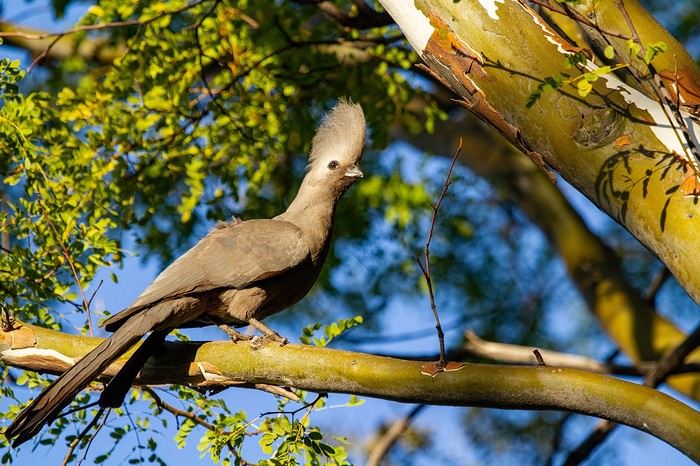
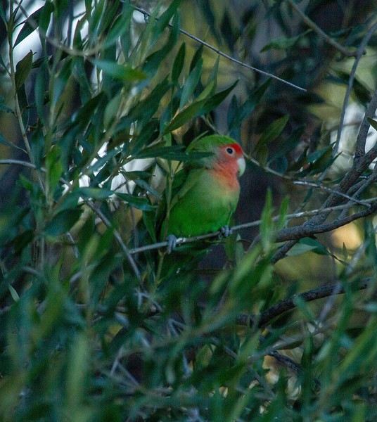
We spent our first night at Londiningi BB. A bit out of the city center but very quiet. The rooms were spacious and clean, and we could eat on-site that evening. Perfect for recovering from the flight.
Discussion around March 2026's Theme: Metal, Metallic
This is where we share stories (or post extra photos) around March’s theme Metal, Metallic.
Back to the March 2026 contest: HERE
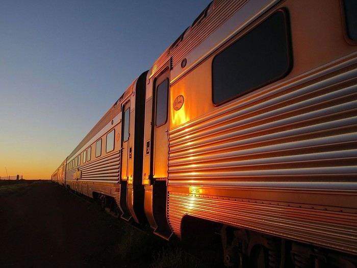
The Ghan (train connecting Adelaide to Darwin), at dawn.
Back to the March 2026 contest: HERE
The Ghan (train connecting Adelaide to Darwin), at dawn.
Martine from DD in Arizona and New Mexico
Good evening everyone! 🙂
We’re back from our September 2025 road trip, this time to explore Arizona and New Mexico, and it’s time for me to start my travel journal—especially since everything’s already booked for another trip in September 2026 (to California), and I need to get started on the planning.
I was a little worried this new visit to Uncle Sam’s country might not be as "wow" as the others, but we still discovered some incredible places.
For those who don’t know us, we’re a couple in our seventies who speak very little English, but that didn’t stop us from fully enjoying our stay.
For this 6th road trip in the U.S., we spent 21 nights there, drove 4,160 km by car, and walked nearly 160 km in a loop starting from Phoenix.
We’d been to Arizona before (but not this side) and never to New Mexico. This whole road trip was a huge discovery for us.
In the prices mentioned (some in euros, others in dollars), bank fees and exchange charges are included. The flights, car rental, and parking were all paid for in December 2024 when we booked.
We’d downloaded the MPC (Mobile Passport Control) app, but there wasn’t a dedicated line at Phoenix Airport. Still, we got through quickly with friendly, smiling agents.
I don’t drive at all (I hate it), so the stops were chosen based on activities but also, for some, to limit daily mileage for the sole driver. The kilometers listed in the itinerary are the daily distances.
We traveled from September 9th to 22nd, unfortunately once again without our dear friends Mimi and Maumau.
The itinerary
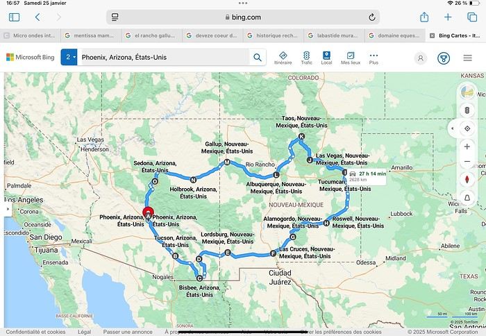
Day 1: Flight Marseille-Paris-Phoenix, then Gold Canyon (133 km) Day 2: Tucson (271 km) Lost Dutchman State Park Day 3: Tucson (155 km) Day 4: Tucson (34 km) Day 5: Bisbee (182 km) Day 6: Lordsburg (345 km) Day 7: Las Cruces (253 km) Day 8: Alamogordo (162 km) Day 9: Roswell (264 km) Day 10: Tucumcari (369 km) Day 11: Las Vegas (281 km) – the one in New Mexico Day 12: Taos (213 km) Day 13: Santa Fe (224 km) Day 14: Albuquerque (123 km) Day 15: Gallup (246 km) Day 16: Holbrook (224 km) Day 17: Flagstaff (179 km) Day 18: Sedona (118 km) Day 19: Sedona (48 km) Day 20: Sedona (41 km) Day 21: Phoenix (256 km) Day 22: Phoenix Airport (35 km)
📊 **Budget**: A little over 7,500 € for both of us, all included. The exchange rate was in our favor (1.17 dollars to 1 €). 📊 **Flights**: Marseille-Paris Charles de Gaulle-Phoenix: 1,787 € for two, with one checked bag each (Air France) 📊 **ESTA**: $42 📊 **America the Beautiful Pass**: $80 📊 **Parking**: 134 € (super eco at Marseille) 📊 **Car rental (Hertz)**: 865 €. Since there were no SUVs left in the reserved category (Nissan Rogue), we got an upgrade (4x4 Ford Explorer). We booked through Air France (15% discount). We’d originally reserved it in December for 1,140 €, but since prices dropped in March, we canceled and rebooked for 865 €. Hertz offers a free Hertz Gold Plus Rewards program, which gives you priority counter service when picking up the car. 📊 **Accommodation**: 2,400 € We stayed in hotels and motels of varying standards (from 60 to 203 € per night, depending on the city), all booked through Booking.com or Hotels.com. Out of 21 nights, only two didn’t include breakfast in the price. Booking.com sometimes offers slightly cheaper rates if you book by phone using the mobile app, and our Genius 3 status on the site also got us some preferential rates. 📊 **Supplementary insurance**: AVA 200 € for medical care if needed 📊 **Cash**: $2,078. We left with 1,000 € exchanged before departure and made two withdrawals of $500. This cash covered: - Evening restaurants and tips - Midday picnics - Gas: $298 for 4,160 km - Museum and private park entries (per person): - Lost Dutchman: $10 - Arizona-Sonora Desert Museum: $28 - Bird Cage Theater: $16 - Tombstone Shootout: $8 - New Mexico Farm & Ranch Museum: $12 - Roswell International UFO Museum: $5 - Billy the Kid Museum: $7 - Rancho de Taos: $22 - West Fork Oak Creek Trail entry: $15 We got a few discounts thanks to our senior age (+65). - Souvenirs and little treats
Like on our previous road trips, we didn’t rent a GPS. We got around using offline GPS apps Here WeGo and Organic Maps, with maps of the states we visited downloaded before we left (on our phones).
❤️❤️❤️ **Highlights** (there are so many!) 📍 Goldfield Ghost Town (even if it’s a reconstruction) 📍 The standing army of Saguaro cacti at Saguaro National Park West 📍 Diving into the cowboy universe of Tombstone 📍 The welcome from Rick and Henry at our guesthouse in Bisbee (Garden at Mile High Ranch) 📍 The tangled rocks of Chiricahua National Monument 📍 The flavored pistachios from Dwayne’s Fresh Jerky and Mac Ginnis Pistachioland 📍 Restaurants: La Posta (Las Cruces), Diner 66 (Albuquerque), and the Haunted Hamburger (Jerome) 📍 The old plazas of New Mexico 📍 The solitude and beauty of the white dunes at White Sands National Park 📍 Stepping back in time at the Billy the Kid Museum (Fort Stanton) 📍 Sections of historic Route 66 and the old motels of Tucumcari, especially at night when all the neon lights are on 📍 Taos Pueblo and diving into Native American culture 📍 After the Rio Grande Bridge, the descent via NM 567 to the very bottom of the Rio Grande Gorge, then the road along the riverbanks to Taos 📍 The tranquility of the Chimayo Sanctuary 📍 Discovering the ingenious native dwellings at Bandelier National Monument and Walnut Canyon National Park 📍 The small towns along the Turquoise Trail 📍 The red rocks of Red Rock Park and the Painted Desert 📍 The extraordinary colors of the petrified trees at Petrified Forest National Park 📍 Sedona, its red rocks, and the reward of the viewpoints at the end of hikes (Devil’s Bridge, The Subway, and West Fork Oak Creek) 📍 The immersion in Mexico when visiting Tlaquepaque 📍 The almost-ghost town of Jerome and its terraced streets 📍 The incredible kindness of Americans, always ready to help and up for a chat ❤️
☹️☹️☹️ **Flops** (there are very few) 📍 Several museums and churches being closed, so we couldn’t visit them 📍 Some museums and visitor centers opening late (10 AM) and closing early (4 PM) 📍 A 64 € phone roaming charge because we got near the Mexican border and picked up their cell tower 📍 The outrageous price ($5.99) for a gallon of gas at the Shell near Phoenix Airport
I hope this helps! Anyway, thanks for reading my long post. Don’t hesitate to reach out, even via PM, if you see I haven’t replied and you’d like more details. Have a great evening, everyone! 🙂
We’re back from our September 2025 road trip, this time to explore Arizona and New Mexico, and it’s time for me to start my travel journal—especially since everything’s already booked for another trip in September 2026 (to California), and I need to get started on the planning.
I was a little worried this new visit to Uncle Sam’s country might not be as "wow" as the others, but we still discovered some incredible places.
For those who don’t know us, we’re a couple in our seventies who speak very little English, but that didn’t stop us from fully enjoying our stay.
For this 6th road trip in the U.S., we spent 21 nights there, drove 4,160 km by car, and walked nearly 160 km in a loop starting from Phoenix.
We’d been to Arizona before (but not this side) and never to New Mexico. This whole road trip was a huge discovery for us.
In the prices mentioned (some in euros, others in dollars), bank fees and exchange charges are included. The flights, car rental, and parking were all paid for in December 2024 when we booked.
We’d downloaded the MPC (Mobile Passport Control) app, but there wasn’t a dedicated line at Phoenix Airport. Still, we got through quickly with friendly, smiling agents.
I don’t drive at all (I hate it), so the stops were chosen based on activities but also, for some, to limit daily mileage for the sole driver. The kilometers listed in the itinerary are the daily distances.
We traveled from September 9th to 22nd, unfortunately once again without our dear friends Mimi and Maumau.
The itinerary
Day 1: Flight Marseille-Paris-Phoenix, then Gold Canyon (133 km) Day 2: Tucson (271 km) Lost Dutchman State Park Day 3: Tucson (155 km) Day 4: Tucson (34 km) Day 5: Bisbee (182 km) Day 6: Lordsburg (345 km) Day 7: Las Cruces (253 km) Day 8: Alamogordo (162 km) Day 9: Roswell (264 km) Day 10: Tucumcari (369 km) Day 11: Las Vegas (281 km) – the one in New Mexico Day 12: Taos (213 km) Day 13: Santa Fe (224 km) Day 14: Albuquerque (123 km) Day 15: Gallup (246 km) Day 16: Holbrook (224 km) Day 17: Flagstaff (179 km) Day 18: Sedona (118 km) Day 19: Sedona (48 km) Day 20: Sedona (41 km) Day 21: Phoenix (256 km) Day 22: Phoenix Airport (35 km)
📊 **Budget**: A little over 7,500 € for both of us, all included. The exchange rate was in our favor (1.17 dollars to 1 €). 📊 **Flights**: Marseille-Paris Charles de Gaulle-Phoenix: 1,787 € for two, with one checked bag each (Air France) 📊 **ESTA**: $42 📊 **America the Beautiful Pass**: $80 📊 **Parking**: 134 € (super eco at Marseille) 📊 **Car rental (Hertz)**: 865 €. Since there were no SUVs left in the reserved category (Nissan Rogue), we got an upgrade (4x4 Ford Explorer). We booked through Air France (15% discount). We’d originally reserved it in December for 1,140 €, but since prices dropped in March, we canceled and rebooked for 865 €. Hertz offers a free Hertz Gold Plus Rewards program, which gives you priority counter service when picking up the car. 📊 **Accommodation**: 2,400 € We stayed in hotels and motels of varying standards (from 60 to 203 € per night, depending on the city), all booked through Booking.com or Hotels.com. Out of 21 nights, only two didn’t include breakfast in the price. Booking.com sometimes offers slightly cheaper rates if you book by phone using the mobile app, and our Genius 3 status on the site also got us some preferential rates. 📊 **Supplementary insurance**: AVA 200 € for medical care if needed 📊 **Cash**: $2,078. We left with 1,000 € exchanged before departure and made two withdrawals of $500. This cash covered: - Evening restaurants and tips - Midday picnics - Gas: $298 for 4,160 km - Museum and private park entries (per person): - Lost Dutchman: $10 - Arizona-Sonora Desert Museum: $28 - Bird Cage Theater: $16 - Tombstone Shootout: $8 - New Mexico Farm & Ranch Museum: $12 - Roswell International UFO Museum: $5 - Billy the Kid Museum: $7 - Rancho de Taos: $22 - West Fork Oak Creek Trail entry: $15 We got a few discounts thanks to our senior age (+65). - Souvenirs and little treats
Like on our previous road trips, we didn’t rent a GPS. We got around using offline GPS apps Here WeGo and Organic Maps, with maps of the states we visited downloaded before we left (on our phones).
❤️❤️❤️ **Highlights** (there are so many!) 📍 Goldfield Ghost Town (even if it’s a reconstruction) 📍 The standing army of Saguaro cacti at Saguaro National Park West 📍 Diving into the cowboy universe of Tombstone 📍 The welcome from Rick and Henry at our guesthouse in Bisbee (Garden at Mile High Ranch) 📍 The tangled rocks of Chiricahua National Monument 📍 The flavored pistachios from Dwayne’s Fresh Jerky and Mac Ginnis Pistachioland 📍 Restaurants: La Posta (Las Cruces), Diner 66 (Albuquerque), and the Haunted Hamburger (Jerome) 📍 The old plazas of New Mexico 📍 The solitude and beauty of the white dunes at White Sands National Park 📍 Stepping back in time at the Billy the Kid Museum (Fort Stanton) 📍 Sections of historic Route 66 and the old motels of Tucumcari, especially at night when all the neon lights are on 📍 Taos Pueblo and diving into Native American culture 📍 After the Rio Grande Bridge, the descent via NM 567 to the very bottom of the Rio Grande Gorge, then the road along the riverbanks to Taos 📍 The tranquility of the Chimayo Sanctuary 📍 Discovering the ingenious native dwellings at Bandelier National Monument and Walnut Canyon National Park 📍 The small towns along the Turquoise Trail 📍 The red rocks of Red Rock Park and the Painted Desert 📍 The extraordinary colors of the petrified trees at Petrified Forest National Park 📍 Sedona, its red rocks, and the reward of the viewpoints at the end of hikes (Devil’s Bridge, The Subway, and West Fork Oak Creek) 📍 The immersion in Mexico when visiting Tlaquepaque 📍 The almost-ghost town of Jerome and its terraced streets 📍 The incredible kindness of Americans, always ready to help and up for a chat ❤️
☹️☹️☹️ **Flops** (there are very few) 📍 Several museums and churches being closed, so we couldn’t visit them 📍 Some museums and visitor centers opening late (10 AM) and closing early (4 PM) 📍 A 64 € phone roaming charge because we got near the Mexican border and picked up their cell tower 📍 The outrageous price ($5.99) for a gallon of gas at the Shell near Phoenix Airport
I hope this helps! Anyway, thanks for reading my long post. Don’t hesitate to reach out, even via PM, if you see I haven’t replied and you’d like more details. Have a great evening, everyone! 🙂
Road Trip USA 2023 - Part 2
HIGHWAY 1
Highway 1 runs along the Pacific coast of California from Leggett in the north to Dana Point in the south. It's the longest state route in California, stretching 1,050 km.
It's famous for its breathtaking ocean views. That’s actually why it’s become such a popular route for road trips, with tons of attractions and points of interest all along the way.
After crossing the U.S. interior on our way out (see Road Trip USA 2023 - Part 1), we’re starting our return trip along this route from Leggett.
Videos are embedded throughout the summary. Please click on the image to start the video. To jump to a specific post, here are the appropriate links:
CALIFORNIA:
Scenic Overlooks on Route 1 Between Leggett and Fort Bragg The Pudding Creek Trestle Bridge in Fort Bragg Glass Beach - Fort Bragg Jenner Lookout Point - Highway 1 Goat Rock Beach - Sonoma Coast State Park - Jenner Point Reyes National Seashore - White House Pool Trail Point Reyes National Seashore - Limantour Beach Point Reyes National Seashore - Point Reyes Shipwreck Point Reyes National Seashore - Kehoe Beach Trail Point Reyes National Seashore - McClures Beach Trail Point Reyes National Seashore - Cypress Tree Tunnel Point Reyes National Seashore - Point Reyes Beach North Point Reyes National Seashore - Elephant Seals on Drakes Beach Point Reyes National Seashore - Point Reyes Beach South Point Reyes National Seashore – Elephant Seals Overlooks Point Reyes National Seashore - Chimney Rock Trail Point Reyes National Seashore - Point Reyes Lighthouse Trail Point Reyes National Seashore – Tule Elk Observation Point Bonita Lighthouse Trail - Sausalito Hawk Hill - Sausalito Battery Spencer Trail - Sausalito Rodeo Beach - Sausalito Point Cavallo - Golden Gate View - Sausalito Exploring Downtown Sausalito Visiting Sausalito’s Houseboats Crossing the Golden Gate Bridge - San Francisco Golden Gate Bridge Viewpoints - San Francisco Cruise to Alcatraz Island - San Francisco Visiting Alcatraz Island - San Francisco Civic Center - Downtown San Francisco Market Street & Yerba Buena Gardens - Downtown San Francisco Union Square & Financial District - Downtown San Francisco Fisherman's Wharf, Pier 39 & Embarcadero - San Francisco Sea Lion Observation - Pier 39 - San Francisco Lombard Street & Cable Car - Russian Hill - San Francisco Macondray Lane Historic District - Russian Hill - San Francisco Grace Cathedral & Huntington Park - Nob Hill - San Francisco Telegraph Hill - San Francisco Chinatown - San Francisco Alamo Square & Painted Ladies - Western Addition - San Francisco Palace of Fine Arts - Marina District - San Francisco Presidio of San Francisco California Coastal Trail - Lincoln Park - San Francisco California Palace of the Legion of Honor - Lincoln Park - San Francisco Sutro Baths - Lincoln Park - San Francisco Queen Wilhelmina Garden - Golden Gate Park - San Francisco Bison Paddock - Golden Gate Park - San Francisco Portals of the Past - Golden Gate Park - San Francisco Strawberry Hill - Golden Gate Park – San Francisco Prayerbook Cross & Robin Williams Meadow - Golden Gate Park - San Francisco Hidden Garden Steps & 16th Avenue Tiled Steps - San Francisco Grandview Park - San Francisco Hike - Twin Peaks Three Summits - San Francisco Longboarding Down Twin Peaks Blvd in San Francisco Haight-Ashbury - San Francisco Corona Heights Park - San Francisco Mission Dolores - San Francisco Mural Frescoes (Part 1) - Mission District - San Francisco Mural Frescoes (Part 2) - Mission District - San Francisco Devil's Slide Bunker - Pacifica Mavericks Beach - Half Moon Bay Martins Beach - Half Moon Bay Pigeon Point Lighthouse State Historic Park - Pescadero What to See in Santa Cruz Visiting Capitola What to See in Monterey Carmel-by-the-Sea Lovers Point Park - Pacific Grove Castle Rock, Hurricane Point & Little Sur River Viewpoints Pfeiffer Falls Trail Julia Pfeiffer Burns State Park Vista Point & McWay Falls Highway 1 - Big Sur Viewpoints Salmon Creek Falls San Carpoforo Creek Trail Elephant Seal Vista Point - San Simeon San Simeon Pier Moonstone Beach Boardwalk Shipwreck - Estero Bluffs State Park Surfing Competition in Morro Bay Port San Luis Pier - San Luis Obispo Pismo Beach Monarch Butterfly Grove - Pismo State Beach Nojoqui Falls Park - Solvang Arroyo Hondo Vista Point Solvang, a Charming Danish Town in California Chumash Painted Cave - Santa Barbara Goleta San Marcos Rd & Cachuma Lake Vista Points - Santa Barbara Old Santa Barbara Mission Walking Tour of Santa Barbara’s Historic Downtown West Beach - Santa Barbara What to See in Ventura Paradise Falls - Wildwood Regional Park - Thousand Oaks Sandy Dune & El Matador State Beach - Malibu Point Dume Nature Reserve - Malibu Malibu Pier Road Trip in the Malibu Mountains Los Liones Trail - Santa Monica Santa Monica Pier Rodeo Drive - Beverly Hills Greystone Mansion - Beverly Hills Hollywood Walk of Fame - Los Angeles Griffith Observatory - Los Angeles Hollywood Forever Cemetery - Los Angeles What to See in Venice Beach Venice Beach Skatepark ShoreLine Aquatic Park - Long Beach Alamitos Beach - Long Beach Naples Island - Long Beach Crescent Bay Point Park & Helser Park Kiosk - Laguna Beach Shell Beach at Twin Points - Laguna Beach Prairie Dogs at Agra Vista Point Top Gun House & Oceanside Pier Annie's Canyon Trail - Solana Beach (Via North Rios Trailhead Loop) Old Town San Diego La Jolla Coastal Trail - San Diego Balboa Park - San Diego Pacific Beach - San Diego Mission Beach - San Diego Ocean Beach Tide Pools - San Diego Sunset Cliffs Natural Park - San Diego Tuna Harbor Park - San Diego Seaport Village & Embarcadero Marina Park - San Diego Gaslamp Quarter - Downtown San Diego Coronado Island - San Diego Dead Dolly Lane - Alpine Galleta Meadows Metal Sculptures - Borrego Springs What to See in Palm Springs Robolights - Palm Springs Andreas Canyon Trail - Indian Canyons - Palm Springs Palm Canyon Trail - Indian Canyons - Palm Springs West Fork Falls Trail - Indian Canyons - Palm Springs Tahquitz Canyon Loop Trail - Indian Canyons - Palm Springs Desert Christ Park - Yucca Valley Pioneertown Salvation Mountain - Niland Slab City - Niland
Highway 1 runs along the Pacific coast of California from Leggett in the north to Dana Point in the south. It's the longest state route in California, stretching 1,050 km.
It's famous for its breathtaking ocean views. That’s actually why it’s become such a popular route for road trips, with tons of attractions and points of interest all along the way.
After crossing the U.S. interior on our way out (see Road Trip USA 2023 - Part 1), we’re starting our return trip along this route from Leggett.
Videos are embedded throughout the summary. Please click on the image to start the video. To jump to a specific post, here are the appropriate links:
CALIFORNIA:
Scenic Overlooks on Route 1 Between Leggett and Fort Bragg The Pudding Creek Trestle Bridge in Fort Bragg Glass Beach - Fort Bragg Jenner Lookout Point - Highway 1 Goat Rock Beach - Sonoma Coast State Park - Jenner Point Reyes National Seashore - White House Pool Trail Point Reyes National Seashore - Limantour Beach Point Reyes National Seashore - Point Reyes Shipwreck Point Reyes National Seashore - Kehoe Beach Trail Point Reyes National Seashore - McClures Beach Trail Point Reyes National Seashore - Cypress Tree Tunnel Point Reyes National Seashore - Point Reyes Beach North Point Reyes National Seashore - Elephant Seals on Drakes Beach Point Reyes National Seashore - Point Reyes Beach South Point Reyes National Seashore – Elephant Seals Overlooks Point Reyes National Seashore - Chimney Rock Trail Point Reyes National Seashore - Point Reyes Lighthouse Trail Point Reyes National Seashore – Tule Elk Observation Point Bonita Lighthouse Trail - Sausalito Hawk Hill - Sausalito Battery Spencer Trail - Sausalito Rodeo Beach - Sausalito Point Cavallo - Golden Gate View - Sausalito Exploring Downtown Sausalito Visiting Sausalito’s Houseboats Crossing the Golden Gate Bridge - San Francisco Golden Gate Bridge Viewpoints - San Francisco Cruise to Alcatraz Island - San Francisco Visiting Alcatraz Island - San Francisco Civic Center - Downtown San Francisco Market Street & Yerba Buena Gardens - Downtown San Francisco Union Square & Financial District - Downtown San Francisco Fisherman's Wharf, Pier 39 & Embarcadero - San Francisco Sea Lion Observation - Pier 39 - San Francisco Lombard Street & Cable Car - Russian Hill - San Francisco Macondray Lane Historic District - Russian Hill - San Francisco Grace Cathedral & Huntington Park - Nob Hill - San Francisco Telegraph Hill - San Francisco Chinatown - San Francisco Alamo Square & Painted Ladies - Western Addition - San Francisco Palace of Fine Arts - Marina District - San Francisco Presidio of San Francisco California Coastal Trail - Lincoln Park - San Francisco California Palace of the Legion of Honor - Lincoln Park - San Francisco Sutro Baths - Lincoln Park - San Francisco Queen Wilhelmina Garden - Golden Gate Park - San Francisco Bison Paddock - Golden Gate Park - San Francisco Portals of the Past - Golden Gate Park - San Francisco Strawberry Hill - Golden Gate Park – San Francisco Prayerbook Cross & Robin Williams Meadow - Golden Gate Park - San Francisco Hidden Garden Steps & 16th Avenue Tiled Steps - San Francisco Grandview Park - San Francisco Hike - Twin Peaks Three Summits - San Francisco Longboarding Down Twin Peaks Blvd in San Francisco Haight-Ashbury - San Francisco Corona Heights Park - San Francisco Mission Dolores - San Francisco Mural Frescoes (Part 1) - Mission District - San Francisco Mural Frescoes (Part 2) - Mission District - San Francisco Devil's Slide Bunker - Pacifica Mavericks Beach - Half Moon Bay Martins Beach - Half Moon Bay Pigeon Point Lighthouse State Historic Park - Pescadero What to See in Santa Cruz Visiting Capitola What to See in Monterey Carmel-by-the-Sea Lovers Point Park - Pacific Grove Castle Rock, Hurricane Point & Little Sur River Viewpoints Pfeiffer Falls Trail Julia Pfeiffer Burns State Park Vista Point & McWay Falls Highway 1 - Big Sur Viewpoints Salmon Creek Falls San Carpoforo Creek Trail Elephant Seal Vista Point - San Simeon San Simeon Pier Moonstone Beach Boardwalk Shipwreck - Estero Bluffs State Park Surfing Competition in Morro Bay Port San Luis Pier - San Luis Obispo Pismo Beach Monarch Butterfly Grove - Pismo State Beach Nojoqui Falls Park - Solvang Arroyo Hondo Vista Point Solvang, a Charming Danish Town in California Chumash Painted Cave - Santa Barbara Goleta San Marcos Rd & Cachuma Lake Vista Points - Santa Barbara Old Santa Barbara Mission Walking Tour of Santa Barbara’s Historic Downtown West Beach - Santa Barbara What to See in Ventura Paradise Falls - Wildwood Regional Park - Thousand Oaks Sandy Dune & El Matador State Beach - Malibu Point Dume Nature Reserve - Malibu Malibu Pier Road Trip in the Malibu Mountains Los Liones Trail - Santa Monica Santa Monica Pier Rodeo Drive - Beverly Hills Greystone Mansion - Beverly Hills Hollywood Walk of Fame - Los Angeles Griffith Observatory - Los Angeles Hollywood Forever Cemetery - Los Angeles What to See in Venice Beach Venice Beach Skatepark ShoreLine Aquatic Park - Long Beach Alamitos Beach - Long Beach Naples Island - Long Beach Crescent Bay Point Park & Helser Park Kiosk - Laguna Beach Shell Beach at Twin Points - Laguna Beach Prairie Dogs at Agra Vista Point Top Gun House & Oceanside Pier Annie's Canyon Trail - Solana Beach (Via North Rios Trailhead Loop) Old Town San Diego La Jolla Coastal Trail - San Diego Balboa Park - San Diego Pacific Beach - San Diego Mission Beach - San Diego Ocean Beach Tide Pools - San Diego Sunset Cliffs Natural Park - San Diego Tuna Harbor Park - San Diego Seaport Village & Embarcadero Marina Park - San Diego Gaslamp Quarter - Downtown San Diego Coronado Island - San Diego Dead Dolly Lane - Alpine Galleta Meadows Metal Sculptures - Borrego Springs What to See in Palm Springs Robolights - Palm Springs Andreas Canyon Trail - Indian Canyons - Palm Springs Palm Canyon Trail - Indian Canyons - Palm Springs West Fork Falls Trail - Indian Canyons - Palm Springs Tahquitz Canyon Loop Trail - Indian Canyons - Palm Springs Desert Christ Park - Yucca Valley Pioneertown Salvation Mountain - Niland Slab City - Niland
Travel Journal - 28 Days in China in August 2025
Hi everyone! I’m sharing a modest travel journal from my trip to China in August 2025.
There wasn’t much room for improvisation on this trip—everything was planned in advance. Since August is peak season, I decided to book train tickets early, and once that was set, I reserved all the accommodations too. I got everything on Trip.com.
I bought the flight tickets back in March from Hainan Airlines. They were super expensive, but with these travel dates, I couldn’t exactly dream of a bargain!
I picked up e-SIMs valid for a month from Free just before departure: 10 € for the e-SIM + 19.90 € for a one-month plan with 35 GB of data abroad.
No need for a VPN with these e-SIMs, but D. still got one—a multi-device plan for 5 € with a discount from Let’s VPN, valid for a month. It was for evenings at the hotel on Wi-Fi to avoid burning through the 35 GB with video.
I downloaded Alipay, WeChat, Amap (Baidu Maps), and Trip.com. We also have Google Translate and Maps.me—absolute must-haves.
We’re ready to go!
I’ve been waiting for this day for nearly 15 years!! I travel a lot, but this one—this is MY TRIP 🙂 It’s been postponed so many times: because I wanted to do it with the right person, because I have a Turkish stamp in my passport and heard they don’t issue visas with that, because of COVID... and then China introduced a 30-day visa exemption, and that was the green light! Ugh, they forced us to take our vacation in August this year—far from ideal—but no more delays. Saturday, August 2, 2025: it’s finally the big day!
Days 1 and 2: We got dropped off at Charles de Gaulle at 9:30 AM. I supposedly checked in online, but only for the first flight and without getting the boarding pass... Might as well scrap online check-in in that case. So, we spent over an hour in line at the counter to get them. We didn’t have any checked luggage—just our backpacks as carry-ons—so this was a step we’d never had to deal with before, but whatever, it’s done. No wait at passport control, 5 minutes through security, a quick walk around the terminal, 10 minutes in the boarding area, and it was already time to board. Departure around 12:45 PM, arrival in Chongqing at 4:50 AM. We had a few hours of layover before our next flight. Went through immigration, connecting flight control, and security. Pro tip: check your next flight’s boarding gate right after immigration. We never saw it displayed again anywhere in the terminal.
The Free e-SIMs work—phew!
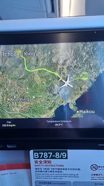
Took off at 9:30 AM, arrived in Guangzhou (Canton) at 11:20 AM in the rain. I love how Chongqing is translated as "Tchoung King" on the screens in the plane—very French!
During my first two trips to China, we paid for everything in cash, but this time, we’re going all-in on Alipay and WeChat. I still brought the leftover change from previous trips—it might come in handy. At the metro station, they showed us a QR code to buy tickets via WeChat. There were probably machines and even a ticket counter, but we didn’t see them, and buying via WeChat was pretty simple. 8 yuan to Changshu Lu, which is 22 stops. So far, so good. Then, we had to find the hotel, which wasn’t on Google Maps, Maps.me, or Amap... Easy 😎! We found it without too much hassle, though. Dropped off our stuff and went out to eat. 55 yuan for two claypots with fish/eel, rice, cabbage, and purple eggplant. When we left, it was pouring. We grabbed our umbrellas and set off to explore the neighborhood: Enning Road (we’ll come back later to check out a specific spot), Shangxiajiu (the pedestrian shopping street), Baohua Road... The area is pretty diverse—one street to the next, it’s like stepping into a different world.

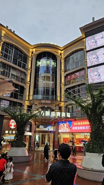
There weren’t many people around, probably because of the rain. We grabbed a quick street food dinner and went to bed—we were exhausted. We struggled to stay awake until 11 PM to adjust to the time change as quickly as possible. There’s a 6-hour time difference.
There wasn’t much room for improvisation on this trip—everything was planned in advance. Since August is peak season, I decided to book train tickets early, and once that was set, I reserved all the accommodations too. I got everything on Trip.com.
I bought the flight tickets back in March from Hainan Airlines. They were super expensive, but with these travel dates, I couldn’t exactly dream of a bargain!
I picked up e-SIMs valid for a month from Free just before departure: 10 € for the e-SIM + 19.90 € for a one-month plan with 35 GB of data abroad.
No need for a VPN with these e-SIMs, but D. still got one—a multi-device plan for 5 € with a discount from Let’s VPN, valid for a month. It was for evenings at the hotel on Wi-Fi to avoid burning through the 35 GB with video.
I downloaded Alipay, WeChat, Amap (Baidu Maps), and Trip.com. We also have Google Translate and Maps.me—absolute must-haves.
We’re ready to go!
I’ve been waiting for this day for nearly 15 years!! I travel a lot, but this one—this is MY TRIP 🙂 It’s been postponed so many times: because I wanted to do it with the right person, because I have a Turkish stamp in my passport and heard they don’t issue visas with that, because of COVID... and then China introduced a 30-day visa exemption, and that was the green light! Ugh, they forced us to take our vacation in August this year—far from ideal—but no more delays. Saturday, August 2, 2025: it’s finally the big day!
Days 1 and 2: We got dropped off at Charles de Gaulle at 9:30 AM. I supposedly checked in online, but only for the first flight and without getting the boarding pass... Might as well scrap online check-in in that case. So, we spent over an hour in line at the counter to get them. We didn’t have any checked luggage—just our backpacks as carry-ons—so this was a step we’d never had to deal with before, but whatever, it’s done. No wait at passport control, 5 minutes through security, a quick walk around the terminal, 10 minutes in the boarding area, and it was already time to board. Departure around 12:45 PM, arrival in Chongqing at 4:50 AM. We had a few hours of layover before our next flight. Went through immigration, connecting flight control, and security. Pro tip: check your next flight’s boarding gate right after immigration. We never saw it displayed again anywhere in the terminal.
The Free e-SIMs work—phew!
Took off at 9:30 AM, arrived in Guangzhou (Canton) at 11:20 AM in the rain. I love how Chongqing is translated as "Tchoung King" on the screens in the plane—very French!
During my first two trips to China, we paid for everything in cash, but this time, we’re going all-in on Alipay and WeChat. I still brought the leftover change from previous trips—it might come in handy. At the metro station, they showed us a QR code to buy tickets via WeChat. There were probably machines and even a ticket counter, but we didn’t see them, and buying via WeChat was pretty simple. 8 yuan to Changshu Lu, which is 22 stops. So far, so good. Then, we had to find the hotel, which wasn’t on Google Maps, Maps.me, or Amap... Easy 😎! We found it without too much hassle, though. Dropped off our stuff and went out to eat. 55 yuan for two claypots with fish/eel, rice, cabbage, and purple eggplant. When we left, it was pouring. We grabbed our umbrellas and set off to explore the neighborhood: Enning Road (we’ll come back later to check out a specific spot), Shangxiajiu (the pedestrian shopping street), Baohua Road... The area is pretty diverse—one street to the next, it’s like stepping into a different world.
There weren’t many people around, probably because of the rain. We grabbed a quick street food dinner and went to bed—we were exhausted. We struggled to stay awake until 11 PM to adjust to the time change as quickly as possible. There’s a 6-hour time difference.
3 weeks in Bali in 2025
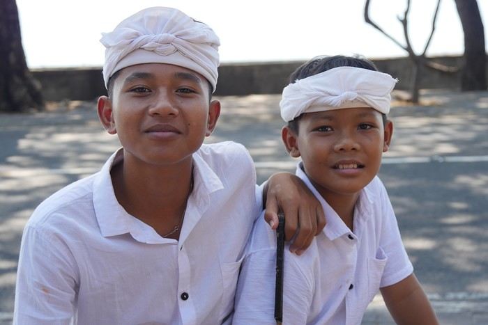
We’ve read it all about Bali: mass tourism, non-stop parties, ferry disasters, the kingdom of “Instagrammers,” pollution, “Bali belly”... But luckily, this island isn’t just about Kuta’s beaches and the Lempuyang Temple.
Sure, it’s not as exotic or off-the-beaten-path as other Indonesian islands (the Moluccas, Timor, Flores...), but we spent 3 weeks there and loved it!
Our (planned) itinerary in 7 stops: - Ubud (4 nights) - Sidemen (2 nights) - Gili Meno (3 nights) - Amed (2 nights) - Pemuteran (4 nights) - Munduk (2 nights) - Jatiluwih (2 nights)
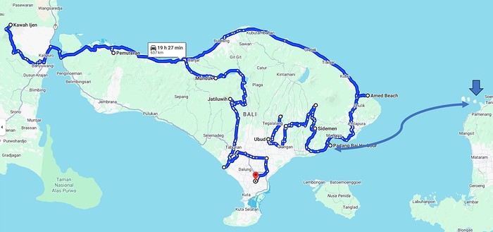
We booked our accommodations in advance, and for the rest (drivers, activities...), we took it day by day with help from the homestays (making sure to contact them a few days ahead via WhatsApp).
In the end, it’s an “easy” destination, very affordable, and one that’s managed to keep a certain authenticity.
Sure, it’s not as exotic or off-the-beaten-path as other Indonesian islands (the Moluccas, Timor, Flores...), but we spent 3 weeks there and loved it!
Our (planned) itinerary in 7 stops: - Ubud (4 nights) - Sidemen (2 nights) - Gili Meno (3 nights) - Amed (2 nights) - Pemuteran (4 nights) - Munduk (2 nights) - Jatiluwih (2 nights)
We booked our accommodations in advance, and for the rest (drivers, activities...), we took it day by day with help from the homestays (making sure to contact them a few days ahead via WhatsApp).
In the end, it’s an “easy” destination, very affordable, and one that’s managed to keep a certain authenticity.
USA Road Trip 2023 - Part 1
In January 2023, we started our second road trip across the United States. We stayed from January to mid-March, which gave us plenty of time to visit several cities, attractions, and parks in multiple states.
This travel journal will be split into two parts due to the considerable number of places we visited.
This first journal covers the following states: Ohio, Indiana, Missouri, Oklahoma, Texas, New Mexico, Arizona, Nevada, and California, and takes you through the outbound leg of our road trip.
The second journal will showcase the attractions we visited on the return trip, which mainly follows the famous Highway 1 along the Pacific coast.
So, I invite you to keep reading this first journal, which serves as a long recap to help you discover the various attractions we explored throughout this road trip.
Videos are included throughout the recap. Please click on the image to start the video.
Here are the links to jump to a specific post:
OHIO:
WinterLand - Christmas Lights at Cleveland Public Square Lake View Cemetery - Cleveland - Part 1 Lake View Cemetery - Cleveland - Part 2 Stroll through Columbus Upper Falls to Lower Falls via Buckeye Trail - Hocking Hills State Park – Logan Cedar Falls & Whispering Falls Hiking Trail - Hocking Hills State Park – Logan Ash Cave Hiking Trail - Hocking Hills State Park – Logan Exploring Cincinnati
INDIANA:
Visiting Indianapolis
MISSOURI:
Exploring St. Louis
OKLAHOMA:
Catoosa Blue Whale Discovering Tulsa Exploring Oklahoma City
TEXAS:
Exploring Shamrock Discovering McLean Exploring Amarillo
NEW MEXICO:
Ancestral Sites Trail - Pecos National Historical Park Discovering Santa Fe The Santuario de Chimayó Stroll through Los Cerrillos Walk through the village of Madrid San Francisco de Asis Catholic Church & The Bottle House - Golden Albuquerque Murals 66 Diner - Albuquerque Stroll through Old Town (Albuquerque) Rinconada Canyon Trail - Petroglyph National Monument Mesa Point Trail - Boca Negra Canyon - Petroglyph National Monument Macaw Trail - Boca Negra Canyon - Petroglyph National Monument Cliff Base Trail - Boca Negra Canyon - Petroglyph National Monument Piedras Marcadas Canyon - Petroglyph National Monument Sandstone Bluffs & Ventana Natural Arch - El Malpais National Monument
ARIZONA:
Stewart's Petrified Wood Shop – Holbrook Stroll through Holbrook Discovering Joseph City Exploring Winslow Grand Falls (The "Chocolate Falls") – Leupp Island Trail - Walnut Canyon National Monument Rim Trail - Walnut Canyon National Monument Wukoki Pueblo Trail – Wupatki National Monument Wupatki Pueblo Trail – Wupatki National Monument Doney Mountain Trail – Wupatki National Monument Citadel & Nalakihu Pueblos Trail – Wupatki National Monument Lomaki & Box Canyon Pueblos Trail – Wupatki National Monument Discovering Flagstaff On the way to Sedona Slide Rock State Park – Sedona Midgley Bridge Trail – Wilson Canyon – Sedona Tlaquepaque Arts & Shopping Village Walking Tour - Sedona Chapel of the Holy Cross - Sedona Hiking at Cathedral Rock - Sedona Hiking the Bell Rock Trail - Sedona Hiking the Airport Loop Trail - Sedona Amitabha Stupa and Peace Park - Sedona Hiking the Boynton Canyon Vortex Trail - Sedona Hiking the Devil's Bridge Trail - Sedona Hiking the Birthing Cave Trail - Sedona Bell Rock Inn - Sedona On the roads of Sedona - Part 1 On the roads of Sedona - Part 2 Keyhole Sink Hiking Trail - Kaibab National Forest Discovering Williams Exploring Ash Fork Discovering Kingman Ramada by Wyndham Kingman Davis Camp Park - Bullhead City Discovering Yucca Lake Havasu Boardwalk Tour A duck catches a lobster – Lake Havasu Boardwalk
CALIFORNIA:
Exploring Needles Discovering Goffs Discovering Amboy Visiting the famous Bagdad Cafe - Newberry Springs Exploring Barstow Vehicles from Hell (Mad Max Cars) - Barstow Peggy Sue's 50's Diner - Yermo Liberty Sculpture Park - Yermo Lake Dolores Water Park - Newberry Springs ZZYZX Road - Mojave National Preserve Alien Fresh Jerky - Baker Kelso Dunes Trail - Mojave National Preserve Hole-in-the-Wall Rings Trail - Mojave National Preserve Visiting Mitchell Caverns - Mojave National Preserve Dante's View - Death Valley National Park Zabriskie Point - Death Valley National Park Golden Canyon - Death Valley National Park Artists Drive & Artists Palette - Death Valley National Park Devil's Golf Course - Death Valley National Park Natural Bridge Trail - Death Valley National Park Badwater Basin - Death Valley National Park Harmony Borax Works - Death Valley National Park Devil's Cornfield - Death Valley National Park Mesquite Flat Sand Dunes - Death Valley National Park Mosaic Canyon Trail - Death Valley National Park On the road - Death Valley National Park
NEVADA:
Cleveland Clinic Lou Ruvo Center for Brain Health - Las Vegas Exploring Downtown Las Vegas SlotZilla Zipline - Fremont Street Experience – Downtown Las Vegas Viva Vision Light Show 1 - Fremont Street Experience - Downtown Las Vegas Viva Vision Light Show 2 - Fremont Street Experience - Downtown Las Vegas Viva Vision Light Show 3 - Fremont Street Experience - Downtown Las Vegas Viva Vision Light Show 4 - Fremont Street Experience - Downtown Las Vegas Free Live Music – Fremont Street Experience - Downtown Las Vegas Chucky – Fremont Street Experience - Downtown Las Vegas Las Vegas Strip - Part 1 Las Vegas Strip - Part 2 Las Vegas Strip - Part 3 Las Vegas Strip - Part 4 Las Vegas Strip - Part 5 Tom Devlin's Monster Museum - Boulder City Hoover Dam Lake Mead - Lakeview Overlook - Boulder City Nelson Ghost Town - Searchlight
CALIFORNIA:
Scenic Route through Joshua Tree National Park via the North Entrance Hidden Valley Trail - Joshua Tree National Park Barker Dam Trail - Joshua Tree National Park Cap Rock Trail - Joshua Tree National Park Keys View Trail - Joshua Tree National Park Hall of Horrors Trail - Joshua Tree National Park Skull Rock Trail - Joshua Tree National Park Arch Rock Trail - Joshua Tree National Park Cholla Cactus Garden Trail - Joshua Tree National Park Lone Pine - Owens Valley Miss Alabama & Shark Fin - Alabama Hills - Owens Valley Lone Ranger Canyon - Alabama Hills - Owens Valley Mobius Arch Loop Trail (Heart Arch & Lathe Arch) - Alabama Hills - Owens Valley Eye of the Alabama Hills Arch - Alabama Hills - Owens Valley Boot & Cyclops Arches - Alabama Hills - Owens Valley One Mile Arch, Bowling Ball and Pins & Gunga Din Area - Alabama Hills - Owens Valley Whitney Portal Arch Trailhead - Alabama Hills - Owens Valley Fish Rocks & Trona Pinnacles - Mojave Desert Red Cliffs Trail - Red Rock Canyon State Park Hagen Canyon Nature Trail - Red Rock Canyon State Park Tour of Historic Downtown Tehachapi View of the Tehachapi Loop – Monolith César E. Chávez National Monument – Keene Discovering Bakersfield Kern County Museum – Bakersfield Bravo Farms, Tree House & Petting Zoo - Traver Walking Tour of Kingsburg Exploring Fresno Simonian Farms & Soul Consoling Japanese Internment Tower - Fresno Duncan Ceramic Products (iLoveToCreate) - Fresno Walking Tour of Modesto Wat Dhammararam Buddhist Temple - Stockton Walking Tour of Stockton Discovering Stockton University of the Pacific - Stockton Visiting Lodi Sutter's Fort State Historic Park - Sacramento California State Capitol - Sacramento Walking Tour - Sacramento Walking Tour - Winters Walking Tour - Napa The Chandelier Tree In Drive-Thru Tree Park - Leggett One Log House - Garberville Grandfather Tree - Piercy The Living Chimney Tree - Avenue of the Giants Stephens Grove Loop Trail - Avenue of the Giants Gould Grove Nature Loop Trail - Avenue of the Giants Fleishmann Grove Trail - Avenue of the Giants Mahan Plaque Trail - Avenue of the Giants Founders Grove Nature Loop Trail - Avenue of the Giants Eternal Tree House & Immortal Tree - Avenue of the Giants Drury-Chaney Loop Trail - Avenue of the Giants Walking Tour - Redcrest
COMING UP NEXT:
USA Road Trip 2023 - Part 2
This travel journal will be split into two parts due to the considerable number of places we visited.
This first journal covers the following states: Ohio, Indiana, Missouri, Oklahoma, Texas, New Mexico, Arizona, Nevada, and California, and takes you through the outbound leg of our road trip.
The second journal will showcase the attractions we visited on the return trip, which mainly follows the famous Highway 1 along the Pacific coast.
So, I invite you to keep reading this first journal, which serves as a long recap to help you discover the various attractions we explored throughout this road trip.
Videos are included throughout the recap. Please click on the image to start the video.
Here are the links to jump to a specific post:
OHIO:
WinterLand - Christmas Lights at Cleveland Public Square Lake View Cemetery - Cleveland - Part 1 Lake View Cemetery - Cleveland - Part 2 Stroll through Columbus Upper Falls to Lower Falls via Buckeye Trail - Hocking Hills State Park – Logan Cedar Falls & Whispering Falls Hiking Trail - Hocking Hills State Park – Logan Ash Cave Hiking Trail - Hocking Hills State Park – Logan Exploring Cincinnati
INDIANA:
Visiting Indianapolis
MISSOURI:
Exploring St. Louis
OKLAHOMA:
Catoosa Blue Whale Discovering Tulsa Exploring Oklahoma City
TEXAS:
Exploring Shamrock Discovering McLean Exploring Amarillo
NEW MEXICO:
Ancestral Sites Trail - Pecos National Historical Park Discovering Santa Fe The Santuario de Chimayó Stroll through Los Cerrillos Walk through the village of Madrid San Francisco de Asis Catholic Church & The Bottle House - Golden Albuquerque Murals 66 Diner - Albuquerque Stroll through Old Town (Albuquerque) Rinconada Canyon Trail - Petroglyph National Monument Mesa Point Trail - Boca Negra Canyon - Petroglyph National Monument Macaw Trail - Boca Negra Canyon - Petroglyph National Monument Cliff Base Trail - Boca Negra Canyon - Petroglyph National Monument Piedras Marcadas Canyon - Petroglyph National Monument Sandstone Bluffs & Ventana Natural Arch - El Malpais National Monument
ARIZONA:
Stewart's Petrified Wood Shop – Holbrook Stroll through Holbrook Discovering Joseph City Exploring Winslow Grand Falls (The "Chocolate Falls") – Leupp Island Trail - Walnut Canyon National Monument Rim Trail - Walnut Canyon National Monument Wukoki Pueblo Trail – Wupatki National Monument Wupatki Pueblo Trail – Wupatki National Monument Doney Mountain Trail – Wupatki National Monument Citadel & Nalakihu Pueblos Trail – Wupatki National Monument Lomaki & Box Canyon Pueblos Trail – Wupatki National Monument Discovering Flagstaff On the way to Sedona Slide Rock State Park – Sedona Midgley Bridge Trail – Wilson Canyon – Sedona Tlaquepaque Arts & Shopping Village Walking Tour - Sedona Chapel of the Holy Cross - Sedona Hiking at Cathedral Rock - Sedona Hiking the Bell Rock Trail - Sedona Hiking the Airport Loop Trail - Sedona Amitabha Stupa and Peace Park - Sedona Hiking the Boynton Canyon Vortex Trail - Sedona Hiking the Devil's Bridge Trail - Sedona Hiking the Birthing Cave Trail - Sedona Bell Rock Inn - Sedona On the roads of Sedona - Part 1 On the roads of Sedona - Part 2 Keyhole Sink Hiking Trail - Kaibab National Forest Discovering Williams Exploring Ash Fork Discovering Kingman Ramada by Wyndham Kingman Davis Camp Park - Bullhead City Discovering Yucca Lake Havasu Boardwalk Tour A duck catches a lobster – Lake Havasu Boardwalk
CALIFORNIA:
Exploring Needles Discovering Goffs Discovering Amboy Visiting the famous Bagdad Cafe - Newberry Springs Exploring Barstow Vehicles from Hell (Mad Max Cars) - Barstow Peggy Sue's 50's Diner - Yermo Liberty Sculpture Park - Yermo Lake Dolores Water Park - Newberry Springs ZZYZX Road - Mojave National Preserve Alien Fresh Jerky - Baker Kelso Dunes Trail - Mojave National Preserve Hole-in-the-Wall Rings Trail - Mojave National Preserve Visiting Mitchell Caverns - Mojave National Preserve Dante's View - Death Valley National Park Zabriskie Point - Death Valley National Park Golden Canyon - Death Valley National Park Artists Drive & Artists Palette - Death Valley National Park Devil's Golf Course - Death Valley National Park Natural Bridge Trail - Death Valley National Park Badwater Basin - Death Valley National Park Harmony Borax Works - Death Valley National Park Devil's Cornfield - Death Valley National Park Mesquite Flat Sand Dunes - Death Valley National Park Mosaic Canyon Trail - Death Valley National Park On the road - Death Valley National Park
NEVADA:
Cleveland Clinic Lou Ruvo Center for Brain Health - Las Vegas Exploring Downtown Las Vegas SlotZilla Zipline - Fremont Street Experience – Downtown Las Vegas Viva Vision Light Show 1 - Fremont Street Experience - Downtown Las Vegas Viva Vision Light Show 2 - Fremont Street Experience - Downtown Las Vegas Viva Vision Light Show 3 - Fremont Street Experience - Downtown Las Vegas Viva Vision Light Show 4 - Fremont Street Experience - Downtown Las Vegas Free Live Music – Fremont Street Experience - Downtown Las Vegas Chucky – Fremont Street Experience - Downtown Las Vegas Las Vegas Strip - Part 1 Las Vegas Strip - Part 2 Las Vegas Strip - Part 3 Las Vegas Strip - Part 4 Las Vegas Strip - Part 5 Tom Devlin's Monster Museum - Boulder City Hoover Dam Lake Mead - Lakeview Overlook - Boulder City Nelson Ghost Town - Searchlight
CALIFORNIA:
Scenic Route through Joshua Tree National Park via the North Entrance Hidden Valley Trail - Joshua Tree National Park Barker Dam Trail - Joshua Tree National Park Cap Rock Trail - Joshua Tree National Park Keys View Trail - Joshua Tree National Park Hall of Horrors Trail - Joshua Tree National Park Skull Rock Trail - Joshua Tree National Park Arch Rock Trail - Joshua Tree National Park Cholla Cactus Garden Trail - Joshua Tree National Park Lone Pine - Owens Valley Miss Alabama & Shark Fin - Alabama Hills - Owens Valley Lone Ranger Canyon - Alabama Hills - Owens Valley Mobius Arch Loop Trail (Heart Arch & Lathe Arch) - Alabama Hills - Owens Valley Eye of the Alabama Hills Arch - Alabama Hills - Owens Valley Boot & Cyclops Arches - Alabama Hills - Owens Valley One Mile Arch, Bowling Ball and Pins & Gunga Din Area - Alabama Hills - Owens Valley Whitney Portal Arch Trailhead - Alabama Hills - Owens Valley Fish Rocks & Trona Pinnacles - Mojave Desert Red Cliffs Trail - Red Rock Canyon State Park Hagen Canyon Nature Trail - Red Rock Canyon State Park Tour of Historic Downtown Tehachapi View of the Tehachapi Loop – Monolith César E. Chávez National Monument – Keene Discovering Bakersfield Kern County Museum – Bakersfield Bravo Farms, Tree House & Petting Zoo - Traver Walking Tour of Kingsburg Exploring Fresno Simonian Farms & Soul Consoling Japanese Internment Tower - Fresno Duncan Ceramic Products (iLoveToCreate) - Fresno Walking Tour of Modesto Wat Dhammararam Buddhist Temple - Stockton Walking Tour of Stockton Discovering Stockton University of the Pacific - Stockton Visiting Lodi Sutter's Fort State Historic Park - Sacramento California State Capitol - Sacramento Walking Tour - Sacramento Walking Tour - Winters Walking Tour - Napa The Chandelier Tree In Drive-Thru Tree Park - Leggett One Log House - Garberville Grandfather Tree - Piercy The Living Chimney Tree - Avenue of the Giants Stephens Grove Loop Trail - Avenue of the Giants Gould Grove Nature Loop Trail - Avenue of the Giants Fleishmann Grove Trail - Avenue of the Giants Mahan Plaque Trail - Avenue of the Giants Founders Grove Nature Loop Trail - Avenue of the Giants Eternal Tree House & Immortal Tree - Avenue of the Giants Drury-Chaney Loop Trail - Avenue of the Giants Walking Tour - Redcrest
COMING UP NEXT:
USA Road Trip 2023 - Part 2
Family Trip Itinerary for the Yucatán
Hi there,
Back in 2002, we spent two weeks in Playa del Carmen. We did day trips to Cozumel, Isla Mujeres, Chichén Itzá, Tulum, and Xcaret.
We’re heading back at Christmas with our two daughters, aged 15 and 19. I’m sure it’s changed a lot with the booming tourism.
Flights are booked: Paris-Cancún on 19/12 (arriving at 8:20 PM) and Cancún-Paris on 01/01 at 1:30 PM. We’re still finalizing the itinerary because we want to explore but don’t want to switch hotels too often. We’ll be there for 13 nights and 12 days, so we’re choosing among: - Playa del Carmen - Cozumel - Holbox - Valladolid - Tulum - Mahahual
We won’t do everything, so any tips would be great! I’m also unsure if renting a car is the best option.
Thanks in advance!
Stéphane
Back in 2002, we spent two weeks in Playa del Carmen. We did day trips to Cozumel, Isla Mujeres, Chichén Itzá, Tulum, and Xcaret.
We’re heading back at Christmas with our two daughters, aged 15 and 19. I’m sure it’s changed a lot with the booming tourism.
Flights are booked: Paris-Cancún on 19/12 (arriving at 8:20 PM) and Cancún-Paris on 01/01 at 1:30 PM. We’re still finalizing the itinerary because we want to explore but don’t want to switch hotels too often. We’ll be there for 13 nights and 12 days, so we’re choosing among: - Playa del Carmen - Cozumel - Holbox - Valladolid - Tulum - Mahahual
We won’t do everything, so any tips would be great! I’m also unsure if renting a car is the best option.
Thanks in advance!
Stéphane
Namibia Travel Journal: May 2025 - Trip Review
NAMIBIA TRIP 2025: April 24 to May 20: Feel free to comment or ask us any questions about this amazing journey.
>> Find all our photos and videos for each day on our website here: www.montagne-aventure.net
**DAY 1: Thursday, April 24, 2025: Outbound Flights from Lyon to Windhoek via Munich - Visit to Munich:**

Off we go on a new adventure. The alarm rings at 6:30 AM, the travel bags are packed, and we head to Lyon Airport. We booked our flight tickets with Lufthansa. The first leg to Munich, Germany, is operated by AirBaltic. Departure at 1:05 PM for a 1-hour and 20-minute flight. We arrive at 2:30 PM.
**We now have a 7-hour layover, so we take the opportunity to get some fresh air and explore Munich.** We quickly exit Terminal 2 of the airport and head towards the subway. We buy a group day ticket "Airport-city Day Zone M-5," valid for 2 to 5 people at a price of 30.50 € (instead of 16.30 € per person). We take the S8 line to **Marienplatz** in 35 minutes. **This is the heart of the city.** The weather is overcast, quite cool, but dry. Perfect for a little city trip between two flights while leaving our large luggage in transit at the airport. **Munich is the third-largest German city after Berlin and Hamburg, in the Bavaria region.** **The center has a lot of charm and brings together several religious buildings, easy to explore on foot.** We are impressed by the number of people enjoying these 100% pedestrian streets, which are very pleasant. After Marienplatz, the most famous square with the town hall, we head to the Cathedral of Our Lady, a Gothic church, then continue to **Karlsplatz** and move on to **the food market offering a wide selection of high-end food products in an atmosphere where a certain art of living prevails.** We also visit St. Peter's Church before grabbing a bite to eat. Two good hours were enough for this 10 km city walk. It's time to take the subway back: by 6:30 PM, we are back at the airport. Now, it's time for a bit of waiting and rest. Our second flight is scheduled for 9:35 PM for a 9-hour and 30-minute journey to our final destination in Namibia: **Windhoek.**
> Round-trip flight tickets with Lufthansa from Lyon: 2029 €, or 1,014.50 € per person.
> Lyon Airport parking: 120 €
> Today's expenses: 7 € for 2 pizzas in France / 14 € for the restaurant in Munich / 30.50 € for the daily subway ticket in Munich.
**DAY 2: Friday, April 25, 2024: Arrival in Windhoek, Visit to the Namibian Capital:**
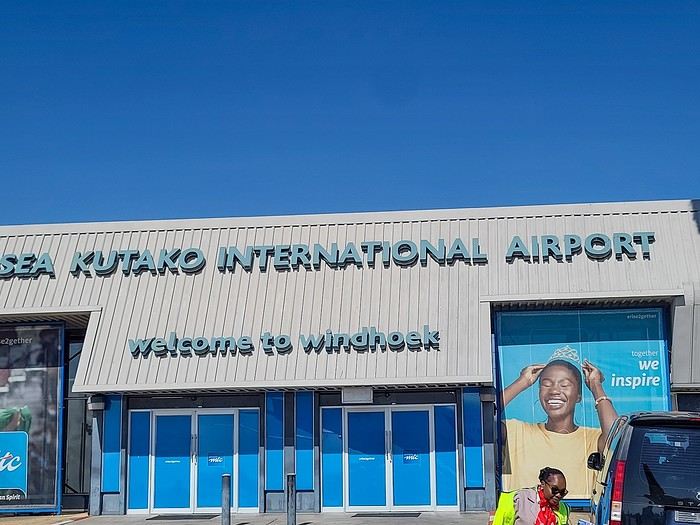
After a 9-hour and 30-minute overnight flight with Discover Airlines, we finally land on Namibian soil just before 7:30 AM. The day is breaking, and the colors are already stunning. We are eager despite the usual fatigue from the flight. The airline was punctual, with friendly staff and good meals, though a bit light. We are the first flight of the day to land, with no more than 15 flights per day here, from 7 AM to 8 PM. We disembark on the tarmac at this airport located in the middle of nowhere, **I finally set foot on African soil for the first time.** We exit among the first from the aircraft to go through the long formalities at the front of the line, as the wait can quickly become endless. Allow at least 5 minutes per person for e-visas. We still wait 45 minutes despite only about twenty people ahead of us. Phew, it's done. We collect our luggage and then withdraw money from an ATM. We make 4 withdrawals of the maximum amount, 2000 NAD $ per withdrawal, for a total of 380 €, or 95.33 € per withdrawal.
Our driver arrives at the same time, perfect timing, we were quick.
We leave the airport at 8:45 AM. By 9:30 AM, we arrive at the **Gracious Whisp vehicle rental agency**, located at the entrance of Windhoek, small and human-sized with a fleet of recent vehicles. More formalities, then a short wait as our vehicle is not yet ready. Time to decompress, catch our breath, and enjoy the very pleasant morning temperature. Not a cloud in sight. Next, a briefing on the vehicle, always with a bit of apprehension due to our approximate English. Allow 45 minutes of explanations, including setting up the roof tent, camping equipment, technical information in case of a flat tire, driving tips in Namibia, and a tour of the 4x4. We have all the necessary equipment for camping: mattresses, sleeping bags, pillows, table, chairs, gas stove, BBQ grill... as well as 2 spare tires, a compressor, a dual tank, and accessories for removing wheels. Off we go, it's time to muster our courage and get behind the wheel. **Heading to SuperSpar Maerua**, fortunately located less than 10 minutes away. We park with the help of a parking attendant; it's very crowded, the space is narrow, but everything goes well despite the cursed right-hand drive. Today's new mission: stock up on groceries. The store is well-stocked with local and imported products, catering to all tastes. We spend 114 € on groceries, from pasta to meat, BBQ lighters to dishwashing products. Two people load our groceries into two carts and transfer them to our vehicle; we feel compelled to leave a tip, 50 NAD $, as we don't have change yet. Now, we head to the hotel, 15 minutes away. Traffic is difficult at a complicated intersection; this will likely be the only traffic jam in Namibia. **We arrive at Kate's Nest Guesthouse & Backpackers around 1:15 PM, quite tired.** We take some well-deserved rest at this recent establishment, quite calm with secure private parking. After a short nap, we enjoy the quiet by the hotel pool. Night falls between 6:30 PM and 7 PM. We eat quietly in our room tonight before starting this long 4x4 road trip in camping mode in the heart of Namibia.
> Today's grocery expenses: 114 € at Super Spar Marua (2395.21 NAD $).
> Round-trip flight tickets with Lufthansa from Lyon: 2029 €, or 1,014.50 € per person.
> Vehicle rental: 4x4 Toyota with roof tent for 24 days: Gracious Whisp Car Rentals: 2,638 € (N$50,640) or **1,319 €** per person - (https://gwcarrentals.com/)
> Distance driven today: 15 km.
> Accommodation: Kate's Nest Guesthouse & Backpackers - 4 Aristotles Street Academia, 9000 Windhoek - 36 € for two for one night.
> Windhoek International Airport website: (https://www.airports.com.na/)
**DAY 3: Saturday, April 26, 2025: Windhoek to Hardap: Mariental Region - Kalahari Desert:**
After a good, restful night, we wake up leisurely around 7 AM. We enjoy the comfort provided by this first and last hotel before 24 nights under the tent.
**We leave Kate's Nest Guesthouse at 8:30 AM to tackle the Namibian roads.** We quickly leave the capital; in just 30 minutes, we find ourselves almost alone in the world. The landscape is dotted with small domes. We leave the **paved B1** quickly to turn left onto the **C15**. **From there, we won't see more than 10 vehicles all day.** After passing through the few houses of **Lekkerwaterpoort**, we tackle our first gravel road. These road sections are limited to 100 km/h, but even at 70 km/h, I find it already challenging. However, I quickly get used to it and gradually pick up speed to reach my cruising speed of around 80 to 90 km/h. **We are on immense straight lines crossing wild expanses as far as the eye can see.** **We come across two baboons, a few ostriches, and numerous cattle and sheep farms.** We pass through the charming village of **Uhlenhorst** with its typical houses and children with broad smiles waving at us. Life here is already very different from Windhoek. **The thermometer rises quickly from 16°C at 8:30 AM to over 28°C in the early afternoon.**
**We arrive at the Hardap Dam reserve at 2 PM.** We stop at the toll booth at the park entrance to pay the entrance fee: 250 NAD $ for 2 people and 1 vehicle. We continue to the dam and then the camp entrance, located a bit further. We had booked in advance, but this place remains little frequented by foreigners.
We take advantage of the hottest hours to rest by the large pool overlooking the immense lake, a very enjoyable moment. Would this be a bit of a vacation?
Around 4:30 PM, we head to the campsite. We overlook this vast water reserve. We arrive first; we will be only 3 vehicles spending the night here. It's time to get to work and set up our equipment for the first time. It takes us a good 20 minutes to set everything up, with a slight apprehension about unfolding the tent. Once this task is done, which we will have to repeat for almost a month, we will become much more efficient over time. Time for rest and contemplation in total silence. The sun gradually sets, and the heat quickly becomes bearable again. Bliss! **This dam is located 20 km northwest of Mariental in an area dotted with conical hills topped with dolerite buttons (Hardap means "hillock" in Nama). It captures the Fish River, which flows south, creating a large lake in the middle of an arid environment. The contrast is striking.** We enjoy our first sunset facing this 360° otherworldly landscape.
Around 7 PM, we start our first BBQ, or "braai" as it's called here. The temperature is perfect. The sun sets, giving way to a star-filled sky of incredible beauty thanks to the absence of any light pollution. The Milky Way will lull us throughout the evening. After some good sausages and potatoes on the BBQ, we head to our roof tent around 9:30 PM with a complete change of scenery in just 24 hours. France already seems so far away...
This campsite has shared showers and toilets, quite clean and functional, as well as a central area with several BBQs and tables. The sites are arranged in a semicircle, each with an electrical outlet. The sites are close to each other but spacious, some slightly shaded. We are only three vehicles tonight, so it's perfectly comfortable and quiet. Not to mention the large pool near the restaurant. Our trip is off to a great start.
> Today's road itinerary: Windhoek > Head south on the B1 to Rehoboth > Turn left onto the C25 then C15 to Stampriet > C20 to Hardap > Full north on the B1 > Then turn left onto the M93 - 5 hours of driving.
> Distance driven today: 354 km.
> Accommodation: Hardap Recreation Resort - 23.3 € for two - Large pool - GR6W+3M2, Hardap Game Reserve, Mariental, Namibia - (http://www.nwr.com.na/resorts/hardap-resort/)
**DAY 4: Sunday, April 27, 2025: Hardap - Brukkaros Volcano - Keetmanshoop - Quivertree Forest Rest Camp**
Our first night under the tent was very pleasant; the little wind quickly calmed down, giving way to absolute silence. The mattress is decent, more comfortable than some nights in Nepal. The length and width give us enough space for maximum comfort, despite my height (1.91 m). We wake up a little before 7 AM as the sun rises, and the lights dazzle us from the start of the day. We pack up the equipment in 30 minutes, quite easily. Then we enjoy the sun, which warms up quickly while we keep our light fleece on.
At 8:30 AM, **we hit the road again, heading south** to our first stop in **Mariental**. We want to do some shopping at SuperSpar, but once we arrive in the parking lot, a young local is fighting with the supermarket security guards and then threatens to throw stones. We don't want to take any risks right at the start, so despite the baton blows he receives, he doesn't stop. We leave empty-handed but fill up with fuel at the Shell station 1 km further. The price per liter is 21.33 NAD $, we fill our 107-liter tank for 107 €. In Namibia, you get served, and they bring the card machine to the window to pay. It's then customary to leave a tip.
We then take the B1 heading due south on a recently renovated road. Around 11:30 AM, we leave it on our right to take **a wild gravel road, the M98**. Just before **Berseba**, we turn right onto a small track, the **D3904 towards Brukkaros Crater up to a camp at 1588 m altitude**. The track then becomes too bumpy. We stop on the counter-slopes where **a wide panorama unfolds over these immense plains as far as the eye can see**. It's 12:15 PM, time for us to eat a rice and tuna salad facing this landscape.
**We are alone in the world until a vehicle arrives and parks next to us.** A bit of apprehension, 4 men head towards us. It turns out to be 4 shepherds looking for a lost foal. The conversation is pleasant, lost in the middle of nowhere. We find ourselves alone again in this absolute silence. **The heat becomes stifling with a good 30°C**. We get back on the road around 1 PM. Back on the B1, **we continue due south to Keetmanshoop**, which we reach around 3 PM. We stop there to do some shopping for 262 NAD $ (12 eggs, a can of tuna, a can of corn, bread, a soda, and a 5-liter water container), or 12.48 €. Two quite insistent children ask us for money or candy at the store exit, yet we give them a small tip, but they continue to cling to the car. Locals parked next to us tell them to leave us alone. Anyway, we finish the trip to **Quivertree Forest**, 15 km away. We will spend the night in this **pleasant farm run by a German**. Upon arrival, as the day before, and as I suppose in the future, we dive straight into the cool pool to relax after all these kilometers. A bliss. Then we take our 4x4 and choose a spot near these famous trees. After the 33°C this afternoon, once 4 PM passed, the temperature drops again and becomes very pleasant. **We are in the middle of the Kokerboom, one of the most interesting and characteristic plants of hot and arid regions. It's not really a tree but a variant of the aloe plant whose botanical name is Aloe Dichotoma. This Kokerboom has a smooth and thick trunk reaching up to 1 m in thickness and 9 m in height. They bloom for the first time at the age of 20 to 30 years.** The flowers are yellow and reach about thirty centimeters during the season between June and July. **They grow mainly in an environment with a high concentration of black rocks absorbing a large amount of heat (38°C). The rocks also serve to anchor the tree with its tentacle-like roots. It also resists frost. Each is between 200 and 300 years old.**
Around 5 PM, we walk to the farm reception to watch the feeding of **two cheetahs**. Magnificent carnivores taking their time to savor their piece of meat. **Then we return near our campsite to enjoy the sunset among these trees. The colors are sublime, as every evening apparently. A magnificent spectacle with colors evolving from yellow to orange then to pink, before giving way once again to a sky filled with thousands of stars.** Our campsite at Quiver Tree Forest Camp is very comfortable; we have a water supply, a stone table, a small lamp, an electrical outlet, a small tree for shade, and a BBQ that we won't use tonight; we'll cook on gas. The sites are far apart, with some shared facilities scattered around, a very beautiful setting. No reservation possible, no need, just show up directly. **The campsite accommodation for 2 people costs 28 €, including the reserve entrance fee of 5 €**. We finish this second bivouac evening around 9:30 PM, time for some reading and sleep in peaceful silence without wind.
> Today's road itinerary: Mariental > B1 heading south to Brukkaros > At Tses turn right towards Berseba via the M98 > Turn right onto the D3904 > 8 km > Brukkaros Volcano (stop at the lower camp as the track is difficult for 1 hour) > Keetmanshoop > Turn left onto the M29 > Quivertree Forest - 4 hours of driving.
> Distance driven today: 371 km.
> Distance walked today: 6 km.
> Today's expenses: Groceries for 12.48 € (262 NAD $) / Fuel for 107 € (1 liter of diesel for 21.33 NAD $).
> Accommodation: Quivertree Forest Rest Camp, P.O. Box 262, Keetmanshoop, Namibia - BBQ, hot showers, toilets, and electricity - No reservation - Pool - 18 €/Person (N$ 340.00 with park entrance) - (http://www.quivertreeforest.com/)
**DAY 5: Monday, April 28, 2025: Quivertree Forest Rest Camp - Giant's Playground - Keetmanshoop - Fish River Canyon - Canyon Roadhouse:**
After an excellent start to the night, we are woken up by the wind shortly before 6 AM, but the sunrise is not far off. We get up at 6:30 AM to enjoy it. The atmosphere is a bit cooler this morning, but the reward is already here.
The adventure continues. At 7:45 AM, we head towards **Giant's Playground**, 4 km away. We take a 3-kilometer walk through this expanse of blocks and igneous rocks.
We continue south at 8:45 AM, passing through Keetmanshoop again where we do some shopping for 25 €, a big stock-up for a good part of the trip: meats, canned goods, pasta, fruits... At 9:30 AM, we take the B4 to Fish River Canyon.
At 11:30 AM, we arrive at the entrance to the NWR park (350 NAD $ entrance for 2 people and 1 vehicle). The track becomes bumpy immediately upon entering the park. After about ten kilometers, we come upon this landscape carved by nature. In the end, it's well worth the detour. We were at the Grand Canyon in the USA exactly (https://www.montagne-aventure.net/2024/04/29/j21-3-juin-2024-grand-canyon-et-lac-powell/) and can thus confirm that this Fish River Canyon is comparable. We make several stops along the southern flank. **Here, nothing is developed; nature is almost in the wild state.** **With 160 km in length, up to 27 km in width, and a depth of 150 m, it is indeed the second-largest canyon in the world.** The history of the canyon is apparent in its different earth layers and stratification: the antiquity of the place is tangible, and the absence of vegetation is surprising. **It consists of two nested canyons, formed at distinct periods. The first distinct layer of schist, sandstone, and eruptive material surrounding the canyon was formed a few two billion years ago, then transformed due to heat and pressure into more solid rock such as gneiss. The inner canyon, carved more recently by the Fish River, has a depth of 270 m.**
We have a picnic once again alone in the world facing this grand panorama at the **Sulphur Spring View Point**. This is where the hiking trail begins, plunging into this narrow canyon, but it is forbidden to venture there alone without a guide. It's 30°C, but a slight wind makes the atmosphere bearable. At 1 PM, we retrace our steps and continue to the **Main View Point** then to the **Hikers View Point**.
In the south of Namibia, the Fish River Canyon, 160 km long, is a true geological wonder: a canyon nested within another canyon, one of the largest in the world. The first sedimentary layers formed two billion years ago; 500 million years ago, a period of tectonic activity caused these layers to crack and tilt, opening a vast canyon in the Earth's crust. The second canyon, with a depth of 270 m, was carved over time by the passage of the Fish River in this new valley.
At 3 PM, we arrive at our very charming camp for the evening, the **Canyon Road House**. We fill up with fuel right away because tomorrow we have a long day of isolated driving: 55 liters for 1240 NAD $. Then we settle into the campsite we had previously reserved in France. We are assigned site 2, very well set up under a tree with its BBQ and stone table just steps from the pool. We quickly set up the tent and jump straight into the pool for the relaxation moment of the day. As usual, the water is quite cool, but it's a real pleasure. Then we stroll around this Canyon Road House, which recreates the atmosphere of the roadside inns of the 1950s with old car wrecks and vintage gas pumps in a bygone era. **Around 5:45 PM, we start a short walk leading us to the top of a hill overlooking the wide plateau where we are to watch the sunset.**
And finally, to end this beautiful day, it's time for the braai, with grilled sausages and white beans on the evening menu.
> Park entrance: 150 DN/person + 50 DN/vehicle (18 € for two). It is possible to enter at two access points: Hobas in the north and Ai-Ais in the south.
> Today's road itinerary: M29 > Keetmanshoop > B1 > B4 > C12 (track) > After Holoog turn right onto the D601 (C37 track) > Accommodation on our right (stop just to check in before 6 PM) > Continue 30 km (30 minutes of track) to the viewpoints after Hobas where you must pay the entrance fee. Sunset View Point to the left > Return before sunset as the park closes (best lights at sunrise). 3 hours.
> Distance driven today: 228 km.
> Distance walked today: 10 km.
> Today's expenses: 25 € for groceries / 17 € for the Fish River Canyon park entrance / 58 € for fuel.
> Accommodation: Canyon Roadhouse, Gondwana Collection Namibia – 34.4 € for two - Pool - Near Hobas - (http://www.gondwana-collection.com/fr/accommodation/canyon-road-campsite)
**DAY 6: Tuesday, April 29, 2025: Canyon Roadhouse - Orange River - South African Border - Vista Trail - Gondwana Sperrgebiet Park - Aus:**
The night was excellent in this very comfortable campsite. **We wake up to the sound of birds** before the alarm at 6:45 AM. Our little morning routine starts as the sun rises. **A big day of driving awaits us to the South African border. This will be the southernmost point of our journey.** We hit the road at 8 AM via the C37, pass through **Hobas**, then turn onto the D207 to **Aussenkehr.** **We cross a mountainous barrier with some high peaks and perfect cones. The rock varies from orange to pink to black.**
We then cross a lunar desert as far as the eye can see on a giant dome; the track winds through nowhere without meeting anyone for hours. The landscapes are surprising. **We spot several ostriches and a gemsbok.** In the middle of this endless expanse, we come to an improbable intersection and continue right onto the D278.
In the middle of these arid lands, we come across a green zone: a vast vineyard. At 10:30 AM, **we come across a "Road closed" sign, fortunately, a local resident waves us to continue; a bit stressed, we proceed.** We start to follow the beautiful Orange River. On the other side of the bank, just a few meters away, South Africa is there. It is the second-longest river in Southern Africa, after the Zambezi. It flows over 2,000 km to the Atlantic. After passing through narrow gorges, we regain altitude before starting the descent, gently heading back north.
**We now cross and follow the Fish River, which joins the Orange River further south** **along this gorge dating back millennia.** At exactly noon, we take a lunch break by the Fish River, still without meeting a soul in this landscape between greenery and aridity. The temperature here is cooler with a pleasant 23°C on the banks, the perfect spot. **We continue on the track to Rosh Pinah**, where we find a paved road again. **The section along the Orange River and the Fish River was officially closed, but we were able to pass without any issues, avoiding a detour of at least 3 hours.** Phew. We now drive at high speed (limited to 120 km/h) through these vast spaces. We come across many ostriches after the **dozens of monkeys along the Fish River**. Around 3 PM, 3 km after the very small town of **Aus**, we reach **our campsite for the evening at Klein Aus Vista**. A new **small peaceful haven very well set up**. As usual, after checking in at reception, we jump straight into the beautiful pool to get our well-deserved dose of coolness, another good thermal shock that our bodies appreciate. Once this moment of relaxation is over, we take our 4x4 to reach the campsite located a bit higher, set apart at the foot of a hill that overlooks us.
After setting up, **around 5 PM, we head to the Vista Trail to climb to the top of a mountain overlooking the vast plain that surrounds us at 360°**. It takes about 30 minutes to climb. The place is just magical, **the perfect viewpoint to admire the sunset**. **We fully savor the moment. We also spot one of the few wild horses in the world capable of living in the desert.** Their numbers have decreased in recent years due to predation and drought (around 100 to 150). At 7 PM, we return to the camp, time for the braai and preparing the meal in this peaceful little camp.
In the south of Namibia, the Fish River Canyon, 160 km long, is a true geological wonder: a canyon nested within another canyon, one of the largest in the world. The first sedimentary layers formed two billion years ago; 500 million years ago, a period of tectonic activity caused these layers to crack and tilt, opening a vast canyon in the Earth's crust. The second canyon, with a depth of 270 m, was carved over time by the passage of the Fish River in this new valley.
> Today's road itinerary: 5 hours of driving: D324 heading south (track) > turn right onto the C10 (track) > D316 heading south > turn right onto the C13 > In Aus turn left onto the B4 > Campsite via a track on the left.
> Fuel station: Solitaire or Aus.
> Distance driven today: 398 km.
> Distance walked today: 7 km.
> Accommodation: Klein-Aus Vista Desert Horse Campsite - Farm Klein-Aus No 8 on the B4 main road to Luederitz Aus 9000, Aus, Namibia - (http://www.klein-aus-vista.com/accommodation/desert-horse-campsite/) 17908 420 DN - Water + Shared shower (hot water). No electricity.
**DAY 7: Wednesday, April 30, 2025: Aus - Kolmanskop - Diaz Point - Luderitz - Kanaan Desert:**
We wake up around 6:45 AM, with partly cloudy weather for once; we feel the ocean's influence gradually. But the sun isn't far off. At 7 AM, we leave the campsite heading west towards Luderitz via the B4. **First stop of the day: Kolmanskop, the ghost town we reach at 8:30 AM**, entry costs 180 NAD $ per person. We discover this **timeless place** in 1.5 hours, moving from building to building amidst violent sand-laden gusts of wind. There's a lot of charm in these different living spaces. **The sand quickly reclaimed the place after this mining town was abandoned.** This was once the headquarters of Consolidated Diamond Mines. It's hard to believe that this former town, where the diamond industry once flourished, had a hospital, a bowling alley, and a theater. The decline in diamond sales after World War II and the discovery of richer deposits put an end to this golden age. By 1956, the town was already completely deserted, and the sand had reclaimed its rights. **These dilapidated buildings swallowed by shifting dunes have something surreal about them.**
At 10:15 AM, we hit the road again **heading to Luderitz, 22 km away**, and first to **Diaz Point** **facing the Atlantic Ocean**. It's a wind-swept peninsula with its characteristic red and white lighthouse. There's a campsite and a coffee shop on site, but the place doesn't inspire rest without shade or shelter from the wind. We return to the city via the D701 track that runs along the ocean, be careful at low tide. We come across **a few fishermen and a fox as well as flamingos.**
We walk through the few streets of the city, much smaller than I imagined, then climb to the **famous little Lutheran church that overlooks the city, the Felsenkirchr.** **The wind blows very strongly here, and the sand is omnipresent, surrounded by the Namib Desert and the southern Atlantic coast.** **A German colonial relic barely touched by the 21st century, Luderitz seems frozen in the past, giving it both a gloomy and a certain charm. In short, it's certainly one of the most incongruous places in Africa.**
At 1:15 PM, just before leaving Luderitz, we do some shopping for 20.50 € and fill up with fuel: 61.50 €, 1290 NAD $ for 61 liters (21.18 $ per liter).
**We return via the B4 to Aus** (paved), **then via rougher tracks**, the C13 then the D707, magnificent as it runs along a mountain range with multiple colors on our right and an endless flat desert on the other side.
To access our campsite for the evening, we must take a **narrow private track for 7 km** on our right to emerge, in this total vastness, at the **isolated Kanaan Desert Retreat on a small hill**. I don't have time today to jump into the pool near the reception; we arrive at 5 PM at 8 small, isolated, and unique sites with a small kitchen, a shower, and a private toilet under a small tarp shelter. **A crazy charm with a unique view...** **This will be my favorite accommodation of this trip. The photos speak for themselves.** We jump into the outdoor shower while savoring the landscape, then prepare our evening braai while enjoying the colors fading, facing this plateau with bushes turning a vivid orange. **A moment that will remain etched for life.** **Savanna atmosphere under a thin emerging moon. Every minute offers different colors. Facing our meal, we have a natural giant screen.**
We end this day contemplating the stars and admire this thin orange moon setting on the horizon (8:42 PM).
**Ghost town just before Luderitz: Kolmanskop** (open from 8 AM to 3 PM - N$ 180 p.p – 9 €). Once, Kolmanskoppe was organized around diamond mining. After finding new, more prolific spots, the town was abandoned and is now a ghost town. The sand and dunes have reclaimed their rights and buried everything humans had built. Houses, train station, bakery, everything has been covered by sand, which passes through the windows, even though they are 1 meter high.
> Today's road itinerary: 5h30: B4 to Luderitz (paved) > Round trip > Kolmanskop on the left > Return via the previous campsite > Then C13 (track) > Turn left D707 (track) > Then track to the right to the campsite.
> Distance driven today: 438 km.
> Distance walked today: 8 km.
> Today's expenses: Groceries at the Spar in Luderitz for 20.50 € / Fuel fill-up in Luderitz for 61.50 €.
> Official Kolmanskop website: (https://kolmanskuppe.com) (open from 8 AM to 1 PM - N$ 180 p.p – 9 €).
> Accommodation: Night at the south of the Namibrand Nature Reserve: Kanaan Desert Retreat – 26.5 € for two - (http://www.kanaannamibia.com/) - Farm 104 Karas 9000 - Sanitary facilities + BBQ + Water + Pool - No electricity - My favorite accommodation of this trip.
**DAY 8: Thursday, May 1, 2025: Kanaan Desert Retreat - Namib Desert - Crossing the Namibrand Nature Reserve – Sesriem Canyon - Elim Dune - Little Sossus Lodge**
After a cooler night than the previous ones with about 10°C, we wake up around 7 AM. We admire, as usual, the sunrise between the desert and the mountains. **The spot from last night was truly perfect, isolated from the world, in total serenity, with a wake-up call to the sound of birds.**
We hit the road a little after 8 AM, heading north via the D707 to Spes Bona, then the gravel road C27 via Betta to Sesriem. **The landscapes roll by and dazzle us.** **We are right in the heart of the Namibrand reserve**, coming across numerous **zebras**, **impalas**, **ruminants that reproduce in large numbers**, and **gemsboks**. At noon, we stop in the shade of a tree to eat. The spot is so romantic facing orange arid mountains and a vast green plateau. **A landscape full of contrasts, timeless and silent.**
**The Namib Desert is the oldest on the planet; its name means "vast arid plain," and it also gave its name to the entire country: Namibia.** The majority of these arid and semi-arid lands dotted with viewpoints are part of the Namib-Naukluft National Park, which covers 23,000 km².
At 1 PM, we enter the Sossusvlei park. We start with the **Sesriem Canyon**, which is 3 km long and 30 m deep. We enter it with a short 1-hour hike into its depths. **It was carved by the Tsauchab River in an agglomerate of sand and pebbles over 15 million years old.** We retrace our steps back to Sesriem, which means "six belts," referring to the number of leather belts (from ox wagons) needed to draw water from the canyon. This remote locality is mainly the gateway to Sossusvlei but offers a gas station and some accommodations. For our part, we sleep 40 km away tonight.
**We then move on to Elim Dune.** It takes about 45 minutes of walking to reach its summit, and the climb is very breath-taking as we progress in the sand where we almost slide back with each step. **A first grand 360° panorama unfolds. The ochre color of the sand contrasts completely with the yellow plain and the brown and black mountains in the distance.**
At 3:15 PM, we start the descent facing Sesriem. We were completely alone once again on this dune. **These Namib dunes are composed of colored quartzite sand, presenting hues ranging from cream to orange and from red to purple. Unlike the ancient dunes of the Kalahari, these move with the wind and adopt distinct, ever-changing shapes.** Star dunes resemble stars seen from above, while transverse dunes, like those on the coast south of Walvis Bay, stand perpendicular to the prevailing southwest wind. The most stable dunes, which thus have the most vegetation, are parabolic dunes, due to the variability of the winds. Longitudinal (seif) dunes measure up to 100 m in height, while barchan dunes, crescent-shaped and predominant at the extreme north of the Skeleton Coast and south of Luderitz, are the most mobile, created by unidirectional winds.
**We get back on the road for 45 minutes to our campsite for the evening, Little Sossus, which we reach at 5 PM**, via C27 then right onto C19. As often upon our arrival, I jump into the cool pool to relax after all this driving, then we proceed to set up the camp. As the day before, the campsite consists of 10 fairly distant sites, with private sanitary facilities and a small roof. We are delighted with this crazy charm. The hot water for our shower is wood-heated: a Namibian lights it every evening around 5 PM.
For a change, or not, the menu features a small BBQ with pork ribs and pasta, facing another sunset, this time with partial cloud cover giving equally splendid colors. Time for a well-deserved rest after long corrugated tracks covered in our 4x4 today.
> Today's road itinerary: 4h45 of driving: Find the D707 and head north (track) > At Spesbona turn left onto the C27 (track) > At Sesriem after entering the park, turn left following View Point Sesriem > Continue 4.5 km to the Sesriem Canyon Parking > Return then head towards Elim Dune > Exit the park then take the D826 > Turn right onto the C19 heading SE > Turn right facing the D854 to the campsite (campsite closes at 7 PM).
> Distance driven today: 272 km.
> Distance walked today: 8 km.
> Today's expenses: Entry to the Sossusvlei Namib-Naukluft Park: 17 € for two (with one car).
> Accommodation: Little Sossus Lodge – 35 € for two - At the junction of the C19 and D854 roads Maltahohe 9000, Maltahohe, Namibia - (http://www.littlesossus.net/) - Pool + Private bathroom + Hot water + Electricity + BBQ + Grocery store (bread to order the day before).
**DAY 9: Friday, May 2, 2025: Little Sossus Lodge - Namib-Naukluft National Park – Sesriem - Sossusvlei - Big Daddy – Deadvlei - Tsauchab River Camp**
Today we start the day early to tackle **the famous dunes of Sossusvlei at first light**. The alarm goes off at 6 AM to leave the camp at 6:45 AM. The wind is blowing quite strongly in gusts this morning, but it only woke us up a quarter of an hour before sunrise. The park opens at 7:15 AM. We start with a small encounter: a friendly **jackal lounging by the roadside.**
We first have to cover the 40 km of track to Sesriem, pay the entrance fee (350 NAD $), and drive 65 km on a paved road this time to reach the **vast salt pan (a lake whose sediments are made of salts) of Sossusvlei**. **It appears amidst the gigantic red dunes that rise on either side. The wind constantly changes the shape of the dunes, as well as their colors, which vary with the light. The setting is breathtaking, giving an impression of immensity and timeless grandeur.**
The paved road ends; the last 4 kilometers become technical and are reserved for 4x4s. Phew, I pass without any problems, though not without stress, switching to L4 mode. **We start the ascent to Big Daddy at 8:45 AM, 325 m of elevation gain in the sand nonetheless.** We climb at an excellent speed despite the strong wind, in exactly 1 hour. At 9:45 AM, we are at the summit of what will remain etched for a long time. The 360° view is simply unimaginable; you have to experience it to believe it. The wind blows violently up there, **it feels like being in the high mountains, on a snow ridge, with a strong transport of sand. The atmosphere is magical.** We start the descent running barefoot in the steep sand.
**We then move on to its neighbor, Deadvlei.** **Here, petrified trees stand in the "vlei" (basin) with their dried branches casting desolate shadows on the white ground. The juxtaposition of the deep blue sky and the towering dunes is captivating.**
We return to the 4x4 parking at 11 AM, the stress rises again for the sandy track passage. We retrace our steps and stop at **Dune 45**.
At noon, we take the opportunity to picnic at the foot of **the beautiful Dune 40**, where there is already no one left. We enjoy the quiet again, well, almost, as the wind remains omnipresent.
At 1 PM, we return to **Sesriem**, where we fill up with fuel (21.15 NAD $ per liter), totaling 1630 for 77 liters (78 €), and do some shopping for 245 NAD $ (two nice pieces of pork, 2 cans, 2 sandwiches for tomorrow, and 1 soda), which is 12.48 €. It's 27°C. We hit the road again, heading to a new destination at 2 PM. We take the C19 back to Little Sossus where we spent the night, then turn left onto the gravel road D854 for about 40 km to **Tsauchab River camp**. Finally, we won't be sleeping here; we are redirected 7 km downstream to **Naukluft View Camp**, which also belongs to Tsauchab River Camp.
We arrive at 4 PM, and thankfully, the fatigue was starting to set in. **Our campsite is located under a small forest, providing some protection from the wind that blew strongly all day. The calm does us a world of good. Once again, a lot of charm**, with very spaced-out sites without any visibility. We can't wait to take our shower. It will be possible from 5 PM with, as the day before, water heated by a wood fire. Time to prepare the campsite for the night. And on the menu, a braai with two superb pieces of pork bought in Sesriem and fries!!!!
**The Namib Desert**
An impressive coastal desert stretching from the Atlantic to a high plateau inland, the narrow Namib Desert runs along the southwest African coast for about 1,300 km. **Considered one of the oldest deserts in the world**, it is bordered to the north by the Kaokoland Desert, which extends into Angola, and to the south by South Africa's Karoo. The narrow Namib is mostly less than 160 km wide. Despite this, it is considered to consist of three sections: the coastal strip influenced by the Atlantic; the Outer Namib, occupying what remains of the western half; and the Inner Namib, comprising the eastern half of the desert. Generally called the Skeleton Coast, the coastal Namib receives almost no rain and depends on regular marine fogs for moisture. From sea level, the terrain rises to 900 m, where the desert meets the base of the Great Escarpment to the east. In the Inner Namib, average annual rainfall is only about 50 mm.
The dryness is such a characteristic of the Namib that it is thought to have been in this arid state for at least 55 million years. It is all the more surprising to learn that animals such as vipers, geckos, zebras, and elephants live in this desert. Some areas of the Namib are also rich in flora, including Welwitschia mirabilis, which grows near the ground with seemingly exhausted leaves, extracting moisture from marine fogs and can live over 1,000 years. In the southern Namib, some dunes are up to 32 km long and 240 m high.
**The frequent fog of the Skeleton Coast:** Driving north along the coast of Namibia, the cold Benguela Current in the Atlantic cools the moist air above the ocean, which, upon meeting the warm desert air, leads to the formation of thick fog banks that drift up to 100 km into the center of the Namib before evaporating under the sun.
> Today's road itinerary: 4 hours of driving: C19 towards Sesriem (track) > D826 (paved) > Foot of Big Daddy via a technical sandy track > Return via the same route > D854 to Tsauchab.
> Gas station: Sesriem.
> Distance driven today: 254 km.
> Distance walked today: 12 km.
> Today's expenses: Park entry at Sesriem for 2 people: 17 € / Fuel fill-up: 78 € / Groceries at Sesriem gas station: 12 € (245 NAD $).
> Accommodation: Tsauchab River Camp - Naukluft View Camp - D054 & D850 GPS: S24 26' 37" E16 10' 11" Sossusvlei 22007, Maltahohe, Namibia - BBQ + Private sanitary facilities + Water - www.tsauchab.com
**DAY 10: Saturday, May 3, 2025: Tsauchab River Camp - Naukluft National Park - Olive Trail Hike (10 km) - Ababis Guest Farm**
We pack up the camp at 8 AM and continue our road trip north via the D854, a bumpy track with many corrugated sections. It's cool this morning, 12°C.
**We enter the Naukluft massif, discovering landscapes with very different terrain than before.** We first need to check in at the campsite, 13 km from the entrance at the end of the track: 350 NAD $ for 2 people and 1 vehicle, then return 4 km back. **On the agenda is the lovely Olive Trail, a 10 km hiking loop that starts 4 km northwest of the park office**, along the D854 that we follow. At 9:45 AM, the hike begins with a fairly steep ascent (about 45 minutes) among the **wild olive trees** from which the trail gets its name. **At the summit, we enjoy a view that embraces the Naukluft Valley.** We then turn east and gradually descend into a deep valley, passing over sometimes slippery rocks. We have a snack around 11:30 AM in these small gorges. **Further on, to cross the wall of a canyon in front of us, some chains are fixed to the rock to help us pass.** We finish this superb loop clockwise at 1:15 PM, taking 3.5 hours including 30 minutes of breaks. We only crossed a small group of 3 people on this wild adventure far from everything. At 1:45 PM, we exit the park and take the **D854 track north to Bullsport**. From there, we turn left and take the C14, which **runs along the bed of the Tsondab River.**
**We arrive at our campsite for the evening, Ababis Guest Farm, at 3 PM.** Quite early for once, allowing us to rest a bit in this peaceful farm where many sheep wander around us. We also enjoy the pool under a magnificent sun, less hot than the previous days, it's 22°C. The camp has only 4 spaced-out sites around shared sanitary facilities. **We are in the middle of a vast plain facing the Naukluft massif mountains.** We will have another beautiful sunset on these mountains. For the first time on this trip, **we will be completely alone at this campsite.** **We haven't encountered many people today**, just 3 during the hike and fewer than 10 vehicles all day.
> Today's road itinerary: Head north on the D854 (track) > Turn left to enter the Naukfluft National Park > Continue on the track then turn right to the Olive Trail hike parking lot (1 hour for 45 km). Return to the D854 and continue north > At Bullsport turn left onto the C14 to Ababis (still a track) > The camp is located on the left facing the D1261 (1 hour for 60 km from Olive Trail). Total: 2 hours of driving for 100 km.
> Gas station: No gas station on the route, except in Solitaire.
> Distance driven today: 115 km.
> Distance walked today: 13 km.
> Accommodation: Ababis Gaestefarm - Night booked by email – payment on site: (https://www.ababis-gaestefarm.de/) - P.O.Box 1004, Maltahöhe - N$ 300.00 per person
**DAY 11: Sunday, May 4, 2025: Ababis Gaestefarm - Namib-Naukluft National Park – Solitaire - Gaub Pass - Kuiseb Canyon - Moon Landscape - Walvis Bay**
The night was, for the first time since the start of this road trip, quite difficult. A strong wind accompanied us all night, making the tent flap constantly. A racket that drove us crazy. We still managed to sleep a few hours. The morning sun brings back our smiles. We hit the road for this new stage a little before 7:45 AM.
We start the day with a first stop less than 15 km away **on the C14 in Solitaire** at 8:15 AM. **This town is lost in the middle of nowhere with its small gas station with a western atmosphere adorned with rusted and sand-covered car wrecks.** After a quick supply stop: 86 NAD $, or 4 € for 1 water container and a box of cookies, we continue north still on the C14, **crossing the Tropic of Capricorn** then devouring this **magnificent track up to Gaub Pass**. **A succession of narrow gorges, turns, climbs, and descents breaking the monotony of the previous long straight lines.** We are right in the heart of no man's land for 200 km. We then start the descent to the **Kuiseb Canyon. It houses the wide bed of the eponymous river, dry almost all year.** Even when it flows for 2 to 3 weeks during the rainy season, it doesn't go beyond Gobabeb and then seeps into the sand. **The drinking water that supplies Walvis Bay is pumped at Rooibank from this underground water table.** **We now cross the Kuiseb Desert where impressive dunes roll down.** We make a short stop at a **natural rock arch** reminding us of our (https://www.montagne-aventure.net/2024/04/29/j19-1-juin-2024-canyonlands-national-park-et-arches-national-park/). Then we gradually descend towards **Walvis Bay** where we will spend the night. At noon, we enter the **Dorob National Park**. The thermometer drops 10°C in 10 minutes as we get closer to the Atlantic Ocean.
At 12:45 PM, much earlier than initially planned, we arrive at the **Moon Landscape** (View Point 4, free) to have a snack, via a very recent surprising dual carriageway in the middle of nowhere, then via the C28. We are again in the hinterlands, the temperature has soared: 30°C without a bit of shade. Even if the colors and the panorama must be exceptional at sunrise or sunset, the detour for this 360° panorama is still worth it. Extreme aridity as far as the eye can see. The place lives up to its name; it really feels like being on the moon. We get back on the road at 1:30 PM via the D1991, C28, then again the A2, which is very new. The latter runs along the beautiful dunes up to the **Dune 7**, where we make another stop.
Then we head towards our final destination of the day, **Walvis Bay. Its port is sheltered by a sand spit, a natural breakwater that protects the city from the powerful assaults of the ocean. Its port was long a strategic place: claimed by the Cape Colony in 1795, it was officially annexed by the British in 1878 to counter Germany's ambitions in the region. A colony of fur seals, pelicans, flamingos, and whale terns have made it their home.**
We do a big grocery shopping at the Spar located in the center for 66 €; it's very easy to park there. Then we fill up with fuel at an Engen station right across for 1117 NAD $ for 54 liters (20.6 NAD $ per liter), which is 54 €. We then **enjoy the seaside in the Lagoon neighborhood**, where it's also easy to park. After kilometers in the desert, **this cool break is more than welcome. The outside temperature is 22°C. In the distance, we can clearly see the clouds lingering over Swakopmund.**
We take the 4x4 one last time to the **Lagoon Chalets where we will spend the night**. The spot is well set up and surprising in the heart of a residential neighborhood. The sites are quite large, separated by fences around very comfortable shared sanitary facilities. BBQ, electricity, and shaded area. We settle in quietly before going out on foot to watch the **sunset over the Pacific Ocean along Lagoon Promenade Road**. We can still see this impressive persistent mist in the distance. The neighborhood is very peaceful, certainly without much charm, but with a very well-developed seafront that inspires relaxation after kilometers without meeting anyone in inhospitable lands. We end the day with our traditional braai: grilled chicken thighs and sautéed potatoes in the coolness of a starry sky.
> Today's road itinerary: 5h30 of driving (or 3h30 of driving for 250 km without the Moon Landscape): Head north on the C14 > Cross the Tropic of Capricorn > Gaub Pass > Kuiseb Canyon on our left in a round trip > Continue to Green Valley and leave the C14 to the right on the D1984 > Turn right on the C28 > Then left D1991 to Moon Landscape D1991 View Point 4 > Return via the same road and stop at Dune 7 for sunset > Walvis Bay.
> Gas station: Solitaire or Walvis Bay.
> Distance driven today: 372 km.
> Distance walked today: 5 km.
> Today's expenses: Fuel fill-up for 54 € + Groceries for 66 € at Spar.
> Accommodation: Walvis Bay: Lagoon Chalets – 36.6 € for two - (http://www.lagoonchaletswb.com/) - 8th Road West, Meersig Meersig 9000, Walvis Bay, Namibia - BBQ – Electricity – Shared sanitary facilities.

**DAY 12: Monday, May 5, 2025: Walvis Bay - Swakopmund - Round Trip to Cape Cross (seals) - Wreck of the Zeila en route - Henties Bay - Spitzkoppe Tented Camp & Campsite**
After an excellent night, a bit cooler and more humid than usual, we wake up around 7 AM and leave the camp at 7:45 AM to **follow the Atlantic coast heading north**. We thus leave **Walvis Bay**, a very pleasant stopover town, and follow the ocean via the B2. **We enter the mist and Swakopmund** at 8:40 AM, parking **near the lighthouse**. The atmosphere is very quiet, the streets seem dead with large empty parking lots and very little traffic, but the few open shops are filled with expatriates enjoying their breakfasts, French bakeries, cafes, travel agencies... **We are in this Benguela Current, a fast cold ocean current that flows from South Africa, up the coasts of Namibia and Angola, towards the northwest to join a warm equatorial current. Hence the supply of very fish-rich waters and this tenacious mist depending on the seasons. In the northern part of the Namib Desert, fogs are frequent during the southern winter. It's almost the only source of moisture since the city of Swakopmund receives, on average, only 11 liters of water per m² in December and January.**
**Swakopmund is wedged between the dunes and the Atlantic rollers. It is the Namibian capital of adventure activities and has a ghostly colonial remnant. With its German architecture, its seaside promenade, it resembles a seaside town of the North Sea or the Baltic.** It is also a bustling African city. **Nearly two-thirds of Swakopmund's population live in Mondesa, a township created during apartheid, northeast of the city center, a legacy of the South African mandate.** The heart of the city is located in the area of the pier, at the foot of the lighthouse, better known as the Mole. During the South African occupation of Swakopmund, the port took a back seat to Walvis Bay.
Continuing on this C34, sometimes on salt, we come across the famous **wreck of the Zeila, stranded in 2008**, on our left. We can see it through the thick fog, being very close to the beach. It's 10:15 AM. Further on, Henties Bay is a bay that attracts many fishermen; it's teeming with vehicles equipped with fishing rods. Besides its fish-rich waters, it enjoys a relaxed atmosphere and a large beach suitable for walks.
We continue further north, heading to Cape Cross, this time a round trip because we will turn off later here in Henties Bay to reach Spitzkoppe via good gravel roads that are quiet alternatives to the very busy paved B2 further south. **Henties Bay is part of the Dorob National Park, a multi-purpose park protecting coastal ecosystems and hosting the many renowned recreational activities of the region. The part of the coast north of Swakopmund up to the Ugab is particularly popular with fishermen who come in droves to fish for saltwater fish.** The small concrete buildings spaced at regular intervals are actually toilets for fishermen and campers. The coastline is also dotted with world-renowned surf spots.
Even before arriving, we can already smell it before we come across thousands of seals (population in 2021: 1.5 million). **The Cape Cross Seal Reserve, the most renowned on the Namibian coast, is home to the most famous breeding colony of fur seals, which seems to take full advantage of the high concentrations of fish present in the icy waters of the Benguela Current. We are impressed by the sight of these 100,000 pinnipeds lounging on the beach and frolicking in the waves.** We have a picnic a little away from the smells facing the ocean in the sun.
At 12:45 PM, it's time to hit the road again. We retrace our steps back to Henties Bay. We stop there to do another big grocery run before not encountering any big cities for many days. We will only buy fresh items day by day until the end of the trip; we have 23 € worth. **In the space of 30 minutes, we go from 15 to 36°C. The thermal shock with an amplitude of more than 20°C.** At 1:45 PM, we hit the road again via the D1918, then we try a very small track on our left, the D1925. It becomes narrow and rough; I have a bit of apprehension. We arrive at a gate to open in the middle of nowhere, then young children run up to us asking for water or food... We then drive to **Spitzkoppe. The arrival right in front of the mountains is majestic, off the beaten path. This mountain appears in the distance like a mirage above the dusty plains of southern Damaraland.** We come across a second gate held by a guard. We enter the "Community Camp" campsite without realizing it through the west entrance. We are given a small paper, then we go to the reception passing **at the foot of these gigantic, magnificent rocks.** Once at the reception, we are informed that this is not the camp we had booked. Ours is located just a little further, and in the end, it's better because the latter was packed. We were able to cross the park very close to these rocks without paying. We exit through the main entrance; 5 Himba children cling to our doors and trunk asking for bread and food again. We continue despite them staying attached, worried about hurting them. Phew, more fear than harm. We cross the few houses and arrive at the right camp at 4:30 PM, the Spitzkoppe Tented & Campsite. The spot is much quieter and well set up. We have site C12, cozy to perfection with its sink, a private shower and toilet, as well as electricity, under the shade of a tree and facing the mountains. The sunset and sunrise will be perfect. We set up the tent and, without delay, head to the pool for a big dose of coolness. Then it's time to prepare the BBQ and **contemplate the fading lights on the Spitzkoppe massif.**
> Today's road itinerary: 5 hours of driving: Head north on the B2 (paved) along the ocean > Swakopmund > C34 (paved) still heading north > On the left, the wreck of the Zeila before Henties Bay > Cape Cross round trip > Henties Bay > D1916 heading east (track) > Turn left onto D3716 > Turn left to the campsite.
> Gas station: Swakopmund or Henties Bay.
> Distance driven today: 344 km.
> Distance walked today: 6 km.
> Today's expenses: Groceries in Henties Bay: 23 € + Cape Cross park entry: 17 €.
> Accommodation: Spitzkoppe Tented Camp & Campsite - Spitzkoppe River Valley 00000, Spitzkoppe river valley, Namibia - (http://spitzkoppemountaincamp.com/) - 26 € - Pool - BBQ - Shower and toilet.
**DAY 13: Tuesday, May 6, 2025: Spitzkoppe - Rock Pools - Uis**
It's 6:45 AM, **we wake up at the foot of one of the most emblematic landscapes of the country, Spitzkoppe, which towers over the valley at 1,728 m.** **The Spitzkoppe massif, "pointed hat" in Afrikaans, is actually a set of three rock formations: Big Spitzkoppe, the granite domes of the Pontok Mountains that surround it, and Little Spitzkoppe, to the southwest. It was first climbed in 1946 and has never stopped attracting experienced climbers; it remains one of the most challenging ascents in the country. The climate in the region is hot**, so try to visit during the cooler months, as it can quickly reach 36°C in the sun in the afternoon. **Spitzkoppe is particularly striking at dusk, as it was last night, and at dawn this morning when the low light sets the rocks ablaze with red and orange hues. The spectacle is unique.**
We re-enter the park managed by the local community (160 NAD $ per person), then start with the **arch sector**. We quietly enjoy all the viewpoints under perfect orange colors. We leave this magnificent spot, reminding us of (https://www.montagne-aventure.net/2024/04/29/j19-1-juin-2024-canyonlands-national-park-et-arches-national-park/), but with much less crowding here. Around 10 AM, we head closer to these mythical peaks, including the main one nicknamed the Matterhorn of Namibia. Then we finish with the **ascent of the rock above Rock Pool. The 360° view of the park is a must-see. Small natural pools carved into the rock bring a bit of water to this arid and rocky landscape.** The wind blows strongly up there, and during a photo shoot with a tripod, it falls forward right onto the lens glass, cracking it... Frustration and shouts, these will be the last quality photos of this trip, and a new bill to pay when we return to replace it... Disgusted.
We continue to **Bushmans Paradise**, have a lunch break in the shade of a rock before hitting the road again around 12:30 PM after thoroughly exploring the park, feeling weakened and sad about my passion: photography...
We fill up with fuel as soon as we arrive in Uis at the price of 21 NAD $ per liter, a total of 1021 NAD $ for 50 liters (52 € by card). **Uis is a former mining town. Tin mining ceased in the early 1990s, but the high white mountain where the ore was dumped is clearly visible. The region is rich in amethysts, Brandberg crystals, and other semi-precious stones; we come across many vendors on the roadside.**
We then head to our final destination of the day, the **Daureb Isib Restcamp**. We arrive quite early for once at 2:45 PM in the heat, but the camp is just perfectly set up, surely the most upscale we will have during this trip. We are in a fortunately shaded area under palm leaves, with a table, chairs with cushions, a sink, a hot shower, toilets, a beautiful pool, and of course our private BBQ. Perfect for regaining a bit of a smile after the fall of my DSLR camera. **We are facing the Brandberg massif, the "fire mountain" in Afrikaans, dominated by Königstein (2,573 m), the highest peak in Namibia.** **The Brandberg owes its name to the reddish-orange glow that forms on its slopes at dawn and dusk, when the sun's rays awaken its red granite faces studded with crystals. It also hides a real treasure inside, as it contains an exceptional concentration of prehistoric rock art**, mainly paintings and some petroglyphs, including the most famous of them, the **White Lady in the Tsisab Gorge**. There are over 43,000 in total, dating back 2,000 to 4,000 years, scattered in hundreds of crevices around the mountain.
Time for the usual swim, laundry, and evening cooking. On the braai menu, local sausages with cheese pasta and leftovers for a good salad the next day.
> Today's road itinerary: 1h45: Head north on the D3716 > Then D1930 (gravel and sand track) to Uis.
> Gas station: Uis.
> Distance driven today: 113 km.
> Distance walked today: 6 km.
> Today's expenses: Fuel fill-up in Uis for 52 € (1,021 NAD $).

> Accommodation: Daureb Isib Restcamp - Erf 672 C/O 3rd & 4th Avenue Uis 9000, Uis, Namibia - (http://www.daurebisib.com/) – 31 € - Pool. Comfort with private bathroom + electricity + Wi-Fi at the restaurant. Clear sky for a beautiful starry night.
**DAY 14: Wednesday, May 7, 2025: Brandberg (Namibia's Highest Mountain) - Damaraland:**
**The Brandberg massif is an isolated, dome-shaped mountain, an inselberg, that towers over the gravel plains scorched by the sun of the Namib Desert to the northwest. It measures 23 km long and 20 km wide. It is the highest point in Namibia at 2,573 meters.**
This massif formed about 130 million years ago when a gigantic viscous mass of magma from deep within the Earth's crust rose through the surrounding rock layers before solidifying. Later, the granite mass was exposed by the erosion of the surrounding rocks.
**The Brandberg is the highest mountain in Namibia, peaking at an altitude of 2,573 m. The indigenous San people call it the "burning mountain," as it appears to glow with a red light at sunset. With its considerable height and width, this massif influences the local climate, attracting more rain on its slopes than the desert below.** The rain seeps through the springs. Unique animal and plant species thrive in this high-altitude environment, and prehistoric paintings adorn the rock faces hidden in the ravines around the base of the mountain.
The first night was also hot since the start of this trip, the thermometer did not drop below 20°C. We wake up gently around 8 AM, a pleasant sleep-in, the sun is already out. After a quick morning cleanup of the 4x4, we have time today, we hit the road at 9:30 AM, getting lost in the Brandberg massif. We are now in the **Damaraland, which stretches from the majestic rock formations of the Brandberg in the south, where we are today, to the bushy expanses at the foot of the rugged mountains of Sesfontein in the north, where we will be tomorrow. It is the perfect destination for wildlife and flora observation.**
We take the track heading towards the **White Lady**, but we want an alternative to this guided visit only. So, just before arriving, we turn right towards a viewpoint named on Google Maps **Rastplatz**. We come across **small Himba villages, living in extreme poverty with no natural resources; the inhabitants ask for water with every passing vehicle...** A bit further, we encounter about ten **ostriches** in the middle of the track, magnificent, as we get closer to the mountains in the background, and a few meters further, **a herd of Oryx**. Then we approach the **bed of the Ugab River**. We then go back and have a snack in the middle of nowhere, under the shade of our 4x4, facing the mountainous massif. We get back on the road around noon, while the temperature is at its peak in this very hot region, 35°C on the gauge with very dry air. We go up the C35 slightly then turn left onto the small track D2319 until we reach the Ugab bed again. Back to Uis in the mid-afternoon.
We did not book the same campsite as the previous night; today we are at the Brandberg Rest Camp. Unfortunately, the camp is not at the same level as the previous one, which was perfect. But the price is also much lower. The sites are next to each other, separated by small fences behind the main building. But it will do just fine. We have our BBQ and electricity, the shared sanitary facilities are decent. We then lounge in the large pool. We will then buy some water for 10 € at the supermarket located right across.
> Gas station: Uis.
> Distance driven today: 118 km.
> Today's expenses: Groceries in Uis: 10 €.
> Accommodation: Brandberg Rest Camp Uis - No 3 Uis Street Namibia 9000, Damaraland, Namibia - (http://www.brandbergrestcamp.com/) - Large pool – Shower – Electricity
**DAY 15: Thursday, May 8, 2025: Damaraland: Petrified Forest - Ugab Valley - Palmwag**
The night was excellent and slightly cooler than the previous one. We wake up around 7 AM and hit the road just before 7:45 AM heading to a new destination as we continue this Namibian road trip. **We cross Damaraland today from south to north.** First via the C35 to **Khorixas**, then turning left onto the C39. **We come across some villagers walking kilometers under the scorching sun with only a small water container in their hand... What a tough life, light-years away from ours.** About 40 km west of this town, we arrive at the **Petrified Forest National Monument**. It is a vast expanse of veld (open vegetation area), dotted with petrified tree trunks that can reach 34 m in length and 6 m in circumference, estimated to be over 260 million years old. These trees belonged to the Gymnospermae family, conifers among which we find today's cycads and welwitschias. The absence of roots and branches suggests that the trunks were deposited here during a significant flood. The site has about fifty trees, some half-buried in sandstone, others perfectly petrified in silica with their bark and growth rings. A guide is mandatory at the entrance to visit the site.
We then continue on this C39 due west to the junction of the D2612. We make a round trip to the south to **Twyfelfontein, which means "uncertain spring" or "bubbling spring" in Damara**. The site is a UNESCO World Heritage site, located at the entrance of the grassy Aba Huab Valley and houses one of the largest collections of rock art on the continent. More than **2,500 petroglyphs** have been discovered on over 200 stones, as well as some rock paintings. They date back about 6,000 years and others 2,500 years. Many engravings depict species that have since disappeared from the region, such as elephants, rhinoceroses, giraffes, and lions. The presence of a seal attests to the existence of links with the coastline at the time, now over 100 km away. It is here, as well as at Brandberg, that the human history of Namibia began with these testimonies of ritual and economic practices among hunter-gatherer peoples.
We continue a bit further south on the D3214 then D3254 to visit the **Organ Pipes, "organ pipes"**. The entrance is also paid, much to our regret... 500 NAD $ for two. We take a well-marked trail leading to a small gorge containing dolerite (coarse-grained basalt) columns 4 m high and aligned on an astonishing 100 m long wall. We are in a volcanic chain stretching over a dozen kilometers, a pile of scoria that seems to have been exposed to fire, the Burnt Mountain "burnt mountain" stands in a bleak and desolate landscape where almost nothing grows.
We head back north and return to the C39 then the C43 to **Palmwag where we will spend the night**. **This concession, covering an area of 5,500 km², is a region of red hills and plains, remarkable for its rolling landscapes as well as its rich fauna and flora**. The region serves as a **buffer zone between Etosha and the Skeleton Coast**. We have a good chance of encountering black rhinos, desert elephants, and lions, as well as spotted hyenas, giraffes, gemsboks, and other antelopes.
We pass the sanitary control barrier at 4 PM, just before entering Palmwag. In our direction, from south to north, we are simply asked about our future destinations and to present my French driver's license. A few meters further, there is a small gas station, then on our left our final destination of the day: the Palmwag Lodge Campsites. We are happy to arrive after this long journey. The welcome is very pleasant, and the site is very comfortable with a real brick shelter housing our shower and toilet, as well as water and electricity. We always have a BBQ available, but today we unfortunately no longer have meat due to concerns about the sanitary control, but we were not sure if it was rather in the other direction that the transport of fresh meat and dairy products is prohibited. We now cross our fingers to be able to observe some different animals, as the place is renowned for elephants, giraffes, and rhinos. We first take some time to relax in the pool before going for a walk around the reserve, without encountering anything unfortunately this evening, but the wake-up will be up to par... Time for the sunset, which is always one of the highlights of the day.
> Today's road itinerary: 5h30 of driving: C35 heading north > Then turn left onto the C39 > Petrified Forest > Go down on the D3612 in a round trip to Twyfelfontain (rock paintings and Organ Pipes) > Go back up on the C39 then C43 to Palmwag > Round trip on the C40 to Mount Grootberg Pass.
For info on the C43, there is a sanitary control at the entrance and exit (transporting raw meat is prohibited).
Palmwag: black rhinos (guided or free visit? at sunrise or sunset).
> Gas station: Twyfelfontain or Palmwag (07:00 – 19:00) – Tire repair in Palmwag.
> Distance driven today: 349 km.
> Distance walked today: km.
> Accommodation: North of Palmwag Lodge Campsites - GPS Coordinates -19.88556°, 13.93694° - Pool – Water and electricity – 34 € - (https://gondwana-collection.com/accommodation/palmwag-campsite?LodgeName=PALMWAG%20CAMPSITE)
**DAY 16: Friday, May 9, 2025: Palmwag - Sesfontein - Entry into Kaokoland - Opuwo**
This morning, we take our time watching for wildlife. We can finally observe our first **kudus** as the sun begins to illuminate the plain in front of us (see video and time-lapse of the day). A few minutes later, we also spot **a couple of giraffes with their calf**, moving calmly and serenely.
**We leave Palmwag** at 9 AM, heading to the northernmost point of Damaraland via the C43 to Sesfontein.
A few kilometers on the track, and we come across **a herd of zebras**, 11 to be exact, in the middle of green hills. Even further, it's more than twenty that cross right in front of us, a treat for our eyes. Their gait is majestic; they are very sensitive to noise. Some are more curious than others and don't hesitate to stay close if we remain quiet. We then cross numerous rough riverbeds. We must always stay very attentive at the wheel because we can drive at over 80 km/h on straight lines and then suddenly have to brake to cross these small streams, usually already dry at this time of year. Many antelopes are still present by the side of the track; the heat is already rising, and they are often lying on the ground at this hour.
**We arrive in Sesfontein at 11:15 AM**, just as the children are leaving school. Transportation is done by donkey-drawn carts. The villagers spend their time in the shade of the trees and in front of the few small shops. The atmosphere of its streets is dusty with a laid-back pace; this town has the feel of an oasis located **by the Hoanib River**, the town of six springs from which it gets its name. Founded in 1896, it was a military outpost built after a cattle plague epidemic. This page of its history is reflected in Fort Sesfontein, erected in 1905 to fight cattle diseases, arms smuggling, and poaching.
We take a lunch break at the exit of the village around 11:30 AM in the shade of a tree, so peaceful, it's 32°C. We continue further north, away from the usual tourist routes, and **enter the Kunene region, also called Kaokoland**. The track becomes narrower and more winding. **These are now vast solitary spaces largely devoid of roads, simply crossed by sandy tracks opened by the South African army just a few decades ago.** The fauna and flora have managed to adapt to this harsh and dry environment, like the desert elephant, an endangered species whose slender legs are perfectly suited to the long journeys the animal must make to find water, a rare resource. This region is also the territory of the Himba people, emblematic of the country. Its name comes from the Kunene River, which marks a narrow belt of vegetation at the Angolan border.
**We arrive in Opuwo at 3 PM**, **this town is the capital of the Kunene region**. Its name means "the end" in the Herero language, a fitting term for this dusty collection of commercial buildings surrounded by traditional huts with round thatched roofs.
**Opuwo is a strong cultural moment of this trip in Himba territory, this semi-nomadic people traditionally settles in an onganda (small village), moving if necessary to find access to water. Himba women are known for their ochre-colored cream, otjize, a mixture of butterfat and ochre powder, applied to protect and moisturize the skin and hair. Fire and smoke play an important role in their culture.** Smoke, often scented with herbs, is used by women for purification. It can also convey prayers to the supreme being, Muluru. In traditional celebrations, there is always a sacred fire that remains lit between the main hut and the animal enclosure, to maintain ties with the ancestors.
Right upon arrival, we fill up with fuel at the Shell station at the price of 21.48 NAD $ per liter, or 67 liters for 1454 NAD $ (72 €) by card. We then quickly stock up on meat at the Spar **where Himba women with bare breasts mix with us, the only white people shopping in the aisles**. **Since the beginning of this trip, this is where life is most bustling**. There are many people on these dusty streets, after kilometers without seeing anyone, the shock is brutal. There are small markets, poverty but also wealth. The town is quite spread out. There are no white people left, **we finally discover the true, harsh African life.**
We arrive at the **Opuwo Country Lodge at 3:30 PM**, located slightly on the heights. We have site 9 at the end of the property for maximum isolation as we like. Once again, we have private sanitary facilities, a BBQ, and electricity. Once settled, we walk 10 minutes to the reception where the pool is located to cool off. An infinity pool that is just magnificent facing the vast landscape before us. But this contrast between this little comfort and the town below makes us uneasy. The employees walk back down. A guard is present at the entrance of the lodge to ensure security; the park where we are is fenced. We enjoy a good braai, then enjoy the few lights of the town gradually lighting up. The night will be quite noisy for once with very loud music rising from a party below until 2:30 AM... And yet it comes from far away... Maybe a bar? In any case, we rule out what we thought was just a party during our visit here on Friday.
> Today's road itinerary: 4 hours of track: Return via the C43 heading south to Opuwo.
> Gas station: Okangwati or Opuwo
> Distance driven today: 261 km.
> Today's expenses: Fuel fill-up in Opuwo for 72 € + Groceries in Opuwo for 21 €.
> Accommodation: Opuwo Country Hotel - Opuwo Hilltop Opuwo 9000, Opuwo, Namibia - -18.044682 / 13.833861 - (http://www.opuwolodge.com/) - N$600.00 - Pool / Water / Private sanitary facilities / Electricity / BBQ.
**DAY 17: Saturday, May 10, 2025: Opuwo to Epupa Falls:**
We take our time this morning by the **Kunene River**, then we hit the road at 8:45 AM. This is our return trip to Opuwo.
After 4 good hours of driving, **we return to the bustling life of Opuwo**. We refill with fuel at the Shell station (21.48 NAD $ per liter) 820 NAD $ (40 €) for 38 liters and do a quick grocery run at the Spar for 488 NAD $ (24 €). We don't take any meat because we have the **sanitary barrier** to cross tomorrow before entering Etosha Park. We pay for these two expenses in cash for the first time; until now, the credit card was always accepted, so we now have to use the cash we withdrew at the airport. Then we head back to the Opuwo Country Lodge, arriving at the campsite at 2 PM. We are the first to arrive, we rest for a moment before heading to the pool and then end the day around our traditional BBQ with sausages and sautéed potatoes. The full moon accompanies us, perfect for nighttime observations in Etosha starting tomorrow.
The campsite's location should be avoided because we again have infernal music that gets louder from 7 PM to 2:30 AM... And yet it comes from far away... Maybe a bar? In any case, we eliminate what we thought was just a party during our visit here on Friday.
> Today's road itinerary: 4 hours of track: Return via the C43 heading south to Opuwo.
> Gas station: Okangwati or Opuwo
> Distance driven today: 180 km.
> Accommodation: Opuwo Country Hotel - Opuwo Hilltop Opuwo 9000, Opuwo, Namibia - -18.044682 / 13.833861 - (http://www.opuwolodge.com/) - N$600.00 - Pool / Water / Electricity / BBQ
**DAY 18: Sunday, May 11, 2025: Epupa Falls:**
Time for a "vacation" day; we wake up leisurely at 8 AM and take our time this morning. Breakfast and even coffee. The night was good, lulled by the sound of the waterfalls.
In the late morning, we head out on the small path along the banks of the Kunene River, which offers magnificent landscapes. We have a beautiful view of Angola from the opposite bank. The falls extend over about 1.5 km and flow over a series of promontories, the highest of which reaches 37 m.
At noon, we return to our campsite to eat in the shade of the palm trees. On the menu: fried eggs and pasta. We take advantage of this afternoon to rest before the last part of this road trip, with reading, writing, and pool time on the agenda.
In the late afternoon, we return to one of the viewpoints overlooking Epupa Falls to once again enjoy the sunset colors from a different angle. We are over the moon; our thoughts wander in all directions. We discuss future trips, adventures, reminisce about our memories, and think about the world around us... We savor the luck of being here. On the way back, a Himba woman asks if we can give her a ride in our 4x4 to Opuwo tomorrow.
Tonight, we dine on our traditional braai with white beans by the Kunene River. We are lulled by the sound of this powerful river flowing under the song of insects. The coolness sets in, and we fall asleep under the stars.
> Distance driven today: 0 km.
> Distance walked today: 10 km.
> Accommodation: Omarunga Lodge Campsites - 68 € for two nights - Site by the river - (https://gondwana-collection.com/fr/accommodation/omarunga-epupa-falls-campsite?LodgeName=OMARUNGA%20EPUPA-FALLS%20CAMPSITE&hsLang=en)

**DAY 19: Monday, May 12, 2025: Epupa to Opuwo**
We enjoy the morning a bit more by the **Kunene River**, then we hit the road at 8:45 AM. This is our return trip to Opuwo.
After 4 good hours on the road, **we return to the bustling life of Opuwo**. We refill with fuel at the Shell station (21.48 NAD $ per liter) for 820 NAD $ (40 €) for 38 liters and do a quick grocery run at the Spar for 488 NAD $ (24 €). We don't take any meat because we have the **sanitary barrier** to cross tomorrow before entering Etosha Park. We pay in cash for these two expenses for the first time; until now, the credit card was always accepted, so we have to use the cash we withdrew at the airport. Then we head back to the Opuwo Country Lodge, arriving at the campsite at 2:30 PM. We are the first to arrive, rest for a moment before heading to the pool, and then end the day with our traditional BBQ: sausages and sautéed potatoes. The full moon accompanies us, perfect for nighttime observations in Etosha starting tomorrow.
The campsite's location should be avoided, as we again have loud music until 2:30 AM... And it comes from far away... Maybe a bar? In any case, we rule out what we thought was just a party during our visit here on Friday.
> Today's road itinerary: 4 hours of track: Return via the C43 heading south to Opuwo.
> Gas station: Okangwati or Opuwo
> Distance driven today: 180 km.
> Accommodation: Opuwo Country Hotel - Opuwo Hilltop Opuwo 9000, Opuwo, Namibia - -18.044682 / 13.833861 - (http://www.opuwolodge.com/) - N$600.00 - Pool / Water / Private sanitary facilities / Electricity / BBQ
**DAY 20: Tuesday, May 13, 2025: Opuwo – Etosha - Olifantsrus**
We wake up before dawn around 6:30 AM. We pack up the camp at 7:15 AM heading to a first waterhole to watch the sunrise and start our day of observations and discoveries. It's 11°C, and as soon as we leave the campsite, we come across numerous zebras, foxes, and springboks with the sun rising on the horizon. Magnificent images.
**At 8:30 AM, we are still alone**, we witness **one of the most beautiful scenes of this trip: 3 lionesses hunting springboks**. It's thanks to the latter, slowing down, that we manage to spot 4 lionesses' heads barely above the tall grass. They hide, stand up, move slowly... We wait without moving. This is their perfect terrain for camouflage. **We are on the lookout and try to be discreet during this hunting scene**. We leave the area to let them finish their remarkable work and continue the track towards the East. The terrain becomes completely flat. It's now been 3 hours since we left the campsite without noticing the time passing, and especially without meeting anyone. Around 10 AM, near a waterhole, we come across a solitary elephant mixed with zebras, buffaloes, and springboks.
Around 11 AM, we take a lunch break; here, it's us who are enclosed in enclosures. Whether in the campsites or the few small equipped areas, we are fenced in by a gate. The animals are free on their territory. The wind has picked up again, just like the sun. We eat alone in absolute calm in the heart of this incredible, unique park; there are no words to describe what nature offers us here, far from any human activity. We start to see some safari vehicles arriving, but the attendance remains much lower than I had imagined. At most, a total of fifteen throughout the day.
Etosha is also a wonderful reserve of vegetation; you can find multiple mopane groves. But also acacias and other trees appreciated by ruminants. The south and east of the park have the most waterholes, which is where most animals gather. In the West, the vegetation is denser, and the wildlife is harder to spot, but it is well present, especially the black-faced impala and Hartmann's mountain zebra, which are found almost nowhere else. The area being less frequented, the bush feeling is more pronounced.
30 minutes of track after eating, **we come across a solitary male lion. The build compared to the females this morning is noticeable from afar**, even though this one is quite far from us unfortunately, unlike this morning when they were right on top of us.
**Etosha is the preferred habitat of lions in Namibia, with about 330 individuals roaming the park's plains, nearly half of the country's wild lions.** The big cats rest under the trees near waterholes, especially the one at Okaukuejo where we arrive today, but it's also a good spot for elephants and rhinos.
We then enter the territory of buffaloes, which we come across by the dozens now. Wow, the encounters keep coming. Then around 2 PM, we follow this immense **Etosha Pan** for the first time, which we will follow for a good part of tomorrow's day.
We arrive at our campsite at 3:30 PM after more than 8 hours of self-safari filled with discoveries. We sleep tonight at the **Olifantsrus Camp**, which we had previously booked in France. We had to wait and click several times for a spot to open up, as the camp has very few sites, and that's a good thing. It is located in one of the wildest areas of Etosha and has a practical observation tower overlooking a waterhole, offering us great opportunities to spot wildlife after nightfall (see photos). **The sunset is once again memorable.** In the guestbook at the reception, where each visitor can note their observations, 3 lions were seen the day before just a few steps from here (1 male, 1 female, and their cub), on a part of the track we didn't cover today; it will be on tomorrow morning's program. We cross our fingers for these predators.
> Today's road itinerary: 6 hours of driving: Leave Opuwo via the C41 (paved road) > Turn right onto the C35 (paved road) to the Galton Gate > Enter Etosha Park.
> Gas station: Opuwo.
> Distance driven today: 369 km.
> Accommodation: Olifantsrus Camping site - 53.4 € for two – Shared sanitary facilities – Electricity – BBQ – No grocery store - (https://www.etoshanationalpark.org/fr/accommodation/olifantsrus-camp)

**DAY 21: Wednesday, May 14, 2025: Etosha National Park: From Olifantsrus to Okaukuejo:**
We wake up before dawn around 6:30 AM. We pack up the camp at 7:15 AM as the gates open, heading to a first waterhole to watch the sunrise and start our day of observations. It's 11°C, and just outside the campsite, we come across numerous zebras, foxes, and springboks with the sun rising on the horizon. Magnificent scenes.
**At 8:30 AM, we are still alone**, and we witness **one of the most beautiful moments of this trip: three lionesses hunting springboks**. Thanks to the springboks slowing down, we manage to spot four lionesses' heads barely above the tall grass. They hide, stand up, and move slowly... We wait without moving. This is their perfect terrain for camouflage. **We stay alert and try to be discreet during this hunting scene**. We leave the area to let them finish their remarkable work and continue the track towards the east. The terrain becomes completely flat. It's been 3 hours since we left the campsite without noticing the time, and especially without meeting anyone. Around 10 AM, near a waterhole, we come across a solitary elephant mixed with zebras, buffaloes, and springboks.
Around 11 AM, we take a lunch break; here, it's us who are enclosed in enclosures. Whether in the campsites or the few small equipped areas, we are fenced in by a gate. The animals are free on their territory. The wind has picked up again, just like the sun. We eat alone in absolute calm in the heart of this incredible, unique park; there are no words to describe what nature offers us here, far from any human activity. We start to see some safari vehicles arriving, but the attendance remains much lower than I had imagined. At most, a total of fifteen throughout the day.
Etosha is also a wonderful reserve of vegetation; you can find multiple mopane groves. But also acacias and other trees appreciated by ruminants. The south and east of the park have the most waterholes, which is where most animals gather. In the west, the vegetation is denser, and the wildlife is harder to spot, but it is well present, especially the black-faced impala and Hartmann's mountain zebra, which are found almost nowhere else. The area being less frequented, the bush feeling is more pronounced.
Thirty minutes of track after eating, **we come across a solitary male lion. The build compared to the females this morning is noticeable from afar**, even though this one is quite far from us unfortunately, unlike this morning when they were right on top of us.
**Etosha is the preferred habitat of lions in Namibia, with about 330 individuals roaming the park's plains, nearly half of the country's wild lions.** The big cats rest under the trees near waterholes, especially the one at Okaukuejo where we arrive today, but it's also a good spot for elephants and rhinos.
We then enter the territory of buffaloes, which we come across by the dozens now. Wow, the encounters keep coming. Then around 2 PM, we follow this immense **Etosha Pan** for the first time, which we will follow for a good part of tomorrow's day.
We arrive at our campsite at 3:30 PM after more than 8 hours of self-safari filled with discoveries. We sleep tonight at the **Okaukuejo Resort**. Upon arrival, this impression of a small town in the middle of hundreds of kilometers without infrastructure remains shocking. **The atmosphere is quite different from last night in our small wild campsite**. However, even though the attendance is higher, we are lucky to get a site in a corner (number 46). **The lit waterhole will also be a reward**. After checking in, we take advantage of the small grocery store to buy two meats for our next BBQs in the park, 3 pork chops and sausages, as well as a cold drink for 252 NAD $. This locality also offers a gas station, a restaurant, and a nice pool, but our goal during this park stay remains focused on the wildlife, so I won't give in this time. Time to set up, followed by a short rest, then our toilette before heading to the "waterhole" for the sunset around 6 PM. **A new grand spectacle unfolds before us, a hundred zebras come to hydrate right before our eyes at the water reserve facing the sunset in a cloud of dust. Then a couple of lions approach stealthily without managing to fill their stomachs. A third guest arrives, a second male lion also comes to drink. The waterhole now becomes the territory of the lions... We are speechless facing what nature offers us, we savor for over an hour scrutinizing the smallest details. What an intense day, images that will remain forever etched in our minds.** It's our turn to have our meal with three beautiful pork chops on the BBQ accompanied by curry vegetables.
At 9 PM, we decide to return to the waterhole, a wonderful idea because we find **an elephant and two black rhinos courting in the water. The male has a hard time seducing his sweetheart and eventually leaves, but a third rhino appears out of nowhere to join her. The scenes unfold under the spotlights** accompanied by a sky full of stars. We eventually go to bed. Looking forward to the rest of the story tomorrow.
> Today's road itinerary: Camp Olifantsrus > Camp Okaukuejo.
> Gas station: Okaukuejo camp.
> Distance driven today: 229 km. > Today's expenses: Groceries for 12 €.
> Accommodation: Okaukuejo Camping Site - 48.12 € for two - Pool - Gas station - Lit waterhole - Grocery store - (https://www.etoshanationalpark.org/fr/accommodation/okaukuejo)

**DAY 22: Thursday, May 15, 2025: Etosha National Park: From Okaukuejo to Halali:**
We wake up around 5:30 AM to a strange noise getting closer, a few thunderclaps, then heavy rain pours down on us! The first since the start of this trip, we had forgotten its sound and smell. We leave the campsite quickly at 7:13 AM as the gates open, the rain stops just in time!
We are right in the heart of the park today. We arrive at the Etosha Pan, an immense flat salt desert that, a few days a year, transforms into a shallow expanse teeming with flamingos and pelicans. At the end of the dry season, everything, from elephants to grasslands, is covered in the white, chalky dust of Etosha.
Around noon, at the Riedfontein waterhole, we spot two male lions in this picturesque savannah. As we've noticed, the females hunt while the males protect the territory. The males and cubs will benefit first.
The day was less emotional than the previous one. We encounter far fewer animals, often at a greater distance. Is it because of the stormy rain we had at dawn this morning, or is it the area? The tracks were also more exhausting, especially the Rhino Drive without meeting a soul. But the view over the immense salt pan as far as the eye can see is worth seeing. Maybe the waterhole at the campsite will surprise us tonight as it did yesterday?
We arrive at 4 PM at the Halali Resort for our last night in the park. We still have a lit waterhole, more intimate than yesterday's, and we can walk around the park thanks to a hiking trail. The sanitary facilities are shared and quite recent, with each site offering its own BBQ and electrical outlet. After setting up and a quick wash, we head on foot to the Halali waterhole for sunset. Tonight's menu features local sausages (beef and pork) with curry pasta.
> Today's road itinerary: Camp Okaukuejo > Camp Halali.
> Gas station: Halali Camp.
> Distance driven today: 242 km.
> Accommodation: Halali Camping Site - 48.12 € for two - Pool - Gas station - Lit waterhole - Grocery store - (https://www.nwr.com.na/resorts/halali-resort/)

**DAY 23: Friday, May 16, 2025: Etosha National Park: From Halali to Namutoni - Waterberg Park:**
We pack up the camp at 7:15 AM as the gates open. It's 17°C, and the sun is out as usual. **We follow the Etosha Pan, still quite wet at this time of year.** The small track offers different viewpoints under a sun gradually rising higher.
The further east we go, the more we encounter gnus, kudus, and impalas. **We are once again spoiled and delighted by everything we discover this morning.** A majestic **giraffe** appears before our eyes just before arriving at **Namutoni** around 9:45 AM, quickly followed by 4 other companions. From there, we change plans, do the **Fischer's Pan** loop, and then decide to exit through the northern gate, allowing us to cover the entire park. Our last encounters will be with these tallest animals, the giraffes, and what a spectacle to see them spread their legs to hydrate, followed by gnus.
Just before the exit, we take a lunch break at an equipped area at 11:30 AM.
**We leave Etosha National Park with a touch of nostalgia through the King Nehale Iya Mpingana gate** at 12:30 PM. We find the beautiful paved B1 road, which is a great relief. Cows and goats take over; driving at 120 km/h on these single-lane, two-way roads with these animals we brush past requires constant vigilance. We fill up with fuel at 1:30 PM in **Oshivelo** (21.33 $ per liter), 93 liters for 99 € by card. Since we hadn't planned to go so far north out of Etosha, we are surprised to go through a **sanitary check** at the exit of the town, but it turns out to be even quicker than the previous one, a simple glance in the fridge by very smiling women, much more pleasant than the staff at the Etosha entrances and exits.
We pass **near Lake Otjikoto** ("deep hole" in Herero), which is **one of the only two natural lakes in Namibia along with its neighbor Lake Guinas**. In 1851, explorers Charles Andersson and Francis Galton came across this karst lake occupying a limestone cauldron 100 m long, 150 m wide, and 55 m deep. Its steep walls, about 20 m high, are the result of the collapse of the rock roof of the sinkhole under water pressure. This lake is also known for the large quantity of weapons and ammunition found in its depths. Remnants of the region's violent past, they were dumped there in 1915 by the retreating German army, refusing to let South African troops get their hands on them. Unfortunately, it's paid entry, and given the late hour, we continue on our way. To our great surprise, there is a lot of traffic on this B1, including many trucks, the first time we've seen so many people in this country. The landscapes change; we even discover deciduous trees taking on their autumn colors.
We pass through **Tsumeb**, and the road continues to **Otjiwarongo**, which means "pleasant place" in the Herero language, and the town lives up to its name. Prosperous and peaceful, with wide avenues and a relaxed atmosphere, we stop there to do some shopping. We buy some local meat to treat ourselves during these last two remaining camping nights: skewers, pork, and sausages, as well as biscuits, a last water tank, and yogurt for Mimi; 388 NAD $ - 20 €. We get back on the road heading south via the B1 for 15 minutes, then turn left onto the C42, still paved, for 30 minutes and 41 km, then left again onto the D2512, a wavy sandy track for 15 minutes.
**We enter the Waterberg National Park this evening.** The arrival facing this mountainous massif in the middle of the plains under the end-of-day lights of a deep red makes us even more eager to discover it. **Composed of impressive sandstone cliffs, tangles of vines, a canopy teeming with birds, elusive wildlife, and improbable dinosaur footprints. The Waterberg occupies a large sandstone plateau 50 km long and 16 km wide, at an altitude of 150 m above the plain.** It is possible to encounter elands, black wildebeests, roan antelopes, buffaloes, and red hartebeests, and with luck, leopards, as well as 200 identified bird species.
We arrive at the NWR campsite at 6 PM, the first time we arrive so late, just before nightfall. It's from here that various hiking trails start for tomorrow's day, including the **Mountain View Trail** that climbs to the edge of the plateau. We quickly settle into this peaceful camp where calm reigns, no more than 5 vehicles tonight. The place is shaded, with fairly recent shared sanitary facilities, electricity, and a BBQ for each. We savor our second-to-last braai under the stars, hearing our plane that brought us to Frankfurt fly over, every day at the same time over the Waterberg then Etosha. Very rare, as there are very few flights that land or fly over Namibian skies.
> Today's road itinerary: 10 hours of driving: B1 then C42 then D2512.
> Gas station: Exit of Etosha Park, Tsumeb, Otavi, or Waterberg Park.
> Distance driven today: 616 km.
> Accommodation: NWR Waterberg Camping Site - Pool - Water - 45 € for two - (https://www.nwr.com.na/resorts/waterberg-resort/#1577510913112-8f243e49-35a647e7-1997)

**DAY 24: Saturday, May 17, 2025: Waterberg Park - Otjiwa:**
We wake up around 7 AM after a very cool night.
**At sunrise, the cliffs appear even redder, and the cries of baboons echo around us.** We come across about thirty of them. We start the hike around 8:15 AM. **The Mountain View Trail will take us to the Waterberg Plateau.** The temperature is pleasant for walking. **The trail starts in a thick forest where the song of birds resonates.** The path is little frequented, so progress is slow and irregular; we regularly have to duck, step over, and climb rocks. However, in 35 minutes, we reach the top of the plateau. We are once again alone in the world in this Namibian nature. **The 360° panorama extends over a wide plain of green shrubs below, then over these steep red cliffs** giving access to this suspended plateau of the Waterberg. To enter, unfortunately, a special permit is required, and you must be accompanied by a guide. We savor the moment under the already hot sun at 9 AM. After an hour reminiscing about our journey on our rocky promontory, we start the descent at 10 AM, completing a loop back to our starting point. **At 10:30 AM, we pass by the small cemetery of German fighters who died in 1904**, then we hit the road back to the B1. We take a lunch break at noon at one of the tables scattered regularly along the paved roads. We are watched by **baboons** perched in their tree. We then decide to make a **detour through the town of Otjiwarongo**, which we didn't have time to explore properly yesterday. **A quick visit to the train station is a must to see locomotive No. 41, built in 1912 by the German company Henschel. It was transported to Namibia to carry ore between the mines of Tsumeb and the port of Swakopmund before being decommissioned in 1960 when the tracks were modified.**
We return to do some shopping and bring back some souvenirs for 300 NAD $ (14 €). We then take the road south on the B1. I start to feel the end of this immense loop through Namibia. Morale is gradually dropping. But we still have plenty of beautiful things to discover. We arrive at 3 PM at the **Otjiwa Safari Lodge. This will be our last night camping after 22 nights sleeping in the wild to the sound of animals.** The nostalgia is palpable. We enter this high-end private park; we don't really feel at home upon arrival. The reception, the pool, the restaurant, everything is very upscale, unlike anything we've experienced during this road trip. However, the reserve has its charm; we come across our beautiful antelopes again. The 10 sites are very comfortable, spaced apart under some bushes. Each has, of course, its BBQ, electricity, lighting, and sink. Before enjoying our last evening, we need to do a thorough dusting of the 4x4 and a good cleaning and organizing of our belongings. Then it's time for our last perfect braai: chicken and pork skewers, as well as tomato-flavored white beans.
> Today's road itinerary: 1h30 of driving: Waterberg > Otjiwarongo > Okonjima wildlife reserve - D2512 then C22 then B1 then turn right onto a 3 km track.
> Gas station: Waterberg Park.
> Distance driven today: 135 km.
> Distance walked today: 6 km.
> Today's expenses: Souvenirs for 14 €.
> Accommodation: Otjiwa Safari Lodge - B1 main road, west side Otjiwarongo 12001, Otjiwarongo, Namibia - (http://www.otjiwa.com.na/) – 40 € for two – From 3 PM.
**DAY 25: Sunday, May 18, 2025: Otjiwa - Windhoek:**
For this last leg of our Namibian journey, we complete the loop back to our starting point, Windhoek. We leave our last campsite at Otjiwa, later than usual, at 10 AM. We head due south on the B1 in less than 3 hours to the country's capital, not without a touch of nostalgia after all these kilometers traveled through Namibia. The landscapes roll by with a lot of melancholy. We make a stop 60 km north, in Okahandja. We take the opportunity to fill up with fuel (21.10 $ per liter), 500 NAD $ for 23 liters; the card machine wasn't working, so we had to withdraw from an ATM at the next gas station. A local was quite insistent at my window, asking for food or money. Anyway, after 15 minutes, we get back on the road.
From here, we take the new A1, a 2x2 lane highway limited, like the previous roads, to 120 km/h. Then we gradually see some of the country's industries before entering the capital in the blink of an eye. We arrive at 1:45 PM at Chameleon Backpackers. It's a small hostel-style hotel with a central pool, a shared kitchen, secure indoor parking, and a restaurant. They also organize tours (3 Day Express, 3 Day Link, 4 Days Etosha, 7 Day Norbert Adventure), very different from everything we've encountered so far, a kind of atmosphere like in Thailand. There are dormitories, rooms with shared bathrooms, and our little cocoon, the Love Bird, a room located alone on the upper floor with its small balcony, a swing, its bathroom, and its large bed with a thatched roof. A lot of charm while overlooking the pool. We eat before setting off to explore the capital.
Windhoek is a modern and well-maintained city, contrasting completely with the rest of the country. It is heavily influenced by its German colonial heritage, still very present in some streets of the capital. The architecture is colorful and surprising. The skyline is shared between the spires of a neo-baroque cathedral, the unusual silhouette of three castles from the German colonial era, and glass and steel skyscrapers. Office workers head to Zoo Park at lunchtime.
We enjoy the smell of grills at some street corners lined with small single-story houses with zinc roofs.
We first head to Windhoek's emblematic monument, its unofficial symbol: Christuskirche, just a 10-minute walk away. This German Lutheran church rises above the traffic at the center of an intersection. Built in 1907 with local sandstone. The roof and other elements were imported from Europe. The result evokes a gingerbread house.
We then walk along the pedestrian shopping street of **Post Street Mall** to admire African crafts, but on this Sunday, most shops are closed; we'll come back tomorrow. We return via the Wernhil shopping center.
> Today's road itinerary: Return to Windhoek in 3 hours via the B1 then the A1. In the capital, turn left onto Florence Nightingale, then right onto Beethoven Street then C28 then B6, then Bismarck Street. Take Church Street and Trift Street towards Voight Street.
> Gas station: Okahandja or Windhoek.
> Distance driven today: 245 km.
> Accommodation: Chameleon Backpackers & Guesthouse – 49 € for two - 5-7 Voigt St, North Windhoek Central, 9000 Windhoek
**DAY 26: Monday, May 19, 2025: Windhoek, Visit to the Namibian Capital:**
Our last sleep in Namibia... The wake-up is a bit sad; we still enjoy this return to comfort in a real bed. After a hearty breakfast, we check out of our little cocoon at 10 AM. We leave our vehicle in the secure parking lot and return for a walk in the center of Windhoek. On this Monday, the center is immediately livelier while still remaining extremely calm for a capital. The pace of life is slow; employees move slowly without rushing, each task is performed with a slowness that is almost surprising. A few skyscrapers further on, we quickly leave the hyper-center. We retrace our steps to the shopping gallery where we linger for a while. We eat around noon with African music in the background, making us even more nostalgic. Then the trip will gradually come to an end, unfortunately, until the moment when we will have to, not without regret, return our rental vehicle around 3 PM... We stop by the hotel again and then head to the rental agency and then to the airport by shuttle, included in our contract.
At 4:20 PM, we are back at the airport. We see ourselves upon arrival as if it were yesterday... Tears are not far off; we wait, the formalities are much quicker than upon arrival. **We board by walking across the tarmac on foot, escorted by about fifteen Namibians, facing the sunset. It will be there until the end, beautifully drawn on the horizon, to say goodbye to Namibia...**
> Round-trip flight tickets with Lufthansa from Lyon: 2029 €, or **1,014.50 €** per person.
> Vehicle rental: 4x4 Toyota with roof tent for 24 days: Gracious Whisp Car Rentals: 2,638 € (N$50,640) or **1,319 €** per person - (https://gwcarrentals.com/)
**DAY 27: Tuesday, May 20, 2025:** Flight FRA 8:15 AM -> 9:35 AM LYS (Air Dolomite No. 1074)
Total expenses including flight tickets + vehicle rental + visa + Lyon parking + food + fuel:
Cost per person: 3467 € Cost for two: 6935 €
>> All our photos and videos for each day on our website here: (https://www.montagne-aventure.net/voyages-découvertes/namibie-2025/)
>> Find all our photos and videos for each day on our website here: www.montagne-aventure.net
**DAY 1: Thursday, April 24, 2025: Outbound Flights from Lyon to Windhoek via Munich - Visit to Munich:**
Off we go on a new adventure. The alarm rings at 6:30 AM, the travel bags are packed, and we head to Lyon Airport. We booked our flight tickets with Lufthansa. The first leg to Munich, Germany, is operated by AirBaltic. Departure at 1:05 PM for a 1-hour and 20-minute flight. We arrive at 2:30 PM.
**We now have a 7-hour layover, so we take the opportunity to get some fresh air and explore Munich.** We quickly exit Terminal 2 of the airport and head towards the subway. We buy a group day ticket "Airport-city Day Zone M-5," valid for 2 to 5 people at a price of 30.50 € (instead of 16.30 € per person). We take the S8 line to **Marienplatz** in 35 minutes. **This is the heart of the city.** The weather is overcast, quite cool, but dry. Perfect for a little city trip between two flights while leaving our large luggage in transit at the airport. **Munich is the third-largest German city after Berlin and Hamburg, in the Bavaria region.** **The center has a lot of charm and brings together several religious buildings, easy to explore on foot.** We are impressed by the number of people enjoying these 100% pedestrian streets, which are very pleasant. After Marienplatz, the most famous square with the town hall, we head to the Cathedral of Our Lady, a Gothic church, then continue to **Karlsplatz** and move on to **the food market offering a wide selection of high-end food products in an atmosphere where a certain art of living prevails.** We also visit St. Peter's Church before grabbing a bite to eat. Two good hours were enough for this 10 km city walk. It's time to take the subway back: by 6:30 PM, we are back at the airport. Now, it's time for a bit of waiting and rest. Our second flight is scheduled for 9:35 PM for a 9-hour and 30-minute journey to our final destination in Namibia: **Windhoek.**
> Round-trip flight tickets with Lufthansa from Lyon: 2029 €, or 1,014.50 € per person.
> Lyon Airport parking: 120 €
> Today's expenses: 7 € for 2 pizzas in France / 14 € for the restaurant in Munich / 30.50 € for the daily subway ticket in Munich.
**DAY 2: Friday, April 25, 2024: Arrival in Windhoek, Visit to the Namibian Capital:**
After a 9-hour and 30-minute overnight flight with Discover Airlines, we finally land on Namibian soil just before 7:30 AM. The day is breaking, and the colors are already stunning. We are eager despite the usual fatigue from the flight. The airline was punctual, with friendly staff and good meals, though a bit light. We are the first flight of the day to land, with no more than 15 flights per day here, from 7 AM to 8 PM. We disembark on the tarmac at this airport located in the middle of nowhere, **I finally set foot on African soil for the first time.** We exit among the first from the aircraft to go through the long formalities at the front of the line, as the wait can quickly become endless. Allow at least 5 minutes per person for e-visas. We still wait 45 minutes despite only about twenty people ahead of us. Phew, it's done. We collect our luggage and then withdraw money from an ATM. We make 4 withdrawals of the maximum amount, 2000 NAD $ per withdrawal, for a total of 380 €, or 95.33 € per withdrawal.
Our driver arrives at the same time, perfect timing, we were quick.
We leave the airport at 8:45 AM. By 9:30 AM, we arrive at the **Gracious Whisp vehicle rental agency**, located at the entrance of Windhoek, small and human-sized with a fleet of recent vehicles. More formalities, then a short wait as our vehicle is not yet ready. Time to decompress, catch our breath, and enjoy the very pleasant morning temperature. Not a cloud in sight. Next, a briefing on the vehicle, always with a bit of apprehension due to our approximate English. Allow 45 minutes of explanations, including setting up the roof tent, camping equipment, technical information in case of a flat tire, driving tips in Namibia, and a tour of the 4x4. We have all the necessary equipment for camping: mattresses, sleeping bags, pillows, table, chairs, gas stove, BBQ grill... as well as 2 spare tires, a compressor, a dual tank, and accessories for removing wheels. Off we go, it's time to muster our courage and get behind the wheel. **Heading to SuperSpar Maerua**, fortunately located less than 10 minutes away. We park with the help of a parking attendant; it's very crowded, the space is narrow, but everything goes well despite the cursed right-hand drive. Today's new mission: stock up on groceries. The store is well-stocked with local and imported products, catering to all tastes. We spend 114 € on groceries, from pasta to meat, BBQ lighters to dishwashing products. Two people load our groceries into two carts and transfer them to our vehicle; we feel compelled to leave a tip, 50 NAD $, as we don't have change yet. Now, we head to the hotel, 15 minutes away. Traffic is difficult at a complicated intersection; this will likely be the only traffic jam in Namibia. **We arrive at Kate's Nest Guesthouse & Backpackers around 1:15 PM, quite tired.** We take some well-deserved rest at this recent establishment, quite calm with secure private parking. After a short nap, we enjoy the quiet by the hotel pool. Night falls between 6:30 PM and 7 PM. We eat quietly in our room tonight before starting this long 4x4 road trip in camping mode in the heart of Namibia.
> Today's grocery expenses: 114 € at Super Spar Marua (2395.21 NAD $).
> Round-trip flight tickets with Lufthansa from Lyon: 2029 €, or 1,014.50 € per person.
> Vehicle rental: 4x4 Toyota with roof tent for 24 days: Gracious Whisp Car Rentals: 2,638 € (N$50,640) or **1,319 €** per person - (https://gwcarrentals.com/)
> Distance driven today: 15 km.
> Accommodation: Kate's Nest Guesthouse & Backpackers - 4 Aristotles Street Academia, 9000 Windhoek - 36 € for two for one night.
> Windhoek International Airport website: (https://www.airports.com.na/)
**DAY 3: Saturday, April 26, 2025: Windhoek to Hardap: Mariental Region - Kalahari Desert:**
After a good, restful night, we wake up leisurely around 7 AM. We enjoy the comfort provided by this first and last hotel before 24 nights under the tent.
**We leave Kate's Nest Guesthouse at 8:30 AM to tackle the Namibian roads.** We quickly leave the capital; in just 30 minutes, we find ourselves almost alone in the world. The landscape is dotted with small domes. We leave the **paved B1** quickly to turn left onto the **C15**. **From there, we won't see more than 10 vehicles all day.** After passing through the few houses of **Lekkerwaterpoort**, we tackle our first gravel road. These road sections are limited to 100 km/h, but even at 70 km/h, I find it already challenging. However, I quickly get used to it and gradually pick up speed to reach my cruising speed of around 80 to 90 km/h. **We are on immense straight lines crossing wild expanses as far as the eye can see.** **We come across two baboons, a few ostriches, and numerous cattle and sheep farms.** We pass through the charming village of **Uhlenhorst** with its typical houses and children with broad smiles waving at us. Life here is already very different from Windhoek. **The thermometer rises quickly from 16°C at 8:30 AM to over 28°C in the early afternoon.**
**We arrive at the Hardap Dam reserve at 2 PM.** We stop at the toll booth at the park entrance to pay the entrance fee: 250 NAD $ for 2 people and 1 vehicle. We continue to the dam and then the camp entrance, located a bit further. We had booked in advance, but this place remains little frequented by foreigners.
We take advantage of the hottest hours to rest by the large pool overlooking the immense lake, a very enjoyable moment. Would this be a bit of a vacation?
Around 4:30 PM, we head to the campsite. We overlook this vast water reserve. We arrive first; we will be only 3 vehicles spending the night here. It's time to get to work and set up our equipment for the first time. It takes us a good 20 minutes to set everything up, with a slight apprehension about unfolding the tent. Once this task is done, which we will have to repeat for almost a month, we will become much more efficient over time. Time for rest and contemplation in total silence. The sun gradually sets, and the heat quickly becomes bearable again. Bliss! **This dam is located 20 km northwest of Mariental in an area dotted with conical hills topped with dolerite buttons (Hardap means "hillock" in Nama). It captures the Fish River, which flows south, creating a large lake in the middle of an arid environment. The contrast is striking.** We enjoy our first sunset facing this 360° otherworldly landscape.
Around 7 PM, we start our first BBQ, or "braai" as it's called here. The temperature is perfect. The sun sets, giving way to a star-filled sky of incredible beauty thanks to the absence of any light pollution. The Milky Way will lull us throughout the evening. After some good sausages and potatoes on the BBQ, we head to our roof tent around 9:30 PM with a complete change of scenery in just 24 hours. France already seems so far away...
This campsite has shared showers and toilets, quite clean and functional, as well as a central area with several BBQs and tables. The sites are arranged in a semicircle, each with an electrical outlet. The sites are close to each other but spacious, some slightly shaded. We are only three vehicles tonight, so it's perfectly comfortable and quiet. Not to mention the large pool near the restaurant. Our trip is off to a great start.
> Today's road itinerary: Windhoek > Head south on the B1 to Rehoboth > Turn left onto the C25 then C15 to Stampriet > C20 to Hardap > Full north on the B1 > Then turn left onto the M93 - 5 hours of driving.
> Distance driven today: 354 km.
> Accommodation: Hardap Recreation Resort - 23.3 € for two - Large pool - GR6W+3M2, Hardap Game Reserve, Mariental, Namibia - (http://www.nwr.com.na/resorts/hardap-resort/)
**DAY 4: Sunday, April 27, 2025: Hardap - Brukkaros Volcano - Keetmanshoop - Quivertree Forest Rest Camp**
Our first night under the tent was very pleasant; the little wind quickly calmed down, giving way to absolute silence. The mattress is decent, more comfortable than some nights in Nepal. The length and width give us enough space for maximum comfort, despite my height (1.91 m). We wake up a little before 7 AM as the sun rises, and the lights dazzle us from the start of the day. We pack up the equipment in 30 minutes, quite easily. Then we enjoy the sun, which warms up quickly while we keep our light fleece on.
At 8:30 AM, **we hit the road again, heading south** to our first stop in **Mariental**. We want to do some shopping at SuperSpar, but once we arrive in the parking lot, a young local is fighting with the supermarket security guards and then threatens to throw stones. We don't want to take any risks right at the start, so despite the baton blows he receives, he doesn't stop. We leave empty-handed but fill up with fuel at the Shell station 1 km further. The price per liter is 21.33 NAD $, we fill our 107-liter tank for 107 €. In Namibia, you get served, and they bring the card machine to the window to pay. It's then customary to leave a tip.
We then take the B1 heading due south on a recently renovated road. Around 11:30 AM, we leave it on our right to take **a wild gravel road, the M98**. Just before **Berseba**, we turn right onto a small track, the **D3904 towards Brukkaros Crater up to a camp at 1588 m altitude**. The track then becomes too bumpy. We stop on the counter-slopes where **a wide panorama unfolds over these immense plains as far as the eye can see**. It's 12:15 PM, time for us to eat a rice and tuna salad facing this landscape.
**We are alone in the world until a vehicle arrives and parks next to us.** A bit of apprehension, 4 men head towards us. It turns out to be 4 shepherds looking for a lost foal. The conversation is pleasant, lost in the middle of nowhere. We find ourselves alone again in this absolute silence. **The heat becomes stifling with a good 30°C**. We get back on the road around 1 PM. Back on the B1, **we continue due south to Keetmanshoop**, which we reach around 3 PM. We stop there to do some shopping for 262 NAD $ (12 eggs, a can of tuna, a can of corn, bread, a soda, and a 5-liter water container), or 12.48 €. Two quite insistent children ask us for money or candy at the store exit, yet we give them a small tip, but they continue to cling to the car. Locals parked next to us tell them to leave us alone. Anyway, we finish the trip to **Quivertree Forest**, 15 km away. We will spend the night in this **pleasant farm run by a German**. Upon arrival, as the day before, and as I suppose in the future, we dive straight into the cool pool to relax after all these kilometers. A bliss. Then we take our 4x4 and choose a spot near these famous trees. After the 33°C this afternoon, once 4 PM passed, the temperature drops again and becomes very pleasant. **We are in the middle of the Kokerboom, one of the most interesting and characteristic plants of hot and arid regions. It's not really a tree but a variant of the aloe plant whose botanical name is Aloe Dichotoma. This Kokerboom has a smooth and thick trunk reaching up to 1 m in thickness and 9 m in height. They bloom for the first time at the age of 20 to 30 years.** The flowers are yellow and reach about thirty centimeters during the season between June and July. **They grow mainly in an environment with a high concentration of black rocks absorbing a large amount of heat (38°C). The rocks also serve to anchor the tree with its tentacle-like roots. It also resists frost. Each is between 200 and 300 years old.**
Around 5 PM, we walk to the farm reception to watch the feeding of **two cheetahs**. Magnificent carnivores taking their time to savor their piece of meat. **Then we return near our campsite to enjoy the sunset among these trees. The colors are sublime, as every evening apparently. A magnificent spectacle with colors evolving from yellow to orange then to pink, before giving way once again to a sky filled with thousands of stars.** Our campsite at Quiver Tree Forest Camp is very comfortable; we have a water supply, a stone table, a small lamp, an electrical outlet, a small tree for shade, and a BBQ that we won't use tonight; we'll cook on gas. The sites are far apart, with some shared facilities scattered around, a very beautiful setting. No reservation possible, no need, just show up directly. **The campsite accommodation for 2 people costs 28 €, including the reserve entrance fee of 5 €**. We finish this second bivouac evening around 9:30 PM, time for some reading and sleep in peaceful silence without wind.
> Today's road itinerary: Mariental > B1 heading south to Brukkaros > At Tses turn right towards Berseba via the M98 > Turn right onto the D3904 > 8 km > Brukkaros Volcano (stop at the lower camp as the track is difficult for 1 hour) > Keetmanshoop > Turn left onto the M29 > Quivertree Forest - 4 hours of driving.
> Distance driven today: 371 km.
> Distance walked today: 6 km.
> Today's expenses: Groceries for 12.48 € (262 NAD $) / Fuel for 107 € (1 liter of diesel for 21.33 NAD $).
> Accommodation: Quivertree Forest Rest Camp, P.O. Box 262, Keetmanshoop, Namibia - BBQ, hot showers, toilets, and electricity - No reservation - Pool - 18 €/Person (N$ 340.00 with park entrance) - (http://www.quivertreeforest.com/)
**DAY 5: Monday, April 28, 2025: Quivertree Forest Rest Camp - Giant's Playground - Keetmanshoop - Fish River Canyon - Canyon Roadhouse:**
After an excellent start to the night, we are woken up by the wind shortly before 6 AM, but the sunrise is not far off. We get up at 6:30 AM to enjoy it. The atmosphere is a bit cooler this morning, but the reward is already here.
The adventure continues. At 7:45 AM, we head towards **Giant's Playground**, 4 km away. We take a 3-kilometer walk through this expanse of blocks and igneous rocks.
We continue south at 8:45 AM, passing through Keetmanshoop again where we do some shopping for 25 €, a big stock-up for a good part of the trip: meats, canned goods, pasta, fruits... At 9:30 AM, we take the B4 to Fish River Canyon.
At 11:30 AM, we arrive at the entrance to the NWR park (350 NAD $ entrance for 2 people and 1 vehicle). The track becomes bumpy immediately upon entering the park. After about ten kilometers, we come upon this landscape carved by nature. In the end, it's well worth the detour. We were at the Grand Canyon in the USA exactly (https://www.montagne-aventure.net/2024/04/29/j21-3-juin-2024-grand-canyon-et-lac-powell/) and can thus confirm that this Fish River Canyon is comparable. We make several stops along the southern flank. **Here, nothing is developed; nature is almost in the wild state.** **With 160 km in length, up to 27 km in width, and a depth of 150 m, it is indeed the second-largest canyon in the world.** The history of the canyon is apparent in its different earth layers and stratification: the antiquity of the place is tangible, and the absence of vegetation is surprising. **It consists of two nested canyons, formed at distinct periods. The first distinct layer of schist, sandstone, and eruptive material surrounding the canyon was formed a few two billion years ago, then transformed due to heat and pressure into more solid rock such as gneiss. The inner canyon, carved more recently by the Fish River, has a depth of 270 m.**
We have a picnic once again alone in the world facing this grand panorama at the **Sulphur Spring View Point**. This is where the hiking trail begins, plunging into this narrow canyon, but it is forbidden to venture there alone without a guide. It's 30°C, but a slight wind makes the atmosphere bearable. At 1 PM, we retrace our steps and continue to the **Main View Point** then to the **Hikers View Point**.
In the south of Namibia, the Fish River Canyon, 160 km long, is a true geological wonder: a canyon nested within another canyon, one of the largest in the world. The first sedimentary layers formed two billion years ago; 500 million years ago, a period of tectonic activity caused these layers to crack and tilt, opening a vast canyon in the Earth's crust. The second canyon, with a depth of 270 m, was carved over time by the passage of the Fish River in this new valley.
At 3 PM, we arrive at our very charming camp for the evening, the **Canyon Road House**. We fill up with fuel right away because tomorrow we have a long day of isolated driving: 55 liters for 1240 NAD $. Then we settle into the campsite we had previously reserved in France. We are assigned site 2, very well set up under a tree with its BBQ and stone table just steps from the pool. We quickly set up the tent and jump straight into the pool for the relaxation moment of the day. As usual, the water is quite cool, but it's a real pleasure. Then we stroll around this Canyon Road House, which recreates the atmosphere of the roadside inns of the 1950s with old car wrecks and vintage gas pumps in a bygone era. **Around 5:45 PM, we start a short walk leading us to the top of a hill overlooking the wide plateau where we are to watch the sunset.**
And finally, to end this beautiful day, it's time for the braai, with grilled sausages and white beans on the evening menu.
> Park entrance: 150 DN/person + 50 DN/vehicle (18 € for two). It is possible to enter at two access points: Hobas in the north and Ai-Ais in the south.
> Today's road itinerary: M29 > Keetmanshoop > B1 > B4 > C12 (track) > After Holoog turn right onto the D601 (C37 track) > Accommodation on our right (stop just to check in before 6 PM) > Continue 30 km (30 minutes of track) to the viewpoints after Hobas where you must pay the entrance fee. Sunset View Point to the left > Return before sunset as the park closes (best lights at sunrise). 3 hours.
> Distance driven today: 228 km.
> Distance walked today: 10 km.
> Today's expenses: 25 € for groceries / 17 € for the Fish River Canyon park entrance / 58 € for fuel.
> Accommodation: Canyon Roadhouse, Gondwana Collection Namibia – 34.4 € for two - Pool - Near Hobas - (http://www.gondwana-collection.com/fr/accommodation/canyon-road-campsite)
**DAY 6: Tuesday, April 29, 2025: Canyon Roadhouse - Orange River - South African Border - Vista Trail - Gondwana Sperrgebiet Park - Aus:**
The night was excellent in this very comfortable campsite. **We wake up to the sound of birds** before the alarm at 6:45 AM. Our little morning routine starts as the sun rises. **A big day of driving awaits us to the South African border. This will be the southernmost point of our journey.** We hit the road at 8 AM via the C37, pass through **Hobas**, then turn onto the D207 to **Aussenkehr.** **We cross a mountainous barrier with some high peaks and perfect cones. The rock varies from orange to pink to black.**
We then cross a lunar desert as far as the eye can see on a giant dome; the track winds through nowhere without meeting anyone for hours. The landscapes are surprising. **We spot several ostriches and a gemsbok.** In the middle of this endless expanse, we come to an improbable intersection and continue right onto the D278.
In the middle of these arid lands, we come across a green zone: a vast vineyard. At 10:30 AM, **we come across a "Road closed" sign, fortunately, a local resident waves us to continue; a bit stressed, we proceed.** We start to follow the beautiful Orange River. On the other side of the bank, just a few meters away, South Africa is there. It is the second-longest river in Southern Africa, after the Zambezi. It flows over 2,000 km to the Atlantic. After passing through narrow gorges, we regain altitude before starting the descent, gently heading back north.
**We now cross and follow the Fish River, which joins the Orange River further south** **along this gorge dating back millennia.** At exactly noon, we take a lunch break by the Fish River, still without meeting a soul in this landscape between greenery and aridity. The temperature here is cooler with a pleasant 23°C on the banks, the perfect spot. **We continue on the track to Rosh Pinah**, where we find a paved road again. **The section along the Orange River and the Fish River was officially closed, but we were able to pass without any issues, avoiding a detour of at least 3 hours.** Phew. We now drive at high speed (limited to 120 km/h) through these vast spaces. We come across many ostriches after the **dozens of monkeys along the Fish River**. Around 3 PM, 3 km after the very small town of **Aus**, we reach **our campsite for the evening at Klein Aus Vista**. A new **small peaceful haven very well set up**. As usual, after checking in at reception, we jump straight into the beautiful pool to get our well-deserved dose of coolness, another good thermal shock that our bodies appreciate. Once this moment of relaxation is over, we take our 4x4 to reach the campsite located a bit higher, set apart at the foot of a hill that overlooks us.
After setting up, **around 5 PM, we head to the Vista Trail to climb to the top of a mountain overlooking the vast plain that surrounds us at 360°**. It takes about 30 minutes to climb. The place is just magical, **the perfect viewpoint to admire the sunset**. **We fully savor the moment. We also spot one of the few wild horses in the world capable of living in the desert.** Their numbers have decreased in recent years due to predation and drought (around 100 to 150). At 7 PM, we return to the camp, time for the braai and preparing the meal in this peaceful little camp.
In the south of Namibia, the Fish River Canyon, 160 km long, is a true geological wonder: a canyon nested within another canyon, one of the largest in the world. The first sedimentary layers formed two billion years ago; 500 million years ago, a period of tectonic activity caused these layers to crack and tilt, opening a vast canyon in the Earth's crust. The second canyon, with a depth of 270 m, was carved over time by the passage of the Fish River in this new valley.
> Today's road itinerary: 5 hours of driving: D324 heading south (track) > turn right onto the C10 (track) > D316 heading south > turn right onto the C13 > In Aus turn left onto the B4 > Campsite via a track on the left.
> Fuel station: Solitaire or Aus.
> Distance driven today: 398 km.
> Distance walked today: 7 km.
> Accommodation: Klein-Aus Vista Desert Horse Campsite - Farm Klein-Aus No 8 on the B4 main road to Luederitz Aus 9000, Aus, Namibia - (http://www.klein-aus-vista.com/accommodation/desert-horse-campsite/) 17908 420 DN - Water + Shared shower (hot water). No electricity.
**DAY 7: Wednesday, April 30, 2025: Aus - Kolmanskop - Diaz Point - Luderitz - Kanaan Desert:**
We wake up around 6:45 AM, with partly cloudy weather for once; we feel the ocean's influence gradually. But the sun isn't far off. At 7 AM, we leave the campsite heading west towards Luderitz via the B4. **First stop of the day: Kolmanskop, the ghost town we reach at 8:30 AM**, entry costs 180 NAD $ per person. We discover this **timeless place** in 1.5 hours, moving from building to building amidst violent sand-laden gusts of wind. There's a lot of charm in these different living spaces. **The sand quickly reclaimed the place after this mining town was abandoned.** This was once the headquarters of Consolidated Diamond Mines. It's hard to believe that this former town, where the diamond industry once flourished, had a hospital, a bowling alley, and a theater. The decline in diamond sales after World War II and the discovery of richer deposits put an end to this golden age. By 1956, the town was already completely deserted, and the sand had reclaimed its rights. **These dilapidated buildings swallowed by shifting dunes have something surreal about them.**
At 10:15 AM, we hit the road again **heading to Luderitz, 22 km away**, and first to **Diaz Point** **facing the Atlantic Ocean**. It's a wind-swept peninsula with its characteristic red and white lighthouse. There's a campsite and a coffee shop on site, but the place doesn't inspire rest without shade or shelter from the wind. We return to the city via the D701 track that runs along the ocean, be careful at low tide. We come across **a few fishermen and a fox as well as flamingos.**
We walk through the few streets of the city, much smaller than I imagined, then climb to the **famous little Lutheran church that overlooks the city, the Felsenkirchr.** **The wind blows very strongly here, and the sand is omnipresent, surrounded by the Namib Desert and the southern Atlantic coast.** **A German colonial relic barely touched by the 21st century, Luderitz seems frozen in the past, giving it both a gloomy and a certain charm. In short, it's certainly one of the most incongruous places in Africa.**
At 1:15 PM, just before leaving Luderitz, we do some shopping for 20.50 € and fill up with fuel: 61.50 €, 1290 NAD $ for 61 liters (21.18 $ per liter).
**We return via the B4 to Aus** (paved), **then via rougher tracks**, the C13 then the D707, magnificent as it runs along a mountain range with multiple colors on our right and an endless flat desert on the other side.
To access our campsite for the evening, we must take a **narrow private track for 7 km** on our right to emerge, in this total vastness, at the **isolated Kanaan Desert Retreat on a small hill**. I don't have time today to jump into the pool near the reception; we arrive at 5 PM at 8 small, isolated, and unique sites with a small kitchen, a shower, and a private toilet under a small tarp shelter. **A crazy charm with a unique view...** **This will be my favorite accommodation of this trip. The photos speak for themselves.** We jump into the outdoor shower while savoring the landscape, then prepare our evening braai while enjoying the colors fading, facing this plateau with bushes turning a vivid orange. **A moment that will remain etched for life.** **Savanna atmosphere under a thin emerging moon. Every minute offers different colors. Facing our meal, we have a natural giant screen.**
We end this day contemplating the stars and admire this thin orange moon setting on the horizon (8:42 PM).
**Ghost town just before Luderitz: Kolmanskop** (open from 8 AM to 3 PM - N$ 180 p.p – 9 €). Once, Kolmanskoppe was organized around diamond mining. After finding new, more prolific spots, the town was abandoned and is now a ghost town. The sand and dunes have reclaimed their rights and buried everything humans had built. Houses, train station, bakery, everything has been covered by sand, which passes through the windows, even though they are 1 meter high.
> Today's road itinerary: 5h30: B4 to Luderitz (paved) > Round trip > Kolmanskop on the left > Return via the previous campsite > Then C13 (track) > Turn left D707 (track) > Then track to the right to the campsite.
> Distance driven today: 438 km.
> Distance walked today: 8 km.
> Today's expenses: Groceries at the Spar in Luderitz for 20.50 € / Fuel fill-up in Luderitz for 61.50 €.
> Official Kolmanskop website: (https://kolmanskuppe.com) (open from 8 AM to 1 PM - N$ 180 p.p – 9 €).
> Accommodation: Night at the south of the Namibrand Nature Reserve: Kanaan Desert Retreat – 26.5 € for two - (http://www.kanaannamibia.com/) - Farm 104 Karas 9000 - Sanitary facilities + BBQ + Water + Pool - No electricity - My favorite accommodation of this trip.
**DAY 8: Thursday, May 1, 2025: Kanaan Desert Retreat - Namib Desert - Crossing the Namibrand Nature Reserve – Sesriem Canyon - Elim Dune - Little Sossus Lodge**
After a cooler night than the previous ones with about 10°C, we wake up around 7 AM. We admire, as usual, the sunrise between the desert and the mountains. **The spot from last night was truly perfect, isolated from the world, in total serenity, with a wake-up call to the sound of birds.**
We hit the road a little after 8 AM, heading north via the D707 to Spes Bona, then the gravel road C27 via Betta to Sesriem. **The landscapes roll by and dazzle us.** **We are right in the heart of the Namibrand reserve**, coming across numerous **zebras**, **impalas**, **ruminants that reproduce in large numbers**, and **gemsboks**. At noon, we stop in the shade of a tree to eat. The spot is so romantic facing orange arid mountains and a vast green plateau. **A landscape full of contrasts, timeless and silent.**
**The Namib Desert is the oldest on the planet; its name means "vast arid plain," and it also gave its name to the entire country: Namibia.** The majority of these arid and semi-arid lands dotted with viewpoints are part of the Namib-Naukluft National Park, which covers 23,000 km².
At 1 PM, we enter the Sossusvlei park. We start with the **Sesriem Canyon**, which is 3 km long and 30 m deep. We enter it with a short 1-hour hike into its depths. **It was carved by the Tsauchab River in an agglomerate of sand and pebbles over 15 million years old.** We retrace our steps back to Sesriem, which means "six belts," referring to the number of leather belts (from ox wagons) needed to draw water from the canyon. This remote locality is mainly the gateway to Sossusvlei but offers a gas station and some accommodations. For our part, we sleep 40 km away tonight.
**We then move on to Elim Dune.** It takes about 45 minutes of walking to reach its summit, and the climb is very breath-taking as we progress in the sand where we almost slide back with each step. **A first grand 360° panorama unfolds. The ochre color of the sand contrasts completely with the yellow plain and the brown and black mountains in the distance.**
At 3:15 PM, we start the descent facing Sesriem. We were completely alone once again on this dune. **These Namib dunes are composed of colored quartzite sand, presenting hues ranging from cream to orange and from red to purple. Unlike the ancient dunes of the Kalahari, these move with the wind and adopt distinct, ever-changing shapes.** Star dunes resemble stars seen from above, while transverse dunes, like those on the coast south of Walvis Bay, stand perpendicular to the prevailing southwest wind. The most stable dunes, which thus have the most vegetation, are parabolic dunes, due to the variability of the winds. Longitudinal (seif) dunes measure up to 100 m in height, while barchan dunes, crescent-shaped and predominant at the extreme north of the Skeleton Coast and south of Luderitz, are the most mobile, created by unidirectional winds.
**We get back on the road for 45 minutes to our campsite for the evening, Little Sossus, which we reach at 5 PM**, via C27 then right onto C19. As often upon our arrival, I jump into the cool pool to relax after all this driving, then we proceed to set up the camp. As the day before, the campsite consists of 10 fairly distant sites, with private sanitary facilities and a small roof. We are delighted with this crazy charm. The hot water for our shower is wood-heated: a Namibian lights it every evening around 5 PM.
For a change, or not, the menu features a small BBQ with pork ribs and pasta, facing another sunset, this time with partial cloud cover giving equally splendid colors. Time for a well-deserved rest after long corrugated tracks covered in our 4x4 today.
> Today's road itinerary: 4h45 of driving: Find the D707 and head north (track) > At Spesbona turn left onto the C27 (track) > At Sesriem after entering the park, turn left following View Point Sesriem > Continue 4.5 km to the Sesriem Canyon Parking > Return then head towards Elim Dune > Exit the park then take the D826 > Turn right onto the C19 heading SE > Turn right facing the D854 to the campsite (campsite closes at 7 PM).
> Distance driven today: 272 km.
> Distance walked today: 8 km.
> Today's expenses: Entry to the Sossusvlei Namib-Naukluft Park: 17 € for two (with one car).
> Accommodation: Little Sossus Lodge – 35 € for two - At the junction of the C19 and D854 roads Maltahohe 9000, Maltahohe, Namibia - (http://www.littlesossus.net/) - Pool + Private bathroom + Hot water + Electricity + BBQ + Grocery store (bread to order the day before).
**DAY 9: Friday, May 2, 2025: Little Sossus Lodge - Namib-Naukluft National Park – Sesriem - Sossusvlei - Big Daddy – Deadvlei - Tsauchab River Camp**
Today we start the day early to tackle **the famous dunes of Sossusvlei at first light**. The alarm goes off at 6 AM to leave the camp at 6:45 AM. The wind is blowing quite strongly in gusts this morning, but it only woke us up a quarter of an hour before sunrise. The park opens at 7:15 AM. We start with a small encounter: a friendly **jackal lounging by the roadside.**
We first have to cover the 40 km of track to Sesriem, pay the entrance fee (350 NAD $), and drive 65 km on a paved road this time to reach the **vast salt pan (a lake whose sediments are made of salts) of Sossusvlei**. **It appears amidst the gigantic red dunes that rise on either side. The wind constantly changes the shape of the dunes, as well as their colors, which vary with the light. The setting is breathtaking, giving an impression of immensity and timeless grandeur.**
The paved road ends; the last 4 kilometers become technical and are reserved for 4x4s. Phew, I pass without any problems, though not without stress, switching to L4 mode. **We start the ascent to Big Daddy at 8:45 AM, 325 m of elevation gain in the sand nonetheless.** We climb at an excellent speed despite the strong wind, in exactly 1 hour. At 9:45 AM, we are at the summit of what will remain etched for a long time. The 360° view is simply unimaginable; you have to experience it to believe it. The wind blows violently up there, **it feels like being in the high mountains, on a snow ridge, with a strong transport of sand. The atmosphere is magical.** We start the descent running barefoot in the steep sand.
**We then move on to its neighbor, Deadvlei.** **Here, petrified trees stand in the "vlei" (basin) with their dried branches casting desolate shadows on the white ground. The juxtaposition of the deep blue sky and the towering dunes is captivating.**
We return to the 4x4 parking at 11 AM, the stress rises again for the sandy track passage. We retrace our steps and stop at **Dune 45**.
At noon, we take the opportunity to picnic at the foot of **the beautiful Dune 40**, where there is already no one left. We enjoy the quiet again, well, almost, as the wind remains omnipresent.
At 1 PM, we return to **Sesriem**, where we fill up with fuel (21.15 NAD $ per liter), totaling 1630 for 77 liters (78 €), and do some shopping for 245 NAD $ (two nice pieces of pork, 2 cans, 2 sandwiches for tomorrow, and 1 soda), which is 12.48 €. It's 27°C. We hit the road again, heading to a new destination at 2 PM. We take the C19 back to Little Sossus where we spent the night, then turn left onto the gravel road D854 for about 40 km to **Tsauchab River camp**. Finally, we won't be sleeping here; we are redirected 7 km downstream to **Naukluft View Camp**, which also belongs to Tsauchab River Camp.
We arrive at 4 PM, and thankfully, the fatigue was starting to set in. **Our campsite is located under a small forest, providing some protection from the wind that blew strongly all day. The calm does us a world of good. Once again, a lot of charm**, with very spaced-out sites without any visibility. We can't wait to take our shower. It will be possible from 5 PM with, as the day before, water heated by a wood fire. Time to prepare the campsite for the night. And on the menu, a braai with two superb pieces of pork bought in Sesriem and fries!!!!
**The Namib Desert**
An impressive coastal desert stretching from the Atlantic to a high plateau inland, the narrow Namib Desert runs along the southwest African coast for about 1,300 km. **Considered one of the oldest deserts in the world**, it is bordered to the north by the Kaokoland Desert, which extends into Angola, and to the south by South Africa's Karoo. The narrow Namib is mostly less than 160 km wide. Despite this, it is considered to consist of three sections: the coastal strip influenced by the Atlantic; the Outer Namib, occupying what remains of the western half; and the Inner Namib, comprising the eastern half of the desert. Generally called the Skeleton Coast, the coastal Namib receives almost no rain and depends on regular marine fogs for moisture. From sea level, the terrain rises to 900 m, where the desert meets the base of the Great Escarpment to the east. In the Inner Namib, average annual rainfall is only about 50 mm.
The dryness is such a characteristic of the Namib that it is thought to have been in this arid state for at least 55 million years. It is all the more surprising to learn that animals such as vipers, geckos, zebras, and elephants live in this desert. Some areas of the Namib are also rich in flora, including Welwitschia mirabilis, which grows near the ground with seemingly exhausted leaves, extracting moisture from marine fogs and can live over 1,000 years. In the southern Namib, some dunes are up to 32 km long and 240 m high.
**The frequent fog of the Skeleton Coast:** Driving north along the coast of Namibia, the cold Benguela Current in the Atlantic cools the moist air above the ocean, which, upon meeting the warm desert air, leads to the formation of thick fog banks that drift up to 100 km into the center of the Namib before evaporating under the sun.
> Today's road itinerary: 4 hours of driving: C19 towards Sesriem (track) > D826 (paved) > Foot of Big Daddy via a technical sandy track > Return via the same route > D854 to Tsauchab.
> Gas station: Sesriem.
> Distance driven today: 254 km.
> Distance walked today: 12 km.
> Today's expenses: Park entry at Sesriem for 2 people: 17 € / Fuel fill-up: 78 € / Groceries at Sesriem gas station: 12 € (245 NAD $).
> Accommodation: Tsauchab River Camp - Naukluft View Camp - D054 & D850 GPS: S24 26' 37" E16 10' 11" Sossusvlei 22007, Maltahohe, Namibia - BBQ + Private sanitary facilities + Water - www.tsauchab.com
**DAY 10: Saturday, May 3, 2025: Tsauchab River Camp - Naukluft National Park - Olive Trail Hike (10 km) - Ababis Guest Farm**
We pack up the camp at 8 AM and continue our road trip north via the D854, a bumpy track with many corrugated sections. It's cool this morning, 12°C.
**We enter the Naukluft massif, discovering landscapes with very different terrain than before.** We first need to check in at the campsite, 13 km from the entrance at the end of the track: 350 NAD $ for 2 people and 1 vehicle, then return 4 km back. **On the agenda is the lovely Olive Trail, a 10 km hiking loop that starts 4 km northwest of the park office**, along the D854 that we follow. At 9:45 AM, the hike begins with a fairly steep ascent (about 45 minutes) among the **wild olive trees** from which the trail gets its name. **At the summit, we enjoy a view that embraces the Naukluft Valley.** We then turn east and gradually descend into a deep valley, passing over sometimes slippery rocks. We have a snack around 11:30 AM in these small gorges. **Further on, to cross the wall of a canyon in front of us, some chains are fixed to the rock to help us pass.** We finish this superb loop clockwise at 1:15 PM, taking 3.5 hours including 30 minutes of breaks. We only crossed a small group of 3 people on this wild adventure far from everything. At 1:45 PM, we exit the park and take the **D854 track north to Bullsport**. From there, we turn left and take the C14, which **runs along the bed of the Tsondab River.**
**We arrive at our campsite for the evening, Ababis Guest Farm, at 3 PM.** Quite early for once, allowing us to rest a bit in this peaceful farm where many sheep wander around us. We also enjoy the pool under a magnificent sun, less hot than the previous days, it's 22°C. The camp has only 4 spaced-out sites around shared sanitary facilities. **We are in the middle of a vast plain facing the Naukluft massif mountains.** We will have another beautiful sunset on these mountains. For the first time on this trip, **we will be completely alone at this campsite.** **We haven't encountered many people today**, just 3 during the hike and fewer than 10 vehicles all day.
> Today's road itinerary: Head north on the D854 (track) > Turn left to enter the Naukfluft National Park > Continue on the track then turn right to the Olive Trail hike parking lot (1 hour for 45 km). Return to the D854 and continue north > At Bullsport turn left onto the C14 to Ababis (still a track) > The camp is located on the left facing the D1261 (1 hour for 60 km from Olive Trail). Total: 2 hours of driving for 100 km.
> Gas station: No gas station on the route, except in Solitaire.
> Distance driven today: 115 km.
> Distance walked today: 13 km.
> Accommodation: Ababis Gaestefarm - Night booked by email – payment on site: (https://www.ababis-gaestefarm.de/) - P.O.Box 1004, Maltahöhe - N$ 300.00 per person
**DAY 11: Sunday, May 4, 2025: Ababis Gaestefarm - Namib-Naukluft National Park – Solitaire - Gaub Pass - Kuiseb Canyon - Moon Landscape - Walvis Bay**
The night was, for the first time since the start of this road trip, quite difficult. A strong wind accompanied us all night, making the tent flap constantly. A racket that drove us crazy. We still managed to sleep a few hours. The morning sun brings back our smiles. We hit the road for this new stage a little before 7:45 AM.
We start the day with a first stop less than 15 km away **on the C14 in Solitaire** at 8:15 AM. **This town is lost in the middle of nowhere with its small gas station with a western atmosphere adorned with rusted and sand-covered car wrecks.** After a quick supply stop: 86 NAD $, or 4 € for 1 water container and a box of cookies, we continue north still on the C14, **crossing the Tropic of Capricorn** then devouring this **magnificent track up to Gaub Pass**. **A succession of narrow gorges, turns, climbs, and descents breaking the monotony of the previous long straight lines.** We are right in the heart of no man's land for 200 km. We then start the descent to the **Kuiseb Canyon. It houses the wide bed of the eponymous river, dry almost all year.** Even when it flows for 2 to 3 weeks during the rainy season, it doesn't go beyond Gobabeb and then seeps into the sand. **The drinking water that supplies Walvis Bay is pumped at Rooibank from this underground water table.** **We now cross the Kuiseb Desert where impressive dunes roll down.** We make a short stop at a **natural rock arch** reminding us of our (https://www.montagne-aventure.net/2024/04/29/j19-1-juin-2024-canyonlands-national-park-et-arches-national-park/). Then we gradually descend towards **Walvis Bay** where we will spend the night. At noon, we enter the **Dorob National Park**. The thermometer drops 10°C in 10 minutes as we get closer to the Atlantic Ocean.
At 12:45 PM, much earlier than initially planned, we arrive at the **Moon Landscape** (View Point 4, free) to have a snack, via a very recent surprising dual carriageway in the middle of nowhere, then via the C28. We are again in the hinterlands, the temperature has soared: 30°C without a bit of shade. Even if the colors and the panorama must be exceptional at sunrise or sunset, the detour for this 360° panorama is still worth it. Extreme aridity as far as the eye can see. The place lives up to its name; it really feels like being on the moon. We get back on the road at 1:30 PM via the D1991, C28, then again the A2, which is very new. The latter runs along the beautiful dunes up to the **Dune 7**, where we make another stop.
Then we head towards our final destination of the day, **Walvis Bay. Its port is sheltered by a sand spit, a natural breakwater that protects the city from the powerful assaults of the ocean. Its port was long a strategic place: claimed by the Cape Colony in 1795, it was officially annexed by the British in 1878 to counter Germany's ambitions in the region. A colony of fur seals, pelicans, flamingos, and whale terns have made it their home.**
We do a big grocery shopping at the Spar located in the center for 66 €; it's very easy to park there. Then we fill up with fuel at an Engen station right across for 1117 NAD $ for 54 liters (20.6 NAD $ per liter), which is 54 €. We then **enjoy the seaside in the Lagoon neighborhood**, where it's also easy to park. After kilometers in the desert, **this cool break is more than welcome. The outside temperature is 22°C. In the distance, we can clearly see the clouds lingering over Swakopmund.**
We take the 4x4 one last time to the **Lagoon Chalets where we will spend the night**. The spot is well set up and surprising in the heart of a residential neighborhood. The sites are quite large, separated by fences around very comfortable shared sanitary facilities. BBQ, electricity, and shaded area. We settle in quietly before going out on foot to watch the **sunset over the Pacific Ocean along Lagoon Promenade Road**. We can still see this impressive persistent mist in the distance. The neighborhood is very peaceful, certainly without much charm, but with a very well-developed seafront that inspires relaxation after kilometers without meeting anyone in inhospitable lands. We end the day with our traditional braai: grilled chicken thighs and sautéed potatoes in the coolness of a starry sky.
> Today's road itinerary: 5h30 of driving (or 3h30 of driving for 250 km without the Moon Landscape): Head north on the C14 > Cross the Tropic of Capricorn > Gaub Pass > Kuiseb Canyon on our left in a round trip > Continue to Green Valley and leave the C14 to the right on the D1984 > Turn right on the C28 > Then left D1991 to Moon Landscape D1991 View Point 4 > Return via the same road and stop at Dune 7 for sunset > Walvis Bay.
> Gas station: Solitaire or Walvis Bay.
> Distance driven today: 372 km.
> Distance walked today: 5 km.
> Today's expenses: Fuel fill-up for 54 € + Groceries for 66 € at Spar.
> Accommodation: Walvis Bay: Lagoon Chalets – 36.6 € for two - (http://www.lagoonchaletswb.com/) - 8th Road West, Meersig Meersig 9000, Walvis Bay, Namibia - BBQ – Electricity – Shared sanitary facilities.
**DAY 12: Monday, May 5, 2025: Walvis Bay - Swakopmund - Round Trip to Cape Cross (seals) - Wreck of the Zeila en route - Henties Bay - Spitzkoppe Tented Camp & Campsite**
After an excellent night, a bit cooler and more humid than usual, we wake up around 7 AM and leave the camp at 7:45 AM to **follow the Atlantic coast heading north**. We thus leave **Walvis Bay**, a very pleasant stopover town, and follow the ocean via the B2. **We enter the mist and Swakopmund** at 8:40 AM, parking **near the lighthouse**. The atmosphere is very quiet, the streets seem dead with large empty parking lots and very little traffic, but the few open shops are filled with expatriates enjoying their breakfasts, French bakeries, cafes, travel agencies... **We are in this Benguela Current, a fast cold ocean current that flows from South Africa, up the coasts of Namibia and Angola, towards the northwest to join a warm equatorial current. Hence the supply of very fish-rich waters and this tenacious mist depending on the seasons. In the northern part of the Namib Desert, fogs are frequent during the southern winter. It's almost the only source of moisture since the city of Swakopmund receives, on average, only 11 liters of water per m² in December and January.**
**Swakopmund is wedged between the dunes and the Atlantic rollers. It is the Namibian capital of adventure activities and has a ghostly colonial remnant. With its German architecture, its seaside promenade, it resembles a seaside town of the North Sea or the Baltic.** It is also a bustling African city. **Nearly two-thirds of Swakopmund's population live in Mondesa, a township created during apartheid, northeast of the city center, a legacy of the South African mandate.** The heart of the city is located in the area of the pier, at the foot of the lighthouse, better known as the Mole. During the South African occupation of Swakopmund, the port took a back seat to Walvis Bay.
Continuing on this C34, sometimes on salt, we come across the famous **wreck of the Zeila, stranded in 2008**, on our left. We can see it through the thick fog, being very close to the beach. It's 10:15 AM. Further on, Henties Bay is a bay that attracts many fishermen; it's teeming with vehicles equipped with fishing rods. Besides its fish-rich waters, it enjoys a relaxed atmosphere and a large beach suitable for walks.
We continue further north, heading to Cape Cross, this time a round trip because we will turn off later here in Henties Bay to reach Spitzkoppe via good gravel roads that are quiet alternatives to the very busy paved B2 further south. **Henties Bay is part of the Dorob National Park, a multi-purpose park protecting coastal ecosystems and hosting the many renowned recreational activities of the region. The part of the coast north of Swakopmund up to the Ugab is particularly popular with fishermen who come in droves to fish for saltwater fish.** The small concrete buildings spaced at regular intervals are actually toilets for fishermen and campers. The coastline is also dotted with world-renowned surf spots.
Even before arriving, we can already smell it before we come across thousands of seals (population in 2021: 1.5 million). **The Cape Cross Seal Reserve, the most renowned on the Namibian coast, is home to the most famous breeding colony of fur seals, which seems to take full advantage of the high concentrations of fish present in the icy waters of the Benguela Current. We are impressed by the sight of these 100,000 pinnipeds lounging on the beach and frolicking in the waves.** We have a picnic a little away from the smells facing the ocean in the sun.
At 12:45 PM, it's time to hit the road again. We retrace our steps back to Henties Bay. We stop there to do another big grocery run before not encountering any big cities for many days. We will only buy fresh items day by day until the end of the trip; we have 23 € worth. **In the space of 30 minutes, we go from 15 to 36°C. The thermal shock with an amplitude of more than 20°C.** At 1:45 PM, we hit the road again via the D1918, then we try a very small track on our left, the D1925. It becomes narrow and rough; I have a bit of apprehension. We arrive at a gate to open in the middle of nowhere, then young children run up to us asking for water or food... We then drive to **Spitzkoppe. The arrival right in front of the mountains is majestic, off the beaten path. This mountain appears in the distance like a mirage above the dusty plains of southern Damaraland.** We come across a second gate held by a guard. We enter the "Community Camp" campsite without realizing it through the west entrance. We are given a small paper, then we go to the reception passing **at the foot of these gigantic, magnificent rocks.** Once at the reception, we are informed that this is not the camp we had booked. Ours is located just a little further, and in the end, it's better because the latter was packed. We were able to cross the park very close to these rocks without paying. We exit through the main entrance; 5 Himba children cling to our doors and trunk asking for bread and food again. We continue despite them staying attached, worried about hurting them. Phew, more fear than harm. We cross the few houses and arrive at the right camp at 4:30 PM, the Spitzkoppe Tented & Campsite. The spot is much quieter and well set up. We have site C12, cozy to perfection with its sink, a private shower and toilet, as well as electricity, under the shade of a tree and facing the mountains. The sunset and sunrise will be perfect. We set up the tent and, without delay, head to the pool for a big dose of coolness. Then it's time to prepare the BBQ and **contemplate the fading lights on the Spitzkoppe massif.**
> Today's road itinerary: 5 hours of driving: Head north on the B2 (paved) along the ocean > Swakopmund > C34 (paved) still heading north > On the left, the wreck of the Zeila before Henties Bay > Cape Cross round trip > Henties Bay > D1916 heading east (track) > Turn left onto D3716 > Turn left to the campsite.
> Gas station: Swakopmund or Henties Bay.
> Distance driven today: 344 km.
> Distance walked today: 6 km.
> Today's expenses: Groceries in Henties Bay: 23 € + Cape Cross park entry: 17 €.
> Accommodation: Spitzkoppe Tented Camp & Campsite - Spitzkoppe River Valley 00000, Spitzkoppe river valley, Namibia - (http://spitzkoppemountaincamp.com/) - 26 € - Pool - BBQ - Shower and toilet.
**DAY 13: Tuesday, May 6, 2025: Spitzkoppe - Rock Pools - Uis**
It's 6:45 AM, **we wake up at the foot of one of the most emblematic landscapes of the country, Spitzkoppe, which towers over the valley at 1,728 m.** **The Spitzkoppe massif, "pointed hat" in Afrikaans, is actually a set of three rock formations: Big Spitzkoppe, the granite domes of the Pontok Mountains that surround it, and Little Spitzkoppe, to the southwest. It was first climbed in 1946 and has never stopped attracting experienced climbers; it remains one of the most challenging ascents in the country. The climate in the region is hot**, so try to visit during the cooler months, as it can quickly reach 36°C in the sun in the afternoon. **Spitzkoppe is particularly striking at dusk, as it was last night, and at dawn this morning when the low light sets the rocks ablaze with red and orange hues. The spectacle is unique.**
We re-enter the park managed by the local community (160 NAD $ per person), then start with the **arch sector**. We quietly enjoy all the viewpoints under perfect orange colors. We leave this magnificent spot, reminding us of (https://www.montagne-aventure.net/2024/04/29/j19-1-juin-2024-canyonlands-national-park-et-arches-national-park/), but with much less crowding here. Around 10 AM, we head closer to these mythical peaks, including the main one nicknamed the Matterhorn of Namibia. Then we finish with the **ascent of the rock above Rock Pool. The 360° view of the park is a must-see. Small natural pools carved into the rock bring a bit of water to this arid and rocky landscape.** The wind blows strongly up there, and during a photo shoot with a tripod, it falls forward right onto the lens glass, cracking it... Frustration and shouts, these will be the last quality photos of this trip, and a new bill to pay when we return to replace it... Disgusted.
We continue to **Bushmans Paradise**, have a lunch break in the shade of a rock before hitting the road again around 12:30 PM after thoroughly exploring the park, feeling weakened and sad about my passion: photography...
We fill up with fuel as soon as we arrive in Uis at the price of 21 NAD $ per liter, a total of 1021 NAD $ for 50 liters (52 € by card). **Uis is a former mining town. Tin mining ceased in the early 1990s, but the high white mountain where the ore was dumped is clearly visible. The region is rich in amethysts, Brandberg crystals, and other semi-precious stones; we come across many vendors on the roadside.**
We then head to our final destination of the day, the **Daureb Isib Restcamp**. We arrive quite early for once at 2:45 PM in the heat, but the camp is just perfectly set up, surely the most upscale we will have during this trip. We are in a fortunately shaded area under palm leaves, with a table, chairs with cushions, a sink, a hot shower, toilets, a beautiful pool, and of course our private BBQ. Perfect for regaining a bit of a smile after the fall of my DSLR camera. **We are facing the Brandberg massif, the "fire mountain" in Afrikaans, dominated by Königstein (2,573 m), the highest peak in Namibia.** **The Brandberg owes its name to the reddish-orange glow that forms on its slopes at dawn and dusk, when the sun's rays awaken its red granite faces studded with crystals. It also hides a real treasure inside, as it contains an exceptional concentration of prehistoric rock art**, mainly paintings and some petroglyphs, including the most famous of them, the **White Lady in the Tsisab Gorge**. There are over 43,000 in total, dating back 2,000 to 4,000 years, scattered in hundreds of crevices around the mountain.
Time for the usual swim, laundry, and evening cooking. On the braai menu, local sausages with cheese pasta and leftovers for a good salad the next day.
> Today's road itinerary: 1h45: Head north on the D3716 > Then D1930 (gravel and sand track) to Uis.
> Gas station: Uis.
> Distance driven today: 113 km.
> Distance walked today: 6 km.
> Today's expenses: Fuel fill-up in Uis for 52 € (1,021 NAD $).
> Accommodation: Daureb Isib Restcamp - Erf 672 C/O 3rd & 4th Avenue Uis 9000, Uis, Namibia - (http://www.daurebisib.com/) – 31 € - Pool. Comfort with private bathroom + electricity + Wi-Fi at the restaurant. Clear sky for a beautiful starry night.
**DAY 14: Wednesday, May 7, 2025: Brandberg (Namibia's Highest Mountain) - Damaraland:**
**The Brandberg massif is an isolated, dome-shaped mountain, an inselberg, that towers over the gravel plains scorched by the sun of the Namib Desert to the northwest. It measures 23 km long and 20 km wide. It is the highest point in Namibia at 2,573 meters.**
This massif formed about 130 million years ago when a gigantic viscous mass of magma from deep within the Earth's crust rose through the surrounding rock layers before solidifying. Later, the granite mass was exposed by the erosion of the surrounding rocks.
**The Brandberg is the highest mountain in Namibia, peaking at an altitude of 2,573 m. The indigenous San people call it the "burning mountain," as it appears to glow with a red light at sunset. With its considerable height and width, this massif influences the local climate, attracting more rain on its slopes than the desert below.** The rain seeps through the springs. Unique animal and plant species thrive in this high-altitude environment, and prehistoric paintings adorn the rock faces hidden in the ravines around the base of the mountain.
The first night was also hot since the start of this trip, the thermometer did not drop below 20°C. We wake up gently around 8 AM, a pleasant sleep-in, the sun is already out. After a quick morning cleanup of the 4x4, we have time today, we hit the road at 9:30 AM, getting lost in the Brandberg massif. We are now in the **Damaraland, which stretches from the majestic rock formations of the Brandberg in the south, where we are today, to the bushy expanses at the foot of the rugged mountains of Sesfontein in the north, where we will be tomorrow. It is the perfect destination for wildlife and flora observation.**
We take the track heading towards the **White Lady**, but we want an alternative to this guided visit only. So, just before arriving, we turn right towards a viewpoint named on Google Maps **Rastplatz**. We come across **small Himba villages, living in extreme poverty with no natural resources; the inhabitants ask for water with every passing vehicle...** A bit further, we encounter about ten **ostriches** in the middle of the track, magnificent, as we get closer to the mountains in the background, and a few meters further, **a herd of Oryx**. Then we approach the **bed of the Ugab River**. We then go back and have a snack in the middle of nowhere, under the shade of our 4x4, facing the mountainous massif. We get back on the road around noon, while the temperature is at its peak in this very hot region, 35°C on the gauge with very dry air. We go up the C35 slightly then turn left onto the small track D2319 until we reach the Ugab bed again. Back to Uis in the mid-afternoon.
We did not book the same campsite as the previous night; today we are at the Brandberg Rest Camp. Unfortunately, the camp is not at the same level as the previous one, which was perfect. But the price is also much lower. The sites are next to each other, separated by small fences behind the main building. But it will do just fine. We have our BBQ and electricity, the shared sanitary facilities are decent. We then lounge in the large pool. We will then buy some water for 10 € at the supermarket located right across.
> Gas station: Uis.
> Distance driven today: 118 km.
> Today's expenses: Groceries in Uis: 10 €.
> Accommodation: Brandberg Rest Camp Uis - No 3 Uis Street Namibia 9000, Damaraland, Namibia - (http://www.brandbergrestcamp.com/) - Large pool – Shower – Electricity
**DAY 15: Thursday, May 8, 2025: Damaraland: Petrified Forest - Ugab Valley - Palmwag**
The night was excellent and slightly cooler than the previous one. We wake up around 7 AM and hit the road just before 7:45 AM heading to a new destination as we continue this Namibian road trip. **We cross Damaraland today from south to north.** First via the C35 to **Khorixas**, then turning left onto the C39. **We come across some villagers walking kilometers under the scorching sun with only a small water container in their hand... What a tough life, light-years away from ours.** About 40 km west of this town, we arrive at the **Petrified Forest National Monument**. It is a vast expanse of veld (open vegetation area), dotted with petrified tree trunks that can reach 34 m in length and 6 m in circumference, estimated to be over 260 million years old. These trees belonged to the Gymnospermae family, conifers among which we find today's cycads and welwitschias. The absence of roots and branches suggests that the trunks were deposited here during a significant flood. The site has about fifty trees, some half-buried in sandstone, others perfectly petrified in silica with their bark and growth rings. A guide is mandatory at the entrance to visit the site.
We then continue on this C39 due west to the junction of the D2612. We make a round trip to the south to **Twyfelfontein, which means "uncertain spring" or "bubbling spring" in Damara**. The site is a UNESCO World Heritage site, located at the entrance of the grassy Aba Huab Valley and houses one of the largest collections of rock art on the continent. More than **2,500 petroglyphs** have been discovered on over 200 stones, as well as some rock paintings. They date back about 6,000 years and others 2,500 years. Many engravings depict species that have since disappeared from the region, such as elephants, rhinoceroses, giraffes, and lions. The presence of a seal attests to the existence of links with the coastline at the time, now over 100 km away. It is here, as well as at Brandberg, that the human history of Namibia began with these testimonies of ritual and economic practices among hunter-gatherer peoples.
We continue a bit further south on the D3214 then D3254 to visit the **Organ Pipes, "organ pipes"**. The entrance is also paid, much to our regret... 500 NAD $ for two. We take a well-marked trail leading to a small gorge containing dolerite (coarse-grained basalt) columns 4 m high and aligned on an astonishing 100 m long wall. We are in a volcanic chain stretching over a dozen kilometers, a pile of scoria that seems to have been exposed to fire, the Burnt Mountain "burnt mountain" stands in a bleak and desolate landscape where almost nothing grows.
We head back north and return to the C39 then the C43 to **Palmwag where we will spend the night**. **This concession, covering an area of 5,500 km², is a region of red hills and plains, remarkable for its rolling landscapes as well as its rich fauna and flora**. The region serves as a **buffer zone between Etosha and the Skeleton Coast**. We have a good chance of encountering black rhinos, desert elephants, and lions, as well as spotted hyenas, giraffes, gemsboks, and other antelopes.
We pass the sanitary control barrier at 4 PM, just before entering Palmwag. In our direction, from south to north, we are simply asked about our future destinations and to present my French driver's license. A few meters further, there is a small gas station, then on our left our final destination of the day: the Palmwag Lodge Campsites. We are happy to arrive after this long journey. The welcome is very pleasant, and the site is very comfortable with a real brick shelter housing our shower and toilet, as well as water and electricity. We always have a BBQ available, but today we unfortunately no longer have meat due to concerns about the sanitary control, but we were not sure if it was rather in the other direction that the transport of fresh meat and dairy products is prohibited. We now cross our fingers to be able to observe some different animals, as the place is renowned for elephants, giraffes, and rhinos. We first take some time to relax in the pool before going for a walk around the reserve, without encountering anything unfortunately this evening, but the wake-up will be up to par... Time for the sunset, which is always one of the highlights of the day.
> Today's road itinerary: 5h30 of driving: C35 heading north > Then turn left onto the C39 > Petrified Forest > Go down on the D3612 in a round trip to Twyfelfontain (rock paintings and Organ Pipes) > Go back up on the C39 then C43 to Palmwag > Round trip on the C40 to Mount Grootberg Pass.
For info on the C43, there is a sanitary control at the entrance and exit (transporting raw meat is prohibited).
Palmwag: black rhinos (guided or free visit? at sunrise or sunset).
> Gas station: Twyfelfontain or Palmwag (07:00 – 19:00) – Tire repair in Palmwag.
> Distance driven today: 349 km.
> Distance walked today: km.
> Accommodation: North of Palmwag Lodge Campsites - GPS Coordinates -19.88556°, 13.93694° - Pool – Water and electricity – 34 € - (https://gondwana-collection.com/accommodation/palmwag-campsite?LodgeName=PALMWAG%20CAMPSITE)
**DAY 16: Friday, May 9, 2025: Palmwag - Sesfontein - Entry into Kaokoland - Opuwo**
This morning, we take our time watching for wildlife. We can finally observe our first **kudus** as the sun begins to illuminate the plain in front of us (see video and time-lapse of the day). A few minutes later, we also spot **a couple of giraffes with their calf**, moving calmly and serenely.
**We leave Palmwag** at 9 AM, heading to the northernmost point of Damaraland via the C43 to Sesfontein.
A few kilometers on the track, and we come across **a herd of zebras**, 11 to be exact, in the middle of green hills. Even further, it's more than twenty that cross right in front of us, a treat for our eyes. Their gait is majestic; they are very sensitive to noise. Some are more curious than others and don't hesitate to stay close if we remain quiet. We then cross numerous rough riverbeds. We must always stay very attentive at the wheel because we can drive at over 80 km/h on straight lines and then suddenly have to brake to cross these small streams, usually already dry at this time of year. Many antelopes are still present by the side of the track; the heat is already rising, and they are often lying on the ground at this hour.
**We arrive in Sesfontein at 11:15 AM**, just as the children are leaving school. Transportation is done by donkey-drawn carts. The villagers spend their time in the shade of the trees and in front of the few small shops. The atmosphere of its streets is dusty with a laid-back pace; this town has the feel of an oasis located **by the Hoanib River**, the town of six springs from which it gets its name. Founded in 1896, it was a military outpost built after a cattle plague epidemic. This page of its history is reflected in Fort Sesfontein, erected in 1905 to fight cattle diseases, arms smuggling, and poaching.
We take a lunch break at the exit of the village around 11:30 AM in the shade of a tree, so peaceful, it's 32°C. We continue further north, away from the usual tourist routes, and **enter the Kunene region, also called Kaokoland**. The track becomes narrower and more winding. **These are now vast solitary spaces largely devoid of roads, simply crossed by sandy tracks opened by the South African army just a few decades ago.** The fauna and flora have managed to adapt to this harsh and dry environment, like the desert elephant, an endangered species whose slender legs are perfectly suited to the long journeys the animal must make to find water, a rare resource. This region is also the territory of the Himba people, emblematic of the country. Its name comes from the Kunene River, which marks a narrow belt of vegetation at the Angolan border.
**We arrive in Opuwo at 3 PM**, **this town is the capital of the Kunene region**. Its name means "the end" in the Herero language, a fitting term for this dusty collection of commercial buildings surrounded by traditional huts with round thatched roofs.
**Opuwo is a strong cultural moment of this trip in Himba territory, this semi-nomadic people traditionally settles in an onganda (small village), moving if necessary to find access to water. Himba women are known for their ochre-colored cream, otjize, a mixture of butterfat and ochre powder, applied to protect and moisturize the skin and hair. Fire and smoke play an important role in their culture.** Smoke, often scented with herbs, is used by women for purification. It can also convey prayers to the supreme being, Muluru. In traditional celebrations, there is always a sacred fire that remains lit between the main hut and the animal enclosure, to maintain ties with the ancestors.
Right upon arrival, we fill up with fuel at the Shell station at the price of 21.48 NAD $ per liter, or 67 liters for 1454 NAD $ (72 €) by card. We then quickly stock up on meat at the Spar **where Himba women with bare breasts mix with us, the only white people shopping in the aisles**. **Since the beginning of this trip, this is where life is most bustling**. There are many people on these dusty streets, after kilometers without seeing anyone, the shock is brutal. There are small markets, poverty but also wealth. The town is quite spread out. There are no white people left, **we finally discover the true, harsh African life.**
We arrive at the **Opuwo Country Lodge at 3:30 PM**, located slightly on the heights. We have site 9 at the end of the property for maximum isolation as we like. Once again, we have private sanitary facilities, a BBQ, and electricity. Once settled, we walk 10 minutes to the reception where the pool is located to cool off. An infinity pool that is just magnificent facing the vast landscape before us. But this contrast between this little comfort and the town below makes us uneasy. The employees walk back down. A guard is present at the entrance of the lodge to ensure security; the park where we are is fenced. We enjoy a good braai, then enjoy the few lights of the town gradually lighting up. The night will be quite noisy for once with very loud music rising from a party below until 2:30 AM... And yet it comes from far away... Maybe a bar? In any case, we rule out what we thought was just a party during our visit here on Friday.
> Today's road itinerary: 4 hours of track: Return via the C43 heading south to Opuwo.
> Gas station: Okangwati or Opuwo
> Distance driven today: 261 km.
> Today's expenses: Fuel fill-up in Opuwo for 72 € + Groceries in Opuwo for 21 €.
> Accommodation: Opuwo Country Hotel - Opuwo Hilltop Opuwo 9000, Opuwo, Namibia - -18.044682 / 13.833861 - (http://www.opuwolodge.com/) - N$600.00 - Pool / Water / Private sanitary facilities / Electricity / BBQ.
**DAY 17: Saturday, May 10, 2025: Opuwo to Epupa Falls:**
We take our time this morning by the **Kunene River**, then we hit the road at 8:45 AM. This is our return trip to Opuwo.
After 4 good hours of driving, **we return to the bustling life of Opuwo**. We refill with fuel at the Shell station (21.48 NAD $ per liter) 820 NAD $ (40 €) for 38 liters and do a quick grocery run at the Spar for 488 NAD $ (24 €). We don't take any meat because we have the **sanitary barrier** to cross tomorrow before entering Etosha Park. We pay for these two expenses in cash for the first time; until now, the credit card was always accepted, so we now have to use the cash we withdrew at the airport. Then we head back to the Opuwo Country Lodge, arriving at the campsite at 2 PM. We are the first to arrive, we rest for a moment before heading to the pool and then end the day around our traditional BBQ with sausages and sautéed potatoes. The full moon accompanies us, perfect for nighttime observations in Etosha starting tomorrow.
The campsite's location should be avoided because we again have infernal music that gets louder from 7 PM to 2:30 AM... And yet it comes from far away... Maybe a bar? In any case, we eliminate what we thought was just a party during our visit here on Friday.
> Today's road itinerary: 4 hours of track: Return via the C43 heading south to Opuwo.
> Gas station: Okangwati or Opuwo
> Distance driven today: 180 km.
> Accommodation: Opuwo Country Hotel - Opuwo Hilltop Opuwo 9000, Opuwo, Namibia - -18.044682 / 13.833861 - (http://www.opuwolodge.com/) - N$600.00 - Pool / Water / Electricity / BBQ
**DAY 18: Sunday, May 11, 2025: Epupa Falls:**
Time for a "vacation" day; we wake up leisurely at 8 AM and take our time this morning. Breakfast and even coffee. The night was good, lulled by the sound of the waterfalls.
In the late morning, we head out on the small path along the banks of the Kunene River, which offers magnificent landscapes. We have a beautiful view of Angola from the opposite bank. The falls extend over about 1.5 km and flow over a series of promontories, the highest of which reaches 37 m.
At noon, we return to our campsite to eat in the shade of the palm trees. On the menu: fried eggs and pasta. We take advantage of this afternoon to rest before the last part of this road trip, with reading, writing, and pool time on the agenda.
In the late afternoon, we return to one of the viewpoints overlooking Epupa Falls to once again enjoy the sunset colors from a different angle. We are over the moon; our thoughts wander in all directions. We discuss future trips, adventures, reminisce about our memories, and think about the world around us... We savor the luck of being here. On the way back, a Himba woman asks if we can give her a ride in our 4x4 to Opuwo tomorrow.
Tonight, we dine on our traditional braai with white beans by the Kunene River. We are lulled by the sound of this powerful river flowing under the song of insects. The coolness sets in, and we fall asleep under the stars.
> Distance driven today: 0 km.
> Distance walked today: 10 km.
> Accommodation: Omarunga Lodge Campsites - 68 € for two nights - Site by the river - (https://gondwana-collection.com/fr/accommodation/omarunga-epupa-falls-campsite?LodgeName=OMARUNGA%20EPUPA-FALLS%20CAMPSITE&hsLang=en)
**DAY 19: Monday, May 12, 2025: Epupa to Opuwo**
We enjoy the morning a bit more by the **Kunene River**, then we hit the road at 8:45 AM. This is our return trip to Opuwo.
After 4 good hours on the road, **we return to the bustling life of Opuwo**. We refill with fuel at the Shell station (21.48 NAD $ per liter) for 820 NAD $ (40 €) for 38 liters and do a quick grocery run at the Spar for 488 NAD $ (24 €). We don't take any meat because we have the **sanitary barrier** to cross tomorrow before entering Etosha Park. We pay in cash for these two expenses for the first time; until now, the credit card was always accepted, so we have to use the cash we withdrew at the airport. Then we head back to the Opuwo Country Lodge, arriving at the campsite at 2:30 PM. We are the first to arrive, rest for a moment before heading to the pool, and then end the day with our traditional BBQ: sausages and sautéed potatoes. The full moon accompanies us, perfect for nighttime observations in Etosha starting tomorrow.
The campsite's location should be avoided, as we again have loud music until 2:30 AM... And it comes from far away... Maybe a bar? In any case, we rule out what we thought was just a party during our visit here on Friday.
> Today's road itinerary: 4 hours of track: Return via the C43 heading south to Opuwo.
> Gas station: Okangwati or Opuwo
> Distance driven today: 180 km.
> Accommodation: Opuwo Country Hotel - Opuwo Hilltop Opuwo 9000, Opuwo, Namibia - -18.044682 / 13.833861 - (http://www.opuwolodge.com/) - N$600.00 - Pool / Water / Private sanitary facilities / Electricity / BBQ
**DAY 20: Tuesday, May 13, 2025: Opuwo – Etosha - Olifantsrus**
We wake up before dawn around 6:30 AM. We pack up the camp at 7:15 AM heading to a first waterhole to watch the sunrise and start our day of observations and discoveries. It's 11°C, and as soon as we leave the campsite, we come across numerous zebras, foxes, and springboks with the sun rising on the horizon. Magnificent images.
**At 8:30 AM, we are still alone**, we witness **one of the most beautiful scenes of this trip: 3 lionesses hunting springboks**. It's thanks to the latter, slowing down, that we manage to spot 4 lionesses' heads barely above the tall grass. They hide, stand up, move slowly... We wait without moving. This is their perfect terrain for camouflage. **We are on the lookout and try to be discreet during this hunting scene**. We leave the area to let them finish their remarkable work and continue the track towards the East. The terrain becomes completely flat. It's now been 3 hours since we left the campsite without noticing the time passing, and especially without meeting anyone. Around 10 AM, near a waterhole, we come across a solitary elephant mixed with zebras, buffaloes, and springboks.
Around 11 AM, we take a lunch break; here, it's us who are enclosed in enclosures. Whether in the campsites or the few small equipped areas, we are fenced in by a gate. The animals are free on their territory. The wind has picked up again, just like the sun. We eat alone in absolute calm in the heart of this incredible, unique park; there are no words to describe what nature offers us here, far from any human activity. We start to see some safari vehicles arriving, but the attendance remains much lower than I had imagined. At most, a total of fifteen throughout the day.
Etosha is also a wonderful reserve of vegetation; you can find multiple mopane groves. But also acacias and other trees appreciated by ruminants. The south and east of the park have the most waterholes, which is where most animals gather. In the West, the vegetation is denser, and the wildlife is harder to spot, but it is well present, especially the black-faced impala and Hartmann's mountain zebra, which are found almost nowhere else. The area being less frequented, the bush feeling is more pronounced.
30 minutes of track after eating, **we come across a solitary male lion. The build compared to the females this morning is noticeable from afar**, even though this one is quite far from us unfortunately, unlike this morning when they were right on top of us.
**Etosha is the preferred habitat of lions in Namibia, with about 330 individuals roaming the park's plains, nearly half of the country's wild lions.** The big cats rest under the trees near waterholes, especially the one at Okaukuejo where we arrive today, but it's also a good spot for elephants and rhinos.
We then enter the territory of buffaloes, which we come across by the dozens now. Wow, the encounters keep coming. Then around 2 PM, we follow this immense **Etosha Pan** for the first time, which we will follow for a good part of tomorrow's day.
We arrive at our campsite at 3:30 PM after more than 8 hours of self-safari filled with discoveries. We sleep tonight at the **Olifantsrus Camp**, which we had previously booked in France. We had to wait and click several times for a spot to open up, as the camp has very few sites, and that's a good thing. It is located in one of the wildest areas of Etosha and has a practical observation tower overlooking a waterhole, offering us great opportunities to spot wildlife after nightfall (see photos). **The sunset is once again memorable.** In the guestbook at the reception, where each visitor can note their observations, 3 lions were seen the day before just a few steps from here (1 male, 1 female, and their cub), on a part of the track we didn't cover today; it will be on tomorrow morning's program. We cross our fingers for these predators.
> Today's road itinerary: 6 hours of driving: Leave Opuwo via the C41 (paved road) > Turn right onto the C35 (paved road) to the Galton Gate > Enter Etosha Park.
> Gas station: Opuwo.
> Distance driven today: 369 km.
> Accommodation: Olifantsrus Camping site - 53.4 € for two – Shared sanitary facilities – Electricity – BBQ – No grocery store - (https://www.etoshanationalpark.org/fr/accommodation/olifantsrus-camp)
**DAY 21: Wednesday, May 14, 2025: Etosha National Park: From Olifantsrus to Okaukuejo:**
We wake up before dawn around 6:30 AM. We pack up the camp at 7:15 AM as the gates open, heading to a first waterhole to watch the sunrise and start our day of observations. It's 11°C, and just outside the campsite, we come across numerous zebras, foxes, and springboks with the sun rising on the horizon. Magnificent scenes.
**At 8:30 AM, we are still alone**, and we witness **one of the most beautiful moments of this trip: three lionesses hunting springboks**. Thanks to the springboks slowing down, we manage to spot four lionesses' heads barely above the tall grass. They hide, stand up, and move slowly... We wait without moving. This is their perfect terrain for camouflage. **We stay alert and try to be discreet during this hunting scene**. We leave the area to let them finish their remarkable work and continue the track towards the east. The terrain becomes completely flat. It's been 3 hours since we left the campsite without noticing the time, and especially without meeting anyone. Around 10 AM, near a waterhole, we come across a solitary elephant mixed with zebras, buffaloes, and springboks.
Around 11 AM, we take a lunch break; here, it's us who are enclosed in enclosures. Whether in the campsites or the few small equipped areas, we are fenced in by a gate. The animals are free on their territory. The wind has picked up again, just like the sun. We eat alone in absolute calm in the heart of this incredible, unique park; there are no words to describe what nature offers us here, far from any human activity. We start to see some safari vehicles arriving, but the attendance remains much lower than I had imagined. At most, a total of fifteen throughout the day.
Etosha is also a wonderful reserve of vegetation; you can find multiple mopane groves. But also acacias and other trees appreciated by ruminants. The south and east of the park have the most waterholes, which is where most animals gather. In the west, the vegetation is denser, and the wildlife is harder to spot, but it is well present, especially the black-faced impala and Hartmann's mountain zebra, which are found almost nowhere else. The area being less frequented, the bush feeling is more pronounced.
Thirty minutes of track after eating, **we come across a solitary male lion. The build compared to the females this morning is noticeable from afar**, even though this one is quite far from us unfortunately, unlike this morning when they were right on top of us.
**Etosha is the preferred habitat of lions in Namibia, with about 330 individuals roaming the park's plains, nearly half of the country's wild lions.** The big cats rest under the trees near waterholes, especially the one at Okaukuejo where we arrive today, but it's also a good spot for elephants and rhinos.
We then enter the territory of buffaloes, which we come across by the dozens now. Wow, the encounters keep coming. Then around 2 PM, we follow this immense **Etosha Pan** for the first time, which we will follow for a good part of tomorrow's day.
We arrive at our campsite at 3:30 PM after more than 8 hours of self-safari filled with discoveries. We sleep tonight at the **Okaukuejo Resort**. Upon arrival, this impression of a small town in the middle of hundreds of kilometers without infrastructure remains shocking. **The atmosphere is quite different from last night in our small wild campsite**. However, even though the attendance is higher, we are lucky to get a site in a corner (number 46). **The lit waterhole will also be a reward**. After checking in, we take advantage of the small grocery store to buy two meats for our next BBQs in the park, 3 pork chops and sausages, as well as a cold drink for 252 NAD $. This locality also offers a gas station, a restaurant, and a nice pool, but our goal during this park stay remains focused on the wildlife, so I won't give in this time. Time to set up, followed by a short rest, then our toilette before heading to the "waterhole" for the sunset around 6 PM. **A new grand spectacle unfolds before us, a hundred zebras come to hydrate right before our eyes at the water reserve facing the sunset in a cloud of dust. Then a couple of lions approach stealthily without managing to fill their stomachs. A third guest arrives, a second male lion also comes to drink. The waterhole now becomes the territory of the lions... We are speechless facing what nature offers us, we savor for over an hour scrutinizing the smallest details. What an intense day, images that will remain forever etched in our minds.** It's our turn to have our meal with three beautiful pork chops on the BBQ accompanied by curry vegetables.
At 9 PM, we decide to return to the waterhole, a wonderful idea because we find **an elephant and two black rhinos courting in the water. The male has a hard time seducing his sweetheart and eventually leaves, but a third rhino appears out of nowhere to join her. The scenes unfold under the spotlights** accompanied by a sky full of stars. We eventually go to bed. Looking forward to the rest of the story tomorrow.
> Today's road itinerary: Camp Olifantsrus > Camp Okaukuejo.
> Gas station: Okaukuejo camp.
> Distance driven today: 229 km. > Today's expenses: Groceries for 12 €.
> Accommodation: Okaukuejo Camping Site - 48.12 € for two - Pool - Gas station - Lit waterhole - Grocery store - (https://www.etoshanationalpark.org/fr/accommodation/okaukuejo)
**DAY 22: Thursday, May 15, 2025: Etosha National Park: From Okaukuejo to Halali:**
We wake up around 5:30 AM to a strange noise getting closer, a few thunderclaps, then heavy rain pours down on us! The first since the start of this trip, we had forgotten its sound and smell. We leave the campsite quickly at 7:13 AM as the gates open, the rain stops just in time!
We are right in the heart of the park today. We arrive at the Etosha Pan, an immense flat salt desert that, a few days a year, transforms into a shallow expanse teeming with flamingos and pelicans. At the end of the dry season, everything, from elephants to grasslands, is covered in the white, chalky dust of Etosha.
Around noon, at the Riedfontein waterhole, we spot two male lions in this picturesque savannah. As we've noticed, the females hunt while the males protect the territory. The males and cubs will benefit first.
The day was less emotional than the previous one. We encounter far fewer animals, often at a greater distance. Is it because of the stormy rain we had at dawn this morning, or is it the area? The tracks were also more exhausting, especially the Rhino Drive without meeting a soul. But the view over the immense salt pan as far as the eye can see is worth seeing. Maybe the waterhole at the campsite will surprise us tonight as it did yesterday?
We arrive at 4 PM at the Halali Resort for our last night in the park. We still have a lit waterhole, more intimate than yesterday's, and we can walk around the park thanks to a hiking trail. The sanitary facilities are shared and quite recent, with each site offering its own BBQ and electrical outlet. After setting up and a quick wash, we head on foot to the Halali waterhole for sunset. Tonight's menu features local sausages (beef and pork) with curry pasta.
> Today's road itinerary: Camp Okaukuejo > Camp Halali.
> Gas station: Halali Camp.
> Distance driven today: 242 km.
> Accommodation: Halali Camping Site - 48.12 € for two - Pool - Gas station - Lit waterhole - Grocery store - (https://www.nwr.com.na/resorts/halali-resort/)
**DAY 23: Friday, May 16, 2025: Etosha National Park: From Halali to Namutoni - Waterberg Park:**
We pack up the camp at 7:15 AM as the gates open. It's 17°C, and the sun is out as usual. **We follow the Etosha Pan, still quite wet at this time of year.** The small track offers different viewpoints under a sun gradually rising higher.
The further east we go, the more we encounter gnus, kudus, and impalas. **We are once again spoiled and delighted by everything we discover this morning.** A majestic **giraffe** appears before our eyes just before arriving at **Namutoni** around 9:45 AM, quickly followed by 4 other companions. From there, we change plans, do the **Fischer's Pan** loop, and then decide to exit through the northern gate, allowing us to cover the entire park. Our last encounters will be with these tallest animals, the giraffes, and what a spectacle to see them spread their legs to hydrate, followed by gnus.
Just before the exit, we take a lunch break at an equipped area at 11:30 AM.
**We leave Etosha National Park with a touch of nostalgia through the King Nehale Iya Mpingana gate** at 12:30 PM. We find the beautiful paved B1 road, which is a great relief. Cows and goats take over; driving at 120 km/h on these single-lane, two-way roads with these animals we brush past requires constant vigilance. We fill up with fuel at 1:30 PM in **Oshivelo** (21.33 $ per liter), 93 liters for 99 € by card. Since we hadn't planned to go so far north out of Etosha, we are surprised to go through a **sanitary check** at the exit of the town, but it turns out to be even quicker than the previous one, a simple glance in the fridge by very smiling women, much more pleasant than the staff at the Etosha entrances and exits.
We pass **near Lake Otjikoto** ("deep hole" in Herero), which is **one of the only two natural lakes in Namibia along with its neighbor Lake Guinas**. In 1851, explorers Charles Andersson and Francis Galton came across this karst lake occupying a limestone cauldron 100 m long, 150 m wide, and 55 m deep. Its steep walls, about 20 m high, are the result of the collapse of the rock roof of the sinkhole under water pressure. This lake is also known for the large quantity of weapons and ammunition found in its depths. Remnants of the region's violent past, they were dumped there in 1915 by the retreating German army, refusing to let South African troops get their hands on them. Unfortunately, it's paid entry, and given the late hour, we continue on our way. To our great surprise, there is a lot of traffic on this B1, including many trucks, the first time we've seen so many people in this country. The landscapes change; we even discover deciduous trees taking on their autumn colors.
We pass through **Tsumeb**, and the road continues to **Otjiwarongo**, which means "pleasant place" in the Herero language, and the town lives up to its name. Prosperous and peaceful, with wide avenues and a relaxed atmosphere, we stop there to do some shopping. We buy some local meat to treat ourselves during these last two remaining camping nights: skewers, pork, and sausages, as well as biscuits, a last water tank, and yogurt for Mimi; 388 NAD $ - 20 €. We get back on the road heading south via the B1 for 15 minutes, then turn left onto the C42, still paved, for 30 minutes and 41 km, then left again onto the D2512, a wavy sandy track for 15 minutes.
**We enter the Waterberg National Park this evening.** The arrival facing this mountainous massif in the middle of the plains under the end-of-day lights of a deep red makes us even more eager to discover it. **Composed of impressive sandstone cliffs, tangles of vines, a canopy teeming with birds, elusive wildlife, and improbable dinosaur footprints. The Waterberg occupies a large sandstone plateau 50 km long and 16 km wide, at an altitude of 150 m above the plain.** It is possible to encounter elands, black wildebeests, roan antelopes, buffaloes, and red hartebeests, and with luck, leopards, as well as 200 identified bird species.
We arrive at the NWR campsite at 6 PM, the first time we arrive so late, just before nightfall. It's from here that various hiking trails start for tomorrow's day, including the **Mountain View Trail** that climbs to the edge of the plateau. We quickly settle into this peaceful camp where calm reigns, no more than 5 vehicles tonight. The place is shaded, with fairly recent shared sanitary facilities, electricity, and a BBQ for each. We savor our second-to-last braai under the stars, hearing our plane that brought us to Frankfurt fly over, every day at the same time over the Waterberg then Etosha. Very rare, as there are very few flights that land or fly over Namibian skies.
> Today's road itinerary: 10 hours of driving: B1 then C42 then D2512.
> Gas station: Exit of Etosha Park, Tsumeb, Otavi, or Waterberg Park.
> Distance driven today: 616 km.
> Accommodation: NWR Waterberg Camping Site - Pool - Water - 45 € for two - (https://www.nwr.com.na/resorts/waterberg-resort/#1577510913112-8f243e49-35a647e7-1997)
**DAY 24: Saturday, May 17, 2025: Waterberg Park - Otjiwa:**
We wake up around 7 AM after a very cool night.
**At sunrise, the cliffs appear even redder, and the cries of baboons echo around us.** We come across about thirty of them. We start the hike around 8:15 AM. **The Mountain View Trail will take us to the Waterberg Plateau.** The temperature is pleasant for walking. **The trail starts in a thick forest where the song of birds resonates.** The path is little frequented, so progress is slow and irregular; we regularly have to duck, step over, and climb rocks. However, in 35 minutes, we reach the top of the plateau. We are once again alone in the world in this Namibian nature. **The 360° panorama extends over a wide plain of green shrubs below, then over these steep red cliffs** giving access to this suspended plateau of the Waterberg. To enter, unfortunately, a special permit is required, and you must be accompanied by a guide. We savor the moment under the already hot sun at 9 AM. After an hour reminiscing about our journey on our rocky promontory, we start the descent at 10 AM, completing a loop back to our starting point. **At 10:30 AM, we pass by the small cemetery of German fighters who died in 1904**, then we hit the road back to the B1. We take a lunch break at noon at one of the tables scattered regularly along the paved roads. We are watched by **baboons** perched in their tree. We then decide to make a **detour through the town of Otjiwarongo**, which we didn't have time to explore properly yesterday. **A quick visit to the train station is a must to see locomotive No. 41, built in 1912 by the German company Henschel. It was transported to Namibia to carry ore between the mines of Tsumeb and the port of Swakopmund before being decommissioned in 1960 when the tracks were modified.**
We return to do some shopping and bring back some souvenirs for 300 NAD $ (14 €). We then take the road south on the B1. I start to feel the end of this immense loop through Namibia. Morale is gradually dropping. But we still have plenty of beautiful things to discover. We arrive at 3 PM at the **Otjiwa Safari Lodge. This will be our last night camping after 22 nights sleeping in the wild to the sound of animals.** The nostalgia is palpable. We enter this high-end private park; we don't really feel at home upon arrival. The reception, the pool, the restaurant, everything is very upscale, unlike anything we've experienced during this road trip. However, the reserve has its charm; we come across our beautiful antelopes again. The 10 sites are very comfortable, spaced apart under some bushes. Each has, of course, its BBQ, electricity, lighting, and sink. Before enjoying our last evening, we need to do a thorough dusting of the 4x4 and a good cleaning and organizing of our belongings. Then it's time for our last perfect braai: chicken and pork skewers, as well as tomato-flavored white beans.
> Today's road itinerary: 1h30 of driving: Waterberg > Otjiwarongo > Okonjima wildlife reserve - D2512 then C22 then B1 then turn right onto a 3 km track.
> Gas station: Waterberg Park.
> Distance driven today: 135 km.
> Distance walked today: 6 km.
> Today's expenses: Souvenirs for 14 €.
> Accommodation: Otjiwa Safari Lodge - B1 main road, west side Otjiwarongo 12001, Otjiwarongo, Namibia - (http://www.otjiwa.com.na/) – 40 € for two – From 3 PM.
**DAY 25: Sunday, May 18, 2025: Otjiwa - Windhoek:**
For this last leg of our Namibian journey, we complete the loop back to our starting point, Windhoek. We leave our last campsite at Otjiwa, later than usual, at 10 AM. We head due south on the B1 in less than 3 hours to the country's capital, not without a touch of nostalgia after all these kilometers traveled through Namibia. The landscapes roll by with a lot of melancholy. We make a stop 60 km north, in Okahandja. We take the opportunity to fill up with fuel (21.10 $ per liter), 500 NAD $ for 23 liters; the card machine wasn't working, so we had to withdraw from an ATM at the next gas station. A local was quite insistent at my window, asking for food or money. Anyway, after 15 minutes, we get back on the road.
From here, we take the new A1, a 2x2 lane highway limited, like the previous roads, to 120 km/h. Then we gradually see some of the country's industries before entering the capital in the blink of an eye. We arrive at 1:45 PM at Chameleon Backpackers. It's a small hostel-style hotel with a central pool, a shared kitchen, secure indoor parking, and a restaurant. They also organize tours (3 Day Express, 3 Day Link, 4 Days Etosha, 7 Day Norbert Adventure), very different from everything we've encountered so far, a kind of atmosphere like in Thailand. There are dormitories, rooms with shared bathrooms, and our little cocoon, the Love Bird, a room located alone on the upper floor with its small balcony, a swing, its bathroom, and its large bed with a thatched roof. A lot of charm while overlooking the pool. We eat before setting off to explore the capital.
Windhoek is a modern and well-maintained city, contrasting completely with the rest of the country. It is heavily influenced by its German colonial heritage, still very present in some streets of the capital. The architecture is colorful and surprising. The skyline is shared between the spires of a neo-baroque cathedral, the unusual silhouette of three castles from the German colonial era, and glass and steel skyscrapers. Office workers head to Zoo Park at lunchtime.
We enjoy the smell of grills at some street corners lined with small single-story houses with zinc roofs.
We first head to Windhoek's emblematic monument, its unofficial symbol: Christuskirche, just a 10-minute walk away. This German Lutheran church rises above the traffic at the center of an intersection. Built in 1907 with local sandstone. The roof and other elements were imported from Europe. The result evokes a gingerbread house.
We then walk along the pedestrian shopping street of **Post Street Mall** to admire African crafts, but on this Sunday, most shops are closed; we'll come back tomorrow. We return via the Wernhil shopping center.
> Today's road itinerary: Return to Windhoek in 3 hours via the B1 then the A1. In the capital, turn left onto Florence Nightingale, then right onto Beethoven Street then C28 then B6, then Bismarck Street. Take Church Street and Trift Street towards Voight Street.
> Gas station: Okahandja or Windhoek.
> Distance driven today: 245 km.
> Accommodation: Chameleon Backpackers & Guesthouse – 49 € for two - 5-7 Voigt St, North Windhoek Central, 9000 Windhoek
**DAY 26: Monday, May 19, 2025: Windhoek, Visit to the Namibian Capital:**
Our last sleep in Namibia... The wake-up is a bit sad; we still enjoy this return to comfort in a real bed. After a hearty breakfast, we check out of our little cocoon at 10 AM. We leave our vehicle in the secure parking lot and return for a walk in the center of Windhoek. On this Monday, the center is immediately livelier while still remaining extremely calm for a capital. The pace of life is slow; employees move slowly without rushing, each task is performed with a slowness that is almost surprising. A few skyscrapers further on, we quickly leave the hyper-center. We retrace our steps to the shopping gallery where we linger for a while. We eat around noon with African music in the background, making us even more nostalgic. Then the trip will gradually come to an end, unfortunately, until the moment when we will have to, not without regret, return our rental vehicle around 3 PM... We stop by the hotel again and then head to the rental agency and then to the airport by shuttle, included in our contract.
At 4:20 PM, we are back at the airport. We see ourselves upon arrival as if it were yesterday... Tears are not far off; we wait, the formalities are much quicker than upon arrival. **We board by walking across the tarmac on foot, escorted by about fifteen Namibians, facing the sunset. It will be there until the end, beautifully drawn on the horizon, to say goodbye to Namibia...**
> Round-trip flight tickets with Lufthansa from Lyon: 2029 €, or **1,014.50 €** per person.
> Vehicle rental: 4x4 Toyota with roof tent for 24 days: Gracious Whisp Car Rentals: 2,638 € (N$50,640) or **1,319 €** per person - (https://gwcarrentals.com/)
**DAY 27: Tuesday, May 20, 2025:** Flight FRA 8:15 AM -> 9:35 AM LYS (Air Dolomite No. 1074)
Total expenses including flight tickets + vehicle rental + visa + Lyon parking + food + fuel:
Cost per person: 3467 € Cost for two: 6935 €
>> All our photos and videos for each day on our website here: (https://www.montagne-aventure.net/voyages-découvertes/namibie-2025/)
USA 2022 Road Trip
During our first road trip across the United States, we covered 23,000 km and crossed 28 states in 53 days.
Originally, we had planned to drive Route 66 all the way to Oatman in Arizona and visit various national parks in the American West over a two-month period.
This itinerary was planned before our departure, and all the relevant information had been gathered to stick to the schedule.
Everything went so smoothly that we finished visiting the national parks well ahead of our planned return date.
It helped that having a bed, a portable toilet, and a cooler in our vehicle gave us some autonomy since we didn’t have to worry about accommodation.
So, we decided to extend our road trip to the cities of Nashville and Memphis in Tennessee.
We then headed to Louisiana to visit Baton Rouge and New Orleans.
We crossed Mississippi and Alabama before driving along Florida’s west coast all the way to Key West.
We returned via Florida’s east coast and then crossed the eastern U.S. states to get back to Quebec through the Jackman border crossing in Maine.
So, I invite you to keep reading this long recap, which will let you discover the different attractions we visited throughout this amazing journey.
Videos are included throughout the recap. Click on the image to start the video.
To jump to a specific post, here are the relevant links:
Route 66 - Illinois & Missouri Route 66 - St. Louis (Missouri) - Gateway Arch National Park Route 66 - Cuba (Missouri) - City Murals Route 66 - Springfield (Missouri) - Fantastic Caverns Route 66 - Kansas & Oklahoma Route 66 - Texas & Arizona Route 66 - Texas - The Stations of the Cross in Groom Route 66 - Texas - Panhandle - VW Slug Bug Ranch Texas - Palo Duro Canyon State Park - Juniper Trails Texas - Palo Duro Canyon State Park - The Lighthouse Trail Route 66 - Texas - Amarillo - Cadillac Ranch Route 66 - New Mexico - Santa Rosa Blue Hole New Mexico - Bandelier National Monument - Alcove House Trail via Main Loop Trail New Mexico - Bandelier National Monument - Tsankawi Ruins Trail New Mexico - White Rock Overlook Route 66 - New Mexico - Albuquerque - Old Town New Mexico - White Sands National Park New Mexico - White Sands National Park - Dune Life Nature Trail New Mexico - White Sands National Park - Playa Trail New Mexico - White Sands National Park - Interdune Boardwalk New Mexico - Gila Cliff Dwellings National Monument New Mexico - Grants - Ice Cave & Bandera Volcano New Mexico - Gallup - Pyramide Rock Trail & Church Rock Trail Arizona - Holbrook - Painted Desert Arizona - Petrified Forest National Park - Puerco Pueblo & Newspaper Rock Viewpoint Arizona - Petrified Forest National Park - Blue Mesa Arizona - Petrified Forest National Park - The Teepees, Agate Bridge & Jasper Forest Overlook Arizona - Petrified Forest National Park - Crystal Forest Trail Arizona - Petrified Forest National Park - Giant Logs Trail Arizona - Winslow - Two Guns Ghost Town Arizona - Cameron - Little Colorado River Gorge Overlooks Arizona - Grand Canyon National Park - Shoshone Point Trail Arizona - Grand Canyon National Park - Desert View Drive Arizona - Grand Canyon National Park - Rim Route (Orange) & Village Route (Blue) Arizona - Grand Canyon National Park - Hermit Route (Red Line) Route 66 - Arizona - Historic Town of Oatman Arizona - Bullhead City Community Park Nevada - Red Rock Canyon - Calico I & II & Sandstone Quarry Nevada - Red Rock Canyon - Willow Springs Nevada - Red Rock Canyon Lookouts Nevada - Valley of Fire State Park - White Domes Trail Nevada - Valley of Fire State Park - Seven Wonders Trail, Pink Canyon, Fire Wave Nevada - Valley of Fire State Park - Rainbow Vista Trail Nevada - Valley of Fire State Park - Mouse's Tank Trail Nevada - Valley of Fire State Park - Rock Formations Nevada - Valley of Fire State Park - Scenic Routes Nevada - Cathedral Gorge State Park - Slot Canyons Nevada - Cathedral Gorge State Park - Eagle Point & Miller Point Utah - Bryce Canyon National Park - Mossy Cave & Tropic Ditch Waterfall Trail Utah - Bryce Canyon National Park - Scenic Drive Utah - Zion National Park - Pa'rus Trail Utah - Zion National Park - Sand Bench Trail Utah - Zion National Park - Emerald Pools Trail Utah - Zion National Park - West Rim Trail (Trail connecting to Angels Landing) Utah - Zion National Park - Riverside Walk Utah - Zion National Park - Court of The Patriarchs & Big Bend Utah - Zion National Park - Mount Carmel Highway Scenic Drive Utah - Kanab - Jackson Flat Reservoir Utah - Toadstools Trail in Grand Staircase-Escalante National Monument Arizona - Page - Glen Canyon Dam Overlook Arizona - Page - Glen Canyon National Recreation Area Arizona - Page - Horseshoe Bend Overlook Arizona - Page - Upper Antelope Canyon Arizona - Page - Navajo Canyon Boat Tour at Lake Powell Arizona - Page - Antelope Canyon X Arizona - Canyon de Chelly National Monument - Chelly Canyon Arizona - Canyon de Chelly National Monument - Canyon del Muerto Arizona - Monument Valley Navajo Tribal Park Utah - Mexican Hat Utah - Mexican Hat - Goosenecks State Park Utah - Mexican Hat - Valley of the Gods Utah - The Moki Dugway Scenic Backway Utah - Blanding - Natural Bridges National Monument Utah - Lake Powell - Hite Crossing Bridge Utah - Lake Powell - Glen Canyon National Recreation Area - Hite Overlook Utah - Capitol Reef National Park - Chimney Rock Loop Trail Utah - Capitol Reef National Park - Hickman Bridge Trail Utah - Capitol Reef National Park - Grand Wash Trail Utah - Capitol Reef National Park - Sunset Point Trail Utah - Capitol Reef National Park - Goosenecks Trail Utah - Capitol Reef National Park - Viewpoints - Fruita Area Utah - Capitol Reef National Park - Viewpoints - Scenic Drive Utah - Capitol Reef National Park - Cassidy Arch Trail Utah - Capitol Reef National Park - On the way to Capitol Gorge Trailhead Utah - Capitol Reef National Park - Capitol Gorge Trailhead Utah - Monroe - Mystic Hot Springs Utah - Scenic Overlooks on UT-24, UT-119 & I-70 Utah - Arches National Park - Park Avenue Trail Utah - Arches National Park - Courthouse Towers Section's Viewpoints Utah - Arches National Park - Balanced Rock, Pothole Arch, Ham Rock & Garden of Eden Utah - Arches National Park - Double Arch Trail, Cove Arch, Cove of Caves & Panorama Point Utah - Arches National Park - Windows Loop & Turret Arch Trail Utah - Arches National Park - Delicate Arch Trail Utah - Arches National Park - Upper Delicate Arch Viewpoint Trail Utah - Arches National Park - Fiery Furnace Section - Viewpoints Utah - Arches National Park - Sand Dune Arch Trail Utah - Arches National Park - Skyline Arch Trail Utah - Arches National Park - Devils Garden Trail Utah - Dead Horse Point State Park - West Rim Trail Utah - Dead Horse Point State Park - East Rim Trail Utah - Moab - Utah State Route 279 (Potash Road) Utah - Moab - Shafer Trail - Potash Evaporation Ponds Utah - Moab - Potash Road Dinosaur Tracks and Petroglyphs Utah - Moab - Potash Road - Corona, Bowtie & Pinto Arches Trail Utah - Moab - Potash Road - Wall Street Climbing Area Utah - Moab - Kane Springs Road Utah - Moab - Kane Springs Road - Side By Side Adventure Utah - Moab - Kane Springs Road to Moab Utah - Canyonlands National Park - Island in the Sky - Mesa Arch Trail Utah - Canyonlands National Park - Island in the Sky - Aztec Butte Trail Utah - Canyonlands National Park - Island in the Sky - Whale Rock Trail Utah - Canyonlands National Park - Island in the Sky - Upheaval Dome Trail Utah - Canyonlands National Park - Island in the Sky - Grand View Point Overlook Trail Utah - Canyonlands National Park - Island in the Sky - White Rim Overlook Trail Utah - Canyonlands National Park - Island in the Sky - Overlooks Utah - Moab - Wilson Arch Utah - Monticello - Newspaper Rock State Historical Monument Utah - Canyonlands National Park - The Needles - Road Side Ruin Trail Utah - Canyonlands National Park - The Needles - Cave Spring Trail Utah - Canyonlands National Park - The Needles - Pothole Point Trail Utah - Canyonlands National Park - The Needles - Big Spring Canyon Overlook Trail Utah - Canyonlands National Park - The Needles - Overlooks Colorado - Mesa Verde National Park - Mesa Top Ruins Road Colorado - Mesa Verde National Park - Chapin Mesa Road Colorado - Mesa Verde National Park - Mesa Top Loop Colorado - Mesa Verde National Park - Wetherill Mesa Road Colorado - Great Sand Dunes National Park Colorado - Mosca - Zapata Falls Colorado - Colorado Springs - Garden of the Gods Colorado - Black Canyon of the Gunnison National Park Colorado - Gunnison - Curecanti National Recreation Area Colorado - Gunnison - Blue Mesa Dam & Reservoir Colorado - Lake Pueblo State Park (Pueblo Reservoir) Kentucky - Mayfield, 5 months after an EF4 tornado Tennessee - Nashville - Downtown Walking Tour Tennessee - Graceland Mansion - Home of Elvis Presley Tennessee - Graceland - Lisa Marie & Hound Dog II Jets Tennessee - Graceland - Elvis Presley Automobile Museum & Exhibits Tennessee - Exploring Memphis Louisiana - Exploring Baton Rouge Louisiana - Exploring Lafayette Louisiana - Exploring Houma Louisiana - New Orleans - French Quarter Tour Louisiana - New Orleans - Garden District Tour Louisiana - New Orleans - Creole Queen Mississippi River Cruise Florida - Clearwater Beach Florida - Sanibel Island - Bowman's Beach Florida - Siesta Key Beach Florida - Captiva Island - Turner Beach Florida - Key Largo - Sunset Florida - Key West - Smathers Beach Florida - Miami Beach - Art Deco District Florida - Miami Beach South Carolina - Myrtle Beach Virginia - Virginia Beach Maine - Scarborough - Pine Point Beach
Originally, we had planned to drive Route 66 all the way to Oatman in Arizona and visit various national parks in the American West over a two-month period.
This itinerary was planned before our departure, and all the relevant information had been gathered to stick to the schedule.
Everything went so smoothly that we finished visiting the national parks well ahead of our planned return date.
It helped that having a bed, a portable toilet, and a cooler in our vehicle gave us some autonomy since we didn’t have to worry about accommodation.
So, we decided to extend our road trip to the cities of Nashville and Memphis in Tennessee.
We then headed to Louisiana to visit Baton Rouge and New Orleans.
We crossed Mississippi and Alabama before driving along Florida’s west coast all the way to Key West.
We returned via Florida’s east coast and then crossed the eastern U.S. states to get back to Quebec through the Jackman border crossing in Maine.
So, I invite you to keep reading this long recap, which will let you discover the different attractions we visited throughout this amazing journey.
Videos are included throughout the recap. Click on the image to start the video.
To jump to a specific post, here are the relevant links:
Route 66 - Illinois & Missouri Route 66 - St. Louis (Missouri) - Gateway Arch National Park Route 66 - Cuba (Missouri) - City Murals Route 66 - Springfield (Missouri) - Fantastic Caverns Route 66 - Kansas & Oklahoma Route 66 - Texas & Arizona Route 66 - Texas - The Stations of the Cross in Groom Route 66 - Texas - Panhandle - VW Slug Bug Ranch Texas - Palo Duro Canyon State Park - Juniper Trails Texas - Palo Duro Canyon State Park - The Lighthouse Trail Route 66 - Texas - Amarillo - Cadillac Ranch Route 66 - New Mexico - Santa Rosa Blue Hole New Mexico - Bandelier National Monument - Alcove House Trail via Main Loop Trail New Mexico - Bandelier National Monument - Tsankawi Ruins Trail New Mexico - White Rock Overlook Route 66 - New Mexico - Albuquerque - Old Town New Mexico - White Sands National Park New Mexico - White Sands National Park - Dune Life Nature Trail New Mexico - White Sands National Park - Playa Trail New Mexico - White Sands National Park - Interdune Boardwalk New Mexico - Gila Cliff Dwellings National Monument New Mexico - Grants - Ice Cave & Bandera Volcano New Mexico - Gallup - Pyramide Rock Trail & Church Rock Trail Arizona - Holbrook - Painted Desert Arizona - Petrified Forest National Park - Puerco Pueblo & Newspaper Rock Viewpoint Arizona - Petrified Forest National Park - Blue Mesa Arizona - Petrified Forest National Park - The Teepees, Agate Bridge & Jasper Forest Overlook Arizona - Petrified Forest National Park - Crystal Forest Trail Arizona - Petrified Forest National Park - Giant Logs Trail Arizona - Winslow - Two Guns Ghost Town Arizona - Cameron - Little Colorado River Gorge Overlooks Arizona - Grand Canyon National Park - Shoshone Point Trail Arizona - Grand Canyon National Park - Desert View Drive Arizona - Grand Canyon National Park - Rim Route (Orange) & Village Route (Blue) Arizona - Grand Canyon National Park - Hermit Route (Red Line) Route 66 - Arizona - Historic Town of Oatman Arizona - Bullhead City Community Park Nevada - Red Rock Canyon - Calico I & II & Sandstone Quarry Nevada - Red Rock Canyon - Willow Springs Nevada - Red Rock Canyon Lookouts Nevada - Valley of Fire State Park - White Domes Trail Nevada - Valley of Fire State Park - Seven Wonders Trail, Pink Canyon, Fire Wave Nevada - Valley of Fire State Park - Rainbow Vista Trail Nevada - Valley of Fire State Park - Mouse's Tank Trail Nevada - Valley of Fire State Park - Rock Formations Nevada - Valley of Fire State Park - Scenic Routes Nevada - Cathedral Gorge State Park - Slot Canyons Nevada - Cathedral Gorge State Park - Eagle Point & Miller Point Utah - Bryce Canyon National Park - Mossy Cave & Tropic Ditch Waterfall Trail Utah - Bryce Canyon National Park - Scenic Drive Utah - Zion National Park - Pa'rus Trail Utah - Zion National Park - Sand Bench Trail Utah - Zion National Park - Emerald Pools Trail Utah - Zion National Park - West Rim Trail (Trail connecting to Angels Landing) Utah - Zion National Park - Riverside Walk Utah - Zion National Park - Court of The Patriarchs & Big Bend Utah - Zion National Park - Mount Carmel Highway Scenic Drive Utah - Kanab - Jackson Flat Reservoir Utah - Toadstools Trail in Grand Staircase-Escalante National Monument Arizona - Page - Glen Canyon Dam Overlook Arizona - Page - Glen Canyon National Recreation Area Arizona - Page - Horseshoe Bend Overlook Arizona - Page - Upper Antelope Canyon Arizona - Page - Navajo Canyon Boat Tour at Lake Powell Arizona - Page - Antelope Canyon X Arizona - Canyon de Chelly National Monument - Chelly Canyon Arizona - Canyon de Chelly National Monument - Canyon del Muerto Arizona - Monument Valley Navajo Tribal Park Utah - Mexican Hat Utah - Mexican Hat - Goosenecks State Park Utah - Mexican Hat - Valley of the Gods Utah - The Moki Dugway Scenic Backway Utah - Blanding - Natural Bridges National Monument Utah - Lake Powell - Hite Crossing Bridge Utah - Lake Powell - Glen Canyon National Recreation Area - Hite Overlook Utah - Capitol Reef National Park - Chimney Rock Loop Trail Utah - Capitol Reef National Park - Hickman Bridge Trail Utah - Capitol Reef National Park - Grand Wash Trail Utah - Capitol Reef National Park - Sunset Point Trail Utah - Capitol Reef National Park - Goosenecks Trail Utah - Capitol Reef National Park - Viewpoints - Fruita Area Utah - Capitol Reef National Park - Viewpoints - Scenic Drive Utah - Capitol Reef National Park - Cassidy Arch Trail Utah - Capitol Reef National Park - On the way to Capitol Gorge Trailhead Utah - Capitol Reef National Park - Capitol Gorge Trailhead Utah - Monroe - Mystic Hot Springs Utah - Scenic Overlooks on UT-24, UT-119 & I-70 Utah - Arches National Park - Park Avenue Trail Utah - Arches National Park - Courthouse Towers Section's Viewpoints Utah - Arches National Park - Balanced Rock, Pothole Arch, Ham Rock & Garden of Eden Utah - Arches National Park - Double Arch Trail, Cove Arch, Cove of Caves & Panorama Point Utah - Arches National Park - Windows Loop & Turret Arch Trail Utah - Arches National Park - Delicate Arch Trail Utah - Arches National Park - Upper Delicate Arch Viewpoint Trail Utah - Arches National Park - Fiery Furnace Section - Viewpoints Utah - Arches National Park - Sand Dune Arch Trail Utah - Arches National Park - Skyline Arch Trail Utah - Arches National Park - Devils Garden Trail Utah - Dead Horse Point State Park - West Rim Trail Utah - Dead Horse Point State Park - East Rim Trail Utah - Moab - Utah State Route 279 (Potash Road) Utah - Moab - Shafer Trail - Potash Evaporation Ponds Utah - Moab - Potash Road Dinosaur Tracks and Petroglyphs Utah - Moab - Potash Road - Corona, Bowtie & Pinto Arches Trail Utah - Moab - Potash Road - Wall Street Climbing Area Utah - Moab - Kane Springs Road Utah - Moab - Kane Springs Road - Side By Side Adventure Utah - Moab - Kane Springs Road to Moab Utah - Canyonlands National Park - Island in the Sky - Mesa Arch Trail Utah - Canyonlands National Park - Island in the Sky - Aztec Butte Trail Utah - Canyonlands National Park - Island in the Sky - Whale Rock Trail Utah - Canyonlands National Park - Island in the Sky - Upheaval Dome Trail Utah - Canyonlands National Park - Island in the Sky - Grand View Point Overlook Trail Utah - Canyonlands National Park - Island in the Sky - White Rim Overlook Trail Utah - Canyonlands National Park - Island in the Sky - Overlooks Utah - Moab - Wilson Arch Utah - Monticello - Newspaper Rock State Historical Monument Utah - Canyonlands National Park - The Needles - Road Side Ruin Trail Utah - Canyonlands National Park - The Needles - Cave Spring Trail Utah - Canyonlands National Park - The Needles - Pothole Point Trail Utah - Canyonlands National Park - The Needles - Big Spring Canyon Overlook Trail Utah - Canyonlands National Park - The Needles - Overlooks Colorado - Mesa Verde National Park - Mesa Top Ruins Road Colorado - Mesa Verde National Park - Chapin Mesa Road Colorado - Mesa Verde National Park - Mesa Top Loop Colorado - Mesa Verde National Park - Wetherill Mesa Road Colorado - Great Sand Dunes National Park Colorado - Mosca - Zapata Falls Colorado - Colorado Springs - Garden of the Gods Colorado - Black Canyon of the Gunnison National Park Colorado - Gunnison - Curecanti National Recreation Area Colorado - Gunnison - Blue Mesa Dam & Reservoir Colorado - Lake Pueblo State Park (Pueblo Reservoir) Kentucky - Mayfield, 5 months after an EF4 tornado Tennessee - Nashville - Downtown Walking Tour Tennessee - Graceland Mansion - Home of Elvis Presley Tennessee - Graceland - Lisa Marie & Hound Dog II Jets Tennessee - Graceland - Elvis Presley Automobile Museum & Exhibits Tennessee - Exploring Memphis Louisiana - Exploring Baton Rouge Louisiana - Exploring Lafayette Louisiana - Exploring Houma Louisiana - New Orleans - French Quarter Tour Louisiana - New Orleans - Garden District Tour Louisiana - New Orleans - Creole Queen Mississippi River Cruise Florida - Clearwater Beach Florida - Sanibel Island - Bowman's Beach Florida - Siesta Key Beach Florida - Captiva Island - Turner Beach Florida - Key Largo - Sunset Florida - Key West - Smathers Beach Florida - Miami Beach - Art Deco District Florida - Miami Beach South Carolina - Myrtle Beach Virginia - Virginia Beach Maine - Scarborough - Pine Point Beach
West USA Road Trip August 2022
Hello everyone,
I’m starting a travel journal about the amazing round trip I took in August 2022 with a big circuit through the US West.
Here’s what I posted on another travel forum back when VoyageForum hadn’t yet regained its freedom. 😉
Hello!
We got back yesterday in the middle of the afternoon, and here’s a quick first take on the 2022 round trip.
Has America changed? You could say that, yeah. For better? For worse? Who knows. A massive circuit—nearly 8,000 kilometers, actually around 5,000–6,000 miles.
Round-trip flights went smoothly, except for Air France on the way back, which let a rather large dog in the cabin with an owner who let it roam around the plane. Cool, Air France... Outrageous!
The rough itinerary: Salt Lake City. Jackson Hole–Grand Teton. Yellowstone. Cody. Rock Springs. Moab–Arches–Canyonlands. Monument Valley. Grand Canyon. Bryce Canyon. Zion Park. Las Vegas. Death Valley. Mammoth Lakes. Tioga Road. Mariposa. Yosemite Valley. San Francisco.
Tourists on site—a sociological study:
Italians: Always nice but just as loud as ever! Hispanics: Same as the Italians, just a different language. Germans: *Ein, zwei, ach mein Gott!* Order and discipline! Americans: Still no manners whatsoever. Pathetic. I’m only talking about the tourists, not the locals who work there. Quebecers: Pure joy! English-speaking Canadians: Same as the Americans. Asians: For the Japanese, it’s perfect. But the others from the Middle Kingdom... Let’s not start a war over this. There’s already Ukraine going on. And yet... Israelis: Still no manners. The Kibbutz kids are the bane of this country. French: Some excellent, some very good, some good, and some... not much.
Note that tourists in the northern part of the trip were much better behaved than those in the south. "Hello," "Goodbye," offering a hand? Etc. Few Asians in Grand Teton and Yellowstone. Lots of locals. The same goes for hotel staff in the northern part—more attentive. Really cool!
On the other hand, we were pretty surprised not to encounter any African-American locals in Montana, Wyoming, Utah, or even Arizona—whether tourists or employees. It’s quite striking, to be honest.
The Hotels:
Holiday Inn - 206 South West Temple, Salt Lake City, UT 84101, United States. A modern but soulless hotel. Basically, a place to pass through. Minimal breakfast.
Miller Park Lodge - 155 North Jackson Street - Jackson Hole, Wyoming. Not a hotel but a luxury motel. 750 € for two nights!! No breakfast. Huge room where you could hold a tea dance!! Well-located. No staff. Only room of the month-long stay that was fully redone during those two days.
Best Western Weston Inn. 103 Gibbon Avenue, West Yellowstone, MT 59758 Well-located, not far from the park entrance. Minimal breakfast. Friendly staff. Room refreshed every two days.
Best Western Sunset Inn. 1601 8th St, Cody, 82414-4134 Very good. Quiet. Good breakfast. Friendly staff.
Baymont by Wyndham 2717 Dewar Drive, Rock Springs, WY 82901 Very good. Quiet. Good breakfast. Friendly staff. Too many pets that should be "not allowed." Hello, hygiene!
Wingate by Wyndham Moab. 126 South Highway 191, Moab, 84532 End of the "family" hotels. Start of the tourist hotels. Too many pets that should be "not allowed." Hello, hygiene! Minimal breakfast.
Hampton Inn Kayenta. US Highway 160, Kayenta, AZ 86033, United States A stopover hotel run by the Navajos. Friendly staff wearing masks. Lots of people. Too many pets that should be "not allowed." Hello, hygiene! Minimal breakfast.
La Quinta by Wyndham Williams. 1100 Cataract Lake Rd, Williams, AZ 86046, United States Finally, Route 66 for 500 meters! The staff is there. Nothing more. Too many pets that should be "not allowed." Hello, hygiene! Minimal breakfast.
BEST WESTERN PLUS Ruby's Inn. 26 South Main Street, Bryce Canyon City, UT 84764, United States A factory!!! Great Hispanic or Romanian staff! A liquor store in the hotel! Awesome! Very good breakfast, but go early because the crowd—and the jerks—are there! Too many pets that should be "not allowed." Hello, hygiene!
BEST WESTERN Casino Royale - 3411 Las Vegas Boulevard South, Strip, Las Vegas Good hotel at a reasonable price. No breakfast, but Denny’s is next door. Quiet hotel despite the casino. Friendly staff. No memory of seeing any pets!
Shilo Inn Mammoth Lake. 2963 Main Street, Mammoth Lake Disastrous! Ineffective security system. Fire doors propped open with wooden wedges. Tiny breakfast room. No staff in the room. Tables not cleaned. Minimal breakfast. Gross pool. Rooms need work. No, the whole hotel needs to be redone. They say they’re renovating. They’d be better off tearing it down. Too many pets that should be "not allowed." Hello, hygiene! Very bad memory. Apparently, there’s supposed to be staff in this hotel.
Quality Inn Yosemite Valley Gateway. 4994 Bullion Street, Mariposa, CA 95338 Hotel or motel? Booking should clean up its listings! No room refresh! Minimal breakfast. The staff is there. Nothing more.
Comfort Inn by the Bay. 775 Van Ness Avenue, Marina District, San Francisco No room refresh in four days! Minimal breakfast. Friendly and helpful staff. Well-located. Depends on what for, but well-located.
And then there are those who steal apples from the breakfast to put in their bags in the morning, those who fill up their famous US water bottles with orange juice from the breakfast pump, those who don’t clear their tables—I could go on. And also, those who don’t say hello or respond to a greeting!
Met some super nice French people (in the northern parks)! They’ll recognize themselves!
And the magic phrase that opens doors with Americans: "Do you speak French? OK, good!" Laughter guaranteed!
Don’t try that with Asians who run souvenir shops in big cities—they have no sense of humor unless it’s about the color of the green bill.
The park rangers are always available! Great!
And 5,000 photos to sort and organize, plus a few hours of dashcam videos!
See you soon.
Until the next update...
I’m starting a travel journal about the amazing round trip I took in August 2022 with a big circuit through the US West.
Here’s what I posted on another travel forum back when VoyageForum hadn’t yet regained its freedom. 😉
Hello!
We got back yesterday in the middle of the afternoon, and here’s a quick first take on the 2022 round trip.
Has America changed? You could say that, yeah. For better? For worse? Who knows. A massive circuit—nearly 8,000 kilometers, actually around 5,000–6,000 miles.
Round-trip flights went smoothly, except for Air France on the way back, which let a rather large dog in the cabin with an owner who let it roam around the plane. Cool, Air France... Outrageous!
The rough itinerary: Salt Lake City. Jackson Hole–Grand Teton. Yellowstone. Cody. Rock Springs. Moab–Arches–Canyonlands. Monument Valley. Grand Canyon. Bryce Canyon. Zion Park. Las Vegas. Death Valley. Mammoth Lakes. Tioga Road. Mariposa. Yosemite Valley. San Francisco.
Tourists on site—a sociological study:
Italians: Always nice but just as loud as ever! Hispanics: Same as the Italians, just a different language. Germans: *Ein, zwei, ach mein Gott!* Order and discipline! Americans: Still no manners whatsoever. Pathetic. I’m only talking about the tourists, not the locals who work there. Quebecers: Pure joy! English-speaking Canadians: Same as the Americans. Asians: For the Japanese, it’s perfect. But the others from the Middle Kingdom... Let’s not start a war over this. There’s already Ukraine going on. And yet... Israelis: Still no manners. The Kibbutz kids are the bane of this country. French: Some excellent, some very good, some good, and some... not much.
Note that tourists in the northern part of the trip were much better behaved than those in the south. "Hello," "Goodbye," offering a hand? Etc. Few Asians in Grand Teton and Yellowstone. Lots of locals. The same goes for hotel staff in the northern part—more attentive. Really cool!
On the other hand, we were pretty surprised not to encounter any African-American locals in Montana, Wyoming, Utah, or even Arizona—whether tourists or employees. It’s quite striking, to be honest.
The Hotels:
Holiday Inn - 206 South West Temple, Salt Lake City, UT 84101, United States. A modern but soulless hotel. Basically, a place to pass through. Minimal breakfast.
Miller Park Lodge - 155 North Jackson Street - Jackson Hole, Wyoming. Not a hotel but a luxury motel. 750 € for two nights!! No breakfast. Huge room where you could hold a tea dance!! Well-located. No staff. Only room of the month-long stay that was fully redone during those two days.
Best Western Weston Inn. 103 Gibbon Avenue, West Yellowstone, MT 59758 Well-located, not far from the park entrance. Minimal breakfast. Friendly staff. Room refreshed every two days.
Best Western Sunset Inn. 1601 8th St, Cody, 82414-4134 Very good. Quiet. Good breakfast. Friendly staff.
Baymont by Wyndham 2717 Dewar Drive, Rock Springs, WY 82901 Very good. Quiet. Good breakfast. Friendly staff. Too many pets that should be "not allowed." Hello, hygiene!
Wingate by Wyndham Moab. 126 South Highway 191, Moab, 84532 End of the "family" hotels. Start of the tourist hotels. Too many pets that should be "not allowed." Hello, hygiene! Minimal breakfast.
Hampton Inn Kayenta. US Highway 160, Kayenta, AZ 86033, United States A stopover hotel run by the Navajos. Friendly staff wearing masks. Lots of people. Too many pets that should be "not allowed." Hello, hygiene! Minimal breakfast.
La Quinta by Wyndham Williams. 1100 Cataract Lake Rd, Williams, AZ 86046, United States Finally, Route 66 for 500 meters! The staff is there. Nothing more. Too many pets that should be "not allowed." Hello, hygiene! Minimal breakfast.
BEST WESTERN PLUS Ruby's Inn. 26 South Main Street, Bryce Canyon City, UT 84764, United States A factory!!! Great Hispanic or Romanian staff! A liquor store in the hotel! Awesome! Very good breakfast, but go early because the crowd—and the jerks—are there! Too many pets that should be "not allowed." Hello, hygiene!
BEST WESTERN Casino Royale - 3411 Las Vegas Boulevard South, Strip, Las Vegas Good hotel at a reasonable price. No breakfast, but Denny’s is next door. Quiet hotel despite the casino. Friendly staff. No memory of seeing any pets!
Shilo Inn Mammoth Lake. 2963 Main Street, Mammoth Lake Disastrous! Ineffective security system. Fire doors propped open with wooden wedges. Tiny breakfast room. No staff in the room. Tables not cleaned. Minimal breakfast. Gross pool. Rooms need work. No, the whole hotel needs to be redone. They say they’re renovating. They’d be better off tearing it down. Too many pets that should be "not allowed." Hello, hygiene! Very bad memory. Apparently, there’s supposed to be staff in this hotel.
Quality Inn Yosemite Valley Gateway. 4994 Bullion Street, Mariposa, CA 95338 Hotel or motel? Booking should clean up its listings! No room refresh! Minimal breakfast. The staff is there. Nothing more.
Comfort Inn by the Bay. 775 Van Ness Avenue, Marina District, San Francisco No room refresh in four days! Minimal breakfast. Friendly and helpful staff. Well-located. Depends on what for, but well-located.
And then there are those who steal apples from the breakfast to put in their bags in the morning, those who fill up their famous US water bottles with orange juice from the breakfast pump, those who don’t clear their tables—I could go on. And also, those who don’t say hello or respond to a greeting!
Met some super nice French people (in the northern parks)! They’ll recognize themselves!
And the magic phrase that opens doors with Americans: "Do you speak French? OK, good!" Laughter guaranteed!
Don’t try that with Asians who run souvenir shops in big cities—they have no sense of humor unless it’s about the color of the green bill.
The park rangers are always available! Great!
And 5,000 photos to sort and organize, plus a few hours of dashcam videos!
See you soon.
Until the next update...
Aloha State: Hawaii February 2025
Alright, I'm diving into this Hawaiian travel journal!
I hope lots of you will follow along because the destination is absolutely charming. 🙂
Just a heads-up—I might take a while to finish it.
The trip took place from February 20th to March 3rd, 2025 (11 days total, with 9 days on-site). It was a trip with my friend Christelle, with whom I’ve already traveled to Iceland and Morocco in recent years. We’re totally on the same wavelength, with the same expectations and desires, which makes things a lot easier (and, as a bonus, it helps cut down the final bill). Being the generous soul I am, I asked Christelle which country she wanted to visit. Her answer: Asia, since I’ve never been, or Namibia... Hawaii is basically the same thing, right?!! All thanks to the search comparator—I stumbled upon round-trip tickets from Paris to Honolulu for 580 € per person during school holidays, with a layover in Canada (I don’t get to choose my vacation dates). We jumped on it on August 28th (didn’t take much convincing). For info, I always check flight tickets during the last week of August or the first half of September because there are always amazing deals.
Nine days on-site is short, so we had to make some tough choices for the islands we’d visit (I’m only listing the main ones): - Oahu: the most urbanized but also home to Honolulu, Pearl Harbor, and some stunning beaches.
Kauai: the Garden Isle. It’s the island from *Jurassic Park*, with lush vegetation—so it’s pretty rainy. Big Island: volcanoes, volcanoes, and more, but also things like night snorkeling with manta rays. Maui: very touristy, with a magnificent volcano, the Road to Hana, and the ultimate spot for whale watching (and we were there right in the middle of whale season).
We limited ourselves to two islands to avoid rushing, and in the end, we picked Kauai (non-negotiable) and Oahu (which saved us an extra domestic flight and, since we were there in winter, let us experience the BIG WAVES on the North Shore). We would’ve loved to visit Big Island, but we’d already seen volcanoes in Iceland, and the island is huge—we just didn’t have enough time. Maui was recently hit by a major wildfire and is also the most expensive island (along with Kauai). We were really hoping to see humpback whales (my favorite animal) on both Oahu and Kauai. Hawaii is far, and it’s worth the effort. The journey went smoothly. I took a 40-minute bus ride and a 1h32 RER trip just to get to Roissy, then a 9h15 flight to Calgary, with a two-hour layover before a 6h45 flight to Honolulu. 11 hours of time difference, arriving at 10 PM local time. And you know what? (spoiler alert) I’d do it a thousand times if I got the chance.
Alright, let’s go—here we go!
The trip took place from February 20th to March 3rd, 2025 (11 days total, with 9 days on-site). It was a trip with my friend Christelle, with whom I’ve already traveled to Iceland and Morocco in recent years. We’re totally on the same wavelength, with the same expectations and desires, which makes things a lot easier (and, as a bonus, it helps cut down the final bill). Being the generous soul I am, I asked Christelle which country she wanted to visit. Her answer: Asia, since I’ve never been, or Namibia... Hawaii is basically the same thing, right?!! All thanks to the search comparator—I stumbled upon round-trip tickets from Paris to Honolulu for 580 € per person during school holidays, with a layover in Canada (I don’t get to choose my vacation dates). We jumped on it on August 28th (didn’t take much convincing). For info, I always check flight tickets during the last week of August or the first half of September because there are always amazing deals.
Nine days on-site is short, so we had to make some tough choices for the islands we’d visit (I’m only listing the main ones): - Oahu: the most urbanized but also home to Honolulu, Pearl Harbor, and some stunning beaches.
Kauai: the Garden Isle. It’s the island from *Jurassic Park*, with lush vegetation—so it’s pretty rainy. Big Island: volcanoes, volcanoes, and more, but also things like night snorkeling with manta rays. Maui: very touristy, with a magnificent volcano, the Road to Hana, and the ultimate spot for whale watching (and we were there right in the middle of whale season).
We limited ourselves to two islands to avoid rushing, and in the end, we picked Kauai (non-negotiable) and Oahu (which saved us an extra domestic flight and, since we were there in winter, let us experience the BIG WAVES on the North Shore). We would’ve loved to visit Big Island, but we’d already seen volcanoes in Iceland, and the island is huge—we just didn’t have enough time. Maui was recently hit by a major wildfire and is also the most expensive island (along with Kauai). We were really hoping to see humpback whales (my favorite animal) on both Oahu and Kauai. Hawaii is far, and it’s worth the effort. The journey went smoothly. I took a 40-minute bus ride and a 1h32 RER trip just to get to Roissy, then a 9h15 flight to Calgary, with a two-hour layover before a 6h45 flight to Honolulu. 11 hours of time difference, arriving at 10 PM local time. And you know what? (spoiler alert) I’d do it a thousand times if I got the chance.
Alright, let’s go—here we go!
Cécile, from Big Sur to Sausalito
After our first trip discovering the American West with our teens, Cécile asked me to go back for a romantic getaway to this wonderful destination. Whatever my wife wants, so here we are on a plane in September 2022, heading to San Francisco. Since we’d already visited the main parks two years earlier, this time we took the scenic route:
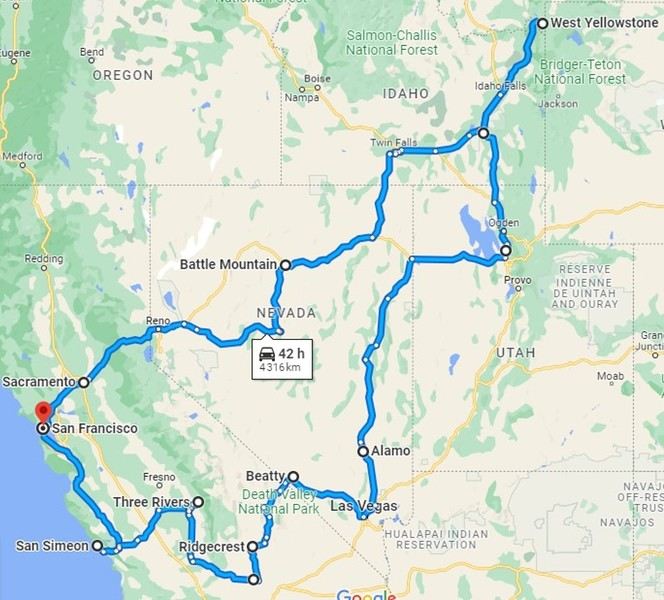
We arrived late in the evening, spent a short night at the hotel, and picked up our rental car to hit Highway 1 and the Pacific coast. The sky was gray, foggy, and a bit disappointing for now.
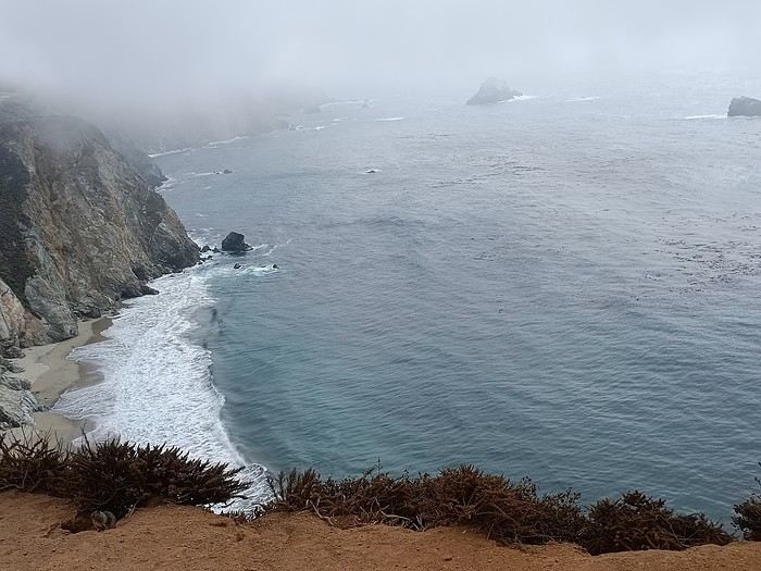
As Brittany lovers, we know coastal weather can change quickly... but no! Bixby Bridge was just a quick view from the car, and it was only 11°C outside.
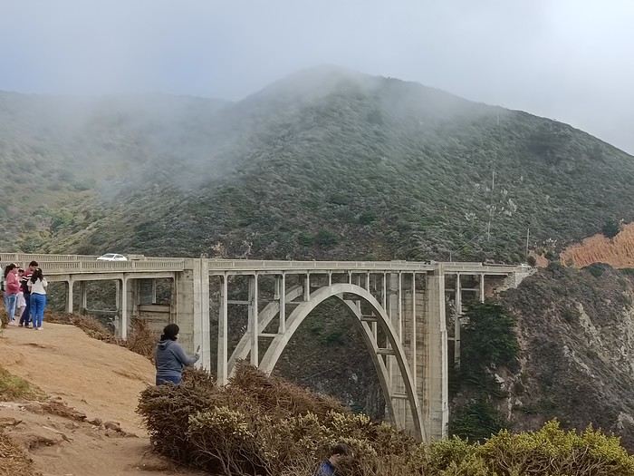
We had a quick picnic on the spot, quickly bothered by the local wildlife.
And then—miracle! This charming animal made the wind shift and brought us sunshine. So this coast is absolutely worth the trip—it’s just stunning.
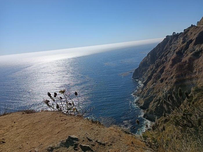
Only the sound of the wind and the seals’ calls disturbed the tranquility of the moment.
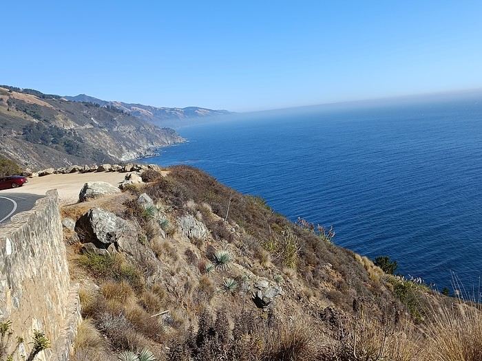
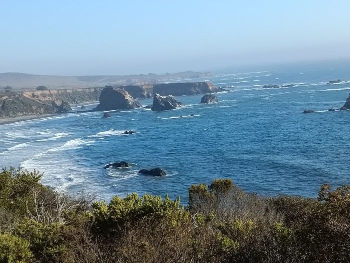
But even the best things come to an end, and we turned inland toward the sequoias. We drove through a long plain with fruit trees, vineyards, and endless straight roads.
First night at the hotel, tired but happy! !
We arrived late in the evening, spent a short night at the hotel, and picked up our rental car to hit Highway 1 and the Pacific coast. The sky was gray, foggy, and a bit disappointing for now.
As Brittany lovers, we know coastal weather can change quickly... but no! Bixby Bridge was just a quick view from the car, and it was only 11°C outside.
We had a quick picnic on the spot, quickly bothered by the local wildlife.
And then—miracle! This charming animal made the wind shift and brought us sunshine. So this coast is absolutely worth the trip—it’s just stunning.
Only the sound of the wind and the seals’ calls disturbed the tranquility of the moment.
But even the best things come to an end, and we turned inland toward the sequoias. We drove through a long plain with fruit trees, vineyards, and endless straight roads.
First night at the hotel, tired but happy! !
A lovely wander at the mercy of the wind in this amazing Rajasthan
Hey there, forum friends 😉
Some of you have mentioned missing the activity on this Indian "page," so let’s try to liven things up a bit—with joy and good vibes (mandatory with me 😜). Plus, it’ll make Jojoone happy 😊.
As big lovers of India—we’ve been six times—my co-traveler husband and I decided to explore Rajasthan this time around. The reason we waited so long to come here? We were dreading the tourist crowds in this state. But thanks to the timing (late March to early April 2024, which is starting to get pretty hot) and Aleph’s great tips, we were *very* far from mass tourism.
We spent three weeks getting around on our own for transport: mostly taxis and trains.
And I’ll admit, we had a rather "Arabian Nights" experience, far from the "real" India (Marien, if you’re reading this 😉). So this travel journal makes no claims other than to share what we saw, experienced, and felt—with all our ignorance about this country (which I’m fully aware of).
But fair warning: I go overboard with emojis, and this journal is super casual because it’s the one I share, almost in "live" mode, with our loved ones.
So, if you’re here, consider yourself almost part of the family 😄.
See you soon and....
Some of you have mentioned missing the activity on this Indian "page," so let’s try to liven things up a bit—with joy and good vibes (mandatory with me 😜). Plus, it’ll make Jojoone happy 😊.
As big lovers of India—we’ve been six times—my co-traveler husband and I decided to explore Rajasthan this time around. The reason we waited so long to come here? We were dreading the tourist crowds in this state. But thanks to the timing (late March to early April 2024, which is starting to get pretty hot) and Aleph’s great tips, we were *very* far from mass tourism.
We spent three weeks getting around on our own for transport: mostly taxis and trains.
And I’ll admit, we had a rather "Arabian Nights" experience, far from the "real" India (Marien, if you’re reading this 😉). So this travel journal makes no claims other than to share what we saw, experienced, and felt—with all our ignorance about this country (which I’m fully aware of).
But fair warning: I go overboard with emojis, and this journal is super casual because it’s the one I share, almost in "live" mode, with our loved ones.
So, if you’re here, consider yourself almost part of the family 😄.
See you soon and....
Bangkok - Chiang Mai - Koh Samui in summer
Hi everyone, I’ve spent two solid months reading the Lonely Planet and pretty much every post about Thailand here, plus French and English blogs. Now I’d love to get your expert opinions on our itinerary.
We’re heading off in August 2025 with our 7-year-old daughter. We only have a maximum of three weeks off, and I’m keeping an eye on flight prices before booking (1400 € per person really stings 😕).
So here’s what I’ve planned—let me know if you spot any major issues or if I’ve been way too "optimistic."
D1 - Arrival in Bangkok / rest, quick visit, overnight stay D2 - More temple visits, etc. D3 - Morning flight to Chiang Mai D4 - More Chiang Mai sightseeing D5 - Day trip to Chiang Rai (guided tour to book: blue and white temple), return to Chiang Mai late in the evening D6 - More Chiang Mai visits / Elephant Nature Park in the afternoon D7 - Morning flight to Koh Samui, sightseeing D8 to D10 - More Koh Samui visits D11 to D13 - Ferry to Koh Phangan D14 to D15 - Ferry to Koh Tao D16 - Return to Koh Samui, then flight to Bangkok D17 - Day trip to Ayutthaya, return to Bangkok in the evening D18 - Flight back to France :(
I know a lot of you recommend heading straight to Chiang Mai to recover from the international flight, but my partner and I NEVER sleep on planes (personally, I’ve been flying to Taiwan since I was little and have never slept more than an hour on a 14-hour flight...), so it’s essential for us to rest upon arrival . That’s also why I opted for domestic flights instead of the sleeper train—I know we’d lose over 10 hours and wouldn’t be able to rest properly in those conditions. And I’m sure you’ll also say BKK > North > South is too much for three weeks, but I really want to see as much as possible. Given how much the flights will cost, I’m not sure when we’ll be able to come back 🏴☠️.
So, questions: 1. Since we’ll only be in Bangkok for a maximum of two nights and need to easily reach the airport with luggage (and a child), which neighborhood should we prioritize? We’d love to experience the evening vibe of Asian night markets, ideally within walking distance of the hotel or just a few metro stops away. I’ve looked at Chinatown, but the BTS seems far... Should we go for somewhere near BTS Saphan Taksin or BTS Krungthonburi? But is the area lively in the evening with food courts, etc.? We’d also like to treat ourselves to a hotel with a pool.
2. Have we planned too many days in the south? Should I skip Koh Tao and just do Koh Samui + Koh Phangan? My partner and daughter aren’t strong swimmers, so we’re looking for beautiful beaches without too much current. Crowded beaches don’t bother us—we just want stunning turquoise waters without killer waves . Going all the way to Koh Tao and then back to Koh Samui to catch the flight to Bangkok seems too stressful. Is it still possible these days (I haven’t seen any recent posts on this) to head to Koh Samui in August and decide on the spot how many nights to spend in Koh Phangan or Koh Tao based on how we feel, booking hotels as we go? Or is that too risky?
If you have any better suggestions for fitting all this in while reducing internal flights, I’m all ears for your great tips
D1 - Arrival in Bangkok / rest, quick visit, overnight stay D2 - More temple visits, etc. D3 - Morning flight to Chiang Mai D4 - More Chiang Mai sightseeing D5 - Day trip to Chiang Rai (guided tour to book: blue and white temple), return to Chiang Mai late in the evening D6 - More Chiang Mai visits / Elephant Nature Park in the afternoon D7 - Morning flight to Koh Samui, sightseeing D8 to D10 - More Koh Samui visits D11 to D13 - Ferry to Koh Phangan D14 to D15 - Ferry to Koh Tao D16 - Return to Koh Samui, then flight to Bangkok D17 - Day trip to Ayutthaya, return to Bangkok in the evening D18 - Flight back to France :(
I know a lot of you recommend heading straight to Chiang Mai to recover from the international flight, but my partner and I NEVER sleep on planes (personally, I’ve been flying to Taiwan since I was little and have never slept more than an hour on a 14-hour flight...), so it’s essential for us to rest upon arrival . That’s also why I opted for domestic flights instead of the sleeper train—I know we’d lose over 10 hours and wouldn’t be able to rest properly in those conditions. And I’m sure you’ll also say BKK > North > South is too much for three weeks, but I really want to see as much as possible. Given how much the flights will cost, I’m not sure when we’ll be able to come back 🏴☠️.
So, questions: 1. Since we’ll only be in Bangkok for a maximum of two nights and need to easily reach the airport with luggage (and a child), which neighborhood should we prioritize? We’d love to experience the evening vibe of Asian night markets, ideally within walking distance of the hotel or just a few metro stops away. I’ve looked at Chinatown, but the BTS seems far... Should we go for somewhere near BTS Saphan Taksin or BTS Krungthonburi? But is the area lively in the evening with food courts, etc.? We’d also like to treat ourselves to a hotel with a pool.
2. Have we planned too many days in the south? Should I skip Koh Tao and just do Koh Samui + Koh Phangan? My partner and daughter aren’t strong swimmers, so we’re looking for beautiful beaches without too much current. Crowded beaches don’t bother us—we just want stunning turquoise waters without killer waves . Going all the way to Koh Tao and then back to Koh Samui to catch the flight to Bangkok seems too stressful. Is it still possible these days (I haven’t seen any recent posts on this) to head to Koh Samui in August and decide on the spot how many nights to spend in Koh Phangan or Koh Tao based on how we feel, booking hotels as we go? Or is that too risky?
If you have any better suggestions for fitting all this in while reducing internal flights, I’m all ears for your great tips
The "Must-Sees" of the American West
This adventure began during Covid... Yep, Covid turned a lot of things upside down, but most of all, it kept us cooped up for a few months and stopped us from traveling for a while—even longer for a die-hard fan of the American West like me.
While borders were closed, I started imagining what an ideal itinerary might look like—one that would string together all the Southwest must-sees in just two weeks, during the best time of year: September and October. When the U.S. announced in September 2021 that borders would reopen in the coming weeks, I regained hope and began scouting flight tickets for a departure in September 2022.
But here’s the thing: tackling solo hikes, each one tougher than the last, right in the heart of the Wilderness, could be a risky—even reckless—endeavor for a father of three. After a quick chat with some virtual friends who are just as passionate about the Southwest as I am, with good physical condition and nearly the same list of must-visit spots, Franck and his brother Sullivan were in! 🙂
In November, we snagged flight tickets from Nice to San Francisco for the modest sum of 400 €, and a few days later, I booked a Toyota Tacoma pickup for 840 € !
It’s not cheap for just 15 days, and a pickup isn’t exactly ideal for luggage, but the prices for full-size 4x4s have become totally outrageous! Due to border closures, rental companies had to offload a lot of these big 4x4s, which tourists love. Then, supply and demand did the rest !
Franck and I spent the winter and spring trying to cram the equivalent of three weeks of hikes into two. But even with physical limits, we had to stay reasonable! Three to four months before departure, we entered the lotteries for different must-see spots: The Subway, Coyote Buttes North (home to the famous Wave), and Coyote Buttes South (CBS).
The Wave is the holy grail for any Southwest enthusiast. Since 2015, we’ve tried our luck with the online and on-site lotteries about ten times, but the spots are unfortunately limited: just 20 per day. A glimmer of hope, though—since early 2022, that number has increased to 64 people allowed per day, with 48 spots awarded via the online lottery.
After all three of us tried our luck for The Wave, on June 1st at exactly 5 PM, I got an email that started with, "Congratulations! You were successful in the Coyote Buttes North (The Wave) September 2022 Permit Lottery at Coyote Buttes North (The Wave)...". At 5:01 PM, I called Franck, whose dream it’s been for over 20 years—ever since the first photos were published in a travel magazine! He didn’t believe me when I told him, and I had to forward the email for him to finally accept the unbelievable: we were going to The Wave and all the incredible spots scattered across the protected area of Coyote Buttes North.
I’ve already been to Coyote Buttes South twice, but there are areas I couldn’t explore in the middle of summer because they were too remote. So, I had no trouble letting my buddies convince me to go back for a third time. Plus, given how hard it is to access, we had no trouble securing a permit online as long as we logged in at exactly 8 PM on the dot!
For The Subway, all three of us struck out. No big deal—we won at CBN and CBS!
Among the sites to visit, there are two that I’m particularly attached to because I know my chances of wanting to see them again are slim. The first is Angel Arch, one of the most legendary arches in the Southwest, due to its remoteness from any trace of civilization. To get there, the recommended hike is Upper Salt Creek, and you’re looking at a 50 km round-trip in an area with no water (in September) and populated by bears.
The second site is the Hopi Salt Trail, in Navajo land, which, after a very tough hike, lets you marvel at the turquoise-blue waters of the Little Colorado before it meets the Colorado River. The Hopi Salt Trail is, like The Wave, the holy grail for any Southwest enthusiast, and the windows of opportunity to see the water in that magical color are very short each year. For this, you have to monitor the Little Colorado’s gauges downstream from Cameron: if the level stays at its lowest for 10 consecutive days—meaning no rain—you can hope for turquoise water. The ideal period rarely exceeds 30 days a year, and it’s usually in June that all the stars align.
But unfortunately, one month before departure, while the flow rate at Cameron looked promising, several storms in September dashed our hopes of doing the Hopi Salt Trail, even at the end of the road trip.
We still had two consolation prizes, though:
After a last-minute cancellation, while keeping an eye out for available spots for The Subway, it turned out that three spots opened up exactly on the day we’d planned to go—so we rushed to grab them!! Regarding the 4x4 rental, the prices for full-size models dropped by several hundred dollars, and we ended up finding a Chevrolet Tahoe for less than $1000. A steal and a serious boost in comfort, so we could store all our gear and food without worry!
Here’s the initial plan in a perfect world: D1 The White Domes - Camping D2 Sunrise at The White Domes - The Subway D3 Coyote Buttes North D4 Coyote Buttes South - White Pocket D5 Wahweap Hoodoos - Sidestep Canyon - Colourful Canyon - White Rocks - Sunset at Yellow Rock D6 Broken Bow Arch - Reflection Canyon D7 Coyote Gulch D8 The Volcano (or The Oasis - Zebra Slot Canyon if the weather’s good) - North Caineville Mesa D9 The Needles: Squaw Canyon - Lost Canyon combo - Druid Arch - Chesler Park D10 Upper Salt Creek Day 1 - Camping D11 Upper Salt Creek Day 2 D12 Hopi-Navajo Territory: Ha Ho No Geh Canyon, Coal Mine Canyon, Bends of the Little Colorado D13 Grand Canyon: South Kaibab Trail and Bright Angel Trail D14 Upper East Zion: East Temple Loop, Jughandle Arch, Center of the Universe, and Checkerboard Mesa Summit And several backup options in case of bad weather, including Spencer Trail, West Cove, and Buffington Pockets.
Enough talking—time for action!
While borders were closed, I started imagining what an ideal itinerary might look like—one that would string together all the Southwest must-sees in just two weeks, during the best time of year: September and October. When the U.S. announced in September 2021 that borders would reopen in the coming weeks, I regained hope and began scouting flight tickets for a departure in September 2022.
But here’s the thing: tackling solo hikes, each one tougher than the last, right in the heart of the Wilderness, could be a risky—even reckless—endeavor for a father of three. After a quick chat with some virtual friends who are just as passionate about the Southwest as I am, with good physical condition and nearly the same list of must-visit spots, Franck and his brother Sullivan were in! 🙂
In November, we snagged flight tickets from Nice to San Francisco for the modest sum of 400 €, and a few days later, I booked a Toyota Tacoma pickup for 840 € !
It’s not cheap for just 15 days, and a pickup isn’t exactly ideal for luggage, but the prices for full-size 4x4s have become totally outrageous! Due to border closures, rental companies had to offload a lot of these big 4x4s, which tourists love. Then, supply and demand did the rest !
Franck and I spent the winter and spring trying to cram the equivalent of three weeks of hikes into two. But even with physical limits, we had to stay reasonable! Three to four months before departure, we entered the lotteries for different must-see spots: The Subway, Coyote Buttes North (home to the famous Wave), and Coyote Buttes South (CBS).
The Wave is the holy grail for any Southwest enthusiast. Since 2015, we’ve tried our luck with the online and on-site lotteries about ten times, but the spots are unfortunately limited: just 20 per day. A glimmer of hope, though—since early 2022, that number has increased to 64 people allowed per day, with 48 spots awarded via the online lottery.
After all three of us tried our luck for The Wave, on June 1st at exactly 5 PM, I got an email that started with, "Congratulations! You were successful in the Coyote Buttes North (The Wave) September 2022 Permit Lottery at Coyote Buttes North (The Wave)...". At 5:01 PM, I called Franck, whose dream it’s been for over 20 years—ever since the first photos were published in a travel magazine! He didn’t believe me when I told him, and I had to forward the email for him to finally accept the unbelievable: we were going to The Wave and all the incredible spots scattered across the protected area of Coyote Buttes North.
I’ve already been to Coyote Buttes South twice, but there are areas I couldn’t explore in the middle of summer because they were too remote. So, I had no trouble letting my buddies convince me to go back for a third time. Plus, given how hard it is to access, we had no trouble securing a permit online as long as we logged in at exactly 8 PM on the dot!
For The Subway, all three of us struck out. No big deal—we won at CBN and CBS!
Among the sites to visit, there are two that I’m particularly attached to because I know my chances of wanting to see them again are slim. The first is Angel Arch, one of the most legendary arches in the Southwest, due to its remoteness from any trace of civilization. To get there, the recommended hike is Upper Salt Creek, and you’re looking at a 50 km round-trip in an area with no water (in September) and populated by bears.
The second site is the Hopi Salt Trail, in Navajo land, which, after a very tough hike, lets you marvel at the turquoise-blue waters of the Little Colorado before it meets the Colorado River. The Hopi Salt Trail is, like The Wave, the holy grail for any Southwest enthusiast, and the windows of opportunity to see the water in that magical color are very short each year. For this, you have to monitor the Little Colorado’s gauges downstream from Cameron: if the level stays at its lowest for 10 consecutive days—meaning no rain—you can hope for turquoise water. The ideal period rarely exceeds 30 days a year, and it’s usually in June that all the stars align.
But unfortunately, one month before departure, while the flow rate at Cameron looked promising, several storms in September dashed our hopes of doing the Hopi Salt Trail, even at the end of the road trip.
We still had two consolation prizes, though:
After a last-minute cancellation, while keeping an eye out for available spots for The Subway, it turned out that three spots opened up exactly on the day we’d planned to go—so we rushed to grab them!! Regarding the 4x4 rental, the prices for full-size models dropped by several hundred dollars, and we ended up finding a Chevrolet Tahoe for less than $1000. A steal and a serious boost in comfort, so we could store all our gear and food without worry!
Here’s the initial plan in a perfect world: D1 The White Domes - Camping D2 Sunrise at The White Domes - The Subway D3 Coyote Buttes North D4 Coyote Buttes South - White Pocket D5 Wahweap Hoodoos - Sidestep Canyon - Colourful Canyon - White Rocks - Sunset at Yellow Rock D6 Broken Bow Arch - Reflection Canyon D7 Coyote Gulch D8 The Volcano (or The Oasis - Zebra Slot Canyon if the weather’s good) - North Caineville Mesa D9 The Needles: Squaw Canyon - Lost Canyon combo - Druid Arch - Chesler Park D10 Upper Salt Creek Day 1 - Camping D11 Upper Salt Creek Day 2 D12 Hopi-Navajo Territory: Ha Ho No Geh Canyon, Coal Mine Canyon, Bends of the Little Colorado D13 Grand Canyon: South Kaibab Trail and Bright Angel Trail D14 Upper East Zion: East Temple Loop, Jughandle Arch, Center of the Universe, and Checkerboard Mesa Summit And several backup options in case of bad weather, including Spencer Trail, West Cove, and Buffington Pockets.
Enough talking—time for action!
Une semaine au départ de San Francisco English translation pending
Bonjour , nous somme une famille de 4 : parents et 2 enfants de 13 et 9 ans. Théoriquement nous irons à San Francisco fin avril. Nous avons avons de la famille sur place ( les enfants sont plus jeunes). Premier séjour aux États-Unis. Pour cause professionnelle la durée sur place est limitée.
les vols sont achetés aux horaires qui nous conviennent:
arrivée à SF dimanche 13h35 , départ le mardi 23h00. Après un road trip Nous souhaitons être de retour à SF le samedi soir: visites avec les 2 familles le dimanche, puis entre nous le lundi et mardi
j'envisage cet esquisse de programme:
dimanche soir :nuit à Midpines
Lundi visite de Yosemite park , nuit à Fresno
mardi visite de Sequoia park nuit à Three Rivers
mercredi route et visite de Trona Pinnacles nuit à Ridgecrest
jeudi visite Death Valley Furnace Creek nuit à Las Végas
pour le vendredi : le Grand Canyon donne vraiment envie d''être visité , nuit au Grand Canyon?
samedi retour vers Las Vegas puis vol vers SF en fin d’après-midi ( je ne prends pas le risque de réserver ce vol plusieurs semaines à l'avance) ou route toute la journée vers SF.
votre avis trop chargé , je supprime soit Death Valley , soit le Grand Canyon , les 2 ?
j'ai regardé pour arriver directement à Las Vegas plutôt que San Francisco le premier jour mais il faut ajouté presque 600€ ( j'ai eu les 4 aller-retour Paris SF à 1240€). Si le premier jour je vais à LV en avion en partant de SF quelle marge prendre entre le départ du 2eme vol et l'arrivée du premier? Pour les hébergements j'essaie de trouver sur hotel.com car j'ai un programme fidélité lors de mes déplacements pro. Merci pour vos conseils William
j'ai regardé pour arriver directement à Las Vegas plutôt que San Francisco le premier jour mais il faut ajouté presque 600€ ( j'ai eu les 4 aller-retour Paris SF à 1240€). Si le premier jour je vais à LV en avion en partant de SF quelle marge prendre entre le départ du 2eme vol et l'arrivée du premier? Pour les hébergements j'essaie de trouver sur hotel.com car j'ai un programme fidélité lors de mes déplacements pro. Merci pour vos conseils William
Quand l'été s'achève... English translation pending
Ce n’est pas un carnet de voyage.
C’est un petit carnet de vacances.
Et, peut-être, avez-vous aussi vécu des instants, des heures, des jours, des semaines comme les miennes.
Sur place, sans voiture, sans train, sans avion, sans vélo.
Enveloppé de joie, de vie, de sourires, de douceur, de tendresse.
Un été entre parenthèse.
...
Dans la grange, la deuxième couvée d’hirondelles apprend à voler. Les parents perchés sur la poutre, pépient avec ardeur et les oisillons semblent écouter. Encore quinze jours et c’est l’envol pour l’Afrique.
Dans la maison, notre volière estivale, le silence s’est installé. Enfants et petits-enfant ont migré vers la ville. Un silence si parfait que j’entends Tiko, l’animal favori de Petit Jules. Tiko est un escargot des haies. Sa coquille jaune vif cerclée de fines bandes noires à ne pas confondre avec l’escargot des jardins, arbore un minuscule morceau de sparadrap. J’ai la garde de Tiko jusqu’en Octobre, nouvelles vacances d’automne. Il croque la salade vert tendre et l’infime bruit de ses mandibules fait écho aux touches de mon clavier.
Notre saison s’est achevée sur le spectacle de théâtre, rituel familial. Pour la première fois les enfants étaient les seuls scénaristes et je n’ai fait qu’orchestrer les répétitions. L’affiche était : « Les virus et les médecins » et l’action se déroulait en 1398 durant la peste noire entre le médecin à cape et bec noir et le médecin du futur, 2020. Les cinq plus jeunes étaient des virus et avaient fabriqué de larges masques ronds et colorés avec deux trous pour les yeux, attachés avec de la ficelle. C’étaient Zika, Ebola, chikungunya, variole et covid (corona pour les intimes, dans le texte). Tous les adultes présents, les parents, ont beaucoup ri et la parodie était parfaite sans qu'ils en aient conscience.
La conclusion était qu’il fallait utiliser les moyens connus au moyen âge et ceux d’aujourd’hui et ils ont fabriqué sur scène une poudre de rat malade à boire diluée dans de l’eau. Astucieux ces petits. Zika, Ebola, chikungunya, les virus africains, trépignaient en disant « pour nous aussi, on nous oublie toujours, c’est pas juste »
Bref, quelle longue digression pour vous dire que même dans le monde magique de l’enfance, ceux-ci sont bien marqués par l’épidémie dont on nous remplit le tête et les oreilles. Ils appréhendent la rentrée masquée au collège, craignent de ne pas se reconnaître dans les nouvelles classes constituées et se demandent comment les profs les reconnaîtront. Et des questions fusaient : « Comment on va faire l’hiver, faudra mette le masque par-dessus l’écharpe dans le bus ? » « Et quand il pleut, comment mon masque va tenir quand il est tout mouillé » « Et pourquoi on peut manger tous ensemble à la cantine sans masque, on est tous collés à la cantine » « Et si j’ai pas ma règle, je pourrais prendre celle de ma copine ? » « Et Jules, il a dix ans et il sera au collège avec ceux de 11ans, il sera obligé de mettre le masque ? ».
Ici dans notre Morvan écrasé de chaleur, pourtant, tout l’été nous avons voyagé. Voyage immobile, sans avion, sans test, sans masque, dans les rires, les cris, les cavalcades, un bazar, un souk, un cirque permanent.
Italie : pizza maison (ahhh les pizzas de Papiluc!) Japon : sushi (beurq, c’était pas ma fête) Inde :poulet byriani (tu mets pas du piment hein mamido) Russie : pelmini ( 480 pelmini, 32 mains pour les faire, 6h pour les préparer) Argentine : asado (souvent et pratique) Grèce : moussaka France : ratatouille
Ainsi, les enfants fabriquaient les petits drapeaux correspondants pour décorer la table et les adultes inventaient des mini quizz sur chaque pays.
On s’est bien marré et l’été s’achève.
Notre maison, comme un coeur palpitant depuis mars, où se sont retrouvés toutes les générations, est redevenue silencieuse.
Je me sens remplie et vide. J’crois bien que si l’on approche un doigt sur mes antennes, j’vais rentrer dans ma coquille, comme Tiko. Mais pour l’heure, ce n’est pas le temps de l’hibernation et je ne vais pas fabriquer mon épiphragme protecteur.
On est bien sur vf, chuis en vacances, en vacance. Contente de vous retrouver.
Crouchhhh, crouchhhh, Tiko poursuit son festin.
A bientôt !
...
Dans la grange, la deuxième couvée d’hirondelles apprend à voler. Les parents perchés sur la poutre, pépient avec ardeur et les oisillons semblent écouter. Encore quinze jours et c’est l’envol pour l’Afrique.
Dans la maison, notre volière estivale, le silence s’est installé. Enfants et petits-enfant ont migré vers la ville. Un silence si parfait que j’entends Tiko, l’animal favori de Petit Jules. Tiko est un escargot des haies. Sa coquille jaune vif cerclée de fines bandes noires à ne pas confondre avec l’escargot des jardins, arbore un minuscule morceau de sparadrap. J’ai la garde de Tiko jusqu’en Octobre, nouvelles vacances d’automne. Il croque la salade vert tendre et l’infime bruit de ses mandibules fait écho aux touches de mon clavier.
Notre saison s’est achevée sur le spectacle de théâtre, rituel familial. Pour la première fois les enfants étaient les seuls scénaristes et je n’ai fait qu’orchestrer les répétitions. L’affiche était : « Les virus et les médecins » et l’action se déroulait en 1398 durant la peste noire entre le médecin à cape et bec noir et le médecin du futur, 2020. Les cinq plus jeunes étaient des virus et avaient fabriqué de larges masques ronds et colorés avec deux trous pour les yeux, attachés avec de la ficelle. C’étaient Zika, Ebola, chikungunya, variole et covid (corona pour les intimes, dans le texte). Tous les adultes présents, les parents, ont beaucoup ri et la parodie était parfaite sans qu'ils en aient conscience.
La conclusion était qu’il fallait utiliser les moyens connus au moyen âge et ceux d’aujourd’hui et ils ont fabriqué sur scène une poudre de rat malade à boire diluée dans de l’eau. Astucieux ces petits. Zika, Ebola, chikungunya, les virus africains, trépignaient en disant « pour nous aussi, on nous oublie toujours, c’est pas juste »
Bref, quelle longue digression pour vous dire que même dans le monde magique de l’enfance, ceux-ci sont bien marqués par l’épidémie dont on nous remplit le tête et les oreilles. Ils appréhendent la rentrée masquée au collège, craignent de ne pas se reconnaître dans les nouvelles classes constituées et se demandent comment les profs les reconnaîtront. Et des questions fusaient : « Comment on va faire l’hiver, faudra mette le masque par-dessus l’écharpe dans le bus ? » « Et quand il pleut, comment mon masque va tenir quand il est tout mouillé » « Et pourquoi on peut manger tous ensemble à la cantine sans masque, on est tous collés à la cantine » « Et si j’ai pas ma règle, je pourrais prendre celle de ma copine ? » « Et Jules, il a dix ans et il sera au collège avec ceux de 11ans, il sera obligé de mettre le masque ? ».
Ici dans notre Morvan écrasé de chaleur, pourtant, tout l’été nous avons voyagé. Voyage immobile, sans avion, sans test, sans masque, dans les rires, les cris, les cavalcades, un bazar, un souk, un cirque permanent.
Italie : pizza maison (ahhh les pizzas de Papiluc!) Japon : sushi (beurq, c’était pas ma fête) Inde :poulet byriani (tu mets pas du piment hein mamido) Russie : pelmini ( 480 pelmini, 32 mains pour les faire, 6h pour les préparer) Argentine : asado (souvent et pratique) Grèce : moussaka France : ratatouille
Ainsi, les enfants fabriquaient les petits drapeaux correspondants pour décorer la table et les adultes inventaient des mini quizz sur chaque pays.
On s’est bien marré et l’été s’achève.
Notre maison, comme un coeur palpitant depuis mars, où se sont retrouvés toutes les générations, est redevenue silencieuse.
Je me sens remplie et vide. J’crois bien que si l’on approche un doigt sur mes antennes, j’vais rentrer dans ma coquille, comme Tiko. Mais pour l’heure, ce n’est pas le temps de l’hibernation et je ne vais pas fabriquer mon épiphragme protecteur.
On est bien sur vf, chuis en vacances, en vacance. Contente de vous retrouver.
Crouchhhh, crouchhhh, Tiko poursuit son festin.
A bientôt !
Problème cintre (à vélo) English translation pending
bonjour, je fais appel une fois de plus à vos compétences et conseils. je viens de partir 2 semaines avec le vélo ci dessous (Focus Mares) et j'ai eu les mains, la gauche notamment avec d'abord des "fourmis" puis paralysie, plus de sensibilité, plus de force. je précise aussi qu'ayant de petites mains le passage des vitesses n'est pas évident. je souhaiterais, si c'est possible remplacer par un cintre plat recourbé avec bar ends. je suppose que ce sera couteux mais ce vélo est neuf et par ailleurs fonctionne très bien. je n'ai pas souvenir d'avoir eu ce pb avec mon ancien vtc. merci d'avance pour votre avis. cdt
Komodo version "croisière tout confort" et "plongée camping" English translation pending
Allez je me lance : après le carnet philippin , voici le carnet indonésien retraçant une semaine passée au sein du parc de Komodo .
J’espère qu’il pourra aider les futurs voyageurs et les aidera à patienter jusque là .
Pour les nouveaux venus, nous voyageons en famille avec nos enfants qui avaient 15 ans au moment du voyage , qui s’est déroulé pendant les vacances de la Toussaint 2017 (une semaine à Komodo et une semaine à Bali essentiellement dans la région d’Ubud pendant la fête de Galungan )
Ce voyage fut le premier pour nous en Asie (et vous avez pu constater qu’il ne fut pas le dernier). Il a été fait en autonomie sans passer par une agence mais tout a été programmé et booké en avance.
Aller à Komodo pour un premier séjour asiatique n’est pas forcément très commun mais je rêvais de rencontrer et si possible de nager/plonger avec des raies manta. Plus voir les fameux dragons, ça ne se refuse pas c'est unique ...
Cela fut un bon prétexte pour ma fille et moi , après un baptême réalisé au Mexique en 2013, de passer notre Openwater à Marseille en juillet 2017 en prévision . Les hommes ne nous ont pas suivies (hélas pour notre porte monnaie , vu qu'au final ils ont décidé de plonger à Komodo et sans certification cela revient le double/plongée ... )
Pourquoi une semaine à Komodo ? Pour prendre le temps d’apprécier à sa juste valeur ce parc réputé pour être une destination phare pour les amoureux de plongée et snorkeling et bien en profiter.
Après une nuit proche de Labuan Bajo ( qui se trouve sur l’ile de Florès et qui est le port de départ pour le parc de Komodo) , nous avons fait une croisière de 4 jours/3 nuits puis deux jours de plongée en dormant sur l’ile de Sebayur directement au sein du parc national.
A bientôt pour la suite !

J’espère qu’il pourra aider les futurs voyageurs et les aidera à patienter jusque là .
Pour les nouveaux venus, nous voyageons en famille avec nos enfants qui avaient 15 ans au moment du voyage , qui s’est déroulé pendant les vacances de la Toussaint 2017 (une semaine à Komodo et une semaine à Bali essentiellement dans la région d’Ubud pendant la fête de Galungan )
Ce voyage fut le premier pour nous en Asie (et vous avez pu constater qu’il ne fut pas le dernier). Il a été fait en autonomie sans passer par une agence mais tout a été programmé et booké en avance.
Aller à Komodo pour un premier séjour asiatique n’est pas forcément très commun mais je rêvais de rencontrer et si possible de nager/plonger avec des raies manta. Plus voir les fameux dragons, ça ne se refuse pas c'est unique ...
Cela fut un bon prétexte pour ma fille et moi , après un baptême réalisé au Mexique en 2013, de passer notre Openwater à Marseille en juillet 2017 en prévision . Les hommes ne nous ont pas suivies (hélas pour notre porte monnaie , vu qu'au final ils ont décidé de plonger à Komodo et sans certification cela revient le double/plongée ... )
Pourquoi une semaine à Komodo ? Pour prendre le temps d’apprécier à sa juste valeur ce parc réputé pour être une destination phare pour les amoureux de plongée et snorkeling et bien en profiter.
Après une nuit proche de Labuan Bajo ( qui se trouve sur l’ile de Florès et qui est le port de départ pour le parc de Komodo) , nous avons fait une croisière de 4 jours/3 nuits puis deux jours de plongée en dormant sur l’ile de Sebayur directement au sein du parc national.
A bientôt pour la suite !
Je vous invite à découvrir l'île de Lanzarote English translation pending
INTRODUCTION
Des vidéos sont insérées tout au long du résumé. Veuillez cliquer sur l'image pour démarrer la vidéo.
En février dernier, nous avons séjourné 2 semaines sur l'île de Lanzarote afin d'en découvrir les différents attraits touristiques.
Comme la plupart de nos précédents voyages, plusieurs semaines ont été consacrées à la création de notre itinéraire afin de pouvoir être en mesure d'atteindre parfaitement nos objectifs.
Lors de notre séjour, nous avons utilisé l'application Maps.me, une application mobile qui fournit des cartes hors ligne. Cette application s'avère très précieuse lors de nos déplacements en voiture, en randonnée et même lors de nos circuits à pied dans les grandes villes.
J'avais préalablement téléchargé les coordonnées GPS de toutes les attractions prévues à notre itinéraire dans l'application Maps.me, ce qui a facilité grandement nos déplacements.
La réservation de l'hébergement ainsi que la location d'une voiture ont été effectuées sur le web avant notre départ.
Nous sommes partis de l'aéroport de Québec et avons eu une escale à Montréal ainsi qu'à Bruxelles en Belgique avant d'atteindre Lanzarote.
Lanzarote fait partie des Îles Canaries qui elles-mêmes sont situées dans l'océan Atlantique, à l'ouest du Maroc. Celles-ci font d'ailleurs partie de l'Espagne.
Nous avions déjà visité l'île de Tenerife et nous avions adoré notre séjour à cet endroit.
Nous avons donc décidé de poursuivre la découverte des Îles Canaries en nous rendant à Lanzarote car cette île offre un paysage volcanique spectaculaire, des plages à faire rêver ainsi que de magnifiques villages aux maisons typiques de l'île qui sont majoritairement blanches.
Les sentiers de randonnée sont nombreux et nous permettent de découvrir une grande diversité de paysages.
Les attraits touristiques sont également fort nombreux et facilement accessibles car les routes de Lanzarote se parcourent aisément en voiture car celles-ci sont dans un état impeccable.
D'ailleurs, c'est un pur plaisir que de se déplacer sur ces routes car les paysages qui défilent sous nos yeux sont sensationnels et présentent une perspective différente selon la lumière du jour.
Des vidéos sont insérées tout au long du résumé. Veuillez cliquer sur l'image pour démarrer la vidéo.
En février dernier, nous avons séjourné 2 semaines sur l'île de Lanzarote afin d'en découvrir les différents attraits touristiques.
Comme la plupart de nos précédents voyages, plusieurs semaines ont été consacrées à la création de notre itinéraire afin de pouvoir être en mesure d'atteindre parfaitement nos objectifs.
Lors de notre séjour, nous avons utilisé l'application Maps.me, une application mobile qui fournit des cartes hors ligne. Cette application s'avère très précieuse lors de nos déplacements en voiture, en randonnée et même lors de nos circuits à pied dans les grandes villes.
J'avais préalablement téléchargé les coordonnées GPS de toutes les attractions prévues à notre itinéraire dans l'application Maps.me, ce qui a facilité grandement nos déplacements.
La réservation de l'hébergement ainsi que la location d'une voiture ont été effectuées sur le web avant notre départ.
Nous sommes partis de l'aéroport de Québec et avons eu une escale à Montréal ainsi qu'à Bruxelles en Belgique avant d'atteindre Lanzarote.
Lanzarote fait partie des Îles Canaries qui elles-mêmes sont situées dans l'océan Atlantique, à l'ouest du Maroc. Celles-ci font d'ailleurs partie de l'Espagne.
Nous avions déjà visité l'île de Tenerife et nous avions adoré notre séjour à cet endroit.
Nous avons donc décidé de poursuivre la découverte des Îles Canaries en nous rendant à Lanzarote car cette île offre un paysage volcanique spectaculaire, des plages à faire rêver ainsi que de magnifiques villages aux maisons typiques de l'île qui sont majoritairement blanches.
Les sentiers de randonnée sont nombreux et nous permettent de découvrir une grande diversité de paysages.
Les attraits touristiques sont également fort nombreux et facilement accessibles car les routes de Lanzarote se parcourent aisément en voiture car celles-ci sont dans un état impeccable.
D'ailleurs, c'est un pur plaisir que de se déplacer sur ces routes car les paysages qui défilent sous nos yeux sont sensationnels et présentent une perspective différente selon la lumière du jour.
Adventures of a Bygone Era: The Philippines in 1984
After several discussions on VF about travel journals from the Philippines, I decided to write this curiosity: a trip report from a journey made in 1984, when traveling to the Philippines was still an adventure.
A curiosity because writing a travel journal about a trip 35 years later isn’t common, but also (mostly?) because exploring the Philippines at that time had little in common with traveling there today.
Obviously, I’ve forgotten a number of facts, most of the details, but with the help of a few notes from that time and a stack of slides (yes, there was life before digital 😊), many memories came back and added to the highlights I’d never forgotten. The scanned slides aren’t always great quality, but there are still quite a few to brighten up this chatter. Back then, we didn’t snap photos like we do now—film was too expensive—so I don’t have pictures of every place we visited... too bad, comparing some of those spots to how they look today would’ve been interesting.
Why "Adventures"? Why call it "Adventures" in the Philippines in 1984, a word so often used for a simple exotic trip? - Because the lack of information (no *Guide du Routard*, no *Lonely Planet*, no *Michelin Guide*, nothing, and obviously no internet) gave this trip what’s at the heart of adventure: the unknown. - Because the political situation made the stay sometimes dangerous. - Because transportation conditions were always epic, often perilous. - Because the question of where we’d spend the night came up almost every evening. - And for... quite a few other reasons.
That said, we weren’t exactly explorers!
Why the Philippines? First of all, why go to the Philippines in 1984—a country not exactly set up for tourism and about which we knew very little? How could we get an idea of the beauty of the Philippines and its points of interest when we had no guides or photos?
The idea came to us from Thailand a year earlier, during our first long-haul trip. After touring the north of the country, we met a Frenchman living in Phuket, where there were only a few tourists in Patong, with just a few small hotels and guesthouses. Kata and Karon had no buildings or roads, Rawai only had three palm-thatched bungalows, including ours, and the other islands were unknown to tourists. There was plenty to discover, and we wanted to return to this beautiful country... but the Frenchman made us dream about the Philippines—a country to explore, with wild landscapes.
Long evenings of discussion over multiple Sprite-Mekong cocktails (what memories of those headaches!) finally convinced us we had to go to the Philippines.
Episode 0: Before Departure The decision was made: we’d go to the Philippines in May 1984. Our friends and family were surprised when we announced we were going on vacation to the Philippines (a bit like saying today we were going paddleboarding in the Kerguelen Islands 🤪).
These days, preparing for each of our trips takes long evenings of research, planning, and noting down good addresses... etc. But for the Philippines in 1984, preparation was quick: we had very little information about the country, we were leaving almost at random, and the discovery would only be more exciting.
We still had a few bits of info gathered here and there: the rice terraces in northern Luzon, volcanoes, Negros where we were supposed to visit an acquaintance, Cebu and its marine life (we ended up going elsewhere), and absolutely avoid Mindanao, which was practically at war with the regime. That was about it, but it was already a great itinerary.
Nothing was organized in advance; we’d see day by day. We had no idea about travel times or even the existence of transportation options. The main (and sometimes only) way to connect two islands was by overloaded, rusty ferry. Only the big cities had airports.
Let’s Go: Episode 1: Paris to Manila My travel journals always start after arriving at the airport—the Europe-to-“Other Continent” trip isn’t interesting—but the flight to the Philippines was already an adventure, so I’ll make an exception.
This was the era when only a few Asian airlines were on par with Western ones: Thai, Singapore Airlines, and Philippine Airlines. They had beautiful, brand-new planes, and to attract customers (almost exclusively “businessmen”) from the usual airlines (Air France, Lufthansa, British Airways), there was opulence on board: unlimited champagne, all sorts of cocktails... Compared to today’s long-haul flights, there was still one small difference: no personal screens, just one screen at the front of the cabin with one mandatory movie. And I don’t know why, but we only got James Bond films, both ways... that must’ve been the trend at the time.
The tourism boom to Southeast Asia hadn’t started yet, and the “Asian Tigers” weren’t a thing, so there weren’t many business trips. That meant long-haul flights made stops everywhere to fill the planes. Our Philippine Airlines Boeing 747 left London, picked us up in Paris, then stopped in Frankfurt to take on a few Germans. I don’t know why we then made a stop in Dubai—a totally exotic place at the time. There was nothing to do there... things have changed a lot since. It was a small town lost in the desert. The airport was tiny, with just one or two buildings and a supermarket. During the stopover, everyone had to get off the plane and walk to the supermarket. Photo and electronic equipment were dirt cheap—I guess that was the only reason for the stop. Maybe it was their first commercial move. Emirates didn’t exist yet, as I checked online, but anyway, the idea that such a remote place could have its own airline was unthinkable.
Online, I found this photo of Dubai Airport in 1980. Anyone who’s transited through today’s massive airport with its rows of A380s will appreciate it:
Next stop: New Delhi to drop off some Europeans and pick up a few Indians, and finally, the terminus: Manila. I don’t remember how long the trip took with its five stops—an unimaginable journey today. Despite all those stops to fill the plane, there was still enough space to stretch out on the four center seats of the 747, something that never happens these days despite all the flights in every direction.
So here we are, finally at Manila Airport around midnight.
Episode 1: Manila and Baguio To start, a quick note on the political and economic situation in the Philippines in 1984, which had consequences for us as tourists, as we’d soon realize upon arrival.
After several centuries of Spanish colonization, the Philippines became American at the start of the 20th century, then independent. In 1966, Marcos took power, and little by little, his regime sank into corruption and mismanagement, becoming a dictatorship with martial law, all for the benefit of his family and friends, who enriched themselves endlessly. The peak was the assassination of opposition leader Benigno Aquino in August 1983, which triggered harshly repressed protests. So we arrived a few months later in a very poor country, with omnipresent corruption and an extremely tense political situation, as we’d soon see for ourselves. Major protests took place in the main cities during our trip—I’ll come back to that. Two years later, Marcos fled to Hawaii after being forced out of power following rigged elections. This historical context explains a lot of the situations we found ourselves in over the following weeks.
Arriving in the middle of the night isn’t very cheerful. Manila was already a huge city with many slums, where you could find a few business hotels like the Hilton or Intercontinental—way out of our budget—and plenty of run-down hotels. Luckily, two Indians we’d chatted with on the plane offered to take us to their usual hotel. They came to Manila twice a year for business. We accepted their offer, relieved not to have to look for a place to stay in the middle of the night, figuring the address must be good since they came back every time... we were wrong 🙁
We left the airport and immediately got a taste of the local vibe when we got into the taxi: the police asked for our passports. We thought: what’s more normal than police in a dictatorship?
But that wasn’t it at all. Our two Indian friends explained that the police were noting our names along with the taxi number and time. Crime in Manila was so bad that the taxi driver would be held responsible if anything happened to us... welcome to the Philippines 😎 😎
Historically, the Philippines was a very violent country, where everything was settled with guns or machetes. Previous governments had banned carrying weapons, but Marcos later allowed the free sale and carrying of guns, and disputes were settled with pistols again (or worse, as we’d discover later). Since he’d released most of the criminals from prison to form a paramilitary militia at his service (I’ll talk about our encounter with these “heroes” later), it was pretty dangerous to go into many parts of Manila, where these “tonton macoutes” ruled.
We arrived at our hotel without incident... and then things started badly. The room was infested with big cockroaches—exactly what I hate most in those kinds of countries. No way to find another hotel at that hour. After the long flight, the urge to take a shower was so strong that we squeezed into the bathroom as best we could. After that, I don’t remember—I guess we must’ve fallen asleep exhausted under the sheets in the heat... air conditioning wasn’t widespread yet.
The next day, we just wanted to leave that dump as soon as possible. So we decided to head north right away, stopping in Baguio, and we’d visit Manila a bit on the way back.
When we stepped outside, we discovered a pretty run-down neighborhood with potholed streets. But we also discovered the jeepneys. They were everywhere, flooding the streets.
They had crazy sound systems, each one blasting louder than the last. The interiors were kitschy but fun. There weren’t many private cars—almost all transportation was by jeepney, with buses reserved for intercity trips.
Before heading to the bus terminal for the north, somewhere on the outskirts of the city, we needed to exchange some money. I don’t remember how we ended up in a policeman’s jeep who offered his services: - Exchange money on the black market at a better rate than the banks. - Take us wherever we wanted, in this case, the bus terminal.
We accepted both offers (we’d still checked the official exchange rate from dollars to pesos). So we found ourselves in his jeep. After exchanging money, we left in his vehicle and stopped for gas. Without turning off the engine, he calmly smoked a cigarette while filling up. Since we were in a jeep with no doors or roof, we were ready to jump out if things went south, our travel bag in hand.
But we weren’t done with surprises yet. Once we left the small streets, we ended up in a neighborhood with wide avenues and not much traffic, which didn’t justify his incredible behavior. At every intersection, he made the sign of the cross, closed his eyes, and crossed without looking. I was more stunned than terrified! It wasn’t until we got out of the car later that I told Anne-Marie what had happened. I’d seen everything because the cop had put me in the front seat. Luckily, A-Marie hadn’t noticed anything from the back. Crossing Manila by trusting God rather than the rules of the road was ultimately effective. We were lucky—the trip was off to a good start. 🙂 🙂
We then passed through a neighborhood where slums stretched on for a while, and we left our policeman—friendly but a bit crazy—with relief.
A few hours by bus later, here we are in Baguio, cool in the mountains. My memories of Baguio are pretty fuzzy. I remember a small town. After some research while writing this journal, I found that the population was 120,000 in 1980. Given the population density in each home, that confirms my memory of a smallish town. Outside the “official” district with the president’s summer residence and government buildings, there were two or three paved streets with nice houses. The rest was very dirty and very poor, with lots of slums and dirt roads.
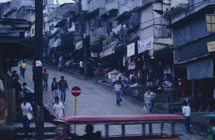
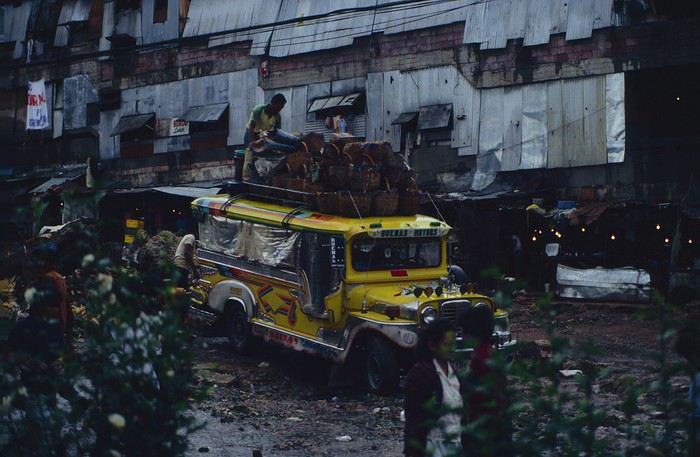
People we met on the street invited us to stay with them. These days, we wouldn’t just show up at strangers’ houses, which we should’ve done in Baguio—it would’ve saved us from an unimaginable and dangerous situation... which I won’t say anything about... !😊
The simple wooden house was on stilts at the edge of a hill with a view of the mountains. Since it was the start of the rainy season in a city that gets a lot of rain, we saw a lot of water. Our outings in town happened between downpours.
View from our lodging: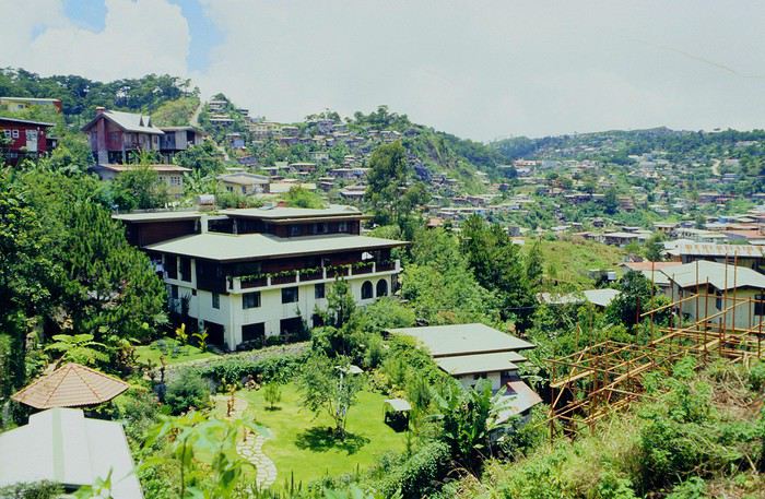
Episode 2: Baguio to Bontoc Aside from the situation briefly mentioned above, it was on the next leg to Bontoc that the adventure really began: an endless and dangerous road, a bus from another era, breathtaking landscapes, and surprising people.
We didn’t know the distance or how long it would take to get to Bontoc. When we arrived after about ten hours, we learned that Baguio to Bontoc was 140 km.
We got on a bus with wooden seats and settled in, two to a seat meant for two. As the bus filled up, passengers squeezed in three or four per seat, with chickens and baskets full of all sorts of things in the aisle. A little embarrassed, we didn’t know if we should squeeze in three on our seat. The seats were super tight (luckily, Filipinos are small), and I didn’t know where to put my legs given my height. I don’t remember if we stayed alone on our bench or if we ended up sharing with others.
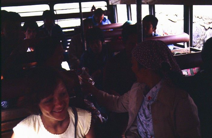
The “road” was a dirt track (or rather, a mud track) with endless turns. We held on as best we could to our slippery wooden seats—it was shaking in every direction. The woman behind us was carsick and throwing up... gross... but what were we doing there? Then we plunged into the Sierra Madre... just the name is dreamy!
Rice terraces started to appear: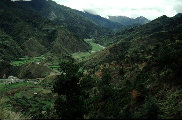
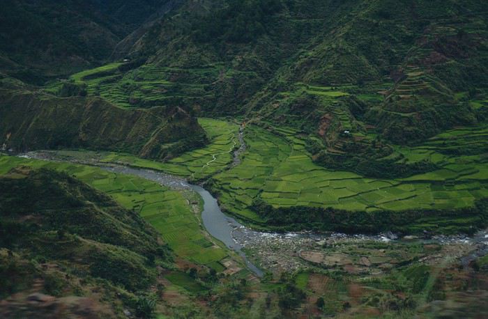
they took up more and more space along cliffs where we weren’t always reassured,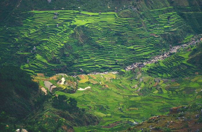
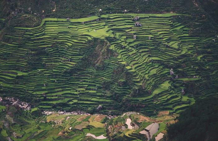
with lots of waterfalls (all that water had to go somewhere).
A few miserable villages stretched along the track, most often just a few houses balancing between the road and the drop. The bus stopped in every village—people got on or off and settled inside or on the roof. Street vendors offered their products to the bus passengers—a common sight in Asia, even today.
We were in another world—villagers were in loincloths, others had spears. The atmosphere was strange... but all good, we wanted exoticism, and we got it:
This so-called traditional outfit was everyday wear—it wasn’t for tourists since there weren’t any.
A curiosity because writing a travel journal about a trip 35 years later isn’t common, but also (mostly?) because exploring the Philippines at that time had little in common with traveling there today.
Obviously, I’ve forgotten a number of facts, most of the details, but with the help of a few notes from that time and a stack of slides (yes, there was life before digital 😊), many memories came back and added to the highlights I’d never forgotten. The scanned slides aren’t always great quality, but there are still quite a few to brighten up this chatter. Back then, we didn’t snap photos like we do now—film was too expensive—so I don’t have pictures of every place we visited... too bad, comparing some of those spots to how they look today would’ve been interesting.
Why "Adventures"? Why call it "Adventures" in the Philippines in 1984, a word so often used for a simple exotic trip? - Because the lack of information (no *Guide du Routard*, no *Lonely Planet*, no *Michelin Guide*, nothing, and obviously no internet) gave this trip what’s at the heart of adventure: the unknown. - Because the political situation made the stay sometimes dangerous. - Because transportation conditions were always epic, often perilous. - Because the question of where we’d spend the night came up almost every evening. - And for... quite a few other reasons.
That said, we weren’t exactly explorers!
Why the Philippines? First of all, why go to the Philippines in 1984—a country not exactly set up for tourism and about which we knew very little? How could we get an idea of the beauty of the Philippines and its points of interest when we had no guides or photos?
The idea came to us from Thailand a year earlier, during our first long-haul trip. After touring the north of the country, we met a Frenchman living in Phuket, where there were only a few tourists in Patong, with just a few small hotels and guesthouses. Kata and Karon had no buildings or roads, Rawai only had three palm-thatched bungalows, including ours, and the other islands were unknown to tourists. There was plenty to discover, and we wanted to return to this beautiful country... but the Frenchman made us dream about the Philippines—a country to explore, with wild landscapes.
Long evenings of discussion over multiple Sprite-Mekong cocktails (what memories of those headaches!) finally convinced us we had to go to the Philippines.
Episode 0: Before Departure The decision was made: we’d go to the Philippines in May 1984. Our friends and family were surprised when we announced we were going on vacation to the Philippines (a bit like saying today we were going paddleboarding in the Kerguelen Islands 🤪).
These days, preparing for each of our trips takes long evenings of research, planning, and noting down good addresses... etc. But for the Philippines in 1984, preparation was quick: we had very little information about the country, we were leaving almost at random, and the discovery would only be more exciting.
We still had a few bits of info gathered here and there: the rice terraces in northern Luzon, volcanoes, Negros where we were supposed to visit an acquaintance, Cebu and its marine life (we ended up going elsewhere), and absolutely avoid Mindanao, which was practically at war with the regime. That was about it, but it was already a great itinerary.
Nothing was organized in advance; we’d see day by day. We had no idea about travel times or even the existence of transportation options. The main (and sometimes only) way to connect two islands was by overloaded, rusty ferry. Only the big cities had airports.
Let’s Go: Episode 1: Paris to Manila My travel journals always start after arriving at the airport—the Europe-to-“Other Continent” trip isn’t interesting—but the flight to the Philippines was already an adventure, so I’ll make an exception.
This was the era when only a few Asian airlines were on par with Western ones: Thai, Singapore Airlines, and Philippine Airlines. They had beautiful, brand-new planes, and to attract customers (almost exclusively “businessmen”) from the usual airlines (Air France, Lufthansa, British Airways), there was opulence on board: unlimited champagne, all sorts of cocktails... Compared to today’s long-haul flights, there was still one small difference: no personal screens, just one screen at the front of the cabin with one mandatory movie. And I don’t know why, but we only got James Bond films, both ways... that must’ve been the trend at the time.
The tourism boom to Southeast Asia hadn’t started yet, and the “Asian Tigers” weren’t a thing, so there weren’t many business trips. That meant long-haul flights made stops everywhere to fill the planes. Our Philippine Airlines Boeing 747 left London, picked us up in Paris, then stopped in Frankfurt to take on a few Germans. I don’t know why we then made a stop in Dubai—a totally exotic place at the time. There was nothing to do there... things have changed a lot since. It was a small town lost in the desert. The airport was tiny, with just one or two buildings and a supermarket. During the stopover, everyone had to get off the plane and walk to the supermarket. Photo and electronic equipment were dirt cheap—I guess that was the only reason for the stop. Maybe it was their first commercial move. Emirates didn’t exist yet, as I checked online, but anyway, the idea that such a remote place could have its own airline was unthinkable.
Online, I found this photo of Dubai Airport in 1980. Anyone who’s transited through today’s massive airport with its rows of A380s will appreciate it:
Next stop: New Delhi to drop off some Europeans and pick up a few Indians, and finally, the terminus: Manila. I don’t remember how long the trip took with its five stops—an unimaginable journey today. Despite all those stops to fill the plane, there was still enough space to stretch out on the four center seats of the 747, something that never happens these days despite all the flights in every direction.
So here we are, finally at Manila Airport around midnight.
Episode 1: Manila and Baguio To start, a quick note on the political and economic situation in the Philippines in 1984, which had consequences for us as tourists, as we’d soon realize upon arrival.
After several centuries of Spanish colonization, the Philippines became American at the start of the 20th century, then independent. In 1966, Marcos took power, and little by little, his regime sank into corruption and mismanagement, becoming a dictatorship with martial law, all for the benefit of his family and friends, who enriched themselves endlessly. The peak was the assassination of opposition leader Benigno Aquino in August 1983, which triggered harshly repressed protests. So we arrived a few months later in a very poor country, with omnipresent corruption and an extremely tense political situation, as we’d soon see for ourselves. Major protests took place in the main cities during our trip—I’ll come back to that. Two years later, Marcos fled to Hawaii after being forced out of power following rigged elections. This historical context explains a lot of the situations we found ourselves in over the following weeks.
Arriving in the middle of the night isn’t very cheerful. Manila was already a huge city with many slums, where you could find a few business hotels like the Hilton or Intercontinental—way out of our budget—and plenty of run-down hotels. Luckily, two Indians we’d chatted with on the plane offered to take us to their usual hotel. They came to Manila twice a year for business. We accepted their offer, relieved not to have to look for a place to stay in the middle of the night, figuring the address must be good since they came back every time... we were wrong 🙁
We left the airport and immediately got a taste of the local vibe when we got into the taxi: the police asked for our passports. We thought: what’s more normal than police in a dictatorship?
But that wasn’t it at all. Our two Indian friends explained that the police were noting our names along with the taxi number and time. Crime in Manila was so bad that the taxi driver would be held responsible if anything happened to us... welcome to the Philippines 😎 😎
Historically, the Philippines was a very violent country, where everything was settled with guns or machetes. Previous governments had banned carrying weapons, but Marcos later allowed the free sale and carrying of guns, and disputes were settled with pistols again (or worse, as we’d discover later). Since he’d released most of the criminals from prison to form a paramilitary militia at his service (I’ll talk about our encounter with these “heroes” later), it was pretty dangerous to go into many parts of Manila, where these “tonton macoutes” ruled.
We arrived at our hotel without incident... and then things started badly. The room was infested with big cockroaches—exactly what I hate most in those kinds of countries. No way to find another hotel at that hour. After the long flight, the urge to take a shower was so strong that we squeezed into the bathroom as best we could. After that, I don’t remember—I guess we must’ve fallen asleep exhausted under the sheets in the heat... air conditioning wasn’t widespread yet.
The next day, we just wanted to leave that dump as soon as possible. So we decided to head north right away, stopping in Baguio, and we’d visit Manila a bit on the way back.
When we stepped outside, we discovered a pretty run-down neighborhood with potholed streets. But we also discovered the jeepneys. They were everywhere, flooding the streets.
They had crazy sound systems, each one blasting louder than the last. The interiors were kitschy but fun. There weren’t many private cars—almost all transportation was by jeepney, with buses reserved for intercity trips.
Before heading to the bus terminal for the north, somewhere on the outskirts of the city, we needed to exchange some money. I don’t remember how we ended up in a policeman’s jeep who offered his services: - Exchange money on the black market at a better rate than the banks. - Take us wherever we wanted, in this case, the bus terminal.
We accepted both offers (we’d still checked the official exchange rate from dollars to pesos). So we found ourselves in his jeep. After exchanging money, we left in his vehicle and stopped for gas. Without turning off the engine, he calmly smoked a cigarette while filling up. Since we were in a jeep with no doors or roof, we were ready to jump out if things went south, our travel bag in hand.
But we weren’t done with surprises yet. Once we left the small streets, we ended up in a neighborhood with wide avenues and not much traffic, which didn’t justify his incredible behavior. At every intersection, he made the sign of the cross, closed his eyes, and crossed without looking. I was more stunned than terrified! It wasn’t until we got out of the car later that I told Anne-Marie what had happened. I’d seen everything because the cop had put me in the front seat. Luckily, A-Marie hadn’t noticed anything from the back. Crossing Manila by trusting God rather than the rules of the road was ultimately effective. We were lucky—the trip was off to a good start. 🙂 🙂
We then passed through a neighborhood where slums stretched on for a while, and we left our policeman—friendly but a bit crazy—with relief.
A few hours by bus later, here we are in Baguio, cool in the mountains. My memories of Baguio are pretty fuzzy. I remember a small town. After some research while writing this journal, I found that the population was 120,000 in 1980. Given the population density in each home, that confirms my memory of a smallish town. Outside the “official” district with the president’s summer residence and government buildings, there were two or three paved streets with nice houses. The rest was very dirty and very poor, with lots of slums and dirt roads.
People we met on the street invited us to stay with them. These days, we wouldn’t just show up at strangers’ houses, which we should’ve done in Baguio—it would’ve saved us from an unimaginable and dangerous situation... which I won’t say anything about... !😊
The simple wooden house was on stilts at the edge of a hill with a view of the mountains. Since it was the start of the rainy season in a city that gets a lot of rain, we saw a lot of water. Our outings in town happened between downpours.
View from our lodging:
Episode 2: Baguio to Bontoc Aside from the situation briefly mentioned above, it was on the next leg to Bontoc that the adventure really began: an endless and dangerous road, a bus from another era, breathtaking landscapes, and surprising people.
We didn’t know the distance or how long it would take to get to Bontoc. When we arrived after about ten hours, we learned that Baguio to Bontoc was 140 km.
We got on a bus with wooden seats and settled in, two to a seat meant for two. As the bus filled up, passengers squeezed in three or four per seat, with chickens and baskets full of all sorts of things in the aisle. A little embarrassed, we didn’t know if we should squeeze in three on our seat. The seats were super tight (luckily, Filipinos are small), and I didn’t know where to put my legs given my height. I don’t remember if we stayed alone on our bench or if we ended up sharing with others.
The “road” was a dirt track (or rather, a mud track) with endless turns. We held on as best we could to our slippery wooden seats—it was shaking in every direction. The woman behind us was carsick and throwing up... gross... but what were we doing there? Then we plunged into the Sierra Madre... just the name is dreamy!
Rice terraces started to appear:
they took up more and more space along cliffs where we weren’t always reassured,
with lots of waterfalls (all that water had to go somewhere).
A few miserable villages stretched along the track, most often just a few houses balancing between the road and the drop. The bus stopped in every village—people got on or off and settled inside or on the roof. Street vendors offered their products to the bus passengers—a common sight in Asia, even today.
We were in another world—villagers were in loincloths, others had spears. The atmosphere was strange... but all good, we wanted exoticism, and we got it:
This so-called traditional outfit was everyday wear—it wasn’t for tourists since there weren’t any.
Camping sauvage sur une île inhabité en Asie English translation pending
Bonjour à tous, après de nombreuses recherches au sujet du "camping sauvage sur ile inhabité en Asie", je me retrouve a poser ma question sur ce forum car très peu d'informations ou même de retours d’expériences sont disponible sur internet.
J'ai pour projet de partir 3 semaines avec un groupe d'ami sur une Île inhabité au mois de SEPTEMBRE 2020. Idéalement vis à vis de la saison, l’Indonésie, la Malaisie, les philippines paraissent être les endroits idéaux (saison & nombre d'île confondu).
Si je devais résumer vulgairement notre projet, il s’agirait de nous faire déposer en bateau sur une île inhabité avec nos ressources (eau, nourriture, tente & équipement indispensable a la survie) pour 3 semaines d'aventure, puis a la fin de cette période, le bateau reviendrait nous chercher pour nous ramener à la civilisation. C'est un rêves d'enfance que nous souhaitons réaliser ensemble en étant totalement conscient de la difficulté de ce projet un peu fou. Nous ne sommes pas débutant dans le domaine & la galère est notre recherche commune hihi.
Nos questions sont les suivantes : Est-il possible de faire du camping sauvage sur ces îles inhabités ? La population/gouvernement est-elle/il contre ce type de voyageur ? Quels sont les législations ? ...
Bien évidement si vous avez des retours d’expérience dans d'autres pays ou autres, si vous connaissez des personnes qui pourraient potentiellement nous renseigner ou même des liens que j'aurais loupé a ce sujet, merci de me les renseigner. Ca serait une aide précieuse dans l'organisation de notre périple.
J’espère avoir été clair dans mes propos. Dans l’espoir d'avoir des réponses. Merci à tous
J'ai pour projet de partir 3 semaines avec un groupe d'ami sur une Île inhabité au mois de SEPTEMBRE 2020. Idéalement vis à vis de la saison, l’Indonésie, la Malaisie, les philippines paraissent être les endroits idéaux (saison & nombre d'île confondu).
Si je devais résumer vulgairement notre projet, il s’agirait de nous faire déposer en bateau sur une île inhabité avec nos ressources (eau, nourriture, tente & équipement indispensable a la survie) pour 3 semaines d'aventure, puis a la fin de cette période, le bateau reviendrait nous chercher pour nous ramener à la civilisation. C'est un rêves d'enfance que nous souhaitons réaliser ensemble en étant totalement conscient de la difficulté de ce projet un peu fou. Nous ne sommes pas débutant dans le domaine & la galère est notre recherche commune hihi.
Nos questions sont les suivantes : Est-il possible de faire du camping sauvage sur ces îles inhabités ? La population/gouvernement est-elle/il contre ce type de voyageur ? Quels sont les législations ? ...
Bien évidement si vous avez des retours d’expérience dans d'autres pays ou autres, si vous connaissez des personnes qui pourraient potentiellement nous renseigner ou même des liens que j'aurais loupé a ce sujet, merci de me les renseigner. Ca serait une aide précieuse dans l'organisation de notre périple.
J’espère avoir été clair dans mes propos. Dans l’espoir d'avoir des réponses. Merci à tous
Les mythes touristiques English translation pending
Les Mythes Touristiques
Dans un carnet que je suis en train d'écrire sur un voyage récent au Mexique, nous sommes arrivés à une petite discussion sur les fameux groupes de musiciens Mexicains, les mariachis. Il existe un mythe selon lequel « mariachi » serait une déformation du mot Français « mariage », et que cela viendrait des fêtes tenues par les Français lors de leurs quelques années d’occupation du Mexique, dans les années 1860 et quelques. Je cite l’un des intervenants sur mon poste Mexicain :
« Les français organisaient de grandes fêtes aux mariages et avaient l'habitude d'inviter des musiciens…. Mariachi serait une déformation du mot mariage ..? »
Ce mythe a été réfuté car il a été prouvé que le terme « mariachi » était d’usage longtemps avant la peu glorieuse « Intervention » de la France au Mexique (c’était sous Napoléon III).
Plusieurs mythes semblables circulent. Certains semblent être propagés à l’intention des touristes, pour leur donner l’illusion de « mieux comprendre le pays », pour donner une profondeur supplémentaire à leurs voyages, pour alimenter leurs conversations avec les amis quand ils sont de retour. Car tout cela gonfle l’égo et donne envie de faire d’autres voyages, ça alimente le tourisme. D’où revenus, tiens donc, pour qui ?
Mais d’autres mythes existent qui ne sont peut-être pas créés à but lucratif.
Vous connaissez sans aucun doute de tels mythes et je vous propose de les partager. Et de donner les raisons pour lesquelles ces mythes existent.
Dans un carnet que je suis en train d'écrire sur un voyage récent au Mexique, nous sommes arrivés à une petite discussion sur les fameux groupes de musiciens Mexicains, les mariachis. Il existe un mythe selon lequel « mariachi » serait une déformation du mot Français « mariage », et que cela viendrait des fêtes tenues par les Français lors de leurs quelques années d’occupation du Mexique, dans les années 1860 et quelques. Je cite l’un des intervenants sur mon poste Mexicain :
« Les français organisaient de grandes fêtes aux mariages et avaient l'habitude d'inviter des musiciens…. Mariachi serait une déformation du mot mariage ..? »
Ce mythe a été réfuté car il a été prouvé que le terme « mariachi » était d’usage longtemps avant la peu glorieuse « Intervention » de la France au Mexique (c’était sous Napoléon III).
Plusieurs mythes semblables circulent. Certains semblent être propagés à l’intention des touristes, pour leur donner l’illusion de « mieux comprendre le pays », pour donner une profondeur supplémentaire à leurs voyages, pour alimenter leurs conversations avec les amis quand ils sont de retour. Car tout cela gonfle l’égo et donne envie de faire d’autres voyages, ça alimente le tourisme. D’où revenus, tiens donc, pour qui ?
Mais d’autres mythes existent qui ne sont peut-être pas créés à but lucratif.
Vous connaissez sans aucun doute de tels mythes et je vous propose de les partager. Et de donner les raisons pour lesquelles ces mythes existent.
27 jours à travers le Nord-ouest américain English translation pending
Plusieurs mois ont passé depuis notre retour du Nord-Ouest américain, et cette période un peu particulière est l’occasion rêvée de me consacrer enfin à la rédaction de ce carnet de voyage !
Quatrième roadtrip aux USA. C’est en Août 2019 que nous décollons pour Seattle. Cette fois, nous explorons la partie Nord-Ouest des USA, ce pays qui nous passionne depuis le premier roadtrip en 2014. 27 jours de voyage, au travers le Washington, l’Idaho, le Montana, le Wyoming et l’Oregon…ça promet encore de magnifiques découvertes 🙂 Cette année, certains grands parcs sont au programme comme Glacier NP ou encore Yellowstone (non, on ne s’en lassera jamais !), mais nous avons aussi mis sur notre parcours des State Park bien moins touristiques et des petits endroits isolés mais magnifiques comme on adore !
JOUR 1
Ma maman et mon frère sont arrivés chez moi la veille car ils vivent en province, et ce matin pas question d’avoir du retard. C’est le grand jour ! Celui qu’on prépare depuis un an !
Vers 5h du matin, nous recevons un mail de la compagnie aérienne qui nous indique 1h de retard au décollage, on se laisse donc 1h de sommeil supplémentaire.
Porte K49 - 11h10 l’avion décolle. Nous avons choisi à nouveau de voler avec Delta Airlines, et mis à part ce retard de 50min, nous n’avons, comme d’habitude rien à signaler. Les services sont au rendez-vous.
Cette année, nous avons un peu moins de chance que les voyages passés, en ce qui concerne la météo. Nous n’avons pas la chance de voir le Groenland, les côtes canadiennes.
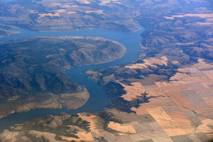
Nous atterrissons à Seattle en début d’après-midi. Il fait gris, et froid ! On attend un moment près du hangar Alaska Airlines, et ben, étant donné la météo, on pourrait se croire en Alaska 😉
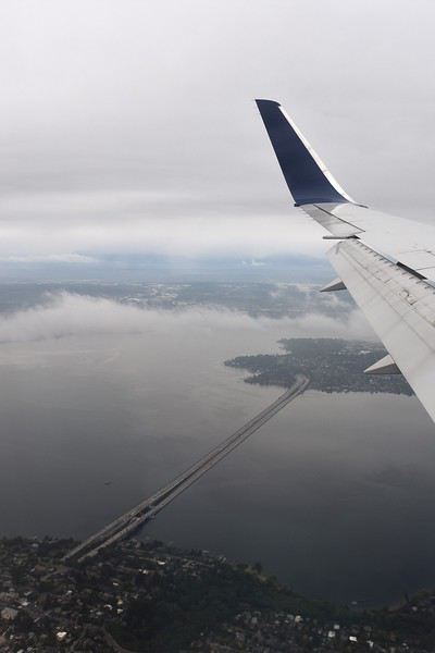
On arrive à la douane, ils nous séparent pour nous interroger un par un. Seul problème, maman parle très mal anglais, voire pas du tout ! Ce qu’on signale immédiatement, mais ils tiennent absolument à ce qu’elle réponse par elle-même aux questions. Ce qui après unpeu d’angoisse nous laisse un souvenir mémorable lorsque le douanier demande si elle a de la nourriture avec elle, sa réponse : « oui bonbonsss » 😄
Tout ça derrière nous, on se dirige vers le bâtiment qui regroupe tous les loueurs de voiture. Tout est très bien fléché dans l’aéroport de Seattle. Nous savons qu’il nous faut prendre un shuttle. Il y a la queue, et nous sommes sous la pluie ! Welcome !
Arrivé au guichet Hertz, pas d’attente. Nous sommes plutôt satisfaits de notre réservation car quelques jours avant le départ, je me reconnecte sur leur site pour vérifier que tout est en ordre. Je réalise alors que les tarifs pour notre catégorie de véhicule ont bien changé et qu’ils sont plus intéressants que lors de notre réservation il y a plusieurs mois. J’appelle Hertz qui constate également, modifie la réservation et s’engage immédiatement à rembourser les 400€ d’écart. Au guichet nous avons également une discussion concernant les assurances des passagers de la voiture. Et la personne est très à l’écoute, se renseigne plusieurs fois à notre demande, pour finalement nous éviter un surcoût, très peu courant chez les loueurs américains ça !!!
C’est donc de bonne humeur que nous descendons au parking, retrouver le véhicule qui nous est attribué. C’est un Chevrolet TAHOE. Maman fait quelques pas en arrière, stupéfaite. « Mais je ne pourrais jamais conduire cet engin !!! ». Avec mon frère Raphaël, nous, nous sommes ravis ! Après les contrôles d’usage, rayures, essuie-glace, niveaux, roue de secours… cette fois EN ROUTE !
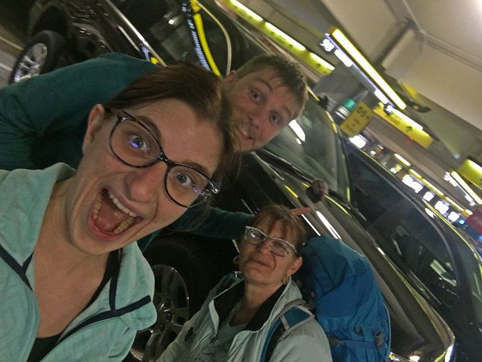
On ne change pas les bonnes habitudes, premier arrêt, Walmart ! Il est à peine à 10min de l’aéroport. Nous arrivons sous une pluie battante, 30 secondes dehors pour rejoindre le magasin suffisent à nous tremper ! Nous sommes fatigués du voyage donc la liste de courses préparée à l’avance est bien utile. Seul petit problème, impossible de trouver une bombonne de gaz pour notre réchaud, et ce malgré l’aide d’un vendeur. Cette année, nous avons amené avec nous les barres de céréales pour les randos, on avait un mauvais souvenir des versions américaines et on a bien fait ! On arrive à la voiture, on se dit comme dans la pub, on va utiliser le pied pour ouvrir le coffre car nous sommes chargés et il pleut toujours. Mais rien ne fonctionne. La clé nous permet d’ouvrir chaque porte, chaque fenêtre, mais on ne trouve pas dans la précipitation comment ouvrir le coffre 😕 Quelques minutes plus tard, problème résolu, courses rangées… mais nous sommes trempés comme des soupes 😎
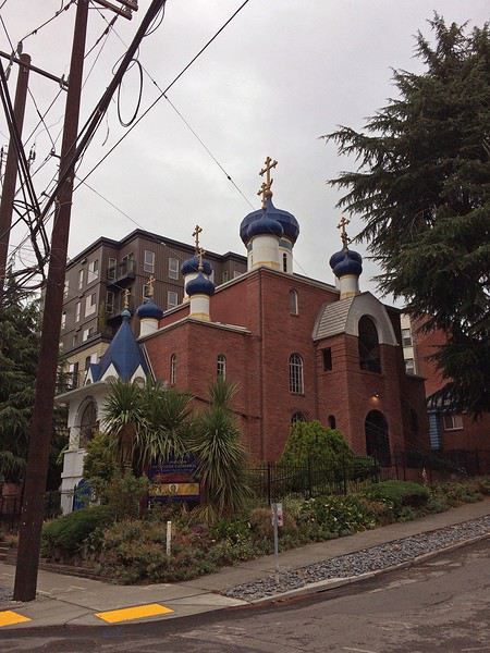
Maintenant, direction REI. C’est certainement notre seule occasion d’y faire un tour pendant ce voyage. Et puis, on a toujours besoin de gaz pour le réchaud. 25min plus tard, on arrive au parking sous-terrain, il est gratuit pendant 1h puis 2$ pour 3h. On a adoré ce magasin ! Et on a trouvé les quelques articles qui nous manquaient. Mais il est temps de partir. Nous avons décidé de ne pas dormir à Seattle, pour économiser un peu. Résultat, encore un peu de route.
Après 30min, nous arrivons au Best Value Inn de Lynnwood. Petit motel sans prétention, mais propre, personnel accueillant. Parfait pour une nuit d’après voyage. Une fois les bagages déchargés, on range les courses dans les glacières. Et on ne se fait pas prier pour se mettre au lit !
Quatrième roadtrip aux USA. C’est en Août 2019 que nous décollons pour Seattle. Cette fois, nous explorons la partie Nord-Ouest des USA, ce pays qui nous passionne depuis le premier roadtrip en 2014. 27 jours de voyage, au travers le Washington, l’Idaho, le Montana, le Wyoming et l’Oregon…ça promet encore de magnifiques découvertes 🙂 Cette année, certains grands parcs sont au programme comme Glacier NP ou encore Yellowstone (non, on ne s’en lassera jamais !), mais nous avons aussi mis sur notre parcours des State Park bien moins touristiques et des petits endroits isolés mais magnifiques comme on adore !
JOUR 1
Ma maman et mon frère sont arrivés chez moi la veille car ils vivent en province, et ce matin pas question d’avoir du retard. C’est le grand jour ! Celui qu’on prépare depuis un an !
Vers 5h du matin, nous recevons un mail de la compagnie aérienne qui nous indique 1h de retard au décollage, on se laisse donc 1h de sommeil supplémentaire.
Porte K49 - 11h10 l’avion décolle. Nous avons choisi à nouveau de voler avec Delta Airlines, et mis à part ce retard de 50min, nous n’avons, comme d’habitude rien à signaler. Les services sont au rendez-vous.
Cette année, nous avons un peu moins de chance que les voyages passés, en ce qui concerne la météo. Nous n’avons pas la chance de voir le Groenland, les côtes canadiennes.
Nous atterrissons à Seattle en début d’après-midi. Il fait gris, et froid ! On attend un moment près du hangar Alaska Airlines, et ben, étant donné la météo, on pourrait se croire en Alaska 😉
On arrive à la douane, ils nous séparent pour nous interroger un par un. Seul problème, maman parle très mal anglais, voire pas du tout ! Ce qu’on signale immédiatement, mais ils tiennent absolument à ce qu’elle réponse par elle-même aux questions. Ce qui après unpeu d’angoisse nous laisse un souvenir mémorable lorsque le douanier demande si elle a de la nourriture avec elle, sa réponse : « oui bonbonsss » 😄
Tout ça derrière nous, on se dirige vers le bâtiment qui regroupe tous les loueurs de voiture. Tout est très bien fléché dans l’aéroport de Seattle. Nous savons qu’il nous faut prendre un shuttle. Il y a la queue, et nous sommes sous la pluie ! Welcome !
Arrivé au guichet Hertz, pas d’attente. Nous sommes plutôt satisfaits de notre réservation car quelques jours avant le départ, je me reconnecte sur leur site pour vérifier que tout est en ordre. Je réalise alors que les tarifs pour notre catégorie de véhicule ont bien changé et qu’ils sont plus intéressants que lors de notre réservation il y a plusieurs mois. J’appelle Hertz qui constate également, modifie la réservation et s’engage immédiatement à rembourser les 400€ d’écart. Au guichet nous avons également une discussion concernant les assurances des passagers de la voiture. Et la personne est très à l’écoute, se renseigne plusieurs fois à notre demande, pour finalement nous éviter un surcoût, très peu courant chez les loueurs américains ça !!!
C’est donc de bonne humeur que nous descendons au parking, retrouver le véhicule qui nous est attribué. C’est un Chevrolet TAHOE. Maman fait quelques pas en arrière, stupéfaite. « Mais je ne pourrais jamais conduire cet engin !!! ». Avec mon frère Raphaël, nous, nous sommes ravis ! Après les contrôles d’usage, rayures, essuie-glace, niveaux, roue de secours… cette fois EN ROUTE !
On ne change pas les bonnes habitudes, premier arrêt, Walmart ! Il est à peine à 10min de l’aéroport. Nous arrivons sous une pluie battante, 30 secondes dehors pour rejoindre le magasin suffisent à nous tremper ! Nous sommes fatigués du voyage donc la liste de courses préparée à l’avance est bien utile. Seul petit problème, impossible de trouver une bombonne de gaz pour notre réchaud, et ce malgré l’aide d’un vendeur. Cette année, nous avons amené avec nous les barres de céréales pour les randos, on avait un mauvais souvenir des versions américaines et on a bien fait ! On arrive à la voiture, on se dit comme dans la pub, on va utiliser le pied pour ouvrir le coffre car nous sommes chargés et il pleut toujours. Mais rien ne fonctionne. La clé nous permet d’ouvrir chaque porte, chaque fenêtre, mais on ne trouve pas dans la précipitation comment ouvrir le coffre 😕 Quelques minutes plus tard, problème résolu, courses rangées… mais nous sommes trempés comme des soupes 😎
Maintenant, direction REI. C’est certainement notre seule occasion d’y faire un tour pendant ce voyage. Et puis, on a toujours besoin de gaz pour le réchaud. 25min plus tard, on arrive au parking sous-terrain, il est gratuit pendant 1h puis 2$ pour 3h. On a adoré ce magasin ! Et on a trouvé les quelques articles qui nous manquaient. Mais il est temps de partir. Nous avons décidé de ne pas dormir à Seattle, pour économiser un peu. Résultat, encore un peu de route.
Après 30min, nous arrivons au Best Value Inn de Lynnwood. Petit motel sans prétention, mais propre, personnel accueillant. Parfait pour une nuit d’après voyage. Une fois les bagages déchargés, on range les courses dans les glacières. Et on ne se fait pas prier pour se mettre au lit !
Botswana-Namibie octobre 2019... le retour English translation pending
Cette fois c’est à trois que nous ferons le voyage, un ami de longue date nous accompagnant.
A l’origine cela devait être notre premier voyage avec notre propre véhicule (stationné à Maun), malheureusement quelque temps avant mon contact sur place m’annonce qu’il y avait un « bruit » manifestement un problème au niveau de la boite de transfert. La pièce fautive devant venir d’Afrique du Sud le véhicule ne sera pas prêt pour notre venue. J’ai contacté Bushlore chez qui nous avions déjà loué un véhicule et ils nous ont appris qu’ils ont maintenant une agence à Maun et il ne leur reste plus qu’un Land Cruiser … nickel c’est la voiture reine sous ces latitudes. Nous acceptons, même si c’est plus cher que rouler avec notre propre véhicule, mais on n’a pas voulu annuler ou décaler le voyage.
C’est ainsi que nous partons, gaillards, de notre aéroport favori, Frankfurt le mardi 22 octobre à 22h40. Nous volerons sur Lufthansa. A titre d’information pour les futurs voyageurs, ça nous a couté moins cher d’acheter d’un côté un A/R FRA-JNB, de l’autre un JNB-MUB et en troisième un WDH-JNB, plutôt qu’un billet combiné.
Mercredi 23 octobre
Arrivée à 8h30 à JNB Vol BP212 Botswana Air à 11h20 … ça fait une longue escale ! Arrivée à Maun à 13h20
Sur place Bushlore nous attend, on va à leur agence faire l’état des lieux et remplir les papiers. Ensuite les courses, puis un tour chez Joe pour voir la voiture. Malheureusement, là il est déjà tard, on part de Maun vers 17h30 / 18h.
La piste de nuit vers Duncan Camp’s n’est pas top. On s’arrête une première fois demander notre route, le gars a les yeux rouges explosés … On voit une piste qui part à gauche et on voit les phares arriver de cette piste, chouette ça doit être là !... quand on arrive à leur hauteur on les hèle, dans le véhicule 4 noirs armés de fusils … aille, à mon avis ce sont des braconniers … pas cool tout ça.😮 On reprend la piste principale qui va vers Mababe. Le problème c’est que T4A ne connait pas la piste qui mène au camp et Osmand veut nous proposer des « raccourcis ». En fait il faut rester sur la piste principale jusqu’à ce qu’on croise un panneau indiquant le camp (de nuit c’est moins évident). La piste est très approximative et sablonneuse … ce qui devait arriver arriva, à un embranchement nous avons hésité entre deux ornières et on s’est ensablé. Ok, il fait nuit, ok on est au milieu de nulle part … pas de panique. Il ne faut surtout pas insister, on sort « tranquillement », on analyse la situation, pelletons un peu, une marche arrière, un choix d’ornières et c’est reparti. On navigue plus ou moins au cap car point de référence sur les cartes. Au bout d’un moment on voit de la lumière au loin et ouf c’est là !😎 Les gars du camp était venu à notre rencontre lorsqu’ils ont vu des phares se « promener ».
L’accueil a été chaleureux. Il n’y a que nous. Nous avons deux tentes sur les 4 dont dispose le camp. L’endroit est splendide au bord de la Thamalakane, l’ambiance aussi … incroyable, on n’arrive pas à s’imaginer qu’il y a encore quelques heures nous étions au milieu de la civilisation occidentale, frénétique. Qu’est-ce qu’on est bien.🙂 Ce n’est pas tout ça mais là il est temps de boire une petite bière …😛 Ensuite le chef viendra nous chercher, nous énoncera le menu. Vous n’imaginez pas comme on est bien là, seuls au milieu de la nature, avec les bruits des animaux, la douceur du climat, le sourire de nos hôtes et la bonne nourriture … génial nous sommes de nouveau en Afrique Australe. 🙂 😎
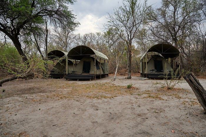
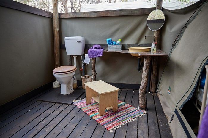
Vous l’aurez compris on recommande chaudement Duncan Camp ‘s. En revanche n’essayez pas d’y aller directement, réservation obligatoire et paiement soit par internet soit à Maun. La durée du trajet depuis Maun est de 1h30.
Version longue en cours de création ici
A l’origine cela devait être notre premier voyage avec notre propre véhicule (stationné à Maun), malheureusement quelque temps avant mon contact sur place m’annonce qu’il y avait un « bruit » manifestement un problème au niveau de la boite de transfert. La pièce fautive devant venir d’Afrique du Sud le véhicule ne sera pas prêt pour notre venue. J’ai contacté Bushlore chez qui nous avions déjà loué un véhicule et ils nous ont appris qu’ils ont maintenant une agence à Maun et il ne leur reste plus qu’un Land Cruiser … nickel c’est la voiture reine sous ces latitudes. Nous acceptons, même si c’est plus cher que rouler avec notre propre véhicule, mais on n’a pas voulu annuler ou décaler le voyage.
C’est ainsi que nous partons, gaillards, de notre aéroport favori, Frankfurt le mardi 22 octobre à 22h40. Nous volerons sur Lufthansa. A titre d’information pour les futurs voyageurs, ça nous a couté moins cher d’acheter d’un côté un A/R FRA-JNB, de l’autre un JNB-MUB et en troisième un WDH-JNB, plutôt qu’un billet combiné.
Mercredi 23 octobre
Arrivée à 8h30 à JNB Vol BP212 Botswana Air à 11h20 … ça fait une longue escale ! Arrivée à Maun à 13h20
Sur place Bushlore nous attend, on va à leur agence faire l’état des lieux et remplir les papiers. Ensuite les courses, puis un tour chez Joe pour voir la voiture. Malheureusement, là il est déjà tard, on part de Maun vers 17h30 / 18h.
La piste de nuit vers Duncan Camp’s n’est pas top. On s’arrête une première fois demander notre route, le gars a les yeux rouges explosés … On voit une piste qui part à gauche et on voit les phares arriver de cette piste, chouette ça doit être là !... quand on arrive à leur hauteur on les hèle, dans le véhicule 4 noirs armés de fusils … aille, à mon avis ce sont des braconniers … pas cool tout ça.😮 On reprend la piste principale qui va vers Mababe. Le problème c’est que T4A ne connait pas la piste qui mène au camp et Osmand veut nous proposer des « raccourcis ». En fait il faut rester sur la piste principale jusqu’à ce qu’on croise un panneau indiquant le camp (de nuit c’est moins évident). La piste est très approximative et sablonneuse … ce qui devait arriver arriva, à un embranchement nous avons hésité entre deux ornières et on s’est ensablé. Ok, il fait nuit, ok on est au milieu de nulle part … pas de panique. Il ne faut surtout pas insister, on sort « tranquillement », on analyse la situation, pelletons un peu, une marche arrière, un choix d’ornières et c’est reparti. On navigue plus ou moins au cap car point de référence sur les cartes. Au bout d’un moment on voit de la lumière au loin et ouf c’est là !😎 Les gars du camp était venu à notre rencontre lorsqu’ils ont vu des phares se « promener ».
L’accueil a été chaleureux. Il n’y a que nous. Nous avons deux tentes sur les 4 dont dispose le camp. L’endroit est splendide au bord de la Thamalakane, l’ambiance aussi … incroyable, on n’arrive pas à s’imaginer qu’il y a encore quelques heures nous étions au milieu de la civilisation occidentale, frénétique. Qu’est-ce qu’on est bien.🙂 Ce n’est pas tout ça mais là il est temps de boire une petite bière …😛 Ensuite le chef viendra nous chercher, nous énoncera le menu. Vous n’imaginez pas comme on est bien là, seuls au milieu de la nature, avec les bruits des animaux, la douceur du climat, le sourire de nos hôtes et la bonne nourriture … génial nous sommes de nouveau en Afrique Australe. 🙂 😎
Vous l’aurez compris on recommande chaudement Duncan Camp ‘s. En revanche n’essayez pas d’y aller directement, réservation obligatoire et paiement soit par internet soit à Maun. La durée du trajet depuis Maun est de 1h30.
Version longue en cours de création ici
Luzon & Palawan, du 4 au 25 août 2019: prix, hôtels, bus, distances... English translation pending
Bonjour,
Voici des informations qui aideront peut être ceux qui souhaitent partir aux Philippines sans réservation préalable. N’hésitez pas à apporter vos commentaires.
ATTENTION : nous étions en basse saison (août). Vous n’aurez sûrement pas les mêmes prix, la même fréquentation, et les mêmes températures si vous partez à un autre moment de l’année.
BUDGET Vous pourrez bien sûr toujours trouver moins cher mais voilà déjà une idée. Coût total pour 20 nuits sur place sans les transports en avion (Paris Manille et vols intérieurs) = 800 € par personne Budget hôtels pour 20 nuits : 19 596 php soit 356 € si on applique un change à 55 php (17,80€ par nuit). Budget nourriture : nous l’estimons à 1 500 php par jour pour deux. En fait, ce fut un budget important comparé aux autres pays d’Asie, car nous étions cette fois moins attirés par ce que proposaient les petits restos locaux dans lesquels on peut facilement manger pour 30 ou 100 php par personne. Malarone : 9,99 € la boite de 12 comprimés génériques, mais on peut trouver un meilleur prix à la pharmacie Zemiro à Bagnolet
COMMENT VOYAGEONS-NOUS ? Nous voyageons aussi en fonction de la météo, et/ou en décidant notre prochaine destination la veille, ou le matin même. Nous sommes des habitués de l’Asie du Sud Est en juillet, ou août chaque année depuis 10 ans. Nous avons 50 ans, et voyageons en couple. Nous nous déplaçons en transports en commun avec nos sacs à dos de 9 kilos pour trois semaines. Pour les hôtels, nous les choisissons en arrivant en fin de matinée, ou début d’après-midi de préférence pour avoir plus de choix. Nous privilégions les chambres doubles aux dortoirs, chambres avec climatisation plutôt que ventilateur, et salle de bains privée, mais des chambres sans clim, et sans sdb privée ne nous dérangent pas s’il n’y a pas d’autres solutions, ou si nous avons un coup de cœur. La propreté est importante.
CHANGER VOTRE ARGENT Le taux de change était à environ 58 pesos (php) pour 1 € durant notre séjour sur l’application “EX” . Nous avons vu des taux de change qui allaient de 52,30 à 57,5 php à nos étapes. Retirer 10 000 php dans un distributeur est revenu à 190 € soit un taux à 52.63 php pour 1 € (après calcul des frais de la banque CIC). L’un des taux les moins intéressant du voyage. A savoir, les frais de la banque CIC sont moins importants à l’étranger en achetant avec la carte qu’en retirant de l’argent. Les money changers Western Union et Lhuillier étaient toujours les moins intéressants.
Taux au terminal 1 de Manille : 56 php (il y avait deux money changers à l’arrivée à des taux différents (comparez). Il y a d’autres money changers au niveau départ. Taux dans Manille aux money changer : 57,5 php le meilleur Taux à Coron ville : 55, 28 à la BPI ou 53 ailleurs, voire moins. Taux à El Nido : 55,60 php. Après l’Art café en venant du ferry, vous trouverez une petite boutique à 50 mètres qui affiche le taux sur une ardoise blanche collée au mur extérieur. Taux Port Barton : 56 php le meilleur taux du coin. En arrivant du terminal des vans, et en allant vers la mer, tournez la première à gauche (ou la deuxième à droite en venant de la mer) au carrefour où se trouve le Princessa Michella’s inn. C’est un petit box Money changer qui est 100 m plus loin sur la gauche. Sonnez si personne n’est dans le box, ou allez vers les maisons derrière le box puis demandez. Taux à Puerto Princessa : 56 php Taux au terminal 3 de Manille : 57,3 php
MANILLE Après 20 h de vol avec Etihad, dont 4h d’escale à Abu Dhabi, nous arrivons au terminal 1 de l’aéroport de Manille à 23h30. Taxi jaune de l’aéroport à hôtel Oyo à Malaté (Remedios Circle) pour 635 Php. On le savait, mais tant qu’on a pas vu un compteur non trafiqué fonctionner, on a du mal à se rendre compte si c’est une arnaque ou pas. Si vous avez peur de vous faire avoir, téléchargez l’appli Grab C’est le Uber asiatique, et il n’y a pas de frais. Vous pouvez réserver sur l’appli, et payer en cash directement au conducteur. si vous préférez. Là, j’avoue, vue l’heure tardive, nous avions réservé sur booking durant notre escale à Abu Dhabi, un hôtel à Malaté, histoire de ne pas chercher trop longtemps. Ce n’était pas vraiment utile vu le nombre d'hôtels. Hôtel Oyo dans Malaté. Attention, il y a plusieurs Hôtels Oyo dans le quartier. Première nuit à 1 578 php, et 1 710 php la deuxième nuit. Sans charme mais propre et bien placé (à côté de Remedios circle). La piscine est payante, et ce n’est pas évident de voir cette information sur Booking. Nous ne voulions rester qu’un seul jour à Manille, mais le décalage a eu raison de nous, et nous nous sommes levés à midi le lendemain de notre arrivée. Du coup, nous sommes restés une deuxième journée dans la capitale. Bon, Manille ne casse pas trois pattes à un canard, et le quartier Intra-muros, où ce qu’il en reste, est suffisant si vous ne souhaitez pas vous attarder à Manille. C’est bien sûr notre avis, et nous avons vu trop peu de la ville de Manille pour bien juger.
MANILLE INTRA-MUROS Taxi Malaté - Fort Santiago intra-muros : 190 php. Entrée Fort Santiago : 75 php / personne Attention, les lieux à visiter dans intra-muros ferment à 16h30/17h. Jeepney de la sortie sud de intra-muros à Remedios Circus : 9 php par personne. Les philippins sont très sympas, et ils vous aideront à trouver le bon jeepney si vous demandez. Demandez également de vous indiquer ou descendre. Ne soyez pas étonnés si un passager vous tend l’argent pour le chauffeur, et inversement pour la monnaie.
Nous dégusterons notre premier Pork Adobo au Ramen in town, un restaurant de rue. Le lendemain, nous allons acheter nos billets de bus Directement au terminal de Ohayami Trans Il ne se trouve pas trop loin du quartier Chinois que nous souhaitions visiter. Je crois que vous pouvez réserver votre bus directement sur le site easy bus. Pour aller au terminal de Ohayami depuis Malaté : Métro Pedro Gil - Doroteo jose : 15 php, puis Métro Doroteo jose - Legarda : 15 php, puis Tricycle de la station Legarda au terminal des bus Ohayami : 30 php par personne.
Bon, pour le quartier chinois, soit il n’y a rien, soit on s’est trompés de rue, car à part le marché dans la Carriedo street, on a rien vu de chinois dans la Dasmarinas street qu’indique le Lonely Planet. D’ailleurs, la dernière version du Lonely Planet acheté en juillet 2019 date de juin 2018 donc, loin d’être à jour. Il n’y a pas de Guide du routard sur les Philippines, et pas fan du Petit futé acheté pour l’occasion.
Le soir, nous sommes retournés au terminal des bus Ohayami en Grab. Grap de remedios circle au terminal des bus de ohayami : 300 php Départ à 22h du bus de nuit Manille - Banaue (prononcez Banawé ou banawi) : 540 php par personne. 9h30 de route dans un bus peu confortable, mais avec du wifi pour passer le temps. Attention, il n’y a rien à acheter à manger à ce terminal des bus à Manille. Quelques restos à 100 mètres. La nuit se passe. Vers 7h30, le bus s’arrête à 15 bonnes minutes de marche de l’office de tourisme de Banaue où les tricycles vous attendent pour vous emmener au centre-ville ou bien à votre hôtel (le bus pourrait aller au centre, mais ainsi, ça donne surement du travail aux tricycles). Nous avons marché car nous pensions être au centre, et n’avions pas de réservation d’hôtel. Droit d’entrée Banaue : 50 php par personnne à payer à l’arrivée du bus.
BANAUE Notre hôtel était le Banaue homestay : 800 php la chambre avec salle de bain commune, et sans clim, ni ventilateur (inutile en cette saison). Ils ont le wifi. Superbe vue sur les rizières depuis notre chambre. Panne d’électricité dans la nuit qui précède notre trek. Nous en retrouverons le lendemain en arrivant à Batad (la lampe frontale est alors très utile).
TREK : Nous nous décidons pour un trek de 2 jours que nous réservons via l’office de tourisme. Tous les treks sont proposés pratiquement au même prix ailleurs. Trek 2 jours (Pula - Combulo - Batad - Bangaan) : 4 100 php pour 2 pers + Bangaan à 500 php pour 2 pers + 200 php de pourboire. Nous avons récupéré 300 php sur les 500 Php que nous avons laissé en pourboire car nous n'avons pas visité le dernier village. Le Banaue homestay nous a gardé nos sacs à dos pendant notre trek, et a même été déposer gratuitement notre linge sale à la laverie. Trop sympas. La laverie près de l’école de Banaue est à 50 php le kilo. Les paysages sont magnifiques, mais ce trek n’est pas vraiment adapté à tout le monde, car des passages sont assez dangereux (l’office de tourisme ne prévient pas). On marche sur les murs des rizières qui font 25/30 cm de large avec des fois, 4 mètres de vide d’un côté. C’est de la montagne avec des sentiers raides, et des marches hautes. Le dénivelé est beaucoup plus important que celui de Sapa au Vietnam pour ceux qui connaissent. Pendant le trek, nous avons dormi à Cambulo où nous étions les seuls touristes. Pas d’électricité pendant notre séjour, car coupure sur la région. En quittant l’hôtel le matin, nous avons assisté, par hasard, au sacrifice de deux chiens. Ça surprend au réveil. Ils les mangent ensuite selon notre guide.
L’arrivée à Batad en venant de Campulo est juste magnifique, et la cascade (vous n’êtes pas obligé d’y aller, mais ce serait dommage) nécessite une bonne forme physique pour en revenir, car l’escalier est raide, long, et avec des marches souvent hautes. Par contre, quel plaisir de se rafraîchir dans l’eau de la rivière au pied de la cascade. Prenez des chaussures pour vous baigner et marcher sur les cailloux dans l'eau. Comme le Banaue homestay était complet à notre retour de trek, nous avions réservé le 7th heaven lodge juste à côté du Banaue homestay : 800 php la chambre sans clim ni ventilateur (toujours inutile), avec salle de bain privée (en dehors de la chambre). Ils n’ont pas le wifi, et la vue sur les rizières depuis notre chambre était moins belle qu’au Banaue homestay. Bon resto à Banaue: Sanafe Lodge and Restaurant et une petite cantine, juste après sur le même trottoir.
SAGADA Nous prenons un Van de Banaue à Bontoc à 250 php par pers. puis un Jeepney de Bontoc à Sagada à 50 php par pers. Nous voulions faire Banaue - Sagada sans escale mais trop de voyageurs s’arrêtaient à Bontoc. Du coup, le chauffeur nous a prévenu en partant qu’il n’irait pas à Sagada, et qu’il s’arrêterait à Bontoc. Assez difficile d’avoir les horaires des vans ou jeepney au départ de Banaue. Il faut, quoiqu’il en soit, venir assez tôt le matin pour avoir une bonne place, et ne pas être trop serré à l’arrière pendant le voyage. Le Van part quand il est plein. Nous y étions à 8h, et nous sommes partis à 9h. On peut acheter du nescafé chaud, et des gâteaux dans les magasins à côté du lieu de départ. Le terminal des Vans à Bontoc est le même que celui des jeepneys pour Sagada. Pratique !
Droit d’entrée Sagada : 50 php par pers. Il faut l’acheter à l’office du tourisme, car sans ça, vous ne rentrez pas dans les sites. C'est controlé à l’entrée des sites. Le Labanet lodge où nous avons dormi à Sagada : 600 php est correct sans plus. Eau chaude (très utile), et wifi. Pas de clim (inutile). Nous avons demandé une couverture supplémentaire. Guide pour les deux grottes : 800 php pour 4 pers, partagés avec deux allemands rencontrés à Banaue. Le temps ne permettant pas la visite des tombeaux (echo valey), ni de rester dans la région, nous décidons de ne pas faire les rizières autour de Bontoc, et prenons le bus de 9h à Sagada pour Baguio à 220 php par pers. Le trajet dans un bus peu confortable (2 sièges - 3 sièges sur la même rangée) a duré 7h20 sur une route de montagne du début à la fin qui n’en finissait pas de tourner, et avec beaucoup de circulation. Difficile de lire ou de dormir. Au terminal Dawanga de Baguio où nous a laissé notre bus, nous avons dû prendre un taxi (plus honnête que celui de Manille) jusqu’au terminal de Victory liner. De Dawanga à victory liner : 100 php pour 15/20 minutes de trajet.
Bus victory liner : de Baguio au terminal de Dau : 338 php par pers (5h heures de trajet). Le bus est assez confortable, et a le wifi. J’en profite pour réserver notre vol du lendemain grâce au wifi du bus, sur l’appli de Philippines Airlines. Au terminal des bus de Dau , il y a l’hôtel Sogo qui fait payer les chambres à l’heure. C’est une chaîne d’hôtels. Nous ne le connaissons pas car nous sommes allés plus loin au 999 Hôtel (nul) : 1 264 php pour une chambre sans fenêtre, et à rafraîchir sérieusement. Grab de l’hôtel à l’aéroport de Clark : 242 php. 20 minutes. Billets Clark - Busuanga Coron : 6 046 php ttc pour deux pers. (réservés la veille à 20h pour un décollage le mardi à 10h40). Taxes AÉROPORT à payer au départ de Clark : 150 php par pers.
PALAWAN – ÎLE DE BUSUANGA L’aéroport de Busuanga est tout petit. Nous prenons un van (pas d’autre choix à première vue) de l'aéroport de Busuanga à Coron ville : 150 php par pers pour 20 km. Je n’ai pas vu de money changer à l’arrivée à l’aéroport. Nous logeons à l’Argamosa bayside inn : 1 300 php pour une chambre climatisée, propre, et vue mer mais un peu petite. L’hôtel est au calme, et en plein centre-ville. L’internet fonctionne mal dans les chambres. Ils lavent le linge pour 80 php le kilo. La laverie dans la rue le lave pour 50 php en deux jours, et 80 php en une journée. Nous louons une moto pour 400 php les 24h au lieu de 500 php pour 3 à 8 heures en haute saison. Nous la garderons finalement 6 heure de plus en ajoutant 250 php. Franchement, à l’Est comme à l’Ouest (jusqu’à un peu plus loin que Salvation, nous n’avons pas trouvé de belles plages. Le nord de l’île est peut être mieux fourni. Essence : 60 php le litre.
ÎLE CORON Croisière une journée pour l'île de Coron : 2 700 php par bateau mais négocié sur le port à 2 300 php à 6h45 le matin même. Il faudra ajouter les droits d’entrées. Kayangan lake : 300 php par pers Barracuda lake : 200 php par pers Skeleton Wreck : 150 php par pers Banul white beach :100 php par pers Coral Garden : 150 php par pers Twins lagoon : 200 php par pers Total croisière : 4 500 php php pour deux personnes sans la nourriture que nous avons achetée nous même à côté du départ des bateaux mais qui ne vaut pas la nourriture préparée par les marins. En privé, c’est beaucoup plus cher que les excursions groupées, mais ça permet de rester le temps qu’on veut dans les sites, et surtout, de partir 1h30 avant les groupes. Nous sommes du coup, arrivés les premiers à Kayangan lake, et ce lac sans personne, ça vaut vraiment le coup de se lever plus tôt. Nous étions que 6 ou 7 touristes à Barracuda lake, et les groupes arrivaient quand nous partions.
Bons restaurants à Coron Ville : Le View desk sur le toit d’un immeuble, sert des plats occidentaux bons et copieux (ils ajoutent 10% de service). Le Sireneta offres un cadre agréable, et calme pour le couché du soleil. Nous n’avons pris que l’apéritif. Beaucoup de gargotes le soir autour du terrain de basket.
Aujourd’hui, nous partons pour El Nido en bateau rapide. L’hôtel nous a réservé les places du bateau au même prix qu’ailleurs. Il faudra ajouter 50 php par personne à payer au port. Tricycle du centre de Coron ville au port du ferry qui est à 2 où 3 kms : 20 php par personne. Il faut arriver 1h avant le départ, et les chiens policiers cherchent la drogue en reniflant vos sacs. Du moins ce jour-là. Chips, nouilles lyophilisées, et boissons à bord. Je n’ai rien vu à acheter au port. Bateau rapide de la Ville de Coron à El Nido : Compagnie Phimal : 1 760 php par pers pour 4h20 de trajet
EL NIDO Nous décidons de nous rendre sur la plage de Corong Corong au sud d’El Nido avec un tricycle. Nous dormirons une nuit au Dormitels pour 949 php la chambre avec clim, et sdb privée. C’est une dépendance low-cost de l’Eco hôtel. La chambre est très exiguë, et n’a aucun charme. Nous irons dormir le lendemain au El sea (quelque chose) qui est, en passant par la plage direction El Nido, après le Last Frontier, et le Bella vita Nous payons 1 000 php le bungalow au El sea (quelque chose) qui s’avérera plus spacieux avec clim, et sdb privée. Dîner au Bella vita (bof !).
Croisière Nous négocions avec Jerick et Alvin qui nous sont présentés par la serveuse du restaurant Bella vita, le tour C en bateau privé Pour 5 000 php sans le repas au lieu de 8 000 php pour le bateau, et le repas. Ajouter à cela 200 php par pers de taxe environnementale valable 10 jours. Finalement, Alvin ne sera pas avec nous le matin même, mais Jerick se révèle être un guide hyper attentionné (on recommande) même si nous n’avons fait que 5 lieux au lieu de 6. Hidden beach + snorkeling a Mattinloc + Hélicoptère Islande + Big lagoon + Papaya beach.
Le soir, nous avons essayé la langouste à El Nido chez Jarace. La langouste est à 2 800 php / kg, 2 600 le resto à côté, mais celles de ce soir étaient petites. Le service, et la déco sont très moyens. Les légumes qui accompagnent le riz nature se comptent sur les doigts d’une main. Pour 1 600 php a deux, nous avons quand même passé un bon moment. Comparez les autres restos de la plage d’El Nido, surtout si vous voulez un endroit plus raffiné.
Tricycle corong corong - El Nido : les conducteurs demandent 100 php mais on l’a facilement à 20 php par pers après quelques essais. Notre hôtel n’est pas vraiment en fin de plage. A Corong corong, le couché de soleil est un moment à ne pas rater.
Nous quittons El Nido sûrement un peu trop tôt. Une journée supplémentaire en Bateau n’aurait pas était de trop. En nous réveillant à 7h, nous décidons de prendre un van à 8h pour Port Barton. Van El Nido - Port Barton : 500 php par pers pour 3h de route. Quelques boutiques au terminal d’El Nido pour acheter à grignoter ou à boire. Le van passe également chercher les clients dans les hôtels de El Nido, mais en se décidant une heure avant, ce n'était pas possible et nous ne le savions pas de toutes façons.
PORT BARTON Ce site sur portbarton pourra peut-être vous donner quelques informations Taxes environnement à payer à l’arrivée à Port Barton : 50 php par pers Inutile de payer un tricycle (40 php) depuis l’arrivée des vans, la plage est à peine à 5 minutes à pieds en allant tout droit (on arrive sur la plage à côté du Deep moon resort. C’est d’ailleurs l’hôtel où nous prendrons un bungalow face à la mer pour 3 nuits à 1 500 php par nuit le bungalow avec eau chaud, et ventilateur (clim inutile, il fait moins chaud la nuit qu’à El Nido, et nous éteignions le ventilateur pour dormir). Christina, réceptionniste adorable, et serviable qui nous accueille, nous fera un prix à 1 300 php par nuit sans rien demander.
Croisière Nous négocions avec un vendeur dans la rue, le Tour de bateau A en privé à 4 000 php avec le repas au lieu de 5 000 php. Comme nous partons à 8h, enfin, plutôt 8h30, nous serons seuls toutes la journée sauf sur le dernier spot. (Snorkeling + tortues (deux belles tortues avec qui nous nageons sans aucun touriste) + Paradise island + Long Beach (déjeuner au top) + snorkeling + Starfish sand).
Bons restaurants à Port Barton : le Gacayan Restaurant dans une des rues derrière qui ne paye pas de mine, et attire surtout une clientèle de touristes. Excellentes, et énormes soupes. Le Beach Barn sur la plage si la nourriture thaïlandaise vous manque. Le Ayette sert de belles quantités. Attention, si vous dormez au Ayette, vous connaîtrez par cœur le registre de Bob Marley car le bar collé aux chambres fait cracher les watts tous les soirs. Live très sympa d’ailleurs.
Les laveries sont à 100 php le kilo. Notre hôtel se chargera de notre linge pour ce prix.
Notre avis sur Port Barton et El Nido On va à Port Barton pour le côté calme, apaisant et sans trop de touristes, avec de jolies plages et quelques spots de snorkeling peut être plus poissonneux qu’à Bacuite. On va à El Nido pour sa baie (Bacuite) qui est exceptionnelle avec ces plages entourées de roches karstiques qu’on ne retrouve pas à Port Barton et pour l’ambiance plus animée de El Nido.
Nous décidons de nous rendre à Puerto Princessa pour y prendre l’avion vers Manille. Les Vans depuis Port Barton jusqu’au terminal de Puerto sont à 350 php par personne pour 3h de trajet. C’est par contre 150 php de plus pour l’aéroport de Puerto ou bien si le van vous dépose à votre hôtel à Puerto Princessa. Sachez un muticab vous coutera 15 php au lieu de 150 php du Terminal de Puerto Princessa jusqu’à votre hôtel ou l'aéroport (10 à 15 minutes de trajet).
PUERTO PRINCESSA Arrivée au terminal de Puerto qui se trouve à 5 km de Rizal street. Comme écrit ci-dessus, le multicab coûte 15 php par personne pour rejoindre Rizal street alors que les tricycles demandent 250 php pour deux. Avant de demander à un conducteur de jeepney, demandez aux commerçants où passants combien cela coûterait. Ça vous évitera de payer 10 fois plus cher. Hôtel Reddoorz : trouvé par hasard : 600 php avec clim, wifi et sdb privée. Si vous passez la soirée à Puerto Princessa, allez dîner sur la Baywalk au nord entre le port des ferrys et le marché. C’est une promenade agréable le long de la mer (vue de nuit uniquement) avec une enfilade de restaurants qui proposent des boodle fight (repas collectifs sur feuilles de banane) et des produits de la mer frais, voire encore vivants. Nous avons craqué pour 500 g de gambas à 1 000 php le kilo. Si vraiment les Malls vous manque, le plus important semble être le SM mall sur trois étages.
Laverie vue à 25 php le kilo..
Vol Cebu pacifique de Puerto Princessa à Manille acheté la veille à 114 € pour deux. (3h30 de retard). Le wifi est gratuit dans l’aéroport de Puerto. On ne nous demande pas de payer une taxe de départ à l’aéroport de Puerto (??)
Arrivée au terminal 3 de Manille, on commande un Grab pour LRT Gil Puyat : 220 + 35 php de péage. La station des bus DBLT est collée à la station de métro LRT Gil Puyat (enfin on croit) et c’est finalement de là que nous partirons pour Tagatay. Nous attrapons un bus qui est en train de partir et prenons les deux dernières places : 88 php par personne pour 2 h 30 de trajet (60 kms).
TAGATAY C’est l’endroit des Philippines (que nous avons visité) où les rabatteurs et tricycles sont les plus racoleurs et collants. Les prix des hôtels ne correspondent pas à la qualité attendue. Même pour 2 000 php après avoir négocié, certaines chambres valent les chambres à 400 php vues ailleurs. Nous trouverons finalement le Alpina Monte Carlo Travellers inn pour 595 php les 12 h. Ce qui nous va très bien puisque nous arrivons à 21h et quittons la chambre à 9h. Ils nous gardent nos sacs le temps d’aller au volcan. Pour ce prix, pas de charme, pas de vue (fenêtre sur le couloir, ce qu'on voit un peu dans tous les hôtels), pas de savon ni shampoing et la couverture et le papier toilette sont à 50 php mais chambre non humide et propre. Sur les conseils de la réceptionniste, nous prenons un jeepney pour aller dîner à Mangallanes (9 php par personne) où se trouvent quelques restaurants ouverts tard. Nous dînons de grosses crevettes (380 php la dizaine) et de chopsuey et riz. Très correct. Retour en jeepney.
Nous prenons notre déjeuner à l’hôtel xxx à côté du notre pour 100 php (saucisse, œuf brouillé et pain beurre confiture). Personnel très gentil mais pour info, les chambres que nous avions visitées la veille dans cet hôtel sont humides.
Visite du volcan Nous négocions un tricycle à 100 php (premier prix à 500 php) pour deux pour nous descendre à Talisay. Je pense avoir eu ce prix car il a cru que nous prendrions le bateau là où il nous emmenait. Nous obtenons un bateau à 1 200 A/R pour deux (premier prix à 2 500 php puis souvent proposé à 1 500 php). Il ne faut pas avoir peur de demander à plusieurs personnes dans la rue. Prévoyez vos ponchos car vous serez arrosés (vraiment arrosé) par les vagues à l’aller comme au retour. C’est super sympa quand vous êtes protégés, mais dans le cas contraire, ça doit être différent. Le conducteur vous prête une toile cirée mais pas vraiment efficace. Environ 30 minutes de traversée. La taxe à l’arrivée sur l’île est de 100 php par personne.
Vous n’avez pas besoin de prendre un guide, il n’y a qu’un chemin. Demandez éventuellement dès le début dans le village où se trouve le chemin pour ne pas le rater ou suivez les traces des chevaux, voire de leurs crottins.😉 Le chemin n’est pas aménagé et les chaussures fermées sont nécessaires. Oubliez vos tongues. Le parcours n’est pas trop difficile mais ça monte pas mal, surtout les derniers mètres, il fait chaud et ça doit être très poussiéreux en saison sèche. On vous proposera des chevaux pour 500 php si vous préférez.
Quelle récompense arrivé en haut. On a adoré. En plus, nous étions sur l’île au moment du déjeuner, un vendredi de 11h30 à 14h00 et c’est sûrement pour cela que nous étions seuls en haut à déguster notre bière (100 php) et notre noix de Coco (100 php) en haut du petit cratère intérieur. Nous avons croisé en montant les touristes du matin qui redescendez et ceux de l’après midi lorsque nous descendions. Il semble impossible de faire le tour sur la crête du petit cratère intérieur. Dommage, nous serions resté beaucoup plus longtemps dans ce cas.
De retour à Talisay en bateau, nous sommes allés vers le village de pêcheurs pour visiter (bof) et trouver un resto. Nous en avons vu cinq le long de la route (pas pour touristes) et avons déjeuné pour 55 php par personne.
Retour en tricycle de Talisay à Tagaytay pour 200 php pour deux.
La météo a Tagaytay et à Talisay n’a rien à voir. Nous avions de la pluie, du vent et une température fraîche à Tagaytay et le contraire en arrivant à Talisay. Il semble donc, mais à vérifier, qu’un temps pourri en haut offre de belles surprises en bas.
Nous reprenons un bus à 17h15 pour Pasay pour 85 php par personne (2h30 de trajet).
MANILLE (Pasay) Nous descendons du bus vers la station LRT Edsa car nous ne voulions pas être trop loin de l'aéroport et nous prenons le premier hôtel au pif pour ne pas perdre de temps. Il est déjà bientôt 20h. Pinoy Pamilya Hôtel : 1 600 php au lieu de 3 000 php. Grande chambre propre sans vraiment de charme, AC, sdb privée, wifi, garage individuel sous les chambres. Les avions qui décollent s’entendent bien mais cela ne nous a pas gêné pour dormir. Par contre, le quartier est assez mal famé mais rien de dangereux. Difficile de trouver un resto correct entre l’hôtel est la station Edsa.
Pluie bâtante le lendemain matin, nous irons donc faire du shopping au Mall of Asia qui se trouve à 10 minutes en grab (160 php) ou en jeepney pour le retour (9 php par personne).
La Coherence dans les prix aux Philippines reste un mystère pour nous. Le salaire moyen est à 10/12 000 php par mois (550 €) et les prix (restos ou mall) sont souvent identiques au prix Français.
Grab de hotel (station LRT Edsa) à l’aéroport : 190 php.
Nous n’avons pas eu la taxe de 550 php à payer au départ. Elle devait sûrement déjà être comprise dans nos billets. Il y a du wifi gratuit dans l’aéroport au terminal 1 comme au 3. Nous voilà de retour après 18h de vol dont 2h d’escale.
N’hésitez pas si vous avez besoin de plus de détails.
Bon séjour.
www.oncommencelundi.com
BUDGET Vous pourrez bien sûr toujours trouver moins cher mais voilà déjà une idée. Coût total pour 20 nuits sur place sans les transports en avion (Paris Manille et vols intérieurs) = 800 € par personne Budget hôtels pour 20 nuits : 19 596 php soit 356 € si on applique un change à 55 php (17,80€ par nuit). Budget nourriture : nous l’estimons à 1 500 php par jour pour deux. En fait, ce fut un budget important comparé aux autres pays d’Asie, car nous étions cette fois moins attirés par ce que proposaient les petits restos locaux dans lesquels on peut facilement manger pour 30 ou 100 php par personne. Malarone : 9,99 € la boite de 12 comprimés génériques, mais on peut trouver un meilleur prix à la pharmacie Zemiro à Bagnolet
COMMENT VOYAGEONS-NOUS ? Nous voyageons aussi en fonction de la météo, et/ou en décidant notre prochaine destination la veille, ou le matin même. Nous sommes des habitués de l’Asie du Sud Est en juillet, ou août chaque année depuis 10 ans. Nous avons 50 ans, et voyageons en couple. Nous nous déplaçons en transports en commun avec nos sacs à dos de 9 kilos pour trois semaines. Pour les hôtels, nous les choisissons en arrivant en fin de matinée, ou début d’après-midi de préférence pour avoir plus de choix. Nous privilégions les chambres doubles aux dortoirs, chambres avec climatisation plutôt que ventilateur, et salle de bains privée, mais des chambres sans clim, et sans sdb privée ne nous dérangent pas s’il n’y a pas d’autres solutions, ou si nous avons un coup de cœur. La propreté est importante.
CHANGER VOTRE ARGENT Le taux de change était à environ 58 pesos (php) pour 1 € durant notre séjour sur l’application “EX” . Nous avons vu des taux de change qui allaient de 52,30 à 57,5 php à nos étapes. Retirer 10 000 php dans un distributeur est revenu à 190 € soit un taux à 52.63 php pour 1 € (après calcul des frais de la banque CIC). L’un des taux les moins intéressant du voyage. A savoir, les frais de la banque CIC sont moins importants à l’étranger en achetant avec la carte qu’en retirant de l’argent. Les money changers Western Union et Lhuillier étaient toujours les moins intéressants.
Taux au terminal 1 de Manille : 56 php (il y avait deux money changers à l’arrivée à des taux différents (comparez). Il y a d’autres money changers au niveau départ. Taux dans Manille aux money changer : 57,5 php le meilleur Taux à Coron ville : 55, 28 à la BPI ou 53 ailleurs, voire moins. Taux à El Nido : 55,60 php. Après l’Art café en venant du ferry, vous trouverez une petite boutique à 50 mètres qui affiche le taux sur une ardoise blanche collée au mur extérieur. Taux Port Barton : 56 php le meilleur taux du coin. En arrivant du terminal des vans, et en allant vers la mer, tournez la première à gauche (ou la deuxième à droite en venant de la mer) au carrefour où se trouve le Princessa Michella’s inn. C’est un petit box Money changer qui est 100 m plus loin sur la gauche. Sonnez si personne n’est dans le box, ou allez vers les maisons derrière le box puis demandez. Taux à Puerto Princessa : 56 php Taux au terminal 3 de Manille : 57,3 php
MANILLE Après 20 h de vol avec Etihad, dont 4h d’escale à Abu Dhabi, nous arrivons au terminal 1 de l’aéroport de Manille à 23h30. Taxi jaune de l’aéroport à hôtel Oyo à Malaté (Remedios Circle) pour 635 Php. On le savait, mais tant qu’on a pas vu un compteur non trafiqué fonctionner, on a du mal à se rendre compte si c’est une arnaque ou pas. Si vous avez peur de vous faire avoir, téléchargez l’appli Grab C’est le Uber asiatique, et il n’y a pas de frais. Vous pouvez réserver sur l’appli, et payer en cash directement au conducteur. si vous préférez. Là, j’avoue, vue l’heure tardive, nous avions réservé sur booking durant notre escale à Abu Dhabi, un hôtel à Malaté, histoire de ne pas chercher trop longtemps. Ce n’était pas vraiment utile vu le nombre d'hôtels. Hôtel Oyo dans Malaté. Attention, il y a plusieurs Hôtels Oyo dans le quartier. Première nuit à 1 578 php, et 1 710 php la deuxième nuit. Sans charme mais propre et bien placé (à côté de Remedios circle). La piscine est payante, et ce n’est pas évident de voir cette information sur Booking. Nous ne voulions rester qu’un seul jour à Manille, mais le décalage a eu raison de nous, et nous nous sommes levés à midi le lendemain de notre arrivée. Du coup, nous sommes restés une deuxième journée dans la capitale. Bon, Manille ne casse pas trois pattes à un canard, et le quartier Intra-muros, où ce qu’il en reste, est suffisant si vous ne souhaitez pas vous attarder à Manille. C’est bien sûr notre avis, et nous avons vu trop peu de la ville de Manille pour bien juger.
MANILLE INTRA-MUROS Taxi Malaté - Fort Santiago intra-muros : 190 php. Entrée Fort Santiago : 75 php / personne Attention, les lieux à visiter dans intra-muros ferment à 16h30/17h. Jeepney de la sortie sud de intra-muros à Remedios Circus : 9 php par personne. Les philippins sont très sympas, et ils vous aideront à trouver le bon jeepney si vous demandez. Demandez également de vous indiquer ou descendre. Ne soyez pas étonnés si un passager vous tend l’argent pour le chauffeur, et inversement pour la monnaie.
Nous dégusterons notre premier Pork Adobo au Ramen in town, un restaurant de rue. Le lendemain, nous allons acheter nos billets de bus Directement au terminal de Ohayami Trans Il ne se trouve pas trop loin du quartier Chinois que nous souhaitions visiter. Je crois que vous pouvez réserver votre bus directement sur le site easy bus. Pour aller au terminal de Ohayami depuis Malaté : Métro Pedro Gil - Doroteo jose : 15 php, puis Métro Doroteo jose - Legarda : 15 php, puis Tricycle de la station Legarda au terminal des bus Ohayami : 30 php par personne.
Bon, pour le quartier chinois, soit il n’y a rien, soit on s’est trompés de rue, car à part le marché dans la Carriedo street, on a rien vu de chinois dans la Dasmarinas street qu’indique le Lonely Planet. D’ailleurs, la dernière version du Lonely Planet acheté en juillet 2019 date de juin 2018 donc, loin d’être à jour. Il n’y a pas de Guide du routard sur les Philippines, et pas fan du Petit futé acheté pour l’occasion.
Le soir, nous sommes retournés au terminal des bus Ohayami en Grab. Grap de remedios circle au terminal des bus de ohayami : 300 php Départ à 22h du bus de nuit Manille - Banaue (prononcez Banawé ou banawi) : 540 php par personne. 9h30 de route dans un bus peu confortable, mais avec du wifi pour passer le temps. Attention, il n’y a rien à acheter à manger à ce terminal des bus à Manille. Quelques restos à 100 mètres. La nuit se passe. Vers 7h30, le bus s’arrête à 15 bonnes minutes de marche de l’office de tourisme de Banaue où les tricycles vous attendent pour vous emmener au centre-ville ou bien à votre hôtel (le bus pourrait aller au centre, mais ainsi, ça donne surement du travail aux tricycles). Nous avons marché car nous pensions être au centre, et n’avions pas de réservation d’hôtel. Droit d’entrée Banaue : 50 php par personnne à payer à l’arrivée du bus.
BANAUE Notre hôtel était le Banaue homestay : 800 php la chambre avec salle de bain commune, et sans clim, ni ventilateur (inutile en cette saison). Ils ont le wifi. Superbe vue sur les rizières depuis notre chambre. Panne d’électricité dans la nuit qui précède notre trek. Nous en retrouverons le lendemain en arrivant à Batad (la lampe frontale est alors très utile).
TREK : Nous nous décidons pour un trek de 2 jours que nous réservons via l’office de tourisme. Tous les treks sont proposés pratiquement au même prix ailleurs. Trek 2 jours (Pula - Combulo - Batad - Bangaan) : 4 100 php pour 2 pers + Bangaan à 500 php pour 2 pers + 200 php de pourboire. Nous avons récupéré 300 php sur les 500 Php que nous avons laissé en pourboire car nous n'avons pas visité le dernier village. Le Banaue homestay nous a gardé nos sacs à dos pendant notre trek, et a même été déposer gratuitement notre linge sale à la laverie. Trop sympas. La laverie près de l’école de Banaue est à 50 php le kilo. Les paysages sont magnifiques, mais ce trek n’est pas vraiment adapté à tout le monde, car des passages sont assez dangereux (l’office de tourisme ne prévient pas). On marche sur les murs des rizières qui font 25/30 cm de large avec des fois, 4 mètres de vide d’un côté. C’est de la montagne avec des sentiers raides, et des marches hautes. Le dénivelé est beaucoup plus important que celui de Sapa au Vietnam pour ceux qui connaissent. Pendant le trek, nous avons dormi à Cambulo où nous étions les seuls touristes. Pas d’électricité pendant notre séjour, car coupure sur la région. En quittant l’hôtel le matin, nous avons assisté, par hasard, au sacrifice de deux chiens. Ça surprend au réveil. Ils les mangent ensuite selon notre guide.
L’arrivée à Batad en venant de Campulo est juste magnifique, et la cascade (vous n’êtes pas obligé d’y aller, mais ce serait dommage) nécessite une bonne forme physique pour en revenir, car l’escalier est raide, long, et avec des marches souvent hautes. Par contre, quel plaisir de se rafraîchir dans l’eau de la rivière au pied de la cascade. Prenez des chaussures pour vous baigner et marcher sur les cailloux dans l'eau. Comme le Banaue homestay était complet à notre retour de trek, nous avions réservé le 7th heaven lodge juste à côté du Banaue homestay : 800 php la chambre sans clim ni ventilateur (toujours inutile), avec salle de bain privée (en dehors de la chambre). Ils n’ont pas le wifi, et la vue sur les rizières depuis notre chambre était moins belle qu’au Banaue homestay. Bon resto à Banaue: Sanafe Lodge and Restaurant et une petite cantine, juste après sur le même trottoir.
SAGADA Nous prenons un Van de Banaue à Bontoc à 250 php par pers. puis un Jeepney de Bontoc à Sagada à 50 php par pers. Nous voulions faire Banaue - Sagada sans escale mais trop de voyageurs s’arrêtaient à Bontoc. Du coup, le chauffeur nous a prévenu en partant qu’il n’irait pas à Sagada, et qu’il s’arrêterait à Bontoc. Assez difficile d’avoir les horaires des vans ou jeepney au départ de Banaue. Il faut, quoiqu’il en soit, venir assez tôt le matin pour avoir une bonne place, et ne pas être trop serré à l’arrière pendant le voyage. Le Van part quand il est plein. Nous y étions à 8h, et nous sommes partis à 9h. On peut acheter du nescafé chaud, et des gâteaux dans les magasins à côté du lieu de départ. Le terminal des Vans à Bontoc est le même que celui des jeepneys pour Sagada. Pratique !
Droit d’entrée Sagada : 50 php par pers. Il faut l’acheter à l’office du tourisme, car sans ça, vous ne rentrez pas dans les sites. C'est controlé à l’entrée des sites. Le Labanet lodge où nous avons dormi à Sagada : 600 php est correct sans plus. Eau chaude (très utile), et wifi. Pas de clim (inutile). Nous avons demandé une couverture supplémentaire. Guide pour les deux grottes : 800 php pour 4 pers, partagés avec deux allemands rencontrés à Banaue. Le temps ne permettant pas la visite des tombeaux (echo valey), ni de rester dans la région, nous décidons de ne pas faire les rizières autour de Bontoc, et prenons le bus de 9h à Sagada pour Baguio à 220 php par pers. Le trajet dans un bus peu confortable (2 sièges - 3 sièges sur la même rangée) a duré 7h20 sur une route de montagne du début à la fin qui n’en finissait pas de tourner, et avec beaucoup de circulation. Difficile de lire ou de dormir. Au terminal Dawanga de Baguio où nous a laissé notre bus, nous avons dû prendre un taxi (plus honnête que celui de Manille) jusqu’au terminal de Victory liner. De Dawanga à victory liner : 100 php pour 15/20 minutes de trajet.
Bus victory liner : de Baguio au terminal de Dau : 338 php par pers (5h heures de trajet). Le bus est assez confortable, et a le wifi. J’en profite pour réserver notre vol du lendemain grâce au wifi du bus, sur l’appli de Philippines Airlines. Au terminal des bus de Dau , il y a l’hôtel Sogo qui fait payer les chambres à l’heure. C’est une chaîne d’hôtels. Nous ne le connaissons pas car nous sommes allés plus loin au 999 Hôtel (nul) : 1 264 php pour une chambre sans fenêtre, et à rafraîchir sérieusement. Grab de l’hôtel à l’aéroport de Clark : 242 php. 20 minutes. Billets Clark - Busuanga Coron : 6 046 php ttc pour deux pers. (réservés la veille à 20h pour un décollage le mardi à 10h40). Taxes AÉROPORT à payer au départ de Clark : 150 php par pers.
PALAWAN – ÎLE DE BUSUANGA L’aéroport de Busuanga est tout petit. Nous prenons un van (pas d’autre choix à première vue) de l'aéroport de Busuanga à Coron ville : 150 php par pers pour 20 km. Je n’ai pas vu de money changer à l’arrivée à l’aéroport. Nous logeons à l’Argamosa bayside inn : 1 300 php pour une chambre climatisée, propre, et vue mer mais un peu petite. L’hôtel est au calme, et en plein centre-ville. L’internet fonctionne mal dans les chambres. Ils lavent le linge pour 80 php le kilo. La laverie dans la rue le lave pour 50 php en deux jours, et 80 php en une journée. Nous louons une moto pour 400 php les 24h au lieu de 500 php pour 3 à 8 heures en haute saison. Nous la garderons finalement 6 heure de plus en ajoutant 250 php. Franchement, à l’Est comme à l’Ouest (jusqu’à un peu plus loin que Salvation, nous n’avons pas trouvé de belles plages. Le nord de l’île est peut être mieux fourni. Essence : 60 php le litre.
ÎLE CORON Croisière une journée pour l'île de Coron : 2 700 php par bateau mais négocié sur le port à 2 300 php à 6h45 le matin même. Il faudra ajouter les droits d’entrées. Kayangan lake : 300 php par pers Barracuda lake : 200 php par pers Skeleton Wreck : 150 php par pers Banul white beach :100 php par pers Coral Garden : 150 php par pers Twins lagoon : 200 php par pers Total croisière : 4 500 php php pour deux personnes sans la nourriture que nous avons achetée nous même à côté du départ des bateaux mais qui ne vaut pas la nourriture préparée par les marins. En privé, c’est beaucoup plus cher que les excursions groupées, mais ça permet de rester le temps qu’on veut dans les sites, et surtout, de partir 1h30 avant les groupes. Nous sommes du coup, arrivés les premiers à Kayangan lake, et ce lac sans personne, ça vaut vraiment le coup de se lever plus tôt. Nous étions que 6 ou 7 touristes à Barracuda lake, et les groupes arrivaient quand nous partions.
Bons restaurants à Coron Ville : Le View desk sur le toit d’un immeuble, sert des plats occidentaux bons et copieux (ils ajoutent 10% de service). Le Sireneta offres un cadre agréable, et calme pour le couché du soleil. Nous n’avons pris que l’apéritif. Beaucoup de gargotes le soir autour du terrain de basket.
Aujourd’hui, nous partons pour El Nido en bateau rapide. L’hôtel nous a réservé les places du bateau au même prix qu’ailleurs. Il faudra ajouter 50 php par personne à payer au port. Tricycle du centre de Coron ville au port du ferry qui est à 2 où 3 kms : 20 php par personne. Il faut arriver 1h avant le départ, et les chiens policiers cherchent la drogue en reniflant vos sacs. Du moins ce jour-là. Chips, nouilles lyophilisées, et boissons à bord. Je n’ai rien vu à acheter au port. Bateau rapide de la Ville de Coron à El Nido : Compagnie Phimal : 1 760 php par pers pour 4h20 de trajet
EL NIDO Nous décidons de nous rendre sur la plage de Corong Corong au sud d’El Nido avec un tricycle. Nous dormirons une nuit au Dormitels pour 949 php la chambre avec clim, et sdb privée. C’est une dépendance low-cost de l’Eco hôtel. La chambre est très exiguë, et n’a aucun charme. Nous irons dormir le lendemain au El sea (quelque chose) qui est, en passant par la plage direction El Nido, après le Last Frontier, et le Bella vita Nous payons 1 000 php le bungalow au El sea (quelque chose) qui s’avérera plus spacieux avec clim, et sdb privée. Dîner au Bella vita (bof !).
Croisière Nous négocions avec Jerick et Alvin qui nous sont présentés par la serveuse du restaurant Bella vita, le tour C en bateau privé Pour 5 000 php sans le repas au lieu de 8 000 php pour le bateau, et le repas. Ajouter à cela 200 php par pers de taxe environnementale valable 10 jours. Finalement, Alvin ne sera pas avec nous le matin même, mais Jerick se révèle être un guide hyper attentionné (on recommande) même si nous n’avons fait que 5 lieux au lieu de 6. Hidden beach + snorkeling a Mattinloc + Hélicoptère Islande + Big lagoon + Papaya beach.
Le soir, nous avons essayé la langouste à El Nido chez Jarace. La langouste est à 2 800 php / kg, 2 600 le resto à côté, mais celles de ce soir étaient petites. Le service, et la déco sont très moyens. Les légumes qui accompagnent le riz nature se comptent sur les doigts d’une main. Pour 1 600 php a deux, nous avons quand même passé un bon moment. Comparez les autres restos de la plage d’El Nido, surtout si vous voulez un endroit plus raffiné.
Tricycle corong corong - El Nido : les conducteurs demandent 100 php mais on l’a facilement à 20 php par pers après quelques essais. Notre hôtel n’est pas vraiment en fin de plage. A Corong corong, le couché de soleil est un moment à ne pas rater.
Nous quittons El Nido sûrement un peu trop tôt. Une journée supplémentaire en Bateau n’aurait pas était de trop. En nous réveillant à 7h, nous décidons de prendre un van à 8h pour Port Barton. Van El Nido - Port Barton : 500 php par pers pour 3h de route. Quelques boutiques au terminal d’El Nido pour acheter à grignoter ou à boire. Le van passe également chercher les clients dans les hôtels de El Nido, mais en se décidant une heure avant, ce n'était pas possible et nous ne le savions pas de toutes façons.
PORT BARTON Ce site sur portbarton pourra peut-être vous donner quelques informations Taxes environnement à payer à l’arrivée à Port Barton : 50 php par pers Inutile de payer un tricycle (40 php) depuis l’arrivée des vans, la plage est à peine à 5 minutes à pieds en allant tout droit (on arrive sur la plage à côté du Deep moon resort. C’est d’ailleurs l’hôtel où nous prendrons un bungalow face à la mer pour 3 nuits à 1 500 php par nuit le bungalow avec eau chaud, et ventilateur (clim inutile, il fait moins chaud la nuit qu’à El Nido, et nous éteignions le ventilateur pour dormir). Christina, réceptionniste adorable, et serviable qui nous accueille, nous fera un prix à 1 300 php par nuit sans rien demander.
Croisière Nous négocions avec un vendeur dans la rue, le Tour de bateau A en privé à 4 000 php avec le repas au lieu de 5 000 php. Comme nous partons à 8h, enfin, plutôt 8h30, nous serons seuls toutes la journée sauf sur le dernier spot. (Snorkeling + tortues (deux belles tortues avec qui nous nageons sans aucun touriste) + Paradise island + Long Beach (déjeuner au top) + snorkeling + Starfish sand).
Bons restaurants à Port Barton : le Gacayan Restaurant dans une des rues derrière qui ne paye pas de mine, et attire surtout une clientèle de touristes. Excellentes, et énormes soupes. Le Beach Barn sur la plage si la nourriture thaïlandaise vous manque. Le Ayette sert de belles quantités. Attention, si vous dormez au Ayette, vous connaîtrez par cœur le registre de Bob Marley car le bar collé aux chambres fait cracher les watts tous les soirs. Live très sympa d’ailleurs.
Les laveries sont à 100 php le kilo. Notre hôtel se chargera de notre linge pour ce prix.
Notre avis sur Port Barton et El Nido On va à Port Barton pour le côté calme, apaisant et sans trop de touristes, avec de jolies plages et quelques spots de snorkeling peut être plus poissonneux qu’à Bacuite. On va à El Nido pour sa baie (Bacuite) qui est exceptionnelle avec ces plages entourées de roches karstiques qu’on ne retrouve pas à Port Barton et pour l’ambiance plus animée de El Nido.
Nous décidons de nous rendre à Puerto Princessa pour y prendre l’avion vers Manille. Les Vans depuis Port Barton jusqu’au terminal de Puerto sont à 350 php par personne pour 3h de trajet. C’est par contre 150 php de plus pour l’aéroport de Puerto ou bien si le van vous dépose à votre hôtel à Puerto Princessa. Sachez un muticab vous coutera 15 php au lieu de 150 php du Terminal de Puerto Princessa jusqu’à votre hôtel ou l'aéroport (10 à 15 minutes de trajet).
PUERTO PRINCESSA Arrivée au terminal de Puerto qui se trouve à 5 km de Rizal street. Comme écrit ci-dessus, le multicab coûte 15 php par personne pour rejoindre Rizal street alors que les tricycles demandent 250 php pour deux. Avant de demander à un conducteur de jeepney, demandez aux commerçants où passants combien cela coûterait. Ça vous évitera de payer 10 fois plus cher. Hôtel Reddoorz : trouvé par hasard : 600 php avec clim, wifi et sdb privée. Si vous passez la soirée à Puerto Princessa, allez dîner sur la Baywalk au nord entre le port des ferrys et le marché. C’est une promenade agréable le long de la mer (vue de nuit uniquement) avec une enfilade de restaurants qui proposent des boodle fight (repas collectifs sur feuilles de banane) et des produits de la mer frais, voire encore vivants. Nous avons craqué pour 500 g de gambas à 1 000 php le kilo. Si vraiment les Malls vous manque, le plus important semble être le SM mall sur trois étages.
Laverie vue à 25 php le kilo..
Vol Cebu pacifique de Puerto Princessa à Manille acheté la veille à 114 € pour deux. (3h30 de retard). Le wifi est gratuit dans l’aéroport de Puerto. On ne nous demande pas de payer une taxe de départ à l’aéroport de Puerto (??)
Arrivée au terminal 3 de Manille, on commande un Grab pour LRT Gil Puyat : 220 + 35 php de péage. La station des bus DBLT est collée à la station de métro LRT Gil Puyat (enfin on croit) et c’est finalement de là que nous partirons pour Tagatay. Nous attrapons un bus qui est en train de partir et prenons les deux dernières places : 88 php par personne pour 2 h 30 de trajet (60 kms).
TAGATAY C’est l’endroit des Philippines (que nous avons visité) où les rabatteurs et tricycles sont les plus racoleurs et collants. Les prix des hôtels ne correspondent pas à la qualité attendue. Même pour 2 000 php après avoir négocié, certaines chambres valent les chambres à 400 php vues ailleurs. Nous trouverons finalement le Alpina Monte Carlo Travellers inn pour 595 php les 12 h. Ce qui nous va très bien puisque nous arrivons à 21h et quittons la chambre à 9h. Ils nous gardent nos sacs le temps d’aller au volcan. Pour ce prix, pas de charme, pas de vue (fenêtre sur le couloir, ce qu'on voit un peu dans tous les hôtels), pas de savon ni shampoing et la couverture et le papier toilette sont à 50 php mais chambre non humide et propre. Sur les conseils de la réceptionniste, nous prenons un jeepney pour aller dîner à Mangallanes (9 php par personne) où se trouvent quelques restaurants ouverts tard. Nous dînons de grosses crevettes (380 php la dizaine) et de chopsuey et riz. Très correct. Retour en jeepney.
Nous prenons notre déjeuner à l’hôtel xxx à côté du notre pour 100 php (saucisse, œuf brouillé et pain beurre confiture). Personnel très gentil mais pour info, les chambres que nous avions visitées la veille dans cet hôtel sont humides.
Visite du volcan Nous négocions un tricycle à 100 php (premier prix à 500 php) pour deux pour nous descendre à Talisay. Je pense avoir eu ce prix car il a cru que nous prendrions le bateau là où il nous emmenait. Nous obtenons un bateau à 1 200 A/R pour deux (premier prix à 2 500 php puis souvent proposé à 1 500 php). Il ne faut pas avoir peur de demander à plusieurs personnes dans la rue. Prévoyez vos ponchos car vous serez arrosés (vraiment arrosé) par les vagues à l’aller comme au retour. C’est super sympa quand vous êtes protégés, mais dans le cas contraire, ça doit être différent. Le conducteur vous prête une toile cirée mais pas vraiment efficace. Environ 30 minutes de traversée. La taxe à l’arrivée sur l’île est de 100 php par personne.
Vous n’avez pas besoin de prendre un guide, il n’y a qu’un chemin. Demandez éventuellement dès le début dans le village où se trouve le chemin pour ne pas le rater ou suivez les traces des chevaux, voire de leurs crottins.😉 Le chemin n’est pas aménagé et les chaussures fermées sont nécessaires. Oubliez vos tongues. Le parcours n’est pas trop difficile mais ça monte pas mal, surtout les derniers mètres, il fait chaud et ça doit être très poussiéreux en saison sèche. On vous proposera des chevaux pour 500 php si vous préférez.
Quelle récompense arrivé en haut. On a adoré. En plus, nous étions sur l’île au moment du déjeuner, un vendredi de 11h30 à 14h00 et c’est sûrement pour cela que nous étions seuls en haut à déguster notre bière (100 php) et notre noix de Coco (100 php) en haut du petit cratère intérieur. Nous avons croisé en montant les touristes du matin qui redescendez et ceux de l’après midi lorsque nous descendions. Il semble impossible de faire le tour sur la crête du petit cratère intérieur. Dommage, nous serions resté beaucoup plus longtemps dans ce cas.
De retour à Talisay en bateau, nous sommes allés vers le village de pêcheurs pour visiter (bof) et trouver un resto. Nous en avons vu cinq le long de la route (pas pour touristes) et avons déjeuné pour 55 php par personne.
Retour en tricycle de Talisay à Tagaytay pour 200 php pour deux.
La météo a Tagaytay et à Talisay n’a rien à voir. Nous avions de la pluie, du vent et une température fraîche à Tagaytay et le contraire en arrivant à Talisay. Il semble donc, mais à vérifier, qu’un temps pourri en haut offre de belles surprises en bas.
Nous reprenons un bus à 17h15 pour Pasay pour 85 php par personne (2h30 de trajet).
MANILLE (Pasay) Nous descendons du bus vers la station LRT Edsa car nous ne voulions pas être trop loin de l'aéroport et nous prenons le premier hôtel au pif pour ne pas perdre de temps. Il est déjà bientôt 20h. Pinoy Pamilya Hôtel : 1 600 php au lieu de 3 000 php. Grande chambre propre sans vraiment de charme, AC, sdb privée, wifi, garage individuel sous les chambres. Les avions qui décollent s’entendent bien mais cela ne nous a pas gêné pour dormir. Par contre, le quartier est assez mal famé mais rien de dangereux. Difficile de trouver un resto correct entre l’hôtel est la station Edsa.
Pluie bâtante le lendemain matin, nous irons donc faire du shopping au Mall of Asia qui se trouve à 10 minutes en grab (160 php) ou en jeepney pour le retour (9 php par personne).
La Coherence dans les prix aux Philippines reste un mystère pour nous. Le salaire moyen est à 10/12 000 php par mois (550 €) et les prix (restos ou mall) sont souvent identiques au prix Français.
Grab de hotel (station LRT Edsa) à l’aéroport : 190 php.
Nous n’avons pas eu la taxe de 550 php à payer au départ. Elle devait sûrement déjà être comprise dans nos billets. Il y a du wifi gratuit dans l’aéroport au terminal 1 comme au 3. Nous voilà de retour après 18h de vol dont 2h d’escale.
N’hésitez pas si vous avez besoin de plus de détails.
Bon séjour.
www.oncommencelundi.com
Incredible Ouest américain English translation pending
USA 2019 – Californie – Arizona – Nouveau Mexique - Utah – Nevada
11 septembre /10 octobre
Nous ne devions pas retourner aux USA en 2019, nous voulions, après être venus quatre années consécutives aux États-Unis changer de destination, mais quand nous avons vu des vol AR Paris – LA à 307€ par personne, nous n'avons pas réfléchi bien longtemps ! Une fois le vol en poche, nous souhaitions retourner en Utah qui nous avait emballé l'année dernière et avions envie de prendre notre temps.
Voici différents sites visités pendant notre voyage :
Mojave National Preserve Route 66 (Needles – Kingman - Winslow) Homolovi State Park Bisties Badlands Hovenweep N.S.P Upper Butler Wash & Mule Canyon Lower Butler Wash
Alstrom Point (Lac Powell) Lee's Ferry - Glen Canyon NRA Lower Antilope Canyon Wahweap Hoodoos Cottonwood Road -Red Top Edmaier's Secret White Pocket Coral Pink Dunes SP Snow Canyon Yant Flat The Vortex Cedar Break NP Cathedral Gorge SP Highway 375 Extraterrestrial Highway Death Valley NP
11 septembre : Long Beach Départ pour Los Angeles avec Air France le 11 septembre, le décollage est prévu à 13h25, nous ne décollerons qu'à 15h10, à cause d'un problème de fermeture électrique d'une porte de soute, il aura fallu la fermer manuellement, soit 6000 tours de manivelle ! Arrivée à 5 p.m à LA, passage aux douanes plutôt rapide, récupération des bagages OK, et en route pour aller chercher notre voiture chez Alamo, dans notre catégorie nous trouvons une Nissan Rogue AWD, ce n'est pas ce qu'il y a de mieux, mais elle devrait faire l'affaire pour les pistes prévues. Arrivée à l'hôtel 8 p.m à Long Beach, dîner dans la chambre et dodo 10h30 p.m.
12 septembre : Palm Springs Lever assez tôt 6h30, en route pour un breakfast downtown, mauvaise surprise en arrivant à la voiture, une amende de 60$ sur le pare brise, tout ça parce que il y a un nettoyage dans la rue de 6 a.m à 8 a.m, dur, dur … Petit dej' en terrasse au soleil (œuf, bacon, pommes de terre...) hum !!! Courses chez Walmart notamment pour acheter une glacière, Whole Foods pour nos pique-niques et dîners, balade sur la plage, visite de l'aquarium de Long Beach, et en route pour Palm Springs, ça bouchonne un max, nous mettrons 3h15 pour y arriver, heureusement l'hôtel, le Movie Colony Hotel est super bien, dans le style Bauhaus, dîner sur notre grande terrasse privative, il fait encore très chaud, dodo à minuit.
3 septembre : Needles Après un un bon breakfast dans le patio, petit tour en ville et nous partons faire le Design Tour, pour admirer les splendides constructions avant-gardistes du début et milieu du XX° siècle, notamment celle de l'architecte Albert Frey disciple de Le Corbusier, ce sont des maisons magnifiques avec des jardins luxuriants, top classe ! Sous une T° de 40° nous partons en ce milieu d'après-midi pour Needles, arrêt à une station essence / restaurant où nous nous étions arrêtés en 1995, qui est désormais complètement abandonnée... Arrivée à notre hôtel BW vers 7.15 p.m tous à la piscine pour l'apéro sous 40° !!
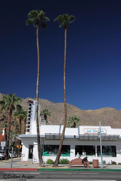
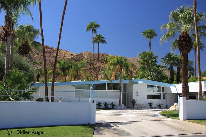
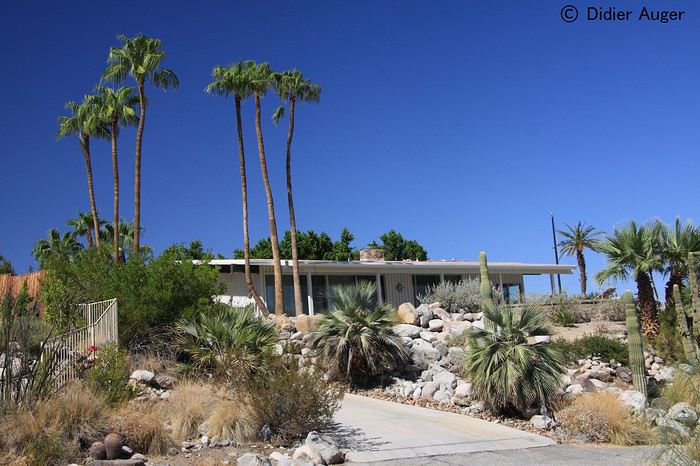
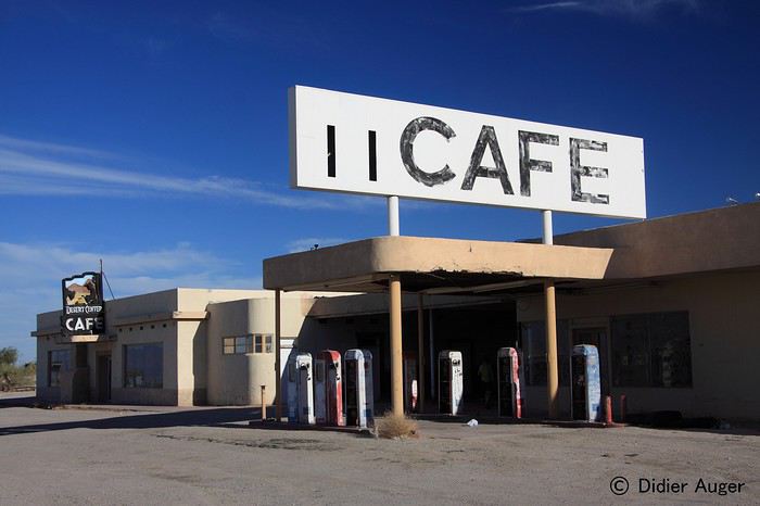
14 septembre : Mojave National Preserve Breakfast au resto d'en face (compris) et départ pour Mojave National Preserve, visite du Kelso Depot Visitor Center qui servait de station de ravitaillement pour la voie de chemin de fer en eau, petit musée intéressant à découvrir. Il fait déjà 37° à 10 am. Nous prenons un pique nique au départ du Rock Spring Loop Trail petite boucle dans le désert, facile. Une deuxième petite randonnée : Ring Loop Trail, une autre petite boucle qui se termine par une petite escalade par des anneaux en métal pour aider à se hisser à travers une faille, facile et ludique . Courses au Walmart (rien d'autre dans les alentours) retour à l'hôtel de Needles, il refait 41° à 7 p.m avec un vent qui souffle en rafales, piscine, dîner, dodo.
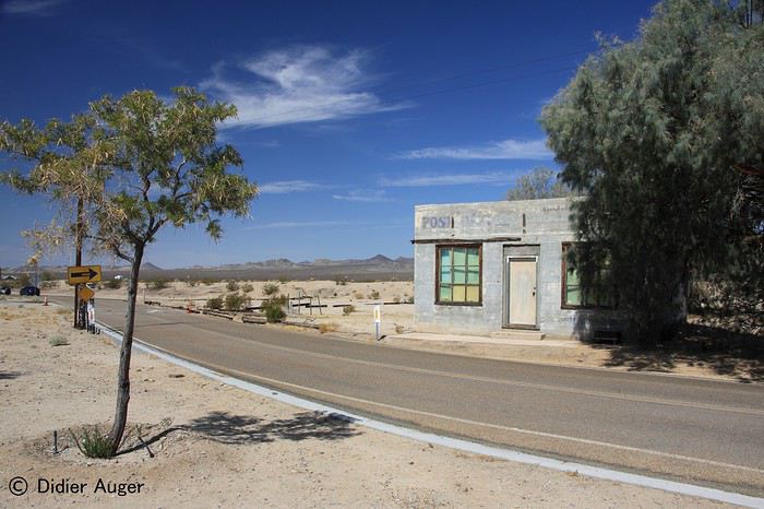
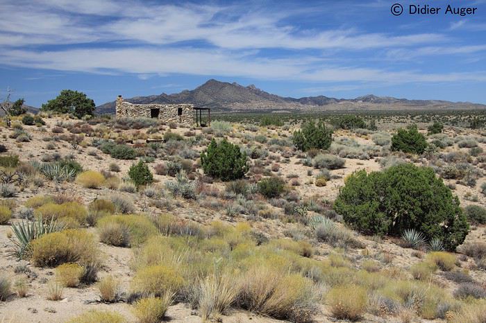
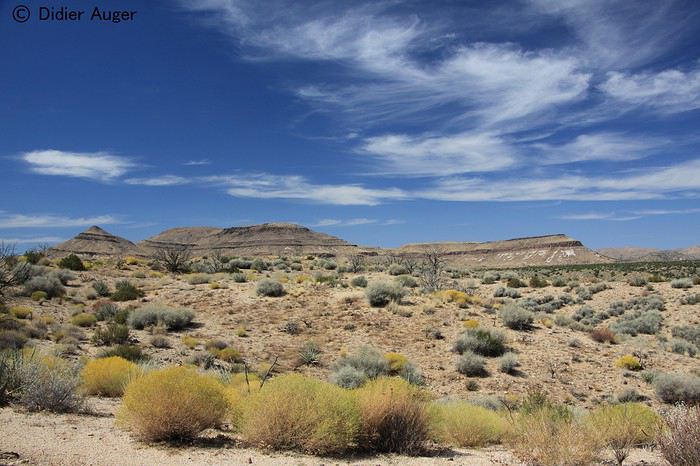
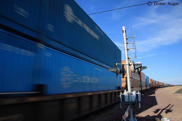
11 septembre /10 octobre
Nous ne devions pas retourner aux USA en 2019, nous voulions, après être venus quatre années consécutives aux États-Unis changer de destination, mais quand nous avons vu des vol AR Paris – LA à 307€ par personne, nous n'avons pas réfléchi bien longtemps ! Une fois le vol en poche, nous souhaitions retourner en Utah qui nous avait emballé l'année dernière et avions envie de prendre notre temps.
Voici différents sites visités pendant notre voyage :
Mojave National Preserve Route 66 (Needles – Kingman - Winslow) Homolovi State Park Bisties Badlands Hovenweep N.S.P Upper Butler Wash & Mule Canyon Lower Butler Wash
Alstrom Point (Lac Powell) Lee's Ferry - Glen Canyon NRA Lower Antilope Canyon Wahweap Hoodoos Cottonwood Road -Red Top Edmaier's Secret White Pocket Coral Pink Dunes SP Snow Canyon Yant Flat The Vortex Cedar Break NP Cathedral Gorge SP Highway 375 Extraterrestrial Highway Death Valley NP
11 septembre : Long Beach Départ pour Los Angeles avec Air France le 11 septembre, le décollage est prévu à 13h25, nous ne décollerons qu'à 15h10, à cause d'un problème de fermeture électrique d'une porte de soute, il aura fallu la fermer manuellement, soit 6000 tours de manivelle ! Arrivée à 5 p.m à LA, passage aux douanes plutôt rapide, récupération des bagages OK, et en route pour aller chercher notre voiture chez Alamo, dans notre catégorie nous trouvons une Nissan Rogue AWD, ce n'est pas ce qu'il y a de mieux, mais elle devrait faire l'affaire pour les pistes prévues. Arrivée à l'hôtel 8 p.m à Long Beach, dîner dans la chambre et dodo 10h30 p.m.
12 septembre : Palm Springs Lever assez tôt 6h30, en route pour un breakfast downtown, mauvaise surprise en arrivant à la voiture, une amende de 60$ sur le pare brise, tout ça parce que il y a un nettoyage dans la rue de 6 a.m à 8 a.m, dur, dur … Petit dej' en terrasse au soleil (œuf, bacon, pommes de terre...) hum !!! Courses chez Walmart notamment pour acheter une glacière, Whole Foods pour nos pique-niques et dîners, balade sur la plage, visite de l'aquarium de Long Beach, et en route pour Palm Springs, ça bouchonne un max, nous mettrons 3h15 pour y arriver, heureusement l'hôtel, le Movie Colony Hotel est super bien, dans le style Bauhaus, dîner sur notre grande terrasse privative, il fait encore très chaud, dodo à minuit.
3 septembre : Needles Après un un bon breakfast dans le patio, petit tour en ville et nous partons faire le Design Tour, pour admirer les splendides constructions avant-gardistes du début et milieu du XX° siècle, notamment celle de l'architecte Albert Frey disciple de Le Corbusier, ce sont des maisons magnifiques avec des jardins luxuriants, top classe ! Sous une T° de 40° nous partons en ce milieu d'après-midi pour Needles, arrêt à une station essence / restaurant où nous nous étions arrêtés en 1995, qui est désormais complètement abandonnée... Arrivée à notre hôtel BW vers 7.15 p.m tous à la piscine pour l'apéro sous 40° !!
14 septembre : Mojave National Preserve Breakfast au resto d'en face (compris) et départ pour Mojave National Preserve, visite du Kelso Depot Visitor Center qui servait de station de ravitaillement pour la voie de chemin de fer en eau, petit musée intéressant à découvrir. Il fait déjà 37° à 10 am. Nous prenons un pique nique au départ du Rock Spring Loop Trail petite boucle dans le désert, facile. Une deuxième petite randonnée : Ring Loop Trail, une autre petite boucle qui se termine par une petite escalade par des anneaux en métal pour aider à se hisser à travers une faille, facile et ludique . Courses au Walmart (rien d'autre dans les alentours) retour à l'hôtel de Needles, il refait 41° à 7 p.m avec un vent qui souffle en rafales, piscine, dîner, dodo.