Results for "Aigues-Mortes+|+127"
5359 results found.
Playa Pesquero 5* ou Gran Playa Turquesa? English translation pending
j ai la possibilité fin janvier de partir dans l un de ces 2 hotels mais je ne sais le quel choisir. pouvez vs m aider svp?🙂
Hôtel Hamaca Coral à Boca Chica English translation pending
SALUT A TOUS
MERCI DE ME DONNER VOS IMPRESSIONS SUR L'HOTEL HAMACA BEACH À BOCA CHICA EN REP DOM, IL EST PREVU QUE J'Y PASSE UNE SEMAINE PROCHAINEMENT, J'AURAIS SOUHAITE AVOIR VOS IMPRESSIONS.
PAR AILLEURS, JE REVIENS D'UN VOYAGE EN PATAGONIE CHILI-ARGENTINE, SI QUELQU'UN VEUT DES IMPRESSIONS N'HÉSITEZ-AUCUNEMENT.
A TRES BIENTOT AMICALEMENT FRANCOIS
MERCI DE ME DONNER VOS IMPRESSIONS SUR L'HOTEL HAMACA BEACH À BOCA CHICA EN REP DOM, IL EST PREVU QUE J'Y PASSE UNE SEMAINE PROCHAINEMENT, J'AURAIS SOUHAITE AVOIR VOS IMPRESSIONS.
PAR AILLEURS, JE REVIENS D'UN VOYAGE EN PATAGONIE CHILI-ARGENTINE, SI QUELQU'UN VEUT DES IMPRESSIONS N'HÉSITEZ-AUCUNEMENT.
A TRES BIENTOT AMICALEMENT FRANCOIS
Quel hôtel choisir? English translation pending
😉 pour un départ en novembre, avec mon mari.
Cherchons une idée d'hotel, surtout pas de tourisme de masse!.
J'aime le grand confort, danser le soir, bien et bon manger......
quelqu'un aurait un hotel à me proposer ?
Cherchons une idée d'hotel, surtout pas de tourisme de masse!.
J'aime le grand confort, danser le soir, bien et bon manger......
quelqu'un aurait un hotel à me proposer ?
Rio Luna Mares à Guardalavaca English translation pending
Bonjour,
j`arrive de Holguin (25oct.)j`étais loger au sol rio Luna Mares dans la section Luna, c`est vrai que cette section à faite peau neuve mais j`ai été décu un peu car sur les balcons pas de table, ni de chaise, pas très éclairé le soir, la plage est petite. Dans la section Mares beaucoup plus belle réception, restaurant buffet, la plage plus grande ainsi que la piscine mais bon j`étais là pour travailler. J`ai visitée tout les hôtels du coin de même que le nouveau Playa Turquesa qui est immense avec les 4 piscines de toute beauté mais faut aimer les grand complexe et le Villa covarrubias qui était à 2h30 d`où j`étais mais cela valait la peine beau complexe et plage magnifique quoi que très tranquille à cette période de l`année (28 clients)Si vous avez des questions concernant des hôtels de ce coin de pays cela me fera plaisirs d`y répondre au mieux de ma connaissance.
Guylaine
Hôtel Melia Caribe Tropical avec la Fram ou autre TO? English translation pending
Nous comptons visiter la RD en mai 2004 et envisageons de partir avec Fram, 1 semaine en circuit et une semaine au mélia caribe tropical.
Si vous avez des info des conseils ou le nom d'un autre tour operateur proposant la même formule nous sommes preneurs.
Merci d'avance.
Avons des renseignements sur le xpu-ha riviera maya au mexique
Si vous avez des info des conseils ou le nom d'un autre tour operateur proposant la même formule nous sommes preneurs.
Merci d'avance.
Avons des renseignements sur le xpu-ha riviera maya au mexique
Hôtel Melia Cayo Guillermo? English translation pending
🙂 Bonjour, Je pensais aller a melia cayo guillermo le 11 JANVIER 2004 pour un semaine. 😮J'y vais avec une gagne funny, et qui veut faire des activites.😄j'ai entendu parle de "Jungle tours", je me demandais si c'etait si le fun que ca l'air ? 😊 Et je me demandais si il y a quelqu'un qui a ete l'a bas en JANVIER ? Et comment a t'il trouver la temperature et tout.est-ce que c'est vrai quand frais de choix de restaurant et de bouffe c'est bof? Les chambres standard est-ce que c'est beau? Les chambres standard est-ce que c'est seulement sur la base des motels? 😕Car je veux etre au moins a un etage superieur. Est-ce qu'il y a aussi des gens qui connaisse quelqu'un qui se sont marier l'a bas ou qui l'ont fait eux meme? car moi je vais aussi me marier pendant mon sejour.
J'adore ce site je l'ai decouvert que resamment et j'y suis tres souvent maintenant. Vous etes tous tres interessant je suis contente qu'il y est ce site .😉 Donnez moi le plus d'informations possible s'il-vous plait ce sera tres aprecier . Merci beaucoup d'avance.
J'adore ce site je l'ai decouvert que resamment et j'y suis tres souvent maintenant. Vous etes tous tres interessant je suis contente qu'il y est ce site .😉 Donnez moi le plus d'informations possible s'il-vous plait ce sera tres aprecier . Merci beaucoup d'avance.
Superclub Breezes Punta Cana English translation pending
Bonjour,
Mon conjoint et moi envisageons un voyage de 2 semaines au Superclub Breezes de Punta Cana en février 2004 avec nos 3 enfants (4 - 6½ - 9 ans). On nous offre une suite familiale. Est-ce que quelqu'un d'entre vous y est déjà allé avec des jeunes enfants? Comment était-ce pour eux? Comment était le confort de la suite, si vous y êtes déjà allés? J'aimerais aussi avoir des commentaires sur le miniclub. Tous vos commentaires sont les bienvenus! Merci d'avance!!
Johanne
Mon conjoint et moi envisageons un voyage de 2 semaines au Superclub Breezes de Punta Cana en février 2004 avec nos 3 enfants (4 - 6½ - 9 ans). On nous offre une suite familiale. Est-ce que quelqu'un d'entre vous y est déjà allé avec des jeunes enfants? Comment était-ce pour eux? Comment était le confort de la suite, si vous y êtes déjà allés? J'aimerais aussi avoir des commentaires sur le miniclub. Tous vos commentaires sont les bienvenus! Merci d'avance!!
Johanne
Paludisme en Thaïlande? English translation pending
Salut a tous,
Bon, j'ai deja vu passer des debats sur le traitement anti-palu en Thailande (avec entre autres l'option ne rien prendre) mais je me pose la question pour un sejour de 3 semaines mi-octobre. En projet, l'est pour voir les temples Khmers a la frontiere avec le Cambodge, le nord et nord-est (chiang Mai et mekong) puis les iles du sud.
Si je suis la liste des pays par type (I, II et III) du chu de rouen (http://www.chu-rouen.fr/cap/palulist.html) : pour le centre et les villes : pas de traitement le sud : groupe I -> traitement preventif : Nivaquine le sud-ouest : groupe II -> traitement preventif : Savarine les zones frontalieres : groupe III -> traitement preventif : Lariam
Sur le site de l'institut pasteur, ils sont un peu moins bavard mais parlent de zone 1 et 3 dans le sud du pays
Alors, je prends quoi ???!!!🤪
Merci beaucoup pour vos conseils de voyageurs.
Bon, j'ai deja vu passer des debats sur le traitement anti-palu en Thailande (avec entre autres l'option ne rien prendre) mais je me pose la question pour un sejour de 3 semaines mi-octobre. En projet, l'est pour voir les temples Khmers a la frontiere avec le Cambodge, le nord et nord-est (chiang Mai et mekong) puis les iles du sud.
Si je suis la liste des pays par type (I, II et III) du chu de rouen (http://www.chu-rouen.fr/cap/palulist.html) : pour le centre et les villes : pas de traitement le sud : groupe I -> traitement preventif : Nivaquine le sud-ouest : groupe II -> traitement preventif : Savarine les zones frontalieres : groupe III -> traitement preventif : Lariam
Sur le site de l'institut pasteur, ils sont un peu moins bavard mais parlent de zone 1 et 3 dans le sud du pays
Alors, je prends quoi ???!!!🤪
Merci beaucoup pour vos conseils de voyageurs.
Hôtel Ocean arc decameron beach English translation pending
quelqu'un peut-il me renseigner sur l'hôtel océan arc decameron beach situé à juan dolio, je désire partir en janvier, je suis allée à punta cana l'an dernier et à boca chica en 2000. Mais cet hotel me tente mais comme les revues ne disent pas toujours tout . j'aimerais bien avoir l'opinion personnel de quelqu'un qui y est allé ou du mois qui en à entendue parlé...
merci
chantallou🙂
merci
chantallou🙂
Vos commentaires sur le Melia Caribe Tropical Punta Cana English translation pending
Bonjour, j'envisage réserver dans les prochains jours au Melia Caribe Tropical de Punta Cana pour 14 jours durant la période des fêtes. Nous sommes deux adultes et deux enfants de 8 et 10 ans. J'aimerais des commentaires précis sur cette hotel. Est-ce bien comme hotel ? Le site et les activités pour enfants ? Je sais qu'il est classé 5* dans les brochures de TMR et Tours maison mais j'aimerais quand avoir des commentaires de ceux qui y sont aller réceement. Merci
Jamais content ces voyageurs English translation pending
Bonjour à tous
Hé oui, je sais je sais les visages agressifs sont toujours accollés à mes discussions mais j'en suis désolé. Travaillant chez le Tour Operateur comme je le crois, vous commencez à le savoir pas mal. Cependant j'ai pris un appel bien particulier l'autre jour en travaillant et j'ai eu cette soudaine envie de vous la raconter.
Je prend l'appel d'une agente de voyage qui m'appelait seulement pour réserver un forfait avec moi quand tout d'un coup j'entend derrière l'agent une terrible voix qui se met à hurler haut et fort! L'agent s'excuse de ce bruit et commence à me raconter tout bas de quoi il s'agit. Cet homme sans classe et surtout mécontent, engueulait l'agente parce qu'il revenait d'un 2 semaines à Punta Cana au Caribe Club Princess et disait que c'était le pire hôtel qu'il n'avait jamais vu, que la nourriture n'était pas mangeable, que ça chambre était très mal situé en précisant que sa femme était handicapée, plage dégueulasse et tout le tra lala.
Bon bon bon, encore un passager mécontent !! Écoutez moi tous le monde, nous sommes présentement en basse saison ce qui veut dire que nous sommes ds le temps ou les hôteliers ne rochent pas. Donc à sa discrétion à lui, oui il a le droit de fermer quelques restos à la carte et oui il se peut qu'ils y est un peu moins de services qu'à l'habitude..........assez compréhensible si on pense à notre bussines à nous on ferait probablement la même chose en temps mort.
Le gars ce paye un 4* ou la mer n'a aucune algues et aucun corail à moins de 20 mètres, cette hôtel est renommé pour les familles ce qui veut dire 3 clubs pour enfants. Il y a un minimum de 3 restos à la carte et de + le buffet. L'hôtel est bien situé et il y a quand même en temps mort de l'animation légère ds la journée et spectacle régulier en soirée.
Alors, dans tout ça le gars à même pas réussit à trouver son minimum de bonheur à espérer. Un passager débrouillard aurait probablement demandé à l'hôtelier de le faire changer de chambre vu que sa femme est handicapé et je suis même sûre qu'il aurait accepté vu les circonstances, ce n'était pas un caprice !!
Segundo, 2 semaines quand on n'aime pas l'htl c long en ................. ! mais y'a des représentante francophone qui sont là juste pour ça et quand vous êtes en estis (pardon) ben essayez de changer d'htl mais ça c'est très possible en basse saison sauf que oui tu vas payer la différence de l'autre et non on rembourse pas la différence si tu payes moins cher !! Alors c tas sortit 100$ de plus pour l'autre htl et que tu reviens heureux ben ça valait tu la peine tu penses ???
Entoucas c mon avis et je peux encore ajouter que vos commentaires sont les bienvenus ! Même si je travaille ds le domaine et que je ne fais que chialer ben dites vous que je suis quand même très dévoué à ces passagers quand le problèmes c a mon tour de le régler.
Racielle
Hé oui, je sais je sais les visages agressifs sont toujours accollés à mes discussions mais j'en suis désolé. Travaillant chez le Tour Operateur comme je le crois, vous commencez à le savoir pas mal. Cependant j'ai pris un appel bien particulier l'autre jour en travaillant et j'ai eu cette soudaine envie de vous la raconter.
Je prend l'appel d'une agente de voyage qui m'appelait seulement pour réserver un forfait avec moi quand tout d'un coup j'entend derrière l'agent une terrible voix qui se met à hurler haut et fort! L'agent s'excuse de ce bruit et commence à me raconter tout bas de quoi il s'agit. Cet homme sans classe et surtout mécontent, engueulait l'agente parce qu'il revenait d'un 2 semaines à Punta Cana au Caribe Club Princess et disait que c'était le pire hôtel qu'il n'avait jamais vu, que la nourriture n'était pas mangeable, que ça chambre était très mal situé en précisant que sa femme était handicapée, plage dégueulasse et tout le tra lala.
Bon bon bon, encore un passager mécontent !! Écoutez moi tous le monde, nous sommes présentement en basse saison ce qui veut dire que nous sommes ds le temps ou les hôteliers ne rochent pas. Donc à sa discrétion à lui, oui il a le droit de fermer quelques restos à la carte et oui il se peut qu'ils y est un peu moins de services qu'à l'habitude..........assez compréhensible si on pense à notre bussines à nous on ferait probablement la même chose en temps mort.
Le gars ce paye un 4* ou la mer n'a aucune algues et aucun corail à moins de 20 mètres, cette hôtel est renommé pour les familles ce qui veut dire 3 clubs pour enfants. Il y a un minimum de 3 restos à la carte et de + le buffet. L'hôtel est bien situé et il y a quand même en temps mort de l'animation légère ds la journée et spectacle régulier en soirée.
Alors, dans tout ça le gars à même pas réussit à trouver son minimum de bonheur à espérer. Un passager débrouillard aurait probablement demandé à l'hôtelier de le faire changer de chambre vu que sa femme est handicapé et je suis même sûre qu'il aurait accepté vu les circonstances, ce n'était pas un caprice !!
Segundo, 2 semaines quand on n'aime pas l'htl c long en ................. ! mais y'a des représentante francophone qui sont là juste pour ça et quand vous êtes en estis (pardon) ben essayez de changer d'htl mais ça c'est très possible en basse saison sauf que oui tu vas payer la différence de l'autre et non on rembourse pas la différence si tu payes moins cher !! Alors c tas sortit 100$ de plus pour l'autre htl et que tu reviens heureux ben ça valait tu la peine tu penses ???
Entoucas c mon avis et je peux encore ajouter que vos commentaires sont les bienvenus ! Même si je travaille ds le domaine et que je ne fais que chialer ben dites vous que je suis quand même très dévoué à ces passagers quand le problèmes c a mon tour de le régler.
Racielle
Hotel Catalonia Bavaro Beach Casino Golf Resort English translation pending
🙂 Pouvez-vous me donner des info sur l'hotel Catalonia Bavaro Resort 5***** à Punta Cana, et me dire comment vous l'avez trouvé, et les excusions à faire et à ne pas faire. Merci d'avance 😇
Hôtel Catalonia bavaro English translation pending
Bonjour,
Est-ce que quelqu'un aurait des commentaires du Catalonia Bavaro en rép. dom? Mon copain et moi allons peut-être y aller en début de mai avec des amis. Étant dans la début vingtaine, on recherche un endroit où la clientèle est assez jeune.
Merci d'avance 🙂
Erika
Est-ce que quelqu'un aurait des commentaires du Catalonia Bavaro en rép. dom? Mon copain et moi allons peut-être y aller en début de mai avec des amis. Étant dans la début vingtaine, on recherche un endroit où la clientèle est assez jeune.
Merci d'avance 🙂
Erika
Apprendre le chinois en Chine English translation pending
Bonjour tout le monde,
l'année prochaine (c'est bientôt), j'aimerai aller en Chine pour trois mois (juillet-sept).
J'aimerai y aller pour apprendre le chinois à l'université soit à Nanjing soit à Chengdu.
Quelqu'un pourrait-il me faire part de son expérience dans un de ces coins?
Quelqu'un a déjà eu contact avec educhine.com pour partir ?
J'ai déja essayé de contacter l'université de Nanjing sans succès...
Merci à tous a +😉
Quelqu'un pourrait-il me faire part de son expérience dans un de ces coins?
Quelqu'un a déjà eu contact avec educhine.com pour partir ?
J'ai déja essayé de contacter l'université de Nanjing sans succès...
Merci à tous a +😉
Tunisian Impressions (Live)
Hi there,
I arrived in Tunisia this afternoon for a full 14-day stay.
I took a direct Tunisair flight from Nice, which departed about thirty minutes late (that’s nothing compared to the "nightmares" I’ve had on some of my recent trips).
The flight lasts around 1 hour and 20 minutes, and a small snack was served on board (a sort of quiche with chickpea purée, a small bread roll, a portion of cheese like La Vache qui rit, and a small chocolate cake). It’s worth mentioning because it’s becoming increasingly rare on short flights. I was seated between two Tunisian gentlemen who gave me some great tips for my trip, especially about negotiating prices. One of them is a former cameraman for France Télévisions, very cultured and well-traveled—his daughter is a journalist at France Télévisions (I found some of her articles online). In short, the flight was very pleasant and quick.

I’m staying at the Hôtel Royal Victoria. I booked it yesterday afternoon by email without providing my credit card number. The room costs 241 TND (71 €) with breakfast included. It has heating, a small fridge, a safe, a hairdryer, Wi-Fi, and a TV with international channels. There’s a police van permanently parked in the square where the hotel is located.
This hotel is housed in the former British consulate and later embassy. It has a lot of charm with its painted wood ceilings and doors, and its bathroom covered in ceramic tiles. The tiny elevator is from another era. The main advantage of the hotel is its location between the medina and Avenue Bourguiba. Nearby, there’s the Magasin Général, where you can find groceries and some typical products like rose water, geranium water, and tons of halwa (a customer kindly explained how to eat it and which is the best).
After nightfall, I took a short stroll down Avenue Bourguiba. There weren’t many people around—it’s windy and cold.
I’ve already noticed the warm welcome from Tunisians. The supermarket cashier welcomed me to Tunisia, and a gentleman I asked for directions to the Magasin Général (I was about to climb stairs leading to a mosque!) insisted on inviting me for coffee, but I declined.
The rest of my itinerary will depend on the weather. If it doesn’t rain tomorrow, I might visit Carthage since the Bardo Museum is closed on Mondays, as are the museums in Sidi Bou Said.
TO BE CONTINUED...


I arrived in Tunisia this afternoon for a full 14-day stay.
I took a direct Tunisair flight from Nice, which departed about thirty minutes late (that’s nothing compared to the "nightmares" I’ve had on some of my recent trips).
The flight lasts around 1 hour and 20 minutes, and a small snack was served on board (a sort of quiche with chickpea purée, a small bread roll, a portion of cheese like La Vache qui rit, and a small chocolate cake). It’s worth mentioning because it’s becoming increasingly rare on short flights. I was seated between two Tunisian gentlemen who gave me some great tips for my trip, especially about negotiating prices. One of them is a former cameraman for France Télévisions, very cultured and well-traveled—his daughter is a journalist at France Télévisions (I found some of her articles online). In short, the flight was very pleasant and quick.
I’m staying at the Hôtel Royal Victoria. I booked it yesterday afternoon by email without providing my credit card number. The room costs 241 TND (71 €) with breakfast included. It has heating, a small fridge, a safe, a hairdryer, Wi-Fi, and a TV with international channels. There’s a police van permanently parked in the square where the hotel is located.
This hotel is housed in the former British consulate and later embassy. It has a lot of charm with its painted wood ceilings and doors, and its bathroom covered in ceramic tiles. The tiny elevator is from another era. The main advantage of the hotel is its location between the medina and Avenue Bourguiba. Nearby, there’s the Magasin Général, where you can find groceries and some typical products like rose water, geranium water, and tons of halwa (a customer kindly explained how to eat it and which is the best).
After nightfall, I took a short stroll down Avenue Bourguiba. There weren’t many people around—it’s windy and cold.
I’ve already noticed the warm welcome from Tunisians. The supermarket cashier welcomed me to Tunisia, and a gentleman I asked for directions to the Magasin Général (I was about to climb stairs leading to a mosque!) insisted on inviting me for coffee, but I declined.
The rest of my itinerary will depend on the weather. If it doesn’t rain tomorrow, I might visit Carthage since the Bardo Museum is closed on Mondays, as are the museums in Sidi Bou Said.
TO BE CONTINUED...
Trip to Thailand and Laos
Hello! 🙂
January 2026 Here we go again for new adventures and the pleasure of sharing them with you here! First of all, I’d like to thank everyone who helped me with the preparations, even with some last-minute improvisations just days before departure. Thanks to Montagnard74, Jojoone1, Songsam, Attila, Dennis2, NadegerFERM, and the authors whose travel journals about Laos inspired me (Montagnard74, Muriel18, Mavietongs...).
In this story, written by Richard and illustrated by me, we’ll tell you about the journey of four friends: Catherine, Richard, Nathalie, and Bruno. A reinvented but overall successful trip, filled with discoveries and surprises, the scents of spices and frangipani flowers, (too) spicy food, sunsets, and... one big mess.
January 2026 Here we go again for new adventures and the pleasure of sharing them with you here! First of all, I’d like to thank everyone who helped me with the preparations, even with some last-minute improvisations just days before departure. Thanks to Montagnard74, Jojoone1, Songsam, Attila, Dennis2, NadegerFERM, and the authors whose travel journals about Laos inspired me (Montagnard74, Muriel18, Mavietongs...).
In this story, written by Richard and illustrated by me, we’ll tell you about the journey of four friends: Catherine, Richard, Nathalie, and Bruno. A reinvented but overall successful trip, filled with discoveries and surprises, the scents of spices and frangipani flowers, (too) spicy food, sunsets, and... one big mess.
Nepal Feedback
NAMASTE NEPAL! PRACTICAL INFO AND EXPERIENCE FEEDBACK
Stay from March 25 to April 16, 2025
· Flight tickets Air India (via Delhi) (via Skyscanner) = 1130 € per person · Planned budget (and respected without too many restrictions and while buying a few small gifts) = 2000 € for the stay for two. Buses, taxis, and entrance fees to various sites represent a budget to consider. Meals are cheap. Drinks like beer/Coke, however, are not cheap and cost the equivalent of a meal. · Exchange rate of the rupee during our stay = 0.0064 € (the exchange rate is almost identical everywhere, including at the airport). · At the airport, purchase of two SIM cards (phone) = 1000 NPR x 2 for 28 days. · Kathmandu: we had booked the hotel upon arrival: Kathmandu Boutique Hotel (+977 015 357 446 – email: booking@kathmanduboutiquehotel.com), very well located in a quiet alley off the street, south of Thamel, a 10-minute walk from Durbar Square. A hotel like Nepal knows how to do, where tall people will have to duck. Night + breakfast = 18 € for two. Very warm welcome, great location, excellent value for money. · Bhaktapur: we had also booked a hotel for the end of our stay because the chance of the year 2025 made the Nepali New Year and Bisket Jatra particularly festive in Bhaktapur: Manju Baha Hotel School (+977 976 7234014 – email: manjubahahotel@gmail.com) located in an old monastery. "A social enterprise transforming an old monastery into a charming hotel, offering professional hospitality training to underprivileged Nepali youth." Night + breakfast = 32 € for two. Beautifully decorated room. Very warm welcome. Don’t miss the Changunarayan site (near Bhaktapur), it’s amazing. And if you’re lucky enough to be in Bhaktapur in mid-April for 3 days, there’s the Bisket Jatra festivities (Newari festival), joyful, noisy, fun, and wild… · Pokhara (hotel recommended by the Kathmandu hotel): Hotel Green Tara, Lakeside, 10th street, set back, quiet (Tel. +977 61 462698 – email: greentara_67@hotmail.com) · Trek permit (Lower Mustang, no need for an agency or guide, permits checked at Ghasa and Jomsom) = 2000 NPR per person (2 ID photos) · Bus Kathmandu/Pokhara and return = 2000 NPR per person · Bus Pokhara/Jomsom, 2 one-way tickets = 2800 NPR. · Taxi: negotiation with a driver we recommend, Vicky (+977 984 075 599). You explain what you want, negotiate the price, and he waits for you during the visit. Very charming, we used him several times. For example: departure from our hotel at 10 AM -> Boudhanath/Pashupatinath/Patan return at 5 PM to the hotel = 6500 NPR – Swayambhunath (round trip) = 1200 NPR · Site prices: https://ntb.gov.np/plan-your-trip/before-you-come/heritage-site-entry-fees o Visitor Pass for Kathmandu Durbar Square (for the duration of the stay, show your visa) = 1000 NPR per person (1 ID photo) o Bhaktapur Durbar Square (old town) = 1800 NPR per person o Patan = 1000 NPR per person o Swayambhu Stupa = 200 NPR per person o Boudha Stupa = 200 NPR per person o Pashupatinath Temple = 1000 NPR per person (interesting to take a guide) o Changunarayan Temple (6 km north of Bhaktapur) = 400 NPR per person o Mountain Museum in Pokhara = 750 NPR per person · E-cigarettes: e-cigarettes are banned in India and confiscated whether they’re in carry-on or checked luggage. On the way there, we had kept them in our carry-on, they were confiscated in Delhi. On the way back, learning from our previous experience, we put them in our checked luggage. Someone came to get us to take them out of our bags and confiscate them… You can find e-cigarettes and products in Kathmandu.
* * *
I’m 74 years old. I went to Nepal in 1982, 1983, and the last time in 1986. I wanted to introduce this beautiful and endearing country to my husband, and it was… now or never. So we decided it was now.
I knew the trek starting from Pokhara: Naudanda/Birethanti/Ghorepani/Tatopani/Kalopani. There was no way I was going to do that trek, especially the 1000-meter staircase to reach Ghorepani… You have to stay humble with age.
Back then, the road didn’t exist. I didn’t consider, with the construction of this road (NH48) along the western bank of the Kali Gandaki, doing a trek along a windy and dusty road. Was there an alternative hiking trail on the eastern bank? No one answered my question on VoyageForum, so I did my research online. And I found this site: "Andrées de Ruiter and Prem Rai - Trekking the Annapurna Circuit, including the new NATT trails that avoid the road - A guide to one of the most beautiful trekking regions in Nepal and the world (2011) - NATT = New Annapurna Trekking Trail".
Phew! A solution was emerging. This circuit from 2011 wasn’t fully marked. The idea was to go from Jomsom to Tatopani, so we needed to make sure the path was well-marked all the way, which we did, and the path exists, marked in red and white!
So, with the walking times information, we built our 8-day circuit:
· Jomsom/Thinigaon · Thinigaon/Chimang · Chimang/Saura · Saura/Kokhetanti · Rest day or, if in good shape: loop to Sekong Lake · Kokhetanti/Jhipra Deurali · Jhipra Deurali/Kopchepani · Kopchepani/Tatopani
It’s a senior trek, after all. So the walking times noted on the sites indicated 3 hours or even 4 hours for the two longest stages. That pace suited us fine.
On March 29, we left Kathmandu (1400m), after visiting the must-see sites, by bus to Pokhara: 200 km and 8.5 hours on a chaotic road under construction. I had a memory of Pokhara where it was the first city where you could see the Himalayan range, especially Machhapuchhare. But the pollution is such, the dust raised by traffic and construction, that no horizon is visible except the first hills around Pokhara.
We stayed 24 hours in Pokhara (820m), and on March 31, we left our luggage at the hotel and set off with our lightest backpacks: change of clothes, toiletries, first aid kit, anti-chafing cream, water bottle, sleeping bag liner, and light shoes for the stages.
We took the bus to Jomsom: 160 km/7.5 hours including stops for bathroom breaks, tea, and lunch. The road is nothing but a chaos of potholes, landslides, construction, dust, rebuilding, and mudslides. In Ghasa, the bus stops, and we’re told we’re at a checkpoint and that the two foreigners in the bus, my husband and I, need to have our permits checked, which takes a few minutes. The driving is rock-and-roll, surprising, and courteous. The drivers have their codes, and on these improbable roads, they’re virtuosos.
We could have chosen the plane, but several reasons dissuaded us: if there’s too much wind, the planes don’t take off; personally, I wasn’t reassured about landing in Jomsom, and this transport has a cost.
We arrived around 2 PM in Jomsom (2720m), and despite the early wake-up, the nearly 8 hours on the bus, and the altitude, we decided to head straight to Thinigaon (2840m). At the Jomsom checkpoint, they told us it was a 30-minute walk. Great! Except we took an hour and a half on an uphill road, bent over to fight a strong wind. But the Himalayan range is there! The Dhaulagiri, the Nilgiri, the Annapurnas as a reward.
In Thinigaon, we found a room at the "Nilgiri View Hotel" run by a didi (big sister in Nepali). From the lodge’s roof, she proudly showed us the different peaks surrounding the village and told us, worried, that it hadn’t snowed here for 3 years. She said there are very few tourists, that the season is rather in September/October/November. It seems there’s not a soul in this village, yet mules pass through the narrow street paved with large flat stones, their bells ringing. We dine at 6 PM and go to bed… Room = 1200 NPR and dinner, breakfast, and drinks = 2560 NPR.
On April 1, we set off at 9 AM, not for Chimang as planned but for Marpha! The didi from the Thinigaon lodge had said it was a 3-hour walk. The first part of this stage is attractive, the mountains are magnificent and imposing, the landscape is superb, there’s no one around, a feeling of being "alone in the world." We follow Dhumbra Tal, this small green lake. The path is a rocky track that climbs steeply. Then, around a hill, we start the big descent that joins the Kali Gandaki. We face the wind head-on, and the violent gusts take our breath away, throw us off balance, and envelop us in dust. We see the road on the other side of the Kali Gandaki. We arrive in the village of Chhairo at 2 PM, completely exhausted and with blistered feet, after 5 hours of walking instead of the planned 3.5 hours.
We’re welcomed by the village nurse, who tells us there’s a lodge in the village. Chhairo is a Tibetan village, a 20-minute walk from Marpha (according to the locals, multiply by 2 or even 3 for us…). We’re going to revise our trek plan and, first of all, spend the night in Chhairo.
The lodge is quite pleasant, and Karma, the hostess, is very friendly. She asks about our plans and suggests we stay in Chhairo the next day, from where we can visit Marpha and also Chimang, a 1-hour walk away, in light mode, meaning without backpacks. She invites us to participate in a village ceremony the next evening.
We immediately accept the proposal, as our feet need rest and the welcome is so warm… Dinner and bed!
We reworked our trek plan, which was too ambitious for our untrained bodies and, let’s face it… no longer in our first youth. In the initial plan, we thought there wouldn’t be too much elevation gain following the Kali Gandaki, but checking the map, we realize there might be significant elevation changes between Sauru and Sirkung. So we plan:
· Tomorrow: visit Marpha (2670m) and Chimang (2744m) · April 3: bus from Chhairo (2700m) to Kalopani (2530m) and continue on foot to Ghasa (2010m) · April 4: Ghasa/Pairataplo (1940m) · April 5: Pairatapla/Gadpar (1580m) · April 6: Gadpar/Narchyang (1510m) · April 7: Narchyang/Tatopani (1190m) · April 8: return to Pokhara.
Normally, it’s all downhill…
April 2, a rest day then… We set off in the morning to explore Marpha. We have to take a temporary bridge because the suspension bridge is closed due to road construction. We join the road and arrive in Marpha, a village famous for its apple orchards, brandy, cider, and apple juice production. This village is magnificent with its stone houses and monastery clinging to the hillside. The road construction spared it. There are people, but very few Western tourists.
We have lunch in Marpha and go back through Chhairo to take the path to Chimang. We cross a fragrant pine forest and find the rocky path; the landscape is splendid. We walk quietly, passing peaceful buffaloes and cows, and arrive at the foot of a stone staircase… 275 steps (which we counted on the way back) leading us to the village of Chimang. Chimang is an isolated Newari village that seems a bit desolate. Despite the slopes, there are crops on every little bit of land. Thankfully, we changed our initial program because there’s no lodge in this village, contrary to what we saw on a map… We wander through the village, which seems very deserted, have coffee in a house from another world, and then head back to Chhairo.
A rest day? = 5 hours of walking!!
Dinner and village ceremony. From what we understand, this ceremony is in honor of the Dalai Lama. Men, women, and children in traditional costumes gather twice a month; they dance, make, and offer small sweet cakes with Tibetan tea (made from tea, yak butter—often rancid—water, and salt). Surprising for first-timers…
Around 10 PM, we leave the ceremony; tomorrow morning, we need to be on the roadside by 7 AM to catch the bus to Kalopani…
This village of Chhairo is very pleasant and welcoming, no tourists, just two motorcyclists who arrived in the evening, one of whom participated in the ceremony and discreetly poured his Tibetan tea outside.
Lodge: "Norsang Tibetan Guesthouse and Restaurant". Total bill for 2 nights, 2 dinners, 2 breakfasts, and drinks = 8000 NPR.
April 3: bus from Chhairo to Kalopani, about 1.5 hours for the 20 km (200 NPR per person). We descend on the right bank of the Kali Gandaki. We find the red and white markings to resume the trek toward Ghasa. We’re in a fragrant pine forest, the Dhaulagiri on one side and the Annapurnas on the other, magnificent, and the path is pleasant and easy. We get a bit lost in this forest, always looking for the markings. Near Lete, two trekkers pass us, and we meet them again a little further on with two very young children, to whom we give the 2 hard-boiled eggs I didn’t eat this morning. They accepted them without hesitation.
We arrive in a village and ask for directions to Ghasa. The young girls point the way. But we come across a forest being logged, trees cut in all directions. We turn back and ask for confirmation. They confirm… But the two young girls catch up with us and clear the way. We have to step over, go around, and cross the felled trees, with no indication at all. Through this pick-up sticks of felled trees, the girls lead us to the top of a stone staircase, indicating that was the path. It’s the only place where we saw rhododendrons in bloom.
We descend the staircase. At the bottom, to the left, there’s a bridge to go toward Choyo, and to the right, a path to Ghasa. We take the right path and join the road. We should normally find the red and white markings, but we don’t… So we continue on the western bank road of the Kali Gandaki.
A little before the village of Misi, we see fumaroles on the opposite bank that seem to come from the ground. We don’t understand. We stopped to eat in the village of Misi (noodle soup = 600 NPR), but it’s hard to communicate with the elderly people running the guesthouse.
We continued on the road, not finding the marked path parallel to the road. Landslides, both on the left and right banks, seem to have taken over the marked routes. It’s a place where the Kali Gandaki gorge narrows, and on the opposite bank, the mountain smokes more and more, and we now hear the crackling of fire. Across from us, the mountain is burning… Our initial plan had us passing on that burning bank right now…
We arrive in Ghasa at 3:30 PM, a 6.5-hour stage but with a 1-hour stop at noon. We’re at the "Florida Guesthouse and Restaurant." From our room, we see the mountain smoking on the other side of the river, and at night, we see the flames. In this village, posters show Himalayan eagles and vultures that seem to be protected species. Indeed, we saw (and heard) 3 eagles circling today.
April 4 – Today, heading to Pairothapla or Kopchepani depending on our feet, accommodation options, and simply our desires.
No more smoke on the mountain this morning. It’s chilly, 7:45 AM, the sky is clear, just a smell of smoke outside.
Price of the lodge = 1000 NPR for the night + 3580 NPR for meals.
We cross Ghasa, which stretches over more than a kilometer. We have a drink at the last guesthouse in the village, and the didi, when she learns our destination, tells us to be careful because the villages we’re going to aren’t safe. Should we distribute our rupees in different pockets? Nah, we kept going.
At the exit of Ghasa, we find the red and white markings and take the suspension bridge to cross the boiling waters of the Kali Gandaki. The passage is impressive because the river is tumultuous. Lots of climbs and even more descents. We’re back on the eastern bank. It’s hot! On the narrow path, we meet a group of buffaloes. Who has the right of way? We decide to stick as close as possible to the rock wall and move forward calmly. The buffaloes look at us, chewing placidly, with no intention of jumping on us. Phew!
After a 5-hour stage (including stops), we arrive in Pairothapla, with hot feet and firm thighs, and decide we won’t go any further. It’s a good thing because there’s a lodge, the most basic so far, but with a great welcome. We have a meal and a short nap. The buffaloes we met on the way belong to this house. They come to drink at the fountain by the path.
Our host, very pleasant, doesn’t know what to do to please us and is very attentive. He wants to chat. He has two children, a 4-year-old girl and a 7-year-old boy. Where do they go to school? Do they go? He tells us that the fires in the mountain are caused by people, but for what reason? We won’t find out, but it’s illegal. From here, we can still see smoke rising in the distance. The wife is a bit less friendly. Corn kernels dry on a woven straw mat on the ground, and the mom sorts them.
From where we are, we overlook the valley and see the road under construction winding along the mountainside on the other bank.
Dinner on the terrace of the house overlooking the path, windbreaker and fleece on: dal bhat chicken for me and chicken curry for my husband: "organic" products, at least local production. There are small vegetable gardens everywhere with all sorts of vegetables.
April 5 – While we’re having breakfast on the terrace of our lodge, 5 porters, straps on their foreheads, heavily loaded, pass by on the path. A few minutes later, a group of 9 people appears. It must be said that since the beginning of our journey, we’ve met very few hikers. Two backpackers in Chhairo, the two hikers near Lete, two female hikers passed us before Pairothapla, a solo female hiker passed us…
The lodge in Pairothapla is called "Bimala Lodge & Thakali Kitchen" – Price for night + 4 meals + 2 breakfasts = 3000 NPR.
The descent toward the Kali Gandaki involves climbs whose steps we didn’t count. Clearly, the landslides on the mountain cause changes to the official ACAP trek marked in red and white, and the marking updates can’t keep up with the pace of these landslides. It’s almost always by chance that we find the markings. Fortunately, we can follow the power line that guides us somewhat.
Drink stop in Kopchepani, the legs are fine, but the feet don’t like being tightly enclosed. A group of trekkers with porters passes on the path. We met buffaloes that we kindly let pass; the path was wide enough, but it was a staircase going up, and we didn’t want to take any risks.
Across, a view of the magnificent Rupse Waterfall on the other bank of the Kali Gandaki, at the bottom, lots of vehicles and people.
Arrival in Gadpar after crossing a rather unwelcoming small village and cultivated gardens between dry stone walls, each better built than the last.
First lodge spotted, first lodge adopted to answer the call of our feet, and a very warm welcome from the owner. Since we hadn’t eaten at noon, we had Tibetan bread/jam. 6-hour stage including 1 hour of stops. Night + dinner + breakfast + drinks = 5060 NPR
April 6 – Today, heading to Narchyang.
For several days, we’ve seen banana trees with their bunches of fruit and even a prickly pear with large fruits ripening.
This stage is quite peaceful and pleasant. We take a suspension bridge to cross a tributary of the Kali Gandaki. While we’re resting for a moment before crossing the bridge, a couple of porters, a man and a woman, arrive and start across the bridge with their wood load in a basket held by a strap on their forehead, making them bend. We set off too… lighter than them.
On the other side of the bridge… a stone staircase, and it climbs steeply. The porter couple didn’t take this staircase; they went right on the path.
At the top of the staircase, we arrive in Narchyang after a 4-hour stage. A magnificent waterfall overlooks the village. We get lost in this fairly large village looking for a lodge. After wandering around for a while, we ask for directions, and an 84-year-old man takes us through the whole village and accompanies us to a very nice lodge run by a woman.
We chat with our hostess, who asks where we’re from and where we’re going. We explain that we want to reach Tatopani the next day and then return to Pokhara. She tells us there are 4x4s going directly to Pokhara and that it would probably be easier than taking a bus that might be full in Tatopani. After a quick consultation, we decide to return to Pokhara the next day by 4x4. She finds us a 4x4 with 2 seats left, departure at 8 AM – 5 hours on the road and 1500 NPR per person. A charming didi who does everything to be pleasant and helpful.
Narchyang community lodge = night + snacks + dinner + breakfast = 3000 NPR.
There you go, our trek ends tomorrow. Many necessary changes and adaptations to our initial trek, but no regrets, it was superb and a great experience that, for my part, I won’t be able to repeat. Always this encounter with the endearing, welcoming, curious, and very kind Nepali people. It was now or never, and we did it!
* * *
In conclusion, 3 full weeks in Nepal is a duration that allows visiting Kathmandu, Patan, and Bhaktapur, enjoying the various sites, and soaking in the atmosphere and urban Nepali life.
The trek, even revised and corrected, allowed us to get close to the impressive Annapurna and Dhaulagiri peaks. One or two acclimatization days might be necessary to get the body in tune with this magical and extraordinary land.
Stay from March 25 to April 16, 2025
· Flight tickets Air India (via Delhi) (via Skyscanner) = 1130 € per person · Planned budget (and respected without too many restrictions and while buying a few small gifts) = 2000 € for the stay for two. Buses, taxis, and entrance fees to various sites represent a budget to consider. Meals are cheap. Drinks like beer/Coke, however, are not cheap and cost the equivalent of a meal. · Exchange rate of the rupee during our stay = 0.0064 € (the exchange rate is almost identical everywhere, including at the airport). · At the airport, purchase of two SIM cards (phone) = 1000 NPR x 2 for 28 days. · Kathmandu: we had booked the hotel upon arrival: Kathmandu Boutique Hotel (+977 015 357 446 – email: booking@kathmanduboutiquehotel.com), very well located in a quiet alley off the street, south of Thamel, a 10-minute walk from Durbar Square. A hotel like Nepal knows how to do, where tall people will have to duck. Night + breakfast = 18 € for two. Very warm welcome, great location, excellent value for money. · Bhaktapur: we had also booked a hotel for the end of our stay because the chance of the year 2025 made the Nepali New Year and Bisket Jatra particularly festive in Bhaktapur: Manju Baha Hotel School (+977 976 7234014 – email: manjubahahotel@gmail.com) located in an old monastery. "A social enterprise transforming an old monastery into a charming hotel, offering professional hospitality training to underprivileged Nepali youth." Night + breakfast = 32 € for two. Beautifully decorated room. Very warm welcome. Don’t miss the Changunarayan site (near Bhaktapur), it’s amazing. And if you’re lucky enough to be in Bhaktapur in mid-April for 3 days, there’s the Bisket Jatra festivities (Newari festival), joyful, noisy, fun, and wild… · Pokhara (hotel recommended by the Kathmandu hotel): Hotel Green Tara, Lakeside, 10th street, set back, quiet (Tel. +977 61 462698 – email: greentara_67@hotmail.com) · Trek permit (Lower Mustang, no need for an agency or guide, permits checked at Ghasa and Jomsom) = 2000 NPR per person (2 ID photos) · Bus Kathmandu/Pokhara and return = 2000 NPR per person · Bus Pokhara/Jomsom, 2 one-way tickets = 2800 NPR. · Taxi: negotiation with a driver we recommend, Vicky (+977 984 075 599). You explain what you want, negotiate the price, and he waits for you during the visit. Very charming, we used him several times. For example: departure from our hotel at 10 AM -> Boudhanath/Pashupatinath/Patan return at 5 PM to the hotel = 6500 NPR – Swayambhunath (round trip) = 1200 NPR · Site prices: https://ntb.gov.np/plan-your-trip/before-you-come/heritage-site-entry-fees o Visitor Pass for Kathmandu Durbar Square (for the duration of the stay, show your visa) = 1000 NPR per person (1 ID photo) o Bhaktapur Durbar Square (old town) = 1800 NPR per person o Patan = 1000 NPR per person o Swayambhu Stupa = 200 NPR per person o Boudha Stupa = 200 NPR per person o Pashupatinath Temple = 1000 NPR per person (interesting to take a guide) o Changunarayan Temple (6 km north of Bhaktapur) = 400 NPR per person o Mountain Museum in Pokhara = 750 NPR per person · E-cigarettes: e-cigarettes are banned in India and confiscated whether they’re in carry-on or checked luggage. On the way there, we had kept them in our carry-on, they were confiscated in Delhi. On the way back, learning from our previous experience, we put them in our checked luggage. Someone came to get us to take them out of our bags and confiscate them… You can find e-cigarettes and products in Kathmandu.
* * *
I’m 74 years old. I went to Nepal in 1982, 1983, and the last time in 1986. I wanted to introduce this beautiful and endearing country to my husband, and it was… now or never. So we decided it was now.
I knew the trek starting from Pokhara: Naudanda/Birethanti/Ghorepani/Tatopani/Kalopani. There was no way I was going to do that trek, especially the 1000-meter staircase to reach Ghorepani… You have to stay humble with age.
Back then, the road didn’t exist. I didn’t consider, with the construction of this road (NH48) along the western bank of the Kali Gandaki, doing a trek along a windy and dusty road. Was there an alternative hiking trail on the eastern bank? No one answered my question on VoyageForum, so I did my research online. And I found this site: "Andrées de Ruiter and Prem Rai - Trekking the Annapurna Circuit, including the new NATT trails that avoid the road - A guide to one of the most beautiful trekking regions in Nepal and the world (2011) - NATT = New Annapurna Trekking Trail".
Phew! A solution was emerging. This circuit from 2011 wasn’t fully marked. The idea was to go from Jomsom to Tatopani, so we needed to make sure the path was well-marked all the way, which we did, and the path exists, marked in red and white!
So, with the walking times information, we built our 8-day circuit:
· Jomsom/Thinigaon · Thinigaon/Chimang · Chimang/Saura · Saura/Kokhetanti · Rest day or, if in good shape: loop to Sekong Lake · Kokhetanti/Jhipra Deurali · Jhipra Deurali/Kopchepani · Kopchepani/Tatopani
It’s a senior trek, after all. So the walking times noted on the sites indicated 3 hours or even 4 hours for the two longest stages. That pace suited us fine.
On March 29, we left Kathmandu (1400m), after visiting the must-see sites, by bus to Pokhara: 200 km and 8.5 hours on a chaotic road under construction. I had a memory of Pokhara where it was the first city where you could see the Himalayan range, especially Machhapuchhare. But the pollution is such, the dust raised by traffic and construction, that no horizon is visible except the first hills around Pokhara.
We stayed 24 hours in Pokhara (820m), and on March 31, we left our luggage at the hotel and set off with our lightest backpacks: change of clothes, toiletries, first aid kit, anti-chafing cream, water bottle, sleeping bag liner, and light shoes for the stages.
We took the bus to Jomsom: 160 km/7.5 hours including stops for bathroom breaks, tea, and lunch. The road is nothing but a chaos of potholes, landslides, construction, dust, rebuilding, and mudslides. In Ghasa, the bus stops, and we’re told we’re at a checkpoint and that the two foreigners in the bus, my husband and I, need to have our permits checked, which takes a few minutes. The driving is rock-and-roll, surprising, and courteous. The drivers have their codes, and on these improbable roads, they’re virtuosos.
We could have chosen the plane, but several reasons dissuaded us: if there’s too much wind, the planes don’t take off; personally, I wasn’t reassured about landing in Jomsom, and this transport has a cost.
We arrived around 2 PM in Jomsom (2720m), and despite the early wake-up, the nearly 8 hours on the bus, and the altitude, we decided to head straight to Thinigaon (2840m). At the Jomsom checkpoint, they told us it was a 30-minute walk. Great! Except we took an hour and a half on an uphill road, bent over to fight a strong wind. But the Himalayan range is there! The Dhaulagiri, the Nilgiri, the Annapurnas as a reward.
In Thinigaon, we found a room at the "Nilgiri View Hotel" run by a didi (big sister in Nepali). From the lodge’s roof, she proudly showed us the different peaks surrounding the village and told us, worried, that it hadn’t snowed here for 3 years. She said there are very few tourists, that the season is rather in September/October/November. It seems there’s not a soul in this village, yet mules pass through the narrow street paved with large flat stones, their bells ringing. We dine at 6 PM and go to bed… Room = 1200 NPR and dinner, breakfast, and drinks = 2560 NPR.
On April 1, we set off at 9 AM, not for Chimang as planned but for Marpha! The didi from the Thinigaon lodge had said it was a 3-hour walk. The first part of this stage is attractive, the mountains are magnificent and imposing, the landscape is superb, there’s no one around, a feeling of being "alone in the world." We follow Dhumbra Tal, this small green lake. The path is a rocky track that climbs steeply. Then, around a hill, we start the big descent that joins the Kali Gandaki. We face the wind head-on, and the violent gusts take our breath away, throw us off balance, and envelop us in dust. We see the road on the other side of the Kali Gandaki. We arrive in the village of Chhairo at 2 PM, completely exhausted and with blistered feet, after 5 hours of walking instead of the planned 3.5 hours.
We’re welcomed by the village nurse, who tells us there’s a lodge in the village. Chhairo is a Tibetan village, a 20-minute walk from Marpha (according to the locals, multiply by 2 or even 3 for us…). We’re going to revise our trek plan and, first of all, spend the night in Chhairo.
The lodge is quite pleasant, and Karma, the hostess, is very friendly. She asks about our plans and suggests we stay in Chhairo the next day, from where we can visit Marpha and also Chimang, a 1-hour walk away, in light mode, meaning without backpacks. She invites us to participate in a village ceremony the next evening.
We immediately accept the proposal, as our feet need rest and the welcome is so warm… Dinner and bed!
We reworked our trek plan, which was too ambitious for our untrained bodies and, let’s face it… no longer in our first youth. In the initial plan, we thought there wouldn’t be too much elevation gain following the Kali Gandaki, but checking the map, we realize there might be significant elevation changes between Sauru and Sirkung. So we plan:
· Tomorrow: visit Marpha (2670m) and Chimang (2744m) · April 3: bus from Chhairo (2700m) to Kalopani (2530m) and continue on foot to Ghasa (2010m) · April 4: Ghasa/Pairataplo (1940m) · April 5: Pairatapla/Gadpar (1580m) · April 6: Gadpar/Narchyang (1510m) · April 7: Narchyang/Tatopani (1190m) · April 8: return to Pokhara.
Normally, it’s all downhill…
April 2, a rest day then… We set off in the morning to explore Marpha. We have to take a temporary bridge because the suspension bridge is closed due to road construction. We join the road and arrive in Marpha, a village famous for its apple orchards, brandy, cider, and apple juice production. This village is magnificent with its stone houses and monastery clinging to the hillside. The road construction spared it. There are people, but very few Western tourists.
We have lunch in Marpha and go back through Chhairo to take the path to Chimang. We cross a fragrant pine forest and find the rocky path; the landscape is splendid. We walk quietly, passing peaceful buffaloes and cows, and arrive at the foot of a stone staircase… 275 steps (which we counted on the way back) leading us to the village of Chimang. Chimang is an isolated Newari village that seems a bit desolate. Despite the slopes, there are crops on every little bit of land. Thankfully, we changed our initial program because there’s no lodge in this village, contrary to what we saw on a map… We wander through the village, which seems very deserted, have coffee in a house from another world, and then head back to Chhairo.
A rest day? = 5 hours of walking!!
Dinner and village ceremony. From what we understand, this ceremony is in honor of the Dalai Lama. Men, women, and children in traditional costumes gather twice a month; they dance, make, and offer small sweet cakes with Tibetan tea (made from tea, yak butter—often rancid—water, and salt). Surprising for first-timers…
Around 10 PM, we leave the ceremony; tomorrow morning, we need to be on the roadside by 7 AM to catch the bus to Kalopani…
This village of Chhairo is very pleasant and welcoming, no tourists, just two motorcyclists who arrived in the evening, one of whom participated in the ceremony and discreetly poured his Tibetan tea outside.
Lodge: "Norsang Tibetan Guesthouse and Restaurant". Total bill for 2 nights, 2 dinners, 2 breakfasts, and drinks = 8000 NPR.
April 3: bus from Chhairo to Kalopani, about 1.5 hours for the 20 km (200 NPR per person). We descend on the right bank of the Kali Gandaki. We find the red and white markings to resume the trek toward Ghasa. We’re in a fragrant pine forest, the Dhaulagiri on one side and the Annapurnas on the other, magnificent, and the path is pleasant and easy. We get a bit lost in this forest, always looking for the markings. Near Lete, two trekkers pass us, and we meet them again a little further on with two very young children, to whom we give the 2 hard-boiled eggs I didn’t eat this morning. They accepted them without hesitation.
We arrive in a village and ask for directions to Ghasa. The young girls point the way. But we come across a forest being logged, trees cut in all directions. We turn back and ask for confirmation. They confirm… But the two young girls catch up with us and clear the way. We have to step over, go around, and cross the felled trees, with no indication at all. Through this pick-up sticks of felled trees, the girls lead us to the top of a stone staircase, indicating that was the path. It’s the only place where we saw rhododendrons in bloom.
We descend the staircase. At the bottom, to the left, there’s a bridge to go toward Choyo, and to the right, a path to Ghasa. We take the right path and join the road. We should normally find the red and white markings, but we don’t… So we continue on the western bank road of the Kali Gandaki.
A little before the village of Misi, we see fumaroles on the opposite bank that seem to come from the ground. We don’t understand. We stopped to eat in the village of Misi (noodle soup = 600 NPR), but it’s hard to communicate with the elderly people running the guesthouse.
We continued on the road, not finding the marked path parallel to the road. Landslides, both on the left and right banks, seem to have taken over the marked routes. It’s a place where the Kali Gandaki gorge narrows, and on the opposite bank, the mountain smokes more and more, and we now hear the crackling of fire. Across from us, the mountain is burning… Our initial plan had us passing on that burning bank right now…
We arrive in Ghasa at 3:30 PM, a 6.5-hour stage but with a 1-hour stop at noon. We’re at the "Florida Guesthouse and Restaurant." From our room, we see the mountain smoking on the other side of the river, and at night, we see the flames. In this village, posters show Himalayan eagles and vultures that seem to be protected species. Indeed, we saw (and heard) 3 eagles circling today.
April 4 – Today, heading to Pairothapla or Kopchepani depending on our feet, accommodation options, and simply our desires.
No more smoke on the mountain this morning. It’s chilly, 7:45 AM, the sky is clear, just a smell of smoke outside.
Price of the lodge = 1000 NPR for the night + 3580 NPR for meals.
We cross Ghasa, which stretches over more than a kilometer. We have a drink at the last guesthouse in the village, and the didi, when she learns our destination, tells us to be careful because the villages we’re going to aren’t safe. Should we distribute our rupees in different pockets? Nah, we kept going.
At the exit of Ghasa, we find the red and white markings and take the suspension bridge to cross the boiling waters of the Kali Gandaki. The passage is impressive because the river is tumultuous. Lots of climbs and even more descents. We’re back on the eastern bank. It’s hot! On the narrow path, we meet a group of buffaloes. Who has the right of way? We decide to stick as close as possible to the rock wall and move forward calmly. The buffaloes look at us, chewing placidly, with no intention of jumping on us. Phew!
After a 5-hour stage (including stops), we arrive in Pairothapla, with hot feet and firm thighs, and decide we won’t go any further. It’s a good thing because there’s a lodge, the most basic so far, but with a great welcome. We have a meal and a short nap. The buffaloes we met on the way belong to this house. They come to drink at the fountain by the path.
Our host, very pleasant, doesn’t know what to do to please us and is very attentive. He wants to chat. He has two children, a 4-year-old girl and a 7-year-old boy. Where do they go to school? Do they go? He tells us that the fires in the mountain are caused by people, but for what reason? We won’t find out, but it’s illegal. From here, we can still see smoke rising in the distance. The wife is a bit less friendly. Corn kernels dry on a woven straw mat on the ground, and the mom sorts them.
From where we are, we overlook the valley and see the road under construction winding along the mountainside on the other bank.
Dinner on the terrace of the house overlooking the path, windbreaker and fleece on: dal bhat chicken for me and chicken curry for my husband: "organic" products, at least local production. There are small vegetable gardens everywhere with all sorts of vegetables.
April 5 – While we’re having breakfast on the terrace of our lodge, 5 porters, straps on their foreheads, heavily loaded, pass by on the path. A few minutes later, a group of 9 people appears. It must be said that since the beginning of our journey, we’ve met very few hikers. Two backpackers in Chhairo, the two hikers near Lete, two female hikers passed us before Pairothapla, a solo female hiker passed us…
The lodge in Pairothapla is called "Bimala Lodge & Thakali Kitchen" – Price for night + 4 meals + 2 breakfasts = 3000 NPR.
The descent toward the Kali Gandaki involves climbs whose steps we didn’t count. Clearly, the landslides on the mountain cause changes to the official ACAP trek marked in red and white, and the marking updates can’t keep up with the pace of these landslides. It’s almost always by chance that we find the markings. Fortunately, we can follow the power line that guides us somewhat.
Drink stop in Kopchepani, the legs are fine, but the feet don’t like being tightly enclosed. A group of trekkers with porters passes on the path. We met buffaloes that we kindly let pass; the path was wide enough, but it was a staircase going up, and we didn’t want to take any risks.
Across, a view of the magnificent Rupse Waterfall on the other bank of the Kali Gandaki, at the bottom, lots of vehicles and people.
Arrival in Gadpar after crossing a rather unwelcoming small village and cultivated gardens between dry stone walls, each better built than the last.
First lodge spotted, first lodge adopted to answer the call of our feet, and a very warm welcome from the owner. Since we hadn’t eaten at noon, we had Tibetan bread/jam. 6-hour stage including 1 hour of stops. Night + dinner + breakfast + drinks = 5060 NPR
April 6 – Today, heading to Narchyang.
For several days, we’ve seen banana trees with their bunches of fruit and even a prickly pear with large fruits ripening.
This stage is quite peaceful and pleasant. We take a suspension bridge to cross a tributary of the Kali Gandaki. While we’re resting for a moment before crossing the bridge, a couple of porters, a man and a woman, arrive and start across the bridge with their wood load in a basket held by a strap on their forehead, making them bend. We set off too… lighter than them.
On the other side of the bridge… a stone staircase, and it climbs steeply. The porter couple didn’t take this staircase; they went right on the path.
At the top of the staircase, we arrive in Narchyang after a 4-hour stage. A magnificent waterfall overlooks the village. We get lost in this fairly large village looking for a lodge. After wandering around for a while, we ask for directions, and an 84-year-old man takes us through the whole village and accompanies us to a very nice lodge run by a woman.
We chat with our hostess, who asks where we’re from and where we’re going. We explain that we want to reach Tatopani the next day and then return to Pokhara. She tells us there are 4x4s going directly to Pokhara and that it would probably be easier than taking a bus that might be full in Tatopani. After a quick consultation, we decide to return to Pokhara the next day by 4x4. She finds us a 4x4 with 2 seats left, departure at 8 AM – 5 hours on the road and 1500 NPR per person. A charming didi who does everything to be pleasant and helpful.
Narchyang community lodge = night + snacks + dinner + breakfast = 3000 NPR.
There you go, our trek ends tomorrow. Many necessary changes and adaptations to our initial trek, but no regrets, it was superb and a great experience that, for my part, I won’t be able to repeat. Always this encounter with the endearing, welcoming, curious, and very kind Nepali people. It was now or never, and we did it!
* * *
In conclusion, 3 full weeks in Nepal is a duration that allows visiting Kathmandu, Patan, and Bhaktapur, enjoying the various sites, and soaking in the atmosphere and urban Nepali life.
The trek, even revised and corrected, allowed us to get close to the impressive Annapurna and Dhaulagiri peaks. One or two acclimatization days might be necessary to get the body in tune with this magical and extraordinary land.
Chatting by the water
For those who want to chat quietly by the riverbanks, this is the place!
Caribbean - Saint Martin Island: On the Beach and on Horseback
A horseback ride by the sea on the Caribbean island of Saint Martin
or ... on the beach, but at a walk and trot!
It was probably these visions that gave me the irresistible urge to do this horseback trek—to walk on the sand, but as a rider, and also enjoy a swim that was anything but ordinary.
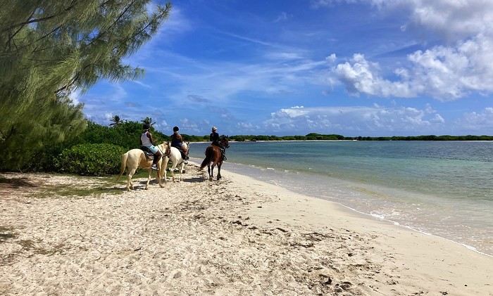
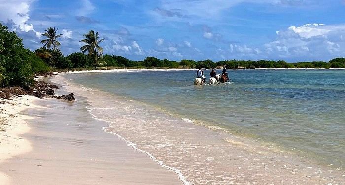
From wish to reality ... all it took was heading to Ranch du Galion. Here we are, on the heights of the east coast of the charming island of Saint Martin, in the heart of the Caribbean.
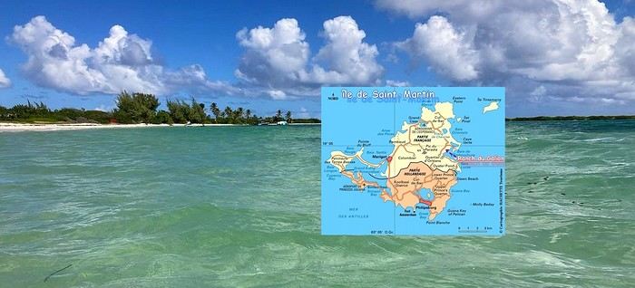
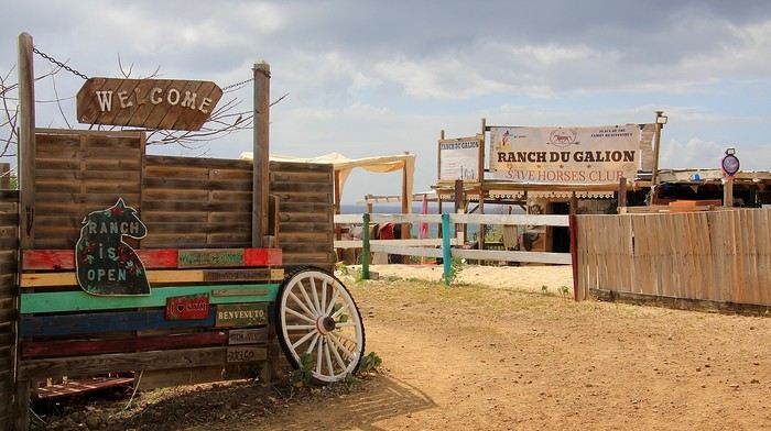
After a first horseback ride that we really enjoyed, with a simple trip to the beach, it didn’t take much to make us want to repeat the pleasant experience. My daughter Emma had been dreaming of it too—so why not share this change of scenery, but this time opting for a slightly longer trek? It’s the big day. And Jess is there to greet us this morning with a big smile. Jess—or Jessica—is the one who runs this tropical ranch with passion; she looks after a whole little family of horses. This morning, she’ll be our guide and companion for this seaside horseback ride.
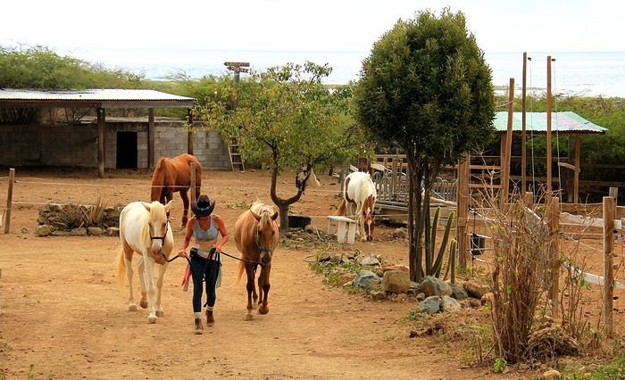
So, we set off along the wild shores of the stunning Anse du Galion.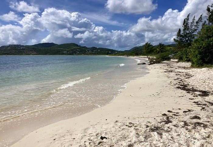
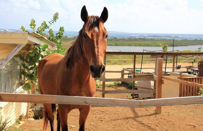
In the enclosures, behind the fences and ropes, some stallions already seem impatient to stretch their legs! They know the place, the routines, and the trails ... and the soothing reward halfway through—a dip in the sea. Maybe that’s what’s causing a little excitement among these mounts!
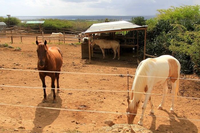
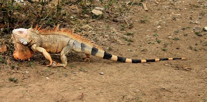
Horses and ... an iguana slipping into the bushes. Given its appearance—its crest, its parched skin, and the dewlap hanging under its head—you’d think it wasn’t exactly young.
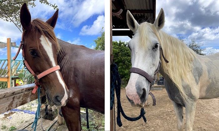
Anyway, back to the horses. Among the mares and stallions, I try to spot "Avenir" and his elegant gait—he was "my" horse during my last trek here, on the trails and sands of Galion. Well, spotting him isn’t going to be easy! My memories are a bit fuzzy, and several of these horses look like him ... -- Before setting off on the trek, it’s time for Jess to choose our mounts. For riders with little experience ... it’ll be calm horses, well-used to trekking—definitely easier and more enjoyable. Titia, a beautiful white mare for my daughter, and Prince, a gentle stallion for me. A little anecdote along the way: we’re really staying in the family for this horseback ride—these two horses are actually related: "my" Prince is the son of the lovely Titia!
to be continued -->
From wish to reality ... all it took was heading to Ranch du Galion. Here we are, on the heights of the east coast of the charming island of Saint Martin, in the heart of the Caribbean.
After a first horseback ride that we really enjoyed, with a simple trip to the beach, it didn’t take much to make us want to repeat the pleasant experience. My daughter Emma had been dreaming of it too—so why not share this change of scenery, but this time opting for a slightly longer trek? It’s the big day. And Jess is there to greet us this morning with a big smile. Jess—or Jessica—is the one who runs this tropical ranch with passion; she looks after a whole little family of horses. This morning, she’ll be our guide and companion for this seaside horseback ride.
So, we set off along the wild shores of the stunning Anse du Galion.
In the enclosures, behind the fences and ropes, some stallions already seem impatient to stretch their legs! They know the place, the routines, and the trails ... and the soothing reward halfway through—a dip in the sea. Maybe that’s what’s causing a little excitement among these mounts!
Horses and ... an iguana slipping into the bushes. Given its appearance—its crest, its parched skin, and the dewlap hanging under its head—you’d think it wasn’t exactly young.
Anyway, back to the horses. Among the mares and stallions, I try to spot "Avenir" and his elegant gait—he was "my" horse during my last trek here, on the trails and sands of Galion. Well, spotting him isn’t going to be easy! My memories are a bit fuzzy, and several of these horses look like him ... -- Before setting off on the trek, it’s time for Jess to choose our mounts. For riders with little experience ... it’ll be calm horses, well-used to trekking—definitely easier and more enjoyable. Titia, a beautiful white mare for my daughter, and Prince, a gentle stallion for me. A little anecdote along the way: we’re really staying in the family for this horseback ride—these two horses are actually related: "my" Prince is the son of the lovely Titia!
to be continued -->
Trip to Morocco in September-October 2025, in our camper van
Hi everyone,
We’re just back from a month-long trip to Morocco in our camper van.
After crossing France (we left from the Nantes area) and Spain, we arrived in Algeciras where we bought our boat tickets to Tangier. When we got to Tangier, as we were going through customs, you can imagine our surprise when the customs officer took our road map of Morocco and pointed out the label "Western Sahara" (just like in the forum’s destination section, by the way!).
He wanted it to say "Moroccan Sahara" instead!!! But there was nothing we could do—it was an old map... He wouldn’t listen, and after long discussions with the other (younger) customs officers, he finally gave it back and let us through... Unbelievable! Later, we heard that other travelers had their maps confiscated outright.
So, hide it well if you want to keep yours!!!
Anyway, we skirted around Tangier’s suburbs—pretty grim—and finally arrived in Asilah.
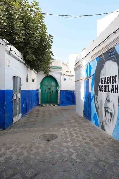
Following the coast and the long promenade along the beach, we reached the campsite. It was a bit crowded, not much shade, but it wasn’t far from the medina or the beach, and it wasn’t expensive. There’s some life here: Moroccan families seem to live on-site, in tents or basic bungalows. A woman was cooking tagine on a brazier—we were right in the atmosphere! The night was quiet, and we slept well. We set off on foot, walking along the seafront to the medina... We’d already been here in 2009. It was less touristy back then! Still, at this early hour, the little streets inside were very quiet. The walls had been freshly whitewashed, and there were even more murals than before. Around 11:30 AM, we strolled along the ramparts by the sea. There was a nice breeze! And a lot more people around. We enjoyed a milkshake on the terrace of a café overlooking the beach that stretches out at the foot of the medina. Some young guys were having fun diving off the rocks—and even off the top of the wall!
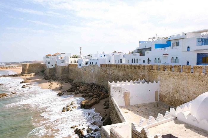
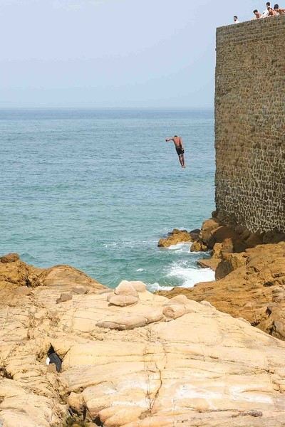
Anyway, we skirted around Tangier’s suburbs—pretty grim—and finally arrived in Asilah.
Following the coast and the long promenade along the beach, we reached the campsite. It was a bit crowded, not much shade, but it wasn’t far from the medina or the beach, and it wasn’t expensive. There’s some life here: Moroccan families seem to live on-site, in tents or basic bungalows. A woman was cooking tagine on a brazier—we were right in the atmosphere! The night was quiet, and we slept well. We set off on foot, walking along the seafront to the medina... We’d already been here in 2009. It was less touristy back then! Still, at this early hour, the little streets inside were very quiet. The walls had been freshly whitewashed, and there were even more murals than before. Around 11:30 AM, we strolled along the ramparts by the sea. There was a nice breeze! And a lot more people around. We enjoyed a milkshake on the terrace of a café overlooking the beach that stretches out at the foot of the medina. Some young guys were having fun diving off the rocks—and even off the top of the wall!
Impressions after two months in El Salvador
Hi there,
In 2024, I spent two months solo in El Salvador. While I’m still putting together my travel journal on Myatlas, here’s a quick recap. It’s a country where it’s really easy to travel without a guide or agency.
SAFETY:
For a long time, the country was considered one of the most dangerous in the world because of the "maras," ultra-violent gangs. But today, I think it’s the safest country in Latin America.
BUDGET:
For French tourists, the country is very affordable, especially in the less touristy regions.
TRANSPORT:
I got around everywhere by local bus.
Local buses go everywhere and run all the time. For me, it’s the best way to travel in El Salvador—you’re fully immersed, moving at the pace of the locals, and interacting with Salvadorans who are eager to connect with travelers.
I saw all sorts of things on those buses—I’ve got dozens of stories!
PEOPLE:
I’m used to traveling all over Latin America, and for me, Salvadorans are the warmest and most welcoming. Everywhere you go, people say, "Welcome to El Salvador!" The connections and long conversations with locals were my favorite part of the trip.
TOURIST CROWDS:
The country isn’t well-known among European tourists, but Americans and Quebecers visit. Overall, it’s still pretty low-key, especially compared to other Central American countries. That said, tourism has been growing since security improved significantly.
WHAT I LOVED ❤️
-Suchitoto, one of the most beautiful colonial towns in Central America.
-The volcanoes—there are so many! Santa Ana is the most touristy.
-The lakes—also plentiful. Coatepeque is the most famous, but there are lots of lagoons too.
-The mountainous regions, where the cooler weather is a nice break: La Palma, Perquín, Cerro El Pital, etc.
-The charming villages along the Ruta de las Flores, especially Nahuizalco with its nighttime atmosphere and food stalls. Juayúa and others are great too.
-The conversations with people who lived through the horrors of the civil war in Perquín and Cinquera. I met one of them by chance while waiting for a bus.
For surfers, El Salvador is a paradise, with world-famous beaches.
WHAT I LIKED LESS:
I loved almost everything, but I found the archaeological sites a bit underwhelming. Joyabaj de Cerén is billed as the "Pompeii of El Salvador," which is a stretch (though it *is* a UNESCO World Heritage Site for its historical value).
In 2024, I spent two months solo in El Salvador. While I’m still putting together my travel journal on Myatlas, here’s a quick recap. It’s a country where it’s really easy to travel without a guide or agency.
SAFETY:
For a long time, the country was considered one of the most dangerous in the world because of the "maras," ultra-violent gangs. But today, I think it’s the safest country in Latin America.
BUDGET:
For French tourists, the country is very affordable, especially in the less touristy regions.
TRANSPORT:
I got around everywhere by local bus.
Local buses go everywhere and run all the time. For me, it’s the best way to travel in El Salvador—you’re fully immersed, moving at the pace of the locals, and interacting with Salvadorans who are eager to connect with travelers.
I saw all sorts of things on those buses—I’ve got dozens of stories!
PEOPLE:
I’m used to traveling all over Latin America, and for me, Salvadorans are the warmest and most welcoming. Everywhere you go, people say, "Welcome to El Salvador!" The connections and long conversations with locals were my favorite part of the trip.
TOURIST CROWDS:
The country isn’t well-known among European tourists, but Americans and Quebecers visit. Overall, it’s still pretty low-key, especially compared to other Central American countries. That said, tourism has been growing since security improved significantly.
WHAT I LOVED ❤️
-Suchitoto, one of the most beautiful colonial towns in Central America.
-The volcanoes—there are so many! Santa Ana is the most touristy.
-The lakes—also plentiful. Coatepeque is the most famous, but there are lots of lagoons too.
-The mountainous regions, where the cooler weather is a nice break: La Palma, Perquín, Cerro El Pital, etc.
-The charming villages along the Ruta de las Flores, especially Nahuizalco with its nighttime atmosphere and food stalls. Juayúa and others are great too.
-The conversations with people who lived through the horrors of the civil war in Perquín and Cinquera. I met one of them by chance while waiting for a bus.
For surfers, El Salvador is a paradise, with world-famous beaches.
WHAT I LIKED LESS:
I loved almost everything, but I found the archaeological sites a bit underwhelming. Joyabaj de Cerén is billed as the "Pompeii of El Salvador," which is a stretch (though it *is* a UNESCO World Heritage Site for its historical value).
Three weeks in Yunnan in October 2025
We just spent three weeks in Yunnan.
I’ve started writing up a travel journal about the trip.
From Southern Shikoku, between land and sea, to the blue waters of Miyakojima and finally the Tokyo metropolis
From Southern Shikoku, between land and sea, to the blue waters of Miyakojima and finally Tokyo’s megacity
Hi everyone,
I have to admit, I really hesitated before deciding to write this travel journal... Writing one takes a lot of time and energy, and since this is my 4th trip, I wondered if it would actually interest anyone other than myself (both for the discovery and the writing). But after a few "Are you going to write a journal?" requests and especially the renewed pleasure from reading other travelers’ travel journals about Japan or elsewhere on this forum or elsewhere, I’ve decided to share this 4th installment in the Land of the Rising Sun here.
The itinerary: 27 full days, from late May to late June 2025, right in the middle of the rainy season, including:
-->13 days in Shikoku, from Kochi (Kochi Prefecture) to Matsuyama (Ehime Prefecture)

-->7 days in Miyakojima (Okinawa Prefecture)

-->7 days in Tokyo

The trip was decided on fairly last-minute this year, as usual.
I regularly check flight prices to track fluctuations for this destination, even without concrete plans. Finding a slightly cheaper direct flight (900 €) than what I’d seen in previous months (around 1,200–1,400 € on average) for a Paris-Tokyo route with Japanese airline ANA was too tempting to resist the urge to return to this enchanting country. After long hesitations between exploring the San’in region (Matsue, Tottori, Yamaguchi) and southern Shikoku, the decision was made—I took the plunge! The tickets are booked: Paris to Kochi with a layover in Tokyo, all with ANA, the airline I’d been dreaming of... for 1,120 € per person. Okay, it’s not cheap, but it’s still better than in 2023.
We leave in 2 weeks!! Now it’s just a matter of getting everything ready!
Intense work ahead in these 2 weeks to:
finalize a more precise itinerary and reach an agreement—yep, because even though we both love Japan, our preferences differ slightly, and we have to choose between exploring new places or taking time to revisit beloved spots... decide how much time to spend in each selected area without rushing while still exploring research places that might interest us and watch videos about Japan book accommodations: yes, it’s possible to do this on the spot as we go, but last year, we noticed that last-minute options were pretty expensive, so we’re booking ahead—even if it means keeping a few options open while we decide or see if better deals pop up later reserve rental cars order yen check the weather regularly and wonder if choosing the *tsuyu* (rainy season) was really a good idea—and whether we’ll be stuck in non-stop rain???
What a tough job, right? Traveling to Japan for a month—such a hard life! Despite this being my 4th trip, the excitement is just as intense as the first time.
The only small downside is that when we booked the flight tickets, there were only a few seats left, so we’re only sitting together on the international return flight. Plus, on the outbound flight, we’ve got the middle seats. Another lingering question: what French-language films will be available? According to the internet, the selection seems limited. Oh well, these are just minor details—it’s almost time to fly!
PS: I’ll be posting slowly and irregularly... so for those interested, be patient or maybe set an alert...
Hi everyone,
I have to admit, I really hesitated before deciding to write this travel journal... Writing one takes a lot of time and energy, and since this is my 4th trip, I wondered if it would actually interest anyone other than myself (both for the discovery and the writing). But after a few "Are you going to write a journal?" requests and especially the renewed pleasure from reading other travelers’ travel journals about Japan or elsewhere on this forum or elsewhere, I’ve decided to share this 4th installment in the Land of the Rising Sun here.
The itinerary: 27 full days, from late May to late June 2025, right in the middle of the rainy season, including:
-->13 days in Shikoku, from Kochi (Kochi Prefecture) to Matsuyama (Ehime Prefecture)
-->7 days in Miyakojima (Okinawa Prefecture)
-->7 days in Tokyo
The trip was decided on fairly last-minute this year, as usual.
I regularly check flight prices to track fluctuations for this destination, even without concrete plans. Finding a slightly cheaper direct flight (900 €) than what I’d seen in previous months (around 1,200–1,400 € on average) for a Paris-Tokyo route with Japanese airline ANA was too tempting to resist the urge to return to this enchanting country. After long hesitations between exploring the San’in region (Matsue, Tottori, Yamaguchi) and southern Shikoku, the decision was made—I took the plunge! The tickets are booked: Paris to Kochi with a layover in Tokyo, all with ANA, the airline I’d been dreaming of... for 1,120 € per person. Okay, it’s not cheap, but it’s still better than in 2023.
We leave in 2 weeks!! Now it’s just a matter of getting everything ready!
Intense work ahead in these 2 weeks to:
finalize a more precise itinerary and reach an agreement—yep, because even though we both love Japan, our preferences differ slightly, and we have to choose between exploring new places or taking time to revisit beloved spots... decide how much time to spend in each selected area without rushing while still exploring research places that might interest us and watch videos about Japan book accommodations: yes, it’s possible to do this on the spot as we go, but last year, we noticed that last-minute options were pretty expensive, so we’re booking ahead—even if it means keeping a few options open while we decide or see if better deals pop up later reserve rental cars order yen check the weather regularly and wonder if choosing the *tsuyu* (rainy season) was really a good idea—and whether we’ll be stuck in non-stop rain???
What a tough job, right? Traveling to Japan for a month—such a hard life! Despite this being my 4th trip, the excitement is just as intense as the first time.
The only small downside is that when we booked the flight tickets, there were only a few seats left, so we’re only sitting together on the international return flight. Plus, on the outbound flight, we’ve got the middle seats. Another lingering question: what French-language films will be available? According to the internet, the selection seems limited. Oh well, these are just minor details—it’s almost time to fly!
PS: I’ll be posting slowly and irregularly... so for those interested, be patient or maybe set an alert...
A Scandinavian Tour - Summer 2025
Off on new adventures!!!
For my wife’s 60th birthday, I’m really making her happy. While I usually pick warm, sunny destinations, she’s more tempted by places where you don’t suffer from the heat.
So, it’s off to Norway!! A real challenge for me—a southern guy who’s as cold-sensitive as they come.
I keep telling anyone who’ll listen (well, just myself, really) that these aren’t the countries for me, that rain will be our travel companion, that we’ll have to face polar bears, navigate between icebergs, that there are still Vikings around, and all sorts of other things.
Of course, not wanting to make it easy, we’re driving from the Lyon area where we live.
Friends who’ve visited the country told us it’s pretty expensive to eat out (among other things), so we’re bringing supplies—especially enough for apéritifs the whole trip!!!
It’s not a camper van, but a "hotel-car" we’ll be doing! We’ll see how it goes!
As usual, I’ll try to narrate the journey with my two-cent comments, plus some little tips to avoid our mistakes—assuming I don’t lose any fingers to the cold!
Every night, I’ll count them to make sure I still have all ten! We’re not in *Ch’tis* territory but even farther Noooorth (as Galabru would say).
Note that I’m traveling with a synovial effusion in my knee! The old man’s not in great shape!!
Here we go!!
PS: As always, I’m a filmmaker, so I’ve made an effort with a few photos from my phone.
PS: As always, I’m a filmmaker, so I’ve made an effort with a few photos from my phone.
Join me in discovering Gran Canaria
Introduction
We stayed on the island of Gran Canaria during the first three months of 2024. It’s the third Canary Island we’ve visited, after Tenerife and Lanzarote.
We rented an apartment in Temisas. By staying in the same place for such a long period, the total price dropped by 50%.
We also rented a vehicle to make getting around the island easier.
Why the Canary Islands, and Gran Canaria in particular? For its pleasant climate, the nature and diversity of its landscapes, the charming villages, and especially the beauty of its many beaches.
In this travel journal, you’ll find a list of the many activities we did during our stay to explore the different attractions of this island.
These attractions are categorized to make it easier to find what interests you.
Videos are included throughout the summary. Click on the image to start the video.
To jump to a specific post, here are the relevant links:
HIKES:
Roque Nublo Maspalomas Dunes - Part 1 Maspalomas Dunes - Part 2 Los Azulejos de Veneguera Barranco de Las Vacas Ventana del Bentayga (Arco del Aserrador) Caves of the King Ventana de Morro (Ventana de la Ganifa) The Dog of Bentayga Cave of the Four Doors Ventana del Nublo Artenera - Caves of Acusa Seca Temisas - El Gigante Cave Fortress of Ansite Puerto de Las Nieves - Roque de Las Nieves Temisas - Cuevas de la Audiencia Roque Bentayga Guayadeque Ravine (Guayadeque Hermitage) Guayadeque Ravine (Cueva de Bartalo) El Zumacal - Barranco Tauco Casablanca Dam (Los Dolores Dam) Ayagaures - La Angostura Dam & Gambuesa Dam Santa Brígida - Alonso Ravine & Centennial Dragon Tree Pino Santo Hike in the Azuaje Ravine Gáldar - Red Lands of Samarrita Tejeda - Charco de La Paloma Bandama Boiler (Camino Borde de Caldera Bandama) Teror - Alamo Ravine Trail – SL-4 Telde - Calasio Caves Special Natural Reserve of Los Tilos de Moya Los Azulejos - Charco de Las Aneas Fataga Ravine Arinaga Military Battery Trail Maspalomas - Las Fuentes and del Canizo Ravines Mogán - Tauro Mountain Trail Tamabada - Llanos de La Mimbre & Sobre la Cueva Viewpoints Trail Hike to the Coronadero Arch via Barranco Hondo Barranco de Silva - Hike to the Jerez Caves Gáldar - Samson Cave - La Atalaya Peak Agaete - Roque Guayedra and Guayedra Ravine Artenara - Caballero Caves Arucas - Bufadero Salt Flats Barranco de Pino Gordo - Natural Pools Telde - Los Cernícalos Ravine Las Cruces - Toba Caves & Picón Puerto de Las Nieves - Moro Cave Agüimes - Morros de Ávila Caves Juncalillo del Sur - Laguna & Salinas de Abajo Caves of Camino de San Felipe Cruz de Tejeda, Cruz Chico and Degollada Viewpoint Hike on the Patalavaca Circuit Motor Grande - Puerto Rico Arch El Montañón - Los Hornos Dam Seafront Walk - Amadores Beach – Puerto Rico Beach Las Niñas Dam El Hornillo - Omega & Omicron Caves Arteara Necropolis Mogán - El Mulato Dam Las Garzas - El Regante Dam La Plata Route - Cho Flores Dam & El Charco Hondo Vega de Acusa - La Candelaria Dam Candelaria Hermitage – Acusa Seca Viewpoint Valsequillo de Gran Canaria – Roque La Vela Ayagaures Dam – GC-602 Lomo del Palo - Monte Pavón Trail Lugar La Laguna - Levada Fataga Dam & Ravine
BEACHES:
Mogán Beach Taurito Beach Tauro Beach Amadores Beach Puerto Rico Beach Anfi del Mar Beach Patalavaca Beach Meloneras Beach Maspalomas Beach English Beach (Playa del Inglés) Las Burras Beach San Agustin Beach Las Alcaravaneras Beach Las Canteras Beach (La Cicer) Las Canteras Beach (La Puntilla) Las Canteras Beach (Santa Catalina) Aquamarina Beach El Agujero - Bocabarranco Beach Hoya Del Pozo Beach Hoya Del Pozo Beach - Lizard with amputated tail El Cabron Beach Ojos de Garza Beach El Burrero Beach
NATURAL POOLS:
Charco Azul - El Risco Agaete Salt Flats Charco de Los Espejos - Sardina del Norte Natural Pools of Punta de Gáldar Snorkeling in the natural pool of Punta de Gáldar Natural Pool La Furnia o El Clavo - Gáldar Natural Pool of Los Dos Roques Emiliano Natural Pool - El Agujero Natural Pool of El Agujero Natural Pools of Roque Prieto Natural Pool El Altillo Los Charcones de Bañaderos – Arucas Natural Pools of El Charco de Las Palomas – Arucas Natural Pools of La Laja - Las Palmas de Gran Canaria Cueva de la Reina Mora - La Garita Natural Pools of Castillo del Romeral
TOWNS:
Center
Santa Brigida Vega de San Mateo Tejeda Artenara Vallesco Teror
Southwest
Santa Lucia de Tirajana Fataga San Bartolomé de Tirajana Puerto de Mogán La Aldea de San Nicolas
North
Arucas Firgas Moya Santa Maria de Guia Gáldar Agaete Puerto de Las Nieves
East
Vegueta - Las Palmas de Gran Canaria Triana - Las Palmas de Gran Canaria Ciudad Jardin - Las Palmas de Gran Canaria Canteras - Las Palmas de Gran Canaria Telde Valsequillo de Gran Canaria Ingenio Agüimes Temisas
VIEWPOINTS:
GC-60 Route (or nearby) GC-210 Route (or nearby) GC-210 Route between the tunnel and La Aldea de San Nicolás GC-215 & GC-65 Routes (or nearby) GC-200 Route (or nearby) GC-130 Route (or nearby) & GC-605 GC-70 Route (or nearby) & GC-21 Sheep herd on GC-70 Route GC-150, GC-240, GC-305, GC-350 & GC-301 Routes GC-606, GC-295, GC-231 and GC-41 Routes (or nearby) Viewpoints – GC-1 Route (or nearby) Viewpoints - Las Palmas de Gran Canaria Viewpoints - GC-2, GC-21, GC-15, GC-216 and GC-132 Routes (or nearby) Viewpoints - GC-503 & GC-217 Routes Viewpoints - GC-604, GC-505, GC-132, GC-42 and GC-802 Routes
MISCELLANEOUS:
San Rafael Aqueduct - Telde Abandoned San Rafael Estate - La Higuera Cenobio de Valerón La Cesta - Tejeda Puerto de la Aldea Scenic Route GC-671 to El Espinillo Scenic Route GC-607 to El Chorrillo The Galdar Cube (Santiago Quarry) Scenic Route GC-504 to Ayagaures Abandoned seaside resort in the Azuaje Ravine El Bufadero de La Garita – Telde GC-505 Route Abandoned Finca Las Haciendas (Los Mocanes) – Las Vegas de Valsequillo Ruins of San Juan Battery - Las Palmas de Gran Canaria Viera y Clavijo Canarian Botanical Garden - Las Palmas de Gran Canaria Tenefé Salt Flats Los Pérez, Lugarejos & Las Hoyas Dams Monte Pavón, Gran Canaria’s little Ireland Valleseco Lagoon Recreational Area Climbing - Fataga Ravine Surfing – El Agujero El Cairete Restaurant - Carrizal de Tejeda Paragliding flight observation - Los Giles La Cuevita Ayagaures Restaurant Statues and Murals - Cruce de Arinaga Aviation Monument (Las Majoreras) & Murals – Carrizal Artistic recycling by Antonio Peñita - Ojos de Garza Rainbows
We stayed on the island of Gran Canaria during the first three months of 2024. It’s the third Canary Island we’ve visited, after Tenerife and Lanzarote.
We rented an apartment in Temisas. By staying in the same place for such a long period, the total price dropped by 50%.
We also rented a vehicle to make getting around the island easier.
Why the Canary Islands, and Gran Canaria in particular? For its pleasant climate, the nature and diversity of its landscapes, the charming villages, and especially the beauty of its many beaches.
In this travel journal, you’ll find a list of the many activities we did during our stay to explore the different attractions of this island.
These attractions are categorized to make it easier to find what interests you.
Videos are included throughout the summary. Click on the image to start the video.
To jump to a specific post, here are the relevant links:
HIKES:
Roque Nublo Maspalomas Dunes - Part 1 Maspalomas Dunes - Part 2 Los Azulejos de Veneguera Barranco de Las Vacas Ventana del Bentayga (Arco del Aserrador) Caves of the King Ventana de Morro (Ventana de la Ganifa) The Dog of Bentayga Cave of the Four Doors Ventana del Nublo Artenera - Caves of Acusa Seca Temisas - El Gigante Cave Fortress of Ansite Puerto de Las Nieves - Roque de Las Nieves Temisas - Cuevas de la Audiencia Roque Bentayga Guayadeque Ravine (Guayadeque Hermitage) Guayadeque Ravine (Cueva de Bartalo) El Zumacal - Barranco Tauco Casablanca Dam (Los Dolores Dam) Ayagaures - La Angostura Dam & Gambuesa Dam Santa Brígida - Alonso Ravine & Centennial Dragon Tree Pino Santo Hike in the Azuaje Ravine Gáldar - Red Lands of Samarrita Tejeda - Charco de La Paloma Bandama Boiler (Camino Borde de Caldera Bandama) Teror - Alamo Ravine Trail – SL-4 Telde - Calasio Caves Special Natural Reserve of Los Tilos de Moya Los Azulejos - Charco de Las Aneas Fataga Ravine Arinaga Military Battery Trail Maspalomas - Las Fuentes and del Canizo Ravines Mogán - Tauro Mountain Trail Tamabada - Llanos de La Mimbre & Sobre la Cueva Viewpoints Trail Hike to the Coronadero Arch via Barranco Hondo Barranco de Silva - Hike to the Jerez Caves Gáldar - Samson Cave - La Atalaya Peak Agaete - Roque Guayedra and Guayedra Ravine Artenara - Caballero Caves Arucas - Bufadero Salt Flats Barranco de Pino Gordo - Natural Pools Telde - Los Cernícalos Ravine Las Cruces - Toba Caves & Picón Puerto de Las Nieves - Moro Cave Agüimes - Morros de Ávila Caves Juncalillo del Sur - Laguna & Salinas de Abajo Caves of Camino de San Felipe Cruz de Tejeda, Cruz Chico and Degollada Viewpoint Hike on the Patalavaca Circuit Motor Grande - Puerto Rico Arch El Montañón - Los Hornos Dam Seafront Walk - Amadores Beach – Puerto Rico Beach Las Niñas Dam El Hornillo - Omega & Omicron Caves Arteara Necropolis Mogán - El Mulato Dam Las Garzas - El Regante Dam La Plata Route - Cho Flores Dam & El Charco Hondo Vega de Acusa - La Candelaria Dam Candelaria Hermitage – Acusa Seca Viewpoint Valsequillo de Gran Canaria – Roque La Vela Ayagaures Dam – GC-602 Lomo del Palo - Monte Pavón Trail Lugar La Laguna - Levada Fataga Dam & Ravine
BEACHES:
Mogán Beach Taurito Beach Tauro Beach Amadores Beach Puerto Rico Beach Anfi del Mar Beach Patalavaca Beach Meloneras Beach Maspalomas Beach English Beach (Playa del Inglés) Las Burras Beach San Agustin Beach Las Alcaravaneras Beach Las Canteras Beach (La Cicer) Las Canteras Beach (La Puntilla) Las Canteras Beach (Santa Catalina) Aquamarina Beach El Agujero - Bocabarranco Beach Hoya Del Pozo Beach Hoya Del Pozo Beach - Lizard with amputated tail El Cabron Beach Ojos de Garza Beach El Burrero Beach
NATURAL POOLS:
Charco Azul - El Risco Agaete Salt Flats Charco de Los Espejos - Sardina del Norte Natural Pools of Punta de Gáldar Snorkeling in the natural pool of Punta de Gáldar Natural Pool La Furnia o El Clavo - Gáldar Natural Pool of Los Dos Roques Emiliano Natural Pool - El Agujero Natural Pool of El Agujero Natural Pools of Roque Prieto Natural Pool El Altillo Los Charcones de Bañaderos – Arucas Natural Pools of El Charco de Las Palomas – Arucas Natural Pools of La Laja - Las Palmas de Gran Canaria Cueva de la Reina Mora - La Garita Natural Pools of Castillo del Romeral
TOWNS:
Center
Santa Brigida Vega de San Mateo Tejeda Artenara Vallesco Teror
Southwest
Santa Lucia de Tirajana Fataga San Bartolomé de Tirajana Puerto de Mogán La Aldea de San Nicolas
North
Arucas Firgas Moya Santa Maria de Guia Gáldar Agaete Puerto de Las Nieves
East
Vegueta - Las Palmas de Gran Canaria Triana - Las Palmas de Gran Canaria Ciudad Jardin - Las Palmas de Gran Canaria Canteras - Las Palmas de Gran Canaria Telde Valsequillo de Gran Canaria Ingenio Agüimes Temisas
VIEWPOINTS:
GC-60 Route (or nearby) GC-210 Route (or nearby) GC-210 Route between the tunnel and La Aldea de San Nicolás GC-215 & GC-65 Routes (or nearby) GC-200 Route (or nearby) GC-130 Route (or nearby) & GC-605 GC-70 Route (or nearby) & GC-21 Sheep herd on GC-70 Route GC-150, GC-240, GC-305, GC-350 & GC-301 Routes GC-606, GC-295, GC-231 and GC-41 Routes (or nearby) Viewpoints – GC-1 Route (or nearby) Viewpoints - Las Palmas de Gran Canaria Viewpoints - GC-2, GC-21, GC-15, GC-216 and GC-132 Routes (or nearby) Viewpoints - GC-503 & GC-217 Routes Viewpoints - GC-604, GC-505, GC-132, GC-42 and GC-802 Routes
MISCELLANEOUS:
San Rafael Aqueduct - Telde Abandoned San Rafael Estate - La Higuera Cenobio de Valerón La Cesta - Tejeda Puerto de la Aldea Scenic Route GC-671 to El Espinillo Scenic Route GC-607 to El Chorrillo The Galdar Cube (Santiago Quarry) Scenic Route GC-504 to Ayagaures Abandoned seaside resort in the Azuaje Ravine El Bufadero de La Garita – Telde GC-505 Route Abandoned Finca Las Haciendas (Los Mocanes) – Las Vegas de Valsequillo Ruins of San Juan Battery - Las Palmas de Gran Canaria Viera y Clavijo Canarian Botanical Garden - Las Palmas de Gran Canaria Tenefé Salt Flats Los Pérez, Lugarejos & Las Hoyas Dams Monte Pavón, Gran Canaria’s little Ireland Valleseco Lagoon Recreational Area Climbing - Fataga Ravine Surfing – El Agujero El Cairete Restaurant - Carrizal de Tejeda Paragliding flight observation - Los Giles La Cuevita Ayagaures Restaurant Statues and Murals - Cruce de Arinaga Aviation Monument (Las Majoreras) & Murals – Carrizal Artistic recycling by Antonio Peñita - Ojos de Garza Rainbows
Kenya - January 2025 - Tsavo East - Tsavo West - Samburu - Meru NP - Aberdare NP
Hello everyone,
I’d like to invite you on a new adventure in Kenya.
Back in 2010, my husband Ben and I fell in love with Kenya, and we’ve been traveling there regularly ever since. This 2025 safari marked the first weeks of an important milestone in my life: retirement.
Of course, Felix—our guide and friend for all these years, whom some of you may even know from this forum—joined us again.
We chose an itinerary that takes us through the parks and reserves we particularly love in Kenya: Tsavo East (3 nights), Tsavo West (2 nights), a transition day in Embu, Samburu (5 nights), Meru NP (4 nights), Nanuyki to visit the Mount Kenya Animal Orphanage (https://mountkenyawildlifeconservancy.org/) (1 night), and Aberdare NP (2 nights).
This safari wasn’t our most prolific in terms of wildlife sightings and photos (all taken by Ben), but I still think it’s worth sharing our experiences and impressions of the places we visited. Maybe other travelers will find useful information here to help them fulfill their dream of a Kenyan safari one day...
Living in Brittany, we left from Nantes on Wednesday, January 8, 2025, on the 6 AM Air France flight to CDG, then took the direct flight to Nairobi at 10:50 AM. No issues this time on either flight (unlike in October 2023...).
We arrived in Nairobi at 9:20 PM local time (there’s a two-hour time difference with France at this time of year). Going through passport control and collecting our luggage went smoothly. The hotel shuttle (https://67airporthotel.co.ke/) was waiting for us. We shared it with a friendly Swiss couple who were there to climb Mount Kenya. We arrived at the hotel around midnight. The 67 Airport Hotel is 10-15 minutes from Jomo Kenyatta Airport and offers great value for money. Plus, it’s close to the Mombasa road, which is handy when heading that way the next morning.
On Thursday, January 9, we had breakfast at the hotel restaurant at 6:30 AM, and as planned, Felix arrived around 7 AM. We got to check out his brand-new 4x4 Nissan—we’d be the first to test it! 🙂
We set off for Voi, making our usual stop in Mtito Andei. Traffic was heavy on the Mombasa road, with lots of trucks.
We arrived at the entrance of Tsavo East around 1 PM and made it to Sentrim Camp (https://www.sentrim-hotels.com/sentrim-tsavo.html) just in time for lunch.
We found Tsavo East unusually green—there had been heavy rains in December, which isn’t typical. As a result, the animals were scattered and harder to spot. The watering hole visible from the camp’s dining area was completely deserted, whereas it’s usually bustling with herds of elephants and other mammals.
Our tent, No. 9, for 3 nights.
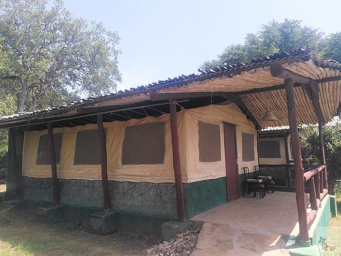
This camp is well-located inside the park. It’s simple but comfortable enough for our tastes, the staff is super friendly (as is often the case in Kenya), and the buffet-style meals are varied and good. Tsavo is the main destination for tourists staying on the coast who come for a night or two on safari. In January, some days at the camp are very quiet, while some evenings, the restaurant is packed with groups (lots of Italians, in particular).
Tsavo is, of course, famous for its elephants. This time, we didn’t see many large herds, but we did have some great encounters with solitary males.
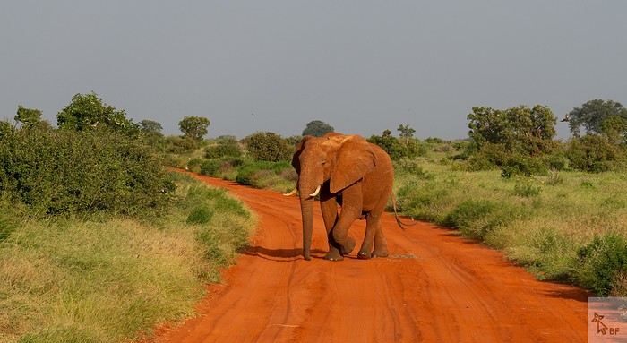
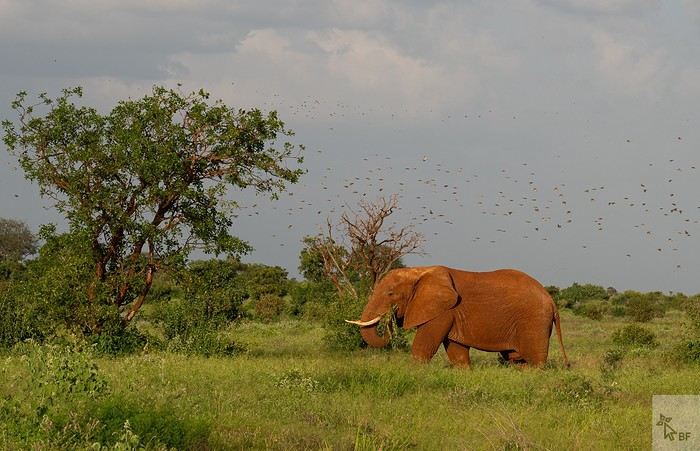
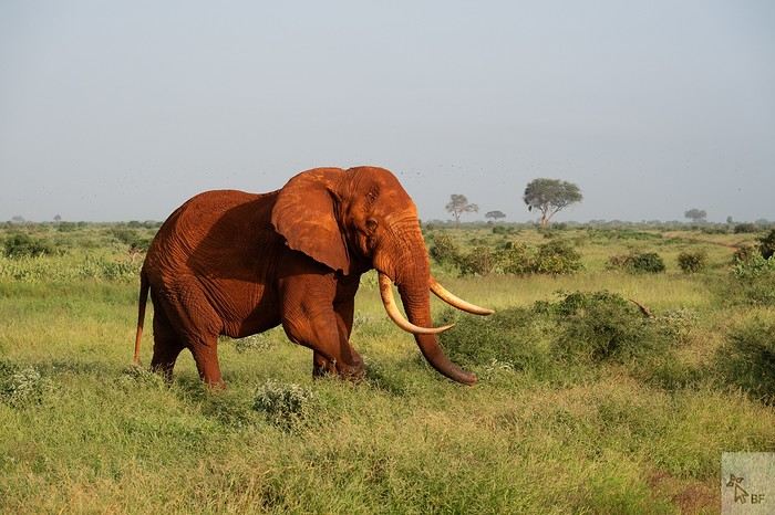
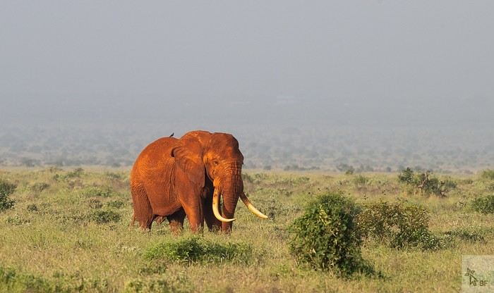
Around this small watering hole, we saw a gathering of African open-billed storks—we’d never seen so many before!
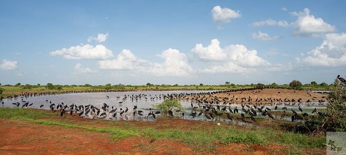
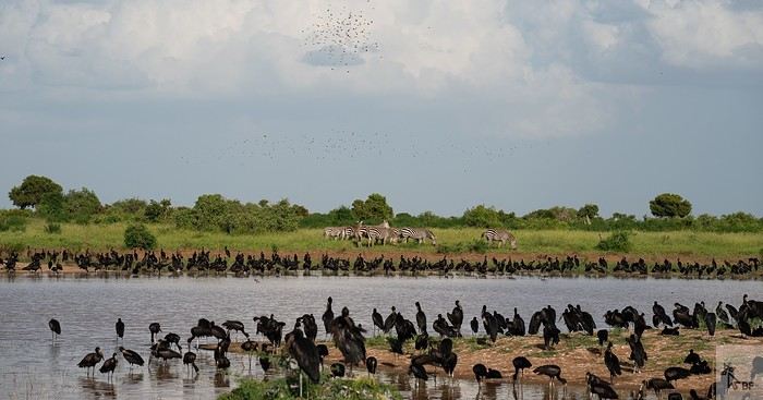
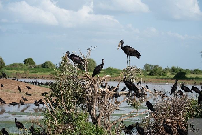
I’d like to invite you on a new adventure in Kenya.
Back in 2010, my husband Ben and I fell in love with Kenya, and we’ve been traveling there regularly ever since. This 2025 safari marked the first weeks of an important milestone in my life: retirement.
Of course, Felix—our guide and friend for all these years, whom some of you may even know from this forum—joined us again.
We chose an itinerary that takes us through the parks and reserves we particularly love in Kenya: Tsavo East (3 nights), Tsavo West (2 nights), a transition day in Embu, Samburu (5 nights), Meru NP (4 nights), Nanuyki to visit the Mount Kenya Animal Orphanage (https://mountkenyawildlifeconservancy.org/) (1 night), and Aberdare NP (2 nights).
This safari wasn’t our most prolific in terms of wildlife sightings and photos (all taken by Ben), but I still think it’s worth sharing our experiences and impressions of the places we visited. Maybe other travelers will find useful information here to help them fulfill their dream of a Kenyan safari one day...
Living in Brittany, we left from Nantes on Wednesday, January 8, 2025, on the 6 AM Air France flight to CDG, then took the direct flight to Nairobi at 10:50 AM. No issues this time on either flight (unlike in October 2023...).
We arrived in Nairobi at 9:20 PM local time (there’s a two-hour time difference with France at this time of year). Going through passport control and collecting our luggage went smoothly. The hotel shuttle (https://67airporthotel.co.ke/) was waiting for us. We shared it with a friendly Swiss couple who were there to climb Mount Kenya. We arrived at the hotel around midnight. The 67 Airport Hotel is 10-15 minutes from Jomo Kenyatta Airport and offers great value for money. Plus, it’s close to the Mombasa road, which is handy when heading that way the next morning.
On Thursday, January 9, we had breakfast at the hotel restaurant at 6:30 AM, and as planned, Felix arrived around 7 AM. We got to check out his brand-new 4x4 Nissan—we’d be the first to test it! 🙂
We set off for Voi, making our usual stop in Mtito Andei. Traffic was heavy on the Mombasa road, with lots of trucks.
We arrived at the entrance of Tsavo East around 1 PM and made it to Sentrim Camp (https://www.sentrim-hotels.com/sentrim-tsavo.html) just in time for lunch.
We found Tsavo East unusually green—there had been heavy rains in December, which isn’t typical. As a result, the animals were scattered and harder to spot. The watering hole visible from the camp’s dining area was completely deserted, whereas it’s usually bustling with herds of elephants and other mammals.
Our tent, No. 9, for 3 nights.
This camp is well-located inside the park. It’s simple but comfortable enough for our tastes, the staff is super friendly (as is often the case in Kenya), and the buffet-style meals are varied and good. Tsavo is the main destination for tourists staying on the coast who come for a night or two on safari. In January, some days at the camp are very quiet, while some evenings, the restaurant is packed with groups (lots of Italians, in particular).
Tsavo is, of course, famous for its elephants. This time, we didn’t see many large herds, but we did have some great encounters with solitary males.
Around this small watering hole, we saw a gathering of African open-billed storks—we’d never seen so many before!
Newfoundland - Hikes in the Western Part of the Island
INTRODUCTION
Trip taken in 2021, but still relevant for exploring the island of Newfoundland.
We went on multiple hikes in this Canadian province, which offers a unique and breathtaking landscape.
GPS coordinates: 46.20884, -60.24498 Marine Atlantic Ferry
To do this, we traveled to North Sydney, Nova Scotia, to board a Marine Atlantic ferry that took us to Port aux Basques in Newfoundland. The crossing takes about 7 hours.
The ferry *Highlanders* features spacious cabins for two or four people, a restaurant, a retail store, and a play area for kids.
The reclining seats are comfortable and include a headphone jack and a USB charging port.
We went out on the open-air panoramic observation deck several times to admire the Atlantic Ocean, hoping to spot some marine wildlife. Unfortunately, we didn’t see any.
This short video gives you an overview of the facilities. For more details, I invite you to check out Marine Atlantic’s website at the following address: https://www.marineatlantique.ca/.
https://youtu.be/oV9_7AcJnEQ
Trip taken in 2021, but still relevant for exploring the island of Newfoundland.
We went on multiple hikes in this Canadian province, which offers a unique and breathtaking landscape.
GPS coordinates: 46.20884, -60.24498 Marine Atlantic Ferry
To do this, we traveled to North Sydney, Nova Scotia, to board a Marine Atlantic ferry that took us to Port aux Basques in Newfoundland. The crossing takes about 7 hours.
The ferry *Highlanders* features spacious cabins for two or four people, a restaurant, a retail store, and a play area for kids.
The reclining seats are comfortable and include a headphone jack and a USB charging port.
We went out on the open-air panoramic observation deck several times to admire the Atlantic Ocean, hoping to spot some marine wildlife. Unfortunately, we didn’t see any.
This short video gives you an overview of the facilities. For more details, I invite you to check out Marine Atlantic’s website at the following address: https://www.marineatlantique.ca/.
https://youtu.be/oV9_7AcJnEQ
Discovering South India: Tamil Nadu and Kerala
Hello everyone!
We're off! After exploring the north, the four friends have now discovered the south. We’re excited to share this new travel journal, dedicated to our little group and our strong friendship, written by Richard and illustrated with Kate’s photos. I’ll chime in from time to time with practical tips.
First of all, a big thank you to everyone on VoyageForum who helped us plan this trip. It would’ve been quite different if we’d just relied on guidebooks.
The itinerary lasted just over 3 weeks: Mahabalipuram, Pondicherry, Thanjavur, the Chettinad region, Madurai, Munnar, Munroe Island, Cochin, and Chennai. We traveled by train, taxi, and private car with a driver, took a domestic flight, and stayed in guesthouses, Airbnb apartments, and hotels. For each of us, including flights, the total budget barely reached 2000 €, and we didn’t hold back—knowing we avoid resorts and love street food and small Indian restaurants.
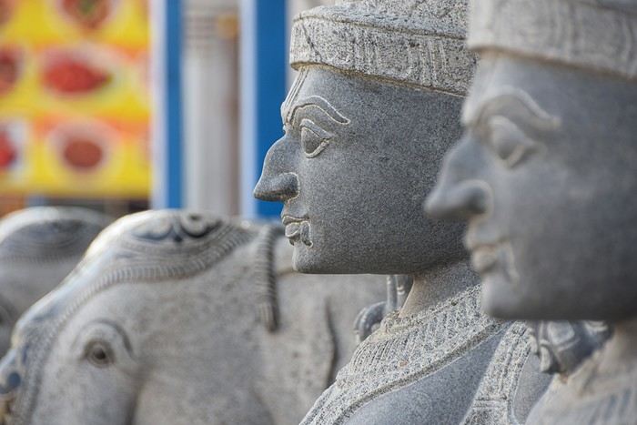
We're off! After exploring the north, the four friends have now discovered the south. We’re excited to share this new travel journal, dedicated to our little group and our strong friendship, written by Richard and illustrated with Kate’s photos. I’ll chime in from time to time with practical tips.
First of all, a big thank you to everyone on VoyageForum who helped us plan this trip. It would’ve been quite different if we’d just relied on guidebooks.
The itinerary lasted just over 3 weeks: Mahabalipuram, Pondicherry, Thanjavur, the Chettinad region, Madurai, Munnar, Munroe Island, Cochin, and Chennai. We traveled by train, taxi, and private car with a driver, took a domestic flight, and stayed in guesthouses, Airbnb apartments, and hotels. For each of us, including flights, the total budget barely reached 2000 €, and we didn’t hold back—knowing we avoid resorts and love street food and small Indian restaurants.
Texas, Louisiana, and a Touch of Florida
After five trips to the American West, we had planned to switch countries and continents to visit Turkey. However, by the time we made up our minds, flight ticket prices had nearly doubled, reaching 400 € for a round-trip ticket. A bit disappointed, I started looking at transatlantic flight prices and stumbled upon discounted tickets from Basel-Mulhouse to Dallas—at the same price as our tickets to Turkey!
No hesitation needed; we bought the five tickets for a total of 1,860 € excluding baggage!
From Fort Worth Airport, we had two options: - Head west on a loop through Texas, New Mexico, and southern Colorado - Head east to change the scenery and explore East Texas, Louisiana, with a possible detour into Florida.
The latter option won unanimously, so here we are, off to discover new states, mainly Louisiana and Texas.
One of the main post-COVID challenges is finding a reasonably priced car rental. After an initial booking around 1,300 €, we kept an eye on prices a few weeks before departure and managed to snag a better deal at around 900 € for a comfortable sedan.
Yes, this summer will also be a first: no 4x4, no camping, and plenty of restaurants!
As always, I’ve planned a packed itinerary, ready to adjust on the go. A few weeks before departure, we learned we’d be at full capacity—our eldest son, Maxime, got his first-year med school results. By finishing as a top admit, he avoided the mandatory July-August internship that would’ve kept him from joining us. Instead, he wrapped up his internship at the last minute the night before our big departure.
We’ll get to savor these special moments together.
The itinerary: Day 1 - 07/15: Fort Worth Day 2: Dallas Day 3: Jefferson - Caddo Lake Day 4: Black Bayou Lake - Natchez - Stanton Hall and Rosalie Mansion Day 5: St. Francisville - Rosedown Plantation - Cat Island Wildlife Refuge Day 6: Mobile - USS Alabama Battleship Memorial Park Day 7 - 8: Pensacola Beach Day 9: Bellingrath Gardens - New Orleans Day 10 - 11: New Orleans Day 12: Plantation Route Day 13: Jungle Gardens - Tabasco Factory - Vermilionville - Lake Martin Day 14: Baton Rouge - USS Kidd Day 15: Houma - Cajun Man's Swamp Tour Day 16: Galveston, Texas Day 17: Space Center Houston - Painted Churches Day 18: San Antonio Day 19: Texas Hill Country Day 20: Texas Hill Country and evening in San Antonio Day 21: Austin and Waco
Day 0 - 07/14: The departure timing isn’t exactly relaxing. On Thursday late afternoon, we hit the road to Alsace, aiming to drop off our two cockers with family before reaching the airport at 2 AM for a 3-hour power nap. Not exactly fresh, we arrive at the terminal looking for a British Airways counter. None in sight, so we try our luck at a United Airlines counter—who knows, maybe it’ll work out. And bingo! The agent checks us in. We didn’t quite understand why, but maybe there’s some agreement between airlines. For the first time, we’re traveling without checked baggage, so no extra fees. Not a huge feat, given the scorching temperatures awaiting us!
The connecting flight to London goes smoothly.
During the layover, liquid checks get stricter—now requiring small bottles to be in a pre-approved clear bag, with only one bag allowed per passenger. Normally, no big deal, but between deodorant, sunscreen, after-sun lotion, hand sanitizer, contact lens solution, etc., we spend 20 minutes optimizing the arrangement! When we finally succeed, one of the security staff bursts out laughing and congratulates us!
With our stomachs growling, we grab an American breakfast before browsing the airport shops.
We then discover our plane for the long-haul flight and are thrilled to see it’s an A380—a first for Laetitia, though the rest of the family experienced it during our winter getaway. Still just as impressive!
With a hint of uncertainty, we take off for the States—my third trip in barely 12 months. This time, no endless badlands, canyons, slot canyons, hoodoos, or brain rocks, but a journey through five states (Texas, Louisiana, a quick stop in Mississippi, Alabama, and the northwest tip of Florida), where we hope to soak up a unique vibe... with a packed schedule of diverse visits.
Arrival at Fort Worth Airport and customs go smoothly. Since we have no checked baggage, we’re first in line at the Dollar counter. In just 3 minutes, the formalities are done. We decline the Toll Pass, which I don’t think we’ll need based on my "calculations," and head to the Dollar parking lot, where an employee tells us we can pick any car we want!
There are about thirty cars waiting. Too many choices!
After last year’s mishap in Oakland, where our 4x4’s trunk was broken into, we’re looking for a sedan to hide our luggage this time. Unfortunately, there are none—only SUVs. We finally settle on a comfortable 7-seater Ford SUV with a massive trunk when set up for five.
On the road from Fort Worth to Dallas, we accidentally take a toll highway without realizing until it’s too late to exit. Let’s hope Dollar doesn’t charge us a week’s worth of their pricey Toll Pass for a $2 toll. We’ll see... In the meantime, Maxime sets up Google Maps to avoid toll roads.
Since it’s not too late, we stop by the nearest Walmart for groceries before checking into our hotel room for three nights in East Dallas suburb.
No hesitation needed; we bought the five tickets for a total of 1,860 € excluding baggage!
From Fort Worth Airport, we had two options: - Head west on a loop through Texas, New Mexico, and southern Colorado - Head east to change the scenery and explore East Texas, Louisiana, with a possible detour into Florida.
The latter option won unanimously, so here we are, off to discover new states, mainly Louisiana and Texas.
One of the main post-COVID challenges is finding a reasonably priced car rental. After an initial booking around 1,300 €, we kept an eye on prices a few weeks before departure and managed to snag a better deal at around 900 € for a comfortable sedan.
Yes, this summer will also be a first: no 4x4, no camping, and plenty of restaurants!
As always, I’ve planned a packed itinerary, ready to adjust on the go. A few weeks before departure, we learned we’d be at full capacity—our eldest son, Maxime, got his first-year med school results. By finishing as a top admit, he avoided the mandatory July-August internship that would’ve kept him from joining us. Instead, he wrapped up his internship at the last minute the night before our big departure.
We’ll get to savor these special moments together.
The itinerary: Day 1 - 07/15: Fort Worth Day 2: Dallas Day 3: Jefferson - Caddo Lake Day 4: Black Bayou Lake - Natchez - Stanton Hall and Rosalie Mansion Day 5: St. Francisville - Rosedown Plantation - Cat Island Wildlife Refuge Day 6: Mobile - USS Alabama Battleship Memorial Park Day 7 - 8: Pensacola Beach Day 9: Bellingrath Gardens - New Orleans Day 10 - 11: New Orleans Day 12: Plantation Route Day 13: Jungle Gardens - Tabasco Factory - Vermilionville - Lake Martin Day 14: Baton Rouge - USS Kidd Day 15: Houma - Cajun Man's Swamp Tour Day 16: Galveston, Texas Day 17: Space Center Houston - Painted Churches Day 18: San Antonio Day 19: Texas Hill Country Day 20: Texas Hill Country and evening in San Antonio Day 21: Austin and Waco
Day 0 - 07/14: The departure timing isn’t exactly relaxing. On Thursday late afternoon, we hit the road to Alsace, aiming to drop off our two cockers with family before reaching the airport at 2 AM for a 3-hour power nap. Not exactly fresh, we arrive at the terminal looking for a British Airways counter. None in sight, so we try our luck at a United Airlines counter—who knows, maybe it’ll work out. And bingo! The agent checks us in. We didn’t quite understand why, but maybe there’s some agreement between airlines. For the first time, we’re traveling without checked baggage, so no extra fees. Not a huge feat, given the scorching temperatures awaiting us!
The connecting flight to London goes smoothly.
During the layover, liquid checks get stricter—now requiring small bottles to be in a pre-approved clear bag, with only one bag allowed per passenger. Normally, no big deal, but between deodorant, sunscreen, after-sun lotion, hand sanitizer, contact lens solution, etc., we spend 20 minutes optimizing the arrangement! When we finally succeed, one of the security staff bursts out laughing and congratulates us!
With our stomachs growling, we grab an American breakfast before browsing the airport shops.
We then discover our plane for the long-haul flight and are thrilled to see it’s an A380—a first for Laetitia, though the rest of the family experienced it during our winter getaway. Still just as impressive!
With a hint of uncertainty, we take off for the States—my third trip in barely 12 months. This time, no endless badlands, canyons, slot canyons, hoodoos, or brain rocks, but a journey through five states (Texas, Louisiana, a quick stop in Mississippi, Alabama, and the northwest tip of Florida), where we hope to soak up a unique vibe... with a packed schedule of diverse visits.
Arrival at Fort Worth Airport and customs go smoothly. Since we have no checked baggage, we’re first in line at the Dollar counter. In just 3 minutes, the formalities are done. We decline the Toll Pass, which I don’t think we’ll need based on my "calculations," and head to the Dollar parking lot, where an employee tells us we can pick any car we want!
There are about thirty cars waiting. Too many choices!
After last year’s mishap in Oakland, where our 4x4’s trunk was broken into, we’re looking for a sedan to hide our luggage this time. Unfortunately, there are none—only SUVs. We finally settle on a comfortable 7-seater Ford SUV with a massive trunk when set up for five.
On the road from Fort Worth to Dallas, we accidentally take a toll highway without realizing until it’s too late to exit. Let’s hope Dollar doesn’t charge us a week’s worth of their pricey Toll Pass for a $2 toll. We’ll see... In the meantime, Maxime sets up Google Maps to avoid toll roads.
Since it’s not too late, we stop by the nearest Walmart for groceries before checking into our hotel room for three nights in East Dallas suburb.
Southwest Part 2: 55 Days in Colorado, New Mexico, Arizona, Nevada, and Utah
This travel journal is the second part of the trip whose first part you can find here: 1st part...
Sunday, August 7: the day we discover a magical place... Edmaier's Secret...
We got up at 8:00 AM, had breakfast on the terrace of our tiny house, and then set off again toward yesterday’s trail. This time, we stopped after 4.5 miles on House Rock Valley Road at the Buckskin Gulch Trail parking lot. We weren’t interested in that trail today—the slot canyon is muddy anyway after the recent storms...
Instead, we explored a lesser-known area that became our playground. And what a playground it was, folks—an out-of-this-world spot, THE highlight of our trip!!! 😏
Just imagine being in the middle of these landscapes, and the cherry on top... no one else around!!!!! Well, we did meet a couple who were coming back—it was 9:30 AM 😮. Did they camp there? Did they turn back? 🙁
After paying the entry permit online, we set off with plenty of water (6L for the four of us) plus a gallon we hid along the way for the return trip. 😉 After a one-hour approach hike along a wash, we reached the sea of sand.
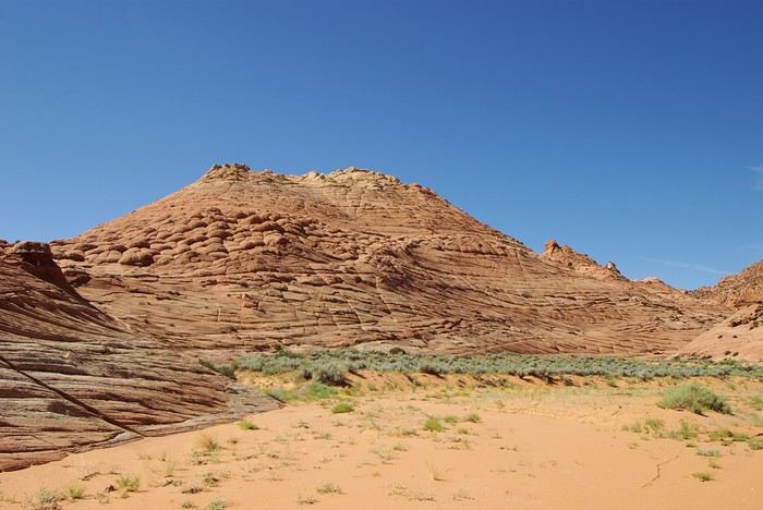
We had to cross it to reach our goal: a strip about 2 km long and 1 km wide that you can explore freely since there’s no marked trail... We entered a few GPS points into our Garmin Etrex, and off we went!!! 😎 It was... magical, enchanting, a true love-at-first-sight moment!
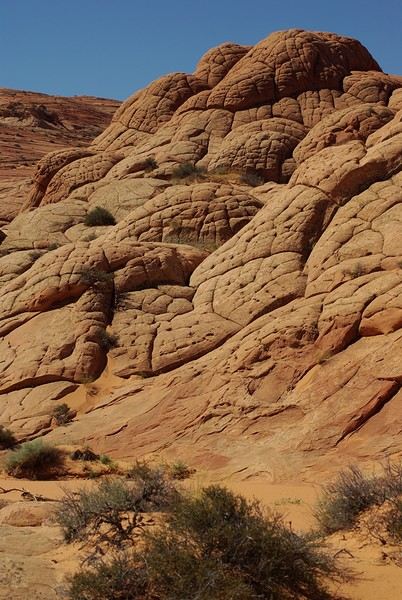
Brain Rock, waves, fine and brittle rock, colors—it goes up, it goes down.
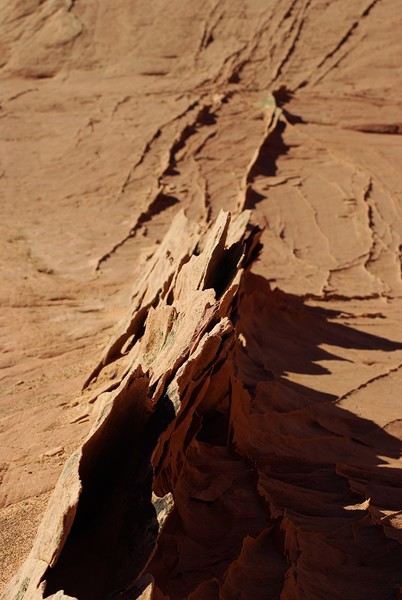
Just thinking about it gives me chills... I remember sitting still for two minutes, taking in these wonders with such emotion that I teared up...
Sunday, August 7: the day we discover a magical place... Edmaier's Secret...
We got up at 8:00 AM, had breakfast on the terrace of our tiny house, and then set off again toward yesterday’s trail. This time, we stopped after 4.5 miles on House Rock Valley Road at the Buckskin Gulch Trail parking lot. We weren’t interested in that trail today—the slot canyon is muddy anyway after the recent storms...
Instead, we explored a lesser-known area that became our playground. And what a playground it was, folks—an out-of-this-world spot, THE highlight of our trip!!! 😏
Just imagine being in the middle of these landscapes, and the cherry on top... no one else around!!!!! Well, we did meet a couple who were coming back—it was 9:30 AM 😮. Did they camp there? Did they turn back? 🙁
After paying the entry permit online, we set off with plenty of water (6L for the four of us) plus a gallon we hid along the way for the return trip. 😉 After a one-hour approach hike along a wash, we reached the sea of sand.
We had to cross it to reach our goal: a strip about 2 km long and 1 km wide that you can explore freely since there’s no marked trail... We entered a few GPS points into our Garmin Etrex, and off we went!!! 😎 It was... magical, enchanting, a true love-at-first-sight moment!
Brain Rock, waves, fine and brittle rock, colors—it goes up, it goes down.
Just thinking about it gives me chills... I remember sitting still for two minutes, taking in these wonders with such emotion that I teared up...