Results for "Port+Joli+|+128"
42872 results found.
9-Day Trek in the Balkans
Hi there,
Here’s a recap of a trek through the Balkans covering three countries: Albania, Montenegro, and Kosovo. I was with a friend, and we didn’t do the full route (only one day in Kosovo).
It was a wonderful trek through snow-capped mountains and vast flower-filled meadows, meeting incredibly welcoming people.
At the end of the travel journal, I’ll share what I loved and what I liked less.
Day 1: Flight from Paris-Beauvais to Tirana with Wizz Air.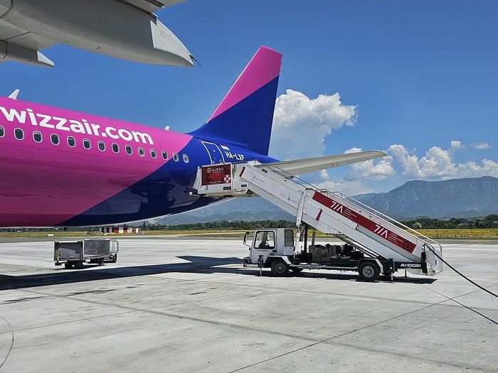 Since Albania isn’t part of Europe when it comes to phone service (at least not yet! :-)), we had to buy a physical SIM card—otherwise, the bill would’ve been sky-high if we’d used our French plan! We got one from Vodafone AL at the airport. You can buy online before leaving with a virtual SIM (e-SIM) for compatible phones, so you don’t have to swap cards. But given the uncertainty about choosing a plan online, we preferred buying one directly at Tirana Airport. Cost: 31 € for 100 GB. That’s way too much—100 GB is overkill. For 40 GB, it’s 27 €, and the plan lasts 21 days. The price difference isn’t huge, and it was cheaper than online. This plan covers all the countries along the Balkan range.
Money tip: All guesthouses and accommodations accept euros. The local currency in Albania is the LEK. In Montenegro, it’s the euro. Bank fees for withdrawing money from an ATM in Albania are pretty steep: 8 € for a withdrawal of 600–700 LEK (about 200 €)! So it’s better to withdraw cash (euros) in France. Oh, and we booked all our accommodations before leaving, but payment is always in cash. Budget around 400–500 € for 9 days of trekking.
Since Albania isn’t part of Europe when it comes to phone service (at least not yet! :-)), we had to buy a physical SIM card—otherwise, the bill would’ve been sky-high if we’d used our French plan! We got one from Vodafone AL at the airport. You can buy online before leaving with a virtual SIM (e-SIM) for compatible phones, so you don’t have to swap cards. But given the uncertainty about choosing a plan online, we preferred buying one directly at Tirana Airport. Cost: 31 € for 100 GB. That’s way too much—100 GB is overkill. For 40 GB, it’s 27 €, and the plan lasts 21 days. The price difference isn’t huge, and it was cheaper than online. This plan covers all the countries along the Balkan range.
Money tip: All guesthouses and accommodations accept euros. The local currency in Albania is the LEK. In Montenegro, it’s the euro. Bank fees for withdrawing money from an ATM in Albania are pretty steep: 8 € for a withdrawal of 600–700 LEK (about 200 €)! So it’s better to withdraw cash (euros) in France. Oh, and we booked all our accommodations before leaving, but payment is always in cash. Budget around 400–500 € for 9 days of trekking.
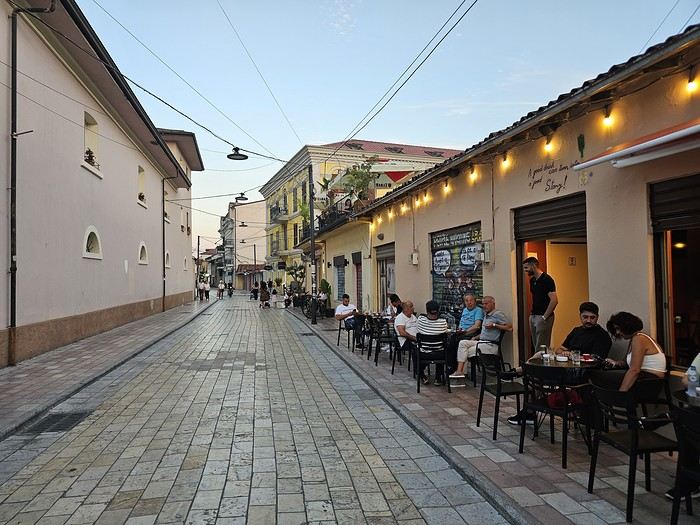
Then, a transfer the same day to Shköder, about a 2-hour bus ride. Cost: 10 € per person. Tickets bought directly on the bus. We spent the night in Shköder at a very clean guesthouse, Open Doors B&B. It had a small balcony overlooking the city.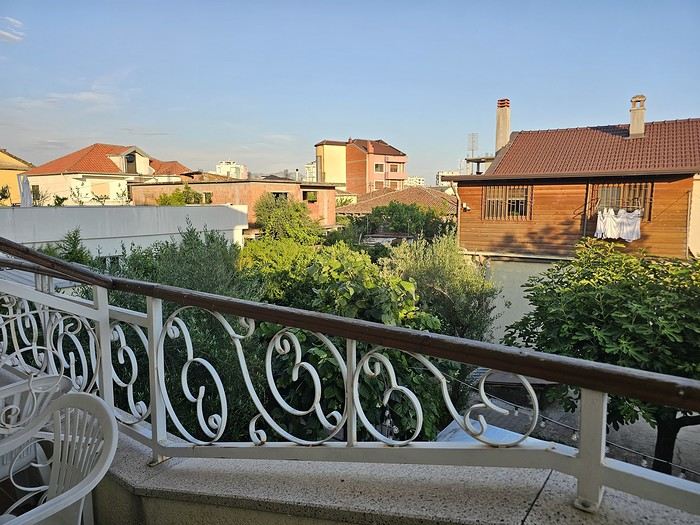 I really liked Shköder, especially its pedestrian street lined with restaurants and lit up at night. It’s a great place to stroll and eat. The food isn’t expensive—two big salads and two beers: 14 € :-) . Fruit prices are also very reasonable: 3 € for a kilo of cherries, compared to 9–10 € in France.
Religions coexist peacefully in these countries—Catholics and Muslims. From our balcony, my friend heard the call to prayer for the first time, coming from one of the city’s mosques.
I really liked Shköder, especially its pedestrian street lined with restaurants and lit up at night. It’s a great place to stroll and eat. The food isn’t expensive—two big salads and two beers: 14 € :-) . Fruit prices are also very reasonable: 3 € for a kilo of cherries, compared to 9–10 € in France.
Religions coexist peacefully in these countries—Catholics and Muslims. From our balcony, my friend heard the call to prayer for the first time, coming from one of the city’s mosques.
Day 2: Bus ride to Theth, about 1,100 meters in elevation gain, the starting point for our hike the next day.
The trip took 2 hours and 40 minutes with a break in the middle. The bus was affordable, but taxis also make the trip—though they’re very expensive.
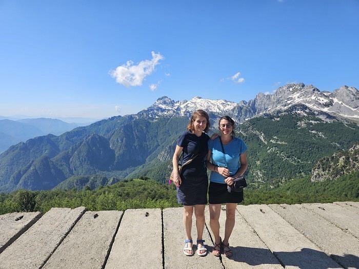
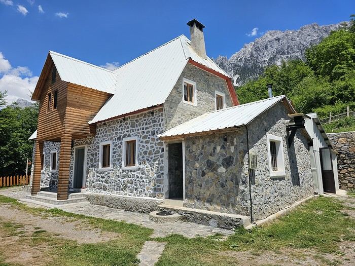 We slept in the heights of Theth at a new guesthouse, "Mountain Vista Shkafi," with an amazing view.
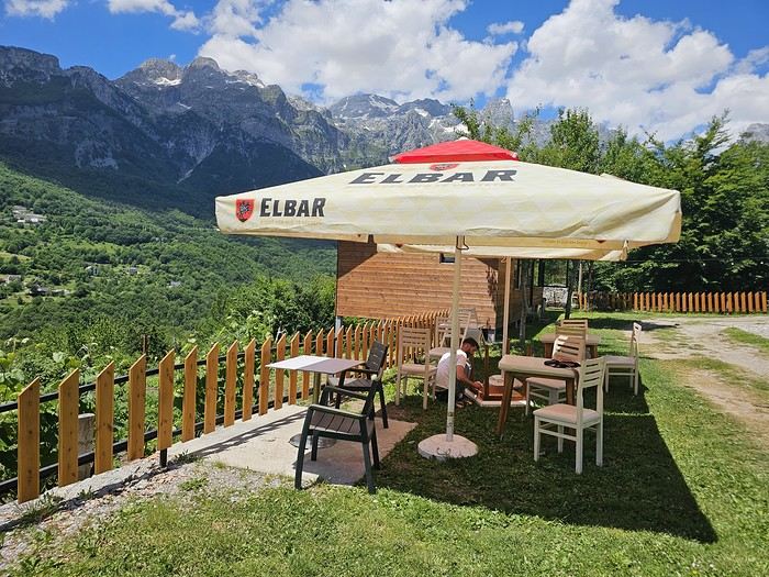
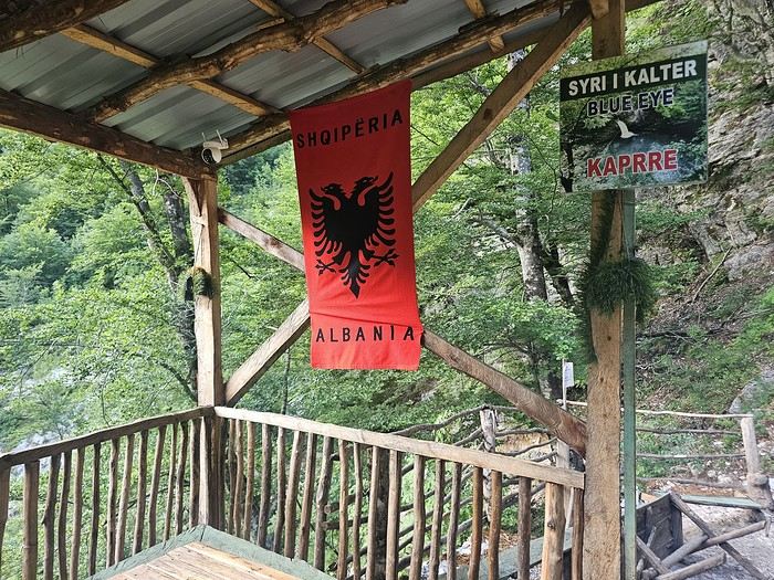
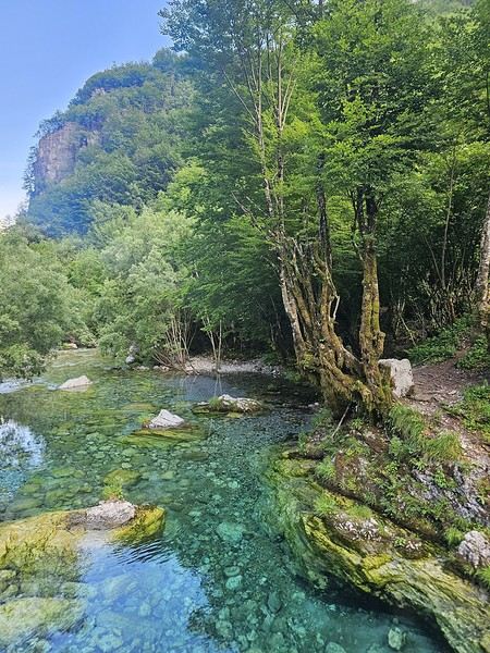
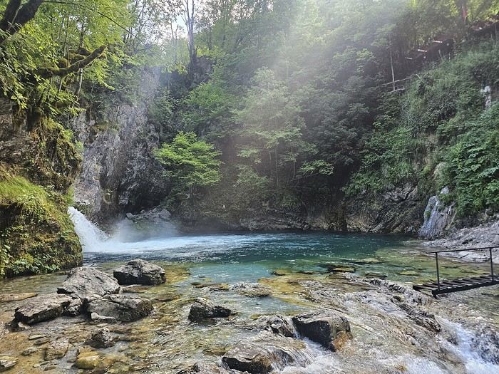
The family was adorable. The husband is a handyman and built almost everything himself. Their baby is named "Sky"—such a cute name, right? :-) Throughout the trek, I found the guesthouses very clean, and the hosts think of everything—no need to bring soap or shampoo; they provide it. Lunch in Theth at a traditional restaurant on the main road. We tried "Tave Dheu," an Albanian dish with beef, cabbage (very common), and cottage cheese. Delicious but not quite filling enough. For dessert, a honey cake that was perfectly moist—such a treat! Desserts like this are rare; sometimes they serve watermelon instead. We took a small private bus for 5 € to the "Blue Eye" parking lot, then walked for about 45 minutes to reach a stunning natural site—a kind of lagoon with incredibly blue water. The bravest can swim, but the water’s freezing!
That evening, we dined at "La Montagne Blanche"—excellent! A delightful mix of grilled meats with potatoes and grilled peppers. Some watermelon slices (which I’m not a fan of) and the famous Raki, a brandy served in Turkey and the Balkans! It was my first time drinking brandy "bottoms up." 😉
To be continued... 😉
Day 1: Flight from Paris-Beauvais to Tirana with Wizz Air.
Since Albania isn’t part of Europe when it comes to phone service (at least not yet! :-)), we had to buy a physical SIM card—otherwise, the bill would’ve been sky-high if we’d used our French plan! We got one from Vodafone AL at the airport. You can buy online before leaving with a virtual SIM (e-SIM) for compatible phones, so you don’t have to swap cards. But given the uncertainty about choosing a plan online, we preferred buying one directly at Tirana Airport. Cost: 31 € for 100 GB. That’s way too much—100 GB is overkill. For 40 GB, it’s 27 €, and the plan lasts 21 days. The price difference isn’t huge, and it was cheaper than online. This plan covers all the countries along the Balkan range.
Money tip: All guesthouses and accommodations accept euros. The local currency in Albania is the LEK. In Montenegro, it’s the euro. Bank fees for withdrawing money from an ATM in Albania are pretty steep: 8 € for a withdrawal of 600–700 LEK (about 200 €)! So it’s better to withdraw cash (euros) in France. Oh, and we booked all our accommodations before leaving, but payment is always in cash. Budget around 400–500 € for 9 days of trekking.Then, a transfer the same day to Shköder, about a 2-hour bus ride. Cost: 10 € per person. Tickets bought directly on the bus. We spent the night in Shköder at a very clean guesthouse, Open Doors B&B. It had a small balcony overlooking the city.
I really liked Shköder, especially its pedestrian street lined with restaurants and lit up at night. It’s a great place to stroll and eat. The food isn’t expensive—two big salads and two beers: 14 € :-) . Fruit prices are also very reasonable: 3 € for a kilo of cherries, compared to 9–10 € in France.
Religions coexist peacefully in these countries—Catholics and Muslims. From our balcony, my friend heard the call to prayer for the first time, coming from one of the city’s mosques.
Day 2: Bus ride to Theth, about 1,100 meters in elevation gain, the starting point for our hike the next day.
The trip took 2 hours and 40 minutes with a break in the middle. The bus was affordable, but taxis also make the trip—though they’re very expensive.
We slept in the heights of Theth at a new guesthouse, "Mountain Vista Shkafi," with an amazing view.
The family was adorable. The husband is a handyman and built almost everything himself. Their baby is named "Sky"—such a cute name, right? :-) Throughout the trek, I found the guesthouses very clean, and the hosts think of everything—no need to bring soap or shampoo; they provide it. Lunch in Theth at a traditional restaurant on the main road. We tried "Tave Dheu," an Albanian dish with beef, cabbage (very common), and cottage cheese. Delicious but not quite filling enough. For dessert, a honey cake that was perfectly moist—such a treat! Desserts like this are rare; sometimes they serve watermelon instead. We took a small private bus for 5 € to the "Blue Eye" parking lot, then walked for about 45 minutes to reach a stunning natural site—a kind of lagoon with incredibly blue water. The bravest can swim, but the water’s freezing!
That evening, we dined at "La Montagne Blanche"—excellent! A delightful mix of grilled meats with potatoes and grilled peppers. Some watermelon slices (which I’m not a fan of) and the famous Raki, a brandy served in Turkey and the Balkans! It was my first time drinking brandy "bottoms up." 😉
To be continued... 😉
Carnet pratique : road trip en scooter - Flores & Lembata (été 2026)
Bonjour,
De retour sur le forum - et première rédaction d'un espèce de carnet de retour de notre 4ème voyage en Indo.
Contexte : une trentaine de jours, en scooter et en duo, sur Florès (et une petite incursion dans l'archipel de Solor, plus précisément à Lembata (chut, faut pas trop en parler !!!), qui donne envie d'en faire beaucoup plus là bas malgré les infrastructures sporadiques), en partie dans des destinations déjà bien connues du forum (la classique Ruteng / Bajawa / Riung / Moni voir baie de Maumere) ... et qui ne parlera pas du PN de Komodo ou de Wae Rebo, puisque nous n'y sommes pas allés 🏴☠️.
Texte en anglais (issu d'une autre plateforme). Sans nul doute, des traducteurs intelligents ou pas marcheront à merveille en cas d'anglophobie 🤪.
Disponible à toute fin utile pour des détails ou infos.
Equippement : Yam' Nmax 155 ; 2x saccoches cavalières (25L) + sac de selle (30L) + saccoche tunnel (15L pour le matos photo) ; casques et vêtements d'enduro amenés depuis la France.
Itinéraire : boucle depuis Labuan bajo jusqu'à Pulau Lembata ; juillet-août 2026
Road conditions graded from A (excellent) to D (very bad, at least for a Scooter… a CRF/KLX or even honda ADV would do better on that) D1 : Labuan Bajo – Reok via Ranggoe, Rego & Tagol (130km ; 5hrs). Section LBajo – Rego (90 km ; B) is quite good tarmac, despite a lot of elevation with many small valleys and passes. Rego – Tagol (10km ; D) is a stone road (not gravel), some ascents & very poor condition ; necessary to lower tyre pressure. Tagol – Reok port (22km, quality depends considerably from D to B). Reok port – Towncenter : B. Night @Iffah Homestay (100k for fan room, mandi attached, no breakfast), simple but clean. Notes : path to danau Sano Limbung was closed ; access to Tiwu Pai & Wae Kuli (waterfalls) not permitted in july 2026. D2 : Reok – Riung via Pota (105km ; 3h-3h30). The road is very narrow in some part, thanks to the uncut bushes (lowering visibility hence extra caution as animals/people can suddenly appear in a turn…) but generally good condition except many eroded sections and some unpaved ones. Grade C/B. 2 nights @Mentos (285k for AC room) D3 : Boat tour in Riung (booked directly with a captain, 800k for two for private boat incl. lunch and NP fees) + sunset from Watu Mitong Riung (should not be missed). D4 : Riung – Muku Saki via Mbay (around 100km ; 3h30). Quality varies from A in the vicinity of Mbay to eroded sections (C) in secluded places. Night @Sao Paolo Homestay (250k for fan room with mandi, maybe overpriced but nice house and great food). Note : if you happen to pass by Mbay on Saturday, the market is well worth a stop (cheapest Ikat on the trip : you’ll be asked normal prices providing you’re OK in Bahasa…) D5 : Muku Saki – Tanjung Kajuwulu (near Ndete) (90km, 3h). Many patholes, eroded (C). Night at Déjà Vu Homestay (220k for a matress on the floor & outside mandi/toilets ; I woud define this as a tourist trap – the quote we had for food was double priced too…) D6 : Tanjung Kajuwulu – Waiterang (east of Maumere, 55km , 1h30). Pathholes till maumere, then All good (TransFlores), C/A. Night at Sunset Cottage (new concrete room, very serene place ; 270k for AC with bathroom ; much prefered Sunset over Lena House (more customers, more built up). D7 : Waiterang – Larantuka via Boru and Eputobi (TransFlores ; grade A ; 115km / 2h40). Particularly liked the drink stalls (marked as Rest Area Eputobi) and the out of order aquatic park just before Larantuka (obyej wisata waiplatin). Night @ Dewy Onong Homestay, which is not advertising itself as Larantuka Beach Homestay as some contributor signals here and on goole maps review. Best breakfast of the trip (Cumi Cumi !!!) ; 275k for AC room with bathroom. D8 : Local Boat (Kapal Kayu) from the main port to Lembata (Lewoleba). Departure 8am ; price 60k/head + 50k for the bike. Stop enroute on Adonara (where we did not stop due to fights between communities). Night @Elmany Homestay (275k for AC room with bathroom, fan room with shared bathroom also available). Whole afternoon at Pantai Hadakewa, fantastic place (good snorkeling, great views of Ile Api aka Gn Lewotolo). Road condition : A (did not expect the TransLembata to be that good…). D9 : Loop around Ile Api (50km, 2hrs), anticlockwise. Stops enroute at Situs Tulang Paus (whale squeletton), pantai Jotona, pantai Wena (we expected to snorkel from there, but wind was very strong that day), situs Watu Nale, Selat Sonia. The western coast is far less interesting. Road conditions : bad (C) on the eastern side (up to Riangbeda), good (B/A) afterwards. Night @Elmany Homestay. D10 : Lewoleba – Lamalera via the western and south coast (70km, 2h30). Good road (B) for roughly the first 55km (up to Tapobali), then eroded track for the last 15km (in some parts steep and dangerous) up to Lamalera (D/C). Notes : 1/ Kuma resort denied us the entry for some drink ; 2/Pantai Waijarang « complex » is abandonned but closed with fences ; you can still sneak in ; 3/ some reports advise to skip Bukit Cinta (foreigner entry fee) for Bukit Doa Watomiten (stations of the cross) ; well Bukit Cinta has also been abandonned (well spent money…sic) but remains opened with structures falling (quickly) appart. Night @Lamalera Inn (200k per head including meals ; very basic fan room + attached mandi). Planned 2 nights, spent only one, as it’s the only tenant I had difficulties with (only interested in money, initially stated crazy prices, starts loud music at 6am … and drinking moke at 8am…) D11 : Trip to Wulandoni for the Barter Market (Saturday only). Bad road (C) along the coast. Had to report at the Kantor upon arrival, which quite surprisingly asked 100k per person (foreigner) to go inside the (outside) market. Other « local » tourists (a group from Jakarta) were not asked to pay. Well, since a market is a public space and not a zoo, we refused payment and enjoyed the activity from the kopi stall next to it. Returned then to Lamalera for the catches of the day, then to Lewoleba via the mountain road (45km, 2 hours). First 10km to Puor is in very bad condition and uphill (D/C). The remaining is on a newly constructed road (A). Note : Air Panas Sabutobo is abandonned and falling apart (again…) but there are still some water pipes along the river that you can enjoy (depending how lucky you are, just with the forest sounds as companion). Night @Elmany Homestay D12 : Chill day alond the northern coast (Batu Payung, Pantai Hadakewa with lot of snorkeling, drove till Wailolong and backtracked to Pantai Lewolein for more snorkeling (nice canyons there !) and another fantastic sunset over Ile Api (see GMaps pictures)). Night @Elmany Homestay D13 : Monday weekly market at Pada, southwest of Lewoleba. Renowned but honnestly dont plan any itinerary specifically for it, just an ordinary Kampung weekly market. Returned to Larantuka and Flores with the 12pm local boat (the same boat that leaves from Larantuka at 8am). Same prices as the first leg. Night @ Dewy Onong Homestay D14 : Larantuka – Waiterang along the northern coast (100km, 3h) via Pantai Kawaliwu, Tewuk Lewokluok (trail is easy to find, very nice snorkelling in a lagoon), Pantai Lato (to my opinion the most beautiful beach on Flores and you’ll be the only visitor, as opposed to Pantai Koka) and Pantai Hia, until rejoining the TransFlores near Nebe. Grade C on the costal eroded road / track. 3 nights @Lena Guesthouse (booked ahead as it fills up quickly, but we prefered its neighbour Sunset Beach Guesthouse) D15 : Snorkeling trip organised by Lena Guesthouse (200k per head excluding NP fees and lunch)). The drop-off near Pulau Babi is a very nice spot. D16 : scooter day trip around the Egon Range (too lazy to hike it…), through nice Sikka villages (route : Watublapi, Umauta, Bola, pantai Doreng, Nakatoli, foot of Gn Egon, Air panas Blidit). The track from Natakoli to the foot of Gn Egon is very steep, damaged and wet (with moss) ; I would recommend not to attempt that in case of bad weather. D17 : Waiterang – Moni (130km, 3h30, transflores grade A/B) via Pantai Koka (refused to pay the mafia entry fee…) and Jopu (some rumah Adat Lio). Stopped at Museum Bikon Blewut, south of Maumere. Very nice artefacts (especially wooden statues from Papuan, great ikat collection) although very disorganized and sadly non-visited (hence masterpieces fall into oblivion). 2 Nights @Liahz Lodge (150k for fan room, basic bathroom… but right next to Air Panas Liasembe (free, no closing time) !!!). D18 : Sunrise from Kelimutu with a nice weather (stayed until 8.30am). I don’t know if the sunrise is really worth it (lot of people ascending and watching the sunrise – a lot but nothing compared to e.g. Gn Bromo), nearly everyone going down around 7am, then there is virtually nobody. Trip (20km one way, good road B) to Kampung Adat Nggela (Lio). Although the village is habited and mostly out of the beaten path, I have mixed fillings due to the fact that most ladies (some are pushy) try to sell you (bad) pieces of ikat. D19 : Moni – Ende via Detusoko paddy fields, Kampung Adat Saga (Lio) and Puncak Ndona ; 75km 2h30. We really liked Saga (nice setting on the mountain, friendly villagers, no selling, mix between traditional and more modern houses in that lively village). Sunset from Bukit Raja, on the peninsula with a 360 view on Gn Iya, Gn Meja Kota Ende and the mountains behind. Note : at the end of the road (search for Gunung Meja Tourist Info Center), there is a (sand) track leading to the path. 1/ only intend the track if you have off road driving experience ; 2/ dont trust the walking time stated by Maps.me. Took us 45mins on a steady pace to reach the summit. Night @Hoja Homestay, 300k for a comfortable AC room with bathroom. D20 : Ende – Bajawa, via Air Panas Mengeruda ; grade A, 120km, 3 hours. Note : don’t plan to short in Mengeruda (Soa), very easy to spend a half day there, especially if playing with local kids. Stay @Cinnamon GH, 250k for double with fan and hot shower (cheaper options with shared hot shower availlable). D21 : First day in Bajawa : Watu Nari Wowo (Avatar Hill, sic…), Kampung Adat Ngada Tololela & Gurusina (very very friendly people, complementary views of Gn Inerie & Wolo Deru). Sunset from Puncak Manulalu (well… Heaven’s door Bar & Restaurant) D22 : Second day in Bajawa : Kampung Adat Ngio (hardly visited, best view on Gn Inerie), Air Panas Malanage, Kampung Adat Bena (the most visited Ngada village (after Bela ?) in the area, we went there at the end of the afternoon to avoid tours, early morning would be fine too), and Gunung Wolobobo for a terrific sunset D23 : returned to Gunung Wolobobo for sunrise with Gn Ebulobo in the distance (search for a track on the eastern slope, near the communication antenna). You can circuit the rim to the usual viewpoint (westside, sunset spot), the path is easy to find. Then took again the road to Aimere, visiting Kampung Adat Belaraghi enroute (the setting is maybe less rewarding than all the previous villages). 56km ; 1h30. The road to Belaraghi is fine, except the final part. D24 : Aimere – Ruteng (105km, 3h30). Nice detour by the paddy fields of Wodo (southwest of Golo Loni) of Sunset from Golo Curu (nice encounters with locals). Night @Tange GH, 130k for room with outside (private) bathroom, no breakfast. D25 : Surroundings of Ruteng (paddy fields north and east of ruteng ; Maps.me has funny tracks starting from Kenda), and the rather pleasant city itself (pasar, churches, lapangan). We finally skipped Liang Bua. D26 : Ruteng - Labuan Bajo (130km, 3h30). No visits of the waterfalls close to the TransFlores (entry fee (with bule prices) + mandatory guide etc…). Sunset from Bukit Hercadi with very few locals (Bukit Sylvia & Bukit Amelia, just south, were packed). 2 nights @Wellamas Homestay, away from the harbour and its advantages/disadvantages. 230k for comfortable AC room with hot shower. D27 : New road to Golo Mori Convention Center (another big money well spent…), with nice views on the strait separating Flores from Pulau Rinca. Some empty beaches (e.g. Pantai Pasir Pajang ; we were there on a weekday perhaps frequented by people from LBajo only). 30km (40 mins) one way, perhaps the fastest road of Flores… D28 : Morning on the peninsula north of Labuan Bajo before taking a flight to Jakarta in the afternoon. On Google maps, the asphalt road only goes to Teras Langit ; it now (august 2026) continues to Puncak Basok and is still in progress towards the eastern part of the peninsula. On the way back, two other nice Bukit where you can enjoy nice views on the bay (and the resorts…) : Bukit Lontar & Bukit Beta. Note : we only found one public (and nice and quiet) beach in the area ; tagged as Sunset Point Beach on Gmaps. All the rest was closed by fences ; they are privately owned (although the Indonesian consitution grants the coastline as public space).
Contexte : une trentaine de jours, en scooter et en duo, sur Florès (et une petite incursion dans l'archipel de Solor, plus précisément à Lembata (chut, faut pas trop en parler !!!), qui donne envie d'en faire beaucoup plus là bas malgré les infrastructures sporadiques), en partie dans des destinations déjà bien connues du forum (la classique Ruteng / Bajawa / Riung / Moni voir baie de Maumere) ... et qui ne parlera pas du PN de Komodo ou de Wae Rebo, puisque nous n'y sommes pas allés 🏴☠️.
Texte en anglais (issu d'une autre plateforme). Sans nul doute, des traducteurs intelligents ou pas marcheront à merveille en cas d'anglophobie 🤪.
Disponible à toute fin utile pour des détails ou infos.
Equippement : Yam' Nmax 155 ; 2x saccoches cavalières (25L) + sac de selle (30L) + saccoche tunnel (15L pour le matos photo) ; casques et vêtements d'enduro amenés depuis la France.
Itinéraire : boucle depuis Labuan bajo jusqu'à Pulau Lembata ; juillet-août 2026
Road conditions graded from A (excellent) to D (very bad, at least for a Scooter… a CRF/KLX or even honda ADV would do better on that) D1 : Labuan Bajo – Reok via Ranggoe, Rego & Tagol (130km ; 5hrs). Section LBajo – Rego (90 km ; B) is quite good tarmac, despite a lot of elevation with many small valleys and passes. Rego – Tagol (10km ; D) is a stone road (not gravel), some ascents & very poor condition ; necessary to lower tyre pressure. Tagol – Reok port (22km, quality depends considerably from D to B). Reok port – Towncenter : B. Night @Iffah Homestay (100k for fan room, mandi attached, no breakfast), simple but clean. Notes : path to danau Sano Limbung was closed ; access to Tiwu Pai & Wae Kuli (waterfalls) not permitted in july 2026. D2 : Reok – Riung via Pota (105km ; 3h-3h30). The road is very narrow in some part, thanks to the uncut bushes (lowering visibility hence extra caution as animals/people can suddenly appear in a turn…) but generally good condition except many eroded sections and some unpaved ones. Grade C/B. 2 nights @Mentos (285k for AC room) D3 : Boat tour in Riung (booked directly with a captain, 800k for two for private boat incl. lunch and NP fees) + sunset from Watu Mitong Riung (should not be missed). D4 : Riung – Muku Saki via Mbay (around 100km ; 3h30). Quality varies from A in the vicinity of Mbay to eroded sections (C) in secluded places. Night @Sao Paolo Homestay (250k for fan room with mandi, maybe overpriced but nice house and great food). Note : if you happen to pass by Mbay on Saturday, the market is well worth a stop (cheapest Ikat on the trip : you’ll be asked normal prices providing you’re OK in Bahasa…) D5 : Muku Saki – Tanjung Kajuwulu (near Ndete) (90km, 3h). Many patholes, eroded (C). Night at Déjà Vu Homestay (220k for a matress on the floor & outside mandi/toilets ; I woud define this as a tourist trap – the quote we had for food was double priced too…) D6 : Tanjung Kajuwulu – Waiterang (east of Maumere, 55km , 1h30). Pathholes till maumere, then All good (TransFlores), C/A. Night at Sunset Cottage (new concrete room, very serene place ; 270k for AC with bathroom ; much prefered Sunset over Lena House (more customers, more built up). D7 : Waiterang – Larantuka via Boru and Eputobi (TransFlores ; grade A ; 115km / 2h40). Particularly liked the drink stalls (marked as Rest Area Eputobi) and the out of order aquatic park just before Larantuka (obyej wisata waiplatin). Night @ Dewy Onong Homestay, which is not advertising itself as Larantuka Beach Homestay as some contributor signals here and on goole maps review. Best breakfast of the trip (Cumi Cumi !!!) ; 275k for AC room with bathroom. D8 : Local Boat (Kapal Kayu) from the main port to Lembata (Lewoleba). Departure 8am ; price 60k/head + 50k for the bike. Stop enroute on Adonara (where we did not stop due to fights between communities). Night @Elmany Homestay (275k for AC room with bathroom, fan room with shared bathroom also available). Whole afternoon at Pantai Hadakewa, fantastic place (good snorkeling, great views of Ile Api aka Gn Lewotolo). Road condition : A (did not expect the TransLembata to be that good…). D9 : Loop around Ile Api (50km, 2hrs), anticlockwise. Stops enroute at Situs Tulang Paus (whale squeletton), pantai Jotona, pantai Wena (we expected to snorkel from there, but wind was very strong that day), situs Watu Nale, Selat Sonia. The western coast is far less interesting. Road conditions : bad (C) on the eastern side (up to Riangbeda), good (B/A) afterwards. Night @Elmany Homestay. D10 : Lewoleba – Lamalera via the western and south coast (70km, 2h30). Good road (B) for roughly the first 55km (up to Tapobali), then eroded track for the last 15km (in some parts steep and dangerous) up to Lamalera (D/C). Notes : 1/ Kuma resort denied us the entry for some drink ; 2/Pantai Waijarang « complex » is abandonned but closed with fences ; you can still sneak in ; 3/ some reports advise to skip Bukit Cinta (foreigner entry fee) for Bukit Doa Watomiten (stations of the cross) ; well Bukit Cinta has also been abandonned (well spent money…sic) but remains opened with structures falling (quickly) appart. Night @Lamalera Inn (200k per head including meals ; very basic fan room + attached mandi). Planned 2 nights, spent only one, as it’s the only tenant I had difficulties with (only interested in money, initially stated crazy prices, starts loud music at 6am … and drinking moke at 8am…) D11 : Trip to Wulandoni for the Barter Market (Saturday only). Bad road (C) along the coast. Had to report at the Kantor upon arrival, which quite surprisingly asked 100k per person (foreigner) to go inside the (outside) market. Other « local » tourists (a group from Jakarta) were not asked to pay. Well, since a market is a public space and not a zoo, we refused payment and enjoyed the activity from the kopi stall next to it. Returned then to Lamalera for the catches of the day, then to Lewoleba via the mountain road (45km, 2 hours). First 10km to Puor is in very bad condition and uphill (D/C). The remaining is on a newly constructed road (A). Note : Air Panas Sabutobo is abandonned and falling apart (again…) but there are still some water pipes along the river that you can enjoy (depending how lucky you are, just with the forest sounds as companion). Night @Elmany Homestay D12 : Chill day alond the northern coast (Batu Payung, Pantai Hadakewa with lot of snorkeling, drove till Wailolong and backtracked to Pantai Lewolein for more snorkeling (nice canyons there !) and another fantastic sunset over Ile Api (see GMaps pictures)). Night @Elmany Homestay D13 : Monday weekly market at Pada, southwest of Lewoleba. Renowned but honnestly dont plan any itinerary specifically for it, just an ordinary Kampung weekly market. Returned to Larantuka and Flores with the 12pm local boat (the same boat that leaves from Larantuka at 8am). Same prices as the first leg. Night @ Dewy Onong Homestay D14 : Larantuka – Waiterang along the northern coast (100km, 3h) via Pantai Kawaliwu, Tewuk Lewokluok (trail is easy to find, very nice snorkelling in a lagoon), Pantai Lato (to my opinion the most beautiful beach on Flores and you’ll be the only visitor, as opposed to Pantai Koka) and Pantai Hia, until rejoining the TransFlores near Nebe. Grade C on the costal eroded road / track. 3 nights @Lena Guesthouse (booked ahead as it fills up quickly, but we prefered its neighbour Sunset Beach Guesthouse) D15 : Snorkeling trip organised by Lena Guesthouse (200k per head excluding NP fees and lunch)). The drop-off near Pulau Babi is a very nice spot. D16 : scooter day trip around the Egon Range (too lazy to hike it…), through nice Sikka villages (route : Watublapi, Umauta, Bola, pantai Doreng, Nakatoli, foot of Gn Egon, Air panas Blidit). The track from Natakoli to the foot of Gn Egon is very steep, damaged and wet (with moss) ; I would recommend not to attempt that in case of bad weather. D17 : Waiterang – Moni (130km, 3h30, transflores grade A/B) via Pantai Koka (refused to pay the mafia entry fee…) and Jopu (some rumah Adat Lio). Stopped at Museum Bikon Blewut, south of Maumere. Very nice artefacts (especially wooden statues from Papuan, great ikat collection) although very disorganized and sadly non-visited (hence masterpieces fall into oblivion). 2 Nights @Liahz Lodge (150k for fan room, basic bathroom… but right next to Air Panas Liasembe (free, no closing time) !!!). D18 : Sunrise from Kelimutu with a nice weather (stayed until 8.30am). I don’t know if the sunrise is really worth it (lot of people ascending and watching the sunrise – a lot but nothing compared to e.g. Gn Bromo), nearly everyone going down around 7am, then there is virtually nobody. Trip (20km one way, good road B) to Kampung Adat Nggela (Lio). Although the village is habited and mostly out of the beaten path, I have mixed fillings due to the fact that most ladies (some are pushy) try to sell you (bad) pieces of ikat. D19 : Moni – Ende via Detusoko paddy fields, Kampung Adat Saga (Lio) and Puncak Ndona ; 75km 2h30. We really liked Saga (nice setting on the mountain, friendly villagers, no selling, mix between traditional and more modern houses in that lively village). Sunset from Bukit Raja, on the peninsula with a 360 view on Gn Iya, Gn Meja Kota Ende and the mountains behind. Note : at the end of the road (search for Gunung Meja Tourist Info Center), there is a (sand) track leading to the path. 1/ only intend the track if you have off road driving experience ; 2/ dont trust the walking time stated by Maps.me. Took us 45mins on a steady pace to reach the summit. Night @Hoja Homestay, 300k for a comfortable AC room with bathroom. D20 : Ende – Bajawa, via Air Panas Mengeruda ; grade A, 120km, 3 hours. Note : don’t plan to short in Mengeruda (Soa), very easy to spend a half day there, especially if playing with local kids. Stay @Cinnamon GH, 250k for double with fan and hot shower (cheaper options with shared hot shower availlable). D21 : First day in Bajawa : Watu Nari Wowo (Avatar Hill, sic…), Kampung Adat Ngada Tololela & Gurusina (very very friendly people, complementary views of Gn Inerie & Wolo Deru). Sunset from Puncak Manulalu (well… Heaven’s door Bar & Restaurant) D22 : Second day in Bajawa : Kampung Adat Ngio (hardly visited, best view on Gn Inerie), Air Panas Malanage, Kampung Adat Bena (the most visited Ngada village (after Bela ?) in the area, we went there at the end of the afternoon to avoid tours, early morning would be fine too), and Gunung Wolobobo for a terrific sunset D23 : returned to Gunung Wolobobo for sunrise with Gn Ebulobo in the distance (search for a track on the eastern slope, near the communication antenna). You can circuit the rim to the usual viewpoint (westside, sunset spot), the path is easy to find. Then took again the road to Aimere, visiting Kampung Adat Belaraghi enroute (the setting is maybe less rewarding than all the previous villages). 56km ; 1h30. The road to Belaraghi is fine, except the final part. D24 : Aimere – Ruteng (105km, 3h30). Nice detour by the paddy fields of Wodo (southwest of Golo Loni) of Sunset from Golo Curu (nice encounters with locals). Night @Tange GH, 130k for room with outside (private) bathroom, no breakfast. D25 : Surroundings of Ruteng (paddy fields north and east of ruteng ; Maps.me has funny tracks starting from Kenda), and the rather pleasant city itself (pasar, churches, lapangan). We finally skipped Liang Bua. D26 : Ruteng - Labuan Bajo (130km, 3h30). No visits of the waterfalls close to the TransFlores (entry fee (with bule prices) + mandatory guide etc…). Sunset from Bukit Hercadi with very few locals (Bukit Sylvia & Bukit Amelia, just south, were packed). 2 nights @Wellamas Homestay, away from the harbour and its advantages/disadvantages. 230k for comfortable AC room with hot shower. D27 : New road to Golo Mori Convention Center (another big money well spent…), with nice views on the strait separating Flores from Pulau Rinca. Some empty beaches (e.g. Pantai Pasir Pajang ; we were there on a weekday perhaps frequented by people from LBajo only). 30km (40 mins) one way, perhaps the fastest road of Flores… D28 : Morning on the peninsula north of Labuan Bajo before taking a flight to Jakarta in the afternoon. On Google maps, the asphalt road only goes to Teras Langit ; it now (august 2026) continues to Puncak Basok and is still in progress towards the eastern part of the peninsula. On the way back, two other nice Bukit where you can enjoy nice views on the bay (and the resorts…) : Bukit Lontar & Bukit Beta. Note : we only found one public (and nice and quiet) beach in the area ; tagged as Sunset Point Beach on Gmaps. All the rest was closed by fences ; they are privately owned (although the Indonesian consitution grants the coastline as public space).
First solo trip to Thailand
Hi everyone,
I’m planning a solo trip for November.
I’ve chosen Thailand because it’s my first solo trip and I wanted a country that’s easy and safe for a woman (though maybe you have other suggestions?), but also because of this time of year when the monsoon is hitting many Asian countries. A lot of people have confirmed that Thailand is a destination where everything is relatively easy for a first solo trip: getting around the country (buses and trains), great food, beautiful beaches, stunning countryside, decent safety, etc...
This trip comes after a major burnout and professional exhaustion 😵💫. I quit my job this week and need to recharge and clear my head before diving back into the professional grind... I’m looking for peaceful landscapes away from mass tourism, combining mountains, countryside, and beaches. I need moments of free wandering, yoga, sightseeing, and maybe some woofing. I love authenticity, contemplation, and beautiful things in simplicity.
Thanks for your route and accommodation ideas 😊!
Armelle
3 weeks in Laos, stress-free
 Come along, I'm taking you to this country where it's so nice to wander and slow down...
This trip was in 2023, but when I wanted to write my travel journal, VF was still closed to contributions... So, now that I've just finished my Japan travel journal here, I figured it was high time to honor this destination we came back from so enchanted. Disclaimer 1: This is a written travel journal. There’ll be text! Too much, for some! Disclaimer 2: This is an illustrated travel journal. There’ll be photos! Too many, for some!
I have to say, every time I try to discipline myself, to keep it shorter, to include fewer photos... I end up adding more. It feels like my dear Aunt Nicole, who exhausted us with her slide-show evenings in the 70s/80s, decided to take her revenge. The upside for you, readers, is that you can slip away anytime without offending Aunt Nicole. I won’t even notice!
Anyway, since I love maps, here’s one to give you an idea of where I’m taking you. As you can see, we only saw a tiny part of Laos (the areas circled in red); we only had 3 weeks for ourselves (my husband’s newly retired, I still work), and we prefer taking our time over rushing around like crazy.

In broad strokes, it was very classic:
First, we “settled in” at Luang Prabang (8 days), because we wanted and needed to. From there, we took three days to venture a little further north—not far in kilometers, but as we know, distances aren’t just about km! Then we flew south to Paksé, letting ourselves drift down to the 4,000 Islands while stopping by the pre-Angkorian archaeological sites. We wrapped up with the Bolaven Plateau.
A few practical notes: We arrived via Bangkok, then took a Bangkok-Luang Prabang flight, having picked up our luggage in Bangkok to check it in for Luang Prabang. No issues—the Bangkok airport, which many of you know, is very well organized. We got our visas on arrival in Luang Prabang. Quick, but to be fair, we were on a “small” plane, and the big flights had arrived earlier, so we weren’t too crowded in line! At the end of our trip, we didn’t fly out of Paksé but from the nearby airport in Thailand, Ubon Ratchathani (a 2.5-hour drive from Paksé), then Bangkok and Paris. You’ll notice we skipped Vientiane to stay longer in Luang Prabang. That said, there’s now a high-speed train between Vientiane and Luang Prabang—good to know—and soon the (Chinese) train will go all the way to Bangkok and even Kuala Lumpur!
With that intro out of the way, let’s dive into the heart of the matter. To be continued: Slowing down the pace... in Luang Prabang
Storm in the Canary Islands
15 days across Gran Canaria, El Hierro, and a dash of Tenerife under the storm Thérèse!
The planned itinerary will be slightly disrupted...
(The version without discussions is here)
The planned itinerary will be slightly disrupted...
(The version without discussions is here)
Back in Tunisia (live account)
Hi there,
On this forum, I shared my first trip to Tunisia from mid-February to early March (https://voyageforum.com/forum/impressions-tunisiennes-en-direct-d11460662/), a stay I enjoyed so much that six weeks later, I’m back in Tunisia for a full 15 days (I return on April 27).
This time, I landed in Monastir on a direct flight from Nice, again with Tunisair. We left about ten minutes late, and the flight lasted around 1 hour 30 minutes. A meal was served on board (cucumber salad with Edam-like cheese, carrots, and two small portions of dishes I couldn’t identify—semolina with peppers, olives, and parsley, two small rolls, a square of processed cheese, and a chocolate cake). It’s worth noting because it’s not common on flights this short.
In February, France and Tunisia were in the same time zone, but now Tunisia is one hour behind. This time difference and the flight duration work perfectly for a short 15-day trip since it takes me a few days to adjust to jet lag.
Luckily, I’d asked my hotel about the taxi fare from the airport because the drivers (there were several around me) didn’t hesitate to quote outrageous prices. The actual fare is 20 dinars, but one asked for 120 dinars. I refused, and another offered 60 dinars. I replied, "That’s too expensive—I’ll take the metro!" (Having tried the Tunis metro, I had no desire to repeat the experience in Monastir with a suitcase!). I started walking toward the metro, and one of the drivers caught up with me, saying, "20 dinars is fine!" I’ll skip the details, but the negotiation took a little while. When I arrived at the hotel, I told the receptionist someone had asked for 120 dinars. He put his hands to his head and said, "They’re awful!" He remembered our phone call two days earlier when I’d booked (he’s the one who told me I could take the metro).
The Mezri Hotel isn’t expensive. I got a sea-view room for 75 dinars (22 €). (I’d booked a balcony room for 90 dinars but wouldn’t have had time to enjoy it.) It’s well-located but noisy because there’s no double glazing. The receptionist is a very kind older gentleman. He called a friend whose wife is from Tozeur to find out if I should take a bus or a *louage* tomorrow and what time.
I arrived at the hotel around 7:00 PM and had time to stroll along the corniche to the ribat. Despite some run-down buildings, the seaside seemed livelier and cheerier than Sousse’s.
Monastir is the hometown of former president Bourguiba. I passed his mausoleum by taxi. There are Tunisian flags along the avenue by the sea because every year on April 6—the anniversary of Habib Bourguiba’s death—the president of the Republic visits the Bourguiba Mausoleum in Monastir to pay respects.
The taxi driver mentioned other Tunisian presidents. He complained about rising prices and insecurity, blaming President Kaïs Saïed (I’d already heard that security was better under Ben Ali).
At the end of my stay, I’ll take time to explore Monastir, but tomorrow morning, I’m off to Tozeur—a long bus ride awaits me.

TO BE CONTINUED....
On this forum, I shared my first trip to Tunisia from mid-February to early March (https://voyageforum.com/forum/impressions-tunisiennes-en-direct-d11460662/), a stay I enjoyed so much that six weeks later, I’m back in Tunisia for a full 15 days (I return on April 27).
This time, I landed in Monastir on a direct flight from Nice, again with Tunisair. We left about ten minutes late, and the flight lasted around 1 hour 30 minutes. A meal was served on board (cucumber salad with Edam-like cheese, carrots, and two small portions of dishes I couldn’t identify—semolina with peppers, olives, and parsley, two small rolls, a square of processed cheese, and a chocolate cake). It’s worth noting because it’s not common on flights this short.
In February, France and Tunisia were in the same time zone, but now Tunisia is one hour behind. This time difference and the flight duration work perfectly for a short 15-day trip since it takes me a few days to adjust to jet lag.
Luckily, I’d asked my hotel about the taxi fare from the airport because the drivers (there were several around me) didn’t hesitate to quote outrageous prices. The actual fare is 20 dinars, but one asked for 120 dinars. I refused, and another offered 60 dinars. I replied, "That’s too expensive—I’ll take the metro!" (Having tried the Tunis metro, I had no desire to repeat the experience in Monastir with a suitcase!). I started walking toward the metro, and one of the drivers caught up with me, saying, "20 dinars is fine!" I’ll skip the details, but the negotiation took a little while. When I arrived at the hotel, I told the receptionist someone had asked for 120 dinars. He put his hands to his head and said, "They’re awful!" He remembered our phone call two days earlier when I’d booked (he’s the one who told me I could take the metro).
The Mezri Hotel isn’t expensive. I got a sea-view room for 75 dinars (22 €). (I’d booked a balcony room for 90 dinars but wouldn’t have had time to enjoy it.) It’s well-located but noisy because there’s no double glazing. The receptionist is a very kind older gentleman. He called a friend whose wife is from Tozeur to find out if I should take a bus or a *louage* tomorrow and what time.
I arrived at the hotel around 7:00 PM and had time to stroll along the corniche to the ribat. Despite some run-down buildings, the seaside seemed livelier and cheerier than Sousse’s.
Monastir is the hometown of former president Bourguiba. I passed his mausoleum by taxi. There are Tunisian flags along the avenue by the sea because every year on April 6—the anniversary of Habib Bourguiba’s death—the president of the Republic visits the Bourguiba Mausoleum in Monastir to pay respects.
The taxi driver mentioned other Tunisian presidents. He complained about rising prices and insecurity, blaming President Kaïs Saïed (I’d already heard that security was better under Ben Ali).
At the end of my stay, I’ll take time to explore Monastir, but tomorrow morning, I’m off to Tozeur—a long bus ride awaits me.
TO BE CONTINUED....
From Avignon to Casamance Without Flying
Hi there,
Last February, I made a trip using "public transport" from France to southern Senegal via Spain, Morocco, Western Sahara, and Mauritania.
It’s a journey of about 5,000 km, where I took trains (as far as Marrakech), ferries (to cross Gibraltar and then to reach Casamance from Dakar), and mostly buses on the long desert straightaways. I hadn’t planned any stops in advance or booked any hotels, except for the very first train to Spain, which left plenty of room for the unexpected. Why travel by land and sea? In recent years, flight-free travel has been gaining popularity. On social media, posts explaining how to cross Europe by train as quickly as possible go viral. Traveling without flying—and making sure people know about it—has become a great way to earn a badge of eco-responsibility: an essential totem for anyone wanting to prove both their dedication to the ecological cause and the wisdom of slow travel. I haven’t flown in years, and this journey to West Africa could easily be filed under "responsible travel." But it wouldn’t be honest to say that: in reality, it wasn’t really my aversion to flying that motivated this long trek. I see overland travel primarily as a way to experience the world’s geography at a grounded, earthly pace—the pace of the locals. Besides, I’ll be flying back, which disqualifies any claim to being a model of sustainability. So no eco-badge, and no adventurer’s badge either: you won’t find any heroic tales of camel rides in lost lands or mineral train wagons in this account (popular with influencers, the Mauritania iron ore train now attracts tourists from all over the world, turning "the experience" into something you "have to do at least once in your life"). This five-part story, written on the road, has no other ambition than to recount a journey through places and people, and to share the thoughts they inspire in me. As simply and, I hope, as humbly as possible.
I’m posting the episodes here, which you can also find on my blog (with more photos) at the following links:
Episode 1: Spain, from Avignon to Algeciras
Episode 2: Morocco, from Tangier to Tarfaya
Episode 3: Western Sahara, from Tarfaya to Guerguerat
Episode 4: Mauritania, from Guerguerat to Nouakchott
Episode 5: Senegal, from Rosso to Saloulou
To help those who might want to make the same trip, I’ve also put together a summary of the route with recommendations—you can read it at the end of the story and on the blog: From France to Senegal Without Flying: Route and Itinerary Recommendations
Happy reading, and safe travels!
Last February, I made a trip using "public transport" from France to southern Senegal via Spain, Morocco, Western Sahara, and Mauritania.
It’s a journey of about 5,000 km, where I took trains (as far as Marrakech), ferries (to cross Gibraltar and then to reach Casamance from Dakar), and mostly buses on the long desert straightaways. I hadn’t planned any stops in advance or booked any hotels, except for the very first train to Spain, which left plenty of room for the unexpected. Why travel by land and sea? In recent years, flight-free travel has been gaining popularity. On social media, posts explaining how to cross Europe by train as quickly as possible go viral. Traveling without flying—and making sure people know about it—has become a great way to earn a badge of eco-responsibility: an essential totem for anyone wanting to prove both their dedication to the ecological cause and the wisdom of slow travel. I haven’t flown in years, and this journey to West Africa could easily be filed under "responsible travel." But it wouldn’t be honest to say that: in reality, it wasn’t really my aversion to flying that motivated this long trek. I see overland travel primarily as a way to experience the world’s geography at a grounded, earthly pace—the pace of the locals. Besides, I’ll be flying back, which disqualifies any claim to being a model of sustainability. So no eco-badge, and no adventurer’s badge either: you won’t find any heroic tales of camel rides in lost lands or mineral train wagons in this account (popular with influencers, the Mauritania iron ore train now attracts tourists from all over the world, turning "the experience" into something you "have to do at least once in your life"). This five-part story, written on the road, has no other ambition than to recount a journey through places and people, and to share the thoughts they inspire in me. As simply and, I hope, as humbly as possible.
I’m posting the episodes here, which you can also find on my blog (with more photos) at the following links:
Episode 1: Spain, from Avignon to Algeciras
Episode 2: Morocco, from Tangier to Tarfaya
Episode 3: Western Sahara, from Tarfaya to Guerguerat
Episode 4: Mauritania, from Guerguerat to Nouakchott
Episode 5: Senegal, from Rosso to Saloulou
To help those who might want to make the same trip, I’ve also put together a summary of the route with recommendations—you can read it at the end of the story and on the blog: From France to Senegal Without Flying: Route and Itinerary Recommendations
Happy reading, and safe travels!
Off on an adventure in Sri Lanka
Day 1 – December 6
Our decision is our decision. And it’s firm and final. Next winter, our plane will spread its great wings toward the island of Ceylon! "Wait a minute... Ceylon... Ceylon... that name rings a bell, but I can’t quite place it on the globe Grandma gave me for Christmas! Ceylon... Oh right, I’ve got it: Ceylon is the name of my tea!" Exactly. But the name on your pretty tea box is also the one used until 1972 for this island nation, a speck on the Indian Ocean at the southern tip of the Indian subcontinent: Sri Lanka!
For this new adventure, I’m exceptionally leaving my Flo behind, cowardly replaced by a double dose of testosterone. To write the book of this journey with me, I’m bringing along my brother, who’s used to this kind of thing, and... a guest star: My model of resilience. My dad! All aboard! Or rather, all aboard our tuk-tuk! Yes, you read that right: A real tuk-tuk, a little colorful rolling box that putters along at two miles an hour. The idea? Well, Sri Lanka and its winding roads overlooking the vastness of lush nature are tailor-made for this kind of vehicle. And since it’s one of only two countries in the world that allow foreigners to rent and drive these mini speedsters, we’ll be crisscrossing the island in our two-square-meter rolling box. Plus, adopting this mode of transport is a surefire way to connect directly with the locals, who’ll surely be curious to see a foreigner driving their iconic vehicle. Not to mention the... let’s say... spicy anecdotes it might generate. I mean, heading into a subtropical zone with my jet-black dad and his unpredictable digestive flora while deliberately choosing the tuk-tuk as our *only* means of transport? That’s the winning combo for an unforgettable adventure! "More seriously, Dad, Sullivan, I’m already loving the idea of living this adventure together, the three of us—brothers and father..."
So, does the intro to this new adventure get your salivary glands going? Yes? Too bad. Because unfortunately, the program handed out by the lady at the entrance has been slightly... let’s say *crumpled*. Some might even say "scrunched up and nearly tossed in the trash." First, six days ago, as the countdown echoed in us like a call to adventure, Cyclone Ditwah grabbed Sri Lanka, played with it like a rag doll, and left it battered on the ground. The toll is devastating: over a thousand dead, thousands of homes wiped out by relentless rains, roads and railways swallowed by massive mudslides. A country wounded once again, after the civil war, the 2004 tsunami, and the post-Covid economic crisis.
But as if this weather disaster wasn’t enough to shake our unbreakable adventurer spirit, fate decided to mess with us further by cutting our trio down to two. The victim? My brother, violently turned away because of a simple date on his passport that didn’t match the border officials’ expectations. Return to sender!
So now it’s just the two of us allowed to board the Qatar Airways Airbus A380 for this trip. If he were here, Denis Brognart would say, "And in the end, only one remains!" Except I know you’ll be with us, following our adventures! Right?
Our decision is our decision. And it’s firm and final. Next winter, our plane will spread its great wings toward the island of Ceylon! "Wait a minute... Ceylon... Ceylon... that name rings a bell, but I can’t quite place it on the globe Grandma gave me for Christmas! Ceylon... Oh right, I’ve got it: Ceylon is the name of my tea!" Exactly. But the name on your pretty tea box is also the one used until 1972 for this island nation, a speck on the Indian Ocean at the southern tip of the Indian subcontinent: Sri Lanka!
For this new adventure, I’m exceptionally leaving my Flo behind, cowardly replaced by a double dose of testosterone. To write the book of this journey with me, I’m bringing along my brother, who’s used to this kind of thing, and... a guest star: My model of resilience. My dad! All aboard! Or rather, all aboard our tuk-tuk! Yes, you read that right: A real tuk-tuk, a little colorful rolling box that putters along at two miles an hour. The idea? Well, Sri Lanka and its winding roads overlooking the vastness of lush nature are tailor-made for this kind of vehicle. And since it’s one of only two countries in the world that allow foreigners to rent and drive these mini speedsters, we’ll be crisscrossing the island in our two-square-meter rolling box. Plus, adopting this mode of transport is a surefire way to connect directly with the locals, who’ll surely be curious to see a foreigner driving their iconic vehicle. Not to mention the... let’s say... spicy anecdotes it might generate. I mean, heading into a subtropical zone with my jet-black dad and his unpredictable digestive flora while deliberately choosing the tuk-tuk as our *only* means of transport? That’s the winning combo for an unforgettable adventure! "More seriously, Dad, Sullivan, I’m already loving the idea of living this adventure together, the three of us—brothers and father..."
So, does the intro to this new adventure get your salivary glands going? Yes? Too bad. Because unfortunately, the program handed out by the lady at the entrance has been slightly... let’s say *crumpled*. Some might even say "scrunched up and nearly tossed in the trash." First, six days ago, as the countdown echoed in us like a call to adventure, Cyclone Ditwah grabbed Sri Lanka, played with it like a rag doll, and left it battered on the ground. The toll is devastating: over a thousand dead, thousands of homes wiped out by relentless rains, roads and railways swallowed by massive mudslides. A country wounded once again, after the civil war, the 2004 tsunami, and the post-Covid economic crisis.
But as if this weather disaster wasn’t enough to shake our unbreakable adventurer spirit, fate decided to mess with us further by cutting our trio down to two. The victim? My brother, violently turned away because of a simple date on his passport that didn’t match the border officials’ expectations. Return to sender!
So now it’s just the two of us allowed to board the Qatar Airways Airbus A380 for this trip. If he were here, Denis Brognart would say, "And in the end, only one remains!" Except I know you’ll be with us, following our adventures! Right?
Four days in Doha in January 2026
Hi everyone,
This short stay in Doha is part of a longer trip. It lets us break up a flight to the Seychelles.
Friday, January 16, The Corniche
Despite the adventures we had the day before (read about it here), we just can’t get up later than 8 a.m. Our minds are a bit clearer and a bit more positive after some sleep.
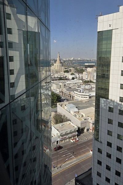
View of the Corniche from the 12th floor.
Breakfast is sumptuous—it really lifts our spirits.
On this Friday morning, almost everything is closed, so we head out to explore the Corniche, which is just a few hundred meters from our hotel in Old Doha.
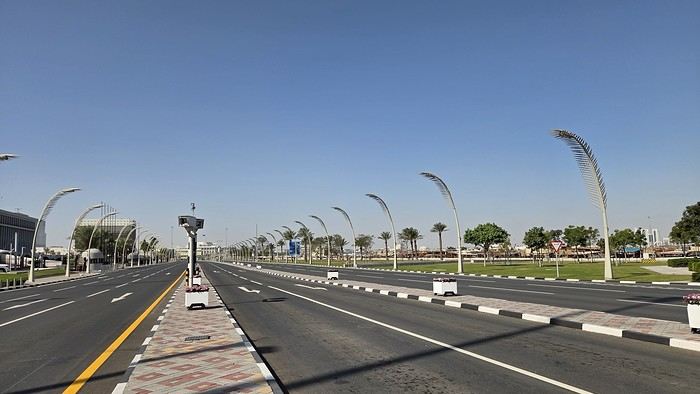
A marathon is happening today on the Corniche, so the road is closed and empty, making it easy to cross. The palm-shaped streetlights are gorgeous when they’re lit up at night.
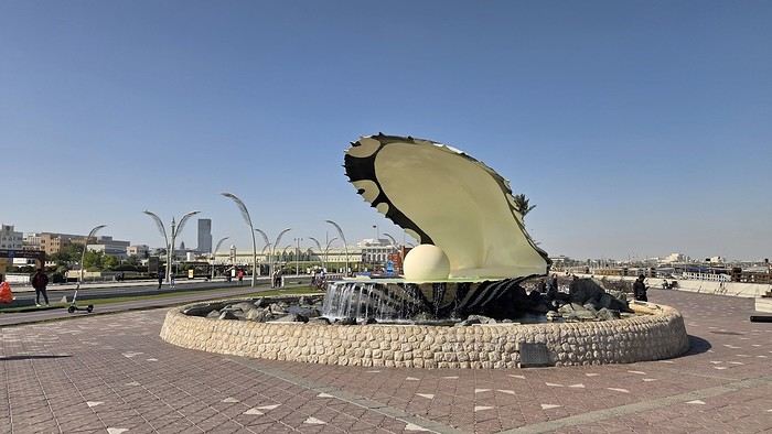
A little reminder of Qatar’s once-thriving pearl trade.
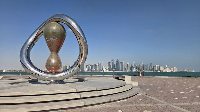
A memory of a much more recent past.
The sun is shining, but it’s not very warm—just 19°C at the hottest part of the day. Tough luck, last week it was 24°C.
The walk along the crescent-shaped Corniche is pretty long. From the old town to the modern center, where massive Dubai-style towers rise, it’s a 6 km promenade along the waterfront.
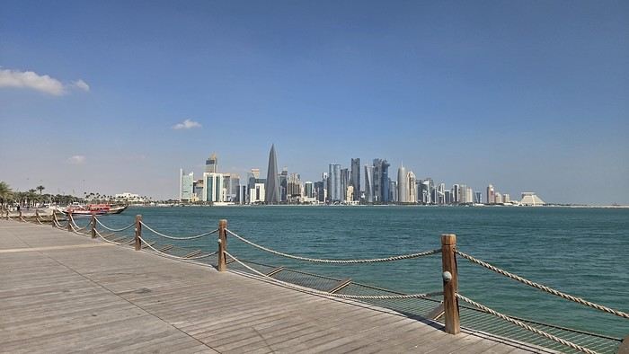
Many dhows are docked, waiting for tourists to take a little cruise in the bay, but visitors are scarce.
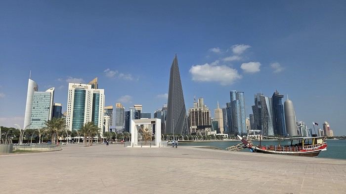
The skyscrapers are so stunning, you can’t help but admire them.
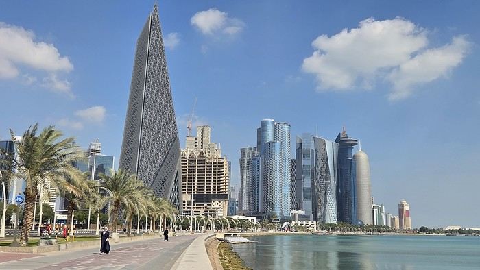
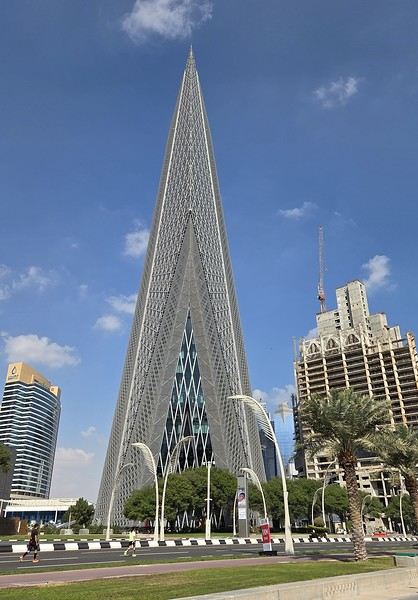
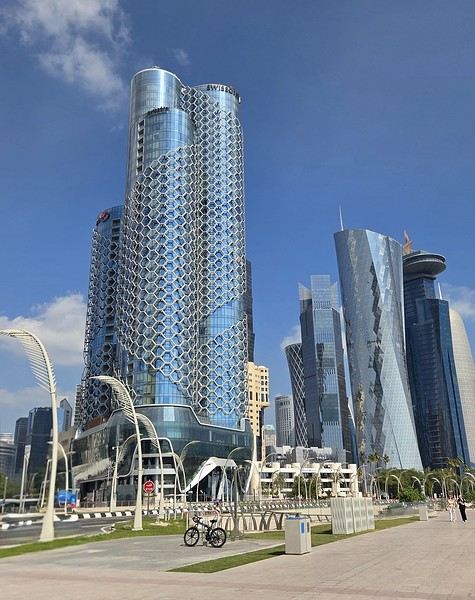
to be continued...
This short stay in Doha is part of a longer trip. It lets us break up a flight to the Seychelles.
Friday, January 16, The Corniche
Despite the adventures we had the day before (read about it here), we just can’t get up later than 8 a.m. Our minds are a bit clearer and a bit more positive after some sleep.
View of the Corniche from the 12th floor.
Breakfast is sumptuous—it really lifts our spirits.
On this Friday morning, almost everything is closed, so we head out to explore the Corniche, which is just a few hundred meters from our hotel in Old Doha.
A marathon is happening today on the Corniche, so the road is closed and empty, making it easy to cross. The palm-shaped streetlights are gorgeous when they’re lit up at night.
A little reminder of Qatar’s once-thriving pearl trade.
A memory of a much more recent past.
The sun is shining, but it’s not very warm—just 19°C at the hottest part of the day. Tough luck, last week it was 24°C.
The walk along the crescent-shaped Corniche is pretty long. From the old town to the modern center, where massive Dubai-style towers rise, it’s a 6 km promenade along the waterfront.
Many dhows are docked, waiting for tourists to take a little cruise in the bay, but visitors are scarce.
The skyscrapers are so stunning, you can’t help but admire them.
to be continued...
Tunisian Impressions (Live)
Hi there,
I arrived in Tunisia this afternoon for a full 14-day stay.
I took a direct Tunisair flight from Nice, which departed about thirty minutes late (that’s nothing compared to the "nightmares" I’ve had on some of my recent trips).
The flight lasts around 1 hour and 20 minutes, and a small snack was served on board (a sort of quiche with chickpea purée, a small bread roll, a portion of cheese like La Vache qui rit, and a small chocolate cake). It’s worth mentioning because it’s becoming increasingly rare on short flights. I was seated between two Tunisian gentlemen who gave me some great tips for my trip, especially about negotiating prices. One of them is a former cameraman for France Télévisions, very cultured and well-traveled—his daughter is a journalist at France Télévisions (I found some of her articles online). In short, the flight was very pleasant and quick.

I’m staying at the Hôtel Royal Victoria. I booked it yesterday afternoon by email without providing my credit card number. The room costs 241 TND (71 €) with breakfast included. It has heating, a small fridge, a safe, a hairdryer, Wi-Fi, and a TV with international channels. There’s a police van permanently parked in the square where the hotel is located.
This hotel is housed in the former British consulate and later embassy. It has a lot of charm with its painted wood ceilings and doors, and its bathroom covered in ceramic tiles. The tiny elevator is from another era. The main advantage of the hotel is its location between the medina and Avenue Bourguiba. Nearby, there’s the Magasin Général, where you can find groceries and some typical products like rose water, geranium water, and tons of halwa (a customer kindly explained how to eat it and which is the best).
After nightfall, I took a short stroll down Avenue Bourguiba. There weren’t many people around—it’s windy and cold.
I’ve already noticed the warm welcome from Tunisians. The supermarket cashier welcomed me to Tunisia, and a gentleman I asked for directions to the Magasin Général (I was about to climb stairs leading to a mosque!) insisted on inviting me for coffee, but I declined.
The rest of my itinerary will depend on the weather. If it doesn’t rain tomorrow, I might visit Carthage since the Bardo Museum is closed on Mondays, as are the museums in Sidi Bou Said.
TO BE CONTINUED...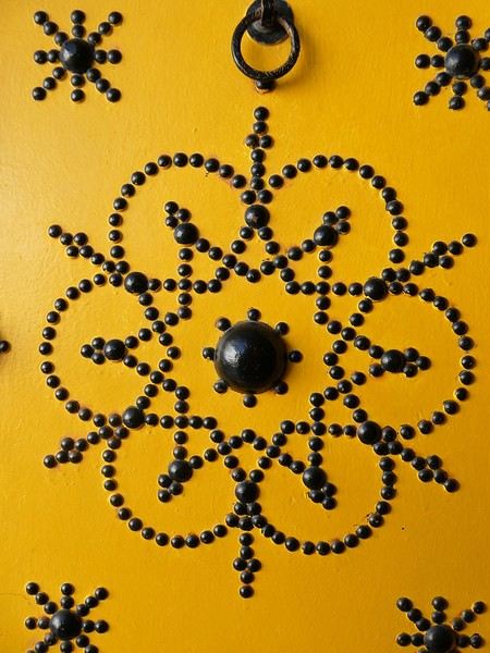


I arrived in Tunisia this afternoon for a full 14-day stay.
I took a direct Tunisair flight from Nice, which departed about thirty minutes late (that’s nothing compared to the "nightmares" I’ve had on some of my recent trips).
The flight lasts around 1 hour and 20 minutes, and a small snack was served on board (a sort of quiche with chickpea purée, a small bread roll, a portion of cheese like La Vache qui rit, and a small chocolate cake). It’s worth mentioning because it’s becoming increasingly rare on short flights. I was seated between two Tunisian gentlemen who gave me some great tips for my trip, especially about negotiating prices. One of them is a former cameraman for France Télévisions, very cultured and well-traveled—his daughter is a journalist at France Télévisions (I found some of her articles online). In short, the flight was very pleasant and quick.
I’m staying at the Hôtel Royal Victoria. I booked it yesterday afternoon by email without providing my credit card number. The room costs 241 TND (71 €) with breakfast included. It has heating, a small fridge, a safe, a hairdryer, Wi-Fi, and a TV with international channels. There’s a police van permanently parked in the square where the hotel is located.
This hotel is housed in the former British consulate and later embassy. It has a lot of charm with its painted wood ceilings and doors, and its bathroom covered in ceramic tiles. The tiny elevator is from another era. The main advantage of the hotel is its location between the medina and Avenue Bourguiba. Nearby, there’s the Magasin Général, where you can find groceries and some typical products like rose water, geranium water, and tons of halwa (a customer kindly explained how to eat it and which is the best).
After nightfall, I took a short stroll down Avenue Bourguiba. There weren’t many people around—it’s windy and cold.
I’ve already noticed the warm welcome from Tunisians. The supermarket cashier welcomed me to Tunisia, and a gentleman I asked for directions to the Magasin Général (I was about to climb stairs leading to a mosque!) insisted on inviting me for coffee, but I declined.
The rest of my itinerary will depend on the weather. If it doesn’t rain tomorrow, I might visit Carthage since the Bardo Museum is closed on Mondays, as are the museums in Sidi Bou Said.
TO BE CONTINUED...
Trip to Thailand and Laos
Hello! 🙂
January 2026 Here we go again for new adventures and the pleasure of sharing them with you here! First of all, I’d like to thank everyone who helped me with the preparations, even with some last-minute improvisations just days before departure. Thanks to Montagnard74, Jojoone1, Songsam, Attila, Dennis2, NadegerFERM, and the authors whose travel journals about Laos inspired me (Montagnard74, Muriel18, Mavietongs...).
In this story, written by Richard and illustrated by me, we’ll tell you about the journey of four friends: Catherine, Richard, Nathalie, and Bruno. A reinvented but overall successful trip, filled with discoveries and surprises, the scents of spices and frangipani flowers, (too) spicy food, sunsets, and... one big mess.
January 2026 Here we go again for new adventures and the pleasure of sharing them with you here! First of all, I’d like to thank everyone who helped me with the preparations, even with some last-minute improvisations just days before departure. Thanks to Montagnard74, Jojoone1, Songsam, Attila, Dennis2, NadegerFERM, and the authors whose travel journals about Laos inspired me (Montagnard74, Muriel18, Mavietongs...).
In this story, written by Richard and illustrated by me, we’ll tell you about the journey of four friends: Catherine, Richard, Nathalie, and Bruno. A reinvented but overall successful trip, filled with discoveries and surprises, the scents of spices and frangipani flowers, (too) spicy food, sunsets, and... one big mess.
Lisbon/Galveston Transatlantic Review – NCL Viva in The Haven
Hi everyone,
Okay, here I go—I haven’t done a cruise review in ages, and even longer since I’ve posted one on this forum. So, this is kinda your fault, Catherine, if I’m getting back into it... I just hope I haven’t lost my touch!
It’s a transatlantic cruise, so there are a lot of sea days. That means this review will mostly focus on the ship, especially the "Haven" section, which doesn’t get much coverage on this forum. There’ll definitely be some comparisons with MSC’s Yacht Club, since they’re direct competitors.
This will be my third cruise with NCL—a company I really love—but my first in The Haven.
My two previous cruises were on smaller ships: the NCL Sun for the Chilean fjords and the NCL Spirit in February 2025 in Asia, departing from Taiwan and arriving in Korea. I *loved* the Spirit.
Alright, let’s get started!
This trip was booked almost last-minute in early October for late November, after I had to cut short my August trip for medical reasons.
At first, when I looked at this cruise, I hadn’t specifically decided to go for The Haven. I wanted a relaxing cruise but still with destinations I hadn’t been to before. I kinda stumbled upon this one, and the itinerary appealed to me. I also found the balcony cabin price pretty good—around 2800 € for a balcony cabin (for two), all-inclusive package included. Not including flights, of course. In the end, we decided to try The Haven (obviously not the same price), but I think we got a great deal for the promised perks.
Itinerary: Departure from Lisbon, arrival in Galveston, Texas. Stops: St. Martin, St. Thomas, La Romana, Cabo Rojo, Falmouth in Jamaica.
It’s a transatlantic cruise, so there are a lot of sea days. That means this review will mostly focus on the ship, especially the "Haven" section, which doesn’t get much coverage on this forum. There’ll definitely be some comparisons with MSC’s Yacht Club, since they’re direct competitors.
This will be my third cruise with NCL—a company I really love—but my first in The Haven.
My two previous cruises were on smaller ships: the NCL Sun for the Chilean fjords and the NCL Spirit in February 2025 in Asia, departing from Taiwan and arriving in Korea. I *loved* the Spirit.
Alright, let’s get started!
This trip was booked almost last-minute in early October for late November, after I had to cut short my August trip for medical reasons.
At first, when I looked at this cruise, I hadn’t specifically decided to go for The Haven. I wanted a relaxing cruise but still with destinations I hadn’t been to before. I kinda stumbled upon this one, and the itinerary appealed to me. I also found the balcony cabin price pretty good—around 2800 € for a balcony cabin (for two), all-inclusive package included. Not including flights, of course. In the end, we decided to try The Haven (obviously not the same price), but I think we got a great deal for the promised perks.
Itinerary: Departure from Lisbon, arrival in Galveston, Texas. Stops: St. Martin, St. Thomas, La Romana, Cabo Rojo, Falmouth in Jamaica.
In the land... of Senegambia
Hey fellow travelers!
So, a new year has begun. It’s time to reconnect with the VF buddies and wish you all my best for 2026—a year I hope is obviously full of travel, since, as I just made up: "If travel’s good, everything’s good" 😄.
To celebrate, I’m inviting you into my new "travel journal," the one from our latest trip in November 2025, a little two-week adventure.
This time, we headed to The Gambia, a tiny country tucked right in the middle of Senegal, before making our way to Casamance.
The Gambia is English-speaking, Senegal is French-speaking, but the locals? They couldn’t care less—because in this part of the world, they mostly speak Wolof, Fula, Jola, or Mandinka. Hence the title: Senegambia 😉.
As usual, I’m sharing the live updates I sent to friends and family—super casual, of course.
I know this isn’t the kind of destination that draws crowds, but if you love adventure, laughter, and emotion, it might just be your thing 😊.
Hugs 😘
So, a new year has begun. It’s time to reconnect with the VF buddies and wish you all my best for 2026—a year I hope is obviously full of travel, since, as I just made up: "If travel’s good, everything’s good" 😄.
To celebrate, I’m inviting you into my new "travel journal," the one from our latest trip in November 2025, a little two-week adventure.
This time, we headed to The Gambia, a tiny country tucked right in the middle of Senegal, before making our way to Casamance.
The Gambia is English-speaking, Senegal is French-speaking, but the locals? They couldn’t care less—because in this part of the world, they mostly speak Wolof, Fula, Jola, or Mandinka. Hence the title: Senegambia 😉.
As usual, I’m sharing the live updates I sent to friends and family—super casual, of course.
I know this isn’t the kind of destination that draws crowds, but if you love adventure, laughter, and emotion, it might just be your thing 😊.
Hugs 😘
7-week trip feedback: Rajasthan and Varanasi, October-November-December 2025
We traveled as a couple from October 20 to December 11, 2025, for our second trip to India and our first time in Rajasthan, plus Mathura and Agra, which are in Uttar Pradesh but right on the border, and a 4-day flight hop to Varanasi.
Here’s a non-detailed trip report—just to share some info we found useful for other travelers, along with a few places and addresses we particularly enjoyed.
First off, a big thank you to (I’m using usernames) Aleph240758, Solene40, Montagnard74, and Pagaljavab, who took the time to reply to me. Some of them even take the time to create detailed and illustrated travel stories. Since I only started planning the trip in mid-August, I didn’t have much time and used the trip reports on VoyageForum to build our itinerary.
One more note: everyone travels differently and has their own preferences... so I’ll just share our personal feelings, which are obviously subjective.
We bought a physical SIM card upon arriving at the airport. The Airtel stand only offers one package for 500 rupees (just under 5 €) for 28 days, with 1.5 GB of data, unlimited national SMS, and calls—more than enough. Contrary to what we’d read, we asked for activation at the counter, and it was active within 10 minutes. The SIM worked well everywhere. Watch out—like in all airports, there’s a tendency to take advantage of tourists. The Airtel counter offers to exchange money directly, and we saw people paying 20 € for the SIM.
Since we arrived at night, the metro wasn’t running anymore. Plus, if you don’t know the city, we’d recommend taking a prepaid taxi—the price is fixed, and the driver knows the destination. Be careful: the prepaid taxi counter is on the right as you exit the hall, with large fixed signs above. Many counters put out a card on the desk saying "prepaid taxi," and even the Airtel stand tries to offer supposedly prepaid taxis, which is completely false. The price they ask for could be double or triple.
Here’s an app that was super useful for us In most big cities, we used "Rapido," an Indian app like Uber, to book auto-rickshaws (you can also book motorbikes or cars). You need a local phone number for this. The big advantage? The price is fixed, though you can still leave a tip. It tracks your ride, and most importantly, the destination is entered—way more practical than hailing an auto-rickshaw on the street, where the driver says "yes, yes," gives a price, and then doesn’t know where to go once you’re on the way. No need to enter a credit card. There’s also OlaCabs, which is similar, but we couldn’t get it to work.
For transportation between stops, we used government buses (RSRTC, blue buses), sometimes taxis via apps or by asking the guesthouse for visits and hard-to-reach places. This choice was really personal and made on the spot. - **Pros:** Buses leave almost every 30 minutes everywhere, giving you a lot of freedom. Every time we left from the bus station (bus stand), we had seats. Several times, we even got to sit in the driver’s cabin! The trip takes longer than a taxi, but not *that* much longer. The price is ridiculously low—1.30 € for 100 km for men, 70 cents for women. The bus stations are in the city centers, unlike many private bus companies. We met some great people. - **Cons:** It’s not exactly clean, and you’re obviously not in the comfort of a taxi. It’s not door-to-door service, so you need to travel light. You can’t stop along the way. If you need to catch the bus mid-route, it’s usually full, and you’ll have to elbow your way in without hesitation. For a short trip, I think hiring a taxi for the whole stay makes sense. Like I said, there’s no one-size-fits-all choice, but there’s no need to be apprehensive about taking public buses.
Here’s our route map, showing the number of nights spent at each stop. Compared to our initial plan, we slept one night in Barmer instead of two because we had time to visit the market in the afternoon, saw the Kiradu site the next morning, and didn’t see the point in staying longer.
We cut two of the six nights in Shekhawati. After our flight to Varanasi was canceled, we had to stay in Delhi, which actually turned out well—it let us arrive in Varanasi earlier and more rested.
The timing worked well for us, with longer stops in Bundi and Udaipur.
Compared to our initial plan, we slept one night in Barmer instead of two because we had time to visit the market in the afternoon, saw the Kiradu site the next morning, and didn’t see the point in staying longer.
We cut two of the six nights in Shekhawati. After our flight to Varanasi was canceled, we had to stay in Delhi, which actually turned out well—it let us arrive in Varanasi earlier and more rested.
The timing worked well for us, with longer stops in Bundi and Udaipur.
I won’t go into detail about each stop here, but I’d be happy to answer any questions. The accommodations and restaurants mentioned are the ones that had that little something extra, and the hearts (❤️❤️❤️) mark the sites we particularly loved.
Tijana Fort Palace - Accommodation and recovery from the trip
Alwar - Palace with museum - Moosi Maharani Ki Chhatri - Large reservoir
Bharatpur Accommodation: Iora Guesthouse, 14 €/night without breakfast—great value, cheap, good meals, close to the reserve Morning at Keoladeo Reserve by bike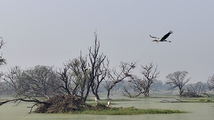
Mathura - Ghats (Yamuna Ghats, Vishram Ghat) to visit in the evening - Market (Chattu Bazar) - Hindu temple Shri Dwarkadheesh dedicated to Krishna - Vrindavan temple Banke Bihari, ❤️❤️❤️ a very important temple with incredible religious fervor - Vrindavan Hindu temple Balaram ISKCON
Agra Accommodation: Shivalayaa - The Divine Abode, 16 €/night with breakfast on Booking—welcoming, clean, close to the Taj Mahal - Mausoleum of Akbar the Great (in Sikandra) ❤️❤️❤️ - Mausoleum of Itimad-ud-Daulah (mini Taj) ❤️❤️❤️ - Visit the Taj early in the morning (closed on Fridays) ❤️❤️❤️ - Agra Fort ❤️❤️❤️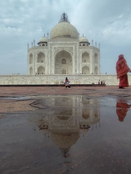
Dholpur - Machkund Temple with its water body - Clock Tower Ghanta Ghar - Royal stepwell Dhaulpur Bavdi
Karauli - City Palace, private visit with a guard ❤️❤️❤️ - Shri Madan Mohan Temple for the puja starting at 5:30 PM ❤️❤️❤️ - Wandering the streets We loved this stop, which is off the main tourist trail, for its pleasant atmosphere
Bhandarej This is a stop as a starting point to visit the Chand Baori stepwell in Abhaneri ❤️❤️❤️ Accommodation: Bhadrawati Palace, 53 €/night with breakfast in Bhandarej—nice, an old palace, warm welcome, booked via Hotels.com We were the only guests and had dinner with the current manager, the grandson of the Maharaja. There’s a pretty stepwell in the village, and we visited a tiny neighborhood temple where we were invited to join in the singing and dancing. Walking through the market was really enjoyable because of the kindness of the locals, who aren’t used to tourism ❤️❤️❤️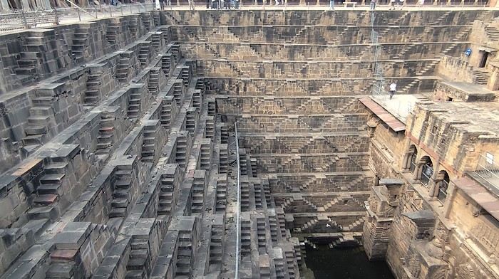
Jaipur - Hawa Mahal (Palace of Winds) - Jal Mahal - Gaitore Ki Chhatriyan ❤️❤️❤️ - Amber Fort ❤️❤️❤️ - Panna Meena Ka Kund stepwell - Galta Ji Temple (Monkey Temple) ❤️❤️❤️ - Bagru, 33 km away: visit to a fabric printing workshop with block prints (I’d noted some addresses on Google Maps). The first workshop wasn’t very welcoming and had no workers because of the humid weather. We were lucky to find another, more welcoming workshop. When the sun came out, the three female workers arrived and started their work—it was a great visit ❤️❤️❤️.
Bundi Accommodation: Hotel Bundi Inn, 25 €/night with breakfast—lovely room in a haveli, good meals with a rooftop view of the fort - Garh Palace Don’t miss: at the exit of the palace, to the left, you can access a beautiful garden with a pool and, at the back, a large hall called Chitrashala ❤️❤️❤️ - Raniji Ki Baori ❤️❤️❤️ - Nahar Dhunk Ki Baori - Chaurasi Khambun Ki Chhatri (cenotaph with 84 pillars) - Ksar Bagh, an interesting set of royal cenotaphs at the end of Jait Sagar Lake. On the other hand, we could’ve skipped Sukh Mahal and its museum. Bundi is still pleasant but is no longer a secret spot.
We bought a physical SIM card upon arriving at the airport. The Airtel stand only offers one package for 500 rupees (just under 5 €) for 28 days, with 1.5 GB of data, unlimited national SMS, and calls—more than enough. Contrary to what we’d read, we asked for activation at the counter, and it was active within 10 minutes. The SIM worked well everywhere. Watch out—like in all airports, there’s a tendency to take advantage of tourists. The Airtel counter offers to exchange money directly, and we saw people paying 20 € for the SIM.
Since we arrived at night, the metro wasn’t running anymore. Plus, if you don’t know the city, we’d recommend taking a prepaid taxi—the price is fixed, and the driver knows the destination. Be careful: the prepaid taxi counter is on the right as you exit the hall, with large fixed signs above. Many counters put out a card on the desk saying "prepaid taxi," and even the Airtel stand tries to offer supposedly prepaid taxis, which is completely false. The price they ask for could be double or triple.
Here’s an app that was super useful for us In most big cities, we used "Rapido," an Indian app like Uber, to book auto-rickshaws (you can also book motorbikes or cars). You need a local phone number for this. The big advantage? The price is fixed, though you can still leave a tip. It tracks your ride, and most importantly, the destination is entered—way more practical than hailing an auto-rickshaw on the street, where the driver says "yes, yes," gives a price, and then doesn’t know where to go once you’re on the way. No need to enter a credit card. There’s also OlaCabs, which is similar, but we couldn’t get it to work.
For transportation between stops, we used government buses (RSRTC, blue buses), sometimes taxis via apps or by asking the guesthouse for visits and hard-to-reach places. This choice was really personal and made on the spot. - **Pros:** Buses leave almost every 30 minutes everywhere, giving you a lot of freedom. Every time we left from the bus station (bus stand), we had seats. Several times, we even got to sit in the driver’s cabin! The trip takes longer than a taxi, but not *that* much longer. The price is ridiculously low—1.30 € for 100 km for men, 70 cents for women. The bus stations are in the city centers, unlike many private bus companies. We met some great people. - **Cons:** It’s not exactly clean, and you’re obviously not in the comfort of a taxi. It’s not door-to-door service, so you need to travel light. You can’t stop along the way. If you need to catch the bus mid-route, it’s usually full, and you’ll have to elbow your way in without hesitation. For a short trip, I think hiring a taxi for the whole stay makes sense. Like I said, there’s no one-size-fits-all choice, but there’s no need to be apprehensive about taking public buses.
Here’s our route map, showing the number of nights spent at each stop.
Compared to our initial plan, we slept one night in Barmer instead of two because we had time to visit the market in the afternoon, saw the Kiradu site the next morning, and didn’t see the point in staying longer.
We cut two of the six nights in Shekhawati. After our flight to Varanasi was canceled, we had to stay in Delhi, which actually turned out well—it let us arrive in Varanasi earlier and more rested.
The timing worked well for us, with longer stops in Bundi and Udaipur.I won’t go into detail about each stop here, but I’d be happy to answer any questions. The accommodations and restaurants mentioned are the ones that had that little something extra, and the hearts (❤️❤️❤️) mark the sites we particularly loved.
Tijana Fort Palace - Accommodation and recovery from the trip
Alwar - Palace with museum - Moosi Maharani Ki Chhatri - Large reservoir
Bharatpur Accommodation: Iora Guesthouse, 14 €/night without breakfast—great value, cheap, good meals, close to the reserve Morning at Keoladeo Reserve by bike
Mathura - Ghats (Yamuna Ghats, Vishram Ghat) to visit in the evening - Market (Chattu Bazar) - Hindu temple Shri Dwarkadheesh dedicated to Krishna - Vrindavan temple Banke Bihari, ❤️❤️❤️ a very important temple with incredible religious fervor - Vrindavan Hindu temple Balaram ISKCON
Agra Accommodation: Shivalayaa - The Divine Abode, 16 €/night with breakfast on Booking—welcoming, clean, close to the Taj Mahal - Mausoleum of Akbar the Great (in Sikandra) ❤️❤️❤️ - Mausoleum of Itimad-ud-Daulah (mini Taj) ❤️❤️❤️ - Visit the Taj early in the morning (closed on Fridays) ❤️❤️❤️ - Agra Fort ❤️❤️❤️
Dholpur - Machkund Temple with its water body - Clock Tower Ghanta Ghar - Royal stepwell Dhaulpur Bavdi
Karauli - City Palace, private visit with a guard ❤️❤️❤️ - Shri Madan Mohan Temple for the puja starting at 5:30 PM ❤️❤️❤️ - Wandering the streets We loved this stop, which is off the main tourist trail, for its pleasant atmosphere
Bhandarej This is a stop as a starting point to visit the Chand Baori stepwell in Abhaneri ❤️❤️❤️ Accommodation: Bhadrawati Palace, 53 €/night with breakfast in Bhandarej—nice, an old palace, warm welcome, booked via Hotels.com We were the only guests and had dinner with the current manager, the grandson of the Maharaja. There’s a pretty stepwell in the village, and we visited a tiny neighborhood temple where we were invited to join in the singing and dancing. Walking through the market was really enjoyable because of the kindness of the locals, who aren’t used to tourism ❤️❤️❤️
Jaipur - Hawa Mahal (Palace of Winds) - Jal Mahal - Gaitore Ki Chhatriyan ❤️❤️❤️ - Amber Fort ❤️❤️❤️ - Panna Meena Ka Kund stepwell - Galta Ji Temple (Monkey Temple) ❤️❤️❤️ - Bagru, 33 km away: visit to a fabric printing workshop with block prints (I’d noted some addresses on Google Maps). The first workshop wasn’t very welcoming and had no workers because of the humid weather. We were lucky to find another, more welcoming workshop. When the sun came out, the three female workers arrived and started their work—it was a great visit ❤️❤️❤️.
Bundi Accommodation: Hotel Bundi Inn, 25 €/night with breakfast—lovely room in a haveli, good meals with a rooftop view of the fort - Garh Palace Don’t miss: at the exit of the palace, to the left, you can access a beautiful garden with a pool and, at the back, a large hall called Chitrashala ❤️❤️❤️ - Raniji Ki Baori ❤️❤️❤️ - Nahar Dhunk Ki Baori - Chaurasi Khambun Ki Chhatri (cenotaph with 84 pillars) - Ksar Bagh, an interesting set of royal cenotaphs at the end of Jait Sagar Lake. On the other hand, we could’ve skipped Sukh Mahal and its museum. Bundi is still pleasant but is no longer a secret spot.
Off we go on an adventure in Puglia!
Hey there, VF crew!
After wrapping up our travel journal on Java (link below), we’re now diving into our recent adventure in Puglia! Happy reading... Off we go on an adventure in Java (and a bit of Bali) | Travel journal > Indonesia | Voyage Forum
Day 1 - October 19
When you tell your friends and family you’re itching to escape to the other side of the planet to mingle with the Mongols, you can usually expect a barrage of questionable jokes and terrible puns. For this new adventure, it’s a different destination but the same old story—this time, we’re visiting the "pouilleux" (the "scruffy" ones). We’re taking off straight for Puglia! If you need a cheat sheet to remember where this oddly named place is on a world map, just think of it this way: Puglia is the maiden name on the ID card of the heel of the Italian boot! Personally, I prefer to remember it as the land of creamy burrata, the smell of focaccia fresh from the oven, orecchiette shaped by mamas, golden olive oil that shines like the sun (which beams down here 300 days a year), amaretto that makes you happy, and those famous trulli—those little hobbit-like dry-stone houses straight out of a movie set...
But I’ll stop spoiling the rest of our trip and focus on a factual rundown of this first Puglian day. So, are you joining us on this new adventure beyond our Gallic borders? Either way, Sasha (my youngest) and Luna (Flo’s daughter) didn’t need much convincing to stick with us and keep up the pace!
Our plane drops our little crew in Bari, the site of a famously tragic battle lost in 1991. But revenge is sweet! After renting a motorized carriage, we escape the landing zone and head to our military base of operations: Ostuni, a strategic little town where we’ll set up camp for the next four days. Why Ostuni? First, for its central location, which lets us explore a region packed with must-see gems. Second, for its vibe and beauty, which have earned it quite the reputation. Perched high on a hill, the *città bianca* (the "White City") lives up to its nickname. It literally dazzles visitors. The reason? The whitewashed facades of its houses, a testament to the region’s rich architectural heritage.
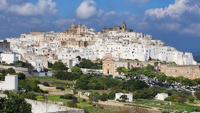
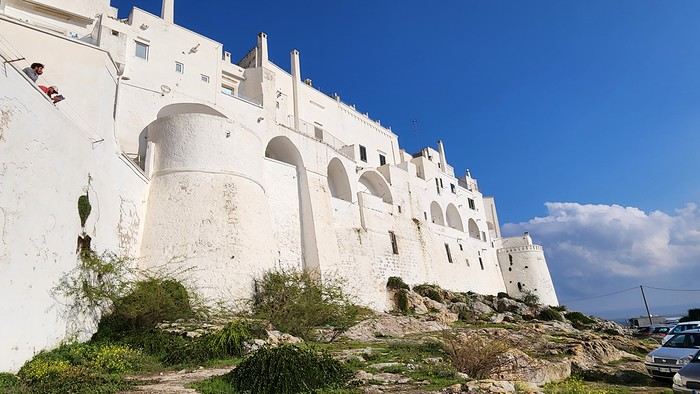
We arrived late last night, so only the two bravest soldiers volunteered to scout ahead at dawn, while the younger recruits stayed behind—for now. But not for long! After the first wave of streets and the next round of exploration, headquarters made the inevitable call to retreat. Reinforcements were needed! A few strategic errands, a breakfast ration, and our battalion marched in tight formation, flag held high, to conquer Ostuni the White! *Charge!* In my squadron leader’s memoirs, I’ll write that I didn’t expect Ostuni to put up such a fight. What I thought would take two hours to conquer turned into a humbling experience—we could only bow in respect to its beauty, its relentless charm. The alleys are whiter, more labyrinthine, narrower, and more photogenic than the last. *Veni, vidi, vici*—but what an entrance, my troops!
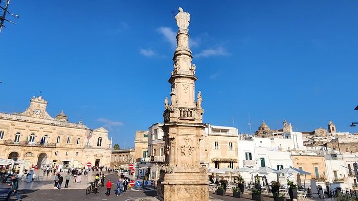
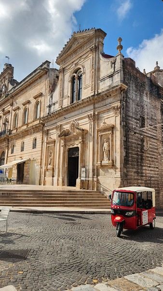
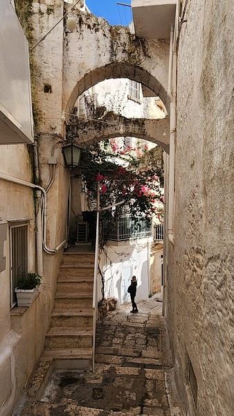
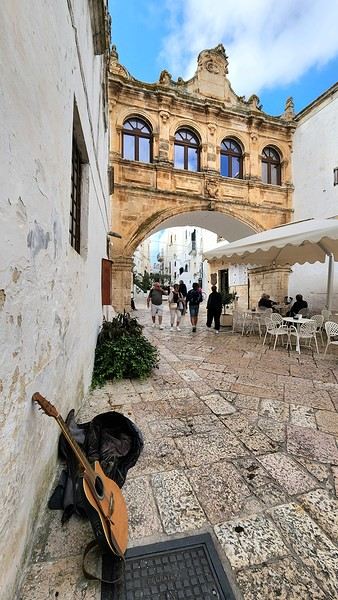
After wrapping up our travel journal on Java (link below), we’re now diving into our recent adventure in Puglia! Happy reading... Off we go on an adventure in Java (and a bit of Bali) | Travel journal > Indonesia | Voyage Forum
Day 1 - October 19
When you tell your friends and family you’re itching to escape to the other side of the planet to mingle with the Mongols, you can usually expect a barrage of questionable jokes and terrible puns. For this new adventure, it’s a different destination but the same old story—this time, we’re visiting the "pouilleux" (the "scruffy" ones). We’re taking off straight for Puglia! If you need a cheat sheet to remember where this oddly named place is on a world map, just think of it this way: Puglia is the maiden name on the ID card of the heel of the Italian boot! Personally, I prefer to remember it as the land of creamy burrata, the smell of focaccia fresh from the oven, orecchiette shaped by mamas, golden olive oil that shines like the sun (which beams down here 300 days a year), amaretto that makes you happy, and those famous trulli—those little hobbit-like dry-stone houses straight out of a movie set...
But I’ll stop spoiling the rest of our trip and focus on a factual rundown of this first Puglian day. So, are you joining us on this new adventure beyond our Gallic borders? Either way, Sasha (my youngest) and Luna (Flo’s daughter) didn’t need much convincing to stick with us and keep up the pace!
Our plane drops our little crew in Bari, the site of a famously tragic battle lost in 1991. But revenge is sweet! After renting a motorized carriage, we escape the landing zone and head to our military base of operations: Ostuni, a strategic little town where we’ll set up camp for the next four days. Why Ostuni? First, for its central location, which lets us explore a region packed with must-see gems. Second, for its vibe and beauty, which have earned it quite the reputation. Perched high on a hill, the *città bianca* (the "White City") lives up to its nickname. It literally dazzles visitors. The reason? The whitewashed facades of its houses, a testament to the region’s rich architectural heritage.
We arrived late last night, so only the two bravest soldiers volunteered to scout ahead at dawn, while the younger recruits stayed behind—for now. But not for long! After the first wave of streets and the next round of exploration, headquarters made the inevitable call to retreat. Reinforcements were needed! A few strategic errands, a breakfast ration, and our battalion marched in tight formation, flag held high, to conquer Ostuni the White! *Charge!* In my squadron leader’s memoirs, I’ll write that I didn’t expect Ostuni to put up such a fight. What I thought would take two hours to conquer turned into a humbling experience—we could only bow in respect to its beauty, its relentless charm. The alleys are whiter, more labyrinthine, narrower, and more photogenic than the last. *Veni, vidi, vici*—but what an entrance, my troops!
Exploring Senja Island and the Lofoten Archipelago
Hi everyone,
We traveled to Norway in the summer of 2025, from July 17 to 29, to visit Senja Island and the Lofoten archipelago with a rental car. The common thread of these twelve days was clearly hiking, along with a few visits and experiences, and nights spent in a tent or in the car (which made it possible). We chose Narvik Airport for both arrival and departure for several complementary reasons: the desire to visit nearby Senja Island, slightly more affordable airfare, and finally, the rental price of the vehicle—especially the car model we were looking for. We only made one reservation, for the first campsite, as sleeping in a tent made things much easier. But we had the whole structure of the trip planned, a flexible outline that could adapt to the weather conditions we’d encounter. Senja Island isn’t part of the Lofoten archipelago, and during the early stages of planning this trip, we hadn’t planned to visit it. But its relative proximity to Narvik Airport and, above all, its unique geography definitely made us change our minds. We arrived in Evenes, where Narvik Airport is located, nearly 60 km from the city itself. Our first stop was 40 km further in Bjerkvik on the way to Senja, where there’s a Rema 1000 (a very common supermarket chain in Norway). We needed to buy some food and a gas cartridge for our stove. I’d emailed the store manager beforehand, who told me they didn’t sell them but that the two gas stations in the village were likely to have some in stock.
It was only at the Esso station that I found what I needed, but unfortunately, only one cartridge. Luckily, we quickly realized that most campsites (like in Iceland) have a shared kitchen with hotplates. That single small cartridge was just enough for the few nights we spent outside of campsites... We got our first taste of Norway’s characteristic landscapes:
When we arrived at the Senja campsite, it was already 9:30 PM. A sign announced it was full, but luckily, I’d booked it 10 days earlier. By 10:30 PM, as we settled in to eat, it was still broad daylight, and the thermometer read 25°C—despite being at a latitude of 69° North! We went to bed around midnight, exhausted but under the light of a sun that was still very much present. Thanks to Earth’s tilted axis. We’d anticipated this by buying opaque sleep masks because, yes, at this time of year, it’s daylight all the time.
Friday, July 18:
Today, we planned two hikes on the island and a few stops along the way. The map clearly shows that the deepest fjords are in the north and west. Due to time and accessibility, we focused on the northern part of the island. Our first stop was at the viewing platform in Bergbotn:
Then we headed toward Skaland, the starting point for our first hike. Along the way, we found plenty of reasons to stop—especially since, on this first day of travel, our thirst for Nordic landscapes was far from quenched.
The town of Skaland is very practical: free parking, picnic tables for after the hike, and a Joker convenience store right next door. Our goal was the summit of Husfjellet: 670 m of elevation gain, between 8 and 9 km in length, and an estimated 4 hours and 30 minutes.
This hike offers two major viewpoints. The first overlooks the Bergsoyan islands to the west:
At the summit, the view shifts to the Steinfjorden fjord:
You can even clearly see the "Devil’s Teeth," which we’d see from below later:
In total, the hike took us 4 hours and 30 minutes, including all the breaks. We treated ourselves to an ice cream in Skaland to recharge for the next hike. We hit the road again and stopped at Tungeneset to get a closer look at the Devil’s Teeth:
We continued to Fjordgard, the starting point for our second hike. Fjordgard isn’t very welcoming. There was a time when you could park right at the start of the hike up Mount Segla. Now, everything’s blocked off, and locals have even taken to blocking all possible parking spots nearby. You now have to park outside the town at a paid parking lot (90 NOK for 3 hours), adding an extra 2 km (round trip) of walking. Still, that was just a minor inconvenience because the hike that followed quickly made us forget all about it. The hike is fairly short (2 hours) but still has 520 m of elevation gain. This hike was a stark contrast to the first. This morning, we had sweeping views of the vast landscape. Here, Mount Segla, perched on the edge of the cliff, dominates the foreground:
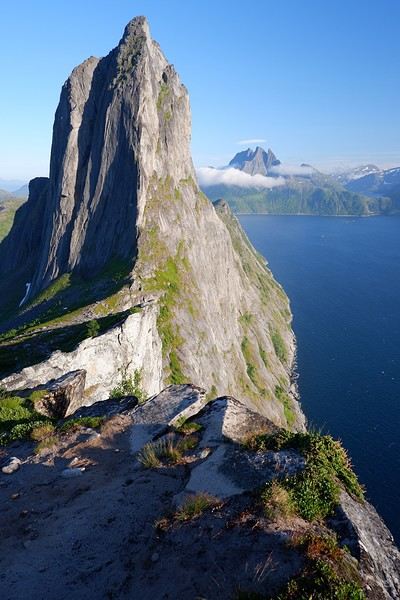
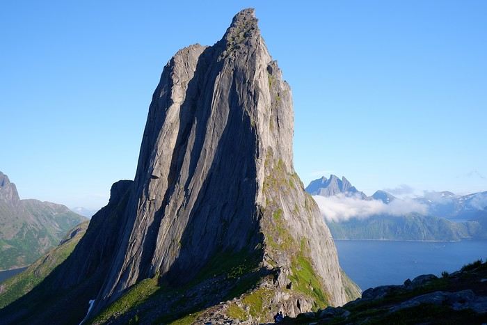
For those prone to vertigo, it might be best to stay at the foot of the mountain, as the trail climbs right along the cliff edge. And from that point on, you quickly understand what verticality really means...
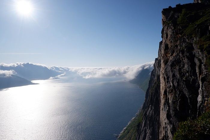
In total, we took 2 hours and 50 minutes, including breaks and the extra walk to the parking lot. The day was already well underway, and with 1,200 m of cumulative elevation gain, it was time to find a spot to eat and sleep. Since we hadn’t made any reservations, we’d planned to bivouac for the night. We weren’t too picky—just practical—so we decided to sleep in the car at the parking lot for tomorrow morning’s hike, just 5 km from Fjordgard.
We traveled to Norway in the summer of 2025, from July 17 to 29, to visit Senja Island and the Lofoten archipelago with a rental car. The common thread of these twelve days was clearly hiking, along with a few visits and experiences, and nights spent in a tent or in the car (which made it possible). We chose Narvik Airport for both arrival and departure for several complementary reasons: the desire to visit nearby Senja Island, slightly more affordable airfare, and finally, the rental price of the vehicle—especially the car model we were looking for. We only made one reservation, for the first campsite, as sleeping in a tent made things much easier. But we had the whole structure of the trip planned, a flexible outline that could adapt to the weather conditions we’d encounter. Senja Island isn’t part of the Lofoten archipelago, and during the early stages of planning this trip, we hadn’t planned to visit it. But its relative proximity to Narvik Airport and, above all, its unique geography definitely made us change our minds. We arrived in Evenes, where Narvik Airport is located, nearly 60 km from the city itself. Our first stop was 40 km further in Bjerkvik on the way to Senja, where there’s a Rema 1000 (a very common supermarket chain in Norway). We needed to buy some food and a gas cartridge for our stove. I’d emailed the store manager beforehand, who told me they didn’t sell them but that the two gas stations in the village were likely to have some in stock.
It was only at the Esso station that I found what I needed, but unfortunately, only one cartridge. Luckily, we quickly realized that most campsites (like in Iceland) have a shared kitchen with hotplates. That single small cartridge was just enough for the few nights we spent outside of campsites... We got our first taste of Norway’s characteristic landscapes:
When we arrived at the Senja campsite, it was already 9:30 PM. A sign announced it was full, but luckily, I’d booked it 10 days earlier. By 10:30 PM, as we settled in to eat, it was still broad daylight, and the thermometer read 25°C—despite being at a latitude of 69° North! We went to bed around midnight, exhausted but under the light of a sun that was still very much present. Thanks to Earth’s tilted axis. We’d anticipated this by buying opaque sleep masks because, yes, at this time of year, it’s daylight all the time.
Friday, July 18:
Today, we planned two hikes on the island and a few stops along the way. The map clearly shows that the deepest fjords are in the north and west. Due to time and accessibility, we focused on the northern part of the island. Our first stop was at the viewing platform in Bergbotn:
Then we headed toward Skaland, the starting point for our first hike. Along the way, we found plenty of reasons to stop—especially since, on this first day of travel, our thirst for Nordic landscapes was far from quenched.
The town of Skaland is very practical: free parking, picnic tables for after the hike, and a Joker convenience store right next door. Our goal was the summit of Husfjellet: 670 m of elevation gain, between 8 and 9 km in length, and an estimated 4 hours and 30 minutes.
This hike offers two major viewpoints. The first overlooks the Bergsoyan islands to the west:
At the summit, the view shifts to the Steinfjorden fjord:
You can even clearly see the "Devil’s Teeth," which we’d see from below later:
In total, the hike took us 4 hours and 30 minutes, including all the breaks. We treated ourselves to an ice cream in Skaland to recharge for the next hike. We hit the road again and stopped at Tungeneset to get a closer look at the Devil’s Teeth:
We continued to Fjordgard, the starting point for our second hike. Fjordgard isn’t very welcoming. There was a time when you could park right at the start of the hike up Mount Segla. Now, everything’s blocked off, and locals have even taken to blocking all possible parking spots nearby. You now have to park outside the town at a paid parking lot (90 NOK for 3 hours), adding an extra 2 km (round trip) of walking. Still, that was just a minor inconvenience because the hike that followed quickly made us forget all about it. The hike is fairly short (2 hours) but still has 520 m of elevation gain. This hike was a stark contrast to the first. This morning, we had sweeping views of the vast landscape. Here, Mount Segla, perched on the edge of the cliff, dominates the foreground:
For those prone to vertigo, it might be best to stay at the foot of the mountain, as the trail climbs right along the cliff edge. And from that point on, you quickly understand what verticality really means...
In total, we took 2 hours and 50 minutes, including breaks and the extra walk to the parking lot. The day was already well underway, and with 1,200 m of cumulative elevation gain, it was time to find a spot to eat and sleep. Since we hadn’t made any reservations, we’d planned to bivouac for the night. We weren’t too picky—just practical—so we decided to sleep in the car at the parking lot for tomorrow morning’s hike, just 5 km from Fjordgard.
A summer in the sun in... Iceland!!
Ah, Iceland and us—it’s quite the story, or rather, a long wait... The first time we considered going was already 7-8 years ago, after reading travel journals describing breathtaking landscapes, countless active and dormant volcanoes, glaciers, and waterfalls with extraordinary flows. In short, this island, made of fire and ice, right at Europe’s doorstep with its own unique culture, had nothing but advantages, and it was urgent to visit without delay 😇
My *Routard* guidebook is actually from 2016. So why did Iceland make us wait so long before we finally gave in to its charms? Yes, why indeed?
Simply because reading other travel journals revealed the cost of living there—and especially the harsh climate, even in the middle of July 🤪! Some journals described entire weeks of rain and foggy weather, making it tricky to explore the island. The budget wasn’t spared either, because in the most touristy areas, especially in the south and around Myvatn, accommodation prices are downright indecent—even outright robbery. 😕
Plus, in the Highlands, there’s literally no permanent lodging, and the only way to spend several nights there is to camp. And camping in winter conditions wasn’t exactly part of our plans... 😄
So, year after year, this trip kept getting postponed...
until August 2023, when prices for Southern Africa, North or South America, or even Asia were all way too high for summer 2024!
That’s when I turned my attention back to the Land of Fire and Ice and scoured all the comparison sites for the best accommodation deals across the country. Planning for 20 nights, I found 13 nights in "proper" lodging for 5 people at an average cost of under 200 €! A miracle, considering that in the southern glacier region, around Vik or Myvatn, prices range from 300 to 1000 € per night 😮 😮!
Still, that means we’ll have to camp for 7 nights, mostly in the Highlands, near Askja or Landmannalaugar. 😎
For once, I built the daily itinerary entirely around the decently priced lodgings I found 11 months in advance! The shortage of places to stay in some areas forced me to plan a few long transition days and make some tough choices. No big deal, though—there’s so much to do on this island 🙂!
Once the main itinerary was set, everyone agreed to the plan: 2/3 in proper lodging and 1/3 camping, even the most camping-averse among us! *Follow my gaze...*
By the time we bought the flight tickets, I had to tweak the itinerary a bit because one or two places were already booked! Plus, it was impossible to wait for a more refined plan to adjust reservations, since almost all bookings are non-refundable!! The harsh law of supply and demand...
For the car rental, we booked a Hyundai Tucson, approved for the Highlands, from Lava Car Rental—a company I’d read good reviews about in a Facebook group—for a cool 2500 € with full insurance. A real 4x4, like a Defender, would’ve been more than double...! Welcome to Iceland 😕...
Activities and excursions also required some tough choices. We had two must-dos: whale watching in Húsavík (60 € pp on Getyourguide) and a Glacier and Summer Treasure Glacier Walk with BlueIceland (165 € pp with discount codes on Getyourguide).
For the baths, we skipped the Blue Lagoon—too expensive—in favor of the Secret Lagoon and the Myvatn Baths, the Blue Lagoon’s equivalent but half the price.
Two baths for the price of one... and even more, since I spotted several free hot-water swimming spots.
Itinerary: Day 1: Arrival in Reykjavik - Hraunfossar Waterfall - Surtshellir Cave Day 2: Grábrók Crater - Snæfellsnes Peninsula Day 3: Stykkishólmur - Sturlungalaug Hot Springs Day 4: Northwest Coast - Akureyri - Goðafoss Day 5: Myvatn Day 6: Myvatn - Dettifoss - Selfoss - Rauðhólar Day 7: Húsavík Whale Watching - Dettifoss - Selfoss Day 8: Stuðlagil Canyon - Seyðisfjörður Day 9: Puffin colony - Störurð Hike Day 10: Hengifoss - East Fjords, Mjóifjörður Day 11: Viking Village - Jökulsárlón - Fjallsárlón Day 12: Glacier Excursion - Svartifoss Day 13: Fjaðrárgljúfur Canyon - Vík Day 14: Þakgil - Lava Show Vík Day 15: Southern Waterfalls Day Day 16: Landmannalaugar - Skalli Hike Day 17: Landmannalaugar - Bláhnjúkur - Brennisteinsalda Day 18: Secret Lagoon, Kerlingarfjöll, and Gullfoss Day 19: Geysir - Reykjavik Day 20: Bruarfoss - Þingvellir - Kerid Crater - Krýsuvík Geothermal Area Day 21: Reykjanes Peninsula
Friday, July 5, 2024, is our last workday before driving up to Alsace overnight to leave the cockers at Grandpa’s for boarding. Then, at 1:30 AM, we’ll head to Frankfurt, where a direct flight to Iceland awaits.
We arrive at 4 AM. Since we leave at 7 AM, the "night" will only last the equivalent of a 30-minute nap 🤪... just enough to get us in the road-trip mood 😏!!
My *Routard* guidebook is actually from 2016. So why did Iceland make us wait so long before we finally gave in to its charms? Yes, why indeed?
Simply because reading other travel journals revealed the cost of living there—and especially the harsh climate, even in the middle of July 🤪! Some journals described entire weeks of rain and foggy weather, making it tricky to explore the island. The budget wasn’t spared either, because in the most touristy areas, especially in the south and around Myvatn, accommodation prices are downright indecent—even outright robbery. 😕
Plus, in the Highlands, there’s literally no permanent lodging, and the only way to spend several nights there is to camp. And camping in winter conditions wasn’t exactly part of our plans... 😄
So, year after year, this trip kept getting postponed...
until August 2023, when prices for Southern Africa, North or South America, or even Asia were all way too high for summer 2024!
That’s when I turned my attention back to the Land of Fire and Ice and scoured all the comparison sites for the best accommodation deals across the country. Planning for 20 nights, I found 13 nights in "proper" lodging for 5 people at an average cost of under 200 €! A miracle, considering that in the southern glacier region, around Vik or Myvatn, prices range from 300 to 1000 € per night 😮 😮!
Still, that means we’ll have to camp for 7 nights, mostly in the Highlands, near Askja or Landmannalaugar. 😎
For once, I built the daily itinerary entirely around the decently priced lodgings I found 11 months in advance! The shortage of places to stay in some areas forced me to plan a few long transition days and make some tough choices. No big deal, though—there’s so much to do on this island 🙂!
Once the main itinerary was set, everyone agreed to the plan: 2/3 in proper lodging and 1/3 camping, even the most camping-averse among us! *Follow my gaze...*
By the time we bought the flight tickets, I had to tweak the itinerary a bit because one or two places were already booked! Plus, it was impossible to wait for a more refined plan to adjust reservations, since almost all bookings are non-refundable!! The harsh law of supply and demand...
For the car rental, we booked a Hyundai Tucson, approved for the Highlands, from Lava Car Rental—a company I’d read good reviews about in a Facebook group—for a cool 2500 € with full insurance. A real 4x4, like a Defender, would’ve been more than double...! Welcome to Iceland 😕...
Activities and excursions also required some tough choices. We had two must-dos: whale watching in Húsavík (60 € pp on Getyourguide) and a Glacier and Summer Treasure Glacier Walk with BlueIceland (165 € pp with discount codes on Getyourguide).
For the baths, we skipped the Blue Lagoon—too expensive—in favor of the Secret Lagoon and the Myvatn Baths, the Blue Lagoon’s equivalent but half the price.
Two baths for the price of one... and even more, since I spotted several free hot-water swimming spots.
Itinerary: Day 1: Arrival in Reykjavik - Hraunfossar Waterfall - Surtshellir Cave Day 2: Grábrók Crater - Snæfellsnes Peninsula Day 3: Stykkishólmur - Sturlungalaug Hot Springs Day 4: Northwest Coast - Akureyri - Goðafoss Day 5: Myvatn Day 6: Myvatn - Dettifoss - Selfoss - Rauðhólar Day 7: Húsavík Whale Watching - Dettifoss - Selfoss Day 8: Stuðlagil Canyon - Seyðisfjörður Day 9: Puffin colony - Störurð Hike Day 10: Hengifoss - East Fjords, Mjóifjörður Day 11: Viking Village - Jökulsárlón - Fjallsárlón Day 12: Glacier Excursion - Svartifoss Day 13: Fjaðrárgljúfur Canyon - Vík Day 14: Þakgil - Lava Show Vík Day 15: Southern Waterfalls Day Day 16: Landmannalaugar - Skalli Hike Day 17: Landmannalaugar - Bláhnjúkur - Brennisteinsalda Day 18: Secret Lagoon, Kerlingarfjöll, and Gullfoss Day 19: Geysir - Reykjavik Day 20: Bruarfoss - Þingvellir - Kerid Crater - Krýsuvík Geothermal Area Day 21: Reykjanes Peninsula
Friday, July 5, 2024, is our last workday before driving up to Alsace overnight to leave the cockers at Grandpa’s for boarding. Then, at 1:30 AM, we’ll head to Frankfurt, where a direct flight to Iceland awaits.
We arrive at 4 AM. Since we leave at 7 AM, the "night" will only last the equivalent of a 30-minute nap 🤪... just enough to get us in the road-trip mood 😏!!
Road Trip USA 2023 - Part 2
HIGHWAY 1
Highway 1 runs along the Pacific coast of California from Leggett in the north to Dana Point in the south. It's the longest state route in California, stretching 1,050 km.
It's famous for its breathtaking ocean views. That’s actually why it’s become such a popular route for road trips, with tons of attractions and points of interest all along the way.
After crossing the U.S. interior on our way out (see Road Trip USA 2023 - Part 1), we’re starting our return trip along this route from Leggett.
Videos are embedded throughout the summary. Please click on the image to start the video. To jump to a specific post, here are the appropriate links:
CALIFORNIA:
Scenic Overlooks on Route 1 Between Leggett and Fort Bragg The Pudding Creek Trestle Bridge in Fort Bragg Glass Beach - Fort Bragg Jenner Lookout Point - Highway 1 Goat Rock Beach - Sonoma Coast State Park - Jenner Point Reyes National Seashore - White House Pool Trail Point Reyes National Seashore - Limantour Beach Point Reyes National Seashore - Point Reyes Shipwreck Point Reyes National Seashore - Kehoe Beach Trail Point Reyes National Seashore - McClures Beach Trail Point Reyes National Seashore - Cypress Tree Tunnel Point Reyes National Seashore - Point Reyes Beach North Point Reyes National Seashore - Elephant Seals on Drakes Beach Point Reyes National Seashore - Point Reyes Beach South Point Reyes National Seashore – Elephant Seals Overlooks Point Reyes National Seashore - Chimney Rock Trail Point Reyes National Seashore - Point Reyes Lighthouse Trail Point Reyes National Seashore – Tule Elk Observation Point Bonita Lighthouse Trail - Sausalito Hawk Hill - Sausalito Battery Spencer Trail - Sausalito Rodeo Beach - Sausalito Point Cavallo - Golden Gate View - Sausalito Exploring Downtown Sausalito Visiting Sausalito’s Houseboats Crossing the Golden Gate Bridge - San Francisco Golden Gate Bridge Viewpoints - San Francisco Cruise to Alcatraz Island - San Francisco Visiting Alcatraz Island - San Francisco Civic Center - Downtown San Francisco Market Street & Yerba Buena Gardens - Downtown San Francisco Union Square & Financial District - Downtown San Francisco Fisherman's Wharf, Pier 39 & Embarcadero - San Francisco Sea Lion Observation - Pier 39 - San Francisco Lombard Street & Cable Car - Russian Hill - San Francisco Macondray Lane Historic District - Russian Hill - San Francisco Grace Cathedral & Huntington Park - Nob Hill - San Francisco Telegraph Hill - San Francisco Chinatown - San Francisco Alamo Square & Painted Ladies - Western Addition - San Francisco Palace of Fine Arts - Marina District - San Francisco Presidio of San Francisco California Coastal Trail - Lincoln Park - San Francisco California Palace of the Legion of Honor - Lincoln Park - San Francisco Sutro Baths - Lincoln Park - San Francisco Queen Wilhelmina Garden - Golden Gate Park - San Francisco Bison Paddock - Golden Gate Park - San Francisco Portals of the Past - Golden Gate Park - San Francisco Strawberry Hill - Golden Gate Park – San Francisco Prayerbook Cross & Robin Williams Meadow - Golden Gate Park - San Francisco Hidden Garden Steps & 16th Avenue Tiled Steps - San Francisco Grandview Park - San Francisco Hike - Twin Peaks Three Summits - San Francisco Longboarding Down Twin Peaks Blvd in San Francisco Haight-Ashbury - San Francisco Corona Heights Park - San Francisco Mission Dolores - San Francisco Mural Frescoes (Part 1) - Mission District - San Francisco Mural Frescoes (Part 2) - Mission District - San Francisco Devil's Slide Bunker - Pacifica Mavericks Beach - Half Moon Bay Martins Beach - Half Moon Bay Pigeon Point Lighthouse State Historic Park - Pescadero What to See in Santa Cruz Visiting Capitola What to See in Monterey Carmel-by-the-Sea Lovers Point Park - Pacific Grove Castle Rock, Hurricane Point & Little Sur River Viewpoints Pfeiffer Falls Trail Julia Pfeiffer Burns State Park Vista Point & McWay Falls Highway 1 - Big Sur Viewpoints Salmon Creek Falls San Carpoforo Creek Trail Elephant Seal Vista Point - San Simeon San Simeon Pier Moonstone Beach Boardwalk Shipwreck - Estero Bluffs State Park Surfing Competition in Morro Bay Port San Luis Pier - San Luis Obispo Pismo Beach Monarch Butterfly Grove - Pismo State Beach Nojoqui Falls Park - Solvang Arroyo Hondo Vista Point Solvang, a Charming Danish Town in California Chumash Painted Cave - Santa Barbara Goleta San Marcos Rd & Cachuma Lake Vista Points - Santa Barbara Old Santa Barbara Mission Walking Tour of Santa Barbara’s Historic Downtown West Beach - Santa Barbara What to See in Ventura Paradise Falls - Wildwood Regional Park - Thousand Oaks Sandy Dune & El Matador State Beach - Malibu Point Dume Nature Reserve - Malibu Malibu Pier Road Trip in the Malibu Mountains Los Liones Trail - Santa Monica Santa Monica Pier Rodeo Drive - Beverly Hills Greystone Mansion - Beverly Hills Hollywood Walk of Fame - Los Angeles Griffith Observatory - Los Angeles Hollywood Forever Cemetery - Los Angeles What to See in Venice Beach Venice Beach Skatepark ShoreLine Aquatic Park - Long Beach Alamitos Beach - Long Beach Naples Island - Long Beach Crescent Bay Point Park & Helser Park Kiosk - Laguna Beach Shell Beach at Twin Points - Laguna Beach Prairie Dogs at Agra Vista Point Top Gun House & Oceanside Pier Annie's Canyon Trail - Solana Beach (Via North Rios Trailhead Loop) Old Town San Diego La Jolla Coastal Trail - San Diego Balboa Park - San Diego Pacific Beach - San Diego Mission Beach - San Diego Ocean Beach Tide Pools - San Diego Sunset Cliffs Natural Park - San Diego Tuna Harbor Park - San Diego Seaport Village & Embarcadero Marina Park - San Diego Gaslamp Quarter - Downtown San Diego Coronado Island - San Diego Dead Dolly Lane - Alpine Galleta Meadows Metal Sculptures - Borrego Springs What to See in Palm Springs Robolights - Palm Springs Andreas Canyon Trail - Indian Canyons - Palm Springs Palm Canyon Trail - Indian Canyons - Palm Springs West Fork Falls Trail - Indian Canyons - Palm Springs Tahquitz Canyon Loop Trail - Indian Canyons - Palm Springs Desert Christ Park - Yucca Valley Pioneertown Salvation Mountain - Niland Slab City - Niland
Highway 1 runs along the Pacific coast of California from Leggett in the north to Dana Point in the south. It's the longest state route in California, stretching 1,050 km.
It's famous for its breathtaking ocean views. That’s actually why it’s become such a popular route for road trips, with tons of attractions and points of interest all along the way.
After crossing the U.S. interior on our way out (see Road Trip USA 2023 - Part 1), we’re starting our return trip along this route from Leggett.
Videos are embedded throughout the summary. Please click on the image to start the video. To jump to a specific post, here are the appropriate links:
CALIFORNIA:
Scenic Overlooks on Route 1 Between Leggett and Fort Bragg The Pudding Creek Trestle Bridge in Fort Bragg Glass Beach - Fort Bragg Jenner Lookout Point - Highway 1 Goat Rock Beach - Sonoma Coast State Park - Jenner Point Reyes National Seashore - White House Pool Trail Point Reyes National Seashore - Limantour Beach Point Reyes National Seashore - Point Reyes Shipwreck Point Reyes National Seashore - Kehoe Beach Trail Point Reyes National Seashore - McClures Beach Trail Point Reyes National Seashore - Cypress Tree Tunnel Point Reyes National Seashore - Point Reyes Beach North Point Reyes National Seashore - Elephant Seals on Drakes Beach Point Reyes National Seashore - Point Reyes Beach South Point Reyes National Seashore – Elephant Seals Overlooks Point Reyes National Seashore - Chimney Rock Trail Point Reyes National Seashore - Point Reyes Lighthouse Trail Point Reyes National Seashore – Tule Elk Observation Point Bonita Lighthouse Trail - Sausalito Hawk Hill - Sausalito Battery Spencer Trail - Sausalito Rodeo Beach - Sausalito Point Cavallo - Golden Gate View - Sausalito Exploring Downtown Sausalito Visiting Sausalito’s Houseboats Crossing the Golden Gate Bridge - San Francisco Golden Gate Bridge Viewpoints - San Francisco Cruise to Alcatraz Island - San Francisco Visiting Alcatraz Island - San Francisco Civic Center - Downtown San Francisco Market Street & Yerba Buena Gardens - Downtown San Francisco Union Square & Financial District - Downtown San Francisco Fisherman's Wharf, Pier 39 & Embarcadero - San Francisco Sea Lion Observation - Pier 39 - San Francisco Lombard Street & Cable Car - Russian Hill - San Francisco Macondray Lane Historic District - Russian Hill - San Francisco Grace Cathedral & Huntington Park - Nob Hill - San Francisco Telegraph Hill - San Francisco Chinatown - San Francisco Alamo Square & Painted Ladies - Western Addition - San Francisco Palace of Fine Arts - Marina District - San Francisco Presidio of San Francisco California Coastal Trail - Lincoln Park - San Francisco California Palace of the Legion of Honor - Lincoln Park - San Francisco Sutro Baths - Lincoln Park - San Francisco Queen Wilhelmina Garden - Golden Gate Park - San Francisco Bison Paddock - Golden Gate Park - San Francisco Portals of the Past - Golden Gate Park - San Francisco Strawberry Hill - Golden Gate Park – San Francisco Prayerbook Cross & Robin Williams Meadow - Golden Gate Park - San Francisco Hidden Garden Steps & 16th Avenue Tiled Steps - San Francisco Grandview Park - San Francisco Hike - Twin Peaks Three Summits - San Francisco Longboarding Down Twin Peaks Blvd in San Francisco Haight-Ashbury - San Francisco Corona Heights Park - San Francisco Mission Dolores - San Francisco Mural Frescoes (Part 1) - Mission District - San Francisco Mural Frescoes (Part 2) - Mission District - San Francisco Devil's Slide Bunker - Pacifica Mavericks Beach - Half Moon Bay Martins Beach - Half Moon Bay Pigeon Point Lighthouse State Historic Park - Pescadero What to See in Santa Cruz Visiting Capitola What to See in Monterey Carmel-by-the-Sea Lovers Point Park - Pacific Grove Castle Rock, Hurricane Point & Little Sur River Viewpoints Pfeiffer Falls Trail Julia Pfeiffer Burns State Park Vista Point & McWay Falls Highway 1 - Big Sur Viewpoints Salmon Creek Falls San Carpoforo Creek Trail Elephant Seal Vista Point - San Simeon San Simeon Pier Moonstone Beach Boardwalk Shipwreck - Estero Bluffs State Park Surfing Competition in Morro Bay Port San Luis Pier - San Luis Obispo Pismo Beach Monarch Butterfly Grove - Pismo State Beach Nojoqui Falls Park - Solvang Arroyo Hondo Vista Point Solvang, a Charming Danish Town in California Chumash Painted Cave - Santa Barbara Goleta San Marcos Rd & Cachuma Lake Vista Points - Santa Barbara Old Santa Barbara Mission Walking Tour of Santa Barbara’s Historic Downtown West Beach - Santa Barbara What to See in Ventura Paradise Falls - Wildwood Regional Park - Thousand Oaks Sandy Dune & El Matador State Beach - Malibu Point Dume Nature Reserve - Malibu Malibu Pier Road Trip in the Malibu Mountains Los Liones Trail - Santa Monica Santa Monica Pier Rodeo Drive - Beverly Hills Greystone Mansion - Beverly Hills Hollywood Walk of Fame - Los Angeles Griffith Observatory - Los Angeles Hollywood Forever Cemetery - Los Angeles What to See in Venice Beach Venice Beach Skatepark ShoreLine Aquatic Park - Long Beach Alamitos Beach - Long Beach Naples Island - Long Beach Crescent Bay Point Park & Helser Park Kiosk - Laguna Beach Shell Beach at Twin Points - Laguna Beach Prairie Dogs at Agra Vista Point Top Gun House & Oceanside Pier Annie's Canyon Trail - Solana Beach (Via North Rios Trailhead Loop) Old Town San Diego La Jolla Coastal Trail - San Diego Balboa Park - San Diego Pacific Beach - San Diego Mission Beach - San Diego Ocean Beach Tide Pools - San Diego Sunset Cliffs Natural Park - San Diego Tuna Harbor Park - San Diego Seaport Village & Embarcadero Marina Park - San Diego Gaslamp Quarter - Downtown San Diego Coronado Island - San Diego Dead Dolly Lane - Alpine Galleta Meadows Metal Sculptures - Borrego Springs What to See in Palm Springs Robolights - Palm Springs Andreas Canyon Trail - Indian Canyons - Palm Springs Palm Canyon Trail - Indian Canyons - Palm Springs West Fork Falls Trail - Indian Canyons - Palm Springs Tahquitz Canyon Loop Trail - Indian Canyons - Palm Springs Desert Christ Park - Yucca Valley Pioneertown Salvation Mountain - Niland Slab City - Niland
55 days with the family in the Yucatán, including a side trip to Belize...
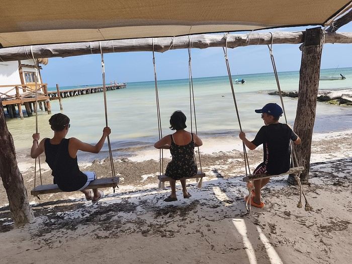
Hi everyone!
That was about all the Spanish I could speak before we left... Luckily, Tom, 15 and in high school, gets by just fine! And Caroline did a year of Duolingo before we took off... Anyway, after 55 days in the American West three years ago, it’s Mexico’s turn for this second long adventure.
A quick intro to the crew:
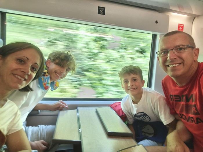

- Oscar, 10, a sporty and lively little boy who loves swimming and basketball, - Tom, 15, a high schooler, sporty and tall, who loves swimming and American football, - Caroline, 47, a PE teacher, sporty , loves hiking and snorkeling, - and me, Sylvain, 50, a science teacher, sporty, loves traveling and always has a possible next trip in mind
We mostly travel by swapping our house to discover beautiful France and the world: 135 swaps over the last 13 years.....
Our itinerary is pretty classic since it’s our first time in the Yucatán, and we’ll make a little 10-day detour to Belize...
See you soon...
CAPE VERDE 2025: 3 weeks, 4 islands.
And we still haven’t seen everything!
Before setting off for new horizons at the end of this year, it’s time for me to share my trip to Cape Verde this summer 2025.
I particularly love these spontaneous trips, and our stay in Cape Verde is one of those because it was only at the beginning of April that we decided on this getaway, which had been catching our eye for a while, given our love for the mountains.
As always—well, when it’s open—I turned to VF, and I want to immediately thank Marie, aka ptitortue, who helped me a lot in planning this trip through her travel journals and our exchanges!
Because Cape Verde is both small and vast! We decided not to rush from one airport to another, to enjoy the places and the people, but also to relax, since the work backlog from being stuck in May (see my previous travel journal 😅) had to be caught up on in June.
So, 4 islands will be our winners from 06/28 to 07/19:
Santiago first for logistical reasons, as round-trip flights from the capital Praia were the cheapest (650 €/person from Lyon via Lisbon with TAP, still!)
São Vicente, because it’s the gateway to the next one but ultimately more than that...
Santo Antão, pretty much the main goal of the trip since Marie (and the photos) had really sold it to me.
And finally, Sal Island, for some rest—a non-negotiable condition for my other half—and we’ll see that I should’ve listened to Marie...
That said, what a chatterbox I am—buckle up, flight attendants at the doors, off we go on new beautiful escapes! (Thanks to Sophie for the easy loan)
Last note for my eager fan club 😏: yes, there will be alcohol—how could there not be in the land of grogue!
It starts here:
https://voyageforum.com/v.f?post=10790234;a=10790234

I particularly love these spontaneous trips, and our stay in Cape Verde is one of those because it was only at the beginning of April that we decided on this getaway, which had been catching our eye for a while, given our love for the mountains.
As always—well, when it’s open—I turned to VF, and I want to immediately thank Marie, aka ptitortue, who helped me a lot in planning this trip through her travel journals and our exchanges!
Because Cape Verde is both small and vast! We decided not to rush from one airport to another, to enjoy the places and the people, but also to relax, since the work backlog from being stuck in May (see my previous travel journal 😅) had to be caught up on in June.
So, 4 islands will be our winners from 06/28 to 07/19:
Santiago first for logistical reasons, as round-trip flights from the capital Praia were the cheapest (650 €/person from Lyon via Lisbon with TAP, still!)
São Vicente, because it’s the gateway to the next one but ultimately more than that...
Santo Antão, pretty much the main goal of the trip since Marie (and the photos) had really sold it to me.
And finally, Sal Island, for some rest—a non-negotiable condition for my other half—and we’ll see that I should’ve listened to Marie...
That said, what a chatterbox I am—buckle up, flight attendants at the doors, off we go on new beautiful escapes! (Thanks to Sophie for the easy loan)
Last note for my eager fan club 😏: yes, there will be alcohol—how could there not be in the land of grogue!
It starts here:
https://voyageforum.com/v.f?post=10790234;a=10790234
What about crossing the Lofoten Islands on foot?
While planning a trip to the LOFOTEN for summer 2023 using the excellent guide *Hiking in the Lofoten*, we discovered this trek.
Sure, it’s rated as difficult, but it lets you cross the LOFOTEN on foot from north to south in 11 stages, covering 160 km and 9,193 m of elevation gain (or the reverse, of course).
So, it’s a multi-day hike, with wild camping, and no need to rent a car. Perfect...
What’s making us hesitate a bit are the island transfers (okay, I’ll admit, the difficulty is also a factor for me). These transfers require taking public transport and/or hitchhiking. But the stages are designed with this in mind, and the transfers are well explained. Plus, water isn’t an issue, and you can resupply several times, which helps keep the pack weight down.
For Jean Marie, my partner, this will be his first multi-day trek, but he’s an experienced and hardy hiker. As for me, even though I’m not as tough, I’ve already done some multi-day hikes. So, we should complement each other well.
So, are we going for it? Sold!!
Here’s the trek map: HERE
03/08 – Day 1 - Delp – Sandsletta 04/08 - Day 2 – Sandsletta – Svolvaer 05/08 - Day 3 – Svolvaer – Kleppstad + transfer to the start of Day 4 06/08 – Day 4 – Vikjorda hamlet – Store Lake 07/08 – Day 5 – Store Lake – Leknes - Transfer to Napp on Flakstadøya Island 08/08 – Day 6 – Napp – Nusfjord 09/08 – Day 7 – Nusfjord – Ramberg 10/08 – Day 8 – Ramberg – Selfjord Bay (Moskenesøya Island) 11/08 – Day 9 - Selfjord – Bunes Beach 12/08 – Day 10 - Bunes Beach - Krokvatnet Lake 13/08 – Day 11 - Krokvatnet Lake – Moskenes (campsite) and round trip to Å by bus 14/08 – Day 12 – Hike up Reinebringen – Reine – Tour of Agvatnet Lake 15/08 – Return to Bodø - flight back to France on 16/08 And here’s the inevitable recap
Sure, it’s rated as difficult, but it lets you cross the LOFOTEN on foot from north to south in 11 stages, covering 160 km and 9,193 m of elevation gain (or the reverse, of course).
So, it’s a multi-day hike, with wild camping, and no need to rent a car. Perfect...
What’s making us hesitate a bit are the island transfers (okay, I’ll admit, the difficulty is also a factor for me). These transfers require taking public transport and/or hitchhiking. But the stages are designed with this in mind, and the transfers are well explained. Plus, water isn’t an issue, and you can resupply several times, which helps keep the pack weight down.
For Jean Marie, my partner, this will be his first multi-day trek, but he’s an experienced and hardy hiker. As for me, even though I’m not as tough, I’ve already done some multi-day hikes. So, we should complement each other well.
So, are we going for it? Sold!!
Here’s the trek map: HERE
03/08 – Day 1 - Delp – Sandsletta 04/08 - Day 2 – Sandsletta – Svolvaer 05/08 - Day 3 – Svolvaer – Kleppstad + transfer to the start of Day 4 06/08 – Day 4 – Vikjorda hamlet – Store Lake 07/08 – Day 5 – Store Lake – Leknes - Transfer to Napp on Flakstadøya Island 08/08 – Day 6 – Napp – Nusfjord 09/08 – Day 7 – Nusfjord – Ramberg 10/08 – Day 8 – Ramberg – Selfjord Bay (Moskenesøya Island) 11/08 – Day 9 - Selfjord – Bunes Beach 12/08 – Day 10 - Bunes Beach - Krokvatnet Lake 13/08 – Day 11 - Krokvatnet Lake – Moskenes (campsite) and round trip to Å by bus 14/08 – Day 12 – Hike up Reinebringen – Reine – Tour of Agvatnet Lake 15/08 – Return to Bodø - flight back to France on 16/08 And here’s the inevitable recap
Looking for feedback and advice on a Thailand-Laos-Cambodia itinerary plan
Hi everyone,
I’m starting to plan my next trip to Southeast Asia this winter (2.5 months, leaving in early December), and here’s a rough outline of my route—I’d love to share it with you and hear your thoughts and tips.
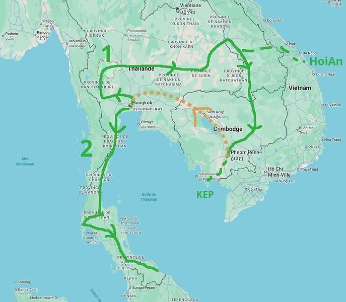
- I’ll start in Bangkok and already have three spots I’ve marked: Ayutthaya, Kanchanaburi, and Uthai Thani (I haven’t been to any of these places yet). - Next, I’d like to cross the country from west to east to reach the Laos border. I’d love suggestions for any interesting stops along this route—I don’t know this part of Thailand at all... - Then I’ll head into Laos, probably at Savannakhet (you can usually get a visa at the border). - > I’m tempted to spend a week in Hoi An, Vietnam, since I loved that city and the area when I visited two years ago. No visa needed for Vietnam now, so it could be a nice little detour. On the map, it doesn’t look too far, but I know you’ve got to be careful with these things, and I’m not sure if it’s a good idea. Any opinions on this? - Back to Laos (maybe via Dakta), and I’ll head south along the Mekong, probably doing the Bolaven Plateau loop that I missed last time. Then Paksé, the 4,000 Islands... I’ve been before, but I’d happily go back. - Crossing into Cambodia, I’ll follow the Mekong down to Phnom Penh (I know this area and love how untouristy it is). From there, I’ll probably spend a few days in Kep (quieter than Kampot). Still undecided, though. - Then back to Thailand (BKK), likely by plane from Phnom Penh since the borders between the two countries are currently closed (plus, let’s be honest, Cambodian roads... ;-). We’ll see how things look when the time comes. - After that, I’d like to explore southern Thailand, taking it slow with short hops. I’ve got my eye on Khao Sok National Park, and I’ve heard good things about Krabi... Again, I don’t know this region well, so any info or tips would be great.
So, I think this should be doable in 2.5 months, especially since I prefer short hops of 300 km max to avoid getting too tired, and I like staying 2-3 days in each place to explore. Plus, I’ll take a week off to relax if I find a spot I love—maybe by the sea for some real downtime.
Thanks for your feedback and for sharing your favorite spots! Pascal
- I’ll start in Bangkok and already have three spots I’ve marked: Ayutthaya, Kanchanaburi, and Uthai Thani (I haven’t been to any of these places yet). - Next, I’d like to cross the country from west to east to reach the Laos border. I’d love suggestions for any interesting stops along this route—I don’t know this part of Thailand at all... - Then I’ll head into Laos, probably at Savannakhet (you can usually get a visa at the border). - > I’m tempted to spend a week in Hoi An, Vietnam, since I loved that city and the area when I visited two years ago. No visa needed for Vietnam now, so it could be a nice little detour. On the map, it doesn’t look too far, but I know you’ve got to be careful with these things, and I’m not sure if it’s a good idea. Any opinions on this? - Back to Laos (maybe via Dakta), and I’ll head south along the Mekong, probably doing the Bolaven Plateau loop that I missed last time. Then Paksé, the 4,000 Islands... I’ve been before, but I’d happily go back. - Crossing into Cambodia, I’ll follow the Mekong down to Phnom Penh (I know this area and love how untouristy it is). From there, I’ll probably spend a few days in Kep (quieter than Kampot). Still undecided, though. - Then back to Thailand (BKK), likely by plane from Phnom Penh since the borders between the two countries are currently closed (plus, let’s be honest, Cambodian roads... ;-). We’ll see how things look when the time comes. - After that, I’d like to explore southern Thailand, taking it slow with short hops. I’ve got my eye on Khao Sok National Park, and I’ve heard good things about Krabi... Again, I don’t know this region well, so any info or tips would be great.
So, I think this should be doable in 2.5 months, especially since I prefer short hops of 300 km max to avoid getting too tired, and I like staying 2-3 days in each place to explore. Plus, I’ll take a week off to relax if I find a spot I love—maybe by the sea for some real downtime.
Thanks for your feedback and for sharing your favorite spots! Pascal
Spring getaway in search of Moroccan sunshine
Hey fellow travelers!
This isn’t meant to be a full-on travel journal—just a little springtime dip into the Moroccan coast (and maybe a bit more if we click).
For our third trip to this country, we set off for 8 days in early June 2025, *sure* we’d be greeted by non-stop sunshine...
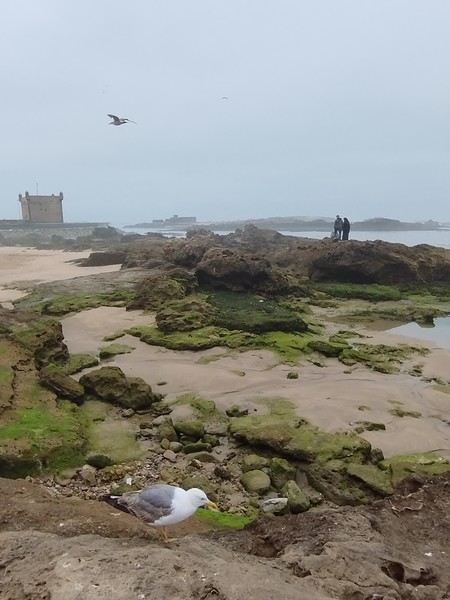
...and well, that didn’t happen! The gray stuck around for a day, then two, then three (while back home in the Landes, we had gorgeous sunshine 🤦♂️😂).
Now, unlike us, the Morocco experts here probably already know this, but apparently, it’s pretty common—especially in spring—when the warm air from inland meets the cool ocean breeze. Locals even have to warm up with hot water bottles, can you believe it? 😄!
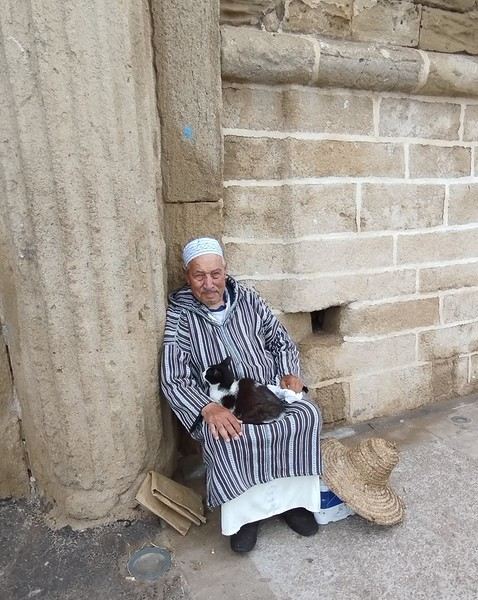
And of course, it had to happen now, since our plan is to follow the coast from Essaouira to Mirleft!!
Oh well, we’ll see how it goes—but luckily, this first stunning sunset made up for the weather 🌅.
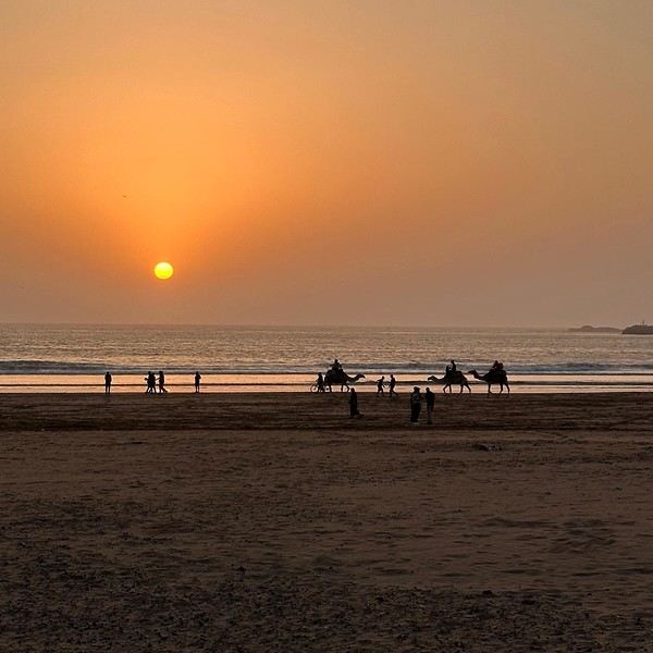
See you soon to anyone who’s up for it! 😊
This isn’t meant to be a full-on travel journal—just a little springtime dip into the Moroccan coast (and maybe a bit more if we click).
For our third trip to this country, we set off for 8 days in early June 2025, *sure* we’d be greeted by non-stop sunshine...
...and well, that didn’t happen! The gray stuck around for a day, then two, then three (while back home in the Landes, we had gorgeous sunshine 🤦♂️😂).
Now, unlike us, the Morocco experts here probably already know this, but apparently, it’s pretty common—especially in spring—when the warm air from inland meets the cool ocean breeze. Locals even have to warm up with hot water bottles, can you believe it? 😄!
And of course, it had to happen now, since our plan is to follow the coast from Essaouira to Mirleft!!
Oh well, we’ll see how it goes—but luckily, this first stunning sunset made up for the weather 🌅.
See you soon to anyone who’s up for it! 😊
Yet Another Travel Journal in this (Too) Familiar Rajasthan, But with Family and Kids
Prologue
This journal recounts a trip to Rajasthan that’s already over a year old and that I’ve only now found the chance to write about. The summer of 2024 marked my return to India—my tenth trip—after six long years away since my last solo wanderings in Tamil Nadu in 2018 (the journal of which is published on this site). That absence was partly (but not only) due to the long COVID and post-COVID period, which saw a complete halt and then a major slowdown in global tourism. To top it off, Voyage Forum announced its closure in an end-of-the-world atmosphere. A sad time for our favorite social activity…
A few weeks after returning from Rajasthan, I tried to motivate myself to start writing a journal to publish on a forum claiming to be VF’s successor, which I’d eventually signed up for out of desperation. But I kept hesitating and putting the project off because, for one, I no longer have the time I used to. For another, the vibe wasn’t really taking off on that forum—it was overrun with ads and not very active, contrary to what its host’s name suggested. Despite its good intentions and commendable role as a stopgap, it also turned out to be very impractical to use, especially when you don’t have much time like me. I’ll admit I’d occasionally check back on VF to see if anything was happening. But all the discussions remained frozen in time, stuck in that fateful year, 2020. Then, rumors swirled online about shady reasons behind its closure, leaving little room for hope.
And then, one fine morning, I got a message at work from Marien informing me that VF had reopened. What a huge surprise! Even though the forum’s “end” had played out in a somewhat apocalyptic atmosphere, the memories of passionate and heated discussions, the frank debates, and the useful exchanges that made this site a traveler’s goldmine and a unique hub of conviviality all came rushing back to me like a breath of fresh air. I finally saw a sign and tried to motivate myself to find the time to publish the journal of this tenth trip to India and fifth to Rajasthan. But in the end, I got bogged down in professional and family obligations and never managed to find the time to get started. That’s now fixed, though, because I had two reasons for wanting to do it: I find that looking back on a trip to tell others about it is a highly beneficial introspective exercise. Also, I thought this journal could be useful to other travelers on a few points.
Because, “do we really need yet another journal about Rajasthan?” you might rightly ask! Especially in a time when so many journals about the “Land of Kings” have been published since VF’s return, not to mention the countless stories you can already find online about this region, one of India’s most touristy. And I’d add, why go back to Rajasthan for a fifth time, where I’ve already dragged my feet more than enough—through its forts, deserts, temples, cities, villages, bumpy roads, train stations, tasty street food stalls, cheap guesthouses, and more? Where some might see just another overhyped tourist destination full of the same old *Arabian Nights* clichés, worn to a thread, that I mentioned earlier, when there’s so much else to see in India? Well, first because it’s a magnificent country I never tire of, where I started an academic study and made so many connections. It’s also packed with places where you won’t find a single tourist (right, Marie-Jo?), even in the heart of well-trodden paths and classic itineraries. And most importantly, as I said earlier, things have changed in recent years. First, after six years without traveling far, the urge to go back to India was getting stronger. But this time, no more solo trips (often) or duo adventures (sometimes)—now it’s a team of four that has to come along! And even if you can argue with that, what better place than Rajasthan to introduce India to people who’ve never seen it? To kids you want to amaze? Plus, traveling with your new little family to your favorite country isn’t the same as going solo in often spartan conditions that only affect you. It’s a different challenge, but ultimately probably much harder. So, is it really reasonable to take two kids to India, including a two-year-old baby? That’s one of the main goals of this journal (but not the only one)—to try to answer that question.
As you can tell, it’s not so much the destination but the slightly unusual setup of this trip that, in my opinion, will make this journal interesting. Despite my experience and expertise (yes, I dare say it) in India, there were plenty of questions before we finalized the plan and said, “Alright, let’s go!” The questions were flying for us parents. Is it wise to travel to India with a two-year-old? What would we do (it happened) if the kids got very sick? Would they be able to handle a road trip on Rajasthan’s bumpy, dusty roads using public transport? Could they handle the shock of such a different world—the dirt, poverty, pollution, noise (…and the smell, as they say), the spicy food, monkeys, mosquitoes, snakes, tigers, leopards, and so on? In short, all the clichés that I usually joke about suddenly became potential realities. Another concern: as a mixed Franco-African family (not me, but my partner and her oldest), wouldn’t we risk not always being well received, given what you sometimes hear about that in India? How would Indians react to seeing a mixed-race family, the ultimate taboo in a country of purity and social segregation, which would undoubtedly raise many questions for them? Of course, not everything went as expected… Because, as you know, with India—and what makes it charming for some—there are always complications: sometimes where you don’t expect them… and sometimes where you do. I’ll go into detail about that in the journal to come (not right away) and in the final review (even later). These experiences could be useful to travelers who find themselves in similar situations and have the same questions we did before embarking on such a journey. And maybe it’ll spark the curiosity of those who aren’t concerned and will read yet another Rajasthan journal, but with its own unique twists.
Despite my unchanged constraints, which mean I have little time to write this, I don’t want to rush the story, so I’ll take my time. There will probably be lulls. I hope that won’t stop people from coming to react, debate, share their impressions, or ask for information.
This journal recounts a trip to Rajasthan that’s already over a year old and that I’ve only now found the chance to write about. The summer of 2024 marked my return to India—my tenth trip—after six long years away since my last solo wanderings in Tamil Nadu in 2018 (the journal of which is published on this site). That absence was partly (but not only) due to the long COVID and post-COVID period, which saw a complete halt and then a major slowdown in global tourism. To top it off, Voyage Forum announced its closure in an end-of-the-world atmosphere. A sad time for our favorite social activity…
A few weeks after returning from Rajasthan, I tried to motivate myself to start writing a journal to publish on a forum claiming to be VF’s successor, which I’d eventually signed up for out of desperation. But I kept hesitating and putting the project off because, for one, I no longer have the time I used to. For another, the vibe wasn’t really taking off on that forum—it was overrun with ads and not very active, contrary to what its host’s name suggested. Despite its good intentions and commendable role as a stopgap, it also turned out to be very impractical to use, especially when you don’t have much time like me. I’ll admit I’d occasionally check back on VF to see if anything was happening. But all the discussions remained frozen in time, stuck in that fateful year, 2020. Then, rumors swirled online about shady reasons behind its closure, leaving little room for hope.
And then, one fine morning, I got a message at work from Marien informing me that VF had reopened. What a huge surprise! Even though the forum’s “end” had played out in a somewhat apocalyptic atmosphere, the memories of passionate and heated discussions, the frank debates, and the useful exchanges that made this site a traveler’s goldmine and a unique hub of conviviality all came rushing back to me like a breath of fresh air. I finally saw a sign and tried to motivate myself to find the time to publish the journal of this tenth trip to India and fifth to Rajasthan. But in the end, I got bogged down in professional and family obligations and never managed to find the time to get started. That’s now fixed, though, because I had two reasons for wanting to do it: I find that looking back on a trip to tell others about it is a highly beneficial introspective exercise. Also, I thought this journal could be useful to other travelers on a few points.
Because, “do we really need yet another journal about Rajasthan?” you might rightly ask! Especially in a time when so many journals about the “Land of Kings” have been published since VF’s return, not to mention the countless stories you can already find online about this region, one of India’s most touristy. And I’d add, why go back to Rajasthan for a fifth time, where I’ve already dragged my feet more than enough—through its forts, deserts, temples, cities, villages, bumpy roads, train stations, tasty street food stalls, cheap guesthouses, and more? Where some might see just another overhyped tourist destination full of the same old *Arabian Nights* clichés, worn to a thread, that I mentioned earlier, when there’s so much else to see in India? Well, first because it’s a magnificent country I never tire of, where I started an academic study and made so many connections. It’s also packed with places where you won’t find a single tourist (right, Marie-Jo?), even in the heart of well-trodden paths and classic itineraries. And most importantly, as I said earlier, things have changed in recent years. First, after six years without traveling far, the urge to go back to India was getting stronger. But this time, no more solo trips (often) or duo adventures (sometimes)—now it’s a team of four that has to come along! And even if you can argue with that, what better place than Rajasthan to introduce India to people who’ve never seen it? To kids you want to amaze? Plus, traveling with your new little family to your favorite country isn’t the same as going solo in often spartan conditions that only affect you. It’s a different challenge, but ultimately probably much harder. So, is it really reasonable to take two kids to India, including a two-year-old baby? That’s one of the main goals of this journal (but not the only one)—to try to answer that question.
As you can tell, it’s not so much the destination but the slightly unusual setup of this trip that, in my opinion, will make this journal interesting. Despite my experience and expertise (yes, I dare say it) in India, there were plenty of questions before we finalized the plan and said, “Alright, let’s go!” The questions were flying for us parents. Is it wise to travel to India with a two-year-old? What would we do (it happened) if the kids got very sick? Would they be able to handle a road trip on Rajasthan’s bumpy, dusty roads using public transport? Could they handle the shock of such a different world—the dirt, poverty, pollution, noise (…and the smell, as they say), the spicy food, monkeys, mosquitoes, snakes, tigers, leopards, and so on? In short, all the clichés that I usually joke about suddenly became potential realities. Another concern: as a mixed Franco-African family (not me, but my partner and her oldest), wouldn’t we risk not always being well received, given what you sometimes hear about that in India? How would Indians react to seeing a mixed-race family, the ultimate taboo in a country of purity and social segregation, which would undoubtedly raise many questions for them? Of course, not everything went as expected… Because, as you know, with India—and what makes it charming for some—there are always complications: sometimes where you don’t expect them… and sometimes where you do. I’ll go into detail about that in the journal to come (not right away) and in the final review (even later). These experiences could be useful to travelers who find themselves in similar situations and have the same questions we did before embarking on such a journey. And maybe it’ll spark the curiosity of those who aren’t concerned and will read yet another Rajasthan journal, but with its own unique twists.
Despite my unchanged constraints, which mean I have little time to write this, I don’t want to rush the story, so I’ll take my time. There will probably be lulls. I hope that won’t stop people from coming to react, debate, share their impressions, or ask for information.
From Southern Shikoku, between land and sea, to the blue waters of Miyakojima and finally the Tokyo metropolis
From Southern Shikoku, between land and sea, to the blue waters of Miyakojima and finally Tokyo’s megacity
Hi everyone,
I have to admit, I really hesitated before deciding to write this travel journal... Writing one takes a lot of time and energy, and since this is my 4th trip, I wondered if it would actually interest anyone other than myself (both for the discovery and the writing). But after a few "Are you going to write a journal?" requests and especially the renewed pleasure from reading other travelers’ travel journals about Japan or elsewhere on this forum or elsewhere, I’ve decided to share this 4th installment in the Land of the Rising Sun here.
The itinerary: 27 full days, from late May to late June 2025, right in the middle of the rainy season, including:
-->13 days in Shikoku, from Kochi (Kochi Prefecture) to Matsuyama (Ehime Prefecture)

-->7 days in Miyakojima (Okinawa Prefecture)

-->7 days in Tokyo

The trip was decided on fairly last-minute this year, as usual.
I regularly check flight prices to track fluctuations for this destination, even without concrete plans. Finding a slightly cheaper direct flight (900 €) than what I’d seen in previous months (around 1,200–1,400 € on average) for a Paris-Tokyo route with Japanese airline ANA was too tempting to resist the urge to return to this enchanting country. After long hesitations between exploring the San’in region (Matsue, Tottori, Yamaguchi) and southern Shikoku, the decision was made—I took the plunge! The tickets are booked: Paris to Kochi with a layover in Tokyo, all with ANA, the airline I’d been dreaming of... for 1,120 € per person. Okay, it’s not cheap, but it’s still better than in 2023.
We leave in 2 weeks!! Now it’s just a matter of getting everything ready!
Intense work ahead in these 2 weeks to:
finalize a more precise itinerary and reach an agreement—yep, because even though we both love Japan, our preferences differ slightly, and we have to choose between exploring new places or taking time to revisit beloved spots... decide how much time to spend in each selected area without rushing while still exploring research places that might interest us and watch videos about Japan book accommodations: yes, it’s possible to do this on the spot as we go, but last year, we noticed that last-minute options were pretty expensive, so we’re booking ahead—even if it means keeping a few options open while we decide or see if better deals pop up later reserve rental cars order yen check the weather regularly and wonder if choosing the *tsuyu* (rainy season) was really a good idea—and whether we’ll be stuck in non-stop rain???
What a tough job, right? Traveling to Japan for a month—such a hard life! Despite this being my 4th trip, the excitement is just as intense as the first time.
The only small downside is that when we booked the flight tickets, there were only a few seats left, so we’re only sitting together on the international return flight. Plus, on the outbound flight, we’ve got the middle seats. Another lingering question: what French-language films will be available? According to the internet, the selection seems limited. Oh well, these are just minor details—it’s almost time to fly!
PS: I’ll be posting slowly and irregularly... so for those interested, be patient or maybe set an alert...
Hi everyone,
I have to admit, I really hesitated before deciding to write this travel journal... Writing one takes a lot of time and energy, and since this is my 4th trip, I wondered if it would actually interest anyone other than myself (both for the discovery and the writing). But after a few "Are you going to write a journal?" requests and especially the renewed pleasure from reading other travelers’ travel journals about Japan or elsewhere on this forum or elsewhere, I’ve decided to share this 4th installment in the Land of the Rising Sun here.
The itinerary: 27 full days, from late May to late June 2025, right in the middle of the rainy season, including:
-->13 days in Shikoku, from Kochi (Kochi Prefecture) to Matsuyama (Ehime Prefecture)
-->7 days in Miyakojima (Okinawa Prefecture)
-->7 days in Tokyo
The trip was decided on fairly last-minute this year, as usual.
I regularly check flight prices to track fluctuations for this destination, even without concrete plans. Finding a slightly cheaper direct flight (900 €) than what I’d seen in previous months (around 1,200–1,400 € on average) for a Paris-Tokyo route with Japanese airline ANA was too tempting to resist the urge to return to this enchanting country. After long hesitations between exploring the San’in region (Matsue, Tottori, Yamaguchi) and southern Shikoku, the decision was made—I took the plunge! The tickets are booked: Paris to Kochi with a layover in Tokyo, all with ANA, the airline I’d been dreaming of... for 1,120 € per person. Okay, it’s not cheap, but it’s still better than in 2023.
We leave in 2 weeks!! Now it’s just a matter of getting everything ready!
Intense work ahead in these 2 weeks to:
finalize a more precise itinerary and reach an agreement—yep, because even though we both love Japan, our preferences differ slightly, and we have to choose between exploring new places or taking time to revisit beloved spots... decide how much time to spend in each selected area without rushing while still exploring research places that might interest us and watch videos about Japan book accommodations: yes, it’s possible to do this on the spot as we go, but last year, we noticed that last-minute options were pretty expensive, so we’re booking ahead—even if it means keeping a few options open while we decide or see if better deals pop up later reserve rental cars order yen check the weather regularly and wonder if choosing the *tsuyu* (rainy season) was really a good idea—and whether we’ll be stuck in non-stop rain???
What a tough job, right? Traveling to Japan for a month—such a hard life! Despite this being my 4th trip, the excitement is just as intense as the first time.
The only small downside is that when we booked the flight tickets, there were only a few seats left, so we’re only sitting together on the international return flight. Plus, on the outbound flight, we’ve got the middle seats. Another lingering question: what French-language films will be available? According to the internet, the selection seems limited. Oh well, these are just minor details—it’s almost time to fly!
PS: I’ll be posting slowly and irregularly... so for those interested, be patient or maybe set an alert...
Come discover the Gaspésie with me
Introduction
In this travel journal, you’ll find a list of all the activities we did during our road trip through the Gaspésie.
Videos are embedded throughout the summary. Just click on the image to start the video.
To jump to a specific post, here are the relevant links:
Gaspé - Forillon National Park - Interpretation Center Gaspé - Forillon National Park - Mont-Saint-Alban Trail Gaspé - Forillon National Park - La Chute Trail Gaspé - Forillon National Park - Les Graves Trail Percé - Rivière-aux-Émeraudes Waterfall Percé - Bonaventure Island National Park Percé - Hike at the Foot of Percé Rock Percé Geopark - Suspended Glass Platform Percé Geopark - Magic Forest Loop Percé Geopark - Belvedere Trails Percé Geopark - Springs and Les Pieds Croches Trails Percé Geopark - Crevasse Trail Percé Geopark - Grande Coupe Trail Percé Geopark - Grotto Path Bonaventure - Le Malin de la Rivière Bonaventure Maria - Grand Sault Waterfall Carleton-sur-Mer - Les Saults Waterfall - Éperlan Trail Matapédia - Two Rivers Belvedere Saint-Alexis-de-Matapédia - Dream Horizon Belvedere Saint-André-de-Restigouche - Heart of the Plateaus Belvedere Saint-André-de-Restigouche - Picot Waterfalls Saint-Alexis-de-Matapédia - Robitaille Stream Waterfalls Trail Saint-Alexandre-des-Lacs - Philomène Waterfall Saint-Ulric - Ti-Mé Waterfall
In this travel journal, you’ll find a list of all the activities we did during our road trip through the Gaspésie.
Videos are embedded throughout the summary. Just click on the image to start the video.
To jump to a specific post, here are the relevant links:
Gaspé - Forillon National Park - Interpretation Center Gaspé - Forillon National Park - Mont-Saint-Alban Trail Gaspé - Forillon National Park - La Chute Trail Gaspé - Forillon National Park - Les Graves Trail Percé - Rivière-aux-Émeraudes Waterfall Percé - Bonaventure Island National Park Percé - Hike at the Foot of Percé Rock Percé Geopark - Suspended Glass Platform Percé Geopark - Magic Forest Loop Percé Geopark - Belvedere Trails Percé Geopark - Springs and Les Pieds Croches Trails Percé Geopark - Crevasse Trail Percé Geopark - Grande Coupe Trail Percé Geopark - Grotto Path Bonaventure - Le Malin de la Rivière Bonaventure Maria - Grand Sault Waterfall Carleton-sur-Mer - Les Saults Waterfall - Éperlan Trail Matapédia - Two Rivers Belvedere Saint-Alexis-de-Matapédia - Dream Horizon Belvedere Saint-André-de-Restigouche - Heart of the Plateaus Belvedere Saint-André-de-Restigouche - Picot Waterfalls Saint-Alexis-de-Matapédia - Robitaille Stream Waterfalls Trail Saint-Alexandre-des-Lacs - Philomène Waterfall Saint-Ulric - Ti-Mé Waterfall
Your thoughts on our 3-week Quebec road trip
We’re heading out for 3 weeks and just bought our flight tickets;
3 days in Montreal
2 days in La Mauricie Park
drive down Route 155 to Lac Saint-Jean
2 days in Tadoussac
ferry to Gaspésie—planning to stay 6/7 days there
Charlevoix region for 3 days
Quebec City for 2 days
Back to Montreal
If you’ve got any great tips, I’d love to hear them—accommodation, activities (seaplane, bears, whales), parks. We’re traveling with our kids, aged 20 and 23,
If you’ve got any great tips, I’d love to hear them—accommodation, activities (seaplane, bears, whales), parks. We’re traveling with our kids, aged 20 and 23,
Join me in discovering Gran Canaria
Introduction
We stayed on the island of Gran Canaria during the first three months of 2024. It’s the third Canary Island we’ve visited, after Tenerife and Lanzarote.
We rented an apartment in Temisas. By staying in the same place for such a long period, the total price dropped by 50%.
We also rented a vehicle to make getting around the island easier.
Why the Canary Islands, and Gran Canaria in particular? For its pleasant climate, the nature and diversity of its landscapes, the charming villages, and especially the beauty of its many beaches.
In this travel journal, you’ll find a list of the many activities we did during our stay to explore the different attractions of this island.
These attractions are categorized to make it easier to find what interests you.
Videos are included throughout the summary. Click on the image to start the video.
To jump to a specific post, here are the relevant links:
HIKES:
Roque Nublo Maspalomas Dunes - Part 1 Maspalomas Dunes - Part 2 Los Azulejos de Veneguera Barranco de Las Vacas Ventana del Bentayga (Arco del Aserrador) Caves of the King Ventana de Morro (Ventana de la Ganifa) The Dog of Bentayga Cave of the Four Doors Ventana del Nublo Artenera - Caves of Acusa Seca Temisas - El Gigante Cave Fortress of Ansite Puerto de Las Nieves - Roque de Las Nieves Temisas - Cuevas de la Audiencia Roque Bentayga Guayadeque Ravine (Guayadeque Hermitage) Guayadeque Ravine (Cueva de Bartalo) El Zumacal - Barranco Tauco Casablanca Dam (Los Dolores Dam) Ayagaures - La Angostura Dam & Gambuesa Dam Santa Brígida - Alonso Ravine & Centennial Dragon Tree Pino Santo Hike in the Azuaje Ravine Gáldar - Red Lands of Samarrita Tejeda - Charco de La Paloma Bandama Boiler (Camino Borde de Caldera Bandama) Teror - Alamo Ravine Trail – SL-4 Telde - Calasio Caves Special Natural Reserve of Los Tilos de Moya Los Azulejos - Charco de Las Aneas Fataga Ravine Arinaga Military Battery Trail Maspalomas - Las Fuentes and del Canizo Ravines Mogán - Tauro Mountain Trail Tamabada - Llanos de La Mimbre & Sobre la Cueva Viewpoints Trail Hike to the Coronadero Arch via Barranco Hondo Barranco de Silva - Hike to the Jerez Caves Gáldar - Samson Cave - La Atalaya Peak Agaete - Roque Guayedra and Guayedra Ravine Artenara - Caballero Caves Arucas - Bufadero Salt Flats Barranco de Pino Gordo - Natural Pools Telde - Los Cernícalos Ravine Las Cruces - Toba Caves & Picón Puerto de Las Nieves - Moro Cave Agüimes - Morros de Ávila Caves Juncalillo del Sur - Laguna & Salinas de Abajo Caves of Camino de San Felipe Cruz de Tejeda, Cruz Chico and Degollada Viewpoint Hike on the Patalavaca Circuit Motor Grande - Puerto Rico Arch El Montañón - Los Hornos Dam Seafront Walk - Amadores Beach – Puerto Rico Beach Las Niñas Dam El Hornillo - Omega & Omicron Caves Arteara Necropolis Mogán - El Mulato Dam Las Garzas - El Regante Dam La Plata Route - Cho Flores Dam & El Charco Hondo Vega de Acusa - La Candelaria Dam Candelaria Hermitage – Acusa Seca Viewpoint Valsequillo de Gran Canaria – Roque La Vela Ayagaures Dam – GC-602 Lomo del Palo - Monte Pavón Trail Lugar La Laguna - Levada Fataga Dam & Ravine
BEACHES:
Mogán Beach Taurito Beach Tauro Beach Amadores Beach Puerto Rico Beach Anfi del Mar Beach Patalavaca Beach Meloneras Beach Maspalomas Beach English Beach (Playa del Inglés) Las Burras Beach San Agustin Beach Las Alcaravaneras Beach Las Canteras Beach (La Cicer) Las Canteras Beach (La Puntilla) Las Canteras Beach (Santa Catalina) Aquamarina Beach El Agujero - Bocabarranco Beach Hoya Del Pozo Beach Hoya Del Pozo Beach - Lizard with amputated tail El Cabron Beach Ojos de Garza Beach El Burrero Beach
NATURAL POOLS:
Charco Azul - El Risco Agaete Salt Flats Charco de Los Espejos - Sardina del Norte Natural Pools of Punta de Gáldar Snorkeling in the natural pool of Punta de Gáldar Natural Pool La Furnia o El Clavo - Gáldar Natural Pool of Los Dos Roques Emiliano Natural Pool - El Agujero Natural Pool of El Agujero Natural Pools of Roque Prieto Natural Pool El Altillo Los Charcones de Bañaderos – Arucas Natural Pools of El Charco de Las Palomas – Arucas Natural Pools of La Laja - Las Palmas de Gran Canaria Cueva de la Reina Mora - La Garita Natural Pools of Castillo del Romeral
TOWNS:
Center
Santa Brigida Vega de San Mateo Tejeda Artenara Vallesco Teror
Southwest
Santa Lucia de Tirajana Fataga San Bartolomé de Tirajana Puerto de Mogán La Aldea de San Nicolas
North
Arucas Firgas Moya Santa Maria de Guia Gáldar Agaete Puerto de Las Nieves
East
Vegueta - Las Palmas de Gran Canaria Triana - Las Palmas de Gran Canaria Ciudad Jardin - Las Palmas de Gran Canaria Canteras - Las Palmas de Gran Canaria Telde Valsequillo de Gran Canaria Ingenio Agüimes Temisas
VIEWPOINTS:
GC-60 Route (or nearby) GC-210 Route (or nearby) GC-210 Route between the tunnel and La Aldea de San Nicolás GC-215 & GC-65 Routes (or nearby) GC-200 Route (or nearby) GC-130 Route (or nearby) & GC-605 GC-70 Route (or nearby) & GC-21 Sheep herd on GC-70 Route GC-150, GC-240, GC-305, GC-350 & GC-301 Routes GC-606, GC-295, GC-231 and GC-41 Routes (or nearby) Viewpoints – GC-1 Route (or nearby) Viewpoints - Las Palmas de Gran Canaria Viewpoints - GC-2, GC-21, GC-15, GC-216 and GC-132 Routes (or nearby) Viewpoints - GC-503 & GC-217 Routes Viewpoints - GC-604, GC-505, GC-132, GC-42 and GC-802 Routes
MISCELLANEOUS:
San Rafael Aqueduct - Telde Abandoned San Rafael Estate - La Higuera Cenobio de Valerón La Cesta - Tejeda Puerto de la Aldea Scenic Route GC-671 to El Espinillo Scenic Route GC-607 to El Chorrillo The Galdar Cube (Santiago Quarry) Scenic Route GC-504 to Ayagaures Abandoned seaside resort in the Azuaje Ravine El Bufadero de La Garita – Telde GC-505 Route Abandoned Finca Las Haciendas (Los Mocanes) – Las Vegas de Valsequillo Ruins of San Juan Battery - Las Palmas de Gran Canaria Viera y Clavijo Canarian Botanical Garden - Las Palmas de Gran Canaria Tenefé Salt Flats Los Pérez, Lugarejos & Las Hoyas Dams Monte Pavón, Gran Canaria’s little Ireland Valleseco Lagoon Recreational Area Climbing - Fataga Ravine Surfing – El Agujero El Cairete Restaurant - Carrizal de Tejeda Paragliding flight observation - Los Giles La Cuevita Ayagaures Restaurant Statues and Murals - Cruce de Arinaga Aviation Monument (Las Majoreras) & Murals – Carrizal Artistic recycling by Antonio Peñita - Ojos de Garza Rainbows
We stayed on the island of Gran Canaria during the first three months of 2024. It’s the third Canary Island we’ve visited, after Tenerife and Lanzarote.
We rented an apartment in Temisas. By staying in the same place for such a long period, the total price dropped by 50%.
We also rented a vehicle to make getting around the island easier.
Why the Canary Islands, and Gran Canaria in particular? For its pleasant climate, the nature and diversity of its landscapes, the charming villages, and especially the beauty of its many beaches.
In this travel journal, you’ll find a list of the many activities we did during our stay to explore the different attractions of this island.
These attractions are categorized to make it easier to find what interests you.
Videos are included throughout the summary. Click on the image to start the video.
To jump to a specific post, here are the relevant links:
HIKES:
Roque Nublo Maspalomas Dunes - Part 1 Maspalomas Dunes - Part 2 Los Azulejos de Veneguera Barranco de Las Vacas Ventana del Bentayga (Arco del Aserrador) Caves of the King Ventana de Morro (Ventana de la Ganifa) The Dog of Bentayga Cave of the Four Doors Ventana del Nublo Artenera - Caves of Acusa Seca Temisas - El Gigante Cave Fortress of Ansite Puerto de Las Nieves - Roque de Las Nieves Temisas - Cuevas de la Audiencia Roque Bentayga Guayadeque Ravine (Guayadeque Hermitage) Guayadeque Ravine (Cueva de Bartalo) El Zumacal - Barranco Tauco Casablanca Dam (Los Dolores Dam) Ayagaures - La Angostura Dam & Gambuesa Dam Santa Brígida - Alonso Ravine & Centennial Dragon Tree Pino Santo Hike in the Azuaje Ravine Gáldar - Red Lands of Samarrita Tejeda - Charco de La Paloma Bandama Boiler (Camino Borde de Caldera Bandama) Teror - Alamo Ravine Trail – SL-4 Telde - Calasio Caves Special Natural Reserve of Los Tilos de Moya Los Azulejos - Charco de Las Aneas Fataga Ravine Arinaga Military Battery Trail Maspalomas - Las Fuentes and del Canizo Ravines Mogán - Tauro Mountain Trail Tamabada - Llanos de La Mimbre & Sobre la Cueva Viewpoints Trail Hike to the Coronadero Arch via Barranco Hondo Barranco de Silva - Hike to the Jerez Caves Gáldar - Samson Cave - La Atalaya Peak Agaete - Roque Guayedra and Guayedra Ravine Artenara - Caballero Caves Arucas - Bufadero Salt Flats Barranco de Pino Gordo - Natural Pools Telde - Los Cernícalos Ravine Las Cruces - Toba Caves & Picón Puerto de Las Nieves - Moro Cave Agüimes - Morros de Ávila Caves Juncalillo del Sur - Laguna & Salinas de Abajo Caves of Camino de San Felipe Cruz de Tejeda, Cruz Chico and Degollada Viewpoint Hike on the Patalavaca Circuit Motor Grande - Puerto Rico Arch El Montañón - Los Hornos Dam Seafront Walk - Amadores Beach – Puerto Rico Beach Las Niñas Dam El Hornillo - Omega & Omicron Caves Arteara Necropolis Mogán - El Mulato Dam Las Garzas - El Regante Dam La Plata Route - Cho Flores Dam & El Charco Hondo Vega de Acusa - La Candelaria Dam Candelaria Hermitage – Acusa Seca Viewpoint Valsequillo de Gran Canaria – Roque La Vela Ayagaures Dam – GC-602 Lomo del Palo - Monte Pavón Trail Lugar La Laguna - Levada Fataga Dam & Ravine
BEACHES:
Mogán Beach Taurito Beach Tauro Beach Amadores Beach Puerto Rico Beach Anfi del Mar Beach Patalavaca Beach Meloneras Beach Maspalomas Beach English Beach (Playa del Inglés) Las Burras Beach San Agustin Beach Las Alcaravaneras Beach Las Canteras Beach (La Cicer) Las Canteras Beach (La Puntilla) Las Canteras Beach (Santa Catalina) Aquamarina Beach El Agujero - Bocabarranco Beach Hoya Del Pozo Beach Hoya Del Pozo Beach - Lizard with amputated tail El Cabron Beach Ojos de Garza Beach El Burrero Beach
NATURAL POOLS:
Charco Azul - El Risco Agaete Salt Flats Charco de Los Espejos - Sardina del Norte Natural Pools of Punta de Gáldar Snorkeling in the natural pool of Punta de Gáldar Natural Pool La Furnia o El Clavo - Gáldar Natural Pool of Los Dos Roques Emiliano Natural Pool - El Agujero Natural Pool of El Agujero Natural Pools of Roque Prieto Natural Pool El Altillo Los Charcones de Bañaderos – Arucas Natural Pools of El Charco de Las Palomas – Arucas Natural Pools of La Laja - Las Palmas de Gran Canaria Cueva de la Reina Mora - La Garita Natural Pools of Castillo del Romeral
TOWNS:
Center
Santa Brigida Vega de San Mateo Tejeda Artenara Vallesco Teror
Southwest
Santa Lucia de Tirajana Fataga San Bartolomé de Tirajana Puerto de Mogán La Aldea de San Nicolas
North
Arucas Firgas Moya Santa Maria de Guia Gáldar Agaete Puerto de Las Nieves
East
Vegueta - Las Palmas de Gran Canaria Triana - Las Palmas de Gran Canaria Ciudad Jardin - Las Palmas de Gran Canaria Canteras - Las Palmas de Gran Canaria Telde Valsequillo de Gran Canaria Ingenio Agüimes Temisas
VIEWPOINTS:
GC-60 Route (or nearby) GC-210 Route (or nearby) GC-210 Route between the tunnel and La Aldea de San Nicolás GC-215 & GC-65 Routes (or nearby) GC-200 Route (or nearby) GC-130 Route (or nearby) & GC-605 GC-70 Route (or nearby) & GC-21 Sheep herd on GC-70 Route GC-150, GC-240, GC-305, GC-350 & GC-301 Routes GC-606, GC-295, GC-231 and GC-41 Routes (or nearby) Viewpoints – GC-1 Route (or nearby) Viewpoints - Las Palmas de Gran Canaria Viewpoints - GC-2, GC-21, GC-15, GC-216 and GC-132 Routes (or nearby) Viewpoints - GC-503 & GC-217 Routes Viewpoints - GC-604, GC-505, GC-132, GC-42 and GC-802 Routes
MISCELLANEOUS:
San Rafael Aqueduct - Telde Abandoned San Rafael Estate - La Higuera Cenobio de Valerón La Cesta - Tejeda Puerto de la Aldea Scenic Route GC-671 to El Espinillo Scenic Route GC-607 to El Chorrillo The Galdar Cube (Santiago Quarry) Scenic Route GC-504 to Ayagaures Abandoned seaside resort in the Azuaje Ravine El Bufadero de La Garita – Telde GC-505 Route Abandoned Finca Las Haciendas (Los Mocanes) – Las Vegas de Valsequillo Ruins of San Juan Battery - Las Palmas de Gran Canaria Viera y Clavijo Canarian Botanical Garden - Las Palmas de Gran Canaria Tenefé Salt Flats Los Pérez, Lugarejos & Las Hoyas Dams Monte Pavón, Gran Canaria’s little Ireland Valleseco Lagoon Recreational Area Climbing - Fataga Ravine Surfing – El Agujero El Cairete Restaurant - Carrizal de Tejeda Paragliding flight observation - Los Giles La Cuevita Ayagaures Restaurant Statues and Murals - Cruce de Arinaga Aviation Monument (Las Majoreras) & Murals – Carrizal Artistic recycling by Antonio Peñita - Ojos de Garza Rainbows
Croatia, Montenegro – two victims of overtourism?
Mid-June, two Auvergnats on the starting blocks—off we go to the former Yugoslavia!
We’d already explored some nooks and crannies of northern Croatia back in 2019, so we’re keeping the momentum going by planning a trip to the south of the country and then Montenegro.
On the way back, we’ll drift into Bosnia-Herzegovina just to mix things up a bit!
We’re a little unsure about what to expect in terms of tourist crowds.
Dubrovnik has a reputation for being the hardest-hit city by overtourism, and Kotor and the whole Dalmatian coast aren’t exactly empty...
Luckily, most European countries haven’t started school holidays yet, and some measures seem to have been put in place to limit the flow (like restrictions on the number of cruise ships allowed to dock at the same time).
Maybe we’ll manage to escape the promised hell?
For now, we’re slamming the doors of the Scirocco and heading off to our first stop: northern Italy!
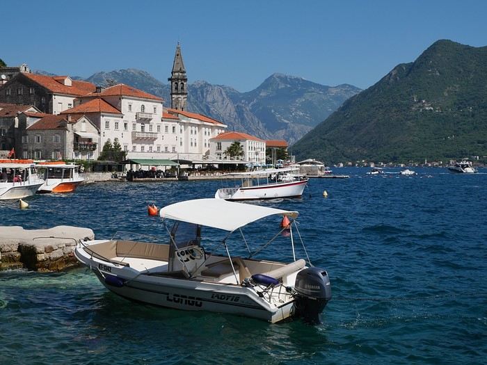
On the way back, we’ll drift into Bosnia-Herzegovina just to mix things up a bit!
We’re a little unsure about what to expect in terms of tourist crowds.
Dubrovnik has a reputation for being the hardest-hit city by overtourism, and Kotor and the whole Dalmatian coast aren’t exactly empty...
Luckily, most European countries haven’t started school holidays yet, and some measures seem to have been put in place to limit the flow (like restrictions on the number of cruise ships allowed to dock at the same time).
Maybe we’ll manage to escape the promised hell?
For now, we’re slamming the doors of the Scirocco and heading off to our first stop: northern Italy!
Madagascar - June 2025
Five years of an unintended break... The closure of VF, COVID... What a joy to rediscover the pleasure of sharing!
I’ve stayed true to my habits: the following account is a collection of practical tips rather than a travel journal...
Madagascar is as big as France and Belgium combined. In three weeks, choices have to be made! It was the Great Tsingy that inspired our trip. We decided to focus on the southwest and the RN7. We skipped the Deep South and the North. Oh well...
OUR ITINERARY IN 3 WEEKS:
Fri 6 June – Direct AF flight to Tana – Flight arrives at 10:30 PM – Tana Sat – Antsirabe Sun – Miandrivazo Mon – Drive to the Masiakampy pier – Descent of the Tsiribihina River by pirogue - Bivouac Tue – Descent of the Tsiribihina River by pirogue - Bivouac Wed – Descent of the Tsiribihina River by pirogue – Bekopaka Thu – Pirogue on the Manambolo River and Small Tsingy of Bemaraha – Bekopaka Fri – Great Tsingy of Bemaraha – Bekopaka Sat – Avenue of the Baobabs – Morondava Sun – Belo sur Mer Mon – Free day – Belo sur Mer Tue – Manja Wed – Andavadoaka Thu – Free day – Andavadoaka Fri – Salary Lagoon – Mangily Sat – Ranohira Sun – Isalo National Park - Ranohira Mon – Anja Reserve - Ambalavao - Fianarantsoa Tue – FCE train canceled – Visit to a Tanala village - Manakara Wed – Pirogue on the Pangalanes Canal – Ranomafana Thu – Ranomafana NP – Ranomafana Fri – Ambositra – Antsirabe Sat 28 June – AF flight to Paris – Flight departs at 11:55 PM
TRIP ORGANIZATION: I prepared my trip using the usual guides (LP and Rough Guide), the internet, and the Freytag & Berndt map (1:1,000,000). I’m old-school—I still love visualizing my route on a paper map, even though in Madagascar, it’s misleading because some National Roads are only national in name!...
The agency: Since we couldn’t deal directly with a driver-guide (we lacked reliable info to take the plunge), we went through an agency to organize the logistics of our trip. We didn’t feel like using bush taxis (not enough time) or driving a 4x4 ourselves (neither the skills nor the boldness). The French agency connected us with a local agency, to whom I sent my detailed itinerary by email. A few exchanges via email and WhatsApp calls allowed us to finalize everything quickly after some adjustments. As you’ve gathered... we multiplied the commissions, which inflated the budget. That said, in the end, we were thrilled with our decision and our choice. Our trip was booked by the end of 2024, and reservations were made immediately. No bad surprises: the bookings in the planned hotels were honored, often with one of the best rooms. On our last day in Tana, before departure, we were lucky enough to meet the director I’d been communicating with, who helped build and validate our circuit. A very warm debriefing.
The driver-guide: The agency assigned us Faly, 33, a driver-guide for over 10 years. He stayed with us from start to finish: he picked us up at the airport on arrival and dropped us off 23 days later. A very experienced driver (which is important here), an open and cultured guide, reliable, punctual, and a great companion. And a provider of good advice throughout the trip. We made the most of the long stretches on dirt roads or highways to listen to him talk about daily life, rituals, wildlife, and flora... No time wasted! With a great playlist in the background, we combined business with pleasure! Faly’s accommodation and meals were included (quite often, hotels offer free lodging and meals to driver-guides who bring clients), as was the fuel. That didn’t stop us from inviting Faly to share a beer or our evening meal sometimes. He didn’t always accept, wanting to let us "enjoy our romantic evenings," as he put it. Present without being intrusive! Faly is fully capable of organizing a tailor-made trip directly. I recommend him without any hesitation—we were delighted with his service. I’ll gladly share his contact details via PM to anyone who asks.
Local guides: It’s the national guide’s prerogative to choose the local guides (mandatory in the parks). Thanks to his experience, Faly always booked us amazing, competent, and interesting local guides.
Hotels: I told the agency I wanted charming, comfortable accommodations, without falling into flashy luxury. We loved all the hotels (except the Hôtel Kanto in Manja). The rooms, mostly bungalows, were always spacious and clean. Unfortunately, I can’t give the prices—I didn’t get the details. Breakfast is always included, usually fresh and hearty. Very often, a small bottle of water is provided in the room.
Tana Hôtel Les 3 Métis Power cuts are common (!) in Tana. Bring a headlamp.
Antsirabe Ecolodge – Les chambres du voyageur Maybe our favorite! A few bungalows, beautifully arranged in a splendid tropical garden. The dog Kodak welcomes us warmly.
Miandrivazo Hôtel Princesse Tsiribihina Magnificent view of the valley.
Bekopaka Hôtel Orchidée du Bemaraha 2 (yes, 2) beautiful pools, a large open common room.
Morondava Hôtel Baobab Café Brand new or at least, according to Faly, just renovated. Very comfortable but without much charm (international style).
Belo sur Mer Ecolodge du Menabe The bungalows, all made of wood, bamboo, and thatch, are set on the beach. Very spacious and fully equipped! Large open-air restaurant by the sea. No hot water from the tap—it’s available in plastic bottles heated by the sun in front of each bungalow. Actually, we never used it... Another very, very beautiful spot.
Manja Hôtel Kanto The only hotel on this leg of the journey, so no choice. The owner knows it and, as a result, doesn’t bother. It’s a real dive! Tiny, dark room, a sordid bathroom with only a trickle of water—we skipped the shower! Clean sheets, though. Obviously, no Wi-Fi. The only place where I didn’t leave a tip. We were well warned about the discomfort of this stop, both by the agency and Faly. We weren’t surprised, and it even became a running joke during the trip. On the other hand, we found a nice little market in town.
Andavadoaka Manga Lodge What bliss! Especially after the horrible Hôtel Kanto. A paradise-like spot, overlooking three beautiful deserted white-sand beaches. Meals are served on the terrace facing the sea. Stunning sunset. We loved spending a day lounging here! We were the only guests and were pampered.
Mangily (Ifaty) Mangily is the "suburb" of Ifaty. Hôtel Vovo Telo A large beachfront bungalow complex. More touristy but pleasant—we spent a lovely evening there with our feet in the sand.
Ranohira Le Relais de la Reine A splendid resort built by a Frenchman, at the foot of the rocks, very well integrated into the environment. Beautiful marked trail starting from the garden.
Fianarantsoa Villa Sylvestre Contrary to what its name suggests, it’s a hotel right in the city center. Quite decent, though.
Manakara Parthenay Club Pretty bungalows in a large garden by the sea, but swimming isn’t safe—the water is too dangerous and rough.
Ranomafana Hôtel Thermal Very spacious rooms.
Meals: Not all our meals were included. It’s really not expensive. 1 meat or fish dish: around 35,000 Ar 1 full menu (starter, main, dessert): around 70,000 Ar 1 large THB beer (65 cl): between 8,000 and 12,000 Ar 1 piña colada: 15,000 Ar 1 flavored rum: 6,000 Ar (sometimes free) 1 glass of baobab juice (!): 5,000 Ar
We always ate very well. Rice is everywhere, served in large quantities. Zebu meat is quite good if not overcooked. Personally, I prefer fish, and I feasted: grouper, captain, crab, small lobsters...
We happily discovered baobab juice (especially in Belo, on the west coast). And of course, flavored rums!
We bought 2 packs of 6 bottles of mineral water at Carrefour (!) (about 5,000 Ar per large bottle) at the start of our trip. That was enough, especially since we often got water in the bungalows.
We had a few picnics included in our trip. Instead of picking up the hotel’s lunchbox, Faly prepared delicious, fresh, and varied picnics for us: tuna pasta salad, fried rice with eggs, grilled vegetables, and avocado...
An exceptional address not to miss: Mad Zébu – Belo sur Tsiribihina A highly reputed restaurant, a favorite of LP and Rough Guide, and rightly so! Gourmet cuisine, refined and elegant. Barely more expensive than elsewhere, and it’s worth it. We stopped there on our way up to Bekopaka and the Tsingy NP. Fully booked! So Faly reserved for our return, three days later. We’re still thanking him! What a treat!
THE BUDGET: Ariary exchange rate: 5,000 Ar = 1 €
Pre-trip expenses: Direct Air France flights: 930 € per person round trip Cost of the circuit with the agency: 2,880 € per person
The visa: Issued on arrival, very quickly. 35 € per person for a stay under 30 days. Super simple. Super fast.
On-site expenses: As soon as we arrived at the airport (it was nearly midnight), Faly advised us to exchange our euros for all our needs. There are few opportunities on our route to find an ATM or an open bank with a good rate. To be more comfortable, he took us to a small office under military protection just outside the airport. I exchanged 1,200 € (I had asked the agency for advice on the amount to bring) at a rate of 4,750 Ar and became a millionaire. Faly recounted all the stacks. That covered all our expenses (meals, drinks, tips) without ever feeling deprived. Personal purchases were made at the end of the trip. Convenient—it served as an adjustment variable. We spent our last million (200 €) on marquetry and vanilla. Tip: We asked for 200,000 Ar in 5,000 Ar bills for tips. That wasn’t too much—I even ran short of small bills in the last two days.
Tips: Madagascar is a poor country where every service deserves a small reward. While not mandatory, it’s customary. But no one ever demanded or expected it openly. On the contrary, I sometimes had to remind a porter to give them my small bill. We never carried our luggage—porters were always present when the car arrived or waiting at our door to watch for our departure. I gave each of them 5,000 Ar. In restaurants, I rounded up to the nearest ten and left the change. Local guides also expect a tip: I gave around 20,000 Ar per day for the two of us. Finally, the national guide also expects a gratuity. I had read online to budget 5 € per day per person. I added more since we were so happy with his services. The tip was given at the end of the trip, in euros, outside the budget.
Total budget all included (excluding personal purchases): 8,690 € Clearly, Madagascar is a country where life isn’t expensive, but travel costs add up quickly due to the need to rent a 4x4 with a driver.
HIGHLIGHTS:
· The dirt roads Yes, I’m listing them among the highlights! We loved those long hours spent driving at 20 km/h on rocky, muddy, white, red, or gray sand tracks... surrounded by tropical vegetation, palm trees, pandanus, mango trees... The experiences were sometimes thrilling: crossing a river on a ferry (just planks of wood fixed on two motorized pirogues side by side) or crossing a river without a ferry, with just a kid running ahead of the 4x4 to show the way; soft sand where the 4x4 easily gets stuck... The tracks are quite narrow, and crossing paths with a bush taxi, a zebu cart, or a herd of goats is always epic. So many beautiful images, so many beautiful photos! Much more beautiful than on asphalt. So yes, we loved those long stretches on dirt roads. For us, it was clearly part of the journey. Faly was particularly careful, and the 4x4 was comfortable. No injuries, no fatigue, even after 7 or 8 hours on rough tracks. The national roads (including the famous RN7) are badly damaged by cyclones, huge trucks, and lack of maintenance. Potholes have turned into ostrich nests, and we didn’t drive much faster than on the dirt roads.
· The landscapes, villages, encounters... We crossed a variety of stunning landscapes: mountains with slopes covered in terraced crops, rice fields from apple green to emerald green, sugarcane fields, then tropical forests, baobab forests (they deserve a special paragraph below), traveler’s tree forests. And then coastlines with white sand dunes against a backdrop of blue hues!... Magical! We also passed through many villages with houses whose architecture varied by region. The Betsileo houses display beautiful decorative brick reliefs. On the west coast, the houses are more precarious, made of bamboo with palm-thatched roofs. In the Highlands region, we found solid houses with pastel plaster. Each region has its own landscape, crops, habitat, and clothing. Zebu carts are often the only means of transport in remote villages. We saw them very frequently. Again, the cart’s decoration depends on the region. And then, we met many villagers coming out of the bush and walking to the next market, carrying their crops on their heads or shoulders. More beautiful photos!
· The descent of the Tsiribihina River We boarded around 9 AM in a long pirogue with Gana, the local guide, and two pirogue men. So, five of us. The pirogue is long but narrow, about 65 cm wide. We sat one behind the other at the front on seats padded with what would become our mattresses during the bivouacs. We only took the bare essentials for two nights. A little goodbye to Faly, whom we’d see again in three days! Don’t forget us! The river is silty—meaning orange, opaque but clean. We glided along silently. Gana showed us the trees, birds, crocodiles (we saw five—apparently, we were lucky). The pirogue men rowed to get us as close as possible to these crocs sunbathing on the roots of big trees. Yeah, right!... as soon as we got too close, *splash*, they disappeared into the water. We marveled at the mini rice fields lining the river. Every tiny plot, no matter how small, is cultivated. Above them, banana fields. And on the water, a whole life of fishermen and villagers living with and from the river. Gana warned us we’d eat on the pirogue because the journey was long. So, I expected chips... But no—fried rice and zebu steak, cooked right in the pirogue!! Incredible! In the middle of the afternoon, we reached a small beach where we disembarked. Gana led us about a hundred meters to a sublime waterfall. We were alone there. We had time to swim. We’d brought our swimsuits and a towel (bought at the Carrefour in Antsirabe on Faly’s wise advice!). This swim in this paradise-like spot remains one of our best memories. We found our pirogue again and set off until our first bivouac. We’d sailed for 7 hours today. The tents were set up on a wide beach, without a single tree. A moment of solitude... Uh, where can we go to the bathroom?... Especially since it was a full moon, so we felt like we were in the spotlight. Anyway... we did as everyone else—walked away, dug a hole, and the others turned their backs. A hearty meal on the beach before a comfortable and silent night. The next day, same program, with slightly different landscapes. The gorges widened, the trees were different. But still many colorful birds. Again, we ate on the pirogue: grilled chicken and vegetables. 9 hours of sailing. A similar bivouac. This time, we got it. On the third day, we finished the descent with 5 hours of sailing. So, 7 hours, 9 hours, 5 hours... doing nothing. It might sound boring... but it wasn’t. Like the dirt roads, these were contemplative moments. It glides, it’s calm, relaxing, and there’s a lot of life on this river, animal and human. Contemplation. Suspended time. On arrival, we disembarked at a sort of joyful, bustling river port. Of course, Faly was already there to pick us up.
· The Tsingy de Bemaraha NP (Small and Great) I have vertigo. During my research, several agencies advised me against visiting the Great Tsingy. "Stick to the Small ones," they said. Grrr, no, not what I wanted—we’ve dreamed of this for years! The agency we chose also warned me but didn’t discourage me. So we started with the Small Tsingy, quite close to Bekopaka, guided by Alisha. This forest of sharp limestone rocks is impressive. No vertigo issues here. The day was completed with a short pirogue ride on the Manambolo River and a visit to two caves with pretty formations. The next day, Faly and Alisha drove us to the Great Tsingy (a good hour on a terrible track). Arriving at the park entrance, Alisha equipped us with harnesses, carabiners, and gave us some safety instructions. Faly was also equipped. Wait? He’s coming with us? I quickly understood he was there for me—if I got stuck, he could go back with me, and Philippe could continue with Alisha. A wise precaution that delighted and reassured me. In the end, it was unnecessary since the famous bridge crossing was fully secured by the harness and carabiners. 18 meters on planks, one by one, it didn’t sway too much—I walked looking straight ahead, not a glance down. I even managed to smile in the middle of the crossing—I have a photo to prove it! I was overjoyed! The circuit in the Great Tsingy is a loop, so we didn’t have to cross the bridge again. We climbed to viewpoints offering breathtaking panoramic views. It’s extraordinary, unique, incredible. All this to say that if you have vertigo, don’t hesitate! It’s doable! It’s completely safe and really worth pushing your limits a bit! For those who’ve done treetop adventure courses, it’s similar. Also, no need to be a great athlete—just a bit of agility to climb a few ladders and high steps. Don’t censor yourself! I even had a small regret—the loop was a bit short (about 2 hours). I would’ve liked to continue or even redo it, with less apprehension. Tip: Do the Small Tsingy before the Great ones, or not at all. And if you can only do one, do the Great ones without hesitation.
· Canoeing in the Belo mangrove The Belo sur Mer ecolodge lends small individual canoes for free to go to the mangrove. We left at high tide, paddled for about twenty minutes to reach a fairly sparse forest where we could easily venture in. Very shallow water, crystal clear—we could see the roots of all these trees, schools of tiny fish... It was quite surprising. Until then, I only knew impenetrable, tangled mangroves. Here, nothing like that—we walked through an aquatic forest. We loved this adventure so much we left a bit late. The tide had gone out, and we had to carry our canoes for the last few meters... Of course, the staff came to help (probably laughing silently!). The lodge owners gave all the necessary explanations and lent a waterproof bag for the phone (because yes, it’s worth taking photos!). A very useful precaution—the canoes are small, low in the water, and paddling quickly soaks you. Again, this isn’t just for Tony Estanguet! It didn’t cause us any problems, not even sore muscles the next day. A great experience. It’ll take about 2 hours.
· Isalo NP Big surprise when we saw this huge rocky massif appear on the RN7! A massif of colored sandstone, carved with crevasses giving it a ruined look. Le Relais de la Reine is a little gem cleverly nestled in the heart of these rocks. A small marked trail starts from the garden. We picked up the description at reception and set off. Without a guide, alone following the markers, it took us 2 hours to complete this magnificent little trail, giving us a first glimpse of the massif before the hike the next day. And we enjoyed being completely alone for this walk. It’s free, easy, and well-signposted. Don’t miss it. In the evening, Faly took us to the so-called Isalo Window site—a hole in a wall through which we could see the sunset. We met all the tourists in the area here. We weren’t blown away by the show... The next day, we left early to reach the start of the hike. We met Zozoly at the guides’ office in the small town of Ranohira. During this hike, we climbed through the rocks to a viewpoint offering stunning 360° views of the massif. Then we reached a site called the "natural pool," breathtakingly beautiful, especially since we were alone again. A sort of oasis, a cascading waterfall, palm trees and tree ferns, fine sand, all nestled at the bottom of a small canyon. Paradise-like. We resisted swimming, but it was really tempting. A long walk on the plateaus then led us to a well-equipped picnic site where a local team prepared grills. Concrete tables were tiered in a spacious, shady clearing where a whole family of ring-tailed lemurs frolicked. They knew the tourists’ habits and tried to snatch food. Playful and not very shy, they amused us with their antics! We had to resist not luring them with a piece of banana!! Thousands of photos!! After the meal, we set off again with Zozoly for another landscape. This time, we were by a small river at the bottom of a canyon with high walls covered in vegetation. The trail was narrow and slippery, on a ledge of the wall. We progressed carefully. No danger, though. We first reached the Blue Pool, which only turns blue in photos (surprise!), then the Black Pool fed by a shower of waterfalls. Two magnificent spots that showed us a completely different aspect of the massif.
· Anja Reserve This ficus forest is home to many groups of lemurs. Used to humans, whom they don’t fear, they move around us, ignoring us completely. It’s almost annoying... The best place on our trip to see lemurs.
· The FCE train To the great regret of Manakara’s inhabitants, the FCE train hasn’t reached here for over a year and a half. As a result, there are far fewer tourists—the train was part of the experience. We drove there and didn’t regret coming to this port on the east coast.
· Visit to a Tanala village This visit wasn’t part of our program—it was added by the agency to compensate for the train not running. Which was the case. Not big fans of this kind of visit, where we feel like we’re at a zoo, voyeuristic, lacking authenticity, we followed the local guide with some skepticism and exchanged dubious looks. And yet... the guide’s explanations about village life and the warm, smiling welcome from the villagers charmed us and dispelled all our concerns. We learned a lot, met smiling families, and were able to enter these beautiful bamboo houses. A very pleasant surprise, rich in lessons.
· The Pangalanes Canal Arriving in Manakara, we crossed a bridge overlooking the Pangalanes Canal. A cry of surprise: the water is turquoise! We took a short pirogue ride with a team of three pirogue men and Joël, a local guide who explained the drama caused by the train’s halt. We stopped in a fishing village where Joël bought fish for the barbecue. We ended up on a beach where the team prepared the meal while we went to watch the fishermen return on the nearby beach. We admired the fishermen’s dexterity in untangling their nets, sorting their fish, cleaning their gear. On our return, we found a small table set up on the beach, in the shade of palm trees and casuarinas. Lobsters, captain fish, grilled vegetables, sautéed potatoes. A real feast (included in the trip cost).
· Ranomafana NP A 4-5 hour hike (some climbing) in a dense secondary forest to look for lemurs. As usual, we were accompanied by a local guide who, while waiting to find our furry friends, gave us lots of info on the vegetation, birds, and Tanala ethnic rituals. In the forest, we met 4 or 5 trackers, armed with radios to alert guides of their findings. In the end, we saw several lemurs of different types. Quite far, quite high... A nice complement to our lemur encounters in Isalo. Here, it rains 200 days a year. We started the hike in thick fog, but the forest’s density protected us from the humidity. Be careful—it can be a bit frustrating to see the lemurs so far away, so high. Nothing like the Anja Reserve or Isalo NP. Here, what’s fun is the hunt.
· The baobabs We were captivated by these kings of the forest, noble, imposing, majestic. We spotted them from very far away, towering over the rest of the vegetation. Alone, in small groups, or in forests, our trip allowed us to see hundreds of them! Mainly on the west coast. All different—bald, hairy, shaggy, short and stout, tall and thin, like Laurel and Hardy. Philippe took to naming them. Respectfully!
OUR FAVORITES: · The variety of landscapes. · The Tsingy NP.
OUR DISAPPOINTMENTS: · The Avenue of the Baobabs, very overrated and the only place where we saw crowds. We saw many other "forests" of baobabs that were much more impressive. · It’s hard to approach the population calmly as swarms of children run up as soon as we arrive, asking for sweets. Without any aggression, their smiles and laughter quickly made us forget this small inconvenience. We never gave out candy, clothes, or money. We left pens at a school and clothes with Faly.
IF WE WERE TO DO IT AGAIN: · Same period, same duration, same pace, same itinerary, but if we were to do it again today, I’d go through Faly directly! · Maybe we should’ve stayed in Ambalavao instead of Fianarantsoa. · Plan a longer loop in the Great Tsingy—it felt a bit too short.
MISCELLANEOUS: The welcome: ‘Samala Vazaha,’ there are many, many kids, sometimes overwhelming, never aggressive. We were impressed by the villagers’ smiles and good humor, towards us or even among themselves—laughter was everywhere. Safety: No problems. Out of (excessive?) caution, we spread all our money across several bags that we padlocked whenever we left the hotel. Bribes: We were stopped several times on the road by police or gendarmes. They checked our papers, sometimes our passports. Faly was perfectly in order. No discussion, no bribes, a cordial greeting from the officers. However, several times we found ourselves at small "tolls" on the tracks for villagers who had leveled the road or filled a hole, or for the young guy who ran through the river to show the way... Faly complied without discussion: every service deserves a small bill. Language: French is still widely spoken. Credit card: Unused. Cash: You need it! The climate at this time: Ideal—blue skies, sunshine, and mild temperatures (20-25°C) throughout our trip. Temperatures started to drop by our departure—winter was setting in. Clothing: T-shirt or polo and a vest sometimes in the evening, sandals on our feet, hiking shoes for all the hikes. Tip: We left a bag in the car (completely safe) with things we didn’t need daily and dirty laundry. The two bags to take out at each stop were much lighter. Before leaving, we left several polos and T-shirts with Faly, which, once washed, will make a few people happy. Tourist crowds at this time: Low—we were sometimes the only guests at the hotel. Faly explained that at the Isalo picnic site, in high season, you have to queue for a table, whereas we had our pick. Photos: Lots! Too many! That’s the problem with digital—we take so many! Health issues: Nothing serious, just the usual mild traveler’s diarrhea. Mosquitoes: They’re voracious. We took anti-malaria treatment. I’m still not sure if it was the right thing to do... I’m always very skeptical about such precautions. Internet: Free Wi-Fi at the lodges’ reception (except at Hôtel Kanto!), sometimes (rarely) in the bungalows. Phone: We didn’t try to get a local SIM card—the evening Wi-Fi was enough for us to make calls and send messages via WhatsApp. Make sure to turn off mobile data and switch to airplane mode (I activated it a bit late—received calls, spam ones at that, were charged...). Electricity: French plugs. Personal purchases: Beautiful wooden objects (sculptures and marquetry) or zebu horn items in Ambositra. 1 kg of vanilla (400,000 Ar – 80 € per kg) in Tana.
IN CONCLUSION: A trip of contemplation. A pause for admiration, as our local guide in Isalo NP said. Nothing else to do but walk, look, and enjoy. Here, there are no old stones, no museums—it’s a trip where nature reigns supreme. And what nature!
I’ve stayed true to my habits: the following account is a collection of practical tips rather than a travel journal...
Madagascar is as big as France and Belgium combined. In three weeks, choices have to be made! It was the Great Tsingy that inspired our trip. We decided to focus on the southwest and the RN7. We skipped the Deep South and the North. Oh well...
OUR ITINERARY IN 3 WEEKS:
Fri 6 June – Direct AF flight to Tana – Flight arrives at 10:30 PM – Tana Sat – Antsirabe Sun – Miandrivazo Mon – Drive to the Masiakampy pier – Descent of the Tsiribihina River by pirogue - Bivouac Tue – Descent of the Tsiribihina River by pirogue - Bivouac Wed – Descent of the Tsiribihina River by pirogue – Bekopaka Thu – Pirogue on the Manambolo River and Small Tsingy of Bemaraha – Bekopaka Fri – Great Tsingy of Bemaraha – Bekopaka Sat – Avenue of the Baobabs – Morondava Sun – Belo sur Mer Mon – Free day – Belo sur Mer Tue – Manja Wed – Andavadoaka Thu – Free day – Andavadoaka Fri – Salary Lagoon – Mangily Sat – Ranohira Sun – Isalo National Park - Ranohira Mon – Anja Reserve - Ambalavao - Fianarantsoa Tue – FCE train canceled – Visit to a Tanala village - Manakara Wed – Pirogue on the Pangalanes Canal – Ranomafana Thu – Ranomafana NP – Ranomafana Fri – Ambositra – Antsirabe Sat 28 June – AF flight to Paris – Flight departs at 11:55 PM
TRIP ORGANIZATION: I prepared my trip using the usual guides (LP and Rough Guide), the internet, and the Freytag & Berndt map (1:1,000,000). I’m old-school—I still love visualizing my route on a paper map, even though in Madagascar, it’s misleading because some National Roads are only national in name!...
The agency: Since we couldn’t deal directly with a driver-guide (we lacked reliable info to take the plunge), we went through an agency to organize the logistics of our trip. We didn’t feel like using bush taxis (not enough time) or driving a 4x4 ourselves (neither the skills nor the boldness). The French agency connected us with a local agency, to whom I sent my detailed itinerary by email. A few exchanges via email and WhatsApp calls allowed us to finalize everything quickly after some adjustments. As you’ve gathered... we multiplied the commissions, which inflated the budget. That said, in the end, we were thrilled with our decision and our choice. Our trip was booked by the end of 2024, and reservations were made immediately. No bad surprises: the bookings in the planned hotels were honored, often with one of the best rooms. On our last day in Tana, before departure, we were lucky enough to meet the director I’d been communicating with, who helped build and validate our circuit. A very warm debriefing.
The driver-guide: The agency assigned us Faly, 33, a driver-guide for over 10 years. He stayed with us from start to finish: he picked us up at the airport on arrival and dropped us off 23 days later. A very experienced driver (which is important here), an open and cultured guide, reliable, punctual, and a great companion. And a provider of good advice throughout the trip. We made the most of the long stretches on dirt roads or highways to listen to him talk about daily life, rituals, wildlife, and flora... No time wasted! With a great playlist in the background, we combined business with pleasure! Faly’s accommodation and meals were included (quite often, hotels offer free lodging and meals to driver-guides who bring clients), as was the fuel. That didn’t stop us from inviting Faly to share a beer or our evening meal sometimes. He didn’t always accept, wanting to let us "enjoy our romantic evenings," as he put it. Present without being intrusive! Faly is fully capable of organizing a tailor-made trip directly. I recommend him without any hesitation—we were delighted with his service. I’ll gladly share his contact details via PM to anyone who asks.
Local guides: It’s the national guide’s prerogative to choose the local guides (mandatory in the parks). Thanks to his experience, Faly always booked us amazing, competent, and interesting local guides.
Hotels: I told the agency I wanted charming, comfortable accommodations, without falling into flashy luxury. We loved all the hotels (except the Hôtel Kanto in Manja). The rooms, mostly bungalows, were always spacious and clean. Unfortunately, I can’t give the prices—I didn’t get the details. Breakfast is always included, usually fresh and hearty. Very often, a small bottle of water is provided in the room.
Tana Hôtel Les 3 Métis Power cuts are common (!) in Tana. Bring a headlamp.
Antsirabe Ecolodge – Les chambres du voyageur Maybe our favorite! A few bungalows, beautifully arranged in a splendid tropical garden. The dog Kodak welcomes us warmly.
Miandrivazo Hôtel Princesse Tsiribihina Magnificent view of the valley.
Bekopaka Hôtel Orchidée du Bemaraha 2 (yes, 2) beautiful pools, a large open common room.
Morondava Hôtel Baobab Café Brand new or at least, according to Faly, just renovated. Very comfortable but without much charm (international style).
Belo sur Mer Ecolodge du Menabe The bungalows, all made of wood, bamboo, and thatch, are set on the beach. Very spacious and fully equipped! Large open-air restaurant by the sea. No hot water from the tap—it’s available in plastic bottles heated by the sun in front of each bungalow. Actually, we never used it... Another very, very beautiful spot.
Manja Hôtel Kanto The only hotel on this leg of the journey, so no choice. The owner knows it and, as a result, doesn’t bother. It’s a real dive! Tiny, dark room, a sordid bathroom with only a trickle of water—we skipped the shower! Clean sheets, though. Obviously, no Wi-Fi. The only place where I didn’t leave a tip. We were well warned about the discomfort of this stop, both by the agency and Faly. We weren’t surprised, and it even became a running joke during the trip. On the other hand, we found a nice little market in town.
Andavadoaka Manga Lodge What bliss! Especially after the horrible Hôtel Kanto. A paradise-like spot, overlooking three beautiful deserted white-sand beaches. Meals are served on the terrace facing the sea. Stunning sunset. We loved spending a day lounging here! We were the only guests and were pampered.
Mangily (Ifaty) Mangily is the "suburb" of Ifaty. Hôtel Vovo Telo A large beachfront bungalow complex. More touristy but pleasant—we spent a lovely evening there with our feet in the sand.
Ranohira Le Relais de la Reine A splendid resort built by a Frenchman, at the foot of the rocks, very well integrated into the environment. Beautiful marked trail starting from the garden.
Fianarantsoa Villa Sylvestre Contrary to what its name suggests, it’s a hotel right in the city center. Quite decent, though.
Manakara Parthenay Club Pretty bungalows in a large garden by the sea, but swimming isn’t safe—the water is too dangerous and rough.
Ranomafana Hôtel Thermal Very spacious rooms.
Meals: Not all our meals were included. It’s really not expensive. 1 meat or fish dish: around 35,000 Ar 1 full menu (starter, main, dessert): around 70,000 Ar 1 large THB beer (65 cl): between 8,000 and 12,000 Ar 1 piña colada: 15,000 Ar 1 flavored rum: 6,000 Ar (sometimes free) 1 glass of baobab juice (!): 5,000 Ar
We always ate very well. Rice is everywhere, served in large quantities. Zebu meat is quite good if not overcooked. Personally, I prefer fish, and I feasted: grouper, captain, crab, small lobsters...
We happily discovered baobab juice (especially in Belo, on the west coast). And of course, flavored rums!
We bought 2 packs of 6 bottles of mineral water at Carrefour (!) (about 5,000 Ar per large bottle) at the start of our trip. That was enough, especially since we often got water in the bungalows.
We had a few picnics included in our trip. Instead of picking up the hotel’s lunchbox, Faly prepared delicious, fresh, and varied picnics for us: tuna pasta salad, fried rice with eggs, grilled vegetables, and avocado...
An exceptional address not to miss: Mad Zébu – Belo sur Tsiribihina A highly reputed restaurant, a favorite of LP and Rough Guide, and rightly so! Gourmet cuisine, refined and elegant. Barely more expensive than elsewhere, and it’s worth it. We stopped there on our way up to Bekopaka and the Tsingy NP. Fully booked! So Faly reserved for our return, three days later. We’re still thanking him! What a treat!
THE BUDGET: Ariary exchange rate: 5,000 Ar = 1 €
Pre-trip expenses: Direct Air France flights: 930 € per person round trip Cost of the circuit with the agency: 2,880 € per person
The visa: Issued on arrival, very quickly. 35 € per person for a stay under 30 days. Super simple. Super fast.
On-site expenses: As soon as we arrived at the airport (it was nearly midnight), Faly advised us to exchange our euros for all our needs. There are few opportunities on our route to find an ATM or an open bank with a good rate. To be more comfortable, he took us to a small office under military protection just outside the airport. I exchanged 1,200 € (I had asked the agency for advice on the amount to bring) at a rate of 4,750 Ar and became a millionaire. Faly recounted all the stacks. That covered all our expenses (meals, drinks, tips) without ever feeling deprived. Personal purchases were made at the end of the trip. Convenient—it served as an adjustment variable. We spent our last million (200 €) on marquetry and vanilla. Tip: We asked for 200,000 Ar in 5,000 Ar bills for tips. That wasn’t too much—I even ran short of small bills in the last two days.
Tips: Madagascar is a poor country where every service deserves a small reward. While not mandatory, it’s customary. But no one ever demanded or expected it openly. On the contrary, I sometimes had to remind a porter to give them my small bill. We never carried our luggage—porters were always present when the car arrived or waiting at our door to watch for our departure. I gave each of them 5,000 Ar. In restaurants, I rounded up to the nearest ten and left the change. Local guides also expect a tip: I gave around 20,000 Ar per day for the two of us. Finally, the national guide also expects a gratuity. I had read online to budget 5 € per day per person. I added more since we were so happy with his services. The tip was given at the end of the trip, in euros, outside the budget.
Total budget all included (excluding personal purchases): 8,690 € Clearly, Madagascar is a country where life isn’t expensive, but travel costs add up quickly due to the need to rent a 4x4 with a driver.
HIGHLIGHTS:
· The dirt roads Yes, I’m listing them among the highlights! We loved those long hours spent driving at 20 km/h on rocky, muddy, white, red, or gray sand tracks... surrounded by tropical vegetation, palm trees, pandanus, mango trees... The experiences were sometimes thrilling: crossing a river on a ferry (just planks of wood fixed on two motorized pirogues side by side) or crossing a river without a ferry, with just a kid running ahead of the 4x4 to show the way; soft sand where the 4x4 easily gets stuck... The tracks are quite narrow, and crossing paths with a bush taxi, a zebu cart, or a herd of goats is always epic. So many beautiful images, so many beautiful photos! Much more beautiful than on asphalt. So yes, we loved those long stretches on dirt roads. For us, it was clearly part of the journey. Faly was particularly careful, and the 4x4 was comfortable. No injuries, no fatigue, even after 7 or 8 hours on rough tracks. The national roads (including the famous RN7) are badly damaged by cyclones, huge trucks, and lack of maintenance. Potholes have turned into ostrich nests, and we didn’t drive much faster than on the dirt roads.
· The landscapes, villages, encounters... We crossed a variety of stunning landscapes: mountains with slopes covered in terraced crops, rice fields from apple green to emerald green, sugarcane fields, then tropical forests, baobab forests (they deserve a special paragraph below), traveler’s tree forests. And then coastlines with white sand dunes against a backdrop of blue hues!... Magical! We also passed through many villages with houses whose architecture varied by region. The Betsileo houses display beautiful decorative brick reliefs. On the west coast, the houses are more precarious, made of bamboo with palm-thatched roofs. In the Highlands region, we found solid houses with pastel plaster. Each region has its own landscape, crops, habitat, and clothing. Zebu carts are often the only means of transport in remote villages. We saw them very frequently. Again, the cart’s decoration depends on the region. And then, we met many villagers coming out of the bush and walking to the next market, carrying their crops on their heads or shoulders. More beautiful photos!
· The descent of the Tsiribihina River We boarded around 9 AM in a long pirogue with Gana, the local guide, and two pirogue men. So, five of us. The pirogue is long but narrow, about 65 cm wide. We sat one behind the other at the front on seats padded with what would become our mattresses during the bivouacs. We only took the bare essentials for two nights. A little goodbye to Faly, whom we’d see again in three days! Don’t forget us! The river is silty—meaning orange, opaque but clean. We glided along silently. Gana showed us the trees, birds, crocodiles (we saw five—apparently, we were lucky). The pirogue men rowed to get us as close as possible to these crocs sunbathing on the roots of big trees. Yeah, right!... as soon as we got too close, *splash*, they disappeared into the water. We marveled at the mini rice fields lining the river. Every tiny plot, no matter how small, is cultivated. Above them, banana fields. And on the water, a whole life of fishermen and villagers living with and from the river. Gana warned us we’d eat on the pirogue because the journey was long. So, I expected chips... But no—fried rice and zebu steak, cooked right in the pirogue!! Incredible! In the middle of the afternoon, we reached a small beach where we disembarked. Gana led us about a hundred meters to a sublime waterfall. We were alone there. We had time to swim. We’d brought our swimsuits and a towel (bought at the Carrefour in Antsirabe on Faly’s wise advice!). This swim in this paradise-like spot remains one of our best memories. We found our pirogue again and set off until our first bivouac. We’d sailed for 7 hours today. The tents were set up on a wide beach, without a single tree. A moment of solitude... Uh, where can we go to the bathroom?... Especially since it was a full moon, so we felt like we were in the spotlight. Anyway... we did as everyone else—walked away, dug a hole, and the others turned their backs. A hearty meal on the beach before a comfortable and silent night. The next day, same program, with slightly different landscapes. The gorges widened, the trees were different. But still many colorful birds. Again, we ate on the pirogue: grilled chicken and vegetables. 9 hours of sailing. A similar bivouac. This time, we got it. On the third day, we finished the descent with 5 hours of sailing. So, 7 hours, 9 hours, 5 hours... doing nothing. It might sound boring... but it wasn’t. Like the dirt roads, these were contemplative moments. It glides, it’s calm, relaxing, and there’s a lot of life on this river, animal and human. Contemplation. Suspended time. On arrival, we disembarked at a sort of joyful, bustling river port. Of course, Faly was already there to pick us up.
· The Tsingy de Bemaraha NP (Small and Great) I have vertigo. During my research, several agencies advised me against visiting the Great Tsingy. "Stick to the Small ones," they said. Grrr, no, not what I wanted—we’ve dreamed of this for years! The agency we chose also warned me but didn’t discourage me. So we started with the Small Tsingy, quite close to Bekopaka, guided by Alisha. This forest of sharp limestone rocks is impressive. No vertigo issues here. The day was completed with a short pirogue ride on the Manambolo River and a visit to two caves with pretty formations. The next day, Faly and Alisha drove us to the Great Tsingy (a good hour on a terrible track). Arriving at the park entrance, Alisha equipped us with harnesses, carabiners, and gave us some safety instructions. Faly was also equipped. Wait? He’s coming with us? I quickly understood he was there for me—if I got stuck, he could go back with me, and Philippe could continue with Alisha. A wise precaution that delighted and reassured me. In the end, it was unnecessary since the famous bridge crossing was fully secured by the harness and carabiners. 18 meters on planks, one by one, it didn’t sway too much—I walked looking straight ahead, not a glance down. I even managed to smile in the middle of the crossing—I have a photo to prove it! I was overjoyed! The circuit in the Great Tsingy is a loop, so we didn’t have to cross the bridge again. We climbed to viewpoints offering breathtaking panoramic views. It’s extraordinary, unique, incredible. All this to say that if you have vertigo, don’t hesitate! It’s doable! It’s completely safe and really worth pushing your limits a bit! For those who’ve done treetop adventure courses, it’s similar. Also, no need to be a great athlete—just a bit of agility to climb a few ladders and high steps. Don’t censor yourself! I even had a small regret—the loop was a bit short (about 2 hours). I would’ve liked to continue or even redo it, with less apprehension. Tip: Do the Small Tsingy before the Great ones, or not at all. And if you can only do one, do the Great ones without hesitation.
· Canoeing in the Belo mangrove The Belo sur Mer ecolodge lends small individual canoes for free to go to the mangrove. We left at high tide, paddled for about twenty minutes to reach a fairly sparse forest where we could easily venture in. Very shallow water, crystal clear—we could see the roots of all these trees, schools of tiny fish... It was quite surprising. Until then, I only knew impenetrable, tangled mangroves. Here, nothing like that—we walked through an aquatic forest. We loved this adventure so much we left a bit late. The tide had gone out, and we had to carry our canoes for the last few meters... Of course, the staff came to help (probably laughing silently!). The lodge owners gave all the necessary explanations and lent a waterproof bag for the phone (because yes, it’s worth taking photos!). A very useful precaution—the canoes are small, low in the water, and paddling quickly soaks you. Again, this isn’t just for Tony Estanguet! It didn’t cause us any problems, not even sore muscles the next day. A great experience. It’ll take about 2 hours.
· Isalo NP Big surprise when we saw this huge rocky massif appear on the RN7! A massif of colored sandstone, carved with crevasses giving it a ruined look. Le Relais de la Reine is a little gem cleverly nestled in the heart of these rocks. A small marked trail starts from the garden. We picked up the description at reception and set off. Without a guide, alone following the markers, it took us 2 hours to complete this magnificent little trail, giving us a first glimpse of the massif before the hike the next day. And we enjoyed being completely alone for this walk. It’s free, easy, and well-signposted. Don’t miss it. In the evening, Faly took us to the so-called Isalo Window site—a hole in a wall through which we could see the sunset. We met all the tourists in the area here. We weren’t blown away by the show... The next day, we left early to reach the start of the hike. We met Zozoly at the guides’ office in the small town of Ranohira. During this hike, we climbed through the rocks to a viewpoint offering stunning 360° views of the massif. Then we reached a site called the "natural pool," breathtakingly beautiful, especially since we were alone again. A sort of oasis, a cascading waterfall, palm trees and tree ferns, fine sand, all nestled at the bottom of a small canyon. Paradise-like. We resisted swimming, but it was really tempting. A long walk on the plateaus then led us to a well-equipped picnic site where a local team prepared grills. Concrete tables were tiered in a spacious, shady clearing where a whole family of ring-tailed lemurs frolicked. They knew the tourists’ habits and tried to snatch food. Playful and not very shy, they amused us with their antics! We had to resist not luring them with a piece of banana!! Thousands of photos!! After the meal, we set off again with Zozoly for another landscape. This time, we were by a small river at the bottom of a canyon with high walls covered in vegetation. The trail was narrow and slippery, on a ledge of the wall. We progressed carefully. No danger, though. We first reached the Blue Pool, which only turns blue in photos (surprise!), then the Black Pool fed by a shower of waterfalls. Two magnificent spots that showed us a completely different aspect of the massif.
· Anja Reserve This ficus forest is home to many groups of lemurs. Used to humans, whom they don’t fear, they move around us, ignoring us completely. It’s almost annoying... The best place on our trip to see lemurs.
· The FCE train To the great regret of Manakara’s inhabitants, the FCE train hasn’t reached here for over a year and a half. As a result, there are far fewer tourists—the train was part of the experience. We drove there and didn’t regret coming to this port on the east coast.
· Visit to a Tanala village This visit wasn’t part of our program—it was added by the agency to compensate for the train not running. Which was the case. Not big fans of this kind of visit, where we feel like we’re at a zoo, voyeuristic, lacking authenticity, we followed the local guide with some skepticism and exchanged dubious looks. And yet... the guide’s explanations about village life and the warm, smiling welcome from the villagers charmed us and dispelled all our concerns. We learned a lot, met smiling families, and were able to enter these beautiful bamboo houses. A very pleasant surprise, rich in lessons.
· The Pangalanes Canal Arriving in Manakara, we crossed a bridge overlooking the Pangalanes Canal. A cry of surprise: the water is turquoise! We took a short pirogue ride with a team of three pirogue men and Joël, a local guide who explained the drama caused by the train’s halt. We stopped in a fishing village where Joël bought fish for the barbecue. We ended up on a beach where the team prepared the meal while we went to watch the fishermen return on the nearby beach. We admired the fishermen’s dexterity in untangling their nets, sorting their fish, cleaning their gear. On our return, we found a small table set up on the beach, in the shade of palm trees and casuarinas. Lobsters, captain fish, grilled vegetables, sautéed potatoes. A real feast (included in the trip cost).
· Ranomafana NP A 4-5 hour hike (some climbing) in a dense secondary forest to look for lemurs. As usual, we were accompanied by a local guide who, while waiting to find our furry friends, gave us lots of info on the vegetation, birds, and Tanala ethnic rituals. In the forest, we met 4 or 5 trackers, armed with radios to alert guides of their findings. In the end, we saw several lemurs of different types. Quite far, quite high... A nice complement to our lemur encounters in Isalo. Here, it rains 200 days a year. We started the hike in thick fog, but the forest’s density protected us from the humidity. Be careful—it can be a bit frustrating to see the lemurs so far away, so high. Nothing like the Anja Reserve or Isalo NP. Here, what’s fun is the hunt.
· The baobabs We were captivated by these kings of the forest, noble, imposing, majestic. We spotted them from very far away, towering over the rest of the vegetation. Alone, in small groups, or in forests, our trip allowed us to see hundreds of them! Mainly on the west coast. All different—bald, hairy, shaggy, short and stout, tall and thin, like Laurel and Hardy. Philippe took to naming them. Respectfully!
OUR FAVORITES: · The variety of landscapes. · The Tsingy NP.
OUR DISAPPOINTMENTS: · The Avenue of the Baobabs, very overrated and the only place where we saw crowds. We saw many other "forests" of baobabs that were much more impressive. · It’s hard to approach the population calmly as swarms of children run up as soon as we arrive, asking for sweets. Without any aggression, their smiles and laughter quickly made us forget this small inconvenience. We never gave out candy, clothes, or money. We left pens at a school and clothes with Faly.
IF WE WERE TO DO IT AGAIN: · Same period, same duration, same pace, same itinerary, but if we were to do it again today, I’d go through Faly directly! · Maybe we should’ve stayed in Ambalavao instead of Fianarantsoa. · Plan a longer loop in the Great Tsingy—it felt a bit too short.
MISCELLANEOUS: The welcome: ‘Samala Vazaha,’ there are many, many kids, sometimes overwhelming, never aggressive. We were impressed by the villagers’ smiles and good humor, towards us or even among themselves—laughter was everywhere. Safety: No problems. Out of (excessive?) caution, we spread all our money across several bags that we padlocked whenever we left the hotel. Bribes: We were stopped several times on the road by police or gendarmes. They checked our papers, sometimes our passports. Faly was perfectly in order. No discussion, no bribes, a cordial greeting from the officers. However, several times we found ourselves at small "tolls" on the tracks for villagers who had leveled the road or filled a hole, or for the young guy who ran through the river to show the way... Faly complied without discussion: every service deserves a small bill. Language: French is still widely spoken. Credit card: Unused. Cash: You need it! The climate at this time: Ideal—blue skies, sunshine, and mild temperatures (20-25°C) throughout our trip. Temperatures started to drop by our departure—winter was setting in. Clothing: T-shirt or polo and a vest sometimes in the evening, sandals on our feet, hiking shoes for all the hikes. Tip: We left a bag in the car (completely safe) with things we didn’t need daily and dirty laundry. The two bags to take out at each stop were much lighter. Before leaving, we left several polos and T-shirts with Faly, which, once washed, will make a few people happy. Tourist crowds at this time: Low—we were sometimes the only guests at the hotel. Faly explained that at the Isalo picnic site, in high season, you have to queue for a table, whereas we had our pick. Photos: Lots! Too many! That’s the problem with digital—we take so many! Health issues: Nothing serious, just the usual mild traveler’s diarrhea. Mosquitoes: They’re voracious. We took anti-malaria treatment. I’m still not sure if it was the right thing to do... I’m always very skeptical about such precautions. Internet: Free Wi-Fi at the lodges’ reception (except at Hôtel Kanto!), sometimes (rarely) in the bungalows. Phone: We didn’t try to get a local SIM card—the evening Wi-Fi was enough for us to make calls and send messages via WhatsApp. Make sure to turn off mobile data and switch to airplane mode (I activated it a bit late—received calls, spam ones at that, were charged...). Electricity: French plugs. Personal purchases: Beautiful wooden objects (sculptures and marquetry) or zebu horn items in Ambositra. 1 kg of vanilla (400,000 Ar – 80 € per kg) in Tana.
IN CONCLUSION: A trip of contemplation. A pause for admiration, as our local guide in Isalo NP said. Nothing else to do but walk, look, and enjoy. Here, there are no old stones, no museums—it’s a trip where nature reigns supreme. And what nature!