Results for "Saint-Floret+|+127"
82343 results found.
Que visiter dans la région de la Loire (France) English translation pending
Bonjour!
Mon copain s'envole pour un échange étudiant en France, plus principalement dans la région de La Loire. Il y a tellement de choses à visiter....Q'est-ce qu'il ne faut absolument pas manquer?
Merci beaucoup!🙂
Mon copain s'envole pour un échange étudiant en France, plus principalement dans la région de La Loire. Il y a tellement de choses à visiter....Q'est-ce qu'il ne faut absolument pas manquer?
Merci beaucoup!🙂
2 semaines à Madagascar English translation pending
je voudrais aller à madagascar fin aout pour 2 semaines
j'aime marcher, découvrir la nature et les gens
je pense qu'en 2 semaines, il faut se contenter d'une petite partie de l'île
que me conseillez-vous?
j'aime marcher, découvrir la nature et les gens
je pense qu'en 2 semaines, il faut se contenter d'une petite partie de l'île
que me conseillez-vous?
Tous a Chachapoyas English translation pending
Bonjour tout le monde. Je me fais un devoir de rendre public l existence et la qualite de vie exceptionelle de la petite ville de Chachapoyas au nord du Perou qui est assez peu connue.
Coincee entre le fleuve Marañon (qui donne naissance au fleuve Amazone) et le rio Utcubamba, la ville beneficie d un climat privilegie de part sa situation geographique. Elle se trouve sur le dernier versant andin, frontiere geographique avec la plaine amazonienne. Les paysages environants ce composent de forets tropicales d altitudes (entre 1500 et 3000m. s. n. m.), ou rain forest ou cloud forest, de cascades, de nombreux sites archeologiques gratuits (certains comme Gran Vilaya au coeur de la foret) mis a part l impressionant site de Cuelap dont la muraille exterieure mesure environ 580m de long pour 20m de haut.
Les gens y sont adorables et se font un devoir d accueuillir l etranger de la meilleure facon possible. La ville est assez jeune car il y a une petite universite. Le climat est tempere, il ne fait pas moins de 10 degres en hiver et en ete c est assez courant de tourner autour de 35 degres.
De plus de Chachapoyas on peut se rendre facilement a Yurimaguas (un des deux principaux ports d embarcation pour rejoindre Iquitos) via Moyobamba et Tarapoto. Il y a aussi une route menant a Vilcabamba en Equateur.
Si vous voulez des infos sur toute cette partie nord du Perou n hesitez pas a m ecrire je la connais bien, je l ai parcouru de nombreuses fois et ne cesse de la parcourir dans sa diversite et sa richesse.
Vaccins, lariam, devises pour l'Asie Sud Est? English translation pending
bonjour
je pars très bientôt (15/02) en thailande (et un petit peu CAMBODGE / LAOS / VIET NAM / MALAISIE), pour cela je suis allé chez mon médecin qui m'a prescris 2 vaccins typhoïde / et hépatite A + hépatite B (Twinnix), Et du LARIAM !
à ma grande surprise, la pharmacienne m'a donné les tarifs non remboursé par la sécu ... : Typhoide 25 € Twinnix (hep A et B) 46 € Lariam (il me faudrait parait il 2 boites) 45 € la boite (soit 90 €)
Est ce normal, je ne les ai pas encore acheté, donc ya t'il un moyen de se faire rembourser ? ou d'autre produit moins chere existent ils ?
Combien est ce que je dois prévoir pour un billet d'avion en derniere minute ??? Que me conseilleez vous pour l'argent en thailande ? (partir avec des dollars ? des chèques voyages ? le change est t'il compliqué ? ...)
cordialement
à bientôt
je pars très bientôt (15/02) en thailande (et un petit peu CAMBODGE / LAOS / VIET NAM / MALAISIE), pour cela je suis allé chez mon médecin qui m'a prescris 2 vaccins typhoïde / et hépatite A + hépatite B (Twinnix), Et du LARIAM !
à ma grande surprise, la pharmacienne m'a donné les tarifs non remboursé par la sécu ... : Typhoide 25 € Twinnix (hep A et B) 46 € Lariam (il me faudrait parait il 2 boites) 45 € la boite (soit 90 €)
Est ce normal, je ne les ai pas encore acheté, donc ya t'il un moyen de se faire rembourser ? ou d'autre produit moins chere existent ils ?
Combien est ce que je dois prévoir pour un billet d'avion en derniere minute ??? Que me conseilleez vous pour l'argent en thailande ? (partir avec des dollars ? des chèques voyages ? le change est t'il compliqué ? ...)
cordialement
à bientôt
Planning a 15-day trip to northern Morocco
Hi there, 🙂
This autumn’s trip should be in Morocco—barring any geopolitical issues between now and then.
After many trips to the south of Fès, I’m giving the north a try.
My plan is roughly to do a road trip loop from Rabat back to Rabat, passing through Asilah, Tangier, Tétouan, Chefchaouen, Akchour, Fès, Meknès, and Volubilis.
That’s a lot of cities. Probably a bit too many for our taste—we usually prefer more isolated spots...
So I’m looking for tips on little backroads, secluded beaches, half-day hikes, and offbeat places.
If you’ve also got recommendations for accommodation... (We’re open to splurging over 100 € if it’s a real favorite.)
Feel free to think outside the box—this is an open-ended plan! !😉
Thanks
This autumn’s trip should be in Morocco—barring any geopolitical issues between now and then.
After many trips to the south of Fès, I’m giving the north a try.
My plan is roughly to do a road trip loop from Rabat back to Rabat, passing through Asilah, Tangier, Tétouan, Chefchaouen, Akchour, Fès, Meknès, and Volubilis.
That’s a lot of cities. Probably a bit too many for our taste—we usually prefer more isolated spots...
So I’m looking for tips on little backroads, secluded beaches, half-day hikes, and offbeat places.
If you’ve also got recommendations for accommodation... (We’re open to splurging over 100 € if it’s a real favorite.)
Feel free to think outside the box—this is an open-ended plan! !😉
Thanks
Nepal Feedback
NAMASTE NEPAL! PRACTICAL INFO AND EXPERIENCE FEEDBACK
Stay from March 25 to April 16, 2025
· Flight tickets Air India (via Delhi) (via Skyscanner) = 1130 € per person · Planned budget (and respected without too many restrictions and while buying a few small gifts) = 2000 € for the stay for two. Buses, taxis, and entrance fees to various sites represent a budget to consider. Meals are cheap. Drinks like beer/Coke, however, are not cheap and cost the equivalent of a meal. · Exchange rate of the rupee during our stay = 0.0064 € (the exchange rate is almost identical everywhere, including at the airport). · At the airport, purchase of two SIM cards (phone) = 1000 NPR x 2 for 28 days. · Kathmandu: we had booked the hotel upon arrival: Kathmandu Boutique Hotel (+977 015 357 446 – email: booking@kathmanduboutiquehotel.com), very well located in a quiet alley off the street, south of Thamel, a 10-minute walk from Durbar Square. A hotel like Nepal knows how to do, where tall people will have to duck. Night + breakfast = 18 € for two. Very warm welcome, great location, excellent value for money. · Bhaktapur: we had also booked a hotel for the end of our stay because the chance of the year 2025 made the Nepali New Year and Bisket Jatra particularly festive in Bhaktapur: Manju Baha Hotel School (+977 976 7234014 – email: manjubahahotel@gmail.com) located in an old monastery. "A social enterprise transforming an old monastery into a charming hotel, offering professional hospitality training to underprivileged Nepali youth." Night + breakfast = 32 € for two. Beautifully decorated room. Very warm welcome. Don’t miss the Changunarayan site (near Bhaktapur), it’s amazing. And if you’re lucky enough to be in Bhaktapur in mid-April for 3 days, there’s the Bisket Jatra festivities (Newari festival), joyful, noisy, fun, and wild… · Pokhara (hotel recommended by the Kathmandu hotel): Hotel Green Tara, Lakeside, 10th street, set back, quiet (Tel. +977 61 462698 – email: greentara_67@hotmail.com) · Trek permit (Lower Mustang, no need for an agency or guide, permits checked at Ghasa and Jomsom) = 2000 NPR per person (2 ID photos) · Bus Kathmandu/Pokhara and return = 2000 NPR per person · Bus Pokhara/Jomsom, 2 one-way tickets = 2800 NPR. · Taxi: negotiation with a driver we recommend, Vicky (+977 984 075 599). You explain what you want, negotiate the price, and he waits for you during the visit. Very charming, we used him several times. For example: departure from our hotel at 10 AM -> Boudhanath/Pashupatinath/Patan return at 5 PM to the hotel = 6500 NPR – Swayambhunath (round trip) = 1200 NPR · Site prices: https://ntb.gov.np/plan-your-trip/before-you-come/heritage-site-entry-fees o Visitor Pass for Kathmandu Durbar Square (for the duration of the stay, show your visa) = 1000 NPR per person (1 ID photo) o Bhaktapur Durbar Square (old town) = 1800 NPR per person o Patan = 1000 NPR per person o Swayambhu Stupa = 200 NPR per person o Boudha Stupa = 200 NPR per person o Pashupatinath Temple = 1000 NPR per person (interesting to take a guide) o Changunarayan Temple (6 km north of Bhaktapur) = 400 NPR per person o Mountain Museum in Pokhara = 750 NPR per person · E-cigarettes: e-cigarettes are banned in India and confiscated whether they’re in carry-on or checked luggage. On the way there, we had kept them in our carry-on, they were confiscated in Delhi. On the way back, learning from our previous experience, we put them in our checked luggage. Someone came to get us to take them out of our bags and confiscate them… You can find e-cigarettes and products in Kathmandu.
* * *
I’m 74 years old. I went to Nepal in 1982, 1983, and the last time in 1986. I wanted to introduce this beautiful and endearing country to my husband, and it was… now or never. So we decided it was now.
I knew the trek starting from Pokhara: Naudanda/Birethanti/Ghorepani/Tatopani/Kalopani. There was no way I was going to do that trek, especially the 1000-meter staircase to reach Ghorepani… You have to stay humble with age.
Back then, the road didn’t exist. I didn’t consider, with the construction of this road (NH48) along the western bank of the Kali Gandaki, doing a trek along a windy and dusty road. Was there an alternative hiking trail on the eastern bank? No one answered my question on VoyageForum, so I did my research online. And I found this site: "Andrées de Ruiter and Prem Rai - Trekking the Annapurna Circuit, including the new NATT trails that avoid the road - A guide to one of the most beautiful trekking regions in Nepal and the world (2011) - NATT = New Annapurna Trekking Trail".
Phew! A solution was emerging. This circuit from 2011 wasn’t fully marked. The idea was to go from Jomsom to Tatopani, so we needed to make sure the path was well-marked all the way, which we did, and the path exists, marked in red and white!
So, with the walking times information, we built our 8-day circuit:
· Jomsom/Thinigaon · Thinigaon/Chimang · Chimang/Saura · Saura/Kokhetanti · Rest day or, if in good shape: loop to Sekong Lake · Kokhetanti/Jhipra Deurali · Jhipra Deurali/Kopchepani · Kopchepani/Tatopani
It’s a senior trek, after all. So the walking times noted on the sites indicated 3 hours or even 4 hours for the two longest stages. That pace suited us fine.
On March 29, we left Kathmandu (1400m), after visiting the must-see sites, by bus to Pokhara: 200 km and 8.5 hours on a chaotic road under construction. I had a memory of Pokhara where it was the first city where you could see the Himalayan range, especially Machhapuchhare. But the pollution is such, the dust raised by traffic and construction, that no horizon is visible except the first hills around Pokhara.
We stayed 24 hours in Pokhara (820m), and on March 31, we left our luggage at the hotel and set off with our lightest backpacks: change of clothes, toiletries, first aid kit, anti-chafing cream, water bottle, sleeping bag liner, and light shoes for the stages.
We took the bus to Jomsom: 160 km/7.5 hours including stops for bathroom breaks, tea, and lunch. The road is nothing but a chaos of potholes, landslides, construction, dust, rebuilding, and mudslides. In Ghasa, the bus stops, and we’re told we’re at a checkpoint and that the two foreigners in the bus, my husband and I, need to have our permits checked, which takes a few minutes. The driving is rock-and-roll, surprising, and courteous. The drivers have their codes, and on these improbable roads, they’re virtuosos.
We could have chosen the plane, but several reasons dissuaded us: if there’s too much wind, the planes don’t take off; personally, I wasn’t reassured about landing in Jomsom, and this transport has a cost.
We arrived around 2 PM in Jomsom (2720m), and despite the early wake-up, the nearly 8 hours on the bus, and the altitude, we decided to head straight to Thinigaon (2840m). At the Jomsom checkpoint, they told us it was a 30-minute walk. Great! Except we took an hour and a half on an uphill road, bent over to fight a strong wind. But the Himalayan range is there! The Dhaulagiri, the Nilgiri, the Annapurnas as a reward.
In Thinigaon, we found a room at the "Nilgiri View Hotel" run by a didi (big sister in Nepali). From the lodge’s roof, she proudly showed us the different peaks surrounding the village and told us, worried, that it hadn’t snowed here for 3 years. She said there are very few tourists, that the season is rather in September/October/November. It seems there’s not a soul in this village, yet mules pass through the narrow street paved with large flat stones, their bells ringing. We dine at 6 PM and go to bed… Room = 1200 NPR and dinner, breakfast, and drinks = 2560 NPR.
On April 1, we set off at 9 AM, not for Chimang as planned but for Marpha! The didi from the Thinigaon lodge had said it was a 3-hour walk. The first part of this stage is attractive, the mountains are magnificent and imposing, the landscape is superb, there’s no one around, a feeling of being "alone in the world." We follow Dhumbra Tal, this small green lake. The path is a rocky track that climbs steeply. Then, around a hill, we start the big descent that joins the Kali Gandaki. We face the wind head-on, and the violent gusts take our breath away, throw us off balance, and envelop us in dust. We see the road on the other side of the Kali Gandaki. We arrive in the village of Chhairo at 2 PM, completely exhausted and with blistered feet, after 5 hours of walking instead of the planned 3.5 hours.
We’re welcomed by the village nurse, who tells us there’s a lodge in the village. Chhairo is a Tibetan village, a 20-minute walk from Marpha (according to the locals, multiply by 2 or even 3 for us…). We’re going to revise our trek plan and, first of all, spend the night in Chhairo.
The lodge is quite pleasant, and Karma, the hostess, is very friendly. She asks about our plans and suggests we stay in Chhairo the next day, from where we can visit Marpha and also Chimang, a 1-hour walk away, in light mode, meaning without backpacks. She invites us to participate in a village ceremony the next evening.
We immediately accept the proposal, as our feet need rest and the welcome is so warm… Dinner and bed!
We reworked our trek plan, which was too ambitious for our untrained bodies and, let’s face it… no longer in our first youth. In the initial plan, we thought there wouldn’t be too much elevation gain following the Kali Gandaki, but checking the map, we realize there might be significant elevation changes between Sauru and Sirkung. So we plan:
· Tomorrow: visit Marpha (2670m) and Chimang (2744m) · April 3: bus from Chhairo (2700m) to Kalopani (2530m) and continue on foot to Ghasa (2010m) · April 4: Ghasa/Pairataplo (1940m) · April 5: Pairatapla/Gadpar (1580m) · April 6: Gadpar/Narchyang (1510m) · April 7: Narchyang/Tatopani (1190m) · April 8: return to Pokhara.
Normally, it’s all downhill…
April 2, a rest day then… We set off in the morning to explore Marpha. We have to take a temporary bridge because the suspension bridge is closed due to road construction. We join the road and arrive in Marpha, a village famous for its apple orchards, brandy, cider, and apple juice production. This village is magnificent with its stone houses and monastery clinging to the hillside. The road construction spared it. There are people, but very few Western tourists.
We have lunch in Marpha and go back through Chhairo to take the path to Chimang. We cross a fragrant pine forest and find the rocky path; the landscape is splendid. We walk quietly, passing peaceful buffaloes and cows, and arrive at the foot of a stone staircase… 275 steps (which we counted on the way back) leading us to the village of Chimang. Chimang is an isolated Newari village that seems a bit desolate. Despite the slopes, there are crops on every little bit of land. Thankfully, we changed our initial program because there’s no lodge in this village, contrary to what we saw on a map… We wander through the village, which seems very deserted, have coffee in a house from another world, and then head back to Chhairo.
A rest day? = 5 hours of walking!!
Dinner and village ceremony. From what we understand, this ceremony is in honor of the Dalai Lama. Men, women, and children in traditional costumes gather twice a month; they dance, make, and offer small sweet cakes with Tibetan tea (made from tea, yak butter—often rancid—water, and salt). Surprising for first-timers…
Around 10 PM, we leave the ceremony; tomorrow morning, we need to be on the roadside by 7 AM to catch the bus to Kalopani…
This village of Chhairo is very pleasant and welcoming, no tourists, just two motorcyclists who arrived in the evening, one of whom participated in the ceremony and discreetly poured his Tibetan tea outside.
Lodge: "Norsang Tibetan Guesthouse and Restaurant". Total bill for 2 nights, 2 dinners, 2 breakfasts, and drinks = 8000 NPR.
April 3: bus from Chhairo to Kalopani, about 1.5 hours for the 20 km (200 NPR per person). We descend on the right bank of the Kali Gandaki. We find the red and white markings to resume the trek toward Ghasa. We’re in a fragrant pine forest, the Dhaulagiri on one side and the Annapurnas on the other, magnificent, and the path is pleasant and easy. We get a bit lost in this forest, always looking for the markings. Near Lete, two trekkers pass us, and we meet them again a little further on with two very young children, to whom we give the 2 hard-boiled eggs I didn’t eat this morning. They accepted them without hesitation.
We arrive in a village and ask for directions to Ghasa. The young girls point the way. But we come across a forest being logged, trees cut in all directions. We turn back and ask for confirmation. They confirm… But the two young girls catch up with us and clear the way. We have to step over, go around, and cross the felled trees, with no indication at all. Through this pick-up sticks of felled trees, the girls lead us to the top of a stone staircase, indicating that was the path. It’s the only place where we saw rhododendrons in bloom.
We descend the staircase. At the bottom, to the left, there’s a bridge to go toward Choyo, and to the right, a path to Ghasa. We take the right path and join the road. We should normally find the red and white markings, but we don’t… So we continue on the western bank road of the Kali Gandaki.
A little before the village of Misi, we see fumaroles on the opposite bank that seem to come from the ground. We don’t understand. We stopped to eat in the village of Misi (noodle soup = 600 NPR), but it’s hard to communicate with the elderly people running the guesthouse.
We continued on the road, not finding the marked path parallel to the road. Landslides, both on the left and right banks, seem to have taken over the marked routes. It’s a place where the Kali Gandaki gorge narrows, and on the opposite bank, the mountain smokes more and more, and we now hear the crackling of fire. Across from us, the mountain is burning… Our initial plan had us passing on that burning bank right now…
We arrive in Ghasa at 3:30 PM, a 6.5-hour stage but with a 1-hour stop at noon. We’re at the "Florida Guesthouse and Restaurant." From our room, we see the mountain smoking on the other side of the river, and at night, we see the flames. In this village, posters show Himalayan eagles and vultures that seem to be protected species. Indeed, we saw (and heard) 3 eagles circling today.
April 4 – Today, heading to Pairothapla or Kopchepani depending on our feet, accommodation options, and simply our desires.
No more smoke on the mountain this morning. It’s chilly, 7:45 AM, the sky is clear, just a smell of smoke outside.
Price of the lodge = 1000 NPR for the night + 3580 NPR for meals.
We cross Ghasa, which stretches over more than a kilometer. We have a drink at the last guesthouse in the village, and the didi, when she learns our destination, tells us to be careful because the villages we’re going to aren’t safe. Should we distribute our rupees in different pockets? Nah, we kept going.
At the exit of Ghasa, we find the red and white markings and take the suspension bridge to cross the boiling waters of the Kali Gandaki. The passage is impressive because the river is tumultuous. Lots of climbs and even more descents. We’re back on the eastern bank. It’s hot! On the narrow path, we meet a group of buffaloes. Who has the right of way? We decide to stick as close as possible to the rock wall and move forward calmly. The buffaloes look at us, chewing placidly, with no intention of jumping on us. Phew!
After a 5-hour stage (including stops), we arrive in Pairothapla, with hot feet and firm thighs, and decide we won’t go any further. It’s a good thing because there’s a lodge, the most basic so far, but with a great welcome. We have a meal and a short nap. The buffaloes we met on the way belong to this house. They come to drink at the fountain by the path.
Our host, very pleasant, doesn’t know what to do to please us and is very attentive. He wants to chat. He has two children, a 4-year-old girl and a 7-year-old boy. Where do they go to school? Do they go? He tells us that the fires in the mountain are caused by people, but for what reason? We won’t find out, but it’s illegal. From here, we can still see smoke rising in the distance. The wife is a bit less friendly. Corn kernels dry on a woven straw mat on the ground, and the mom sorts them.
From where we are, we overlook the valley and see the road under construction winding along the mountainside on the other bank.
Dinner on the terrace of the house overlooking the path, windbreaker and fleece on: dal bhat chicken for me and chicken curry for my husband: "organic" products, at least local production. There are small vegetable gardens everywhere with all sorts of vegetables.
April 5 – While we’re having breakfast on the terrace of our lodge, 5 porters, straps on their foreheads, heavily loaded, pass by on the path. A few minutes later, a group of 9 people appears. It must be said that since the beginning of our journey, we’ve met very few hikers. Two backpackers in Chhairo, the two hikers near Lete, two female hikers passed us before Pairothapla, a solo female hiker passed us…
The lodge in Pairothapla is called "Bimala Lodge & Thakali Kitchen" – Price for night + 4 meals + 2 breakfasts = 3000 NPR.
The descent toward the Kali Gandaki involves climbs whose steps we didn’t count. Clearly, the landslides on the mountain cause changes to the official ACAP trek marked in red and white, and the marking updates can’t keep up with the pace of these landslides. It’s almost always by chance that we find the markings. Fortunately, we can follow the power line that guides us somewhat.
Drink stop in Kopchepani, the legs are fine, but the feet don’t like being tightly enclosed. A group of trekkers with porters passes on the path. We met buffaloes that we kindly let pass; the path was wide enough, but it was a staircase going up, and we didn’t want to take any risks.
Across, a view of the magnificent Rupse Waterfall on the other bank of the Kali Gandaki, at the bottom, lots of vehicles and people.
Arrival in Gadpar after crossing a rather unwelcoming small village and cultivated gardens between dry stone walls, each better built than the last.
First lodge spotted, first lodge adopted to answer the call of our feet, and a very warm welcome from the owner. Since we hadn’t eaten at noon, we had Tibetan bread/jam. 6-hour stage including 1 hour of stops. Night + dinner + breakfast + drinks = 5060 NPR
April 6 – Today, heading to Narchyang.
For several days, we’ve seen banana trees with their bunches of fruit and even a prickly pear with large fruits ripening.
This stage is quite peaceful and pleasant. We take a suspension bridge to cross a tributary of the Kali Gandaki. While we’re resting for a moment before crossing the bridge, a couple of porters, a man and a woman, arrive and start across the bridge with their wood load in a basket held by a strap on their forehead, making them bend. We set off too… lighter than them.
On the other side of the bridge… a stone staircase, and it climbs steeply. The porter couple didn’t take this staircase; they went right on the path.
At the top of the staircase, we arrive in Narchyang after a 4-hour stage. A magnificent waterfall overlooks the village. We get lost in this fairly large village looking for a lodge. After wandering around for a while, we ask for directions, and an 84-year-old man takes us through the whole village and accompanies us to a very nice lodge run by a woman.
We chat with our hostess, who asks where we’re from and where we’re going. We explain that we want to reach Tatopani the next day and then return to Pokhara. She tells us there are 4x4s going directly to Pokhara and that it would probably be easier than taking a bus that might be full in Tatopani. After a quick consultation, we decide to return to Pokhara the next day by 4x4. She finds us a 4x4 with 2 seats left, departure at 8 AM – 5 hours on the road and 1500 NPR per person. A charming didi who does everything to be pleasant and helpful.
Narchyang community lodge = night + snacks + dinner + breakfast = 3000 NPR.
There you go, our trek ends tomorrow. Many necessary changes and adaptations to our initial trek, but no regrets, it was superb and a great experience that, for my part, I won’t be able to repeat. Always this encounter with the endearing, welcoming, curious, and very kind Nepali people. It was now or never, and we did it!
* * *
In conclusion, 3 full weeks in Nepal is a duration that allows visiting Kathmandu, Patan, and Bhaktapur, enjoying the various sites, and soaking in the atmosphere and urban Nepali life.
The trek, even revised and corrected, allowed us to get close to the impressive Annapurna and Dhaulagiri peaks. One or two acclimatization days might be necessary to get the body in tune with this magical and extraordinary land.
Stay from March 25 to April 16, 2025
· Flight tickets Air India (via Delhi) (via Skyscanner) = 1130 € per person · Planned budget (and respected without too many restrictions and while buying a few small gifts) = 2000 € for the stay for two. Buses, taxis, and entrance fees to various sites represent a budget to consider. Meals are cheap. Drinks like beer/Coke, however, are not cheap and cost the equivalent of a meal. · Exchange rate of the rupee during our stay = 0.0064 € (the exchange rate is almost identical everywhere, including at the airport). · At the airport, purchase of two SIM cards (phone) = 1000 NPR x 2 for 28 days. · Kathmandu: we had booked the hotel upon arrival: Kathmandu Boutique Hotel (+977 015 357 446 – email: booking@kathmanduboutiquehotel.com), very well located in a quiet alley off the street, south of Thamel, a 10-minute walk from Durbar Square. A hotel like Nepal knows how to do, where tall people will have to duck. Night + breakfast = 18 € for two. Very warm welcome, great location, excellent value for money. · Bhaktapur: we had also booked a hotel for the end of our stay because the chance of the year 2025 made the Nepali New Year and Bisket Jatra particularly festive in Bhaktapur: Manju Baha Hotel School (+977 976 7234014 – email: manjubahahotel@gmail.com) located in an old monastery. "A social enterprise transforming an old monastery into a charming hotel, offering professional hospitality training to underprivileged Nepali youth." Night + breakfast = 32 € for two. Beautifully decorated room. Very warm welcome. Don’t miss the Changunarayan site (near Bhaktapur), it’s amazing. And if you’re lucky enough to be in Bhaktapur in mid-April for 3 days, there’s the Bisket Jatra festivities (Newari festival), joyful, noisy, fun, and wild… · Pokhara (hotel recommended by the Kathmandu hotel): Hotel Green Tara, Lakeside, 10th street, set back, quiet (Tel. +977 61 462698 – email: greentara_67@hotmail.com) · Trek permit (Lower Mustang, no need for an agency or guide, permits checked at Ghasa and Jomsom) = 2000 NPR per person (2 ID photos) · Bus Kathmandu/Pokhara and return = 2000 NPR per person · Bus Pokhara/Jomsom, 2 one-way tickets = 2800 NPR. · Taxi: negotiation with a driver we recommend, Vicky (+977 984 075 599). You explain what you want, negotiate the price, and he waits for you during the visit. Very charming, we used him several times. For example: departure from our hotel at 10 AM -> Boudhanath/Pashupatinath/Patan return at 5 PM to the hotel = 6500 NPR – Swayambhunath (round trip) = 1200 NPR · Site prices: https://ntb.gov.np/plan-your-trip/before-you-come/heritage-site-entry-fees o Visitor Pass for Kathmandu Durbar Square (for the duration of the stay, show your visa) = 1000 NPR per person (1 ID photo) o Bhaktapur Durbar Square (old town) = 1800 NPR per person o Patan = 1000 NPR per person o Swayambhu Stupa = 200 NPR per person o Boudha Stupa = 200 NPR per person o Pashupatinath Temple = 1000 NPR per person (interesting to take a guide) o Changunarayan Temple (6 km north of Bhaktapur) = 400 NPR per person o Mountain Museum in Pokhara = 750 NPR per person · E-cigarettes: e-cigarettes are banned in India and confiscated whether they’re in carry-on or checked luggage. On the way there, we had kept them in our carry-on, they were confiscated in Delhi. On the way back, learning from our previous experience, we put them in our checked luggage. Someone came to get us to take them out of our bags and confiscate them… You can find e-cigarettes and products in Kathmandu.
* * *
I’m 74 years old. I went to Nepal in 1982, 1983, and the last time in 1986. I wanted to introduce this beautiful and endearing country to my husband, and it was… now or never. So we decided it was now.
I knew the trek starting from Pokhara: Naudanda/Birethanti/Ghorepani/Tatopani/Kalopani. There was no way I was going to do that trek, especially the 1000-meter staircase to reach Ghorepani… You have to stay humble with age.
Back then, the road didn’t exist. I didn’t consider, with the construction of this road (NH48) along the western bank of the Kali Gandaki, doing a trek along a windy and dusty road. Was there an alternative hiking trail on the eastern bank? No one answered my question on VoyageForum, so I did my research online. And I found this site: "Andrées de Ruiter and Prem Rai - Trekking the Annapurna Circuit, including the new NATT trails that avoid the road - A guide to one of the most beautiful trekking regions in Nepal and the world (2011) - NATT = New Annapurna Trekking Trail".
Phew! A solution was emerging. This circuit from 2011 wasn’t fully marked. The idea was to go from Jomsom to Tatopani, so we needed to make sure the path was well-marked all the way, which we did, and the path exists, marked in red and white!
So, with the walking times information, we built our 8-day circuit:
· Jomsom/Thinigaon · Thinigaon/Chimang · Chimang/Saura · Saura/Kokhetanti · Rest day or, if in good shape: loop to Sekong Lake · Kokhetanti/Jhipra Deurali · Jhipra Deurali/Kopchepani · Kopchepani/Tatopani
It’s a senior trek, after all. So the walking times noted on the sites indicated 3 hours or even 4 hours for the two longest stages. That pace suited us fine.
On March 29, we left Kathmandu (1400m), after visiting the must-see sites, by bus to Pokhara: 200 km and 8.5 hours on a chaotic road under construction. I had a memory of Pokhara where it was the first city where you could see the Himalayan range, especially Machhapuchhare. But the pollution is such, the dust raised by traffic and construction, that no horizon is visible except the first hills around Pokhara.
We stayed 24 hours in Pokhara (820m), and on March 31, we left our luggage at the hotel and set off with our lightest backpacks: change of clothes, toiletries, first aid kit, anti-chafing cream, water bottle, sleeping bag liner, and light shoes for the stages.
We took the bus to Jomsom: 160 km/7.5 hours including stops for bathroom breaks, tea, and lunch. The road is nothing but a chaos of potholes, landslides, construction, dust, rebuilding, and mudslides. In Ghasa, the bus stops, and we’re told we’re at a checkpoint and that the two foreigners in the bus, my husband and I, need to have our permits checked, which takes a few minutes. The driving is rock-and-roll, surprising, and courteous. The drivers have their codes, and on these improbable roads, they’re virtuosos.
We could have chosen the plane, but several reasons dissuaded us: if there’s too much wind, the planes don’t take off; personally, I wasn’t reassured about landing in Jomsom, and this transport has a cost.
We arrived around 2 PM in Jomsom (2720m), and despite the early wake-up, the nearly 8 hours on the bus, and the altitude, we decided to head straight to Thinigaon (2840m). At the Jomsom checkpoint, they told us it was a 30-minute walk. Great! Except we took an hour and a half on an uphill road, bent over to fight a strong wind. But the Himalayan range is there! The Dhaulagiri, the Nilgiri, the Annapurnas as a reward.
In Thinigaon, we found a room at the "Nilgiri View Hotel" run by a didi (big sister in Nepali). From the lodge’s roof, she proudly showed us the different peaks surrounding the village and told us, worried, that it hadn’t snowed here for 3 years. She said there are very few tourists, that the season is rather in September/October/November. It seems there’s not a soul in this village, yet mules pass through the narrow street paved with large flat stones, their bells ringing. We dine at 6 PM and go to bed… Room = 1200 NPR and dinner, breakfast, and drinks = 2560 NPR.
On April 1, we set off at 9 AM, not for Chimang as planned but for Marpha! The didi from the Thinigaon lodge had said it was a 3-hour walk. The first part of this stage is attractive, the mountains are magnificent and imposing, the landscape is superb, there’s no one around, a feeling of being "alone in the world." We follow Dhumbra Tal, this small green lake. The path is a rocky track that climbs steeply. Then, around a hill, we start the big descent that joins the Kali Gandaki. We face the wind head-on, and the violent gusts take our breath away, throw us off balance, and envelop us in dust. We see the road on the other side of the Kali Gandaki. We arrive in the village of Chhairo at 2 PM, completely exhausted and with blistered feet, after 5 hours of walking instead of the planned 3.5 hours.
We’re welcomed by the village nurse, who tells us there’s a lodge in the village. Chhairo is a Tibetan village, a 20-minute walk from Marpha (according to the locals, multiply by 2 or even 3 for us…). We’re going to revise our trek plan and, first of all, spend the night in Chhairo.
The lodge is quite pleasant, and Karma, the hostess, is very friendly. She asks about our plans and suggests we stay in Chhairo the next day, from where we can visit Marpha and also Chimang, a 1-hour walk away, in light mode, meaning without backpacks. She invites us to participate in a village ceremony the next evening.
We immediately accept the proposal, as our feet need rest and the welcome is so warm… Dinner and bed!
We reworked our trek plan, which was too ambitious for our untrained bodies and, let’s face it… no longer in our first youth. In the initial plan, we thought there wouldn’t be too much elevation gain following the Kali Gandaki, but checking the map, we realize there might be significant elevation changes between Sauru and Sirkung. So we plan:
· Tomorrow: visit Marpha (2670m) and Chimang (2744m) · April 3: bus from Chhairo (2700m) to Kalopani (2530m) and continue on foot to Ghasa (2010m) · April 4: Ghasa/Pairataplo (1940m) · April 5: Pairatapla/Gadpar (1580m) · April 6: Gadpar/Narchyang (1510m) · April 7: Narchyang/Tatopani (1190m) · April 8: return to Pokhara.
Normally, it’s all downhill…
April 2, a rest day then… We set off in the morning to explore Marpha. We have to take a temporary bridge because the suspension bridge is closed due to road construction. We join the road and arrive in Marpha, a village famous for its apple orchards, brandy, cider, and apple juice production. This village is magnificent with its stone houses and monastery clinging to the hillside. The road construction spared it. There are people, but very few Western tourists.
We have lunch in Marpha and go back through Chhairo to take the path to Chimang. We cross a fragrant pine forest and find the rocky path; the landscape is splendid. We walk quietly, passing peaceful buffaloes and cows, and arrive at the foot of a stone staircase… 275 steps (which we counted on the way back) leading us to the village of Chimang. Chimang is an isolated Newari village that seems a bit desolate. Despite the slopes, there are crops on every little bit of land. Thankfully, we changed our initial program because there’s no lodge in this village, contrary to what we saw on a map… We wander through the village, which seems very deserted, have coffee in a house from another world, and then head back to Chhairo.
A rest day? = 5 hours of walking!!
Dinner and village ceremony. From what we understand, this ceremony is in honor of the Dalai Lama. Men, women, and children in traditional costumes gather twice a month; they dance, make, and offer small sweet cakes with Tibetan tea (made from tea, yak butter—often rancid—water, and salt). Surprising for first-timers…
Around 10 PM, we leave the ceremony; tomorrow morning, we need to be on the roadside by 7 AM to catch the bus to Kalopani…
This village of Chhairo is very pleasant and welcoming, no tourists, just two motorcyclists who arrived in the evening, one of whom participated in the ceremony and discreetly poured his Tibetan tea outside.
Lodge: "Norsang Tibetan Guesthouse and Restaurant". Total bill for 2 nights, 2 dinners, 2 breakfasts, and drinks = 8000 NPR.
April 3: bus from Chhairo to Kalopani, about 1.5 hours for the 20 km (200 NPR per person). We descend on the right bank of the Kali Gandaki. We find the red and white markings to resume the trek toward Ghasa. We’re in a fragrant pine forest, the Dhaulagiri on one side and the Annapurnas on the other, magnificent, and the path is pleasant and easy. We get a bit lost in this forest, always looking for the markings. Near Lete, two trekkers pass us, and we meet them again a little further on with two very young children, to whom we give the 2 hard-boiled eggs I didn’t eat this morning. They accepted them without hesitation.
We arrive in a village and ask for directions to Ghasa. The young girls point the way. But we come across a forest being logged, trees cut in all directions. We turn back and ask for confirmation. They confirm… But the two young girls catch up with us and clear the way. We have to step over, go around, and cross the felled trees, with no indication at all. Through this pick-up sticks of felled trees, the girls lead us to the top of a stone staircase, indicating that was the path. It’s the only place where we saw rhododendrons in bloom.
We descend the staircase. At the bottom, to the left, there’s a bridge to go toward Choyo, and to the right, a path to Ghasa. We take the right path and join the road. We should normally find the red and white markings, but we don’t… So we continue on the western bank road of the Kali Gandaki.
A little before the village of Misi, we see fumaroles on the opposite bank that seem to come from the ground. We don’t understand. We stopped to eat in the village of Misi (noodle soup = 600 NPR), but it’s hard to communicate with the elderly people running the guesthouse.
We continued on the road, not finding the marked path parallel to the road. Landslides, both on the left and right banks, seem to have taken over the marked routes. It’s a place where the Kali Gandaki gorge narrows, and on the opposite bank, the mountain smokes more and more, and we now hear the crackling of fire. Across from us, the mountain is burning… Our initial plan had us passing on that burning bank right now…
We arrive in Ghasa at 3:30 PM, a 6.5-hour stage but with a 1-hour stop at noon. We’re at the "Florida Guesthouse and Restaurant." From our room, we see the mountain smoking on the other side of the river, and at night, we see the flames. In this village, posters show Himalayan eagles and vultures that seem to be protected species. Indeed, we saw (and heard) 3 eagles circling today.
April 4 – Today, heading to Pairothapla or Kopchepani depending on our feet, accommodation options, and simply our desires.
No more smoke on the mountain this morning. It’s chilly, 7:45 AM, the sky is clear, just a smell of smoke outside.
Price of the lodge = 1000 NPR for the night + 3580 NPR for meals.
We cross Ghasa, which stretches over more than a kilometer. We have a drink at the last guesthouse in the village, and the didi, when she learns our destination, tells us to be careful because the villages we’re going to aren’t safe. Should we distribute our rupees in different pockets? Nah, we kept going.
At the exit of Ghasa, we find the red and white markings and take the suspension bridge to cross the boiling waters of the Kali Gandaki. The passage is impressive because the river is tumultuous. Lots of climbs and even more descents. We’re back on the eastern bank. It’s hot! On the narrow path, we meet a group of buffaloes. Who has the right of way? We decide to stick as close as possible to the rock wall and move forward calmly. The buffaloes look at us, chewing placidly, with no intention of jumping on us. Phew!
After a 5-hour stage (including stops), we arrive in Pairothapla, with hot feet and firm thighs, and decide we won’t go any further. It’s a good thing because there’s a lodge, the most basic so far, but with a great welcome. We have a meal and a short nap. The buffaloes we met on the way belong to this house. They come to drink at the fountain by the path.
Our host, very pleasant, doesn’t know what to do to please us and is very attentive. He wants to chat. He has two children, a 4-year-old girl and a 7-year-old boy. Where do they go to school? Do they go? He tells us that the fires in the mountain are caused by people, but for what reason? We won’t find out, but it’s illegal. From here, we can still see smoke rising in the distance. The wife is a bit less friendly. Corn kernels dry on a woven straw mat on the ground, and the mom sorts them.
From where we are, we overlook the valley and see the road under construction winding along the mountainside on the other bank.
Dinner on the terrace of the house overlooking the path, windbreaker and fleece on: dal bhat chicken for me and chicken curry for my husband: "organic" products, at least local production. There are small vegetable gardens everywhere with all sorts of vegetables.
April 5 – While we’re having breakfast on the terrace of our lodge, 5 porters, straps on their foreheads, heavily loaded, pass by on the path. A few minutes later, a group of 9 people appears. It must be said that since the beginning of our journey, we’ve met very few hikers. Two backpackers in Chhairo, the two hikers near Lete, two female hikers passed us before Pairothapla, a solo female hiker passed us…
The lodge in Pairothapla is called "Bimala Lodge & Thakali Kitchen" – Price for night + 4 meals + 2 breakfasts = 3000 NPR.
The descent toward the Kali Gandaki involves climbs whose steps we didn’t count. Clearly, the landslides on the mountain cause changes to the official ACAP trek marked in red and white, and the marking updates can’t keep up with the pace of these landslides. It’s almost always by chance that we find the markings. Fortunately, we can follow the power line that guides us somewhat.
Drink stop in Kopchepani, the legs are fine, but the feet don’t like being tightly enclosed. A group of trekkers with porters passes on the path. We met buffaloes that we kindly let pass; the path was wide enough, but it was a staircase going up, and we didn’t want to take any risks.
Across, a view of the magnificent Rupse Waterfall on the other bank of the Kali Gandaki, at the bottom, lots of vehicles and people.
Arrival in Gadpar after crossing a rather unwelcoming small village and cultivated gardens between dry stone walls, each better built than the last.
First lodge spotted, first lodge adopted to answer the call of our feet, and a very warm welcome from the owner. Since we hadn’t eaten at noon, we had Tibetan bread/jam. 6-hour stage including 1 hour of stops. Night + dinner + breakfast + drinks = 5060 NPR
April 6 – Today, heading to Narchyang.
For several days, we’ve seen banana trees with their bunches of fruit and even a prickly pear with large fruits ripening.
This stage is quite peaceful and pleasant. We take a suspension bridge to cross a tributary of the Kali Gandaki. While we’re resting for a moment before crossing the bridge, a couple of porters, a man and a woman, arrive and start across the bridge with their wood load in a basket held by a strap on their forehead, making them bend. We set off too… lighter than them.
On the other side of the bridge… a stone staircase, and it climbs steeply. The porter couple didn’t take this staircase; they went right on the path.
At the top of the staircase, we arrive in Narchyang after a 4-hour stage. A magnificent waterfall overlooks the village. We get lost in this fairly large village looking for a lodge. After wandering around for a while, we ask for directions, and an 84-year-old man takes us through the whole village and accompanies us to a very nice lodge run by a woman.
We chat with our hostess, who asks where we’re from and where we’re going. We explain that we want to reach Tatopani the next day and then return to Pokhara. She tells us there are 4x4s going directly to Pokhara and that it would probably be easier than taking a bus that might be full in Tatopani. After a quick consultation, we decide to return to Pokhara the next day by 4x4. She finds us a 4x4 with 2 seats left, departure at 8 AM – 5 hours on the road and 1500 NPR per person. A charming didi who does everything to be pleasant and helpful.
Narchyang community lodge = night + snacks + dinner + breakfast = 3000 NPR.
There you go, our trek ends tomorrow. Many necessary changes and adaptations to our initial trek, but no regrets, it was superb and a great experience that, for my part, I won’t be able to repeat. Always this encounter with the endearing, welcoming, curious, and very kind Nepali people. It was now or never, and we did it!
* * *
In conclusion, 3 full weeks in Nepal is a duration that allows visiting Kathmandu, Patan, and Bhaktapur, enjoying the various sites, and soaking in the atmosphere and urban Nepali life.
The trek, even revised and corrected, allowed us to get close to the impressive Annapurna and Dhaulagiri peaks. One or two acclimatization days might be necessary to get the body in tune with this magical and extraordinary land.
Questions about SUV trails and must-sees for a California road trip
Hi everyone! 🙂
As you can see, we're heading back from September 6th to the 27th.
Everything’s booked for September—flights, accommodations, and the car. As I plan, I’ll be asking the experts for help. This is our second trip to California, but most of the stops are new to us.
We’ll start directly from San Francisco to our first overnight stop, Davis, before heading to Lassen Volcanic Park for 4 nights. Our flight lands at 12:50 PM.
Here’s our itinerary: Day 1: Davis – overnight stop Day 2: Red Bluff – exploring Lassen Volcanic Park (scenic drive to Lake Helen) Day 3: Susanville – scenic drive through the park via the South Entrance, points of interest, and hikes Day 4: Susanville – Cinder Cone and Painted Dunes hike Day 5: Susanville – Warner Valley (hikes) Day 6: South Lake Tahoe Day 7: South Lake Tahoe Day 8: Mammoth Lake Day 9: Mammoth Lake Day 10: El Portal via Tioga Road Day 11: El Portal Day 12: El Portal Day 13: Oakhurst Day 14: Miramonte Day 15: Three Rivers Day 16: Three Rivers Day 17: Coalinga Day 18: Monterey Day 19: Monterey Day 20: San Francisco Day 21: San Francisco Day 22: Departure
For hikes in Lassen Volcanic Park, I’ve planned: Bumpass Hell, Cold Boiling Lake (Day 2) Paradise Meadow (maybe not going all the way), Devastated Area, and the loop around Reflection and Manzanita Lakes (Day 3) Cinder Cone and Painted Dunes (Day 4) Devil’s Kitchen and Boiling Spring Lake (Day 5)
I’ve read there are trails to access the trailheads for Cinder Cone (11 km) and Warner Valley. Are these easy trails for an SUV? Are there any other must-see spots or things we shouldn’t miss?
That’s where I’m at for now. Thanks for your replies, and have a great evening! Marcalamar 🙂
Here’s our itinerary: Day 1: Davis – overnight stop Day 2: Red Bluff – exploring Lassen Volcanic Park (scenic drive to Lake Helen) Day 3: Susanville – scenic drive through the park via the South Entrance, points of interest, and hikes Day 4: Susanville – Cinder Cone and Painted Dunes hike Day 5: Susanville – Warner Valley (hikes) Day 6: South Lake Tahoe Day 7: South Lake Tahoe Day 8: Mammoth Lake Day 9: Mammoth Lake Day 10: El Portal via Tioga Road Day 11: El Portal Day 12: El Portal Day 13: Oakhurst Day 14: Miramonte Day 15: Three Rivers Day 16: Three Rivers Day 17: Coalinga Day 18: Monterey Day 19: Monterey Day 20: San Francisco Day 21: San Francisco Day 22: Departure
For hikes in Lassen Volcanic Park, I’ve planned: Bumpass Hell, Cold Boiling Lake (Day 2) Paradise Meadow (maybe not going all the way), Devastated Area, and the loop around Reflection and Manzanita Lakes (Day 3) Cinder Cone and Painted Dunes (Day 4) Devil’s Kitchen and Boiling Spring Lake (Day 5)
I’ve read there are trails to access the trailheads for Cinder Cone (11 km) and Warner Valley. Are these easy trails for an SUV? Are there any other must-see spots or things we shouldn’t miss?
That’s where I’m at for now. Thanks for your replies, and have a great evening! Marcalamar 🙂
Crossing the border from 4000 Islands (Laos) to Cambodia and ongoing conflict
Hi,
I’m arriving soon in southern Laos and the 4000 Islands, with plans to head to Cambodia next.
The latest news I got this morning (Paksé, La Boulange) isn’t great—the Cambodian border is also in a latent conflict with Laos for the same reasons as with Thailand...
So, what’s the best site to check for updates on the border opening? Since the situation isn’t stable right now and could change from one day to the next?
Thanks for your input.
So, what’s the best site to check for updates on the border opening? Since the situation isn’t stable right now and could change from one day to the next?
Thanks for your input.
Malaysia trip organization in summer with a 6-year-old
Hi everyone,
I’m planning a 3-week trip to Malaysia this July with my 6-year-old son.
I’d thought we’d go this year, but we ended up returning to Samui instead.
I’ve decided to limit it to 4 stops to avoid moving around too often and to fully enjoy each place without rushing. The travel times between each spot aren’t too long, except for the one between Sandakan and Langkawi.
* 05: Arrival in KL in the afternoon. 06: Day in KL. I’ve been there a few times and know the city a bit.
* 07: Head to Kota Kinabalu 08 – 09: In KK
* 10: Flight from Sandakan to Sepilok 11: In Sepilok
* 12: Flight to Kinabatangan 13 – 14: In Kinabatangan
* 15: Head to Langkawi 15 – 21: In Langkawi
* 22: Return to KL 23 – 24: In KL
* 25: Return flight
Any thoughts on this itinerary? I have a rough idea of what we’ll do at each stop after checking online and with ChatGPT.
Thanks! 🙂
I’ve decided to limit it to 4 stops to avoid moving around too often and to fully enjoy each place without rushing. The travel times between each spot aren’t too long, except for the one between Sandakan and Langkawi.
* 05: Arrival in KL in the afternoon. 06: Day in KL. I’ve been there a few times and know the city a bit.
* 07: Head to Kota Kinabalu 08 – 09: In KK
* 10: Flight from Sandakan to Sepilok 11: In Sepilok
* 12: Flight to Kinabatangan 13 – 14: In Kinabatangan
* 15: Head to Langkawi 15 – 21: In Langkawi
* 22: Return to KL 23 – 24: In KL
* 25: Return flight
Any thoughts on this itinerary? I have a rough idea of what we’ll do at each stop after checking online and with ChatGPT.
Thanks! 🙂
Back from Sri Lanka: itinerary and hikes
Hi there,
We’re just back from a three-week trip to Sri Lanka, from July 15 to August 11. A few random tips—if you’ve got more specific questions, just ask. If we know the answer, we’ll be happy to help!
What an amazing country! I had a small bias at first, wasn’t totally convinced, but that disappeared fast. Stunning coastal and mountain landscapes, cultural visits, hikes, and such a warm welcome.
Here’s our itinerary in order: Colombo-Anuradhapura-Trincomalee-Polonnaruwa-Dambulla-Sigiriya-Kandy-Haputale-Ella-Tangalle-Galle-Negombo.
Whenever we can, we travel only by public transport, and in Sri Lanka, it’s totally doable. Trains, of course, and buses all the time—everywhere and super cheap. We’d head to the bus station to get a seat, but they also stop along the route. From the airport to Colombo Fort, take bus 187—it’s parked on the right as you exit.
Weather-wise, despite it being the less favorable season for some regions, we only had two half-days of rain. That was one of our worries, but maybe we just got lucky.
For hiking, beyond the well-known climbs in all the guidebooks and blogs (which are great too), there’s a long-distance trail in the mountain region (Kandy, Ella, etc.) that’s really well marked. It’s called the Pekoe Trail, and there’s an app you can download (Pekoe Trail) that gives you the full route and details for each stage—25 in total, I think, ranging from 9 to 15 km. We did 4 of them, not in a row, but starting from our different accommodations. They’re not loops, but you can always find a bus, train, or tuk-tuk to get back or to reach the end of a stage and return. The landscapes are beautiful, the encounters plentiful, and tourists are rare—which is nice sometimes.
Happy travels!
What an amazing country! I had a small bias at first, wasn’t totally convinced, but that disappeared fast. Stunning coastal and mountain landscapes, cultural visits, hikes, and such a warm welcome.
Here’s our itinerary in order: Colombo-Anuradhapura-Trincomalee-Polonnaruwa-Dambulla-Sigiriya-Kandy-Haputale-Ella-Tangalle-Galle-Negombo.
Whenever we can, we travel only by public transport, and in Sri Lanka, it’s totally doable. Trains, of course, and buses all the time—everywhere and super cheap. We’d head to the bus station to get a seat, but they also stop along the route. From the airport to Colombo Fort, take bus 187—it’s parked on the right as you exit.
Weather-wise, despite it being the less favorable season for some regions, we only had two half-days of rain. That was one of our worries, but maybe we just got lucky.
For hiking, beyond the well-known climbs in all the guidebooks and blogs (which are great too), there’s a long-distance trail in the mountain region (Kandy, Ella, etc.) that’s really well marked. It’s called the Pekoe Trail, and there’s an app you can download (Pekoe Trail) that gives you the full route and details for each stage—25 in total, I think, ranging from 9 to 15 km. We did 4 of them, not in a row, but starting from our different accommodations. They’re not loops, but you can always find a bus, train, or tuk-tuk to get back or to reach the end of a stage and return. The landscapes are beautiful, the encounters plentiful, and tourists are rare—which is nice sometimes.
Happy travels!
Booking issue with domestic flights on Lion Air
Hi Community,
I'm having trouble booking a domestic flight from Jakarta to Tual for September on Lion Air's website. The site keeps glitching. When I use a comparison site, the flight shows up just fine. I'd prefer to book directly on their site rather than through a comparator. Is anyone else running into this issue right now?
Thanks!!!!
I'm having trouble booking a domestic flight from Jakarta to Tual for September on Lion Air's website. The site keeps glitching. When I use a comparison site, the flight shows up just fine. I'd prefer to book directly on their site rather than through a comparator. Is anyone else running into this issue right now?
Thanks!!!!
Newfoundland - Hikes in the Eastern Part of the Island
The Eastern region is a landscape of protected coasts and bays, charming little fishing villages, exceptional scenic routes, and hiking trails in the heart of preserved habitats where many migratory bird species live, including puffins.
Stretching from Cape Bonavista in the north, where John Cabot landed in 1497, to Fortune and Grand Bank in the south, this part of Newfoundland was the first to be discovered and settled.
Visiting this region is like stepping back in time and discovering the cultural and artistic richness of this province, all at a more relaxed pace.
Source: https://www.exploretnl.ca/region-est
Videos are embedded throughout the summary. Please click on the image to start the video.
Bonavista Peninsula - Trinity - Gun Hill Trail Bonavista Peninsula - Trinity East - Skerwink Trail Bonavista Peninsula - Elliston - Puffin viewing site Bonavista Peninsula - Elliston - Spillars Cove (Cable John Cove) Bonavista - Dungeon Provincial Park Bonavista - John Cabot Municipal Park Bonavista Peninsula - Cape Bonavista Lighthouse St. Lawrence - Cape Chapeau Rouge Trail
Stretching from Cape Bonavista in the north, where John Cabot landed in 1497, to Fortune and Grand Bank in the south, this part of Newfoundland was the first to be discovered and settled.
Visiting this region is like stepping back in time and discovering the cultural and artistic richness of this province, all at a more relaxed pace.
Source: https://www.exploretnl.ca/region-est
Videos are embedded throughout the summary. Please click on the image to start the video.
Bonavista Peninsula - Trinity - Gun Hill Trail Bonavista Peninsula - Trinity East - Skerwink Trail Bonavista Peninsula - Elliston - Puffin viewing site Bonavista Peninsula - Elliston - Spillars Cove (Cable John Cove) Bonavista - Dungeon Provincial Park Bonavista - John Cabot Municipal Park Bonavista Peninsula - Cape Bonavista Lighthouse St. Lawrence - Cape Chapeau Rouge Trail
Chiang Rai to Pai road in April
Hi there,
As we’re putting the finishing touches on our travel journal, we could really use your help, please.
We’re heading to Thailand in three weeks and will be in Chiang Rai right during the burning season...
Will the stunning road between Chiang Rai and Pai still be beautiful?
Are the landscapes green like we’d expect at this time of year, or are they dry with gray and brown mountains due to the drought?
We were planning to rent a car, but that’s a lot of time we could spend elsewhere if it’s not worth it!
Thanks for your help.
Which island(s) should we prioritize for 4 weeks in Indonesia?
Hi everyone,
As part of a four-month world trip with our kids (ages 6, 12, and 13), we’ll be spending four weeks in Indonesia. Choosing destinations is so tough because everything is just so appealing! We’ll be spending some time on Java and will likely make a "quick trip" to Borneo for the orangutan reserve. We also want to experience Bali’s culture and the small islands of the Lesser Sundas, with their incredible marine life... but which ones should we prioritize? For a few days of diving and relaxation, do you think we should go for Nusa Penida, the Gili Islands, or Moyo Island? Is Sumbawa complicated to explore? Is it worth taking the time to visit? Can it be crossed by car to then reach Komodo National Park? Anyway, any advice would be greatly appreciated. Our goal is to avoid overly touristy spots (but not places that feel too unsafe with the kids), to discover local culture and villages, and to be amazed both underwater and above. Thanks so much for your help!
As part of a four-month world trip with our kids (ages 6, 12, and 13), we’ll be spending four weeks in Indonesia. Choosing destinations is so tough because everything is just so appealing! We’ll be spending some time on Java and will likely make a "quick trip" to Borneo for the orangutan reserve. We also want to experience Bali’s culture and the small islands of the Lesser Sundas, with their incredible marine life... but which ones should we prioritize? For a few days of diving and relaxation, do you think we should go for Nusa Penida, the Gili Islands, or Moyo Island? Is Sumbawa complicated to explore? Is it worth taking the time to visit? Can it be crossed by car to then reach Komodo National Park? Anyway, any advice would be greatly appreciated. Our goal is to avoid overly touristy spots (but not places that feel too unsafe with the kids), to discover local culture and villages, and to be amazed both underwater and above. Thanks so much for your help!
Differences between Jacques Cartier Park and La Mauricie Park
Hi there,
I’m traveling to Quebec with my husband and our 20-year-old son for 15 days in August.
To finalize our itinerary, I’d love to know the differences between La Mauricie Park and Jacques Cartier Park. We have two days to dedicate to one of the two parks.
Thanks so much for your feedback!
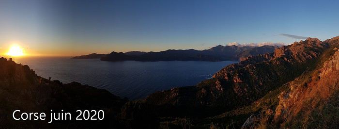
Petites randonnées en Corse juin 2020 English translation pending
 Bonjour à tous,
Encore un p'tit carnet sur la Corse, où nous sommes allés mi-juin dans des conditions qui ne se reproduiront sans doute jamais : météo parfaite et pas un chat!
Pour une fois, je ne donne pas beaucoup de détails pratiques (mais tout de même les traces wikiloc) très faciles à trouver en quelques clics.
Le but premier du voyage était d'apporter quelques affaires à notre fille Marion mais sevrés de voyages depuis l'irruption d'un certain virus nous en avons profité pour randonner un peu.
Le récit en images est là : clic!
Bonne lecture! Marie
Texte seul :
Corse Juin 2020 Petite virée en Corse, où vit désormais notre fille Marion. Voyage reporté 2 fois en raison de la Covid 19…
Finalement nous partons en fourgon car nous avons pas mal de fourbi en plus des chiens. Mi-juin, la limitation des 100 km est enfin levée et après avoir une traversée très tranquille au départ de Toulon, nous débarquons de bonne heure à Ajaccio : au programme, bricolage et randonnées !
Les chiens nous accompagnent, Corsica Ferries propose des cabines « spéciales chiens » sans moquette. Plein de chiens sur ce bateau, tous très pacifiques…Malheureusement le pont supérieur où un espace leur serait réservé est fermé. Environ 14h de voyage (en comptant les temps d’embarquement/débarquement), les vessies ont tenu le choc ! Tous les passagers sont masqués et ravis de retrouver un peu de liberté !
DI 14/06/20 Arrivée en Corse L’air est doux, le ciel est pur (gros orage et grosses inondations quelques jours avant notre arrivée), la météo s’annonce idéale pour la semaine à venir. Je craignais la chaleur en Juin, mais finalement nous n’aurons jamais plus de 24°C en bord de mer, supportable donc… Retrouvailles et bricolage, puis nous faisons une petite balade vespérale vers l’anse de Minaccia. Pas la foule pour un dimanche…
LU 15/06/20 Lac de Melo Marion et Yoan se sont libérés pour nous accompagner et leur aide sera indispensable pour pousser/hisser/tirer les chiens (30 et 40 kg) qui eurent bien du mal à franchir 2 ressauts équipés d’échelles verticales (le 1er se franchit facilement par la droite et le 2ème par la gauche, c’est plus scabreux). Tout est très vert, très fleuri, on se régale. On bulle un long moment près du lac (les chiens plus tout jeunes sont crevés tellement ils ont été crispés par ce franchissement) tandis que les jeunes grimpent plus haut dans la montagne. Nous redescendons en rive droite de la cascade (sans échelle !) Jolie balade, pour moi un peu gâchée par la peine qu’ont eue mes chiens chéris… https://fr.wikiloc.com/itineraires-randonnee/lac-de-melo-15-juin-51095645
MA 16/06/20 Bergeries des Pozzi Départ avec Marion de la station de Val D’Eze : on longe d’abord un tire-fesse (pas glop) puis la balade devient magnifique ! Quelques vaches et chevaux nous accueillent en haut de la grimpette. Vue sur le village de Bastelica et au fond sur la baie d’Ajaccio. On longe une très jolie crête et au bout de celle-ci on découvre d’un coup le vallon et ses pozzines. On adore ce type de paysage, les chiens aussi ! On passe ensuite à proximité de la bergerie avant de traverser une grande forêt de hêtres tortueux sillonnée de quelques ruisseaux : parfait pour les chiens ! On a adoré cette balade ! https://fr.wikiloc.com/itineraires-randonnee/pozzis-depuis-val-d-ese-pozzi-5002592
Marion rentre sur Ajaccio (elle travaille demain) tandis que nous allons au départ de la rando prévue demain, au-dessus de Soccia.
ME 17/06/20 Lac de Creno Nous avons dormi sur le parking (désert) en dessous du petit resto situé au départ de cette randonnée. Itoo a encore trouvé quelques forces pour jouer avec le p’tit chien du coin. Nous partons de bonne heure (fraicheur, belle lumière, personne) sur un joli sentier fleuri. C’est tellement vert qu’on se croirait en Ecosse ! Nous voici au seul lac boisé de Corse, certains pins sont énormes ! Très belle vue sur les montagnes qui cernent le lac de Melo où nous étions avant-hier. On monte ensuite vers la Chapelle San’t Eliseu dans un sous-bois profondément labouré par les sangliers (le mieux est de monter par la crête qui commence juste derrière la maison forestière, il n’y a pas vraiment de sentier…ou nous ne l’avons pas trouvé) Vue à 360° magnifiée par les nuages ! Nous descendons ensuite par une crête si joliment fleurie qu’on se croirait dans un jardin. Le sentier est assez mal tracé, il faut être attentif. https://fr.wikiloc.com/itineraires-randonnee/lac-de-creno-et-chapelle-sant-eliseu-17-juin-56206520
Déjeuner au resto du parking, quasi désert : les locaux se lamentent, nous compatissons mais jubilons intérieurement d’avoir les chemins de randonnée presque pour nous tous seuls. Autre avantage, service rapide et très aimable : nous qui n’allons que très rarement au restaurant en vacances car nous n’aimons pas attendre des plombes le bon vouloir d’un service débordé allons changer nos habitudes. Au moins pendant qq jours !
Gorges de Spelunca Nous reprenons la route vers les Gorges de Spelunca, qui m’ont un peu déçue. La route d’approche par l’est est très belle mais les gorges m’ont semblé assez banales. Nous longeons la rivière (que l’on voit finalement assez peu du fait de la végétation) en aller-retour jusqu’au vieux pont. Peu de possibilité de baignade pour les chiens… https://fr.wikiloc.com/itineraires-randonnee/gorges-de-spelunca-56206499
Fin de journée au départ de la rando du lendemain, près des calanques de Piana et du Capo Rosso.
JE 18/06/20 Capo Rosso On démarre de bonne heure car je crains la chaleur au niveau de la mer. Belle vue vers la côte et ses tours génoises. On aperçoit le parking. Plus on descend, plus il fait chaud et plus je pense à la remontée…je m’inquiète pour les chiens qui tirent déjà la langue. Arrivés à cette jolie cabane en pierre, nous abandonnons Fred qui monte en vitesse jusqu’à la tour et faisons tranquillement demi-tour : retour facile finalement. https://fr.wikiloc.com/itineraires-randonnee/capu-rossu-en-boucle-41682629
Calanches de Piana On enchaîne avec une petite balade dans les Calanches de Piana, sur le Chemin du Château Fort : la lumière est dure et blanche, il est midi… https://fr.wikiloc.com/itineraires-randonnee/piana-18-juin-56206514 Pause resto sur la plage de Busaglia, où nous sommes encore une fois les seuls clients : service attentionné, les chiens ont eu chacun une gamelle d’eau !
Vallée du Fango On décide ensuite de pousser jusqu’à la vallée du Fango, pour les rafraichir un peu. Très joli coin, qui doit être habituellement bondé à en juger par les panneaux d’interdiction de stationner et la taille des parkings : on a vu en tout 4 personnes ! Après cette baignade les chiens sont définitivement épuisés par ces quelques jours de rando ! https://fr.wikiloc.com/itineraires-randonnee/vallee-du-fango-56206546 Demain, croisière… Retour vers Porto et nuit près de la plage de Gradelle.
VE 19/06/20 Scandola Départ de Porto à 10h, le bateau de Via Mare est plein à 10%, c’est cool ! (pour nous…) J’avais d’abord contacté le Passe Partout qui nous avait gentiment conseillé de prendre un bateau plus grand pour le confort des chiens car il y a un peu de houle : sympa ! (Marion et Yoan ont fait le tour avec eux qq jours plus tard et ça leur a bien plu) Il fonce vers la réserve de Scandola, puis navigue pendant quelques dizaines de minutes en rasant les roches volcaniques : 2 nids de balbuzards ( ?) vides, très peu d’oiseaux. Mais de jolies couleurs et des commentaires intéressants. Petite pause au retour au village de Girolata (pas d’accès routier) avec une petite baignade pour les chiens -à bonne distance des vaches ! Tour sympa et reposant ! Retour sur Porto en milieu de journée puis sur Ajaccio.
SA 20/06/20 Pointe de la Parata Nous reprenons le ferry ce soir. Petite balade de l’Anse de Minaccia jusqu’à la pointe de la Parata, personne sur cette rando non plus (on est à 20 mn d’Ajaccio un samedi !) https://fr.wikiloc.com/itineraires-randonnee/la-parata-20-juin-56206489 Parking immense quasi vide. Quelques personnes tout de même près de la pointe, il faut dire que la vue sur les îles Sanguinaires est magnifique ! Bon déjeuner à la brasserie de la pointe (à nous 4 on double l’effectif des clients !) Appareillage vers 20h00, alors que le soleil descend sur l’horizon… Quel plaisir de naviguer de nuit et d’arriver frais et dispo le lendemain matin !
Les racines du besoin de voyager English translation pending
Certains ne quittent jamais leur ville ou leur province et ne le souhaitent pas.
Nous autres voyageurs avons un beau jour attrapé le virus de la decouverte et il nous faut voir l Ailleurs.
il y a eu une fois une petite semence qui a germé : un voyage de classe, un pays decouvert avec des amis, des vacances avec les parents, un passage de frontiere. un moment qui nous a donné le goût, un moment qu on veut revivre à tout jamais, a chaque fois.
il y a eu une fois une petite semence qui a germé : un voyage de classe, un pays decouvert avec des amis, des vacances avec les parents, un passage de frontiere. un moment qui nous a donné le goût, un moment qu on veut revivre à tout jamais, a chaque fois.
Two Weeks in Dominica
Hi everyone, I’m sharing my travel journal from Dominica (not to be confused with the Dominican Republic) in January 2020. We wanted to escape the rain, gloom, and cold of France—and we got *some* rain and storms, but also warmth!
DOMINICA A small Caribbean island of 754 km², located between Guadeloupe and Martinique, Dominica is part of the Commonwealth. Roseau is its capital. The locals speak English and Creole. The currency is the East Caribbean Dollar (EC$). In October 2019, we decided to visit this little paradise from January 9 to 24, 2020—14 nights on the island. We traveled as two couples. Flight booking with Air Caraïbes: Orly Terminal 4 to Pointe-à-Pitre by plane, then P-à-P to Roseau with L’Express des Îles (boat) for the outbound trip. Marigot to Pointe-à-Pitre to Orly (all by plane on the return). Air Caraïbes: navigAir: plane + shuttle + boat. They handle everything, even delays. A shuttle waits for us at the airport to take us to the boat.
Accommodation bookings: 7 nights on the Caribbean coast in Salisbury (Sunset Bay Club), 4 nights on the Atlantic coast in Taberi La Plaine (Citrus Creek Plantation), and 3 nights in Marigot (Hibiscus Valley Inn). Car rental booked (Courtesy Rental Car).
Thursday, January 9 8:00 AM: Orly Airport, baggage drop-off—we checked in 48 hours earlier. Scheduled takeoff at 11:10 AM. Arrival in P-à-P at 2:30 PM local time after a 7-hour, 50-minute flight. We collect our luggage, and a shuttle is waiting to take us to the dock for L’Express des Îles. We check in, and a big storm hits P-à-P. Scheduled departure at 5:00 PM for a 2-hour, 20-minute crossing. Lots of waves—many passengers got seasick during the trip. Arrival in Roseau at 7:30 PM. We go through customs. Some clementines to declare… which they confiscated! A taxi takes us to the car rental: Courtesy. The ride is covered by the rental company. We get an automatic. You need a special permit to drive in Dominica (12 €, issued by the rental company). And remember—driving is on the left! It’s dark, and we have a good hour’s drive to reach our hotel. First intersection, headlights coming toward us, honking… we’re on the wrong side—driving on the left, remember? Most roads are in poor condition, narrow, with few signs and little to no street lighting. The island was hit by Tropical Storm Erika in 2015 and Hurricane Maria in September 2017, causing major damage. We finally arrive in Coulibistrie at Sunset Bay Club at 9:30 PM. The owner welcomes us, warms up some bread and cheese, and offers us four beers. We have pâté, sausage, and chips—we have a little picnic on the terrace of our bungalow. We have two adjoining rooms. It’s 11:00 PM when we go to bed… and it’s raining.
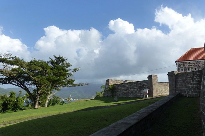
Friday, January 10 After a hearty breakfast (French toast or pancakes, jams, fresh juice, coffee or tea, eggs-bacon-cheese, bread, fresh fruit), the sun and rain take turns freely. We head north. Colihaut: a short walk through the village—we’re the only tourists. Portsmouth: lunch on Purple Turtle Beach at Sea Bird Bar and Grill (grilled fish, fries, salad, and the local beer: Kubuli). Then we visit Fort Shirley, part of Cabrits National Park. We do the yellow trail and part of the blue one. We buy a week-long pass, useful for some visits (no entry fee). On the way back, we stop at the market to buy some fruit. We arrive at Sunset in time to watch the sunset over the Caribbean Sea. All day, showers and sunshine.
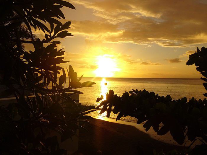 Sunset at Sunset
 Sunset Beach
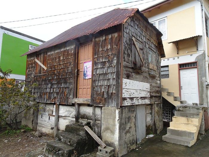 Colihaut
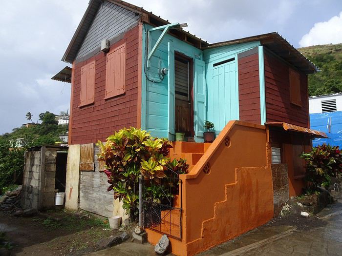 Colihaut


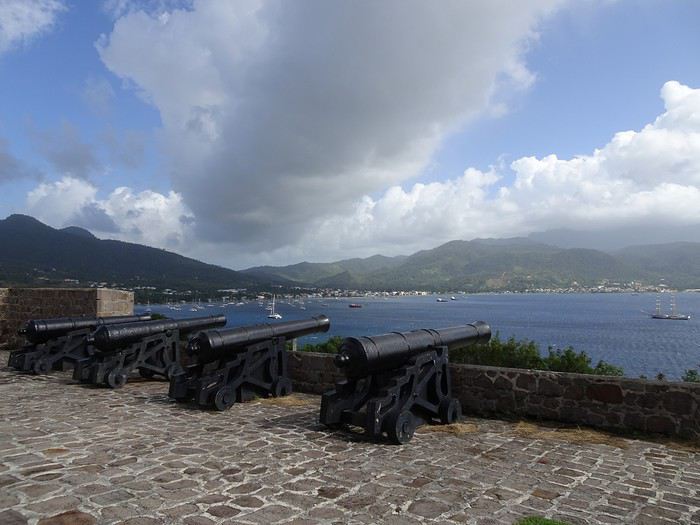
Fort Shirley

DOMINICA A small Caribbean island of 754 km², located between Guadeloupe and Martinique, Dominica is part of the Commonwealth. Roseau is its capital. The locals speak English and Creole. The currency is the East Caribbean Dollar (EC$). In October 2019, we decided to visit this little paradise from January 9 to 24, 2020—14 nights on the island. We traveled as two couples. Flight booking with Air Caraïbes: Orly Terminal 4 to Pointe-à-Pitre by plane, then P-à-P to Roseau with L’Express des Îles (boat) for the outbound trip. Marigot to Pointe-à-Pitre to Orly (all by plane on the return). Air Caraïbes: navigAir: plane + shuttle + boat. They handle everything, even delays. A shuttle waits for us at the airport to take us to the boat.
Accommodation bookings: 7 nights on the Caribbean coast in Salisbury (Sunset Bay Club), 4 nights on the Atlantic coast in Taberi La Plaine (Citrus Creek Plantation), and 3 nights in Marigot (Hibiscus Valley Inn). Car rental booked (Courtesy Rental Car).
Thursday, January 9 8:00 AM: Orly Airport, baggage drop-off—we checked in 48 hours earlier. Scheduled takeoff at 11:10 AM. Arrival in P-à-P at 2:30 PM local time after a 7-hour, 50-minute flight. We collect our luggage, and a shuttle is waiting to take us to the dock for L’Express des Îles. We check in, and a big storm hits P-à-P. Scheduled departure at 5:00 PM for a 2-hour, 20-minute crossing. Lots of waves—many passengers got seasick during the trip. Arrival in Roseau at 7:30 PM. We go through customs. Some clementines to declare… which they confiscated! A taxi takes us to the car rental: Courtesy. The ride is covered by the rental company. We get an automatic. You need a special permit to drive in Dominica (12 €, issued by the rental company). And remember—driving is on the left! It’s dark, and we have a good hour’s drive to reach our hotel. First intersection, headlights coming toward us, honking… we’re on the wrong side—driving on the left, remember? Most roads are in poor condition, narrow, with few signs and little to no street lighting. The island was hit by Tropical Storm Erika in 2015 and Hurricane Maria in September 2017, causing major damage. We finally arrive in Coulibistrie at Sunset Bay Club at 9:30 PM. The owner welcomes us, warms up some bread and cheese, and offers us four beers. We have pâté, sausage, and chips—we have a little picnic on the terrace of our bungalow. We have two adjoining rooms. It’s 11:00 PM when we go to bed… and it’s raining.
Friday, January 10 After a hearty breakfast (French toast or pancakes, jams, fresh juice, coffee or tea, eggs-bacon-cheese, bread, fresh fruit), the sun and rain take turns freely. We head north. Colihaut: a short walk through the village—we’re the only tourists. Portsmouth: lunch on Purple Turtle Beach at Sea Bird Bar and Grill (grilled fish, fries, salad, and the local beer: Kubuli). Then we visit Fort Shirley, part of Cabrits National Park. We do the yellow trail and part of the blue one. We buy a week-long pass, useful for some visits (no entry fee). On the way back, we stop at the market to buy some fruit. We arrive at Sunset in time to watch the sunset over the Caribbean Sea. All day, showers and sunshine.
Sunset at Sunset
Sunset Beach
Colihaut
Colihaut
Fort Shirley
Itinéraire en self-drive Rwanda - Ouganda English translation pending
Bonjour,
Je prépare un voyage au Rwanda/Ouganda en 2021, certainement en self drive pour la partie rwandaise et avec un chauffeur pour la partie ougandaise. Je prévois de 15 à 17 nuits sur place.
J'aime les animaux bien sur mais encore plus les paysages et la vie quotidienne. Je voudrais néanmoins voir les gorilles et les lions arboricoles. Le bec en sabot et les rhinos aussi mais cela me semble compliqué.
J'ai demandé à deux agences des itinéraires, j'ai estimé via google nombre d'heures à passer sur la route.
Agence 1 : (15 nuits) - 31.5 h de route
Kigali - Forêt de Nyungwe - Lac Kivu ( trail) - Parc des Volcans- Forêt de Bwindi - Ishasha - Queen Elizabeth Nord - Hoima - Murchisson Falls - Entebbe
Agence 2 : (16 nuits) - 27 h de route
Entebbe - Forêt de Kibale - Queen Elisabeth Nord -Forêt de Bwindi - Forêt de Mgahinga - Lac Kivu (trail) - Forêt de Nyungwe - Kigali.
Le premier itinéraire me permet de voir le plus de choses mais ressemble à un marathon Le second un peu moins, mais peut être trop de forêts : redondant ?
J'ai essayé de simplifier :
Mon projet : - 21 h de route
Kigali (1 nuit) - Forêt de Nyungwe (3 nuits) - Lac Kivu (3 ou 4 nuits) (trail) - Forêt de Bwindi (3 nuits) - Ishasha ( 2 nuits) - Kigali (2 nuits)
J'ai plusieurs questions :
- Kibale et Mgahinga apportent ils un plus (surtout en terme de paysage) à Nyungwe et Bwindi ou j'ai raison de privilégier ces 2 parcs en y restant un peu plus longtemps ?
- Ishasha (2 nuits) se suffit il à lui même ou il est préférable d'aller passer aussi deux jours dans le nord du parc Queen Elizabeth me permettant en plus de faire du bateau sur le canal de Kazinga ?
- Je peux rajouter une étape le long de mon dernier itinéraire (Butare, parc des volcans, lacs jumeaux du nord du Rwanda ... ou autre) ?
- Question que j'ai déjà posé sur un autre fil, La meilleure période : Janvier ou Juillet ?
Rien n'est figé, n'hésitez pas à me proposer un meilleur itinéraire.
Grand merci d'avance à vous. Bonne journée Franck
Je prépare un voyage au Rwanda/Ouganda en 2021, certainement en self drive pour la partie rwandaise et avec un chauffeur pour la partie ougandaise. Je prévois de 15 à 17 nuits sur place.
J'aime les animaux bien sur mais encore plus les paysages et la vie quotidienne. Je voudrais néanmoins voir les gorilles et les lions arboricoles. Le bec en sabot et les rhinos aussi mais cela me semble compliqué.
J'ai demandé à deux agences des itinéraires, j'ai estimé via google nombre d'heures à passer sur la route.
Agence 1 : (15 nuits) - 31.5 h de route
Kigali - Forêt de Nyungwe - Lac Kivu ( trail) - Parc des Volcans- Forêt de Bwindi - Ishasha - Queen Elizabeth Nord - Hoima - Murchisson Falls - Entebbe
Agence 2 : (16 nuits) - 27 h de route
Entebbe - Forêt de Kibale - Queen Elisabeth Nord -Forêt de Bwindi - Forêt de Mgahinga - Lac Kivu (trail) - Forêt de Nyungwe - Kigali.
Le premier itinéraire me permet de voir le plus de choses mais ressemble à un marathon Le second un peu moins, mais peut être trop de forêts : redondant ?
J'ai essayé de simplifier :
Mon projet : - 21 h de route
Kigali (1 nuit) - Forêt de Nyungwe (3 nuits) - Lac Kivu (3 ou 4 nuits) (trail) - Forêt de Bwindi (3 nuits) - Ishasha ( 2 nuits) - Kigali (2 nuits)
J'ai plusieurs questions :
- Kibale et Mgahinga apportent ils un plus (surtout en terme de paysage) à Nyungwe et Bwindi ou j'ai raison de privilégier ces 2 parcs en y restant un peu plus longtemps ?
- Ishasha (2 nuits) se suffit il à lui même ou il est préférable d'aller passer aussi deux jours dans le nord du parc Queen Elizabeth me permettant en plus de faire du bateau sur le canal de Kazinga ?
- Je peux rajouter une étape le long de mon dernier itinéraire (Butare, parc des volcans, lacs jumeaux du nord du Rwanda ... ou autre) ?
- Question que j'ai déjà posé sur un autre fil, La meilleure période : Janvier ou Juillet ?
Rien n'est figé, n'hésitez pas à me proposer un meilleur itinéraire.
Grand merci d'avance à vous. Bonne journée Franck
Itinéraire 3 mois en Asie Philippines - Malaisie - Indonésie English translation pending
Bonjour à tous,
Après 2 séjours de 5 semaines chacun en Thaïlande, l'envie de retourner en Asie nous démange...
Nous avons pour projet de partir 3 mois en avril, mai et juin avec nos deux enfants qui auront 6 ans et 3 ans.
C'est encore un "projet" et nous bloquons vraiment sur l'itinéraire (qui me parait essentiel pour dessiner ce projet).
Pensez-vous que ce soit simple de faire Philippines > Malaisie > Indonésie ? (ordre le plus logique par rapport aux saisons)
Pensez-vous qu'une escale en nouvelle Calédonie ou Polynésie française au cours du voyage puisse être à envisager ?
Est-ce que l'ordre des pays vous parait le plus simple?
Merci de vos réponses !
Pensez-vous que ce soit simple de faire Philippines > Malaisie > Indonésie ? (ordre le plus logique par rapport aux saisons)
Pensez-vous qu'une escale en nouvelle Calédonie ou Polynésie française au cours du voyage puisse être à envisager ?
Est-ce que l'ordre des pays vous parait le plus simple?
Merci de vos réponses !
Namibie, quand tu nous tiens! English translation pending
Bonjour à tous.
Depuis quelques années les aleas de la vie professionnelle font qu'il ne nous est plus possible d'organiser nos voyages longtemps à l'avance et encore une fois cela s'est vérifié!. Un trou entre 2 contrats de travail c'est l'occasion à saisir pour changer d'air! Faire le tour des possibles entre ce qui nous fait vibrer, la saison, les difficultés d'organisation, les coûts et surgit une évidence: ce sera en Namibie que nous retournerons! En plus Claude, mon épouse, voulait découvrir le Richtersveld et sa flore si particulière et incroyable et le récit de Ticapi (merci à elle et à son magnifique carnet)nous avait tellement séduit que nous avons dit banco c'est jouable!
On achète donc les billets d'avion le mardi pour un vol le jeudi, on trouve une voiture avec sa tente de toit et le tour est joué!
On se retrouve donc le Vendredi 7 Février au Lodge "Auas safari lodge" pour 3 semaines de balade. Nous apprécions beaucoup ce lodge car il est perdu au milieu de la nature, l'accueil y est sympa, il est proche de Windhoek et de l'aéroport, et que l'on est de suite dans le bain car on peut y photographier pas mal d'oiseaux au bord de la petite mare.
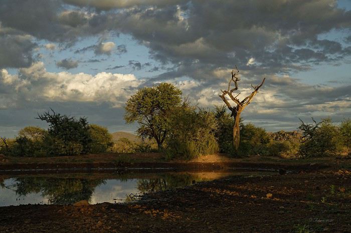
Ceci est important pour nous qui apprécions beaucoup l'image et la transmission d'une émotion, d'une certaine esthétique au travers de la photo, moteur de notre motivation à voyager. Pour notre virée nous avons hérité d'un Toyota à boîte automatique vieux d'un an avec un coffre tente sur le toit. Et, dès la 1ère nuit d'utilisation on verra que ce n'est pas le top. 2 photos pour montrer la différence: 2017: tente traditionnelle
2020 tente coffre
Le coffre métallique est plus facile a ouvrir et a fermer qu'une tente traditionnelle, mais beaucoup moins confortable car on dort dans le sens de la longueur et donc c'est moins large (les 2 oreillers se chevauchent et quand il fait chaud cela devient vite inconfortable… Par contre nous avons gagné un vrai réservoir d'eau de 50L équipé d'une pompe électrique et d'une douchette, ainsi que des lumières à leds dans la tente et dans la malle arrière ce qui est pratique. Pas oublier non plus tout le necessaire de camping, le frigo, le compresseur, les plaques de desensablement, les 2 roues de secours, les sangles de remorquage, les cables electiques, la mallette a outils de base, et 2 reservoirs de gasoil capacité totale 150L: Paré donc pour aller au bout du monde!!!
Nous n'irons que jusqu'au P.N. du Richtersveld, avant de poursuivre vers les chutes d'Augrabies et remonter par le P.N. Kgalagadi. Voyager dans ces contrées en Février c'est assurément avoir chaud, très chaud, c'est aussi risquer la pluie, les orages (hyper localisés, parfois très violents, très spectaculaires ) ou alors rien du tout; mais c'est aussi l'assurance d'avoir des ambiances, des lumières de folies…
Nous entamons notre descente ar le Parc du Naukluftet sa chaîne de montagne spectaculaire, parc connu pour ses trails riche en découvertes, sportifs, ses piscines d'eau claire perdues dans la montagne.

Notre camp de base
Nous découvrirons que même les Kokkerbaum peuvent souffrir de la sécheresse jusqu'à en mourir!
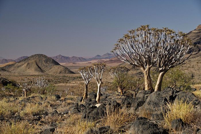
Bien sur un stop à Sesriem est inévitable, d'autant qu'il n'y a pas foule et que l'on peut profiter des paysages dans de belles conditions. Par contre nous ne verrons pas la faune traditionnelle des lieux: ni springboks, ni oryx.
Depuis quelques années les aleas de la vie professionnelle font qu'il ne nous est plus possible d'organiser nos voyages longtemps à l'avance et encore une fois cela s'est vérifié!. Un trou entre 2 contrats de travail c'est l'occasion à saisir pour changer d'air! Faire le tour des possibles entre ce qui nous fait vibrer, la saison, les difficultés d'organisation, les coûts et surgit une évidence: ce sera en Namibie que nous retournerons! En plus Claude, mon épouse, voulait découvrir le Richtersveld et sa flore si particulière et incroyable et le récit de Ticapi (merci à elle et à son magnifique carnet)nous avait tellement séduit que nous avons dit banco c'est jouable!
On achète donc les billets d'avion le mardi pour un vol le jeudi, on trouve une voiture avec sa tente de toit et le tour est joué!
On se retrouve donc le Vendredi 7 Février au Lodge "Auas safari lodge" pour 3 semaines de balade. Nous apprécions beaucoup ce lodge car il est perdu au milieu de la nature, l'accueil y est sympa, il est proche de Windhoek et de l'aéroport, et que l'on est de suite dans le bain car on peut y photographier pas mal d'oiseaux au bord de la petite mare.
Ceci est important pour nous qui apprécions beaucoup l'image et la transmission d'une émotion, d'une certaine esthétique au travers de la photo, moteur de notre motivation à voyager. Pour notre virée nous avons hérité d'un Toyota à boîte automatique vieux d'un an avec un coffre tente sur le toit. Et, dès la 1ère nuit d'utilisation on verra que ce n'est pas le top. 2 photos pour montrer la différence: 2017: tente traditionnelle
2020 tente coffre
Le coffre métallique est plus facile a ouvrir et a fermer qu'une tente traditionnelle, mais beaucoup moins confortable car on dort dans le sens de la longueur et donc c'est moins large (les 2 oreillers se chevauchent et quand il fait chaud cela devient vite inconfortable… Par contre nous avons gagné un vrai réservoir d'eau de 50L équipé d'une pompe électrique et d'une douchette, ainsi que des lumières à leds dans la tente et dans la malle arrière ce qui est pratique. Pas oublier non plus tout le necessaire de camping, le frigo, le compresseur, les plaques de desensablement, les 2 roues de secours, les sangles de remorquage, les cables electiques, la mallette a outils de base, et 2 reservoirs de gasoil capacité totale 150L: Paré donc pour aller au bout du monde!!!
Nous n'irons que jusqu'au P.N. du Richtersveld, avant de poursuivre vers les chutes d'Augrabies et remonter par le P.N. Kgalagadi. Voyager dans ces contrées en Février c'est assurément avoir chaud, très chaud, c'est aussi risquer la pluie, les orages (hyper localisés, parfois très violents, très spectaculaires ) ou alors rien du tout; mais c'est aussi l'assurance d'avoir des ambiances, des lumières de folies…
Nous entamons notre descente ar le Parc du Naukluftet sa chaîne de montagne spectaculaire, parc connu pour ses trails riche en découvertes, sportifs, ses piscines d'eau claire perdues dans la montagne.
Notre camp de base
Nous découvrirons que même les Kokkerbaum peuvent souffrir de la sécheresse jusqu'à en mourir!
Bien sur un stop à Sesriem est inévitable, d'autant qu'il n'y a pas foule et que l'on peut profiter des paysages dans de belles conditions. Par contre nous ne verrons pas la faune traditionnelle des lieux: ni springboks, ni oryx.
Voyager sereinement au Guatemala avec un enfant de 2 ans English translation pending
Bonjour à tous !
Nous partons avec notre fille de 22 mois au Guatemala au mois d'avril pour 15 jours . Quelles seraient vos recommandations pour voyager sereinement avec un enfant en bas âge au Guatemala ? Avez vous des conseils ? Des astuces ? En matière d'hygiène que me conseilleriez-vous ? Quelles ont été vos expériences dans ce pays ? Nous ferons Antigua - lac Atitlan et ses alentours - Coban - Tikal - Rio Dulce - Livingstone J'attends avec impatience vos retours ! Merci :)
Nous partons avec notre fille de 22 mois au Guatemala au mois d'avril pour 15 jours . Quelles seraient vos recommandations pour voyager sereinement avec un enfant en bas âge au Guatemala ? Avez vous des conseils ? Des astuces ? En matière d'hygiène que me conseilleriez-vous ? Quelles ont été vos expériences dans ce pays ? Nous ferons Antigua - lac Atitlan et ses alentours - Coban - Tikal - Rio Dulce - Livingstone J'attends avec impatience vos retours ! Merci :)
Quatre raisons pour randonner dans le parc national du Mercantour English translation pending
Le parc national du Mercantour est une destination encore trop méconnue des français alors que les Européens du Nord, grand amoureux de la nature sauvage l’appellent « the European Jungle ». Ce sont les anglais qui ont inventé ce terme impossible à traduire « wilderness » amis qui nous fait rêver à de grands territoires où la nature a encore…son mot à dire.
Et bien, ici dans les contrées solitaires où le loup a trouvé refuge, il est des sentiers historiques comme la route du sel dans la vallée des Merveilles. Mais, plus intimes, plus confidentiels encore, sont nos sentiers perdus de la haute vallée du Var qui en toute discrétion, vous montreront la splendeur et la richesse de cette nature protégée grâce au parc national du Mercantour.
1 Les montagnes du Mercantour sont parmi les régions les plus isolées de France Vous serez surpris par le contraste entre la côte d’azur, son affluence et le foisonnement humain et nos montagnes silencieuses et désertes. Vous cheminerez tous seuls parfois sans voir âme qui vive de toute la journée sauf autour du lac d’Allos où le parc national a développé une politique pour promouvoir la découverte de ce site magnifique.
2/ Randonnées sur des sentiers si bien balisés C’est vraiment pour tout randonneur une occasion unique en France, grâce au plan départemental de randonnée
3/ Randonnées à travers lacs et forêts dans un parc national Il y a ici une diversité extraordinaire de paysages grâce à des altitudes différentes de 1200 m à 3000 m. Ces itinéraires que nous vous proposons sauront satisfaire les randonneurs en recherche d’authenticité et de dépaysement. Ce n’est pas pour rien que le parc national du Mercantour candidate auprès du patrimoine mondial de l’Unesco. Cette candidature repose sur l’immense singularité géologique qui se traduit par la diversité des paysages, de la faune et de la flore endémique
4/Déguster la cuisine traditionnelle La gastronomie de montagne repose sur un savoir-faire simple mais succulent et goûteuse , ce sera l’occasion de déguster des daubes, des lasagnes maison, des produits frais de la montagne. N’oubliez-pas que la cuisine méditerranéenne est à base d’huile d’olive! Et comme le sait bien tout randonneur, quand on arrive à l’étape, l’appétît aiguisé par la marche, tout est encore meilleur et on n’a même ps la culpabilité de se dire qu’on va prendre quelques grammes en trop! Quel double plaisir !
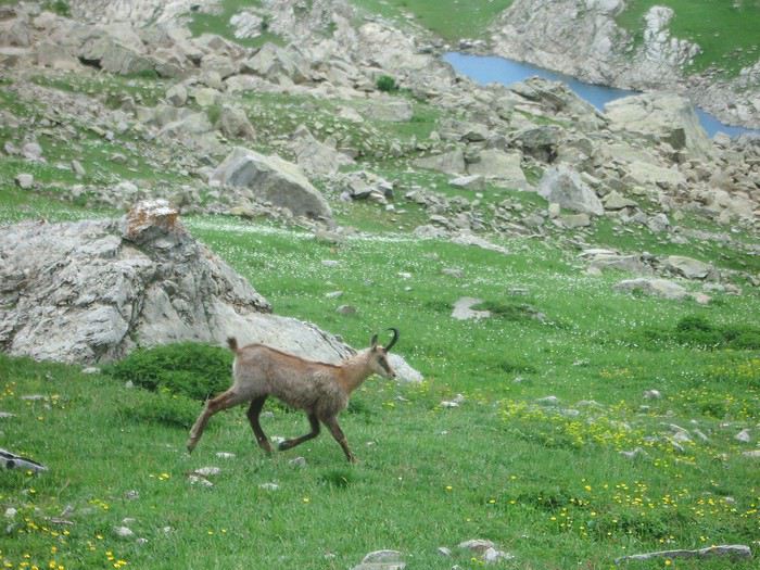
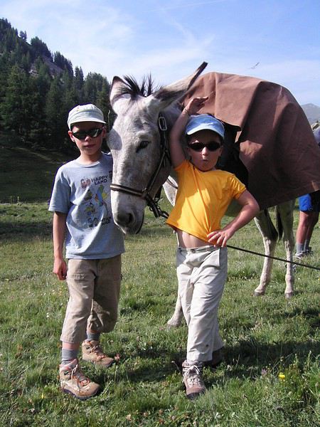
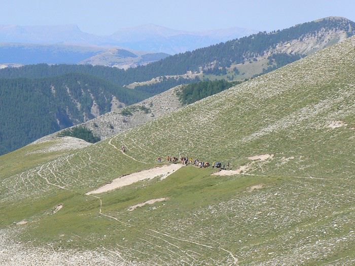
1 Les montagnes du Mercantour sont parmi les régions les plus isolées de France Vous serez surpris par le contraste entre la côte d’azur, son affluence et le foisonnement humain et nos montagnes silencieuses et désertes. Vous cheminerez tous seuls parfois sans voir âme qui vive de toute la journée sauf autour du lac d’Allos où le parc national a développé une politique pour promouvoir la découverte de ce site magnifique.
2/ Randonnées sur des sentiers si bien balisés C’est vraiment pour tout randonneur une occasion unique en France, grâce au plan départemental de randonnée
3/ Randonnées à travers lacs et forêts dans un parc national Il y a ici une diversité extraordinaire de paysages grâce à des altitudes différentes de 1200 m à 3000 m. Ces itinéraires que nous vous proposons sauront satisfaire les randonneurs en recherche d’authenticité et de dépaysement. Ce n’est pas pour rien que le parc national du Mercantour candidate auprès du patrimoine mondial de l’Unesco. Cette candidature repose sur l’immense singularité géologique qui se traduit par la diversité des paysages, de la faune et de la flore endémique
4/Déguster la cuisine traditionnelle La gastronomie de montagne repose sur un savoir-faire simple mais succulent et goûteuse , ce sera l’occasion de déguster des daubes, des lasagnes maison, des produits frais de la montagne. N’oubliez-pas que la cuisine méditerranéenne est à base d’huile d’olive! Et comme le sait bien tout randonneur, quand on arrive à l’étape, l’appétît aiguisé par la marche, tout est encore meilleur et on n’a même ps la culpabilité de se dire qu’on va prendre quelques grammes en trop! Quel double plaisir !
Idée de circuit pour Madagascar et snorkeling fin février-début mars English translation pending
Bonsoir,
On aimerai aller a Madagascar la dernière semaine de Février et la première de Mars. On pensait faire la RN7 (par exemple LE PARC NATIONAL DE L'ISALO, VILLAGE D’AMBOSITRA, Tulear, IFATY...) et Nosy be. On sera sur place 12 13j. Que conseillez vous svp comme circuit (ou s arreter , que faire vu le nombre de jours) vu la période? On aime la nature, les animaux et on aimerai aussi faire du snorkeling dans des magnifiques plages. Est ce qu il risque de pleuvoir tous les jours et qu on ne puisse rien faire?
Conseillez vous d autres villes svp vu la periode?
Merci d avance pour vos precieux conseils
Choix d'une île aux Antilles pour visiter et randonner au mois de mars English translation pending
Bonjour,
Je me permets de poster ce message, ma compagne et moi meme souhaiterions partir 2 semaines dans les antilles pendant le mois de mars, mais nous sommes un petit peu perdu quant au choix de la destination en elle meme.
Le but de ces vacances est de pouvoir visiter, faire des randonnées etc. autant que lézarder à la plage si nous le désirons. Nous comptions partir sur un combo airbnb + location de voiture.
Après plusieurs semaines de recherche, notre choix s'était posé sur la Guadeloupe, mais avec tout les commentaires que je lis sur l'accueil très désagréables des habitants de l'ile concernant les métropolitains, je dois vous avouer que cela m'a refroidi.
Nous avons déja fait la Martinique qui était fantastique, ainsi que l'ile de la Réunion et l'ile Maurice.
Auriez vous des conseils, ou des immanquables à faire que nous aurions pu louper ?
Merci beaucoup à vous pour votre aide
Le but de ces vacances est de pouvoir visiter, faire des randonnées etc. autant que lézarder à la plage si nous le désirons. Nous comptions partir sur un combo airbnb + location de voiture.
Après plusieurs semaines de recherche, notre choix s'était posé sur la Guadeloupe, mais avec tout les commentaires que je lis sur l'accueil très désagréables des habitants de l'ile concernant les métropolitains, je dois vous avouer que cela m'a refroidi.
Nous avons déja fait la Martinique qui était fantastique, ainsi que l'ile de la Réunion et l'ile Maurice.
Auriez vous des conseils, ou des immanquables à faire que nous aurions pu louper ?
Merci beaucoup à vous pour votre aide
Circuit classique à Madagascar avec guide et chauffeur English translation pending
Bonjour à tous,
Nous projettons de faire un circuit assez classique à Madagascar avec guide et chauffeur :
v Arrivée Antananarivo v Jour 2: Antananarivo - Antsirabe v Jour 3: Antsirabe – Miandrivazo v Jour 4: Miandrivazo – Masiakampy (Début de la descente) v Jour 5: Tsiribihina v Jour 6: Fin descente et transfert Bekopaka v Jour 7: Visite du grand et petit Tsingy v Jour 8: Bekopaka – Morondava v Jour 9 : Morondava – Belo sur mer v Jour 10:Belo sur mer – Manja v Jour 11: Manja -Morombe v Jour 12: Morombe–Andavadoaka v Jour 13 :Andavadoaka – Salary v Jour 14: Salary - Mangily Ifaty v Jour 15: Mangily Ifaty (Plongée et ballade en pirogue) v Jour 16:Ifaty-Tuléar – Ranohira v Jour 17: Visite du parc national de l’Isalo v Jour 18: Ranohira – Anja - Ambalavao v Jour 19: Ambalavao – Fianarantsoa v Jour 20: Fianarantsoa – Manakara (en train) v Jour 21: Le canal de Pangalane) v Jour 22: Manakara – Ranomafana v Jour 23 : Visite du parc national de Ranomafana v Jour 24: Ranomafana – Ambositra v Jour 25 :Ambositra – Antsirabe v Jour 26 : Antsirabe v Jour 27 : Antsirabe- Antananarivo v Jour 28 : Transfert aéroportJe serais tentée de rajouter quelques jours dans le nord, pour découvrir les Tsingy rouges, la montagne d'ambre et faire une plongée quelque part. Est-ce que ça vaut le coup? Le meilleur moyen pour y aller est-ce l'avion? Où faire de la plongée? L'ile Sainte Marie n'est-elle pas hyper touristique? Merci pour votre aide et vos réponses!
Nous projettons de faire un circuit assez classique à Madagascar avec guide et chauffeur :
v Arrivée Antananarivo v Jour 2: Antananarivo - Antsirabe v Jour 3: Antsirabe – Miandrivazo v Jour 4: Miandrivazo – Masiakampy (Début de la descente) v Jour 5: Tsiribihina v Jour 6: Fin descente et transfert Bekopaka v Jour 7: Visite du grand et petit Tsingy v Jour 8: Bekopaka – Morondava v Jour 9 : Morondava – Belo sur mer v Jour 10:Belo sur mer – Manja v Jour 11: Manja -Morombe v Jour 12: Morombe–Andavadoaka v Jour 13 :Andavadoaka – Salary v Jour 14: Salary - Mangily Ifaty v Jour 15: Mangily Ifaty (Plongée et ballade en pirogue) v Jour 16:Ifaty-Tuléar – Ranohira v Jour 17: Visite du parc national de l’Isalo v Jour 18: Ranohira – Anja - Ambalavao v Jour 19: Ambalavao – Fianarantsoa v Jour 20: Fianarantsoa – Manakara (en train) v Jour 21: Le canal de Pangalane) v Jour 22: Manakara – Ranomafana v Jour 23 : Visite du parc national de Ranomafana v Jour 24: Ranomafana – Ambositra v Jour 25 :Ambositra – Antsirabe v Jour 26 : Antsirabe v Jour 27 : Antsirabe- Antananarivo v Jour 28 : Transfert aéroportJe serais tentée de rajouter quelques jours dans le nord, pour découvrir les Tsingy rouges, la montagne d'ambre et faire une plongée quelque part. Est-ce que ça vaut le coup? Le meilleur moyen pour y aller est-ce l'avion? Où faire de la plongée? L'ile Sainte Marie n'est-elle pas hyper touristique? Merci pour votre aide et vos réponses!
Séjour 15 jours en Floride avec une enfant de 2 ans et demi en mai English translation pending
Bonsoir,
Je réfléchis à un séjour en Floride en mai prochain, du 6 au 21 mai 2020, 15 nuits (en fait, je réfléchis trop...). Nous sommes un couple et un enfant qui aura presque 2 ans et demi.
La période semble convenir, quid des moustiques et de l'affluence touristique ? Aussi, nous aimerions nous baigner, on peut compter une eau cristalline à 27/28°C ?
Enfin, en regardant rapidement, j'avais noté ceci : - 3 nuits du côté de Miami (pour parti aux Everglades notamment) - 3 nuits du côté des Keys - 2 nuits du côté de Naples - 3 nuits du côté de Tampa - 3 nuits du côté d'Orlando (St Augustine, Cap Canaveral, un parc d'attraction?)
Et il me reste une nuit à caser. On aimerait bien ne pas changer de logement tous les jours.
Je ne sais pas si on pourra faire un parc d'attraction, même si ma fille est débrouillarde. A moins que je me trompe ? Par contre, j'aimerais bien faire Cap Canaveral. Pour les Everglades, il vaut mieux les faire depuis Naples ou Miami ? Nous pourront faire du airboat ?
Nos centres d'intérets : Nature et culture. On aime bien randonner, mais cette destination ne s'y prête pas. On aime le snorkelling également, qu'on fera chacun notre tour.
Quand je prends la carte de la Floride, des zones m'intriguent, il y a quelque chose de spécial à faire au lac Okeechobee, les lacs de Kissimmee, forêt Ocala et Jacksonvillle.
Merci,
Je réfléchis à un séjour en Floride en mai prochain, du 6 au 21 mai 2020, 15 nuits (en fait, je réfléchis trop...). Nous sommes un couple et un enfant qui aura presque 2 ans et demi.
La période semble convenir, quid des moustiques et de l'affluence touristique ? Aussi, nous aimerions nous baigner, on peut compter une eau cristalline à 27/28°C ?
Enfin, en regardant rapidement, j'avais noté ceci : - 3 nuits du côté de Miami (pour parti aux Everglades notamment) - 3 nuits du côté des Keys - 2 nuits du côté de Naples - 3 nuits du côté de Tampa - 3 nuits du côté d'Orlando (St Augustine, Cap Canaveral, un parc d'attraction?)
Et il me reste une nuit à caser. On aimerait bien ne pas changer de logement tous les jours.
Je ne sais pas si on pourra faire un parc d'attraction, même si ma fille est débrouillarde. A moins que je me trompe ? Par contre, j'aimerais bien faire Cap Canaveral. Pour les Everglades, il vaut mieux les faire depuis Naples ou Miami ? Nous pourront faire du airboat ?
Nos centres d'intérets : Nature et culture. On aime bien randonner, mais cette destination ne s'y prête pas. On aime le snorkelling également, qu'on fera chacun notre tour.
Quand je prends la carte de la Floride, des zones m'intriguent, il y a quelque chose de spécial à faire au lac Okeechobee, les lacs de Kissimmee, forêt Ocala et Jacksonvillle.
Merci,
Morceau de bambou (Dieu Cay) autorisé en bagage cabine ou pas? English translation pending
Bonjour tout le monde
Actuellement au Vietnam pour encore 2 jours je voulais savoir si un ĐIẾU CÀY (morceau de bambou pour fumer) était autorisé en bagage cabine ?
Merci d'avance pour vos réponses
Actuellement au Vietnam pour encore 2 jours je voulais savoir si un ĐIẾU CÀY (morceau de bambou pour fumer) était autorisé en bagage cabine ?
Merci d'avance pour vos réponses
Circuit pour voyage en couple à Madagascar fin avril - début mai English translation pending
Bonjour à tous
Je désire organiser un petit voyage de 12 jours a Madagascar fin avril début mai 2020.
Je cherche des conseils et circuits à faire, on sera un couple..
On y va pour la faune et le farniente. Les paysages paradisiaque et un peu d aventure.
Merci d'avance pour votre aide
Ascension du Kilimandjaro: compagnies ou agences English translation pending
Bonjour,
Nous souhaitons avec mon épouse faire l'Ascension de cette mythique montagne. 1. Auriez-vous des suggestions de compagnies/agence ? 2. quel niveau sportif faut il avoir?
merci de tous vos bons conseils. Voyagement votre.
Nous souhaitons avec mon épouse faire l'Ascension de cette mythique montagne. 1. Auriez-vous des suggestions de compagnies/agence ? 2. quel niveau sportif faut il avoir?
merci de tous vos bons conseils. Voyagement votre.