Results for "enclos+paroissiaux+|+127"
1287 results found.
Retour de l'hôtel Occidental Grand Flamenco Punta Cana English translation pending
apres un depart avec corsaire assez mouvementé (avion prevu a 15h 19h tjr a l'aeroport pour ensuite apprendre qu'on ne decollait pas avant le lendemain matin 9h30 et le lendemain on a enfin decollé mai a 12h30!!!c 'etai le 31juillet certain l on suremen vecu!!)arrivé a punta cana nous etions dans l'hotel occidental grand flamenco hotel de reve immense piscine avec bar dans l'eau pleins de restau, plage de reve, equipe d'animation tres sympa, pour les excursion l'ile de saona pareil on est au milieu de la mer avec des tas d'etoile de mer qu'on peu prendre, et le marinarium unik!fond marin poisson multicolor et nage avec des requins et raie geante tro pa rassurant impressionnant inoubliable
voila bonne vacance a tt ceux qui iront la bas profité bien car ca passe tres vite!!!!!
Randonnée à Altyn Arashan au Kirghizistan English translation pending
Salom ! 🙂
Nous sommes actuellement a Karakol pour une journee de repos apres un treck de malade ! Nous comptions faire un treck de 3 jours vers Altyn Arachan ou se trouvent des sources chaudes a 3000m, en pleine montagne avec un col de 3900m a passer, accompagne d un guide du CBT (25 dollars par jour, c plutot cher, mm tres cher pour le pays). Et bien ... nous avons joue les vrais baroudeurs et nous y sommes alles seuls. A l hotel nous avons fait la rencontre 2 Bruxellois qui partaient pour le mm treck. Ils avaient la carte du coin. On s est donc incruste. Finalement nous etions 4, ce qui est plus rassurant.
Nous sommes partis mercredi matin en taxi vers la reserve naturelle natinale d Arachan. A 12h commence notre rando ( et oui un peu tard, mais le temps de faire les sacs, car nous nous sommes decides le matin mm, de faire les courses pour 7 repas, de trouver le taxi...). Dans un cadre magnifique, une vallee de carte, on marche sur un chemin longeant la riviere Arachan a travers un canyon plante de pins. Puis le chemin s enfonce de plus en plus dans la foret, parfois on ne voit mm plus de chemin, ca parait mm impraticable. Pas de banalisation, on suit les traces laisser par les vaches...Pas de denivelle pour l instant. On se rend compte, mais un peu tard pour faire demi-tour, que nous n etions pas sur le bon itineraire :de l autre cote du cours d eau, on voit un chemin parfaitement trace, sans obstacle. Tant pis, nous sommes qd mm dans la bonne direction et continuons. De tout facon, il est impossible de traverser la riviere : beaucoup trop de courant, trop profond. Mais nous perdons du temps. Apres une ascension de qqs metres (le plus dure pour la fin), nous arrivons a l endroit prevu pour camper vers 19 H. Juste le temps de monter la tente, de faire un feu de camps avant la nuit. Soiree sympa, a boire du vin Kirghise autour d un feu. Jusque la vous me dites :" tout va bien ". C clair, c une super journee, pas trop physique, des paysages superbes. On se sent bien dans la nature, on se sent libre.
2eme jour: Et la, vous l aurait compris ca se gate. Le matin on demarre a 9H30 (trop tard, on l apprendra plus tard). Nous savons qu une grimpette de 4 a 5 h nous attend jusqu au col de 3900m, puis une descente jusqu 3000m pour attendre Altyn Arachan. 7 a 8h de marche nous attend. Des le depart un des Bruxellois a des difficultes a suivre et se sent mal : nausee, mal de tete. Peut etre le mal de l altitude. Vers 11h, ils decident de faire demi-tour. Nous nous continuons. Nous montons encore et encore toute la matinee. On cherche notre chemin (mm avec une carte ce n est pas evident), ne voyant rien on fait demi-tour, le chemin retrouve, on continue. Finalement, on se repere grace a d autres randonneurs qui sont plus haut. Nous etions descendus trops bas, il faut donc remonter a travers les rochers et cailloux qui retardent notre avancee. Finalement on arrive en haut de la montagne vers 14H. La vue est magnifiques: au fond de la vallee la riviere, autour des montagnes enneiges, des glaciers, une cascade. Puis le vent souffle, les nuages arrivent et la pluie puis des greles ! Quelle galere! Des randonneurs russes etaient en train de descendre, ils vont dans la mm direction on decident de les suivre. Au bout d une heure, la grele tombe violemment et nous pince, nous sommes trempes. Les russes decident d arreter et de planter leur tente en plein jailoo. De la, il faut 2 a 3 heures pour atteindre Altyn Arashan. On decide de continuer, de tout facon nous etions deja trempes, et les chaussures commencaient a percer. Je preferais me retrouver au chaud a l hotel plutot que dans la tente. De plus nous randonnons leger: pas d habits de rechange. Il est de nouveau tres difficile de trouver son chemin, peu d indication, pas de traces ou alors des chemins qui menent vers des enclos pour les betes. C est galere et tout ca sous la pluie. Nous etions completement perdu lorsqu un berger de l autre cote de la riviere, nous siffle et vient a notre rencontre. Il a surement du voir notre desarroi. Il traverse la riviere sur les pierres, et nous dit "Altin Arashan ?" et nous "Da" et nous fait signe de le suivre. Nous traversons donc comme lui cette large riviere mais moins habile, je tombe a l eau jusqu au genoux. c est bon, je suis definitevement trempee ! Nous suivons le berger et son troupeau, quelques temps, toujours sous la pluie bien sur ! Avant de nous quitter, il nous met sur le droit chemin. Nous lui offrons quelques provisions. Nous pensions etre sauves, il suffisait de longer la riviere. Mais on suit un semblant de chemin puis ensuite nous apparait que de la boue, des traces un peu partout...bref c est la merde ! c le cas de le dire car des merdes de vache, y en a des tonnes ! (Pour info les kirghises en font des galettes qu ils laissent secher, ca leur sert de combustible). Je vous passe un peu les details... On arrive a destination a 18H30, enfin ! Apres cette journee de marche (9H30 - 18H30 en montagne sans s arreter) nous nous sommes relaxes dans une source chaude. Quel plaisir !
3eme jour : le retour. Il faut normalement 3h de marche pour atteindre le village d Ak-suu. Il a fallu remettre ses chaussures et chaussettes trempees. Cette fois ci pas de probleme pour trouver le chemin. Il suffit de suivre la route empreintee par les vehicules. Il a plu un peu, ca nous poursuit... Finalement nous avons mis 3H30. La derniere demi-heure a ete tres difficile (je pensais que nous arriverions plus tot car nous marchions assez vite).
Fin du periple au croisement un minibus vers Karakol ...
C etait sympa, une superbe balade mais tres dure physiquement 🏴☠️: sur les sentiers on ne trouve que des cailloux, ce qui rend difficile la progression; De plus, c etait assez raide. Puis le temps n a pas aide. Mais nous sommes super content de l avoir fait. Ca restera un tres bon souvenir. 😏
Nous sommes actuellement a Karakol pour une journee de repos apres un treck de malade ! Nous comptions faire un treck de 3 jours vers Altyn Arachan ou se trouvent des sources chaudes a 3000m, en pleine montagne avec un col de 3900m a passer, accompagne d un guide du CBT (25 dollars par jour, c plutot cher, mm tres cher pour le pays). Et bien ... nous avons joue les vrais baroudeurs et nous y sommes alles seuls. A l hotel nous avons fait la rencontre 2 Bruxellois qui partaient pour le mm treck. Ils avaient la carte du coin. On s est donc incruste. Finalement nous etions 4, ce qui est plus rassurant.
Nous sommes partis mercredi matin en taxi vers la reserve naturelle natinale d Arachan. A 12h commence notre rando ( et oui un peu tard, mais le temps de faire les sacs, car nous nous sommes decides le matin mm, de faire les courses pour 7 repas, de trouver le taxi...). Dans un cadre magnifique, une vallee de carte, on marche sur un chemin longeant la riviere Arachan a travers un canyon plante de pins. Puis le chemin s enfonce de plus en plus dans la foret, parfois on ne voit mm plus de chemin, ca parait mm impraticable. Pas de banalisation, on suit les traces laisser par les vaches...Pas de denivelle pour l instant. On se rend compte, mais un peu tard pour faire demi-tour, que nous n etions pas sur le bon itineraire :de l autre cote du cours d eau, on voit un chemin parfaitement trace, sans obstacle. Tant pis, nous sommes qd mm dans la bonne direction et continuons. De tout facon, il est impossible de traverser la riviere : beaucoup trop de courant, trop profond. Mais nous perdons du temps. Apres une ascension de qqs metres (le plus dure pour la fin), nous arrivons a l endroit prevu pour camper vers 19 H. Juste le temps de monter la tente, de faire un feu de camps avant la nuit. Soiree sympa, a boire du vin Kirghise autour d un feu. Jusque la vous me dites :" tout va bien ". C clair, c une super journee, pas trop physique, des paysages superbes. On se sent bien dans la nature, on se sent libre.
2eme jour: Et la, vous l aurait compris ca se gate. Le matin on demarre a 9H30 (trop tard, on l apprendra plus tard). Nous savons qu une grimpette de 4 a 5 h nous attend jusqu au col de 3900m, puis une descente jusqu 3000m pour attendre Altyn Arachan. 7 a 8h de marche nous attend. Des le depart un des Bruxellois a des difficultes a suivre et se sent mal : nausee, mal de tete. Peut etre le mal de l altitude. Vers 11h, ils decident de faire demi-tour. Nous nous continuons. Nous montons encore et encore toute la matinee. On cherche notre chemin (mm avec une carte ce n est pas evident), ne voyant rien on fait demi-tour, le chemin retrouve, on continue. Finalement, on se repere grace a d autres randonneurs qui sont plus haut. Nous etions descendus trops bas, il faut donc remonter a travers les rochers et cailloux qui retardent notre avancee. Finalement on arrive en haut de la montagne vers 14H. La vue est magnifiques: au fond de la vallee la riviere, autour des montagnes enneiges, des glaciers, une cascade. Puis le vent souffle, les nuages arrivent et la pluie puis des greles ! Quelle galere! Des randonneurs russes etaient en train de descendre, ils vont dans la mm direction on decident de les suivre. Au bout d une heure, la grele tombe violemment et nous pince, nous sommes trempes. Les russes decident d arreter et de planter leur tente en plein jailoo. De la, il faut 2 a 3 heures pour atteindre Altyn Arashan. On decide de continuer, de tout facon nous etions deja trempes, et les chaussures commencaient a percer. Je preferais me retrouver au chaud a l hotel plutot que dans la tente. De plus nous randonnons leger: pas d habits de rechange. Il est de nouveau tres difficile de trouver son chemin, peu d indication, pas de traces ou alors des chemins qui menent vers des enclos pour les betes. C est galere et tout ca sous la pluie. Nous etions completement perdu lorsqu un berger de l autre cote de la riviere, nous siffle et vient a notre rencontre. Il a surement du voir notre desarroi. Il traverse la riviere sur les pierres, et nous dit "Altin Arashan ?" et nous "Da" et nous fait signe de le suivre. Nous traversons donc comme lui cette large riviere mais moins habile, je tombe a l eau jusqu au genoux. c est bon, je suis definitevement trempee ! Nous suivons le berger et son troupeau, quelques temps, toujours sous la pluie bien sur ! Avant de nous quitter, il nous met sur le droit chemin. Nous lui offrons quelques provisions. Nous pensions etre sauves, il suffisait de longer la riviere. Mais on suit un semblant de chemin puis ensuite nous apparait que de la boue, des traces un peu partout...bref c est la merde ! c le cas de le dire car des merdes de vache, y en a des tonnes ! (Pour info les kirghises en font des galettes qu ils laissent secher, ca leur sert de combustible). Je vous passe un peu les details... On arrive a destination a 18H30, enfin ! Apres cette journee de marche (9H30 - 18H30 en montagne sans s arreter) nous nous sommes relaxes dans une source chaude. Quel plaisir !
3eme jour : le retour. Il faut normalement 3h de marche pour atteindre le village d Ak-suu. Il a fallu remettre ses chaussures et chaussettes trempees. Cette fois ci pas de probleme pour trouver le chemin. Il suffit de suivre la route empreintee par les vehicules. Il a plu un peu, ca nous poursuit... Finalement nous avons mis 3H30. La derniere demi-heure a ete tres difficile (je pensais que nous arriverions plus tot car nous marchions assez vite).
Fin du periple au croisement un minibus vers Karakol ...
C etait sympa, une superbe balade mais tres dure physiquement 🏴☠️: sur les sentiers on ne trouve que des cailloux, ce qui rend difficile la progression; De plus, c etait assez raide. Puis le temps n a pas aide. Mais nous sommes super content de l avoir fait. Ca restera un tres bon souvenir. 😏
Des étoiles dans les yeux... un an en Australie English translation pending
enfin prendre le temps de se poser, de fermer les yeux et de se reveiller..
un an .....
un an d aventure au bout du monde..
je ne pourrais jamais retracer un an en mots mais je vais quand meme essayer de raconter un ti peu ..
par ce qu on est tous les enfants de la terre, (comme je l ai si justement lu dans un post) parce que la terre n a pas de frontiere .. par ce que la terre est ronde et parce qu elle est si belle, rendons lui hommage...
parce qu apres un an j ai encore les yeux pleins d etoiles, d etoiles de l ocean, d etoiles de desert, d etoiles de terre, d etoiles de mer, d etoiles de chants d oiseaux, d etoiles de rires d enfants, d etoiles de promesses de toujours...
voici mon histoire telle que je la reve encore aujourd hui..
" suite a un merveilleux heureux concours de circonstance nous avons pu obtenir parmi les premiers, (l accord est passe le 1 janvier 04 et notre depart fut donne a debut mars 04) le Vhw comme l on dit ..( visa vacances travail)
Vhw 3 lettres, 1 pour un monde, 1 pour la liberte, 1 pour l aventure, ...et 3 points de suspsension pour des milliers de souvenirs
le depart fut donc donne en mars, grace a une association australienne, (VISITOZ, pour ne pas la nommer, leur site : visitoz.org .. ) nous nous envolons pour le pays de "no man's land" au sens litteral du terme !!!
nous sommes accueillies les bras ouverts par la chaleur tropicale australienne et la gentillesse legendaire des aussies !! apres quelques jours d entrainement dans la ferme accueil (visitoz regroupe les fermes australiennes et accueillent les jeunes backpakers pour un an)
nous partons pour nos familles d accueil, ou nous sommes recu comme les enfants de la famille, malgre la barriere de la langue le contact se noue et peu a peu nous apprenons ...............a seller les chevaux, travailler les enclos, repeindre, poncer, nettoyer (o combien), nourrir les chiens, les poules, les chevaux, les chats, le poisson rouge, marquer les betes (vaches) tondre, arroser, arracher, planter, recurer (le tout a l egout 🤪 ) et nous apprenons a parler 😇 nous apprenons l anglais !!
7 semaines, le temps d une vie, et c est avec tristesse que nous les quitterons, le coeur gros mais la tete remplie d anecdotes et l esprit de nouveau en eveil, nous les comprenons.. nous avons vecu parmi " les bush mans !" et y avons survecu !!
malgre les araignees, les serpents, les chauves souris, les grenouilles, les chiens, les sangliers, les migales, les crapauds, les kangoroos, les dingos, les souris, le coyote....... bref plus de rire que de larmes.....que de fous rires..
malgre le soleil qui nous brulait, l absence de couche d ozone qui s en ressent, les longues journees de travail, le poids de brique, la lourdeur des tuyaux d eaux a transporter et a derouler, les nouveaux noeuds a connaitre 'plat, droit, double, rond, carre... ", malgre les bottes de protection qu il faut bien porter dans les ronces, la griffure des barbeles que l on pose et repose, la peinture qui colle a la peau, la poussiere qui envahit les bronches a tout mouvement de terre.....les oeufs au ptits dej ..🤪
malgre la solitude et le mal du pays qui nous prend qq fois, malgre les mails hebdomadaires qui nous parviennent, malgre les lettres ecrites a la lueur de la lune..
malgre les cris et les larmes de la ptit fille austiste de la famille qui des fois ne nous regardait plus, malgre ses contrarietes, malgre l eloignement des voisins de plusieurs heurs de route dans les montagnes, malgre la peur de se retrouver nulle part...
malgre tout oui j en reve encore de ce temps heureux ou je decouvrais un nouveau monde, mon nouveau monde, celui dont j avais toujours reve sans jamais le connaitre, notre monde, la nature...
et puis nous partons... nous quittons le queensland ou nous avons vecu de si bons moments pour reprendre la route pour de nouvelles aventures...
direction brisbane !!
a tout a l heure !! 😉
par ce qu on est tous les enfants de la terre, (comme je l ai si justement lu dans un post) parce que la terre n a pas de frontiere .. par ce que la terre est ronde et parce qu elle est si belle, rendons lui hommage...
parce qu apres un an j ai encore les yeux pleins d etoiles, d etoiles de l ocean, d etoiles de desert, d etoiles de terre, d etoiles de mer, d etoiles de chants d oiseaux, d etoiles de rires d enfants, d etoiles de promesses de toujours...
voici mon histoire telle que je la reve encore aujourd hui..
" suite a un merveilleux heureux concours de circonstance nous avons pu obtenir parmi les premiers, (l accord est passe le 1 janvier 04 et notre depart fut donne a debut mars 04) le Vhw comme l on dit ..( visa vacances travail)
Vhw 3 lettres, 1 pour un monde, 1 pour la liberte, 1 pour l aventure, ...et 3 points de suspsension pour des milliers de souvenirs
le depart fut donc donne en mars, grace a une association australienne, (VISITOZ, pour ne pas la nommer, leur site : visitoz.org .. ) nous nous envolons pour le pays de "no man's land" au sens litteral du terme !!!
nous sommes accueillies les bras ouverts par la chaleur tropicale australienne et la gentillesse legendaire des aussies !! apres quelques jours d entrainement dans la ferme accueil (visitoz regroupe les fermes australiennes et accueillent les jeunes backpakers pour un an)
nous partons pour nos familles d accueil, ou nous sommes recu comme les enfants de la famille, malgre la barriere de la langue le contact se noue et peu a peu nous apprenons ...............a seller les chevaux, travailler les enclos, repeindre, poncer, nettoyer (o combien), nourrir les chiens, les poules, les chevaux, les chats, le poisson rouge, marquer les betes (vaches) tondre, arroser, arracher, planter, recurer (le tout a l egout 🤪 ) et nous apprenons a parler 😇 nous apprenons l anglais !!
7 semaines, le temps d une vie, et c est avec tristesse que nous les quitterons, le coeur gros mais la tete remplie d anecdotes et l esprit de nouveau en eveil, nous les comprenons.. nous avons vecu parmi " les bush mans !" et y avons survecu !!
malgre les araignees, les serpents, les chauves souris, les grenouilles, les chiens, les sangliers, les migales, les crapauds, les kangoroos, les dingos, les souris, le coyote....... bref plus de rire que de larmes.....que de fous rires..
malgre le soleil qui nous brulait, l absence de couche d ozone qui s en ressent, les longues journees de travail, le poids de brique, la lourdeur des tuyaux d eaux a transporter et a derouler, les nouveaux noeuds a connaitre 'plat, droit, double, rond, carre... ", malgre les bottes de protection qu il faut bien porter dans les ronces, la griffure des barbeles que l on pose et repose, la peinture qui colle a la peau, la poussiere qui envahit les bronches a tout mouvement de terre.....les oeufs au ptits dej ..🤪
malgre la solitude et le mal du pays qui nous prend qq fois, malgre les mails hebdomadaires qui nous parviennent, malgre les lettres ecrites a la lueur de la lune..
malgre les cris et les larmes de la ptit fille austiste de la famille qui des fois ne nous regardait plus, malgre ses contrarietes, malgre l eloignement des voisins de plusieurs heurs de route dans les montagnes, malgre la peur de se retrouver nulle part...
malgre tout oui j en reve encore de ce temps heureux ou je decouvrais un nouveau monde, mon nouveau monde, celui dont j avais toujours reve sans jamais le connaitre, notre monde, la nature...
et puis nous partons... nous quittons le queensland ou nous avons vecu de si bons moments pour reprendre la route pour de nouvelles aventures...
direction brisbane !!
a tout a l heure !! 😉
Excursions à Cuba? (juillet 2006) English translation pending
Pour un départ en juillet 2006(il y a encore le temps)!
Je desire recolter un max d'info su rCuba et les excursions qu'il y à a faire dans ce pays
Merci d'avance et à bientot
Hellronde😛
Je desire recolter un max d'info su rCuba et les excursions qu'il y à a faire dans ce pays
Merci d'avance et à bientot
Hellronde😛
Du côté du Lac Saint Jean... English translation pending
Allo !
Nous sommes un petit groupe d'etudiants francais, a Montreal pour l'annee, et nous voulions profiter du week-end de Paques pour aller faire un petit tour un peu plus au Nord.
Au programme, location de voiture a Montreal, et petit itineraire comprenant Baie Saint Paul, Tadoussac et le lac Saint Jean (Nous connaissons deja Quebec).
Quelqu'un a t il une idee de visite, ou de petites balades dans ce coin ? Ou faut il aller pour avoir une belle vue du fjord du Saguenay ? Et quel est le meilleur endroit pour s'arreter au Lac St Jean ?
J'ai entendu parler d'un zoo a St Felicien... Est ce que ca vaut le coup de le visiter ? (et surtout au moi de Mars...)
Pour le chemin du retour, nous pensions passer par la Tuque. La route est elle jolie ?
Ah, et une derniere question : les chutes Montmorency seront elles encore gelees ???
Claire
Nous sommes un petit groupe d'etudiants francais, a Montreal pour l'annee, et nous voulions profiter du week-end de Paques pour aller faire un petit tour un peu plus au Nord.
Au programme, location de voiture a Montreal, et petit itineraire comprenant Baie Saint Paul, Tadoussac et le lac Saint Jean (Nous connaissons deja Quebec).
Quelqu'un a t il une idee de visite, ou de petites balades dans ce coin ? Ou faut il aller pour avoir une belle vue du fjord du Saguenay ? Et quel est le meilleur endroit pour s'arreter au Lac St Jean ?
J'ai entendu parler d'un zoo a St Felicien... Est ce que ca vaut le coup de le visiter ? (et surtout au moi de Mars...)
Pour le chemin du retour, nous pensions passer par la Tuque. La route est elle jolie ?
Ah, et une derniere question : les chutes Montmorency seront elles encore gelees ???
Claire
Carte de séjour pour entrée et sortie en République Dominicaine English translation pending
bonjour,
Nous n'avons pas de carte de tourisme pour entrer en RD. J'ai lu qu'on pouvais l'acheter à l'aéroport avant la douane pour 10 $ et 20 $ au retour. (carte en deux parties)
Pouvez-vous me confirmer que c'est exact et sans problème car je ne voudrais pas avoir de soucis à la douane.
Merci bcp à toutes et à tous.
Véro, en partance la semaine prochaine pour le Casa Marina Bay :)
Sol Rio Luna y Mar (Holguin) English translation pending
bonjour, je suis de retour du sol luna y mares depuis le 21 janvier. Voici un résumé de notre voyage.
Vol: air transat, vol du vendredi soir, durée 4h10 afin d'éviter les turbulences, aucune ressentit! Tout est bien.
Arrivée: A l'aéroport, tout va bien, le bureau de change est ouvert et il n'y a pas de fils d'attente donc on en profite pour faire du change en convertible. Environ 1 heure pour passer les douanes, allée à la banque, récuperer les bagages, ca va bien. ensuite 1 h00 d'autobus (Cette année, il respecte les limites de vitesse, l'an passé, le trajet avait durée 35 minutes!!!)
A l'hotel, accueil un peu ordinaire, on s'emblait déranger la réceptionniste. En plus elle ne nous trouvait pas dans sa liste donc elle nous a donné les chambres(2) de 4 autres personnes (je ne sais pas se qui est arrivé à ses gens car il y avait over-booking!)
chambres:(6104-6105) Nous sommes du coté luna. ouff! Dans la revue air transat il disait chambre rénové...je n'ai pas trouvé les rénovations...notre salle de bains fait vraiment pitié mais tout est propre. C'est mon troisieme voyage et ses la pire que j'ai vu. Nous demandons pendant 2 jours pour etre changé mais puisque nous voulions etre 2 chambres près l'une de l'autre, ce ne fut pas possible. L'avantage de ce bloc, c'est qu'il est situé sur le bord de la piscine. désavantage: le bars de la piscine est ouvert 24h et des allemand sur le party...c'est bruillant.
Nourriture et bars: La meilleurs bouffe en 3 ans...cuisson, fraicheur, choix! (huitres, saumon fumée, etc.)Les 2 personnes qui travaille au bars azucar sont très plaisante et donne un service super.
site: puisque c'est un hotel un peu plus vieux, le site est mature et super. Sur le bord de la piscine du luna, on retrouve des palmiers à maturité!!!Tout est très propre. On y retrouve également un mini-put...boff besoin de réparation.
plage: La plus belle en 3 ans: peu de coraux (seulement dans la section du paradisius) que du sable. Les vagues sont impréssionnante pendant notre séjour, les pédalos ont sortie qu 3 jours et le drapeau rouge à été installé pendant 4 jours ce qui nous a pas empécher de nous baigner à tout les jours dans de 😮Magnifique😉 vague. Nous avons du mettre un gilet de sauvetage à notre fille pour ne pas la perdre🤪, ce sont des vagues dignent de film...sport extreme.
Le retour se passe bien, vol de 3h43...-25 degré à notre arrivé...
En passant, il n'y a aucun probleme d'eau, la meilleur pression et quantité d'eau chaude jusqu'a maintenant.
Vol: air transat, vol du vendredi soir, durée 4h10 afin d'éviter les turbulences, aucune ressentit! Tout est bien.
Arrivée: A l'aéroport, tout va bien, le bureau de change est ouvert et il n'y a pas de fils d'attente donc on en profite pour faire du change en convertible. Environ 1 heure pour passer les douanes, allée à la banque, récuperer les bagages, ca va bien. ensuite 1 h00 d'autobus (Cette année, il respecte les limites de vitesse, l'an passé, le trajet avait durée 35 minutes!!!)
A l'hotel, accueil un peu ordinaire, on s'emblait déranger la réceptionniste. En plus elle ne nous trouvait pas dans sa liste donc elle nous a donné les chambres(2) de 4 autres personnes (je ne sais pas se qui est arrivé à ses gens car il y avait over-booking!)
chambres:(6104-6105) Nous sommes du coté luna. ouff! Dans la revue air transat il disait chambre rénové...je n'ai pas trouvé les rénovations...notre salle de bains fait vraiment pitié mais tout est propre. C'est mon troisieme voyage et ses la pire que j'ai vu. Nous demandons pendant 2 jours pour etre changé mais puisque nous voulions etre 2 chambres près l'une de l'autre, ce ne fut pas possible. L'avantage de ce bloc, c'est qu'il est situé sur le bord de la piscine. désavantage: le bars de la piscine est ouvert 24h et des allemand sur le party...c'est bruillant.
Nourriture et bars: La meilleurs bouffe en 3 ans...cuisson, fraicheur, choix! (huitres, saumon fumée, etc.)Les 2 personnes qui travaille au bars azucar sont très plaisante et donne un service super.
site: puisque c'est un hotel un peu plus vieux, le site est mature et super. Sur le bord de la piscine du luna, on retrouve des palmiers à maturité!!!Tout est très propre. On y retrouve également un mini-put...boff besoin de réparation.
plage: La plus belle en 3 ans: peu de coraux (seulement dans la section du paradisius) que du sable. Les vagues sont impréssionnante pendant notre séjour, les pédalos ont sortie qu 3 jours et le drapeau rouge à été installé pendant 4 jours ce qui nous a pas empécher de nous baigner à tout les jours dans de 😮Magnifique😉 vague. Nous avons du mettre un gilet de sauvetage à notre fille pour ne pas la perdre🤪, ce sont des vagues dignent de film...sport extreme.
Le retour se passe bien, vol de 3h43...-25 degré à notre arrivé...
En passant, il n'y a aucun probleme d'eau, la meilleur pression et quantité d'eau chaude jusqu'a maintenant.
Petits trucs pour Cuba English translation pending
J'ai quelques petites observations à partager en espérant que ce n'est pas de la redondance...
1.Les pesos convertibles sont achetables seulement à Cuba... et si tu les achètes à l'aéroport.. le taux de change est moins bon...à l'hotel environ pour 1$ can tu as 0, 78 $ pesos.. donc quand tu échanges 100$ can tu as 78 pesos... À la banque le taux de change est presque pareil..(pour 100$ can.. tu as 80 pesos) ça ne vaut pas la peine de faire une file d'attente de 2 heures à la banque pour économiser 2 $ sur un change de 100$... en tout cas c'est mon avis... Je vous conseille de payer toutes les excursions par carte de crédit, car à ce moment-là il te charge ça en Us... donc le taux de change est de 0, 83$..environ.. ce qui est beaucoup mieux... Ensuite je vous conseille d'y échanger le plus petit montant possible, mais plusisieurs fois.. genre on allait s'échanger 100$...pis quand on en avait plus on y retournait.. c'est dans le but que lorsque vous partirez pour le canada.. d'avoir le moins possible de pesos dans vos poches.. car.. si vous échangez vos pesos en Dollars canadien.. il vous pénalise de 10%... encore là.. tu perds de l'argent.. et c'est pareil en dollars US...
2. Les cartes de crédit... faites bien attention pcq il n'acceptent presque plus rien... même mon chum s'est fait prendre.. car sa mastercard CAA était soit-disant affiliée à une banque américaine...ensuite même sa Visa Desjardins Tanguay n'a pas marché...donc il a fallu que je me serve de ma Visa Desjardins tout court....
3.À Varadero. le rhum de 7 ans d'âge (havana club) est de 2$ moins cher à l'Épicerie et à l'hotel (11, 90 pesos) qu'au Duty free (13, 90 pesos) à l'aéroport..... méchante crosse.. car ils savent que vous allez attendre au duty free pour acheter de l'alcool..mais c'est plus cher... Ensuite pour les cigars et cigarillos.. vous êtes mieux d'acheter à l'aéroport c'est moins cher...en tout cas.. pour nous c'était ça...
4. À varadero, les entrées dans les discothèques hors de votre hotel sont de 15 pesos.. vraiment cher... ça augmenté de 5$...pis ils passent que du boumboum américain et c'est hautement touristique...on est resté que une heure à la rhumba club...ça fait cher de l'heure...
4. partout à l'extérieur de votre hotel... y compris à l'aéroport de Varadero... ya pas de papiers de toilettes.. je vous conseille de vous en apporter pcq quand on a la tourista c'est pas chic que s'essuyer avec ses manches.. hihi...
5. Le Gros Barbu (fidel) à décidé de ne pas reculer l'heure.. donc maintenant ya une heure de décalage alors si au Qc il est 5 hr il est 6 hr à cuba...
1.Les pesos convertibles sont achetables seulement à Cuba... et si tu les achètes à l'aéroport.. le taux de change est moins bon...à l'hotel environ pour 1$ can tu as 0, 78 $ pesos.. donc quand tu échanges 100$ can tu as 78 pesos... À la banque le taux de change est presque pareil..(pour 100$ can.. tu as 80 pesos) ça ne vaut pas la peine de faire une file d'attente de 2 heures à la banque pour économiser 2 $ sur un change de 100$... en tout cas c'est mon avis... Je vous conseille de payer toutes les excursions par carte de crédit, car à ce moment-là il te charge ça en Us... donc le taux de change est de 0, 83$..environ.. ce qui est beaucoup mieux... Ensuite je vous conseille d'y échanger le plus petit montant possible, mais plusisieurs fois.. genre on allait s'échanger 100$...pis quand on en avait plus on y retournait.. c'est dans le but que lorsque vous partirez pour le canada.. d'avoir le moins possible de pesos dans vos poches.. car.. si vous échangez vos pesos en Dollars canadien.. il vous pénalise de 10%... encore là.. tu perds de l'argent.. et c'est pareil en dollars US...
2. Les cartes de crédit... faites bien attention pcq il n'acceptent presque plus rien... même mon chum s'est fait prendre.. car sa mastercard CAA était soit-disant affiliée à une banque américaine...ensuite même sa Visa Desjardins Tanguay n'a pas marché...donc il a fallu que je me serve de ma Visa Desjardins tout court....
3.À Varadero. le rhum de 7 ans d'âge (havana club) est de 2$ moins cher à l'Épicerie et à l'hotel (11, 90 pesos) qu'au Duty free (13, 90 pesos) à l'aéroport..... méchante crosse.. car ils savent que vous allez attendre au duty free pour acheter de l'alcool..mais c'est plus cher... Ensuite pour les cigars et cigarillos.. vous êtes mieux d'acheter à l'aéroport c'est moins cher...en tout cas.. pour nous c'était ça...
4. À varadero, les entrées dans les discothèques hors de votre hotel sont de 15 pesos.. vraiment cher... ça augmenté de 5$...pis ils passent que du boumboum américain et c'est hautement touristique...on est resté que une heure à la rhumba club...ça fait cher de l'heure...
4. partout à l'extérieur de votre hotel... y compris à l'aéroport de Varadero... ya pas de papiers de toilettes.. je vous conseille de vous en apporter pcq quand on a la tourista c'est pas chic que s'essuyer avec ses manches.. hihi...
5. Le Gros Barbu (fidel) à décidé de ne pas reculer l'heure.. donc maintenant ya une heure de décalage alors si au Qc il est 5 hr il est 6 hr à cuba...
Comparatifs hôtels Republique Dominicaine English translation pending
Bonjour,
je recherche le meilleur rapport qualité prix pour des formules tout compris vols au départ de nantes + hotel séjour en République dominicaine pour voyager avec un bébé de 2 ans. Les recherches donnent : hotel ocean bavaro à Punta cana hotel iberostar hacienda dominicus à Bayahibe paladien le melao à punta cana (via nouvelles frontieres) iberostar bavaro à punta cana et catalonia bavaro à punta cana
Les prestations fournies sont toujours pour des 4 ou 5 étoiles, avec activités sportives et snacks etc...
Connaissez-vous certains de ces hotels ? Comment sont les chambres ? et l'animation ? faut-il se battre pour avoir un transat dès le matin ? Et la qualité des plages entre punta cana et bayhibe ?
Merci
je recherche le meilleur rapport qualité prix pour des formules tout compris vols au départ de nantes + hotel séjour en République dominicaine pour voyager avec un bébé de 2 ans. Les recherches donnent : hotel ocean bavaro à Punta cana hotel iberostar hacienda dominicus à Bayahibe paladien le melao à punta cana (via nouvelles frontieres) iberostar bavaro à punta cana et catalonia bavaro à punta cana
Les prestations fournies sont toujours pour des 4 ou 5 étoiles, avec activités sportives et snacks etc...
Connaissez-vous certains de ces hotels ? Comment sont les chambres ? et l'animation ? faut-il se battre pour avoir un transat dès le matin ? Et la qualité des plages entre punta cana et bayhibe ?
Merci
Varadero: excursions English translation pending
Liste et prix de 2004 Bonjour, ces excursions sont sur le panflet de Cubanacan et sont disponibles dans la pluspart des hotels de Varadéro, informez vous à votre représentant sur place. Havana Historia 67$ et 75$ avec la visite de la fabrique de cigares. Capitale de Cuba, découverte inoubliable de son architecture, histoire & culture. Havana Especial Tropicana 129$ avec nuitée 159$ Havane Historia avec en soirée le fameux spectacle Tropicana, réputé dans le mondte entier. Diner, souper et chambre de courtoisie prêter pour une bonne douche avant la soirée (Rhum et Coke inclus en soirée) Havane et Pinar Del Rio 189$ Havane Especial incluant nuitée à la Havane, visite de Pinar Del Rio, de la fabrique de cigares, de la Vallée de Vinales et tour en bateau dans la grotte de l'indien. Tropicana Matanzas 49$ Spectacle typique de danse et musique Cubaine avec boissons incluses (Rhum & Coke) Trinidad Cienfuegos 71$ Visite de Cienfuegos et découverte de Trinidad proclammée Patrimoine Mondial de l'UNESCO, Ainsi que la visite de la fabrique de poterie. Matanzas-Grotte de Bellamar 25$ Visite de Matanzas ville Coloniale et de la magnifique grotte de Bellamar reconnue pour sa beauté. Guama Vapeur & Sucre 59$ Promenade en train à vapeur, parcours d'une ancienne sucrerie, ballade en bateau à travers la Lagune Du Trésor pour visiter une reproduction d'un village d'indiens plus un élevage de crocodiles. Jeep Safari 74$ L'arrière pays en véhicule 4x4 champs de cannes à sucre villages et baignade dans la grotte Saturno. Remontez la rivière Canimar en bateau zodiac jusqu'à un ranch Cubain pour repas et tours à cheval. Rio Canimar 45$ Plongée en apnée à la plage Coral, baignade dans l'eau crystaline de la grotte Saturno. Ballade en bateau sur la magnifique rivière Canimar et repas dans une ambiance typiquement Cubaine au Ranch Arboleda. Seafari Cayo Blanco 75$ Journée mémorable en catamaran jusqu'à l'île vierge Cayo Blanco dotée d'une superbe plage de sable blanc. Plongée en apnée, repas de fruits de mert / poulet et bar ouvert toute la journée. Pour terminer en beauté assistez à un spectacle de dauphins. Jungle Tour 39$ Aventure de 2 heures sur une moto-marine en mer et à travers les paletuviers. Visite d'un petit Zoo sur un îlot et photos avec des caimans. Croisière Soleil 75$ Sortie en catamaran d'une journée. Bain avec Dauphins ! Plongée en apnée à un récif de corail. Repas typique de fruits de mer ou poulet sur une île déserte, Bar ouvert. Bateau à fond de verre 20$ Visite des fonds marins à bord d'un bateau à fond de verre. (2 heures approx) Pêche en haute mer 290$ pour 4 personnes(30$ /pers add. Max de 8) 4 heures de pêche à bord d'un bateau tout équipé et accompagné d'un capitaine expérimenté. Bar ouvert Rhum et Boissons gazeuses. Cubajo
Manati Park à bannir de vos excursions English translation pending
Le slogan de « Manati Park » sonne bien : « Manatí Park est la nature. La nature est Manatí Park. Manatí Park travaille pour protéger ce qui est nôtre: notre Flore, notre Faune... qui est aussi à tous. »
MAIS :
Malheureusement la réalité ne colle pas avec cette image auréolée de rose, étant donné que Manati Park a été au centre d’une critique massive internationale déjà depuis 1999 à cause des conditions inacceptables de détention. Cinq dauphins tursiops sont confinés dans ce lieu dans de petits bassins chlorés, dramatiquement inadaptés pour des dauphins qui nagent normalement plus de 40 miles par jour en liberté. Les dauphins sont contraints de participer à des programmes de « nage avec les dauphins » trois fois par jour sept jours sur sept. Ils sont contraints de poser pour des photos en dehors de l’eau sous un soleil torride et leurs esclavagistes autorisent 200 personnes par jour à s’accrocher à leurs pectorales pendant qu’ils doivent nager en cercle autour de la piscine, souvent dans une eau sale.
Plus de 7600 touristes outrés ont protesté officiellement, tours operators et hôtels ont arrêté leur coopération avec cet établissement et les médias internationaux ont diffusé des rapports choquants – jusqu’à montrer un dauphin attaquer un enfant dans une piscine pour avoir été tellement surmené et stressé. De tels incidents sont bien entendu tenus à l’écart du public.
Manati Park a ouvert en 1995. Des documents montrent une importation de six dauphins de Cuba et deux dauphins qui ont été capturés dans les eaux locales. Le statut actuel parle de cinq dauphins d’origine cubaine, ce qui signifie que trois animaux au moins ont disparu ou sont morts dans ce lieu, parmi eux les deux dauphins capturés localement.
Il est important de savoir que la République Dominicaine a ratifié de nombreux accords nationaux et internationaux et est ainsi obligée d’adopter des mesures de coopération pour assurer la protection totalede cette espèce en danger. La protection de la nature est exactement ce que Manati Park clame de faire – mais à la lumière des captures illégales et des dauphins morts dans ce parc, la réalité est bien loin du but de la publicité. Ainsi même le Programme pour l’Environnement des Nations Unies enquête maintenant.
En juillet 2002 Manati Park a utilisé un vieux permis délivré en 1995 et capturé 8 dauphins tursiops dans les eaux nationales. Ces captures violent clairement la Loi nationale 64-00 article 175 de la République Dominicaine – promulguée le 18 août 2000 – qui interdit la capture d’espèces protégées. Un article séparé dans cette loi déclare en particulier que les permis ne sont pas valides s’ils sont contraires aux principes de la Loi. En plus, il est particulièrement choquant de commettre un tel crime environnemental quand la capture de ces dauphins a eu lieu dans une aire protégée – un parc national - le Parque Nacional del Este. L’endroit où se trouvent ces dauphins est encore inconnu du public depuis leur capture en août dernier et Manati Park manquant officiellement de structure pour accueillir ces animaux, nous devons nous préparer au pire : gardés secrètement dans un bassin cachéen arrière cours, exportés ou même morts !
Un mouvement de protestation national et international a été organisé pour libérer les dauphins. Il est supporté par les groupes communautaires joints de Bayahibe (conseil municipal, église, groupes environnementaux…), des intellectuels, des scientifiques et avocats de l’Académie des Sciences de la République Dominicaine, des représentants des sociétés locales de protection. En tant que touristes dans la région de Bavaro, vous devez être informés qu’il y a un grand mouvement de colère localement contre cette structure touristique et désormais même une poursuite judiciaire est engagée contre Manati Park ainsi que l’Etat concernant la capture illégale de ces dauphins. La société civile de République Dominicaine mérite tout notre respect et support dans la bataille pour la libération des dauphins.
S’il vous plaît aidez nous à protéger ces créatures magnifiques en prenant la responsabilité de vous sentir concernés – nous pouvons seulement mettre en garde intensivement de toute visite à Manati Park Bavaro et vous demandons gentiment de faire connaître cette alerte le plus largement possible auprès des autres touristes en République Dominicaine. Soutenez s’il vous plaît les communautés locales et la bataille internationale pour mettre enfin un terme à la souffrance de ces dauphins à Manati Park Bavaro et rejoignez nous ainsi que les milliers d’autres touristes qui demandent la liberté pour les dauphins.
MAIS :
Malheureusement la réalité ne colle pas avec cette image auréolée de rose, étant donné que Manati Park a été au centre d’une critique massive internationale déjà depuis 1999 à cause des conditions inacceptables de détention. Cinq dauphins tursiops sont confinés dans ce lieu dans de petits bassins chlorés, dramatiquement inadaptés pour des dauphins qui nagent normalement plus de 40 miles par jour en liberté. Les dauphins sont contraints de participer à des programmes de « nage avec les dauphins » trois fois par jour sept jours sur sept. Ils sont contraints de poser pour des photos en dehors de l’eau sous un soleil torride et leurs esclavagistes autorisent 200 personnes par jour à s’accrocher à leurs pectorales pendant qu’ils doivent nager en cercle autour de la piscine, souvent dans une eau sale.
Plus de 7600 touristes outrés ont protesté officiellement, tours operators et hôtels ont arrêté leur coopération avec cet établissement et les médias internationaux ont diffusé des rapports choquants – jusqu’à montrer un dauphin attaquer un enfant dans une piscine pour avoir été tellement surmené et stressé. De tels incidents sont bien entendu tenus à l’écart du public.
Manati Park a ouvert en 1995. Des documents montrent une importation de six dauphins de Cuba et deux dauphins qui ont été capturés dans les eaux locales. Le statut actuel parle de cinq dauphins d’origine cubaine, ce qui signifie que trois animaux au moins ont disparu ou sont morts dans ce lieu, parmi eux les deux dauphins capturés localement.
Il est important de savoir que la République Dominicaine a ratifié de nombreux accords nationaux et internationaux et est ainsi obligée d’adopter des mesures de coopération pour assurer la protection totalede cette espèce en danger. La protection de la nature est exactement ce que Manati Park clame de faire – mais à la lumière des captures illégales et des dauphins morts dans ce parc, la réalité est bien loin du but de la publicité. Ainsi même le Programme pour l’Environnement des Nations Unies enquête maintenant.
En juillet 2002 Manati Park a utilisé un vieux permis délivré en 1995 et capturé 8 dauphins tursiops dans les eaux nationales. Ces captures violent clairement la Loi nationale 64-00 article 175 de la République Dominicaine – promulguée le 18 août 2000 – qui interdit la capture d’espèces protégées. Un article séparé dans cette loi déclare en particulier que les permis ne sont pas valides s’ils sont contraires aux principes de la Loi. En plus, il est particulièrement choquant de commettre un tel crime environnemental quand la capture de ces dauphins a eu lieu dans une aire protégée – un parc national - le Parque Nacional del Este. L’endroit où se trouvent ces dauphins est encore inconnu du public depuis leur capture en août dernier et Manati Park manquant officiellement de structure pour accueillir ces animaux, nous devons nous préparer au pire : gardés secrètement dans un bassin cachéen arrière cours, exportés ou même morts !
Un mouvement de protestation national et international a été organisé pour libérer les dauphins. Il est supporté par les groupes communautaires joints de Bayahibe (conseil municipal, église, groupes environnementaux…), des intellectuels, des scientifiques et avocats de l’Académie des Sciences de la République Dominicaine, des représentants des sociétés locales de protection. En tant que touristes dans la région de Bavaro, vous devez être informés qu’il y a un grand mouvement de colère localement contre cette structure touristique et désormais même une poursuite judiciaire est engagée contre Manati Park ainsi que l’Etat concernant la capture illégale de ces dauphins. La société civile de République Dominicaine mérite tout notre respect et support dans la bataille pour la libération des dauphins.
S’il vous plaît aidez nous à protéger ces créatures magnifiques en prenant la responsabilité de vous sentir concernés – nous pouvons seulement mettre en garde intensivement de toute visite à Manati Park Bavaro et vous demandons gentiment de faire connaître cette alerte le plus largement possible auprès des autres touristes en République Dominicaine. Soutenez s’il vous plaît les communautés locales et la bataille internationale pour mettre enfin un terme à la souffrance de ces dauphins à Manati Park Bavaro et rejoignez nous ainsi que les milliers d’autres touristes qui demandent la liberté pour les dauphins.
Une journée singulière dans les falaises d'Arachanne (Maroc) English translation pending
Me revoilà à Anergui, sur la terrasse du gîte, dans le délice de mes printemps berbères et ses plaisants laisser-aller à la contemplation.
Face à moi, les pentes du cirque de Mourik, Cheffart et Tagoujimt n’Ouzdoud -la queue du pigeon- sont encore à contre jour. Le soleil vient de franchir leurs crêtes, et l’ombre matinale qui maintient ce versant dans une gamme délicate de gris vaporeux, sait que son règne sera de courte durée et qu’elle a déjà cause perdue… A mesure que l’astre avance dans sa course, la douce et chatoyante lumière gagne son engagement quotidien.
Peu à peu se déchire la subtile opacité du filigrane, se dévoile le relief de la pente. Ravins, corniches, pierriers et vires, silhouettes de thuyas centenaires, genévriers noueux, chênes verts rachitiques suspendus dans le vide, accrochés désespérément à la moindre faille, traces de troupeaux et d’éboulis, se précisent graduellement, renaissent à mes yeux toujours émerveillés.
J’aime ces minutes d’abandon, l’apaisement et le bonheur immédiat qu’elles procurent. Elles sont parfois propices au retour à l’orée de la mémoire d’autres moments privilégiés, tel celui de la rencontre, voici deux jours, avec un rassemblement de troupeaux pour la cérémonie de la tonte dans les falaises d’Arachanne.
Nous sommes partis à l’aube.
Une omelette baignant dans l’huile d’olive et trois verres de café au lait cannelé et poivré en guise de petit déjeuner, la digestion se fera au pas du mulet. Il prend de l’âge, comme moi, et ça tombe bien. Le rythme qu’il dicte est respectueux de nos vieux os. Et il le faut, car nous n’avons pas le temps de nous mettre en jambes. D’entrée une demi-heure de montée derrière le gîte pour atteindre les bergeries de Wihalanne. A cinq heures du matin on ne souffre pas de la chaleur mais les muscles ne répondent pas comme en milieu de journée… Le chant d’un coq nous accueille au passage des premiers enclos. C’est plus sympa que les deux chiens hargneux qui rêvent de nous croquer les mollets à l’approche de celles d’Aguerd. Bon, c’est vrai ils font leur boulot ; mais j’apprécie moins ces toutous de bergers depuis je me suis fait déchirer le bas du pantalon par un perfide qui m’a laissé passer, sans même trop montrer les crocs, avant me prendre en traître sans que je l’entende venir.
Il faut poursuivre l’effort pendant une heure encore, jusqu’au débouché sur le chemin en corniche dans les falaises, pour mériter la redécouverte de la perspective des gorges avec cette lumière pure des premiers rayons de soleil qui franchissent la barrière de Mourik. C’est la deuxième fois que j’emprunte cet itinéraire pour me rendre à Askemod. Il est certes un peu plus « sportif » au départ, mais je le préfère à celui du fond des gorges, même si dans la montée après le franchissement de la rivière, ce dernier offre de belles vues sur le cirque de Mourik.
A la sortie du chemin des vires, Mohammed, le récent gardien du gîte et nouveau compagnon de route, me fait tirer tout droit sur le petit plateau caillouteux. Je lui fais remarquer que ce n’est pas le chemin emprunté l’année dernière avec Ali. Il sourit, fait non de la tête et tend la main dans l’axe des falaises pour bien me montrer que nous continuons dans cette direction. Je ne m’en prends qu’à moi et évite de montrer ma contrariété. En effet, persuadé que nous emprunterions l’autre chemin, je n’ai pas jugé indispensable le portage d’un bidon d’eau. Erreur, d’autant plus stupide puisque Rantanplan était de la partie. C’est à une demi-heure d’ici à mi pente vers l’ouest que se trouve la petite résurgence sur laquelle je comptais. Non pas que je sois terriblement assoiffé à l’instant, mais ne sachant pas trop ou Mohammed m’embarquait, je n’aurais pas hésité à remplir la gourde. C’est que, en toute modestie, je ne situe pas ma sobriété au même niveau que celle de mon jeune compère.
Je me renseigne sur la prochaine source. En guise de réponse, alors que je me serais contenté d’une réponse laconique du genre « dans moins d’une heure », Mohammed part à la fois direction de l’ouest et dans une longue et incompréhensible tirade. Le problème avec lui, c’est qu’il ne parle pas un mot de Français, qu’il semble persuadé que sa langue natale n’a aucun secret pour moi et que, pour finir, son problème d’élocution, un zénorme zeveu zur la langue, me prive souvent de la compréhension du peu de syntaxe tamazight que mes oreilles avaient fini par assimiler. J’ai envie de lui dire que je ferais bien la montée jusqu’à cette taghbalout à l’eau un peu terreuse, mais à la fraîcheur toujours appréciable dans ce pays, mais il a déjà pris dix mètres d’avance !
Je ne sais pas encore que son empressement à repartir est dû à un autre objectif que celui que j’ai interprété hier soir quand il a proposé d’aller rendre visite à un de ses amis à Askemod.
Après quelques autres traversées de ravin, deux ou trois franchissements de bosses caillouteuses et un litre de sueur déversé dans le dos du tee-short, nous arrivons en vue de deux bergeries. Je devrais plutôt dire deux misérables abris sous roche, fermés sur le devant par un bel et large empilage de pierres sèches en arc de cercle destiné à donner plus d’espace à la sommaire habitation. Mohammed s’en approche malgré la présence agressive du chien-gardien de l’endroit, mais fait rapidement demi-tour dès qu’il constate la vacuité de l’endroit. Je pense que nous n’aurons pas droit au thé brûlant ni au pain et huile d’olive que tout hôte se doit d’offrir au voyageur. Mais qui dit bergerie dit assurément…source dans les environs. Je fais donc part à mon sobre compagnon de mon besoin d’H2O, en espérant que celle-ci ne nous détourne pas trop du chemin ; le voilà qui retourne vers l’abri et, comme s’il était chez lui, sort une clé d’entre les pierres sèches, ouvre le cadenas et m’invite à rentrer.
C’est autour d’une théière fumante et d’une tasse d’huile d’olive au fond de laquelle il faut savoir plonger le pain pour y trouver un peu de cet excellent miel de montagne dérobé aux abeilles dans des ruches sauvages, que Mohammed dissipe ma surprise. Son histoire zézayante, soutenue à grands gestes, mimes et petits dessins sur le sol en terre battue, m’apprend qu’il a passé toute son enfance et adolescence dans les falaises d’Arachanne comme berger pour son grand frère ; que c’est dans ces environs qu’il a connu ses premiers émois amoureux avec Zimba, devenue aujourd’hui sa femme et qui, Grâce à Dieu, lui a donné un fils dès les premiers mois de leur mariage; qu’il connaît très bien les propriétaires de cette bergerie avec qui Zimba semble avoir des liens de parenté, mais j’ai pas trop capté ; qu’après que Ali ai souhaité quitter le gîte pour aller travailler en ville c’est lui qui a pris le relais. Mais là non plus je n’ai pas compris dans quelles circonstances. Peu importe, de toutes façons il est temps d’y aller.
Bien requinqué après cette petite collation inattendue, les dénivelés suivants ne sont qu’une formalité. Nous enchaînons plusieurs montées et descentes dans un alignement de bosses pour déboucher à nouveau sur un chemin en corniche encore plus long et spectaculaire que le précédent. Le soleil est presque au zénith quand nous en sortons pour continuer encore quelque temps hors piste et finir dans un ravin d’éboulis plus qu’instables. Plusieurs dizaines de mètres en contre bas l’assif melloul, la rivière blanche charrie ses flots ocres de printemps.
Je comprends que nous sommes arrivés au terme du voyage.
C’est l’ouie qui réagit la première. Chants, cris d’enfants, bêlements, cliquetis métalliques, frottements de lames sur la pierre, voix claires et entraînées à faire porter le timbre d’une falaise à l’autre, au plus haut d’une arête, au fond d’une combe, partout où l’attend une oreille également aiguisée à ce type d’exercice.
J’entends. J’écoute. J’avance. Je vois.
Je crois rêver. Une ravine en forme de fer à cheval, ouverte et rétrécie sur le bas se jette dans la rivière trois cents mètres en contre bas. La partie fermée est bordée par les falaises de quinze à vingt mètres dominées par les immenses pentes rocailleuses, terre de pacage des Ayt Khoya et Ayt Boulmane de la vallée d’Anergui. Les yeux ne fixent pas de suite les scènes de détail. Je compterai plus tard une quarantaine d’adultes et presque la moitié de gamins en âge de marcher, une douzaine de mulets, quatre ânes et … des centaines de têtes de bétail jouant les acrobates dans les rochers pour dénicher le plat du jour. Tous sont réunis sur ce site entre ciel et terre pour la tonte de l’année.
Entre pente et paroi, sur toute la longueur de la bande étroite et accessible qui sert de base aux falaises, s’offrent des scènes d’un autre temps. Ou plutôt du temps de ces hommes devant moi ! Le même, si l’on fait abstraction des quelques bidons en plastique, cordes et cordelettes en nylon, que celui des pères de leurs pères.
A l’extrémité la plus resserrée, quelques rochers entassés et un assemblage de poutres grossièrement taillées dans des grosses branches de genévriers, couvertures et bâches de nylon, ferment un renfoncement dans la falaise. Il abrite la cuisine des femmes et une activité fébrile. A l’autre extrémité, deux foyers entretenus par un groupe d’adolescents présagent ripaille. A proximité, sur une petite terrasse, la plus confortable recouverte de nattes en palmiers nains, tapis et coussins, je reconnais les deux fquihs des Ayt Boulmane et des Ayt Khoya. Ils se prélassent et sirotent du thé en compagnie de deux autres hommes à l’attitude et regard témoignant d’une condition… supérieure. Non loin, un autre homme officie - « Le maître de thé »- . C’est que dans ces montagnes, préparer le thé est une affaire d’homme. Je le connais aussi ; c’est le voisin d’Ali sur les pentes d’Ouriz. J’ai assisté chez lui, trois ans en arrière, au mariage d’un de ses fils avec une belle-sœur d’Ali.
Nous passons d’un endroit à l’autre, saluons tous les hommes. Il me semble percevoir que nous étions attendus car dans la réponse que Mohammed adresse au berger qui l’interpelle, je discerne quelques mots tels que tassarout, zit, atey, aman, me faisant penser qu’il est en train d’expliquer notre arrêt à la bergerie de son interlocuteur, et peut-être justifier notre léger retard.
« Salam! Koulchi Labess ? Shibes makein ? » La tournée continue, mais les salutations ne s’adressent qu’aux hommes ; seules les femmes croisées ont droit à un salut discret sous la forme d’un effleurement délicat et furtif des deux plats de la main. J’ai toujours trouvé de la sensualité dans cette forme de salut entre hommes et femmes, et m’en étonne dans ce pays si pudique. Une autre terrasse accueille un groupe de femmes de tous âges et diverse progéniture. Les bébés sont portés sur le dos des mères, des grandes sœurs, où encore gisent empaquetés, à même le sol à l’ombre de la paroi. Ca discute, allaite, plaisante et sûrement se moque-t-on de ce roumi maladroit dans les éboulis, et de sa surprise affichée.
A peine en contrebas des deux groupes, les tondeurs s’activent, chantent, aiguisent leurs ciseaux, dépouillent les moutons de la lourde laine qui les a protégé tout l’hiver. Les gestes et les outils sont restés tels qu’ils devaient être au temps de leurs aïeux. Les jeunes bergers amènent les bêtes à portée de ciseaux, entravent, maintiennent les plus récalcitrantes, les libèrent et les renvoient vers leurs congénères une fois le travail accompli. Toutes semblent guillerettes de se sentir si légères pour l’été.
Un des deux hommes de belle allure nous invite à leurs cotés. Mohammed me fait comprendre que ce sont les propriétaires des troupeaux rassemblés pour la circonstance. J’ai droit à une couverture supplémentaire sous mes fesses qu’ils doivent estimer, si non plus dignes, au moins plus délicates que les leurs. J’essaye de refuser avec le sourire pour finir, non seulement avec cette isolation supplémentaire contre la rudesse de l’endroit, mais avec un coussin venu tout droit, et par les airs, de la terrasse des femmes, aussitôt qu’un fquih en a émise l’exigence. J’éprouve toujours une grande gêne face à toutes ces délicates attentions dont je suis, dont tout roumi est l’objet constant quelle que soit la personne rencontrée dans ces montagnes. Il n’y a qu’une chose à faire, car je sais qu’il en sera toujours ainsi, sourire, avaler sa gêne et attendre l’occasion de rendre la pareille.
C’est l’heure de l’apéritif. Tiens, fquih des Ayt Boulmane, j’ignore son nom, souffre de diabète. Il a droit à une petite théière personnelle en fer blanc et nous à quelques œufs brouillées dans leur pesant d’huile d’olive et d’épices. Le pain d’orge est encore tiède, sa croûte dorée craquante à en séquestrer la boulangère, le thé est aromatisé au thym citronné sauvage et l’huile d’olive est délicieuse. L’après midi s’annonce sous de bons hospices !
Merci Mohammed.
La fin de la tonte est marquée par un instant de recueillement, de louanges au Tout Puissant pour cette année exceptionnelle, et le sacrifice d’un bouc et d’un mouton. Un deuxième, mortellement blessé dans une chute, viendra peu après enrichir la potée. Ensuite la laine est partagée, empaquetée. Comment font-ils pour savoir ce qui revient à chacun puisque tout est mélangé ? C’est leur affaire, et celle-ci ne pose aucun problème apparent : la constitution de ces tas inégaux semble emprunte de justice et de sérieux. Tout le monde semble satisfait. Que l’événement se reproduise … Inch Allah !
Et l’après midi s’est poursuivi au rythme lent et sain du dépeçage des bêtes, du thé, du découpage de la viande, du thé, des bavardages et plaisanteries, des jeux des enfants et des bergers, du thé, des brochettes d’abats qu’un jeune garçon fait tourner pour une équité parfaite entre les convives, du thé, des galettes d’orge encore chaudes trempées dans le beurre fondu aux épices. A l’heure du goûter est venu le siksou trempé de petit lait, suivi des quartiers de viande grillée, découpés et distribués dans une justice édifiante -bon, sauf pour le roumi à qui revient bien sûr le morceau choisi-. Vous reprendrez bien un peu de thé ?
La lumière décroît sur Mezzéranne -ainsi est appelé ce site. Cela signifierait « Celle des rochers » ou « La mère des rochers » des pierres ou des cailloux, enfin quelque chose comme ça, l’orthographe n’étant que la retranscription de ce que mes oreilles ont entendu -. Il est dix-neuf heures. Une jeune fille, un bambin d’à peine six ans et deux femmes portant bébé sur le dos et ballot de laine à la main nous quittent pour rejoindre leur grottes ou bergeries avant la nuit noire. Un chien les rattrape. Tous grimpent dans les éboulis, font corps avec la pente. Le pas est sûr, pas un caillou ne roule, elles adhèrent au sol instable comme les chèvres aux rochers. Tous disparaissent derrière l’arrête par laquelle nous sommes arrivés. Je demande à Mohammed où se trouve leur abri. « Pas loin… » me répond-il laconiquement en sirotant son énième verre de thé. Je demande un peu plus de précisions. Un trait et trois croix dans la terre : Leur bergerie serait à mi-chemin entre celle où nous nous sommes arrêtés et ici, à l’écart du chemin suivi. Pas loin en effet… Mais quand même une bonne heure de marche dans la pénombre. .En réalité, même dans la nuit la plus noire, il n’y a pas trop de soucis à se faire pour elles. Ces pentes, ces falaises, ces entailles dans la montagne, chaque cime, combe, arête ou ravin leur est connu. Elles les ont courus, explorés, franchis, parcourus en tous sens, sillonnés, par tous les temps et à toute heure, presque pieds nus, tant me semblent une dérisoire protection sur ce terrain, les lambeaux de caoutchouc recousus ou ressoudés au tison qui autrefois ont du ressentir la fierté d’être appelés « chaussures ». Il en sera ainsi jusqu’à ce que les os n’en puissent plus. La mère à peine remise des couches reprendra ses corvées d’eau, la garde du troupeau, la recherche du bois. L’enfant est sur son dos, il sera ses cotés dès qu’il saura mettre un pied devant l’autre dans des endroits si escarpés que bien des adultes de notre société ne sauraient s’y tenir même à "quatre pattes". Les vieillards ne rejoignent la vallée ou le hameau que pour finir leurs jours doucement dans la maison familiale en compagnie d’un fils et des petits-enfants.
Les marmites sont sur les braises. D’autres quartiers de viande grillent sur le deuxième foyer. Cet après-midi le couscous et le pain étaient l’affaire des femmes. Aux hommes le thé, le dépeçage et les brochettes. Ce soir ils se collent aussi aux gamelles. Les plus jeunes ont lavé et épluché les légumes, coupé les restes de viande, sous les quolibets gentiment moqueurs des plus âgés. D’autres terminent le travail, activent les foyers, surveillent la cuisson, les fquihs, les deux propriétaires et les tondeurs parlent fort et sirotent –encore- du thé. Quelques cailloux tombent du haut des falaises. C’est l’annonce d’un troupeau qui rentre dans la nuit noire. Cris, appels, aboiements, tout le monde se colle aux parois et laisse passer l’averse. Quelques beaux spécimens de la taille d’un ballon roulent dans le ravin et auraient pu laisser sans vie le corps trouvé à sa verticale. J’ai compté le lendemain plus de deux cent cinquante têtes pour ce seul troupeau installé pour la nuit à quelques mètres de la petite terrasse perso que deux jeunes se sont empressés de tailler à notre arrivée. Ils l’ont nivelé, nettoyé de ses quelques cailloux qui auraient pu rendre ma nuit inconfortable et m’ont même indiqué l’endroit ou je devais mettre la tête ; là, derrière le petit muret qu’ils ont dressé en refuge à la brise fraîche de la nuit. La terre me servira de lit et mon sac d’oreiller.
Ca fait du bruit quand chèvres et brebis appellent leurs petits. Ca fait du bruit quand ceux-ci, trop vulnérables encore pour être lâchés avec le troupeau dans la journée, cherchent la mamelle maternelle attendue tout l’après-midi. Ca fait du bruit quand le propriétaire engueule le berger et sa femme pour n’avoir su maintenir les bêtes loin de la falaise. Ca fait du bruit quand les roulements de tambourins deviennent profond appel aux voix sauvages des femmes .
Rythmés, stridents, profonds, enivrants et enivrés, les bendirs bondissent, roulent, dansent, saluent l’arrivée d’Ayur -la lune ronde- sur Mezzéranne. Les youyous sauvages des femmes passent dans le sang tels une ardente réponse (ou défi ?) aux tambours. Cela ne dure que deux ou trois minutes et tous s’arrêtent, synchronisés, net, au coup de fusil qui ponctue le dernier et violent roulement. La magie et la force de l’instant résident dans cette brièveté.
Chèvres et brebis se sont tues, les cabris sont branchés et dans l’air dansent les escarbilles, crépitent les dernières braises, flotte l’odeur de bois brûlé et des épices dans les gamelles. Suit un long moment de magique plénitude, bercé par une voix chaude comme le feu, douce comme le miel de ces montagnes qui répète, répète jusqu’aux portes du sommeil de son enfant, la litanie apaisante. Des silhouettes se remettent en mouvement. L’une d’elle lance une dernière prière. Elle n’attire que le « maître de thé », un des propriétaires, deux tondeurs et trois anciens. La deuxième devient Mohammed s’approchant de mes « appartements » que j’avais gagnés en fin d’après midi dans une esquive polie au vingt septième verre de thé. Le campement de nouveau s’anime, les psalmodies sont couvertes par les voix des autres hommes et femmes indifférentes à ces ombres dessinées sur la falaise qui se prosternent et se relèvent. Iminchli -le souper- est prêt, le thé apéritif servi. Mohammed vient me l’annoncer. Il est bientôt vingt-deux heures.
En ce samedi 22 mai 2002 la lune rend hommage à Mezzéranne.
Face à moi, les pentes du cirque de Mourik, Cheffart et Tagoujimt n’Ouzdoud -la queue du pigeon- sont encore à contre jour. Le soleil vient de franchir leurs crêtes, et l’ombre matinale qui maintient ce versant dans une gamme délicate de gris vaporeux, sait que son règne sera de courte durée et qu’elle a déjà cause perdue… A mesure que l’astre avance dans sa course, la douce et chatoyante lumière gagne son engagement quotidien.
Peu à peu se déchire la subtile opacité du filigrane, se dévoile le relief de la pente. Ravins, corniches, pierriers et vires, silhouettes de thuyas centenaires, genévriers noueux, chênes verts rachitiques suspendus dans le vide, accrochés désespérément à la moindre faille, traces de troupeaux et d’éboulis, se précisent graduellement, renaissent à mes yeux toujours émerveillés.
J’aime ces minutes d’abandon, l’apaisement et le bonheur immédiat qu’elles procurent. Elles sont parfois propices au retour à l’orée de la mémoire d’autres moments privilégiés, tel celui de la rencontre, voici deux jours, avec un rassemblement de troupeaux pour la cérémonie de la tonte dans les falaises d’Arachanne.
Nous sommes partis à l’aube.
Une omelette baignant dans l’huile d’olive et trois verres de café au lait cannelé et poivré en guise de petit déjeuner, la digestion se fera au pas du mulet. Il prend de l’âge, comme moi, et ça tombe bien. Le rythme qu’il dicte est respectueux de nos vieux os. Et il le faut, car nous n’avons pas le temps de nous mettre en jambes. D’entrée une demi-heure de montée derrière le gîte pour atteindre les bergeries de Wihalanne. A cinq heures du matin on ne souffre pas de la chaleur mais les muscles ne répondent pas comme en milieu de journée… Le chant d’un coq nous accueille au passage des premiers enclos. C’est plus sympa que les deux chiens hargneux qui rêvent de nous croquer les mollets à l’approche de celles d’Aguerd. Bon, c’est vrai ils font leur boulot ; mais j’apprécie moins ces toutous de bergers depuis je me suis fait déchirer le bas du pantalon par un perfide qui m’a laissé passer, sans même trop montrer les crocs, avant me prendre en traître sans que je l’entende venir.
Il faut poursuivre l’effort pendant une heure encore, jusqu’au débouché sur le chemin en corniche dans les falaises, pour mériter la redécouverte de la perspective des gorges avec cette lumière pure des premiers rayons de soleil qui franchissent la barrière de Mourik. C’est la deuxième fois que j’emprunte cet itinéraire pour me rendre à Askemod. Il est certes un peu plus « sportif » au départ, mais je le préfère à celui du fond des gorges, même si dans la montée après le franchissement de la rivière, ce dernier offre de belles vues sur le cirque de Mourik.
A la sortie du chemin des vires, Mohammed, le récent gardien du gîte et nouveau compagnon de route, me fait tirer tout droit sur le petit plateau caillouteux. Je lui fais remarquer que ce n’est pas le chemin emprunté l’année dernière avec Ali. Il sourit, fait non de la tête et tend la main dans l’axe des falaises pour bien me montrer que nous continuons dans cette direction. Je ne m’en prends qu’à moi et évite de montrer ma contrariété. En effet, persuadé que nous emprunterions l’autre chemin, je n’ai pas jugé indispensable le portage d’un bidon d’eau. Erreur, d’autant plus stupide puisque Rantanplan était de la partie. C’est à une demi-heure d’ici à mi pente vers l’ouest que se trouve la petite résurgence sur laquelle je comptais. Non pas que je sois terriblement assoiffé à l’instant, mais ne sachant pas trop ou Mohammed m’embarquait, je n’aurais pas hésité à remplir la gourde. C’est que, en toute modestie, je ne situe pas ma sobriété au même niveau que celle de mon jeune compère.
Je me renseigne sur la prochaine source. En guise de réponse, alors que je me serais contenté d’une réponse laconique du genre « dans moins d’une heure », Mohammed part à la fois direction de l’ouest et dans une longue et incompréhensible tirade. Le problème avec lui, c’est qu’il ne parle pas un mot de Français, qu’il semble persuadé que sa langue natale n’a aucun secret pour moi et que, pour finir, son problème d’élocution, un zénorme zeveu zur la langue, me prive souvent de la compréhension du peu de syntaxe tamazight que mes oreilles avaient fini par assimiler. J’ai envie de lui dire que je ferais bien la montée jusqu’à cette taghbalout à l’eau un peu terreuse, mais à la fraîcheur toujours appréciable dans ce pays, mais il a déjà pris dix mètres d’avance !
Je ne sais pas encore que son empressement à repartir est dû à un autre objectif que celui que j’ai interprété hier soir quand il a proposé d’aller rendre visite à un de ses amis à Askemod.
Après quelques autres traversées de ravin, deux ou trois franchissements de bosses caillouteuses et un litre de sueur déversé dans le dos du tee-short, nous arrivons en vue de deux bergeries. Je devrais plutôt dire deux misérables abris sous roche, fermés sur le devant par un bel et large empilage de pierres sèches en arc de cercle destiné à donner plus d’espace à la sommaire habitation. Mohammed s’en approche malgré la présence agressive du chien-gardien de l’endroit, mais fait rapidement demi-tour dès qu’il constate la vacuité de l’endroit. Je pense que nous n’aurons pas droit au thé brûlant ni au pain et huile d’olive que tout hôte se doit d’offrir au voyageur. Mais qui dit bergerie dit assurément…source dans les environs. Je fais donc part à mon sobre compagnon de mon besoin d’H2O, en espérant que celle-ci ne nous détourne pas trop du chemin ; le voilà qui retourne vers l’abri et, comme s’il était chez lui, sort une clé d’entre les pierres sèches, ouvre le cadenas et m’invite à rentrer.
C’est autour d’une théière fumante et d’une tasse d’huile d’olive au fond de laquelle il faut savoir plonger le pain pour y trouver un peu de cet excellent miel de montagne dérobé aux abeilles dans des ruches sauvages, que Mohammed dissipe ma surprise. Son histoire zézayante, soutenue à grands gestes, mimes et petits dessins sur le sol en terre battue, m’apprend qu’il a passé toute son enfance et adolescence dans les falaises d’Arachanne comme berger pour son grand frère ; que c’est dans ces environs qu’il a connu ses premiers émois amoureux avec Zimba, devenue aujourd’hui sa femme et qui, Grâce à Dieu, lui a donné un fils dès les premiers mois de leur mariage; qu’il connaît très bien les propriétaires de cette bergerie avec qui Zimba semble avoir des liens de parenté, mais j’ai pas trop capté ; qu’après que Ali ai souhaité quitter le gîte pour aller travailler en ville c’est lui qui a pris le relais. Mais là non plus je n’ai pas compris dans quelles circonstances. Peu importe, de toutes façons il est temps d’y aller.
Bien requinqué après cette petite collation inattendue, les dénivelés suivants ne sont qu’une formalité. Nous enchaînons plusieurs montées et descentes dans un alignement de bosses pour déboucher à nouveau sur un chemin en corniche encore plus long et spectaculaire que le précédent. Le soleil est presque au zénith quand nous en sortons pour continuer encore quelque temps hors piste et finir dans un ravin d’éboulis plus qu’instables. Plusieurs dizaines de mètres en contre bas l’assif melloul, la rivière blanche charrie ses flots ocres de printemps.
Je comprends que nous sommes arrivés au terme du voyage.
C’est l’ouie qui réagit la première. Chants, cris d’enfants, bêlements, cliquetis métalliques, frottements de lames sur la pierre, voix claires et entraînées à faire porter le timbre d’une falaise à l’autre, au plus haut d’une arête, au fond d’une combe, partout où l’attend une oreille également aiguisée à ce type d’exercice.
J’entends. J’écoute. J’avance. Je vois.
Je crois rêver. Une ravine en forme de fer à cheval, ouverte et rétrécie sur le bas se jette dans la rivière trois cents mètres en contre bas. La partie fermée est bordée par les falaises de quinze à vingt mètres dominées par les immenses pentes rocailleuses, terre de pacage des Ayt Khoya et Ayt Boulmane de la vallée d’Anergui. Les yeux ne fixent pas de suite les scènes de détail. Je compterai plus tard une quarantaine d’adultes et presque la moitié de gamins en âge de marcher, une douzaine de mulets, quatre ânes et … des centaines de têtes de bétail jouant les acrobates dans les rochers pour dénicher le plat du jour. Tous sont réunis sur ce site entre ciel et terre pour la tonte de l’année.
Entre pente et paroi, sur toute la longueur de la bande étroite et accessible qui sert de base aux falaises, s’offrent des scènes d’un autre temps. Ou plutôt du temps de ces hommes devant moi ! Le même, si l’on fait abstraction des quelques bidons en plastique, cordes et cordelettes en nylon, que celui des pères de leurs pères.
A l’extrémité la plus resserrée, quelques rochers entassés et un assemblage de poutres grossièrement taillées dans des grosses branches de genévriers, couvertures et bâches de nylon, ferment un renfoncement dans la falaise. Il abrite la cuisine des femmes et une activité fébrile. A l’autre extrémité, deux foyers entretenus par un groupe d’adolescents présagent ripaille. A proximité, sur une petite terrasse, la plus confortable recouverte de nattes en palmiers nains, tapis et coussins, je reconnais les deux fquihs des Ayt Boulmane et des Ayt Khoya. Ils se prélassent et sirotent du thé en compagnie de deux autres hommes à l’attitude et regard témoignant d’une condition… supérieure. Non loin, un autre homme officie - « Le maître de thé »- . C’est que dans ces montagnes, préparer le thé est une affaire d’homme. Je le connais aussi ; c’est le voisin d’Ali sur les pentes d’Ouriz. J’ai assisté chez lui, trois ans en arrière, au mariage d’un de ses fils avec une belle-sœur d’Ali.
Nous passons d’un endroit à l’autre, saluons tous les hommes. Il me semble percevoir que nous étions attendus car dans la réponse que Mohammed adresse au berger qui l’interpelle, je discerne quelques mots tels que tassarout, zit, atey, aman, me faisant penser qu’il est en train d’expliquer notre arrêt à la bergerie de son interlocuteur, et peut-être justifier notre léger retard.
« Salam! Koulchi Labess ? Shibes makein ? » La tournée continue, mais les salutations ne s’adressent qu’aux hommes ; seules les femmes croisées ont droit à un salut discret sous la forme d’un effleurement délicat et furtif des deux plats de la main. J’ai toujours trouvé de la sensualité dans cette forme de salut entre hommes et femmes, et m’en étonne dans ce pays si pudique. Une autre terrasse accueille un groupe de femmes de tous âges et diverse progéniture. Les bébés sont portés sur le dos des mères, des grandes sœurs, où encore gisent empaquetés, à même le sol à l’ombre de la paroi. Ca discute, allaite, plaisante et sûrement se moque-t-on de ce roumi maladroit dans les éboulis, et de sa surprise affichée.
A peine en contrebas des deux groupes, les tondeurs s’activent, chantent, aiguisent leurs ciseaux, dépouillent les moutons de la lourde laine qui les a protégé tout l’hiver. Les gestes et les outils sont restés tels qu’ils devaient être au temps de leurs aïeux. Les jeunes bergers amènent les bêtes à portée de ciseaux, entravent, maintiennent les plus récalcitrantes, les libèrent et les renvoient vers leurs congénères une fois le travail accompli. Toutes semblent guillerettes de se sentir si légères pour l’été.
Un des deux hommes de belle allure nous invite à leurs cotés. Mohammed me fait comprendre que ce sont les propriétaires des troupeaux rassemblés pour la circonstance. J’ai droit à une couverture supplémentaire sous mes fesses qu’ils doivent estimer, si non plus dignes, au moins plus délicates que les leurs. J’essaye de refuser avec le sourire pour finir, non seulement avec cette isolation supplémentaire contre la rudesse de l’endroit, mais avec un coussin venu tout droit, et par les airs, de la terrasse des femmes, aussitôt qu’un fquih en a émise l’exigence. J’éprouve toujours une grande gêne face à toutes ces délicates attentions dont je suis, dont tout roumi est l’objet constant quelle que soit la personne rencontrée dans ces montagnes. Il n’y a qu’une chose à faire, car je sais qu’il en sera toujours ainsi, sourire, avaler sa gêne et attendre l’occasion de rendre la pareille.
C’est l’heure de l’apéritif. Tiens, fquih des Ayt Boulmane, j’ignore son nom, souffre de diabète. Il a droit à une petite théière personnelle en fer blanc et nous à quelques œufs brouillées dans leur pesant d’huile d’olive et d’épices. Le pain d’orge est encore tiède, sa croûte dorée craquante à en séquestrer la boulangère, le thé est aromatisé au thym citronné sauvage et l’huile d’olive est délicieuse. L’après midi s’annonce sous de bons hospices !
Merci Mohammed.
La fin de la tonte est marquée par un instant de recueillement, de louanges au Tout Puissant pour cette année exceptionnelle, et le sacrifice d’un bouc et d’un mouton. Un deuxième, mortellement blessé dans une chute, viendra peu après enrichir la potée. Ensuite la laine est partagée, empaquetée. Comment font-ils pour savoir ce qui revient à chacun puisque tout est mélangé ? C’est leur affaire, et celle-ci ne pose aucun problème apparent : la constitution de ces tas inégaux semble emprunte de justice et de sérieux. Tout le monde semble satisfait. Que l’événement se reproduise … Inch Allah !
Et l’après midi s’est poursuivi au rythme lent et sain du dépeçage des bêtes, du thé, du découpage de la viande, du thé, des bavardages et plaisanteries, des jeux des enfants et des bergers, du thé, des brochettes d’abats qu’un jeune garçon fait tourner pour une équité parfaite entre les convives, du thé, des galettes d’orge encore chaudes trempées dans le beurre fondu aux épices. A l’heure du goûter est venu le siksou trempé de petit lait, suivi des quartiers de viande grillée, découpés et distribués dans une justice édifiante -bon, sauf pour le roumi à qui revient bien sûr le morceau choisi-. Vous reprendrez bien un peu de thé ?
La lumière décroît sur Mezzéranne -ainsi est appelé ce site. Cela signifierait « Celle des rochers » ou « La mère des rochers » des pierres ou des cailloux, enfin quelque chose comme ça, l’orthographe n’étant que la retranscription de ce que mes oreilles ont entendu -. Il est dix-neuf heures. Une jeune fille, un bambin d’à peine six ans et deux femmes portant bébé sur le dos et ballot de laine à la main nous quittent pour rejoindre leur grottes ou bergeries avant la nuit noire. Un chien les rattrape. Tous grimpent dans les éboulis, font corps avec la pente. Le pas est sûr, pas un caillou ne roule, elles adhèrent au sol instable comme les chèvres aux rochers. Tous disparaissent derrière l’arrête par laquelle nous sommes arrivés. Je demande à Mohammed où se trouve leur abri. « Pas loin… » me répond-il laconiquement en sirotant son énième verre de thé. Je demande un peu plus de précisions. Un trait et trois croix dans la terre : Leur bergerie serait à mi-chemin entre celle où nous nous sommes arrêtés et ici, à l’écart du chemin suivi. Pas loin en effet… Mais quand même une bonne heure de marche dans la pénombre. .En réalité, même dans la nuit la plus noire, il n’y a pas trop de soucis à se faire pour elles. Ces pentes, ces falaises, ces entailles dans la montagne, chaque cime, combe, arête ou ravin leur est connu. Elles les ont courus, explorés, franchis, parcourus en tous sens, sillonnés, par tous les temps et à toute heure, presque pieds nus, tant me semblent une dérisoire protection sur ce terrain, les lambeaux de caoutchouc recousus ou ressoudés au tison qui autrefois ont du ressentir la fierté d’être appelés « chaussures ». Il en sera ainsi jusqu’à ce que les os n’en puissent plus. La mère à peine remise des couches reprendra ses corvées d’eau, la garde du troupeau, la recherche du bois. L’enfant est sur son dos, il sera ses cotés dès qu’il saura mettre un pied devant l’autre dans des endroits si escarpés que bien des adultes de notre société ne sauraient s’y tenir même à "quatre pattes". Les vieillards ne rejoignent la vallée ou le hameau que pour finir leurs jours doucement dans la maison familiale en compagnie d’un fils et des petits-enfants.
Les marmites sont sur les braises. D’autres quartiers de viande grillent sur le deuxième foyer. Cet après-midi le couscous et le pain étaient l’affaire des femmes. Aux hommes le thé, le dépeçage et les brochettes. Ce soir ils se collent aussi aux gamelles. Les plus jeunes ont lavé et épluché les légumes, coupé les restes de viande, sous les quolibets gentiment moqueurs des plus âgés. D’autres terminent le travail, activent les foyers, surveillent la cuisson, les fquihs, les deux propriétaires et les tondeurs parlent fort et sirotent –encore- du thé. Quelques cailloux tombent du haut des falaises. C’est l’annonce d’un troupeau qui rentre dans la nuit noire. Cris, appels, aboiements, tout le monde se colle aux parois et laisse passer l’averse. Quelques beaux spécimens de la taille d’un ballon roulent dans le ravin et auraient pu laisser sans vie le corps trouvé à sa verticale. J’ai compté le lendemain plus de deux cent cinquante têtes pour ce seul troupeau installé pour la nuit à quelques mètres de la petite terrasse perso que deux jeunes se sont empressés de tailler à notre arrivée. Ils l’ont nivelé, nettoyé de ses quelques cailloux qui auraient pu rendre ma nuit inconfortable et m’ont même indiqué l’endroit ou je devais mettre la tête ; là, derrière le petit muret qu’ils ont dressé en refuge à la brise fraîche de la nuit. La terre me servira de lit et mon sac d’oreiller.
Ca fait du bruit quand chèvres et brebis appellent leurs petits. Ca fait du bruit quand ceux-ci, trop vulnérables encore pour être lâchés avec le troupeau dans la journée, cherchent la mamelle maternelle attendue tout l’après-midi. Ca fait du bruit quand le propriétaire engueule le berger et sa femme pour n’avoir su maintenir les bêtes loin de la falaise. Ca fait du bruit quand les roulements de tambourins deviennent profond appel aux voix sauvages des femmes .
Rythmés, stridents, profonds, enivrants et enivrés, les bendirs bondissent, roulent, dansent, saluent l’arrivée d’Ayur -la lune ronde- sur Mezzéranne. Les youyous sauvages des femmes passent dans le sang tels une ardente réponse (ou défi ?) aux tambours. Cela ne dure que deux ou trois minutes et tous s’arrêtent, synchronisés, net, au coup de fusil qui ponctue le dernier et violent roulement. La magie et la force de l’instant résident dans cette brièveté.
Chèvres et brebis se sont tues, les cabris sont branchés et dans l’air dansent les escarbilles, crépitent les dernières braises, flotte l’odeur de bois brûlé et des épices dans les gamelles. Suit un long moment de magique plénitude, bercé par une voix chaude comme le feu, douce comme le miel de ces montagnes qui répète, répète jusqu’aux portes du sommeil de son enfant, la litanie apaisante. Des silhouettes se remettent en mouvement. L’une d’elle lance une dernière prière. Elle n’attire que le « maître de thé », un des propriétaires, deux tondeurs et trois anciens. La deuxième devient Mohammed s’approchant de mes « appartements » que j’avais gagnés en fin d’après midi dans une esquive polie au vingt septième verre de thé. Le campement de nouveau s’anime, les psalmodies sont couvertes par les voix des autres hommes et femmes indifférentes à ces ombres dessinées sur la falaise qui se prosternent et se relèvent. Iminchli -le souper- est prêt, le thé apéritif servi. Mohammed vient me l’annoncer. Il est bientôt vingt-deux heures.
En ce samedi 22 mai 2002 la lune rend hommage à Mezzéranne.
Où sont les fêtes en Espagne? English translation pending
Salut a tous j'aimerais savoir les meilleurs fetes en espagne, celle de l'andalousie et de la galice ainsi que le pays basque plus particulierement. Si vous connaissez les dates ou les sites qui s'en raprochent je suis preneur😉
a+ et bon vent!!!!! julien
a+ et bon vent!!!!! julien
Hôtel Playa Pesquero English translation pending
bonjour!
je pars mi-janvier pr le playa pesquero à holguin. j'aurai qqs petites questions à poser aux personnes qui y ont déjà séjourner.
j'ai déjà pris note de ttes les infos que j'ai trouvé sur le forum. Je voudrais savoir si quelqu'un à pris l'excursion en avion pour la Havane. Certains me disent qu'il faut la faire (ce que je pense puisqu'aller à cuba sans voir la Havane c'est dommage) et d'autres me disent que non. est-ce que l'on visite une fabrique de cigares ou une distillerie? En fait, je voudrai également visiter l'île mais je ne sais pas ce qu'il y a d'incontournable à voir dans la région. Je voulais louer une voiture et partir aussi à la journée pour Santiago mais apparemment cela fait trop loin. Si des personnes pouvaient me conseiller svp!
Au sujet de l'hôtel Playa Pesquero, qu'est ce qui est inclus "all inclusive"? Par rapport aux boissons, ils nous précisent que seules les boissons alcolisées locales sont incluses. Qu'est ce que cela veut dire exactement? Il faut donc bien lire entre les lignes? Un coca ou un Martini sera alors à nos frais? et les alcools sont servis uniquement le soir? (non ne vous inquiétez pas, j'ai l'air comme cela, mais je ne suis pas alcoolique!!!!)
Dernière petite question. J'ai lu sur le forum que l'on pouvait acheter des souvenirs aux boutiques de l'hôtel et qu'il y avait des personnes du marché de Guardalavaca qui venaient vendre leur produits. Bon même si je préfère aller directement sur les marchés, est ce que les prix appliqués sont beaucoup plus chers qu'ailleurs ou ils sont corrects? (Et oui je suis une fille et une fille ça craque toujours pour un petit truc qu'elle à vu!)
Ah j'oublie... Tout le monde parle de l'excursion avec les dauphins! Est ce que ça vaut VRAIMENT le coup. Parce que je voulais l'offrir à mon fiancé pour le "papa noël", et je ne voudrai pas qu'il soit déçu. On nage aves les dauphins seul dans une piscine pendant 1mn? c'est à la chaîne avec ls autres personnes? Et à part cela et le spectacle d'otaries, que fait-on?
Merci beaucoup pour toutes les infos que vous pourrez me donner. En fait la plus pressé est celle pour les DAUPHINS, et oui je fait partie des retardataires pour les idées et cadeaux de noël!
merci à tous!
je pars mi-janvier pr le playa pesquero à holguin. j'aurai qqs petites questions à poser aux personnes qui y ont déjà séjourner.
j'ai déjà pris note de ttes les infos que j'ai trouvé sur le forum. Je voudrais savoir si quelqu'un à pris l'excursion en avion pour la Havane. Certains me disent qu'il faut la faire (ce que je pense puisqu'aller à cuba sans voir la Havane c'est dommage) et d'autres me disent que non. est-ce que l'on visite une fabrique de cigares ou une distillerie? En fait, je voudrai également visiter l'île mais je ne sais pas ce qu'il y a d'incontournable à voir dans la région. Je voulais louer une voiture et partir aussi à la journée pour Santiago mais apparemment cela fait trop loin. Si des personnes pouvaient me conseiller svp!
Au sujet de l'hôtel Playa Pesquero, qu'est ce qui est inclus "all inclusive"? Par rapport aux boissons, ils nous précisent que seules les boissons alcolisées locales sont incluses. Qu'est ce que cela veut dire exactement? Il faut donc bien lire entre les lignes? Un coca ou un Martini sera alors à nos frais? et les alcools sont servis uniquement le soir? (non ne vous inquiétez pas, j'ai l'air comme cela, mais je ne suis pas alcoolique!!!!)
Dernière petite question. J'ai lu sur le forum que l'on pouvait acheter des souvenirs aux boutiques de l'hôtel et qu'il y avait des personnes du marché de Guardalavaca qui venaient vendre leur produits. Bon même si je préfère aller directement sur les marchés, est ce que les prix appliqués sont beaucoup plus chers qu'ailleurs ou ils sont corrects? (Et oui je suis une fille et une fille ça craque toujours pour un petit truc qu'elle à vu!)
Ah j'oublie... Tout le monde parle de l'excursion avec les dauphins! Est ce que ça vaut VRAIMENT le coup. Parce que je voulais l'offrir à mon fiancé pour le "papa noël", et je ne voudrai pas qu'il soit déçu. On nage aves les dauphins seul dans une piscine pendant 1mn? c'est à la chaîne avec ls autres personnes? Et à part cela et le spectacle d'otaries, que fait-on?
Merci beaucoup pour toutes les infos que vous pourrez me donner. En fait la plus pressé est celle pour les DAUPHINS, et oui je fait partie des retardataires pour les idées et cadeaux de noël!
merci à tous!
Hôtel Villa cuba English translation pending
😎salut a qui voudrait bien m informer au sujet de l hotel villa cuba resort a varadero ainsi que la temperature nous quittons le 17 janvier merci ! daphnee🙂
Hôtel Santana Beach Resort & casino? English translation pending
BONJOUR,
J'AI RESERVE AVEC DES AMIS UN SEJOUR DE 16 NUITS DANS CET HOTEL AVEC UN DEPART LE 12/07/03.
SERAIT-IL POSSIBLE D'AVOIR QUELQUES AVIS SUR CET HOTEL DE LA PART DE PERSONNES QUI AURAIENT SEJOURNEES RECEMMENT DANS CE LIEU ? LA PLAGE ET LE SITE DANS SON ENSEMBLE SONT-ILS AGREABLE ?
PAR AVANCE MERCI.
J'AI RESERVE AVEC DES AMIS UN SEJOUR DE 16 NUITS DANS CET HOTEL AVEC UN DEPART LE 12/07/03.
SERAIT-IL POSSIBLE D'AVOIR QUELQUES AVIS SUR CET HOTEL DE LA PART DE PERSONNES QUI AURAIENT SEJOURNEES RECEMMENT DANS CE LIEU ? LA PLAGE ET LE SITE DANS SON ENSEMBLE SONT-ILS AGREABLE ?
PAR AVANCE MERCI.
Love at First Sight in Kenya
Hello,
After several years, I’ve finally decided to repost a travel journal on the forum. We returned a few weeks ago from an incredible trip to Kenya, and it’s reignited my desire to share our emotions in the face of these animals.
Kenya wasn’t originally a priority for us in terms of safari—we had the impression it was too touristy. So, we started with other destinations: Namibia, Tanzania, Botswana, and South Africa. But as I did more research, especially on the forum (thanks in part to Sylvie’s many trips), I eventually convinced myself that Kenya could be magnificent, as long as we chose our itinerary carefully and avoided peak seasons.
We ended up going in January, from the 17th to the 31st. We worked with a travel agency (TP) that crafted a custom itinerary for us: Samburu-Ol Pejeta-Naivasha-Maji Moto-Maasai Mara-Diani. They partnered with a local French-speaking agency, and everything was perfectly organized. Our trip exceeded all our expectations, and none of it would’ve been as amazing without our guide, Alfred. He accompanied us for 10 days and was a fantastic travel companion—professional, respectful of the animals, and always in good spirits. We formed a great bond with him in such a short time.
- **January 17th** After meeting up with Juliette and Charlotte in Rennes the night before, we left at 4 AM for Roissy Charles de Gaulle Airport. The thick fog made the drive pretty rough, but we arrived safely around 7:45 AM. A Blue Valet driver was waiting to take our car. Check-in went smoothly, and we waited patiently for our 10:40 AM flight. Unfortunately, despite boarding on time, a passenger was missing, and we had to find a replacement last minute. Then, another passenger who had checked in and dropped off their luggage wasn’t on the plane, so they had to unload their bags. After a long period of uncertainty and spotty communication from the crew, we finally took off over an hour late.
We arrived in Nairobi in the late afternoon, 45 minutes behind schedule. The administrative formalities were endless—it took nearly 1.5 hours from landing to leaving the airport with our luggage. When we stepped out, Alfred, our guide, was waiting with a big smile and drove us to the Eka Hotel, not far from the airport. Exhausted from the long journey, we fell asleep quickly.
- **January 18th** Alfred met us at 7 AM for a long drive to Samburu Reserve. We had a peaceful night, unlike the girls, who barely slept because their neighbors were talking loudly all night. Things even escalated when Charlotte started shouting insults to get them to quiet down, but it didn’t work.
It was Sunday, so traffic around Nairobi and along the route was light. Aside from a quick "technical stop," we drove straight through and arrived in Samburu after just under 6 hours. Because of the lower altitude (around 1,000m on average), it was hot—over 30°C in mid-January.
As soon as we entered the reserve, we spotted some impalas and quickly came across one of the region’s endemic species: the reticulated giraffe, which is absolutely stunning.
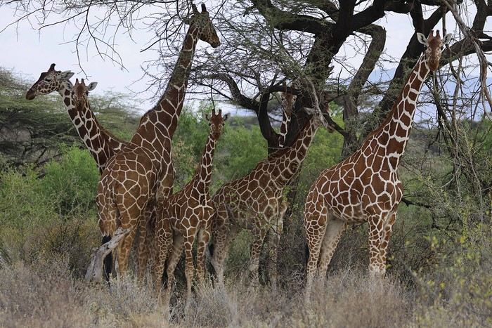
While heading to our camp for lunch, Alfred crossed paths with another vehicle and learned that a leopard was nearby. We started searching, and a few minutes later, Anny spotted a shape in a tree—it was our leopard!
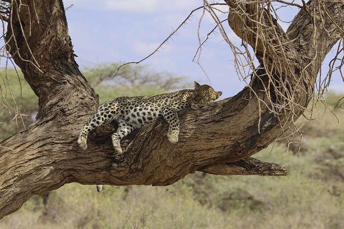
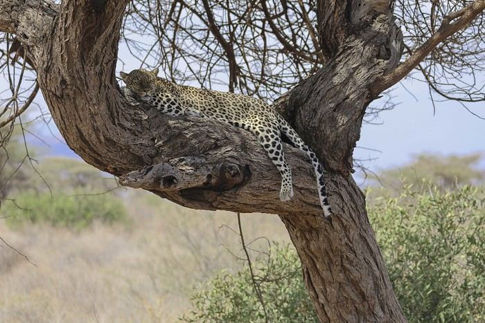
There were actually two of them—a mother and her adolescent. The young one was perched high in the tree, in the shade. We got to observe them for a good half-hour in excellent conditions, with just one other vehicle nearby.
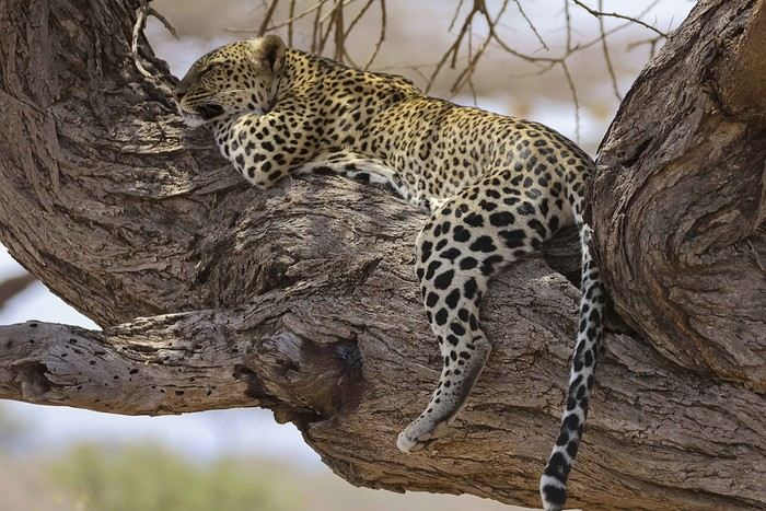
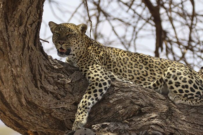
Alfred also noticed that the mother had hidden prey (a gerenuk gazelle) in the vegetation, away from prying eyes.
It was time to head to our camp, the Ashnil Samburu Camp, located in the Buffalo Springs area, by the river, in an idyllic setting surrounded by the region’s typical vegetation.
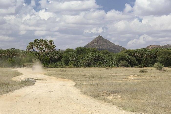
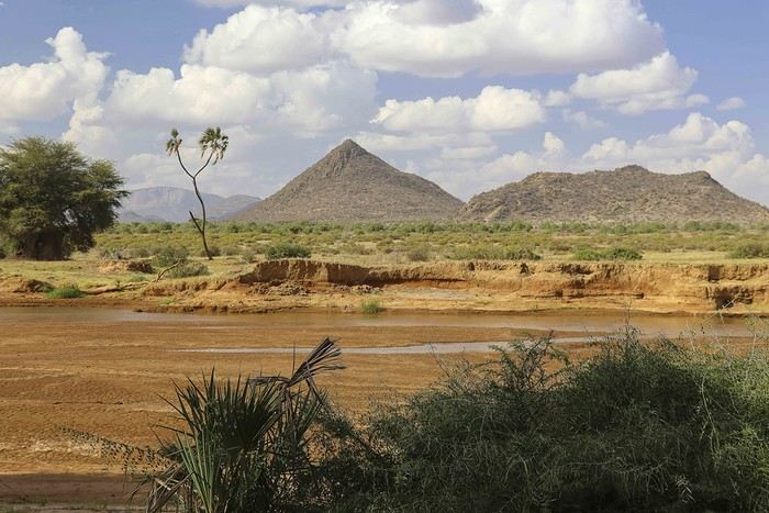
The welcome was fantastic—we immediately felt at home, and that feeling lasted throughout our 3-day stay in the reserve. It was 2 PM, but no one rushed us to the table. Our waitress, Sheila, who took care of us the whole time, was as lovely as the rest of the team. Barely seated, we were invited to watch an elephant passing right by the camp, in front of the restaurant. This trip was off to a great start!
After lunch, we relaxed by the pool. Monkeys, especially vervets, were everywhere, and a camp employee was assigned to keep an eye on them and shoo them away if needed (especially the baboons).
A little before 4 PM, we met up with Alfred for our first game drive. Just outside the camp, a few elephants were in the valley near the river.
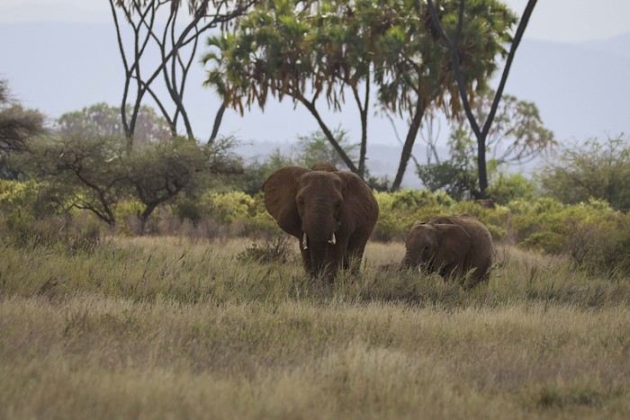
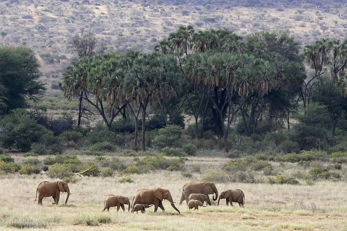
We’d see them in the same area almost every day. We also spotted some gazelles.
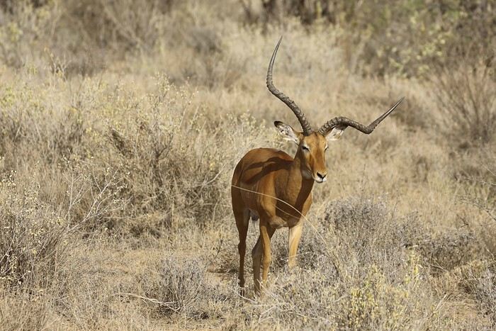
After several years, I’ve finally decided to repost a travel journal on the forum. We returned a few weeks ago from an incredible trip to Kenya, and it’s reignited my desire to share our emotions in the face of these animals.
Kenya wasn’t originally a priority for us in terms of safari—we had the impression it was too touristy. So, we started with other destinations: Namibia, Tanzania, Botswana, and South Africa. But as I did more research, especially on the forum (thanks in part to Sylvie’s many trips), I eventually convinced myself that Kenya could be magnificent, as long as we chose our itinerary carefully and avoided peak seasons.
We ended up going in January, from the 17th to the 31st. We worked with a travel agency (TP) that crafted a custom itinerary for us: Samburu-Ol Pejeta-Naivasha-Maji Moto-Maasai Mara-Diani. They partnered with a local French-speaking agency, and everything was perfectly organized. Our trip exceeded all our expectations, and none of it would’ve been as amazing without our guide, Alfred. He accompanied us for 10 days and was a fantastic travel companion—professional, respectful of the animals, and always in good spirits. We formed a great bond with him in such a short time.
- **January 17th** After meeting up with Juliette and Charlotte in Rennes the night before, we left at 4 AM for Roissy Charles de Gaulle Airport. The thick fog made the drive pretty rough, but we arrived safely around 7:45 AM. A Blue Valet driver was waiting to take our car. Check-in went smoothly, and we waited patiently for our 10:40 AM flight. Unfortunately, despite boarding on time, a passenger was missing, and we had to find a replacement last minute. Then, another passenger who had checked in and dropped off their luggage wasn’t on the plane, so they had to unload their bags. After a long period of uncertainty and spotty communication from the crew, we finally took off over an hour late.
We arrived in Nairobi in the late afternoon, 45 minutes behind schedule. The administrative formalities were endless—it took nearly 1.5 hours from landing to leaving the airport with our luggage. When we stepped out, Alfred, our guide, was waiting with a big smile and drove us to the Eka Hotel, not far from the airport. Exhausted from the long journey, we fell asleep quickly.
- **January 18th** Alfred met us at 7 AM for a long drive to Samburu Reserve. We had a peaceful night, unlike the girls, who barely slept because their neighbors were talking loudly all night. Things even escalated when Charlotte started shouting insults to get them to quiet down, but it didn’t work.
It was Sunday, so traffic around Nairobi and along the route was light. Aside from a quick "technical stop," we drove straight through and arrived in Samburu after just under 6 hours. Because of the lower altitude (around 1,000m on average), it was hot—over 30°C in mid-January.
As soon as we entered the reserve, we spotted some impalas and quickly came across one of the region’s endemic species: the reticulated giraffe, which is absolutely stunning.
While heading to our camp for lunch, Alfred crossed paths with another vehicle and learned that a leopard was nearby. We started searching, and a few minutes later, Anny spotted a shape in a tree—it was our leopard!
There were actually two of them—a mother and her adolescent. The young one was perched high in the tree, in the shade. We got to observe them for a good half-hour in excellent conditions, with just one other vehicle nearby.
Alfred also noticed that the mother had hidden prey (a gerenuk gazelle) in the vegetation, away from prying eyes.
It was time to head to our camp, the Ashnil Samburu Camp, located in the Buffalo Springs area, by the river, in an idyllic setting surrounded by the region’s typical vegetation.
The welcome was fantastic—we immediately felt at home, and that feeling lasted throughout our 3-day stay in the reserve. It was 2 PM, but no one rushed us to the table. Our waitress, Sheila, who took care of us the whole time, was as lovely as the rest of the team. Barely seated, we were invited to watch an elephant passing right by the camp, in front of the restaurant. This trip was off to a great start!
After lunch, we relaxed by the pool. Monkeys, especially vervets, were everywhere, and a camp employee was assigned to keep an eye on them and shoo them away if needed (especially the baboons).
A little before 4 PM, we met up with Alfred for our first game drive. Just outside the camp, a few elephants were in the valley near the river.
We’d see them in the same area almost every day. We also spotted some gazelles.
Costa Rica: The dry season isn't what it used to be!
Introduction:
For years, I’ve heard about Costa Rica, which seems like a country "made for me"—nature, not cities.
I almost went in 2019, but a family issue made me cancel.
Initially, I wanted to spend at least three weeks there, planning to go in our summer despite it being the rainy season. Then I realized what I wanted to do could fit into two weeks, so I ended up going in February.
Plus, January’s weather was so awful that some sunshine should do me good.
I found a flight at a decent price, but with two downsides.
The first is that it leaves from Paris CDG, and the second is that it’s with Air France—a airline I’d sworn off after my misadventures with them back in 2008. We’ll see how it goes!
Trip to Thailand and Laos
Hello! 🙂
January 2026 Here we go again for new adventures and the pleasure of sharing them with you here! First of all, I’d like to thank everyone who helped me with the preparations, even with some last-minute improvisations just days before departure. Thanks to Montagnard74, Jojoone1, Songsam, Attila, Dennis2, NadegerFERM, and the authors whose travel journals about Laos inspired me (Montagnard74, Muriel18, Mavietongs...).
In this story, written by Richard and illustrated by me, we’ll tell you about the journey of four friends: Catherine, Richard, Nathalie, and Bruno. A reinvented but overall successful trip, filled with discoveries and surprises, the scents of spices and frangipani flowers, (too) spicy food, sunsets, and... one big mess.
January 2026 Here we go again for new adventures and the pleasure of sharing them with you here! First of all, I’d like to thank everyone who helped me with the preparations, even with some last-minute improvisations just days before departure. Thanks to Montagnard74, Jojoone1, Songsam, Attila, Dennis2, NadegerFERM, and the authors whose travel journals about Laos inspired me (Montagnard74, Muriel18, Mavietongs...).
In this story, written by Richard and illustrated by me, we’ll tell you about the journey of four friends: Catherine, Richard, Nathalie, and Bruno. A reinvented but overall successful trip, filled with discoveries and surprises, the scents of spices and frangipani flowers, (too) spicy food, sunsets, and... one big mess.
Need advice to finalize Malaysia itinerary
Hey everyone,
I’m over in East Borneo in mid-July.
I’m struggling to wrap up the end of my itinerary, even though it’s pretty straightforward (long but simple).
Last year, we did Malaysia (KL and the mainland + around Kuching).
Day 1 – Arrive in Kota Kinabalu early, stroll around town and hit the must-sees. Day 2 – Excursion to Tunku Abdul Rahman Park, snorkeling at 3 islands. Day 3 – Hike around Mount Kinabalu without summiting (450 per person, no way). Day 4 – Poring Hot Springs + evening flight to Sandakan. Day 5-6-7 – Kinabatangan River (still looking for the right guide). Day 8 – Sepilok for the orangutans, the Sun Bear Centre, and Rainforest Discovery Centre. Day 9 – Selingan, turtle island. Day 10 – Head to Semporna. Day 11-12-13-14 – Sipadan, Mabul, Kapalai. Day 15 – Bohey Dulang. Day 16 to Day 25: I’M STUCK.
I looked into Danum Valley, but for 3 days/2 nights, they’re quoting 650 € per person—come on, that’s ridiculous. I checked out a detour into Indonesia (still East Borneo), but I’m having trouble deciding what would be amazing. I read about Sangalaki + Kakaban (2 islands, 1 base) / Mahakam Delta - Kutai (orangutans and river) / Sungai Boh (Dayak Kayan) – jungle & culture. But honestly, I’m struggling to finalize this itinerary. If we venture that way, we’d head back to KK from Balikpapan.
What do you all think? Thanks in advance!
Day 1 – Arrive in Kota Kinabalu early, stroll around town and hit the must-sees. Day 2 – Excursion to Tunku Abdul Rahman Park, snorkeling at 3 islands. Day 3 – Hike around Mount Kinabalu without summiting (450 per person, no way). Day 4 – Poring Hot Springs + evening flight to Sandakan. Day 5-6-7 – Kinabatangan River (still looking for the right guide). Day 8 – Sepilok for the orangutans, the Sun Bear Centre, and Rainforest Discovery Centre. Day 9 – Selingan, turtle island. Day 10 – Head to Semporna. Day 11-12-13-14 – Sipadan, Mabul, Kapalai. Day 15 – Bohey Dulang. Day 16 to Day 25: I’M STUCK.
I looked into Danum Valley, but for 3 days/2 nights, they’re quoting 650 € per person—come on, that’s ridiculous. I checked out a detour into Indonesia (still East Borneo), but I’m having trouble deciding what would be amazing. I read about Sangalaki + Kakaban (2 islands, 1 base) / Mahakam Delta - Kutai (orangutans and river) / Sungai Boh (Dayak Kayan) – jungle & culture. But honestly, I’m struggling to finalize this itinerary. If we venture that way, we’d head back to KK from Balikpapan.
What do you all think? Thanks in advance!
In the midst of Kenya's wildlife, October 2025
Hello everyone,
After sharing some safari photos from southern Tanzania, I’d like to show you those from our latest safari in Kenya in October 2025.
First, I’d like to thank Sylvie56, whose previous travel journals about this country inspired our trip choices. Thanks also for the info you sent us via PM. THANK YOU!
The following account is from a simple wildlife enthusiast. You won’t find anything here but images of landscapes, mammals, and birds. The stated purpose of this trip was purely and solely wildlife-focused. (It was in no way a discovery of the country or its people).
This stay/safari began (and ended) in Nairobi, with flights between France and Kenya operated by Qatar Airways departing from Nice.
Over two weeks, we first visited the reserves of Tsavo West and Tsavo East, then after a long road trip, the two reserves of Buffalo Springs and Samburu.
= Please wait until the end of the journal to ask any specific questions (or send them via PM) to keep the story flowing without interruptions or off-topic comments.
Thanks for your understanding.
...
Previous Kenya safari trip in 2017, here:
http://www.image-nature.com/forum/viewtopic.php?f=162&t=61119
...
After sharing some safari photos from southern Tanzania, I’d like to show you those from our latest safari in Kenya in October 2025.
First, I’d like to thank Sylvie56, whose previous travel journals about this country inspired our trip choices. Thanks also for the info you sent us via PM. THANK YOU!
The following account is from a simple wildlife enthusiast. You won’t find anything here but images of landscapes, mammals, and birds. The stated purpose of this trip was purely and solely wildlife-focused. (It was in no way a discovery of the country or its people).
This stay/safari began (and ended) in Nairobi, with flights between France and Kenya operated by Qatar Airways departing from Nice.
Over two weeks, we first visited the reserves of Tsavo West and Tsavo East, then after a long road trip, the two reserves of Buffalo Springs and Samburu.
= Please wait until the end of the journal to ask any specific questions (or send them via PM) to keep the story flowing without interruptions or off-topic comments.
Thanks for your understanding.
...
Previous Kenya safari trip in 2017, here:
http://www.image-nature.com/forum/viewtopic.php?f=162&t=61119
...
Martine from DD in Arizona and New Mexico
Good evening everyone! 🙂
We’re back from our September 2025 road trip, this time to explore Arizona and New Mexico, and it’s time for me to start my travel journal—especially since everything’s already booked for another trip in September 2026 (to California), and I need to get started on the planning.
I was a little worried this new visit to Uncle Sam’s country might not be as "wow" as the others, but we still discovered some incredible places.
For those who don’t know us, we’re a couple in our seventies who speak very little English, but that didn’t stop us from fully enjoying our stay.
For this 6th road trip in the U.S., we spent 21 nights there, drove 4,160 km by car, and walked nearly 160 km in a loop starting from Phoenix.
We’d been to Arizona before (but not this side) and never to New Mexico. This whole road trip was a huge discovery for us.
In the prices mentioned (some in euros, others in dollars), bank fees and exchange charges are included. The flights, car rental, and parking were all paid for in December 2024 when we booked.
We’d downloaded the MPC (Mobile Passport Control) app, but there wasn’t a dedicated line at Phoenix Airport. Still, we got through quickly with friendly, smiling agents.
I don’t drive at all (I hate it), so the stops were chosen based on activities but also, for some, to limit daily mileage for the sole driver. The kilometers listed in the itinerary are the daily distances.
We traveled from September 9th to 22nd, unfortunately once again without our dear friends Mimi and Maumau.
The itinerary
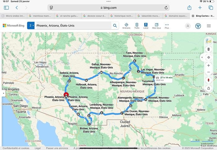
Day 1: Flight Marseille-Paris-Phoenix, then Gold Canyon (133 km) Day 2: Tucson (271 km) Lost Dutchman State Park Day 3: Tucson (155 km) Day 4: Tucson (34 km) Day 5: Bisbee (182 km) Day 6: Lordsburg (345 km) Day 7: Las Cruces (253 km) Day 8: Alamogordo (162 km) Day 9: Roswell (264 km) Day 10: Tucumcari (369 km) Day 11: Las Vegas (281 km) – the one in New Mexico Day 12: Taos (213 km) Day 13: Santa Fe (224 km) Day 14: Albuquerque (123 km) Day 15: Gallup (246 km) Day 16: Holbrook (224 km) Day 17: Flagstaff (179 km) Day 18: Sedona (118 km) Day 19: Sedona (48 km) Day 20: Sedona (41 km) Day 21: Phoenix (256 km) Day 22: Phoenix Airport (35 km)
📊 **Budget**: A little over 7,500 € for both of us, all included. The exchange rate was in our favor (1.17 dollars to 1 €). 📊 **Flights**: Marseille-Paris Charles de Gaulle-Phoenix: 1,787 € for two, with one checked bag each (Air France) 📊 **ESTA**: $42 📊 **America the Beautiful Pass**: $80 📊 **Parking**: 134 € (super eco at Marseille) 📊 **Car rental (Hertz)**: 865 €. Since there were no SUVs left in the reserved category (Nissan Rogue), we got an upgrade (4x4 Ford Explorer). We booked through Air France (15% discount). We’d originally reserved it in December for 1,140 €, but since prices dropped in March, we canceled and rebooked for 865 €. Hertz offers a free Hertz Gold Plus Rewards program, which gives you priority counter service when picking up the car. 📊 **Accommodation**: 2,400 € We stayed in hotels and motels of varying standards (from 60 to 203 € per night, depending on the city), all booked through Booking.com or Hotels.com. Out of 21 nights, only two didn’t include breakfast in the price. Booking.com sometimes offers slightly cheaper rates if you book by phone using the mobile app, and our Genius 3 status on the site also got us some preferential rates. 📊 **Supplementary insurance**: AVA 200 € for medical care if needed 📊 **Cash**: $2,078. We left with 1,000 € exchanged before departure and made two withdrawals of $500. This cash covered: - Evening restaurants and tips - Midday picnics - Gas: $298 for 4,160 km - Museum and private park entries (per person): - Lost Dutchman: $10 - Arizona-Sonora Desert Museum: $28 - Bird Cage Theater: $16 - Tombstone Shootout: $8 - New Mexico Farm & Ranch Museum: $12 - Roswell International UFO Museum: $5 - Billy the Kid Museum: $7 - Rancho de Taos: $22 - West Fork Oak Creek Trail entry: $15 We got a few discounts thanks to our senior age (+65). - Souvenirs and little treats
Like on our previous road trips, we didn’t rent a GPS. We got around using offline GPS apps Here WeGo and Organic Maps, with maps of the states we visited downloaded before we left (on our phones).
❤️❤️❤️ **Highlights** (there are so many!) 📍 Goldfield Ghost Town (even if it’s a reconstruction) 📍 The standing army of Saguaro cacti at Saguaro National Park West 📍 Diving into the cowboy universe of Tombstone 📍 The welcome from Rick and Henry at our guesthouse in Bisbee (Garden at Mile High Ranch) 📍 The tangled rocks of Chiricahua National Monument 📍 The flavored pistachios from Dwayne’s Fresh Jerky and Mac Ginnis Pistachioland 📍 Restaurants: La Posta (Las Cruces), Diner 66 (Albuquerque), and the Haunted Hamburger (Jerome) 📍 The old plazas of New Mexico 📍 The solitude and beauty of the white dunes at White Sands National Park 📍 Stepping back in time at the Billy the Kid Museum (Fort Stanton) 📍 Sections of historic Route 66 and the old motels of Tucumcari, especially at night when all the neon lights are on 📍 Taos Pueblo and diving into Native American culture 📍 After the Rio Grande Bridge, the descent via NM 567 to the very bottom of the Rio Grande Gorge, then the road along the riverbanks to Taos 📍 The tranquility of the Chimayo Sanctuary 📍 Discovering the ingenious native dwellings at Bandelier National Monument and Walnut Canyon National Park 📍 The small towns along the Turquoise Trail 📍 The red rocks of Red Rock Park and the Painted Desert 📍 The extraordinary colors of the petrified trees at Petrified Forest National Park 📍 Sedona, its red rocks, and the reward of the viewpoints at the end of hikes (Devil’s Bridge, The Subway, and West Fork Oak Creek) 📍 The immersion in Mexico when visiting Tlaquepaque 📍 The almost-ghost town of Jerome and its terraced streets 📍 The incredible kindness of Americans, always ready to help and up for a chat ❤️
☹️☹️☹️ **Flops** (there are very few) 📍 Several museums and churches being closed, so we couldn’t visit them 📍 Some museums and visitor centers opening late (10 AM) and closing early (4 PM) 📍 A 64 € phone roaming charge because we got near the Mexican border and picked up their cell tower 📍 The outrageous price ($5.99) for a gallon of gas at the Shell near Phoenix Airport
I hope this helps! Anyway, thanks for reading my long post. Don’t hesitate to reach out, even via PM, if you see I haven’t replied and you’d like more details. Have a great evening, everyone! 🙂
We’re back from our September 2025 road trip, this time to explore Arizona and New Mexico, and it’s time for me to start my travel journal—especially since everything’s already booked for another trip in September 2026 (to California), and I need to get started on the planning.
I was a little worried this new visit to Uncle Sam’s country might not be as "wow" as the others, but we still discovered some incredible places.
For those who don’t know us, we’re a couple in our seventies who speak very little English, but that didn’t stop us from fully enjoying our stay.
For this 6th road trip in the U.S., we spent 21 nights there, drove 4,160 km by car, and walked nearly 160 km in a loop starting from Phoenix.
We’d been to Arizona before (but not this side) and never to New Mexico. This whole road trip was a huge discovery for us.
In the prices mentioned (some in euros, others in dollars), bank fees and exchange charges are included. The flights, car rental, and parking were all paid for in December 2024 when we booked.
We’d downloaded the MPC (Mobile Passport Control) app, but there wasn’t a dedicated line at Phoenix Airport. Still, we got through quickly with friendly, smiling agents.
I don’t drive at all (I hate it), so the stops were chosen based on activities but also, for some, to limit daily mileage for the sole driver. The kilometers listed in the itinerary are the daily distances.
We traveled from September 9th to 22nd, unfortunately once again without our dear friends Mimi and Maumau.
The itinerary
Day 1: Flight Marseille-Paris-Phoenix, then Gold Canyon (133 km) Day 2: Tucson (271 km) Lost Dutchman State Park Day 3: Tucson (155 km) Day 4: Tucson (34 km) Day 5: Bisbee (182 km) Day 6: Lordsburg (345 km) Day 7: Las Cruces (253 km) Day 8: Alamogordo (162 km) Day 9: Roswell (264 km) Day 10: Tucumcari (369 km) Day 11: Las Vegas (281 km) – the one in New Mexico Day 12: Taos (213 km) Day 13: Santa Fe (224 km) Day 14: Albuquerque (123 km) Day 15: Gallup (246 km) Day 16: Holbrook (224 km) Day 17: Flagstaff (179 km) Day 18: Sedona (118 km) Day 19: Sedona (48 km) Day 20: Sedona (41 km) Day 21: Phoenix (256 km) Day 22: Phoenix Airport (35 km)
📊 **Budget**: A little over 7,500 € for both of us, all included. The exchange rate was in our favor (1.17 dollars to 1 €). 📊 **Flights**: Marseille-Paris Charles de Gaulle-Phoenix: 1,787 € for two, with one checked bag each (Air France) 📊 **ESTA**: $42 📊 **America the Beautiful Pass**: $80 📊 **Parking**: 134 € (super eco at Marseille) 📊 **Car rental (Hertz)**: 865 €. Since there were no SUVs left in the reserved category (Nissan Rogue), we got an upgrade (4x4 Ford Explorer). We booked through Air France (15% discount). We’d originally reserved it in December for 1,140 €, but since prices dropped in March, we canceled and rebooked for 865 €. Hertz offers a free Hertz Gold Plus Rewards program, which gives you priority counter service when picking up the car. 📊 **Accommodation**: 2,400 € We stayed in hotels and motels of varying standards (from 60 to 203 € per night, depending on the city), all booked through Booking.com or Hotels.com. Out of 21 nights, only two didn’t include breakfast in the price. Booking.com sometimes offers slightly cheaper rates if you book by phone using the mobile app, and our Genius 3 status on the site also got us some preferential rates. 📊 **Supplementary insurance**: AVA 200 € for medical care if needed 📊 **Cash**: $2,078. We left with 1,000 € exchanged before departure and made two withdrawals of $500. This cash covered: - Evening restaurants and tips - Midday picnics - Gas: $298 for 4,160 km - Museum and private park entries (per person): - Lost Dutchman: $10 - Arizona-Sonora Desert Museum: $28 - Bird Cage Theater: $16 - Tombstone Shootout: $8 - New Mexico Farm & Ranch Museum: $12 - Roswell International UFO Museum: $5 - Billy the Kid Museum: $7 - Rancho de Taos: $22 - West Fork Oak Creek Trail entry: $15 We got a few discounts thanks to our senior age (+65). - Souvenirs and little treats
Like on our previous road trips, we didn’t rent a GPS. We got around using offline GPS apps Here WeGo and Organic Maps, with maps of the states we visited downloaded before we left (on our phones).
❤️❤️❤️ **Highlights** (there are so many!) 📍 Goldfield Ghost Town (even if it’s a reconstruction) 📍 The standing army of Saguaro cacti at Saguaro National Park West 📍 Diving into the cowboy universe of Tombstone 📍 The welcome from Rick and Henry at our guesthouse in Bisbee (Garden at Mile High Ranch) 📍 The tangled rocks of Chiricahua National Monument 📍 The flavored pistachios from Dwayne’s Fresh Jerky and Mac Ginnis Pistachioland 📍 Restaurants: La Posta (Las Cruces), Diner 66 (Albuquerque), and the Haunted Hamburger (Jerome) 📍 The old plazas of New Mexico 📍 The solitude and beauty of the white dunes at White Sands National Park 📍 Stepping back in time at the Billy the Kid Museum (Fort Stanton) 📍 Sections of historic Route 66 and the old motels of Tucumcari, especially at night when all the neon lights are on 📍 Taos Pueblo and diving into Native American culture 📍 After the Rio Grande Bridge, the descent via NM 567 to the very bottom of the Rio Grande Gorge, then the road along the riverbanks to Taos 📍 The tranquility of the Chimayo Sanctuary 📍 Discovering the ingenious native dwellings at Bandelier National Monument and Walnut Canyon National Park 📍 The small towns along the Turquoise Trail 📍 The red rocks of Red Rock Park and the Painted Desert 📍 The extraordinary colors of the petrified trees at Petrified Forest National Park 📍 Sedona, its red rocks, and the reward of the viewpoints at the end of hikes (Devil’s Bridge, The Subway, and West Fork Oak Creek) 📍 The immersion in Mexico when visiting Tlaquepaque 📍 The almost-ghost town of Jerome and its terraced streets 📍 The incredible kindness of Americans, always ready to help and up for a chat ❤️
☹️☹️☹️ **Flops** (there are very few) 📍 Several museums and churches being closed, so we couldn’t visit them 📍 Some museums and visitor centers opening late (10 AM) and closing early (4 PM) 📍 A 64 € phone roaming charge because we got near the Mexican border and picked up their cell tower 📍 The outrageous price ($5.99) for a gallon of gas at the Shell near Phoenix Airport
I hope this helps! Anyway, thanks for reading my long post. Don’t hesitate to reach out, even via PM, if you see I haven’t replied and you’d like more details. Have a great evening, everyone! 🙂
Your recommendations for the Eastern Cape
Hello,
We’re planning our second trip to South Africa in July 2026. In 2023, we did a loop from Joburg, Golden Gate, Drakensberg, Hluhluwe, St Lucia, Eswatini, Kruger, Blyde River Canyon, and back to Joburg. This time, we’d like to go to Cape Town and do a road trip to Port Elizabeth, then fly back to Joburg to return to Kruger. At this stage of my planning, here’s what it could look like:
D1 to D4: Cape Town and Cape of Good Hope (Table Mountain, Lion’s Head, Waterfront, Bo-Kaap, Boulders, Cape Point, Chapman’s Peak Drive). I’ve spotted a few places to stay between Camps Bay and Hout Bay (3 nights). D5 and D6: Either Karoo NP or Hermanus and De Hoop. Any opinions to tip the scales? I’ll admit I’m already leaning toward Karoo (the "wild" vibe of the landscapes and wildlife encounters appeal to me much more than the seaside, which feels less exotic). If we go for Karoo, where should we stay? Inside the park or in Beaufort West? I’ve seen good reviews for Ko-ka Tsara Bush Camp, but maybe it’s better to stay in the Sanparks cottages to make the most of the park? (2 nights) Option B is to do Stellenbosch (though vineyards aren’t great in winter) and/or the Whale Route—Betty’s Bay, Hermanus, De Hoop (2 nights near Gansbaai). D7 and D8: Klein Karoo, Oudtshoorn. Staying at De Cango Guest Farm (2 nights). D9 and D10: Knysna, Robberg Nature Reserve, Tsitsikamma (2 nights in Plettenberg Bay and 1 night in PE). D11: Flight from Port Elizabeth to Joburg at 7 AM and drive to Marloth Park.
For Kruger, I’ve booked 2 nights in Marloth Park, 1 night in Skukuza, 2 nights in Satara, and 1 night in Talamati, which we loved. I’ll book the last night in Graskop later since we want to revisit the Blyde Canyon area.
I’d love all the feedback you can give on my itinerary, especially for days 5 and 6. If you have recommendations for accommodations for 4 people, I’d appreciate those too. Thanks! 🙂
We’re planning our second trip to South Africa in July 2026. In 2023, we did a loop from Joburg, Golden Gate, Drakensberg, Hluhluwe, St Lucia, Eswatini, Kruger, Blyde River Canyon, and back to Joburg. This time, we’d like to go to Cape Town and do a road trip to Port Elizabeth, then fly back to Joburg to return to Kruger. At this stage of my planning, here’s what it could look like:
D1 to D4: Cape Town and Cape of Good Hope (Table Mountain, Lion’s Head, Waterfront, Bo-Kaap, Boulders, Cape Point, Chapman’s Peak Drive). I’ve spotted a few places to stay between Camps Bay and Hout Bay (3 nights). D5 and D6: Either Karoo NP or Hermanus and De Hoop. Any opinions to tip the scales? I’ll admit I’m already leaning toward Karoo (the "wild" vibe of the landscapes and wildlife encounters appeal to me much more than the seaside, which feels less exotic). If we go for Karoo, where should we stay? Inside the park or in Beaufort West? I’ve seen good reviews for Ko-ka Tsara Bush Camp, but maybe it’s better to stay in the Sanparks cottages to make the most of the park? (2 nights) Option B is to do Stellenbosch (though vineyards aren’t great in winter) and/or the Whale Route—Betty’s Bay, Hermanus, De Hoop (2 nights near Gansbaai). D7 and D8: Klein Karoo, Oudtshoorn. Staying at De Cango Guest Farm (2 nights). D9 and D10: Knysna, Robberg Nature Reserve, Tsitsikamma (2 nights in Plettenberg Bay and 1 night in PE). D11: Flight from Port Elizabeth to Joburg at 7 AM and drive to Marloth Park.
For Kruger, I’ve booked 2 nights in Marloth Park, 1 night in Skukuza, 2 nights in Satara, and 1 night in Talamati, which we loved. I’ll book the last night in Graskop later since we want to revisit the Blyde Canyon area.
I’d love all the feedback you can give on my itinerary, especially for days 5 and 6. If you have recommendations for accommodations for 4 people, I’d appreciate those too. Thanks! 🙂
Road Trip USA 2023 - Part 2
HIGHWAY 1
Highway 1 runs along the Pacific coast of California from Leggett in the north to Dana Point in the south. It's the longest state route in California, stretching 1,050 km.
It's famous for its breathtaking ocean views. That’s actually why it’s become such a popular route for road trips, with tons of attractions and points of interest all along the way.
After crossing the U.S. interior on our way out (see Road Trip USA 2023 - Part 1), we’re starting our return trip along this route from Leggett.
Videos are embedded throughout the summary. Please click on the image to start the video. To jump to a specific post, here are the appropriate links:
CALIFORNIA:
Scenic Overlooks on Route 1 Between Leggett and Fort Bragg The Pudding Creek Trestle Bridge in Fort Bragg Glass Beach - Fort Bragg Jenner Lookout Point - Highway 1 Goat Rock Beach - Sonoma Coast State Park - Jenner Point Reyes National Seashore - White House Pool Trail Point Reyes National Seashore - Limantour Beach Point Reyes National Seashore - Point Reyes Shipwreck Point Reyes National Seashore - Kehoe Beach Trail Point Reyes National Seashore - McClures Beach Trail Point Reyes National Seashore - Cypress Tree Tunnel Point Reyes National Seashore - Point Reyes Beach North Point Reyes National Seashore - Elephant Seals on Drakes Beach Point Reyes National Seashore - Point Reyes Beach South Point Reyes National Seashore – Elephant Seals Overlooks Point Reyes National Seashore - Chimney Rock Trail Point Reyes National Seashore - Point Reyes Lighthouse Trail Point Reyes National Seashore – Tule Elk Observation Point Bonita Lighthouse Trail - Sausalito Hawk Hill - Sausalito Battery Spencer Trail - Sausalito Rodeo Beach - Sausalito Point Cavallo - Golden Gate View - Sausalito Exploring Downtown Sausalito Visiting Sausalito’s Houseboats Crossing the Golden Gate Bridge - San Francisco Golden Gate Bridge Viewpoints - San Francisco Cruise to Alcatraz Island - San Francisco Visiting Alcatraz Island - San Francisco Civic Center - Downtown San Francisco Market Street & Yerba Buena Gardens - Downtown San Francisco Union Square & Financial District - Downtown San Francisco Fisherman's Wharf, Pier 39 & Embarcadero - San Francisco Sea Lion Observation - Pier 39 - San Francisco Lombard Street & Cable Car - Russian Hill - San Francisco Macondray Lane Historic District - Russian Hill - San Francisco Grace Cathedral & Huntington Park - Nob Hill - San Francisco Telegraph Hill - San Francisco Chinatown - San Francisco Alamo Square & Painted Ladies - Western Addition - San Francisco Palace of Fine Arts - Marina District - San Francisco Presidio of San Francisco California Coastal Trail - Lincoln Park - San Francisco California Palace of the Legion of Honor - Lincoln Park - San Francisco Sutro Baths - Lincoln Park - San Francisco Queen Wilhelmina Garden - Golden Gate Park - San Francisco Bison Paddock - Golden Gate Park - San Francisco Portals of the Past - Golden Gate Park - San Francisco Strawberry Hill - Golden Gate Park – San Francisco Prayerbook Cross & Robin Williams Meadow - Golden Gate Park - San Francisco Hidden Garden Steps & 16th Avenue Tiled Steps - San Francisco Grandview Park - San Francisco Hike - Twin Peaks Three Summits - San Francisco Longboarding Down Twin Peaks Blvd in San Francisco Haight-Ashbury - San Francisco Corona Heights Park - San Francisco Mission Dolores - San Francisco Mural Frescoes (Part 1) - Mission District - San Francisco Mural Frescoes (Part 2) - Mission District - San Francisco Devil's Slide Bunker - Pacifica Mavericks Beach - Half Moon Bay Martins Beach - Half Moon Bay Pigeon Point Lighthouse State Historic Park - Pescadero What to See in Santa Cruz Visiting Capitola What to See in Monterey Carmel-by-the-Sea Lovers Point Park - Pacific Grove Castle Rock, Hurricane Point & Little Sur River Viewpoints Pfeiffer Falls Trail Julia Pfeiffer Burns State Park Vista Point & McWay Falls Highway 1 - Big Sur Viewpoints Salmon Creek Falls San Carpoforo Creek Trail Elephant Seal Vista Point - San Simeon San Simeon Pier Moonstone Beach Boardwalk Shipwreck - Estero Bluffs State Park Surfing Competition in Morro Bay Port San Luis Pier - San Luis Obispo Pismo Beach Monarch Butterfly Grove - Pismo State Beach Nojoqui Falls Park - Solvang Arroyo Hondo Vista Point Solvang, a Charming Danish Town in California Chumash Painted Cave - Santa Barbara Goleta San Marcos Rd & Cachuma Lake Vista Points - Santa Barbara Old Santa Barbara Mission Walking Tour of Santa Barbara’s Historic Downtown West Beach - Santa Barbara What to See in Ventura Paradise Falls - Wildwood Regional Park - Thousand Oaks Sandy Dune & El Matador State Beach - Malibu Point Dume Nature Reserve - Malibu Malibu Pier Road Trip in the Malibu Mountains Los Liones Trail - Santa Monica Santa Monica Pier Rodeo Drive - Beverly Hills Greystone Mansion - Beverly Hills Hollywood Walk of Fame - Los Angeles Griffith Observatory - Los Angeles Hollywood Forever Cemetery - Los Angeles What to See in Venice Beach Venice Beach Skatepark ShoreLine Aquatic Park - Long Beach Alamitos Beach - Long Beach Naples Island - Long Beach Crescent Bay Point Park & Helser Park Kiosk - Laguna Beach Shell Beach at Twin Points - Laguna Beach Prairie Dogs at Agra Vista Point Top Gun House & Oceanside Pier Annie's Canyon Trail - Solana Beach (Via North Rios Trailhead Loop) Old Town San Diego La Jolla Coastal Trail - San Diego Balboa Park - San Diego Pacific Beach - San Diego Mission Beach - San Diego Ocean Beach Tide Pools - San Diego Sunset Cliffs Natural Park - San Diego Tuna Harbor Park - San Diego Seaport Village & Embarcadero Marina Park - San Diego Gaslamp Quarter - Downtown San Diego Coronado Island - San Diego Dead Dolly Lane - Alpine Galleta Meadows Metal Sculptures - Borrego Springs What to See in Palm Springs Robolights - Palm Springs Andreas Canyon Trail - Indian Canyons - Palm Springs Palm Canyon Trail - Indian Canyons - Palm Springs West Fork Falls Trail - Indian Canyons - Palm Springs Tahquitz Canyon Loop Trail - Indian Canyons - Palm Springs Desert Christ Park - Yucca Valley Pioneertown Salvation Mountain - Niland Slab City - Niland
Highway 1 runs along the Pacific coast of California from Leggett in the north to Dana Point in the south. It's the longest state route in California, stretching 1,050 km.
It's famous for its breathtaking ocean views. That’s actually why it’s become such a popular route for road trips, with tons of attractions and points of interest all along the way.
After crossing the U.S. interior on our way out (see Road Trip USA 2023 - Part 1), we’re starting our return trip along this route from Leggett.
Videos are embedded throughout the summary. Please click on the image to start the video. To jump to a specific post, here are the appropriate links:
CALIFORNIA:
Scenic Overlooks on Route 1 Between Leggett and Fort Bragg The Pudding Creek Trestle Bridge in Fort Bragg Glass Beach - Fort Bragg Jenner Lookout Point - Highway 1 Goat Rock Beach - Sonoma Coast State Park - Jenner Point Reyes National Seashore - White House Pool Trail Point Reyes National Seashore - Limantour Beach Point Reyes National Seashore - Point Reyes Shipwreck Point Reyes National Seashore - Kehoe Beach Trail Point Reyes National Seashore - McClures Beach Trail Point Reyes National Seashore - Cypress Tree Tunnel Point Reyes National Seashore - Point Reyes Beach North Point Reyes National Seashore - Elephant Seals on Drakes Beach Point Reyes National Seashore - Point Reyes Beach South Point Reyes National Seashore – Elephant Seals Overlooks Point Reyes National Seashore - Chimney Rock Trail Point Reyes National Seashore - Point Reyes Lighthouse Trail Point Reyes National Seashore – Tule Elk Observation Point Bonita Lighthouse Trail - Sausalito Hawk Hill - Sausalito Battery Spencer Trail - Sausalito Rodeo Beach - Sausalito Point Cavallo - Golden Gate View - Sausalito Exploring Downtown Sausalito Visiting Sausalito’s Houseboats Crossing the Golden Gate Bridge - San Francisco Golden Gate Bridge Viewpoints - San Francisco Cruise to Alcatraz Island - San Francisco Visiting Alcatraz Island - San Francisco Civic Center - Downtown San Francisco Market Street & Yerba Buena Gardens - Downtown San Francisco Union Square & Financial District - Downtown San Francisco Fisherman's Wharf, Pier 39 & Embarcadero - San Francisco Sea Lion Observation - Pier 39 - San Francisco Lombard Street & Cable Car - Russian Hill - San Francisco Macondray Lane Historic District - Russian Hill - San Francisco Grace Cathedral & Huntington Park - Nob Hill - San Francisco Telegraph Hill - San Francisco Chinatown - San Francisco Alamo Square & Painted Ladies - Western Addition - San Francisco Palace of Fine Arts - Marina District - San Francisco Presidio of San Francisco California Coastal Trail - Lincoln Park - San Francisco California Palace of the Legion of Honor - Lincoln Park - San Francisco Sutro Baths - Lincoln Park - San Francisco Queen Wilhelmina Garden - Golden Gate Park - San Francisco Bison Paddock - Golden Gate Park - San Francisco Portals of the Past - Golden Gate Park - San Francisco Strawberry Hill - Golden Gate Park – San Francisco Prayerbook Cross & Robin Williams Meadow - Golden Gate Park - San Francisco Hidden Garden Steps & 16th Avenue Tiled Steps - San Francisco Grandview Park - San Francisco Hike - Twin Peaks Three Summits - San Francisco Longboarding Down Twin Peaks Blvd in San Francisco Haight-Ashbury - San Francisco Corona Heights Park - San Francisco Mission Dolores - San Francisco Mural Frescoes (Part 1) - Mission District - San Francisco Mural Frescoes (Part 2) - Mission District - San Francisco Devil's Slide Bunker - Pacifica Mavericks Beach - Half Moon Bay Martins Beach - Half Moon Bay Pigeon Point Lighthouse State Historic Park - Pescadero What to See in Santa Cruz Visiting Capitola What to See in Monterey Carmel-by-the-Sea Lovers Point Park - Pacific Grove Castle Rock, Hurricane Point & Little Sur River Viewpoints Pfeiffer Falls Trail Julia Pfeiffer Burns State Park Vista Point & McWay Falls Highway 1 - Big Sur Viewpoints Salmon Creek Falls San Carpoforo Creek Trail Elephant Seal Vista Point - San Simeon San Simeon Pier Moonstone Beach Boardwalk Shipwreck - Estero Bluffs State Park Surfing Competition in Morro Bay Port San Luis Pier - San Luis Obispo Pismo Beach Monarch Butterfly Grove - Pismo State Beach Nojoqui Falls Park - Solvang Arroyo Hondo Vista Point Solvang, a Charming Danish Town in California Chumash Painted Cave - Santa Barbara Goleta San Marcos Rd & Cachuma Lake Vista Points - Santa Barbara Old Santa Barbara Mission Walking Tour of Santa Barbara’s Historic Downtown West Beach - Santa Barbara What to See in Ventura Paradise Falls - Wildwood Regional Park - Thousand Oaks Sandy Dune & El Matador State Beach - Malibu Point Dume Nature Reserve - Malibu Malibu Pier Road Trip in the Malibu Mountains Los Liones Trail - Santa Monica Santa Monica Pier Rodeo Drive - Beverly Hills Greystone Mansion - Beverly Hills Hollywood Walk of Fame - Los Angeles Griffith Observatory - Los Angeles Hollywood Forever Cemetery - Los Angeles What to See in Venice Beach Venice Beach Skatepark ShoreLine Aquatic Park - Long Beach Alamitos Beach - Long Beach Naples Island - Long Beach Crescent Bay Point Park & Helser Park Kiosk - Laguna Beach Shell Beach at Twin Points - Laguna Beach Prairie Dogs at Agra Vista Point Top Gun House & Oceanside Pier Annie's Canyon Trail - Solana Beach (Via North Rios Trailhead Loop) Old Town San Diego La Jolla Coastal Trail - San Diego Balboa Park - San Diego Pacific Beach - San Diego Mission Beach - San Diego Ocean Beach Tide Pools - San Diego Sunset Cliffs Natural Park - San Diego Tuna Harbor Park - San Diego Seaport Village & Embarcadero Marina Park - San Diego Gaslamp Quarter - Downtown San Diego Coronado Island - San Diego Dead Dolly Lane - Alpine Galleta Meadows Metal Sculptures - Borrego Springs What to See in Palm Springs Robolights - Palm Springs Andreas Canyon Trail - Indian Canyons - Palm Springs Palm Canyon Trail - Indian Canyons - Palm Springs West Fork Falls Trail - Indian Canyons - Palm Springs Tahquitz Canyon Loop Trail - Indian Canyons - Palm Springs Desert Christ Park - Yucca Valley Pioneertown Salvation Mountain - Niland Slab City - Niland
Mauritian Ti' Punch
The recipe for the cocktail: endless beaches, a dazzling palette of colors, some breathtaking hikes, and excellent cuisine...
For the tasting, follow along in the pages of this travel journal! 😉
Don’t forget your hiking shoes, a swimsuit, sunscreen, but also a sweater, your driver’s license, and your credit card...
Just over 11 hours of flight, and we’ll be setting foot on Mauritian soil!
For the tasting, follow along in the pages of this travel journal! 😉
Don’t forget your hiking shoes, a swimsuit, sunscreen, but also a sweater, your driver’s license, and your credit card...
Just over 11 hours of flight, and we’ll be setting foot on Mauritian soil!
Yet Another Travel Journal in this (Too) Familiar Rajasthan, But with Family and Kids
Prologue
This journal recounts a trip to Rajasthan that’s already over a year old and that I’ve only now found the chance to write about. The summer of 2024 marked my return to India—my tenth trip—after six long years away since my last solo wanderings in Tamil Nadu in 2018 (the journal of which is published on this site). That absence was partly (but not only) due to the long COVID and post-COVID period, which saw a complete halt and then a major slowdown in global tourism. To top it off, Voyage Forum announced its closure in an end-of-the-world atmosphere. A sad time for our favorite social activity…
A few weeks after returning from Rajasthan, I tried to motivate myself to start writing a journal to publish on a forum claiming to be VF’s successor, which I’d eventually signed up for out of desperation. But I kept hesitating and putting the project off because, for one, I no longer have the time I used to. For another, the vibe wasn’t really taking off on that forum—it was overrun with ads and not very active, contrary to what its host’s name suggested. Despite its good intentions and commendable role as a stopgap, it also turned out to be very impractical to use, especially when you don’t have much time like me. I’ll admit I’d occasionally check back on VF to see if anything was happening. But all the discussions remained frozen in time, stuck in that fateful year, 2020. Then, rumors swirled online about shady reasons behind its closure, leaving little room for hope.
And then, one fine morning, I got a message at work from Marien informing me that VF had reopened. What a huge surprise! Even though the forum’s “end” had played out in a somewhat apocalyptic atmosphere, the memories of passionate and heated discussions, the frank debates, and the useful exchanges that made this site a traveler’s goldmine and a unique hub of conviviality all came rushing back to me like a breath of fresh air. I finally saw a sign and tried to motivate myself to find the time to publish the journal of this tenth trip to India and fifth to Rajasthan. But in the end, I got bogged down in professional and family obligations and never managed to find the time to get started. That’s now fixed, though, because I had two reasons for wanting to do it: I find that looking back on a trip to tell others about it is a highly beneficial introspective exercise. Also, I thought this journal could be useful to other travelers on a few points.
Because, “do we really need yet another journal about Rajasthan?” you might rightly ask! Especially in a time when so many journals about the “Land of Kings” have been published since VF’s return, not to mention the countless stories you can already find online about this region, one of India’s most touristy. And I’d add, why go back to Rajasthan for a fifth time, where I’ve already dragged my feet more than enough—through its forts, deserts, temples, cities, villages, bumpy roads, train stations, tasty street food stalls, cheap guesthouses, and more? Where some might see just another overhyped tourist destination full of the same old *Arabian Nights* clichés, worn to a thread, that I mentioned earlier, when there’s so much else to see in India? Well, first because it’s a magnificent country I never tire of, where I started an academic study and made so many connections. It’s also packed with places where you won’t find a single tourist (right, Marie-Jo?), even in the heart of well-trodden paths and classic itineraries. And most importantly, as I said earlier, things have changed in recent years. First, after six years without traveling far, the urge to go back to India was getting stronger. But this time, no more solo trips (often) or duo adventures (sometimes)—now it’s a team of four that has to come along! And even if you can argue with that, what better place than Rajasthan to introduce India to people who’ve never seen it? To kids you want to amaze? Plus, traveling with your new little family to your favorite country isn’t the same as going solo in often spartan conditions that only affect you. It’s a different challenge, but ultimately probably much harder. So, is it really reasonable to take two kids to India, including a two-year-old baby? That’s one of the main goals of this journal (but not the only one)—to try to answer that question.
As you can tell, it’s not so much the destination but the slightly unusual setup of this trip that, in my opinion, will make this journal interesting. Despite my experience and expertise (yes, I dare say it) in India, there were plenty of questions before we finalized the plan and said, “Alright, let’s go!” The questions were flying for us parents. Is it wise to travel to India with a two-year-old? What would we do (it happened) if the kids got very sick? Would they be able to handle a road trip on Rajasthan’s bumpy, dusty roads using public transport? Could they handle the shock of such a different world—the dirt, poverty, pollution, noise (…and the smell, as they say), the spicy food, monkeys, mosquitoes, snakes, tigers, leopards, and so on? In short, all the clichés that I usually joke about suddenly became potential realities. Another concern: as a mixed Franco-African family (not me, but my partner and her oldest), wouldn’t we risk not always being well received, given what you sometimes hear about that in India? How would Indians react to seeing a mixed-race family, the ultimate taboo in a country of purity and social segregation, which would undoubtedly raise many questions for them? Of course, not everything went as expected… Because, as you know, with India—and what makes it charming for some—there are always complications: sometimes where you don’t expect them… and sometimes where you do. I’ll go into detail about that in the journal to come (not right away) and in the final review (even later). These experiences could be useful to travelers who find themselves in similar situations and have the same questions we did before embarking on such a journey. And maybe it’ll spark the curiosity of those who aren’t concerned and will read yet another Rajasthan journal, but with its own unique twists.
Despite my unchanged constraints, which mean I have little time to write this, I don’t want to rush the story, so I’ll take my time. There will probably be lulls. I hope that won’t stop people from coming to react, debate, share their impressions, or ask for information.
This journal recounts a trip to Rajasthan that’s already over a year old and that I’ve only now found the chance to write about. The summer of 2024 marked my return to India—my tenth trip—after six long years away since my last solo wanderings in Tamil Nadu in 2018 (the journal of which is published on this site). That absence was partly (but not only) due to the long COVID and post-COVID period, which saw a complete halt and then a major slowdown in global tourism. To top it off, Voyage Forum announced its closure in an end-of-the-world atmosphere. A sad time for our favorite social activity…
A few weeks after returning from Rajasthan, I tried to motivate myself to start writing a journal to publish on a forum claiming to be VF’s successor, which I’d eventually signed up for out of desperation. But I kept hesitating and putting the project off because, for one, I no longer have the time I used to. For another, the vibe wasn’t really taking off on that forum—it was overrun with ads and not very active, contrary to what its host’s name suggested. Despite its good intentions and commendable role as a stopgap, it also turned out to be very impractical to use, especially when you don’t have much time like me. I’ll admit I’d occasionally check back on VF to see if anything was happening. But all the discussions remained frozen in time, stuck in that fateful year, 2020. Then, rumors swirled online about shady reasons behind its closure, leaving little room for hope.
And then, one fine morning, I got a message at work from Marien informing me that VF had reopened. What a huge surprise! Even though the forum’s “end” had played out in a somewhat apocalyptic atmosphere, the memories of passionate and heated discussions, the frank debates, and the useful exchanges that made this site a traveler’s goldmine and a unique hub of conviviality all came rushing back to me like a breath of fresh air. I finally saw a sign and tried to motivate myself to find the time to publish the journal of this tenth trip to India and fifth to Rajasthan. But in the end, I got bogged down in professional and family obligations and never managed to find the time to get started. That’s now fixed, though, because I had two reasons for wanting to do it: I find that looking back on a trip to tell others about it is a highly beneficial introspective exercise. Also, I thought this journal could be useful to other travelers on a few points.
Because, “do we really need yet another journal about Rajasthan?” you might rightly ask! Especially in a time when so many journals about the “Land of Kings” have been published since VF’s return, not to mention the countless stories you can already find online about this region, one of India’s most touristy. And I’d add, why go back to Rajasthan for a fifth time, where I’ve already dragged my feet more than enough—through its forts, deserts, temples, cities, villages, bumpy roads, train stations, tasty street food stalls, cheap guesthouses, and more? Where some might see just another overhyped tourist destination full of the same old *Arabian Nights* clichés, worn to a thread, that I mentioned earlier, when there’s so much else to see in India? Well, first because it’s a magnificent country I never tire of, where I started an academic study and made so many connections. It’s also packed with places where you won’t find a single tourist (right, Marie-Jo?), even in the heart of well-trodden paths and classic itineraries. And most importantly, as I said earlier, things have changed in recent years. First, after six years without traveling far, the urge to go back to India was getting stronger. But this time, no more solo trips (often) or duo adventures (sometimes)—now it’s a team of four that has to come along! And even if you can argue with that, what better place than Rajasthan to introduce India to people who’ve never seen it? To kids you want to amaze? Plus, traveling with your new little family to your favorite country isn’t the same as going solo in often spartan conditions that only affect you. It’s a different challenge, but ultimately probably much harder. So, is it really reasonable to take two kids to India, including a two-year-old baby? That’s one of the main goals of this journal (but not the only one)—to try to answer that question.
As you can tell, it’s not so much the destination but the slightly unusual setup of this trip that, in my opinion, will make this journal interesting. Despite my experience and expertise (yes, I dare say it) in India, there were plenty of questions before we finalized the plan and said, “Alright, let’s go!” The questions were flying for us parents. Is it wise to travel to India with a two-year-old? What would we do (it happened) if the kids got very sick? Would they be able to handle a road trip on Rajasthan’s bumpy, dusty roads using public transport? Could they handle the shock of such a different world—the dirt, poverty, pollution, noise (…and the smell, as they say), the spicy food, monkeys, mosquitoes, snakes, tigers, leopards, and so on? In short, all the clichés that I usually joke about suddenly became potential realities. Another concern: as a mixed Franco-African family (not me, but my partner and her oldest), wouldn’t we risk not always being well received, given what you sometimes hear about that in India? How would Indians react to seeing a mixed-race family, the ultimate taboo in a country of purity and social segregation, which would undoubtedly raise many questions for them? Of course, not everything went as expected… Because, as you know, with India—and what makes it charming for some—there are always complications: sometimes where you don’t expect them… and sometimes where you do. I’ll go into detail about that in the journal to come (not right away) and in the final review (even later). These experiences could be useful to travelers who find themselves in similar situations and have the same questions we did before embarking on such a journey. And maybe it’ll spark the curiosity of those who aren’t concerned and will read yet another Rajasthan journal, but with its own unique twists.
Despite my unchanged constraints, which mean I have little time to write this, I don’t want to rush the story, so I’ll take my time. There will probably be lulls. I hope that won’t stop people from coming to react, debate, share their impressions, or ask for information.
Kattegat Tour and Norway’s Majestic Fjords – 32 Days (Denmark, Sweden, Norway)
Kattegat isn’t just the name of the village in the TV series *Vikings*—it’s also the stretch of water separating Denmark from Sweden... the sea, basically! And further north, you’ve got Norway and its fjords!
Originally, I’d planned to just do a loop around Kattegat, with the *Under* restaurant in Lindesnes as our anniversary treat... but along the way, we thought, why not "push" a little further north, keeping an eye on the budget since we’d chosen to travel by car in June 2025 through Scandinavia.
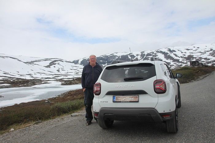
Why by car when most travelers opt for a camper van, while others prefer the comfort of cruises? Well, because we don’t own a camper van, renting one is pricey, and then you’ve got to add fuel costs (those things guzzle gas!), ferry fees, and other "tolls." All things considered, we went for mostly rentals—especially since there were four of us at the start of the trip. We spent the first week in Denmark with our daughter and son-in-law. Then they flew back to Belgium, and we continued our adventure as a couple. For accommodation, we mainly booked Airbnb apartments, which helped keep costs down and, most importantly, let us prepare our own meals (diet, diet!). In this travel journal, you’ll discover (or rediscover, for those who followed my older ones) our unbridled love for theme parks, museums, unique experiences, and—especially in Denmark—Legos! Unfortunately, we didn’t do any hikes this year because the unpredictable weather had made the trails slippery, and since I’d already taken three tumbles during the trip, I didn’t want to risk another! In the end, we traveled for 32 days, covered 6,200 km, and most importantly, discovered the charming country of Denmark, marveled at Norway’s breathtaking fjords—all without suffering the heatwave that hit France and Belgium that June! If you’ve got any questions, don’t hesitate to ask!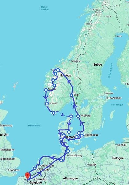
Why by car when most travelers opt for a camper van, while others prefer the comfort of cruises? Well, because we don’t own a camper van, renting one is pricey, and then you’ve got to add fuel costs (those things guzzle gas!), ferry fees, and other "tolls." All things considered, we went for mostly rentals—especially since there were four of us at the start of the trip. We spent the first week in Denmark with our daughter and son-in-law. Then they flew back to Belgium, and we continued our adventure as a couple. For accommodation, we mainly booked Airbnb apartments, which helped keep costs down and, most importantly, let us prepare our own meals (diet, diet!). In this travel journal, you’ll discover (or rediscover, for those who followed my older ones) our unbridled love for theme parks, museums, unique experiences, and—especially in Denmark—Legos! Unfortunately, we didn’t do any hikes this year because the unpredictable weather had made the trails slippery, and since I’d already taken three tumbles during the trip, I didn’t want to risk another! In the end, we traveled for 32 days, covered 6,200 km, and most importantly, discovered the charming country of Denmark, marveled at Norway’s breathtaking fjords—all without suffering the heatwave that hit France and Belgium that June! If you’ve got any questions, don’t hesitate to ask!
Namibia Travel Journal: May 2025 - Trip Review
NAMIBIA TRIP 2025: April 24 to May 20: Feel free to comment or ask us any questions about this amazing journey.
>> Find all our photos and videos for each day on our website here: www.montagne-aventure.net
**DAY 1: Thursday, April 24, 2025: Outbound Flights from Lyon to Windhoek via Munich - Visit to Munich:**

Off we go on a new adventure. The alarm rings at 6:30 AM, the travel bags are packed, and we head to Lyon Airport. We booked our flight tickets with Lufthansa. The first leg to Munich, Germany, is operated by AirBaltic. Departure at 1:05 PM for a 1-hour and 20-minute flight. We arrive at 2:30 PM.
**We now have a 7-hour layover, so we take the opportunity to get some fresh air and explore Munich.** We quickly exit Terminal 2 of the airport and head towards the subway. We buy a group day ticket "Airport-city Day Zone M-5," valid for 2 to 5 people at a price of 30.50 € (instead of 16.30 € per person). We take the S8 line to **Marienplatz** in 35 minutes. **This is the heart of the city.** The weather is overcast, quite cool, but dry. Perfect for a little city trip between two flights while leaving our large luggage in transit at the airport. **Munich is the third-largest German city after Berlin and Hamburg, in the Bavaria region.** **The center has a lot of charm and brings together several religious buildings, easy to explore on foot.** We are impressed by the number of people enjoying these 100% pedestrian streets, which are very pleasant. After Marienplatz, the most famous square with the town hall, we head to the Cathedral of Our Lady, a Gothic church, then continue to **Karlsplatz** and move on to **the food market offering a wide selection of high-end food products in an atmosphere where a certain art of living prevails.** We also visit St. Peter's Church before grabbing a bite to eat. Two good hours were enough for this 10 km city walk. It's time to take the subway back: by 6:30 PM, we are back at the airport. Now, it's time for a bit of waiting and rest. Our second flight is scheduled for 9:35 PM for a 9-hour and 30-minute journey to our final destination in Namibia: **Windhoek.**
> Round-trip flight tickets with Lufthansa from Lyon: 2029 €, or 1,014.50 € per person.
> Lyon Airport parking: 120 €
> Today's expenses: 7 € for 2 pizzas in France / 14 € for the restaurant in Munich / 30.50 € for the daily subway ticket in Munich.
**DAY 2: Friday, April 25, 2024: Arrival in Windhoek, Visit to the Namibian Capital:**
After a 9-hour and 30-minute overnight flight with Discover Airlines, we finally land on Namibian soil just before 7:30 AM. The day is breaking, and the colors are already stunning. We are eager despite the usual fatigue from the flight. The airline was punctual, with friendly staff and good meals, though a bit light. We are the first flight of the day to land, with no more than 15 flights per day here, from 7 AM to 8 PM. We disembark on the tarmac at this airport located in the middle of nowhere, **I finally set foot on African soil for the first time.** We exit among the first from the aircraft to go through the long formalities at the front of the line, as the wait can quickly become endless. Allow at least 5 minutes per person for e-visas. We still wait 45 minutes despite only about twenty people ahead of us. Phew, it's done. We collect our luggage and then withdraw money from an ATM. We make 4 withdrawals of the maximum amount, 2000 NAD $ per withdrawal, for a total of 380 €, or 95.33 € per withdrawal.
Our driver arrives at the same time, perfect timing, we were quick.
We leave the airport at 8:45 AM. By 9:30 AM, we arrive at the **Gracious Whisp vehicle rental agency**, located at the entrance of Windhoek, small and human-sized with a fleet of recent vehicles. More formalities, then a short wait as our vehicle is not yet ready. Time to decompress, catch our breath, and enjoy the very pleasant morning temperature. Not a cloud in sight. Next, a briefing on the vehicle, always with a bit of apprehension due to our approximate English. Allow 45 minutes of explanations, including setting up the roof tent, camping equipment, technical information in case of a flat tire, driving tips in Namibia, and a tour of the 4x4. We have all the necessary equipment for camping: mattresses, sleeping bags, pillows, table, chairs, gas stove, BBQ grill... as well as 2 spare tires, a compressor, a dual tank, and accessories for removing wheels. Off we go, it's time to muster our courage and get behind the wheel. **Heading to SuperSpar Maerua**, fortunately located less than 10 minutes away. We park with the help of a parking attendant; it's very crowded, the space is narrow, but everything goes well despite the cursed right-hand drive. Today's new mission: stock up on groceries. The store is well-stocked with local and imported products, catering to all tastes. We spend 114 € on groceries, from pasta to meat, BBQ lighters to dishwashing products. Two people load our groceries into two carts and transfer them to our vehicle; we feel compelled to leave a tip, 50 NAD $, as we don't have change yet. Now, we head to the hotel, 15 minutes away. Traffic is difficult at a complicated intersection; this will likely be the only traffic jam in Namibia. **We arrive at Kate's Nest Guesthouse & Backpackers around 1:15 PM, quite tired.** We take some well-deserved rest at this recent establishment, quite calm with secure private parking. After a short nap, we enjoy the quiet by the hotel pool. Night falls between 6:30 PM and 7 PM. We eat quietly in our room tonight before starting this long 4x4 road trip in camping mode in the heart of Namibia.
> Today's grocery expenses: 114 € at Super Spar Marua (2395.21 NAD $).
> Round-trip flight tickets with Lufthansa from Lyon: 2029 €, or 1,014.50 € per person.
> Vehicle rental: 4x4 Toyota with roof tent for 24 days: Gracious Whisp Car Rentals: 2,638 € (N$50,640) or **1,319 €** per person - (https://gwcarrentals.com/)
> Distance driven today: 15 km.
> Accommodation: Kate's Nest Guesthouse & Backpackers - 4 Aristotles Street Academia, 9000 Windhoek - 36 € for two for one night.
> Windhoek International Airport website: (https://www.airports.com.na/)
**DAY 3: Saturday, April 26, 2025: Windhoek to Hardap: Mariental Region - Kalahari Desert:**
After a good, restful night, we wake up leisurely around 7 AM. We enjoy the comfort provided by this first and last hotel before 24 nights under the tent.
**We leave Kate's Nest Guesthouse at 8:30 AM to tackle the Namibian roads.** We quickly leave the capital; in just 30 minutes, we find ourselves almost alone in the world. The landscape is dotted with small domes. We leave the **paved B1** quickly to turn left onto the **C15**. **From there, we won't see more than 10 vehicles all day.** After passing through the few houses of **Lekkerwaterpoort**, we tackle our first gravel road. These road sections are limited to 100 km/h, but even at 70 km/h, I find it already challenging. However, I quickly get used to it and gradually pick up speed to reach my cruising speed of around 80 to 90 km/h. **We are on immense straight lines crossing wild expanses as far as the eye can see.** **We come across two baboons, a few ostriches, and numerous cattle and sheep farms.** We pass through the charming village of **Uhlenhorst** with its typical houses and children with broad smiles waving at us. Life here is already very different from Windhoek. **The thermometer rises quickly from 16°C at 8:30 AM to over 28°C in the early afternoon.**
**We arrive at the Hardap Dam reserve at 2 PM.** We stop at the toll booth at the park entrance to pay the entrance fee: 250 NAD $ for 2 people and 1 vehicle. We continue to the dam and then the camp entrance, located a bit further. We had booked in advance, but this place remains little frequented by foreigners.
We take advantage of the hottest hours to rest by the large pool overlooking the immense lake, a very enjoyable moment. Would this be a bit of a vacation?
Around 4:30 PM, we head to the campsite. We overlook this vast water reserve. We arrive first; we will be only 3 vehicles spending the night here. It's time to get to work and set up our equipment for the first time. It takes us a good 20 minutes to set everything up, with a slight apprehension about unfolding the tent. Once this task is done, which we will have to repeat for almost a month, we will become much more efficient over time. Time for rest and contemplation in total silence. The sun gradually sets, and the heat quickly becomes bearable again. Bliss! **This dam is located 20 km northwest of Mariental in an area dotted with conical hills topped with dolerite buttons (Hardap means "hillock" in Nama). It captures the Fish River, which flows south, creating a large lake in the middle of an arid environment. The contrast is striking.** We enjoy our first sunset facing this 360° otherworldly landscape.
Around 7 PM, we start our first BBQ, or "braai" as it's called here. The temperature is perfect. The sun sets, giving way to a star-filled sky of incredible beauty thanks to the absence of any light pollution. The Milky Way will lull us throughout the evening. After some good sausages and potatoes on the BBQ, we head to our roof tent around 9:30 PM with a complete change of scenery in just 24 hours. France already seems so far away...
This campsite has shared showers and toilets, quite clean and functional, as well as a central area with several BBQs and tables. The sites are arranged in a semicircle, each with an electrical outlet. The sites are close to each other but spacious, some slightly shaded. We are only three vehicles tonight, so it's perfectly comfortable and quiet. Not to mention the large pool near the restaurant. Our trip is off to a great start.
> Today's road itinerary: Windhoek > Head south on the B1 to Rehoboth > Turn left onto the C25 then C15 to Stampriet > C20 to Hardap > Full north on the B1 > Then turn left onto the M93 - 5 hours of driving.
> Distance driven today: 354 km.
> Accommodation: Hardap Recreation Resort - 23.3 € for two - Large pool - GR6W+3M2, Hardap Game Reserve, Mariental, Namibia - (http://www.nwr.com.na/resorts/hardap-resort/)
**DAY 4: Sunday, April 27, 2025: Hardap - Brukkaros Volcano - Keetmanshoop - Quivertree Forest Rest Camp**
Our first night under the tent was very pleasant; the little wind quickly calmed down, giving way to absolute silence. The mattress is decent, more comfortable than some nights in Nepal. The length and width give us enough space for maximum comfort, despite my height (1.91 m). We wake up a little before 7 AM as the sun rises, and the lights dazzle us from the start of the day. We pack up the equipment in 30 minutes, quite easily. Then we enjoy the sun, which warms up quickly while we keep our light fleece on.
At 8:30 AM, **we hit the road again, heading south** to our first stop in **Mariental**. We want to do some shopping at SuperSpar, but once we arrive in the parking lot, a young local is fighting with the supermarket security guards and then threatens to throw stones. We don't want to take any risks right at the start, so despite the baton blows he receives, he doesn't stop. We leave empty-handed but fill up with fuel at the Shell station 1 km further. The price per liter is 21.33 NAD $, we fill our 107-liter tank for 107 €. In Namibia, you get served, and they bring the card machine to the window to pay. It's then customary to leave a tip.
We then take the B1 heading due south on a recently renovated road. Around 11:30 AM, we leave it on our right to take **a wild gravel road, the M98**. Just before **Berseba**, we turn right onto a small track, the **D3904 towards Brukkaros Crater up to a camp at 1588 m altitude**. The track then becomes too bumpy. We stop on the counter-slopes where **a wide panorama unfolds over these immense plains as far as the eye can see**. It's 12:15 PM, time for us to eat a rice and tuna salad facing this landscape.
**We are alone in the world until a vehicle arrives and parks next to us.** A bit of apprehension, 4 men head towards us. It turns out to be 4 shepherds looking for a lost foal. The conversation is pleasant, lost in the middle of nowhere. We find ourselves alone again in this absolute silence. **The heat becomes stifling with a good 30°C**. We get back on the road around 1 PM. Back on the B1, **we continue due south to Keetmanshoop**, which we reach around 3 PM. We stop there to do some shopping for 262 NAD $ (12 eggs, a can of tuna, a can of corn, bread, a soda, and a 5-liter water container), or 12.48 €. Two quite insistent children ask us for money or candy at the store exit, yet we give them a small tip, but they continue to cling to the car. Locals parked next to us tell them to leave us alone. Anyway, we finish the trip to **Quivertree Forest**, 15 km away. We will spend the night in this **pleasant farm run by a German**. Upon arrival, as the day before, and as I suppose in the future, we dive straight into the cool pool to relax after all these kilometers. A bliss. Then we take our 4x4 and choose a spot near these famous trees. After the 33°C this afternoon, once 4 PM passed, the temperature drops again and becomes very pleasant. **We are in the middle of the Kokerboom, one of the most interesting and characteristic plants of hot and arid regions. It's not really a tree but a variant of the aloe plant whose botanical name is Aloe Dichotoma. This Kokerboom has a smooth and thick trunk reaching up to 1 m in thickness and 9 m in height. They bloom for the first time at the age of 20 to 30 years.** The flowers are yellow and reach about thirty centimeters during the season between June and July. **They grow mainly in an environment with a high concentration of black rocks absorbing a large amount of heat (38°C). The rocks also serve to anchor the tree with its tentacle-like roots. It also resists frost. Each is between 200 and 300 years old.**
Around 5 PM, we walk to the farm reception to watch the feeding of **two cheetahs**. Magnificent carnivores taking their time to savor their piece of meat. **Then we return near our campsite to enjoy the sunset among these trees. The colors are sublime, as every evening apparently. A magnificent spectacle with colors evolving from yellow to orange then to pink, before giving way once again to a sky filled with thousands of stars.** Our campsite at Quiver Tree Forest Camp is very comfortable; we have a water supply, a stone table, a small lamp, an electrical outlet, a small tree for shade, and a BBQ that we won't use tonight; we'll cook on gas. The sites are far apart, with some shared facilities scattered around, a very beautiful setting. No reservation possible, no need, just show up directly. **The campsite accommodation for 2 people costs 28 €, including the reserve entrance fee of 5 €**. We finish this second bivouac evening around 9:30 PM, time for some reading and sleep in peaceful silence without wind.
> Today's road itinerary: Mariental > B1 heading south to Brukkaros > At Tses turn right towards Berseba via the M98 > Turn right onto the D3904 > 8 km > Brukkaros Volcano (stop at the lower camp as the track is difficult for 1 hour) > Keetmanshoop > Turn left onto the M29 > Quivertree Forest - 4 hours of driving.
> Distance driven today: 371 km.
> Distance walked today: 6 km.
> Today's expenses: Groceries for 12.48 € (262 NAD $) / Fuel for 107 € (1 liter of diesel for 21.33 NAD $).
> Accommodation: Quivertree Forest Rest Camp, P.O. Box 262, Keetmanshoop, Namibia - BBQ, hot showers, toilets, and electricity - No reservation - Pool - 18 €/Person (N$ 340.00 with park entrance) - (http://www.quivertreeforest.com/)
**DAY 5: Monday, April 28, 2025: Quivertree Forest Rest Camp - Giant's Playground - Keetmanshoop - Fish River Canyon - Canyon Roadhouse:**
After an excellent start to the night, we are woken up by the wind shortly before 6 AM, but the sunrise is not far off. We get up at 6:30 AM to enjoy it. The atmosphere is a bit cooler this morning, but the reward is already here.
The adventure continues. At 7:45 AM, we head towards **Giant's Playground**, 4 km away. We take a 3-kilometer walk through this expanse of blocks and igneous rocks.
We continue south at 8:45 AM, passing through Keetmanshoop again where we do some shopping for 25 €, a big stock-up for a good part of the trip: meats, canned goods, pasta, fruits... At 9:30 AM, we take the B4 to Fish River Canyon.
At 11:30 AM, we arrive at the entrance to the NWR park (350 NAD $ entrance for 2 people and 1 vehicle). The track becomes bumpy immediately upon entering the park. After about ten kilometers, we come upon this landscape carved by nature. In the end, it's well worth the detour. We were at the Grand Canyon in the USA exactly (https://www.montagne-aventure.net/2024/04/29/j21-3-juin-2024-grand-canyon-et-lac-powell/) and can thus confirm that this Fish River Canyon is comparable. We make several stops along the southern flank. **Here, nothing is developed; nature is almost in the wild state.** **With 160 km in length, up to 27 km in width, and a depth of 150 m, it is indeed the second-largest canyon in the world.** The history of the canyon is apparent in its different earth layers and stratification: the antiquity of the place is tangible, and the absence of vegetation is surprising. **It consists of two nested canyons, formed at distinct periods. The first distinct layer of schist, sandstone, and eruptive material surrounding the canyon was formed a few two billion years ago, then transformed due to heat and pressure into more solid rock such as gneiss. The inner canyon, carved more recently by the Fish River, has a depth of 270 m.**
We have a picnic once again alone in the world facing this grand panorama at the **Sulphur Spring View Point**. This is where the hiking trail begins, plunging into this narrow canyon, but it is forbidden to venture there alone without a guide. It's 30°C, but a slight wind makes the atmosphere bearable. At 1 PM, we retrace our steps and continue to the **Main View Point** then to the **Hikers View Point**.
In the south of Namibia, the Fish River Canyon, 160 km long, is a true geological wonder: a canyon nested within another canyon, one of the largest in the world. The first sedimentary layers formed two billion years ago; 500 million years ago, a period of tectonic activity caused these layers to crack and tilt, opening a vast canyon in the Earth's crust. The second canyon, with a depth of 270 m, was carved over time by the passage of the Fish River in this new valley.
At 3 PM, we arrive at our very charming camp for the evening, the **Canyon Road House**. We fill up with fuel right away because tomorrow we have a long day of isolated driving: 55 liters for 1240 NAD $. Then we settle into the campsite we had previously reserved in France. We are assigned site 2, very well set up under a tree with its BBQ and stone table just steps from the pool. We quickly set up the tent and jump straight into the pool for the relaxation moment of the day. As usual, the water is quite cool, but it's a real pleasure. Then we stroll around this Canyon Road House, which recreates the atmosphere of the roadside inns of the 1950s with old car wrecks and vintage gas pumps in a bygone era. **Around 5:45 PM, we start a short walk leading us to the top of a hill overlooking the wide plateau where we are to watch the sunset.**
And finally, to end this beautiful day, it's time for the braai, with grilled sausages and white beans on the evening menu.
> Park entrance: 150 DN/person + 50 DN/vehicle (18 € for two). It is possible to enter at two access points: Hobas in the north and Ai-Ais in the south.
> Today's road itinerary: M29 > Keetmanshoop > B1 > B4 > C12 (track) > After Holoog turn right onto the D601 (C37 track) > Accommodation on our right (stop just to check in before 6 PM) > Continue 30 km (30 minutes of track) to the viewpoints after Hobas where you must pay the entrance fee. Sunset View Point to the left > Return before sunset as the park closes (best lights at sunrise). 3 hours.
> Distance driven today: 228 km.
> Distance walked today: 10 km.
> Today's expenses: 25 € for groceries / 17 € for the Fish River Canyon park entrance / 58 € for fuel.
> Accommodation: Canyon Roadhouse, Gondwana Collection Namibia – 34.4 € for two - Pool - Near Hobas - (http://www.gondwana-collection.com/fr/accommodation/canyon-road-campsite)
**DAY 6: Tuesday, April 29, 2025: Canyon Roadhouse - Orange River - South African Border - Vista Trail - Gondwana Sperrgebiet Park - Aus:**
The night was excellent in this very comfortable campsite. **We wake up to the sound of birds** before the alarm at 6:45 AM. Our little morning routine starts as the sun rises. **A big day of driving awaits us to the South African border. This will be the southernmost point of our journey.** We hit the road at 8 AM via the C37, pass through **Hobas**, then turn onto the D207 to **Aussenkehr.** **We cross a mountainous barrier with some high peaks and perfect cones. The rock varies from orange to pink to black.**
We then cross a lunar desert as far as the eye can see on a giant dome; the track winds through nowhere without meeting anyone for hours. The landscapes are surprising. **We spot several ostriches and a gemsbok.** In the middle of this endless expanse, we come to an improbable intersection and continue right onto the D278.
In the middle of these arid lands, we come across a green zone: a vast vineyard. At 10:30 AM, **we come across a "Road closed" sign, fortunately, a local resident waves us to continue; a bit stressed, we proceed.** We start to follow the beautiful Orange River. On the other side of the bank, just a few meters away, South Africa is there. It is the second-longest river in Southern Africa, after the Zambezi. It flows over 2,000 km to the Atlantic. After passing through narrow gorges, we regain altitude before starting the descent, gently heading back north.
**We now cross and follow the Fish River, which joins the Orange River further south** **along this gorge dating back millennia.** At exactly noon, we take a lunch break by the Fish River, still without meeting a soul in this landscape between greenery and aridity. The temperature here is cooler with a pleasant 23°C on the banks, the perfect spot. **We continue on the track to Rosh Pinah**, where we find a paved road again. **The section along the Orange River and the Fish River was officially closed, but we were able to pass without any issues, avoiding a detour of at least 3 hours.** Phew. We now drive at high speed (limited to 120 km/h) through these vast spaces. We come across many ostriches after the **dozens of monkeys along the Fish River**. Around 3 PM, 3 km after the very small town of **Aus**, we reach **our campsite for the evening at Klein Aus Vista**. A new **small peaceful haven very well set up**. As usual, after checking in at reception, we jump straight into the beautiful pool to get our well-deserved dose of coolness, another good thermal shock that our bodies appreciate. Once this moment of relaxation is over, we take our 4x4 to reach the campsite located a bit higher, set apart at the foot of a hill that overlooks us.
After setting up, **around 5 PM, we head to the Vista Trail to climb to the top of a mountain overlooking the vast plain that surrounds us at 360°**. It takes about 30 minutes to climb. The place is just magical, **the perfect viewpoint to admire the sunset**. **We fully savor the moment. We also spot one of the few wild horses in the world capable of living in the desert.** Their numbers have decreased in recent years due to predation and drought (around 100 to 150). At 7 PM, we return to the camp, time for the braai and preparing the meal in this peaceful little camp.
In the south of Namibia, the Fish River Canyon, 160 km long, is a true geological wonder: a canyon nested within another canyon, one of the largest in the world. The first sedimentary layers formed two billion years ago; 500 million years ago, a period of tectonic activity caused these layers to crack and tilt, opening a vast canyon in the Earth's crust. The second canyon, with a depth of 270 m, was carved over time by the passage of the Fish River in this new valley.
> Today's road itinerary: 5 hours of driving: D324 heading south (track) > turn right onto the C10 (track) > D316 heading south > turn right onto the C13 > In Aus turn left onto the B4 > Campsite via a track on the left.
> Fuel station: Solitaire or Aus.
> Distance driven today: 398 km.
> Distance walked today: 7 km.
> Accommodation: Klein-Aus Vista Desert Horse Campsite - Farm Klein-Aus No 8 on the B4 main road to Luederitz Aus 9000, Aus, Namibia - (http://www.klein-aus-vista.com/accommodation/desert-horse-campsite/) 17908 420 DN - Water + Shared shower (hot water). No electricity.
**DAY 7: Wednesday, April 30, 2025: Aus - Kolmanskop - Diaz Point - Luderitz - Kanaan Desert:**
We wake up around 6:45 AM, with partly cloudy weather for once; we feel the ocean's influence gradually. But the sun isn't far off. At 7 AM, we leave the campsite heading west towards Luderitz via the B4. **First stop of the day: Kolmanskop, the ghost town we reach at 8:30 AM**, entry costs 180 NAD $ per person. We discover this **timeless place** in 1.5 hours, moving from building to building amidst violent sand-laden gusts of wind. There's a lot of charm in these different living spaces. **The sand quickly reclaimed the place after this mining town was abandoned.** This was once the headquarters of Consolidated Diamond Mines. It's hard to believe that this former town, where the diamond industry once flourished, had a hospital, a bowling alley, and a theater. The decline in diamond sales after World War II and the discovery of richer deposits put an end to this golden age. By 1956, the town was already completely deserted, and the sand had reclaimed its rights. **These dilapidated buildings swallowed by shifting dunes have something surreal about them.**
At 10:15 AM, we hit the road again **heading to Luderitz, 22 km away**, and first to **Diaz Point** **facing the Atlantic Ocean**. It's a wind-swept peninsula with its characteristic red and white lighthouse. There's a campsite and a coffee shop on site, but the place doesn't inspire rest without shade or shelter from the wind. We return to the city via the D701 track that runs along the ocean, be careful at low tide. We come across **a few fishermen and a fox as well as flamingos.**
We walk through the few streets of the city, much smaller than I imagined, then climb to the **famous little Lutheran church that overlooks the city, the Felsenkirchr.** **The wind blows very strongly here, and the sand is omnipresent, surrounded by the Namib Desert and the southern Atlantic coast.** **A German colonial relic barely touched by the 21st century, Luderitz seems frozen in the past, giving it both a gloomy and a certain charm. In short, it's certainly one of the most incongruous places in Africa.**
At 1:15 PM, just before leaving Luderitz, we do some shopping for 20.50 € and fill up with fuel: 61.50 €, 1290 NAD $ for 61 liters (21.18 $ per liter).
**We return via the B4 to Aus** (paved), **then via rougher tracks**, the C13 then the D707, magnificent as it runs along a mountain range with multiple colors on our right and an endless flat desert on the other side.
To access our campsite for the evening, we must take a **narrow private track for 7 km** on our right to emerge, in this total vastness, at the **isolated Kanaan Desert Retreat on a small hill**. I don't have time today to jump into the pool near the reception; we arrive at 5 PM at 8 small, isolated, and unique sites with a small kitchen, a shower, and a private toilet under a small tarp shelter. **A crazy charm with a unique view...** **This will be my favorite accommodation of this trip. The photos speak for themselves.** We jump into the outdoor shower while savoring the landscape, then prepare our evening braai while enjoying the colors fading, facing this plateau with bushes turning a vivid orange. **A moment that will remain etched for life.** **Savanna atmosphere under a thin emerging moon. Every minute offers different colors. Facing our meal, we have a natural giant screen.**
We end this day contemplating the stars and admire this thin orange moon setting on the horizon (8:42 PM).
**Ghost town just before Luderitz: Kolmanskop** (open from 8 AM to 3 PM - N$ 180 p.p – 9 €). Once, Kolmanskoppe was organized around diamond mining. After finding new, more prolific spots, the town was abandoned and is now a ghost town. The sand and dunes have reclaimed their rights and buried everything humans had built. Houses, train station, bakery, everything has been covered by sand, which passes through the windows, even though they are 1 meter high.
> Today's road itinerary: 5h30: B4 to Luderitz (paved) > Round trip > Kolmanskop on the left > Return via the previous campsite > Then C13 (track) > Turn left D707 (track) > Then track to the right to the campsite.
> Distance driven today: 438 km.
> Distance walked today: 8 km.
> Today's expenses: Groceries at the Spar in Luderitz for 20.50 € / Fuel fill-up in Luderitz for 61.50 €.
> Official Kolmanskop website: (https://kolmanskuppe.com) (open from 8 AM to 1 PM - N$ 180 p.p – 9 €).
> Accommodation: Night at the south of the Namibrand Nature Reserve: Kanaan Desert Retreat – 26.5 € for two - (http://www.kanaannamibia.com/) - Farm 104 Karas 9000 - Sanitary facilities + BBQ + Water + Pool - No electricity - My favorite accommodation of this trip.
**DAY 8: Thursday, May 1, 2025: Kanaan Desert Retreat - Namib Desert - Crossing the Namibrand Nature Reserve – Sesriem Canyon - Elim Dune - Little Sossus Lodge**
After a cooler night than the previous ones with about 10°C, we wake up around 7 AM. We admire, as usual, the sunrise between the desert and the mountains. **The spot from last night was truly perfect, isolated from the world, in total serenity, with a wake-up call to the sound of birds.**
We hit the road a little after 8 AM, heading north via the D707 to Spes Bona, then the gravel road C27 via Betta to Sesriem. **The landscapes roll by and dazzle us.** **We are right in the heart of the Namibrand reserve**, coming across numerous **zebras**, **impalas**, **ruminants that reproduce in large numbers**, and **gemsboks**. At noon, we stop in the shade of a tree to eat. The spot is so romantic facing orange arid mountains and a vast green plateau. **A landscape full of contrasts, timeless and silent.**
**The Namib Desert is the oldest on the planet; its name means "vast arid plain," and it also gave its name to the entire country: Namibia.** The majority of these arid and semi-arid lands dotted with viewpoints are part of the Namib-Naukluft National Park, which covers 23,000 km².
At 1 PM, we enter the Sossusvlei park. We start with the **Sesriem Canyon**, which is 3 km long and 30 m deep. We enter it with a short 1-hour hike into its depths. **It was carved by the Tsauchab River in an agglomerate of sand and pebbles over 15 million years old.** We retrace our steps back to Sesriem, which means "six belts," referring to the number of leather belts (from ox wagons) needed to draw water from the canyon. This remote locality is mainly the gateway to Sossusvlei but offers a gas station and some accommodations. For our part, we sleep 40 km away tonight.
**We then move on to Elim Dune.** It takes about 45 minutes of walking to reach its summit, and the climb is very breath-taking as we progress in the sand where we almost slide back with each step. **A first grand 360° panorama unfolds. The ochre color of the sand contrasts completely with the yellow plain and the brown and black mountains in the distance.**
At 3:15 PM, we start the descent facing Sesriem. We were completely alone once again on this dune. **These Namib dunes are composed of colored quartzite sand, presenting hues ranging from cream to orange and from red to purple. Unlike the ancient dunes of the Kalahari, these move with the wind and adopt distinct, ever-changing shapes.** Star dunes resemble stars seen from above, while transverse dunes, like those on the coast south of Walvis Bay, stand perpendicular to the prevailing southwest wind. The most stable dunes, which thus have the most vegetation, are parabolic dunes, due to the variability of the winds. Longitudinal (seif) dunes measure up to 100 m in height, while barchan dunes, crescent-shaped and predominant at the extreme north of the Skeleton Coast and south of Luderitz, are the most mobile, created by unidirectional winds.
**We get back on the road for 45 minutes to our campsite for the evening, Little Sossus, which we reach at 5 PM**, via C27 then right onto C19. As often upon our arrival, I jump into the cool pool to relax after all this driving, then we proceed to set up the camp. As the day before, the campsite consists of 10 fairly distant sites, with private sanitary facilities and a small roof. We are delighted with this crazy charm. The hot water for our shower is wood-heated: a Namibian lights it every evening around 5 PM.
For a change, or not, the menu features a small BBQ with pork ribs and pasta, facing another sunset, this time with partial cloud cover giving equally splendid colors. Time for a well-deserved rest after long corrugated tracks covered in our 4x4 today.
> Today's road itinerary: 4h45 of driving: Find the D707 and head north (track) > At Spesbona turn left onto the C27 (track) > At Sesriem after entering the park, turn left following View Point Sesriem > Continue 4.5 km to the Sesriem Canyon Parking > Return then head towards Elim Dune > Exit the park then take the D826 > Turn right onto the C19 heading SE > Turn right facing the D854 to the campsite (campsite closes at 7 PM).
> Distance driven today: 272 km.
> Distance walked today: 8 km.
> Today's expenses: Entry to the Sossusvlei Namib-Naukluft Park: 17 € for two (with one car).
> Accommodation: Little Sossus Lodge – 35 € for two - At the junction of the C19 and D854 roads Maltahohe 9000, Maltahohe, Namibia - (http://www.littlesossus.net/) - Pool + Private bathroom + Hot water + Electricity + BBQ + Grocery store (bread to order the day before).
**DAY 9: Friday, May 2, 2025: Little Sossus Lodge - Namib-Naukluft National Park – Sesriem - Sossusvlei - Big Daddy – Deadvlei - Tsauchab River Camp**
Today we start the day early to tackle **the famous dunes of Sossusvlei at first light**. The alarm goes off at 6 AM to leave the camp at 6:45 AM. The wind is blowing quite strongly in gusts this morning, but it only woke us up a quarter of an hour before sunrise. The park opens at 7:15 AM. We start with a small encounter: a friendly **jackal lounging by the roadside.**
We first have to cover the 40 km of track to Sesriem, pay the entrance fee (350 NAD $), and drive 65 km on a paved road this time to reach the **vast salt pan (a lake whose sediments are made of salts) of Sossusvlei**. **It appears amidst the gigantic red dunes that rise on either side. The wind constantly changes the shape of the dunes, as well as their colors, which vary with the light. The setting is breathtaking, giving an impression of immensity and timeless grandeur.**
The paved road ends; the last 4 kilometers become technical and are reserved for 4x4s. Phew, I pass without any problems, though not without stress, switching to L4 mode. **We start the ascent to Big Daddy at 8:45 AM, 325 m of elevation gain in the sand nonetheless.** We climb at an excellent speed despite the strong wind, in exactly 1 hour. At 9:45 AM, we are at the summit of what will remain etched for a long time. The 360° view is simply unimaginable; you have to experience it to believe it. The wind blows violently up there, **it feels like being in the high mountains, on a snow ridge, with a strong transport of sand. The atmosphere is magical.** We start the descent running barefoot in the steep sand.
**We then move on to its neighbor, Deadvlei.** **Here, petrified trees stand in the "vlei" (basin) with their dried branches casting desolate shadows on the white ground. The juxtaposition of the deep blue sky and the towering dunes is captivating.**
We return to the 4x4 parking at 11 AM, the stress rises again for the sandy track passage. We retrace our steps and stop at **Dune 45**.
At noon, we take the opportunity to picnic at the foot of **the beautiful Dune 40**, where there is already no one left. We enjoy the quiet again, well, almost, as the wind remains omnipresent.
At 1 PM, we return to **Sesriem**, where we fill up with fuel (21.15 NAD $ per liter), totaling 1630 for 77 liters (78 €), and do some shopping for 245 NAD $ (two nice pieces of pork, 2 cans, 2 sandwiches for tomorrow, and 1 soda), which is 12.48 €. It's 27°C. We hit the road again, heading to a new destination at 2 PM. We take the C19 back to Little Sossus where we spent the night, then turn left onto the gravel road D854 for about 40 km to **Tsauchab River camp**. Finally, we won't be sleeping here; we are redirected 7 km downstream to **Naukluft View Camp**, which also belongs to Tsauchab River Camp.
We arrive at 4 PM, and thankfully, the fatigue was starting to set in. **Our campsite is located under a small forest, providing some protection from the wind that blew strongly all day. The calm does us a world of good. Once again, a lot of charm**, with very spaced-out sites without any visibility. We can't wait to take our shower. It will be possible from 5 PM with, as the day before, water heated by a wood fire. Time to prepare the campsite for the night. And on the menu, a braai with two superb pieces of pork bought in Sesriem and fries!!!!
**The Namib Desert**
An impressive coastal desert stretching from the Atlantic to a high plateau inland, the narrow Namib Desert runs along the southwest African coast for about 1,300 km. **Considered one of the oldest deserts in the world**, it is bordered to the north by the Kaokoland Desert, which extends into Angola, and to the south by South Africa's Karoo. The narrow Namib is mostly less than 160 km wide. Despite this, it is considered to consist of three sections: the coastal strip influenced by the Atlantic; the Outer Namib, occupying what remains of the western half; and the Inner Namib, comprising the eastern half of the desert. Generally called the Skeleton Coast, the coastal Namib receives almost no rain and depends on regular marine fogs for moisture. From sea level, the terrain rises to 900 m, where the desert meets the base of the Great Escarpment to the east. In the Inner Namib, average annual rainfall is only about 50 mm.
The dryness is such a characteristic of the Namib that it is thought to have been in this arid state for at least 55 million years. It is all the more surprising to learn that animals such as vipers, geckos, zebras, and elephants live in this desert. Some areas of the Namib are also rich in flora, including Welwitschia mirabilis, which grows near the ground with seemingly exhausted leaves, extracting moisture from marine fogs and can live over 1,000 years. In the southern Namib, some dunes are up to 32 km long and 240 m high.
**The frequent fog of the Skeleton Coast:** Driving north along the coast of Namibia, the cold Benguela Current in the Atlantic cools the moist air above the ocean, which, upon meeting the warm desert air, leads to the formation of thick fog banks that drift up to 100 km into the center of the Namib before evaporating under the sun.
> Today's road itinerary: 4 hours of driving: C19 towards Sesriem (track) > D826 (paved) > Foot of Big Daddy via a technical sandy track > Return via the same route > D854 to Tsauchab.
> Gas station: Sesriem.
> Distance driven today: 254 km.
> Distance walked today: 12 km.
> Today's expenses: Park entry at Sesriem for 2 people: 17 € / Fuel fill-up: 78 € / Groceries at Sesriem gas station: 12 € (245 NAD $).
> Accommodation: Tsauchab River Camp - Naukluft View Camp - D054 & D850 GPS: S24 26' 37" E16 10' 11" Sossusvlei 22007, Maltahohe, Namibia - BBQ + Private sanitary facilities + Water - www.tsauchab.com
**DAY 10: Saturday, May 3, 2025: Tsauchab River Camp - Naukluft National Park - Olive Trail Hike (10 km) - Ababis Guest Farm**
We pack up the camp at 8 AM and continue our road trip north via the D854, a bumpy track with many corrugated sections. It's cool this morning, 12°C.
**We enter the Naukluft massif, discovering landscapes with very different terrain than before.** We first need to check in at the campsite, 13 km from the entrance at the end of the track: 350 NAD $ for 2 people and 1 vehicle, then return 4 km back. **On the agenda is the lovely Olive Trail, a 10 km hiking loop that starts 4 km northwest of the park office**, along the D854 that we follow. At 9:45 AM, the hike begins with a fairly steep ascent (about 45 minutes) among the **wild olive trees** from which the trail gets its name. **At the summit, we enjoy a view that embraces the Naukluft Valley.** We then turn east and gradually descend into a deep valley, passing over sometimes slippery rocks. We have a snack around 11:30 AM in these small gorges. **Further on, to cross the wall of a canyon in front of us, some chains are fixed to the rock to help us pass.** We finish this superb loop clockwise at 1:15 PM, taking 3.5 hours including 30 minutes of breaks. We only crossed a small group of 3 people on this wild adventure far from everything. At 1:45 PM, we exit the park and take the **D854 track north to Bullsport**. From there, we turn left and take the C14, which **runs along the bed of the Tsondab River.**
**We arrive at our campsite for the evening, Ababis Guest Farm, at 3 PM.** Quite early for once, allowing us to rest a bit in this peaceful farm where many sheep wander around us. We also enjoy the pool under a magnificent sun, less hot than the previous days, it's 22°C. The camp has only 4 spaced-out sites around shared sanitary facilities. **We are in the middle of a vast plain facing the Naukluft massif mountains.** We will have another beautiful sunset on these mountains. For the first time on this trip, **we will be completely alone at this campsite.** **We haven't encountered many people today**, just 3 during the hike and fewer than 10 vehicles all day.
> Today's road itinerary: Head north on the D854 (track) > Turn left to enter the Naukfluft National Park > Continue on the track then turn right to the Olive Trail hike parking lot (1 hour for 45 km). Return to the D854 and continue north > At Bullsport turn left onto the C14 to Ababis (still a track) > The camp is located on the left facing the D1261 (1 hour for 60 km from Olive Trail). Total: 2 hours of driving for 100 km.
> Gas station: No gas station on the route, except in Solitaire.
> Distance driven today: 115 km.
> Distance walked today: 13 km.
> Accommodation: Ababis Gaestefarm - Night booked by email – payment on site: (https://www.ababis-gaestefarm.de/) - P.O.Box 1004, Maltahöhe - N$ 300.00 per person
**DAY 11: Sunday, May 4, 2025: Ababis Gaestefarm - Namib-Naukluft National Park – Solitaire - Gaub Pass - Kuiseb Canyon - Moon Landscape - Walvis Bay**
The night was, for the first time since the start of this road trip, quite difficult. A strong wind accompanied us all night, making the tent flap constantly. A racket that drove us crazy. We still managed to sleep a few hours. The morning sun brings back our smiles. We hit the road for this new stage a little before 7:45 AM.
We start the day with a first stop less than 15 km away **on the C14 in Solitaire** at 8:15 AM. **This town is lost in the middle of nowhere with its small gas station with a western atmosphere adorned with rusted and sand-covered car wrecks.** After a quick supply stop: 86 NAD $, or 4 € for 1 water container and a box of cookies, we continue north still on the C14, **crossing the Tropic of Capricorn** then devouring this **magnificent track up to Gaub Pass**. **A succession of narrow gorges, turns, climbs, and descents breaking the monotony of the previous long straight lines.** We are right in the heart of no man's land for 200 km. We then start the descent to the **Kuiseb Canyon. It houses the wide bed of the eponymous river, dry almost all year.** Even when it flows for 2 to 3 weeks during the rainy season, it doesn't go beyond Gobabeb and then seeps into the sand. **The drinking water that supplies Walvis Bay is pumped at Rooibank from this underground water table.** **We now cross the Kuiseb Desert where impressive dunes roll down.** We make a short stop at a **natural rock arch** reminding us of our (https://www.montagne-aventure.net/2024/04/29/j19-1-juin-2024-canyonlands-national-park-et-arches-national-park/). Then we gradually descend towards **Walvis Bay** where we will spend the night. At noon, we enter the **Dorob National Park**. The thermometer drops 10°C in 10 minutes as we get closer to the Atlantic Ocean.
At 12:45 PM, much earlier than initially planned, we arrive at the **Moon Landscape** (View Point 4, free) to have a snack, via a very recent surprising dual carriageway in the middle of nowhere, then via the C28. We are again in the hinterlands, the temperature has soared: 30°C without a bit of shade. Even if the colors and the panorama must be exceptional at sunrise or sunset, the detour for this 360° panorama is still worth it. Extreme aridity as far as the eye can see. The place lives up to its name; it really feels like being on the moon. We get back on the road at 1:30 PM via the D1991, C28, then again the A2, which is very new. The latter runs along the beautiful dunes up to the **Dune 7**, where we make another stop.
Then we head towards our final destination of the day, **Walvis Bay. Its port is sheltered by a sand spit, a natural breakwater that protects the city from the powerful assaults of the ocean. Its port was long a strategic place: claimed by the Cape Colony in 1795, it was officially annexed by the British in 1878 to counter Germany's ambitions in the region. A colony of fur seals, pelicans, flamingos, and whale terns have made it their home.**
We do a big grocery shopping at the Spar located in the center for 66 €; it's very easy to park there. Then we fill up with fuel at an Engen station right across for 1117 NAD $ for 54 liters (20.6 NAD $ per liter), which is 54 €. We then **enjoy the seaside in the Lagoon neighborhood**, where it's also easy to park. After kilometers in the desert, **this cool break is more than welcome. The outside temperature is 22°C. In the distance, we can clearly see the clouds lingering over Swakopmund.**
We take the 4x4 one last time to the **Lagoon Chalets where we will spend the night**. The spot is well set up and surprising in the heart of a residential neighborhood. The sites are quite large, separated by fences around very comfortable shared sanitary facilities. BBQ, electricity, and shaded area. We settle in quietly before going out on foot to watch the **sunset over the Pacific Ocean along Lagoon Promenade Road**. We can still see this impressive persistent mist in the distance. The neighborhood is very peaceful, certainly without much charm, but with a very well-developed seafront that inspires relaxation after kilometers without meeting anyone in inhospitable lands. We end the day with our traditional braai: grilled chicken thighs and sautéed potatoes in the coolness of a starry sky.
> Today's road itinerary: 5h30 of driving (or 3h30 of driving for 250 km without the Moon Landscape): Head north on the C14 > Cross the Tropic of Capricorn > Gaub Pass > Kuiseb Canyon on our left in a round trip > Continue to Green Valley and leave the C14 to the right on the D1984 > Turn right on the C28 > Then left D1991 to Moon Landscape D1991 View Point 4 > Return via the same road and stop at Dune 7 for sunset > Walvis Bay.
> Gas station: Solitaire or Walvis Bay.
> Distance driven today: 372 km.
> Distance walked today: 5 km.
> Today's expenses: Fuel fill-up for 54 € + Groceries for 66 € at Spar.
> Accommodation: Walvis Bay: Lagoon Chalets – 36.6 € for two - (http://www.lagoonchaletswb.com/) - 8th Road West, Meersig Meersig 9000, Walvis Bay, Namibia - BBQ – Electricity – Shared sanitary facilities.

**DAY 12: Monday, May 5, 2025: Walvis Bay - Swakopmund - Round Trip to Cape Cross (seals) - Wreck of the Zeila en route - Henties Bay - Spitzkoppe Tented Camp & Campsite**
After an excellent night, a bit cooler and more humid than usual, we wake up around 7 AM and leave the camp at 7:45 AM to **follow the Atlantic coast heading north**. We thus leave **Walvis Bay**, a very pleasant stopover town, and follow the ocean via the B2. **We enter the mist and Swakopmund** at 8:40 AM, parking **near the lighthouse**. The atmosphere is very quiet, the streets seem dead with large empty parking lots and very little traffic, but the few open shops are filled with expatriates enjoying their breakfasts, French bakeries, cafes, travel agencies... **We are in this Benguela Current, a fast cold ocean current that flows from South Africa, up the coasts of Namibia and Angola, towards the northwest to join a warm equatorial current. Hence the supply of very fish-rich waters and this tenacious mist depending on the seasons. In the northern part of the Namib Desert, fogs are frequent during the southern winter. It's almost the only source of moisture since the city of Swakopmund receives, on average, only 11 liters of water per m² in December and January.**
**Swakopmund is wedged between the dunes and the Atlantic rollers. It is the Namibian capital of adventure activities and has a ghostly colonial remnant. With its German architecture, its seaside promenade, it resembles a seaside town of the North Sea or the Baltic.** It is also a bustling African city. **Nearly two-thirds of Swakopmund's population live in Mondesa, a township created during apartheid, northeast of the city center, a legacy of the South African mandate.** The heart of the city is located in the area of the pier, at the foot of the lighthouse, better known as the Mole. During the South African occupation of Swakopmund, the port took a back seat to Walvis Bay.
Continuing on this C34, sometimes on salt, we come across the famous **wreck of the Zeila, stranded in 2008**, on our left. We can see it through the thick fog, being very close to the beach. It's 10:15 AM. Further on, Henties Bay is a bay that attracts many fishermen; it's teeming with vehicles equipped with fishing rods. Besides its fish-rich waters, it enjoys a relaxed atmosphere and a large beach suitable for walks.
We continue further north, heading to Cape Cross, this time a round trip because we will turn off later here in Henties Bay to reach Spitzkoppe via good gravel roads that are quiet alternatives to the very busy paved B2 further south. **Henties Bay is part of the Dorob National Park, a multi-purpose park protecting coastal ecosystems and hosting the many renowned recreational activities of the region. The part of the coast north of Swakopmund up to the Ugab is particularly popular with fishermen who come in droves to fish for saltwater fish.** The small concrete buildings spaced at regular intervals are actually toilets for fishermen and campers. The coastline is also dotted with world-renowned surf spots.
Even before arriving, we can already smell it before we come across thousands of seals (population in 2021: 1.5 million). **The Cape Cross Seal Reserve, the most renowned on the Namibian coast, is home to the most famous breeding colony of fur seals, which seems to take full advantage of the high concentrations of fish present in the icy waters of the Benguela Current. We are impressed by the sight of these 100,000 pinnipeds lounging on the beach and frolicking in the waves.** We have a picnic a little away from the smells facing the ocean in the sun.
At 12:45 PM, it's time to hit the road again. We retrace our steps back to Henties Bay. We stop there to do another big grocery run before not encountering any big cities for many days. We will only buy fresh items day by day until the end of the trip; we have 23 € worth. **In the space of 30 minutes, we go from 15 to 36°C. The thermal shock with an amplitude of more than 20°C.** At 1:45 PM, we hit the road again via the D1918, then we try a very small track on our left, the D1925. It becomes narrow and rough; I have a bit of apprehension. We arrive at a gate to open in the middle of nowhere, then young children run up to us asking for water or food... We then drive to **Spitzkoppe. The arrival right in front of the mountains is majestic, off the beaten path. This mountain appears in the distance like a mirage above the dusty plains of southern Damaraland.** We come across a second gate held by a guard. We enter the "Community Camp" campsite without realizing it through the west entrance. We are given a small paper, then we go to the reception passing **at the foot of these gigantic, magnificent rocks.** Once at the reception, we are informed that this is not the camp we had booked. Ours is located just a little further, and in the end, it's better because the latter was packed. We were able to cross the park very close to these rocks without paying. We exit through the main entrance; 5 Himba children cling to our doors and trunk asking for bread and food again. We continue despite them staying attached, worried about hurting them. Phew, more fear than harm. We cross the few houses and arrive at the right camp at 4:30 PM, the Spitzkoppe Tented & Campsite. The spot is much quieter and well set up. We have site C12, cozy to perfection with its sink, a private shower and toilet, as well as electricity, under the shade of a tree and facing the mountains. The sunset and sunrise will be perfect. We set up the tent and, without delay, head to the pool for a big dose of coolness. Then it's time to prepare the BBQ and **contemplate the fading lights on the Spitzkoppe massif.**
> Today's road itinerary: 5 hours of driving: Head north on the B2 (paved) along the ocean > Swakopmund > C34 (paved) still heading north > On the left, the wreck of the Zeila before Henties Bay > Cape Cross round trip > Henties Bay > D1916 heading east (track) > Turn left onto D3716 > Turn left to the campsite.
> Gas station: Swakopmund or Henties Bay.
> Distance driven today: 344 km.
> Distance walked today: 6 km.
> Today's expenses: Groceries in Henties Bay: 23 € + Cape Cross park entry: 17 €.
> Accommodation: Spitzkoppe Tented Camp & Campsite - Spitzkoppe River Valley 00000, Spitzkoppe river valley, Namibia - (http://spitzkoppemountaincamp.com/) - 26 € - Pool - BBQ - Shower and toilet.
**DAY 13: Tuesday, May 6, 2025: Spitzkoppe - Rock Pools - Uis**
It's 6:45 AM, **we wake up at the foot of one of the most emblematic landscapes of the country, Spitzkoppe, which towers over the valley at 1,728 m.** **The Spitzkoppe massif, "pointed hat" in Afrikaans, is actually a set of three rock formations: Big Spitzkoppe, the granite domes of the Pontok Mountains that surround it, and Little Spitzkoppe, to the southwest. It was first climbed in 1946 and has never stopped attracting experienced climbers; it remains one of the most challenging ascents in the country. The climate in the region is hot**, so try to visit during the cooler months, as it can quickly reach 36°C in the sun in the afternoon. **Spitzkoppe is particularly striking at dusk, as it was last night, and at dawn this morning when the low light sets the rocks ablaze with red and orange hues. The spectacle is unique.**
We re-enter the park managed by the local community (160 NAD $ per person), then start with the **arch sector**. We quietly enjoy all the viewpoints under perfect orange colors. We leave this magnificent spot, reminding us of (https://www.montagne-aventure.net/2024/04/29/j19-1-juin-2024-canyonlands-national-park-et-arches-national-park/), but with much less crowding here. Around 10 AM, we head closer to these mythical peaks, including the main one nicknamed the Matterhorn of Namibia. Then we finish with the **ascent of the rock above Rock Pool. The 360° view of the park is a must-see. Small natural pools carved into the rock bring a bit of water to this arid and rocky landscape.** The wind blows strongly up there, and during a photo shoot with a tripod, it falls forward right onto the lens glass, cracking it... Frustration and shouts, these will be the last quality photos of this trip, and a new bill to pay when we return to replace it... Disgusted.
We continue to **Bushmans Paradise**, have a lunch break in the shade of a rock before hitting the road again around 12:30 PM after thoroughly exploring the park, feeling weakened and sad about my passion: photography...
We fill up with fuel as soon as we arrive in Uis at the price of 21 NAD $ per liter, a total of 1021 NAD $ for 50 liters (52 € by card). **Uis is a former mining town. Tin mining ceased in the early 1990s, but the high white mountain where the ore was dumped is clearly visible. The region is rich in amethysts, Brandberg crystals, and other semi-precious stones; we come across many vendors on the roadside.**
We then head to our final destination of the day, the **Daureb Isib Restcamp**. We arrive quite early for once at 2:45 PM in the heat, but the camp is just perfectly set up, surely the most upscale we will have during this trip. We are in a fortunately shaded area under palm leaves, with a table, chairs with cushions, a sink, a hot shower, toilets, a beautiful pool, and of course our private BBQ. Perfect for regaining a bit of a smile after the fall of my DSLR camera. **We are facing the Brandberg massif, the "fire mountain" in Afrikaans, dominated by Königstein (2,573 m), the highest peak in Namibia.** **The Brandberg owes its name to the reddish-orange glow that forms on its slopes at dawn and dusk, when the sun's rays awaken its red granite faces studded with crystals. It also hides a real treasure inside, as it contains an exceptional concentration of prehistoric rock art**, mainly paintings and some petroglyphs, including the most famous of them, the **White Lady in the Tsisab Gorge**. There are over 43,000 in total, dating back 2,000 to 4,000 years, scattered in hundreds of crevices around the mountain.
Time for the usual swim, laundry, and evening cooking. On the braai menu, local sausages with cheese pasta and leftovers for a good salad the next day.
> Today's road itinerary: 1h45: Head north on the D3716 > Then D1930 (gravel and sand track) to Uis.
> Gas station: Uis.
> Distance driven today: 113 km.
> Distance walked today: 6 km.
> Today's expenses: Fuel fill-up in Uis for 52 € (1,021 NAD $).

> Accommodation: Daureb Isib Restcamp - Erf 672 C/O 3rd & 4th Avenue Uis 9000, Uis, Namibia - (http://www.daurebisib.com/) – 31 € - Pool. Comfort with private bathroom + electricity + Wi-Fi at the restaurant. Clear sky for a beautiful starry night.
**DAY 14: Wednesday, May 7, 2025: Brandberg (Namibia's Highest Mountain) - Damaraland:**
**The Brandberg massif is an isolated, dome-shaped mountain, an inselberg, that towers over the gravel plains scorched by the sun of the Namib Desert to the northwest. It measures 23 km long and 20 km wide. It is the highest point in Namibia at 2,573 meters.**
This massif formed about 130 million years ago when a gigantic viscous mass of magma from deep within the Earth's crust rose through the surrounding rock layers before solidifying. Later, the granite mass was exposed by the erosion of the surrounding rocks.
**The Brandberg is the highest mountain in Namibia, peaking at an altitude of 2,573 m. The indigenous San people call it the "burning mountain," as it appears to glow with a red light at sunset. With its considerable height and width, this massif influences the local climate, attracting more rain on its slopes than the desert below.** The rain seeps through the springs. Unique animal and plant species thrive in this high-altitude environment, and prehistoric paintings adorn the rock faces hidden in the ravines around the base of the mountain.
The first night was also hot since the start of this trip, the thermometer did not drop below 20°C. We wake up gently around 8 AM, a pleasant sleep-in, the sun is already out. After a quick morning cleanup of the 4x4, we have time today, we hit the road at 9:30 AM, getting lost in the Brandberg massif. We are now in the **Damaraland, which stretches from the majestic rock formations of the Brandberg in the south, where we are today, to the bushy expanses at the foot of the rugged mountains of Sesfontein in the north, where we will be tomorrow. It is the perfect destination for wildlife and flora observation.**
We take the track heading towards the **White Lady**, but we want an alternative to this guided visit only. So, just before arriving, we turn right towards a viewpoint named on Google Maps **Rastplatz**. We come across **small Himba villages, living in extreme poverty with no natural resources; the inhabitants ask for water with every passing vehicle...** A bit further, we encounter about ten **ostriches** in the middle of the track, magnificent, as we get closer to the mountains in the background, and a few meters further, **a herd of Oryx**. Then we approach the **bed of the Ugab River**. We then go back and have a snack in the middle of nowhere, under the shade of our 4x4, facing the mountainous massif. We get back on the road around noon, while the temperature is at its peak in this very hot region, 35°C on the gauge with very dry air. We go up the C35 slightly then turn left onto the small track D2319 until we reach the Ugab bed again. Back to Uis in the mid-afternoon.
We did not book the same campsite as the previous night; today we are at the Brandberg Rest Camp. Unfortunately, the camp is not at the same level as the previous one, which was perfect. But the price is also much lower. The sites are next to each other, separated by small fences behind the main building. But it will do just fine. We have our BBQ and electricity, the shared sanitary facilities are decent. We then lounge in the large pool. We will then buy some water for 10 € at the supermarket located right across.
> Gas station: Uis.
> Distance driven today: 118 km.
> Today's expenses: Groceries in Uis: 10 €.
> Accommodation: Brandberg Rest Camp Uis - No 3 Uis Street Namibia 9000, Damaraland, Namibia - (http://www.brandbergrestcamp.com/) - Large pool – Shower – Electricity
**DAY 15: Thursday, May 8, 2025: Damaraland: Petrified Forest - Ugab Valley - Palmwag**
The night was excellent and slightly cooler than the previous one. We wake up around 7 AM and hit the road just before 7:45 AM heading to a new destination as we continue this Namibian road trip. **We cross Damaraland today from south to north.** First via the C35 to **Khorixas**, then turning left onto the C39. **We come across some villagers walking kilometers under the scorching sun with only a small water container in their hand... What a tough life, light-years away from ours.** About 40 km west of this town, we arrive at the **Petrified Forest National Monument**. It is a vast expanse of veld (open vegetation area), dotted with petrified tree trunks that can reach 34 m in length and 6 m in circumference, estimated to be over 260 million years old. These trees belonged to the Gymnospermae family, conifers among which we find today's cycads and welwitschias. The absence of roots and branches suggests that the trunks were deposited here during a significant flood. The site has about fifty trees, some half-buried in sandstone, others perfectly petrified in silica with their bark and growth rings. A guide is mandatory at the entrance to visit the site.
We then continue on this C39 due west to the junction of the D2612. We make a round trip to the south to **Twyfelfontein, which means "uncertain spring" or "bubbling spring" in Damara**. The site is a UNESCO World Heritage site, located at the entrance of the grassy Aba Huab Valley and houses one of the largest collections of rock art on the continent. More than **2,500 petroglyphs** have been discovered on over 200 stones, as well as some rock paintings. They date back about 6,000 years and others 2,500 years. Many engravings depict species that have since disappeared from the region, such as elephants, rhinoceroses, giraffes, and lions. The presence of a seal attests to the existence of links with the coastline at the time, now over 100 km away. It is here, as well as at Brandberg, that the human history of Namibia began with these testimonies of ritual and economic practices among hunter-gatherer peoples.
We continue a bit further south on the D3214 then D3254 to visit the **Organ Pipes, "organ pipes"**. The entrance is also paid, much to our regret... 500 NAD $ for two. We take a well-marked trail leading to a small gorge containing dolerite (coarse-grained basalt) columns 4 m high and aligned on an astonishing 100 m long wall. We are in a volcanic chain stretching over a dozen kilometers, a pile of scoria that seems to have been exposed to fire, the Burnt Mountain "burnt mountain" stands in a bleak and desolate landscape where almost nothing grows.
We head back north and return to the C39 then the C43 to **Palmwag where we will spend the night**. **This concession, covering an area of 5,500 km², is a region of red hills and plains, remarkable for its rolling landscapes as well as its rich fauna and flora**. The region serves as a **buffer zone between Etosha and the Skeleton Coast**. We have a good chance of encountering black rhinos, desert elephants, and lions, as well as spotted hyenas, giraffes, gemsboks, and other antelopes.
We pass the sanitary control barrier at 4 PM, just before entering Palmwag. In our direction, from south to north, we are simply asked about our future destinations and to present my French driver's license. A few meters further, there is a small gas station, then on our left our final destination of the day: the Palmwag Lodge Campsites. We are happy to arrive after this long journey. The welcome is very pleasant, and the site is very comfortable with a real brick shelter housing our shower and toilet, as well as water and electricity. We always have a BBQ available, but today we unfortunately no longer have meat due to concerns about the sanitary control, but we were not sure if it was rather in the other direction that the transport of fresh meat and dairy products is prohibited. We now cross our fingers to be able to observe some different animals, as the place is renowned for elephants, giraffes, and rhinos. We first take some time to relax in the pool before going for a walk around the reserve, without encountering anything unfortunately this evening, but the wake-up will be up to par... Time for the sunset, which is always one of the highlights of the day.
> Today's road itinerary: 5h30 of driving: C35 heading north > Then turn left onto the C39 > Petrified Forest > Go down on the D3612 in a round trip to Twyfelfontain (rock paintings and Organ Pipes) > Go back up on the C39 then C43 to Palmwag > Round trip on the C40 to Mount Grootberg Pass.
For info on the C43, there is a sanitary control at the entrance and exit (transporting raw meat is prohibited).
Palmwag: black rhinos (guided or free visit? at sunrise or sunset).
> Gas station: Twyfelfontain or Palmwag (07:00 – 19:00) – Tire repair in Palmwag.
> Distance driven today: 349 km.
> Distance walked today: km.
> Accommodation: North of Palmwag Lodge Campsites - GPS Coordinates -19.88556°, 13.93694° - Pool – Water and electricity – 34 € - (https://gondwana-collection.com/accommodation/palmwag-campsite?LodgeName=PALMWAG%20CAMPSITE)
**DAY 16: Friday, May 9, 2025: Palmwag - Sesfontein - Entry into Kaokoland - Opuwo**
This morning, we take our time watching for wildlife. We can finally observe our first **kudus** as the sun begins to illuminate the plain in front of us (see video and time-lapse of the day). A few minutes later, we also spot **a couple of giraffes with their calf**, moving calmly and serenely.
**We leave Palmwag** at 9 AM, heading to the northernmost point of Damaraland via the C43 to Sesfontein.
A few kilometers on the track, and we come across **a herd of zebras**, 11 to be exact, in the middle of green hills. Even further, it's more than twenty that cross right in front of us, a treat for our eyes. Their gait is majestic; they are very sensitive to noise. Some are more curious than others and don't hesitate to stay close if we remain quiet. We then cross numerous rough riverbeds. We must always stay very attentive at the wheel because we can drive at over 80 km/h on straight lines and then suddenly have to brake to cross these small streams, usually already dry at this time of year. Many antelopes are still present by the side of the track; the heat is already rising, and they are often lying on the ground at this hour.
**We arrive in Sesfontein at 11:15 AM**, just as the children are leaving school. Transportation is done by donkey-drawn carts. The villagers spend their time in the shade of the trees and in front of the few small shops. The atmosphere of its streets is dusty with a laid-back pace; this town has the feel of an oasis located **by the Hoanib River**, the town of six springs from which it gets its name. Founded in 1896, it was a military outpost built after a cattle plague epidemic. This page of its history is reflected in Fort Sesfontein, erected in 1905 to fight cattle diseases, arms smuggling, and poaching.
We take a lunch break at the exit of the village around 11:30 AM in the shade of a tree, so peaceful, it's 32°C. We continue further north, away from the usual tourist routes, and **enter the Kunene region, also called Kaokoland**. The track becomes narrower and more winding. **These are now vast solitary spaces largely devoid of roads, simply crossed by sandy tracks opened by the South African army just a few decades ago.** The fauna and flora have managed to adapt to this harsh and dry environment, like the desert elephant, an endangered species whose slender legs are perfectly suited to the long journeys the animal must make to find water, a rare resource. This region is also the territory of the Himba people, emblematic of the country. Its name comes from the Kunene River, which marks a narrow belt of vegetation at the Angolan border.
**We arrive in Opuwo at 3 PM**, **this town is the capital of the Kunene region**. Its name means "the end" in the Herero language, a fitting term for this dusty collection of commercial buildings surrounded by traditional huts with round thatched roofs.
**Opuwo is a strong cultural moment of this trip in Himba territory, this semi-nomadic people traditionally settles in an onganda (small village), moving if necessary to find access to water. Himba women are known for their ochre-colored cream, otjize, a mixture of butterfat and ochre powder, applied to protect and moisturize the skin and hair. Fire and smoke play an important role in their culture.** Smoke, often scented with herbs, is used by women for purification. It can also convey prayers to the supreme being, Muluru. In traditional celebrations, there is always a sacred fire that remains lit between the main hut and the animal enclosure, to maintain ties with the ancestors.
Right upon arrival, we fill up with fuel at the Shell station at the price of 21.48 NAD $ per liter, or 67 liters for 1454 NAD $ (72 €) by card. We then quickly stock up on meat at the Spar **where Himba women with bare breasts mix with us, the only white people shopping in the aisles**. **Since the beginning of this trip, this is where life is most bustling**. There are many people on these dusty streets, after kilometers without seeing anyone, the shock is brutal. There are small markets, poverty but also wealth. The town is quite spread out. There are no white people left, **we finally discover the true, harsh African life.**
We arrive at the **Opuwo Country Lodge at 3:30 PM**, located slightly on the heights. We have site 9 at the end of the property for maximum isolation as we like. Once again, we have private sanitary facilities, a BBQ, and electricity. Once settled, we walk 10 minutes to the reception where the pool is located to cool off. An infinity pool that is just magnificent facing the vast landscape before us. But this contrast between this little comfort and the town below makes us uneasy. The employees walk back down. A guard is present at the entrance of the lodge to ensure security; the park where we are is fenced. We enjoy a good braai, then enjoy the few lights of the town gradually lighting up. The night will be quite noisy for once with very loud music rising from a party below until 2:30 AM... And yet it comes from far away... Maybe a bar? In any case, we rule out what we thought was just a party during our visit here on Friday.
> Today's road itinerary: 4 hours of track: Return via the C43 heading south to Opuwo.
> Gas station: Okangwati or Opuwo
> Distance driven today: 261 km.
> Today's expenses: Fuel fill-up in Opuwo for 72 € + Groceries in Opuwo for 21 €.
> Accommodation: Opuwo Country Hotel - Opuwo Hilltop Opuwo 9000, Opuwo, Namibia - -18.044682 / 13.833861 - (http://www.opuwolodge.com/) - N$600.00 - Pool / Water / Private sanitary facilities / Electricity / BBQ.
**DAY 17: Saturday, May 10, 2025: Opuwo to Epupa Falls:**
We take our time this morning by the **Kunene River**, then we hit the road at 8:45 AM. This is our return trip to Opuwo.
After 4 good hours of driving, **we return to the bustling life of Opuwo**. We refill with fuel at the Shell station (21.48 NAD $ per liter) 820 NAD $ (40 €) for 38 liters and do a quick grocery run at the Spar for 488 NAD $ (24 €). We don't take any meat because we have the **sanitary barrier** to cross tomorrow before entering Etosha Park. We pay for these two expenses in cash for the first time; until now, the credit card was always accepted, so we now have to use the cash we withdrew at the airport. Then we head back to the Opuwo Country Lodge, arriving at the campsite at 2 PM. We are the first to arrive, we rest for a moment before heading to the pool and then end the day around our traditional BBQ with sausages and sautéed potatoes. The full moon accompanies us, perfect for nighttime observations in Etosha starting tomorrow.
The campsite's location should be avoided because we again have infernal music that gets louder from 7 PM to 2:30 AM... And yet it comes from far away... Maybe a bar? In any case, we eliminate what we thought was just a party during our visit here on Friday.
> Today's road itinerary: 4 hours of track: Return via the C43 heading south to Opuwo.
> Gas station: Okangwati or Opuwo
> Distance driven today: 180 km.
> Accommodation: Opuwo Country Hotel - Opuwo Hilltop Opuwo 9000, Opuwo, Namibia - -18.044682 / 13.833861 - (http://www.opuwolodge.com/) - N$600.00 - Pool / Water / Electricity / BBQ
**DAY 18: Sunday, May 11, 2025: Epupa Falls:**
Time for a "vacation" day; we wake up leisurely at 8 AM and take our time this morning. Breakfast and even coffee. The night was good, lulled by the sound of the waterfalls.
In the late morning, we head out on the small path along the banks of the Kunene River, which offers magnificent landscapes. We have a beautiful view of Angola from the opposite bank. The falls extend over about 1.5 km and flow over a series of promontories, the highest of which reaches 37 m.
At noon, we return to our campsite to eat in the shade of the palm trees. On the menu: fried eggs and pasta. We take advantage of this afternoon to rest before the last part of this road trip, with reading, writing, and pool time on the agenda.
In the late afternoon, we return to one of the viewpoints overlooking Epupa Falls to once again enjoy the sunset colors from a different angle. We are over the moon; our thoughts wander in all directions. We discuss future trips, adventures, reminisce about our memories, and think about the world around us... We savor the luck of being here. On the way back, a Himba woman asks if we can give her a ride in our 4x4 to Opuwo tomorrow.
Tonight, we dine on our traditional braai with white beans by the Kunene River. We are lulled by the sound of this powerful river flowing under the song of insects. The coolness sets in, and we fall asleep under the stars.
> Distance driven today: 0 km.
> Distance walked today: 10 km.
> Accommodation: Omarunga Lodge Campsites - 68 € for two nights - Site by the river - (https://gondwana-collection.com/fr/accommodation/omarunga-epupa-falls-campsite?LodgeName=OMARUNGA%20EPUPA-FALLS%20CAMPSITE&hsLang=en)

**DAY 19: Monday, May 12, 2025: Epupa to Opuwo**
We enjoy the morning a bit more by the **Kunene River**, then we hit the road at 8:45 AM. This is our return trip to Opuwo.
After 4 good hours on the road, **we return to the bustling life of Opuwo**. We refill with fuel at the Shell station (21.48 NAD $ per liter) for 820 NAD $ (40 €) for 38 liters and do a quick grocery run at the Spar for 488 NAD $ (24 €). We don't take any meat because we have the **sanitary barrier** to cross tomorrow before entering Etosha Park. We pay in cash for these two expenses for the first time; until now, the credit card was always accepted, so we have to use the cash we withdrew at the airport. Then we head back to the Opuwo Country Lodge, arriving at the campsite at 2:30 PM. We are the first to arrive, rest for a moment before heading to the pool, and then end the day with our traditional BBQ: sausages and sautéed potatoes. The full moon accompanies us, perfect for nighttime observations in Etosha starting tomorrow.
The campsite's location should be avoided, as we again have loud music until 2:30 AM... And it comes from far away... Maybe a bar? In any case, we rule out what we thought was just a party during our visit here on Friday.
> Today's road itinerary: 4 hours of track: Return via the C43 heading south to Opuwo.
> Gas station: Okangwati or Opuwo
> Distance driven today: 180 km.
> Accommodation: Opuwo Country Hotel - Opuwo Hilltop Opuwo 9000, Opuwo, Namibia - -18.044682 / 13.833861 - (http://www.opuwolodge.com/) - N$600.00 - Pool / Water / Private sanitary facilities / Electricity / BBQ
**DAY 20: Tuesday, May 13, 2025: Opuwo – Etosha - Olifantsrus**
We wake up before dawn around 6:30 AM. We pack up the camp at 7:15 AM heading to a first waterhole to watch the sunrise and start our day of observations and discoveries. It's 11°C, and as soon as we leave the campsite, we come across numerous zebras, foxes, and springboks with the sun rising on the horizon. Magnificent images.
**At 8:30 AM, we are still alone**, we witness **one of the most beautiful scenes of this trip: 3 lionesses hunting springboks**. It's thanks to the latter, slowing down, that we manage to spot 4 lionesses' heads barely above the tall grass. They hide, stand up, move slowly... We wait without moving. This is their perfect terrain for camouflage. **We are on the lookout and try to be discreet during this hunting scene**. We leave the area to let them finish their remarkable work and continue the track towards the East. The terrain becomes completely flat. It's now been 3 hours since we left the campsite without noticing the time passing, and especially without meeting anyone. Around 10 AM, near a waterhole, we come across a solitary elephant mixed with zebras, buffaloes, and springboks.
Around 11 AM, we take a lunch break; here, it's us who are enclosed in enclosures. Whether in the campsites or the few small equipped areas, we are fenced in by a gate. The animals are free on their territory. The wind has picked up again, just like the sun. We eat alone in absolute calm in the heart of this incredible, unique park; there are no words to describe what nature offers us here, far from any human activity. We start to see some safari vehicles arriving, but the attendance remains much lower than I had imagined. At most, a total of fifteen throughout the day.
Etosha is also a wonderful reserve of vegetation; you can find multiple mopane groves. But also acacias and other trees appreciated by ruminants. The south and east of the park have the most waterholes, which is where most animals gather. In the West, the vegetation is denser, and the wildlife is harder to spot, but it is well present, especially the black-faced impala and Hartmann's mountain zebra, which are found almost nowhere else. The area being less frequented, the bush feeling is more pronounced.
30 minutes of track after eating, **we come across a solitary male lion. The build compared to the females this morning is noticeable from afar**, even though this one is quite far from us unfortunately, unlike this morning when they were right on top of us.
**Etosha is the preferred habitat of lions in Namibia, with about 330 individuals roaming the park's plains, nearly half of the country's wild lions.** The big cats rest under the trees near waterholes, especially the one at Okaukuejo where we arrive today, but it's also a good spot for elephants and rhinos.
We then enter the territory of buffaloes, which we come across by the dozens now. Wow, the encounters keep coming. Then around 2 PM, we follow this immense **Etosha Pan** for the first time, which we will follow for a good part of tomorrow's day.
We arrive at our campsite at 3:30 PM after more than 8 hours of self-safari filled with discoveries. We sleep tonight at the **Olifantsrus Camp**, which we had previously booked in France. We had to wait and click several times for a spot to open up, as the camp has very few sites, and that's a good thing. It is located in one of the wildest areas of Etosha and has a practical observation tower overlooking a waterhole, offering us great opportunities to spot wildlife after nightfall (see photos). **The sunset is once again memorable.** In the guestbook at the reception, where each visitor can note their observations, 3 lions were seen the day before just a few steps from here (1 male, 1 female, and their cub), on a part of the track we didn't cover today; it will be on tomorrow morning's program. We cross our fingers for these predators.
> Today's road itinerary: 6 hours of driving: Leave Opuwo via the C41 (paved road) > Turn right onto the C35 (paved road) to the Galton Gate > Enter Etosha Park.
> Gas station: Opuwo.
> Distance driven today: 369 km.
> Accommodation: Olifantsrus Camping site - 53.4 € for two – Shared sanitary facilities – Electricity – BBQ – No grocery store - (https://www.etoshanationalpark.org/fr/accommodation/olifantsrus-camp)

**DAY 21: Wednesday, May 14, 2025: Etosha National Park: From Olifantsrus to Okaukuejo:**
We wake up before dawn around 6:30 AM. We pack up the camp at 7:15 AM as the gates open, heading to a first waterhole to watch the sunrise and start our day of observations. It's 11°C, and just outside the campsite, we come across numerous zebras, foxes, and springboks with the sun rising on the horizon. Magnificent scenes.
**At 8:30 AM, we are still alone**, and we witness **one of the most beautiful moments of this trip: three lionesses hunting springboks**. Thanks to the springboks slowing down, we manage to spot four lionesses' heads barely above the tall grass. They hide, stand up, and move slowly... We wait without moving. This is their perfect terrain for camouflage. **We stay alert and try to be discreet during this hunting scene**. We leave the area to let them finish their remarkable work and continue the track towards the east. The terrain becomes completely flat. It's been 3 hours since we left the campsite without noticing the time, and especially without meeting anyone. Around 10 AM, near a waterhole, we come across a solitary elephant mixed with zebras, buffaloes, and springboks.
Around 11 AM, we take a lunch break; here, it's us who are enclosed in enclosures. Whether in the campsites or the few small equipped areas, we are fenced in by a gate. The animals are free on their territory. The wind has picked up again, just like the sun. We eat alone in absolute calm in the heart of this incredible, unique park; there are no words to describe what nature offers us here, far from any human activity. We start to see some safari vehicles arriving, but the attendance remains much lower than I had imagined. At most, a total of fifteen throughout the day.
Etosha is also a wonderful reserve of vegetation; you can find multiple mopane groves. But also acacias and other trees appreciated by ruminants. The south and east of the park have the most waterholes, which is where most animals gather. In the west, the vegetation is denser, and the wildlife is harder to spot, but it is well present, especially the black-faced impala and Hartmann's mountain zebra, which are found almost nowhere else. The area being less frequented, the bush feeling is more pronounced.
Thirty minutes of track after eating, **we come across a solitary male lion. The build compared to the females this morning is noticeable from afar**, even though this one is quite far from us unfortunately, unlike this morning when they were right on top of us.
**Etosha is the preferred habitat of lions in Namibia, with about 330 individuals roaming the park's plains, nearly half of the country's wild lions.** The big cats rest under the trees near waterholes, especially the one at Okaukuejo where we arrive today, but it's also a good spot for elephants and rhinos.
We then enter the territory of buffaloes, which we come across by the dozens now. Wow, the encounters keep coming. Then around 2 PM, we follow this immense **Etosha Pan** for the first time, which we will follow for a good part of tomorrow's day.
We arrive at our campsite at 3:30 PM after more than 8 hours of self-safari filled with discoveries. We sleep tonight at the **Okaukuejo Resort**. Upon arrival, this impression of a small town in the middle of hundreds of kilometers without infrastructure remains shocking. **The atmosphere is quite different from last night in our small wild campsite**. However, even though the attendance is higher, we are lucky to get a site in a corner (number 46). **The lit waterhole will also be a reward**. After checking in, we take advantage of the small grocery store to buy two meats for our next BBQs in the park, 3 pork chops and sausages, as well as a cold drink for 252 NAD $. This locality also offers a gas station, a restaurant, and a nice pool, but our goal during this park stay remains focused on the wildlife, so I won't give in this time. Time to set up, followed by a short rest, then our toilette before heading to the "waterhole" for the sunset around 6 PM. **A new grand spectacle unfolds before us, a hundred zebras come to hydrate right before our eyes at the water reserve facing the sunset in a cloud of dust. Then a couple of lions approach stealthily without managing to fill their stomachs. A third guest arrives, a second male lion also comes to drink. The waterhole now becomes the territory of the lions... We are speechless facing what nature offers us, we savor for over an hour scrutinizing the smallest details. What an intense day, images that will remain forever etched in our minds.** It's our turn to have our meal with three beautiful pork chops on the BBQ accompanied by curry vegetables.
At 9 PM, we decide to return to the waterhole, a wonderful idea because we find **an elephant and two black rhinos courting in the water. The male has a hard time seducing his sweetheart and eventually leaves, but a third rhino appears out of nowhere to join her. The scenes unfold under the spotlights** accompanied by a sky full of stars. We eventually go to bed. Looking forward to the rest of the story tomorrow.
> Today's road itinerary: Camp Olifantsrus > Camp Okaukuejo.
> Gas station: Okaukuejo camp.
> Distance driven today: 229 km. > Today's expenses: Groceries for 12 €.
> Accommodation: Okaukuejo Camping Site - 48.12 € for two - Pool - Gas station - Lit waterhole - Grocery store - (https://www.etoshanationalpark.org/fr/accommodation/okaukuejo)

**DAY 22: Thursday, May 15, 2025: Etosha National Park: From Okaukuejo to Halali:**
We wake up around 5:30 AM to a strange noise getting closer, a few thunderclaps, then heavy rain pours down on us! The first since the start of this trip, we had forgotten its sound and smell. We leave the campsite quickly at 7:13 AM as the gates open, the rain stops just in time!
We are right in the heart of the park today. We arrive at the Etosha Pan, an immense flat salt desert that, a few days a year, transforms into a shallow expanse teeming with flamingos and pelicans. At the end of the dry season, everything, from elephants to grasslands, is covered in the white, chalky dust of Etosha.
Around noon, at the Riedfontein waterhole, we spot two male lions in this picturesque savannah. As we've noticed, the females hunt while the males protect the territory. The males and cubs will benefit first.
The day was less emotional than the previous one. We encounter far fewer animals, often at a greater distance. Is it because of the stormy rain we had at dawn this morning, or is it the area? The tracks were also more exhausting, especially the Rhino Drive without meeting a soul. But the view over the immense salt pan as far as the eye can see is worth seeing. Maybe the waterhole at the campsite will surprise us tonight as it did yesterday?
We arrive at 4 PM at the Halali Resort for our last night in the park. We still have a lit waterhole, more intimate than yesterday's, and we can walk around the park thanks to a hiking trail. The sanitary facilities are shared and quite recent, with each site offering its own BBQ and electrical outlet. After setting up and a quick wash, we head on foot to the Halali waterhole for sunset. Tonight's menu features local sausages (beef and pork) with curry pasta.
> Today's road itinerary: Camp Okaukuejo > Camp Halali.
> Gas station: Halali Camp.
> Distance driven today: 242 km.
> Accommodation: Halali Camping Site - 48.12 € for two - Pool - Gas station - Lit waterhole - Grocery store - (https://www.nwr.com.na/resorts/halali-resort/)

**DAY 23: Friday, May 16, 2025: Etosha National Park: From Halali to Namutoni - Waterberg Park:**
We pack up the camp at 7:15 AM as the gates open. It's 17°C, and the sun is out as usual. **We follow the Etosha Pan, still quite wet at this time of year.** The small track offers different viewpoints under a sun gradually rising higher.
The further east we go, the more we encounter gnus, kudus, and impalas. **We are once again spoiled and delighted by everything we discover this morning.** A majestic **giraffe** appears before our eyes just before arriving at **Namutoni** around 9:45 AM, quickly followed by 4 other companions. From there, we change plans, do the **Fischer's Pan** loop, and then decide to exit through the northern gate, allowing us to cover the entire park. Our last encounters will be with these tallest animals, the giraffes, and what a spectacle to see them spread their legs to hydrate, followed by gnus.
Just before the exit, we take a lunch break at an equipped area at 11:30 AM.
**We leave Etosha National Park with a touch of nostalgia through the King Nehale Iya Mpingana gate** at 12:30 PM. We find the beautiful paved B1 road, which is a great relief. Cows and goats take over; driving at 120 km/h on these single-lane, two-way roads with these animals we brush past requires constant vigilance. We fill up with fuel at 1:30 PM in **Oshivelo** (21.33 $ per liter), 93 liters for 99 € by card. Since we hadn't planned to go so far north out of Etosha, we are surprised to go through a **sanitary check** at the exit of the town, but it turns out to be even quicker than the previous one, a simple glance in the fridge by very smiling women, much more pleasant than the staff at the Etosha entrances and exits.
We pass **near Lake Otjikoto** ("deep hole" in Herero), which is **one of the only two natural lakes in Namibia along with its neighbor Lake Guinas**. In 1851, explorers Charles Andersson and Francis Galton came across this karst lake occupying a limestone cauldron 100 m long, 150 m wide, and 55 m deep. Its steep walls, about 20 m high, are the result of the collapse of the rock roof of the sinkhole under water pressure. This lake is also known for the large quantity of weapons and ammunition found in its depths. Remnants of the region's violent past, they were dumped there in 1915 by the retreating German army, refusing to let South African troops get their hands on them. Unfortunately, it's paid entry, and given the late hour, we continue on our way. To our great surprise, there is a lot of traffic on this B1, including many trucks, the first time we've seen so many people in this country. The landscapes change; we even discover deciduous trees taking on their autumn colors.
We pass through **Tsumeb**, and the road continues to **Otjiwarongo**, which means "pleasant place" in the Herero language, and the town lives up to its name. Prosperous and peaceful, with wide avenues and a relaxed atmosphere, we stop there to do some shopping. We buy some local meat to treat ourselves during these last two remaining camping nights: skewers, pork, and sausages, as well as biscuits, a last water tank, and yogurt for Mimi; 388 NAD $ - 20 €. We get back on the road heading south via the B1 for 15 minutes, then turn left onto the C42, still paved, for 30 minutes and 41 km, then left again onto the D2512, a wavy sandy track for 15 minutes.
**We enter the Waterberg National Park this evening.** The arrival facing this mountainous massif in the middle of the plains under the end-of-day lights of a deep red makes us even more eager to discover it. **Composed of impressive sandstone cliffs, tangles of vines, a canopy teeming with birds, elusive wildlife, and improbable dinosaur footprints. The Waterberg occupies a large sandstone plateau 50 km long and 16 km wide, at an altitude of 150 m above the plain.** It is possible to encounter elands, black wildebeests, roan antelopes, buffaloes, and red hartebeests, and with luck, leopards, as well as 200 identified bird species.
We arrive at the NWR campsite at 6 PM, the first time we arrive so late, just before nightfall. It's from here that various hiking trails start for tomorrow's day, including the **Mountain View Trail** that climbs to the edge of the plateau. We quickly settle into this peaceful camp where calm reigns, no more than 5 vehicles tonight. The place is shaded, with fairly recent shared sanitary facilities, electricity, and a BBQ for each. We savor our second-to-last braai under the stars, hearing our plane that brought us to Frankfurt fly over, every day at the same time over the Waterberg then Etosha. Very rare, as there are very few flights that land or fly over Namibian skies.
> Today's road itinerary: 10 hours of driving: B1 then C42 then D2512.
> Gas station: Exit of Etosha Park, Tsumeb, Otavi, or Waterberg Park.
> Distance driven today: 616 km.
> Accommodation: NWR Waterberg Camping Site - Pool - Water - 45 € for two - (https://www.nwr.com.na/resorts/waterberg-resort/#1577510913112-8f243e49-35a647e7-1997)

**DAY 24: Saturday, May 17, 2025: Waterberg Park - Otjiwa:**
We wake up around 7 AM after a very cool night.
**At sunrise, the cliffs appear even redder, and the cries of baboons echo around us.** We come across about thirty of them. We start the hike around 8:15 AM. **The Mountain View Trail will take us to the Waterberg Plateau.** The temperature is pleasant for walking. **The trail starts in a thick forest where the song of birds resonates.** The path is little frequented, so progress is slow and irregular; we regularly have to duck, step over, and climb rocks. However, in 35 minutes, we reach the top of the plateau. We are once again alone in the world in this Namibian nature. **The 360° panorama extends over a wide plain of green shrubs below, then over these steep red cliffs** giving access to this suspended plateau of the Waterberg. To enter, unfortunately, a special permit is required, and you must be accompanied by a guide. We savor the moment under the already hot sun at 9 AM. After an hour reminiscing about our journey on our rocky promontory, we start the descent at 10 AM, completing a loop back to our starting point. **At 10:30 AM, we pass by the small cemetery of German fighters who died in 1904**, then we hit the road back to the B1. We take a lunch break at noon at one of the tables scattered regularly along the paved roads. We are watched by **baboons** perched in their tree. We then decide to make a **detour through the town of Otjiwarongo**, which we didn't have time to explore properly yesterday. **A quick visit to the train station is a must to see locomotive No. 41, built in 1912 by the German company Henschel. It was transported to Namibia to carry ore between the mines of Tsumeb and the port of Swakopmund before being decommissioned in 1960 when the tracks were modified.**
We return to do some shopping and bring back some souvenirs for 300 NAD $ (14 €). We then take the road south on the B1. I start to feel the end of this immense loop through Namibia. Morale is gradually dropping. But we still have plenty of beautiful things to discover. We arrive at 3 PM at the **Otjiwa Safari Lodge. This will be our last night camping after 22 nights sleeping in the wild to the sound of animals.** The nostalgia is palpable. We enter this high-end private park; we don't really feel at home upon arrival. The reception, the pool, the restaurant, everything is very upscale, unlike anything we've experienced during this road trip. However, the reserve has its charm; we come across our beautiful antelopes again. The 10 sites are very comfortable, spaced apart under some bushes. Each has, of course, its BBQ, electricity, lighting, and sink. Before enjoying our last evening, we need to do a thorough dusting of the 4x4 and a good cleaning and organizing of our belongings. Then it's time for our last perfect braai: chicken and pork skewers, as well as tomato-flavored white beans.
> Today's road itinerary: 1h30 of driving: Waterberg > Otjiwarongo > Okonjima wildlife reserve - D2512 then C22 then B1 then turn right onto a 3 km track.
> Gas station: Waterberg Park.
> Distance driven today: 135 km.
> Distance walked today: 6 km.
> Today's expenses: Souvenirs for 14 €.
> Accommodation: Otjiwa Safari Lodge - B1 main road, west side Otjiwarongo 12001, Otjiwarongo, Namibia - (http://www.otjiwa.com.na/) – 40 € for two – From 3 PM.
**DAY 25: Sunday, May 18, 2025: Otjiwa - Windhoek:**
For this last leg of our Namibian journey, we complete the loop back to our starting point, Windhoek. We leave our last campsite at Otjiwa, later than usual, at 10 AM. We head due south on the B1 in less than 3 hours to the country's capital, not without a touch of nostalgia after all these kilometers traveled through Namibia. The landscapes roll by with a lot of melancholy. We make a stop 60 km north, in Okahandja. We take the opportunity to fill up with fuel (21.10 $ per liter), 500 NAD $ for 23 liters; the card machine wasn't working, so we had to withdraw from an ATM at the next gas station. A local was quite insistent at my window, asking for food or money. Anyway, after 15 minutes, we get back on the road.
From here, we take the new A1, a 2x2 lane highway limited, like the previous roads, to 120 km/h. Then we gradually see some of the country's industries before entering the capital in the blink of an eye. We arrive at 1:45 PM at Chameleon Backpackers. It's a small hostel-style hotel with a central pool, a shared kitchen, secure indoor parking, and a restaurant. They also organize tours (3 Day Express, 3 Day Link, 4 Days Etosha, 7 Day Norbert Adventure), very different from everything we've encountered so far, a kind of atmosphere like in Thailand. There are dormitories, rooms with shared bathrooms, and our little cocoon, the Love Bird, a room located alone on the upper floor with its small balcony, a swing, its bathroom, and its large bed with a thatched roof. A lot of charm while overlooking the pool. We eat before setting off to explore the capital.
Windhoek is a modern and well-maintained city, contrasting completely with the rest of the country. It is heavily influenced by its German colonial heritage, still very present in some streets of the capital. The architecture is colorful and surprising. The skyline is shared between the spires of a neo-baroque cathedral, the unusual silhouette of three castles from the German colonial era, and glass and steel skyscrapers. Office workers head to Zoo Park at lunchtime.
We enjoy the smell of grills at some street corners lined with small single-story houses with zinc roofs.
We first head to Windhoek's emblematic monument, its unofficial symbol: Christuskirche, just a 10-minute walk away. This German Lutheran church rises above the traffic at the center of an intersection. Built in 1907 with local sandstone. The roof and other elements were imported from Europe. The result evokes a gingerbread house.
We then walk along the pedestrian shopping street of **Post Street Mall** to admire African crafts, but on this Sunday, most shops are closed; we'll come back tomorrow. We return via the Wernhil shopping center.
> Today's road itinerary: Return to Windhoek in 3 hours via the B1 then the A1. In the capital, turn left onto Florence Nightingale, then right onto Beethoven Street then C28 then B6, then Bismarck Street. Take Church Street and Trift Street towards Voight Street.
> Gas station: Okahandja or Windhoek.
> Distance driven today: 245 km.
> Accommodation: Chameleon Backpackers & Guesthouse – 49 € for two - 5-7 Voigt St, North Windhoek Central, 9000 Windhoek
**DAY 26: Monday, May 19, 2025: Windhoek, Visit to the Namibian Capital:**
Our last sleep in Namibia... The wake-up is a bit sad; we still enjoy this return to comfort in a real bed. After a hearty breakfast, we check out of our little cocoon at 10 AM. We leave our vehicle in the secure parking lot and return for a walk in the center of Windhoek. On this Monday, the center is immediately livelier while still remaining extremely calm for a capital. The pace of life is slow; employees move slowly without rushing, each task is performed with a slowness that is almost surprising. A few skyscrapers further on, we quickly leave the hyper-center. We retrace our steps to the shopping gallery where we linger for a while. We eat around noon with African music in the background, making us even more nostalgic. Then the trip will gradually come to an end, unfortunately, until the moment when we will have to, not without regret, return our rental vehicle around 3 PM... We stop by the hotel again and then head to the rental agency and then to the airport by shuttle, included in our contract.
At 4:20 PM, we are back at the airport. We see ourselves upon arrival as if it were yesterday... Tears are not far off; we wait, the formalities are much quicker than upon arrival. **We board by walking across the tarmac on foot, escorted by about fifteen Namibians, facing the sunset. It will be there until the end, beautifully drawn on the horizon, to say goodbye to Namibia...**
> Round-trip flight tickets with Lufthansa from Lyon: 2029 €, or **1,014.50 €** per person.
> Vehicle rental: 4x4 Toyota with roof tent for 24 days: Gracious Whisp Car Rentals: 2,638 € (N$50,640) or **1,319 €** per person - (https://gwcarrentals.com/)
**DAY 27: Tuesday, May 20, 2025:** Flight FRA 8:15 AM -> 9:35 AM LYS (Air Dolomite No. 1074)
Total expenses including flight tickets + vehicle rental + visa + Lyon parking + food + fuel:
Cost per person: 3467 € Cost for two: 6935 €
>> All our photos and videos for each day on our website here: (https://www.montagne-aventure.net/voyages-découvertes/namibie-2025/)
>> Find all our photos and videos for each day on our website here: www.montagne-aventure.net
**DAY 1: Thursday, April 24, 2025: Outbound Flights from Lyon to Windhoek via Munich - Visit to Munich:**
Off we go on a new adventure. The alarm rings at 6:30 AM, the travel bags are packed, and we head to Lyon Airport. We booked our flight tickets with Lufthansa. The first leg to Munich, Germany, is operated by AirBaltic. Departure at 1:05 PM for a 1-hour and 20-minute flight. We arrive at 2:30 PM.
**We now have a 7-hour layover, so we take the opportunity to get some fresh air and explore Munich.** We quickly exit Terminal 2 of the airport and head towards the subway. We buy a group day ticket "Airport-city Day Zone M-5," valid for 2 to 5 people at a price of 30.50 € (instead of 16.30 € per person). We take the S8 line to **Marienplatz** in 35 minutes. **This is the heart of the city.** The weather is overcast, quite cool, but dry. Perfect for a little city trip between two flights while leaving our large luggage in transit at the airport. **Munich is the third-largest German city after Berlin and Hamburg, in the Bavaria region.** **The center has a lot of charm and brings together several religious buildings, easy to explore on foot.** We are impressed by the number of people enjoying these 100% pedestrian streets, which are very pleasant. After Marienplatz, the most famous square with the town hall, we head to the Cathedral of Our Lady, a Gothic church, then continue to **Karlsplatz** and move on to **the food market offering a wide selection of high-end food products in an atmosphere where a certain art of living prevails.** We also visit St. Peter's Church before grabbing a bite to eat. Two good hours were enough for this 10 km city walk. It's time to take the subway back: by 6:30 PM, we are back at the airport. Now, it's time for a bit of waiting and rest. Our second flight is scheduled for 9:35 PM for a 9-hour and 30-minute journey to our final destination in Namibia: **Windhoek.**
> Round-trip flight tickets with Lufthansa from Lyon: 2029 €, or 1,014.50 € per person.
> Lyon Airport parking: 120 €
> Today's expenses: 7 € for 2 pizzas in France / 14 € for the restaurant in Munich / 30.50 € for the daily subway ticket in Munich.
**DAY 2: Friday, April 25, 2024: Arrival in Windhoek, Visit to the Namibian Capital:**
After a 9-hour and 30-minute overnight flight with Discover Airlines, we finally land on Namibian soil just before 7:30 AM. The day is breaking, and the colors are already stunning. We are eager despite the usual fatigue from the flight. The airline was punctual, with friendly staff and good meals, though a bit light. We are the first flight of the day to land, with no more than 15 flights per day here, from 7 AM to 8 PM. We disembark on the tarmac at this airport located in the middle of nowhere, **I finally set foot on African soil for the first time.** We exit among the first from the aircraft to go through the long formalities at the front of the line, as the wait can quickly become endless. Allow at least 5 minutes per person for e-visas. We still wait 45 minutes despite only about twenty people ahead of us. Phew, it's done. We collect our luggage and then withdraw money from an ATM. We make 4 withdrawals of the maximum amount, 2000 NAD $ per withdrawal, for a total of 380 €, or 95.33 € per withdrawal.
Our driver arrives at the same time, perfect timing, we were quick.
We leave the airport at 8:45 AM. By 9:30 AM, we arrive at the **Gracious Whisp vehicle rental agency**, located at the entrance of Windhoek, small and human-sized with a fleet of recent vehicles. More formalities, then a short wait as our vehicle is not yet ready. Time to decompress, catch our breath, and enjoy the very pleasant morning temperature. Not a cloud in sight. Next, a briefing on the vehicle, always with a bit of apprehension due to our approximate English. Allow 45 minutes of explanations, including setting up the roof tent, camping equipment, technical information in case of a flat tire, driving tips in Namibia, and a tour of the 4x4. We have all the necessary equipment for camping: mattresses, sleeping bags, pillows, table, chairs, gas stove, BBQ grill... as well as 2 spare tires, a compressor, a dual tank, and accessories for removing wheels. Off we go, it's time to muster our courage and get behind the wheel. **Heading to SuperSpar Maerua**, fortunately located less than 10 minutes away. We park with the help of a parking attendant; it's very crowded, the space is narrow, but everything goes well despite the cursed right-hand drive. Today's new mission: stock up on groceries. The store is well-stocked with local and imported products, catering to all tastes. We spend 114 € on groceries, from pasta to meat, BBQ lighters to dishwashing products. Two people load our groceries into two carts and transfer them to our vehicle; we feel compelled to leave a tip, 50 NAD $, as we don't have change yet. Now, we head to the hotel, 15 minutes away. Traffic is difficult at a complicated intersection; this will likely be the only traffic jam in Namibia. **We arrive at Kate's Nest Guesthouse & Backpackers around 1:15 PM, quite tired.** We take some well-deserved rest at this recent establishment, quite calm with secure private parking. After a short nap, we enjoy the quiet by the hotel pool. Night falls between 6:30 PM and 7 PM. We eat quietly in our room tonight before starting this long 4x4 road trip in camping mode in the heart of Namibia.
> Today's grocery expenses: 114 € at Super Spar Marua (2395.21 NAD $).
> Round-trip flight tickets with Lufthansa from Lyon: 2029 €, or 1,014.50 € per person.
> Vehicle rental: 4x4 Toyota with roof tent for 24 days: Gracious Whisp Car Rentals: 2,638 € (N$50,640) or **1,319 €** per person - (https://gwcarrentals.com/)
> Distance driven today: 15 km.
> Accommodation: Kate's Nest Guesthouse & Backpackers - 4 Aristotles Street Academia, 9000 Windhoek - 36 € for two for one night.
> Windhoek International Airport website: (https://www.airports.com.na/)
**DAY 3: Saturday, April 26, 2025: Windhoek to Hardap: Mariental Region - Kalahari Desert:**
After a good, restful night, we wake up leisurely around 7 AM. We enjoy the comfort provided by this first and last hotel before 24 nights under the tent.
**We leave Kate's Nest Guesthouse at 8:30 AM to tackle the Namibian roads.** We quickly leave the capital; in just 30 minutes, we find ourselves almost alone in the world. The landscape is dotted with small domes. We leave the **paved B1** quickly to turn left onto the **C15**. **From there, we won't see more than 10 vehicles all day.** After passing through the few houses of **Lekkerwaterpoort**, we tackle our first gravel road. These road sections are limited to 100 km/h, but even at 70 km/h, I find it already challenging. However, I quickly get used to it and gradually pick up speed to reach my cruising speed of around 80 to 90 km/h. **We are on immense straight lines crossing wild expanses as far as the eye can see.** **We come across two baboons, a few ostriches, and numerous cattle and sheep farms.** We pass through the charming village of **Uhlenhorst** with its typical houses and children with broad smiles waving at us. Life here is already very different from Windhoek. **The thermometer rises quickly from 16°C at 8:30 AM to over 28°C in the early afternoon.**
**We arrive at the Hardap Dam reserve at 2 PM.** We stop at the toll booth at the park entrance to pay the entrance fee: 250 NAD $ for 2 people and 1 vehicle. We continue to the dam and then the camp entrance, located a bit further. We had booked in advance, but this place remains little frequented by foreigners.
We take advantage of the hottest hours to rest by the large pool overlooking the immense lake, a very enjoyable moment. Would this be a bit of a vacation?
Around 4:30 PM, we head to the campsite. We overlook this vast water reserve. We arrive first; we will be only 3 vehicles spending the night here. It's time to get to work and set up our equipment for the first time. It takes us a good 20 minutes to set everything up, with a slight apprehension about unfolding the tent. Once this task is done, which we will have to repeat for almost a month, we will become much more efficient over time. Time for rest and contemplation in total silence. The sun gradually sets, and the heat quickly becomes bearable again. Bliss! **This dam is located 20 km northwest of Mariental in an area dotted with conical hills topped with dolerite buttons (Hardap means "hillock" in Nama). It captures the Fish River, which flows south, creating a large lake in the middle of an arid environment. The contrast is striking.** We enjoy our first sunset facing this 360° otherworldly landscape.
Around 7 PM, we start our first BBQ, or "braai" as it's called here. The temperature is perfect. The sun sets, giving way to a star-filled sky of incredible beauty thanks to the absence of any light pollution. The Milky Way will lull us throughout the evening. After some good sausages and potatoes on the BBQ, we head to our roof tent around 9:30 PM with a complete change of scenery in just 24 hours. France already seems so far away...
This campsite has shared showers and toilets, quite clean and functional, as well as a central area with several BBQs and tables. The sites are arranged in a semicircle, each with an electrical outlet. The sites are close to each other but spacious, some slightly shaded. We are only three vehicles tonight, so it's perfectly comfortable and quiet. Not to mention the large pool near the restaurant. Our trip is off to a great start.
> Today's road itinerary: Windhoek > Head south on the B1 to Rehoboth > Turn left onto the C25 then C15 to Stampriet > C20 to Hardap > Full north on the B1 > Then turn left onto the M93 - 5 hours of driving.
> Distance driven today: 354 km.
> Accommodation: Hardap Recreation Resort - 23.3 € for two - Large pool - GR6W+3M2, Hardap Game Reserve, Mariental, Namibia - (http://www.nwr.com.na/resorts/hardap-resort/)
**DAY 4: Sunday, April 27, 2025: Hardap - Brukkaros Volcano - Keetmanshoop - Quivertree Forest Rest Camp**
Our first night under the tent was very pleasant; the little wind quickly calmed down, giving way to absolute silence. The mattress is decent, more comfortable than some nights in Nepal. The length and width give us enough space for maximum comfort, despite my height (1.91 m). We wake up a little before 7 AM as the sun rises, and the lights dazzle us from the start of the day. We pack up the equipment in 30 minutes, quite easily. Then we enjoy the sun, which warms up quickly while we keep our light fleece on.
At 8:30 AM, **we hit the road again, heading south** to our first stop in **Mariental**. We want to do some shopping at SuperSpar, but once we arrive in the parking lot, a young local is fighting with the supermarket security guards and then threatens to throw stones. We don't want to take any risks right at the start, so despite the baton blows he receives, he doesn't stop. We leave empty-handed but fill up with fuel at the Shell station 1 km further. The price per liter is 21.33 NAD $, we fill our 107-liter tank for 107 €. In Namibia, you get served, and they bring the card machine to the window to pay. It's then customary to leave a tip.
We then take the B1 heading due south on a recently renovated road. Around 11:30 AM, we leave it on our right to take **a wild gravel road, the M98**. Just before **Berseba**, we turn right onto a small track, the **D3904 towards Brukkaros Crater up to a camp at 1588 m altitude**. The track then becomes too bumpy. We stop on the counter-slopes where **a wide panorama unfolds over these immense plains as far as the eye can see**. It's 12:15 PM, time for us to eat a rice and tuna salad facing this landscape.
**We are alone in the world until a vehicle arrives and parks next to us.** A bit of apprehension, 4 men head towards us. It turns out to be 4 shepherds looking for a lost foal. The conversation is pleasant, lost in the middle of nowhere. We find ourselves alone again in this absolute silence. **The heat becomes stifling with a good 30°C**. We get back on the road around 1 PM. Back on the B1, **we continue due south to Keetmanshoop**, which we reach around 3 PM. We stop there to do some shopping for 262 NAD $ (12 eggs, a can of tuna, a can of corn, bread, a soda, and a 5-liter water container), or 12.48 €. Two quite insistent children ask us for money or candy at the store exit, yet we give them a small tip, but they continue to cling to the car. Locals parked next to us tell them to leave us alone. Anyway, we finish the trip to **Quivertree Forest**, 15 km away. We will spend the night in this **pleasant farm run by a German**. Upon arrival, as the day before, and as I suppose in the future, we dive straight into the cool pool to relax after all these kilometers. A bliss. Then we take our 4x4 and choose a spot near these famous trees. After the 33°C this afternoon, once 4 PM passed, the temperature drops again and becomes very pleasant. **We are in the middle of the Kokerboom, one of the most interesting and characteristic plants of hot and arid regions. It's not really a tree but a variant of the aloe plant whose botanical name is Aloe Dichotoma. This Kokerboom has a smooth and thick trunk reaching up to 1 m in thickness and 9 m in height. They bloom for the first time at the age of 20 to 30 years.** The flowers are yellow and reach about thirty centimeters during the season between June and July. **They grow mainly in an environment with a high concentration of black rocks absorbing a large amount of heat (38°C). The rocks also serve to anchor the tree with its tentacle-like roots. It also resists frost. Each is between 200 and 300 years old.**
Around 5 PM, we walk to the farm reception to watch the feeding of **two cheetahs**. Magnificent carnivores taking their time to savor their piece of meat. **Then we return near our campsite to enjoy the sunset among these trees. The colors are sublime, as every evening apparently. A magnificent spectacle with colors evolving from yellow to orange then to pink, before giving way once again to a sky filled with thousands of stars.** Our campsite at Quiver Tree Forest Camp is very comfortable; we have a water supply, a stone table, a small lamp, an electrical outlet, a small tree for shade, and a BBQ that we won't use tonight; we'll cook on gas. The sites are far apart, with some shared facilities scattered around, a very beautiful setting. No reservation possible, no need, just show up directly. **The campsite accommodation for 2 people costs 28 €, including the reserve entrance fee of 5 €**. We finish this second bivouac evening around 9:30 PM, time for some reading and sleep in peaceful silence without wind.
> Today's road itinerary: Mariental > B1 heading south to Brukkaros > At Tses turn right towards Berseba via the M98 > Turn right onto the D3904 > 8 km > Brukkaros Volcano (stop at the lower camp as the track is difficult for 1 hour) > Keetmanshoop > Turn left onto the M29 > Quivertree Forest - 4 hours of driving.
> Distance driven today: 371 km.
> Distance walked today: 6 km.
> Today's expenses: Groceries for 12.48 € (262 NAD $) / Fuel for 107 € (1 liter of diesel for 21.33 NAD $).
> Accommodation: Quivertree Forest Rest Camp, P.O. Box 262, Keetmanshoop, Namibia - BBQ, hot showers, toilets, and electricity - No reservation - Pool - 18 €/Person (N$ 340.00 with park entrance) - (http://www.quivertreeforest.com/)
**DAY 5: Monday, April 28, 2025: Quivertree Forest Rest Camp - Giant's Playground - Keetmanshoop - Fish River Canyon - Canyon Roadhouse:**
After an excellent start to the night, we are woken up by the wind shortly before 6 AM, but the sunrise is not far off. We get up at 6:30 AM to enjoy it. The atmosphere is a bit cooler this morning, but the reward is already here.
The adventure continues. At 7:45 AM, we head towards **Giant's Playground**, 4 km away. We take a 3-kilometer walk through this expanse of blocks and igneous rocks.
We continue south at 8:45 AM, passing through Keetmanshoop again where we do some shopping for 25 €, a big stock-up for a good part of the trip: meats, canned goods, pasta, fruits... At 9:30 AM, we take the B4 to Fish River Canyon.
At 11:30 AM, we arrive at the entrance to the NWR park (350 NAD $ entrance for 2 people and 1 vehicle). The track becomes bumpy immediately upon entering the park. After about ten kilometers, we come upon this landscape carved by nature. In the end, it's well worth the detour. We were at the Grand Canyon in the USA exactly (https://www.montagne-aventure.net/2024/04/29/j21-3-juin-2024-grand-canyon-et-lac-powell/) and can thus confirm that this Fish River Canyon is comparable. We make several stops along the southern flank. **Here, nothing is developed; nature is almost in the wild state.** **With 160 km in length, up to 27 km in width, and a depth of 150 m, it is indeed the second-largest canyon in the world.** The history of the canyon is apparent in its different earth layers and stratification: the antiquity of the place is tangible, and the absence of vegetation is surprising. **It consists of two nested canyons, formed at distinct periods. The first distinct layer of schist, sandstone, and eruptive material surrounding the canyon was formed a few two billion years ago, then transformed due to heat and pressure into more solid rock such as gneiss. The inner canyon, carved more recently by the Fish River, has a depth of 270 m.**
We have a picnic once again alone in the world facing this grand panorama at the **Sulphur Spring View Point**. This is where the hiking trail begins, plunging into this narrow canyon, but it is forbidden to venture there alone without a guide. It's 30°C, but a slight wind makes the atmosphere bearable. At 1 PM, we retrace our steps and continue to the **Main View Point** then to the **Hikers View Point**.
In the south of Namibia, the Fish River Canyon, 160 km long, is a true geological wonder: a canyon nested within another canyon, one of the largest in the world. The first sedimentary layers formed two billion years ago; 500 million years ago, a period of tectonic activity caused these layers to crack and tilt, opening a vast canyon in the Earth's crust. The second canyon, with a depth of 270 m, was carved over time by the passage of the Fish River in this new valley.
At 3 PM, we arrive at our very charming camp for the evening, the **Canyon Road House**. We fill up with fuel right away because tomorrow we have a long day of isolated driving: 55 liters for 1240 NAD $. Then we settle into the campsite we had previously reserved in France. We are assigned site 2, very well set up under a tree with its BBQ and stone table just steps from the pool. We quickly set up the tent and jump straight into the pool for the relaxation moment of the day. As usual, the water is quite cool, but it's a real pleasure. Then we stroll around this Canyon Road House, which recreates the atmosphere of the roadside inns of the 1950s with old car wrecks and vintage gas pumps in a bygone era. **Around 5:45 PM, we start a short walk leading us to the top of a hill overlooking the wide plateau where we are to watch the sunset.**
And finally, to end this beautiful day, it's time for the braai, with grilled sausages and white beans on the evening menu.
> Park entrance: 150 DN/person + 50 DN/vehicle (18 € for two). It is possible to enter at two access points: Hobas in the north and Ai-Ais in the south.
> Today's road itinerary: M29 > Keetmanshoop > B1 > B4 > C12 (track) > After Holoog turn right onto the D601 (C37 track) > Accommodation on our right (stop just to check in before 6 PM) > Continue 30 km (30 minutes of track) to the viewpoints after Hobas where you must pay the entrance fee. Sunset View Point to the left > Return before sunset as the park closes (best lights at sunrise). 3 hours.
> Distance driven today: 228 km.
> Distance walked today: 10 km.
> Today's expenses: 25 € for groceries / 17 € for the Fish River Canyon park entrance / 58 € for fuel.
> Accommodation: Canyon Roadhouse, Gondwana Collection Namibia – 34.4 € for two - Pool - Near Hobas - (http://www.gondwana-collection.com/fr/accommodation/canyon-road-campsite)
**DAY 6: Tuesday, April 29, 2025: Canyon Roadhouse - Orange River - South African Border - Vista Trail - Gondwana Sperrgebiet Park - Aus:**
The night was excellent in this very comfortable campsite. **We wake up to the sound of birds** before the alarm at 6:45 AM. Our little morning routine starts as the sun rises. **A big day of driving awaits us to the South African border. This will be the southernmost point of our journey.** We hit the road at 8 AM via the C37, pass through **Hobas**, then turn onto the D207 to **Aussenkehr.** **We cross a mountainous barrier with some high peaks and perfect cones. The rock varies from orange to pink to black.**
We then cross a lunar desert as far as the eye can see on a giant dome; the track winds through nowhere without meeting anyone for hours. The landscapes are surprising. **We spot several ostriches and a gemsbok.** In the middle of this endless expanse, we come to an improbable intersection and continue right onto the D278.
In the middle of these arid lands, we come across a green zone: a vast vineyard. At 10:30 AM, **we come across a "Road closed" sign, fortunately, a local resident waves us to continue; a bit stressed, we proceed.** We start to follow the beautiful Orange River. On the other side of the bank, just a few meters away, South Africa is there. It is the second-longest river in Southern Africa, after the Zambezi. It flows over 2,000 km to the Atlantic. After passing through narrow gorges, we regain altitude before starting the descent, gently heading back north.
**We now cross and follow the Fish River, which joins the Orange River further south** **along this gorge dating back millennia.** At exactly noon, we take a lunch break by the Fish River, still without meeting a soul in this landscape between greenery and aridity. The temperature here is cooler with a pleasant 23°C on the banks, the perfect spot. **We continue on the track to Rosh Pinah**, where we find a paved road again. **The section along the Orange River and the Fish River was officially closed, but we were able to pass without any issues, avoiding a detour of at least 3 hours.** Phew. We now drive at high speed (limited to 120 km/h) through these vast spaces. We come across many ostriches after the **dozens of monkeys along the Fish River**. Around 3 PM, 3 km after the very small town of **Aus**, we reach **our campsite for the evening at Klein Aus Vista**. A new **small peaceful haven very well set up**. As usual, after checking in at reception, we jump straight into the beautiful pool to get our well-deserved dose of coolness, another good thermal shock that our bodies appreciate. Once this moment of relaxation is over, we take our 4x4 to reach the campsite located a bit higher, set apart at the foot of a hill that overlooks us.
After setting up, **around 5 PM, we head to the Vista Trail to climb to the top of a mountain overlooking the vast plain that surrounds us at 360°**. It takes about 30 minutes to climb. The place is just magical, **the perfect viewpoint to admire the sunset**. **We fully savor the moment. We also spot one of the few wild horses in the world capable of living in the desert.** Their numbers have decreased in recent years due to predation and drought (around 100 to 150). At 7 PM, we return to the camp, time for the braai and preparing the meal in this peaceful little camp.
In the south of Namibia, the Fish River Canyon, 160 km long, is a true geological wonder: a canyon nested within another canyon, one of the largest in the world. The first sedimentary layers formed two billion years ago; 500 million years ago, a period of tectonic activity caused these layers to crack and tilt, opening a vast canyon in the Earth's crust. The second canyon, with a depth of 270 m, was carved over time by the passage of the Fish River in this new valley.
> Today's road itinerary: 5 hours of driving: D324 heading south (track) > turn right onto the C10 (track) > D316 heading south > turn right onto the C13 > In Aus turn left onto the B4 > Campsite via a track on the left.
> Fuel station: Solitaire or Aus.
> Distance driven today: 398 km.
> Distance walked today: 7 km.
> Accommodation: Klein-Aus Vista Desert Horse Campsite - Farm Klein-Aus No 8 on the B4 main road to Luederitz Aus 9000, Aus, Namibia - (http://www.klein-aus-vista.com/accommodation/desert-horse-campsite/) 17908 420 DN - Water + Shared shower (hot water). No electricity.
**DAY 7: Wednesday, April 30, 2025: Aus - Kolmanskop - Diaz Point - Luderitz - Kanaan Desert:**
We wake up around 6:45 AM, with partly cloudy weather for once; we feel the ocean's influence gradually. But the sun isn't far off. At 7 AM, we leave the campsite heading west towards Luderitz via the B4. **First stop of the day: Kolmanskop, the ghost town we reach at 8:30 AM**, entry costs 180 NAD $ per person. We discover this **timeless place** in 1.5 hours, moving from building to building amidst violent sand-laden gusts of wind. There's a lot of charm in these different living spaces. **The sand quickly reclaimed the place after this mining town was abandoned.** This was once the headquarters of Consolidated Diamond Mines. It's hard to believe that this former town, where the diamond industry once flourished, had a hospital, a bowling alley, and a theater. The decline in diamond sales after World War II and the discovery of richer deposits put an end to this golden age. By 1956, the town was already completely deserted, and the sand had reclaimed its rights. **These dilapidated buildings swallowed by shifting dunes have something surreal about them.**
At 10:15 AM, we hit the road again **heading to Luderitz, 22 km away**, and first to **Diaz Point** **facing the Atlantic Ocean**. It's a wind-swept peninsula with its characteristic red and white lighthouse. There's a campsite and a coffee shop on site, but the place doesn't inspire rest without shade or shelter from the wind. We return to the city via the D701 track that runs along the ocean, be careful at low tide. We come across **a few fishermen and a fox as well as flamingos.**
We walk through the few streets of the city, much smaller than I imagined, then climb to the **famous little Lutheran church that overlooks the city, the Felsenkirchr.** **The wind blows very strongly here, and the sand is omnipresent, surrounded by the Namib Desert and the southern Atlantic coast.** **A German colonial relic barely touched by the 21st century, Luderitz seems frozen in the past, giving it both a gloomy and a certain charm. In short, it's certainly one of the most incongruous places in Africa.**
At 1:15 PM, just before leaving Luderitz, we do some shopping for 20.50 € and fill up with fuel: 61.50 €, 1290 NAD $ for 61 liters (21.18 $ per liter).
**We return via the B4 to Aus** (paved), **then via rougher tracks**, the C13 then the D707, magnificent as it runs along a mountain range with multiple colors on our right and an endless flat desert on the other side.
To access our campsite for the evening, we must take a **narrow private track for 7 km** on our right to emerge, in this total vastness, at the **isolated Kanaan Desert Retreat on a small hill**. I don't have time today to jump into the pool near the reception; we arrive at 5 PM at 8 small, isolated, and unique sites with a small kitchen, a shower, and a private toilet under a small tarp shelter. **A crazy charm with a unique view...** **This will be my favorite accommodation of this trip. The photos speak for themselves.** We jump into the outdoor shower while savoring the landscape, then prepare our evening braai while enjoying the colors fading, facing this plateau with bushes turning a vivid orange. **A moment that will remain etched for life.** **Savanna atmosphere under a thin emerging moon. Every minute offers different colors. Facing our meal, we have a natural giant screen.**
We end this day contemplating the stars and admire this thin orange moon setting on the horizon (8:42 PM).
**Ghost town just before Luderitz: Kolmanskop** (open from 8 AM to 3 PM - N$ 180 p.p – 9 €). Once, Kolmanskoppe was organized around diamond mining. After finding new, more prolific spots, the town was abandoned and is now a ghost town. The sand and dunes have reclaimed their rights and buried everything humans had built. Houses, train station, bakery, everything has been covered by sand, which passes through the windows, even though they are 1 meter high.
> Today's road itinerary: 5h30: B4 to Luderitz (paved) > Round trip > Kolmanskop on the left > Return via the previous campsite > Then C13 (track) > Turn left D707 (track) > Then track to the right to the campsite.
> Distance driven today: 438 km.
> Distance walked today: 8 km.
> Today's expenses: Groceries at the Spar in Luderitz for 20.50 € / Fuel fill-up in Luderitz for 61.50 €.
> Official Kolmanskop website: (https://kolmanskuppe.com) (open from 8 AM to 1 PM - N$ 180 p.p – 9 €).
> Accommodation: Night at the south of the Namibrand Nature Reserve: Kanaan Desert Retreat – 26.5 € for two - (http://www.kanaannamibia.com/) - Farm 104 Karas 9000 - Sanitary facilities + BBQ + Water + Pool - No electricity - My favorite accommodation of this trip.
**DAY 8: Thursday, May 1, 2025: Kanaan Desert Retreat - Namib Desert - Crossing the Namibrand Nature Reserve – Sesriem Canyon - Elim Dune - Little Sossus Lodge**
After a cooler night than the previous ones with about 10°C, we wake up around 7 AM. We admire, as usual, the sunrise between the desert and the mountains. **The spot from last night was truly perfect, isolated from the world, in total serenity, with a wake-up call to the sound of birds.**
We hit the road a little after 8 AM, heading north via the D707 to Spes Bona, then the gravel road C27 via Betta to Sesriem. **The landscapes roll by and dazzle us.** **We are right in the heart of the Namibrand reserve**, coming across numerous **zebras**, **impalas**, **ruminants that reproduce in large numbers**, and **gemsboks**. At noon, we stop in the shade of a tree to eat. The spot is so romantic facing orange arid mountains and a vast green plateau. **A landscape full of contrasts, timeless and silent.**
**The Namib Desert is the oldest on the planet; its name means "vast arid plain," and it also gave its name to the entire country: Namibia.** The majority of these arid and semi-arid lands dotted with viewpoints are part of the Namib-Naukluft National Park, which covers 23,000 km².
At 1 PM, we enter the Sossusvlei park. We start with the **Sesriem Canyon**, which is 3 km long and 30 m deep. We enter it with a short 1-hour hike into its depths. **It was carved by the Tsauchab River in an agglomerate of sand and pebbles over 15 million years old.** We retrace our steps back to Sesriem, which means "six belts," referring to the number of leather belts (from ox wagons) needed to draw water from the canyon. This remote locality is mainly the gateway to Sossusvlei but offers a gas station and some accommodations. For our part, we sleep 40 km away tonight.
**We then move on to Elim Dune.** It takes about 45 minutes of walking to reach its summit, and the climb is very breath-taking as we progress in the sand where we almost slide back with each step. **A first grand 360° panorama unfolds. The ochre color of the sand contrasts completely with the yellow plain and the brown and black mountains in the distance.**
At 3:15 PM, we start the descent facing Sesriem. We were completely alone once again on this dune. **These Namib dunes are composed of colored quartzite sand, presenting hues ranging from cream to orange and from red to purple. Unlike the ancient dunes of the Kalahari, these move with the wind and adopt distinct, ever-changing shapes.** Star dunes resemble stars seen from above, while transverse dunes, like those on the coast south of Walvis Bay, stand perpendicular to the prevailing southwest wind. The most stable dunes, which thus have the most vegetation, are parabolic dunes, due to the variability of the winds. Longitudinal (seif) dunes measure up to 100 m in height, while barchan dunes, crescent-shaped and predominant at the extreme north of the Skeleton Coast and south of Luderitz, are the most mobile, created by unidirectional winds.
**We get back on the road for 45 minutes to our campsite for the evening, Little Sossus, which we reach at 5 PM**, via C27 then right onto C19. As often upon our arrival, I jump into the cool pool to relax after all this driving, then we proceed to set up the camp. As the day before, the campsite consists of 10 fairly distant sites, with private sanitary facilities and a small roof. We are delighted with this crazy charm. The hot water for our shower is wood-heated: a Namibian lights it every evening around 5 PM.
For a change, or not, the menu features a small BBQ with pork ribs and pasta, facing another sunset, this time with partial cloud cover giving equally splendid colors. Time for a well-deserved rest after long corrugated tracks covered in our 4x4 today.
> Today's road itinerary: 4h45 of driving: Find the D707 and head north (track) > At Spesbona turn left onto the C27 (track) > At Sesriem after entering the park, turn left following View Point Sesriem > Continue 4.5 km to the Sesriem Canyon Parking > Return then head towards Elim Dune > Exit the park then take the D826 > Turn right onto the C19 heading SE > Turn right facing the D854 to the campsite (campsite closes at 7 PM).
> Distance driven today: 272 km.
> Distance walked today: 8 km.
> Today's expenses: Entry to the Sossusvlei Namib-Naukluft Park: 17 € for two (with one car).
> Accommodation: Little Sossus Lodge – 35 € for two - At the junction of the C19 and D854 roads Maltahohe 9000, Maltahohe, Namibia - (http://www.littlesossus.net/) - Pool + Private bathroom + Hot water + Electricity + BBQ + Grocery store (bread to order the day before).
**DAY 9: Friday, May 2, 2025: Little Sossus Lodge - Namib-Naukluft National Park – Sesriem - Sossusvlei - Big Daddy – Deadvlei - Tsauchab River Camp**
Today we start the day early to tackle **the famous dunes of Sossusvlei at first light**. The alarm goes off at 6 AM to leave the camp at 6:45 AM. The wind is blowing quite strongly in gusts this morning, but it only woke us up a quarter of an hour before sunrise. The park opens at 7:15 AM. We start with a small encounter: a friendly **jackal lounging by the roadside.**
We first have to cover the 40 km of track to Sesriem, pay the entrance fee (350 NAD $), and drive 65 km on a paved road this time to reach the **vast salt pan (a lake whose sediments are made of salts) of Sossusvlei**. **It appears amidst the gigantic red dunes that rise on either side. The wind constantly changes the shape of the dunes, as well as their colors, which vary with the light. The setting is breathtaking, giving an impression of immensity and timeless grandeur.**
The paved road ends; the last 4 kilometers become technical and are reserved for 4x4s. Phew, I pass without any problems, though not without stress, switching to L4 mode. **We start the ascent to Big Daddy at 8:45 AM, 325 m of elevation gain in the sand nonetheless.** We climb at an excellent speed despite the strong wind, in exactly 1 hour. At 9:45 AM, we are at the summit of what will remain etched for a long time. The 360° view is simply unimaginable; you have to experience it to believe it. The wind blows violently up there, **it feels like being in the high mountains, on a snow ridge, with a strong transport of sand. The atmosphere is magical.** We start the descent running barefoot in the steep sand.
**We then move on to its neighbor, Deadvlei.** **Here, petrified trees stand in the "vlei" (basin) with their dried branches casting desolate shadows on the white ground. The juxtaposition of the deep blue sky and the towering dunes is captivating.**
We return to the 4x4 parking at 11 AM, the stress rises again for the sandy track passage. We retrace our steps and stop at **Dune 45**.
At noon, we take the opportunity to picnic at the foot of **the beautiful Dune 40**, where there is already no one left. We enjoy the quiet again, well, almost, as the wind remains omnipresent.
At 1 PM, we return to **Sesriem**, where we fill up with fuel (21.15 NAD $ per liter), totaling 1630 for 77 liters (78 €), and do some shopping for 245 NAD $ (two nice pieces of pork, 2 cans, 2 sandwiches for tomorrow, and 1 soda), which is 12.48 €. It's 27°C. We hit the road again, heading to a new destination at 2 PM. We take the C19 back to Little Sossus where we spent the night, then turn left onto the gravel road D854 for about 40 km to **Tsauchab River camp**. Finally, we won't be sleeping here; we are redirected 7 km downstream to **Naukluft View Camp**, which also belongs to Tsauchab River Camp.
We arrive at 4 PM, and thankfully, the fatigue was starting to set in. **Our campsite is located under a small forest, providing some protection from the wind that blew strongly all day. The calm does us a world of good. Once again, a lot of charm**, with very spaced-out sites without any visibility. We can't wait to take our shower. It will be possible from 5 PM with, as the day before, water heated by a wood fire. Time to prepare the campsite for the night. And on the menu, a braai with two superb pieces of pork bought in Sesriem and fries!!!!
**The Namib Desert**
An impressive coastal desert stretching from the Atlantic to a high plateau inland, the narrow Namib Desert runs along the southwest African coast for about 1,300 km. **Considered one of the oldest deserts in the world**, it is bordered to the north by the Kaokoland Desert, which extends into Angola, and to the south by South Africa's Karoo. The narrow Namib is mostly less than 160 km wide. Despite this, it is considered to consist of three sections: the coastal strip influenced by the Atlantic; the Outer Namib, occupying what remains of the western half; and the Inner Namib, comprising the eastern half of the desert. Generally called the Skeleton Coast, the coastal Namib receives almost no rain and depends on regular marine fogs for moisture. From sea level, the terrain rises to 900 m, where the desert meets the base of the Great Escarpment to the east. In the Inner Namib, average annual rainfall is only about 50 mm.
The dryness is such a characteristic of the Namib that it is thought to have been in this arid state for at least 55 million years. It is all the more surprising to learn that animals such as vipers, geckos, zebras, and elephants live in this desert. Some areas of the Namib are also rich in flora, including Welwitschia mirabilis, which grows near the ground with seemingly exhausted leaves, extracting moisture from marine fogs and can live over 1,000 years. In the southern Namib, some dunes are up to 32 km long and 240 m high.
**The frequent fog of the Skeleton Coast:** Driving north along the coast of Namibia, the cold Benguela Current in the Atlantic cools the moist air above the ocean, which, upon meeting the warm desert air, leads to the formation of thick fog banks that drift up to 100 km into the center of the Namib before evaporating under the sun.
> Today's road itinerary: 4 hours of driving: C19 towards Sesriem (track) > D826 (paved) > Foot of Big Daddy via a technical sandy track > Return via the same route > D854 to Tsauchab.
> Gas station: Sesriem.
> Distance driven today: 254 km.
> Distance walked today: 12 km.
> Today's expenses: Park entry at Sesriem for 2 people: 17 € / Fuel fill-up: 78 € / Groceries at Sesriem gas station: 12 € (245 NAD $).
> Accommodation: Tsauchab River Camp - Naukluft View Camp - D054 & D850 GPS: S24 26' 37" E16 10' 11" Sossusvlei 22007, Maltahohe, Namibia - BBQ + Private sanitary facilities + Water - www.tsauchab.com
**DAY 10: Saturday, May 3, 2025: Tsauchab River Camp - Naukluft National Park - Olive Trail Hike (10 km) - Ababis Guest Farm**
We pack up the camp at 8 AM and continue our road trip north via the D854, a bumpy track with many corrugated sections. It's cool this morning, 12°C.
**We enter the Naukluft massif, discovering landscapes with very different terrain than before.** We first need to check in at the campsite, 13 km from the entrance at the end of the track: 350 NAD $ for 2 people and 1 vehicle, then return 4 km back. **On the agenda is the lovely Olive Trail, a 10 km hiking loop that starts 4 km northwest of the park office**, along the D854 that we follow. At 9:45 AM, the hike begins with a fairly steep ascent (about 45 minutes) among the **wild olive trees** from which the trail gets its name. **At the summit, we enjoy a view that embraces the Naukluft Valley.** We then turn east and gradually descend into a deep valley, passing over sometimes slippery rocks. We have a snack around 11:30 AM in these small gorges. **Further on, to cross the wall of a canyon in front of us, some chains are fixed to the rock to help us pass.** We finish this superb loop clockwise at 1:15 PM, taking 3.5 hours including 30 minutes of breaks. We only crossed a small group of 3 people on this wild adventure far from everything. At 1:45 PM, we exit the park and take the **D854 track north to Bullsport**. From there, we turn left and take the C14, which **runs along the bed of the Tsondab River.**
**We arrive at our campsite for the evening, Ababis Guest Farm, at 3 PM.** Quite early for once, allowing us to rest a bit in this peaceful farm where many sheep wander around us. We also enjoy the pool under a magnificent sun, less hot than the previous days, it's 22°C. The camp has only 4 spaced-out sites around shared sanitary facilities. **We are in the middle of a vast plain facing the Naukluft massif mountains.** We will have another beautiful sunset on these mountains. For the first time on this trip, **we will be completely alone at this campsite.** **We haven't encountered many people today**, just 3 during the hike and fewer than 10 vehicles all day.
> Today's road itinerary: Head north on the D854 (track) > Turn left to enter the Naukfluft National Park > Continue on the track then turn right to the Olive Trail hike parking lot (1 hour for 45 km). Return to the D854 and continue north > At Bullsport turn left onto the C14 to Ababis (still a track) > The camp is located on the left facing the D1261 (1 hour for 60 km from Olive Trail). Total: 2 hours of driving for 100 km.
> Gas station: No gas station on the route, except in Solitaire.
> Distance driven today: 115 km.
> Distance walked today: 13 km.
> Accommodation: Ababis Gaestefarm - Night booked by email – payment on site: (https://www.ababis-gaestefarm.de/) - P.O.Box 1004, Maltahöhe - N$ 300.00 per person
**DAY 11: Sunday, May 4, 2025: Ababis Gaestefarm - Namib-Naukluft National Park – Solitaire - Gaub Pass - Kuiseb Canyon - Moon Landscape - Walvis Bay**
The night was, for the first time since the start of this road trip, quite difficult. A strong wind accompanied us all night, making the tent flap constantly. A racket that drove us crazy. We still managed to sleep a few hours. The morning sun brings back our smiles. We hit the road for this new stage a little before 7:45 AM.
We start the day with a first stop less than 15 km away **on the C14 in Solitaire** at 8:15 AM. **This town is lost in the middle of nowhere with its small gas station with a western atmosphere adorned with rusted and sand-covered car wrecks.** After a quick supply stop: 86 NAD $, or 4 € for 1 water container and a box of cookies, we continue north still on the C14, **crossing the Tropic of Capricorn** then devouring this **magnificent track up to Gaub Pass**. **A succession of narrow gorges, turns, climbs, and descents breaking the monotony of the previous long straight lines.** We are right in the heart of no man's land for 200 km. We then start the descent to the **Kuiseb Canyon. It houses the wide bed of the eponymous river, dry almost all year.** Even when it flows for 2 to 3 weeks during the rainy season, it doesn't go beyond Gobabeb and then seeps into the sand. **The drinking water that supplies Walvis Bay is pumped at Rooibank from this underground water table.** **We now cross the Kuiseb Desert where impressive dunes roll down.** We make a short stop at a **natural rock arch** reminding us of our (https://www.montagne-aventure.net/2024/04/29/j19-1-juin-2024-canyonlands-national-park-et-arches-national-park/). Then we gradually descend towards **Walvis Bay** where we will spend the night. At noon, we enter the **Dorob National Park**. The thermometer drops 10°C in 10 minutes as we get closer to the Atlantic Ocean.
At 12:45 PM, much earlier than initially planned, we arrive at the **Moon Landscape** (View Point 4, free) to have a snack, via a very recent surprising dual carriageway in the middle of nowhere, then via the C28. We are again in the hinterlands, the temperature has soared: 30°C without a bit of shade. Even if the colors and the panorama must be exceptional at sunrise or sunset, the detour for this 360° panorama is still worth it. Extreme aridity as far as the eye can see. The place lives up to its name; it really feels like being on the moon. We get back on the road at 1:30 PM via the D1991, C28, then again the A2, which is very new. The latter runs along the beautiful dunes up to the **Dune 7**, where we make another stop.
Then we head towards our final destination of the day, **Walvis Bay. Its port is sheltered by a sand spit, a natural breakwater that protects the city from the powerful assaults of the ocean. Its port was long a strategic place: claimed by the Cape Colony in 1795, it was officially annexed by the British in 1878 to counter Germany's ambitions in the region. A colony of fur seals, pelicans, flamingos, and whale terns have made it their home.**
We do a big grocery shopping at the Spar located in the center for 66 €; it's very easy to park there. Then we fill up with fuel at an Engen station right across for 1117 NAD $ for 54 liters (20.6 NAD $ per liter), which is 54 €. We then **enjoy the seaside in the Lagoon neighborhood**, where it's also easy to park. After kilometers in the desert, **this cool break is more than welcome. The outside temperature is 22°C. In the distance, we can clearly see the clouds lingering over Swakopmund.**
We take the 4x4 one last time to the **Lagoon Chalets where we will spend the night**. The spot is well set up and surprising in the heart of a residential neighborhood. The sites are quite large, separated by fences around very comfortable shared sanitary facilities. BBQ, electricity, and shaded area. We settle in quietly before going out on foot to watch the **sunset over the Pacific Ocean along Lagoon Promenade Road**. We can still see this impressive persistent mist in the distance. The neighborhood is very peaceful, certainly without much charm, but with a very well-developed seafront that inspires relaxation after kilometers without meeting anyone in inhospitable lands. We end the day with our traditional braai: grilled chicken thighs and sautéed potatoes in the coolness of a starry sky.
> Today's road itinerary: 5h30 of driving (or 3h30 of driving for 250 km without the Moon Landscape): Head north on the C14 > Cross the Tropic of Capricorn > Gaub Pass > Kuiseb Canyon on our left in a round trip > Continue to Green Valley and leave the C14 to the right on the D1984 > Turn right on the C28 > Then left D1991 to Moon Landscape D1991 View Point 4 > Return via the same road and stop at Dune 7 for sunset > Walvis Bay.
> Gas station: Solitaire or Walvis Bay.
> Distance driven today: 372 km.
> Distance walked today: 5 km.
> Today's expenses: Fuel fill-up for 54 € + Groceries for 66 € at Spar.
> Accommodation: Walvis Bay: Lagoon Chalets – 36.6 € for two - (http://www.lagoonchaletswb.com/) - 8th Road West, Meersig Meersig 9000, Walvis Bay, Namibia - BBQ – Electricity – Shared sanitary facilities.
**DAY 12: Monday, May 5, 2025: Walvis Bay - Swakopmund - Round Trip to Cape Cross (seals) - Wreck of the Zeila en route - Henties Bay - Spitzkoppe Tented Camp & Campsite**
After an excellent night, a bit cooler and more humid than usual, we wake up around 7 AM and leave the camp at 7:45 AM to **follow the Atlantic coast heading north**. We thus leave **Walvis Bay**, a very pleasant stopover town, and follow the ocean via the B2. **We enter the mist and Swakopmund** at 8:40 AM, parking **near the lighthouse**. The atmosphere is very quiet, the streets seem dead with large empty parking lots and very little traffic, but the few open shops are filled with expatriates enjoying their breakfasts, French bakeries, cafes, travel agencies... **We are in this Benguela Current, a fast cold ocean current that flows from South Africa, up the coasts of Namibia and Angola, towards the northwest to join a warm equatorial current. Hence the supply of very fish-rich waters and this tenacious mist depending on the seasons. In the northern part of the Namib Desert, fogs are frequent during the southern winter. It's almost the only source of moisture since the city of Swakopmund receives, on average, only 11 liters of water per m² in December and January.**
**Swakopmund is wedged between the dunes and the Atlantic rollers. It is the Namibian capital of adventure activities and has a ghostly colonial remnant. With its German architecture, its seaside promenade, it resembles a seaside town of the North Sea or the Baltic.** It is also a bustling African city. **Nearly two-thirds of Swakopmund's population live in Mondesa, a township created during apartheid, northeast of the city center, a legacy of the South African mandate.** The heart of the city is located in the area of the pier, at the foot of the lighthouse, better known as the Mole. During the South African occupation of Swakopmund, the port took a back seat to Walvis Bay.
Continuing on this C34, sometimes on salt, we come across the famous **wreck of the Zeila, stranded in 2008**, on our left. We can see it through the thick fog, being very close to the beach. It's 10:15 AM. Further on, Henties Bay is a bay that attracts many fishermen; it's teeming with vehicles equipped with fishing rods. Besides its fish-rich waters, it enjoys a relaxed atmosphere and a large beach suitable for walks.
We continue further north, heading to Cape Cross, this time a round trip because we will turn off later here in Henties Bay to reach Spitzkoppe via good gravel roads that are quiet alternatives to the very busy paved B2 further south. **Henties Bay is part of the Dorob National Park, a multi-purpose park protecting coastal ecosystems and hosting the many renowned recreational activities of the region. The part of the coast north of Swakopmund up to the Ugab is particularly popular with fishermen who come in droves to fish for saltwater fish.** The small concrete buildings spaced at regular intervals are actually toilets for fishermen and campers. The coastline is also dotted with world-renowned surf spots.
Even before arriving, we can already smell it before we come across thousands of seals (population in 2021: 1.5 million). **The Cape Cross Seal Reserve, the most renowned on the Namibian coast, is home to the most famous breeding colony of fur seals, which seems to take full advantage of the high concentrations of fish present in the icy waters of the Benguela Current. We are impressed by the sight of these 100,000 pinnipeds lounging on the beach and frolicking in the waves.** We have a picnic a little away from the smells facing the ocean in the sun.
At 12:45 PM, it's time to hit the road again. We retrace our steps back to Henties Bay. We stop there to do another big grocery run before not encountering any big cities for many days. We will only buy fresh items day by day until the end of the trip; we have 23 € worth. **In the space of 30 minutes, we go from 15 to 36°C. The thermal shock with an amplitude of more than 20°C.** At 1:45 PM, we hit the road again via the D1918, then we try a very small track on our left, the D1925. It becomes narrow and rough; I have a bit of apprehension. We arrive at a gate to open in the middle of nowhere, then young children run up to us asking for water or food... We then drive to **Spitzkoppe. The arrival right in front of the mountains is majestic, off the beaten path. This mountain appears in the distance like a mirage above the dusty plains of southern Damaraland.** We come across a second gate held by a guard. We enter the "Community Camp" campsite without realizing it through the west entrance. We are given a small paper, then we go to the reception passing **at the foot of these gigantic, magnificent rocks.** Once at the reception, we are informed that this is not the camp we had booked. Ours is located just a little further, and in the end, it's better because the latter was packed. We were able to cross the park very close to these rocks without paying. We exit through the main entrance; 5 Himba children cling to our doors and trunk asking for bread and food again. We continue despite them staying attached, worried about hurting them. Phew, more fear than harm. We cross the few houses and arrive at the right camp at 4:30 PM, the Spitzkoppe Tented & Campsite. The spot is much quieter and well set up. We have site C12, cozy to perfection with its sink, a private shower and toilet, as well as electricity, under the shade of a tree and facing the mountains. The sunset and sunrise will be perfect. We set up the tent and, without delay, head to the pool for a big dose of coolness. Then it's time to prepare the BBQ and **contemplate the fading lights on the Spitzkoppe massif.**
> Today's road itinerary: 5 hours of driving: Head north on the B2 (paved) along the ocean > Swakopmund > C34 (paved) still heading north > On the left, the wreck of the Zeila before Henties Bay > Cape Cross round trip > Henties Bay > D1916 heading east (track) > Turn left onto D3716 > Turn left to the campsite.
> Gas station: Swakopmund or Henties Bay.
> Distance driven today: 344 km.
> Distance walked today: 6 km.
> Today's expenses: Groceries in Henties Bay: 23 € + Cape Cross park entry: 17 €.
> Accommodation: Spitzkoppe Tented Camp & Campsite - Spitzkoppe River Valley 00000, Spitzkoppe river valley, Namibia - (http://spitzkoppemountaincamp.com/) - 26 € - Pool - BBQ - Shower and toilet.
**DAY 13: Tuesday, May 6, 2025: Spitzkoppe - Rock Pools - Uis**
It's 6:45 AM, **we wake up at the foot of one of the most emblematic landscapes of the country, Spitzkoppe, which towers over the valley at 1,728 m.** **The Spitzkoppe massif, "pointed hat" in Afrikaans, is actually a set of three rock formations: Big Spitzkoppe, the granite domes of the Pontok Mountains that surround it, and Little Spitzkoppe, to the southwest. It was first climbed in 1946 and has never stopped attracting experienced climbers; it remains one of the most challenging ascents in the country. The climate in the region is hot**, so try to visit during the cooler months, as it can quickly reach 36°C in the sun in the afternoon. **Spitzkoppe is particularly striking at dusk, as it was last night, and at dawn this morning when the low light sets the rocks ablaze with red and orange hues. The spectacle is unique.**
We re-enter the park managed by the local community (160 NAD $ per person), then start with the **arch sector**. We quietly enjoy all the viewpoints under perfect orange colors. We leave this magnificent spot, reminding us of (https://www.montagne-aventure.net/2024/04/29/j19-1-juin-2024-canyonlands-national-park-et-arches-national-park/), but with much less crowding here. Around 10 AM, we head closer to these mythical peaks, including the main one nicknamed the Matterhorn of Namibia. Then we finish with the **ascent of the rock above Rock Pool. The 360° view of the park is a must-see. Small natural pools carved into the rock bring a bit of water to this arid and rocky landscape.** The wind blows strongly up there, and during a photo shoot with a tripod, it falls forward right onto the lens glass, cracking it... Frustration and shouts, these will be the last quality photos of this trip, and a new bill to pay when we return to replace it... Disgusted.
We continue to **Bushmans Paradise**, have a lunch break in the shade of a rock before hitting the road again around 12:30 PM after thoroughly exploring the park, feeling weakened and sad about my passion: photography...
We fill up with fuel as soon as we arrive in Uis at the price of 21 NAD $ per liter, a total of 1021 NAD $ for 50 liters (52 € by card). **Uis is a former mining town. Tin mining ceased in the early 1990s, but the high white mountain where the ore was dumped is clearly visible. The region is rich in amethysts, Brandberg crystals, and other semi-precious stones; we come across many vendors on the roadside.**
We then head to our final destination of the day, the **Daureb Isib Restcamp**. We arrive quite early for once at 2:45 PM in the heat, but the camp is just perfectly set up, surely the most upscale we will have during this trip. We are in a fortunately shaded area under palm leaves, with a table, chairs with cushions, a sink, a hot shower, toilets, a beautiful pool, and of course our private BBQ. Perfect for regaining a bit of a smile after the fall of my DSLR camera. **We are facing the Brandberg massif, the "fire mountain" in Afrikaans, dominated by Königstein (2,573 m), the highest peak in Namibia.** **The Brandberg owes its name to the reddish-orange glow that forms on its slopes at dawn and dusk, when the sun's rays awaken its red granite faces studded with crystals. It also hides a real treasure inside, as it contains an exceptional concentration of prehistoric rock art**, mainly paintings and some petroglyphs, including the most famous of them, the **White Lady in the Tsisab Gorge**. There are over 43,000 in total, dating back 2,000 to 4,000 years, scattered in hundreds of crevices around the mountain.
Time for the usual swim, laundry, and evening cooking. On the braai menu, local sausages with cheese pasta and leftovers for a good salad the next day.
> Today's road itinerary: 1h45: Head north on the D3716 > Then D1930 (gravel and sand track) to Uis.
> Gas station: Uis.
> Distance driven today: 113 km.
> Distance walked today: 6 km.
> Today's expenses: Fuel fill-up in Uis for 52 € (1,021 NAD $).
> Accommodation: Daureb Isib Restcamp - Erf 672 C/O 3rd & 4th Avenue Uis 9000, Uis, Namibia - (http://www.daurebisib.com/) – 31 € - Pool. Comfort with private bathroom + electricity + Wi-Fi at the restaurant. Clear sky for a beautiful starry night.
**DAY 14: Wednesday, May 7, 2025: Brandberg (Namibia's Highest Mountain) - Damaraland:**
**The Brandberg massif is an isolated, dome-shaped mountain, an inselberg, that towers over the gravel plains scorched by the sun of the Namib Desert to the northwest. It measures 23 km long and 20 km wide. It is the highest point in Namibia at 2,573 meters.**
This massif formed about 130 million years ago when a gigantic viscous mass of magma from deep within the Earth's crust rose through the surrounding rock layers before solidifying. Later, the granite mass was exposed by the erosion of the surrounding rocks.
**The Brandberg is the highest mountain in Namibia, peaking at an altitude of 2,573 m. The indigenous San people call it the "burning mountain," as it appears to glow with a red light at sunset. With its considerable height and width, this massif influences the local climate, attracting more rain on its slopes than the desert below.** The rain seeps through the springs. Unique animal and plant species thrive in this high-altitude environment, and prehistoric paintings adorn the rock faces hidden in the ravines around the base of the mountain.
The first night was also hot since the start of this trip, the thermometer did not drop below 20°C. We wake up gently around 8 AM, a pleasant sleep-in, the sun is already out. After a quick morning cleanup of the 4x4, we have time today, we hit the road at 9:30 AM, getting lost in the Brandberg massif. We are now in the **Damaraland, which stretches from the majestic rock formations of the Brandberg in the south, where we are today, to the bushy expanses at the foot of the rugged mountains of Sesfontein in the north, where we will be tomorrow. It is the perfect destination for wildlife and flora observation.**
We take the track heading towards the **White Lady**, but we want an alternative to this guided visit only. So, just before arriving, we turn right towards a viewpoint named on Google Maps **Rastplatz**. We come across **small Himba villages, living in extreme poverty with no natural resources; the inhabitants ask for water with every passing vehicle...** A bit further, we encounter about ten **ostriches** in the middle of the track, magnificent, as we get closer to the mountains in the background, and a few meters further, **a herd of Oryx**. Then we approach the **bed of the Ugab River**. We then go back and have a snack in the middle of nowhere, under the shade of our 4x4, facing the mountainous massif. We get back on the road around noon, while the temperature is at its peak in this very hot region, 35°C on the gauge with very dry air. We go up the C35 slightly then turn left onto the small track D2319 until we reach the Ugab bed again. Back to Uis in the mid-afternoon.
We did not book the same campsite as the previous night; today we are at the Brandberg Rest Camp. Unfortunately, the camp is not at the same level as the previous one, which was perfect. But the price is also much lower. The sites are next to each other, separated by small fences behind the main building. But it will do just fine. We have our BBQ and electricity, the shared sanitary facilities are decent. We then lounge in the large pool. We will then buy some water for 10 € at the supermarket located right across.
> Gas station: Uis.
> Distance driven today: 118 km.
> Today's expenses: Groceries in Uis: 10 €.
> Accommodation: Brandberg Rest Camp Uis - No 3 Uis Street Namibia 9000, Damaraland, Namibia - (http://www.brandbergrestcamp.com/) - Large pool – Shower – Electricity
**DAY 15: Thursday, May 8, 2025: Damaraland: Petrified Forest - Ugab Valley - Palmwag**
The night was excellent and slightly cooler than the previous one. We wake up around 7 AM and hit the road just before 7:45 AM heading to a new destination as we continue this Namibian road trip. **We cross Damaraland today from south to north.** First via the C35 to **Khorixas**, then turning left onto the C39. **We come across some villagers walking kilometers under the scorching sun with only a small water container in their hand... What a tough life, light-years away from ours.** About 40 km west of this town, we arrive at the **Petrified Forest National Monument**. It is a vast expanse of veld (open vegetation area), dotted with petrified tree trunks that can reach 34 m in length and 6 m in circumference, estimated to be over 260 million years old. These trees belonged to the Gymnospermae family, conifers among which we find today's cycads and welwitschias. The absence of roots and branches suggests that the trunks were deposited here during a significant flood. The site has about fifty trees, some half-buried in sandstone, others perfectly petrified in silica with their bark and growth rings. A guide is mandatory at the entrance to visit the site.
We then continue on this C39 due west to the junction of the D2612. We make a round trip to the south to **Twyfelfontein, which means "uncertain spring" or "bubbling spring" in Damara**. The site is a UNESCO World Heritage site, located at the entrance of the grassy Aba Huab Valley and houses one of the largest collections of rock art on the continent. More than **2,500 petroglyphs** have been discovered on over 200 stones, as well as some rock paintings. They date back about 6,000 years and others 2,500 years. Many engravings depict species that have since disappeared from the region, such as elephants, rhinoceroses, giraffes, and lions. The presence of a seal attests to the existence of links with the coastline at the time, now over 100 km away. It is here, as well as at Brandberg, that the human history of Namibia began with these testimonies of ritual and economic practices among hunter-gatherer peoples.
We continue a bit further south on the D3214 then D3254 to visit the **Organ Pipes, "organ pipes"**. The entrance is also paid, much to our regret... 500 NAD $ for two. We take a well-marked trail leading to a small gorge containing dolerite (coarse-grained basalt) columns 4 m high and aligned on an astonishing 100 m long wall. We are in a volcanic chain stretching over a dozen kilometers, a pile of scoria that seems to have been exposed to fire, the Burnt Mountain "burnt mountain" stands in a bleak and desolate landscape where almost nothing grows.
We head back north and return to the C39 then the C43 to **Palmwag where we will spend the night**. **This concession, covering an area of 5,500 km², is a region of red hills and plains, remarkable for its rolling landscapes as well as its rich fauna and flora**. The region serves as a **buffer zone between Etosha and the Skeleton Coast**. We have a good chance of encountering black rhinos, desert elephants, and lions, as well as spotted hyenas, giraffes, gemsboks, and other antelopes.
We pass the sanitary control barrier at 4 PM, just before entering Palmwag. In our direction, from south to north, we are simply asked about our future destinations and to present my French driver's license. A few meters further, there is a small gas station, then on our left our final destination of the day: the Palmwag Lodge Campsites. We are happy to arrive after this long journey. The welcome is very pleasant, and the site is very comfortable with a real brick shelter housing our shower and toilet, as well as water and electricity. We always have a BBQ available, but today we unfortunately no longer have meat due to concerns about the sanitary control, but we were not sure if it was rather in the other direction that the transport of fresh meat and dairy products is prohibited. We now cross our fingers to be able to observe some different animals, as the place is renowned for elephants, giraffes, and rhinos. We first take some time to relax in the pool before going for a walk around the reserve, without encountering anything unfortunately this evening, but the wake-up will be up to par... Time for the sunset, which is always one of the highlights of the day.
> Today's road itinerary: 5h30 of driving: C35 heading north > Then turn left onto the C39 > Petrified Forest > Go down on the D3612 in a round trip to Twyfelfontain (rock paintings and Organ Pipes) > Go back up on the C39 then C43 to Palmwag > Round trip on the C40 to Mount Grootberg Pass.
For info on the C43, there is a sanitary control at the entrance and exit (transporting raw meat is prohibited).
Palmwag: black rhinos (guided or free visit? at sunrise or sunset).
> Gas station: Twyfelfontain or Palmwag (07:00 – 19:00) – Tire repair in Palmwag.
> Distance driven today: 349 km.
> Distance walked today: km.
> Accommodation: North of Palmwag Lodge Campsites - GPS Coordinates -19.88556°, 13.93694° - Pool – Water and electricity – 34 € - (https://gondwana-collection.com/accommodation/palmwag-campsite?LodgeName=PALMWAG%20CAMPSITE)
**DAY 16: Friday, May 9, 2025: Palmwag - Sesfontein - Entry into Kaokoland - Opuwo**
This morning, we take our time watching for wildlife. We can finally observe our first **kudus** as the sun begins to illuminate the plain in front of us (see video and time-lapse of the day). A few minutes later, we also spot **a couple of giraffes with their calf**, moving calmly and serenely.
**We leave Palmwag** at 9 AM, heading to the northernmost point of Damaraland via the C43 to Sesfontein.
A few kilometers on the track, and we come across **a herd of zebras**, 11 to be exact, in the middle of green hills. Even further, it's more than twenty that cross right in front of us, a treat for our eyes. Their gait is majestic; they are very sensitive to noise. Some are more curious than others and don't hesitate to stay close if we remain quiet. We then cross numerous rough riverbeds. We must always stay very attentive at the wheel because we can drive at over 80 km/h on straight lines and then suddenly have to brake to cross these small streams, usually already dry at this time of year. Many antelopes are still present by the side of the track; the heat is already rising, and they are often lying on the ground at this hour.
**We arrive in Sesfontein at 11:15 AM**, just as the children are leaving school. Transportation is done by donkey-drawn carts. The villagers spend their time in the shade of the trees and in front of the few small shops. The atmosphere of its streets is dusty with a laid-back pace; this town has the feel of an oasis located **by the Hoanib River**, the town of six springs from which it gets its name. Founded in 1896, it was a military outpost built after a cattle plague epidemic. This page of its history is reflected in Fort Sesfontein, erected in 1905 to fight cattle diseases, arms smuggling, and poaching.
We take a lunch break at the exit of the village around 11:30 AM in the shade of a tree, so peaceful, it's 32°C. We continue further north, away from the usual tourist routes, and **enter the Kunene region, also called Kaokoland**. The track becomes narrower and more winding. **These are now vast solitary spaces largely devoid of roads, simply crossed by sandy tracks opened by the South African army just a few decades ago.** The fauna and flora have managed to adapt to this harsh and dry environment, like the desert elephant, an endangered species whose slender legs are perfectly suited to the long journeys the animal must make to find water, a rare resource. This region is also the territory of the Himba people, emblematic of the country. Its name comes from the Kunene River, which marks a narrow belt of vegetation at the Angolan border.
**We arrive in Opuwo at 3 PM**, **this town is the capital of the Kunene region**. Its name means "the end" in the Herero language, a fitting term for this dusty collection of commercial buildings surrounded by traditional huts with round thatched roofs.
**Opuwo is a strong cultural moment of this trip in Himba territory, this semi-nomadic people traditionally settles in an onganda (small village), moving if necessary to find access to water. Himba women are known for their ochre-colored cream, otjize, a mixture of butterfat and ochre powder, applied to protect and moisturize the skin and hair. Fire and smoke play an important role in their culture.** Smoke, often scented with herbs, is used by women for purification. It can also convey prayers to the supreme being, Muluru. In traditional celebrations, there is always a sacred fire that remains lit between the main hut and the animal enclosure, to maintain ties with the ancestors.
Right upon arrival, we fill up with fuel at the Shell station at the price of 21.48 NAD $ per liter, or 67 liters for 1454 NAD $ (72 €) by card. We then quickly stock up on meat at the Spar **where Himba women with bare breasts mix with us, the only white people shopping in the aisles**. **Since the beginning of this trip, this is where life is most bustling**. There are many people on these dusty streets, after kilometers without seeing anyone, the shock is brutal. There are small markets, poverty but also wealth. The town is quite spread out. There are no white people left, **we finally discover the true, harsh African life.**
We arrive at the **Opuwo Country Lodge at 3:30 PM**, located slightly on the heights. We have site 9 at the end of the property for maximum isolation as we like. Once again, we have private sanitary facilities, a BBQ, and electricity. Once settled, we walk 10 minutes to the reception where the pool is located to cool off. An infinity pool that is just magnificent facing the vast landscape before us. But this contrast between this little comfort and the town below makes us uneasy. The employees walk back down. A guard is present at the entrance of the lodge to ensure security; the park where we are is fenced. We enjoy a good braai, then enjoy the few lights of the town gradually lighting up. The night will be quite noisy for once with very loud music rising from a party below until 2:30 AM... And yet it comes from far away... Maybe a bar? In any case, we rule out what we thought was just a party during our visit here on Friday.
> Today's road itinerary: 4 hours of track: Return via the C43 heading south to Opuwo.
> Gas station: Okangwati or Opuwo
> Distance driven today: 261 km.
> Today's expenses: Fuel fill-up in Opuwo for 72 € + Groceries in Opuwo for 21 €.
> Accommodation: Opuwo Country Hotel - Opuwo Hilltop Opuwo 9000, Opuwo, Namibia - -18.044682 / 13.833861 - (http://www.opuwolodge.com/) - N$600.00 - Pool / Water / Private sanitary facilities / Electricity / BBQ.
**DAY 17: Saturday, May 10, 2025: Opuwo to Epupa Falls:**
We take our time this morning by the **Kunene River**, then we hit the road at 8:45 AM. This is our return trip to Opuwo.
After 4 good hours of driving, **we return to the bustling life of Opuwo**. We refill with fuel at the Shell station (21.48 NAD $ per liter) 820 NAD $ (40 €) for 38 liters and do a quick grocery run at the Spar for 488 NAD $ (24 €). We don't take any meat because we have the **sanitary barrier** to cross tomorrow before entering Etosha Park. We pay for these two expenses in cash for the first time; until now, the credit card was always accepted, so we now have to use the cash we withdrew at the airport. Then we head back to the Opuwo Country Lodge, arriving at the campsite at 2 PM. We are the first to arrive, we rest for a moment before heading to the pool and then end the day around our traditional BBQ with sausages and sautéed potatoes. The full moon accompanies us, perfect for nighttime observations in Etosha starting tomorrow.
The campsite's location should be avoided because we again have infernal music that gets louder from 7 PM to 2:30 AM... And yet it comes from far away... Maybe a bar? In any case, we eliminate what we thought was just a party during our visit here on Friday.
> Today's road itinerary: 4 hours of track: Return via the C43 heading south to Opuwo.
> Gas station: Okangwati or Opuwo
> Distance driven today: 180 km.
> Accommodation: Opuwo Country Hotel - Opuwo Hilltop Opuwo 9000, Opuwo, Namibia - -18.044682 / 13.833861 - (http://www.opuwolodge.com/) - N$600.00 - Pool / Water / Electricity / BBQ
**DAY 18: Sunday, May 11, 2025: Epupa Falls:**
Time for a "vacation" day; we wake up leisurely at 8 AM and take our time this morning. Breakfast and even coffee. The night was good, lulled by the sound of the waterfalls.
In the late morning, we head out on the small path along the banks of the Kunene River, which offers magnificent landscapes. We have a beautiful view of Angola from the opposite bank. The falls extend over about 1.5 km and flow over a series of promontories, the highest of which reaches 37 m.
At noon, we return to our campsite to eat in the shade of the palm trees. On the menu: fried eggs and pasta. We take advantage of this afternoon to rest before the last part of this road trip, with reading, writing, and pool time on the agenda.
In the late afternoon, we return to one of the viewpoints overlooking Epupa Falls to once again enjoy the sunset colors from a different angle. We are over the moon; our thoughts wander in all directions. We discuss future trips, adventures, reminisce about our memories, and think about the world around us... We savor the luck of being here. On the way back, a Himba woman asks if we can give her a ride in our 4x4 to Opuwo tomorrow.
Tonight, we dine on our traditional braai with white beans by the Kunene River. We are lulled by the sound of this powerful river flowing under the song of insects. The coolness sets in, and we fall asleep under the stars.
> Distance driven today: 0 km.
> Distance walked today: 10 km.
> Accommodation: Omarunga Lodge Campsites - 68 € for two nights - Site by the river - (https://gondwana-collection.com/fr/accommodation/omarunga-epupa-falls-campsite?LodgeName=OMARUNGA%20EPUPA-FALLS%20CAMPSITE&hsLang=en)
**DAY 19: Monday, May 12, 2025: Epupa to Opuwo**
We enjoy the morning a bit more by the **Kunene River**, then we hit the road at 8:45 AM. This is our return trip to Opuwo.
After 4 good hours on the road, **we return to the bustling life of Opuwo**. We refill with fuel at the Shell station (21.48 NAD $ per liter) for 820 NAD $ (40 €) for 38 liters and do a quick grocery run at the Spar for 488 NAD $ (24 €). We don't take any meat because we have the **sanitary barrier** to cross tomorrow before entering Etosha Park. We pay in cash for these two expenses for the first time; until now, the credit card was always accepted, so we have to use the cash we withdrew at the airport. Then we head back to the Opuwo Country Lodge, arriving at the campsite at 2:30 PM. We are the first to arrive, rest for a moment before heading to the pool, and then end the day with our traditional BBQ: sausages and sautéed potatoes. The full moon accompanies us, perfect for nighttime observations in Etosha starting tomorrow.
The campsite's location should be avoided, as we again have loud music until 2:30 AM... And it comes from far away... Maybe a bar? In any case, we rule out what we thought was just a party during our visit here on Friday.
> Today's road itinerary: 4 hours of track: Return via the C43 heading south to Opuwo.
> Gas station: Okangwati or Opuwo
> Distance driven today: 180 km.
> Accommodation: Opuwo Country Hotel - Opuwo Hilltop Opuwo 9000, Opuwo, Namibia - -18.044682 / 13.833861 - (http://www.opuwolodge.com/) - N$600.00 - Pool / Water / Private sanitary facilities / Electricity / BBQ
**DAY 20: Tuesday, May 13, 2025: Opuwo – Etosha - Olifantsrus**
We wake up before dawn around 6:30 AM. We pack up the camp at 7:15 AM heading to a first waterhole to watch the sunrise and start our day of observations and discoveries. It's 11°C, and as soon as we leave the campsite, we come across numerous zebras, foxes, and springboks with the sun rising on the horizon. Magnificent images.
**At 8:30 AM, we are still alone**, we witness **one of the most beautiful scenes of this trip: 3 lionesses hunting springboks**. It's thanks to the latter, slowing down, that we manage to spot 4 lionesses' heads barely above the tall grass. They hide, stand up, move slowly... We wait without moving. This is their perfect terrain for camouflage. **We are on the lookout and try to be discreet during this hunting scene**. We leave the area to let them finish their remarkable work and continue the track towards the East. The terrain becomes completely flat. It's now been 3 hours since we left the campsite without noticing the time passing, and especially without meeting anyone. Around 10 AM, near a waterhole, we come across a solitary elephant mixed with zebras, buffaloes, and springboks.
Around 11 AM, we take a lunch break; here, it's us who are enclosed in enclosures. Whether in the campsites or the few small equipped areas, we are fenced in by a gate. The animals are free on their territory. The wind has picked up again, just like the sun. We eat alone in absolute calm in the heart of this incredible, unique park; there are no words to describe what nature offers us here, far from any human activity. We start to see some safari vehicles arriving, but the attendance remains much lower than I had imagined. At most, a total of fifteen throughout the day.
Etosha is also a wonderful reserve of vegetation; you can find multiple mopane groves. But also acacias and other trees appreciated by ruminants. The south and east of the park have the most waterholes, which is where most animals gather. In the West, the vegetation is denser, and the wildlife is harder to spot, but it is well present, especially the black-faced impala and Hartmann's mountain zebra, which are found almost nowhere else. The area being less frequented, the bush feeling is more pronounced.
30 minutes of track after eating, **we come across a solitary male lion. The build compared to the females this morning is noticeable from afar**, even though this one is quite far from us unfortunately, unlike this morning when they were right on top of us.
**Etosha is the preferred habitat of lions in Namibia, with about 330 individuals roaming the park's plains, nearly half of the country's wild lions.** The big cats rest under the trees near waterholes, especially the one at Okaukuejo where we arrive today, but it's also a good spot for elephants and rhinos.
We then enter the territory of buffaloes, which we come across by the dozens now. Wow, the encounters keep coming. Then around 2 PM, we follow this immense **Etosha Pan** for the first time, which we will follow for a good part of tomorrow's day.
We arrive at our campsite at 3:30 PM after more than 8 hours of self-safari filled with discoveries. We sleep tonight at the **Olifantsrus Camp**, which we had previously booked in France. We had to wait and click several times for a spot to open up, as the camp has very few sites, and that's a good thing. It is located in one of the wildest areas of Etosha and has a practical observation tower overlooking a waterhole, offering us great opportunities to spot wildlife after nightfall (see photos). **The sunset is once again memorable.** In the guestbook at the reception, where each visitor can note their observations, 3 lions were seen the day before just a few steps from here (1 male, 1 female, and their cub), on a part of the track we didn't cover today; it will be on tomorrow morning's program. We cross our fingers for these predators.
> Today's road itinerary: 6 hours of driving: Leave Opuwo via the C41 (paved road) > Turn right onto the C35 (paved road) to the Galton Gate > Enter Etosha Park.
> Gas station: Opuwo.
> Distance driven today: 369 km.
> Accommodation: Olifantsrus Camping site - 53.4 € for two – Shared sanitary facilities – Electricity – BBQ – No grocery store - (https://www.etoshanationalpark.org/fr/accommodation/olifantsrus-camp)
**DAY 21: Wednesday, May 14, 2025: Etosha National Park: From Olifantsrus to Okaukuejo:**
We wake up before dawn around 6:30 AM. We pack up the camp at 7:15 AM as the gates open, heading to a first waterhole to watch the sunrise and start our day of observations. It's 11°C, and just outside the campsite, we come across numerous zebras, foxes, and springboks with the sun rising on the horizon. Magnificent scenes.
**At 8:30 AM, we are still alone**, and we witness **one of the most beautiful moments of this trip: three lionesses hunting springboks**. Thanks to the springboks slowing down, we manage to spot four lionesses' heads barely above the tall grass. They hide, stand up, and move slowly... We wait without moving. This is their perfect terrain for camouflage. **We stay alert and try to be discreet during this hunting scene**. We leave the area to let them finish their remarkable work and continue the track towards the east. The terrain becomes completely flat. It's been 3 hours since we left the campsite without noticing the time, and especially without meeting anyone. Around 10 AM, near a waterhole, we come across a solitary elephant mixed with zebras, buffaloes, and springboks.
Around 11 AM, we take a lunch break; here, it's us who are enclosed in enclosures. Whether in the campsites or the few small equipped areas, we are fenced in by a gate. The animals are free on their territory. The wind has picked up again, just like the sun. We eat alone in absolute calm in the heart of this incredible, unique park; there are no words to describe what nature offers us here, far from any human activity. We start to see some safari vehicles arriving, but the attendance remains much lower than I had imagined. At most, a total of fifteen throughout the day.
Etosha is also a wonderful reserve of vegetation; you can find multiple mopane groves. But also acacias and other trees appreciated by ruminants. The south and east of the park have the most waterholes, which is where most animals gather. In the west, the vegetation is denser, and the wildlife is harder to spot, but it is well present, especially the black-faced impala and Hartmann's mountain zebra, which are found almost nowhere else. The area being less frequented, the bush feeling is more pronounced.
Thirty minutes of track after eating, **we come across a solitary male lion. The build compared to the females this morning is noticeable from afar**, even though this one is quite far from us unfortunately, unlike this morning when they were right on top of us.
**Etosha is the preferred habitat of lions in Namibia, with about 330 individuals roaming the park's plains, nearly half of the country's wild lions.** The big cats rest under the trees near waterholes, especially the one at Okaukuejo where we arrive today, but it's also a good spot for elephants and rhinos.
We then enter the territory of buffaloes, which we come across by the dozens now. Wow, the encounters keep coming. Then around 2 PM, we follow this immense **Etosha Pan** for the first time, which we will follow for a good part of tomorrow's day.
We arrive at our campsite at 3:30 PM after more than 8 hours of self-safari filled with discoveries. We sleep tonight at the **Okaukuejo Resort**. Upon arrival, this impression of a small town in the middle of hundreds of kilometers without infrastructure remains shocking. **The atmosphere is quite different from last night in our small wild campsite**. However, even though the attendance is higher, we are lucky to get a site in a corner (number 46). **The lit waterhole will also be a reward**. After checking in, we take advantage of the small grocery store to buy two meats for our next BBQs in the park, 3 pork chops and sausages, as well as a cold drink for 252 NAD $. This locality also offers a gas station, a restaurant, and a nice pool, but our goal during this park stay remains focused on the wildlife, so I won't give in this time. Time to set up, followed by a short rest, then our toilette before heading to the "waterhole" for the sunset around 6 PM. **A new grand spectacle unfolds before us, a hundred zebras come to hydrate right before our eyes at the water reserve facing the sunset in a cloud of dust. Then a couple of lions approach stealthily without managing to fill their stomachs. A third guest arrives, a second male lion also comes to drink. The waterhole now becomes the territory of the lions... We are speechless facing what nature offers us, we savor for over an hour scrutinizing the smallest details. What an intense day, images that will remain forever etched in our minds.** It's our turn to have our meal with three beautiful pork chops on the BBQ accompanied by curry vegetables.
At 9 PM, we decide to return to the waterhole, a wonderful idea because we find **an elephant and two black rhinos courting in the water. The male has a hard time seducing his sweetheart and eventually leaves, but a third rhino appears out of nowhere to join her. The scenes unfold under the spotlights** accompanied by a sky full of stars. We eventually go to bed. Looking forward to the rest of the story tomorrow.
> Today's road itinerary: Camp Olifantsrus > Camp Okaukuejo.
> Gas station: Okaukuejo camp.
> Distance driven today: 229 km. > Today's expenses: Groceries for 12 €.
> Accommodation: Okaukuejo Camping Site - 48.12 € for two - Pool - Gas station - Lit waterhole - Grocery store - (https://www.etoshanationalpark.org/fr/accommodation/okaukuejo)
**DAY 22: Thursday, May 15, 2025: Etosha National Park: From Okaukuejo to Halali:**
We wake up around 5:30 AM to a strange noise getting closer, a few thunderclaps, then heavy rain pours down on us! The first since the start of this trip, we had forgotten its sound and smell. We leave the campsite quickly at 7:13 AM as the gates open, the rain stops just in time!
We are right in the heart of the park today. We arrive at the Etosha Pan, an immense flat salt desert that, a few days a year, transforms into a shallow expanse teeming with flamingos and pelicans. At the end of the dry season, everything, from elephants to grasslands, is covered in the white, chalky dust of Etosha.
Around noon, at the Riedfontein waterhole, we spot two male lions in this picturesque savannah. As we've noticed, the females hunt while the males protect the territory. The males and cubs will benefit first.
The day was less emotional than the previous one. We encounter far fewer animals, often at a greater distance. Is it because of the stormy rain we had at dawn this morning, or is it the area? The tracks were also more exhausting, especially the Rhino Drive without meeting a soul. But the view over the immense salt pan as far as the eye can see is worth seeing. Maybe the waterhole at the campsite will surprise us tonight as it did yesterday?
We arrive at 4 PM at the Halali Resort for our last night in the park. We still have a lit waterhole, more intimate than yesterday's, and we can walk around the park thanks to a hiking trail. The sanitary facilities are shared and quite recent, with each site offering its own BBQ and electrical outlet. After setting up and a quick wash, we head on foot to the Halali waterhole for sunset. Tonight's menu features local sausages (beef and pork) with curry pasta.
> Today's road itinerary: Camp Okaukuejo > Camp Halali.
> Gas station: Halali Camp.
> Distance driven today: 242 km.
> Accommodation: Halali Camping Site - 48.12 € for two - Pool - Gas station - Lit waterhole - Grocery store - (https://www.nwr.com.na/resorts/halali-resort/)
**DAY 23: Friday, May 16, 2025: Etosha National Park: From Halali to Namutoni - Waterberg Park:**
We pack up the camp at 7:15 AM as the gates open. It's 17°C, and the sun is out as usual. **We follow the Etosha Pan, still quite wet at this time of year.** The small track offers different viewpoints under a sun gradually rising higher.
The further east we go, the more we encounter gnus, kudus, and impalas. **We are once again spoiled and delighted by everything we discover this morning.** A majestic **giraffe** appears before our eyes just before arriving at **Namutoni** around 9:45 AM, quickly followed by 4 other companions. From there, we change plans, do the **Fischer's Pan** loop, and then decide to exit through the northern gate, allowing us to cover the entire park. Our last encounters will be with these tallest animals, the giraffes, and what a spectacle to see them spread their legs to hydrate, followed by gnus.
Just before the exit, we take a lunch break at an equipped area at 11:30 AM.
**We leave Etosha National Park with a touch of nostalgia through the King Nehale Iya Mpingana gate** at 12:30 PM. We find the beautiful paved B1 road, which is a great relief. Cows and goats take over; driving at 120 km/h on these single-lane, two-way roads with these animals we brush past requires constant vigilance. We fill up with fuel at 1:30 PM in **Oshivelo** (21.33 $ per liter), 93 liters for 99 € by card. Since we hadn't planned to go so far north out of Etosha, we are surprised to go through a **sanitary check** at the exit of the town, but it turns out to be even quicker than the previous one, a simple glance in the fridge by very smiling women, much more pleasant than the staff at the Etosha entrances and exits.
We pass **near Lake Otjikoto** ("deep hole" in Herero), which is **one of the only two natural lakes in Namibia along with its neighbor Lake Guinas**. In 1851, explorers Charles Andersson and Francis Galton came across this karst lake occupying a limestone cauldron 100 m long, 150 m wide, and 55 m deep. Its steep walls, about 20 m high, are the result of the collapse of the rock roof of the sinkhole under water pressure. This lake is also known for the large quantity of weapons and ammunition found in its depths. Remnants of the region's violent past, they were dumped there in 1915 by the retreating German army, refusing to let South African troops get their hands on them. Unfortunately, it's paid entry, and given the late hour, we continue on our way. To our great surprise, there is a lot of traffic on this B1, including many trucks, the first time we've seen so many people in this country. The landscapes change; we even discover deciduous trees taking on their autumn colors.
We pass through **Tsumeb**, and the road continues to **Otjiwarongo**, which means "pleasant place" in the Herero language, and the town lives up to its name. Prosperous and peaceful, with wide avenues and a relaxed atmosphere, we stop there to do some shopping. We buy some local meat to treat ourselves during these last two remaining camping nights: skewers, pork, and sausages, as well as biscuits, a last water tank, and yogurt for Mimi; 388 NAD $ - 20 €. We get back on the road heading south via the B1 for 15 minutes, then turn left onto the C42, still paved, for 30 minutes and 41 km, then left again onto the D2512, a wavy sandy track for 15 minutes.
**We enter the Waterberg National Park this evening.** The arrival facing this mountainous massif in the middle of the plains under the end-of-day lights of a deep red makes us even more eager to discover it. **Composed of impressive sandstone cliffs, tangles of vines, a canopy teeming with birds, elusive wildlife, and improbable dinosaur footprints. The Waterberg occupies a large sandstone plateau 50 km long and 16 km wide, at an altitude of 150 m above the plain.** It is possible to encounter elands, black wildebeests, roan antelopes, buffaloes, and red hartebeests, and with luck, leopards, as well as 200 identified bird species.
We arrive at the NWR campsite at 6 PM, the first time we arrive so late, just before nightfall. It's from here that various hiking trails start for tomorrow's day, including the **Mountain View Trail** that climbs to the edge of the plateau. We quickly settle into this peaceful camp where calm reigns, no more than 5 vehicles tonight. The place is shaded, with fairly recent shared sanitary facilities, electricity, and a BBQ for each. We savor our second-to-last braai under the stars, hearing our plane that brought us to Frankfurt fly over, every day at the same time over the Waterberg then Etosha. Very rare, as there are very few flights that land or fly over Namibian skies.
> Today's road itinerary: 10 hours of driving: B1 then C42 then D2512.
> Gas station: Exit of Etosha Park, Tsumeb, Otavi, or Waterberg Park.
> Distance driven today: 616 km.
> Accommodation: NWR Waterberg Camping Site - Pool - Water - 45 € for two - (https://www.nwr.com.na/resorts/waterberg-resort/#1577510913112-8f243e49-35a647e7-1997)
**DAY 24: Saturday, May 17, 2025: Waterberg Park - Otjiwa:**
We wake up around 7 AM after a very cool night.
**At sunrise, the cliffs appear even redder, and the cries of baboons echo around us.** We come across about thirty of them. We start the hike around 8:15 AM. **The Mountain View Trail will take us to the Waterberg Plateau.** The temperature is pleasant for walking. **The trail starts in a thick forest where the song of birds resonates.** The path is little frequented, so progress is slow and irregular; we regularly have to duck, step over, and climb rocks. However, in 35 minutes, we reach the top of the plateau. We are once again alone in the world in this Namibian nature. **The 360° panorama extends over a wide plain of green shrubs below, then over these steep red cliffs** giving access to this suspended plateau of the Waterberg. To enter, unfortunately, a special permit is required, and you must be accompanied by a guide. We savor the moment under the already hot sun at 9 AM. After an hour reminiscing about our journey on our rocky promontory, we start the descent at 10 AM, completing a loop back to our starting point. **At 10:30 AM, we pass by the small cemetery of German fighters who died in 1904**, then we hit the road back to the B1. We take a lunch break at noon at one of the tables scattered regularly along the paved roads. We are watched by **baboons** perched in their tree. We then decide to make a **detour through the town of Otjiwarongo**, which we didn't have time to explore properly yesterday. **A quick visit to the train station is a must to see locomotive No. 41, built in 1912 by the German company Henschel. It was transported to Namibia to carry ore between the mines of Tsumeb and the port of Swakopmund before being decommissioned in 1960 when the tracks were modified.**
We return to do some shopping and bring back some souvenirs for 300 NAD $ (14 €). We then take the road south on the B1. I start to feel the end of this immense loop through Namibia. Morale is gradually dropping. But we still have plenty of beautiful things to discover. We arrive at 3 PM at the **Otjiwa Safari Lodge. This will be our last night camping after 22 nights sleeping in the wild to the sound of animals.** The nostalgia is palpable. We enter this high-end private park; we don't really feel at home upon arrival. The reception, the pool, the restaurant, everything is very upscale, unlike anything we've experienced during this road trip. However, the reserve has its charm; we come across our beautiful antelopes again. The 10 sites are very comfortable, spaced apart under some bushes. Each has, of course, its BBQ, electricity, lighting, and sink. Before enjoying our last evening, we need to do a thorough dusting of the 4x4 and a good cleaning and organizing of our belongings. Then it's time for our last perfect braai: chicken and pork skewers, as well as tomato-flavored white beans.
> Today's road itinerary: 1h30 of driving: Waterberg > Otjiwarongo > Okonjima wildlife reserve - D2512 then C22 then B1 then turn right onto a 3 km track.
> Gas station: Waterberg Park.
> Distance driven today: 135 km.
> Distance walked today: 6 km.
> Today's expenses: Souvenirs for 14 €.
> Accommodation: Otjiwa Safari Lodge - B1 main road, west side Otjiwarongo 12001, Otjiwarongo, Namibia - (http://www.otjiwa.com.na/) – 40 € for two – From 3 PM.
**DAY 25: Sunday, May 18, 2025: Otjiwa - Windhoek:**
For this last leg of our Namibian journey, we complete the loop back to our starting point, Windhoek. We leave our last campsite at Otjiwa, later than usual, at 10 AM. We head due south on the B1 in less than 3 hours to the country's capital, not without a touch of nostalgia after all these kilometers traveled through Namibia. The landscapes roll by with a lot of melancholy. We make a stop 60 km north, in Okahandja. We take the opportunity to fill up with fuel (21.10 $ per liter), 500 NAD $ for 23 liters; the card machine wasn't working, so we had to withdraw from an ATM at the next gas station. A local was quite insistent at my window, asking for food or money. Anyway, after 15 minutes, we get back on the road.
From here, we take the new A1, a 2x2 lane highway limited, like the previous roads, to 120 km/h. Then we gradually see some of the country's industries before entering the capital in the blink of an eye. We arrive at 1:45 PM at Chameleon Backpackers. It's a small hostel-style hotel with a central pool, a shared kitchen, secure indoor parking, and a restaurant. They also organize tours (3 Day Express, 3 Day Link, 4 Days Etosha, 7 Day Norbert Adventure), very different from everything we've encountered so far, a kind of atmosphere like in Thailand. There are dormitories, rooms with shared bathrooms, and our little cocoon, the Love Bird, a room located alone on the upper floor with its small balcony, a swing, its bathroom, and its large bed with a thatched roof. A lot of charm while overlooking the pool. We eat before setting off to explore the capital.
Windhoek is a modern and well-maintained city, contrasting completely with the rest of the country. It is heavily influenced by its German colonial heritage, still very present in some streets of the capital. The architecture is colorful and surprising. The skyline is shared between the spires of a neo-baroque cathedral, the unusual silhouette of three castles from the German colonial era, and glass and steel skyscrapers. Office workers head to Zoo Park at lunchtime.
We enjoy the smell of grills at some street corners lined with small single-story houses with zinc roofs.
We first head to Windhoek's emblematic monument, its unofficial symbol: Christuskirche, just a 10-minute walk away. This German Lutheran church rises above the traffic at the center of an intersection. Built in 1907 with local sandstone. The roof and other elements were imported from Europe. The result evokes a gingerbread house.
We then walk along the pedestrian shopping street of **Post Street Mall** to admire African crafts, but on this Sunday, most shops are closed; we'll come back tomorrow. We return via the Wernhil shopping center.
> Today's road itinerary: Return to Windhoek in 3 hours via the B1 then the A1. In the capital, turn left onto Florence Nightingale, then right onto Beethoven Street then C28 then B6, then Bismarck Street. Take Church Street and Trift Street towards Voight Street.
> Gas station: Okahandja or Windhoek.
> Distance driven today: 245 km.
> Accommodation: Chameleon Backpackers & Guesthouse – 49 € for two - 5-7 Voigt St, North Windhoek Central, 9000 Windhoek
**DAY 26: Monday, May 19, 2025: Windhoek, Visit to the Namibian Capital:**
Our last sleep in Namibia... The wake-up is a bit sad; we still enjoy this return to comfort in a real bed. After a hearty breakfast, we check out of our little cocoon at 10 AM. We leave our vehicle in the secure parking lot and return for a walk in the center of Windhoek. On this Monday, the center is immediately livelier while still remaining extremely calm for a capital. The pace of life is slow; employees move slowly without rushing, each task is performed with a slowness that is almost surprising. A few skyscrapers further on, we quickly leave the hyper-center. We retrace our steps to the shopping gallery where we linger for a while. We eat around noon with African music in the background, making us even more nostalgic. Then the trip will gradually come to an end, unfortunately, until the moment when we will have to, not without regret, return our rental vehicle around 3 PM... We stop by the hotel again and then head to the rental agency and then to the airport by shuttle, included in our contract.
At 4:20 PM, we are back at the airport. We see ourselves upon arrival as if it were yesterday... Tears are not far off; we wait, the formalities are much quicker than upon arrival. **We board by walking across the tarmac on foot, escorted by about fifteen Namibians, facing the sunset. It will be there until the end, beautifully drawn on the horizon, to say goodbye to Namibia...**
> Round-trip flight tickets with Lufthansa from Lyon: 2029 €, or **1,014.50 €** per person.
> Vehicle rental: 4x4 Toyota with roof tent for 24 days: Gracious Whisp Car Rentals: 2,638 € (N$50,640) or **1,319 €** per person - (https://gwcarrentals.com/)
**DAY 27: Tuesday, May 20, 2025:** Flight FRA 8:15 AM -> 9:35 AM LYS (Air Dolomite No. 1074)
Total expenses including flight tickets + vehicle rental + visa + Lyon parking + food + fuel:
Cost per person: 3467 € Cost for two: 6935 €
>> All our photos and videos for each day on our website here: (https://www.montagne-aventure.net/voyages-découvertes/namibie-2025/)
Come discover the island of Aruba in the Caribbean
Aruba is a small island in the Dutch Caribbean located off the coast of Venezuela. It’s part of the ABC islands (Aruba, Bonaire, Curaçao).
After visiting the island of Curaçao a few years earlier, we decided to explore Aruba in November 2023.
We stayed for three weeks in an Airbnb-style accommodation and rented a vehicle for the entire period to visit the various tourist attractions on the island.
These are listed below.
You’ll find several supermarkets (Carrefour, Super Food, Jumbo, etc.) as well as a wide variety of restaurants.
*****
Note:
Please be aware that since July 2024, Aruba has implemented a $20 sustainable development tax for visitors arriving by air.
This tax is payable via the online ED Card platform during the ED card application process to enter Aruba.
I invite you to continue reading this travel journal and watch the videos that will help you discover this sunny destination.
*****
Videos are embedded throughout the summary. Click on the image to start the video.
To jump to a specific post, here are the relevant links:
Noord - California Lighthouse Noord - Bubali Bird Sanctuary Paradera - Casibari Rock Formations Santa Cruz - Ayo Rock Formations Bushiribana - New Natural Pool (Cave Pool) Noord - Bushiribana Gold Mill Ruins Santa Cruz - Natural Bridge Oranjestad - Hooiberg San Nicolas - Seroe Colorado Natural Bridge Spanish Lagoon Mangrove Trail Shoco Habitat - Spanish Lagoon Oranjestad - Balashi Gold Mill Ruins San Nicolas - Lourdes Grotto Arikok National Park - Daimari Beach, Boka Keto Beach (Moro), Conchi Natural Pool Arikok National Park - Boca Prins Beach Arikok National Park - Fontein Cave Arikok National Park – Quadirikiri Cave Arikok National Park – Hike to Sero Arikok Oranjestad & Noord - Walking tour San Nicolas and its murals San Nicolas and its mosaic street benches The famous seafood restaurant Zeerover Noord - Snorkeling around the Baboo shipwreck Noord - Arashi Beach Noord - Boca Catalina Beach Noord - Boca Catalina Beach - Snorkeling Noord - Snorkeling at Tres Tapi - Turtle and Ray Noord - Snorkeling at Malmok Beach - Flying gurnards Noord - Hadicurari Beach (Fishermen's Huts) Noord - Palm Beach Noord - Eagle Beach Noord – Manchebo Beach Oranjestad - Divi Beach Oranjestad - Druif Beach Oranjestad - Surfside Beach Pos Chiquito - Mangel Halto Beach Savaneta - Santo Largo Beach Savaneta - Battata Beach San Nicolas - Rodgers Beach San Nicolas - Baby Beach San Nicolas - Baby Beach - Snorkeling San Nicolas - Bachelor’s Beach (Boca Tabla) San Nicolas - Boca Grandi Beach San Nicolas - Colorado Point - Snorkeling at Bachelors Beach San Nicolas - Grapefield Beach Hike - Blackstone Beach via Natural Bridge Noord - Wariruri Beach
After visiting the island of Curaçao a few years earlier, we decided to explore Aruba in November 2023.
We stayed for three weeks in an Airbnb-style accommodation and rented a vehicle for the entire period to visit the various tourist attractions on the island.
These are listed below.
You’ll find several supermarkets (Carrefour, Super Food, Jumbo, etc.) as well as a wide variety of restaurants.
*****
Note:
Please be aware that since July 2024, Aruba has implemented a $20 sustainable development tax for visitors arriving by air.
This tax is payable via the online ED Card platform during the ED card application process to enter Aruba.
I invite you to continue reading this travel journal and watch the videos that will help you discover this sunny destination.
*****
Videos are embedded throughout the summary. Click on the image to start the video.
To jump to a specific post, here are the relevant links:
Noord - California Lighthouse Noord - Bubali Bird Sanctuary Paradera - Casibari Rock Formations Santa Cruz - Ayo Rock Formations Bushiribana - New Natural Pool (Cave Pool) Noord - Bushiribana Gold Mill Ruins Santa Cruz - Natural Bridge Oranjestad - Hooiberg San Nicolas - Seroe Colorado Natural Bridge Spanish Lagoon Mangrove Trail Shoco Habitat - Spanish Lagoon Oranjestad - Balashi Gold Mill Ruins San Nicolas - Lourdes Grotto Arikok National Park - Daimari Beach, Boka Keto Beach (Moro), Conchi Natural Pool Arikok National Park - Boca Prins Beach Arikok National Park - Fontein Cave Arikok National Park – Quadirikiri Cave Arikok National Park – Hike to Sero Arikok Oranjestad & Noord - Walking tour San Nicolas and its murals San Nicolas and its mosaic street benches The famous seafood restaurant Zeerover Noord - Snorkeling around the Baboo shipwreck Noord - Arashi Beach Noord - Boca Catalina Beach Noord - Boca Catalina Beach - Snorkeling Noord - Snorkeling at Tres Tapi - Turtle and Ray Noord - Snorkeling at Malmok Beach - Flying gurnards Noord - Hadicurari Beach (Fishermen's Huts) Noord - Palm Beach Noord - Eagle Beach Noord – Manchebo Beach Oranjestad - Divi Beach Oranjestad - Druif Beach Oranjestad - Surfside Beach Pos Chiquito - Mangel Halto Beach Savaneta - Santo Largo Beach Savaneta - Battata Beach San Nicolas - Rodgers Beach San Nicolas - Baby Beach San Nicolas - Baby Beach - Snorkeling San Nicolas - Bachelor’s Beach (Boca Tabla) San Nicolas - Boca Grandi Beach San Nicolas - Colorado Point - Snorkeling at Bachelors Beach San Nicolas - Grapefield Beach Hike - Blackstone Beach via Natural Bridge Noord - Wariruri Beach
Kenya - January 2025 - Tsavo East - Tsavo West - Samburu - Meru NP - Aberdare NP
Hello everyone,
I’d like to invite you on a new adventure in Kenya.
Back in 2010, my husband Ben and I fell in love with Kenya, and we’ve been traveling there regularly ever since. This 2025 safari marked the first weeks of an important milestone in my life: retirement.
Of course, Felix—our guide and friend for all these years, whom some of you may even know from this forum—joined us again.
We chose an itinerary that takes us through the parks and reserves we particularly love in Kenya: Tsavo East (3 nights), Tsavo West (2 nights), a transition day in Embu, Samburu (5 nights), Meru NP (4 nights), Nanuyki to visit the Mount Kenya Animal Orphanage (https://mountkenyawildlifeconservancy.org/) (1 night), and Aberdare NP (2 nights).
This safari wasn’t our most prolific in terms of wildlife sightings and photos (all taken by Ben), but I still think it’s worth sharing our experiences and impressions of the places we visited. Maybe other travelers will find useful information here to help them fulfill their dream of a Kenyan safari one day...
Living in Brittany, we left from Nantes on Wednesday, January 8, 2025, on the 6 AM Air France flight to CDG, then took the direct flight to Nairobi at 10:50 AM. No issues this time on either flight (unlike in October 2023...).
We arrived in Nairobi at 9:20 PM local time (there’s a two-hour time difference with France at this time of year). Going through passport control and collecting our luggage went smoothly. The hotel shuttle (https://67airporthotel.co.ke/) was waiting for us. We shared it with a friendly Swiss couple who were there to climb Mount Kenya. We arrived at the hotel around midnight. The 67 Airport Hotel is 10-15 minutes from Jomo Kenyatta Airport and offers great value for money. Plus, it’s close to the Mombasa road, which is handy when heading that way the next morning.
On Thursday, January 9, we had breakfast at the hotel restaurant at 6:30 AM, and as planned, Felix arrived around 7 AM. We got to check out his brand-new 4x4 Nissan—we’d be the first to test it! 🙂
We set off for Voi, making our usual stop in Mtito Andei. Traffic was heavy on the Mombasa road, with lots of trucks.
We arrived at the entrance of Tsavo East around 1 PM and made it to Sentrim Camp (https://www.sentrim-hotels.com/sentrim-tsavo.html) just in time for lunch.
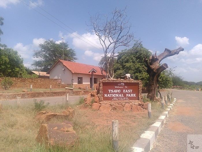
We found Tsavo East unusually green—there had been heavy rains in December, which isn’t typical. As a result, the animals were scattered and harder to spot. The watering hole visible from the camp’s dining area was completely deserted, whereas it’s usually bustling with herds of elephants and other mammals.
Our tent, No. 9, for 3 nights.
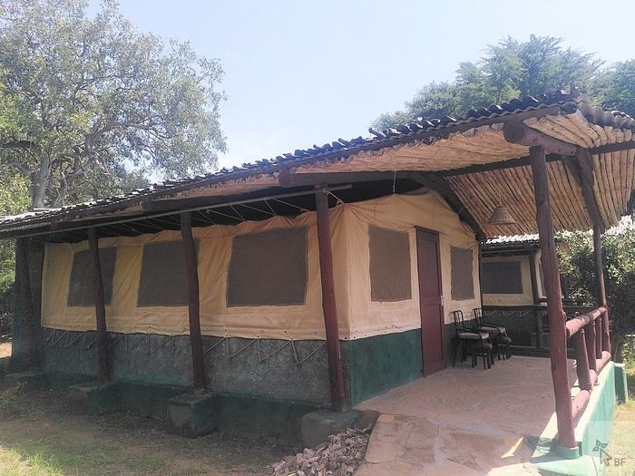
This camp is well-located inside the park. It’s simple but comfortable enough for our tastes, the staff is super friendly (as is often the case in Kenya), and the buffet-style meals are varied and good. Tsavo is the main destination for tourists staying on the coast who come for a night or two on safari. In January, some days at the camp are very quiet, while some evenings, the restaurant is packed with groups (lots of Italians, in particular).
Tsavo is, of course, famous for its elephants. This time, we didn’t see many large herds, but we did have some great encounters with solitary males.
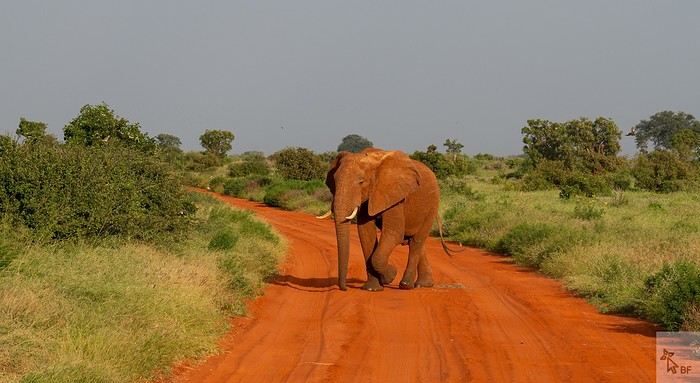
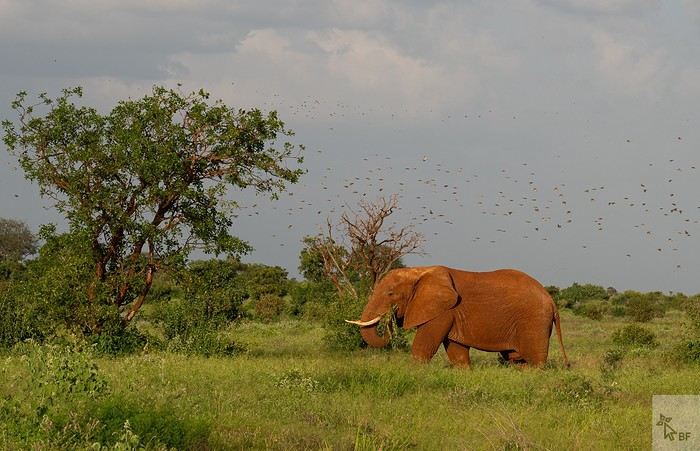
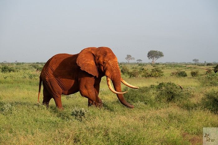
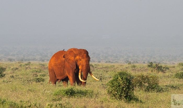
Around this small watering hole, we saw a gathering of African open-billed storks—we’d never seen so many before!
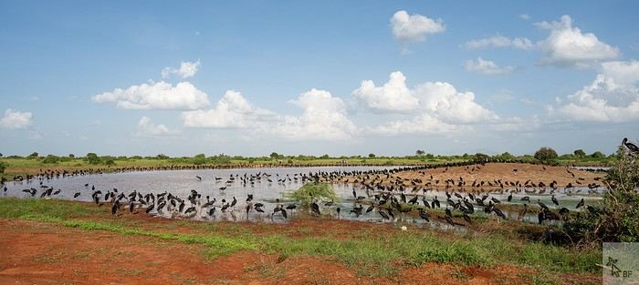
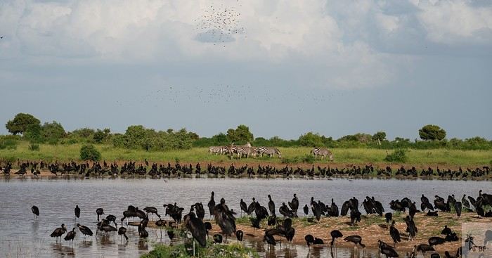
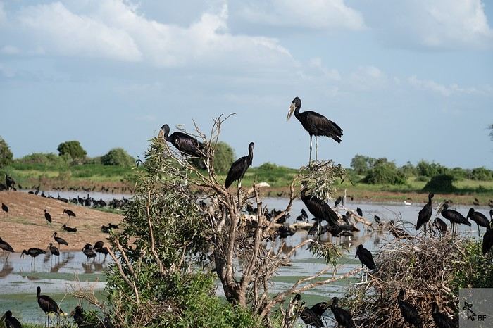
I’d like to invite you on a new adventure in Kenya.
Back in 2010, my husband Ben and I fell in love with Kenya, and we’ve been traveling there regularly ever since. This 2025 safari marked the first weeks of an important milestone in my life: retirement.
Of course, Felix—our guide and friend for all these years, whom some of you may even know from this forum—joined us again.
We chose an itinerary that takes us through the parks and reserves we particularly love in Kenya: Tsavo East (3 nights), Tsavo West (2 nights), a transition day in Embu, Samburu (5 nights), Meru NP (4 nights), Nanuyki to visit the Mount Kenya Animal Orphanage (https://mountkenyawildlifeconservancy.org/) (1 night), and Aberdare NP (2 nights).
This safari wasn’t our most prolific in terms of wildlife sightings and photos (all taken by Ben), but I still think it’s worth sharing our experiences and impressions of the places we visited. Maybe other travelers will find useful information here to help them fulfill their dream of a Kenyan safari one day...
Living in Brittany, we left from Nantes on Wednesday, January 8, 2025, on the 6 AM Air France flight to CDG, then took the direct flight to Nairobi at 10:50 AM. No issues this time on either flight (unlike in October 2023...).
We arrived in Nairobi at 9:20 PM local time (there’s a two-hour time difference with France at this time of year). Going through passport control and collecting our luggage went smoothly. The hotel shuttle (https://67airporthotel.co.ke/) was waiting for us. We shared it with a friendly Swiss couple who were there to climb Mount Kenya. We arrived at the hotel around midnight. The 67 Airport Hotel is 10-15 minutes from Jomo Kenyatta Airport and offers great value for money. Plus, it’s close to the Mombasa road, which is handy when heading that way the next morning.
On Thursday, January 9, we had breakfast at the hotel restaurant at 6:30 AM, and as planned, Felix arrived around 7 AM. We got to check out his brand-new 4x4 Nissan—we’d be the first to test it! 🙂
We set off for Voi, making our usual stop in Mtito Andei. Traffic was heavy on the Mombasa road, with lots of trucks.
We arrived at the entrance of Tsavo East around 1 PM and made it to Sentrim Camp (https://www.sentrim-hotels.com/sentrim-tsavo.html) just in time for lunch.
We found Tsavo East unusually green—there had been heavy rains in December, which isn’t typical. As a result, the animals were scattered and harder to spot. The watering hole visible from the camp’s dining area was completely deserted, whereas it’s usually bustling with herds of elephants and other mammals.
Our tent, No. 9, for 3 nights.
This camp is well-located inside the park. It’s simple but comfortable enough for our tastes, the staff is super friendly (as is often the case in Kenya), and the buffet-style meals are varied and good. Tsavo is the main destination for tourists staying on the coast who come for a night or two on safari. In January, some days at the camp are very quiet, while some evenings, the restaurant is packed with groups (lots of Italians, in particular).
Tsavo is, of course, famous for its elephants. This time, we didn’t see many large herds, but we did have some great encounters with solitary males.
Around this small watering hole, we saw a gathering of African open-billed storks—we’d never seen so many before!