Results for "Église+Souvenir+|+9+>+196"
14179 results found.
Le palu au Myanmar? English translation pending
Le Myanmar est un pays classé en zone "3" concernant le palu. Ce qui nous impose, selon les recommendations médicales, de prendre des traitements de type "3", au prix d'effets secondaires 😕 ....
Je pars mi Janvier 🙂. Pouvez vous me donner vos avis sur cette question. En effet, étant très "bio" de nature, comme beaucoup de personne, j'ai beaucoup de mal à me dire qu'il faut déjà m'inoculer une ribanbelle de vaccins importants pour le voyage ... Mais si je dois rajouter en plus 1 cacheton / jour (+ 1 mois en revenant) d'un medoc super balaize (et en plus doté d'effet secondaire désagréable) pour le palu... ça me donne vraiment la nauzée 🤪
Qu'en pensez vous qui y etes allés recemment ou les années précédentes à la même période ?
Je pars mi Janvier 🙂. Pouvez vous me donner vos avis sur cette question. En effet, étant très "bio" de nature, comme beaucoup de personne, j'ai beaucoup de mal à me dire qu'il faut déjà m'inoculer une ribanbelle de vaccins importants pour le voyage ... Mais si je dois rajouter en plus 1 cacheton / jour (+ 1 mois en revenant) d'un medoc super balaize (et en plus doté d'effet secondaire désagréable) pour le palu... ça me donne vraiment la nauzée 🤪
Qu'en pensez vous qui y etes allés recemment ou les années précédentes à la même période ?
New adventures from Perpignan to Ranchi (Jharkhand)
March 2nd — Departure by bus from Latour at 6:50 AM. The journey isn’t direct: we pass through Elne then Corneilla. In Perpignan, I switch to a BlablaBus heading to Barcelona’s northern bus station. Before reaching Le Perthus, French police stop us to check IDs. Several people aren’t in order, but after about fifteen minutes, we’re on our way again. We’re checked again at La Jonquera: this time, the wait lasts almost forty-five minutes while police identify those in violation and wait for a vehicle to pick them up. The driver then tries to make up for lost time; we finally arrive at our destination half an hour late.
I quickly head to the Arc de Triomphe metro station, located 200 meters away: you have to cross the bridge along the bus parking lot, then walk through a large garden; the station is on the right before the garden entrance. The trip to the airport isn’t direct: I have to change at Tomasso and take the line to the airport, where I arrive at 1 PM.
At the Emirates counter, I learn my flight was just canceled due to the war in Iran; they offer me another flight for the next day. I have to wait at the airport until 7 PM before being taken to a hotel; the next morning, I’ll take a flight to Vienna (with an 8-hour layover), then an Air India flight to Delhi, and finally a flight to Kolkata. I agree: I don’t know Vienna, so it’ll be an unexpected discovery.
At 7 PM, a small group is taken to the hotel, 35 minutes from the airport, where we’re served a light dinner upon arrival.
March 3rd — A taxi picks me up at 6:30 AM; the flight to Vienna takes off at 9:30 AM and arrives at noon. I’m free until 7 PM; the metro is direct to the city center. The weather is pleasant and not too cold, luckily, since my clothes are light.
When I exit the metro, I spot the St. Stephen’s Cathedral tower in the distance and approach it: the roof, made of glazed tiles, is remarkable.
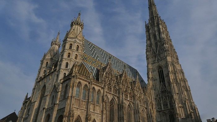
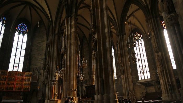
Entry is free, and the interior, a mix of Gothic and Baroque styles in the center, is stunning.
Not far from there is St. Anne’s Church
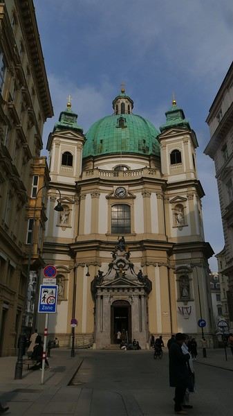
, also Baroque, adorned with beautiful frescoes
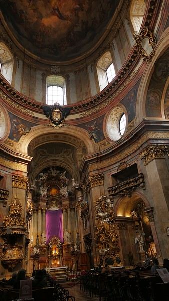
—a music concert adds an enchanting atmosphere to the visit. I continue my walk at random through the pedestrian streets lined with magnificent buildings: I’m charmed by the city.
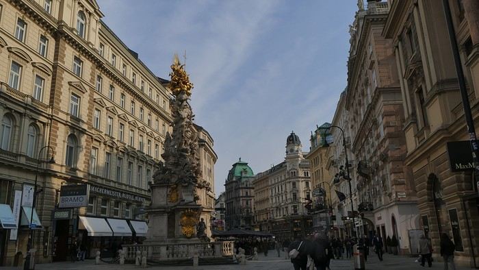
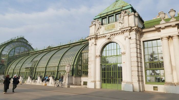
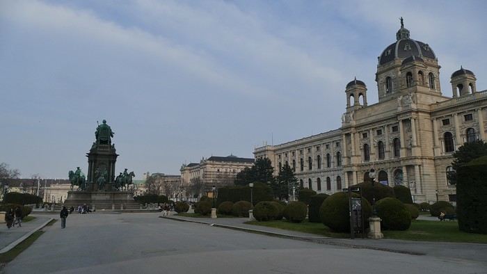
Before heading back to the airport, I stop at a lovely tea salon. My flight will eventually leave with a delay.
Wednesday, March 4th — Delhi and a little luggage scare We arrive in Delhi shortly after noon. Immigration is quick, and good news: my bag was checked through from Barcelona to Kolkata. I head to the connecting terminal and arrive half an hour before boarding: the flight goes smoothly. Upon arrival, the luggage comes out quickly… except mine. After filing a report, I’m told my bag is in Delhi—I have to retrieve it before taking another flight. I didn’t know (or had forgotten): with the delays, I wouldn’t have had time to pick it up and make the connection.
I take a taxi to the Ichamati Hotel. The welcome is warm, and the room is clean but very small. Without my bag, I feel a bit lost—I have nothing to change into.
Tonight, I’m dining with Raja and his friends at a beautiful restaurant, an old colonial house turned into a hotel.
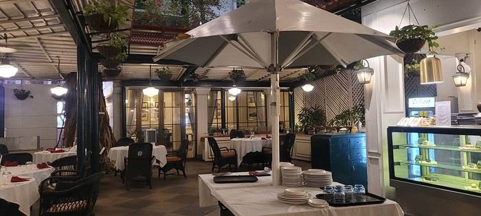
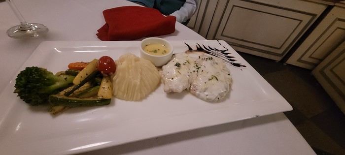
We’re happy to see each other and have a comforting evening together.
I quickly head to the Arc de Triomphe metro station, located 200 meters away: you have to cross the bridge along the bus parking lot, then walk through a large garden; the station is on the right before the garden entrance. The trip to the airport isn’t direct: I have to change at Tomasso and take the line to the airport, where I arrive at 1 PM.
At the Emirates counter, I learn my flight was just canceled due to the war in Iran; they offer me another flight for the next day. I have to wait at the airport until 7 PM before being taken to a hotel; the next morning, I’ll take a flight to Vienna (with an 8-hour layover), then an Air India flight to Delhi, and finally a flight to Kolkata. I agree: I don’t know Vienna, so it’ll be an unexpected discovery.
At 7 PM, a small group is taken to the hotel, 35 minutes from the airport, where we’re served a light dinner upon arrival.
March 3rd — A taxi picks me up at 6:30 AM; the flight to Vienna takes off at 9:30 AM and arrives at noon. I’m free until 7 PM; the metro is direct to the city center. The weather is pleasant and not too cold, luckily, since my clothes are light.
When I exit the metro, I spot the St. Stephen’s Cathedral tower in the distance and approach it: the roof, made of glazed tiles, is remarkable.
Entry is free, and the interior, a mix of Gothic and Baroque styles in the center, is stunning.
Not far from there is St. Anne’s Church
, also Baroque, adorned with beautiful frescoes
—a music concert adds an enchanting atmosphere to the visit. I continue my walk at random through the pedestrian streets lined with magnificent buildings: I’m charmed by the city.
Before heading back to the airport, I stop at a lovely tea salon. My flight will eventually leave with a delay.
Wednesday, March 4th — Delhi and a little luggage scare We arrive in Delhi shortly after noon. Immigration is quick, and good news: my bag was checked through from Barcelona to Kolkata. I head to the connecting terminal and arrive half an hour before boarding: the flight goes smoothly. Upon arrival, the luggage comes out quickly… except mine. After filing a report, I’m told my bag is in Delhi—I have to retrieve it before taking another flight. I didn’t know (or had forgotten): with the delays, I wouldn’t have had time to pick it up and make the connection.
I take a taxi to the Ichamati Hotel. The welcome is warm, and the room is clean but very small. Without my bag, I feel a bit lost—I have nothing to change into.
Tonight, I’m dining with Raja and his friends at a beautiful restaurant, an old colonial house turned into a hotel.
We’re happy to see each other and have a comforting evening together.
A Bold Combo: Southern Peru, Bolivia, and Northern Chile
Hello everyone,
For our latest 3-week family trip (yes, the kids are growing up, and two of them are about to enter the working world), we’re heading to South America! For our first time on this continent, I had planned a classic 3-week loop in Peru.
But since we won’t be returning to this part of the world anytime soon, I thought: why not follow in the footsteps of Franck, aka Bibouns51, who, in 18 days, didn’t just stick to Peru but also added two of the planet’s most stunning landscapes to his itinerary... the Salar de Uyuni in Bolivia and its neighbor, the fabulous Atacama Desert in northern Chile !!
So, I set about the tricky task of limiting the regions we’d visit in Peru to those we considered must-sees, to avoid rushing too much. The visit schedules were optimized, including several comfortable overnight buses that have the huge advantage of letting us hop between regions.
So, we’re off on a somewhat adventurous trip with three domestic flights (two on the first day and one on the last), two overnight buses for quick hops, several car rentals, the services of a few drivers to make the trip more comfortable, and even a tour operator for crossing the Salar...
Our main concern is altitude sickness, and we’re bringing Diamox, aspirin, etc., just in case.
Our second worry before departure was not even getting off the ground... Yes, for once, we’re leaving from France—Marseille, to be exact. The week before our departure, with the surprise air traffic controllers’ strike, I remembered why we usually prefer to leave from abroad, like Turin or Barcelona... In the end, it wasn’t the air traffic controllers who made us nervous but the early July wildfires that paralyzed the airport a few days before our departure. Fortunately, the fires were quickly brought under control, and on the big day, everything was smooth sailing!
Detailed itinerary (which changed on Day 1 due to departure hiccups): Day 0: Flight Marseille - Madrid - Lima PERU Theoretical and abandoned Day 1: Flight Lima - Cuzco and visit Cuzco (Puka Pukara, Tambomachay, Cristo Blanco Observatory, Sacsayhuaman sunset) - Night in Cuzco Day 2: Taxi -> Chinchero - Moray - Maras Salt Mines - Ollantaytambo - Train to Aguas Calientes Day 3: Machu Picchu - Return train to Ollantaytambo Day 4: 2-day taxi -> Pisac - Tipon - Andahuaylillas - Huaro - Night in San Pedro Day 5: Palcoyo - Checacupe - Vinicunca - Return and night in Cuzco Day 6: Day in Cuzco (catch-up on Sacsayhuaman, San Blas district, Temple of the Sun) - Overnight bus to Arequipa Day 7: Rental car -> On the road to Colca Canyon, night in Cabanaconde Day 8: Descent to the bottom of Colca Canyon, night at Oasis Sangalle Day 9: Ascent from the canyon - Maca - Chivay - Return and night in Arequipa Day 10: Visit Arequipa (Santa Catalina Convent, La Recoleta Church and Monastery, La Compañía Church, Cathedral) - Overnight bus to Puno Day 11: Lake Titicaca - Night in Puno BOLIVIA Day 12: Shared taxi -> Road to La Paz, visit downtown La Paz - Night 1 in La Paz Day 13: Moon Valley and Las Animas Valley - Night 2 in La Paz Day 14: Day in La Paz - Night 3 in La Paz Day 15: Flight to Uyuni - Day 1 of Salar de Uyuni tour - Night at the edge of the Salar Day 16: Crossing the Lipez region and lagoons - Night near Laguna Colorada Day 17: Sol de Mañana CHILE Day 17 cont.: Pre-booked transfer to SPDA - 4x4 rental - Pukara de Quitor - Stargazing tour - Night 1 in SPDA Day 18: Death Valley and Moon Valley - Night 2 in SPDA Day 19: Miscanti and Miniques Lagoons, Salar de Aguas Calientes and its Piedra Roja, Tebenquiche Lagoon and Quebrada del Diablo - Night 3 in SPDA Day 20: Rainbow Valley and swim in the Puritama River - Night 4 in SPDA Day 21: Tebenquiche Lagoon - Bus to Calama - Flight to Santiago Day 22: Return Santiago - Madrid - Marseille
Day 0 - 11/07: Destination Lima
Our first flight from Marseille went smoothly to our Iberia layover in Madrid.
In Madrid, just after getting off the plane around 8 PM, and as we were walking through the terminal, we got a rude awakening!!
We saw the word "Cancelled" next to our flight number on the display boards. Thinking it must be a glitch, we checked another screen, but the system was stubborn, and the same dreaded word appeared !
So, we headed to the Iberia counter, where an agent confirmed that our Friday evening flight was canceled and rescheduled for the next morning. The reason? A breakdown and no replacement plane, even though we were in Madrid, Iberia’s home base!
To make matters worse, I remembered our super-tight schedule, planned to the minute, with no buffer day in Lima. Since I’m a bit phobic of megacities and hadn’t found anything appealing in the Peruvian capital in our guidebooks, we’d planned to leave Lima as soon as possible for Cusco, the heart of the Sacred Valley, to spend our first day there.
Bad idea, because we already knew the 4-hour buffer wouldn’t be enough, and we’d miss the domestic flight, which was, of course, non-refundable and non-changeable. So, we had to call LATAM from Madrid to find another flight for Saturday evening and negotiate a rate to recover some of our initial outlay.
After an hour on the phone with customer service, several endless holds, and three failed attempts to dictate our credit card number over the phone to a Spaniard speaking English with a thick accent, we finally managed to confirm the transaction, securing our new flight tickets for a moderate extra cost of just 150 € total.
At first, we were pretty bummed about losing a day and incurring extra fees to reschedule the domestic flight, but then, when we learned from an Iberia customer service rep that we’d receive the max compensation of 600 € per traveler, we even ended up grinning... because 3000 € in refunds for only losing the first day in Cusco? We’d sign up for that 10 times over!!
Iberia then took care of us, putting us up in a hotel where we had dinner before a short 5-hour night and an early morning departure. I took the opportunity to improvise a quick day of sightseeing in Lima, focusing on the Barranco and Miraflores districts.
For our latest 3-week family trip (yes, the kids are growing up, and two of them are about to enter the working world), we’re heading to South America! For our first time on this continent, I had planned a classic 3-week loop in Peru.
But since we won’t be returning to this part of the world anytime soon, I thought: why not follow in the footsteps of Franck, aka Bibouns51, who, in 18 days, didn’t just stick to Peru but also added two of the planet’s most stunning landscapes to his itinerary... the Salar de Uyuni in Bolivia and its neighbor, the fabulous Atacama Desert in northern Chile !!
So, I set about the tricky task of limiting the regions we’d visit in Peru to those we considered must-sees, to avoid rushing too much. The visit schedules were optimized, including several comfortable overnight buses that have the huge advantage of letting us hop between regions.
So, we’re off on a somewhat adventurous trip with three domestic flights (two on the first day and one on the last), two overnight buses for quick hops, several car rentals, the services of a few drivers to make the trip more comfortable, and even a tour operator for crossing the Salar...
Our main concern is altitude sickness, and we’re bringing Diamox, aspirin, etc., just in case.
Our second worry before departure was not even getting off the ground... Yes, for once, we’re leaving from France—Marseille, to be exact. The week before our departure, with the surprise air traffic controllers’ strike, I remembered why we usually prefer to leave from abroad, like Turin or Barcelona... In the end, it wasn’t the air traffic controllers who made us nervous but the early July wildfires that paralyzed the airport a few days before our departure. Fortunately, the fires were quickly brought under control, and on the big day, everything was smooth sailing!
Detailed itinerary (which changed on Day 1 due to departure hiccups): Day 0: Flight Marseille - Madrid - Lima PERU Theoretical and abandoned Day 1: Flight Lima - Cuzco and visit Cuzco (Puka Pukara, Tambomachay, Cristo Blanco Observatory, Sacsayhuaman sunset) - Night in Cuzco Day 2: Taxi -> Chinchero - Moray - Maras Salt Mines - Ollantaytambo - Train to Aguas Calientes Day 3: Machu Picchu - Return train to Ollantaytambo Day 4: 2-day taxi -> Pisac - Tipon - Andahuaylillas - Huaro - Night in San Pedro Day 5: Palcoyo - Checacupe - Vinicunca - Return and night in Cuzco Day 6: Day in Cuzco (catch-up on Sacsayhuaman, San Blas district, Temple of the Sun) - Overnight bus to Arequipa Day 7: Rental car -> On the road to Colca Canyon, night in Cabanaconde Day 8: Descent to the bottom of Colca Canyon, night at Oasis Sangalle Day 9: Ascent from the canyon - Maca - Chivay - Return and night in Arequipa Day 10: Visit Arequipa (Santa Catalina Convent, La Recoleta Church and Monastery, La Compañía Church, Cathedral) - Overnight bus to Puno Day 11: Lake Titicaca - Night in Puno BOLIVIA Day 12: Shared taxi -> Road to La Paz, visit downtown La Paz - Night 1 in La Paz Day 13: Moon Valley and Las Animas Valley - Night 2 in La Paz Day 14: Day in La Paz - Night 3 in La Paz Day 15: Flight to Uyuni - Day 1 of Salar de Uyuni tour - Night at the edge of the Salar Day 16: Crossing the Lipez region and lagoons - Night near Laguna Colorada Day 17: Sol de Mañana CHILE Day 17 cont.: Pre-booked transfer to SPDA - 4x4 rental - Pukara de Quitor - Stargazing tour - Night 1 in SPDA Day 18: Death Valley and Moon Valley - Night 2 in SPDA Day 19: Miscanti and Miniques Lagoons, Salar de Aguas Calientes and its Piedra Roja, Tebenquiche Lagoon and Quebrada del Diablo - Night 3 in SPDA Day 20: Rainbow Valley and swim in the Puritama River - Night 4 in SPDA Day 21: Tebenquiche Lagoon - Bus to Calama - Flight to Santiago Day 22: Return Santiago - Madrid - Marseille
Day 0 - 11/07: Destination Lima
Our first flight from Marseille went smoothly to our Iberia layover in Madrid.
In Madrid, just after getting off the plane around 8 PM, and as we were walking through the terminal, we got a rude awakening!!
We saw the word "Cancelled" next to our flight number on the display boards. Thinking it must be a glitch, we checked another screen, but the system was stubborn, and the same dreaded word appeared !
So, we headed to the Iberia counter, where an agent confirmed that our Friday evening flight was canceled and rescheduled for the next morning. The reason? A breakdown and no replacement plane, even though we were in Madrid, Iberia’s home base!
To make matters worse, I remembered our super-tight schedule, planned to the minute, with no buffer day in Lima. Since I’m a bit phobic of megacities and hadn’t found anything appealing in the Peruvian capital in our guidebooks, we’d planned to leave Lima as soon as possible for Cusco, the heart of the Sacred Valley, to spend our first day there.
Bad idea, because we already knew the 4-hour buffer wouldn’t be enough, and we’d miss the domestic flight, which was, of course, non-refundable and non-changeable. So, we had to call LATAM from Madrid to find another flight for Saturday evening and negotiate a rate to recover some of our initial outlay.
After an hour on the phone with customer service, several endless holds, and three failed attempts to dictate our credit card number over the phone to a Spaniard speaking English with a thick accent, we finally managed to confirm the transaction, securing our new flight tickets for a moderate extra cost of just 150 € total.
At first, we were pretty bummed about losing a day and incurring extra fees to reschedule the domestic flight, but then, when we learned from an Iberia customer service rep that we’d receive the max compensation of 600 € per traveler, we even ended up grinning... because 3000 € in refunds for only losing the first day in Cusco? We’d sign up for that 10 times over!!
Iberia then took care of us, putting us up in a hotel where we had dinner before a short 5-hour night and an early morning departure. I took the opportunity to improvise a quick day of sightseeing in Lima, focusing on the Barranco and Miraflores districts.
Nisyros: Greece’s most beautiful island?
Hi everyone,
I hesitated for a long time before publishing this travel journal since it’s been 8 months now since I left Nisyros. But in the end, I found it too beautiful to keep quiet about. So here we go—I finally got around to writing it. Nisyros is a stunning little Greek island, and luckily, it’s well hidden. Located a good twenty hours by boat from Athens, its distance from the Greek mainland deters most tourists from visiting. That’s what makes it an off-the-beaten-path destination. So much for the general info.
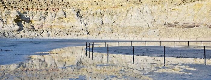
Before diving into the details, I should mention that I visited by bike (despite its severe and constant volcanic elevation) as part of a solo trip from France to Turkey. Why this detail? Because out of the ten countries I crossed and the dozens of sites I saw, Nisyros is one of my top three favorites (along with Pag Island, off-season, in Croatia, and Albania for its overall beauty—stunning natural landscapes and the incredible hospitality of its people). Anyway, welcome to this travel journal dedicated to the lovely little volcanic island of Nisyros…
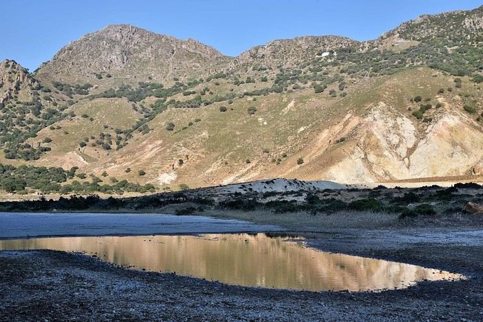
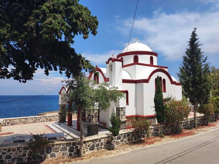
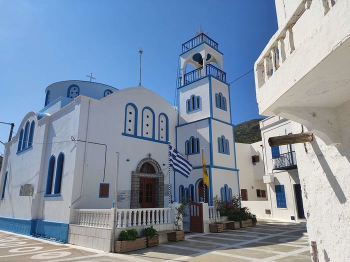
I arrived one beautiful morning in Mandraki, the island’s main port. The twenty-hour boat ride from Athens went by like a breeze. I slept on the deck for three or four hours, sprawled on a bench that was more or less sheltered from the wind. At this time of year (it’s May 2nd), tourists aren’t exactly flocking here, so the boat was far from full. My first glimpse of Nisyros is classic Greek island scenery: blazing sun, an azure sky, and an even deeper blue sea. The trip is off to a great start. I quickly found a small, out-of-the-way hotel (I’m one of those people who avoids crowds as much as possible when traveling, which is getting harder and harder to do). While everyone else from the boat turned right out of the port toward the center of Mandraki, I went left! My nice little hotel was just a hundred meters away, facing a pretty little Orthodox church whose red color contrasted beautifully with the deep blue sea.
I dropped off my panniers in my room so I could ride light for once, then headed toward the next village: Pali. It’s a small fishing village that apparently comes to life a bit in the summer with a few tourists.
As I pedaled along the dock, I passed right by a guy sitting in a chair in full sun. Unfazed despite the sweat pouring down his forehead, he untangled his fishing net with a precision that commanded respect. I gave him the obligatory kalimera (good morning), but he reacted like a deaf-mute—no response at all. On the other hand, his employee answered me kindly from the trawler docked right next to him. Standing on deck, he was also untangling a mess of nets and invited me aboard to chat. That’s Mohamed.
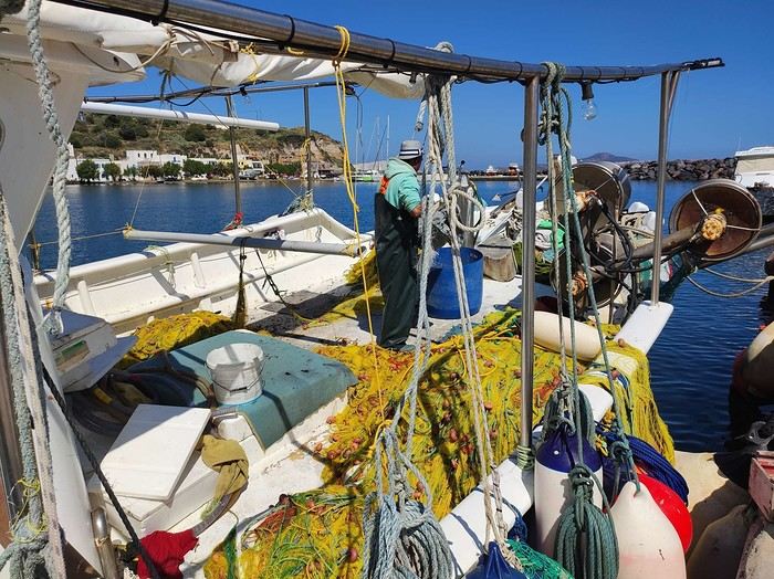
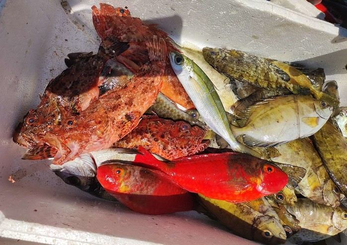
Communication wasn’t easy since he only spoke Greek and I didn’t, but he was cheerful, and his joy was contagious. He proudly showed off their catch of the day: two beautiful rays and a few brightly colored fish. We chatted like that for about fifteen minutes.
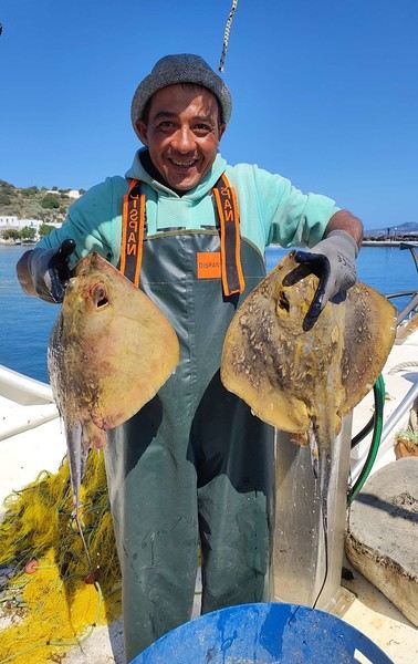
When it was time to hit the road again, I said goodbye to Mohamed, who smiled back. But this time, his boss—still dripping sweat in his chair under the scorching sun—greeted me too. Turns out he wasn’t deaf or mute after all.
I continued along the coast since that’s where most of Nisyros’ beaches are. They start lining up just outside Pali. These are black sand beaches, which can’t hide their volcanic origins.
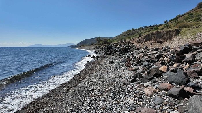
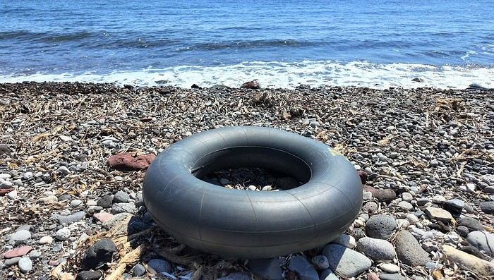
Yesterday afternoon in Athens, I met Peter and Michelle, a Dutch-French couple, while we were waiting for the ferry to depart. The Greek sailors were on strike, so we ended up waiting about twelve hours before setting off. Anyway, we had plenty of time to chat, and Peter, who’s lived on Tilos—a small island near Nisyros—for about twenty years, told me that many migrants pass through these two islands. Most come from Afghanistan and Syria, fleeing authoritarian regimes and the massacres that come with them. They’re looking for *anywhere* else where the future can’t possibly be worse. Peter explained that you often find their belongings on the local beaches. And sure enough, I didn’t have to look far to spot some—clothes, life jackets…
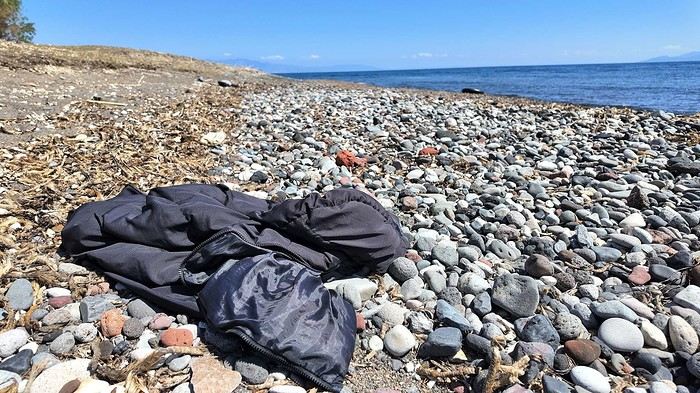
I glanced around, hoping to see one of them to maybe exchange a few words, but no—no one. I was completely alone.
I got back on my bike and spent the rest of the day wandering aimlessly, just exploring this beautiful part of Nisyros. I also picked up some supplies because tomorrow, I’d be heading inland for two days, deep into its four-kilometer-wide caldera to explore the volcano. I’d be sleeping in a tent, so I needed to stock up on food. After a restful night in a real bed—something rare on this bike trip (and I won’t even mention the shower…)—I finally set off for the volcano (I’ll share details about that charming little hotel with the amazing breakfasts at the end of the journal). To reach Stefanos (the name of the main crater), I had to climb to the top of the caldera. It was hot, and some of the slopes were between 10 and 15%, which is steep, especially with a 54 kg bike. But who cares? I was admiring the scenery, and I have to say, I was surprised by how green it was. The higher I climbed, the more beautiful the vegetation became. It stood out against the blue of the sea, and the landscapes inside the island were truly stunning. So, I stopped every five minutes to take photos. Every now and then, I’d come across cows in the middle of the road—or goats in the trees! They climbed with the agility of monkeys to munch on the leaves. I couldn’t get a photo of them because they’d all scatter before I got close. It was actually the noise they made climbing down that tipped me off to their presence. Two villages sit at the top of the caldera: Emporios and Nikia. I passed the first one without climbing up to it, then continued to the second. And let me tell you, Nikia was love at first sight! I found myself pedaling through tiny streets, some barely wider than my bike with its panniers. The walls were white, and the doors were painted in all sorts of colors—green, blue, red… The streets were empty, and silence reigned. But it wasn’t a dead silence. It was more like the kind you find in small, secret, peaceful places. The village exuded tranquility, calm, and well-being. I leaned my bike—with all its gear—against a wall without locking it. It was the first time on this trip that I’d done that. Sure, its weight made it more like a tank than a bike, so you’d have to be *really* motivated to steal it, but here, for some reason, I felt completely at ease. Maybe it wasn’t the smartest move, but I go a lot by instinct, and here, it felt right. So I left my bike there and went to eat a little farther away, at a small restaurant on the village’s main square. It’s famous all over Greece for the beautiful mosaic that covers and decorates the floor. Once I’d eaten and drunk my fill, I hopped back on my bike, which had waited patiently without running off. And the best part? After riding uphill all morning to reach the top of the caldera, all I had to do now was coast downhill to the volcano. Pure bliss in such breathtaking scenery.
I hesitated for a long time before publishing this travel journal since it’s been 8 months now since I left Nisyros. But in the end, I found it too beautiful to keep quiet about. So here we go—I finally got around to writing it. Nisyros is a stunning little Greek island, and luckily, it’s well hidden. Located a good twenty hours by boat from Athens, its distance from the Greek mainland deters most tourists from visiting. That’s what makes it an off-the-beaten-path destination. So much for the general info.
Before diving into the details, I should mention that I visited by bike (despite its severe and constant volcanic elevation) as part of a solo trip from France to Turkey. Why this detail? Because out of the ten countries I crossed and the dozens of sites I saw, Nisyros is one of my top three favorites (along with Pag Island, off-season, in Croatia, and Albania for its overall beauty—stunning natural landscapes and the incredible hospitality of its people). Anyway, welcome to this travel journal dedicated to the lovely little volcanic island of Nisyros…
I arrived one beautiful morning in Mandraki, the island’s main port. The twenty-hour boat ride from Athens went by like a breeze. I slept on the deck for three or four hours, sprawled on a bench that was more or less sheltered from the wind. At this time of year (it’s May 2nd), tourists aren’t exactly flocking here, so the boat was far from full. My first glimpse of Nisyros is classic Greek island scenery: blazing sun, an azure sky, and an even deeper blue sea. The trip is off to a great start. I quickly found a small, out-of-the-way hotel (I’m one of those people who avoids crowds as much as possible when traveling, which is getting harder and harder to do). While everyone else from the boat turned right out of the port toward the center of Mandraki, I went left! My nice little hotel was just a hundred meters away, facing a pretty little Orthodox church whose red color contrasted beautifully with the deep blue sea.
I dropped off my panniers in my room so I could ride light for once, then headed toward the next village: Pali. It’s a small fishing village that apparently comes to life a bit in the summer with a few tourists.
As I pedaled along the dock, I passed right by a guy sitting in a chair in full sun. Unfazed despite the sweat pouring down his forehead, he untangled his fishing net with a precision that commanded respect. I gave him the obligatory kalimera (good morning), but he reacted like a deaf-mute—no response at all. On the other hand, his employee answered me kindly from the trawler docked right next to him. Standing on deck, he was also untangling a mess of nets and invited me aboard to chat. That’s Mohamed.
Communication wasn’t easy since he only spoke Greek and I didn’t, but he was cheerful, and his joy was contagious. He proudly showed off their catch of the day: two beautiful rays and a few brightly colored fish. We chatted like that for about fifteen minutes.
When it was time to hit the road again, I said goodbye to Mohamed, who smiled back. But this time, his boss—still dripping sweat in his chair under the scorching sun—greeted me too. Turns out he wasn’t deaf or mute after all.
I continued along the coast since that’s where most of Nisyros’ beaches are. They start lining up just outside Pali. These are black sand beaches, which can’t hide their volcanic origins.
Yesterday afternoon in Athens, I met Peter and Michelle, a Dutch-French couple, while we were waiting for the ferry to depart. The Greek sailors were on strike, so we ended up waiting about twelve hours before setting off. Anyway, we had plenty of time to chat, and Peter, who’s lived on Tilos—a small island near Nisyros—for about twenty years, told me that many migrants pass through these two islands. Most come from Afghanistan and Syria, fleeing authoritarian regimes and the massacres that come with them. They’re looking for *anywhere* else where the future can’t possibly be worse. Peter explained that you often find their belongings on the local beaches. And sure enough, I didn’t have to look far to spot some—clothes, life jackets…
I glanced around, hoping to see one of them to maybe exchange a few words, but no—no one. I was completely alone.
I got back on my bike and spent the rest of the day wandering aimlessly, just exploring this beautiful part of Nisyros. I also picked up some supplies because tomorrow, I’d be heading inland for two days, deep into its four-kilometer-wide caldera to explore the volcano. I’d be sleeping in a tent, so I needed to stock up on food. After a restful night in a real bed—something rare on this bike trip (and I won’t even mention the shower…)—I finally set off for the volcano (I’ll share details about that charming little hotel with the amazing breakfasts at the end of the journal). To reach Stefanos (the name of the main crater), I had to climb to the top of the caldera. It was hot, and some of the slopes were between 10 and 15%, which is steep, especially with a 54 kg bike. But who cares? I was admiring the scenery, and I have to say, I was surprised by how green it was. The higher I climbed, the more beautiful the vegetation became. It stood out against the blue of the sea, and the landscapes inside the island were truly stunning. So, I stopped every five minutes to take photos. Every now and then, I’d come across cows in the middle of the road—or goats in the trees! They climbed with the agility of monkeys to munch on the leaves. I couldn’t get a photo of them because they’d all scatter before I got close. It was actually the noise they made climbing down that tipped me off to their presence. Two villages sit at the top of the caldera: Emporios and Nikia. I passed the first one without climbing up to it, then continued to the second. And let me tell you, Nikia was love at first sight! I found myself pedaling through tiny streets, some barely wider than my bike with its panniers. The walls were white, and the doors were painted in all sorts of colors—green, blue, red… The streets were empty, and silence reigned. But it wasn’t a dead silence. It was more like the kind you find in small, secret, peaceful places. The village exuded tranquility, calm, and well-being. I leaned my bike—with all its gear—against a wall without locking it. It was the first time on this trip that I’d done that. Sure, its weight made it more like a tank than a bike, so you’d have to be *really* motivated to steal it, but here, for some reason, I felt completely at ease. Maybe it wasn’t the smartest move, but I go a lot by instinct, and here, it felt right. So I left my bike there and went to eat a little farther away, at a small restaurant on the village’s main square. It’s famous all over Greece for the beautiful mosaic that covers and decorates the floor. Once I’d eaten and drunk my fill, I hopped back on my bike, which had waited patiently without running off. And the best part? After riding uphill all morning to reach the top of the caldera, all I had to do now was coast downhill to the volcano. Pure bliss in such breathtaking scenery.
My life in Camargue, my homeland, and in Colombia, my heart's country
My two bullfighting traditions when I'm back home in Camargue (France) and in Colombia (Caribbean) every time I return. 🤠
Details:
Bullfights (corridas) aren’t part of my two bullfighting traditions, but I respect those who attend them!!!
In these two ancestral bullfighting traditions—which aren’t bullfights—the Bulls and Toros aren’t killed or tortured, as some might think.
These are bull games where the animals return to their pastures afterward and only come back to the Arenas 2–3 times a year at most.
They spend 15 minutes in the ring for the Camarguais and 5 minutes for the Toros in the Colombian Corralejas.
They’re cared for and pampered. They’ll die of old age in miles of open fields.
The young people who face them are professionals, risking their lives to support their families and live their Passion for the Toro!!! 😄
https://youtu.be/yYKQer42HoQ
Colombian Corraleja in the link below (hope it works) 🤪
https://fb.watch/BMfmuCgQpG/
Namibia Travel Journal: May 2025 - Trip Review
NAMIBIA TRIP 2025: April 24 to May 20: Feel free to comment or ask us any questions about this amazing journey.
>> Find all our photos and videos for each day on our website here: www.montagne-aventure.net
**DAY 1: Thursday, April 24, 2025: Outbound Flights from Lyon to Windhoek via Munich - Visit to Munich:**

Off we go on a new adventure. The alarm rings at 6:30 AM, the travel bags are packed, and we head to Lyon Airport. We booked our flight tickets with Lufthansa. The first leg to Munich, Germany, is operated by AirBaltic. Departure at 1:05 PM for a 1-hour and 20-minute flight. We arrive at 2:30 PM.
**We now have a 7-hour layover, so we take the opportunity to get some fresh air and explore Munich.** We quickly exit Terminal 2 of the airport and head towards the subway. We buy a group day ticket "Airport-city Day Zone M-5," valid for 2 to 5 people at a price of 30.50 € (instead of 16.30 € per person). We take the S8 line to **Marienplatz** in 35 minutes. **This is the heart of the city.** The weather is overcast, quite cool, but dry. Perfect for a little city trip between two flights while leaving our large luggage in transit at the airport. **Munich is the third-largest German city after Berlin and Hamburg, in the Bavaria region.** **The center has a lot of charm and brings together several religious buildings, easy to explore on foot.** We are impressed by the number of people enjoying these 100% pedestrian streets, which are very pleasant. After Marienplatz, the most famous square with the town hall, we head to the Cathedral of Our Lady, a Gothic church, then continue to **Karlsplatz** and move on to **the food market offering a wide selection of high-end food products in an atmosphere where a certain art of living prevails.** We also visit St. Peter's Church before grabbing a bite to eat. Two good hours were enough for this 10 km city walk. It's time to take the subway back: by 6:30 PM, we are back at the airport. Now, it's time for a bit of waiting and rest. Our second flight is scheduled for 9:35 PM for a 9-hour and 30-minute journey to our final destination in Namibia: **Windhoek.**
> Round-trip flight tickets with Lufthansa from Lyon: 2029 €, or 1,014.50 € per person.
> Lyon Airport parking: 120 €
> Today's expenses: 7 € for 2 pizzas in France / 14 € for the restaurant in Munich / 30.50 € for the daily subway ticket in Munich.
**DAY 2: Friday, April 25, 2024: Arrival in Windhoek, Visit to the Namibian Capital:**
After a 9-hour and 30-minute overnight flight with Discover Airlines, we finally land on Namibian soil just before 7:30 AM. The day is breaking, and the colors are already stunning. We are eager despite the usual fatigue from the flight. The airline was punctual, with friendly staff and good meals, though a bit light. We are the first flight of the day to land, with no more than 15 flights per day here, from 7 AM to 8 PM. We disembark on the tarmac at this airport located in the middle of nowhere, **I finally set foot on African soil for the first time.** We exit among the first from the aircraft to go through the long formalities at the front of the line, as the wait can quickly become endless. Allow at least 5 minutes per person for e-visas. We still wait 45 minutes despite only about twenty people ahead of us. Phew, it's done. We collect our luggage and then withdraw money from an ATM. We make 4 withdrawals of the maximum amount, 2000 NAD $ per withdrawal, for a total of 380 €, or 95.33 € per withdrawal.
Our driver arrives at the same time, perfect timing, we were quick.
We leave the airport at 8:45 AM. By 9:30 AM, we arrive at the **Gracious Whisp vehicle rental agency**, located at the entrance of Windhoek, small and human-sized with a fleet of recent vehicles. More formalities, then a short wait as our vehicle is not yet ready. Time to decompress, catch our breath, and enjoy the very pleasant morning temperature. Not a cloud in sight. Next, a briefing on the vehicle, always with a bit of apprehension due to our approximate English. Allow 45 minutes of explanations, including setting up the roof tent, camping equipment, technical information in case of a flat tire, driving tips in Namibia, and a tour of the 4x4. We have all the necessary equipment for camping: mattresses, sleeping bags, pillows, table, chairs, gas stove, BBQ grill... as well as 2 spare tires, a compressor, a dual tank, and accessories for removing wheels. Off we go, it's time to muster our courage and get behind the wheel. **Heading to SuperSpar Maerua**, fortunately located less than 10 minutes away. We park with the help of a parking attendant; it's very crowded, the space is narrow, but everything goes well despite the cursed right-hand drive. Today's new mission: stock up on groceries. The store is well-stocked with local and imported products, catering to all tastes. We spend 114 € on groceries, from pasta to meat, BBQ lighters to dishwashing products. Two people load our groceries into two carts and transfer them to our vehicle; we feel compelled to leave a tip, 50 NAD $, as we don't have change yet. Now, we head to the hotel, 15 minutes away. Traffic is difficult at a complicated intersection; this will likely be the only traffic jam in Namibia. **We arrive at Kate's Nest Guesthouse & Backpackers around 1:15 PM, quite tired.** We take some well-deserved rest at this recent establishment, quite calm with secure private parking. After a short nap, we enjoy the quiet by the hotel pool. Night falls between 6:30 PM and 7 PM. We eat quietly in our room tonight before starting this long 4x4 road trip in camping mode in the heart of Namibia.
> Today's grocery expenses: 114 € at Super Spar Marua (2395.21 NAD $).
> Round-trip flight tickets with Lufthansa from Lyon: 2029 €, or 1,014.50 € per person.
> Vehicle rental: 4x4 Toyota with roof tent for 24 days: Gracious Whisp Car Rentals: 2,638 € (N$50,640) or **1,319 €** per person - (https://gwcarrentals.com/)
> Distance driven today: 15 km.
> Accommodation: Kate's Nest Guesthouse & Backpackers - 4 Aristotles Street Academia, 9000 Windhoek - 36 € for two for one night.
> Windhoek International Airport website: (https://www.airports.com.na/)
**DAY 3: Saturday, April 26, 2025: Windhoek to Hardap: Mariental Region - Kalahari Desert:**
After a good, restful night, we wake up leisurely around 7 AM. We enjoy the comfort provided by this first and last hotel before 24 nights under the tent.
**We leave Kate's Nest Guesthouse at 8:30 AM to tackle the Namibian roads.** We quickly leave the capital; in just 30 minutes, we find ourselves almost alone in the world. The landscape is dotted with small domes. We leave the **paved B1** quickly to turn left onto the **C15**. **From there, we won't see more than 10 vehicles all day.** After passing through the few houses of **Lekkerwaterpoort**, we tackle our first gravel road. These road sections are limited to 100 km/h, but even at 70 km/h, I find it already challenging. However, I quickly get used to it and gradually pick up speed to reach my cruising speed of around 80 to 90 km/h. **We are on immense straight lines crossing wild expanses as far as the eye can see.** **We come across two baboons, a few ostriches, and numerous cattle and sheep farms.** We pass through the charming village of **Uhlenhorst** with its typical houses and children with broad smiles waving at us. Life here is already very different from Windhoek. **The thermometer rises quickly from 16°C at 8:30 AM to over 28°C in the early afternoon.**
**We arrive at the Hardap Dam reserve at 2 PM.** We stop at the toll booth at the park entrance to pay the entrance fee: 250 NAD $ for 2 people and 1 vehicle. We continue to the dam and then the camp entrance, located a bit further. We had booked in advance, but this place remains little frequented by foreigners.
We take advantage of the hottest hours to rest by the large pool overlooking the immense lake, a very enjoyable moment. Would this be a bit of a vacation?
Around 4:30 PM, we head to the campsite. We overlook this vast water reserve. We arrive first; we will be only 3 vehicles spending the night here. It's time to get to work and set up our equipment for the first time. It takes us a good 20 minutes to set everything up, with a slight apprehension about unfolding the tent. Once this task is done, which we will have to repeat for almost a month, we will become much more efficient over time. Time for rest and contemplation in total silence. The sun gradually sets, and the heat quickly becomes bearable again. Bliss! **This dam is located 20 km northwest of Mariental in an area dotted with conical hills topped with dolerite buttons (Hardap means "hillock" in Nama). It captures the Fish River, which flows south, creating a large lake in the middle of an arid environment. The contrast is striking.** We enjoy our first sunset facing this 360° otherworldly landscape.
Around 7 PM, we start our first BBQ, or "braai" as it's called here. The temperature is perfect. The sun sets, giving way to a star-filled sky of incredible beauty thanks to the absence of any light pollution. The Milky Way will lull us throughout the evening. After some good sausages and potatoes on the BBQ, we head to our roof tent around 9:30 PM with a complete change of scenery in just 24 hours. France already seems so far away...
This campsite has shared showers and toilets, quite clean and functional, as well as a central area with several BBQs and tables. The sites are arranged in a semicircle, each with an electrical outlet. The sites are close to each other but spacious, some slightly shaded. We are only three vehicles tonight, so it's perfectly comfortable and quiet. Not to mention the large pool near the restaurant. Our trip is off to a great start.
> Today's road itinerary: Windhoek > Head south on the B1 to Rehoboth > Turn left onto the C25 then C15 to Stampriet > C20 to Hardap > Full north on the B1 > Then turn left onto the M93 - 5 hours of driving.
> Distance driven today: 354 km.
> Accommodation: Hardap Recreation Resort - 23.3 € for two - Large pool - GR6W+3M2, Hardap Game Reserve, Mariental, Namibia - (http://www.nwr.com.na/resorts/hardap-resort/)
**DAY 4: Sunday, April 27, 2025: Hardap - Brukkaros Volcano - Keetmanshoop - Quivertree Forest Rest Camp**
Our first night under the tent was very pleasant; the little wind quickly calmed down, giving way to absolute silence. The mattress is decent, more comfortable than some nights in Nepal. The length and width give us enough space for maximum comfort, despite my height (1.91 m). We wake up a little before 7 AM as the sun rises, and the lights dazzle us from the start of the day. We pack up the equipment in 30 minutes, quite easily. Then we enjoy the sun, which warms up quickly while we keep our light fleece on.
At 8:30 AM, **we hit the road again, heading south** to our first stop in **Mariental**. We want to do some shopping at SuperSpar, but once we arrive in the parking lot, a young local is fighting with the supermarket security guards and then threatens to throw stones. We don't want to take any risks right at the start, so despite the baton blows he receives, he doesn't stop. We leave empty-handed but fill up with fuel at the Shell station 1 km further. The price per liter is 21.33 NAD $, we fill our 107-liter tank for 107 €. In Namibia, you get served, and they bring the card machine to the window to pay. It's then customary to leave a tip.
We then take the B1 heading due south on a recently renovated road. Around 11:30 AM, we leave it on our right to take **a wild gravel road, the M98**. Just before **Berseba**, we turn right onto a small track, the **D3904 towards Brukkaros Crater up to a camp at 1588 m altitude**. The track then becomes too bumpy. We stop on the counter-slopes where **a wide panorama unfolds over these immense plains as far as the eye can see**. It's 12:15 PM, time for us to eat a rice and tuna salad facing this landscape.
**We are alone in the world until a vehicle arrives and parks next to us.** A bit of apprehension, 4 men head towards us. It turns out to be 4 shepherds looking for a lost foal. The conversation is pleasant, lost in the middle of nowhere. We find ourselves alone again in this absolute silence. **The heat becomes stifling with a good 30°C**. We get back on the road around 1 PM. Back on the B1, **we continue due south to Keetmanshoop**, which we reach around 3 PM. We stop there to do some shopping for 262 NAD $ (12 eggs, a can of tuna, a can of corn, bread, a soda, and a 5-liter water container), or 12.48 €. Two quite insistent children ask us for money or candy at the store exit, yet we give them a small tip, but they continue to cling to the car. Locals parked next to us tell them to leave us alone. Anyway, we finish the trip to **Quivertree Forest**, 15 km away. We will spend the night in this **pleasant farm run by a German**. Upon arrival, as the day before, and as I suppose in the future, we dive straight into the cool pool to relax after all these kilometers. A bliss. Then we take our 4x4 and choose a spot near these famous trees. After the 33°C this afternoon, once 4 PM passed, the temperature drops again and becomes very pleasant. **We are in the middle of the Kokerboom, one of the most interesting and characteristic plants of hot and arid regions. It's not really a tree but a variant of the aloe plant whose botanical name is Aloe Dichotoma. This Kokerboom has a smooth and thick trunk reaching up to 1 m in thickness and 9 m in height. They bloom for the first time at the age of 20 to 30 years.** The flowers are yellow and reach about thirty centimeters during the season between June and July. **They grow mainly in an environment with a high concentration of black rocks absorbing a large amount of heat (38°C). The rocks also serve to anchor the tree with its tentacle-like roots. It also resists frost. Each is between 200 and 300 years old.**
Around 5 PM, we walk to the farm reception to watch the feeding of **two cheetahs**. Magnificent carnivores taking their time to savor their piece of meat. **Then we return near our campsite to enjoy the sunset among these trees. The colors are sublime, as every evening apparently. A magnificent spectacle with colors evolving from yellow to orange then to pink, before giving way once again to a sky filled with thousands of stars.** Our campsite at Quiver Tree Forest Camp is very comfortable; we have a water supply, a stone table, a small lamp, an electrical outlet, a small tree for shade, and a BBQ that we won't use tonight; we'll cook on gas. The sites are far apart, with some shared facilities scattered around, a very beautiful setting. No reservation possible, no need, just show up directly. **The campsite accommodation for 2 people costs 28 €, including the reserve entrance fee of 5 €**. We finish this second bivouac evening around 9:30 PM, time for some reading and sleep in peaceful silence without wind.
> Today's road itinerary: Mariental > B1 heading south to Brukkaros > At Tses turn right towards Berseba via the M98 > Turn right onto the D3904 > 8 km > Brukkaros Volcano (stop at the lower camp as the track is difficult for 1 hour) > Keetmanshoop > Turn left onto the M29 > Quivertree Forest - 4 hours of driving.
> Distance driven today: 371 km.
> Distance walked today: 6 km.
> Today's expenses: Groceries for 12.48 € (262 NAD $) / Fuel for 107 € (1 liter of diesel for 21.33 NAD $).
> Accommodation: Quivertree Forest Rest Camp, P.O. Box 262, Keetmanshoop, Namibia - BBQ, hot showers, toilets, and electricity - No reservation - Pool - 18 €/Person (N$ 340.00 with park entrance) - (http://www.quivertreeforest.com/)
**DAY 5: Monday, April 28, 2025: Quivertree Forest Rest Camp - Giant's Playground - Keetmanshoop - Fish River Canyon - Canyon Roadhouse:**
After an excellent start to the night, we are woken up by the wind shortly before 6 AM, but the sunrise is not far off. We get up at 6:30 AM to enjoy it. The atmosphere is a bit cooler this morning, but the reward is already here.
The adventure continues. At 7:45 AM, we head towards **Giant's Playground**, 4 km away. We take a 3-kilometer walk through this expanse of blocks and igneous rocks.
We continue south at 8:45 AM, passing through Keetmanshoop again where we do some shopping for 25 €, a big stock-up for a good part of the trip: meats, canned goods, pasta, fruits... At 9:30 AM, we take the B4 to Fish River Canyon.
At 11:30 AM, we arrive at the entrance to the NWR park (350 NAD $ entrance for 2 people and 1 vehicle). The track becomes bumpy immediately upon entering the park. After about ten kilometers, we come upon this landscape carved by nature. In the end, it's well worth the detour. We were at the Grand Canyon in the USA exactly (https://www.montagne-aventure.net/2024/04/29/j21-3-juin-2024-grand-canyon-et-lac-powell/) and can thus confirm that this Fish River Canyon is comparable. We make several stops along the southern flank. **Here, nothing is developed; nature is almost in the wild state.** **With 160 km in length, up to 27 km in width, and a depth of 150 m, it is indeed the second-largest canyon in the world.** The history of the canyon is apparent in its different earth layers and stratification: the antiquity of the place is tangible, and the absence of vegetation is surprising. **It consists of two nested canyons, formed at distinct periods. The first distinct layer of schist, sandstone, and eruptive material surrounding the canyon was formed a few two billion years ago, then transformed due to heat and pressure into more solid rock such as gneiss. The inner canyon, carved more recently by the Fish River, has a depth of 270 m.**
We have a picnic once again alone in the world facing this grand panorama at the **Sulphur Spring View Point**. This is where the hiking trail begins, plunging into this narrow canyon, but it is forbidden to venture there alone without a guide. It's 30°C, but a slight wind makes the atmosphere bearable. At 1 PM, we retrace our steps and continue to the **Main View Point** then to the **Hikers View Point**.
In the south of Namibia, the Fish River Canyon, 160 km long, is a true geological wonder: a canyon nested within another canyon, one of the largest in the world. The first sedimentary layers formed two billion years ago; 500 million years ago, a period of tectonic activity caused these layers to crack and tilt, opening a vast canyon in the Earth's crust. The second canyon, with a depth of 270 m, was carved over time by the passage of the Fish River in this new valley.
At 3 PM, we arrive at our very charming camp for the evening, the **Canyon Road House**. We fill up with fuel right away because tomorrow we have a long day of isolated driving: 55 liters for 1240 NAD $. Then we settle into the campsite we had previously reserved in France. We are assigned site 2, very well set up under a tree with its BBQ and stone table just steps from the pool. We quickly set up the tent and jump straight into the pool for the relaxation moment of the day. As usual, the water is quite cool, but it's a real pleasure. Then we stroll around this Canyon Road House, which recreates the atmosphere of the roadside inns of the 1950s with old car wrecks and vintage gas pumps in a bygone era. **Around 5:45 PM, we start a short walk leading us to the top of a hill overlooking the wide plateau where we are to watch the sunset.**
And finally, to end this beautiful day, it's time for the braai, with grilled sausages and white beans on the evening menu.
> Park entrance: 150 DN/person + 50 DN/vehicle (18 € for two). It is possible to enter at two access points: Hobas in the north and Ai-Ais in the south.
> Today's road itinerary: M29 > Keetmanshoop > B1 > B4 > C12 (track) > After Holoog turn right onto the D601 (C37 track) > Accommodation on our right (stop just to check in before 6 PM) > Continue 30 km (30 minutes of track) to the viewpoints after Hobas where you must pay the entrance fee. Sunset View Point to the left > Return before sunset as the park closes (best lights at sunrise). 3 hours.
> Distance driven today: 228 km.
> Distance walked today: 10 km.
> Today's expenses: 25 € for groceries / 17 € for the Fish River Canyon park entrance / 58 € for fuel.
> Accommodation: Canyon Roadhouse, Gondwana Collection Namibia – 34.4 € for two - Pool - Near Hobas - (http://www.gondwana-collection.com/fr/accommodation/canyon-road-campsite)
**DAY 6: Tuesday, April 29, 2025: Canyon Roadhouse - Orange River - South African Border - Vista Trail - Gondwana Sperrgebiet Park - Aus:**
The night was excellent in this very comfortable campsite. **We wake up to the sound of birds** before the alarm at 6:45 AM. Our little morning routine starts as the sun rises. **A big day of driving awaits us to the South African border. This will be the southernmost point of our journey.** We hit the road at 8 AM via the C37, pass through **Hobas**, then turn onto the D207 to **Aussenkehr.** **We cross a mountainous barrier with some high peaks and perfect cones. The rock varies from orange to pink to black.**
We then cross a lunar desert as far as the eye can see on a giant dome; the track winds through nowhere without meeting anyone for hours. The landscapes are surprising. **We spot several ostriches and a gemsbok.** In the middle of this endless expanse, we come to an improbable intersection and continue right onto the D278.
In the middle of these arid lands, we come across a green zone: a vast vineyard. At 10:30 AM, **we come across a "Road closed" sign, fortunately, a local resident waves us to continue; a bit stressed, we proceed.** We start to follow the beautiful Orange River. On the other side of the bank, just a few meters away, South Africa is there. It is the second-longest river in Southern Africa, after the Zambezi. It flows over 2,000 km to the Atlantic. After passing through narrow gorges, we regain altitude before starting the descent, gently heading back north.
**We now cross and follow the Fish River, which joins the Orange River further south** **along this gorge dating back millennia.** At exactly noon, we take a lunch break by the Fish River, still without meeting a soul in this landscape between greenery and aridity. The temperature here is cooler with a pleasant 23°C on the banks, the perfect spot. **We continue on the track to Rosh Pinah**, where we find a paved road again. **The section along the Orange River and the Fish River was officially closed, but we were able to pass without any issues, avoiding a detour of at least 3 hours.** Phew. We now drive at high speed (limited to 120 km/h) through these vast spaces. We come across many ostriches after the **dozens of monkeys along the Fish River**. Around 3 PM, 3 km after the very small town of **Aus**, we reach **our campsite for the evening at Klein Aus Vista**. A new **small peaceful haven very well set up**. As usual, after checking in at reception, we jump straight into the beautiful pool to get our well-deserved dose of coolness, another good thermal shock that our bodies appreciate. Once this moment of relaxation is over, we take our 4x4 to reach the campsite located a bit higher, set apart at the foot of a hill that overlooks us.
After setting up, **around 5 PM, we head to the Vista Trail to climb to the top of a mountain overlooking the vast plain that surrounds us at 360°**. It takes about 30 minutes to climb. The place is just magical, **the perfect viewpoint to admire the sunset**. **We fully savor the moment. We also spot one of the few wild horses in the world capable of living in the desert.** Their numbers have decreased in recent years due to predation and drought (around 100 to 150). At 7 PM, we return to the camp, time for the braai and preparing the meal in this peaceful little camp.
In the south of Namibia, the Fish River Canyon, 160 km long, is a true geological wonder: a canyon nested within another canyon, one of the largest in the world. The first sedimentary layers formed two billion years ago; 500 million years ago, a period of tectonic activity caused these layers to crack and tilt, opening a vast canyon in the Earth's crust. The second canyon, with a depth of 270 m, was carved over time by the passage of the Fish River in this new valley.
> Today's road itinerary: 5 hours of driving: D324 heading south (track) > turn right onto the C10 (track) > D316 heading south > turn right onto the C13 > In Aus turn left onto the B4 > Campsite via a track on the left.
> Fuel station: Solitaire or Aus.
> Distance driven today: 398 km.
> Distance walked today: 7 km.
> Accommodation: Klein-Aus Vista Desert Horse Campsite - Farm Klein-Aus No 8 on the B4 main road to Luederitz Aus 9000, Aus, Namibia - (http://www.klein-aus-vista.com/accommodation/desert-horse-campsite/) 17908 420 DN - Water + Shared shower (hot water). No electricity.
**DAY 7: Wednesday, April 30, 2025: Aus - Kolmanskop - Diaz Point - Luderitz - Kanaan Desert:**
We wake up around 6:45 AM, with partly cloudy weather for once; we feel the ocean's influence gradually. But the sun isn't far off. At 7 AM, we leave the campsite heading west towards Luderitz via the B4. **First stop of the day: Kolmanskop, the ghost town we reach at 8:30 AM**, entry costs 180 NAD $ per person. We discover this **timeless place** in 1.5 hours, moving from building to building amidst violent sand-laden gusts of wind. There's a lot of charm in these different living spaces. **The sand quickly reclaimed the place after this mining town was abandoned.** This was once the headquarters of Consolidated Diamond Mines. It's hard to believe that this former town, where the diamond industry once flourished, had a hospital, a bowling alley, and a theater. The decline in diamond sales after World War II and the discovery of richer deposits put an end to this golden age. By 1956, the town was already completely deserted, and the sand had reclaimed its rights. **These dilapidated buildings swallowed by shifting dunes have something surreal about them.**
At 10:15 AM, we hit the road again **heading to Luderitz, 22 km away**, and first to **Diaz Point** **facing the Atlantic Ocean**. It's a wind-swept peninsula with its characteristic red and white lighthouse. There's a campsite and a coffee shop on site, but the place doesn't inspire rest without shade or shelter from the wind. We return to the city via the D701 track that runs along the ocean, be careful at low tide. We come across **a few fishermen and a fox as well as flamingos.**
We walk through the few streets of the city, much smaller than I imagined, then climb to the **famous little Lutheran church that overlooks the city, the Felsenkirchr.** **The wind blows very strongly here, and the sand is omnipresent, surrounded by the Namib Desert and the southern Atlantic coast.** **A German colonial relic barely touched by the 21st century, Luderitz seems frozen in the past, giving it both a gloomy and a certain charm. In short, it's certainly one of the most incongruous places in Africa.**
At 1:15 PM, just before leaving Luderitz, we do some shopping for 20.50 € and fill up with fuel: 61.50 €, 1290 NAD $ for 61 liters (21.18 $ per liter).
**We return via the B4 to Aus** (paved), **then via rougher tracks**, the C13 then the D707, magnificent as it runs along a mountain range with multiple colors on our right and an endless flat desert on the other side.
To access our campsite for the evening, we must take a **narrow private track for 7 km** on our right to emerge, in this total vastness, at the **isolated Kanaan Desert Retreat on a small hill**. I don't have time today to jump into the pool near the reception; we arrive at 5 PM at 8 small, isolated, and unique sites with a small kitchen, a shower, and a private toilet under a small tarp shelter. **A crazy charm with a unique view...** **This will be my favorite accommodation of this trip. The photos speak for themselves.** We jump into the outdoor shower while savoring the landscape, then prepare our evening braai while enjoying the colors fading, facing this plateau with bushes turning a vivid orange. **A moment that will remain etched for life.** **Savanna atmosphere under a thin emerging moon. Every minute offers different colors. Facing our meal, we have a natural giant screen.**
We end this day contemplating the stars and admire this thin orange moon setting on the horizon (8:42 PM).
**Ghost town just before Luderitz: Kolmanskop** (open from 8 AM to 3 PM - N$ 180 p.p – 9 €). Once, Kolmanskoppe was organized around diamond mining. After finding new, more prolific spots, the town was abandoned and is now a ghost town. The sand and dunes have reclaimed their rights and buried everything humans had built. Houses, train station, bakery, everything has been covered by sand, which passes through the windows, even though they are 1 meter high.
> Today's road itinerary: 5h30: B4 to Luderitz (paved) > Round trip > Kolmanskop on the left > Return via the previous campsite > Then C13 (track) > Turn left D707 (track) > Then track to the right to the campsite.
> Distance driven today: 438 km.
> Distance walked today: 8 km.
> Today's expenses: Groceries at the Spar in Luderitz for 20.50 € / Fuel fill-up in Luderitz for 61.50 €.
> Official Kolmanskop website: (https://kolmanskuppe.com) (open from 8 AM to 1 PM - N$ 180 p.p – 9 €).
> Accommodation: Night at the south of the Namibrand Nature Reserve: Kanaan Desert Retreat – 26.5 € for two - (http://www.kanaannamibia.com/) - Farm 104 Karas 9000 - Sanitary facilities + BBQ + Water + Pool - No electricity - My favorite accommodation of this trip.
**DAY 8: Thursday, May 1, 2025: Kanaan Desert Retreat - Namib Desert - Crossing the Namibrand Nature Reserve – Sesriem Canyon - Elim Dune - Little Sossus Lodge**
After a cooler night than the previous ones with about 10°C, we wake up around 7 AM. We admire, as usual, the sunrise between the desert and the mountains. **The spot from last night was truly perfect, isolated from the world, in total serenity, with a wake-up call to the sound of birds.**
We hit the road a little after 8 AM, heading north via the D707 to Spes Bona, then the gravel road C27 via Betta to Sesriem. **The landscapes roll by and dazzle us.** **We are right in the heart of the Namibrand reserve**, coming across numerous **zebras**, **impalas**, **ruminants that reproduce in large numbers**, and **gemsboks**. At noon, we stop in the shade of a tree to eat. The spot is so romantic facing orange arid mountains and a vast green plateau. **A landscape full of contrasts, timeless and silent.**
**The Namib Desert is the oldest on the planet; its name means "vast arid plain," and it also gave its name to the entire country: Namibia.** The majority of these arid and semi-arid lands dotted with viewpoints are part of the Namib-Naukluft National Park, which covers 23,000 km².
At 1 PM, we enter the Sossusvlei park. We start with the **Sesriem Canyon**, which is 3 km long and 30 m deep. We enter it with a short 1-hour hike into its depths. **It was carved by the Tsauchab River in an agglomerate of sand and pebbles over 15 million years old.** We retrace our steps back to Sesriem, which means "six belts," referring to the number of leather belts (from ox wagons) needed to draw water from the canyon. This remote locality is mainly the gateway to Sossusvlei but offers a gas station and some accommodations. For our part, we sleep 40 km away tonight.
**We then move on to Elim Dune.** It takes about 45 minutes of walking to reach its summit, and the climb is very breath-taking as we progress in the sand where we almost slide back with each step. **A first grand 360° panorama unfolds. The ochre color of the sand contrasts completely with the yellow plain and the brown and black mountains in the distance.**
At 3:15 PM, we start the descent facing Sesriem. We were completely alone once again on this dune. **These Namib dunes are composed of colored quartzite sand, presenting hues ranging from cream to orange and from red to purple. Unlike the ancient dunes of the Kalahari, these move with the wind and adopt distinct, ever-changing shapes.** Star dunes resemble stars seen from above, while transverse dunes, like those on the coast south of Walvis Bay, stand perpendicular to the prevailing southwest wind. The most stable dunes, which thus have the most vegetation, are parabolic dunes, due to the variability of the winds. Longitudinal (seif) dunes measure up to 100 m in height, while barchan dunes, crescent-shaped and predominant at the extreme north of the Skeleton Coast and south of Luderitz, are the most mobile, created by unidirectional winds.
**We get back on the road for 45 minutes to our campsite for the evening, Little Sossus, which we reach at 5 PM**, via C27 then right onto C19. As often upon our arrival, I jump into the cool pool to relax after all this driving, then we proceed to set up the camp. As the day before, the campsite consists of 10 fairly distant sites, with private sanitary facilities and a small roof. We are delighted with this crazy charm. The hot water for our shower is wood-heated: a Namibian lights it every evening around 5 PM.
For a change, or not, the menu features a small BBQ with pork ribs and pasta, facing another sunset, this time with partial cloud cover giving equally splendid colors. Time for a well-deserved rest after long corrugated tracks covered in our 4x4 today.
> Today's road itinerary: 4h45 of driving: Find the D707 and head north (track) > At Spesbona turn left onto the C27 (track) > At Sesriem after entering the park, turn left following View Point Sesriem > Continue 4.5 km to the Sesriem Canyon Parking > Return then head towards Elim Dune > Exit the park then take the D826 > Turn right onto the C19 heading SE > Turn right facing the D854 to the campsite (campsite closes at 7 PM).
> Distance driven today: 272 km.
> Distance walked today: 8 km.
> Today's expenses: Entry to the Sossusvlei Namib-Naukluft Park: 17 € for two (with one car).
> Accommodation: Little Sossus Lodge – 35 € for two - At the junction of the C19 and D854 roads Maltahohe 9000, Maltahohe, Namibia - (http://www.littlesossus.net/) - Pool + Private bathroom + Hot water + Electricity + BBQ + Grocery store (bread to order the day before).
**DAY 9: Friday, May 2, 2025: Little Sossus Lodge - Namib-Naukluft National Park – Sesriem - Sossusvlei - Big Daddy – Deadvlei - Tsauchab River Camp**
Today we start the day early to tackle **the famous dunes of Sossusvlei at first light**. The alarm goes off at 6 AM to leave the camp at 6:45 AM. The wind is blowing quite strongly in gusts this morning, but it only woke us up a quarter of an hour before sunrise. The park opens at 7:15 AM. We start with a small encounter: a friendly **jackal lounging by the roadside.**
We first have to cover the 40 km of track to Sesriem, pay the entrance fee (350 NAD $), and drive 65 km on a paved road this time to reach the **vast salt pan (a lake whose sediments are made of salts) of Sossusvlei**. **It appears amidst the gigantic red dunes that rise on either side. The wind constantly changes the shape of the dunes, as well as their colors, which vary with the light. The setting is breathtaking, giving an impression of immensity and timeless grandeur.**
The paved road ends; the last 4 kilometers become technical and are reserved for 4x4s. Phew, I pass without any problems, though not without stress, switching to L4 mode. **We start the ascent to Big Daddy at 8:45 AM, 325 m of elevation gain in the sand nonetheless.** We climb at an excellent speed despite the strong wind, in exactly 1 hour. At 9:45 AM, we are at the summit of what will remain etched for a long time. The 360° view is simply unimaginable; you have to experience it to believe it. The wind blows violently up there, **it feels like being in the high mountains, on a snow ridge, with a strong transport of sand. The atmosphere is magical.** We start the descent running barefoot in the steep sand.
**We then move on to its neighbor, Deadvlei.** **Here, petrified trees stand in the "vlei" (basin) with their dried branches casting desolate shadows on the white ground. The juxtaposition of the deep blue sky and the towering dunes is captivating.**
We return to the 4x4 parking at 11 AM, the stress rises again for the sandy track passage. We retrace our steps and stop at **Dune 45**.
At noon, we take the opportunity to picnic at the foot of **the beautiful Dune 40**, where there is already no one left. We enjoy the quiet again, well, almost, as the wind remains omnipresent.
At 1 PM, we return to **Sesriem**, where we fill up with fuel (21.15 NAD $ per liter), totaling 1630 for 77 liters (78 €), and do some shopping for 245 NAD $ (two nice pieces of pork, 2 cans, 2 sandwiches for tomorrow, and 1 soda), which is 12.48 €. It's 27°C. We hit the road again, heading to a new destination at 2 PM. We take the C19 back to Little Sossus where we spent the night, then turn left onto the gravel road D854 for about 40 km to **Tsauchab River camp**. Finally, we won't be sleeping here; we are redirected 7 km downstream to **Naukluft View Camp**, which also belongs to Tsauchab River Camp.
We arrive at 4 PM, and thankfully, the fatigue was starting to set in. **Our campsite is located under a small forest, providing some protection from the wind that blew strongly all day. The calm does us a world of good. Once again, a lot of charm**, with very spaced-out sites without any visibility. We can't wait to take our shower. It will be possible from 5 PM with, as the day before, water heated by a wood fire. Time to prepare the campsite for the night. And on the menu, a braai with two superb pieces of pork bought in Sesriem and fries!!!!
**The Namib Desert**
An impressive coastal desert stretching from the Atlantic to a high plateau inland, the narrow Namib Desert runs along the southwest African coast for about 1,300 km. **Considered one of the oldest deserts in the world**, it is bordered to the north by the Kaokoland Desert, which extends into Angola, and to the south by South Africa's Karoo. The narrow Namib is mostly less than 160 km wide. Despite this, it is considered to consist of three sections: the coastal strip influenced by the Atlantic; the Outer Namib, occupying what remains of the western half; and the Inner Namib, comprising the eastern half of the desert. Generally called the Skeleton Coast, the coastal Namib receives almost no rain and depends on regular marine fogs for moisture. From sea level, the terrain rises to 900 m, where the desert meets the base of the Great Escarpment to the east. In the Inner Namib, average annual rainfall is only about 50 mm.
The dryness is such a characteristic of the Namib that it is thought to have been in this arid state for at least 55 million years. It is all the more surprising to learn that animals such as vipers, geckos, zebras, and elephants live in this desert. Some areas of the Namib are also rich in flora, including Welwitschia mirabilis, which grows near the ground with seemingly exhausted leaves, extracting moisture from marine fogs and can live over 1,000 years. In the southern Namib, some dunes are up to 32 km long and 240 m high.
**The frequent fog of the Skeleton Coast:** Driving north along the coast of Namibia, the cold Benguela Current in the Atlantic cools the moist air above the ocean, which, upon meeting the warm desert air, leads to the formation of thick fog banks that drift up to 100 km into the center of the Namib before evaporating under the sun.
> Today's road itinerary: 4 hours of driving: C19 towards Sesriem (track) > D826 (paved) > Foot of Big Daddy via a technical sandy track > Return via the same route > D854 to Tsauchab.
> Gas station: Sesriem.
> Distance driven today: 254 km.
> Distance walked today: 12 km.
> Today's expenses: Park entry at Sesriem for 2 people: 17 € / Fuel fill-up: 78 € / Groceries at Sesriem gas station: 12 € (245 NAD $).
> Accommodation: Tsauchab River Camp - Naukluft View Camp - D054 & D850 GPS: S24 26' 37" E16 10' 11" Sossusvlei 22007, Maltahohe, Namibia - BBQ + Private sanitary facilities + Water - www.tsauchab.com
**DAY 10: Saturday, May 3, 2025: Tsauchab River Camp - Naukluft National Park - Olive Trail Hike (10 km) - Ababis Guest Farm**
We pack up the camp at 8 AM and continue our road trip north via the D854, a bumpy track with many corrugated sections. It's cool this morning, 12°C.
**We enter the Naukluft massif, discovering landscapes with very different terrain than before.** We first need to check in at the campsite, 13 km from the entrance at the end of the track: 350 NAD $ for 2 people and 1 vehicle, then return 4 km back. **On the agenda is the lovely Olive Trail, a 10 km hiking loop that starts 4 km northwest of the park office**, along the D854 that we follow. At 9:45 AM, the hike begins with a fairly steep ascent (about 45 minutes) among the **wild olive trees** from which the trail gets its name. **At the summit, we enjoy a view that embraces the Naukluft Valley.** We then turn east and gradually descend into a deep valley, passing over sometimes slippery rocks. We have a snack around 11:30 AM in these small gorges. **Further on, to cross the wall of a canyon in front of us, some chains are fixed to the rock to help us pass.** We finish this superb loop clockwise at 1:15 PM, taking 3.5 hours including 30 minutes of breaks. We only crossed a small group of 3 people on this wild adventure far from everything. At 1:45 PM, we exit the park and take the **D854 track north to Bullsport**. From there, we turn left and take the C14, which **runs along the bed of the Tsondab River.**
**We arrive at our campsite for the evening, Ababis Guest Farm, at 3 PM.** Quite early for once, allowing us to rest a bit in this peaceful farm where many sheep wander around us. We also enjoy the pool under a magnificent sun, less hot than the previous days, it's 22°C. The camp has only 4 spaced-out sites around shared sanitary facilities. **We are in the middle of a vast plain facing the Naukluft massif mountains.** We will have another beautiful sunset on these mountains. For the first time on this trip, **we will be completely alone at this campsite.** **We haven't encountered many people today**, just 3 during the hike and fewer than 10 vehicles all day.
> Today's road itinerary: Head north on the D854 (track) > Turn left to enter the Naukfluft National Park > Continue on the track then turn right to the Olive Trail hike parking lot (1 hour for 45 km). Return to the D854 and continue north > At Bullsport turn left onto the C14 to Ababis (still a track) > The camp is located on the left facing the D1261 (1 hour for 60 km from Olive Trail). Total: 2 hours of driving for 100 km.
> Gas station: No gas station on the route, except in Solitaire.
> Distance driven today: 115 km.
> Distance walked today: 13 km.
> Accommodation: Ababis Gaestefarm - Night booked by email – payment on site: (https://www.ababis-gaestefarm.de/) - P.O.Box 1004, Maltahöhe - N$ 300.00 per person
**DAY 11: Sunday, May 4, 2025: Ababis Gaestefarm - Namib-Naukluft National Park – Solitaire - Gaub Pass - Kuiseb Canyon - Moon Landscape - Walvis Bay**
The night was, for the first time since the start of this road trip, quite difficult. A strong wind accompanied us all night, making the tent flap constantly. A racket that drove us crazy. We still managed to sleep a few hours. The morning sun brings back our smiles. We hit the road for this new stage a little before 7:45 AM.
We start the day with a first stop less than 15 km away **on the C14 in Solitaire** at 8:15 AM. **This town is lost in the middle of nowhere with its small gas station with a western atmosphere adorned with rusted and sand-covered car wrecks.** After a quick supply stop: 86 NAD $, or 4 € for 1 water container and a box of cookies, we continue north still on the C14, **crossing the Tropic of Capricorn** then devouring this **magnificent track up to Gaub Pass**. **A succession of narrow gorges, turns, climbs, and descents breaking the monotony of the previous long straight lines.** We are right in the heart of no man's land for 200 km. We then start the descent to the **Kuiseb Canyon. It houses the wide bed of the eponymous river, dry almost all year.** Even when it flows for 2 to 3 weeks during the rainy season, it doesn't go beyond Gobabeb and then seeps into the sand. **The drinking water that supplies Walvis Bay is pumped at Rooibank from this underground water table.** **We now cross the Kuiseb Desert where impressive dunes roll down.** We make a short stop at a **natural rock arch** reminding us of our (https://www.montagne-aventure.net/2024/04/29/j19-1-juin-2024-canyonlands-national-park-et-arches-national-park/). Then we gradually descend towards **Walvis Bay** where we will spend the night. At noon, we enter the **Dorob National Park**. The thermometer drops 10°C in 10 minutes as we get closer to the Atlantic Ocean.
At 12:45 PM, much earlier than initially planned, we arrive at the **Moon Landscape** (View Point 4, free) to have a snack, via a very recent surprising dual carriageway in the middle of nowhere, then via the C28. We are again in the hinterlands, the temperature has soared: 30°C without a bit of shade. Even if the colors and the panorama must be exceptional at sunrise or sunset, the detour for this 360° panorama is still worth it. Extreme aridity as far as the eye can see. The place lives up to its name; it really feels like being on the moon. We get back on the road at 1:30 PM via the D1991, C28, then again the A2, which is very new. The latter runs along the beautiful dunes up to the **Dune 7**, where we make another stop.
Then we head towards our final destination of the day, **Walvis Bay. Its port is sheltered by a sand spit, a natural breakwater that protects the city from the powerful assaults of the ocean. Its port was long a strategic place: claimed by the Cape Colony in 1795, it was officially annexed by the British in 1878 to counter Germany's ambitions in the region. A colony of fur seals, pelicans, flamingos, and whale terns have made it their home.**
We do a big grocery shopping at the Spar located in the center for 66 €; it's very easy to park there. Then we fill up with fuel at an Engen station right across for 1117 NAD $ for 54 liters (20.6 NAD $ per liter), which is 54 €. We then **enjoy the seaside in the Lagoon neighborhood**, where it's also easy to park. After kilometers in the desert, **this cool break is more than welcome. The outside temperature is 22°C. In the distance, we can clearly see the clouds lingering over Swakopmund.**
We take the 4x4 one last time to the **Lagoon Chalets where we will spend the night**. The spot is well set up and surprising in the heart of a residential neighborhood. The sites are quite large, separated by fences around very comfortable shared sanitary facilities. BBQ, electricity, and shaded area. We settle in quietly before going out on foot to watch the **sunset over the Pacific Ocean along Lagoon Promenade Road**. We can still see this impressive persistent mist in the distance. The neighborhood is very peaceful, certainly without much charm, but with a very well-developed seafront that inspires relaxation after kilometers without meeting anyone in inhospitable lands. We end the day with our traditional braai: grilled chicken thighs and sautéed potatoes in the coolness of a starry sky.
> Today's road itinerary: 5h30 of driving (or 3h30 of driving for 250 km without the Moon Landscape): Head north on the C14 > Cross the Tropic of Capricorn > Gaub Pass > Kuiseb Canyon on our left in a round trip > Continue to Green Valley and leave the C14 to the right on the D1984 > Turn right on the C28 > Then left D1991 to Moon Landscape D1991 View Point 4 > Return via the same road and stop at Dune 7 for sunset > Walvis Bay.
> Gas station: Solitaire or Walvis Bay.
> Distance driven today: 372 km.
> Distance walked today: 5 km.
> Today's expenses: Fuel fill-up for 54 € + Groceries for 66 € at Spar.
> Accommodation: Walvis Bay: Lagoon Chalets – 36.6 € for two - (http://www.lagoonchaletswb.com/) - 8th Road West, Meersig Meersig 9000, Walvis Bay, Namibia - BBQ – Electricity – Shared sanitary facilities.

**DAY 12: Monday, May 5, 2025: Walvis Bay - Swakopmund - Round Trip to Cape Cross (seals) - Wreck of the Zeila en route - Henties Bay - Spitzkoppe Tented Camp & Campsite**
After an excellent night, a bit cooler and more humid than usual, we wake up around 7 AM and leave the camp at 7:45 AM to **follow the Atlantic coast heading north**. We thus leave **Walvis Bay**, a very pleasant stopover town, and follow the ocean via the B2. **We enter the mist and Swakopmund** at 8:40 AM, parking **near the lighthouse**. The atmosphere is very quiet, the streets seem dead with large empty parking lots and very little traffic, but the few open shops are filled with expatriates enjoying their breakfasts, French bakeries, cafes, travel agencies... **We are in this Benguela Current, a fast cold ocean current that flows from South Africa, up the coasts of Namibia and Angola, towards the northwest to join a warm equatorial current. Hence the supply of very fish-rich waters and this tenacious mist depending on the seasons. In the northern part of the Namib Desert, fogs are frequent during the southern winter. It's almost the only source of moisture since the city of Swakopmund receives, on average, only 11 liters of water per m² in December and January.**
**Swakopmund is wedged between the dunes and the Atlantic rollers. It is the Namibian capital of adventure activities and has a ghostly colonial remnant. With its German architecture, its seaside promenade, it resembles a seaside town of the North Sea or the Baltic.** It is also a bustling African city. **Nearly two-thirds of Swakopmund's population live in Mondesa, a township created during apartheid, northeast of the city center, a legacy of the South African mandate.** The heart of the city is located in the area of the pier, at the foot of the lighthouse, better known as the Mole. During the South African occupation of Swakopmund, the port took a back seat to Walvis Bay.
Continuing on this C34, sometimes on salt, we come across the famous **wreck of the Zeila, stranded in 2008**, on our left. We can see it through the thick fog, being very close to the beach. It's 10:15 AM. Further on, Henties Bay is a bay that attracts many fishermen; it's teeming with vehicles equipped with fishing rods. Besides its fish-rich waters, it enjoys a relaxed atmosphere and a large beach suitable for walks.
We continue further north, heading to Cape Cross, this time a round trip because we will turn off later here in Henties Bay to reach Spitzkoppe via good gravel roads that are quiet alternatives to the very busy paved B2 further south. **Henties Bay is part of the Dorob National Park, a multi-purpose park protecting coastal ecosystems and hosting the many renowned recreational activities of the region. The part of the coast north of Swakopmund up to the Ugab is particularly popular with fishermen who come in droves to fish for saltwater fish.** The small concrete buildings spaced at regular intervals are actually toilets for fishermen and campers. The coastline is also dotted with world-renowned surf spots.
Even before arriving, we can already smell it before we come across thousands of seals (population in 2021: 1.5 million). **The Cape Cross Seal Reserve, the most renowned on the Namibian coast, is home to the most famous breeding colony of fur seals, which seems to take full advantage of the high concentrations of fish present in the icy waters of the Benguela Current. We are impressed by the sight of these 100,000 pinnipeds lounging on the beach and frolicking in the waves.** We have a picnic a little away from the smells facing the ocean in the sun.
At 12:45 PM, it's time to hit the road again. We retrace our steps back to Henties Bay. We stop there to do another big grocery run before not encountering any big cities for many days. We will only buy fresh items day by day until the end of the trip; we have 23 € worth. **In the space of 30 minutes, we go from 15 to 36°C. The thermal shock with an amplitude of more than 20°C.** At 1:45 PM, we hit the road again via the D1918, then we try a very small track on our left, the D1925. It becomes narrow and rough; I have a bit of apprehension. We arrive at a gate to open in the middle of nowhere, then young children run up to us asking for water or food... We then drive to **Spitzkoppe. The arrival right in front of the mountains is majestic, off the beaten path. This mountain appears in the distance like a mirage above the dusty plains of southern Damaraland.** We come across a second gate held by a guard. We enter the "Community Camp" campsite without realizing it through the west entrance. We are given a small paper, then we go to the reception passing **at the foot of these gigantic, magnificent rocks.** Once at the reception, we are informed that this is not the camp we had booked. Ours is located just a little further, and in the end, it's better because the latter was packed. We were able to cross the park very close to these rocks without paying. We exit through the main entrance; 5 Himba children cling to our doors and trunk asking for bread and food again. We continue despite them staying attached, worried about hurting them. Phew, more fear than harm. We cross the few houses and arrive at the right camp at 4:30 PM, the Spitzkoppe Tented & Campsite. The spot is much quieter and well set up. We have site C12, cozy to perfection with its sink, a private shower and toilet, as well as electricity, under the shade of a tree and facing the mountains. The sunset and sunrise will be perfect. We set up the tent and, without delay, head to the pool for a big dose of coolness. Then it's time to prepare the BBQ and **contemplate the fading lights on the Spitzkoppe massif.**
> Today's road itinerary: 5 hours of driving: Head north on the B2 (paved) along the ocean > Swakopmund > C34 (paved) still heading north > On the left, the wreck of the Zeila before Henties Bay > Cape Cross round trip > Henties Bay > D1916 heading east (track) > Turn left onto D3716 > Turn left to the campsite.
> Gas station: Swakopmund or Henties Bay.
> Distance driven today: 344 km.
> Distance walked today: 6 km.
> Today's expenses: Groceries in Henties Bay: 23 € + Cape Cross park entry: 17 €.
> Accommodation: Spitzkoppe Tented Camp & Campsite - Spitzkoppe River Valley 00000, Spitzkoppe river valley, Namibia - (http://spitzkoppemountaincamp.com/) - 26 € - Pool - BBQ - Shower and toilet.
**DAY 13: Tuesday, May 6, 2025: Spitzkoppe - Rock Pools - Uis**
It's 6:45 AM, **we wake up at the foot of one of the most emblematic landscapes of the country, Spitzkoppe, which towers over the valley at 1,728 m.** **The Spitzkoppe massif, "pointed hat" in Afrikaans, is actually a set of three rock formations: Big Spitzkoppe, the granite domes of the Pontok Mountains that surround it, and Little Spitzkoppe, to the southwest. It was first climbed in 1946 and has never stopped attracting experienced climbers; it remains one of the most challenging ascents in the country. The climate in the region is hot**, so try to visit during the cooler months, as it can quickly reach 36°C in the sun in the afternoon. **Spitzkoppe is particularly striking at dusk, as it was last night, and at dawn this morning when the low light sets the rocks ablaze with red and orange hues. The spectacle is unique.**
We re-enter the park managed by the local community (160 NAD $ per person), then start with the **arch sector**. We quietly enjoy all the viewpoints under perfect orange colors. We leave this magnificent spot, reminding us of (https://www.montagne-aventure.net/2024/04/29/j19-1-juin-2024-canyonlands-national-park-et-arches-national-park/), but with much less crowding here. Around 10 AM, we head closer to these mythical peaks, including the main one nicknamed the Matterhorn of Namibia. Then we finish with the **ascent of the rock above Rock Pool. The 360° view of the park is a must-see. Small natural pools carved into the rock bring a bit of water to this arid and rocky landscape.** The wind blows strongly up there, and during a photo shoot with a tripod, it falls forward right onto the lens glass, cracking it... Frustration and shouts, these will be the last quality photos of this trip, and a new bill to pay when we return to replace it... Disgusted.
We continue to **Bushmans Paradise**, have a lunch break in the shade of a rock before hitting the road again around 12:30 PM after thoroughly exploring the park, feeling weakened and sad about my passion: photography...
We fill up with fuel as soon as we arrive in Uis at the price of 21 NAD $ per liter, a total of 1021 NAD $ for 50 liters (52 € by card). **Uis is a former mining town. Tin mining ceased in the early 1990s, but the high white mountain where the ore was dumped is clearly visible. The region is rich in amethysts, Brandberg crystals, and other semi-precious stones; we come across many vendors on the roadside.**
We then head to our final destination of the day, the **Daureb Isib Restcamp**. We arrive quite early for once at 2:45 PM in the heat, but the camp is just perfectly set up, surely the most upscale we will have during this trip. We are in a fortunately shaded area under palm leaves, with a table, chairs with cushions, a sink, a hot shower, toilets, a beautiful pool, and of course our private BBQ. Perfect for regaining a bit of a smile after the fall of my DSLR camera. **We are facing the Brandberg massif, the "fire mountain" in Afrikaans, dominated by Königstein (2,573 m), the highest peak in Namibia.** **The Brandberg owes its name to the reddish-orange glow that forms on its slopes at dawn and dusk, when the sun's rays awaken its red granite faces studded with crystals. It also hides a real treasure inside, as it contains an exceptional concentration of prehistoric rock art**, mainly paintings and some petroglyphs, including the most famous of them, the **White Lady in the Tsisab Gorge**. There are over 43,000 in total, dating back 2,000 to 4,000 years, scattered in hundreds of crevices around the mountain.
Time for the usual swim, laundry, and evening cooking. On the braai menu, local sausages with cheese pasta and leftovers for a good salad the next day.
> Today's road itinerary: 1h45: Head north on the D3716 > Then D1930 (gravel and sand track) to Uis.
> Gas station: Uis.
> Distance driven today: 113 km.
> Distance walked today: 6 km.
> Today's expenses: Fuel fill-up in Uis for 52 € (1,021 NAD $).

> Accommodation: Daureb Isib Restcamp - Erf 672 C/O 3rd & 4th Avenue Uis 9000, Uis, Namibia - (http://www.daurebisib.com/) – 31 € - Pool. Comfort with private bathroom + electricity + Wi-Fi at the restaurant. Clear sky for a beautiful starry night.
**DAY 14: Wednesday, May 7, 2025: Brandberg (Namibia's Highest Mountain) - Damaraland:**
**The Brandberg massif is an isolated, dome-shaped mountain, an inselberg, that towers over the gravel plains scorched by the sun of the Namib Desert to the northwest. It measures 23 km long and 20 km wide. It is the highest point in Namibia at 2,573 meters.**
This massif formed about 130 million years ago when a gigantic viscous mass of magma from deep within the Earth's crust rose through the surrounding rock layers before solidifying. Later, the granite mass was exposed by the erosion of the surrounding rocks.
**The Brandberg is the highest mountain in Namibia, peaking at an altitude of 2,573 m. The indigenous San people call it the "burning mountain," as it appears to glow with a red light at sunset. With its considerable height and width, this massif influences the local climate, attracting more rain on its slopes than the desert below.** The rain seeps through the springs. Unique animal and plant species thrive in this high-altitude environment, and prehistoric paintings adorn the rock faces hidden in the ravines around the base of the mountain.
The first night was also hot since the start of this trip, the thermometer did not drop below 20°C. We wake up gently around 8 AM, a pleasant sleep-in, the sun is already out. After a quick morning cleanup of the 4x4, we have time today, we hit the road at 9:30 AM, getting lost in the Brandberg massif. We are now in the **Damaraland, which stretches from the majestic rock formations of the Brandberg in the south, where we are today, to the bushy expanses at the foot of the rugged mountains of Sesfontein in the north, where we will be tomorrow. It is the perfect destination for wildlife and flora observation.**
We take the track heading towards the **White Lady**, but we want an alternative to this guided visit only. So, just before arriving, we turn right towards a viewpoint named on Google Maps **Rastplatz**. We come across **small Himba villages, living in extreme poverty with no natural resources; the inhabitants ask for water with every passing vehicle...** A bit further, we encounter about ten **ostriches** in the middle of the track, magnificent, as we get closer to the mountains in the background, and a few meters further, **a herd of Oryx**. Then we approach the **bed of the Ugab River**. We then go back and have a snack in the middle of nowhere, under the shade of our 4x4, facing the mountainous massif. We get back on the road around noon, while the temperature is at its peak in this very hot region, 35°C on the gauge with very dry air. We go up the C35 slightly then turn left onto the small track D2319 until we reach the Ugab bed again. Back to Uis in the mid-afternoon.
We did not book the same campsite as the previous night; today we are at the Brandberg Rest Camp. Unfortunately, the camp is not at the same level as the previous one, which was perfect. But the price is also much lower. The sites are next to each other, separated by small fences behind the main building. But it will do just fine. We have our BBQ and electricity, the shared sanitary facilities are decent. We then lounge in the large pool. We will then buy some water for 10 € at the supermarket located right across.
> Gas station: Uis.
> Distance driven today: 118 km.
> Today's expenses: Groceries in Uis: 10 €.
> Accommodation: Brandberg Rest Camp Uis - No 3 Uis Street Namibia 9000, Damaraland, Namibia - (http://www.brandbergrestcamp.com/) - Large pool – Shower – Electricity
**DAY 15: Thursday, May 8, 2025: Damaraland: Petrified Forest - Ugab Valley - Palmwag**
The night was excellent and slightly cooler than the previous one. We wake up around 7 AM and hit the road just before 7:45 AM heading to a new destination as we continue this Namibian road trip. **We cross Damaraland today from south to north.** First via the C35 to **Khorixas**, then turning left onto the C39. **We come across some villagers walking kilometers under the scorching sun with only a small water container in their hand... What a tough life, light-years away from ours.** About 40 km west of this town, we arrive at the **Petrified Forest National Monument**. It is a vast expanse of veld (open vegetation area), dotted with petrified tree trunks that can reach 34 m in length and 6 m in circumference, estimated to be over 260 million years old. These trees belonged to the Gymnospermae family, conifers among which we find today's cycads and welwitschias. The absence of roots and branches suggests that the trunks were deposited here during a significant flood. The site has about fifty trees, some half-buried in sandstone, others perfectly petrified in silica with their bark and growth rings. A guide is mandatory at the entrance to visit the site.
We then continue on this C39 due west to the junction of the D2612. We make a round trip to the south to **Twyfelfontein, which means "uncertain spring" or "bubbling spring" in Damara**. The site is a UNESCO World Heritage site, located at the entrance of the grassy Aba Huab Valley and houses one of the largest collections of rock art on the continent. More than **2,500 petroglyphs** have been discovered on over 200 stones, as well as some rock paintings. They date back about 6,000 years and others 2,500 years. Many engravings depict species that have since disappeared from the region, such as elephants, rhinoceroses, giraffes, and lions. The presence of a seal attests to the existence of links with the coastline at the time, now over 100 km away. It is here, as well as at Brandberg, that the human history of Namibia began with these testimonies of ritual and economic practices among hunter-gatherer peoples.
We continue a bit further south on the D3214 then D3254 to visit the **Organ Pipes, "organ pipes"**. The entrance is also paid, much to our regret... 500 NAD $ for two. We take a well-marked trail leading to a small gorge containing dolerite (coarse-grained basalt) columns 4 m high and aligned on an astonishing 100 m long wall. We are in a volcanic chain stretching over a dozen kilometers, a pile of scoria that seems to have been exposed to fire, the Burnt Mountain "burnt mountain" stands in a bleak and desolate landscape where almost nothing grows.
We head back north and return to the C39 then the C43 to **Palmwag where we will spend the night**. **This concession, covering an area of 5,500 km², is a region of red hills and plains, remarkable for its rolling landscapes as well as its rich fauna and flora**. The region serves as a **buffer zone between Etosha and the Skeleton Coast**. We have a good chance of encountering black rhinos, desert elephants, and lions, as well as spotted hyenas, giraffes, gemsboks, and other antelopes.
We pass the sanitary control barrier at 4 PM, just before entering Palmwag. In our direction, from south to north, we are simply asked about our future destinations and to present my French driver's license. A few meters further, there is a small gas station, then on our left our final destination of the day: the Palmwag Lodge Campsites. We are happy to arrive after this long journey. The welcome is very pleasant, and the site is very comfortable with a real brick shelter housing our shower and toilet, as well as water and electricity. We always have a BBQ available, but today we unfortunately no longer have meat due to concerns about the sanitary control, but we were not sure if it was rather in the other direction that the transport of fresh meat and dairy products is prohibited. We now cross our fingers to be able to observe some different animals, as the place is renowned for elephants, giraffes, and rhinos. We first take some time to relax in the pool before going for a walk around the reserve, without encountering anything unfortunately this evening, but the wake-up will be up to par... Time for the sunset, which is always one of the highlights of the day.
> Today's road itinerary: 5h30 of driving: C35 heading north > Then turn left onto the C39 > Petrified Forest > Go down on the D3612 in a round trip to Twyfelfontain (rock paintings and Organ Pipes) > Go back up on the C39 then C43 to Palmwag > Round trip on the C40 to Mount Grootberg Pass.
For info on the C43, there is a sanitary control at the entrance and exit (transporting raw meat is prohibited).
Palmwag: black rhinos (guided or free visit? at sunrise or sunset).
> Gas station: Twyfelfontain or Palmwag (07:00 – 19:00) – Tire repair in Palmwag.
> Distance driven today: 349 km.
> Distance walked today: km.
> Accommodation: North of Palmwag Lodge Campsites - GPS Coordinates -19.88556°, 13.93694° - Pool – Water and electricity – 34 € - (https://gondwana-collection.com/accommodation/palmwag-campsite?LodgeName=PALMWAG%20CAMPSITE)
**DAY 16: Friday, May 9, 2025: Palmwag - Sesfontein - Entry into Kaokoland - Opuwo**
This morning, we take our time watching for wildlife. We can finally observe our first **kudus** as the sun begins to illuminate the plain in front of us (see video and time-lapse of the day). A few minutes later, we also spot **a couple of giraffes with their calf**, moving calmly and serenely.
**We leave Palmwag** at 9 AM, heading to the northernmost point of Damaraland via the C43 to Sesfontein.
A few kilometers on the track, and we come across **a herd of zebras**, 11 to be exact, in the middle of green hills. Even further, it's more than twenty that cross right in front of us, a treat for our eyes. Their gait is majestic; they are very sensitive to noise. Some are more curious than others and don't hesitate to stay close if we remain quiet. We then cross numerous rough riverbeds. We must always stay very attentive at the wheel because we can drive at over 80 km/h on straight lines and then suddenly have to brake to cross these small streams, usually already dry at this time of year. Many antelopes are still present by the side of the track; the heat is already rising, and they are often lying on the ground at this hour.
**We arrive in Sesfontein at 11:15 AM**, just as the children are leaving school. Transportation is done by donkey-drawn carts. The villagers spend their time in the shade of the trees and in front of the few small shops. The atmosphere of its streets is dusty with a laid-back pace; this town has the feel of an oasis located **by the Hoanib River**, the town of six springs from which it gets its name. Founded in 1896, it was a military outpost built after a cattle plague epidemic. This page of its history is reflected in Fort Sesfontein, erected in 1905 to fight cattle diseases, arms smuggling, and poaching.
We take a lunch break at the exit of the village around 11:30 AM in the shade of a tree, so peaceful, it's 32°C. We continue further north, away from the usual tourist routes, and **enter the Kunene region, also called Kaokoland**. The track becomes narrower and more winding. **These are now vast solitary spaces largely devoid of roads, simply crossed by sandy tracks opened by the South African army just a few decades ago.** The fauna and flora have managed to adapt to this harsh and dry environment, like the desert elephant, an endangered species whose slender legs are perfectly suited to the long journeys the animal must make to find water, a rare resource. This region is also the territory of the Himba people, emblematic of the country. Its name comes from the Kunene River, which marks a narrow belt of vegetation at the Angolan border.
**We arrive in Opuwo at 3 PM**, **this town is the capital of the Kunene region**. Its name means "the end" in the Herero language, a fitting term for this dusty collection of commercial buildings surrounded by traditional huts with round thatched roofs.
**Opuwo is a strong cultural moment of this trip in Himba territory, this semi-nomadic people traditionally settles in an onganda (small village), moving if necessary to find access to water. Himba women are known for their ochre-colored cream, otjize, a mixture of butterfat and ochre powder, applied to protect and moisturize the skin and hair. Fire and smoke play an important role in their culture.** Smoke, often scented with herbs, is used by women for purification. It can also convey prayers to the supreme being, Muluru. In traditional celebrations, there is always a sacred fire that remains lit between the main hut and the animal enclosure, to maintain ties with the ancestors.
Right upon arrival, we fill up with fuel at the Shell station at the price of 21.48 NAD $ per liter, or 67 liters for 1454 NAD $ (72 €) by card. We then quickly stock up on meat at the Spar **where Himba women with bare breasts mix with us, the only white people shopping in the aisles**. **Since the beginning of this trip, this is where life is most bustling**. There are many people on these dusty streets, after kilometers without seeing anyone, the shock is brutal. There are small markets, poverty but also wealth. The town is quite spread out. There are no white people left, **we finally discover the true, harsh African life.**
We arrive at the **Opuwo Country Lodge at 3:30 PM**, located slightly on the heights. We have site 9 at the end of the property for maximum isolation as we like. Once again, we have private sanitary facilities, a BBQ, and electricity. Once settled, we walk 10 minutes to the reception where the pool is located to cool off. An infinity pool that is just magnificent facing the vast landscape before us. But this contrast between this little comfort and the town below makes us uneasy. The employees walk back down. A guard is present at the entrance of the lodge to ensure security; the park where we are is fenced. We enjoy a good braai, then enjoy the few lights of the town gradually lighting up. The night will be quite noisy for once with very loud music rising from a party below until 2:30 AM... And yet it comes from far away... Maybe a bar? In any case, we rule out what we thought was just a party during our visit here on Friday.
> Today's road itinerary: 4 hours of track: Return via the C43 heading south to Opuwo.
> Gas station: Okangwati or Opuwo
> Distance driven today: 261 km.
> Today's expenses: Fuel fill-up in Opuwo for 72 € + Groceries in Opuwo for 21 €.
> Accommodation: Opuwo Country Hotel - Opuwo Hilltop Opuwo 9000, Opuwo, Namibia - -18.044682 / 13.833861 - (http://www.opuwolodge.com/) - N$600.00 - Pool / Water / Private sanitary facilities / Electricity / BBQ.
**DAY 17: Saturday, May 10, 2025: Opuwo to Epupa Falls:**
We take our time this morning by the **Kunene River**, then we hit the road at 8:45 AM. This is our return trip to Opuwo.
After 4 good hours of driving, **we return to the bustling life of Opuwo**. We refill with fuel at the Shell station (21.48 NAD $ per liter) 820 NAD $ (40 €) for 38 liters and do a quick grocery run at the Spar for 488 NAD $ (24 €). We don't take any meat because we have the **sanitary barrier** to cross tomorrow before entering Etosha Park. We pay for these two expenses in cash for the first time; until now, the credit card was always accepted, so we now have to use the cash we withdrew at the airport. Then we head back to the Opuwo Country Lodge, arriving at the campsite at 2 PM. We are the first to arrive, we rest for a moment before heading to the pool and then end the day around our traditional BBQ with sausages and sautéed potatoes. The full moon accompanies us, perfect for nighttime observations in Etosha starting tomorrow.
The campsite's location should be avoided because we again have infernal music that gets louder from 7 PM to 2:30 AM... And yet it comes from far away... Maybe a bar? In any case, we eliminate what we thought was just a party during our visit here on Friday.
> Today's road itinerary: 4 hours of track: Return via the C43 heading south to Opuwo.
> Gas station: Okangwati or Opuwo
> Distance driven today: 180 km.
> Accommodation: Opuwo Country Hotel - Opuwo Hilltop Opuwo 9000, Opuwo, Namibia - -18.044682 / 13.833861 - (http://www.opuwolodge.com/) - N$600.00 - Pool / Water / Electricity / BBQ
**DAY 18: Sunday, May 11, 2025: Epupa Falls:**
Time for a "vacation" day; we wake up leisurely at 8 AM and take our time this morning. Breakfast and even coffee. The night was good, lulled by the sound of the waterfalls.
In the late morning, we head out on the small path along the banks of the Kunene River, which offers magnificent landscapes. We have a beautiful view of Angola from the opposite bank. The falls extend over about 1.5 km and flow over a series of promontories, the highest of which reaches 37 m.
At noon, we return to our campsite to eat in the shade of the palm trees. On the menu: fried eggs and pasta. We take advantage of this afternoon to rest before the last part of this road trip, with reading, writing, and pool time on the agenda.
In the late afternoon, we return to one of the viewpoints overlooking Epupa Falls to once again enjoy the sunset colors from a different angle. We are over the moon; our thoughts wander in all directions. We discuss future trips, adventures, reminisce about our memories, and think about the world around us... We savor the luck of being here. On the way back, a Himba woman asks if we can give her a ride in our 4x4 to Opuwo tomorrow.
Tonight, we dine on our traditional braai with white beans by the Kunene River. We are lulled by the sound of this powerful river flowing under the song of insects. The coolness sets in, and we fall asleep under the stars.
> Distance driven today: 0 km.
> Distance walked today: 10 km.
> Accommodation: Omarunga Lodge Campsites - 68 € for two nights - Site by the river - (https://gondwana-collection.com/fr/accommodation/omarunga-epupa-falls-campsite?LodgeName=OMARUNGA%20EPUPA-FALLS%20CAMPSITE&hsLang=en)

**DAY 19: Monday, May 12, 2025: Epupa to Opuwo**
We enjoy the morning a bit more by the **Kunene River**, then we hit the road at 8:45 AM. This is our return trip to Opuwo.
After 4 good hours on the road, **we return to the bustling life of Opuwo**. We refill with fuel at the Shell station (21.48 NAD $ per liter) for 820 NAD $ (40 €) for 38 liters and do a quick grocery run at the Spar for 488 NAD $ (24 €). We don't take any meat because we have the **sanitary barrier** to cross tomorrow before entering Etosha Park. We pay in cash for these two expenses for the first time; until now, the credit card was always accepted, so we have to use the cash we withdrew at the airport. Then we head back to the Opuwo Country Lodge, arriving at the campsite at 2:30 PM. We are the first to arrive, rest for a moment before heading to the pool, and then end the day with our traditional BBQ: sausages and sautéed potatoes. The full moon accompanies us, perfect for nighttime observations in Etosha starting tomorrow.
The campsite's location should be avoided, as we again have loud music until 2:30 AM... And it comes from far away... Maybe a bar? In any case, we rule out what we thought was just a party during our visit here on Friday.
> Today's road itinerary: 4 hours of track: Return via the C43 heading south to Opuwo.
> Gas station: Okangwati or Opuwo
> Distance driven today: 180 km.
> Accommodation: Opuwo Country Hotel - Opuwo Hilltop Opuwo 9000, Opuwo, Namibia - -18.044682 / 13.833861 - (http://www.opuwolodge.com/) - N$600.00 - Pool / Water / Private sanitary facilities / Electricity / BBQ
**DAY 20: Tuesday, May 13, 2025: Opuwo – Etosha - Olifantsrus**
We wake up before dawn around 6:30 AM. We pack up the camp at 7:15 AM heading to a first waterhole to watch the sunrise and start our day of observations and discoveries. It's 11°C, and as soon as we leave the campsite, we come across numerous zebras, foxes, and springboks with the sun rising on the horizon. Magnificent images.
**At 8:30 AM, we are still alone**, we witness **one of the most beautiful scenes of this trip: 3 lionesses hunting springboks**. It's thanks to the latter, slowing down, that we manage to spot 4 lionesses' heads barely above the tall grass. They hide, stand up, move slowly... We wait without moving. This is their perfect terrain for camouflage. **We are on the lookout and try to be discreet during this hunting scene**. We leave the area to let them finish their remarkable work and continue the track towards the East. The terrain becomes completely flat. It's now been 3 hours since we left the campsite without noticing the time passing, and especially without meeting anyone. Around 10 AM, near a waterhole, we come across a solitary elephant mixed with zebras, buffaloes, and springboks.
Around 11 AM, we take a lunch break; here, it's us who are enclosed in enclosures. Whether in the campsites or the few small equipped areas, we are fenced in by a gate. The animals are free on their territory. The wind has picked up again, just like the sun. We eat alone in absolute calm in the heart of this incredible, unique park; there are no words to describe what nature offers us here, far from any human activity. We start to see some safari vehicles arriving, but the attendance remains much lower than I had imagined. At most, a total of fifteen throughout the day.
Etosha is also a wonderful reserve of vegetation; you can find multiple mopane groves. But also acacias and other trees appreciated by ruminants. The south and east of the park have the most waterholes, which is where most animals gather. In the West, the vegetation is denser, and the wildlife is harder to spot, but it is well present, especially the black-faced impala and Hartmann's mountain zebra, which are found almost nowhere else. The area being less frequented, the bush feeling is more pronounced.
30 minutes of track after eating, **we come across a solitary male lion. The build compared to the females this morning is noticeable from afar**, even though this one is quite far from us unfortunately, unlike this morning when they were right on top of us.
**Etosha is the preferred habitat of lions in Namibia, with about 330 individuals roaming the park's plains, nearly half of the country's wild lions.** The big cats rest under the trees near waterholes, especially the one at Okaukuejo where we arrive today, but it's also a good spot for elephants and rhinos.
We then enter the territory of buffaloes, which we come across by the dozens now. Wow, the encounters keep coming. Then around 2 PM, we follow this immense **Etosha Pan** for the first time, which we will follow for a good part of tomorrow's day.
We arrive at our campsite at 3:30 PM after more than 8 hours of self-safari filled with discoveries. We sleep tonight at the **Olifantsrus Camp**, which we had previously booked in France. We had to wait and click several times for a spot to open up, as the camp has very few sites, and that's a good thing. It is located in one of the wildest areas of Etosha and has a practical observation tower overlooking a waterhole, offering us great opportunities to spot wildlife after nightfall (see photos). **The sunset is once again memorable.** In the guestbook at the reception, where each visitor can note their observations, 3 lions were seen the day before just a few steps from here (1 male, 1 female, and their cub), on a part of the track we didn't cover today; it will be on tomorrow morning's program. We cross our fingers for these predators.
> Today's road itinerary: 6 hours of driving: Leave Opuwo via the C41 (paved road) > Turn right onto the C35 (paved road) to the Galton Gate > Enter Etosha Park.
> Gas station: Opuwo.
> Distance driven today: 369 km.
> Accommodation: Olifantsrus Camping site - 53.4 € for two – Shared sanitary facilities – Electricity – BBQ – No grocery store - (https://www.etoshanationalpark.org/fr/accommodation/olifantsrus-camp)

**DAY 21: Wednesday, May 14, 2025: Etosha National Park: From Olifantsrus to Okaukuejo:**
We wake up before dawn around 6:30 AM. We pack up the camp at 7:15 AM as the gates open, heading to a first waterhole to watch the sunrise and start our day of observations. It's 11°C, and just outside the campsite, we come across numerous zebras, foxes, and springboks with the sun rising on the horizon. Magnificent scenes.
**At 8:30 AM, we are still alone**, and we witness **one of the most beautiful moments of this trip: three lionesses hunting springboks**. Thanks to the springboks slowing down, we manage to spot four lionesses' heads barely above the tall grass. They hide, stand up, and move slowly... We wait without moving. This is their perfect terrain for camouflage. **We stay alert and try to be discreet during this hunting scene**. We leave the area to let them finish their remarkable work and continue the track towards the east. The terrain becomes completely flat. It's been 3 hours since we left the campsite without noticing the time, and especially without meeting anyone. Around 10 AM, near a waterhole, we come across a solitary elephant mixed with zebras, buffaloes, and springboks.
Around 11 AM, we take a lunch break; here, it's us who are enclosed in enclosures. Whether in the campsites or the few small equipped areas, we are fenced in by a gate. The animals are free on their territory. The wind has picked up again, just like the sun. We eat alone in absolute calm in the heart of this incredible, unique park; there are no words to describe what nature offers us here, far from any human activity. We start to see some safari vehicles arriving, but the attendance remains much lower than I had imagined. At most, a total of fifteen throughout the day.
Etosha is also a wonderful reserve of vegetation; you can find multiple mopane groves. But also acacias and other trees appreciated by ruminants. The south and east of the park have the most waterholes, which is where most animals gather. In the west, the vegetation is denser, and the wildlife is harder to spot, but it is well present, especially the black-faced impala and Hartmann's mountain zebra, which are found almost nowhere else. The area being less frequented, the bush feeling is more pronounced.
Thirty minutes of track after eating, **we come across a solitary male lion. The build compared to the females this morning is noticeable from afar**, even though this one is quite far from us unfortunately, unlike this morning when they were right on top of us.
**Etosha is the preferred habitat of lions in Namibia, with about 330 individuals roaming the park's plains, nearly half of the country's wild lions.** The big cats rest under the trees near waterholes, especially the one at Okaukuejo where we arrive today, but it's also a good spot for elephants and rhinos.
We then enter the territory of buffaloes, which we come across by the dozens now. Wow, the encounters keep coming. Then around 2 PM, we follow this immense **Etosha Pan** for the first time, which we will follow for a good part of tomorrow's day.
We arrive at our campsite at 3:30 PM after more than 8 hours of self-safari filled with discoveries. We sleep tonight at the **Okaukuejo Resort**. Upon arrival, this impression of a small town in the middle of hundreds of kilometers without infrastructure remains shocking. **The atmosphere is quite different from last night in our small wild campsite**. However, even though the attendance is higher, we are lucky to get a site in a corner (number 46). **The lit waterhole will also be a reward**. After checking in, we take advantage of the small grocery store to buy two meats for our next BBQs in the park, 3 pork chops and sausages, as well as a cold drink for 252 NAD $. This locality also offers a gas station, a restaurant, and a nice pool, but our goal during this park stay remains focused on the wildlife, so I won't give in this time. Time to set up, followed by a short rest, then our toilette before heading to the "waterhole" for the sunset around 6 PM. **A new grand spectacle unfolds before us, a hundred zebras come to hydrate right before our eyes at the water reserve facing the sunset in a cloud of dust. Then a couple of lions approach stealthily without managing to fill their stomachs. A third guest arrives, a second male lion also comes to drink. The waterhole now becomes the territory of the lions... We are speechless facing what nature offers us, we savor for over an hour scrutinizing the smallest details. What an intense day, images that will remain forever etched in our minds.** It's our turn to have our meal with three beautiful pork chops on the BBQ accompanied by curry vegetables.
At 9 PM, we decide to return to the waterhole, a wonderful idea because we find **an elephant and two black rhinos courting in the water. The male has a hard time seducing his sweetheart and eventually leaves, but a third rhino appears out of nowhere to join her. The scenes unfold under the spotlights** accompanied by a sky full of stars. We eventually go to bed. Looking forward to the rest of the story tomorrow.
> Today's road itinerary: Camp Olifantsrus > Camp Okaukuejo.
> Gas station: Okaukuejo camp.
> Distance driven today: 229 km. > Today's expenses: Groceries for 12 €.
> Accommodation: Okaukuejo Camping Site - 48.12 € for two - Pool - Gas station - Lit waterhole - Grocery store - (https://www.etoshanationalpark.org/fr/accommodation/okaukuejo)

**DAY 22: Thursday, May 15, 2025: Etosha National Park: From Okaukuejo to Halali:**
We wake up around 5:30 AM to a strange noise getting closer, a few thunderclaps, then heavy rain pours down on us! The first since the start of this trip, we had forgotten its sound and smell. We leave the campsite quickly at 7:13 AM as the gates open, the rain stops just in time!
We are right in the heart of the park today. We arrive at the Etosha Pan, an immense flat salt desert that, a few days a year, transforms into a shallow expanse teeming with flamingos and pelicans. At the end of the dry season, everything, from elephants to grasslands, is covered in the white, chalky dust of Etosha.
Around noon, at the Riedfontein waterhole, we spot two male lions in this picturesque savannah. As we've noticed, the females hunt while the males protect the territory. The males and cubs will benefit first.
The day was less emotional than the previous one. We encounter far fewer animals, often at a greater distance. Is it because of the stormy rain we had at dawn this morning, or is it the area? The tracks were also more exhausting, especially the Rhino Drive without meeting a soul. But the view over the immense salt pan as far as the eye can see is worth seeing. Maybe the waterhole at the campsite will surprise us tonight as it did yesterday?
We arrive at 4 PM at the Halali Resort for our last night in the park. We still have a lit waterhole, more intimate than yesterday's, and we can walk around the park thanks to a hiking trail. The sanitary facilities are shared and quite recent, with each site offering its own BBQ and electrical outlet. After setting up and a quick wash, we head on foot to the Halali waterhole for sunset. Tonight's menu features local sausages (beef and pork) with curry pasta.
> Today's road itinerary: Camp Okaukuejo > Camp Halali.
> Gas station: Halali Camp.
> Distance driven today: 242 km.
> Accommodation: Halali Camping Site - 48.12 € for two - Pool - Gas station - Lit waterhole - Grocery store - (https://www.nwr.com.na/resorts/halali-resort/)

**DAY 23: Friday, May 16, 2025: Etosha National Park: From Halali to Namutoni - Waterberg Park:**
We pack up the camp at 7:15 AM as the gates open. It's 17°C, and the sun is out as usual. **We follow the Etosha Pan, still quite wet at this time of year.** The small track offers different viewpoints under a sun gradually rising higher.
The further east we go, the more we encounter gnus, kudus, and impalas. **We are once again spoiled and delighted by everything we discover this morning.** A majestic **giraffe** appears before our eyes just before arriving at **Namutoni** around 9:45 AM, quickly followed by 4 other companions. From there, we change plans, do the **Fischer's Pan** loop, and then decide to exit through the northern gate, allowing us to cover the entire park. Our last encounters will be with these tallest animals, the giraffes, and what a spectacle to see them spread their legs to hydrate, followed by gnus.
Just before the exit, we take a lunch break at an equipped area at 11:30 AM.
**We leave Etosha National Park with a touch of nostalgia through the King Nehale Iya Mpingana gate** at 12:30 PM. We find the beautiful paved B1 road, which is a great relief. Cows and goats take over; driving at 120 km/h on these single-lane, two-way roads with these animals we brush past requires constant vigilance. We fill up with fuel at 1:30 PM in **Oshivelo** (21.33 $ per liter), 93 liters for 99 € by card. Since we hadn't planned to go so far north out of Etosha, we are surprised to go through a **sanitary check** at the exit of the town, but it turns out to be even quicker than the previous one, a simple glance in the fridge by very smiling women, much more pleasant than the staff at the Etosha entrances and exits.
We pass **near Lake Otjikoto** ("deep hole" in Herero), which is **one of the only two natural lakes in Namibia along with its neighbor Lake Guinas**. In 1851, explorers Charles Andersson and Francis Galton came across this karst lake occupying a limestone cauldron 100 m long, 150 m wide, and 55 m deep. Its steep walls, about 20 m high, are the result of the collapse of the rock roof of the sinkhole under water pressure. This lake is also known for the large quantity of weapons and ammunition found in its depths. Remnants of the region's violent past, they were dumped there in 1915 by the retreating German army, refusing to let South African troops get their hands on them. Unfortunately, it's paid entry, and given the late hour, we continue on our way. To our great surprise, there is a lot of traffic on this B1, including many trucks, the first time we've seen so many people in this country. The landscapes change; we even discover deciduous trees taking on their autumn colors.
We pass through **Tsumeb**, and the road continues to **Otjiwarongo**, which means "pleasant place" in the Herero language, and the town lives up to its name. Prosperous and peaceful, with wide avenues and a relaxed atmosphere, we stop there to do some shopping. We buy some local meat to treat ourselves during these last two remaining camping nights: skewers, pork, and sausages, as well as biscuits, a last water tank, and yogurt for Mimi; 388 NAD $ - 20 €. We get back on the road heading south via the B1 for 15 minutes, then turn left onto the C42, still paved, for 30 minutes and 41 km, then left again onto the D2512, a wavy sandy track for 15 minutes.
**We enter the Waterberg National Park this evening.** The arrival facing this mountainous massif in the middle of the plains under the end-of-day lights of a deep red makes us even more eager to discover it. **Composed of impressive sandstone cliffs, tangles of vines, a canopy teeming with birds, elusive wildlife, and improbable dinosaur footprints. The Waterberg occupies a large sandstone plateau 50 km long and 16 km wide, at an altitude of 150 m above the plain.** It is possible to encounter elands, black wildebeests, roan antelopes, buffaloes, and red hartebeests, and with luck, leopards, as well as 200 identified bird species.
We arrive at the NWR campsite at 6 PM, the first time we arrive so late, just before nightfall. It's from here that various hiking trails start for tomorrow's day, including the **Mountain View Trail** that climbs to the edge of the plateau. We quickly settle into this peaceful camp where calm reigns, no more than 5 vehicles tonight. The place is shaded, with fairly recent shared sanitary facilities, electricity, and a BBQ for each. We savor our second-to-last braai under the stars, hearing our plane that brought us to Frankfurt fly over, every day at the same time over the Waterberg then Etosha. Very rare, as there are very few flights that land or fly over Namibian skies.
> Today's road itinerary: 10 hours of driving: B1 then C42 then D2512.
> Gas station: Exit of Etosha Park, Tsumeb, Otavi, or Waterberg Park.
> Distance driven today: 616 km.
> Accommodation: NWR Waterberg Camping Site - Pool - Water - 45 € for two - (https://www.nwr.com.na/resorts/waterberg-resort/#1577510913112-8f243e49-35a647e7-1997)

**DAY 24: Saturday, May 17, 2025: Waterberg Park - Otjiwa:**
We wake up around 7 AM after a very cool night.
**At sunrise, the cliffs appear even redder, and the cries of baboons echo around us.** We come across about thirty of them. We start the hike around 8:15 AM. **The Mountain View Trail will take us to the Waterberg Plateau.** The temperature is pleasant for walking. **The trail starts in a thick forest where the song of birds resonates.** The path is little frequented, so progress is slow and irregular; we regularly have to duck, step over, and climb rocks. However, in 35 minutes, we reach the top of the plateau. We are once again alone in the world in this Namibian nature. **The 360° panorama extends over a wide plain of green shrubs below, then over these steep red cliffs** giving access to this suspended plateau of the Waterberg. To enter, unfortunately, a special permit is required, and you must be accompanied by a guide. We savor the moment under the already hot sun at 9 AM. After an hour reminiscing about our journey on our rocky promontory, we start the descent at 10 AM, completing a loop back to our starting point. **At 10:30 AM, we pass by the small cemetery of German fighters who died in 1904**, then we hit the road back to the B1. We take a lunch break at noon at one of the tables scattered regularly along the paved roads. We are watched by **baboons** perched in their tree. We then decide to make a **detour through the town of Otjiwarongo**, which we didn't have time to explore properly yesterday. **A quick visit to the train station is a must to see locomotive No. 41, built in 1912 by the German company Henschel. It was transported to Namibia to carry ore between the mines of Tsumeb and the port of Swakopmund before being decommissioned in 1960 when the tracks were modified.**
We return to do some shopping and bring back some souvenirs for 300 NAD $ (14 €). We then take the road south on the B1. I start to feel the end of this immense loop through Namibia. Morale is gradually dropping. But we still have plenty of beautiful things to discover. We arrive at 3 PM at the **Otjiwa Safari Lodge. This will be our last night camping after 22 nights sleeping in the wild to the sound of animals.** The nostalgia is palpable. We enter this high-end private park; we don't really feel at home upon arrival. The reception, the pool, the restaurant, everything is very upscale, unlike anything we've experienced during this road trip. However, the reserve has its charm; we come across our beautiful antelopes again. The 10 sites are very comfortable, spaced apart under some bushes. Each has, of course, its BBQ, electricity, lighting, and sink. Before enjoying our last evening, we need to do a thorough dusting of the 4x4 and a good cleaning and organizing of our belongings. Then it's time for our last perfect braai: chicken and pork skewers, as well as tomato-flavored white beans.
> Today's road itinerary: 1h30 of driving: Waterberg > Otjiwarongo > Okonjima wildlife reserve - D2512 then C22 then B1 then turn right onto a 3 km track.
> Gas station: Waterberg Park.
> Distance driven today: 135 km.
> Distance walked today: 6 km.
> Today's expenses: Souvenirs for 14 €.
> Accommodation: Otjiwa Safari Lodge - B1 main road, west side Otjiwarongo 12001, Otjiwarongo, Namibia - (http://www.otjiwa.com.na/) – 40 € for two – From 3 PM.
**DAY 25: Sunday, May 18, 2025: Otjiwa - Windhoek:**
For this last leg of our Namibian journey, we complete the loop back to our starting point, Windhoek. We leave our last campsite at Otjiwa, later than usual, at 10 AM. We head due south on the B1 in less than 3 hours to the country's capital, not without a touch of nostalgia after all these kilometers traveled through Namibia. The landscapes roll by with a lot of melancholy. We make a stop 60 km north, in Okahandja. We take the opportunity to fill up with fuel (21.10 $ per liter), 500 NAD $ for 23 liters; the card machine wasn't working, so we had to withdraw from an ATM at the next gas station. A local was quite insistent at my window, asking for food or money. Anyway, after 15 minutes, we get back on the road.
From here, we take the new A1, a 2x2 lane highway limited, like the previous roads, to 120 km/h. Then we gradually see some of the country's industries before entering the capital in the blink of an eye. We arrive at 1:45 PM at Chameleon Backpackers. It's a small hostel-style hotel with a central pool, a shared kitchen, secure indoor parking, and a restaurant. They also organize tours (3 Day Express, 3 Day Link, 4 Days Etosha, 7 Day Norbert Adventure), very different from everything we've encountered so far, a kind of atmosphere like in Thailand. There are dormitories, rooms with shared bathrooms, and our little cocoon, the Love Bird, a room located alone on the upper floor with its small balcony, a swing, its bathroom, and its large bed with a thatched roof. A lot of charm while overlooking the pool. We eat before setting off to explore the capital.
Windhoek is a modern and well-maintained city, contrasting completely with the rest of the country. It is heavily influenced by its German colonial heritage, still very present in some streets of the capital. The architecture is colorful and surprising. The skyline is shared between the spires of a neo-baroque cathedral, the unusual silhouette of three castles from the German colonial era, and glass and steel skyscrapers. Office workers head to Zoo Park at lunchtime.
We enjoy the smell of grills at some street corners lined with small single-story houses with zinc roofs.
We first head to Windhoek's emblematic monument, its unofficial symbol: Christuskirche, just a 10-minute walk away. This German Lutheran church rises above the traffic at the center of an intersection. Built in 1907 with local sandstone. The roof and other elements were imported from Europe. The result evokes a gingerbread house.
We then walk along the pedestrian shopping street of **Post Street Mall** to admire African crafts, but on this Sunday, most shops are closed; we'll come back tomorrow. We return via the Wernhil shopping center.
> Today's road itinerary: Return to Windhoek in 3 hours via the B1 then the A1. In the capital, turn left onto Florence Nightingale, then right onto Beethoven Street then C28 then B6, then Bismarck Street. Take Church Street and Trift Street towards Voight Street.
> Gas station: Okahandja or Windhoek.
> Distance driven today: 245 km.
> Accommodation: Chameleon Backpackers & Guesthouse – 49 € for two - 5-7 Voigt St, North Windhoek Central, 9000 Windhoek
**DAY 26: Monday, May 19, 2025: Windhoek, Visit to the Namibian Capital:**
Our last sleep in Namibia... The wake-up is a bit sad; we still enjoy this return to comfort in a real bed. After a hearty breakfast, we check out of our little cocoon at 10 AM. We leave our vehicle in the secure parking lot and return for a walk in the center of Windhoek. On this Monday, the center is immediately livelier while still remaining extremely calm for a capital. The pace of life is slow; employees move slowly without rushing, each task is performed with a slowness that is almost surprising. A few skyscrapers further on, we quickly leave the hyper-center. We retrace our steps to the shopping gallery where we linger for a while. We eat around noon with African music in the background, making us even more nostalgic. Then the trip will gradually come to an end, unfortunately, until the moment when we will have to, not without regret, return our rental vehicle around 3 PM... We stop by the hotel again and then head to the rental agency and then to the airport by shuttle, included in our contract.
At 4:20 PM, we are back at the airport. We see ourselves upon arrival as if it were yesterday... Tears are not far off; we wait, the formalities are much quicker than upon arrival. **We board by walking across the tarmac on foot, escorted by about fifteen Namibians, facing the sunset. It will be there until the end, beautifully drawn on the horizon, to say goodbye to Namibia...**
> Round-trip flight tickets with Lufthansa from Lyon: 2029 €, or **1,014.50 €** per person.
> Vehicle rental: 4x4 Toyota with roof tent for 24 days: Gracious Whisp Car Rentals: 2,638 € (N$50,640) or **1,319 €** per person - (https://gwcarrentals.com/)
**DAY 27: Tuesday, May 20, 2025:** Flight FRA 8:15 AM -> 9:35 AM LYS (Air Dolomite No. 1074)
Total expenses including flight tickets + vehicle rental + visa + Lyon parking + food + fuel:
Cost per person: 3467 € Cost for two: 6935 €
>> All our photos and videos for each day on our website here: (https://www.montagne-aventure.net/voyages-découvertes/namibie-2025/)
>> Find all our photos and videos for each day on our website here: www.montagne-aventure.net
**DAY 1: Thursday, April 24, 2025: Outbound Flights from Lyon to Windhoek via Munich - Visit to Munich:**
Off we go on a new adventure. The alarm rings at 6:30 AM, the travel bags are packed, and we head to Lyon Airport. We booked our flight tickets with Lufthansa. The first leg to Munich, Germany, is operated by AirBaltic. Departure at 1:05 PM for a 1-hour and 20-minute flight. We arrive at 2:30 PM.
**We now have a 7-hour layover, so we take the opportunity to get some fresh air and explore Munich.** We quickly exit Terminal 2 of the airport and head towards the subway. We buy a group day ticket "Airport-city Day Zone M-5," valid for 2 to 5 people at a price of 30.50 € (instead of 16.30 € per person). We take the S8 line to **Marienplatz** in 35 minutes. **This is the heart of the city.** The weather is overcast, quite cool, but dry. Perfect for a little city trip between two flights while leaving our large luggage in transit at the airport. **Munich is the third-largest German city after Berlin and Hamburg, in the Bavaria region.** **The center has a lot of charm and brings together several religious buildings, easy to explore on foot.** We are impressed by the number of people enjoying these 100% pedestrian streets, which are very pleasant. After Marienplatz, the most famous square with the town hall, we head to the Cathedral of Our Lady, a Gothic church, then continue to **Karlsplatz** and move on to **the food market offering a wide selection of high-end food products in an atmosphere where a certain art of living prevails.** We also visit St. Peter's Church before grabbing a bite to eat. Two good hours were enough for this 10 km city walk. It's time to take the subway back: by 6:30 PM, we are back at the airport. Now, it's time for a bit of waiting and rest. Our second flight is scheduled for 9:35 PM for a 9-hour and 30-minute journey to our final destination in Namibia: **Windhoek.**
> Round-trip flight tickets with Lufthansa from Lyon: 2029 €, or 1,014.50 € per person.
> Lyon Airport parking: 120 €
> Today's expenses: 7 € for 2 pizzas in France / 14 € for the restaurant in Munich / 30.50 € for the daily subway ticket in Munich.
**DAY 2: Friday, April 25, 2024: Arrival in Windhoek, Visit to the Namibian Capital:**
After a 9-hour and 30-minute overnight flight with Discover Airlines, we finally land on Namibian soil just before 7:30 AM. The day is breaking, and the colors are already stunning. We are eager despite the usual fatigue from the flight. The airline was punctual, with friendly staff and good meals, though a bit light. We are the first flight of the day to land, with no more than 15 flights per day here, from 7 AM to 8 PM. We disembark on the tarmac at this airport located in the middle of nowhere, **I finally set foot on African soil for the first time.** We exit among the first from the aircraft to go through the long formalities at the front of the line, as the wait can quickly become endless. Allow at least 5 minutes per person for e-visas. We still wait 45 minutes despite only about twenty people ahead of us. Phew, it's done. We collect our luggage and then withdraw money from an ATM. We make 4 withdrawals of the maximum amount, 2000 NAD $ per withdrawal, for a total of 380 €, or 95.33 € per withdrawal.
Our driver arrives at the same time, perfect timing, we were quick.
We leave the airport at 8:45 AM. By 9:30 AM, we arrive at the **Gracious Whisp vehicle rental agency**, located at the entrance of Windhoek, small and human-sized with a fleet of recent vehicles. More formalities, then a short wait as our vehicle is not yet ready. Time to decompress, catch our breath, and enjoy the very pleasant morning temperature. Not a cloud in sight. Next, a briefing on the vehicle, always with a bit of apprehension due to our approximate English. Allow 45 minutes of explanations, including setting up the roof tent, camping equipment, technical information in case of a flat tire, driving tips in Namibia, and a tour of the 4x4. We have all the necessary equipment for camping: mattresses, sleeping bags, pillows, table, chairs, gas stove, BBQ grill... as well as 2 spare tires, a compressor, a dual tank, and accessories for removing wheels. Off we go, it's time to muster our courage and get behind the wheel. **Heading to SuperSpar Maerua**, fortunately located less than 10 minutes away. We park with the help of a parking attendant; it's very crowded, the space is narrow, but everything goes well despite the cursed right-hand drive. Today's new mission: stock up on groceries. The store is well-stocked with local and imported products, catering to all tastes. We spend 114 € on groceries, from pasta to meat, BBQ lighters to dishwashing products. Two people load our groceries into two carts and transfer them to our vehicle; we feel compelled to leave a tip, 50 NAD $, as we don't have change yet. Now, we head to the hotel, 15 minutes away. Traffic is difficult at a complicated intersection; this will likely be the only traffic jam in Namibia. **We arrive at Kate's Nest Guesthouse & Backpackers around 1:15 PM, quite tired.** We take some well-deserved rest at this recent establishment, quite calm with secure private parking. After a short nap, we enjoy the quiet by the hotel pool. Night falls between 6:30 PM and 7 PM. We eat quietly in our room tonight before starting this long 4x4 road trip in camping mode in the heart of Namibia.
> Today's grocery expenses: 114 € at Super Spar Marua (2395.21 NAD $).
> Round-trip flight tickets with Lufthansa from Lyon: 2029 €, or 1,014.50 € per person.
> Vehicle rental: 4x4 Toyota with roof tent for 24 days: Gracious Whisp Car Rentals: 2,638 € (N$50,640) or **1,319 €** per person - (https://gwcarrentals.com/)
> Distance driven today: 15 km.
> Accommodation: Kate's Nest Guesthouse & Backpackers - 4 Aristotles Street Academia, 9000 Windhoek - 36 € for two for one night.
> Windhoek International Airport website: (https://www.airports.com.na/)
**DAY 3: Saturday, April 26, 2025: Windhoek to Hardap: Mariental Region - Kalahari Desert:**
After a good, restful night, we wake up leisurely around 7 AM. We enjoy the comfort provided by this first and last hotel before 24 nights under the tent.
**We leave Kate's Nest Guesthouse at 8:30 AM to tackle the Namibian roads.** We quickly leave the capital; in just 30 minutes, we find ourselves almost alone in the world. The landscape is dotted with small domes. We leave the **paved B1** quickly to turn left onto the **C15**. **From there, we won't see more than 10 vehicles all day.** After passing through the few houses of **Lekkerwaterpoort**, we tackle our first gravel road. These road sections are limited to 100 km/h, but even at 70 km/h, I find it already challenging. However, I quickly get used to it and gradually pick up speed to reach my cruising speed of around 80 to 90 km/h. **We are on immense straight lines crossing wild expanses as far as the eye can see.** **We come across two baboons, a few ostriches, and numerous cattle and sheep farms.** We pass through the charming village of **Uhlenhorst** with its typical houses and children with broad smiles waving at us. Life here is already very different from Windhoek. **The thermometer rises quickly from 16°C at 8:30 AM to over 28°C in the early afternoon.**
**We arrive at the Hardap Dam reserve at 2 PM.** We stop at the toll booth at the park entrance to pay the entrance fee: 250 NAD $ for 2 people and 1 vehicle. We continue to the dam and then the camp entrance, located a bit further. We had booked in advance, but this place remains little frequented by foreigners.
We take advantage of the hottest hours to rest by the large pool overlooking the immense lake, a very enjoyable moment. Would this be a bit of a vacation?
Around 4:30 PM, we head to the campsite. We overlook this vast water reserve. We arrive first; we will be only 3 vehicles spending the night here. It's time to get to work and set up our equipment for the first time. It takes us a good 20 minutes to set everything up, with a slight apprehension about unfolding the tent. Once this task is done, which we will have to repeat for almost a month, we will become much more efficient over time. Time for rest and contemplation in total silence. The sun gradually sets, and the heat quickly becomes bearable again. Bliss! **This dam is located 20 km northwest of Mariental in an area dotted with conical hills topped with dolerite buttons (Hardap means "hillock" in Nama). It captures the Fish River, which flows south, creating a large lake in the middle of an arid environment. The contrast is striking.** We enjoy our first sunset facing this 360° otherworldly landscape.
Around 7 PM, we start our first BBQ, or "braai" as it's called here. The temperature is perfect. The sun sets, giving way to a star-filled sky of incredible beauty thanks to the absence of any light pollution. The Milky Way will lull us throughout the evening. After some good sausages and potatoes on the BBQ, we head to our roof tent around 9:30 PM with a complete change of scenery in just 24 hours. France already seems so far away...
This campsite has shared showers and toilets, quite clean and functional, as well as a central area with several BBQs and tables. The sites are arranged in a semicircle, each with an electrical outlet. The sites are close to each other but spacious, some slightly shaded. We are only three vehicles tonight, so it's perfectly comfortable and quiet. Not to mention the large pool near the restaurant. Our trip is off to a great start.
> Today's road itinerary: Windhoek > Head south on the B1 to Rehoboth > Turn left onto the C25 then C15 to Stampriet > C20 to Hardap > Full north on the B1 > Then turn left onto the M93 - 5 hours of driving.
> Distance driven today: 354 km.
> Accommodation: Hardap Recreation Resort - 23.3 € for two - Large pool - GR6W+3M2, Hardap Game Reserve, Mariental, Namibia - (http://www.nwr.com.na/resorts/hardap-resort/)
**DAY 4: Sunday, April 27, 2025: Hardap - Brukkaros Volcano - Keetmanshoop - Quivertree Forest Rest Camp**
Our first night under the tent was very pleasant; the little wind quickly calmed down, giving way to absolute silence. The mattress is decent, more comfortable than some nights in Nepal. The length and width give us enough space for maximum comfort, despite my height (1.91 m). We wake up a little before 7 AM as the sun rises, and the lights dazzle us from the start of the day. We pack up the equipment in 30 minutes, quite easily. Then we enjoy the sun, which warms up quickly while we keep our light fleece on.
At 8:30 AM, **we hit the road again, heading south** to our first stop in **Mariental**. We want to do some shopping at SuperSpar, but once we arrive in the parking lot, a young local is fighting with the supermarket security guards and then threatens to throw stones. We don't want to take any risks right at the start, so despite the baton blows he receives, he doesn't stop. We leave empty-handed but fill up with fuel at the Shell station 1 km further. The price per liter is 21.33 NAD $, we fill our 107-liter tank for 107 €. In Namibia, you get served, and they bring the card machine to the window to pay. It's then customary to leave a tip.
We then take the B1 heading due south on a recently renovated road. Around 11:30 AM, we leave it on our right to take **a wild gravel road, the M98**. Just before **Berseba**, we turn right onto a small track, the **D3904 towards Brukkaros Crater up to a camp at 1588 m altitude**. The track then becomes too bumpy. We stop on the counter-slopes where **a wide panorama unfolds over these immense plains as far as the eye can see**. It's 12:15 PM, time for us to eat a rice and tuna salad facing this landscape.
**We are alone in the world until a vehicle arrives and parks next to us.** A bit of apprehension, 4 men head towards us. It turns out to be 4 shepherds looking for a lost foal. The conversation is pleasant, lost in the middle of nowhere. We find ourselves alone again in this absolute silence. **The heat becomes stifling with a good 30°C**. We get back on the road around 1 PM. Back on the B1, **we continue due south to Keetmanshoop**, which we reach around 3 PM. We stop there to do some shopping for 262 NAD $ (12 eggs, a can of tuna, a can of corn, bread, a soda, and a 5-liter water container), or 12.48 €. Two quite insistent children ask us for money or candy at the store exit, yet we give them a small tip, but they continue to cling to the car. Locals parked next to us tell them to leave us alone. Anyway, we finish the trip to **Quivertree Forest**, 15 km away. We will spend the night in this **pleasant farm run by a German**. Upon arrival, as the day before, and as I suppose in the future, we dive straight into the cool pool to relax after all these kilometers. A bliss. Then we take our 4x4 and choose a spot near these famous trees. After the 33°C this afternoon, once 4 PM passed, the temperature drops again and becomes very pleasant. **We are in the middle of the Kokerboom, one of the most interesting and characteristic plants of hot and arid regions. It's not really a tree but a variant of the aloe plant whose botanical name is Aloe Dichotoma. This Kokerboom has a smooth and thick trunk reaching up to 1 m in thickness and 9 m in height. They bloom for the first time at the age of 20 to 30 years.** The flowers are yellow and reach about thirty centimeters during the season between June and July. **They grow mainly in an environment with a high concentration of black rocks absorbing a large amount of heat (38°C). The rocks also serve to anchor the tree with its tentacle-like roots. It also resists frost. Each is between 200 and 300 years old.**
Around 5 PM, we walk to the farm reception to watch the feeding of **two cheetahs**. Magnificent carnivores taking their time to savor their piece of meat. **Then we return near our campsite to enjoy the sunset among these trees. The colors are sublime, as every evening apparently. A magnificent spectacle with colors evolving from yellow to orange then to pink, before giving way once again to a sky filled with thousands of stars.** Our campsite at Quiver Tree Forest Camp is very comfortable; we have a water supply, a stone table, a small lamp, an electrical outlet, a small tree for shade, and a BBQ that we won't use tonight; we'll cook on gas. The sites are far apart, with some shared facilities scattered around, a very beautiful setting. No reservation possible, no need, just show up directly. **The campsite accommodation for 2 people costs 28 €, including the reserve entrance fee of 5 €**. We finish this second bivouac evening around 9:30 PM, time for some reading and sleep in peaceful silence without wind.
> Today's road itinerary: Mariental > B1 heading south to Brukkaros > At Tses turn right towards Berseba via the M98 > Turn right onto the D3904 > 8 km > Brukkaros Volcano (stop at the lower camp as the track is difficult for 1 hour) > Keetmanshoop > Turn left onto the M29 > Quivertree Forest - 4 hours of driving.
> Distance driven today: 371 km.
> Distance walked today: 6 km.
> Today's expenses: Groceries for 12.48 € (262 NAD $) / Fuel for 107 € (1 liter of diesel for 21.33 NAD $).
> Accommodation: Quivertree Forest Rest Camp, P.O. Box 262, Keetmanshoop, Namibia - BBQ, hot showers, toilets, and electricity - No reservation - Pool - 18 €/Person (N$ 340.00 with park entrance) - (http://www.quivertreeforest.com/)
**DAY 5: Monday, April 28, 2025: Quivertree Forest Rest Camp - Giant's Playground - Keetmanshoop - Fish River Canyon - Canyon Roadhouse:**
After an excellent start to the night, we are woken up by the wind shortly before 6 AM, but the sunrise is not far off. We get up at 6:30 AM to enjoy it. The atmosphere is a bit cooler this morning, but the reward is already here.
The adventure continues. At 7:45 AM, we head towards **Giant's Playground**, 4 km away. We take a 3-kilometer walk through this expanse of blocks and igneous rocks.
We continue south at 8:45 AM, passing through Keetmanshoop again where we do some shopping for 25 €, a big stock-up for a good part of the trip: meats, canned goods, pasta, fruits... At 9:30 AM, we take the B4 to Fish River Canyon.
At 11:30 AM, we arrive at the entrance to the NWR park (350 NAD $ entrance for 2 people and 1 vehicle). The track becomes bumpy immediately upon entering the park. After about ten kilometers, we come upon this landscape carved by nature. In the end, it's well worth the detour. We were at the Grand Canyon in the USA exactly (https://www.montagne-aventure.net/2024/04/29/j21-3-juin-2024-grand-canyon-et-lac-powell/) and can thus confirm that this Fish River Canyon is comparable. We make several stops along the southern flank. **Here, nothing is developed; nature is almost in the wild state.** **With 160 km in length, up to 27 km in width, and a depth of 150 m, it is indeed the second-largest canyon in the world.** The history of the canyon is apparent in its different earth layers and stratification: the antiquity of the place is tangible, and the absence of vegetation is surprising. **It consists of two nested canyons, formed at distinct periods. The first distinct layer of schist, sandstone, and eruptive material surrounding the canyon was formed a few two billion years ago, then transformed due to heat and pressure into more solid rock such as gneiss. The inner canyon, carved more recently by the Fish River, has a depth of 270 m.**
We have a picnic once again alone in the world facing this grand panorama at the **Sulphur Spring View Point**. This is where the hiking trail begins, plunging into this narrow canyon, but it is forbidden to venture there alone without a guide. It's 30°C, but a slight wind makes the atmosphere bearable. At 1 PM, we retrace our steps and continue to the **Main View Point** then to the **Hikers View Point**.
In the south of Namibia, the Fish River Canyon, 160 km long, is a true geological wonder: a canyon nested within another canyon, one of the largest in the world. The first sedimentary layers formed two billion years ago; 500 million years ago, a period of tectonic activity caused these layers to crack and tilt, opening a vast canyon in the Earth's crust. The second canyon, with a depth of 270 m, was carved over time by the passage of the Fish River in this new valley.
At 3 PM, we arrive at our very charming camp for the evening, the **Canyon Road House**. We fill up with fuel right away because tomorrow we have a long day of isolated driving: 55 liters for 1240 NAD $. Then we settle into the campsite we had previously reserved in France. We are assigned site 2, very well set up under a tree with its BBQ and stone table just steps from the pool. We quickly set up the tent and jump straight into the pool for the relaxation moment of the day. As usual, the water is quite cool, but it's a real pleasure. Then we stroll around this Canyon Road House, which recreates the atmosphere of the roadside inns of the 1950s with old car wrecks and vintage gas pumps in a bygone era. **Around 5:45 PM, we start a short walk leading us to the top of a hill overlooking the wide plateau where we are to watch the sunset.**
And finally, to end this beautiful day, it's time for the braai, with grilled sausages and white beans on the evening menu.
> Park entrance: 150 DN/person + 50 DN/vehicle (18 € for two). It is possible to enter at two access points: Hobas in the north and Ai-Ais in the south.
> Today's road itinerary: M29 > Keetmanshoop > B1 > B4 > C12 (track) > After Holoog turn right onto the D601 (C37 track) > Accommodation on our right (stop just to check in before 6 PM) > Continue 30 km (30 minutes of track) to the viewpoints after Hobas where you must pay the entrance fee. Sunset View Point to the left > Return before sunset as the park closes (best lights at sunrise). 3 hours.
> Distance driven today: 228 km.
> Distance walked today: 10 km.
> Today's expenses: 25 € for groceries / 17 € for the Fish River Canyon park entrance / 58 € for fuel.
> Accommodation: Canyon Roadhouse, Gondwana Collection Namibia – 34.4 € for two - Pool - Near Hobas - (http://www.gondwana-collection.com/fr/accommodation/canyon-road-campsite)
**DAY 6: Tuesday, April 29, 2025: Canyon Roadhouse - Orange River - South African Border - Vista Trail - Gondwana Sperrgebiet Park - Aus:**
The night was excellent in this very comfortable campsite. **We wake up to the sound of birds** before the alarm at 6:45 AM. Our little morning routine starts as the sun rises. **A big day of driving awaits us to the South African border. This will be the southernmost point of our journey.** We hit the road at 8 AM via the C37, pass through **Hobas**, then turn onto the D207 to **Aussenkehr.** **We cross a mountainous barrier with some high peaks and perfect cones. The rock varies from orange to pink to black.**
We then cross a lunar desert as far as the eye can see on a giant dome; the track winds through nowhere without meeting anyone for hours. The landscapes are surprising. **We spot several ostriches and a gemsbok.** In the middle of this endless expanse, we come to an improbable intersection and continue right onto the D278.
In the middle of these arid lands, we come across a green zone: a vast vineyard. At 10:30 AM, **we come across a "Road closed" sign, fortunately, a local resident waves us to continue; a bit stressed, we proceed.** We start to follow the beautiful Orange River. On the other side of the bank, just a few meters away, South Africa is there. It is the second-longest river in Southern Africa, after the Zambezi. It flows over 2,000 km to the Atlantic. After passing through narrow gorges, we regain altitude before starting the descent, gently heading back north.
**We now cross and follow the Fish River, which joins the Orange River further south** **along this gorge dating back millennia.** At exactly noon, we take a lunch break by the Fish River, still without meeting a soul in this landscape between greenery and aridity. The temperature here is cooler with a pleasant 23°C on the banks, the perfect spot. **We continue on the track to Rosh Pinah**, where we find a paved road again. **The section along the Orange River and the Fish River was officially closed, but we were able to pass without any issues, avoiding a detour of at least 3 hours.** Phew. We now drive at high speed (limited to 120 km/h) through these vast spaces. We come across many ostriches after the **dozens of monkeys along the Fish River**. Around 3 PM, 3 km after the very small town of **Aus**, we reach **our campsite for the evening at Klein Aus Vista**. A new **small peaceful haven very well set up**. As usual, after checking in at reception, we jump straight into the beautiful pool to get our well-deserved dose of coolness, another good thermal shock that our bodies appreciate. Once this moment of relaxation is over, we take our 4x4 to reach the campsite located a bit higher, set apart at the foot of a hill that overlooks us.
After setting up, **around 5 PM, we head to the Vista Trail to climb to the top of a mountain overlooking the vast plain that surrounds us at 360°**. It takes about 30 minutes to climb. The place is just magical, **the perfect viewpoint to admire the sunset**. **We fully savor the moment. We also spot one of the few wild horses in the world capable of living in the desert.** Their numbers have decreased in recent years due to predation and drought (around 100 to 150). At 7 PM, we return to the camp, time for the braai and preparing the meal in this peaceful little camp.
In the south of Namibia, the Fish River Canyon, 160 km long, is a true geological wonder: a canyon nested within another canyon, one of the largest in the world. The first sedimentary layers formed two billion years ago; 500 million years ago, a period of tectonic activity caused these layers to crack and tilt, opening a vast canyon in the Earth's crust. The second canyon, with a depth of 270 m, was carved over time by the passage of the Fish River in this new valley.
> Today's road itinerary: 5 hours of driving: D324 heading south (track) > turn right onto the C10 (track) > D316 heading south > turn right onto the C13 > In Aus turn left onto the B4 > Campsite via a track on the left.
> Fuel station: Solitaire or Aus.
> Distance driven today: 398 km.
> Distance walked today: 7 km.
> Accommodation: Klein-Aus Vista Desert Horse Campsite - Farm Klein-Aus No 8 on the B4 main road to Luederitz Aus 9000, Aus, Namibia - (http://www.klein-aus-vista.com/accommodation/desert-horse-campsite/) 17908 420 DN - Water + Shared shower (hot water). No electricity.
**DAY 7: Wednesday, April 30, 2025: Aus - Kolmanskop - Diaz Point - Luderitz - Kanaan Desert:**
We wake up around 6:45 AM, with partly cloudy weather for once; we feel the ocean's influence gradually. But the sun isn't far off. At 7 AM, we leave the campsite heading west towards Luderitz via the B4. **First stop of the day: Kolmanskop, the ghost town we reach at 8:30 AM**, entry costs 180 NAD $ per person. We discover this **timeless place** in 1.5 hours, moving from building to building amidst violent sand-laden gusts of wind. There's a lot of charm in these different living spaces. **The sand quickly reclaimed the place after this mining town was abandoned.** This was once the headquarters of Consolidated Diamond Mines. It's hard to believe that this former town, where the diamond industry once flourished, had a hospital, a bowling alley, and a theater. The decline in diamond sales after World War II and the discovery of richer deposits put an end to this golden age. By 1956, the town was already completely deserted, and the sand had reclaimed its rights. **These dilapidated buildings swallowed by shifting dunes have something surreal about them.**
At 10:15 AM, we hit the road again **heading to Luderitz, 22 km away**, and first to **Diaz Point** **facing the Atlantic Ocean**. It's a wind-swept peninsula with its characteristic red and white lighthouse. There's a campsite and a coffee shop on site, but the place doesn't inspire rest without shade or shelter from the wind. We return to the city via the D701 track that runs along the ocean, be careful at low tide. We come across **a few fishermen and a fox as well as flamingos.**
We walk through the few streets of the city, much smaller than I imagined, then climb to the **famous little Lutheran church that overlooks the city, the Felsenkirchr.** **The wind blows very strongly here, and the sand is omnipresent, surrounded by the Namib Desert and the southern Atlantic coast.** **A German colonial relic barely touched by the 21st century, Luderitz seems frozen in the past, giving it both a gloomy and a certain charm. In short, it's certainly one of the most incongruous places in Africa.**
At 1:15 PM, just before leaving Luderitz, we do some shopping for 20.50 € and fill up with fuel: 61.50 €, 1290 NAD $ for 61 liters (21.18 $ per liter).
**We return via the B4 to Aus** (paved), **then via rougher tracks**, the C13 then the D707, magnificent as it runs along a mountain range with multiple colors on our right and an endless flat desert on the other side.
To access our campsite for the evening, we must take a **narrow private track for 7 km** on our right to emerge, in this total vastness, at the **isolated Kanaan Desert Retreat on a small hill**. I don't have time today to jump into the pool near the reception; we arrive at 5 PM at 8 small, isolated, and unique sites with a small kitchen, a shower, and a private toilet under a small tarp shelter. **A crazy charm with a unique view...** **This will be my favorite accommodation of this trip. The photos speak for themselves.** We jump into the outdoor shower while savoring the landscape, then prepare our evening braai while enjoying the colors fading, facing this plateau with bushes turning a vivid orange. **A moment that will remain etched for life.** **Savanna atmosphere under a thin emerging moon. Every minute offers different colors. Facing our meal, we have a natural giant screen.**
We end this day contemplating the stars and admire this thin orange moon setting on the horizon (8:42 PM).
**Ghost town just before Luderitz: Kolmanskop** (open from 8 AM to 3 PM - N$ 180 p.p – 9 €). Once, Kolmanskoppe was organized around diamond mining. After finding new, more prolific spots, the town was abandoned and is now a ghost town. The sand and dunes have reclaimed their rights and buried everything humans had built. Houses, train station, bakery, everything has been covered by sand, which passes through the windows, even though they are 1 meter high.
> Today's road itinerary: 5h30: B4 to Luderitz (paved) > Round trip > Kolmanskop on the left > Return via the previous campsite > Then C13 (track) > Turn left D707 (track) > Then track to the right to the campsite.
> Distance driven today: 438 km.
> Distance walked today: 8 km.
> Today's expenses: Groceries at the Spar in Luderitz for 20.50 € / Fuel fill-up in Luderitz for 61.50 €.
> Official Kolmanskop website: (https://kolmanskuppe.com) (open from 8 AM to 1 PM - N$ 180 p.p – 9 €).
> Accommodation: Night at the south of the Namibrand Nature Reserve: Kanaan Desert Retreat – 26.5 € for two - (http://www.kanaannamibia.com/) - Farm 104 Karas 9000 - Sanitary facilities + BBQ + Water + Pool - No electricity - My favorite accommodation of this trip.
**DAY 8: Thursday, May 1, 2025: Kanaan Desert Retreat - Namib Desert - Crossing the Namibrand Nature Reserve – Sesriem Canyon - Elim Dune - Little Sossus Lodge**
After a cooler night than the previous ones with about 10°C, we wake up around 7 AM. We admire, as usual, the sunrise between the desert and the mountains. **The spot from last night was truly perfect, isolated from the world, in total serenity, with a wake-up call to the sound of birds.**
We hit the road a little after 8 AM, heading north via the D707 to Spes Bona, then the gravel road C27 via Betta to Sesriem. **The landscapes roll by and dazzle us.** **We are right in the heart of the Namibrand reserve**, coming across numerous **zebras**, **impalas**, **ruminants that reproduce in large numbers**, and **gemsboks**. At noon, we stop in the shade of a tree to eat. The spot is so romantic facing orange arid mountains and a vast green plateau. **A landscape full of contrasts, timeless and silent.**
**The Namib Desert is the oldest on the planet; its name means "vast arid plain," and it also gave its name to the entire country: Namibia.** The majority of these arid and semi-arid lands dotted with viewpoints are part of the Namib-Naukluft National Park, which covers 23,000 km².
At 1 PM, we enter the Sossusvlei park. We start with the **Sesriem Canyon**, which is 3 km long and 30 m deep. We enter it with a short 1-hour hike into its depths. **It was carved by the Tsauchab River in an agglomerate of sand and pebbles over 15 million years old.** We retrace our steps back to Sesriem, which means "six belts," referring to the number of leather belts (from ox wagons) needed to draw water from the canyon. This remote locality is mainly the gateway to Sossusvlei but offers a gas station and some accommodations. For our part, we sleep 40 km away tonight.
**We then move on to Elim Dune.** It takes about 45 minutes of walking to reach its summit, and the climb is very breath-taking as we progress in the sand where we almost slide back with each step. **A first grand 360° panorama unfolds. The ochre color of the sand contrasts completely with the yellow plain and the brown and black mountains in the distance.**
At 3:15 PM, we start the descent facing Sesriem. We were completely alone once again on this dune. **These Namib dunes are composed of colored quartzite sand, presenting hues ranging from cream to orange and from red to purple. Unlike the ancient dunes of the Kalahari, these move with the wind and adopt distinct, ever-changing shapes.** Star dunes resemble stars seen from above, while transverse dunes, like those on the coast south of Walvis Bay, stand perpendicular to the prevailing southwest wind. The most stable dunes, which thus have the most vegetation, are parabolic dunes, due to the variability of the winds. Longitudinal (seif) dunes measure up to 100 m in height, while barchan dunes, crescent-shaped and predominant at the extreme north of the Skeleton Coast and south of Luderitz, are the most mobile, created by unidirectional winds.
**We get back on the road for 45 minutes to our campsite for the evening, Little Sossus, which we reach at 5 PM**, via C27 then right onto C19. As often upon our arrival, I jump into the cool pool to relax after all this driving, then we proceed to set up the camp. As the day before, the campsite consists of 10 fairly distant sites, with private sanitary facilities and a small roof. We are delighted with this crazy charm. The hot water for our shower is wood-heated: a Namibian lights it every evening around 5 PM.
For a change, or not, the menu features a small BBQ with pork ribs and pasta, facing another sunset, this time with partial cloud cover giving equally splendid colors. Time for a well-deserved rest after long corrugated tracks covered in our 4x4 today.
> Today's road itinerary: 4h45 of driving: Find the D707 and head north (track) > At Spesbona turn left onto the C27 (track) > At Sesriem after entering the park, turn left following View Point Sesriem > Continue 4.5 km to the Sesriem Canyon Parking > Return then head towards Elim Dune > Exit the park then take the D826 > Turn right onto the C19 heading SE > Turn right facing the D854 to the campsite (campsite closes at 7 PM).
> Distance driven today: 272 km.
> Distance walked today: 8 km.
> Today's expenses: Entry to the Sossusvlei Namib-Naukluft Park: 17 € for two (with one car).
> Accommodation: Little Sossus Lodge – 35 € for two - At the junction of the C19 and D854 roads Maltahohe 9000, Maltahohe, Namibia - (http://www.littlesossus.net/) - Pool + Private bathroom + Hot water + Electricity + BBQ + Grocery store (bread to order the day before).
**DAY 9: Friday, May 2, 2025: Little Sossus Lodge - Namib-Naukluft National Park – Sesriem - Sossusvlei - Big Daddy – Deadvlei - Tsauchab River Camp**
Today we start the day early to tackle **the famous dunes of Sossusvlei at first light**. The alarm goes off at 6 AM to leave the camp at 6:45 AM. The wind is blowing quite strongly in gusts this morning, but it only woke us up a quarter of an hour before sunrise. The park opens at 7:15 AM. We start with a small encounter: a friendly **jackal lounging by the roadside.**
We first have to cover the 40 km of track to Sesriem, pay the entrance fee (350 NAD $), and drive 65 km on a paved road this time to reach the **vast salt pan (a lake whose sediments are made of salts) of Sossusvlei**. **It appears amidst the gigantic red dunes that rise on either side. The wind constantly changes the shape of the dunes, as well as their colors, which vary with the light. The setting is breathtaking, giving an impression of immensity and timeless grandeur.**
The paved road ends; the last 4 kilometers become technical and are reserved for 4x4s. Phew, I pass without any problems, though not without stress, switching to L4 mode. **We start the ascent to Big Daddy at 8:45 AM, 325 m of elevation gain in the sand nonetheless.** We climb at an excellent speed despite the strong wind, in exactly 1 hour. At 9:45 AM, we are at the summit of what will remain etched for a long time. The 360° view is simply unimaginable; you have to experience it to believe it. The wind blows violently up there, **it feels like being in the high mountains, on a snow ridge, with a strong transport of sand. The atmosphere is magical.** We start the descent running barefoot in the steep sand.
**We then move on to its neighbor, Deadvlei.** **Here, petrified trees stand in the "vlei" (basin) with their dried branches casting desolate shadows on the white ground. The juxtaposition of the deep blue sky and the towering dunes is captivating.**
We return to the 4x4 parking at 11 AM, the stress rises again for the sandy track passage. We retrace our steps and stop at **Dune 45**.
At noon, we take the opportunity to picnic at the foot of **the beautiful Dune 40**, where there is already no one left. We enjoy the quiet again, well, almost, as the wind remains omnipresent.
At 1 PM, we return to **Sesriem**, where we fill up with fuel (21.15 NAD $ per liter), totaling 1630 for 77 liters (78 €), and do some shopping for 245 NAD $ (two nice pieces of pork, 2 cans, 2 sandwiches for tomorrow, and 1 soda), which is 12.48 €. It's 27°C. We hit the road again, heading to a new destination at 2 PM. We take the C19 back to Little Sossus where we spent the night, then turn left onto the gravel road D854 for about 40 km to **Tsauchab River camp**. Finally, we won't be sleeping here; we are redirected 7 km downstream to **Naukluft View Camp**, which also belongs to Tsauchab River Camp.
We arrive at 4 PM, and thankfully, the fatigue was starting to set in. **Our campsite is located under a small forest, providing some protection from the wind that blew strongly all day. The calm does us a world of good. Once again, a lot of charm**, with very spaced-out sites without any visibility. We can't wait to take our shower. It will be possible from 5 PM with, as the day before, water heated by a wood fire. Time to prepare the campsite for the night. And on the menu, a braai with two superb pieces of pork bought in Sesriem and fries!!!!
**The Namib Desert**
An impressive coastal desert stretching from the Atlantic to a high plateau inland, the narrow Namib Desert runs along the southwest African coast for about 1,300 km. **Considered one of the oldest deserts in the world**, it is bordered to the north by the Kaokoland Desert, which extends into Angola, and to the south by South Africa's Karoo. The narrow Namib is mostly less than 160 km wide. Despite this, it is considered to consist of three sections: the coastal strip influenced by the Atlantic; the Outer Namib, occupying what remains of the western half; and the Inner Namib, comprising the eastern half of the desert. Generally called the Skeleton Coast, the coastal Namib receives almost no rain and depends on regular marine fogs for moisture. From sea level, the terrain rises to 900 m, where the desert meets the base of the Great Escarpment to the east. In the Inner Namib, average annual rainfall is only about 50 mm.
The dryness is such a characteristic of the Namib that it is thought to have been in this arid state for at least 55 million years. It is all the more surprising to learn that animals such as vipers, geckos, zebras, and elephants live in this desert. Some areas of the Namib are also rich in flora, including Welwitschia mirabilis, which grows near the ground with seemingly exhausted leaves, extracting moisture from marine fogs and can live over 1,000 years. In the southern Namib, some dunes are up to 32 km long and 240 m high.
**The frequent fog of the Skeleton Coast:** Driving north along the coast of Namibia, the cold Benguela Current in the Atlantic cools the moist air above the ocean, which, upon meeting the warm desert air, leads to the formation of thick fog banks that drift up to 100 km into the center of the Namib before evaporating under the sun.
> Today's road itinerary: 4 hours of driving: C19 towards Sesriem (track) > D826 (paved) > Foot of Big Daddy via a technical sandy track > Return via the same route > D854 to Tsauchab.
> Gas station: Sesriem.
> Distance driven today: 254 km.
> Distance walked today: 12 km.
> Today's expenses: Park entry at Sesriem for 2 people: 17 € / Fuel fill-up: 78 € / Groceries at Sesriem gas station: 12 € (245 NAD $).
> Accommodation: Tsauchab River Camp - Naukluft View Camp - D054 & D850 GPS: S24 26' 37" E16 10' 11" Sossusvlei 22007, Maltahohe, Namibia - BBQ + Private sanitary facilities + Water - www.tsauchab.com
**DAY 10: Saturday, May 3, 2025: Tsauchab River Camp - Naukluft National Park - Olive Trail Hike (10 km) - Ababis Guest Farm**
We pack up the camp at 8 AM and continue our road trip north via the D854, a bumpy track with many corrugated sections. It's cool this morning, 12°C.
**We enter the Naukluft massif, discovering landscapes with very different terrain than before.** We first need to check in at the campsite, 13 km from the entrance at the end of the track: 350 NAD $ for 2 people and 1 vehicle, then return 4 km back. **On the agenda is the lovely Olive Trail, a 10 km hiking loop that starts 4 km northwest of the park office**, along the D854 that we follow. At 9:45 AM, the hike begins with a fairly steep ascent (about 45 minutes) among the **wild olive trees** from which the trail gets its name. **At the summit, we enjoy a view that embraces the Naukluft Valley.** We then turn east and gradually descend into a deep valley, passing over sometimes slippery rocks. We have a snack around 11:30 AM in these small gorges. **Further on, to cross the wall of a canyon in front of us, some chains are fixed to the rock to help us pass.** We finish this superb loop clockwise at 1:15 PM, taking 3.5 hours including 30 minutes of breaks. We only crossed a small group of 3 people on this wild adventure far from everything. At 1:45 PM, we exit the park and take the **D854 track north to Bullsport**. From there, we turn left and take the C14, which **runs along the bed of the Tsondab River.**
**We arrive at our campsite for the evening, Ababis Guest Farm, at 3 PM.** Quite early for once, allowing us to rest a bit in this peaceful farm where many sheep wander around us. We also enjoy the pool under a magnificent sun, less hot than the previous days, it's 22°C. The camp has only 4 spaced-out sites around shared sanitary facilities. **We are in the middle of a vast plain facing the Naukluft massif mountains.** We will have another beautiful sunset on these mountains. For the first time on this trip, **we will be completely alone at this campsite.** **We haven't encountered many people today**, just 3 during the hike and fewer than 10 vehicles all day.
> Today's road itinerary: Head north on the D854 (track) > Turn left to enter the Naukfluft National Park > Continue on the track then turn right to the Olive Trail hike parking lot (1 hour for 45 km). Return to the D854 and continue north > At Bullsport turn left onto the C14 to Ababis (still a track) > The camp is located on the left facing the D1261 (1 hour for 60 km from Olive Trail). Total: 2 hours of driving for 100 km.
> Gas station: No gas station on the route, except in Solitaire.
> Distance driven today: 115 km.
> Distance walked today: 13 km.
> Accommodation: Ababis Gaestefarm - Night booked by email – payment on site: (https://www.ababis-gaestefarm.de/) - P.O.Box 1004, Maltahöhe - N$ 300.00 per person
**DAY 11: Sunday, May 4, 2025: Ababis Gaestefarm - Namib-Naukluft National Park – Solitaire - Gaub Pass - Kuiseb Canyon - Moon Landscape - Walvis Bay**
The night was, for the first time since the start of this road trip, quite difficult. A strong wind accompanied us all night, making the tent flap constantly. A racket that drove us crazy. We still managed to sleep a few hours. The morning sun brings back our smiles. We hit the road for this new stage a little before 7:45 AM.
We start the day with a first stop less than 15 km away **on the C14 in Solitaire** at 8:15 AM. **This town is lost in the middle of nowhere with its small gas station with a western atmosphere adorned with rusted and sand-covered car wrecks.** After a quick supply stop: 86 NAD $, or 4 € for 1 water container and a box of cookies, we continue north still on the C14, **crossing the Tropic of Capricorn** then devouring this **magnificent track up to Gaub Pass**. **A succession of narrow gorges, turns, climbs, and descents breaking the monotony of the previous long straight lines.** We are right in the heart of no man's land for 200 km. We then start the descent to the **Kuiseb Canyon. It houses the wide bed of the eponymous river, dry almost all year.** Even when it flows for 2 to 3 weeks during the rainy season, it doesn't go beyond Gobabeb and then seeps into the sand. **The drinking water that supplies Walvis Bay is pumped at Rooibank from this underground water table.** **We now cross the Kuiseb Desert where impressive dunes roll down.** We make a short stop at a **natural rock arch** reminding us of our (https://www.montagne-aventure.net/2024/04/29/j19-1-juin-2024-canyonlands-national-park-et-arches-national-park/). Then we gradually descend towards **Walvis Bay** where we will spend the night. At noon, we enter the **Dorob National Park**. The thermometer drops 10°C in 10 minutes as we get closer to the Atlantic Ocean.
At 12:45 PM, much earlier than initially planned, we arrive at the **Moon Landscape** (View Point 4, free) to have a snack, via a very recent surprising dual carriageway in the middle of nowhere, then via the C28. We are again in the hinterlands, the temperature has soared: 30°C without a bit of shade. Even if the colors and the panorama must be exceptional at sunrise or sunset, the detour for this 360° panorama is still worth it. Extreme aridity as far as the eye can see. The place lives up to its name; it really feels like being on the moon. We get back on the road at 1:30 PM via the D1991, C28, then again the A2, which is very new. The latter runs along the beautiful dunes up to the **Dune 7**, where we make another stop.
Then we head towards our final destination of the day, **Walvis Bay. Its port is sheltered by a sand spit, a natural breakwater that protects the city from the powerful assaults of the ocean. Its port was long a strategic place: claimed by the Cape Colony in 1795, it was officially annexed by the British in 1878 to counter Germany's ambitions in the region. A colony of fur seals, pelicans, flamingos, and whale terns have made it their home.**
We do a big grocery shopping at the Spar located in the center for 66 €; it's very easy to park there. Then we fill up with fuel at an Engen station right across for 1117 NAD $ for 54 liters (20.6 NAD $ per liter), which is 54 €. We then **enjoy the seaside in the Lagoon neighborhood**, where it's also easy to park. After kilometers in the desert, **this cool break is more than welcome. The outside temperature is 22°C. In the distance, we can clearly see the clouds lingering over Swakopmund.**
We take the 4x4 one last time to the **Lagoon Chalets where we will spend the night**. The spot is well set up and surprising in the heart of a residential neighborhood. The sites are quite large, separated by fences around very comfortable shared sanitary facilities. BBQ, electricity, and shaded area. We settle in quietly before going out on foot to watch the **sunset over the Pacific Ocean along Lagoon Promenade Road**. We can still see this impressive persistent mist in the distance. The neighborhood is very peaceful, certainly without much charm, but with a very well-developed seafront that inspires relaxation after kilometers without meeting anyone in inhospitable lands. We end the day with our traditional braai: grilled chicken thighs and sautéed potatoes in the coolness of a starry sky.
> Today's road itinerary: 5h30 of driving (or 3h30 of driving for 250 km without the Moon Landscape): Head north on the C14 > Cross the Tropic of Capricorn > Gaub Pass > Kuiseb Canyon on our left in a round trip > Continue to Green Valley and leave the C14 to the right on the D1984 > Turn right on the C28 > Then left D1991 to Moon Landscape D1991 View Point 4 > Return via the same road and stop at Dune 7 for sunset > Walvis Bay.
> Gas station: Solitaire or Walvis Bay.
> Distance driven today: 372 km.
> Distance walked today: 5 km.
> Today's expenses: Fuel fill-up for 54 € + Groceries for 66 € at Spar.
> Accommodation: Walvis Bay: Lagoon Chalets – 36.6 € for two - (http://www.lagoonchaletswb.com/) - 8th Road West, Meersig Meersig 9000, Walvis Bay, Namibia - BBQ – Electricity – Shared sanitary facilities.
**DAY 12: Monday, May 5, 2025: Walvis Bay - Swakopmund - Round Trip to Cape Cross (seals) - Wreck of the Zeila en route - Henties Bay - Spitzkoppe Tented Camp & Campsite**
After an excellent night, a bit cooler and more humid than usual, we wake up around 7 AM and leave the camp at 7:45 AM to **follow the Atlantic coast heading north**. We thus leave **Walvis Bay**, a very pleasant stopover town, and follow the ocean via the B2. **We enter the mist and Swakopmund** at 8:40 AM, parking **near the lighthouse**. The atmosphere is very quiet, the streets seem dead with large empty parking lots and very little traffic, but the few open shops are filled with expatriates enjoying their breakfasts, French bakeries, cafes, travel agencies... **We are in this Benguela Current, a fast cold ocean current that flows from South Africa, up the coasts of Namibia and Angola, towards the northwest to join a warm equatorial current. Hence the supply of very fish-rich waters and this tenacious mist depending on the seasons. In the northern part of the Namib Desert, fogs are frequent during the southern winter. It's almost the only source of moisture since the city of Swakopmund receives, on average, only 11 liters of water per m² in December and January.**
**Swakopmund is wedged between the dunes and the Atlantic rollers. It is the Namibian capital of adventure activities and has a ghostly colonial remnant. With its German architecture, its seaside promenade, it resembles a seaside town of the North Sea or the Baltic.** It is also a bustling African city. **Nearly two-thirds of Swakopmund's population live in Mondesa, a township created during apartheid, northeast of the city center, a legacy of the South African mandate.** The heart of the city is located in the area of the pier, at the foot of the lighthouse, better known as the Mole. During the South African occupation of Swakopmund, the port took a back seat to Walvis Bay.
Continuing on this C34, sometimes on salt, we come across the famous **wreck of the Zeila, stranded in 2008**, on our left. We can see it through the thick fog, being very close to the beach. It's 10:15 AM. Further on, Henties Bay is a bay that attracts many fishermen; it's teeming with vehicles equipped with fishing rods. Besides its fish-rich waters, it enjoys a relaxed atmosphere and a large beach suitable for walks.
We continue further north, heading to Cape Cross, this time a round trip because we will turn off later here in Henties Bay to reach Spitzkoppe via good gravel roads that are quiet alternatives to the very busy paved B2 further south. **Henties Bay is part of the Dorob National Park, a multi-purpose park protecting coastal ecosystems and hosting the many renowned recreational activities of the region. The part of the coast north of Swakopmund up to the Ugab is particularly popular with fishermen who come in droves to fish for saltwater fish.** The small concrete buildings spaced at regular intervals are actually toilets for fishermen and campers. The coastline is also dotted with world-renowned surf spots.
Even before arriving, we can already smell it before we come across thousands of seals (population in 2021: 1.5 million). **The Cape Cross Seal Reserve, the most renowned on the Namibian coast, is home to the most famous breeding colony of fur seals, which seems to take full advantage of the high concentrations of fish present in the icy waters of the Benguela Current. We are impressed by the sight of these 100,000 pinnipeds lounging on the beach and frolicking in the waves.** We have a picnic a little away from the smells facing the ocean in the sun.
At 12:45 PM, it's time to hit the road again. We retrace our steps back to Henties Bay. We stop there to do another big grocery run before not encountering any big cities for many days. We will only buy fresh items day by day until the end of the trip; we have 23 € worth. **In the space of 30 minutes, we go from 15 to 36°C. The thermal shock with an amplitude of more than 20°C.** At 1:45 PM, we hit the road again via the D1918, then we try a very small track on our left, the D1925. It becomes narrow and rough; I have a bit of apprehension. We arrive at a gate to open in the middle of nowhere, then young children run up to us asking for water or food... We then drive to **Spitzkoppe. The arrival right in front of the mountains is majestic, off the beaten path. This mountain appears in the distance like a mirage above the dusty plains of southern Damaraland.** We come across a second gate held by a guard. We enter the "Community Camp" campsite without realizing it through the west entrance. We are given a small paper, then we go to the reception passing **at the foot of these gigantic, magnificent rocks.** Once at the reception, we are informed that this is not the camp we had booked. Ours is located just a little further, and in the end, it's better because the latter was packed. We were able to cross the park very close to these rocks without paying. We exit through the main entrance; 5 Himba children cling to our doors and trunk asking for bread and food again. We continue despite them staying attached, worried about hurting them. Phew, more fear than harm. We cross the few houses and arrive at the right camp at 4:30 PM, the Spitzkoppe Tented & Campsite. The spot is much quieter and well set up. We have site C12, cozy to perfection with its sink, a private shower and toilet, as well as electricity, under the shade of a tree and facing the mountains. The sunset and sunrise will be perfect. We set up the tent and, without delay, head to the pool for a big dose of coolness. Then it's time to prepare the BBQ and **contemplate the fading lights on the Spitzkoppe massif.**
> Today's road itinerary: 5 hours of driving: Head north on the B2 (paved) along the ocean > Swakopmund > C34 (paved) still heading north > On the left, the wreck of the Zeila before Henties Bay > Cape Cross round trip > Henties Bay > D1916 heading east (track) > Turn left onto D3716 > Turn left to the campsite.
> Gas station: Swakopmund or Henties Bay.
> Distance driven today: 344 km.
> Distance walked today: 6 km.
> Today's expenses: Groceries in Henties Bay: 23 € + Cape Cross park entry: 17 €.
> Accommodation: Spitzkoppe Tented Camp & Campsite - Spitzkoppe River Valley 00000, Spitzkoppe river valley, Namibia - (http://spitzkoppemountaincamp.com/) - 26 € - Pool - BBQ - Shower and toilet.
**DAY 13: Tuesday, May 6, 2025: Spitzkoppe - Rock Pools - Uis**
It's 6:45 AM, **we wake up at the foot of one of the most emblematic landscapes of the country, Spitzkoppe, which towers over the valley at 1,728 m.** **The Spitzkoppe massif, "pointed hat" in Afrikaans, is actually a set of three rock formations: Big Spitzkoppe, the granite domes of the Pontok Mountains that surround it, and Little Spitzkoppe, to the southwest. It was first climbed in 1946 and has never stopped attracting experienced climbers; it remains one of the most challenging ascents in the country. The climate in the region is hot**, so try to visit during the cooler months, as it can quickly reach 36°C in the sun in the afternoon. **Spitzkoppe is particularly striking at dusk, as it was last night, and at dawn this morning when the low light sets the rocks ablaze with red and orange hues. The spectacle is unique.**
We re-enter the park managed by the local community (160 NAD $ per person), then start with the **arch sector**. We quietly enjoy all the viewpoints under perfect orange colors. We leave this magnificent spot, reminding us of (https://www.montagne-aventure.net/2024/04/29/j19-1-juin-2024-canyonlands-national-park-et-arches-national-park/), but with much less crowding here. Around 10 AM, we head closer to these mythical peaks, including the main one nicknamed the Matterhorn of Namibia. Then we finish with the **ascent of the rock above Rock Pool. The 360° view of the park is a must-see. Small natural pools carved into the rock bring a bit of water to this arid and rocky landscape.** The wind blows strongly up there, and during a photo shoot with a tripod, it falls forward right onto the lens glass, cracking it... Frustration and shouts, these will be the last quality photos of this trip, and a new bill to pay when we return to replace it... Disgusted.
We continue to **Bushmans Paradise**, have a lunch break in the shade of a rock before hitting the road again around 12:30 PM after thoroughly exploring the park, feeling weakened and sad about my passion: photography...
We fill up with fuel as soon as we arrive in Uis at the price of 21 NAD $ per liter, a total of 1021 NAD $ for 50 liters (52 € by card). **Uis is a former mining town. Tin mining ceased in the early 1990s, but the high white mountain where the ore was dumped is clearly visible. The region is rich in amethysts, Brandberg crystals, and other semi-precious stones; we come across many vendors on the roadside.**
We then head to our final destination of the day, the **Daureb Isib Restcamp**. We arrive quite early for once at 2:45 PM in the heat, but the camp is just perfectly set up, surely the most upscale we will have during this trip. We are in a fortunately shaded area under palm leaves, with a table, chairs with cushions, a sink, a hot shower, toilets, a beautiful pool, and of course our private BBQ. Perfect for regaining a bit of a smile after the fall of my DSLR camera. **We are facing the Brandberg massif, the "fire mountain" in Afrikaans, dominated by Königstein (2,573 m), the highest peak in Namibia.** **The Brandberg owes its name to the reddish-orange glow that forms on its slopes at dawn and dusk, when the sun's rays awaken its red granite faces studded with crystals. It also hides a real treasure inside, as it contains an exceptional concentration of prehistoric rock art**, mainly paintings and some petroglyphs, including the most famous of them, the **White Lady in the Tsisab Gorge**. There are over 43,000 in total, dating back 2,000 to 4,000 years, scattered in hundreds of crevices around the mountain.
Time for the usual swim, laundry, and evening cooking. On the braai menu, local sausages with cheese pasta and leftovers for a good salad the next day.
> Today's road itinerary: 1h45: Head north on the D3716 > Then D1930 (gravel and sand track) to Uis.
> Gas station: Uis.
> Distance driven today: 113 km.
> Distance walked today: 6 km.
> Today's expenses: Fuel fill-up in Uis for 52 € (1,021 NAD $).
> Accommodation: Daureb Isib Restcamp - Erf 672 C/O 3rd & 4th Avenue Uis 9000, Uis, Namibia - (http://www.daurebisib.com/) – 31 € - Pool. Comfort with private bathroom + electricity + Wi-Fi at the restaurant. Clear sky for a beautiful starry night.
**DAY 14: Wednesday, May 7, 2025: Brandberg (Namibia's Highest Mountain) - Damaraland:**
**The Brandberg massif is an isolated, dome-shaped mountain, an inselberg, that towers over the gravel plains scorched by the sun of the Namib Desert to the northwest. It measures 23 km long and 20 km wide. It is the highest point in Namibia at 2,573 meters.**
This massif formed about 130 million years ago when a gigantic viscous mass of magma from deep within the Earth's crust rose through the surrounding rock layers before solidifying. Later, the granite mass was exposed by the erosion of the surrounding rocks.
**The Brandberg is the highest mountain in Namibia, peaking at an altitude of 2,573 m. The indigenous San people call it the "burning mountain," as it appears to glow with a red light at sunset. With its considerable height and width, this massif influences the local climate, attracting more rain on its slopes than the desert below.** The rain seeps through the springs. Unique animal and plant species thrive in this high-altitude environment, and prehistoric paintings adorn the rock faces hidden in the ravines around the base of the mountain.
The first night was also hot since the start of this trip, the thermometer did not drop below 20°C. We wake up gently around 8 AM, a pleasant sleep-in, the sun is already out. After a quick morning cleanup of the 4x4, we have time today, we hit the road at 9:30 AM, getting lost in the Brandberg massif. We are now in the **Damaraland, which stretches from the majestic rock formations of the Brandberg in the south, where we are today, to the bushy expanses at the foot of the rugged mountains of Sesfontein in the north, where we will be tomorrow. It is the perfect destination for wildlife and flora observation.**
We take the track heading towards the **White Lady**, but we want an alternative to this guided visit only. So, just before arriving, we turn right towards a viewpoint named on Google Maps **Rastplatz**. We come across **small Himba villages, living in extreme poverty with no natural resources; the inhabitants ask for water with every passing vehicle...** A bit further, we encounter about ten **ostriches** in the middle of the track, magnificent, as we get closer to the mountains in the background, and a few meters further, **a herd of Oryx**. Then we approach the **bed of the Ugab River**. We then go back and have a snack in the middle of nowhere, under the shade of our 4x4, facing the mountainous massif. We get back on the road around noon, while the temperature is at its peak in this very hot region, 35°C on the gauge with very dry air. We go up the C35 slightly then turn left onto the small track D2319 until we reach the Ugab bed again. Back to Uis in the mid-afternoon.
We did not book the same campsite as the previous night; today we are at the Brandberg Rest Camp. Unfortunately, the camp is not at the same level as the previous one, which was perfect. But the price is also much lower. The sites are next to each other, separated by small fences behind the main building. But it will do just fine. We have our BBQ and electricity, the shared sanitary facilities are decent. We then lounge in the large pool. We will then buy some water for 10 € at the supermarket located right across.
> Gas station: Uis.
> Distance driven today: 118 km.
> Today's expenses: Groceries in Uis: 10 €.
> Accommodation: Brandberg Rest Camp Uis - No 3 Uis Street Namibia 9000, Damaraland, Namibia - (http://www.brandbergrestcamp.com/) - Large pool – Shower – Electricity
**DAY 15: Thursday, May 8, 2025: Damaraland: Petrified Forest - Ugab Valley - Palmwag**
The night was excellent and slightly cooler than the previous one. We wake up around 7 AM and hit the road just before 7:45 AM heading to a new destination as we continue this Namibian road trip. **We cross Damaraland today from south to north.** First via the C35 to **Khorixas**, then turning left onto the C39. **We come across some villagers walking kilometers under the scorching sun with only a small water container in their hand... What a tough life, light-years away from ours.** About 40 km west of this town, we arrive at the **Petrified Forest National Monument**. It is a vast expanse of veld (open vegetation area), dotted with petrified tree trunks that can reach 34 m in length and 6 m in circumference, estimated to be over 260 million years old. These trees belonged to the Gymnospermae family, conifers among which we find today's cycads and welwitschias. The absence of roots and branches suggests that the trunks were deposited here during a significant flood. The site has about fifty trees, some half-buried in sandstone, others perfectly petrified in silica with their bark and growth rings. A guide is mandatory at the entrance to visit the site.
We then continue on this C39 due west to the junction of the D2612. We make a round trip to the south to **Twyfelfontein, which means "uncertain spring" or "bubbling spring" in Damara**. The site is a UNESCO World Heritage site, located at the entrance of the grassy Aba Huab Valley and houses one of the largest collections of rock art on the continent. More than **2,500 petroglyphs** have been discovered on over 200 stones, as well as some rock paintings. They date back about 6,000 years and others 2,500 years. Many engravings depict species that have since disappeared from the region, such as elephants, rhinoceroses, giraffes, and lions. The presence of a seal attests to the existence of links with the coastline at the time, now over 100 km away. It is here, as well as at Brandberg, that the human history of Namibia began with these testimonies of ritual and economic practices among hunter-gatherer peoples.
We continue a bit further south on the D3214 then D3254 to visit the **Organ Pipes, "organ pipes"**. The entrance is also paid, much to our regret... 500 NAD $ for two. We take a well-marked trail leading to a small gorge containing dolerite (coarse-grained basalt) columns 4 m high and aligned on an astonishing 100 m long wall. We are in a volcanic chain stretching over a dozen kilometers, a pile of scoria that seems to have been exposed to fire, the Burnt Mountain "burnt mountain" stands in a bleak and desolate landscape where almost nothing grows.
We head back north and return to the C39 then the C43 to **Palmwag where we will spend the night**. **This concession, covering an area of 5,500 km², is a region of red hills and plains, remarkable for its rolling landscapes as well as its rich fauna and flora**. The region serves as a **buffer zone between Etosha and the Skeleton Coast**. We have a good chance of encountering black rhinos, desert elephants, and lions, as well as spotted hyenas, giraffes, gemsboks, and other antelopes.
We pass the sanitary control barrier at 4 PM, just before entering Palmwag. In our direction, from south to north, we are simply asked about our future destinations and to present my French driver's license. A few meters further, there is a small gas station, then on our left our final destination of the day: the Palmwag Lodge Campsites. We are happy to arrive after this long journey. The welcome is very pleasant, and the site is very comfortable with a real brick shelter housing our shower and toilet, as well as water and electricity. We always have a BBQ available, but today we unfortunately no longer have meat due to concerns about the sanitary control, but we were not sure if it was rather in the other direction that the transport of fresh meat and dairy products is prohibited. We now cross our fingers to be able to observe some different animals, as the place is renowned for elephants, giraffes, and rhinos. We first take some time to relax in the pool before going for a walk around the reserve, without encountering anything unfortunately this evening, but the wake-up will be up to par... Time for the sunset, which is always one of the highlights of the day.
> Today's road itinerary: 5h30 of driving: C35 heading north > Then turn left onto the C39 > Petrified Forest > Go down on the D3612 in a round trip to Twyfelfontain (rock paintings and Organ Pipes) > Go back up on the C39 then C43 to Palmwag > Round trip on the C40 to Mount Grootberg Pass.
For info on the C43, there is a sanitary control at the entrance and exit (transporting raw meat is prohibited).
Palmwag: black rhinos (guided or free visit? at sunrise or sunset).
> Gas station: Twyfelfontain or Palmwag (07:00 – 19:00) – Tire repair in Palmwag.
> Distance driven today: 349 km.
> Distance walked today: km.
> Accommodation: North of Palmwag Lodge Campsites - GPS Coordinates -19.88556°, 13.93694° - Pool – Water and electricity – 34 € - (https://gondwana-collection.com/accommodation/palmwag-campsite?LodgeName=PALMWAG%20CAMPSITE)
**DAY 16: Friday, May 9, 2025: Palmwag - Sesfontein - Entry into Kaokoland - Opuwo**
This morning, we take our time watching for wildlife. We can finally observe our first **kudus** as the sun begins to illuminate the plain in front of us (see video and time-lapse of the day). A few minutes later, we also spot **a couple of giraffes with their calf**, moving calmly and serenely.
**We leave Palmwag** at 9 AM, heading to the northernmost point of Damaraland via the C43 to Sesfontein.
A few kilometers on the track, and we come across **a herd of zebras**, 11 to be exact, in the middle of green hills. Even further, it's more than twenty that cross right in front of us, a treat for our eyes. Their gait is majestic; they are very sensitive to noise. Some are more curious than others and don't hesitate to stay close if we remain quiet. We then cross numerous rough riverbeds. We must always stay very attentive at the wheel because we can drive at over 80 km/h on straight lines and then suddenly have to brake to cross these small streams, usually already dry at this time of year. Many antelopes are still present by the side of the track; the heat is already rising, and they are often lying on the ground at this hour.
**We arrive in Sesfontein at 11:15 AM**, just as the children are leaving school. Transportation is done by donkey-drawn carts. The villagers spend their time in the shade of the trees and in front of the few small shops. The atmosphere of its streets is dusty with a laid-back pace; this town has the feel of an oasis located **by the Hoanib River**, the town of six springs from which it gets its name. Founded in 1896, it was a military outpost built after a cattle plague epidemic. This page of its history is reflected in Fort Sesfontein, erected in 1905 to fight cattle diseases, arms smuggling, and poaching.
We take a lunch break at the exit of the village around 11:30 AM in the shade of a tree, so peaceful, it's 32°C. We continue further north, away from the usual tourist routes, and **enter the Kunene region, also called Kaokoland**. The track becomes narrower and more winding. **These are now vast solitary spaces largely devoid of roads, simply crossed by sandy tracks opened by the South African army just a few decades ago.** The fauna and flora have managed to adapt to this harsh and dry environment, like the desert elephant, an endangered species whose slender legs are perfectly suited to the long journeys the animal must make to find water, a rare resource. This region is also the territory of the Himba people, emblematic of the country. Its name comes from the Kunene River, which marks a narrow belt of vegetation at the Angolan border.
**We arrive in Opuwo at 3 PM**, **this town is the capital of the Kunene region**. Its name means "the end" in the Herero language, a fitting term for this dusty collection of commercial buildings surrounded by traditional huts with round thatched roofs.
**Opuwo is a strong cultural moment of this trip in Himba territory, this semi-nomadic people traditionally settles in an onganda (small village), moving if necessary to find access to water. Himba women are known for their ochre-colored cream, otjize, a mixture of butterfat and ochre powder, applied to protect and moisturize the skin and hair. Fire and smoke play an important role in their culture.** Smoke, often scented with herbs, is used by women for purification. It can also convey prayers to the supreme being, Muluru. In traditional celebrations, there is always a sacred fire that remains lit between the main hut and the animal enclosure, to maintain ties with the ancestors.
Right upon arrival, we fill up with fuel at the Shell station at the price of 21.48 NAD $ per liter, or 67 liters for 1454 NAD $ (72 €) by card. We then quickly stock up on meat at the Spar **where Himba women with bare breasts mix with us, the only white people shopping in the aisles**. **Since the beginning of this trip, this is where life is most bustling**. There are many people on these dusty streets, after kilometers without seeing anyone, the shock is brutal. There are small markets, poverty but also wealth. The town is quite spread out. There are no white people left, **we finally discover the true, harsh African life.**
We arrive at the **Opuwo Country Lodge at 3:30 PM**, located slightly on the heights. We have site 9 at the end of the property for maximum isolation as we like. Once again, we have private sanitary facilities, a BBQ, and electricity. Once settled, we walk 10 minutes to the reception where the pool is located to cool off. An infinity pool that is just magnificent facing the vast landscape before us. But this contrast between this little comfort and the town below makes us uneasy. The employees walk back down. A guard is present at the entrance of the lodge to ensure security; the park where we are is fenced. We enjoy a good braai, then enjoy the few lights of the town gradually lighting up. The night will be quite noisy for once with very loud music rising from a party below until 2:30 AM... And yet it comes from far away... Maybe a bar? In any case, we rule out what we thought was just a party during our visit here on Friday.
> Today's road itinerary: 4 hours of track: Return via the C43 heading south to Opuwo.
> Gas station: Okangwati or Opuwo
> Distance driven today: 261 km.
> Today's expenses: Fuel fill-up in Opuwo for 72 € + Groceries in Opuwo for 21 €.
> Accommodation: Opuwo Country Hotel - Opuwo Hilltop Opuwo 9000, Opuwo, Namibia - -18.044682 / 13.833861 - (http://www.opuwolodge.com/) - N$600.00 - Pool / Water / Private sanitary facilities / Electricity / BBQ.
**DAY 17: Saturday, May 10, 2025: Opuwo to Epupa Falls:**
We take our time this morning by the **Kunene River**, then we hit the road at 8:45 AM. This is our return trip to Opuwo.
After 4 good hours of driving, **we return to the bustling life of Opuwo**. We refill with fuel at the Shell station (21.48 NAD $ per liter) 820 NAD $ (40 €) for 38 liters and do a quick grocery run at the Spar for 488 NAD $ (24 €). We don't take any meat because we have the **sanitary barrier** to cross tomorrow before entering Etosha Park. We pay for these two expenses in cash for the first time; until now, the credit card was always accepted, so we now have to use the cash we withdrew at the airport. Then we head back to the Opuwo Country Lodge, arriving at the campsite at 2 PM. We are the first to arrive, we rest for a moment before heading to the pool and then end the day around our traditional BBQ with sausages and sautéed potatoes. The full moon accompanies us, perfect for nighttime observations in Etosha starting tomorrow.
The campsite's location should be avoided because we again have infernal music that gets louder from 7 PM to 2:30 AM... And yet it comes from far away... Maybe a bar? In any case, we eliminate what we thought was just a party during our visit here on Friday.
> Today's road itinerary: 4 hours of track: Return via the C43 heading south to Opuwo.
> Gas station: Okangwati or Opuwo
> Distance driven today: 180 km.
> Accommodation: Opuwo Country Hotel - Opuwo Hilltop Opuwo 9000, Opuwo, Namibia - -18.044682 / 13.833861 - (http://www.opuwolodge.com/) - N$600.00 - Pool / Water / Electricity / BBQ
**DAY 18: Sunday, May 11, 2025: Epupa Falls:**
Time for a "vacation" day; we wake up leisurely at 8 AM and take our time this morning. Breakfast and even coffee. The night was good, lulled by the sound of the waterfalls.
In the late morning, we head out on the small path along the banks of the Kunene River, which offers magnificent landscapes. We have a beautiful view of Angola from the opposite bank. The falls extend over about 1.5 km and flow over a series of promontories, the highest of which reaches 37 m.
At noon, we return to our campsite to eat in the shade of the palm trees. On the menu: fried eggs and pasta. We take advantage of this afternoon to rest before the last part of this road trip, with reading, writing, and pool time on the agenda.
In the late afternoon, we return to one of the viewpoints overlooking Epupa Falls to once again enjoy the sunset colors from a different angle. We are over the moon; our thoughts wander in all directions. We discuss future trips, adventures, reminisce about our memories, and think about the world around us... We savor the luck of being here. On the way back, a Himba woman asks if we can give her a ride in our 4x4 to Opuwo tomorrow.
Tonight, we dine on our traditional braai with white beans by the Kunene River. We are lulled by the sound of this powerful river flowing under the song of insects. The coolness sets in, and we fall asleep under the stars.
> Distance driven today: 0 km.
> Distance walked today: 10 km.
> Accommodation: Omarunga Lodge Campsites - 68 € for two nights - Site by the river - (https://gondwana-collection.com/fr/accommodation/omarunga-epupa-falls-campsite?LodgeName=OMARUNGA%20EPUPA-FALLS%20CAMPSITE&hsLang=en)
**DAY 19: Monday, May 12, 2025: Epupa to Opuwo**
We enjoy the morning a bit more by the **Kunene River**, then we hit the road at 8:45 AM. This is our return trip to Opuwo.
After 4 good hours on the road, **we return to the bustling life of Opuwo**. We refill with fuel at the Shell station (21.48 NAD $ per liter) for 820 NAD $ (40 €) for 38 liters and do a quick grocery run at the Spar for 488 NAD $ (24 €). We don't take any meat because we have the **sanitary barrier** to cross tomorrow before entering Etosha Park. We pay in cash for these two expenses for the first time; until now, the credit card was always accepted, so we have to use the cash we withdrew at the airport. Then we head back to the Opuwo Country Lodge, arriving at the campsite at 2:30 PM. We are the first to arrive, rest for a moment before heading to the pool, and then end the day with our traditional BBQ: sausages and sautéed potatoes. The full moon accompanies us, perfect for nighttime observations in Etosha starting tomorrow.
The campsite's location should be avoided, as we again have loud music until 2:30 AM... And it comes from far away... Maybe a bar? In any case, we rule out what we thought was just a party during our visit here on Friday.
> Today's road itinerary: 4 hours of track: Return via the C43 heading south to Opuwo.
> Gas station: Okangwati or Opuwo
> Distance driven today: 180 km.
> Accommodation: Opuwo Country Hotel - Opuwo Hilltop Opuwo 9000, Opuwo, Namibia - -18.044682 / 13.833861 - (http://www.opuwolodge.com/) - N$600.00 - Pool / Water / Private sanitary facilities / Electricity / BBQ
**DAY 20: Tuesday, May 13, 2025: Opuwo – Etosha - Olifantsrus**
We wake up before dawn around 6:30 AM. We pack up the camp at 7:15 AM heading to a first waterhole to watch the sunrise and start our day of observations and discoveries. It's 11°C, and as soon as we leave the campsite, we come across numerous zebras, foxes, and springboks with the sun rising on the horizon. Magnificent images.
**At 8:30 AM, we are still alone**, we witness **one of the most beautiful scenes of this trip: 3 lionesses hunting springboks**. It's thanks to the latter, slowing down, that we manage to spot 4 lionesses' heads barely above the tall grass. They hide, stand up, move slowly... We wait without moving. This is their perfect terrain for camouflage. **We are on the lookout and try to be discreet during this hunting scene**. We leave the area to let them finish their remarkable work and continue the track towards the East. The terrain becomes completely flat. It's now been 3 hours since we left the campsite without noticing the time passing, and especially without meeting anyone. Around 10 AM, near a waterhole, we come across a solitary elephant mixed with zebras, buffaloes, and springboks.
Around 11 AM, we take a lunch break; here, it's us who are enclosed in enclosures. Whether in the campsites or the few small equipped areas, we are fenced in by a gate. The animals are free on their territory. The wind has picked up again, just like the sun. We eat alone in absolute calm in the heart of this incredible, unique park; there are no words to describe what nature offers us here, far from any human activity. We start to see some safari vehicles arriving, but the attendance remains much lower than I had imagined. At most, a total of fifteen throughout the day.
Etosha is also a wonderful reserve of vegetation; you can find multiple mopane groves. But also acacias and other trees appreciated by ruminants. The south and east of the park have the most waterholes, which is where most animals gather. In the West, the vegetation is denser, and the wildlife is harder to spot, but it is well present, especially the black-faced impala and Hartmann's mountain zebra, which are found almost nowhere else. The area being less frequented, the bush feeling is more pronounced.
30 minutes of track after eating, **we come across a solitary male lion. The build compared to the females this morning is noticeable from afar**, even though this one is quite far from us unfortunately, unlike this morning when they were right on top of us.
**Etosha is the preferred habitat of lions in Namibia, with about 330 individuals roaming the park's plains, nearly half of the country's wild lions.** The big cats rest under the trees near waterholes, especially the one at Okaukuejo where we arrive today, but it's also a good spot for elephants and rhinos.
We then enter the territory of buffaloes, which we come across by the dozens now. Wow, the encounters keep coming. Then around 2 PM, we follow this immense **Etosha Pan** for the first time, which we will follow for a good part of tomorrow's day.
We arrive at our campsite at 3:30 PM after more than 8 hours of self-safari filled with discoveries. We sleep tonight at the **Olifantsrus Camp**, which we had previously booked in France. We had to wait and click several times for a spot to open up, as the camp has very few sites, and that's a good thing. It is located in one of the wildest areas of Etosha and has a practical observation tower overlooking a waterhole, offering us great opportunities to spot wildlife after nightfall (see photos). **The sunset is once again memorable.** In the guestbook at the reception, where each visitor can note their observations, 3 lions were seen the day before just a few steps from here (1 male, 1 female, and their cub), on a part of the track we didn't cover today; it will be on tomorrow morning's program. We cross our fingers for these predators.
> Today's road itinerary: 6 hours of driving: Leave Opuwo via the C41 (paved road) > Turn right onto the C35 (paved road) to the Galton Gate > Enter Etosha Park.
> Gas station: Opuwo.
> Distance driven today: 369 km.
> Accommodation: Olifantsrus Camping site - 53.4 € for two – Shared sanitary facilities – Electricity – BBQ – No grocery store - (https://www.etoshanationalpark.org/fr/accommodation/olifantsrus-camp)
**DAY 21: Wednesday, May 14, 2025: Etosha National Park: From Olifantsrus to Okaukuejo:**
We wake up before dawn around 6:30 AM. We pack up the camp at 7:15 AM as the gates open, heading to a first waterhole to watch the sunrise and start our day of observations. It's 11°C, and just outside the campsite, we come across numerous zebras, foxes, and springboks with the sun rising on the horizon. Magnificent scenes.
**At 8:30 AM, we are still alone**, and we witness **one of the most beautiful moments of this trip: three lionesses hunting springboks**. Thanks to the springboks slowing down, we manage to spot four lionesses' heads barely above the tall grass. They hide, stand up, and move slowly... We wait without moving. This is their perfect terrain for camouflage. **We stay alert and try to be discreet during this hunting scene**. We leave the area to let them finish their remarkable work and continue the track towards the east. The terrain becomes completely flat. It's been 3 hours since we left the campsite without noticing the time, and especially without meeting anyone. Around 10 AM, near a waterhole, we come across a solitary elephant mixed with zebras, buffaloes, and springboks.
Around 11 AM, we take a lunch break; here, it's us who are enclosed in enclosures. Whether in the campsites or the few small equipped areas, we are fenced in by a gate. The animals are free on their territory. The wind has picked up again, just like the sun. We eat alone in absolute calm in the heart of this incredible, unique park; there are no words to describe what nature offers us here, far from any human activity. We start to see some safari vehicles arriving, but the attendance remains much lower than I had imagined. At most, a total of fifteen throughout the day.
Etosha is also a wonderful reserve of vegetation; you can find multiple mopane groves. But also acacias and other trees appreciated by ruminants. The south and east of the park have the most waterholes, which is where most animals gather. In the west, the vegetation is denser, and the wildlife is harder to spot, but it is well present, especially the black-faced impala and Hartmann's mountain zebra, which are found almost nowhere else. The area being less frequented, the bush feeling is more pronounced.
Thirty minutes of track after eating, **we come across a solitary male lion. The build compared to the females this morning is noticeable from afar**, even though this one is quite far from us unfortunately, unlike this morning when they were right on top of us.
**Etosha is the preferred habitat of lions in Namibia, with about 330 individuals roaming the park's plains, nearly half of the country's wild lions.** The big cats rest under the trees near waterholes, especially the one at Okaukuejo where we arrive today, but it's also a good spot for elephants and rhinos.
We then enter the territory of buffaloes, which we come across by the dozens now. Wow, the encounters keep coming. Then around 2 PM, we follow this immense **Etosha Pan** for the first time, which we will follow for a good part of tomorrow's day.
We arrive at our campsite at 3:30 PM after more than 8 hours of self-safari filled with discoveries. We sleep tonight at the **Okaukuejo Resort**. Upon arrival, this impression of a small town in the middle of hundreds of kilometers without infrastructure remains shocking. **The atmosphere is quite different from last night in our small wild campsite**. However, even though the attendance is higher, we are lucky to get a site in a corner (number 46). **The lit waterhole will also be a reward**. After checking in, we take advantage of the small grocery store to buy two meats for our next BBQs in the park, 3 pork chops and sausages, as well as a cold drink for 252 NAD $. This locality also offers a gas station, a restaurant, and a nice pool, but our goal during this park stay remains focused on the wildlife, so I won't give in this time. Time to set up, followed by a short rest, then our toilette before heading to the "waterhole" for the sunset around 6 PM. **A new grand spectacle unfolds before us, a hundred zebras come to hydrate right before our eyes at the water reserve facing the sunset in a cloud of dust. Then a couple of lions approach stealthily without managing to fill their stomachs. A third guest arrives, a second male lion also comes to drink. The waterhole now becomes the territory of the lions... We are speechless facing what nature offers us, we savor for over an hour scrutinizing the smallest details. What an intense day, images that will remain forever etched in our minds.** It's our turn to have our meal with three beautiful pork chops on the BBQ accompanied by curry vegetables.
At 9 PM, we decide to return to the waterhole, a wonderful idea because we find **an elephant and two black rhinos courting in the water. The male has a hard time seducing his sweetheart and eventually leaves, but a third rhino appears out of nowhere to join her. The scenes unfold under the spotlights** accompanied by a sky full of stars. We eventually go to bed. Looking forward to the rest of the story tomorrow.
> Today's road itinerary: Camp Olifantsrus > Camp Okaukuejo.
> Gas station: Okaukuejo camp.
> Distance driven today: 229 km. > Today's expenses: Groceries for 12 €.
> Accommodation: Okaukuejo Camping Site - 48.12 € for two - Pool - Gas station - Lit waterhole - Grocery store - (https://www.etoshanationalpark.org/fr/accommodation/okaukuejo)
**DAY 22: Thursday, May 15, 2025: Etosha National Park: From Okaukuejo to Halali:**
We wake up around 5:30 AM to a strange noise getting closer, a few thunderclaps, then heavy rain pours down on us! The first since the start of this trip, we had forgotten its sound and smell. We leave the campsite quickly at 7:13 AM as the gates open, the rain stops just in time!
We are right in the heart of the park today. We arrive at the Etosha Pan, an immense flat salt desert that, a few days a year, transforms into a shallow expanse teeming with flamingos and pelicans. At the end of the dry season, everything, from elephants to grasslands, is covered in the white, chalky dust of Etosha.
Around noon, at the Riedfontein waterhole, we spot two male lions in this picturesque savannah. As we've noticed, the females hunt while the males protect the territory. The males and cubs will benefit first.
The day was less emotional than the previous one. We encounter far fewer animals, often at a greater distance. Is it because of the stormy rain we had at dawn this morning, or is it the area? The tracks were also more exhausting, especially the Rhino Drive without meeting a soul. But the view over the immense salt pan as far as the eye can see is worth seeing. Maybe the waterhole at the campsite will surprise us tonight as it did yesterday?
We arrive at 4 PM at the Halali Resort for our last night in the park. We still have a lit waterhole, more intimate than yesterday's, and we can walk around the park thanks to a hiking trail. The sanitary facilities are shared and quite recent, with each site offering its own BBQ and electrical outlet. After setting up and a quick wash, we head on foot to the Halali waterhole for sunset. Tonight's menu features local sausages (beef and pork) with curry pasta.
> Today's road itinerary: Camp Okaukuejo > Camp Halali.
> Gas station: Halali Camp.
> Distance driven today: 242 km.
> Accommodation: Halali Camping Site - 48.12 € for two - Pool - Gas station - Lit waterhole - Grocery store - (https://www.nwr.com.na/resorts/halali-resort/)
**DAY 23: Friday, May 16, 2025: Etosha National Park: From Halali to Namutoni - Waterberg Park:**
We pack up the camp at 7:15 AM as the gates open. It's 17°C, and the sun is out as usual. **We follow the Etosha Pan, still quite wet at this time of year.** The small track offers different viewpoints under a sun gradually rising higher.
The further east we go, the more we encounter gnus, kudus, and impalas. **We are once again spoiled and delighted by everything we discover this morning.** A majestic **giraffe** appears before our eyes just before arriving at **Namutoni** around 9:45 AM, quickly followed by 4 other companions. From there, we change plans, do the **Fischer's Pan** loop, and then decide to exit through the northern gate, allowing us to cover the entire park. Our last encounters will be with these tallest animals, the giraffes, and what a spectacle to see them spread their legs to hydrate, followed by gnus.
Just before the exit, we take a lunch break at an equipped area at 11:30 AM.
**We leave Etosha National Park with a touch of nostalgia through the King Nehale Iya Mpingana gate** at 12:30 PM. We find the beautiful paved B1 road, which is a great relief. Cows and goats take over; driving at 120 km/h on these single-lane, two-way roads with these animals we brush past requires constant vigilance. We fill up with fuel at 1:30 PM in **Oshivelo** (21.33 $ per liter), 93 liters for 99 € by card. Since we hadn't planned to go so far north out of Etosha, we are surprised to go through a **sanitary check** at the exit of the town, but it turns out to be even quicker than the previous one, a simple glance in the fridge by very smiling women, much more pleasant than the staff at the Etosha entrances and exits.
We pass **near Lake Otjikoto** ("deep hole" in Herero), which is **one of the only two natural lakes in Namibia along with its neighbor Lake Guinas**. In 1851, explorers Charles Andersson and Francis Galton came across this karst lake occupying a limestone cauldron 100 m long, 150 m wide, and 55 m deep. Its steep walls, about 20 m high, are the result of the collapse of the rock roof of the sinkhole under water pressure. This lake is also known for the large quantity of weapons and ammunition found in its depths. Remnants of the region's violent past, they were dumped there in 1915 by the retreating German army, refusing to let South African troops get their hands on them. Unfortunately, it's paid entry, and given the late hour, we continue on our way. To our great surprise, there is a lot of traffic on this B1, including many trucks, the first time we've seen so many people in this country. The landscapes change; we even discover deciduous trees taking on their autumn colors.
We pass through **Tsumeb**, and the road continues to **Otjiwarongo**, which means "pleasant place" in the Herero language, and the town lives up to its name. Prosperous and peaceful, with wide avenues and a relaxed atmosphere, we stop there to do some shopping. We buy some local meat to treat ourselves during these last two remaining camping nights: skewers, pork, and sausages, as well as biscuits, a last water tank, and yogurt for Mimi; 388 NAD $ - 20 €. We get back on the road heading south via the B1 for 15 minutes, then turn left onto the C42, still paved, for 30 minutes and 41 km, then left again onto the D2512, a wavy sandy track for 15 minutes.
**We enter the Waterberg National Park this evening.** The arrival facing this mountainous massif in the middle of the plains under the end-of-day lights of a deep red makes us even more eager to discover it. **Composed of impressive sandstone cliffs, tangles of vines, a canopy teeming with birds, elusive wildlife, and improbable dinosaur footprints. The Waterberg occupies a large sandstone plateau 50 km long and 16 km wide, at an altitude of 150 m above the plain.** It is possible to encounter elands, black wildebeests, roan antelopes, buffaloes, and red hartebeests, and with luck, leopards, as well as 200 identified bird species.
We arrive at the NWR campsite at 6 PM, the first time we arrive so late, just before nightfall. It's from here that various hiking trails start for tomorrow's day, including the **Mountain View Trail** that climbs to the edge of the plateau. We quickly settle into this peaceful camp where calm reigns, no more than 5 vehicles tonight. The place is shaded, with fairly recent shared sanitary facilities, electricity, and a BBQ for each. We savor our second-to-last braai under the stars, hearing our plane that brought us to Frankfurt fly over, every day at the same time over the Waterberg then Etosha. Very rare, as there are very few flights that land or fly over Namibian skies.
> Today's road itinerary: 10 hours of driving: B1 then C42 then D2512.
> Gas station: Exit of Etosha Park, Tsumeb, Otavi, or Waterberg Park.
> Distance driven today: 616 km.
> Accommodation: NWR Waterberg Camping Site - Pool - Water - 45 € for two - (https://www.nwr.com.na/resorts/waterberg-resort/#1577510913112-8f243e49-35a647e7-1997)
**DAY 24: Saturday, May 17, 2025: Waterberg Park - Otjiwa:**
We wake up around 7 AM after a very cool night.
**At sunrise, the cliffs appear even redder, and the cries of baboons echo around us.** We come across about thirty of them. We start the hike around 8:15 AM. **The Mountain View Trail will take us to the Waterberg Plateau.** The temperature is pleasant for walking. **The trail starts in a thick forest where the song of birds resonates.** The path is little frequented, so progress is slow and irregular; we regularly have to duck, step over, and climb rocks. However, in 35 minutes, we reach the top of the plateau. We are once again alone in the world in this Namibian nature. **The 360° panorama extends over a wide plain of green shrubs below, then over these steep red cliffs** giving access to this suspended plateau of the Waterberg. To enter, unfortunately, a special permit is required, and you must be accompanied by a guide. We savor the moment under the already hot sun at 9 AM. After an hour reminiscing about our journey on our rocky promontory, we start the descent at 10 AM, completing a loop back to our starting point. **At 10:30 AM, we pass by the small cemetery of German fighters who died in 1904**, then we hit the road back to the B1. We take a lunch break at noon at one of the tables scattered regularly along the paved roads. We are watched by **baboons** perched in their tree. We then decide to make a **detour through the town of Otjiwarongo**, which we didn't have time to explore properly yesterday. **A quick visit to the train station is a must to see locomotive No. 41, built in 1912 by the German company Henschel. It was transported to Namibia to carry ore between the mines of Tsumeb and the port of Swakopmund before being decommissioned in 1960 when the tracks were modified.**
We return to do some shopping and bring back some souvenirs for 300 NAD $ (14 €). We then take the road south on the B1. I start to feel the end of this immense loop through Namibia. Morale is gradually dropping. But we still have plenty of beautiful things to discover. We arrive at 3 PM at the **Otjiwa Safari Lodge. This will be our last night camping after 22 nights sleeping in the wild to the sound of animals.** The nostalgia is palpable. We enter this high-end private park; we don't really feel at home upon arrival. The reception, the pool, the restaurant, everything is very upscale, unlike anything we've experienced during this road trip. However, the reserve has its charm; we come across our beautiful antelopes again. The 10 sites are very comfortable, spaced apart under some bushes. Each has, of course, its BBQ, electricity, lighting, and sink. Before enjoying our last evening, we need to do a thorough dusting of the 4x4 and a good cleaning and organizing of our belongings. Then it's time for our last perfect braai: chicken and pork skewers, as well as tomato-flavored white beans.
> Today's road itinerary: 1h30 of driving: Waterberg > Otjiwarongo > Okonjima wildlife reserve - D2512 then C22 then B1 then turn right onto a 3 km track.
> Gas station: Waterberg Park.
> Distance driven today: 135 km.
> Distance walked today: 6 km.
> Today's expenses: Souvenirs for 14 €.
> Accommodation: Otjiwa Safari Lodge - B1 main road, west side Otjiwarongo 12001, Otjiwarongo, Namibia - (http://www.otjiwa.com.na/) – 40 € for two – From 3 PM.
**DAY 25: Sunday, May 18, 2025: Otjiwa - Windhoek:**
For this last leg of our Namibian journey, we complete the loop back to our starting point, Windhoek. We leave our last campsite at Otjiwa, later than usual, at 10 AM. We head due south on the B1 in less than 3 hours to the country's capital, not without a touch of nostalgia after all these kilometers traveled through Namibia. The landscapes roll by with a lot of melancholy. We make a stop 60 km north, in Okahandja. We take the opportunity to fill up with fuel (21.10 $ per liter), 500 NAD $ for 23 liters; the card machine wasn't working, so we had to withdraw from an ATM at the next gas station. A local was quite insistent at my window, asking for food or money. Anyway, after 15 minutes, we get back on the road.
From here, we take the new A1, a 2x2 lane highway limited, like the previous roads, to 120 km/h. Then we gradually see some of the country's industries before entering the capital in the blink of an eye. We arrive at 1:45 PM at Chameleon Backpackers. It's a small hostel-style hotel with a central pool, a shared kitchen, secure indoor parking, and a restaurant. They also organize tours (3 Day Express, 3 Day Link, 4 Days Etosha, 7 Day Norbert Adventure), very different from everything we've encountered so far, a kind of atmosphere like in Thailand. There are dormitories, rooms with shared bathrooms, and our little cocoon, the Love Bird, a room located alone on the upper floor with its small balcony, a swing, its bathroom, and its large bed with a thatched roof. A lot of charm while overlooking the pool. We eat before setting off to explore the capital.
Windhoek is a modern and well-maintained city, contrasting completely with the rest of the country. It is heavily influenced by its German colonial heritage, still very present in some streets of the capital. The architecture is colorful and surprising. The skyline is shared between the spires of a neo-baroque cathedral, the unusual silhouette of three castles from the German colonial era, and glass and steel skyscrapers. Office workers head to Zoo Park at lunchtime.
We enjoy the smell of grills at some street corners lined with small single-story houses with zinc roofs.
We first head to Windhoek's emblematic monument, its unofficial symbol: Christuskirche, just a 10-minute walk away. This German Lutheran church rises above the traffic at the center of an intersection. Built in 1907 with local sandstone. The roof and other elements were imported from Europe. The result evokes a gingerbread house.
We then walk along the pedestrian shopping street of **Post Street Mall** to admire African crafts, but on this Sunday, most shops are closed; we'll come back tomorrow. We return via the Wernhil shopping center.
> Today's road itinerary: Return to Windhoek in 3 hours via the B1 then the A1. In the capital, turn left onto Florence Nightingale, then right onto Beethoven Street then C28 then B6, then Bismarck Street. Take Church Street and Trift Street towards Voight Street.
> Gas station: Okahandja or Windhoek.
> Distance driven today: 245 km.
> Accommodation: Chameleon Backpackers & Guesthouse – 49 € for two - 5-7 Voigt St, North Windhoek Central, 9000 Windhoek
**DAY 26: Monday, May 19, 2025: Windhoek, Visit to the Namibian Capital:**
Our last sleep in Namibia... The wake-up is a bit sad; we still enjoy this return to comfort in a real bed. After a hearty breakfast, we check out of our little cocoon at 10 AM. We leave our vehicle in the secure parking lot and return for a walk in the center of Windhoek. On this Monday, the center is immediately livelier while still remaining extremely calm for a capital. The pace of life is slow; employees move slowly without rushing, each task is performed with a slowness that is almost surprising. A few skyscrapers further on, we quickly leave the hyper-center. We retrace our steps to the shopping gallery where we linger for a while. We eat around noon with African music in the background, making us even more nostalgic. Then the trip will gradually come to an end, unfortunately, until the moment when we will have to, not without regret, return our rental vehicle around 3 PM... We stop by the hotel again and then head to the rental agency and then to the airport by shuttle, included in our contract.
At 4:20 PM, we are back at the airport. We see ourselves upon arrival as if it were yesterday... Tears are not far off; we wait, the formalities are much quicker than upon arrival. **We board by walking across the tarmac on foot, escorted by about fifteen Namibians, facing the sunset. It will be there until the end, beautifully drawn on the horizon, to say goodbye to Namibia...**
> Round-trip flight tickets with Lufthansa from Lyon: 2029 €, or **1,014.50 €** per person.
> Vehicle rental: 4x4 Toyota with roof tent for 24 days: Gracious Whisp Car Rentals: 2,638 € (N$50,640) or **1,319 €** per person - (https://gwcarrentals.com/)
**DAY 27: Tuesday, May 20, 2025:** Flight FRA 8:15 AM -> 9:35 AM LYS (Air Dolomite No. 1074)
Total expenses including flight tickets + vehicle rental + visa + Lyon parking + food + fuel:
Cost per person: 3467 € Cost for two: 6935 €
>> All our photos and videos for each day on our website here: (https://www.montagne-aventure.net/voyages-découvertes/namibie-2025/)
Meghalaya: A Very Rainy Week
Friday, April 18
Night in Guwahati
Before leaving the guesthouse, I drop off a small bag that I’ll pick up when I return.
I take a tuk-tuk at 7:40 AM to get to the sumo departure point for Shillong, the capital of Meghalaya.
My bag is loaded onto the roof, my seat is assigned, and we have to wait for the car to fill up.
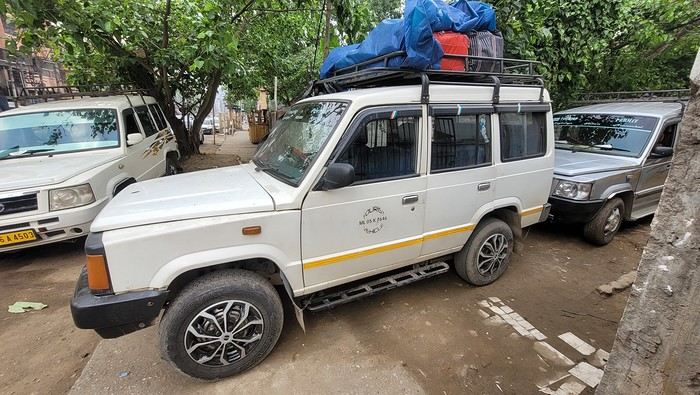
While waiting, I watch the street come to life. I have fun photographing the different modes of transport passing by.
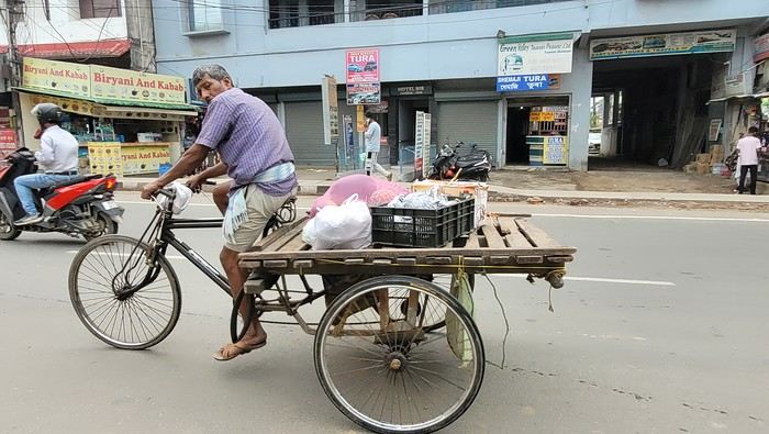
Time passes faster when you’re occupied. We leave at 8:20 AM, and the driver does door-to-door service along the way. We make our first stop for 25 minutes at 9:10 AM, then another for breakfast at 10:10 AM. The scenery is very different from Assam and Nagaland. We drive alongside a pine forest and a large lake. There are beautiful viewpoints, but the driver isn’t stopping for sightseeing, so I have to settle for looking through the car windows.
We finally arrive in Shillong at 11:45 AM. The driver stops in the middle of nowhere, so I have to walk up the street to find a taxi. I flag one down, and he agrees to take me to my new guesthouse, the Rockski Boutique Bed & Breakfast. No sooner do I arrive than a storm with a heavy downpour welcomes me. When I arrived in Guwahati at the end of October, I’d booked a guide with a car for this week. There’s no public transport to get from village to village, so I had to take a car to visit. The tourism manager, Sachin, sent me a message to let me know that the driver, Welbis, will pick me up tomorrow morning at 8 AM. The temperature is much cooler here—only 19°C. At 2:30 PM, the rain stops, and I take the opportunity to explore the city. I start with the cathedral. Today is Good Friday, so I’m going to see how it’s celebrated here. Meghalaya is a Catholic state. The cathedral isn’t far from the guesthouse—it’s huge and all blue.
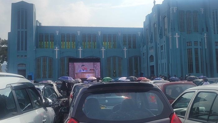
I arrive during mass, and it’s impossible to enter—the faithful are numerous outside in the parking lot. Giant screens broadcast the ceremony.

While waiting, I watch the street come to life. I have fun photographing the different modes of transport passing by.
Time passes faster when you’re occupied. We leave at 8:20 AM, and the driver does door-to-door service along the way. We make our first stop for 25 minutes at 9:10 AM, then another for breakfast at 10:10 AM. The scenery is very different from Assam and Nagaland. We drive alongside a pine forest and a large lake. There are beautiful viewpoints, but the driver isn’t stopping for sightseeing, so I have to settle for looking through the car windows.
We finally arrive in Shillong at 11:45 AM. The driver stops in the middle of nowhere, so I have to walk up the street to find a taxi. I flag one down, and he agrees to take me to my new guesthouse, the Rockski Boutique Bed & Breakfast. No sooner do I arrive than a storm with a heavy downpour welcomes me. When I arrived in Guwahati at the end of October, I’d booked a guide with a car for this week. There’s no public transport to get from village to village, so I had to take a car to visit. The tourism manager, Sachin, sent me a message to let me know that the driver, Welbis, will pick me up tomorrow morning at 8 AM. The temperature is much cooler here—only 19°C. At 2:30 PM, the rain stops, and I take the opportunity to explore the city. I start with the cathedral. Today is Good Friday, so I’m going to see how it’s celebrated here. Meghalaya is a Catholic state. The cathedral isn’t far from the guesthouse—it’s huge and all blue.
I arrive during mass, and it’s impossible to enter—the faithful are numerous outside in the parking lot. Giant screens broadcast the ceremony.
Come discover the island of Aruba in the Caribbean
Aruba is a small island in the Dutch Caribbean located off the coast of Venezuela. It’s part of the ABC islands (Aruba, Bonaire, Curaçao).
After visiting the island of Curaçao a few years earlier, we decided to explore Aruba in November 2023.
We stayed for three weeks in an Airbnb-style accommodation and rented a vehicle for the entire period to visit the various tourist attractions on the island.
These are listed below.
You’ll find several supermarkets (Carrefour, Super Food, Jumbo, etc.) as well as a wide variety of restaurants.
*****
Note:
Please be aware that since July 2024, Aruba has implemented a $20 sustainable development tax for visitors arriving by air.
This tax is payable via the online ED Card platform during the ED card application process to enter Aruba.
I invite you to continue reading this travel journal and watch the videos that will help you discover this sunny destination.
*****
Videos are embedded throughout the summary. Click on the image to start the video.
To jump to a specific post, here are the relevant links:
Noord - California Lighthouse Noord - Bubali Bird Sanctuary Paradera - Casibari Rock Formations Santa Cruz - Ayo Rock Formations Bushiribana - New Natural Pool (Cave Pool) Noord - Bushiribana Gold Mill Ruins Santa Cruz - Natural Bridge Oranjestad - Hooiberg San Nicolas - Seroe Colorado Natural Bridge Spanish Lagoon Mangrove Trail Shoco Habitat - Spanish Lagoon Oranjestad - Balashi Gold Mill Ruins San Nicolas - Lourdes Grotto Arikok National Park - Daimari Beach, Boka Keto Beach (Moro), Conchi Natural Pool Arikok National Park - Boca Prins Beach Arikok National Park - Fontein Cave Arikok National Park – Quadirikiri Cave Arikok National Park – Hike to Sero Arikok Oranjestad & Noord - Walking tour San Nicolas and its murals San Nicolas and its mosaic street benches The famous seafood restaurant Zeerover Noord - Snorkeling around the Baboo shipwreck Noord - Arashi Beach Noord - Boca Catalina Beach Noord - Boca Catalina Beach - Snorkeling Noord - Snorkeling at Tres Tapi - Turtle and Ray Noord - Snorkeling at Malmok Beach - Flying gurnards Noord - Hadicurari Beach (Fishermen's Huts) Noord - Palm Beach Noord - Eagle Beach Noord – Manchebo Beach Oranjestad - Divi Beach Oranjestad - Druif Beach Oranjestad - Surfside Beach Pos Chiquito - Mangel Halto Beach Savaneta - Santo Largo Beach Savaneta - Battata Beach San Nicolas - Rodgers Beach San Nicolas - Baby Beach San Nicolas - Baby Beach - Snorkeling San Nicolas - Bachelor’s Beach (Boca Tabla) San Nicolas - Boca Grandi Beach San Nicolas - Colorado Point - Snorkeling at Bachelors Beach San Nicolas - Grapefield Beach Hike - Blackstone Beach via Natural Bridge Noord - Wariruri Beach
After visiting the island of Curaçao a few years earlier, we decided to explore Aruba in November 2023.
We stayed for three weeks in an Airbnb-style accommodation and rented a vehicle for the entire period to visit the various tourist attractions on the island.
These are listed below.
You’ll find several supermarkets (Carrefour, Super Food, Jumbo, etc.) as well as a wide variety of restaurants.
*****
Note:
Please be aware that since July 2024, Aruba has implemented a $20 sustainable development tax for visitors arriving by air.
This tax is payable via the online ED Card platform during the ED card application process to enter Aruba.
I invite you to continue reading this travel journal and watch the videos that will help you discover this sunny destination.
*****
Videos are embedded throughout the summary. Click on the image to start the video.
To jump to a specific post, here are the relevant links:
Noord - California Lighthouse Noord - Bubali Bird Sanctuary Paradera - Casibari Rock Formations Santa Cruz - Ayo Rock Formations Bushiribana - New Natural Pool (Cave Pool) Noord - Bushiribana Gold Mill Ruins Santa Cruz - Natural Bridge Oranjestad - Hooiberg San Nicolas - Seroe Colorado Natural Bridge Spanish Lagoon Mangrove Trail Shoco Habitat - Spanish Lagoon Oranjestad - Balashi Gold Mill Ruins San Nicolas - Lourdes Grotto Arikok National Park - Daimari Beach, Boka Keto Beach (Moro), Conchi Natural Pool Arikok National Park - Boca Prins Beach Arikok National Park - Fontein Cave Arikok National Park – Quadirikiri Cave Arikok National Park – Hike to Sero Arikok Oranjestad & Noord - Walking tour San Nicolas and its murals San Nicolas and its mosaic street benches The famous seafood restaurant Zeerover Noord - Snorkeling around the Baboo shipwreck Noord - Arashi Beach Noord - Boca Catalina Beach Noord - Boca Catalina Beach - Snorkeling Noord - Snorkeling at Tres Tapi - Turtle and Ray Noord - Snorkeling at Malmok Beach - Flying gurnards Noord - Hadicurari Beach (Fishermen's Huts) Noord - Palm Beach Noord - Eagle Beach Noord – Manchebo Beach Oranjestad - Divi Beach Oranjestad - Druif Beach Oranjestad - Surfside Beach Pos Chiquito - Mangel Halto Beach Savaneta - Santo Largo Beach Savaneta - Battata Beach San Nicolas - Rodgers Beach San Nicolas - Baby Beach San Nicolas - Baby Beach - Snorkeling San Nicolas - Bachelor’s Beach (Boca Tabla) San Nicolas - Boca Grandi Beach San Nicolas - Colorado Point - Snorkeling at Bachelors Beach San Nicolas - Grapefield Beach Hike - Blackstone Beach via Natural Bridge Noord - Wariruri Beach
Second trip to Iceland
We stayed in Iceland from August 27 to September 13, 2023. Actually, this was our second trip to the island.
During our first visit, we rented a camper van from Snail Motorhome Rental, a family-run business that provided outstanding service.
Unfortunately, we discovered that this company no longer exists.
So, we rented a camper van through a third party, specifically via the Nordic Travel Group website.
We chose City Car Rental, located near Keflavik Airport, because the rental cost was really appealing.
Apart from the quality of the sleeping bags and the size of the pillows we rented, our experience with this company was very positive.
We noticed a significant increase in tourism since our last trip in 2015.
Several sites have been redeveloped, and parking is now paid in many places.
Accommodations have multiplied, not only near major cities but also in remote areas.
One notable advantage, however, was discovering the wide variety of food products available in supermarkets. In 2015, the selection was very limited.
I invite you to continue reading this travel journal and watch the videos that will let you explore this destination, which has everything to charm outdoor enthusiasts.
Videos are embedded throughout the summary. Click on the image to start the video.
To jump to a specific post, here are the relevant links:
Hlauptungufoss, Midfoss and Bruarfoss Geysir, Blesi and Strokkur Gullfoss Brúarhlöð Canyon Faxafoss Kiðjabergsvöllur – Belvedere Kerið Crater Reykjadalur Valley – Hike to the hot springs Seljalandsfoss Gljúfrabúi Waterfall Seljavallalaug – One of Iceland’s oldest geothermal pools Skógafoss – Fimmvörðuháls hiking trail (partial) Kvernufoss Plane wreck at Solheimasandur Dyrhólaey Peninsula Reynisfjara Beach – Puffins and seals Vík í Mýrdal Fjaðrárgljúfur Canyon Skaftafell National Park – Svartifoss, Magnusarfoss & Hundafoss Svínafellsjökull Glacier Hofskirkja Church Fjallsárlón Glacial Lagoon (West) Fjallsárlón Glacial Lagoon (East) Jökulsárlón Glacial Lagoon Litlanefsfoss and Hengifoss Rjúkandi (Rjúkandafoss) Stuðlagil Canyon Selfoss and Dettifoss Krafla – Viti Crater Lake Krafla – Leirhnjúkur Lava Field Hverir Geothermal Site (Námafjall) Hverir – Hverarönd Geothermal Site – Blue Lagoon Grjótagjá – Hot Spring Cave Stóragjá – Hot Spring Cave Goðafoss Akureyri Zipline Hofsós – Pool by the Skagafjörður Fjord Víðimýrarkirkja Church Hvítserkur Rock – The Troll of Northwest Iceland Gislahellir (Gisli's Cave) Dynjandi (Fjallfoss) – One of Iceland’s most beautiful waterfalls Hellulaug (Natural hot spring pool) Stykkishólmur – Stykkishólmshöfn Port Kirkjufell & Kirkjufellsfoss Ólafsvík – Bugsfoss Lóndrangar Basalt Columns Arnarstapi Ytri-Tunga Farm – Seal watching Deildartunguhver Hot Spring Hraunfossar & Barnafoss Exploring Reykjavik Reykjavik – Whale Safari – Whale watching Raufarholshellir Lava Tunnel Gígvatnsvatn Lake (Green Lake/Graenevatn) Seltún Geothermal Site (Krýsuvík) Kleifarvatn Lake Blue Lagoon Thermal Spa Gunnuhver Geothermal Site Reykjanes Peninsula – Reykjanesviti Lighthouse Reykjanes Peninsula – Valahnúkamöl – Reykjanestá Ægissíðufoss Super Jeep excursion to Landmannalaugar Hiking in Landmannalaugar Scenery along the way
During our first visit, we rented a camper van from Snail Motorhome Rental, a family-run business that provided outstanding service.
Unfortunately, we discovered that this company no longer exists.
So, we rented a camper van through a third party, specifically via the Nordic Travel Group website.
We chose City Car Rental, located near Keflavik Airport, because the rental cost was really appealing.
Apart from the quality of the sleeping bags and the size of the pillows we rented, our experience with this company was very positive.
We noticed a significant increase in tourism since our last trip in 2015.
Several sites have been redeveloped, and parking is now paid in many places.
Accommodations have multiplied, not only near major cities but also in remote areas.
One notable advantage, however, was discovering the wide variety of food products available in supermarkets. In 2015, the selection was very limited.
I invite you to continue reading this travel journal and watch the videos that will let you explore this destination, which has everything to charm outdoor enthusiasts.
Videos are embedded throughout the summary. Click on the image to start the video.
To jump to a specific post, here are the relevant links:
Hlauptungufoss, Midfoss and Bruarfoss Geysir, Blesi and Strokkur Gullfoss Brúarhlöð Canyon Faxafoss Kiðjabergsvöllur – Belvedere Kerið Crater Reykjadalur Valley – Hike to the hot springs Seljalandsfoss Gljúfrabúi Waterfall Seljavallalaug – One of Iceland’s oldest geothermal pools Skógafoss – Fimmvörðuháls hiking trail (partial) Kvernufoss Plane wreck at Solheimasandur Dyrhólaey Peninsula Reynisfjara Beach – Puffins and seals Vík í Mýrdal Fjaðrárgljúfur Canyon Skaftafell National Park – Svartifoss, Magnusarfoss & Hundafoss Svínafellsjökull Glacier Hofskirkja Church Fjallsárlón Glacial Lagoon (West) Fjallsárlón Glacial Lagoon (East) Jökulsárlón Glacial Lagoon Litlanefsfoss and Hengifoss Rjúkandi (Rjúkandafoss) Stuðlagil Canyon Selfoss and Dettifoss Krafla – Viti Crater Lake Krafla – Leirhnjúkur Lava Field Hverir Geothermal Site (Námafjall) Hverir – Hverarönd Geothermal Site – Blue Lagoon Grjótagjá – Hot Spring Cave Stóragjá – Hot Spring Cave Goðafoss Akureyri Zipline Hofsós – Pool by the Skagafjörður Fjord Víðimýrarkirkja Church Hvítserkur Rock – The Troll of Northwest Iceland Gislahellir (Gisli's Cave) Dynjandi (Fjallfoss) – One of Iceland’s most beautiful waterfalls Hellulaug (Natural hot spring pool) Stykkishólmur – Stykkishólmshöfn Port Kirkjufell & Kirkjufellsfoss Ólafsvík – Bugsfoss Lóndrangar Basalt Columns Arnarstapi Ytri-Tunga Farm – Seal watching Deildartunguhver Hot Spring Hraunfossar & Barnafoss Exploring Reykjavik Reykjavik – Whale Safari – Whale watching Raufarholshellir Lava Tunnel Gígvatnsvatn Lake (Green Lake/Graenevatn) Seltún Geothermal Site (Krýsuvík) Kleifarvatn Lake Blue Lagoon Thermal Spa Gunnuhver Geothermal Site Reykjanes Peninsula – Reykjanesviti Lighthouse Reykjanes Peninsula – Valahnúkamöl – Reykjanestá Ægissíðufoss Super Jeep excursion to Landmannalaugar Hiking in Landmannalaugar Scenery along the way
2 weeks in the Cyclades
Hi everyone!
Blue skies (lots of them), whitewashed villages with steep alleyways, hundreds of churches, and... thousands of stairs? Welcome to the Cyclades! 🙂
We’d been dreaming about this for a while, but in July-August—with the crowds—no way! Now that I can travel outside school holidays, the Cyclades are back on the agenda. And so begins a loooong period of planning and second-guessing, with countless itinerary changes: the Cyclades, yes, but which ones? I was fixated on Folegandros (we won’t be going after all) and really wanted to visit Delos. So, for this first trip, it’ll be: Mykonos (and Delos)-Naxos-Amorgos-Santorini.
Saturday 24/05: Departure from Orly on a Transavia flight, arriving in Mykonos in the late afternoon. We found a hotel that offers free transfers (pretty rare and not insignificant—it’s 25 € each way for just a few kilometers 😠) and at a reasonable price (83 € per night for B&B). Time for dinner already: Greek salad and souvlaki (we’re in Greece, right?)
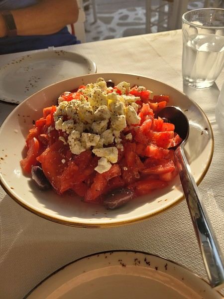 (Okay, this is actually a dakos with Naxos cheese, but I don’t have a photo of a Greek salad 😏).
Blue skies (lots of them), whitewashed villages with steep alleyways, hundreds of churches, and... thousands of stairs? Welcome to the Cyclades! 🙂
We’d been dreaming about this for a while, but in July-August—with the crowds—no way! Now that I can travel outside school holidays, the Cyclades are back on the agenda. And so begins a loooong period of planning and second-guessing, with countless itinerary changes: the Cyclades, yes, but which ones? I was fixated on Folegandros (we won’t be going after all) and really wanted to visit Delos. So, for this first trip, it’ll be: Mykonos (and Delos)-Naxos-Amorgos-Santorini.
Saturday 24/05: Departure from Orly on a Transavia flight, arriving in Mykonos in the late afternoon. We found a hotel that offers free transfers (pretty rare and not insignificant—it’s 25 € each way for just a few kilometers 😠) and at a reasonable price (83 € per night for B&B). Time for dinner already: Greek salad and souvlaki (we’re in Greece, right?)
(Okay, this is actually a dakos with Naxos cheese, but I don’t have a photo of a Greek salad 😏).3 weeks in Colombia (August 2023)
Why Colombia?
It's quite simple. For the past few years, my daughter has been living with a Colombian from Bogotá. The idea was to discover his country, meet his family, and do part of the trip all four of us together.
We’re heading out first as scouts, then they’ll join us to continue the journey.
The itinerary was shared in another post—now it’s time for the impressions.
No photos, as for me, it’s video and nothing more!
Day 1: The big departure What was planned: A flight from Lyon Saint-Exupéry late morning heading to Frankfurt. Two hours of waiting in Frankfurt (just enough time to eat a pretzel!!) and then off to Bogotá for an arrival around 7 PM local time. I hadn’t done the Check-Mig (to be done 72 hours before the flight). I did it on my phone, giving a fake arrival date in Colombia, and the attendant told me there wouldn’t be any issues in Bogotá. Actually, two hours of delay at departure in Lyon because a sick passenger was on the plane—they had to evacuate him, and the ambulance that was supposed to be there didn’t have permission to come near the plane. Ah, French administrative formalities!!!!! Flight to Frankfurt with Lufthansa went smoothly. A sprint through the airport—very well organized. Connection secured, so we boarded the plane, and two hours later than scheduled, we took off for an 11-hour flight! Arrival in Bogotá, and the immigration process took over an hour and a half because of the crowds. However, no issues with the Check-Mig—they barely glanced at it. Our daughter’s father-in-law ended up waiting over 3 hours at the airport because of this!!! Surprise: No luggage. Luckily, we had packed essentials in our carry-ons! Quick administrative paperwork, and Lufthansa informed me our bags would be on the next flight, so no big deal. Off to our hotel in La Candelaria and a good night’s rest.
The plus: We’re in Bogotá! The minus: Flight delays are becoming more and more common.
Day 1: The big departure What was planned: A flight from Lyon Saint-Exupéry late morning heading to Frankfurt. Two hours of waiting in Frankfurt (just enough time to eat a pretzel!!) and then off to Bogotá for an arrival around 7 PM local time. I hadn’t done the Check-Mig (to be done 72 hours before the flight). I did it on my phone, giving a fake arrival date in Colombia, and the attendant told me there wouldn’t be any issues in Bogotá. Actually, two hours of delay at departure in Lyon because a sick passenger was on the plane—they had to evacuate him, and the ambulance that was supposed to be there didn’t have permission to come near the plane. Ah, French administrative formalities!!!!! Flight to Frankfurt with Lufthansa went smoothly. A sprint through the airport—very well organized. Connection secured, so we boarded the plane, and two hours later than scheduled, we took off for an 11-hour flight! Arrival in Bogotá, and the immigration process took over an hour and a half because of the crowds. However, no issues with the Check-Mig—they barely glanced at it. Our daughter’s father-in-law ended up waiting over 3 hours at the airport because of this!!! Surprise: No luggage. Luckily, we had packed essentials in our carry-ons! Quick administrative paperwork, and Lufthansa informed me our bags would be on the next flight, so no big deal. Off to our hotel in La Candelaria and a good night’s rest.
The plus: We’re in Bogotá! The minus: Flight delays are becoming more and more common.
From Caño Cristales to Tayrona Park
After about 12 hours of flying from Toulouse (via Paris), we landed in Bogotá six years after our first trip to Colombia. This time, our journey will be very different, with only this stop in the Colombian capital in common.
Our travel itinerary
Bogotá / La Macarena (Caño Cristales) / Villa de Leyva / Barichara / San Gil / Girón / Mompox / Ciénaga and the Santa Marta lagoon / Minca / Los Naranjos (Tayrona Park) / Bogotá.
Step 1: Bogotá (and Nemecon)
Bogotá (1/3)
This morning, we had a meet-up with Flora from Aventure Colombia, who helped me organize one of our stops, a few transfers, and tomorrow’s day trip, the program of which I changed at the last minute after deciding to skip the visit to the Salt Cathedral of Zipaquirá. Flora is a kind and lovely person, always available, and she did everything to answer my questions and give me advice.
She’s a local contact I highly recommend. Flora can help you plan your trip, whether you want a fully organized tour or, like us, just need assistance with a specific stop or one or more transfers between cities.
We left Flora after setting a meet-up for our return to Bogotá in a month. As we walked out of her agency, we headed to the wonderful Gold Museum, located just a hundred meters away. I was excited to revisit this amazing museum.
Note: Free entry for those over 60, regardless of nationality. Just show your passport.
Like six years ago, I was amazed by its museography, the beauty of the pieces on display, and that breathtaking shamanic room.
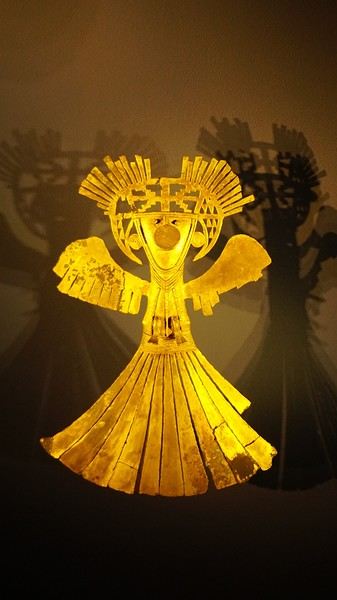
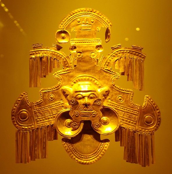
About two hours later, we decided to walk (careful, it’s a climb!) to the Monserrate cable car (3152m). Long wait to buy tickets and board the cable car! Once we arrived, a few raindrops, an impressive panoramic view of Bogotá’s vastness, a quick visit to the basilica (a pilgrimage site for Colombians), a walk through the tourist market, and at the top, plenty of small restaurants where we had our first Colombian meal. After our hearty lunch, we were lucky to see the sun return! No line for the descent. We then headed back to the hotel because Justine wanted to rest and recover from the trip. As for me, I continued my walk. I discovered a really nice craft market recommended by Flora, Pasaje Rivas, returned to Bolívar Square, and wandered through different streets, including the main pedestrian avenue (Calle 7), where there’s always something to see.
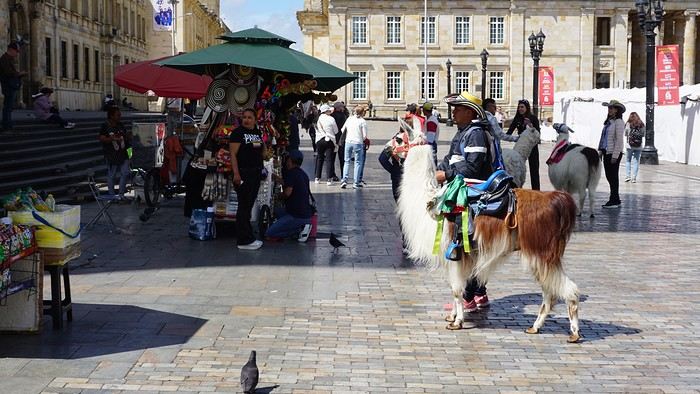
Tomorrow, a change of scenery as we head out for a hike in a small desert (Desierto de Chueca), located about 2 hours from Bogotá in the village of Nemecon. For this outing from Bogotá, with Flora’s help, we booked a car with a driver for the day. Flora also took care of booking the guide (since the site can only be visited with one). Nemecon (2/3) Today, we went to Nemecon to hike about 7.5 km in the ‘Desert of Checua.’ It’s nothing like sandy deserts! Instead, it’s geological formations sculpted by time, wind, and water. After two hours on the road—almost one of them spent navigating traffic jams with cars, trucks, buses, and a continuous flow of motorcycles on either side of our taxi—we reached Nemecon! The village center is really (too?) quiet. We met up with Deisy and headed toward the ‘desert,’ about twenty minutes away on a bumpy dirt road. Once there, a quick briefing, and off we went! Deisy didn’t stop talking (in Spanish) for over 3 hours!!! She told us so much about her region (flower farming, water management, traditions, songs, etc.), the origin of the site, and even mentioned Antonio Banderas, who filmed *The 33* in the village’s salt mine (the story of the survival of 33 Chilean miners after a collapse in their copper and gold mine). One hour of walking to reach the site, one hour to explore it, and one hour to return.
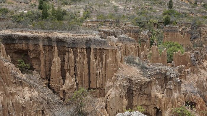
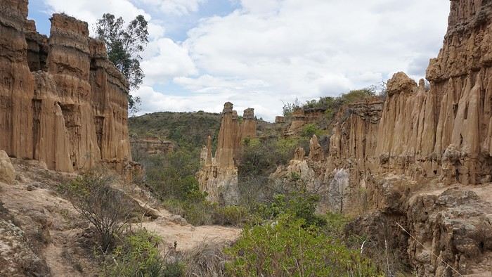
The advantage of this non-stop chatter was that it forced us to brush up on our Spanish at lightning speed. I even wondered if the effort to concentrate wasn’t more exhausting than the physical effort! Especially since on the way back, I got an oral quiz. Deisy wanted to make sure I remembered some of the information she’d given me during the visit: why is this rock white, that one red, and that one black? Back in the village, we had lunch at a restaurant recommended by Deisy before visiting the Nemecon salt mine. Before entering, a guide spent a good half-hour explaining the origin of the salt and the presence of many fossils in the area. Again, concentrating was tough because all the comments were exclusively in Spanish! An hour and a half wandering through the tunnels with a ‘lovely miner’s helmet’ on our heads!
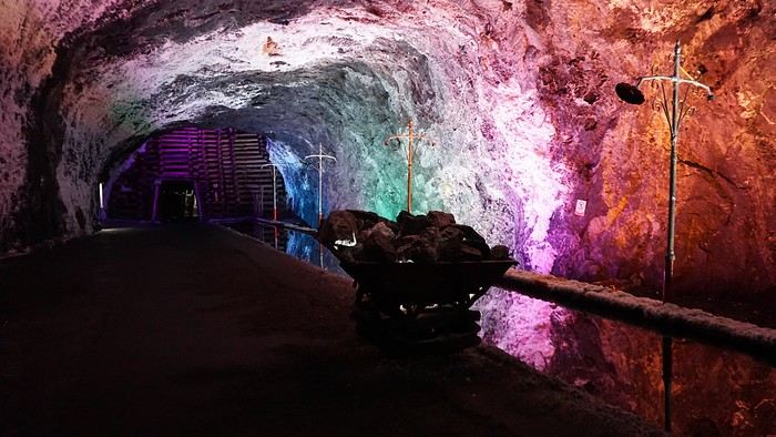
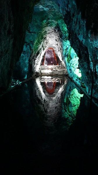
We met our driver at the mine entrance. The return to Bogotá was a bit faster, but traffic in the city center was still heavy! We arrived in front of our hotel between 8:00 and 8:30 PM. It’s been a pretty intense start to the trip! Tonight, our legs are tired. Hopefully, tomorrow will be a bit more relaxed! Bogotá (3/3) We started the day by visiting the Santa Clara Church Museum, located next to the presidential palace. Alejandra (from the local agency ‘Gaia Tours Colombia,’ which organized our stay in Caño Cristales (La Macarena)) had recommended this visit for its rich mural paintings.
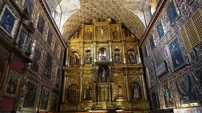
A few hundred meters further, after crossing the Plaza Mayor again, we visited the cultural complex housing the Botero Museum, the Mint Museum, and the Bank of the Republic Art Museum. Note that entry is free for all three museums. Botero Museum: There are fewer works by Botero here than in the Medellín museum, but more paintings and sculptures by other artists, all from Botero’s private collection (donated to Colombia). Mint Museum: We limited ourselves to visiting one room (on Flora’s advice) where three gold and gemstone monstrances and a Christ with a crown of emerald thorns are displayed. Photos are not allowed. Art Museum: We visited two temporary exhibitions. Lunchtime came quickly. We had a good meal at a reasonably priced small restaurant in the La Candelaria micro-district, near the Chorro de Quevedo square. We decided to spend the afternoon wandering the streets and alleys of the historic center to discover local street art.
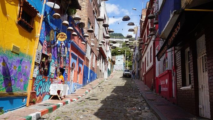
We also passed through very lively pedestrian streets. I also decided to revisit Pasaje Rivas to show Justine all the shops selling more or less artisanal products. Tomorrow morning, we fly to La Macarena at 10:30 AM. Not to dance (you’d be surprised if I told you we were going to take a South American dance class, right?!), but to visit the fabulous Caño Cristales, a river naturally colored by aquatic plants. The planned program includes hiking, horseback riding, canoeing, and swimming among these plants. This site was long inaccessible because the area was controlled by the FARC. Access and tourism development became possible after agreements and amnesty measures between the Colombian government and paramilitary groups. As in other regions, former FARC members have been able to transition into various tourism-related activities.
About two hours later, we decided to walk (careful, it’s a climb!) to the Monserrate cable car (3152m). Long wait to buy tickets and board the cable car! Once we arrived, a few raindrops, an impressive panoramic view of Bogotá’s vastness, a quick visit to the basilica (a pilgrimage site for Colombians), a walk through the tourist market, and at the top, plenty of small restaurants where we had our first Colombian meal. After our hearty lunch, we were lucky to see the sun return! No line for the descent. We then headed back to the hotel because Justine wanted to rest and recover from the trip. As for me, I continued my walk. I discovered a really nice craft market recommended by Flora, Pasaje Rivas, returned to Bolívar Square, and wandered through different streets, including the main pedestrian avenue (Calle 7), where there’s always something to see.
Tomorrow, a change of scenery as we head out for a hike in a small desert (Desierto de Chueca), located about 2 hours from Bogotá in the village of Nemecon. For this outing from Bogotá, with Flora’s help, we booked a car with a driver for the day. Flora also took care of booking the guide (since the site can only be visited with one). Nemecon (2/3) Today, we went to Nemecon to hike about 7.5 km in the ‘Desert of Checua.’ It’s nothing like sandy deserts! Instead, it’s geological formations sculpted by time, wind, and water. After two hours on the road—almost one of them spent navigating traffic jams with cars, trucks, buses, and a continuous flow of motorcycles on either side of our taxi—we reached Nemecon! The village center is really (too?) quiet. We met up with Deisy and headed toward the ‘desert,’ about twenty minutes away on a bumpy dirt road. Once there, a quick briefing, and off we went! Deisy didn’t stop talking (in Spanish) for over 3 hours!!! She told us so much about her region (flower farming, water management, traditions, songs, etc.), the origin of the site, and even mentioned Antonio Banderas, who filmed *The 33* in the village’s salt mine (the story of the survival of 33 Chilean miners after a collapse in their copper and gold mine). One hour of walking to reach the site, one hour to explore it, and one hour to return.
The advantage of this non-stop chatter was that it forced us to brush up on our Spanish at lightning speed. I even wondered if the effort to concentrate wasn’t more exhausting than the physical effort! Especially since on the way back, I got an oral quiz. Deisy wanted to make sure I remembered some of the information she’d given me during the visit: why is this rock white, that one red, and that one black? Back in the village, we had lunch at a restaurant recommended by Deisy before visiting the Nemecon salt mine. Before entering, a guide spent a good half-hour explaining the origin of the salt and the presence of many fossils in the area. Again, concentrating was tough because all the comments were exclusively in Spanish! An hour and a half wandering through the tunnels with a ‘lovely miner’s helmet’ on our heads!
We met our driver at the mine entrance. The return to Bogotá was a bit faster, but traffic in the city center was still heavy! We arrived in front of our hotel between 8:00 and 8:30 PM. It’s been a pretty intense start to the trip! Tonight, our legs are tired. Hopefully, tomorrow will be a bit more relaxed! Bogotá (3/3) We started the day by visiting the Santa Clara Church Museum, located next to the presidential palace. Alejandra (from the local agency ‘Gaia Tours Colombia,’ which organized our stay in Caño Cristales (La Macarena)) had recommended this visit for its rich mural paintings.
A few hundred meters further, after crossing the Plaza Mayor again, we visited the cultural complex housing the Botero Museum, the Mint Museum, and the Bank of the Republic Art Museum. Note that entry is free for all three museums. Botero Museum: There are fewer works by Botero here than in the Medellín museum, but more paintings and sculptures by other artists, all from Botero’s private collection (donated to Colombia). Mint Museum: We limited ourselves to visiting one room (on Flora’s advice) where three gold and gemstone monstrances and a Christ with a crown of emerald thorns are displayed. Photos are not allowed. Art Museum: We visited two temporary exhibitions. Lunchtime came quickly. We had a good meal at a reasonably priced small restaurant in the La Candelaria micro-district, near the Chorro de Quevedo square. We decided to spend the afternoon wandering the streets and alleys of the historic center to discover local street art.
We also passed through very lively pedestrian streets. I also decided to revisit Pasaje Rivas to show Justine all the shops selling more or less artisanal products. Tomorrow morning, we fly to La Macarena at 10:30 AM. Not to dance (you’d be surprised if I told you we were going to take a South American dance class, right?!), but to visit the fabulous Caño Cristales, a river naturally colored by aquatic plants. The planned program includes hiking, horseback riding, canoeing, and swimming among these plants. This site was long inaccessible because the area was controlled by the FARC. Access and tourism development became possible after agreements and amnesty measures between the Colombian government and paramilitary groups. As in other regions, former FARC members have been able to transition into various tourism-related activities.
Slovenia, a nature destination
Slovenia was the originally planned destination for summer 2022, as a complement to a road trip through Croatia and Montenegro. Plans changed on a whim in February of that year. Our Balkans road trip would ultimately be limited to Slovenia and take place over 10 days during the Easter school holidays. Flight tickets and car rental were booked right away; all that was left was to finalize our itinerary, already sketched out, and the accommodation reservations.
I decided to add Plitvice Lakes in Croatia to our program. I really wanted to discover them, and for my husband, it was a chance to revisit them several years after a trip to Yugoslavia when he was a teenager.
I’m happy to contribute to the reopening of our forum by posting this travel journal (originally posted in 2022 on another forum, the text has been partially revised and photos added). As usual, a few photos to start with—maybe they’ll inspire you to join in!

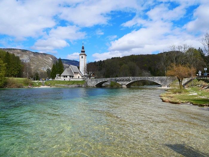
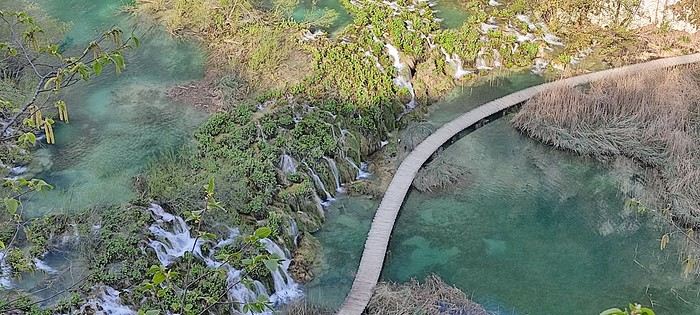

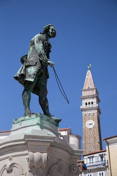
I decided to add Plitvice Lakes in Croatia to our program. I really wanted to discover them, and for my husband, it was a chance to revisit them several years after a trip to Yugoslavia when he was a teenager.
I’m happy to contribute to the reopening of our forum by posting this travel journal (originally posted in 2022 on another forum, the text has been partially revised and photos added). As usual, a few photos to start with—maybe they’ll inspire you to join in!
Road trip in Iceland with my daughter from May 6 to 13, 2023
Hello everyone,
I’m happy to be back at my keyboard to share a few adventures. 😉
Right now, two more trips are in the works for 2025, but for the moment, I’d rather share than ask questions.
Like many of you, Iceland has been a longtime love of mine. My first trip there was in February 2016, when we went as a family of five—including our three daughters, who were 1, 6, and 5 at the time. It was a very short stay with just one place to stay, north of the capital. We explored the south, from Vik to Grindavik, and of course, I was left wanting more. We returned in April 2018 during a stopover on our way back from New York. We spent three days near Borgarnes, but fatigue and the weather kept me from doing everything I’d planned. After my mom passed away in January 2023, I decided to go back to Iceland for a full week. Just to clear my head... I thought I’d go alone, but in the end, my 8-year-old daughter (at the time) is a huge horseback riding fan, so I decided to take her along. This road trip came together quickly thanks to another well-known French-speaking forum for Iceland lovers. As usual, I quickly checked availability on Booking and flights with Icelandair. Booked the flight, then the accommodations—with quite a few changes right up until departure. Goals for this trip:
Go where I haven’t been yet. Do a road trip because I love them. Go horseback riding with my daughter.
Icelandair was booked for May 6–13, 2023. Accommodations were reserved on Booking, and once again, I rented a 4x4 from Blue Car Rental, which I really like. Not wanting to deal with boredom while there, I got all the insurance and the option to skip the counter. My English isn’t great…
I’m happy to be back at my keyboard to share a few adventures. 😉
Right now, two more trips are in the works for 2025, but for the moment, I’d rather share than ask questions.
Like many of you, Iceland has been a longtime love of mine. My first trip there was in February 2016, when we went as a family of five—including our three daughters, who were 1, 6, and 5 at the time. It was a very short stay with just one place to stay, north of the capital. We explored the south, from Vik to Grindavik, and of course, I was left wanting more. We returned in April 2018 during a stopover on our way back from New York. We spent three days near Borgarnes, but fatigue and the weather kept me from doing everything I’d planned. After my mom passed away in January 2023, I decided to go back to Iceland for a full week. Just to clear my head... I thought I’d go alone, but in the end, my 8-year-old daughter (at the time) is a huge horseback riding fan, so I decided to take her along. This road trip came together quickly thanks to another well-known French-speaking forum for Iceland lovers. As usual, I quickly checked availability on Booking and flights with Icelandair. Booked the flight, then the accommodations—with quite a few changes right up until departure. Goals for this trip:
Go where I haven’t been yet. Do a road trip because I love them. Go horseback riding with my daughter.
Icelandair was booked for May 6–13, 2023. Accommodations were reserved on Booking, and once again, I rented a 4x4 from Blue Car Rental, which I really like. Not wanting to deal with boredom while there, I got all the insurance and the option to skip the counter. My English isn’t great…
Road trip 15 jours de Stockholm au grand nord English translation pending
Bonjour, je suis heureux de vous accueillir à bord de ce nouveau carnet de voyage.
2020 est décidément une année bien compliquée et ce voyage est à 1000 lieux de ce qui était prévu à la base pour cette année.
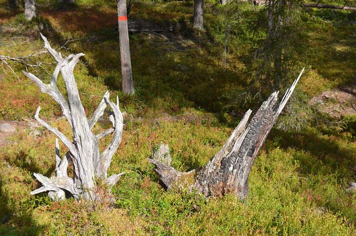
A la base, un voyage était prévu début septembre, dans le Wyoming. Il a été reporté à 2021. Un voyage qui avait été annulé en mai en Slovénie a donc été placé à ces dates. Hélas, une semaine avant le départ, la Slovénie a imposé une quarantaine aux français et un test covid à réaliser dans les 36 avant le départ, donc : report à mai 2021.
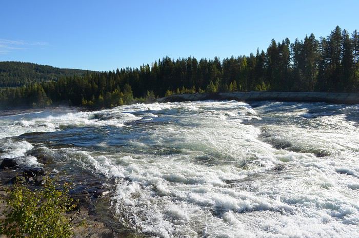
Je cherchais donc une nouvelle destination… Danemark, Pologne, Suisse ? Ces 3 pays ont restreint également la venue des français. Il me restait donc la Suède, pays qui a eu une ligne et une stratégie stable face à la crise du covid.
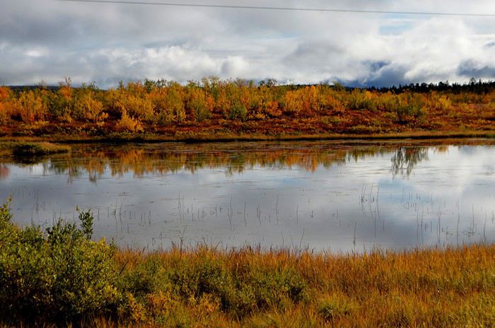
J’ai donc acheté 3 billets flexibles sur Air France 3 jours avant le départ en cas de report de dernière minute. Seule la 1ere nuit a été réservée. Les autres l'ont été au fur et à mesure.
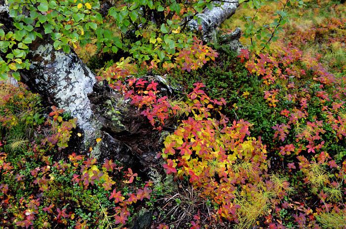
Nous avons décidé de nous concentrer sur le nord, plus sauvage. Notre besoin de grands espaces vierges nous avait poussés à réserver le Wyoming. La Suède nous offrira-t-elle la même chose ?
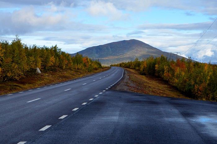
Voici donc le road trip effectué : Samedi 29 août : Marseille-Amsterdam-Stockholm Dimanche 30 août : Stockholm Lundi 31 août : Stockholm et train de nuit pour Lulea Mardi 1er septembre : Lulea, Gammelstad Mercredi 2 septembre : Lulea-chutes de Storforsen-Jokkmokk Jeudi 3 septembre : Le parc national de Muddus Vendredi 4 septembre : Jokkmokk-Kiruna Samedi 5 septembre : Le parc national d’Abisko Dimanche 6 septembre : Jukkajärvi et le massif du Kebnekaise Lundi 7 septembre : Kiruna-Arvidsjaur Mardi 8 septembre : Arjeplog Mercredi 9 septembre : Arvidsjaur-Umea Jeudi 10 septembre : Umea-Lulea et train de nuit pour Stochkolm Vendredi 11 septembre : Ile de Vaxholm Samedi 12 septembre : Stockholm-Marseille via Paris.
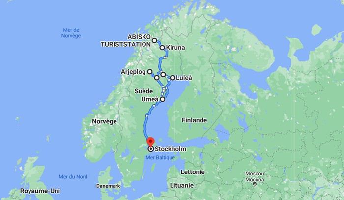
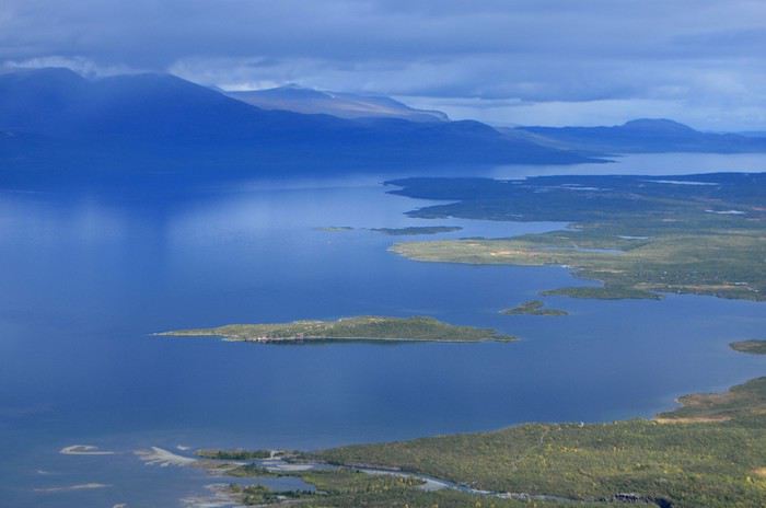
Au niveau du budget : Nous sommes partis à 2 avec un bébé de 22 mois. Les vols : 760€ A/R pour toute la famille Train de nuit SJ A/R : 483€ à 2 Location de voiture Europcar via carigami.fr : 405€ pour 9 jours à Lulea. Hébergements : réservés via booking.com · Stockholm : 2 nuits au Best Western Plus 4* : 160€ (pt dej inclus) · Lulea : 1 nuit au First Arctic camp (cabane) : 80€ · Jokkmokk : 2 nuits à l’hôtel Akerlund : 300€ (pt dej inclus) · Kiruna : 3 nuits au Ripan Camp 4* : 450€ (pt dej inclus) · Arvidsjaur : 2 nuits au camp Gielas : 160€ · Umea : 1 nuit à l’hôtel Aveny : 80€ (pt dej inclus) · Stockholm : 1 nuit au SAS Radisson Blu Waterfront : 89€
A la base, un voyage était prévu début septembre, dans le Wyoming. Il a été reporté à 2021. Un voyage qui avait été annulé en mai en Slovénie a donc été placé à ces dates. Hélas, une semaine avant le départ, la Slovénie a imposé une quarantaine aux français et un test covid à réaliser dans les 36 avant le départ, donc : report à mai 2021.
Je cherchais donc une nouvelle destination… Danemark, Pologne, Suisse ? Ces 3 pays ont restreint également la venue des français. Il me restait donc la Suède, pays qui a eu une ligne et une stratégie stable face à la crise du covid.
J’ai donc acheté 3 billets flexibles sur Air France 3 jours avant le départ en cas de report de dernière minute. Seule la 1ere nuit a été réservée. Les autres l'ont été au fur et à mesure.
Nous avons décidé de nous concentrer sur le nord, plus sauvage. Notre besoin de grands espaces vierges nous avait poussés à réserver le Wyoming. La Suède nous offrira-t-elle la même chose ?
Voici donc le road trip effectué : Samedi 29 août : Marseille-Amsterdam-Stockholm Dimanche 30 août : Stockholm Lundi 31 août : Stockholm et train de nuit pour Lulea Mardi 1er septembre : Lulea, Gammelstad Mercredi 2 septembre : Lulea-chutes de Storforsen-Jokkmokk Jeudi 3 septembre : Le parc national de Muddus Vendredi 4 septembre : Jokkmokk-Kiruna Samedi 5 septembre : Le parc national d’Abisko Dimanche 6 septembre : Jukkajärvi et le massif du Kebnekaise Lundi 7 septembre : Kiruna-Arvidsjaur Mardi 8 septembre : Arjeplog Mercredi 9 septembre : Arvidsjaur-Umea Jeudi 10 septembre : Umea-Lulea et train de nuit pour Stochkolm Vendredi 11 septembre : Ile de Vaxholm Samedi 12 septembre : Stockholm-Marseille via Paris.
Au niveau du budget : Nous sommes partis à 2 avec un bébé de 22 mois. Les vols : 760€ A/R pour toute la famille Train de nuit SJ A/R : 483€ à 2 Location de voiture Europcar via carigami.fr : 405€ pour 9 jours à Lulea. Hébergements : réservés via booking.com · Stockholm : 2 nuits au Best Western Plus 4* : 160€ (pt dej inclus) · Lulea : 1 nuit au First Arctic camp (cabane) : 80€ · Jokkmokk : 2 nuits à l’hôtel Akerlund : 300€ (pt dej inclus) · Kiruna : 3 nuits au Ripan Camp 4* : 450€ (pt dej inclus) · Arvidsjaur : 2 nuits au camp Gielas : 160€ · Umea : 1 nuit à l’hôtel Aveny : 80€ (pt dej inclus) · Stockholm : 1 nuit au SAS Radisson Blu Waterfront : 89€
Les Cyclades en juillet: Anafi, Amorgos, Astypaléa English translation pending
GENESE
Comme tous, le COVID a chamboulé nos plans. Normalement nous devions aller à Madagascar pendant un mois, projet reporté à l’année prochaine. Seulement, n’ayant jamais arrêté de travailler, malgré le confinement et le Covid j’avais réellement besoin de faire une « pause ».
Souhaitant limiter les risques de restrictions de déplacements nous ne quitterons pas l’Europe en nous centrant sur des endroits que nous avons toujours voulu visiter, mais habituellement trop fréquentés pour nous. Il y avait la Suisse avec ses montagnes et ses trains de légende, l’Islande et les îles Grecques.
Au final c’est l’attrait du soleil qui l’a emporté … enfin surtout auprès de madame ! Nous avions « entrevu » Santorin et Myconos lors d’une croisière en méditerranée en 2007 avec les enfants. Nous avions adoré … sauf la fréquentation !
Le premier élément à choisir est le point d’entrée, accessible en avion. Il y a Santorin et Myconos dans les Cyclades. Comme je rêvais de revoir la caldera de Santorin, le choix fut rapide. Ensuite je voulais des îles peu fréquentées ne nécessitant pas de trop long trajet en ferry. Sur 2 semaines 3 îles m’a paru être le bon choix. Avec le recul je confirme que c’est un bon dosage. Je me suis beaucoup servi du site Hellenica et Cycladen.be, qui sont très bien, pour faire mes choix.
La première sera Anafi, dans la catégorie « peu fréquentée » elle est très bien placée, en plus elle est petite, montagneuse et avec de belles plages. Une des raisons de sa faible fréquentation est le peu de liaison maritimes, ce sera donc à partir de cette contrainte que s’articulera le voyage.
Le second choix sera Astypalea car il y a un aéroport pour repartir, en plus c’est aussi une île peu fréquentée par les étrangers. Elle fait partie des Dodécanèse mais géographique se trouve proche des Cyclades.
Amorgos se glissera très naturellement entre les deux.
Une fois le planning établi j’ai réservé les vols chez Volotea qui a le bon goût de partir de Strasbourg … mauvais choix car les vols seront annulés 2 semaines plus tard.🏴☠️ Je me suis retourné vers Easy Jet qui part de Bâle Mulhouse, finalement tout aussi proche de chez nous que Strasbourg. Il faut dire qu’en Alsace nous avons la chance d’avoir pas mal d’aéroports dans un rayon de 3 heures autour de chez nous (en plus des deux précités il y a surtout Zurich et Frankfurt). Nous ferons donc BSL – Athènes – Santorin puis Astypalea – Athènes – BSL.
J’ai réservé par internet en direct les pensions : Villa Kalamiotissa pour Anafi Emprostiada Traditional Guest House et Pano Gitonia pour Amorgos Studio Killindra pour Astypalea Je réserve aussi une voiture à Amorgos puisque l’île est assez grande … et au final, suite à un échange avec mon logeur, également à Anafi.
Le roadbook sera assez rapide à établir … tant mieux car je n’ai que très peu de temps disponible, relancer mon entreprise suite au Covid-19 a accaparé tout mon temps.
En voiture ... pour ceux qui veulent 🙂
Comme tous, le COVID a chamboulé nos plans. Normalement nous devions aller à Madagascar pendant un mois, projet reporté à l’année prochaine. Seulement, n’ayant jamais arrêté de travailler, malgré le confinement et le Covid j’avais réellement besoin de faire une « pause ».
Souhaitant limiter les risques de restrictions de déplacements nous ne quitterons pas l’Europe en nous centrant sur des endroits que nous avons toujours voulu visiter, mais habituellement trop fréquentés pour nous. Il y avait la Suisse avec ses montagnes et ses trains de légende, l’Islande et les îles Grecques.
Au final c’est l’attrait du soleil qui l’a emporté … enfin surtout auprès de madame ! Nous avions « entrevu » Santorin et Myconos lors d’une croisière en méditerranée en 2007 avec les enfants. Nous avions adoré … sauf la fréquentation !
Le premier élément à choisir est le point d’entrée, accessible en avion. Il y a Santorin et Myconos dans les Cyclades. Comme je rêvais de revoir la caldera de Santorin, le choix fut rapide. Ensuite je voulais des îles peu fréquentées ne nécessitant pas de trop long trajet en ferry. Sur 2 semaines 3 îles m’a paru être le bon choix. Avec le recul je confirme que c’est un bon dosage. Je me suis beaucoup servi du site Hellenica et Cycladen.be, qui sont très bien, pour faire mes choix.
La première sera Anafi, dans la catégorie « peu fréquentée » elle est très bien placée, en plus elle est petite, montagneuse et avec de belles plages. Une des raisons de sa faible fréquentation est le peu de liaison maritimes, ce sera donc à partir de cette contrainte que s’articulera le voyage.
Le second choix sera Astypalea car il y a un aéroport pour repartir, en plus c’est aussi une île peu fréquentée par les étrangers. Elle fait partie des Dodécanèse mais géographique se trouve proche des Cyclades.
Amorgos se glissera très naturellement entre les deux.
Une fois le planning établi j’ai réservé les vols chez Volotea qui a le bon goût de partir de Strasbourg … mauvais choix car les vols seront annulés 2 semaines plus tard.🏴☠️ Je me suis retourné vers Easy Jet qui part de Bâle Mulhouse, finalement tout aussi proche de chez nous que Strasbourg. Il faut dire qu’en Alsace nous avons la chance d’avoir pas mal d’aéroports dans un rayon de 3 heures autour de chez nous (en plus des deux précités il y a surtout Zurich et Frankfurt). Nous ferons donc BSL – Athènes – Santorin puis Astypalea – Athènes – BSL.
J’ai réservé par internet en direct les pensions : Villa Kalamiotissa pour Anafi Emprostiada Traditional Guest House et Pano Gitonia pour Amorgos Studio Killindra pour Astypalea Je réserve aussi une voiture à Amorgos puisque l’île est assez grande … et au final, suite à un échange avec mon logeur, également à Anafi.
Le roadbook sera assez rapide à établir … tant mieux car je n’ai que très peu de temps disponible, relancer mon entreprise suite au Covid-19 a accaparé tout mon temps.
En voiture ... pour ceux qui veulent 🙂
Come discover Prince Edward Island
FOREWORD
In July 2018, we decided to go on a road trip to Prince Edward Island. We had four days off, so it was the perfect opportunity to set off on an adventure.
This time, I hadn’t had much time to prepare an itinerary. I’d only done a bit of research online to try and find tourist attractions that might interest us.
I should say that it wasn’t our first visit to the island, and since our stay was quite short, we decided to complete the island loop by making stops along the coast to admire the lighthouses, small fishing villages, beaches, and the stunning steep cliffs.
We also made a few stops at lookouts along the road and even went for a hike in Greenwich National Park.
Our trip was more of an escape into nature. When we travel, we feel best when we’re far from the noise and crowds.
So, I invite you to discover the fabulous landscapes of Prince Edward Island.
To get there, we had to cover nearly 1,000 km. It took us a full day, and we had to cross parts of Quebec and New Brunswick.
The roads are beautiful. However, there isn’t much to see except the vast forests lining the highways.
The Confederation Bridge, which is 12.9 kilometers long, connects New Brunswick to Prince Edward Island.
There’s no fee to enter the island when you cross this bridge. However, a toll must be paid when leaving the island.
https://www.confederationbridge.com/fr/tolls-fees
https://youtu.be/UWhn5bqLONU
In July 2018, we decided to go on a road trip to Prince Edward Island. We had four days off, so it was the perfect opportunity to set off on an adventure.
This time, I hadn’t had much time to prepare an itinerary. I’d only done a bit of research online to try and find tourist attractions that might interest us.
I should say that it wasn’t our first visit to the island, and since our stay was quite short, we decided to complete the island loop by making stops along the coast to admire the lighthouses, small fishing villages, beaches, and the stunning steep cliffs.
We also made a few stops at lookouts along the road and even went for a hike in Greenwich National Park.
Our trip was more of an escape into nature. When we travel, we feel best when we’re far from the noise and crowds.
So, I invite you to discover the fabulous landscapes of Prince Edward Island.
To get there, we had to cover nearly 1,000 km. It took us a full day, and we had to cross parts of Quebec and New Brunswick.
The roads are beautiful. However, there isn’t much to see except the vast forests lining the highways.
The Confederation Bridge, which is 12.9 kilometers long, connects New Brunswick to Prince Edward Island.
There’s no fee to enter the island when you cross this bridge. However, a toll must be paid when leaving the island.
https://www.confederationbridge.com/fr/tolls-fees
https://youtu.be/UWhn5bqLONU
Concours photo de juin 2020: "Multicolore" English translation pending
Bonjour,
J'ai le privilège d'organiser le concours photos du moi de juin 2010. J'ai longuement hésité, beaucoup de sujets ont été déjà proposés et faire preuve d’originalité devient de plus en plus compliqué. Il fallait choisir, j'ai choisi : « Multicolore » : « Qui présente des couleurs variées » d 'après la définition. Je n'impose pas le nombre minimum de couleurs présentes, sachant que des photos avec seulement 2 couleurs pourront faire partie du thème, à partir du moment où elles sont en harmonie et que ça « éclate ». En effet, je voudrais que quand on ouvrira une photo, il y ait l'effet : « WHOUAAAAA, les couleurs... « Il faudra malgré tout garder à l'idée la notion de voyage.
Je pense que le thème laisse une grande ouverture.
On pourra présenter une multitude de sujets :
Pourquoi pas des animaux multicolores ?
Des bâtiments multicolores ?
Des personnages ?

Des objets ?
Des scènes de vie ?
Et bien d'autres...
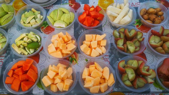
Participation : Chaque participant(e) peut proposer jusqu'à 3 photos, et ce jusqu'au mardi 23/06 à 24h00, heure de Paris. Chaque photo sera présentée dans un seul message, en indiquant son numéro (1, 2 ou 3). Pensez à ajouter une petite explication, commentaire, localisation, date de prise de vue.
Vote : Chaque membre VF peut voter pour les 3 photos qu'il ou elle juge les meilleures selon ses propres critères et en tenant compte du thème.
Les votes se feront du mercredi 24/06 au dimanche 28/06 à 24h00, heure de Paris. Les photos choisies seront citées dans l'ordre de préférence : - la 1re photo : 3 points - la 2e : 2 points - la 3e : 1 point
Un seul et unique vote pour 3 photos est accepté par membre.
Conclusion : Le vainqueur est l'auteur de la photo ayant reçu le plus de points. Les résultats seront publiés le 29/06. En cas d'égalité, le nombre de premières places prévaudra. Le vainqueur aura l'honneur d'organiser le concours du mois de juillet.
La discussion est ici : https://voyageforum.com/discussion/discussions-sujet-concours-photo-juin-2020-multicolore-d10297778/
Philippe
J'ai le privilège d'organiser le concours photos du moi de juin 2010. J'ai longuement hésité, beaucoup de sujets ont été déjà proposés et faire preuve d’originalité devient de plus en plus compliqué. Il fallait choisir, j'ai choisi : « Multicolore » : « Qui présente des couleurs variées » d 'après la définition. Je n'impose pas le nombre minimum de couleurs présentes, sachant que des photos avec seulement 2 couleurs pourront faire partie du thème, à partir du moment où elles sont en harmonie et que ça « éclate ». En effet, je voudrais que quand on ouvrira une photo, il y ait l'effet : « WHOUAAAAA, les couleurs... « Il faudra malgré tout garder à l'idée la notion de voyage.
Je pense que le thème laisse une grande ouverture.
On pourra présenter une multitude de sujets :
Pourquoi pas des animaux multicolores ?
Des bâtiments multicolores ?
Des personnages ?
Des objets ?
Des scènes de vie ?
Et bien d'autres...
Participation : Chaque participant(e) peut proposer jusqu'à 3 photos, et ce jusqu'au mardi 23/06 à 24h00, heure de Paris. Chaque photo sera présentée dans un seul message, en indiquant son numéro (1, 2 ou 3). Pensez à ajouter une petite explication, commentaire, localisation, date de prise de vue.
Vote : Chaque membre VF peut voter pour les 3 photos qu'il ou elle juge les meilleures selon ses propres critères et en tenant compte du thème.
Les votes se feront du mercredi 24/06 au dimanche 28/06 à 24h00, heure de Paris. Les photos choisies seront citées dans l'ordre de préférence : - la 1re photo : 3 points - la 2e : 2 points - la 3e : 1 point
Un seul et unique vote pour 3 photos est accepté par membre.
Conclusion : Le vainqueur est l'auteur de la photo ayant reçu le plus de points. Les résultats seront publiés le 29/06. En cas d'égalité, le nombre de premières places prévaudra. Le vainqueur aura l'honneur d'organiser le concours du mois de juillet.
La discussion est ici : https://voyageforum.com/discussion/discussions-sujet-concours-photo-juin-2020-multicolore-d10297778/
Philippe
En Inde du Sud juste avant le confinement English translation pending
Bonjour à tous,
Nous étions en Inde du Sud en février-mars 2020 (25 jours sur place). Comme nous avons passé les 70 ans nous avons pensé que nous ne reviendrons plus en Inde (il y a encore tant d'autres pays encore à aller visiter et il nous reste finalement assez peu d'années pour cela). Du coup à l'Inde du Sud nous avons rajouté Hampi ainsi que les sites d'Ajanta et Ellora. Programme ambitieux !
Le plus difficile en Inde c'est de décider de ce que l'on ne pourra pas voir parmi les "incontournables" en tous genres qui sont annoncés dans tous les guides, forums et carnets de voyage divers. Que les adeptes des "hors des sentiers battus" se rassurent, s'ils veulent aller en Inde il n'y a que ça dans tout le pays aussi.
Donc après une première liste de ce qu'il fallait absolument ne pas rater, mon estimation de la durée du voyage s'est établie à 35 jours. Trop pour nous. Deuxième liste réduite avec beaucoup de difficulté : 25 jours sur place. OK ! Il n'y a plus qu'à organiser le circuit et vérifier sa faisabilité car l'Inde du Sud c'est très grand et les endroits que nous avons choisis sont répartis sur une vaste zone :
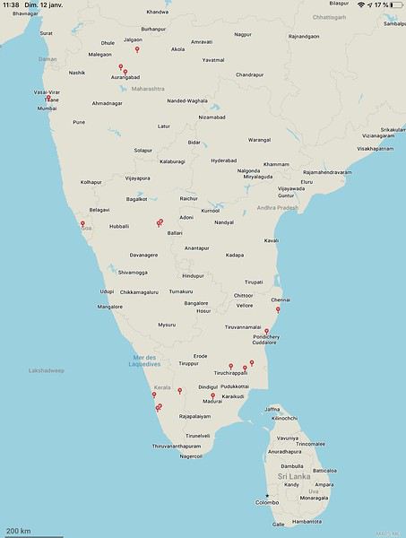
Moyens de transports : dans un premier temps j'avais pensé combiner bus de luxe, train et taxi. Compte tenu désormais de notre âge mon épouse a été catégorique : ce sera voiture avec chauffeur et si besoin avion (lignes intérieures). Effectivement les trajets en bus et en train relatés dans différents carnets de voyage le sont par des gens qui ont 15 à 20 ans de moins que nous. Et des bus et trains de toutes sortes nous les avons pratiqués un peu partout dans le monde ces dernières décennies - nous connaissons donc bien et ne le regrettons pas. Par ailleurs la formule voiture avec chauffeur est finalement assez courante en Inde et financièrement abordable.
Merci aux différents carnets de voyage de VoyageForum pour l'aide précieuse apportée, et particulièrement merci à Xiongmao, que je salue, qui nous a bien aidé à choisir notre principal prestataire. Le circuit fut donc choisi comme suit :
Arrivés à CHENNAI le 14 février 2020 (vol Air India avec escale à Delhi), Repartis de BOMBAY le 10 mars 2020 (vol Air India avec escale et contrôle immigration à Delhi), et arrivés ce même 10 mars chez nous à 21h00 . . . et confinés le 17 mars à 12h00
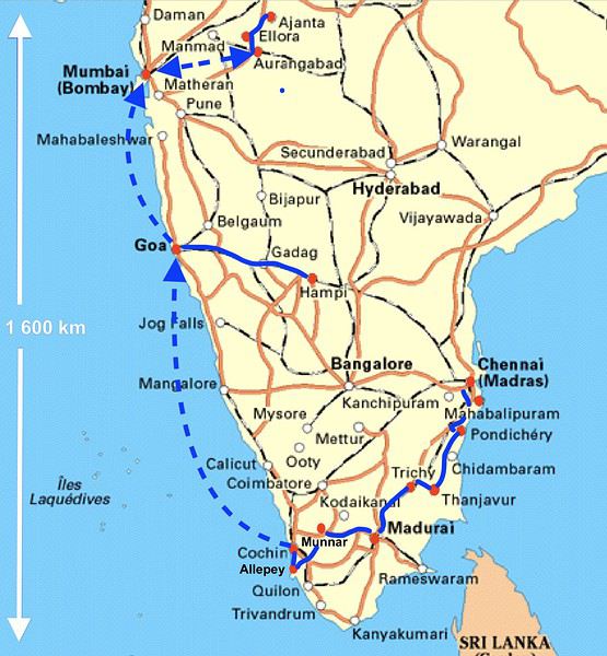
NOTA : 4 400 photos prises par ma femme et moi (un vrai délire !). On a beau se dire qu'il faut se limiter à l'essentiel, comme du temps où chaque photo était payante, il est tellement facile d'en faire avec les appareils numériques et les smartphones qui maintenant sont très corrects qu'on se laisse aller. Choix drastique, nous n'avons retenu que 250 photos pour ce carnet de voyage (et c'est déjà trop, je m'en excuse par avance).
Formalités : e-visas envoyés le 20 janvier et reçus "granted" le 21 ! Super rapide donc, mais par contre la rédaction extrêmement minutieuse du formulaire en ligne ainsi que la confection des pièces jointes selon les normes très strictes nécessite environ deux heures pour chaque demande.
Températures : pendant ces 3 ½ semaines la température moyenne en journée a été de 30°C, sauf à MUNNAR où elle est descendue vers 24°C et à HAMPI où elle était de 34°C.
Vendredi 14 février et samedi 15 Février 2020 Nous ne nous sommes pas arrêtés à CHENNAI. Nous avons immédiatement pris un taxi pour MAHABALIPURAM (nous avions demandé ce service à l'hôtel déjà réservé mais il aurait été possible facilement de prendre un "pré-paid taxi" juste à la sortie de l'aéroport). 15h15 : atterrissage à CHENNAI 16h20 : départ de notre taxi 18h00 : arrivée à l'hôtel à MAHABALIPURAM De 18h15 à 19h30 : change dans un bureau de change ( 100 € contre 7 750 INR soit 100 INR = 1,3 €) puis achat et mise en service d'une carte SIM indienne (valable dans toute l'Inde, pour appels en Inde pendant 28 jours avec 1,5 Go/jour de données internet, le tout pour 550 roupies, soit 7 € : autant dire rien pour un internet quasi illimité et une durée d'appels largement suffisante pour l'utilisation en local).
MAHABALIPURAM : Centre-ville sympa bien que très touristique. Tout peut se faire à pied (éventuellement retour en tuk-tuk de l'ensemble de temples des Cinq Rathas). Dès notre première visite au Shore Temple (Temple du rivage) nous découvrons la règle que nous verrons systématiquement par la suite : les indiens paient 15 fois moins cher que les étrangers :
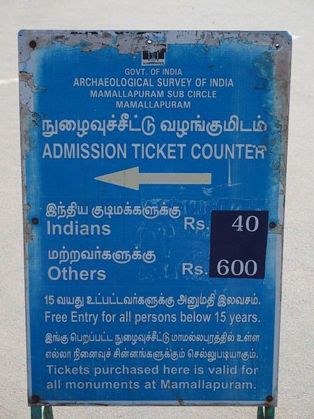
Vu notre niveau de vie comparé à celui moyen des indiens on ne va pas se plaindre. C'est juste qu'on n'est pas habitué à cette distinction (discrimination ?) en France. Le Shore Temple (temple du rivage) a un intérêt limité mais intéressant pour un premier contact avec cette culture et architecture :
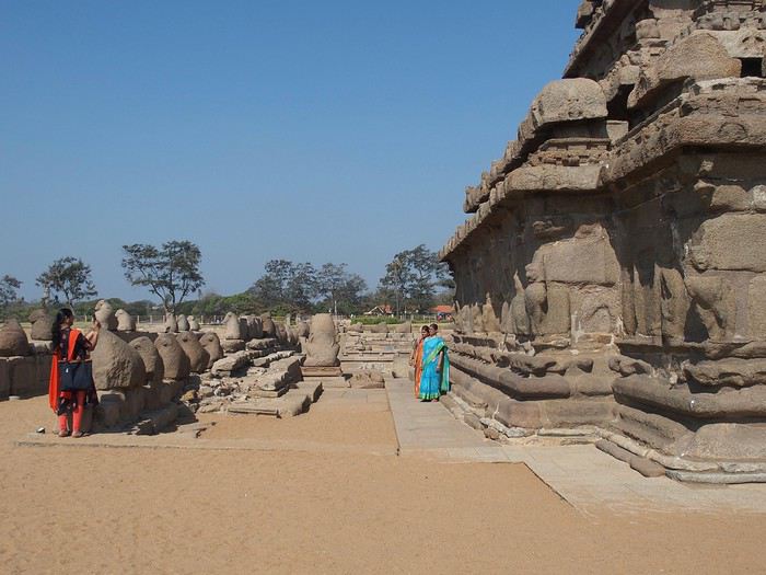
En revanche l'ensemble de temples des Cinq Rathas est vraiment intéressant. Beaucoup de touristes indiens d'ailleurs. Sur le chemin, beaucoup de magasins de sculpteurs sur pierre. C'est apparemment une activité importante de cette ville:
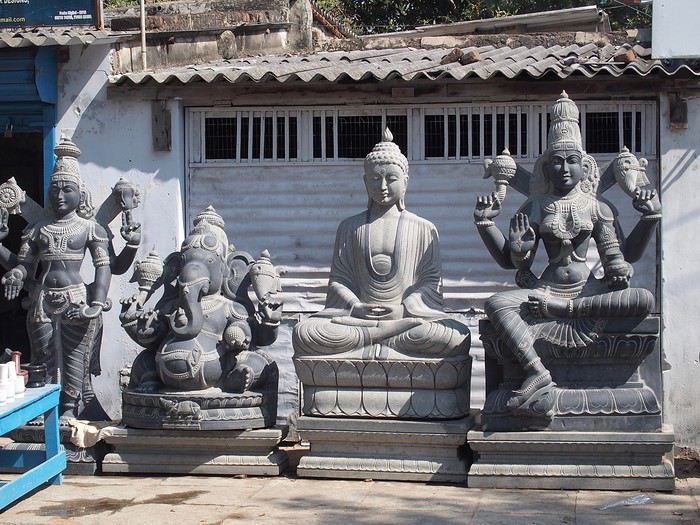
et activités touristique et scolaire importantes aussi :
L'ensemble des temples des Cinq Rathas est assez compact mais riche en sculptures :
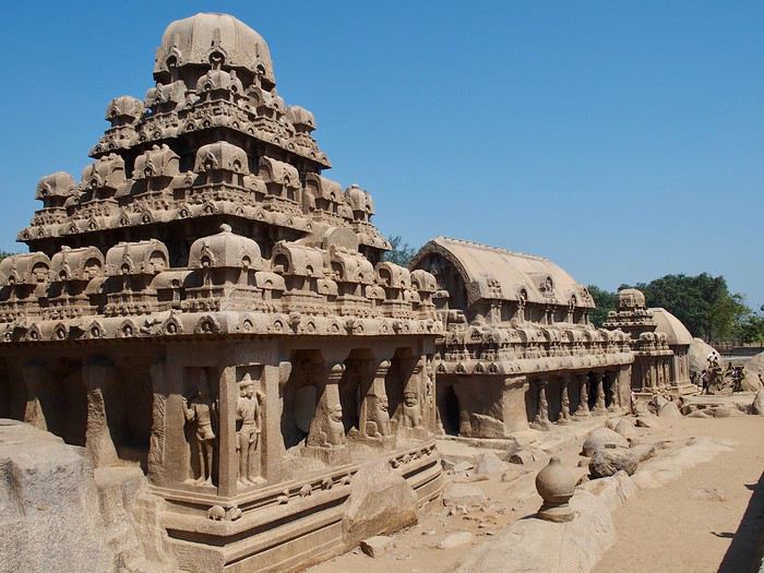
Nous étions en Inde du Sud en février-mars 2020 (25 jours sur place). Comme nous avons passé les 70 ans nous avons pensé que nous ne reviendrons plus en Inde (il y a encore tant d'autres pays encore à aller visiter et il nous reste finalement assez peu d'années pour cela). Du coup à l'Inde du Sud nous avons rajouté Hampi ainsi que les sites d'Ajanta et Ellora. Programme ambitieux !
Le plus difficile en Inde c'est de décider de ce que l'on ne pourra pas voir parmi les "incontournables" en tous genres qui sont annoncés dans tous les guides, forums et carnets de voyage divers. Que les adeptes des "hors des sentiers battus" se rassurent, s'ils veulent aller en Inde il n'y a que ça dans tout le pays aussi.
Donc après une première liste de ce qu'il fallait absolument ne pas rater, mon estimation de la durée du voyage s'est établie à 35 jours. Trop pour nous. Deuxième liste réduite avec beaucoup de difficulté : 25 jours sur place. OK ! Il n'y a plus qu'à organiser le circuit et vérifier sa faisabilité car l'Inde du Sud c'est très grand et les endroits que nous avons choisis sont répartis sur une vaste zone :
Moyens de transports : dans un premier temps j'avais pensé combiner bus de luxe, train et taxi. Compte tenu désormais de notre âge mon épouse a été catégorique : ce sera voiture avec chauffeur et si besoin avion (lignes intérieures). Effectivement les trajets en bus et en train relatés dans différents carnets de voyage le sont par des gens qui ont 15 à 20 ans de moins que nous. Et des bus et trains de toutes sortes nous les avons pratiqués un peu partout dans le monde ces dernières décennies - nous connaissons donc bien et ne le regrettons pas. Par ailleurs la formule voiture avec chauffeur est finalement assez courante en Inde et financièrement abordable.
Merci aux différents carnets de voyage de VoyageForum pour l'aide précieuse apportée, et particulièrement merci à Xiongmao, que je salue, qui nous a bien aidé à choisir notre principal prestataire. Le circuit fut donc choisi comme suit :
Arrivés à CHENNAI le 14 février 2020 (vol Air India avec escale à Delhi), Repartis de BOMBAY le 10 mars 2020 (vol Air India avec escale et contrôle immigration à Delhi), et arrivés ce même 10 mars chez nous à 21h00 . . . et confinés le 17 mars à 12h00
NOTA : 4 400 photos prises par ma femme et moi (un vrai délire !). On a beau se dire qu'il faut se limiter à l'essentiel, comme du temps où chaque photo était payante, il est tellement facile d'en faire avec les appareils numériques et les smartphones qui maintenant sont très corrects qu'on se laisse aller. Choix drastique, nous n'avons retenu que 250 photos pour ce carnet de voyage (et c'est déjà trop, je m'en excuse par avance).
Formalités : e-visas envoyés le 20 janvier et reçus "granted" le 21 ! Super rapide donc, mais par contre la rédaction extrêmement minutieuse du formulaire en ligne ainsi que la confection des pièces jointes selon les normes très strictes nécessite environ deux heures pour chaque demande.
Températures : pendant ces 3 ½ semaines la température moyenne en journée a été de 30°C, sauf à MUNNAR où elle est descendue vers 24°C et à HAMPI où elle était de 34°C.
Vendredi 14 février et samedi 15 Février 2020 Nous ne nous sommes pas arrêtés à CHENNAI. Nous avons immédiatement pris un taxi pour MAHABALIPURAM (nous avions demandé ce service à l'hôtel déjà réservé mais il aurait été possible facilement de prendre un "pré-paid taxi" juste à la sortie de l'aéroport). 15h15 : atterrissage à CHENNAI 16h20 : départ de notre taxi 18h00 : arrivée à l'hôtel à MAHABALIPURAM De 18h15 à 19h30 : change dans un bureau de change ( 100 € contre 7 750 INR soit 100 INR = 1,3 €) puis achat et mise en service d'une carte SIM indienne (valable dans toute l'Inde, pour appels en Inde pendant 28 jours avec 1,5 Go/jour de données internet, le tout pour 550 roupies, soit 7 € : autant dire rien pour un internet quasi illimité et une durée d'appels largement suffisante pour l'utilisation en local).
MAHABALIPURAM : Centre-ville sympa bien que très touristique. Tout peut se faire à pied (éventuellement retour en tuk-tuk de l'ensemble de temples des Cinq Rathas). Dès notre première visite au Shore Temple (Temple du rivage) nous découvrons la règle que nous verrons systématiquement par la suite : les indiens paient 15 fois moins cher que les étrangers :
Vu notre niveau de vie comparé à celui moyen des indiens on ne va pas se plaindre. C'est juste qu'on n'est pas habitué à cette distinction (discrimination ?) en France. Le Shore Temple (temple du rivage) a un intérêt limité mais intéressant pour un premier contact avec cette culture et architecture :
En revanche l'ensemble de temples des Cinq Rathas est vraiment intéressant. Beaucoup de touristes indiens d'ailleurs. Sur le chemin, beaucoup de magasins de sculpteurs sur pierre. C'est apparemment une activité importante de cette ville:
et activités touristique et scolaire importantes aussi :
L'ensemble des temples des Cinq Rathas est assez compact mais riche en sculptures :
Sur les terres mayas English translation pending
Bonjour à tous les amoureux de voyage,
Je me propose de vous faire partager notre voyage au Guatemala, pays assez peu renseigné sur VF. Je l’agrémenterai de quelques photos (tablette) sans prétention qui se veulent seulement illustratives et je demande par avance votre indulgence.
Initialement nous avions opté pour un périple au Pérou en février. Les agences contactées ont eu l’honnêteté, et nous les en remercions, de nous indiquer que cela n’était pas une bonne période pour se rendre sur les plateaux andins. Après une longue hésitation nous avons orienté nos recherches vers le Guatemala et le Honduras et avons pris des contacts avec 2 agences francophones à Antigua pour des propositions et des devis. Très vite nous avons retenu « Bon Voyage » plus réactive et nettement moins chère que sa consœur. Après plusieurs itérations avec Arnaud (patron de l’agence) nous avons convergé vers un circuit de 16 j entre le 6/2 et le 21/2/2020.
Jour 1 :
Pour les vols internationaux nous avions le choix entre une escale aux USA ou à Madrid. Pour à peine plus cher (660 €/p) et un temps de vol bien plus court nous avons finalement choisi IBERIA au détriment des compagnies et contraintes (ESTA et douane) américaines. De plus les vols IBERIA sont au départ (et retour) d’Orly plus commode pour nous.
L’horaire de départ étant très matinal nous décidons de dormir à Orly. L’hôtel Ibis Budget « cœur d’Orly » fera l’affaire. Disons le, c’est cher pour un hôtel de ce type (entrée de gamme) mais il a le mérite de servir le PdJ à partir de 4 h. Cet horaire nous permet de garer notre voiture dans un parking de la zone industriel de Senia et une navette nous dépose à l’aéroport vers 6h. Le vol Orly - Madrid part à 7h30 et nous attendrons 3h pour prendre celui qui nous mènera à Guatemala City où nous arrivons vers 17 h (heure locale soit – 7h de décalage. Ces vols seront sans histoire ni retard. A notre arrivée, Luis notre chauffeur, nous attend. Son sourire et sa gentillesse nous séduisent de suite. Il est chargé de nous conduire à Antigua. Mais les routes à cette heure sont saturées et nous mettrons plus de 2h pour parvenir à Antigua pourtant distante de moins de 40 km de la capitale. Il nous dépose à l’hôtel Posada San Pedro dans lequel nous résiderons 5 nuits durant notre séjour. L’hôtel n’a que 8 chambres et ne sert pas de PdJ mais il est bien situé (7ième avenue) et il dispose d’un joli jardin intérieur et d’un solarium. La chambre n’est pas très grande mais offre une vue directe sur le volcan Fuego en activité permanente. Des fumées s’en échappent régulièrement et parfois des rougeurs nous signalent des coulées de lave. Sitôt arrivés nous nous couchons pour être d’attaque le lendemain.
Jour 2 :
Notre première tâche est de trouver le lieu de notre PdJ car l’hôtel ne propose pas ce service. Il s’agit du restaurant « Viejo Café » dans la 6ième avenue. Ce lieu regroupe une boulangerie et un joli patio où sont servis les PdJ. L’offre est excellente et le service souriant. Tant mieux car nous y reviendrons à maintes reprises. Nous avons RDV avec notre agent de voyage dont nous faisons la connaissance. Il nous fourni un roadbook très détaillé de notre périple avec une carte détaillée pour chaque ville étape, une liste de restaurants qu’il recommande, les lieux à visiter, les recommandations (sûreté, banques, …) et un téléphone pour le joindre en cas de nécessité. Nous rejoignons ensuite un guide francophone qui nous fait découvrir cette jolie ville d’Antigua classée par l’UNESCO. Il nous fait un historique de la cité bâtie par les Espagnols et nous indique comment s’orienter le plan des rues, toutes pavées, s’apparente à celui des villes américaines et elles se coupent toutes à angle droit. Comme à New York la 5ième avenue est la principale artère de la ville. Nous visitons successivement l’église Merced, son monastère, son jardin et sa terrasse d’où l’on peut contempler les 3 volcans qui entourent la ville. L’église bâtie en 1548 a été détruite puis restaurée plusieurs fois suite aux nombreux séismes qui ont frappé la ville, le plus r��cent datant de 1976, sa façade est jaune et ornée de nénuphars. Puis notre visite se poursuit par le monastère dont il ne subsiste que des ruines. Au milieu de la cour centrale, on découvre une fontaine monumentale elle aussi en forme de nénuphar.
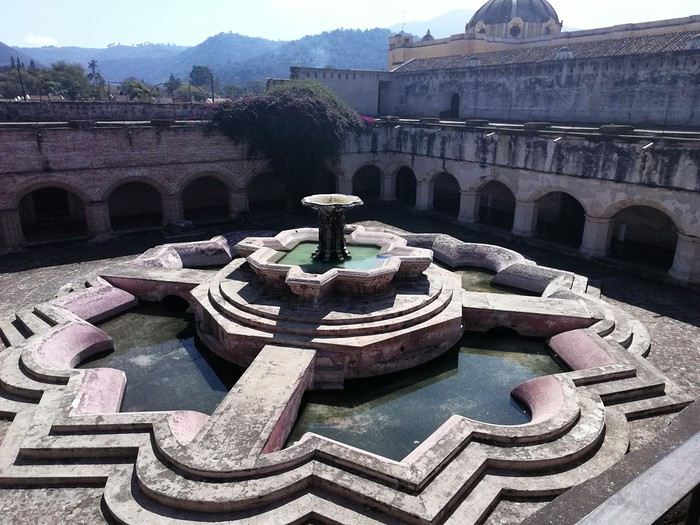
Pour profiter du panorama sur 3 volcans, nous gravissons les marches qui mènent à la terrasse. Puis nous gagnons la « Plaza mayor » cernée par de beaux édifices bâtis par les Espagnols, allant de la mairie à la cathédrale de la ville.
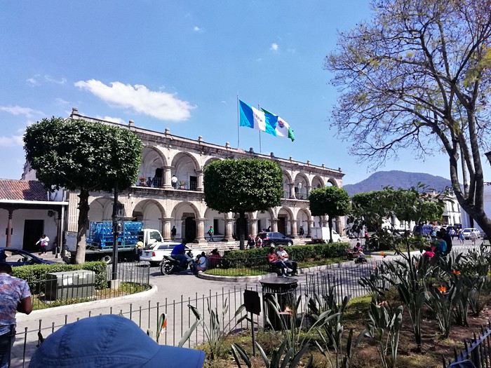 Nous passons devant le musée du chocolat avant de faire une halte pour découvrir le plus beau « Mac Do » du monde logé dans une magnifique hacienda d’époque avec un grand patio fleuri.
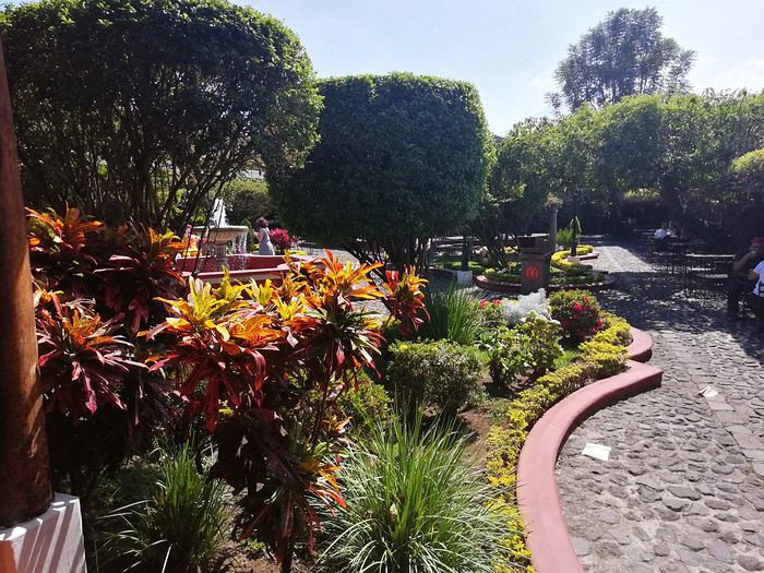
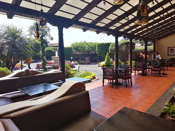 Cela change des établissements habituels de cette marque.
On arpente les rues de la ville, occasion de découvrir des demeures coloniales splendides aux patios intérieurs abondamment fleuris,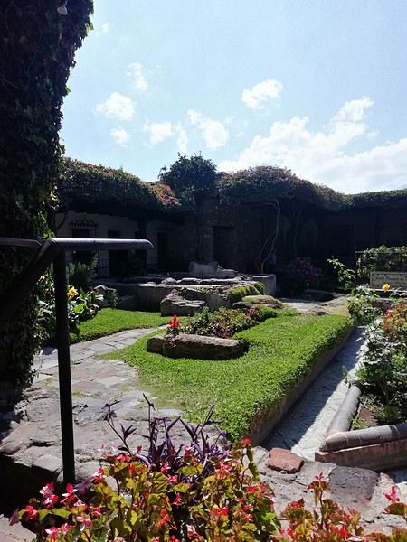
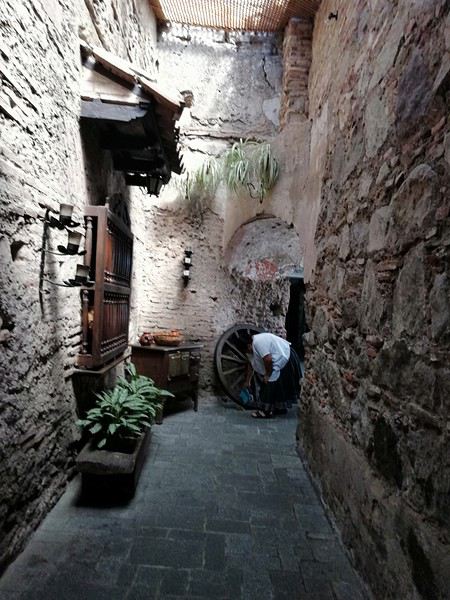
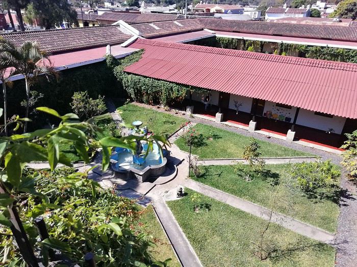
de voir un nombre impressionnant d’églises détruites par les tremblements de terre. Elles ne sont pas reconstruites faute de moyens pour les entretenir mais elles témoignent de l’emprise de la religion catholique sur le pays.
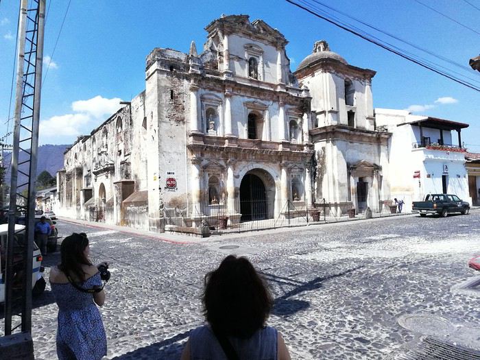
Notons à ce propos que l’on verra par la suite beaucoup de temples protestants de différentes obédiences, tout comme aux USA.
Je me propose de vous faire partager notre voyage au Guatemala, pays assez peu renseigné sur VF. Je l’agrémenterai de quelques photos (tablette) sans prétention qui se veulent seulement illustratives et je demande par avance votre indulgence.
Initialement nous avions opté pour un périple au Pérou en février. Les agences contactées ont eu l’honnêteté, et nous les en remercions, de nous indiquer que cela n’était pas une bonne période pour se rendre sur les plateaux andins. Après une longue hésitation nous avons orienté nos recherches vers le Guatemala et le Honduras et avons pris des contacts avec 2 agences francophones à Antigua pour des propositions et des devis. Très vite nous avons retenu « Bon Voyage » plus réactive et nettement moins chère que sa consœur. Après plusieurs itérations avec Arnaud (patron de l’agence) nous avons convergé vers un circuit de 16 j entre le 6/2 et le 21/2/2020.
Jour 1 :
Pour les vols internationaux nous avions le choix entre une escale aux USA ou à Madrid. Pour à peine plus cher (660 €/p) et un temps de vol bien plus court nous avons finalement choisi IBERIA au détriment des compagnies et contraintes (ESTA et douane) américaines. De plus les vols IBERIA sont au départ (et retour) d’Orly plus commode pour nous.
L’horaire de départ étant très matinal nous décidons de dormir à Orly. L’hôtel Ibis Budget « cœur d’Orly » fera l’affaire. Disons le, c’est cher pour un hôtel de ce type (entrée de gamme) mais il a le mérite de servir le PdJ à partir de 4 h. Cet horaire nous permet de garer notre voiture dans un parking de la zone industriel de Senia et une navette nous dépose à l’aéroport vers 6h. Le vol Orly - Madrid part à 7h30 et nous attendrons 3h pour prendre celui qui nous mènera à Guatemala City où nous arrivons vers 17 h (heure locale soit – 7h de décalage. Ces vols seront sans histoire ni retard. A notre arrivée, Luis notre chauffeur, nous attend. Son sourire et sa gentillesse nous séduisent de suite. Il est chargé de nous conduire à Antigua. Mais les routes à cette heure sont saturées et nous mettrons plus de 2h pour parvenir à Antigua pourtant distante de moins de 40 km de la capitale. Il nous dépose à l’hôtel Posada San Pedro dans lequel nous résiderons 5 nuits durant notre séjour. L’hôtel n’a que 8 chambres et ne sert pas de PdJ mais il est bien situé (7ième avenue) et il dispose d’un joli jardin intérieur et d’un solarium. La chambre n’est pas très grande mais offre une vue directe sur le volcan Fuego en activité permanente. Des fumées s’en échappent régulièrement et parfois des rougeurs nous signalent des coulées de lave. Sitôt arrivés nous nous couchons pour être d’attaque le lendemain.
Jour 2 :
Notre première tâche est de trouver le lieu de notre PdJ car l’hôtel ne propose pas ce service. Il s’agit du restaurant « Viejo Café » dans la 6ième avenue. Ce lieu regroupe une boulangerie et un joli patio où sont servis les PdJ. L’offre est excellente et le service souriant. Tant mieux car nous y reviendrons à maintes reprises. Nous avons RDV avec notre agent de voyage dont nous faisons la connaissance. Il nous fourni un roadbook très détaillé de notre périple avec une carte détaillée pour chaque ville étape, une liste de restaurants qu’il recommande, les lieux à visiter, les recommandations (sûreté, banques, …) et un téléphone pour le joindre en cas de nécessité. Nous rejoignons ensuite un guide francophone qui nous fait découvrir cette jolie ville d’Antigua classée par l’UNESCO. Il nous fait un historique de la cité bâtie par les Espagnols et nous indique comment s’orienter le plan des rues, toutes pavées, s’apparente à celui des villes américaines et elles se coupent toutes à angle droit. Comme à New York la 5ième avenue est la principale artère de la ville. Nous visitons successivement l’église Merced, son monastère, son jardin et sa terrasse d’où l’on peut contempler les 3 volcans qui entourent la ville. L’église bâtie en 1548 a été détruite puis restaurée plusieurs fois suite aux nombreux séismes qui ont frappé la ville, le plus r��cent datant de 1976, sa façade est jaune et ornée de nénuphars. Puis notre visite se poursuit par le monastère dont il ne subsiste que des ruines. Au milieu de la cour centrale, on découvre une fontaine monumentale elle aussi en forme de nénuphar.
Pour profiter du panorama sur 3 volcans, nous gravissons les marches qui mènent à la terrasse. Puis nous gagnons la « Plaza mayor » cernée par de beaux édifices bâtis par les Espagnols, allant de la mairie à la cathédrale de la ville.
Nous passons devant le musée du chocolat avant de faire une halte pour découvrir le plus beau « Mac Do » du monde logé dans une magnifique hacienda d’époque avec un grand patio fleuri.
Cela change des établissements habituels de cette marque.On arpente les rues de la ville, occasion de découvrir des demeures coloniales splendides aux patios intérieurs abondamment fleuris,
de voir un nombre impressionnant d’églises détruites par les tremblements de terre. Elles ne sont pas reconstruites faute de moyens pour les entretenir mais elles témoignent de l’emprise de la religion catholique sur le pays.
Notons à ce propos que l’on verra par la suite beaucoup de temples protestants de différentes obédiences, tout comme aux USA.
À la recherche des aurores boréales (Norvège) English translation pending
Depuis quelque temps avec ma femme, nous caressions le projet de retourner voir des aurores boréales. Nous en avions déjà vu lors de nos deux derniers voyages hivernaux en Islande mais l‘envie d’en revoir nous poussait à repartir.
Nous aurions voulu partir en hiver mais cela nous aurait obligés à coucher à l’hôtel, ce qui aurait lourdement grevé notre budget.
La période favorable pour voir des aurores boréales en Scandinavie s’étalant de septembre à mars, nous décidons de partir en septembre car cela nous permettra de coucher dans le lit aménagé à l’arrière de notre Land Rover Defender.
Samedi 15 septembre 2019
Le plein est fait. Le Land est bourré de provisions (cela fera autant de moins à acheter sur place) . Direction la Norvège. Départ vers 15h. Ce soir, nous ferons une étape dans le Nord pour passer voir notre fille. 100 km après notre départ de la région parisienne, le moteur du Land se met soudainement en mode dégradé. Nous plafonnons à 80 km/h. L’idée que notre voyage s’arrête là nous effleure l’esprit. On s’arrête sur le bas-côté pendant 10 mn et ouf, le moteur se remet à fonctionner normalement. On repart comme si de rien n’était. Nous n’empruntons pas les autoroutes payantes car nous ne sommes pas pressés. Arrivée dans le Nord vers 19h.
Dimanche 15 septembre 2019
Après une bonne nuit, nous partons en fin de matinée et traversons la Belgique via Charleroi et Liège. Puis nous passons en Allemagne via Aix-la-Chapelle, Duisbourg, Munster, Brême et Hambourg. Nous dormons sur une aire d’autoroute au nord d’Hambourg. Nous avons parcouru 1.000 km depuis Paris.
Lundi 16 septembre 2019
Prix du gazole sur l’autoroute allemande : 1,32 €/l Sur l’autoroute, le Land fait encore des siennes. Le moteur se remet en mode dégradé. On applique la même méthode que précédemment, à savoir, arrêt de 10 mn et ça repart normalement. Il ne faudrait pas que cela se reproduise trop souvent.
Nous franchissons la frontière danoise et arrivons au port d’Hirshals au nord du Danemark en début d’après-midi. Le vent d’ouest souffle en tempête. Cela promet pour la traversée vers la Norvège. Prix du gazole : 11,49 DNK (1,52 €) N’ayant pas réservé la traversée, nous nous rendons au bureau de Fjord Line. Prix annoncés : 205 € pour le jour même et 405 € pour le lendemain !
Nous cherchons un passage meilleur marché sur internet et réservons un billet pour Kristiansand chez Colour Line à 145 € pour le lendemain à 12h15.
Nous allons au camping d’Hirtshals en bordure de mer. La mer est démontée et il y a des wind surfers et des kite surfers qui en profitent. Particularité de cette plage, les autos peuvent y rouler.
Prix du camping 173 DNK (23 €). Bien équipé avec cuisine comprenant four, micro ondes et feux à gaz douche chaude payante avec carte. Emplacements sur pelouse délimités par des haies qui protègent du vent. Ce camping ferme fin septembre.
Mardi 17 septembre 2019
Nous embarquons sur le bateau de Colour Line à 12h15 . Heureusement, le vent s'est calmé. Nous débarquons au sud de la Norvège à Kristiansand à 15h30. Il fait un temps magnifique. Nous allons au centre ville pour retirer de l’argent au distributeur (pas beaucoup de distributeurs de billets en ville, il faut un peu chercher).
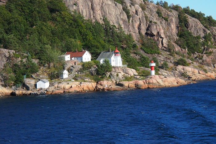
Nous prenons la direction de Lindesnes au sud-ouest de Kristiansand. Nous dormons sur le parking du phare de Lindesnes où le camping est autorisé moyennant 100 NOK (10 €). Cet endroit est le point le plus au sud de la Norvège. Beau temps mais très venté. Nous avons parcouru 1600 km depuis notre départ.
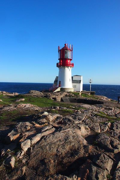
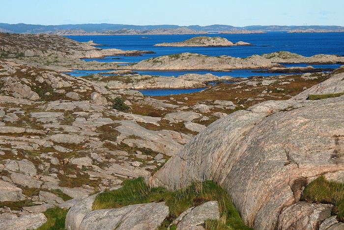
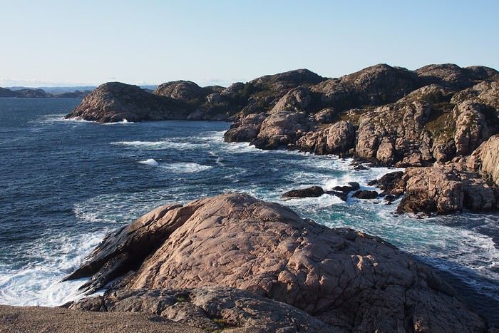
Mercredi 18 septembre 2019
Ce matin, nous suivons la côte sud en passant par Flekkefjord, Egersund jusqu’à Sandnes. Nous empruntons notre premier ferry à Lauvik pour franchir le Hosfjorden. Prix : 119 NOK
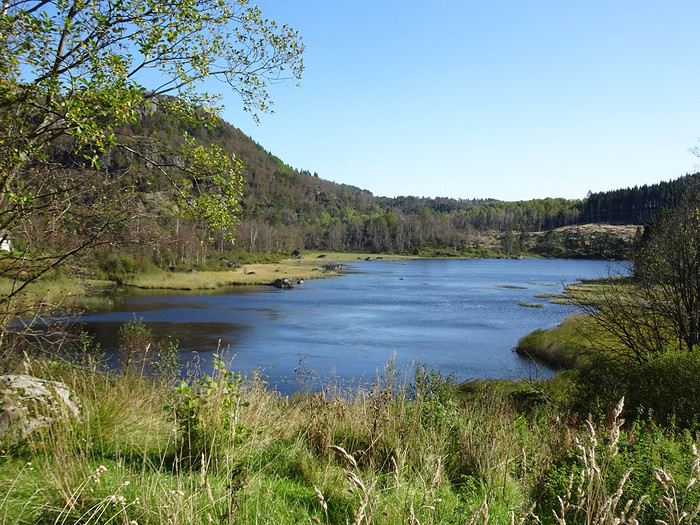
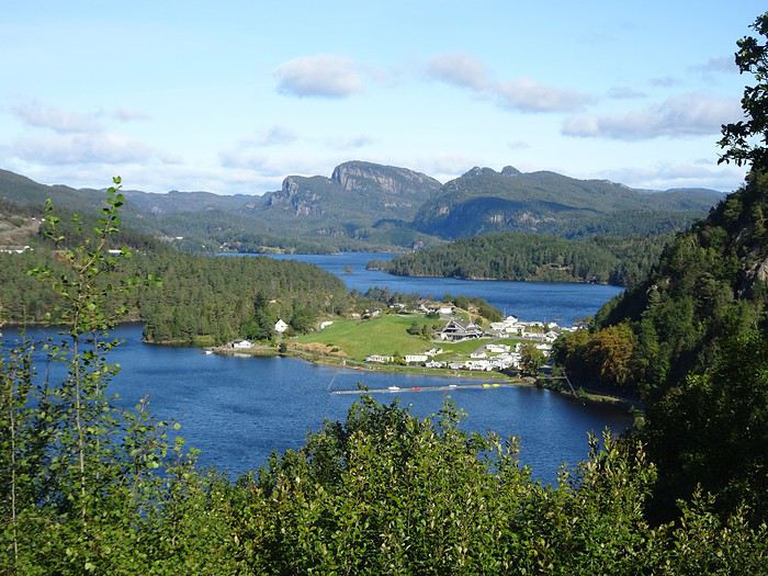
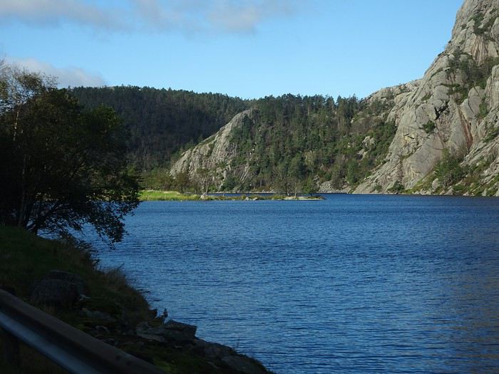
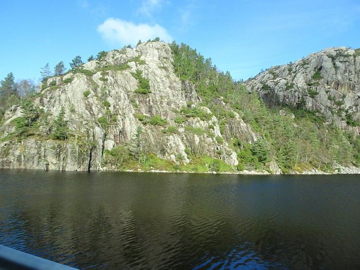
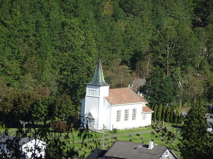
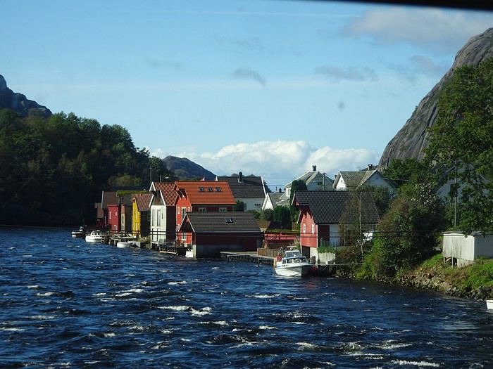
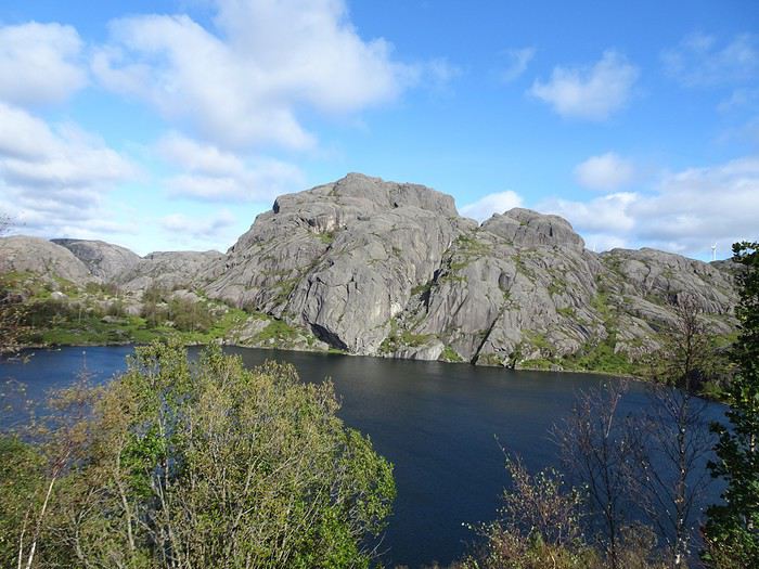
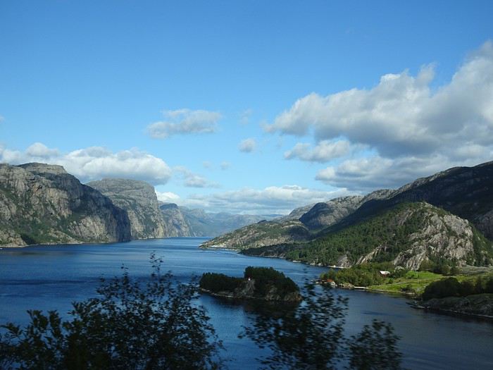
Nous sommes surpris par le grand nombre de véhicules électriques qui circulent en Norvège dont un bon nombre de Tesla. Il y a des bornes de recharge un peu partout, dans les stations service bien sûr mais aussi devant des hôtels, sur des parkings municipaux. La Norvège a une avance phénoménale dans ce domaine sur notre pays.
Il y a également un certain nombre de routes à péage qui ne sont pas des autoroutes notamment à l’approche des villes. Ce péage se fait en passant sous un portique automatique. Pour les véhicules étrangers, il paraît que nous recevons la facture à domicile mais au moment où je rédige ce carnet soit 6 mois après notre voyage, toujours pas de nouvelles.
Nous nous rendons sur le parking du Prekestolen où le prix de 250 NOK nous dissuade de nous arrêter. Nous y sommes déjà allés une trentaine d’années en arrière et nous n’avons pas de regret de ne pas y retourner . Nous cherchons un endroit pour bivouaquer mais dans cette zone très touristique, impossible de trouver un endroit .Nous poursuivons sur la route 13 vers le nord et nous arrêtons au camping de Vatne prix : 20 €. Comme toujours, camping super équipé avec cuisine et douche chauffées. Aujourd’hui étape de 290 km.
Samedi 15 septembre 2019
Le plein est fait. Le Land est bourré de provisions (cela fera autant de moins à acheter sur place) . Direction la Norvège. Départ vers 15h. Ce soir, nous ferons une étape dans le Nord pour passer voir notre fille. 100 km après notre départ de la région parisienne, le moteur du Land se met soudainement en mode dégradé. Nous plafonnons à 80 km/h. L’idée que notre voyage s’arrête là nous effleure l’esprit. On s’arrête sur le bas-côté pendant 10 mn et ouf, le moteur se remet à fonctionner normalement. On repart comme si de rien n’était. Nous n’empruntons pas les autoroutes payantes car nous ne sommes pas pressés. Arrivée dans le Nord vers 19h.
Dimanche 15 septembre 2019
Après une bonne nuit, nous partons en fin de matinée et traversons la Belgique via Charleroi et Liège. Puis nous passons en Allemagne via Aix-la-Chapelle, Duisbourg, Munster, Brême et Hambourg. Nous dormons sur une aire d’autoroute au nord d’Hambourg. Nous avons parcouru 1.000 km depuis Paris.
Lundi 16 septembre 2019
Prix du gazole sur l’autoroute allemande : 1,32 €/l Sur l’autoroute, le Land fait encore des siennes. Le moteur se remet en mode dégradé. On applique la même méthode que précédemment, à savoir, arrêt de 10 mn et ça repart normalement. Il ne faudrait pas que cela se reproduise trop souvent.
Nous franchissons la frontière danoise et arrivons au port d’Hirshals au nord du Danemark en début d’après-midi. Le vent d’ouest souffle en tempête. Cela promet pour la traversée vers la Norvège. Prix du gazole : 11,49 DNK (1,52 €) N’ayant pas réservé la traversée, nous nous rendons au bureau de Fjord Line. Prix annoncés : 205 € pour le jour même et 405 € pour le lendemain !
Nous cherchons un passage meilleur marché sur internet et réservons un billet pour Kristiansand chez Colour Line à 145 € pour le lendemain à 12h15.
Nous allons au camping d’Hirtshals en bordure de mer. La mer est démontée et il y a des wind surfers et des kite surfers qui en profitent. Particularité de cette plage, les autos peuvent y rouler.
Prix du camping 173 DNK (23 €). Bien équipé avec cuisine comprenant four, micro ondes et feux à gaz douche chaude payante avec carte. Emplacements sur pelouse délimités par des haies qui protègent du vent. Ce camping ferme fin septembre.
Mardi 17 septembre 2019
Nous embarquons sur le bateau de Colour Line à 12h15 . Heureusement, le vent s'est calmé. Nous débarquons au sud de la Norvège à Kristiansand à 15h30. Il fait un temps magnifique. Nous allons au centre ville pour retirer de l’argent au distributeur (pas beaucoup de distributeurs de billets en ville, il faut un peu chercher).
Nous prenons la direction de Lindesnes au sud-ouest de Kristiansand. Nous dormons sur le parking du phare de Lindesnes où le camping est autorisé moyennant 100 NOK (10 €). Cet endroit est le point le plus au sud de la Norvège. Beau temps mais très venté. Nous avons parcouru 1600 km depuis notre départ.
Mercredi 18 septembre 2019
Ce matin, nous suivons la côte sud en passant par Flekkefjord, Egersund jusqu’à Sandnes. Nous empruntons notre premier ferry à Lauvik pour franchir le Hosfjorden. Prix : 119 NOK
Nous sommes surpris par le grand nombre de véhicules électriques qui circulent en Norvège dont un bon nombre de Tesla. Il y a des bornes de recharge un peu partout, dans les stations service bien sûr mais aussi devant des hôtels, sur des parkings municipaux. La Norvège a une avance phénoménale dans ce domaine sur notre pays.
Il y a également un certain nombre de routes à péage qui ne sont pas des autoroutes notamment à l’approche des villes. Ce péage se fait en passant sous un portique automatique. Pour les véhicules étrangers, il paraît que nous recevons la facture à domicile mais au moment où je rédige ce carnet soit 6 mois après notre voyage, toujours pas de nouvelles.
Nous nous rendons sur le parking du Prekestolen où le prix de 250 NOK nous dissuade de nous arrêter. Nous y sommes déjà allés une trentaine d’années en arrière et nous n’avons pas de regret de ne pas y retourner . Nous cherchons un endroit pour bivouaquer mais dans cette zone très touristique, impossible de trouver un endroit .Nous poursuivons sur la route 13 vers le nord et nous arrêtons au camping de Vatne prix : 20 €. Comme toujours, camping super équipé avec cuisine et douche chauffées. Aujourd’hui étape de 290 km.
Été 2017: trois semaines en Colombie en famille English translation pending
Comment la Colombie nous est venue à l’esprit ?
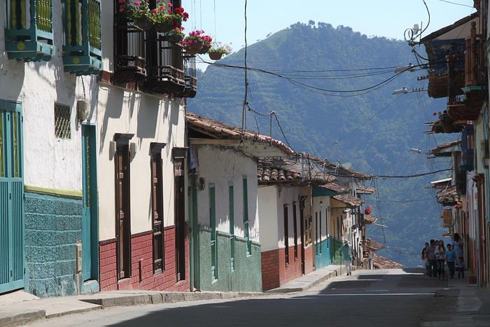
La première fois que j’ai entendu parler de la Colombie – comme destination touristique, j’entends –, c’était lors de notre voyage en Equateur au cours de notre hâlte à La Rana canto(que je recommande chaleureusement d’ailleurs pour qui voudrait faire un stop à la campagne. C’est vraiment très bien). Nadine et Pascal nous ont dit qu’ils commençaient à accueillir des backpackers venant de Colombie et que ces derniers trouvaient cela vraiment super.
Puis un podcast de Voyageurs du Monde m’a persuadée que la Colombie était le pays à visiter rapidement.
Ma fille (19 ans à l’époque) n’a pas été difficile à convaincre. Elle adore l’Amérique latine et une de ses meilleures amies a passé de nombreuses années en Colombie. Les garçons (mon tendre et cher, et notre fils - 17 ans) étaient loin d’être convaincus. Il faut dire que le site du ministère des affaires étrangères était tout sauf rassurant avec plein de rouge partout et un peu de jaune. Mais grâce à un travail de lobbying acharné et astucieux des filles, la promesse de bien rester dans les zones jaunes, ils ont fini par se laisser entraîner. (Entre notre décision et le voyage, le rouge du MAE a été largement réduit).
Restait à établir le parcours. La Colombie c’est grand, très grand. Et les routes sont lentes, très lentes. Pas question de vouloir trop en faire. Notre choix s’est porté sur la région du café, Medellin, Carthagène - parce que Carthagène a beau être très touristique, il nous paraissait difficilement envisageable de passer outre – et la Santander (avec Saint-Gil) que nous avons privilégié au parc de Tayrona (qui nous paraissait davantage semblable à ce que nous avions pu découvrir au cours de nos précédents voyages).
J’ai été guidée dans mes choix par les posts de Intothetrees -merci mille fois à lui- et le blog de Mars56 - merci aussi mille fois. Quelques blogs de voyageurs en tour du monde aussi (peu de sites évoquaient la Colombie à l’époque et j’ai découvert que les blogs de TDM étaient une bonne source d’information dans ce cas).
Pour optimiser les trajets, j’ai choisi une arrivée dans la région du café et un départ de Bogota. Trouver les billets au meilleur prix a été un peu compliqué et j’ai dû me résoudre à passer par un site de grossiste, chose que je ne fais jamais, en croisant les doigts pour ne pas avoir de problèmes. Deux vols intérieurs (Medellin – Carthagène et Carthagène – Bucaramanga) ont permis d’alléger les trajets.
Pour les hôtels, je n’ai pas eu le temps de potasser et puis à vrai dire, il n’y avait pas vraiment de quoi potasser. Je les ai choisis quelques jours à l’avance sur Booking en fonction des différents commentaires. Bien m’en a pris : en réservant depuis l’étranger – et Booking fait partie de « réserver depuis l’étranger », même nous étions déjà en Colombie lors de la réservation – on ne paye pas la TVA.
Au final, le trajet a donné cela.
5 août : trajet Paris - Perreira 6 août : Trajet pour Salamina – Salamina 7 août : Salamina - Balade aux alentours 8 août : Salamina - San Felix-vallée de Samaria 9 août : en route pour Jardin de Antoquia 10 août : Jardin de Antoquia 11 août : Jardin de Antoquia 12 août : trajet pour Medellín - musée de Antoquia 13 août : Guatape 14 août : Medellín - Free tour- Metrocable et Comuna 13 15 août : trajet pour Carthagène - Carthagène 16 août : Carthagène 17 août : Carthagène – les îles de Rosaire 18 août : Carthagène – La Boquhttp://illa 19 août : En route pour San Gil. Non ! pour Bogota ! 20 août : San Gil 21 août : Barichara- Guane 22 août : Rafting à San Gil 23 août : San Gil- Guadalupe 24 août : Guadalupe 25 août : Trajet pour Bogotá 26 août : Bogotá – bike tour – La calendelaria- musée de l’or 27 août : Bogotá - Montserrat- retour sur Paris
Tant pis pour la carte que j'ai faite sur Google earth : je ne peux pas la télécharger, pas assez de pixels!!
Nous avons donc adopté un rythme cool, nous laissant le temps de la découverte mais aussi du repos entre des trajets qui ont été souvent chaotiques voire complétement chamboulés. J’y reviendrai.
Un petit bilan, avant de passer au détail du récit : nous avons tout quatre bien apprécié la Colombie et les Colombiens. Le très bon espagnol de notre fille nous a beaucoup aidé à la fois pour nous débrouiller – mais nous aurions pu faire sans – mais aussi pour échanger avec les gens, notamment dans le bus. Le Colombie est un pays vraiment très chouette et mon seul regret, partagé par au moins un autre membre de la famille (je vous laisse deviner lequel), est de ne pas avoir eu plus de temps pour, par exemple, aller à Mompox ou encore Mongi.
Quant à la sécurité, souvent source d’interrogations, jamais nous ne nous sommes sentis menacés. Bien sûr nous avons pris les précautions d���usage et, dans les villes, Medellín et Bogotá, j’avais choisi pour nous loger les quartiers les plus sécures, peut-être moins typiques mais plus simples à gérer. Evidemment, cela ne veut pas dire qu’il n’y pas de problèmes, mais nous n’avons pas eu de soucis pour voyager. Dans la région du café, nous avons croisé maints militaires dûment armés, un peu impressionnant quand même.
La première fois que j’ai entendu parler de la Colombie – comme destination touristique, j’entends –, c’était lors de notre voyage en Equateur au cours de notre hâlte à La Rana canto(que je recommande chaleureusement d’ailleurs pour qui voudrait faire un stop à la campagne. C’est vraiment très bien). Nadine et Pascal nous ont dit qu’ils commençaient à accueillir des backpackers venant de Colombie et que ces derniers trouvaient cela vraiment super.
Puis un podcast de Voyageurs du Monde m’a persuadée que la Colombie était le pays à visiter rapidement.
Ma fille (19 ans à l’époque) n’a pas été difficile à convaincre. Elle adore l’Amérique latine et une de ses meilleures amies a passé de nombreuses années en Colombie. Les garçons (mon tendre et cher, et notre fils - 17 ans) étaient loin d’être convaincus. Il faut dire que le site du ministère des affaires étrangères était tout sauf rassurant avec plein de rouge partout et un peu de jaune. Mais grâce à un travail de lobbying acharné et astucieux des filles, la promesse de bien rester dans les zones jaunes, ils ont fini par se laisser entraîner. (Entre notre décision et le voyage, le rouge du MAE a été largement réduit).
Restait à établir le parcours. La Colombie c’est grand, très grand. Et les routes sont lentes, très lentes. Pas question de vouloir trop en faire. Notre choix s’est porté sur la région du café, Medellin, Carthagène - parce que Carthagène a beau être très touristique, il nous paraissait difficilement envisageable de passer outre – et la Santander (avec Saint-Gil) que nous avons privilégié au parc de Tayrona (qui nous paraissait davantage semblable à ce que nous avions pu découvrir au cours de nos précédents voyages).
J’ai été guidée dans mes choix par les posts de Intothetrees -merci mille fois à lui- et le blog de Mars56 - merci aussi mille fois. Quelques blogs de voyageurs en tour du monde aussi (peu de sites évoquaient la Colombie à l’époque et j’ai découvert que les blogs de TDM étaient une bonne source d’information dans ce cas).
Pour optimiser les trajets, j’ai choisi une arrivée dans la région du café et un départ de Bogota. Trouver les billets au meilleur prix a été un peu compliqué et j’ai dû me résoudre à passer par un site de grossiste, chose que je ne fais jamais, en croisant les doigts pour ne pas avoir de problèmes. Deux vols intérieurs (Medellin – Carthagène et Carthagène – Bucaramanga) ont permis d’alléger les trajets.
Pour les hôtels, je n’ai pas eu le temps de potasser et puis à vrai dire, il n’y avait pas vraiment de quoi potasser. Je les ai choisis quelques jours à l’avance sur Booking en fonction des différents commentaires. Bien m’en a pris : en réservant depuis l’étranger – et Booking fait partie de « réserver depuis l’étranger », même nous étions déjà en Colombie lors de la réservation – on ne paye pas la TVA.
Au final, le trajet a donné cela.
5 août : trajet Paris - Perreira 6 août : Trajet pour Salamina – Salamina 7 août : Salamina - Balade aux alentours 8 août : Salamina - San Felix-vallée de Samaria 9 août : en route pour Jardin de Antoquia 10 août : Jardin de Antoquia 11 août : Jardin de Antoquia 12 août : trajet pour Medellín - musée de Antoquia 13 août : Guatape 14 août : Medellín - Free tour- Metrocable et Comuna 13 15 août : trajet pour Carthagène - Carthagène 16 août : Carthagène 17 août : Carthagène – les îles de Rosaire 18 août : Carthagène – La Boquhttp://illa 19 août : En route pour San Gil. Non ! pour Bogota ! 20 août : San Gil 21 août : Barichara- Guane 22 août : Rafting à San Gil 23 août : San Gil- Guadalupe 24 août : Guadalupe 25 août : Trajet pour Bogotá 26 août : Bogotá – bike tour – La calendelaria- musée de l’or 27 août : Bogotá - Montserrat- retour sur Paris
Tant pis pour la carte que j'ai faite sur Google earth : je ne peux pas la télécharger, pas assez de pixels!!
Nous avons donc adopté un rythme cool, nous laissant le temps de la découverte mais aussi du repos entre des trajets qui ont été souvent chaotiques voire complétement chamboulés. J’y reviendrai.
Un petit bilan, avant de passer au détail du récit : nous avons tout quatre bien apprécié la Colombie et les Colombiens. Le très bon espagnol de notre fille nous a beaucoup aidé à la fois pour nous débrouiller – mais nous aurions pu faire sans – mais aussi pour échanger avec les gens, notamment dans le bus. Le Colombie est un pays vraiment très chouette et mon seul regret, partagé par au moins un autre membre de la famille (je vous laisse deviner lequel), est de ne pas avoir eu plus de temps pour, par exemple, aller à Mompox ou encore Mongi.
Quant à la sécurité, souvent source d’interrogations, jamais nous ne nous sommes sentis menacés. Bien sûr nous avons pris les précautions d���usage et, dans les villes, Medellín et Bogotá, j’avais choisi pour nous loger les quartiers les plus sécures, peut-être moins typiques mais plus simples à gérer. Evidemment, cela ne veut pas dire qu’il n’y pas de problèmes, mais nous n’avons pas eu de soucis pour voyager. Dans la région du café, nous avons croisé maints militaires dûment armés, un peu impressionnant quand même.
Norway to hell English translation pending
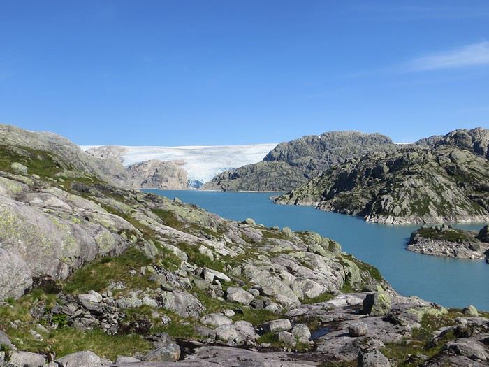
En ces temps coronatroublés, rien ne vaut de se remémorer le dernier voyage touristique que l’on a fait avant le plongeon dans le néant sanitaro-économique. La Norvège, plus précisément sa côte ouest et ses fjords, sera donc le sujet de ce carnet en 31 épisodes dotés chacun d’une bande-son, plutôt rock d’ailleurs. Attention, lecteur, vous vous exposez à un certain nombre de clichés pas du tout exagérés et de blagues pourries. I have nothing to offer but fjord, joy, tears (of the sky) and sweat.
Donc la Norvège, c’est l’apocalypse budgétaire dans votre portefeuille. D’où le titre (c’est tiré par les cheveux mais je ne refuse jamais un jeu de mots). Mais ce n’est pas que cela, c’est aussi fort joli, propre, policé et réellement rempli de charmantes têtes blondes. La Norvège, c’est également une monarchie pétrolière du golfe persique qui s’est égarée sur des terres glacées. Eh oui, c’est tout de suite plus facile d’être riche quand ils ont du pétrole (« mais ils n’ont que ça » aurait ajouté un jaloux), qu’ils sont peu nombreux et pas très partageurs. Allez, quelques détails pour commencer sur un plan aussi bien techeunique que tacqueutique
Le trajet En voiture Simone ! Depuis le Massif Central jusqu’à la Norvège avec une C3. J’avais décrété 2019, année sans avion. Donc c’était la voiture, certes petite mais costaude, où l’on a pu entasser notre matériel de camping. On en a profité pour prendre un covoitureur qui allait se perdre en Norvège pour l’été. Plus on est de fous entassés, plus on rit. Sur place, j'ai limité fortement notre aire d'action géographique. Je le connais le piège de faire une liste longue comme le bras et de courir tout le voyage tel un chien de ferme après un mollet cycliste. Il s'agissait de se cantonner au riz euh pardon à la façade sud-ouest du pays sans aller plus haut qu'Ålesund. Et comme il y avait un certain nombre de lieux qui me faisaient de l’œil, nous avons quand même eu un trajet digne d’une otarie bourrée essayant d’échapper à une orque affamée. On a finalement fait l’essuie-glace obliquement dans l’Ouest : à gauche, à droite, à gauche, à droite, à droite, A DROITE . Il faut dire que les fjords et les montagnes n’arrangent pas les affaires du voyageur adepte des routes rectilignes, et cela malgré la passion tunnelière locale.
Le lien vers la carte du trajet : http://u.osmfr.org/m/434267/
Les Norvégiens Les Norvégiens sont des êtres blonds aux yeux bleus, parfois d’un blond tellement blond qu’on dirait qu’ils ont appliqué de la javel sur leurs cheveux. Effet secondaire qui donne la chair de poule, cela fait disparaître les sourcils… Le Norvégien est réservé et poli. L’été, soit il se balade torse nu, soit il quitte le pays pour des horizons plus propices au rougeoiement de sa peau laiteuse où il pourra faire valoir son pouvoir d’achat dément. La Norvégienne quant à elle a une prédisposition naturelle à se promener en sous-tif ou brassière dès le premier rayon de soleil. Le dimanche, jour du Seigneur et de l’hypocrisie, le Norvégienne ne boit pas (vente d’alcool interdit !) les autres jours, iel se cache pour boire puis déambule cahin-caha entre les maisons de bois à la pelouse verdoyante. La Norvégien apprécie également les sorties familiales du dimanche après-midi où il peut effectuer 1000 mètres de dénivelé en 3,5km avec ses enfants de 7 et 9 ans. Le tout les doigts dans le nez.
Le logement Le logement, c’était principalement notre tente de 2 m² que nous avons montée/démontée dans des campings de qualité très variable pour un prix pas donné. Souvent les sites sont jolis mais plantés en bordure de route malgré l’espace qu’offre le pays. Ca manque quand même d’arbres ou arbustes et d’emplacements un tant soit peu délimités. Ce dernier point permet pendant les nuits les plus chaudes de l’été d’entasser les touristes de passage dans une promiscuité certaine et de rentabiliser un maximum l’espace. Malynx le Norvégynx ! Par contre, les sanitaires sont en général en bon état mais avec douche payante. Bref, le camping c’est le moyen de logement le plus abordable hors camping sauvage mais en général, la qualité est moyennasse au vu des prix. J’ai séché une petite larme en pensant à feus les campings des parcs nationaux et provinciaux canadiens. Requiescat in pace. Pour reprendre notre souffle, nous avons quand même varié les plaisirs avec des logements en b&b, du camping sauvage, des hytter (des petites cabanes souvent présentes dans les campings mais également ailleurs, très pratiques, pas trop chères pour la Norvège et aux prestations variables : électricité, eaux courantes en option par exemple) et une nuit en « refuge ». Les refuges, il y en a partout la plupart sont accessibles à pied, non gardés avec parfois une sorte de self-service payant.
La bouffe Courez en Norvège (ah mince vous êtes confinés) et vous me direz des nouvelles du Brunost . Sinon c’est cher mais pas mauvais globalement, peu porté sur le poisson hors saumon d’élevage et assez roboratif. Et bonne surprise pour moi, il y a quand même une tradition boulangère et même s’il y a peu de boulangeries, on peut trouver pleins de pains et de sorte de viennoiseries dans les supermarchés. Cela égaie les multiples piques-niques.
Avant de commencer le carnet proprement dit, entamons notre hymne norvégien : So many stop signs Speed limit Curves’ gonna slow me down Like a wheel Gonna spin it Tourists’ gonna mess me around Hey, Satan Payin' my tolls Bein’ among sheepin' bands Hey, mamma Look at me I'm on the way to the promised land
Jour 1,5 60 mph – New Order Clermont-Ferrand - Neumünster A nous les petites autoroutes allemandes tant prisées de ce côté du Rhin pour l’absence de limites de vitesse. Parcours Montbéliard – Fribourg – Karlsruhe – Francfort – Kassel – Hannovre – Hambourg – Neumünster. C’est long et pénible avec des travaux publics pas très deutsche Qualität tous les 20 kms, un trafic chargé et des zones limitées sans limite de vitesse qui rendent la conduite dangereuse : à droite ça roule à 90, à gauche à 200 pour les plus fous et comme c’est saturé, ça donne un résultat sportif et désagréable. Je me demande comment ils font pour avoir aussi peu de morts sur les routes en Allemagne. A part ça, le voyage est sans histoire, le colis covoitureur est livré à Fribourg et on arrive entiers et fatigués à Cathédraleneuve.
Jour 2 Seemann – Rammstein Neumünster - Kristiansand
Les autoroutes allemandes c’est rapidement fini, on revient à de la tranquillité avec le Danemark. Nous avons choisi de prendre le ferry Hirtshals-Kristiansand qui permet d'arriver plus rapidement sur la côte ouest Et comme on a beaucoup d’avance sur l’horaire du ferry Hirtshals-Kristiansand, on se permet un détour vers une dune danoise dominant la mer du Nord. Le temps est pas idéal et le coin est assez fréquenté. Bof. Le voyage en ferry est sans histoire, les Norvégiens en profitent pour faire des réserves d’alcool et de legos (les deux produits les plus présents dans les magasins du bateau). Nous voilà enfin en Norvège, 1900 kilomètres plus tard, sur la plage de Christian. Sacré Clavier qui a fait des fidèles un peu partout en Scandinavie.
Jour 3 Why does it always rain on me? - Travis 180 km Kristiansand – Hauge Notre premier jour en Norvège et ça ne s’annonce pas glorieux, plutôt gris tendance pluie. Nous commençons par un rapide passage par un bout de zone payante de Kristiansand juste pour le plaisir et accessoirement quitter cette ville. Je me suis inscrit, par honnêteté, sur le site internet des péages norvégiens (gérés d’ailleurs par une société anglaise) et par la grâce de caméras bien placées, nous allons devoir payer quelques euros pour à peu près 100 mètres dans ladite ville. Pfff. Quant au programme aujourd’hui, nous allons à la conquête de l’ouest, l’ouest de Kristiansand et nos plans capotent très largement. Ca tombe, ça tombe, ça dégouline, dégringole, s’abat, déverse, pleuvoche, tantôt torrentiel, tantôt bruineux. Pas question de faire une rando ou toute autre activité de plein air. Je m’aperçois en plus dans la journée que mon imper n’est plus imperméable et que j’ai oublié mon surpantalon. Prions, mes bien chers Frères, mes bien chères Sœurs pour que la météo soit clémente. Sinon ça va être long. Dans un premier temps, jusqu’à Flekkefjord, nous nous mouvons plus ou moins le long de la côte sans l’apercevoir, d’une parce que c’est complètement bouché, de deux parce qu’il est difficile de distinguer ce qui tient d’un lac ou d’un fjord, de trois parce que la route principale ne suit pas la côte. Nous nous rabattons donc sur la visite sans trop musarder des petites villes blanches du sud de la Norvège, leurs villages blancs andalous à eux mais en différent : avec du bois, de la pluie et de la mer. Premier arrêt à Mandal, un vrai coup dans le cœur. Deuxième arrêt : Flekkefjord, très mignon. Troisième arrêt version hameau, Stornes en entrée de fjord, très, très mignon. Quatrième arrêt : Sognalstranda, très, très, très mignon. C’est le règne de la mignonitude humide. Une maison en bois par ci, un entrepôt en bois par-là, et des garages à bateau à foison.
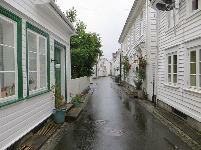 Pas un temps à mettre un chat norvégien dehors (Flekkefjord)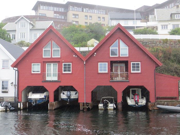
Pas un temps à mettre un bateau norvégien dehors
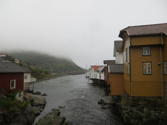 Mais pourquoi on est dehors nous alors ? (Sognalstranda)
Interlude de pipeau très intéressant : ces villes/villages, souvent fondés aux 17ème et 18ème siècle, sont les témoins de la politique mercantiliste du royaume du Danemark. L’État balbutiant entend organiser la production, la commercialisation et l’exportation des ressources comme le bois, les poissons et certains métaux de Norvège. Cette politique passe par la mise en place d’exploitations/manufactures à tendance monopolistique et la spécialisation des ports avec monopole des marchands d’abord hanséatiques (16ème siècle) puis néerlandais (17ème siècle) et enfin danois (17-18ème siècle). C’est d’ailleurs pour cela que le vieux centre de Flekkefjord est surnommé la ville hollandaise. Ce système mercantiliste fera par ailleurs les malheurs de l’Islande forcée de se soumettre pendant deux siècles à une compagnie royale danoise monopolistique à même d’imposer ses tarifs et ses conditions d’échange de marchandise. Les siècles sombres comme les appellent les Islandais ont en grande partie comme origine cette organisation économique très profitable pour la royauté danoise, beaucoup moins pour les habitants de l’île. La route 44 après Flekkefjord vaut par ailleurs son pesant de cacahuètes même si les conditions ne sont pas optimales pour en profiter. Tout le coin a été nommé magma geopark (patrimoine de l’UNESCO) dans une poussée de marketing touristique, des roches de la croûte terrestre d’une zone de subduction ayant fini par apparaître sous l’effet de l’érosion si j’ai bien compris. Point de volcan donc mais des effleurements d’anorthosites qui forment des paysage rocailleux arrondis et stériles comme autour d’Helleren et d’Åna Sira où devait se dérouler notre première randonnée norvégienne, projet qui tombe à l’eau (ahahah), noyé sous les larmes du ciel (ahahah). La partie la plus spectaculaire du trajet se trouve entre Åna Sira et Hauge où la route serpente tant bien mal entre les rochers. Nous goûtons le soir venu à la douceur des campings norvégiens : une espèce de carrière dans un espace réduit entre deux collines, un sol gravillonneux, pas de végétation et roule ma poule. Le seul avantage réside dans la vue en bout de carrière sur la côte. Pas vraiment de cuisine aménagée, des douches payantes : prometteur ! Le coupable aujourd’hui est le Vågan camping (garanti sans viande).
Jour 4 Sous le soleil exactement – Serge Gainsbourg 186km Hauge – Lysebotn Nuit et brouillard ce matin sur la Norvège et pourtant nous gardons espoir, le soleil vaincra. Nous continuons la route côtière pour faire une petite balade (4km aller-retour) jusqu’au Hådyr. C’est humide, boueux, bourbeux, fangeux, marécageux, tourbeux, machineux. C’est également l’occasion de compter la deuxième victime du voyage : le terrain a raison de mes chaussures de marche basses. Flap flap, bain de pieds et macération. Décidément, je suis équipé pour affronter l’humidité scandinave ! Arrivés au rocher censé donner un point de vue sympa sur la côte, c’est la douche froide (avec beaucoup de vapeur d’eau, la douche) : à gauche, du brouillard, à droite, du brouillard, droit devant, du brouillard, derrière, du brouillard et un bruit de ressac à nos pieds. Comme on est patient et qu’on croit en dame météo, nous nous asseyons pour attendre la percée du soleil. Une heure et quelques hésitations plus tard, ça se déchire (très) petit à petit, de quoi entrapercevoir une côte que je qualifierai de dantesque. J’adore ces rochers granitiques usés par les siècles, qui forment des forêts de sentinelles face à la mer.
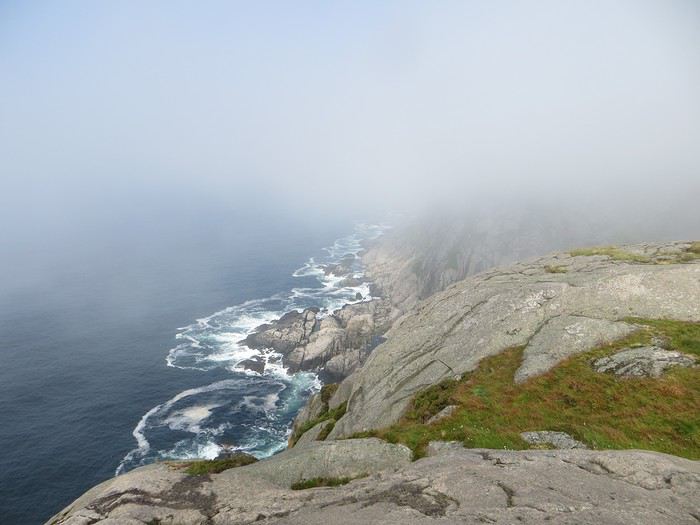 Les portes de l'Hådyr s'ouvrent et pas de cerbères à l'horizon
Et ça tombe bien que j’adore ce paysage puisque pour l’étape suivante (décidément le gentil organisateur a tout prévu !), nous traversons sans s’arrêter Egersund, autre petite ville en bois, pour Eigerøya, son phare et son paysage rocailleux sous le soleil exactement, un soleil de plomb je dirais même plus. La baladounette de l’après-midi de 4 km est sans difficulté sur une autoroute pédestre et permet d’accéder à un point de vue maousse costaud sur l’île d’Eiger et son phare.
Les portes de l'Hådyr s'ouvrent et pas de cerbères à l'horizon
Et ça tombe bien que j’adore ce paysage puisque pour l’étape suivante (décidément le gentil organisateur a tout prévu !), nous traversons sans s’arrêter Egersund, autre petite ville en bois, pour Eigerøya, son phare et son paysage rocailleux sous le soleil exactement, un soleil de plomb je dirais même plus. La baladounette de l’après-midi de 4 km est sans difficulté sur une autoroute pédestre et permet d’accéder à un point de vue maousse costaud sur l’île d’Eiger et son phare.
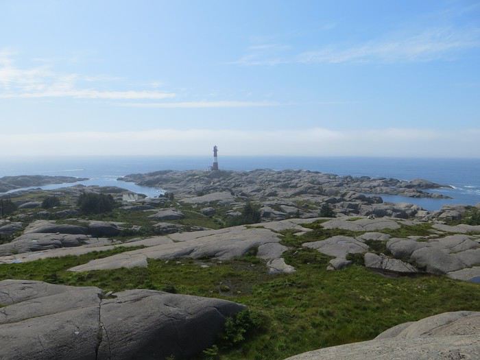 C'est un roc ! C'est un pic ! C'est un cap ! Que dis-je c'est une péninsule !
 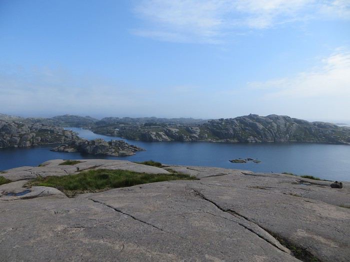 Eigerøya en beauté
Si j’ai bien compris le norvégien, øy est le suffixe pour île et a celui pour « la » en général, même si la langue se scinde en deux types distincts nynorsk et bokmål et en de nombreuses variantes dialectiques locales qui provoquent des orthographes changeantes des panneaux et des cartes. Par exemple, kirke (église en bokmål) s’écrit aussi kyrkje en nynorsk, voire a d’autres déclinaisons locales plus obscures. Le nynorsk, pour ceux qui ne connaissent pas, est issu d’une (re)création linguistique du 19ème siècle type occitan ou breton en France : pour donner à la Norvège une langue pure de toute saleté étrangère, danoise plus particulièrement, des linguistes ont construit une langue sur un mélange des dialectes considérés comme les moins viciés par l’outre-Skagerrak, c’est-à-dire ceux du Telemark et des fjords du sud-ouest. A contrario, le bokmål est un dérivé dédanoiïsé de la langue parlée (du danois grosso modo) dans les villes comme Oslo au début du 19ème siècle. De nos jours, il y a donc deux langues officielles et le nynorsk est très connoté nationaliste et perd du terrain : 13% des Norvégiens, principalement dans l’ouest, le parlent comme langue maternelle. Nous nous dirigeons ensuite vers l’intérieur des terres en direction de Lysebotn, le paysage change, pâturage, forêt et lacs avant de rentrer dans des zones à l’environnement plus âpre et tourmenté. Gloppedalsura (à vos souhaits) est l’occasion d’un arrêt bienvenu pour un point de vue sur un chaos de rochers impressionnant et son lac attenant.
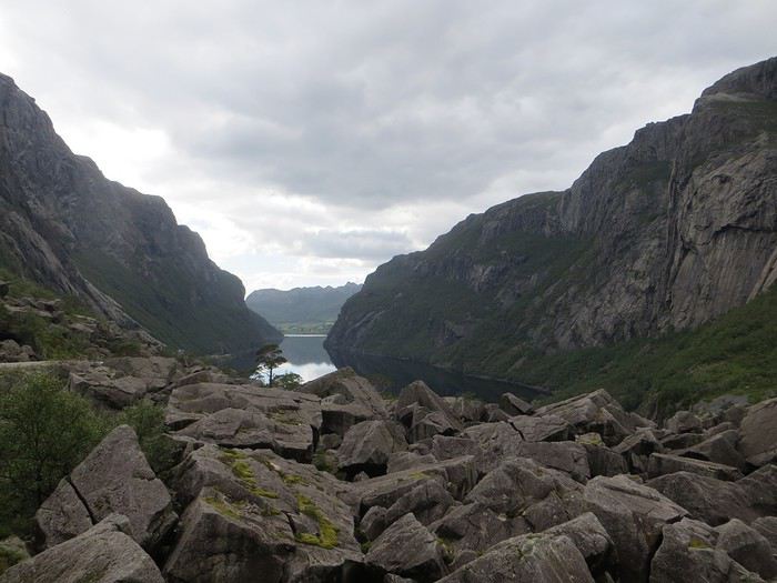 Gloppedalsura, lieu de franche rigolade entre Allemands et Norvégiens pendant la Seconde Guerre Mondiale
Nous remontons ensuite la Øvstabødalen, vallée glaciaire à citer dans toute conférence de géologie de bon niveau pour la perfection de sa forme en auge. Le parcours est varié, peu fréquenté et plaisant avant de plonger sur une zone moins sympa bien dotée en stations de ski et en habitat folklorico-traditionnel, ici des immeubles/chalets en bois sombre et toit végétalisé. L’avantage, au-delà du côté très artificiel des stations, c’est que les bâtiments se fondent dans la végétation.
Gloppedalsura, lieu de franche rigolade entre Allemands et Norvégiens pendant la Seconde Guerre Mondiale
Nous remontons ensuite la Øvstabødalen, vallée glaciaire à citer dans toute conférence de géologie de bon niveau pour la perfection de sa forme en auge. Le parcours est varié, peu fréquenté et plaisant avant de plonger sur une zone moins sympa bien dotée en stations de ski et en habitat folklorico-traditionnel, ici des immeubles/chalets en bois sombre et toit végétalisé. L’avantage, au-delà du côté très artificiel des stations, c’est que les bâtiments se fondent dans la végétation.La dernière partie du trajet, très belle mais pas très agréable à conduire tant la petite route est saturée par la circulation, traverse un plateau rocailleux avant de plonger vers le Lysefjord. Malheureusement, la route de descente, assez connue (elle est le lieu d’une compétition estivale de ski sur route très cotée) une fois passée le restaurant et bien que sûrement impressionnante vue d’un drone, n’offre quasiment aucune vue sur la vallée et le fjord. Ce qu’elle offre par contre, c’est un tunnel en épingle à cheveux, un classique que l’on retrouvera à plusieurs reprises dans les fantaisies souterraines norvégiennes. Le camping du soir, bonsoir, le Kjerag Lysebotn camping, jouit d’un site splendide et est bien équipé (cuisine, sanitaire). Malheureusement, comme on est en Norvège, il n’y a aucun arbre/arbuste et une promiscuité assez forte et accentuée par l’affluence d’un jour de juillet ensoleillé. Bref on se marche dessus comme des manchots en période de reproduction dans leur colonie.
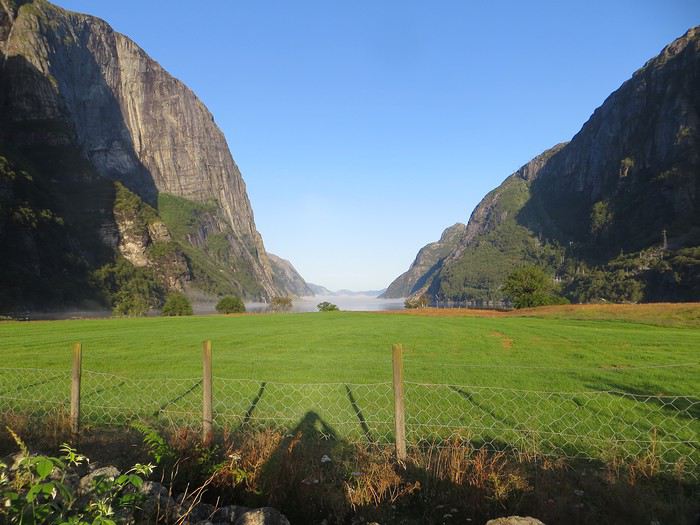 Quand je vous dis que le site est splendide...
Jour 5 Highway song – System of a Down 78km Lysebotn - Hjelmeland Aujourd’hui, c’est notre journée rando de masse dit trek pour ceux qui se sentent une âme d’aventurier, juste une âme, il ne faut pas trop abuser de l’aventure. Donc aujourd’hui, c’est le Kjeragbolten, concession faite à la liste des randonnées obligatoires. La Norvège fait partie de ces pays où la randonnée est l’une des activités touristiques obligatoires y compris pour des personnes qui ne marchent jamais par ailleurs. Pour la Norvège, l’activité s’effectue bien sûr en masse sur les mêmes chemins en cochant les fameuses cases de la to do list comprenant dans l’Ouest Preikestolen, Trolltunga, Kjeragbolten, Bessegen et Aurlandsdalen. Nous nous sommes contentés du rocher suspendu Kjerag, choisi car dans mon esprit, moins facilement accessible au commun du touriste (et moi je suis un touriste hors du commun, un tourista). C’est sûrement vrai mais cela n’empêche pas le monde… Je le savais, je le savais, j’étais prévenu, j’ai râlé avant, j’ai râlé pendant, je râle encore après et pourtant je n’ai pas d’oiseau dans la gorge et il n’y avait pas de genêts dans la balade (cf le râle des genêts pour comprendre la blagounette). La randonnée commence par un parking gigantesque au tarif prohibitif. Nous payons sans moufter nos 30 euros (un repas dans un resto semi gastro en France pour ceux qui n’ont pas le sens des valeurs). J’espère que personne ne s’arrête juste pour voir la vue car de vue il n’y en a point : le point de vue est occupé par un restaurant qui met un point d’honneur à boucher accessoirement la vue. Et pour accéder à sa terrasse/point de vue, il faut payer. Bon, nous, on a du pain sur la planche et quelques montées raidasses en attente. Dont acte. Trafic fluide en ce début de matinée, quelques problèmes de surchauffe moteur pour la première montée puis la vitesse de croisière est atteinte pour une arrivée prévue à 10h30. Ce n’est pas encore un bouchon au niveau du rocher mais la circulation est déjà dense à l’approche. Au retour, le trafic est extrêmement chargé et les comportements touristico-idiots se multiplient (équipement inadéquat, coupage des routes à travers champs, ralentissements dus aux selfies intempestifs. Ne pas utiliser votre téléphone en conduisant, que la sécurité routière vous dit !).
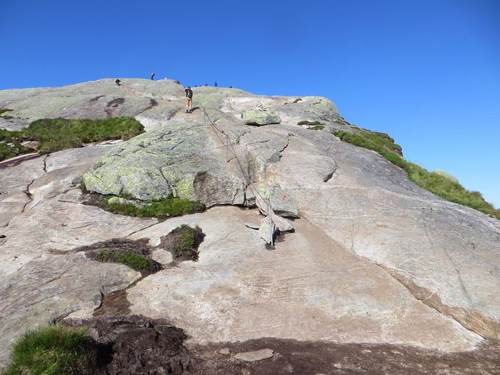
Pas un coin où amener sa traban
Sur le fond, la rando, 12 km et 700 mètres de dénivelée, est très chouette avec de belles vues sur le fjord et Lysebotn en particulier au début de la 3ème montée et tout au bout.
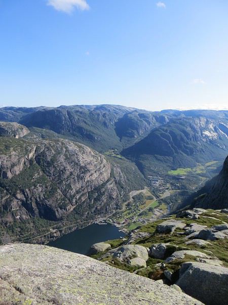
Le Lysefjord
Le caillou est flippant et spectaculaire tout comme la plateforme juste à côté. Une queue au bord d'un à pic de 1000 mètres se forme pour monter dessus (même pas en rêve, je fais un truc pareil).
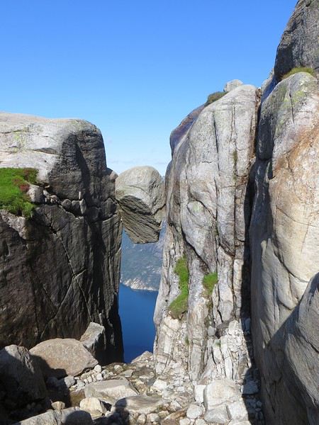 Le mythe
La réalité
Il est loisible d’explorer les environs du Kjeragbolten pour profiter d’un peu de la tranquillité des avancées rocheuses spectaculaires et des vues majestueuses sur le fjord. Bref ça claque grave.
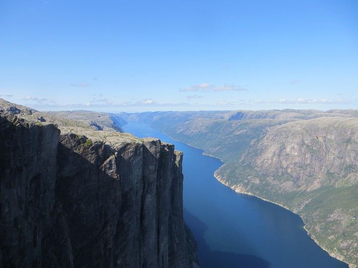 Le Lysefjord n'a pas bougé
On redescend à Lysebotn pour prendre un ferry réservé à l’avance. Et quand on voit le « ferry » arriver, on se dit que la réservation était une bonne idée. Rentrée en marche arrière et tassage de voitures dans un espace réduit pour notre mini-croisière sur le Lysefjord. Très bien la mini-croisière qui permet de s’apercevoir de la hauteur des falaises entourant le Kjeragbolten et d’apercevoir le Preikestolen où nous n’irons pas.
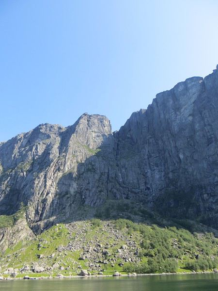
Le Kjeragbolten vu d'en bas. Les 1000 mètres de vide y sont bien
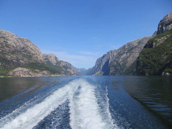 La croisière s'amuse
Le camping du soir se trouve à Hjelmeland et est ingénieusement intitulé Hjelmeland camping. Celui-ci fait dans l’original puisque nous avons planté notre tente dans le parc arboré d’une sorte de manoir qui sert de dortoir. Une chouette vue, une cuisine bien équipée et assez d’espace pour ne pas se marcher dessus (en principe, avec les Norvégiens, on ne sait jamais, ils pourraient parquer votre tente ou votre van à 50 cm du voisin), voilà pour les avantages. Pour les inconvénients, les sanitaires sont peu nombreux, peu pratiques et se salissent vite (forcément).
La Corée nous a enchantés English translation pending
Depuis le temps que je dis que je dois faire ce carnet de voyage !! Le temps passe.
Allez, un peu de courage que diable!
Nous sommes partis à 6 entre le 31 juillet et le 24 août 2019.
Pourquoi diantre la Corée du sud ? J'ai un mari nageur qui fait les championnats du monde de natation master et .. comme vous l'aurez deviné, ils avaient lieu en Corée et plus précisément à Gwangju. Nous sommes donc partis à deux couples (deux maris nageurs) et avec un de nos enfants chacun.
Nous avons fait un grand circuit circulaire de Séoul à Séoul. Nous avions loué une voiture depuis la France.
Pour cela, et sur les conseils de la fille d'une amie qui vit là-bas, nous sommes passés par le site lotte rentacar. Je n'étais pas très emballée car il faut laisser les coordonnées de son passeport mais franchement, la location s'est merveilleusement bien passée et nous avons même eu une belle surprise au moment de prendre la voiture ainsi qu'à la fin. J'y reviendrai.
Nous avons également réservé un pocket wifi que nous avons pu retirer à notre arrivée à l'aéroport de Séoul.
Côté logement, nous avons un peu tout testé : l'auberge de jeunesse (possibilité d'avoir des chambres privées avec salles de bain très propres et dans lesquelles nous avons eu les lits les plus confortables du séjour), les hanoks très classes ou plus modestes (et on sent bien la différence d'épaisseur de futon ! Dos sensibles s'abstenir) et un hôtel plus international.
Pour ce qui en est des repas, nous y sommes souvent allés au pif et nous n'avons jamais eu de mauvaise surprise. Ah, une chose à retenir : s'il y a du rouge dans le plat c'est que ça pique ! Je reviendrai sur les repas au fur et à mesure de mon récit.
On trouve de l'eau partout dans les temples. L'eau est parfaitement potable. Et c'est très agréable en été quand il fait très chaud.
Les paiements : les CB internationales fonctionnent la plupart du temps. Sinon, possibilité de retirer de l'argent dans les distributeurs ou au guichet de certaines grandes banques. Nous n'avons pas eu de souci.
Le temps : chaud chaud chaud. La pluie ? Pas tant que ça au final mais nous avons peut-être eu de la chance. Par contre, quand il pleut, il pleut bien !
L'avantage, c'est que comme il fait chaud on sèche vite.
Allez c'est parti. Samedi 31 juillet
Après un voyage d'un peu plus de 10h au départ de Roissy, nous sommes arrivés à l'aéroport international de Séoul. Rien de particulier pour le passage de la douane. Ensuite, il faut avouer que nous avons un peu galéré pour trouver dans l'aéroport le lieu pour retirer notre pocket wifi puis la voiture de location. Mais nous y sommes arrivés dnas un temps assez raisonnable. Nous avions réservé une Kia Carnival. Elle est vendue pour 9 personnes mais franchement, les 3 dernières doivent être des enfants ! Nous avons eu peur un instant que les bagages ne rentrent pas alors nous avons un peu joué au tangram😛 ... Première bonne surprise du voyage, le prix que nous avons payé était bien inférieur à celui qui m'avait été indiqué sur le devis en ligne ! En partant de l'aéroport nous avons eu droit à une magnifique pluie battante
 Et à une suite interminable de bouchons ...
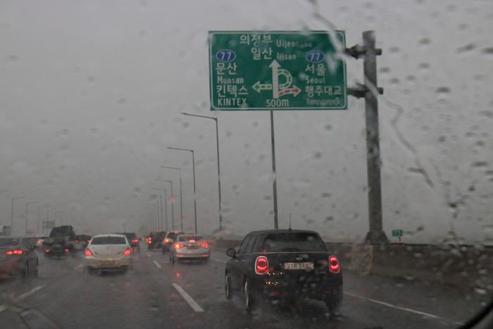 Contrairement à ce que l'on pourrait croire, nous ne sommes pas arrivés en fin de journée mais bien au petit matin. Et là sur la route il devait être autour de 10h du matin....
Notre premier logement se trouvait à Sokcho.
Entre le GPS de la voiture programmé en anglais par l'agence de location avant de nous confier la voiture et l'application NAVER sur le téléphone (pas de google maps en Corée du Sud), nous avons trouvé le bon chemin pour nous rendre à Chuncheon. Le but était d'y arriver pour manger à midi. Heureusement pour nous, la pluie a cessé en cours de route, les bouchons ont disparu et le paysage est devenu plus vert.
Contrairement à ce que l'on pourrait croire, nous ne sommes pas arrivés en fin de journée mais bien au petit matin. Et là sur la route il devait être autour de 10h du matin....
Notre premier logement se trouvait à Sokcho.
Entre le GPS de la voiture programmé en anglais par l'agence de location avant de nous confier la voiture et l'application NAVER sur le téléphone (pas de google maps en Corée du Sud), nous avons trouvé le bon chemin pour nous rendre à Chuncheon. Le but était d'y arriver pour manger à midi. Heureusement pour nous, la pluie a cessé en cours de route, les bouchons ont disparu et le paysage est devenu plus vert.
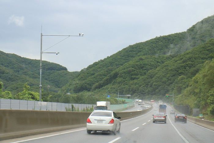
Pourquoi nous arrêter à Chunchéon ? Nous avions repéré une rue où on sert une spécialité de poulet pimenté : le dagkgalbi. Impossible de rater la rue
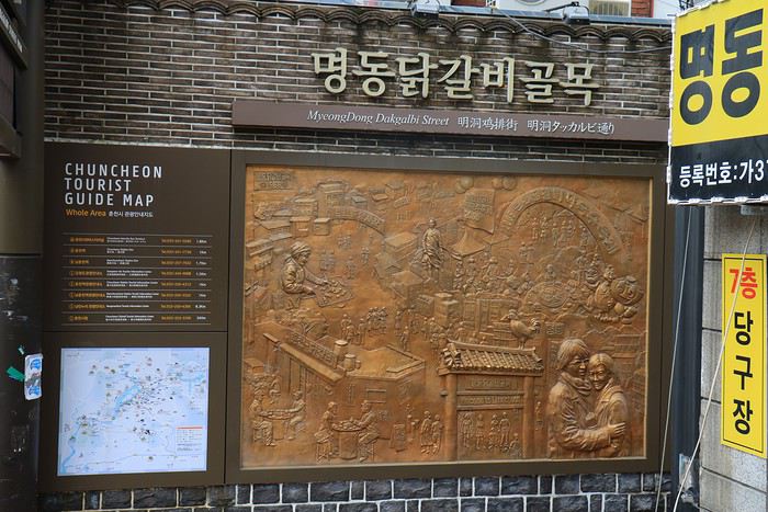
Le poulet est servi au barbecue avec des légumes. Nous avons pu choisir 3 assaisonnements différents de poulet. Un seul était trèèèèès épicé. Les restaurateurs se sont montrés adorables pour nous expliquer comment manger tout ça.
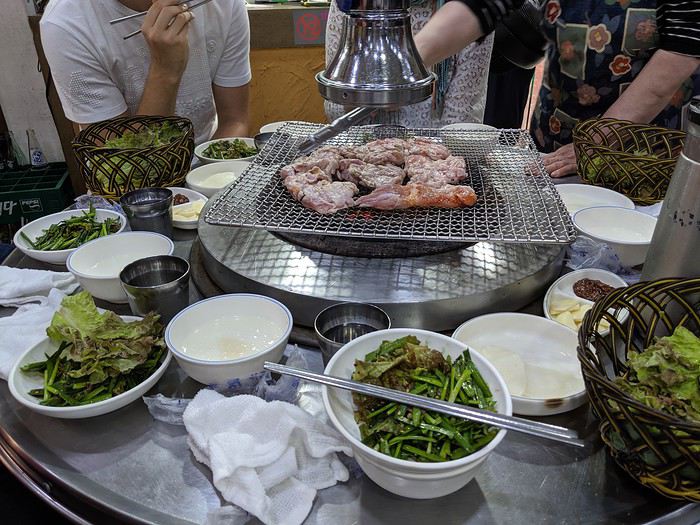 Nous avons voulu faire un petit tour dans la ville, mais nous n'avons trouvé qu'un petit temple.
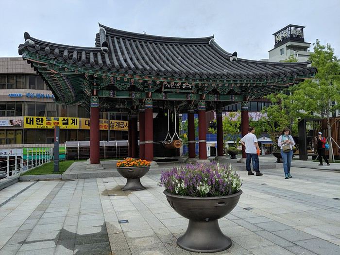 Nous avons repris la route pour Sokcho, mais très vite nous avons du nous arrêter car nous avons été rattrapés par le décalage horaire. Gros coup de barre général. Nous nous sommes arrêtés en pleine campagne pour dormir une bonne heure.
Nous sommes arrivés en fin d'après-midi à Sokcho. Le temps de vider la voiture, nous installer dans nos chambres, nous ne sommes partis dîner que vers 19h. Ouille errreur car à cette heure là beaucoup de restaurants ferment.
Nous en avons dégoté un petit qui servait des plats de nouilles. Parfait nous sommes nous dit !
Sauf que les nouilles sont servies froides, et même très froides car on trouve dans le bol des morceaux de glace.
Nous avons repris la route pour Sokcho, mais très vite nous avons du nous arrêter car nous avons été rattrapés par le décalage horaire. Gros coup de barre général. Nous nous sommes arrêtés en pleine campagne pour dormir une bonne heure.
Nous sommes arrivés en fin d'après-midi à Sokcho. Le temps de vider la voiture, nous installer dans nos chambres, nous ne sommes partis dîner que vers 19h. Ouille errreur car à cette heure là beaucoup de restaurants ferment.
Nous en avons dégoté un petit qui servait des plats de nouilles. Parfait nous sommes nous dit !
Sauf que les nouilles sont servies froides, et même très froides car on trouve dans le bol des morceaux de glace.
Il a fallu rajouter du sucre, du viandox froid (ça en avait le goût en tous cas😛), du lait de riz (pas facile de déterminer exactement ce que c'était) et un peu de vinaigre. Alors le rouge ça pique, le truc blanc c'est un demi oeuf dur, le gris ce sont des pates et le reste de la pomme effilée et ??? On va dire que ce n'était pas mauvais mais très spicy ouille ouille ouille. On m'appelait lèvres de feu à la fin du repas !!!! 20h passées, il fait nuit noire. Nous avons quand même voulu marcher un peu dans les rues vers le port. Beaucoup de néons Et de jolis petits temples
 Ce soir là nous n'avons pas eu de mal à nous endormir ...
Allez c'est parti. Samedi 31 juillet
Après un voyage d'un peu plus de 10h au départ de Roissy, nous sommes arrivés à l'aéroport international de Séoul. Rien de particulier pour le passage de la douane. Ensuite, il faut avouer que nous avons un peu galéré pour trouver dans l'aéroport le lieu pour retirer notre pocket wifi puis la voiture de location. Mais nous y sommes arrivés dnas un temps assez raisonnable. Nous avions réservé une Kia Carnival. Elle est vendue pour 9 personnes mais franchement, les 3 dernières doivent être des enfants ! Nous avons eu peur un instant que les bagages ne rentrent pas alors nous avons un peu joué au tangram😛 ... Première bonne surprise du voyage, le prix que nous avons payé était bien inférieur à celui qui m'avait été indiqué sur le devis en ligne ! En partant de l'aéroport nous avons eu droit à une magnifique pluie battante
Et à une suite interminable de bouchons ...
Contrairement à ce que l'on pourrait croire, nous ne sommes pas arrivés en fin de journée mais bien au petit matin. Et là sur la route il devait être autour de 10h du matin....
Notre premier logement se trouvait à Sokcho.
Entre le GPS de la voiture programmé en anglais par l'agence de location avant de nous confier la voiture et l'application NAVER sur le téléphone (pas de google maps en Corée du Sud), nous avons trouvé le bon chemin pour nous rendre à Chuncheon. Le but était d'y arriver pour manger à midi. Heureusement pour nous, la pluie a cessé en cours de route, les bouchons ont disparu et le paysage est devenu plus vert.Pourquoi nous arrêter à Chunchéon ? Nous avions repéré une rue où on sert une spécialité de poulet pimenté : le dagkgalbi. Impossible de rater la rue
Le poulet est servi au barbecue avec des légumes. Nous avons pu choisir 3 assaisonnements différents de poulet. Un seul était trèèèèès épicé. Les restaurateurs se sont montrés adorables pour nous expliquer comment manger tout ça.
Nous avons voulu faire un petit tour dans la ville, mais nous n'avons trouvé qu'un petit temple.
Nous avons repris la route pour Sokcho, mais très vite nous avons du nous arrêter car nous avons été rattrapés par le décalage horaire. Gros coup de barre général. Nous nous sommes arrêtés en pleine campagne pour dormir une bonne heure.
Nous sommes arrivés en fin d'après-midi à Sokcho. Le temps de vider la voiture, nous installer dans nos chambres, nous ne sommes partis dîner que vers 19h. Ouille errreur car à cette heure là beaucoup de restaurants ferment.
Nous en avons dégoté un petit qui servait des plats de nouilles. Parfait nous sommes nous dit !
Sauf que les nouilles sont servies froides, et même très froides car on trouve dans le bol des morceaux de glace.Il a fallu rajouter du sucre, du viandox froid (ça en avait le goût en tous cas😛), du lait de riz (pas facile de déterminer exactement ce que c'était) et un peu de vinaigre. Alors le rouge ça pique, le truc blanc c'est un demi oeuf dur, le gris ce sont des pates et le reste de la pomme effilée et ??? On va dire que ce n'était pas mauvais mais très spicy ouille ouille ouille. On m'appelait lèvres de feu à la fin du repas !!!! 20h passées, il fait nuit noire. Nous avons quand même voulu marcher un peu dans les rues vers le port. Beaucoup de néons
Et de jolis petits temples
Ce soir là nous n'avons pas eu de mal à nous endormir ...Itinéraire avec 4x4 et chauffeur en Éthiopie du Nord English translation pending
Bonjour,
Voici mon itinéraire avec 4x4 et chauffeur, départ début mars, j'ai pris le choix de ne pas séjourner à Addis. Je suis un amoureux de la nature et j'apprécie peu les grandes villes polluées, je sais que je rate des choses sympas mais cela me permet de passer un jour de plus dans le Tigray .
Dès l'arrivée à Addis, je prends un autre avion pour Lalibela
3 nuits à Lalibela Eglises, une journée au Mont Abuna Yousef
Route Labila - Gondar Nuit à Gondar Visite de la ville
Route vers le Parc du Siemen 3 nuits Parc du Siemen rando, nature
Route vers Axoum 1 Nuit à Axoum visite de la ville
Route vers le Tigray 3 nuits à proximité des montagnes Gheralta 2 journées rando/églises Dernier jour un peu sport, direction le Dallol, puis retour Mekele , avion vers Addis en fin de journée, puis vol international de nuit vers Paris.
Cela fait peut être un peu trop de voiture à votre avis ? Le dernier jour est ambitieux ?
Je posterai ici mes impressions et quelques photos au retour de ce voyage qui je l'espère sera fantastique dans ce pays qui me rêver depuis ma plus tendre enfance.
Voyageusement 🙂
Voici mon itinéraire avec 4x4 et chauffeur, départ début mars, j'ai pris le choix de ne pas séjourner à Addis. Je suis un amoureux de la nature et j'apprécie peu les grandes villes polluées, je sais que je rate des choses sympas mais cela me permet de passer un jour de plus dans le Tigray .
Dès l'arrivée à Addis, je prends un autre avion pour Lalibela
3 nuits à Lalibela Eglises, une journée au Mont Abuna Yousef
Route Labila - Gondar Nuit à Gondar Visite de la ville
Route vers le Parc du Siemen 3 nuits Parc du Siemen rando, nature
Route vers Axoum 1 Nuit à Axoum visite de la ville
Route vers le Tigray 3 nuits à proximité des montagnes Gheralta 2 journées rando/églises Dernier jour un peu sport, direction le Dallol, puis retour Mekele , avion vers Addis en fin de journée, puis vol international de nuit vers Paris.
Cela fait peut être un peu trop de voiture à votre avis ? Le dernier jour est ambitieux ?
Je posterai ici mes impressions et quelques photos au retour de ce voyage qui je l'espère sera fantastique dans ce pays qui me rêver depuis ma plus tendre enfance.
Voyageusement 🙂
Trois semaines en Ethiopie: compte-rendu et conseils English translation pending
Bonjour à toutes et à tous,
Nous voilà revenus de 3 semaines passées en Ethiopie et l'heure est venue de partager avec vous nos expériences et nos conseils.
Je précise ici que tout ce qui sera écrit plus bas relève de notre expérience personnelle et donc reste complètement subjectif.
Tout d'abord nous avons choisi de voler avec Turkish qui proposait un tarif compétitif mais nous n'avons donc pas été éligibles aux tarifs réduits sur les vols internes proposés par Ethiopian Airlines. Si vous avez l'intention de prendre des vols intérieurs je vous conseille vivement de vous pencher sur les calculs car les prix sont divisés par 2 lorsqu'on arrive en Ethiopie avec EA.
Nous avons passé la première nuit à Addis au Mr Martin's cozy place. Endroit correct, plutôt propre. Personnel relativement prêt à aider (selon celui ou celle sur qui vous tombez). Il y a apparemment d'autres endroits peut-être moins chers et plus sympas à Addis.
Nous y avons passé une journée entière avant de partir pour le nord. Franchement si vous avez peu de temps à votre disposition ne vous attardez pas trop à Addis : c'est une grande ville pas belle avec peu de points d'intérêts. Votre temps sera bien mieux investi dans d'autres régions super intéressantes. Méfiez vous si vous y passez du temps, il y a par-ci par là des jeunes (voire des enfants) qui sniffent de la collent et qui peuvent être un peu agressifs (certains vous saisissent le bras très fort pendant qu'un autre vous fait les poches, c'est un guide local qui nous a raconté ça).
Nous avons choisi d'éviter les bus locaux pour aller du point A au point B, et vu ce que les touristes qui l'ont fait nous ont raconté, on a bien fait. A priori c'est une expérience longue et déplaisante.
Nous avons réussi à chaque fois à trouver des trajets en "private car", c'est à dire qu'il y a beaucoup de minibus, vans et 4x4 qui circulent à vide dans le pays car ils amènent des touristes ou vont les chercher et font un des trajets sans personne. Il y a donc moyen de se débrouiller pour trouver des trajets bcp plus agréables que le bus local mais bcp moins coûteux et polluants que l'avion.
Nous avons trouvé un trajet Addis-Gondar pour 25$ par personne par l'intermédiaire d'ETT à Addis.
Sur place nous avons parlé à Ilyas dont je vous conseille de vous méfier : il promet beaucoup mais accomplit peu.
En effet, le jour du départ personne n'est venu. Nous avons du relancer par téléphone (je vous recommande au passage de vous acheter une SIM locale, c'est pas cher et ça rend service car on ne peut pas compter sur le wifi pour communiquer, peu présent et de piètre qualité), quelqu'un de ETT est venu nous récupérer pour nous amener aux bureaux de la compagnie etc. Bref, au lieu de partir à 7h comme prévu, nous sommes partis à 10h. Comme m'a dit un gars de l'agence, Welcome to Africa... Je dois cependant nuancer mes propos car outre cette première expérience malheureuse, les chauffeurs ont toujours été super ponctuels pendant les 3 semaines.
Nous avons dû passer une nuit à Bahir Dar car le trajet était trop long (et nous sommes partis trop tard) pour le faire en un jour. Comme nous sommes repartis très tôt le matin, je n'ai rien de spécial à dire sur cette ville que nous n'avons pas eu le temps de visiter. On a quand même regardé un match Manchester City - Liverpool dans un bar local, c'estait une super expérience.
Je ne me rappelle plus du nom de l'hôtel où nous avons dormi mais il était franchement moyen. Ramenez une moustiquaire, ça vous sera très utile.
La route jusqu'à Gondar vaut le coup. Si vous avez le temps, dommage de prendre l'avion et de râter ça. Cette remarque est valable pour la plupart des trajets. Elle est aussi en mauvais état et par conséquent, en général la moyenne des trajets est de 30 ou 40 km/h, la route servant aussi de trottoir pour les humains, les ânes, les chèvres et les vaches.
J'avoue que j'ai été surpris par le sang froid des conducteurs : la plupart conduisent vraiment bien, dans des conditions pas évidentes.
Gondar : franchement pas exceptionnelle. Les châteaux sont intéressants à voir mais il n'y a aucun panneau et donc sans guide on ne comprend pas grand chose. Il y a une petite église qui est sensée être une des plus belles d'Ethiopie et qui franchement ne nous a pas impressionnés plus que ça. J'en profite pour vous mettre en garde : la plupart des prix que vous voyez dans les guides ont changé. Exemple pour cette petite église dont le prix début 2018 était de 50 birrs (moins de 2€) et qui est désormais de 200 birrs par personne ! Ils profitent de l'attrait touristique de certains sites pour matraquer les prix et à certains endroits c'est franchement exagéré, c'est limite du racket. Surtout quand on voit que rien n'est fait avec cet argent pour entretenir ou mettre en valeur le patrimoine.
Nous n'avons pas trouvé la ville de Gondar très agréable. Nous avons dormi au L-Shape hotel qui est assez moyen mais correct. Je vous recommande le petit resto juste en face, très bon et vraiment pas cher (même notre chauffeur a halluciné sur les prix, c'est tout dire...)
Comme dans bcp d'endroits en Ethiopie, on essaie de vous taxer de l'argent dès que vous mettez le nez dehors. En plus, comme c'est le point de départ des treks vers les Simien, c'est rempli de pseudos-guides qui essaient de vous accoster pour vous vendre leurs services.
Les Ethiopiens ne sont pas du tout agressifs dans leur approche et quand vous les remerciez, ils s'en vont sans trop insister. Mais vu le nombre qui vous alpague, c'est plutôt usant à la longue.
Pour les Simien nous avons payé 250$/personne, ce qui est bcp trop, comme nous l'avons appris par la suite. Nous étions dans un groupe d'une dizaine, très sympa, mais nous avons appris que certains avaient payé 180 pour la même presta...
Conclusion : ne réservez rien à Addis ou trop à l'avance, ça revient bcp plus cher.
Le trek était organisé par ETT et franchement niveau logistique c'était très bien géré. Ils s'occupent de tout (transport des sacs, mise en place du campement, repas etc.) Tout est bien fait et la nourriture était très bonne.
Le guide était franchement nul mais nous avons appris par la suite que c'est plus ou moins la norme là-bas. La plupart n'aiment visiblement pas ce qu'ils font, ça ne les passionne pas et ils le font bien sentir (exemple : notre guide marchait seul, 50m avant tout le monde, des écouteurs dans les oreilles). C'est dommage.
Les Simien c'est TOP. Franchement rien que pour ça ça vaut le coup d'aller en Ethiopie. Je ne mets pas de photos pour ne pas vous spoiler le spectacle mais c'est vraiment grandiose. A faire absolument. Nous avons fait 3 jours et 2 nuits, certains font 4 voire 6 jours mais d'après les échos que nous avons reçus ça n'est pas forcément utile.
APrès le trek nous avons dormi à Debark, ville de passage sans grand intérêt. Le lendemain nous sommes partis à Axum, toujours en "private car", que nous avons négocié avec le prix du trek.
La route entre Debark et Axum est très belle, ça vaut le coup.
La ville d'Axum n'est pas très grande, plutôt agréable. Nous avons dormi au Atse Kaleb hotel qui a un très joli jardin avec un bon resto pas cher (les chambres coûtent environ 300-350 birrs de mémoire). A noter : le restaurant Antico cultural restaurant, bien que recommandé, est assez moyen et cher pour ce qui est proposé.
Les sites d'Axum ne sont pas exceptionnels même si les guides papier et locaux en font tout un plat. Là aussi les prix ont explosé (300 birrs pour les sites archéologiques et 200 supplémentaires pour voir l'église Ste Marie de Tsion). Nous avons pris un guide (Biggy) avec l'agence Covenant tours, qui était un des rares à tenir la route en Ethiopie. 600 birrs pour la journée. Il y a à côté de cette agence une petite dame fort sympathique qui vend des articles de vannerie faits par des villageoises (et elle-même), pas cher et sympa comme cadeau.
Nous avons pris un pack avec Dallol tours (qui se trouvent dans l'hôtel Atse Kaleb) avec l'aide de Haftom, que je recommande. Il n'est pas bien avenant mais il a tenu parole, ce qui est à souligner, notamment par rapport à d'autres touristes rencontrés qui se sont fait enfler par leurs agences. Le pack incluait : transport depuis Axum jusqu'aux églises du Tigray, visite du temple de Yeha, visite de l'église Abuna Yemata, visite de Myriam et Daniel Korkor, nuit à Hawzien, visite de Abraha Wahatsbeha, transport à Mekele, nuit à Mekele, aller-retour en 1 jour au Danakil et transport à Lalibela, le tout pour 200$.
Conseil important : ne changez pas tous vos euros en birrs ! La plupart des tours opérateurs vous feront des réductions substantielles si vous payez tout ou partie en euros.
Deuxième conseil important : lorsque vous concluez un deal avec une agence, faîtes écrir noir sur blanc sur votre reçu ce qui est inclus dans le prix (d'autres touristes de notre groupe l'ont appris à leur dépens).
Temple de Yeha : pas une expérience exceptionnelle en ce qui nous concerne. Le guide était vraiment nul et a essayé d'escroquer une des membres du groupe, ce qui n'a pas amélioré l'expérience. Si vous manquez de temps, vous pouvez le zapper et vous consacrer aux églises du Tigray, bcp plus impressionnantes.
L'église de Abuna Yemata est franchement impressionnante. Enfin, surtout son environnement. C'est celle où il y a un bout d'escalade et un passage de quelques mètres avec le vide à côté de soi. Là aussi le guide était moyen. Pour le passage un peu hard, on essaie de vous louer un harnais pour 150 birrs par personne, ce qui est franchement scandaleux. Par principe je ne l'ai pas pris et honnêtement ça se fait bien car des locaux vous assistent tout au long de la montée et de la descente (moyennant bakhchiche). J'ai aussi eu l'occasion en haut de négocier le montant du pourliche avec le prêtre qui nous a montré l'église... une première assez curieuse en ce qui me concerne.
Myriam et Daniel Korkor valent aussi le détour, notamment pour la grimpete et les très beaux paysages qu'on peut y observer. C'est un peu physique.
Hawzien ne présente pas d'intérêt. Nous avons dormi et mangé à l'hôtel Habesha qui était très propre, la nourriture bonne et le patron hyper sympa et serviable. Le miel servi au petit déjeuner est le meilleur que nous ayons trouvé en Ethiopie.
L'église Abraha Wahatsbeha est à voir (si vous n'avez pas encore fait le tour des églises d'Ethiopie) mais méfiez vous des petits gars locaux qui se font passer pour des guides, parlent très mal anglais et essaient de vous sous-tirer des sommes exorbitantes pour leur piètre prestation.
Nous avons trouvé Mekele plutôt agréable (petite coupe de cheveux à 40 birrs au passage en ce qui me concerne), surout les petites rues du centre. La population locale est détendue et on y est moins sollicité qu'ailleurs. Nous avons dormi au Geralta pension, très propre et pas trop cher (400 birrs la nuit) mais un peu excentré. Nous avons mangé au Karibu café qui est très prisé, notamment des touristes et qui est plutôt bon.
Danakil : nous avons choisi de faire l'aller-retour dans la journée et de zapper le volcan. Certains touristes que nous avons rencontrés nous ont dit qu'il était peu actif et donc se taper 6h de jepp plus les frais pour voir quelques fumerolles ne nous intéressait pas plus que ça. Mais d'autres nous ont dit que c'était cool, chacun se fera son opinion... Dallol ça vaut vraiment le détour ! Nous sommes partis à 4h du matin pour un retour vers 16h. Le spectacle est franchement unique (et j'ai déjà vu la mer morte, les piscines de souffre de Nouvelle Zélande et autres). Il fait très chaud (40 degrés à 11h en novembre). On peut y voir les mineurs de sel qui découpent à la hache dans le sol des blocs de sel pour les tailler et les revendre alors qu'on se liquéfie rien qu'à les regarder faire. Une expérience frappante en ce qui me concerne, on relativise beaucoup après ça...
La route de Mekele à Lalibela est très belle et elle prend la journée.
Lalibela : nous avons dormi à Villa Lalibela. En fait nous avions réservé pour Bet Emanuel guest house mais il s'avère que c'est une adresse fictive qui sert de vitrine pour un petit gars nommé Samy qui rabat les touristes vers d'autres adresses. Peu importe, nous avons payé 14$ pour une chambre affichée à 30. Les chambres sont nickels mais comme ailleurs les sdb et wc sont très dégradés (propres mais en mauvais état d'entretien). Hôtel un peu excentré mais les bajaj ne coutent pas grand chose alors ça n'est pas grave. Sur place je vous recommande le restaurant "unique", tenu par une petite dame bien sympa, déco typique, nourriture très bonne et prix très raisonnables. Nous avons également testé le Ben Abeba. La nourriture est vraiment un niveau au dessus, produits locaux, propriétaire écossaise déjantée et un bâtiment qui à lui tout seul vaut le détour. Privilégier l'heure du coucher de soleil pour un panorama exceptionnel sur la région. Plus cher que la moyenne (10€ par personne environ) mais c'est entièrement justifié.
Les églises de Lalibla : assez décevantes. Le pass de 5 jours coute désormais 45€/personne pour des monuments qui ne sont en rien mis en valeur et dont les seules infrastructures ont été financées par l'union eurpoéenne ou l'unesco. C'est franchement trop cher. Bcp disent qu'il faut 2 jours pour les voir. Une demie-journée suffit largement. Ici également la plupart des guides sont plus que médiocres. Le marché du samedi est très sympa en revanche, si vous avez l'occasion allez-y. A faire également : une soirée au torpedo pour goûter le Tej (vin de miel) et halluciner sur les danses locales.
Nous avons ensuite fait un trek de 3 jours dans les montagnes de Lalibela, probablement la meilleure expérience de tout notre voyage. Pour cela nous avons fait appel à Mareg (+251910144206) que je vous recommande les yeux fermés. Il est d'une grande gentillesse, il aime vraiment son pays et on voit qu'il a plaisir à le faire découvrir. Il parle très bien anglais et il est super serviable. Nous avons passé deux nuits dans un village (soirée avec les villageois, les vaches et les ânes, nuit en hutte) et avons marché trois jours. Magnifiques panoramas, rencontres agréables, bref le top. Notre guide était Abeba (le frère de Mareg) qui lui aussi était vraiment super. Nous avons payé 45€/personne/jour, tout inclus.
Nous sommes retournés à Addis en "coaster" (un van à touristes de 20 places). Le trajet prend environ 16h. Ceux qui l'ont fait en 1 journée en garde un souvenir compliqué. Nous l'avons fait en 2 jours et ça passe bien (30€/pers). Nous avons dormi à Kombolcha dans une pension pour locaux, pas l'endroit le plus propre ou agréable mais ça faisait l'affaire. Evitez de passer la nuit à Dessie qui est vraiment dégueu.
La dernière journée à Addis s'est passée tranquillement, nous avons voulu donner une deuxième chance à la ville et avons donc visité quelques lieux d'intérêt (musée d'ethnologie, mercato etc) qui ne nous laisseront pas un souvenir impérissable.
Retour en France.
Les tops : - montagnes du Simien - églises du Tigray - Dallol - montagnes de Lalibela - les trajets et leurs paysages
Les flops : - Gondar - Axum
Ce que nous n'avons pas apprécié: Nous avons visité pas mal de pays dont certains très pauvres mais jamais nous n'avons été autant harcelés par des demandes d'argent, par tout le monde (enfants, adultes, femmes, personnes âgées). C'est très pénible à longueur de journée. L'argent est omniprésent et nous avons eu du mal à nouer une relation avec qui que ce soit sans que celle-ci ne se termine par une demande d'argent. On nous a régulièrement menti et il faut sans cesse se battre et négocier pour faire valoir ce qui avait été "promis". Les routes sont dans un état désastreux, même celles qui sont récentes car mal construites et mal entretenues. En conséquence les trajets sont très chronophages (en ce qui nous concerne 7 jours passés à rouler sur 20 en tout). La plupart des guides sont franchement mauvais : ils parlent mal anglais, traitent leur métier comme un job de bureau et n'ont qu'une hâte c'est de boucler leur journée le plus tôt possible, sans oublier de vous demander un pourliche. Les tips : on vous en demande pour tout, de tous les montants imaginables, sans cesse. On nous a traité comme des distributeurs à billet tout au long de notre séjour ce qui a été plutôt déplaisant. Le patrimoine n'est pas mis en valeur (c'est le moins qu'on puisse dire), est mal entretenu et pourtant les prix ne cessent d'augmenter jusqu'à atteindre des sommes délirantes dans certains cas. Les habitants, bien que pas méchants, ne sont pas bien sympathiques pour autant. Même entre eux on ne les a pas trouvé très souriants. Peu d'activités peuvent être faites en freelance, ce qui rend ce voyage assez coûteux. Et encore, quand nous avons comparé avec d'autres touristes nous avons constaté que d'autres s'en étaient bcp moins bien sortis.
Je dirais que l'Ethiopie n'est pas une destination "agréable" à cause de l'ambiance que les touristes subissent et pur certaines autres raisons.
Malgré tout, l'Ethiopie reste un très beau pays qui mérite le détour, ne serait-ce que pour ses paysages. C'était notre première expérience en Afrique et bcp de touristes qui en ont vu d'autres pays d'Afrique nous ont dit que l'Ethiopie en était très différente, pas nécessairement en bien. Nous y avons quand même fait quelques belles rencontres et cela restera une expérience forte qui nous laissera des souvenirs pour un bon moment.
Nous voilà revenus de 3 semaines passées en Ethiopie et l'heure est venue de partager avec vous nos expériences et nos conseils.
Je précise ici que tout ce qui sera écrit plus bas relève de notre expérience personnelle et donc reste complètement subjectif.
Tout d'abord nous avons choisi de voler avec Turkish qui proposait un tarif compétitif mais nous n'avons donc pas été éligibles aux tarifs réduits sur les vols internes proposés par Ethiopian Airlines. Si vous avez l'intention de prendre des vols intérieurs je vous conseille vivement de vous pencher sur les calculs car les prix sont divisés par 2 lorsqu'on arrive en Ethiopie avec EA.
Nous avons passé la première nuit à Addis au Mr Martin's cozy place. Endroit correct, plutôt propre. Personnel relativement prêt à aider (selon celui ou celle sur qui vous tombez). Il y a apparemment d'autres endroits peut-être moins chers et plus sympas à Addis.
Nous y avons passé une journée entière avant de partir pour le nord. Franchement si vous avez peu de temps à votre disposition ne vous attardez pas trop à Addis : c'est une grande ville pas belle avec peu de points d'intérêts. Votre temps sera bien mieux investi dans d'autres régions super intéressantes. Méfiez vous si vous y passez du temps, il y a par-ci par là des jeunes (voire des enfants) qui sniffent de la collent et qui peuvent être un peu agressifs (certains vous saisissent le bras très fort pendant qu'un autre vous fait les poches, c'est un guide local qui nous a raconté ça).
Nous avons choisi d'éviter les bus locaux pour aller du point A au point B, et vu ce que les touristes qui l'ont fait nous ont raconté, on a bien fait. A priori c'est une expérience longue et déplaisante.
Nous avons réussi à chaque fois à trouver des trajets en "private car", c'est à dire qu'il y a beaucoup de minibus, vans et 4x4 qui circulent à vide dans le pays car ils amènent des touristes ou vont les chercher et font un des trajets sans personne. Il y a donc moyen de se débrouiller pour trouver des trajets bcp plus agréables que le bus local mais bcp moins coûteux et polluants que l'avion.
Nous avons trouvé un trajet Addis-Gondar pour 25$ par personne par l'intermédiaire d'ETT à Addis.
Sur place nous avons parlé à Ilyas dont je vous conseille de vous méfier : il promet beaucoup mais accomplit peu.
En effet, le jour du départ personne n'est venu. Nous avons du relancer par téléphone (je vous recommande au passage de vous acheter une SIM locale, c'est pas cher et ça rend service car on ne peut pas compter sur le wifi pour communiquer, peu présent et de piètre qualité), quelqu'un de ETT est venu nous récupérer pour nous amener aux bureaux de la compagnie etc. Bref, au lieu de partir à 7h comme prévu, nous sommes partis à 10h. Comme m'a dit un gars de l'agence, Welcome to Africa... Je dois cependant nuancer mes propos car outre cette première expérience malheureuse, les chauffeurs ont toujours été super ponctuels pendant les 3 semaines.
Nous avons dû passer une nuit à Bahir Dar car le trajet était trop long (et nous sommes partis trop tard) pour le faire en un jour. Comme nous sommes repartis très tôt le matin, je n'ai rien de spécial à dire sur cette ville que nous n'avons pas eu le temps de visiter. On a quand même regardé un match Manchester City - Liverpool dans un bar local, c'estait une super expérience.
Je ne me rappelle plus du nom de l'hôtel où nous avons dormi mais il était franchement moyen. Ramenez une moustiquaire, ça vous sera très utile.
La route jusqu'à Gondar vaut le coup. Si vous avez le temps, dommage de prendre l'avion et de râter ça. Cette remarque est valable pour la plupart des trajets. Elle est aussi en mauvais état et par conséquent, en général la moyenne des trajets est de 30 ou 40 km/h, la route servant aussi de trottoir pour les humains, les ânes, les chèvres et les vaches.
J'avoue que j'ai été surpris par le sang froid des conducteurs : la plupart conduisent vraiment bien, dans des conditions pas évidentes.
Gondar : franchement pas exceptionnelle. Les châteaux sont intéressants à voir mais il n'y a aucun panneau et donc sans guide on ne comprend pas grand chose. Il y a une petite église qui est sensée être une des plus belles d'Ethiopie et qui franchement ne nous a pas impressionnés plus que ça. J'en profite pour vous mettre en garde : la plupart des prix que vous voyez dans les guides ont changé. Exemple pour cette petite église dont le prix début 2018 était de 50 birrs (moins de 2€) et qui est désormais de 200 birrs par personne ! Ils profitent de l'attrait touristique de certains sites pour matraquer les prix et à certains endroits c'est franchement exagéré, c'est limite du racket. Surtout quand on voit que rien n'est fait avec cet argent pour entretenir ou mettre en valeur le patrimoine.
Nous n'avons pas trouvé la ville de Gondar très agréable. Nous avons dormi au L-Shape hotel qui est assez moyen mais correct. Je vous recommande le petit resto juste en face, très bon et vraiment pas cher (même notre chauffeur a halluciné sur les prix, c'est tout dire...)
Comme dans bcp d'endroits en Ethiopie, on essaie de vous taxer de l'argent dès que vous mettez le nez dehors. En plus, comme c'est le point de départ des treks vers les Simien, c'est rempli de pseudos-guides qui essaient de vous accoster pour vous vendre leurs services.
Les Ethiopiens ne sont pas du tout agressifs dans leur approche et quand vous les remerciez, ils s'en vont sans trop insister. Mais vu le nombre qui vous alpague, c'est plutôt usant à la longue.
Pour les Simien nous avons payé 250$/personne, ce qui est bcp trop, comme nous l'avons appris par la suite. Nous étions dans un groupe d'une dizaine, très sympa, mais nous avons appris que certains avaient payé 180 pour la même presta...
Conclusion : ne réservez rien à Addis ou trop à l'avance, ça revient bcp plus cher.
Le trek était organisé par ETT et franchement niveau logistique c'était très bien géré. Ils s'occupent de tout (transport des sacs, mise en place du campement, repas etc.) Tout est bien fait et la nourriture était très bonne.
Le guide était franchement nul mais nous avons appris par la suite que c'est plus ou moins la norme là-bas. La plupart n'aiment visiblement pas ce qu'ils font, ça ne les passionne pas et ils le font bien sentir (exemple : notre guide marchait seul, 50m avant tout le monde, des écouteurs dans les oreilles). C'est dommage.
Les Simien c'est TOP. Franchement rien que pour ça ça vaut le coup d'aller en Ethiopie. Je ne mets pas de photos pour ne pas vous spoiler le spectacle mais c'est vraiment grandiose. A faire absolument. Nous avons fait 3 jours et 2 nuits, certains font 4 voire 6 jours mais d'après les échos que nous avons reçus ça n'est pas forcément utile.
APrès le trek nous avons dormi à Debark, ville de passage sans grand intérêt. Le lendemain nous sommes partis à Axum, toujours en "private car", que nous avons négocié avec le prix du trek.
La route entre Debark et Axum est très belle, ça vaut le coup.
La ville d'Axum n'est pas très grande, plutôt agréable. Nous avons dormi au Atse Kaleb hotel qui a un très joli jardin avec un bon resto pas cher (les chambres coûtent environ 300-350 birrs de mémoire). A noter : le restaurant Antico cultural restaurant, bien que recommandé, est assez moyen et cher pour ce qui est proposé.
Les sites d'Axum ne sont pas exceptionnels même si les guides papier et locaux en font tout un plat. Là aussi les prix ont explosé (300 birrs pour les sites archéologiques et 200 supplémentaires pour voir l'église Ste Marie de Tsion). Nous avons pris un guide (Biggy) avec l'agence Covenant tours, qui était un des rares à tenir la route en Ethiopie. 600 birrs pour la journée. Il y a à côté de cette agence une petite dame fort sympathique qui vend des articles de vannerie faits par des villageoises (et elle-même), pas cher et sympa comme cadeau.
Nous avons pris un pack avec Dallol tours (qui se trouvent dans l'hôtel Atse Kaleb) avec l'aide de Haftom, que je recommande. Il n'est pas bien avenant mais il a tenu parole, ce qui est à souligner, notamment par rapport à d'autres touristes rencontrés qui se sont fait enfler par leurs agences. Le pack incluait : transport depuis Axum jusqu'aux églises du Tigray, visite du temple de Yeha, visite de l'église Abuna Yemata, visite de Myriam et Daniel Korkor, nuit à Hawzien, visite de Abraha Wahatsbeha, transport à Mekele, nuit à Mekele, aller-retour en 1 jour au Danakil et transport à Lalibela, le tout pour 200$.
Conseil important : ne changez pas tous vos euros en birrs ! La plupart des tours opérateurs vous feront des réductions substantielles si vous payez tout ou partie en euros.
Deuxième conseil important : lorsque vous concluez un deal avec une agence, faîtes écrir noir sur blanc sur votre reçu ce qui est inclus dans le prix (d'autres touristes de notre groupe l'ont appris à leur dépens).
Temple de Yeha : pas une expérience exceptionnelle en ce qui nous concerne. Le guide était vraiment nul et a essayé d'escroquer une des membres du groupe, ce qui n'a pas amélioré l'expérience. Si vous manquez de temps, vous pouvez le zapper et vous consacrer aux églises du Tigray, bcp plus impressionnantes.
L'église de Abuna Yemata est franchement impressionnante. Enfin, surtout son environnement. C'est celle où il y a un bout d'escalade et un passage de quelques mètres avec le vide à côté de soi. Là aussi le guide était moyen. Pour le passage un peu hard, on essaie de vous louer un harnais pour 150 birrs par personne, ce qui est franchement scandaleux. Par principe je ne l'ai pas pris et honnêtement ça se fait bien car des locaux vous assistent tout au long de la montée et de la descente (moyennant bakhchiche). J'ai aussi eu l'occasion en haut de négocier le montant du pourliche avec le prêtre qui nous a montré l'église... une première assez curieuse en ce qui me concerne.
Myriam et Daniel Korkor valent aussi le détour, notamment pour la grimpete et les très beaux paysages qu'on peut y observer. C'est un peu physique.
Hawzien ne présente pas d'intérêt. Nous avons dormi et mangé à l'hôtel Habesha qui était très propre, la nourriture bonne et le patron hyper sympa et serviable. Le miel servi au petit déjeuner est le meilleur que nous ayons trouvé en Ethiopie.
L'église Abraha Wahatsbeha est à voir (si vous n'avez pas encore fait le tour des églises d'Ethiopie) mais méfiez vous des petits gars locaux qui se font passer pour des guides, parlent très mal anglais et essaient de vous sous-tirer des sommes exorbitantes pour leur piètre prestation.
Nous avons trouvé Mekele plutôt agréable (petite coupe de cheveux à 40 birrs au passage en ce qui me concerne), surout les petites rues du centre. La population locale est détendue et on y est moins sollicité qu'ailleurs. Nous avons dormi au Geralta pension, très propre et pas trop cher (400 birrs la nuit) mais un peu excentré. Nous avons mangé au Karibu café qui est très prisé, notamment des touristes et qui est plutôt bon.
Danakil : nous avons choisi de faire l'aller-retour dans la journée et de zapper le volcan. Certains touristes que nous avons rencontrés nous ont dit qu'il était peu actif et donc se taper 6h de jepp plus les frais pour voir quelques fumerolles ne nous intéressait pas plus que ça. Mais d'autres nous ont dit que c'était cool, chacun se fera son opinion... Dallol ça vaut vraiment le détour ! Nous sommes partis à 4h du matin pour un retour vers 16h. Le spectacle est franchement unique (et j'ai déjà vu la mer morte, les piscines de souffre de Nouvelle Zélande et autres). Il fait très chaud (40 degrés à 11h en novembre). On peut y voir les mineurs de sel qui découpent à la hache dans le sol des blocs de sel pour les tailler et les revendre alors qu'on se liquéfie rien qu'à les regarder faire. Une expérience frappante en ce qui me concerne, on relativise beaucoup après ça...
La route de Mekele à Lalibela est très belle et elle prend la journée.
Lalibela : nous avons dormi à Villa Lalibela. En fait nous avions réservé pour Bet Emanuel guest house mais il s'avère que c'est une adresse fictive qui sert de vitrine pour un petit gars nommé Samy qui rabat les touristes vers d'autres adresses. Peu importe, nous avons payé 14$ pour une chambre affichée à 30. Les chambres sont nickels mais comme ailleurs les sdb et wc sont très dégradés (propres mais en mauvais état d'entretien). Hôtel un peu excentré mais les bajaj ne coutent pas grand chose alors ça n'est pas grave. Sur place je vous recommande le restaurant "unique", tenu par une petite dame bien sympa, déco typique, nourriture très bonne et prix très raisonnables. Nous avons également testé le Ben Abeba. La nourriture est vraiment un niveau au dessus, produits locaux, propriétaire écossaise déjantée et un bâtiment qui à lui tout seul vaut le détour. Privilégier l'heure du coucher de soleil pour un panorama exceptionnel sur la région. Plus cher que la moyenne (10€ par personne environ) mais c'est entièrement justifié.
Les églises de Lalibla : assez décevantes. Le pass de 5 jours coute désormais 45€/personne pour des monuments qui ne sont en rien mis en valeur et dont les seules infrastructures ont été financées par l'union eurpoéenne ou l'unesco. C'est franchement trop cher. Bcp disent qu'il faut 2 jours pour les voir. Une demie-journée suffit largement. Ici également la plupart des guides sont plus que médiocres. Le marché du samedi est très sympa en revanche, si vous avez l'occasion allez-y. A faire également : une soirée au torpedo pour goûter le Tej (vin de miel) et halluciner sur les danses locales.
Nous avons ensuite fait un trek de 3 jours dans les montagnes de Lalibela, probablement la meilleure expérience de tout notre voyage. Pour cela nous avons fait appel à Mareg (+251910144206) que je vous recommande les yeux fermés. Il est d'une grande gentillesse, il aime vraiment son pays et on voit qu'il a plaisir à le faire découvrir. Il parle très bien anglais et il est super serviable. Nous avons passé deux nuits dans un village (soirée avec les villageois, les vaches et les ânes, nuit en hutte) et avons marché trois jours. Magnifiques panoramas, rencontres agréables, bref le top. Notre guide était Abeba (le frère de Mareg) qui lui aussi était vraiment super. Nous avons payé 45€/personne/jour, tout inclus.
Nous sommes retournés à Addis en "coaster" (un van à touristes de 20 places). Le trajet prend environ 16h. Ceux qui l'ont fait en 1 journée en garde un souvenir compliqué. Nous l'avons fait en 2 jours et ça passe bien (30€/pers). Nous avons dormi à Kombolcha dans une pension pour locaux, pas l'endroit le plus propre ou agréable mais ça faisait l'affaire. Evitez de passer la nuit à Dessie qui est vraiment dégueu.
La dernière journée à Addis s'est passée tranquillement, nous avons voulu donner une deuxième chance à la ville et avons donc visité quelques lieux d'intérêt (musée d'ethnologie, mercato etc) qui ne nous laisseront pas un souvenir impérissable.
Retour en France.
Les tops : - montagnes du Simien - églises du Tigray - Dallol - montagnes de Lalibela - les trajets et leurs paysages
Les flops : - Gondar - Axum
Ce que nous n'avons pas apprécié: Nous avons visité pas mal de pays dont certains très pauvres mais jamais nous n'avons été autant harcelés par des demandes d'argent, par tout le monde (enfants, adultes, femmes, personnes âgées). C'est très pénible à longueur de journée. L'argent est omniprésent et nous avons eu du mal à nouer une relation avec qui que ce soit sans que celle-ci ne se termine par une demande d'argent. On nous a régulièrement menti et il faut sans cesse se battre et négocier pour faire valoir ce qui avait été "promis". Les routes sont dans un état désastreux, même celles qui sont récentes car mal construites et mal entretenues. En conséquence les trajets sont très chronophages (en ce qui nous concerne 7 jours passés à rouler sur 20 en tout). La plupart des guides sont franchement mauvais : ils parlent mal anglais, traitent leur métier comme un job de bureau et n'ont qu'une hâte c'est de boucler leur journée le plus tôt possible, sans oublier de vous demander un pourliche. Les tips : on vous en demande pour tout, de tous les montants imaginables, sans cesse. On nous a traité comme des distributeurs à billet tout au long de notre séjour ce qui a été plutôt déplaisant. Le patrimoine n'est pas mis en valeur (c'est le moins qu'on puisse dire), est mal entretenu et pourtant les prix ne cessent d'augmenter jusqu'à atteindre des sommes délirantes dans certains cas. Les habitants, bien que pas méchants, ne sont pas bien sympathiques pour autant. Même entre eux on ne les a pas trouvé très souriants. Peu d'activités peuvent être faites en freelance, ce qui rend ce voyage assez coûteux. Et encore, quand nous avons comparé avec d'autres touristes nous avons constaté que d'autres s'en étaient bcp moins bien sortis.
Je dirais que l'Ethiopie n'est pas une destination "agréable" à cause de l'ambiance que les touristes subissent et pur certaines autres raisons.
Malgré tout, l'Ethiopie reste un très beau pays qui mérite le détour, ne serait-ce que pour ses paysages. C'était notre première expérience en Afrique et bcp de touristes qui en ont vu d'autres pays d'Afrique nous ont dit que l'Ethiopie en était très différente, pas nécessairement en bien. Nous y avons quand même fait quelques belles rencontres et cela restera une expérience forte qui nous laissera des souvenirs pour un bon moment.
Discussions du concours "Châteaux et palais dans le monde" English translation pending
C'est ici qu'on discute, qu'on peut poser toutes les photos en lien avec le thème du mois de décembre.
Retour sur le concours pour poser vos photos du mois: https://voyageforum.com/v.f?post=9838700;a=9838700
Retour sur le concours pour poser vos photos du mois: https://voyageforum.com/v.f?post=9838700;a=9838700
Crète... un parcours en zigzags dans l'ouest de l'île English translation pending
Joli mois de mai en Crète entre plages et lagons, gorges et arrière-pays mais aussi chapelles et monastères, sites antiques, villages typiques, routes panoramiques et partout à cette saison... des fleurs ! Circuit en voiture + randonnées quotidiennes.
Le récit complet avec toutes les photos et cartes se trouve ici :
sites.google.com/...abuleuxvoyagescrete/
Ci-dessous le texte accompagné d'une sélection de photos.
Bonne découverte ! 🙂
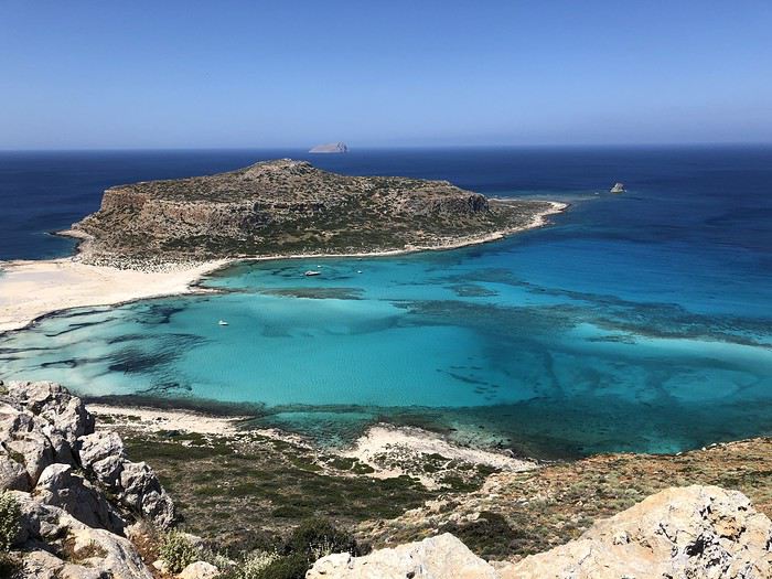
Présentation
De la Crète je m'étais fait jusqu'à présent une idée fausse, imaginant ses côtes bétonnées et urbanisées comme celles des îles Baléares ou Canaries. J'avais par conséquent toujours écarté la destination.
Ce n'est que très récemment, sur la recommandation de deux couples d'amis (notamment Kashtin), que je me suis véritablement intéressée aux attraits de cette île grecque.
J'ai alors découvert des paysages insoupçonnés, depuis les plages du Nord baignées de soleil aux canyons déchiquetés s'ouvrant sur la côte sud tout en criques et falaises. Dans l'arrière-pays, des villages lovés au creux de belles vallées, entre collines arrondies et sommets enneigés culminant à plus de 2000 mètres. Bref de quoi contenter les amateurs de mer et de montagne que nous sommes !
C'est décidé, la Crète sera au programme de nos vacances de mai 2019.
Encore fallait-il déterminer si en quinze jours notre circuit devait englober toute l'île ou seulement une partie. De façon générale, notre philosophie étant d'en voir moins mais mieux, le choix s'est rapidement imposé, nous n'en parcourrons qu'une partie.
Oui mais… l'Est ou l'Ouest ?
C'est le blog de Viinz qui m'a définitivement convaincue, ce sera l'Ouest !
M'inspirant très largement du récit susmentionné à la fois pour le choix des étapes, des lieux d'hébergement et des activités, j'établis le planning suivant, nous permettant de rayonner depuis cinq bases en faisant la part belle aux randonnées sur le littoral et dans l'arrière-pays. 4 nuits près de Kissamos 4 nuits près de Sougia 3 nuits près de Chania 3 nuits près de Chora Sfakion 2 nuits au sud de Rethymnon
Au final, un parcours tout en zigzags dont on se rend encore mieux compte sur une carte.
Le vol est réservé auprès de la compagnie Transavia par l'intermédiaire de laquelle nous retenons également une petite voiture auprès d'un loueur local, Sur Price, en espérant néanmoins de ne pas avoir de mauvaise surprise. 😉
Voilà tout est prêt ! Il ne reste plus qu'à vérifier sur le terrain la pertinence de nos choix.
Départ le 9 mai, retour le 25 mai 2019.
Lauriers roses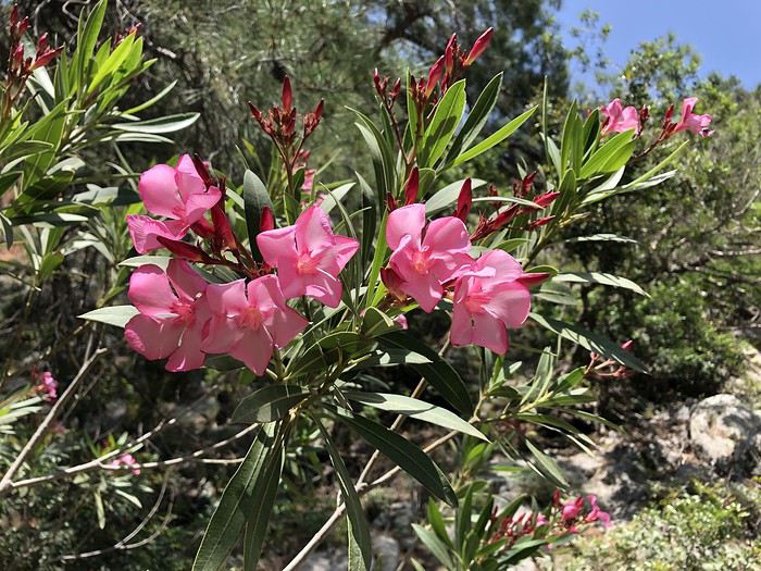
Arrivée en Crète et route vers l'Ouest J1 : Jeudi 9 mai 2019
Après un départ matinal de Paris-Orly (6 heures du mat'), Transavia nous offre le luxe d'atterrir à 10 h 10 à Héraklion, avec trente minutes d'avance sur l'horaire prévu. Des minutes précieuses qui vont nous permettre de récupérer dans la foulée bagages et voiture.
Comme craint, le loueur Sur Price veut d'abord nous refourguer un véhicule sale aux phares complètement dépolis et jaunis. Nous refusons fermement et finissons par avoir une Skoda un peu moins pourrie que la précédente mais pas de première jeunesse non plus (73000 kilomètres au compteur). Elle s'avérera néanmoins très agréable à conduire.
A peine cinquante minutes après notre atterrissage, nous voilà déjà prêts à prendre la route. 180 kilomètres nous séparent de notre destination du soir dans la région de Kissamos.
Attendus sur place vers 16 heures, nous avons tout le temps de flâner et prévoyons de ce fait une halte à mi-distance, à Rethymnon.
Par conséquent cap à l'ouest par la E75 sur un parcours tout en couleurs entre les bas-côtés fleuris de lauriers roses et de genêts, le flanc des collines recouvertes d'oliviers, le bleu de la mer quand la route s'en rapproche et, sur le toit de l'île, les sommets encore enneigés des Montagnes blanches.
Côté conduite, il faut immédiatement se faire au mode local qui consiste, sur les routes à double sens, à se rabattre sur la voie d'arrêt d'urgence quand un véhicule plus rapide souhaite doubler.
Les nombreux petits oratoires sur le bord des routes ont-ils un lien avec cette conduite fantaisiste ?
Après une heure et quart de trajet, la pause à Réthymnon est bienvenue, avec une assiette de calamars frits dégustés en bord de mer suivie d'une petite balade dans le port vénitien jusqu'au phare construit par les Turcs au XVIe siècle.
Ainsi requinqués, c'est reparti pour une heure trente de plus. Arrivés à 15 h 30, nous nous accordons une demi-heure pour faire quelques courses avant de donner rendez-vous à la propriétaire qui doit nous conduire à notre "Cretan Home".
Dans l'arrière-pays de Kissamos, à Lousakies, au bout d'un chemin de terre, au milieu de champs d'oliviers, voici notre pied-à-terre pour les quatre prochaines nuits. On ne peut trouver plus perdu comme endroit !
L'intérieur est rustique, un peu humide en ce début de saison, mais le cadre est superbe et nous sommes les seuls occupants.
Un environnement dont on va quand même s'arracher en fin d'après-midi, histoire d'aller voir la mer. En passant par Kissamos, on découvre sa situation privilégiée, étagée sur plusieurs niveaux jusqu'à l'océan.
En revanche, petite déception à Falassarna où un vent fort et une mer agitée ne nous permettent pas d'apprécier à sa juste valeur la longue plage sablonneuse, réputée pour être l'une des plus belles de l'Ouest crétois.
Bah, on va se rattraper dans les deux jours à venir avec les magnifiques lagons d'Elafonissi et de Balos !
Distance parcourue dans la journée : 210 kilomètres
Petit oratoire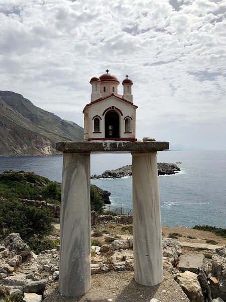
Plages d'Elafonissi et Kedrodasos J2 : Vendredi 10 mai 2019
Parmi les points d'intérêt de cette région de l'Ouest figure l'incontournable plage d'Elafonissi qui se trouve à 44 kilomètres de notre camp de base, soit une heure par l'itinéraire le plus rapide. Pour y arriver, deux possibilités, soit par la route de l'intérieur, soit par celle de la côte. Nous décidons d'emprunter la première à l'aller et la seconde au retour.
Censé être le trajet le plus direct, sur un axe principal indiqué en rouge sur notre carte, il ne s'avérera pas aussi rapide que prévu. Nous l'expérimenterons à de nombreuses reprises en Crète, les chaussées sont souvent abîmées, avec des travaux en cours suite à des affaissements ou des éboulements.
Si l'on y ajoute les arrêts pour profiter de quelques points d'intérêt, toute (ou presque) la matinée y passe.
Avec l'entrée dans les gorges de Topolia, la route, grimpant jusqu'à 561 mètres d'altitude entre parois orangées et canyon verdoyant, devient panoramique, offrant mille occasions de s'arrêter pour le cadre et la vue.
Plus loin, quand notre itinéraire rejoint le bord de mer, c'est un monastère haut perché qui retient notre attention. C'est au terme de 98 marches que nous accédons à Moni Chrysoskalitissas, vieux de mille ans, dont le nom signifie "escalier d'or".
Nous n'avons pas trouvé la marche en or (elle ne serait visible qu'aux croyants à l'âme pure !) mais en revanche une magnifique mosaïque composée de deux paons réunis autour d'un calice.
Depuis l'esplanade au sommet du monastère, nous avons surtout apprécié la vue sur une belle crique rocheuse aux eaux turquoise qui donnent très envie d'y faire immédiatement un plongeon. Alors quand est-ce qu'on se baigne ?
Pour l'instant poursuivons cinq kilomètres de plus jusqu'au rivage d'Elafonissi au bout duquel l'île du même nom forme un étroit isthme de sable blanc créant une double plage de toute beauté.
L'endroit attire en saison une foule de visiteurs friands de transats et de parasols. Aujourd'hui la pression est toute relative, d'autant qu'un vent froid balaie les dunes, nous obligeant à enfiler pulls et coupe-vents et à repousser aux calendes grecques nos envies de baignade.
Alors ce n'est pas tant pour fuir les touristes que pour nous réchauffer que nous prenons la direction de l'est pour une petite marche de cinq kilomètres aller/retour vers la plage de Kedrodasos.
Nous suivons le sentier E4, une sorte de GR traversant l'île d'ouest en est que nous aurons l'occasion de croiser maintes fois par la suite, entre rocailles et garrigue fleurie.
Kedro signifie "cèdre" en grec ou plus justement genévrier. Quelques spécimens tortueux jalonnent le parcours.
Ici ni transat ni parasol, mais un croissant de sable blanc rose ourlé de genévriers auquel des dalles rocheuses lisses offrent un accès facile à l'eau.
Nous n'y tremperons pourtant pas plus que les orteils.
C'est sur la route du retour, non loin du monastère visité ce matin, que nous trouvons enfin les conditions idéales pour nous immerger.
Voulolimni, un ancien cratère ceinturé de rochers formant un petit lac salé, n'est pas à proprement parler une plage mais une sorte de piscine naturelle pour les habitants du coin. C'est le moment ou jamais : l'endroit est à nous tout seuls, abrité du vent, l'eau calme, le bain frais mais revigorant. Un bon coup de fouet pour la fin de l'après-midi !
Car pour le retour, une variante plus longue qu'à l'aller, à la fois en durée et en distance, nous attend. A Kefali, nous optons pour un itinéraire entre mer et montagne passant par des villages parmi les plus pittoresques et les moins visités de l'ouest de la Crète. Réputée pour ses oliviers et ses châtaigniers, la région est l'une des plus verdoyantes et des plus fertiles de l'île.
Un parcours magnifique, quand soudain au détour d'un virage, peu avant Keramoti, la route est coupée suite à un gigantesque éboulement, nous obligeant à rebrousser chemin jusqu'à Kefali pour reprendre le trajet classique via Topolia comme à l'aller.
Malgré ce léger contretemps, la journée a été une réussite. Coup d'œil sur une gorge, visite d'un monastère, balade sur une plage de rêve, passage par des villages pittoresques et sur des routes panoramiques : voilà un concentré de Crète dont il ne nous reste plus qu'à dérouler le programme en détail dans la suite de notre séjour.
Nous espérons finir la journée en beauté par un bon dîner au restaurant. Mauvaise pioche, repas sans intérêt dans l'une des tavernes du centre-ville de Kissamos.
Distance parcourue dans la journée : 160 kilomètres
Elafonissi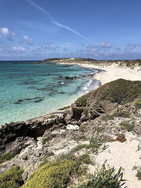
Péninsules de Gramvoussa et Rodopos, du lagon de Balos au sentier côtier de Nopigia J3 : Samedi 11 mai 2019
Encore une plage d'exception à notre programme, à 20 kilomètres seulement de notre hébergement. Mais pas la porte à côté quand même car il faut compter une bonne heure de trajet.
En effet, le lagon de Balos, situé sur la péninsule de Gramvoussa, à la pointe nord-ouest de la Crète, n'est accessible que par un chemin carrossable très accidenté de 12 kilomètres débutant après le village de Kalyviani où l'on s'acquitte d'un petit droit de passage.
La piste peu roulante traverse sur son flanc Est la presqu'île inhabitée, couverte d'une garrigue clairsemée, qui s'étire dans la mer Egée tel un doigt tendu.
Cahin caha, elle mène à un parking garni de trois ou quatre véhicules seulement à cette heure pourtant pas si matinale, il est 10 heures.
Pour l'instant, c'est le mont Geroskinos qui retient notre attention. Le lagon n'est pas encore visible à ce stade. Il reste à parcourir à pied un peu plus d'un kilomètre sur 155 mètres de dénivelé pour atteindre le bord de mer.
Mais un quart d'heure plus tard, arrivés à un point de vue, c'est déjà le choc ! En face de nous, le cap Tigani recouvert d'une falaise tabulaire aux allures de poêle à frire (tigani = poêle) relié à la péninsule par un isthme (le manche de la poêle) délimitant une lagune aux cinquante nuances de turquoise bordée de deux magnifiques croissants de plage.
Le spectacle est continu tout au long du sentier maintenant en escalier descendant jusqu'aux dunes et au rivage.
Arrivés au bord de l'eau, avec à peine une dizaine de personnes sur le site, ce n'est pas encore la foule. L'eau cristalline nous invite à la baignade, même si elle est plus fraîche que la veille à Voulolimni. Les transats et les parasols nous tendent aussi les bras pour un petit moment de farniente, néanmoins payant même en ce début de saison.
Mais plus l'heure tourne plus les touristes se font nombreux.
11 h 30, il est temps pour nous de lever le camp. La file des visiteurs est maintenant continue sur le sentier, l'aire de stationnement pleine à craquer et les voitures à la queue leu leu sur la piste.
Les seules à apprécier tout ce monde, ce sont les chèvres qui ont pris leurs quartiers sur, sous et près des voitures sur le parking.
Nous mettons alors le cap vers la péninsule voisine de Rodopos, beaucoup moins prisée. C'est là que j'ai retenu la randonnée n°3 du guide Rother, reliant le camping de Nopigia à la plage de Ravdoucha.
Le sentier côtier rocailleux va rapidement prendre de la hauteur, nous livrant de très belles vues de la baie de Kissamos jusqu'à la péninsule de Gramvoussa (où nous étions ce matin) juste en face.
Si les pentes sont majoritairement recouvertes de xérophytes épineux en coussinets, nous y trouvons aussi des cistes de Crète (Cistus creticus), reconnaissables à leur air un peu froissé, ainsi que de majestueuses serpentaires, des plantes de la famille des aracées pouvant atteindre un mètre de haut.
Au bout d'une heure et demie, on finit par apercevoir en contrebas le but de notre randonnée, le long embarcadère de Ravdoucha auprès duquel sont regroupées quelques maisons.
Maintenant à nos pieds la plage de galets de Ravdoucha où se trouve aussi la taverne Wave on the Rocks, but ultime de notre balade.
Des promeneurs nous ayant prévenus que l'établissement était fermé, inutile de pousser aussi loin, la tonnelle ombragée de cette autre adresse fera tout autant l'affaire pour nous désaltérer avant le retour par le même itinéraire.
En cours de route, nous ramassons quelques tiges de roseaux pour faire office de bâtons de marche, ayant oublié les nôtres en France.
Retour à Lousakies au terme d'une journée encore bien remplie.
Distance parcourue dans la journée : 60 kilomètres.
Lagon de Balos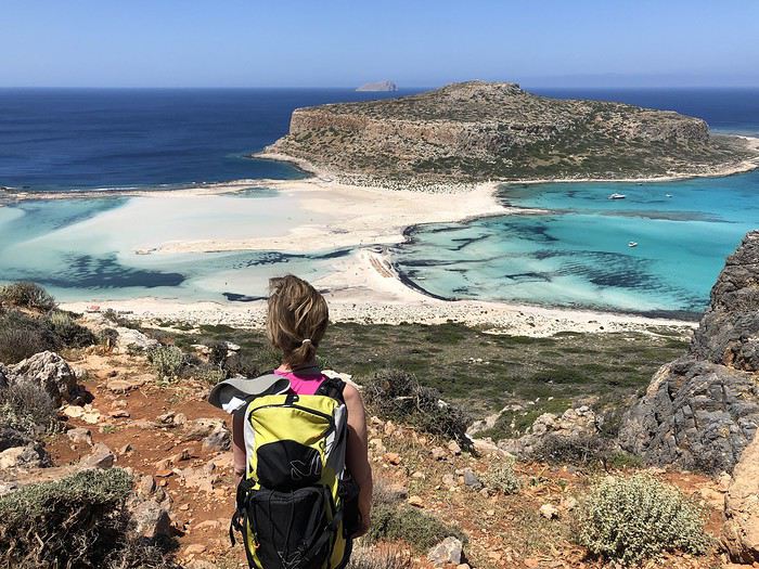
Des gorges de Sirikari au site antique de Polyrinia J4 : Dimanche 12 mai 2019
En dehors du littoral, les paysages caractérisant le mieux l'arrière-pays crétois sont les gorges, dont les plus célèbres, les gorges de Samaria, figurent bien sûr à notre programme par la suite.
Aujourd'hui, pour nous mettre en jambe, nous avons retenu un objectif plus modeste et moins couru, la gorge de Tsichliana, dont le point de départ se situe à proximité de Sirikari, à une vingtaine de kilomètres de "notre maison crétoise".
Il s'agit de la randonnée n°5 du guide Rother, indiquée en bleu, donc facile, avec 300 mètres de dénivelé pour 7 kilomètres et 2 h 45 AR que nous prévoyons de "muscler" un peu en lui ajoutant une extension jusqu'au site antique de Polyrinia.
Mais avant de rallier Sirikari, petit détour jusqu'à Potamida afin de découvrir ces étonnantes cheminées de fée plantées au beau milieu des champs. Avec leurs robes évasées et pelées, elles détonnent dans ce paysage par ailleurs très vert.
Poursuite donc vers les gorges de Sirikari noyées elles aussi dans la verdure !
A partir de la chapelle Agios Constantinos où nous avons garé notre voiture, nous descendons dans une pente d'abord escarpée puis plus douce en prenant soin de refermer derrière nous le portail de plusieurs enclos.
Nous ne tardons pas à arriver à un torrent dont on entend le grondement bien avant d'apercevoir le cours d'eau.
Nous suivons alors la rivière, à l'ombre d'une grande variété d'arbres (platanes, érables, figuiers, arbousiers et oliviers), sur un ancien sentier muletier bien tracé. A défaut de mules 😛 ce sont une chèvre et son petit qui nous ouvrent la voie.
Moins d'une heure après notre départ apparaissent les premières falaises orangées au-dessus desquelles tournoie une armada de vautours.
Peu après, nous atteignons le point le plus étroit des gorges, juste avant une aire de pique-nique récemment restaurée grâce aux fonds de l'Union européenne.
Le plus beau passage de la gorge de Tsichliana est à présent derrière nous. La randonnée initiale se termine quelques centaines de mètres plus loin, sur un ancien pont à arches.
A partir de là, nous prolongeons notre balade d'une heure supplémentaire jusqu'à Polyrinia, tantôt par un chemin carrossable, tantôt par la route
Sur les coups de midi, nous atteignons le village fortifié au sommet duquel se trouvent de modestes vestiges d'une acropole antique.
Mais plus que les ruines, c'est la vue, à la fois sur la montagne, sur la vallée et jusqu'à la mer, qui vaut principalement le détour, sans oublier les ombrelles jaunes des férules qui illuminent le tableau.
Après deux jus d'orange pressée chacun (il faut bien ça pour recharger les batteries), un pique-nique à l'ombre d'une chapelle, une trempette de pieds dans le torrent, nous espérons être d'attaque pour juguler la remontée sportive entre la rivière Tsichliana et le parking sous le soleil accablant de ce début d'après-midi.
Les cent derniers mètres de dénivelé sont harassants, mais heureusement à l'ombre. Des clémentines bien juteuses nous attendent dans la glacière de la voiture, j'en salive d'avance ! Nous pouvons enfin les déguster peu après 15 heures.
Fin d'une randonnée de 14 km AR avec 450 mètres de dénivelé en 4 heures (sans les pauses), dans un site moins prestigieux que les jours précédents, dans des gorges de taille modeste (par rapport à d'autres à découvrir plus tard) mais grâce à la présence de nombreuses fleurs sauvages, un très beau parcours tout de même et surtout un bel entraînement pour les randonnées à venir.
Pour finir la journée, j'aurais aimé explorer la portion de route au nord de Keramoti, là où nous avions trouvé la voie coupée il y a quelques jours. Mais pour y arriver, le GPS nous a fait errer dans des routes sans issue ou se transformant en piste, ce qui est très fréquent en Crète. De guerre lasse, nous décidons de retourner à Kissamos par le même itinéraire que ce matin pour finir la journée sur notre terrasse.
Demain nous partons vers d'autres horizons !
Distance parcourue dans la journée : 70 kilomètres.
Vue depuis l'acropole de Polyrinia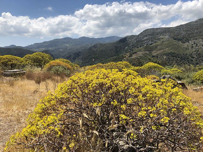
Autour de Sougia, de l'antique Lissos à la grotte de Polifimos J5 & J6 : Lundi 13 et mardi 14 mai 2019
Ça y est, notre séjour près de Kissamos s'achève, avec des souvenirs déjà plein la tête.
Dès 9 heures, nous faisons route vers notre étape suivante, située sur la côte sud, près de Sougia. Passage par Kissamos et Topolia que nous commençons à bien connaître. Après Mili, la route s'élève jusqu'à 850 mètres, toisant de haut les champs d'éoliennes qui tournent à plein régime, un étage plus bas.
Le vent est aussi au rendez-vous sur la côte, ce qui empêche les températures de dépasser la vingtaine de degrés malgré un soleil généreux.
Sur les coups de 11 heures, au terme d'une soixantaine de kilomètres, nous voici arrivés à Moni (qui signifie "monastère"), à 4 petits kilomètres de Sougia et du bord de mer.
Et c'est justement dans la Monastery Guesthouse que nous avons réservé les quatre nuits suivantes. Construit en pierre et en bois, l'établissement comprend des chambres d'hôtel flambant neuves très récemment ouvertes et, dans la partie plus ancienne, des appartements alliant matériaux traditionnels (parquets, poutres apparentes) et éléments de décoration modernes. Un style rustique chic qui nous séduit immédiatement !
Depuis notre terrasse, la vue donne sur le massif des Lefka Ori au cœur duquel se trouve le plateau d'Omalos, point de départ des gorges de Samaria, que nous avons bien l'intention de parcourir prochainement. Notre hôtesse nous prévient que le canyon est encore fermé, mais que son ouverture devrait intervenir d'un jour à l'autre. A suivre donc !
En attendant, c'est le bord de mer que nous souhaitons découvrir, en randonnant de Sougia à Lissos, une baie uniquement accessible à pied ou avec un petit bateau. La randonnée correspond à l'itinéraire 16 du guide Rother.
Il est 13 h 45 quand nous commençons notre balade dans le port de Sougia alors que la plupart des promeneurs sont déjà sur le chemin du retour.
Après contournement de quelques gros rochers et de plusieurs passages étroits, nous arrivons rapidement dans la gorge de Lissos, sauvage et romantique, avec ses jolis massifs de lauriers roses en guise de haie d'honneur.
C'est par un ancien chemin muletier que nous accédons ensuite à un large plateau couvert d'une garrigue très odorante. Au loin, quelques névés font de la résistance sur les bien nommées montagnes Blanches.
Bientôt, la petite baie de Lissos est à portée de vue.
Mais qu'on ne s'y trompe pas, il y a 120 mètres de dénivelé entre le haut du plateau et la plage. Le début de la descente est marqué d'un drapeau grec peint sur la falaise en guise de repère.
Une fois arrivés, la plage de galets est moins accueillante qu'elle n'y paraissait d'en haut. En tout cas, il n'est pas question de se baigner, la mer est beaucoup trop agitée.
Cela nous laisse le temps d'explorer les alentours, notamment le site archéologique de l'antique Lissos mis à jour dans les années 1950. En effet, dans cette vallée, loin de tout, se trouvait jadis, à la basse époque hellénistique, une station thermale. Des mosaïques à formes géométriques et motifs d'oiseaux témoignent de ce passé révolu.
Il reste à nous coltiner la remontée, moins pénible qu'escomptée. Quand on aperçoit le drapeau grec peint sur la paroi, la partie est gagnée. Il ne reste alors qu'à retraverser le plateau et la gorge.
Pour les plus endurants qui souhaiteraient faire une boucle, il est possible de combiner les itinéraires 16 et 17 du Rother, c'est-à-dire qu'une fois de retour au niveau de la gorge il faut remonter sur un autre plateau pour arriver à Sougia par le haut.
Nous, on se contente des 7,4 kilomètres effectués en 3 heures, pauses comprises, avec 310 mètres de dénivelé. Il faut garder des forces pour les prochains jours !
Demain, justement, nous avons réservé une dépose en bateau au cap Tripiti pour un retour à pied de 8 kilomètres et un dénivelé de 850 mètres entre le cap et Sougia… si Dieu le veut !
En attendant, dîner sur notre terrasse dans ce magnifique cadre des montagnes Blanches. Petite pluie en soirée.
Distance parcourue dans la journée : 80 kilomètres
Le lendemain…
Un ciel couvert, quelques gouttes de pluie et surtout une mer agitée conduisent le Captain George à annuler la sortie en bateau, alors que nous sommes sur le point de quitter notre hôtel à 8 heures.
Zut, il faut trouver une alternative au pied levé !
L'aller-retour entre Sougia et le cap Tripiti, représentant plus de 15 kilomètres en 6 heures et demie de marche avec 850 mètres de dénivelé à la montée et à la descente, nous semble inenvisageable.
Notre hôtesse nous suggère d'en parcourir une partie et de faire demi-tour dès qu'il nous plaira.
Nous suivons partiellement sa recommandation. Néanmoins, après avoir consulté notre documentation et afin de nous fixer un but, nous décidons de nous inspirer de l'itinéraire 19 du guide Rother en le limitant à un aller-retour entre Sougia et la grotte de Polifimos.
8 h 20, ça y est, c'est parti en direction du cap Tripiti sur un parterre fleuri en surplomb de la mer.
Au bout d'une heure et quart environ, nous quittons l'itinéraire menant au cap pour grimper dans les hauteurs tout en profitant de larges vues sur toute la côte Sud.
A l'approche de la cavité, gare au cheval de mer géant qui en défend l'entrée 😉 Ouf, totalement inoffensif, il nous laisse investir les lieux. L'intérieur est très vaste et garni de nombreuses concrétions.
C'est là, selon la légende, que vivait le cyclope Polyphème, un berger qui aurait capturé Ulysse et ses compagnons et aurait dévoré plusieurs hommes. Ulysse a fini par enfoncer un pieu en bois dans l'œil du cyclope pendant son sommeil et est parvenu à s'enfuir.
Après une petite pause, nous laissons la grotte mythique derrière nous pour être de retour à Sougia sur les coups de midi, à l'issue d'un parcours d'une douzaine de kilomètres en 3 heures 45 et 280 mètres de dénivelé.
Au final, une chouette balade alliant panorama, géologie et mythologie, une alternative intéressante pour qui ne veut pas aller jusqu'au cap Tripiti.
Le ciel de plus en plus bas n'incite guère à sortir dans l'après-midi, sauf pour explorer brièvement les alentours et le village de Moni.
En soirée, dîner à la taverne Rebetika à Sougia… bof, pas terrible !
Distance parcourue dans la journée : 23 kilomètres.
Vers Lissos
Autour de Sougia, des gorges de Figou à la ville de Paleochora J7 : Mercredi 15 mai 2019
Initialement, nous avions prévu de prendre le bus à 7 heures du matin jusqu'au village de Agia Irini. De là, nous voulions combiner les itinéraires 20 et 21 du guide Rother, à savoir parcourir les gorges de Figou puis enchaîner avec celles d'Agia Irini pour arriver à Moni (4 à 5 heures de marche en aller simple).
Mais une météo incertaine va une nouvelle fois contrarier nos plans et limiter nos ambitions.
Nous finissons par prendre la direction du village d'Agia Irini, mais en voiture et à 10 heures du matin seulement, après moult hésitations. Il fait 17 degrés à Sougia mais seulement 9 à Agia Irini avec de petites averses. Brr !
Dans ces conditions, nous faisons une croix sur les gorges d'Agia Irini, nous contentant de la petite boucle de 2 heures à travers la gorge de Figou.
Figou signifie "fuite" et fait référence à un événement survenu en 1821, date à laquelle un grand nombre de femmes et d'enfants ont trouvé refuge ici pour être à l'abri des Turcs.
Tout comme l'ont sans doute fait les réfugiés de l'époque, nous suivons un ancien kalderimi (sentier muletier) qui monte en douceur vers un col à 842 mètres.
Mais contrairement aux fugitifs de l'époque, nous prenons tout le temps d'admirer la vue très dégagée sur les pentes environnantes couvertes d'anciennes terrasses.
C'est en nous retournant pour évaluer la distance parcourue que nous réalisons le travail titanesque des Anciens pour soutenir et empierrer cette voie.
Changement de décor après le col alors que nous amorçons la descente dans une cuvette qui se rétrécit petit à petit, comme un entonnoir. Le sentier parfois accidenté se faufile alors au milieu de gros rochers rendus glissants par une petite pluie fine.
Près des ruines d'un ancien poste de garde des résistants crétois, nous débouchons à l'entrée des gorges d'Agia Irini. S'il avait fait beau, nous aurions poursuivi dans ces dernières, mais vu la météo, nous préférons en rester là et fermer la boucle en revenant à notre point de départ.
Comme prévu, nous avons mis deux heures pour effectuer ces 5,1 kilomètres avec 300 mètres de dénivelé, dans des gorges très jolies et très peu fréquentées.
La météo se dégrade encore un peu plus dans l'après-midi. Qu'en est-il 15 kilomètres plus à l'est ? Pas mieux ! C'est sous une petite pluie persistante que nous visitons Paleochora.
Le soleil fait néanmoins son retour en soirée, ce qui est de bon augure pour demain. Notre hôtesse nous annonce que les gorges de Samaria viennent d'ouvrir. Parfait !
Distance parcourue dans la journée : 92 kilomètres.
Gorges de Figou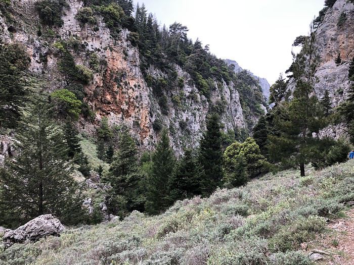
Des gorges de Samaria au fort turc d'Agia Roumeli J8 : Jeudi 16 mai 2019
Les gorges de Samaria constituent un incontournable de la Crète, mais de par leur situation au centre de l'île il n'est pas facile de les intégrer à un circuit. En effet, il s'agit d'un parcours linéaire de 16 kilomètres de long avec 1200 mètres de dénivelé entre le plateau d'Omalos au cœur des Montagnes blanches et la petite localité d'Agia Roumeli sur la côte sud qui, elle, n'est pas reliée au réseau routier.
Il faut par conséquent prévoir des liaisons en bus et/ou en ferry pour atteindre l'une ou l'autre des extrémités du parcours.
Depuis Sougia par exemple, il est possible de prendre un bus à 7 heures du matin qui arrive vers 9 heures à Xyloskalo, l'entrée du parc national de Samaria. La descente à pied jusqu'au bord de mer prend 5 à 7 heures. Pour le retour, il faut prendre en fin de journée le ferry entre Agia Roumeli et Sougia.
On pourrait aussi rejoindre Xyloskalo en voiture, mais dans ce cas c'est pour le retour qu'il faut enchaîner ferry (entre Agia Roumeli et Sougia) et bus (de Sougia à Xyloskalo).
Ces solutions sont valables si l'on veut faire l'intégralité des 16 kilomètres de descente.
Car il existe aussi une version "allégée" des gorges de Samaria qui consiste à les remonter depuis la mer entre Agia Roumeli et les Portes de Fer, soit la partie la plus belle, en deux heures environ l'aller-retour. Dans ce cas, pour rejoindre Agia Roumeli, inutile de partir très tôt, un ferry au départ de Sougia à 9 h 15 atteint Agia Roumeli une heure plu tard.
C'est l'option que nous avons retenue. Nous la complèterons avec une extension vers les ruines d'une forteresse turque dominant la baie d'Agia Roumeli. Cela correspond à la combinaison des parcours 22 et 23 du guide Rother.
La journée commence par conséquent par une merveilleuse promenade en bateau le long de la côte, entre Sougia et Agia Roumeli via le cap Tripiti, l'occasion pour nous de revoir depuis la mer les paysages de falaises que nous avons arpentées hier.
Arrivés à Agia Roumeli, nous nous dirigeons rapidement vers un torrent mugissant que nous suivrons jusqu'à l'entrée du parc national. A cette heure, la plupart des randonneurs en provenance de Xyloskalo sont encore dans les hauteurs. Nous profitons donc de ce calme relatif avant leur arrivée en nombre, en général à partir de midi.
Une fois dans le parc, nous franchissons à plusieurs reprises le cours d'eau bordé de lauriers roses, de pins de Calabre et de cyprès sur des passerelles rudimentaires. Le débit et la hauteur de l'eau à peine inférieure à celle des passerelles expliquent sans doute pourquoi l'accès n'est possible que depuis un jour ou deux.
Au fil de notre progression, les parois du canyon se rapprochent.
C'est sur un chemin de planches que nous franchissons les Portes de Fer, ce passage où le lit de la rivière ne fait plus que trois mètres de large entre des parois verticales s'élevant jusqu'à 300 mètres de haut. Impressionnant !
Néanmoins, il est un peu tôt pour profiter de l'éclairage optimal de la gorge. En attendant que le soleil arrive au zénith, nous poursuivons vers l'amont jusqu'à l'aire de repos de Christos et encore un peu plus loin.
Là, devant les eaux turquoise de la rivière, tout en dégustant nos sandwichs, nous observons avec amusement le profil des randonneurs qui commencent à arriver à la queue leu leu depuis les hauteurs de Xyloskalo. Nous leur emboîtons le pas pour revenir aux Portes de Fer et assister maintenant à l'entrée progressive du soleil dans le canyon.
Pour le moment, ce sont deux mules qui jouent les vedettes, remontant le cours d'eau afin d'offrir leur assistance à quelque marcheur épuisé.
Ça y est, il est presque 13 heures, la lumière inonde à présent la gorge. Nous tournons alors le dos aux Portes de Fer pour quitter le canyon, mais contrairement à la quasi-totalité des randonneurs impatients de rallier l'embarcadère au plus vite après 16 kilomètres dans les jambes et dans les genoux, nous profitons de notre relative fraîcheur pour amorcer une extension dans les hauteurs.
Pour ce faire, nous grimpons à flanc de montagne en direction d'un fort en ruines, 220 mètres au-dessus de la mer.
Plus on monte, plus la vue sur la zone de l'embouchure des gorges de Samaria est belle. Elle devient encore plus spectaculaire un étage plus haut quand nous atteignons la crête rocheuse d'où quelques pas nous séparent de la forteresse du Kastro.
Depuis les vestiges du fort, on contemple Agia Roumeli et sa longue plage de galets à nos pieds.
En revanche, la descente sur le versant opposé dans un éboulis rocheux est raide et délicate. Pas le temps de lever le nez sous peine de se tordre une cheville !
Les ferrys sont déjà ancrés dans le port, même si leur départ n'est prévu qu'à 17 h 30. De retour à l'embarcadère vers 15 h 30, nous avons tout loisir de flâner dans le village, de passer du café au glacier, de la plage au port, sans oublier baignade et bain de soleil.
Une magnifique journée qui se termine par une ultime promenade en bateau.
Notre séjour dans la région de Sougia s'achève avec un bilan toujours très enthousiaste.
Distance parcourue dans la journée : 12 kilomètres.
Portes de Fer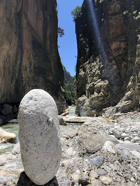
La suite se trouve dans le post 2 !
Le récit complet avec toutes les photos et cartes se trouve ici :
sites.google.com/...abuleuxvoyagescrete/
Ci-dessous le texte accompagné d'une sélection de photos.
Bonne découverte ! 🙂
Présentation
De la Crète je m'étais fait jusqu'à présent une idée fausse, imaginant ses côtes bétonnées et urbanisées comme celles des îles Baléares ou Canaries. J'avais par conséquent toujours écarté la destination.
Ce n'est que très récemment, sur la recommandation de deux couples d'amis (notamment Kashtin), que je me suis véritablement intéressée aux attraits de cette île grecque.
J'ai alors découvert des paysages insoupçonnés, depuis les plages du Nord baignées de soleil aux canyons déchiquetés s'ouvrant sur la côte sud tout en criques et falaises. Dans l'arrière-pays, des villages lovés au creux de belles vallées, entre collines arrondies et sommets enneigés culminant à plus de 2000 mètres. Bref de quoi contenter les amateurs de mer et de montagne que nous sommes !
C'est décidé, la Crète sera au programme de nos vacances de mai 2019.
Encore fallait-il déterminer si en quinze jours notre circuit devait englober toute l'île ou seulement une partie. De façon générale, notre philosophie étant d'en voir moins mais mieux, le choix s'est rapidement imposé, nous n'en parcourrons qu'une partie.
Oui mais… l'Est ou l'Ouest ?
C'est le blog de Viinz qui m'a définitivement convaincue, ce sera l'Ouest !
M'inspirant très largement du récit susmentionné à la fois pour le choix des étapes, des lieux d'hébergement et des activités, j'établis le planning suivant, nous permettant de rayonner depuis cinq bases en faisant la part belle aux randonnées sur le littoral et dans l'arrière-pays. 4 nuits près de Kissamos 4 nuits près de Sougia 3 nuits près de Chania 3 nuits près de Chora Sfakion 2 nuits au sud de Rethymnon
Au final, un parcours tout en zigzags dont on se rend encore mieux compte sur une carte.
Le vol est réservé auprès de la compagnie Transavia par l'intermédiaire de laquelle nous retenons également une petite voiture auprès d'un loueur local, Sur Price, en espérant néanmoins de ne pas avoir de mauvaise surprise. 😉
Voilà tout est prêt ! Il ne reste plus qu'à vérifier sur le terrain la pertinence de nos choix.
Départ le 9 mai, retour le 25 mai 2019.
Lauriers roses
Arrivée en Crète et route vers l'Ouest J1 : Jeudi 9 mai 2019
Après un départ matinal de Paris-Orly (6 heures du mat'), Transavia nous offre le luxe d'atterrir à 10 h 10 à Héraklion, avec trente minutes d'avance sur l'horaire prévu. Des minutes précieuses qui vont nous permettre de récupérer dans la foulée bagages et voiture.
Comme craint, le loueur Sur Price veut d'abord nous refourguer un véhicule sale aux phares complètement dépolis et jaunis. Nous refusons fermement et finissons par avoir une Skoda un peu moins pourrie que la précédente mais pas de première jeunesse non plus (73000 kilomètres au compteur). Elle s'avérera néanmoins très agréable à conduire.
A peine cinquante minutes après notre atterrissage, nous voilà déjà prêts à prendre la route. 180 kilomètres nous séparent de notre destination du soir dans la région de Kissamos.
Attendus sur place vers 16 heures, nous avons tout le temps de flâner et prévoyons de ce fait une halte à mi-distance, à Rethymnon.
Par conséquent cap à l'ouest par la E75 sur un parcours tout en couleurs entre les bas-côtés fleuris de lauriers roses et de genêts, le flanc des collines recouvertes d'oliviers, le bleu de la mer quand la route s'en rapproche et, sur le toit de l'île, les sommets encore enneigés des Montagnes blanches.
Côté conduite, il faut immédiatement se faire au mode local qui consiste, sur les routes à double sens, à se rabattre sur la voie d'arrêt d'urgence quand un véhicule plus rapide souhaite doubler.
Les nombreux petits oratoires sur le bord des routes ont-ils un lien avec cette conduite fantaisiste ?
Après une heure et quart de trajet, la pause à Réthymnon est bienvenue, avec une assiette de calamars frits dégustés en bord de mer suivie d'une petite balade dans le port vénitien jusqu'au phare construit par les Turcs au XVIe siècle.
Ainsi requinqués, c'est reparti pour une heure trente de plus. Arrivés à 15 h 30, nous nous accordons une demi-heure pour faire quelques courses avant de donner rendez-vous à la propriétaire qui doit nous conduire à notre "Cretan Home".
Dans l'arrière-pays de Kissamos, à Lousakies, au bout d'un chemin de terre, au milieu de champs d'oliviers, voici notre pied-à-terre pour les quatre prochaines nuits. On ne peut trouver plus perdu comme endroit !
L'intérieur est rustique, un peu humide en ce début de saison, mais le cadre est superbe et nous sommes les seuls occupants.
Un environnement dont on va quand même s'arracher en fin d'après-midi, histoire d'aller voir la mer. En passant par Kissamos, on découvre sa situation privilégiée, étagée sur plusieurs niveaux jusqu'à l'océan.
En revanche, petite déception à Falassarna où un vent fort et une mer agitée ne nous permettent pas d'apprécier à sa juste valeur la longue plage sablonneuse, réputée pour être l'une des plus belles de l'Ouest crétois.
Bah, on va se rattraper dans les deux jours à venir avec les magnifiques lagons d'Elafonissi et de Balos !
Distance parcourue dans la journée : 210 kilomètres
Petit oratoire
Plages d'Elafonissi et Kedrodasos J2 : Vendredi 10 mai 2019
Parmi les points d'intérêt de cette région de l'Ouest figure l'incontournable plage d'Elafonissi qui se trouve à 44 kilomètres de notre camp de base, soit une heure par l'itinéraire le plus rapide. Pour y arriver, deux possibilités, soit par la route de l'intérieur, soit par celle de la côte. Nous décidons d'emprunter la première à l'aller et la seconde au retour.
Censé être le trajet le plus direct, sur un axe principal indiqué en rouge sur notre carte, il ne s'avérera pas aussi rapide que prévu. Nous l'expérimenterons à de nombreuses reprises en Crète, les chaussées sont souvent abîmées, avec des travaux en cours suite à des affaissements ou des éboulements.
Si l'on y ajoute les arrêts pour profiter de quelques points d'intérêt, toute (ou presque) la matinée y passe.
Avec l'entrée dans les gorges de Topolia, la route, grimpant jusqu'à 561 mètres d'altitude entre parois orangées et canyon verdoyant, devient panoramique, offrant mille occasions de s'arrêter pour le cadre et la vue.
Plus loin, quand notre itinéraire rejoint le bord de mer, c'est un monastère haut perché qui retient notre attention. C'est au terme de 98 marches que nous accédons à Moni Chrysoskalitissas, vieux de mille ans, dont le nom signifie "escalier d'or".
Nous n'avons pas trouvé la marche en or (elle ne serait visible qu'aux croyants à l'âme pure !) mais en revanche une magnifique mosaïque composée de deux paons réunis autour d'un calice.
Depuis l'esplanade au sommet du monastère, nous avons surtout apprécié la vue sur une belle crique rocheuse aux eaux turquoise qui donnent très envie d'y faire immédiatement un plongeon. Alors quand est-ce qu'on se baigne ?
Pour l'instant poursuivons cinq kilomètres de plus jusqu'au rivage d'Elafonissi au bout duquel l'île du même nom forme un étroit isthme de sable blanc créant une double plage de toute beauté.
L'endroit attire en saison une foule de visiteurs friands de transats et de parasols. Aujourd'hui la pression est toute relative, d'autant qu'un vent froid balaie les dunes, nous obligeant à enfiler pulls et coupe-vents et à repousser aux calendes grecques nos envies de baignade.
Alors ce n'est pas tant pour fuir les touristes que pour nous réchauffer que nous prenons la direction de l'est pour une petite marche de cinq kilomètres aller/retour vers la plage de Kedrodasos.
Nous suivons le sentier E4, une sorte de GR traversant l'île d'ouest en est que nous aurons l'occasion de croiser maintes fois par la suite, entre rocailles et garrigue fleurie.
Kedro signifie "cèdre" en grec ou plus justement genévrier. Quelques spécimens tortueux jalonnent le parcours.
Ici ni transat ni parasol, mais un croissant de sable blanc rose ourlé de genévriers auquel des dalles rocheuses lisses offrent un accès facile à l'eau.
Nous n'y tremperons pourtant pas plus que les orteils.
C'est sur la route du retour, non loin du monastère visité ce matin, que nous trouvons enfin les conditions idéales pour nous immerger.
Voulolimni, un ancien cratère ceinturé de rochers formant un petit lac salé, n'est pas à proprement parler une plage mais une sorte de piscine naturelle pour les habitants du coin. C'est le moment ou jamais : l'endroit est à nous tout seuls, abrité du vent, l'eau calme, le bain frais mais revigorant. Un bon coup de fouet pour la fin de l'après-midi !
Car pour le retour, une variante plus longue qu'à l'aller, à la fois en durée et en distance, nous attend. A Kefali, nous optons pour un itinéraire entre mer et montagne passant par des villages parmi les plus pittoresques et les moins visités de l'ouest de la Crète. Réputée pour ses oliviers et ses châtaigniers, la région est l'une des plus verdoyantes et des plus fertiles de l'île.
Un parcours magnifique, quand soudain au détour d'un virage, peu avant Keramoti, la route est coupée suite à un gigantesque éboulement, nous obligeant à rebrousser chemin jusqu'à Kefali pour reprendre le trajet classique via Topolia comme à l'aller.
Malgré ce léger contretemps, la journée a été une réussite. Coup d'œil sur une gorge, visite d'un monastère, balade sur une plage de rêve, passage par des villages pittoresques et sur des routes panoramiques : voilà un concentré de Crète dont il ne nous reste plus qu'à dérouler le programme en détail dans la suite de notre séjour.
Nous espérons finir la journée en beauté par un bon dîner au restaurant. Mauvaise pioche, repas sans intérêt dans l'une des tavernes du centre-ville de Kissamos.
Distance parcourue dans la journée : 160 kilomètres
Elafonissi
Péninsules de Gramvoussa et Rodopos, du lagon de Balos au sentier côtier de Nopigia J3 : Samedi 11 mai 2019
Encore une plage d'exception à notre programme, à 20 kilomètres seulement de notre hébergement. Mais pas la porte à côté quand même car il faut compter une bonne heure de trajet.
En effet, le lagon de Balos, situé sur la péninsule de Gramvoussa, à la pointe nord-ouest de la Crète, n'est accessible que par un chemin carrossable très accidenté de 12 kilomètres débutant après le village de Kalyviani où l'on s'acquitte d'un petit droit de passage.
La piste peu roulante traverse sur son flanc Est la presqu'île inhabitée, couverte d'une garrigue clairsemée, qui s'étire dans la mer Egée tel un doigt tendu.
Cahin caha, elle mène à un parking garni de trois ou quatre véhicules seulement à cette heure pourtant pas si matinale, il est 10 heures.
Pour l'instant, c'est le mont Geroskinos qui retient notre attention. Le lagon n'est pas encore visible à ce stade. Il reste à parcourir à pied un peu plus d'un kilomètre sur 155 mètres de dénivelé pour atteindre le bord de mer.
Mais un quart d'heure plus tard, arrivés à un point de vue, c'est déjà le choc ! En face de nous, le cap Tigani recouvert d'une falaise tabulaire aux allures de poêle à frire (tigani = poêle) relié à la péninsule par un isthme (le manche de la poêle) délimitant une lagune aux cinquante nuances de turquoise bordée de deux magnifiques croissants de plage.
Le spectacle est continu tout au long du sentier maintenant en escalier descendant jusqu'aux dunes et au rivage.
Arrivés au bord de l'eau, avec à peine une dizaine de personnes sur le site, ce n'est pas encore la foule. L'eau cristalline nous invite à la baignade, même si elle est plus fraîche que la veille à Voulolimni. Les transats et les parasols nous tendent aussi les bras pour un petit moment de farniente, néanmoins payant même en ce début de saison.
Mais plus l'heure tourne plus les touristes se font nombreux.
11 h 30, il est temps pour nous de lever le camp. La file des visiteurs est maintenant continue sur le sentier, l'aire de stationnement pleine à craquer et les voitures à la queue leu leu sur la piste.
Les seules à apprécier tout ce monde, ce sont les chèvres qui ont pris leurs quartiers sur, sous et près des voitures sur le parking.
Nous mettons alors le cap vers la péninsule voisine de Rodopos, beaucoup moins prisée. C'est là que j'ai retenu la randonnée n°3 du guide Rother, reliant le camping de Nopigia à la plage de Ravdoucha.
Le sentier côtier rocailleux va rapidement prendre de la hauteur, nous livrant de très belles vues de la baie de Kissamos jusqu'à la péninsule de Gramvoussa (où nous étions ce matin) juste en face.
Si les pentes sont majoritairement recouvertes de xérophytes épineux en coussinets, nous y trouvons aussi des cistes de Crète (Cistus creticus), reconnaissables à leur air un peu froissé, ainsi que de majestueuses serpentaires, des plantes de la famille des aracées pouvant atteindre un mètre de haut.
Au bout d'une heure et demie, on finit par apercevoir en contrebas le but de notre randonnée, le long embarcadère de Ravdoucha auprès duquel sont regroupées quelques maisons.
Maintenant à nos pieds la plage de galets de Ravdoucha où se trouve aussi la taverne Wave on the Rocks, but ultime de notre balade.
Des promeneurs nous ayant prévenus que l'établissement était fermé, inutile de pousser aussi loin, la tonnelle ombragée de cette autre adresse fera tout autant l'affaire pour nous désaltérer avant le retour par le même itinéraire.
En cours de route, nous ramassons quelques tiges de roseaux pour faire office de bâtons de marche, ayant oublié les nôtres en France.
Retour à Lousakies au terme d'une journée encore bien remplie.
Distance parcourue dans la journée : 60 kilomètres.
Lagon de Balos
Des gorges de Sirikari au site antique de Polyrinia J4 : Dimanche 12 mai 2019
En dehors du littoral, les paysages caractérisant le mieux l'arrière-pays crétois sont les gorges, dont les plus célèbres, les gorges de Samaria, figurent bien sûr à notre programme par la suite.
Aujourd'hui, pour nous mettre en jambe, nous avons retenu un objectif plus modeste et moins couru, la gorge de Tsichliana, dont le point de départ se situe à proximité de Sirikari, à une vingtaine de kilomètres de "notre maison crétoise".
Il s'agit de la randonnée n°5 du guide Rother, indiquée en bleu, donc facile, avec 300 mètres de dénivelé pour 7 kilomètres et 2 h 45 AR que nous prévoyons de "muscler" un peu en lui ajoutant une extension jusqu'au site antique de Polyrinia.
Mais avant de rallier Sirikari, petit détour jusqu'à Potamida afin de découvrir ces étonnantes cheminées de fée plantées au beau milieu des champs. Avec leurs robes évasées et pelées, elles détonnent dans ce paysage par ailleurs très vert.
Poursuite donc vers les gorges de Sirikari noyées elles aussi dans la verdure !
A partir de la chapelle Agios Constantinos où nous avons garé notre voiture, nous descendons dans une pente d'abord escarpée puis plus douce en prenant soin de refermer derrière nous le portail de plusieurs enclos.
Nous ne tardons pas à arriver à un torrent dont on entend le grondement bien avant d'apercevoir le cours d'eau.
Nous suivons alors la rivière, à l'ombre d'une grande variété d'arbres (platanes, érables, figuiers, arbousiers et oliviers), sur un ancien sentier muletier bien tracé. A défaut de mules 😛 ce sont une chèvre et son petit qui nous ouvrent la voie.
Moins d'une heure après notre départ apparaissent les premières falaises orangées au-dessus desquelles tournoie une armada de vautours.
Peu après, nous atteignons le point le plus étroit des gorges, juste avant une aire de pique-nique récemment restaurée grâce aux fonds de l'Union européenne.
Le plus beau passage de la gorge de Tsichliana est à présent derrière nous. La randonnée initiale se termine quelques centaines de mètres plus loin, sur un ancien pont à arches.
A partir de là, nous prolongeons notre balade d'une heure supplémentaire jusqu'à Polyrinia, tantôt par un chemin carrossable, tantôt par la route
Sur les coups de midi, nous atteignons le village fortifié au sommet duquel se trouvent de modestes vestiges d'une acropole antique.
Mais plus que les ruines, c'est la vue, à la fois sur la montagne, sur la vallée et jusqu'à la mer, qui vaut principalement le détour, sans oublier les ombrelles jaunes des férules qui illuminent le tableau.
Après deux jus d'orange pressée chacun (il faut bien ça pour recharger les batteries), un pique-nique à l'ombre d'une chapelle, une trempette de pieds dans le torrent, nous espérons être d'attaque pour juguler la remontée sportive entre la rivière Tsichliana et le parking sous le soleil accablant de ce début d'après-midi.
Les cent derniers mètres de dénivelé sont harassants, mais heureusement à l'ombre. Des clémentines bien juteuses nous attendent dans la glacière de la voiture, j'en salive d'avance ! Nous pouvons enfin les déguster peu après 15 heures.
Fin d'une randonnée de 14 km AR avec 450 mètres de dénivelé en 4 heures (sans les pauses), dans un site moins prestigieux que les jours précédents, dans des gorges de taille modeste (par rapport à d'autres à découvrir plus tard) mais grâce à la présence de nombreuses fleurs sauvages, un très beau parcours tout de même et surtout un bel entraînement pour les randonnées à venir.
Pour finir la journée, j'aurais aimé explorer la portion de route au nord de Keramoti, là où nous avions trouvé la voie coupée il y a quelques jours. Mais pour y arriver, le GPS nous a fait errer dans des routes sans issue ou se transformant en piste, ce qui est très fréquent en Crète. De guerre lasse, nous décidons de retourner à Kissamos par le même itinéraire que ce matin pour finir la journée sur notre terrasse.
Demain nous partons vers d'autres horizons !
Distance parcourue dans la journée : 70 kilomètres.
Vue depuis l'acropole de Polyrinia
Autour de Sougia, de l'antique Lissos à la grotte de Polifimos J5 & J6 : Lundi 13 et mardi 14 mai 2019
Ça y est, notre séjour près de Kissamos s'achève, avec des souvenirs déjà plein la tête.
Dès 9 heures, nous faisons route vers notre étape suivante, située sur la côte sud, près de Sougia. Passage par Kissamos et Topolia que nous commençons à bien connaître. Après Mili, la route s'élève jusqu'à 850 mètres, toisant de haut les champs d'éoliennes qui tournent à plein régime, un étage plus bas.
Le vent est aussi au rendez-vous sur la côte, ce qui empêche les températures de dépasser la vingtaine de degrés malgré un soleil généreux.
Sur les coups de 11 heures, au terme d'une soixantaine de kilomètres, nous voici arrivés à Moni (qui signifie "monastère"), à 4 petits kilomètres de Sougia et du bord de mer.
Et c'est justement dans la Monastery Guesthouse que nous avons réservé les quatre nuits suivantes. Construit en pierre et en bois, l'établissement comprend des chambres d'hôtel flambant neuves très récemment ouvertes et, dans la partie plus ancienne, des appartements alliant matériaux traditionnels (parquets, poutres apparentes) et éléments de décoration modernes. Un style rustique chic qui nous séduit immédiatement !
Depuis notre terrasse, la vue donne sur le massif des Lefka Ori au cœur duquel se trouve le plateau d'Omalos, point de départ des gorges de Samaria, que nous avons bien l'intention de parcourir prochainement. Notre hôtesse nous prévient que le canyon est encore fermé, mais que son ouverture devrait intervenir d'un jour à l'autre. A suivre donc !
En attendant, c'est le bord de mer que nous souhaitons découvrir, en randonnant de Sougia à Lissos, une baie uniquement accessible à pied ou avec un petit bateau. La randonnée correspond à l'itinéraire 16 du guide Rother.
Il est 13 h 45 quand nous commençons notre balade dans le port de Sougia alors que la plupart des promeneurs sont déjà sur le chemin du retour.
Après contournement de quelques gros rochers et de plusieurs passages étroits, nous arrivons rapidement dans la gorge de Lissos, sauvage et romantique, avec ses jolis massifs de lauriers roses en guise de haie d'honneur.
C'est par un ancien chemin muletier que nous accédons ensuite à un large plateau couvert d'une garrigue très odorante. Au loin, quelques névés font de la résistance sur les bien nommées montagnes Blanches.
Bientôt, la petite baie de Lissos est à portée de vue.
Mais qu'on ne s'y trompe pas, il y a 120 mètres de dénivelé entre le haut du plateau et la plage. Le début de la descente est marqué d'un drapeau grec peint sur la falaise en guise de repère.
Une fois arrivés, la plage de galets est moins accueillante qu'elle n'y paraissait d'en haut. En tout cas, il n'est pas question de se baigner, la mer est beaucoup trop agitée.
Cela nous laisse le temps d'explorer les alentours, notamment le site archéologique de l'antique Lissos mis à jour dans les années 1950. En effet, dans cette vallée, loin de tout, se trouvait jadis, à la basse époque hellénistique, une station thermale. Des mosaïques à formes géométriques et motifs d'oiseaux témoignent de ce passé révolu.
Il reste à nous coltiner la remontée, moins pénible qu'escomptée. Quand on aperçoit le drapeau grec peint sur la paroi, la partie est gagnée. Il ne reste alors qu'à retraverser le plateau et la gorge.
Pour les plus endurants qui souhaiteraient faire une boucle, il est possible de combiner les itinéraires 16 et 17 du Rother, c'est-à-dire qu'une fois de retour au niveau de la gorge il faut remonter sur un autre plateau pour arriver à Sougia par le haut.
Nous, on se contente des 7,4 kilomètres effectués en 3 heures, pauses comprises, avec 310 mètres de dénivelé. Il faut garder des forces pour les prochains jours !
Demain, justement, nous avons réservé une dépose en bateau au cap Tripiti pour un retour à pied de 8 kilomètres et un dénivelé de 850 mètres entre le cap et Sougia… si Dieu le veut !
En attendant, dîner sur notre terrasse dans ce magnifique cadre des montagnes Blanches. Petite pluie en soirée.
Distance parcourue dans la journée : 80 kilomètres
Le lendemain…
Un ciel couvert, quelques gouttes de pluie et surtout une mer agitée conduisent le Captain George à annuler la sortie en bateau, alors que nous sommes sur le point de quitter notre hôtel à 8 heures.
Zut, il faut trouver une alternative au pied levé !
L'aller-retour entre Sougia et le cap Tripiti, représentant plus de 15 kilomètres en 6 heures et demie de marche avec 850 mètres de dénivelé à la montée et à la descente, nous semble inenvisageable.
Notre hôtesse nous suggère d'en parcourir une partie et de faire demi-tour dès qu'il nous plaira.
Nous suivons partiellement sa recommandation. Néanmoins, après avoir consulté notre documentation et afin de nous fixer un but, nous décidons de nous inspirer de l'itinéraire 19 du guide Rother en le limitant à un aller-retour entre Sougia et la grotte de Polifimos.
8 h 20, ça y est, c'est parti en direction du cap Tripiti sur un parterre fleuri en surplomb de la mer.
Au bout d'une heure et quart environ, nous quittons l'itinéraire menant au cap pour grimper dans les hauteurs tout en profitant de larges vues sur toute la côte Sud.
A l'approche de la cavité, gare au cheval de mer géant qui en défend l'entrée 😉 Ouf, totalement inoffensif, il nous laisse investir les lieux. L'intérieur est très vaste et garni de nombreuses concrétions.
C'est là, selon la légende, que vivait le cyclope Polyphème, un berger qui aurait capturé Ulysse et ses compagnons et aurait dévoré plusieurs hommes. Ulysse a fini par enfoncer un pieu en bois dans l'œil du cyclope pendant son sommeil et est parvenu à s'enfuir.
Après une petite pause, nous laissons la grotte mythique derrière nous pour être de retour à Sougia sur les coups de midi, à l'issue d'un parcours d'une douzaine de kilomètres en 3 heures 45 et 280 mètres de dénivelé.
Au final, une chouette balade alliant panorama, géologie et mythologie, une alternative intéressante pour qui ne veut pas aller jusqu'au cap Tripiti.
Le ciel de plus en plus bas n'incite guère à sortir dans l'après-midi, sauf pour explorer brièvement les alentours et le village de Moni.
En soirée, dîner à la taverne Rebetika à Sougia… bof, pas terrible !
Distance parcourue dans la journée : 23 kilomètres.
Vers Lissos
Autour de Sougia, des gorges de Figou à la ville de Paleochora J7 : Mercredi 15 mai 2019
Initialement, nous avions prévu de prendre le bus à 7 heures du matin jusqu'au village de Agia Irini. De là, nous voulions combiner les itinéraires 20 et 21 du guide Rother, à savoir parcourir les gorges de Figou puis enchaîner avec celles d'Agia Irini pour arriver à Moni (4 à 5 heures de marche en aller simple).
Mais une météo incertaine va une nouvelle fois contrarier nos plans et limiter nos ambitions.
Nous finissons par prendre la direction du village d'Agia Irini, mais en voiture et à 10 heures du matin seulement, après moult hésitations. Il fait 17 degrés à Sougia mais seulement 9 à Agia Irini avec de petites averses. Brr !
Dans ces conditions, nous faisons une croix sur les gorges d'Agia Irini, nous contentant de la petite boucle de 2 heures à travers la gorge de Figou.
Figou signifie "fuite" et fait référence à un événement survenu en 1821, date à laquelle un grand nombre de femmes et d'enfants ont trouvé refuge ici pour être à l'abri des Turcs.
Tout comme l'ont sans doute fait les réfugiés de l'époque, nous suivons un ancien kalderimi (sentier muletier) qui monte en douceur vers un col à 842 mètres.
Mais contrairement aux fugitifs de l'époque, nous prenons tout le temps d'admirer la vue très dégagée sur les pentes environnantes couvertes d'anciennes terrasses.
C'est en nous retournant pour évaluer la distance parcourue que nous réalisons le travail titanesque des Anciens pour soutenir et empierrer cette voie.
Changement de décor après le col alors que nous amorçons la descente dans une cuvette qui se rétrécit petit à petit, comme un entonnoir. Le sentier parfois accidenté se faufile alors au milieu de gros rochers rendus glissants par une petite pluie fine.
Près des ruines d'un ancien poste de garde des résistants crétois, nous débouchons à l'entrée des gorges d'Agia Irini. S'il avait fait beau, nous aurions poursuivi dans ces dernières, mais vu la météo, nous préférons en rester là et fermer la boucle en revenant à notre point de départ.
Comme prévu, nous avons mis deux heures pour effectuer ces 5,1 kilomètres avec 300 mètres de dénivelé, dans des gorges très jolies et très peu fréquentées.
La météo se dégrade encore un peu plus dans l'après-midi. Qu'en est-il 15 kilomètres plus à l'est ? Pas mieux ! C'est sous une petite pluie persistante que nous visitons Paleochora.
Le soleil fait néanmoins son retour en soirée, ce qui est de bon augure pour demain. Notre hôtesse nous annonce que les gorges de Samaria viennent d'ouvrir. Parfait !
Distance parcourue dans la journée : 92 kilomètres.
Gorges de Figou
Des gorges de Samaria au fort turc d'Agia Roumeli J8 : Jeudi 16 mai 2019
Les gorges de Samaria constituent un incontournable de la Crète, mais de par leur situation au centre de l'île il n'est pas facile de les intégrer à un circuit. En effet, il s'agit d'un parcours linéaire de 16 kilomètres de long avec 1200 mètres de dénivelé entre le plateau d'Omalos au cœur des Montagnes blanches et la petite localité d'Agia Roumeli sur la côte sud qui, elle, n'est pas reliée au réseau routier.
Il faut par conséquent prévoir des liaisons en bus et/ou en ferry pour atteindre l'une ou l'autre des extrémités du parcours.
Depuis Sougia par exemple, il est possible de prendre un bus à 7 heures du matin qui arrive vers 9 heures à Xyloskalo, l'entrée du parc national de Samaria. La descente à pied jusqu'au bord de mer prend 5 à 7 heures. Pour le retour, il faut prendre en fin de journée le ferry entre Agia Roumeli et Sougia.
On pourrait aussi rejoindre Xyloskalo en voiture, mais dans ce cas c'est pour le retour qu'il faut enchaîner ferry (entre Agia Roumeli et Sougia) et bus (de Sougia à Xyloskalo).
Ces solutions sont valables si l'on veut faire l'intégralité des 16 kilomètres de descente.
Car il existe aussi une version "allégée" des gorges de Samaria qui consiste à les remonter depuis la mer entre Agia Roumeli et les Portes de Fer, soit la partie la plus belle, en deux heures environ l'aller-retour. Dans ce cas, pour rejoindre Agia Roumeli, inutile de partir très tôt, un ferry au départ de Sougia à 9 h 15 atteint Agia Roumeli une heure plu tard.
C'est l'option que nous avons retenue. Nous la complèterons avec une extension vers les ruines d'une forteresse turque dominant la baie d'Agia Roumeli. Cela correspond à la combinaison des parcours 22 et 23 du guide Rother.
La journée commence par conséquent par une merveilleuse promenade en bateau le long de la côte, entre Sougia et Agia Roumeli via le cap Tripiti, l'occasion pour nous de revoir depuis la mer les paysages de falaises que nous avons arpentées hier.
Arrivés à Agia Roumeli, nous nous dirigeons rapidement vers un torrent mugissant que nous suivrons jusqu'à l'entrée du parc national. A cette heure, la plupart des randonneurs en provenance de Xyloskalo sont encore dans les hauteurs. Nous profitons donc de ce calme relatif avant leur arrivée en nombre, en général à partir de midi.
Une fois dans le parc, nous franchissons à plusieurs reprises le cours d'eau bordé de lauriers roses, de pins de Calabre et de cyprès sur des passerelles rudimentaires. Le débit et la hauteur de l'eau à peine inférieure à celle des passerelles expliquent sans doute pourquoi l'accès n'est possible que depuis un jour ou deux.
Au fil de notre progression, les parois du canyon se rapprochent.
C'est sur un chemin de planches que nous franchissons les Portes de Fer, ce passage où le lit de la rivière ne fait plus que trois mètres de large entre des parois verticales s'élevant jusqu'à 300 mètres de haut. Impressionnant !
Néanmoins, il est un peu tôt pour profiter de l'éclairage optimal de la gorge. En attendant que le soleil arrive au zénith, nous poursuivons vers l'amont jusqu'à l'aire de repos de Christos et encore un peu plus loin.
Là, devant les eaux turquoise de la rivière, tout en dégustant nos sandwichs, nous observons avec amusement le profil des randonneurs qui commencent à arriver à la queue leu leu depuis les hauteurs de Xyloskalo. Nous leur emboîtons le pas pour revenir aux Portes de Fer et assister maintenant à l'entrée progressive du soleil dans le canyon.
Pour le moment, ce sont deux mules qui jouent les vedettes, remontant le cours d'eau afin d'offrir leur assistance à quelque marcheur épuisé.
Ça y est, il est presque 13 heures, la lumière inonde à présent la gorge. Nous tournons alors le dos aux Portes de Fer pour quitter le canyon, mais contrairement à la quasi-totalité des randonneurs impatients de rallier l'embarcadère au plus vite après 16 kilomètres dans les jambes et dans les genoux, nous profitons de notre relative fraîcheur pour amorcer une extension dans les hauteurs.
Pour ce faire, nous grimpons à flanc de montagne en direction d'un fort en ruines, 220 mètres au-dessus de la mer.
Plus on monte, plus la vue sur la zone de l'embouchure des gorges de Samaria est belle. Elle devient encore plus spectaculaire un étage plus haut quand nous atteignons la crête rocheuse d'où quelques pas nous séparent de la forteresse du Kastro.
Depuis les vestiges du fort, on contemple Agia Roumeli et sa longue plage de galets à nos pieds.
En revanche, la descente sur le versant opposé dans un éboulis rocheux est raide et délicate. Pas le temps de lever le nez sous peine de se tordre une cheville !
Les ferrys sont déjà ancrés dans le port, même si leur départ n'est prévu qu'à 17 h 30. De retour à l'embarcadère vers 15 h 30, nous avons tout loisir de flâner dans le village, de passer du café au glacier, de la plage au port, sans oublier baignade et bain de soleil.
Une magnifique journée qui se termine par une ultime promenade en bateau.
Notre séjour dans la région de Sougia s'achève avec un bilan toujours très enthousiaste.
Distance parcourue dans la journée : 12 kilomètres.
Portes de Fer
La suite se trouve dans le post 2 !
Un grand week-end de novembre en Espagne English translation pending
Afin d’échapper à la grisaille de ce début novembre, nous avons décidé d’aller voir s’il fait meilleur de l’autre côté des Pyrénées.
Nous aimons beaucoup l’Espagne et cela fait plusieurs années que nous n’y avons pas mis les pieds, nous allons donc y remédier le week-end du 1er Novembre.
Alors où aller! Une destination s’impose, Madrid pour aller déguster les Churros con Chocalate 😊. Mais aussi Bardenas Real, annulé il y a deux ans et qui nous tient à cœur. Comme d’habitude, j’ai beaucoup utilisé les retours publiés sur le forum pour préparer mon séjour, je vous en remercie bien et je vais donc essayer d’y ajouter ma contribution.
Voilà le programme un peu speed que j’ai concocté pour ces quelques jours 😮.
01/11 Lyon / Madrid 02/11 Madrid / Tudela 03/11 Las Bardenas 04/11 Tudela / Saragosse 05/11 Saragosse / Barcelone / Lyon
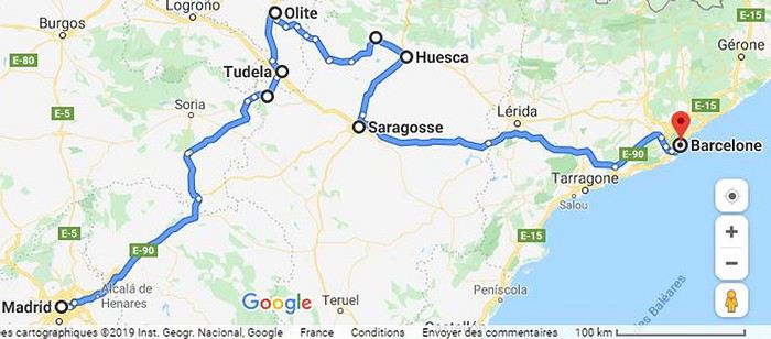
Afin de vous donner un peu envie de nous suivre, voici quelques photos…
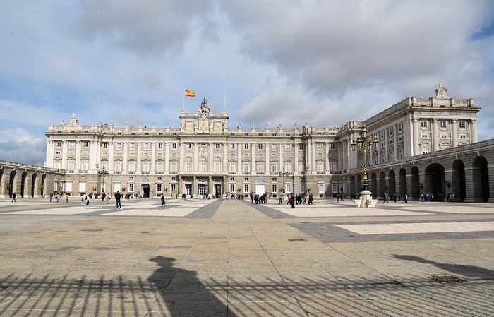 Palais Royal à Madrid
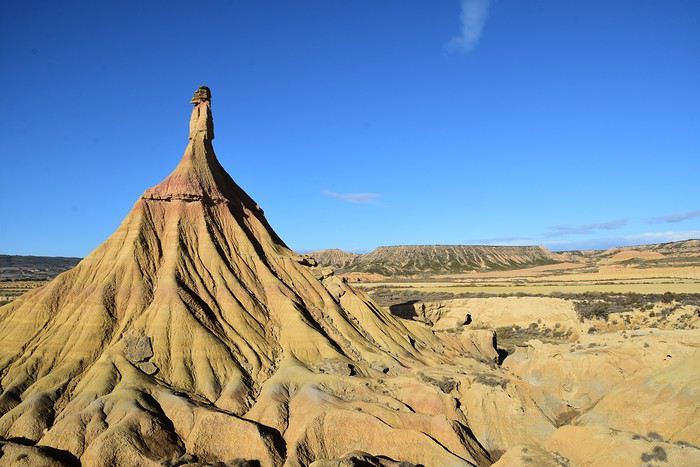 Castildetierra de Las Bardenas
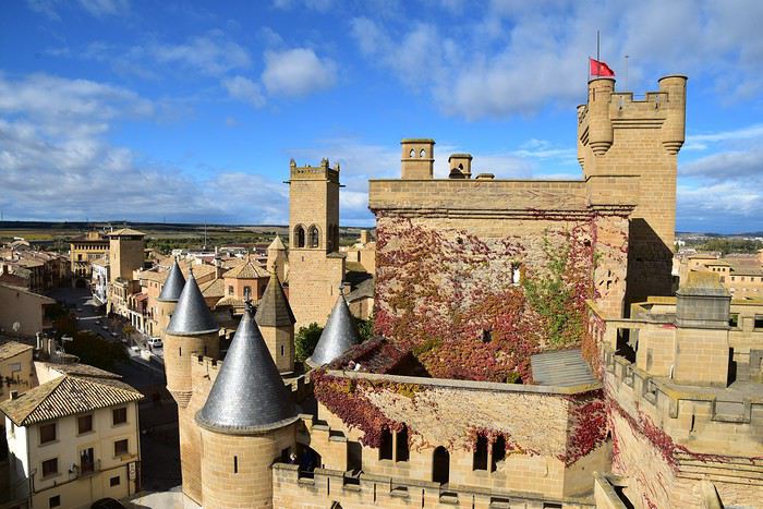 Palais des rois de Navarre à Olite
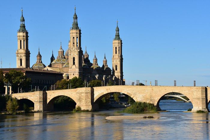 Basilique de Saragosse
Allez! C'est parti... par ici
Alors où aller! Une destination s’impose, Madrid pour aller déguster les Churros con Chocalate 😊. Mais aussi Bardenas Real, annulé il y a deux ans et qui nous tient à cœur. Comme d’habitude, j’ai beaucoup utilisé les retours publiés sur le forum pour préparer mon séjour, je vous en remercie bien et je vais donc essayer d’y ajouter ma contribution.
Voilà le programme un peu speed que j’ai concocté pour ces quelques jours 😮.
01/11 Lyon / Madrid 02/11 Madrid / Tudela 03/11 Las Bardenas 04/11 Tudela / Saragosse 05/11 Saragosse / Barcelone / Lyon
Afin de vous donner un peu envie de nous suivre, voici quelques photos…
Palais Royal à Madrid
Castildetierra de Las Bardenas
Palais des rois de Navarre à Olite
Basilique de SaragosseAllez! C'est parti... par ici
Le Tour de Mont Blanc est trop exigeant? English translation pending
Le Tour de Mont Blanc est trop exigeant? | Jour 3 de la TMB des Chalets de Miage aux Contamines-Montjoie
Dans l'épisode d'aujourd'hui, nous sommes allés des Chalets de Miage aux Contamines-Montjoie.
Regardez la vidéo complète ici: https://youtu.be/y1GtWtUFYHU N'oubliez pas de cliquer sur les sous-titres français dans la vidéo.
La nuit était très froide dans la vallée de Maiges, tout était humide et on pouvait sentir l'humidité venir à vous. Nous étions très épuisés par l'aventure extrême d'hier et nous nous sommes sentis déchirés le matin. Nos jambes, nos épaules et notre dos étaient très douloureux. Et nous ne voulions aller nulle part, nous voulions restions à la place.
Nous avons surestimé nos pouvoirs avec ce sentier en regardant les étapes proposées par les gens et celles que nous avions sur notre carte. Ils font tous environ 15 km et nous pensions que ce n'était pas si grave. Mais nous avons oublié le relief montagneux et ici vous sentez la distance différemment. La même situation que nous avions avec Camino de Santiago quand les gens faisaient 30-35 km et nous pouvions à peine faire 20 km. Pour nous, le juste milieu était de 15 km. Et ici, nous devions faire nos propres étapes en fonction du parcours et de notre état physique, mais nous serions heureux de faire environ 10 km par jour. C’est la règle pour nous de réduire de moitié la distance que tous les guides nous proposent.
Mais comme le village des Contamines était assez proche et qu’il y avait un camping où séjourner, nous avons décidé de partir en randonnée. Ce n'était que dans environ 7 km, mais pour nous c'était plus que suffisant ce jour-là.
Nous avons donc pris notre petit-déjeuner et commencé à tout emballer. La plupart de nos vêtements étaient encore mouillés et en particulier nos chaussures parfaitement trempées. Mais nous espérions que cela s'assèche pendant la journée.
Dès le début, nous avons dû franchir la montée raide et gravir la montagne. Ce n’était qu’environ 1 ou 2 km, mais c’était comme si notre état physique était mauvais. Nous avons donc dû ralentir et nous reposer beaucoup avant de pouvoir enfin y arriver.
Nous avons vu des maisons en bois qui étaient probablement des maisons de réfugiés. Et nous avons vu les pâturages de bovins pour la première fois dans ces endroits; ils étaient marron et blancs et ressemblaient beaucoup à ceux que nous avons vus dans la publicité télévisée de certains chocolats suisses.
Après cela, nous avons commencé notre descente très raide, en passant d'abord par des sentiers forestiers pittoresques, puis par des chemins de voiture en terre. C’était vraiment difficile pour nos genoux et nous avions l’impression de torturer une descente aussi longue et abrupte. Nous avons rencontré pas mal d’autres randonneurs qui montaient en sens inverse du nôtre et c’était probablement tous les randonneurs de la journée qui le faisaient le week-end du dimanche.
Le temps était ensoleillé et frais avec le vent frais après la pluie d’hier. Et c'était agréable, à l'exception des racines d'arbres glissantes et des roches que nous devions éviter.
Quand nous sommes finalement arrivés aux Contamines du village, il était déjà 12h30 et nous espérions acheter des aliments comme du chocolat, des collations et des fruits. Quand nous sommes arrivés à la porte du supermarché, nous avons constaté qu'il était fermé pour la pause de l'après-midi et qu'il ouvrirait à 15 heures. Mais nous étions heureux qu’au moins ils soient ouverts le dimanche alors que la plupart des magasins sont normalement fermés.
Nous avons donc acheté deux croissants au chocolat et avons décidé d'attendre ces deux heures dans le jardin de l'église. Il y avait des bancs très pratiques où nous pouvions faire une petite sieste et nous allonger le dos en position horizontale. C'était vraiment bien.
Avec un peu plus de pouvoirs, nous nous sommes dirigés vers le supermarché et avons acheté tout ce dont nous avions besoin, à l'exception des champignons secs que nous ne pouvions malheureusement trouver nulle part. Nous savions que ce serait probablement le dernier supermarché que nous rencontrons depuis plusieurs jours et nous voulions donc nous assurer que nous avions les meilleurs approvisionnements dont nous avions besoin.
Ensuite, nous avons mangé nos repas et sommes allés directement à ce camping sans avoir aucune attente. Nous avons marché le long de la rivière, traversé le parc d’aventures avec de nombreuses activités comme le golf, le tennis, les terrains de football, etc. Et à côté de celui-ci se trouvait notre camping appelé Pontet.
Il s’est transformé en un charmant petit camping avec plusieurs chalets et un espace spécialement dédié aux tentes. À notre grande surprise, le prix n'était pas trop élevé, seulement 16 euros pour deux personnes et une tente, ce qui était incroyable et nous avons bien sûr décidé de rester. C'était super de prendre une douche chaude et de se sentir propre. Nous avons lavé la plupart de nos vêtements et disposions d'une connexion wifi pour transmettre un message à notre famille. Donc, le camping était très utile à ce moment-là.
Plus tard dans la soirée, il y avait plus de gens qui venaient dans la zone des tentes, la plupart d'entre eux étaient coréens ou japonais, et ils occupaient presque tout l'espace. Cela ressemblait beaucoup à un grand camp de tentes et nous en avons même pris quelques clichés. Vous voyez rarement autant de tentes au même endroit. Cela nous rappelle des groupes d’expédition ou des camps de l’Everest.
C'était donc très agréable d'avoir ce temps pour se reposer car nous sommes arrivés assez tôt sur place et pour récupérer les pouvoirs. Nous avons eu le festin de la nourriture avec du riz, des tomates cerises, des champignons frais et du fromage. C'était comme à la maison. Nous espérions donc obtenir assez de pouvoirs pour poursuivre cette piste difficile.
Quelle est votre distance moyenne par jour en randonnée en montagne? Et qu'est-ce que cela dépend pour vous?
Dans l'épisode d'aujourd'hui, nous sommes allés des Chalets de Miage aux Contamines-Montjoie.
Regardez la vidéo complète ici: https://youtu.be/y1GtWtUFYHU N'oubliez pas de cliquer sur les sous-titres français dans la vidéo.
La nuit était très froide dans la vallée de Maiges, tout était humide et on pouvait sentir l'humidité venir à vous. Nous étions très épuisés par l'aventure extrême d'hier et nous nous sommes sentis déchirés le matin. Nos jambes, nos épaules et notre dos étaient très douloureux. Et nous ne voulions aller nulle part, nous voulions restions à la place.
Nous avons surestimé nos pouvoirs avec ce sentier en regardant les étapes proposées par les gens et celles que nous avions sur notre carte. Ils font tous environ 15 km et nous pensions que ce n'était pas si grave. Mais nous avons oublié le relief montagneux et ici vous sentez la distance différemment. La même situation que nous avions avec Camino de Santiago quand les gens faisaient 30-35 km et nous pouvions à peine faire 20 km. Pour nous, le juste milieu était de 15 km. Et ici, nous devions faire nos propres étapes en fonction du parcours et de notre état physique, mais nous serions heureux de faire environ 10 km par jour. C’est la règle pour nous de réduire de moitié la distance que tous les guides nous proposent.
Mais comme le village des Contamines était assez proche et qu’il y avait un camping où séjourner, nous avons décidé de partir en randonnée. Ce n'était que dans environ 7 km, mais pour nous c'était plus que suffisant ce jour-là.
Nous avons donc pris notre petit-déjeuner et commencé à tout emballer. La plupart de nos vêtements étaient encore mouillés et en particulier nos chaussures parfaitement trempées. Mais nous espérions que cela s'assèche pendant la journée.
Dès le début, nous avons dû franchir la montée raide et gravir la montagne. Ce n’était qu’environ 1 ou 2 km, mais c’était comme si notre état physique était mauvais. Nous avons donc dû ralentir et nous reposer beaucoup avant de pouvoir enfin y arriver.
Nous avons vu des maisons en bois qui étaient probablement des maisons de réfugiés. Et nous avons vu les pâturages de bovins pour la première fois dans ces endroits; ils étaient marron et blancs et ressemblaient beaucoup à ceux que nous avons vus dans la publicité télévisée de certains chocolats suisses.
Après cela, nous avons commencé notre descente très raide, en passant d'abord par des sentiers forestiers pittoresques, puis par des chemins de voiture en terre. C’était vraiment difficile pour nos genoux et nous avions l’impression de torturer une descente aussi longue et abrupte. Nous avons rencontré pas mal d’autres randonneurs qui montaient en sens inverse du nôtre et c’était probablement tous les randonneurs de la journée qui le faisaient le week-end du dimanche.
Le temps était ensoleillé et frais avec le vent frais après la pluie d’hier. Et c'était agréable, à l'exception des racines d'arbres glissantes et des roches que nous devions éviter.
Quand nous sommes finalement arrivés aux Contamines du village, il était déjà 12h30 et nous espérions acheter des aliments comme du chocolat, des collations et des fruits. Quand nous sommes arrivés à la porte du supermarché, nous avons constaté qu'il était fermé pour la pause de l'après-midi et qu'il ouvrirait à 15 heures. Mais nous étions heureux qu’au moins ils soient ouverts le dimanche alors que la plupart des magasins sont normalement fermés.
Nous avons donc acheté deux croissants au chocolat et avons décidé d'attendre ces deux heures dans le jardin de l'église. Il y avait des bancs très pratiques où nous pouvions faire une petite sieste et nous allonger le dos en position horizontale. C'était vraiment bien.
Avec un peu plus de pouvoirs, nous nous sommes dirigés vers le supermarché et avons acheté tout ce dont nous avions besoin, à l'exception des champignons secs que nous ne pouvions malheureusement trouver nulle part. Nous savions que ce serait probablement le dernier supermarché que nous rencontrons depuis plusieurs jours et nous voulions donc nous assurer que nous avions les meilleurs approvisionnements dont nous avions besoin.
Ensuite, nous avons mangé nos repas et sommes allés directement à ce camping sans avoir aucune attente. Nous avons marché le long de la rivière, traversé le parc d’aventures avec de nombreuses activités comme le golf, le tennis, les terrains de football, etc. Et à côté de celui-ci se trouvait notre camping appelé Pontet.
Il s’est transformé en un charmant petit camping avec plusieurs chalets et un espace spécialement dédié aux tentes. À notre grande surprise, le prix n'était pas trop élevé, seulement 16 euros pour deux personnes et une tente, ce qui était incroyable et nous avons bien sûr décidé de rester. C'était super de prendre une douche chaude et de se sentir propre. Nous avons lavé la plupart de nos vêtements et disposions d'une connexion wifi pour transmettre un message à notre famille. Donc, le camping était très utile à ce moment-là.
Plus tard dans la soirée, il y avait plus de gens qui venaient dans la zone des tentes, la plupart d'entre eux étaient coréens ou japonais, et ils occupaient presque tout l'espace. Cela ressemblait beaucoup à un grand camp de tentes et nous en avons même pris quelques clichés. Vous voyez rarement autant de tentes au même endroit. Cela nous rappelle des groupes d’expédition ou des camps de l’Everest.
C'était donc très agréable d'avoir ce temps pour se reposer car nous sommes arrivés assez tôt sur place et pour récupérer les pouvoirs. Nous avons eu le festin de la nourriture avec du riz, des tomates cerises, des champignons frais et du fromage. C'était comme à la maison. Nous espérions donc obtenir assez de pouvoirs pour poursuivre cette piste difficile.
Quelle est votre distance moyenne par jour en randonnée en montagne? Et qu'est-ce que cela dépend pour vous?