Results for "Malé+|+38+>+12"
2004 results found.
Diving and snorkeling in Thailand in July-August
Hello,
We’re planning a trip to Thailand for next summer. It’s the rainy season, but that’ll let us explore forest parks (Khao Yai and Khao Sok, most likely) in full bloom and teeming with wildlife. We’d also like to spend a few days on beaches with nearby coral reefs during this trip. That’s where we’re hitting a snag—I’m struggling to find an island or region with favorable weather. I’ve gone through quite a few threads on this forum, but most are pretty old and mention a few names (Tao, Phaluai, Ma, or Phang Nga), though with doubts about visibility or overall appeal. Crowds also seemed like a bit of an issue. Just to clarify, our family has mixed interests when it comes to fish-related activities—some are Level 1 divers, while others are snorkelers only.
Are there any good options in July-August for great experiences in the area? Thanks for your tips!
We’re planning a trip to Thailand for next summer. It’s the rainy season, but that’ll let us explore forest parks (Khao Yai and Khao Sok, most likely) in full bloom and teeming with wildlife. We’d also like to spend a few days on beaches with nearby coral reefs during this trip. That’s where we’re hitting a snag—I’m struggling to find an island or region with favorable weather. I’ve gone through quite a few threads on this forum, but most are pretty old and mention a few names (Tao, Phaluai, Ma, or Phang Nga), though with doubts about visibility or overall appeal. Crowds also seemed like a bit of an issue. Just to clarify, our family has mixed interests when it comes to fish-related activities—some are Level 1 divers, while others are snorkelers only.
Are there any good options in July-August for great experiences in the area? Thanks for your tips!
South Africa in safari mode: February/March 2026
Hi everyone,
With my girlfriend Christelle, we’ve chosen South Africa for our first trip to Southern Africa, focusing on safaris—after a long debate with a Cape Town/Kruger combo. But that would’ve meant cutting out St Lucia, which would’ve been harder to fit into another trip. And St Lucia—thanks to Michel and all those travel journals—we really wanted to go there.
So our 11-night itinerary ended up like this, mostly shaped by school holidays: - 3 nights in St Lucia - 1 night in Hluhluwe - 1 night at Mkhaya Game Reserve (Eswatini) - 1 night at Hlane Royal National Park (Eswatini) - 3 nights in Kruger (Berg en Dal / Satara / Tamboti) - 1 night at Shindzela Tented Camp in the Timbavati private reserve - 1 final night in Kruger at Lower Sabie
All of this in the off-season and rainy season, just a month after catastrophic floods that killed over 150 people and seriously damaged Kruger’s infrastructure.
I’ll jump straight to St Lucia and skip the loooong journey to get there (with a layover in Frankfurt, landing in Johannesburg, a domestic flight to Durban, and the rest by rental SUV—First Car Rental, perfect, no complaints).
To motivate readers—especially some familiar faces here—I’ll drop in a first photo.

With my girlfriend Christelle, we’ve chosen South Africa for our first trip to Southern Africa, focusing on safaris—after a long debate with a Cape Town/Kruger combo. But that would’ve meant cutting out St Lucia, which would’ve been harder to fit into another trip. And St Lucia—thanks to Michel and all those travel journals—we really wanted to go there.
So our 11-night itinerary ended up like this, mostly shaped by school holidays: - 3 nights in St Lucia - 1 night in Hluhluwe - 1 night at Mkhaya Game Reserve (Eswatini) - 1 night at Hlane Royal National Park (Eswatini) - 3 nights in Kruger (Berg en Dal / Satara / Tamboti) - 1 night at Shindzela Tented Camp in the Timbavati private reserve - 1 final night in Kruger at Lower Sabie
All of this in the off-season and rainy season, just a month after catastrophic floods that killed over 150 people and seriously damaged Kruger’s infrastructure.
I’ll jump straight to St Lucia and skip the loooong journey to get there (with a layover in Frankfurt, landing in Johannesburg, a domestic flight to Durban, and the rest by rental SUV—First Car Rental, perfect, no complaints).
To motivate readers—especially some familiar faces here—I’ll drop in a first photo.
Tanzania: Discovering Ruaha and Nyerere (formerly Selous)
Hello,
We got back from Tanzania a month ago, on March 5th. I’ve started this trip report at the link the moderator asked me to use:
https://voyageforum.com/forum/decouverte-ruaha-nyerere-ex-selous-en-fevrier-mars-2026-d11466010/
You’ll find a video of our trip on my YouTube channel there.
Now I’ll tell you about our 10-night trip in Tanzania, with 8 nights spent in two parks we didn’t know. Tanzania isn’t new to us—it was even our first African safari destination back in 2012. https://www.youtube.com/@lolodetoul54 Since then, we’ve visited several East and Southern African countries: Kenya, South Africa, Namibia, Botswana, some of them multiple times. We usually travel in September during the dry season. We tried March 2024 for nine nights in the Okavango and loved it, except everything was dry, which wasn’t normal for the rainy season.
So for this second March trip during the wet season, we really got what we asked for… rain. But before that, we had to fight just to get to Tanzania.
Saturday, February 21, 2026:
It’s D-Day—the departure. What a hassle to organize flights to and within Tanzania! I’ll tell you all about it in another post: https://voyageforum.com/forum/toutes-compagnies-aeriennes-tanzaniennes-interdites-d10758360/ On top of that, Rwandair canceled our outbound flight a month before departure. They offered to reschedule us 3-4 days later—ridiculous for a 10-night trip we’d already booked. We had to cancel our tickets and buy new ones with Kenya Airways. We’re still waiting for our refund from Rwandair!!!!!!! So on Saturday, February 1st, our bags were packed. We headed to the Lorraine TGV station, about 30 km from home.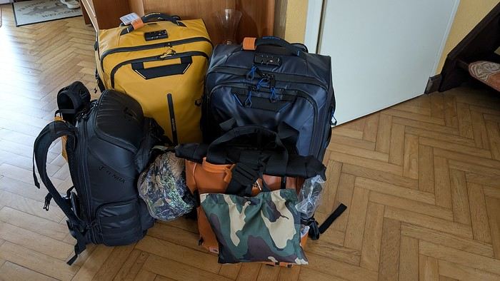 Direct train to Roissy—just 1h15. Quick and efficient.
All that was left was to wait for our overnight flight. We took off on time, just before 11 PM. Smooth flight, nothing unusual. Arrived in Nairobi around 9 AM. A few hours’ wait, then a flight to Dar es Salaam, landing at our first destination around 12:45 PM.
Our local contact, Anne from Asanterra agency, picked us up at the airport. It was hot and humid—it was raining.
Direct train to Roissy—just 1h15. Quick and efficient.
All that was left was to wait for our overnight flight. We took off on time, just before 11 PM. Smooth flight, nothing unusual. Arrived in Nairobi around 9 AM. A few hours’ wait, then a flight to Dar es Salaam, landing at our first destination around 12:45 PM.
Our local contact, Anne from Asanterra agency, picked us up at the airport. It was hot and humid—it was raining.
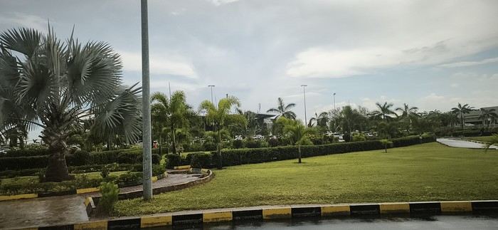
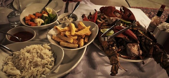
Our first night was at the Alexander Hotel. That evening, we treated ourselves to fish and shellfish at the hotel restaurant:
Sunday, February 22, 2026:
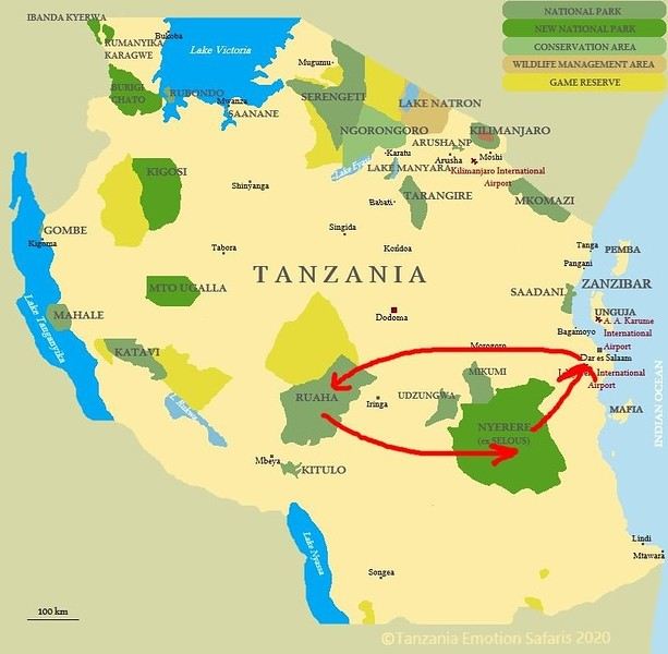
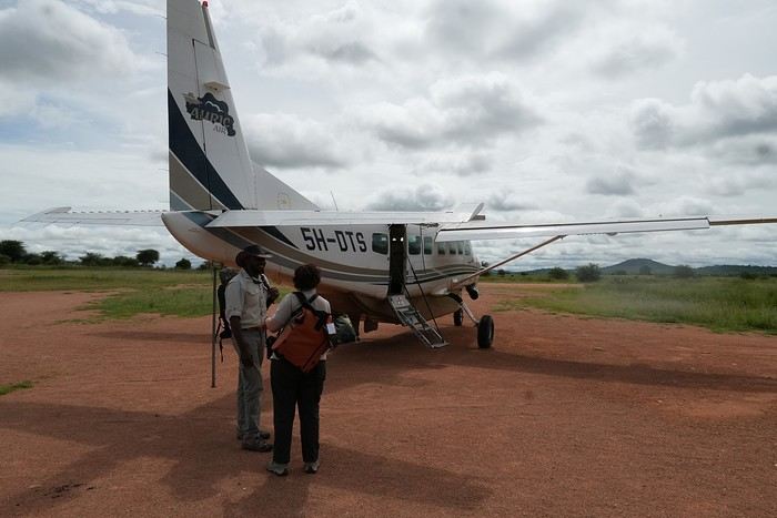
A driver picked us up at dawn to take us to the domestic airport so we could finally head to our first destination: Ruaha National Park. We flew with Auric.air for a 2-hour flight with two stops (Nyerere and Zkima airstrips).
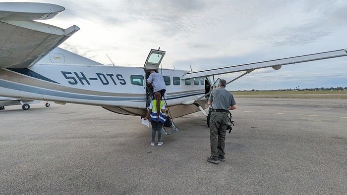
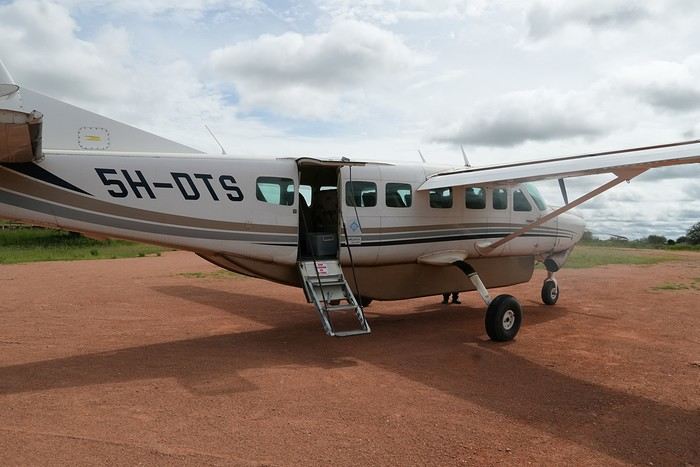
I’m always amazed at how easily these Cessnas take off and land on dirt runways—especially when they’re wet:
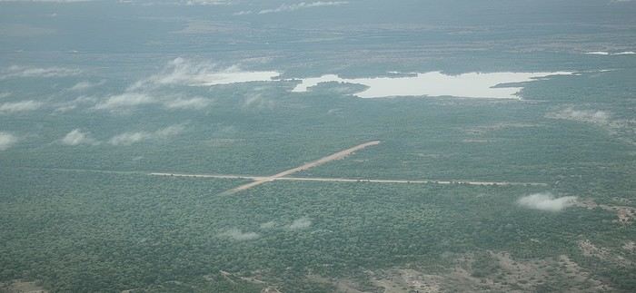
Aerial view of Zkima airstrip, where we’d landed just minutes earlier:
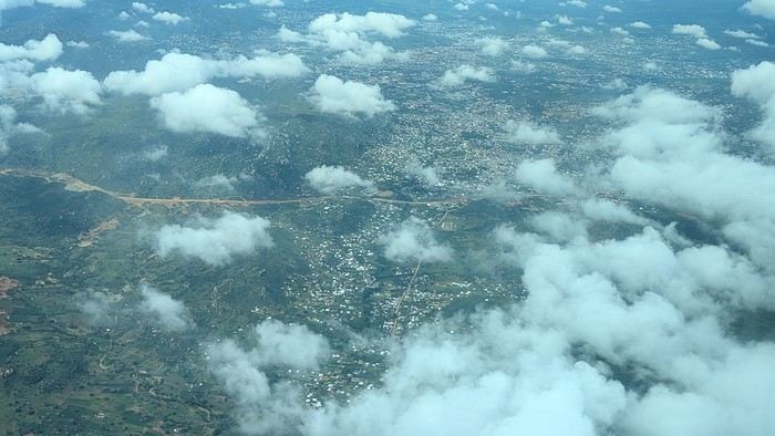
Flyover of Iringa, a "big" city in the country near Ruaha National Park:
We’re getting close. The plane descends and flies over the Ruaha River, which gave the park its name:
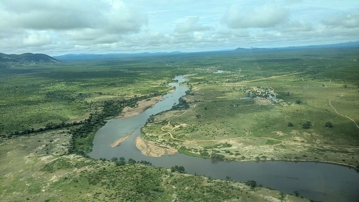
We land for the third and final time that day, reaching our destination: Msembe airstrip, the gateway to Ruaha.
We got back from Tanzania a month ago, on March 5th. I’ve started this trip report at the link the moderator asked me to use:
https://voyageforum.com/forum/decouverte-ruaha-nyerere-ex-selous-en-fevrier-mars-2026-d11466010/
You’ll find a video of our trip on my YouTube channel there.
Now I’ll tell you about our 10-night trip in Tanzania, with 8 nights spent in two parks we didn’t know. Tanzania isn’t new to us—it was even our first African safari destination back in 2012. https://www.youtube.com/@lolodetoul54 Since then, we’ve visited several East and Southern African countries: Kenya, South Africa, Namibia, Botswana, some of them multiple times. We usually travel in September during the dry season. We tried March 2024 for nine nights in the Okavango and loved it, except everything was dry, which wasn’t normal for the rainy season.
So for this second March trip during the wet season, we really got what we asked for… rain. But before that, we had to fight just to get to Tanzania.
Saturday, February 21, 2026:
It’s D-Day—the departure. What a hassle to organize flights to and within Tanzania! I’ll tell you all about it in another post: https://voyageforum.com/forum/toutes-compagnies-aeriennes-tanzaniennes-interdites-d10758360/ On top of that, Rwandair canceled our outbound flight a month before departure. They offered to reschedule us 3-4 days later—ridiculous for a 10-night trip we’d already booked. We had to cancel our tickets and buy new ones with Kenya Airways. We’re still waiting for our refund from Rwandair!!!!!!! So on Saturday, February 1st, our bags were packed. We headed to the Lorraine TGV station, about 30 km from home.
Direct train to Roissy—just 1h15. Quick and efficient.
All that was left was to wait for our overnight flight. We took off on time, just before 11 PM. Smooth flight, nothing unusual. Arrived in Nairobi around 9 AM. A few hours’ wait, then a flight to Dar es Salaam, landing at our first destination around 12:45 PM.
Our local contact, Anne from Asanterra agency, picked us up at the airport. It was hot and humid—it was raining.Our first night was at the Alexander Hotel. That evening, we treated ourselves to fish and shellfish at the hotel restaurant:
Sunday, February 22, 2026:
A driver picked us up at dawn to take us to the domestic airport so we could finally head to our first destination: Ruaha National Park. We flew with Auric.air for a 2-hour flight with two stops (Nyerere and Zkima airstrips).
I’m always amazed at how easily these Cessnas take off and land on dirt runways—especially when they’re wet:
Aerial view of Zkima airstrip, where we’d landed just minutes earlier:
Flyover of Iringa, a "big" city in the country near Ruaha National Park:
We’re getting close. The plane descends and flies over the Ruaha River, which gave the park its name:
We land for the third and final time that day, reaching our destination: Msembe airstrip, the gateway to Ruaha.
Love at First Sight in Kenya
Hello,
After several years, I’ve finally decided to repost a travel journal on the forum. We returned a few weeks ago from an incredible trip to Kenya, and it’s reignited my desire to share our emotions in the face of these animals.
Kenya wasn’t originally a priority for us in terms of safari—we had the impression it was too touristy. So, we started with other destinations: Namibia, Tanzania, Botswana, and South Africa. But as I did more research, especially on the forum (thanks in part to Sylvie’s many trips), I eventually convinced myself that Kenya could be magnificent, as long as we chose our itinerary carefully and avoided peak seasons.
We ended up going in January, from the 17th to the 31st. We worked with a travel agency (TP) that crafted a custom itinerary for us: Samburu-Ol Pejeta-Naivasha-Maji Moto-Maasai Mara-Diani. They partnered with a local French-speaking agency, and everything was perfectly organized. Our trip exceeded all our expectations, and none of it would’ve been as amazing without our guide, Alfred. He accompanied us for 10 days and was a fantastic travel companion—professional, respectful of the animals, and always in good spirits. We formed a great bond with him in such a short time.
- **January 17th** After meeting up with Juliette and Charlotte in Rennes the night before, we left at 4 AM for Roissy Charles de Gaulle Airport. The thick fog made the drive pretty rough, but we arrived safely around 7:45 AM. A Blue Valet driver was waiting to take our car. Check-in went smoothly, and we waited patiently for our 10:40 AM flight. Unfortunately, despite boarding on time, a passenger was missing, and we had to find a replacement last minute. Then, another passenger who had checked in and dropped off their luggage wasn’t on the plane, so they had to unload their bags. After a long period of uncertainty and spotty communication from the crew, we finally took off over an hour late.
We arrived in Nairobi in the late afternoon, 45 minutes behind schedule. The administrative formalities were endless—it took nearly 1.5 hours from landing to leaving the airport with our luggage. When we stepped out, Alfred, our guide, was waiting with a big smile and drove us to the Eka Hotel, not far from the airport. Exhausted from the long journey, we fell asleep quickly.
- **January 18th** Alfred met us at 7 AM for a long drive to Samburu Reserve. We had a peaceful night, unlike the girls, who barely slept because their neighbors were talking loudly all night. Things even escalated when Charlotte started shouting insults to get them to quiet down, but it didn’t work.
It was Sunday, so traffic around Nairobi and along the route was light. Aside from a quick "technical stop," we drove straight through and arrived in Samburu after just under 6 hours. Because of the lower altitude (around 1,000m on average), it was hot—over 30°C in mid-January.
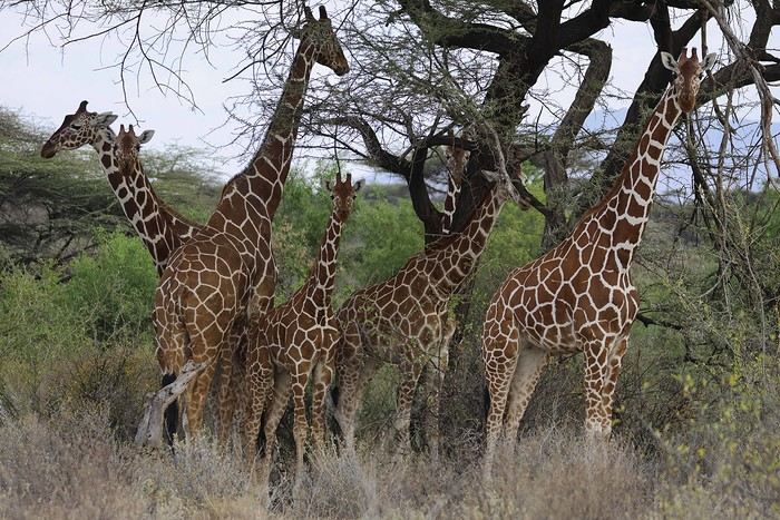
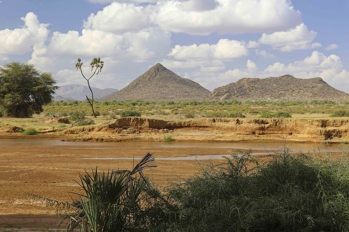
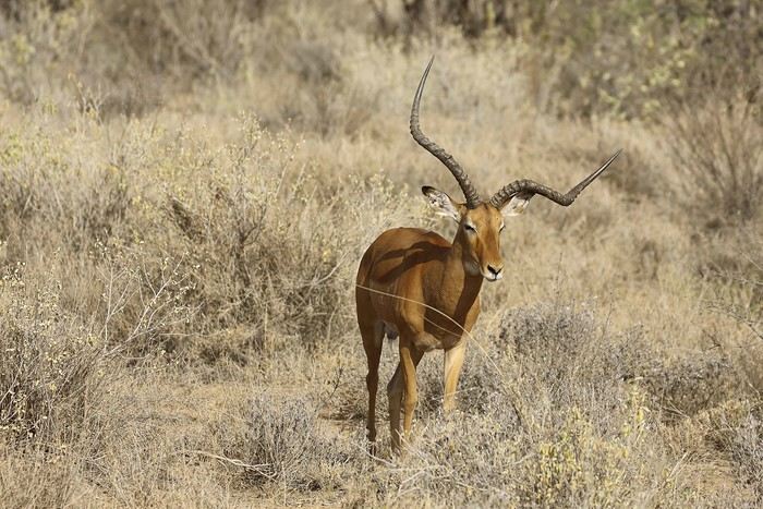
As soon as we entered the reserve, we spotted some impalas and quickly came across one of the region’s endemic species: the reticulated giraffe, which is absolutely stunning.
While heading to our camp for lunch, Alfred crossed paths with another vehicle and learned that a leopard was nearby. We started searching, and a few minutes later, Anny spotted a shape in a tree—it was our leopard!
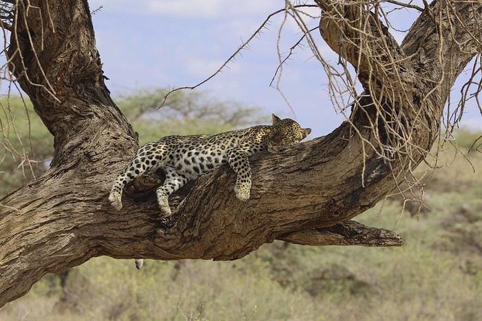
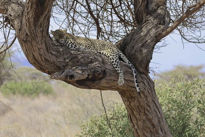
There were actually two of them—a mother and her adolescent. The young one was perched high in the tree, in the shade. We got to observe them for a good half-hour in excellent conditions, with just one other vehicle nearby.
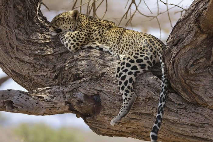
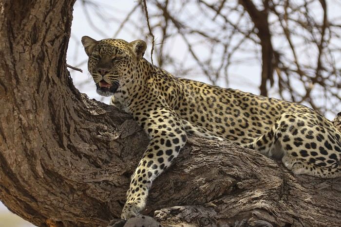
Alfred also noticed that the mother had hidden prey (a gerenuk gazelle) in the vegetation, away from prying eyes.
It was time to head to our camp, the Ashnil Samburu Camp, located in the Buffalo Springs area, by the river, in an idyllic setting surrounded by the region’s typical vegetation.
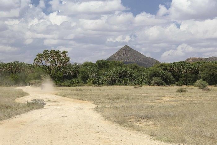
The welcome was fantastic—we immediately felt at home, and that feeling lasted throughout our 3-day stay in the reserve. It was 2 PM, but no one rushed us to the table. Our waitress, Sheila, who took care of us the whole time, was as lovely as the rest of the team. Barely seated, we were invited to watch an elephant passing right by the camp, in front of the restaurant. This trip was off to a great start!
After lunch, we relaxed by the pool. Monkeys, especially vervets, were everywhere, and a camp employee was assigned to keep an eye on them and shoo them away if needed (especially the baboons).
A little before 4 PM, we met up with Alfred for our first game drive. Just outside the camp, a few elephants were in the valley near the river.
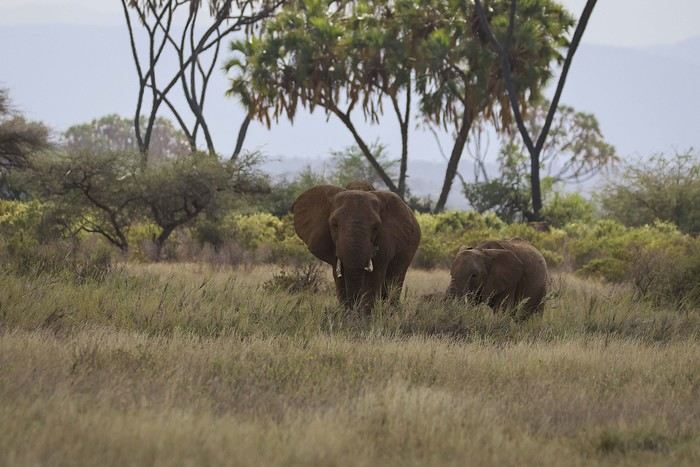
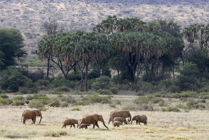
We’d see them in the same area almost every day. We also spotted some gazelles.
After several years, I’ve finally decided to repost a travel journal on the forum. We returned a few weeks ago from an incredible trip to Kenya, and it’s reignited my desire to share our emotions in the face of these animals.
Kenya wasn’t originally a priority for us in terms of safari—we had the impression it was too touristy. So, we started with other destinations: Namibia, Tanzania, Botswana, and South Africa. But as I did more research, especially on the forum (thanks in part to Sylvie’s many trips), I eventually convinced myself that Kenya could be magnificent, as long as we chose our itinerary carefully and avoided peak seasons.
We ended up going in January, from the 17th to the 31st. We worked with a travel agency (TP) that crafted a custom itinerary for us: Samburu-Ol Pejeta-Naivasha-Maji Moto-Maasai Mara-Diani. They partnered with a local French-speaking agency, and everything was perfectly organized. Our trip exceeded all our expectations, and none of it would’ve been as amazing without our guide, Alfred. He accompanied us for 10 days and was a fantastic travel companion—professional, respectful of the animals, and always in good spirits. We formed a great bond with him in such a short time.
- **January 17th** After meeting up with Juliette and Charlotte in Rennes the night before, we left at 4 AM for Roissy Charles de Gaulle Airport. The thick fog made the drive pretty rough, but we arrived safely around 7:45 AM. A Blue Valet driver was waiting to take our car. Check-in went smoothly, and we waited patiently for our 10:40 AM flight. Unfortunately, despite boarding on time, a passenger was missing, and we had to find a replacement last minute. Then, another passenger who had checked in and dropped off their luggage wasn’t on the plane, so they had to unload their bags. After a long period of uncertainty and spotty communication from the crew, we finally took off over an hour late.
We arrived in Nairobi in the late afternoon, 45 minutes behind schedule. The administrative formalities were endless—it took nearly 1.5 hours from landing to leaving the airport with our luggage. When we stepped out, Alfred, our guide, was waiting with a big smile and drove us to the Eka Hotel, not far from the airport. Exhausted from the long journey, we fell asleep quickly.
- **January 18th** Alfred met us at 7 AM for a long drive to Samburu Reserve. We had a peaceful night, unlike the girls, who barely slept because their neighbors were talking loudly all night. Things even escalated when Charlotte started shouting insults to get them to quiet down, but it didn’t work.
It was Sunday, so traffic around Nairobi and along the route was light. Aside from a quick "technical stop," we drove straight through and arrived in Samburu after just under 6 hours. Because of the lower altitude (around 1,000m on average), it was hot—over 30°C in mid-January.
As soon as we entered the reserve, we spotted some impalas and quickly came across one of the region’s endemic species: the reticulated giraffe, which is absolutely stunning.
While heading to our camp for lunch, Alfred crossed paths with another vehicle and learned that a leopard was nearby. We started searching, and a few minutes later, Anny spotted a shape in a tree—it was our leopard!
There were actually two of them—a mother and her adolescent. The young one was perched high in the tree, in the shade. We got to observe them for a good half-hour in excellent conditions, with just one other vehicle nearby.
Alfred also noticed that the mother had hidden prey (a gerenuk gazelle) in the vegetation, away from prying eyes.
It was time to head to our camp, the Ashnil Samburu Camp, located in the Buffalo Springs area, by the river, in an idyllic setting surrounded by the region’s typical vegetation.
The welcome was fantastic—we immediately felt at home, and that feeling lasted throughout our 3-day stay in the reserve. It was 2 PM, but no one rushed us to the table. Our waitress, Sheila, who took care of us the whole time, was as lovely as the rest of the team. Barely seated, we were invited to watch an elephant passing right by the camp, in front of the restaurant. This trip was off to a great start!
After lunch, we relaxed by the pool. Monkeys, especially vervets, were everywhere, and a camp employee was assigned to keep an eye on them and shoo them away if needed (especially the baboons).
A little before 4 PM, we met up with Alfred for our first game drive. Just outside the camp, a few elephants were in the valley near the river.
We’d see them in the same area almost every day. We also spotted some gazelles.
7 weeks and 150 years between us on a southern Morocco road trip
We arrive in the evening in Marrakesh, and a taxi arranged by our friendly Riad is waiting for us. The driver takes us to the door, where we’re briefly greeted by our hosts. The room is heated—phew—because it’s really cold on this January 17th for our arrival. Riad Alisma, where we’re staying for 2 nights. The next morning, it’s pouring rain when we wake up, but after a good breakfast, the rain has calmed down. Off we go to the medersa, which allows for a relatively sheltered visit. We’d visited this palace 15 years ago—it’s been renovated since then.
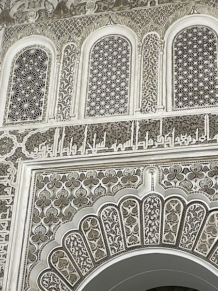
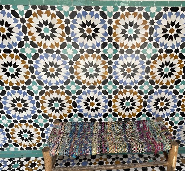
From there, without the rain, we wander aimlessly and eventually end up near the tanneries, but it’s Sunday, and there’s very little activity. Of course, we get hassled by a tout.
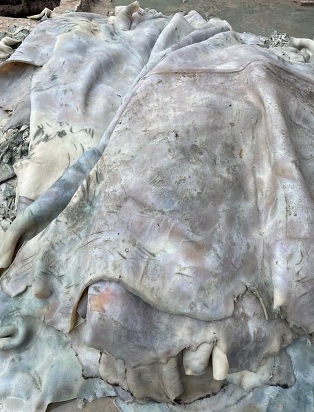
Here, the hides after being treated with lime—I love the colors.
We part ways a bit annoyed. He gets a little revenge by giving us bad directions, and we end up outside the city walls. We decide to take a taxi to the new modern art museum—60 dirhams for the 5 km, which is nothing when you think about it. That tout, who we didn’t ask for anything and made it clear we weren’t buying anything, dragged us into a shop supposedly only open that day and demanded 50 dirhams for his "services"! Let’s forget that bad moment and enjoy the exhibition at the MACAL.
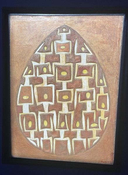
The taxi on the way back drops us off at Place des Ferblantiers, not far from our Riad. We’re a little peckish—it’s worth mentioning that at lunchtime, we only ate a plate of beans from a street vendor. So, we buy a bunch of little sweets, each more delicious than the last, at Ajar. We snack while sipping mint tea and watching life go by around us. A final visit to the Museum of Moroccan Cuisine on our way back helps us dodge a few more showers. Then it’s back to the Riad. The atmosphere in the city is heating up—it’s the AFCON final tonight. The temperatures, though? Not so much. We ordered a meal at the Riad, and it was a good call—not only was it really tasty, but the rain also picked up again. Our day in Marrakesh ends under the covers with a good book and some photo sorting. Still, we managed 10,750 steps. View of our Riad
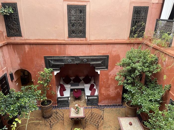
Tomorrow, we’ll pick up our rental car from Medloc and head to Essaouira.
From there, without the rain, we wander aimlessly and eventually end up near the tanneries, but it’s Sunday, and there’s very little activity. Of course, we get hassled by a tout.
Here, the hides after being treated with lime—I love the colors.
We part ways a bit annoyed. He gets a little revenge by giving us bad directions, and we end up outside the city walls. We decide to take a taxi to the new modern art museum—60 dirhams for the 5 km, which is nothing when you think about it. That tout, who we didn’t ask for anything and made it clear we weren’t buying anything, dragged us into a shop supposedly only open that day and demanded 50 dirhams for his "services"! Let’s forget that bad moment and enjoy the exhibition at the MACAL.
The taxi on the way back drops us off at Place des Ferblantiers, not far from our Riad. We’re a little peckish—it’s worth mentioning that at lunchtime, we only ate a plate of beans from a street vendor. So, we buy a bunch of little sweets, each more delicious than the last, at Ajar. We snack while sipping mint tea and watching life go by around us. A final visit to the Museum of Moroccan Cuisine on our way back helps us dodge a few more showers. Then it’s back to the Riad. The atmosphere in the city is heating up—it’s the AFCON final tonight. The temperatures, though? Not so much. We ordered a meal at the Riad, and it was a good call—not only was it really tasty, but the rain also picked up again. Our day in Marrakesh ends under the covers with a good book and some photo sorting. Still, we managed 10,750 steps. View of our Riad
Tomorrow, we’ll pick up our rental car from Medloc and head to Essaouira.
Road Trip USA 2023 - Part 2
HIGHWAY 1
Highway 1 runs along the Pacific coast of California from Leggett in the north to Dana Point in the south. It's the longest state route in California, stretching 1,050 km.
It's famous for its breathtaking ocean views. That’s actually why it’s become such a popular route for road trips, with tons of attractions and points of interest all along the way.
After crossing the U.S. interior on our way out (see Road Trip USA 2023 - Part 1), we’re starting our return trip along this route from Leggett.
Videos are embedded throughout the summary. Please click on the image to start the video. To jump to a specific post, here are the appropriate links:
CALIFORNIA:
Scenic Overlooks on Route 1 Between Leggett and Fort Bragg The Pudding Creek Trestle Bridge in Fort Bragg Glass Beach - Fort Bragg Jenner Lookout Point - Highway 1 Goat Rock Beach - Sonoma Coast State Park - Jenner Point Reyes National Seashore - White House Pool Trail Point Reyes National Seashore - Limantour Beach Point Reyes National Seashore - Point Reyes Shipwreck Point Reyes National Seashore - Kehoe Beach Trail Point Reyes National Seashore - McClures Beach Trail Point Reyes National Seashore - Cypress Tree Tunnel Point Reyes National Seashore - Point Reyes Beach North Point Reyes National Seashore - Elephant Seals on Drakes Beach Point Reyes National Seashore - Point Reyes Beach South Point Reyes National Seashore – Elephant Seals Overlooks Point Reyes National Seashore - Chimney Rock Trail Point Reyes National Seashore - Point Reyes Lighthouse Trail Point Reyes National Seashore – Tule Elk Observation Point Bonita Lighthouse Trail - Sausalito Hawk Hill - Sausalito Battery Spencer Trail - Sausalito Rodeo Beach - Sausalito Point Cavallo - Golden Gate View - Sausalito Exploring Downtown Sausalito Visiting Sausalito’s Houseboats Crossing the Golden Gate Bridge - San Francisco Golden Gate Bridge Viewpoints - San Francisco Cruise to Alcatraz Island - San Francisco Visiting Alcatraz Island - San Francisco Civic Center - Downtown San Francisco Market Street & Yerba Buena Gardens - Downtown San Francisco Union Square & Financial District - Downtown San Francisco Fisherman's Wharf, Pier 39 & Embarcadero - San Francisco Sea Lion Observation - Pier 39 - San Francisco Lombard Street & Cable Car - Russian Hill - San Francisco Macondray Lane Historic District - Russian Hill - San Francisco Grace Cathedral & Huntington Park - Nob Hill - San Francisco Telegraph Hill - San Francisco Chinatown - San Francisco Alamo Square & Painted Ladies - Western Addition - San Francisco Palace of Fine Arts - Marina District - San Francisco Presidio of San Francisco California Coastal Trail - Lincoln Park - San Francisco California Palace of the Legion of Honor - Lincoln Park - San Francisco Sutro Baths - Lincoln Park - San Francisco Queen Wilhelmina Garden - Golden Gate Park - San Francisco Bison Paddock - Golden Gate Park - San Francisco Portals of the Past - Golden Gate Park - San Francisco Strawberry Hill - Golden Gate Park – San Francisco Prayerbook Cross & Robin Williams Meadow - Golden Gate Park - San Francisco Hidden Garden Steps & 16th Avenue Tiled Steps - San Francisco Grandview Park - San Francisco Hike - Twin Peaks Three Summits - San Francisco Longboarding Down Twin Peaks Blvd in San Francisco Haight-Ashbury - San Francisco Corona Heights Park - San Francisco Mission Dolores - San Francisco Mural Frescoes (Part 1) - Mission District - San Francisco Mural Frescoes (Part 2) - Mission District - San Francisco Devil's Slide Bunker - Pacifica Mavericks Beach - Half Moon Bay Martins Beach - Half Moon Bay Pigeon Point Lighthouse State Historic Park - Pescadero What to See in Santa Cruz Visiting Capitola What to See in Monterey Carmel-by-the-Sea Lovers Point Park - Pacific Grove Castle Rock, Hurricane Point & Little Sur River Viewpoints Pfeiffer Falls Trail Julia Pfeiffer Burns State Park Vista Point & McWay Falls Highway 1 - Big Sur Viewpoints Salmon Creek Falls San Carpoforo Creek Trail Elephant Seal Vista Point - San Simeon San Simeon Pier Moonstone Beach Boardwalk Shipwreck - Estero Bluffs State Park Surfing Competition in Morro Bay Port San Luis Pier - San Luis Obispo Pismo Beach Monarch Butterfly Grove - Pismo State Beach Nojoqui Falls Park - Solvang Arroyo Hondo Vista Point Solvang, a Charming Danish Town in California Chumash Painted Cave - Santa Barbara Goleta San Marcos Rd & Cachuma Lake Vista Points - Santa Barbara Old Santa Barbara Mission Walking Tour of Santa Barbara’s Historic Downtown West Beach - Santa Barbara What to See in Ventura Paradise Falls - Wildwood Regional Park - Thousand Oaks Sandy Dune & El Matador State Beach - Malibu Point Dume Nature Reserve - Malibu Malibu Pier Road Trip in the Malibu Mountains Los Liones Trail - Santa Monica Santa Monica Pier Rodeo Drive - Beverly Hills Greystone Mansion - Beverly Hills Hollywood Walk of Fame - Los Angeles Griffith Observatory - Los Angeles Hollywood Forever Cemetery - Los Angeles What to See in Venice Beach Venice Beach Skatepark ShoreLine Aquatic Park - Long Beach Alamitos Beach - Long Beach Naples Island - Long Beach Crescent Bay Point Park & Helser Park Kiosk - Laguna Beach Shell Beach at Twin Points - Laguna Beach Prairie Dogs at Agra Vista Point Top Gun House & Oceanside Pier Annie's Canyon Trail - Solana Beach (Via North Rios Trailhead Loop) Old Town San Diego La Jolla Coastal Trail - San Diego Balboa Park - San Diego Pacific Beach - San Diego Mission Beach - San Diego Ocean Beach Tide Pools - San Diego Sunset Cliffs Natural Park - San Diego Tuna Harbor Park - San Diego Seaport Village & Embarcadero Marina Park - San Diego Gaslamp Quarter - Downtown San Diego Coronado Island - San Diego Dead Dolly Lane - Alpine Galleta Meadows Metal Sculptures - Borrego Springs What to See in Palm Springs Robolights - Palm Springs Andreas Canyon Trail - Indian Canyons - Palm Springs Palm Canyon Trail - Indian Canyons - Palm Springs West Fork Falls Trail - Indian Canyons - Palm Springs Tahquitz Canyon Loop Trail - Indian Canyons - Palm Springs Desert Christ Park - Yucca Valley Pioneertown Salvation Mountain - Niland Slab City - Niland
Highway 1 runs along the Pacific coast of California from Leggett in the north to Dana Point in the south. It's the longest state route in California, stretching 1,050 km.
It's famous for its breathtaking ocean views. That’s actually why it’s become such a popular route for road trips, with tons of attractions and points of interest all along the way.
After crossing the U.S. interior on our way out (see Road Trip USA 2023 - Part 1), we’re starting our return trip along this route from Leggett.
Videos are embedded throughout the summary. Please click on the image to start the video. To jump to a specific post, here are the appropriate links:
CALIFORNIA:
Scenic Overlooks on Route 1 Between Leggett and Fort Bragg The Pudding Creek Trestle Bridge in Fort Bragg Glass Beach - Fort Bragg Jenner Lookout Point - Highway 1 Goat Rock Beach - Sonoma Coast State Park - Jenner Point Reyes National Seashore - White House Pool Trail Point Reyes National Seashore - Limantour Beach Point Reyes National Seashore - Point Reyes Shipwreck Point Reyes National Seashore - Kehoe Beach Trail Point Reyes National Seashore - McClures Beach Trail Point Reyes National Seashore - Cypress Tree Tunnel Point Reyes National Seashore - Point Reyes Beach North Point Reyes National Seashore - Elephant Seals on Drakes Beach Point Reyes National Seashore - Point Reyes Beach South Point Reyes National Seashore – Elephant Seals Overlooks Point Reyes National Seashore - Chimney Rock Trail Point Reyes National Seashore - Point Reyes Lighthouse Trail Point Reyes National Seashore – Tule Elk Observation Point Bonita Lighthouse Trail - Sausalito Hawk Hill - Sausalito Battery Spencer Trail - Sausalito Rodeo Beach - Sausalito Point Cavallo - Golden Gate View - Sausalito Exploring Downtown Sausalito Visiting Sausalito’s Houseboats Crossing the Golden Gate Bridge - San Francisco Golden Gate Bridge Viewpoints - San Francisco Cruise to Alcatraz Island - San Francisco Visiting Alcatraz Island - San Francisco Civic Center - Downtown San Francisco Market Street & Yerba Buena Gardens - Downtown San Francisco Union Square & Financial District - Downtown San Francisco Fisherman's Wharf, Pier 39 & Embarcadero - San Francisco Sea Lion Observation - Pier 39 - San Francisco Lombard Street & Cable Car - Russian Hill - San Francisco Macondray Lane Historic District - Russian Hill - San Francisco Grace Cathedral & Huntington Park - Nob Hill - San Francisco Telegraph Hill - San Francisco Chinatown - San Francisco Alamo Square & Painted Ladies - Western Addition - San Francisco Palace of Fine Arts - Marina District - San Francisco Presidio of San Francisco California Coastal Trail - Lincoln Park - San Francisco California Palace of the Legion of Honor - Lincoln Park - San Francisco Sutro Baths - Lincoln Park - San Francisco Queen Wilhelmina Garden - Golden Gate Park - San Francisco Bison Paddock - Golden Gate Park - San Francisco Portals of the Past - Golden Gate Park - San Francisco Strawberry Hill - Golden Gate Park – San Francisco Prayerbook Cross & Robin Williams Meadow - Golden Gate Park - San Francisco Hidden Garden Steps & 16th Avenue Tiled Steps - San Francisco Grandview Park - San Francisco Hike - Twin Peaks Three Summits - San Francisco Longboarding Down Twin Peaks Blvd in San Francisco Haight-Ashbury - San Francisco Corona Heights Park - San Francisco Mission Dolores - San Francisco Mural Frescoes (Part 1) - Mission District - San Francisco Mural Frescoes (Part 2) - Mission District - San Francisco Devil's Slide Bunker - Pacifica Mavericks Beach - Half Moon Bay Martins Beach - Half Moon Bay Pigeon Point Lighthouse State Historic Park - Pescadero What to See in Santa Cruz Visiting Capitola What to See in Monterey Carmel-by-the-Sea Lovers Point Park - Pacific Grove Castle Rock, Hurricane Point & Little Sur River Viewpoints Pfeiffer Falls Trail Julia Pfeiffer Burns State Park Vista Point & McWay Falls Highway 1 - Big Sur Viewpoints Salmon Creek Falls San Carpoforo Creek Trail Elephant Seal Vista Point - San Simeon San Simeon Pier Moonstone Beach Boardwalk Shipwreck - Estero Bluffs State Park Surfing Competition in Morro Bay Port San Luis Pier - San Luis Obispo Pismo Beach Monarch Butterfly Grove - Pismo State Beach Nojoqui Falls Park - Solvang Arroyo Hondo Vista Point Solvang, a Charming Danish Town in California Chumash Painted Cave - Santa Barbara Goleta San Marcos Rd & Cachuma Lake Vista Points - Santa Barbara Old Santa Barbara Mission Walking Tour of Santa Barbara’s Historic Downtown West Beach - Santa Barbara What to See in Ventura Paradise Falls - Wildwood Regional Park - Thousand Oaks Sandy Dune & El Matador State Beach - Malibu Point Dume Nature Reserve - Malibu Malibu Pier Road Trip in the Malibu Mountains Los Liones Trail - Santa Monica Santa Monica Pier Rodeo Drive - Beverly Hills Greystone Mansion - Beverly Hills Hollywood Walk of Fame - Los Angeles Griffith Observatory - Los Angeles Hollywood Forever Cemetery - Los Angeles What to See in Venice Beach Venice Beach Skatepark ShoreLine Aquatic Park - Long Beach Alamitos Beach - Long Beach Naples Island - Long Beach Crescent Bay Point Park & Helser Park Kiosk - Laguna Beach Shell Beach at Twin Points - Laguna Beach Prairie Dogs at Agra Vista Point Top Gun House & Oceanside Pier Annie's Canyon Trail - Solana Beach (Via North Rios Trailhead Loop) Old Town San Diego La Jolla Coastal Trail - San Diego Balboa Park - San Diego Pacific Beach - San Diego Mission Beach - San Diego Ocean Beach Tide Pools - San Diego Sunset Cliffs Natural Park - San Diego Tuna Harbor Park - San Diego Seaport Village & Embarcadero Marina Park - San Diego Gaslamp Quarter - Downtown San Diego Coronado Island - San Diego Dead Dolly Lane - Alpine Galleta Meadows Metal Sculptures - Borrego Springs What to See in Palm Springs Robolights - Palm Springs Andreas Canyon Trail - Indian Canyons - Palm Springs Palm Canyon Trail - Indian Canyons - Palm Springs West Fork Falls Trail - Indian Canyons - Palm Springs Tahquitz Canyon Loop Trail - Indian Canyons - Palm Springs Desert Christ Park - Yucca Valley Pioneertown Salvation Mountain - Niland Slab City - Niland
My life in Camargue, my homeland, and in Colombia, my heart's country
My two bullfighting traditions when I'm back home in Camargue (France) and in Colombia (Caribbean) every time I return. 🤠
Details:
Bullfights (corridas) aren’t part of my two bullfighting traditions, but I respect those who attend them!!!
In these two ancestral bullfighting traditions—which aren’t bullfights—the Bulls and Toros aren’t killed or tortured, as some might think.
These are bull games where the animals return to their pastures afterward and only come back to the Arenas 2–3 times a year at most.
They spend 15 minutes in the ring for the Camarguais and 5 minutes for the Toros in the Colombian Corralejas.
They’re cared for and pampered. They’ll die of old age in miles of open fields.
The young people who face them are professionals, risking their lives to support their families and live their Passion for the Toro!!! 😄
https://youtu.be/yYKQer42HoQ
Colombian Corraleja in the link below (hope it works) 🤪
https://fb.watch/BMfmuCgQpG/
Cantal—have you heard of it?
...
After Southern Tanzania, I’m sharing a travel story about the Cantal region with you...
...
For us, at the start of 2025, Le CANTAL was a true “Terra Incognita”!!
After seeing some tempting TV reports, we decided to fill this gap—especially in terms of landscapes. On the same trip, we’ll also head to the Arcachon Basin, the International Seaplane Gathering in Biscarrosse, and my native Landes region...
So, on May 20th, we left Marseille in the rain and thunder, heading toward Nîmes, Saint-Hippolyte, Mont Aigoual, Florac, and stopping in Marvejols to give my arthritic back a break for the night.
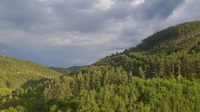
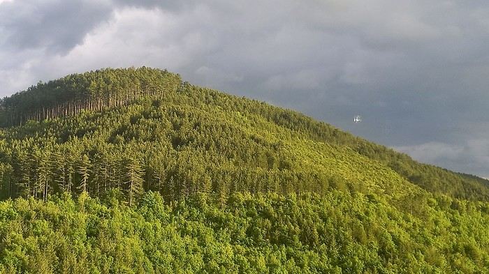
The next morning, we decided to revisit the Parc aux Loups du Gévaudan (Europe’s largest wolf park). As someone used to photo safaris in the wilds of East Africa, I’m not a fan of zoos at all—but I *do* have a deep admiration for wolves!!
Since it’s pretty unlikely I’ll ever see one in the wild, I’ll settle for this Parc aux Loups in Marvejols. This will be our third visit to this incredible gathering of these fascinating canines.
Some are still finishing their chilly night...
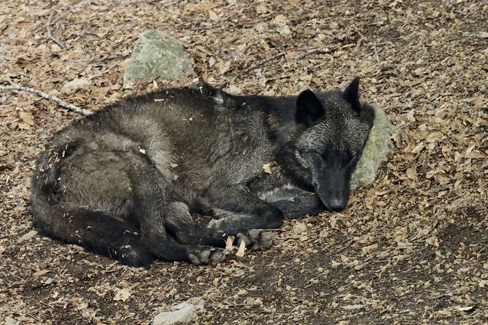
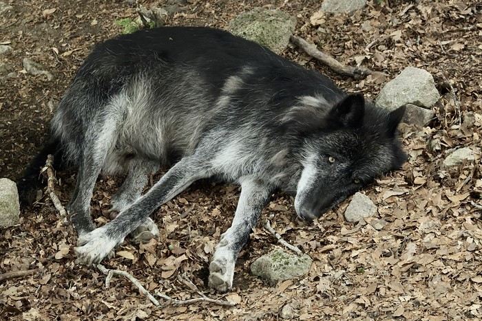
...
After Southern Tanzania, I’m sharing a travel story about the Cantal region with you...
...
For us, at the start of 2025, Le CANTAL was a true “Terra Incognita”!!
After seeing some tempting TV reports, we decided to fill this gap—especially in terms of landscapes. On the same trip, we’ll also head to the Arcachon Basin, the International Seaplane Gathering in Biscarrosse, and my native Landes region...
So, on May 20th, we left Marseille in the rain and thunder, heading toward Nîmes, Saint-Hippolyte, Mont Aigoual, Florac, and stopping in Marvejols to give my arthritic back a break for the night.
The next morning, we decided to revisit the Parc aux Loups du Gévaudan (Europe’s largest wolf park). As someone used to photo safaris in the wilds of East Africa, I’m not a fan of zoos at all—but I *do* have a deep admiration for wolves!!
Since it’s pretty unlikely I’ll ever see one in the wild, I’ll settle for this Parc aux Loups in Marvejols. This will be our third visit to this incredible gathering of these fascinating canines.
Some are still finishing their chilly night...
...
Review of a Norway cruise on the Emerald Princess in June 2025 (1)
Hello everyone,
I’ve wanted to take this Norway cruise for a very long time. The first time I booked it was in July 2020 with Azamara. Unfortunately, it was canceled, as everyone remembers. When I tried to book it again, the prices (already a bit high with Azamara) had simply doubled. So, since then, I’ve been keeping an eye out every year for any opportunities...
The last time we sailed with Princess was eleven years ago, and things didn’t go very well. I came back pretty unhappy with their service and quite disappointed. Despite the $600 they gave me as credit for a future cruise, I’d never set foot on one of their ships again.
But this time, the opportunity arose—a fantastic itinerary with lots of stops, a reasonable price for 16 nights (I’ll share the details in the conclusion), and a ship that’s not too big, so to speak, with only 3,000 passengers. I’m not expecting much from the cruise line this time and am boarding the ship with low expectations beyond the itinerary.
Princess has introduced an app to download before the cruise. It’s essential because online check-in is no longer available, and the agency doesn’t send a travel journal. Everything is done through the app. After completing the check-in on the app, we only know that we’ll need to pick up our key, the Medallion, at embarkation by following the blue line in the terminal and presenting our passport.
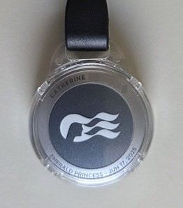
Up until our departure, the weather forecast for the coming week in Norway is disastrous—rain, rain, and more rain. It was pretty much the same two years ago before our Iceland cruise, and in the end, the weather turned out fine.
If you’re ready to embark on the Emerald Princess to discover this beautiful cruise and the stunning landscapes of Norway, let’s go!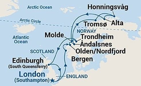
Southampton - Sea day - Bergen - Olden - Åndalsnes - Sea day - Tromsø - Honningsvåg (North Cape) - Alta - Sea day - Molde - Trondheim - Two sea days - Edinburgh - Sea day - Southampton
I’ve wanted to take this Norway cruise for a very long time. The first time I booked it was in July 2020 with Azamara. Unfortunately, it was canceled, as everyone remembers. When I tried to book it again, the prices (already a bit high with Azamara) had simply doubled. So, since then, I’ve been keeping an eye out every year for any opportunities...
The last time we sailed with Princess was eleven years ago, and things didn’t go very well. I came back pretty unhappy with their service and quite disappointed. Despite the $600 they gave me as credit for a future cruise, I’d never set foot on one of their ships again.
But this time, the opportunity arose—a fantastic itinerary with lots of stops, a reasonable price for 16 nights (I’ll share the details in the conclusion), and a ship that’s not too big, so to speak, with only 3,000 passengers. I’m not expecting much from the cruise line this time and am boarding the ship with low expectations beyond the itinerary.
Princess has introduced an app to download before the cruise. It’s essential because online check-in is no longer available, and the agency doesn’t send a travel journal. Everything is done through the app. After completing the check-in on the app, we only know that we’ll need to pick up our key, the Medallion, at embarkation by following the blue line in the terminal and presenting our passport.
Up until our departure, the weather forecast for the coming week in Norway is disastrous—rain, rain, and more rain. It was pretty much the same two years ago before our Iceland cruise, and in the end, the weather turned out fine.
If you’re ready to embark on the Emerald Princess to discover this beautiful cruise and the stunning landscapes of Norway, let’s go!
Southampton - Sea day - Bergen - Olden - Åndalsnes - Sea day - Tromsø - Honningsvåg (North Cape) - Alta - Sea day - Molde - Trondheim - Two sea days - Edinburgh - Sea day - Southampton
Croatia, Montenegro – two victims of overtourism?
Mid-June, two Auvergnats on the starting blocks—off we go to the former Yugoslavia!
We’d already explored some nooks and crannies of northern Croatia back in 2019, so we’re keeping the momentum going by planning a trip to the south of the country and then Montenegro.
On the way back, we’ll drift into Bosnia-Herzegovina just to mix things up a bit!
We’re a little unsure about what to expect in terms of tourist crowds.
Dubrovnik has a reputation for being the hardest-hit city by overtourism, and Kotor and the whole Dalmatian coast aren’t exactly empty...
Luckily, most European countries haven’t started school holidays yet, and some measures seem to have been put in place to limit the flow (like restrictions on the number of cruise ships allowed to dock at the same time).
Maybe we’ll manage to escape the promised hell?
For now, we’re slamming the doors of the Scirocco and heading off to our first stop: northern Italy!
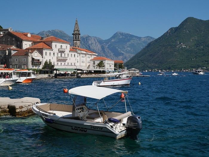
On the way back, we’ll drift into Bosnia-Herzegovina just to mix things up a bit!
We’re a little unsure about what to expect in terms of tourist crowds.
Dubrovnik has a reputation for being the hardest-hit city by overtourism, and Kotor and the whole Dalmatian coast aren’t exactly empty...
Luckily, most European countries haven’t started school holidays yet, and some measures seem to have been put in place to limit the flow (like restrictions on the number of cruise ships allowed to dock at the same time).
Maybe we’ll manage to escape the promised hell?
For now, we’re slamming the doors of the Scirocco and heading off to our first stop: northern Italy!
Namibia Travel Journal: May 2025 - Trip Review
NAMIBIA TRIP 2025: April 24 to May 20: Feel free to comment or ask us any questions about this amazing journey.
>> Find all our photos and videos for each day on our website here: www.montagne-aventure.net
**DAY 1: Thursday, April 24, 2025: Outbound Flights from Lyon to Windhoek via Munich - Visit to Munich:**

Off we go on a new adventure. The alarm rings at 6:30 AM, the travel bags are packed, and we head to Lyon Airport. We booked our flight tickets with Lufthansa. The first leg to Munich, Germany, is operated by AirBaltic. Departure at 1:05 PM for a 1-hour and 20-minute flight. We arrive at 2:30 PM.
**We now have a 7-hour layover, so we take the opportunity to get some fresh air and explore Munich.** We quickly exit Terminal 2 of the airport and head towards the subway. We buy a group day ticket "Airport-city Day Zone M-5," valid for 2 to 5 people at a price of 30.50 € (instead of 16.30 € per person). We take the S8 line to **Marienplatz** in 35 minutes. **This is the heart of the city.** The weather is overcast, quite cool, but dry. Perfect for a little city trip between two flights while leaving our large luggage in transit at the airport. **Munich is the third-largest German city after Berlin and Hamburg, in the Bavaria region.** **The center has a lot of charm and brings together several religious buildings, easy to explore on foot.** We are impressed by the number of people enjoying these 100% pedestrian streets, which are very pleasant. After Marienplatz, the most famous square with the town hall, we head to the Cathedral of Our Lady, a Gothic church, then continue to **Karlsplatz** and move on to **the food market offering a wide selection of high-end food products in an atmosphere where a certain art of living prevails.** We also visit St. Peter's Church before grabbing a bite to eat. Two good hours were enough for this 10 km city walk. It's time to take the subway back: by 6:30 PM, we are back at the airport. Now, it's time for a bit of waiting and rest. Our second flight is scheduled for 9:35 PM for a 9-hour and 30-minute journey to our final destination in Namibia: **Windhoek.**
> Round-trip flight tickets with Lufthansa from Lyon: 2029 €, or 1,014.50 € per person.
> Lyon Airport parking: 120 €
> Today's expenses: 7 € for 2 pizzas in France / 14 € for the restaurant in Munich / 30.50 € for the daily subway ticket in Munich.
**DAY 2: Friday, April 25, 2024: Arrival in Windhoek, Visit to the Namibian Capital:**
After a 9-hour and 30-minute overnight flight with Discover Airlines, we finally land on Namibian soil just before 7:30 AM. The day is breaking, and the colors are already stunning. We are eager despite the usual fatigue from the flight. The airline was punctual, with friendly staff and good meals, though a bit light. We are the first flight of the day to land, with no more than 15 flights per day here, from 7 AM to 8 PM. We disembark on the tarmac at this airport located in the middle of nowhere, **I finally set foot on African soil for the first time.** We exit among the first from the aircraft to go through the long formalities at the front of the line, as the wait can quickly become endless. Allow at least 5 minutes per person for e-visas. We still wait 45 minutes despite only about twenty people ahead of us. Phew, it's done. We collect our luggage and then withdraw money from an ATM. We make 4 withdrawals of the maximum amount, 2000 NAD $ per withdrawal, for a total of 380 €, or 95.33 € per withdrawal.
Our driver arrives at the same time, perfect timing, we were quick.
We leave the airport at 8:45 AM. By 9:30 AM, we arrive at the **Gracious Whisp vehicle rental agency**, located at the entrance of Windhoek, small and human-sized with a fleet of recent vehicles. More formalities, then a short wait as our vehicle is not yet ready. Time to decompress, catch our breath, and enjoy the very pleasant morning temperature. Not a cloud in sight. Next, a briefing on the vehicle, always with a bit of apprehension due to our approximate English. Allow 45 minutes of explanations, including setting up the roof tent, camping equipment, technical information in case of a flat tire, driving tips in Namibia, and a tour of the 4x4. We have all the necessary equipment for camping: mattresses, sleeping bags, pillows, table, chairs, gas stove, BBQ grill... as well as 2 spare tires, a compressor, a dual tank, and accessories for removing wheels. Off we go, it's time to muster our courage and get behind the wheel. **Heading to SuperSpar Maerua**, fortunately located less than 10 minutes away. We park with the help of a parking attendant; it's very crowded, the space is narrow, but everything goes well despite the cursed right-hand drive. Today's new mission: stock up on groceries. The store is well-stocked with local and imported products, catering to all tastes. We spend 114 € on groceries, from pasta to meat, BBQ lighters to dishwashing products. Two people load our groceries into two carts and transfer them to our vehicle; we feel compelled to leave a tip, 50 NAD $, as we don't have change yet. Now, we head to the hotel, 15 minutes away. Traffic is difficult at a complicated intersection; this will likely be the only traffic jam in Namibia. **We arrive at Kate's Nest Guesthouse & Backpackers around 1:15 PM, quite tired.** We take some well-deserved rest at this recent establishment, quite calm with secure private parking. After a short nap, we enjoy the quiet by the hotel pool. Night falls between 6:30 PM and 7 PM. We eat quietly in our room tonight before starting this long 4x4 road trip in camping mode in the heart of Namibia.
> Today's grocery expenses: 114 € at Super Spar Marua (2395.21 NAD $).
> Round-trip flight tickets with Lufthansa from Lyon: 2029 €, or 1,014.50 € per person.
> Vehicle rental: 4x4 Toyota with roof tent for 24 days: Gracious Whisp Car Rentals: 2,638 € (N$50,640) or **1,319 €** per person - (https://gwcarrentals.com/)
> Distance driven today: 15 km.
> Accommodation: Kate's Nest Guesthouse & Backpackers - 4 Aristotles Street Academia, 9000 Windhoek - 36 € for two for one night.
> Windhoek International Airport website: (https://www.airports.com.na/)
**DAY 3: Saturday, April 26, 2025: Windhoek to Hardap: Mariental Region - Kalahari Desert:**
After a good, restful night, we wake up leisurely around 7 AM. We enjoy the comfort provided by this first and last hotel before 24 nights under the tent.
**We leave Kate's Nest Guesthouse at 8:30 AM to tackle the Namibian roads.** We quickly leave the capital; in just 30 minutes, we find ourselves almost alone in the world. The landscape is dotted with small domes. We leave the **paved B1** quickly to turn left onto the **C15**. **From there, we won't see more than 10 vehicles all day.** After passing through the few houses of **Lekkerwaterpoort**, we tackle our first gravel road. These road sections are limited to 100 km/h, but even at 70 km/h, I find it already challenging. However, I quickly get used to it and gradually pick up speed to reach my cruising speed of around 80 to 90 km/h. **We are on immense straight lines crossing wild expanses as far as the eye can see.** **We come across two baboons, a few ostriches, and numerous cattle and sheep farms.** We pass through the charming village of **Uhlenhorst** with its typical houses and children with broad smiles waving at us. Life here is already very different from Windhoek. **The thermometer rises quickly from 16°C at 8:30 AM to over 28°C in the early afternoon.**
**We arrive at the Hardap Dam reserve at 2 PM.** We stop at the toll booth at the park entrance to pay the entrance fee: 250 NAD $ for 2 people and 1 vehicle. We continue to the dam and then the camp entrance, located a bit further. We had booked in advance, but this place remains little frequented by foreigners.
We take advantage of the hottest hours to rest by the large pool overlooking the immense lake, a very enjoyable moment. Would this be a bit of a vacation?
Around 4:30 PM, we head to the campsite. We overlook this vast water reserve. We arrive first; we will be only 3 vehicles spending the night here. It's time to get to work and set up our equipment for the first time. It takes us a good 20 minutes to set everything up, with a slight apprehension about unfolding the tent. Once this task is done, which we will have to repeat for almost a month, we will become much more efficient over time. Time for rest and contemplation in total silence. The sun gradually sets, and the heat quickly becomes bearable again. Bliss! **This dam is located 20 km northwest of Mariental in an area dotted with conical hills topped with dolerite buttons (Hardap means "hillock" in Nama). It captures the Fish River, which flows south, creating a large lake in the middle of an arid environment. The contrast is striking.** We enjoy our first sunset facing this 360° otherworldly landscape.
Around 7 PM, we start our first BBQ, or "braai" as it's called here. The temperature is perfect. The sun sets, giving way to a star-filled sky of incredible beauty thanks to the absence of any light pollution. The Milky Way will lull us throughout the evening. After some good sausages and potatoes on the BBQ, we head to our roof tent around 9:30 PM with a complete change of scenery in just 24 hours. France already seems so far away...
This campsite has shared showers and toilets, quite clean and functional, as well as a central area with several BBQs and tables. The sites are arranged in a semicircle, each with an electrical outlet. The sites are close to each other but spacious, some slightly shaded. We are only three vehicles tonight, so it's perfectly comfortable and quiet. Not to mention the large pool near the restaurant. Our trip is off to a great start.
> Today's road itinerary: Windhoek > Head south on the B1 to Rehoboth > Turn left onto the C25 then C15 to Stampriet > C20 to Hardap > Full north on the B1 > Then turn left onto the M93 - 5 hours of driving.
> Distance driven today: 354 km.
> Accommodation: Hardap Recreation Resort - 23.3 € for two - Large pool - GR6W+3M2, Hardap Game Reserve, Mariental, Namibia - (http://www.nwr.com.na/resorts/hardap-resort/)
**DAY 4: Sunday, April 27, 2025: Hardap - Brukkaros Volcano - Keetmanshoop - Quivertree Forest Rest Camp**
Our first night under the tent was very pleasant; the little wind quickly calmed down, giving way to absolute silence. The mattress is decent, more comfortable than some nights in Nepal. The length and width give us enough space for maximum comfort, despite my height (1.91 m). We wake up a little before 7 AM as the sun rises, and the lights dazzle us from the start of the day. We pack up the equipment in 30 minutes, quite easily. Then we enjoy the sun, which warms up quickly while we keep our light fleece on.
At 8:30 AM, **we hit the road again, heading south** to our first stop in **Mariental**. We want to do some shopping at SuperSpar, but once we arrive in the parking lot, a young local is fighting with the supermarket security guards and then threatens to throw stones. We don't want to take any risks right at the start, so despite the baton blows he receives, he doesn't stop. We leave empty-handed but fill up with fuel at the Shell station 1 km further. The price per liter is 21.33 NAD $, we fill our 107-liter tank for 107 €. In Namibia, you get served, and they bring the card machine to the window to pay. It's then customary to leave a tip.
We then take the B1 heading due south on a recently renovated road. Around 11:30 AM, we leave it on our right to take **a wild gravel road, the M98**. Just before **Berseba**, we turn right onto a small track, the **D3904 towards Brukkaros Crater up to a camp at 1588 m altitude**. The track then becomes too bumpy. We stop on the counter-slopes where **a wide panorama unfolds over these immense plains as far as the eye can see**. It's 12:15 PM, time for us to eat a rice and tuna salad facing this landscape.
**We are alone in the world until a vehicle arrives and parks next to us.** A bit of apprehension, 4 men head towards us. It turns out to be 4 shepherds looking for a lost foal. The conversation is pleasant, lost in the middle of nowhere. We find ourselves alone again in this absolute silence. **The heat becomes stifling with a good 30°C**. We get back on the road around 1 PM. Back on the B1, **we continue due south to Keetmanshoop**, which we reach around 3 PM. We stop there to do some shopping for 262 NAD $ (12 eggs, a can of tuna, a can of corn, bread, a soda, and a 5-liter water container), or 12.48 €. Two quite insistent children ask us for money or candy at the store exit, yet we give them a small tip, but they continue to cling to the car. Locals parked next to us tell them to leave us alone. Anyway, we finish the trip to **Quivertree Forest**, 15 km away. We will spend the night in this **pleasant farm run by a German**. Upon arrival, as the day before, and as I suppose in the future, we dive straight into the cool pool to relax after all these kilometers. A bliss. Then we take our 4x4 and choose a spot near these famous trees. After the 33°C this afternoon, once 4 PM passed, the temperature drops again and becomes very pleasant. **We are in the middle of the Kokerboom, one of the most interesting and characteristic plants of hot and arid regions. It's not really a tree but a variant of the aloe plant whose botanical name is Aloe Dichotoma. This Kokerboom has a smooth and thick trunk reaching up to 1 m in thickness and 9 m in height. They bloom for the first time at the age of 20 to 30 years.** The flowers are yellow and reach about thirty centimeters during the season between June and July. **They grow mainly in an environment with a high concentration of black rocks absorbing a large amount of heat (38°C). The rocks also serve to anchor the tree with its tentacle-like roots. It also resists frost. Each is between 200 and 300 years old.**
Around 5 PM, we walk to the farm reception to watch the feeding of **two cheetahs**. Magnificent carnivores taking their time to savor their piece of meat. **Then we return near our campsite to enjoy the sunset among these trees. The colors are sublime, as every evening apparently. A magnificent spectacle with colors evolving from yellow to orange then to pink, before giving way once again to a sky filled with thousands of stars.** Our campsite at Quiver Tree Forest Camp is very comfortable; we have a water supply, a stone table, a small lamp, an electrical outlet, a small tree for shade, and a BBQ that we won't use tonight; we'll cook on gas. The sites are far apart, with some shared facilities scattered around, a very beautiful setting. No reservation possible, no need, just show up directly. **The campsite accommodation for 2 people costs 28 €, including the reserve entrance fee of 5 €**. We finish this second bivouac evening around 9:30 PM, time for some reading and sleep in peaceful silence without wind.
> Today's road itinerary: Mariental > B1 heading south to Brukkaros > At Tses turn right towards Berseba via the M98 > Turn right onto the D3904 > 8 km > Brukkaros Volcano (stop at the lower camp as the track is difficult for 1 hour) > Keetmanshoop > Turn left onto the M29 > Quivertree Forest - 4 hours of driving.
> Distance driven today: 371 km.
> Distance walked today: 6 km.
> Today's expenses: Groceries for 12.48 € (262 NAD $) / Fuel for 107 € (1 liter of diesel for 21.33 NAD $).
> Accommodation: Quivertree Forest Rest Camp, P.O. Box 262, Keetmanshoop, Namibia - BBQ, hot showers, toilets, and electricity - No reservation - Pool - 18 €/Person (N$ 340.00 with park entrance) - (http://www.quivertreeforest.com/)
**DAY 5: Monday, April 28, 2025: Quivertree Forest Rest Camp - Giant's Playground - Keetmanshoop - Fish River Canyon - Canyon Roadhouse:**
After an excellent start to the night, we are woken up by the wind shortly before 6 AM, but the sunrise is not far off. We get up at 6:30 AM to enjoy it. The atmosphere is a bit cooler this morning, but the reward is already here.
The adventure continues. At 7:45 AM, we head towards **Giant's Playground**, 4 km away. We take a 3-kilometer walk through this expanse of blocks and igneous rocks.
We continue south at 8:45 AM, passing through Keetmanshoop again where we do some shopping for 25 €, a big stock-up for a good part of the trip: meats, canned goods, pasta, fruits... At 9:30 AM, we take the B4 to Fish River Canyon.
At 11:30 AM, we arrive at the entrance to the NWR park (350 NAD $ entrance for 2 people and 1 vehicle). The track becomes bumpy immediately upon entering the park. After about ten kilometers, we come upon this landscape carved by nature. In the end, it's well worth the detour. We were at the Grand Canyon in the USA exactly (https://www.montagne-aventure.net/2024/04/29/j21-3-juin-2024-grand-canyon-et-lac-powell/) and can thus confirm that this Fish River Canyon is comparable. We make several stops along the southern flank. **Here, nothing is developed; nature is almost in the wild state.** **With 160 km in length, up to 27 km in width, and a depth of 150 m, it is indeed the second-largest canyon in the world.** The history of the canyon is apparent in its different earth layers and stratification: the antiquity of the place is tangible, and the absence of vegetation is surprising. **It consists of two nested canyons, formed at distinct periods. The first distinct layer of schist, sandstone, and eruptive material surrounding the canyon was formed a few two billion years ago, then transformed due to heat and pressure into more solid rock such as gneiss. The inner canyon, carved more recently by the Fish River, has a depth of 270 m.**
We have a picnic once again alone in the world facing this grand panorama at the **Sulphur Spring View Point**. This is where the hiking trail begins, plunging into this narrow canyon, but it is forbidden to venture there alone without a guide. It's 30°C, but a slight wind makes the atmosphere bearable. At 1 PM, we retrace our steps and continue to the **Main View Point** then to the **Hikers View Point**.
In the south of Namibia, the Fish River Canyon, 160 km long, is a true geological wonder: a canyon nested within another canyon, one of the largest in the world. The first sedimentary layers formed two billion years ago; 500 million years ago, a period of tectonic activity caused these layers to crack and tilt, opening a vast canyon in the Earth's crust. The second canyon, with a depth of 270 m, was carved over time by the passage of the Fish River in this new valley.
At 3 PM, we arrive at our very charming camp for the evening, the **Canyon Road House**. We fill up with fuel right away because tomorrow we have a long day of isolated driving: 55 liters for 1240 NAD $. Then we settle into the campsite we had previously reserved in France. We are assigned site 2, very well set up under a tree with its BBQ and stone table just steps from the pool. We quickly set up the tent and jump straight into the pool for the relaxation moment of the day. As usual, the water is quite cool, but it's a real pleasure. Then we stroll around this Canyon Road House, which recreates the atmosphere of the roadside inns of the 1950s with old car wrecks and vintage gas pumps in a bygone era. **Around 5:45 PM, we start a short walk leading us to the top of a hill overlooking the wide plateau where we are to watch the sunset.**
And finally, to end this beautiful day, it's time for the braai, with grilled sausages and white beans on the evening menu.
> Park entrance: 150 DN/person + 50 DN/vehicle (18 € for two). It is possible to enter at two access points: Hobas in the north and Ai-Ais in the south.
> Today's road itinerary: M29 > Keetmanshoop > B1 > B4 > C12 (track) > After Holoog turn right onto the D601 (C37 track) > Accommodation on our right (stop just to check in before 6 PM) > Continue 30 km (30 minutes of track) to the viewpoints after Hobas where you must pay the entrance fee. Sunset View Point to the left > Return before sunset as the park closes (best lights at sunrise). 3 hours.
> Distance driven today: 228 km.
> Distance walked today: 10 km.
> Today's expenses: 25 € for groceries / 17 € for the Fish River Canyon park entrance / 58 € for fuel.
> Accommodation: Canyon Roadhouse, Gondwana Collection Namibia – 34.4 € for two - Pool - Near Hobas - (http://www.gondwana-collection.com/fr/accommodation/canyon-road-campsite)
**DAY 6: Tuesday, April 29, 2025: Canyon Roadhouse - Orange River - South African Border - Vista Trail - Gondwana Sperrgebiet Park - Aus:**
The night was excellent in this very comfortable campsite. **We wake up to the sound of birds** before the alarm at 6:45 AM. Our little morning routine starts as the sun rises. **A big day of driving awaits us to the South African border. This will be the southernmost point of our journey.** We hit the road at 8 AM via the C37, pass through **Hobas**, then turn onto the D207 to **Aussenkehr.** **We cross a mountainous barrier with some high peaks and perfect cones. The rock varies from orange to pink to black.**
We then cross a lunar desert as far as the eye can see on a giant dome; the track winds through nowhere without meeting anyone for hours. The landscapes are surprising. **We spot several ostriches and a gemsbok.** In the middle of this endless expanse, we come to an improbable intersection and continue right onto the D278.
In the middle of these arid lands, we come across a green zone: a vast vineyard. At 10:30 AM, **we come across a "Road closed" sign, fortunately, a local resident waves us to continue; a bit stressed, we proceed.** We start to follow the beautiful Orange River. On the other side of the bank, just a few meters away, South Africa is there. It is the second-longest river in Southern Africa, after the Zambezi. It flows over 2,000 km to the Atlantic. After passing through narrow gorges, we regain altitude before starting the descent, gently heading back north.
**We now cross and follow the Fish River, which joins the Orange River further south** **along this gorge dating back millennia.** At exactly noon, we take a lunch break by the Fish River, still without meeting a soul in this landscape between greenery and aridity. The temperature here is cooler with a pleasant 23°C on the banks, the perfect spot. **We continue on the track to Rosh Pinah**, where we find a paved road again. **The section along the Orange River and the Fish River was officially closed, but we were able to pass without any issues, avoiding a detour of at least 3 hours.** Phew. We now drive at high speed (limited to 120 km/h) through these vast spaces. We come across many ostriches after the **dozens of monkeys along the Fish River**. Around 3 PM, 3 km after the very small town of **Aus**, we reach **our campsite for the evening at Klein Aus Vista**. A new **small peaceful haven very well set up**. As usual, after checking in at reception, we jump straight into the beautiful pool to get our well-deserved dose of coolness, another good thermal shock that our bodies appreciate. Once this moment of relaxation is over, we take our 4x4 to reach the campsite located a bit higher, set apart at the foot of a hill that overlooks us.
After setting up, **around 5 PM, we head to the Vista Trail to climb to the top of a mountain overlooking the vast plain that surrounds us at 360°**. It takes about 30 minutes to climb. The place is just magical, **the perfect viewpoint to admire the sunset**. **We fully savor the moment. We also spot one of the few wild horses in the world capable of living in the desert.** Their numbers have decreased in recent years due to predation and drought (around 100 to 150). At 7 PM, we return to the camp, time for the braai and preparing the meal in this peaceful little camp.
In the south of Namibia, the Fish River Canyon, 160 km long, is a true geological wonder: a canyon nested within another canyon, one of the largest in the world. The first sedimentary layers formed two billion years ago; 500 million years ago, a period of tectonic activity caused these layers to crack and tilt, opening a vast canyon in the Earth's crust. The second canyon, with a depth of 270 m, was carved over time by the passage of the Fish River in this new valley.
> Today's road itinerary: 5 hours of driving: D324 heading south (track) > turn right onto the C10 (track) > D316 heading south > turn right onto the C13 > In Aus turn left onto the B4 > Campsite via a track on the left.
> Fuel station: Solitaire or Aus.
> Distance driven today: 398 km.
> Distance walked today: 7 km.
> Accommodation: Klein-Aus Vista Desert Horse Campsite - Farm Klein-Aus No 8 on the B4 main road to Luederitz Aus 9000, Aus, Namibia - (http://www.klein-aus-vista.com/accommodation/desert-horse-campsite/) 17908 420 DN - Water + Shared shower (hot water). No electricity.
**DAY 7: Wednesday, April 30, 2025: Aus - Kolmanskop - Diaz Point - Luderitz - Kanaan Desert:**
We wake up around 6:45 AM, with partly cloudy weather for once; we feel the ocean's influence gradually. But the sun isn't far off. At 7 AM, we leave the campsite heading west towards Luderitz via the B4. **First stop of the day: Kolmanskop, the ghost town we reach at 8:30 AM**, entry costs 180 NAD $ per person. We discover this **timeless place** in 1.5 hours, moving from building to building amidst violent sand-laden gusts of wind. There's a lot of charm in these different living spaces. **The sand quickly reclaimed the place after this mining town was abandoned.** This was once the headquarters of Consolidated Diamond Mines. It's hard to believe that this former town, where the diamond industry once flourished, had a hospital, a bowling alley, and a theater. The decline in diamond sales after World War II and the discovery of richer deposits put an end to this golden age. By 1956, the town was already completely deserted, and the sand had reclaimed its rights. **These dilapidated buildings swallowed by shifting dunes have something surreal about them.**
At 10:15 AM, we hit the road again **heading to Luderitz, 22 km away**, and first to **Diaz Point** **facing the Atlantic Ocean**. It's a wind-swept peninsula with its characteristic red and white lighthouse. There's a campsite and a coffee shop on site, but the place doesn't inspire rest without shade or shelter from the wind. We return to the city via the D701 track that runs along the ocean, be careful at low tide. We come across **a few fishermen and a fox as well as flamingos.**
We walk through the few streets of the city, much smaller than I imagined, then climb to the **famous little Lutheran church that overlooks the city, the Felsenkirchr.** **The wind blows very strongly here, and the sand is omnipresent, surrounded by the Namib Desert and the southern Atlantic coast.** **A German colonial relic barely touched by the 21st century, Luderitz seems frozen in the past, giving it both a gloomy and a certain charm. In short, it's certainly one of the most incongruous places in Africa.**
At 1:15 PM, just before leaving Luderitz, we do some shopping for 20.50 € and fill up with fuel: 61.50 €, 1290 NAD $ for 61 liters (21.18 $ per liter).
**We return via the B4 to Aus** (paved), **then via rougher tracks**, the C13 then the D707, magnificent as it runs along a mountain range with multiple colors on our right and an endless flat desert on the other side.
To access our campsite for the evening, we must take a **narrow private track for 7 km** on our right to emerge, in this total vastness, at the **isolated Kanaan Desert Retreat on a small hill**. I don't have time today to jump into the pool near the reception; we arrive at 5 PM at 8 small, isolated, and unique sites with a small kitchen, a shower, and a private toilet under a small tarp shelter. **A crazy charm with a unique view...** **This will be my favorite accommodation of this trip. The photos speak for themselves.** We jump into the outdoor shower while savoring the landscape, then prepare our evening braai while enjoying the colors fading, facing this plateau with bushes turning a vivid orange. **A moment that will remain etched for life.** **Savanna atmosphere under a thin emerging moon. Every minute offers different colors. Facing our meal, we have a natural giant screen.**
We end this day contemplating the stars and admire this thin orange moon setting on the horizon (8:42 PM).
**Ghost town just before Luderitz: Kolmanskop** (open from 8 AM to 3 PM - N$ 180 p.p – 9 €). Once, Kolmanskoppe was organized around diamond mining. After finding new, more prolific spots, the town was abandoned and is now a ghost town. The sand and dunes have reclaimed their rights and buried everything humans had built. Houses, train station, bakery, everything has been covered by sand, which passes through the windows, even though they are 1 meter high.
> Today's road itinerary: 5h30: B4 to Luderitz (paved) > Round trip > Kolmanskop on the left > Return via the previous campsite > Then C13 (track) > Turn left D707 (track) > Then track to the right to the campsite.
> Distance driven today: 438 km.
> Distance walked today: 8 km.
> Today's expenses: Groceries at the Spar in Luderitz for 20.50 € / Fuel fill-up in Luderitz for 61.50 €.
> Official Kolmanskop website: (https://kolmanskuppe.com) (open from 8 AM to 1 PM - N$ 180 p.p – 9 €).
> Accommodation: Night at the south of the Namibrand Nature Reserve: Kanaan Desert Retreat – 26.5 € for two - (http://www.kanaannamibia.com/) - Farm 104 Karas 9000 - Sanitary facilities + BBQ + Water + Pool - No electricity - My favorite accommodation of this trip.
**DAY 8: Thursday, May 1, 2025: Kanaan Desert Retreat - Namib Desert - Crossing the Namibrand Nature Reserve – Sesriem Canyon - Elim Dune - Little Sossus Lodge**
After a cooler night than the previous ones with about 10°C, we wake up around 7 AM. We admire, as usual, the sunrise between the desert and the mountains. **The spot from last night was truly perfect, isolated from the world, in total serenity, with a wake-up call to the sound of birds.**
We hit the road a little after 8 AM, heading north via the D707 to Spes Bona, then the gravel road C27 via Betta to Sesriem. **The landscapes roll by and dazzle us.** **We are right in the heart of the Namibrand reserve**, coming across numerous **zebras**, **impalas**, **ruminants that reproduce in large numbers**, and **gemsboks**. At noon, we stop in the shade of a tree to eat. The spot is so romantic facing orange arid mountains and a vast green plateau. **A landscape full of contrasts, timeless and silent.**
**The Namib Desert is the oldest on the planet; its name means "vast arid plain," and it also gave its name to the entire country: Namibia.** The majority of these arid and semi-arid lands dotted with viewpoints are part of the Namib-Naukluft National Park, which covers 23,000 km².
At 1 PM, we enter the Sossusvlei park. We start with the **Sesriem Canyon**, which is 3 km long and 30 m deep. We enter it with a short 1-hour hike into its depths. **It was carved by the Tsauchab River in an agglomerate of sand and pebbles over 15 million years old.** We retrace our steps back to Sesriem, which means "six belts," referring to the number of leather belts (from ox wagons) needed to draw water from the canyon. This remote locality is mainly the gateway to Sossusvlei but offers a gas station and some accommodations. For our part, we sleep 40 km away tonight.
**We then move on to Elim Dune.** It takes about 45 minutes of walking to reach its summit, and the climb is very breath-taking as we progress in the sand where we almost slide back with each step. **A first grand 360° panorama unfolds. The ochre color of the sand contrasts completely with the yellow plain and the brown and black mountains in the distance.**
At 3:15 PM, we start the descent facing Sesriem. We were completely alone once again on this dune. **These Namib dunes are composed of colored quartzite sand, presenting hues ranging from cream to orange and from red to purple. Unlike the ancient dunes of the Kalahari, these move with the wind and adopt distinct, ever-changing shapes.** Star dunes resemble stars seen from above, while transverse dunes, like those on the coast south of Walvis Bay, stand perpendicular to the prevailing southwest wind. The most stable dunes, which thus have the most vegetation, are parabolic dunes, due to the variability of the winds. Longitudinal (seif) dunes measure up to 100 m in height, while barchan dunes, crescent-shaped and predominant at the extreme north of the Skeleton Coast and south of Luderitz, are the most mobile, created by unidirectional winds.
**We get back on the road for 45 minutes to our campsite for the evening, Little Sossus, which we reach at 5 PM**, via C27 then right onto C19. As often upon our arrival, I jump into the cool pool to relax after all this driving, then we proceed to set up the camp. As the day before, the campsite consists of 10 fairly distant sites, with private sanitary facilities and a small roof. We are delighted with this crazy charm. The hot water for our shower is wood-heated: a Namibian lights it every evening around 5 PM.
For a change, or not, the menu features a small BBQ with pork ribs and pasta, facing another sunset, this time with partial cloud cover giving equally splendid colors. Time for a well-deserved rest after long corrugated tracks covered in our 4x4 today.
> Today's road itinerary: 4h45 of driving: Find the D707 and head north (track) > At Spesbona turn left onto the C27 (track) > At Sesriem after entering the park, turn left following View Point Sesriem > Continue 4.5 km to the Sesriem Canyon Parking > Return then head towards Elim Dune > Exit the park then take the D826 > Turn right onto the C19 heading SE > Turn right facing the D854 to the campsite (campsite closes at 7 PM).
> Distance driven today: 272 km.
> Distance walked today: 8 km.
> Today's expenses: Entry to the Sossusvlei Namib-Naukluft Park: 17 € for two (with one car).
> Accommodation: Little Sossus Lodge – 35 € for two - At the junction of the C19 and D854 roads Maltahohe 9000, Maltahohe, Namibia - (http://www.littlesossus.net/) - Pool + Private bathroom + Hot water + Electricity + BBQ + Grocery store (bread to order the day before).
**DAY 9: Friday, May 2, 2025: Little Sossus Lodge - Namib-Naukluft National Park – Sesriem - Sossusvlei - Big Daddy – Deadvlei - Tsauchab River Camp**
Today we start the day early to tackle **the famous dunes of Sossusvlei at first light**. The alarm goes off at 6 AM to leave the camp at 6:45 AM. The wind is blowing quite strongly in gusts this morning, but it only woke us up a quarter of an hour before sunrise. The park opens at 7:15 AM. We start with a small encounter: a friendly **jackal lounging by the roadside.**
We first have to cover the 40 km of track to Sesriem, pay the entrance fee (350 NAD $), and drive 65 km on a paved road this time to reach the **vast salt pan (a lake whose sediments are made of salts) of Sossusvlei**. **It appears amidst the gigantic red dunes that rise on either side. The wind constantly changes the shape of the dunes, as well as their colors, which vary with the light. The setting is breathtaking, giving an impression of immensity and timeless grandeur.**
The paved road ends; the last 4 kilometers become technical and are reserved for 4x4s. Phew, I pass without any problems, though not without stress, switching to L4 mode. **We start the ascent to Big Daddy at 8:45 AM, 325 m of elevation gain in the sand nonetheless.** We climb at an excellent speed despite the strong wind, in exactly 1 hour. At 9:45 AM, we are at the summit of what will remain etched for a long time. The 360° view is simply unimaginable; you have to experience it to believe it. The wind blows violently up there, **it feels like being in the high mountains, on a snow ridge, with a strong transport of sand. The atmosphere is magical.** We start the descent running barefoot in the steep sand.
**We then move on to its neighbor, Deadvlei.** **Here, petrified trees stand in the "vlei" (basin) with their dried branches casting desolate shadows on the white ground. The juxtaposition of the deep blue sky and the towering dunes is captivating.**
We return to the 4x4 parking at 11 AM, the stress rises again for the sandy track passage. We retrace our steps and stop at **Dune 45**.
At noon, we take the opportunity to picnic at the foot of **the beautiful Dune 40**, where there is already no one left. We enjoy the quiet again, well, almost, as the wind remains omnipresent.
At 1 PM, we return to **Sesriem**, where we fill up with fuel (21.15 NAD $ per liter), totaling 1630 for 77 liters (78 €), and do some shopping for 245 NAD $ (two nice pieces of pork, 2 cans, 2 sandwiches for tomorrow, and 1 soda), which is 12.48 €. It's 27°C. We hit the road again, heading to a new destination at 2 PM. We take the C19 back to Little Sossus where we spent the night, then turn left onto the gravel road D854 for about 40 km to **Tsauchab River camp**. Finally, we won't be sleeping here; we are redirected 7 km downstream to **Naukluft View Camp**, which also belongs to Tsauchab River Camp.
We arrive at 4 PM, and thankfully, the fatigue was starting to set in. **Our campsite is located under a small forest, providing some protection from the wind that blew strongly all day. The calm does us a world of good. Once again, a lot of charm**, with very spaced-out sites without any visibility. We can't wait to take our shower. It will be possible from 5 PM with, as the day before, water heated by a wood fire. Time to prepare the campsite for the night. And on the menu, a braai with two superb pieces of pork bought in Sesriem and fries!!!!
**The Namib Desert**
An impressive coastal desert stretching from the Atlantic to a high plateau inland, the narrow Namib Desert runs along the southwest African coast for about 1,300 km. **Considered one of the oldest deserts in the world**, it is bordered to the north by the Kaokoland Desert, which extends into Angola, and to the south by South Africa's Karoo. The narrow Namib is mostly less than 160 km wide. Despite this, it is considered to consist of three sections: the coastal strip influenced by the Atlantic; the Outer Namib, occupying what remains of the western half; and the Inner Namib, comprising the eastern half of the desert. Generally called the Skeleton Coast, the coastal Namib receives almost no rain and depends on regular marine fogs for moisture. From sea level, the terrain rises to 900 m, where the desert meets the base of the Great Escarpment to the east. In the Inner Namib, average annual rainfall is only about 50 mm.
The dryness is such a characteristic of the Namib that it is thought to have been in this arid state for at least 55 million years. It is all the more surprising to learn that animals such as vipers, geckos, zebras, and elephants live in this desert. Some areas of the Namib are also rich in flora, including Welwitschia mirabilis, which grows near the ground with seemingly exhausted leaves, extracting moisture from marine fogs and can live over 1,000 years. In the southern Namib, some dunes are up to 32 km long and 240 m high.
**The frequent fog of the Skeleton Coast:** Driving north along the coast of Namibia, the cold Benguela Current in the Atlantic cools the moist air above the ocean, which, upon meeting the warm desert air, leads to the formation of thick fog banks that drift up to 100 km into the center of the Namib before evaporating under the sun.
> Today's road itinerary: 4 hours of driving: C19 towards Sesriem (track) > D826 (paved) > Foot of Big Daddy via a technical sandy track > Return via the same route > D854 to Tsauchab.
> Gas station: Sesriem.
> Distance driven today: 254 km.
> Distance walked today: 12 km.
> Today's expenses: Park entry at Sesriem for 2 people: 17 € / Fuel fill-up: 78 € / Groceries at Sesriem gas station: 12 € (245 NAD $).
> Accommodation: Tsauchab River Camp - Naukluft View Camp - D054 & D850 GPS: S24 26' 37" E16 10' 11" Sossusvlei 22007, Maltahohe, Namibia - BBQ + Private sanitary facilities + Water - www.tsauchab.com
**DAY 10: Saturday, May 3, 2025: Tsauchab River Camp - Naukluft National Park - Olive Trail Hike (10 km) - Ababis Guest Farm**
We pack up the camp at 8 AM and continue our road trip north via the D854, a bumpy track with many corrugated sections. It's cool this morning, 12°C.
**We enter the Naukluft massif, discovering landscapes with very different terrain than before.** We first need to check in at the campsite, 13 km from the entrance at the end of the track: 350 NAD $ for 2 people and 1 vehicle, then return 4 km back. **On the agenda is the lovely Olive Trail, a 10 km hiking loop that starts 4 km northwest of the park office**, along the D854 that we follow. At 9:45 AM, the hike begins with a fairly steep ascent (about 45 minutes) among the **wild olive trees** from which the trail gets its name. **At the summit, we enjoy a view that embraces the Naukluft Valley.** We then turn east and gradually descend into a deep valley, passing over sometimes slippery rocks. We have a snack around 11:30 AM in these small gorges. **Further on, to cross the wall of a canyon in front of us, some chains are fixed to the rock to help us pass.** We finish this superb loop clockwise at 1:15 PM, taking 3.5 hours including 30 minutes of breaks. We only crossed a small group of 3 people on this wild adventure far from everything. At 1:45 PM, we exit the park and take the **D854 track north to Bullsport**. From there, we turn left and take the C14, which **runs along the bed of the Tsondab River.**
**We arrive at our campsite for the evening, Ababis Guest Farm, at 3 PM.** Quite early for once, allowing us to rest a bit in this peaceful farm where many sheep wander around us. We also enjoy the pool under a magnificent sun, less hot than the previous days, it's 22°C. The camp has only 4 spaced-out sites around shared sanitary facilities. **We are in the middle of a vast plain facing the Naukluft massif mountains.** We will have another beautiful sunset on these mountains. For the first time on this trip, **we will be completely alone at this campsite.** **We haven't encountered many people today**, just 3 during the hike and fewer than 10 vehicles all day.
> Today's road itinerary: Head north on the D854 (track) > Turn left to enter the Naukfluft National Park > Continue on the track then turn right to the Olive Trail hike parking lot (1 hour for 45 km). Return to the D854 and continue north > At Bullsport turn left onto the C14 to Ababis (still a track) > The camp is located on the left facing the D1261 (1 hour for 60 km from Olive Trail). Total: 2 hours of driving for 100 km.
> Gas station: No gas station on the route, except in Solitaire.
> Distance driven today: 115 km.
> Distance walked today: 13 km.
> Accommodation: Ababis Gaestefarm - Night booked by email – payment on site: (https://www.ababis-gaestefarm.de/) - P.O.Box 1004, Maltahöhe - N$ 300.00 per person
**DAY 11: Sunday, May 4, 2025: Ababis Gaestefarm - Namib-Naukluft National Park – Solitaire - Gaub Pass - Kuiseb Canyon - Moon Landscape - Walvis Bay**
The night was, for the first time since the start of this road trip, quite difficult. A strong wind accompanied us all night, making the tent flap constantly. A racket that drove us crazy. We still managed to sleep a few hours. The morning sun brings back our smiles. We hit the road for this new stage a little before 7:45 AM.
We start the day with a first stop less than 15 km away **on the C14 in Solitaire** at 8:15 AM. **This town is lost in the middle of nowhere with its small gas station with a western atmosphere adorned with rusted and sand-covered car wrecks.** After a quick supply stop: 86 NAD $, or 4 € for 1 water container and a box of cookies, we continue north still on the C14, **crossing the Tropic of Capricorn** then devouring this **magnificent track up to Gaub Pass**. **A succession of narrow gorges, turns, climbs, and descents breaking the monotony of the previous long straight lines.** We are right in the heart of no man's land for 200 km. We then start the descent to the **Kuiseb Canyon. It houses the wide bed of the eponymous river, dry almost all year.** Even when it flows for 2 to 3 weeks during the rainy season, it doesn't go beyond Gobabeb and then seeps into the sand. **The drinking water that supplies Walvis Bay is pumped at Rooibank from this underground water table.** **We now cross the Kuiseb Desert where impressive dunes roll down.** We make a short stop at a **natural rock arch** reminding us of our (https://www.montagne-aventure.net/2024/04/29/j19-1-juin-2024-canyonlands-national-park-et-arches-national-park/). Then we gradually descend towards **Walvis Bay** where we will spend the night. At noon, we enter the **Dorob National Park**. The thermometer drops 10°C in 10 minutes as we get closer to the Atlantic Ocean.
At 12:45 PM, much earlier than initially planned, we arrive at the **Moon Landscape** (View Point 4, free) to have a snack, via a very recent surprising dual carriageway in the middle of nowhere, then via the C28. We are again in the hinterlands, the temperature has soared: 30°C without a bit of shade. Even if the colors and the panorama must be exceptional at sunrise or sunset, the detour for this 360° panorama is still worth it. Extreme aridity as far as the eye can see. The place lives up to its name; it really feels like being on the moon. We get back on the road at 1:30 PM via the D1991, C28, then again the A2, which is very new. The latter runs along the beautiful dunes up to the **Dune 7**, where we make another stop.
Then we head towards our final destination of the day, **Walvis Bay. Its port is sheltered by a sand spit, a natural breakwater that protects the city from the powerful assaults of the ocean. Its port was long a strategic place: claimed by the Cape Colony in 1795, it was officially annexed by the British in 1878 to counter Germany's ambitions in the region. A colony of fur seals, pelicans, flamingos, and whale terns have made it their home.**
We do a big grocery shopping at the Spar located in the center for 66 €; it's very easy to park there. Then we fill up with fuel at an Engen station right across for 1117 NAD $ for 54 liters (20.6 NAD $ per liter), which is 54 €. We then **enjoy the seaside in the Lagoon neighborhood**, where it's also easy to park. After kilometers in the desert, **this cool break is more than welcome. The outside temperature is 22°C. In the distance, we can clearly see the clouds lingering over Swakopmund.**
We take the 4x4 one last time to the **Lagoon Chalets where we will spend the night**. The spot is well set up and surprising in the heart of a residential neighborhood. The sites are quite large, separated by fences around very comfortable shared sanitary facilities. BBQ, electricity, and shaded area. We settle in quietly before going out on foot to watch the **sunset over the Pacific Ocean along Lagoon Promenade Road**. We can still see this impressive persistent mist in the distance. The neighborhood is very peaceful, certainly without much charm, but with a very well-developed seafront that inspires relaxation after kilometers without meeting anyone in inhospitable lands. We end the day with our traditional braai: grilled chicken thighs and sautéed potatoes in the coolness of a starry sky.
> Today's road itinerary: 5h30 of driving (or 3h30 of driving for 250 km without the Moon Landscape): Head north on the C14 > Cross the Tropic of Capricorn > Gaub Pass > Kuiseb Canyon on our left in a round trip > Continue to Green Valley and leave the C14 to the right on the D1984 > Turn right on the C28 > Then left D1991 to Moon Landscape D1991 View Point 4 > Return via the same road and stop at Dune 7 for sunset > Walvis Bay.
> Gas station: Solitaire or Walvis Bay.
> Distance driven today: 372 km.
> Distance walked today: 5 km.
> Today's expenses: Fuel fill-up for 54 € + Groceries for 66 € at Spar.
> Accommodation: Walvis Bay: Lagoon Chalets – 36.6 € for two - (http://www.lagoonchaletswb.com/) - 8th Road West, Meersig Meersig 9000, Walvis Bay, Namibia - BBQ – Electricity – Shared sanitary facilities.

**DAY 12: Monday, May 5, 2025: Walvis Bay - Swakopmund - Round Trip to Cape Cross (seals) - Wreck of the Zeila en route - Henties Bay - Spitzkoppe Tented Camp & Campsite**
After an excellent night, a bit cooler and more humid than usual, we wake up around 7 AM and leave the camp at 7:45 AM to **follow the Atlantic coast heading north**. We thus leave **Walvis Bay**, a very pleasant stopover town, and follow the ocean via the B2. **We enter the mist and Swakopmund** at 8:40 AM, parking **near the lighthouse**. The atmosphere is very quiet, the streets seem dead with large empty parking lots and very little traffic, but the few open shops are filled with expatriates enjoying their breakfasts, French bakeries, cafes, travel agencies... **We are in this Benguela Current, a fast cold ocean current that flows from South Africa, up the coasts of Namibia and Angola, towards the northwest to join a warm equatorial current. Hence the supply of very fish-rich waters and this tenacious mist depending on the seasons. In the northern part of the Namib Desert, fogs are frequent during the southern winter. It's almost the only source of moisture since the city of Swakopmund receives, on average, only 11 liters of water per m² in December and January.**
**Swakopmund is wedged between the dunes and the Atlantic rollers. It is the Namibian capital of adventure activities and has a ghostly colonial remnant. With its German architecture, its seaside promenade, it resembles a seaside town of the North Sea or the Baltic.** It is also a bustling African city. **Nearly two-thirds of Swakopmund's population live in Mondesa, a township created during apartheid, northeast of the city center, a legacy of the South African mandate.** The heart of the city is located in the area of the pier, at the foot of the lighthouse, better known as the Mole. During the South African occupation of Swakopmund, the port took a back seat to Walvis Bay.
Continuing on this C34, sometimes on salt, we come across the famous **wreck of the Zeila, stranded in 2008**, on our left. We can see it through the thick fog, being very close to the beach. It's 10:15 AM. Further on, Henties Bay is a bay that attracts many fishermen; it's teeming with vehicles equipped with fishing rods. Besides its fish-rich waters, it enjoys a relaxed atmosphere and a large beach suitable for walks.
We continue further north, heading to Cape Cross, this time a round trip because we will turn off later here in Henties Bay to reach Spitzkoppe via good gravel roads that are quiet alternatives to the very busy paved B2 further south. **Henties Bay is part of the Dorob National Park, a multi-purpose park protecting coastal ecosystems and hosting the many renowned recreational activities of the region. The part of the coast north of Swakopmund up to the Ugab is particularly popular with fishermen who come in droves to fish for saltwater fish.** The small concrete buildings spaced at regular intervals are actually toilets for fishermen and campers. The coastline is also dotted with world-renowned surf spots.
Even before arriving, we can already smell it before we come across thousands of seals (population in 2021: 1.5 million). **The Cape Cross Seal Reserve, the most renowned on the Namibian coast, is home to the most famous breeding colony of fur seals, which seems to take full advantage of the high concentrations of fish present in the icy waters of the Benguela Current. We are impressed by the sight of these 100,000 pinnipeds lounging on the beach and frolicking in the waves.** We have a picnic a little away from the smells facing the ocean in the sun.
At 12:45 PM, it's time to hit the road again. We retrace our steps back to Henties Bay. We stop there to do another big grocery run before not encountering any big cities for many days. We will only buy fresh items day by day until the end of the trip; we have 23 € worth. **In the space of 30 minutes, we go from 15 to 36°C. The thermal shock with an amplitude of more than 20°C.** At 1:45 PM, we hit the road again via the D1918, then we try a very small track on our left, the D1925. It becomes narrow and rough; I have a bit of apprehension. We arrive at a gate to open in the middle of nowhere, then young children run up to us asking for water or food... We then drive to **Spitzkoppe. The arrival right in front of the mountains is majestic, off the beaten path. This mountain appears in the distance like a mirage above the dusty plains of southern Damaraland.** We come across a second gate held by a guard. We enter the "Community Camp" campsite without realizing it through the west entrance. We are given a small paper, then we go to the reception passing **at the foot of these gigantic, magnificent rocks.** Once at the reception, we are informed that this is not the camp we had booked. Ours is located just a little further, and in the end, it's better because the latter was packed. We were able to cross the park very close to these rocks without paying. We exit through the main entrance; 5 Himba children cling to our doors and trunk asking for bread and food again. We continue despite them staying attached, worried about hurting them. Phew, more fear than harm. We cross the few houses and arrive at the right camp at 4:30 PM, the Spitzkoppe Tented & Campsite. The spot is much quieter and well set up. We have site C12, cozy to perfection with its sink, a private shower and toilet, as well as electricity, under the shade of a tree and facing the mountains. The sunset and sunrise will be perfect. We set up the tent and, without delay, head to the pool for a big dose of coolness. Then it's time to prepare the BBQ and **contemplate the fading lights on the Spitzkoppe massif.**
> Today's road itinerary: 5 hours of driving: Head north on the B2 (paved) along the ocean > Swakopmund > C34 (paved) still heading north > On the left, the wreck of the Zeila before Henties Bay > Cape Cross round trip > Henties Bay > D1916 heading east (track) > Turn left onto D3716 > Turn left to the campsite.
> Gas station: Swakopmund or Henties Bay.
> Distance driven today: 344 km.
> Distance walked today: 6 km.
> Today's expenses: Groceries in Henties Bay: 23 € + Cape Cross park entry: 17 €.
> Accommodation: Spitzkoppe Tented Camp & Campsite - Spitzkoppe River Valley 00000, Spitzkoppe river valley, Namibia - (http://spitzkoppemountaincamp.com/) - 26 € - Pool - BBQ - Shower and toilet.
**DAY 13: Tuesday, May 6, 2025: Spitzkoppe - Rock Pools - Uis**
It's 6:45 AM, **we wake up at the foot of one of the most emblematic landscapes of the country, Spitzkoppe, which towers over the valley at 1,728 m.** **The Spitzkoppe massif, "pointed hat" in Afrikaans, is actually a set of three rock formations: Big Spitzkoppe, the granite domes of the Pontok Mountains that surround it, and Little Spitzkoppe, to the southwest. It was first climbed in 1946 and has never stopped attracting experienced climbers; it remains one of the most challenging ascents in the country. The climate in the region is hot**, so try to visit during the cooler months, as it can quickly reach 36°C in the sun in the afternoon. **Spitzkoppe is particularly striking at dusk, as it was last night, and at dawn this morning when the low light sets the rocks ablaze with red and orange hues. The spectacle is unique.**
We re-enter the park managed by the local community (160 NAD $ per person), then start with the **arch sector**. We quietly enjoy all the viewpoints under perfect orange colors. We leave this magnificent spot, reminding us of (https://www.montagne-aventure.net/2024/04/29/j19-1-juin-2024-canyonlands-national-park-et-arches-national-park/), but with much less crowding here. Around 10 AM, we head closer to these mythical peaks, including the main one nicknamed the Matterhorn of Namibia. Then we finish with the **ascent of the rock above Rock Pool. The 360° view of the park is a must-see. Small natural pools carved into the rock bring a bit of water to this arid and rocky landscape.** The wind blows strongly up there, and during a photo shoot with a tripod, it falls forward right onto the lens glass, cracking it... Frustration and shouts, these will be the last quality photos of this trip, and a new bill to pay when we return to replace it... Disgusted.
We continue to **Bushmans Paradise**, have a lunch break in the shade of a rock before hitting the road again around 12:30 PM after thoroughly exploring the park, feeling weakened and sad about my passion: photography...
We fill up with fuel as soon as we arrive in Uis at the price of 21 NAD $ per liter, a total of 1021 NAD $ for 50 liters (52 € by card). **Uis is a former mining town. Tin mining ceased in the early 1990s, but the high white mountain where the ore was dumped is clearly visible. The region is rich in amethysts, Brandberg crystals, and other semi-precious stones; we come across many vendors on the roadside.**
We then head to our final destination of the day, the **Daureb Isib Restcamp**. We arrive quite early for once at 2:45 PM in the heat, but the camp is just perfectly set up, surely the most upscale we will have during this trip. We are in a fortunately shaded area under palm leaves, with a table, chairs with cushions, a sink, a hot shower, toilets, a beautiful pool, and of course our private BBQ. Perfect for regaining a bit of a smile after the fall of my DSLR camera. **We are facing the Brandberg massif, the "fire mountain" in Afrikaans, dominated by Königstein (2,573 m), the highest peak in Namibia.** **The Brandberg owes its name to the reddish-orange glow that forms on its slopes at dawn and dusk, when the sun's rays awaken its red granite faces studded with crystals. It also hides a real treasure inside, as it contains an exceptional concentration of prehistoric rock art**, mainly paintings and some petroglyphs, including the most famous of them, the **White Lady in the Tsisab Gorge**. There are over 43,000 in total, dating back 2,000 to 4,000 years, scattered in hundreds of crevices around the mountain.
Time for the usual swim, laundry, and evening cooking. On the braai menu, local sausages with cheese pasta and leftovers for a good salad the next day.
> Today's road itinerary: 1h45: Head north on the D3716 > Then D1930 (gravel and sand track) to Uis.
> Gas station: Uis.
> Distance driven today: 113 km.
> Distance walked today: 6 km.
> Today's expenses: Fuel fill-up in Uis for 52 € (1,021 NAD $).

> Accommodation: Daureb Isib Restcamp - Erf 672 C/O 3rd & 4th Avenue Uis 9000, Uis, Namibia - (http://www.daurebisib.com/) – 31 € - Pool. Comfort with private bathroom + electricity + Wi-Fi at the restaurant. Clear sky for a beautiful starry night.
**DAY 14: Wednesday, May 7, 2025: Brandberg (Namibia's Highest Mountain) - Damaraland:**
**The Brandberg massif is an isolated, dome-shaped mountain, an inselberg, that towers over the gravel plains scorched by the sun of the Namib Desert to the northwest. It measures 23 km long and 20 km wide. It is the highest point in Namibia at 2,573 meters.**
This massif formed about 130 million years ago when a gigantic viscous mass of magma from deep within the Earth's crust rose through the surrounding rock layers before solidifying. Later, the granite mass was exposed by the erosion of the surrounding rocks.
**The Brandberg is the highest mountain in Namibia, peaking at an altitude of 2,573 m. The indigenous San people call it the "burning mountain," as it appears to glow with a red light at sunset. With its considerable height and width, this massif influences the local climate, attracting more rain on its slopes than the desert below.** The rain seeps through the springs. Unique animal and plant species thrive in this high-altitude environment, and prehistoric paintings adorn the rock faces hidden in the ravines around the base of the mountain.
The first night was also hot since the start of this trip, the thermometer did not drop below 20°C. We wake up gently around 8 AM, a pleasant sleep-in, the sun is already out. After a quick morning cleanup of the 4x4, we have time today, we hit the road at 9:30 AM, getting lost in the Brandberg massif. We are now in the **Damaraland, which stretches from the majestic rock formations of the Brandberg in the south, where we are today, to the bushy expanses at the foot of the rugged mountains of Sesfontein in the north, where we will be tomorrow. It is the perfect destination for wildlife and flora observation.**
We take the track heading towards the **White Lady**, but we want an alternative to this guided visit only. So, just before arriving, we turn right towards a viewpoint named on Google Maps **Rastplatz**. We come across **small Himba villages, living in extreme poverty with no natural resources; the inhabitants ask for water with every passing vehicle...** A bit further, we encounter about ten **ostriches** in the middle of the track, magnificent, as we get closer to the mountains in the background, and a few meters further, **a herd of Oryx**. Then we approach the **bed of the Ugab River**. We then go back and have a snack in the middle of nowhere, under the shade of our 4x4, facing the mountainous massif. We get back on the road around noon, while the temperature is at its peak in this very hot region, 35°C on the gauge with very dry air. We go up the C35 slightly then turn left onto the small track D2319 until we reach the Ugab bed again. Back to Uis in the mid-afternoon.
We did not book the same campsite as the previous night; today we are at the Brandberg Rest Camp. Unfortunately, the camp is not at the same level as the previous one, which was perfect. But the price is also much lower. The sites are next to each other, separated by small fences behind the main building. But it will do just fine. We have our BBQ and electricity, the shared sanitary facilities are decent. We then lounge in the large pool. We will then buy some water for 10 € at the supermarket located right across.
> Gas station: Uis.
> Distance driven today: 118 km.
> Today's expenses: Groceries in Uis: 10 €.
> Accommodation: Brandberg Rest Camp Uis - No 3 Uis Street Namibia 9000, Damaraland, Namibia - (http://www.brandbergrestcamp.com/) - Large pool – Shower – Electricity
**DAY 15: Thursday, May 8, 2025: Damaraland: Petrified Forest - Ugab Valley - Palmwag**
The night was excellent and slightly cooler than the previous one. We wake up around 7 AM and hit the road just before 7:45 AM heading to a new destination as we continue this Namibian road trip. **We cross Damaraland today from south to north.** First via the C35 to **Khorixas**, then turning left onto the C39. **We come across some villagers walking kilometers under the scorching sun with only a small water container in their hand... What a tough life, light-years away from ours.** About 40 km west of this town, we arrive at the **Petrified Forest National Monument**. It is a vast expanse of veld (open vegetation area), dotted with petrified tree trunks that can reach 34 m in length and 6 m in circumference, estimated to be over 260 million years old. These trees belonged to the Gymnospermae family, conifers among which we find today's cycads and welwitschias. The absence of roots and branches suggests that the trunks were deposited here during a significant flood. The site has about fifty trees, some half-buried in sandstone, others perfectly petrified in silica with their bark and growth rings. A guide is mandatory at the entrance to visit the site.
We then continue on this C39 due west to the junction of the D2612. We make a round trip to the south to **Twyfelfontein, which means "uncertain spring" or "bubbling spring" in Damara**. The site is a UNESCO World Heritage site, located at the entrance of the grassy Aba Huab Valley and houses one of the largest collections of rock art on the continent. More than **2,500 petroglyphs** have been discovered on over 200 stones, as well as some rock paintings. They date back about 6,000 years and others 2,500 years. Many engravings depict species that have since disappeared from the region, such as elephants, rhinoceroses, giraffes, and lions. The presence of a seal attests to the existence of links with the coastline at the time, now over 100 km away. It is here, as well as at Brandberg, that the human history of Namibia began with these testimonies of ritual and economic practices among hunter-gatherer peoples.
We continue a bit further south on the D3214 then D3254 to visit the **Organ Pipes, "organ pipes"**. The entrance is also paid, much to our regret... 500 NAD $ for two. We take a well-marked trail leading to a small gorge containing dolerite (coarse-grained basalt) columns 4 m high and aligned on an astonishing 100 m long wall. We are in a volcanic chain stretching over a dozen kilometers, a pile of scoria that seems to have been exposed to fire, the Burnt Mountain "burnt mountain" stands in a bleak and desolate landscape where almost nothing grows.
We head back north and return to the C39 then the C43 to **Palmwag where we will spend the night**. **This concession, covering an area of 5,500 km², is a region of red hills and plains, remarkable for its rolling landscapes as well as its rich fauna and flora**. The region serves as a **buffer zone between Etosha and the Skeleton Coast**. We have a good chance of encountering black rhinos, desert elephants, and lions, as well as spotted hyenas, giraffes, gemsboks, and other antelopes.
We pass the sanitary control barrier at 4 PM, just before entering Palmwag. In our direction, from south to north, we are simply asked about our future destinations and to present my French driver's license. A few meters further, there is a small gas station, then on our left our final destination of the day: the Palmwag Lodge Campsites. We are happy to arrive after this long journey. The welcome is very pleasant, and the site is very comfortable with a real brick shelter housing our shower and toilet, as well as water and electricity. We always have a BBQ available, but today we unfortunately no longer have meat due to concerns about the sanitary control, but we were not sure if it was rather in the other direction that the transport of fresh meat and dairy products is prohibited. We now cross our fingers to be able to observe some different animals, as the place is renowned for elephants, giraffes, and rhinos. We first take some time to relax in the pool before going for a walk around the reserve, without encountering anything unfortunately this evening, but the wake-up will be up to par... Time for the sunset, which is always one of the highlights of the day.
> Today's road itinerary: 5h30 of driving: C35 heading north > Then turn left onto the C39 > Petrified Forest > Go down on the D3612 in a round trip to Twyfelfontain (rock paintings and Organ Pipes) > Go back up on the C39 then C43 to Palmwag > Round trip on the C40 to Mount Grootberg Pass.
For info on the C43, there is a sanitary control at the entrance and exit (transporting raw meat is prohibited).
Palmwag: black rhinos (guided or free visit? at sunrise or sunset).
> Gas station: Twyfelfontain or Palmwag (07:00 – 19:00) – Tire repair in Palmwag.
> Distance driven today: 349 km.
> Distance walked today: km.
> Accommodation: North of Palmwag Lodge Campsites - GPS Coordinates -19.88556°, 13.93694° - Pool – Water and electricity – 34 € - (https://gondwana-collection.com/accommodation/palmwag-campsite?LodgeName=PALMWAG%20CAMPSITE)
**DAY 16: Friday, May 9, 2025: Palmwag - Sesfontein - Entry into Kaokoland - Opuwo**
This morning, we take our time watching for wildlife. We can finally observe our first **kudus** as the sun begins to illuminate the plain in front of us (see video and time-lapse of the day). A few minutes later, we also spot **a couple of giraffes with their calf**, moving calmly and serenely.
**We leave Palmwag** at 9 AM, heading to the northernmost point of Damaraland via the C43 to Sesfontein.
A few kilometers on the track, and we come across **a herd of zebras**, 11 to be exact, in the middle of green hills. Even further, it's more than twenty that cross right in front of us, a treat for our eyes. Their gait is majestic; they are very sensitive to noise. Some are more curious than others and don't hesitate to stay close if we remain quiet. We then cross numerous rough riverbeds. We must always stay very attentive at the wheel because we can drive at over 80 km/h on straight lines and then suddenly have to brake to cross these small streams, usually already dry at this time of year. Many antelopes are still present by the side of the track; the heat is already rising, and they are often lying on the ground at this hour.
**We arrive in Sesfontein at 11:15 AM**, just as the children are leaving school. Transportation is done by donkey-drawn carts. The villagers spend their time in the shade of the trees and in front of the few small shops. The atmosphere of its streets is dusty with a laid-back pace; this town has the feel of an oasis located **by the Hoanib River**, the town of six springs from which it gets its name. Founded in 1896, it was a military outpost built after a cattle plague epidemic. This page of its history is reflected in Fort Sesfontein, erected in 1905 to fight cattle diseases, arms smuggling, and poaching.
We take a lunch break at the exit of the village around 11:30 AM in the shade of a tree, so peaceful, it's 32°C. We continue further north, away from the usual tourist routes, and **enter the Kunene region, also called Kaokoland**. The track becomes narrower and more winding. **These are now vast solitary spaces largely devoid of roads, simply crossed by sandy tracks opened by the South African army just a few decades ago.** The fauna and flora have managed to adapt to this harsh and dry environment, like the desert elephant, an endangered species whose slender legs are perfectly suited to the long journeys the animal must make to find water, a rare resource. This region is also the territory of the Himba people, emblematic of the country. Its name comes from the Kunene River, which marks a narrow belt of vegetation at the Angolan border.
**We arrive in Opuwo at 3 PM**, **this town is the capital of the Kunene region**. Its name means "the end" in the Herero language, a fitting term for this dusty collection of commercial buildings surrounded by traditional huts with round thatched roofs.
**Opuwo is a strong cultural moment of this trip in Himba territory, this semi-nomadic people traditionally settles in an onganda (small village), moving if necessary to find access to water. Himba women are known for their ochre-colored cream, otjize, a mixture of butterfat and ochre powder, applied to protect and moisturize the skin and hair. Fire and smoke play an important role in their culture.** Smoke, often scented with herbs, is used by women for purification. It can also convey prayers to the supreme being, Muluru. In traditional celebrations, there is always a sacred fire that remains lit between the main hut and the animal enclosure, to maintain ties with the ancestors.
Right upon arrival, we fill up with fuel at the Shell station at the price of 21.48 NAD $ per liter, or 67 liters for 1454 NAD $ (72 €) by card. We then quickly stock up on meat at the Spar **where Himba women with bare breasts mix with us, the only white people shopping in the aisles**. **Since the beginning of this trip, this is where life is most bustling**. There are many people on these dusty streets, after kilometers without seeing anyone, the shock is brutal. There are small markets, poverty but also wealth. The town is quite spread out. There are no white people left, **we finally discover the true, harsh African life.**
We arrive at the **Opuwo Country Lodge at 3:30 PM**, located slightly on the heights. We have site 9 at the end of the property for maximum isolation as we like. Once again, we have private sanitary facilities, a BBQ, and electricity. Once settled, we walk 10 minutes to the reception where the pool is located to cool off. An infinity pool that is just magnificent facing the vast landscape before us. But this contrast between this little comfort and the town below makes us uneasy. The employees walk back down. A guard is present at the entrance of the lodge to ensure security; the park where we are is fenced. We enjoy a good braai, then enjoy the few lights of the town gradually lighting up. The night will be quite noisy for once with very loud music rising from a party below until 2:30 AM... And yet it comes from far away... Maybe a bar? In any case, we rule out what we thought was just a party during our visit here on Friday.
> Today's road itinerary: 4 hours of track: Return via the C43 heading south to Opuwo.
> Gas station: Okangwati or Opuwo
> Distance driven today: 261 km.
> Today's expenses: Fuel fill-up in Opuwo for 72 € + Groceries in Opuwo for 21 €.
> Accommodation: Opuwo Country Hotel - Opuwo Hilltop Opuwo 9000, Opuwo, Namibia - -18.044682 / 13.833861 - (http://www.opuwolodge.com/) - N$600.00 - Pool / Water / Private sanitary facilities / Electricity / BBQ.
**DAY 17: Saturday, May 10, 2025: Opuwo to Epupa Falls:**
We take our time this morning by the **Kunene River**, then we hit the road at 8:45 AM. This is our return trip to Opuwo.
After 4 good hours of driving, **we return to the bustling life of Opuwo**. We refill with fuel at the Shell station (21.48 NAD $ per liter) 820 NAD $ (40 €) for 38 liters and do a quick grocery run at the Spar for 488 NAD $ (24 €). We don't take any meat because we have the **sanitary barrier** to cross tomorrow before entering Etosha Park. We pay for these two expenses in cash for the first time; until now, the credit card was always accepted, so we now have to use the cash we withdrew at the airport. Then we head back to the Opuwo Country Lodge, arriving at the campsite at 2 PM. We are the first to arrive, we rest for a moment before heading to the pool and then end the day around our traditional BBQ with sausages and sautéed potatoes. The full moon accompanies us, perfect for nighttime observations in Etosha starting tomorrow.
The campsite's location should be avoided because we again have infernal music that gets louder from 7 PM to 2:30 AM... And yet it comes from far away... Maybe a bar? In any case, we eliminate what we thought was just a party during our visit here on Friday.
> Today's road itinerary: 4 hours of track: Return via the C43 heading south to Opuwo.
> Gas station: Okangwati or Opuwo
> Distance driven today: 180 km.
> Accommodation: Opuwo Country Hotel - Opuwo Hilltop Opuwo 9000, Opuwo, Namibia - -18.044682 / 13.833861 - (http://www.opuwolodge.com/) - N$600.00 - Pool / Water / Electricity / BBQ
**DAY 18: Sunday, May 11, 2025: Epupa Falls:**
Time for a "vacation" day; we wake up leisurely at 8 AM and take our time this morning. Breakfast and even coffee. The night was good, lulled by the sound of the waterfalls.
In the late morning, we head out on the small path along the banks of the Kunene River, which offers magnificent landscapes. We have a beautiful view of Angola from the opposite bank. The falls extend over about 1.5 km and flow over a series of promontories, the highest of which reaches 37 m.
At noon, we return to our campsite to eat in the shade of the palm trees. On the menu: fried eggs and pasta. We take advantage of this afternoon to rest before the last part of this road trip, with reading, writing, and pool time on the agenda.
In the late afternoon, we return to one of the viewpoints overlooking Epupa Falls to once again enjoy the sunset colors from a different angle. We are over the moon; our thoughts wander in all directions. We discuss future trips, adventures, reminisce about our memories, and think about the world around us... We savor the luck of being here. On the way back, a Himba woman asks if we can give her a ride in our 4x4 to Opuwo tomorrow.
Tonight, we dine on our traditional braai with white beans by the Kunene River. We are lulled by the sound of this powerful river flowing under the song of insects. The coolness sets in, and we fall asleep under the stars.
> Distance driven today: 0 km.
> Distance walked today: 10 km.
> Accommodation: Omarunga Lodge Campsites - 68 € for two nights - Site by the river - (https://gondwana-collection.com/fr/accommodation/omarunga-epupa-falls-campsite?LodgeName=OMARUNGA%20EPUPA-FALLS%20CAMPSITE&hsLang=en)

**DAY 19: Monday, May 12, 2025: Epupa to Opuwo**
We enjoy the morning a bit more by the **Kunene River**, then we hit the road at 8:45 AM. This is our return trip to Opuwo.
After 4 good hours on the road, **we return to the bustling life of Opuwo**. We refill with fuel at the Shell station (21.48 NAD $ per liter) for 820 NAD $ (40 €) for 38 liters and do a quick grocery run at the Spar for 488 NAD $ (24 €). We don't take any meat because we have the **sanitary barrier** to cross tomorrow before entering Etosha Park. We pay in cash for these two expenses for the first time; until now, the credit card was always accepted, so we have to use the cash we withdrew at the airport. Then we head back to the Opuwo Country Lodge, arriving at the campsite at 2:30 PM. We are the first to arrive, rest for a moment before heading to the pool, and then end the day with our traditional BBQ: sausages and sautéed potatoes. The full moon accompanies us, perfect for nighttime observations in Etosha starting tomorrow.
The campsite's location should be avoided, as we again have loud music until 2:30 AM... And it comes from far away... Maybe a bar? In any case, we rule out what we thought was just a party during our visit here on Friday.
> Today's road itinerary: 4 hours of track: Return via the C43 heading south to Opuwo.
> Gas station: Okangwati or Opuwo
> Distance driven today: 180 km.
> Accommodation: Opuwo Country Hotel - Opuwo Hilltop Opuwo 9000, Opuwo, Namibia - -18.044682 / 13.833861 - (http://www.opuwolodge.com/) - N$600.00 - Pool / Water / Private sanitary facilities / Electricity / BBQ
**DAY 20: Tuesday, May 13, 2025: Opuwo – Etosha - Olifantsrus**
We wake up before dawn around 6:30 AM. We pack up the camp at 7:15 AM heading to a first waterhole to watch the sunrise and start our day of observations and discoveries. It's 11°C, and as soon as we leave the campsite, we come across numerous zebras, foxes, and springboks with the sun rising on the horizon. Magnificent images.
**At 8:30 AM, we are still alone**, we witness **one of the most beautiful scenes of this trip: 3 lionesses hunting springboks**. It's thanks to the latter, slowing down, that we manage to spot 4 lionesses' heads barely above the tall grass. They hide, stand up, move slowly... We wait without moving. This is their perfect terrain for camouflage. **We are on the lookout and try to be discreet during this hunting scene**. We leave the area to let them finish their remarkable work and continue the track towards the East. The terrain becomes completely flat. It's now been 3 hours since we left the campsite without noticing the time passing, and especially without meeting anyone. Around 10 AM, near a waterhole, we come across a solitary elephant mixed with zebras, buffaloes, and springboks.
Around 11 AM, we take a lunch break; here, it's us who are enclosed in enclosures. Whether in the campsites or the few small equipped areas, we are fenced in by a gate. The animals are free on their territory. The wind has picked up again, just like the sun. We eat alone in absolute calm in the heart of this incredible, unique park; there are no words to describe what nature offers us here, far from any human activity. We start to see some safari vehicles arriving, but the attendance remains much lower than I had imagined. At most, a total of fifteen throughout the day.
Etosha is also a wonderful reserve of vegetation; you can find multiple mopane groves. But also acacias and other trees appreciated by ruminants. The south and east of the park have the most waterholes, which is where most animals gather. In the West, the vegetation is denser, and the wildlife is harder to spot, but it is well present, especially the black-faced impala and Hartmann's mountain zebra, which are found almost nowhere else. The area being less frequented, the bush feeling is more pronounced.
30 minutes of track after eating, **we come across a solitary male lion. The build compared to the females this morning is noticeable from afar**, even though this one is quite far from us unfortunately, unlike this morning when they were right on top of us.
**Etosha is the preferred habitat of lions in Namibia, with about 330 individuals roaming the park's plains, nearly half of the country's wild lions.** The big cats rest under the trees near waterholes, especially the one at Okaukuejo where we arrive today, but it's also a good spot for elephants and rhinos.
We then enter the territory of buffaloes, which we come across by the dozens now. Wow, the encounters keep coming. Then around 2 PM, we follow this immense **Etosha Pan** for the first time, which we will follow for a good part of tomorrow's day.
We arrive at our campsite at 3:30 PM after more than 8 hours of self-safari filled with discoveries. We sleep tonight at the **Olifantsrus Camp**, which we had previously booked in France. We had to wait and click several times for a spot to open up, as the camp has very few sites, and that's a good thing. It is located in one of the wildest areas of Etosha and has a practical observation tower overlooking a waterhole, offering us great opportunities to spot wildlife after nightfall (see photos). **The sunset is once again memorable.** In the guestbook at the reception, where each visitor can note their observations, 3 lions were seen the day before just a few steps from here (1 male, 1 female, and their cub), on a part of the track we didn't cover today; it will be on tomorrow morning's program. We cross our fingers for these predators.
> Today's road itinerary: 6 hours of driving: Leave Opuwo via the C41 (paved road) > Turn right onto the C35 (paved road) to the Galton Gate > Enter Etosha Park.
> Gas station: Opuwo.
> Distance driven today: 369 km.
> Accommodation: Olifantsrus Camping site - 53.4 € for two – Shared sanitary facilities – Electricity – BBQ – No grocery store - (https://www.etoshanationalpark.org/fr/accommodation/olifantsrus-camp)

**DAY 21: Wednesday, May 14, 2025: Etosha National Park: From Olifantsrus to Okaukuejo:**
We wake up before dawn around 6:30 AM. We pack up the camp at 7:15 AM as the gates open, heading to a first waterhole to watch the sunrise and start our day of observations. It's 11°C, and just outside the campsite, we come across numerous zebras, foxes, and springboks with the sun rising on the horizon. Magnificent scenes.
**At 8:30 AM, we are still alone**, and we witness **one of the most beautiful moments of this trip: three lionesses hunting springboks**. Thanks to the springboks slowing down, we manage to spot four lionesses' heads barely above the tall grass. They hide, stand up, and move slowly... We wait without moving. This is their perfect terrain for camouflage. **We stay alert and try to be discreet during this hunting scene**. We leave the area to let them finish their remarkable work and continue the track towards the east. The terrain becomes completely flat. It's been 3 hours since we left the campsite without noticing the time, and especially without meeting anyone. Around 10 AM, near a waterhole, we come across a solitary elephant mixed with zebras, buffaloes, and springboks.
Around 11 AM, we take a lunch break; here, it's us who are enclosed in enclosures. Whether in the campsites or the few small equipped areas, we are fenced in by a gate. The animals are free on their territory. The wind has picked up again, just like the sun. We eat alone in absolute calm in the heart of this incredible, unique park; there are no words to describe what nature offers us here, far from any human activity. We start to see some safari vehicles arriving, but the attendance remains much lower than I had imagined. At most, a total of fifteen throughout the day.
Etosha is also a wonderful reserve of vegetation; you can find multiple mopane groves. But also acacias and other trees appreciated by ruminants. The south and east of the park have the most waterholes, which is where most animals gather. In the west, the vegetation is denser, and the wildlife is harder to spot, but it is well present, especially the black-faced impala and Hartmann's mountain zebra, which are found almost nowhere else. The area being less frequented, the bush feeling is more pronounced.
Thirty minutes of track after eating, **we come across a solitary male lion. The build compared to the females this morning is noticeable from afar**, even though this one is quite far from us unfortunately, unlike this morning when they were right on top of us.
**Etosha is the preferred habitat of lions in Namibia, with about 330 individuals roaming the park's plains, nearly half of the country's wild lions.** The big cats rest under the trees near waterholes, especially the one at Okaukuejo where we arrive today, but it's also a good spot for elephants and rhinos.
We then enter the territory of buffaloes, which we come across by the dozens now. Wow, the encounters keep coming. Then around 2 PM, we follow this immense **Etosha Pan** for the first time, which we will follow for a good part of tomorrow's day.
We arrive at our campsite at 3:30 PM after more than 8 hours of self-safari filled with discoveries. We sleep tonight at the **Okaukuejo Resort**. Upon arrival, this impression of a small town in the middle of hundreds of kilometers without infrastructure remains shocking. **The atmosphere is quite different from last night in our small wild campsite**. However, even though the attendance is higher, we are lucky to get a site in a corner (number 46). **The lit waterhole will also be a reward**. After checking in, we take advantage of the small grocery store to buy two meats for our next BBQs in the park, 3 pork chops and sausages, as well as a cold drink for 252 NAD $. This locality also offers a gas station, a restaurant, and a nice pool, but our goal during this park stay remains focused on the wildlife, so I won't give in this time. Time to set up, followed by a short rest, then our toilette before heading to the "waterhole" for the sunset around 6 PM. **A new grand spectacle unfolds before us, a hundred zebras come to hydrate right before our eyes at the water reserve facing the sunset in a cloud of dust. Then a couple of lions approach stealthily without managing to fill their stomachs. A third guest arrives, a second male lion also comes to drink. The waterhole now becomes the territory of the lions... We are speechless facing what nature offers us, we savor for over an hour scrutinizing the smallest details. What an intense day, images that will remain forever etched in our minds.** It's our turn to have our meal with three beautiful pork chops on the BBQ accompanied by curry vegetables.
At 9 PM, we decide to return to the waterhole, a wonderful idea because we find **an elephant and two black rhinos courting in the water. The male has a hard time seducing his sweetheart and eventually leaves, but a third rhino appears out of nowhere to join her. The scenes unfold under the spotlights** accompanied by a sky full of stars. We eventually go to bed. Looking forward to the rest of the story tomorrow.
> Today's road itinerary: Camp Olifantsrus > Camp Okaukuejo.
> Gas station: Okaukuejo camp.
> Distance driven today: 229 km. > Today's expenses: Groceries for 12 €.
> Accommodation: Okaukuejo Camping Site - 48.12 € for two - Pool - Gas station - Lit waterhole - Grocery store - (https://www.etoshanationalpark.org/fr/accommodation/okaukuejo)

**DAY 22: Thursday, May 15, 2025: Etosha National Park: From Okaukuejo to Halali:**
We wake up around 5:30 AM to a strange noise getting closer, a few thunderclaps, then heavy rain pours down on us! The first since the start of this trip, we had forgotten its sound and smell. We leave the campsite quickly at 7:13 AM as the gates open, the rain stops just in time!
We are right in the heart of the park today. We arrive at the Etosha Pan, an immense flat salt desert that, a few days a year, transforms into a shallow expanse teeming with flamingos and pelicans. At the end of the dry season, everything, from elephants to grasslands, is covered in the white, chalky dust of Etosha.
Around noon, at the Riedfontein waterhole, we spot two male lions in this picturesque savannah. As we've noticed, the females hunt while the males protect the territory. The males and cubs will benefit first.
The day was less emotional than the previous one. We encounter far fewer animals, often at a greater distance. Is it because of the stormy rain we had at dawn this morning, or is it the area? The tracks were also more exhausting, especially the Rhino Drive without meeting a soul. But the view over the immense salt pan as far as the eye can see is worth seeing. Maybe the waterhole at the campsite will surprise us tonight as it did yesterday?
We arrive at 4 PM at the Halali Resort for our last night in the park. We still have a lit waterhole, more intimate than yesterday's, and we can walk around the park thanks to a hiking trail. The sanitary facilities are shared and quite recent, with each site offering its own BBQ and electrical outlet. After setting up and a quick wash, we head on foot to the Halali waterhole for sunset. Tonight's menu features local sausages (beef and pork) with curry pasta.
> Today's road itinerary: Camp Okaukuejo > Camp Halali.
> Gas station: Halali Camp.
> Distance driven today: 242 km.
> Accommodation: Halali Camping Site - 48.12 € for two - Pool - Gas station - Lit waterhole - Grocery store - (https://www.nwr.com.na/resorts/halali-resort/)

**DAY 23: Friday, May 16, 2025: Etosha National Park: From Halali to Namutoni - Waterberg Park:**
We pack up the camp at 7:15 AM as the gates open. It's 17°C, and the sun is out as usual. **We follow the Etosha Pan, still quite wet at this time of year.** The small track offers different viewpoints under a sun gradually rising higher.
The further east we go, the more we encounter gnus, kudus, and impalas. **We are once again spoiled and delighted by everything we discover this morning.** A majestic **giraffe** appears before our eyes just before arriving at **Namutoni** around 9:45 AM, quickly followed by 4 other companions. From there, we change plans, do the **Fischer's Pan** loop, and then decide to exit through the northern gate, allowing us to cover the entire park. Our last encounters will be with these tallest animals, the giraffes, and what a spectacle to see them spread their legs to hydrate, followed by gnus.
Just before the exit, we take a lunch break at an equipped area at 11:30 AM.
**We leave Etosha National Park with a touch of nostalgia through the King Nehale Iya Mpingana gate** at 12:30 PM. We find the beautiful paved B1 road, which is a great relief. Cows and goats take over; driving at 120 km/h on these single-lane, two-way roads with these animals we brush past requires constant vigilance. We fill up with fuel at 1:30 PM in **Oshivelo** (21.33 $ per liter), 93 liters for 99 € by card. Since we hadn't planned to go so far north out of Etosha, we are surprised to go through a **sanitary check** at the exit of the town, but it turns out to be even quicker than the previous one, a simple glance in the fridge by very smiling women, much more pleasant than the staff at the Etosha entrances and exits.
We pass **near Lake Otjikoto** ("deep hole" in Herero), which is **one of the only two natural lakes in Namibia along with its neighbor Lake Guinas**. In 1851, explorers Charles Andersson and Francis Galton came across this karst lake occupying a limestone cauldron 100 m long, 150 m wide, and 55 m deep. Its steep walls, about 20 m high, are the result of the collapse of the rock roof of the sinkhole under water pressure. This lake is also known for the large quantity of weapons and ammunition found in its depths. Remnants of the region's violent past, they were dumped there in 1915 by the retreating German army, refusing to let South African troops get their hands on them. Unfortunately, it's paid entry, and given the late hour, we continue on our way. To our great surprise, there is a lot of traffic on this B1, including many trucks, the first time we've seen so many people in this country. The landscapes change; we even discover deciduous trees taking on their autumn colors.
We pass through **Tsumeb**, and the road continues to **Otjiwarongo**, which means "pleasant place" in the Herero language, and the town lives up to its name. Prosperous and peaceful, with wide avenues and a relaxed atmosphere, we stop there to do some shopping. We buy some local meat to treat ourselves during these last two remaining camping nights: skewers, pork, and sausages, as well as biscuits, a last water tank, and yogurt for Mimi; 388 NAD $ - 20 €. We get back on the road heading south via the B1 for 15 minutes, then turn left onto the C42, still paved, for 30 minutes and 41 km, then left again onto the D2512, a wavy sandy track for 15 minutes.
**We enter the Waterberg National Park this evening.** The arrival facing this mountainous massif in the middle of the plains under the end-of-day lights of a deep red makes us even more eager to discover it. **Composed of impressive sandstone cliffs, tangles of vines, a canopy teeming with birds, elusive wildlife, and improbable dinosaur footprints. The Waterberg occupies a large sandstone plateau 50 km long and 16 km wide, at an altitude of 150 m above the plain.** It is possible to encounter elands, black wildebeests, roan antelopes, buffaloes, and red hartebeests, and with luck, leopards, as well as 200 identified bird species.
We arrive at the NWR campsite at 6 PM, the first time we arrive so late, just before nightfall. It's from here that various hiking trails start for tomorrow's day, including the **Mountain View Trail** that climbs to the edge of the plateau. We quickly settle into this peaceful camp where calm reigns, no more than 5 vehicles tonight. The place is shaded, with fairly recent shared sanitary facilities, electricity, and a BBQ for each. We savor our second-to-last braai under the stars, hearing our plane that brought us to Frankfurt fly over, every day at the same time over the Waterberg then Etosha. Very rare, as there are very few flights that land or fly over Namibian skies.
> Today's road itinerary: 10 hours of driving: B1 then C42 then D2512.
> Gas station: Exit of Etosha Park, Tsumeb, Otavi, or Waterberg Park.
> Distance driven today: 616 km.
> Accommodation: NWR Waterberg Camping Site - Pool - Water - 45 € for two - (https://www.nwr.com.na/resorts/waterberg-resort/#1577510913112-8f243e49-35a647e7-1997)

**DAY 24: Saturday, May 17, 2025: Waterberg Park - Otjiwa:**
We wake up around 7 AM after a very cool night.
**At sunrise, the cliffs appear even redder, and the cries of baboons echo around us.** We come across about thirty of them. We start the hike around 8:15 AM. **The Mountain View Trail will take us to the Waterberg Plateau.** The temperature is pleasant for walking. **The trail starts in a thick forest where the song of birds resonates.** The path is little frequented, so progress is slow and irregular; we regularly have to duck, step over, and climb rocks. However, in 35 minutes, we reach the top of the plateau. We are once again alone in the world in this Namibian nature. **The 360° panorama extends over a wide plain of green shrubs below, then over these steep red cliffs** giving access to this suspended plateau of the Waterberg. To enter, unfortunately, a special permit is required, and you must be accompanied by a guide. We savor the moment under the already hot sun at 9 AM. After an hour reminiscing about our journey on our rocky promontory, we start the descent at 10 AM, completing a loop back to our starting point. **At 10:30 AM, we pass by the small cemetery of German fighters who died in 1904**, then we hit the road back to the B1. We take a lunch break at noon at one of the tables scattered regularly along the paved roads. We are watched by **baboons** perched in their tree. We then decide to make a **detour through the town of Otjiwarongo**, which we didn't have time to explore properly yesterday. **A quick visit to the train station is a must to see locomotive No. 41, built in 1912 by the German company Henschel. It was transported to Namibia to carry ore between the mines of Tsumeb and the port of Swakopmund before being decommissioned in 1960 when the tracks were modified.**
We return to do some shopping and bring back some souvenirs for 300 NAD $ (14 €). We then take the road south on the B1. I start to feel the end of this immense loop through Namibia. Morale is gradually dropping. But we still have plenty of beautiful things to discover. We arrive at 3 PM at the **Otjiwa Safari Lodge. This will be our last night camping after 22 nights sleeping in the wild to the sound of animals.** The nostalgia is palpable. We enter this high-end private park; we don't really feel at home upon arrival. The reception, the pool, the restaurant, everything is very upscale, unlike anything we've experienced during this road trip. However, the reserve has its charm; we come across our beautiful antelopes again. The 10 sites are very comfortable, spaced apart under some bushes. Each has, of course, its BBQ, electricity, lighting, and sink. Before enjoying our last evening, we need to do a thorough dusting of the 4x4 and a good cleaning and organizing of our belongings. Then it's time for our last perfect braai: chicken and pork skewers, as well as tomato-flavored white beans.
> Today's road itinerary: 1h30 of driving: Waterberg > Otjiwarongo > Okonjima wildlife reserve - D2512 then C22 then B1 then turn right onto a 3 km track.
> Gas station: Waterberg Park.
> Distance driven today: 135 km.
> Distance walked today: 6 km.
> Today's expenses: Souvenirs for 14 €.
> Accommodation: Otjiwa Safari Lodge - B1 main road, west side Otjiwarongo 12001, Otjiwarongo, Namibia - (http://www.otjiwa.com.na/) – 40 € for two – From 3 PM.
**DAY 25: Sunday, May 18, 2025: Otjiwa - Windhoek:**
For this last leg of our Namibian journey, we complete the loop back to our starting point, Windhoek. We leave our last campsite at Otjiwa, later than usual, at 10 AM. We head due south on the B1 in less than 3 hours to the country's capital, not without a touch of nostalgia after all these kilometers traveled through Namibia. The landscapes roll by with a lot of melancholy. We make a stop 60 km north, in Okahandja. We take the opportunity to fill up with fuel (21.10 $ per liter), 500 NAD $ for 23 liters; the card machine wasn't working, so we had to withdraw from an ATM at the next gas station. A local was quite insistent at my window, asking for food or money. Anyway, after 15 minutes, we get back on the road.
From here, we take the new A1, a 2x2 lane highway limited, like the previous roads, to 120 km/h. Then we gradually see some of the country's industries before entering the capital in the blink of an eye. We arrive at 1:45 PM at Chameleon Backpackers. It's a small hostel-style hotel with a central pool, a shared kitchen, secure indoor parking, and a restaurant. They also organize tours (3 Day Express, 3 Day Link, 4 Days Etosha, 7 Day Norbert Adventure), very different from everything we've encountered so far, a kind of atmosphere like in Thailand. There are dormitories, rooms with shared bathrooms, and our little cocoon, the Love Bird, a room located alone on the upper floor with its small balcony, a swing, its bathroom, and its large bed with a thatched roof. A lot of charm while overlooking the pool. We eat before setting off to explore the capital.
Windhoek is a modern and well-maintained city, contrasting completely with the rest of the country. It is heavily influenced by its German colonial heritage, still very present in some streets of the capital. The architecture is colorful and surprising. The skyline is shared between the spires of a neo-baroque cathedral, the unusual silhouette of three castles from the German colonial era, and glass and steel skyscrapers. Office workers head to Zoo Park at lunchtime.
We enjoy the smell of grills at some street corners lined with small single-story houses with zinc roofs.
We first head to Windhoek's emblematic monument, its unofficial symbol: Christuskirche, just a 10-minute walk away. This German Lutheran church rises above the traffic at the center of an intersection. Built in 1907 with local sandstone. The roof and other elements were imported from Europe. The result evokes a gingerbread house.
We then walk along the pedestrian shopping street of **Post Street Mall** to admire African crafts, but on this Sunday, most shops are closed; we'll come back tomorrow. We return via the Wernhil shopping center.
> Today's road itinerary: Return to Windhoek in 3 hours via the B1 then the A1. In the capital, turn left onto Florence Nightingale, then right onto Beethoven Street then C28 then B6, then Bismarck Street. Take Church Street and Trift Street towards Voight Street.
> Gas station: Okahandja or Windhoek.
> Distance driven today: 245 km.
> Accommodation: Chameleon Backpackers & Guesthouse – 49 € for two - 5-7 Voigt St, North Windhoek Central, 9000 Windhoek
**DAY 26: Monday, May 19, 2025: Windhoek, Visit to the Namibian Capital:**
Our last sleep in Namibia... The wake-up is a bit sad; we still enjoy this return to comfort in a real bed. After a hearty breakfast, we check out of our little cocoon at 10 AM. We leave our vehicle in the secure parking lot and return for a walk in the center of Windhoek. On this Monday, the center is immediately livelier while still remaining extremely calm for a capital. The pace of life is slow; employees move slowly without rushing, each task is performed with a slowness that is almost surprising. A few skyscrapers further on, we quickly leave the hyper-center. We retrace our steps to the shopping gallery where we linger for a while. We eat around noon with African music in the background, making us even more nostalgic. Then the trip will gradually come to an end, unfortunately, until the moment when we will have to, not without regret, return our rental vehicle around 3 PM... We stop by the hotel again and then head to the rental agency and then to the airport by shuttle, included in our contract.
At 4:20 PM, we are back at the airport. We see ourselves upon arrival as if it were yesterday... Tears are not far off; we wait, the formalities are much quicker than upon arrival. **We board by walking across the tarmac on foot, escorted by about fifteen Namibians, facing the sunset. It will be there until the end, beautifully drawn on the horizon, to say goodbye to Namibia...**
> Round-trip flight tickets with Lufthansa from Lyon: 2029 €, or **1,014.50 €** per person.
> Vehicle rental: 4x4 Toyota with roof tent for 24 days: Gracious Whisp Car Rentals: 2,638 € (N$50,640) or **1,319 €** per person - (https://gwcarrentals.com/)
**DAY 27: Tuesday, May 20, 2025:** Flight FRA 8:15 AM -> 9:35 AM LYS (Air Dolomite No. 1074)
Total expenses including flight tickets + vehicle rental + visa + Lyon parking + food + fuel:
Cost per person: 3467 € Cost for two: 6935 €
>> All our photos and videos for each day on our website here: (https://www.montagne-aventure.net/voyages-découvertes/namibie-2025/)
>> Find all our photos and videos for each day on our website here: www.montagne-aventure.net
**DAY 1: Thursday, April 24, 2025: Outbound Flights from Lyon to Windhoek via Munich - Visit to Munich:**
Off we go on a new adventure. The alarm rings at 6:30 AM, the travel bags are packed, and we head to Lyon Airport. We booked our flight tickets with Lufthansa. The first leg to Munich, Germany, is operated by AirBaltic. Departure at 1:05 PM for a 1-hour and 20-minute flight. We arrive at 2:30 PM.
**We now have a 7-hour layover, so we take the opportunity to get some fresh air and explore Munich.** We quickly exit Terminal 2 of the airport and head towards the subway. We buy a group day ticket "Airport-city Day Zone M-5," valid for 2 to 5 people at a price of 30.50 € (instead of 16.30 € per person). We take the S8 line to **Marienplatz** in 35 minutes. **This is the heart of the city.** The weather is overcast, quite cool, but dry. Perfect for a little city trip between two flights while leaving our large luggage in transit at the airport. **Munich is the third-largest German city after Berlin and Hamburg, in the Bavaria region.** **The center has a lot of charm and brings together several religious buildings, easy to explore on foot.** We are impressed by the number of people enjoying these 100% pedestrian streets, which are very pleasant. After Marienplatz, the most famous square with the town hall, we head to the Cathedral of Our Lady, a Gothic church, then continue to **Karlsplatz** and move on to **the food market offering a wide selection of high-end food products in an atmosphere where a certain art of living prevails.** We also visit St. Peter's Church before grabbing a bite to eat. Two good hours were enough for this 10 km city walk. It's time to take the subway back: by 6:30 PM, we are back at the airport. Now, it's time for a bit of waiting and rest. Our second flight is scheduled for 9:35 PM for a 9-hour and 30-minute journey to our final destination in Namibia: **Windhoek.**
> Round-trip flight tickets with Lufthansa from Lyon: 2029 €, or 1,014.50 € per person.
> Lyon Airport parking: 120 €
> Today's expenses: 7 € for 2 pizzas in France / 14 € for the restaurant in Munich / 30.50 € for the daily subway ticket in Munich.
**DAY 2: Friday, April 25, 2024: Arrival in Windhoek, Visit to the Namibian Capital:**
After a 9-hour and 30-minute overnight flight with Discover Airlines, we finally land on Namibian soil just before 7:30 AM. The day is breaking, and the colors are already stunning. We are eager despite the usual fatigue from the flight. The airline was punctual, with friendly staff and good meals, though a bit light. We are the first flight of the day to land, with no more than 15 flights per day here, from 7 AM to 8 PM. We disembark on the tarmac at this airport located in the middle of nowhere, **I finally set foot on African soil for the first time.** We exit among the first from the aircraft to go through the long formalities at the front of the line, as the wait can quickly become endless. Allow at least 5 minutes per person for e-visas. We still wait 45 minutes despite only about twenty people ahead of us. Phew, it's done. We collect our luggage and then withdraw money from an ATM. We make 4 withdrawals of the maximum amount, 2000 NAD $ per withdrawal, for a total of 380 €, or 95.33 € per withdrawal.
Our driver arrives at the same time, perfect timing, we were quick.
We leave the airport at 8:45 AM. By 9:30 AM, we arrive at the **Gracious Whisp vehicle rental agency**, located at the entrance of Windhoek, small and human-sized with a fleet of recent vehicles. More formalities, then a short wait as our vehicle is not yet ready. Time to decompress, catch our breath, and enjoy the very pleasant morning temperature. Not a cloud in sight. Next, a briefing on the vehicle, always with a bit of apprehension due to our approximate English. Allow 45 minutes of explanations, including setting up the roof tent, camping equipment, technical information in case of a flat tire, driving tips in Namibia, and a tour of the 4x4. We have all the necessary equipment for camping: mattresses, sleeping bags, pillows, table, chairs, gas stove, BBQ grill... as well as 2 spare tires, a compressor, a dual tank, and accessories for removing wheels. Off we go, it's time to muster our courage and get behind the wheel. **Heading to SuperSpar Maerua**, fortunately located less than 10 minutes away. We park with the help of a parking attendant; it's very crowded, the space is narrow, but everything goes well despite the cursed right-hand drive. Today's new mission: stock up on groceries. The store is well-stocked with local and imported products, catering to all tastes. We spend 114 € on groceries, from pasta to meat, BBQ lighters to dishwashing products. Two people load our groceries into two carts and transfer them to our vehicle; we feel compelled to leave a tip, 50 NAD $, as we don't have change yet. Now, we head to the hotel, 15 minutes away. Traffic is difficult at a complicated intersection; this will likely be the only traffic jam in Namibia. **We arrive at Kate's Nest Guesthouse & Backpackers around 1:15 PM, quite tired.** We take some well-deserved rest at this recent establishment, quite calm with secure private parking. After a short nap, we enjoy the quiet by the hotel pool. Night falls between 6:30 PM and 7 PM. We eat quietly in our room tonight before starting this long 4x4 road trip in camping mode in the heart of Namibia.
> Today's grocery expenses: 114 € at Super Spar Marua (2395.21 NAD $).
> Round-trip flight tickets with Lufthansa from Lyon: 2029 €, or 1,014.50 € per person.
> Vehicle rental: 4x4 Toyota with roof tent for 24 days: Gracious Whisp Car Rentals: 2,638 € (N$50,640) or **1,319 €** per person - (https://gwcarrentals.com/)
> Distance driven today: 15 km.
> Accommodation: Kate's Nest Guesthouse & Backpackers - 4 Aristotles Street Academia, 9000 Windhoek - 36 € for two for one night.
> Windhoek International Airport website: (https://www.airports.com.na/)
**DAY 3: Saturday, April 26, 2025: Windhoek to Hardap: Mariental Region - Kalahari Desert:**
After a good, restful night, we wake up leisurely around 7 AM. We enjoy the comfort provided by this first and last hotel before 24 nights under the tent.
**We leave Kate's Nest Guesthouse at 8:30 AM to tackle the Namibian roads.** We quickly leave the capital; in just 30 minutes, we find ourselves almost alone in the world. The landscape is dotted with small domes. We leave the **paved B1** quickly to turn left onto the **C15**. **From there, we won't see more than 10 vehicles all day.** After passing through the few houses of **Lekkerwaterpoort**, we tackle our first gravel road. These road sections are limited to 100 km/h, but even at 70 km/h, I find it already challenging. However, I quickly get used to it and gradually pick up speed to reach my cruising speed of around 80 to 90 km/h. **We are on immense straight lines crossing wild expanses as far as the eye can see.** **We come across two baboons, a few ostriches, and numerous cattle and sheep farms.** We pass through the charming village of **Uhlenhorst** with its typical houses and children with broad smiles waving at us. Life here is already very different from Windhoek. **The thermometer rises quickly from 16°C at 8:30 AM to over 28°C in the early afternoon.**
**We arrive at the Hardap Dam reserve at 2 PM.** We stop at the toll booth at the park entrance to pay the entrance fee: 250 NAD $ for 2 people and 1 vehicle. We continue to the dam and then the camp entrance, located a bit further. We had booked in advance, but this place remains little frequented by foreigners.
We take advantage of the hottest hours to rest by the large pool overlooking the immense lake, a very enjoyable moment. Would this be a bit of a vacation?
Around 4:30 PM, we head to the campsite. We overlook this vast water reserve. We arrive first; we will be only 3 vehicles spending the night here. It's time to get to work and set up our equipment for the first time. It takes us a good 20 minutes to set everything up, with a slight apprehension about unfolding the tent. Once this task is done, which we will have to repeat for almost a month, we will become much more efficient over time. Time for rest and contemplation in total silence. The sun gradually sets, and the heat quickly becomes bearable again. Bliss! **This dam is located 20 km northwest of Mariental in an area dotted with conical hills topped with dolerite buttons (Hardap means "hillock" in Nama). It captures the Fish River, which flows south, creating a large lake in the middle of an arid environment. The contrast is striking.** We enjoy our first sunset facing this 360° otherworldly landscape.
Around 7 PM, we start our first BBQ, or "braai" as it's called here. The temperature is perfect. The sun sets, giving way to a star-filled sky of incredible beauty thanks to the absence of any light pollution. The Milky Way will lull us throughout the evening. After some good sausages and potatoes on the BBQ, we head to our roof tent around 9:30 PM with a complete change of scenery in just 24 hours. France already seems so far away...
This campsite has shared showers and toilets, quite clean and functional, as well as a central area with several BBQs and tables. The sites are arranged in a semicircle, each with an electrical outlet. The sites are close to each other but spacious, some slightly shaded. We are only three vehicles tonight, so it's perfectly comfortable and quiet. Not to mention the large pool near the restaurant. Our trip is off to a great start.
> Today's road itinerary: Windhoek > Head south on the B1 to Rehoboth > Turn left onto the C25 then C15 to Stampriet > C20 to Hardap > Full north on the B1 > Then turn left onto the M93 - 5 hours of driving.
> Distance driven today: 354 km.
> Accommodation: Hardap Recreation Resort - 23.3 € for two - Large pool - GR6W+3M2, Hardap Game Reserve, Mariental, Namibia - (http://www.nwr.com.na/resorts/hardap-resort/)
**DAY 4: Sunday, April 27, 2025: Hardap - Brukkaros Volcano - Keetmanshoop - Quivertree Forest Rest Camp**
Our first night under the tent was very pleasant; the little wind quickly calmed down, giving way to absolute silence. The mattress is decent, more comfortable than some nights in Nepal. The length and width give us enough space for maximum comfort, despite my height (1.91 m). We wake up a little before 7 AM as the sun rises, and the lights dazzle us from the start of the day. We pack up the equipment in 30 minutes, quite easily. Then we enjoy the sun, which warms up quickly while we keep our light fleece on.
At 8:30 AM, **we hit the road again, heading south** to our first stop in **Mariental**. We want to do some shopping at SuperSpar, but once we arrive in the parking lot, a young local is fighting with the supermarket security guards and then threatens to throw stones. We don't want to take any risks right at the start, so despite the baton blows he receives, he doesn't stop. We leave empty-handed but fill up with fuel at the Shell station 1 km further. The price per liter is 21.33 NAD $, we fill our 107-liter tank for 107 €. In Namibia, you get served, and they bring the card machine to the window to pay. It's then customary to leave a tip.
We then take the B1 heading due south on a recently renovated road. Around 11:30 AM, we leave it on our right to take **a wild gravel road, the M98**. Just before **Berseba**, we turn right onto a small track, the **D3904 towards Brukkaros Crater up to a camp at 1588 m altitude**. The track then becomes too bumpy. We stop on the counter-slopes where **a wide panorama unfolds over these immense plains as far as the eye can see**. It's 12:15 PM, time for us to eat a rice and tuna salad facing this landscape.
**We are alone in the world until a vehicle arrives and parks next to us.** A bit of apprehension, 4 men head towards us. It turns out to be 4 shepherds looking for a lost foal. The conversation is pleasant, lost in the middle of nowhere. We find ourselves alone again in this absolute silence. **The heat becomes stifling with a good 30°C**. We get back on the road around 1 PM. Back on the B1, **we continue due south to Keetmanshoop**, which we reach around 3 PM. We stop there to do some shopping for 262 NAD $ (12 eggs, a can of tuna, a can of corn, bread, a soda, and a 5-liter water container), or 12.48 €. Two quite insistent children ask us for money or candy at the store exit, yet we give them a small tip, but they continue to cling to the car. Locals parked next to us tell them to leave us alone. Anyway, we finish the trip to **Quivertree Forest**, 15 km away. We will spend the night in this **pleasant farm run by a German**. Upon arrival, as the day before, and as I suppose in the future, we dive straight into the cool pool to relax after all these kilometers. A bliss. Then we take our 4x4 and choose a spot near these famous trees. After the 33°C this afternoon, once 4 PM passed, the temperature drops again and becomes very pleasant. **We are in the middle of the Kokerboom, one of the most interesting and characteristic plants of hot and arid regions. It's not really a tree but a variant of the aloe plant whose botanical name is Aloe Dichotoma. This Kokerboom has a smooth and thick trunk reaching up to 1 m in thickness and 9 m in height. They bloom for the first time at the age of 20 to 30 years.** The flowers are yellow and reach about thirty centimeters during the season between June and July. **They grow mainly in an environment with a high concentration of black rocks absorbing a large amount of heat (38°C). The rocks also serve to anchor the tree with its tentacle-like roots. It also resists frost. Each is between 200 and 300 years old.**
Around 5 PM, we walk to the farm reception to watch the feeding of **two cheetahs**. Magnificent carnivores taking their time to savor their piece of meat. **Then we return near our campsite to enjoy the sunset among these trees. The colors are sublime, as every evening apparently. A magnificent spectacle with colors evolving from yellow to orange then to pink, before giving way once again to a sky filled with thousands of stars.** Our campsite at Quiver Tree Forest Camp is very comfortable; we have a water supply, a stone table, a small lamp, an electrical outlet, a small tree for shade, and a BBQ that we won't use tonight; we'll cook on gas. The sites are far apart, with some shared facilities scattered around, a very beautiful setting. No reservation possible, no need, just show up directly. **The campsite accommodation for 2 people costs 28 €, including the reserve entrance fee of 5 €**. We finish this second bivouac evening around 9:30 PM, time for some reading and sleep in peaceful silence without wind.
> Today's road itinerary: Mariental > B1 heading south to Brukkaros > At Tses turn right towards Berseba via the M98 > Turn right onto the D3904 > 8 km > Brukkaros Volcano (stop at the lower camp as the track is difficult for 1 hour) > Keetmanshoop > Turn left onto the M29 > Quivertree Forest - 4 hours of driving.
> Distance driven today: 371 km.
> Distance walked today: 6 km.
> Today's expenses: Groceries for 12.48 € (262 NAD $) / Fuel for 107 € (1 liter of diesel for 21.33 NAD $).
> Accommodation: Quivertree Forest Rest Camp, P.O. Box 262, Keetmanshoop, Namibia - BBQ, hot showers, toilets, and electricity - No reservation - Pool - 18 €/Person (N$ 340.00 with park entrance) - (http://www.quivertreeforest.com/)
**DAY 5: Monday, April 28, 2025: Quivertree Forest Rest Camp - Giant's Playground - Keetmanshoop - Fish River Canyon - Canyon Roadhouse:**
After an excellent start to the night, we are woken up by the wind shortly before 6 AM, but the sunrise is not far off. We get up at 6:30 AM to enjoy it. The atmosphere is a bit cooler this morning, but the reward is already here.
The adventure continues. At 7:45 AM, we head towards **Giant's Playground**, 4 km away. We take a 3-kilometer walk through this expanse of blocks and igneous rocks.
We continue south at 8:45 AM, passing through Keetmanshoop again where we do some shopping for 25 €, a big stock-up for a good part of the trip: meats, canned goods, pasta, fruits... At 9:30 AM, we take the B4 to Fish River Canyon.
At 11:30 AM, we arrive at the entrance to the NWR park (350 NAD $ entrance for 2 people and 1 vehicle). The track becomes bumpy immediately upon entering the park. After about ten kilometers, we come upon this landscape carved by nature. In the end, it's well worth the detour. We were at the Grand Canyon in the USA exactly (https://www.montagne-aventure.net/2024/04/29/j21-3-juin-2024-grand-canyon-et-lac-powell/) and can thus confirm that this Fish River Canyon is comparable. We make several stops along the southern flank. **Here, nothing is developed; nature is almost in the wild state.** **With 160 km in length, up to 27 km in width, and a depth of 150 m, it is indeed the second-largest canyon in the world.** The history of the canyon is apparent in its different earth layers and stratification: the antiquity of the place is tangible, and the absence of vegetation is surprising. **It consists of two nested canyons, formed at distinct periods. The first distinct layer of schist, sandstone, and eruptive material surrounding the canyon was formed a few two billion years ago, then transformed due to heat and pressure into more solid rock such as gneiss. The inner canyon, carved more recently by the Fish River, has a depth of 270 m.**
We have a picnic once again alone in the world facing this grand panorama at the **Sulphur Spring View Point**. This is where the hiking trail begins, plunging into this narrow canyon, but it is forbidden to venture there alone without a guide. It's 30°C, but a slight wind makes the atmosphere bearable. At 1 PM, we retrace our steps and continue to the **Main View Point** then to the **Hikers View Point**.
In the south of Namibia, the Fish River Canyon, 160 km long, is a true geological wonder: a canyon nested within another canyon, one of the largest in the world. The first sedimentary layers formed two billion years ago; 500 million years ago, a period of tectonic activity caused these layers to crack and tilt, opening a vast canyon in the Earth's crust. The second canyon, with a depth of 270 m, was carved over time by the passage of the Fish River in this new valley.
At 3 PM, we arrive at our very charming camp for the evening, the **Canyon Road House**. We fill up with fuel right away because tomorrow we have a long day of isolated driving: 55 liters for 1240 NAD $. Then we settle into the campsite we had previously reserved in France. We are assigned site 2, very well set up under a tree with its BBQ and stone table just steps from the pool. We quickly set up the tent and jump straight into the pool for the relaxation moment of the day. As usual, the water is quite cool, but it's a real pleasure. Then we stroll around this Canyon Road House, which recreates the atmosphere of the roadside inns of the 1950s with old car wrecks and vintage gas pumps in a bygone era. **Around 5:45 PM, we start a short walk leading us to the top of a hill overlooking the wide plateau where we are to watch the sunset.**
And finally, to end this beautiful day, it's time for the braai, with grilled sausages and white beans on the evening menu.
> Park entrance: 150 DN/person + 50 DN/vehicle (18 € for two). It is possible to enter at two access points: Hobas in the north and Ai-Ais in the south.
> Today's road itinerary: M29 > Keetmanshoop > B1 > B4 > C12 (track) > After Holoog turn right onto the D601 (C37 track) > Accommodation on our right (stop just to check in before 6 PM) > Continue 30 km (30 minutes of track) to the viewpoints after Hobas where you must pay the entrance fee. Sunset View Point to the left > Return before sunset as the park closes (best lights at sunrise). 3 hours.
> Distance driven today: 228 km.
> Distance walked today: 10 km.
> Today's expenses: 25 € for groceries / 17 € for the Fish River Canyon park entrance / 58 € for fuel.
> Accommodation: Canyon Roadhouse, Gondwana Collection Namibia – 34.4 € for two - Pool - Near Hobas - (http://www.gondwana-collection.com/fr/accommodation/canyon-road-campsite)
**DAY 6: Tuesday, April 29, 2025: Canyon Roadhouse - Orange River - South African Border - Vista Trail - Gondwana Sperrgebiet Park - Aus:**
The night was excellent in this very comfortable campsite. **We wake up to the sound of birds** before the alarm at 6:45 AM. Our little morning routine starts as the sun rises. **A big day of driving awaits us to the South African border. This will be the southernmost point of our journey.** We hit the road at 8 AM via the C37, pass through **Hobas**, then turn onto the D207 to **Aussenkehr.** **We cross a mountainous barrier with some high peaks and perfect cones. The rock varies from orange to pink to black.**
We then cross a lunar desert as far as the eye can see on a giant dome; the track winds through nowhere without meeting anyone for hours. The landscapes are surprising. **We spot several ostriches and a gemsbok.** In the middle of this endless expanse, we come to an improbable intersection and continue right onto the D278.
In the middle of these arid lands, we come across a green zone: a vast vineyard. At 10:30 AM, **we come across a "Road closed" sign, fortunately, a local resident waves us to continue; a bit stressed, we proceed.** We start to follow the beautiful Orange River. On the other side of the bank, just a few meters away, South Africa is there. It is the second-longest river in Southern Africa, after the Zambezi. It flows over 2,000 km to the Atlantic. After passing through narrow gorges, we regain altitude before starting the descent, gently heading back north.
**We now cross and follow the Fish River, which joins the Orange River further south** **along this gorge dating back millennia.** At exactly noon, we take a lunch break by the Fish River, still without meeting a soul in this landscape between greenery and aridity. The temperature here is cooler with a pleasant 23°C on the banks, the perfect spot. **We continue on the track to Rosh Pinah**, where we find a paved road again. **The section along the Orange River and the Fish River was officially closed, but we were able to pass without any issues, avoiding a detour of at least 3 hours.** Phew. We now drive at high speed (limited to 120 km/h) through these vast spaces. We come across many ostriches after the **dozens of monkeys along the Fish River**. Around 3 PM, 3 km after the very small town of **Aus**, we reach **our campsite for the evening at Klein Aus Vista**. A new **small peaceful haven very well set up**. As usual, after checking in at reception, we jump straight into the beautiful pool to get our well-deserved dose of coolness, another good thermal shock that our bodies appreciate. Once this moment of relaxation is over, we take our 4x4 to reach the campsite located a bit higher, set apart at the foot of a hill that overlooks us.
After setting up, **around 5 PM, we head to the Vista Trail to climb to the top of a mountain overlooking the vast plain that surrounds us at 360°**. It takes about 30 minutes to climb. The place is just magical, **the perfect viewpoint to admire the sunset**. **We fully savor the moment. We also spot one of the few wild horses in the world capable of living in the desert.** Their numbers have decreased in recent years due to predation and drought (around 100 to 150). At 7 PM, we return to the camp, time for the braai and preparing the meal in this peaceful little camp.
In the south of Namibia, the Fish River Canyon, 160 km long, is a true geological wonder: a canyon nested within another canyon, one of the largest in the world. The first sedimentary layers formed two billion years ago; 500 million years ago, a period of tectonic activity caused these layers to crack and tilt, opening a vast canyon in the Earth's crust. The second canyon, with a depth of 270 m, was carved over time by the passage of the Fish River in this new valley.
> Today's road itinerary: 5 hours of driving: D324 heading south (track) > turn right onto the C10 (track) > D316 heading south > turn right onto the C13 > In Aus turn left onto the B4 > Campsite via a track on the left.
> Fuel station: Solitaire or Aus.
> Distance driven today: 398 km.
> Distance walked today: 7 km.
> Accommodation: Klein-Aus Vista Desert Horse Campsite - Farm Klein-Aus No 8 on the B4 main road to Luederitz Aus 9000, Aus, Namibia - (http://www.klein-aus-vista.com/accommodation/desert-horse-campsite/) 17908 420 DN - Water + Shared shower (hot water). No electricity.
**DAY 7: Wednesday, April 30, 2025: Aus - Kolmanskop - Diaz Point - Luderitz - Kanaan Desert:**
We wake up around 6:45 AM, with partly cloudy weather for once; we feel the ocean's influence gradually. But the sun isn't far off. At 7 AM, we leave the campsite heading west towards Luderitz via the B4. **First stop of the day: Kolmanskop, the ghost town we reach at 8:30 AM**, entry costs 180 NAD $ per person. We discover this **timeless place** in 1.5 hours, moving from building to building amidst violent sand-laden gusts of wind. There's a lot of charm in these different living spaces. **The sand quickly reclaimed the place after this mining town was abandoned.** This was once the headquarters of Consolidated Diamond Mines. It's hard to believe that this former town, where the diamond industry once flourished, had a hospital, a bowling alley, and a theater. The decline in diamond sales after World War II and the discovery of richer deposits put an end to this golden age. By 1956, the town was already completely deserted, and the sand had reclaimed its rights. **These dilapidated buildings swallowed by shifting dunes have something surreal about them.**
At 10:15 AM, we hit the road again **heading to Luderitz, 22 km away**, and first to **Diaz Point** **facing the Atlantic Ocean**. It's a wind-swept peninsula with its characteristic red and white lighthouse. There's a campsite and a coffee shop on site, but the place doesn't inspire rest without shade or shelter from the wind. We return to the city via the D701 track that runs along the ocean, be careful at low tide. We come across **a few fishermen and a fox as well as flamingos.**
We walk through the few streets of the city, much smaller than I imagined, then climb to the **famous little Lutheran church that overlooks the city, the Felsenkirchr.** **The wind blows very strongly here, and the sand is omnipresent, surrounded by the Namib Desert and the southern Atlantic coast.** **A German colonial relic barely touched by the 21st century, Luderitz seems frozen in the past, giving it both a gloomy and a certain charm. In short, it's certainly one of the most incongruous places in Africa.**
At 1:15 PM, just before leaving Luderitz, we do some shopping for 20.50 € and fill up with fuel: 61.50 €, 1290 NAD $ for 61 liters (21.18 $ per liter).
**We return via the B4 to Aus** (paved), **then via rougher tracks**, the C13 then the D707, magnificent as it runs along a mountain range with multiple colors on our right and an endless flat desert on the other side.
To access our campsite for the evening, we must take a **narrow private track for 7 km** on our right to emerge, in this total vastness, at the **isolated Kanaan Desert Retreat on a small hill**. I don't have time today to jump into the pool near the reception; we arrive at 5 PM at 8 small, isolated, and unique sites with a small kitchen, a shower, and a private toilet under a small tarp shelter. **A crazy charm with a unique view...** **This will be my favorite accommodation of this trip. The photos speak for themselves.** We jump into the outdoor shower while savoring the landscape, then prepare our evening braai while enjoying the colors fading, facing this plateau with bushes turning a vivid orange. **A moment that will remain etched for life.** **Savanna atmosphere under a thin emerging moon. Every minute offers different colors. Facing our meal, we have a natural giant screen.**
We end this day contemplating the stars and admire this thin orange moon setting on the horizon (8:42 PM).
**Ghost town just before Luderitz: Kolmanskop** (open from 8 AM to 3 PM - N$ 180 p.p – 9 €). Once, Kolmanskoppe was organized around diamond mining. After finding new, more prolific spots, the town was abandoned and is now a ghost town. The sand and dunes have reclaimed their rights and buried everything humans had built. Houses, train station, bakery, everything has been covered by sand, which passes through the windows, even though they are 1 meter high.
> Today's road itinerary: 5h30: B4 to Luderitz (paved) > Round trip > Kolmanskop on the left > Return via the previous campsite > Then C13 (track) > Turn left D707 (track) > Then track to the right to the campsite.
> Distance driven today: 438 km.
> Distance walked today: 8 km.
> Today's expenses: Groceries at the Spar in Luderitz for 20.50 € / Fuel fill-up in Luderitz for 61.50 €.
> Official Kolmanskop website: (https://kolmanskuppe.com) (open from 8 AM to 1 PM - N$ 180 p.p – 9 €).
> Accommodation: Night at the south of the Namibrand Nature Reserve: Kanaan Desert Retreat – 26.5 € for two - (http://www.kanaannamibia.com/) - Farm 104 Karas 9000 - Sanitary facilities + BBQ + Water + Pool - No electricity - My favorite accommodation of this trip.
**DAY 8: Thursday, May 1, 2025: Kanaan Desert Retreat - Namib Desert - Crossing the Namibrand Nature Reserve – Sesriem Canyon - Elim Dune - Little Sossus Lodge**
After a cooler night than the previous ones with about 10°C, we wake up around 7 AM. We admire, as usual, the sunrise between the desert and the mountains. **The spot from last night was truly perfect, isolated from the world, in total serenity, with a wake-up call to the sound of birds.**
We hit the road a little after 8 AM, heading north via the D707 to Spes Bona, then the gravel road C27 via Betta to Sesriem. **The landscapes roll by and dazzle us.** **We are right in the heart of the Namibrand reserve**, coming across numerous **zebras**, **impalas**, **ruminants that reproduce in large numbers**, and **gemsboks**. At noon, we stop in the shade of a tree to eat. The spot is so romantic facing orange arid mountains and a vast green plateau. **A landscape full of contrasts, timeless and silent.**
**The Namib Desert is the oldest on the planet; its name means "vast arid plain," and it also gave its name to the entire country: Namibia.** The majority of these arid and semi-arid lands dotted with viewpoints are part of the Namib-Naukluft National Park, which covers 23,000 km².
At 1 PM, we enter the Sossusvlei park. We start with the **Sesriem Canyon**, which is 3 km long and 30 m deep. We enter it with a short 1-hour hike into its depths. **It was carved by the Tsauchab River in an agglomerate of sand and pebbles over 15 million years old.** We retrace our steps back to Sesriem, which means "six belts," referring to the number of leather belts (from ox wagons) needed to draw water from the canyon. This remote locality is mainly the gateway to Sossusvlei but offers a gas station and some accommodations. For our part, we sleep 40 km away tonight.
**We then move on to Elim Dune.** It takes about 45 minutes of walking to reach its summit, and the climb is very breath-taking as we progress in the sand where we almost slide back with each step. **A first grand 360° panorama unfolds. The ochre color of the sand contrasts completely with the yellow plain and the brown and black mountains in the distance.**
At 3:15 PM, we start the descent facing Sesriem. We were completely alone once again on this dune. **These Namib dunes are composed of colored quartzite sand, presenting hues ranging from cream to orange and from red to purple. Unlike the ancient dunes of the Kalahari, these move with the wind and adopt distinct, ever-changing shapes.** Star dunes resemble stars seen from above, while transverse dunes, like those on the coast south of Walvis Bay, stand perpendicular to the prevailing southwest wind. The most stable dunes, which thus have the most vegetation, are parabolic dunes, due to the variability of the winds. Longitudinal (seif) dunes measure up to 100 m in height, while barchan dunes, crescent-shaped and predominant at the extreme north of the Skeleton Coast and south of Luderitz, are the most mobile, created by unidirectional winds.
**We get back on the road for 45 minutes to our campsite for the evening, Little Sossus, which we reach at 5 PM**, via C27 then right onto C19. As often upon our arrival, I jump into the cool pool to relax after all this driving, then we proceed to set up the camp. As the day before, the campsite consists of 10 fairly distant sites, with private sanitary facilities and a small roof. We are delighted with this crazy charm. The hot water for our shower is wood-heated: a Namibian lights it every evening around 5 PM.
For a change, or not, the menu features a small BBQ with pork ribs and pasta, facing another sunset, this time with partial cloud cover giving equally splendid colors. Time for a well-deserved rest after long corrugated tracks covered in our 4x4 today.
> Today's road itinerary: 4h45 of driving: Find the D707 and head north (track) > At Spesbona turn left onto the C27 (track) > At Sesriem after entering the park, turn left following View Point Sesriem > Continue 4.5 km to the Sesriem Canyon Parking > Return then head towards Elim Dune > Exit the park then take the D826 > Turn right onto the C19 heading SE > Turn right facing the D854 to the campsite (campsite closes at 7 PM).
> Distance driven today: 272 km.
> Distance walked today: 8 km.
> Today's expenses: Entry to the Sossusvlei Namib-Naukluft Park: 17 € for two (with one car).
> Accommodation: Little Sossus Lodge – 35 € for two - At the junction of the C19 and D854 roads Maltahohe 9000, Maltahohe, Namibia - (http://www.littlesossus.net/) - Pool + Private bathroom + Hot water + Electricity + BBQ + Grocery store (bread to order the day before).
**DAY 9: Friday, May 2, 2025: Little Sossus Lodge - Namib-Naukluft National Park – Sesriem - Sossusvlei - Big Daddy – Deadvlei - Tsauchab River Camp**
Today we start the day early to tackle **the famous dunes of Sossusvlei at first light**. The alarm goes off at 6 AM to leave the camp at 6:45 AM. The wind is blowing quite strongly in gusts this morning, but it only woke us up a quarter of an hour before sunrise. The park opens at 7:15 AM. We start with a small encounter: a friendly **jackal lounging by the roadside.**
We first have to cover the 40 km of track to Sesriem, pay the entrance fee (350 NAD $), and drive 65 km on a paved road this time to reach the **vast salt pan (a lake whose sediments are made of salts) of Sossusvlei**. **It appears amidst the gigantic red dunes that rise on either side. The wind constantly changes the shape of the dunes, as well as their colors, which vary with the light. The setting is breathtaking, giving an impression of immensity and timeless grandeur.**
The paved road ends; the last 4 kilometers become technical and are reserved for 4x4s. Phew, I pass without any problems, though not without stress, switching to L4 mode. **We start the ascent to Big Daddy at 8:45 AM, 325 m of elevation gain in the sand nonetheless.** We climb at an excellent speed despite the strong wind, in exactly 1 hour. At 9:45 AM, we are at the summit of what will remain etched for a long time. The 360° view is simply unimaginable; you have to experience it to believe it. The wind blows violently up there, **it feels like being in the high mountains, on a snow ridge, with a strong transport of sand. The atmosphere is magical.** We start the descent running barefoot in the steep sand.
**We then move on to its neighbor, Deadvlei.** **Here, petrified trees stand in the "vlei" (basin) with their dried branches casting desolate shadows on the white ground. The juxtaposition of the deep blue sky and the towering dunes is captivating.**
We return to the 4x4 parking at 11 AM, the stress rises again for the sandy track passage. We retrace our steps and stop at **Dune 45**.
At noon, we take the opportunity to picnic at the foot of **the beautiful Dune 40**, where there is already no one left. We enjoy the quiet again, well, almost, as the wind remains omnipresent.
At 1 PM, we return to **Sesriem**, where we fill up with fuel (21.15 NAD $ per liter), totaling 1630 for 77 liters (78 €), and do some shopping for 245 NAD $ (two nice pieces of pork, 2 cans, 2 sandwiches for tomorrow, and 1 soda), which is 12.48 €. It's 27°C. We hit the road again, heading to a new destination at 2 PM. We take the C19 back to Little Sossus where we spent the night, then turn left onto the gravel road D854 for about 40 km to **Tsauchab River camp**. Finally, we won't be sleeping here; we are redirected 7 km downstream to **Naukluft View Camp**, which also belongs to Tsauchab River Camp.
We arrive at 4 PM, and thankfully, the fatigue was starting to set in. **Our campsite is located under a small forest, providing some protection from the wind that blew strongly all day. The calm does us a world of good. Once again, a lot of charm**, with very spaced-out sites without any visibility. We can't wait to take our shower. It will be possible from 5 PM with, as the day before, water heated by a wood fire. Time to prepare the campsite for the night. And on the menu, a braai with two superb pieces of pork bought in Sesriem and fries!!!!
**The Namib Desert**
An impressive coastal desert stretching from the Atlantic to a high plateau inland, the narrow Namib Desert runs along the southwest African coast for about 1,300 km. **Considered one of the oldest deserts in the world**, it is bordered to the north by the Kaokoland Desert, which extends into Angola, and to the south by South Africa's Karoo. The narrow Namib is mostly less than 160 km wide. Despite this, it is considered to consist of three sections: the coastal strip influenced by the Atlantic; the Outer Namib, occupying what remains of the western half; and the Inner Namib, comprising the eastern half of the desert. Generally called the Skeleton Coast, the coastal Namib receives almost no rain and depends on regular marine fogs for moisture. From sea level, the terrain rises to 900 m, where the desert meets the base of the Great Escarpment to the east. In the Inner Namib, average annual rainfall is only about 50 mm.
The dryness is such a characteristic of the Namib that it is thought to have been in this arid state for at least 55 million years. It is all the more surprising to learn that animals such as vipers, geckos, zebras, and elephants live in this desert. Some areas of the Namib are also rich in flora, including Welwitschia mirabilis, which grows near the ground with seemingly exhausted leaves, extracting moisture from marine fogs and can live over 1,000 years. In the southern Namib, some dunes are up to 32 km long and 240 m high.
**The frequent fog of the Skeleton Coast:** Driving north along the coast of Namibia, the cold Benguela Current in the Atlantic cools the moist air above the ocean, which, upon meeting the warm desert air, leads to the formation of thick fog banks that drift up to 100 km into the center of the Namib before evaporating under the sun.
> Today's road itinerary: 4 hours of driving: C19 towards Sesriem (track) > D826 (paved) > Foot of Big Daddy via a technical sandy track > Return via the same route > D854 to Tsauchab.
> Gas station: Sesriem.
> Distance driven today: 254 km.
> Distance walked today: 12 km.
> Today's expenses: Park entry at Sesriem for 2 people: 17 € / Fuel fill-up: 78 € / Groceries at Sesriem gas station: 12 € (245 NAD $).
> Accommodation: Tsauchab River Camp - Naukluft View Camp - D054 & D850 GPS: S24 26' 37" E16 10' 11" Sossusvlei 22007, Maltahohe, Namibia - BBQ + Private sanitary facilities + Water - www.tsauchab.com
**DAY 10: Saturday, May 3, 2025: Tsauchab River Camp - Naukluft National Park - Olive Trail Hike (10 km) - Ababis Guest Farm**
We pack up the camp at 8 AM and continue our road trip north via the D854, a bumpy track with many corrugated sections. It's cool this morning, 12°C.
**We enter the Naukluft massif, discovering landscapes with very different terrain than before.** We first need to check in at the campsite, 13 km from the entrance at the end of the track: 350 NAD $ for 2 people and 1 vehicle, then return 4 km back. **On the agenda is the lovely Olive Trail, a 10 km hiking loop that starts 4 km northwest of the park office**, along the D854 that we follow. At 9:45 AM, the hike begins with a fairly steep ascent (about 45 minutes) among the **wild olive trees** from which the trail gets its name. **At the summit, we enjoy a view that embraces the Naukluft Valley.** We then turn east and gradually descend into a deep valley, passing over sometimes slippery rocks. We have a snack around 11:30 AM in these small gorges. **Further on, to cross the wall of a canyon in front of us, some chains are fixed to the rock to help us pass.** We finish this superb loop clockwise at 1:15 PM, taking 3.5 hours including 30 minutes of breaks. We only crossed a small group of 3 people on this wild adventure far from everything. At 1:45 PM, we exit the park and take the **D854 track north to Bullsport**. From there, we turn left and take the C14, which **runs along the bed of the Tsondab River.**
**We arrive at our campsite for the evening, Ababis Guest Farm, at 3 PM.** Quite early for once, allowing us to rest a bit in this peaceful farm where many sheep wander around us. We also enjoy the pool under a magnificent sun, less hot than the previous days, it's 22°C. The camp has only 4 spaced-out sites around shared sanitary facilities. **We are in the middle of a vast plain facing the Naukluft massif mountains.** We will have another beautiful sunset on these mountains. For the first time on this trip, **we will be completely alone at this campsite.** **We haven't encountered many people today**, just 3 during the hike and fewer than 10 vehicles all day.
> Today's road itinerary: Head north on the D854 (track) > Turn left to enter the Naukfluft National Park > Continue on the track then turn right to the Olive Trail hike parking lot (1 hour for 45 km). Return to the D854 and continue north > At Bullsport turn left onto the C14 to Ababis (still a track) > The camp is located on the left facing the D1261 (1 hour for 60 km from Olive Trail). Total: 2 hours of driving for 100 km.
> Gas station: No gas station on the route, except in Solitaire.
> Distance driven today: 115 km.
> Distance walked today: 13 km.
> Accommodation: Ababis Gaestefarm - Night booked by email – payment on site: (https://www.ababis-gaestefarm.de/) - P.O.Box 1004, Maltahöhe - N$ 300.00 per person
**DAY 11: Sunday, May 4, 2025: Ababis Gaestefarm - Namib-Naukluft National Park – Solitaire - Gaub Pass - Kuiseb Canyon - Moon Landscape - Walvis Bay**
The night was, for the first time since the start of this road trip, quite difficult. A strong wind accompanied us all night, making the tent flap constantly. A racket that drove us crazy. We still managed to sleep a few hours. The morning sun brings back our smiles. We hit the road for this new stage a little before 7:45 AM.
We start the day with a first stop less than 15 km away **on the C14 in Solitaire** at 8:15 AM. **This town is lost in the middle of nowhere with its small gas station with a western atmosphere adorned with rusted and sand-covered car wrecks.** After a quick supply stop: 86 NAD $, or 4 € for 1 water container and a box of cookies, we continue north still on the C14, **crossing the Tropic of Capricorn** then devouring this **magnificent track up to Gaub Pass**. **A succession of narrow gorges, turns, climbs, and descents breaking the monotony of the previous long straight lines.** We are right in the heart of no man's land for 200 km. We then start the descent to the **Kuiseb Canyon. It houses the wide bed of the eponymous river, dry almost all year.** Even when it flows for 2 to 3 weeks during the rainy season, it doesn't go beyond Gobabeb and then seeps into the sand. **The drinking water that supplies Walvis Bay is pumped at Rooibank from this underground water table.** **We now cross the Kuiseb Desert where impressive dunes roll down.** We make a short stop at a **natural rock arch** reminding us of our (https://www.montagne-aventure.net/2024/04/29/j19-1-juin-2024-canyonlands-national-park-et-arches-national-park/). Then we gradually descend towards **Walvis Bay** where we will spend the night. At noon, we enter the **Dorob National Park**. The thermometer drops 10°C in 10 minutes as we get closer to the Atlantic Ocean.
At 12:45 PM, much earlier than initially planned, we arrive at the **Moon Landscape** (View Point 4, free) to have a snack, via a very recent surprising dual carriageway in the middle of nowhere, then via the C28. We are again in the hinterlands, the temperature has soared: 30°C without a bit of shade. Even if the colors and the panorama must be exceptional at sunrise or sunset, the detour for this 360° panorama is still worth it. Extreme aridity as far as the eye can see. The place lives up to its name; it really feels like being on the moon. We get back on the road at 1:30 PM via the D1991, C28, then again the A2, which is very new. The latter runs along the beautiful dunes up to the **Dune 7**, where we make another stop.
Then we head towards our final destination of the day, **Walvis Bay. Its port is sheltered by a sand spit, a natural breakwater that protects the city from the powerful assaults of the ocean. Its port was long a strategic place: claimed by the Cape Colony in 1795, it was officially annexed by the British in 1878 to counter Germany's ambitions in the region. A colony of fur seals, pelicans, flamingos, and whale terns have made it their home.**
We do a big grocery shopping at the Spar located in the center for 66 €; it's very easy to park there. Then we fill up with fuel at an Engen station right across for 1117 NAD $ for 54 liters (20.6 NAD $ per liter), which is 54 €. We then **enjoy the seaside in the Lagoon neighborhood**, where it's also easy to park. After kilometers in the desert, **this cool break is more than welcome. The outside temperature is 22°C. In the distance, we can clearly see the clouds lingering over Swakopmund.**
We take the 4x4 one last time to the **Lagoon Chalets where we will spend the night**. The spot is well set up and surprising in the heart of a residential neighborhood. The sites are quite large, separated by fences around very comfortable shared sanitary facilities. BBQ, electricity, and shaded area. We settle in quietly before going out on foot to watch the **sunset over the Pacific Ocean along Lagoon Promenade Road**. We can still see this impressive persistent mist in the distance. The neighborhood is very peaceful, certainly without much charm, but with a very well-developed seafront that inspires relaxation after kilometers without meeting anyone in inhospitable lands. We end the day with our traditional braai: grilled chicken thighs and sautéed potatoes in the coolness of a starry sky.
> Today's road itinerary: 5h30 of driving (or 3h30 of driving for 250 km without the Moon Landscape): Head north on the C14 > Cross the Tropic of Capricorn > Gaub Pass > Kuiseb Canyon on our left in a round trip > Continue to Green Valley and leave the C14 to the right on the D1984 > Turn right on the C28 > Then left D1991 to Moon Landscape D1991 View Point 4 > Return via the same road and stop at Dune 7 for sunset > Walvis Bay.
> Gas station: Solitaire or Walvis Bay.
> Distance driven today: 372 km.
> Distance walked today: 5 km.
> Today's expenses: Fuel fill-up for 54 € + Groceries for 66 € at Spar.
> Accommodation: Walvis Bay: Lagoon Chalets – 36.6 € for two - (http://www.lagoonchaletswb.com/) - 8th Road West, Meersig Meersig 9000, Walvis Bay, Namibia - BBQ – Electricity – Shared sanitary facilities.
**DAY 12: Monday, May 5, 2025: Walvis Bay - Swakopmund - Round Trip to Cape Cross (seals) - Wreck of the Zeila en route - Henties Bay - Spitzkoppe Tented Camp & Campsite**
After an excellent night, a bit cooler and more humid than usual, we wake up around 7 AM and leave the camp at 7:45 AM to **follow the Atlantic coast heading north**. We thus leave **Walvis Bay**, a very pleasant stopover town, and follow the ocean via the B2. **We enter the mist and Swakopmund** at 8:40 AM, parking **near the lighthouse**. The atmosphere is very quiet, the streets seem dead with large empty parking lots and very little traffic, but the few open shops are filled with expatriates enjoying their breakfasts, French bakeries, cafes, travel agencies... **We are in this Benguela Current, a fast cold ocean current that flows from South Africa, up the coasts of Namibia and Angola, towards the northwest to join a warm equatorial current. Hence the supply of very fish-rich waters and this tenacious mist depending on the seasons. In the northern part of the Namib Desert, fogs are frequent during the southern winter. It's almost the only source of moisture since the city of Swakopmund receives, on average, only 11 liters of water per m² in December and January.**
**Swakopmund is wedged between the dunes and the Atlantic rollers. It is the Namibian capital of adventure activities and has a ghostly colonial remnant. With its German architecture, its seaside promenade, it resembles a seaside town of the North Sea or the Baltic.** It is also a bustling African city. **Nearly two-thirds of Swakopmund's population live in Mondesa, a township created during apartheid, northeast of the city center, a legacy of the South African mandate.** The heart of the city is located in the area of the pier, at the foot of the lighthouse, better known as the Mole. During the South African occupation of Swakopmund, the port took a back seat to Walvis Bay.
Continuing on this C34, sometimes on salt, we come across the famous **wreck of the Zeila, stranded in 2008**, on our left. We can see it through the thick fog, being very close to the beach. It's 10:15 AM. Further on, Henties Bay is a bay that attracts many fishermen; it's teeming with vehicles equipped with fishing rods. Besides its fish-rich waters, it enjoys a relaxed atmosphere and a large beach suitable for walks.
We continue further north, heading to Cape Cross, this time a round trip because we will turn off later here in Henties Bay to reach Spitzkoppe via good gravel roads that are quiet alternatives to the very busy paved B2 further south. **Henties Bay is part of the Dorob National Park, a multi-purpose park protecting coastal ecosystems and hosting the many renowned recreational activities of the region. The part of the coast north of Swakopmund up to the Ugab is particularly popular with fishermen who come in droves to fish for saltwater fish.** The small concrete buildings spaced at regular intervals are actually toilets for fishermen and campers. The coastline is also dotted with world-renowned surf spots.
Even before arriving, we can already smell it before we come across thousands of seals (population in 2021: 1.5 million). **The Cape Cross Seal Reserve, the most renowned on the Namibian coast, is home to the most famous breeding colony of fur seals, which seems to take full advantage of the high concentrations of fish present in the icy waters of the Benguela Current. We are impressed by the sight of these 100,000 pinnipeds lounging on the beach and frolicking in the waves.** We have a picnic a little away from the smells facing the ocean in the sun.
At 12:45 PM, it's time to hit the road again. We retrace our steps back to Henties Bay. We stop there to do another big grocery run before not encountering any big cities for many days. We will only buy fresh items day by day until the end of the trip; we have 23 € worth. **In the space of 30 minutes, we go from 15 to 36°C. The thermal shock with an amplitude of more than 20°C.** At 1:45 PM, we hit the road again via the D1918, then we try a very small track on our left, the D1925. It becomes narrow and rough; I have a bit of apprehension. We arrive at a gate to open in the middle of nowhere, then young children run up to us asking for water or food... We then drive to **Spitzkoppe. The arrival right in front of the mountains is majestic, off the beaten path. This mountain appears in the distance like a mirage above the dusty plains of southern Damaraland.** We come across a second gate held by a guard. We enter the "Community Camp" campsite without realizing it through the west entrance. We are given a small paper, then we go to the reception passing **at the foot of these gigantic, magnificent rocks.** Once at the reception, we are informed that this is not the camp we had booked. Ours is located just a little further, and in the end, it's better because the latter was packed. We were able to cross the park very close to these rocks without paying. We exit through the main entrance; 5 Himba children cling to our doors and trunk asking for bread and food again. We continue despite them staying attached, worried about hurting them. Phew, more fear than harm. We cross the few houses and arrive at the right camp at 4:30 PM, the Spitzkoppe Tented & Campsite. The spot is much quieter and well set up. We have site C12, cozy to perfection with its sink, a private shower and toilet, as well as electricity, under the shade of a tree and facing the mountains. The sunset and sunrise will be perfect. We set up the tent and, without delay, head to the pool for a big dose of coolness. Then it's time to prepare the BBQ and **contemplate the fading lights on the Spitzkoppe massif.**
> Today's road itinerary: 5 hours of driving: Head north on the B2 (paved) along the ocean > Swakopmund > C34 (paved) still heading north > On the left, the wreck of the Zeila before Henties Bay > Cape Cross round trip > Henties Bay > D1916 heading east (track) > Turn left onto D3716 > Turn left to the campsite.
> Gas station: Swakopmund or Henties Bay.
> Distance driven today: 344 km.
> Distance walked today: 6 km.
> Today's expenses: Groceries in Henties Bay: 23 € + Cape Cross park entry: 17 €.
> Accommodation: Spitzkoppe Tented Camp & Campsite - Spitzkoppe River Valley 00000, Spitzkoppe river valley, Namibia - (http://spitzkoppemountaincamp.com/) - 26 € - Pool - BBQ - Shower and toilet.
**DAY 13: Tuesday, May 6, 2025: Spitzkoppe - Rock Pools - Uis**
It's 6:45 AM, **we wake up at the foot of one of the most emblematic landscapes of the country, Spitzkoppe, which towers over the valley at 1,728 m.** **The Spitzkoppe massif, "pointed hat" in Afrikaans, is actually a set of three rock formations: Big Spitzkoppe, the granite domes of the Pontok Mountains that surround it, and Little Spitzkoppe, to the southwest. It was first climbed in 1946 and has never stopped attracting experienced climbers; it remains one of the most challenging ascents in the country. The climate in the region is hot**, so try to visit during the cooler months, as it can quickly reach 36°C in the sun in the afternoon. **Spitzkoppe is particularly striking at dusk, as it was last night, and at dawn this morning when the low light sets the rocks ablaze with red and orange hues. The spectacle is unique.**
We re-enter the park managed by the local community (160 NAD $ per person), then start with the **arch sector**. We quietly enjoy all the viewpoints under perfect orange colors. We leave this magnificent spot, reminding us of (https://www.montagne-aventure.net/2024/04/29/j19-1-juin-2024-canyonlands-national-park-et-arches-national-park/), but with much less crowding here. Around 10 AM, we head closer to these mythical peaks, including the main one nicknamed the Matterhorn of Namibia. Then we finish with the **ascent of the rock above Rock Pool. The 360° view of the park is a must-see. Small natural pools carved into the rock bring a bit of water to this arid and rocky landscape.** The wind blows strongly up there, and during a photo shoot with a tripod, it falls forward right onto the lens glass, cracking it... Frustration and shouts, these will be the last quality photos of this trip, and a new bill to pay when we return to replace it... Disgusted.
We continue to **Bushmans Paradise**, have a lunch break in the shade of a rock before hitting the road again around 12:30 PM after thoroughly exploring the park, feeling weakened and sad about my passion: photography...
We fill up with fuel as soon as we arrive in Uis at the price of 21 NAD $ per liter, a total of 1021 NAD $ for 50 liters (52 € by card). **Uis is a former mining town. Tin mining ceased in the early 1990s, but the high white mountain where the ore was dumped is clearly visible. The region is rich in amethysts, Brandberg crystals, and other semi-precious stones; we come across many vendors on the roadside.**
We then head to our final destination of the day, the **Daureb Isib Restcamp**. We arrive quite early for once at 2:45 PM in the heat, but the camp is just perfectly set up, surely the most upscale we will have during this trip. We are in a fortunately shaded area under palm leaves, with a table, chairs with cushions, a sink, a hot shower, toilets, a beautiful pool, and of course our private BBQ. Perfect for regaining a bit of a smile after the fall of my DSLR camera. **We are facing the Brandberg massif, the "fire mountain" in Afrikaans, dominated by Königstein (2,573 m), the highest peak in Namibia.** **The Brandberg owes its name to the reddish-orange glow that forms on its slopes at dawn and dusk, when the sun's rays awaken its red granite faces studded with crystals. It also hides a real treasure inside, as it contains an exceptional concentration of prehistoric rock art**, mainly paintings and some petroglyphs, including the most famous of them, the **White Lady in the Tsisab Gorge**. There are over 43,000 in total, dating back 2,000 to 4,000 years, scattered in hundreds of crevices around the mountain.
Time for the usual swim, laundry, and evening cooking. On the braai menu, local sausages with cheese pasta and leftovers for a good salad the next day.
> Today's road itinerary: 1h45: Head north on the D3716 > Then D1930 (gravel and sand track) to Uis.
> Gas station: Uis.
> Distance driven today: 113 km.
> Distance walked today: 6 km.
> Today's expenses: Fuel fill-up in Uis for 52 € (1,021 NAD $).
> Accommodation: Daureb Isib Restcamp - Erf 672 C/O 3rd & 4th Avenue Uis 9000, Uis, Namibia - (http://www.daurebisib.com/) – 31 € - Pool. Comfort with private bathroom + electricity + Wi-Fi at the restaurant. Clear sky for a beautiful starry night.
**DAY 14: Wednesday, May 7, 2025: Brandberg (Namibia's Highest Mountain) - Damaraland:**
**The Brandberg massif is an isolated, dome-shaped mountain, an inselberg, that towers over the gravel plains scorched by the sun of the Namib Desert to the northwest. It measures 23 km long and 20 km wide. It is the highest point in Namibia at 2,573 meters.**
This massif formed about 130 million years ago when a gigantic viscous mass of magma from deep within the Earth's crust rose through the surrounding rock layers before solidifying. Later, the granite mass was exposed by the erosion of the surrounding rocks.
**The Brandberg is the highest mountain in Namibia, peaking at an altitude of 2,573 m. The indigenous San people call it the "burning mountain," as it appears to glow with a red light at sunset. With its considerable height and width, this massif influences the local climate, attracting more rain on its slopes than the desert below.** The rain seeps through the springs. Unique animal and plant species thrive in this high-altitude environment, and prehistoric paintings adorn the rock faces hidden in the ravines around the base of the mountain.
The first night was also hot since the start of this trip, the thermometer did not drop below 20°C. We wake up gently around 8 AM, a pleasant sleep-in, the sun is already out. After a quick morning cleanup of the 4x4, we have time today, we hit the road at 9:30 AM, getting lost in the Brandberg massif. We are now in the **Damaraland, which stretches from the majestic rock formations of the Brandberg in the south, where we are today, to the bushy expanses at the foot of the rugged mountains of Sesfontein in the north, where we will be tomorrow. It is the perfect destination for wildlife and flora observation.**
We take the track heading towards the **White Lady**, but we want an alternative to this guided visit only. So, just before arriving, we turn right towards a viewpoint named on Google Maps **Rastplatz**. We come across **small Himba villages, living in extreme poverty with no natural resources; the inhabitants ask for water with every passing vehicle...** A bit further, we encounter about ten **ostriches** in the middle of the track, magnificent, as we get closer to the mountains in the background, and a few meters further, **a herd of Oryx**. Then we approach the **bed of the Ugab River**. We then go back and have a snack in the middle of nowhere, under the shade of our 4x4, facing the mountainous massif. We get back on the road around noon, while the temperature is at its peak in this very hot region, 35°C on the gauge with very dry air. We go up the C35 slightly then turn left onto the small track D2319 until we reach the Ugab bed again. Back to Uis in the mid-afternoon.
We did not book the same campsite as the previous night; today we are at the Brandberg Rest Camp. Unfortunately, the camp is not at the same level as the previous one, which was perfect. But the price is also much lower. The sites are next to each other, separated by small fences behind the main building. But it will do just fine. We have our BBQ and electricity, the shared sanitary facilities are decent. We then lounge in the large pool. We will then buy some water for 10 € at the supermarket located right across.
> Gas station: Uis.
> Distance driven today: 118 km.
> Today's expenses: Groceries in Uis: 10 €.
> Accommodation: Brandberg Rest Camp Uis - No 3 Uis Street Namibia 9000, Damaraland, Namibia - (http://www.brandbergrestcamp.com/) - Large pool – Shower – Electricity
**DAY 15: Thursday, May 8, 2025: Damaraland: Petrified Forest - Ugab Valley - Palmwag**
The night was excellent and slightly cooler than the previous one. We wake up around 7 AM and hit the road just before 7:45 AM heading to a new destination as we continue this Namibian road trip. **We cross Damaraland today from south to north.** First via the C35 to **Khorixas**, then turning left onto the C39. **We come across some villagers walking kilometers under the scorching sun with only a small water container in their hand... What a tough life, light-years away from ours.** About 40 km west of this town, we arrive at the **Petrified Forest National Monument**. It is a vast expanse of veld (open vegetation area), dotted with petrified tree trunks that can reach 34 m in length and 6 m in circumference, estimated to be over 260 million years old. These trees belonged to the Gymnospermae family, conifers among which we find today's cycads and welwitschias. The absence of roots and branches suggests that the trunks were deposited here during a significant flood. The site has about fifty trees, some half-buried in sandstone, others perfectly petrified in silica with their bark and growth rings. A guide is mandatory at the entrance to visit the site.
We then continue on this C39 due west to the junction of the D2612. We make a round trip to the south to **Twyfelfontein, which means "uncertain spring" or "bubbling spring" in Damara**. The site is a UNESCO World Heritage site, located at the entrance of the grassy Aba Huab Valley and houses one of the largest collections of rock art on the continent. More than **2,500 petroglyphs** have been discovered on over 200 stones, as well as some rock paintings. They date back about 6,000 years and others 2,500 years. Many engravings depict species that have since disappeared from the region, such as elephants, rhinoceroses, giraffes, and lions. The presence of a seal attests to the existence of links with the coastline at the time, now over 100 km away. It is here, as well as at Brandberg, that the human history of Namibia began with these testimonies of ritual and economic practices among hunter-gatherer peoples.
We continue a bit further south on the D3214 then D3254 to visit the **Organ Pipes, "organ pipes"**. The entrance is also paid, much to our regret... 500 NAD $ for two. We take a well-marked trail leading to a small gorge containing dolerite (coarse-grained basalt) columns 4 m high and aligned on an astonishing 100 m long wall. We are in a volcanic chain stretching over a dozen kilometers, a pile of scoria that seems to have been exposed to fire, the Burnt Mountain "burnt mountain" stands in a bleak and desolate landscape where almost nothing grows.
We head back north and return to the C39 then the C43 to **Palmwag where we will spend the night**. **This concession, covering an area of 5,500 km², is a region of red hills and plains, remarkable for its rolling landscapes as well as its rich fauna and flora**. The region serves as a **buffer zone between Etosha and the Skeleton Coast**. We have a good chance of encountering black rhinos, desert elephants, and lions, as well as spotted hyenas, giraffes, gemsboks, and other antelopes.
We pass the sanitary control barrier at 4 PM, just before entering Palmwag. In our direction, from south to north, we are simply asked about our future destinations and to present my French driver's license. A few meters further, there is a small gas station, then on our left our final destination of the day: the Palmwag Lodge Campsites. We are happy to arrive after this long journey. The welcome is very pleasant, and the site is very comfortable with a real brick shelter housing our shower and toilet, as well as water and electricity. We always have a BBQ available, but today we unfortunately no longer have meat due to concerns about the sanitary control, but we were not sure if it was rather in the other direction that the transport of fresh meat and dairy products is prohibited. We now cross our fingers to be able to observe some different animals, as the place is renowned for elephants, giraffes, and rhinos. We first take some time to relax in the pool before going for a walk around the reserve, without encountering anything unfortunately this evening, but the wake-up will be up to par... Time for the sunset, which is always one of the highlights of the day.
> Today's road itinerary: 5h30 of driving: C35 heading north > Then turn left onto the C39 > Petrified Forest > Go down on the D3612 in a round trip to Twyfelfontain (rock paintings and Organ Pipes) > Go back up on the C39 then C43 to Palmwag > Round trip on the C40 to Mount Grootberg Pass.
For info on the C43, there is a sanitary control at the entrance and exit (transporting raw meat is prohibited).
Palmwag: black rhinos (guided or free visit? at sunrise or sunset).
> Gas station: Twyfelfontain or Palmwag (07:00 – 19:00) – Tire repair in Palmwag.
> Distance driven today: 349 km.
> Distance walked today: km.
> Accommodation: North of Palmwag Lodge Campsites - GPS Coordinates -19.88556°, 13.93694° - Pool – Water and electricity – 34 € - (https://gondwana-collection.com/accommodation/palmwag-campsite?LodgeName=PALMWAG%20CAMPSITE)
**DAY 16: Friday, May 9, 2025: Palmwag - Sesfontein - Entry into Kaokoland - Opuwo**
This morning, we take our time watching for wildlife. We can finally observe our first **kudus** as the sun begins to illuminate the plain in front of us (see video and time-lapse of the day). A few minutes later, we also spot **a couple of giraffes with their calf**, moving calmly and serenely.
**We leave Palmwag** at 9 AM, heading to the northernmost point of Damaraland via the C43 to Sesfontein.
A few kilometers on the track, and we come across **a herd of zebras**, 11 to be exact, in the middle of green hills. Even further, it's more than twenty that cross right in front of us, a treat for our eyes. Their gait is majestic; they are very sensitive to noise. Some are more curious than others and don't hesitate to stay close if we remain quiet. We then cross numerous rough riverbeds. We must always stay very attentive at the wheel because we can drive at over 80 km/h on straight lines and then suddenly have to brake to cross these small streams, usually already dry at this time of year. Many antelopes are still present by the side of the track; the heat is already rising, and they are often lying on the ground at this hour.
**We arrive in Sesfontein at 11:15 AM**, just as the children are leaving school. Transportation is done by donkey-drawn carts. The villagers spend their time in the shade of the trees and in front of the few small shops. The atmosphere of its streets is dusty with a laid-back pace; this town has the feel of an oasis located **by the Hoanib River**, the town of six springs from which it gets its name. Founded in 1896, it was a military outpost built after a cattle plague epidemic. This page of its history is reflected in Fort Sesfontein, erected in 1905 to fight cattle diseases, arms smuggling, and poaching.
We take a lunch break at the exit of the village around 11:30 AM in the shade of a tree, so peaceful, it's 32°C. We continue further north, away from the usual tourist routes, and **enter the Kunene region, also called Kaokoland**. The track becomes narrower and more winding. **These are now vast solitary spaces largely devoid of roads, simply crossed by sandy tracks opened by the South African army just a few decades ago.** The fauna and flora have managed to adapt to this harsh and dry environment, like the desert elephant, an endangered species whose slender legs are perfectly suited to the long journeys the animal must make to find water, a rare resource. This region is also the territory of the Himba people, emblematic of the country. Its name comes from the Kunene River, which marks a narrow belt of vegetation at the Angolan border.
**We arrive in Opuwo at 3 PM**, **this town is the capital of the Kunene region**. Its name means "the end" in the Herero language, a fitting term for this dusty collection of commercial buildings surrounded by traditional huts with round thatched roofs.
**Opuwo is a strong cultural moment of this trip in Himba territory, this semi-nomadic people traditionally settles in an onganda (small village), moving if necessary to find access to water. Himba women are known for their ochre-colored cream, otjize, a mixture of butterfat and ochre powder, applied to protect and moisturize the skin and hair. Fire and smoke play an important role in their culture.** Smoke, often scented with herbs, is used by women for purification. It can also convey prayers to the supreme being, Muluru. In traditional celebrations, there is always a sacred fire that remains lit between the main hut and the animal enclosure, to maintain ties with the ancestors.
Right upon arrival, we fill up with fuel at the Shell station at the price of 21.48 NAD $ per liter, or 67 liters for 1454 NAD $ (72 €) by card. We then quickly stock up on meat at the Spar **where Himba women with bare breasts mix with us, the only white people shopping in the aisles**. **Since the beginning of this trip, this is where life is most bustling**. There are many people on these dusty streets, after kilometers without seeing anyone, the shock is brutal. There are small markets, poverty but also wealth. The town is quite spread out. There are no white people left, **we finally discover the true, harsh African life.**
We arrive at the **Opuwo Country Lodge at 3:30 PM**, located slightly on the heights. We have site 9 at the end of the property for maximum isolation as we like. Once again, we have private sanitary facilities, a BBQ, and electricity. Once settled, we walk 10 minutes to the reception where the pool is located to cool off. An infinity pool that is just magnificent facing the vast landscape before us. But this contrast between this little comfort and the town below makes us uneasy. The employees walk back down. A guard is present at the entrance of the lodge to ensure security; the park where we are is fenced. We enjoy a good braai, then enjoy the few lights of the town gradually lighting up. The night will be quite noisy for once with very loud music rising from a party below until 2:30 AM... And yet it comes from far away... Maybe a bar? In any case, we rule out what we thought was just a party during our visit here on Friday.
> Today's road itinerary: 4 hours of track: Return via the C43 heading south to Opuwo.
> Gas station: Okangwati or Opuwo
> Distance driven today: 261 km.
> Today's expenses: Fuel fill-up in Opuwo for 72 € + Groceries in Opuwo for 21 €.
> Accommodation: Opuwo Country Hotel - Opuwo Hilltop Opuwo 9000, Opuwo, Namibia - -18.044682 / 13.833861 - (http://www.opuwolodge.com/) - N$600.00 - Pool / Water / Private sanitary facilities / Electricity / BBQ.
**DAY 17: Saturday, May 10, 2025: Opuwo to Epupa Falls:**
We take our time this morning by the **Kunene River**, then we hit the road at 8:45 AM. This is our return trip to Opuwo.
After 4 good hours of driving, **we return to the bustling life of Opuwo**. We refill with fuel at the Shell station (21.48 NAD $ per liter) 820 NAD $ (40 €) for 38 liters and do a quick grocery run at the Spar for 488 NAD $ (24 €). We don't take any meat because we have the **sanitary barrier** to cross tomorrow before entering Etosha Park. We pay for these two expenses in cash for the first time; until now, the credit card was always accepted, so we now have to use the cash we withdrew at the airport. Then we head back to the Opuwo Country Lodge, arriving at the campsite at 2 PM. We are the first to arrive, we rest for a moment before heading to the pool and then end the day around our traditional BBQ with sausages and sautéed potatoes. The full moon accompanies us, perfect for nighttime observations in Etosha starting tomorrow.
The campsite's location should be avoided because we again have infernal music that gets louder from 7 PM to 2:30 AM... And yet it comes from far away... Maybe a bar? In any case, we eliminate what we thought was just a party during our visit here on Friday.
> Today's road itinerary: 4 hours of track: Return via the C43 heading south to Opuwo.
> Gas station: Okangwati or Opuwo
> Distance driven today: 180 km.
> Accommodation: Opuwo Country Hotel - Opuwo Hilltop Opuwo 9000, Opuwo, Namibia - -18.044682 / 13.833861 - (http://www.opuwolodge.com/) - N$600.00 - Pool / Water / Electricity / BBQ
**DAY 18: Sunday, May 11, 2025: Epupa Falls:**
Time for a "vacation" day; we wake up leisurely at 8 AM and take our time this morning. Breakfast and even coffee. The night was good, lulled by the sound of the waterfalls.
In the late morning, we head out on the small path along the banks of the Kunene River, which offers magnificent landscapes. We have a beautiful view of Angola from the opposite bank. The falls extend over about 1.5 km and flow over a series of promontories, the highest of which reaches 37 m.
At noon, we return to our campsite to eat in the shade of the palm trees. On the menu: fried eggs and pasta. We take advantage of this afternoon to rest before the last part of this road trip, with reading, writing, and pool time on the agenda.
In the late afternoon, we return to one of the viewpoints overlooking Epupa Falls to once again enjoy the sunset colors from a different angle. We are over the moon; our thoughts wander in all directions. We discuss future trips, adventures, reminisce about our memories, and think about the world around us... We savor the luck of being here. On the way back, a Himba woman asks if we can give her a ride in our 4x4 to Opuwo tomorrow.
Tonight, we dine on our traditional braai with white beans by the Kunene River. We are lulled by the sound of this powerful river flowing under the song of insects. The coolness sets in, and we fall asleep under the stars.
> Distance driven today: 0 km.
> Distance walked today: 10 km.
> Accommodation: Omarunga Lodge Campsites - 68 € for two nights - Site by the river - (https://gondwana-collection.com/fr/accommodation/omarunga-epupa-falls-campsite?LodgeName=OMARUNGA%20EPUPA-FALLS%20CAMPSITE&hsLang=en)
**DAY 19: Monday, May 12, 2025: Epupa to Opuwo**
We enjoy the morning a bit more by the **Kunene River**, then we hit the road at 8:45 AM. This is our return trip to Opuwo.
After 4 good hours on the road, **we return to the bustling life of Opuwo**. We refill with fuel at the Shell station (21.48 NAD $ per liter) for 820 NAD $ (40 €) for 38 liters and do a quick grocery run at the Spar for 488 NAD $ (24 €). We don't take any meat because we have the **sanitary barrier** to cross tomorrow before entering Etosha Park. We pay in cash for these two expenses for the first time; until now, the credit card was always accepted, so we have to use the cash we withdrew at the airport. Then we head back to the Opuwo Country Lodge, arriving at the campsite at 2:30 PM. We are the first to arrive, rest for a moment before heading to the pool, and then end the day with our traditional BBQ: sausages and sautéed potatoes. The full moon accompanies us, perfect for nighttime observations in Etosha starting tomorrow.
The campsite's location should be avoided, as we again have loud music until 2:30 AM... And it comes from far away... Maybe a bar? In any case, we rule out what we thought was just a party during our visit here on Friday.
> Today's road itinerary: 4 hours of track: Return via the C43 heading south to Opuwo.
> Gas station: Okangwati or Opuwo
> Distance driven today: 180 km.
> Accommodation: Opuwo Country Hotel - Opuwo Hilltop Opuwo 9000, Opuwo, Namibia - -18.044682 / 13.833861 - (http://www.opuwolodge.com/) - N$600.00 - Pool / Water / Private sanitary facilities / Electricity / BBQ
**DAY 20: Tuesday, May 13, 2025: Opuwo – Etosha - Olifantsrus**
We wake up before dawn around 6:30 AM. We pack up the camp at 7:15 AM heading to a first waterhole to watch the sunrise and start our day of observations and discoveries. It's 11°C, and as soon as we leave the campsite, we come across numerous zebras, foxes, and springboks with the sun rising on the horizon. Magnificent images.
**At 8:30 AM, we are still alone**, we witness **one of the most beautiful scenes of this trip: 3 lionesses hunting springboks**. It's thanks to the latter, slowing down, that we manage to spot 4 lionesses' heads barely above the tall grass. They hide, stand up, move slowly... We wait without moving. This is their perfect terrain for camouflage. **We are on the lookout and try to be discreet during this hunting scene**. We leave the area to let them finish their remarkable work and continue the track towards the East. The terrain becomes completely flat. It's now been 3 hours since we left the campsite without noticing the time passing, and especially without meeting anyone. Around 10 AM, near a waterhole, we come across a solitary elephant mixed with zebras, buffaloes, and springboks.
Around 11 AM, we take a lunch break; here, it's us who are enclosed in enclosures. Whether in the campsites or the few small equipped areas, we are fenced in by a gate. The animals are free on their territory. The wind has picked up again, just like the sun. We eat alone in absolute calm in the heart of this incredible, unique park; there are no words to describe what nature offers us here, far from any human activity. We start to see some safari vehicles arriving, but the attendance remains much lower than I had imagined. At most, a total of fifteen throughout the day.
Etosha is also a wonderful reserve of vegetation; you can find multiple mopane groves. But also acacias and other trees appreciated by ruminants. The south and east of the park have the most waterholes, which is where most animals gather. In the West, the vegetation is denser, and the wildlife is harder to spot, but it is well present, especially the black-faced impala and Hartmann's mountain zebra, which are found almost nowhere else. The area being less frequented, the bush feeling is more pronounced.
30 minutes of track after eating, **we come across a solitary male lion. The build compared to the females this morning is noticeable from afar**, even though this one is quite far from us unfortunately, unlike this morning when they were right on top of us.
**Etosha is the preferred habitat of lions in Namibia, with about 330 individuals roaming the park's plains, nearly half of the country's wild lions.** The big cats rest under the trees near waterholes, especially the one at Okaukuejo where we arrive today, but it's also a good spot for elephants and rhinos.
We then enter the territory of buffaloes, which we come across by the dozens now. Wow, the encounters keep coming. Then around 2 PM, we follow this immense **Etosha Pan** for the first time, which we will follow for a good part of tomorrow's day.
We arrive at our campsite at 3:30 PM after more than 8 hours of self-safari filled with discoveries. We sleep tonight at the **Olifantsrus Camp**, which we had previously booked in France. We had to wait and click several times for a spot to open up, as the camp has very few sites, and that's a good thing. It is located in one of the wildest areas of Etosha and has a practical observation tower overlooking a waterhole, offering us great opportunities to spot wildlife after nightfall (see photos). **The sunset is once again memorable.** In the guestbook at the reception, where each visitor can note their observations, 3 lions were seen the day before just a few steps from here (1 male, 1 female, and their cub), on a part of the track we didn't cover today; it will be on tomorrow morning's program. We cross our fingers for these predators.
> Today's road itinerary: 6 hours of driving: Leave Opuwo via the C41 (paved road) > Turn right onto the C35 (paved road) to the Galton Gate > Enter Etosha Park.
> Gas station: Opuwo.
> Distance driven today: 369 km.
> Accommodation: Olifantsrus Camping site - 53.4 € for two – Shared sanitary facilities – Electricity – BBQ – No grocery store - (https://www.etoshanationalpark.org/fr/accommodation/olifantsrus-camp)
**DAY 21: Wednesday, May 14, 2025: Etosha National Park: From Olifantsrus to Okaukuejo:**
We wake up before dawn around 6:30 AM. We pack up the camp at 7:15 AM as the gates open, heading to a first waterhole to watch the sunrise and start our day of observations. It's 11°C, and just outside the campsite, we come across numerous zebras, foxes, and springboks with the sun rising on the horizon. Magnificent scenes.
**At 8:30 AM, we are still alone**, and we witness **one of the most beautiful moments of this trip: three lionesses hunting springboks**. Thanks to the springboks slowing down, we manage to spot four lionesses' heads barely above the tall grass. They hide, stand up, and move slowly... We wait without moving. This is their perfect terrain for camouflage. **We stay alert and try to be discreet during this hunting scene**. We leave the area to let them finish their remarkable work and continue the track towards the east. The terrain becomes completely flat. It's been 3 hours since we left the campsite without noticing the time, and especially without meeting anyone. Around 10 AM, near a waterhole, we come across a solitary elephant mixed with zebras, buffaloes, and springboks.
Around 11 AM, we take a lunch break; here, it's us who are enclosed in enclosures. Whether in the campsites or the few small equipped areas, we are fenced in by a gate. The animals are free on their territory. The wind has picked up again, just like the sun. We eat alone in absolute calm in the heart of this incredible, unique park; there are no words to describe what nature offers us here, far from any human activity. We start to see some safari vehicles arriving, but the attendance remains much lower than I had imagined. At most, a total of fifteen throughout the day.
Etosha is also a wonderful reserve of vegetation; you can find multiple mopane groves. But also acacias and other trees appreciated by ruminants. The south and east of the park have the most waterholes, which is where most animals gather. In the west, the vegetation is denser, and the wildlife is harder to spot, but it is well present, especially the black-faced impala and Hartmann's mountain zebra, which are found almost nowhere else. The area being less frequented, the bush feeling is more pronounced.
Thirty minutes of track after eating, **we come across a solitary male lion. The build compared to the females this morning is noticeable from afar**, even though this one is quite far from us unfortunately, unlike this morning when they were right on top of us.
**Etosha is the preferred habitat of lions in Namibia, with about 330 individuals roaming the park's plains, nearly half of the country's wild lions.** The big cats rest under the trees near waterholes, especially the one at Okaukuejo where we arrive today, but it's also a good spot for elephants and rhinos.
We then enter the territory of buffaloes, which we come across by the dozens now. Wow, the encounters keep coming. Then around 2 PM, we follow this immense **Etosha Pan** for the first time, which we will follow for a good part of tomorrow's day.
We arrive at our campsite at 3:30 PM after more than 8 hours of self-safari filled with discoveries. We sleep tonight at the **Okaukuejo Resort**. Upon arrival, this impression of a small town in the middle of hundreds of kilometers without infrastructure remains shocking. **The atmosphere is quite different from last night in our small wild campsite**. However, even though the attendance is higher, we are lucky to get a site in a corner (number 46). **The lit waterhole will also be a reward**. After checking in, we take advantage of the small grocery store to buy two meats for our next BBQs in the park, 3 pork chops and sausages, as well as a cold drink for 252 NAD $. This locality also offers a gas station, a restaurant, and a nice pool, but our goal during this park stay remains focused on the wildlife, so I won't give in this time. Time to set up, followed by a short rest, then our toilette before heading to the "waterhole" for the sunset around 6 PM. **A new grand spectacle unfolds before us, a hundred zebras come to hydrate right before our eyes at the water reserve facing the sunset in a cloud of dust. Then a couple of lions approach stealthily without managing to fill their stomachs. A third guest arrives, a second male lion also comes to drink. The waterhole now becomes the territory of the lions... We are speechless facing what nature offers us, we savor for over an hour scrutinizing the smallest details. What an intense day, images that will remain forever etched in our minds.** It's our turn to have our meal with three beautiful pork chops on the BBQ accompanied by curry vegetables.
At 9 PM, we decide to return to the waterhole, a wonderful idea because we find **an elephant and two black rhinos courting in the water. The male has a hard time seducing his sweetheart and eventually leaves, but a third rhino appears out of nowhere to join her. The scenes unfold under the spotlights** accompanied by a sky full of stars. We eventually go to bed. Looking forward to the rest of the story tomorrow.
> Today's road itinerary: Camp Olifantsrus > Camp Okaukuejo.
> Gas station: Okaukuejo camp.
> Distance driven today: 229 km. > Today's expenses: Groceries for 12 €.
> Accommodation: Okaukuejo Camping Site - 48.12 € for two - Pool - Gas station - Lit waterhole - Grocery store - (https://www.etoshanationalpark.org/fr/accommodation/okaukuejo)
**DAY 22: Thursday, May 15, 2025: Etosha National Park: From Okaukuejo to Halali:**
We wake up around 5:30 AM to a strange noise getting closer, a few thunderclaps, then heavy rain pours down on us! The first since the start of this trip, we had forgotten its sound and smell. We leave the campsite quickly at 7:13 AM as the gates open, the rain stops just in time!
We are right in the heart of the park today. We arrive at the Etosha Pan, an immense flat salt desert that, a few days a year, transforms into a shallow expanse teeming with flamingos and pelicans. At the end of the dry season, everything, from elephants to grasslands, is covered in the white, chalky dust of Etosha.
Around noon, at the Riedfontein waterhole, we spot two male lions in this picturesque savannah. As we've noticed, the females hunt while the males protect the territory. The males and cubs will benefit first.
The day was less emotional than the previous one. We encounter far fewer animals, often at a greater distance. Is it because of the stormy rain we had at dawn this morning, or is it the area? The tracks were also more exhausting, especially the Rhino Drive without meeting a soul. But the view over the immense salt pan as far as the eye can see is worth seeing. Maybe the waterhole at the campsite will surprise us tonight as it did yesterday?
We arrive at 4 PM at the Halali Resort for our last night in the park. We still have a lit waterhole, more intimate than yesterday's, and we can walk around the park thanks to a hiking trail. The sanitary facilities are shared and quite recent, with each site offering its own BBQ and electrical outlet. After setting up and a quick wash, we head on foot to the Halali waterhole for sunset. Tonight's menu features local sausages (beef and pork) with curry pasta.
> Today's road itinerary: Camp Okaukuejo > Camp Halali.
> Gas station: Halali Camp.
> Distance driven today: 242 km.
> Accommodation: Halali Camping Site - 48.12 € for two - Pool - Gas station - Lit waterhole - Grocery store - (https://www.nwr.com.na/resorts/halali-resort/)
**DAY 23: Friday, May 16, 2025: Etosha National Park: From Halali to Namutoni - Waterberg Park:**
We pack up the camp at 7:15 AM as the gates open. It's 17°C, and the sun is out as usual. **We follow the Etosha Pan, still quite wet at this time of year.** The small track offers different viewpoints under a sun gradually rising higher.
The further east we go, the more we encounter gnus, kudus, and impalas. **We are once again spoiled and delighted by everything we discover this morning.** A majestic **giraffe** appears before our eyes just before arriving at **Namutoni** around 9:45 AM, quickly followed by 4 other companions. From there, we change plans, do the **Fischer's Pan** loop, and then decide to exit through the northern gate, allowing us to cover the entire park. Our last encounters will be with these tallest animals, the giraffes, and what a spectacle to see them spread their legs to hydrate, followed by gnus.
Just before the exit, we take a lunch break at an equipped area at 11:30 AM.
**We leave Etosha National Park with a touch of nostalgia through the King Nehale Iya Mpingana gate** at 12:30 PM. We find the beautiful paved B1 road, which is a great relief. Cows and goats take over; driving at 120 km/h on these single-lane, two-way roads with these animals we brush past requires constant vigilance. We fill up with fuel at 1:30 PM in **Oshivelo** (21.33 $ per liter), 93 liters for 99 € by card. Since we hadn't planned to go so far north out of Etosha, we are surprised to go through a **sanitary check** at the exit of the town, but it turns out to be even quicker than the previous one, a simple glance in the fridge by very smiling women, much more pleasant than the staff at the Etosha entrances and exits.
We pass **near Lake Otjikoto** ("deep hole" in Herero), which is **one of the only two natural lakes in Namibia along with its neighbor Lake Guinas**. In 1851, explorers Charles Andersson and Francis Galton came across this karst lake occupying a limestone cauldron 100 m long, 150 m wide, and 55 m deep. Its steep walls, about 20 m high, are the result of the collapse of the rock roof of the sinkhole under water pressure. This lake is also known for the large quantity of weapons and ammunition found in its depths. Remnants of the region's violent past, they were dumped there in 1915 by the retreating German army, refusing to let South African troops get their hands on them. Unfortunately, it's paid entry, and given the late hour, we continue on our way. To our great surprise, there is a lot of traffic on this B1, including many trucks, the first time we've seen so many people in this country. The landscapes change; we even discover deciduous trees taking on their autumn colors.
We pass through **Tsumeb**, and the road continues to **Otjiwarongo**, which means "pleasant place" in the Herero language, and the town lives up to its name. Prosperous and peaceful, with wide avenues and a relaxed atmosphere, we stop there to do some shopping. We buy some local meat to treat ourselves during these last two remaining camping nights: skewers, pork, and sausages, as well as biscuits, a last water tank, and yogurt for Mimi; 388 NAD $ - 20 €. We get back on the road heading south via the B1 for 15 minutes, then turn left onto the C42, still paved, for 30 minutes and 41 km, then left again onto the D2512, a wavy sandy track for 15 minutes.
**We enter the Waterberg National Park this evening.** The arrival facing this mountainous massif in the middle of the plains under the end-of-day lights of a deep red makes us even more eager to discover it. **Composed of impressive sandstone cliffs, tangles of vines, a canopy teeming with birds, elusive wildlife, and improbable dinosaur footprints. The Waterberg occupies a large sandstone plateau 50 km long and 16 km wide, at an altitude of 150 m above the plain.** It is possible to encounter elands, black wildebeests, roan antelopes, buffaloes, and red hartebeests, and with luck, leopards, as well as 200 identified bird species.
We arrive at the NWR campsite at 6 PM, the first time we arrive so late, just before nightfall. It's from here that various hiking trails start for tomorrow's day, including the **Mountain View Trail** that climbs to the edge of the plateau. We quickly settle into this peaceful camp where calm reigns, no more than 5 vehicles tonight. The place is shaded, with fairly recent shared sanitary facilities, electricity, and a BBQ for each. We savor our second-to-last braai under the stars, hearing our plane that brought us to Frankfurt fly over, every day at the same time over the Waterberg then Etosha. Very rare, as there are very few flights that land or fly over Namibian skies.
> Today's road itinerary: 10 hours of driving: B1 then C42 then D2512.
> Gas station: Exit of Etosha Park, Tsumeb, Otavi, or Waterberg Park.
> Distance driven today: 616 km.
> Accommodation: NWR Waterberg Camping Site - Pool - Water - 45 € for two - (https://www.nwr.com.na/resorts/waterberg-resort/#1577510913112-8f243e49-35a647e7-1997)
**DAY 24: Saturday, May 17, 2025: Waterberg Park - Otjiwa:**
We wake up around 7 AM after a very cool night.
**At sunrise, the cliffs appear even redder, and the cries of baboons echo around us.** We come across about thirty of them. We start the hike around 8:15 AM. **The Mountain View Trail will take us to the Waterberg Plateau.** The temperature is pleasant for walking. **The trail starts in a thick forest where the song of birds resonates.** The path is little frequented, so progress is slow and irregular; we regularly have to duck, step over, and climb rocks. However, in 35 minutes, we reach the top of the plateau. We are once again alone in the world in this Namibian nature. **The 360° panorama extends over a wide plain of green shrubs below, then over these steep red cliffs** giving access to this suspended plateau of the Waterberg. To enter, unfortunately, a special permit is required, and you must be accompanied by a guide. We savor the moment under the already hot sun at 9 AM. After an hour reminiscing about our journey on our rocky promontory, we start the descent at 10 AM, completing a loop back to our starting point. **At 10:30 AM, we pass by the small cemetery of German fighters who died in 1904**, then we hit the road back to the B1. We take a lunch break at noon at one of the tables scattered regularly along the paved roads. We are watched by **baboons** perched in their tree. We then decide to make a **detour through the town of Otjiwarongo**, which we didn't have time to explore properly yesterday. **A quick visit to the train station is a must to see locomotive No. 41, built in 1912 by the German company Henschel. It was transported to Namibia to carry ore between the mines of Tsumeb and the port of Swakopmund before being decommissioned in 1960 when the tracks were modified.**
We return to do some shopping and bring back some souvenirs for 300 NAD $ (14 €). We then take the road south on the B1. I start to feel the end of this immense loop through Namibia. Morale is gradually dropping. But we still have plenty of beautiful things to discover. We arrive at 3 PM at the **Otjiwa Safari Lodge. This will be our last night camping after 22 nights sleeping in the wild to the sound of animals.** The nostalgia is palpable. We enter this high-end private park; we don't really feel at home upon arrival. The reception, the pool, the restaurant, everything is very upscale, unlike anything we've experienced during this road trip. However, the reserve has its charm; we come across our beautiful antelopes again. The 10 sites are very comfortable, spaced apart under some bushes. Each has, of course, its BBQ, electricity, lighting, and sink. Before enjoying our last evening, we need to do a thorough dusting of the 4x4 and a good cleaning and organizing of our belongings. Then it's time for our last perfect braai: chicken and pork skewers, as well as tomato-flavored white beans.
> Today's road itinerary: 1h30 of driving: Waterberg > Otjiwarongo > Okonjima wildlife reserve - D2512 then C22 then B1 then turn right onto a 3 km track.
> Gas station: Waterberg Park.
> Distance driven today: 135 km.
> Distance walked today: 6 km.
> Today's expenses: Souvenirs for 14 €.
> Accommodation: Otjiwa Safari Lodge - B1 main road, west side Otjiwarongo 12001, Otjiwarongo, Namibia - (http://www.otjiwa.com.na/) – 40 € for two – From 3 PM.
**DAY 25: Sunday, May 18, 2025: Otjiwa - Windhoek:**
For this last leg of our Namibian journey, we complete the loop back to our starting point, Windhoek. We leave our last campsite at Otjiwa, later than usual, at 10 AM. We head due south on the B1 in less than 3 hours to the country's capital, not without a touch of nostalgia after all these kilometers traveled through Namibia. The landscapes roll by with a lot of melancholy. We make a stop 60 km north, in Okahandja. We take the opportunity to fill up with fuel (21.10 $ per liter), 500 NAD $ for 23 liters; the card machine wasn't working, so we had to withdraw from an ATM at the next gas station. A local was quite insistent at my window, asking for food or money. Anyway, after 15 minutes, we get back on the road.
From here, we take the new A1, a 2x2 lane highway limited, like the previous roads, to 120 km/h. Then we gradually see some of the country's industries before entering the capital in the blink of an eye. We arrive at 1:45 PM at Chameleon Backpackers. It's a small hostel-style hotel with a central pool, a shared kitchen, secure indoor parking, and a restaurant. They also organize tours (3 Day Express, 3 Day Link, 4 Days Etosha, 7 Day Norbert Adventure), very different from everything we've encountered so far, a kind of atmosphere like in Thailand. There are dormitories, rooms with shared bathrooms, and our little cocoon, the Love Bird, a room located alone on the upper floor with its small balcony, a swing, its bathroom, and its large bed with a thatched roof. A lot of charm while overlooking the pool. We eat before setting off to explore the capital.
Windhoek is a modern and well-maintained city, contrasting completely with the rest of the country. It is heavily influenced by its German colonial heritage, still very present in some streets of the capital. The architecture is colorful and surprising. The skyline is shared between the spires of a neo-baroque cathedral, the unusual silhouette of three castles from the German colonial era, and glass and steel skyscrapers. Office workers head to Zoo Park at lunchtime.
We enjoy the smell of grills at some street corners lined with small single-story houses with zinc roofs.
We first head to Windhoek's emblematic monument, its unofficial symbol: Christuskirche, just a 10-minute walk away. This German Lutheran church rises above the traffic at the center of an intersection. Built in 1907 with local sandstone. The roof and other elements were imported from Europe. The result evokes a gingerbread house.
We then walk along the pedestrian shopping street of **Post Street Mall** to admire African crafts, but on this Sunday, most shops are closed; we'll come back tomorrow. We return via the Wernhil shopping center.
> Today's road itinerary: Return to Windhoek in 3 hours via the B1 then the A1. In the capital, turn left onto Florence Nightingale, then right onto Beethoven Street then C28 then B6, then Bismarck Street. Take Church Street and Trift Street towards Voight Street.
> Gas station: Okahandja or Windhoek.
> Distance driven today: 245 km.
> Accommodation: Chameleon Backpackers & Guesthouse – 49 € for two - 5-7 Voigt St, North Windhoek Central, 9000 Windhoek
**DAY 26: Monday, May 19, 2025: Windhoek, Visit to the Namibian Capital:**
Our last sleep in Namibia... The wake-up is a bit sad; we still enjoy this return to comfort in a real bed. After a hearty breakfast, we check out of our little cocoon at 10 AM. We leave our vehicle in the secure parking lot and return for a walk in the center of Windhoek. On this Monday, the center is immediately livelier while still remaining extremely calm for a capital. The pace of life is slow; employees move slowly without rushing, each task is performed with a slowness that is almost surprising. A few skyscrapers further on, we quickly leave the hyper-center. We retrace our steps to the shopping gallery where we linger for a while. We eat around noon with African music in the background, making us even more nostalgic. Then the trip will gradually come to an end, unfortunately, until the moment when we will have to, not without regret, return our rental vehicle around 3 PM... We stop by the hotel again and then head to the rental agency and then to the airport by shuttle, included in our contract.
At 4:20 PM, we are back at the airport. We see ourselves upon arrival as if it were yesterday... Tears are not far off; we wait, the formalities are much quicker than upon arrival. **We board by walking across the tarmac on foot, escorted by about fifteen Namibians, facing the sunset. It will be there until the end, beautifully drawn on the horizon, to say goodbye to Namibia...**
> Round-trip flight tickets with Lufthansa from Lyon: 2029 €, or **1,014.50 €** per person.
> Vehicle rental: 4x4 Toyota with roof tent for 24 days: Gracious Whisp Car Rentals: 2,638 € (N$50,640) or **1,319 €** per person - (https://gwcarrentals.com/)
**DAY 27: Tuesday, May 20, 2025:** Flight FRA 8:15 AM -> 9:35 AM LYS (Air Dolomite No. 1074)
Total expenses including flight tickets + vehicle rental + visa + Lyon parking + food + fuel:
Cost per person: 3467 € Cost for two: 6935 €
>> All our photos and videos for each day on our website here: (https://www.montagne-aventure.net/voyages-découvertes/namibie-2025/)
Newfoundland: Hikes in Gros Morne National Park
INTRODUCTION
Creating a masterpiece like Gros Morne National Park wasn’t done overnight. So, when you first discover this extraordinary place, it’s easy to understand why Mother Nature took over 485 million years to bring it to life.
Here, glacial valleys, forests, rugged coastline, beaches, and peat bogs follow one another and intertwine to form a unique ecosystem, one that’s rare in the world. After all, this is where geologists found tangible evidence of the theory of continental drift, and it’s one of the few places on Earth where you can see—and even walk on—the Earth’s mantle. This site is a true celebration of the raw, enigmatic power and beauty of the physical world.
Designated a national park in 1973 and later a UNESCO World Heritage Site in 1987, it’s an 1,805 km² playground just waiting for the adventurer in you. Whether you’re traveling solo, with family, or with friends, for a few days or several weeks, you won’t run out of things to do here.
Source: https://www.exploretnl.ca/parc-national-gros-morne
The hikes we did in this region are listed below. Each hike has a link so you can quickly access more information about it.
Videos are embedded throughout the summary. Click on the image to start the video.
Stanleyville Trail Trout River Pond Trail Trout River Pond Trail (Return) Green Gardens Trail Tablelands Trail Scenic Route 431 Lookout Hills Trail Southeast Brook Falls Trail Gros Morne Mountain Trail (James Callaghan Trail) Berry Hill Trail Baker's Brook Falls Trail Berry Hill Pond Trail Western Brook Pond Trail Boat Tour on Western Brook Pond Steve’s Trail Shallow Bay Beach
Creating a masterpiece like Gros Morne National Park wasn’t done overnight. So, when you first discover this extraordinary place, it’s easy to understand why Mother Nature took over 485 million years to bring it to life.
Here, glacial valleys, forests, rugged coastline, beaches, and peat bogs follow one another and intertwine to form a unique ecosystem, one that’s rare in the world. After all, this is where geologists found tangible evidence of the theory of continental drift, and it’s one of the few places on Earth where you can see—and even walk on—the Earth’s mantle. This site is a true celebration of the raw, enigmatic power and beauty of the physical world.
Designated a national park in 1973 and later a UNESCO World Heritage Site in 1987, it’s an 1,805 km² playground just waiting for the adventurer in you. Whether you’re traveling solo, with family, or with friends, for a few days or several weeks, you won’t run out of things to do here.
Source: https://www.exploretnl.ca/parc-national-gros-morne
The hikes we did in this region are listed below. Each hike has a link so you can quickly access more information about it.
Videos are embedded throughout the summary. Click on the image to start the video.
Stanleyville Trail Trout River Pond Trail Trout River Pond Trail (Return) Green Gardens Trail Tablelands Trail Scenic Route 431 Lookout Hills Trail Southeast Brook Falls Trail Gros Morne Mountain Trail (James Callaghan Trail) Berry Hill Trail Baker's Brook Falls Trail Berry Hill Pond Trail Western Brook Pond Trail Boat Tour on Western Brook Pond Steve’s Trail Shallow Bay Beach
Zambia in Summer 2024 – Self-Drive Trip
Well, here we go,
despite the lack of info on Zambia, I managed to pull off this pretty special trip.
I’d posted asking for tips but got very few replies. So I leaned heavily on Giradhino’s travel journal to plan the route.
The context: After visiting Kenya, then Namibia, then Botswana, I wanted to see another Southern African country—hence Zambia. This time, we’re two couples: us (of course) and our friends we’ve traveled with to the last two countries mentioned. The idea was to do a self-drive trip, picking up a 4x4 at the airport and figuring it out as we went.
We rented our fully equipped vehicle from Hemingways, an agency in Livingstone. Great agency (really), I’ll talk more about them later. It came with rooftop tents and all the gear for cooking and everything... However, our goal was to sleep in lodges and only use the tents as a last resort. Mission accomplished—we never even unfolded the tents. Guess we’re getting old 🙂
The route (summary): Lusaka - Kasanka NP - Bangweulu NP - Mutinondo - Kapishya - North Luangwa - South Luangwa and back to Lusaka.
That said, let’s hit the road for this travel journal of a pretty lively trip. Reminder: I’m more of a filmmaker, so I’ve got tons of footage but very few photos. The ones I have were taken on my phone, so they’re not great quality. My wife’s the one who handles that side of things.
Day 1:
At 9 a.m. sharp (or close enough), we leave the Lyon area, heading to Paris CDG. Our flight’s at 9:30 p.m., but it’s a busy Saturday with holiday traffic, so we play it safe to avoid jams—especially since the Olympics (hosted in Paris, in case you didn’t know) are causing extra traffic issues.
We’re relaxed and happy to be on our way. The drive goes smoothly. We take the eastern route around Paris to reach a hotel with parking at a better price than the airport lots. We leave the car there, and a shuttle takes us to Terminal 2. Bad luck—we’re actually flying from Terminal 1! The transfer between terminals is quick, though, so no stress.
After the usual formalities (with Rwandair), we end up in the Duty Free.
A rare rant-free moment: Usually, I let off steam in my travel journals now and then, but this time it’s the opposite. I had a terrible memory of CDG and had been avoiding it for years. But this time—Olympics effect? A big change? What a pleasant surprise! The staff were plentiful and super friendly at every pre-flight step, making everything easier. Comfortable seats for waiting to board. Well done, CDG!
We buy Ricard, Jack Daniel’s, and Get 27 to handle any situation that might come up. We board on time, and that’s when our adventures with Rwandair really begin. Yep, the first hiccup!
We’d booked our tickets back in October and (since we don’t hold back!) had paid extra for preferred seats on all our flights. Since October, we’d received emails about schedule changes—just a few minutes here and there. Unfortunately, we never got an email saying that *on top of* the schedule change, the plane’s configuration had also changed. So when we boarded with our seats (all four of us together at row 25), we were furious to see that the preferred seats were now row 23. We’d been *completely* scammed. We’d paid extra to end up in seats we’d been trying to avoid! You could say Rwandair double-dipped on the same seats. What a rip-off! We tried to negotiate an upgrade, but the flight was full. So our flight to Kigali started with a real sense of anger.
The +: We’re on our way The -: Rwandair
The context: After visiting Kenya, then Namibia, then Botswana, I wanted to see another Southern African country—hence Zambia. This time, we’re two couples: us (of course) and our friends we’ve traveled with to the last two countries mentioned. The idea was to do a self-drive trip, picking up a 4x4 at the airport and figuring it out as we went.
We rented our fully equipped vehicle from Hemingways, an agency in Livingstone. Great agency (really), I’ll talk more about them later. It came with rooftop tents and all the gear for cooking and everything... However, our goal was to sleep in lodges and only use the tents as a last resort. Mission accomplished—we never even unfolded the tents. Guess we’re getting old 🙂
The route (summary): Lusaka - Kasanka NP - Bangweulu NP - Mutinondo - Kapishya - North Luangwa - South Luangwa and back to Lusaka.
That said, let’s hit the road for this travel journal of a pretty lively trip. Reminder: I’m more of a filmmaker, so I’ve got tons of footage but very few photos. The ones I have were taken on my phone, so they’re not great quality. My wife’s the one who handles that side of things.
Day 1:
At 9 a.m. sharp (or close enough), we leave the Lyon area, heading to Paris CDG. Our flight’s at 9:30 p.m., but it’s a busy Saturday with holiday traffic, so we play it safe to avoid jams—especially since the Olympics (hosted in Paris, in case you didn’t know) are causing extra traffic issues.
We’re relaxed and happy to be on our way. The drive goes smoothly. We take the eastern route around Paris to reach a hotel with parking at a better price than the airport lots. We leave the car there, and a shuttle takes us to Terminal 2. Bad luck—we’re actually flying from Terminal 1! The transfer between terminals is quick, though, so no stress.
After the usual formalities (with Rwandair), we end up in the Duty Free.
A rare rant-free moment: Usually, I let off steam in my travel journals now and then, but this time it’s the opposite. I had a terrible memory of CDG and had been avoiding it for years. But this time—Olympics effect? A big change? What a pleasant surprise! The staff were plentiful and super friendly at every pre-flight step, making everything easier. Comfortable seats for waiting to board. Well done, CDG!
We buy Ricard, Jack Daniel’s, and Get 27 to handle any situation that might come up. We board on time, and that’s when our adventures with Rwandair really begin. Yep, the first hiccup!
We’d booked our tickets back in October and (since we don’t hold back!) had paid extra for preferred seats on all our flights. Since October, we’d received emails about schedule changes—just a few minutes here and there. Unfortunately, we never got an email saying that *on top of* the schedule change, the plane’s configuration had also changed. So when we boarded with our seats (all four of us together at row 25), we were furious to see that the preferred seats were now row 23. We’d been *completely* scammed. We’d paid extra to end up in seats we’d been trying to avoid! You could say Rwandair double-dipped on the same seats. What a rip-off! We tried to negotiate an upgrade, but the flight was full. So our flight to Kigali started with a real sense of anger.
The +: We’re on our way The -: Rwandair
In MIKUMI and SELOUS, Southern Tanzania (June 2024)
Hi everyone,
I’m a newbie to this forum, passionate about wildlife, the landscapes of East Africa, and Tanzania in particular. This June 2024 trip/safari is our 7th visit to Tanzania and our 5th in the south, which has drawn us more than the north ever since we discovered it in 2015.
In 2024, the entrance fees for the reserves and services have gone up again since our last visit. I chose to return first to Mikumi Reserve, which was the very first one we visited in the south. Then, we’ll head to Selous (J. Nyerere N. P.) as usual. Initially, we wanted to spend 2/3 days on Mafia Island at the end of the trip, but it made the total cost too high, so we gave up... We usually go to Ruaha and Selous, but I wanted to mix it up a bit—also to save some money...
As for the timing, June is a new experience for us. I thought it might be interesting to come just after the lodges reopen... hoping for some great wildlife encounters??
The trip starts in Marseille with our first flight on Ethiopian Airlines to Addis Ababa, then continues to Dar es Salaam, where we’ll finally set foot on Tanzanian soil again.
In Addis... "our" A-350.
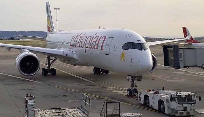
.....
After arriving in Dar, we spent one night at a hotel near the airport. The next morning, we headed to the domestic flights terminal, which hasn’t changed in years.
By mid-morning, we boarded a Cessna 208B Caravan with Safari Air Link, heading to the Kikoboga bush airstrip in Mikumi, which we reached 45 minutes later. Fun fact: the pilot was the same one as on our return flight two years ago.
Welcome on board:
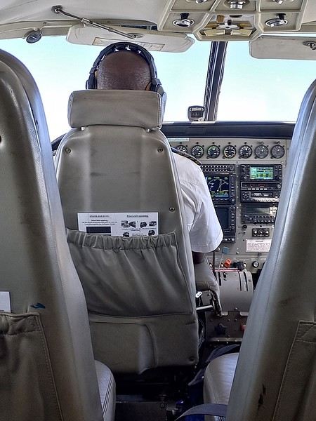
Of course, a driver/guide team from our chosen lodge was waiting for us upon arrival:
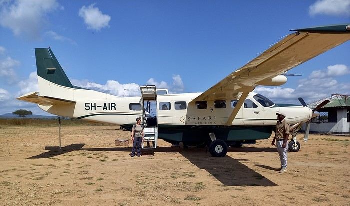
I was surprised to see so many aircraft parked there... even twin-engine Embraer Brasilias?? As a fan of vintage planes, I loved it...
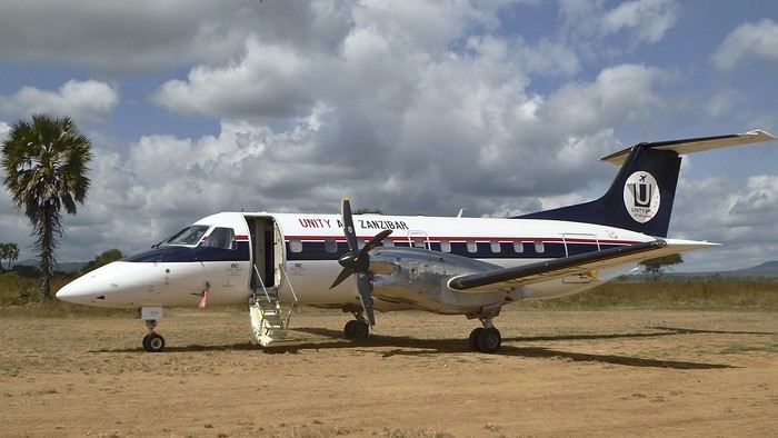
On the other hand, the light was incredibly harsh.....!! Our guides only speak English. We knew that in advance. In the south, it’s very rare to find someone who speaks French. This’ll force us to dig into our high school English memories... from 60 years ago... at least.
It’s noon, and we head toward the lodge. Near the airstrip, next to the Mikumi rangers’ base, there are quite a few herbivores. They find a bit more peace here—the big cats don’t venture this way...
Our first encounter was a group of Masai giraffes.
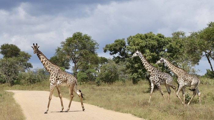
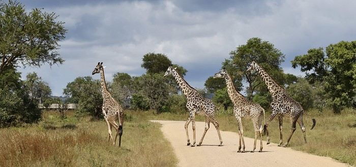
Rarer (for us), a savanna monitor lizard basking in the sun right in the middle of the track...??
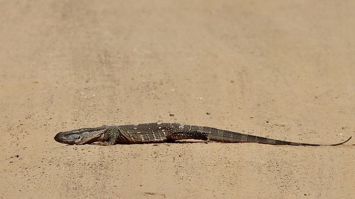
A large gathering of impalas (mostly males) along with a few blue wildebeest:
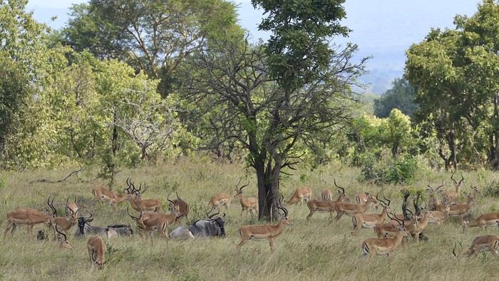

Also unusual: a African crowned hornbill taking a dust bath in the middle of the track...!!
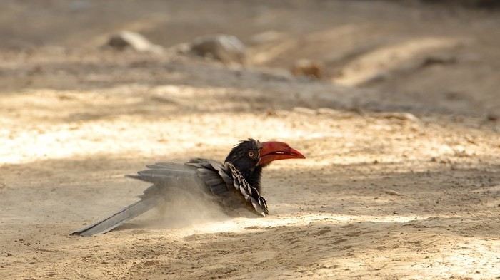
When it comes to identifying mammals or birds, I don’t know everything... so I might make mistakes. Please forgive me. I’m counting on my friend Blesl’s active participation... 😉
...
I’m a newbie to this forum, passionate about wildlife, the landscapes of East Africa, and Tanzania in particular. This June 2024 trip/safari is our 7th visit to Tanzania and our 5th in the south, which has drawn us more than the north ever since we discovered it in 2015.
In 2024, the entrance fees for the reserves and services have gone up again since our last visit. I chose to return first to Mikumi Reserve, which was the very first one we visited in the south. Then, we’ll head to Selous (J. Nyerere N. P.) as usual. Initially, we wanted to spend 2/3 days on Mafia Island at the end of the trip, but it made the total cost too high, so we gave up... We usually go to Ruaha and Selous, but I wanted to mix it up a bit—also to save some money...
As for the timing, June is a new experience for us. I thought it might be interesting to come just after the lodges reopen... hoping for some great wildlife encounters??
The trip starts in Marseille with our first flight on Ethiopian Airlines to Addis Ababa, then continues to Dar es Salaam, where we’ll finally set foot on Tanzanian soil again.
In Addis... "our" A-350.
.....
After arriving in Dar, we spent one night at a hotel near the airport. The next morning, we headed to the domestic flights terminal, which hasn’t changed in years.
By mid-morning, we boarded a Cessna 208B Caravan with Safari Air Link, heading to the Kikoboga bush airstrip in Mikumi, which we reached 45 minutes later. Fun fact: the pilot was the same one as on our return flight two years ago.
Welcome on board:
Of course, a driver/guide team from our chosen lodge was waiting for us upon arrival:
I was surprised to see so many aircraft parked there... even twin-engine Embraer Brasilias?? As a fan of vintage planes, I loved it...
On the other hand, the light was incredibly harsh.....!! Our guides only speak English. We knew that in advance. In the south, it’s very rare to find someone who speaks French. This’ll force us to dig into our high school English memories... from 60 years ago... at least.
It’s noon, and we head toward the lodge. Near the airstrip, next to the Mikumi rangers’ base, there are quite a few herbivores. They find a bit more peace here—the big cats don’t venture this way...
Our first encounter was a group of Masai giraffes.
Rarer (for us), a savanna monitor lizard basking in the sun right in the middle of the track...??
A large gathering of impalas (mostly males) along with a few blue wildebeest:
Also unusual: a African crowned hornbill taking a dust bath in the middle of the track...!!
When it comes to identifying mammals or birds, I don’t know everything... so I might make mistakes. Please forgive me. I’m counting on my friend Blesl’s active participation... 😉
...
The Kingdom of Lions...
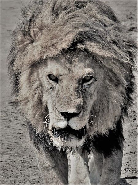 Hello everyone!
This trip dates back to late 2021, but since Voyage Forum reopened for writing, I haven’t seen many travel journals about Tanzania, so I decided to repost this one, which I originally shared on another well-known travelers’ site—even though I prefer Voyage Forum’s user experience.
It’s also a chance for me to relive this exhilarating trip... So, if you’re up for it, let me take you on a classic adventure: Tarangire - Ngorongoro - Serengeti, plus a little bonus—the small Arusha Park.
First off, yes, as the title of this journal suggests, we were lucky enough to spot *tons* of lions. The power they exude is incredible, even if most of the time they just look like big cats napping or strolling around. But lock eyes with one, and you’ll be glad you’re in the jeep.
Hello everyone!
This trip dates back to late 2021, but since Voyage Forum reopened for writing, I haven’t seen many travel journals about Tanzania, so I decided to repost this one, which I originally shared on another well-known travelers’ site—even though I prefer Voyage Forum’s user experience.
It’s also a chance for me to relive this exhilarating trip... So, if you’re up for it, let me take you on a classic adventure: Tarangire - Ngorongoro - Serengeti, plus a little bonus—the small Arusha Park.
First off, yes, as the title of this journal suggests, we were lucky enough to spot *tons* of lions. The power they exude is incredible, even if most of the time they just look like big cats napping or strolling around. But lock eyes with one, and you’ll be glad you’re in the jeep.
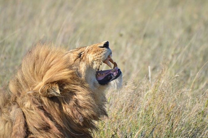
But let’s not forget the rest of the wildlife—and the landscapes, which are absolutely stunning, with those iconic tree silhouettes.
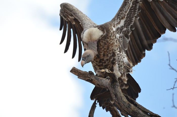
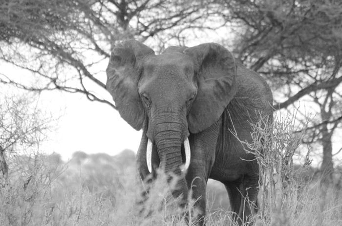
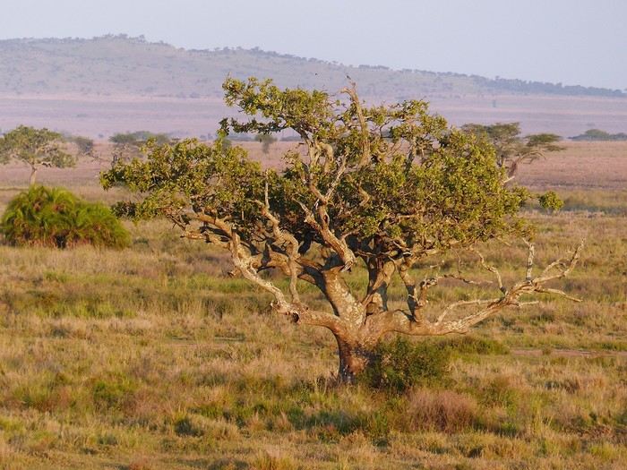
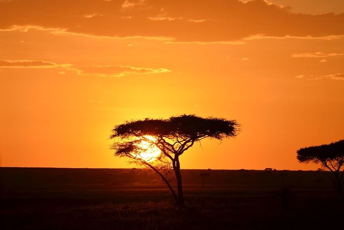
I remember before leaving, I was a little worried I wouldn’t feel that same sense of wonder I’d experienced two years earlier in Botswana (see my travel journal). That fear was unfounded—the magic worked its charm once again! Note: Since we had limited time, we focused our trip entirely on safari, so this journal is 100% animals and landscapes—and 0% Maasai. Next post: TARANGIRE
Photographic Discovery of Vancouver Island
Let’s catch up with a new travel journal from July 2024—only 6 months late, no biggie!
We’ll be talking about this gorgeous island, its tail end, wildlife (old habits die hard), and the sheer joy of it all 🙂
We’ll be talking about this gorgeous island, its tail end, wildlife (old habits die hard), and the sheer joy of it all 🙂
Trip to Japan in autumn 2025 with a child
Hi everyone,
So great to be back on this forum😉
I just lightened my wallet by 3000 € for 3 tickets: Paris > Tokyo > Osaka > Paris (well, not just mine—I’m exaggerating, there are two of us). For my daughter’s 10th birthday, we’re heading to Japan—it’s her "decade gift," though I thought she’d pick London🏴☠️. But I’ve been dreaming of going back to Japan since my 2013 trip, so I’ll admit this trip is (a lot) for me too. We’re traveling during school holidays, so the ticket prices are unfortunately sky-high. Maybe I could’ve gotten a better deal if I’d waited, but who knows... oh well, it’s done now. We leave at the end of October, so we still have a few months to prepare. That said, I’d rather start early to make sure we don’t miss anything (like the Ghibli Museum—I couldn’t go last time, and anyway, I’ll have to wait until September to book). Last time, there were three adults, so it was pretty straightforward. Eleven years later, well, now it’s two adults with a 10-year-old😛.
So I’m wondering how many days to spend in Tokyo. My daughter idealizes the city (that’s why she wants to go to Japan), and she’s really drawn to Japanese culture and food. Actually, what first got her interested in Japan were all the *kawaii* character products... Tokyo is such a fascinating city, but it can also be exhausting—especially for a kid, and I’m not sure what to expect. Beyond Tokyo, honestly, I’m not entirely sure. I was thinking of Hakone and maybe stopping by Fujikyu Highlands. Then heading down to Osaka for a few days in Kyoto before flying home (our return flight is from Osaka). We only have 11 days there (not counting the arrival day, and since our flight leaves at 11:30 PM on departure day, we’ll have the whole day), so it’s not a ton of time. I already spent a week in Kyoto on my last trip (huge crush on it), and I’d love to have two months there, but... well, you know how it is.
For example: 5 days in Tokyo 2 days in Hakone 4 days in Osaka/Kyoto
What do you think? If you’ve done this trip with kids, do you have any tips for family-friendly accommodations in Tokyo and Hakone? My daughter would love to try an onsen. We have a decent budget, but it’s not unlimited. We’d like to book as we go to spread out the costs a bit.
Thanks in advance for your thoughts
I just lightened my wallet by 3000 € for 3 tickets: Paris > Tokyo > Osaka > Paris (well, not just mine—I’m exaggerating, there are two of us). For my daughter’s 10th birthday, we’re heading to Japan—it’s her "decade gift," though I thought she’d pick London🏴☠️. But I’ve been dreaming of going back to Japan since my 2013 trip, so I’ll admit this trip is (a lot) for me too. We’re traveling during school holidays, so the ticket prices are unfortunately sky-high. Maybe I could’ve gotten a better deal if I’d waited, but who knows... oh well, it’s done now. We leave at the end of October, so we still have a few months to prepare. That said, I’d rather start early to make sure we don’t miss anything (like the Ghibli Museum—I couldn’t go last time, and anyway, I’ll have to wait until September to book). Last time, there were three adults, so it was pretty straightforward. Eleven years later, well, now it’s two adults with a 10-year-old😛.
So I’m wondering how many days to spend in Tokyo. My daughter idealizes the city (that’s why she wants to go to Japan), and she’s really drawn to Japanese culture and food. Actually, what first got her interested in Japan were all the *kawaii* character products... Tokyo is such a fascinating city, but it can also be exhausting—especially for a kid, and I’m not sure what to expect. Beyond Tokyo, honestly, I’m not entirely sure. I was thinking of Hakone and maybe stopping by Fujikyu Highlands. Then heading down to Osaka for a few days in Kyoto before flying home (our return flight is from Osaka). We only have 11 days there (not counting the arrival day, and since our flight leaves at 11:30 PM on departure day, we’ll have the whole day), so it’s not a ton of time. I already spent a week in Kyoto on my last trip (huge crush on it), and I’d love to have two months there, but... well, you know how it is.
For example: 5 days in Tokyo 2 days in Hakone 4 days in Osaka/Kyoto
What do you think? If you’ve done this trip with kids, do you have any tips for family-friendly accommodations in Tokyo and Hakone? My daughter would love to try an onsen. We have a decent budget, but it’s not unlimited. We’d like to book as we go to spread out the costs a bit.
Thanks in advance for your thoughts
Photo Safaris in Kenya
Back on the forum, I’m starting to write up two 3-week trips to Kenya in August 2021 and 2023.
In 2021, Quynh and I traveled with Régis (Rjulie95 on VF). Our son joined us in Baringo for the second half of the trip.
In 2023, we went with two friends who’d been dreaming of seeing wild animals ever since we got back from Kenya. We didn’t need much convincing to go with them!
The two itineraries are almost identical (well, when you love something...) but we did make a few tweaks.
- The first part of the trip was with a local driver/guide, Félix, who was recommended by Sylvie56. Sylvie and her husband Ben are Kenya enthusiasts—they’ve been there countless times, always with Félix... and for good reason! He’s fantastic!
- The second part was with Melting Pot Safari, an agency that adapted to our photography needs. Tony Crocetta, the co-founder (along with his Kenyan friend Simon Chebon), is a wildlife photographer himself.
Here are the itineraries for both trips, including accommodations:
In 2021: Day 0: Paris / Nairobi - 67 Airport Hotel Day 1: Nairobi / Amboseli - Simba Cottage Day 2: Amboseli - Simba Cottage Day 3: Amboseli / Aberdares - Fishing Lodge Day 4: Aberdares - Fishing Lodge Day 5: Aberdares - Fishing Lodge Day 6: Aberdares / Samburu - Riverside Camp Day 7: Samburu - Riverside Camp Day 8: Samburu - Riverside Camp Day 9: Samburu / Nakuru - Merica Hotel Day 10: Nakuru / Baringo - Tumbili Cliff Lodge Day 11: Baringo - Tumbili Cliff Lodge Day 12: Baringo - Tumbili Cliff Lodge Day 13: Baringo / Maasai Mara – Meltingpot Bush Camp Day 14 to 18: Maasai Mara – Meltingpot Bush Camp Day 19: Maasai Mara / Nairobi – Roussel Guest House Day 20: Nairobi / Paris
In 2023: Day 0: Lyon / Paris / Nairobi - 67 Airport Hotel Day 1: Nairobi / Meru - Ikweta Camp Day 2: Meru - Ikweta Camp Day 3: Meru - Ikweta Camp Day 4: Meru / Samburu - Riverside Camp Day 5: Samburu – Riverside Camp Day 6: Samburu / Buffalo Springs – Samburu Simba Day 7: Buffalo Springs / Ol Pejeta – Sweetwater Camp Day 8: Ol Pejeta / Amboseli - Simba Cottage Day 9: Amboseli - Simba Cottage Day 10: Amboseli - Simba Cottage Day 11: Amboseli / Nakuru – Lake Nakuru Lodge Day 12: Nakuru / Baringo - Tumbili Cliff Lodge Day 13: Baringo - Tumbili Cliff Lodge Day 14: Baringo - Tumbili Cliff Lodge Day 15: Baringo / Maasai Mara – Meltingpot Bush Camp Day 16 to 20: Maasai Mara – Meltingpot Bush Camp Day 21: Maasai Mara / Nairobi / Paris
Here’s an itinerary—it’s not exactly what we did, but a combination of both.
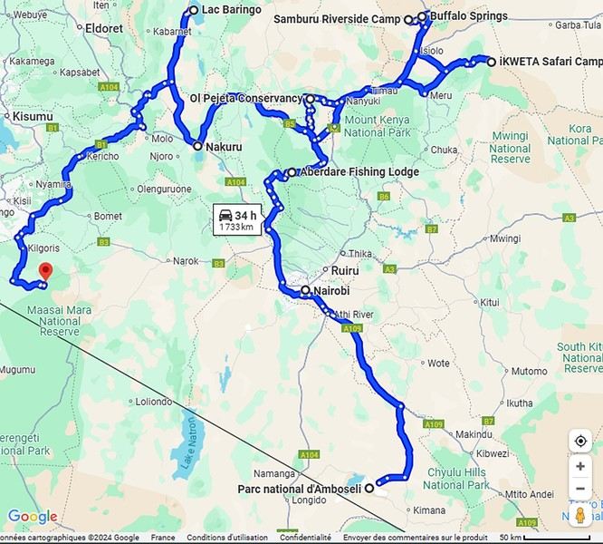
Ready to join us on safari to see some wild animals?
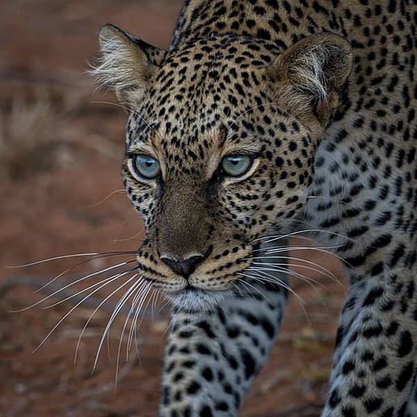
The two itineraries are almost identical (well, when you love something...) but we did make a few tweaks.
- The first part of the trip was with a local driver/guide, Félix, who was recommended by Sylvie56. Sylvie and her husband Ben are Kenya enthusiasts—they’ve been there countless times, always with Félix... and for good reason! He’s fantastic!
- The second part was with Melting Pot Safari, an agency that adapted to our photography needs. Tony Crocetta, the co-founder (along with his Kenyan friend Simon Chebon), is a wildlife photographer himself.
Here are the itineraries for both trips, including accommodations:
In 2021: Day 0: Paris / Nairobi - 67 Airport Hotel Day 1: Nairobi / Amboseli - Simba Cottage Day 2: Amboseli - Simba Cottage Day 3: Amboseli / Aberdares - Fishing Lodge Day 4: Aberdares - Fishing Lodge Day 5: Aberdares - Fishing Lodge Day 6: Aberdares / Samburu - Riverside Camp Day 7: Samburu - Riverside Camp Day 8: Samburu - Riverside Camp Day 9: Samburu / Nakuru - Merica Hotel Day 10: Nakuru / Baringo - Tumbili Cliff Lodge Day 11: Baringo - Tumbili Cliff Lodge Day 12: Baringo - Tumbili Cliff Lodge Day 13: Baringo / Maasai Mara – Meltingpot Bush Camp Day 14 to 18: Maasai Mara – Meltingpot Bush Camp Day 19: Maasai Mara / Nairobi – Roussel Guest House Day 20: Nairobi / Paris
In 2023: Day 0: Lyon / Paris / Nairobi - 67 Airport Hotel Day 1: Nairobi / Meru - Ikweta Camp Day 2: Meru - Ikweta Camp Day 3: Meru - Ikweta Camp Day 4: Meru / Samburu - Riverside Camp Day 5: Samburu – Riverside Camp Day 6: Samburu / Buffalo Springs – Samburu Simba Day 7: Buffalo Springs / Ol Pejeta – Sweetwater Camp Day 8: Ol Pejeta / Amboseli - Simba Cottage Day 9: Amboseli - Simba Cottage Day 10: Amboseli - Simba Cottage Day 11: Amboseli / Nakuru – Lake Nakuru Lodge Day 12: Nakuru / Baringo - Tumbili Cliff Lodge Day 13: Baringo - Tumbili Cliff Lodge Day 14: Baringo - Tumbili Cliff Lodge Day 15: Baringo / Maasai Mara – Meltingpot Bush Camp Day 16 to 20: Maasai Mara – Meltingpot Bush Camp Day 21: Maasai Mara / Nairobi / Paris
Here’s an itinerary—it’s not exactly what we did, but a combination of both.
Ready to join us on safari to see some wild animals?
4x4 Expeditions in Southern Africa
Hi there,
Here’s a quick summary of six trips across Southern Africa, covering South Africa, Namibia, Botswana, Zimbabwe, and more. I traveled for a total of 23 months, over 100,000 km, and crossed 9 countries from South Africa to Tanzania. To do this, I bought an old Land Cruiser—a 1989 BJ 75 with a long chassis and a 3.4L turbo engine—which I converted into a bush camper set up for self-sufficiency in Africa: dual fuel tanks (235 L total) plus 2 x 20-liter jerry cans of diesel, 2 spare tires, a compressor, a toolbox with repair gear, a 50-liter water tank plus 2 x 30-liter and 2 x 10-liter jerry cans, a roof tent, multiple storage boxes, a sturdy roof rack, and even a paramotor. I also packed a first-aid kit and shipped the camper to South Africa by freight. My son joined me for part of the journey.
Key countries and highlights: South Africa in every direction, including its wildlife parks; in Namibia, the classics like Etosha, Fish River, Sossusvlei, Kaudum, but especially Damaraland and Kaokoland; in Botswana, a full loop of the Okavango, crossing the Makgadikgadi Pan, Moremi Park, the Linyanti River; and a tour of Zimbabwe with its national parks. During the last trip in 2020, due to COVID, we found refuge on a 250 km² Namibian farm with its own wildlife reserve. While crossing Damaraland and Kaokoland, we were completely self-sufficient, with supplies for over a month and 130 L of water.
In South Africa and Namibia, one issue that surprised us was the fences stretching for millions of kilometers along the tracks. Namibia is one and a half times the size of France but has a population of only about 2.5 million, mostly concentrated in a dozen small towns of 10,000 to 50,000 people—except for the capital, Windhoek (296,000). Paradoxically, compared to France, the space for freedom is extremely limited. Everything is private and requires payment. Even the Namib Desert is fenced... and you need a permit just to pick up a rock! For someone used to wild camping, it can get frustrating. Sometimes we ignored the rules, but the best solution is to ask a farmer (a real one, like a sheep or cattle rancher—not the ones with 3-meter electrified fences, which are lodges or private reserves) if you can camp on their land.
To truly enjoy freedom in Namibia, you need to venture into the northwest, along the Skeleton Coast, in Damaraland and Kaokoland. However, it’s essential to know your vehicle inside out, be a good mechanic, bring spare parts, and plan for potential breakdowns. Take care of your ride because a major issue out there can be a matter of survival. My motto: "Don’t break down, don’t break down, don’t break down..." Safari pros only venture into this region with two 4x4s. In Messum Crater, we met a couple waiting for rescue (thanks to a satellite device from their rental company) after their driveshaft broke. Keep in mind that in these areas, you’ll cover about 80 km in 8 hours.
Here are some of the issues we faced: a broken rear suspension leaf, several broken bolts on the front leaf springs, the spare tire mount breaking multiple times (replaced on the spot), a cracked water radiator in 1998 causing overheating and a seized valve stem in its guide, plus a bent rocker arm (field repair, valve adjustment, damaged head gasket, daily radiator refills, and a scratched cylinder—engine fully rebuilt upon return). Five roof rack mounts broke and were repaired at a technical high school in South Africa. The battery mount also broke (fixed with a steel plate found on the trail). The fuel filter clogged several times (changed or cleaned on the spot). A huge impact on the windshield from a piece of coal falling from a power plant supply truck (temporary repair with Araldite). The brake master cylinder failed in Marienfluss (repaired, seals replaced in Tsumeb). Multiple flat tires from acacia thorns. The rear door latch broke (homemade aluminum rod repair in Franschhoek). The voltmeter and ammeter failed (repaired on the spot). During the freight trip, despite locking the doors and having a partition between the front and back, someone managed to get in through the small side window, forced open the locks on two accessible storage boxes, and stole my tools (replaced later). A ball joint on the paramotor frame came loose mid-flight, damaging the wing and propeller (propeller shipped from France, homemade repair).
Health issues on the way to Tanzania: a painful sciatica and many sleepless nights (cortisone injection in Dodoma).
Kaokoland, Namibia—the northwest region: https://youtu.be/DzGepFsrnZs
Damaraland: https://youtu.be/DITQj8NvLZ4
Botswana: https://youtu.be/TEvDG0S62hg
Kaudom and Mohembo Parks: https://youtu.be/wq_Yf7jNLhw
Here’s a quick summary of six trips across Southern Africa, covering South Africa, Namibia, Botswana, Zimbabwe, and more. I traveled for a total of 23 months, over 100,000 km, and crossed 9 countries from South Africa to Tanzania. To do this, I bought an old Land Cruiser—a 1989 BJ 75 with a long chassis and a 3.4L turbo engine—which I converted into a bush camper set up for self-sufficiency in Africa: dual fuel tanks (235 L total) plus 2 x 20-liter jerry cans of diesel, 2 spare tires, a compressor, a toolbox with repair gear, a 50-liter water tank plus 2 x 30-liter and 2 x 10-liter jerry cans, a roof tent, multiple storage boxes, a sturdy roof rack, and even a paramotor. I also packed a first-aid kit and shipped the camper to South Africa by freight. My son joined me for part of the journey.
Key countries and highlights: South Africa in every direction, including its wildlife parks; in Namibia, the classics like Etosha, Fish River, Sossusvlei, Kaudum, but especially Damaraland and Kaokoland; in Botswana, a full loop of the Okavango, crossing the Makgadikgadi Pan, Moremi Park, the Linyanti River; and a tour of Zimbabwe with its national parks. During the last trip in 2020, due to COVID, we found refuge on a 250 km² Namibian farm with its own wildlife reserve. While crossing Damaraland and Kaokoland, we were completely self-sufficient, with supplies for over a month and 130 L of water.
In South Africa and Namibia, one issue that surprised us was the fences stretching for millions of kilometers along the tracks. Namibia is one and a half times the size of France but has a population of only about 2.5 million, mostly concentrated in a dozen small towns of 10,000 to 50,000 people—except for the capital, Windhoek (296,000). Paradoxically, compared to France, the space for freedom is extremely limited. Everything is private and requires payment. Even the Namib Desert is fenced... and you need a permit just to pick up a rock! For someone used to wild camping, it can get frustrating. Sometimes we ignored the rules, but the best solution is to ask a farmer (a real one, like a sheep or cattle rancher—not the ones with 3-meter electrified fences, which are lodges or private reserves) if you can camp on their land.
To truly enjoy freedom in Namibia, you need to venture into the northwest, along the Skeleton Coast, in Damaraland and Kaokoland. However, it’s essential to know your vehicle inside out, be a good mechanic, bring spare parts, and plan for potential breakdowns. Take care of your ride because a major issue out there can be a matter of survival. My motto: "Don’t break down, don’t break down, don’t break down..." Safari pros only venture into this region with two 4x4s. In Messum Crater, we met a couple waiting for rescue (thanks to a satellite device from their rental company) after their driveshaft broke. Keep in mind that in these areas, you’ll cover about 80 km in 8 hours.
Here are some of the issues we faced: a broken rear suspension leaf, several broken bolts on the front leaf springs, the spare tire mount breaking multiple times (replaced on the spot), a cracked water radiator in 1998 causing overheating and a seized valve stem in its guide, plus a bent rocker arm (field repair, valve adjustment, damaged head gasket, daily radiator refills, and a scratched cylinder—engine fully rebuilt upon return). Five roof rack mounts broke and were repaired at a technical high school in South Africa. The battery mount also broke (fixed with a steel plate found on the trail). The fuel filter clogged several times (changed or cleaned on the spot). A huge impact on the windshield from a piece of coal falling from a power plant supply truck (temporary repair with Araldite). The brake master cylinder failed in Marienfluss (repaired, seals replaced in Tsumeb). Multiple flat tires from acacia thorns. The rear door latch broke (homemade aluminum rod repair in Franschhoek). The voltmeter and ammeter failed (repaired on the spot). During the freight trip, despite locking the doors and having a partition between the front and back, someone managed to get in through the small side window, forced open the locks on two accessible storage boxes, and stole my tools (replaced later). A ball joint on the paramotor frame came loose mid-flight, damaging the wing and propeller (propeller shipped from France, homemade repair).
Health issues on the way to Tanzania: a painful sciatica and many sleepless nights (cortisone injection in Dodoma).
Kaokoland, Namibia—the northwest region: https://youtu.be/DzGepFsrnZs
Damaraland: https://youtu.be/DITQj8NvLZ4
Botswana: https://youtu.be/TEvDG0S62hg
Kaudom and Mohembo Parks: https://youtu.be/wq_Yf7jNLhw
Bike trip: from Carcans Maubuisson to Plaisir (Yvelines)
Monday, August 21, 2023 - Rochefort - Marans
No journal for the first two days. Day 1 - CARCANS-ROYAN Day 2 - ROYAN - ROCHEFORT Tonight I'm in MARANS in the "dry marsh" according to the campsite manager—it’s the first time I’ve heard of a "dry marsh"?!
Photos from the first two days
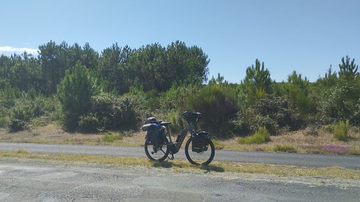 My gear
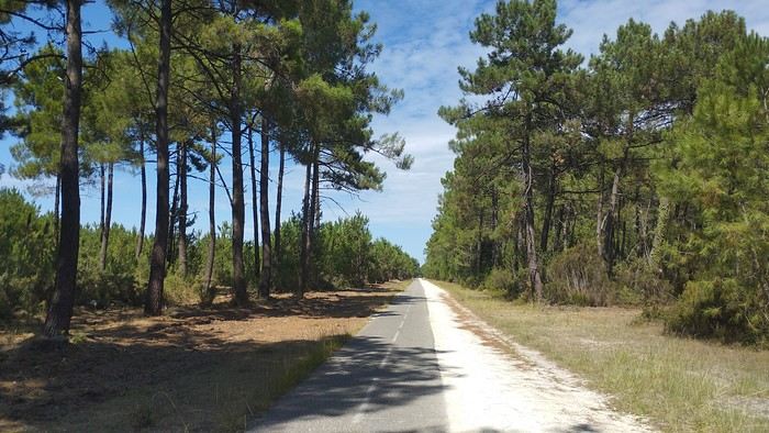
The Landes region—nothing extraordinary, but the calm and serenity are nice.

Le Verdon
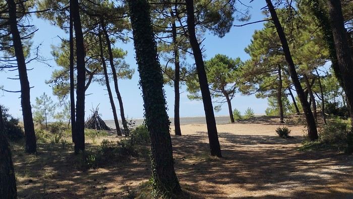
The wild coast
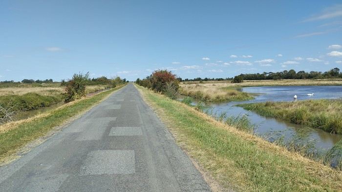
This marsh isn’t dry, though.
Today is the third day of my trip, and I’m writing to you from a campsite in Marans. I’ve set out to bike from Carcans Maubuisson back to Plaisir. Why Carcans? Because we spent a week there as a family—a great week that lets everyone reconnect for a long stretch. Also, on Saturday, we all headed home—some by car, and me by bike. This journey is about 850 km via bike paths and small cycling roads. It’s not a sporting feat, just a nice long ride for fun. As the old Chinese sage says, "The destination doesn’t matter—it’s the journey that counts." But he also told me, "Traveling is great, but what’s the point if you don’t share it?" You see, this old sage has told me a lot of things—he often keeps me company when I’m biking. Of course, he doesn’t pedal, but we travel in harmony. Sure, he can be a bit annoying sometimes, but we still get along. All this to say I’ve created a group to share my story. I’d be happy to share this experience with you—it’s an adventure for me. On Saturday, I wasn’t sure I’d even leave because I’d been dealing with sciatica for days. Luckily, Juliette, a friend of the old Chinese sage, recommended a lifesaving remedy: Alternately stretching your legs with an elastic band under your foot. Obviously, a jam jar rubber band won’t cut it.
From Marans - The mosquitoes are attacking; time to head back to shelter.
The first two legs took me to Royan and then Rochefort. The Sèvre Niortaise flows nearby, and I followed a canal from La Rochelle. You could say the area is as dry as the marsh, judging by the state of the crops.
As I mentioned, it’s the third day, and if Jesus rose again on this day, for me it was more like the crucifixion. The scorching heat—only bearable when you’re moving—combined with rough trail conditions, and the old Chinese sage says, "Terrible roads, slow speed, and watch your limbs." I set out to do 60 km but ended up doing 80, and the last 20 were tough. I kept checking the GPS to see how much farther until the campsite. Today: Rochefort to Marans, sticking to the coast until La Rochelle, then no notable towns after that—just a constant canal. But since the sky isn’t too low, it hasn’t gotten lost. I’ve still got plenty of anecdotes to share, but it’s pitch black out, and the mosquitoes are still around. This morning, I counted ten in my tent, all full of my blood. Yesterday, at the end of the leg to Rochefort, I was really looking forward to crossing the Charente using the transporter bridge, but a sneaky GPS conspiracy led me far from it. I ended up crossing the Charente on a completely ordinary bridge, watching the transporter bridge in the distance with disappointment.
End of the first episode. Until tomorrow, if you’d like!
No journal for the first two days. Day 1 - CARCANS-ROYAN Day 2 - ROYAN - ROCHEFORT Tonight I'm in MARANS in the "dry marsh" according to the campsite manager—it’s the first time I’ve heard of a "dry marsh"?!
Photos from the first two days
My gearThe Landes region—nothing extraordinary, but the calm and serenity are nice.
Le Verdon
The wild coast
This marsh isn’t dry, though.
Today is the third day of my trip, and I’m writing to you from a campsite in Marans. I’ve set out to bike from Carcans Maubuisson back to Plaisir. Why Carcans? Because we spent a week there as a family—a great week that lets everyone reconnect for a long stretch. Also, on Saturday, we all headed home—some by car, and me by bike. This journey is about 850 km via bike paths and small cycling roads. It’s not a sporting feat, just a nice long ride for fun. As the old Chinese sage says, "The destination doesn’t matter—it’s the journey that counts." But he also told me, "Traveling is great, but what’s the point if you don’t share it?" You see, this old sage has told me a lot of things—he often keeps me company when I’m biking. Of course, he doesn’t pedal, but we travel in harmony. Sure, he can be a bit annoying sometimes, but we still get along. All this to say I’ve created a group to share my story. I’d be happy to share this experience with you—it’s an adventure for me. On Saturday, I wasn’t sure I’d even leave because I’d been dealing with sciatica for days. Luckily, Juliette, a friend of the old Chinese sage, recommended a lifesaving remedy: Alternately stretching your legs with an elastic band under your foot. Obviously, a jam jar rubber band won’t cut it.
From Marans - The mosquitoes are attacking; time to head back to shelter.
The first two legs took me to Royan and then Rochefort. The Sèvre Niortaise flows nearby, and I followed a canal from La Rochelle. You could say the area is as dry as the marsh, judging by the state of the crops.
As I mentioned, it’s the third day, and if Jesus rose again on this day, for me it was more like the crucifixion. The scorching heat—only bearable when you’re moving—combined with rough trail conditions, and the old Chinese sage says, "Terrible roads, slow speed, and watch your limbs." I set out to do 60 km but ended up doing 80, and the last 20 were tough. I kept checking the GPS to see how much farther until the campsite. Today: Rochefort to Marans, sticking to the coast until La Rochelle, then no notable towns after that—just a constant canal. But since the sky isn’t too low, it hasn’t gotten lost. I’ve still got plenty of anecdotes to share, but it’s pitch black out, and the mosquitoes are still around. This morning, I counted ten in my tent, all full of my blood. Yesterday, at the end of the leg to Rochefort, I was really looking forward to crossing the Charente using the transporter bridge, but a sneaky GPS conspiracy led me far from it. I ended up crossing the Charente on a completely ordinary bridge, watching the transporter bridge in the distance with disappointment.
End of the first episode. Until tomorrow, if you’d like!
Ethiopia and Two Endemic Animals
The reopening of the forum is great news—let's keep it going! I’m going to share a little story about this 12-day trip, which was my second-to-last journey and my most recent one in Africa for now.
I went to this country for one very specific reason: to see two endemic animal species. A little suspense… you’ll find out what they are soon if you don’t already know!
The country is poor, very poor even. And it hits you even harder when you arrive in the capital: a massive open-air construction site that gives an impression of prosperity. A lot of roads were built by the Chinese, but to be honest, they’re far from perfect… and I mean *far*!
When it comes to restaurants, it’s pretty much the same story. Most offer endless menus, but in reality, there aren’t many choices. Once, I was flat-out told: “No rice today!” Ordering a dish? It’s a real gamble! The food is *very* spicy—I’m warning you, it’s intense! There’s chili in almost everything, so it’s best to ask beforehand if you don’t want your mouth on fire. Actually, this was the first time I didn’t like the food in a country I visited. Had to happen eventually, right?
Their national dish? Injera. A large flatbread topped with sauces, vegetables, and meat. The taste is really unique—some love it, others… not so much.
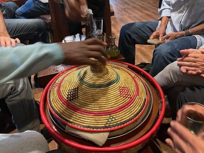
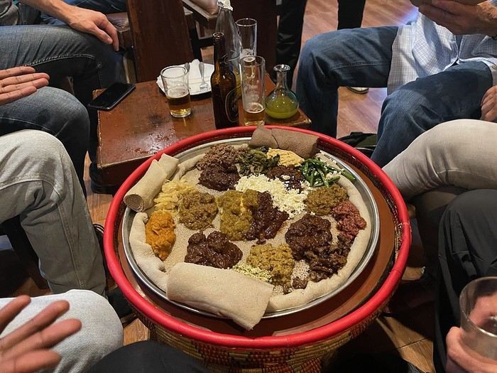
I went to this country for one very specific reason: to see two endemic animal species. A little suspense… you’ll find out what they are soon if you don’t already know!
The country is poor, very poor even. And it hits you even harder when you arrive in the capital: a massive open-air construction site that gives an impression of prosperity. A lot of roads were built by the Chinese, but to be honest, they’re far from perfect… and I mean *far*!
When it comes to restaurants, it’s pretty much the same story. Most offer endless menus, but in reality, there aren’t many choices. Once, I was flat-out told: “No rice today!” Ordering a dish? It’s a real gamble! The food is *very* spicy—I’m warning you, it’s intense! There’s chili in almost everything, so it’s best to ask beforehand if you don’t want your mouth on fire. Actually, this was the first time I didn’t like the food in a country I visited. Had to happen eventually, right?
Their national dish? Injera. A large flatbread topped with sauces, vegetables, and meat. The taste is really unique—some love it, others… not so much.
To the Top West End
In this time of general travel-journal scarcity, I’m stepping up to tell you about a far-too-short getaway to the Top West End, a local term for the very northern part of Western Australia, right on the border ( ;) ) with the Northern Territory.
As usual, I didn’t manage to keep it short, but this time I’ve got photos to go with it!
August 2020. Since the opportunities to explore the world are extremely limited right now, all we (R&X) can do is explore our own island! Well, just a part of it, because with the state borders still closed, we’re stuck in Western Australia (WA).
Luckily, we’re pretty fortunate because this state is huge: over 2.5 million km² (that’s more than four times the size of France or 1.5 times Quebec). What’s more, stretching over 20 degrees of latitude between the Antarctic Ocean and the Timor Sea, you’ll find climates ranging from Mediterranean to arid to tropical. That’s actually why we decided to head as far north as possible. Sick of the endless rainy winter in Perth, bring on the heat of the Kimberley... way up Nooorth!
Friday. At the airport, the main terminal was closed (not enough flights), so we ended up in the annex (where flights to the various mines usually depart from). There was no crowd at the gate, and in this huge, single departure lounge, empty seats were plentiful. Only three flights were listed on the screens for the rest of the morning: the first to Coondewanna (?), the second to Darwin, and ours to Kununurra (code KNX).
A cool breeze swept through the half-open corridors along the runways. At the top of the walkway leading to the Fokker 100 (the Airbuses and Boeings are now parked!), a flight attendant greeted us with a basket full of sanitary masks. We were actually the only masked passengers (the staff weren’t wearing them either). With zero Covid-19 cases in WA at the time, the only rule was to maintain social distancing—something pretty hard to do on a full plane!
It was also my first time wearing a mask—it felt weird, pretty uncomfortable, and after a while, painful behind the ears. I really feel for those who have to wear one all day, every day. The flight lasted three long hours, but luckily, I had a good book. From the window, I watched an endless expanse of salt lakes in all shapes and sizes—round, elongated, gray, white, sometimes blue and green—and an infinity of winding, capricious meanders, along with long straight lines that led nowhere. The last half-hour got more interesting as rocky, swollen formations and long, sloping plateaus appeared. Against the vast ochre landscape, green patches became more frequent.
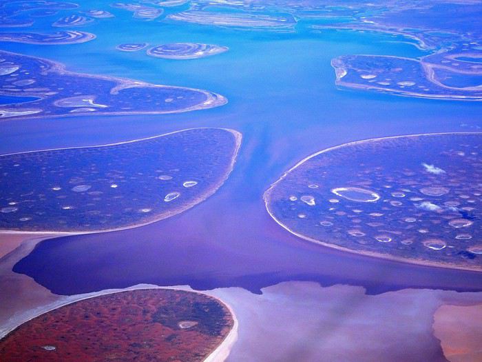
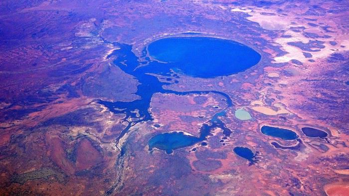
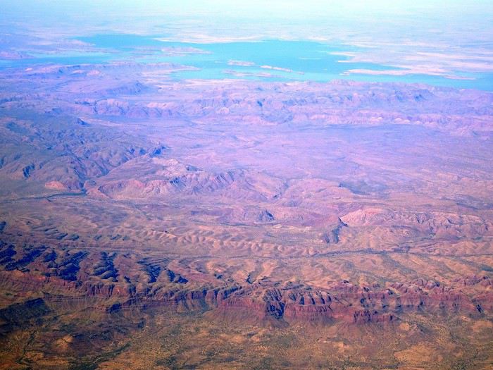
Just before landing, rows of green fields briefly appeared, along with an surprisingly wide river—but we were already rolling down the tarmac. A few hangars, a myriad of small, stationary planes, and a tiny terminal topped with a sign: “Welcome to Kununurra.”
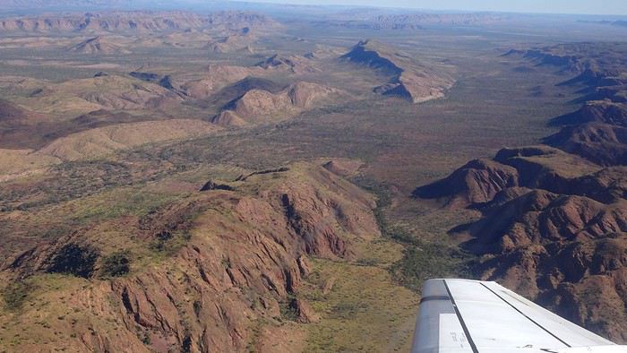
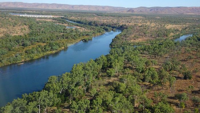
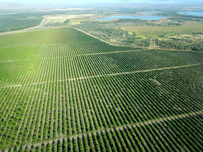
We wanted heat, and here it was—34°C the moment we stepped off the plane! We felt alive again and totally ridiculous in our jeans and sweaters. We quickly grabbed our suitcase and picked up the 4x4 we’d rented—more out of necessity, since only that type of vehicle can access the national parks we planned to visit.
Just four kilometers separated us from Kununurra, a town of 5,000 people founded in 1961 during the construction of the Lake Argyle Dam and the development of the Ord River Irrigation Area Scheme (more on that later). On the horizon, mountain ranges (a bit of an exaggeration, since we know Mt. Meharry, WA’s highest ‘mountain,’ doesn’t even reach 1,250 meters!) and closer to the road, a few irrigation canals cutting through stretches of bush, then a huge park overlooking a small lake lined with reeds.
A row of baobabs (yes, there are baobabs in Australia too!), a series of motels with immaculate lawns, a gas station, and there’s the main street leading to the town center—that is, the parking lots of the two supermarkets, the bottleshop, the pub, the Town Hall, the municipal pool, and the Tourist Office (already closed!), and at the next roundabout, another park, the Presbyterian church, and a few other shops. In short, two or three green blocks that you can explore in no time.
One road leads to the small industrial area and one of the town’s three or four campgrounds, while another heads toward the residential neighborhoods, which look just like the typical suburbs you find in any Australian city—except with tropical vegetation. We stocked up at Coles, an identical copy of the one near our place, and—surprise—the prices were practically the same.
We checked into one of the motels. The receptionist listed the town’s three or four restaurants, insisting that it’s always better to book a table. She recommended the Pump House, a bit outside town on the lake’s edge. “Best spot to watch the sunset, but hurry up.” she told us. It was only 5:00 PM!
When we got there half an hour later, the place was packed, and the sun had already disappeared behind a row of trees! Sure enough, we’d see a few days later that the sunset can be a stunning spectacle—if you wait a bit for the sky (especially if it’s cloudy) to blaze and reflect in the lake’s calm waters. A little disappointed, we headed back into town, where we easily found the other lively spot in town: the pub (nothing like an old English pub). Above the long L-shaped bar, several giant screens (thankfully muted) were broadcasting live footy, rugby league, etc. In one corner, players circled the pool table, while in another, customers were digging into plates of the day’s special. Instead of rooms, there were various patios where groups of friends and coworkers (easily recognizable by the fluoro vests they were still wearing) were gathered. We found a table under a mango tree—unfortunately, a little too close to the guitarist strumming his entire Country Music repertoire, complete with Keith Urban-style tremolos. Guaranteed culture shock!
Since it’s the custom here, we called the Country Club to book a table before the kitchen closed! The CC is the town’s—and even the region’s—fancy spot. Dark decor, modern furniture, dim lighting, and the air conditioning blasting. The twenty or so customers had taken refuge on the vast terrace, lit by torches. The view of the tall eucalyptus trees, illuminated by spotlights shifting from red to blue, was breathtaking.
The menu was minimal, but the grilled salmon was excellent, and the Pavlova (the meringue dessert Kiwis and Aussies have been arguing over since 1906) with melon and watermelon was absolutely divine.
It wasn’t even 9:00 PM, and we were already in bed. Had we already adopted the Top West End’s chicken schedule?!
To be continued... Journal dedicated to Attila
As usual, I didn’t manage to keep it short, but this time I’ve got photos to go with it!
August 2020. Since the opportunities to explore the world are extremely limited right now, all we (R&X) can do is explore our own island! Well, just a part of it, because with the state borders still closed, we’re stuck in Western Australia (WA).
Luckily, we’re pretty fortunate because this state is huge: over 2.5 million km² (that’s more than four times the size of France or 1.5 times Quebec). What’s more, stretching over 20 degrees of latitude between the Antarctic Ocean and the Timor Sea, you’ll find climates ranging from Mediterranean to arid to tropical. That’s actually why we decided to head as far north as possible. Sick of the endless rainy winter in Perth, bring on the heat of the Kimberley... way up Nooorth!
Friday. At the airport, the main terminal was closed (not enough flights), so we ended up in the annex (where flights to the various mines usually depart from). There was no crowd at the gate, and in this huge, single departure lounge, empty seats were plentiful. Only three flights were listed on the screens for the rest of the morning: the first to Coondewanna (?), the second to Darwin, and ours to Kununurra (code KNX).
A cool breeze swept through the half-open corridors along the runways. At the top of the walkway leading to the Fokker 100 (the Airbuses and Boeings are now parked!), a flight attendant greeted us with a basket full of sanitary masks. We were actually the only masked passengers (the staff weren’t wearing them either). With zero Covid-19 cases in WA at the time, the only rule was to maintain social distancing—something pretty hard to do on a full plane!
It was also my first time wearing a mask—it felt weird, pretty uncomfortable, and after a while, painful behind the ears. I really feel for those who have to wear one all day, every day. The flight lasted three long hours, but luckily, I had a good book. From the window, I watched an endless expanse of salt lakes in all shapes and sizes—round, elongated, gray, white, sometimes blue and green—and an infinity of winding, capricious meanders, along with long straight lines that led nowhere. The last half-hour got more interesting as rocky, swollen formations and long, sloping plateaus appeared. Against the vast ochre landscape, green patches became more frequent.
Just before landing, rows of green fields briefly appeared, along with an surprisingly wide river—but we were already rolling down the tarmac. A few hangars, a myriad of small, stationary planes, and a tiny terminal topped with a sign: “Welcome to Kununurra.”
We wanted heat, and here it was—34°C the moment we stepped off the plane! We felt alive again and totally ridiculous in our jeans and sweaters. We quickly grabbed our suitcase and picked up the 4x4 we’d rented—more out of necessity, since only that type of vehicle can access the national parks we planned to visit.
Just four kilometers separated us from Kununurra, a town of 5,000 people founded in 1961 during the construction of the Lake Argyle Dam and the development of the Ord River Irrigation Area Scheme (more on that later). On the horizon, mountain ranges (a bit of an exaggeration, since we know Mt. Meharry, WA’s highest ‘mountain,’ doesn’t even reach 1,250 meters!) and closer to the road, a few irrigation canals cutting through stretches of bush, then a huge park overlooking a small lake lined with reeds.
A row of baobabs (yes, there are baobabs in Australia too!), a series of motels with immaculate lawns, a gas station, and there’s the main street leading to the town center—that is, the parking lots of the two supermarkets, the bottleshop, the pub, the Town Hall, the municipal pool, and the Tourist Office (already closed!), and at the next roundabout, another park, the Presbyterian church, and a few other shops. In short, two or three green blocks that you can explore in no time.
One road leads to the small industrial area and one of the town’s three or four campgrounds, while another heads toward the residential neighborhoods, which look just like the typical suburbs you find in any Australian city—except with tropical vegetation. We stocked up at Coles, an identical copy of the one near our place, and—surprise—the prices were practically the same.
We checked into one of the motels. The receptionist listed the town’s three or four restaurants, insisting that it’s always better to book a table. She recommended the Pump House, a bit outside town on the lake’s edge. “Best spot to watch the sunset, but hurry up.” she told us. It was only 5:00 PM!
When we got there half an hour later, the place was packed, and the sun had already disappeared behind a row of trees! Sure enough, we’d see a few days later that the sunset can be a stunning spectacle—if you wait a bit for the sky (especially if it’s cloudy) to blaze and reflect in the lake’s calm waters. A little disappointed, we headed back into town, where we easily found the other lively spot in town: the pub (nothing like an old English pub). Above the long L-shaped bar, several giant screens (thankfully muted) were broadcasting live footy, rugby league, etc. In one corner, players circled the pool table, while in another, customers were digging into plates of the day’s special. Instead of rooms, there were various patios where groups of friends and coworkers (easily recognizable by the fluoro vests they were still wearing) were gathered. We found a table under a mango tree—unfortunately, a little too close to the guitarist strumming his entire Country Music repertoire, complete with Keith Urban-style tremolos. Guaranteed culture shock!
Since it’s the custom here, we called the Country Club to book a table before the kitchen closed! The CC is the town’s—and even the region’s—fancy spot. Dark decor, modern furniture, dim lighting, and the air conditioning blasting. The twenty or so customers had taken refuge on the vast terrace, lit by torches. The view of the tall eucalyptus trees, illuminated by spotlights shifting from red to blue, was breathtaking.
The menu was minimal, but the grilled salmon was excellent, and the Pavlova (the meringue dessert Kiwis and Aussies have been arguing over since 1906) with melon and watermelon was absolutely divine.
It wasn’t even 9:00 PM, and we were already in bed. Had we already adopted the Top West End’s chicken schedule?!
To be continued... Journal dedicated to Attila
Flânerie le long de la rivière Luangwa English translation pending
Bonjour à toutes et tous,
En avril dernier, à la suite de Régis puis de Claire, nous avions partagé sur ce forum notre pérégrination atypique au Kenya dans la réserve du Masaï-Mara. A l'issue de ce récit, nous avions imaginé repartir soit en randonnée sur les plus hautes terres d'Ethiopie (une dizaine de jours dans les montagnes du Simien lors d'un long séjour en 2009), soit de suivre le cours tranquille de la rivière Luangwa, dans sa partie sud (deux semaines à cheval sur octobre et novembre 2019). Dans le but d'animer les colonnes désertées de Voyage Forum en raison d'une sournoise pandémie, nous avons choisi l'Afrique Australe, précisant que ce texte, destiné à notre entourage ne correspond pas tout à fait à l'esprit "Carnets de Voyages" du site, vous nous en excuserez. Comme la précédente, cette escapade est l'une des rares que nous ayons réalisée avec une agence : y prendrait-on goût ou vieillirait-on ? Pour agrémenter ses longues pages d'écriture (une trentaine pour la partie South Luangwa N P et une dizaine pour la visite de Mosi-oa-Tunya et alentours), Yolande a sélectionné les photos les plus représentatives de cette vadrouille zambienne, dont cette magnifique panthère, rencontrée dès notre entrée dans le sanctuaire.
En route pour le rêve, seule frontière encore ouverte. Bien amicalement. Jety 34.
Impossible de joindre la photo (au secours !), ci-joint le message de VF (??????)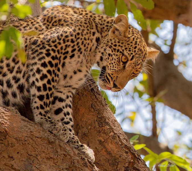
En avril dernier, à la suite de Régis puis de Claire, nous avions partagé sur ce forum notre pérégrination atypique au Kenya dans la réserve du Masaï-Mara. A l'issue de ce récit, nous avions imaginé repartir soit en randonnée sur les plus hautes terres d'Ethiopie (une dizaine de jours dans les montagnes du Simien lors d'un long séjour en 2009), soit de suivre le cours tranquille de la rivière Luangwa, dans sa partie sud (deux semaines à cheval sur octobre et novembre 2019). Dans le but d'animer les colonnes désertées de Voyage Forum en raison d'une sournoise pandémie, nous avons choisi l'Afrique Australe, précisant que ce texte, destiné à notre entourage ne correspond pas tout à fait à l'esprit "Carnets de Voyages" du site, vous nous en excuserez. Comme la précédente, cette escapade est l'une des rares que nous ayons réalisée avec une agence : y prendrait-on goût ou vieillirait-on ? Pour agrémenter ses longues pages d'écriture (une trentaine pour la partie South Luangwa N P et une dizaine pour la visite de Mosi-oa-Tunya et alentours), Yolande a sélectionné les photos les plus représentatives de cette vadrouille zambienne, dont cette magnifique panthère, rencontrée dès notre entrée dans le sanctuaire.
En route pour le rêve, seule frontière encore ouverte. Bien amicalement. Jety 34.
Impossible de joindre la photo (au secours !), ci-joint le message de VF (??????)
La symphonie du nouveau monde English translation pending
2 septembre 2095
Dans trois semaines, j’ai 85 ans. Ca va passer vite. Ce matin ma hanche me fait souffrir. Le médecin que j’ai eu en téléconsultation m’a dit qu’une intervention ne serait pas intéressante pour moi compte tenu du contexte. J’ai vu le Bourdon de la Santé Sociale se poser sur le perron d’Adrien. Depuis quelques jours ceux de la Brigade Géronte volaient en rase motte. Je vais ouvrir les volets, aérer la maison, boire mon verre d’eau et saluer Adrien, lui souhaiter bon voyage éternel.
Depuis les années 2040 les établissements pour personnes âgées et dépendantes n’existent plus et les vieillards restent chez eux jusqu’au bout de leur vie autorisée.
La grande guerre sanitaire de 2020 à 2024 a profondément modifié l’existence et, avec les changements climatiques , les forêts desséchées et les campagnes désertiques se sont multipliées. Les gouverneurs des cinq continents, l’Afrique, l’Asie, l’Europe, l’Amérique et l’Océanie ont édicté la LMN (loi du monde nouveau) et chaque habitant sur la planète s’est adapté à cette nouvelle donne. Les voyages d’agrément et d’affaires n’existent plus depuis longtemps et les sites de voyageurs se sont éteints les uns après les autres.
En ville, les gens courent en tout sens les yeux rivés sur leur écran et, en dehors du bruit sourd des voitures électriques, du bourdonnement des climatiseurs qui tournent à plein régime malgré les lourdes taxes, on dirait des villes de fantômes où les passants, visages penchés, évitent leur congénères en douceur. Durant la GGS (grande guerre sanitaire), les masques obligatoires avaient subtilement modifié les rapports, mais quand les villes avaient pu s’équiper de dômes, bulles transparentes enveloppant les cités et pulsant un air pur débarrassé de particules nocives, les gens qui craignaient l’hypercapnie avaient enfin respiré librement.
Il y a plusieurs mois que je n’y vais plus.
Pour voyager, il suffit de cliquer sur le Mur de Vie installé dans toute habitation. Il est possible de naviguer dans le passé, visiter chaque pays de l’ancien temps exactement comme si on y vivait et sans risques sanitaires. Bruits et odeurs sont diffusés et pour peu que l’on anticipe, le drone d’alimentation peut livrer des plats lyophilisés du pays choisi. Très souvent, je me projette en Inde et me promène dans les rues surpeuplées, grimpe sans fatigue les marches des temples. Un plaisir oublié sans transpiration, sans microbe, sans saleté.
Je vais sucer ma pastille de tétrahydrocannabinol. Depuis que j’ai 80 ans , j’ ai droit à 8 par mois. Dès 70 ans, j’en recevais 4, délivrées par le drone de Santé Sociale. C’est un médicament obligatoire et gratuit que chaque personne doit prendre. La vérification de l’absorption est simple. Il faut poser une infime goutte de sang dans un boîtier santé branché sur le dernier modèle de compteur Linky.
Ainsi, nous sommes tous bien pris en charge au nom de l’Egalité pour Tous inscrit dans la loi des derniers traités trans-mondiaux.
L’effet est apaisant sur ma hanche, il me ramollit le cerveau mais je vais me brancher sur les Cyclades que je ne connais pas et me laisser bercer…
A demain.
Dans trois semaines, j’ai 85 ans. Ca va passer vite. Ce matin ma hanche me fait souffrir. Le médecin que j’ai eu en téléconsultation m’a dit qu’une intervention ne serait pas intéressante pour moi compte tenu du contexte. J’ai vu le Bourdon de la Santé Sociale se poser sur le perron d’Adrien. Depuis quelques jours ceux de la Brigade Géronte volaient en rase motte. Je vais ouvrir les volets, aérer la maison, boire mon verre d’eau et saluer Adrien, lui souhaiter bon voyage éternel.
Depuis les années 2040 les établissements pour personnes âgées et dépendantes n’existent plus et les vieillards restent chez eux jusqu’au bout de leur vie autorisée.
La grande guerre sanitaire de 2020 à 2024 a profondément modifié l’existence et, avec les changements climatiques , les forêts desséchées et les campagnes désertiques se sont multipliées. Les gouverneurs des cinq continents, l’Afrique, l’Asie, l’Europe, l’Amérique et l’Océanie ont édicté la LMN (loi du monde nouveau) et chaque habitant sur la planète s’est adapté à cette nouvelle donne. Les voyages d’agrément et d’affaires n’existent plus depuis longtemps et les sites de voyageurs se sont éteints les uns après les autres.
En ville, les gens courent en tout sens les yeux rivés sur leur écran et, en dehors du bruit sourd des voitures électriques, du bourdonnement des climatiseurs qui tournent à plein régime malgré les lourdes taxes, on dirait des villes de fantômes où les passants, visages penchés, évitent leur congénères en douceur. Durant la GGS (grande guerre sanitaire), les masques obligatoires avaient subtilement modifié les rapports, mais quand les villes avaient pu s’équiper de dômes, bulles transparentes enveloppant les cités et pulsant un air pur débarrassé de particules nocives, les gens qui craignaient l’hypercapnie avaient enfin respiré librement.
Il y a plusieurs mois que je n’y vais plus.
Pour voyager, il suffit de cliquer sur le Mur de Vie installé dans toute habitation. Il est possible de naviguer dans le passé, visiter chaque pays de l’ancien temps exactement comme si on y vivait et sans risques sanitaires. Bruits et odeurs sont diffusés et pour peu que l’on anticipe, le drone d’alimentation peut livrer des plats lyophilisés du pays choisi. Très souvent, je me projette en Inde et me promène dans les rues surpeuplées, grimpe sans fatigue les marches des temples. Un plaisir oublié sans transpiration, sans microbe, sans saleté.
Je vais sucer ma pastille de tétrahydrocannabinol. Depuis que j’ai 80 ans , j’ ai droit à 8 par mois. Dès 70 ans, j’en recevais 4, délivrées par le drone de Santé Sociale. C’est un médicament obligatoire et gratuit que chaque personne doit prendre. La vérification de l’absorption est simple. Il faut poser une infime goutte de sang dans un boîtier santé branché sur le dernier modèle de compteur Linky.
Ainsi, nous sommes tous bien pris en charge au nom de l’Egalité pour Tous inscrit dans la loi des derniers traités trans-mondiaux.
L’effet est apaisant sur ma hanche, il me ramollit le cerveau mais je vais me brancher sur les Cyclades que je ne connais pas et me laisser bercer…
A demain.
Retour aux Marquises: les îles méridionales Hiva Oa, Tahuata et Fatu Iva English translation pending
INTRO
En ces temps épidémiques troublés, la Polynésie Française - et en particulier l' archipel des Marquises - ont des atouts exceptionnels en matière de tourisme. A ce jour, l' épidémie de Coronavirus a juste effleuré le Territoire -presque uniquement Tahiti et Moorea - dont les îles éloignées ont été strictement confinées dès le départ, les offres sanitaires et hospitalières sur place étant très limitées. Pour l' instant, la situation est sous contrôle.
Le tourisme retrouve lentement ses marques depuis la mi-juillet. Il s'agit actuellement plus de tourisme local que de tourisme international, bien que la destination Polynésie / Marquises soit attirante : beauté et unicité des paysages, authenticité d'un archipel, certes situé à 4 heures d'avion ATR de Tahiti, mais que l' on peut facilement découvrir en solo et donc en dehors de la très onéreuse croisière sur l' Aranui, sécurité physique mais aussi sanitaire. Les Européens - dont une majorité de Français - arrivent... Ils avaient déjà leurs billets depuis des mois et l' entrée sur le territoire est facilitée.
Nous devions faire ce second voyage aux Marquises en mai dernier, mais il fut annulé jusqu'à la reprise progressive des vols en interne.
Nous avons simplement acheté un billet Air Tahiti en ligne, sans utiliser le Pass Marquises qui ne permet pas de visiter les deux îles les plus méridionales, à savoir Tahuata et Fatu Iva, dépourvues d'aéroport. On ne peut y aller qu' en bateau, en excursion à la journée ( ou plus bien sur ) pour Tahuata et en navette municipale au départ de Hiva Oa pour aller à Fatu Iva.
Les horaires changeant fréquemment, la première chose à faire est de se renseigner sur les jours de passage vers Fatu Iva. En ce moment, il y en a trois : le lundi ( départ à 2 heures du matin ), le mardi ( départ à 6 heures ) et le samedi ( départ à 6 heures également ). Mais tout cela aura peut-être changé dans 3 mois. Il faut donc une stratégie d'approche !
On peut rajouter la visite de ces deux îles à celles qui sont incluses dans le Pass, à savoir Nuku Hiva, Ua Pou, Ua Huka et Hiva Oa. Prévoir alors une extension de 8 jours environ, à partir de Hiva Oa.
Pourquoi vouloir absolument visiter ces deux îles peu accessibles ? Justement parce qu'il faut les mériter ! Elles demeurent très différentes.
L' une, Tahuata, a un lagon, des plages de sable blanc, des falaises abruptes, des baies échancrées ourlées d'une végétation luxuriante, des couleurs uniques dans les bleus et turquoise et culmine à plus de 1000 mètres.
L' autre, Fatu Iva , est une beauté sauvage et altière avec ses à-pics qui dévalent vers l' océan bleu outremer ( ou 'moana' en tahitien ), connue surtout pour sa fameuse baie des Vierges, considérée par beaucoup - en particulier les navigateurs - comme la plus belle île de Polynésie.
Dans mon premier carnet sur les Marquises, j' avais déjà mentionné notre séjour à Hiva Oa, un peu trop court. Cette fois, entre notre arrivée et notre retour, nous passerons 4 nuits à Hiva Oa et 4 nuits à Fatu Iva. Une journée et demie sera consacrée aussi à Hiva Oa.
Avant de partir à la découverte de ces îles polynésiennes lointaines et peu visitées, quelques chiffres édifiants qui montrent que les Marquises ont échappé de peu à l' oubli, à la perte de leur identité singulière et à la disparition de leur culture. L' archipel comptait 20000 habitants en 1842, seulement 2000 en 1920, environ 8000 actuellement en 2020. Au début des années 1920, c'est grâce à la politique nataliste du Dr Rollin, administrateur des Marquises de l' époque, que la situation commença lentement à s' améliorer. Ensuite et paradoxalement, ce fut un évêque, Mgr Lecleac'h, qui s'érigea en animateur engagé du réveil identitaire, via la sauvegarde du patrimoine, la reconnaissance de la langue marquisienne ( et non tahitienne ), les danses ( jugées trop lascives par les missionnaires ), les chants, le tatouage, enfin l' artisanat inspiré des motifs et des symboles de la culture ancienne. L' icône du renouveau marquisien est sans conteste le tiki, demi-dieu et créateur de l' homme. En lui réside la divinité et les ancêtres légendaires.

TAHUATA ou Île Lumière
DANS LA LEGENDE DES MARQUISES C' est la plus petite île habitée des Marquises dont le nom signifie l' aube en marquisien. J' aurai, plus tard, l' occasion de revenir sur la légende de la création des Marquises : dans cette légende, Tahuata représente le dernier acte de la construction avant l' aube. La symbolique de son nom est liée à l' arrivée de la lumière du jour, signifiant la fin de la construction de la 'Grande Maison', alias l' archipel des Marquises.
UN PEU DE GEOLOGIE Tahuata et Fatu Iva sont soeurs géologiquement parlant. Ce sont des îles plus jeunes que celles du nord de l' archipel ( de 5, 5 millions d'années au Nord-Ouest à seulement 1,2 million d'années au Sud-Est ) L' activité volcanique passée s' est matérialisée sous la forme de volcans dits boucliers, différents des volcans hawaiïens ou tahitiens, qui , suite à des secousses sismiques violentes et répétées, se sont peu à peu effondrés, disparaissant sous les flots de la moitié voire davantage des boucliers initiaux. Résultat : les calderas sont imbriquées l'une dans l' autre , la caldeira initiale étant dotée d'un volcan interne plus petit et plus récent. C 'est le cas à Fatu Iva par exemple.
UN PEU DE GEOGRAPHIE
Située à seulement 4 kms de Hiva Oa , on ne peut rejoindre Tahuata que par mer après 40 à 60 mn de navigation selon le temps ( il existe un catamaran communal, le Tahuata Nui mais qui est souvent en panne pour une durée indéterminée... ). On choisira entre l' excursion à la journée ou le passage simple en speedboat privé, assez cher. Ou si l' on doit résider à Tahuata, on s'arrangera au préalable avec la pension de famille choisie pour discuter des modalités et du prix de la course aller-retour entre Tahuata et Hiva Oa. Le canal dit du Bordelais qui est emprunté par les bateaux peut être extrêmement agité par des courants violents et rallonger un peu la course. (Petite digression sur ce fameux canal du Bordelais... Qui est donc ce Bordelais ? Un certain Joseph Capri ( ou Kabri ou Kabris ), originaire de Bordeaux même, initialement matelot de son état sur un bâtiment baleinier qui fait naufrage sur la côte de Nuku Hiva. Kabri , capturé par les guerriers du roi anthropophage de NH, s'apprête à mourir et à finir rôti à la broche, mais est sauvé in extremis par la fille du roi qui demande sa grâce. Celle-ci est accordée, il épouse la belle dans la foulée, le roi tatoue son gendre lui-même, lui offre des parures en tapa et mousse et le nomme grand juge du pays. Il tue, torture, garrotte, découpe en morceaux. Il pacifie à sa manière ! La vie est douce et belle, il a six enfants de sa princesse marquisienne ... Et puis un jour où il sommeille dans la nature, il est kidnappé par le navigateur russe Krunsenstern qui, à coups de knout, le ramène au navire puis à St Petersbourg pour y être interrogé et jugé. Kabri parvient à s' échapper vers Paris, demande à rencontrer Louis XVIII qu'il traite comme son cousin. Ce dernier - contre toute attente - le reçoit et lui donne un peu d'argent, mais la chance a définitivement tourné pour Kabri qui se retrouve à Valenciennes, gagnant son pain comme bête de foire. Il mourra à 42 ans, épuisé et sans avoir pu repartir vers son île marquisienne et vers sa famille nombreuse. Les autorités lui éviteront post mortem l' infamie d'une exhumation et d'un empaillage, son tatouage corporel et facial ayant conquis un amateur !!! JB Kabri le Tatoué, dessin publié dans le livre de Von Langsdorff
Retour à Tahuata... L' île n'est entourée que partiellement de récifs coralliens ( comme Mangareva aux îles Gambier ) , et est agrémentée de magnifiques plages de sable blanc, en particulier celle de Hanamoenoa. Avec ses versants escarpés se terminant en falaises, des vallées étroites et profondes ouvrant sur des baies échancrées à la végétation dense telles celles jumelles de Iva Iva Nui et de Iva Iva Iti, Tahuata surprend et attire. ' C'est une des rares fois où j' eus le désir de posséder de la terre ', écrivit en son temps le navigateur Alain Gerbault, conquis par une île qu'il qualifiait d'enchanteresse. Son relief est très accidenté et les communications terrestres - sur des pistes improbables - entre les vallées sont difficiles. L' île culmine au Mont Tumu-Mea-Ufa à 1050 m. Sa superficie est de 60 km2, avec une population de 650 à 700 habitants environ. L' île comporte 4 villages : Vaitahu, petit port historique, avec son église aux murs de galets et un magnifique vitrail, son musée d'art et d'histoire, et sa proximité avec des sites archéologiques; Hapatoni, autre village avec sa voie pavée ou ' allée de la reine ', construite sur ordre de la reine Vaekehu II au 19ème siècle, bordée d'arbres centenaires de tamanu plantés par les anciens , et ses ' me'ae ' ( ou ' marae ' en tahitien). Egalement Motopu et Hanatetena, deux plus petits villages. Il y a d'autres chemins pavés dans l' île, à Hapatoni en particulier, et des pétroglyphes à Hanatahua. On peut donc passer plus d'une journée à Tahuata, y séjourner dans l' une de ses pensions. Les chemins et pistes de l' île se prêtent parfaitement à la randonnée pédestre.
UN PEU D HISTOIRE
Plusieurs édifices du village de Vaitahu commémorent un passé souvent tragique. On peut y voir les trois stèles érigées en souvenir de l' arrivée des Espagnols en 1595, puis de celle de militaires français en 1838 et enfin de la prise de possession de l' archipel par l' amiral Abel Dupetit-Thouars en 1842. Alvaro de Mendaña y Neira jeta l' ancre à Vaitahu en 1595, un premier contact avec ceux que l' on appelait à l' époque dans les mers du Sud et ailleurs ' les naturels ' qui tourna rapidement au massacre par les soldats espagnols de 200 villageois, guerriers et civils mélangés. On peut comprendre, dans ce contexte, que l' arrivée d'Occidentaux au 18ème siècle et au début du 19ème siècle ait suscité beaucoup de méfiance, d'animosité et d'hostilité de la part des habitants de Tahuata, et des autres îles également. Les premières tentatives d' évangélisation protestante d'abord en 1797 puis catholique en 1839 se soldèrent par un échec retentissant ( le gouvernement français avait l' habitude d'envoyer les missionnaires en éclaireurs afin de tâter le terrain.. ). Le religieux ayant failli à sa mission, il restait donc le politique et le militaire : l' expédition Dupetit-Thouars arrive en vue de Tahuata mi - avril 1842. Les Français sont dans un premier temps plutôt bien reçus par le chef / roi Iotete qui a récemment subi la pression de la marine américaine et qui se dit que la France le protégera. On attribue donc un terrain en hauteur aux Français pour la construction d'un fortin et d'une garnison. Dupetit-Thouars veut aller vite et propose à Iotete de se mettre sous la protection du roi de France, Louis-Philippe. Iotete accepte et, le 1er mai, est organisée une cérémonie pour la prise de possession officielle des îles Sud de l' archipel des Marquises - et par extension de tout l' archipel - par la France en présence des missionnaires et du neveu de Iotete, Maheono, également chef de Hanatetena. Et puis rapidement, un malaise grandissant s'installe, l' ambiance se dégrade, Iotete devient peu accommodant et versatile, ne supportant pas de se voir privé de son autorité de chef incontesté. Il fugue dans la montagne, organise la résistance aux Français que l' on vient pourtant de fêter, et finit par assiéger le fortin à moitié achevé avec ses guerriers. Résultat : des morts et des blessés des deux côtés et un chaos inattendu. Après palabres et promesses, l' amiral, fidèle à sa stratégie initiale, convainc Iotete - contacté et ramené à la raison par son neveu - de revenir à la table des négociations, et les termes d' une paix durable sont établis définitivement. Iotete a tenté de lutter mais a perdu et la guerre et son pouvoir, son ' mana '. Il mourra l' année suivante, une fin triste et sans avenir pour un chef qui ne sera pas élevé au rang de dieu le jour de ses funérailles.
 Prise de possession officielle de Tahuata
De g. à d. : Maheono, Iotete ( en habit militaire d'apparat à galons d'or époque Louis XV ), le père Baudichon, Abel Dupetit-Thouars
Prise de possession officielle de Tahuata
De g. à d. : Maheono, Iotete ( en habit militaire d'apparat à galons d'or époque Louis XV ), le père Baudichon, Abel Dupetit-Thouars
 Iotete le 1er Mais 1842 ( portrait par Max Radiguet )
 Iotete le 1er mai 1842 ( portrait par Max Radiguet )
 Maheono, neveu de Iotete et son saisissant tatouage facial
 Guerriers marquisiens 19ème siècle
L' amiral repart bientôt sur son navire La Reine Blanche vers Tahiti où il va obtenir le 9 septembre 1842 de la reine Pomaré IV son acceptation formelle de placer son île sous protectorat français. C' est ainsi que Les Marquises alias La Terre des Hommes ( ou Te Fenua Enata en marquisien ) devient la première colonie française dans le Pacifique Sud un peu avant Tahiti.
FAUNE ET FLORE Depuis sa disparition de Hiva Oa, suite à l' introduction malheureuse d'un rapace nocturne, le grand-duc de Virginie ( ou Bubo Virginiasus en latin ), la seule population survivante de ' pahi ' ou martin-chasseur des Marquises, vit à Tahuata, en grand danger d'extinction, car en déclin lent mais constant. il ne resterait que 300 individus au mieux. La destruction du grand-duc est autorisée à cause de son impact fatal sur la faune aviaire locale. Des excursions à pied et à cheval, en excursion à la demi-journée ou à la journée entière, à la découverte du ' pahi ' sont possibles. Contacter le comité de tourisme de Tahuata.
ACTIVITES TRADITIONNELLES
Il y a à Tahuata plusieurs centres d'artisanat et ce dernier est le plus réputé des Marquises, en particulier pour la sculpture sur os. Dans l' île, on est souvent sculpteur de père en fils; les hommes travaillent le bois de rose, l' os de cheval, de chèvre et de mouton et le rostre d'espadon. Dans la vallée d'Hapatoni, ce sont surtout d' expertes sculptrices qui sont à l' oeuvre, souvent depuis des années. Au travail de l' os ou du rostre d'espadon, elles ajoutent la confection de bijoux originaux. La culture du coprah est bien présente à Tahuata et permet aux agriculteurs de gagner un revenu fixe. Les cultures vivrières et les récoltes d'agrumes tels les pamplemousses, très réputés permettent l' autosuffisance alimentaire des habitants de l' île et un peu d'exportation vers le marché et les supermarchés de Papeete ( via la diaspora marquisienne installée à Tahiti ). Pêche et chasse participent également, pleinement, de ce désir d'autosuffisance. La nature est généreuse et tout pousse à profusion et l' on vit simplement mais plutôt bien à Tahuata comme ailleurs aux Marquises, d'autant que désormais, les cargos mixtes apportent régulièrement de Tahiti ce qui manque aux îliens.
Fatu Iva L' île de tous les superlatifs / L'île érotique

Guerrier marquisien tatoué originaire de Fatu Iva 19ème siècle On notera sur sa poitrine les motifs reconstitués d'une tête de tiki, que l' on retrouve aussi sur la crosse du casse-tête ( ou ' u'u ' en marquisien ), arme réservée au guerrier. Cette tête est supposée augmenter le ' mana ' ( alias la puissance ), les yeux en amande évoquent cette puissance surnaturelle tandis que la bouche étirée où apparaissent parfois langue et dents, est censée défier l' adversaire.
SELON LA LEGENDE Dans la légende de la construction de l' archipel des Marquises, selon laquelle chaque île est partie intégrante de la Maison des Dieux, Fatu Iva représente la toiture faite de 9 ( Iva ) tresses ( Fatu ) de feuilles de palmier. Elle s'est aussi appelée Santa Magdalena, nom donné par Alvaro de Mendaña en l' honneur de la sainte du même nom.
UN PEU DE GEOGRAPHIE Fatu Iva est une île située à 75 kms de Hiva Oa, d'une superficie de 84 km2. Longue de 10 kilomètres et large de 4, elle a la forme d'un croissant ou d'un haricot. Elle culmine au Mont Touaouoho à 960 mètres et héberge une population d'environ 600 habitants. C' est l' île la plus australe de l' archipel, la plus isolée aussi car il est impossible d'y construire un aéroport en raison du relief accidenté ou même un aérodrome comme à Ua Pou par exemple. C' est aussi la plus pluvieuse, étant la plus proche du tropique du Capricorne. Les pluies étant abondantes, l' île est recouverte d'une végétation luxuriante en particulier en son centre où prospère une forêt primaire tropicale dense. C' est aussi l'île la plus sauvage et la plus spectaculaire de l' archipel. Géologiquement parlant, elle est constituée de deux caldeiras volcaniques enchâssées l' une dans l' autre. La première date de 2 millions d'années environ, la seconde, deux fois plus petite est née d'une énorme éruption, comme en témoignent les massives chandelles basaltiques qui montent au ciel tout autour de la baie de Hanavave, dite baie des Vierges. Initialement appelée baie des Verges par les Marquisiens, elle a été rebaptisée par de pudibonds missionnaires, effarouchés par l' imagerie locale et ses sous-entendus. Fatu Iva n' a que deux villages situées chacun sur le bord extérieur des deux caldeiras : Hanavave aux colonnes basaltiques et Omoa, chef-lieu de l' île , village surplombé par un piton rocheux qui surprend par son profil rappelant la tête d'un moai de l' île de Pâques.
UN PEU D'HISTOIRE Comme les autres îles de l' archipel, Fatu Iva fut initialement peuplée par des Polynésiens venus de l' ouest. Les rivalités entre tribus étaient au départ incessantes et donnèrent lieu à des batailles sanglantes. C' est en juillet 1595 que l'île - tout comme celle de Tahuata - fut abordée pour la première fois par un occidental, le navigateur espagnol Alvaro de Mendaña de Neira , le premier du genre à avoir établi des contacts avec des populations polynésiennes. Mais il n' y débarqua pas. Il crût tout d'abord avoir découvert les Iles Salomon, le but ultime de son voyage, mais se rendit rapidement compte qu' il avait découvert une nouvelle terre dans un archipel d' îles auxquelles il donna le nom de ' Marquesas de Mendoza ' pour remercier le Vice-Roi du Pérou - alias Garcia Hurtado de Mendoza y Maurique, IV marquis de Cañete - qui l' avait aidé à monter et financer son expédition, et pour honorer en même temps son épouse et ses filles. En 1935, l' anthropologue norvégien Thor Heyerdahl - et futur aventurier du Kon Tiki - aborda Fatu Iva avec l' idée bien ancrée d' en faire son éden. Il y vécut un an avec sa femme, d'abord à Omoa, puis à Ouia, une vallée inconfortablement située sur la côte au vent et désormais retournée à l' état naturel, ayant été abandonnée par ses quelques habitants. Heyerdahl avait à l' époque avancé l' hypothèse erronée que les Maori descendaient des Indiens d'Amérique du Sud alors qu'ils sont originellement arrivés en pirogue de l' Asie du Sud-Est, et plus particulièrement de Taïwan. ( Je vous renvoie à mon carnet sur Taïwan où j' aborde ce sujet )
De 1960 à 1966, une majorité d'hommes de Fatu Iva partirent travailler au CEP de Mururoa, participant ainsi de l' émigration économique ayant commencé à l' époque, et s'étant poursuivie jusqu'à nos jours, les perspectives en termes d' emploi étant plus que limitées si l' on ne veut pas rester ou devenir agriculteur ou coprahculteur comme ses parents ou grands-parents.
FAUNE ET FLORE L' île est une terre d'abondance pour les agrumes, les fruits en général et les fleurs... Tout pousse ou presque. Elle possède une espèce endémique très menacée aujourd'hui : le Monarque ( ou oma'o ke'eke'e en marquisien ', dont il ne restait il y a peu que 6 couples au monde ! Le rat noir et le chat haret ont littéralement décimé cette espèce, dévorant oeufs, oisillons et même femelles en couvaison. Un programme de sauvegarde de l' espèce a été mis en place, avec des résultats encourageants, le nombre de couples ayant augmenté ces dernières années.
ECONOMIE L' île est ravitaillée uniquement par bateau. Une unique route partiellement bétonnée des deux côtés, et partiellement à l' état de piste, et longue de 17 kilomètres relie les deux villages. On peut également aller d'un village à l' autre par la mer en un quart d'heure de navigation. Le secteur primaire prévaut à Fatu Iva, en particulier la culture du coprah, et puis la pêche au thon, à l' espadon et au thazard. On y a cultivé le noni à outrance à une certaine époque mais celle-ci est un peu révolue, les bienfaits miraculeux du noni n' ayant pas vraiment été prouvés scientifiquement. Comme à Rurutu, on a abandonné la culture du café qui était pourtant prometteuse il y a une quarantaine d'années. En revanche, on trouve davantage de vergers et des vanillières. La chasse aux cochons et aux chèvres permet l' auto-suffisance en viande quand le ravitaillement venu de Tahiti vient à manquer ou arrive irrégulièrement. L' artisanat s'est développé grâce au tourisme et aux expositions semestrielles organisées à Papeete. La spécialité - principalement féminine - de Fatu Iva est le tapa dont les dessins s'inspirent des anciens tatouages marquisiens. La sculpture sur bois ou os ou noix de coco est plutôt réservée aux hommes, nourrie des anciennes figures et des symboles centenaires : tikis sculptés en bois de rose ou en bois noir, casse-tête, plats de présentation.
Suivez-moi en page 2.....
TAHUATA ou Île Lumière
DANS LA LEGENDE DES MARQUISES C' est la plus petite île habitée des Marquises dont le nom signifie l' aube en marquisien. J' aurai, plus tard, l' occasion de revenir sur la légende de la création des Marquises : dans cette légende, Tahuata représente le dernier acte de la construction avant l' aube. La symbolique de son nom est liée à l' arrivée de la lumière du jour, signifiant la fin de la construction de la 'Grande Maison', alias l' archipel des Marquises.
UN PEU DE GEOLOGIE Tahuata et Fatu Iva sont soeurs géologiquement parlant. Ce sont des îles plus jeunes que celles du nord de l' archipel ( de 5, 5 millions d'années au Nord-Ouest à seulement 1,2 million d'années au Sud-Est ) L' activité volcanique passée s' est matérialisée sous la forme de volcans dits boucliers, différents des volcans hawaiïens ou tahitiens, qui , suite à des secousses sismiques violentes et répétées, se sont peu à peu effondrés, disparaissant sous les flots de la moitié voire davantage des boucliers initiaux. Résultat : les calderas sont imbriquées l'une dans l' autre , la caldeira initiale étant dotée d'un volcan interne plus petit et plus récent. C 'est le cas à Fatu Iva par exemple.
UN PEU DE GEOGRAPHIE
Située à seulement 4 kms de Hiva Oa , on ne peut rejoindre Tahuata que par mer après 40 à 60 mn de navigation selon le temps ( il existe un catamaran communal, le Tahuata Nui mais qui est souvent en panne pour une durée indéterminée... ). On choisira entre l' excursion à la journée ou le passage simple en speedboat privé, assez cher. Ou si l' on doit résider à Tahuata, on s'arrangera au préalable avec la pension de famille choisie pour discuter des modalités et du prix de la course aller-retour entre Tahuata et Hiva Oa. Le canal dit du Bordelais qui est emprunté par les bateaux peut être extrêmement agité par des courants violents et rallonger un peu la course. (Petite digression sur ce fameux canal du Bordelais... Qui est donc ce Bordelais ? Un certain Joseph Capri ( ou Kabri ou Kabris ), originaire de Bordeaux même, initialement matelot de son état sur un bâtiment baleinier qui fait naufrage sur la côte de Nuku Hiva. Kabri , capturé par les guerriers du roi anthropophage de NH, s'apprête à mourir et à finir rôti à la broche, mais est sauvé in extremis par la fille du roi qui demande sa grâce. Celle-ci est accordée, il épouse la belle dans la foulée, le roi tatoue son gendre lui-même, lui offre des parures en tapa et mousse et le nomme grand juge du pays. Il tue, torture, garrotte, découpe en morceaux. Il pacifie à sa manière ! La vie est douce et belle, il a six enfants de sa princesse marquisienne ... Et puis un jour où il sommeille dans la nature, il est kidnappé par le navigateur russe Krunsenstern qui, à coups de knout, le ramène au navire puis à St Petersbourg pour y être interrogé et jugé. Kabri parvient à s' échapper vers Paris, demande à rencontrer Louis XVIII qu'il traite comme son cousin. Ce dernier - contre toute attente - le reçoit et lui donne un peu d'argent, mais la chance a définitivement tourné pour Kabri qui se retrouve à Valenciennes, gagnant son pain comme bête de foire. Il mourra à 42 ans, épuisé et sans avoir pu repartir vers son île marquisienne et vers sa famille nombreuse. Les autorités lui éviteront post mortem l' infamie d'une exhumation et d'un empaillage, son tatouage corporel et facial ayant conquis un amateur !!!
JB Kabri le Tatoué, dessin publié dans le livre de Von LangsdorffRetour à Tahuata... L' île n'est entourée que partiellement de récifs coralliens ( comme Mangareva aux îles Gambier ) , et est agrémentée de magnifiques plages de sable blanc, en particulier celle de Hanamoenoa. Avec ses versants escarpés se terminant en falaises, des vallées étroites et profondes ouvrant sur des baies échancrées à la végétation dense telles celles jumelles de Iva Iva Nui et de Iva Iva Iti, Tahuata surprend et attire. ' C'est une des rares fois où j' eus le désir de posséder de la terre ', écrivit en son temps le navigateur Alain Gerbault, conquis par une île qu'il qualifiait d'enchanteresse. Son relief est très accidenté et les communications terrestres - sur des pistes improbables - entre les vallées sont difficiles. L' île culmine au Mont Tumu-Mea-Ufa à 1050 m. Sa superficie est de 60 km2, avec une population de 650 à 700 habitants environ. L' île comporte 4 villages : Vaitahu, petit port historique, avec son église aux murs de galets et un magnifique vitrail, son musée d'art et d'histoire, et sa proximité avec des sites archéologiques; Hapatoni, autre village avec sa voie pavée ou ' allée de la reine ', construite sur ordre de la reine Vaekehu II au 19ème siècle, bordée d'arbres centenaires de tamanu plantés par les anciens , et ses ' me'ae ' ( ou ' marae ' en tahitien). Egalement Motopu et Hanatetena, deux plus petits villages. Il y a d'autres chemins pavés dans l' île, à Hapatoni en particulier, et des pétroglyphes à Hanatahua. On peut donc passer plus d'une journée à Tahuata, y séjourner dans l' une de ses pensions. Les chemins et pistes de l' île se prêtent parfaitement à la randonnée pédestre.
UN PEU D HISTOIRE
Plusieurs édifices du village de Vaitahu commémorent un passé souvent tragique. On peut y voir les trois stèles érigées en souvenir de l' arrivée des Espagnols en 1595, puis de celle de militaires français en 1838 et enfin de la prise de possession de l' archipel par l' amiral Abel Dupetit-Thouars en 1842. Alvaro de Mendaña y Neira jeta l' ancre à Vaitahu en 1595, un premier contact avec ceux que l' on appelait à l' époque dans les mers du Sud et ailleurs ' les naturels ' qui tourna rapidement au massacre par les soldats espagnols de 200 villageois, guerriers et civils mélangés. On peut comprendre, dans ce contexte, que l' arrivée d'Occidentaux au 18ème siècle et au début du 19ème siècle ait suscité beaucoup de méfiance, d'animosité et d'hostilité de la part des habitants de Tahuata, et des autres îles également. Les premières tentatives d' évangélisation protestante d'abord en 1797 puis catholique en 1839 se soldèrent par un échec retentissant ( le gouvernement français avait l' habitude d'envoyer les missionnaires en éclaireurs afin de tâter le terrain.. ). Le religieux ayant failli à sa mission, il restait donc le politique et le militaire : l' expédition Dupetit-Thouars arrive en vue de Tahuata mi - avril 1842. Les Français sont dans un premier temps plutôt bien reçus par le chef / roi Iotete qui a récemment subi la pression de la marine américaine et qui se dit que la France le protégera. On attribue donc un terrain en hauteur aux Français pour la construction d'un fortin et d'une garnison. Dupetit-Thouars veut aller vite et propose à Iotete de se mettre sous la protection du roi de France, Louis-Philippe. Iotete accepte et, le 1er mai, est organisée une cérémonie pour la prise de possession officielle des îles Sud de l' archipel des Marquises - et par extension de tout l' archipel - par la France en présence des missionnaires et du neveu de Iotete, Maheono, également chef de Hanatetena. Et puis rapidement, un malaise grandissant s'installe, l' ambiance se dégrade, Iotete devient peu accommodant et versatile, ne supportant pas de se voir privé de son autorité de chef incontesté. Il fugue dans la montagne, organise la résistance aux Français que l' on vient pourtant de fêter, et finit par assiéger le fortin à moitié achevé avec ses guerriers. Résultat : des morts et des blessés des deux côtés et un chaos inattendu. Après palabres et promesses, l' amiral, fidèle à sa stratégie initiale, convainc Iotete - contacté et ramené à la raison par son neveu - de revenir à la table des négociations, et les termes d' une paix durable sont établis définitivement. Iotete a tenté de lutter mais a perdu et la guerre et son pouvoir, son ' mana '. Il mourra l' année suivante, une fin triste et sans avenir pour un chef qui ne sera pas élevé au rang de dieu le jour de ses funérailles.
Prise de possession officielle de Tahuata
De g. à d. : Maheono, Iotete ( en habit militaire d'apparat à galons d'or époque Louis XV ), le père Baudichon, Abel Dupetit-Thouars
Iotete le 1er Mais 1842 ( portrait par Max Radiguet )
Iotete le 1er mai 1842 ( portrait par Max Radiguet )
Maheono, neveu de Iotete et son saisissant tatouage facial
Guerriers marquisiens 19ème siècleL' amiral repart bientôt sur son navire La Reine Blanche vers Tahiti où il va obtenir le 9 septembre 1842 de la reine Pomaré IV son acceptation formelle de placer son île sous protectorat français. C' est ainsi que Les Marquises alias La Terre des Hommes ( ou Te Fenua Enata en marquisien ) devient la première colonie française dans le Pacifique Sud un peu avant Tahiti.
FAUNE ET FLORE Depuis sa disparition de Hiva Oa, suite à l' introduction malheureuse d'un rapace nocturne, le grand-duc de Virginie ( ou Bubo Virginiasus en latin ), la seule population survivante de ' pahi ' ou martin-chasseur des Marquises, vit à Tahuata, en grand danger d'extinction, car en déclin lent mais constant. il ne resterait que 300 individus au mieux. La destruction du grand-duc est autorisée à cause de son impact fatal sur la faune aviaire locale. Des excursions à pied et à cheval, en excursion à la demi-journée ou à la journée entière, à la découverte du ' pahi ' sont possibles. Contacter le comité de tourisme de Tahuata.
ACTIVITES TRADITIONNELLES
Il y a à Tahuata plusieurs centres d'artisanat et ce dernier est le plus réputé des Marquises, en particulier pour la sculpture sur os. Dans l' île, on est souvent sculpteur de père en fils; les hommes travaillent le bois de rose, l' os de cheval, de chèvre et de mouton et le rostre d'espadon. Dans la vallée d'Hapatoni, ce sont surtout d' expertes sculptrices qui sont à l' oeuvre, souvent depuis des années. Au travail de l' os ou du rostre d'espadon, elles ajoutent la confection de bijoux originaux. La culture du coprah est bien présente à Tahuata et permet aux agriculteurs de gagner un revenu fixe. Les cultures vivrières et les récoltes d'agrumes tels les pamplemousses, très réputés permettent l' autosuffisance alimentaire des habitants de l' île et un peu d'exportation vers le marché et les supermarchés de Papeete ( via la diaspora marquisienne installée à Tahiti ). Pêche et chasse participent également, pleinement, de ce désir d'autosuffisance. La nature est généreuse et tout pousse à profusion et l' on vit simplement mais plutôt bien à Tahuata comme ailleurs aux Marquises, d'autant que désormais, les cargos mixtes apportent régulièrement de Tahiti ce qui manque aux îliens.
Fatu Iva L' île de tous les superlatifs / L'île érotique
Guerrier marquisien tatoué originaire de Fatu Iva 19ème siècle On notera sur sa poitrine les motifs reconstitués d'une tête de tiki, que l' on retrouve aussi sur la crosse du casse-tête ( ou ' u'u ' en marquisien ), arme réservée au guerrier. Cette tête est supposée augmenter le ' mana ' ( alias la puissance ), les yeux en amande évoquent cette puissance surnaturelle tandis que la bouche étirée où apparaissent parfois langue et dents, est censée défier l' adversaire.
SELON LA LEGENDE Dans la légende de la construction de l' archipel des Marquises, selon laquelle chaque île est partie intégrante de la Maison des Dieux, Fatu Iva représente la toiture faite de 9 ( Iva ) tresses ( Fatu ) de feuilles de palmier. Elle s'est aussi appelée Santa Magdalena, nom donné par Alvaro de Mendaña en l' honneur de la sainte du même nom.
UN PEU DE GEOGRAPHIE Fatu Iva est une île située à 75 kms de Hiva Oa, d'une superficie de 84 km2. Longue de 10 kilomètres et large de 4, elle a la forme d'un croissant ou d'un haricot. Elle culmine au Mont Touaouoho à 960 mètres et héberge une population d'environ 600 habitants. C' est l' île la plus australe de l' archipel, la plus isolée aussi car il est impossible d'y construire un aéroport en raison du relief accidenté ou même un aérodrome comme à Ua Pou par exemple. C' est aussi la plus pluvieuse, étant la plus proche du tropique du Capricorne. Les pluies étant abondantes, l' île est recouverte d'une végétation luxuriante en particulier en son centre où prospère une forêt primaire tropicale dense. C' est aussi l'île la plus sauvage et la plus spectaculaire de l' archipel. Géologiquement parlant, elle est constituée de deux caldeiras volcaniques enchâssées l' une dans l' autre. La première date de 2 millions d'années environ, la seconde, deux fois plus petite est née d'une énorme éruption, comme en témoignent les massives chandelles basaltiques qui montent au ciel tout autour de la baie de Hanavave, dite baie des Vierges. Initialement appelée baie des Verges par les Marquisiens, elle a été rebaptisée par de pudibonds missionnaires, effarouchés par l' imagerie locale et ses sous-entendus. Fatu Iva n' a que deux villages situées chacun sur le bord extérieur des deux caldeiras : Hanavave aux colonnes basaltiques et Omoa, chef-lieu de l' île , village surplombé par un piton rocheux qui surprend par son profil rappelant la tête d'un moai de l' île de Pâques.
UN PEU D'HISTOIRE Comme les autres îles de l' archipel, Fatu Iva fut initialement peuplée par des Polynésiens venus de l' ouest. Les rivalités entre tribus étaient au départ incessantes et donnèrent lieu à des batailles sanglantes. C' est en juillet 1595 que l'île - tout comme celle de Tahuata - fut abordée pour la première fois par un occidental, le navigateur espagnol Alvaro de Mendaña de Neira , le premier du genre à avoir établi des contacts avec des populations polynésiennes. Mais il n' y débarqua pas. Il crût tout d'abord avoir découvert les Iles Salomon, le but ultime de son voyage, mais se rendit rapidement compte qu' il avait découvert une nouvelle terre dans un archipel d' îles auxquelles il donna le nom de ' Marquesas de Mendoza ' pour remercier le Vice-Roi du Pérou - alias Garcia Hurtado de Mendoza y Maurique, IV marquis de Cañete - qui l' avait aidé à monter et financer son expédition, et pour honorer en même temps son épouse et ses filles. En 1935, l' anthropologue norvégien Thor Heyerdahl - et futur aventurier du Kon Tiki - aborda Fatu Iva avec l' idée bien ancrée d' en faire son éden. Il y vécut un an avec sa femme, d'abord à Omoa, puis à Ouia, une vallée inconfortablement située sur la côte au vent et désormais retournée à l' état naturel, ayant été abandonnée par ses quelques habitants. Heyerdahl avait à l' époque avancé l' hypothèse erronée que les Maori descendaient des Indiens d'Amérique du Sud alors qu'ils sont originellement arrivés en pirogue de l' Asie du Sud-Est, et plus particulièrement de Taïwan. ( Je vous renvoie à mon carnet sur Taïwan où j' aborde ce sujet )
De 1960 à 1966, une majorité d'hommes de Fatu Iva partirent travailler au CEP de Mururoa, participant ainsi de l' émigration économique ayant commencé à l' époque, et s'étant poursuivie jusqu'à nos jours, les perspectives en termes d' emploi étant plus que limitées si l' on ne veut pas rester ou devenir agriculteur ou coprahculteur comme ses parents ou grands-parents.
FAUNE ET FLORE L' île est une terre d'abondance pour les agrumes, les fruits en général et les fleurs... Tout pousse ou presque. Elle possède une espèce endémique très menacée aujourd'hui : le Monarque ( ou oma'o ke'eke'e en marquisien ', dont il ne restait il y a peu que 6 couples au monde ! Le rat noir et le chat haret ont littéralement décimé cette espèce, dévorant oeufs, oisillons et même femelles en couvaison. Un programme de sauvegarde de l' espèce a été mis en place, avec des résultats encourageants, le nombre de couples ayant augmenté ces dernières années.
ECONOMIE L' île est ravitaillée uniquement par bateau. Une unique route partiellement bétonnée des deux côtés, et partiellement à l' état de piste, et longue de 17 kilomètres relie les deux villages. On peut également aller d'un village à l' autre par la mer en un quart d'heure de navigation. Le secteur primaire prévaut à Fatu Iva, en particulier la culture du coprah, et puis la pêche au thon, à l' espadon et au thazard. On y a cultivé le noni à outrance à une certaine époque mais celle-ci est un peu révolue, les bienfaits miraculeux du noni n' ayant pas vraiment été prouvés scientifiquement. Comme à Rurutu, on a abandonné la culture du café qui était pourtant prometteuse il y a une quarantaine d'années. En revanche, on trouve davantage de vergers et des vanillières. La chasse aux cochons et aux chèvres permet l' auto-suffisance en viande quand le ravitaillement venu de Tahiti vient à manquer ou arrive irrégulièrement. L' artisanat s'est développé grâce au tourisme et aux expositions semestrielles organisées à Papeete. La spécialité - principalement féminine - de Fatu Iva est le tapa dont les dessins s'inspirent des anciens tatouages marquisiens. La sculpture sur bois ou os ou noix de coco est plutôt réservée aux hommes, nourrie des anciennes figures et des symboles centenaires : tikis sculptés en bois de rose ou en bois noir, casse-tête, plats de présentation.
Suivez-moi en page 2.....
Les racines du besoin de voyager English translation pending
Certains ne quittent jamais leur ville ou leur province et ne le souhaitent pas.
Nous autres voyageurs avons un beau jour attrapé le virus de la decouverte et il nous faut voir l Ailleurs.
il y a eu une fois une petite semence qui a germé : un voyage de classe, un pays decouvert avec des amis, des vacances avec les parents, un passage de frontiere. un moment qui nous a donné le goût, un moment qu on veut revivre à tout jamais, a chaque fois.
il y a eu une fois une petite semence qui a germé : un voyage de classe, un pays decouvert avec des amis, des vacances avec les parents, un passage de frontiere. un moment qui nous a donné le goût, un moment qu on veut revivre à tout jamais, a chaque fois.
Douze jours à Minorque aux Baléares English translation pending
Je suis à la retraite depuis novembre 2019. Je mets ce temps libre à profit pour (entre autre) compiler notes et photos prises ces dernières années pendant nos vadrouilles autour du monde. Ça date un peu, mais devrait conserver son intérêt, le plupart des endroits visités restent accessibles de la même façon qu'alors.
dimanche 25 septembre 2016
Le réveil à 3h30 est un moment extrêmement pénible. C’est pas du tout dans mes plages horaires ! Mais il fallait bien ça ! On va se rendre compte au long des interminables files d’attente que de monter dans cet avion avant 6 heures va devenir un challenge qui va très vite me mettre sous tension! Ensuite, il n’y a plus qu’à s’affaler sur son fauteuil avec un bon casque sur les oreilles, à écouter de la musique, tout en jetant un coup d’œil au splendide lever du soleil qui déverse ses teintes de rouge jusque sur les parois de l’appareil…
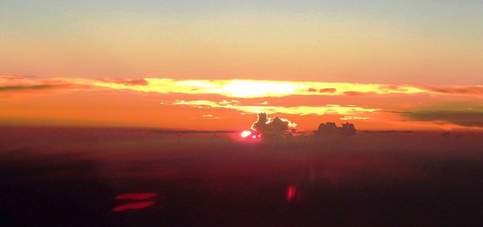
A Majorque, c’est une longue attente de plus de quatre heures, avant de prendre le vol pour Minorque. C’est long ! Sans dire que l’administration aéroportuaire s’est distribuée le budget « chaises » pour s’offrir le tout dernier 4*4 de chez Porsche !
On arrive enfin à destination. Quand l’avion atterrit, il est 14 heures, l’atmosphère est sombre. Dominique et moi, on se regarde, les hublots sont constellés de petites bulles d’eau…Il pleut. Des trombes ! Il fait froid… Ambiance !
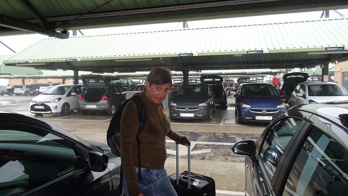
La voiture de chez Herz est une voiture complètement neuve avec GPS et surtout un connecteur MP3. Ça suffit tout à fait à me consoler ! En remontant vers le nord, on s’aperçoit qu’au fil du trajet le climat change complètement. Au nord il fait beau ! L’hôtel est une ancienne ferme retapée à neuf.
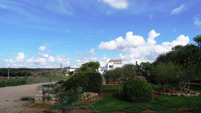
La chambre qu’on nous propose nous laisse cependant dubitatifs. Sans savoir trop pourquoi. Probablement l’absence de balcon. On décide d’aller négocier. Et ça marche. L’upgrade est spectaculaire, la chambre est superbe!
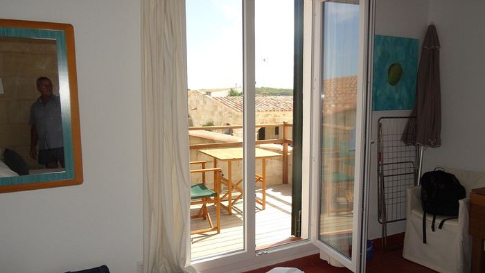
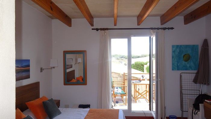
En fait, c’est un petit appartement. Il y a même une cuisine.
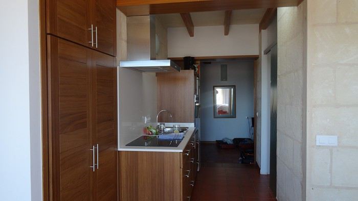
La mer est à 2km500. On décide de les faire à pied. On arrive au petit village qui entoure la Cala Morell. Les maisons sont toutes blanches. Même les toits. Il n’y a aucune exception et c’est assez joli…
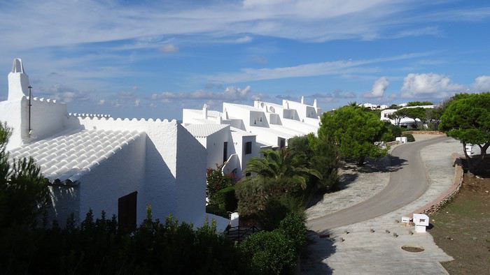
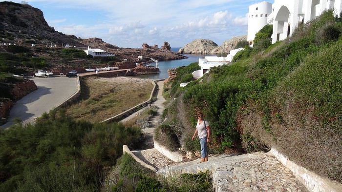
Nous n’avons pas mangé de la journée, alors, quand le patron du resto qui donne sur la plage nous annonce qu’il ferme ses cuisines à 17 heures, soit dans cinq minutes, on se laisse immédiatement embarquer pour un dîner. Une nourriture oubliable, un vin qui pique, mais dans un décor grandiose…
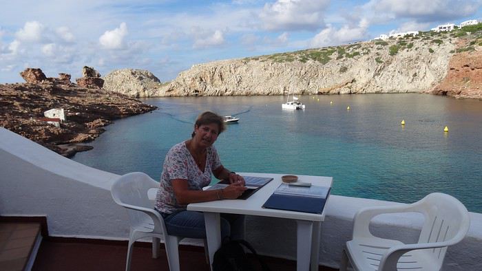
dimanche 25 septembre 2016
Le réveil à 3h30 est un moment extrêmement pénible. C’est pas du tout dans mes plages horaires ! Mais il fallait bien ça ! On va se rendre compte au long des interminables files d’attente que de monter dans cet avion avant 6 heures va devenir un challenge qui va très vite me mettre sous tension! Ensuite, il n’y a plus qu’à s’affaler sur son fauteuil avec un bon casque sur les oreilles, à écouter de la musique, tout en jetant un coup d’œil au splendide lever du soleil qui déverse ses teintes de rouge jusque sur les parois de l’appareil…
A Majorque, c’est une longue attente de plus de quatre heures, avant de prendre le vol pour Minorque. C’est long ! Sans dire que l’administration aéroportuaire s’est distribuée le budget « chaises » pour s’offrir le tout dernier 4*4 de chez Porsche !
On arrive enfin à destination. Quand l’avion atterrit, il est 14 heures, l’atmosphère est sombre. Dominique et moi, on se regarde, les hublots sont constellés de petites bulles d’eau…Il pleut. Des trombes ! Il fait froid… Ambiance !
La voiture de chez Herz est une voiture complètement neuve avec GPS et surtout un connecteur MP3. Ça suffit tout à fait à me consoler ! En remontant vers le nord, on s’aperçoit qu’au fil du trajet le climat change complètement. Au nord il fait beau ! L’hôtel est une ancienne ferme retapée à neuf.
La chambre qu’on nous propose nous laisse cependant dubitatifs. Sans savoir trop pourquoi. Probablement l’absence de balcon. On décide d’aller négocier. Et ça marche. L’upgrade est spectaculaire, la chambre est superbe!
En fait, c’est un petit appartement. Il y a même une cuisine.
La mer est à 2km500. On décide de les faire à pied. On arrive au petit village qui entoure la Cala Morell. Les maisons sont toutes blanches. Même les toits. Il n’y a aucune exception et c’est assez joli…
Nous n’avons pas mangé de la journée, alors, quand le patron du resto qui donne sur la plage nous annonce qu’il ferme ses cuisines à 17 heures, soit dans cinq minutes, on se laisse immédiatement embarquer pour un dîner. Une nourriture oubliable, un vin qui pique, mais dans un décor grandiose…
Discussion autour du concours de juillet 2020: Verticale(s) English translation pending
Pour discuter autour du concours de juillet 2020, Verticale(s), ça se passe ici.
Promenades au Rwanda English translation pending
C'est un voyage qui date un peu, mais il se trouve que les circonstances de la vie m'offrent du temps libre... L'occasion de replonger dans mes souvenirs et partager un voyage qui reste probablement d’actualité même si nous habitons un monde qui change de plus en plus vite...
dimanche 4 juin 2017 Mulhouse-Kigali
Le décollage approche, il faut choisir son Macron, heu, je voulais dire, son livre, pardon. Bon, dans la France du mois de juin 2017, cela revient strictement au même…

09:30 embarquement 11:20 Départ Basel Turkish Airlines (TK1924) 3 heures de vol 15:20 Arrivée Istanbul (heure locale) Changement d'Avion 18:35 TK 569 Turkich Airline
durée 6h30
00:05 Arrivée: Kigali (KGL), Kigali, Rwanda
Je précise que le mobile de ce voyage est que ma sœur vit à Kigali depuis quelques années. Son mari travaille "dans la diplomatie". Nous sommes attendus à l’aéroport par un chauffeur de l’ambassade. Ma soeur nous avait dit qu’ils seraient au lit, que la maison était ouverte et des infos pour retrouver sans aide notre chambre. Ceux qui connaissent mon célèbre sens de l’orientation ont déjà deviné que je suis allé me vautrer directement dans la chambre de nos hôtes…
lundi 5 juin 2017
Kigali C’est le lendemain qu’on a vraiment réalisé qu’on était en Afrique...
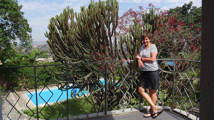
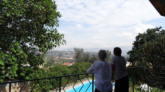
Bon, mais faut manger…On part faire des courses en ville, excellent moyen de prendre la température de l’endroit…Avec ma soeur, c’est tout de suite magouilles et compagnies…Elle me fait changer ma bonne vieille puce Bouygues contre une puce MTN locale. Elle alpague ensuite un gamin dans la rue qui tape sur mon clavier des suites de chiffres cabalistiques pour m’ouvrir les chemins d’une 3g low cost…
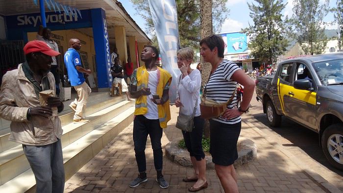
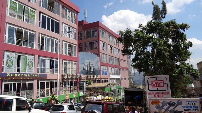
Comme souvent dans les pays qui se sont déversés dans le courant consumériste trop vite, les villes sont un gigantesque foutoir où l’architecture s’inspire beaucoup des gâteaux à la meringue, on côtoie le pire et le meilleur, un flot d’humains qui se débattent pour survivre, des raz de marée de véhicules, gigantesques 4*4 en concurrence avec des myriades de deux roues hétéroclites…C’est une ambiance, à l’africaine, des sonos déversent de la rumba congolaise, des types jouent au tam-tam…
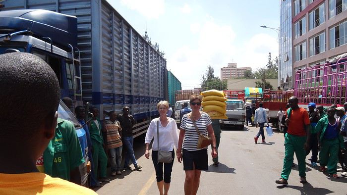
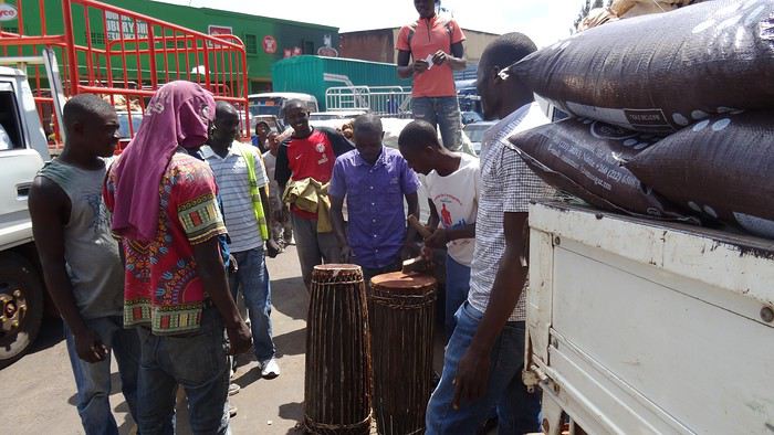
Partout des portefaix s’activent avec des montagnes posées sur la tête…
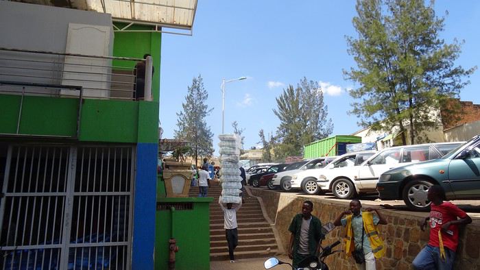
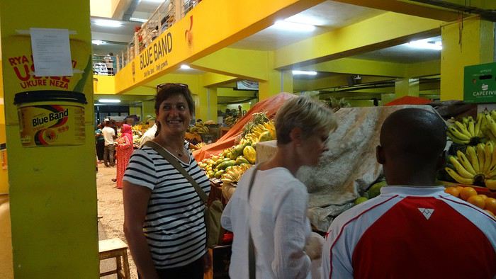
On arrive au marché. Ma sœur y est en territoire connu, négocie, interpelle
dimanche 4 juin 2017 Mulhouse-Kigali
Le décollage approche, il faut choisir son Macron, heu, je voulais dire, son livre, pardon. Bon, dans la France du mois de juin 2017, cela revient strictement au même…
09:30 embarquement 11:20 Départ Basel Turkish Airlines (TK1924) 3 heures de vol 15:20 Arrivée Istanbul (heure locale) Changement d'Avion 18:35 TK 569 Turkich Airline
durée 6h30
00:05 Arrivée: Kigali (KGL), Kigali, Rwanda
Je précise que le mobile de ce voyage est que ma sœur vit à Kigali depuis quelques années. Son mari travaille "dans la diplomatie". Nous sommes attendus à l’aéroport par un chauffeur de l’ambassade. Ma soeur nous avait dit qu’ils seraient au lit, que la maison était ouverte et des infos pour retrouver sans aide notre chambre. Ceux qui connaissent mon célèbre sens de l’orientation ont déjà deviné que je suis allé me vautrer directement dans la chambre de nos hôtes…
lundi 5 juin 2017
Kigali C’est le lendemain qu’on a vraiment réalisé qu’on était en Afrique...
Bon, mais faut manger…On part faire des courses en ville, excellent moyen de prendre la température de l’endroit…Avec ma soeur, c’est tout de suite magouilles et compagnies…Elle me fait changer ma bonne vieille puce Bouygues contre une puce MTN locale. Elle alpague ensuite un gamin dans la rue qui tape sur mon clavier des suites de chiffres cabalistiques pour m’ouvrir les chemins d’une 3g low cost…
Comme souvent dans les pays qui se sont déversés dans le courant consumériste trop vite, les villes sont un gigantesque foutoir où l’architecture s’inspire beaucoup des gâteaux à la meringue, on côtoie le pire et le meilleur, un flot d’humains qui se débattent pour survivre, des raz de marée de véhicules, gigantesques 4*4 en concurrence avec des myriades de deux roues hétéroclites…C’est une ambiance, à l’africaine, des sonos déversent de la rumba congolaise, des types jouent au tam-tam…
Partout des portefaix s’activent avec des montagnes posées sur la tête…
On arrive au marché. Ma sœur y est en territoire connu, négocie, interpelle
Mes expériences avec les ours en randonnée English translation pending
MON PREMIER OURS, 1988
Au printemps 1988, mon employeur m'a envoyé travailler pendant 3 mois dans un centre de recherches en Caroline du Nord. Pour un weekend prolongé, je pars au Great Smoky Mountains National Park. Je veux passer la nuit à un des campings du parc, tout est plein mais le ranger me propose le 'backcountry camping' , une aire de camping dans la forêt accessible en une heure de marche. Donc j'y vais, sac à dos. Un plutôt petit ours noir se tient dans une petite clairière, juste à côté du chemin, à 50 mètres de moi. Bon, il s'enfuit. Au camping, juste 10 minutes plus loin, je passe la soirée avec un jeune couple, les seuls autres résidents, et ils sont très surpris qu'un ours se trouve si près de nous.
OUEST DU CANADA, 2009
Je vais faire plusieurs randonnées en backcountry camping. Cette fois, je devrai m'habituer à la présence des ours ! Aux bureaux des parcs on doit suivre une explication sur les ours et comment se comporter envers eux, soit une vidéo, soit directement un entretien par un ranger, plus encore un fascicule. Dans les aires de camping on trouve des armoires anti-chasseours pour ranger sa nourriture, ou alors des potences avec une corde pour la mettre hors de portée en hauteur. Il est interdit de manger dans sa tente. En fait, je n'en voit qu'un dans les Rocheuses, pendant le trek du Mont Assiniboine, en compagnie d'un couple canadien. Dans une prairie caillouteuse, un grizzly chasse les 'gophers' (des sortes de petits écureuils) et essaye même de les déterrer de leur terrier, il ne se préoccupe absolument pas de nous, on peut l'observer longuement. Je vois partout des empreintes d'ours, et aussi des excréments, facilement identifiables. Par la suite, je me déplace vers Vancouver, Je randonne dans le parc provincial de Manning et le troisième jour un ours noir est plante juste sur mon chemin au milieu d'éboulis, assez loin devant moi. Il ne m'a pas remarqué (d'ailleurs, malgré leur odorat réputé, le plus souvent je vois les ours avant que eux ne m'aient repéré). Je suis obligé de taper dans mes mains et faire du bruit pour qu'il deguerpisse et que je puisse continuer. Je termine ce voyage par la très réputée West Coast Trail, fin septembre, ses derniers jours d'ouverture. Le sentier est souvent une fente étroite dans la végétation envahissante, sans visibilité, et à 2 reprises je tombe sur un ours seulement 10 ou 20 mètres devant moi, ils disparaissent en une fraction de seconde.
A SUIVRE Alaska 2010
Au printemps 1988, mon employeur m'a envoyé travailler pendant 3 mois dans un centre de recherches en Caroline du Nord. Pour un weekend prolongé, je pars au Great Smoky Mountains National Park. Je veux passer la nuit à un des campings du parc, tout est plein mais le ranger me propose le 'backcountry camping' , une aire de camping dans la forêt accessible en une heure de marche. Donc j'y vais, sac à dos. Un plutôt petit ours noir se tient dans une petite clairière, juste à côté du chemin, à 50 mètres de moi. Bon, il s'enfuit. Au camping, juste 10 minutes plus loin, je passe la soirée avec un jeune couple, les seuls autres résidents, et ils sont très surpris qu'un ours se trouve si près de nous.
OUEST DU CANADA, 2009
Je vais faire plusieurs randonnées en backcountry camping. Cette fois, je devrai m'habituer à la présence des ours ! Aux bureaux des parcs on doit suivre une explication sur les ours et comment se comporter envers eux, soit une vidéo, soit directement un entretien par un ranger, plus encore un fascicule. Dans les aires de camping on trouve des armoires anti-chasseours pour ranger sa nourriture, ou alors des potences avec une corde pour la mettre hors de portée en hauteur. Il est interdit de manger dans sa tente. En fait, je n'en voit qu'un dans les Rocheuses, pendant le trek du Mont Assiniboine, en compagnie d'un couple canadien. Dans une prairie caillouteuse, un grizzly chasse les 'gophers' (des sortes de petits écureuils) et essaye même de les déterrer de leur terrier, il ne se préoccupe absolument pas de nous, on peut l'observer longuement. Je vois partout des empreintes d'ours, et aussi des excréments, facilement identifiables. Par la suite, je me déplace vers Vancouver, Je randonne dans le parc provincial de Manning et le troisième jour un ours noir est plante juste sur mon chemin au milieu d'éboulis, assez loin devant moi. Il ne m'a pas remarqué (d'ailleurs, malgré leur odorat réputé, le plus souvent je vois les ours avant que eux ne m'aient repéré). Je suis obligé de taper dans mes mains et faire du bruit pour qu'il deguerpisse et que je puisse continuer. Je termine ce voyage par la très réputée West Coast Trail, fin septembre, ses derniers jours d'ouverture. Le sentier est souvent une fente étroite dans la végétation envahissante, sans visibilité, et à 2 reprises je tombe sur un ours seulement 10 ou 20 mètres devant moi, ils disparaissent en une fraction de seconde.
A SUIVRE Alaska 2010