Results for "Vallée+Paradis+|+1+>+66"
40543 results found.
Some trips are born twice - Peru April - May 2025
Some trips are born twice.
Ours was supposed to happen in 2020. Everything was ready: the itinerary, the flight tickets, hotel reservations and Machu Picchu, the rental car, dreams of high altitudes and wide-open spaces. And then the world stopped.
Like so many other plans, our trip to Peru was put on hold. Disappointment was followed by a more concrete reality: paperwork, endless back-and-forth, and battles to recover some of the costs we’d already paid.
The years went by. Life moved on, with its shifting priorities and unexpected twists. Rescheduling this trip wasn’t possible until 2025.
The itinerary stayed mostly true to what we’d imagined five years earlier. One major difference, though—in 2020, we’d planned to rent a car and explore the roads completely independently. Most importantly, we hadn’t included the three-day Ausangate trek, due to lack of time.
For 2025, our plans evolved. 4x4 rental prices had skyrocketed, and when we looked at our schedule more closely, we realized quite a few days didn’t actually need a vehicle. So we made a different choice and opted for private drivers instead. A decision we never regretted. Always punctual, thoughtful, and available... they were so much more than just drivers.
All our reservations were made in January, except for the trek, which we booked in February.
Finding reliable drivers on our own was tough, so we asked Laurent from Tout Pérou to handle it for us. Going through Tout Pérou also gave us a discount on the train ride to Aguas Calientes, so Laurent booked those tickets too. He also bought our Machu Picchu entrance tickets at the same price we would’ve paid on the official website. When comparing domestic flight prices, we found it was cheaper to book from Peru, so Laurent took care of those as well.
This time, nothing was going to stop us. Peru was waiting. And we were ready. 🙂
Ours was supposed to happen in 2020. Everything was ready: the itinerary, the flight tickets, hotel reservations and Machu Picchu, the rental car, dreams of high altitudes and wide-open spaces. And then the world stopped.
Like so many other plans, our trip to Peru was put on hold. Disappointment was followed by a more concrete reality: paperwork, endless back-and-forth, and battles to recover some of the costs we’d already paid.
The years went by. Life moved on, with its shifting priorities and unexpected twists. Rescheduling this trip wasn’t possible until 2025.
The itinerary stayed mostly true to what we’d imagined five years earlier. One major difference, though—in 2020, we’d planned to rent a car and explore the roads completely independently. Most importantly, we hadn’t included the three-day Ausangate trek, due to lack of time.
For 2025, our plans evolved. 4x4 rental prices had skyrocketed, and when we looked at our schedule more closely, we realized quite a few days didn’t actually need a vehicle. So we made a different choice and opted for private drivers instead. A decision we never regretted. Always punctual, thoughtful, and available... they were so much more than just drivers.
All our reservations were made in January, except for the trek, which we booked in February.
Finding reliable drivers on our own was tough, so we asked Laurent from Tout Pérou to handle it for us. Going through Tout Pérou also gave us a discount on the train ride to Aguas Calientes, so Laurent booked those tickets too. He also bought our Machu Picchu entrance tickets at the same price we would’ve paid on the official website. When comparing domestic flight prices, we found it was cheaper to book from Peru, so Laurent took care of those as well.
This time, nothing was going to stop us. Peru was waiting. And we were ready. 🙂
In the midst of Kenya's wildlife, October 2025
Hello everyone,
After sharing some safari photos from southern Tanzania, I’d like to show you those from our latest safari in Kenya in October 2025.
First, I’d like to thank Sylvie56, whose previous travel journals about this country inspired our trip choices. Thanks also for the info you sent us via PM. THANK YOU!
The following account is from a simple wildlife enthusiast. You won’t find anything here but images of landscapes, mammals, and birds. The stated purpose of this trip was purely and solely wildlife-focused. (It was in no way a discovery of the country or its people).
This stay/safari began (and ended) in Nairobi, with flights between France and Kenya operated by Qatar Airways departing from Nice.
Over two weeks, we first visited the reserves of Tsavo West and Tsavo East, then after a long road trip, the two reserves of Buffalo Springs and Samburu.
= Please wait until the end of the journal to ask any specific questions (or send them via PM) to keep the story flowing without interruptions or off-topic comments.
Thanks for your understanding.
...
Previous Kenya safari trip in 2017, here:
http://www.image-nature.com/forum/viewtopic.php?f=162&t=61119
...
After sharing some safari photos from southern Tanzania, I’d like to show you those from our latest safari in Kenya in October 2025.
First, I’d like to thank Sylvie56, whose previous travel journals about this country inspired our trip choices. Thanks also for the info you sent us via PM. THANK YOU!
The following account is from a simple wildlife enthusiast. You won’t find anything here but images of landscapes, mammals, and birds. The stated purpose of this trip was purely and solely wildlife-focused. (It was in no way a discovery of the country or its people).
This stay/safari began (and ended) in Nairobi, with flights between France and Kenya operated by Qatar Airways departing from Nice.
Over two weeks, we first visited the reserves of Tsavo West and Tsavo East, then after a long road trip, the two reserves of Buffalo Springs and Samburu.
= Please wait until the end of the journal to ask any specific questions (or send them via PM) to keep the story flowing without interruptions or off-topic comments.
Thanks for your understanding.
...
Previous Kenya safari trip in 2017, here:
http://www.image-nature.com/forum/viewtopic.php?f=162&t=61119
...
Trip to Morocco in September-October 2025, in our camper van
Hi everyone,
We’re just back from a month-long trip to Morocco in our camper van.
After crossing France (we left from the Nantes area) and Spain, we arrived in Algeciras where we bought our boat tickets to Tangier. When we got to Tangier, as we were going through customs, you can imagine our surprise when the customs officer took our road map of Morocco and pointed out the label "Western Sahara" (just like in the forum’s destination section, by the way!).
He wanted it to say "Moroccan Sahara" instead!!! But there was nothing we could do—it was an old map... He wouldn’t listen, and after long discussions with the other (younger) customs officers, he finally gave it back and let us through... Unbelievable! Later, we heard that other travelers had their maps confiscated outright.
So, hide it well if you want to keep yours!!!
Anyway, we skirted around Tangier’s suburbs—pretty grim—and finally arrived in Asilah.
Following the coast and the long promenade along the beach, we reached the campsite. It was a bit crowded, not much shade, but it wasn’t far from the medina or the beach, and it wasn’t expensive. There’s some life here: Moroccan families seem to live on-site, in tents or basic bungalows. A woman was cooking tagine on a brazier—we were right in the atmosphere! The night was quiet, and we slept well. We set off on foot, walking along the seafront to the medina... We’d already been here in 2009. It was less touristy back then! Still, at this early hour, the little streets inside were very quiet. The walls had been freshly whitewashed, and there were even more murals than before. Around 11:30 AM, we strolled along the ramparts by the sea. There was a nice breeze! And a lot more people around. We enjoyed a milkshake on the terrace of a café overlooking the beach that stretches out at the foot of the medina. Some young guys were having fun diving off the rocks—and even off the top of the wall!
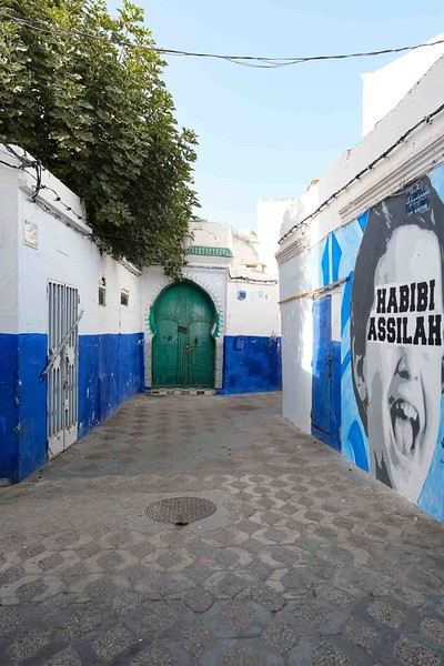
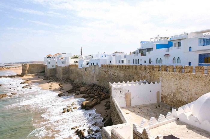
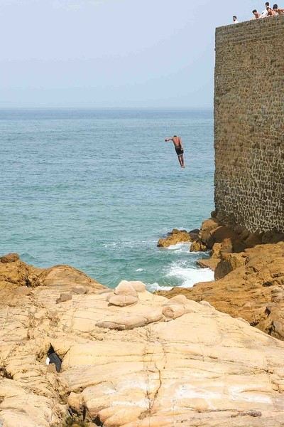
Anyway, we skirted around Tangier’s suburbs—pretty grim—and finally arrived in Asilah.
Following the coast and the long promenade along the beach, we reached the campsite. It was a bit crowded, not much shade, but it wasn’t far from the medina or the beach, and it wasn’t expensive. There’s some life here: Moroccan families seem to live on-site, in tents or basic bungalows. A woman was cooking tagine on a brazier—we were right in the atmosphere! The night was quiet, and we slept well. We set off on foot, walking along the seafront to the medina... We’d already been here in 2009. It was less touristy back then! Still, at this early hour, the little streets inside were very quiet. The walls had been freshly whitewashed, and there were even more murals than before. Around 11:30 AM, we strolled along the ramparts by the sea. There was a nice breeze! And a lot more people around. We enjoyed a milkshake on the terrace of a café overlooking the beach that stretches out at the foot of the medina. Some young guys were having fun diving off the rocks—and even off the top of the wall!
CAPE VERDE 2025: 3 weeks, 4 islands.
And we still haven’t seen everything!
Before setting off for new horizons at the end of this year, it’s time for me to share my trip to Cape Verde this summer 2025.
I particularly love these spontaneous trips, and our stay in Cape Verde is one of those because it was only at the beginning of April that we decided on this getaway, which had been catching our eye for a while, given our love for the mountains.
As always—well, when it’s open—I turned to VF, and I want to immediately thank Marie, aka ptitortue, who helped me a lot in planning this trip through her travel journals and our exchanges!
Because Cape Verde is both small and vast! We decided not to rush from one airport to another, to enjoy the places and the people, but also to relax, since the work backlog from being stuck in May (see my previous travel journal 😅) had to be caught up on in June.
So, 4 islands will be our winners from 06/28 to 07/19:
Santiago first for logistical reasons, as round-trip flights from the capital Praia were the cheapest (650 €/person from Lyon via Lisbon with TAP, still!)
São Vicente, because it’s the gateway to the next one but ultimately more than that...
Santo Antão, pretty much the main goal of the trip since Marie (and the photos) had really sold it to me.
And finally, Sal Island, for some rest—a non-negotiable condition for my other half—and we’ll see that I should’ve listened to Marie...
That said, what a chatterbox I am—buckle up, flight attendants at the doors, off we go on new beautiful escapes! (Thanks to Sophie for the easy loan)
Last note for my eager fan club 😏: yes, there will be alcohol—how could there not be in the land of grogue!
It starts here:
https://voyageforum.com/v.f?post=10790234;a=10790234

I particularly love these spontaneous trips, and our stay in Cape Verde is one of those because it was only at the beginning of April that we decided on this getaway, which had been catching our eye for a while, given our love for the mountains.
As always—well, when it’s open—I turned to VF, and I want to immediately thank Marie, aka ptitortue, who helped me a lot in planning this trip through her travel journals and our exchanges!
Because Cape Verde is both small and vast! We decided not to rush from one airport to another, to enjoy the places and the people, but also to relax, since the work backlog from being stuck in May (see my previous travel journal 😅) had to be caught up on in June.
So, 4 islands will be our winners from 06/28 to 07/19:
Santiago first for logistical reasons, as round-trip flights from the capital Praia were the cheapest (650 €/person from Lyon via Lisbon with TAP, still!)
São Vicente, because it’s the gateway to the next one but ultimately more than that...
Santo Antão, pretty much the main goal of the trip since Marie (and the photos) had really sold it to me.
And finally, Sal Island, for some rest—a non-negotiable condition for my other half—and we’ll see that I should’ve listened to Marie...
That said, what a chatterbox I am—buckle up, flight attendants at the doors, off we go on new beautiful escapes! (Thanks to Sophie for the easy loan)
Last note for my eager fan club 😏: yes, there will be alcohol—how could there not be in the land of grogue!
It starts here:
https://voyageforum.com/v.f?post=10790234;a=10790234
Mauritian Ti' Punch
The recipe for the cocktail: endless beaches, a dazzling palette of colors, some breathtaking hikes, and excellent cuisine...
For the tasting, follow along in the pages of this travel journal! 😉
Don’t forget your hiking shoes, a swimsuit, sunscreen, but also a sweater, your driver’s license, and your credit card...
Just over 11 hours of flight, and we’ll be setting foot on Mauritian soil!
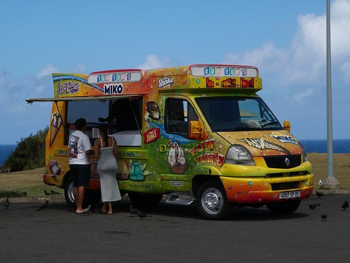
For the tasting, follow along in the pages of this travel journal! 😉
Don’t forget your hiking shoes, a swimsuit, sunscreen, but also a sweater, your driver’s license, and your credit card...
Just over 11 hours of flight, and we’ll be setting foot on Mauritian soil!
Preparing for a trip to Sri Lanka
Hi everyone.
The tickets for SRI LANKA are booked—arriving in COLOMBO on 12/21 and returning from the same place on 01/17. I’ve read here and there that it’ll be high season, but we don’t have a choice, so we’ll make do...
My first question is obviously about the itinerary: Most of the ones I’ve seen go clockwise, and I’m wondering if I should do it the other way: - To avoid the cultural triangle between Christmas and New Year’s - To start with a bit of rest (we’re really wiped out) Does that make sense?
My second question is about the time allocated to each stop, which you’ll find below. Is it balanced? Too much here and not enough there?
My third question will be about Jaffna: yes or no? How long is the trip from Anuradhapura? Where can I fit in the 3 days needed?
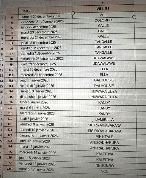
Thanks for your replies. A few details: ultra-independent travelers, using public transport, hikers, minimum 2 nights per accommodation. First time in Sri Lanka! !
The tickets for SRI LANKA are booked—arriving in COLOMBO on 12/21 and returning from the same place on 01/17. I’ve read here and there that it’ll be high season, but we don’t have a choice, so we’ll make do...
My first question is obviously about the itinerary: Most of the ones I’ve seen go clockwise, and I’m wondering if I should do it the other way: - To avoid the cultural triangle between Christmas and New Year’s - To start with a bit of rest (we’re really wiped out) Does that make sense?
My second question is about the time allocated to each stop, which you’ll find below. Is it balanced? Too much here and not enough there?
My third question will be about Jaffna: yes or no? How long is the trip from Anuradhapura? Where can I fit in the 3 days needed?
Thanks for your replies. A few details: ultra-independent travelers, using public transport, hikers, minimum 2 nights per accommodation. First time in Sri Lanka! !
Off on an adventure to Java (and a bit of Bali)
Hey there, community! Back this weekend, below is my travel journal from my adventure in Indonesia. Enjoy the read!!!
Day 1 - August 10, 2025 New life downloading for three weeks! And for that, Flo and I launched a public tender... A public tender? What’s that got to do with a travel journal???... Well, when you think about it, few destinations tick all the boxes for an August adventure: Meaning, finding a place that’s exotic in the middle of August, not too expensive, not too packed with tourists, warm but not *too* warm, with postcard-perfect landscapes, dreamy beaches, tasty cuisine with a hint of exoticism, friendly and welcoming locals, where you’re free to sleep under the stars among the mosquitos, take transport surrounded by chickens, and even eat from a pig trough if you feel like it—well, turns out it’s not that easy to find! I’d even say, given how thick the list of requirements is, there’s a big risk the tender could be declared unsuccessful for failing to meet just one criterion. Let’s just say the candidates better submit a rock-solid proposal!
After reviewing all the responses and presentations from the candidates, the obvious choice for us is... Indonesia! Except that trying to explore a country as vast as Indonesia and its 17,504 islands in less than five years is a bit like reading the summary of a Proust novel without taking the time to savor each of its 950 pages! Don’t worry, I won’t name them all here. Besides, do they even all have names? No! Only 7,870 have been named—their parents clearly ran out of ideas for the rest. Anyway, our society, which worships the "work more to earn more" mantra, unfortunately limits our adventure time. So we’ll only get to see a small part of Indonesia, and we’ll have to make a tough choice to head for the best of the best in this archipelago of over seventeen thousand islands. Each one has its own selling points: Sumatra, Sulawesi, Java, the Celebes, Bali, Borneo, Papua, Timor, the Moluccas... So many names that smell of adventure... Another tender, another list of requirements, another review of proposals... Drumroll... Splash splash... And the lucky winner is... Ta-da... Java, Bali’s big sister, where I’ve already been eight years ago... Java the programming language. The Java of Broadway. We’re gonna *do* the Java. Java the coffee. And yes, Java is also an island!
This island, four times smaller than France, is home to 136 million people, making it the most populated island in the world! Fun fact: Indonesia, with its 260 million inhabitants, is just shy of the podium for the world’s most populated countries, after the winning trio of India, China, and the United States. And it’s on this island of Java that you’ll find Jakarta, the (soon-to-be-former) capital and main airport of the country, where we’ll soon land after our nineteen-hour flight! Yep, nineteen hours! I mean, Indonesia in general—and Java in particular—is a *tad* farther than going on vacation to Grandma Yoyo’s! Not sure where it is? Easy. Grab a map. Plant your finger on the big island at the bottom right—aka Australia for those who struggle with geography—move it up two centimeters, and bam, welcome to Indonesia!
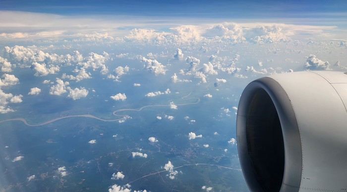
Nice transition, right? Because "Welcome to Indonesia" is exactly what the friendly flight attendant just said to me as we got off the plane! That’s it, our chakras are open, we’ve arrived at our (air)port. Time for rest, pool, cocktails, and a beach with our toes spread out... Wait, if you bought that, you clearly don’t know us yet! Since we still have energy to burn and need to adjust to the flight and time difference, we tackle the long administrative formalities to enter Indonesia, just to earn the right to hop in a 45-minute Grab taxi to the train station. The train station? What train station?... What do you usually do at a train station? Take a train, of course! Off we go for a three-hour train ride to Bandung, where we’ll officially start our adventure tomorrow after our first Indonesian night...
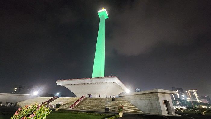
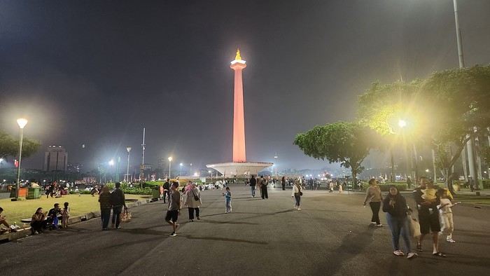
Unfortunately, we were a bit slow off the mark, which meant we missed the 6:25 PM train by two minutes. Oh well, we’ll have to wait until 11 PM. We take the opportunity to stretch our legs in Jakarta, soak up the atmosphere, and enjoy the delicious smells wafting from the *warungs*—those little typical street restaurants. A quick stop at the National Monument, a detour to a night market to devour our first *kwetiaw goreng* and *teh manis* for 60,000 rupiahs (that’s 3 € for two), and just like that, our penalty is lifted, and we’re allowed to hit the road again. Off to Bandung, where we arrive at 2 AM for... a *very* short night...
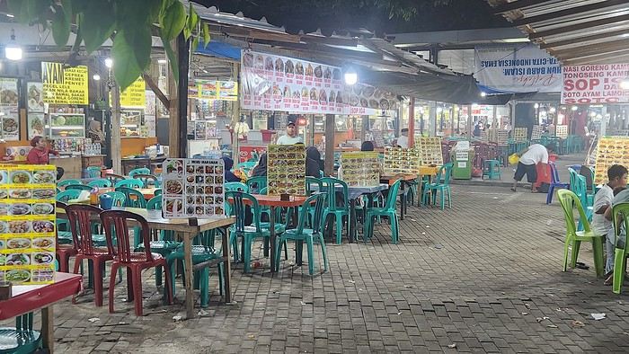
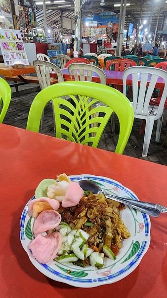
Day 1 - August 10, 2025 New life downloading for three weeks! And for that, Flo and I launched a public tender... A public tender? What’s that got to do with a travel journal???... Well, when you think about it, few destinations tick all the boxes for an August adventure: Meaning, finding a place that’s exotic in the middle of August, not too expensive, not too packed with tourists, warm but not *too* warm, with postcard-perfect landscapes, dreamy beaches, tasty cuisine with a hint of exoticism, friendly and welcoming locals, where you’re free to sleep under the stars among the mosquitos, take transport surrounded by chickens, and even eat from a pig trough if you feel like it—well, turns out it’s not that easy to find! I’d even say, given how thick the list of requirements is, there’s a big risk the tender could be declared unsuccessful for failing to meet just one criterion. Let’s just say the candidates better submit a rock-solid proposal!
After reviewing all the responses and presentations from the candidates, the obvious choice for us is... Indonesia! Except that trying to explore a country as vast as Indonesia and its 17,504 islands in less than five years is a bit like reading the summary of a Proust novel without taking the time to savor each of its 950 pages! Don’t worry, I won’t name them all here. Besides, do they even all have names? No! Only 7,870 have been named—their parents clearly ran out of ideas for the rest. Anyway, our society, which worships the "work more to earn more" mantra, unfortunately limits our adventure time. So we’ll only get to see a small part of Indonesia, and we’ll have to make a tough choice to head for the best of the best in this archipelago of over seventeen thousand islands. Each one has its own selling points: Sumatra, Sulawesi, Java, the Celebes, Bali, Borneo, Papua, Timor, the Moluccas... So many names that smell of adventure... Another tender, another list of requirements, another review of proposals... Drumroll... Splash splash... And the lucky winner is... Ta-da... Java, Bali’s big sister, where I’ve already been eight years ago... Java the programming language. The Java of Broadway. We’re gonna *do* the Java. Java the coffee. And yes, Java is also an island!
This island, four times smaller than France, is home to 136 million people, making it the most populated island in the world! Fun fact: Indonesia, with its 260 million inhabitants, is just shy of the podium for the world’s most populated countries, after the winning trio of India, China, and the United States. And it’s on this island of Java that you’ll find Jakarta, the (soon-to-be-former) capital and main airport of the country, where we’ll soon land after our nineteen-hour flight! Yep, nineteen hours! I mean, Indonesia in general—and Java in particular—is a *tad* farther than going on vacation to Grandma Yoyo’s! Not sure where it is? Easy. Grab a map. Plant your finger on the big island at the bottom right—aka Australia for those who struggle with geography—move it up two centimeters, and bam, welcome to Indonesia!
Nice transition, right? Because "Welcome to Indonesia" is exactly what the friendly flight attendant just said to me as we got off the plane! That’s it, our chakras are open, we’ve arrived at our (air)port. Time for rest, pool, cocktails, and a beach with our toes spread out... Wait, if you bought that, you clearly don’t know us yet! Since we still have energy to burn and need to adjust to the flight and time difference, we tackle the long administrative formalities to enter Indonesia, just to earn the right to hop in a 45-minute Grab taxi to the train station. The train station? What train station?... What do you usually do at a train station? Take a train, of course! Off we go for a three-hour train ride to Bandung, where we’ll officially start our adventure tomorrow after our first Indonesian night...
Unfortunately, we were a bit slow off the mark, which meant we missed the 6:25 PM train by two minutes. Oh well, we’ll have to wait until 11 PM. We take the opportunity to stretch our legs in Jakarta, soak up the atmosphere, and enjoy the delicious smells wafting from the *warungs*—those little typical street restaurants. A quick stop at the National Monument, a detour to a night market to devour our first *kwetiaw goreng* and *teh manis* for 60,000 rupiahs (that’s 3 € for two), and just like that, our penalty is lifted, and we’re allowed to hit the road again. Off to Bandung, where we arrive at 2 AM for... a *very* short night...
From Southern Shikoku, between land and sea, to the blue waters of Miyakojima and finally the Tokyo metropolis
From Southern Shikoku, between land and sea, to the blue waters of Miyakojima and finally Tokyo’s megacity
Hi everyone,
I have to admit, I really hesitated before deciding to write this travel journal... Writing one takes a lot of time and energy, and since this is my 4th trip, I wondered if it would even interest anyone other than myself (both for the discovery and the writing). But after a few people asked, "Are you going to write a journal?" and especially after rediscovering the joy of reading other travelers’ journals about Japan or elsewhere on this forum, I’ve decided to share my 4th installment in the Land of the Rising Sun here.
The itinerary: 27 full days, from late May to late June 2025, right in the middle of the rainy season, including:
-->13 days in Shikoku, from Kochi (Kochi Prefecture) to Matsuyama (Ehime Prefecture)

-->7 days in Miyakojima (Okinawa Prefecture)

-->7 days in Tokyo

The trip was decided on fairly last-minute again this year.
Since I regularly check flight prices to track fluctuations for this destination even without concrete plans, stumbling upon a slightly cheaper direct flight (900 €) than what I’d seen in previous months (around 1,200–1,400 € on average) for a Paris-Tokyo route with Japanese airline ANA was too tempting to resist the urge to return to this enchanting country. After much hesitation between exploring the San’in region (Matsue, Tottori, Yamaguchi) and Southern Shikoku, the decision was made—I took the plunge! The ticket is booked: Paris to Kochi with a layover in Tokyo, all with ANA, the airline I’d been dreaming of... for 1,120 € per person. Okay, it’s not cheap, but it’s better than in 2023.
Departure in 2 weeks! Now I just have to get everything ready!
Intense prep work over these next 2 weeks to:
finalize a more precise itinerary and reach an agreement—yep, because even though we both love Japan, our preferences differ slightly, and we have to choose between exploring new places or revisiting beloved spots... decide how much time to spend in each area without rushing while still exploring research places that might interest us and watch videos about Japan book accommodations: yes, it’s possible to do this on the spot, but last year, we realized that last-minute options were pretty expensive, so we’re booking ahead—though we’ll keep a few options open in case better deals pop up later reserve rental cars order yen check the weather regularly and wonder if choosing the *tsuyu* (rainy season) was really a good idea—are we going to be drenched the whole time???
"What hard work," you might say! Going to Japan for a month—what a tough life! Despite this being my 4th trip, the excitement is just as intense as the first time.
The only small downside is that when we booked the flight, there weren’t many seats left, so we’re only sitting together on the international return flight. Plus, on the way there, we have middle seats. Another lingering question: what French-language films will be available? According to the internet, the selection seems limited. Oh well, these are just minor details—it’s already time to fly! PS: I’ll be posting slowly and irregularly... so for those interested, be patient, and maybe set an alert...
Hi everyone,
I have to admit, I really hesitated before deciding to write this travel journal... Writing one takes a lot of time and energy, and since this is my 4th trip, I wondered if it would even interest anyone other than myself (both for the discovery and the writing). But after a few people asked, "Are you going to write a journal?" and especially after rediscovering the joy of reading other travelers’ journals about Japan or elsewhere on this forum, I’ve decided to share my 4th installment in the Land of the Rising Sun here.
The itinerary: 27 full days, from late May to late June 2025, right in the middle of the rainy season, including:
-->13 days in Shikoku, from Kochi (Kochi Prefecture) to Matsuyama (Ehime Prefecture)
-->7 days in Miyakojima (Okinawa Prefecture)
-->7 days in Tokyo
The trip was decided on fairly last-minute again this year.
Since I regularly check flight prices to track fluctuations for this destination even without concrete plans, stumbling upon a slightly cheaper direct flight (900 €) than what I’d seen in previous months (around 1,200–1,400 € on average) for a Paris-Tokyo route with Japanese airline ANA was too tempting to resist the urge to return to this enchanting country. After much hesitation between exploring the San’in region (Matsue, Tottori, Yamaguchi) and Southern Shikoku, the decision was made—I took the plunge! The ticket is booked: Paris to Kochi with a layover in Tokyo, all with ANA, the airline I’d been dreaming of... for 1,120 € per person. Okay, it’s not cheap, but it’s better than in 2023.
Departure in 2 weeks! Now I just have to get everything ready!
Intense prep work over these next 2 weeks to:
finalize a more precise itinerary and reach an agreement—yep, because even though we both love Japan, our preferences differ slightly, and we have to choose between exploring new places or revisiting beloved spots... decide how much time to spend in each area without rushing while still exploring research places that might interest us and watch videos about Japan book accommodations: yes, it’s possible to do this on the spot, but last year, we realized that last-minute options were pretty expensive, so we’re booking ahead—though we’ll keep a few options open in case better deals pop up later reserve rental cars order yen check the weather regularly and wonder if choosing the *tsuyu* (rainy season) was really a good idea—are we going to be drenched the whole time???
"What hard work," you might say! Going to Japan for a month—what a tough life! Despite this being my 4th trip, the excitement is just as intense as the first time.
The only small downside is that when we booked the flight, there weren’t many seats left, so we’re only sitting together on the international return flight. Plus, on the way there, we have middle seats. Another lingering question: what French-language films will be available? According to the internet, the selection seems limited. Oh well, these are just minor details—it’s already time to fly! PS: I’ll be posting slowly and irregularly... so for those interested, be patient, and maybe set an alert...
3 weeks in Bali in 2025
We’ve read it all about Bali: mass tourism, non-stop parties, ferry disasters, the kingdom of “Instagrammers,” pollution, “Bali belly”... But luckily, this island isn’t just about Kuta’s beaches and the Lempuyang Temple.
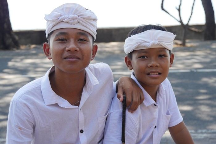
Sure, it’s not as exotic or off-the-beaten-path as other Indonesian islands (the Moluccas, Timor, Flores...), but we spent 3 weeks there and loved it!
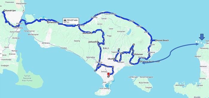
Our (planned) itinerary in 7 stops: - Ubud (4 nights) - Sidemen (2 nights) - Gili Meno (3 nights) - Amed (2 nights) - Pemuteran (4 nights) - Munduk (2 nights) - Jatiluwih (2 nights)
We booked our accommodations in advance, and for the rest (drivers, activities...), we took it day by day with help from the homestays (making sure to contact them a few days ahead via WhatsApp).
In the end, it’s an “easy” destination, very affordable, and one that’s managed to keep a certain authenticity.
Sure, it’s not as exotic or off-the-beaten-path as other Indonesian islands (the Moluccas, Timor, Flores...), but we spent 3 weeks there and loved it!
Our (planned) itinerary in 7 stops: - Ubud (4 nights) - Sidemen (2 nights) - Gili Meno (3 nights) - Amed (2 nights) - Pemuteran (4 nights) - Munduk (2 nights) - Jatiluwih (2 nights)
We booked our accommodations in advance, and for the rest (drivers, activities...), we took it day by day with help from the homestays (making sure to contact them a few days ahead via WhatsApp).
In the end, it’s an “easy” destination, very affordable, and one that’s managed to keep a certain authenticity.
Mice in Switzerland, the Other Cheese Country!
I'm starting my first travel journal since VF reopened!
This will mostly be to share my impressions and some photos, with a few days' delay, but I'm starting this journal while I'm still here.
First, I'd like to thank those who helped me prepare for this trip.
I was able to organize this stay in one of the most expensive countries in the world thanks to the home-exchange principle. Not necessarily a direct swap, but through a points system, which is more practical for choosing where you want to go without it having to be a reciprocal exchange.
For this trip, there will already be two different accommodations. We'll see how it goes after that.
The first place is near Yverdon-les-Bains, close to Lake Neuchâtel.
So, we're going to explore this area!
We arrived under capricious weather that won’t leave us for the next few days!
We had dinner at a pizzeria recommended by *Le Routard* in Yverdon, then took a little nighttime stroll through the town center before heading inland to settle into our accommodation.
We discovered a very large, quiet house—and especially the cat that stayed behind! Funny for a couple of mice! He’ll be sleeping with us 😹
This will mostly be to share my impressions and some photos, with a few days' delay, but I'm starting this journal while I'm still here.
First, I'd like to thank those who helped me prepare for this trip.
I was able to organize this stay in one of the most expensive countries in the world thanks to the home-exchange principle. Not necessarily a direct swap, but through a points system, which is more practical for choosing where you want to go without it having to be a reciprocal exchange.
For this trip, there will already be two different accommodations. We'll see how it goes after that.
The first place is near Yverdon-les-Bains, close to Lake Neuchâtel.
So, we're going to explore this area!
We arrived under capricious weather that won’t leave us for the next few days!
We had dinner at a pizzeria recommended by *Le Routard* in Yverdon, then took a little nighttime stroll through the town center before heading inland to settle into our accommodation.
We discovered a very large, quiet house—and especially the cat that stayed behind! Funny for a couple of mice! He’ll be sleeping with us 😹
Join me in discovering Gran Canaria
Introduction
We stayed on the island of Gran Canaria during the first three months of 2024. It’s the third Canary Island we’ve visited, after Tenerife and Lanzarote.
We rented an apartment in Temisas. By staying in the same place for such a long period, the total price dropped by 50%.
We also rented a vehicle to make getting around the island easier.
Why the Canary Islands, and Gran Canaria in particular? For its pleasant climate, the nature and diversity of its landscapes, the charming villages, and especially the beauty of its many beaches.
In this travel journal, you’ll find a list of the many activities we did during our stay to explore the different attractions of this island.
These attractions are categorized to make it easier to find what interests you.
Videos are included throughout the summary. Click on the image to start the video.
To jump to a specific post, here are the relevant links:
HIKES:
Roque Nublo Maspalomas Dunes - Part 1 Maspalomas Dunes - Part 2 Los Azulejos de Veneguera Barranco de Las Vacas Ventana del Bentayga (Arco del Aserrador) Caves of the King Ventana de Morro (Ventana de la Ganifa) The Dog of Bentayga Cave of the Four Doors Ventana del Nublo Artenera - Caves of Acusa Seca Temisas - El Gigante Cave Fortress of Ansite Puerto de Las Nieves - Roque de Las Nieves Temisas - Cuevas de la Audiencia Roque Bentayga Guayadeque Ravine (Guayadeque Hermitage) Guayadeque Ravine (Cueva de Bartalo) El Zumacal - Barranco Tauco Casablanca Dam (Los Dolores Dam) Ayagaures - La Angostura Dam & Gambuesa Dam Santa Brígida - Alonso Ravine & Centennial Dragon Tree Pino Santo Hike in the Azuaje Ravine Gáldar - Red Lands of Samarrita Tejeda - Charco de La Paloma Bandama Boiler (Camino Borde de Caldera Bandama) Teror - Alamo Ravine Trail – SL-4 Telde - Calasio Caves Special Natural Reserve of Los Tilos de Moya Los Azulejos - Charco de Las Aneas Fataga Ravine Arinaga Military Battery Trail Maspalomas - Las Fuentes and del Canizo Ravines Mogán - Tauro Mountain Trail Tamabada - Llanos de La Mimbre & Sobre la Cueva Viewpoints Trail Hike to the Coronadero Arch via Barranco Hondo Barranco de Silva - Hike to the Jerez Caves Gáldar - Samson Cave - La Atalaya Peak Agaete - Roque Guayedra and Guayedra Ravine Artenara - Caballero Caves Arucas - Bufadero Salt Flats Barranco de Pino Gordo - Natural Pools Telde - Los Cernícalos Ravine Las Cruces - Toba Caves & Picón Puerto de Las Nieves - Moro Cave Agüimes - Morros de Ávila Caves Juncalillo del Sur - Laguna & Salinas de Abajo Caves of Camino de San Felipe Cruz de Tejeda, Cruz Chico and Degollada Viewpoint Hike on the Patalavaca Circuit Motor Grande - Puerto Rico Arch El Montañón - Los Hornos Dam Seafront Walk - Amadores Beach – Puerto Rico Beach Las Niñas Dam El Hornillo - Omega & Omicron Caves Arteara Necropolis Mogán - El Mulato Dam Las Garzas - El Regante Dam La Plata Route - Cho Flores Dam & El Charco Hondo Vega de Acusa - La Candelaria Dam Candelaria Hermitage – Acusa Seca Viewpoint Valsequillo de Gran Canaria – Roque La Vela Ayagaures Dam – GC-602 Lomo del Palo - Monte Pavón Trail Lugar La Laguna - Levada Fataga Dam & Ravine
BEACHES:
Mogán Beach Taurito Beach Tauro Beach Amadores Beach Puerto Rico Beach Anfi del Mar Beach Patalavaca Beach Meloneras Beach Maspalomas Beach English Beach (Playa del Inglés) Las Burras Beach San Agustin Beach Las Alcaravaneras Beach Las Canteras Beach (La Cicer) Las Canteras Beach (La Puntilla) Las Canteras Beach (Santa Catalina) Aquamarina Beach El Agujero - Bocabarranco Beach Hoya Del Pozo Beach Hoya Del Pozo Beach - Lizard with amputated tail El Cabron Beach Ojos de Garza Beach El Burrero Beach
NATURAL POOLS:
Charco Azul - El Risco Agaete Salt Flats Charco de Los Espejos - Sardina del Norte Natural Pools of Punta de Gáldar Snorkeling in the natural pool of Punta de Gáldar Natural Pool La Furnia o El Clavo - Gáldar Natural Pool of Los Dos Roques Emiliano Natural Pool - El Agujero Natural Pool of El Agujero Natural Pools of Roque Prieto Natural Pool El Altillo Los Charcones de Bañaderos – Arucas Natural Pools of El Charco de Las Palomas – Arucas Natural Pools of La Laja - Las Palmas de Gran Canaria Cueva de la Reina Mora - La Garita Natural Pools of Castillo del Romeral
TOWNS:
Center
Santa Brigida Vega de San Mateo Tejeda Artenara Vallesco Teror
Southwest
Santa Lucia de Tirajana Fataga San Bartolomé de Tirajana Puerto de Mogán La Aldea de San Nicolas
North
Arucas Firgas Moya Santa Maria de Guia Gáldar Agaete Puerto de Las Nieves
East
Vegueta - Las Palmas de Gran Canaria Triana - Las Palmas de Gran Canaria Ciudad Jardin - Las Palmas de Gran Canaria Canteras - Las Palmas de Gran Canaria Telde Valsequillo de Gran Canaria Ingenio Agüimes Temisas
VIEWPOINTS:
GC-60 Route (or nearby) GC-210 Route (or nearby) GC-210 Route between the tunnel and La Aldea de San Nicolás GC-215 & GC-65 Routes (or nearby) GC-200 Route (or nearby) GC-130 Route (or nearby) & GC-605 GC-70 Route (or nearby) & GC-21 Sheep herd on GC-70 Route GC-150, GC-240, GC-305, GC-350 & GC-301 Routes GC-606, GC-295, GC-231 and GC-41 Routes (or nearby) Viewpoints – GC-1 Route (or nearby) Viewpoints - Las Palmas de Gran Canaria Viewpoints - GC-2, GC-21, GC-15, GC-216 and GC-132 Routes (or nearby) Viewpoints - GC-503 & GC-217 Routes Viewpoints - GC-604, GC-505, GC-132, GC-42 and GC-802 Routes
MISCELLANEOUS:
San Rafael Aqueduct - Telde Abandoned San Rafael Estate - La Higuera Cenobio de Valerón La Cesta - Tejeda Puerto de la Aldea Scenic Route GC-671 to El Espinillo Scenic Route GC-607 to El Chorrillo The Galdar Cube (Santiago Quarry) Scenic Route GC-504 to Ayagaures Abandoned seaside resort in the Azuaje Ravine El Bufadero de La Garita – Telde GC-505 Route Abandoned Finca Las Haciendas (Los Mocanes) – Las Vegas de Valsequillo Ruins of San Juan Battery - Las Palmas de Gran Canaria Viera y Clavijo Canarian Botanical Garden - Las Palmas de Gran Canaria Tenefé Salt Flats Los Pérez, Lugarejos & Las Hoyas Dams Monte Pavón, Gran Canaria’s little Ireland Valleseco Lagoon Recreational Area Climbing - Fataga Ravine Surfing – El Agujero El Cairete Restaurant - Carrizal de Tejeda Paragliding flight observation - Los Giles La Cuevita Ayagaures Restaurant Statues and Murals - Cruce de Arinaga Aviation Monument (Las Majoreras) & Murals – Carrizal Artistic recycling by Antonio Peñita - Ojos de Garza Rainbows
We stayed on the island of Gran Canaria during the first three months of 2024. It’s the third Canary Island we’ve visited, after Tenerife and Lanzarote.
We rented an apartment in Temisas. By staying in the same place for such a long period, the total price dropped by 50%.
We also rented a vehicle to make getting around the island easier.
Why the Canary Islands, and Gran Canaria in particular? For its pleasant climate, the nature and diversity of its landscapes, the charming villages, and especially the beauty of its many beaches.
In this travel journal, you’ll find a list of the many activities we did during our stay to explore the different attractions of this island.
These attractions are categorized to make it easier to find what interests you.
Videos are included throughout the summary. Click on the image to start the video.
To jump to a specific post, here are the relevant links:
HIKES:
Roque Nublo Maspalomas Dunes - Part 1 Maspalomas Dunes - Part 2 Los Azulejos de Veneguera Barranco de Las Vacas Ventana del Bentayga (Arco del Aserrador) Caves of the King Ventana de Morro (Ventana de la Ganifa) The Dog of Bentayga Cave of the Four Doors Ventana del Nublo Artenera - Caves of Acusa Seca Temisas - El Gigante Cave Fortress of Ansite Puerto de Las Nieves - Roque de Las Nieves Temisas - Cuevas de la Audiencia Roque Bentayga Guayadeque Ravine (Guayadeque Hermitage) Guayadeque Ravine (Cueva de Bartalo) El Zumacal - Barranco Tauco Casablanca Dam (Los Dolores Dam) Ayagaures - La Angostura Dam & Gambuesa Dam Santa Brígida - Alonso Ravine & Centennial Dragon Tree Pino Santo Hike in the Azuaje Ravine Gáldar - Red Lands of Samarrita Tejeda - Charco de La Paloma Bandama Boiler (Camino Borde de Caldera Bandama) Teror - Alamo Ravine Trail – SL-4 Telde - Calasio Caves Special Natural Reserve of Los Tilos de Moya Los Azulejos - Charco de Las Aneas Fataga Ravine Arinaga Military Battery Trail Maspalomas - Las Fuentes and del Canizo Ravines Mogán - Tauro Mountain Trail Tamabada - Llanos de La Mimbre & Sobre la Cueva Viewpoints Trail Hike to the Coronadero Arch via Barranco Hondo Barranco de Silva - Hike to the Jerez Caves Gáldar - Samson Cave - La Atalaya Peak Agaete - Roque Guayedra and Guayedra Ravine Artenara - Caballero Caves Arucas - Bufadero Salt Flats Barranco de Pino Gordo - Natural Pools Telde - Los Cernícalos Ravine Las Cruces - Toba Caves & Picón Puerto de Las Nieves - Moro Cave Agüimes - Morros de Ávila Caves Juncalillo del Sur - Laguna & Salinas de Abajo Caves of Camino de San Felipe Cruz de Tejeda, Cruz Chico and Degollada Viewpoint Hike on the Patalavaca Circuit Motor Grande - Puerto Rico Arch El Montañón - Los Hornos Dam Seafront Walk - Amadores Beach – Puerto Rico Beach Las Niñas Dam El Hornillo - Omega & Omicron Caves Arteara Necropolis Mogán - El Mulato Dam Las Garzas - El Regante Dam La Plata Route - Cho Flores Dam & El Charco Hondo Vega de Acusa - La Candelaria Dam Candelaria Hermitage – Acusa Seca Viewpoint Valsequillo de Gran Canaria – Roque La Vela Ayagaures Dam – GC-602 Lomo del Palo - Monte Pavón Trail Lugar La Laguna - Levada Fataga Dam & Ravine
BEACHES:
Mogán Beach Taurito Beach Tauro Beach Amadores Beach Puerto Rico Beach Anfi del Mar Beach Patalavaca Beach Meloneras Beach Maspalomas Beach English Beach (Playa del Inglés) Las Burras Beach San Agustin Beach Las Alcaravaneras Beach Las Canteras Beach (La Cicer) Las Canteras Beach (La Puntilla) Las Canteras Beach (Santa Catalina) Aquamarina Beach El Agujero - Bocabarranco Beach Hoya Del Pozo Beach Hoya Del Pozo Beach - Lizard with amputated tail El Cabron Beach Ojos de Garza Beach El Burrero Beach
NATURAL POOLS:
Charco Azul - El Risco Agaete Salt Flats Charco de Los Espejos - Sardina del Norte Natural Pools of Punta de Gáldar Snorkeling in the natural pool of Punta de Gáldar Natural Pool La Furnia o El Clavo - Gáldar Natural Pool of Los Dos Roques Emiliano Natural Pool - El Agujero Natural Pool of El Agujero Natural Pools of Roque Prieto Natural Pool El Altillo Los Charcones de Bañaderos – Arucas Natural Pools of El Charco de Las Palomas – Arucas Natural Pools of La Laja - Las Palmas de Gran Canaria Cueva de la Reina Mora - La Garita Natural Pools of Castillo del Romeral
TOWNS:
Center
Santa Brigida Vega de San Mateo Tejeda Artenara Vallesco Teror
Southwest
Santa Lucia de Tirajana Fataga San Bartolomé de Tirajana Puerto de Mogán La Aldea de San Nicolas
North
Arucas Firgas Moya Santa Maria de Guia Gáldar Agaete Puerto de Las Nieves
East
Vegueta - Las Palmas de Gran Canaria Triana - Las Palmas de Gran Canaria Ciudad Jardin - Las Palmas de Gran Canaria Canteras - Las Palmas de Gran Canaria Telde Valsequillo de Gran Canaria Ingenio Agüimes Temisas
VIEWPOINTS:
GC-60 Route (or nearby) GC-210 Route (or nearby) GC-210 Route between the tunnel and La Aldea de San Nicolás GC-215 & GC-65 Routes (or nearby) GC-200 Route (or nearby) GC-130 Route (or nearby) & GC-605 GC-70 Route (or nearby) & GC-21 Sheep herd on GC-70 Route GC-150, GC-240, GC-305, GC-350 & GC-301 Routes GC-606, GC-295, GC-231 and GC-41 Routes (or nearby) Viewpoints – GC-1 Route (or nearby) Viewpoints - Las Palmas de Gran Canaria Viewpoints - GC-2, GC-21, GC-15, GC-216 and GC-132 Routes (or nearby) Viewpoints - GC-503 & GC-217 Routes Viewpoints - GC-604, GC-505, GC-132, GC-42 and GC-802 Routes
MISCELLANEOUS:
San Rafael Aqueduct - Telde Abandoned San Rafael Estate - La Higuera Cenobio de Valerón La Cesta - Tejeda Puerto de la Aldea Scenic Route GC-671 to El Espinillo Scenic Route GC-607 to El Chorrillo The Galdar Cube (Santiago Quarry) Scenic Route GC-504 to Ayagaures Abandoned seaside resort in the Azuaje Ravine El Bufadero de La Garita – Telde GC-505 Route Abandoned Finca Las Haciendas (Los Mocanes) – Las Vegas de Valsequillo Ruins of San Juan Battery - Las Palmas de Gran Canaria Viera y Clavijo Canarian Botanical Garden - Las Palmas de Gran Canaria Tenefé Salt Flats Los Pérez, Lugarejos & Las Hoyas Dams Monte Pavón, Gran Canaria’s little Ireland Valleseco Lagoon Recreational Area Climbing - Fataga Ravine Surfing – El Agujero El Cairete Restaurant - Carrizal de Tejeda Paragliding flight observation - Los Giles La Cuevita Ayagaures Restaurant Statues and Murals - Cruce de Arinaga Aviation Monument (Las Majoreras) & Murals – Carrizal Artistic recycling by Antonio Peñita - Ojos de Garza Rainbows
Namibia Travel Journal: May 2025 - Trip Review
NAMIBIA TRIP 2025: April 24 to May 20: Feel free to comment or ask us any questions about this amazing journey.
>> Find all our photos and videos for each day on our website here: www.montagne-aventure.net
**DAY 1: Thursday, April 24, 2025: Outbound Flights from Lyon to Windhoek via Munich - Visit to Munich:**

Off we go on a new adventure. The alarm rings at 6:30 AM, the travel bags are packed, and we head to Lyon Airport. We booked our flight tickets with Lufthansa. The first leg to Munich, Germany, is operated by AirBaltic. Departure at 1:05 PM for a 1-hour and 20-minute flight. We arrive at 2:30 PM.
**We now have a 7-hour layover, so we take the opportunity to get some fresh air and explore Munich.** We quickly exit Terminal 2 of the airport and head towards the subway. We buy a group day ticket "Airport-city Day Zone M-5," valid for 2 to 5 people at a price of 30.50 € (instead of 16.30 € per person). We take the S8 line to **Marienplatz** in 35 minutes. **This is the heart of the city.** The weather is overcast, quite cool, but dry. Perfect for a little city trip between two flights while leaving our large luggage in transit at the airport. **Munich is the third-largest German city after Berlin and Hamburg, in the Bavaria region.** **The center has a lot of charm and brings together several religious buildings, easy to explore on foot.** We are impressed by the number of people enjoying these 100% pedestrian streets, which are very pleasant. After Marienplatz, the most famous square with the town hall, we head to the Cathedral of Our Lady, a Gothic church, then continue to **Karlsplatz** and move on to **the food market offering a wide selection of high-end food products in an atmosphere where a certain art of living prevails.** We also visit St. Peter's Church before grabbing a bite to eat. Two good hours were enough for this 10 km city walk. It's time to take the subway back: by 6:30 PM, we are back at the airport. Now, it's time for a bit of waiting and rest. Our second flight is scheduled for 9:35 PM for a 9-hour and 30-minute journey to our final destination in Namibia: **Windhoek.**
> Round-trip flight tickets with Lufthansa from Lyon: 2029 €, or 1,014.50 € per person.
> Lyon Airport parking: 120 €
> Today's expenses: 7 € for 2 pizzas in France / 14 € for the restaurant in Munich / 30.50 € for the daily subway ticket in Munich.
**DAY 2: Friday, April 25, 2024: Arrival in Windhoek, Visit to the Namibian Capital:**
After a 9-hour and 30-minute overnight flight with Discover Airlines, we finally land on Namibian soil just before 7:30 AM. The day is breaking, and the colors are already stunning. We are eager despite the usual fatigue from the flight. The airline was punctual, with friendly staff and good meals, though a bit light. We are the first flight of the day to land, with no more than 15 flights per day here, from 7 AM to 8 PM. We disembark on the tarmac at this airport located in the middle of nowhere, **I finally set foot on African soil for the first time.** We exit among the first from the aircraft to go through the long formalities at the front of the line, as the wait can quickly become endless. Allow at least 5 minutes per person for e-visas. We still wait 45 minutes despite only about twenty people ahead of us. Phew, it's done. We collect our luggage and then withdraw money from an ATM. We make 4 withdrawals of the maximum amount, 2000 NAD $ per withdrawal, for a total of 380 €, or 95.33 € per withdrawal.
Our driver arrives at the same time, perfect timing, we were quick.
We leave the airport at 8:45 AM. By 9:30 AM, we arrive at the **Gracious Whisp vehicle rental agency**, located at the entrance of Windhoek, small and human-sized with a fleet of recent vehicles. More formalities, then a short wait as our vehicle is not yet ready. Time to decompress, catch our breath, and enjoy the very pleasant morning temperature. Not a cloud in sight. Next, a briefing on the vehicle, always with a bit of apprehension due to our approximate English. Allow 45 minutes of explanations, including setting up the roof tent, camping equipment, technical information in case of a flat tire, driving tips in Namibia, and a tour of the 4x4. We have all the necessary equipment for camping: mattresses, sleeping bags, pillows, table, chairs, gas stove, BBQ grill... as well as 2 spare tires, a compressor, a dual tank, and accessories for removing wheels. Off we go, it's time to muster our courage and get behind the wheel. **Heading to SuperSpar Maerua**, fortunately located less than 10 minutes away. We park with the help of a parking attendant; it's very crowded, the space is narrow, but everything goes well despite the cursed right-hand drive. Today's new mission: stock up on groceries. The store is well-stocked with local and imported products, catering to all tastes. We spend 114 € on groceries, from pasta to meat, BBQ lighters to dishwashing products. Two people load our groceries into two carts and transfer them to our vehicle; we feel compelled to leave a tip, 50 NAD $, as we don't have change yet. Now, we head to the hotel, 15 minutes away. Traffic is difficult at a complicated intersection; this will likely be the only traffic jam in Namibia. **We arrive at Kate's Nest Guesthouse & Backpackers around 1:15 PM, quite tired.** We take some well-deserved rest at this recent establishment, quite calm with secure private parking. After a short nap, we enjoy the quiet by the hotel pool. Night falls between 6:30 PM and 7 PM. We eat quietly in our room tonight before starting this long 4x4 road trip in camping mode in the heart of Namibia.
> Today's grocery expenses: 114 € at Super Spar Marua (2395.21 NAD $).
> Round-trip flight tickets with Lufthansa from Lyon: 2029 €, or 1,014.50 € per person.
> Vehicle rental: 4x4 Toyota with roof tent for 24 days: Gracious Whisp Car Rentals: 2,638 € (N$50,640) or **1,319 €** per person - (https://gwcarrentals.com/)
> Distance driven today: 15 km.
> Accommodation: Kate's Nest Guesthouse & Backpackers - 4 Aristotles Street Academia, 9000 Windhoek - 36 € for two for one night.
> Windhoek International Airport website: (https://www.airports.com.na/)
**DAY 3: Saturday, April 26, 2025: Windhoek to Hardap: Mariental Region - Kalahari Desert:**
After a good, restful night, we wake up leisurely around 7 AM. We enjoy the comfort provided by this first and last hotel before 24 nights under the tent.
**We leave Kate's Nest Guesthouse at 8:30 AM to tackle the Namibian roads.** We quickly leave the capital; in just 30 minutes, we find ourselves almost alone in the world. The landscape is dotted with small domes. We leave the **paved B1** quickly to turn left onto the **C15**. **From there, we won't see more than 10 vehicles all day.** After passing through the few houses of **Lekkerwaterpoort**, we tackle our first gravel road. These road sections are limited to 100 km/h, but even at 70 km/h, I find it already challenging. However, I quickly get used to it and gradually pick up speed to reach my cruising speed of around 80 to 90 km/h. **We are on immense straight lines crossing wild expanses as far as the eye can see.** **We come across two baboons, a few ostriches, and numerous cattle and sheep farms.** We pass through the charming village of **Uhlenhorst** with its typical houses and children with broad smiles waving at us. Life here is already very different from Windhoek. **The thermometer rises quickly from 16°C at 8:30 AM to over 28°C in the early afternoon.**
**We arrive at the Hardap Dam reserve at 2 PM.** We stop at the toll booth at the park entrance to pay the entrance fee: 250 NAD $ for 2 people and 1 vehicle. We continue to the dam and then the camp entrance, located a bit further. We had booked in advance, but this place remains little frequented by foreigners.
We take advantage of the hottest hours to rest by the large pool overlooking the immense lake, a very enjoyable moment. Would this be a bit of a vacation?
Around 4:30 PM, we head to the campsite. We overlook this vast water reserve. We arrive first; we will be only 3 vehicles spending the night here. It's time to get to work and set up our equipment for the first time. It takes us a good 20 minutes to set everything up, with a slight apprehension about unfolding the tent. Once this task is done, which we will have to repeat for almost a month, we will become much more efficient over time. Time for rest and contemplation in total silence. The sun gradually sets, and the heat quickly becomes bearable again. Bliss! **This dam is located 20 km northwest of Mariental in an area dotted with conical hills topped with dolerite buttons (Hardap means "hillock" in Nama). It captures the Fish River, which flows south, creating a large lake in the middle of an arid environment. The contrast is striking.** We enjoy our first sunset facing this 360° otherworldly landscape.
Around 7 PM, we start our first BBQ, or "braai" as it's called here. The temperature is perfect. The sun sets, giving way to a star-filled sky of incredible beauty thanks to the absence of any light pollution. The Milky Way will lull us throughout the evening. After some good sausages and potatoes on the BBQ, we head to our roof tent around 9:30 PM with a complete change of scenery in just 24 hours. France already seems so far away...
This campsite has shared showers and toilets, quite clean and functional, as well as a central area with several BBQs and tables. The sites are arranged in a semicircle, each with an electrical outlet. The sites are close to each other but spacious, some slightly shaded. We are only three vehicles tonight, so it's perfectly comfortable and quiet. Not to mention the large pool near the restaurant. Our trip is off to a great start.
> Today's road itinerary: Windhoek > Head south on the B1 to Rehoboth > Turn left onto the C25 then C15 to Stampriet > C20 to Hardap > Full north on the B1 > Then turn left onto the M93 - 5 hours of driving.
> Distance driven today: 354 km.
> Accommodation: Hardap Recreation Resort - 23.3 € for two - Large pool - GR6W+3M2, Hardap Game Reserve, Mariental, Namibia - (http://www.nwr.com.na/resorts/hardap-resort/)
**DAY 4: Sunday, April 27, 2025: Hardap - Brukkaros Volcano - Keetmanshoop - Quivertree Forest Rest Camp**
Our first night under the tent was very pleasant; the little wind quickly calmed down, giving way to absolute silence. The mattress is decent, more comfortable than some nights in Nepal. The length and width give us enough space for maximum comfort, despite my height (1.91 m). We wake up a little before 7 AM as the sun rises, and the lights dazzle us from the start of the day. We pack up the equipment in 30 minutes, quite easily. Then we enjoy the sun, which warms up quickly while we keep our light fleece on.
At 8:30 AM, **we hit the road again, heading south** to our first stop in **Mariental**. We want to do some shopping at SuperSpar, but once we arrive in the parking lot, a young local is fighting with the supermarket security guards and then threatens to throw stones. We don't want to take any risks right at the start, so despite the baton blows he receives, he doesn't stop. We leave empty-handed but fill up with fuel at the Shell station 1 km further. The price per liter is 21.33 NAD $, we fill our 107-liter tank for 107 €. In Namibia, you get served, and they bring the card machine to the window to pay. It's then customary to leave a tip.
We then take the B1 heading due south on a recently renovated road. Around 11:30 AM, we leave it on our right to take **a wild gravel road, the M98**. Just before **Berseba**, we turn right onto a small track, the **D3904 towards Brukkaros Crater up to a camp at 1588 m altitude**. The track then becomes too bumpy. We stop on the counter-slopes where **a wide panorama unfolds over these immense plains as far as the eye can see**. It's 12:15 PM, time for us to eat a rice and tuna salad facing this landscape.
**We are alone in the world until a vehicle arrives and parks next to us.** A bit of apprehension, 4 men head towards us. It turns out to be 4 shepherds looking for a lost foal. The conversation is pleasant, lost in the middle of nowhere. We find ourselves alone again in this absolute silence. **The heat becomes stifling with a good 30°C**. We get back on the road around 1 PM. Back on the B1, **we continue due south to Keetmanshoop**, which we reach around 3 PM. We stop there to do some shopping for 262 NAD $ (12 eggs, a can of tuna, a can of corn, bread, a soda, and a 5-liter water container), or 12.48 €. Two quite insistent children ask us for money or candy at the store exit, yet we give them a small tip, but they continue to cling to the car. Locals parked next to us tell them to leave us alone. Anyway, we finish the trip to **Quivertree Forest**, 15 km away. We will spend the night in this **pleasant farm run by a German**. Upon arrival, as the day before, and as I suppose in the future, we dive straight into the cool pool to relax after all these kilometers. A bliss. Then we take our 4x4 and choose a spot near these famous trees. After the 33°C this afternoon, once 4 PM passed, the temperature drops again and becomes very pleasant. **We are in the middle of the Kokerboom, one of the most interesting and characteristic plants of hot and arid regions. It's not really a tree but a variant of the aloe plant whose botanical name is Aloe Dichotoma. This Kokerboom has a smooth and thick trunk reaching up to 1 m in thickness and 9 m in height. They bloom for the first time at the age of 20 to 30 years.** The flowers are yellow and reach about thirty centimeters during the season between June and July. **They grow mainly in an environment with a high concentration of black rocks absorbing a large amount of heat (38°C). The rocks also serve to anchor the tree with its tentacle-like roots. It also resists frost. Each is between 200 and 300 years old.**
Around 5 PM, we walk to the farm reception to watch the feeding of **two cheetahs**. Magnificent carnivores taking their time to savor their piece of meat. **Then we return near our campsite to enjoy the sunset among these trees. The colors are sublime, as every evening apparently. A magnificent spectacle with colors evolving from yellow to orange then to pink, before giving way once again to a sky filled with thousands of stars.** Our campsite at Quiver Tree Forest Camp is very comfortable; we have a water supply, a stone table, a small lamp, an electrical outlet, a small tree for shade, and a BBQ that we won't use tonight; we'll cook on gas. The sites are far apart, with some shared facilities scattered around, a very beautiful setting. No reservation possible, no need, just show up directly. **The campsite accommodation for 2 people costs 28 €, including the reserve entrance fee of 5 €**. We finish this second bivouac evening around 9:30 PM, time for some reading and sleep in peaceful silence without wind.
> Today's road itinerary: Mariental > B1 heading south to Brukkaros > At Tses turn right towards Berseba via the M98 > Turn right onto the D3904 > 8 km > Brukkaros Volcano (stop at the lower camp as the track is difficult for 1 hour) > Keetmanshoop > Turn left onto the M29 > Quivertree Forest - 4 hours of driving.
> Distance driven today: 371 km.
> Distance walked today: 6 km.
> Today's expenses: Groceries for 12.48 € (262 NAD $) / Fuel for 107 € (1 liter of diesel for 21.33 NAD $).
> Accommodation: Quivertree Forest Rest Camp, P.O. Box 262, Keetmanshoop, Namibia - BBQ, hot showers, toilets, and electricity - No reservation - Pool - 18 €/Person (N$ 340.00 with park entrance) - (http://www.quivertreeforest.com/)
**DAY 5: Monday, April 28, 2025: Quivertree Forest Rest Camp - Giant's Playground - Keetmanshoop - Fish River Canyon - Canyon Roadhouse:**
After an excellent start to the night, we are woken up by the wind shortly before 6 AM, but the sunrise is not far off. We get up at 6:30 AM to enjoy it. The atmosphere is a bit cooler this morning, but the reward is already here.
The adventure continues. At 7:45 AM, we head towards **Giant's Playground**, 4 km away. We take a 3-kilometer walk through this expanse of blocks and igneous rocks.
We continue south at 8:45 AM, passing through Keetmanshoop again where we do some shopping for 25 €, a big stock-up for a good part of the trip: meats, canned goods, pasta, fruits... At 9:30 AM, we take the B4 to Fish River Canyon.
At 11:30 AM, we arrive at the entrance to the NWR park (350 NAD $ entrance for 2 people and 1 vehicle). The track becomes bumpy immediately upon entering the park. After about ten kilometers, we come upon this landscape carved by nature. In the end, it's well worth the detour. We were at the Grand Canyon in the USA exactly (https://www.montagne-aventure.net/2024/04/29/j21-3-juin-2024-grand-canyon-et-lac-powell/) and can thus confirm that this Fish River Canyon is comparable. We make several stops along the southern flank. **Here, nothing is developed; nature is almost in the wild state.** **With 160 km in length, up to 27 km in width, and a depth of 150 m, it is indeed the second-largest canyon in the world.** The history of the canyon is apparent in its different earth layers and stratification: the antiquity of the place is tangible, and the absence of vegetation is surprising. **It consists of two nested canyons, formed at distinct periods. The first distinct layer of schist, sandstone, and eruptive material surrounding the canyon was formed a few two billion years ago, then transformed due to heat and pressure into more solid rock such as gneiss. The inner canyon, carved more recently by the Fish River, has a depth of 270 m.**
We have a picnic once again alone in the world facing this grand panorama at the **Sulphur Spring View Point**. This is where the hiking trail begins, plunging into this narrow canyon, but it is forbidden to venture there alone without a guide. It's 30°C, but a slight wind makes the atmosphere bearable. At 1 PM, we retrace our steps and continue to the **Main View Point** then to the **Hikers View Point**.
In the south of Namibia, the Fish River Canyon, 160 km long, is a true geological wonder: a canyon nested within another canyon, one of the largest in the world. The first sedimentary layers formed two billion years ago; 500 million years ago, a period of tectonic activity caused these layers to crack and tilt, opening a vast canyon in the Earth's crust. The second canyon, with a depth of 270 m, was carved over time by the passage of the Fish River in this new valley.
At 3 PM, we arrive at our very charming camp for the evening, the **Canyon Road House**. We fill up with fuel right away because tomorrow we have a long day of isolated driving: 55 liters for 1240 NAD $. Then we settle into the campsite we had previously reserved in France. We are assigned site 2, very well set up under a tree with its BBQ and stone table just steps from the pool. We quickly set up the tent and jump straight into the pool for the relaxation moment of the day. As usual, the water is quite cool, but it's a real pleasure. Then we stroll around this Canyon Road House, which recreates the atmosphere of the roadside inns of the 1950s with old car wrecks and vintage gas pumps in a bygone era. **Around 5:45 PM, we start a short walk leading us to the top of a hill overlooking the wide plateau where we are to watch the sunset.**
And finally, to end this beautiful day, it's time for the braai, with grilled sausages and white beans on the evening menu.
> Park entrance: 150 DN/person + 50 DN/vehicle (18 € for two). It is possible to enter at two access points: Hobas in the north and Ai-Ais in the south.
> Today's road itinerary: M29 > Keetmanshoop > B1 > B4 > C12 (track) > After Holoog turn right onto the D601 (C37 track) > Accommodation on our right (stop just to check in before 6 PM) > Continue 30 km (30 minutes of track) to the viewpoints after Hobas where you must pay the entrance fee. Sunset View Point to the left > Return before sunset as the park closes (best lights at sunrise). 3 hours.
> Distance driven today: 228 km.
> Distance walked today: 10 km.
> Today's expenses: 25 € for groceries / 17 € for the Fish River Canyon park entrance / 58 € for fuel.
> Accommodation: Canyon Roadhouse, Gondwana Collection Namibia – 34.4 € for two - Pool - Near Hobas - (http://www.gondwana-collection.com/fr/accommodation/canyon-road-campsite)
**DAY 6: Tuesday, April 29, 2025: Canyon Roadhouse - Orange River - South African Border - Vista Trail - Gondwana Sperrgebiet Park - Aus:**
The night was excellent in this very comfortable campsite. **We wake up to the sound of birds** before the alarm at 6:45 AM. Our little morning routine starts as the sun rises. **A big day of driving awaits us to the South African border. This will be the southernmost point of our journey.** We hit the road at 8 AM via the C37, pass through **Hobas**, then turn onto the D207 to **Aussenkehr.** **We cross a mountainous barrier with some high peaks and perfect cones. The rock varies from orange to pink to black.**
We then cross a lunar desert as far as the eye can see on a giant dome; the track winds through nowhere without meeting anyone for hours. The landscapes are surprising. **We spot several ostriches and a gemsbok.** In the middle of this endless expanse, we come to an improbable intersection and continue right onto the D278.
In the middle of these arid lands, we come across a green zone: a vast vineyard. At 10:30 AM, **we come across a "Road closed" sign, fortunately, a local resident waves us to continue; a bit stressed, we proceed.** We start to follow the beautiful Orange River. On the other side of the bank, just a few meters away, South Africa is there. It is the second-longest river in Southern Africa, after the Zambezi. It flows over 2,000 km to the Atlantic. After passing through narrow gorges, we regain altitude before starting the descent, gently heading back north.
**We now cross and follow the Fish River, which joins the Orange River further south** **along this gorge dating back millennia.** At exactly noon, we take a lunch break by the Fish River, still without meeting a soul in this landscape between greenery and aridity. The temperature here is cooler with a pleasant 23°C on the banks, the perfect spot. **We continue on the track to Rosh Pinah**, where we find a paved road again. **The section along the Orange River and the Fish River was officially closed, but we were able to pass without any issues, avoiding a detour of at least 3 hours.** Phew. We now drive at high speed (limited to 120 km/h) through these vast spaces. We come across many ostriches after the **dozens of monkeys along the Fish River**. Around 3 PM, 3 km after the very small town of **Aus**, we reach **our campsite for the evening at Klein Aus Vista**. A new **small peaceful haven very well set up**. As usual, after checking in at reception, we jump straight into the beautiful pool to get our well-deserved dose of coolness, another good thermal shock that our bodies appreciate. Once this moment of relaxation is over, we take our 4x4 to reach the campsite located a bit higher, set apart at the foot of a hill that overlooks us.
After setting up, **around 5 PM, we head to the Vista Trail to climb to the top of a mountain overlooking the vast plain that surrounds us at 360°**. It takes about 30 minutes to climb. The place is just magical, **the perfect viewpoint to admire the sunset**. **We fully savor the moment. We also spot one of the few wild horses in the world capable of living in the desert.** Their numbers have decreased in recent years due to predation and drought (around 100 to 150). At 7 PM, we return to the camp, time for the braai and preparing the meal in this peaceful little camp.
In the south of Namibia, the Fish River Canyon, 160 km long, is a true geological wonder: a canyon nested within another canyon, one of the largest in the world. The first sedimentary layers formed two billion years ago; 500 million years ago, a period of tectonic activity caused these layers to crack and tilt, opening a vast canyon in the Earth's crust. The second canyon, with a depth of 270 m, was carved over time by the passage of the Fish River in this new valley.
> Today's road itinerary: 5 hours of driving: D324 heading south (track) > turn right onto the C10 (track) > D316 heading south > turn right onto the C13 > In Aus turn left onto the B4 > Campsite via a track on the left.
> Fuel station: Solitaire or Aus.
> Distance driven today: 398 km.
> Distance walked today: 7 km.
> Accommodation: Klein-Aus Vista Desert Horse Campsite - Farm Klein-Aus No 8 on the B4 main road to Luederitz Aus 9000, Aus, Namibia - (http://www.klein-aus-vista.com/accommodation/desert-horse-campsite/) 17908 420 DN - Water + Shared shower (hot water). No electricity.
**DAY 7: Wednesday, April 30, 2025: Aus - Kolmanskop - Diaz Point - Luderitz - Kanaan Desert:**
We wake up around 6:45 AM, with partly cloudy weather for once; we feel the ocean's influence gradually. But the sun isn't far off. At 7 AM, we leave the campsite heading west towards Luderitz via the B4. **First stop of the day: Kolmanskop, the ghost town we reach at 8:30 AM**, entry costs 180 NAD $ per person. We discover this **timeless place** in 1.5 hours, moving from building to building amidst violent sand-laden gusts of wind. There's a lot of charm in these different living spaces. **The sand quickly reclaimed the place after this mining town was abandoned.** This was once the headquarters of Consolidated Diamond Mines. It's hard to believe that this former town, where the diamond industry once flourished, had a hospital, a bowling alley, and a theater. The decline in diamond sales after World War II and the discovery of richer deposits put an end to this golden age. By 1956, the town was already completely deserted, and the sand had reclaimed its rights. **These dilapidated buildings swallowed by shifting dunes have something surreal about them.**
At 10:15 AM, we hit the road again **heading to Luderitz, 22 km away**, and first to **Diaz Point** **facing the Atlantic Ocean**. It's a wind-swept peninsula with its characteristic red and white lighthouse. There's a campsite and a coffee shop on site, but the place doesn't inspire rest without shade or shelter from the wind. We return to the city via the D701 track that runs along the ocean, be careful at low tide. We come across **a few fishermen and a fox as well as flamingos.**
We walk through the few streets of the city, much smaller than I imagined, then climb to the **famous little Lutheran church that overlooks the city, the Felsenkirchr.** **The wind blows very strongly here, and the sand is omnipresent, surrounded by the Namib Desert and the southern Atlantic coast.** **A German colonial relic barely touched by the 21st century, Luderitz seems frozen in the past, giving it both a gloomy and a certain charm. In short, it's certainly one of the most incongruous places in Africa.**
At 1:15 PM, just before leaving Luderitz, we do some shopping for 20.50 € and fill up with fuel: 61.50 €, 1290 NAD $ for 61 liters (21.18 $ per liter).
**We return via the B4 to Aus** (paved), **then via rougher tracks**, the C13 then the D707, magnificent as it runs along a mountain range with multiple colors on our right and an endless flat desert on the other side.
To access our campsite for the evening, we must take a **narrow private track for 7 km** on our right to emerge, in this total vastness, at the **isolated Kanaan Desert Retreat on a small hill**. I don't have time today to jump into the pool near the reception; we arrive at 5 PM at 8 small, isolated, and unique sites with a small kitchen, a shower, and a private toilet under a small tarp shelter. **A crazy charm with a unique view...** **This will be my favorite accommodation of this trip. The photos speak for themselves.** We jump into the outdoor shower while savoring the landscape, then prepare our evening braai while enjoying the colors fading, facing this plateau with bushes turning a vivid orange. **A moment that will remain etched for life.** **Savanna atmosphere under a thin emerging moon. Every minute offers different colors. Facing our meal, we have a natural giant screen.**
We end this day contemplating the stars and admire this thin orange moon setting on the horizon (8:42 PM).
**Ghost town just before Luderitz: Kolmanskop** (open from 8 AM to 3 PM - N$ 180 p.p – 9 €). Once, Kolmanskoppe was organized around diamond mining. After finding new, more prolific spots, the town was abandoned and is now a ghost town. The sand and dunes have reclaimed their rights and buried everything humans had built. Houses, train station, bakery, everything has been covered by sand, which passes through the windows, even though they are 1 meter high.
> Today's road itinerary: 5h30: B4 to Luderitz (paved) > Round trip > Kolmanskop on the left > Return via the previous campsite > Then C13 (track) > Turn left D707 (track) > Then track to the right to the campsite.
> Distance driven today: 438 km.
> Distance walked today: 8 km.
> Today's expenses: Groceries at the Spar in Luderitz for 20.50 € / Fuel fill-up in Luderitz for 61.50 €.
> Official Kolmanskop website: (https://kolmanskuppe.com) (open from 8 AM to 1 PM - N$ 180 p.p – 9 €).
> Accommodation: Night at the south of the Namibrand Nature Reserve: Kanaan Desert Retreat – 26.5 € for two - (http://www.kanaannamibia.com/) - Farm 104 Karas 9000 - Sanitary facilities + BBQ + Water + Pool - No electricity - My favorite accommodation of this trip.
**DAY 8: Thursday, May 1, 2025: Kanaan Desert Retreat - Namib Desert - Crossing the Namibrand Nature Reserve – Sesriem Canyon - Elim Dune - Little Sossus Lodge**
After a cooler night than the previous ones with about 10°C, we wake up around 7 AM. We admire, as usual, the sunrise between the desert and the mountains. **The spot from last night was truly perfect, isolated from the world, in total serenity, with a wake-up call to the sound of birds.**
We hit the road a little after 8 AM, heading north via the D707 to Spes Bona, then the gravel road C27 via Betta to Sesriem. **The landscapes roll by and dazzle us.** **We are right in the heart of the Namibrand reserve**, coming across numerous **zebras**, **impalas**, **ruminants that reproduce in large numbers**, and **gemsboks**. At noon, we stop in the shade of a tree to eat. The spot is so romantic facing orange arid mountains and a vast green plateau. **A landscape full of contrasts, timeless and silent.**
**The Namib Desert is the oldest on the planet; its name means "vast arid plain," and it also gave its name to the entire country: Namibia.** The majority of these arid and semi-arid lands dotted with viewpoints are part of the Namib-Naukluft National Park, which covers 23,000 km².
At 1 PM, we enter the Sossusvlei park. We start with the **Sesriem Canyon**, which is 3 km long and 30 m deep. We enter it with a short 1-hour hike into its depths. **It was carved by the Tsauchab River in an agglomerate of sand and pebbles over 15 million years old.** We retrace our steps back to Sesriem, which means "six belts," referring to the number of leather belts (from ox wagons) needed to draw water from the canyon. This remote locality is mainly the gateway to Sossusvlei but offers a gas station and some accommodations. For our part, we sleep 40 km away tonight.
**We then move on to Elim Dune.** It takes about 45 minutes of walking to reach its summit, and the climb is very breath-taking as we progress in the sand where we almost slide back with each step. **A first grand 360° panorama unfolds. The ochre color of the sand contrasts completely with the yellow plain and the brown and black mountains in the distance.**
At 3:15 PM, we start the descent facing Sesriem. We were completely alone once again on this dune. **These Namib dunes are composed of colored quartzite sand, presenting hues ranging from cream to orange and from red to purple. Unlike the ancient dunes of the Kalahari, these move with the wind and adopt distinct, ever-changing shapes.** Star dunes resemble stars seen from above, while transverse dunes, like those on the coast south of Walvis Bay, stand perpendicular to the prevailing southwest wind. The most stable dunes, which thus have the most vegetation, are parabolic dunes, due to the variability of the winds. Longitudinal (seif) dunes measure up to 100 m in height, while barchan dunes, crescent-shaped and predominant at the extreme north of the Skeleton Coast and south of Luderitz, are the most mobile, created by unidirectional winds.
**We get back on the road for 45 minutes to our campsite for the evening, Little Sossus, which we reach at 5 PM**, via C27 then right onto C19. As often upon our arrival, I jump into the cool pool to relax after all this driving, then we proceed to set up the camp. As the day before, the campsite consists of 10 fairly distant sites, with private sanitary facilities and a small roof. We are delighted with this crazy charm. The hot water for our shower is wood-heated: a Namibian lights it every evening around 5 PM.
For a change, or not, the menu features a small BBQ with pork ribs and pasta, facing another sunset, this time with partial cloud cover giving equally splendid colors. Time for a well-deserved rest after long corrugated tracks covered in our 4x4 today.
> Today's road itinerary: 4h45 of driving: Find the D707 and head north (track) > At Spesbona turn left onto the C27 (track) > At Sesriem after entering the park, turn left following View Point Sesriem > Continue 4.5 km to the Sesriem Canyon Parking > Return then head towards Elim Dune > Exit the park then take the D826 > Turn right onto the C19 heading SE > Turn right facing the D854 to the campsite (campsite closes at 7 PM).
> Distance driven today: 272 km.
> Distance walked today: 8 km.
> Today's expenses: Entry to the Sossusvlei Namib-Naukluft Park: 17 € for two (with one car).
> Accommodation: Little Sossus Lodge – 35 € for two - At the junction of the C19 and D854 roads Maltahohe 9000, Maltahohe, Namibia - (http://www.littlesossus.net/) - Pool + Private bathroom + Hot water + Electricity + BBQ + Grocery store (bread to order the day before).
**DAY 9: Friday, May 2, 2025: Little Sossus Lodge - Namib-Naukluft National Park – Sesriem - Sossusvlei - Big Daddy – Deadvlei - Tsauchab River Camp**
Today we start the day early to tackle **the famous dunes of Sossusvlei at first light**. The alarm goes off at 6 AM to leave the camp at 6:45 AM. The wind is blowing quite strongly in gusts this morning, but it only woke us up a quarter of an hour before sunrise. The park opens at 7:15 AM. We start with a small encounter: a friendly **jackal lounging by the roadside.**
We first have to cover the 40 km of track to Sesriem, pay the entrance fee (350 NAD $), and drive 65 km on a paved road this time to reach the **vast salt pan (a lake whose sediments are made of salts) of Sossusvlei**. **It appears amidst the gigantic red dunes that rise on either side. The wind constantly changes the shape of the dunes, as well as their colors, which vary with the light. The setting is breathtaking, giving an impression of immensity and timeless grandeur.**
The paved road ends; the last 4 kilometers become technical and are reserved for 4x4s. Phew, I pass without any problems, though not without stress, switching to L4 mode. **We start the ascent to Big Daddy at 8:45 AM, 325 m of elevation gain in the sand nonetheless.** We climb at an excellent speed despite the strong wind, in exactly 1 hour. At 9:45 AM, we are at the summit of what will remain etched for a long time. The 360° view is simply unimaginable; you have to experience it to believe it. The wind blows violently up there, **it feels like being in the high mountains, on a snow ridge, with a strong transport of sand. The atmosphere is magical.** We start the descent running barefoot in the steep sand.
**We then move on to its neighbor, Deadvlei.** **Here, petrified trees stand in the "vlei" (basin) with their dried branches casting desolate shadows on the white ground. The juxtaposition of the deep blue sky and the towering dunes is captivating.**
We return to the 4x4 parking at 11 AM, the stress rises again for the sandy track passage. We retrace our steps and stop at **Dune 45**.
At noon, we take the opportunity to picnic at the foot of **the beautiful Dune 40**, where there is already no one left. We enjoy the quiet again, well, almost, as the wind remains omnipresent.
At 1 PM, we return to **Sesriem**, where we fill up with fuel (21.15 NAD $ per liter), totaling 1630 for 77 liters (78 €), and do some shopping for 245 NAD $ (two nice pieces of pork, 2 cans, 2 sandwiches for tomorrow, and 1 soda), which is 12.48 €. It's 27°C. We hit the road again, heading to a new destination at 2 PM. We take the C19 back to Little Sossus where we spent the night, then turn left onto the gravel road D854 for about 40 km to **Tsauchab River camp**. Finally, we won't be sleeping here; we are redirected 7 km downstream to **Naukluft View Camp**, which also belongs to Tsauchab River Camp.
We arrive at 4 PM, and thankfully, the fatigue was starting to set in. **Our campsite is located under a small forest, providing some protection from the wind that blew strongly all day. The calm does us a world of good. Once again, a lot of charm**, with very spaced-out sites without any visibility. We can't wait to take our shower. It will be possible from 5 PM with, as the day before, water heated by a wood fire. Time to prepare the campsite for the night. And on the menu, a braai with two superb pieces of pork bought in Sesriem and fries!!!!
**The Namib Desert**
An impressive coastal desert stretching from the Atlantic to a high plateau inland, the narrow Namib Desert runs along the southwest African coast for about 1,300 km. **Considered one of the oldest deserts in the world**, it is bordered to the north by the Kaokoland Desert, which extends into Angola, and to the south by South Africa's Karoo. The narrow Namib is mostly less than 160 km wide. Despite this, it is considered to consist of three sections: the coastal strip influenced by the Atlantic; the Outer Namib, occupying what remains of the western half; and the Inner Namib, comprising the eastern half of the desert. Generally called the Skeleton Coast, the coastal Namib receives almost no rain and depends on regular marine fogs for moisture. From sea level, the terrain rises to 900 m, where the desert meets the base of the Great Escarpment to the east. In the Inner Namib, average annual rainfall is only about 50 mm.
The dryness is such a characteristic of the Namib that it is thought to have been in this arid state for at least 55 million years. It is all the more surprising to learn that animals such as vipers, geckos, zebras, and elephants live in this desert. Some areas of the Namib are also rich in flora, including Welwitschia mirabilis, which grows near the ground with seemingly exhausted leaves, extracting moisture from marine fogs and can live over 1,000 years. In the southern Namib, some dunes are up to 32 km long and 240 m high.
**The frequent fog of the Skeleton Coast:** Driving north along the coast of Namibia, the cold Benguela Current in the Atlantic cools the moist air above the ocean, which, upon meeting the warm desert air, leads to the formation of thick fog banks that drift up to 100 km into the center of the Namib before evaporating under the sun.
> Today's road itinerary: 4 hours of driving: C19 towards Sesriem (track) > D826 (paved) > Foot of Big Daddy via a technical sandy track > Return via the same route > D854 to Tsauchab.
> Gas station: Sesriem.
> Distance driven today: 254 km.
> Distance walked today: 12 km.
> Today's expenses: Park entry at Sesriem for 2 people: 17 € / Fuel fill-up: 78 € / Groceries at Sesriem gas station: 12 € (245 NAD $).
> Accommodation: Tsauchab River Camp - Naukluft View Camp - D054 & D850 GPS: S24 26' 37" E16 10' 11" Sossusvlei 22007, Maltahohe, Namibia - BBQ + Private sanitary facilities + Water - www.tsauchab.com
**DAY 10: Saturday, May 3, 2025: Tsauchab River Camp - Naukluft National Park - Olive Trail Hike (10 km) - Ababis Guest Farm**
We pack up the camp at 8 AM and continue our road trip north via the D854, a bumpy track with many corrugated sections. It's cool this morning, 12°C.
**We enter the Naukluft massif, discovering landscapes with very different terrain than before.** We first need to check in at the campsite, 13 km from the entrance at the end of the track: 350 NAD $ for 2 people and 1 vehicle, then return 4 km back. **On the agenda is the lovely Olive Trail, a 10 km hiking loop that starts 4 km northwest of the park office**, along the D854 that we follow. At 9:45 AM, the hike begins with a fairly steep ascent (about 45 minutes) among the **wild olive trees** from which the trail gets its name. **At the summit, we enjoy a view that embraces the Naukluft Valley.** We then turn east and gradually descend into a deep valley, passing over sometimes slippery rocks. We have a snack around 11:30 AM in these small gorges. **Further on, to cross the wall of a canyon in front of us, some chains are fixed to the rock to help us pass.** We finish this superb loop clockwise at 1:15 PM, taking 3.5 hours including 30 minutes of breaks. We only crossed a small group of 3 people on this wild adventure far from everything. At 1:45 PM, we exit the park and take the **D854 track north to Bullsport**. From there, we turn left and take the C14, which **runs along the bed of the Tsondab River.**
**We arrive at our campsite for the evening, Ababis Guest Farm, at 3 PM.** Quite early for once, allowing us to rest a bit in this peaceful farm where many sheep wander around us. We also enjoy the pool under a magnificent sun, less hot than the previous days, it's 22°C. The camp has only 4 spaced-out sites around shared sanitary facilities. **We are in the middle of a vast plain facing the Naukluft massif mountains.** We will have another beautiful sunset on these mountains. For the first time on this trip, **we will be completely alone at this campsite.** **We haven't encountered many people today**, just 3 during the hike and fewer than 10 vehicles all day.
> Today's road itinerary: Head north on the D854 (track) > Turn left to enter the Naukfluft National Park > Continue on the track then turn right to the Olive Trail hike parking lot (1 hour for 45 km). Return to the D854 and continue north > At Bullsport turn left onto the C14 to Ababis (still a track) > The camp is located on the left facing the D1261 (1 hour for 60 km from Olive Trail). Total: 2 hours of driving for 100 km.
> Gas station: No gas station on the route, except in Solitaire.
> Distance driven today: 115 km.
> Distance walked today: 13 km.
> Accommodation: Ababis Gaestefarm - Night booked by email – payment on site: (https://www.ababis-gaestefarm.de/) - P.O.Box 1004, Maltahöhe - N$ 300.00 per person
**DAY 11: Sunday, May 4, 2025: Ababis Gaestefarm - Namib-Naukluft National Park – Solitaire - Gaub Pass - Kuiseb Canyon - Moon Landscape - Walvis Bay**
The night was, for the first time since the start of this road trip, quite difficult. A strong wind accompanied us all night, making the tent flap constantly. A racket that drove us crazy. We still managed to sleep a few hours. The morning sun brings back our smiles. We hit the road for this new stage a little before 7:45 AM.
We start the day with a first stop less than 15 km away **on the C14 in Solitaire** at 8:15 AM. **This town is lost in the middle of nowhere with its small gas station with a western atmosphere adorned with rusted and sand-covered car wrecks.** After a quick supply stop: 86 NAD $, or 4 € for 1 water container and a box of cookies, we continue north still on the C14, **crossing the Tropic of Capricorn** then devouring this **magnificent track up to Gaub Pass**. **A succession of narrow gorges, turns, climbs, and descents breaking the monotony of the previous long straight lines.** We are right in the heart of no man's land for 200 km. We then start the descent to the **Kuiseb Canyon. It houses the wide bed of the eponymous river, dry almost all year.** Even when it flows for 2 to 3 weeks during the rainy season, it doesn't go beyond Gobabeb and then seeps into the sand. **The drinking water that supplies Walvis Bay is pumped at Rooibank from this underground water table.** **We now cross the Kuiseb Desert where impressive dunes roll down.** We make a short stop at a **natural rock arch** reminding us of our (https://www.montagne-aventure.net/2024/04/29/j19-1-juin-2024-canyonlands-national-park-et-arches-national-park/). Then we gradually descend towards **Walvis Bay** where we will spend the night. At noon, we enter the **Dorob National Park**. The thermometer drops 10°C in 10 minutes as we get closer to the Atlantic Ocean.
At 12:45 PM, much earlier than initially planned, we arrive at the **Moon Landscape** (View Point 4, free) to have a snack, via a very recent surprising dual carriageway in the middle of nowhere, then via the C28. We are again in the hinterlands, the temperature has soared: 30°C without a bit of shade. Even if the colors and the panorama must be exceptional at sunrise or sunset, the detour for this 360° panorama is still worth it. Extreme aridity as far as the eye can see. The place lives up to its name; it really feels like being on the moon. We get back on the road at 1:30 PM via the D1991, C28, then again the A2, which is very new. The latter runs along the beautiful dunes up to the **Dune 7**, where we make another stop.
Then we head towards our final destination of the day, **Walvis Bay. Its port is sheltered by a sand spit, a natural breakwater that protects the city from the powerful assaults of the ocean. Its port was long a strategic place: claimed by the Cape Colony in 1795, it was officially annexed by the British in 1878 to counter Germany's ambitions in the region. A colony of fur seals, pelicans, flamingos, and whale terns have made it their home.**
We do a big grocery shopping at the Spar located in the center for 66 €; it's very easy to park there. Then we fill up with fuel at an Engen station right across for 1117 NAD $ for 54 liters (20.6 NAD $ per liter), which is 54 €. We then **enjoy the seaside in the Lagoon neighborhood**, where it's also easy to park. After kilometers in the desert, **this cool break is more than welcome. The outside temperature is 22°C. In the distance, we can clearly see the clouds lingering over Swakopmund.**
We take the 4x4 one last time to the **Lagoon Chalets where we will spend the night**. The spot is well set up and surprising in the heart of a residential neighborhood. The sites are quite large, separated by fences around very comfortable shared sanitary facilities. BBQ, electricity, and shaded area. We settle in quietly before going out on foot to watch the **sunset over the Pacific Ocean along Lagoon Promenade Road**. We can still see this impressive persistent mist in the distance. The neighborhood is very peaceful, certainly without much charm, but with a very well-developed seafront that inspires relaxation after kilometers without meeting anyone in inhospitable lands. We end the day with our traditional braai: grilled chicken thighs and sautéed potatoes in the coolness of a starry sky.
> Today's road itinerary: 5h30 of driving (or 3h30 of driving for 250 km without the Moon Landscape): Head north on the C14 > Cross the Tropic of Capricorn > Gaub Pass > Kuiseb Canyon on our left in a round trip > Continue to Green Valley and leave the C14 to the right on the D1984 > Turn right on the C28 > Then left D1991 to Moon Landscape D1991 View Point 4 > Return via the same road and stop at Dune 7 for sunset > Walvis Bay.
> Gas station: Solitaire or Walvis Bay.
> Distance driven today: 372 km.
> Distance walked today: 5 km.
> Today's expenses: Fuel fill-up for 54 € + Groceries for 66 € at Spar.
> Accommodation: Walvis Bay: Lagoon Chalets – 36.6 € for two - (http://www.lagoonchaletswb.com/) - 8th Road West, Meersig Meersig 9000, Walvis Bay, Namibia - BBQ – Electricity – Shared sanitary facilities.

**DAY 12: Monday, May 5, 2025: Walvis Bay - Swakopmund - Round Trip to Cape Cross (seals) - Wreck of the Zeila en route - Henties Bay - Spitzkoppe Tented Camp & Campsite**
After an excellent night, a bit cooler and more humid than usual, we wake up around 7 AM and leave the camp at 7:45 AM to **follow the Atlantic coast heading north**. We thus leave **Walvis Bay**, a very pleasant stopover town, and follow the ocean via the B2. **We enter the mist and Swakopmund** at 8:40 AM, parking **near the lighthouse**. The atmosphere is very quiet, the streets seem dead with large empty parking lots and very little traffic, but the few open shops are filled with expatriates enjoying their breakfasts, French bakeries, cafes, travel agencies... **We are in this Benguela Current, a fast cold ocean current that flows from South Africa, up the coasts of Namibia and Angola, towards the northwest to join a warm equatorial current. Hence the supply of very fish-rich waters and this tenacious mist depending on the seasons. In the northern part of the Namib Desert, fogs are frequent during the southern winter. It's almost the only source of moisture since the city of Swakopmund receives, on average, only 11 liters of water per m² in December and January.**
**Swakopmund is wedged between the dunes and the Atlantic rollers. It is the Namibian capital of adventure activities and has a ghostly colonial remnant. With its German architecture, its seaside promenade, it resembles a seaside town of the North Sea or the Baltic.** It is also a bustling African city. **Nearly two-thirds of Swakopmund's population live in Mondesa, a township created during apartheid, northeast of the city center, a legacy of the South African mandate.** The heart of the city is located in the area of the pier, at the foot of the lighthouse, better known as the Mole. During the South African occupation of Swakopmund, the port took a back seat to Walvis Bay.
Continuing on this C34, sometimes on salt, we come across the famous **wreck of the Zeila, stranded in 2008**, on our left. We can see it through the thick fog, being very close to the beach. It's 10:15 AM. Further on, Henties Bay is a bay that attracts many fishermen; it's teeming with vehicles equipped with fishing rods. Besides its fish-rich waters, it enjoys a relaxed atmosphere and a large beach suitable for walks.
We continue further north, heading to Cape Cross, this time a round trip because we will turn off later here in Henties Bay to reach Spitzkoppe via good gravel roads that are quiet alternatives to the very busy paved B2 further south. **Henties Bay is part of the Dorob National Park, a multi-purpose park protecting coastal ecosystems and hosting the many renowned recreational activities of the region. The part of the coast north of Swakopmund up to the Ugab is particularly popular with fishermen who come in droves to fish for saltwater fish.** The small concrete buildings spaced at regular intervals are actually toilets for fishermen and campers. The coastline is also dotted with world-renowned surf spots.
Even before arriving, we can already smell it before we come across thousands of seals (population in 2021: 1.5 million). **The Cape Cross Seal Reserve, the most renowned on the Namibian coast, is home to the most famous breeding colony of fur seals, which seems to take full advantage of the high concentrations of fish present in the icy waters of the Benguela Current. We are impressed by the sight of these 100,000 pinnipeds lounging on the beach and frolicking in the waves.** We have a picnic a little away from the smells facing the ocean in the sun.
At 12:45 PM, it's time to hit the road again. We retrace our steps back to Henties Bay. We stop there to do another big grocery run before not encountering any big cities for many days. We will only buy fresh items day by day until the end of the trip; we have 23 € worth. **In the space of 30 minutes, we go from 15 to 36°C. The thermal shock with an amplitude of more than 20°C.** At 1:45 PM, we hit the road again via the D1918, then we try a very small track on our left, the D1925. It becomes narrow and rough; I have a bit of apprehension. We arrive at a gate to open in the middle of nowhere, then young children run up to us asking for water or food... We then drive to **Spitzkoppe. The arrival right in front of the mountains is majestic, off the beaten path. This mountain appears in the distance like a mirage above the dusty plains of southern Damaraland.** We come across a second gate held by a guard. We enter the "Community Camp" campsite without realizing it through the west entrance. We are given a small paper, then we go to the reception passing **at the foot of these gigantic, magnificent rocks.** Once at the reception, we are informed that this is not the camp we had booked. Ours is located just a little further, and in the end, it's better because the latter was packed. We were able to cross the park very close to these rocks without paying. We exit through the main entrance; 5 Himba children cling to our doors and trunk asking for bread and food again. We continue despite them staying attached, worried about hurting them. Phew, more fear than harm. We cross the few houses and arrive at the right camp at 4:30 PM, the Spitzkoppe Tented & Campsite. The spot is much quieter and well set up. We have site C12, cozy to perfection with its sink, a private shower and toilet, as well as electricity, under the shade of a tree and facing the mountains. The sunset and sunrise will be perfect. We set up the tent and, without delay, head to the pool for a big dose of coolness. Then it's time to prepare the BBQ and **contemplate the fading lights on the Spitzkoppe massif.**
> Today's road itinerary: 5 hours of driving: Head north on the B2 (paved) along the ocean > Swakopmund > C34 (paved) still heading north > On the left, the wreck of the Zeila before Henties Bay > Cape Cross round trip > Henties Bay > D1916 heading east (track) > Turn left onto D3716 > Turn left to the campsite.
> Gas station: Swakopmund or Henties Bay.
> Distance driven today: 344 km.
> Distance walked today: 6 km.
> Today's expenses: Groceries in Henties Bay: 23 € + Cape Cross park entry: 17 €.
> Accommodation: Spitzkoppe Tented Camp & Campsite - Spitzkoppe River Valley 00000, Spitzkoppe river valley, Namibia - (http://spitzkoppemountaincamp.com/) - 26 € - Pool - BBQ - Shower and toilet.
**DAY 13: Tuesday, May 6, 2025: Spitzkoppe - Rock Pools - Uis**
It's 6:45 AM, **we wake up at the foot of one of the most emblematic landscapes of the country, Spitzkoppe, which towers over the valley at 1,728 m.** **The Spitzkoppe massif, "pointed hat" in Afrikaans, is actually a set of three rock formations: Big Spitzkoppe, the granite domes of the Pontok Mountains that surround it, and Little Spitzkoppe, to the southwest. It was first climbed in 1946 and has never stopped attracting experienced climbers; it remains one of the most challenging ascents in the country. The climate in the region is hot**, so try to visit during the cooler months, as it can quickly reach 36°C in the sun in the afternoon. **Spitzkoppe is particularly striking at dusk, as it was last night, and at dawn this morning when the low light sets the rocks ablaze with red and orange hues. The spectacle is unique.**
We re-enter the park managed by the local community (160 NAD $ per person), then start with the **arch sector**. We quietly enjoy all the viewpoints under perfect orange colors. We leave this magnificent spot, reminding us of (https://www.montagne-aventure.net/2024/04/29/j19-1-juin-2024-canyonlands-national-park-et-arches-national-park/), but with much less crowding here. Around 10 AM, we head closer to these mythical peaks, including the main one nicknamed the Matterhorn of Namibia. Then we finish with the **ascent of the rock above Rock Pool. The 360° view of the park is a must-see. Small natural pools carved into the rock bring a bit of water to this arid and rocky landscape.** The wind blows strongly up there, and during a photo shoot with a tripod, it falls forward right onto the lens glass, cracking it... Frustration and shouts, these will be the last quality photos of this trip, and a new bill to pay when we return to replace it... Disgusted.
We continue to **Bushmans Paradise**, have a lunch break in the shade of a rock before hitting the road again around 12:30 PM after thoroughly exploring the park, feeling weakened and sad about my passion: photography...
We fill up with fuel as soon as we arrive in Uis at the price of 21 NAD $ per liter, a total of 1021 NAD $ for 50 liters (52 € by card). **Uis is a former mining town. Tin mining ceased in the early 1990s, but the high white mountain where the ore was dumped is clearly visible. The region is rich in amethysts, Brandberg crystals, and other semi-precious stones; we come across many vendors on the roadside.**
We then head to our final destination of the day, the **Daureb Isib Restcamp**. We arrive quite early for once at 2:45 PM in the heat, but the camp is just perfectly set up, surely the most upscale we will have during this trip. We are in a fortunately shaded area under palm leaves, with a table, chairs with cushions, a sink, a hot shower, toilets, a beautiful pool, and of course our private BBQ. Perfect for regaining a bit of a smile after the fall of my DSLR camera. **We are facing the Brandberg massif, the "fire mountain" in Afrikaans, dominated by Königstein (2,573 m), the highest peak in Namibia.** **The Brandberg owes its name to the reddish-orange glow that forms on its slopes at dawn and dusk, when the sun's rays awaken its red granite faces studded with crystals. It also hides a real treasure inside, as it contains an exceptional concentration of prehistoric rock art**, mainly paintings and some petroglyphs, including the most famous of them, the **White Lady in the Tsisab Gorge**. There are over 43,000 in total, dating back 2,000 to 4,000 years, scattered in hundreds of crevices around the mountain.
Time for the usual swim, laundry, and evening cooking. On the braai menu, local sausages with cheese pasta and leftovers for a good salad the next day.
> Today's road itinerary: 1h45: Head north on the D3716 > Then D1930 (gravel and sand track) to Uis.
> Gas station: Uis.
> Distance driven today: 113 km.
> Distance walked today: 6 km.
> Today's expenses: Fuel fill-up in Uis for 52 € (1,021 NAD $).

> Accommodation: Daureb Isib Restcamp - Erf 672 C/O 3rd & 4th Avenue Uis 9000, Uis, Namibia - (http://www.daurebisib.com/) – 31 € - Pool. Comfort with private bathroom + electricity + Wi-Fi at the restaurant. Clear sky for a beautiful starry night.
**DAY 14: Wednesday, May 7, 2025: Brandberg (Namibia's Highest Mountain) - Damaraland:**
**The Brandberg massif is an isolated, dome-shaped mountain, an inselberg, that towers over the gravel plains scorched by the sun of the Namib Desert to the northwest. It measures 23 km long and 20 km wide. It is the highest point in Namibia at 2,573 meters.**
This massif formed about 130 million years ago when a gigantic viscous mass of magma from deep within the Earth's crust rose through the surrounding rock layers before solidifying. Later, the granite mass was exposed by the erosion of the surrounding rocks.
**The Brandberg is the highest mountain in Namibia, peaking at an altitude of 2,573 m. The indigenous San people call it the "burning mountain," as it appears to glow with a red light at sunset. With its considerable height and width, this massif influences the local climate, attracting more rain on its slopes than the desert below.** The rain seeps through the springs. Unique animal and plant species thrive in this high-altitude environment, and prehistoric paintings adorn the rock faces hidden in the ravines around the base of the mountain.
The first night was also hot since the start of this trip, the thermometer did not drop below 20°C. We wake up gently around 8 AM, a pleasant sleep-in, the sun is already out. After a quick morning cleanup of the 4x4, we have time today, we hit the road at 9:30 AM, getting lost in the Brandberg massif. We are now in the **Damaraland, which stretches from the majestic rock formations of the Brandberg in the south, where we are today, to the bushy expanses at the foot of the rugged mountains of Sesfontein in the north, where we will be tomorrow. It is the perfect destination for wildlife and flora observation.**
We take the track heading towards the **White Lady**, but we want an alternative to this guided visit only. So, just before arriving, we turn right towards a viewpoint named on Google Maps **Rastplatz**. We come across **small Himba villages, living in extreme poverty with no natural resources; the inhabitants ask for water with every passing vehicle...** A bit further, we encounter about ten **ostriches** in the middle of the track, magnificent, as we get closer to the mountains in the background, and a few meters further, **a herd of Oryx**. Then we approach the **bed of the Ugab River**. We then go back and have a snack in the middle of nowhere, under the shade of our 4x4, facing the mountainous massif. We get back on the road around noon, while the temperature is at its peak in this very hot region, 35°C on the gauge with very dry air. We go up the C35 slightly then turn left onto the small track D2319 until we reach the Ugab bed again. Back to Uis in the mid-afternoon.
We did not book the same campsite as the previous night; today we are at the Brandberg Rest Camp. Unfortunately, the camp is not at the same level as the previous one, which was perfect. But the price is also much lower. The sites are next to each other, separated by small fences behind the main building. But it will do just fine. We have our BBQ and electricity, the shared sanitary facilities are decent. We then lounge in the large pool. We will then buy some water for 10 € at the supermarket located right across.
> Gas station: Uis.
> Distance driven today: 118 km.
> Today's expenses: Groceries in Uis: 10 €.
> Accommodation: Brandberg Rest Camp Uis - No 3 Uis Street Namibia 9000, Damaraland, Namibia - (http://www.brandbergrestcamp.com/) - Large pool – Shower – Electricity
**DAY 15: Thursday, May 8, 2025: Damaraland: Petrified Forest - Ugab Valley - Palmwag**
The night was excellent and slightly cooler than the previous one. We wake up around 7 AM and hit the road just before 7:45 AM heading to a new destination as we continue this Namibian road trip. **We cross Damaraland today from south to north.** First via the C35 to **Khorixas**, then turning left onto the C39. **We come across some villagers walking kilometers under the scorching sun with only a small water container in their hand... What a tough life, light-years away from ours.** About 40 km west of this town, we arrive at the **Petrified Forest National Monument**. It is a vast expanse of veld (open vegetation area), dotted with petrified tree trunks that can reach 34 m in length and 6 m in circumference, estimated to be over 260 million years old. These trees belonged to the Gymnospermae family, conifers among which we find today's cycads and welwitschias. The absence of roots and branches suggests that the trunks were deposited here during a significant flood. The site has about fifty trees, some half-buried in sandstone, others perfectly petrified in silica with their bark and growth rings. A guide is mandatory at the entrance to visit the site.
We then continue on this C39 due west to the junction of the D2612. We make a round trip to the south to **Twyfelfontein, which means "uncertain spring" or "bubbling spring" in Damara**. The site is a UNESCO World Heritage site, located at the entrance of the grassy Aba Huab Valley and houses one of the largest collections of rock art on the continent. More than **2,500 petroglyphs** have been discovered on over 200 stones, as well as some rock paintings. They date back about 6,000 years and others 2,500 years. Many engravings depict species that have since disappeared from the region, such as elephants, rhinoceroses, giraffes, and lions. The presence of a seal attests to the existence of links with the coastline at the time, now over 100 km away. It is here, as well as at Brandberg, that the human history of Namibia began with these testimonies of ritual and economic practices among hunter-gatherer peoples.
We continue a bit further south on the D3214 then D3254 to visit the **Organ Pipes, "organ pipes"**. The entrance is also paid, much to our regret... 500 NAD $ for two. We take a well-marked trail leading to a small gorge containing dolerite (coarse-grained basalt) columns 4 m high and aligned on an astonishing 100 m long wall. We are in a volcanic chain stretching over a dozen kilometers, a pile of scoria that seems to have been exposed to fire, the Burnt Mountain "burnt mountain" stands in a bleak and desolate landscape where almost nothing grows.
We head back north and return to the C39 then the C43 to **Palmwag where we will spend the night**. **This concession, covering an area of 5,500 km², is a region of red hills and plains, remarkable for its rolling landscapes as well as its rich fauna and flora**. The region serves as a **buffer zone between Etosha and the Skeleton Coast**. We have a good chance of encountering black rhinos, desert elephants, and lions, as well as spotted hyenas, giraffes, gemsboks, and other antelopes.
We pass the sanitary control barrier at 4 PM, just before entering Palmwag. In our direction, from south to north, we are simply asked about our future destinations and to present my French driver's license. A few meters further, there is a small gas station, then on our left our final destination of the day: the Palmwag Lodge Campsites. We are happy to arrive after this long journey. The welcome is very pleasant, and the site is very comfortable with a real brick shelter housing our shower and toilet, as well as water and electricity. We always have a BBQ available, but today we unfortunately no longer have meat due to concerns about the sanitary control, but we were not sure if it was rather in the other direction that the transport of fresh meat and dairy products is prohibited. We now cross our fingers to be able to observe some different animals, as the place is renowned for elephants, giraffes, and rhinos. We first take some time to relax in the pool before going for a walk around the reserve, without encountering anything unfortunately this evening, but the wake-up will be up to par... Time for the sunset, which is always one of the highlights of the day.
> Today's road itinerary: 5h30 of driving: C35 heading north > Then turn left onto the C39 > Petrified Forest > Go down on the D3612 in a round trip to Twyfelfontain (rock paintings and Organ Pipes) > Go back up on the C39 then C43 to Palmwag > Round trip on the C40 to Mount Grootberg Pass.
For info on the C43, there is a sanitary control at the entrance and exit (transporting raw meat is prohibited).
Palmwag: black rhinos (guided or free visit? at sunrise or sunset).
> Gas station: Twyfelfontain or Palmwag (07:00 – 19:00) – Tire repair in Palmwag.
> Distance driven today: 349 km.
> Distance walked today: km.
> Accommodation: North of Palmwag Lodge Campsites - GPS Coordinates -19.88556°, 13.93694° - Pool – Water and electricity – 34 € - (https://gondwana-collection.com/accommodation/palmwag-campsite?LodgeName=PALMWAG%20CAMPSITE)
**DAY 16: Friday, May 9, 2025: Palmwag - Sesfontein - Entry into Kaokoland - Opuwo**
This morning, we take our time watching for wildlife. We can finally observe our first **kudus** as the sun begins to illuminate the plain in front of us (see video and time-lapse of the day). A few minutes later, we also spot **a couple of giraffes with their calf**, moving calmly and serenely.
**We leave Palmwag** at 9 AM, heading to the northernmost point of Damaraland via the C43 to Sesfontein.
A few kilometers on the track, and we come across **a herd of zebras**, 11 to be exact, in the middle of green hills. Even further, it's more than twenty that cross right in front of us, a treat for our eyes. Their gait is majestic; they are very sensitive to noise. Some are more curious than others and don't hesitate to stay close if we remain quiet. We then cross numerous rough riverbeds. We must always stay very attentive at the wheel because we can drive at over 80 km/h on straight lines and then suddenly have to brake to cross these small streams, usually already dry at this time of year. Many antelopes are still present by the side of the track; the heat is already rising, and they are often lying on the ground at this hour.
**We arrive in Sesfontein at 11:15 AM**, just as the children are leaving school. Transportation is done by donkey-drawn carts. The villagers spend their time in the shade of the trees and in front of the few small shops. The atmosphere of its streets is dusty with a laid-back pace; this town has the feel of an oasis located **by the Hoanib River**, the town of six springs from which it gets its name. Founded in 1896, it was a military outpost built after a cattle plague epidemic. This page of its history is reflected in Fort Sesfontein, erected in 1905 to fight cattle diseases, arms smuggling, and poaching.
We take a lunch break at the exit of the village around 11:30 AM in the shade of a tree, so peaceful, it's 32°C. We continue further north, away from the usual tourist routes, and **enter the Kunene region, also called Kaokoland**. The track becomes narrower and more winding. **These are now vast solitary spaces largely devoid of roads, simply crossed by sandy tracks opened by the South African army just a few decades ago.** The fauna and flora have managed to adapt to this harsh and dry environment, like the desert elephant, an endangered species whose slender legs are perfectly suited to the long journeys the animal must make to find water, a rare resource. This region is also the territory of the Himba people, emblematic of the country. Its name comes from the Kunene River, which marks a narrow belt of vegetation at the Angolan border.
**We arrive in Opuwo at 3 PM**, **this town is the capital of the Kunene region**. Its name means "the end" in the Herero language, a fitting term for this dusty collection of commercial buildings surrounded by traditional huts with round thatched roofs.
**Opuwo is a strong cultural moment of this trip in Himba territory, this semi-nomadic people traditionally settles in an onganda (small village), moving if necessary to find access to water. Himba women are known for their ochre-colored cream, otjize, a mixture of butterfat and ochre powder, applied to protect and moisturize the skin and hair. Fire and smoke play an important role in their culture.** Smoke, often scented with herbs, is used by women for purification. It can also convey prayers to the supreme being, Muluru. In traditional celebrations, there is always a sacred fire that remains lit between the main hut and the animal enclosure, to maintain ties with the ancestors.
Right upon arrival, we fill up with fuel at the Shell station at the price of 21.48 NAD $ per liter, or 67 liters for 1454 NAD $ (72 €) by card. We then quickly stock up on meat at the Spar **where Himba women with bare breasts mix with us, the only white people shopping in the aisles**. **Since the beginning of this trip, this is where life is most bustling**. There are many people on these dusty streets, after kilometers without seeing anyone, the shock is brutal. There are small markets, poverty but also wealth. The town is quite spread out. There are no white people left, **we finally discover the true, harsh African life.**
We arrive at the **Opuwo Country Lodge at 3:30 PM**, located slightly on the heights. We have site 9 at the end of the property for maximum isolation as we like. Once again, we have private sanitary facilities, a BBQ, and electricity. Once settled, we walk 10 minutes to the reception where the pool is located to cool off. An infinity pool that is just magnificent facing the vast landscape before us. But this contrast between this little comfort and the town below makes us uneasy. The employees walk back down. A guard is present at the entrance of the lodge to ensure security; the park where we are is fenced. We enjoy a good braai, then enjoy the few lights of the town gradually lighting up. The night will be quite noisy for once with very loud music rising from a party below until 2:30 AM... And yet it comes from far away... Maybe a bar? In any case, we rule out what we thought was just a party during our visit here on Friday.
> Today's road itinerary: 4 hours of track: Return via the C43 heading south to Opuwo.
> Gas station: Okangwati or Opuwo
> Distance driven today: 261 km.
> Today's expenses: Fuel fill-up in Opuwo for 72 € + Groceries in Opuwo for 21 €.
> Accommodation: Opuwo Country Hotel - Opuwo Hilltop Opuwo 9000, Opuwo, Namibia - -18.044682 / 13.833861 - (http://www.opuwolodge.com/) - N$600.00 - Pool / Water / Private sanitary facilities / Electricity / BBQ.
**DAY 17: Saturday, May 10, 2025: Opuwo to Epupa Falls:**
We take our time this morning by the **Kunene River**, then we hit the road at 8:45 AM. This is our return trip to Opuwo.
After 4 good hours of driving, **we return to the bustling life of Opuwo**. We refill with fuel at the Shell station (21.48 NAD $ per liter) 820 NAD $ (40 €) for 38 liters and do a quick grocery run at the Spar for 488 NAD $ (24 €). We don't take any meat because we have the **sanitary barrier** to cross tomorrow before entering Etosha Park. We pay for these two expenses in cash for the first time; until now, the credit card was always accepted, so we now have to use the cash we withdrew at the airport. Then we head back to the Opuwo Country Lodge, arriving at the campsite at 2 PM. We are the first to arrive, we rest for a moment before heading to the pool and then end the day around our traditional BBQ with sausages and sautéed potatoes. The full moon accompanies us, perfect for nighttime observations in Etosha starting tomorrow.
The campsite's location should be avoided because we again have infernal music that gets louder from 7 PM to 2:30 AM... And yet it comes from far away... Maybe a bar? In any case, we eliminate what we thought was just a party during our visit here on Friday.
> Today's road itinerary: 4 hours of track: Return via the C43 heading south to Opuwo.
> Gas station: Okangwati or Opuwo
> Distance driven today: 180 km.
> Accommodation: Opuwo Country Hotel - Opuwo Hilltop Opuwo 9000, Opuwo, Namibia - -18.044682 / 13.833861 - (http://www.opuwolodge.com/) - N$600.00 - Pool / Water / Electricity / BBQ
**DAY 18: Sunday, May 11, 2025: Epupa Falls:**
Time for a "vacation" day; we wake up leisurely at 8 AM and take our time this morning. Breakfast and even coffee. The night was good, lulled by the sound of the waterfalls.
In the late morning, we head out on the small path along the banks of the Kunene River, which offers magnificent landscapes. We have a beautiful view of Angola from the opposite bank. The falls extend over about 1.5 km and flow over a series of promontories, the highest of which reaches 37 m.
At noon, we return to our campsite to eat in the shade of the palm trees. On the menu: fried eggs and pasta. We take advantage of this afternoon to rest before the last part of this road trip, with reading, writing, and pool time on the agenda.
In the late afternoon, we return to one of the viewpoints overlooking Epupa Falls to once again enjoy the sunset colors from a different angle. We are over the moon; our thoughts wander in all directions. We discuss future trips, adventures, reminisce about our memories, and think about the world around us... We savor the luck of being here. On the way back, a Himba woman asks if we can give her a ride in our 4x4 to Opuwo tomorrow.
Tonight, we dine on our traditional braai with white beans by the Kunene River. We are lulled by the sound of this powerful river flowing under the song of insects. The coolness sets in, and we fall asleep under the stars.
> Distance driven today: 0 km.
> Distance walked today: 10 km.
> Accommodation: Omarunga Lodge Campsites - 68 € for two nights - Site by the river - (https://gondwana-collection.com/fr/accommodation/omarunga-epupa-falls-campsite?LodgeName=OMARUNGA%20EPUPA-FALLS%20CAMPSITE&hsLang=en)

**DAY 19: Monday, May 12, 2025: Epupa to Opuwo**
We enjoy the morning a bit more by the **Kunene River**, then we hit the road at 8:45 AM. This is our return trip to Opuwo.
After 4 good hours on the road, **we return to the bustling life of Opuwo**. We refill with fuel at the Shell station (21.48 NAD $ per liter) for 820 NAD $ (40 €) for 38 liters and do a quick grocery run at the Spar for 488 NAD $ (24 €). We don't take any meat because we have the **sanitary barrier** to cross tomorrow before entering Etosha Park. We pay in cash for these two expenses for the first time; until now, the credit card was always accepted, so we have to use the cash we withdrew at the airport. Then we head back to the Opuwo Country Lodge, arriving at the campsite at 2:30 PM. We are the first to arrive, rest for a moment before heading to the pool, and then end the day with our traditional BBQ: sausages and sautéed potatoes. The full moon accompanies us, perfect for nighttime observations in Etosha starting tomorrow.
The campsite's location should be avoided, as we again have loud music until 2:30 AM... And it comes from far away... Maybe a bar? In any case, we rule out what we thought was just a party during our visit here on Friday.
> Today's road itinerary: 4 hours of track: Return via the C43 heading south to Opuwo.
> Gas station: Okangwati or Opuwo
> Distance driven today: 180 km.
> Accommodation: Opuwo Country Hotel - Opuwo Hilltop Opuwo 9000, Opuwo, Namibia - -18.044682 / 13.833861 - (http://www.opuwolodge.com/) - N$600.00 - Pool / Water / Private sanitary facilities / Electricity / BBQ
**DAY 20: Tuesday, May 13, 2025: Opuwo – Etosha - Olifantsrus**
We wake up before dawn around 6:30 AM. We pack up the camp at 7:15 AM heading to a first waterhole to watch the sunrise and start our day of observations and discoveries. It's 11°C, and as soon as we leave the campsite, we come across numerous zebras, foxes, and springboks with the sun rising on the horizon. Magnificent images.
**At 8:30 AM, we are still alone**, we witness **one of the most beautiful scenes of this trip: 3 lionesses hunting springboks**. It's thanks to the latter, slowing down, that we manage to spot 4 lionesses' heads barely above the tall grass. They hide, stand up, move slowly... We wait without moving. This is their perfect terrain for camouflage. **We are on the lookout and try to be discreet during this hunting scene**. We leave the area to let them finish their remarkable work and continue the track towards the East. The terrain becomes completely flat. It's now been 3 hours since we left the campsite without noticing the time passing, and especially without meeting anyone. Around 10 AM, near a waterhole, we come across a solitary elephant mixed with zebras, buffaloes, and springboks.
Around 11 AM, we take a lunch break; here, it's us who are enclosed in enclosures. Whether in the campsites or the few small equipped areas, we are fenced in by a gate. The animals are free on their territory. The wind has picked up again, just like the sun. We eat alone in absolute calm in the heart of this incredible, unique park; there are no words to describe what nature offers us here, far from any human activity. We start to see some safari vehicles arriving, but the attendance remains much lower than I had imagined. At most, a total of fifteen throughout the day.
Etosha is also a wonderful reserve of vegetation; you can find multiple mopane groves. But also acacias and other trees appreciated by ruminants. The south and east of the park have the most waterholes, which is where most animals gather. In the West, the vegetation is denser, and the wildlife is harder to spot, but it is well present, especially the black-faced impala and Hartmann's mountain zebra, which are found almost nowhere else. The area being less frequented, the bush feeling is more pronounced.
30 minutes of track after eating, **we come across a solitary male lion. The build compared to the females this morning is noticeable from afar**, even though this one is quite far from us unfortunately, unlike this morning when they were right on top of us.
**Etosha is the preferred habitat of lions in Namibia, with about 330 individuals roaming the park's plains, nearly half of the country's wild lions.** The big cats rest under the trees near waterholes, especially the one at Okaukuejo where we arrive today, but it's also a good spot for elephants and rhinos.
We then enter the territory of buffaloes, which we come across by the dozens now. Wow, the encounters keep coming. Then around 2 PM, we follow this immense **Etosha Pan** for the first time, which we will follow for a good part of tomorrow's day.
We arrive at our campsite at 3:30 PM after more than 8 hours of self-safari filled with discoveries. We sleep tonight at the **Olifantsrus Camp**, which we had previously booked in France. We had to wait and click several times for a spot to open up, as the camp has very few sites, and that's a good thing. It is located in one of the wildest areas of Etosha and has a practical observation tower overlooking a waterhole, offering us great opportunities to spot wildlife after nightfall (see photos). **The sunset is once again memorable.** In the guestbook at the reception, where each visitor can note their observations, 3 lions were seen the day before just a few steps from here (1 male, 1 female, and their cub), on a part of the track we didn't cover today; it will be on tomorrow morning's program. We cross our fingers for these predators.
> Today's road itinerary: 6 hours of driving: Leave Opuwo via the C41 (paved road) > Turn right onto the C35 (paved road) to the Galton Gate > Enter Etosha Park.
> Gas station: Opuwo.
> Distance driven today: 369 km.
> Accommodation: Olifantsrus Camping site - 53.4 € for two – Shared sanitary facilities – Electricity – BBQ – No grocery store - (https://www.etoshanationalpark.org/fr/accommodation/olifantsrus-camp)

**DAY 21: Wednesday, May 14, 2025: Etosha National Park: From Olifantsrus to Okaukuejo:**
We wake up before dawn around 6:30 AM. We pack up the camp at 7:15 AM as the gates open, heading to a first waterhole to watch the sunrise and start our day of observations. It's 11°C, and just outside the campsite, we come across numerous zebras, foxes, and springboks with the sun rising on the horizon. Magnificent scenes.
**At 8:30 AM, we are still alone**, and we witness **one of the most beautiful moments of this trip: three lionesses hunting springboks**. Thanks to the springboks slowing down, we manage to spot four lionesses' heads barely above the tall grass. They hide, stand up, and move slowly... We wait without moving. This is their perfect terrain for camouflage. **We stay alert and try to be discreet during this hunting scene**. We leave the area to let them finish their remarkable work and continue the track towards the east. The terrain becomes completely flat. It's been 3 hours since we left the campsite without noticing the time, and especially without meeting anyone. Around 10 AM, near a waterhole, we come across a solitary elephant mixed with zebras, buffaloes, and springboks.
Around 11 AM, we take a lunch break; here, it's us who are enclosed in enclosures. Whether in the campsites or the few small equipped areas, we are fenced in by a gate. The animals are free on their territory. The wind has picked up again, just like the sun. We eat alone in absolute calm in the heart of this incredible, unique park; there are no words to describe what nature offers us here, far from any human activity. We start to see some safari vehicles arriving, but the attendance remains much lower than I had imagined. At most, a total of fifteen throughout the day.
Etosha is also a wonderful reserve of vegetation; you can find multiple mopane groves. But also acacias and other trees appreciated by ruminants. The south and east of the park have the most waterholes, which is where most animals gather. In the west, the vegetation is denser, and the wildlife is harder to spot, but it is well present, especially the black-faced impala and Hartmann's mountain zebra, which are found almost nowhere else. The area being less frequented, the bush feeling is more pronounced.
Thirty minutes of track after eating, **we come across a solitary male lion. The build compared to the females this morning is noticeable from afar**, even though this one is quite far from us unfortunately, unlike this morning when they were right on top of us.
**Etosha is the preferred habitat of lions in Namibia, with about 330 individuals roaming the park's plains, nearly half of the country's wild lions.** The big cats rest under the trees near waterholes, especially the one at Okaukuejo where we arrive today, but it's also a good spot for elephants and rhinos.
We then enter the territory of buffaloes, which we come across by the dozens now. Wow, the encounters keep coming. Then around 2 PM, we follow this immense **Etosha Pan** for the first time, which we will follow for a good part of tomorrow's day.
We arrive at our campsite at 3:30 PM after more than 8 hours of self-safari filled with discoveries. We sleep tonight at the **Okaukuejo Resort**. Upon arrival, this impression of a small town in the middle of hundreds of kilometers without infrastructure remains shocking. **The atmosphere is quite different from last night in our small wild campsite**. However, even though the attendance is higher, we are lucky to get a site in a corner (number 46). **The lit waterhole will also be a reward**. After checking in, we take advantage of the small grocery store to buy two meats for our next BBQs in the park, 3 pork chops and sausages, as well as a cold drink for 252 NAD $. This locality also offers a gas station, a restaurant, and a nice pool, but our goal during this park stay remains focused on the wildlife, so I won't give in this time. Time to set up, followed by a short rest, then our toilette before heading to the "waterhole" for the sunset around 6 PM. **A new grand spectacle unfolds before us, a hundred zebras come to hydrate right before our eyes at the water reserve facing the sunset in a cloud of dust. Then a couple of lions approach stealthily without managing to fill their stomachs. A third guest arrives, a second male lion also comes to drink. The waterhole now becomes the territory of the lions... We are speechless facing what nature offers us, we savor for over an hour scrutinizing the smallest details. What an intense day, images that will remain forever etched in our minds.** It's our turn to have our meal with three beautiful pork chops on the BBQ accompanied by curry vegetables.
At 9 PM, we decide to return to the waterhole, a wonderful idea because we find **an elephant and two black rhinos courting in the water. The male has a hard time seducing his sweetheart and eventually leaves, but a third rhino appears out of nowhere to join her. The scenes unfold under the spotlights** accompanied by a sky full of stars. We eventually go to bed. Looking forward to the rest of the story tomorrow.
> Today's road itinerary: Camp Olifantsrus > Camp Okaukuejo.
> Gas station: Okaukuejo camp.
> Distance driven today: 229 km. > Today's expenses: Groceries for 12 €.
> Accommodation: Okaukuejo Camping Site - 48.12 € for two - Pool - Gas station - Lit waterhole - Grocery store - (https://www.etoshanationalpark.org/fr/accommodation/okaukuejo)

**DAY 22: Thursday, May 15, 2025: Etosha National Park: From Okaukuejo to Halali:**
We wake up around 5:30 AM to a strange noise getting closer, a few thunderclaps, then heavy rain pours down on us! The first since the start of this trip, we had forgotten its sound and smell. We leave the campsite quickly at 7:13 AM as the gates open, the rain stops just in time!
We are right in the heart of the park today. We arrive at the Etosha Pan, an immense flat salt desert that, a few days a year, transforms into a shallow expanse teeming with flamingos and pelicans. At the end of the dry season, everything, from elephants to grasslands, is covered in the white, chalky dust of Etosha.
Around noon, at the Riedfontein waterhole, we spot two male lions in this picturesque savannah. As we've noticed, the females hunt while the males protect the territory. The males and cubs will benefit first.
The day was less emotional than the previous one. We encounter far fewer animals, often at a greater distance. Is it because of the stormy rain we had at dawn this morning, or is it the area? The tracks were also more exhausting, especially the Rhino Drive without meeting a soul. But the view over the immense salt pan as far as the eye can see is worth seeing. Maybe the waterhole at the campsite will surprise us tonight as it did yesterday?
We arrive at 4 PM at the Halali Resort for our last night in the park. We still have a lit waterhole, more intimate than yesterday's, and we can walk around the park thanks to a hiking trail. The sanitary facilities are shared and quite recent, with each site offering its own BBQ and electrical outlet. After setting up and a quick wash, we head on foot to the Halali waterhole for sunset. Tonight's menu features local sausages (beef and pork) with curry pasta.
> Today's road itinerary: Camp Okaukuejo > Camp Halali.
> Gas station: Halali Camp.
> Distance driven today: 242 km.
> Accommodation: Halali Camping Site - 48.12 € for two - Pool - Gas station - Lit waterhole - Grocery store - (https://www.nwr.com.na/resorts/halali-resort/)

**DAY 23: Friday, May 16, 2025: Etosha National Park: From Halali to Namutoni - Waterberg Park:**
We pack up the camp at 7:15 AM as the gates open. It's 17°C, and the sun is out as usual. **We follow the Etosha Pan, still quite wet at this time of year.** The small track offers different viewpoints under a sun gradually rising higher.
The further east we go, the more we encounter gnus, kudus, and impalas. **We are once again spoiled and delighted by everything we discover this morning.** A majestic **giraffe** appears before our eyes just before arriving at **Namutoni** around 9:45 AM, quickly followed by 4 other companions. From there, we change plans, do the **Fischer's Pan** loop, and then decide to exit through the northern gate, allowing us to cover the entire park. Our last encounters will be with these tallest animals, the giraffes, and what a spectacle to see them spread their legs to hydrate, followed by gnus.
Just before the exit, we take a lunch break at an equipped area at 11:30 AM.
**We leave Etosha National Park with a touch of nostalgia through the King Nehale Iya Mpingana gate** at 12:30 PM. We find the beautiful paved B1 road, which is a great relief. Cows and goats take over; driving at 120 km/h on these single-lane, two-way roads with these animals we brush past requires constant vigilance. We fill up with fuel at 1:30 PM in **Oshivelo** (21.33 $ per liter), 93 liters for 99 € by card. Since we hadn't planned to go so far north out of Etosha, we are surprised to go through a **sanitary check** at the exit of the town, but it turns out to be even quicker than the previous one, a simple glance in the fridge by very smiling women, much more pleasant than the staff at the Etosha entrances and exits.
We pass **near Lake Otjikoto** ("deep hole" in Herero), which is **one of the only two natural lakes in Namibia along with its neighbor Lake Guinas**. In 1851, explorers Charles Andersson and Francis Galton came across this karst lake occupying a limestone cauldron 100 m long, 150 m wide, and 55 m deep. Its steep walls, about 20 m high, are the result of the collapse of the rock roof of the sinkhole under water pressure. This lake is also known for the large quantity of weapons and ammunition found in its depths. Remnants of the region's violent past, they were dumped there in 1915 by the retreating German army, refusing to let South African troops get their hands on them. Unfortunately, it's paid entry, and given the late hour, we continue on our way. To our great surprise, there is a lot of traffic on this B1, including many trucks, the first time we've seen so many people in this country. The landscapes change; we even discover deciduous trees taking on their autumn colors.
We pass through **Tsumeb**, and the road continues to **Otjiwarongo**, which means "pleasant place" in the Herero language, and the town lives up to its name. Prosperous and peaceful, with wide avenues and a relaxed atmosphere, we stop there to do some shopping. We buy some local meat to treat ourselves during these last two remaining camping nights: skewers, pork, and sausages, as well as biscuits, a last water tank, and yogurt for Mimi; 388 NAD $ - 20 €. We get back on the road heading south via the B1 for 15 minutes, then turn left onto the C42, still paved, for 30 minutes and 41 km, then left again onto the D2512, a wavy sandy track for 15 minutes.
**We enter the Waterberg National Park this evening.** The arrival facing this mountainous massif in the middle of the plains under the end-of-day lights of a deep red makes us even more eager to discover it. **Composed of impressive sandstone cliffs, tangles of vines, a canopy teeming with birds, elusive wildlife, and improbable dinosaur footprints. The Waterberg occupies a large sandstone plateau 50 km long and 16 km wide, at an altitude of 150 m above the plain.** It is possible to encounter elands, black wildebeests, roan antelopes, buffaloes, and red hartebeests, and with luck, leopards, as well as 200 identified bird species.
We arrive at the NWR campsite at 6 PM, the first time we arrive so late, just before nightfall. It's from here that various hiking trails start for tomorrow's day, including the **Mountain View Trail** that climbs to the edge of the plateau. We quickly settle into this peaceful camp where calm reigns, no more than 5 vehicles tonight. The place is shaded, with fairly recent shared sanitary facilities, electricity, and a BBQ for each. We savor our second-to-last braai under the stars, hearing our plane that brought us to Frankfurt fly over, every day at the same time over the Waterberg then Etosha. Very rare, as there are very few flights that land or fly over Namibian skies.
> Today's road itinerary: 10 hours of driving: B1 then C42 then D2512.
> Gas station: Exit of Etosha Park, Tsumeb, Otavi, or Waterberg Park.
> Distance driven today: 616 km.
> Accommodation: NWR Waterberg Camping Site - Pool - Water - 45 € for two - (https://www.nwr.com.na/resorts/waterberg-resort/#1577510913112-8f243e49-35a647e7-1997)

**DAY 24: Saturday, May 17, 2025: Waterberg Park - Otjiwa:**
We wake up around 7 AM after a very cool night.
**At sunrise, the cliffs appear even redder, and the cries of baboons echo around us.** We come across about thirty of them. We start the hike around 8:15 AM. **The Mountain View Trail will take us to the Waterberg Plateau.** The temperature is pleasant for walking. **The trail starts in a thick forest where the song of birds resonates.** The path is little frequented, so progress is slow and irregular; we regularly have to duck, step over, and climb rocks. However, in 35 minutes, we reach the top of the plateau. We are once again alone in the world in this Namibian nature. **The 360° panorama extends over a wide plain of green shrubs below, then over these steep red cliffs** giving access to this suspended plateau of the Waterberg. To enter, unfortunately, a special permit is required, and you must be accompanied by a guide. We savor the moment under the already hot sun at 9 AM. After an hour reminiscing about our journey on our rocky promontory, we start the descent at 10 AM, completing a loop back to our starting point. **At 10:30 AM, we pass by the small cemetery of German fighters who died in 1904**, then we hit the road back to the B1. We take a lunch break at noon at one of the tables scattered regularly along the paved roads. We are watched by **baboons** perched in their tree. We then decide to make a **detour through the town of Otjiwarongo**, which we didn't have time to explore properly yesterday. **A quick visit to the train station is a must to see locomotive No. 41, built in 1912 by the German company Henschel. It was transported to Namibia to carry ore between the mines of Tsumeb and the port of Swakopmund before being decommissioned in 1960 when the tracks were modified.**
We return to do some shopping and bring back some souvenirs for 300 NAD $ (14 €). We then take the road south on the B1. I start to feel the end of this immense loop through Namibia. Morale is gradually dropping. But we still have plenty of beautiful things to discover. We arrive at 3 PM at the **Otjiwa Safari Lodge. This will be our last night camping after 22 nights sleeping in the wild to the sound of animals.** The nostalgia is palpable. We enter this high-end private park; we don't really feel at home upon arrival. The reception, the pool, the restaurant, everything is very upscale, unlike anything we've experienced during this road trip. However, the reserve has its charm; we come across our beautiful antelopes again. The 10 sites are very comfortable, spaced apart under some bushes. Each has, of course, its BBQ, electricity, lighting, and sink. Before enjoying our last evening, we need to do a thorough dusting of the 4x4 and a good cleaning and organizing of our belongings. Then it's time for our last perfect braai: chicken and pork skewers, as well as tomato-flavored white beans.
> Today's road itinerary: 1h30 of driving: Waterberg > Otjiwarongo > Okonjima wildlife reserve - D2512 then C22 then B1 then turn right onto a 3 km track.
> Gas station: Waterberg Park.
> Distance driven today: 135 km.
> Distance walked today: 6 km.
> Today's expenses: Souvenirs for 14 €.
> Accommodation: Otjiwa Safari Lodge - B1 main road, west side Otjiwarongo 12001, Otjiwarongo, Namibia - (http://www.otjiwa.com.na/) – 40 € for two – From 3 PM.
**DAY 25: Sunday, May 18, 2025: Otjiwa - Windhoek:**
For this last leg of our Namibian journey, we complete the loop back to our starting point, Windhoek. We leave our last campsite at Otjiwa, later than usual, at 10 AM. We head due south on the B1 in less than 3 hours to the country's capital, not without a touch of nostalgia after all these kilometers traveled through Namibia. The landscapes roll by with a lot of melancholy. We make a stop 60 km north, in Okahandja. We take the opportunity to fill up with fuel (21.10 $ per liter), 500 NAD $ for 23 liters; the card machine wasn't working, so we had to withdraw from an ATM at the next gas station. A local was quite insistent at my window, asking for food or money. Anyway, after 15 minutes, we get back on the road.
From here, we take the new A1, a 2x2 lane highway limited, like the previous roads, to 120 km/h. Then we gradually see some of the country's industries before entering the capital in the blink of an eye. We arrive at 1:45 PM at Chameleon Backpackers. It's a small hostel-style hotel with a central pool, a shared kitchen, secure indoor parking, and a restaurant. They also organize tours (3 Day Express, 3 Day Link, 4 Days Etosha, 7 Day Norbert Adventure), very different from everything we've encountered so far, a kind of atmosphere like in Thailand. There are dormitories, rooms with shared bathrooms, and our little cocoon, the Love Bird, a room located alone on the upper floor with its small balcony, a swing, its bathroom, and its large bed with a thatched roof. A lot of charm while overlooking the pool. We eat before setting off to explore the capital.
Windhoek is a modern and well-maintained city, contrasting completely with the rest of the country. It is heavily influenced by its German colonial heritage, still very present in some streets of the capital. The architecture is colorful and surprising. The skyline is shared between the spires of a neo-baroque cathedral, the unusual silhouette of three castles from the German colonial era, and glass and steel skyscrapers. Office workers head to Zoo Park at lunchtime.
We enjoy the smell of grills at some street corners lined with small single-story houses with zinc roofs.
We first head to Windhoek's emblematic monument, its unofficial symbol: Christuskirche, just a 10-minute walk away. This German Lutheran church rises above the traffic at the center of an intersection. Built in 1907 with local sandstone. The roof and other elements were imported from Europe. The result evokes a gingerbread house.
We then walk along the pedestrian shopping street of **Post Street Mall** to admire African crafts, but on this Sunday, most shops are closed; we'll come back tomorrow. We return via the Wernhil shopping center.
> Today's road itinerary: Return to Windhoek in 3 hours via the B1 then the A1. In the capital, turn left onto Florence Nightingale, then right onto Beethoven Street then C28 then B6, then Bismarck Street. Take Church Street and Trift Street towards Voight Street.
> Gas station: Okahandja or Windhoek.
> Distance driven today: 245 km.
> Accommodation: Chameleon Backpackers & Guesthouse – 49 € for two - 5-7 Voigt St, North Windhoek Central, 9000 Windhoek
**DAY 26: Monday, May 19, 2025: Windhoek, Visit to the Namibian Capital:**
Our last sleep in Namibia... The wake-up is a bit sad; we still enjoy this return to comfort in a real bed. After a hearty breakfast, we check out of our little cocoon at 10 AM. We leave our vehicle in the secure parking lot and return for a walk in the center of Windhoek. On this Monday, the center is immediately livelier while still remaining extremely calm for a capital. The pace of life is slow; employees move slowly without rushing, each task is performed with a slowness that is almost surprising. A few skyscrapers further on, we quickly leave the hyper-center. We retrace our steps to the shopping gallery where we linger for a while. We eat around noon with African music in the background, making us even more nostalgic. Then the trip will gradually come to an end, unfortunately, until the moment when we will have to, not without regret, return our rental vehicle around 3 PM... We stop by the hotel again and then head to the rental agency and then to the airport by shuttle, included in our contract.
At 4:20 PM, we are back at the airport. We see ourselves upon arrival as if it were yesterday... Tears are not far off; we wait, the formalities are much quicker than upon arrival. **We board by walking across the tarmac on foot, escorted by about fifteen Namibians, facing the sunset. It will be there until the end, beautifully drawn on the horizon, to say goodbye to Namibia...**
> Round-trip flight tickets with Lufthansa from Lyon: 2029 €, or **1,014.50 €** per person.
> Vehicle rental: 4x4 Toyota with roof tent for 24 days: Gracious Whisp Car Rentals: 2,638 € (N$50,640) or **1,319 €** per person - (https://gwcarrentals.com/)
**DAY 27: Tuesday, May 20, 2025:** Flight FRA 8:15 AM -> 9:35 AM LYS (Air Dolomite No. 1074)
Total expenses including flight tickets + vehicle rental + visa + Lyon parking + food + fuel:
Cost per person: 3467 € Cost for two: 6935 €
>> All our photos and videos for each day on our website here: (https://www.montagne-aventure.net/voyages-découvertes/namibie-2025/)
>> Find all our photos and videos for each day on our website here: www.montagne-aventure.net
**DAY 1: Thursday, April 24, 2025: Outbound Flights from Lyon to Windhoek via Munich - Visit to Munich:**
Off we go on a new adventure. The alarm rings at 6:30 AM, the travel bags are packed, and we head to Lyon Airport. We booked our flight tickets with Lufthansa. The first leg to Munich, Germany, is operated by AirBaltic. Departure at 1:05 PM for a 1-hour and 20-minute flight. We arrive at 2:30 PM.
**We now have a 7-hour layover, so we take the opportunity to get some fresh air and explore Munich.** We quickly exit Terminal 2 of the airport and head towards the subway. We buy a group day ticket "Airport-city Day Zone M-5," valid for 2 to 5 people at a price of 30.50 € (instead of 16.30 € per person). We take the S8 line to **Marienplatz** in 35 minutes. **This is the heart of the city.** The weather is overcast, quite cool, but dry. Perfect for a little city trip between two flights while leaving our large luggage in transit at the airport. **Munich is the third-largest German city after Berlin and Hamburg, in the Bavaria region.** **The center has a lot of charm and brings together several religious buildings, easy to explore on foot.** We are impressed by the number of people enjoying these 100% pedestrian streets, which are very pleasant. After Marienplatz, the most famous square with the town hall, we head to the Cathedral of Our Lady, a Gothic church, then continue to **Karlsplatz** and move on to **the food market offering a wide selection of high-end food products in an atmosphere where a certain art of living prevails.** We also visit St. Peter's Church before grabbing a bite to eat. Two good hours were enough for this 10 km city walk. It's time to take the subway back: by 6:30 PM, we are back at the airport. Now, it's time for a bit of waiting and rest. Our second flight is scheduled for 9:35 PM for a 9-hour and 30-minute journey to our final destination in Namibia: **Windhoek.**
> Round-trip flight tickets with Lufthansa from Lyon: 2029 €, or 1,014.50 € per person.
> Lyon Airport parking: 120 €
> Today's expenses: 7 € for 2 pizzas in France / 14 € for the restaurant in Munich / 30.50 € for the daily subway ticket in Munich.
**DAY 2: Friday, April 25, 2024: Arrival in Windhoek, Visit to the Namibian Capital:**
After a 9-hour and 30-minute overnight flight with Discover Airlines, we finally land on Namibian soil just before 7:30 AM. The day is breaking, and the colors are already stunning. We are eager despite the usual fatigue from the flight. The airline was punctual, with friendly staff and good meals, though a bit light. We are the first flight of the day to land, with no more than 15 flights per day here, from 7 AM to 8 PM. We disembark on the tarmac at this airport located in the middle of nowhere, **I finally set foot on African soil for the first time.** We exit among the first from the aircraft to go through the long formalities at the front of the line, as the wait can quickly become endless. Allow at least 5 minutes per person for e-visas. We still wait 45 minutes despite only about twenty people ahead of us. Phew, it's done. We collect our luggage and then withdraw money from an ATM. We make 4 withdrawals of the maximum amount, 2000 NAD $ per withdrawal, for a total of 380 €, or 95.33 € per withdrawal.
Our driver arrives at the same time, perfect timing, we were quick.
We leave the airport at 8:45 AM. By 9:30 AM, we arrive at the **Gracious Whisp vehicle rental agency**, located at the entrance of Windhoek, small and human-sized with a fleet of recent vehicles. More formalities, then a short wait as our vehicle is not yet ready. Time to decompress, catch our breath, and enjoy the very pleasant morning temperature. Not a cloud in sight. Next, a briefing on the vehicle, always with a bit of apprehension due to our approximate English. Allow 45 minutes of explanations, including setting up the roof tent, camping equipment, technical information in case of a flat tire, driving tips in Namibia, and a tour of the 4x4. We have all the necessary equipment for camping: mattresses, sleeping bags, pillows, table, chairs, gas stove, BBQ grill... as well as 2 spare tires, a compressor, a dual tank, and accessories for removing wheels. Off we go, it's time to muster our courage and get behind the wheel. **Heading to SuperSpar Maerua**, fortunately located less than 10 minutes away. We park with the help of a parking attendant; it's very crowded, the space is narrow, but everything goes well despite the cursed right-hand drive. Today's new mission: stock up on groceries. The store is well-stocked with local and imported products, catering to all tastes. We spend 114 € on groceries, from pasta to meat, BBQ lighters to dishwashing products. Two people load our groceries into two carts and transfer them to our vehicle; we feel compelled to leave a tip, 50 NAD $, as we don't have change yet. Now, we head to the hotel, 15 minutes away. Traffic is difficult at a complicated intersection; this will likely be the only traffic jam in Namibia. **We arrive at Kate's Nest Guesthouse & Backpackers around 1:15 PM, quite tired.** We take some well-deserved rest at this recent establishment, quite calm with secure private parking. After a short nap, we enjoy the quiet by the hotel pool. Night falls between 6:30 PM and 7 PM. We eat quietly in our room tonight before starting this long 4x4 road trip in camping mode in the heart of Namibia.
> Today's grocery expenses: 114 € at Super Spar Marua (2395.21 NAD $).
> Round-trip flight tickets with Lufthansa from Lyon: 2029 €, or 1,014.50 € per person.
> Vehicle rental: 4x4 Toyota with roof tent for 24 days: Gracious Whisp Car Rentals: 2,638 € (N$50,640) or **1,319 €** per person - (https://gwcarrentals.com/)
> Distance driven today: 15 km.
> Accommodation: Kate's Nest Guesthouse & Backpackers - 4 Aristotles Street Academia, 9000 Windhoek - 36 € for two for one night.
> Windhoek International Airport website: (https://www.airports.com.na/)
**DAY 3: Saturday, April 26, 2025: Windhoek to Hardap: Mariental Region - Kalahari Desert:**
After a good, restful night, we wake up leisurely around 7 AM. We enjoy the comfort provided by this first and last hotel before 24 nights under the tent.
**We leave Kate's Nest Guesthouse at 8:30 AM to tackle the Namibian roads.** We quickly leave the capital; in just 30 minutes, we find ourselves almost alone in the world. The landscape is dotted with small domes. We leave the **paved B1** quickly to turn left onto the **C15**. **From there, we won't see more than 10 vehicles all day.** After passing through the few houses of **Lekkerwaterpoort**, we tackle our first gravel road. These road sections are limited to 100 km/h, but even at 70 km/h, I find it already challenging. However, I quickly get used to it and gradually pick up speed to reach my cruising speed of around 80 to 90 km/h. **We are on immense straight lines crossing wild expanses as far as the eye can see.** **We come across two baboons, a few ostriches, and numerous cattle and sheep farms.** We pass through the charming village of **Uhlenhorst** with its typical houses and children with broad smiles waving at us. Life here is already very different from Windhoek. **The thermometer rises quickly from 16°C at 8:30 AM to over 28°C in the early afternoon.**
**We arrive at the Hardap Dam reserve at 2 PM.** We stop at the toll booth at the park entrance to pay the entrance fee: 250 NAD $ for 2 people and 1 vehicle. We continue to the dam and then the camp entrance, located a bit further. We had booked in advance, but this place remains little frequented by foreigners.
We take advantage of the hottest hours to rest by the large pool overlooking the immense lake, a very enjoyable moment. Would this be a bit of a vacation?
Around 4:30 PM, we head to the campsite. We overlook this vast water reserve. We arrive first; we will be only 3 vehicles spending the night here. It's time to get to work and set up our equipment for the first time. It takes us a good 20 minutes to set everything up, with a slight apprehension about unfolding the tent. Once this task is done, which we will have to repeat for almost a month, we will become much more efficient over time. Time for rest and contemplation in total silence. The sun gradually sets, and the heat quickly becomes bearable again. Bliss! **This dam is located 20 km northwest of Mariental in an area dotted with conical hills topped with dolerite buttons (Hardap means "hillock" in Nama). It captures the Fish River, which flows south, creating a large lake in the middle of an arid environment. The contrast is striking.** We enjoy our first sunset facing this 360° otherworldly landscape.
Around 7 PM, we start our first BBQ, or "braai" as it's called here. The temperature is perfect. The sun sets, giving way to a star-filled sky of incredible beauty thanks to the absence of any light pollution. The Milky Way will lull us throughout the evening. After some good sausages and potatoes on the BBQ, we head to our roof tent around 9:30 PM with a complete change of scenery in just 24 hours. France already seems so far away...
This campsite has shared showers and toilets, quite clean and functional, as well as a central area with several BBQs and tables. The sites are arranged in a semicircle, each with an electrical outlet. The sites are close to each other but spacious, some slightly shaded. We are only three vehicles tonight, so it's perfectly comfortable and quiet. Not to mention the large pool near the restaurant. Our trip is off to a great start.
> Today's road itinerary: Windhoek > Head south on the B1 to Rehoboth > Turn left onto the C25 then C15 to Stampriet > C20 to Hardap > Full north on the B1 > Then turn left onto the M93 - 5 hours of driving.
> Distance driven today: 354 km.
> Accommodation: Hardap Recreation Resort - 23.3 € for two - Large pool - GR6W+3M2, Hardap Game Reserve, Mariental, Namibia - (http://www.nwr.com.na/resorts/hardap-resort/)
**DAY 4: Sunday, April 27, 2025: Hardap - Brukkaros Volcano - Keetmanshoop - Quivertree Forest Rest Camp**
Our first night under the tent was very pleasant; the little wind quickly calmed down, giving way to absolute silence. The mattress is decent, more comfortable than some nights in Nepal. The length and width give us enough space for maximum comfort, despite my height (1.91 m). We wake up a little before 7 AM as the sun rises, and the lights dazzle us from the start of the day. We pack up the equipment in 30 minutes, quite easily. Then we enjoy the sun, which warms up quickly while we keep our light fleece on.
At 8:30 AM, **we hit the road again, heading south** to our first stop in **Mariental**. We want to do some shopping at SuperSpar, but once we arrive in the parking lot, a young local is fighting with the supermarket security guards and then threatens to throw stones. We don't want to take any risks right at the start, so despite the baton blows he receives, he doesn't stop. We leave empty-handed but fill up with fuel at the Shell station 1 km further. The price per liter is 21.33 NAD $, we fill our 107-liter tank for 107 €. In Namibia, you get served, and they bring the card machine to the window to pay. It's then customary to leave a tip.
We then take the B1 heading due south on a recently renovated road. Around 11:30 AM, we leave it on our right to take **a wild gravel road, the M98**. Just before **Berseba**, we turn right onto a small track, the **D3904 towards Brukkaros Crater up to a camp at 1588 m altitude**. The track then becomes too bumpy. We stop on the counter-slopes where **a wide panorama unfolds over these immense plains as far as the eye can see**. It's 12:15 PM, time for us to eat a rice and tuna salad facing this landscape.
**We are alone in the world until a vehicle arrives and parks next to us.** A bit of apprehension, 4 men head towards us. It turns out to be 4 shepherds looking for a lost foal. The conversation is pleasant, lost in the middle of nowhere. We find ourselves alone again in this absolute silence. **The heat becomes stifling with a good 30°C**. We get back on the road around 1 PM. Back on the B1, **we continue due south to Keetmanshoop**, which we reach around 3 PM. We stop there to do some shopping for 262 NAD $ (12 eggs, a can of tuna, a can of corn, bread, a soda, and a 5-liter water container), or 12.48 €. Two quite insistent children ask us for money or candy at the store exit, yet we give them a small tip, but they continue to cling to the car. Locals parked next to us tell them to leave us alone. Anyway, we finish the trip to **Quivertree Forest**, 15 km away. We will spend the night in this **pleasant farm run by a German**. Upon arrival, as the day before, and as I suppose in the future, we dive straight into the cool pool to relax after all these kilometers. A bliss. Then we take our 4x4 and choose a spot near these famous trees. After the 33°C this afternoon, once 4 PM passed, the temperature drops again and becomes very pleasant. **We are in the middle of the Kokerboom, one of the most interesting and characteristic plants of hot and arid regions. It's not really a tree but a variant of the aloe plant whose botanical name is Aloe Dichotoma. This Kokerboom has a smooth and thick trunk reaching up to 1 m in thickness and 9 m in height. They bloom for the first time at the age of 20 to 30 years.** The flowers are yellow and reach about thirty centimeters during the season between June and July. **They grow mainly in an environment with a high concentration of black rocks absorbing a large amount of heat (38°C). The rocks also serve to anchor the tree with its tentacle-like roots. It also resists frost. Each is between 200 and 300 years old.**
Around 5 PM, we walk to the farm reception to watch the feeding of **two cheetahs**. Magnificent carnivores taking their time to savor their piece of meat. **Then we return near our campsite to enjoy the sunset among these trees. The colors are sublime, as every evening apparently. A magnificent spectacle with colors evolving from yellow to orange then to pink, before giving way once again to a sky filled with thousands of stars.** Our campsite at Quiver Tree Forest Camp is very comfortable; we have a water supply, a stone table, a small lamp, an electrical outlet, a small tree for shade, and a BBQ that we won't use tonight; we'll cook on gas. The sites are far apart, with some shared facilities scattered around, a very beautiful setting. No reservation possible, no need, just show up directly. **The campsite accommodation for 2 people costs 28 €, including the reserve entrance fee of 5 €**. We finish this second bivouac evening around 9:30 PM, time for some reading and sleep in peaceful silence without wind.
> Today's road itinerary: Mariental > B1 heading south to Brukkaros > At Tses turn right towards Berseba via the M98 > Turn right onto the D3904 > 8 km > Brukkaros Volcano (stop at the lower camp as the track is difficult for 1 hour) > Keetmanshoop > Turn left onto the M29 > Quivertree Forest - 4 hours of driving.
> Distance driven today: 371 km.
> Distance walked today: 6 km.
> Today's expenses: Groceries for 12.48 € (262 NAD $) / Fuel for 107 € (1 liter of diesel for 21.33 NAD $).
> Accommodation: Quivertree Forest Rest Camp, P.O. Box 262, Keetmanshoop, Namibia - BBQ, hot showers, toilets, and electricity - No reservation - Pool - 18 €/Person (N$ 340.00 with park entrance) - (http://www.quivertreeforest.com/)
**DAY 5: Monday, April 28, 2025: Quivertree Forest Rest Camp - Giant's Playground - Keetmanshoop - Fish River Canyon - Canyon Roadhouse:**
After an excellent start to the night, we are woken up by the wind shortly before 6 AM, but the sunrise is not far off. We get up at 6:30 AM to enjoy it. The atmosphere is a bit cooler this morning, but the reward is already here.
The adventure continues. At 7:45 AM, we head towards **Giant's Playground**, 4 km away. We take a 3-kilometer walk through this expanse of blocks and igneous rocks.
We continue south at 8:45 AM, passing through Keetmanshoop again where we do some shopping for 25 €, a big stock-up for a good part of the trip: meats, canned goods, pasta, fruits... At 9:30 AM, we take the B4 to Fish River Canyon.
At 11:30 AM, we arrive at the entrance to the NWR park (350 NAD $ entrance for 2 people and 1 vehicle). The track becomes bumpy immediately upon entering the park. After about ten kilometers, we come upon this landscape carved by nature. In the end, it's well worth the detour. We were at the Grand Canyon in the USA exactly (https://www.montagne-aventure.net/2024/04/29/j21-3-juin-2024-grand-canyon-et-lac-powell/) and can thus confirm that this Fish River Canyon is comparable. We make several stops along the southern flank. **Here, nothing is developed; nature is almost in the wild state.** **With 160 km in length, up to 27 km in width, and a depth of 150 m, it is indeed the second-largest canyon in the world.** The history of the canyon is apparent in its different earth layers and stratification: the antiquity of the place is tangible, and the absence of vegetation is surprising. **It consists of two nested canyons, formed at distinct periods. The first distinct layer of schist, sandstone, and eruptive material surrounding the canyon was formed a few two billion years ago, then transformed due to heat and pressure into more solid rock such as gneiss. The inner canyon, carved more recently by the Fish River, has a depth of 270 m.**
We have a picnic once again alone in the world facing this grand panorama at the **Sulphur Spring View Point**. This is where the hiking trail begins, plunging into this narrow canyon, but it is forbidden to venture there alone without a guide. It's 30°C, but a slight wind makes the atmosphere bearable. At 1 PM, we retrace our steps and continue to the **Main View Point** then to the **Hikers View Point**.
In the south of Namibia, the Fish River Canyon, 160 km long, is a true geological wonder: a canyon nested within another canyon, one of the largest in the world. The first sedimentary layers formed two billion years ago; 500 million years ago, a period of tectonic activity caused these layers to crack and tilt, opening a vast canyon in the Earth's crust. The second canyon, with a depth of 270 m, was carved over time by the passage of the Fish River in this new valley.
At 3 PM, we arrive at our very charming camp for the evening, the **Canyon Road House**. We fill up with fuel right away because tomorrow we have a long day of isolated driving: 55 liters for 1240 NAD $. Then we settle into the campsite we had previously reserved in France. We are assigned site 2, very well set up under a tree with its BBQ and stone table just steps from the pool. We quickly set up the tent and jump straight into the pool for the relaxation moment of the day. As usual, the water is quite cool, but it's a real pleasure. Then we stroll around this Canyon Road House, which recreates the atmosphere of the roadside inns of the 1950s with old car wrecks and vintage gas pumps in a bygone era. **Around 5:45 PM, we start a short walk leading us to the top of a hill overlooking the wide plateau where we are to watch the sunset.**
And finally, to end this beautiful day, it's time for the braai, with grilled sausages and white beans on the evening menu.
> Park entrance: 150 DN/person + 50 DN/vehicle (18 € for two). It is possible to enter at two access points: Hobas in the north and Ai-Ais in the south.
> Today's road itinerary: M29 > Keetmanshoop > B1 > B4 > C12 (track) > After Holoog turn right onto the D601 (C37 track) > Accommodation on our right (stop just to check in before 6 PM) > Continue 30 km (30 minutes of track) to the viewpoints after Hobas where you must pay the entrance fee. Sunset View Point to the left > Return before sunset as the park closes (best lights at sunrise). 3 hours.
> Distance driven today: 228 km.
> Distance walked today: 10 km.
> Today's expenses: 25 € for groceries / 17 € for the Fish River Canyon park entrance / 58 € for fuel.
> Accommodation: Canyon Roadhouse, Gondwana Collection Namibia – 34.4 € for two - Pool - Near Hobas - (http://www.gondwana-collection.com/fr/accommodation/canyon-road-campsite)
**DAY 6: Tuesday, April 29, 2025: Canyon Roadhouse - Orange River - South African Border - Vista Trail - Gondwana Sperrgebiet Park - Aus:**
The night was excellent in this very comfortable campsite. **We wake up to the sound of birds** before the alarm at 6:45 AM. Our little morning routine starts as the sun rises. **A big day of driving awaits us to the South African border. This will be the southernmost point of our journey.** We hit the road at 8 AM via the C37, pass through **Hobas**, then turn onto the D207 to **Aussenkehr.** **We cross a mountainous barrier with some high peaks and perfect cones. The rock varies from orange to pink to black.**
We then cross a lunar desert as far as the eye can see on a giant dome; the track winds through nowhere without meeting anyone for hours. The landscapes are surprising. **We spot several ostriches and a gemsbok.** In the middle of this endless expanse, we come to an improbable intersection and continue right onto the D278.
In the middle of these arid lands, we come across a green zone: a vast vineyard. At 10:30 AM, **we come across a "Road closed" sign, fortunately, a local resident waves us to continue; a bit stressed, we proceed.** We start to follow the beautiful Orange River. On the other side of the bank, just a few meters away, South Africa is there. It is the second-longest river in Southern Africa, after the Zambezi. It flows over 2,000 km to the Atlantic. After passing through narrow gorges, we regain altitude before starting the descent, gently heading back north.
**We now cross and follow the Fish River, which joins the Orange River further south** **along this gorge dating back millennia.** At exactly noon, we take a lunch break by the Fish River, still without meeting a soul in this landscape between greenery and aridity. The temperature here is cooler with a pleasant 23°C on the banks, the perfect spot. **We continue on the track to Rosh Pinah**, where we find a paved road again. **The section along the Orange River and the Fish River was officially closed, but we were able to pass without any issues, avoiding a detour of at least 3 hours.** Phew. We now drive at high speed (limited to 120 km/h) through these vast spaces. We come across many ostriches after the **dozens of monkeys along the Fish River**. Around 3 PM, 3 km after the very small town of **Aus**, we reach **our campsite for the evening at Klein Aus Vista**. A new **small peaceful haven very well set up**. As usual, after checking in at reception, we jump straight into the beautiful pool to get our well-deserved dose of coolness, another good thermal shock that our bodies appreciate. Once this moment of relaxation is over, we take our 4x4 to reach the campsite located a bit higher, set apart at the foot of a hill that overlooks us.
After setting up, **around 5 PM, we head to the Vista Trail to climb to the top of a mountain overlooking the vast plain that surrounds us at 360°**. It takes about 30 minutes to climb. The place is just magical, **the perfect viewpoint to admire the sunset**. **We fully savor the moment. We also spot one of the few wild horses in the world capable of living in the desert.** Their numbers have decreased in recent years due to predation and drought (around 100 to 150). At 7 PM, we return to the camp, time for the braai and preparing the meal in this peaceful little camp.
In the south of Namibia, the Fish River Canyon, 160 km long, is a true geological wonder: a canyon nested within another canyon, one of the largest in the world. The first sedimentary layers formed two billion years ago; 500 million years ago, a period of tectonic activity caused these layers to crack and tilt, opening a vast canyon in the Earth's crust. The second canyon, with a depth of 270 m, was carved over time by the passage of the Fish River in this new valley.
> Today's road itinerary: 5 hours of driving: D324 heading south (track) > turn right onto the C10 (track) > D316 heading south > turn right onto the C13 > In Aus turn left onto the B4 > Campsite via a track on the left.
> Fuel station: Solitaire or Aus.
> Distance driven today: 398 km.
> Distance walked today: 7 km.
> Accommodation: Klein-Aus Vista Desert Horse Campsite - Farm Klein-Aus No 8 on the B4 main road to Luederitz Aus 9000, Aus, Namibia - (http://www.klein-aus-vista.com/accommodation/desert-horse-campsite/) 17908 420 DN - Water + Shared shower (hot water). No electricity.
**DAY 7: Wednesday, April 30, 2025: Aus - Kolmanskop - Diaz Point - Luderitz - Kanaan Desert:**
We wake up around 6:45 AM, with partly cloudy weather for once; we feel the ocean's influence gradually. But the sun isn't far off. At 7 AM, we leave the campsite heading west towards Luderitz via the B4. **First stop of the day: Kolmanskop, the ghost town we reach at 8:30 AM**, entry costs 180 NAD $ per person. We discover this **timeless place** in 1.5 hours, moving from building to building amidst violent sand-laden gusts of wind. There's a lot of charm in these different living spaces. **The sand quickly reclaimed the place after this mining town was abandoned.** This was once the headquarters of Consolidated Diamond Mines. It's hard to believe that this former town, where the diamond industry once flourished, had a hospital, a bowling alley, and a theater. The decline in diamond sales after World War II and the discovery of richer deposits put an end to this golden age. By 1956, the town was already completely deserted, and the sand had reclaimed its rights. **These dilapidated buildings swallowed by shifting dunes have something surreal about them.**
At 10:15 AM, we hit the road again **heading to Luderitz, 22 km away**, and first to **Diaz Point** **facing the Atlantic Ocean**. It's a wind-swept peninsula with its characteristic red and white lighthouse. There's a campsite and a coffee shop on site, but the place doesn't inspire rest without shade or shelter from the wind. We return to the city via the D701 track that runs along the ocean, be careful at low tide. We come across **a few fishermen and a fox as well as flamingos.**
We walk through the few streets of the city, much smaller than I imagined, then climb to the **famous little Lutheran church that overlooks the city, the Felsenkirchr.** **The wind blows very strongly here, and the sand is omnipresent, surrounded by the Namib Desert and the southern Atlantic coast.** **A German colonial relic barely touched by the 21st century, Luderitz seems frozen in the past, giving it both a gloomy and a certain charm. In short, it's certainly one of the most incongruous places in Africa.**
At 1:15 PM, just before leaving Luderitz, we do some shopping for 20.50 € and fill up with fuel: 61.50 €, 1290 NAD $ for 61 liters (21.18 $ per liter).
**We return via the B4 to Aus** (paved), **then via rougher tracks**, the C13 then the D707, magnificent as it runs along a mountain range with multiple colors on our right and an endless flat desert on the other side.
To access our campsite for the evening, we must take a **narrow private track for 7 km** on our right to emerge, in this total vastness, at the **isolated Kanaan Desert Retreat on a small hill**. I don't have time today to jump into the pool near the reception; we arrive at 5 PM at 8 small, isolated, and unique sites with a small kitchen, a shower, and a private toilet under a small tarp shelter. **A crazy charm with a unique view...** **This will be my favorite accommodation of this trip. The photos speak for themselves.** We jump into the outdoor shower while savoring the landscape, then prepare our evening braai while enjoying the colors fading, facing this plateau with bushes turning a vivid orange. **A moment that will remain etched for life.** **Savanna atmosphere under a thin emerging moon. Every minute offers different colors. Facing our meal, we have a natural giant screen.**
We end this day contemplating the stars and admire this thin orange moon setting on the horizon (8:42 PM).
**Ghost town just before Luderitz: Kolmanskop** (open from 8 AM to 3 PM - N$ 180 p.p – 9 €). Once, Kolmanskoppe was organized around diamond mining. After finding new, more prolific spots, the town was abandoned and is now a ghost town. The sand and dunes have reclaimed their rights and buried everything humans had built. Houses, train station, bakery, everything has been covered by sand, which passes through the windows, even though they are 1 meter high.
> Today's road itinerary: 5h30: B4 to Luderitz (paved) > Round trip > Kolmanskop on the left > Return via the previous campsite > Then C13 (track) > Turn left D707 (track) > Then track to the right to the campsite.
> Distance driven today: 438 km.
> Distance walked today: 8 km.
> Today's expenses: Groceries at the Spar in Luderitz for 20.50 € / Fuel fill-up in Luderitz for 61.50 €.
> Official Kolmanskop website: (https://kolmanskuppe.com) (open from 8 AM to 1 PM - N$ 180 p.p – 9 €).
> Accommodation: Night at the south of the Namibrand Nature Reserve: Kanaan Desert Retreat – 26.5 € for two - (http://www.kanaannamibia.com/) - Farm 104 Karas 9000 - Sanitary facilities + BBQ + Water + Pool - No electricity - My favorite accommodation of this trip.
**DAY 8: Thursday, May 1, 2025: Kanaan Desert Retreat - Namib Desert - Crossing the Namibrand Nature Reserve – Sesriem Canyon - Elim Dune - Little Sossus Lodge**
After a cooler night than the previous ones with about 10°C, we wake up around 7 AM. We admire, as usual, the sunrise between the desert and the mountains. **The spot from last night was truly perfect, isolated from the world, in total serenity, with a wake-up call to the sound of birds.**
We hit the road a little after 8 AM, heading north via the D707 to Spes Bona, then the gravel road C27 via Betta to Sesriem. **The landscapes roll by and dazzle us.** **We are right in the heart of the Namibrand reserve**, coming across numerous **zebras**, **impalas**, **ruminants that reproduce in large numbers**, and **gemsboks**. At noon, we stop in the shade of a tree to eat. The spot is so romantic facing orange arid mountains and a vast green plateau. **A landscape full of contrasts, timeless and silent.**
**The Namib Desert is the oldest on the planet; its name means "vast arid plain," and it also gave its name to the entire country: Namibia.** The majority of these arid and semi-arid lands dotted with viewpoints are part of the Namib-Naukluft National Park, which covers 23,000 km².
At 1 PM, we enter the Sossusvlei park. We start with the **Sesriem Canyon**, which is 3 km long and 30 m deep. We enter it with a short 1-hour hike into its depths. **It was carved by the Tsauchab River in an agglomerate of sand and pebbles over 15 million years old.** We retrace our steps back to Sesriem, which means "six belts," referring to the number of leather belts (from ox wagons) needed to draw water from the canyon. This remote locality is mainly the gateway to Sossusvlei but offers a gas station and some accommodations. For our part, we sleep 40 km away tonight.
**We then move on to Elim Dune.** It takes about 45 minutes of walking to reach its summit, and the climb is very breath-taking as we progress in the sand where we almost slide back with each step. **A first grand 360° panorama unfolds. The ochre color of the sand contrasts completely with the yellow plain and the brown and black mountains in the distance.**
At 3:15 PM, we start the descent facing Sesriem. We were completely alone once again on this dune. **These Namib dunes are composed of colored quartzite sand, presenting hues ranging from cream to orange and from red to purple. Unlike the ancient dunes of the Kalahari, these move with the wind and adopt distinct, ever-changing shapes.** Star dunes resemble stars seen from above, while transverse dunes, like those on the coast south of Walvis Bay, stand perpendicular to the prevailing southwest wind. The most stable dunes, which thus have the most vegetation, are parabolic dunes, due to the variability of the winds. Longitudinal (seif) dunes measure up to 100 m in height, while barchan dunes, crescent-shaped and predominant at the extreme north of the Skeleton Coast and south of Luderitz, are the most mobile, created by unidirectional winds.
**We get back on the road for 45 minutes to our campsite for the evening, Little Sossus, which we reach at 5 PM**, via C27 then right onto C19. As often upon our arrival, I jump into the cool pool to relax after all this driving, then we proceed to set up the camp. As the day before, the campsite consists of 10 fairly distant sites, with private sanitary facilities and a small roof. We are delighted with this crazy charm. The hot water for our shower is wood-heated: a Namibian lights it every evening around 5 PM.
For a change, or not, the menu features a small BBQ with pork ribs and pasta, facing another sunset, this time with partial cloud cover giving equally splendid colors. Time for a well-deserved rest after long corrugated tracks covered in our 4x4 today.
> Today's road itinerary: 4h45 of driving: Find the D707 and head north (track) > At Spesbona turn left onto the C27 (track) > At Sesriem after entering the park, turn left following View Point Sesriem > Continue 4.5 km to the Sesriem Canyon Parking > Return then head towards Elim Dune > Exit the park then take the D826 > Turn right onto the C19 heading SE > Turn right facing the D854 to the campsite (campsite closes at 7 PM).
> Distance driven today: 272 km.
> Distance walked today: 8 km.
> Today's expenses: Entry to the Sossusvlei Namib-Naukluft Park: 17 € for two (with one car).
> Accommodation: Little Sossus Lodge – 35 € for two - At the junction of the C19 and D854 roads Maltahohe 9000, Maltahohe, Namibia - (http://www.littlesossus.net/) - Pool + Private bathroom + Hot water + Electricity + BBQ + Grocery store (bread to order the day before).
**DAY 9: Friday, May 2, 2025: Little Sossus Lodge - Namib-Naukluft National Park – Sesriem - Sossusvlei - Big Daddy – Deadvlei - Tsauchab River Camp**
Today we start the day early to tackle **the famous dunes of Sossusvlei at first light**. The alarm goes off at 6 AM to leave the camp at 6:45 AM. The wind is blowing quite strongly in gusts this morning, but it only woke us up a quarter of an hour before sunrise. The park opens at 7:15 AM. We start with a small encounter: a friendly **jackal lounging by the roadside.**
We first have to cover the 40 km of track to Sesriem, pay the entrance fee (350 NAD $), and drive 65 km on a paved road this time to reach the **vast salt pan (a lake whose sediments are made of salts) of Sossusvlei**. **It appears amidst the gigantic red dunes that rise on either side. The wind constantly changes the shape of the dunes, as well as their colors, which vary with the light. The setting is breathtaking, giving an impression of immensity and timeless grandeur.**
The paved road ends; the last 4 kilometers become technical and are reserved for 4x4s. Phew, I pass without any problems, though not without stress, switching to L4 mode. **We start the ascent to Big Daddy at 8:45 AM, 325 m of elevation gain in the sand nonetheless.** We climb at an excellent speed despite the strong wind, in exactly 1 hour. At 9:45 AM, we are at the summit of what will remain etched for a long time. The 360° view is simply unimaginable; you have to experience it to believe it. The wind blows violently up there, **it feels like being in the high mountains, on a snow ridge, with a strong transport of sand. The atmosphere is magical.** We start the descent running barefoot in the steep sand.
**We then move on to its neighbor, Deadvlei.** **Here, petrified trees stand in the "vlei" (basin) with their dried branches casting desolate shadows on the white ground. The juxtaposition of the deep blue sky and the towering dunes is captivating.**
We return to the 4x4 parking at 11 AM, the stress rises again for the sandy track passage. We retrace our steps and stop at **Dune 45**.
At noon, we take the opportunity to picnic at the foot of **the beautiful Dune 40**, where there is already no one left. We enjoy the quiet again, well, almost, as the wind remains omnipresent.
At 1 PM, we return to **Sesriem**, where we fill up with fuel (21.15 NAD $ per liter), totaling 1630 for 77 liters (78 €), and do some shopping for 245 NAD $ (two nice pieces of pork, 2 cans, 2 sandwiches for tomorrow, and 1 soda), which is 12.48 €. It's 27°C. We hit the road again, heading to a new destination at 2 PM. We take the C19 back to Little Sossus where we spent the night, then turn left onto the gravel road D854 for about 40 km to **Tsauchab River camp**. Finally, we won't be sleeping here; we are redirected 7 km downstream to **Naukluft View Camp**, which also belongs to Tsauchab River Camp.
We arrive at 4 PM, and thankfully, the fatigue was starting to set in. **Our campsite is located under a small forest, providing some protection from the wind that blew strongly all day. The calm does us a world of good. Once again, a lot of charm**, with very spaced-out sites without any visibility. We can't wait to take our shower. It will be possible from 5 PM with, as the day before, water heated by a wood fire. Time to prepare the campsite for the night. And on the menu, a braai with two superb pieces of pork bought in Sesriem and fries!!!!
**The Namib Desert**
An impressive coastal desert stretching from the Atlantic to a high plateau inland, the narrow Namib Desert runs along the southwest African coast for about 1,300 km. **Considered one of the oldest deserts in the world**, it is bordered to the north by the Kaokoland Desert, which extends into Angola, and to the south by South Africa's Karoo. The narrow Namib is mostly less than 160 km wide. Despite this, it is considered to consist of three sections: the coastal strip influenced by the Atlantic; the Outer Namib, occupying what remains of the western half; and the Inner Namib, comprising the eastern half of the desert. Generally called the Skeleton Coast, the coastal Namib receives almost no rain and depends on regular marine fogs for moisture. From sea level, the terrain rises to 900 m, where the desert meets the base of the Great Escarpment to the east. In the Inner Namib, average annual rainfall is only about 50 mm.
The dryness is such a characteristic of the Namib that it is thought to have been in this arid state for at least 55 million years. It is all the more surprising to learn that animals such as vipers, geckos, zebras, and elephants live in this desert. Some areas of the Namib are also rich in flora, including Welwitschia mirabilis, which grows near the ground with seemingly exhausted leaves, extracting moisture from marine fogs and can live over 1,000 years. In the southern Namib, some dunes are up to 32 km long and 240 m high.
**The frequent fog of the Skeleton Coast:** Driving north along the coast of Namibia, the cold Benguela Current in the Atlantic cools the moist air above the ocean, which, upon meeting the warm desert air, leads to the formation of thick fog banks that drift up to 100 km into the center of the Namib before evaporating under the sun.
> Today's road itinerary: 4 hours of driving: C19 towards Sesriem (track) > D826 (paved) > Foot of Big Daddy via a technical sandy track > Return via the same route > D854 to Tsauchab.
> Gas station: Sesriem.
> Distance driven today: 254 km.
> Distance walked today: 12 km.
> Today's expenses: Park entry at Sesriem for 2 people: 17 € / Fuel fill-up: 78 € / Groceries at Sesriem gas station: 12 € (245 NAD $).
> Accommodation: Tsauchab River Camp - Naukluft View Camp - D054 & D850 GPS: S24 26' 37" E16 10' 11" Sossusvlei 22007, Maltahohe, Namibia - BBQ + Private sanitary facilities + Water - www.tsauchab.com
**DAY 10: Saturday, May 3, 2025: Tsauchab River Camp - Naukluft National Park - Olive Trail Hike (10 km) - Ababis Guest Farm**
We pack up the camp at 8 AM and continue our road trip north via the D854, a bumpy track with many corrugated sections. It's cool this morning, 12°C.
**We enter the Naukluft massif, discovering landscapes with very different terrain than before.** We first need to check in at the campsite, 13 km from the entrance at the end of the track: 350 NAD $ for 2 people and 1 vehicle, then return 4 km back. **On the agenda is the lovely Olive Trail, a 10 km hiking loop that starts 4 km northwest of the park office**, along the D854 that we follow. At 9:45 AM, the hike begins with a fairly steep ascent (about 45 minutes) among the **wild olive trees** from which the trail gets its name. **At the summit, we enjoy a view that embraces the Naukluft Valley.** We then turn east and gradually descend into a deep valley, passing over sometimes slippery rocks. We have a snack around 11:30 AM in these small gorges. **Further on, to cross the wall of a canyon in front of us, some chains are fixed to the rock to help us pass.** We finish this superb loop clockwise at 1:15 PM, taking 3.5 hours including 30 minutes of breaks. We only crossed a small group of 3 people on this wild adventure far from everything. At 1:45 PM, we exit the park and take the **D854 track north to Bullsport**. From there, we turn left and take the C14, which **runs along the bed of the Tsondab River.**
**We arrive at our campsite for the evening, Ababis Guest Farm, at 3 PM.** Quite early for once, allowing us to rest a bit in this peaceful farm where many sheep wander around us. We also enjoy the pool under a magnificent sun, less hot than the previous days, it's 22°C. The camp has only 4 spaced-out sites around shared sanitary facilities. **We are in the middle of a vast plain facing the Naukluft massif mountains.** We will have another beautiful sunset on these mountains. For the first time on this trip, **we will be completely alone at this campsite.** **We haven't encountered many people today**, just 3 during the hike and fewer than 10 vehicles all day.
> Today's road itinerary: Head north on the D854 (track) > Turn left to enter the Naukfluft National Park > Continue on the track then turn right to the Olive Trail hike parking lot (1 hour for 45 km). Return to the D854 and continue north > At Bullsport turn left onto the C14 to Ababis (still a track) > The camp is located on the left facing the D1261 (1 hour for 60 km from Olive Trail). Total: 2 hours of driving for 100 km.
> Gas station: No gas station on the route, except in Solitaire.
> Distance driven today: 115 km.
> Distance walked today: 13 km.
> Accommodation: Ababis Gaestefarm - Night booked by email – payment on site: (https://www.ababis-gaestefarm.de/) - P.O.Box 1004, Maltahöhe - N$ 300.00 per person
**DAY 11: Sunday, May 4, 2025: Ababis Gaestefarm - Namib-Naukluft National Park – Solitaire - Gaub Pass - Kuiseb Canyon - Moon Landscape - Walvis Bay**
The night was, for the first time since the start of this road trip, quite difficult. A strong wind accompanied us all night, making the tent flap constantly. A racket that drove us crazy. We still managed to sleep a few hours. The morning sun brings back our smiles. We hit the road for this new stage a little before 7:45 AM.
We start the day with a first stop less than 15 km away **on the C14 in Solitaire** at 8:15 AM. **This town is lost in the middle of nowhere with its small gas station with a western atmosphere adorned with rusted and sand-covered car wrecks.** After a quick supply stop: 86 NAD $, or 4 € for 1 water container and a box of cookies, we continue north still on the C14, **crossing the Tropic of Capricorn** then devouring this **magnificent track up to Gaub Pass**. **A succession of narrow gorges, turns, climbs, and descents breaking the monotony of the previous long straight lines.** We are right in the heart of no man's land for 200 km. We then start the descent to the **Kuiseb Canyon. It houses the wide bed of the eponymous river, dry almost all year.** Even when it flows for 2 to 3 weeks during the rainy season, it doesn't go beyond Gobabeb and then seeps into the sand. **The drinking water that supplies Walvis Bay is pumped at Rooibank from this underground water table.** **We now cross the Kuiseb Desert where impressive dunes roll down.** We make a short stop at a **natural rock arch** reminding us of our (https://www.montagne-aventure.net/2024/04/29/j19-1-juin-2024-canyonlands-national-park-et-arches-national-park/). Then we gradually descend towards **Walvis Bay** where we will spend the night. At noon, we enter the **Dorob National Park**. The thermometer drops 10°C in 10 minutes as we get closer to the Atlantic Ocean.
At 12:45 PM, much earlier than initially planned, we arrive at the **Moon Landscape** (View Point 4, free) to have a snack, via a very recent surprising dual carriageway in the middle of nowhere, then via the C28. We are again in the hinterlands, the temperature has soared: 30°C without a bit of shade. Even if the colors and the panorama must be exceptional at sunrise or sunset, the detour for this 360° panorama is still worth it. Extreme aridity as far as the eye can see. The place lives up to its name; it really feels like being on the moon. We get back on the road at 1:30 PM via the D1991, C28, then again the A2, which is very new. The latter runs along the beautiful dunes up to the **Dune 7**, where we make another stop.
Then we head towards our final destination of the day, **Walvis Bay. Its port is sheltered by a sand spit, a natural breakwater that protects the city from the powerful assaults of the ocean. Its port was long a strategic place: claimed by the Cape Colony in 1795, it was officially annexed by the British in 1878 to counter Germany's ambitions in the region. A colony of fur seals, pelicans, flamingos, and whale terns have made it their home.**
We do a big grocery shopping at the Spar located in the center for 66 €; it's very easy to park there. Then we fill up with fuel at an Engen station right across for 1117 NAD $ for 54 liters (20.6 NAD $ per liter), which is 54 €. We then **enjoy the seaside in the Lagoon neighborhood**, where it's also easy to park. After kilometers in the desert, **this cool break is more than welcome. The outside temperature is 22°C. In the distance, we can clearly see the clouds lingering over Swakopmund.**
We take the 4x4 one last time to the **Lagoon Chalets where we will spend the night**. The spot is well set up and surprising in the heart of a residential neighborhood. The sites are quite large, separated by fences around very comfortable shared sanitary facilities. BBQ, electricity, and shaded area. We settle in quietly before going out on foot to watch the **sunset over the Pacific Ocean along Lagoon Promenade Road**. We can still see this impressive persistent mist in the distance. The neighborhood is very peaceful, certainly without much charm, but with a very well-developed seafront that inspires relaxation after kilometers without meeting anyone in inhospitable lands. We end the day with our traditional braai: grilled chicken thighs and sautéed potatoes in the coolness of a starry sky.
> Today's road itinerary: 5h30 of driving (or 3h30 of driving for 250 km without the Moon Landscape): Head north on the C14 > Cross the Tropic of Capricorn > Gaub Pass > Kuiseb Canyon on our left in a round trip > Continue to Green Valley and leave the C14 to the right on the D1984 > Turn right on the C28 > Then left D1991 to Moon Landscape D1991 View Point 4 > Return via the same road and stop at Dune 7 for sunset > Walvis Bay.
> Gas station: Solitaire or Walvis Bay.
> Distance driven today: 372 km.
> Distance walked today: 5 km.
> Today's expenses: Fuel fill-up for 54 € + Groceries for 66 € at Spar.
> Accommodation: Walvis Bay: Lagoon Chalets – 36.6 € for two - (http://www.lagoonchaletswb.com/) - 8th Road West, Meersig Meersig 9000, Walvis Bay, Namibia - BBQ – Electricity – Shared sanitary facilities.
**DAY 12: Monday, May 5, 2025: Walvis Bay - Swakopmund - Round Trip to Cape Cross (seals) - Wreck of the Zeila en route - Henties Bay - Spitzkoppe Tented Camp & Campsite**
After an excellent night, a bit cooler and more humid than usual, we wake up around 7 AM and leave the camp at 7:45 AM to **follow the Atlantic coast heading north**. We thus leave **Walvis Bay**, a very pleasant stopover town, and follow the ocean via the B2. **We enter the mist and Swakopmund** at 8:40 AM, parking **near the lighthouse**. The atmosphere is very quiet, the streets seem dead with large empty parking lots and very little traffic, but the few open shops are filled with expatriates enjoying their breakfasts, French bakeries, cafes, travel agencies... **We are in this Benguela Current, a fast cold ocean current that flows from South Africa, up the coasts of Namibia and Angola, towards the northwest to join a warm equatorial current. Hence the supply of very fish-rich waters and this tenacious mist depending on the seasons. In the northern part of the Namib Desert, fogs are frequent during the southern winter. It's almost the only source of moisture since the city of Swakopmund receives, on average, only 11 liters of water per m² in December and January.**
**Swakopmund is wedged between the dunes and the Atlantic rollers. It is the Namibian capital of adventure activities and has a ghostly colonial remnant. With its German architecture, its seaside promenade, it resembles a seaside town of the North Sea or the Baltic.** It is also a bustling African city. **Nearly two-thirds of Swakopmund's population live in Mondesa, a township created during apartheid, northeast of the city center, a legacy of the South African mandate.** The heart of the city is located in the area of the pier, at the foot of the lighthouse, better known as the Mole. During the South African occupation of Swakopmund, the port took a back seat to Walvis Bay.
Continuing on this C34, sometimes on salt, we come across the famous **wreck of the Zeila, stranded in 2008**, on our left. We can see it through the thick fog, being very close to the beach. It's 10:15 AM. Further on, Henties Bay is a bay that attracts many fishermen; it's teeming with vehicles equipped with fishing rods. Besides its fish-rich waters, it enjoys a relaxed atmosphere and a large beach suitable for walks.
We continue further north, heading to Cape Cross, this time a round trip because we will turn off later here in Henties Bay to reach Spitzkoppe via good gravel roads that are quiet alternatives to the very busy paved B2 further south. **Henties Bay is part of the Dorob National Park, a multi-purpose park protecting coastal ecosystems and hosting the many renowned recreational activities of the region. The part of the coast north of Swakopmund up to the Ugab is particularly popular with fishermen who come in droves to fish for saltwater fish.** The small concrete buildings spaced at regular intervals are actually toilets for fishermen and campers. The coastline is also dotted with world-renowned surf spots.
Even before arriving, we can already smell it before we come across thousands of seals (population in 2021: 1.5 million). **The Cape Cross Seal Reserve, the most renowned on the Namibian coast, is home to the most famous breeding colony of fur seals, which seems to take full advantage of the high concentrations of fish present in the icy waters of the Benguela Current. We are impressed by the sight of these 100,000 pinnipeds lounging on the beach and frolicking in the waves.** We have a picnic a little away from the smells facing the ocean in the sun.
At 12:45 PM, it's time to hit the road again. We retrace our steps back to Henties Bay. We stop there to do another big grocery run before not encountering any big cities for many days. We will only buy fresh items day by day until the end of the trip; we have 23 € worth. **In the space of 30 minutes, we go from 15 to 36°C. The thermal shock with an amplitude of more than 20°C.** At 1:45 PM, we hit the road again via the D1918, then we try a very small track on our left, the D1925. It becomes narrow and rough; I have a bit of apprehension. We arrive at a gate to open in the middle of nowhere, then young children run up to us asking for water or food... We then drive to **Spitzkoppe. The arrival right in front of the mountains is majestic, off the beaten path. This mountain appears in the distance like a mirage above the dusty plains of southern Damaraland.** We come across a second gate held by a guard. We enter the "Community Camp" campsite without realizing it through the west entrance. We are given a small paper, then we go to the reception passing **at the foot of these gigantic, magnificent rocks.** Once at the reception, we are informed that this is not the camp we had booked. Ours is located just a little further, and in the end, it's better because the latter was packed. We were able to cross the park very close to these rocks without paying. We exit through the main entrance; 5 Himba children cling to our doors and trunk asking for bread and food again. We continue despite them staying attached, worried about hurting them. Phew, more fear than harm. We cross the few houses and arrive at the right camp at 4:30 PM, the Spitzkoppe Tented & Campsite. The spot is much quieter and well set up. We have site C12, cozy to perfection with its sink, a private shower and toilet, as well as electricity, under the shade of a tree and facing the mountains. The sunset and sunrise will be perfect. We set up the tent and, without delay, head to the pool for a big dose of coolness. Then it's time to prepare the BBQ and **contemplate the fading lights on the Spitzkoppe massif.**
> Today's road itinerary: 5 hours of driving: Head north on the B2 (paved) along the ocean > Swakopmund > C34 (paved) still heading north > On the left, the wreck of the Zeila before Henties Bay > Cape Cross round trip > Henties Bay > D1916 heading east (track) > Turn left onto D3716 > Turn left to the campsite.
> Gas station: Swakopmund or Henties Bay.
> Distance driven today: 344 km.
> Distance walked today: 6 km.
> Today's expenses: Groceries in Henties Bay: 23 € + Cape Cross park entry: 17 €.
> Accommodation: Spitzkoppe Tented Camp & Campsite - Spitzkoppe River Valley 00000, Spitzkoppe river valley, Namibia - (http://spitzkoppemountaincamp.com/) - 26 € - Pool - BBQ - Shower and toilet.
**DAY 13: Tuesday, May 6, 2025: Spitzkoppe - Rock Pools - Uis**
It's 6:45 AM, **we wake up at the foot of one of the most emblematic landscapes of the country, Spitzkoppe, which towers over the valley at 1,728 m.** **The Spitzkoppe massif, "pointed hat" in Afrikaans, is actually a set of three rock formations: Big Spitzkoppe, the granite domes of the Pontok Mountains that surround it, and Little Spitzkoppe, to the southwest. It was first climbed in 1946 and has never stopped attracting experienced climbers; it remains one of the most challenging ascents in the country. The climate in the region is hot**, so try to visit during the cooler months, as it can quickly reach 36°C in the sun in the afternoon. **Spitzkoppe is particularly striking at dusk, as it was last night, and at dawn this morning when the low light sets the rocks ablaze with red and orange hues. The spectacle is unique.**
We re-enter the park managed by the local community (160 NAD $ per person), then start with the **arch sector**. We quietly enjoy all the viewpoints under perfect orange colors. We leave this magnificent spot, reminding us of (https://www.montagne-aventure.net/2024/04/29/j19-1-juin-2024-canyonlands-national-park-et-arches-national-park/), but with much less crowding here. Around 10 AM, we head closer to these mythical peaks, including the main one nicknamed the Matterhorn of Namibia. Then we finish with the **ascent of the rock above Rock Pool. The 360° view of the park is a must-see. Small natural pools carved into the rock bring a bit of water to this arid and rocky landscape.** The wind blows strongly up there, and during a photo shoot with a tripod, it falls forward right onto the lens glass, cracking it... Frustration and shouts, these will be the last quality photos of this trip, and a new bill to pay when we return to replace it... Disgusted.
We continue to **Bushmans Paradise**, have a lunch break in the shade of a rock before hitting the road again around 12:30 PM after thoroughly exploring the park, feeling weakened and sad about my passion: photography...
We fill up with fuel as soon as we arrive in Uis at the price of 21 NAD $ per liter, a total of 1021 NAD $ for 50 liters (52 € by card). **Uis is a former mining town. Tin mining ceased in the early 1990s, but the high white mountain where the ore was dumped is clearly visible. The region is rich in amethysts, Brandberg crystals, and other semi-precious stones; we come across many vendors on the roadside.**
We then head to our final destination of the day, the **Daureb Isib Restcamp**. We arrive quite early for once at 2:45 PM in the heat, but the camp is just perfectly set up, surely the most upscale we will have during this trip. We are in a fortunately shaded area under palm leaves, with a table, chairs with cushions, a sink, a hot shower, toilets, a beautiful pool, and of course our private BBQ. Perfect for regaining a bit of a smile after the fall of my DSLR camera. **We are facing the Brandberg massif, the "fire mountain" in Afrikaans, dominated by Königstein (2,573 m), the highest peak in Namibia.** **The Brandberg owes its name to the reddish-orange glow that forms on its slopes at dawn and dusk, when the sun's rays awaken its red granite faces studded with crystals. It also hides a real treasure inside, as it contains an exceptional concentration of prehistoric rock art**, mainly paintings and some petroglyphs, including the most famous of them, the **White Lady in the Tsisab Gorge**. There are over 43,000 in total, dating back 2,000 to 4,000 years, scattered in hundreds of crevices around the mountain.
Time for the usual swim, laundry, and evening cooking. On the braai menu, local sausages with cheese pasta and leftovers for a good salad the next day.
> Today's road itinerary: 1h45: Head north on the D3716 > Then D1930 (gravel and sand track) to Uis.
> Gas station: Uis.
> Distance driven today: 113 km.
> Distance walked today: 6 km.
> Today's expenses: Fuel fill-up in Uis for 52 € (1,021 NAD $).
> Accommodation: Daureb Isib Restcamp - Erf 672 C/O 3rd & 4th Avenue Uis 9000, Uis, Namibia - (http://www.daurebisib.com/) – 31 € - Pool. Comfort with private bathroom + electricity + Wi-Fi at the restaurant. Clear sky for a beautiful starry night.
**DAY 14: Wednesday, May 7, 2025: Brandberg (Namibia's Highest Mountain) - Damaraland:**
**The Brandberg massif is an isolated, dome-shaped mountain, an inselberg, that towers over the gravel plains scorched by the sun of the Namib Desert to the northwest. It measures 23 km long and 20 km wide. It is the highest point in Namibia at 2,573 meters.**
This massif formed about 130 million years ago when a gigantic viscous mass of magma from deep within the Earth's crust rose through the surrounding rock layers before solidifying. Later, the granite mass was exposed by the erosion of the surrounding rocks.
**The Brandberg is the highest mountain in Namibia, peaking at an altitude of 2,573 m. The indigenous San people call it the "burning mountain," as it appears to glow with a red light at sunset. With its considerable height and width, this massif influences the local climate, attracting more rain on its slopes than the desert below.** The rain seeps through the springs. Unique animal and plant species thrive in this high-altitude environment, and prehistoric paintings adorn the rock faces hidden in the ravines around the base of the mountain.
The first night was also hot since the start of this trip, the thermometer did not drop below 20°C. We wake up gently around 8 AM, a pleasant sleep-in, the sun is already out. After a quick morning cleanup of the 4x4, we have time today, we hit the road at 9:30 AM, getting lost in the Brandberg massif. We are now in the **Damaraland, which stretches from the majestic rock formations of the Brandberg in the south, where we are today, to the bushy expanses at the foot of the rugged mountains of Sesfontein in the north, where we will be tomorrow. It is the perfect destination for wildlife and flora observation.**
We take the track heading towards the **White Lady**, but we want an alternative to this guided visit only. So, just before arriving, we turn right towards a viewpoint named on Google Maps **Rastplatz**. We come across **small Himba villages, living in extreme poverty with no natural resources; the inhabitants ask for water with every passing vehicle...** A bit further, we encounter about ten **ostriches** in the middle of the track, magnificent, as we get closer to the mountains in the background, and a few meters further, **a herd of Oryx**. Then we approach the **bed of the Ugab River**. We then go back and have a snack in the middle of nowhere, under the shade of our 4x4, facing the mountainous massif. We get back on the road around noon, while the temperature is at its peak in this very hot region, 35°C on the gauge with very dry air. We go up the C35 slightly then turn left onto the small track D2319 until we reach the Ugab bed again. Back to Uis in the mid-afternoon.
We did not book the same campsite as the previous night; today we are at the Brandberg Rest Camp. Unfortunately, the camp is not at the same level as the previous one, which was perfect. But the price is also much lower. The sites are next to each other, separated by small fences behind the main building. But it will do just fine. We have our BBQ and electricity, the shared sanitary facilities are decent. We then lounge in the large pool. We will then buy some water for 10 € at the supermarket located right across.
> Gas station: Uis.
> Distance driven today: 118 km.
> Today's expenses: Groceries in Uis: 10 €.
> Accommodation: Brandberg Rest Camp Uis - No 3 Uis Street Namibia 9000, Damaraland, Namibia - (http://www.brandbergrestcamp.com/) - Large pool – Shower – Electricity
**DAY 15: Thursday, May 8, 2025: Damaraland: Petrified Forest - Ugab Valley - Palmwag**
The night was excellent and slightly cooler than the previous one. We wake up around 7 AM and hit the road just before 7:45 AM heading to a new destination as we continue this Namibian road trip. **We cross Damaraland today from south to north.** First via the C35 to **Khorixas**, then turning left onto the C39. **We come across some villagers walking kilometers under the scorching sun with only a small water container in their hand... What a tough life, light-years away from ours.** About 40 km west of this town, we arrive at the **Petrified Forest National Monument**. It is a vast expanse of veld (open vegetation area), dotted with petrified tree trunks that can reach 34 m in length and 6 m in circumference, estimated to be over 260 million years old. These trees belonged to the Gymnospermae family, conifers among which we find today's cycads and welwitschias. The absence of roots and branches suggests that the trunks were deposited here during a significant flood. The site has about fifty trees, some half-buried in sandstone, others perfectly petrified in silica with their bark and growth rings. A guide is mandatory at the entrance to visit the site.
We then continue on this C39 due west to the junction of the D2612. We make a round trip to the south to **Twyfelfontein, which means "uncertain spring" or "bubbling spring" in Damara**. The site is a UNESCO World Heritage site, located at the entrance of the grassy Aba Huab Valley and houses one of the largest collections of rock art on the continent. More than **2,500 petroglyphs** have been discovered on over 200 stones, as well as some rock paintings. They date back about 6,000 years and others 2,500 years. Many engravings depict species that have since disappeared from the region, such as elephants, rhinoceroses, giraffes, and lions. The presence of a seal attests to the existence of links with the coastline at the time, now over 100 km away. It is here, as well as at Brandberg, that the human history of Namibia began with these testimonies of ritual and economic practices among hunter-gatherer peoples.
We continue a bit further south on the D3214 then D3254 to visit the **Organ Pipes, "organ pipes"**. The entrance is also paid, much to our regret... 500 NAD $ for two. We take a well-marked trail leading to a small gorge containing dolerite (coarse-grained basalt) columns 4 m high and aligned on an astonishing 100 m long wall. We are in a volcanic chain stretching over a dozen kilometers, a pile of scoria that seems to have been exposed to fire, the Burnt Mountain "burnt mountain" stands in a bleak and desolate landscape where almost nothing grows.
We head back north and return to the C39 then the C43 to **Palmwag where we will spend the night**. **This concession, covering an area of 5,500 km², is a region of red hills and plains, remarkable for its rolling landscapes as well as its rich fauna and flora**. The region serves as a **buffer zone between Etosha and the Skeleton Coast**. We have a good chance of encountering black rhinos, desert elephants, and lions, as well as spotted hyenas, giraffes, gemsboks, and other antelopes.
We pass the sanitary control barrier at 4 PM, just before entering Palmwag. In our direction, from south to north, we are simply asked about our future destinations and to present my French driver's license. A few meters further, there is a small gas station, then on our left our final destination of the day: the Palmwag Lodge Campsites. We are happy to arrive after this long journey. The welcome is very pleasant, and the site is very comfortable with a real brick shelter housing our shower and toilet, as well as water and electricity. We always have a BBQ available, but today we unfortunately no longer have meat due to concerns about the sanitary control, but we were not sure if it was rather in the other direction that the transport of fresh meat and dairy products is prohibited. We now cross our fingers to be able to observe some different animals, as the place is renowned for elephants, giraffes, and rhinos. We first take some time to relax in the pool before going for a walk around the reserve, without encountering anything unfortunately this evening, but the wake-up will be up to par... Time for the sunset, which is always one of the highlights of the day.
> Today's road itinerary: 5h30 of driving: C35 heading north > Then turn left onto the C39 > Petrified Forest > Go down on the D3612 in a round trip to Twyfelfontain (rock paintings and Organ Pipes) > Go back up on the C39 then C43 to Palmwag > Round trip on the C40 to Mount Grootberg Pass.
For info on the C43, there is a sanitary control at the entrance and exit (transporting raw meat is prohibited).
Palmwag: black rhinos (guided or free visit? at sunrise or sunset).
> Gas station: Twyfelfontain or Palmwag (07:00 – 19:00) – Tire repair in Palmwag.
> Distance driven today: 349 km.
> Distance walked today: km.
> Accommodation: North of Palmwag Lodge Campsites - GPS Coordinates -19.88556°, 13.93694° - Pool – Water and electricity – 34 € - (https://gondwana-collection.com/accommodation/palmwag-campsite?LodgeName=PALMWAG%20CAMPSITE)
**DAY 16: Friday, May 9, 2025: Palmwag - Sesfontein - Entry into Kaokoland - Opuwo**
This morning, we take our time watching for wildlife. We can finally observe our first **kudus** as the sun begins to illuminate the plain in front of us (see video and time-lapse of the day). A few minutes later, we also spot **a couple of giraffes with their calf**, moving calmly and serenely.
**We leave Palmwag** at 9 AM, heading to the northernmost point of Damaraland via the C43 to Sesfontein.
A few kilometers on the track, and we come across **a herd of zebras**, 11 to be exact, in the middle of green hills. Even further, it's more than twenty that cross right in front of us, a treat for our eyes. Their gait is majestic; they are very sensitive to noise. Some are more curious than others and don't hesitate to stay close if we remain quiet. We then cross numerous rough riverbeds. We must always stay very attentive at the wheel because we can drive at over 80 km/h on straight lines and then suddenly have to brake to cross these small streams, usually already dry at this time of year. Many antelopes are still present by the side of the track; the heat is already rising, and they are often lying on the ground at this hour.
**We arrive in Sesfontein at 11:15 AM**, just as the children are leaving school. Transportation is done by donkey-drawn carts. The villagers spend their time in the shade of the trees and in front of the few small shops. The atmosphere of its streets is dusty with a laid-back pace; this town has the feel of an oasis located **by the Hoanib River**, the town of six springs from which it gets its name. Founded in 1896, it was a military outpost built after a cattle plague epidemic. This page of its history is reflected in Fort Sesfontein, erected in 1905 to fight cattle diseases, arms smuggling, and poaching.
We take a lunch break at the exit of the village around 11:30 AM in the shade of a tree, so peaceful, it's 32°C. We continue further north, away from the usual tourist routes, and **enter the Kunene region, also called Kaokoland**. The track becomes narrower and more winding. **These are now vast solitary spaces largely devoid of roads, simply crossed by sandy tracks opened by the South African army just a few decades ago.** The fauna and flora have managed to adapt to this harsh and dry environment, like the desert elephant, an endangered species whose slender legs are perfectly suited to the long journeys the animal must make to find water, a rare resource. This region is also the territory of the Himba people, emblematic of the country. Its name comes from the Kunene River, which marks a narrow belt of vegetation at the Angolan border.
**We arrive in Opuwo at 3 PM**, **this town is the capital of the Kunene region**. Its name means "the end" in the Herero language, a fitting term for this dusty collection of commercial buildings surrounded by traditional huts with round thatched roofs.
**Opuwo is a strong cultural moment of this trip in Himba territory, this semi-nomadic people traditionally settles in an onganda (small village), moving if necessary to find access to water. Himba women are known for their ochre-colored cream, otjize, a mixture of butterfat and ochre powder, applied to protect and moisturize the skin and hair. Fire and smoke play an important role in their culture.** Smoke, often scented with herbs, is used by women for purification. It can also convey prayers to the supreme being, Muluru. In traditional celebrations, there is always a sacred fire that remains lit between the main hut and the animal enclosure, to maintain ties with the ancestors.
Right upon arrival, we fill up with fuel at the Shell station at the price of 21.48 NAD $ per liter, or 67 liters for 1454 NAD $ (72 €) by card. We then quickly stock up on meat at the Spar **where Himba women with bare breasts mix with us, the only white people shopping in the aisles**. **Since the beginning of this trip, this is where life is most bustling**. There are many people on these dusty streets, after kilometers without seeing anyone, the shock is brutal. There are small markets, poverty but also wealth. The town is quite spread out. There are no white people left, **we finally discover the true, harsh African life.**
We arrive at the **Opuwo Country Lodge at 3:30 PM**, located slightly on the heights. We have site 9 at the end of the property for maximum isolation as we like. Once again, we have private sanitary facilities, a BBQ, and electricity. Once settled, we walk 10 minutes to the reception where the pool is located to cool off. An infinity pool that is just magnificent facing the vast landscape before us. But this contrast between this little comfort and the town below makes us uneasy. The employees walk back down. A guard is present at the entrance of the lodge to ensure security; the park where we are is fenced. We enjoy a good braai, then enjoy the few lights of the town gradually lighting up. The night will be quite noisy for once with very loud music rising from a party below until 2:30 AM... And yet it comes from far away... Maybe a bar? In any case, we rule out what we thought was just a party during our visit here on Friday.
> Today's road itinerary: 4 hours of track: Return via the C43 heading south to Opuwo.
> Gas station: Okangwati or Opuwo
> Distance driven today: 261 km.
> Today's expenses: Fuel fill-up in Opuwo for 72 € + Groceries in Opuwo for 21 €.
> Accommodation: Opuwo Country Hotel - Opuwo Hilltop Opuwo 9000, Opuwo, Namibia - -18.044682 / 13.833861 - (http://www.opuwolodge.com/) - N$600.00 - Pool / Water / Private sanitary facilities / Electricity / BBQ.
**DAY 17: Saturday, May 10, 2025: Opuwo to Epupa Falls:**
We take our time this morning by the **Kunene River**, then we hit the road at 8:45 AM. This is our return trip to Opuwo.
After 4 good hours of driving, **we return to the bustling life of Opuwo**. We refill with fuel at the Shell station (21.48 NAD $ per liter) 820 NAD $ (40 €) for 38 liters and do a quick grocery run at the Spar for 488 NAD $ (24 €). We don't take any meat because we have the **sanitary barrier** to cross tomorrow before entering Etosha Park. We pay for these two expenses in cash for the first time; until now, the credit card was always accepted, so we now have to use the cash we withdrew at the airport. Then we head back to the Opuwo Country Lodge, arriving at the campsite at 2 PM. We are the first to arrive, we rest for a moment before heading to the pool and then end the day around our traditional BBQ with sausages and sautéed potatoes. The full moon accompanies us, perfect for nighttime observations in Etosha starting tomorrow.
The campsite's location should be avoided because we again have infernal music that gets louder from 7 PM to 2:30 AM... And yet it comes from far away... Maybe a bar? In any case, we eliminate what we thought was just a party during our visit here on Friday.
> Today's road itinerary: 4 hours of track: Return via the C43 heading south to Opuwo.
> Gas station: Okangwati or Opuwo
> Distance driven today: 180 km.
> Accommodation: Opuwo Country Hotel - Opuwo Hilltop Opuwo 9000, Opuwo, Namibia - -18.044682 / 13.833861 - (http://www.opuwolodge.com/) - N$600.00 - Pool / Water / Electricity / BBQ
**DAY 18: Sunday, May 11, 2025: Epupa Falls:**
Time for a "vacation" day; we wake up leisurely at 8 AM and take our time this morning. Breakfast and even coffee. The night was good, lulled by the sound of the waterfalls.
In the late morning, we head out on the small path along the banks of the Kunene River, which offers magnificent landscapes. We have a beautiful view of Angola from the opposite bank. The falls extend over about 1.5 km and flow over a series of promontories, the highest of which reaches 37 m.
At noon, we return to our campsite to eat in the shade of the palm trees. On the menu: fried eggs and pasta. We take advantage of this afternoon to rest before the last part of this road trip, with reading, writing, and pool time on the agenda.
In the late afternoon, we return to one of the viewpoints overlooking Epupa Falls to once again enjoy the sunset colors from a different angle. We are over the moon; our thoughts wander in all directions. We discuss future trips, adventures, reminisce about our memories, and think about the world around us... We savor the luck of being here. On the way back, a Himba woman asks if we can give her a ride in our 4x4 to Opuwo tomorrow.
Tonight, we dine on our traditional braai with white beans by the Kunene River. We are lulled by the sound of this powerful river flowing under the song of insects. The coolness sets in, and we fall asleep under the stars.
> Distance driven today: 0 km.
> Distance walked today: 10 km.
> Accommodation: Omarunga Lodge Campsites - 68 € for two nights - Site by the river - (https://gondwana-collection.com/fr/accommodation/omarunga-epupa-falls-campsite?LodgeName=OMARUNGA%20EPUPA-FALLS%20CAMPSITE&hsLang=en)
**DAY 19: Monday, May 12, 2025: Epupa to Opuwo**
We enjoy the morning a bit more by the **Kunene River**, then we hit the road at 8:45 AM. This is our return trip to Opuwo.
After 4 good hours on the road, **we return to the bustling life of Opuwo**. We refill with fuel at the Shell station (21.48 NAD $ per liter) for 820 NAD $ (40 €) for 38 liters and do a quick grocery run at the Spar for 488 NAD $ (24 €). We don't take any meat because we have the **sanitary barrier** to cross tomorrow before entering Etosha Park. We pay in cash for these two expenses for the first time; until now, the credit card was always accepted, so we have to use the cash we withdrew at the airport. Then we head back to the Opuwo Country Lodge, arriving at the campsite at 2:30 PM. We are the first to arrive, rest for a moment before heading to the pool, and then end the day with our traditional BBQ: sausages and sautéed potatoes. The full moon accompanies us, perfect for nighttime observations in Etosha starting tomorrow.
The campsite's location should be avoided, as we again have loud music until 2:30 AM... And it comes from far away... Maybe a bar? In any case, we rule out what we thought was just a party during our visit here on Friday.
> Today's road itinerary: 4 hours of track: Return via the C43 heading south to Opuwo.
> Gas station: Okangwati or Opuwo
> Distance driven today: 180 km.
> Accommodation: Opuwo Country Hotel - Opuwo Hilltop Opuwo 9000, Opuwo, Namibia - -18.044682 / 13.833861 - (http://www.opuwolodge.com/) - N$600.00 - Pool / Water / Private sanitary facilities / Electricity / BBQ
**DAY 20: Tuesday, May 13, 2025: Opuwo – Etosha - Olifantsrus**
We wake up before dawn around 6:30 AM. We pack up the camp at 7:15 AM heading to a first waterhole to watch the sunrise and start our day of observations and discoveries. It's 11°C, and as soon as we leave the campsite, we come across numerous zebras, foxes, and springboks with the sun rising on the horizon. Magnificent images.
**At 8:30 AM, we are still alone**, we witness **one of the most beautiful scenes of this trip: 3 lionesses hunting springboks**. It's thanks to the latter, slowing down, that we manage to spot 4 lionesses' heads barely above the tall grass. They hide, stand up, move slowly... We wait without moving. This is their perfect terrain for camouflage. **We are on the lookout and try to be discreet during this hunting scene**. We leave the area to let them finish their remarkable work and continue the track towards the East. The terrain becomes completely flat. It's now been 3 hours since we left the campsite without noticing the time passing, and especially without meeting anyone. Around 10 AM, near a waterhole, we come across a solitary elephant mixed with zebras, buffaloes, and springboks.
Around 11 AM, we take a lunch break; here, it's us who are enclosed in enclosures. Whether in the campsites or the few small equipped areas, we are fenced in by a gate. The animals are free on their territory. The wind has picked up again, just like the sun. We eat alone in absolute calm in the heart of this incredible, unique park; there are no words to describe what nature offers us here, far from any human activity. We start to see some safari vehicles arriving, but the attendance remains much lower than I had imagined. At most, a total of fifteen throughout the day.
Etosha is also a wonderful reserve of vegetation; you can find multiple mopane groves. But also acacias and other trees appreciated by ruminants. The south and east of the park have the most waterholes, which is where most animals gather. In the West, the vegetation is denser, and the wildlife is harder to spot, but it is well present, especially the black-faced impala and Hartmann's mountain zebra, which are found almost nowhere else. The area being less frequented, the bush feeling is more pronounced.
30 minutes of track after eating, **we come across a solitary male lion. The build compared to the females this morning is noticeable from afar**, even though this one is quite far from us unfortunately, unlike this morning when they were right on top of us.
**Etosha is the preferred habitat of lions in Namibia, with about 330 individuals roaming the park's plains, nearly half of the country's wild lions.** The big cats rest under the trees near waterholes, especially the one at Okaukuejo where we arrive today, but it's also a good spot for elephants and rhinos.
We then enter the territory of buffaloes, which we come across by the dozens now. Wow, the encounters keep coming. Then around 2 PM, we follow this immense **Etosha Pan** for the first time, which we will follow for a good part of tomorrow's day.
We arrive at our campsite at 3:30 PM after more than 8 hours of self-safari filled with discoveries. We sleep tonight at the **Olifantsrus Camp**, which we had previously booked in France. We had to wait and click several times for a spot to open up, as the camp has very few sites, and that's a good thing. It is located in one of the wildest areas of Etosha and has a practical observation tower overlooking a waterhole, offering us great opportunities to spot wildlife after nightfall (see photos). **The sunset is once again memorable.** In the guestbook at the reception, where each visitor can note their observations, 3 lions were seen the day before just a few steps from here (1 male, 1 female, and their cub), on a part of the track we didn't cover today; it will be on tomorrow morning's program. We cross our fingers for these predators.
> Today's road itinerary: 6 hours of driving: Leave Opuwo via the C41 (paved road) > Turn right onto the C35 (paved road) to the Galton Gate > Enter Etosha Park.
> Gas station: Opuwo.
> Distance driven today: 369 km.
> Accommodation: Olifantsrus Camping site - 53.4 € for two – Shared sanitary facilities – Electricity – BBQ – No grocery store - (https://www.etoshanationalpark.org/fr/accommodation/olifantsrus-camp)
**DAY 21: Wednesday, May 14, 2025: Etosha National Park: From Olifantsrus to Okaukuejo:**
We wake up before dawn around 6:30 AM. We pack up the camp at 7:15 AM as the gates open, heading to a first waterhole to watch the sunrise and start our day of observations. It's 11°C, and just outside the campsite, we come across numerous zebras, foxes, and springboks with the sun rising on the horizon. Magnificent scenes.
**At 8:30 AM, we are still alone**, and we witness **one of the most beautiful moments of this trip: three lionesses hunting springboks**. Thanks to the springboks slowing down, we manage to spot four lionesses' heads barely above the tall grass. They hide, stand up, and move slowly... We wait without moving. This is their perfect terrain for camouflage. **We stay alert and try to be discreet during this hunting scene**. We leave the area to let them finish their remarkable work and continue the track towards the east. The terrain becomes completely flat. It's been 3 hours since we left the campsite without noticing the time, and especially without meeting anyone. Around 10 AM, near a waterhole, we come across a solitary elephant mixed with zebras, buffaloes, and springboks.
Around 11 AM, we take a lunch break; here, it's us who are enclosed in enclosures. Whether in the campsites or the few small equipped areas, we are fenced in by a gate. The animals are free on their territory. The wind has picked up again, just like the sun. We eat alone in absolute calm in the heart of this incredible, unique park; there are no words to describe what nature offers us here, far from any human activity. We start to see some safari vehicles arriving, but the attendance remains much lower than I had imagined. At most, a total of fifteen throughout the day.
Etosha is also a wonderful reserve of vegetation; you can find multiple mopane groves. But also acacias and other trees appreciated by ruminants. The south and east of the park have the most waterholes, which is where most animals gather. In the west, the vegetation is denser, and the wildlife is harder to spot, but it is well present, especially the black-faced impala and Hartmann's mountain zebra, which are found almost nowhere else. The area being less frequented, the bush feeling is more pronounced.
Thirty minutes of track after eating, **we come across a solitary male lion. The build compared to the females this morning is noticeable from afar**, even though this one is quite far from us unfortunately, unlike this morning when they were right on top of us.
**Etosha is the preferred habitat of lions in Namibia, with about 330 individuals roaming the park's plains, nearly half of the country's wild lions.** The big cats rest under the trees near waterholes, especially the one at Okaukuejo where we arrive today, but it's also a good spot for elephants and rhinos.
We then enter the territory of buffaloes, which we come across by the dozens now. Wow, the encounters keep coming. Then around 2 PM, we follow this immense **Etosha Pan** for the first time, which we will follow for a good part of tomorrow's day.
We arrive at our campsite at 3:30 PM after more than 8 hours of self-safari filled with discoveries. We sleep tonight at the **Okaukuejo Resort**. Upon arrival, this impression of a small town in the middle of hundreds of kilometers without infrastructure remains shocking. **The atmosphere is quite different from last night in our small wild campsite**. However, even though the attendance is higher, we are lucky to get a site in a corner (number 46). **The lit waterhole will also be a reward**. After checking in, we take advantage of the small grocery store to buy two meats for our next BBQs in the park, 3 pork chops and sausages, as well as a cold drink for 252 NAD $. This locality also offers a gas station, a restaurant, and a nice pool, but our goal during this park stay remains focused on the wildlife, so I won't give in this time. Time to set up, followed by a short rest, then our toilette before heading to the "waterhole" for the sunset around 6 PM. **A new grand spectacle unfolds before us, a hundred zebras come to hydrate right before our eyes at the water reserve facing the sunset in a cloud of dust. Then a couple of lions approach stealthily without managing to fill their stomachs. A third guest arrives, a second male lion also comes to drink. The waterhole now becomes the territory of the lions... We are speechless facing what nature offers us, we savor for over an hour scrutinizing the smallest details. What an intense day, images that will remain forever etched in our minds.** It's our turn to have our meal with three beautiful pork chops on the BBQ accompanied by curry vegetables.
At 9 PM, we decide to return to the waterhole, a wonderful idea because we find **an elephant and two black rhinos courting in the water. The male has a hard time seducing his sweetheart and eventually leaves, but a third rhino appears out of nowhere to join her. The scenes unfold under the spotlights** accompanied by a sky full of stars. We eventually go to bed. Looking forward to the rest of the story tomorrow.
> Today's road itinerary: Camp Olifantsrus > Camp Okaukuejo.
> Gas station: Okaukuejo camp.
> Distance driven today: 229 km. > Today's expenses: Groceries for 12 €.
> Accommodation: Okaukuejo Camping Site - 48.12 € for two - Pool - Gas station - Lit waterhole - Grocery store - (https://www.etoshanationalpark.org/fr/accommodation/okaukuejo)
**DAY 22: Thursday, May 15, 2025: Etosha National Park: From Okaukuejo to Halali:**
We wake up around 5:30 AM to a strange noise getting closer, a few thunderclaps, then heavy rain pours down on us! The first since the start of this trip, we had forgotten its sound and smell. We leave the campsite quickly at 7:13 AM as the gates open, the rain stops just in time!
We are right in the heart of the park today. We arrive at the Etosha Pan, an immense flat salt desert that, a few days a year, transforms into a shallow expanse teeming with flamingos and pelicans. At the end of the dry season, everything, from elephants to grasslands, is covered in the white, chalky dust of Etosha.
Around noon, at the Riedfontein waterhole, we spot two male lions in this picturesque savannah. As we've noticed, the females hunt while the males protect the territory. The males and cubs will benefit first.
The day was less emotional than the previous one. We encounter far fewer animals, often at a greater distance. Is it because of the stormy rain we had at dawn this morning, or is it the area? The tracks were also more exhausting, especially the Rhino Drive without meeting a soul. But the view over the immense salt pan as far as the eye can see is worth seeing. Maybe the waterhole at the campsite will surprise us tonight as it did yesterday?
We arrive at 4 PM at the Halali Resort for our last night in the park. We still have a lit waterhole, more intimate than yesterday's, and we can walk around the park thanks to a hiking trail. The sanitary facilities are shared and quite recent, with each site offering its own BBQ and electrical outlet. After setting up and a quick wash, we head on foot to the Halali waterhole for sunset. Tonight's menu features local sausages (beef and pork) with curry pasta.
> Today's road itinerary: Camp Okaukuejo > Camp Halali.
> Gas station: Halali Camp.
> Distance driven today: 242 km.
> Accommodation: Halali Camping Site - 48.12 € for two - Pool - Gas station - Lit waterhole - Grocery store - (https://www.nwr.com.na/resorts/halali-resort/)
**DAY 23: Friday, May 16, 2025: Etosha National Park: From Halali to Namutoni - Waterberg Park:**
We pack up the camp at 7:15 AM as the gates open. It's 17°C, and the sun is out as usual. **We follow the Etosha Pan, still quite wet at this time of year.** The small track offers different viewpoints under a sun gradually rising higher.
The further east we go, the more we encounter gnus, kudus, and impalas. **We are once again spoiled and delighted by everything we discover this morning.** A majestic **giraffe** appears before our eyes just before arriving at **Namutoni** around 9:45 AM, quickly followed by 4 other companions. From there, we change plans, do the **Fischer's Pan** loop, and then decide to exit through the northern gate, allowing us to cover the entire park. Our last encounters will be with these tallest animals, the giraffes, and what a spectacle to see them spread their legs to hydrate, followed by gnus.
Just before the exit, we take a lunch break at an equipped area at 11:30 AM.
**We leave Etosha National Park with a touch of nostalgia through the King Nehale Iya Mpingana gate** at 12:30 PM. We find the beautiful paved B1 road, which is a great relief. Cows and goats take over; driving at 120 km/h on these single-lane, two-way roads with these animals we brush past requires constant vigilance. We fill up with fuel at 1:30 PM in **Oshivelo** (21.33 $ per liter), 93 liters for 99 € by card. Since we hadn't planned to go so far north out of Etosha, we are surprised to go through a **sanitary check** at the exit of the town, but it turns out to be even quicker than the previous one, a simple glance in the fridge by very smiling women, much more pleasant than the staff at the Etosha entrances and exits.
We pass **near Lake Otjikoto** ("deep hole" in Herero), which is **one of the only two natural lakes in Namibia along with its neighbor Lake Guinas**. In 1851, explorers Charles Andersson and Francis Galton came across this karst lake occupying a limestone cauldron 100 m long, 150 m wide, and 55 m deep. Its steep walls, about 20 m high, are the result of the collapse of the rock roof of the sinkhole under water pressure. This lake is also known for the large quantity of weapons and ammunition found in its depths. Remnants of the region's violent past, they were dumped there in 1915 by the retreating German army, refusing to let South African troops get their hands on them. Unfortunately, it's paid entry, and given the late hour, we continue on our way. To our great surprise, there is a lot of traffic on this B1, including many trucks, the first time we've seen so many people in this country. The landscapes change; we even discover deciduous trees taking on their autumn colors.
We pass through **Tsumeb**, and the road continues to **Otjiwarongo**, which means "pleasant place" in the Herero language, and the town lives up to its name. Prosperous and peaceful, with wide avenues and a relaxed atmosphere, we stop there to do some shopping. We buy some local meat to treat ourselves during these last two remaining camping nights: skewers, pork, and sausages, as well as biscuits, a last water tank, and yogurt for Mimi; 388 NAD $ - 20 €. We get back on the road heading south via the B1 for 15 minutes, then turn left onto the C42, still paved, for 30 minutes and 41 km, then left again onto the D2512, a wavy sandy track for 15 minutes.
**We enter the Waterberg National Park this evening.** The arrival facing this mountainous massif in the middle of the plains under the end-of-day lights of a deep red makes us even more eager to discover it. **Composed of impressive sandstone cliffs, tangles of vines, a canopy teeming with birds, elusive wildlife, and improbable dinosaur footprints. The Waterberg occupies a large sandstone plateau 50 km long and 16 km wide, at an altitude of 150 m above the plain.** It is possible to encounter elands, black wildebeests, roan antelopes, buffaloes, and red hartebeests, and with luck, leopards, as well as 200 identified bird species.
We arrive at the NWR campsite at 6 PM, the first time we arrive so late, just before nightfall. It's from here that various hiking trails start for tomorrow's day, including the **Mountain View Trail** that climbs to the edge of the plateau. We quickly settle into this peaceful camp where calm reigns, no more than 5 vehicles tonight. The place is shaded, with fairly recent shared sanitary facilities, electricity, and a BBQ for each. We savor our second-to-last braai under the stars, hearing our plane that brought us to Frankfurt fly over, every day at the same time over the Waterberg then Etosha. Very rare, as there are very few flights that land or fly over Namibian skies.
> Today's road itinerary: 10 hours of driving: B1 then C42 then D2512.
> Gas station: Exit of Etosha Park, Tsumeb, Otavi, or Waterberg Park.
> Distance driven today: 616 km.
> Accommodation: NWR Waterberg Camping Site - Pool - Water - 45 € for two - (https://www.nwr.com.na/resorts/waterberg-resort/#1577510913112-8f243e49-35a647e7-1997)
**DAY 24: Saturday, May 17, 2025: Waterberg Park - Otjiwa:**
We wake up around 7 AM after a very cool night.
**At sunrise, the cliffs appear even redder, and the cries of baboons echo around us.** We come across about thirty of them. We start the hike around 8:15 AM. **The Mountain View Trail will take us to the Waterberg Plateau.** The temperature is pleasant for walking. **The trail starts in a thick forest where the song of birds resonates.** The path is little frequented, so progress is slow and irregular; we regularly have to duck, step over, and climb rocks. However, in 35 minutes, we reach the top of the plateau. We are once again alone in the world in this Namibian nature. **The 360° panorama extends over a wide plain of green shrubs below, then over these steep red cliffs** giving access to this suspended plateau of the Waterberg. To enter, unfortunately, a special permit is required, and you must be accompanied by a guide. We savor the moment under the already hot sun at 9 AM. After an hour reminiscing about our journey on our rocky promontory, we start the descent at 10 AM, completing a loop back to our starting point. **At 10:30 AM, we pass by the small cemetery of German fighters who died in 1904**, then we hit the road back to the B1. We take a lunch break at noon at one of the tables scattered regularly along the paved roads. We are watched by **baboons** perched in their tree. We then decide to make a **detour through the town of Otjiwarongo**, which we didn't have time to explore properly yesterday. **A quick visit to the train station is a must to see locomotive No. 41, built in 1912 by the German company Henschel. It was transported to Namibia to carry ore between the mines of Tsumeb and the port of Swakopmund before being decommissioned in 1960 when the tracks were modified.**
We return to do some shopping and bring back some souvenirs for 300 NAD $ (14 €). We then take the road south on the B1. I start to feel the end of this immense loop through Namibia. Morale is gradually dropping. But we still have plenty of beautiful things to discover. We arrive at 3 PM at the **Otjiwa Safari Lodge. This will be our last night camping after 22 nights sleeping in the wild to the sound of animals.** The nostalgia is palpable. We enter this high-end private park; we don't really feel at home upon arrival. The reception, the pool, the restaurant, everything is very upscale, unlike anything we've experienced during this road trip. However, the reserve has its charm; we come across our beautiful antelopes again. The 10 sites are very comfortable, spaced apart under some bushes. Each has, of course, its BBQ, electricity, lighting, and sink. Before enjoying our last evening, we need to do a thorough dusting of the 4x4 and a good cleaning and organizing of our belongings. Then it's time for our last perfect braai: chicken and pork skewers, as well as tomato-flavored white beans.
> Today's road itinerary: 1h30 of driving: Waterberg > Otjiwarongo > Okonjima wildlife reserve - D2512 then C22 then B1 then turn right onto a 3 km track.
> Gas station: Waterberg Park.
> Distance driven today: 135 km.
> Distance walked today: 6 km.
> Today's expenses: Souvenirs for 14 €.
> Accommodation: Otjiwa Safari Lodge - B1 main road, west side Otjiwarongo 12001, Otjiwarongo, Namibia - (http://www.otjiwa.com.na/) – 40 € for two – From 3 PM.
**DAY 25: Sunday, May 18, 2025: Otjiwa - Windhoek:**
For this last leg of our Namibian journey, we complete the loop back to our starting point, Windhoek. We leave our last campsite at Otjiwa, later than usual, at 10 AM. We head due south on the B1 in less than 3 hours to the country's capital, not without a touch of nostalgia after all these kilometers traveled through Namibia. The landscapes roll by with a lot of melancholy. We make a stop 60 km north, in Okahandja. We take the opportunity to fill up with fuel (21.10 $ per liter), 500 NAD $ for 23 liters; the card machine wasn't working, so we had to withdraw from an ATM at the next gas station. A local was quite insistent at my window, asking for food or money. Anyway, after 15 minutes, we get back on the road.
From here, we take the new A1, a 2x2 lane highway limited, like the previous roads, to 120 km/h. Then we gradually see some of the country's industries before entering the capital in the blink of an eye. We arrive at 1:45 PM at Chameleon Backpackers. It's a small hostel-style hotel with a central pool, a shared kitchen, secure indoor parking, and a restaurant. They also organize tours (3 Day Express, 3 Day Link, 4 Days Etosha, 7 Day Norbert Adventure), very different from everything we've encountered so far, a kind of atmosphere like in Thailand. There are dormitories, rooms with shared bathrooms, and our little cocoon, the Love Bird, a room located alone on the upper floor with its small balcony, a swing, its bathroom, and its large bed with a thatched roof. A lot of charm while overlooking the pool. We eat before setting off to explore the capital.
Windhoek is a modern and well-maintained city, contrasting completely with the rest of the country. It is heavily influenced by its German colonial heritage, still very present in some streets of the capital. The architecture is colorful and surprising. The skyline is shared between the spires of a neo-baroque cathedral, the unusual silhouette of three castles from the German colonial era, and glass and steel skyscrapers. Office workers head to Zoo Park at lunchtime.
We enjoy the smell of grills at some street corners lined with small single-story houses with zinc roofs.
We first head to Windhoek's emblematic monument, its unofficial symbol: Christuskirche, just a 10-minute walk away. This German Lutheran church rises above the traffic at the center of an intersection. Built in 1907 with local sandstone. The roof and other elements were imported from Europe. The result evokes a gingerbread house.
We then walk along the pedestrian shopping street of **Post Street Mall** to admire African crafts, but on this Sunday, most shops are closed; we'll come back tomorrow. We return via the Wernhil shopping center.
> Today's road itinerary: Return to Windhoek in 3 hours via the B1 then the A1. In the capital, turn left onto Florence Nightingale, then right onto Beethoven Street then C28 then B6, then Bismarck Street. Take Church Street and Trift Street towards Voight Street.
> Gas station: Okahandja or Windhoek.
> Distance driven today: 245 km.
> Accommodation: Chameleon Backpackers & Guesthouse – 49 € for two - 5-7 Voigt St, North Windhoek Central, 9000 Windhoek
**DAY 26: Monday, May 19, 2025: Windhoek, Visit to the Namibian Capital:**
Our last sleep in Namibia... The wake-up is a bit sad; we still enjoy this return to comfort in a real bed. After a hearty breakfast, we check out of our little cocoon at 10 AM. We leave our vehicle in the secure parking lot and return for a walk in the center of Windhoek. On this Monday, the center is immediately livelier while still remaining extremely calm for a capital. The pace of life is slow; employees move slowly without rushing, each task is performed with a slowness that is almost surprising. A few skyscrapers further on, we quickly leave the hyper-center. We retrace our steps to the shopping gallery where we linger for a while. We eat around noon with African music in the background, making us even more nostalgic. Then the trip will gradually come to an end, unfortunately, until the moment when we will have to, not without regret, return our rental vehicle around 3 PM... We stop by the hotel again and then head to the rental agency and then to the airport by shuttle, included in our contract.
At 4:20 PM, we are back at the airport. We see ourselves upon arrival as if it were yesterday... Tears are not far off; we wait, the formalities are much quicker than upon arrival. **We board by walking across the tarmac on foot, escorted by about fifteen Namibians, facing the sunset. It will be there until the end, beautifully drawn on the horizon, to say goodbye to Namibia...**
> Round-trip flight tickets with Lufthansa from Lyon: 2029 €, or **1,014.50 €** per person.
> Vehicle rental: 4x4 Toyota with roof tent for 24 days: Gracious Whisp Car Rentals: 2,638 € (N$50,640) or **1,319 €** per person - (https://gwcarrentals.com/)
**DAY 27: Tuesday, May 20, 2025:** Flight FRA 8:15 AM -> 9:35 AM LYS (Air Dolomite No. 1074)
Total expenses including flight tickets + vehicle rental + visa + Lyon parking + food + fuel:
Cost per person: 3467 € Cost for two: 6935 €
>> All our photos and videos for each day on our website here: (https://www.montagne-aventure.net/voyages-découvertes/namibie-2025/)
USA 2022 Road Trip
During our first road trip across the United States, we covered 23,000 km and crossed 28 states in 53 days.
Originally, we had planned to drive Route 66 all the way to Oatman in Arizona and visit various national parks in the American West over a two-month period.
This itinerary was planned before our departure, and all the relevant information had been gathered to stick to the schedule.
Everything went so smoothly that we finished visiting the national parks well ahead of our planned return date.
It helped that having a bed, a portable toilet, and a cooler in our vehicle gave us some autonomy since we didn’t have to worry about accommodation.
So, we decided to extend our road trip to the cities of Nashville and Memphis in Tennessee.
We then headed to Louisiana to visit Baton Rouge and New Orleans.
We crossed Mississippi and Alabama before driving along Florida’s west coast all the way to Key West.
We returned via Florida’s east coast and then crossed the eastern U.S. states to get back to Quebec through the Jackman border crossing in Maine.
So, I invite you to keep reading this long recap, which will let you discover the different attractions we visited throughout this amazing journey.
Videos are included throughout the recap. Click on the image to start the video.
To jump to a specific post, here are the relevant links:
Route 66 - Illinois & Missouri Route 66 - St. Louis (Missouri) - Gateway Arch National Park Route 66 - Cuba (Missouri) - City Murals Route 66 - Springfield (Missouri) - Fantastic Caverns Route 66 - Kansas & Oklahoma Route 66 - Texas & Arizona Route 66 - Texas - The Stations of the Cross in Groom Route 66 - Texas - Panhandle - VW Slug Bug Ranch Texas - Palo Duro Canyon State Park - Juniper Trails Texas - Palo Duro Canyon State Park - The Lighthouse Trail Route 66 - Texas - Amarillo - Cadillac Ranch Route 66 - New Mexico - Santa Rosa Blue Hole New Mexico - Bandelier National Monument - Alcove House Trail via Main Loop Trail New Mexico - Bandelier National Monument - Tsankawi Ruins Trail New Mexico - White Rock Overlook Route 66 - New Mexico - Albuquerque - Old Town New Mexico - White Sands National Park New Mexico - White Sands National Park - Dune Life Nature Trail New Mexico - White Sands National Park - Playa Trail New Mexico - White Sands National Park - Interdune Boardwalk New Mexico - Gila Cliff Dwellings National Monument New Mexico - Grants - Ice Cave & Bandera Volcano New Mexico - Gallup - Pyramide Rock Trail & Church Rock Trail Arizona - Holbrook - Painted Desert Arizona - Petrified Forest National Park - Puerco Pueblo & Newspaper Rock Viewpoint Arizona - Petrified Forest National Park - Blue Mesa Arizona - Petrified Forest National Park - The Teepees, Agate Bridge & Jasper Forest Overlook Arizona - Petrified Forest National Park - Crystal Forest Trail Arizona - Petrified Forest National Park - Giant Logs Trail Arizona - Winslow - Two Guns Ghost Town Arizona - Cameron - Little Colorado River Gorge Overlooks Arizona - Grand Canyon National Park - Shoshone Point Trail Arizona - Grand Canyon National Park - Desert View Drive Arizona - Grand Canyon National Park - Rim Route (Orange) & Village Route (Blue) Arizona - Grand Canyon National Park - Hermit Route (Red Line) Route 66 - Arizona - Historic Town of Oatman Arizona - Bullhead City Community Park Nevada - Red Rock Canyon - Calico I & II & Sandstone Quarry Nevada - Red Rock Canyon - Willow Springs Nevada - Red Rock Canyon Lookouts Nevada - Valley of Fire State Park - White Domes Trail Nevada - Valley of Fire State Park - Seven Wonders Trail, Pink Canyon, Fire Wave Nevada - Valley of Fire State Park - Rainbow Vista Trail Nevada - Valley of Fire State Park - Mouse's Tank Trail Nevada - Valley of Fire State Park - Rock Formations Nevada - Valley of Fire State Park - Scenic Routes Nevada - Cathedral Gorge State Park - Slot Canyons Nevada - Cathedral Gorge State Park - Eagle Point & Miller Point Utah - Bryce Canyon National Park - Mossy Cave & Tropic Ditch Waterfall Trail Utah - Bryce Canyon National Park - Scenic Drive Utah - Zion National Park - Pa'rus Trail Utah - Zion National Park - Sand Bench Trail Utah - Zion National Park - Emerald Pools Trail Utah - Zion National Park - West Rim Trail (Trail connecting to Angels Landing) Utah - Zion National Park - Riverside Walk Utah - Zion National Park - Court of The Patriarchs & Big Bend Utah - Zion National Park - Mount Carmel Highway Scenic Drive Utah - Kanab - Jackson Flat Reservoir Utah - Toadstools Trail in Grand Staircase-Escalante National Monument Arizona - Page - Glen Canyon Dam Overlook Arizona - Page - Glen Canyon National Recreation Area Arizona - Page - Horseshoe Bend Overlook Arizona - Page - Upper Antelope Canyon Arizona - Page - Navajo Canyon Boat Tour at Lake Powell Arizona - Page - Antelope Canyon X Arizona - Canyon de Chelly National Monument - Chelly Canyon Arizona - Canyon de Chelly National Monument - Canyon del Muerto Arizona - Monument Valley Navajo Tribal Park Utah - Mexican Hat Utah - Mexican Hat - Goosenecks State Park Utah - Mexican Hat - Valley of the Gods Utah - The Moki Dugway Scenic Backway Utah - Blanding - Natural Bridges National Monument Utah - Lake Powell - Hite Crossing Bridge Utah - Lake Powell - Glen Canyon National Recreation Area - Hite Overlook Utah - Capitol Reef National Park - Chimney Rock Loop Trail Utah - Capitol Reef National Park - Hickman Bridge Trail Utah - Capitol Reef National Park - Grand Wash Trail Utah - Capitol Reef National Park - Sunset Point Trail Utah - Capitol Reef National Park - Goosenecks Trail Utah - Capitol Reef National Park - Viewpoints - Fruita Area Utah - Capitol Reef National Park - Viewpoints - Scenic Drive Utah - Capitol Reef National Park - Cassidy Arch Trail Utah - Capitol Reef National Park - On the way to Capitol Gorge Trailhead Utah - Capitol Reef National Park - Capitol Gorge Trailhead Utah - Monroe - Mystic Hot Springs Utah - Scenic Overlooks on UT-24, UT-119 & I-70 Utah - Arches National Park - Park Avenue Trail Utah - Arches National Park - Courthouse Towers Section's Viewpoints Utah - Arches National Park - Balanced Rock, Pothole Arch, Ham Rock & Garden of Eden Utah - Arches National Park - Double Arch Trail, Cove Arch, Cove of Caves & Panorama Point Utah - Arches National Park - Windows Loop & Turret Arch Trail Utah - Arches National Park - Delicate Arch Trail Utah - Arches National Park - Upper Delicate Arch Viewpoint Trail Utah - Arches National Park - Fiery Furnace Section - Viewpoints Utah - Arches National Park - Sand Dune Arch Trail Utah - Arches National Park - Skyline Arch Trail Utah - Arches National Park - Devils Garden Trail Utah - Dead Horse Point State Park - West Rim Trail Utah - Dead Horse Point State Park - East Rim Trail Utah - Moab - Utah State Route 279 (Potash Road) Utah - Moab - Shafer Trail - Potash Evaporation Ponds Utah - Moab - Potash Road Dinosaur Tracks and Petroglyphs Utah - Moab - Potash Road - Corona, Bowtie & Pinto Arches Trail Utah - Moab - Potash Road - Wall Street Climbing Area Utah - Moab - Kane Springs Road Utah - Moab - Kane Springs Road - Side By Side Adventure Utah - Moab - Kane Springs Road to Moab Utah - Canyonlands National Park - Island in the Sky - Mesa Arch Trail Utah - Canyonlands National Park - Island in the Sky - Aztec Butte Trail Utah - Canyonlands National Park - Island in the Sky - Whale Rock Trail Utah - Canyonlands National Park - Island in the Sky - Upheaval Dome Trail Utah - Canyonlands National Park - Island in the Sky - Grand View Point Overlook Trail Utah - Canyonlands National Park - Island in the Sky - White Rim Overlook Trail Utah - Canyonlands National Park - Island in the Sky - Overlooks Utah - Moab - Wilson Arch Utah - Monticello - Newspaper Rock State Historical Monument Utah - Canyonlands National Park - The Needles - Road Side Ruin Trail Utah - Canyonlands National Park - The Needles - Cave Spring Trail Utah - Canyonlands National Park - The Needles - Pothole Point Trail Utah - Canyonlands National Park - The Needles - Big Spring Canyon Overlook Trail Utah - Canyonlands National Park - The Needles - Overlooks Colorado - Mesa Verde National Park - Mesa Top Ruins Road Colorado - Mesa Verde National Park - Chapin Mesa Road Colorado - Mesa Verde National Park - Mesa Top Loop Colorado - Mesa Verde National Park - Wetherill Mesa Road Colorado - Great Sand Dunes National Park Colorado - Mosca - Zapata Falls Colorado - Colorado Springs - Garden of the Gods Colorado - Black Canyon of the Gunnison National Park Colorado - Gunnison - Curecanti National Recreation Area Colorado - Gunnison - Blue Mesa Dam & Reservoir Colorado - Lake Pueblo State Park (Pueblo Reservoir) Kentucky - Mayfield, 5 months after an EF4 tornado Tennessee - Nashville - Downtown Walking Tour Tennessee - Graceland Mansion - Home of Elvis Presley Tennessee - Graceland - Lisa Marie & Hound Dog II Jets Tennessee - Graceland - Elvis Presley Automobile Museum & Exhibits Tennessee - Exploring Memphis Louisiana - Exploring Baton Rouge Louisiana - Exploring Lafayette Louisiana - Exploring Houma Louisiana - New Orleans - French Quarter Tour Louisiana - New Orleans - Garden District Tour Louisiana - New Orleans - Creole Queen Mississippi River Cruise Florida - Clearwater Beach Florida - Sanibel Island - Bowman's Beach Florida - Siesta Key Beach Florida - Captiva Island - Turner Beach Florida - Key Largo - Sunset Florida - Key West - Smathers Beach Florida - Miami Beach - Art Deco District Florida - Miami Beach South Carolina - Myrtle Beach Virginia - Virginia Beach Maine - Scarborough - Pine Point Beach
Originally, we had planned to drive Route 66 all the way to Oatman in Arizona and visit various national parks in the American West over a two-month period.
This itinerary was planned before our departure, and all the relevant information had been gathered to stick to the schedule.
Everything went so smoothly that we finished visiting the national parks well ahead of our planned return date.
It helped that having a bed, a portable toilet, and a cooler in our vehicle gave us some autonomy since we didn’t have to worry about accommodation.
So, we decided to extend our road trip to the cities of Nashville and Memphis in Tennessee.
We then headed to Louisiana to visit Baton Rouge and New Orleans.
We crossed Mississippi and Alabama before driving along Florida’s west coast all the way to Key West.
We returned via Florida’s east coast and then crossed the eastern U.S. states to get back to Quebec through the Jackman border crossing in Maine.
So, I invite you to keep reading this long recap, which will let you discover the different attractions we visited throughout this amazing journey.
Videos are included throughout the recap. Click on the image to start the video.
To jump to a specific post, here are the relevant links:
Route 66 - Illinois & Missouri Route 66 - St. Louis (Missouri) - Gateway Arch National Park Route 66 - Cuba (Missouri) - City Murals Route 66 - Springfield (Missouri) - Fantastic Caverns Route 66 - Kansas & Oklahoma Route 66 - Texas & Arizona Route 66 - Texas - The Stations of the Cross in Groom Route 66 - Texas - Panhandle - VW Slug Bug Ranch Texas - Palo Duro Canyon State Park - Juniper Trails Texas - Palo Duro Canyon State Park - The Lighthouse Trail Route 66 - Texas - Amarillo - Cadillac Ranch Route 66 - New Mexico - Santa Rosa Blue Hole New Mexico - Bandelier National Monument - Alcove House Trail via Main Loop Trail New Mexico - Bandelier National Monument - Tsankawi Ruins Trail New Mexico - White Rock Overlook Route 66 - New Mexico - Albuquerque - Old Town New Mexico - White Sands National Park New Mexico - White Sands National Park - Dune Life Nature Trail New Mexico - White Sands National Park - Playa Trail New Mexico - White Sands National Park - Interdune Boardwalk New Mexico - Gila Cliff Dwellings National Monument New Mexico - Grants - Ice Cave & Bandera Volcano New Mexico - Gallup - Pyramide Rock Trail & Church Rock Trail Arizona - Holbrook - Painted Desert Arizona - Petrified Forest National Park - Puerco Pueblo & Newspaper Rock Viewpoint Arizona - Petrified Forest National Park - Blue Mesa Arizona - Petrified Forest National Park - The Teepees, Agate Bridge & Jasper Forest Overlook Arizona - Petrified Forest National Park - Crystal Forest Trail Arizona - Petrified Forest National Park - Giant Logs Trail Arizona - Winslow - Two Guns Ghost Town Arizona - Cameron - Little Colorado River Gorge Overlooks Arizona - Grand Canyon National Park - Shoshone Point Trail Arizona - Grand Canyon National Park - Desert View Drive Arizona - Grand Canyon National Park - Rim Route (Orange) & Village Route (Blue) Arizona - Grand Canyon National Park - Hermit Route (Red Line) Route 66 - Arizona - Historic Town of Oatman Arizona - Bullhead City Community Park Nevada - Red Rock Canyon - Calico I & II & Sandstone Quarry Nevada - Red Rock Canyon - Willow Springs Nevada - Red Rock Canyon Lookouts Nevada - Valley of Fire State Park - White Domes Trail Nevada - Valley of Fire State Park - Seven Wonders Trail, Pink Canyon, Fire Wave Nevada - Valley of Fire State Park - Rainbow Vista Trail Nevada - Valley of Fire State Park - Mouse's Tank Trail Nevada - Valley of Fire State Park - Rock Formations Nevada - Valley of Fire State Park - Scenic Routes Nevada - Cathedral Gorge State Park - Slot Canyons Nevada - Cathedral Gorge State Park - Eagle Point & Miller Point Utah - Bryce Canyon National Park - Mossy Cave & Tropic Ditch Waterfall Trail Utah - Bryce Canyon National Park - Scenic Drive Utah - Zion National Park - Pa'rus Trail Utah - Zion National Park - Sand Bench Trail Utah - Zion National Park - Emerald Pools Trail Utah - Zion National Park - West Rim Trail (Trail connecting to Angels Landing) Utah - Zion National Park - Riverside Walk Utah - Zion National Park - Court of The Patriarchs & Big Bend Utah - Zion National Park - Mount Carmel Highway Scenic Drive Utah - Kanab - Jackson Flat Reservoir Utah - Toadstools Trail in Grand Staircase-Escalante National Monument Arizona - Page - Glen Canyon Dam Overlook Arizona - Page - Glen Canyon National Recreation Area Arizona - Page - Horseshoe Bend Overlook Arizona - Page - Upper Antelope Canyon Arizona - Page - Navajo Canyon Boat Tour at Lake Powell Arizona - Page - Antelope Canyon X Arizona - Canyon de Chelly National Monument - Chelly Canyon Arizona - Canyon de Chelly National Monument - Canyon del Muerto Arizona - Monument Valley Navajo Tribal Park Utah - Mexican Hat Utah - Mexican Hat - Goosenecks State Park Utah - Mexican Hat - Valley of the Gods Utah - The Moki Dugway Scenic Backway Utah - Blanding - Natural Bridges National Monument Utah - Lake Powell - Hite Crossing Bridge Utah - Lake Powell - Glen Canyon National Recreation Area - Hite Overlook Utah - Capitol Reef National Park - Chimney Rock Loop Trail Utah - Capitol Reef National Park - Hickman Bridge Trail Utah - Capitol Reef National Park - Grand Wash Trail Utah - Capitol Reef National Park - Sunset Point Trail Utah - Capitol Reef National Park - Goosenecks Trail Utah - Capitol Reef National Park - Viewpoints - Fruita Area Utah - Capitol Reef National Park - Viewpoints - Scenic Drive Utah - Capitol Reef National Park - Cassidy Arch Trail Utah - Capitol Reef National Park - On the way to Capitol Gorge Trailhead Utah - Capitol Reef National Park - Capitol Gorge Trailhead Utah - Monroe - Mystic Hot Springs Utah - Scenic Overlooks on UT-24, UT-119 & I-70 Utah - Arches National Park - Park Avenue Trail Utah - Arches National Park - Courthouse Towers Section's Viewpoints Utah - Arches National Park - Balanced Rock, Pothole Arch, Ham Rock & Garden of Eden Utah - Arches National Park - Double Arch Trail, Cove Arch, Cove of Caves & Panorama Point Utah - Arches National Park - Windows Loop & Turret Arch Trail Utah - Arches National Park - Delicate Arch Trail Utah - Arches National Park - Upper Delicate Arch Viewpoint Trail Utah - Arches National Park - Fiery Furnace Section - Viewpoints Utah - Arches National Park - Sand Dune Arch Trail Utah - Arches National Park - Skyline Arch Trail Utah - Arches National Park - Devils Garden Trail Utah - Dead Horse Point State Park - West Rim Trail Utah - Dead Horse Point State Park - East Rim Trail Utah - Moab - Utah State Route 279 (Potash Road) Utah - Moab - Shafer Trail - Potash Evaporation Ponds Utah - Moab - Potash Road Dinosaur Tracks and Petroglyphs Utah - Moab - Potash Road - Corona, Bowtie & Pinto Arches Trail Utah - Moab - Potash Road - Wall Street Climbing Area Utah - Moab - Kane Springs Road Utah - Moab - Kane Springs Road - Side By Side Adventure Utah - Moab - Kane Springs Road to Moab Utah - Canyonlands National Park - Island in the Sky - Mesa Arch Trail Utah - Canyonlands National Park - Island in the Sky - Aztec Butte Trail Utah - Canyonlands National Park - Island in the Sky - Whale Rock Trail Utah - Canyonlands National Park - Island in the Sky - Upheaval Dome Trail Utah - Canyonlands National Park - Island in the Sky - Grand View Point Overlook Trail Utah - Canyonlands National Park - Island in the Sky - White Rim Overlook Trail Utah - Canyonlands National Park - Island in the Sky - Overlooks Utah - Moab - Wilson Arch Utah - Monticello - Newspaper Rock State Historical Monument Utah - Canyonlands National Park - The Needles - Road Side Ruin Trail Utah - Canyonlands National Park - The Needles - Cave Spring Trail Utah - Canyonlands National Park - The Needles - Pothole Point Trail Utah - Canyonlands National Park - The Needles - Big Spring Canyon Overlook Trail Utah - Canyonlands National Park - The Needles - Overlooks Colorado - Mesa Verde National Park - Mesa Top Ruins Road Colorado - Mesa Verde National Park - Chapin Mesa Road Colorado - Mesa Verde National Park - Mesa Top Loop Colorado - Mesa Verde National Park - Wetherill Mesa Road Colorado - Great Sand Dunes National Park Colorado - Mosca - Zapata Falls Colorado - Colorado Springs - Garden of the Gods Colorado - Black Canyon of the Gunnison National Park Colorado - Gunnison - Curecanti National Recreation Area Colorado - Gunnison - Blue Mesa Dam & Reservoir Colorado - Lake Pueblo State Park (Pueblo Reservoir) Kentucky - Mayfield, 5 months after an EF4 tornado Tennessee - Nashville - Downtown Walking Tour Tennessee - Graceland Mansion - Home of Elvis Presley Tennessee - Graceland - Lisa Marie & Hound Dog II Jets Tennessee - Graceland - Elvis Presley Automobile Museum & Exhibits Tennessee - Exploring Memphis Louisiana - Exploring Baton Rouge Louisiana - Exploring Lafayette Louisiana - Exploring Houma Louisiana - New Orleans - French Quarter Tour Louisiana - New Orleans - Garden District Tour Louisiana - New Orleans - Creole Queen Mississippi River Cruise Florida - Clearwater Beach Florida - Sanibel Island - Bowman's Beach Florida - Siesta Key Beach Florida - Captiva Island - Turner Beach Florida - Key Largo - Sunset Florida - Key West - Smathers Beach Florida - Miami Beach - Art Deco District Florida - Miami Beach South Carolina - Myrtle Beach Virginia - Virginia Beach Maine - Scarborough - Pine Point Beach
3 weeks in Colombia (August 2023)
Why Colombia?
It's quite simple. For the past few years, my daughter has been living with a Colombian from Bogotá. The idea was to discover his country, meet his family, and do part of the trip all four of us together.
We’re heading out first as scouts, then they’ll join us to continue the journey.
The itinerary was shared in another post—now it’s time for the impressions.
No photos, as for me, it’s video and nothing more!
Day 1: The big departure What was planned: A flight from Lyon Saint-Exupéry late morning heading to Frankfurt. Two hours of waiting in Frankfurt (just enough time to eat a pretzel!!) and then off to Bogotá for an arrival around 7 PM local time. I hadn’t done the Check-Mig (to be done 72 hours before the flight). I did it on my phone, giving a fake arrival date in Colombia, and the attendant told me there wouldn’t be any issues in Bogotá. Actually, two hours of delay at departure in Lyon because a sick passenger was on the plane—they had to evacuate him, and the ambulance that was supposed to be there didn’t have permission to come near the plane. Ah, French administrative formalities!!!!! Flight to Frankfurt with Lufthansa went smoothly. A sprint through the airport—very well organized. Connection secured, so we boarded the plane, and two hours later than scheduled, we took off for an 11-hour flight! Arrival in Bogotá, and the immigration process took over an hour and a half because of the crowds. However, no issues with the Check-Mig—they barely glanced at it. Our daughter’s father-in-law ended up waiting over 3 hours at the airport because of this!!! Surprise: No luggage. Luckily, we had packed essentials in our carry-ons! Quick administrative paperwork, and Lufthansa informed me our bags would be on the next flight, so no big deal. Off to our hotel in La Candelaria and a good night’s rest.
The plus: We’re in Bogotá! The minus: Flight delays are becoming more and more common.
Day 1: The big departure What was planned: A flight from Lyon Saint-Exupéry late morning heading to Frankfurt. Two hours of waiting in Frankfurt (just enough time to eat a pretzel!!) and then off to Bogotá for an arrival around 7 PM local time. I hadn’t done the Check-Mig (to be done 72 hours before the flight). I did it on my phone, giving a fake arrival date in Colombia, and the attendant told me there wouldn’t be any issues in Bogotá. Actually, two hours of delay at departure in Lyon because a sick passenger was on the plane—they had to evacuate him, and the ambulance that was supposed to be there didn’t have permission to come near the plane. Ah, French administrative formalities!!!!! Flight to Frankfurt with Lufthansa went smoothly. A sprint through the airport—very well organized. Connection secured, so we boarded the plane, and two hours later than scheduled, we took off for an 11-hour flight! Arrival in Bogotá, and the immigration process took over an hour and a half because of the crowds. However, no issues with the Check-Mig—they barely glanced at it. Our daughter’s father-in-law ended up waiting over 3 hours at the airport because of this!!! Surprise: No luggage. Luckily, we had packed essentials in our carry-ons! Quick administrative paperwork, and Lufthansa informed me our bags would be on the next flight, so no big deal. Off to our hotel in La Candelaria and a good night’s rest.
The plus: We’re in Bogotá! The minus: Flight delays are becoming more and more common.
Discovering Assam and Nagaland 2025
Before I begin, I’d like to thank Michèle Buisson and her "Misha’s travel journals," which really helped me plan this trip. It’s tough to find information about this part of India, which is quite different from the "more traditional India." I’m so grateful to her for introducing me to a family who hosted me for 4 nights and 3 days. I can’t wait to return the favor and welcome you all to my place in early July!
Thursday, March 20th. The alarm goes off super early, but I’m already awake—I was too worried I’d sleep through it. I leave the house at 4:00 AM. The rain has stopped, and at this hour, there aren’t many trucks on the road. I arrive at Barcelona Airport easily by 6:20 AM, let the valet know I’m there, and he quickly picks up my car. This time, I’m flying with Etihad Airways again. I booked the ticket during my trip to Cambodia: Barcelona/Kolkata, Delhi/Barcelona for 567 €. At that price, I didn’t hesitate for long—I knew I had to take it. And I’m glad I did because, by the time I returned, the price had gone up to 700 €. I can already hear the reactions: "Wow, how’d you get a ticket for that price? What site did you use? You’re amazing, MarieJo!" One thing’s for sure—I’m really happy with this deal. The flights from Barcelona to Abu Dhabi and Abu Dhabi to Kolkata go smoothly, and we arrive on time at 2:55 AM. There aren’t many people at immigration, so I get through quickly. My luggage isn’t on the carousel yet. After collecting my bag, I check in for my next flight with IndiGo, a 5:40 AM flight to Guwahati, arriving at 7:00 AM. I’m starting to feel pretty tired, so I take a taxi from the airport to Gruham Sojourn Homestay. The house is upstairs, and the neighborhood seems quiet, with restaurants lining the street. The room won’t be ready until 10:00 AM, so I rest on the bench in the meantime. Once in the room, I take a shower—it really helps me feel refreshed. I need to exchange some euros, so I look up a nearby exchange bureau on Google and head out to find it. I locate it easily, and the staff are super friendly. I get a great rate (1 € = 90 INR). I wander around the neighborhood. The train station isn’t far, and small markets line the streets. I head back to my area, walking along the main avenue. About 500 meters from my street, I discover a museum. The visit is fascinating—I see the famous Majuli masks, among other things.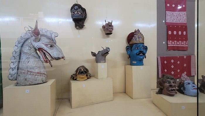

I’m not far from the Brahmaputra River, and the temptation to visit is too strong to resist. I’d hoped to find a promenade along the river, but that doesn’t exist here. I walk back calmly and notice several restaurants in my street. On the doorstep of my accommodation, I spot a pastry shop with cakes that look more like the ones we have in France than the typical ones here in India. A visit is a must, and I’m not disappointed!
Tonight, I’m dining at a restaurant in the street. The menu is a bit disappointing—burgers, pizzas, pasta—nothing very Indian. So, I’ll go with tomato pasta.
Thursday, March 20th. The alarm goes off super early, but I’m already awake—I was too worried I’d sleep through it. I leave the house at 4:00 AM. The rain has stopped, and at this hour, there aren’t many trucks on the road. I arrive at Barcelona Airport easily by 6:20 AM, let the valet know I’m there, and he quickly picks up my car. This time, I’m flying with Etihad Airways again. I booked the ticket during my trip to Cambodia: Barcelona/Kolkata, Delhi/Barcelona for 567 €. At that price, I didn’t hesitate for long—I knew I had to take it. And I’m glad I did because, by the time I returned, the price had gone up to 700 €. I can already hear the reactions: "Wow, how’d you get a ticket for that price? What site did you use? You’re amazing, MarieJo!" One thing’s for sure—I’m really happy with this deal. The flights from Barcelona to Abu Dhabi and Abu Dhabi to Kolkata go smoothly, and we arrive on time at 2:55 AM. There aren’t many people at immigration, so I get through quickly. My luggage isn’t on the carousel yet. After collecting my bag, I check in for my next flight with IndiGo, a 5:40 AM flight to Guwahati, arriving at 7:00 AM. I’m starting to feel pretty tired, so I take a taxi from the airport to Gruham Sojourn Homestay. The house is upstairs, and the neighborhood seems quiet, with restaurants lining the street. The room won’t be ready until 10:00 AM, so I rest on the bench in the meantime. Once in the room, I take a shower—it really helps me feel refreshed. I need to exchange some euros, so I look up a nearby exchange bureau on Google and head out to find it. I locate it easily, and the staff are super friendly. I get a great rate (1 € = 90 INR). I wander around the neighborhood. The train station isn’t far, and small markets line the streets. I head back to my area, walking along the main avenue. About 500 meters from my street, I discover a museum. The visit is fascinating—I see the famous Majuli masks, among other things.
I’m not far from the Brahmaputra River, and the temptation to visit is too strong to resist. I’d hoped to find a promenade along the river, but that doesn’t exist here. I walk back calmly and notice several restaurants in my street. On the doorstep of my accommodation, I spot a pastry shop with cakes that look more like the ones we have in France than the typical ones here in India. A visit is a must, and I’m not disappointed!
Tonight, I’m dining at a restaurant in the street. The menu is a bit disappointing—burgers, pizzas, pasta—nothing very Indian. So, I’ll go with tomato pasta.
Albania in Autumn Colors
A new work assignment means our vacation dates can't stay the same.
We had planned to go to the Canary Islands, but flight prices are skyrocketing with this new holiday schedule.
So, I’m looking for an alternative to Gran Canaria and El Hierro and found two round-trip flights with Wizz Air to Tirana.
398 €, including baggage and seats—perfect!
Plus, the departure and return times are great, which is pretty rare for a low-cost flight!
All that’s left is to rent a car, plan the route, and book accommodations.
With two weeks, we’ll have to make some choices!
Here’s the final itinerary: Shkodra (2 nights), Valbonë (3 nights), Tirana (1 night), Lake Ohrid (1 night), Korçë (1 night), Përmet (1 night), Gjirokastër (1 night), Himarë (2 nights), Berat (2 nights), and Krujë (1 night).
A mix of countryside and small towns, a bit of the Mediterranean, and some mountains!
Late October isn’t the best season, so let’s keep our fingers crossed for the rest...
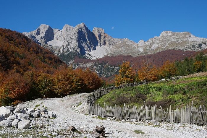
We had planned to go to the Canary Islands, but flight prices are skyrocketing with this new holiday schedule.
So, I’m looking for an alternative to Gran Canaria and El Hierro and found two round-trip flights with Wizz Air to Tirana.
398 €, including baggage and seats—perfect!
Plus, the departure and return times are great, which is pretty rare for a low-cost flight!
All that’s left is to rent a car, plan the route, and book accommodations.
With two weeks, we’ll have to make some choices!
Here’s the final itinerary: Shkodra (2 nights), Valbonë (3 nights), Tirana (1 night), Lake Ohrid (1 night), Korçë (1 night), Përmet (1 night), Gjirokastër (1 night), Himarë (2 nights), Berat (2 nights), and Krujë (1 night).
A mix of countryside and small towns, a bit of the Mediterranean, and some mountains!
Late October isn’t the best season, so let’s keep our fingers crossed for the rest...
Discovering South India: Tamil Nadu and Kerala
Hello everyone!
We're off! After exploring the north, the four friends have now discovered the south. We’re excited to share this new travel journal, dedicated to our little group and our strong friendship, written by Richard and illustrated with Kate’s photos. I’ll chime in from time to time with practical tips.
First of all, a big thank you to everyone on VoyageForum who helped us plan this trip. It would’ve been quite different if we’d just relied on guidebooks.
The itinerary lasted just over 3 weeks: Mahabalipuram, Pondicherry, Thanjavur, the Chettinad region, Madurai, Munnar, Munroe Island, Cochin, and Chennai. We traveled by train, taxi, and private car with a driver, took a domestic flight, and stayed in guesthouses, Airbnb apartments, and hotels. For each of us, including flights, the total budget barely reached 2000 €, and we didn’t hold back—knowing we avoid resorts and love street food and small Indian restaurants.
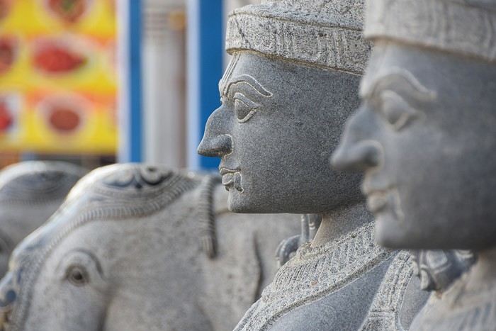
We're off! After exploring the north, the four friends have now discovered the south. We’re excited to share this new travel journal, dedicated to our little group and our strong friendship, written by Richard and illustrated with Kate’s photos. I’ll chime in from time to time with practical tips.
First of all, a big thank you to everyone on VoyageForum who helped us plan this trip. It would’ve been quite different if we’d just relied on guidebooks.
The itinerary lasted just over 3 weeks: Mahabalipuram, Pondicherry, Thanjavur, the Chettinad region, Madurai, Munnar, Munroe Island, Cochin, and Chennai. We traveled by train, taxi, and private car with a driver, took a domestic flight, and stayed in guesthouses, Airbnb apartments, and hotels. For each of us, including flights, the total budget barely reached 2000 €, and we didn’t hold back—knowing we avoid resorts and love street food and small Indian restaurants.
Photo Safaris in Kenya
Back on the forum, I’m starting to write up two 3-week trips to Kenya in August 2021 and 2023.
In 2021, Quynh and I traveled with Régis (Rjulie95 on VF). Our son joined us in Baringo for the second half of the trip.
In 2023, we went with two friends who’d been dreaming of seeing wild animals ever since we got back from Kenya. We didn’t need much convincing to go with them!
The two itineraries are almost identical (well, when you love something...) but we did make a few tweaks.
- The first part of the trip was with a local driver/guide, Félix, who was recommended by Sylvie56. Sylvie and her husband Ben are Kenya enthusiasts—they’ve been there countless times, always with Félix... and for good reason! He’s fantastic!
- The second part was with Melting Pot Safari, an agency that adapted to our photography needs. Tony Crocetta, the co-founder (along with his Kenyan friend Simon Chebon), is a wildlife photographer himself.
Here are the itineraries for both trips, including accommodations:
In 2021: Day 0: Paris / Nairobi - 67 Airport Hotel Day 1: Nairobi / Amboseli - Simba Cottage Day 2: Amboseli - Simba Cottage Day 3: Amboseli / Aberdares - Fishing Lodge Day 4: Aberdares - Fishing Lodge Day 5: Aberdares - Fishing Lodge Day 6: Aberdares / Samburu - Riverside Camp Day 7: Samburu - Riverside Camp Day 8: Samburu - Riverside Camp Day 9: Samburu / Nakuru - Merica Hotel Day 10: Nakuru / Baringo - Tumbili Cliff Lodge Day 11: Baringo - Tumbili Cliff Lodge Day 12: Baringo - Tumbili Cliff Lodge Day 13: Baringo / Maasai Mara – Meltingpot Bush Camp Day 14 to 18: Maasai Mara – Meltingpot Bush Camp Day 19: Maasai Mara / Nairobi – Roussel Guest House Day 20: Nairobi / Paris
In 2023: Day 0: Lyon / Paris / Nairobi - 67 Airport Hotel Day 1: Nairobi / Meru - Ikweta Camp Day 2: Meru - Ikweta Camp Day 3: Meru - Ikweta Camp Day 4: Meru / Samburu - Riverside Camp Day 5: Samburu – Riverside Camp Day 6: Samburu / Buffalo Springs – Samburu Simba Day 7: Buffalo Springs / Ol Pejeta – Sweetwater Camp Day 8: Ol Pejeta / Amboseli - Simba Cottage Day 9: Amboseli - Simba Cottage Day 10: Amboseli - Simba Cottage Day 11: Amboseli / Nakuru – Lake Nakuru Lodge Day 12: Nakuru / Baringo - Tumbili Cliff Lodge Day 13: Baringo - Tumbili Cliff Lodge Day 14: Baringo - Tumbili Cliff Lodge Day 15: Baringo / Maasai Mara – Meltingpot Bush Camp Day 16 to 20: Maasai Mara – Meltingpot Bush Camp Day 21: Maasai Mara / Nairobi / Paris
Here’s an itinerary—it’s not exactly what we did, but a combination of both.
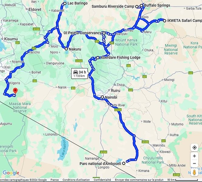
Ready to join us on safari to see some wild animals?
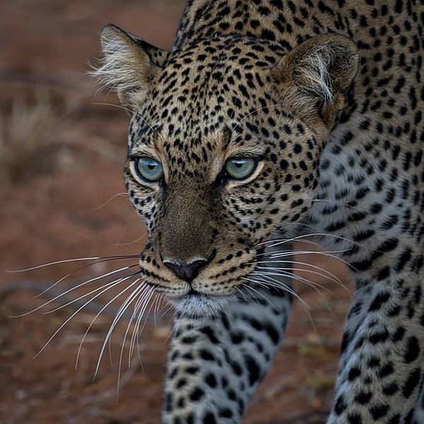
The two itineraries are almost identical (well, when you love something...) but we did make a few tweaks.
- The first part of the trip was with a local driver/guide, Félix, who was recommended by Sylvie56. Sylvie and her husband Ben are Kenya enthusiasts—they’ve been there countless times, always with Félix... and for good reason! He’s fantastic!
- The second part was with Melting Pot Safari, an agency that adapted to our photography needs. Tony Crocetta, the co-founder (along with his Kenyan friend Simon Chebon), is a wildlife photographer himself.
Here are the itineraries for both trips, including accommodations:
In 2021: Day 0: Paris / Nairobi - 67 Airport Hotel Day 1: Nairobi / Amboseli - Simba Cottage Day 2: Amboseli - Simba Cottage Day 3: Amboseli / Aberdares - Fishing Lodge Day 4: Aberdares - Fishing Lodge Day 5: Aberdares - Fishing Lodge Day 6: Aberdares / Samburu - Riverside Camp Day 7: Samburu - Riverside Camp Day 8: Samburu - Riverside Camp Day 9: Samburu / Nakuru - Merica Hotel Day 10: Nakuru / Baringo - Tumbili Cliff Lodge Day 11: Baringo - Tumbili Cliff Lodge Day 12: Baringo - Tumbili Cliff Lodge Day 13: Baringo / Maasai Mara – Meltingpot Bush Camp Day 14 to 18: Maasai Mara – Meltingpot Bush Camp Day 19: Maasai Mara / Nairobi – Roussel Guest House Day 20: Nairobi / Paris
In 2023: Day 0: Lyon / Paris / Nairobi - 67 Airport Hotel Day 1: Nairobi / Meru - Ikweta Camp Day 2: Meru - Ikweta Camp Day 3: Meru - Ikweta Camp Day 4: Meru / Samburu - Riverside Camp Day 5: Samburu – Riverside Camp Day 6: Samburu / Buffalo Springs – Samburu Simba Day 7: Buffalo Springs / Ol Pejeta – Sweetwater Camp Day 8: Ol Pejeta / Amboseli - Simba Cottage Day 9: Amboseli - Simba Cottage Day 10: Amboseli - Simba Cottage Day 11: Amboseli / Nakuru – Lake Nakuru Lodge Day 12: Nakuru / Baringo - Tumbili Cliff Lodge Day 13: Baringo - Tumbili Cliff Lodge Day 14: Baringo - Tumbili Cliff Lodge Day 15: Baringo / Maasai Mara – Meltingpot Bush Camp Day 16 to 20: Maasai Mara – Meltingpot Bush Camp Day 21: Maasai Mara / Nairobi / Paris
Here’s an itinerary—it’s not exactly what we did, but a combination of both.
Ready to join us on safari to see some wild animals?
A long journey around Australia
Sunday, October 1st, 2023
Mulhouse-London
We dumped our trash on our neighbors. We hugged, overflowing with emotion. Then Léa from Taxis S showed up. She knows us well. For ages, she’s been our driver. She was practically the official taxiwoman for the trips of the company where Dom and I met. She knew us when we were single! Almost teenagers! She knows everyone and fills in the biographies of people we’d forgotten.
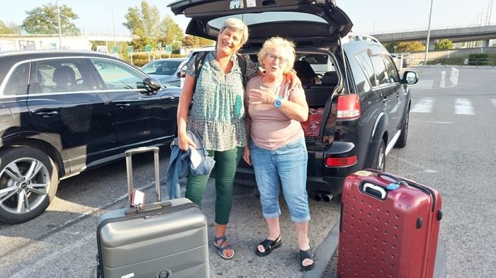 Across the street, while we loaded the luggage, S., perched in his window frame, waved a handkerchief. This wasn’t just any trip.
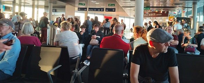 Then things got tricky. It’s funny how fate sinks its teeth into our happy moments—there’s this whole intermediate phase where the poison seeps in unnoticed because you’re still in the dark...
First, there was a delay on our flight to London. Dom immediately went on high alert, while I stayed calm. In my mind, we had two hours. I knew we had to go from Terminal 5 to Terminal 4, but two hours—come on, that’s plenty, right?
Then things got tricky. It’s funny how fate sinks its teeth into our happy moments—there’s this whole intermediate phase where the poison seeps in unnoticed because you’re still in the dark...
First, there was a delay on our flight to London. Dom immediately went on high alert, while I stayed calm. In my mind, we had two hours. I knew we had to go from Terminal 5 to Terminal 4, but two hours—come on, that’s plenty, right?
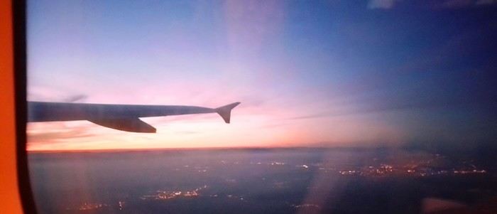
Bad calculation! Because those two hours were between the first flight’s landing and the second’s takeoff. But flights close at least half an hour before departure. Getting from one terminal to another means taking a shuttle bus. We waited for the one going to Terminal 4... until a young guy paid to direct people (who hadn’t seen us) informed us it was no longer possible to access Terminal 4 without going through Terminal 2 first for a connection! That really cranked up the pressure. We started installing a mental countdown with a programmed explosion at the end—guaranteed stress with added beads of sweat. The terminal bus was driven by a young Pakistani guy. We were *so* tense we bombarded him with our frantic, repetitive questions. “So? When are we getting there? What’s happening? Why aren’t we moving?” Our eyes were glued to our watches. The poor guy knew. Perfectly. Because it was obvious—no way around it. We weren’t going to make it. It was impossible. But Dom and I stubbornly refused to believe it. Then the kid stopped the bus. Me, hysterical: “What are you doing? What’s going on? Our plane takes off in... in... 4 minutes!!!! We’re gonna miss iiiiiit!” He wasn’t calm either. “You’ve already missed it!” He explained we had to cross a zone that required an escort car to clear a path through the runways. Impossible to do without. It’s forbidden. We had to WAIT (!!!). Then he got a radio call—he had to rush to Terminal 3 to pick up a passenger who was *super* tight on time. “Amir!!!! It’s RIGHT NOW!” they yelled in his already-red ears, thanks to the complaints of two hysterical Frenchies. Dom and I were in overdrive, hallucinating! We wanted to stop him, maybe even hit him to prevent him from turning around. He picked up the girl, whom we instantly hated like the most despicable witch. I turned on my data, searched for Malaysia Airlines’ number at Terminal 4, called, and actually got someone—quite a feat. A woman cut off my frantic rambling with a blunt “It’s over, the check-in is closed, the plane is about to take off.” I heard her but refused to accept it. I yelled, “We’re coming!” She shot back her monolithic “It’s over.” Finally at the doors of that damn Terminal 4, we ran—*really* ran—a marathon, Gate 6, security checks, pat-downs, “Take off your belts,” we asked questions, everyone seemed confident, we ran with one hand holding up our pants, the other clutching our belt, Gate 6—the room was empty. A girl was sitting there, calmly on the phone. We pounced on her. She calmed us down. Little by little, the light came back. Our brains rebooted. We finally understood it was over. We’d have to start crafting a new plan with the new reality. It started with a return to Terminal 5 to talk to British Airways, which took a good hour. With the same driver as before. We were alone with him. He took the time to apologize, to assure us it wasn’t his fault, that our problem had no solution, that nothing could’ve changed the outcome. At BA, we were exhausted. We were greeted by a handsome young man in a navy-blue uniform with gold stripes everywhere. We could’ve made a scene, but we were just relieved to find someone who’d take charge of our story. It was a minimal response, but it was *a* response. I suppose we could’ve demanded a business-class upgrade or a free trip, but we were just happy with a few vouchers for food, a hotel room with breakfast, and a little bag with plastic toys, a razor, toothbrush, hygiene products, and a T-shirt... Trinkets... But we were fine with it all—we said thank you eagerly because the essential was assured. He found us seats on flights tomorrow. *Tomorrow.* We were afraid to hope! We had the exact same flights but a day later. The same crappy times, but it was all good. We felt saved from the shipwreck, like survivors. - And what about the luggage? - .... !!!!
Monday, October 2nd, 2023 London - Kuala Lumpur
It wasn’t the Ritz, but with exhaustion on our side, we slept well. The continental breakfast was way better than we’d expected from an Ibis Budget. Still, it wasn’t enough to restore my joy for life. The course correction had turned into an arduous obstacle course. I scoured the car rental site every which way. Couldn’t reschedule the car. I’d done it before, but this time... Not to mention the laptop battery was complaining—the Brits have this quirk of making their power outlets incompatible with our chargers. Frustrated, I called them but ended up with a girl who declared herself incompetent and offered to have someone from Avis in Perth call me back—someone who’d supposedly handle rentals better. I decided to wait while taking a bath. Barely settled in, the phone rang. I was soaking wet, of course, and asked Dom to answer. Unfortunately, she’s known for disliking my phone, and in a clumsy move, she hung up. We got annoyed. She put dry towels on the edge of the bathtub, but—another false move—they fell in the water. The phone rang again... I completely redid the plans for the next two days, then transferred the files to my phone to consult them later offline. I plugged in my USB cable... *Plop!* The battery died abruptly—my PC shut down without any of the usual polite warnings! I looked around, hoping to find someone to strangle... Long story short, you can tell the day started under the worst omens. I was in a foul mood and spread my bad vibes to Dominique, who was initially in much better spirits... I called Mastercard, hoping to get a refund for the non-refundable night in Perth we’d already paid for. Same old song: “We’ll call you back”... Then... I’ll cut it short—buses, trains, lots of waiting... We rushed to reach the infamous Terminal 4.
We tried new options and convinced ourselves that a delayed departure flight is unrecoverable, no matter the scenario. We were furious that BA hadn’t bothered to tell us, leaving us to run around like rats in a burning house.
Tuesday, October 3rd, 2023 Kuala Lumpur-Perth
The flight was pretty nice. 13 hours, though. Dom and I were facing each other across the aisle. We could get up easily whenever we wanted without bothering anyone and chat when we felt like it. Besides, their chicken was amazing. They were kind enough to offer Dom a truly remarkable glass of rum. Good movies too, including the excellent *Prisoners* by Denis Villeneuve. At KL, during boarding, we developed a nagging worry about our luggage. We checked with some Malaysian Airlines staff. I sensed their hesitation. They made calls. Then changed their minds, giving us smiles and thumbs up...
Wednesday, October 4th, 2023 Perth
*Happy is the man who, like Ulysses, has had a fine voyage.* Well, for us, it wasn’t that. Finally arrived, we experienced the loneliness of tourists watching the baggage carousel spin, emptying of its precious containers one by one, until only a handful of travelers were left, staring at each other in disbelief. Without luggage, you’re kinda screwed. Not even a change of socks—our feet had been swimming in the same shoes for 3 days. No adapter, so no laptop. No toiletries. We could’ve cried! The lost luggage guy played his part. If you want compensation, fill out the disclaimer on the website made for that. And then, “Don’t worry, your luggage will arrive tomorrow!” “Don’t worry?!” From the start of the trip, we’ve been jerked around, fed lies. Tomorrow is the *absolute* last chance to get them back. Beyond that, we’d have to scramble a whole new trip. And lose a lot in the process! I have no idea how to go about it. Tomorrow... OMG... Tomorrow... We landed at 1 AM. Avis, the car rental place, opens at 6:30. Luckily, we found some decent breakfast. It cheered us up and gave us a second wind. Incorrigible, we started believing again! Well, then we just killed time. What else was there to do?

In front of Avis’s little shack, we were freezing. We’d been there since dawn. The girl who showed up, a Latina, immediately saw us as a nuisance who’d ruin her hopes of a peaceful start. Her face and tone were as unwelcoming as possible. You know us—it ended with hugs. She gave us a gorgeous, brand-new car! A hybrid with ultra-sophisticated features, all buttons you shouldn’t touch if you want to drive this thing without causing irreparable damage! We’re off! Driving on the left is easy at first. You think about it constantly. It’s counterintuitive, it takes effort. It’s later, when you get used to it and confidence sets in, that it becomes dangerous—old reflexes can send you into a wall. Anyway, the car and I immediately clicked.
In Perth, underground parking next to the hotel, friendly welcome—we ended up forgetting all the morning’s mishaps. Should we go sightseeing?
https://voyageforum.com/images/posts/small/1733767537-5Nwk6t3DsBZNOzf.jpg
Across the street, while we loaded the luggage, S., perched in his window frame, waved a handkerchief. This wasn’t just any trip.
Then things got tricky. It’s funny how fate sinks its teeth into our happy moments—there’s this whole intermediate phase where the poison seeps in unnoticed because you’re still in the dark...
First, there was a delay on our flight to London. Dom immediately went on high alert, while I stayed calm. In my mind, we had two hours. I knew we had to go from Terminal 5 to Terminal 4, but two hours—come on, that’s plenty, right?
Bad calculation! Because those two hours were between the first flight’s landing and the second’s takeoff. But flights close at least half an hour before departure. Getting from one terminal to another means taking a shuttle bus. We waited for the one going to Terminal 4... until a young guy paid to direct people (who hadn’t seen us) informed us it was no longer possible to access Terminal 4 without going through Terminal 2 first for a connection! That really cranked up the pressure. We started installing a mental countdown with a programmed explosion at the end—guaranteed stress with added beads of sweat. The terminal bus was driven by a young Pakistani guy. We were *so* tense we bombarded him with our frantic, repetitive questions. “So? When are we getting there? What’s happening? Why aren’t we moving?” Our eyes were glued to our watches. The poor guy knew. Perfectly. Because it was obvious—no way around it. We weren’t going to make it. It was impossible. But Dom and I stubbornly refused to believe it. Then the kid stopped the bus. Me, hysterical: “What are you doing? What’s going on? Our plane takes off in... in... 4 minutes!!!! We’re gonna miss iiiiiit!” He wasn’t calm either. “You’ve already missed it!” He explained we had to cross a zone that required an escort car to clear a path through the runways. Impossible to do without. It’s forbidden. We had to WAIT (!!!). Then he got a radio call—he had to rush to Terminal 3 to pick up a passenger who was *super* tight on time. “Amir!!!! It’s RIGHT NOW!” they yelled in his already-red ears, thanks to the complaints of two hysterical Frenchies. Dom and I were in overdrive, hallucinating! We wanted to stop him, maybe even hit him to prevent him from turning around. He picked up the girl, whom we instantly hated like the most despicable witch. I turned on my data, searched for Malaysia Airlines’ number at Terminal 4, called, and actually got someone—quite a feat. A woman cut off my frantic rambling with a blunt “It’s over, the check-in is closed, the plane is about to take off.” I heard her but refused to accept it. I yelled, “We’re coming!” She shot back her monolithic “It’s over.” Finally at the doors of that damn Terminal 4, we ran—*really* ran—a marathon, Gate 6, security checks, pat-downs, “Take off your belts,” we asked questions, everyone seemed confident, we ran with one hand holding up our pants, the other clutching our belt, Gate 6—the room was empty. A girl was sitting there, calmly on the phone. We pounced on her. She calmed us down. Little by little, the light came back. Our brains rebooted. We finally understood it was over. We’d have to start crafting a new plan with the new reality. It started with a return to Terminal 5 to talk to British Airways, which took a good hour. With the same driver as before. We were alone with him. He took the time to apologize, to assure us it wasn’t his fault, that our problem had no solution, that nothing could’ve changed the outcome. At BA, we were exhausted. We were greeted by a handsome young man in a navy-blue uniform with gold stripes everywhere. We could’ve made a scene, but we were just relieved to find someone who’d take charge of our story. It was a minimal response, but it was *a* response. I suppose we could’ve demanded a business-class upgrade or a free trip, but we were just happy with a few vouchers for food, a hotel room with breakfast, and a little bag with plastic toys, a razor, toothbrush, hygiene products, and a T-shirt... Trinkets... But we were fine with it all—we said thank you eagerly because the essential was assured. He found us seats on flights tomorrow. *Tomorrow.* We were afraid to hope! We had the exact same flights but a day later. The same crappy times, but it was all good. We felt saved from the shipwreck, like survivors. - And what about the luggage? - .... !!!!
Monday, October 2nd, 2023 London - Kuala Lumpur
It wasn’t the Ritz, but with exhaustion on our side, we slept well. The continental breakfast was way better than we’d expected from an Ibis Budget. Still, it wasn’t enough to restore my joy for life. The course correction had turned into an arduous obstacle course. I scoured the car rental site every which way. Couldn’t reschedule the car. I’d done it before, but this time... Not to mention the laptop battery was complaining—the Brits have this quirk of making their power outlets incompatible with our chargers. Frustrated, I called them but ended up with a girl who declared herself incompetent and offered to have someone from Avis in Perth call me back—someone who’d supposedly handle rentals better. I decided to wait while taking a bath. Barely settled in, the phone rang. I was soaking wet, of course, and asked Dom to answer. Unfortunately, she’s known for disliking my phone, and in a clumsy move, she hung up. We got annoyed. She put dry towels on the edge of the bathtub, but—another false move—they fell in the water. The phone rang again... I completely redid the plans for the next two days, then transferred the files to my phone to consult them later offline. I plugged in my USB cable... *Plop!* The battery died abruptly—my PC shut down without any of the usual polite warnings! I looked around, hoping to find someone to strangle... Long story short, you can tell the day started under the worst omens. I was in a foul mood and spread my bad vibes to Dominique, who was initially in much better spirits... I called Mastercard, hoping to get a refund for the non-refundable night in Perth we’d already paid for. Same old song: “We’ll call you back”... Then... I’ll cut it short—buses, trains, lots of waiting... We rushed to reach the infamous Terminal 4.
We tried new options and convinced ourselves that a delayed departure flight is unrecoverable, no matter the scenario. We were furious that BA hadn’t bothered to tell us, leaving us to run around like rats in a burning house.
Tuesday, October 3rd, 2023 Kuala Lumpur-Perth
The flight was pretty nice. 13 hours, though. Dom and I were facing each other across the aisle. We could get up easily whenever we wanted without bothering anyone and chat when we felt like it. Besides, their chicken was amazing. They were kind enough to offer Dom a truly remarkable glass of rum. Good movies too, including the excellent *Prisoners* by Denis Villeneuve. At KL, during boarding, we developed a nagging worry about our luggage. We checked with some Malaysian Airlines staff. I sensed their hesitation. They made calls. Then changed their minds, giving us smiles and thumbs up...
Wednesday, October 4th, 2023 Perth
*Happy is the man who, like Ulysses, has had a fine voyage.* Well, for us, it wasn’t that. Finally arrived, we experienced the loneliness of tourists watching the baggage carousel spin, emptying of its precious containers one by one, until only a handful of travelers were left, staring at each other in disbelief. Without luggage, you’re kinda screwed. Not even a change of socks—our feet had been swimming in the same shoes for 3 days. No adapter, so no laptop. No toiletries. We could’ve cried! The lost luggage guy played his part. If you want compensation, fill out the disclaimer on the website made for that. And then, “Don’t worry, your luggage will arrive tomorrow!” “Don’t worry?!” From the start of the trip, we’ve been jerked around, fed lies. Tomorrow is the *absolute* last chance to get them back. Beyond that, we’d have to scramble a whole new trip. And lose a lot in the process! I have no idea how to go about it. Tomorrow... OMG... Tomorrow... We landed at 1 AM. Avis, the car rental place, opens at 6:30. Luckily, we found some decent breakfast. It cheered us up and gave us a second wind. Incorrigible, we started believing again! Well, then we just killed time. What else was there to do?
In front of Avis’s little shack, we were freezing. We’d been there since dawn. The girl who showed up, a Latina, immediately saw us as a nuisance who’d ruin her hopes of a peaceful start. Her face and tone were as unwelcoming as possible. You know us—it ended with hugs. She gave us a gorgeous, brand-new car! A hybrid with ultra-sophisticated features, all buttons you shouldn’t touch if you want to drive this thing without causing irreparable damage! We’re off! Driving on the left is easy at first. You think about it constantly. It’s counterintuitive, it takes effort. It’s later, when you get used to it and confidence sets in, that it becomes dangerous—old reflexes can send you into a wall. Anyway, the car and I immediately clicked.
In Perth, underground parking next to the hotel, friendly welcome—we ended up forgetting all the morning’s mishaps. Should we go sightseeing?
https://voyageforum.com/images/posts/small/1733767537-5Nwk6t3DsBZNOzf.jpg
Northern Chile, Andean impressions.
Alright, this year, we're heading back to South America!
The initial plan was to retrace the route we imagined in the summer of 2020: a trip to northern Argentina starting from Córdoba.
Unfortunately, the flight to Córdoba no longer exists, and airfares to Javier Milei’s country are both outrageously priced and involve multiple layovers.
So, I tweaked Google Flights every which way and finally found a flight within my budget—departing from Clermont-Ferrand!
Not to Argentina, though...
Our transatlantic flight will cross the snow-capped Andes, landing in Santiago, Chile, with a return from Lima!
In between, two domestic flights and a big road trip loop starting from the coastal city of Arica to explore the treasures of northern Chile.
Our mode of transport: a pseudo 4x4 that won’t take us through sand dunes or devilish tracks but will let us tackle the entire secondary network, including unpaved main roads, while still being insured.
Is the suitcase packed with all-season clothes?
Are the driver’s license and passport ready?
Bank cards and a few euros too?
Off we go for just over 3 weeks of southern wanderings!
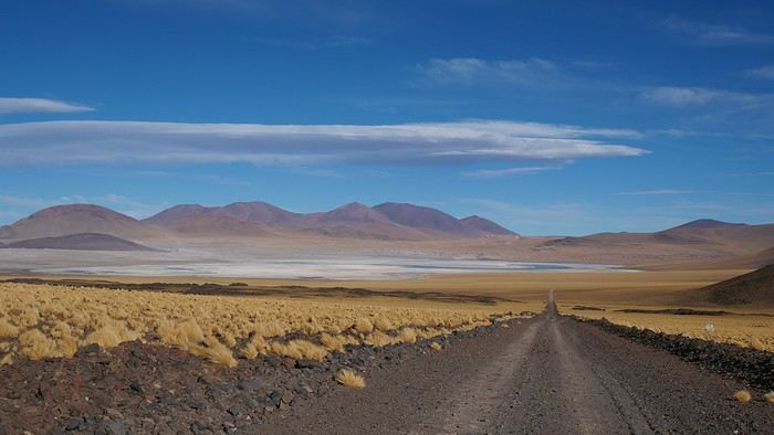
--/--
To keep all my esteemed readers on track, here are a few maps outlining the Arica-Arica loop!
1- From Arica to San Pedro de Atacama via Pica and the Salar de Huasco
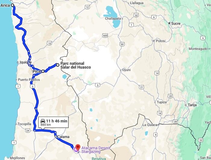 2- Around San Pedro
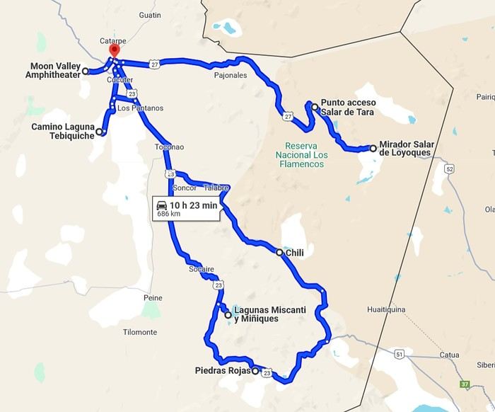
3- From San Pedro to Cariquima
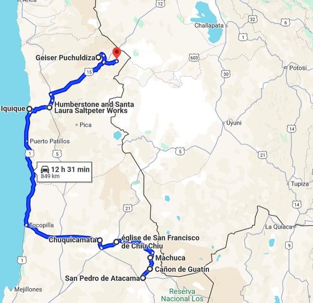
4- From Cariquima to Putre
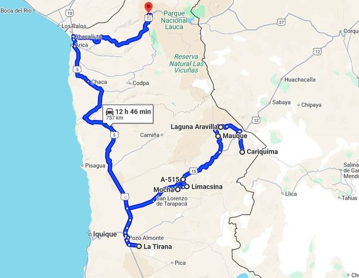
5 - From Putre to Arica
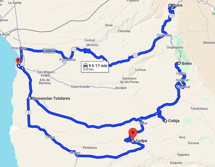
Gas stations in this part of Chile are located in Arica, Iquique, Pozo Almonte, Pica, Calama, and San Pedro de Atacama.
The initial plan was to retrace the route we imagined in the summer of 2020: a trip to northern Argentina starting from Córdoba.
Unfortunately, the flight to Córdoba no longer exists, and airfares to Javier Milei’s country are both outrageously priced and involve multiple layovers.
So, I tweaked Google Flights every which way and finally found a flight within my budget—departing from Clermont-Ferrand!
Not to Argentina, though...
Our transatlantic flight will cross the snow-capped Andes, landing in Santiago, Chile, with a return from Lima!
In between, two domestic flights and a big road trip loop starting from the coastal city of Arica to explore the treasures of northern Chile.
Our mode of transport: a pseudo 4x4 that won’t take us through sand dunes or devilish tracks but will let us tackle the entire secondary network, including unpaved main roads, while still being insured.
Is the suitcase packed with all-season clothes?
Are the driver’s license and passport ready?
Bank cards and a few euros too?
Off we go for just over 3 weeks of southern wanderings!
--/--
To keep all my esteemed readers on track, here are a few maps outlining the Arica-Arica loop!
1- From Arica to San Pedro de Atacama via Pica and the Salar de Huasco
2- Around San Pedro3- From San Pedro to Cariquima
4- From Cariquima to Putre
5 - From Putre to Arica
Gas stations in this part of Chile are located in Arica, Iquique, Pozo Almonte, Pica, Calama, and San Pedro de Atacama.
3 weeks in Colombia in August 2024
Hi there,
This summer, we spent 3 weeks in northern Colombia. A vibrant trip that complemented our southern Peru adventure from the previous year perfectly. Two neighboring countries, but completely different.
To start, we had to make a choice because the country is vast.
So we focused on 3 different regions for our 3 weeks: - Week 1: Bogotá and the colonial villages (Villa de Leyva, Barichara) - Week 2: Medellín and the Coffee Region - Week 3: the Caribbean coast
We entrusted the organization to a small local agency that handled accommodations, guides, and transportation. Transportation is key. The country is large, the road network isn’t very efficient, and we spent a lot of time traveling (cars, planes, and boats...), but it was the price to pay to explore it.
The overall budget isn’t exactly "backpacker" level. We spent 7,500 € (excluding Air France) for our 3-week stay (hotels, drivers, guides, flights, visits, meals). But we treated ourselves to nice accommodations—you’ll see as we share more posts.
For vacations, I try to follow Philippe Noiret’s motto: "Travel is short. Let’s try to do it first class."
This summer, we spent 3 weeks in northern Colombia. A vibrant trip that complemented our southern Peru adventure from the previous year perfectly. Two neighboring countries, but completely different.
To start, we had to make a choice because the country is vast.
So we focused on 3 different regions for our 3 weeks: - Week 1: Bogotá and the colonial villages (Villa de Leyva, Barichara) - Week 2: Medellín and the Coffee Region - Week 3: the Caribbean coast
We entrusted the organization to a small local agency that handled accommodations, guides, and transportation. Transportation is key. The country is large, the road network isn’t very efficient, and we spent a lot of time traveling (cars, planes, and boats...), but it was the price to pay to explore it.
The overall budget isn’t exactly "backpacker" level. We spent 7,500 € (excluding Air France) for our 3-week stay (hotels, drivers, guides, flights, visits, meals). But we treated ourselves to nice accommodations—you’ll see as we share more posts.
For vacations, I try to follow Philippe Noiret’s motto: "Travel is short. Let’s try to do it first class."
Conversation transatlantique English translation pending
Ciao a tutti,
Ras le censuré du covid! Et si on causait d'autre chose, hein?
Dans un livre au beau titre, Globe-trotteur en français, Svetski putnik en langue originale bcms (littéralement La Conscience du voyageur) David Albahari, auteur serbe émigré au Canada, place ces mots dans la bouche de l'un des personnages du roman, Daniel Atias, écrivain de l'"ex-pays" invité à une résidence d'artistes à Banff :
Dans son monde, l'Europe,
il n’y a que l’instant présent, et dans cet instant on vit, en fait, pour le passé, que chacun voudrait bien changer, alors qu’ici, s’il ne se trompait point […] l’instant présent n’est que l’antichambre du futur, et le passé reste, comme il se doit, aussi immuable que les montagnes qui nous entourent.
L'ici qu'il évoque est le Nouveau Monde, l'Amérique aux vastes étendues.
La lectrice que je suis avait adhéré à la vision d' Albahari sur l'homme européen, du moins d'un certain âge et curiosité intellectuelle sur sa propre histoire, sur la matière de sa mémoire, Frankenstein couturé de traumatismes mal digérés (comment ne pas entendre aujourd'hui sans masque sur les oreilles les grincements de dents dans l'Egée?) et de quelques rares périodes resplendissantes. Je n'avais eu en revanche aucun point d'appui pour évaluer sa perception du Nord Américain.
Qu'en pensent mes compatriotes européens et les natifs des vastes étendues (pratiquement absents de cette rubrique) ou bourlingueurs attentifs des deux rives de l'Atlantique?
Catherine (qui se dit que son esprit serait peut-être différent, autre texture, autres réflexes, si elle habitait rue des écureuils au lieu de rue d'un général napoléonien syphilitique à quelques pas de la place d'un empereur romain grand massacreur de chrétiens)
PS : pour contextualiser (sans épistémologiser 😇) la citation extraite du livre, voici la critique complète que j'avais écrite de l'ouvrage :
« Ce qui m’inquiétait c’était une chose que je devinais plutôt que je ne la voyais vraiment, une chose qui n’avait pas encore de forme déterminée et ne se rattachait pas davantage à telle ou telle partie de son visage, quelque chose qui du moins à ce moment là n’aurait pas pu être saisi par le dessin, mais qui, telle une ombre, ne cessait de glisser sur ses joues, ses sourcils et l arête de son nez, menaçant de s’y fixer et – la voilà mon inquiétude, de s’y établir à demeure. »
Deux hommes. Un peintre et un écrivain. Un peintre canadien et un écrivain de Belgrade. En cet été 1998, ils sont tout deux invités du Centre des Arts de Banff, artistes en résidence, longue pour le premier, à peine 13 jours pour le second. Le visage de l’auteur fascine le plasticien, qui en scrute les moindres détails, les moindres expressions, et tente dans les heures où ils ne sont pas ensemble de dessiner ses traits, de la simple épure d’une ride à la physionomie complète. Il tente péniblement de faire apparaître une forme qui se dérobe.
Cette passion exclusive et oh combien possessive du peintre envers l’écrivain qui ne la découvrira, en feuilletant le haut paquet de dessins dans un parfait silence, que quelques minutes avant son départ définitif de Banff, est contrariée par l’arrivée d’un troisième homme, un Canadien de Calgary, rejeton d’Ivan Matulić, globe-trotter croate dont les deux artistes ont vu la signature dans une vitrine du Musée d’Histoire naturelle de Banff. L’écrivain et le petit-fils partageant une origine géographique commune et par là même une fraction d’histoire commune, il se noue entre eux une discussion, une entente même, dont le peintre, à son grand regret, se sent exclu.
Le peintre est le narrateur. Narration intime où il relate ses sentiments, les mouvements du groupe, les discussions.
Thé pris au grand hôtel à l’orgueilleuse architecture, conférences au Centre des Arts, cocktail petit doigt en l’air et expression inspirée de rigueur chez le directeur des programmes littéraires, fraîches eaux des torrents et wapitis vaquant, indifférents aux hommes, à leurs occupations. Déambulations plus ou moins rapides selon l’heure et l’humeur dans les rues du Bison, de la Loutre, du Castor…
Les rues ont à Banff des noms d’animaux, le peintre s’attirera la sympathie de Daniel Atias en définissant son identité par la prairie.
Les deux hommes viennent de deux mondes profondément différents. Dans le monde de Daniel Atias dit-il, « il n’y a que l’instant présent, et dans cet instant on vit, en fait, pour le passé, que chacun voudrait bien changer, alors qu’ici, s’il ne se trompait point […] l’instant présent n’est que l’antichambre du futur, et le passé reste, comme il se doit, aussi immuable que les montagnes qui nous entourent. » La réflexion sur le temps, sur l’histoire, sur les relations que les peuples entretiennent avec elle influençant ainsi leur existence, charpente le livre.
Au-delà de la confrontation du rapport au temps, à la mémoire sur les deux rives de l’Atlantique se développe la relation entre des ressortissants de deux camps opposés de l' »ex-pays » comme le nomme l’écrivain qui ne mentionnera jamais ni la « Yougoslavie« , ni encore moins la « Serbie« , discussions intenses, prises de conscience qui réveillent l’espoir assoupi de Daniel Atias. Mais le petit-fils du globe-trotter croate, né dans un pays d’avenir, cédant à l’impulsion de contempler le passé de son ancêtre, de Canadien devenant ainsi Croate, sera empoisonné, à mort, par cette dislocation abyssale de son identité.
En mode mineur, une réflexion sur la nature de la peinture et de la littérature, sur leur façon différente d’appréhender le monde, d’en rendre compte, traverse l’ouvrage.
Le texte est dense, pas de chapitre, pas même d’alinéa. Un bloc de langue, d’idées, de sentiments. Daniel Atias prétend que « le mieux serait encore de lire un seul livre pendant toute sa vie…« . Au vu de l’épaisseur de ces 200 pages, on se dit que si elles n’occupent pas toute une vie, il ne serait sans doute pas inutile de les fréquenter longuement pour en approfondir la compréhension, en déceler le cheminement, en apprécier le système d’échos.
Ras le censuré du covid! Et si on causait d'autre chose, hein?
Dans un livre au beau titre, Globe-trotteur en français, Svetski putnik en langue originale bcms (littéralement La Conscience du voyageur) David Albahari, auteur serbe émigré au Canada, place ces mots dans la bouche de l'un des personnages du roman, Daniel Atias, écrivain de l'"ex-pays" invité à une résidence d'artistes à Banff :
Dans son monde, l'Europe,
il n’y a que l’instant présent, et dans cet instant on vit, en fait, pour le passé, que chacun voudrait bien changer, alors qu’ici, s’il ne se trompait point […] l’instant présent n’est que l’antichambre du futur, et le passé reste, comme il se doit, aussi immuable que les montagnes qui nous entourent.
L'ici qu'il évoque est le Nouveau Monde, l'Amérique aux vastes étendues.
La lectrice que je suis avait adhéré à la vision d' Albahari sur l'homme européen, du moins d'un certain âge et curiosité intellectuelle sur sa propre histoire, sur la matière de sa mémoire, Frankenstein couturé de traumatismes mal digérés (comment ne pas entendre aujourd'hui sans masque sur les oreilles les grincements de dents dans l'Egée?) et de quelques rares périodes resplendissantes. Je n'avais eu en revanche aucun point d'appui pour évaluer sa perception du Nord Américain.
Qu'en pensent mes compatriotes européens et les natifs des vastes étendues (pratiquement absents de cette rubrique) ou bourlingueurs attentifs des deux rives de l'Atlantique?
Catherine (qui se dit que son esprit serait peut-être différent, autre texture, autres réflexes, si elle habitait rue des écureuils au lieu de rue d'un général napoléonien syphilitique à quelques pas de la place d'un empereur romain grand massacreur de chrétiens)
PS : pour contextualiser (sans épistémologiser 😇) la citation extraite du livre, voici la critique complète que j'avais écrite de l'ouvrage :
« Ce qui m’inquiétait c’était une chose que je devinais plutôt que je ne la voyais vraiment, une chose qui n’avait pas encore de forme déterminée et ne se rattachait pas davantage à telle ou telle partie de son visage, quelque chose qui du moins à ce moment là n’aurait pas pu être saisi par le dessin, mais qui, telle une ombre, ne cessait de glisser sur ses joues, ses sourcils et l arête de son nez, menaçant de s’y fixer et – la voilà mon inquiétude, de s’y établir à demeure. »
Deux hommes. Un peintre et un écrivain. Un peintre canadien et un écrivain de Belgrade. En cet été 1998, ils sont tout deux invités du Centre des Arts de Banff, artistes en résidence, longue pour le premier, à peine 13 jours pour le second. Le visage de l’auteur fascine le plasticien, qui en scrute les moindres détails, les moindres expressions, et tente dans les heures où ils ne sont pas ensemble de dessiner ses traits, de la simple épure d’une ride à la physionomie complète. Il tente péniblement de faire apparaître une forme qui se dérobe.
Cette passion exclusive et oh combien possessive du peintre envers l’écrivain qui ne la découvrira, en feuilletant le haut paquet de dessins dans un parfait silence, que quelques minutes avant son départ définitif de Banff, est contrariée par l’arrivée d’un troisième homme, un Canadien de Calgary, rejeton d’Ivan Matulić, globe-trotter croate dont les deux artistes ont vu la signature dans une vitrine du Musée d’Histoire naturelle de Banff. L’écrivain et le petit-fils partageant une origine géographique commune et par là même une fraction d’histoire commune, il se noue entre eux une discussion, une entente même, dont le peintre, à son grand regret, se sent exclu.
Le peintre est le narrateur. Narration intime où il relate ses sentiments, les mouvements du groupe, les discussions.
Thé pris au grand hôtel à l’orgueilleuse architecture, conférences au Centre des Arts, cocktail petit doigt en l’air et expression inspirée de rigueur chez le directeur des programmes littéraires, fraîches eaux des torrents et wapitis vaquant, indifférents aux hommes, à leurs occupations. Déambulations plus ou moins rapides selon l’heure et l’humeur dans les rues du Bison, de la Loutre, du Castor…
Les rues ont à Banff des noms d’animaux, le peintre s’attirera la sympathie de Daniel Atias en définissant son identité par la prairie.
Les deux hommes viennent de deux mondes profondément différents. Dans le monde de Daniel Atias dit-il, « il n’y a que l’instant présent, et dans cet instant on vit, en fait, pour le passé, que chacun voudrait bien changer, alors qu’ici, s’il ne se trompait point […] l’instant présent n’est que l’antichambre du futur, et le passé reste, comme il se doit, aussi immuable que les montagnes qui nous entourent. » La réflexion sur le temps, sur l’histoire, sur les relations que les peuples entretiennent avec elle influençant ainsi leur existence, charpente le livre.
Au-delà de la confrontation du rapport au temps, à la mémoire sur les deux rives de l’Atlantique se développe la relation entre des ressortissants de deux camps opposés de l' »ex-pays » comme le nomme l’écrivain qui ne mentionnera jamais ni la « Yougoslavie« , ni encore moins la « Serbie« , discussions intenses, prises de conscience qui réveillent l’espoir assoupi de Daniel Atias. Mais le petit-fils du globe-trotter croate, né dans un pays d’avenir, cédant à l’impulsion de contempler le passé de son ancêtre, de Canadien devenant ainsi Croate, sera empoisonné, à mort, par cette dislocation abyssale de son identité.
En mode mineur, une réflexion sur la nature de la peinture et de la littérature, sur leur façon différente d’appréhender le monde, d’en rendre compte, traverse l’ouvrage.
Le texte est dense, pas de chapitre, pas même d’alinéa. Un bloc de langue, d’idées, de sentiments. Daniel Atias prétend que « le mieux serait encore de lire un seul livre pendant toute sa vie…« . Au vu de l’épaisseur de ces 200 pages, on se dit que si elles n’occupent pas toute une vie, il ne serait sans doute pas inutile de les fréquenter longuement pour en approfondir la compréhension, en déceler le cheminement, en apprécier le système d’échos.
Adventure in Morocco
I’m not going back, the trip is in the past. I’m posting it anyway because the country probably hasn’t changed enough to make the story outdated, and the astonishing beauty of the place deserves to be shared here.
Saturday, May 31, 2014 Mulhouse - Marrakech
A flight that drags on for three and a half hours. Everything goes smoothly until immigration. Like almost everywhere, you have to fill out a little form with your details and arrival address. The problem comes when you hand it to the customs officer with your passport. Right away, you see the lines are way too long for the number of officers working. I steer Dom toward a line further to the left that’s clearly moving faster than the middle ones. Then I firmly pull him to the far left where I think I spotted a new counter opening. Big mistake. Huge. Because that line is notorious for how slowly the security agent checks each person. At 10 minutes per person, with about fifteen ahead of us, we’re looking at two and a half hours. The wait becomes torture. Everyone gets edgy. We watch enviously as people who were way behind us initially zip through the other lines. You feel like complaining. My advice? Don’t. You have no idea how much a pissed-off customs officer can ruin your day! The rule: stay calm and suck it up. Once that hurdle’s over, a taxi and boom, we’re at the Gallia, a no-frills but charming hotel just steps from Jemaa El Fna square. This place is insane! It’s teeming with people. You stick out like a sore thumb with your camera—suddenly, a ton of people want to be your best friend! You’re basically a walking wallet!
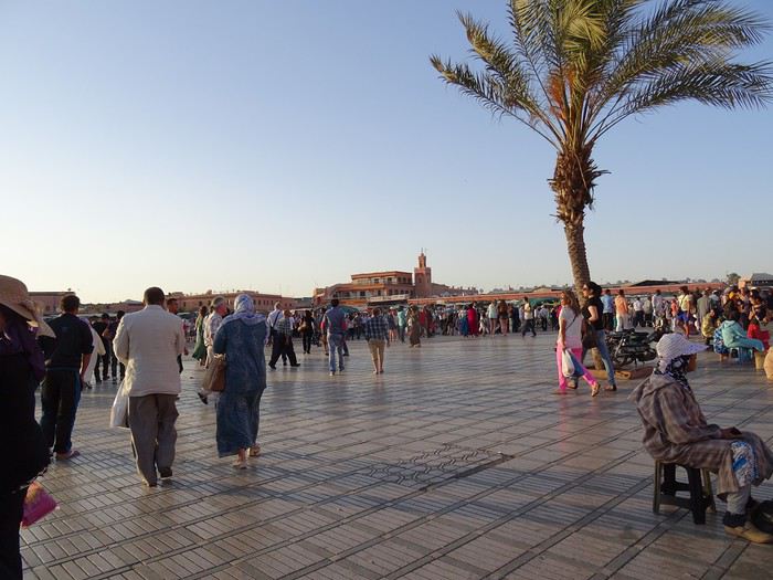
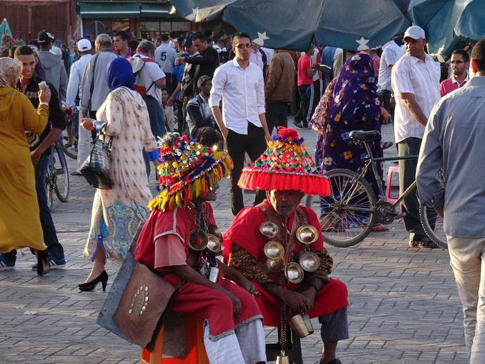
We’ve got a meet-up with friends who are here on a work trip with their company’s social committee.
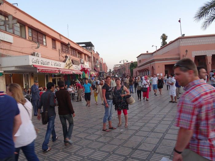
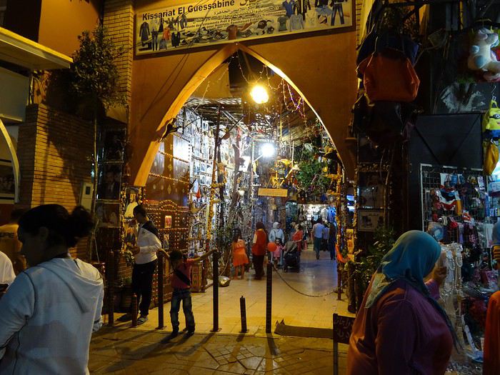
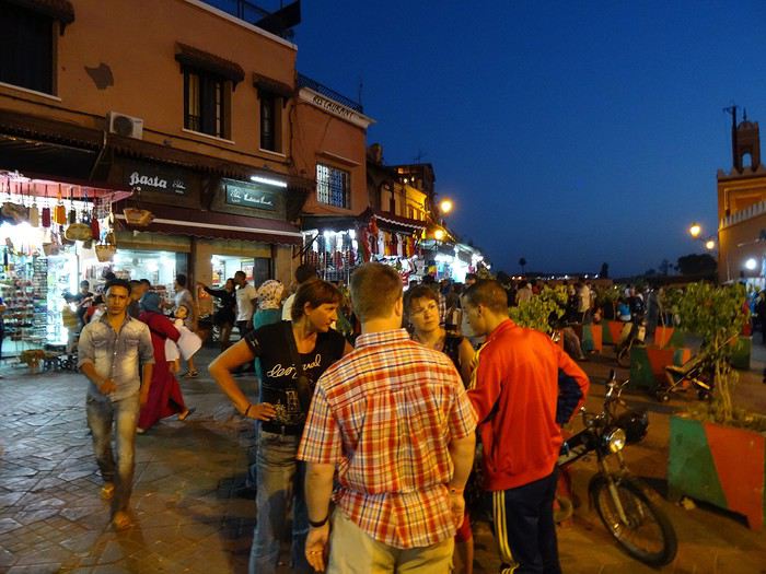
We fully embrace our tourist roles—eating at restaurants made for us, with belly dancers who insist we join in. We go with the flow, we’re not prudes, we have a great evening, no way we’re missing out on the fun...
Sunday, June 1, 2014 Marrakech
Super nice breakfast in the hotel’s patio, a real riad, beautifully decorated.
Originally, we’d planned a trip to the Atlas Mountains, but we ended up wandering around the city instead. Before we knew it, we were in the middle of the central souk’s labyrinth. It’s a feast for the eyes, ears, and especially the nose!
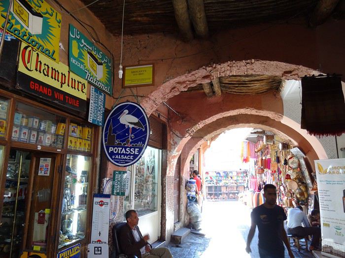
Saturday, May 31, 2014 Mulhouse - Marrakech
A flight that drags on for three and a half hours. Everything goes smoothly until immigration. Like almost everywhere, you have to fill out a little form with your details and arrival address. The problem comes when you hand it to the customs officer with your passport. Right away, you see the lines are way too long for the number of officers working. I steer Dom toward a line further to the left that’s clearly moving faster than the middle ones. Then I firmly pull him to the far left where I think I spotted a new counter opening. Big mistake. Huge. Because that line is notorious for how slowly the security agent checks each person. At 10 minutes per person, with about fifteen ahead of us, we’re looking at two and a half hours. The wait becomes torture. Everyone gets edgy. We watch enviously as people who were way behind us initially zip through the other lines. You feel like complaining. My advice? Don’t. You have no idea how much a pissed-off customs officer can ruin your day! The rule: stay calm and suck it up. Once that hurdle’s over, a taxi and boom, we’re at the Gallia, a no-frills but charming hotel just steps from Jemaa El Fna square. This place is insane! It’s teeming with people. You stick out like a sore thumb with your camera—suddenly, a ton of people want to be your best friend! You’re basically a walking wallet!
We’ve got a meet-up with friends who are here on a work trip with their company’s social committee.
We fully embrace our tourist roles—eating at restaurants made for us, with belly dancers who insist we join in. We go with the flow, we’re not prudes, we have a great evening, no way we’re missing out on the fun...
Sunday, June 1, 2014 Marrakech
Super nice breakfast in the hotel’s patio, a real riad, beautifully decorated.
Originally, we’d planned a trip to the Atlas Mountains, but we ended up wandering around the city instead. Before we knew it, we were in the middle of the central souk’s labyrinth. It’s a feast for the eyes, ears, and especially the nose!
Ce n'était pas mieux avant et ce n'est pas mieux après English translation pending
j ai connu un âge d or des voyages en pays etrangers. En gros des annees 1980 aux annees 2000.
avant c était les avions pour les privilégiés, des zones entieres sans hôtels , des chambres et des lits datant du moyen âge et parfois d immenses difficultés pour se comprendre. une bonne partie du monde pour des aventuriers au dos solide et au sommeil facile
apres c est devenu l invasion touristique , les paysages défigurés , la mer souillée , les bourrins en bus et sur paquebots , le tourisme local avec les défauts occidentaux et pas leurs qualités. une bonne partie du monde a vous gâcher le paysage avec leurs minables selfies
Il y a pour tout une période optimale. Avant c est trop tôt, apres ca devient difficile. Ce n est pas Voyagesforum qui me contredira........
avant c était les avions pour les privilégiés, des zones entieres sans hôtels , des chambres et des lits datant du moyen âge et parfois d immenses difficultés pour se comprendre. une bonne partie du monde pour des aventuriers au dos solide et au sommeil facile
apres c est devenu l invasion touristique , les paysages défigurés , la mer souillée , les bourrins en bus et sur paquebots , le tourisme local avec les défauts occidentaux et pas leurs qualités. une bonne partie du monde a vous gâcher le paysage avec leurs minables selfies
Il y a pour tout une période optimale. Avant c est trop tôt, apres ca devient difficile. Ce n est pas Voyagesforum qui me contredira........
Majorque, rien que pour vos yeux English translation pending
Salut à tous,
Dimanche pluvieux, rentrée dans 2 jours, des masques partout, bref ambiance sinistrose à fond😕... alors je me suis dit qu'il est tant de me replonger dans les photos de Majorque et de vous en faire profiter afin d'égayer (je l'espère) les jours à venir 🙂
Majorque... Franchement cette destination ne m'a jamais fait rêver. Les Baléares, dans mon imaginaire personnel, c'était un peu les vacances Fram pas chères, de la bidasse au bord de la plage et train de siroter des mauvais cocktails, et de la jeunesse encannaillée en boite de nuit au son des boum boum boum...
Cet été, on projetait d'aller en Sicile. Nous c'est Papa, Maman, notre p'tit gars de 10 ans, et notre princesse de 6 ans. Et j'étais plus particulièrement motivé par les îles éoliennes, qui est un des must de la plongée méditerranéenne (ah oui, je suis plongeur, alors c'est toujours un critère obligé de nos destinations de vacances 😎) avec des décors volcaniques qui semblaient magiques. Mais pour différentes raisons, celà ne s'est pas fait. Alors quand ma femme, ayant vu le blog d'une instagrameuse, m'a parlé de Majorque à la place des Eoliennes, j'ai plutôt bondi... Elle a insisté, j'ai cédé, on a acheté le Lonely Planet, et j'ai commencé, toujours peu motivé, à le feuilleter... Et là, ce que je lisais n'était pas du tout en phase avec l'image d'Epinal que j'en avais... Majorque était décrit comme un écrin naturel, à base de criques turquoises, montagnes plongeant dans la mer, petits villages, plantations d'agrumes... Et de très beau coin à plongée, notamment pas mal de grottes autour du Cap de Formentor. Destination parfaite pour allier plaisir des enfants et des parents 🙂 Alors j'ai dit banco !
Un chaine montagneuse (Sierra de Tramontana) couvre la cote Ouest de l'île et se termine par le Cap de Formentor, avec nombreuses criques, parfois sauvages, un peu partout. Le Nord est formé de 2 grandes baies (celles de Pollenca et Alcudia). L'Est est très bétonné ; de belles criques mais pas vraiment sauvages. Le Sud c'est essentiellement la baie de Palma où s'entassent les jeunes anglais et allemands venus ce retourner la tête... Pas grand chose à voir au centre.
Alors on a préparé celà gentiment. Etant donné que nous ciblions la découverte du Nord et de l'Ouest de l'île , on a ciblé un logement dans la région de Sa Pobla, proche de la baie de Pollenca. Billets Transavia en poche en février pour un départ en Juillet, réservation d'une villa par Air b'n'b, il n'y avait plus qu'à... Et la Covid est arrivé🏴☠️. On n'a rien annulé, on a a serré les fesses, et finalement on est passé entre les gouttes. Nos vols ont été maintenus aux dates et horaires prévus.
La dernière chose à faire était la réservation de la voiture de location, faite au dernier moment. Oubliez les prestataires institutionnels, il y a une multitude d'agences locales à l'aéroport de Majorque. On est passé par Wiber, RAS
Et ces deux semaines furent incroyables. Un vrai choc, je ne m'attendais pas à une telle beauté à 1h30 de vol de Paris 😛
Je vais vous raconter, et surtout vous montrer tout celà, tranquillement 😉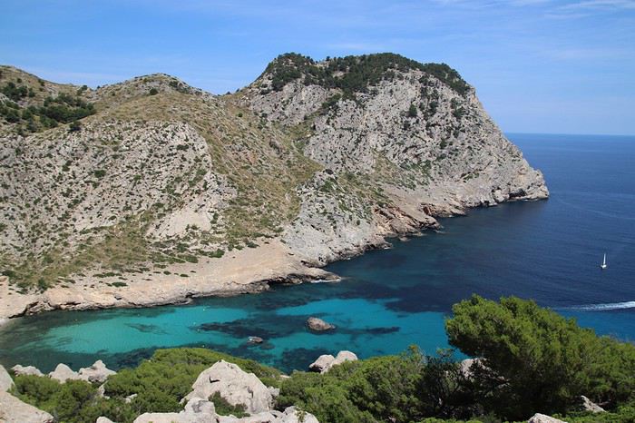
Dimanche pluvieux, rentrée dans 2 jours, des masques partout, bref ambiance sinistrose à fond😕... alors je me suis dit qu'il est tant de me replonger dans les photos de Majorque et de vous en faire profiter afin d'égayer (je l'espère) les jours à venir 🙂
Majorque... Franchement cette destination ne m'a jamais fait rêver. Les Baléares, dans mon imaginaire personnel, c'était un peu les vacances Fram pas chères, de la bidasse au bord de la plage et train de siroter des mauvais cocktails, et de la jeunesse encannaillée en boite de nuit au son des boum boum boum...
Cet été, on projetait d'aller en Sicile. Nous c'est Papa, Maman, notre p'tit gars de 10 ans, et notre princesse de 6 ans. Et j'étais plus particulièrement motivé par les îles éoliennes, qui est un des must de la plongée méditerranéenne (ah oui, je suis plongeur, alors c'est toujours un critère obligé de nos destinations de vacances 😎) avec des décors volcaniques qui semblaient magiques. Mais pour différentes raisons, celà ne s'est pas fait. Alors quand ma femme, ayant vu le blog d'une instagrameuse, m'a parlé de Majorque à la place des Eoliennes, j'ai plutôt bondi... Elle a insisté, j'ai cédé, on a acheté le Lonely Planet, et j'ai commencé, toujours peu motivé, à le feuilleter... Et là, ce que je lisais n'était pas du tout en phase avec l'image d'Epinal que j'en avais... Majorque était décrit comme un écrin naturel, à base de criques turquoises, montagnes plongeant dans la mer, petits villages, plantations d'agrumes... Et de très beau coin à plongée, notamment pas mal de grottes autour du Cap de Formentor. Destination parfaite pour allier plaisir des enfants et des parents 🙂 Alors j'ai dit banco !
Un chaine montagneuse (Sierra de Tramontana) couvre la cote Ouest de l'île et se termine par le Cap de Formentor, avec nombreuses criques, parfois sauvages, un peu partout. Le Nord est formé de 2 grandes baies (celles de Pollenca et Alcudia). L'Est est très bétonné ; de belles criques mais pas vraiment sauvages. Le Sud c'est essentiellement la baie de Palma où s'entassent les jeunes anglais et allemands venus ce retourner la tête... Pas grand chose à voir au centre.
Alors on a préparé celà gentiment. Etant donné que nous ciblions la découverte du Nord et de l'Ouest de l'île , on a ciblé un logement dans la région de Sa Pobla, proche de la baie de Pollenca. Billets Transavia en poche en février pour un départ en Juillet, réservation d'une villa par Air b'n'b, il n'y avait plus qu'à... Et la Covid est arrivé🏴☠️. On n'a rien annulé, on a a serré les fesses, et finalement on est passé entre les gouttes. Nos vols ont été maintenus aux dates et horaires prévus.
La dernière chose à faire était la réservation de la voiture de location, faite au dernier moment. Oubliez les prestataires institutionnels, il y a une multitude d'agences locales à l'aéroport de Majorque. On est passé par Wiber, RAS
Et ces deux semaines furent incroyables. Un vrai choc, je ne m'attendais pas à une telle beauté à 1h30 de vol de Paris 😛
Je vais vous raconter, et surtout vous montrer tout celà, tranquillement 😉
Les Cyclades en juillet: Anafi, Amorgos, Astypaléa English translation pending
GENESE
Comme tous, le COVID a chamboulé nos plans. Normalement nous devions aller à Madagascar pendant un mois, projet reporté à l’année prochaine. Seulement, n’ayant jamais arrêté de travailler, malgré le confinement et le Covid j’avais réellement besoin de faire une « pause ».
Souhaitant limiter les risques de restrictions de déplacements nous ne quitterons pas l’Europe en nous centrant sur des endroits que nous avons toujours voulu visiter, mais habituellement trop fréquentés pour nous. Il y avait la Suisse avec ses montagnes et ses trains de légende, l’Islande et les îles Grecques.
Au final c’est l’attrait du soleil qui l’a emporté … enfin surtout auprès de madame ! Nous avions « entrevu » Santorin et Myconos lors d’une croisière en méditerranée en 2007 avec les enfants. Nous avions adoré … sauf la fréquentation !
Le premier élément à choisir est le point d’entrée, accessible en avion. Il y a Santorin et Myconos dans les Cyclades. Comme je rêvais de revoir la caldera de Santorin, le choix fut rapide. Ensuite je voulais des îles peu fréquentées ne nécessitant pas de trop long trajet en ferry. Sur 2 semaines 3 îles m’a paru être le bon choix. Avec le recul je confirme que c’est un bon dosage. Je me suis beaucoup servi du site Hellenica et Cycladen.be, qui sont très bien, pour faire mes choix.
La première sera Anafi, dans la catégorie « peu fréquentée » elle est très bien placée, en plus elle est petite, montagneuse et avec de belles plages. Une des raisons de sa faible fréquentation est le peu de liaison maritimes, ce sera donc à partir de cette contrainte que s’articulera le voyage.
Le second choix sera Astypalea car il y a un aéroport pour repartir, en plus c’est aussi une île peu fréquentée par les étrangers. Elle fait partie des Dodécanèse mais géographique se trouve proche des Cyclades.
Amorgos se glissera très naturellement entre les deux.
Une fois le planning établi j’ai réservé les vols chez Volotea qui a le bon goût de partir de Strasbourg … mauvais choix car les vols seront annulés 2 semaines plus tard.🏴☠️ Je me suis retourné vers Easy Jet qui part de Bâle Mulhouse, finalement tout aussi proche de chez nous que Strasbourg. Il faut dire qu’en Alsace nous avons la chance d’avoir pas mal d’aéroports dans un rayon de 3 heures autour de chez nous (en plus des deux précités il y a surtout Zurich et Frankfurt). Nous ferons donc BSL – Athènes – Santorin puis Astypalea – Athènes – BSL.
J’ai réservé par internet en direct les pensions : Villa Kalamiotissa pour Anafi Emprostiada Traditional Guest House et Pano Gitonia pour Amorgos Studio Killindra pour Astypalea Je réserve aussi une voiture à Amorgos puisque l’île est assez grande … et au final, suite à un échange avec mon logeur, également à Anafi.
Le roadbook sera assez rapide à établir … tant mieux car je n’ai que très peu de temps disponible, relancer mon entreprise suite au Covid-19 a accaparé tout mon temps.
En voiture ... pour ceux qui veulent 🙂
Comme tous, le COVID a chamboulé nos plans. Normalement nous devions aller à Madagascar pendant un mois, projet reporté à l’année prochaine. Seulement, n’ayant jamais arrêté de travailler, malgré le confinement et le Covid j’avais réellement besoin de faire une « pause ».
Souhaitant limiter les risques de restrictions de déplacements nous ne quitterons pas l’Europe en nous centrant sur des endroits que nous avons toujours voulu visiter, mais habituellement trop fréquentés pour nous. Il y avait la Suisse avec ses montagnes et ses trains de légende, l’Islande et les îles Grecques.
Au final c’est l’attrait du soleil qui l’a emporté … enfin surtout auprès de madame ! Nous avions « entrevu » Santorin et Myconos lors d’une croisière en méditerranée en 2007 avec les enfants. Nous avions adoré … sauf la fréquentation !
Le premier élément à choisir est le point d’entrée, accessible en avion. Il y a Santorin et Myconos dans les Cyclades. Comme je rêvais de revoir la caldera de Santorin, le choix fut rapide. Ensuite je voulais des îles peu fréquentées ne nécessitant pas de trop long trajet en ferry. Sur 2 semaines 3 îles m’a paru être le bon choix. Avec le recul je confirme que c’est un bon dosage. Je me suis beaucoup servi du site Hellenica et Cycladen.be, qui sont très bien, pour faire mes choix.
La première sera Anafi, dans la catégorie « peu fréquentée » elle est très bien placée, en plus elle est petite, montagneuse et avec de belles plages. Une des raisons de sa faible fréquentation est le peu de liaison maritimes, ce sera donc à partir de cette contrainte que s’articulera le voyage.
Le second choix sera Astypalea car il y a un aéroport pour repartir, en plus c’est aussi une île peu fréquentée par les étrangers. Elle fait partie des Dodécanèse mais géographique se trouve proche des Cyclades.
Amorgos se glissera très naturellement entre les deux.
Une fois le planning établi j’ai réservé les vols chez Volotea qui a le bon goût de partir de Strasbourg … mauvais choix car les vols seront annulés 2 semaines plus tard.🏴☠️ Je me suis retourné vers Easy Jet qui part de Bâle Mulhouse, finalement tout aussi proche de chez nous que Strasbourg. Il faut dire qu’en Alsace nous avons la chance d’avoir pas mal d’aéroports dans un rayon de 3 heures autour de chez nous (en plus des deux précités il y a surtout Zurich et Frankfurt). Nous ferons donc BSL – Athènes – Santorin puis Astypalea – Athènes – BSL.
J’ai réservé par internet en direct les pensions : Villa Kalamiotissa pour Anafi Emprostiada Traditional Guest House et Pano Gitonia pour Amorgos Studio Killindra pour Astypalea Je réserve aussi une voiture à Amorgos puisque l’île est assez grande … et au final, suite à un échange avec mon logeur, également à Anafi.
Le roadbook sera assez rapide à établir … tant mieux car je n’ai que très peu de temps disponible, relancer mon entreprise suite au Covid-19 a accaparé tout mon temps.
En voiture ... pour ceux qui veulent 🙂
Douze jours en Slovénie en famille et Venise en bonus (été 2020) English translation pending
Hello les voyageurs et voyageuses 🙂
Je me suis longtemps demandé si j'aurais la chance d'avoir matière à rédiger un carnet de voyage cette année. Finalement, les astres se seront bien alignés pour nous offrir une jolie découverte pas très loin de chez nous 😎
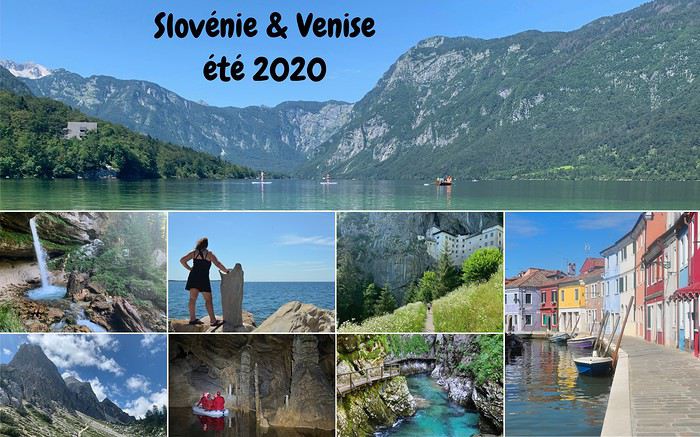
Au départ, nous devions passer 3 semaines en Géorgie, un voyage tant attendu car nous avions dû l'annuler une première fois en 2016. Mais un petit virus à couronne a décidé d'y mettre son grain de sel .... Fin mai, Georgian Airways ayant annulé nos vols et l'espoir étant mince à ce moment-là de pouvoir voyager hors zone UE, on a cherché une alternative (si possible sans prendre d'avion).
Grâce au très beau carnet de Joleeeene (je vous invite à le lire ici) et après vérification de la liste des pays qui autorisaient l'entrée des belges, on a opté pour la Slovénie. Pour organiser le séjour, vu le déai assez court, je me suis référée à l'excellent blog de Florent, un expat qui vit là-bas : https://slovenie-secrete.fr/ et au Lonely Planet qui au finla m'a très peu servi.
Le stress est resté jusque même après la dernière minute, la Slovénie ayant opté pour une liste restrictive de pays autorisés sans quarantaine (dont la Belgique ne faisait pas partie 😕) 2 jours après que nous ayons tout réservé et bien sûr payé 😎 Mais il faut parfois croire en sa bonne étoile, et le 4 juillet, 1er jour théorique de notre séjour, les autorités slovènes ajoutaient la Belgique sur leur liste de pays autorisés sans quarantaine 😇😇
Je vous emmène donc dans un pays où on peut aller crapahuter sous terre, randonner en montagne, lézarder en bord de mer, se rafraichir dans les lacs, découvrir des châteaux et de charmantes petites villes, passer sous les chutes d'eau, déambuler dans des gorges .... le tout sur une superficie plus petite que la Belgique.
Les découvertes du voyage (complètées au fur et à mesure de la rédaction)
3 - 6 juillet - un weekend sur les lacs en France avant le départ - c'est par ici 7 juillet - 1ere découverte des montagnes slovènes, le sommet du Visevnik - c'est par ici 8 juillet (partie 1) - les gorges de Pokljuka - c'est par ici 8 juillet (partie 2) - les gorges de Vintgar - c'est par ici xxx
Notre 3 TOP pour la partie Slovénie 🙂🙂
to be completed
Pascale
Je me suis longtemps demandé si j'aurais la chance d'avoir matière à rédiger un carnet de voyage cette année. Finalement, les astres se seront bien alignés pour nous offrir une jolie découverte pas très loin de chez nous 😎
Au départ, nous devions passer 3 semaines en Géorgie, un voyage tant attendu car nous avions dû l'annuler une première fois en 2016. Mais un petit virus à couronne a décidé d'y mettre son grain de sel .... Fin mai, Georgian Airways ayant annulé nos vols et l'espoir étant mince à ce moment-là de pouvoir voyager hors zone UE, on a cherché une alternative (si possible sans prendre d'avion).
Grâce au très beau carnet de Joleeeene (je vous invite à le lire ici) et après vérification de la liste des pays qui autorisaient l'entrée des belges, on a opté pour la Slovénie. Pour organiser le séjour, vu le déai assez court, je me suis référée à l'excellent blog de Florent, un expat qui vit là-bas : https://slovenie-secrete.fr/ et au Lonely Planet qui au finla m'a très peu servi.
Le stress est resté jusque même après la dernière minute, la Slovénie ayant opté pour une liste restrictive de pays autorisés sans quarantaine (dont la Belgique ne faisait pas partie 😕) 2 jours après que nous ayons tout réservé et bien sûr payé 😎 Mais il faut parfois croire en sa bonne étoile, et le 4 juillet, 1er jour théorique de notre séjour, les autorités slovènes ajoutaient la Belgique sur leur liste de pays autorisés sans quarantaine 😇😇
Je vous emmène donc dans un pays où on peut aller crapahuter sous terre, randonner en montagne, lézarder en bord de mer, se rafraichir dans les lacs, découvrir des châteaux et de charmantes petites villes, passer sous les chutes d'eau, déambuler dans des gorges .... le tout sur une superficie plus petite que la Belgique.
Les découvertes du voyage (complètées au fur et à mesure de la rédaction)
3 - 6 juillet - un weekend sur les lacs en France avant le départ - c'est par ici 7 juillet - 1ere découverte des montagnes slovènes, le sommet du Visevnik - c'est par ici 8 juillet (partie 1) - les gorges de Pokljuka - c'est par ici 8 juillet (partie 2) - les gorges de Vintgar - c'est par ici xxx
Notre 3 TOP pour la partie Slovénie 🙂🙂
to be completed
Pascale
Il est grand temps de rallumer les étoiles! English translation pending
Bonjour à tous
Le Vietnam pays magique multiculturel aux paysages diversifiés et époustouflants. Voilà ce que je vous invite à partager sans aborder s'il vous plaît ce qui aujourd'hui empêche la planète de vivre... Essayons d'être constructifs et positivons! Il est grand temps de rallumer les étoiles!
Pour commencer avec légèreté: La médecine des Dao, le bain aux herbes. C'est un moment délicieux après une journée de marche et de visites rien de tel pour vous requinquer! Ce bain est très souvent proposé aux touristes dans le nord, spécialité de l'ethnie Dao il est "accommodé" dans plusieurs maisons d'hôtes et hôtels aux besoins des touristes.
Traditionnellement les recettes sont destinées à chaque cas et en fonction de la pathologie: femmes enceintes ou qui viennent d'accoucher, nouveau-nés, malades, vieillards…les herbes seront donc choisies en fonction des besoins et du type de médication (orale, en bain, en emplâtre...). C'est dès l'aube que les femmes, les hommes, les chamanes iront cueillir ces plantes, racines et écorces dans la forêt, le tout sera combiné à un régime adapté (on ne mange pas de tout..) et souvent suivi d'un massage spécifique.
Nous en avons testé plusieurs à plusieurs endroits mais celui de la chamane Dao d'un petit village au nord de Muong Lay restera sans doute le plus authentique et le plus insolite.. On nous prend en main dès notre arrivée dans la maison de la chamane. Elle y vit avec sa fille et son gendre... Maison, je devrai plus dire assemblage de planches et de tôles et quand on connaît les rigueurs de l'hivers on peut rêver mieux. La pièce principale est bourrée de pots en tout genre remplis de décoctions plus ou moins troubles...ces sont les médications à avaler, beurk.. Il y a aussi de gros sacs (plastique) d'herbes, de racines, d'écorces, un vrai magasin d'herboriste (l'ordre et la propreté en moins) sans oublier bien sur l'hôtel des ancêtres. Derrière des rideaux, les couches des habitants, nous ne dormirons pas là, ouf.. Puis attenantes, les deux salles des bains avec 2 baquets chacune et entre les deux sous une pergola un énorme foyer construit en ciment surmonté d'une aussi énorme bassine où l'eau et les herbes "cuisent" jusqu'à parfois 12 heures...c'est là que l'on fait aussi cuire la soupe des cochons... Le feu est alimenté de poupée de maïs et de bois. C'est dans ces baquets que nous tromperont plus ou moins longtemps...le temps de "cuisson" est décidé par la chamane en fonction de chacun, jamais plus de 30 mm...et les herbes qui seront rajoutée dans les baquets seront aussi choisies en fonction de chaque "malade". C'est très très chaud, il faut vraiment se faire violence pour entrer là dedans et c'est sans compter qu'une fois immergés la dame ajoute de l'eau chaude bien sur...ouille. Une fois "les touristes bien cuits" on nous sort de là, inutile de préciser que nous ressemblons plus à des homards qu'à des visages pâles... Après cuisson, nous serons conduits ensuite vers le silo à grains, où une pièce spéciale massage à été aménagée à son top, on l'atteint via une échelle de bois...au sol deux couches. Ici commence le moment le plus douloureux de tous les massages faits au Vietnam par le gendre et la fille de la maison.. Pas de douces caresses, non, non, mais un pétrissage et un battage en bonne et due forme suivis de torsion, j'ai cru ma dernière heure arrivée... Pour clore la séance nous dînerons chez la chamane d'un souper spécial, la couleur des mets est importante, nous ne mangerons que du blanc et du vert....des légumes et des herbes inconnues de nous et un peu de poulet bouilli, élastique à souhait, sans doute celui que nous avons croisé sur le chemin en arrivant et des petits poissons frits (très bons). C'est sans conteste le meilleur soin reçu au Vietnam si l'on fait abstraction de la propreté des lieux, des serviettes (surtout apporter les siennes) et des moments douloureux.
Le Vietnam pays magique multiculturel aux paysages diversifiés et époustouflants. Voilà ce que je vous invite à partager sans aborder s'il vous plaît ce qui aujourd'hui empêche la planète de vivre... Essayons d'être constructifs et positivons! Il est grand temps de rallumer les étoiles!
Pour commencer avec légèreté: La médecine des Dao, le bain aux herbes. C'est un moment délicieux après une journée de marche et de visites rien de tel pour vous requinquer! Ce bain est très souvent proposé aux touristes dans le nord, spécialité de l'ethnie Dao il est "accommodé" dans plusieurs maisons d'hôtes et hôtels aux besoins des touristes.
Traditionnellement les recettes sont destinées à chaque cas et en fonction de la pathologie: femmes enceintes ou qui viennent d'accoucher, nouveau-nés, malades, vieillards…les herbes seront donc choisies en fonction des besoins et du type de médication (orale, en bain, en emplâtre...). C'est dès l'aube que les femmes, les hommes, les chamanes iront cueillir ces plantes, racines et écorces dans la forêt, le tout sera combiné à un régime adapté (on ne mange pas de tout..) et souvent suivi d'un massage spécifique.
Nous en avons testé plusieurs à plusieurs endroits mais celui de la chamane Dao d'un petit village au nord de Muong Lay restera sans doute le plus authentique et le plus insolite.. On nous prend en main dès notre arrivée dans la maison de la chamane. Elle y vit avec sa fille et son gendre... Maison, je devrai plus dire assemblage de planches et de tôles et quand on connaît les rigueurs de l'hivers on peut rêver mieux. La pièce principale est bourrée de pots en tout genre remplis de décoctions plus ou moins troubles...ces sont les médications à avaler, beurk.. Il y a aussi de gros sacs (plastique) d'herbes, de racines, d'écorces, un vrai magasin d'herboriste (l'ordre et la propreté en moins) sans oublier bien sur l'hôtel des ancêtres. Derrière des rideaux, les couches des habitants, nous ne dormirons pas là, ouf.. Puis attenantes, les deux salles des bains avec 2 baquets chacune et entre les deux sous une pergola un énorme foyer construit en ciment surmonté d'une aussi énorme bassine où l'eau et les herbes "cuisent" jusqu'à parfois 12 heures...c'est là que l'on fait aussi cuire la soupe des cochons... Le feu est alimenté de poupée de maïs et de bois. C'est dans ces baquets que nous tromperont plus ou moins longtemps...le temps de "cuisson" est décidé par la chamane en fonction de chacun, jamais plus de 30 mm...et les herbes qui seront rajoutée dans les baquets seront aussi choisies en fonction de chaque "malade". C'est très très chaud, il faut vraiment se faire violence pour entrer là dedans et c'est sans compter qu'une fois immergés la dame ajoute de l'eau chaude bien sur...ouille. Une fois "les touristes bien cuits" on nous sort de là, inutile de préciser que nous ressemblons plus à des homards qu'à des visages pâles... Après cuisson, nous serons conduits ensuite vers le silo à grains, où une pièce spéciale massage à été aménagée à son top, on l'atteint via une échelle de bois...au sol deux couches. Ici commence le moment le plus douloureux de tous les massages faits au Vietnam par le gendre et la fille de la maison.. Pas de douces caresses, non, non, mais un pétrissage et un battage en bonne et due forme suivis de torsion, j'ai cru ma dernière heure arrivée... Pour clore la séance nous dînerons chez la chamane d'un souper spécial, la couleur des mets est importante, nous ne mangerons que du blanc et du vert....des légumes et des herbes inconnues de nous et un peu de poulet bouilli, élastique à souhait, sans doute celui que nous avons croisé sur le chemin en arrivant et des petits poissons frits (très bons). C'est sans conteste le meilleur soin reçu au Vietnam si l'on fait abstraction de la propreté des lieux, des serviettes (surtout apporter les siennes) et des moments douloureux.
Discussion parallèle au concours photo d'août: "Noir & Blanc" English translation pending
Je vous donne rendez-vous ici pour vos photos hors concours, pour discuter, échanger, conseiller, apprendre et s'amuser 😛
Le concours se passe par-là: https://voyageforum.com/v.f?post=10330487;a=10330487
Le concours se passe par-là: https://voyageforum.com/v.f?post=10330487;a=10330487
Cévennes, mont Lozère et saute-causses à vélo English translation pending
Saute-Causses à vélo
En cette fin juin 2020, nous reprenons des activités de plein-air, après il faut bien le dire avoir été un peu sonnés par cette pandémie qui nous a tenus confinés presque deux mois.
Alors dans ce contexte particulier, cette balade à vélo de 9 jours je l’ai vécue comme une libération, certes toute relative, nous étions malgré les nombreux décès dans notre village, loin des grandes tragédies de notre histoire. Cependant, en préambule, je me permets de faire l’apologie de Voyage Forum et de la revue « 200 le vélo de route autrement ».
Oui, l’apologie de VF pourquoi ? Parce que grâce à ce site de voyage on fait de fabuleuses rencontres qui permettent de partir en virée avec des personnes étonnantes. Les réseaux sociaux on y trouve le meilleur et le pire.
Il m’est arrivé de me faire écharper, traiter de tous les noms, affubler de tous les défauts parmi les plus détestables car à travers mes récits certains acrimonieux ou acrimonieuses (certes peu nombreux) n’y décelaient qu’un égocentrique, à l’imagination prolixe, en recherche d’admiration. Assurément, nous avons tous notre petit égo, et j’ajouterais heureusement. Personnellement, je ne suis jamais insensible à un petit mot gentil même d’admiration, au risque qu’il puisse flatter mon orgueil, mais l’essentiel n’est pas là. En effet, si quelques-uns sont prompts à la critique acerbe ou tatillonne, d’autres au contraire ont une réaction opposée. Accrochés, piqués de curiosité par mes écrits, ils me contactent et ont envie de partir avec moi. Et là commence l’aventure. Que de fois ai-je rencontré des compagnes ou compagnons de voyage grâce à mes écrits sur VF.
Mais, je dois avouer que cette randonnée vélocipédique de 9 jours à travers causses et Cévennes a été le point d’orgue, une apothéose qu’il me sera difficile de retrouver en matière de compagnons de voyage hors normes. Et quand je pense que nous aurions pu partir à cinq, si Hélène, notre gentille hébergeuse, n’avait pas eu des impératifs. Elle aussi connue il y a déjà quatre ans par VF, et comme baroudeuse du bout du monde à vélo en solo elle se pose là.
Nous sommes partis à quatre, tout d’abord André, camarade sûr au moral d’acier, capable de faire 1500 kilomètres avec une fracture du pouce non soignée, en compagnie de qui j’avais déjà effectué deux voyages à vélo, dont 64 jours à travers les immensités rudes du nord Argentine, ainsi que deux femmes.
La première Brigitte, grande baroudeuse, au look de « grand-mère moderne » bien dans sa peau, mais ne pas s’y tromper, les immenses traversées de déserts seule sur son vélo seraient presque son quotidien si elle ne prenait pas sur son temps pour garder le lien avec sa famille et s’occuper de ses petits-enfants, comme toute Mamy qui se respecte. Même si parfois l’un de ses enfants lui tire l’oreille alors qu’elle vagabonde de l’autre côté de la planète pour lui faire passer un petit message du genre « Maman, ça va être Noël, nous t’attendons tous avec impatience en particulier les petits-enfants ». Ces injonctions, qui jouent sur le sentiment et la fibre maternelle, lui font stopper très temporairement ses grandes chevauchées solitaires. Notre premier contact se fit grâce à VF et à CCI. Dès les premiers échanges nous avons constaté notre immense passion commune concernant le désert de l’Atacama. Nous nous sommes rencontrés deux fois au festival annuel du voyage à vélo organisé par Cyclo Camping International à Paris. Depuis l’envie de partir ensemble nous taraudait.
La seconde, Patricia m’a contacté par VF pour savoir si je recherchais des personnes pour de futurs voyages. Premier contact très sympathique, cependant mes conditions familiales actuelles ne me permettent pas d’envisager de longs voyages, mais m’échapper une dizaine de jours me semblait possible. Je lui ai donc promis de la contacter au cas où. Et effectivement, l’envie de me changer les idées et de partir quelques jours avec mon copain André est vite arrivée, et je dirais même s’est imposée. Et me souvenant de notre conversation, voilà comment elle s’est jointe à nous. Wahou !!! J’ai découvert une athlète complètement hors normes, au palmarès incroyable, championne de France et d’Europe de marathon, championne d’Europe et vice-championne du monde de 100 kilomètres de course à pied sur route. Bien d’autres exploits jalonnent sa vie, comme des temps stupéfiants sur l’ultra-trail du mont Blanc ou des courses furieuses dans les très grands froids nordiques, et avec tout cela une simplicité et une gentillesse immenses, sans parler d’une rusticité sidérante. Elle m’avait même dit : tu as beaucoup plus voyagé à vélo que moi, peut-être devras-tu m’attendre. Elle a vu ! mais elle n’a pas dû être vraiment surprise, je ne pense pas que dans sa vie beaucoup, même parmi les meilleurs, l’aient attendue à pied ou à vélo, l’inverse oui sans doute toujours !!!

Et pourquoi l’apologie de la revue 200 ? Tout simplement parce que les articles sont des morceaux d’anthologie littéraires. Et lorsqu’il est question de la France, même concernant des coins que je connais bien, les descriptions à couper le souffle me donnent à penser qu’il s’agit d’un ailleurs qu’il me faut découvrir au plus vite.
Oui, les quelques rares échanges désagréables sur VF de quelques personnes mal lunées sont vite oubliés quand on a le bonheur de partir avec trois personnes de cette trempe, je dirais même que c’est un honneur. J’ai commencé, cependant, à me faire un peu de souci au sujet de ma forme physique car, au cours des 18 derniers mois, je n’ai effectué en tout et pour tout que 20 kilomètres à vélo.
Trois semaines avant le départ je me suis promis de me remettre en selle. J’ai tenu 6 jours, une trentaine de kilomètres par jour et 500 à 700 mètres de dénivelé. Tout surpris ça passait bien, donc la motivation est retombée et je suis retourné taquiner la truite, surtout que cette année la pêche est bonne par chez moi, mais que de la fario sauvage des Vosges.
Donc nous y voilà, petit projet en France, un itinéraire à travers les reliefs des Cévennes qui nous mènera de Mialet (un peu à l’ouest d’Alès) vers le mont Lozère puis la montagne de Bougès. Ensuite nous écornerons le coin nord-est du causse Méjean à partir de Florac avec redescente sur Castelbouc. De là, nous partirons à l’assaut du causse Sauveterre par un chemin infernal dans la chaleur de l’après-midi. Nous en longerons tout le bord sud qui s’étire en croissant au-dessus du Tarn, puis nous plongerons vers Sainte-Enimie et irons dormir à la Malène. Après s’en suivra une magnifique traversée du causse Méjean en passant par le terrain d’aviation jusqu’à Saint-Jean-des-Tripiers. Nous poursuivrons par une descente vertigineuse sur la Jonte où nous verrons de nombreux vautours. Après un ravitaillement au Rozier, nous partirons à l’assaut du causse Noir que nous traverserons en entier jusqu’à sa barrière sud la rivière Dourbie. Nuit à Trêves suivie d’une montée du mont Aigoual, ponctuée d’un bivouac sur son versant est. Et en fin, nous déroulerons la dernière étape de cette trop courte balade de 9 jours, en nous laissant emporter par la descente le long du Gardon. Dernier point dur, voire très dur, la remontée chez mon amie Hélène d’où nous sommes partis, au Puech, 7 km dont 5 à pousser les vélos dans des côtes bien supérieures à 10%. Mais pourquoi aller habiter sur un piton si loin du joli petit village, sans doute parce qu’Hélène est aussi une vraie « furieuse » à qui les grandes aventures dans des pays sauvages à vélo en solo ne font pas vraiment peur.
Cette période post-covid est un peu inquiétante, comment allons-nous voyager ? Avant de partir, je viens de lire sur VF un beau récit à travers le Morbihan post-pandémie, agrémenté de jolies photos, effectué en juin. L’impression qui s’en dégage est étrange. On pourrait s’imaginer dans un film d’anticipation futuriste, l’humanité guettée par quelques menaces généralisées. Un préambule au livre de Cormac McCarthy « la Route ».
Tout commence par un trajet en voiture de quelques 600 kilomètres à travers la France. Quelque part avant Alès je m’arrête, un restaurant semble ouvert, il m’est dit qu’on ne mange que sur réservation, espacements obligent. On me montre la pizzeria un peu plus loin. Là, on me prépare une bonne pizza mais on me demande d’aller la manger ailleurs, même pas le droit de m’installer à la terrasse. On m’indique un parc en contre-bas, au bord d’une jolie petite rivière. Je vais y passer un moment de repos agréable. Mais, de toute évidence nous ne sommes pas revenus à la normale.
Mon accession à la maison d’Hélène n’est pas évidente, de plus mon GPS auto n’étant pas à jour, il ne m’est d’aucune aide pour une route toute récente. Elle qui me prenait pour un grand baroudeur au flair infaillible va réviser son jugement.
Voilà mon arrivée chez elle sur sa montagne isolée, telle qu’elle l’a restituée en s’insinuant dans mes pensées. Je dois reconnaître qu’elle est très proche de la vérité, comme si elle avait été passagère invisible à côté de moi. Donc voilà Hélène qui s’exprime en extrapolant mes pensées : « Tout commença mal. Après six heures de voiture et ayant passé Alès, me voilà perdu sur une route de montagne digne de celle de la Bérarde dans les années 70. Pas de maison, ni de poteau téléphonique ou électrique. Pas âme qui vive. Où m'étais-je donc fourré ? J'avais pourtant reçu des informations précises : les poubelles, la table en bois, les deux panneaux -un noir, un rouge- "Les Puechs", la fourche que je ne pouvais pas manquer paraît-il, l’impasse de droite… Mais rien de tout cela. Une route tortueuse qui n'en finit pas de monter au milieu des chênes verts... On ne m'y reprendrait pas à dire venez chez moi j'habite chez une copine. J'appelle ladite copine. Pas de réseau évidemment. Après plusieurs essais infructueux je la vois qui vient à ma rencontre. Ouf, sauvé pour cette fois. »
Un peu ridicule, je constate que les trois autres sont arrivés sans problème. Brigitte a même poussé la plaisanterie en venant d’Aix-en-Provence à vélo, et c’est concomitamment que nous nous arrêtons devant le portail du nid d’aigle d’Hélène. Soirée de retrouvailles pour certains et de découverte pour d’autres, mais ambiance magnifique entre frénétiques du « gros baroud ». Plus les personnes sont habituées à voyager en dehors des chemins habituels et plus elles sont généralement décontractées, et puis que d’histoires incroyables elles peuvent raconter, même s’il faut un peu les torturer pour les faire parler. Hélène nous fait bien rigoler, même si sur le coup ça l’aurait plutôt fait pleurer, en nous relatant sa traversée himalayenne avec un être étrange qui se jetait sur la nourriture et ne lui en laissait même pas quelques miettes. Il paniquait à l’idée de manquer et, affamer sa compagne de route ne semblait pas le perturber. Elle finira sa traversée seule, elle est habituée. En route, elle avait sympathisé avec un couple de Hollandais qui, quelques jours plus tard, tomba sous les roues et les coups de couteau d’un djihadiste. L’homme fut tué, la femme en réchappa, Hélène, elle, en garde une vraie souffrance. Pour raison de Covid, on s’installe dans le jardin, chacun avec sa tente. Chut, je vais un peu tricher, je finirai sur un lit mais dans mon sac de couchage !
Au matin, un petit-déjeuner qui s’étire presque à l’infini. Des personnes, qui ne se connaissaient pas la veille, ont tellement d’aspirations et d’expériences communes qu’elles ont l’impression de toujours s’être connues. Mais vers les 9 heures du matin c’est parti, on serait bien resté plus longtemps, voire toute la journée à discuter des chemins du monde.
Nous commençons par la terrible descente du sommet où Hélène et Bernard, son compagnon, ont élu domicile. Il nous faut faire quelques courses car les jours à venir nous ne savons pas ce que nous trouverons, comptant traverser par des pistes confidentielles cette région de France sauvage. Epicerie associative de village, désinfectant à l’entrée et masque obligatoire, je dégaine le mien. Nous ne trouvons pas grand-chose. A la sortie du village de Mialet, une petite boutique de camping nous permet d’acheter du pain en complément. Mais nous ne nous faisons pas de souci, ayant chacun dans les sacoches du riz et des pâtes, de quoi tenir plusieurs jours. Pour ma part, avec un kilo de riz et de pâtes j’ai de quoi assurer pour 4 durant 48 heures.

Et nous voilà lancés. Premier objectif, le col d’Uglas qui culmine à 539 mètres. Certes ce n’est pas l’Abra del Acay, le plus haut col carrossable des Andes et ses 4972 mètres, mais c’est le même bonheur de la liberté en étant bien accompagné. Bien évidemment, mes trois camarades me laissent sur place, mais bon je ne m’en fais pas, sachant qu’ils ont tant de choses à se raconter en m’attendant. Du col, nous partons sur des pistes mal pavées à travers les grosses bosses et les forêts des Cévennes et nous rejoindrons en milieu d’après-midi le village du Collet-de-Dèze sur le Gardon. Par moments, nous avons l’impression de monter dans les cieux, quelques poussages de vélo agrémentent la journée. Je vois parfois mes camarades devant moi se découper directement sur le ciel, dans des pentes à plus de 15%, comme s’ils se trouvaient sur une rampe de lancement pour quelque voyage improbable. Bien évidemment, cela nous rappelle à tous les grands déserts, le Gobi ou l’Atacama, et les éclats de rire augmentent au rythme du pourcentage de la pente.
Arrivée au village précité, arrêt au bistrot, j’en profite pour prendre le permis de pêche du département de la Lozère pour la première catégorie, c’est-à-dire pour les rivières à salmonidés, département dans lequel nous allons passer et repasser. La réglementation en matière de pêche en France est quelque chose d’inextricable, mais il y a de multiples raisons dont certaines bien valables, mais je ne m’aventurerai pas à vous les expliquer, il y faudrait tout un livre.
La bière est bonne, on la multiplie par deux, rien de tel après avoir ingurgité des litres d’eau tiède toute la journée. De plus elle a un effet diurétique du meilleur résultat pour le corps après une journée d’efforts somme toutes conséquents, en tout cas pour moi. Certes, la distance n’est pas énorme en ce premier jour, 47 kilomètres et 1025 mètres de dénivelé, mais cependant beaucoup de pistes en partie parcourues en poussant les vélos. Nous avons même eu droit à un tronçon emporté par des intempéries réputées très violentes, les fameux épisodes cévenols. Une charmante jeune femme habitant une ferme isolée au milieu, plutôt au sommet de nulle part, nous a remis sur le bon chemin.
Nous rejoignons le camping le long du Gardon, quasi-désert, une seule tente, un Américain vivant en Espagne qui, voyant la tournure du Covid rôdant, a décidé depuis un mois d’attendre la suite des événements ici en Lozère, qui a été très peu touchée par ce fléau, un mort répertorié. La patronne est sympathique et très prolixe sur sa région, tout à mon bonheur. Elle est originaire de pas très loin, d’un coin où nous allons passer et que je connais depuis longtemps, le causse Méjean, plateau d’altitude qui me rappelle par ses lumières et ses grands ciels les plateaux boliviens. Oui, je maintiens et les plateaux boliviens je m’y suis baladé à vélo à plusieurs reprises !
Sitôt installé, je me précipite à la pêche avec mon fouet à mouche, à quelques mètres de nos tentes. Patricia et Brigitte comptent manger de la truite ce soir, mais si je connais bien mes rivières vosgiennes, celles de la Lozère sont une découverte pour moi, et elles seront déçues de devoir se contenter d’une grosse platée de riz, très bonne cependant.
Nous passons une excellente nuit et partons relativement tard. Nous allons nous installer dans une petite routine qui me va bien, vu mon entraînement. Aujourd’hui, il s’agit d’aller le plus haut possible, à la pointe est du mont Lozère et d’y bivouaquer. Trouver notre route confidentielle qui se faufile sur les hauteurs du village n’est pas facile, nos différents tâtonnements nous permettent de visiter ce beau village tout en pente.
Après une matinée par une petite route du bout du monde, nous faisons halte à Génolhac, village tranquille. Nous nous laissons tenter par le restaurant avant d’entamer la montée du mont Lozère, sur 968 mètres de dénivelé pour 15 kilomètres. Pour moi, ce sera une première au restaurant depuis le confinement. Nous sommes les seuls dans la salle, quelques personnes sont en terrasse. Repas créole, très bon, de quoi nous mettre en forme pour un après-midi qui s’annonce « pentu ». Le problème de l’eau se pose. Remplissons-nous les deux bâches de 6 litres maintenant ou plus tard ? Je penche pour maintenant, Brigitte beaucoup plus cool, pour plus tard, ayant bon espoir de trouver une source plus haut. On prend 4 litres par bâche, plus les deux litres que nous avons chacun, cela nous permettra de bivouaquer. Brigitte avait raison, non seulement on va faire le complément dans un ruisseau beaucoup plus haut mais, une fois près du col de Pré de la dame à 1474 mètres, une magnifique source nous fournit avec prodigalité toute l’eau que nous désirons.
Nous trouvons rapidement un coin idyllique pour installer notre bivouac dans des conditions atmosphériques que je qualifie d’idéales. Partir avec des personnes rompues aux longs voyages est un vrai bonheur, tout se passe avec une simplicité déconcertante. Brigitte a un œil particulièrement exercé pour déceler de loin le point précis où s’installer et durant les 9 jours, cela va se renouveler. Pour la deuxième fois, nous sommes trois à monter nos tentes, tandis que Patricia dormira face au ciel, et là aussi, tout le voyage durant, elle ne montera pas sa tente. Notre étape, si elle a été courte en kilomètres, seulement 38, le dénivelé lui a été assez conséquent, 1560 mètres.
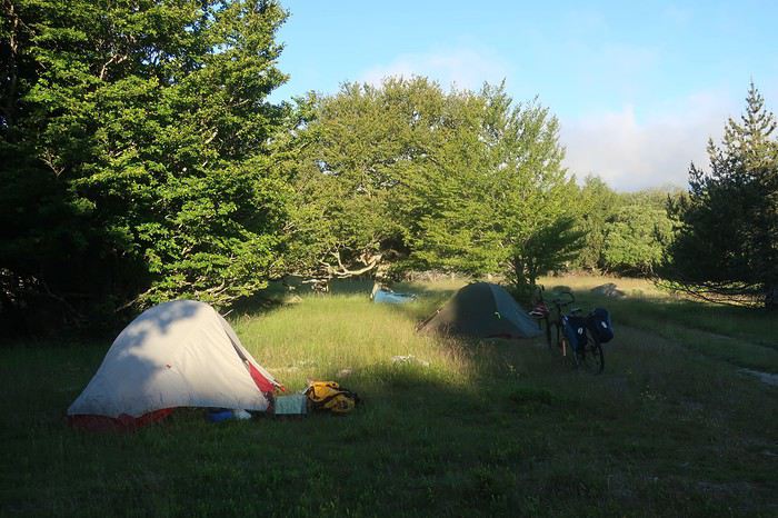
De nouveau une superbe nuit, de plus peu de condensation et sur notre versant est, le soleil nous touche rapidement. Encore une bonne excuse pour traîner un peu une fois de plus et ne démarrer que vers les 9 heures. Très rapidement, nous rejoignons la piste du versant nord du mont Lozère que nous comptons suivre jusqu’au col Finiels. Son début est particulièrement raide, sur un chemin jonché de gros cailloux, petite séance de poussage obligatoire sur un kilomètre. Nous arrivons à une magnifique cabane-refuge perchée en dessous de la crête. Nous parcourons le livre d’or, manifestement des randonneurs venant de tous les coins d’Europe au moins y ont laissé un petit mot. Je m’empresse d’en faire autant. Malgré tout l’agrément du lieu, il n’est pas question d’y passer la nuit, il n’est que 10 heures du matin.
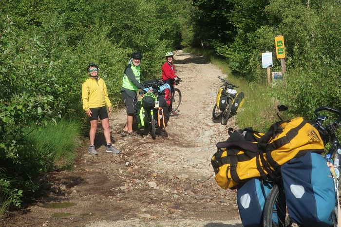
Nous suivons cette piste d’altitude sur une dizaine de kilomètres. Nous y croisons des Vététistes, et discutons longuement avec un groupe. Le temps est couvert et il fait frisquet dès que nous nous arrêtons. Les sources du Tarn sont indiquées. Posant nos vélos, nous les rejoignons en quelques centaines de mètres. Pas une goutte d’eau, plutôt un vaste bassin au flanc de la crête qui sert de réceptacle. Plus précisément, il s’agit de l’un des différents lieux répertoriés comme source de la rivière. Toute la cime est sans doute en elle-même le lieu d’alimentation. Le col Finiels arrive presque trop vite, nous y retrouvons le goudron.

De là, l’itinéraire conduit au village de Pont-de-Montvert, célèbre du fait de la révolte des camisards, lorsque Louis XIV révoqua en 1685 l’édit de Nantes, qui avait été mis en vigueur par François Ier. L’un des chefs de cette révolte Pierre Laporte, est originaire du village d’Hélène, Mialet, point de départ et d’arrivée de notre petite aventure. Mais le principal chef camisard s’appelait Jean Cavalier et sa vie est digne d’un roman d’aventure à rebondissements car contrairement à Pierre Laporte, il ne mourra pas les armes à la main.
Cette pente est magnifique et très surprenante. D’immenses constructions rocheuses naturelles se dévoilent au détour des virages, des amoncellements ruiniformes ou d’énormes galets morainiques, parfois empilés en des arrangements prêts à durer encore des millénaires. En cours de descente nous décidons de piquer niquer dans ce décor grandiose. La vue porte au sud sur la montagne de Bougès, l’éminence que nous avons l’intention de traverser par sa crête qui se dirige vers l’ouest jusqu’à Florac. Puis nous nous laissons emporter jusqu’au village où André renvoie par la poste 6 kilos de bagages. Les Cévennes, toutes sauvages qu’elles soient, ne sont pas le désert de l’Atacama, destination de notre dernière grande équipée à vélo. Près du pont central, un bistrot nous ouvre les bras et nous y passons un bon moment. Le Tarn, tout au fond de sa gorge, donne un véritable cachet à la commune. Plusieurs terrasses, des touristes pas très nombreux, des tables qui ne respectent pas l’espacement préconisé par les autorités sanitaires. Certains portent le masque, d’autres non. Sensation une fois encore étrange. Tant que nous nous trouvons seuls, au milieu de nulle part, le covid nous n’y pensons pas trop, mais dès que nous nous retrouvons rapprochés de nos congénères, il se rappelle à notre bon souvenir.
C’est l’heure de partir. Malgré deux Grimbergen je me sens une frite d’enfer pour partir à l’assaut de cette fameuse montagne de Bougès. Bien évidemment, mes trois acolytes disparaissent et je vous assure les Grimbergen n’y sont pour rien. Mais quand on a dépassé les bornes, il n’y a plus de limites. Donc je ne boude pas mon plaisir en remontant le petit vallon qui se dirige vers la crête, et je m’arrête pour traquer du regard les truites dès que je décèle un endroit favorable à leur positionnement. Avec un immense plaisir bien qu’elles soient très mimétiques, en lisant les veines d’eau je les vois, quel bonheur, mais je ne vais quand même pas sortir ma canne !
Une fois au sommet, une piste de toute beauté nous emmène presque jusqu’à Florac en partie à travers forêt et aussi par des zones aérées qui nous permettent les plus beaux points de vue sur cette région étonnante de France. Des villages à l’architecture montagnarde se cachent dans les replis du mont Lozère. La vue porte très loin par-delà vers le nord. Devant nous le Tarn déroule sa gorge qui coupe comme un coup de couteau les causses Méjean et Sauveterre. Derrière ce dernier des monts apparaissent dans un lointain un peu diffus, l’Aubrac et quelques pointements plus saillants nous font penser aux premiers volcans d’Auvergne. De Clermont-Ferrand à Nîmes s’étale un immense carré magique, où la géologie a subi tous les bouleversements. Calcaire et granit s’entremêlent, pour la plus grande joie du spectateur. La terre a craché de ses entrailles ces formations cristallines et la mer a fait monter d’immenses plateaux calcaires, qui se sont constitués au cours de millions d’années par sédimentation de carapaces d’animaux marins. Le tout nous offre un panorama magnifique, propice aux plus belles bambées à vélo. Ce spectacle allume en moi le clignotant revue 200.
Dans le dernier numéro de ma revue fétiche, on peut lire, que dis-je savourer, un très bel article sur ce coin de France des causses, qui s’intitule ’’là-haut’’. L’auteur, Alain Puiseux, est spécialiste de la formule qui frappe, et il en saupoudre à l’envi le texte tout au long de son récit, et cela pour le plus grand bonheur du lecteur. J’en cite pêle-mêle quelques-unes : je me suis demandé si la beauté existe en elle-même ou dans les yeux de qui la contemple; si vous avez une carte routière du Massif Central, vous pouvez y lire les rivages des îles la magie marche toujours là-haut c’était juste après le confinement. L’air était plus pur, plus transparent, le ciel sans une griffure la lumière y est rapide et changeante au-dessus d’une houle d’herbe; je suis tombé amoureux par inadvertance d’une isohypse et des plateaux d’altitude.
Remarque au passage, je ne connaissais pas le mot isohypse, cependant tellement parlant lorsqu’on évoque le Méjean, le Sauveterre ou tout autre causse. Voilà, ces différentes citations extraites du texte « là-haut » fournissent une bonne introduction à l’apparition des différents causses que nous allons traverser et escalader dans les jours à venir.
Après quelques moments de rêverie, les yeux errant jusqu’à l’infini, et aussi quelques erreurs d’embranchement ou tout au moins quelques hésitations, une magnifique pente abrupte au chemin cabossé nous mène pratiquement à l’entrée de Florac. Nous sommes à la frontière des zones granitiques sombres du mont Lozère et des falaises calcaires lumineuses du causse Méjean. Le courage nous manque pour repartir à l’attaque des zones de solitude à cette heure tardive et nous optons pour le camping municipal. Il vient juste d’ouvrir. L’employée est partie la veille de Bretagne et a roulé toute la nuit. Depuis quelques heures elle se dépêche d’effectuer les premiers nettoyages de mise en service. Presque personne, un motard avec une magnifique moto-guzzi, un couple en camping-car et nous quatre.
Toute la place pour nous installer, que l’embarras du choix, nous optons pour disséminer nos tentes à portée du bruit de la rivière, le Tarnon qui rejoint le Tarn un peu plus loin. Sans surprise, nouvelle séance de pêche, et bien que cette rivière m’inspire plus que le Gardon au Collet-de-Dèze, mes camarades n’auront à nouveau pas de truites sur feu de bois. Nous décidons d’aller au restaurant. Le centre-ville est assez animé, la place centrale accueille une terrasse de restaurant aux tables relativement espacées. Les clients y sont nombreux et nous passons une soirée agréable dans une ambiance méridionale. J’avais déjà remarqué, au cours des différentes occasions où ma voiture, mon vélo ou mes jambes m’ont conduit dans ce village au nom chantant, que les habitants avaient déjà l’accent du midi.
Ce matin du quatrième jour, nous partons à l’assaut de mon causse préféré, le Méjean. Dans un premier temps, nous allons seulement en mordre le coin nord-est. Une belle montée par la D16 va nous permettre de dominer la vallée du Tarn et d’étendre notre vision aux montagnes que nous avons traversées la veille là-bas, à l’est et au nord.
L’arrivée sur le plateau est toujours aussi surprenante. On passe sans transition de zones de vallées à l’habitat assez dense et au tourisme très visible, à des déserts d’altitude où l’herbe sauvage ou de prairie prend le contrôle, les hommes semblant fuir ses hauteurs hostiles à la vie. C’est en partie ce qui donne un charme fou à ces plateaux. Comme l’écrit Alain Puiseux de ces coins perchés jusqu’au mont Gerbier-de-Jonc, « Se plaindre ici, plus qu’ailleurs, de l’eau ou du froid, c’est n’avoir rien compris », me fait comprendre pourquoi le soir les vacanciers désertent ces lieux pour aller rechercher la quiétude plus bas le long des rivières.
Après une première prise de contact, Brigitte et Patricia ne connaissant pas ces coins bénis des Dieux, nous bifurquons vers Montbrun et effectuons une plongée en direction du Tarn. La différence de chaleur entre plateau et fond de vallée est très nette. Nous marquons l’arrêt au bord du Tarn, dans un coin charmant, le temps d’un pique-nique. Eau verte et grande falaise claire éclatante de soleil. La flemme nous gagnant et subjugués par la beauté des lieux, notre envie de continuer est annihilée. Nous envisageons de passer l’après-midi et la nuit à venir à contempler ce méandre de rivière aux eaux turquoise, surplombées d’une falaise sculptée au cours des millénaires par les flots qui, parfois, se montrent redoutables, sauvages et tumultueux. Cette halte précoce n’est pas vraiment du goût de la trépignante Patricia, mais elle se plie de bon gré à l’avis de l’écrasante majorité. Mais, à peine commençons nous à prendre nos aises que, débouche sur notre coin perdu une famille avec force gamins et chiens. Ces derniers se précipitent sur le gros pain que nous avons acheté ce matin à Florac et, sans une intervention prompte de Patricia, nous pouvions lui dire adieu. Elle se réjouit, car bien évidemment nous abandonnons notre projet de farniente et décidons de reprendre notre route. Dommage, j’avais repéré quelques belles truites en chasse qui n’attendaient que la plus élégante de mes mouches !
En ce début d’après-midi, la chaleur est terrible. Entre ces plateaux calcaires, il y a comme un effet de four et mon thermomètre indique 40 degrés. Quelques kilomètres en direction de Sainte-Enimie nous offrent l’occasion de magnifiques points de vue sur la rivière, et tout particulièrement sur le village de Castelbouc. Cet ensemble de maisons caussenardes, accrochées à la paroi et semblant prêtes à plonger dans une eau aux reflets de jade, est tout simplement splendide. La légende du village rapporte qu’au temps des croisades, un jeune homme seul était resté en ce lieu. Obligé de satisfaire toutes les épouses dont les maris combattaient les infidèles, il en serait mort d’épuisement. Depuis cette époque, un diable sous forme de bouc survole régulièrement la cité.
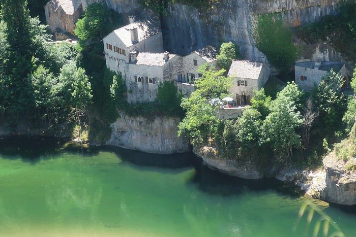
A Prades, changement radical, nous avons l’intention de monter directement sur le causse Sauveterre par un chemin non carrossable qui s’insinue entre des falaises. Il présente des pentes ne permettant pas de rester sur le vélo, sauf peut-être pour Patricia dont les cuisses et les mollets sont constitués de l’acier le plus trempé.
Là encore la question de l’eau se pose. Devons-nous remplir les bâches en prévision du bivouac sur le causse ? Sur ces plateaux calcaires, il n’est pas question d’en trouver la moindre trace. Même Brigitte qui sent les sources à 50 lieues, y est favorable. Pourtant nous regardons dubitatifs le pan de montagne qui nous domine et à travers lequel nous allons partir. A la fontaine de ce petit village, profitant d’une ombre bienfaitrice, nous faisons donc provision du liquide précieux. J’en profite pour m’asperger copieusement le visage. Nous jouissons des derniers instants de température clémente, ou presque, avant d’affronter cette piste escarpée tournée au sud, soumise à l’infernale chaleur du soleil vertical.
C’est parti pour un court tronçon goudronné où même Patricia pousse dans cette ligne droite qui se jette sans ambages dans la pente. Après 400 mètres le chemin s’échappe à gauche, tout d’abord pas très raide et roulant. Il va perdre très rapidement ces deux qualités. La pente s’accentue franchement et le sol devient instable, au point que, même en poussant le vélo, la roue avant ripe en permanence de droite et de gauche. Immanquablement, je me retrouve très vite seul, André et Brigitte ayant pris un rythme de montée supérieur au mien, sans parler de Patricia qui s’est littéralement envolée. Je n’ai même pas eu le temps de voir si elle avait disparu en courant, son vélo à la main, ou bien en appuyant comme une forcenée sur les pédales dans cette caillasse fuyante. Mais où va-telle chercher une telle force, une telle énergie, une telle envie de s’arracher ? Sans vouloir être un mufle, certes elle est un peu plus jeune que moi, mais elle n’a plus trente ans !
J’adopte la posture ‘’Atacama’’, le comptage de mes doubles-pas. Selon la pente et la consistance du sol, j’en effectue de 20 à 50 avant de marquer l’arrêt. Il semblerait, à vue de nez que cette piste infernale fasse de l’ordre de 6 kilomètres. Il n’y a qu’à prendre son mal en patience. Bon seigneur, André redescend à pied pour venir me donner une petite, même une grande poussette, ce qu’il fera à plusieurs reprises. Je mets ma fierté dans ma poche et je le laisse pousser. On dira que c’est parce que j’ai l’une des bâches à eau de 6 litres sur le porte-bagages ! Mais au fait, Brigitte a la même et elle caracole comme une gazelle dans la pierraille surchauffée. Mais pour elle, c’est tout à fait normal. Elle est habituée aux traversées de déserts en solo, parfois sans même avoir de quoi faire chauffer ses aliments, n’ayant qu’un réchaud à bois. Dans les coins bien désertiques, on peut avoir la surprise de ne pas trouver la moindre brindille. Mais bon, elle continue son périple en croquant ses aliments sans cuisson, trouvant cela presque très bon !
On doit être un peu maso car, dans ce type de situations de chaleur, de caillasses, de sol qui se défile et de pentes très raides, nous éprouvons tous un grand plaisir, je dirais même un grand bonheur d’être là. L’effort, la sueur, la fatigue, mais surtout le corps et l’esprit qui vivent… Nos pensées sont retournées dans les hautes altitudes du Sud Lipez, entre 4 et 5000 mètres, nostalgie des grandes bambées qui nous arrachent à notre quotidien. Le dépaysement et la défonce. Je me dis cependant qu’il n’est pas besoin de faire des milliers de kilomètres pour connaître les bonheurs de l’aventure, la France nous fournit très bien la matière. Certes, ce n’est pas à la même échelle, quand on sait que le prochain point de ravitaillement en eau est à 140 kilomètres et que l’on est en train de pousser son vélo dans le sable. Toutefois ne pas savoir si cela va durer un kilomètre ou trois jours, cette incertitude introduit une dimension supplémentaire, la trouille.
Mais nous montons, les maisons de Prades deviennent minuscules. Le Tarn se dessine dans tous ses méandres en prenant des teintes profondes qui tirent sur l’émeraude. Un signe de Patricia, elle nous attend. Je ne suis pas certain qu’elle avait réalisé que cette piste était difficile pour la multitude de raisons que j’ai données. Nous la rejoignons. Elle va prendre la place d’André et me fournir une petite poussette sur une centaine de mètres. J’ai l’impression d’être aux commandes d’un Rafale en ayant mis la post-combustion. Incroyable, je n’ai pas une Terrienne derrière mon porte-bagages mais un être bionique venu du fond du cosmos qui me propulse littéralement !!!
Mais tout a une fin, surtout le meilleur, les deux derniers virages en épingle me dominent. Changement brutal de configuration du terrain, la déclivité s’atténue, le chemin quitte le flanc de la montagne et s’enfonce dans des fourrés, laissant juste l’espace pour y faire passer le guidon. Je remonte quelques dizaines de mètres sur mon vélo, mais c’est à pied que je rejoins une minuscule route qui longe le bord du causse. Nous nous regroupons, nous venons de déboucher au niveau d’un petit bourg qui se nomme ‘’Nissoulogres’’. Nous n’allons pas tarder à apprendre la signification de cette appellation étrange. « Jamais sous l’orage ». En effet, il rôde tout autour, tapi, sautant d’un causse à l’autre mais épargnant pratiquement toujours cette pointe du plateau du Sauveterre qui domine la petite cité de Prades.

Il ne nous reste pour nous quatre qu’une quinzaine de litres d’eau, ce qui n’est pas énorme pour tenir un bivouac après un tel effort et, il sera sans doute difficile de s’en procurer avant demain midi. Un homme se trouve dans la première maison à quelques mètres du chemin par lequel nous arrivons depuis la vallée. Je lui demande s’il peut nous ravitailler. Non seulement il y est favorable, mais il nous invite à planter nos tentes dans son jardin, où nous sommes aux premières loges pour contempler le causse Méjean qui s’étale au sud, au-delà du Tarn. Nous acceptons bien volontiers et, très vite, ce n’est plus de l’eau qu’il nous propose mais de la bière. De plus, il nous offre une douche, de toute évidence nous sommes tombés sur un 5 étoiles. Nous prendrons notre repas en commun à partir de nos réserves de pâtes. Il nous fait goûter un vin rouge de la région, ma foi de bonne facture. La discussion va s’éterniser en passant des secrets du causse Sauveterre à des considérations professionnelles. Mes camardes se foutront de moi, je suis un bavard impénitent, mais ce soir je n’arriverai pas à en placer une, notre hôte est d’une catégorie toute autre, sans doute au moins champion d’Europe. Le monde est petit, André et lui se trouvent des connaissances communes, ayant tous deux œuvré dans le cadre de grands travaux de la DDE, que ce soit à titre privé ou non. Je dois dire qu’en finale, j’ai un peu, même beaucoup, perdu le fil de la conversation, la bière et le vin par-dessus les kilomètres de poussage dans la caillasse et le cagnard de cet après-midi auront assez vite raison de moi.
Ce matin nous allons longer le bord du causse Sauveterre en descendant vers le sud. Notre itinéraire emprunte de petites routes et des pistes parfois pas très roulantes. Alors je ressens la fatigue consécutive au gros effort d’hier après-midi. Nous traversons le lieu-dit Dignas, puis nous arrivons à une ferme isolée et nous discutons un bon bout de temps avec Christian, l’habitant du lieu. La vie de paysan sur le causse n’est pas facile. Il nous parle des conditions climatiques rigoureuses, des réglementations tatillonnes sur les produits en particulier laitiers, des législations de transmission d’héritage pénalisantes et autres intrusions de l’Etat, ce qui donne à penser que la vie sur ces plateaux devient impossible. Lui s’est spécialisé comme beaucoup dans le lait de brebis pour le roquefort. Ces régions reçoivent l’eau des montagnes environnantes, le Sauveterre du mont Lozère et le Méjean de l’Aigoual. On peut dire que les zones granitiques alimentent les plateaux calcaires.
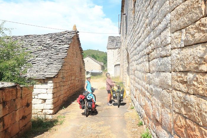
A midi, nous arrivons à Laval-du-Tarn. Le pique-nique est organisé à l’abri de l’ancien four à pain, nous sortons le réchaud pour une platée de riz. Comme je l’ai toujours pensé, une halte longue le midi est en définitive un gain de temps car l’après-midi permet encore de nombreuses heures de pédalage, surtout en été.
Notre intention initiale était de continuer à longer les hauteurs dominant le Tarn. Après avoir dépassé le Pont Sublime, belvédère tout particulièrement souligné sur la carte, notre itinéraire devait nous mener au village des Vignes. Mais outre une petite fatigue résultant de la montée infernale d’hier pour moi, le temps semble vouloir se mettre à l’orage. De bonnes ou moins bonnes raisons nous poussent à rester sur le goudron et prendre la direction de Sainte-Enimie par une route toute en descente. Un délice. Différents belvédères livrent des points de vue grandioses sur la vallée et les villages qui ponctuent la rivière, là-bas tout en bas. Le cirque de Saint-Chély est particulièrement spectaculaire vu de quelques centaines de mètres au-dessus.
Passage par Sainte-Enimie, haut lieu du tourisme de la vallée du Tarn, que nous laissons derrière nous jusqu’au village de la Malène. Cette gorge est surprenante. Je l’ai parcourue à plusieurs reprises, mais il y a tant de choses à regarder. De l’architecture caussenarde aux formations géologiques que représentent ces immenses falaises calcaires et le Tarn lui-même qui prend tous les aspects entre ses zones profondes et ses parties où il court sur un lit de galets, presque à fleur d’eau.
Nous marquons l’arrêt au niveau du village de Hauterive situé de l‘autre côté du Tarn. Jusque récemment, il était approvisionné par un câble au-dessus de la rivière. Mais, par manque de financement, cet outil de ravitaillement est en panne ce qui occasionne les plus grandes difficultés à ce bourg accroché sur la rive du causse Méjean. Mais les temps ont changé. Ce village est un vestige des temps passés, maintenant révolus, où la rivière était un axe de communication. Il n’y a pas si longtemps les cours d’eau du sud-ouest étaient sillonnés par les gabarres, les poids lourds des siècles passés. Mais pouvaient-elles remonter jusque dans ces gorges profondes du haut de la vallée du Tarn ? Sur certaines rivières difficiles, où le retour n’était pas possible, les embarcations étaient vendues au prix du bois lorsqu’elles arrivaient à destination.
Une fois à la Malène, nous décidons de ne pas poursuivre jusqu’au village des Vignes. Nous nous installons au camping municipal, remarquablement situé sur une plage du Tarn, pratiquement au centre-village. Ambiance covid, je sors mon masque pour aller à l’accueil. Heureusement peu de monde, deux personnes attendent sagement dehors masque sur le nez, dont un Suisse avec un vélo électrique. Cela nous donne une bonne occasion de parler du voyage à deux roues avec assistance électrique. Notre Suisse a l’air ravi de sa machine. Peut-être que dans un temps, que j’espère le plus lointain possible, nous y viendrons. Mais tant que nos muscles fonctionnent encore assez bien, si nous pouvons éviter, nous nous attacherons à le faire.
Devant nos tentes, la rivière miroite mais nous ne sommes plus dans l’ambiance causses, les kayakistes sont nombreux, en particuliers les Allemands. J’en ressens comme une dissonance. Une fois encore, nous constatons la différence d’ambiance entre les plateaux et le bord de la rivière. Sur cette belle eau qui court je fais une tentative à la mouche. Je fais monter deux beaux poissons, sans doute des truites, qui dans un jaillissement attaquent ma mouche. Mais les deux fois, le ferrage ne donne rien si ce n’est une belle poussée d’adrénaline. Le point commun entre le voyage à vélo et la pêche à la mouche est évident, quand on y goûte, c’est foutu, on est enchaîné à vie.
Bon, si les truites ne sont pas coopératives, les bières le seront plus et nous partons au centre du village. Cette petite cité, rassemblée au pied de part et d’autre d’une immense falaise qui avance sa proue acérée presque jusqu’à la grève, a vraiment belle allure. Après quelques bières, mais pas tant que l’on pourrait le penser, deux mois de confinement entraînent un défoulement et une envie de terrasse de café, nous faisons des courses. Et là que vois-je ? Un ORNI bikepacker qui s’arrête devant moi. Je me précipite et engage de manière autoritaire la conversation. Il semble un peu fatigué. Il est lancé dans un tour express de 1200 kilomètres depuis le Gers en passant par Chamonix. Wahou trop bien ! Il est irlandais et vit du côté d’Astaffort, la ville de Francis Cabrel.
Vu l’heure, je n’ai pas l’intention d’interrompre le dialogue. Je lui propose immédiatement de l’inviter au restaurant. Il me demande un court délai de réflexion. Il s’installe un peu plus loin, sort une canette de bière de sa sacoche. Je le rejoins dès qu’il l’a terminée et lui demande s’il accepte l’invitation. Il serait d’accord mais son souci est tout d’abord de trouver un point de chute pour la nuit. Je le rassure, on lui fera une place parmi nos tentes. Nous allons passer une soirée de rêve avec un autre vrai fou qui arpente la planète, à fond de train, à pied ou à vélo. Il se trouve de nombreux points communs avec Patricia dans les courses les plus extravagantes et les places sur le podium. Les grandes traversées de désert en solo de Brigitte l’étonnent aussi, et lui arrachent des exclamations d’admiration. Wahou ! André et moi passons pour de doux pédaleurs mais, cependant nous trouvons un vrai terrain de discussion et d’entente. Il est irlandais, la bière, le vin et le whisky ne l’effrayent pas. J’adore ces athlètes de très haut niveau qui ne sont pas traumatisés par le régime et qui n’oublient pas leurs racines et leurs coutumes. Jimmy nous a enthousiasmés et fait rêver, même nos deux super women sont sous le charme ! Voilà ce que j’appelle voyager et faire une belle rencontre. De retour au camping, la nuit est bien établie, je ne sais plus si Brigitte ou Patricia a vu un, même deux gros poissons. Manu militari, on me met une lampe de poche sous le nez et l’injonction sans discussion possible m’est donnée de remonter ma canne à mouche. Déjà de jour, en possession de tous ses moyens, manier un fouet à mouche nécessite une bonne expérience, alors de nuit, entre les arbres après avoir essayé de tenir tête à un Ecossais dans un autre sport mondialement répandu, il ne s’agissait plus du Tarn, mais de la Bérézina ! Dans la nuit, de nombreux éclats de rire ont résonné !
Le lendemain matin, dès 6 heures je tente de prendre ma revanche sur les truites, en fouettant cette belle eau qui court et que je sens propice et prometteuse. Malheureusement je ne déclenche que deux énormes geysers. Au ferrage, il ne se passe rien non plus, juste de beaux coups d’adrénaline ! La truite reste un mystère, elle monte elle prend ou non votre mouche. Cela dépend de quoi ? je n’en sais fichtre rien. Au dernier moment voit-elle le subterfuge et, étant lancée, elle jaillit du fait de l’inertie mais ne gobe pas ? Mystère total. Comme dans de nombreux domaines, les grands spécialistes sont américains. Leurs connaissances ne s'arrêtent pas uniquement aux super technologies, mais ils sont représentés entre autres aussi par les hommes de la terre et des rivières. Un des plus célèbres d’entre eux dans le domaine de la pêche, le Jim Harrison de la truite, John D. Voelker nous dit que plus il pratique moins il est capable d’expliquer le comportement du roi des salmonidés, la truite.
Nous regardons partir notre Ecossais et, retournons à notre train-train. Nous partons à l’assaut du causse Méjean vers les 9 heures. Nous savourons la montée de la Malène. Les points de vue sur la bourgade écrasée par son rocher nous surprennent par des panoramas différents à chaque virage. Une fois sur le causse, l’ambiance farouche et déserte reprend le dessus. Le contraste est saisissant. Sur le causse Méjean, j’ai toujours l’impression d’être à l’autre bout du monde.

Ce plateau situé en moyenne à mille mètres d’altitude, couvre un peu plus de 300 kilomètres carrés et fait partie de l’ensemble plus vaste du parc national des Cévennes qui lui s’étend sur 2000. Le causse Méjean a été, comme l’ensemble de la région, remodelé par l’homme. L’élevage de la brebis est une activité importante afin de fournir le lait pour la fabrication du roquefort. La partie ouest recèle quelques forêts de pins sylvestres, la partie est, quant à elle, est essentiellement recouverte de prairies à l’herbe sèche, qui rappelle une steppe en zone vallonnée.
Nous allons le franchir d’ouest en est puis, en diagonale vers la pointe sud-ouest jusqu’au village de Saint-Pierre-des-Tripiers. Quelques exploitations agricoles ponctuent de loin en loin le paysage. Nous faisons une halte à l’aéroport, où nous demandons de l’eau. Cela nous donne l’occasion de discuter avec les amoureux du planeur, les vélivolistes. Que de patience il leur faut, quand, parfois des jours durant les conditions pour pratiquer leur sport ne sont pas favorables, comme en ce moment, et il s’en suit d’immenses journées d’attente. Je n’aurais pas la patience d’attendre.
Dans la partie est, la vue porte très loin sur ces pâturages rabougris. Il règne comme un petit air de Mongolie au sol et de Bolivie lorsque quelques nuages viennent s’accrocher au ciel. Halte de midi au Villaret, lieu où l’on élève le cheval de Przewalski. Cela me rappelle mon voyage en Mongolie, où nous avions traversé l’immense parc où ce fameux cheval avait été réimplanté en provenance de France.
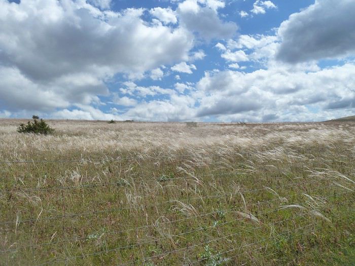
Nous nous installons dans l’ancien four communal à l’abri d’un soleil ardent. Que le lieu est calme, malgré sa réputation. Je suis toujours frappé de rencontrer si peu de monde dans un coin si caractéristique. Pourquoi ? De toute évidence, l’austérité de ces grands espaces n’est pas propice à attirer les âmes. L’intérêt de ces endroits ne réside-t-il pas dans la réflexion personnelle qu’ils déclenchent du fait de la quiétude qui s’en dégage ? Le vélo est le vecteur de voyage idéal pour prendre le temps de se laisser emporter par l’ambiance du plateau. La lenteur, l’effort physique et l’exposition aux variations du climat permettent l’osmose avec la nature et l’esprit de la Planète.
Après une pause bien sympathique au milieu de ce que je qualifie de nulle part, nous mettons le cap sur Saint-Pierre-des-Tripiers, petit village au fin fond du causse, à l’architecture remarquable, tout particulièrement son église qui semble se dresser dans ce bout du monde depuis les siècles des siècles. Juste en face de l’édifice religieux, une fontaine nous fournit une belle eau fraîche. C’est exactement ce dont nous avons besoin afin de nous préparer à un bivouac tout confort. Mais justement où nous installer ? Le village semble désert, des quelques maisons environnantes ne nous parvient aucun bruit et nous ne décelons pas le moindre mouvement. Une pelouse devant le clocher me paraît un endroit idéal, de plus elle est protégée par un mur qui semble dater de la création du monde et prêt à affronter l’éternité.
Mais notre présence attire l’attention depuis la maison en face de l’église qui nous domine de quelques mètres. Au sommet d’un escalier de pierre, un homme apparaît, une canette de bière à la main. Je m’adresse à lui pour lui demander s’il est possible de camper sur le petit terrain devant l’église. Il répond sur un ton surpris par la question, sans doute n’en est-il pas à sa première bière. D’une intonation, qui de toute évidence ne plaira ni à Brigitte ni à Patricia, il me rétorque que ce n’est pas dans la tradition française de dormir devant une église. Ah bon, étant catholique croyant comme l’est aussi Patricia, cela ne nous choque pas d’autant que nous avons tous l’habitude de l’accueil dans les temples en Asie du Sud-Est.
Ouille ! pourquoi me suis-je adressé à cet homme, qui de sa vie sans doute n’a jamais imaginé une seule fois dormir dehors. Nos deux baroudeuses démarrent. Je réalise, peut-être suis-je en train de découvrir le fil à couper le beurre ou l’eau chaude, mais cette évidence me frappe, des femmes d’exception ont très généralement des caractères qui vont avec cette spécificité d’exception. Patricia ouvre le bal, notre homme y voit une remarque acerbe et répond. La vitesse supérieure est enclenchée. Brigitte, la placide ‘grand-mère’, en rajoute une louche du style « mais pourquoi poser ce type de question à quelqu’un qui n’a aucune idée de ce que veut dire bivouaquer ». Fin de la discussion, elles enfourchent leur vélo et disparaissent en rigolant. André et moi restons sur le champ de bataille déserté par nos amazones. Par quelques formules de politesse mâtinées de paroles diplomatiques, nous prenons congé de notre homme encore tout surpris, sa canette toujours brandie à la main. Pourtant, ce dernier avait fini par essayer d’y mettre un peu du sien en nous conseillant, dans des explications incompréhensibles, un lieu quelque part dans les environs alors que manifestement il n’avait aucune idée sur le sujet.
A la sortie du village, les sens aux aguets, nous trouvons rapidement le lieu de chute idéal le long d’un GR ou GRP, ce qui nous donne l’autorisation de bivouaquer d’après la réglementation du Parc des Cévennes. Notre campement établi, nous revenons au cours du repas sur l’incident et, heureusement que nous sommes éloignés d’une distance proche du kilomètre de l’habitation de l’homme à la canette, car les commentaires et les éclats de rire ponctuent bruyamment la pinède où nous avons élu domicile.
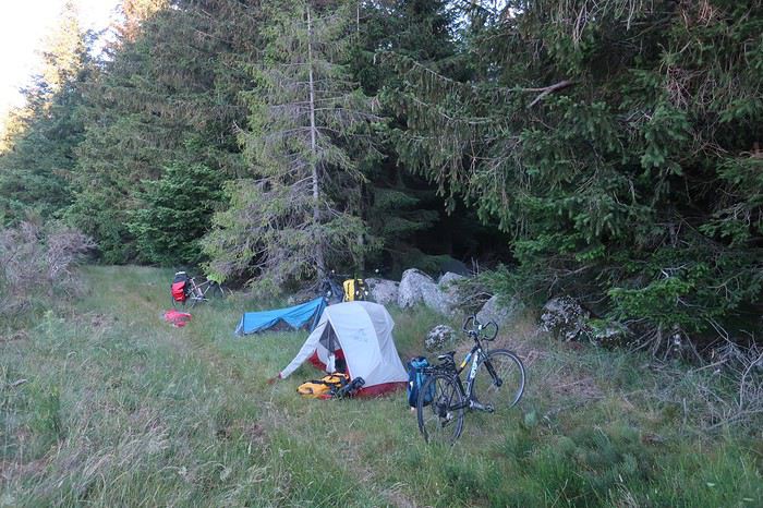
Je profite de ces moments de franches rigolade pour attirer Patricia dans mes filets malgré ses réticences, afin de l’interviewer et l’enregistrer durant 45 minutes dans le cadre de mon émission mensuelle sur la radio de la Bresse « un pays vu par un cyclovoyageur ». Bien qu’ayant l’habitude des journalistes du fait de ses exceptionnelles performances sportives, trois quarts d’heure à parler lui font un peu peur. Wahou ! Ce fut un moment d’anthologie, fabuleux et en plus on a bien rigolé, et ça lui a plu puisque nous allons réitérer l’expérience deux jours plus tard. Cela me permet de monter tranquillement ma saison radiophonique 2020-2021. Je suis certain que les auditeurs vont rester scotchés ! Brigitte qui nous écoute de sa tente, sans s’en douter, ne coupera pas à l’interview également.
Pour le moment, André et moi sommes dans « les petits papiers » de nos deux cavalières de l’apocalypse. Tout va bien. André, toujours à l’élégance très aristocratique de bon goût et au flegme british est appelé par ces dames Lord Andrew, moi le latino Lucio. Pour ma part, je vais tout faire pour y rester dans les petits papiers, car on ne s’ennuie pas avec elles. Je vais de surprise en surprise. Brigitte me fait, dans un grand sourire, la confidence suivante « Luc tu vas voir ce que c’est que de voyager avec des sauvages ». Et effectivement, au cours de ces 9 jours, que de leçons dans tous les domaines, physiques, mollets et cuisses de titane, moral au beau fixe quelles que soient les difficultés, matériel en sachant être hyper-minimaliste, adaptation à la nature, instinctivement ou presque, se poser pour la nuit, vaisselle avec une poignée de sable au bord d’une rivière ou une poignée d’herbes sèches sur les plateaux. Je les imagine toutes les deux dans une vie antérieure, au fond du bush australien, Aborigènes sachant décoder un des endroits les plus hostiles de la Planète et s’y adapter pour y vivre en autonomie.
L’endroit où nous nous trouvons est tout simplement l’un de ceux que je préfère parmi tous ceux que j’ai vus de par le monde, aussi bien professionnellement ou au cours de mes voyages lors de mes vacances ou de ma retraite. Il s’agit du coin sud-ouest du Causse Méjean dominant le village du Rozier où se rejoignent le Tarn et la Jonte. C’est là que se trouve le fameux chemin du vertige ou balcon de la Jonte que j’ai déjà parcouru à deux reprises, mais hélas je ne pourrai pas le faire découvrir à mes compagnons, nous avons un créneau de temps restreint.
Au matin nous dévalons du plateau par une gorge abrupte que Brigitte a dénommée route Danièle, du prénomde mon épouse. En effet, il y a quelques années nous l’avions prise en voiture et la terreur l’avait envahie. Minuscule route au-dessus d’un précipice sans parapet. Dans une épingle à forte déclivité il avait fallu faire des manœuvres, au-dessus d’un vide conséquent, pour pouvoir négocier un virage pour le moins très sévère. Elle en garde encore et pour toujours des émotions pour le moins fortes, pas besoin des rutas del loco d’Amérique du Sud. Mais nous allons être déçus, la chaussée a été élargie et un muret installé dans les endroits les plus vertigineux.
Cependant, le spectacle est toujours époustouflant, et les vautours participent au spectacle. Nous prenons tout notre temps en profitant des nombreux points de vue avant de rejoindre le fond de la vallée de la Jonte. Au-dessus de nous de nombreuses parois verticales, voire surplombantes, nous obligent à garder le nez au ciel, paradis des grimpeurs.
Je me souviens être allé observer les vautours sur leur aire d’envol. Embusqué dans des genévriers un peu désaxés à l’entrée de leur zone de poser, je les regardais arriver comme des avions en courte finale. Ils étaient majestueux dans la puissance de leur vol. Leurs serres, grosses comme des mains humaines, prêtes à l’impact de l’atterrissage, me faisaient penser aux roues d’un avion. Soudain, l’un d’eux m’ayant repéré, dévia de son axe d’approche et convergea sur ma position. Nos regards se croisèrent quelques secondes, impression étrange que de se sentir proie. Alors, il réalisa que j’étais bien vivant, pas encore une bonne charogne prête à être dégustée. Il modifia sa trajectoire et atterrit au point initialement prévu. Quelle belle expérience ce fut, que d’émotion j’en éprouve encore bien des années plus tard.
Une fois le long de la Jonte, nous rejoignons rapidement le village du Rozier, où nous prenons notre temps en allant savourer un chocolat chaud accompagné d’un croissant, confortablement assis sur une terrasse dominant la rivière. Après avoir effectué quelques courses nous partons à l’assaut du causse Noir. Il porte ce nom du fait des forêts de pins noirs qui le parsèment. Nous le traversons vers l’est jusqu’à Lanuéjols. L’église ruinée de Saint-Jean-des-Balmes nous invite pour la pause de midi. Au cours de sa longue histoire, elle a eu à souffrir de nombreuses dégradations, les routiers dans les années 1376-1379, ces bandes qui pillaient en passant, des guerres de religion lors du passage des protestants en 1568, et puis finalement de la désertification qui entraîna l’abandon des paroissiens. Le lieu dégage une grande sérénité, l’autel de pierre massive se retrouve à l’air libre, la voûte ayant disparu. On accède au clocher par un escalier restauré dont l’usure des marches, en creux, rappelle la longue histoire du lieu, ainsi que le long cortège d’êtres humains qui y sont montés.
A Lanuéjols, nous trouvons un village quasiment désert. Seuls, deux Allemands à moto sur la place centrale, nous échangeons quelques mots. Nous partons plein sud, direction la Dourbie, rivière qui sépare le causse Noir du causse du Larzac. J’aurais bien aimé continuer en faisant le tour de ce causse, mais voilà notre petite balade ne prévoit que 9 jours, ayant tous nos impératifs. Ce causse du Larzac, en d’autres occasions, je l’ai aussi arpenté dans tous les sens, que ce soit en voiture, à pied ou à vélo. Il recèle des merveilles en matière architecturale comme le village de la Couvertoirade, haut lieu des Templiers, ou en matière de sites naturels, en particulier d’énormes avens, à se prendre pour Indiana Jones. Malheureusement, ce ne sera pas notre route. Nous effectuons nos derniers tours de roues sur ces causses que nous avons parcourus durant quelques jours. Nous y avons croisé de rares lavognes, ces petites mares circulaires autour desquelles les troupeaux viennent s’abreuver. En zone calcaire, les points d’eau sont très rares et ceux-là sont entretenus par l’homme en rendant le fond étanche. Ces petites mares étaient sans doute vitales dans des temps pas si lointains. Mais maintenant, les causses Méjean et Noir sont alimentés par des canalisations venant du mont Aigoual, comme le Sauveterre est lui ravitaillé par le mont Lozère.
Après avoir rejoint la Dourbie, nous suivons sa vallée sur quelques kilomètres puis remontons son affluent, le Trèvezel. Le très pittoresque village de Cantobres se découpe devant nous, sur son rocher à la crête hérissée. Nous ne pouvons manquer d’aller le visiter. Charmant, de plus un bistrot vient de rouvrir suite à la pandémie. Nous y faisons une halte agréable. De toute évidence, le tourisme n’est pas encore reparti. Dans ces lieux en temps normal, on doit y croiser des foules. Or là, personne ou presque, seul un couple attablé et, un peu plus tard, quatre habitants du village viendront y prendre place. L’heure tourne, il est temps de se préoccuper de notre point de chute dans ce vallon escarpé. Après avoir roulé quelques kilomètres nous rencontrons une zone plate en partie encombrée de vieux engins agricoles. Cela nous semble très bien pour nous installer à quatre. Deux cents mètres plus haut une ferme, par sécurité Brigitte et André y montent demander l’autorisation de nous installer. L’homme qui leur répond leur explique que le terrain est à son frère et que s’il se rendait compte de notre présence, il appellerait la gendarmerie pour nous faire décamper. Donc dans ces conditions, frère ou pas, notre champ de ferraille ne nous accueillera pas cette nuit. L’homme leur a conseillé d’aller quelques kilomètres plus loin au camping de Trêves. Ce que nous ferons.
Nous arrivons juste à temps à l’accueil, l’employé municipal allait le fermer, ce qui ne nous aurait pas empêché de nous installer. Là encore, la saison n’a toujours pas commencé. Nous sommes tout simplement les premiers clients cette année et nous disposons du camping entier pour nous quatre. Le lieu est agréable, le long d’un séduisant cours d’eau, où je vais voir quelques belles truites. Mais nous ne sommes plus dans la Lozère, étant revenus dans le Gard, et je n’ai pas le droit de pêcher. Mes scrupules à m’astreindre à respecter la réglementation font éclater de rire Brigitte et Patricia. Au fond d’elles-mêmes que d’espoirs déçus depuis une semaine alors qu’elles rêvaient d’une truite frétillante sur feu de bois. Du coup, Brigitte me raconte sa traversée de l’Alaska à vélo, bien évidemment en solitaire. Là, elle était tombée sur un mec, un vrai, non seulement il lui avait pêché des saumons énormes, mais il l’avait initiée à la pêche à la mouche et elle s’était retrouvée avec un bulldozer survitaminé au bout de la ligne. Il est clair que je ne tiens pas la comparaison.
Au matin, je me lève tôt et pars à la recherche d’une boulangerie afin de faire une agréable surprise à mes camarades pour le petit-déjeuner. Mais dans ce village, somme toute assez grand, pas âme qui vive, j’en fais pourtant deux fois le tour. Désertification est un mot qui a toute sa signification en France. En retournant au camping je longe la rivière, quelques belles truites me narguent dont une de taille plus que respectable.
Aujourd’hui, cap sur le mont Aigoual. Par une route confidentielle qui s’élève rapidement, la D 710, nous rejoignons le village de Camprieu. Le mont Aigoual n’est plus qu’à 15 kilomètres. Nous prenons tout notre temps et allons au restaurant, là les clients sont assez nombreux et les mesures de distanciation sont respectées. Nous le prenons tellement notre temps que j’en profite pour faire l’interview de 45 minutes de Brigitte pour mon émission de radio mensuelle « un pays vu par un cyclovoyageur ». Le thème en est la traversée du désert d’Atacama, en particulier du Sud Lipez, par une cycliste solitaire. Wahou, là aussi je crois que lorsqu’elle sera diffusée, cette interview va faire son effet sur les auditeurs.
Mettant fin à notre longue pause, nous prenons le chemin du mont Aigoual. Nous rencontrons un peu de circulation, le lieu étant très connu. La vue du sommet est époustouflante dans toutes les directions, des Alpes aux Pyrénées en passant par la Méditerranée. Et pourtant, en cet après-midi, l’atmosphère est un peu brumeuse. J’imagine le spectacle un jour d’hiver bien clair par grand froid. Parfois les conditions météorologiques permettent des visions presque jusqu’à l’infini. Je me souviens d’un jour, alors que je survolais le lac de Genève à quelques milliers de mètres d’altitude, je voyais les Pyrénées et étais capable de reconnaître le Canigou ainsi que quelques-uns des sommets de l’Ariège.
Nous voulons visiter le musée mais il est trop tard. Nous nous attablons pour une bière et réfléchissons à notre lieu de chute pour la nuit. Nous avons été prévenus que si nous cherchions à rester près du sommet, nous serions à coup sûr délogés. Après quelques débats, il est décidé que nous partions voir un peu plus loin dans un endroit moins exposé. Quelques kilomètres de descente plus tard sur le versant nord par la D18, nous repérons un endroit superbe qui nous conviendrait à merveille. Petit point noir, non seulement nous y voyons le logo camping interdit, mais aussi bivouac interdit, ce dernier matérialisé par une tête qui sort d’un sac de couchage. Ne pas insister et c’est reparti. Un peu plus haut, nous avions repéré un chemin à l‘air sympathique. Bien évidemment, mes camardes y arrivent avant moi, et s’y engagent. Lorsque je m’y présente, pas d’alternative, je suis bien obligé de les rejoindre. Mais là aussi un petit hic qui ne les a pas perturbés, un beau panneau circulation interdite annonce la couleur. Mais tout le monde finira par revenir à la raison et nous décidons de nous éloigner franchement. Au lieu-dit Cabrillac, une route minuscule part plein est pour rejoindre la vallée du Gardon, nous la prenons. Quelques kilomètres plus loin, l’œil de lynx de Brigitte intuite, plus qu’il ne voit, derrière un repli du terrain le lieu qui va nous fournir le bivouac idéal, de plus autorisé.
C’est notre dernier soir sous les étoiles, demain nous dormirons chez Hélène. Que ces huit premiers jours sont passés vite, trop vite. Ce soir bombance, grosse platée de riz. La volumineuse gamelle que j’ai fournie est sortie comme chaque soir, et comme chaque fois Brigitte, elle la minimaliste aux sacoches de plumes, me dit « Luc mais ce n’est pas possible tu nous as amené une casserole qui pèse un cheval mort, et non content tu y as mis un couvercle en verre ». Il faut dire, que depuis le deuxième jour, c’est elle qui la porte. En voyage à vélo, il est rare de partir à quatre, donc on ne détient pas un récipient aussi conséquent. Pour la cohésion du groupe et aussi pour la simplification de la gestion des provisions, je considère comme indispensable de prendre nos repas en commun.
Avant de partir de mes Vosges, j’ai fait le tour des magasins de sport, je n’ai rien trouvé. Plusieurs gérants m’ont dit qu’avec la crise sanitaire les livraisons de matériel de camping avaient subi des retards, donc pas de gros contenant. En définitive, j’ai pris une casserole chez moi avec un joli couvercle lourd mais pratique car on voit à travers. Sans doute l’ensemble avoisine le kilo et demi, mais cela n’a pas empêché Brigitte de systématiquement disparaître dans le lointain à la moindre côte, donc tout va bien.
Au matin, nous savons que nous vivons la dernière journée de notre balade saute-causses. Bien cachés dans notre coin abrité, alors qu’à cinquante mètres sur la route souffle un petit vent vif, nous dégustons un copieux petit-déjeuner. Nos avions six œufs nous n’en avons plus que quatre, mystère !
Une fois sur les vélos, c’est l’évasion en direction d’un petit col nommé Salidès, puis c’est la grande descente qui nous conduit d’abord le long de Gardon puis au village de Saint-André de Valborgue. Habitude prise, ma foi pas désagréable, halte au bistrot oblige. Deux joggeurs s’installent à côté de nous sur la terrasse. Voyant les vélos chargés, l’un d’eux s’adresse à Brigitte et lui demande si avec assistance électrique ça allait bien, malgré les sacoches. Houps, elle ne dit rien, mais à sa tête on comprend que ça a fait boum. Plus loin, nous aurons droit au débriefing et sous les traits de la gentille « grand-mère » sourd la flamme vindicative de la jeunesse où la confection et sans doute l’utilisation du cocktail molotov faisaient partie des moyens de régler les différends. On en rit encore !
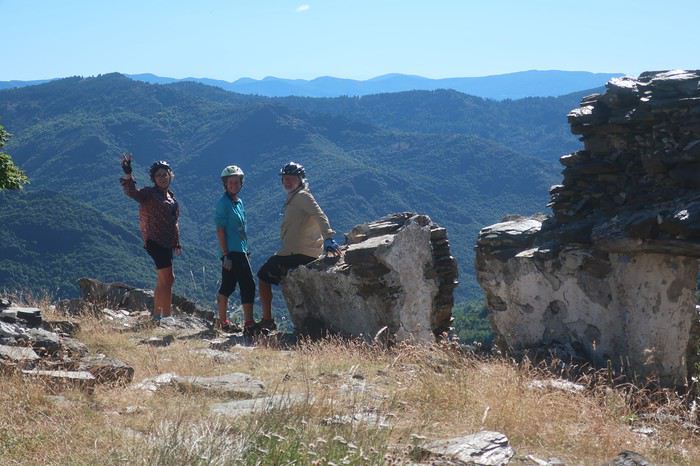
Dernier pique-nique, nous n’avons pas de pain. On apprend qu’au village, 5 kilomètres plus bas, on en trouvera, mais à midi pile la boulangerie ferme. 10 minutes, ça semble jouable à André, qui sans demander son reste, disparaît. Lorsque nous arrivons au village, son vélo est rangé devant la vitrine. Il est donc à l’intérieur, c’est gagné. Il sort avec la boulangère, elle ferme à clef et voilà, c’était bien midi pétant.
Plus loin, par un chemin qui serpente, nous descendons au Gardon. Lieu tranquille nous en profitons pour une petite baignade et nous laissons traîner ces dernières heures ensemble, pas pressés de mettre un point final à notre aventure cycliste. Malgré l’eau, la chaleur devient intenable, et nous fuyons. Dernière halte à Saint-Jean-du-Gard et la boucle va être bouclée. La dernière difficulté, remonter chez Hélène, 7 kilomètres d’une route sans merci, seule Patricia ne descendra pas du vélo. Pour ma part, je vais le pousser 5 kilomètres et André et Brigitte en feront presque de même !
Une belle histoire prend fin. Pour moi, après 18 mois d’abstinence de voyage à vélo, ce fut un bonheur, même s’il y manquait le sel de la grande aventure que l’on éprouve au fond du désert de Gobi ou de l’Atacama. Mais, me laissant emporter par mes rêves et mes désirs les plus fous, je me verrais bien avec la même équipe partir trois mois pour une traversée du désert de Gobi dans la totalité de sa partie mongole. Ces immensités sans repères, contrairement à l’Atacama où les volcans tiennent lieu de balises, je m’en étais approché sur leurs lisières. L’idée d’y pénétrer franchement, au cours des huit cents kilomètres que j’y ai effectués à la marge, m’a hanté. Mon regard restait fixé sur ces milliers de kilomètres où même les Mongols ne s’aventurent pratiquement pas. Cette pensée m’enthousiasmait et m’effrayait tout à la fois. Les problèmes logistiques à vélo deviennent une vraie gageur lorsqu’il faut transporter au moins 15 litres d’eau sans savoir si cela sera suffisant. Incertitude et trouille qui nouent la gorge, les deux ingrédients indispensables pour que l’on bascule dans le voyage.
Quelques réflexions de Brigitte à méditer après ces 9 jours de grand plaisir:
Pour ma part, ce tour sur les Causses a été un tour très différent des voyages que j'ai faits précédemment. Le voyage en solo rend peut-être plus ouvert aux autres? plus avide de contacts? on a croisé des gens super, mais a-t-on fait des rencontres ? De celles qui font bouger les lignes ? De celles qui continuent à nous secouer longtemps après s'être perdus de vue. Est-ce le fait d'être en groupe ? Est-ce le fait d'être en France ? Ici, les sens sont peut-être moins en alerte. Les cartes sont précises, on connaît les codes culturels, les distances sont courtes, l'incertitude est réduite. J'ai beaucoup aimé rigoler avec vous. Le voyage en solitaire n'apporte pas autant de franches rigolades
En cette fin juin 2020, nous reprenons des activités de plein-air, après il faut bien le dire avoir été un peu sonnés par cette pandémie qui nous a tenus confinés presque deux mois.
Alors dans ce contexte particulier, cette balade à vélo de 9 jours je l’ai vécue comme une libération, certes toute relative, nous étions malgré les nombreux décès dans notre village, loin des grandes tragédies de notre histoire. Cependant, en préambule, je me permets de faire l’apologie de Voyage Forum et de la revue « 200 le vélo de route autrement ».
Oui, l’apologie de VF pourquoi ? Parce que grâce à ce site de voyage on fait de fabuleuses rencontres qui permettent de partir en virée avec des personnes étonnantes. Les réseaux sociaux on y trouve le meilleur et le pire.
Il m’est arrivé de me faire écharper, traiter de tous les noms, affubler de tous les défauts parmi les plus détestables car à travers mes récits certains acrimonieux ou acrimonieuses (certes peu nombreux) n’y décelaient qu’un égocentrique, à l’imagination prolixe, en recherche d’admiration. Assurément, nous avons tous notre petit égo, et j’ajouterais heureusement. Personnellement, je ne suis jamais insensible à un petit mot gentil même d’admiration, au risque qu’il puisse flatter mon orgueil, mais l’essentiel n’est pas là. En effet, si quelques-uns sont prompts à la critique acerbe ou tatillonne, d’autres au contraire ont une réaction opposée. Accrochés, piqués de curiosité par mes écrits, ils me contactent et ont envie de partir avec moi. Et là commence l’aventure. Que de fois ai-je rencontré des compagnes ou compagnons de voyage grâce à mes écrits sur VF.
Mais, je dois avouer que cette randonnée vélocipédique de 9 jours à travers causses et Cévennes a été le point d’orgue, une apothéose qu’il me sera difficile de retrouver en matière de compagnons de voyage hors normes. Et quand je pense que nous aurions pu partir à cinq, si Hélène, notre gentille hébergeuse, n’avait pas eu des impératifs. Elle aussi connue il y a déjà quatre ans par VF, et comme baroudeuse du bout du monde à vélo en solo elle se pose là.
Nous sommes partis à quatre, tout d’abord André, camarade sûr au moral d’acier, capable de faire 1500 kilomètres avec une fracture du pouce non soignée, en compagnie de qui j’avais déjà effectué deux voyages à vélo, dont 64 jours à travers les immensités rudes du nord Argentine, ainsi que deux femmes.
La première Brigitte, grande baroudeuse, au look de « grand-mère moderne » bien dans sa peau, mais ne pas s’y tromper, les immenses traversées de déserts seule sur son vélo seraient presque son quotidien si elle ne prenait pas sur son temps pour garder le lien avec sa famille et s’occuper de ses petits-enfants, comme toute Mamy qui se respecte. Même si parfois l’un de ses enfants lui tire l’oreille alors qu’elle vagabonde de l’autre côté de la planète pour lui faire passer un petit message du genre « Maman, ça va être Noël, nous t’attendons tous avec impatience en particulier les petits-enfants ». Ces injonctions, qui jouent sur le sentiment et la fibre maternelle, lui font stopper très temporairement ses grandes chevauchées solitaires. Notre premier contact se fit grâce à VF et à CCI. Dès les premiers échanges nous avons constaté notre immense passion commune concernant le désert de l’Atacama. Nous nous sommes rencontrés deux fois au festival annuel du voyage à vélo organisé par Cyclo Camping International à Paris. Depuis l’envie de partir ensemble nous taraudait.
La seconde, Patricia m’a contacté par VF pour savoir si je recherchais des personnes pour de futurs voyages. Premier contact très sympathique, cependant mes conditions familiales actuelles ne me permettent pas d’envisager de longs voyages, mais m’échapper une dizaine de jours me semblait possible. Je lui ai donc promis de la contacter au cas où. Et effectivement, l’envie de me changer les idées et de partir quelques jours avec mon copain André est vite arrivée, et je dirais même s’est imposée. Et me souvenant de notre conversation, voilà comment elle s’est jointe à nous. Wahou !!! J’ai découvert une athlète complètement hors normes, au palmarès incroyable, championne de France et d’Europe de marathon, championne d’Europe et vice-championne du monde de 100 kilomètres de course à pied sur route. Bien d’autres exploits jalonnent sa vie, comme des temps stupéfiants sur l’ultra-trail du mont Blanc ou des courses furieuses dans les très grands froids nordiques, et avec tout cela une simplicité et une gentillesse immenses, sans parler d’une rusticité sidérante. Elle m’avait même dit : tu as beaucoup plus voyagé à vélo que moi, peut-être devras-tu m’attendre. Elle a vu ! mais elle n’a pas dû être vraiment surprise, je ne pense pas que dans sa vie beaucoup, même parmi les meilleurs, l’aient attendue à pied ou à vélo, l’inverse oui sans doute toujours !!!
Et pourquoi l’apologie de la revue 200 ? Tout simplement parce que les articles sont des morceaux d’anthologie littéraires. Et lorsqu’il est question de la France, même concernant des coins que je connais bien, les descriptions à couper le souffle me donnent à penser qu’il s’agit d’un ailleurs qu’il me faut découvrir au plus vite.
Oui, les quelques rares échanges désagréables sur VF de quelques personnes mal lunées sont vite oubliés quand on a le bonheur de partir avec trois personnes de cette trempe, je dirais même que c’est un honneur. J’ai commencé, cependant, à me faire un peu de souci au sujet de ma forme physique car, au cours des 18 derniers mois, je n’ai effectué en tout et pour tout que 20 kilomètres à vélo.
Trois semaines avant le départ je me suis promis de me remettre en selle. J’ai tenu 6 jours, une trentaine de kilomètres par jour et 500 à 700 mètres de dénivelé. Tout surpris ça passait bien, donc la motivation est retombée et je suis retourné taquiner la truite, surtout que cette année la pêche est bonne par chez moi, mais que de la fario sauvage des Vosges.
Donc nous y voilà, petit projet en France, un itinéraire à travers les reliefs des Cévennes qui nous mènera de Mialet (un peu à l’ouest d’Alès) vers le mont Lozère puis la montagne de Bougès. Ensuite nous écornerons le coin nord-est du causse Méjean à partir de Florac avec redescente sur Castelbouc. De là, nous partirons à l’assaut du causse Sauveterre par un chemin infernal dans la chaleur de l’après-midi. Nous en longerons tout le bord sud qui s’étire en croissant au-dessus du Tarn, puis nous plongerons vers Sainte-Enimie et irons dormir à la Malène. Après s’en suivra une magnifique traversée du causse Méjean en passant par le terrain d’aviation jusqu’à Saint-Jean-des-Tripiers. Nous poursuivrons par une descente vertigineuse sur la Jonte où nous verrons de nombreux vautours. Après un ravitaillement au Rozier, nous partirons à l’assaut du causse Noir que nous traverserons en entier jusqu’à sa barrière sud la rivière Dourbie. Nuit à Trêves suivie d’une montée du mont Aigoual, ponctuée d’un bivouac sur son versant est. Et en fin, nous déroulerons la dernière étape de cette trop courte balade de 9 jours, en nous laissant emporter par la descente le long du Gardon. Dernier point dur, voire très dur, la remontée chez mon amie Hélène d’où nous sommes partis, au Puech, 7 km dont 5 à pousser les vélos dans des côtes bien supérieures à 10%. Mais pourquoi aller habiter sur un piton si loin du joli petit village, sans doute parce qu’Hélène est aussi une vraie « furieuse » à qui les grandes aventures dans des pays sauvages à vélo en solo ne font pas vraiment peur.
Cette période post-covid est un peu inquiétante, comment allons-nous voyager ? Avant de partir, je viens de lire sur VF un beau récit à travers le Morbihan post-pandémie, agrémenté de jolies photos, effectué en juin. L’impression qui s’en dégage est étrange. On pourrait s’imaginer dans un film d’anticipation futuriste, l’humanité guettée par quelques menaces généralisées. Un préambule au livre de Cormac McCarthy « la Route ».
Tout commence par un trajet en voiture de quelques 600 kilomètres à travers la France. Quelque part avant Alès je m’arrête, un restaurant semble ouvert, il m’est dit qu’on ne mange que sur réservation, espacements obligent. On me montre la pizzeria un peu plus loin. Là, on me prépare une bonne pizza mais on me demande d’aller la manger ailleurs, même pas le droit de m’installer à la terrasse. On m’indique un parc en contre-bas, au bord d’une jolie petite rivière. Je vais y passer un moment de repos agréable. Mais, de toute évidence nous ne sommes pas revenus à la normale.
Mon accession à la maison d’Hélène n’est pas évidente, de plus mon GPS auto n’étant pas à jour, il ne m’est d’aucune aide pour une route toute récente. Elle qui me prenait pour un grand baroudeur au flair infaillible va réviser son jugement.
Voilà mon arrivée chez elle sur sa montagne isolée, telle qu’elle l’a restituée en s’insinuant dans mes pensées. Je dois reconnaître qu’elle est très proche de la vérité, comme si elle avait été passagère invisible à côté de moi. Donc voilà Hélène qui s’exprime en extrapolant mes pensées : « Tout commença mal. Après six heures de voiture et ayant passé Alès, me voilà perdu sur une route de montagne digne de celle de la Bérarde dans les années 70. Pas de maison, ni de poteau téléphonique ou électrique. Pas âme qui vive. Où m'étais-je donc fourré ? J'avais pourtant reçu des informations précises : les poubelles, la table en bois, les deux panneaux -un noir, un rouge- "Les Puechs", la fourche que je ne pouvais pas manquer paraît-il, l’impasse de droite… Mais rien de tout cela. Une route tortueuse qui n'en finit pas de monter au milieu des chênes verts... On ne m'y reprendrait pas à dire venez chez moi j'habite chez une copine. J'appelle ladite copine. Pas de réseau évidemment. Après plusieurs essais infructueux je la vois qui vient à ma rencontre. Ouf, sauvé pour cette fois. »
Un peu ridicule, je constate que les trois autres sont arrivés sans problème. Brigitte a même poussé la plaisanterie en venant d’Aix-en-Provence à vélo, et c’est concomitamment que nous nous arrêtons devant le portail du nid d’aigle d’Hélène. Soirée de retrouvailles pour certains et de découverte pour d’autres, mais ambiance magnifique entre frénétiques du « gros baroud ». Plus les personnes sont habituées à voyager en dehors des chemins habituels et plus elles sont généralement décontractées, et puis que d’histoires incroyables elles peuvent raconter, même s’il faut un peu les torturer pour les faire parler. Hélène nous fait bien rigoler, même si sur le coup ça l’aurait plutôt fait pleurer, en nous relatant sa traversée himalayenne avec un être étrange qui se jetait sur la nourriture et ne lui en laissait même pas quelques miettes. Il paniquait à l’idée de manquer et, affamer sa compagne de route ne semblait pas le perturber. Elle finira sa traversée seule, elle est habituée. En route, elle avait sympathisé avec un couple de Hollandais qui, quelques jours plus tard, tomba sous les roues et les coups de couteau d’un djihadiste. L’homme fut tué, la femme en réchappa, Hélène, elle, en garde une vraie souffrance. Pour raison de Covid, on s’installe dans le jardin, chacun avec sa tente. Chut, je vais un peu tricher, je finirai sur un lit mais dans mon sac de couchage !
Au matin, un petit-déjeuner qui s’étire presque à l’infini. Des personnes, qui ne se connaissaient pas la veille, ont tellement d’aspirations et d’expériences communes qu’elles ont l’impression de toujours s’être connues. Mais vers les 9 heures du matin c’est parti, on serait bien resté plus longtemps, voire toute la journée à discuter des chemins du monde.
Nous commençons par la terrible descente du sommet où Hélène et Bernard, son compagnon, ont élu domicile. Il nous faut faire quelques courses car les jours à venir nous ne savons pas ce que nous trouverons, comptant traverser par des pistes confidentielles cette région de France sauvage. Epicerie associative de village, désinfectant à l’entrée et masque obligatoire, je dégaine le mien. Nous ne trouvons pas grand-chose. A la sortie du village de Mialet, une petite boutique de camping nous permet d’acheter du pain en complément. Mais nous ne nous faisons pas de souci, ayant chacun dans les sacoches du riz et des pâtes, de quoi tenir plusieurs jours. Pour ma part, avec un kilo de riz et de pâtes j’ai de quoi assurer pour 4 durant 48 heures.
Et nous voilà lancés. Premier objectif, le col d’Uglas qui culmine à 539 mètres. Certes ce n’est pas l’Abra del Acay, le plus haut col carrossable des Andes et ses 4972 mètres, mais c’est le même bonheur de la liberté en étant bien accompagné. Bien évidemment, mes trois camarades me laissent sur place, mais bon je ne m’en fais pas, sachant qu’ils ont tant de choses à se raconter en m’attendant. Du col, nous partons sur des pistes mal pavées à travers les grosses bosses et les forêts des Cévennes et nous rejoindrons en milieu d’après-midi le village du Collet-de-Dèze sur le Gardon. Par moments, nous avons l’impression de monter dans les cieux, quelques poussages de vélo agrémentent la journée. Je vois parfois mes camarades devant moi se découper directement sur le ciel, dans des pentes à plus de 15%, comme s’ils se trouvaient sur une rampe de lancement pour quelque voyage improbable. Bien évidemment, cela nous rappelle à tous les grands déserts, le Gobi ou l’Atacama, et les éclats de rire augmentent au rythme du pourcentage de la pente.
Arrivée au village précité, arrêt au bistrot, j’en profite pour prendre le permis de pêche du département de la Lozère pour la première catégorie, c’est-à-dire pour les rivières à salmonidés, département dans lequel nous allons passer et repasser. La réglementation en matière de pêche en France est quelque chose d’inextricable, mais il y a de multiples raisons dont certaines bien valables, mais je ne m’aventurerai pas à vous les expliquer, il y faudrait tout un livre.
La bière est bonne, on la multiplie par deux, rien de tel après avoir ingurgité des litres d’eau tiède toute la journée. De plus elle a un effet diurétique du meilleur résultat pour le corps après une journée d’efforts somme toutes conséquents, en tout cas pour moi. Certes, la distance n’est pas énorme en ce premier jour, 47 kilomètres et 1025 mètres de dénivelé, mais cependant beaucoup de pistes en partie parcourues en poussant les vélos. Nous avons même eu droit à un tronçon emporté par des intempéries réputées très violentes, les fameux épisodes cévenols. Une charmante jeune femme habitant une ferme isolée au milieu, plutôt au sommet de nulle part, nous a remis sur le bon chemin.
Nous rejoignons le camping le long du Gardon, quasi-désert, une seule tente, un Américain vivant en Espagne qui, voyant la tournure du Covid rôdant, a décidé depuis un mois d’attendre la suite des événements ici en Lozère, qui a été très peu touchée par ce fléau, un mort répertorié. La patronne est sympathique et très prolixe sur sa région, tout à mon bonheur. Elle est originaire de pas très loin, d’un coin où nous allons passer et que je connais depuis longtemps, le causse Méjean, plateau d’altitude qui me rappelle par ses lumières et ses grands ciels les plateaux boliviens. Oui, je maintiens et les plateaux boliviens je m’y suis baladé à vélo à plusieurs reprises !
Sitôt installé, je me précipite à la pêche avec mon fouet à mouche, à quelques mètres de nos tentes. Patricia et Brigitte comptent manger de la truite ce soir, mais si je connais bien mes rivières vosgiennes, celles de la Lozère sont une découverte pour moi, et elles seront déçues de devoir se contenter d’une grosse platée de riz, très bonne cependant.
Nous passons une excellente nuit et partons relativement tard. Nous allons nous installer dans une petite routine qui me va bien, vu mon entraînement. Aujourd’hui, il s’agit d’aller le plus haut possible, à la pointe est du mont Lozère et d’y bivouaquer. Trouver notre route confidentielle qui se faufile sur les hauteurs du village n’est pas facile, nos différents tâtonnements nous permettent de visiter ce beau village tout en pente.
Après une matinée par une petite route du bout du monde, nous faisons halte à Génolhac, village tranquille. Nous nous laissons tenter par le restaurant avant d’entamer la montée du mont Lozère, sur 968 mètres de dénivelé pour 15 kilomètres. Pour moi, ce sera une première au restaurant depuis le confinement. Nous sommes les seuls dans la salle, quelques personnes sont en terrasse. Repas créole, très bon, de quoi nous mettre en forme pour un après-midi qui s’annonce « pentu ». Le problème de l’eau se pose. Remplissons-nous les deux bâches de 6 litres maintenant ou plus tard ? Je penche pour maintenant, Brigitte beaucoup plus cool, pour plus tard, ayant bon espoir de trouver une source plus haut. On prend 4 litres par bâche, plus les deux litres que nous avons chacun, cela nous permettra de bivouaquer. Brigitte avait raison, non seulement on va faire le complément dans un ruisseau beaucoup plus haut mais, une fois près du col de Pré de la dame à 1474 mètres, une magnifique source nous fournit avec prodigalité toute l’eau que nous désirons.
Nous trouvons rapidement un coin idyllique pour installer notre bivouac dans des conditions atmosphériques que je qualifie d’idéales. Partir avec des personnes rompues aux longs voyages est un vrai bonheur, tout se passe avec une simplicité déconcertante. Brigitte a un œil particulièrement exercé pour déceler de loin le point précis où s’installer et durant les 9 jours, cela va se renouveler. Pour la deuxième fois, nous sommes trois à monter nos tentes, tandis que Patricia dormira face au ciel, et là aussi, tout le voyage durant, elle ne montera pas sa tente. Notre étape, si elle a été courte en kilomètres, seulement 38, le dénivelé lui a été assez conséquent, 1560 mètres.
De nouveau une superbe nuit, de plus peu de condensation et sur notre versant est, le soleil nous touche rapidement. Encore une bonne excuse pour traîner un peu une fois de plus et ne démarrer que vers les 9 heures. Très rapidement, nous rejoignons la piste du versant nord du mont Lozère que nous comptons suivre jusqu’au col Finiels. Son début est particulièrement raide, sur un chemin jonché de gros cailloux, petite séance de poussage obligatoire sur un kilomètre. Nous arrivons à une magnifique cabane-refuge perchée en dessous de la crête. Nous parcourons le livre d’or, manifestement des randonneurs venant de tous les coins d’Europe au moins y ont laissé un petit mot. Je m’empresse d’en faire autant. Malgré tout l’agrément du lieu, il n’est pas question d’y passer la nuit, il n’est que 10 heures du matin.
Nous suivons cette piste d’altitude sur une dizaine de kilomètres. Nous y croisons des Vététistes, et discutons longuement avec un groupe. Le temps est couvert et il fait frisquet dès que nous nous arrêtons. Les sources du Tarn sont indiquées. Posant nos vélos, nous les rejoignons en quelques centaines de mètres. Pas une goutte d’eau, plutôt un vaste bassin au flanc de la crête qui sert de réceptacle. Plus précisément, il s’agit de l’un des différents lieux répertoriés comme source de la rivière. Toute la cime est sans doute en elle-même le lieu d’alimentation. Le col Finiels arrive presque trop vite, nous y retrouvons le goudron.
De là, l’itinéraire conduit au village de Pont-de-Montvert, célèbre du fait de la révolte des camisards, lorsque Louis XIV révoqua en 1685 l’édit de Nantes, qui avait été mis en vigueur par François Ier. L’un des chefs de cette révolte Pierre Laporte, est originaire du village d’Hélène, Mialet, point de départ et d’arrivée de notre petite aventure. Mais le principal chef camisard s’appelait Jean Cavalier et sa vie est digne d’un roman d’aventure à rebondissements car contrairement à Pierre Laporte, il ne mourra pas les armes à la main.
Cette pente est magnifique et très surprenante. D’immenses constructions rocheuses naturelles se dévoilent au détour des virages, des amoncellements ruiniformes ou d’énormes galets morainiques, parfois empilés en des arrangements prêts à durer encore des millénaires. En cours de descente nous décidons de piquer niquer dans ce décor grandiose. La vue porte au sud sur la montagne de Bougès, l’éminence que nous avons l’intention de traverser par sa crête qui se dirige vers l’ouest jusqu’à Florac. Puis nous nous laissons emporter jusqu’au village où André renvoie par la poste 6 kilos de bagages. Les Cévennes, toutes sauvages qu’elles soient, ne sont pas le désert de l’Atacama, destination de notre dernière grande équipée à vélo. Près du pont central, un bistrot nous ouvre les bras et nous y passons un bon moment. Le Tarn, tout au fond de sa gorge, donne un véritable cachet à la commune. Plusieurs terrasses, des touristes pas très nombreux, des tables qui ne respectent pas l’espacement préconisé par les autorités sanitaires. Certains portent le masque, d’autres non. Sensation une fois encore étrange. Tant que nous nous trouvons seuls, au milieu de nulle part, le covid nous n’y pensons pas trop, mais dès que nous nous retrouvons rapprochés de nos congénères, il se rappelle à notre bon souvenir.
C’est l’heure de partir. Malgré deux Grimbergen je me sens une frite d’enfer pour partir à l’assaut de cette fameuse montagne de Bougès. Bien évidemment, mes trois acolytes disparaissent et je vous assure les Grimbergen n’y sont pour rien. Mais quand on a dépassé les bornes, il n’y a plus de limites. Donc je ne boude pas mon plaisir en remontant le petit vallon qui se dirige vers la crête, et je m’arrête pour traquer du regard les truites dès que je décèle un endroit favorable à leur positionnement. Avec un immense plaisir bien qu’elles soient très mimétiques, en lisant les veines d’eau je les vois, quel bonheur, mais je ne vais quand même pas sortir ma canne !
Une fois au sommet, une piste de toute beauté nous emmène presque jusqu’à Florac en partie à travers forêt et aussi par des zones aérées qui nous permettent les plus beaux points de vue sur cette région étonnante de France. Des villages à l’architecture montagnarde se cachent dans les replis du mont Lozère. La vue porte très loin par-delà vers le nord. Devant nous le Tarn déroule sa gorge qui coupe comme un coup de couteau les causses Méjean et Sauveterre. Derrière ce dernier des monts apparaissent dans un lointain un peu diffus, l’Aubrac et quelques pointements plus saillants nous font penser aux premiers volcans d’Auvergne. De Clermont-Ferrand à Nîmes s’étale un immense carré magique, où la géologie a subi tous les bouleversements. Calcaire et granit s’entremêlent, pour la plus grande joie du spectateur. La terre a craché de ses entrailles ces formations cristallines et la mer a fait monter d’immenses plateaux calcaires, qui se sont constitués au cours de millions d’années par sédimentation de carapaces d’animaux marins. Le tout nous offre un panorama magnifique, propice aux plus belles bambées à vélo. Ce spectacle allume en moi le clignotant revue 200.
Dans le dernier numéro de ma revue fétiche, on peut lire, que dis-je savourer, un très bel article sur ce coin de France des causses, qui s’intitule ’’là-haut’’. L’auteur, Alain Puiseux, est spécialiste de la formule qui frappe, et il en saupoudre à l’envi le texte tout au long de son récit, et cela pour le plus grand bonheur du lecteur. J’en cite pêle-mêle quelques-unes : je me suis demandé si la beauté existe en elle-même ou dans les yeux de qui la contemple; si vous avez une carte routière du Massif Central, vous pouvez y lire les rivages des îles la magie marche toujours là-haut c’était juste après le confinement. L’air était plus pur, plus transparent, le ciel sans une griffure la lumière y est rapide et changeante au-dessus d’une houle d’herbe; je suis tombé amoureux par inadvertance d’une isohypse et des plateaux d’altitude.
Remarque au passage, je ne connaissais pas le mot isohypse, cependant tellement parlant lorsqu’on évoque le Méjean, le Sauveterre ou tout autre causse. Voilà, ces différentes citations extraites du texte « là-haut » fournissent une bonne introduction à l’apparition des différents causses que nous allons traverser et escalader dans les jours à venir.
Après quelques moments de rêverie, les yeux errant jusqu’à l’infini, et aussi quelques erreurs d’embranchement ou tout au moins quelques hésitations, une magnifique pente abrupte au chemin cabossé nous mène pratiquement à l’entrée de Florac. Nous sommes à la frontière des zones granitiques sombres du mont Lozère et des falaises calcaires lumineuses du causse Méjean. Le courage nous manque pour repartir à l’attaque des zones de solitude à cette heure tardive et nous optons pour le camping municipal. Il vient juste d’ouvrir. L’employée est partie la veille de Bretagne et a roulé toute la nuit. Depuis quelques heures elle se dépêche d’effectuer les premiers nettoyages de mise en service. Presque personne, un motard avec une magnifique moto-guzzi, un couple en camping-car et nous quatre.
Toute la place pour nous installer, que l’embarras du choix, nous optons pour disséminer nos tentes à portée du bruit de la rivière, le Tarnon qui rejoint le Tarn un peu plus loin. Sans surprise, nouvelle séance de pêche, et bien que cette rivière m’inspire plus que le Gardon au Collet-de-Dèze, mes camarades n’auront à nouveau pas de truites sur feu de bois. Nous décidons d’aller au restaurant. Le centre-ville est assez animé, la place centrale accueille une terrasse de restaurant aux tables relativement espacées. Les clients y sont nombreux et nous passons une soirée agréable dans une ambiance méridionale. J’avais déjà remarqué, au cours des différentes occasions où ma voiture, mon vélo ou mes jambes m’ont conduit dans ce village au nom chantant, que les habitants avaient déjà l’accent du midi.
Ce matin du quatrième jour, nous partons à l’assaut de mon causse préféré, le Méjean. Dans un premier temps, nous allons seulement en mordre le coin nord-est. Une belle montée par la D16 va nous permettre de dominer la vallée du Tarn et d’étendre notre vision aux montagnes que nous avons traversées la veille là-bas, à l’est et au nord.
L’arrivée sur le plateau est toujours aussi surprenante. On passe sans transition de zones de vallées à l’habitat assez dense et au tourisme très visible, à des déserts d’altitude où l’herbe sauvage ou de prairie prend le contrôle, les hommes semblant fuir ses hauteurs hostiles à la vie. C’est en partie ce qui donne un charme fou à ces plateaux. Comme l’écrit Alain Puiseux de ces coins perchés jusqu’au mont Gerbier-de-Jonc, « Se plaindre ici, plus qu’ailleurs, de l’eau ou du froid, c’est n’avoir rien compris », me fait comprendre pourquoi le soir les vacanciers désertent ces lieux pour aller rechercher la quiétude plus bas le long des rivières.
Après une première prise de contact, Brigitte et Patricia ne connaissant pas ces coins bénis des Dieux, nous bifurquons vers Montbrun et effectuons une plongée en direction du Tarn. La différence de chaleur entre plateau et fond de vallée est très nette. Nous marquons l’arrêt au bord du Tarn, dans un coin charmant, le temps d’un pique-nique. Eau verte et grande falaise claire éclatante de soleil. La flemme nous gagnant et subjugués par la beauté des lieux, notre envie de continuer est annihilée. Nous envisageons de passer l’après-midi et la nuit à venir à contempler ce méandre de rivière aux eaux turquoise, surplombées d’une falaise sculptée au cours des millénaires par les flots qui, parfois, se montrent redoutables, sauvages et tumultueux. Cette halte précoce n’est pas vraiment du goût de la trépignante Patricia, mais elle se plie de bon gré à l’avis de l’écrasante majorité. Mais, à peine commençons nous à prendre nos aises que, débouche sur notre coin perdu une famille avec force gamins et chiens. Ces derniers se précipitent sur le gros pain que nous avons acheté ce matin à Florac et, sans une intervention prompte de Patricia, nous pouvions lui dire adieu. Elle se réjouit, car bien évidemment nous abandonnons notre projet de farniente et décidons de reprendre notre route. Dommage, j’avais repéré quelques belles truites en chasse qui n’attendaient que la plus élégante de mes mouches !
En ce début d’après-midi, la chaleur est terrible. Entre ces plateaux calcaires, il y a comme un effet de four et mon thermomètre indique 40 degrés. Quelques kilomètres en direction de Sainte-Enimie nous offrent l’occasion de magnifiques points de vue sur la rivière, et tout particulièrement sur le village de Castelbouc. Cet ensemble de maisons caussenardes, accrochées à la paroi et semblant prêtes à plonger dans une eau aux reflets de jade, est tout simplement splendide. La légende du village rapporte qu’au temps des croisades, un jeune homme seul était resté en ce lieu. Obligé de satisfaire toutes les épouses dont les maris combattaient les infidèles, il en serait mort d’épuisement. Depuis cette époque, un diable sous forme de bouc survole régulièrement la cité.
A Prades, changement radical, nous avons l’intention de monter directement sur le causse Sauveterre par un chemin non carrossable qui s’insinue entre des falaises. Il présente des pentes ne permettant pas de rester sur le vélo, sauf peut-être pour Patricia dont les cuisses et les mollets sont constitués de l’acier le plus trempé.
Là encore la question de l’eau se pose. Devons-nous remplir les bâches en prévision du bivouac sur le causse ? Sur ces plateaux calcaires, il n’est pas question d’en trouver la moindre trace. Même Brigitte qui sent les sources à 50 lieues, y est favorable. Pourtant nous regardons dubitatifs le pan de montagne qui nous domine et à travers lequel nous allons partir. A la fontaine de ce petit village, profitant d’une ombre bienfaitrice, nous faisons donc provision du liquide précieux. J’en profite pour m’asperger copieusement le visage. Nous jouissons des derniers instants de température clémente, ou presque, avant d’affronter cette piste escarpée tournée au sud, soumise à l’infernale chaleur du soleil vertical.
C’est parti pour un court tronçon goudronné où même Patricia pousse dans cette ligne droite qui se jette sans ambages dans la pente. Après 400 mètres le chemin s’échappe à gauche, tout d’abord pas très raide et roulant. Il va perdre très rapidement ces deux qualités. La pente s’accentue franchement et le sol devient instable, au point que, même en poussant le vélo, la roue avant ripe en permanence de droite et de gauche. Immanquablement, je me retrouve très vite seul, André et Brigitte ayant pris un rythme de montée supérieur au mien, sans parler de Patricia qui s’est littéralement envolée. Je n’ai même pas eu le temps de voir si elle avait disparu en courant, son vélo à la main, ou bien en appuyant comme une forcenée sur les pédales dans cette caillasse fuyante. Mais où va-telle chercher une telle force, une telle énergie, une telle envie de s’arracher ? Sans vouloir être un mufle, certes elle est un peu plus jeune que moi, mais elle n’a plus trente ans !
J’adopte la posture ‘’Atacama’’, le comptage de mes doubles-pas. Selon la pente et la consistance du sol, j’en effectue de 20 à 50 avant de marquer l’arrêt. Il semblerait, à vue de nez que cette piste infernale fasse de l’ordre de 6 kilomètres. Il n’y a qu’à prendre son mal en patience. Bon seigneur, André redescend à pied pour venir me donner une petite, même une grande poussette, ce qu’il fera à plusieurs reprises. Je mets ma fierté dans ma poche et je le laisse pousser. On dira que c’est parce que j’ai l’une des bâches à eau de 6 litres sur le porte-bagages ! Mais au fait, Brigitte a la même et elle caracole comme une gazelle dans la pierraille surchauffée. Mais pour elle, c’est tout à fait normal. Elle est habituée aux traversées de déserts en solo, parfois sans même avoir de quoi faire chauffer ses aliments, n’ayant qu’un réchaud à bois. Dans les coins bien désertiques, on peut avoir la surprise de ne pas trouver la moindre brindille. Mais bon, elle continue son périple en croquant ses aliments sans cuisson, trouvant cela presque très bon !
On doit être un peu maso car, dans ce type de situations de chaleur, de caillasses, de sol qui se défile et de pentes très raides, nous éprouvons tous un grand plaisir, je dirais même un grand bonheur d’être là. L’effort, la sueur, la fatigue, mais surtout le corps et l’esprit qui vivent… Nos pensées sont retournées dans les hautes altitudes du Sud Lipez, entre 4 et 5000 mètres, nostalgie des grandes bambées qui nous arrachent à notre quotidien. Le dépaysement et la défonce. Je me dis cependant qu’il n’est pas besoin de faire des milliers de kilomètres pour connaître les bonheurs de l’aventure, la France nous fournit très bien la matière. Certes, ce n’est pas à la même échelle, quand on sait que le prochain point de ravitaillement en eau est à 140 kilomètres et que l’on est en train de pousser son vélo dans le sable. Toutefois ne pas savoir si cela va durer un kilomètre ou trois jours, cette incertitude introduit une dimension supplémentaire, la trouille.
Mais nous montons, les maisons de Prades deviennent minuscules. Le Tarn se dessine dans tous ses méandres en prenant des teintes profondes qui tirent sur l’émeraude. Un signe de Patricia, elle nous attend. Je ne suis pas certain qu’elle avait réalisé que cette piste était difficile pour la multitude de raisons que j’ai données. Nous la rejoignons. Elle va prendre la place d’André et me fournir une petite poussette sur une centaine de mètres. J’ai l’impression d’être aux commandes d’un Rafale en ayant mis la post-combustion. Incroyable, je n’ai pas une Terrienne derrière mon porte-bagages mais un être bionique venu du fond du cosmos qui me propulse littéralement !!!
Mais tout a une fin, surtout le meilleur, les deux derniers virages en épingle me dominent. Changement brutal de configuration du terrain, la déclivité s’atténue, le chemin quitte le flanc de la montagne et s’enfonce dans des fourrés, laissant juste l’espace pour y faire passer le guidon. Je remonte quelques dizaines de mètres sur mon vélo, mais c’est à pied que je rejoins une minuscule route qui longe le bord du causse. Nous nous regroupons, nous venons de déboucher au niveau d’un petit bourg qui se nomme ‘’Nissoulogres’’. Nous n’allons pas tarder à apprendre la signification de cette appellation étrange. « Jamais sous l’orage ». En effet, il rôde tout autour, tapi, sautant d’un causse à l’autre mais épargnant pratiquement toujours cette pointe du plateau du Sauveterre qui domine la petite cité de Prades.
Il ne nous reste pour nous quatre qu’une quinzaine de litres d’eau, ce qui n’est pas énorme pour tenir un bivouac après un tel effort et, il sera sans doute difficile de s’en procurer avant demain midi. Un homme se trouve dans la première maison à quelques mètres du chemin par lequel nous arrivons depuis la vallée. Je lui demande s’il peut nous ravitailler. Non seulement il y est favorable, mais il nous invite à planter nos tentes dans son jardin, où nous sommes aux premières loges pour contempler le causse Méjean qui s’étale au sud, au-delà du Tarn. Nous acceptons bien volontiers et, très vite, ce n’est plus de l’eau qu’il nous propose mais de la bière. De plus, il nous offre une douche, de toute évidence nous sommes tombés sur un 5 étoiles. Nous prendrons notre repas en commun à partir de nos réserves de pâtes. Il nous fait goûter un vin rouge de la région, ma foi de bonne facture. La discussion va s’éterniser en passant des secrets du causse Sauveterre à des considérations professionnelles. Mes camardes se foutront de moi, je suis un bavard impénitent, mais ce soir je n’arriverai pas à en placer une, notre hôte est d’une catégorie toute autre, sans doute au moins champion d’Europe. Le monde est petit, André et lui se trouvent des connaissances communes, ayant tous deux œuvré dans le cadre de grands travaux de la DDE, que ce soit à titre privé ou non. Je dois dire qu’en finale, j’ai un peu, même beaucoup, perdu le fil de la conversation, la bière et le vin par-dessus les kilomètres de poussage dans la caillasse et le cagnard de cet après-midi auront assez vite raison de moi.
Ce matin nous allons longer le bord du causse Sauveterre en descendant vers le sud. Notre itinéraire emprunte de petites routes et des pistes parfois pas très roulantes. Alors je ressens la fatigue consécutive au gros effort d’hier après-midi. Nous traversons le lieu-dit Dignas, puis nous arrivons à une ferme isolée et nous discutons un bon bout de temps avec Christian, l’habitant du lieu. La vie de paysan sur le causse n’est pas facile. Il nous parle des conditions climatiques rigoureuses, des réglementations tatillonnes sur les produits en particulier laitiers, des législations de transmission d’héritage pénalisantes et autres intrusions de l’Etat, ce qui donne à penser que la vie sur ces plateaux devient impossible. Lui s’est spécialisé comme beaucoup dans le lait de brebis pour le roquefort. Ces régions reçoivent l’eau des montagnes environnantes, le Sauveterre du mont Lozère et le Méjean de l’Aigoual. On peut dire que les zones granitiques alimentent les plateaux calcaires.
A midi, nous arrivons à Laval-du-Tarn. Le pique-nique est organisé à l’abri de l’ancien four à pain, nous sortons le réchaud pour une platée de riz. Comme je l’ai toujours pensé, une halte longue le midi est en définitive un gain de temps car l’après-midi permet encore de nombreuses heures de pédalage, surtout en été.
Notre intention initiale était de continuer à longer les hauteurs dominant le Tarn. Après avoir dépassé le Pont Sublime, belvédère tout particulièrement souligné sur la carte, notre itinéraire devait nous mener au village des Vignes. Mais outre une petite fatigue résultant de la montée infernale d’hier pour moi, le temps semble vouloir se mettre à l’orage. De bonnes ou moins bonnes raisons nous poussent à rester sur le goudron et prendre la direction de Sainte-Enimie par une route toute en descente. Un délice. Différents belvédères livrent des points de vue grandioses sur la vallée et les villages qui ponctuent la rivière, là-bas tout en bas. Le cirque de Saint-Chély est particulièrement spectaculaire vu de quelques centaines de mètres au-dessus.
Passage par Sainte-Enimie, haut lieu du tourisme de la vallée du Tarn, que nous laissons derrière nous jusqu’au village de la Malène. Cette gorge est surprenante. Je l’ai parcourue à plusieurs reprises, mais il y a tant de choses à regarder. De l’architecture caussenarde aux formations géologiques que représentent ces immenses falaises calcaires et le Tarn lui-même qui prend tous les aspects entre ses zones profondes et ses parties où il court sur un lit de galets, presque à fleur d’eau.
Nous marquons l’arrêt au niveau du village de Hauterive situé de l‘autre côté du Tarn. Jusque récemment, il était approvisionné par un câble au-dessus de la rivière. Mais, par manque de financement, cet outil de ravitaillement est en panne ce qui occasionne les plus grandes difficultés à ce bourg accroché sur la rive du causse Méjean. Mais les temps ont changé. Ce village est un vestige des temps passés, maintenant révolus, où la rivière était un axe de communication. Il n’y a pas si longtemps les cours d’eau du sud-ouest étaient sillonnés par les gabarres, les poids lourds des siècles passés. Mais pouvaient-elles remonter jusque dans ces gorges profondes du haut de la vallée du Tarn ? Sur certaines rivières difficiles, où le retour n’était pas possible, les embarcations étaient vendues au prix du bois lorsqu’elles arrivaient à destination.
Une fois à la Malène, nous décidons de ne pas poursuivre jusqu’au village des Vignes. Nous nous installons au camping municipal, remarquablement situé sur une plage du Tarn, pratiquement au centre-village. Ambiance covid, je sors mon masque pour aller à l’accueil. Heureusement peu de monde, deux personnes attendent sagement dehors masque sur le nez, dont un Suisse avec un vélo électrique. Cela nous donne une bonne occasion de parler du voyage à deux roues avec assistance électrique. Notre Suisse a l’air ravi de sa machine. Peut-être que dans un temps, que j’espère le plus lointain possible, nous y viendrons. Mais tant que nos muscles fonctionnent encore assez bien, si nous pouvons éviter, nous nous attacherons à le faire.
Devant nos tentes, la rivière miroite mais nous ne sommes plus dans l’ambiance causses, les kayakistes sont nombreux, en particuliers les Allemands. J’en ressens comme une dissonance. Une fois encore, nous constatons la différence d’ambiance entre les plateaux et le bord de la rivière. Sur cette belle eau qui court je fais une tentative à la mouche. Je fais monter deux beaux poissons, sans doute des truites, qui dans un jaillissement attaquent ma mouche. Mais les deux fois, le ferrage ne donne rien si ce n’est une belle poussée d’adrénaline. Le point commun entre le voyage à vélo et la pêche à la mouche est évident, quand on y goûte, c’est foutu, on est enchaîné à vie.
Bon, si les truites ne sont pas coopératives, les bières le seront plus et nous partons au centre du village. Cette petite cité, rassemblée au pied de part et d’autre d’une immense falaise qui avance sa proue acérée presque jusqu’à la grève, a vraiment belle allure. Après quelques bières, mais pas tant que l’on pourrait le penser, deux mois de confinement entraînent un défoulement et une envie de terrasse de café, nous faisons des courses. Et là que vois-je ? Un ORNI bikepacker qui s’arrête devant moi. Je me précipite et engage de manière autoritaire la conversation. Il semble un peu fatigué. Il est lancé dans un tour express de 1200 kilomètres depuis le Gers en passant par Chamonix. Wahou trop bien ! Il est irlandais et vit du côté d’Astaffort, la ville de Francis Cabrel.
Vu l’heure, je n’ai pas l’intention d’interrompre le dialogue. Je lui propose immédiatement de l’inviter au restaurant. Il me demande un court délai de réflexion. Il s’installe un peu plus loin, sort une canette de bière de sa sacoche. Je le rejoins dès qu’il l’a terminée et lui demande s’il accepte l’invitation. Il serait d’accord mais son souci est tout d’abord de trouver un point de chute pour la nuit. Je le rassure, on lui fera une place parmi nos tentes. Nous allons passer une soirée de rêve avec un autre vrai fou qui arpente la planète, à fond de train, à pied ou à vélo. Il se trouve de nombreux points communs avec Patricia dans les courses les plus extravagantes et les places sur le podium. Les grandes traversées de désert en solo de Brigitte l’étonnent aussi, et lui arrachent des exclamations d’admiration. Wahou ! André et moi passons pour de doux pédaleurs mais, cependant nous trouvons un vrai terrain de discussion et d’entente. Il est irlandais, la bière, le vin et le whisky ne l’effrayent pas. J’adore ces athlètes de très haut niveau qui ne sont pas traumatisés par le régime et qui n’oublient pas leurs racines et leurs coutumes. Jimmy nous a enthousiasmés et fait rêver, même nos deux super women sont sous le charme ! Voilà ce que j’appelle voyager et faire une belle rencontre. De retour au camping, la nuit est bien établie, je ne sais plus si Brigitte ou Patricia a vu un, même deux gros poissons. Manu militari, on me met une lampe de poche sous le nez et l’injonction sans discussion possible m’est donnée de remonter ma canne à mouche. Déjà de jour, en possession de tous ses moyens, manier un fouet à mouche nécessite une bonne expérience, alors de nuit, entre les arbres après avoir essayé de tenir tête à un Ecossais dans un autre sport mondialement répandu, il ne s’agissait plus du Tarn, mais de la Bérézina ! Dans la nuit, de nombreux éclats de rire ont résonné !
Le lendemain matin, dès 6 heures je tente de prendre ma revanche sur les truites, en fouettant cette belle eau qui court et que je sens propice et prometteuse. Malheureusement je ne déclenche que deux énormes geysers. Au ferrage, il ne se passe rien non plus, juste de beaux coups d’adrénaline ! La truite reste un mystère, elle monte elle prend ou non votre mouche. Cela dépend de quoi ? je n’en sais fichtre rien. Au dernier moment voit-elle le subterfuge et, étant lancée, elle jaillit du fait de l’inertie mais ne gobe pas ? Mystère total. Comme dans de nombreux domaines, les grands spécialistes sont américains. Leurs connaissances ne s'arrêtent pas uniquement aux super technologies, mais ils sont représentés entre autres aussi par les hommes de la terre et des rivières. Un des plus célèbres d’entre eux dans le domaine de la pêche, le Jim Harrison de la truite, John D. Voelker nous dit que plus il pratique moins il est capable d’expliquer le comportement du roi des salmonidés, la truite.
Nous regardons partir notre Ecossais et, retournons à notre train-train. Nous partons à l’assaut du causse Méjean vers les 9 heures. Nous savourons la montée de la Malène. Les points de vue sur la bourgade écrasée par son rocher nous surprennent par des panoramas différents à chaque virage. Une fois sur le causse, l’ambiance farouche et déserte reprend le dessus. Le contraste est saisissant. Sur le causse Méjean, j’ai toujours l’impression d’être à l’autre bout du monde.
Ce plateau situé en moyenne à mille mètres d’altitude, couvre un peu plus de 300 kilomètres carrés et fait partie de l’ensemble plus vaste du parc national des Cévennes qui lui s’étend sur 2000. Le causse Méjean a été, comme l’ensemble de la région, remodelé par l’homme. L’élevage de la brebis est une activité importante afin de fournir le lait pour la fabrication du roquefort. La partie ouest recèle quelques forêts de pins sylvestres, la partie est, quant à elle, est essentiellement recouverte de prairies à l’herbe sèche, qui rappelle une steppe en zone vallonnée.
Nous allons le franchir d’ouest en est puis, en diagonale vers la pointe sud-ouest jusqu’au village de Saint-Pierre-des-Tripiers. Quelques exploitations agricoles ponctuent de loin en loin le paysage. Nous faisons une halte à l’aéroport, où nous demandons de l’eau. Cela nous donne l’occasion de discuter avec les amoureux du planeur, les vélivolistes. Que de patience il leur faut, quand, parfois des jours durant les conditions pour pratiquer leur sport ne sont pas favorables, comme en ce moment, et il s’en suit d’immenses journées d’attente. Je n’aurais pas la patience d’attendre.
Dans la partie est, la vue porte très loin sur ces pâturages rabougris. Il règne comme un petit air de Mongolie au sol et de Bolivie lorsque quelques nuages viennent s’accrocher au ciel. Halte de midi au Villaret, lieu où l’on élève le cheval de Przewalski. Cela me rappelle mon voyage en Mongolie, où nous avions traversé l’immense parc où ce fameux cheval avait été réimplanté en provenance de France.
Nous nous installons dans l’ancien four communal à l’abri d’un soleil ardent. Que le lieu est calme, malgré sa réputation. Je suis toujours frappé de rencontrer si peu de monde dans un coin si caractéristique. Pourquoi ? De toute évidence, l’austérité de ces grands espaces n’est pas propice à attirer les âmes. L’intérêt de ces endroits ne réside-t-il pas dans la réflexion personnelle qu’ils déclenchent du fait de la quiétude qui s’en dégage ? Le vélo est le vecteur de voyage idéal pour prendre le temps de se laisser emporter par l’ambiance du plateau. La lenteur, l’effort physique et l’exposition aux variations du climat permettent l’osmose avec la nature et l’esprit de la Planète.
Après une pause bien sympathique au milieu de ce que je qualifie de nulle part, nous mettons le cap sur Saint-Pierre-des-Tripiers, petit village au fin fond du causse, à l’architecture remarquable, tout particulièrement son église qui semble se dresser dans ce bout du monde depuis les siècles des siècles. Juste en face de l’édifice religieux, une fontaine nous fournit une belle eau fraîche. C’est exactement ce dont nous avons besoin afin de nous préparer à un bivouac tout confort. Mais justement où nous installer ? Le village semble désert, des quelques maisons environnantes ne nous parvient aucun bruit et nous ne décelons pas le moindre mouvement. Une pelouse devant le clocher me paraît un endroit idéal, de plus elle est protégée par un mur qui semble dater de la création du monde et prêt à affronter l’éternité.
Mais notre présence attire l’attention depuis la maison en face de l’église qui nous domine de quelques mètres. Au sommet d’un escalier de pierre, un homme apparaît, une canette de bière à la main. Je m’adresse à lui pour lui demander s’il est possible de camper sur le petit terrain devant l’église. Il répond sur un ton surpris par la question, sans doute n’en est-il pas à sa première bière. D’une intonation, qui de toute évidence ne plaira ni à Brigitte ni à Patricia, il me rétorque que ce n’est pas dans la tradition française de dormir devant une église. Ah bon, étant catholique croyant comme l’est aussi Patricia, cela ne nous choque pas d’autant que nous avons tous l’habitude de l’accueil dans les temples en Asie du Sud-Est.
Ouille ! pourquoi me suis-je adressé à cet homme, qui de sa vie sans doute n’a jamais imaginé une seule fois dormir dehors. Nos deux baroudeuses démarrent. Je réalise, peut-être suis-je en train de découvrir le fil à couper le beurre ou l’eau chaude, mais cette évidence me frappe, des femmes d’exception ont très généralement des caractères qui vont avec cette spécificité d’exception. Patricia ouvre le bal, notre homme y voit une remarque acerbe et répond. La vitesse supérieure est enclenchée. Brigitte, la placide ‘grand-mère’, en rajoute une louche du style « mais pourquoi poser ce type de question à quelqu’un qui n’a aucune idée de ce que veut dire bivouaquer ». Fin de la discussion, elles enfourchent leur vélo et disparaissent en rigolant. André et moi restons sur le champ de bataille déserté par nos amazones. Par quelques formules de politesse mâtinées de paroles diplomatiques, nous prenons congé de notre homme encore tout surpris, sa canette toujours brandie à la main. Pourtant, ce dernier avait fini par essayer d’y mettre un peu du sien en nous conseillant, dans des explications incompréhensibles, un lieu quelque part dans les environs alors que manifestement il n’avait aucune idée sur le sujet.
A la sortie du village, les sens aux aguets, nous trouvons rapidement le lieu de chute idéal le long d’un GR ou GRP, ce qui nous donne l’autorisation de bivouaquer d’après la réglementation du Parc des Cévennes. Notre campement établi, nous revenons au cours du repas sur l’incident et, heureusement que nous sommes éloignés d’une distance proche du kilomètre de l’habitation de l’homme à la canette, car les commentaires et les éclats de rire ponctuent bruyamment la pinède où nous avons élu domicile.
Je profite de ces moments de franches rigolade pour attirer Patricia dans mes filets malgré ses réticences, afin de l’interviewer et l’enregistrer durant 45 minutes dans le cadre de mon émission mensuelle sur la radio de la Bresse « un pays vu par un cyclovoyageur ». Bien qu’ayant l’habitude des journalistes du fait de ses exceptionnelles performances sportives, trois quarts d’heure à parler lui font un peu peur. Wahou ! Ce fut un moment d’anthologie, fabuleux et en plus on a bien rigolé, et ça lui a plu puisque nous allons réitérer l’expérience deux jours plus tard. Cela me permet de monter tranquillement ma saison radiophonique 2020-2021. Je suis certain que les auditeurs vont rester scotchés ! Brigitte qui nous écoute de sa tente, sans s’en douter, ne coupera pas à l’interview également.
Pour le moment, André et moi sommes dans « les petits papiers » de nos deux cavalières de l’apocalypse. Tout va bien. André, toujours à l’élégance très aristocratique de bon goût et au flegme british est appelé par ces dames Lord Andrew, moi le latino Lucio. Pour ma part, je vais tout faire pour y rester dans les petits papiers, car on ne s’ennuie pas avec elles. Je vais de surprise en surprise. Brigitte me fait, dans un grand sourire, la confidence suivante « Luc tu vas voir ce que c’est que de voyager avec des sauvages ». Et effectivement, au cours de ces 9 jours, que de leçons dans tous les domaines, physiques, mollets et cuisses de titane, moral au beau fixe quelles que soient les difficultés, matériel en sachant être hyper-minimaliste, adaptation à la nature, instinctivement ou presque, se poser pour la nuit, vaisselle avec une poignée de sable au bord d’une rivière ou une poignée d’herbes sèches sur les plateaux. Je les imagine toutes les deux dans une vie antérieure, au fond du bush australien, Aborigènes sachant décoder un des endroits les plus hostiles de la Planète et s’y adapter pour y vivre en autonomie.
L’endroit où nous nous trouvons est tout simplement l’un de ceux que je préfère parmi tous ceux que j’ai vus de par le monde, aussi bien professionnellement ou au cours de mes voyages lors de mes vacances ou de ma retraite. Il s’agit du coin sud-ouest du Causse Méjean dominant le village du Rozier où se rejoignent le Tarn et la Jonte. C’est là que se trouve le fameux chemin du vertige ou balcon de la Jonte que j’ai déjà parcouru à deux reprises, mais hélas je ne pourrai pas le faire découvrir à mes compagnons, nous avons un créneau de temps restreint.
Au matin nous dévalons du plateau par une gorge abrupte que Brigitte a dénommée route Danièle, du prénomde mon épouse. En effet, il y a quelques années nous l’avions prise en voiture et la terreur l’avait envahie. Minuscule route au-dessus d’un précipice sans parapet. Dans une épingle à forte déclivité il avait fallu faire des manœuvres, au-dessus d’un vide conséquent, pour pouvoir négocier un virage pour le moins très sévère. Elle en garde encore et pour toujours des émotions pour le moins fortes, pas besoin des rutas del loco d’Amérique du Sud. Mais nous allons être déçus, la chaussée a été élargie et un muret installé dans les endroits les plus vertigineux.
Cependant, le spectacle est toujours époustouflant, et les vautours participent au spectacle. Nous prenons tout notre temps en profitant des nombreux points de vue avant de rejoindre le fond de la vallée de la Jonte. Au-dessus de nous de nombreuses parois verticales, voire surplombantes, nous obligent à garder le nez au ciel, paradis des grimpeurs.
Je me souviens être allé observer les vautours sur leur aire d’envol. Embusqué dans des genévriers un peu désaxés à l’entrée de leur zone de poser, je les regardais arriver comme des avions en courte finale. Ils étaient majestueux dans la puissance de leur vol. Leurs serres, grosses comme des mains humaines, prêtes à l’impact de l’atterrissage, me faisaient penser aux roues d’un avion. Soudain, l’un d’eux m’ayant repéré, dévia de son axe d’approche et convergea sur ma position. Nos regards se croisèrent quelques secondes, impression étrange que de se sentir proie. Alors, il réalisa que j’étais bien vivant, pas encore une bonne charogne prête à être dégustée. Il modifia sa trajectoire et atterrit au point initialement prévu. Quelle belle expérience ce fut, que d’émotion j’en éprouve encore bien des années plus tard.
Une fois le long de la Jonte, nous rejoignons rapidement le village du Rozier, où nous prenons notre temps en allant savourer un chocolat chaud accompagné d’un croissant, confortablement assis sur une terrasse dominant la rivière. Après avoir effectué quelques courses nous partons à l’assaut du causse Noir. Il porte ce nom du fait des forêts de pins noirs qui le parsèment. Nous le traversons vers l’est jusqu’à Lanuéjols. L’église ruinée de Saint-Jean-des-Balmes nous invite pour la pause de midi. Au cours de sa longue histoire, elle a eu à souffrir de nombreuses dégradations, les routiers dans les années 1376-1379, ces bandes qui pillaient en passant, des guerres de religion lors du passage des protestants en 1568, et puis finalement de la désertification qui entraîna l’abandon des paroissiens. Le lieu dégage une grande sérénité, l’autel de pierre massive se retrouve à l’air libre, la voûte ayant disparu. On accède au clocher par un escalier restauré dont l’usure des marches, en creux, rappelle la longue histoire du lieu, ainsi que le long cortège d’êtres humains qui y sont montés.
A Lanuéjols, nous trouvons un village quasiment désert. Seuls, deux Allemands à moto sur la place centrale, nous échangeons quelques mots. Nous partons plein sud, direction la Dourbie, rivière qui sépare le causse Noir du causse du Larzac. J’aurais bien aimé continuer en faisant le tour de ce causse, mais voilà notre petite balade ne prévoit que 9 jours, ayant tous nos impératifs. Ce causse du Larzac, en d’autres occasions, je l’ai aussi arpenté dans tous les sens, que ce soit en voiture, à pied ou à vélo. Il recèle des merveilles en matière architecturale comme le village de la Couvertoirade, haut lieu des Templiers, ou en matière de sites naturels, en particulier d’énormes avens, à se prendre pour Indiana Jones. Malheureusement, ce ne sera pas notre route. Nous effectuons nos derniers tours de roues sur ces causses que nous avons parcourus durant quelques jours. Nous y avons croisé de rares lavognes, ces petites mares circulaires autour desquelles les troupeaux viennent s’abreuver. En zone calcaire, les points d’eau sont très rares et ceux-là sont entretenus par l’homme en rendant le fond étanche. Ces petites mares étaient sans doute vitales dans des temps pas si lointains. Mais maintenant, les causses Méjean et Noir sont alimentés par des canalisations venant du mont Aigoual, comme le Sauveterre est lui ravitaillé par le mont Lozère.
Après avoir rejoint la Dourbie, nous suivons sa vallée sur quelques kilomètres puis remontons son affluent, le Trèvezel. Le très pittoresque village de Cantobres se découpe devant nous, sur son rocher à la crête hérissée. Nous ne pouvons manquer d’aller le visiter. Charmant, de plus un bistrot vient de rouvrir suite à la pandémie. Nous y faisons une halte agréable. De toute évidence, le tourisme n’est pas encore reparti. Dans ces lieux en temps normal, on doit y croiser des foules. Or là, personne ou presque, seul un couple attablé et, un peu plus tard, quatre habitants du village viendront y prendre place. L’heure tourne, il est temps de se préoccuper de notre point de chute dans ce vallon escarpé. Après avoir roulé quelques kilomètres nous rencontrons une zone plate en partie encombrée de vieux engins agricoles. Cela nous semble très bien pour nous installer à quatre. Deux cents mètres plus haut une ferme, par sécurité Brigitte et André y montent demander l’autorisation de nous installer. L’homme qui leur répond leur explique que le terrain est à son frère et que s’il se rendait compte de notre présence, il appellerait la gendarmerie pour nous faire décamper. Donc dans ces conditions, frère ou pas, notre champ de ferraille ne nous accueillera pas cette nuit. L’homme leur a conseillé d’aller quelques kilomètres plus loin au camping de Trêves. Ce que nous ferons.
Nous arrivons juste à temps à l’accueil, l’employé municipal allait le fermer, ce qui ne nous aurait pas empêché de nous installer. Là encore, la saison n’a toujours pas commencé. Nous sommes tout simplement les premiers clients cette année et nous disposons du camping entier pour nous quatre. Le lieu est agréable, le long d’un séduisant cours d’eau, où je vais voir quelques belles truites. Mais nous ne sommes plus dans la Lozère, étant revenus dans le Gard, et je n’ai pas le droit de pêcher. Mes scrupules à m’astreindre à respecter la réglementation font éclater de rire Brigitte et Patricia. Au fond d’elles-mêmes que d’espoirs déçus depuis une semaine alors qu’elles rêvaient d’une truite frétillante sur feu de bois. Du coup, Brigitte me raconte sa traversée de l’Alaska à vélo, bien évidemment en solitaire. Là, elle était tombée sur un mec, un vrai, non seulement il lui avait pêché des saumons énormes, mais il l’avait initiée à la pêche à la mouche et elle s’était retrouvée avec un bulldozer survitaminé au bout de la ligne. Il est clair que je ne tiens pas la comparaison.
Au matin, je me lève tôt et pars à la recherche d’une boulangerie afin de faire une agréable surprise à mes camarades pour le petit-déjeuner. Mais dans ce village, somme toute assez grand, pas âme qui vive, j’en fais pourtant deux fois le tour. Désertification est un mot qui a toute sa signification en France. En retournant au camping je longe la rivière, quelques belles truites me narguent dont une de taille plus que respectable.
Aujourd’hui, cap sur le mont Aigoual. Par une route confidentielle qui s’élève rapidement, la D 710, nous rejoignons le village de Camprieu. Le mont Aigoual n’est plus qu’à 15 kilomètres. Nous prenons tout notre temps et allons au restaurant, là les clients sont assez nombreux et les mesures de distanciation sont respectées. Nous le prenons tellement notre temps que j’en profite pour faire l’interview de 45 minutes de Brigitte pour mon émission de radio mensuelle « un pays vu par un cyclovoyageur ». Le thème en est la traversée du désert d’Atacama, en particulier du Sud Lipez, par une cycliste solitaire. Wahou, là aussi je crois que lorsqu’elle sera diffusée, cette interview va faire son effet sur les auditeurs.
Mettant fin à notre longue pause, nous prenons le chemin du mont Aigoual. Nous rencontrons un peu de circulation, le lieu étant très connu. La vue du sommet est époustouflante dans toutes les directions, des Alpes aux Pyrénées en passant par la Méditerranée. Et pourtant, en cet après-midi, l’atmosphère est un peu brumeuse. J’imagine le spectacle un jour d’hiver bien clair par grand froid. Parfois les conditions météorologiques permettent des visions presque jusqu’à l’infini. Je me souviens d’un jour, alors que je survolais le lac de Genève à quelques milliers de mètres d’altitude, je voyais les Pyrénées et étais capable de reconnaître le Canigou ainsi que quelques-uns des sommets de l’Ariège.
Nous voulons visiter le musée mais il est trop tard. Nous nous attablons pour une bière et réfléchissons à notre lieu de chute pour la nuit. Nous avons été prévenus que si nous cherchions à rester près du sommet, nous serions à coup sûr délogés. Après quelques débats, il est décidé que nous partions voir un peu plus loin dans un endroit moins exposé. Quelques kilomètres de descente plus tard sur le versant nord par la D18, nous repérons un endroit superbe qui nous conviendrait à merveille. Petit point noir, non seulement nous y voyons le logo camping interdit, mais aussi bivouac interdit, ce dernier matérialisé par une tête qui sort d’un sac de couchage. Ne pas insister et c’est reparti. Un peu plus haut, nous avions repéré un chemin à l‘air sympathique. Bien évidemment, mes camardes y arrivent avant moi, et s’y engagent. Lorsque je m’y présente, pas d’alternative, je suis bien obligé de les rejoindre. Mais là aussi un petit hic qui ne les a pas perturbés, un beau panneau circulation interdite annonce la couleur. Mais tout le monde finira par revenir à la raison et nous décidons de nous éloigner franchement. Au lieu-dit Cabrillac, une route minuscule part plein est pour rejoindre la vallée du Gardon, nous la prenons. Quelques kilomètres plus loin, l’œil de lynx de Brigitte intuite, plus qu’il ne voit, derrière un repli du terrain le lieu qui va nous fournir le bivouac idéal, de plus autorisé.
C’est notre dernier soir sous les étoiles, demain nous dormirons chez Hélène. Que ces huit premiers jours sont passés vite, trop vite. Ce soir bombance, grosse platée de riz. La volumineuse gamelle que j’ai fournie est sortie comme chaque soir, et comme chaque fois Brigitte, elle la minimaliste aux sacoches de plumes, me dit « Luc mais ce n’est pas possible tu nous as amené une casserole qui pèse un cheval mort, et non content tu y as mis un couvercle en verre ». Il faut dire, que depuis le deuxième jour, c’est elle qui la porte. En voyage à vélo, il est rare de partir à quatre, donc on ne détient pas un récipient aussi conséquent. Pour la cohésion du groupe et aussi pour la simplification de la gestion des provisions, je considère comme indispensable de prendre nos repas en commun.
Avant de partir de mes Vosges, j’ai fait le tour des magasins de sport, je n’ai rien trouvé. Plusieurs gérants m’ont dit qu’avec la crise sanitaire les livraisons de matériel de camping avaient subi des retards, donc pas de gros contenant. En définitive, j’ai pris une casserole chez moi avec un joli couvercle lourd mais pratique car on voit à travers. Sans doute l’ensemble avoisine le kilo et demi, mais cela n’a pas empêché Brigitte de systématiquement disparaître dans le lointain à la moindre côte, donc tout va bien.
Au matin, nous savons que nous vivons la dernière journée de notre balade saute-causses. Bien cachés dans notre coin abrité, alors qu’à cinquante mètres sur la route souffle un petit vent vif, nous dégustons un copieux petit-déjeuner. Nos avions six œufs nous n’en avons plus que quatre, mystère !
Une fois sur les vélos, c’est l’évasion en direction d’un petit col nommé Salidès, puis c’est la grande descente qui nous conduit d’abord le long de Gardon puis au village de Saint-André de Valborgue. Habitude prise, ma foi pas désagréable, halte au bistrot oblige. Deux joggeurs s’installent à côté de nous sur la terrasse. Voyant les vélos chargés, l’un d’eux s’adresse à Brigitte et lui demande si avec assistance électrique ça allait bien, malgré les sacoches. Houps, elle ne dit rien, mais à sa tête on comprend que ça a fait boum. Plus loin, nous aurons droit au débriefing et sous les traits de la gentille « grand-mère » sourd la flamme vindicative de la jeunesse où la confection et sans doute l’utilisation du cocktail molotov faisaient partie des moyens de régler les différends. On en rit encore !
Dernier pique-nique, nous n’avons pas de pain. On apprend qu’au village, 5 kilomètres plus bas, on en trouvera, mais à midi pile la boulangerie ferme. 10 minutes, ça semble jouable à André, qui sans demander son reste, disparaît. Lorsque nous arrivons au village, son vélo est rangé devant la vitrine. Il est donc à l’intérieur, c’est gagné. Il sort avec la boulangère, elle ferme à clef et voilà, c’était bien midi pétant.
Plus loin, par un chemin qui serpente, nous descendons au Gardon. Lieu tranquille nous en profitons pour une petite baignade et nous laissons traîner ces dernières heures ensemble, pas pressés de mettre un point final à notre aventure cycliste. Malgré l’eau, la chaleur devient intenable, et nous fuyons. Dernière halte à Saint-Jean-du-Gard et la boucle va être bouclée. La dernière difficulté, remonter chez Hélène, 7 kilomètres d’une route sans merci, seule Patricia ne descendra pas du vélo. Pour ma part, je vais le pousser 5 kilomètres et André et Brigitte en feront presque de même !
Une belle histoire prend fin. Pour moi, après 18 mois d’abstinence de voyage à vélo, ce fut un bonheur, même s’il y manquait le sel de la grande aventure que l’on éprouve au fond du désert de Gobi ou de l’Atacama. Mais, me laissant emporter par mes rêves et mes désirs les plus fous, je me verrais bien avec la même équipe partir trois mois pour une traversée du désert de Gobi dans la totalité de sa partie mongole. Ces immensités sans repères, contrairement à l’Atacama où les volcans tiennent lieu de balises, je m’en étais approché sur leurs lisières. L’idée d’y pénétrer franchement, au cours des huit cents kilomètres que j’y ai effectués à la marge, m’a hanté. Mon regard restait fixé sur ces milliers de kilomètres où même les Mongols ne s’aventurent pratiquement pas. Cette pensée m’enthousiasmait et m’effrayait tout à la fois. Les problèmes logistiques à vélo deviennent une vraie gageur lorsqu’il faut transporter au moins 15 litres d’eau sans savoir si cela sera suffisant. Incertitude et trouille qui nouent la gorge, les deux ingrédients indispensables pour que l’on bascule dans le voyage.
Quelques réflexions de Brigitte à méditer après ces 9 jours de grand plaisir:
Pour ma part, ce tour sur les Causses a été un tour très différent des voyages que j'ai faits précédemment. Le voyage en solo rend peut-être plus ouvert aux autres? plus avide de contacts? on a croisé des gens super, mais a-t-on fait des rencontres ? De celles qui font bouger les lignes ? De celles qui continuent à nous secouer longtemps après s'être perdus de vue. Est-ce le fait d'être en groupe ? Est-ce le fait d'être en France ? Ici, les sens sont peut-être moins en alerte. Les cartes sont précises, on connaît les codes culturels, les distances sont courtes, l'incertitude est réduite. J'ai beaucoup aimé rigoler avec vous. Le voyage en solitaire n'apporte pas autant de franches rigolades