Results for "Cairns+|+11+>+237"
2653 results found.
Which city to visit on a layover between Paris and Sydney + where to rent a van on the West Coast?
Hello,
Our daughter has gone to Sydney, and we’d love to spend the end-of-year holidays with her. The plan is to leave from Paris or Brussels and break up the trip with a 3- or 4-day layover to "split" the journey in two. Then head back to Sydney, explore the East Coast in a van, celebrate Christmas and New Year’s in Sydney, and finally return to France with another layover.
My questions: Which city should we choose for the layover (we’ve already visited Kuala Lumpur and Singapore and would like to see a different city)? Both on the way there and back? Which agency should we rent a van from? What sites should we visit on the East Coast?
If you’ve done this kind of trip before and have any tips or advice, I’d love to hear them.
Thanks
Our daughter has gone to Sydney, and we’d love to spend the end-of-year holidays with her. The plan is to leave from Paris or Brussels and break up the trip with a 3- or 4-day layover to "split" the journey in two. Then head back to Sydney, explore the East Coast in a van, celebrate Christmas and New Year’s in Sydney, and finally return to France with another layover.
My questions: Which city should we choose for the layover (we’ve already visited Kuala Lumpur and Singapore and would like to see a different city)? Both on the way there and back? Which agency should we rent a van from? What sites should we visit on the East Coast?
If you’ve done this kind of trip before and have any tips or advice, I’d love to hear them.
Thanks
Martine from DD in Arizona and New Mexico
Good evening everyone! 🙂
We’re back from our September 2025 road trip, this time to explore Arizona and New Mexico, and it’s time for me to start my travel journal—especially since everything’s already booked for another trip in September 2026 (to California), and I need to get started on the planning.
I was a little worried this new visit to Uncle Sam’s country might not be as "wow" as the others, but we still discovered some incredible places.
For those who don’t know us, we’re a couple in our seventies who speak very little English, but that didn’t stop us from fully enjoying our stay.
For this 6th road trip in the U.S., we spent 21 nights there, drove 4,160 km by car, and walked nearly 160 km in a loop starting from Phoenix.
We’d been to Arizona before (but not this side) and never to New Mexico. This whole road trip was a huge discovery for us.
In the prices mentioned (some in euros, others in dollars), bank fees and exchange charges are included. The flights, car rental, and parking were all paid for in December 2024 when we booked.
We’d downloaded the MPC (Mobile Passport Control) app, but there wasn’t a dedicated line at Phoenix Airport. Still, we got through quickly with friendly, smiling agents.
I don’t drive at all (I hate it), so the stops were chosen based on activities but also, for some, to limit daily mileage for the sole driver. The kilometers listed in the itinerary are the daily distances.
We traveled from September 9th to 22nd, unfortunately once again without our dear friends Mimi and Maumau.
The itinerary
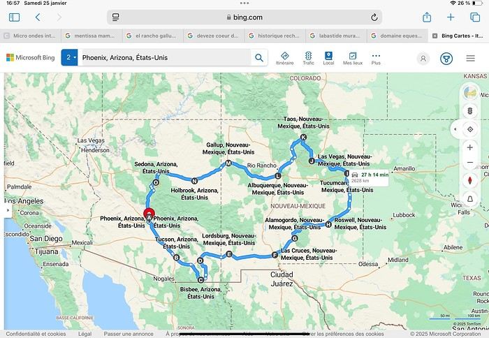
Day 1: Flight Marseille-Paris-Phoenix, then Gold Canyon (133 km) Day 2: Tucson (271 km) Lost Dutchman State Park Day 3: Tucson (155 km) Day 4: Tucson (34 km) Day 5: Bisbee (182 km) Day 6: Lordsburg (345 km) Day 7: Las Cruces (253 km) Day 8: Alamogordo (162 km) Day 9: Roswell (264 km) Day 10: Tucumcari (369 km) Day 11: Las Vegas (281 km) – the one in New Mexico Day 12: Taos (213 km) Day 13: Santa Fe (224 km) Day 14: Albuquerque (123 km) Day 15: Gallup (246 km) Day 16: Holbrook (224 km) Day 17: Flagstaff (179 km) Day 18: Sedona (118 km) Day 19: Sedona (48 km) Day 20: Sedona (41 km) Day 21: Phoenix (256 km) Day 22: Phoenix Airport (35 km)
📊 **Budget**: A little over 7,500 € for both of us, all included. The exchange rate was in our favor (1.17 dollars to 1 €). 📊 **Flights**: Marseille-Paris Charles de Gaulle-Phoenix: 1,787 € for two, with one checked bag each (Air France) 📊 **ESTA**: $42 📊 **America the Beautiful Pass**: $80 📊 **Parking**: 134 € (super eco at Marseille) 📊 **Car rental (Hertz)**: 865 €. Since there were no SUVs left in the reserved category (Nissan Rogue), we got an upgrade (4x4 Ford Explorer). We booked through Air France (15% discount). We’d originally reserved it in December for 1,140 €, but since prices dropped in March, we canceled and rebooked for 865 €. Hertz offers a free Hertz Gold Plus Rewards program, which gives you priority counter service when picking up the car. 📊 **Accommodation**: 2,400 € We stayed in hotels and motels of varying standards (from 60 to 203 € per night, depending on the city), all booked through Booking.com or Hotels.com. Out of 21 nights, only two didn’t include breakfast in the price. Booking.com sometimes offers slightly cheaper rates if you book by phone using the mobile app, and our Genius 3 status on the site also got us some preferential rates. 📊 **Supplementary insurance**: AVA 200 € for medical care if needed 📊 **Cash**: $2,078. We left with 1,000 € exchanged before departure and made two withdrawals of $500. This cash covered: - Evening restaurants and tips - Midday picnics - Gas: $298 for 4,160 km - Museum and private park entries (per person): - Lost Dutchman: $10 - Arizona-Sonora Desert Museum: $28 - Bird Cage Theater: $16 - Tombstone Shootout: $8 - New Mexico Farm & Ranch Museum: $12 - Roswell International UFO Museum: $5 - Billy the Kid Museum: $7 - Rancho de Taos: $22 - West Fork Oak Creek Trail entry: $15 We got a few discounts thanks to our senior age (+65). - Souvenirs and little treats
Like on our previous road trips, we didn’t rent a GPS. We got around using offline GPS apps Here WeGo and Organic Maps, with maps of the states we visited downloaded before we left (on our phones).
❤️❤️❤️ **Highlights** (there are so many!) 📍 Goldfield Ghost Town (even if it’s a reconstruction) 📍 The standing army of Saguaro cacti at Saguaro National Park West 📍 Diving into the cowboy universe of Tombstone 📍 The welcome from Rick and Henry at our guesthouse in Bisbee (Garden at Mile High Ranch) 📍 The tangled rocks of Chiricahua National Monument 📍 The flavored pistachios from Dwayne’s Fresh Jerky and Mac Ginnis Pistachioland 📍 Restaurants: La Posta (Las Cruces), Diner 66 (Albuquerque), and the Haunted Hamburger (Jerome) 📍 The old plazas of New Mexico 📍 The solitude and beauty of the white dunes at White Sands National Park 📍 Stepping back in time at the Billy the Kid Museum (Fort Stanton) 📍 Sections of historic Route 66 and the old motels of Tucumcari, especially at night when all the neon lights are on 📍 Taos Pueblo and diving into Native American culture 📍 After the Rio Grande Bridge, the descent via NM 567 to the very bottom of the Rio Grande Gorge, then the road along the riverbanks to Taos 📍 The tranquility of the Chimayo Sanctuary 📍 Discovering the ingenious native dwellings at Bandelier National Monument and Walnut Canyon National Park 📍 The small towns along the Turquoise Trail 📍 The red rocks of Red Rock Park and the Painted Desert 📍 The extraordinary colors of the petrified trees at Petrified Forest National Park 📍 Sedona, its red rocks, and the reward of the viewpoints at the end of hikes (Devil’s Bridge, The Subway, and West Fork Oak Creek) 📍 The immersion in Mexico when visiting Tlaquepaque 📍 The almost-ghost town of Jerome and its terraced streets 📍 The incredible kindness of Americans, always ready to help and up for a chat ❤️
☹️☹️☹️ **Flops** (there are very few) 📍 Several museums and churches being closed, so we couldn’t visit them 📍 Some museums and visitor centers opening late (10 AM) and closing early (4 PM) 📍 A 64 € phone roaming charge because we got near the Mexican border and picked up their cell tower 📍 The outrageous price ($5.99) for a gallon of gas at the Shell near Phoenix Airport
I hope this helps! Anyway, thanks for reading my long post. Don’t hesitate to reach out, even via PM, if you see I haven’t replied and you’d like more details. Have a great evening, everyone! 🙂
We’re back from our September 2025 road trip, this time to explore Arizona and New Mexico, and it’s time for me to start my travel journal—especially since everything’s already booked for another trip in September 2026 (to California), and I need to get started on the planning.
I was a little worried this new visit to Uncle Sam’s country might not be as "wow" as the others, but we still discovered some incredible places.
For those who don’t know us, we’re a couple in our seventies who speak very little English, but that didn’t stop us from fully enjoying our stay.
For this 6th road trip in the U.S., we spent 21 nights there, drove 4,160 km by car, and walked nearly 160 km in a loop starting from Phoenix.
We’d been to Arizona before (but not this side) and never to New Mexico. This whole road trip was a huge discovery for us.
In the prices mentioned (some in euros, others in dollars), bank fees and exchange charges are included. The flights, car rental, and parking were all paid for in December 2024 when we booked.
We’d downloaded the MPC (Mobile Passport Control) app, but there wasn’t a dedicated line at Phoenix Airport. Still, we got through quickly with friendly, smiling agents.
I don’t drive at all (I hate it), so the stops were chosen based on activities but also, for some, to limit daily mileage for the sole driver. The kilometers listed in the itinerary are the daily distances.
We traveled from September 9th to 22nd, unfortunately once again without our dear friends Mimi and Maumau.
The itinerary
Day 1: Flight Marseille-Paris-Phoenix, then Gold Canyon (133 km) Day 2: Tucson (271 km) Lost Dutchman State Park Day 3: Tucson (155 km) Day 4: Tucson (34 km) Day 5: Bisbee (182 km) Day 6: Lordsburg (345 km) Day 7: Las Cruces (253 km) Day 8: Alamogordo (162 km) Day 9: Roswell (264 km) Day 10: Tucumcari (369 km) Day 11: Las Vegas (281 km) – the one in New Mexico Day 12: Taos (213 km) Day 13: Santa Fe (224 km) Day 14: Albuquerque (123 km) Day 15: Gallup (246 km) Day 16: Holbrook (224 km) Day 17: Flagstaff (179 km) Day 18: Sedona (118 km) Day 19: Sedona (48 km) Day 20: Sedona (41 km) Day 21: Phoenix (256 km) Day 22: Phoenix Airport (35 km)
📊 **Budget**: A little over 7,500 € for both of us, all included. The exchange rate was in our favor (1.17 dollars to 1 €). 📊 **Flights**: Marseille-Paris Charles de Gaulle-Phoenix: 1,787 € for two, with one checked bag each (Air France) 📊 **ESTA**: $42 📊 **America the Beautiful Pass**: $80 📊 **Parking**: 134 € (super eco at Marseille) 📊 **Car rental (Hertz)**: 865 €. Since there were no SUVs left in the reserved category (Nissan Rogue), we got an upgrade (4x4 Ford Explorer). We booked through Air France (15% discount). We’d originally reserved it in December for 1,140 €, but since prices dropped in March, we canceled and rebooked for 865 €. Hertz offers a free Hertz Gold Plus Rewards program, which gives you priority counter service when picking up the car. 📊 **Accommodation**: 2,400 € We stayed in hotels and motels of varying standards (from 60 to 203 € per night, depending on the city), all booked through Booking.com or Hotels.com. Out of 21 nights, only two didn’t include breakfast in the price. Booking.com sometimes offers slightly cheaper rates if you book by phone using the mobile app, and our Genius 3 status on the site also got us some preferential rates. 📊 **Supplementary insurance**: AVA 200 € for medical care if needed 📊 **Cash**: $2,078. We left with 1,000 € exchanged before departure and made two withdrawals of $500. This cash covered: - Evening restaurants and tips - Midday picnics - Gas: $298 for 4,160 km - Museum and private park entries (per person): - Lost Dutchman: $10 - Arizona-Sonora Desert Museum: $28 - Bird Cage Theater: $16 - Tombstone Shootout: $8 - New Mexico Farm & Ranch Museum: $12 - Roswell International UFO Museum: $5 - Billy the Kid Museum: $7 - Rancho de Taos: $22 - West Fork Oak Creek Trail entry: $15 We got a few discounts thanks to our senior age (+65). - Souvenirs and little treats
Like on our previous road trips, we didn’t rent a GPS. We got around using offline GPS apps Here WeGo and Organic Maps, with maps of the states we visited downloaded before we left (on our phones).
❤️❤️❤️ **Highlights** (there are so many!) 📍 Goldfield Ghost Town (even if it’s a reconstruction) 📍 The standing army of Saguaro cacti at Saguaro National Park West 📍 Diving into the cowboy universe of Tombstone 📍 The welcome from Rick and Henry at our guesthouse in Bisbee (Garden at Mile High Ranch) 📍 The tangled rocks of Chiricahua National Monument 📍 The flavored pistachios from Dwayne’s Fresh Jerky and Mac Ginnis Pistachioland 📍 Restaurants: La Posta (Las Cruces), Diner 66 (Albuquerque), and the Haunted Hamburger (Jerome) 📍 The old plazas of New Mexico 📍 The solitude and beauty of the white dunes at White Sands National Park 📍 Stepping back in time at the Billy the Kid Museum (Fort Stanton) 📍 Sections of historic Route 66 and the old motels of Tucumcari, especially at night when all the neon lights are on 📍 Taos Pueblo and diving into Native American culture 📍 After the Rio Grande Bridge, the descent via NM 567 to the very bottom of the Rio Grande Gorge, then the road along the riverbanks to Taos 📍 The tranquility of the Chimayo Sanctuary 📍 Discovering the ingenious native dwellings at Bandelier National Monument and Walnut Canyon National Park 📍 The small towns along the Turquoise Trail 📍 The red rocks of Red Rock Park and the Painted Desert 📍 The extraordinary colors of the petrified trees at Petrified Forest National Park 📍 Sedona, its red rocks, and the reward of the viewpoints at the end of hikes (Devil’s Bridge, The Subway, and West Fork Oak Creek) 📍 The immersion in Mexico when visiting Tlaquepaque 📍 The almost-ghost town of Jerome and its terraced streets 📍 The incredible kindness of Americans, always ready to help and up for a chat ❤️
☹️☹️☹️ **Flops** (there are very few) 📍 Several museums and churches being closed, so we couldn’t visit them 📍 Some museums and visitor centers opening late (10 AM) and closing early (4 PM) 📍 A 64 € phone roaming charge because we got near the Mexican border and picked up their cell tower 📍 The outrageous price ($5.99) for a gallon of gas at the Shell near Phoenix Airport
I hope this helps! Anyway, thanks for reading my long post. Don’t hesitate to reach out, even via PM, if you see I haven’t replied and you’d like more details. Have a great evening, everyone! 🙂
USA Road Trip 2023 - Part 1
In January 2023, we started our second road trip across the United States. We stayed from January to mid-March, which gave us plenty of time to visit several cities, attractions, and parks in multiple states.
This travel journal will be split into two parts due to the considerable number of places we visited.
This first journal covers the following states: Ohio, Indiana, Missouri, Oklahoma, Texas, New Mexico, Arizona, Nevada, and California, and takes you through the outbound leg of our road trip.
The second journal will showcase the attractions we visited on the return trip, which mainly follows the famous Highway 1 along the Pacific coast.
So, I invite you to keep reading this first journal, which serves as a long recap to help you discover the various attractions we explored throughout this road trip.
Videos are included throughout the recap. Please click on the image to start the video.
Here are the links to jump to a specific post:
OHIO:
WinterLand - Christmas Lights at Cleveland Public Square Lake View Cemetery - Cleveland - Part 1 Lake View Cemetery - Cleveland - Part 2 Stroll through Columbus Upper Falls to Lower Falls via Buckeye Trail - Hocking Hills State Park – Logan Cedar Falls & Whispering Falls Hiking Trail - Hocking Hills State Park – Logan Ash Cave Hiking Trail - Hocking Hills State Park – Logan Exploring Cincinnati
INDIANA:
Visiting Indianapolis
MISSOURI:
Exploring St. Louis
OKLAHOMA:
Catoosa Blue Whale Discovering Tulsa Exploring Oklahoma City
TEXAS:
Exploring Shamrock Discovering McLean Exploring Amarillo
NEW MEXICO:
Ancestral Sites Trail - Pecos National Historical Park Discovering Santa Fe The Santuario de Chimayó Stroll through Los Cerrillos Walk through the village of Madrid San Francisco de Asis Catholic Church & The Bottle House - Golden Albuquerque Murals 66 Diner - Albuquerque Stroll through Old Town (Albuquerque) Rinconada Canyon Trail - Petroglyph National Monument Mesa Point Trail - Boca Negra Canyon - Petroglyph National Monument Macaw Trail - Boca Negra Canyon - Petroglyph National Monument Cliff Base Trail - Boca Negra Canyon - Petroglyph National Monument Piedras Marcadas Canyon - Petroglyph National Monument Sandstone Bluffs & Ventana Natural Arch - El Malpais National Monument
ARIZONA:
Stewart's Petrified Wood Shop – Holbrook Stroll through Holbrook Discovering Joseph City Exploring Winslow Grand Falls (The "Chocolate Falls") – Leupp Island Trail - Walnut Canyon National Monument Rim Trail - Walnut Canyon National Monument Wukoki Pueblo Trail – Wupatki National Monument Wupatki Pueblo Trail – Wupatki National Monument Doney Mountain Trail – Wupatki National Monument Citadel & Nalakihu Pueblos Trail – Wupatki National Monument Lomaki & Box Canyon Pueblos Trail – Wupatki National Monument Discovering Flagstaff On the way to Sedona Slide Rock State Park – Sedona Midgley Bridge Trail – Wilson Canyon – Sedona Tlaquepaque Arts & Shopping Village Walking Tour - Sedona Chapel of the Holy Cross - Sedona Hiking at Cathedral Rock - Sedona Hiking the Bell Rock Trail - Sedona Hiking the Airport Loop Trail - Sedona Amitabha Stupa and Peace Park - Sedona Hiking the Boynton Canyon Vortex Trail - Sedona Hiking the Devil's Bridge Trail - Sedona Hiking the Birthing Cave Trail - Sedona Bell Rock Inn - Sedona On the roads of Sedona - Part 1 On the roads of Sedona - Part 2 Keyhole Sink Hiking Trail - Kaibab National Forest Discovering Williams Exploring Ash Fork Discovering Kingman Ramada by Wyndham Kingman Davis Camp Park - Bullhead City Discovering Yucca Lake Havasu Boardwalk Tour A duck catches a lobster – Lake Havasu Boardwalk
CALIFORNIA:
Exploring Needles Discovering Goffs Discovering Amboy Visiting the famous Bagdad Cafe - Newberry Springs Exploring Barstow Vehicles from Hell (Mad Max Cars) - Barstow Peggy Sue's 50's Diner - Yermo Liberty Sculpture Park - Yermo Lake Dolores Water Park - Newberry Springs ZZYZX Road - Mojave National Preserve Alien Fresh Jerky - Baker Kelso Dunes Trail - Mojave National Preserve Hole-in-the-Wall Rings Trail - Mojave National Preserve Visiting Mitchell Caverns - Mojave National Preserve Dante's View - Death Valley National Park Zabriskie Point - Death Valley National Park Golden Canyon - Death Valley National Park Artists Drive & Artists Palette - Death Valley National Park Devil's Golf Course - Death Valley National Park Natural Bridge Trail - Death Valley National Park Badwater Basin - Death Valley National Park Harmony Borax Works - Death Valley National Park Devil's Cornfield - Death Valley National Park Mesquite Flat Sand Dunes - Death Valley National Park Mosaic Canyon Trail - Death Valley National Park On the road - Death Valley National Park
NEVADA:
Cleveland Clinic Lou Ruvo Center for Brain Health - Las Vegas Exploring Downtown Las Vegas SlotZilla Zipline - Fremont Street Experience – Downtown Las Vegas Viva Vision Light Show 1 - Fremont Street Experience - Downtown Las Vegas Viva Vision Light Show 2 - Fremont Street Experience - Downtown Las Vegas Viva Vision Light Show 3 - Fremont Street Experience - Downtown Las Vegas Viva Vision Light Show 4 - Fremont Street Experience - Downtown Las Vegas Free Live Music – Fremont Street Experience - Downtown Las Vegas Chucky – Fremont Street Experience - Downtown Las Vegas Las Vegas Strip - Part 1 Las Vegas Strip - Part 2 Las Vegas Strip - Part 3 Las Vegas Strip - Part 4 Las Vegas Strip - Part 5 Tom Devlin's Monster Museum - Boulder City Hoover Dam Lake Mead - Lakeview Overlook - Boulder City Nelson Ghost Town - Searchlight
CALIFORNIA:
Scenic Route through Joshua Tree National Park via the North Entrance Hidden Valley Trail - Joshua Tree National Park Barker Dam Trail - Joshua Tree National Park Cap Rock Trail - Joshua Tree National Park Keys View Trail - Joshua Tree National Park Hall of Horrors Trail - Joshua Tree National Park Skull Rock Trail - Joshua Tree National Park Arch Rock Trail - Joshua Tree National Park Cholla Cactus Garden Trail - Joshua Tree National Park Lone Pine - Owens Valley Miss Alabama & Shark Fin - Alabama Hills - Owens Valley Lone Ranger Canyon - Alabama Hills - Owens Valley Mobius Arch Loop Trail (Heart Arch & Lathe Arch) - Alabama Hills - Owens Valley Eye of the Alabama Hills Arch - Alabama Hills - Owens Valley Boot & Cyclops Arches - Alabama Hills - Owens Valley One Mile Arch, Bowling Ball and Pins & Gunga Din Area - Alabama Hills - Owens Valley Whitney Portal Arch Trailhead - Alabama Hills - Owens Valley Fish Rocks & Trona Pinnacles - Mojave Desert Red Cliffs Trail - Red Rock Canyon State Park Hagen Canyon Nature Trail - Red Rock Canyon State Park Tour of Historic Downtown Tehachapi View of the Tehachapi Loop – Monolith César E. Chávez National Monument – Keene Discovering Bakersfield Kern County Museum – Bakersfield Bravo Farms, Tree House & Petting Zoo - Traver Walking Tour of Kingsburg Exploring Fresno Simonian Farms & Soul Consoling Japanese Internment Tower - Fresno Duncan Ceramic Products (iLoveToCreate) - Fresno Walking Tour of Modesto Wat Dhammararam Buddhist Temple - Stockton Walking Tour of Stockton Discovering Stockton University of the Pacific - Stockton Visiting Lodi Sutter's Fort State Historic Park - Sacramento California State Capitol - Sacramento Walking Tour - Sacramento Walking Tour - Winters Walking Tour - Napa The Chandelier Tree In Drive-Thru Tree Park - Leggett One Log House - Garberville Grandfather Tree - Piercy The Living Chimney Tree - Avenue of the Giants Stephens Grove Loop Trail - Avenue of the Giants Gould Grove Nature Loop Trail - Avenue of the Giants Fleishmann Grove Trail - Avenue of the Giants Mahan Plaque Trail - Avenue of the Giants Founders Grove Nature Loop Trail - Avenue of the Giants Eternal Tree House & Immortal Tree - Avenue of the Giants Drury-Chaney Loop Trail - Avenue of the Giants Walking Tour - Redcrest
COMING UP NEXT:
USA Road Trip 2023 - Part 2
This travel journal will be split into two parts due to the considerable number of places we visited.
This first journal covers the following states: Ohio, Indiana, Missouri, Oklahoma, Texas, New Mexico, Arizona, Nevada, and California, and takes you through the outbound leg of our road trip.
The second journal will showcase the attractions we visited on the return trip, which mainly follows the famous Highway 1 along the Pacific coast.
So, I invite you to keep reading this first journal, which serves as a long recap to help you discover the various attractions we explored throughout this road trip.
Videos are included throughout the recap. Please click on the image to start the video.
Here are the links to jump to a specific post:
OHIO:
WinterLand - Christmas Lights at Cleveland Public Square Lake View Cemetery - Cleveland - Part 1 Lake View Cemetery - Cleveland - Part 2 Stroll through Columbus Upper Falls to Lower Falls via Buckeye Trail - Hocking Hills State Park – Logan Cedar Falls & Whispering Falls Hiking Trail - Hocking Hills State Park – Logan Ash Cave Hiking Trail - Hocking Hills State Park – Logan Exploring Cincinnati
INDIANA:
Visiting Indianapolis
MISSOURI:
Exploring St. Louis
OKLAHOMA:
Catoosa Blue Whale Discovering Tulsa Exploring Oklahoma City
TEXAS:
Exploring Shamrock Discovering McLean Exploring Amarillo
NEW MEXICO:
Ancestral Sites Trail - Pecos National Historical Park Discovering Santa Fe The Santuario de Chimayó Stroll through Los Cerrillos Walk through the village of Madrid San Francisco de Asis Catholic Church & The Bottle House - Golden Albuquerque Murals 66 Diner - Albuquerque Stroll through Old Town (Albuquerque) Rinconada Canyon Trail - Petroglyph National Monument Mesa Point Trail - Boca Negra Canyon - Petroglyph National Monument Macaw Trail - Boca Negra Canyon - Petroglyph National Monument Cliff Base Trail - Boca Negra Canyon - Petroglyph National Monument Piedras Marcadas Canyon - Petroglyph National Monument Sandstone Bluffs & Ventana Natural Arch - El Malpais National Monument
ARIZONA:
Stewart's Petrified Wood Shop – Holbrook Stroll through Holbrook Discovering Joseph City Exploring Winslow Grand Falls (The "Chocolate Falls") – Leupp Island Trail - Walnut Canyon National Monument Rim Trail - Walnut Canyon National Monument Wukoki Pueblo Trail – Wupatki National Monument Wupatki Pueblo Trail – Wupatki National Monument Doney Mountain Trail – Wupatki National Monument Citadel & Nalakihu Pueblos Trail – Wupatki National Monument Lomaki & Box Canyon Pueblos Trail – Wupatki National Monument Discovering Flagstaff On the way to Sedona Slide Rock State Park – Sedona Midgley Bridge Trail – Wilson Canyon – Sedona Tlaquepaque Arts & Shopping Village Walking Tour - Sedona Chapel of the Holy Cross - Sedona Hiking at Cathedral Rock - Sedona Hiking the Bell Rock Trail - Sedona Hiking the Airport Loop Trail - Sedona Amitabha Stupa and Peace Park - Sedona Hiking the Boynton Canyon Vortex Trail - Sedona Hiking the Devil's Bridge Trail - Sedona Hiking the Birthing Cave Trail - Sedona Bell Rock Inn - Sedona On the roads of Sedona - Part 1 On the roads of Sedona - Part 2 Keyhole Sink Hiking Trail - Kaibab National Forest Discovering Williams Exploring Ash Fork Discovering Kingman Ramada by Wyndham Kingman Davis Camp Park - Bullhead City Discovering Yucca Lake Havasu Boardwalk Tour A duck catches a lobster – Lake Havasu Boardwalk
CALIFORNIA:
Exploring Needles Discovering Goffs Discovering Amboy Visiting the famous Bagdad Cafe - Newberry Springs Exploring Barstow Vehicles from Hell (Mad Max Cars) - Barstow Peggy Sue's 50's Diner - Yermo Liberty Sculpture Park - Yermo Lake Dolores Water Park - Newberry Springs ZZYZX Road - Mojave National Preserve Alien Fresh Jerky - Baker Kelso Dunes Trail - Mojave National Preserve Hole-in-the-Wall Rings Trail - Mojave National Preserve Visiting Mitchell Caverns - Mojave National Preserve Dante's View - Death Valley National Park Zabriskie Point - Death Valley National Park Golden Canyon - Death Valley National Park Artists Drive & Artists Palette - Death Valley National Park Devil's Golf Course - Death Valley National Park Natural Bridge Trail - Death Valley National Park Badwater Basin - Death Valley National Park Harmony Borax Works - Death Valley National Park Devil's Cornfield - Death Valley National Park Mesquite Flat Sand Dunes - Death Valley National Park Mosaic Canyon Trail - Death Valley National Park On the road - Death Valley National Park
NEVADA:
Cleveland Clinic Lou Ruvo Center for Brain Health - Las Vegas Exploring Downtown Las Vegas SlotZilla Zipline - Fremont Street Experience – Downtown Las Vegas Viva Vision Light Show 1 - Fremont Street Experience - Downtown Las Vegas Viva Vision Light Show 2 - Fremont Street Experience - Downtown Las Vegas Viva Vision Light Show 3 - Fremont Street Experience - Downtown Las Vegas Viva Vision Light Show 4 - Fremont Street Experience - Downtown Las Vegas Free Live Music – Fremont Street Experience - Downtown Las Vegas Chucky – Fremont Street Experience - Downtown Las Vegas Las Vegas Strip - Part 1 Las Vegas Strip - Part 2 Las Vegas Strip - Part 3 Las Vegas Strip - Part 4 Las Vegas Strip - Part 5 Tom Devlin's Monster Museum - Boulder City Hoover Dam Lake Mead - Lakeview Overlook - Boulder City Nelson Ghost Town - Searchlight
CALIFORNIA:
Scenic Route through Joshua Tree National Park via the North Entrance Hidden Valley Trail - Joshua Tree National Park Barker Dam Trail - Joshua Tree National Park Cap Rock Trail - Joshua Tree National Park Keys View Trail - Joshua Tree National Park Hall of Horrors Trail - Joshua Tree National Park Skull Rock Trail - Joshua Tree National Park Arch Rock Trail - Joshua Tree National Park Cholla Cactus Garden Trail - Joshua Tree National Park Lone Pine - Owens Valley Miss Alabama & Shark Fin - Alabama Hills - Owens Valley Lone Ranger Canyon - Alabama Hills - Owens Valley Mobius Arch Loop Trail (Heart Arch & Lathe Arch) - Alabama Hills - Owens Valley Eye of the Alabama Hills Arch - Alabama Hills - Owens Valley Boot & Cyclops Arches - Alabama Hills - Owens Valley One Mile Arch, Bowling Ball and Pins & Gunga Din Area - Alabama Hills - Owens Valley Whitney Portal Arch Trailhead - Alabama Hills - Owens Valley Fish Rocks & Trona Pinnacles - Mojave Desert Red Cliffs Trail - Red Rock Canyon State Park Hagen Canyon Nature Trail - Red Rock Canyon State Park Tour of Historic Downtown Tehachapi View of the Tehachapi Loop – Monolith César E. Chávez National Monument – Keene Discovering Bakersfield Kern County Museum – Bakersfield Bravo Farms, Tree House & Petting Zoo - Traver Walking Tour of Kingsburg Exploring Fresno Simonian Farms & Soul Consoling Japanese Internment Tower - Fresno Duncan Ceramic Products (iLoveToCreate) - Fresno Walking Tour of Modesto Wat Dhammararam Buddhist Temple - Stockton Walking Tour of Stockton Discovering Stockton University of the Pacific - Stockton Visiting Lodi Sutter's Fort State Historic Park - Sacramento California State Capitol - Sacramento Walking Tour - Sacramento Walking Tour - Winters Walking Tour - Napa The Chandelier Tree In Drive-Thru Tree Park - Leggett One Log House - Garberville Grandfather Tree - Piercy The Living Chimney Tree - Avenue of the Giants Stephens Grove Loop Trail - Avenue of the Giants Gould Grove Nature Loop Trail - Avenue of the Giants Fleishmann Grove Trail - Avenue of the Giants Mahan Plaque Trail - Avenue of the Giants Founders Grove Nature Loop Trail - Avenue of the Giants Eternal Tree House & Immortal Tree - Avenue of the Giants Drury-Chaney Loop Trail - Avenue of the Giants Walking Tour - Redcrest
COMING UP NEXT:
USA Road Trip 2023 - Part 2
Join me in discovering Gran Canaria
Introduction
We stayed on the island of Gran Canaria during the first three months of 2024. It’s the third Canary Island we’ve visited, after Tenerife and Lanzarote.
We rented an apartment in Temisas. By staying in the same place for such a long period, the total price dropped by 50%.
We also rented a vehicle to make getting around the island easier.
Why the Canary Islands, and Gran Canaria in particular? For its pleasant climate, the nature and diversity of its landscapes, the charming villages, and especially the beauty of its many beaches.
In this travel journal, you’ll find a list of the many activities we did during our stay to explore the different attractions of this island.
These attractions are categorized to make it easier to find what interests you.
Videos are included throughout the summary. Click on the image to start the video.
To jump to a specific post, here are the relevant links:
HIKES:
Roque Nublo Maspalomas Dunes - Part 1 Maspalomas Dunes - Part 2 Los Azulejos de Veneguera Barranco de Las Vacas Ventana del Bentayga (Arco del Aserrador) Caves of the King Ventana de Morro (Ventana de la Ganifa) The Dog of Bentayga Cave of the Four Doors Ventana del Nublo Artenera - Caves of Acusa Seca Temisas - El Gigante Cave Fortress of Ansite Puerto de Las Nieves - Roque de Las Nieves Temisas - Cuevas de la Audiencia Roque Bentayga Guayadeque Ravine (Guayadeque Hermitage) Guayadeque Ravine (Cueva de Bartalo) El Zumacal - Barranco Tauco Casablanca Dam (Los Dolores Dam) Ayagaures - La Angostura Dam & Gambuesa Dam Santa Brígida - Alonso Ravine & Centennial Dragon Tree Pino Santo Hike in the Azuaje Ravine Gáldar - Red Lands of Samarrita Tejeda - Charco de La Paloma Bandama Boiler (Camino Borde de Caldera Bandama) Teror - Alamo Ravine Trail – SL-4 Telde - Calasio Caves Special Natural Reserve of Los Tilos de Moya Los Azulejos - Charco de Las Aneas Fataga Ravine Arinaga Military Battery Trail Maspalomas - Las Fuentes and del Canizo Ravines Mogán - Tauro Mountain Trail Tamabada - Llanos de La Mimbre & Sobre la Cueva Viewpoints Trail Hike to the Coronadero Arch via Barranco Hondo Barranco de Silva - Hike to the Jerez Caves Gáldar - Samson Cave - La Atalaya Peak Agaete - Roque Guayedra and Guayedra Ravine Artenara - Caballero Caves Arucas - Bufadero Salt Flats Barranco de Pino Gordo - Natural Pools Telde - Los Cernícalos Ravine Las Cruces - Toba Caves & Picón Puerto de Las Nieves - Moro Cave Agüimes - Morros de Ávila Caves Juncalillo del Sur - Laguna & Salinas de Abajo Caves of Camino de San Felipe Cruz de Tejeda, Cruz Chico and Degollada Viewpoint Hike on the Patalavaca Circuit Motor Grande - Puerto Rico Arch El Montañón - Los Hornos Dam Seafront Walk - Amadores Beach – Puerto Rico Beach Las Niñas Dam El Hornillo - Omega & Omicron Caves Arteara Necropolis Mogán - El Mulato Dam Las Garzas - El Regante Dam La Plata Route - Cho Flores Dam & El Charco Hondo Vega de Acusa - La Candelaria Dam Candelaria Hermitage – Acusa Seca Viewpoint Valsequillo de Gran Canaria – Roque La Vela Ayagaures Dam – GC-602 Lomo del Palo - Monte Pavón Trail Lugar La Laguna - Levada Fataga Dam & Ravine
BEACHES:
Mogán Beach Taurito Beach Tauro Beach Amadores Beach Puerto Rico Beach Anfi del Mar Beach Patalavaca Beach Meloneras Beach Maspalomas Beach English Beach (Playa del Inglés) Las Burras Beach San Agustin Beach Las Alcaravaneras Beach Las Canteras Beach (La Cicer) Las Canteras Beach (La Puntilla) Las Canteras Beach (Santa Catalina) Aquamarina Beach El Agujero - Bocabarranco Beach Hoya Del Pozo Beach Hoya Del Pozo Beach - Lizard with amputated tail El Cabron Beach Ojos de Garza Beach El Burrero Beach
NATURAL POOLS:
Charco Azul - El Risco Agaete Salt Flats Charco de Los Espejos - Sardina del Norte Natural Pools of Punta de Gáldar Snorkeling in the natural pool of Punta de Gáldar Natural Pool La Furnia o El Clavo - Gáldar Natural Pool of Los Dos Roques Emiliano Natural Pool - El Agujero Natural Pool of El Agujero Natural Pools of Roque Prieto Natural Pool El Altillo Los Charcones de Bañaderos – Arucas Natural Pools of El Charco de Las Palomas – Arucas Natural Pools of La Laja - Las Palmas de Gran Canaria Cueva de la Reina Mora - La Garita Natural Pools of Castillo del Romeral
TOWNS:
Center
Santa Brigida Vega de San Mateo Tejeda Artenara Vallesco Teror
Southwest
Santa Lucia de Tirajana Fataga San Bartolomé de Tirajana Puerto de Mogán La Aldea de San Nicolas
North
Arucas Firgas Moya Santa Maria de Guia Gáldar Agaete Puerto de Las Nieves
East
Vegueta - Las Palmas de Gran Canaria Triana - Las Palmas de Gran Canaria Ciudad Jardin - Las Palmas de Gran Canaria Canteras - Las Palmas de Gran Canaria Telde Valsequillo de Gran Canaria Ingenio Agüimes Temisas
VIEWPOINTS:
GC-60 Route (or nearby) GC-210 Route (or nearby) GC-210 Route between the tunnel and La Aldea de San Nicolás GC-215 & GC-65 Routes (or nearby) GC-200 Route (or nearby) GC-130 Route (or nearby) & GC-605 GC-70 Route (or nearby) & GC-21 Sheep herd on GC-70 Route GC-150, GC-240, GC-305, GC-350 & GC-301 Routes GC-606, GC-295, GC-231 and GC-41 Routes (or nearby) Viewpoints – GC-1 Route (or nearby) Viewpoints - Las Palmas de Gran Canaria Viewpoints - GC-2, GC-21, GC-15, GC-216 and GC-132 Routes (or nearby) Viewpoints - GC-503 & GC-217 Routes Viewpoints - GC-604, GC-505, GC-132, GC-42 and GC-802 Routes
MISCELLANEOUS:
San Rafael Aqueduct - Telde Abandoned San Rafael Estate - La Higuera Cenobio de Valerón La Cesta - Tejeda Puerto de la Aldea Scenic Route GC-671 to El Espinillo Scenic Route GC-607 to El Chorrillo The Galdar Cube (Santiago Quarry) Scenic Route GC-504 to Ayagaures Abandoned seaside resort in the Azuaje Ravine El Bufadero de La Garita – Telde GC-505 Route Abandoned Finca Las Haciendas (Los Mocanes) – Las Vegas de Valsequillo Ruins of San Juan Battery - Las Palmas de Gran Canaria Viera y Clavijo Canarian Botanical Garden - Las Palmas de Gran Canaria Tenefé Salt Flats Los Pérez, Lugarejos & Las Hoyas Dams Monte Pavón, Gran Canaria’s little Ireland Valleseco Lagoon Recreational Area Climbing - Fataga Ravine Surfing – El Agujero El Cairete Restaurant - Carrizal de Tejeda Paragliding flight observation - Los Giles La Cuevita Ayagaures Restaurant Statues and Murals - Cruce de Arinaga Aviation Monument (Las Majoreras) & Murals – Carrizal Artistic recycling by Antonio Peñita - Ojos de Garza Rainbows
We stayed on the island of Gran Canaria during the first three months of 2024. It’s the third Canary Island we’ve visited, after Tenerife and Lanzarote.
We rented an apartment in Temisas. By staying in the same place for such a long period, the total price dropped by 50%.
We also rented a vehicle to make getting around the island easier.
Why the Canary Islands, and Gran Canaria in particular? For its pleasant climate, the nature and diversity of its landscapes, the charming villages, and especially the beauty of its many beaches.
In this travel journal, you’ll find a list of the many activities we did during our stay to explore the different attractions of this island.
These attractions are categorized to make it easier to find what interests you.
Videos are included throughout the summary. Click on the image to start the video.
To jump to a specific post, here are the relevant links:
HIKES:
Roque Nublo Maspalomas Dunes - Part 1 Maspalomas Dunes - Part 2 Los Azulejos de Veneguera Barranco de Las Vacas Ventana del Bentayga (Arco del Aserrador) Caves of the King Ventana de Morro (Ventana de la Ganifa) The Dog of Bentayga Cave of the Four Doors Ventana del Nublo Artenera - Caves of Acusa Seca Temisas - El Gigante Cave Fortress of Ansite Puerto de Las Nieves - Roque de Las Nieves Temisas - Cuevas de la Audiencia Roque Bentayga Guayadeque Ravine (Guayadeque Hermitage) Guayadeque Ravine (Cueva de Bartalo) El Zumacal - Barranco Tauco Casablanca Dam (Los Dolores Dam) Ayagaures - La Angostura Dam & Gambuesa Dam Santa Brígida - Alonso Ravine & Centennial Dragon Tree Pino Santo Hike in the Azuaje Ravine Gáldar - Red Lands of Samarrita Tejeda - Charco de La Paloma Bandama Boiler (Camino Borde de Caldera Bandama) Teror - Alamo Ravine Trail – SL-4 Telde - Calasio Caves Special Natural Reserve of Los Tilos de Moya Los Azulejos - Charco de Las Aneas Fataga Ravine Arinaga Military Battery Trail Maspalomas - Las Fuentes and del Canizo Ravines Mogán - Tauro Mountain Trail Tamabada - Llanos de La Mimbre & Sobre la Cueva Viewpoints Trail Hike to the Coronadero Arch via Barranco Hondo Barranco de Silva - Hike to the Jerez Caves Gáldar - Samson Cave - La Atalaya Peak Agaete - Roque Guayedra and Guayedra Ravine Artenara - Caballero Caves Arucas - Bufadero Salt Flats Barranco de Pino Gordo - Natural Pools Telde - Los Cernícalos Ravine Las Cruces - Toba Caves & Picón Puerto de Las Nieves - Moro Cave Agüimes - Morros de Ávila Caves Juncalillo del Sur - Laguna & Salinas de Abajo Caves of Camino de San Felipe Cruz de Tejeda, Cruz Chico and Degollada Viewpoint Hike on the Patalavaca Circuit Motor Grande - Puerto Rico Arch El Montañón - Los Hornos Dam Seafront Walk - Amadores Beach – Puerto Rico Beach Las Niñas Dam El Hornillo - Omega & Omicron Caves Arteara Necropolis Mogán - El Mulato Dam Las Garzas - El Regante Dam La Plata Route - Cho Flores Dam & El Charco Hondo Vega de Acusa - La Candelaria Dam Candelaria Hermitage – Acusa Seca Viewpoint Valsequillo de Gran Canaria – Roque La Vela Ayagaures Dam – GC-602 Lomo del Palo - Monte Pavón Trail Lugar La Laguna - Levada Fataga Dam & Ravine
BEACHES:
Mogán Beach Taurito Beach Tauro Beach Amadores Beach Puerto Rico Beach Anfi del Mar Beach Patalavaca Beach Meloneras Beach Maspalomas Beach English Beach (Playa del Inglés) Las Burras Beach San Agustin Beach Las Alcaravaneras Beach Las Canteras Beach (La Cicer) Las Canteras Beach (La Puntilla) Las Canteras Beach (Santa Catalina) Aquamarina Beach El Agujero - Bocabarranco Beach Hoya Del Pozo Beach Hoya Del Pozo Beach - Lizard with amputated tail El Cabron Beach Ojos de Garza Beach El Burrero Beach
NATURAL POOLS:
Charco Azul - El Risco Agaete Salt Flats Charco de Los Espejos - Sardina del Norte Natural Pools of Punta de Gáldar Snorkeling in the natural pool of Punta de Gáldar Natural Pool La Furnia o El Clavo - Gáldar Natural Pool of Los Dos Roques Emiliano Natural Pool - El Agujero Natural Pool of El Agujero Natural Pools of Roque Prieto Natural Pool El Altillo Los Charcones de Bañaderos – Arucas Natural Pools of El Charco de Las Palomas – Arucas Natural Pools of La Laja - Las Palmas de Gran Canaria Cueva de la Reina Mora - La Garita Natural Pools of Castillo del Romeral
TOWNS:
Center
Santa Brigida Vega de San Mateo Tejeda Artenara Vallesco Teror
Southwest
Santa Lucia de Tirajana Fataga San Bartolomé de Tirajana Puerto de Mogán La Aldea de San Nicolas
North
Arucas Firgas Moya Santa Maria de Guia Gáldar Agaete Puerto de Las Nieves
East
Vegueta - Las Palmas de Gran Canaria Triana - Las Palmas de Gran Canaria Ciudad Jardin - Las Palmas de Gran Canaria Canteras - Las Palmas de Gran Canaria Telde Valsequillo de Gran Canaria Ingenio Agüimes Temisas
VIEWPOINTS:
GC-60 Route (or nearby) GC-210 Route (or nearby) GC-210 Route between the tunnel and La Aldea de San Nicolás GC-215 & GC-65 Routes (or nearby) GC-200 Route (or nearby) GC-130 Route (or nearby) & GC-605 GC-70 Route (or nearby) & GC-21 Sheep herd on GC-70 Route GC-150, GC-240, GC-305, GC-350 & GC-301 Routes GC-606, GC-295, GC-231 and GC-41 Routes (or nearby) Viewpoints – GC-1 Route (or nearby) Viewpoints - Las Palmas de Gran Canaria Viewpoints - GC-2, GC-21, GC-15, GC-216 and GC-132 Routes (or nearby) Viewpoints - GC-503 & GC-217 Routes Viewpoints - GC-604, GC-505, GC-132, GC-42 and GC-802 Routes
MISCELLANEOUS:
San Rafael Aqueduct - Telde Abandoned San Rafael Estate - La Higuera Cenobio de Valerón La Cesta - Tejeda Puerto de la Aldea Scenic Route GC-671 to El Espinillo Scenic Route GC-607 to El Chorrillo The Galdar Cube (Santiago Quarry) Scenic Route GC-504 to Ayagaures Abandoned seaside resort in the Azuaje Ravine El Bufadero de La Garita – Telde GC-505 Route Abandoned Finca Las Haciendas (Los Mocanes) – Las Vegas de Valsequillo Ruins of San Juan Battery - Las Palmas de Gran Canaria Viera y Clavijo Canarian Botanical Garden - Las Palmas de Gran Canaria Tenefé Salt Flats Los Pérez, Lugarejos & Las Hoyas Dams Monte Pavón, Gran Canaria’s little Ireland Valleseco Lagoon Recreational Area Climbing - Fataga Ravine Surfing – El Agujero El Cairete Restaurant - Carrizal de Tejeda Paragliding flight observation - Los Giles La Cuevita Ayagaures Restaurant Statues and Murals - Cruce de Arinaga Aviation Monument (Las Majoreras) & Murals – Carrizal Artistic recycling by Antonio Peñita - Ojos de Garza Rainbows
USA 2022 Road Trip
During our first road trip across the United States, we covered 23,000 km and crossed 28 states in 53 days.
Originally, we had planned to drive Route 66 all the way to Oatman in Arizona and visit various national parks in the American West over a two-month period.
This itinerary was planned before our departure, and all the relevant information had been gathered to stick to the schedule.
Everything went so smoothly that we finished visiting the national parks well ahead of our planned return date.
It helped that having a bed, a portable toilet, and a cooler in our vehicle gave us some autonomy since we didn’t have to worry about accommodation.
So, we decided to extend our road trip to the cities of Nashville and Memphis in Tennessee.
We then headed to Louisiana to visit Baton Rouge and New Orleans.
We crossed Mississippi and Alabama before driving along Florida’s west coast all the way to Key West.
We returned via Florida’s east coast and then crossed the eastern U.S. states to get back to Quebec through the Jackman border crossing in Maine.
So, I invite you to keep reading this long recap, which will let you discover the different attractions we visited throughout this amazing journey.
Videos are included throughout the recap. Click on the image to start the video.
To jump to a specific post, here are the relevant links:
Route 66 - Illinois & Missouri Route 66 - St. Louis (Missouri) - Gateway Arch National Park Route 66 - Cuba (Missouri) - City Murals Route 66 - Springfield (Missouri) - Fantastic Caverns Route 66 - Kansas & Oklahoma Route 66 - Texas & Arizona Route 66 - Texas - The Stations of the Cross in Groom Route 66 - Texas - Panhandle - VW Slug Bug Ranch Texas - Palo Duro Canyon State Park - Juniper Trails Texas - Palo Duro Canyon State Park - The Lighthouse Trail Route 66 - Texas - Amarillo - Cadillac Ranch Route 66 - New Mexico - Santa Rosa Blue Hole New Mexico - Bandelier National Monument - Alcove House Trail via Main Loop Trail New Mexico - Bandelier National Monument - Tsankawi Ruins Trail New Mexico - White Rock Overlook Route 66 - New Mexico - Albuquerque - Old Town New Mexico - White Sands National Park New Mexico - White Sands National Park - Dune Life Nature Trail New Mexico - White Sands National Park - Playa Trail New Mexico - White Sands National Park - Interdune Boardwalk New Mexico - Gila Cliff Dwellings National Monument New Mexico - Grants - Ice Cave & Bandera Volcano New Mexico - Gallup - Pyramide Rock Trail & Church Rock Trail Arizona - Holbrook - Painted Desert Arizona - Petrified Forest National Park - Puerco Pueblo & Newspaper Rock Viewpoint Arizona - Petrified Forest National Park - Blue Mesa Arizona - Petrified Forest National Park - The Teepees, Agate Bridge & Jasper Forest Overlook Arizona - Petrified Forest National Park - Crystal Forest Trail Arizona - Petrified Forest National Park - Giant Logs Trail Arizona - Winslow - Two Guns Ghost Town Arizona - Cameron - Little Colorado River Gorge Overlooks Arizona - Grand Canyon National Park - Shoshone Point Trail Arizona - Grand Canyon National Park - Desert View Drive Arizona - Grand Canyon National Park - Rim Route (Orange) & Village Route (Blue) Arizona - Grand Canyon National Park - Hermit Route (Red Line) Route 66 - Arizona - Historic Town of Oatman Arizona - Bullhead City Community Park Nevada - Red Rock Canyon - Calico I & II & Sandstone Quarry Nevada - Red Rock Canyon - Willow Springs Nevada - Red Rock Canyon Lookouts Nevada - Valley of Fire State Park - White Domes Trail Nevada - Valley of Fire State Park - Seven Wonders Trail, Pink Canyon, Fire Wave Nevada - Valley of Fire State Park - Rainbow Vista Trail Nevada - Valley of Fire State Park - Mouse's Tank Trail Nevada - Valley of Fire State Park - Rock Formations Nevada - Valley of Fire State Park - Scenic Routes Nevada - Cathedral Gorge State Park - Slot Canyons Nevada - Cathedral Gorge State Park - Eagle Point & Miller Point Utah - Bryce Canyon National Park - Mossy Cave & Tropic Ditch Waterfall Trail Utah - Bryce Canyon National Park - Scenic Drive Utah - Zion National Park - Pa'rus Trail Utah - Zion National Park - Sand Bench Trail Utah - Zion National Park - Emerald Pools Trail Utah - Zion National Park - West Rim Trail (Trail connecting to Angels Landing) Utah - Zion National Park - Riverside Walk Utah - Zion National Park - Court of The Patriarchs & Big Bend Utah - Zion National Park - Mount Carmel Highway Scenic Drive Utah - Kanab - Jackson Flat Reservoir Utah - Toadstools Trail in Grand Staircase-Escalante National Monument Arizona - Page - Glen Canyon Dam Overlook Arizona - Page - Glen Canyon National Recreation Area Arizona - Page - Horseshoe Bend Overlook Arizona - Page - Upper Antelope Canyon Arizona - Page - Navajo Canyon Boat Tour at Lake Powell Arizona - Page - Antelope Canyon X Arizona - Canyon de Chelly National Monument - Chelly Canyon Arizona - Canyon de Chelly National Monument - Canyon del Muerto Arizona - Monument Valley Navajo Tribal Park Utah - Mexican Hat Utah - Mexican Hat - Goosenecks State Park Utah - Mexican Hat - Valley of the Gods Utah - The Moki Dugway Scenic Backway Utah - Blanding - Natural Bridges National Monument Utah - Lake Powell - Hite Crossing Bridge Utah - Lake Powell - Glen Canyon National Recreation Area - Hite Overlook Utah - Capitol Reef National Park - Chimney Rock Loop Trail Utah - Capitol Reef National Park - Hickman Bridge Trail Utah - Capitol Reef National Park - Grand Wash Trail Utah - Capitol Reef National Park - Sunset Point Trail Utah - Capitol Reef National Park - Goosenecks Trail Utah - Capitol Reef National Park - Viewpoints - Fruita Area Utah - Capitol Reef National Park - Viewpoints - Scenic Drive Utah - Capitol Reef National Park - Cassidy Arch Trail Utah - Capitol Reef National Park - On the way to Capitol Gorge Trailhead Utah - Capitol Reef National Park - Capitol Gorge Trailhead Utah - Monroe - Mystic Hot Springs Utah - Scenic Overlooks on UT-24, UT-119 & I-70 Utah - Arches National Park - Park Avenue Trail Utah - Arches National Park - Courthouse Towers Section's Viewpoints Utah - Arches National Park - Balanced Rock, Pothole Arch, Ham Rock & Garden of Eden Utah - Arches National Park - Double Arch Trail, Cove Arch, Cove of Caves & Panorama Point Utah - Arches National Park - Windows Loop & Turret Arch Trail Utah - Arches National Park - Delicate Arch Trail Utah - Arches National Park - Upper Delicate Arch Viewpoint Trail Utah - Arches National Park - Fiery Furnace Section - Viewpoints Utah - Arches National Park - Sand Dune Arch Trail Utah - Arches National Park - Skyline Arch Trail Utah - Arches National Park - Devils Garden Trail Utah - Dead Horse Point State Park - West Rim Trail Utah - Dead Horse Point State Park - East Rim Trail Utah - Moab - Utah State Route 279 (Potash Road) Utah - Moab - Shafer Trail - Potash Evaporation Ponds Utah - Moab - Potash Road Dinosaur Tracks and Petroglyphs Utah - Moab - Potash Road - Corona, Bowtie & Pinto Arches Trail Utah - Moab - Potash Road - Wall Street Climbing Area Utah - Moab - Kane Springs Road Utah - Moab - Kane Springs Road - Side By Side Adventure Utah - Moab - Kane Springs Road to Moab Utah - Canyonlands National Park - Island in the Sky - Mesa Arch Trail Utah - Canyonlands National Park - Island in the Sky - Aztec Butte Trail Utah - Canyonlands National Park - Island in the Sky - Whale Rock Trail Utah - Canyonlands National Park - Island in the Sky - Upheaval Dome Trail Utah - Canyonlands National Park - Island in the Sky - Grand View Point Overlook Trail Utah - Canyonlands National Park - Island in the Sky - White Rim Overlook Trail Utah - Canyonlands National Park - Island in the Sky - Overlooks Utah - Moab - Wilson Arch Utah - Monticello - Newspaper Rock State Historical Monument Utah - Canyonlands National Park - The Needles - Road Side Ruin Trail Utah - Canyonlands National Park - The Needles - Cave Spring Trail Utah - Canyonlands National Park - The Needles - Pothole Point Trail Utah - Canyonlands National Park - The Needles - Big Spring Canyon Overlook Trail Utah - Canyonlands National Park - The Needles - Overlooks Colorado - Mesa Verde National Park - Mesa Top Ruins Road Colorado - Mesa Verde National Park - Chapin Mesa Road Colorado - Mesa Verde National Park - Mesa Top Loop Colorado - Mesa Verde National Park - Wetherill Mesa Road Colorado - Great Sand Dunes National Park Colorado - Mosca - Zapata Falls Colorado - Colorado Springs - Garden of the Gods Colorado - Black Canyon of the Gunnison National Park Colorado - Gunnison - Curecanti National Recreation Area Colorado - Gunnison - Blue Mesa Dam & Reservoir Colorado - Lake Pueblo State Park (Pueblo Reservoir) Kentucky - Mayfield, 5 months after an EF4 tornado Tennessee - Nashville - Downtown Walking Tour Tennessee - Graceland Mansion - Home of Elvis Presley Tennessee - Graceland - Lisa Marie & Hound Dog II Jets Tennessee - Graceland - Elvis Presley Automobile Museum & Exhibits Tennessee - Exploring Memphis Louisiana - Exploring Baton Rouge Louisiana - Exploring Lafayette Louisiana - Exploring Houma Louisiana - New Orleans - French Quarter Tour Louisiana - New Orleans - Garden District Tour Louisiana - New Orleans - Creole Queen Mississippi River Cruise Florida - Clearwater Beach Florida - Sanibel Island - Bowman's Beach Florida - Siesta Key Beach Florida - Captiva Island - Turner Beach Florida - Key Largo - Sunset Florida - Key West - Smathers Beach Florida - Miami Beach - Art Deco District Florida - Miami Beach South Carolina - Myrtle Beach Virginia - Virginia Beach Maine - Scarborough - Pine Point Beach
Originally, we had planned to drive Route 66 all the way to Oatman in Arizona and visit various national parks in the American West over a two-month period.
This itinerary was planned before our departure, and all the relevant information had been gathered to stick to the schedule.
Everything went so smoothly that we finished visiting the national parks well ahead of our planned return date.
It helped that having a bed, a portable toilet, and a cooler in our vehicle gave us some autonomy since we didn’t have to worry about accommodation.
So, we decided to extend our road trip to the cities of Nashville and Memphis in Tennessee.
We then headed to Louisiana to visit Baton Rouge and New Orleans.
We crossed Mississippi and Alabama before driving along Florida’s west coast all the way to Key West.
We returned via Florida’s east coast and then crossed the eastern U.S. states to get back to Quebec through the Jackman border crossing in Maine.
So, I invite you to keep reading this long recap, which will let you discover the different attractions we visited throughout this amazing journey.
Videos are included throughout the recap. Click on the image to start the video.
To jump to a specific post, here are the relevant links:
Route 66 - Illinois & Missouri Route 66 - St. Louis (Missouri) - Gateway Arch National Park Route 66 - Cuba (Missouri) - City Murals Route 66 - Springfield (Missouri) - Fantastic Caverns Route 66 - Kansas & Oklahoma Route 66 - Texas & Arizona Route 66 - Texas - The Stations of the Cross in Groom Route 66 - Texas - Panhandle - VW Slug Bug Ranch Texas - Palo Duro Canyon State Park - Juniper Trails Texas - Palo Duro Canyon State Park - The Lighthouse Trail Route 66 - Texas - Amarillo - Cadillac Ranch Route 66 - New Mexico - Santa Rosa Blue Hole New Mexico - Bandelier National Monument - Alcove House Trail via Main Loop Trail New Mexico - Bandelier National Monument - Tsankawi Ruins Trail New Mexico - White Rock Overlook Route 66 - New Mexico - Albuquerque - Old Town New Mexico - White Sands National Park New Mexico - White Sands National Park - Dune Life Nature Trail New Mexico - White Sands National Park - Playa Trail New Mexico - White Sands National Park - Interdune Boardwalk New Mexico - Gila Cliff Dwellings National Monument New Mexico - Grants - Ice Cave & Bandera Volcano New Mexico - Gallup - Pyramide Rock Trail & Church Rock Trail Arizona - Holbrook - Painted Desert Arizona - Petrified Forest National Park - Puerco Pueblo & Newspaper Rock Viewpoint Arizona - Petrified Forest National Park - Blue Mesa Arizona - Petrified Forest National Park - The Teepees, Agate Bridge & Jasper Forest Overlook Arizona - Petrified Forest National Park - Crystal Forest Trail Arizona - Petrified Forest National Park - Giant Logs Trail Arizona - Winslow - Two Guns Ghost Town Arizona - Cameron - Little Colorado River Gorge Overlooks Arizona - Grand Canyon National Park - Shoshone Point Trail Arizona - Grand Canyon National Park - Desert View Drive Arizona - Grand Canyon National Park - Rim Route (Orange) & Village Route (Blue) Arizona - Grand Canyon National Park - Hermit Route (Red Line) Route 66 - Arizona - Historic Town of Oatman Arizona - Bullhead City Community Park Nevada - Red Rock Canyon - Calico I & II & Sandstone Quarry Nevada - Red Rock Canyon - Willow Springs Nevada - Red Rock Canyon Lookouts Nevada - Valley of Fire State Park - White Domes Trail Nevada - Valley of Fire State Park - Seven Wonders Trail, Pink Canyon, Fire Wave Nevada - Valley of Fire State Park - Rainbow Vista Trail Nevada - Valley of Fire State Park - Mouse's Tank Trail Nevada - Valley of Fire State Park - Rock Formations Nevada - Valley of Fire State Park - Scenic Routes Nevada - Cathedral Gorge State Park - Slot Canyons Nevada - Cathedral Gorge State Park - Eagle Point & Miller Point Utah - Bryce Canyon National Park - Mossy Cave & Tropic Ditch Waterfall Trail Utah - Bryce Canyon National Park - Scenic Drive Utah - Zion National Park - Pa'rus Trail Utah - Zion National Park - Sand Bench Trail Utah - Zion National Park - Emerald Pools Trail Utah - Zion National Park - West Rim Trail (Trail connecting to Angels Landing) Utah - Zion National Park - Riverside Walk Utah - Zion National Park - Court of The Patriarchs & Big Bend Utah - Zion National Park - Mount Carmel Highway Scenic Drive Utah - Kanab - Jackson Flat Reservoir Utah - Toadstools Trail in Grand Staircase-Escalante National Monument Arizona - Page - Glen Canyon Dam Overlook Arizona - Page - Glen Canyon National Recreation Area Arizona - Page - Horseshoe Bend Overlook Arizona - Page - Upper Antelope Canyon Arizona - Page - Navajo Canyon Boat Tour at Lake Powell Arizona - Page - Antelope Canyon X Arizona - Canyon de Chelly National Monument - Chelly Canyon Arizona - Canyon de Chelly National Monument - Canyon del Muerto Arizona - Monument Valley Navajo Tribal Park Utah - Mexican Hat Utah - Mexican Hat - Goosenecks State Park Utah - Mexican Hat - Valley of the Gods Utah - The Moki Dugway Scenic Backway Utah - Blanding - Natural Bridges National Monument Utah - Lake Powell - Hite Crossing Bridge Utah - Lake Powell - Glen Canyon National Recreation Area - Hite Overlook Utah - Capitol Reef National Park - Chimney Rock Loop Trail Utah - Capitol Reef National Park - Hickman Bridge Trail Utah - Capitol Reef National Park - Grand Wash Trail Utah - Capitol Reef National Park - Sunset Point Trail Utah - Capitol Reef National Park - Goosenecks Trail Utah - Capitol Reef National Park - Viewpoints - Fruita Area Utah - Capitol Reef National Park - Viewpoints - Scenic Drive Utah - Capitol Reef National Park - Cassidy Arch Trail Utah - Capitol Reef National Park - On the way to Capitol Gorge Trailhead Utah - Capitol Reef National Park - Capitol Gorge Trailhead Utah - Monroe - Mystic Hot Springs Utah - Scenic Overlooks on UT-24, UT-119 & I-70 Utah - Arches National Park - Park Avenue Trail Utah - Arches National Park - Courthouse Towers Section's Viewpoints Utah - Arches National Park - Balanced Rock, Pothole Arch, Ham Rock & Garden of Eden Utah - Arches National Park - Double Arch Trail, Cove Arch, Cove of Caves & Panorama Point Utah - Arches National Park - Windows Loop & Turret Arch Trail Utah - Arches National Park - Delicate Arch Trail Utah - Arches National Park - Upper Delicate Arch Viewpoint Trail Utah - Arches National Park - Fiery Furnace Section - Viewpoints Utah - Arches National Park - Sand Dune Arch Trail Utah - Arches National Park - Skyline Arch Trail Utah - Arches National Park - Devils Garden Trail Utah - Dead Horse Point State Park - West Rim Trail Utah - Dead Horse Point State Park - East Rim Trail Utah - Moab - Utah State Route 279 (Potash Road) Utah - Moab - Shafer Trail - Potash Evaporation Ponds Utah - Moab - Potash Road Dinosaur Tracks and Petroglyphs Utah - Moab - Potash Road - Corona, Bowtie & Pinto Arches Trail Utah - Moab - Potash Road - Wall Street Climbing Area Utah - Moab - Kane Springs Road Utah - Moab - Kane Springs Road - Side By Side Adventure Utah - Moab - Kane Springs Road to Moab Utah - Canyonlands National Park - Island in the Sky - Mesa Arch Trail Utah - Canyonlands National Park - Island in the Sky - Aztec Butte Trail Utah - Canyonlands National Park - Island in the Sky - Whale Rock Trail Utah - Canyonlands National Park - Island in the Sky - Upheaval Dome Trail Utah - Canyonlands National Park - Island in the Sky - Grand View Point Overlook Trail Utah - Canyonlands National Park - Island in the Sky - White Rim Overlook Trail Utah - Canyonlands National Park - Island in the Sky - Overlooks Utah - Moab - Wilson Arch Utah - Monticello - Newspaper Rock State Historical Monument Utah - Canyonlands National Park - The Needles - Road Side Ruin Trail Utah - Canyonlands National Park - The Needles - Cave Spring Trail Utah - Canyonlands National Park - The Needles - Pothole Point Trail Utah - Canyonlands National Park - The Needles - Big Spring Canyon Overlook Trail Utah - Canyonlands National Park - The Needles - Overlooks Colorado - Mesa Verde National Park - Mesa Top Ruins Road Colorado - Mesa Verde National Park - Chapin Mesa Road Colorado - Mesa Verde National Park - Mesa Top Loop Colorado - Mesa Verde National Park - Wetherill Mesa Road Colorado - Great Sand Dunes National Park Colorado - Mosca - Zapata Falls Colorado - Colorado Springs - Garden of the Gods Colorado - Black Canyon of the Gunnison National Park Colorado - Gunnison - Curecanti National Recreation Area Colorado - Gunnison - Blue Mesa Dam & Reservoir Colorado - Lake Pueblo State Park (Pueblo Reservoir) Kentucky - Mayfield, 5 months after an EF4 tornado Tennessee - Nashville - Downtown Walking Tour Tennessee - Graceland Mansion - Home of Elvis Presley Tennessee - Graceland - Lisa Marie & Hound Dog II Jets Tennessee - Graceland - Elvis Presley Automobile Museum & Exhibits Tennessee - Exploring Memphis Louisiana - Exploring Baton Rouge Louisiana - Exploring Lafayette Louisiana - Exploring Houma Louisiana - New Orleans - French Quarter Tour Louisiana - New Orleans - Garden District Tour Louisiana - New Orleans - Creole Queen Mississippi River Cruise Florida - Clearwater Beach Florida - Sanibel Island - Bowman's Beach Florida - Siesta Key Beach Florida - Captiva Island - Turner Beach Florida - Key Largo - Sunset Florida - Key West - Smathers Beach Florida - Miami Beach - Art Deco District Florida - Miami Beach South Carolina - Myrtle Beach Virginia - Virginia Beach Maine - Scarborough - Pine Point Beach
Australia 2025: Discovering the 5th Continent
Hi everyone.
Because that’s also what sparks the desire in every traveler (well, at least for me) to set foot on Australian soil: discovering a new continent.
Right now, I’ve got some time on my hands—those who follow me know that. A nasty muscle tear (which really doesn’t want to heal) is keeping me grounded for another week, so I’ve decided to open a new travel journal, recounting my recent trip from December 14, 2024, to January 12, 2025, in Australia.
The origins of this trip started last May in Crete, an island I chose for a 10-day break. It’s really lovely, by the way, but that’s not the point… It’s around this time every year that we decide on our next winter destination, and Argentina was at the top of the list—Sydney wasn’t even on the radar… I’d been looking at flights to Buenos Aires for a while, and the prices were shocking… But by the pool one lazy afternoon, scrolling on my iPhone, a promo from Geneva to Sydney caught my eye. The deal ticked two boxes on my traveler’s bucket list: a flight to Australia and a flight with Singapore Airlines, often ranked as the world’s best airline. A quick chat with the missus (well, of course!) and the decision was made: off to the land of kangaroos! Now, once you add luggage and Economy Plus, it still comes to 1600 € per person, but that’s a reasonable price. Either way, we already know what we’re in for—Australia is a budget commitment!

Thanks to 123rf for the image loan 😛
Right now, I’ve got some time on my hands—those who follow me know that. A nasty muscle tear (which really doesn’t want to heal) is keeping me grounded for another week, so I’ve decided to open a new travel journal, recounting my recent trip from December 14, 2024, to January 12, 2025, in Australia.
The origins of this trip started last May in Crete, an island I chose for a 10-day break. It’s really lovely, by the way, but that’s not the point… It’s around this time every year that we decide on our next winter destination, and Argentina was at the top of the list—Sydney wasn’t even on the radar… I’d been looking at flights to Buenos Aires for a while, and the prices were shocking… But by the pool one lazy afternoon, scrolling on my iPhone, a promo from Geneva to Sydney caught my eye. The deal ticked two boxes on my traveler’s bucket list: a flight to Australia and a flight with Singapore Airlines, often ranked as the world’s best airline. A quick chat with the missus (well, of course!) and the decision was made: off to the land of kangaroos! Now, once you add luggage and Economy Plus, it still comes to 1600 € per person, but that’s a reasonable price. Either way, we already know what we’re in for—Australia is a budget commitment!
Thanks to 123rf for the image loan 😛
Martine and DD in Colorado and Utah
Hello everyone! 🙂
So many silent months, and now Voyage Forum is accessible again. That’s cool because we can pick up our discussions for our mutual enjoyment.
I hope everyone is doing well and that you’ve been able to take some great trips, whether to the USA or elsewhere.
In September 2020, we had planned a round trip to explore Colorado, but unfortunately, a nasty virus messed up our plans, closing borders and keeping us stuck at home. Luckily for us, canceling the car, flights, and accommodations didn’t cost us a thing—everything was refunded.
In 2023, a loop from Las Vegas let us revisit places we’d seen in 2017 and discover new ones, this time spending more time at each stop with some lovely hikes.
In 2024, we finally revisited the 2020 plan, and I’ll start with that.
However, unforeseen circumstances mean I have much less time than before, so I’ll keep my trip reports shorter (ha ha ha—you’ll have less of my prose to endure).
Another change: for those who remember the "Gang of Four crazy sixty-somethings," it was just DD and me this time. Our dear Mimi and Maumau left the Var to focus on raising horses and can’t leave their little green paradise to join us anymore. We were unfortunately much tamer without them.
We traveled from September 11 to October 3.
The itinerary
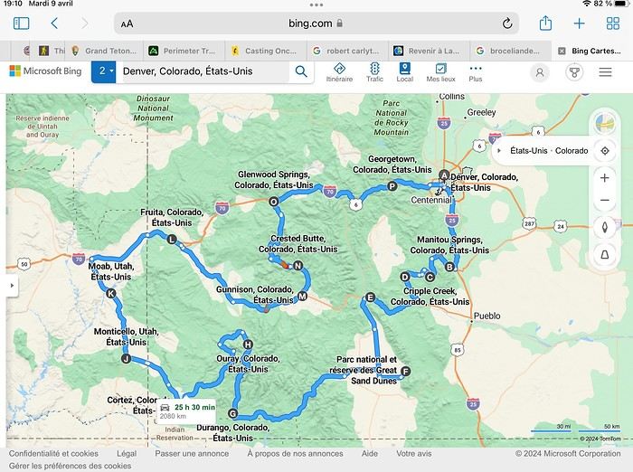
Day 1: Flight Marseille-Paris-Denver, then Manitou Springs (133 km) Day 2: Manitou Springs (49 km) Day 3: Cripple Creek (104 km) Day 4: Salida (254 km) Day 5: Great Sand Dunes (231 km) Day 6: Durango (283 km) Day 7: Durango (Durango-Silverton train) Day 8: Ouray (121 km) Day 9: Ouray (Perimeter Trail hike) Day 10: Cortez (213 km) Day 11: Cortez (Mesa Verde National Park, 134 km) Day 12: Monticello (268 km, detour to Chesler Park) Day 13: Moab (171 km, Delicate Arch) Day 14: Moab (98 km, Fisher Towers) Day 15: Moab (171 km, Canyonlands) Day 16: Fruita (210 km, Colorado National Monument) Day 17: Crested Butte (224 km via Kebler Pass) Day 18: Crested Butte (57 km) Day 19: Glenwood Springs (150 km) Day 20: Glenwood Springs (118 km, Rifle State Park) Day 21: Georgetown (258 km via Independence Pass) Day 22: Denver (123 km), then return flight
We speak very little English. We spent 21 nights there and covered a 3,400 km loop by car and 160 km on foot (we’re still trying to hike while we’re in shape) from Denver in September 2024. We wanted this road trip to help us explore Colorado a bit more—we’d only spent 6 nights there in 2019—and to see it during the fall foliage season. We also wanted to return to Utah (we love Moab) to enjoy its red rocks, which we adore.
In the prices you see (some in euros, others in dollars), I’ve included bank fees and exchange charges. The flights, car, and parking were paid by credit card when we booked in February. Usually, we book around November, but some obligations kept us from doing it earlier. We downloaded the MPC (Mobile Passport Control) app on our phone, which saved us time at immigration.
📊 **Budget: just under 8,500 € for both of us, all included**
📊 **Flights** Marseille-Paris (CDG)-Denver: 2,152 € for both of us, with one checked bag each
📊 **ESTA and America the Beautiful Pass** The ones from our 2023 road trip were still valid
📊 **Parking at Marseille airport: 122 €**
📊 **Car: Nissan Rogue (the French X-Trail) from Hertz: 1,165 €** By booking through Air France (and earning miles), we got a 15% discount. Hertz offers a free Hertz Gold Plus Rewards program, which gives us priority counter service.
📊 **Accommodation: 3,050 €** We stayed in motels and hotels of various ranges (from 100 € to 270 € per night, depending on the city), all booked through Hotels.com or Booking. Booking sometimes offers cheaper rates if you book via the "Booking mobile" app. We also got some preferential rates thanks to our Genius 2 status. Out of 21 nights, only one place didn’t include breakfast.
📊 **Other expenses (activities booked by credit card before leaving)** Durango-Silverton train: 210 € (we booked the enclosed vintage coach in March) Mesa Verde: Balcony House: 15.15 € (booked 14 days before the visit) Timed-entry passes for Arches National Park: 6 € for 3 days (booked June 1 for September entries via http://récreation.gov/). We booked three different days to play with the weather.
📊 **Supplementary insurance with AVA: 204 €** (due to our age 😅 and the high cost of medical consultations in the USA)
📊 **Cash: 1,540 €** We left with 1,000 € exchanged before departure and made two withdrawals (500 $ and 200 $). This cash was used to pay for: - Evening restaurants and tips (between 70 $ and 95 $ for two meals and two drinks) - Two state parks: Dead Horse State Park (20 $) and Rifle State Park (10 $) - The Monarch Pass gondola (24 $) - Midday picnics - Gas (slightly cheaper with cash): 204 $ for 3,400 km - Personal souvenirs and little treats.
Like in our previous road trips, we didn’t rent a GPS. We used the offline GPS app Here We Go, for which we’d downloaded maps of Colorado and Utah from France, as well as a new offline app called Organic Maps as a backup—though we didn’t end up needing it.
❤️❤️❤️ **Highlights (there are so many!)** 📍 The stunning landscapes of Colorado, especially with the fall colors 📍 A step back in time at the old farm in Florissant Fossil Beds National Monument 📍 The prairies of Cripple Creek and the mining remnants of the Vindicator Trail 📍 The cheeky chipmunks in the ghost town of St. Elmo 📍 Great Sand Dunes and its soft sand 📍 The steam train between Durango and Silverton: we’re glad we chose the round-trip because it rained heavily on the way there, but we got to enjoy the scenery on the way back when the sun came out 📍 The unexpected meet-up with Michèle from the group outside a restaurant in Durango 📍 The hot springs in Ouray 📍 Mesa Verde and its still-vibrant past 📍 The red rocks of Moab and Delicate Arch at sunset 📍 The lace-like Fisher Towers and the view from the end of the trail 📍 The gorgeous Route 128 leading to Colorado National Monument—small, easy to visit, and so beautiful 📍 The colors of the fabulous Kebler Pass, Crested Butte, and especially the hike through the golden aspens (Lower and Upper Loop) 📍 The waterfalls at Rifle State Park 📍 The tundra of Independence Pass 📍 The Halloween decorations in Georgetown and Idaho Springs
😞😞 **Flops (there are very few!)** 📍 The viewpoints we missed because they weren’t well-marked or we didn’t see the signs 📍 The closure of some hiking trails (Hanging Lake and parts of Canyonlands) and the Sal Mountain Loop road, which kept us from accessing it 📍😢 The Chesler Park hike we had to cut short due to poor time management—180 km between our stop in Cortez meant we didn’t arrive until 10:30 AM, way too late for a 17 km hike.
Hope this helps! Have a great evening, everyone, and see you soon! 😊
The itinerary
Day 1: Flight Marseille-Paris-Denver, then Manitou Springs (133 km) Day 2: Manitou Springs (49 km) Day 3: Cripple Creek (104 km) Day 4: Salida (254 km) Day 5: Great Sand Dunes (231 km) Day 6: Durango (283 km) Day 7: Durango (Durango-Silverton train) Day 8: Ouray (121 km) Day 9: Ouray (Perimeter Trail hike) Day 10: Cortez (213 km) Day 11: Cortez (Mesa Verde National Park, 134 km) Day 12: Monticello (268 km, detour to Chesler Park) Day 13: Moab (171 km, Delicate Arch) Day 14: Moab (98 km, Fisher Towers) Day 15: Moab (171 km, Canyonlands) Day 16: Fruita (210 km, Colorado National Monument) Day 17: Crested Butte (224 km via Kebler Pass) Day 18: Crested Butte (57 km) Day 19: Glenwood Springs (150 km) Day 20: Glenwood Springs (118 km, Rifle State Park) Day 21: Georgetown (258 km via Independence Pass) Day 22: Denver (123 km), then return flight
We speak very little English. We spent 21 nights there and covered a 3,400 km loop by car and 160 km on foot (we’re still trying to hike while we’re in shape) from Denver in September 2024. We wanted this road trip to help us explore Colorado a bit more—we’d only spent 6 nights there in 2019—and to see it during the fall foliage season. We also wanted to return to Utah (we love Moab) to enjoy its red rocks, which we adore.
In the prices you see (some in euros, others in dollars), I’ve included bank fees and exchange charges. The flights, car, and parking were paid by credit card when we booked in February. Usually, we book around November, but some obligations kept us from doing it earlier. We downloaded the MPC (Mobile Passport Control) app on our phone, which saved us time at immigration.
📊 **Budget: just under 8,500 € for both of us, all included**
📊 **Flights** Marseille-Paris (CDG)-Denver: 2,152 € for both of us, with one checked bag each
📊 **ESTA and America the Beautiful Pass** The ones from our 2023 road trip were still valid
📊 **Parking at Marseille airport: 122 €**
📊 **Car: Nissan Rogue (the French X-Trail) from Hertz: 1,165 €** By booking through Air France (and earning miles), we got a 15% discount. Hertz offers a free Hertz Gold Plus Rewards program, which gives us priority counter service.
📊 **Accommodation: 3,050 €** We stayed in motels and hotels of various ranges (from 100 € to 270 € per night, depending on the city), all booked through Hotels.com or Booking. Booking sometimes offers cheaper rates if you book via the "Booking mobile" app. We also got some preferential rates thanks to our Genius 2 status. Out of 21 nights, only one place didn’t include breakfast.
📊 **Other expenses (activities booked by credit card before leaving)** Durango-Silverton train: 210 € (we booked the enclosed vintage coach in March) Mesa Verde: Balcony House: 15.15 € (booked 14 days before the visit) Timed-entry passes for Arches National Park: 6 € for 3 days (booked June 1 for September entries via http://récreation.gov/). We booked three different days to play with the weather.
📊 **Supplementary insurance with AVA: 204 €** (due to our age 😅 and the high cost of medical consultations in the USA)
📊 **Cash: 1,540 €** We left with 1,000 € exchanged before departure and made two withdrawals (500 $ and 200 $). This cash was used to pay for: - Evening restaurants and tips (between 70 $ and 95 $ for two meals and two drinks) - Two state parks: Dead Horse State Park (20 $) and Rifle State Park (10 $) - The Monarch Pass gondola (24 $) - Midday picnics - Gas (slightly cheaper with cash): 204 $ for 3,400 km - Personal souvenirs and little treats.
Like in our previous road trips, we didn’t rent a GPS. We used the offline GPS app Here We Go, for which we’d downloaded maps of Colorado and Utah from France, as well as a new offline app called Organic Maps as a backup—though we didn’t end up needing it.
❤️❤️❤️ **Highlights (there are so many!)** 📍 The stunning landscapes of Colorado, especially with the fall colors 📍 A step back in time at the old farm in Florissant Fossil Beds National Monument 📍 The prairies of Cripple Creek and the mining remnants of the Vindicator Trail 📍 The cheeky chipmunks in the ghost town of St. Elmo 📍 Great Sand Dunes and its soft sand 📍 The steam train between Durango and Silverton: we’re glad we chose the round-trip because it rained heavily on the way there, but we got to enjoy the scenery on the way back when the sun came out 📍 The unexpected meet-up with Michèle from the group outside a restaurant in Durango 📍 The hot springs in Ouray 📍 Mesa Verde and its still-vibrant past 📍 The red rocks of Moab and Delicate Arch at sunset 📍 The lace-like Fisher Towers and the view from the end of the trail 📍 The gorgeous Route 128 leading to Colorado National Monument—small, easy to visit, and so beautiful 📍 The colors of the fabulous Kebler Pass, Crested Butte, and especially the hike through the golden aspens (Lower and Upper Loop) 📍 The waterfalls at Rifle State Park 📍 The tundra of Independence Pass 📍 The Halloween decorations in Georgetown and Idaho Springs
😞😞 **Flops (there are very few!)** 📍 The viewpoints we missed because they weren’t well-marked or we didn’t see the signs 📍 The closure of some hiking trails (Hanging Lake and parts of Canyonlands) and the Sal Mountain Loop road, which kept us from accessing it 📍😢 The Chesler Park hike we had to cut short due to poor time management—180 km between our stop in Cortez meant we didn’t arrive until 10:30 AM, way too late for a 17 km hike.
Hope this helps! Have a great evening, everyone, and see you soon! 😊
A trip to Australia: the Northern Territory.
Thursday, November 2, 2023
Lake Argyle – Katherine
We had a great time. Now we’ve got to pay the price. We’re down one stop before Katherine. Gotta do the whole trip in one go—6 hours of driving. Let’s go! We’re a bit low on fuel with only 300 kilometers of range. The only station at the lake doesn’t open until 9 a.m., and the next (and only) one is 227 kilometers away… Should we risk it? Except for a magnificent frilled-neck lizard darting across the road on its big hind legs and an emu quickly disappearing into the bush, we didn’t see much. Oh—there was also a donkey, lost and panicked in the middle of the road… A quiet road with some beautiful scenery,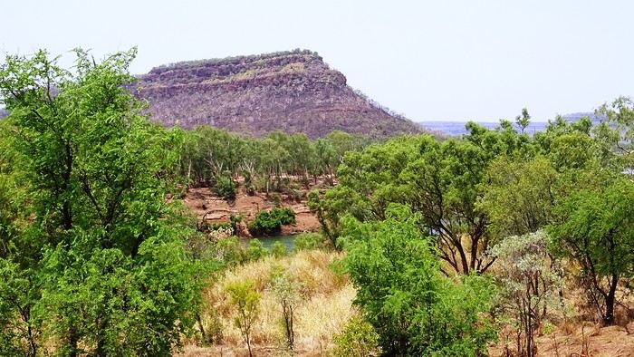 some worrying bushfires
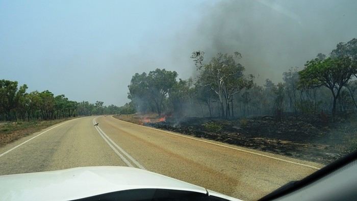
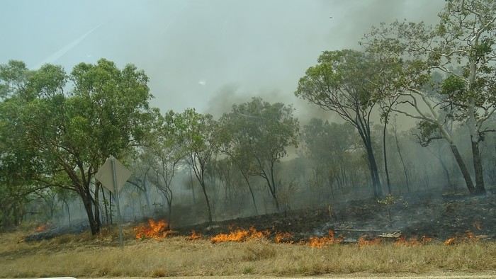 and a few opportunities to stop for a "warrior’s rest" (never go beyond the first second of the thought that starts drifting off the road…)
We cross an invisible border as we enter the Northern Territory, which comes with consequences—we immediately lose an hour and a half by changing time zones. The speed limit goes from 110 to 130.
and a few opportunities to stop for a "warrior’s rest" (never go beyond the first second of the thought that starts drifting off the road…)
We cross an invisible border as we enter the Northern Territory, which comes with consequences—we immediately lose an hour and a half by changing time zones. The speed limit goes from 110 to 130.
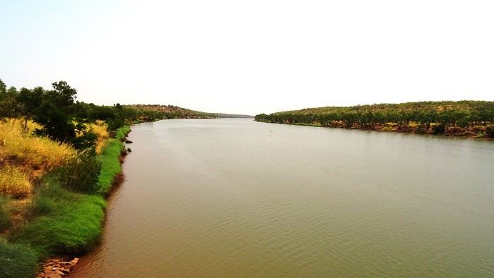
We arrive at the self check-in in Katherine. As usual, we’re a little taken aback at first. The noise, for starters. There’s a group rehearsing, it seems. We go check it out. We pass through the doors separating "The Stuart" from the adjoining bar and stumble upon what feels like collective hysteria. Turns out, it’s a concert. Aboriginal musicians completely fired up by some incredible music! There are just three of them, but they’re delivering a wall of sound that reminds us of South Africa’s finest neo-techno with a trance-like vibe. The crowd is wild! They’re singing in unison, screaming with joy. We get gently kicked out by security because we’re carrying our groceries, and they’re not having it. We promise ourselves we’ll come back once we’ve put them away in our little fridge.
Then we land. We end up finding plenty of nice things. It’s very possible we’ll like this place!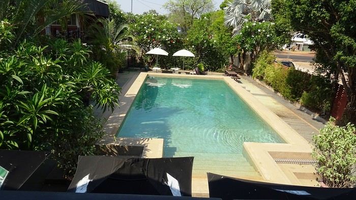
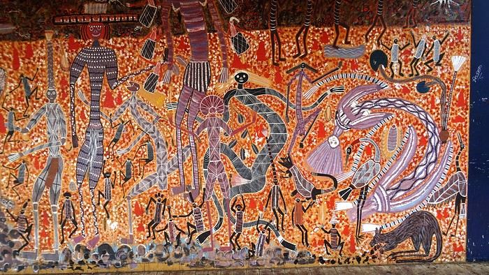 We head back to enjoy our post-battle Happy Hour.
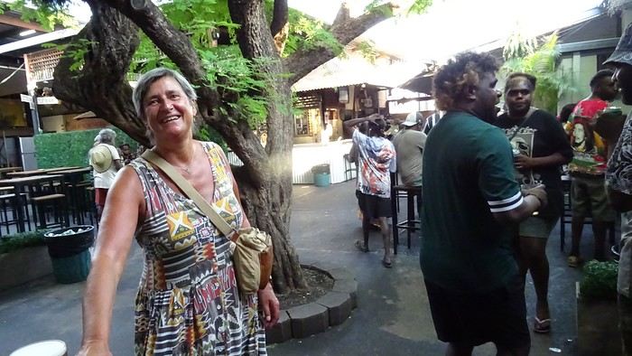 The concert’s over, but the crowd’s still riding the high. It’s indescribable. People are shouting across the room, screaming just for the fun of it—men and women alike. There’s pool, some beat-up arcade games being shaken like coconut trees. Dom and I feel like anthropologists. We’re pretty blown away. It’s epic! And the beer’s half the price it is elsewhere! We’ll definitely be back—that’s for sure!
We give up on finding a restaurant. Not sure they even exist, at least not this season. So, we’ve got a microwave—we eat at home on our little terrace, with a musical accompaniment from a massive orchestra of birds. It sounds amazing!
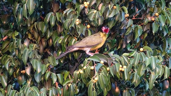
We had a great time. Now we’ve got to pay the price. We’re down one stop before Katherine. Gotta do the whole trip in one go—6 hours of driving. Let’s go! We’re a bit low on fuel with only 300 kilometers of range. The only station at the lake doesn’t open until 9 a.m., and the next (and only) one is 227 kilometers away… Should we risk it? Except for a magnificent frilled-neck lizard darting across the road on its big hind legs and an emu quickly disappearing into the bush, we didn’t see much. Oh—there was also a donkey, lost and panicked in the middle of the road… A quiet road with some beautiful scenery,
some worrying bushfires
and a few opportunities to stop for a "warrior’s rest" (never go beyond the first second of the thought that starts drifting off the road…)
We cross an invisible border as we enter the Northern Territory, which comes with consequences—we immediately lose an hour and a half by changing time zones. The speed limit goes from 110 to 130.
We arrive at the self check-in in Katherine. As usual, we’re a little taken aback at first. The noise, for starters. There’s a group rehearsing, it seems. We go check it out. We pass through the doors separating "The Stuart" from the adjoining bar and stumble upon what feels like collective hysteria. Turns out, it’s a concert. Aboriginal musicians completely fired up by some incredible music! There are just three of them, but they’re delivering a wall of sound that reminds us of South Africa’s finest neo-techno with a trance-like vibe. The crowd is wild! They’re singing in unison, screaming with joy. We get gently kicked out by security because we’re carrying our groceries, and they’re not having it. We promise ourselves we’ll come back once we’ve put them away in our little fridge.
Then we land. We end up finding plenty of nice things. It’s very possible we’ll like this place!
We head back to enjoy our post-battle Happy Hour.
The concert’s over, but the crowd’s still riding the high. It’s indescribable. People are shouting across the room, screaming just for the fun of it—men and women alike. There’s pool, some beat-up arcade games being shaken like coconut trees. Dom and I feel like anthropologists. We’re pretty blown away. It’s epic! And the beer’s half the price it is elsewhere! We’ll definitely be back—that’s for sure!We give up on finding a restaurant. Not sure they even exist, at least not this season. So, we’ve got a microwave—we eat at home on our little terrace, with a musical accompaniment from a massive orchestra of birds.
It sounds amazing!
Southwest Part 2: 55 Days in Colorado, New Mexico, Arizona, Nevada, and Utah
This travel journal is the second part of the trip whose first part you can find here: 1st part...
Sunday, August 7: the day we discover a magical place... Edmaier's Secret...
We got up at 8:00 AM, had breakfast on the terrace of our tiny house, and then set off again toward yesterday’s trail. This time, we stopped after 4.5 miles on House Rock Valley Road at the Buckskin Gulch Trail parking lot. We weren’t interested in that trail today—the slot canyon is muddy anyway after the recent storms...
Instead, we explored a lesser-known area that became our playground. And what a playground it was, folks—an out-of-this-world spot, THE highlight of our trip!!! 😏
Just imagine being in the middle of these landscapes, and the cherry on top... no one else around!!!!! Well, we did meet a couple who were coming back—it was 9:30 AM 😮. Did they camp there? Did they turn back? 🙁
After paying the entry permit online, we set off with plenty of water (6L for the four of us) plus a gallon we hid along the way for the return trip. 😉 After a one-hour approach hike along a wash, we reached the sea of sand.
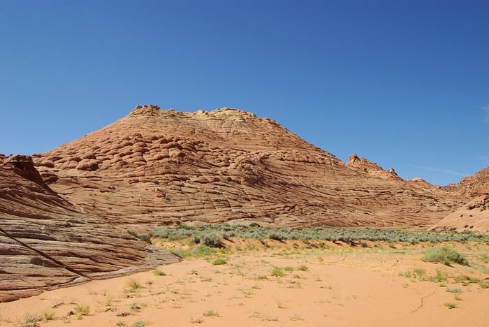
We had to cross it to reach our goal: a strip about 2 km long and 1 km wide that you can explore freely since there’s no marked trail... We entered a few GPS points into our Garmin Etrex, and off we went!!! 😎 It was... magical, enchanting, a true love-at-first-sight moment!
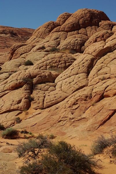
Brain Rock, waves, fine and brittle rock, colors—it goes up, it goes down.
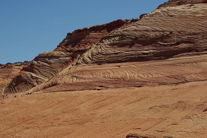
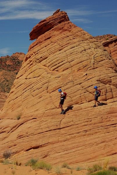
Just thinking about it gives me chills... I remember sitting still for two minutes, taking in these wonders with such emotion that I teared up...
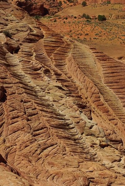
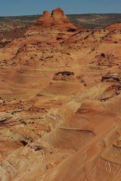
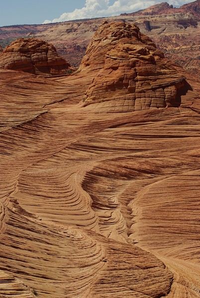
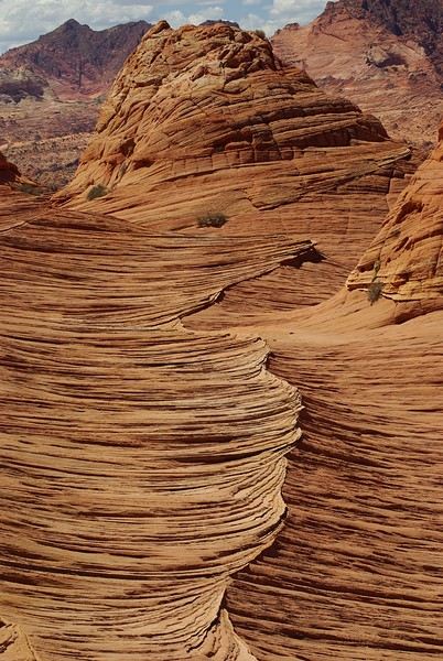
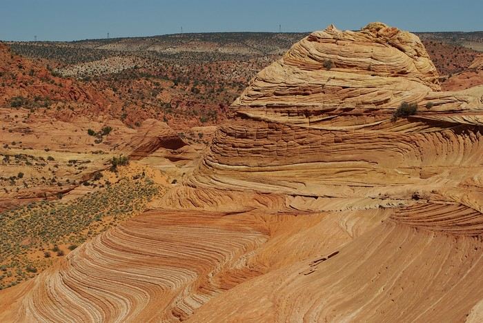
Sunday, August 7: the day we discover a magical place... Edmaier's Secret...
We got up at 8:00 AM, had breakfast on the terrace of our tiny house, and then set off again toward yesterday’s trail. This time, we stopped after 4.5 miles on House Rock Valley Road at the Buckskin Gulch Trail parking lot. We weren’t interested in that trail today—the slot canyon is muddy anyway after the recent storms...
Instead, we explored a lesser-known area that became our playground. And what a playground it was, folks—an out-of-this-world spot, THE highlight of our trip!!! 😏
Just imagine being in the middle of these landscapes, and the cherry on top... no one else around!!!!! Well, we did meet a couple who were coming back—it was 9:30 AM 😮. Did they camp there? Did they turn back? 🙁
After paying the entry permit online, we set off with plenty of water (6L for the four of us) plus a gallon we hid along the way for the return trip. 😉 After a one-hour approach hike along a wash, we reached the sea of sand.
We had to cross it to reach our goal: a strip about 2 km long and 1 km wide that you can explore freely since there’s no marked trail... We entered a few GPS points into our Garmin Etrex, and off we went!!! 😎 It was... magical, enchanting, a true love-at-first-sight moment!
Brain Rock, waves, fine and brittle rock, colors—it goes up, it goes down.
Just thinking about it gives me chills... I remember sitting still for two minutes, taking in these wonders with such emotion that I teared up...
Eastern Crete in September 2024
Travel journal in Eastern Crete from September 8th to 29th, 2024
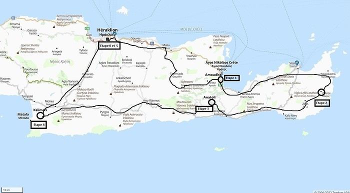 Our 21-day itinerary
Sunday, 08/09: Once again—and this is the eighth time—we’re setting off, the four of us: Patrick, Michelle, Jacques, and Monique, for the Greek islands. This time, we’ve chosen Crete. No need to wake up at 3 or 4 a.m. to reach Basel-Mulhouse Airport at dawn to catch the first flight to Greece at 6 a.m.! Given the prohibitive prices charged by EasyJet, we found flights that were half the price from Zurich Airport, which is accessible in 3 hours by train from Colmar. Pierre-Paul drives all four of us to Colmar train station, where we take the train to Basel and then, 20 minutes later, the direct train to Zurich Airport. After wandering around the airport, we go for a coffee at 6 € each! We’re in Switzerland, after all. The other dining areas all have vending machines for selecting and paying for meals—soon, there won’t be anyone left to serve you! After a short wait, we take off at 7:45 p.m. (20 minutes late) in an Aegean Airbus A321. Free in-flight meal service isn’t bad either! We land in Heraklion around 11:15 p.m. We pick up our rental car (a red Seat Ibiza) at the airport and head straight to our apartment, located 2 km from the city center. Thanks to the GPS, we find it quickly. It’s a beautiful, fully renovated apartment with all the comforts and well-equipped. On the table, there’s wine, bottles of water, jam, coffee, etc. Given the late hour, we won’t stay up long.
Monday, 09/09: To enhance our breakfast, Michelle and Monique set off to find a bakery nearby. They return with croissants and donuts—yum... Then we head to the west coast. The highway follows the coastline, but we prefer taking the old road to Malia, our first stop. We visit the major archaeological site of this Minoan city under the hot sun. The site covers a vast area, but the ruins aren’t very evocative except for a few beautiful amphorae scattered around. The explanations in a small house at the entrance are interesting and help us better understand the organization of the ancient city with its different districts. From there, we head toward the nearby mountains to see the thousand-year-old plane tree in the village of Krasi. We take the opportunity to enjoy an excellent lunch of moussaka and delicious gemista at the Krassopsychia taverna in the village center. Pleasant surprise: the prices are still reasonable, with a bill of 70 € for four, including wine and water. The friendly tradition of complimentary dessert and glasses of raki continues—great! We’ve set the bar high right away! Let’s hope the rest lives up to it! On the way back toward the Lassithi Plateau, we stop at the Kardiotisa Monastery perched high on the mountain to enjoy a magnificent view of the entire region. Just a little further, we arrive at the Lassithi Plateau: the presence of small windmills used to pump water from the ground is the typical feature of this plateau. We complete a full loop around the plateau, passing by numerous orchards and vegetable gardens that occupy the entire space. At the end of the plateau, we once again cross mountain passes via winding roads that bring us near Agios Nikolaos. Our apartment is located about ten kilometers further south in Amoudhara. The owner, who was notified, waits for us and shows us her superb apartment, whose large terrace overlooks the entire Mirabello Bay. She then gives us valuable information about the different beaches in the area. Dinner will be frugal, given our hearty lunch in Krasi!
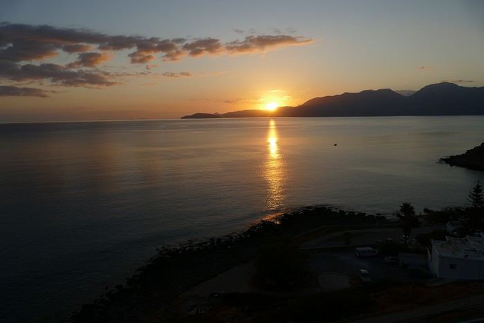 Sunset over Mirabello Bay
Tuesday, 10/09: A bit of a gray sky when we wake up around 8 a.m., but the sun will soon triumph over the scattered clouds. For our first swim, we opt for Voulisma Beach, even though our host warned us it was a bit “crowdy.” That’s understandable given the beautiful emerald color of the sea and the lovely curve of the beach. To avoid the big crowds, we move toward the eastern part of the beach, accessible via a steep staircase. The water is very warm, and this first dip is very pleasant. Before returning to the apartment, we stop at the bakery to buy spinach pies, essential ingredients to accompany our Greek salad for lunch. Of course, everything will be washed down with ouzo, which will remain our favorite drink for the next three weeks—but in moderation!!! A nap is in order after all that effort. In the late afternoon, we drive to Agios Nikolaos, the main seaside resort in Crete. We’re not too enthusiastic about visiting this mass-tourism resort, but the center of Agios, concentrated around the small inner harbor, is pleasant to see despite the plethora of shops and restaurants. We dine a little outside the harbor in the shaded courtyard of the Avli taverna: the oven-baked lamb, squid with spinach, and cuttlefish ink orzo pasta are all highly appreciated. We still stay under a 75 € bill for four.
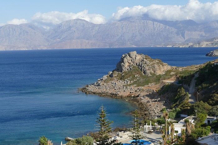 Mirabello Bay seen from our terrace
Wednesday, 11/09: At 8 a.m., the terrace is already bathed in sunlight, and it’s already quite hot. The small parasol barely gives us enough shade, but we’re not complaining! For our second swim, we head to a tiny beach recommended by our host, just 3 minutes by car from our place. The path leading to it is very discreet, and we don’t find it right away! It’s a small sandy cove with a few welcome tamarisk trees for shade. When we arrive, there are two swimmers, and there won’t be more than five or six in the morning. After lunch and a nap, we head to the beautiful village of Kritsa, just a few kilometers away. It’s too late to visit the beautiful church of Kera Panagia, which is already closed. We settle for the exterior, which is worth a look. The weather is clouding over, and big clouds are gathering. Upon arriving in Kritsa, a heavy shower forces us to take shelter in the Platanos taverna in the village center, and since it’s nearly 7 p.m., we decide to stay and dine there. Good choice—excellent meze: croquettes and stuffed zucchini flowers, gigantes beans, grilled tomatoes and feta, and pancetta as the main dish. The rain stops just as we decide to head back.
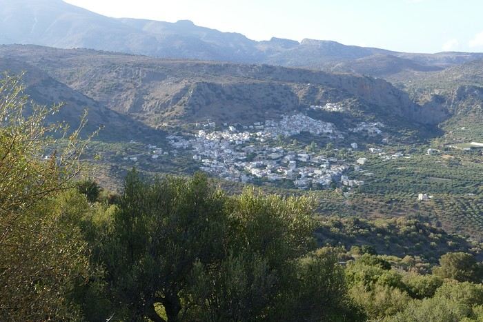 Village of Kritsa
Thursday, 12/09: Our terrace faces east, so we get to watch the sunrise around 7 a.m.—it’s truly a beautiful sight we never tire of. Around 9 a.m., we head to the village of Plaka, where boats depart for the island of Spinalonga, located north of Agios Nikolaos. We board the first boat, which sets sail at 10 a.m., and we’re not alone—the boat is practically full. After 10 minutes, we land on the island at the same time as several other boats from Elounda or Agios. Needless to say, there are already quite a few people walking through the streets of the leper village. The visit remains interesting and moving as we read the explanatory panels recounting the island’s history under Byzantine and then Turkish rule, followed by its transformation into a leper colony. As soon as we climb toward the top of the island via more or less maintained paths, there’s almost no one left. The 360° view from up there is stunning.
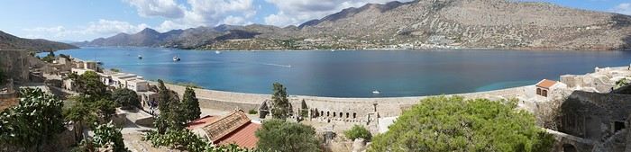
Spinalonga Island
The heat is now unbearable, and we can’t wait to get back home to have lunch on our terrace and rest. In the late afternoon, we go grocery shopping at the AB supermarket at the entrance of Agios. We had spotted another nice restaurant in our guide, but unfortunately, there’s a different one at the indicated location that doesn’t inspire us. So, we return to the Avli taverna for another dinner just as good as the first.
Friday, 13/09: We repeat yesterday’s successful program: a swim in our little cove, lunch on the terrace, a nap, and then, in the late afternoon, we discover another nearby village, Kroustas, nestled in the olive groves near Kritsa. Much less touristy than Kritsa, it’s mostly inhabited by locals, especially the elderly who are enjoying the cool air on their chairs—if you can call it cool given the still-high temperatures in the late afternoon! We then return to visit Kritsa, which we hadn’t been able to explore due to the rain. Dinner at a taverna in the village center at a very reasonable price.
Saturday, 14/09: Today, we move to our new base further east. We start with a high viewpoint at the Faneromeni Monastery, which overlooks Mirabello Bay. The monastery itself is of little interest as it’s under renovation with excessive concrete work. We continue to the village of Kavoussi to see another exceptional tree after a few kilometers on a dusty, bumpy track. It’s an olive tree said to be about 3,200 years old—impressive, and the countryside is very beautiful. It’s time to find a place for lunch. We find one in the charming little port of Mohlos, where a few tavernas surround a very nice small beach. Our choice falls on the Bogazzi taverna, where we enjoy fried fish. To reach our new base in Zakros, we still have to drive through the mountains before reaching Sitia, Paleokastro, and finally Zakros. The region is beautiful, with olive groves and rows of wind turbines taking advantage of the strong wind near the northern tip of the island. In Zakros, we’re greeted by our very friendly host. Here too, we have all the comforts and a beautiful terrace overlooking the village. The apartment has reversible air conditioners, but the overly simple instructions leave us puzzled. Thinking we’ve set it correctly, we realize a little too late that it’s blowing hot air over 30°C! After numerous attempts and testing several confusing programs, we finally succeed! Dinner on our new terrace.
Sunday, 15/09: This morning, we get up early to hike in the “Gorge of the Dead” while it’s still cool. The sky is blue as usual! We park in the nearest parking lot and start our descent via a beautiful path winding through the olive groves. A little further on, the landscape opens up, and the path, now a stony trail, begins the descent to the dry riverbed. On either side of the riverbed rise beautiful reddish cliffs.
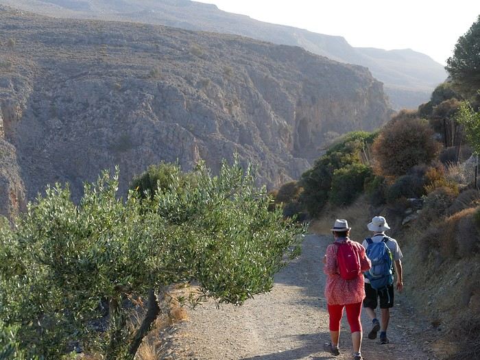
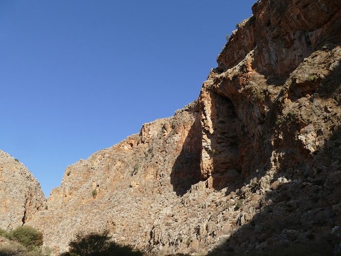
Gorge of the Dead
The trail winds its way through this narrow gorge with difficulty. It was in the many caves visible halfway up the slope that the Minoans buried their dead, hence the name “Gorge of the Dead.” The gorge opens onto a beautiful small pebble beach. A swim is welcome after this hike that made us sweat. The hike took us 1 hour and 25 minutes, and a little less on the way back. Meanwhile, Monique did some shopping and prepared an excellent lunch. In the late afternoon, we go down to dine at Platanakis, a taverna in the small village of Kato Zakros.
Monday, 16/09: This morning, we explore the northern part of the east coast near Palekastro. We start with a dip at the beautiful Hionia Beach near Palekastro. The water is still just as nice, but a light breeze is blowing—not enough to spoil our fun! Seeing all the wind turbines lining the ridges, it’s no surprise.
 Grocery shopping in Palekastro and return to Zakros. A little rain in the late afternoon and an excellent dinner at Iannis Mitsakakis’ Taverna in Adravastis. These are the kind of small tavernas we love—unpretentious, a few tables on a terrace, a warm welcome, a short menu guaranteeing freshness, tasty dishes prepared by the server’s mom, and a light bill. What more could you ask for!
Tuesday, 17/09: We head back toward Palekastro to do some shopping, but it’s also the road to the Toplou Monastery. There, we see a collection of magnificent icons dating from the 15th to the 20th century. We can also admire drawings of Orthodox religious architecture. We continue toward the Mavros Akrotiri headland to enjoy the view of the sea and rocky capes. On the way back to our place, we make a small detour to see the famous Vai palm grove. Meh... As for Vai Beach, it’s filled with paid umbrellas and sunbeds, and there are so many people that we flee. Plus, having to pay for parking is another reason to snub this trendy beach. We prefer our Hionia Beach, which we already appreciated the other day. In the late afternoon, Pat and I start the trail that begins at Kato Zakros Beach heading south. The poorly marked path crosses a plateau of sharp limestone. The paint and cairn markings are no longer very visible, and with dusk approaching, we turn back toward Kato Zakros. Dinner at the Platanakis taverna—less good than last time.
Wednesday, 18/09: To avoid the scorching sun, Pat, Mimi, and I get up earlier than usual to hike the Hohlakies Gorge. At this early hour, the sky is quite cloudy, and it’s drizzling. When we arrive in the village of Hohlakies, we park in front of a small chapel, the start of the hike. The sky is now completely clear. The trail starts among the olive groves, then after passing through a gate, we descend into the gorge filled with large rocks. We’re alone in the world, and the landscape is magnificent. A few wild goats clinging to the cliff watch us from above. After 1 hour and 15 minutes, we emerge onto the wonderful Karoumès Beach. A pleasant swim, then back to civilization! A walk in the late afternoon in Zakros to discover the beautiful springs route. Dinner in Adravastis.
Thursday, 19/09: Another move: Before heading to our next stop, we make a detour to see the beautiful Keratokampos Beach and can’t resist a swim in the still-warm, clear water. We continue our journey via Ziros, then reach the south coast and have lunch at the Stephi taverna in Ferma—excellent meal! The south coast is quite urbanized and has much less charm than the east coast we’ve just left! The numerous plastic greenhouses are partly to blame. We stop for groceries in Ierapetra. Around 3 p.m., we arrive at our destination in the small perched village of Anatoli. Our lodging is at the top of the village, and from the path leading to it, we have a magnificent view of the coastal plain, unfortunately overloaded with plastic greenhouses. It reminds us of the landscapes of El Ejido in Andalusia.
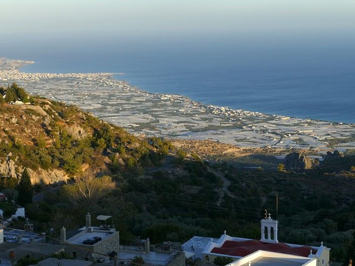 View of the Ierapetra coast from Anatoli
Friday, 20/09: A walk and discovery of the hamlet of Anatoli. There are few services—a tiny grocery store, a taverna, and that’s it. Fortunately, the traveling baker arrives and honks. We take the opportunity to buy fresh bread. Leaving the village, we take a path that should lead us to the hamlet of Drygies. The landscape is beautiful. We walk through a lovely pine forest before arriving at the hamlet. The path continues to a taverna that’s closed today, with a superb terrace overlooking the coast. Luckily, the owner arrives and informs us that the taverna will be open next Sunday and that we can enjoy barbecued meat. Noted! We head back to Anatoli via the small paved road with, fortunately, very limited traffic. Lunch on our terrace, then a dip in our private pool! The water is noticeably cooler than at the beach. Dinner at the village taverna: there’s only one menu—meze starters, souvlaki, water, wine, and bread—all for 35 €! We think we’re dreaming—was there a mistake? No.
Saturday, 21/09: We discover the beach of the village of Myrtos, a small seaside resort that’s quite touristy but on a human scale. We swim in the western part of the beach, and once again, we’re alone in the water. The best part: warm water and tamarisk trees for welcome shade. There’s even a shower to rinse off! In the late afternoon, Pat and I decide to go for a hike in the Selakano pine forest. To get there, we take a narrow, winding, and poorly paved road after the village of Christos. Plus, at this altitude, we encounter clouds clinging to the mountain, so it’s drizzling, and visibility is reduced. We decide to turn back and return to Anatoli. As compensation, we take the path that passes in front of the lodging and leads us to the Timios Stavros chapel, which crowns the summit of the nearby mountain. We arrive at the summit just in time for the sunset at 7 p.m. Breathtaking 360° panorama and magnificent colors!
 Sunset from Anatoli
Sunday, 22/09: This morning, Pat, Mimi, and I go for a hike in the Sarakina Gorge, located about 12 km from Anatoli via a beautiful road winding through irrigated olive groves. We park in the small parking lot before the trail. At the start, the path follows a levada (small irrigation canal) and quickly enters a very narrow gorge flanked by high cliffs. The riverbed is cluttered with huge rocks blocking the passage. No matter—in the technical sections, ropes or ladders allow us to overcome these obstacles with a bit of skill. You can imagine how quickly the riverbed must rise during a storm, given the narrowness of the gorge!
We progress slowly through this magnificent and impressive rocky chaos. At the exit of the gorge, we take another return path that partly follows the paved road. Back in Anatoli, we go to lunch at the Drygies taverna. We sit at the edge of the terrace under a huge tree that covers almost the entire terrace and order grilled lamb dishes prepared according to the ancient “antikristo” method.
Monday, 23/09: Departure for our last stop before Heraklion. We thought about swimming at Tertsa Beach, but it turns out to be less pleasant than expected, with pebbles and an uneven rocky plateau. So, we return to Myrtos Beach, which we know well and suits us perfectly. We head west, leaving the coast a bit. Around 3:30 p.m., we arrive at our destination in the village of Kamilari, near the famous Matala spot. We’ve rented a beautiful, modern, well-equipped apartment with a lovely shaded terrace. The owner is very friendly and explains everything necessary for a good stay. We explore the quite touristy village with its few tavernas, all full of tourists, mostly Germans.
Tuesday, 24/09: Visit to the village of Sivas, well restored thanks to the Germans, who have invested a lot here. We take the opportunity to scout out “friendly” tavernas, then go for a swim at Kalamaki Beach. Apart from a small sandy access, you have to enter the water via a chaotic limestone plateau—proof of this is that Monique trips slightly when entering the water. A group of very unfriendly German women blocks the sandy passage and doesn’t hesitate to push swimmers they deem too close. Back home, lunch, and a nap. In the late afternoon, we drive to visit the nearby Phaistos site. We benefit from very beautiful lighting. From the elevated site, we overlook the Messara Plain with a beautiful view of the olive grove checkerboards highlighted by the late afternoon sun. The site itself is quite vast, but to appreciate it, it’s better to read the explanatory panels placed throughout the different quarters. At this hour, the site is almost empty, and the beautiful light adds charm to the visit.
Wednesday, 25/09: Departure for the village of Matala, which doesn’t interest us in itself, having been there during the “hippie” era in 1976. However, going to Red Beach, only accessible by taking a path overlooking this area, appeals to us much more. We park in the large parking lot just outside the village and start our climb, which brings us to a pass from where we can admire this beautiful red-sand beach framed by beautiful cliffs plunging into the sea. The weather is magnificent, and at this early hour, there aren’t many people yet. We swim in the free part located near the cliff on the right when arriving at the beach. The sea is like glass, warm, and without a single ripple—a real treat! After half an hour, we turn back, and now there are many people rushing on this path, not at all made for feet in sandals or flip-flops, yet many vacationers venture out like this! Matala lives up to its image—a trendy place, full of shops, bars, and restaurants. You could be in any seaside resort with a standard global urbanism, lacking particular charm. Back home. In the late afternoon, a walk through the olive groves surrounding Kamilari, then dinner at Evangelina’s, who runs the Minoan Parassies taverna in the middle of the olive groves. Evangelina is quite a character: we came to reserve a table for 8 p.m. when it was only 7 p.m., but since we lingered near her restaurant, she prepares a table for us and urges us to sit down! And there she takes our order, and a little later, the meze arrive, followed by the main dishes. We finish this good dinner with several generous glasses of raki, accompanied by Evangelina’s encouragements, repeating “poya poya bravo bravo” in a loop. We’re in great shape too, by the way! We return in the middle of the night, on foot, fortunately, with the path vaguely lit by our phones...
Thursday, 26/09: This morning, we discover a new beach, Kommos Beach, not far from Kamilari either. It’s a long sandy beach, a small part of which is dedicated to paid umbrellas and sunbeds, and the rest is free. We spot a tamarisk tree to take shelter from the still-hot sun, and once again, we enjoy clear, warm water. The few swimmers spread out easily over nearly 500 meters of beach. In the late afternoon, Pat and I go to admire the sunset from the hill near our lodging. The hill, covered with olive trees, is threatened by a planned housing development of large cubic villas—trends dictate. Concrete never stops...
Friday, 27/09: We thought about leaving the car at the Odiyitria Monastery, the end of the paved road, but since the track descending to the cave remains drivable, we park 3 km further at the junction of the track leading to Kali Limenes Beach. We still have to walk for half an hour on a less drivable track, and then we’re at the entrance of the Farango Gorge. It’s a beautiful, easy hike since we follow the dry pebble riverbed. Before arriving at the beach, there’s a very beautiful small chapel sheltered under a large cliff, beautifully lit at this early hour.
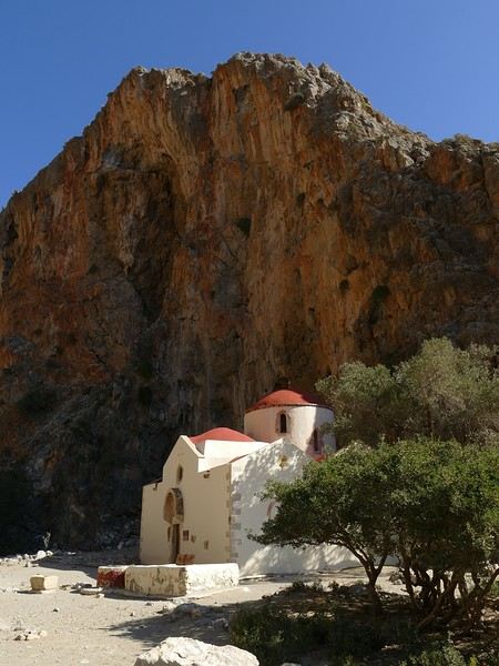
Agio Farango Chapel
A few climbers are scaling the cliff, and about ten swimmers are enjoying the sea. Return to the car under the hot sun. In the late afternoon, we all return to visit the interesting Odiyitria Monastery. Last swim at Kommos Beach and an excellent dinner at the Sigelakis taverna in Sivas.
Saturday, 28/09: There’s an end-of-vacation atmosphere... We pack our bags and head north. A short stop to see the village of Vorri, and a little over an hour later, we arrive in the big city of Heraklion. Since it’s too early to check into the apartment, we park in the city center to visit the famous archaeological museum. It’s indeed a must-see highlight of our stay in Crete. All four of us are amazed by the quantity and quality of the objects presented from the Minoan civilization. After more than 2 hours, we come out without having seen everything, but we’re a bit overwhelmed by all these wonders. Lunch at a nice little taverna very close to the Titus Church. We go to take possession of our apartment—the same as on the way there, still just as satisfying. In the late afternoon, I go alone for a walk in the historic district of the city, passing by the Morosini Fountain, which is bustling with people—some seated at café terraces, others standing and chatting. There’s a lively atmosphere here. A little further on are the Venetian loggia and the Agios Titos Church. I walk down to the old Venetian port to stroll along the jetty and admire the fortifications under beautiful late-afternoon lighting, then return to the apartment. Dinner near our place at Kiriakis, a “chic” restaurant but with very reasonable prices and excellent cuisine.
Sunday, 29/09: Wake-up at 3:30 a.m., quick coffee, and drive to the nearby airport. We leave the car in the parking lot. Already a lot of people at this early hour. Since we don’t have checked luggage, we go straight to security, which goes fairly quickly, then it’s waiting time and takeoff on time in an Airbus A321 for a 45-minute flight to Athens. We take off again in another Airbus A321 with a 50-minute delay to arrive in Zurich at 11:10 a.m. local time. Then we have to take the train to Basel and then the one to Colmar. With fewer Sunday services, we won’t arrive in Colmar until around 4 p.m.
Conclusion All four of us returned very satisfied with this stay in Crete for several reasons: - We found superb beaches with clear, warm water and often very few vacationers. - The few hikes we did were magnificent, especially those where the trails went through gorges leading to deserted beaches. - We greatly appreciated Cretan gastronomy—there were so few disappointments that we can count them on one hand. - All the accommodations we booked turned out to be superb, with the icing on the cake being the very friendly welcome from our hosts. - Generally, contacts with Cretans were always very warm despite the language barrier—we speak a little Greek. - We also appreciated the diversity of landscapes in this eastern part of Crete, with plateaus and mountains with splendid rugged reliefs.
Note: The photo album is available by clicking on this link: https://photos.app.goo.gl/hfdjQndA5eXkL5k7 Captions are only visible per photo by clicking on the circled “i” in the top right. Budget: approximately 3,300 € per couple for 21 days, including train and flights Budget details per couple: - Flight Zurich-Heraklion: 440 € - Trains Colmar-Basel-Zurich round trip for 4: 442.40 € (221 € per couple) - Accommodation: 2,431 € / 21 = 115.80 € per night for 4 (1,216 € per couple) - Car rental for 21 days: 684 € + 145 € fuel (1,150 km) (414 € per couple) - Restaurants, food, etc.: 1,009 €
Our 21-day itinerarySunday, 08/09: Once again—and this is the eighth time—we’re setting off, the four of us: Patrick, Michelle, Jacques, and Monique, for the Greek islands. This time, we’ve chosen Crete. No need to wake up at 3 or 4 a.m. to reach Basel-Mulhouse Airport at dawn to catch the first flight to Greece at 6 a.m.! Given the prohibitive prices charged by EasyJet, we found flights that were half the price from Zurich Airport, which is accessible in 3 hours by train from Colmar. Pierre-Paul drives all four of us to Colmar train station, where we take the train to Basel and then, 20 minutes later, the direct train to Zurich Airport. After wandering around the airport, we go for a coffee at 6 € each! We’re in Switzerland, after all. The other dining areas all have vending machines for selecting and paying for meals—soon, there won’t be anyone left to serve you! After a short wait, we take off at 7:45 p.m. (20 minutes late) in an Aegean Airbus A321. Free in-flight meal service isn’t bad either! We land in Heraklion around 11:15 p.m. We pick up our rental car (a red Seat Ibiza) at the airport and head straight to our apartment, located 2 km from the city center. Thanks to the GPS, we find it quickly. It’s a beautiful, fully renovated apartment with all the comforts and well-equipped. On the table, there’s wine, bottles of water, jam, coffee, etc. Given the late hour, we won’t stay up long.
Monday, 09/09: To enhance our breakfast, Michelle and Monique set off to find a bakery nearby. They return with croissants and donuts—yum... Then we head to the west coast. The highway follows the coastline, but we prefer taking the old road to Malia, our first stop. We visit the major archaeological site of this Minoan city under the hot sun. The site covers a vast area, but the ruins aren’t very evocative except for a few beautiful amphorae scattered around. The explanations in a small house at the entrance are interesting and help us better understand the organization of the ancient city with its different districts. From there, we head toward the nearby mountains to see the thousand-year-old plane tree in the village of Krasi. We take the opportunity to enjoy an excellent lunch of moussaka and delicious gemista at the Krassopsychia taverna in the village center. Pleasant surprise: the prices are still reasonable, with a bill of 70 € for four, including wine and water. The friendly tradition of complimentary dessert and glasses of raki continues—great! We’ve set the bar high right away! Let’s hope the rest lives up to it! On the way back toward the Lassithi Plateau, we stop at the Kardiotisa Monastery perched high on the mountain to enjoy a magnificent view of the entire region. Just a little further, we arrive at the Lassithi Plateau: the presence of small windmills used to pump water from the ground is the typical feature of this plateau. We complete a full loop around the plateau, passing by numerous orchards and vegetable gardens that occupy the entire space. At the end of the plateau, we once again cross mountain passes via winding roads that bring us near Agios Nikolaos. Our apartment is located about ten kilometers further south in Amoudhara. The owner, who was notified, waits for us and shows us her superb apartment, whose large terrace overlooks the entire Mirabello Bay. She then gives us valuable information about the different beaches in the area. Dinner will be frugal, given our hearty lunch in Krasi!
Sunset over Mirabello BayTuesday, 10/09: A bit of a gray sky when we wake up around 8 a.m., but the sun will soon triumph over the scattered clouds. For our first swim, we opt for Voulisma Beach, even though our host warned us it was a bit “crowdy.” That’s understandable given the beautiful emerald color of the sea and the lovely curve of the beach. To avoid the big crowds, we move toward the eastern part of the beach, accessible via a steep staircase. The water is very warm, and this first dip is very pleasant. Before returning to the apartment, we stop at the bakery to buy spinach pies, essential ingredients to accompany our Greek salad for lunch. Of course, everything will be washed down with ouzo, which will remain our favorite drink for the next three weeks—but in moderation!!! A nap is in order after all that effort. In the late afternoon, we drive to Agios Nikolaos, the main seaside resort in Crete. We’re not too enthusiastic about visiting this mass-tourism resort, but the center of Agios, concentrated around the small inner harbor, is pleasant to see despite the plethora of shops and restaurants. We dine a little outside the harbor in the shaded courtyard of the Avli taverna: the oven-baked lamb, squid with spinach, and cuttlefish ink orzo pasta are all highly appreciated. We still stay under a 75 € bill for four.
Mirabello Bay seen from our terraceWednesday, 11/09: At 8 a.m., the terrace is already bathed in sunlight, and it’s already quite hot. The small parasol barely gives us enough shade, but we’re not complaining! For our second swim, we head to a tiny beach recommended by our host, just 3 minutes by car from our place. The path leading to it is very discreet, and we don’t find it right away! It’s a small sandy cove with a few welcome tamarisk trees for shade. When we arrive, there are two swimmers, and there won’t be more than five or six in the morning. After lunch and a nap, we head to the beautiful village of Kritsa, just a few kilometers away. It’s too late to visit the beautiful church of Kera Panagia, which is already closed. We settle for the exterior, which is worth a look. The weather is clouding over, and big clouds are gathering. Upon arriving in Kritsa, a heavy shower forces us to take shelter in the Platanos taverna in the village center, and since it’s nearly 7 p.m., we decide to stay and dine there. Good choice—excellent meze: croquettes and stuffed zucchini flowers, gigantes beans, grilled tomatoes and feta, and pancetta as the main dish. The rain stops just as we decide to head back.
Village of KritsaThursday, 12/09: Our terrace faces east, so we get to watch the sunrise around 7 a.m.—it’s truly a beautiful sight we never tire of. Around 9 a.m., we head to the village of Plaka, where boats depart for the island of Spinalonga, located north of Agios Nikolaos. We board the first boat, which sets sail at 10 a.m., and we’re not alone—the boat is practically full. After 10 minutes, we land on the island at the same time as several other boats from Elounda or Agios. Needless to say, there are already quite a few people walking through the streets of the leper village. The visit remains interesting and moving as we read the explanatory panels recounting the island’s history under Byzantine and then Turkish rule, followed by its transformation into a leper colony. As soon as we climb toward the top of the island via more or less maintained paths, there’s almost no one left. The 360° view from up there is stunning.
Spinalonga Island
The heat is now unbearable, and we can’t wait to get back home to have lunch on our terrace and rest. In the late afternoon, we go grocery shopping at the AB supermarket at the entrance of Agios. We had spotted another nice restaurant in our guide, but unfortunately, there’s a different one at the indicated location that doesn’t inspire us. So, we return to the Avli taverna for another dinner just as good as the first.
Friday, 13/09: We repeat yesterday’s successful program: a swim in our little cove, lunch on the terrace, a nap, and then, in the late afternoon, we discover another nearby village, Kroustas, nestled in the olive groves near Kritsa. Much less touristy than Kritsa, it’s mostly inhabited by locals, especially the elderly who are enjoying the cool air on their chairs—if you can call it cool given the still-high temperatures in the late afternoon! We then return to visit Kritsa, which we hadn’t been able to explore due to the rain. Dinner at a taverna in the village center at a very reasonable price.
Saturday, 14/09: Today, we move to our new base further east. We start with a high viewpoint at the Faneromeni Monastery, which overlooks Mirabello Bay. The monastery itself is of little interest as it’s under renovation with excessive concrete work. We continue to the village of Kavoussi to see another exceptional tree after a few kilometers on a dusty, bumpy track. It’s an olive tree said to be about 3,200 years old—impressive, and the countryside is very beautiful. It’s time to find a place for lunch. We find one in the charming little port of Mohlos, where a few tavernas surround a very nice small beach. Our choice falls on the Bogazzi taverna, where we enjoy fried fish. To reach our new base in Zakros, we still have to drive through the mountains before reaching Sitia, Paleokastro, and finally Zakros. The region is beautiful, with olive groves and rows of wind turbines taking advantage of the strong wind near the northern tip of the island. In Zakros, we’re greeted by our very friendly host. Here too, we have all the comforts and a beautiful terrace overlooking the village. The apartment has reversible air conditioners, but the overly simple instructions leave us puzzled. Thinking we’ve set it correctly, we realize a little too late that it’s blowing hot air over 30°C! After numerous attempts and testing several confusing programs, we finally succeed! Dinner on our new terrace.
Sunday, 15/09: This morning, we get up early to hike in the “Gorge of the Dead” while it’s still cool. The sky is blue as usual! We park in the nearest parking lot and start our descent via a beautiful path winding through the olive groves. A little further on, the landscape opens up, and the path, now a stony trail, begins the descent to the dry riverbed. On either side of the riverbed rise beautiful reddish cliffs.
Gorge of the Dead
The trail winds its way through this narrow gorge with difficulty. It was in the many caves visible halfway up the slope that the Minoans buried their dead, hence the name “Gorge of the Dead.” The gorge opens onto a beautiful small pebble beach. A swim is welcome after this hike that made us sweat. The hike took us 1 hour and 25 minutes, and a little less on the way back. Meanwhile, Monique did some shopping and prepared an excellent lunch. In the late afternoon, we go down to dine at Platanakis, a taverna in the small village of Kato Zakros.
Monday, 16/09: This morning, we explore the northern part of the east coast near Palekastro. We start with a dip at the beautiful Hionia Beach near Palekastro. The water is still just as nice, but a light breeze is blowing—not enough to spoil our fun! Seeing all the wind turbines lining the ridges, it’s no surprise.
Grocery shopping in Palekastro and return to Zakros. A little rain in the late afternoon and an excellent dinner at Iannis Mitsakakis’ Taverna in Adravastis. These are the kind of small tavernas we love—unpretentious, a few tables on a terrace, a warm welcome, a short menu guaranteeing freshness, tasty dishes prepared by the server’s mom, and a light bill. What more could you ask for!Tuesday, 17/09: We head back toward Palekastro to do some shopping, but it’s also the road to the Toplou Monastery. There, we see a collection of magnificent icons dating from the 15th to the 20th century. We can also admire drawings of Orthodox religious architecture. We continue toward the Mavros Akrotiri headland to enjoy the view of the sea and rocky capes. On the way back to our place, we make a small detour to see the famous Vai palm grove. Meh... As for Vai Beach, it’s filled with paid umbrellas and sunbeds, and there are so many people that we flee. Plus, having to pay for parking is another reason to snub this trendy beach. We prefer our Hionia Beach, which we already appreciated the other day. In the late afternoon, Pat and I start the trail that begins at Kato Zakros Beach heading south. The poorly marked path crosses a plateau of sharp limestone. The paint and cairn markings are no longer very visible, and with dusk approaching, we turn back toward Kato Zakros. Dinner at the Platanakis taverna—less good than last time.
Wednesday, 18/09: To avoid the scorching sun, Pat, Mimi, and I get up earlier than usual to hike the Hohlakies Gorge. At this early hour, the sky is quite cloudy, and it’s drizzling. When we arrive in the village of Hohlakies, we park in front of a small chapel, the start of the hike. The sky is now completely clear. The trail starts among the olive groves, then after passing through a gate, we descend into the gorge filled with large rocks. We’re alone in the world, and the landscape is magnificent. A few wild goats clinging to the cliff watch us from above. After 1 hour and 15 minutes, we emerge onto the wonderful Karoumès Beach. A pleasant swim, then back to civilization! A walk in the late afternoon in Zakros to discover the beautiful springs route. Dinner in Adravastis.
Thursday, 19/09: Another move: Before heading to our next stop, we make a detour to see the beautiful Keratokampos Beach and can’t resist a swim in the still-warm, clear water. We continue our journey via Ziros, then reach the south coast and have lunch at the Stephi taverna in Ferma—excellent meal! The south coast is quite urbanized and has much less charm than the east coast we’ve just left! The numerous plastic greenhouses are partly to blame. We stop for groceries in Ierapetra. Around 3 p.m., we arrive at our destination in the small perched village of Anatoli. Our lodging is at the top of the village, and from the path leading to it, we have a magnificent view of the coastal plain, unfortunately overloaded with plastic greenhouses. It reminds us of the landscapes of El Ejido in Andalusia.
View of the Ierapetra coast from AnatoliFriday, 20/09: A walk and discovery of the hamlet of Anatoli. There are few services—a tiny grocery store, a taverna, and that’s it. Fortunately, the traveling baker arrives and honks. We take the opportunity to buy fresh bread. Leaving the village, we take a path that should lead us to the hamlet of Drygies. The landscape is beautiful. We walk through a lovely pine forest before arriving at the hamlet. The path continues to a taverna that’s closed today, with a superb terrace overlooking the coast. Luckily, the owner arrives and informs us that the taverna will be open next Sunday and that we can enjoy barbecued meat. Noted! We head back to Anatoli via the small paved road with, fortunately, very limited traffic. Lunch on our terrace, then a dip in our private pool! The water is noticeably cooler than at the beach. Dinner at the village taverna: there’s only one menu—meze starters, souvlaki, water, wine, and bread—all for 35 €! We think we’re dreaming—was there a mistake? No.
Saturday, 21/09: We discover the beach of the village of Myrtos, a small seaside resort that’s quite touristy but on a human scale. We swim in the western part of the beach, and once again, we’re alone in the water. The best part: warm water and tamarisk trees for welcome shade. There’s even a shower to rinse off! In the late afternoon, Pat and I decide to go for a hike in the Selakano pine forest. To get there, we take a narrow, winding, and poorly paved road after the village of Christos. Plus, at this altitude, we encounter clouds clinging to the mountain, so it’s drizzling, and visibility is reduced. We decide to turn back and return to Anatoli. As compensation, we take the path that passes in front of the lodging and leads us to the Timios Stavros chapel, which crowns the summit of the nearby mountain. We arrive at the summit just in time for the sunset at 7 p.m. Breathtaking 360° panorama and magnificent colors!
Sunset from AnatoliSunday, 22/09: This morning, Pat, Mimi, and I go for a hike in the Sarakina Gorge, located about 12 km from Anatoli via a beautiful road winding through irrigated olive groves. We park in the small parking lot before the trail. At the start, the path follows a levada (small irrigation canal) and quickly enters a very narrow gorge flanked by high cliffs. The riverbed is cluttered with huge rocks blocking the passage. No matter—in the technical sections, ropes or ladders allow us to overcome these obstacles with a bit of skill. You can imagine how quickly the riverbed must rise during a storm, given the narrowness of the gorge!
We progress slowly through this magnificent and impressive rocky chaos. At the exit of the gorge, we take another return path that partly follows the paved road. Back in Anatoli, we go to lunch at the Drygies taverna. We sit at the edge of the terrace under a huge tree that covers almost the entire terrace and order grilled lamb dishes prepared according to the ancient “antikristo” method.
Monday, 23/09: Departure for our last stop before Heraklion. We thought about swimming at Tertsa Beach, but it turns out to be less pleasant than expected, with pebbles and an uneven rocky plateau. So, we return to Myrtos Beach, which we know well and suits us perfectly. We head west, leaving the coast a bit. Around 3:30 p.m., we arrive at our destination in the village of Kamilari, near the famous Matala spot. We’ve rented a beautiful, modern, well-equipped apartment with a lovely shaded terrace. The owner is very friendly and explains everything necessary for a good stay. We explore the quite touristy village with its few tavernas, all full of tourists, mostly Germans.
Tuesday, 24/09: Visit to the village of Sivas, well restored thanks to the Germans, who have invested a lot here. We take the opportunity to scout out “friendly” tavernas, then go for a swim at Kalamaki Beach. Apart from a small sandy access, you have to enter the water via a chaotic limestone plateau—proof of this is that Monique trips slightly when entering the water. A group of very unfriendly German women blocks the sandy passage and doesn’t hesitate to push swimmers they deem too close. Back home, lunch, and a nap. In the late afternoon, we drive to visit the nearby Phaistos site. We benefit from very beautiful lighting. From the elevated site, we overlook the Messara Plain with a beautiful view of the olive grove checkerboards highlighted by the late afternoon sun. The site itself is quite vast, but to appreciate it, it’s better to read the explanatory panels placed throughout the different quarters. At this hour, the site is almost empty, and the beautiful light adds charm to the visit.
Wednesday, 25/09: Departure for the village of Matala, which doesn’t interest us in itself, having been there during the “hippie” era in 1976. However, going to Red Beach, only accessible by taking a path overlooking this area, appeals to us much more. We park in the large parking lot just outside the village and start our climb, which brings us to a pass from where we can admire this beautiful red-sand beach framed by beautiful cliffs plunging into the sea. The weather is magnificent, and at this early hour, there aren’t many people yet. We swim in the free part located near the cliff on the right when arriving at the beach. The sea is like glass, warm, and without a single ripple—a real treat! After half an hour, we turn back, and now there are many people rushing on this path, not at all made for feet in sandals or flip-flops, yet many vacationers venture out like this! Matala lives up to its image—a trendy place, full of shops, bars, and restaurants. You could be in any seaside resort with a standard global urbanism, lacking particular charm. Back home. In the late afternoon, a walk through the olive groves surrounding Kamilari, then dinner at Evangelina’s, who runs the Minoan Parassies taverna in the middle of the olive groves. Evangelina is quite a character: we came to reserve a table for 8 p.m. when it was only 7 p.m., but since we lingered near her restaurant, she prepares a table for us and urges us to sit down! And there she takes our order, and a little later, the meze arrive, followed by the main dishes. We finish this good dinner with several generous glasses of raki, accompanied by Evangelina’s encouragements, repeating “poya poya bravo bravo” in a loop. We’re in great shape too, by the way! We return in the middle of the night, on foot, fortunately, with the path vaguely lit by our phones...
Thursday, 26/09: This morning, we discover a new beach, Kommos Beach, not far from Kamilari either. It’s a long sandy beach, a small part of which is dedicated to paid umbrellas and sunbeds, and the rest is free. We spot a tamarisk tree to take shelter from the still-hot sun, and once again, we enjoy clear, warm water. The few swimmers spread out easily over nearly 500 meters of beach. In the late afternoon, Pat and I go to admire the sunset from the hill near our lodging. The hill, covered with olive trees, is threatened by a planned housing development of large cubic villas—trends dictate. Concrete never stops...
Friday, 27/09: We thought about leaving the car at the Odiyitria Monastery, the end of the paved road, but since the track descending to the cave remains drivable, we park 3 km further at the junction of the track leading to Kali Limenes Beach. We still have to walk for half an hour on a less drivable track, and then we’re at the entrance of the Farango Gorge. It’s a beautiful, easy hike since we follow the dry pebble riverbed. Before arriving at the beach, there’s a very beautiful small chapel sheltered under a large cliff, beautifully lit at this early hour.
Agio Farango Chapel
A few climbers are scaling the cliff, and about ten swimmers are enjoying the sea. Return to the car under the hot sun. In the late afternoon, we all return to visit the interesting Odiyitria Monastery. Last swim at Kommos Beach and an excellent dinner at the Sigelakis taverna in Sivas.
Saturday, 28/09: There’s an end-of-vacation atmosphere... We pack our bags and head north. A short stop to see the village of Vorri, and a little over an hour later, we arrive in the big city of Heraklion. Since it’s too early to check into the apartment, we park in the city center to visit the famous archaeological museum. It’s indeed a must-see highlight of our stay in Crete. All four of us are amazed by the quantity and quality of the objects presented from the Minoan civilization. After more than 2 hours, we come out without having seen everything, but we’re a bit overwhelmed by all these wonders. Lunch at a nice little taverna very close to the Titus Church. We go to take possession of our apartment—the same as on the way there, still just as satisfying. In the late afternoon, I go alone for a walk in the historic district of the city, passing by the Morosini Fountain, which is bustling with people—some seated at café terraces, others standing and chatting. There’s a lively atmosphere here. A little further on are the Venetian loggia and the Agios Titos Church. I walk down to the old Venetian port to stroll along the jetty and admire the fortifications under beautiful late-afternoon lighting, then return to the apartment. Dinner near our place at Kiriakis, a “chic” restaurant but with very reasonable prices and excellent cuisine.
Sunday, 29/09: Wake-up at 3:30 a.m., quick coffee, and drive to the nearby airport. We leave the car in the parking lot. Already a lot of people at this early hour. Since we don’t have checked luggage, we go straight to security, which goes fairly quickly, then it’s waiting time and takeoff on time in an Airbus A321 for a 45-minute flight to Athens. We take off again in another Airbus A321 with a 50-minute delay to arrive in Zurich at 11:10 a.m. local time. Then we have to take the train to Basel and then the one to Colmar. With fewer Sunday services, we won’t arrive in Colmar until around 4 p.m.
Conclusion All four of us returned very satisfied with this stay in Crete for several reasons: - We found superb beaches with clear, warm water and often very few vacationers. - The few hikes we did were magnificent, especially those where the trails went through gorges leading to deserted beaches. - We greatly appreciated Cretan gastronomy—there were so few disappointments that we can count them on one hand. - All the accommodations we booked turned out to be superb, with the icing on the cake being the very friendly welcome from our hosts. - Generally, contacts with Cretans were always very warm despite the language barrier—we speak a little Greek. - We also appreciated the diversity of landscapes in this eastern part of Crete, with plateaus and mountains with splendid rugged reliefs.
Note: The photo album is available by clicking on this link: https://photos.app.goo.gl/hfdjQndA5eXkL5k7 Captions are only visible per photo by clicking on the circled “i” in the top right. Budget: approximately 3,300 € per couple for 21 days, including train and flights Budget details per couple: - Flight Zurich-Heraklion: 440 € - Trains Colmar-Basel-Zurich round trip for 4: 442.40 € (221 € per couple) - Accommodation: 2,431 € / 21 = 115.80 € per night for 4 (1,216 € per couple) - Car rental for 21 days: 684 € + 145 € fuel (1,150 km) (414 € per couple) - Restaurants, food, etc.: 1,009 €
Western USA Oct 2024 - Arches and Other Delights...
Aaah, I'm so glad Voyage Forum is back up and running. For reading... and for writing...
My last travel journal was from 2019, when I went hiking and backpacking with my son, who was 15 at the time. We visited some places that were still pretty unknown back then! I was supposed to go in April 2020, still solo, with arches as the main focus. I’d spent nearly two months getting physically prepared, and had managed to snag a bunch of permits for CBS, The Needles, and so on... Of course, it all got postponed—first to October 2020, then April 2021, then October 2021, and finally it happened in April 2022. Maybe I’ll write about that in another journal. The thing is, every time, I spend at least 6 to 8 weeks getting physically ready, even though I work out all year. Huge disappointment during that trip—so much had changed because of Covid, kind of like in the mountains back home. Overcrowding, not just in the national parks (we knew about that), but also in a lot of remote, lesser-known spots. Like the French, Americans realized they had a lot of beautiful places in their own country during those travel bans. And they kept exploring... Prices for pretty much everything had already gone up a lot. Gas, restaurants, cars, but especially lodging! Then, after dealing with so much wind in April, I got a little "fed up" with that time of year. It felt like I had strong winds and sandstorms for 3 out of the 3.5 weeks I was there...
So, the next trip was October 2023, to catch the partial eclipse in New Mexico, and of course, a bunch of arches ;). So many arches. Maybe I’ll write about that one too... Then came (among others) April 2024 for the total eclipse, in Texas, but starting from L.A., with my partner Valérie. Since I’d never visited some places I wanted to see further south of my usual loops, it was the perfect opportunity... And here we are at the end of September 2024. Another trip focused on arches—I never get tired of them. Every time I check one off my list, another gets added. Often it’s a photo I’ve seen online or in the NABS (Natural Arches and Bridges Society) magazine, which I’m a member of. I also scour the WAD (World Arches Database) and make a list of arches I want to visit. Fewer and fewer "viewpoints"—I’ve done all the most famous ones, and unless the sky is amazing, the photos all look the same. Since my goal is always photography *and* hiking, I’m always on the lookout. So this time, a packed itinerary—27 days, very busy. In past trips, if I didn’t plan enough and hiked fast, I’d end up with too many "gaps" in my days. This time, I’d rather have too much than too little (like in 2023, actually).
A few stats: - 6,589 km, including +/-1,400 km of off-road trails - 323 km of hiking, 8,829 m of elevation gain - 142 new arches for my collection, including some stunning ones, some less so, and some downright ugly—but all in the WAD. - Two outings with a Navajo guide - Almost no injuries - 8 bivouacs, including 2 backpacking trips - 4 days of backpacking - 22 freeze-dried meals and 15 Subways eaten - 6 thorns in my shoes (long live the tweezers in my backpack) - 3 kg lost (plus the 5 kg lost during prep)
Almost every day, I posted a little update on Facebook for family and friends. So I’ll be copy-pasting those texts here, written "my way" as usual. Some will like it, some won’t—that’s just how it is... 😏
For months, I planned this trip—looking for info, creating GPS tracks on Google Earth, exchanging tips with NABS members and other passionate friends. I snagged permits for The Needles again (4-5 days), for Fiery Furnace, timed entries for Arches National Park (2), and booked just one campsite, a "triple tour" in Monument Valley, and the first night in a motel. This is the first time I haven’t booked 80% of the motels—I was tired of having constraints because of the weather. This time, I want to be able to adjust my plans based on the weather and what I feel like doing more or less of. Camp when the weather’s nice, hotel/motel when it’s crappy.
Here we go...
Day 1
As usual, early morning flights: BRU-AMS, then AMS-SLC. Those who follow me know I’ve been renting a Rubicon from Rugged for years, which "forces" me to land in SLC. Up at 3:30 AM, but I’d been awake since 2:00 AM—the day’s going to be long. Shuttle to the airport. In Brussels, only two check-in counters open. I get there—no cabin baggage weigh-in, while the agent next to me is weighing everyone’s, even kids’ backpacks! A bit of luck, because as usual, if they weighed my backpack *and* my cabin bag, I’d already be over 20 kg. I check two hold bags, since I’ve got a lot of camping/backpacking gear, lots of freeze-dried meals, the backpacking bag, the Bear Canister needed for The Needles, etc. First flight is 30 minutes late, so the second one is already boarding. I’ve got the SSSS mark on my ticket (extra security check), so I head straight to the front when I arrive at the same time as Zone 3, even though I’m Zone 6. I pretend the check will take a while, and it "works"—they didn’t notice! No way I want to board last and risk them making me check my cabin bag. It’s packed with photo gear, laptop, drone, etc.—unthinkable to have to put it in the hold. Always a worry... SLC: baggage claim, customs, and out in 32 minutes. The MPC app makes something that was already quick even faster at this airport. And all the bags are there. That’s always a relief too. Since I drive at least 3 hours straight after landing, losing a hold bag would really mess up the trip and force me to spend the first night closer to SLC. On the way to Rugged. A young French couple from Reims is in the shuttle with me—they discovered Rugged thanks to my post in a Facebook group! Well, the team has changed again, and they lost half the stuff I’d left last October (plastic boxes, pillow, sugar, gas cartridges, folding chair, Crocs, etc.), but at least there are gas cartridges, so I don’t have to go to REI. REI would’ve been at least an hour out of my way. But as far as I know, there are no gas cartridges in Green River. I still get my tent stake hammer back, and a folding chair—different from mine but identical.
20,000 km Rubicon 4Xe, white. I check the tires—they’re in great shape, as requested. I’ll come back to the hybrid later. I didn’t want a hybrid, but that’s all they had this year. Why? Higher fuel consumption, smaller tank, higher cargo floor.
Stop at the Walmart near Provo, whose layout I know like the back of my hand (Walmarts are often similar). Start-of-trip shopping: water, Coke, Gatorade, UHT milk for cereal (not very common in the US), Special K "Almond and Vanilla", cold meds that work well (and don’t exist back home—you never know), two plastic bins, a pillow for the tent, Trail Mix, that’s about it. On the road to Nebo Loop for the fall colors. I’d driven this route last year, in the opposite direction on my way back to SLC, but it was a bit too late. This time, I’m a little early. At the start of the road, the maples are in the sun, so I go up to 2,200 m for the bright yellow aspens, then head back down. Mostly drone shots—no time to go for a walk. After a day like this, 4.5-5 hours of driving is already a lot... Arrived in Green River at 9:00 PM. Organize all the stuff from the bags properly, then sleep.
A few photos from these first few hours.
My last travel journal was from 2019, when I went hiking and backpacking with my son, who was 15 at the time. We visited some places that were still pretty unknown back then! I was supposed to go in April 2020, still solo, with arches as the main focus. I’d spent nearly two months getting physically prepared, and had managed to snag a bunch of permits for CBS, The Needles, and so on... Of course, it all got postponed—first to October 2020, then April 2021, then October 2021, and finally it happened in April 2022. Maybe I’ll write about that in another journal. The thing is, every time, I spend at least 6 to 8 weeks getting physically ready, even though I work out all year. Huge disappointment during that trip—so much had changed because of Covid, kind of like in the mountains back home. Overcrowding, not just in the national parks (we knew about that), but also in a lot of remote, lesser-known spots. Like the French, Americans realized they had a lot of beautiful places in their own country during those travel bans. And they kept exploring... Prices for pretty much everything had already gone up a lot. Gas, restaurants, cars, but especially lodging! Then, after dealing with so much wind in April, I got a little "fed up" with that time of year. It felt like I had strong winds and sandstorms for 3 out of the 3.5 weeks I was there...
So, the next trip was October 2023, to catch the partial eclipse in New Mexico, and of course, a bunch of arches ;). So many arches. Maybe I’ll write about that one too... Then came (among others) April 2024 for the total eclipse, in Texas, but starting from L.A., with my partner Valérie. Since I’d never visited some places I wanted to see further south of my usual loops, it was the perfect opportunity... And here we are at the end of September 2024. Another trip focused on arches—I never get tired of them. Every time I check one off my list, another gets added. Often it’s a photo I’ve seen online or in the NABS (Natural Arches and Bridges Society) magazine, which I’m a member of. I also scour the WAD (World Arches Database) and make a list of arches I want to visit. Fewer and fewer "viewpoints"—I’ve done all the most famous ones, and unless the sky is amazing, the photos all look the same. Since my goal is always photography *and* hiking, I’m always on the lookout. So this time, a packed itinerary—27 days, very busy. In past trips, if I didn’t plan enough and hiked fast, I’d end up with too many "gaps" in my days. This time, I’d rather have too much than too little (like in 2023, actually).
A few stats: - 6,589 km, including +/-1,400 km of off-road trails - 323 km of hiking, 8,829 m of elevation gain - 142 new arches for my collection, including some stunning ones, some less so, and some downright ugly—but all in the WAD. - Two outings with a Navajo guide - Almost no injuries - 8 bivouacs, including 2 backpacking trips - 4 days of backpacking - 22 freeze-dried meals and 15 Subways eaten - 6 thorns in my shoes (long live the tweezers in my backpack) - 3 kg lost (plus the 5 kg lost during prep)
Almost every day, I posted a little update on Facebook for family and friends. So I’ll be copy-pasting those texts here, written "my way" as usual. Some will like it, some won’t—that’s just how it is... 😏
For months, I planned this trip—looking for info, creating GPS tracks on Google Earth, exchanging tips with NABS members and other passionate friends. I snagged permits for The Needles again (4-5 days), for Fiery Furnace, timed entries for Arches National Park (2), and booked just one campsite, a "triple tour" in Monument Valley, and the first night in a motel. This is the first time I haven’t booked 80% of the motels—I was tired of having constraints because of the weather. This time, I want to be able to adjust my plans based on the weather and what I feel like doing more or less of. Camp when the weather’s nice, hotel/motel when it’s crappy.
Here we go...
Day 1
As usual, early morning flights: BRU-AMS, then AMS-SLC. Those who follow me know I’ve been renting a Rubicon from Rugged for years, which "forces" me to land in SLC. Up at 3:30 AM, but I’d been awake since 2:00 AM—the day’s going to be long. Shuttle to the airport. In Brussels, only two check-in counters open. I get there—no cabin baggage weigh-in, while the agent next to me is weighing everyone’s, even kids’ backpacks! A bit of luck, because as usual, if they weighed my backpack *and* my cabin bag, I’d already be over 20 kg. I check two hold bags, since I’ve got a lot of camping/backpacking gear, lots of freeze-dried meals, the backpacking bag, the Bear Canister needed for The Needles, etc. First flight is 30 minutes late, so the second one is already boarding. I’ve got the SSSS mark on my ticket (extra security check), so I head straight to the front when I arrive at the same time as Zone 3, even though I’m Zone 6. I pretend the check will take a while, and it "works"—they didn’t notice! No way I want to board last and risk them making me check my cabin bag. It’s packed with photo gear, laptop, drone, etc.—unthinkable to have to put it in the hold. Always a worry... SLC: baggage claim, customs, and out in 32 minutes. The MPC app makes something that was already quick even faster at this airport. And all the bags are there. That’s always a relief too. Since I drive at least 3 hours straight after landing, losing a hold bag would really mess up the trip and force me to spend the first night closer to SLC. On the way to Rugged. A young French couple from Reims is in the shuttle with me—they discovered Rugged thanks to my post in a Facebook group! Well, the team has changed again, and they lost half the stuff I’d left last October (plastic boxes, pillow, sugar, gas cartridges, folding chair, Crocs, etc.), but at least there are gas cartridges, so I don’t have to go to REI. REI would’ve been at least an hour out of my way. But as far as I know, there are no gas cartridges in Green River. I still get my tent stake hammer back, and a folding chair—different from mine but identical.
20,000 km Rubicon 4Xe, white. I check the tires—they’re in great shape, as requested. I’ll come back to the hybrid later. I didn’t want a hybrid, but that’s all they had this year. Why? Higher fuel consumption, smaller tank, higher cargo floor.
Stop at the Walmart near Provo, whose layout I know like the back of my hand (Walmarts are often similar). Start-of-trip shopping: water, Coke, Gatorade, UHT milk for cereal (not very common in the US), Special K "Almond and Vanilla", cold meds that work well (and don’t exist back home—you never know), two plastic bins, a pillow for the tent, Trail Mix, that’s about it. On the road to Nebo Loop for the fall colors. I’d driven this route last year, in the opposite direction on my way back to SLC, but it was a bit too late. This time, I’m a little early. At the start of the road, the maples are in the sun, so I go up to 2,200 m for the bright yellow aspens, then head back down. Mostly drone shots—no time to go for a walk. After a day like this, 4.5-5 hours of driving is already a lot... Arrived in Green River at 9:00 PM. Organize all the stuff from the bags properly, then sleep.
A few photos from these first few hours.
Southwest! 8 weeks with the family, Denver-to-Denver loop, 1st part...
Hey there, VoyageForum!!!
I’ve combed through this site up, down, and sideways to plan our two-month road trip across the American Southwest during the summer of 2022, so it only feels right to give back and revive the USA travel journal section—helping others prep, travel, or relive their own memories! 😏
A quick intro to the stars of this trip is coming soon... in an upcoming post!
Table of Contents:
Road trip introduction Day 1 & 2: the days we double-checked all our papers... Day 3 & 3 bis: The day we discovered Denver... Day 4: The day of the race, the carriage, and the little one’s cough... Day 5: the day the road trip truly began... Day 6 & 6 bis: the day of Nature’s first wonders... Day 7: the day the sky fell on our heads... Day 8 & 8 bis: the day we saw ghosts... Day 9: the day we climbed the mountain... Day 10: the day the theme song from "The Last Picture Show" played on loop in my head... Day 11: the day we lived like Native Americans... Day 12: the day we left civilization behind... Day 13 & 13 bis: the day we explored another planet... Day 14 & 14 bis: the day Caro reunited with HER rocks... Day 15 & 15 bis: the day of the fantastic ride... Day 16: the day we cooled off in Lake Powell... Day 17: the day the Colorado River’s meanders were all ours... Day 18: the day we dipped our feet in the Colorado... Day 19: the day the guys discovered true vastness... Day 20 & 20 bis: the day we covered a few acres of Route 66 before sunset... Day 21: the day the credit card said stop... right before the STRIP... Day 22: the day we finally discovered Cirque du Soleil... Day 23: the day we returned to calm... well, almost... Day 24: the day we reached our home base for 6 nights: Saint George Day 25: the day we should’ve explored Yant Flat... Day 26: the day it was 13°C at Cedar Breaks... Day 27: the day we explored The Narrows in Zion NP... Day 28: the day we discovered Snow Canyon... Day 29: the day we hiked to the "SUBWAY"... Day 30: the day we encountered the abyss—from the north this time... Day 31: the day we arrived in a place where dreams begin... Kanab... Day 32: the day we discovered the first treasures along House Rock Valley... 2nd part: the second part of the journey... Day 33: the day we discovered a magical place... Edmaier's Secret... Day 34: the day Cottonwood Road didn’t open up to us... Day 35: the day of the classic Queen’s Garden + Navajo Loop—and another event that became a classic... Day 36: the second day in Bryce... pure bliss!!! Day 37: the day we swam at the foot of Calf Creek Falls... Day 38: the day we took the Burr Trail, even with storms lurking... Day 39: The day of the goblins... Day 40: the day we enjoyed the peaceful Capitol Reef NP... Day 41: the day of the Rim Overlook and another letdown... Day 42: the day we arrived in... Moab... Day 43: the first day in Arches National Park... Day 44: the day of the Fisher Towers... Day 45: the day of Bow Tie & Corona Arches... Day 46: The day of Shafer Trail + Potash Road... Day 47: The second day in Arches NP... Day 48: the day we discovered Colorado NM in a flash... Day 49: the day of Black Canyon... Day 50: the day we passed through Durango before falling for Silverton... Day 51: the day we went through Ouray and ended up in Gunnison... Day 52: the day of Kebler Pass and arriving at the hot springs... Day 53: the day of hot springs II, then the road back to Denver... Day 54: the last day... Day 55: back home and the RECAP...
I’ve combed through this site up, down, and sideways to plan our two-month road trip across the American Southwest during the summer of 2022, so it only feels right to give back and revive the USA travel journal section—helping others prep, travel, or relive their own memories! 😏
A quick intro to the stars of this trip is coming soon... in an upcoming post!
Table of Contents:
Road trip introduction Day 1 & 2: the days we double-checked all our papers... Day 3 & 3 bis: The day we discovered Denver... Day 4: The day of the race, the carriage, and the little one’s cough... Day 5: the day the road trip truly began... Day 6 & 6 bis: the day of Nature’s first wonders... Day 7: the day the sky fell on our heads... Day 8 & 8 bis: the day we saw ghosts... Day 9: the day we climbed the mountain... Day 10: the day the theme song from "The Last Picture Show" played on loop in my head... Day 11: the day we lived like Native Americans... Day 12: the day we left civilization behind... Day 13 & 13 bis: the day we explored another planet... Day 14 & 14 bis: the day Caro reunited with HER rocks... Day 15 & 15 bis: the day of the fantastic ride... Day 16: the day we cooled off in Lake Powell... Day 17: the day the Colorado River’s meanders were all ours... Day 18: the day we dipped our feet in the Colorado... Day 19: the day the guys discovered true vastness... Day 20 & 20 bis: the day we covered a few acres of Route 66 before sunset... Day 21: the day the credit card said stop... right before the STRIP... Day 22: the day we finally discovered Cirque du Soleil... Day 23: the day we returned to calm... well, almost... Day 24: the day we reached our home base for 6 nights: Saint George Day 25: the day we should’ve explored Yant Flat... Day 26: the day it was 13°C at Cedar Breaks... Day 27: the day we explored The Narrows in Zion NP... Day 28: the day we discovered Snow Canyon... Day 29: the day we hiked to the "SUBWAY"... Day 30: the day we encountered the abyss—from the north this time... Day 31: the day we arrived in a place where dreams begin... Kanab... Day 32: the day we discovered the first treasures along House Rock Valley... 2nd part: the second part of the journey... Day 33: the day we discovered a magical place... Edmaier's Secret... Day 34: the day Cottonwood Road didn’t open up to us... Day 35: the day of the classic Queen’s Garden + Navajo Loop—and another event that became a classic... Day 36: the second day in Bryce... pure bliss!!! Day 37: the day we swam at the foot of Calf Creek Falls... Day 38: the day we took the Burr Trail, even with storms lurking... Day 39: The day of the goblins... Day 40: the day we enjoyed the peaceful Capitol Reef NP... Day 41: the day of the Rim Overlook and another letdown... Day 42: the day we arrived in... Moab... Day 43: the first day in Arches National Park... Day 44: the day of the Fisher Towers... Day 45: the day of Bow Tie & Corona Arches... Day 46: The day of Shafer Trail + Potash Road... Day 47: The second day in Arches NP... Day 48: the day we discovered Colorado NM in a flash... Day 49: the day of Black Canyon... Day 50: the day we passed through Durango before falling for Silverton... Day 51: the day we went through Ouray and ended up in Gunnison... Day 52: the day of Kebler Pass and arriving at the hot springs... Day 53: the day of hot springs II, then the road back to Denver... Day 54: the last day... Day 55: back home and the RECAP...
Come discover the North Shore
INTRODUCTION
Travel journal updated in MAY 2025
Since our travel plans outside Canada were canceled due to Covid-19, we decided to take our vacation in Quebec this summer and cover over 5,270 kilometers to explore the various tourist attractions of the North Shore and Gaspésie.
This summary will cover our experiences on the North Shore, while Gaspésie will be the subject of a future summary.
The North Shore, known for its stunning nature, is the perfect spot for outdoor enthusiasts since you can enjoy activities like hiking, wildlife observation, sea kayaking, fishing, and hunting (to name just a few).
It’s also one of the best places in the world to see whales.
Our journey along the North Shore took place between the villages of Tadoussac and Kegaska, as Route 138 ends at the beautiful, long beach in Kegaska.
Travel journal updated in MAY 2025
Since our travel plans outside Canada were canceled due to Covid-19, we decided to take our vacation in Quebec this summer and cover over 5,270 kilometers to explore the various tourist attractions of the North Shore and Gaspésie.
This summary will cover our experiences on the North Shore, while Gaspésie will be the subject of a future summary.
The North Shore, known for its stunning nature, is the perfect spot for outdoor enthusiasts since you can enjoy activities like hiking, wildlife observation, sea kayaking, fishing, and hunting (to name just a few).
It’s also one of the best places in the world to see whales.
Our journey along the North Shore took place between the villages of Tadoussac and Kegaska, as Route 138 ends at the beautiful, long beach in Kegaska.
Cécile découvre le Finistère English translation pending
Après l'ouest américain
https://voyageforum.com/v.f?do=post_view_flat;post=9613741;page=1;search_string=Cecile;sb=post_latest_reply;so=ASC;mh=20;
et New York, https://voyageforum.com/v.f?post=9796574;search_string=Cecile
cet été, Cécile découvre le Finistère....
certes cela peut faire moins rêver, mais bon la Bretagne c est toujours aussi beau ..sans les parisiens et autres touristes covidés !
Campement à Bénodet, sa plage, son ciel bleu......
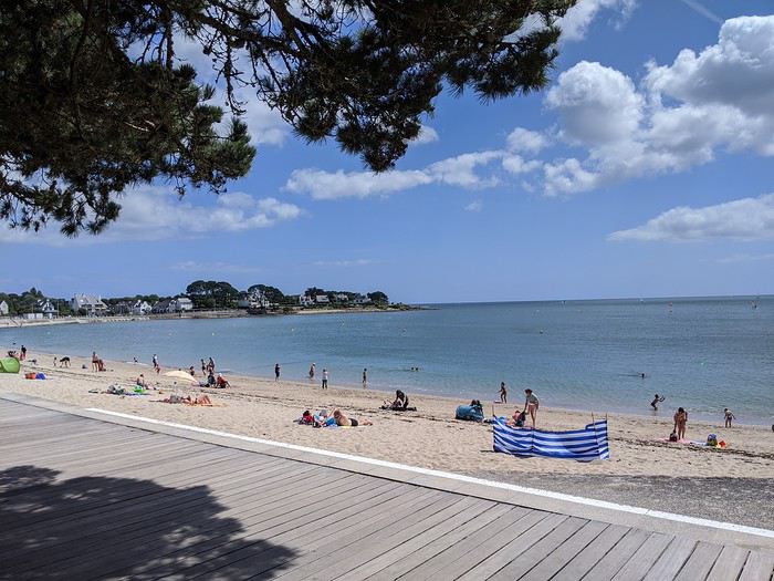
Où boire un coup par cette chaleur ? à l Ile Tudy bien sûr ! situé en face de sa voisine Loctudy,
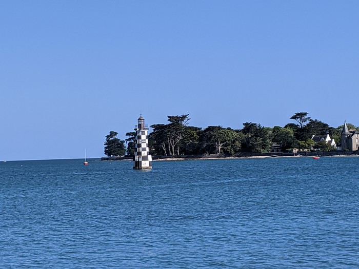
le bout de ce village se concentre sur son port , ses bistrots, restos.... encore calmes ce lundi
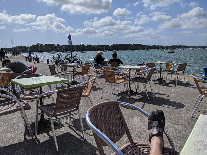
...il faut bien ça pour se remettre des 915 km de la veille
Descente de cervoise ambrée dans un bar connu
aussi pour la sa déco, affiche de concerts, artistes au plafond quant aux toilettes, super tapisserie

bref, on glande en admirant le paysage
la journée d installation se termine tranquillement.. Cécile se félicite de son bon choix...
et New York, https://voyageforum.com/v.f?post=9796574;search_string=Cecile
cet été, Cécile découvre le Finistère....
certes cela peut faire moins rêver, mais bon la Bretagne c est toujours aussi beau ..sans les parisiens et autres touristes covidés !
Campement à Bénodet, sa plage, son ciel bleu......
Où boire un coup par cette chaleur ? à l Ile Tudy bien sûr ! situé en face de sa voisine Loctudy,
le bout de ce village se concentre sur son port , ses bistrots, restos.... encore calmes ce lundi
...il faut bien ça pour se remettre des 915 km de la veille
Descente de cervoise ambrée dans un bar connu
aussi pour la sa déco, affiche de concerts, artistes au plafond quant aux toilettes, super tapisserie
bref, on glande en admirant le paysage
la journée d installation se termine tranquillement.. Cécile se félicite de son bon choix...
Enjoy Jordan: 3 semaines inoubliables English translation pending
Je vais me lancer dans un énième carnet sur cette fabuleuse destination. Je ne prétends pas égaler le style humoristique de certaines ou certains (ils se reconnaîtront !). Je vais juste essayer de vous faire vivre ou revivre quelques-uns de nos beaux souvenirs en ces temps où l'on ne sait plus vraiment quand nous pourrons refaire nos bagages et pour quelle destination.
Allez c'est parti, embarquement immédiat !
Mi-octobre 2019, mon épouse et moi sommes revenus d'un beau voyage de 3 semaines en Jordanie et 3,5 jours à Jérusalem.
Mais pourquoi 3 semaines dans un aussi petit pays où la plupart des touristes en 'font le tour' en 8/10 jours ?
Parce que... C'est la meilleure réponse... Surtout parce que nous le pouvons (pas de vacances en juillet/août) et que nous aimons prendre notre temps, visiter des sites moins connus, faire des activités parfois surprenante à nos âges.
Nous avons parcouru la Jordanie de Madaba et des rives de la Mer Morte à Jerash en passant par les châteaux du désert, de Jerash à Dana en passant par Kerak, de Dana au sublime Wadi Rum en passant par la merveilleuse Petra. Pour terminer, je vous proposerai de flâner dans la vieille ville d'Aman. Et au bout du bout, je pourrai éventuellement vous raconter nos derniers jours de ce périple passés à Jérusalem.
Etape 1 : Madaba
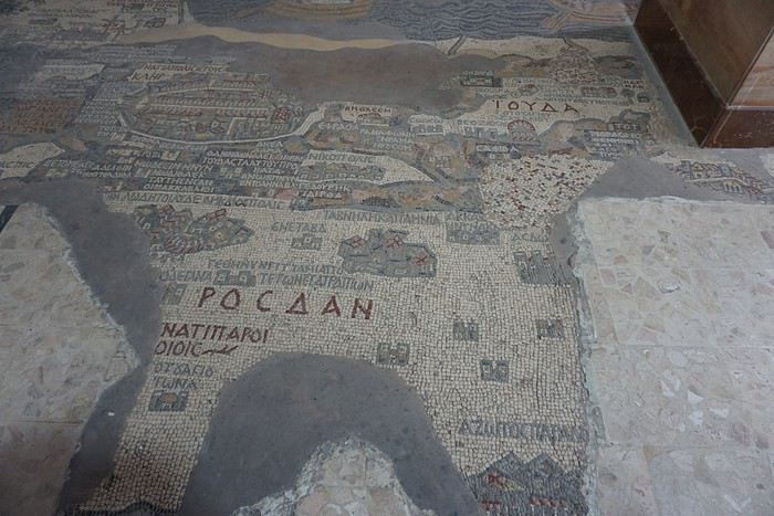
L’objectif de cette étape était de visiter tranquillement la ville et de voir les nombreuses mosaïques sur ses différents sites. Mais aussi de passer une journée au bord de la Mer Morte (objectif : repos dans un cadre sympa), de visiter quelques sites, villes ou villages tout autour et d’aller tenter le canyoning dans le wadi Mujib, nous qui n’avons jamais fait de canyoning ! Etape 2 : Jerash
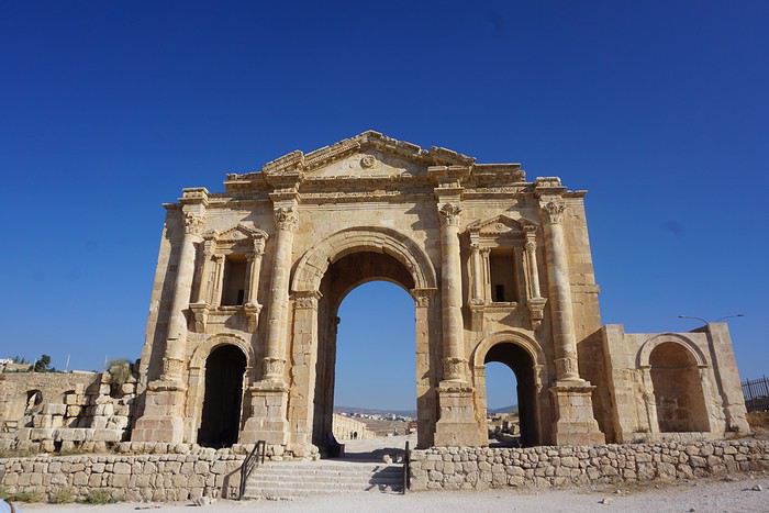
Etape à 100% culturelle avec au programme les châteaux du désert (petit détour pour relier Madaba à Jerash), les sites romains de Jerash, Um Qais et Pella, mais aussi le château médiéval d’Ajlun. Etape 3 : Kerak par la route du roi.
Nous ne passerons qu’une nuit à Kerak. Une demi-journée pour visiter le château, c’est très largement suffisant (même pour nous !) et donc cela va nous laisser du temps pour aller se balader dans des wadis faciles d’accès. Etape 4 : Dana
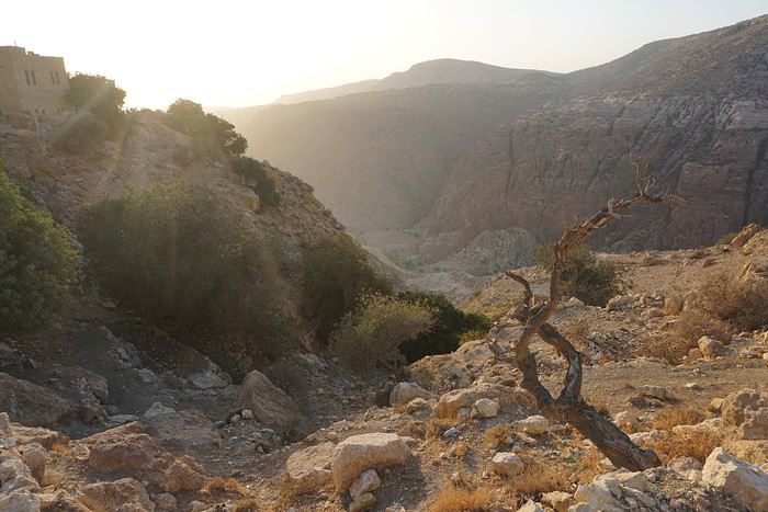
Ici aussi nous ne passerons qu’une nuit alors qu’au départ j’envisageai de passer plusieurs jours dans la réserve. Cela a été a priori un bon choix car si les randonnées y sont probablement très belles, Justine aurait eu beaucoup de mal compte-tenu du dénivelé. Et puis derrière, il y a Pétra et le trek dans le Wadi Rum. Il fallait donc se garder un peu d’énergie. Etape 5 : Pétra
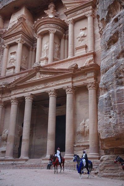
Que dire de cette étape ? Mon projet est de visiter le site en 4 journées complètes sans savoir si on pourra y rentrer 4 jours avec un Jordan Pass de 3 jours à Pétra. Si pas possible, on improvisera ! Etape 6 : Wadi Rum
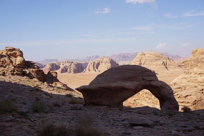
Nous allons y fêter notre anniversaire de mariage. Un trek de 3 jours, des camps itinérants et les nuits à la belle étoile. Et le jour de note anniversaire, le survol du désert au lever du soleil en montgolfière… projet sympa non ? Mais chut, c'est une surprise pour mon épouse ! Etape 7 : Amman
Dernière étape en Jordanie avant de traverser la frontière et terminer notre voyage à Jérusalem Etape 8 : Jérusalem
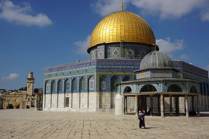
On ne présente plus cette destination : la vieille ville avec ses souks et les 4 quartiers (arabe, juif, chrétien et arménien), le Mont des Oliviers, le Mur des Lamentations, l’Esplanade des Mosquées. Mais aussi le mémorial de la Shoah.
L’objectif de cette étape était de visiter tranquillement la ville et de voir les nombreuses mosaïques sur ses différents sites. Mais aussi de passer une journée au bord de la Mer Morte (objectif : repos dans un cadre sympa), de visiter quelques sites, villes ou villages tout autour et d’aller tenter le canyoning dans le wadi Mujib, nous qui n’avons jamais fait de canyoning ! Etape 2 : Jerash
Etape à 100% culturelle avec au programme les châteaux du désert (petit détour pour relier Madaba à Jerash), les sites romains de Jerash, Um Qais et Pella, mais aussi le château médiéval d’Ajlun. Etape 3 : Kerak par la route du roi.
Nous ne passerons qu’une nuit à Kerak. Une demi-journée pour visiter le château, c’est très largement suffisant (même pour nous !) et donc cela va nous laisser du temps pour aller se balader dans des wadis faciles d’accès. Etape 4 : Dana
Ici aussi nous ne passerons qu’une nuit alors qu’au départ j’envisageai de passer plusieurs jours dans la réserve. Cela a été a priori un bon choix car si les randonnées y sont probablement très belles, Justine aurait eu beaucoup de mal compte-tenu du dénivelé. Et puis derrière, il y a Pétra et le trek dans le Wadi Rum. Il fallait donc se garder un peu d’énergie. Etape 5 : Pétra
Que dire de cette étape ? Mon projet est de visiter le site en 4 journées complètes sans savoir si on pourra y rentrer 4 jours avec un Jordan Pass de 3 jours à Pétra. Si pas possible, on improvisera ! Etape 6 : Wadi Rum
Nous allons y fêter notre anniversaire de mariage. Un trek de 3 jours, des camps itinérants et les nuits à la belle étoile. Et le jour de note anniversaire, le survol du désert au lever du soleil en montgolfière… projet sympa non ? Mais chut, c'est une surprise pour mon épouse ! Etape 7 : Amman
Dernière étape en Jordanie avant de traverser la frontière et terminer notre voyage à Jérusalem Etape 8 : Jérusalem
On ne présente plus cette destination : la vieille ville avec ses souks et les 4 quartiers (arabe, juif, chrétien et arménien), le Mont des Oliviers, le Mur des Lamentations, l’Esplanade des Mosquées. Mais aussi le mémorial de la Shoah.
40 ans de randonnées: quelques expériences marquantes English translation pending
La plus haute altitude: Mont Kanamo, Inde, 2011
24/9/2011 Je me trouve à Kibber, au Spiti, 4270 mètres. Je randonne déjà au Ladakh, puis au Spiti depuis un mois. Je suis complètement accoutumé à la haute altitude. Il fait très beau, pas trop froid, j'ai passé la nuit dans une guest house à Kibber, un village authentique dans un cirque plutôt sec, brun. Après le petit déjeuner chapatis omelette, je pars à 8 heures. En fait, je projette une traversée vers les villages de Langza et Komik mais je ne possède pas de carte détaillée. Je coupe dans les champs déjà récoltés, en cote, pour rejoindre la mauvaise piste vers le hameau de Gete, quelques maisons éparpillées, je vois un groupe de bharals (aussi appelés moutons bleus, abondants dans l'Himalaya indien), je me détourne au sommet des falaises pour la vue sur la vallée principale et le monastère de Kyi juste en contrebas. Je reprends la piste qui tourne vers un petit col puis redescend un peu vers un autre hameau en contrebas, mais je prends à gauche sur une piste en construction, plus tard je rencontre 6 ouvriers, ils ne se fatiguent pas trop. Vers le Sud, juste en face, je vois les vastes alpages de Langza ... pas loin, mais au milieu il y a la profonde entaille des gorges de la Shila. 3 heures 30 de marche déjà, je monte sur une petite butte pour voir l'itinéraire mais non, les gorges sont infranchissables ici, et en amont aussi. J'en profite pour manger le casse croute, pain confiture. Je ne regrette pas, très beau panorama avec le Chau Chau Kang Nilda, 6300 mètres, je décide de continuer un circuit pour revenir à Kibber par un col sur la crête plus à l'Est. La piste se termine, à un campement d'été avec des canaux d'irrigation, déserté fin septembre. Un sentier maintenant monte franchement vers le col, je suis en forme. En arrivant à un petit replat, je tombe sur 3 loups, pour le première fois dans l'Himalaya, je n'en ai vu que dans le parc national Denali en Alaska ! Ils sont aussi surpris que moi et ils s'enfuient. J'atteins le col à 4800 ou 4900 mètres et là, le mont Kanamo, 5975 mètres est proche, semble facile, c'est trop tentant. Je fais face quand même à une difficulté, le manque d'eau. Je dois trouver un camp qui en dispose sans trop redescendre. Je longe plus ou moins la crête vers l'Est vers un deuxième col, puis dans les éboulis vers un troisième col. Enfin la chance me souris, je vois un ruisseau plus bas dans la petite vallée vers le Sud . C'est un excellent camp, même un peu d'herbe, les yaks broutent ici en été. Le temps devient froid et nuageux, je mets mes vêtements chauds. Je cuisine du spaghetti au fromage sous le double toit, je lis un peu, avant 7 heures je suis couché.
25/9 Je ne dors pas très bien, j'ai plutôt trop chaud dans le sac de couchage. Lever à 5 heures 50. La tente est couverte de givre, il y a de la glace dans les gourdes mais le ruisseau coule. Pain confiture et grande tasse de Nescafe. Je pars à 6 heures 45, 35 minutes au col et je cache le gros de mes affaires sous des pierres. Je monte des éboulis raides sur une vague trace en 45 minutes jusqu'à une crête plus facile. Je me sens très bien, l'altitude ne me gêne pas. Je ne fais aucun arrêt. Je monte dans des éboulis très raides, mais stables, sur un épaulement, un peu de neige sur le haut, sans difficultes. En 2 heures 15 depuis le col, je rejoins l'extrémité de l'arrête sommitale du mont Kanamo, à environ 5900 mètres, avec un cairn et des drapeaux à prière, j'ai battu mon record d'altitude. J'ai bien mérité quelques biscuits. Mais le vrai sommet reste inaccessible pour moi, il faut longer la crête étroite et glacée, des crampons seraient nécessaires. En plus, un vent glacé souffle très fort, je ne peux pas rester. Je profite juste un peu de la vue des sommets dechiquetes et du glacier à l'arrière, avec une corniche. La descente ne présente aucune difficulté, même hors sentier, je passe par un petit lac bleu, je ne rencontre personne avant Kibber, bien un renard. Je peux me reposer au Norling Homestay, pas d'eau chaude mais à part cela confortable. Je reçois du the avec des biscuits, et le soir un dal bhat abondant. Je sors un peu dans le village, il semble n'y avoir qu'un seul autre touriste
26/9 À 8 heures 30 je prends le bus local pour Kaza.
A SUIVRE Prochain épisode: mon plus haut camp, au Pakistan. Merci de m'avoir lu.
24/9/2011 Je me trouve à Kibber, au Spiti, 4270 mètres. Je randonne déjà au Ladakh, puis au Spiti depuis un mois. Je suis complètement accoutumé à la haute altitude. Il fait très beau, pas trop froid, j'ai passé la nuit dans une guest house à Kibber, un village authentique dans un cirque plutôt sec, brun. Après le petit déjeuner chapatis omelette, je pars à 8 heures. En fait, je projette une traversée vers les villages de Langza et Komik mais je ne possède pas de carte détaillée. Je coupe dans les champs déjà récoltés, en cote, pour rejoindre la mauvaise piste vers le hameau de Gete, quelques maisons éparpillées, je vois un groupe de bharals (aussi appelés moutons bleus, abondants dans l'Himalaya indien), je me détourne au sommet des falaises pour la vue sur la vallée principale et le monastère de Kyi juste en contrebas. Je reprends la piste qui tourne vers un petit col puis redescend un peu vers un autre hameau en contrebas, mais je prends à gauche sur une piste en construction, plus tard je rencontre 6 ouvriers, ils ne se fatiguent pas trop. Vers le Sud, juste en face, je vois les vastes alpages de Langza ... pas loin, mais au milieu il y a la profonde entaille des gorges de la Shila. 3 heures 30 de marche déjà, je monte sur une petite butte pour voir l'itinéraire mais non, les gorges sont infranchissables ici, et en amont aussi. J'en profite pour manger le casse croute, pain confiture. Je ne regrette pas, très beau panorama avec le Chau Chau Kang Nilda, 6300 mètres, je décide de continuer un circuit pour revenir à Kibber par un col sur la crête plus à l'Est. La piste se termine, à un campement d'été avec des canaux d'irrigation, déserté fin septembre. Un sentier maintenant monte franchement vers le col, je suis en forme. En arrivant à un petit replat, je tombe sur 3 loups, pour le première fois dans l'Himalaya, je n'en ai vu que dans le parc national Denali en Alaska ! Ils sont aussi surpris que moi et ils s'enfuient. J'atteins le col à 4800 ou 4900 mètres et là, le mont Kanamo, 5975 mètres est proche, semble facile, c'est trop tentant. Je fais face quand même à une difficulté, le manque d'eau. Je dois trouver un camp qui en dispose sans trop redescendre. Je longe plus ou moins la crête vers l'Est vers un deuxième col, puis dans les éboulis vers un troisième col. Enfin la chance me souris, je vois un ruisseau plus bas dans la petite vallée vers le Sud . C'est un excellent camp, même un peu d'herbe, les yaks broutent ici en été. Le temps devient froid et nuageux, je mets mes vêtements chauds. Je cuisine du spaghetti au fromage sous le double toit, je lis un peu, avant 7 heures je suis couché.
25/9 Je ne dors pas très bien, j'ai plutôt trop chaud dans le sac de couchage. Lever à 5 heures 50. La tente est couverte de givre, il y a de la glace dans les gourdes mais le ruisseau coule. Pain confiture et grande tasse de Nescafe. Je pars à 6 heures 45, 35 minutes au col et je cache le gros de mes affaires sous des pierres. Je monte des éboulis raides sur une vague trace en 45 minutes jusqu'à une crête plus facile. Je me sens très bien, l'altitude ne me gêne pas. Je ne fais aucun arrêt. Je monte dans des éboulis très raides, mais stables, sur un épaulement, un peu de neige sur le haut, sans difficultes. En 2 heures 15 depuis le col, je rejoins l'extrémité de l'arrête sommitale du mont Kanamo, à environ 5900 mètres, avec un cairn et des drapeaux à prière, j'ai battu mon record d'altitude. J'ai bien mérité quelques biscuits. Mais le vrai sommet reste inaccessible pour moi, il faut longer la crête étroite et glacée, des crampons seraient nécessaires. En plus, un vent glacé souffle très fort, je ne peux pas rester. Je profite juste un peu de la vue des sommets dechiquetes et du glacier à l'arrière, avec une corniche. La descente ne présente aucune difficulté, même hors sentier, je passe par un petit lac bleu, je ne rencontre personne avant Kibber, bien un renard. Je peux me reposer au Norling Homestay, pas d'eau chaude mais à part cela confortable. Je reçois du the avec des biscuits, et le soir un dal bhat abondant. Je sors un peu dans le village, il semble n'y avoir qu'un seul autre touriste
26/9 À 8 heures 30 je prends le bus local pour Kaza.
A SUIVRE Prochain épisode: mon plus haut camp, au Pakistan. Merci de m'avoir lu.
Off to explore Jordan!
Well, since the lockdown is dragging on, I’m starting a new travel journal following the one I finished publishing yesterday:
https://voyageforum.com/discussion/voyage-pays-perles-voyage-dans-ouest-americain-d9943984/
This time, after the U.S., we’re heading to the Middle East—Jordan!
And we’re keeping up the good habits: one day’s entry published every day at 5:30 PM! Happy reading, and feel free to leave a comment, question, or remark...
Franck
Franck
Scandinavie: d'Oslo à Hambourg, un vélo au pays du vélo English translation pending
Août - septembre 2019, chroniques d'un sexagénaire à vélo au pays des vikings.
Partir en solo à vélo sans date de retour. Un rêve que je caressais depuis longtemps et que la retraite me permet de réaliser tant que la forme physique est là.
Pour la partie norvégienne, j'ai choisi de faire les étapes en bus, ferry et train, et de rayonner sur place. Tous les transports prennent les vélos. Pour la Suède, le Danemark et l'Allemagne, tout (ou presque) à été parcouru à vélo.
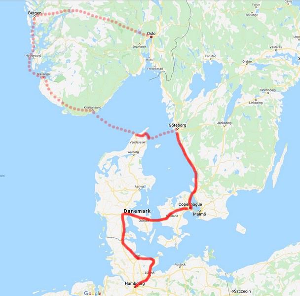
Dimanche 18, lundi 19, mardi 20 août Oslo Vu l'éloignement entre l'aéroport et la ville, le plus simple est de prendre le train navette. Pas de problème, il prend les (nombreux) vélos. Ca sera comme ça partout. Ca me change du précédent voyage (voir mon carnet "Amérique du Nord"). Hébergement à l'auberge de jeunesse, en haut de la ville, forcément. Pareil pour les prix, ils sont à la hauteur du niveau de vie du pays !... Tour d'horizon des classiques de la capitale. Rien de mieux que le vélo pour la parcourir. L'Auberge de Jeunesse, la qualité a un prix
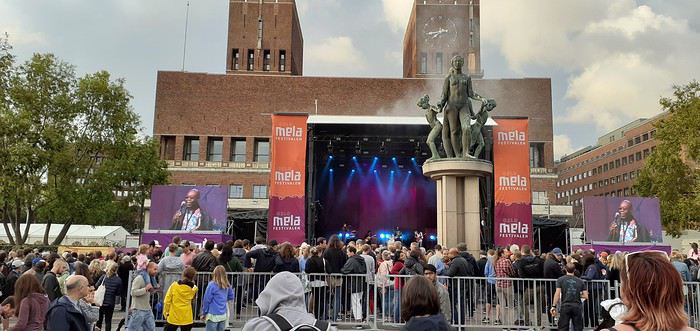 Concert gratuit du regretté Manu Dibango
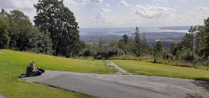 Une belle journée dans la campagne alentour
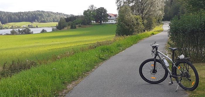 Ici, tout est fait pour le vélo
Dimanche 18, lundi 19, mardi 20 août Oslo Vu l'éloignement entre l'aéroport et la ville, le plus simple est de prendre le train navette. Pas de problème, il prend les (nombreux) vélos. Ca sera comme ça partout. Ca me change du précédent voyage (voir mon carnet "Amérique du Nord"). Hébergement à l'auberge de jeunesse, en haut de la ville, forcément. Pareil pour les prix, ils sont à la hauteur du niveau de vie du pays !... Tour d'horizon des classiques de la capitale. Rien de mieux que le vélo pour la parcourir.
L'Auberge de Jeunesse, la qualité a un prix
Concert gratuit du regretté Manu Dibango
Une belle journée dans la campagne alentour
Ici, tout est fait pour le véloCalifornie en mars 2020: qui veut une part de désert? English translation pending
Hello à toutes et à tous,
De retour cette semaine, voici le carnet de nos dernières aventures, majoritairement dans le désert californien (petites incursions dans le Nevada et en Arizona). Nous avons eu la chance de pouvoir partir. Cela s'est joué à quelques jours mais on passera sur la phase d'incertitude et de stress les semaines et jours précédant le départ, car bien d'autres sont davantage impactés par ce coronavirus....
Au programme théorique, boucle de 15 jours depuis Los Angeles avec les alentours de Ridgecrest, Alabama Hills, Death Valley approfondie sur 3/4 jours, des belles randos autour de Las Vegas, les désert de Mojave et d'Anza Borrego, Joshua NP et Palm Springs.
Los Angeles n'est pas une ville que nous aimons, mais c'est une destination sur laquelle les compagnies (y compris les low cost long courrier) se livrent une bataille avec des prix compétitifs. Et nous voulions du soleil et ne pouvant partir qu'en dehors de la saison touristique, c'était le meilleur choix pour la rando aux states...
C'est parti pour le départ!
Jour 1: Jeudi 5 mars 2020
Après une nuit à Roissy, trajet en bus pour l'aéroport sous une forte pluie, vol Air France direct CDG LAX sans encombre. Même si le vol est long (11h30), nous avons apprécié le confort d'un vol direct et les prestations de la compagnie Air France (vol réservé au prix compétitif de 330€ hors supplément bagages et autres, tout compris 760€ / 2 avec sièges choisis et un bagage en soute / pers). L'A380 est vraiment confortable.
Arrivée à l'heure prévue (13h heure locale), il fait beau et bon (20°C). Passage de l'immigration hyper rapide, nous voyons beaucoup d'évolutions année après année: le personnel est remplacé par les machines. Tout se fait désormais par les bornes. Seul un passage rapide pour le coup de tampon. En 10 minutes, tout est plié! Récupération des bagages puis attente de la navette Alamo.
Une vingtaine de minutes plus tard, nous voici au parking Alamo. Toujours un moment de "stress" sur le type de véhicule qu'il y aura de dispo. Sans surprise, très peu de choix en Suv 4x4. Seulement un et il y a quelqu'un dedans. On prend un Ford Escape 2wd, la garde au sol est correcte, il est neuf (4000 miles au compteur), spacieux et les pneus Michelin sont bons (résa plusieurs mois à l'avance, 443 € pour 15 jours). Pour la première fois, il n'a pas été possible de valider le "Skip the counter" permettant d'éviter l'étape réputée très chiante de l'attente au guichet. Et je confirme c'est très chiant. Attente interminable, le vendeur essaie de fourguer toutes sortes d'options. Il me dit que je suis "Mr No", refusant chacune de ses propositions.
Il était prévu d'aller se balader l'après-midi au bord du Pacifique à Los Angeles, vers 3rd St, Palisades Park, Venice beach et un sunset éventuel vers Santa Monica. Mais la fatigue, le détour (par rapport à la situation de notre hôtel situé à l'Est) et la circulation très dense dans l'agglo tentaculaire de L.A nous font renoncer. Et nous avons bien fait! Nous allons mettre 1h30 pour rejoindre notre hôtel Days Inn à Artesia (choisi pour position pour la route de demain et petit dej inclus) alors qu'il n'y a que 37 km! toutes les routes sont encombrées, y compris en rusant en quittant les freeway et highway...
Bien contents d'arriver, quartier calme, parking gratuit. Quelques achats à pied au supermarché tout proche Stater Bross pour le diner de ce soir. Hôtel classique (88$), chambre spacieuse avec frigo, M-O, coin table, piscine extérieure non chauffée (et froide). Nous avons trouvé les hôtels chers cette année comparativement à l'Arizona l'année dernière à la même période.
Sunset à 17h49, c'est tôt! Diner dans la chambre et au lit à 19h30! La première nuit est toujours un moment spécial...
Jour 2: Vendredi 6 mars 2020
Le road-trip commence!! réveil évidemment très tôt, on fait l'ouverture du p'tit dèj à 6h30 (avec notre gel désinfectant en poche) et route pour Barstow pour la première rando du voyage peu connue et.. normalement peu fréquentée... Il nous faut 2 bonnes heures pour rejoindre le départ dans le secteur de Rainbow basin, au nord de Barstow. La piste après Irwin Rd est bonne, en tôle ondulée. Quelques passages sablonneux mais ok avec tout type de véhicule si temps sec (et c'est le cas). On traverse le camping de Owl canyon, chaque campeur nous salue.
Aucune voiture au trailhead (😉 !), j'aime. C'est indiqué. Il est déjà presque 10h, le soleil est levé depuis plusieurs heures (sunrise 6h14) et la luminosité n'est déjà plus optimale pour des photographes. Pour nous randonneurs, on est au top ! Il fait beau et on retrouve le plaisir des randos en tenue estivale (65° F, soit 17°C au départ)
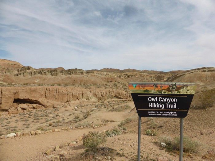
Le parking est tout au bout de la piste. J'ai repéré 2 canyons qui semblent intéressants, peu d'infos sur le net sur ce secteur. J'ai envie de faire une boucle plutôt que 2 A/R pour chaque canyon mais je ne sais pas ce que nous allons trouvé comme type de terrain pour faire la boucle. Au programme, une assez longue boucle pour un début de voyage avec 13km mais peu de dénivelé (380m d'après ma trace gpx théorique).
Nous partons par le canyon le plus à l'est, facile à suivre.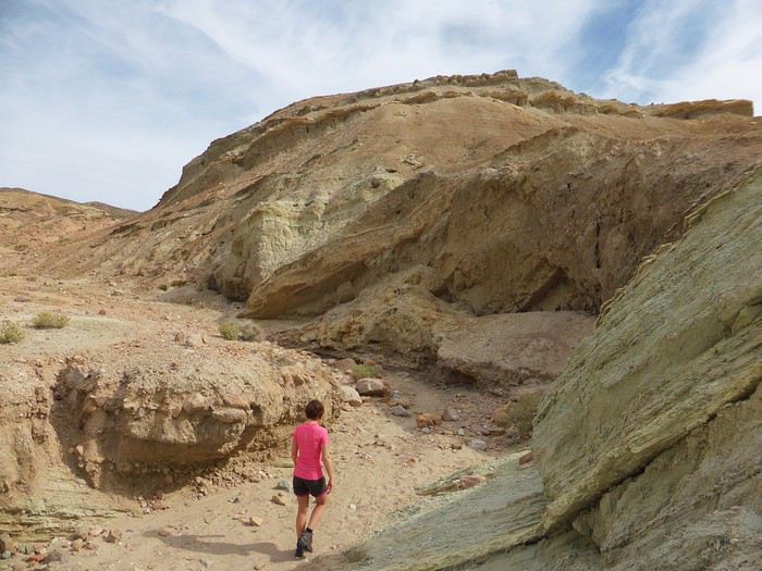
C'est rapidement très joli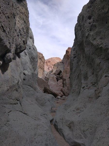
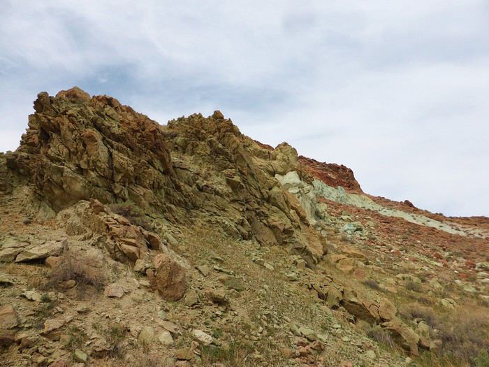
Une grande diversité, la solitude. Une tortue (morte), des belles pierres
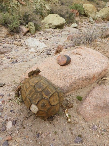
Il nous faut une heure pour parcourir ce premier canyon, qui va vers le nord. Nous galérons à trouver un chemin qui connecte les 2 canyons. C'est un peu casse gueule par endroits (on aperçoit le sentier à droite sur la photo du dessous)
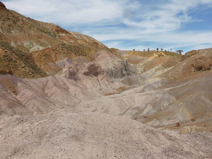
La portion qui suit est moins intéressante (après les arbres en haut de la photo). Deux belles remontées et nous piquons à gauche pour retrouver le second canyon qui va nous ramener à la piste puis à la voiture. Je n'attendais rien de cette seconde partie et nous l'avons préféré, plus ludique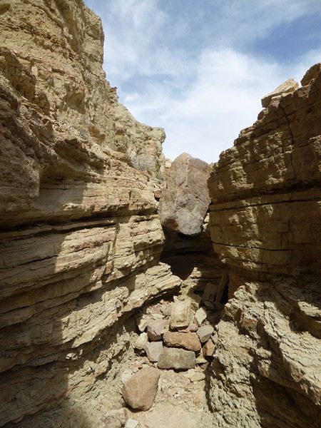
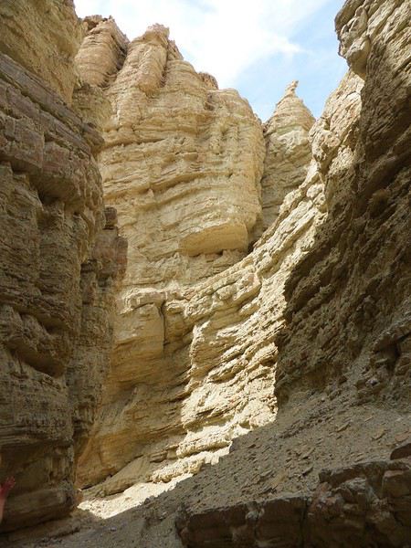
Attention il y a une grosse "marche" à descendre" d'environ 4 mètres puis une seconde de 2/3 mètres. Après quelques hésitations et études des environs, nous "désescaladons" cette partie avec précaution. Il serait plus facile de faire la boucle dans l'autre sens mais ce serait moins joli...
Vers 12h, nous sortons du canyon et remontons sur la piste (faisable en voiture, en sens unique). Nous prenons donc cette (jolie) piste aux belles couleurs malgré une lumière devenue trop crue. La piste a des airs de Death Valley, c'est le désert et plus c'est désert. Personne de près ni de loin...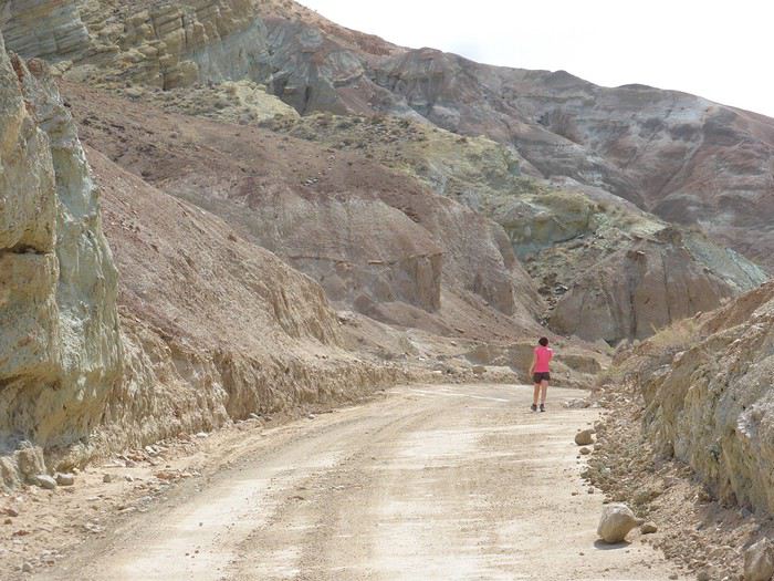
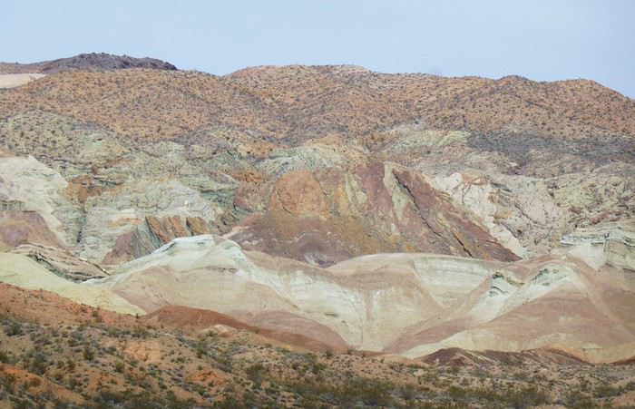
La dernière partie est commune à notre arrivée en voiture, sur la piste puis au travers du camping de Owl canyon (6$ / jour pour les campeurs, dépaysement garanti!) . Les jambes commencent à être lourdes et ce secteur n'est pas passionnant mais c'est le prix à payer pour faire la boucle... On est en mode automatique, bonne cadence. Il fait désormais très chaud (75°F).
Cette première rando Owl canyon / rainbow canyon nous a vraiment plu. 2h50 de rando, 13,5km et 400m de D+.
Petit rafraichissement à l'espace aménagé sur la piste du retour (picnic area pour les groupes)
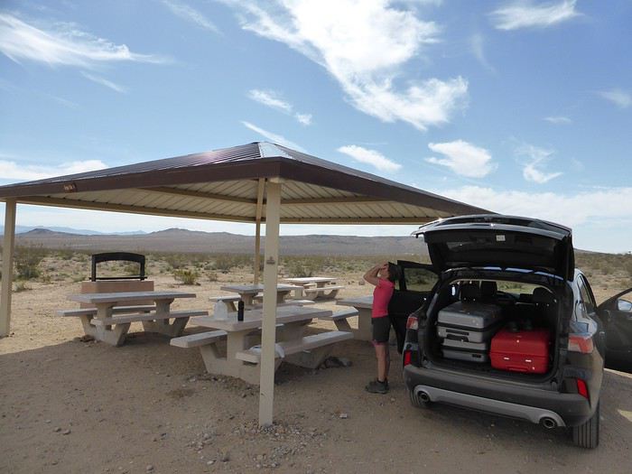
Retour vers Barstow qui essaie de revivre (sans véritable succès) en utilisant son emplacement sur la route 66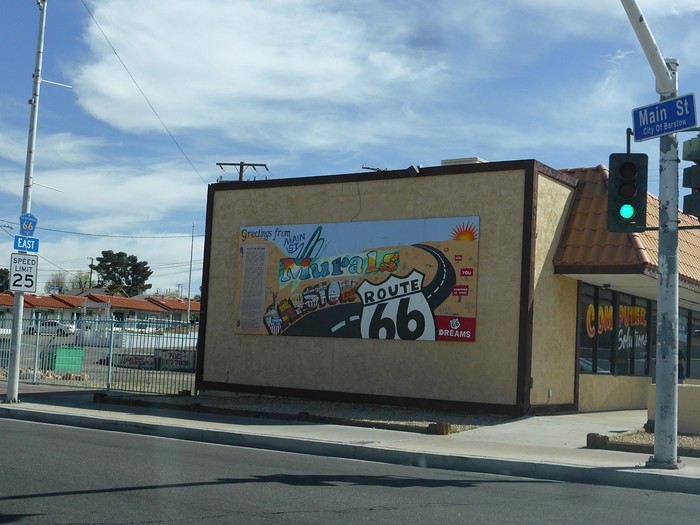
Arrêt aux outlets de Barstow que nous avions fait en 2014. Aucun achat ici, vraiment pas terrible.
Route pour Ridgecrest. Au passage, arrêt à la ghost town de Randsburg. Petite bourgade sympatique, très Old West. Tout est fermé sauf un bar. C'est sympa. L'arrêt ne nous prend que quelques minutes.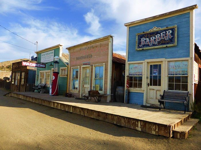
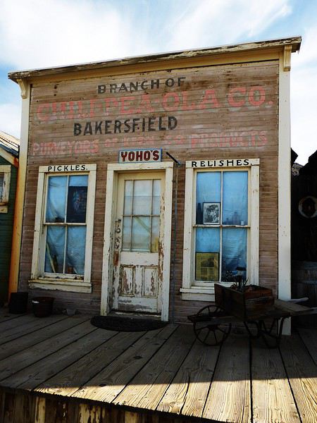
Pas de touristes ici à cette saison. Seuls quelques bikers et pilotes de quads et des locaux.
Check-in au Best western China Lake Inn de Ridecrest en fin de journée (181$ pour 2 nuits, PDJ inclus). Bel hôtel. Ridgerest est une ville où l'on trouve tout pour se ravitailler avant la Vallée de la mort (Walmart, Albertsons) à des prix abordables. Accueil charmant à l'hôtel, soirée relax ici. Jacuzzi extérieur, piscine non chauffée et glaciale. On prend plaisir à retrouver un Walmart avec nos achats pour les prochains jours. Bière, burrito salade dans la chambre. Première journée sympa. Belle entrée en matière avec la rando
A suivre...
De retour cette semaine, voici le carnet de nos dernières aventures, majoritairement dans le désert californien (petites incursions dans le Nevada et en Arizona). Nous avons eu la chance de pouvoir partir. Cela s'est joué à quelques jours mais on passera sur la phase d'incertitude et de stress les semaines et jours précédant le départ, car bien d'autres sont davantage impactés par ce coronavirus....
Au programme théorique, boucle de 15 jours depuis Los Angeles avec les alentours de Ridgecrest, Alabama Hills, Death Valley approfondie sur 3/4 jours, des belles randos autour de Las Vegas, les désert de Mojave et d'Anza Borrego, Joshua NP et Palm Springs.
Los Angeles n'est pas une ville que nous aimons, mais c'est une destination sur laquelle les compagnies (y compris les low cost long courrier) se livrent une bataille avec des prix compétitifs. Et nous voulions du soleil et ne pouvant partir qu'en dehors de la saison touristique, c'était le meilleur choix pour la rando aux states...
C'est parti pour le départ!
Jour 1: Jeudi 5 mars 2020
Après une nuit à Roissy, trajet en bus pour l'aéroport sous une forte pluie, vol Air France direct CDG LAX sans encombre. Même si le vol est long (11h30), nous avons apprécié le confort d'un vol direct et les prestations de la compagnie Air France (vol réservé au prix compétitif de 330€ hors supplément bagages et autres, tout compris 760€ / 2 avec sièges choisis et un bagage en soute / pers). L'A380 est vraiment confortable.
Arrivée à l'heure prévue (13h heure locale), il fait beau et bon (20°C). Passage de l'immigration hyper rapide, nous voyons beaucoup d'évolutions année après année: le personnel est remplacé par les machines. Tout se fait désormais par les bornes. Seul un passage rapide pour le coup de tampon. En 10 minutes, tout est plié! Récupération des bagages puis attente de la navette Alamo.
Une vingtaine de minutes plus tard, nous voici au parking Alamo. Toujours un moment de "stress" sur le type de véhicule qu'il y aura de dispo. Sans surprise, très peu de choix en Suv 4x4. Seulement un et il y a quelqu'un dedans. On prend un Ford Escape 2wd, la garde au sol est correcte, il est neuf (4000 miles au compteur), spacieux et les pneus Michelin sont bons (résa plusieurs mois à l'avance, 443 € pour 15 jours). Pour la première fois, il n'a pas été possible de valider le "Skip the counter" permettant d'éviter l'étape réputée très chiante de l'attente au guichet. Et je confirme c'est très chiant. Attente interminable, le vendeur essaie de fourguer toutes sortes d'options. Il me dit que je suis "Mr No", refusant chacune de ses propositions.
Il était prévu d'aller se balader l'après-midi au bord du Pacifique à Los Angeles, vers 3rd St, Palisades Park, Venice beach et un sunset éventuel vers Santa Monica. Mais la fatigue, le détour (par rapport à la situation de notre hôtel situé à l'Est) et la circulation très dense dans l'agglo tentaculaire de L.A nous font renoncer. Et nous avons bien fait! Nous allons mettre 1h30 pour rejoindre notre hôtel Days Inn à Artesia (choisi pour position pour la route de demain et petit dej inclus) alors qu'il n'y a que 37 km! toutes les routes sont encombrées, y compris en rusant en quittant les freeway et highway...
Bien contents d'arriver, quartier calme, parking gratuit. Quelques achats à pied au supermarché tout proche Stater Bross pour le diner de ce soir. Hôtel classique (88$), chambre spacieuse avec frigo, M-O, coin table, piscine extérieure non chauffée (et froide). Nous avons trouvé les hôtels chers cette année comparativement à l'Arizona l'année dernière à la même période.
Sunset à 17h49, c'est tôt! Diner dans la chambre et au lit à 19h30! La première nuit est toujours un moment spécial...
Jour 2: Vendredi 6 mars 2020
Le road-trip commence!! réveil évidemment très tôt, on fait l'ouverture du p'tit dèj à 6h30 (avec notre gel désinfectant en poche) et route pour Barstow pour la première rando du voyage peu connue et.. normalement peu fréquentée... Il nous faut 2 bonnes heures pour rejoindre le départ dans le secteur de Rainbow basin, au nord de Barstow. La piste après Irwin Rd est bonne, en tôle ondulée. Quelques passages sablonneux mais ok avec tout type de véhicule si temps sec (et c'est le cas). On traverse le camping de Owl canyon, chaque campeur nous salue.
Aucune voiture au trailhead (😉 !), j'aime. C'est indiqué. Il est déjà presque 10h, le soleil est levé depuis plusieurs heures (sunrise 6h14) et la luminosité n'est déjà plus optimale pour des photographes. Pour nous randonneurs, on est au top ! Il fait beau et on retrouve le plaisir des randos en tenue estivale (65° F, soit 17°C au départ)
Le parking est tout au bout de la piste. J'ai repéré 2 canyons qui semblent intéressants, peu d'infos sur le net sur ce secteur. J'ai envie de faire une boucle plutôt que 2 A/R pour chaque canyon mais je ne sais pas ce que nous allons trouvé comme type de terrain pour faire la boucle. Au programme, une assez longue boucle pour un début de voyage avec 13km mais peu de dénivelé (380m d'après ma trace gpx théorique).
Nous partons par le canyon le plus à l'est, facile à suivre.
C'est rapidement très joli
Une grande diversité, la solitude. Une tortue (morte), des belles pierres
Il nous faut une heure pour parcourir ce premier canyon, qui va vers le nord. Nous galérons à trouver un chemin qui connecte les 2 canyons. C'est un peu casse gueule par endroits (on aperçoit le sentier à droite sur la photo du dessous)
La portion qui suit est moins intéressante (après les arbres en haut de la photo). Deux belles remontées et nous piquons à gauche pour retrouver le second canyon qui va nous ramener à la piste puis à la voiture. Je n'attendais rien de cette seconde partie et nous l'avons préféré, plus ludique
Attention il y a une grosse "marche" à descendre" d'environ 4 mètres puis une seconde de 2/3 mètres. Après quelques hésitations et études des environs, nous "désescaladons" cette partie avec précaution. Il serait plus facile de faire la boucle dans l'autre sens mais ce serait moins joli...
Vers 12h, nous sortons du canyon et remontons sur la piste (faisable en voiture, en sens unique). Nous prenons donc cette (jolie) piste aux belles couleurs malgré une lumière devenue trop crue. La piste a des airs de Death Valley, c'est le désert et plus c'est désert. Personne de près ni de loin...
La dernière partie est commune à notre arrivée en voiture, sur la piste puis au travers du camping de Owl canyon (6$ / jour pour les campeurs, dépaysement garanti!) . Les jambes commencent à être lourdes et ce secteur n'est pas passionnant mais c'est le prix à payer pour faire la boucle... On est en mode automatique, bonne cadence. Il fait désormais très chaud (75°F).
Cette première rando Owl canyon / rainbow canyon nous a vraiment plu. 2h50 de rando, 13,5km et 400m de D+.
Petit rafraichissement à l'espace aménagé sur la piste du retour (picnic area pour les groupes)
Retour vers Barstow qui essaie de revivre (sans véritable succès) en utilisant son emplacement sur la route 66
Arrêt aux outlets de Barstow que nous avions fait en 2014. Aucun achat ici, vraiment pas terrible.
Route pour Ridgecrest. Au passage, arrêt à la ghost town de Randsburg. Petite bourgade sympatique, très Old West. Tout est fermé sauf un bar. C'est sympa. L'arrêt ne nous prend que quelques minutes.
Pas de touristes ici à cette saison. Seuls quelques bikers et pilotes de quads et des locaux.
Check-in au Best western China Lake Inn de Ridecrest en fin de journée (181$ pour 2 nuits, PDJ inclus). Bel hôtel. Ridgerest est une ville où l'on trouve tout pour se ravitailler avant la Vallée de la mort (Walmart, Albertsons) à des prix abordables. Accueil charmant à l'hôtel, soirée relax ici. Jacuzzi extérieur, piscine non chauffée et glaciale. On prend plaisir à retrouver un Walmart avec nos achats pour les prochains jours. Bière, burrito salade dans la chambre. Première journée sympa. Belle entrée en matière avec la rando
A suivre...
De retour du Ladakh, 3 semaines de Leh à Delhi English translation pending
De retour d’un premier séjour au Ladakh…je me décide enfin à écrire quelques lignes.
En effet le voyage date déjà de quelques mois, l’été 2019. Mieux vaut tard que jamais…
Beaucoup de montagnards chevronnés sur cette destination (il y a peut être une certaine logique à cela), je dois avouer que je n’entre pas dans cette catégorie… ce qui ne m’empêche pas d’apprécier de grandioses paysages de montagne !! Mes motivations premières pour cette destination étaient donc : la découverte de la région et des ses habitants, bien entendu ; l’Himalaya bien sûr, mais sans forcément penser à faire de grandes marches / de grands escalades ; les monastères bouddhistes, cela va sans dire ; et les routes mythiques, en particulier la route ralliant Leh à Manali qui est bien haut dans ma wish-list depuis un certain nombre d’années…
Avant de rentrer dans le vif du sujet, un grand merci à tous ceux qui ont répondu à mes messages et m’ont aidé à dans ma préparation. Et des very special thanks au grand spécialiste de la destination, Djullé84, qui, m’a grandement aidé dans mon itinéraire, et qui a aussi influé sur le contenu de mon voyage. On en reparlera !
Donc, les grandes lignes de ce voyage ont été : - Leh (inévitablement) et les monastères de la vallée de l’Indus - Le festival de Lamayuru - Le trek de la Markha - Une virée dans la vallée de la Nubra - Le trajet de retour en bus de Leh à Delhi. Pour les déplacements, les transports publics sont privilégiés, autant que possible.
Durée / période : ~3 semaines, fin juin / mi-juillet
Le voyage jusqu'à Leh : vol jusqu’à Delhi sur Lufthansa via Munich (Lufthansa est très concurrentiel vers les destinations asiatiques depuis ma province). Arrivée Delhi peu avant minuit, passage à l’immigration sans problème pour valider mon visa à entrées multiples sur un an obtenu sur internet. Je traîne quelques heures dans l’aéroport puis je m’aperçois qu’il me faut changer de terminal pour prendre mon vol SpiceJet du petit matin. Le terminal 1D est loin, la navette en bus est gratuite en montrant sa carte d’embarquement du vol précédent et sa réservation du vol suivant (à prendre près du pilier 10 accessible par la sortie 4, le monsieur dans la cabane donne le ticket). Heureusement, j’avais été attentif lors de ma réservation et je n’avais pas acheté mon billet avec une CB virtuelle : il faut effectivement montrer la CB avec laquelle on a fait l’achat pour obtenir sa boarding card…(Spicejet) Vol sans histoire, mais… le ciel très couvert ne permet aucun spectacle, c’est une déception car ça aurait pu être pire : le vol n’a pas été annulé… Avion jusqu'à Leh, donc : d'une part en juin, c'est encore tôt dans la saison pour prendre la route ; et d'autre part, la route Delhi-Manali-Leh me paraît très haute pour l'emprunter sans aucune acclimatation, je la réserve pour le retour... Et l'autre possibilité par Amritsar et Srinagar était très tentante, mais d'une part elle exigeait beaucoup de temps, et d'autre part cet itinéraire fait emprunter des trajets qui se situent dans la zone rouge du ministère des affaires étrangères...
Depuis l'aéroport, le taxi pour le centre de Leh coûte 450 Rs (flat price), installation à la GH, réservée sur booking, dans le vieux Leh, entre le terrain de polo et la rue principale.
La 1ère journée se passe au ralenti, sous un ciel couvert, il me faut récupérer du voyage et de la nuit dans l’aéroport de Delhi, et m’acclimater à l’altitude. Premières découvertes de Leh qui au premier abord et sous le ciel gris, n’est pas vraiment enthousiasmante (ça me rassure un peu d’avoir lu quelque part (n’est ce pas, Djullé84) que « chaque journée passée à Leh est une journée de moins passée au Ladakh »…). Ah tous ces toutous en train de roupiller… La première nuit est un peu difficile, mal de tête avec l’altitude… Et les chiens donnent un concert dès le coucher du soleil. Je comprends pourquoi les chiens dormaient dans la journée : à Leh, le chien est un animal nocturne, qui dort le jour et qui passe ses nuits à aboyer… Ah, il y a le chant du muezzin aussi…
Temps pluvieux le matin (et j’apprends qu’il n’y a aucun vol depuis/vers Leh aujourd’hui…), il me faut récupérer des infos pratiques pour organiser la suite du voyage (les jours et heures des bus, en particulier …). Le temps s’arrange, location de scooter l’après midi, je parviens à en obtenir un bien que je n’aie pas pu avoir mon permis de conduire international en temps et en heure. Je vais aller jusqu’à Phyang. Une fois sorti des embouteillages et du bazar de Leh, la ballade permet les premières vues spectaculaires sur les montagnes himalayennes et sur l’Indus. Et les premiers convois militaires à croiser aussi, ils seront omniprésents sur les routes…Et la possibilité de voir de près le 1er monastère ! (mais pas de le visiter à l’heure de mon arrivée) Côté organisation, j’ai pu planifier les choses : dans les prochains jours, ce sera une virée Alchi – Likir – Lamayuru et retour sur Leh : le lendemain je prendrai un premier bus pour Alchi ; mon périple continuera en prenant le bus qui repart pour Leh ; en descendant à la bifurcation pour Likir, je pourrai ensuite monter à pied pour la fin d’après-midi et la nuit à Likir. Le jour suivant je redescendrai à pied à la highway prendre le bus pour Lamayuru, où je resterai deux jours et demi (dont une pleine journée de festival) avant de rentrer en bus pour Leh. J’en repartirai le lendemain pour la vallée de la Markha. Leh sera donc ma plaque tournante, ce qui me permet de m’alléger en demandant à la GH de garder une partie de mes affaires lors de chacune de mes escapades.
(à suivre)
En effet le voyage date déjà de quelques mois, l’été 2019. Mieux vaut tard que jamais…
Beaucoup de montagnards chevronnés sur cette destination (il y a peut être une certaine logique à cela), je dois avouer que je n’entre pas dans cette catégorie… ce qui ne m’empêche pas d’apprécier de grandioses paysages de montagne !! Mes motivations premières pour cette destination étaient donc : la découverte de la région et des ses habitants, bien entendu ; l’Himalaya bien sûr, mais sans forcément penser à faire de grandes marches / de grands escalades ; les monastères bouddhistes, cela va sans dire ; et les routes mythiques, en particulier la route ralliant Leh à Manali qui est bien haut dans ma wish-list depuis un certain nombre d’années…
Avant de rentrer dans le vif du sujet, un grand merci à tous ceux qui ont répondu à mes messages et m’ont aidé à dans ma préparation. Et des very special thanks au grand spécialiste de la destination, Djullé84, qui, m’a grandement aidé dans mon itinéraire, et qui a aussi influé sur le contenu de mon voyage. On en reparlera !
Donc, les grandes lignes de ce voyage ont été : - Leh (inévitablement) et les monastères de la vallée de l’Indus - Le festival de Lamayuru - Le trek de la Markha - Une virée dans la vallée de la Nubra - Le trajet de retour en bus de Leh à Delhi. Pour les déplacements, les transports publics sont privilégiés, autant que possible.
Durée / période : ~3 semaines, fin juin / mi-juillet
Le voyage jusqu'à Leh : vol jusqu’à Delhi sur Lufthansa via Munich (Lufthansa est très concurrentiel vers les destinations asiatiques depuis ma province). Arrivée Delhi peu avant minuit, passage à l’immigration sans problème pour valider mon visa à entrées multiples sur un an obtenu sur internet. Je traîne quelques heures dans l’aéroport puis je m’aperçois qu’il me faut changer de terminal pour prendre mon vol SpiceJet du petit matin. Le terminal 1D est loin, la navette en bus est gratuite en montrant sa carte d’embarquement du vol précédent et sa réservation du vol suivant (à prendre près du pilier 10 accessible par la sortie 4, le monsieur dans la cabane donne le ticket). Heureusement, j’avais été attentif lors de ma réservation et je n’avais pas acheté mon billet avec une CB virtuelle : il faut effectivement montrer la CB avec laquelle on a fait l’achat pour obtenir sa boarding card…(Spicejet) Vol sans histoire, mais… le ciel très couvert ne permet aucun spectacle, c’est une déception car ça aurait pu être pire : le vol n’a pas été annulé… Avion jusqu'à Leh, donc : d'une part en juin, c'est encore tôt dans la saison pour prendre la route ; et d'autre part, la route Delhi-Manali-Leh me paraît très haute pour l'emprunter sans aucune acclimatation, je la réserve pour le retour... Et l'autre possibilité par Amritsar et Srinagar était très tentante, mais d'une part elle exigeait beaucoup de temps, et d'autre part cet itinéraire fait emprunter des trajets qui se situent dans la zone rouge du ministère des affaires étrangères...
Depuis l'aéroport, le taxi pour le centre de Leh coûte 450 Rs (flat price), installation à la GH, réservée sur booking, dans le vieux Leh, entre le terrain de polo et la rue principale.
La 1ère journée se passe au ralenti, sous un ciel couvert, il me faut récupérer du voyage et de la nuit dans l’aéroport de Delhi, et m’acclimater à l’altitude. Premières découvertes de Leh qui au premier abord et sous le ciel gris, n’est pas vraiment enthousiasmante (ça me rassure un peu d’avoir lu quelque part (n’est ce pas, Djullé84) que « chaque journée passée à Leh est une journée de moins passée au Ladakh »…). Ah tous ces toutous en train de roupiller… La première nuit est un peu difficile, mal de tête avec l’altitude… Et les chiens donnent un concert dès le coucher du soleil. Je comprends pourquoi les chiens dormaient dans la journée : à Leh, le chien est un animal nocturne, qui dort le jour et qui passe ses nuits à aboyer… Ah, il y a le chant du muezzin aussi…
Temps pluvieux le matin (et j’apprends qu’il n’y a aucun vol depuis/vers Leh aujourd’hui…), il me faut récupérer des infos pratiques pour organiser la suite du voyage (les jours et heures des bus, en particulier …). Le temps s’arrange, location de scooter l’après midi, je parviens à en obtenir un bien que je n’aie pas pu avoir mon permis de conduire international en temps et en heure. Je vais aller jusqu’à Phyang. Une fois sorti des embouteillages et du bazar de Leh, la ballade permet les premières vues spectaculaires sur les montagnes himalayennes et sur l’Indus. Et les premiers convois militaires à croiser aussi, ils seront omniprésents sur les routes…Et la possibilité de voir de près le 1er monastère ! (mais pas de le visiter à l’heure de mon arrivée) Côté organisation, j’ai pu planifier les choses : dans les prochains jours, ce sera une virée Alchi – Likir – Lamayuru et retour sur Leh : le lendemain je prendrai un premier bus pour Alchi ; mon périple continuera en prenant le bus qui repart pour Leh ; en descendant à la bifurcation pour Likir, je pourrai ensuite monter à pied pour la fin d’après-midi et la nuit à Likir. Le jour suivant je redescendrai à pied à la highway prendre le bus pour Lamayuru, où je resterai deux jours et demi (dont une pleine journée de festival) avant de rentrer en bus pour Leh. J’en repartirai le lendemain pour la vallée de la Markha. Leh sera donc ma plaque tournante, ce qui me permet de m’alléger en demandant à la GH de garder une partie de mes affaires lors de chacune de mes escapades.
(à suivre)
On the Silk Road: Chronicles of a Sixty-Something Traveling Completely Independently
From Beijing to Khiva: China, Kyrgyzstan, Tajikistan, Uzbekistan
Chronicle of anecdotes, highlights, and other adventures that marked this eight-week journey in 2018.
The Chinese Far West More than 30 years after my first trip to eastern China, I finally fulfilled an old dream: traveling solo from Beijing to the far west, discovering Xinjiang, the Uyghur people and the oppression they endure, the oases of Turpan and Kashgar, the Taklamakan Desert, the end of the Great Wall... The route was covered by train.
MENU PART 1: CHINA
1- Beijing (Jiankou) : the authentic Great Wall, without tourists 2- Cycling in Beijing, the best way to get around 3- Beijing : departure for the far west 4- Jiayuguan : getting by without English 5- Jiayuguan : scams and heritage 6- Dunhuang : abundance in the middle of the desert 7- Turpan : the Uyghurs under heavy surveillance 8- Kashgar : love at first sight for the old city 9- Kashgar : China’s recipe for controlling the populace 10- Tashkurgan : what on earth was I thinking going there! Kyrgyz border: a surreal epic Photo album from the 80s, contributions from other travelers (page 2)
1- JIANKOU Finding the authentic Great Wall, without tourists or a guide Friday, August 24, 2018 Thirty years later, I didn’t feel like revisiting the Great Wall at Badaling or any other overcrowded site. I chose to explore it at Jiankou, in its wildest, most authentic, and unrestored section, starting from a lost village deep in a valley—though it wasn’t *that* lost, since it had everything for communication.
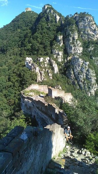
No need to pay for a taxi to get there—by timing it right, you can take the bus for just a few yuan. You have to get off at Xizhazi, the bus terminus. Be careful, there are only two buses a day in each direction. At the Xizhazi bus stop, I met a young couple who’d arrived with zero information about what to expect. We hiked the three of us toward the restored section of Mutianyu.
Still, be cautious With GPS and a topographic map (OpenTopoMap), you can set off without a problem or guide. The trail up to Jiankou is easy and well-marked. The trails down are too. But be careful—once you’re on the Wall, it’s real mountain hiking, with easy but dangerous climbing sections (over sheer drops). Not for amateurs or those afraid of heights! But what a reward. The Wall all to yourself, where it’s at its most daring. Truly mesmerizing.
More photos...
2- BEIJING The best way to get around the capital Sunday, August 26 The best way to explore the city is still by bike. Most are in a bike-share system, but you need to use an app—WeChat, the app that does everything, like monitoring your every move. No way I was installing that.
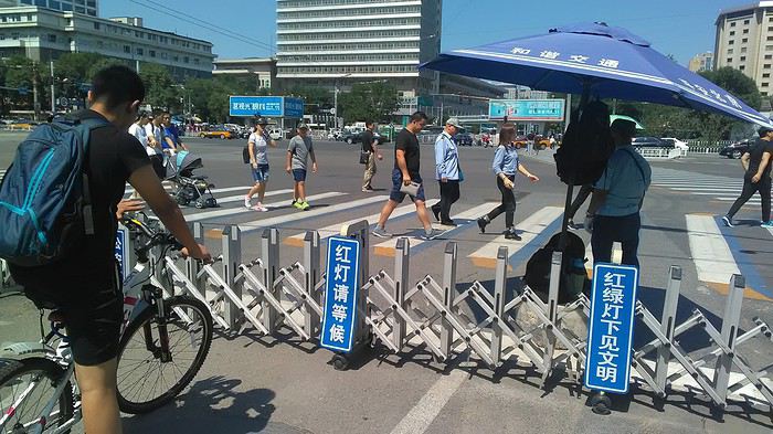
I found one at a rental shop near the hostel. The key is to quickly learn local traffic customs to minimize risks. Bike lanes are wide along the avenues.
But you still have to: - Watch out for anything parked on the bike paths—the most annoying are people napping or talking on the phone in their cars - Keep an eye on everything coming the wrong way—the list is long - The worst is right turns on red, which in Chinese traffic rules seem to have priority Once you get the hang of it, it’s fine. The city is huge but flat, so you can just wing it.
3- BEIJING By train to the far west Sunday, August 26 Beijing West Station is the size and operates like an airport. With your e-ticket from the agency, you first have to pick up your ticket at the special "English" counter, after passing through security. With your ticket in hand, you have to exit and enter through the boarding waiting area—not the platform—after a second security check.
 Then you find the right hall and wait for the sign to finally access the platform. In the end, it works pretty well given the incredible number of passengers to manage. Everywhere in Beijing, I saw that the Chinese have mastered crowd flow management.
Nice surprise: second-class carriages are clean, air-conditioned, and bright. Perfect, since I was in for 20 hours. One uniformed attendant per carriage, mobile meal service—luxury! Small downside: no luggage space. Hauling your suitcase up to the top bunk is quite a workout. I was in the middle, so it wasn’t too bad. The landscape, though, whether rural or urban, is pretty bleak. That should change once we leave the eastern plains.
Of course, I got my first police visit, with a thorough passport check and bag search. I was warned—going to the Chinese far west exposes you to this kind of hassle. But they were polite and respectful.
 The Chinese Far West
4- JIAYUGUAN Getting by without English Monday, August 27 At the gates of two deserts (Gobi and Taklamakan) and at the foot of the Tibetan highlands, the Great Wall ends at Jiayuguan. Here, I found the deeper China I’d somewhat rediscovered during my bike ride, even if now everyone gets around on electric bikes and I’m no longer stared at like an alien.
Prices are nothing like Beijing: you can find a full meal for 2 €, and my bike cost 7 € for two days. Plus, few people speak English—neither the owner of the HI hostel where I stayed, nor the ticket sellers at the sites, let alone the servers at the small eateries where I ate. Everything is written in Chinese. So I had to use the little Chinese I know to communicate about essentials. It makes the locals laugh to see a European trying to speak their language, but it earns respect. With Google Translate’s help, I managed.
Rant: With their avenues blocked for construction for kilometers without warning, and new roads not yet on maps, I must’ve taken 15 km of detours. More photos...
5- JIAYUGUAN Scams and heritage Tuesday, August 28 The Great Wall doesn’t exactly end at the fort I visited yesterday but 10 km further, at the entrance to a river gorge at the foot of the mountains. All that’s left is a badly damaged tower (more like a mound of earth) and a section of clay wall, similar to the one I biked yesterday.
This morning, I hopped on my bike, determined to venture into the desert to see this highly symbolic site. First, you access it via a wide, brand-new road with not a soul in sight. Just before the site, I came across a grand welcome gate, very period-style, but it’s actually the inevitable toll booth.
Behind the gate, the road continues straight to the site, which you can see in the distance—at least 2 km away—the remains of the tower and wall. I had to leave my bike here. Fine. I went to the ticket counter and asked the price: 120 yuan! I couldn’t believe it—over 15 € for a simple mound of earth.
I showed my displeasure to the attendant, who couldn’t care less, and immediately turned back. 120 yuan—that’s the price for a new road, a fancy gate planted 2 km before the site just to force you to take a shuttle, and employees with nothing to do all day... Now I understand why I didn’t meet anyone!
Heritage China is a bit pricey Generally, sites are expensive for the country’s standard of living, but travelers are supposed to have money, so why hold back? I even gave up on the Forbidden City—reservations required days in advance (or on the black market at an impossible price). I prefer to keep the memory of my first visit, when entry must’ve cost a few dozen cents, and there were only a handful of visitors.
This morning, I took a taxi to see remarkable tombs of common people from the 3rd to 6th centuries. They’re small vaulted caves made of painted bricks, depicting scenes of daily life. Very pretty and moving. But even here, though the price was more reasonable, I was left wanting—only one of the 16 tombs is open to visitors, and it’s apparently not the most beautiful.
The authentic China—at least what’s left of it... Wandering the impersonal avenues of the city, you stumble upon a market. There, you still find traditional China—small shops with questionable hygiene, Go players, musicians, and even a dental prosthetist. The last refuge for those untouched by modernity. More photos...
6- DUNHUANG Abundance in the middle of the desert Wednesday, August 29 Well, I thought the landscape would be less bleak as I headed west. Nope. The only distraction in this expanse of dark, clayey sand is the forests of pylons and wind turbines, plus wild camels racing each other.
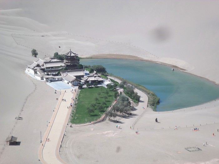 However, Dunhuang, the gateway to the Taklamakan, is by far the most pleasant Chinese city I know. There’s a real city center you can explore on foot. It’s hot but not unbearable, with a light, dry breeze. Much nicer than Beijing. The Han Chinese are still the majority, but the Muslim Uyghurs are more numerous, and the muezzin’s call to prayer echoes around the mosque.
The most surprising thing is the abundance and diversity of fruits and vegetables. You wonder how it all grows here. Well-irrigated, the desert sands are very fertile. Here, raisins have subtle, mysterious flavors, and the lamb really tastes like lamb.
Today, I visited the must-see Mingshashan, a dune complex next to which Pila is a molehill. The Basque Country, but covered in sand... More photos...
7- TURPAN The Uyghurs under heavy surveillance Friday, August 31 Surveillance cameras everywhere in the city, armed police stationed at intersections, in front of public buildings, at the entrance and inside tourist sites, police stations on every corner, patrols on foot or by car, khaki uniforms even for middle schoolers... here, the Han Chinese are in the minority, and you can feel it. Turpan feels like a city under siege.
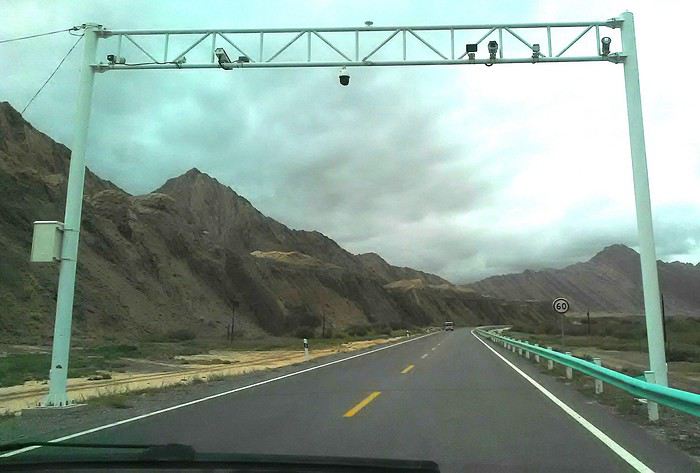
To enter the youth hostel where I stayed, there’s even a security gate, and the receptionist (a Han, like everyone in tourism) wears a bulletproof vest! Reassuring. Still, you don’t feel particularly threatened here, especially as a European. The troublemakers are the Chinese, not the Uyghurs. Generally, China is a very safe country for visitors.
Smile, you’re on camera! I was biking on an avenue when the car in front of me got flashed for driving slowly. I quickly understood why when I got flashed too.
Here, the official time is Beijing time, but it gets dark two hours later. It’ll be even worse in Kashgar. Trickier to manage: everything is displayed in Chinese and Arabic. Nothing in English. Choosing a menu is a shot in the dark. Apart from a few young Chinese, no one here speaks English, and my Chinese doesn’t seem very understandable...
Mogao, the end of the road for the Han Yesterday, near Dunhuang, I went to Mogao, a complex of decorated caves with Buddha sculptures and paintings. Stunning, but so crowded! Luckily, here in Turpan, Chinese tourists barely venture out. So I visited a Silk Road ghost town with only a handful of other visitors and under a howling wind.
The modern Chinese city is swallowing up the old Uyghur neighborhoods—only a museum-like district remains in the center, and pockets of resistance on the outskirts are doomed to disappear soon. More photos...
8- KASHGAR A (relative) love at first sight for the old city Sunday, September 2 After three overnight trains, here I am in the far west of China, nearly 4,000 km from the capital. Despite the omnipresent police and an old city preserved UNESCO-style, Kashgar is my Chinese love at first sight.
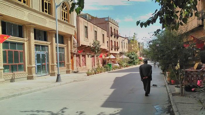
Finally, Chinese... well, sort of, because we’re in Uyghur territory here—a Turkic people with nothing culturally in common with the Han, the eastern Chinese. It started badly yesterday at Turfan station, where after three security gate passes, at least five passport checks, and a bag search, three adorable policewomen confiscated my antibacterial lotion because it had a flammable logo...
Then came the welcoming committee of armed cops at Kashgar station. Once all that was over, they left me alone—except you still have to go through security checks like everyone else to enter the old city, the bazaar, the livestock market... The further west you go, the more the siege mentality is evident. Luckily, the border isn’t far...
Despite the inevitable destruction-reconstruction, the city center has been well preserved. Thankfully, because it’s a very original style, a mix of local and colonial. I love it, even if it’s a bit too artificial, sanitized, and watered-down, and rather empty of residents. On the Silk Road, the city was famous for its great food. And it still is—rarely have I seen such richness and abundance of food! And not just scorpions or snakes. More photos...
9- KASHGAR China’s recipe for controlling the populace Saturday, September 1 Xinjiang, along with Tibet, is a "sensitive" area of rebellion in the eyes of Chinese authorities. As a result, the state has these regions and their populations under total control. Tourists also feel the consequences, even if they’re not at risk of re-education camps.
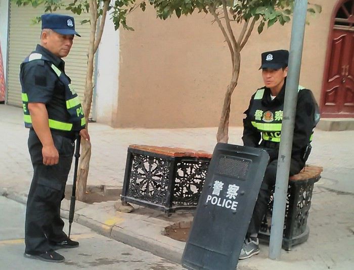 - Putting barbed wire and anti-ramming barriers around sensitive sites (schools, big hotels, government buildings...)
- Installing traffic surveillance gates with cameras and photo flashes (for all vehicles passing, including bikes) throughout the city and even in the countryside
- Posting uniformed guards with tasers, batons, or huge baseball bats every 100 meters
- Training the Han population (ethnic Chinese) in self-defense with sticks, preferably in the morning on the street. Men and women of all ages
- Starting school with the national anthem, doing military exercises, and receiving political indoctrination, all neatly lined up in the courtyard. (The dream school for any teacher)
- Placing a snitch in uniform (a pseudo-guard) in public gathering places, like youth hostels. Mine spends the day loafing around the courtyard
- Putting Chinese flags everywhere on the streets to remind everyone who’s in charge
- Installing security gates at every entrance to areas frequented by tourists (thanks for that) but not just there
- Never photographing cops, or else! I tried, but it’s not easy...
- Putting barbed wire and anti-ramming barriers around sensitive sites (schools, big hotels, government buildings...)
- Installing traffic surveillance gates with cameras and photo flashes (for all vehicles passing, including bikes) throughout the city and even in the countryside
- Posting uniformed guards with tasers, batons, or huge baseball bats every 100 meters
- Training the Han population (ethnic Chinese) in self-defense with sticks, preferably in the morning on the street. Men and women of all ages
- Starting school with the national anthem, doing military exercises, and receiving political indoctrination, all neatly lined up in the courtyard. (The dream school for any teacher)
- Placing a snitch in uniform (a pseudo-guard) in public gathering places, like youth hostels. Mine spends the day loafing around the courtyard
- Putting Chinese flags everywhere on the streets to remind everyone who’s in charge
- Installing security gates at every entrance to areas frequented by tourists (thanks for that) but not just there
- Never photographing cops, or else! I tried, but it’s not easy...
With all that, you can stroll around safely Not much crime! As for the amount the Chinese state spends to maintain such a system, it’s staggering! A third of the Han living in Xinjiang work in security. Today, I wandered freely around old Kashgar, which is quite large after all. More photos...
10- TASHKURGAN What on earth was I thinking going there! Wednesday, September 5 First, there’s the taxi—pretty crappy, with a driver who doesn’t speak a word of English and won’t stop smoking. Over six hours in that... shared with a completely out-of-it American.
Then there are all the checkpoints along the way. I won’t go on—you know the drill by now.
After that, there’s Tashkurgan—a town with nothing to see, nothing to do. Deserted as soon as night falls. There’s this huge youth hostel and a few lost Chinese tapping away on their smartphones, chain-smoking. This lost American-European crowd, swapping tips on how to enter Pakistan or Tajikistan.
Luckily, there’s the Chinese Pamir Highway, lined with peaks over 7,000m. There’s the feeling of no longer being in China, with a population whose features are Middle Eastern. And these Tajik women with their stunning hairstyles and vibrant costumes. There’s the fact of having reached the westernmost Chinese city, far from crowds and tourist sites. A sort of end of the world. More photos...
11- KYRGYZ BORDER A surreal epic Thursday, September 6 The road from Kashgar to the Kyrgyzstan border is a little over 200 km and passes through beautiful landscapes of colorful, desert-like mountains with acrobatic folds. That’s the bucolic part of the trip.
 Yesterday, I managed to gather four people to rent a minibus to reach the border more easily: a Spaniard and an Argentine I’d already met in Turpan, and two New Zealanders who responded to the ad left at the hostel.
Absurdity and paranoia of Chinese authorities The highlight was crossing the town of Wuqia, 50 km past Kashgar. After tallying up with my fellow sufferers, we must’ve passed about ten checkpoints with: - Passport checks: 14 times, sometimes by two cops side by side - Bag checks: 4 times - Smartphone checks: 2 times, with deletion of "non-compliant" photos, and registration of your IMEI in the exit log!... Absurd and surreal at the same time, since my camera stayed in my bag, my apps are in French, and my photos have been online for ages...
With all that, we arrived just as the last checkpoint before the no man’s land marking the border between the two countries was on lunch break. And bam! Another 1.5-hour wait, alongside truckers who were much more used to this than we were.
What to think? The cops themselves aren’t fooled. They play the role they’re asked to, but sometimes you can coax a smile out of them—they realize how ridiculous the situation is.
What’s the point? That’s the big question my companions and I were tempted to answer with "to piss people off." To show you your place isn’t here, but with the other tourists, over there in the east, in Shanghai, Xi’an, or Guangzhou.
As for you, a traveler from a democratic country, you really experience this as aggression, humiliation, a violation of your private space. And yet, I’m respected, they speak to me properly. Today, I better understand what a Palestinian or a citizen of an occupied country might feel daily. A unique experience! Thanks, China.
And to top it off, the cherry on the cake! It’s still this glowing button you press to rate your passage after clearing the last obstacle before the exit stamp. I was so surprised it turned off before I could react. The Spaniard, with great humor and irony, had time to vote "excellent." In the end, he wasn’t wrong—you can hardly do better!
PS: I ditched my buddies at the border. They didn’t want to pay for a taxi to continue. So I took a direct taxi to Osh. The first 100 km are fabulous. I couldn’t take many photos, but I’ll be back on Monday to go to Tajikistan.
More photos...
The rest of the Silk Road, Part 2, in these travel journals: Kyrgyzstan, Tajikistan, Uzbekistan.
The Chinese Far West More than 30 years after my first trip to eastern China, I finally fulfilled an old dream: traveling solo from Beijing to the far west, discovering Xinjiang, the Uyghur people and the oppression they endure, the oases of Turpan and Kashgar, the Taklamakan Desert, the end of the Great Wall... The route was covered by train.
MENU PART 1: CHINA
1- Beijing (Jiankou) : the authentic Great Wall, without tourists 2- Cycling in Beijing, the best way to get around 3- Beijing : departure for the far west 4- Jiayuguan : getting by without English 5- Jiayuguan : scams and heritage 6- Dunhuang : abundance in the middle of the desert 7- Turpan : the Uyghurs under heavy surveillance 8- Kashgar : love at first sight for the old city 9- Kashgar : China’s recipe for controlling the populace 10- Tashkurgan : what on earth was I thinking going there! Kyrgyz border: a surreal epic Photo album from the 80s, contributions from other travelers (page 2)
1- JIANKOU Finding the authentic Great Wall, without tourists or a guide Friday, August 24, 2018 Thirty years later, I didn’t feel like revisiting the Great Wall at Badaling or any other overcrowded site. I chose to explore it at Jiankou, in its wildest, most authentic, and unrestored section, starting from a lost village deep in a valley—though it wasn’t *that* lost, since it had everything for communication.
No need to pay for a taxi to get there—by timing it right, you can take the bus for just a few yuan. You have to get off at Xizhazi, the bus terminus. Be careful, there are only two buses a day in each direction. At the Xizhazi bus stop, I met a young couple who’d arrived with zero information about what to expect. We hiked the three of us toward the restored section of Mutianyu.
Still, be cautious With GPS and a topographic map (OpenTopoMap), you can set off without a problem or guide. The trail up to Jiankou is easy and well-marked. The trails down are too. But be careful—once you’re on the Wall, it’s real mountain hiking, with easy but dangerous climbing sections (over sheer drops). Not for amateurs or those afraid of heights! But what a reward. The Wall all to yourself, where it’s at its most daring. Truly mesmerizing.
More photos...
2- BEIJING The best way to get around the capital Sunday, August 26 The best way to explore the city is still by bike. Most are in a bike-share system, but you need to use an app—WeChat, the app that does everything, like monitoring your every move. No way I was installing that.
I found one at a rental shop near the hostel. The key is to quickly learn local traffic customs to minimize risks. Bike lanes are wide along the avenues.
But you still have to: - Watch out for anything parked on the bike paths—the most annoying are people napping or talking on the phone in their cars - Keep an eye on everything coming the wrong way—the list is long - The worst is right turns on red, which in Chinese traffic rules seem to have priority Once you get the hang of it, it’s fine. The city is huge but flat, so you can just wing it.
3- BEIJING By train to the far west Sunday, August 26 Beijing West Station is the size and operates like an airport. With your e-ticket from the agency, you first have to pick up your ticket at the special "English" counter, after passing through security. With your ticket in hand, you have to exit and enter through the boarding waiting area—not the platform—after a second security check.
Then you find the right hall and wait for the sign to finally access the platform. In the end, it works pretty well given the incredible number of passengers to manage. Everywhere in Beijing, I saw that the Chinese have mastered crowd flow management.Nice surprise: second-class carriages are clean, air-conditioned, and bright. Perfect, since I was in for 20 hours. One uniformed attendant per carriage, mobile meal service—luxury! Small downside: no luggage space. Hauling your suitcase up to the top bunk is quite a workout. I was in the middle, so it wasn’t too bad. The landscape, though, whether rural or urban, is pretty bleak. That should change once we leave the eastern plains.
Of course, I got my first police visit, with a thorough passport check and bag search. I was warned—going to the Chinese far west exposes you to this kind of hassle. But they were polite and respectful.
The Chinese Far West4- JIAYUGUAN Getting by without English Monday, August 27 At the gates of two deserts (Gobi and Taklamakan) and at the foot of the Tibetan highlands, the Great Wall ends at Jiayuguan. Here, I found the deeper China I’d somewhat rediscovered during my bike ride, even if now everyone gets around on electric bikes and I’m no longer stared at like an alien.
Prices are nothing like Beijing: you can find a full meal for 2 €, and my bike cost 7 € for two days. Plus, few people speak English—neither the owner of the HI hostel where I stayed, nor the ticket sellers at the sites, let alone the servers at the small eateries where I ate. Everything is written in Chinese. So I had to use the little Chinese I know to communicate about essentials. It makes the locals laugh to see a European trying to speak their language, but it earns respect. With Google Translate’s help, I managed.
Rant: With their avenues blocked for construction for kilometers without warning, and new roads not yet on maps, I must’ve taken 15 km of detours. More photos...
5- JIAYUGUAN Scams and heritage Tuesday, August 28 The Great Wall doesn’t exactly end at the fort I visited yesterday but 10 km further, at the entrance to a river gorge at the foot of the mountains. All that’s left is a badly damaged tower (more like a mound of earth) and a section of clay wall, similar to the one I biked yesterday.
This morning, I hopped on my bike, determined to venture into the desert to see this highly symbolic site. First, you access it via a wide, brand-new road with not a soul in sight. Just before the site, I came across a grand welcome gate, very period-style, but it’s actually the inevitable toll booth.
Behind the gate, the road continues straight to the site, which you can see in the distance—at least 2 km away—the remains of the tower and wall. I had to leave my bike here. Fine. I went to the ticket counter and asked the price: 120 yuan! I couldn’t believe it—over 15 € for a simple mound of earth.
I showed my displeasure to the attendant, who couldn’t care less, and immediately turned back. 120 yuan—that’s the price for a new road, a fancy gate planted 2 km before the site just to force you to take a shuttle, and employees with nothing to do all day... Now I understand why I didn’t meet anyone!
Heritage China is a bit pricey Generally, sites are expensive for the country’s standard of living, but travelers are supposed to have money, so why hold back? I even gave up on the Forbidden City—reservations required days in advance (or on the black market at an impossible price). I prefer to keep the memory of my first visit, when entry must’ve cost a few dozen cents, and there were only a handful of visitors.
This morning, I took a taxi to see remarkable tombs of common people from the 3rd to 6th centuries. They’re small vaulted caves made of painted bricks, depicting scenes of daily life. Very pretty and moving. But even here, though the price was more reasonable, I was left wanting—only one of the 16 tombs is open to visitors, and it’s apparently not the most beautiful.
The authentic China—at least what’s left of it... Wandering the impersonal avenues of the city, you stumble upon a market. There, you still find traditional China—small shops with questionable hygiene, Go players, musicians, and even a dental prosthetist. The last refuge for those untouched by modernity. More photos...
6- DUNHUANG Abundance in the middle of the desert Wednesday, August 29 Well, I thought the landscape would be less bleak as I headed west. Nope. The only distraction in this expanse of dark, clayey sand is the forests of pylons and wind turbines, plus wild camels racing each other.
However, Dunhuang, the gateway to the Taklamakan, is by far the most pleasant Chinese city I know. There’s a real city center you can explore on foot. It’s hot but not unbearable, with a light, dry breeze. Much nicer than Beijing. The Han Chinese are still the majority, but the Muslim Uyghurs are more numerous, and the muezzin’s call to prayer echoes around the mosque.The most surprising thing is the abundance and diversity of fruits and vegetables. You wonder how it all grows here. Well-irrigated, the desert sands are very fertile. Here, raisins have subtle, mysterious flavors, and the lamb really tastes like lamb.
Today, I visited the must-see Mingshashan, a dune complex next to which Pila is a molehill. The Basque Country, but covered in sand... More photos...
7- TURPAN The Uyghurs under heavy surveillance Friday, August 31 Surveillance cameras everywhere in the city, armed police stationed at intersections, in front of public buildings, at the entrance and inside tourist sites, police stations on every corner, patrols on foot or by car, khaki uniforms even for middle schoolers... here, the Han Chinese are in the minority, and you can feel it. Turpan feels like a city under siege.
To enter the youth hostel where I stayed, there’s even a security gate, and the receptionist (a Han, like everyone in tourism) wears a bulletproof vest! Reassuring. Still, you don’t feel particularly threatened here, especially as a European. The troublemakers are the Chinese, not the Uyghurs. Generally, China is a very safe country for visitors.
Smile, you’re on camera! I was biking on an avenue when the car in front of me got flashed for driving slowly. I quickly understood why when I got flashed too.
Here, the official time is Beijing time, but it gets dark two hours later. It’ll be even worse in Kashgar. Trickier to manage: everything is displayed in Chinese and Arabic. Nothing in English. Choosing a menu is a shot in the dark. Apart from a few young Chinese, no one here speaks English, and my Chinese doesn’t seem very understandable...
Mogao, the end of the road for the Han Yesterday, near Dunhuang, I went to Mogao, a complex of decorated caves with Buddha sculptures and paintings. Stunning, but so crowded! Luckily, here in Turpan, Chinese tourists barely venture out. So I visited a Silk Road ghost town with only a handful of other visitors and under a howling wind.
The modern Chinese city is swallowing up the old Uyghur neighborhoods—only a museum-like district remains in the center, and pockets of resistance on the outskirts are doomed to disappear soon. More photos...
8- KASHGAR A (relative) love at first sight for the old city Sunday, September 2 After three overnight trains, here I am in the far west of China, nearly 4,000 km from the capital. Despite the omnipresent police and an old city preserved UNESCO-style, Kashgar is my Chinese love at first sight.
Finally, Chinese... well, sort of, because we’re in Uyghur territory here—a Turkic people with nothing culturally in common with the Han, the eastern Chinese. It started badly yesterday at Turfan station, where after three security gate passes, at least five passport checks, and a bag search, three adorable policewomen confiscated my antibacterial lotion because it had a flammable logo...
Then came the welcoming committee of armed cops at Kashgar station. Once all that was over, they left me alone—except you still have to go through security checks like everyone else to enter the old city, the bazaar, the livestock market... The further west you go, the more the siege mentality is evident. Luckily, the border isn’t far...
Despite the inevitable destruction-reconstruction, the city center has been well preserved. Thankfully, because it’s a very original style, a mix of local and colonial. I love it, even if it’s a bit too artificial, sanitized, and watered-down, and rather empty of residents. On the Silk Road, the city was famous for its great food. And it still is—rarely have I seen such richness and abundance of food! And not just scorpions or snakes. More photos...
9- KASHGAR China’s recipe for controlling the populace Saturday, September 1 Xinjiang, along with Tibet, is a "sensitive" area of rebellion in the eyes of Chinese authorities. As a result, the state has these regions and their populations under total control. Tourists also feel the consequences, even if they’re not at risk of re-education camps.
- Putting barbed wire and anti-ramming barriers around sensitive sites (schools, big hotels, government buildings...)
- Installing traffic surveillance gates with cameras and photo flashes (for all vehicles passing, including bikes) throughout the city and even in the countryside
- Posting uniformed guards with tasers, batons, or huge baseball bats every 100 meters
- Training the Han population (ethnic Chinese) in self-defense with sticks, preferably in the morning on the street. Men and women of all ages
- Starting school with the national anthem, doing military exercises, and receiving political indoctrination, all neatly lined up in the courtyard. (The dream school for any teacher)
- Placing a snitch in uniform (a pseudo-guard) in public gathering places, like youth hostels. Mine spends the day loafing around the courtyard
- Putting Chinese flags everywhere on the streets to remind everyone who’s in charge
- Installing security gates at every entrance to areas frequented by tourists (thanks for that) but not just there
- Never photographing cops, or else! I tried, but it’s not easy...With all that, you can stroll around safely Not much crime! As for the amount the Chinese state spends to maintain such a system, it’s staggering! A third of the Han living in Xinjiang work in security. Today, I wandered freely around old Kashgar, which is quite large after all. More photos...
10- TASHKURGAN What on earth was I thinking going there! Wednesday, September 5 First, there’s the taxi—pretty crappy, with a driver who doesn’t speak a word of English and won’t stop smoking. Over six hours in that... shared with a completely out-of-it American.
Then there are all the checkpoints along the way. I won’t go on—you know the drill by now.
After that, there’s Tashkurgan—a town with nothing to see, nothing to do. Deserted as soon as night falls. There’s this huge youth hostel and a few lost Chinese tapping away on their smartphones, chain-smoking. This lost American-European crowd, swapping tips on how to enter Pakistan or Tajikistan.
Luckily, there’s the Chinese Pamir Highway, lined with peaks over 7,000m. There’s the feeling of no longer being in China, with a population whose features are Middle Eastern. And these Tajik women with their stunning hairstyles and vibrant costumes. There’s the fact of having reached the westernmost Chinese city, far from crowds and tourist sites. A sort of end of the world. More photos...
11- KYRGYZ BORDER A surreal epic Thursday, September 6 The road from Kashgar to the Kyrgyzstan border is a little over 200 km and passes through beautiful landscapes of colorful, desert-like mountains with acrobatic folds. That’s the bucolic part of the trip.
Yesterday, I managed to gather four people to rent a minibus to reach the border more easily: a Spaniard and an Argentine I’d already met in Turpan, and two New Zealanders who responded to the ad left at the hostel.Absurdity and paranoia of Chinese authorities The highlight was crossing the town of Wuqia, 50 km past Kashgar. After tallying up with my fellow sufferers, we must’ve passed about ten checkpoints with: - Passport checks: 14 times, sometimes by two cops side by side - Bag checks: 4 times - Smartphone checks: 2 times, with deletion of "non-compliant" photos, and registration of your IMEI in the exit log!... Absurd and surreal at the same time, since my camera stayed in my bag, my apps are in French, and my photos have been online for ages...
With all that, we arrived just as the last checkpoint before the no man’s land marking the border between the two countries was on lunch break. And bam! Another 1.5-hour wait, alongside truckers who were much more used to this than we were.
What to think? The cops themselves aren’t fooled. They play the role they’re asked to, but sometimes you can coax a smile out of them—they realize how ridiculous the situation is.
What’s the point? That’s the big question my companions and I were tempted to answer with "to piss people off." To show you your place isn’t here, but with the other tourists, over there in the east, in Shanghai, Xi’an, or Guangzhou.
As for you, a traveler from a democratic country, you really experience this as aggression, humiliation, a violation of your private space. And yet, I’m respected, they speak to me properly. Today, I better understand what a Palestinian or a citizen of an occupied country might feel daily. A unique experience! Thanks, China.
And to top it off, the cherry on the cake! It’s still this glowing button you press to rate your passage after clearing the last obstacle before the exit stamp. I was so surprised it turned off before I could react. The Spaniard, with great humor and irony, had time to vote "excellent." In the end, he wasn’t wrong—you can hardly do better!
PS: I ditched my buddies at the border. They didn’t want to pay for a taxi to continue. So I took a direct taxi to Osh. The first 100 km are fabulous. I couldn’t take many photos, but I’ll be back on Monday to go to Tajikistan.
More photos...
The rest of the Silk Road, Part 2, in these travel journals: Kyrgyzstan, Tajikistan, Uzbekistan.
Voyage deux mois en 4x4 avec tente de toit en fin d'année English translation pending
Bonjour à toutes et tous.
CA Y EST ! Mon prochain trip est booké ! Ce sera mon troisième voyage solitaire après le Chili 2018 et l'Argentine 2019. L'amour de ma vie ne souhaite plus réaliser des voyages avec autant de vol, donc ce sera solo comme Napoléon 😉.
Comme d'habitude mon agence locale préférée Sélectour a bossé pour moi, avec toujours autant de professionnalisme. Mon visa evisitor est dans la poche ! Le programme principal se déroulera comme suit : Décollage le 28 septembre vers Londres. Puis Londres Sydney avec escale technique à Singapour. Au diable les varices (l'avarice), réservation d'un siège en sortie de secours donc place pour les gambettes. Enfin Sydney Alice Springs atterrissage le 30 septembre. Ouffffff. Je récupère le Toyota Landcruiser Apollo avec tente de toit Overland (forfait 18000 km, rachat de franchise), et je me poserai à Alice pour récupérer. Je pense acheter une sim et du crédit, pour les contacts urgents et/ou importants, mon smartphone a deux emplacements sim. De là je pense écumer le East McDonnel pendant deux/trois jours avant d'attaquer le West McDonnel par Namatjira Dr puis Larapinta Dr, passer par Wakkartha Kings Canyon, descendre sur Uluru et Kata Tjuta pour revenir à Alice Springs. Je prends toute info sur ce parcours (des idées, des balades, toussa 😊) je pense faire ça en deux semaines tranquillou, j'ai le temps !
Ensuite remontée vers le nord direction Darwin par Stuart Hwy, je ferai un stop à Gemtree. Nature Gap, Devils Marble, puis Kakadu. Une semaine ça devrait le faire.
Je pense ensuite balader dans Kakadu une voire deux semaines, j'ai besoin d'idées SVP 😊.
Ensuite ce sera Victoria Hwy tout doucement, les stops remarquables seront les bienvenus ! Broome, Port Headland, et surtout Coral Bay et Cape Range.
Vers Perth à part Wave Rock que je souhaite visiter j'ai pas encore creusé j'attends les premiers coups de pelle de votre part à tous.
Le retour en France est prévu le 29 novembre. Vol direct Perth Londres (17h00 et des burettes... 🤪).
Les contraintes de ce voyage seront de trouver des points électriques de recharge du matériel photo/vidéo, et aussi un peu de wifi pour communiquer avec la France. Pour le reste je pense faire des stops judicieux tous les trois jours pour des douches confortables, j'me comprends 😄. Je souhaite éviter les réservations des campings, pensez vous qu'à ces dates il devrait y avoir de la place ?
Voilà cela fait pas mal de choses à préparer. Pour info participative, je suis sur un budget de 9000 € actuellement, vols et location avec rachat de franchise pour le véhicule. Pour le reste, je pars avec mon Akubra Coolabah acheté en 2011 au Queesland 😏.
Merci d'avoir lu, merci pour vos réponses. Whis.
CA Y EST ! Mon prochain trip est booké ! Ce sera mon troisième voyage solitaire après le Chili 2018 et l'Argentine 2019. L'amour de ma vie ne souhaite plus réaliser des voyages avec autant de vol, donc ce sera solo comme Napoléon 😉.
Comme d'habitude mon agence locale préférée Sélectour a bossé pour moi, avec toujours autant de professionnalisme. Mon visa evisitor est dans la poche ! Le programme principal se déroulera comme suit : Décollage le 28 septembre vers Londres. Puis Londres Sydney avec escale technique à Singapour. Au diable les varices (l'avarice), réservation d'un siège en sortie de secours donc place pour les gambettes. Enfin Sydney Alice Springs atterrissage le 30 septembre. Ouffffff. Je récupère le Toyota Landcruiser Apollo avec tente de toit Overland (forfait 18000 km, rachat de franchise), et je me poserai à Alice pour récupérer. Je pense acheter une sim et du crédit, pour les contacts urgents et/ou importants, mon smartphone a deux emplacements sim. De là je pense écumer le East McDonnel pendant deux/trois jours avant d'attaquer le West McDonnel par Namatjira Dr puis Larapinta Dr, passer par Wakkartha Kings Canyon, descendre sur Uluru et Kata Tjuta pour revenir à Alice Springs. Je prends toute info sur ce parcours (des idées, des balades, toussa 😊) je pense faire ça en deux semaines tranquillou, j'ai le temps !
Ensuite remontée vers le nord direction Darwin par Stuart Hwy, je ferai un stop à Gemtree. Nature Gap, Devils Marble, puis Kakadu. Une semaine ça devrait le faire.
Je pense ensuite balader dans Kakadu une voire deux semaines, j'ai besoin d'idées SVP 😊.
Ensuite ce sera Victoria Hwy tout doucement, les stops remarquables seront les bienvenus ! Broome, Port Headland, et surtout Coral Bay et Cape Range.
Vers Perth à part Wave Rock que je souhaite visiter j'ai pas encore creusé j'attends les premiers coups de pelle de votre part à tous.
Le retour en France est prévu le 29 novembre. Vol direct Perth Londres (17h00 et des burettes... 🤪).
Les contraintes de ce voyage seront de trouver des points électriques de recharge du matériel photo/vidéo, et aussi un peu de wifi pour communiquer avec la France. Pour le reste je pense faire des stops judicieux tous les trois jours pour des douches confortables, j'me comprends 😄. Je souhaite éviter les réservations des campings, pensez vous qu'à ces dates il devrait y avoir de la place ?
Voilà cela fait pas mal de choses à préparer. Pour info participative, je suis sur un budget de 9000 € actuellement, vols et location avec rachat de franchise pour le véhicule. Pour le reste, je pars avec mon Akubra Coolabah acheté en 2011 au Queesland 😏.
Merci d'avoir lu, merci pour vos réponses. Whis.
Hiking in Arizona, just Arizona English translation pending
Les mois ont passé….
Ma demande en mariage à Dirty Devil Overlook (vers Hanksville, au fin fond de l’Utah) un soir de juin 2017, s’est concrétisée.... "Chérie", ma dame est devenue Madame.
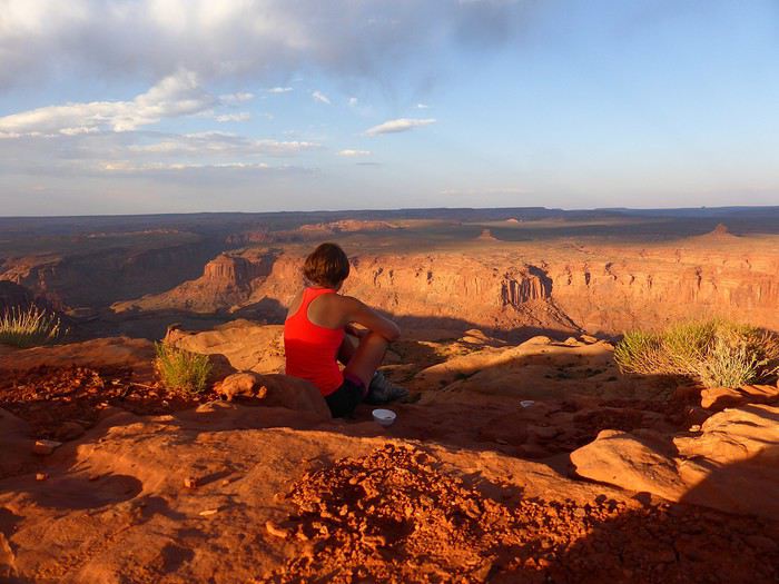 ..
..
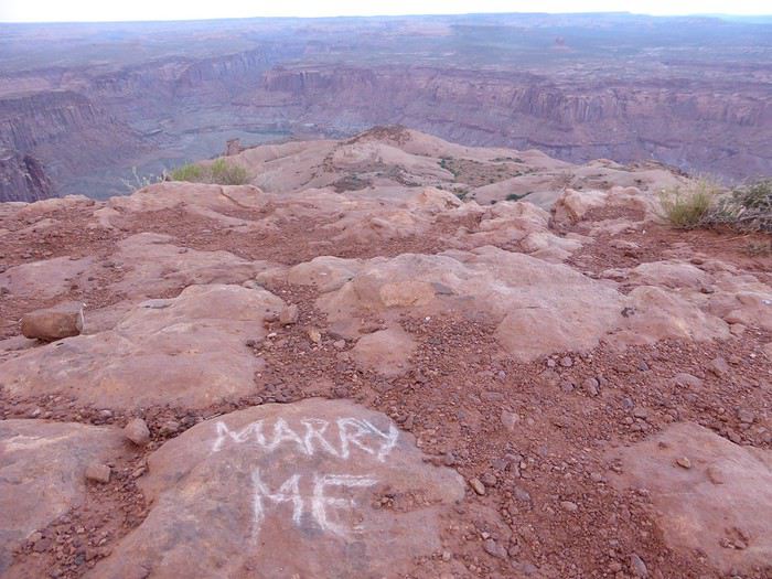
C'était un voyage sensationnel, le meilleur. A peine rentrés, on savait qu'on repartirait...et le plus rapidement possible. Un mariage à organiser, la vente de la maison, l'acquisition d'une autre, un an de travaux et l'arrivée d'Utah notre Border Collie.... Voilà le contexte... (ce qui explique la longue absence sur VF et le délai pour s'occuper du carnet 😉)
Mais premier point noir: Au moment du peaufinage du roadbook, les USA sont plongés en plein Shutdown. Et ça dure, ça dure. …On suit alors ça de ‘’près’’. Le shutdown le plus long de l’histoire à ce jour s’est terminé 5 semaines avant le départ… Or le programme était de partir de Phoenix/ Tucson Saguaro NP/ Organ mountain / White Sands / Bisti Badlands / Canyon de Chelly / Painted desert / Walnut canyon / Grand Canyon avec boucle South kaibab Bright Angel / Sedona 4 nuits / puis retour Phoenix. Donc une grosse dominante de parcs nationaux cette année et peu de Wilderness; donc des coins potentiellement fermés et peu de plan B proches. Pas envie de prendre le risque si l’épisode reprend.
Deuxième point noir : quelques semaines avant le départ, double ernie discale et méchant lumbago lors des travaux dans la nouvelle maison. Arrêt de travail, kiné, ostéo, massages, etc. Grosse incertitude sur la capacité de partir, à tenir 10 heures dans l’avion, à pouvoir randonner… bref le doute domine.
Troisième point noir : Il nous est désormais impossible pour des raisons professionnelles de partir entre avril et septembre. Or en vérifiant la météo avant le départ (longtemps avant !!), la météo est détraquée dans le Southwest. Il fait anormalement froid….. et ça dure. Sauf vers Phoenix et Tucson où la météo est correcte.
Tous ces éléments nous font modifier le parcours peu de temps avant de partir. D’autres hôtels sont alors réservés, tout en gardant le plan A au cas où une éclaircie pointerait le bout de son nez…
Une chose est sûre, on part pour une boucle au départ de Phoenix, pour randonner en Arizona... A suivre ...
..
C'était un voyage sensationnel, le meilleur. A peine rentrés, on savait qu'on repartirait...et le plus rapidement possible. Un mariage à organiser, la vente de la maison, l'acquisition d'une autre, un an de travaux et l'arrivée d'Utah notre Border Collie.... Voilà le contexte... (ce qui explique la longue absence sur VF et le délai pour s'occuper du carnet 😉)
Mais premier point noir: Au moment du peaufinage du roadbook, les USA sont plongés en plein Shutdown. Et ça dure, ça dure. …On suit alors ça de ‘’près’’. Le shutdown le plus long de l’histoire à ce jour s’est terminé 5 semaines avant le départ… Or le programme était de partir de Phoenix/ Tucson Saguaro NP/ Organ mountain / White Sands / Bisti Badlands / Canyon de Chelly / Painted desert / Walnut canyon / Grand Canyon avec boucle South kaibab Bright Angel / Sedona 4 nuits / puis retour Phoenix. Donc une grosse dominante de parcs nationaux cette année et peu de Wilderness; donc des coins potentiellement fermés et peu de plan B proches. Pas envie de prendre le risque si l’épisode reprend.
Deuxième point noir : quelques semaines avant le départ, double ernie discale et méchant lumbago lors des travaux dans la nouvelle maison. Arrêt de travail, kiné, ostéo, massages, etc. Grosse incertitude sur la capacité de partir, à tenir 10 heures dans l’avion, à pouvoir randonner… bref le doute domine.
Troisième point noir : Il nous est désormais impossible pour des raisons professionnelles de partir entre avril et septembre. Or en vérifiant la météo avant le départ (longtemps avant !!), la météo est détraquée dans le Southwest. Il fait anormalement froid….. et ça dure. Sauf vers Phoenix et Tucson où la météo est correcte.
Tous ces éléments nous font modifier le parcours peu de temps avant de partir. D’autres hôtels sont alors réservés, tout en gardant le plan A au cas où une éclaircie pointerait le bout de son nez…
Une chose est sûre, on part pour une boucle au départ de Phoenix, pour randonner en Arizona... A suivre ...
Location d'auto ou camping-car pour la Nouvelle-Zélande en février-mars English translation pending
Bonjour
Nous sommes un couple de "vieux retraités", nous envisageons voyager ( 2 mois) en Nouvelle-Zélande en février et mars 2021 ....serait-il préférable de débuter notre voyage par le sud (Christchurch) ou par le nord (Auckland)......notre destination précédente étant Sydney.
Aussi, nous hésitons beaucoup entre la location d'une auto ou d'un Camping Car....toutes les informations et/ou tous les commentaires suite à vos expériences sont bienvenus
Merci pour votre aide
Lucie
Aussi, nous hésitons beaucoup entre la location d'une auto ou d'un Camping Car....toutes les informations et/ou tous les commentaires suite à vos expériences sont bienvenus
Merci pour votre aide
Lucie
Randonnées le long de la Costa Blanca English translation pending
Région montagneuse au bord de la Méditerranée, la Costa Blanca (Côte Blanche) est propice aux randonnées en novembre alors que la chaleur de l'été s'estompe.
La proximité des stations balnéaires permet de combiner les différents éléments et de bénéficier des infrastructures de logement et de transport.
Je reviens d'un séjour effectué du 11 au 21 novembre 2019 à Benidorm avec un rayonnement vers les massifs alentours.
Le trajet en voiture de Nancy à Charleroi débute dans la fraîcheur automnale et se termine sous une pluie battante.
Le vol s'effectue sans problème et 2 heures plus tard je débarque à Alicante.
Un dernier trajet en bus ALSA et j'arrive à Benidorm où Vukica m'accueille dans l'appartement que je lui ai loué pour 10 nuits.
Je tombe en plein dans les fêtes de novembre qui pendant 5 jours répandent la liesse dans les rues et les plages de Benidorm.
De ma fenêtre haut placée, j'assiste au spectacle illuminé et sonorisé.
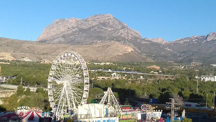
Je profite du mardi, jour férié, pour effectuer une randonnée urbaine. La ville émerge progressivement de la fiesta passée et reprend vie sous le soleil qui ne tarde pas à s'imposer. Je déambule entre les tours qui semblent être la spécialité locale.
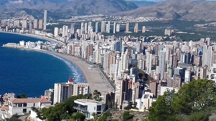
Les architectes ont fait un effort pour rendre ce paysage urbain agréable à regarder.
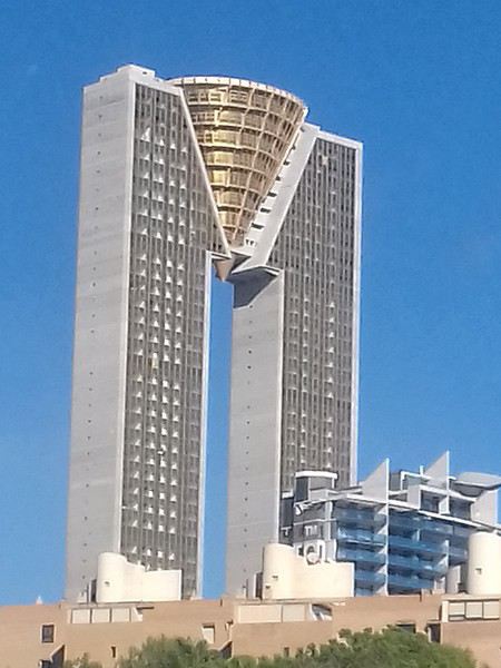
Cette tour en pierre renvoie au passé.
Benidorm sera mon point de chute pour la durée du séjour. Grâce aux transports publics, bus et ferrocarril, je peux me déplacer le long de la côte et à l'intérieur des terres. Dés que je quitte les urbanisations côtières, je suis confronté aux paysages majestueux des sierras hérissées de pics et aux flancs vertigineux. Ceci offre un contraste bien agréable et un encouragement à découvrir cette région surtout connue pour ses activités balnéaires.
Mercredi 13 novembre 2019 La Sierra Cortina Pour ma première sortie, le massif que j'aperçois de mon logement me semble constituer une destination toute indiquée. La Sierra Cortina n'est pas une montagne particulièrement élevée, mais elle est située près de la côte et offre une belle promenade le long de sa large crête.
Mon immeuble étant situé à la périphérie de l'agglomération, je me retrouve rapidement à naviguer entre les propriétés avant de franchir des ronds-points qui constituent l'ultime obstacle avant l'arrière-pays préservé de l'urbanisation. en quelques dizaines de minutes je suis entré dans un autre monde, celui de la campagne paisible. Après avoir contourné le massif j'emprunte un sentier qui grimpe vers la crète.
Arrivé au sommet je découvre un paysage qui pointe dans toutes les directions. Au nord, la ville de Calpe et son fameux rocher
Au sud la côte jusqu'à Alicante A l'ouest le Puig Campana culminant à 1408 mètres.
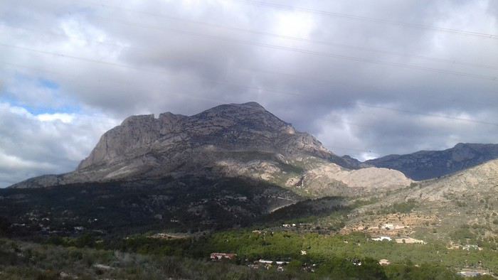
A l'est la Sierra Helada, la ville de Benidorm et sa forêt de gratte-ciel. Le ciel variable m'incite à progresser le long de la Serra Cortina au gré des montées et descentes qui se succèdent. Une croix ornée de drapeaux marque la descente et c'est un sentier caillouteux bien raide qui de conduit au pied du massif.
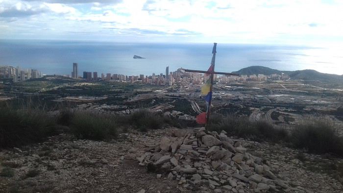
Je rejoins le littoral pour boucler mon circuit les pieds caressés par les vagues d'une mer encore tiède.
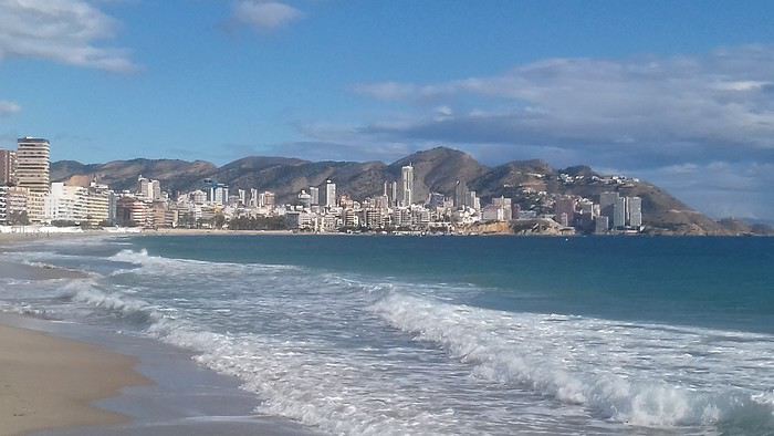
Jeudi 14 novembre 2019 La Serra d'Olta Une trace trouvée sur Visorando inspire ma randonnée du jour. À 30 mn de tram, à Calpe, le massif de la Serra d'Olta permet un magnifique panorama à 360° sur la région. Dés la sortie de la gare je prend la route qui me conduit en 2 kilomètres au départ du circuit au parking de la "Zona Acampada" de Ermita Vella
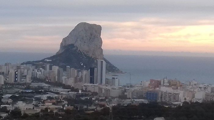
Tout le parcours est balisé Blanc et Jaune.
J'emprunte un large chemin jusqu'à l'ermitage Ermita Vella, endroit propice au pique nique mais ce n'est pas encore l'heure.
300 m plus loin le parcours suit un petit sentier qui grimpe sérieusement au milieu d'un vallon escarpé. C'est ici la difficulté de ce circuit sur 150m de dénivelé. En progressant sur le sentier, qui devient plus aisé, rejoindre le carrefour des sentiers sur le plateau.
Arrivée au point culminant du plateau, domaine des chèvres sauvages.
Je couvre la côte du regard jusqu'à Benidorm.
Les nuages d'encre qui encombrent le ciel m'incitent à redescendre sur l'autre versant en passant devant une bergerie en ruine. Je passe devant le Pou de Mola croisant au passage un groupe de jeunes filles. Après une longue descente à l'abri du sous-bois, je rejoins le large chemin périphérique.
Le circuit continue en contournant le massif et ses impressionnantes falaises.
Arrivé au Pas de Canal (402m), le sentier descend en pente raide puis débouche sur le chemin principal.
En quelques minutes, j'ai bouclé la boucle et je peux rejoindre la gare du ferrocarril de la généralité de Valence non sans admirer le rocher d'Ifach que j'espère bien gravir.
La suite de mon séjour sur la Costa Blanca dans un prochain message.
Je profite du mardi, jour férié, pour effectuer une randonnée urbaine. La ville émerge progressivement de la fiesta passée et reprend vie sous le soleil qui ne tarde pas à s'imposer. Je déambule entre les tours qui semblent être la spécialité locale.
Les architectes ont fait un effort pour rendre ce paysage urbain agréable à regarder.
Cette tour en pierre renvoie au passé.
Benidorm sera mon point de chute pour la durée du séjour. Grâce aux transports publics, bus et ferrocarril, je peux me déplacer le long de la côte et à l'intérieur des terres. Dés que je quitte les urbanisations côtières, je suis confronté aux paysages majestueux des sierras hérissées de pics et aux flancs vertigineux. Ceci offre un contraste bien agréable et un encouragement à découvrir cette région surtout connue pour ses activités balnéaires.
Mercredi 13 novembre 2019 La Sierra Cortina Pour ma première sortie, le massif que j'aperçois de mon logement me semble constituer une destination toute indiquée. La Sierra Cortina n'est pas une montagne particulièrement élevée, mais elle est située près de la côte et offre une belle promenade le long de sa large crête.
Mon immeuble étant situé à la périphérie de l'agglomération, je me retrouve rapidement à naviguer entre les propriétés avant de franchir des ronds-points qui constituent l'ultime obstacle avant l'arrière-pays préservé de l'urbanisation. en quelques dizaines de minutes je suis entré dans un autre monde, celui de la campagne paisible. Après avoir contourné le massif j'emprunte un sentier qui grimpe vers la crète.
Arrivé au sommet je découvre un paysage qui pointe dans toutes les directions. Au nord, la ville de Calpe et son fameux rocher
Au sud la côte jusqu'à Alicante A l'ouest le Puig Campana culminant à 1408 mètres.
A l'est la Sierra Helada, la ville de Benidorm et sa forêt de gratte-ciel. Le ciel variable m'incite à progresser le long de la Serra Cortina au gré des montées et descentes qui se succèdent. Une croix ornée de drapeaux marque la descente et c'est un sentier caillouteux bien raide qui de conduit au pied du massif.
Je rejoins le littoral pour boucler mon circuit les pieds caressés par les vagues d'une mer encore tiède.
Jeudi 14 novembre 2019 La Serra d'Olta Une trace trouvée sur Visorando inspire ma randonnée du jour. À 30 mn de tram, à Calpe, le massif de la Serra d'Olta permet un magnifique panorama à 360° sur la région. Dés la sortie de la gare je prend la route qui me conduit en 2 kilomètres au départ du circuit au parking de la "Zona Acampada" de Ermita Vella
Tout le parcours est balisé Blanc et Jaune.
J'emprunte un large chemin jusqu'à l'ermitage Ermita Vella, endroit propice au pique nique mais ce n'est pas encore l'heure.
300 m plus loin le parcours suit un petit sentier qui grimpe sérieusement au milieu d'un vallon escarpé. C'est ici la difficulté de ce circuit sur 150m de dénivelé. En progressant sur le sentier, qui devient plus aisé, rejoindre le carrefour des sentiers sur le plateau.
Arrivée au point culminant du plateau, domaine des chèvres sauvages.
Je couvre la côte du regard jusqu'à Benidorm.
Les nuages d'encre qui encombrent le ciel m'incitent à redescendre sur l'autre versant en passant devant une bergerie en ruine. Je passe devant le Pou de Mola croisant au passage un groupe de jeunes filles. Après une longue descente à l'abri du sous-bois, je rejoins le large chemin périphérique.
Le circuit continue en contournant le massif et ses impressionnantes falaises.
Arrivé au Pas de Canal (402m), le sentier descend en pente raide puis débouche sur le chemin principal.
En quelques minutes, j'ai bouclé la boucle et je peux rejoindre la gare du ferrocarril de la généralité de Valence non sans admirer le rocher d'Ifach que j'espère bien gravir.
La suite de mon séjour sur la Costa Blanca dans un prochain message.
Voyage en location camping-car en Nouvelle-Zélande et Australie English translation pending
Bonjour
je souhaiterais effectuer un voyage en camping car(louer sur place) pour septembre 2020 de ce fait je suis preneuse pour toutes infos
merci d avance
veronique
Neuf jours pour faire aimer le Maroc English translation pending
Bonjour,
C'est parti pour un nouveau carnet de voyage photographique , avec de nouveaux endroits, de nouvelles découvertes, de nouveaux émerveillements .
Mon défi cette fois ci était de faire visiter le Maroc en 9 jours chrono à ma petite famille, en l’occurrence à ma fille aînée, mon gendre et mes 2 petits enfants de 6 et 9 ans , pendant les vacances de Toussaint . Ils n'avaient jamais mis les pieds au Maroc, ni dans un pays de culture arabo-musulmane . Choc culturel assuré .
J'avais plusieurs contraintes dont le lieu de départ et d'arrivée, Fes , qui est complètement excentrée par rapport au grand Sud . Ma fille voulait aussi voir absolument Essaouira . Et tout le monde voulait, bien sûr , faire un bivouac au fin fond du désert ....
J'ai donc monté un séjour itinérant, avec un nouvel hébergement chaque soir, pour que tout le monde en ai plein la vue et revienne en France avec des souvenirs éternels .
En simplifié, voici le voyage photo que je vous propose :
J0 : Arrivée à Fez à 20 heures, Autoroute jusqu'à Rabat . J1 : Rabat Médina, Kasbah des Oudayas, ..... J2 : Essaouira ...... J3 : Tichka et vallée d'Ounila ...... J4 : Tamdaghte, Aït Benhaddou, Kasbah de Taourirt , Agdz J5 : Vallée du Draa ( rive gauche ), Foumzguid, erg El M'hazil, bivouac J6 : Bivouac , lac d'Iriki , Zaouia Sidi Abdenbi, ..... J7 : Retour Foum Zguid, N'kob, Bab N'Ali, Tizi n'Tazazert, Boulmane, El Kelaa des M'Gouna J8 : Route 307 ( Haut Atlas central ), visite de Megdaz ( village berbère ), Imi n'Ifri, Ouzoud J9 : Cascade d'Ouzoud, retour sur Fes via Beni Mellal, Azrou, repas à Bab Boujloud, balade nocturne dans la médina de Fez .... J10 : Réveil à 5 heures, direction aéroport ....
Comme vous le constatez, j'ai finalement éliminé les 2 grandes médinas que sont Fez et Marrakech . C'est mon choix, car j'ai pensé que tout un chacun peu revenir seul dans ces villes, s'il en a l'envie, surtout après un premier séjour accompagné . De plus, mon voyage intègre aussi 2 médinas , Rabat et Essaouira , qui sont également toutes deux remarquables .
Ayant déjà montré dans de précédents carnets certains des lieux visités, je veillerai à éviter les redites et à montrer de nouveaux lieux ....
Et " en voiture Simone" .....
C'est parti pour un nouveau carnet de voyage photographique , avec de nouveaux endroits, de nouvelles découvertes, de nouveaux émerveillements .
Mon défi cette fois ci était de faire visiter le Maroc en 9 jours chrono à ma petite famille, en l’occurrence à ma fille aînée, mon gendre et mes 2 petits enfants de 6 et 9 ans , pendant les vacances de Toussaint . Ils n'avaient jamais mis les pieds au Maroc, ni dans un pays de culture arabo-musulmane . Choc culturel assuré .
J'avais plusieurs contraintes dont le lieu de départ et d'arrivée, Fes , qui est complètement excentrée par rapport au grand Sud . Ma fille voulait aussi voir absolument Essaouira . Et tout le monde voulait, bien sûr , faire un bivouac au fin fond du désert ....
J'ai donc monté un séjour itinérant, avec un nouvel hébergement chaque soir, pour que tout le monde en ai plein la vue et revienne en France avec des souvenirs éternels .
En simplifié, voici le voyage photo que je vous propose :
J0 : Arrivée à Fez à 20 heures, Autoroute jusqu'à Rabat . J1 : Rabat Médina, Kasbah des Oudayas, ..... J2 : Essaouira ...... J3 : Tichka et vallée d'Ounila ...... J4 : Tamdaghte, Aït Benhaddou, Kasbah de Taourirt , Agdz J5 : Vallée du Draa ( rive gauche ), Foumzguid, erg El M'hazil, bivouac J6 : Bivouac , lac d'Iriki , Zaouia Sidi Abdenbi, ..... J7 : Retour Foum Zguid, N'kob, Bab N'Ali, Tizi n'Tazazert, Boulmane, El Kelaa des M'Gouna J8 : Route 307 ( Haut Atlas central ), visite de Megdaz ( village berbère ), Imi n'Ifri, Ouzoud J9 : Cascade d'Ouzoud, retour sur Fes via Beni Mellal, Azrou, repas à Bab Boujloud, balade nocturne dans la médina de Fez .... J10 : Réveil à 5 heures, direction aéroport ....
Comme vous le constatez, j'ai finalement éliminé les 2 grandes médinas que sont Fez et Marrakech . C'est mon choix, car j'ai pensé que tout un chacun peu revenir seul dans ces villes, s'il en a l'envie, surtout après un premier séjour accompagné . De plus, mon voyage intègre aussi 2 médinas , Rabat et Essaouira , qui sont également toutes deux remarquables .
Ayant déjà montré dans de précédents carnets certains des lieux visités, je veillerai à éviter les redites et à montrer de nouveaux lieux ....
Et " en voiture Simone" .....
Jordanie 2019: 10 jours au pays des rêves English translation pending
Bonjour la communauté !
Vous trouverez sur ce topic notre carnet de voyage (ma femme et moi) pour un séjour de 10 jours sur place en JORDANIE en Octobre 2019. Le premier message est une introduction, ensuite, nous posterons les étapes au fur et à mesure (une étape = un jour sur place).
J0 - Introduction - Planning J1 - Le Vol J2 - Les Châteaux du désert J3 - Jerash - Ajlun - Dead Sea J4 - Wadi Mujib - Karak - Dana J5 - Dana - Shawbak - Little Petra J6 - Petra J7 - Petra J8 - Wadi Rum J9 - Wadi Rum J10 - Aqaba J11 - Amman J12 - BONUS - 1 jour à Istanbul LE BILAN
Bonne lecture !
J0 - INTRODUCTION - PLANNING
Voici notre carnet de route JORDANIE 2019. Une étape de ce carnet correspond à un jour sur place. Nous y sommes restés 10 jours, tous resterons dans nos mémoires !
POURQUOI LA JORDANIE ? Nous avions déjà entendu parler de la Jordanie et des merveilles que ce pays offre. Depuis plusieurs années, nous alternons nos types de destination et récemment, nous pensions soit à un pays du Maghreb, soit au Moyen-Orient. Pétra principalement revenant souvent dans nos têtes, notre choix s'est donc tout naturellement porté sur la Jordanie !
Pour la période, nous avions des possibilités soit en Juillet-Août, soit en octobre lors des vacances scolaires. Nous nous sommes rapidement rabattus sur Octobre. Cela collait mieux à notre "agenda" personnel et de plus, les températures d'Octobre sont plus douces qu'en Juillet ou en Août. La haute saison en Jordanie est le printemps (Avril) et l'automne (Septembre-Octobre). Par contre, cela correspond également à la période où les prix sont les plus élevés.
Et c'est ainsi que nous nous sommes préparés pour notre dernier voyage de l'année : Jordanie 2019 ! Nous avons utilisé le guide du Routard Jordanie 2020 (très bien).. comme d'habitude. Des fidèles parmi les fidèles.
NOTRE ITINÉRAIRE L'itinéraire est plus ou moins tracé. En effet, la partie ouest de la Jordanie se visite facilement. Amman et son aéroport étant situé au Nord de cette partie, il nous est donc paru évident de faire une boucle du nord vers le sud en balayant les différents site à visiter sur ce parcours.
Nous arrivions et partions de l'aéroport de Amman. Donc une fois sur Aqaba, au sud, nous sommes remontés pour visiter Amman, la veille de notre départ. Nous préférions en effet, être la veille du départ à proximité de l'aéroport, on ne sait jamais :
PETRA: vous avez le choix entre 1, 2 ou 3 jours. Nous y sommes restés 2 jours ce qui est suffisant pour visiter et faire les principales randonnées. 1 jour peut paraitre un peu juste, dans ce cas, il faudra faire des concessions. 3 jours peut être préférable si vous avez des enfants et/ou que vous souhaitez marcher tranquillement. WADI RUM: Là aussi, vous avez plusieurs possibilités pour la durée, tout comme le choix de la découverte. Personnellement, il était impensable de ne pas visiter avec des bédouins en mode vadrouille le jour et bivouac le nuit. Les tentes en durs (très -trop- nombreuses) dénaturent le site et honnêtement...ce n'est pas notre truc. Chacun fait comme il le souhaite mais nous ne conseillons pas ce mode de tourisme. CHÂTEAUX DU DÉSERT: de par la durée de notre séjour (10 jours), nous avons noté que les châteaux du désert était...déserté. héhé. Nous voulions absolument les visiter, quitte à réduire notre temps de visite sur Madaba et Amman.
Attention, on trouve des dos d'âne partout dans le pays, y compris sur les grands axes ! Leur signalétique n'est pas non plus optimale donc gare aux mauvaises surprises
Pour plus de détails sur notre planning pour les 10 jours sur place, je peux vous l'envoyer par message privé.
NOTRE BUDGET
VOL: nous sommes partis avec Turkish Airlines. Nous avons trouvé des billets AR à 370€/personne. Turkish Airlines est une très bonne compagnie aérienne (repas, écran, coussin..). De plus l'aéroport d'Istanbul, tout nouveau, tout beau, est parfait! REPAS: nous avons privilégié les restaurants bon marché en général. A Pétra, notre hôtel préparait des lunchbox à 3 JOD. Pas cher et la box est complète (banane, pita, biscuit, pomme, tomate, vache qui rit, eau) LOGEMENT: Globalement, nous avons trouvé des chambres doubles avec salle de douche privée pour 40€ en moyenne. Nous avons payé un peu moins cher à Dana car nous étions dans un tipi (20€), mais excessivement cher sur la Mer Morte où on ne trouve que des grands hôtels (Crowne Plaza, Dead Sea Spa hotel..) ayant privatisés l'accès à la plage (100€). TRANSPORT: nous avons loué une voiture avec MONTECARLO. Ils sont venus nous chercher à l'aéroport, leur agence de l'aéroport est située à 5-10 minutes de l'aéroport même. Nous avions une berline Kia, boite auto, pour 26 JOD par jour (33-34€/jour). L'essence est moins cher qu'en France (0.77 JOD /litre pour de l'essence 90). Nous avons hésité à rendre la voiture avant de visiter AMMAN, la circulation y est dense et compliquée, mais finalement, nous l'avons gardée les 10 jours. Jérôme n'a pas trouvé difficile de rouler dans AMMAN, sûrement des restes de son expérience en Afrique. ACTIVITÉ: inévitable, le Jordan Pass ! A acheter en ligne avant le voyage, il est proposé avec 3 tarifs selon la durée à Pétra: 70, 75, 80 JOD (respectivement 1, 2 ou 3 jours). Il inclut le VISA obligatoire (40 JOD si payé seul à part), l'entrée à Pétra (50 JD si payé seul à part) et l'entrée de 40 sites (Wadi Rum, Jerash, Ajlun, Karak, ...) donc il est très avantageux. En plus, nous avons payé le Siq Trail (plutôt cher) et l'accès au Mt Nébo, non inclus dans le Jordan Pass. EXTRA: pas trop d'extra si ce n'est du thé à droite à gauche, du jus de grenade... etc. mais à des prix abordables. Par contre, nous avons bu une seule bière, à l'hôtel de la Mer Morte, pour un peu plus de 7 euros, et on était en happy hour!
La Jordanie n'est pas une destination qu'on peut considérer comme bon marché. Les restaurants classiques sont à peine moins chers qu'en France. L'entrée de Pétra reste assez cher (>60€), de même qu'un séjour dans le désert de Wadi Rum. Bref, la Jordanie n'est pas une destination low cost honnêtement.
 EN ROOOUTE
J0 - Introduction - Planning J1 - Le Vol J2 - Les Châteaux du désert J3 - Jerash - Ajlun - Dead Sea J4 - Wadi Mujib - Karak - Dana J5 - Dana - Shawbak - Little Petra J6 - Petra J7 - Petra J8 - Wadi Rum J9 - Wadi Rum J10 - Aqaba J11 - Amman J12 - BONUS - 1 jour à Istanbul LE BILAN
Bonne lecture !
J0 - INTRODUCTION - PLANNING
Voici notre carnet de route JORDANIE 2019. Une étape de ce carnet correspond à un jour sur place. Nous y sommes restés 10 jours, tous resterons dans nos mémoires !
POURQUOI LA JORDANIE ? Nous avions déjà entendu parler de la Jordanie et des merveilles que ce pays offre. Depuis plusieurs années, nous alternons nos types de destination et récemment, nous pensions soit à un pays du Maghreb, soit au Moyen-Orient. Pétra principalement revenant souvent dans nos têtes, notre choix s'est donc tout naturellement porté sur la Jordanie !
Pour la période, nous avions des possibilités soit en Juillet-Août, soit en octobre lors des vacances scolaires. Nous nous sommes rapidement rabattus sur Octobre. Cela collait mieux à notre "agenda" personnel et de plus, les températures d'Octobre sont plus douces qu'en Juillet ou en Août. La haute saison en Jordanie est le printemps (Avril) et l'automne (Septembre-Octobre). Par contre, cela correspond également à la période où les prix sont les plus élevés.
Et c'est ainsi que nous nous sommes préparés pour notre dernier voyage de l'année : Jordanie 2019 ! Nous avons utilisé le guide du Routard Jordanie 2020 (très bien).. comme d'habitude. Des fidèles parmi les fidèles.
NOTRE ITINÉRAIRE L'itinéraire est plus ou moins tracé. En effet, la partie ouest de la Jordanie se visite facilement. Amman et son aéroport étant situé au Nord de cette partie, il nous est donc paru évident de faire une boucle du nord vers le sud en balayant les différents site à visiter sur ce parcours.
Nous arrivions et partions de l'aéroport de Amman. Donc une fois sur Aqaba, au sud, nous sommes remontés pour visiter Amman, la veille de notre départ. Nous préférions en effet, être la veille du départ à proximité de l'aéroport, on ne sait jamais :
PETRA: vous avez le choix entre 1, 2 ou 3 jours. Nous y sommes restés 2 jours ce qui est suffisant pour visiter et faire les principales randonnées. 1 jour peut paraitre un peu juste, dans ce cas, il faudra faire des concessions. 3 jours peut être préférable si vous avez des enfants et/ou que vous souhaitez marcher tranquillement. WADI RUM: Là aussi, vous avez plusieurs possibilités pour la durée, tout comme le choix de la découverte. Personnellement, il était impensable de ne pas visiter avec des bédouins en mode vadrouille le jour et bivouac le nuit. Les tentes en durs (très -trop- nombreuses) dénaturent le site et honnêtement...ce n'est pas notre truc. Chacun fait comme il le souhaite mais nous ne conseillons pas ce mode de tourisme. CHÂTEAUX DU DÉSERT: de par la durée de notre séjour (10 jours), nous avons noté que les châteaux du désert était...déserté. héhé. Nous voulions absolument les visiter, quitte à réduire notre temps de visite sur Madaba et Amman.
Attention, on trouve des dos d'âne partout dans le pays, y compris sur les grands axes ! Leur signalétique n'est pas non plus optimale donc gare aux mauvaises surprises
Pour plus de détails sur notre planning pour les 10 jours sur place, je peux vous l'envoyer par message privé.
NOTRE BUDGET
VOL: nous sommes partis avec Turkish Airlines. Nous avons trouvé des billets AR à 370€/personne. Turkish Airlines est une très bonne compagnie aérienne (repas, écran, coussin..). De plus l'aéroport d'Istanbul, tout nouveau, tout beau, est parfait! REPAS: nous avons privilégié les restaurants bon marché en général. A Pétra, notre hôtel préparait des lunchbox à 3 JOD. Pas cher et la box est complète (banane, pita, biscuit, pomme, tomate, vache qui rit, eau) LOGEMENT: Globalement, nous avons trouvé des chambres doubles avec salle de douche privée pour 40€ en moyenne. Nous avons payé un peu moins cher à Dana car nous étions dans un tipi (20€), mais excessivement cher sur la Mer Morte où on ne trouve que des grands hôtels (Crowne Plaza, Dead Sea Spa hotel..) ayant privatisés l'accès à la plage (100€). TRANSPORT: nous avons loué une voiture avec MONTECARLO. Ils sont venus nous chercher à l'aéroport, leur agence de l'aéroport est située à 5-10 minutes de l'aéroport même. Nous avions une berline Kia, boite auto, pour 26 JOD par jour (33-34€/jour). L'essence est moins cher qu'en France (0.77 JOD /litre pour de l'essence 90). Nous avons hésité à rendre la voiture avant de visiter AMMAN, la circulation y est dense et compliquée, mais finalement, nous l'avons gardée les 10 jours. Jérôme n'a pas trouvé difficile de rouler dans AMMAN, sûrement des restes de son expérience en Afrique. ACTIVITÉ: inévitable, le Jordan Pass ! A acheter en ligne avant le voyage, il est proposé avec 3 tarifs selon la durée à Pétra: 70, 75, 80 JOD (respectivement 1, 2 ou 3 jours). Il inclut le VISA obligatoire (40 JOD si payé seul à part), l'entrée à Pétra (50 JD si payé seul à part) et l'entrée de 40 sites (Wadi Rum, Jerash, Ajlun, Karak, ...) donc il est très avantageux. En plus, nous avons payé le Siq Trail (plutôt cher) et l'accès au Mt Nébo, non inclus dans le Jordan Pass. EXTRA: pas trop d'extra si ce n'est du thé à droite à gauche, du jus de grenade... etc. mais à des prix abordables. Par contre, nous avons bu une seule bière, à l'hôtel de la Mer Morte, pour un peu plus de 7 euros, et on était en happy hour!
La Jordanie n'est pas une destination qu'on peut considérer comme bon marché. Les restaurants classiques sont à peine moins chers qu'en France. L'entrée de Pétra reste assez cher (>60€), de même qu'un séjour dans le désert de Wadi Rum. Bref, la Jordanie n'est pas une destination low cost honnêtement.
EN ROOOUTEMimi and Maumau, Martine and DD Return! Or the Denver-Denver Loop of the 4 Friends
Hello! 🙂
In 2017, struck by western addiction, our first road trip gave us an irresistible urge to return, which we did from September 2nd to 24th, 2019, on a loop from Denver to Denver via Yellowstone. The westernmost point of this journey, which took us through the geographical center of the USA, brought us within about a hundred kilometers of Moab, which had been the easternmost point of our last trip.
We’ve been back for over a month now, and I realize I’m starting to forget some details—it’s high time I started my travel journal before my brain turns into Swiss cheese and lets everything slip away. As I mentioned in my last story, it’ll take me quite a while to finish, so if any travelers have specific questions, don’t hesitate to message me privately. Once again, I’d like to thank everyone who helped me (and there were many!) prepare our road trip, with a special shout-out to Disneydiddl, Hiacinthe, and Titou (ladies first) as well as Fred and Itat, whom I bombarded with questions for months and who always kindly and patiently gave me tons of great tips. It’s thanks to all of you that this trip was such a success. I was a little worried I wouldn’t recapture the emotion and enthusiasm of our 2017 trip, but this one was just as "Wow" as the last.
For those who don’t know us, let me introduce our little group. We’re four friends in our sixties (this time, everyone made it, which let us score some "senior" discounts...). We live in the Var region, have known each other for over 20 years, and this was our second trip together to this magical West.
Mimi (Michèle): always the smallest and the funniest. Thank goodness she was there to speak English! Maumau (Maurice): her husband, always with his white hair, his Gallic mustache, his humor, and his Southern accent. He drove every other day. DD (André): the one with the beard, with whom I celebrated our 41st wedding anniversary at Yellowstone. Our second driver appreciated having a peaceful mind since he’s been retired since July. Marcalamar (Martine): that’s me—still blonde with glasses, still talking a lot, and still terrified of messing up the organization of this trip despite all the hours spent on the forum.
 Recognize us? Ha ha ha!!!! No, just kidding!!!!
That’s us!!!
Recognize us? Ha ha ha!!!! No, just kidding!!!!
That’s us!!!
In 2017, struck by western addiction, our first road trip gave us an irresistible urge to return, which we did from September 2nd to 24th, 2019, on a loop from Denver to Denver via Yellowstone. The westernmost point of this journey, which took us through the geographical center of the USA, brought us within about a hundred kilometers of Moab, which had been the easternmost point of our last trip.
We’ve been back for over a month now, and I realize I’m starting to forget some details—it’s high time I started my travel journal before my brain turns into Swiss cheese and lets everything slip away. As I mentioned in my last story, it’ll take me quite a while to finish, so if any travelers have specific questions, don’t hesitate to message me privately. Once again, I’d like to thank everyone who helped me (and there were many!) prepare our road trip, with a special shout-out to Disneydiddl, Hiacinthe, and Titou (ladies first) as well as Fred and Itat, whom I bombarded with questions for months and who always kindly and patiently gave me tons of great tips. It’s thanks to all of you that this trip was such a success. I was a little worried I wouldn’t recapture the emotion and enthusiasm of our 2017 trip, but this one was just as "Wow" as the last.
For those who don’t know us, let me introduce our little group. We’re four friends in our sixties (this time, everyone made it, which let us score some "senior" discounts...). We live in the Var region, have known each other for over 20 years, and this was our second trip together to this magical West.
Mimi (Michèle): always the smallest and the funniest. Thank goodness she was there to speak English! Maumau (Maurice): her husband, always with his white hair, his Gallic mustache, his humor, and his Southern accent. He drove every other day. DD (André): the one with the beard, with whom I celebrated our 41st wedding anniversary at Yellowstone. Our second driver appreciated having a peaceful mind since he’s been retired since July. Marcalamar (Martine): that’s me—still blonde with glasses, still talking a lot, and still terrified of messing up the organization of this trip despite all the hours spent on the forum.
Recognize us? Ha ha ha!!!! No, just kidding!!!!
That’s us!!!Croisière tour monde MSC 2021 English translation pending
Bonjour
Nous avons réservé une croisière tour du monde en...2021. Je reconnais qu.il y a encore plusieurs mois avant le départ mais j.aimerais échanger avec d.autres croisiéristes faisant le même voyage (navire Poesia et trajet passant par Panama).