Results for "Trois+Gorges+|+112+>+171"
94072 results found.
Les alpes françaises et la côte d'azur English translation pending
Bonjour tout le monde.
Je prépare un voyage en France avec une de mes amies pour le mois de mai 2005. Nous avons prévu passer une semaine à Paris, une dans les alpes et une autre dans la Côte d'Azur. Nous avons déjà beaucoup d'informations pour la région de Paris. Par contre, nous manquons d'informations concernant les endroits à visiter dans les alpes et en Côte d'Azur. Quels sont les endroits à ne pas manquer dans ces 2 régions? De plus, nous voulons faire une journée de ski dans les alpes (quelqu'un m'a dit qu"il y avait des neiges éternelles dans les alpes françaises, est-ce que je me trompe?), est-ce possible de louer de l'équipement sur place, quel mont est à conseiller, quels sont les coûts? Par ailleurs, nous nous demandions si les plages de la côte d'azur sont chaude à la fin du mois de mai et quelles sont les plus belles plages?
Merci à l'avance.
Anouk Savard Saucier
Je prépare un voyage en France avec une de mes amies pour le mois de mai 2005. Nous avons prévu passer une semaine à Paris, une dans les alpes et une autre dans la Côte d'Azur. Nous avons déjà beaucoup d'informations pour la région de Paris. Par contre, nous manquons d'informations concernant les endroits à visiter dans les alpes et en Côte d'Azur. Quels sont les endroits à ne pas manquer dans ces 2 régions? De plus, nous voulons faire une journée de ski dans les alpes (quelqu'un m'a dit qu"il y avait des neiges éternelles dans les alpes françaises, est-ce que je me trompe?), est-ce possible de louer de l'équipement sur place, quel mont est à conseiller, quels sont les coûts? Par ailleurs, nous nous demandions si les plages de la côte d'azur sont chaude à la fin du mois de mai et quelles sont les plus belles plages?
Merci à l'avance.
Anouk Savard Saucier
Sheraton de Marrakech? English translation pending
😊Bonjour.
Certains d'entre vous ont-ils séjourné au Sheraton de Marrakech? Comment est-il? Nous y allons au mois de juin. Y-a-t-il des choses qui sont bonnes à savoir avant de partir? Peut-on aller à pied de l'hôtel aux souks ou à la medina?
Merci de votre aide.
Certains d'entre vous ont-ils séjourné au Sheraton de Marrakech? Comment est-il? Nous y allons au mois de juin. Y-a-t-il des choses qui sont bonnes à savoir avant de partir? Peut-on aller à pied de l'hôtel aux souks ou à la medina?
Merci de votre aide.
Bons plans pour les Atlas au Maroc English translation pending
Nous envisageons d'aller au Maroc au mois de mai avec un enfant de 5 ans pour découvrir la région de Azilal, vallée de la Tessaout, les Ait Bou goumez ... (C'est dans l'atlas à environ 100kms de Marrakech).
Pour cela nous aimerions quelques informations :
1 – Est il facile de trouver sur place guides et muletiers et organiser au pied levé un petit trek de 2 ou 3 jours (avec notre enfant) dans le secteur. Si quelqu'un à des coordonnées ou des références conseillables ?
2 – Nous aimerions également nous poser 2 ou3 jours dans un petit village chez l'habitant ou dans un petit hotel simple petit budget. Puis faire des petites balades à la journée sans forcément cette fois l'aide d'un guide ...
Est ce jouable . Y 'a t'il un coin ou un village bien propice à ce genre de chose.
3- Enfin j'aimerais connaitre votre point de vu sur ce projet en général sachant qu'il y a un enfant . Si quelqu'un connais éventuellement une région plus propice que celle-ci pour ce genre de projet, nous sommes preneurs (sauf le désert car on connais déja)
Merci pour vos conseils.
Pour cela nous aimerions quelques informations :
1 – Est il facile de trouver sur place guides et muletiers et organiser au pied levé un petit trek de 2 ou 3 jours (avec notre enfant) dans le secteur. Si quelqu'un à des coordonnées ou des références conseillables ?
2 – Nous aimerions également nous poser 2 ou3 jours dans un petit village chez l'habitant ou dans un petit hotel simple petit budget. Puis faire des petites balades à la journée sans forcément cette fois l'aide d'un guide ...
Est ce jouable . Y 'a t'il un coin ou un village bien propice à ce genre de chose.
3- Enfin j'aimerais connaitre votre point de vu sur ce projet en général sachant qu'il y a un enfant . Si quelqu'un connais éventuellement une région plus propice que celle-ci pour ce genre de projet, nous sommes preneurs (sauf le désert car on connais déja)
Merci pour vos conseils.
Coût de la vie en Chine English translation pending
😉salut,
j'aimerai me rendre en chine et le cout de la vie reste qd meme relativement cher
mon type de voyage est plutot sac a dos, petit budget a savoir que j'aimerai rester plusieurs mois dans ce pays
si vous avez des bons plans concernant le logement(meme sommaire) et alimentation à prix modiques (style dans les marches) .......
j'aimerai ne pas depenser plus de 15€/jr
merci de vos reponses
tony
j'aimerai me rendre en chine et le cout de la vie reste qd meme relativement cher
mon type de voyage est plutot sac a dos, petit budget a savoir que j'aimerai rester plusieurs mois dans ce pays
si vous avez des bons plans concernant le logement(meme sommaire) et alimentation à prix modiques (style dans les marches) .......
j'aimerai ne pas depenser plus de 15€/jr
merci de vos reponses
tony
Une fille en rouge et or... English translation pending
Au pied d’un genévrier, les doigts de pied en bouquet de violettes.
Une fille en rouge et or traverse un champ de luzerne. Un vieil homme irrigue ses champs, l’eau… la vie, pain et fourrage assurés. Au bord de la séguia une femme danse sur un pierre plate, une épaisse mousse grise sous ses pieds. Burnous et couvertures seront propres ce soir. Comme un frisbee lancé d’un coin du ciel, un grand rollier bleu plane au ras de l’eau. Panique chez les libellules. Des enfants pèchent dans la rivière. Immobiles ça et là, des mulets hument la brise déjà chaude et parfumée.
C’est jour de souk. Jaky se charge des achats. Je bulle et médite sur les hauteurs d’Anergui, loin du chahut, loin du chaos et de mes repères d’occidental qui sont ici bien superflus. Loin des rumeurs de la ville où l’on ne peut que partager son temps entre des rêves sublimes et la routine souvent monotone du quotidien. Loin du vacarme qui prétend nous faire honte de vouloir savoir plus du printemps, des ruisseaux, des couleurs, des nuages que des potins de l’art, de la mode ou de la littérature et des cours de la bourse.
La brillante lumière d’automne qui baignait le versant ouest et le fond de la vallée depuis le lever du jour, gagne peu à peu la barrière du Mourik face à la maison. Elle dévoile insidieusement dans la pente le relief et les détails masqués jusque-là dans le gris brumeux du contre jour. Ravins, corniches, pierriers, vires, thuyas centenaires et genévriers noueux suspendus dans le vide, accrochés désespérément à la moindre faille, apparaissent graduellement.
Je me laisse aller facilement à la contemplation, cette « écriture de l’esprit que nul ne lira jamais, même à l’aide d’un scanner ». Formule dont je ne revendique pas la paternité.
Le maïs est à hauteur d’homme. C’est la fin d’une tranche de vie commencée il y a cinq mois. Blé et orge sont engrangés. Les vallées sont au repos dans l’attente de la deuxième récolte.
Deux chiens se parlent dans le lointain. La caravane ne passe pas. Heureusement car ils aboient toute la nuit. Toutes les nuits. Mais on s’y fait ! C’est comme le beurre rance, pourtant triste souvenir, fondu, diversement épicé et bien relevé au piment, j’ai fini par apprécier. Même au petit déjeuner ! Et puis il y a les mouches… auxquelles on ne se fait pas. Génocide au torchon. Fuite. Elles reviennent. Insecticide. Chute, agonie bourdonnante. Je ne pleure pas la mort. Mortes. Et puis le soleil. Sieste ! Ne reste que le corps à l’ombre. La tête est partie, dans les rêves, loin dans les centigrades.
Un carnet sous la main, j’écris. J’écris je ne sais quoi. Des mots pour le temps qui passe, qui ne donne sa force qu’à ceux qui ont du temps à vivre. Pas à pleurer. Les os sont au repos et l’esprit en paix. Et pourtant, bientôt sera pour moi le temps du souvenir ; le son lourd des taadlount, un sourire, des yeux de braise un soir de fête, les couleurs des écheveaux de laine au soleil, les aboiements des chiens dans la nuit, les chants des lavandières, les feux des campements, la volupté de la fumée portée par les étoiles, une théière sur les braises, les parfum de timija, les rires d’enfants dans la rivière, le retour des troupeaux au coucher du soleil, l’appel à la prière. Mais aussi la mort qui emporte les enfants malades ou les mères mal accouchées car c’était écrit … dans les nuages, dans le cours des rivières, dans les saisons et les étoiles. Mektoub.
Il est dix heures du matin et du haut de mon observatoire je sens déjà tafouït annoncer clairement ses intentions : briller haut et fort jusqu’à la prière du soir ; la dernière des cinq incantations quotidiennes, et autant d’invitations à la prosternation face au soleil levant. Des scènes devant lesquelles je ne peux rester insensible même si je suis persuadé de l’inutilité concrète de cet acte dans le devenir de ces êtres reclus, et dans le même temps ne cesse de m’étonner de leur crédulité et de leur simplicité. Et si c’était la foi, cette foi si profonde qui leur faisait supporter leur indigence comme s’il s’agissait d’un don du « Tout puissant » ?
Questionnements, sensations diverses, profondes émotions. Cent cinquante jours d’une tranche de vie hors du commun, de notre commun. Redécouverte de la générosité, de l’humilité, de la simplicité. Humblement, faire ou voir, pétrir le pain, moissonner, labourer, laver la laine fraîchement tondue, filer, tisser, chanter, servir le thé…
Nous avons vécu ici des jours précieux, oubliant le temps futur et ses incertitudes. Que de visages marqués par le temps, la dureté de l’existence sur cette terre oubliée par le commandeur des croyants et ses serviteurs, soumis à ses lois, sans se poser de questions car la réponse existe avant la question : Mektoub.
Et malgré tout que de sourires chaleureux. Jamais vu tant de sourires, de rires, sur toutes les lèvres d’un soleil levant à l’autre ; fascination des regards pleins des lueurs de la vie.
Alors j’écris « Vie », toujours, dans tout ce qui m’entoure. dans les objets, les êtres et leurs gestes. Dans la couleur des tapis sur les métiers à tisser. Dans la mélodie d’une flûte aux lèvres d’un berger. Dans la brise chaude qui te prend parfois dès l’aube. Dans les épis dorés sur les aires de battage. Dans un ballet de flamants roses sur les eaux sombres d’un lac. Dans les chants quotidiens sortis de toutes les bouches, moissonneurs, muletier, tisseuse, lavandière, laboureur ou chercheuse d’eau.
Dans…
Mais le périple prend fin.
Trois jours, trois nuits encore avant de réapprendre à matérialiser le temps qui passe, retrouver les principes élémentaires de notre société et toutes les contraintes oubliées durant ce séjour dans les montagnes berbères. Dans trois jours nous quitterons cette vallée pour « l’ autre monde ». Notre « vagabondage » s’achève là où il commença, dans cette vallée d’Anergui où les hommes ont choisi la liberté intérieure dans la soumission à la nature, au ciel et parfois à Dieu. Mais seul ce dernièr saurait conduire leur destinée, pourvu qu’on y croie et qu’on lui fît confiance… « l’année prochaine la récolte sera meilleure. Inch Allah. »
De plaisir en générosité, de partage en offrandes, nous vivions ensemble, citoyens du monde, comme des frères. La paix, le calme n’ont cessé de nous accompagner durant cette aventure merveilleuse. Corps et esprit rassasiés, je regagnerai la ville avec force et sérénité. Fini l’insouciance, l’errance. Resteront les images, l’amitié, les émotions, comme mille et un témoins, si besoin était, de ces moments vécus pleinement. Vécus au présent.
Le rollier s’est posé sur le pin voisin, il s’est secoué, reposé quelques secondes, puis il est reparti, éclair bleu à travers les branches. Il n’a même pas pensé à chanter un petit peu. Dommage. Peut-être était-il pressé d’aller chanter ailleurs, sur une autre terre où l’homme aurait perdu l’espoir.
Va ! … les hommes et les femmes d’Anergui espèrent encore en la terre nourricière, et d’autres oiseaux d’autres couleurs entretiennent cet espoir. La hauteur des blés aussi.
Et dans cet espoir vibrent les rouges, les safrans, le gris-bleu des regards quand le khôl est présent, le noir, le vert ou le grenat des habits des femmes et des filles … autant de fleurs dans les champs …
Et les sourires … à vendre mulet et sac à dos pour constituer la dot.
Trois jours, trois nuits encore, "encore", pas "seulement", qui fileront comme l’eau de source entre les doigts. Tu ne te rends compte de rien et déjà la main est vide sans que la soif soit apaisée. Alors il faudra recommencer. Replonger dans cette eau claire et froide.
Mais les sources sont trop rares...
Que revienne le temps du souvenir. Que revienne vite le temps de l'errance.
La fille en rouge et or quitte son champ de luzerne.
Je jette ce crayon pour toujours…
Une fille en rouge et or traverse un champ de luzerne. Un vieil homme irrigue ses champs, l’eau… la vie, pain et fourrage assurés. Au bord de la séguia une femme danse sur un pierre plate, une épaisse mousse grise sous ses pieds. Burnous et couvertures seront propres ce soir. Comme un frisbee lancé d’un coin du ciel, un grand rollier bleu plane au ras de l’eau. Panique chez les libellules. Des enfants pèchent dans la rivière. Immobiles ça et là, des mulets hument la brise déjà chaude et parfumée.
C’est jour de souk. Jaky se charge des achats. Je bulle et médite sur les hauteurs d’Anergui, loin du chahut, loin du chaos et de mes repères d’occidental qui sont ici bien superflus. Loin des rumeurs de la ville où l’on ne peut que partager son temps entre des rêves sublimes et la routine souvent monotone du quotidien. Loin du vacarme qui prétend nous faire honte de vouloir savoir plus du printemps, des ruisseaux, des couleurs, des nuages que des potins de l’art, de la mode ou de la littérature et des cours de la bourse.
La brillante lumière d’automne qui baignait le versant ouest et le fond de la vallée depuis le lever du jour, gagne peu à peu la barrière du Mourik face à la maison. Elle dévoile insidieusement dans la pente le relief et les détails masqués jusque-là dans le gris brumeux du contre jour. Ravins, corniches, pierriers, vires, thuyas centenaires et genévriers noueux suspendus dans le vide, accrochés désespérément à la moindre faille, apparaissent graduellement.
Je me laisse aller facilement à la contemplation, cette « écriture de l’esprit que nul ne lira jamais, même à l’aide d’un scanner ». Formule dont je ne revendique pas la paternité.
Le maïs est à hauteur d’homme. C’est la fin d’une tranche de vie commencée il y a cinq mois. Blé et orge sont engrangés. Les vallées sont au repos dans l’attente de la deuxième récolte.
Deux chiens se parlent dans le lointain. La caravane ne passe pas. Heureusement car ils aboient toute la nuit. Toutes les nuits. Mais on s’y fait ! C’est comme le beurre rance, pourtant triste souvenir, fondu, diversement épicé et bien relevé au piment, j’ai fini par apprécier. Même au petit déjeuner ! Et puis il y a les mouches… auxquelles on ne se fait pas. Génocide au torchon. Fuite. Elles reviennent. Insecticide. Chute, agonie bourdonnante. Je ne pleure pas la mort. Mortes. Et puis le soleil. Sieste ! Ne reste que le corps à l’ombre. La tête est partie, dans les rêves, loin dans les centigrades.
Un carnet sous la main, j’écris. J’écris je ne sais quoi. Des mots pour le temps qui passe, qui ne donne sa force qu’à ceux qui ont du temps à vivre. Pas à pleurer. Les os sont au repos et l’esprit en paix. Et pourtant, bientôt sera pour moi le temps du souvenir ; le son lourd des taadlount, un sourire, des yeux de braise un soir de fête, les couleurs des écheveaux de laine au soleil, les aboiements des chiens dans la nuit, les chants des lavandières, les feux des campements, la volupté de la fumée portée par les étoiles, une théière sur les braises, les parfum de timija, les rires d’enfants dans la rivière, le retour des troupeaux au coucher du soleil, l’appel à la prière. Mais aussi la mort qui emporte les enfants malades ou les mères mal accouchées car c’était écrit … dans les nuages, dans le cours des rivières, dans les saisons et les étoiles. Mektoub.
Il est dix heures du matin et du haut de mon observatoire je sens déjà tafouït annoncer clairement ses intentions : briller haut et fort jusqu’à la prière du soir ; la dernière des cinq incantations quotidiennes, et autant d’invitations à la prosternation face au soleil levant. Des scènes devant lesquelles je ne peux rester insensible même si je suis persuadé de l’inutilité concrète de cet acte dans le devenir de ces êtres reclus, et dans le même temps ne cesse de m’étonner de leur crédulité et de leur simplicité. Et si c’était la foi, cette foi si profonde qui leur faisait supporter leur indigence comme s’il s’agissait d’un don du « Tout puissant » ?
Questionnements, sensations diverses, profondes émotions. Cent cinquante jours d’une tranche de vie hors du commun, de notre commun. Redécouverte de la générosité, de l’humilité, de la simplicité. Humblement, faire ou voir, pétrir le pain, moissonner, labourer, laver la laine fraîchement tondue, filer, tisser, chanter, servir le thé…
Nous avons vécu ici des jours précieux, oubliant le temps futur et ses incertitudes. Que de visages marqués par le temps, la dureté de l’existence sur cette terre oubliée par le commandeur des croyants et ses serviteurs, soumis à ses lois, sans se poser de questions car la réponse existe avant la question : Mektoub.
Et malgré tout que de sourires chaleureux. Jamais vu tant de sourires, de rires, sur toutes les lèvres d’un soleil levant à l’autre ; fascination des regards pleins des lueurs de la vie.
Alors j’écris « Vie », toujours, dans tout ce qui m’entoure. dans les objets, les êtres et leurs gestes. Dans la couleur des tapis sur les métiers à tisser. Dans la mélodie d’une flûte aux lèvres d’un berger. Dans la brise chaude qui te prend parfois dès l’aube. Dans les épis dorés sur les aires de battage. Dans un ballet de flamants roses sur les eaux sombres d’un lac. Dans les chants quotidiens sortis de toutes les bouches, moissonneurs, muletier, tisseuse, lavandière, laboureur ou chercheuse d’eau.
Dans…
Mais le périple prend fin.
Trois jours, trois nuits encore avant de réapprendre à matérialiser le temps qui passe, retrouver les principes élémentaires de notre société et toutes les contraintes oubliées durant ce séjour dans les montagnes berbères. Dans trois jours nous quitterons cette vallée pour « l’ autre monde ». Notre « vagabondage » s’achève là où il commença, dans cette vallée d’Anergui où les hommes ont choisi la liberté intérieure dans la soumission à la nature, au ciel et parfois à Dieu. Mais seul ce dernièr saurait conduire leur destinée, pourvu qu’on y croie et qu’on lui fît confiance… « l’année prochaine la récolte sera meilleure. Inch Allah. »
De plaisir en générosité, de partage en offrandes, nous vivions ensemble, citoyens du monde, comme des frères. La paix, le calme n’ont cessé de nous accompagner durant cette aventure merveilleuse. Corps et esprit rassasiés, je regagnerai la ville avec force et sérénité. Fini l’insouciance, l’errance. Resteront les images, l’amitié, les émotions, comme mille et un témoins, si besoin était, de ces moments vécus pleinement. Vécus au présent.
Le rollier s’est posé sur le pin voisin, il s’est secoué, reposé quelques secondes, puis il est reparti, éclair bleu à travers les branches. Il n’a même pas pensé à chanter un petit peu. Dommage. Peut-être était-il pressé d’aller chanter ailleurs, sur une autre terre où l’homme aurait perdu l’espoir.
Va ! … les hommes et les femmes d’Anergui espèrent encore en la terre nourricière, et d’autres oiseaux d’autres couleurs entretiennent cet espoir. La hauteur des blés aussi.
Et dans cet espoir vibrent les rouges, les safrans, le gris-bleu des regards quand le khôl est présent, le noir, le vert ou le grenat des habits des femmes et des filles … autant de fleurs dans les champs …
Et les sourires … à vendre mulet et sac à dos pour constituer la dot.
Trois jours, trois nuits encore, "encore", pas "seulement", qui fileront comme l’eau de source entre les doigts. Tu ne te rends compte de rien et déjà la main est vide sans que la soif soit apaisée. Alors il faudra recommencer. Replonger dans cette eau claire et froide.
Mais les sources sont trop rares...
Que revienne le temps du souvenir. Que revienne vite le temps de l'errance.
La fille en rouge et or quitte son champ de luzerne.
Je jette ce crayon pour toujours…
Voyage en France, pouvez-vous me conseiller? English translation pending
Salut tout le monde!
C'est officiel, je serai en France du 26 juin au 13 juillet. J'aurais besoin de quelques informations, si quelqu'un ici pouvait m'aider, ce serait très apprécié!
Nous arriverons sur Paris le 27 juin et nous cherchons (mon copain et moi), un hotel a prix modique dans un quartier intéressant. Auberge internationale des jeunes est-ce que quelqu'un connait? C'est celui qu'on s'est fait conseiller (proche de Notre-Dame).
Nous passerons 3 jours a Paris et nous désirons ensuite prendre le TGV pour Nice. Est qu'il y a un site internet où je pourrais obtenir les horaires de TGV et les prix?
À Nice, nous avons loué un petit studio pour 1 semaine. Nous pensons donc visiter ce qui se fait en une journée l'aller-retour. Avez-vous des suggestions d'endroits à ne pas manquer?? Quel est le meilleur moyen de voyager de Nice à Monaco, Nice a Cannes? Est-ce que ces 2 endroits vallent la peine? On m'a aussi parlé d'un canyon dans l'arrière-pays de Nice.
Après Nice, nous voulons aller à Carcassonne. Combien de temps me suggérez-vous pour visiter cette ville? Ça semble vraiment génial! Outre le HI, avez-vous des suggestions d'hotels modiques?
Après Carcassonne, nous pensons aller dans le Midi pour voir les paysages de Montagnes, mais nous ne savons pas où exactement. Encore une fois, des suggestions?? Hotels, villes, choses a voir, etc.
Finalement, est-ce que vous croyez que la FranceRail Pass serait avantageuse pour nous? C'est relativement cher, mais je ne sais pas combien coûte un billet de train (pour moins de 25 ans). Connaissez-vous un site où on peut avoir les horaires des trains, quelles liaisons ils font? Je suis allée sur le site de la sncf et je ne vois pas de train qui relie Nice a Carcassonne...
Je sais que je pose beaucoup de questions!!! C'est que c'est une décision de dernière minute, je ne connais a peu près pas la France et nous voulons réserver les premiers hotels d'avance.
Est-ce qu'il y aura des québécois (ou d'autres gens francophones) dans ces coins là en meme temps??
Je vous remercie beaucoup!!! J'AI HATE D'Y ETRE!!!!!
Véro 😎
C'est officiel, je serai en France du 26 juin au 13 juillet. J'aurais besoin de quelques informations, si quelqu'un ici pouvait m'aider, ce serait très apprécié!
Nous arriverons sur Paris le 27 juin et nous cherchons (mon copain et moi), un hotel a prix modique dans un quartier intéressant. Auberge internationale des jeunes est-ce que quelqu'un connait? C'est celui qu'on s'est fait conseiller (proche de Notre-Dame).
Nous passerons 3 jours a Paris et nous désirons ensuite prendre le TGV pour Nice. Est qu'il y a un site internet où je pourrais obtenir les horaires de TGV et les prix?
À Nice, nous avons loué un petit studio pour 1 semaine. Nous pensons donc visiter ce qui se fait en une journée l'aller-retour. Avez-vous des suggestions d'endroits à ne pas manquer?? Quel est le meilleur moyen de voyager de Nice à Monaco, Nice a Cannes? Est-ce que ces 2 endroits vallent la peine? On m'a aussi parlé d'un canyon dans l'arrière-pays de Nice.
Après Nice, nous voulons aller à Carcassonne. Combien de temps me suggérez-vous pour visiter cette ville? Ça semble vraiment génial! Outre le HI, avez-vous des suggestions d'hotels modiques?
Après Carcassonne, nous pensons aller dans le Midi pour voir les paysages de Montagnes, mais nous ne savons pas où exactement. Encore une fois, des suggestions?? Hotels, villes, choses a voir, etc.
Finalement, est-ce que vous croyez que la FranceRail Pass serait avantageuse pour nous? C'est relativement cher, mais je ne sais pas combien coûte un billet de train (pour moins de 25 ans). Connaissez-vous un site où on peut avoir les horaires des trains, quelles liaisons ils font? Je suis allée sur le site de la sncf et je ne vois pas de train qui relie Nice a Carcassonne...
Je sais que je pose beaucoup de questions!!! C'est que c'est une décision de dernière minute, je ne connais a peu près pas la France et nous voulons réserver les premiers hotels d'avance.
Est-ce qu'il y aura des québécois (ou d'autres gens francophones) dans ces coins là en meme temps??
Je vous remercie beaucoup!!! J'AI HATE D'Y ETRE!!!!!
Véro 😎
Breathtaking Kyrgyzstan!
This trip had been on my mind for about fifteen years.
But the discomfort of overnight stays, the difficulty of communication, and the prices of the few car rental options kept making me postpone the project.
And then, everything suddenly fell into place—I told myself, it’s time!
The preparations took longer than usual; the destination is still far from mainstream.
A bit of Kazakhstan? Not in the end.
The south or not the south? Yes, in the end.
Pre-book or go with the flow? Only two stops were a leap into the unknown.
To help me find the ideal route, I made great use of this forum (thanks to everyone for patiently answering my questions!), pored over travel journals and blogs (Christian, Jeff), zoomed in on Google Maps and Yandex, and bought the guide published by OunTravela about this destination (the guide has been updated since).
---/---
You’ve got your passport, international driver’s license, bank cards, and euros?
Off we go to Lyon—just one night left before our early morning flight.
Tomorrow night, we’ll be sleeping in Bishkek! (Steak for my partner’s mischievous nephews...)

You’ll find here a post with some practical information.
And here, the version of the travel journal without comments.
---/---
As a supplement, the route track. Not necessarily ultra-accurate since Google has serious gaps for this destination...
From Bishkek to Karakol:

From Karakol to Kochkor:

From Kochkor to Baetov:

From Baetov to Kara-Köl:

From Kara-Köl to Bishkek:


But the discomfort of overnight stays, the difficulty of communication, and the prices of the few car rental options kept making me postpone the project.
And then, everything suddenly fell into place—I told myself, it’s time!
The preparations took longer than usual; the destination is still far from mainstream.
A bit of Kazakhstan? Not in the end.
The south or not the south? Yes, in the end.
Pre-book or go with the flow? Only two stops were a leap into the unknown.
To help me find the ideal route, I made great use of this forum (thanks to everyone for patiently answering my questions!), pored over travel journals and blogs (Christian, Jeff), zoomed in on Google Maps and Yandex, and bought the guide published by OunTravela about this destination (the guide has been updated since).
---/---
You’ve got your passport, international driver’s license, bank cards, and euros?
Off we go to Lyon—just one night left before our early morning flight.
Tomorrow night, we’ll be sleeping in Bishkek! (Steak for my partner’s mischievous nephews...)
You’ll find here a post with some practical information.
And here, the version of the travel journal without comments.
---/---
As a supplement, the route track. Not necessarily ultra-accurate since Google has serious gaps for this destination...
From Bishkek to Karakol:
From Karakol to Kochkor:
From Kochkor to Baetov:
From Baetov to Kara-Köl:
From Kara-Köl to Bishkek:
Love at First Sight in Kenya
Hello,
After several years, I’ve finally decided to repost a travel journal on the forum. We returned a few weeks ago from an incredible trip to Kenya, and it’s reignited my desire to share our emotions in the face of these animals.
Kenya wasn’t originally a priority for us in terms of safari—we had the impression it was too touristy. So, we started with other destinations: Namibia, Tanzania, Botswana, and South Africa. But as I did more research, especially on the forum (thanks in part to Sylvie’s many trips), I eventually convinced myself that Kenya could be magnificent, as long as we chose our itinerary carefully and avoided peak seasons.
We ended up going in January, from the 17th to the 31st. We worked with a travel agency (TP) that crafted a custom itinerary for us: Samburu-Ol Pejeta-Naivasha-Maji Moto-Maasai Mara-Diani. They partnered with a local French-speaking agency, and everything was perfectly organized. Our trip exceeded all our expectations, and none of it would’ve been as amazing without our guide, Alfred. He accompanied us for 10 days and was a fantastic travel companion—professional, respectful of the animals, and always in good spirits. We formed a great bond with him in such a short time.
- **January 17th** After meeting up with Juliette and Charlotte in Rennes the night before, we left at 4 AM for Roissy Charles de Gaulle Airport. The thick fog made the drive pretty rough, but we arrived safely around 7:45 AM. A Blue Valet driver was waiting to take our car. Check-in went smoothly, and we waited patiently for our 10:40 AM flight. Unfortunately, despite boarding on time, a passenger was missing, and we had to find a replacement last minute. Then, another passenger who had checked in and dropped off their luggage wasn’t on the plane, so they had to unload their bags. After a long period of uncertainty and spotty communication from the crew, we finally took off over an hour late.
We arrived in Nairobi in the late afternoon, 45 minutes behind schedule. The administrative formalities were endless—it took nearly 1.5 hours from landing to leaving the airport with our luggage. When we stepped out, Alfred, our guide, was waiting with a big smile and drove us to the Eka Hotel, not far from the airport. Exhausted from the long journey, we fell asleep quickly.
- **January 18th** Alfred met us at 7 AM for a long drive to Samburu Reserve. We had a peaceful night, unlike the girls, who barely slept because their neighbors were talking loudly all night. Things even escalated when Charlotte started shouting insults to get them to quiet down, but it didn’t work.
It was Sunday, so traffic around Nairobi and along the route was light. Aside from a quick "technical stop," we drove straight through and arrived in Samburu after just under 6 hours. Because of the lower altitude (around 1,000m on average), it was hot—over 30°C in mid-January.
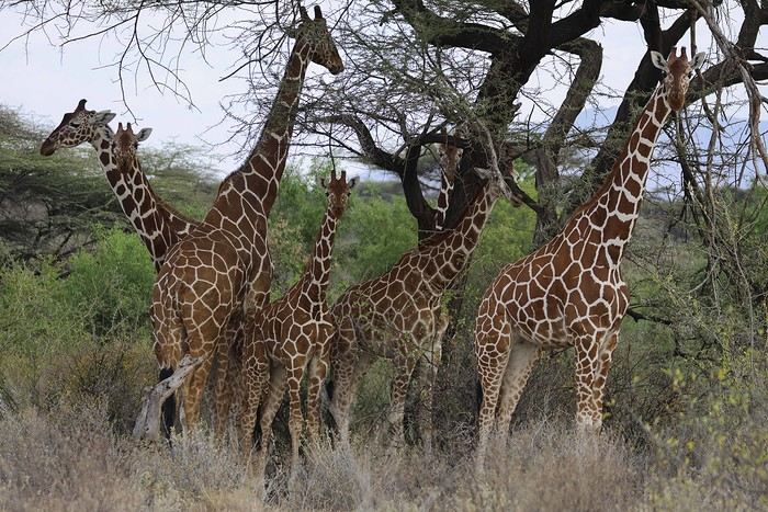
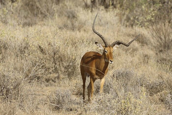
As soon as we entered the reserve, we spotted some impalas and quickly came across one of the region’s endemic species: the reticulated giraffe, which is absolutely stunning.
While heading to our camp for lunch, Alfred crossed paths with another vehicle and learned that a leopard was nearby. We started searching, and a few minutes later, Anny spotted a shape in a tree—it was our leopard!
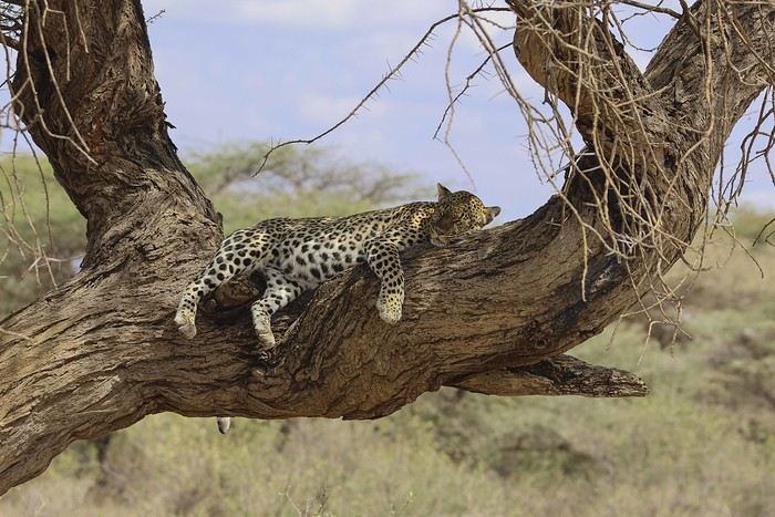
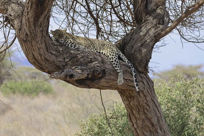
There were actually two of them—a mother and her adolescent. The young one was perched high in the tree, in the shade. We got to observe them for a good half-hour in excellent conditions, with just one other vehicle nearby.
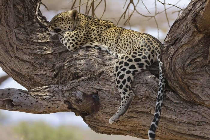
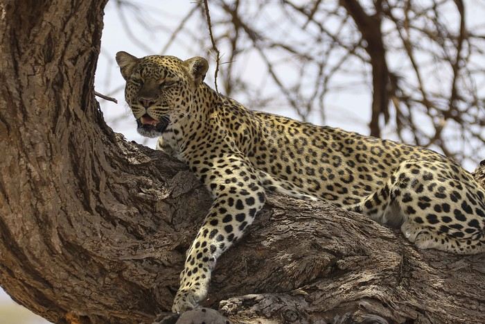
Alfred also noticed that the mother had hidden prey (a gerenuk gazelle) in the vegetation, away from prying eyes.
It was time to head to our camp, the Ashnil Samburu Camp, located in the Buffalo Springs area, by the river, in an idyllic setting surrounded by the region’s typical vegetation.
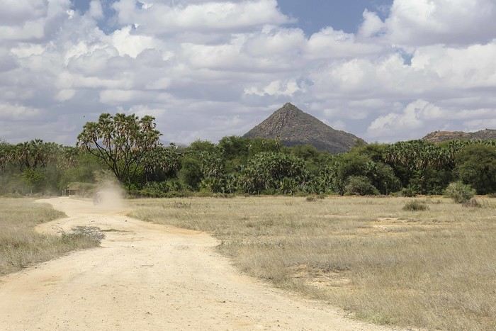
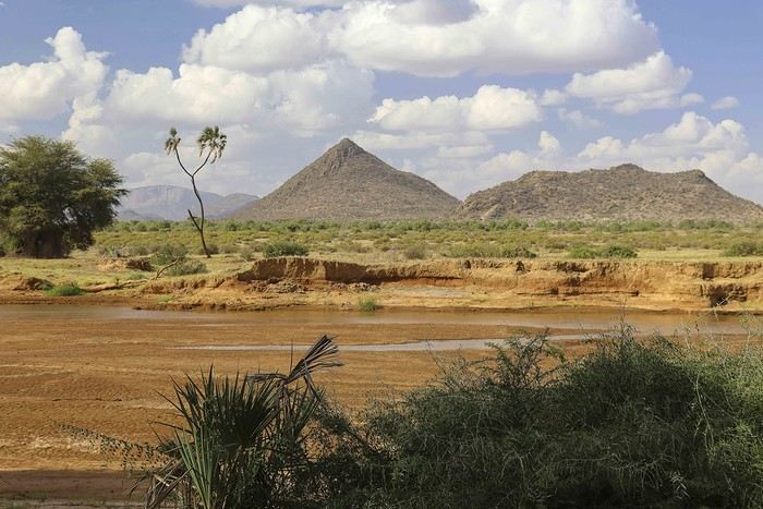
The welcome was fantastic—we immediately felt at home, and that feeling lasted throughout our 3-day stay in the reserve. It was 2 PM, but no one rushed us to the table. Our waitress, Sheila, who took care of us the whole time, was as lovely as the rest of the team. Barely seated, we were invited to watch an elephant passing right by the camp, in front of the restaurant. This trip was off to a great start!
After lunch, we relaxed by the pool. Monkeys, especially vervets, were everywhere, and a camp employee was assigned to keep an eye on them and shoo them away if needed (especially the baboons).
A little before 4 PM, we met up with Alfred for our first game drive. Just outside the camp, a few elephants were in the valley near the river.
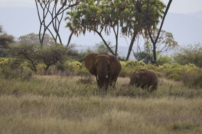
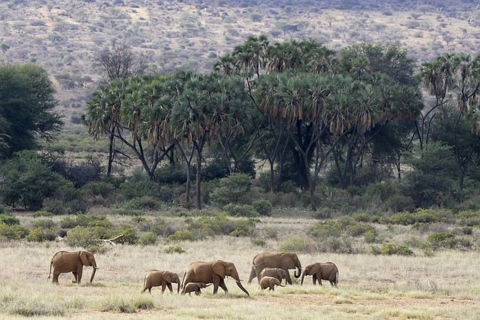
We’d see them in the same area almost every day. We also spotted some gazelles.
After several years, I’ve finally decided to repost a travel journal on the forum. We returned a few weeks ago from an incredible trip to Kenya, and it’s reignited my desire to share our emotions in the face of these animals.
Kenya wasn’t originally a priority for us in terms of safari—we had the impression it was too touristy. So, we started with other destinations: Namibia, Tanzania, Botswana, and South Africa. But as I did more research, especially on the forum (thanks in part to Sylvie’s many trips), I eventually convinced myself that Kenya could be magnificent, as long as we chose our itinerary carefully and avoided peak seasons.
We ended up going in January, from the 17th to the 31st. We worked with a travel agency (TP) that crafted a custom itinerary for us: Samburu-Ol Pejeta-Naivasha-Maji Moto-Maasai Mara-Diani. They partnered with a local French-speaking agency, and everything was perfectly organized. Our trip exceeded all our expectations, and none of it would’ve been as amazing without our guide, Alfred. He accompanied us for 10 days and was a fantastic travel companion—professional, respectful of the animals, and always in good spirits. We formed a great bond with him in such a short time.
- **January 17th** After meeting up with Juliette and Charlotte in Rennes the night before, we left at 4 AM for Roissy Charles de Gaulle Airport. The thick fog made the drive pretty rough, but we arrived safely around 7:45 AM. A Blue Valet driver was waiting to take our car. Check-in went smoothly, and we waited patiently for our 10:40 AM flight. Unfortunately, despite boarding on time, a passenger was missing, and we had to find a replacement last minute. Then, another passenger who had checked in and dropped off their luggage wasn’t on the plane, so they had to unload their bags. After a long period of uncertainty and spotty communication from the crew, we finally took off over an hour late.
We arrived in Nairobi in the late afternoon, 45 minutes behind schedule. The administrative formalities were endless—it took nearly 1.5 hours from landing to leaving the airport with our luggage. When we stepped out, Alfred, our guide, was waiting with a big smile and drove us to the Eka Hotel, not far from the airport. Exhausted from the long journey, we fell asleep quickly.
- **January 18th** Alfred met us at 7 AM for a long drive to Samburu Reserve. We had a peaceful night, unlike the girls, who barely slept because their neighbors were talking loudly all night. Things even escalated when Charlotte started shouting insults to get them to quiet down, but it didn’t work.
It was Sunday, so traffic around Nairobi and along the route was light. Aside from a quick "technical stop," we drove straight through and arrived in Samburu after just under 6 hours. Because of the lower altitude (around 1,000m on average), it was hot—over 30°C in mid-January.
As soon as we entered the reserve, we spotted some impalas and quickly came across one of the region’s endemic species: the reticulated giraffe, which is absolutely stunning.
While heading to our camp for lunch, Alfred crossed paths with another vehicle and learned that a leopard was nearby. We started searching, and a few minutes later, Anny spotted a shape in a tree—it was our leopard!
There were actually two of them—a mother and her adolescent. The young one was perched high in the tree, in the shade. We got to observe them for a good half-hour in excellent conditions, with just one other vehicle nearby.
Alfred also noticed that the mother had hidden prey (a gerenuk gazelle) in the vegetation, away from prying eyes.
It was time to head to our camp, the Ashnil Samburu Camp, located in the Buffalo Springs area, by the river, in an idyllic setting surrounded by the region’s typical vegetation.
The welcome was fantastic—we immediately felt at home, and that feeling lasted throughout our 3-day stay in the reserve. It was 2 PM, but no one rushed us to the table. Our waitress, Sheila, who took care of us the whole time, was as lovely as the rest of the team. Barely seated, we were invited to watch an elephant passing right by the camp, in front of the restaurant. This trip was off to a great start!
After lunch, we relaxed by the pool. Monkeys, especially vervets, were everywhere, and a camp employee was assigned to keep an eye on them and shoo them away if needed (especially the baboons).
A little before 4 PM, we met up with Alfred for our first game drive. Just outside the camp, a few elephants were in the valley near the river.
We’d see them in the same area almost every day. We also spotted some gazelles.
What circuit to do from Monastir?
Hi there,
I’m leaving for Tunisia in five weeks for a full 15-day trip. I’ll be arriving in Monastir and departing from there as well.
I’d like to do a route that’s a bit different from my first stay, which was more focused on cities and culture (Tunis, Sousse, Kairouan, El Jem).
I’ll be getting around by public transport.
I’d like to head south toward Tozeur, and I saw that you can take a *louage* from Monastir to Sbeitla (2h30). I imagine it’s not too complicated to get to Tozeur from there afterward? The issue is the return trip to Monastir and safety in Sbeitla.
If this route seems too complicated, I might opt for Djerba instead, which looks simpler.
Thanks in advance.
I’m leaving for Tunisia in five weeks for a full 15-day trip. I’ll be arriving in Monastir and departing from there as well.
I’d like to do a route that’s a bit different from my first stay, which was more focused on cities and culture (Tunis, Sousse, Kairouan, El Jem).
I’ll be getting around by public transport.
I’d like to head south toward Tozeur, and I saw that you can take a *louage* from Monastir to Sbeitla (2h30). I imagine it’s not too complicated to get to Tozeur from there afterward? The issue is the return trip to Monastir and safety in Sbeitla.
If this route seems too complicated, I might opt for Djerba instead, which looks simpler.
Thanks in advance.
From the Awakening to Travel to Morocco in the 90s
As I’ve mentioned elsewhere, I inherited my love of travel from my parents and some of my grandparents. A strong passion, but one that was unfortunately limited by our family’s modest resources. Back then, living in northern Alsace, a simple trip to the southern part of the region—with the Wine Route as our destination—felt like an extraordinary journey to a land of plenty for the little boy I was in the late 60s and early 70s.
Everything seemed so huge when you were still just a kid.
Back then, I was overwhelmed by countless sensations—I was already highly sensitive, with a keen mind and a nose and taste buds that were developing like a pro’s. Which, as I’d later realize, wasn’t always an advantage.
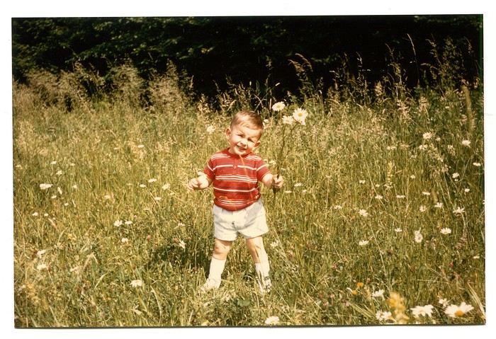
Those magical days always began with a gentle late-spring or midsummer morning. The interior of the white Peugeot 404, license plate 210 LZ 67, had already soaked up the sun before the engine purred to life, and the cabin gave off a scent I could still recognize today—a fragrance I found so pleasant. Back then, I had no idea it was just the smell of warm plastic from the car’s interior. Yes, the scents of the 404 on sunny days became my madeleine de Proust... What’s more, the whole family was unusually cheerful because those moments of relaxation and leisure were rare. Everyone worked, and no one had an easy job or was well paid. Without the *Trente Glorieuses*, these experiences might never have happened.
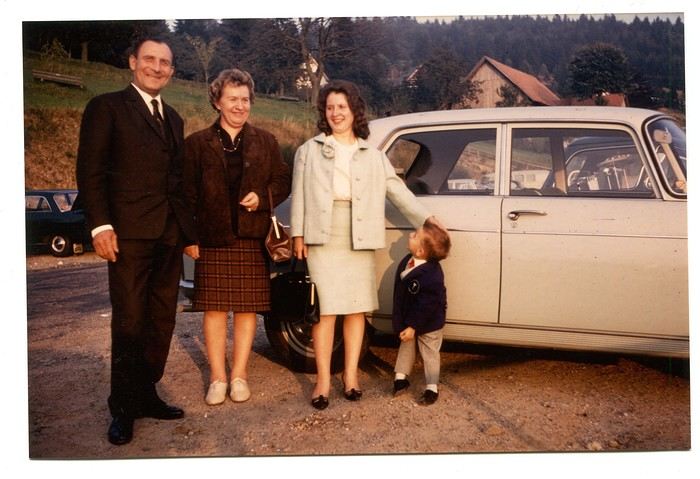
Once we crossed the canton’s borders, I felt like I was light-years away from my everyday surroundings, and every kilometer plunged me deeper into *terra incognita*. It was thrilling. Far from my so-called "medium-sized" town, wheat fields, cornfields, and cabbage patches stretched out, punctuated by tall poles connected by long wires and topped with vegetation—like giant clotheslines without laundry, where magical beanstalks might grow to touch the sky. Back then, I was still far from tasting their product, which was simply beer. At the time, there was still a significant local hop production. Fun fact: it wasn’t until 2002 that Anglo-Saxon scientists proved hops and cannabis belong to the same biological family.
After the fields, the landscape took another step up as it rolled past the little boy’s eyes, often glued to the windows. First came modest hills, then a succession of rolling slopes that soon formed an unbroken chain. Their 700 meters in altitude felt like Himalayan peaks to me—impressive, inert giants, a whole new world. Gazing at them, an intense emotion welled up somewhere between my stomach and lungs, nearly taking my breath away. What mysteries, what treasures did these heights hold? And then there were the cherries on top—the crowning touch that made the scene even more magical: proud, majestic castles perched on the summits like impassive sentinels. Monuments from the past, yet firmly rooted in the present on their rocky spurs. The little boy’s eyes sparkled—he’d been given a castle for Christmas, complete with battlements, towers, a drawbridge, and fully armed knights. He’d watched and lived *Ivanhoe* on the only French TV channel that existed back then.
Only once did my paternal grandfather join us on one of these trips. A tall, intelligent man with a face that could shift from stern to mischievous, clearly full of humor and charisma. Sadly, his relationship with alcohol had taken a toll on his life and, by extension, those of his loved ones. He had a strong personality—if his boss crossed the line, he wouldn’t hesitate to punch him, which meant he went through a lot of different jobs. Back then, you could quit one job and easily find another. It was quite something to see him in his final stages, hallucinating pink elephants and even drinking perfume when he had nothing else left. The last time I saw him, he’d slipped away from the doctors and nurses while hospitalized in pretty bad shape—at least, I assume his liver was the issue. We were sitting down for a family lunch when the door burst open, and there he stood in his pajamas, eyes twinkling with mischief, clearly pleased with the dramatic entrance. That theatrical moment didn’t spare us from burying him a few months later at the age of 71. One day, my mother told me the family doctor had quietly remarked that it was a shame—with his robust constitution, he could’ve lived to be a hundred. Yes, the family doctor—this was the man who’d come treat you any day, at almost any hour, just for a phone call. It really existed, it’s not a myth!
That day, his wife—my paternal grandmother—was also along for the ride. Everyone agreed that Jeannette was a good woman. She worked as a waitress at *Le Tigre*, the biggest brasserie in town, right in the center. Most customers preferred to be served by her, including local dignitaries and even the mayor. As a kid, I didn’t find her very fun, open, or warm—she seemed a bit stern. Back then, women in their fifties already had the face and build of grandmothers. Same went for men, don’t get me wrong. I had no idea about the struggles she faced because of her husband. I didn’t know that 30 years earlier, she’d had to flee Alsace while pregnant, under threat from Nazi fighter-bombers. I didn’t know she’d had several miscarriages, and that my father—her only surviving child, born prematurely in March 1940 at the other end of France—weighed less than a kilo at birth and was so tiny he could fit in a shoebox. Hard to imagine he’d grow into a strapping man nearly 1.80 meters tall, tipping the scales at 100 kilos. When you come back from summer camp in early August and ask why she didn’t pick you up with your parents, and they gently tell you she’s "in heaven," you don’t realize she passed away at 54 after suffering greatly from stomach cancer that had spread.
Back to that family outing, that enchanted parenthesis. I even remembered where we’d had lunch when I passed through Dambach-la-Ville decades later. One of those charming, flower-filled towns Alsace produces in abundance—and preserves so well. This one sits high on a hill, and I was a bit stunned on the parking lot because the view stretched far, revealing the Alsace plain below—its fields, villages, hills, and forests. The world seemed so vast and enticing that day, even though I was only glimpsing a tiny fraction of it.
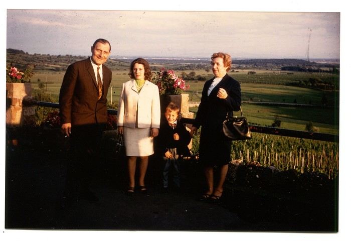
The region was already very touristy, but I wouldn’t notice the downsides until much later. That Sunday noon, I discovered a large restaurant filled with diners. I can still see the enormous piece of meat they served me, decorated with a little wooden skewer topped with a flag. I kept that one for a long time. Those were the golden days of rich, flowing, thick sauces—so flavorful—and the era of the world’s best fries, made on the spot with the best potatoes. To top it off, I was *exceptionally* allowed a small bottle of apple juice, Orangina, or—even better if possible—Sinalco. Yes, Sinalco—like Orangina, but better. A brand that must’ve disappeared in the 70s, but why, and what a shame! Since then, Orangina’s little bubbles have taken the brand to the other side of the planet—it’s now Japanese.
Year after year, I’d eagerly await that ecstatic moment when the most beautiful castle in Alsace, the Haut-Koenigsbourg, appeared in my field of vision. The perfect model, the archetype that blended into the landscape at the height of a child’s dreams. The trip home always felt like a reality check—less jarring than an alarm clock, but more diffuse and melancholic. From then on, there was only one wish: *When do we leave again?*
Those magical days always began with a gentle late-spring or midsummer morning. The interior of the white Peugeot 404, license plate 210 LZ 67, had already soaked up the sun before the engine purred to life, and the cabin gave off a scent I could still recognize today—a fragrance I found so pleasant. Back then, I had no idea it was just the smell of warm plastic from the car’s interior. Yes, the scents of the 404 on sunny days became my madeleine de Proust... What’s more, the whole family was unusually cheerful because those moments of relaxation and leisure were rare. Everyone worked, and no one had an easy job or was well paid. Without the *Trente Glorieuses*, these experiences might never have happened.
Once we crossed the canton’s borders, I felt like I was light-years away from my everyday surroundings, and every kilometer plunged me deeper into *terra incognita*. It was thrilling. Far from my so-called "medium-sized" town, wheat fields, cornfields, and cabbage patches stretched out, punctuated by tall poles connected by long wires and topped with vegetation—like giant clotheslines without laundry, where magical beanstalks might grow to touch the sky. Back then, I was still far from tasting their product, which was simply beer. At the time, there was still a significant local hop production. Fun fact: it wasn’t until 2002 that Anglo-Saxon scientists proved hops and cannabis belong to the same biological family.
After the fields, the landscape took another step up as it rolled past the little boy’s eyes, often glued to the windows. First came modest hills, then a succession of rolling slopes that soon formed an unbroken chain. Their 700 meters in altitude felt like Himalayan peaks to me—impressive, inert giants, a whole new world. Gazing at them, an intense emotion welled up somewhere between my stomach and lungs, nearly taking my breath away. What mysteries, what treasures did these heights hold? And then there were the cherries on top—the crowning touch that made the scene even more magical: proud, majestic castles perched on the summits like impassive sentinels. Monuments from the past, yet firmly rooted in the present on their rocky spurs. The little boy’s eyes sparkled—he’d been given a castle for Christmas, complete with battlements, towers, a drawbridge, and fully armed knights. He’d watched and lived *Ivanhoe* on the only French TV channel that existed back then.
Only once did my paternal grandfather join us on one of these trips. A tall, intelligent man with a face that could shift from stern to mischievous, clearly full of humor and charisma. Sadly, his relationship with alcohol had taken a toll on his life and, by extension, those of his loved ones. He had a strong personality—if his boss crossed the line, he wouldn’t hesitate to punch him, which meant he went through a lot of different jobs. Back then, you could quit one job and easily find another. It was quite something to see him in his final stages, hallucinating pink elephants and even drinking perfume when he had nothing else left. The last time I saw him, he’d slipped away from the doctors and nurses while hospitalized in pretty bad shape—at least, I assume his liver was the issue. We were sitting down for a family lunch when the door burst open, and there he stood in his pajamas, eyes twinkling with mischief, clearly pleased with the dramatic entrance. That theatrical moment didn’t spare us from burying him a few months later at the age of 71. One day, my mother told me the family doctor had quietly remarked that it was a shame—with his robust constitution, he could’ve lived to be a hundred. Yes, the family doctor—this was the man who’d come treat you any day, at almost any hour, just for a phone call. It really existed, it’s not a myth!
That day, his wife—my paternal grandmother—was also along for the ride. Everyone agreed that Jeannette was a good woman. She worked as a waitress at *Le Tigre*, the biggest brasserie in town, right in the center. Most customers preferred to be served by her, including local dignitaries and even the mayor. As a kid, I didn’t find her very fun, open, or warm—she seemed a bit stern. Back then, women in their fifties already had the face and build of grandmothers. Same went for men, don’t get me wrong. I had no idea about the struggles she faced because of her husband. I didn’t know that 30 years earlier, she’d had to flee Alsace while pregnant, under threat from Nazi fighter-bombers. I didn’t know she’d had several miscarriages, and that my father—her only surviving child, born prematurely in March 1940 at the other end of France—weighed less than a kilo at birth and was so tiny he could fit in a shoebox. Hard to imagine he’d grow into a strapping man nearly 1.80 meters tall, tipping the scales at 100 kilos. When you come back from summer camp in early August and ask why she didn’t pick you up with your parents, and they gently tell you she’s "in heaven," you don’t realize she passed away at 54 after suffering greatly from stomach cancer that had spread.
Back to that family outing, that enchanted parenthesis. I even remembered where we’d had lunch when I passed through Dambach-la-Ville decades later. One of those charming, flower-filled towns Alsace produces in abundance—and preserves so well. This one sits high on a hill, and I was a bit stunned on the parking lot because the view stretched far, revealing the Alsace plain below—its fields, villages, hills, and forests. The world seemed so vast and enticing that day, even though I was only glimpsing a tiny fraction of it.
The region was already very touristy, but I wouldn’t notice the downsides until much later. That Sunday noon, I discovered a large restaurant filled with diners. I can still see the enormous piece of meat they served me, decorated with a little wooden skewer topped with a flag. I kept that one for a long time. Those were the golden days of rich, flowing, thick sauces—so flavorful—and the era of the world’s best fries, made on the spot with the best potatoes. To top it off, I was *exceptionally* allowed a small bottle of apple juice, Orangina, or—even better if possible—Sinalco. Yes, Sinalco—like Orangina, but better. A brand that must’ve disappeared in the 70s, but why, and what a shame! Since then, Orangina’s little bubbles have taken the brand to the other side of the planet—it’s now Japanese.
Year after year, I’d eagerly await that ecstatic moment when the most beautiful castle in Alsace, the Haut-Koenigsbourg, appeared in my field of vision. The perfect model, the archetype that blended into the landscape at the height of a child’s dreams. The trip home always felt like a reality check—less jarring than an alarm clock, but more diffuse and melancholic. From then on, there was only one wish: *When do we leave again?*
Chatting by the water
For those who want to chat quietly by the riverbanks, this is the place!
Veneto: Dolomites and Opera
I'm starting a new travel journal in Italy.
It's about a month-long trip (from September 3, 2025, to October 4, 2025), or rather a part of it. This section matches the title: an opera festival in Verona (one evening) and the Dolomites in the Veneto region.
I'm posting the part of the trip I think will interest French-speaking readers the most (since this is where I saw the most French travelers).
Here’s a quick summary:
- Trip in September 2025
- Solo travel with camping (caravan)
- Small geographic area: besides Verona, the surroundings of the Marmolada massif and Cortina d'Ampezzo.
- Main but not exclusive activity: hiking.
Since I have limited internet access where I am now, I’ll be writing slowly. Here we go!
Day 1: Thursday, September 4, 2025
I arrived in Veneto under the sun and with warm weather. I drove to Verona and tried to find a spot at the campsite (Verona Village) located south of the city. Unfortunately, it was full. Booking on the website was mandatory, but when I tried to reserve a few days ago, the site never moved from the "reservation" step to the "payment" step (I don’t know why—it’s always like that in these cases). I found another solution over the phone; the drive from southern Verona to the northeast was a bit long, but I finally settled at the "Oro Verde" campsite. It’s an "agricampeggio" (farm camping or rural campsite) on the outskirts of the city, and its name (green gold) suggests they produce olives there. Since it wasn’t late, I biked to the Adige River, following the recommended route into the city.
Since I have limited internet access where I am now, I’ll be writing slowly. Here we go!
Day 1: Thursday, September 4, 2025
I arrived in Veneto under the sun and with warm weather. I drove to Verona and tried to find a spot at the campsite (Verona Village) located south of the city. Unfortunately, it was full. Booking on the website was mandatory, but when I tried to reserve a few days ago, the site never moved from the "reservation" step to the "payment" step (I don’t know why—it’s always like that in these cases). I found another solution over the phone; the drive from southern Verona to the northeast was a bit long, but I finally settled at the "Oro Verde" campsite. It’s an "agricampeggio" (farm camping or rural campsite) on the outskirts of the city, and its name (green gold) suggests they produce olives there. Since it wasn’t late, I biked to the Adige River, following the recommended route into the city.
The Foam of Days
Now that the curtain has fallen on the past year, it’s time to see what’s happening around here.
It seems pretty quiet, but I’ll read more in detail later.
First, I need to tell you all an anecdote.
My eldest little girl, in her third year of law school, was really scared she wouldn’t pass the year. I told her: “Trust yourself, you’ve worked so hard, and worst case, if you fail, you’ll just redo the year.” “But I don’t think I’ll make it—they changed the rules, and if I mess up even one unit, I have to start all over.” I knew her grades weren’t exactly stellar, and with what I was about to say, I wasn’t taking much of a risk. “Here’s the deal, sweetheart: if you pass, I promise I’ll take you to India, just the two of us.” I have to admit, India is a country I’ve talked about so much to all my grandchildren that in their minds, it’s become a magical, mythical place (hmm).
July had barely begun when my phone rang, her name flashing on the screen. “Mamido, I did it!” My promise came rushing back—oh no, oh no, oh no! “Congratulations, sweetheart!” A little shyly, she said: “Is the India trip still on?”
And me, replying: “Of course it is!”
And that’s that—a promise is a promise, or you risk losing that precious trust that keeps hearts warm and at peace.
We’re leaving in February. Only 8 days—yikes, the carbon footprint! But we can’t miss her tutorials, or she’ll be kicked out. Personally, that works just fine for me.
Going to India has become a challenge for me. It’s far, it’s exhausting, I sweat, I hate mosquitoes, the spices bother my mouth when I used to love them. There’s noise all the time—at night, the dogs bark nonstop, and we almost get run over. I’ll get lost in the streets because my sense of direction has vanished. I don’t like rice anymore. All that chaos and those cultural differences that once enchanted me now just overwhelm me. But I promised.
The upside—and it’s a big one—Raman, the same driver I’ve had forever, will be at the airport with a sign with our names. We’ll stop at the same little shop for chai (or tea, plain and simple) with that aroma that intoxicates me, halfway through the trip.
It’ll be a tiny trip—staying with friends, I’ll show her a few places I love: Chidambaram, Mamallapuram, and the clinic where I worked. Then we’ll head back. My little girl will go home to her parents.
As for me, I’ll leave right away for our Scottish island with Homme for our chilly winter.
How can you love a country so much you want to live there, then suddenly reject it, no longer able to appreciate what once made it special? That’s the mystery of love, I guess.
First, I need to tell you all an anecdote.
My eldest little girl, in her third year of law school, was really scared she wouldn’t pass the year. I told her: “Trust yourself, you’ve worked so hard, and worst case, if you fail, you’ll just redo the year.” “But I don’t think I’ll make it—they changed the rules, and if I mess up even one unit, I have to start all over.” I knew her grades weren’t exactly stellar, and with what I was about to say, I wasn’t taking much of a risk. “Here’s the deal, sweetheart: if you pass, I promise I’ll take you to India, just the two of us.” I have to admit, India is a country I’ve talked about so much to all my grandchildren that in their minds, it’s become a magical, mythical place (hmm).
July had barely begun when my phone rang, her name flashing on the screen. “Mamido, I did it!” My promise came rushing back—oh no, oh no, oh no! “Congratulations, sweetheart!” A little shyly, she said: “Is the India trip still on?”
And me, replying: “Of course it is!”
And that’s that—a promise is a promise, or you risk losing that precious trust that keeps hearts warm and at peace.
We’re leaving in February. Only 8 days—yikes, the carbon footprint! But we can’t miss her tutorials, or she’ll be kicked out. Personally, that works just fine for me.
Going to India has become a challenge for me. It’s far, it’s exhausting, I sweat, I hate mosquitoes, the spices bother my mouth when I used to love them. There’s noise all the time—at night, the dogs bark nonstop, and we almost get run over. I’ll get lost in the streets because my sense of direction has vanished. I don’t like rice anymore. All that chaos and those cultural differences that once enchanted me now just overwhelm me. But I promised.
The upside—and it’s a big one—Raman, the same driver I’ve had forever, will be at the airport with a sign with our names. We’ll stop at the same little shop for chai (or tea, plain and simple) with that aroma that intoxicates me, halfway through the trip.
It’ll be a tiny trip—staying with friends, I’ll show her a few places I love: Chidambaram, Mamallapuram, and the clinic where I worked. Then we’ll head back. My little girl will go home to her parents.
As for me, I’ll leave right away for our Scottish island with Homme for our chilly winter.
How can you love a country so much you want to live there, then suddenly reject it, no longer able to appreciate what once made it special? That’s the mystery of love, I guess.
Trip to Morocco in September-October 2025, in our camper van
Hi everyone,
We’re just back from a month-long trip to Morocco in our camper van.
After crossing France (we left from the Nantes area) and Spain, we arrived in Algeciras where we bought our boat tickets to Tangier. When we got to Tangier, as we were going through customs, you can imagine our surprise when the customs officer took our road map of Morocco and pointed out the label "Western Sahara" (just like in the forum’s destination section, by the way!).
He wanted it to say "Moroccan Sahara" instead!!! But there was nothing we could do—it was an old map... He wouldn’t listen, and after long discussions with the other (younger) customs officers, he finally gave it back and let us through... Unbelievable! Later, we heard that other travelers had their maps confiscated outright.
So, hide it well if you want to keep yours!!!
Anyway, we skirted around Tangier’s suburbs—pretty grim—and finally arrived in Asilah.
Following the coast and the long promenade along the beach, we reached the campsite. It was a bit crowded, not much shade, but it wasn’t far from the medina or the beach, and it wasn’t expensive. There’s some life here: Moroccan families seem to live on-site, in tents or basic bungalows. A woman was cooking tagine on a brazier—we were right in the atmosphere! The night was quiet, and we slept well. We set off on foot, walking along the seafront to the medina... We’d already been here in 2009. It was less touristy back then! Still, at this early hour, the little streets inside were very quiet. The walls had been freshly whitewashed, and there were even more murals than before. Around 11:30 AM, we strolled along the ramparts by the sea. There was a nice breeze! And a lot more people around. We enjoyed a milkshake on the terrace of a café overlooking the beach that stretches out at the foot of the medina. Some young guys were having fun diving off the rocks—and even off the top of the wall!
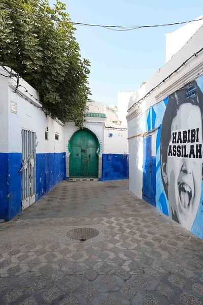
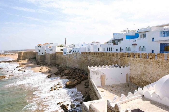
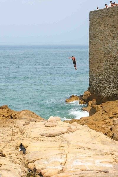
Anyway, we skirted around Tangier’s suburbs—pretty grim—and finally arrived in Asilah.
Following the coast and the long promenade along the beach, we reached the campsite. It was a bit crowded, not much shade, but it wasn’t far from the medina or the beach, and it wasn’t expensive. There’s some life here: Moroccan families seem to live on-site, in tents or basic bungalows. A woman was cooking tagine on a brazier—we were right in the atmosphere! The night was quiet, and we slept well. We set off on foot, walking along the seafront to the medina... We’d already been here in 2009. It was less touristy back then! Still, at this early hour, the little streets inside were very quiet. The walls had been freshly whitewashed, and there were even more murals than before. Around 11:30 AM, we strolled along the ramparts by the sea. There was a nice breeze! And a lot more people around. We enjoyed a milkshake on the terrace of a café overlooking the beach that stretches out at the foot of the medina. Some young guys were having fun diving off the rocks—and even off the top of the wall!
Trip Report: Silk Road Journey in China
Hi everyone,
This trip report covers a journey along the Silk Road in China (see detailed description below) undertaken in October 2025. The goal isn’t to recount the trip but to provide information that might help those who want to take a similar journey. Much of the information is valid for any trip to China.
Who we are: a retired couple, aged 63 and 65 (age gives discounts on entry to various sites and museums in China, which is why I won’t list prices here—I don’t know them, but you can easily find them online). We’re used to traveling independently. We speak English, which is the only foreign language spoken in China, though by very few people. I speak and read a little Chinese, which helped, but you can easily get by without it (without any English at all, I think it would be more difficult).
Period: We arrived just after "Golden Week," when all of China is on vacation, and after the summer, when schools are out, so we encountered very few tourists (99.99% of whom were Chinese). Our experience with booking visits in advance (which we didn’t need to do) isn’t representative for those who want to travel in the summer! The October-November period was perfect for our trip—it wasn’t too hot or too cold (one day of snow on the Tibetan Plateau), though it was only a few degrees on the Tibetan part, with altitudes between 2,000 and 3,000 meters. The trees were beautifully colored.
General remarks: Everyone we dealt with was very kind and perfectly honest. If you order a meal without really understanding what to do and the person modifies your order, trust them—the result is what you need. If a taxi driver signals that they’ll wait for you to finish your visit and pick you up afterward, trust them. It means there aren’t many taxis where you are, and it’ll be more convenient. For prices at street vendors, we always found the right ballpark, and sometimes they even added a little extra to please us. A taxi driver treated us to lunch, and an employee drove us back to the hotel after a visit because there were no taxis. If you struggle to buy a ticket online because there’s no counter, someone will come to help. People even spontaneously ask if everything’s okay and if you need anything.
Everywhere we went was very clean, including restrooms (trains, stations, hotels, museums, tourist sites) and streets. The old stereotypes about this no longer apply.
The trip can be challenging for those who have difficulty walking. The distances to cover on foot in stations, to access sites, and within the sites themselves can sometimes be really long.
We used the Lonely Planet guide in English (published at the end of August 2025) a little for preparation, but mostly relied on the internet.
Before leaving: No visa is needed for French citizens for stays under 30 days. You get a stamp on your passport upon arrival and departure, and the formalities themselves are very quick in both directions (excluding any potential queues). Just a photo and fingerprints upon arrival, and welcome to China’s facial recognition system.
Money: All your payments (see below) will go through your Visa card—there will be hundreds, including many payments of 20 cents to a few euros. So, you need an international option that allows unlimited card transactions. Since cash is rarely needed, the allowed number of ATM withdrawals can be low. We made 3 withdrawals totaling 800 € for a month and could have managed with just 2. The exchange rate charged on our Visa card was 12 € for 100 RMB (yuan).
Install the following apps on your smartphone before leaving (otherwise, you’ll only have access to the Chinese versions, if available): - Alipay, which is used to pay everywhere in China (details below). You need to link it to your credit card, then provide proof of identity by uploading a passport photo and completing a facial recognition session. Alipay gives access to Didi (China’s Uber), public transport (metro/bus), and can also translate phrases. - WeChat (Weixin in Chinese, pronounced *weishin*), which is also used for payments but also replaces WhatsApp. Unfortunately, to activate your account, you need someone who already has WeChat to sponsor you (preferably a Chinese person). We asked someone at our first accommodations to do this—no problem. By sharing your WeChat number with accommodations, they can send you messages that are automatically translated, and you can communicate with people thanks to the translation (translation to French is very poor; it’s much better in English, but unfortunately, WeChat detects your phone’s language). Alipay and WeChat are accepted almost everywhere, but some places only accept WeChat. - Amap, the international version of Baidu Maps, which replaces Google Maps (not at all up-to-date in China). The English names of hotels often have little to do with the Chinese names except for a phonetic resemblance. To find them on Amap, it’s best to copy the Chinese name found on your Trip reservation under "show address in Chinese." - A VPN. We had CyberGhost, which didn’t work, but according to other travelers, NordVPN and Windscribe do. Without a VPN, you can’t access Google services, on WhatsApp you can send and receive text but not photos, and you can’t send or receive emails on Gmail addresses. We managed without a VPN by using Firefox as a browser and Bing as a search engine. - Trip, for booking trains and accommodations, and buying some tickets. It’s the equivalent of Booking for accommodations, but Booking has very few listings in China, while Trip has hundreds in every city. Most hotels and trains are exchangeable and refundable until the day before, with no or minimal fees.
You don’t need contactless (NFC) payment on your phone. Either you scan a barcode and enter the amount to pay, or you display a barcode, and they scan it with a scanner, and the amount is deducted directly.
Upon arrival: - Buy a Chinese SIM card: 100 RMB for 300 GB of data and several hours of talk time (we didn’t use it). Set the Chinese number as a reference on Alipay, WeChat, and Amap. - Find someone to sponsor you on WeChat.
Transportation: - **Plane**: China Eastern, Paris-Canton then Canton-Urumqi on the way out, and Xian-Canton then Canton-Paris on the way back. International flights were smooth, but the schedules for the two domestic flights were changed. It was fine on the way out because we had some leeway, but on the way back, we were notified the morning of that our flight was canceled and replaced with one that didn’t allow for the connection. We called and changed to an earlier flight (I think we were lucky to find available seats). - **Train**: Most long distances were covered by high-speed trains (called D or G in China) at 240 or 300 km/h. Second class is perfect—just as comfortable and clean as our TGVs. The only advantage of first class is the wider seats for larger people, but the downside is that seats are often booked in advance and thus less available. You can book trains long in advance on Trip, but they only go on sale in China 15 days before departure, so that’s when you’ll know if you have a ticket. Initially, we booked first class, but there were no seats available on the day, so we ended up booking everything in second class, which was perfect. There’s no paper ticket—if you’ve bought one, you go to the station, show your passport, and enter. You do the same to access the platform 15 minutes before the train, and that’s it. Our train was canceled twice, but no problem—we went to the ticket counter, got a refund, and were offered a replacement. It didn’t delay us by more than an hour (maybe it would be harder in peak season). For prices, check Trip.com, but it’s significantly cheaper than in France. - **Bus**: We took the bus between Xining and Tongren, Tongren to Xiahe, and Hezuo to Lanzhou—about 3 hours each time for 200 km, 6 € per person, and departures were right on time. - **Taxi**: For trips between the station and hotel, or hotel and visits. If you take a Didi via the Alipay app, you activate your location, enter your destination, and it offers several taxis. You accept, and you get the car’s license plate and its real-time position on the map. When you get in, the driver often asks for the last four digits of your phone number to confirm. Otherwise, you go to the taxi stand outside the station. The price per kilometer is around 20 cents, so for a 30 km trip from the station to the hotel, you’ll pay about 6 €. We never tried to save more by taking local buses, but since the metro in Xian costs 25 cents per trip, it’s probably in the same ballpark. Amap provides public transport routes like Google Maps. - **Driver**: We hired a taxi/driver for the day several times for sightseeing. Prices ranged from 350 to 1,000 RMB (the most expensive was arranged through the Sofitel Xining concierge) for trips ranging from a few hours to a full day, sometimes covering over 300 km (see the detailed trip description).
Accommodations: All booked in advance on Trip, but several were changed during the trip. Off-season, there were no issues. We mostly stayed in upscale places, but in China, that means 50 to 60 € per night in the most central or convenient neighborhood. Note: Almost all hotels have a 5/5 rating on Trip, but it seems the Chinese avoid giving lower ratings to be polite. So, you have to read the comments to realize that in France, we might have given a 2 or 3!
Food: At the table, you’re served hot water or a hot infusion, presumably made with purified water. We never got sick from drinking it, but don’t drink tap water. Purified or mineral water is easy to find.
In restaurants, you can manage by pointing to the dish you want from another diner, on the wall where there are photos, or on the menu with pictures. The food in the region isn’t often spicy, and people usually ask or signal before adding the red spicy sauce, so you should be able to handle it if you don’t like chili at all.
The "fake old quarters" in several cities are great places to find all kinds of restaurants (see detailed trip below).
Like Google Maps, Amap can show you nearby restaurants.
Shopping: For dried fruits, buy them in Turfan—you won’t find the same variety and quality even in Xian. Generally, if you like something, buy it. If you wait, you might not find it outside the region where you are.
In Xian, there’s a "Tea City" where you can find all kinds of tea (from cheap to very expensive).
The trip in more detail: I won’t dwell on the beauty or interest of the sites here since that’s a matter of personal taste. However, I will do so for lesser-known places to give an idea to those who might be interested.
For many sites, there are shuttles (sometimes not included in the ticket price but costing around 1 €) that take you to the interesting spots. We always took them—it saves you from walking past countless shops or along uninteresting paths.
- **Urumqi**: We spent only one night there, arriving in the middle of the afternoon and leaving the next morning. We stayed at the Dana Hotel in the bazaar. Given the size of the city, it’s a good option because I don’t think there are many other interesting places. The bazaar is brand new and not at all "typical" (Turfan’s bazaar is infinitely more interesting), but the dining area is very nice.
- **Turfan**: Stayed at the New Dap Hostel, which was great. The neighborhood is nice, not far from the city, and easy to find food. The museum is closed until 2026 (Amap provides museum hours and closures). We took a day trip (for the two of us) with a driver to the Bezeklik Caves, Flaming Mountains, the abandoned city of Gaochang, the Tuyuk Village Museum, and the Emin Minaret for 500 RMB from 9 AM to 8 PM (arranged by the hostel). The landscape during the excursion was quite fabulous. We also visited the Karez Museum and the abandoned city of Jiaohe on our own the next day. At this time of year, the sun sets around 6 PM, and there’s often haze after 5 PM, so for Jiaohe, for example, which takes about 3 hours to visit, it’s best to be there by 1 or 2 PM at the latest.
The Dahua Market area is perfect for dried fruits (including the famous grapes), and you can eat there among locals in their traditional costumes. Next to it, there are buildings full of shops selling made-in-China items—it kept us busy for a good half-day, if not more.
- **Dunhuang**: Stayed in a guesthouse near the dunes—the city center isn’t far but seems quite artificial. Visited the dunes, with a ticket valid for 3 days. Lots of Chinese tourists—very typical and interesting from an ethnological perspective 😊. We got up early one morning to climb the highest dune, just beyond the one everyone goes to. It’s a bit long and tiring, but the view is worth it. Visited the Mogao Caves, buying the ticket on-site (no chance in season without booking in advance). We met two other French people and got a French-speaking guide (by pretending not to understand English). It was really worth it—a group of 4 instead of 20, and they took their time (2 hours) for the visit. We took a day trip to the Yulin Caves (2.5 hours by road and 160 km one way) with a driver for 350 RMB. We liked it a lot, but if the Mogao Caves are enough for you, it’s not very different.
- **Jiayuguan**: Stayed in a city-center hotel. Visited the Wei and Jin tombs (actually just one)—that’s where we were told the taxi should wait to take us back to the city. We went down into a crypt with lots of decorated bricks from the 3rd century. We really liked it, but it’s not as spectacular as the fort if you’re not a fan. Visited the Jiayuguan Fort and, with the same ticket, climbed a small section of the Great Wall 10 km away. Plan at least 3 good hours for all this—there’s plenty to see.
- **Zhangye**: Stayed at The Silk Road Travelers Hostel, rustic but very nice and organizes excursions. Visited the Danxia (colored mountains)—just as spectacular as the photos. You can easily spend 3 hours there, so plan to finish before sunset to avoid the haze (you can always stay longer for the sunset if the weather’s nice). The next day, visited the Mati Si Temple in the cliff. The 10,000 Buddha Caves are under renovation, but the setting and the main temple are well worth the visit (the paths through the cliff tunnels must be hellish in peak season). You can probably organize these two excursions yourself by asking any taxi driver. Also visited the Giant Buddha Temple in the city center—really worth it.
- **Xining**: Stayed in a city-center hotel. Visited the Tibetan Medicine Museum to see the world’s largest thangka (1 km long), made over 40 years by renowned artists. It’s absolutely magnificent, on par with the virtuosity (but over 1 km) of the thangkas painted by famous artists in Xiahe (see below). Hired a female taxi driver for the day to visit Kumbum Monastery (Ta’er Si in Chinese) and the Danxia area in Guide, 50 km beyond the monastery. It’s less spectacular than Zhangye’s Danxia, but we really liked it (including the journey’s landscape). The next day, visited the old Ming-era Qutan Monastery—no visitors, with beautiful murals (half under renovation). Accessible by train to Haidong or Ledu, then a taxi. Xining’s mosque is of no interest, but there’s a pedestrian street with food stalls nearby that’s very nice.
- **Tongren**: Stayed near the main monastery. Visited Longwu Monastery (several hours), with lots of nice shops along the street leading to it. Then visited Wutun Monastery, which is less lively but beautiful and close to thangka workshops. You can go in and watch the painters at work. For a thangka made by a renowned artist, count about a year of work for 1 m² and around 10,000 €.
- **Xiahe**: Stayed in a city-center hotel. Visited Labrang Monastery—very nice but not as much as Tongren’s because many halls were closed. I think it’s better to go in season and take an English-guided tour (but it’s still worth the trip, even off-season).
- **Langmusi**: Took a taxi, but you can also take a bus (though very early in the morning and longer). Particularly beautiful for us because we woke up to bright sunshine and 5 cm of snow everywhere. Visited the two temples (really nice) and did the classic hike in the gorges starting at the Fairy Cave. For those interested, we continued along the canyon path, and after the meadow where marmots are clearly visible in summer, we climbed toward a pass on the left at 3,800 meters. The view of Langmusi and, above all, the vast grasslands and distant mountains was fabulous (3 hours round trip from the temple). You could probably reach the 4,000-meter summit by continuing up the valley instead of turning left, but according to guides, it’s better to count 7 hours round trip (no technical difficulty). You can leave Langmusi by bus, but off-season, you first have to take a taxi to a stop outside the city and wait for the bus. We didn’t try and took a taxi to Hezuo instead.
Note on this region: A high-speed train is under construction from Xining to Langmusi and beyond (never seen such an impressive construction site!). When it’s operational (in one or two years, I think), access to the area will be revolutionized, and perhaps some of the charm will be lost.
- **Hezuo**: Stopped on the way from Langmusi to Lanzhou. Visited the Milarepa Pagoda, entirely destroyed during the Cultural Revolution and since rebuilt. We liked it since we were passing through, but it doesn’t necessarily justify a long detour.
- **Lanzhou**: Reached by one of the many buses from Hezuo. Stayed in the "fake old quarter," which is extremely pleasant, especially in the evening with restaurants, groups of Chinese women dancing to loud music, etc. Visited Bingling Si with a driver, 120 km away—the landscape and site are absolutely magnificent, with no one around at our time of year. Visited the Gansu Museum (where the famous Flying Horse is, but it’s a replica). We bought the ticket on entry, but in season, you probably need to book in advance.
- **Yinchuan**: Stayed in the city center. A city we discovered by chance in the Lonely Planet—worth it if you have time. On the way, we stopped for a few hours in Zhongwei, where there’s an incredible Taoist temple (I’ll let you be surprised). Visited the Western Xia tombs—we took the short option, which visits Tomb 3. We think the others are similar but less impressive. The surrounding landscape and site are quite spectacular. Visited the film sets (really fun if you like Chinese movies), the short but interesting Ningxia Museum, and finally the modern art museum. The architecture is avant-garde, and there are some beautiful works (we like it, but it’s far from the center—hire a driver who waits, or you might have to wait for an employee to offer a ride back).
- **Tianshui**: Stayed in the suburbs, but you should find a hotel near the "fake old quarter" between the Fu Xi Temples and the Taoist temple—it’s a very nice area, and the two temples (especially the Taoist one) are within walking distance. Visited the Maijishan Caves—the ticket includes the shuttle to get there. Took a taxi from Lanzhou for about 10 € in 45 minutes. We found these caves fabulous.
- **Xi’an**: Stayed 500 meters from the Bell Tower at Hantang Inn—very convenient. We’d been before, so we didn’t revisit the Terracotta Army. The calligraphy district is worth it, as is the Muslim Quarter, though it’s very touristy. The area indicated on the Lonely Planet’s walking tour near the old fruit and vegetable market isn’t very interesting. To buy tea, you can go to the Northwest International Tea City, with dozens of shops. We chose one at random, tasted, and bought various teas. There’s everything from cheap to extremely expensive, but you can find reasonable prices even in seemingly luxurious shops. Along the street north of this area, there are large stores with tons of Chinese goods selling dishes, wedding items, etc. We spent hours there. In the city center, there are only malls with more or less international brands.
- **Longmen Grottoes**: Visited as a round trip by high-speed train from Xian—1 hour 15 minutes to Longmen’s high-speed train station, and the site entrance is 15 minutes by taxi.
We didn’t go to Mount Hua Shan, but there’s a high-speed train station nearby, and there were people on the train who were clearly going there. So, you can probably do this excursion in a day from Xian as well.
Conclusion: We hope this report makes you want to go or helps you if you’re already planning to. If you have questions that you can’t find the answer to by searching properly online and we can answer, don’t hesitate.
This trip report covers a journey along the Silk Road in China (see detailed description below) undertaken in October 2025. The goal isn’t to recount the trip but to provide information that might help those who want to take a similar journey. Much of the information is valid for any trip to China.
Who we are: a retired couple, aged 63 and 65 (age gives discounts on entry to various sites and museums in China, which is why I won’t list prices here—I don’t know them, but you can easily find them online). We’re used to traveling independently. We speak English, which is the only foreign language spoken in China, though by very few people. I speak and read a little Chinese, which helped, but you can easily get by without it (without any English at all, I think it would be more difficult).
Period: We arrived just after "Golden Week," when all of China is on vacation, and after the summer, when schools are out, so we encountered very few tourists (99.99% of whom were Chinese). Our experience with booking visits in advance (which we didn’t need to do) isn’t representative for those who want to travel in the summer! The October-November period was perfect for our trip—it wasn’t too hot or too cold (one day of snow on the Tibetan Plateau), though it was only a few degrees on the Tibetan part, with altitudes between 2,000 and 3,000 meters. The trees were beautifully colored.
General remarks: Everyone we dealt with was very kind and perfectly honest. If you order a meal without really understanding what to do and the person modifies your order, trust them—the result is what you need. If a taxi driver signals that they’ll wait for you to finish your visit and pick you up afterward, trust them. It means there aren’t many taxis where you are, and it’ll be more convenient. For prices at street vendors, we always found the right ballpark, and sometimes they even added a little extra to please us. A taxi driver treated us to lunch, and an employee drove us back to the hotel after a visit because there were no taxis. If you struggle to buy a ticket online because there’s no counter, someone will come to help. People even spontaneously ask if everything’s okay and if you need anything.
Everywhere we went was very clean, including restrooms (trains, stations, hotels, museums, tourist sites) and streets. The old stereotypes about this no longer apply.
The trip can be challenging for those who have difficulty walking. The distances to cover on foot in stations, to access sites, and within the sites themselves can sometimes be really long.
We used the Lonely Planet guide in English (published at the end of August 2025) a little for preparation, but mostly relied on the internet.
Before leaving: No visa is needed for French citizens for stays under 30 days. You get a stamp on your passport upon arrival and departure, and the formalities themselves are very quick in both directions (excluding any potential queues). Just a photo and fingerprints upon arrival, and welcome to China’s facial recognition system.
Money: All your payments (see below) will go through your Visa card—there will be hundreds, including many payments of 20 cents to a few euros. So, you need an international option that allows unlimited card transactions. Since cash is rarely needed, the allowed number of ATM withdrawals can be low. We made 3 withdrawals totaling 800 € for a month and could have managed with just 2. The exchange rate charged on our Visa card was 12 € for 100 RMB (yuan).
Install the following apps on your smartphone before leaving (otherwise, you’ll only have access to the Chinese versions, if available): - Alipay, which is used to pay everywhere in China (details below). You need to link it to your credit card, then provide proof of identity by uploading a passport photo and completing a facial recognition session. Alipay gives access to Didi (China’s Uber), public transport (metro/bus), and can also translate phrases. - WeChat (Weixin in Chinese, pronounced *weishin*), which is also used for payments but also replaces WhatsApp. Unfortunately, to activate your account, you need someone who already has WeChat to sponsor you (preferably a Chinese person). We asked someone at our first accommodations to do this—no problem. By sharing your WeChat number with accommodations, they can send you messages that are automatically translated, and you can communicate with people thanks to the translation (translation to French is very poor; it’s much better in English, but unfortunately, WeChat detects your phone’s language). Alipay and WeChat are accepted almost everywhere, but some places only accept WeChat. - Amap, the international version of Baidu Maps, which replaces Google Maps (not at all up-to-date in China). The English names of hotels often have little to do with the Chinese names except for a phonetic resemblance. To find them on Amap, it’s best to copy the Chinese name found on your Trip reservation under "show address in Chinese." - A VPN. We had CyberGhost, which didn’t work, but according to other travelers, NordVPN and Windscribe do. Without a VPN, you can’t access Google services, on WhatsApp you can send and receive text but not photos, and you can’t send or receive emails on Gmail addresses. We managed without a VPN by using Firefox as a browser and Bing as a search engine. - Trip, for booking trains and accommodations, and buying some tickets. It’s the equivalent of Booking for accommodations, but Booking has very few listings in China, while Trip has hundreds in every city. Most hotels and trains are exchangeable and refundable until the day before, with no or minimal fees.
You don’t need contactless (NFC) payment on your phone. Either you scan a barcode and enter the amount to pay, or you display a barcode, and they scan it with a scanner, and the amount is deducted directly.
Upon arrival: - Buy a Chinese SIM card: 100 RMB for 300 GB of data and several hours of talk time (we didn’t use it). Set the Chinese number as a reference on Alipay, WeChat, and Amap. - Find someone to sponsor you on WeChat.
Transportation: - **Plane**: China Eastern, Paris-Canton then Canton-Urumqi on the way out, and Xian-Canton then Canton-Paris on the way back. International flights were smooth, but the schedules for the two domestic flights were changed. It was fine on the way out because we had some leeway, but on the way back, we were notified the morning of that our flight was canceled and replaced with one that didn’t allow for the connection. We called and changed to an earlier flight (I think we were lucky to find available seats). - **Train**: Most long distances were covered by high-speed trains (called D or G in China) at 240 or 300 km/h. Second class is perfect—just as comfortable and clean as our TGVs. The only advantage of first class is the wider seats for larger people, but the downside is that seats are often booked in advance and thus less available. You can book trains long in advance on Trip, but they only go on sale in China 15 days before departure, so that’s when you’ll know if you have a ticket. Initially, we booked first class, but there were no seats available on the day, so we ended up booking everything in second class, which was perfect. There’s no paper ticket—if you’ve bought one, you go to the station, show your passport, and enter. You do the same to access the platform 15 minutes before the train, and that’s it. Our train was canceled twice, but no problem—we went to the ticket counter, got a refund, and were offered a replacement. It didn’t delay us by more than an hour (maybe it would be harder in peak season). For prices, check Trip.com, but it’s significantly cheaper than in France. - **Bus**: We took the bus between Xining and Tongren, Tongren to Xiahe, and Hezuo to Lanzhou—about 3 hours each time for 200 km, 6 € per person, and departures were right on time. - **Taxi**: For trips between the station and hotel, or hotel and visits. If you take a Didi via the Alipay app, you activate your location, enter your destination, and it offers several taxis. You accept, and you get the car’s license plate and its real-time position on the map. When you get in, the driver often asks for the last four digits of your phone number to confirm. Otherwise, you go to the taxi stand outside the station. The price per kilometer is around 20 cents, so for a 30 km trip from the station to the hotel, you’ll pay about 6 €. We never tried to save more by taking local buses, but since the metro in Xian costs 25 cents per trip, it’s probably in the same ballpark. Amap provides public transport routes like Google Maps. - **Driver**: We hired a taxi/driver for the day several times for sightseeing. Prices ranged from 350 to 1,000 RMB (the most expensive was arranged through the Sofitel Xining concierge) for trips ranging from a few hours to a full day, sometimes covering over 300 km (see the detailed trip description).
Accommodations: All booked in advance on Trip, but several were changed during the trip. Off-season, there were no issues. We mostly stayed in upscale places, but in China, that means 50 to 60 € per night in the most central or convenient neighborhood. Note: Almost all hotels have a 5/5 rating on Trip, but it seems the Chinese avoid giving lower ratings to be polite. So, you have to read the comments to realize that in France, we might have given a 2 or 3!
Food: At the table, you’re served hot water or a hot infusion, presumably made with purified water. We never got sick from drinking it, but don’t drink tap water. Purified or mineral water is easy to find.
In restaurants, you can manage by pointing to the dish you want from another diner, on the wall where there are photos, or on the menu with pictures. The food in the region isn’t often spicy, and people usually ask or signal before adding the red spicy sauce, so you should be able to handle it if you don’t like chili at all.
The "fake old quarters" in several cities are great places to find all kinds of restaurants (see detailed trip below).
Like Google Maps, Amap can show you nearby restaurants.
Shopping: For dried fruits, buy them in Turfan—you won’t find the same variety and quality even in Xian. Generally, if you like something, buy it. If you wait, you might not find it outside the region where you are.
In Xian, there’s a "Tea City" where you can find all kinds of tea (from cheap to very expensive).
The trip in more detail: I won’t dwell on the beauty or interest of the sites here since that’s a matter of personal taste. However, I will do so for lesser-known places to give an idea to those who might be interested.
For many sites, there are shuttles (sometimes not included in the ticket price but costing around 1 €) that take you to the interesting spots. We always took them—it saves you from walking past countless shops or along uninteresting paths.
- **Urumqi**: We spent only one night there, arriving in the middle of the afternoon and leaving the next morning. We stayed at the Dana Hotel in the bazaar. Given the size of the city, it’s a good option because I don’t think there are many other interesting places. The bazaar is brand new and not at all "typical" (Turfan’s bazaar is infinitely more interesting), but the dining area is very nice.
- **Turfan**: Stayed at the New Dap Hostel, which was great. The neighborhood is nice, not far from the city, and easy to find food. The museum is closed until 2026 (Amap provides museum hours and closures). We took a day trip (for the two of us) with a driver to the Bezeklik Caves, Flaming Mountains, the abandoned city of Gaochang, the Tuyuk Village Museum, and the Emin Minaret for 500 RMB from 9 AM to 8 PM (arranged by the hostel). The landscape during the excursion was quite fabulous. We also visited the Karez Museum and the abandoned city of Jiaohe on our own the next day. At this time of year, the sun sets around 6 PM, and there’s often haze after 5 PM, so for Jiaohe, for example, which takes about 3 hours to visit, it’s best to be there by 1 or 2 PM at the latest.
The Dahua Market area is perfect for dried fruits (including the famous grapes), and you can eat there among locals in their traditional costumes. Next to it, there are buildings full of shops selling made-in-China items—it kept us busy for a good half-day, if not more.
- **Dunhuang**: Stayed in a guesthouse near the dunes—the city center isn’t far but seems quite artificial. Visited the dunes, with a ticket valid for 3 days. Lots of Chinese tourists—very typical and interesting from an ethnological perspective 😊. We got up early one morning to climb the highest dune, just beyond the one everyone goes to. It’s a bit long and tiring, but the view is worth it. Visited the Mogao Caves, buying the ticket on-site (no chance in season without booking in advance). We met two other French people and got a French-speaking guide (by pretending not to understand English). It was really worth it—a group of 4 instead of 20, and they took their time (2 hours) for the visit. We took a day trip to the Yulin Caves (2.5 hours by road and 160 km one way) with a driver for 350 RMB. We liked it a lot, but if the Mogao Caves are enough for you, it’s not very different.
- **Jiayuguan**: Stayed in a city-center hotel. Visited the Wei and Jin tombs (actually just one)—that’s where we were told the taxi should wait to take us back to the city. We went down into a crypt with lots of decorated bricks from the 3rd century. We really liked it, but it’s not as spectacular as the fort if you’re not a fan. Visited the Jiayuguan Fort and, with the same ticket, climbed a small section of the Great Wall 10 km away. Plan at least 3 good hours for all this—there’s plenty to see.
- **Zhangye**: Stayed at The Silk Road Travelers Hostel, rustic but very nice and organizes excursions. Visited the Danxia (colored mountains)—just as spectacular as the photos. You can easily spend 3 hours there, so plan to finish before sunset to avoid the haze (you can always stay longer for the sunset if the weather’s nice). The next day, visited the Mati Si Temple in the cliff. The 10,000 Buddha Caves are under renovation, but the setting and the main temple are well worth the visit (the paths through the cliff tunnels must be hellish in peak season). You can probably organize these two excursions yourself by asking any taxi driver. Also visited the Giant Buddha Temple in the city center—really worth it.
- **Xining**: Stayed in a city-center hotel. Visited the Tibetan Medicine Museum to see the world’s largest thangka (1 km long), made over 40 years by renowned artists. It’s absolutely magnificent, on par with the virtuosity (but over 1 km) of the thangkas painted by famous artists in Xiahe (see below). Hired a female taxi driver for the day to visit Kumbum Monastery (Ta’er Si in Chinese) and the Danxia area in Guide, 50 km beyond the monastery. It’s less spectacular than Zhangye’s Danxia, but we really liked it (including the journey’s landscape). The next day, visited the old Ming-era Qutan Monastery—no visitors, with beautiful murals (half under renovation). Accessible by train to Haidong or Ledu, then a taxi. Xining’s mosque is of no interest, but there’s a pedestrian street with food stalls nearby that’s very nice.
- **Tongren**: Stayed near the main monastery. Visited Longwu Monastery (several hours), with lots of nice shops along the street leading to it. Then visited Wutun Monastery, which is less lively but beautiful and close to thangka workshops. You can go in and watch the painters at work. For a thangka made by a renowned artist, count about a year of work for 1 m² and around 10,000 €.
- **Xiahe**: Stayed in a city-center hotel. Visited Labrang Monastery—very nice but not as much as Tongren’s because many halls were closed. I think it’s better to go in season and take an English-guided tour (but it’s still worth the trip, even off-season).
- **Langmusi**: Took a taxi, but you can also take a bus (though very early in the morning and longer). Particularly beautiful for us because we woke up to bright sunshine and 5 cm of snow everywhere. Visited the two temples (really nice) and did the classic hike in the gorges starting at the Fairy Cave. For those interested, we continued along the canyon path, and after the meadow where marmots are clearly visible in summer, we climbed toward a pass on the left at 3,800 meters. The view of Langmusi and, above all, the vast grasslands and distant mountains was fabulous (3 hours round trip from the temple). You could probably reach the 4,000-meter summit by continuing up the valley instead of turning left, but according to guides, it’s better to count 7 hours round trip (no technical difficulty). You can leave Langmusi by bus, but off-season, you first have to take a taxi to a stop outside the city and wait for the bus. We didn’t try and took a taxi to Hezuo instead.
Note on this region: A high-speed train is under construction from Xining to Langmusi and beyond (never seen such an impressive construction site!). When it’s operational (in one or two years, I think), access to the area will be revolutionized, and perhaps some of the charm will be lost.
- **Hezuo**: Stopped on the way from Langmusi to Lanzhou. Visited the Milarepa Pagoda, entirely destroyed during the Cultural Revolution and since rebuilt. We liked it since we were passing through, but it doesn’t necessarily justify a long detour.
- **Lanzhou**: Reached by one of the many buses from Hezuo. Stayed in the "fake old quarter," which is extremely pleasant, especially in the evening with restaurants, groups of Chinese women dancing to loud music, etc. Visited Bingling Si with a driver, 120 km away—the landscape and site are absolutely magnificent, with no one around at our time of year. Visited the Gansu Museum (where the famous Flying Horse is, but it’s a replica). We bought the ticket on entry, but in season, you probably need to book in advance.
- **Yinchuan**: Stayed in the city center. A city we discovered by chance in the Lonely Planet—worth it if you have time. On the way, we stopped for a few hours in Zhongwei, where there’s an incredible Taoist temple (I’ll let you be surprised). Visited the Western Xia tombs—we took the short option, which visits Tomb 3. We think the others are similar but less impressive. The surrounding landscape and site are quite spectacular. Visited the film sets (really fun if you like Chinese movies), the short but interesting Ningxia Museum, and finally the modern art museum. The architecture is avant-garde, and there are some beautiful works (we like it, but it’s far from the center—hire a driver who waits, or you might have to wait for an employee to offer a ride back).
- **Tianshui**: Stayed in the suburbs, but you should find a hotel near the "fake old quarter" between the Fu Xi Temples and the Taoist temple—it’s a very nice area, and the two temples (especially the Taoist one) are within walking distance. Visited the Maijishan Caves—the ticket includes the shuttle to get there. Took a taxi from Lanzhou for about 10 € in 45 minutes. We found these caves fabulous.
- **Xi’an**: Stayed 500 meters from the Bell Tower at Hantang Inn—very convenient. We’d been before, so we didn’t revisit the Terracotta Army. The calligraphy district is worth it, as is the Muslim Quarter, though it’s very touristy. The area indicated on the Lonely Planet’s walking tour near the old fruit and vegetable market isn’t very interesting. To buy tea, you can go to the Northwest International Tea City, with dozens of shops. We chose one at random, tasted, and bought various teas. There’s everything from cheap to extremely expensive, but you can find reasonable prices even in seemingly luxurious shops. Along the street north of this area, there are large stores with tons of Chinese goods selling dishes, wedding items, etc. We spent hours there. In the city center, there are only malls with more or less international brands.
- **Longmen Grottoes**: Visited as a round trip by high-speed train from Xian—1 hour 15 minutes to Longmen’s high-speed train station, and the site entrance is 15 minutes by taxi.
We didn’t go to Mount Hua Shan, but there’s a high-speed train station nearby, and there were people on the train who were clearly going there. So, you can probably do this excursion in a day from Xian as well.
Conclusion: We hope this report makes you want to go or helps you if you’re already planning to. If you have questions that you can’t find the answer to by searching properly online and we can answer, don’t hesitate.
A summer in the sun in... Iceland!!
Ah, Iceland and us—it’s quite the story, or rather, a long wait... The first time we considered going was already 7-8 years ago, after reading travel journals describing breathtaking landscapes, countless active and dormant volcanoes, glaciers, and waterfalls with extraordinary flows. In short, this island, made of fire and ice, right at Europe’s doorstep with its own unique culture, had nothing but advantages, and it was urgent to visit without delay 😇
My *Routard* guidebook is actually from 2016. So why did Iceland make us wait so long before we finally gave in to its charms? Yes, why indeed?
Simply because reading other travel journals revealed the cost of living there—and especially the harsh climate, even in the middle of July 🤪! Some journals described entire weeks of rain and foggy weather, making it tricky to explore the island. The budget wasn’t spared either, because in the most touristy areas, especially in the south and around Myvatn, accommodation prices are downright indecent—even outright robbery. 😕
Plus, in the Highlands, there’s literally no permanent lodging, and the only way to spend several nights there is to camp. And camping in winter conditions wasn’t exactly part of our plans... 😄
So, year after year, this trip kept getting postponed...
until August 2023, when prices for Southern Africa, North or South America, or even Asia were all way too high for summer 2024!
That’s when I turned my attention back to the Land of Fire and Ice and scoured all the comparison sites for the best accommodation deals across the country. Planning for 20 nights, I found 13 nights in "proper" lodging for 5 people at an average cost of under 200 €! A miracle, considering that in the southern glacier region, around Vik or Myvatn, prices range from 300 to 1000 € per night 😮 😮!
Still, that means we’ll have to camp for 7 nights, mostly in the Highlands, near Askja or Landmannalaugar. 😎
For once, I built the daily itinerary entirely around the decently priced lodgings I found 11 months in advance! The shortage of places to stay in some areas forced me to plan a few long transition days and make some tough choices. No big deal, though—there’s so much to do on this island 🙂!
Once the main itinerary was set, everyone agreed to the plan: 2/3 in proper lodging and 1/3 camping, even the most camping-averse among us! *Follow my gaze...*
By the time we bought the flight tickets, I had to tweak the itinerary a bit because one or two places were already booked! Plus, it was impossible to wait for a more refined plan to adjust reservations, since almost all bookings are non-refundable!! The harsh law of supply and demand...
For the car rental, we booked a Hyundai Tucson, approved for the Highlands, from Lava Car Rental—a company I’d read good reviews about in a Facebook group—for a cool 2500 € with full insurance. A real 4x4, like a Defender, would’ve been more than double...! Welcome to Iceland 😕...
Activities and excursions also required some tough choices. We had two must-dos: whale watching in Húsavík (60 € pp on Getyourguide) and a Glacier and Summer Treasure Glacier Walk with BlueIceland (165 € pp with discount codes on Getyourguide).
For the baths, we skipped the Blue Lagoon—too expensive—in favor of the Secret Lagoon and the Myvatn Baths, the Blue Lagoon’s equivalent but half the price.
Two baths for the price of one... and even more, since I spotted several free hot-water swimming spots.
Itinerary: Day 1: Arrival in Reykjavik - Hraunfossar Waterfall - Surtshellir Cave Day 2: Grábrók Crater - Snæfellsnes Peninsula Day 3: Stykkishólmur - Sturlungalaug Hot Springs Day 4: Northwest Coast - Akureyri - Goðafoss Day 5: Myvatn Day 6: Myvatn - Dettifoss - Selfoss - Rauðhólar Day 7: Húsavík Whale Watching - Dettifoss - Selfoss Day 8: Stuðlagil Canyon - Seyðisfjörður Day 9: Puffin colony - Störurð Hike Day 10: Hengifoss - East Fjords, Mjóifjörður Day 11: Viking Village - Jökulsárlón - Fjallsárlón Day 12: Glacier Excursion - Svartifoss Day 13: Fjaðrárgljúfur Canyon - Vík Day 14: Þakgil - Lava Show Vík Day 15: Southern Waterfalls Day Day 16: Landmannalaugar - Skalli Hike Day 17: Landmannalaugar - Bláhnjúkur - Brennisteinsalda Day 18: Secret Lagoon, Kerlingarfjöll, and Gullfoss Day 19: Geysir - Reykjavik Day 20: Bruarfoss - Þingvellir - Kerid Crater - Krýsuvík Geothermal Area Day 21: Reykjanes Peninsula
Friday, July 5, 2024, is our last workday before driving up to Alsace overnight to leave the cockers at Grandpa’s for boarding. Then, at 1:30 AM, we’ll head to Frankfurt, where a direct flight to Iceland awaits.
We arrive at 4 AM. Since we leave at 7 AM, the "night" will only last the equivalent of a 30-minute nap 🤪... just enough to get us in the road-trip mood 😏!!
My *Routard* guidebook is actually from 2016. So why did Iceland make us wait so long before we finally gave in to its charms? Yes, why indeed?
Simply because reading other travel journals revealed the cost of living there—and especially the harsh climate, even in the middle of July 🤪! Some journals described entire weeks of rain and foggy weather, making it tricky to explore the island. The budget wasn’t spared either, because in the most touristy areas, especially in the south and around Myvatn, accommodation prices are downright indecent—even outright robbery. 😕
Plus, in the Highlands, there’s literally no permanent lodging, and the only way to spend several nights there is to camp. And camping in winter conditions wasn’t exactly part of our plans... 😄
So, year after year, this trip kept getting postponed...
until August 2023, when prices for Southern Africa, North or South America, or even Asia were all way too high for summer 2024!
That’s when I turned my attention back to the Land of Fire and Ice and scoured all the comparison sites for the best accommodation deals across the country. Planning for 20 nights, I found 13 nights in "proper" lodging for 5 people at an average cost of under 200 €! A miracle, considering that in the southern glacier region, around Vik or Myvatn, prices range from 300 to 1000 € per night 😮 😮!
Still, that means we’ll have to camp for 7 nights, mostly in the Highlands, near Askja or Landmannalaugar. 😎
For once, I built the daily itinerary entirely around the decently priced lodgings I found 11 months in advance! The shortage of places to stay in some areas forced me to plan a few long transition days and make some tough choices. No big deal, though—there’s so much to do on this island 🙂!
Once the main itinerary was set, everyone agreed to the plan: 2/3 in proper lodging and 1/3 camping, even the most camping-averse among us! *Follow my gaze...*
By the time we bought the flight tickets, I had to tweak the itinerary a bit because one or two places were already booked! Plus, it was impossible to wait for a more refined plan to adjust reservations, since almost all bookings are non-refundable!! The harsh law of supply and demand...
For the car rental, we booked a Hyundai Tucson, approved for the Highlands, from Lava Car Rental—a company I’d read good reviews about in a Facebook group—for a cool 2500 € with full insurance. A real 4x4, like a Defender, would’ve been more than double...! Welcome to Iceland 😕...
Activities and excursions also required some tough choices. We had two must-dos: whale watching in Húsavík (60 € pp on Getyourguide) and a Glacier and Summer Treasure Glacier Walk with BlueIceland (165 € pp with discount codes on Getyourguide).
For the baths, we skipped the Blue Lagoon—too expensive—in favor of the Secret Lagoon and the Myvatn Baths, the Blue Lagoon’s equivalent but half the price.
Two baths for the price of one... and even more, since I spotted several free hot-water swimming spots.
Itinerary: Day 1: Arrival in Reykjavik - Hraunfossar Waterfall - Surtshellir Cave Day 2: Grábrók Crater - Snæfellsnes Peninsula Day 3: Stykkishólmur - Sturlungalaug Hot Springs Day 4: Northwest Coast - Akureyri - Goðafoss Day 5: Myvatn Day 6: Myvatn - Dettifoss - Selfoss - Rauðhólar Day 7: Húsavík Whale Watching - Dettifoss - Selfoss Day 8: Stuðlagil Canyon - Seyðisfjörður Day 9: Puffin colony - Störurð Hike Day 10: Hengifoss - East Fjords, Mjóifjörður Day 11: Viking Village - Jökulsárlón - Fjallsárlón Day 12: Glacier Excursion - Svartifoss Day 13: Fjaðrárgljúfur Canyon - Vík Day 14: Þakgil - Lava Show Vík Day 15: Southern Waterfalls Day Day 16: Landmannalaugar - Skalli Hike Day 17: Landmannalaugar - Bláhnjúkur - Brennisteinsalda Day 18: Secret Lagoon, Kerlingarfjöll, and Gullfoss Day 19: Geysir - Reykjavik Day 20: Bruarfoss - Þingvellir - Kerid Crater - Krýsuvík Geothermal Area Day 21: Reykjanes Peninsula
Friday, July 5, 2024, is our last workday before driving up to Alsace overnight to leave the cockers at Grandpa’s for boarding. Then, at 1:30 AM, we’ll head to Frankfurt, where a direct flight to Iceland awaits.
We arrive at 4 AM. Since we leave at 7 AM, the "night" will only last the equivalent of a 30-minute nap 🤪... just enough to get us in the road-trip mood 😏!!
Mice in Switzerland, the Other Cheese Country!
I'm starting my first travel journal since VF reopened!
This will mostly be to share my impressions and some photos, with a few days' delay, but I'm starting this journal while I'm still here.
First, I'd like to thank those who helped me prepare for this trip.
I was able to organize this stay in one of the most expensive countries in the world thanks to the home-exchange principle. Not necessarily a direct swap, but through a points system, which is more practical for choosing where you want to go without it having to be a reciprocal exchange.
For this trip, there will already be two different accommodations. We'll see how it goes after that.
The first place is near Yverdon-les-Bains, close to Lake Neuchâtel.
So, we're going to explore this area!
We arrived under capricious weather that won’t leave us for the next few days!
We had dinner at a pizzeria recommended by *Le Routard* in Yverdon, then took a little nighttime stroll through the town center before heading inland to settle into our accommodation.
We discovered a very large, quiet house—and especially the cat that stayed behind! Funny for a couple of mice! He’ll be sleeping with us 😹
This will mostly be to share my impressions and some photos, with a few days' delay, but I'm starting this journal while I'm still here.
First, I'd like to thank those who helped me prepare for this trip.
I was able to organize this stay in one of the most expensive countries in the world thanks to the home-exchange principle. Not necessarily a direct swap, but through a points system, which is more practical for choosing where you want to go without it having to be a reciprocal exchange.
For this trip, there will already be two different accommodations. We'll see how it goes after that.
The first place is near Yverdon-les-Bains, close to Lake Neuchâtel.
So, we're going to explore this area!
We arrived under capricious weather that won’t leave us for the next few days!
We had dinner at a pizzeria recommended by *Le Routard* in Yverdon, then took a little nighttime stroll through the town center before heading inland to settle into our accommodation.
We discovered a very large, quiet house—and especially the cat that stayed behind! Funny for a couple of mice! He’ll be sleeping with us 😹
USA Road Trip 2023 - Part 1
In January 2023, we started our second road trip across the United States. We stayed from January to mid-March, which gave us plenty of time to visit several cities, attractions, and parks in multiple states.
This travel journal will be split into two parts due to the considerable number of places we visited.
This first journal covers the following states: Ohio, Indiana, Missouri, Oklahoma, Texas, New Mexico, Arizona, Nevada, and California, and takes you through the outbound leg of our road trip.
The second journal will showcase the attractions we visited on the return trip, which mainly follows the famous Highway 1 along the Pacific coast.
So, I invite you to keep reading this first journal, which serves as a long recap to help you discover the various attractions we explored throughout this road trip.
Videos are included throughout the recap. Please click on the image to start the video.
Here are the links to jump to a specific post:
OHIO:
WinterLand - Christmas Lights at Cleveland Public Square Lake View Cemetery - Cleveland - Part 1 Lake View Cemetery - Cleveland - Part 2 Stroll through Columbus Upper Falls to Lower Falls via Buckeye Trail - Hocking Hills State Park – Logan Cedar Falls & Whispering Falls Hiking Trail - Hocking Hills State Park – Logan Ash Cave Hiking Trail - Hocking Hills State Park – Logan Exploring Cincinnati
INDIANA:
Visiting Indianapolis
MISSOURI:
Exploring St. Louis
OKLAHOMA:
Catoosa Blue Whale Discovering Tulsa Exploring Oklahoma City
TEXAS:
Exploring Shamrock Discovering McLean Exploring Amarillo
NEW MEXICO:
Ancestral Sites Trail - Pecos National Historical Park Discovering Santa Fe The Santuario de Chimayó Stroll through Los Cerrillos Walk through the village of Madrid San Francisco de Asis Catholic Church & The Bottle House - Golden Albuquerque Murals 66 Diner - Albuquerque Stroll through Old Town (Albuquerque) Rinconada Canyon Trail - Petroglyph National Monument Mesa Point Trail - Boca Negra Canyon - Petroglyph National Monument Macaw Trail - Boca Negra Canyon - Petroglyph National Monument Cliff Base Trail - Boca Negra Canyon - Petroglyph National Monument Piedras Marcadas Canyon - Petroglyph National Monument Sandstone Bluffs & Ventana Natural Arch - El Malpais National Monument
ARIZONA:
Stewart's Petrified Wood Shop – Holbrook Stroll through Holbrook Discovering Joseph City Exploring Winslow Grand Falls (The "Chocolate Falls") – Leupp Island Trail - Walnut Canyon National Monument Rim Trail - Walnut Canyon National Monument Wukoki Pueblo Trail – Wupatki National Monument Wupatki Pueblo Trail – Wupatki National Monument Doney Mountain Trail – Wupatki National Monument Citadel & Nalakihu Pueblos Trail – Wupatki National Monument Lomaki & Box Canyon Pueblos Trail – Wupatki National Monument Discovering Flagstaff On the way to Sedona Slide Rock State Park – Sedona Midgley Bridge Trail – Wilson Canyon – Sedona Tlaquepaque Arts & Shopping Village Walking Tour - Sedona Chapel of the Holy Cross - Sedona Hiking at Cathedral Rock - Sedona Hiking the Bell Rock Trail - Sedona Hiking the Airport Loop Trail - Sedona Amitabha Stupa and Peace Park - Sedona Hiking the Boynton Canyon Vortex Trail - Sedona Hiking the Devil's Bridge Trail - Sedona Hiking the Birthing Cave Trail - Sedona Bell Rock Inn - Sedona On the roads of Sedona - Part 1 On the roads of Sedona - Part 2 Keyhole Sink Hiking Trail - Kaibab National Forest Discovering Williams Exploring Ash Fork Discovering Kingman Ramada by Wyndham Kingman Davis Camp Park - Bullhead City Discovering Yucca Lake Havasu Boardwalk Tour A duck catches a lobster – Lake Havasu Boardwalk
CALIFORNIA:
Exploring Needles Discovering Goffs Discovering Amboy Visiting the famous Bagdad Cafe - Newberry Springs Exploring Barstow Vehicles from Hell (Mad Max Cars) - Barstow Peggy Sue's 50's Diner - Yermo Liberty Sculpture Park - Yermo Lake Dolores Water Park - Newberry Springs ZZYZX Road - Mojave National Preserve Alien Fresh Jerky - Baker Kelso Dunes Trail - Mojave National Preserve Hole-in-the-Wall Rings Trail - Mojave National Preserve Visiting Mitchell Caverns - Mojave National Preserve Dante's View - Death Valley National Park Zabriskie Point - Death Valley National Park Golden Canyon - Death Valley National Park Artists Drive & Artists Palette - Death Valley National Park Devil's Golf Course - Death Valley National Park Natural Bridge Trail - Death Valley National Park Badwater Basin - Death Valley National Park Harmony Borax Works - Death Valley National Park Devil's Cornfield - Death Valley National Park Mesquite Flat Sand Dunes - Death Valley National Park Mosaic Canyon Trail - Death Valley National Park On the road - Death Valley National Park
NEVADA:
Cleveland Clinic Lou Ruvo Center for Brain Health - Las Vegas Exploring Downtown Las Vegas SlotZilla Zipline - Fremont Street Experience – Downtown Las Vegas Viva Vision Light Show 1 - Fremont Street Experience - Downtown Las Vegas Viva Vision Light Show 2 - Fremont Street Experience - Downtown Las Vegas Viva Vision Light Show 3 - Fremont Street Experience - Downtown Las Vegas Viva Vision Light Show 4 - Fremont Street Experience - Downtown Las Vegas Free Live Music – Fremont Street Experience - Downtown Las Vegas Chucky – Fremont Street Experience - Downtown Las Vegas Las Vegas Strip - Part 1 Las Vegas Strip - Part 2 Las Vegas Strip - Part 3 Las Vegas Strip - Part 4 Las Vegas Strip - Part 5 Tom Devlin's Monster Museum - Boulder City Hoover Dam Lake Mead - Lakeview Overlook - Boulder City Nelson Ghost Town - Searchlight
CALIFORNIA:
Scenic Route through Joshua Tree National Park via the North Entrance Hidden Valley Trail - Joshua Tree National Park Barker Dam Trail - Joshua Tree National Park Cap Rock Trail - Joshua Tree National Park Keys View Trail - Joshua Tree National Park Hall of Horrors Trail - Joshua Tree National Park Skull Rock Trail - Joshua Tree National Park Arch Rock Trail - Joshua Tree National Park Cholla Cactus Garden Trail - Joshua Tree National Park Lone Pine - Owens Valley Miss Alabama & Shark Fin - Alabama Hills - Owens Valley Lone Ranger Canyon - Alabama Hills - Owens Valley Mobius Arch Loop Trail (Heart Arch & Lathe Arch) - Alabama Hills - Owens Valley Eye of the Alabama Hills Arch - Alabama Hills - Owens Valley Boot & Cyclops Arches - Alabama Hills - Owens Valley One Mile Arch, Bowling Ball and Pins & Gunga Din Area - Alabama Hills - Owens Valley Whitney Portal Arch Trailhead - Alabama Hills - Owens Valley Fish Rocks & Trona Pinnacles - Mojave Desert Red Cliffs Trail - Red Rock Canyon State Park Hagen Canyon Nature Trail - Red Rock Canyon State Park Tour of Historic Downtown Tehachapi View of the Tehachapi Loop – Monolith César E. Chávez National Monument – Keene Discovering Bakersfield Kern County Museum – Bakersfield Bravo Farms, Tree House & Petting Zoo - Traver Walking Tour of Kingsburg Exploring Fresno Simonian Farms & Soul Consoling Japanese Internment Tower - Fresno Duncan Ceramic Products (iLoveToCreate) - Fresno Walking Tour of Modesto Wat Dhammararam Buddhist Temple - Stockton Walking Tour of Stockton Discovering Stockton University of the Pacific - Stockton Visiting Lodi Sutter's Fort State Historic Park - Sacramento California State Capitol - Sacramento Walking Tour - Sacramento Walking Tour - Winters Walking Tour - Napa The Chandelier Tree In Drive-Thru Tree Park - Leggett One Log House - Garberville Grandfather Tree - Piercy The Living Chimney Tree - Avenue of the Giants Stephens Grove Loop Trail - Avenue of the Giants Gould Grove Nature Loop Trail - Avenue of the Giants Fleishmann Grove Trail - Avenue of the Giants Mahan Plaque Trail - Avenue of the Giants Founders Grove Nature Loop Trail - Avenue of the Giants Eternal Tree House & Immortal Tree - Avenue of the Giants Drury-Chaney Loop Trail - Avenue of the Giants Walking Tour - Redcrest
COMING UP NEXT:
USA Road Trip 2023 - Part 2
This travel journal will be split into two parts due to the considerable number of places we visited.
This first journal covers the following states: Ohio, Indiana, Missouri, Oklahoma, Texas, New Mexico, Arizona, Nevada, and California, and takes you through the outbound leg of our road trip.
The second journal will showcase the attractions we visited on the return trip, which mainly follows the famous Highway 1 along the Pacific coast.
So, I invite you to keep reading this first journal, which serves as a long recap to help you discover the various attractions we explored throughout this road trip.
Videos are included throughout the recap. Please click on the image to start the video.
Here are the links to jump to a specific post:
OHIO:
WinterLand - Christmas Lights at Cleveland Public Square Lake View Cemetery - Cleveland - Part 1 Lake View Cemetery - Cleveland - Part 2 Stroll through Columbus Upper Falls to Lower Falls via Buckeye Trail - Hocking Hills State Park – Logan Cedar Falls & Whispering Falls Hiking Trail - Hocking Hills State Park – Logan Ash Cave Hiking Trail - Hocking Hills State Park – Logan Exploring Cincinnati
INDIANA:
Visiting Indianapolis
MISSOURI:
Exploring St. Louis
OKLAHOMA:
Catoosa Blue Whale Discovering Tulsa Exploring Oklahoma City
TEXAS:
Exploring Shamrock Discovering McLean Exploring Amarillo
NEW MEXICO:
Ancestral Sites Trail - Pecos National Historical Park Discovering Santa Fe The Santuario de Chimayó Stroll through Los Cerrillos Walk through the village of Madrid San Francisco de Asis Catholic Church & The Bottle House - Golden Albuquerque Murals 66 Diner - Albuquerque Stroll through Old Town (Albuquerque) Rinconada Canyon Trail - Petroglyph National Monument Mesa Point Trail - Boca Negra Canyon - Petroglyph National Monument Macaw Trail - Boca Negra Canyon - Petroglyph National Monument Cliff Base Trail - Boca Negra Canyon - Petroglyph National Monument Piedras Marcadas Canyon - Petroglyph National Monument Sandstone Bluffs & Ventana Natural Arch - El Malpais National Monument
ARIZONA:
Stewart's Petrified Wood Shop – Holbrook Stroll through Holbrook Discovering Joseph City Exploring Winslow Grand Falls (The "Chocolate Falls") – Leupp Island Trail - Walnut Canyon National Monument Rim Trail - Walnut Canyon National Monument Wukoki Pueblo Trail – Wupatki National Monument Wupatki Pueblo Trail – Wupatki National Monument Doney Mountain Trail – Wupatki National Monument Citadel & Nalakihu Pueblos Trail – Wupatki National Monument Lomaki & Box Canyon Pueblos Trail – Wupatki National Monument Discovering Flagstaff On the way to Sedona Slide Rock State Park – Sedona Midgley Bridge Trail – Wilson Canyon – Sedona Tlaquepaque Arts & Shopping Village Walking Tour - Sedona Chapel of the Holy Cross - Sedona Hiking at Cathedral Rock - Sedona Hiking the Bell Rock Trail - Sedona Hiking the Airport Loop Trail - Sedona Amitabha Stupa and Peace Park - Sedona Hiking the Boynton Canyon Vortex Trail - Sedona Hiking the Devil's Bridge Trail - Sedona Hiking the Birthing Cave Trail - Sedona Bell Rock Inn - Sedona On the roads of Sedona - Part 1 On the roads of Sedona - Part 2 Keyhole Sink Hiking Trail - Kaibab National Forest Discovering Williams Exploring Ash Fork Discovering Kingman Ramada by Wyndham Kingman Davis Camp Park - Bullhead City Discovering Yucca Lake Havasu Boardwalk Tour A duck catches a lobster – Lake Havasu Boardwalk
CALIFORNIA:
Exploring Needles Discovering Goffs Discovering Amboy Visiting the famous Bagdad Cafe - Newberry Springs Exploring Barstow Vehicles from Hell (Mad Max Cars) - Barstow Peggy Sue's 50's Diner - Yermo Liberty Sculpture Park - Yermo Lake Dolores Water Park - Newberry Springs ZZYZX Road - Mojave National Preserve Alien Fresh Jerky - Baker Kelso Dunes Trail - Mojave National Preserve Hole-in-the-Wall Rings Trail - Mojave National Preserve Visiting Mitchell Caverns - Mojave National Preserve Dante's View - Death Valley National Park Zabriskie Point - Death Valley National Park Golden Canyon - Death Valley National Park Artists Drive & Artists Palette - Death Valley National Park Devil's Golf Course - Death Valley National Park Natural Bridge Trail - Death Valley National Park Badwater Basin - Death Valley National Park Harmony Borax Works - Death Valley National Park Devil's Cornfield - Death Valley National Park Mesquite Flat Sand Dunes - Death Valley National Park Mosaic Canyon Trail - Death Valley National Park On the road - Death Valley National Park
NEVADA:
Cleveland Clinic Lou Ruvo Center for Brain Health - Las Vegas Exploring Downtown Las Vegas SlotZilla Zipline - Fremont Street Experience – Downtown Las Vegas Viva Vision Light Show 1 - Fremont Street Experience - Downtown Las Vegas Viva Vision Light Show 2 - Fremont Street Experience - Downtown Las Vegas Viva Vision Light Show 3 - Fremont Street Experience - Downtown Las Vegas Viva Vision Light Show 4 - Fremont Street Experience - Downtown Las Vegas Free Live Music – Fremont Street Experience - Downtown Las Vegas Chucky – Fremont Street Experience - Downtown Las Vegas Las Vegas Strip - Part 1 Las Vegas Strip - Part 2 Las Vegas Strip - Part 3 Las Vegas Strip - Part 4 Las Vegas Strip - Part 5 Tom Devlin's Monster Museum - Boulder City Hoover Dam Lake Mead - Lakeview Overlook - Boulder City Nelson Ghost Town - Searchlight
CALIFORNIA:
Scenic Route through Joshua Tree National Park via the North Entrance Hidden Valley Trail - Joshua Tree National Park Barker Dam Trail - Joshua Tree National Park Cap Rock Trail - Joshua Tree National Park Keys View Trail - Joshua Tree National Park Hall of Horrors Trail - Joshua Tree National Park Skull Rock Trail - Joshua Tree National Park Arch Rock Trail - Joshua Tree National Park Cholla Cactus Garden Trail - Joshua Tree National Park Lone Pine - Owens Valley Miss Alabama & Shark Fin - Alabama Hills - Owens Valley Lone Ranger Canyon - Alabama Hills - Owens Valley Mobius Arch Loop Trail (Heart Arch & Lathe Arch) - Alabama Hills - Owens Valley Eye of the Alabama Hills Arch - Alabama Hills - Owens Valley Boot & Cyclops Arches - Alabama Hills - Owens Valley One Mile Arch, Bowling Ball and Pins & Gunga Din Area - Alabama Hills - Owens Valley Whitney Portal Arch Trailhead - Alabama Hills - Owens Valley Fish Rocks & Trona Pinnacles - Mojave Desert Red Cliffs Trail - Red Rock Canyon State Park Hagen Canyon Nature Trail - Red Rock Canyon State Park Tour of Historic Downtown Tehachapi View of the Tehachapi Loop – Monolith César E. Chávez National Monument – Keene Discovering Bakersfield Kern County Museum – Bakersfield Bravo Farms, Tree House & Petting Zoo - Traver Walking Tour of Kingsburg Exploring Fresno Simonian Farms & Soul Consoling Japanese Internment Tower - Fresno Duncan Ceramic Products (iLoveToCreate) - Fresno Walking Tour of Modesto Wat Dhammararam Buddhist Temple - Stockton Walking Tour of Stockton Discovering Stockton University of the Pacific - Stockton Visiting Lodi Sutter's Fort State Historic Park - Sacramento California State Capitol - Sacramento Walking Tour - Sacramento Walking Tour - Winters Walking Tour - Napa The Chandelier Tree In Drive-Thru Tree Park - Leggett One Log House - Garberville Grandfather Tree - Piercy The Living Chimney Tree - Avenue of the Giants Stephens Grove Loop Trail - Avenue of the Giants Gould Grove Nature Loop Trail - Avenue of the Giants Fleishmann Grove Trail - Avenue of the Giants Mahan Plaque Trail - Avenue of the Giants Founders Grove Nature Loop Trail - Avenue of the Giants Eternal Tree House & Immortal Tree - Avenue of the Giants Drury-Chaney Loop Trail - Avenue of the Giants Walking Tour - Redcrest
COMING UP NEXT:
USA Road Trip 2023 - Part 2
Croatia, Montenegro – two victims of overtourism?
Mid-June, two Auvergnats on the starting blocks—off we go to the former Yugoslavia!
We’d already explored some nooks and crannies of northern Croatia back in 2019, so we’re keeping the momentum going by planning a trip to the south of the country and then Montenegro.
On the way back, we’ll drift into Bosnia-Herzegovina just to mix things up a bit!
We’re a little unsure about what to expect in terms of tourist crowds.
Dubrovnik has a reputation for being the hardest-hit city by overtourism, and Kotor and the whole Dalmatian coast aren’t exactly empty...
Luckily, most European countries haven’t started school holidays yet, and some measures seem to have been put in place to limit the flow (like restrictions on the number of cruise ships allowed to dock at the same time).
Maybe we’ll manage to escape the promised hell?
For now, we’re slamming the doors of the Scirocco and heading off to our first stop: northern Italy!
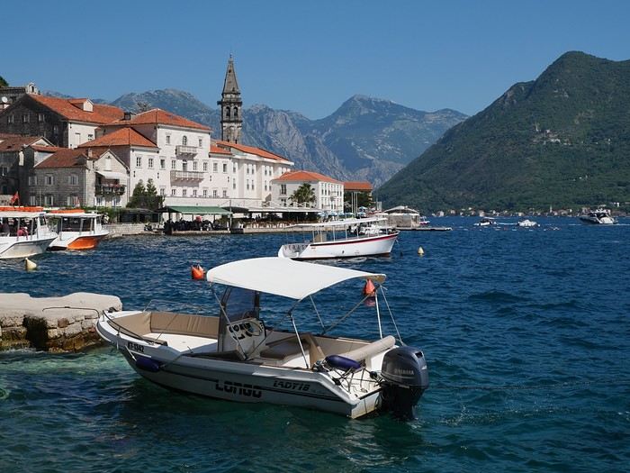
On the way back, we’ll drift into Bosnia-Herzegovina just to mix things up a bit!
We’re a little unsure about what to expect in terms of tourist crowds.
Dubrovnik has a reputation for being the hardest-hit city by overtourism, and Kotor and the whole Dalmatian coast aren’t exactly empty...
Luckily, most European countries haven’t started school holidays yet, and some measures seem to have been put in place to limit the flow (like restrictions on the number of cruise ships allowed to dock at the same time).
Maybe we’ll manage to escape the promised hell?
For now, we’re slamming the doors of the Scirocco and heading off to our first stop: northern Italy!
Namibia Travel Journal: May 2025 - Trip Review
NAMIBIA TRIP 2025: April 24 to May 20: Feel free to comment or ask us any questions about this amazing journey.
>> Find all our photos and videos for each day on our website here: www.montagne-aventure.net
**DAY 1: Thursday, April 24, 2025: Outbound Flights from Lyon to Windhoek via Munich - Visit to Munich:**

Off we go on a new adventure. The alarm rings at 6:30 AM, the travel bags are packed, and we head to Lyon Airport. We booked our flight tickets with Lufthansa. The first leg to Munich, Germany, is operated by AirBaltic. Departure at 1:05 PM for a 1-hour and 20-minute flight. We arrive at 2:30 PM.
**We now have a 7-hour layover, so we take the opportunity to get some fresh air and explore Munich.** We quickly exit Terminal 2 of the airport and head towards the subway. We buy a group day ticket "Airport-city Day Zone M-5," valid for 2 to 5 people at a price of 30.50 € (instead of 16.30 € per person). We take the S8 line to **Marienplatz** in 35 minutes. **This is the heart of the city.** The weather is overcast, quite cool, but dry. Perfect for a little city trip between two flights while leaving our large luggage in transit at the airport. **Munich is the third-largest German city after Berlin and Hamburg, in the Bavaria region.** **The center has a lot of charm and brings together several religious buildings, easy to explore on foot.** We are impressed by the number of people enjoying these 100% pedestrian streets, which are very pleasant. After Marienplatz, the most famous square with the town hall, we head to the Cathedral of Our Lady, a Gothic church, then continue to **Karlsplatz** and move on to **the food market offering a wide selection of high-end food products in an atmosphere where a certain art of living prevails.** We also visit St. Peter's Church before grabbing a bite to eat. Two good hours were enough for this 10 km city walk. It's time to take the subway back: by 6:30 PM, we are back at the airport. Now, it's time for a bit of waiting and rest. Our second flight is scheduled for 9:35 PM for a 9-hour and 30-minute journey to our final destination in Namibia: **Windhoek.**
> Round-trip flight tickets with Lufthansa from Lyon: 2029 €, or 1,014.50 € per person.
> Lyon Airport parking: 120 €
> Today's expenses: 7 € for 2 pizzas in France / 14 € for the restaurant in Munich / 30.50 € for the daily subway ticket in Munich.
**DAY 2: Friday, April 25, 2024: Arrival in Windhoek, Visit to the Namibian Capital:**
After a 9-hour and 30-minute overnight flight with Discover Airlines, we finally land on Namibian soil just before 7:30 AM. The day is breaking, and the colors are already stunning. We are eager despite the usual fatigue from the flight. The airline was punctual, with friendly staff and good meals, though a bit light. We are the first flight of the day to land, with no more than 15 flights per day here, from 7 AM to 8 PM. We disembark on the tarmac at this airport located in the middle of nowhere, **I finally set foot on African soil for the first time.** We exit among the first from the aircraft to go through the long formalities at the front of the line, as the wait can quickly become endless. Allow at least 5 minutes per person for e-visas. We still wait 45 minutes despite only about twenty people ahead of us. Phew, it's done. We collect our luggage and then withdraw money from an ATM. We make 4 withdrawals of the maximum amount, 2000 NAD $ per withdrawal, for a total of 380 €, or 95.33 € per withdrawal.
Our driver arrives at the same time, perfect timing, we were quick.
We leave the airport at 8:45 AM. By 9:30 AM, we arrive at the **Gracious Whisp vehicle rental agency**, located at the entrance of Windhoek, small and human-sized with a fleet of recent vehicles. More formalities, then a short wait as our vehicle is not yet ready. Time to decompress, catch our breath, and enjoy the very pleasant morning temperature. Not a cloud in sight. Next, a briefing on the vehicle, always with a bit of apprehension due to our approximate English. Allow 45 minutes of explanations, including setting up the roof tent, camping equipment, technical information in case of a flat tire, driving tips in Namibia, and a tour of the 4x4. We have all the necessary equipment for camping: mattresses, sleeping bags, pillows, table, chairs, gas stove, BBQ grill... as well as 2 spare tires, a compressor, a dual tank, and accessories for removing wheels. Off we go, it's time to muster our courage and get behind the wheel. **Heading to SuperSpar Maerua**, fortunately located less than 10 minutes away. We park with the help of a parking attendant; it's very crowded, the space is narrow, but everything goes well despite the cursed right-hand drive. Today's new mission: stock up on groceries. The store is well-stocked with local and imported products, catering to all tastes. We spend 114 € on groceries, from pasta to meat, BBQ lighters to dishwashing products. Two people load our groceries into two carts and transfer them to our vehicle; we feel compelled to leave a tip, 50 NAD $, as we don't have change yet. Now, we head to the hotel, 15 minutes away. Traffic is difficult at a complicated intersection; this will likely be the only traffic jam in Namibia. **We arrive at Kate's Nest Guesthouse & Backpackers around 1:15 PM, quite tired.** We take some well-deserved rest at this recent establishment, quite calm with secure private parking. After a short nap, we enjoy the quiet by the hotel pool. Night falls between 6:30 PM and 7 PM. We eat quietly in our room tonight before starting this long 4x4 road trip in camping mode in the heart of Namibia.
> Today's grocery expenses: 114 € at Super Spar Marua (2395.21 NAD $).
> Round-trip flight tickets with Lufthansa from Lyon: 2029 €, or 1,014.50 € per person.
> Vehicle rental: 4x4 Toyota with roof tent for 24 days: Gracious Whisp Car Rentals: 2,638 € (N$50,640) or **1,319 €** per person - (https://gwcarrentals.com/)
> Distance driven today: 15 km.
> Accommodation: Kate's Nest Guesthouse & Backpackers - 4 Aristotles Street Academia, 9000 Windhoek - 36 € for two for one night.
> Windhoek International Airport website: (https://www.airports.com.na/)
**DAY 3: Saturday, April 26, 2025: Windhoek to Hardap: Mariental Region - Kalahari Desert:**
After a good, restful night, we wake up leisurely around 7 AM. We enjoy the comfort provided by this first and last hotel before 24 nights under the tent.
**We leave Kate's Nest Guesthouse at 8:30 AM to tackle the Namibian roads.** We quickly leave the capital; in just 30 minutes, we find ourselves almost alone in the world. The landscape is dotted with small domes. We leave the **paved B1** quickly to turn left onto the **C15**. **From there, we won't see more than 10 vehicles all day.** After passing through the few houses of **Lekkerwaterpoort**, we tackle our first gravel road. These road sections are limited to 100 km/h, but even at 70 km/h, I find it already challenging. However, I quickly get used to it and gradually pick up speed to reach my cruising speed of around 80 to 90 km/h. **We are on immense straight lines crossing wild expanses as far as the eye can see.** **We come across two baboons, a few ostriches, and numerous cattle and sheep farms.** We pass through the charming village of **Uhlenhorst** with its typical houses and children with broad smiles waving at us. Life here is already very different from Windhoek. **The thermometer rises quickly from 16°C at 8:30 AM to over 28°C in the early afternoon.**
**We arrive at the Hardap Dam reserve at 2 PM.** We stop at the toll booth at the park entrance to pay the entrance fee: 250 NAD $ for 2 people and 1 vehicle. We continue to the dam and then the camp entrance, located a bit further. We had booked in advance, but this place remains little frequented by foreigners.
We take advantage of the hottest hours to rest by the large pool overlooking the immense lake, a very enjoyable moment. Would this be a bit of a vacation?
Around 4:30 PM, we head to the campsite. We overlook this vast water reserve. We arrive first; we will be only 3 vehicles spending the night here. It's time to get to work and set up our equipment for the first time. It takes us a good 20 minutes to set everything up, with a slight apprehension about unfolding the tent. Once this task is done, which we will have to repeat for almost a month, we will become much more efficient over time. Time for rest and contemplation in total silence. The sun gradually sets, and the heat quickly becomes bearable again. Bliss! **This dam is located 20 km northwest of Mariental in an area dotted with conical hills topped with dolerite buttons (Hardap means "hillock" in Nama). It captures the Fish River, which flows south, creating a large lake in the middle of an arid environment. The contrast is striking.** We enjoy our first sunset facing this 360° otherworldly landscape.
Around 7 PM, we start our first BBQ, or "braai" as it's called here. The temperature is perfect. The sun sets, giving way to a star-filled sky of incredible beauty thanks to the absence of any light pollution. The Milky Way will lull us throughout the evening. After some good sausages and potatoes on the BBQ, we head to our roof tent around 9:30 PM with a complete change of scenery in just 24 hours. France already seems so far away...
This campsite has shared showers and toilets, quite clean and functional, as well as a central area with several BBQs and tables. The sites are arranged in a semicircle, each with an electrical outlet. The sites are close to each other but spacious, some slightly shaded. We are only three vehicles tonight, so it's perfectly comfortable and quiet. Not to mention the large pool near the restaurant. Our trip is off to a great start.
> Today's road itinerary: Windhoek > Head south on the B1 to Rehoboth > Turn left onto the C25 then C15 to Stampriet > C20 to Hardap > Full north on the B1 > Then turn left onto the M93 - 5 hours of driving.
> Distance driven today: 354 km.
> Accommodation: Hardap Recreation Resort - 23.3 € for two - Large pool - GR6W+3M2, Hardap Game Reserve, Mariental, Namibia - (http://www.nwr.com.na/resorts/hardap-resort/)
**DAY 4: Sunday, April 27, 2025: Hardap - Brukkaros Volcano - Keetmanshoop - Quivertree Forest Rest Camp**
Our first night under the tent was very pleasant; the little wind quickly calmed down, giving way to absolute silence. The mattress is decent, more comfortable than some nights in Nepal. The length and width give us enough space for maximum comfort, despite my height (1.91 m). We wake up a little before 7 AM as the sun rises, and the lights dazzle us from the start of the day. We pack up the equipment in 30 minutes, quite easily. Then we enjoy the sun, which warms up quickly while we keep our light fleece on.
At 8:30 AM, **we hit the road again, heading south** to our first stop in **Mariental**. We want to do some shopping at SuperSpar, but once we arrive in the parking lot, a young local is fighting with the supermarket security guards and then threatens to throw stones. We don't want to take any risks right at the start, so despite the baton blows he receives, he doesn't stop. We leave empty-handed but fill up with fuel at the Shell station 1 km further. The price per liter is 21.33 NAD $, we fill our 107-liter tank for 107 €. In Namibia, you get served, and they bring the card machine to the window to pay. It's then customary to leave a tip.
We then take the B1 heading due south on a recently renovated road. Around 11:30 AM, we leave it on our right to take **a wild gravel road, the M98**. Just before **Berseba**, we turn right onto a small track, the **D3904 towards Brukkaros Crater up to a camp at 1588 m altitude**. The track then becomes too bumpy. We stop on the counter-slopes where **a wide panorama unfolds over these immense plains as far as the eye can see**. It's 12:15 PM, time for us to eat a rice and tuna salad facing this landscape.
**We are alone in the world until a vehicle arrives and parks next to us.** A bit of apprehension, 4 men head towards us. It turns out to be 4 shepherds looking for a lost foal. The conversation is pleasant, lost in the middle of nowhere. We find ourselves alone again in this absolute silence. **The heat becomes stifling with a good 30°C**. We get back on the road around 1 PM. Back on the B1, **we continue due south to Keetmanshoop**, which we reach around 3 PM. We stop there to do some shopping for 262 NAD $ (12 eggs, a can of tuna, a can of corn, bread, a soda, and a 5-liter water container), or 12.48 €. Two quite insistent children ask us for money or candy at the store exit, yet we give them a small tip, but they continue to cling to the car. Locals parked next to us tell them to leave us alone. Anyway, we finish the trip to **Quivertree Forest**, 15 km away. We will spend the night in this **pleasant farm run by a German**. Upon arrival, as the day before, and as I suppose in the future, we dive straight into the cool pool to relax after all these kilometers. A bliss. Then we take our 4x4 and choose a spot near these famous trees. After the 33°C this afternoon, once 4 PM passed, the temperature drops again and becomes very pleasant. **We are in the middle of the Kokerboom, one of the most interesting and characteristic plants of hot and arid regions. It's not really a tree but a variant of the aloe plant whose botanical name is Aloe Dichotoma. This Kokerboom has a smooth and thick trunk reaching up to 1 m in thickness and 9 m in height. They bloom for the first time at the age of 20 to 30 years.** The flowers are yellow and reach about thirty centimeters during the season between June and July. **They grow mainly in an environment with a high concentration of black rocks absorbing a large amount of heat (38°C). The rocks also serve to anchor the tree with its tentacle-like roots. It also resists frost. Each is between 200 and 300 years old.**
Around 5 PM, we walk to the farm reception to watch the feeding of **two cheetahs**. Magnificent carnivores taking their time to savor their piece of meat. **Then we return near our campsite to enjoy the sunset among these trees. The colors are sublime, as every evening apparently. A magnificent spectacle with colors evolving from yellow to orange then to pink, before giving way once again to a sky filled with thousands of stars.** Our campsite at Quiver Tree Forest Camp is very comfortable; we have a water supply, a stone table, a small lamp, an electrical outlet, a small tree for shade, and a BBQ that we won't use tonight; we'll cook on gas. The sites are far apart, with some shared facilities scattered around, a very beautiful setting. No reservation possible, no need, just show up directly. **The campsite accommodation for 2 people costs 28 €, including the reserve entrance fee of 5 €**. We finish this second bivouac evening around 9:30 PM, time for some reading and sleep in peaceful silence without wind.
> Today's road itinerary: Mariental > B1 heading south to Brukkaros > At Tses turn right towards Berseba via the M98 > Turn right onto the D3904 > 8 km > Brukkaros Volcano (stop at the lower camp as the track is difficult for 1 hour) > Keetmanshoop > Turn left onto the M29 > Quivertree Forest - 4 hours of driving.
> Distance driven today: 371 km.
> Distance walked today: 6 km.
> Today's expenses: Groceries for 12.48 € (262 NAD $) / Fuel for 107 € (1 liter of diesel for 21.33 NAD $).
> Accommodation: Quivertree Forest Rest Camp, P.O. Box 262, Keetmanshoop, Namibia - BBQ, hot showers, toilets, and electricity - No reservation - Pool - 18 €/Person (N$ 340.00 with park entrance) - (http://www.quivertreeforest.com/)
**DAY 5: Monday, April 28, 2025: Quivertree Forest Rest Camp - Giant's Playground - Keetmanshoop - Fish River Canyon - Canyon Roadhouse:**
After an excellent start to the night, we are woken up by the wind shortly before 6 AM, but the sunrise is not far off. We get up at 6:30 AM to enjoy it. The atmosphere is a bit cooler this morning, but the reward is already here.
The adventure continues. At 7:45 AM, we head towards **Giant's Playground**, 4 km away. We take a 3-kilometer walk through this expanse of blocks and igneous rocks.
We continue south at 8:45 AM, passing through Keetmanshoop again where we do some shopping for 25 €, a big stock-up for a good part of the trip: meats, canned goods, pasta, fruits... At 9:30 AM, we take the B4 to Fish River Canyon.
At 11:30 AM, we arrive at the entrance to the NWR park (350 NAD $ entrance for 2 people and 1 vehicle). The track becomes bumpy immediately upon entering the park. After about ten kilometers, we come upon this landscape carved by nature. In the end, it's well worth the detour. We were at the Grand Canyon in the USA exactly (https://www.montagne-aventure.net/2024/04/29/j21-3-juin-2024-grand-canyon-et-lac-powell/) and can thus confirm that this Fish River Canyon is comparable. We make several stops along the southern flank. **Here, nothing is developed; nature is almost in the wild state.** **With 160 km in length, up to 27 km in width, and a depth of 150 m, it is indeed the second-largest canyon in the world.** The history of the canyon is apparent in its different earth layers and stratification: the antiquity of the place is tangible, and the absence of vegetation is surprising. **It consists of two nested canyons, formed at distinct periods. The first distinct layer of schist, sandstone, and eruptive material surrounding the canyon was formed a few two billion years ago, then transformed due to heat and pressure into more solid rock such as gneiss. The inner canyon, carved more recently by the Fish River, has a depth of 270 m.**
We have a picnic once again alone in the world facing this grand panorama at the **Sulphur Spring View Point**. This is where the hiking trail begins, plunging into this narrow canyon, but it is forbidden to venture there alone without a guide. It's 30°C, but a slight wind makes the atmosphere bearable. At 1 PM, we retrace our steps and continue to the **Main View Point** then to the **Hikers View Point**.
In the south of Namibia, the Fish River Canyon, 160 km long, is a true geological wonder: a canyon nested within another canyon, one of the largest in the world. The first sedimentary layers formed two billion years ago; 500 million years ago, a period of tectonic activity caused these layers to crack and tilt, opening a vast canyon in the Earth's crust. The second canyon, with a depth of 270 m, was carved over time by the passage of the Fish River in this new valley.
At 3 PM, we arrive at our very charming camp for the evening, the **Canyon Road House**. We fill up with fuel right away because tomorrow we have a long day of isolated driving: 55 liters for 1240 NAD $. Then we settle into the campsite we had previously reserved in France. We are assigned site 2, very well set up under a tree with its BBQ and stone table just steps from the pool. We quickly set up the tent and jump straight into the pool for the relaxation moment of the day. As usual, the water is quite cool, but it's a real pleasure. Then we stroll around this Canyon Road House, which recreates the atmosphere of the roadside inns of the 1950s with old car wrecks and vintage gas pumps in a bygone era. **Around 5:45 PM, we start a short walk leading us to the top of a hill overlooking the wide plateau where we are to watch the sunset.**
And finally, to end this beautiful day, it's time for the braai, with grilled sausages and white beans on the evening menu.
> Park entrance: 150 DN/person + 50 DN/vehicle (18 € for two). It is possible to enter at two access points: Hobas in the north and Ai-Ais in the south.
> Today's road itinerary: M29 > Keetmanshoop > B1 > B4 > C12 (track) > After Holoog turn right onto the D601 (C37 track) > Accommodation on our right (stop just to check in before 6 PM) > Continue 30 km (30 minutes of track) to the viewpoints after Hobas where you must pay the entrance fee. Sunset View Point to the left > Return before sunset as the park closes (best lights at sunrise). 3 hours.
> Distance driven today: 228 km.
> Distance walked today: 10 km.
> Today's expenses: 25 € for groceries / 17 € for the Fish River Canyon park entrance / 58 € for fuel.
> Accommodation: Canyon Roadhouse, Gondwana Collection Namibia – 34.4 € for two - Pool - Near Hobas - (http://www.gondwana-collection.com/fr/accommodation/canyon-road-campsite)
**DAY 6: Tuesday, April 29, 2025: Canyon Roadhouse - Orange River - South African Border - Vista Trail - Gondwana Sperrgebiet Park - Aus:**
The night was excellent in this very comfortable campsite. **We wake up to the sound of birds** before the alarm at 6:45 AM. Our little morning routine starts as the sun rises. **A big day of driving awaits us to the South African border. This will be the southernmost point of our journey.** We hit the road at 8 AM via the C37, pass through **Hobas**, then turn onto the D207 to **Aussenkehr.** **We cross a mountainous barrier with some high peaks and perfect cones. The rock varies from orange to pink to black.**
We then cross a lunar desert as far as the eye can see on a giant dome; the track winds through nowhere without meeting anyone for hours. The landscapes are surprising. **We spot several ostriches and a gemsbok.** In the middle of this endless expanse, we come to an improbable intersection and continue right onto the D278.
In the middle of these arid lands, we come across a green zone: a vast vineyard. At 10:30 AM, **we come across a "Road closed" sign, fortunately, a local resident waves us to continue; a bit stressed, we proceed.** We start to follow the beautiful Orange River. On the other side of the bank, just a few meters away, South Africa is there. It is the second-longest river in Southern Africa, after the Zambezi. It flows over 2,000 km to the Atlantic. After passing through narrow gorges, we regain altitude before starting the descent, gently heading back north.
**We now cross and follow the Fish River, which joins the Orange River further south** **along this gorge dating back millennia.** At exactly noon, we take a lunch break by the Fish River, still without meeting a soul in this landscape between greenery and aridity. The temperature here is cooler with a pleasant 23°C on the banks, the perfect spot. **We continue on the track to Rosh Pinah**, where we find a paved road again. **The section along the Orange River and the Fish River was officially closed, but we were able to pass without any issues, avoiding a detour of at least 3 hours.** Phew. We now drive at high speed (limited to 120 km/h) through these vast spaces. We come across many ostriches after the **dozens of monkeys along the Fish River**. Around 3 PM, 3 km after the very small town of **Aus**, we reach **our campsite for the evening at Klein Aus Vista**. A new **small peaceful haven very well set up**. As usual, after checking in at reception, we jump straight into the beautiful pool to get our well-deserved dose of coolness, another good thermal shock that our bodies appreciate. Once this moment of relaxation is over, we take our 4x4 to reach the campsite located a bit higher, set apart at the foot of a hill that overlooks us.
After setting up, **around 5 PM, we head to the Vista Trail to climb to the top of a mountain overlooking the vast plain that surrounds us at 360°**. It takes about 30 minutes to climb. The place is just magical, **the perfect viewpoint to admire the sunset**. **We fully savor the moment. We also spot one of the few wild horses in the world capable of living in the desert.** Their numbers have decreased in recent years due to predation and drought (around 100 to 150). At 7 PM, we return to the camp, time for the braai and preparing the meal in this peaceful little camp.
In the south of Namibia, the Fish River Canyon, 160 km long, is a true geological wonder: a canyon nested within another canyon, one of the largest in the world. The first sedimentary layers formed two billion years ago; 500 million years ago, a period of tectonic activity caused these layers to crack and tilt, opening a vast canyon in the Earth's crust. The second canyon, with a depth of 270 m, was carved over time by the passage of the Fish River in this new valley.
> Today's road itinerary: 5 hours of driving: D324 heading south (track) > turn right onto the C10 (track) > D316 heading south > turn right onto the C13 > In Aus turn left onto the B4 > Campsite via a track on the left.
> Fuel station: Solitaire or Aus.
> Distance driven today: 398 km.
> Distance walked today: 7 km.
> Accommodation: Klein-Aus Vista Desert Horse Campsite - Farm Klein-Aus No 8 on the B4 main road to Luederitz Aus 9000, Aus, Namibia - (http://www.klein-aus-vista.com/accommodation/desert-horse-campsite/) 17908 420 DN - Water + Shared shower (hot water). No electricity.
**DAY 7: Wednesday, April 30, 2025: Aus - Kolmanskop - Diaz Point - Luderitz - Kanaan Desert:**
We wake up around 6:45 AM, with partly cloudy weather for once; we feel the ocean's influence gradually. But the sun isn't far off. At 7 AM, we leave the campsite heading west towards Luderitz via the B4. **First stop of the day: Kolmanskop, the ghost town we reach at 8:30 AM**, entry costs 180 NAD $ per person. We discover this **timeless place** in 1.5 hours, moving from building to building amidst violent sand-laden gusts of wind. There's a lot of charm in these different living spaces. **The sand quickly reclaimed the place after this mining town was abandoned.** This was once the headquarters of Consolidated Diamond Mines. It's hard to believe that this former town, where the diamond industry once flourished, had a hospital, a bowling alley, and a theater. The decline in diamond sales after World War II and the discovery of richer deposits put an end to this golden age. By 1956, the town was already completely deserted, and the sand had reclaimed its rights. **These dilapidated buildings swallowed by shifting dunes have something surreal about them.**
At 10:15 AM, we hit the road again **heading to Luderitz, 22 km away**, and first to **Diaz Point** **facing the Atlantic Ocean**. It's a wind-swept peninsula with its characteristic red and white lighthouse. There's a campsite and a coffee shop on site, but the place doesn't inspire rest without shade or shelter from the wind. We return to the city via the D701 track that runs along the ocean, be careful at low tide. We come across **a few fishermen and a fox as well as flamingos.**
We walk through the few streets of the city, much smaller than I imagined, then climb to the **famous little Lutheran church that overlooks the city, the Felsenkirchr.** **The wind blows very strongly here, and the sand is omnipresent, surrounded by the Namib Desert and the southern Atlantic coast.** **A German colonial relic barely touched by the 21st century, Luderitz seems frozen in the past, giving it both a gloomy and a certain charm. In short, it's certainly one of the most incongruous places in Africa.**
At 1:15 PM, just before leaving Luderitz, we do some shopping for 20.50 € and fill up with fuel: 61.50 €, 1290 NAD $ for 61 liters (21.18 $ per liter).
**We return via the B4 to Aus** (paved), **then via rougher tracks**, the C13 then the D707, magnificent as it runs along a mountain range with multiple colors on our right and an endless flat desert on the other side.
To access our campsite for the evening, we must take a **narrow private track for 7 km** on our right to emerge, in this total vastness, at the **isolated Kanaan Desert Retreat on a small hill**. I don't have time today to jump into the pool near the reception; we arrive at 5 PM at 8 small, isolated, and unique sites with a small kitchen, a shower, and a private toilet under a small tarp shelter. **A crazy charm with a unique view...** **This will be my favorite accommodation of this trip. The photos speak for themselves.** We jump into the outdoor shower while savoring the landscape, then prepare our evening braai while enjoying the colors fading, facing this plateau with bushes turning a vivid orange. **A moment that will remain etched for life.** **Savanna atmosphere under a thin emerging moon. Every minute offers different colors. Facing our meal, we have a natural giant screen.**
We end this day contemplating the stars and admire this thin orange moon setting on the horizon (8:42 PM).
**Ghost town just before Luderitz: Kolmanskop** (open from 8 AM to 3 PM - N$ 180 p.p – 9 €). Once, Kolmanskoppe was organized around diamond mining. After finding new, more prolific spots, the town was abandoned and is now a ghost town. The sand and dunes have reclaimed their rights and buried everything humans had built. Houses, train station, bakery, everything has been covered by sand, which passes through the windows, even though they are 1 meter high.
> Today's road itinerary: 5h30: B4 to Luderitz (paved) > Round trip > Kolmanskop on the left > Return via the previous campsite > Then C13 (track) > Turn left D707 (track) > Then track to the right to the campsite.
> Distance driven today: 438 km.
> Distance walked today: 8 km.
> Today's expenses: Groceries at the Spar in Luderitz for 20.50 € / Fuel fill-up in Luderitz for 61.50 €.
> Official Kolmanskop website: (https://kolmanskuppe.com) (open from 8 AM to 1 PM - N$ 180 p.p – 9 €).
> Accommodation: Night at the south of the Namibrand Nature Reserve: Kanaan Desert Retreat – 26.5 € for two - (http://www.kanaannamibia.com/) - Farm 104 Karas 9000 - Sanitary facilities + BBQ + Water + Pool - No electricity - My favorite accommodation of this trip.
**DAY 8: Thursday, May 1, 2025: Kanaan Desert Retreat - Namib Desert - Crossing the Namibrand Nature Reserve – Sesriem Canyon - Elim Dune - Little Sossus Lodge**
After a cooler night than the previous ones with about 10°C, we wake up around 7 AM. We admire, as usual, the sunrise between the desert and the mountains. **The spot from last night was truly perfect, isolated from the world, in total serenity, with a wake-up call to the sound of birds.**
We hit the road a little after 8 AM, heading north via the D707 to Spes Bona, then the gravel road C27 via Betta to Sesriem. **The landscapes roll by and dazzle us.** **We are right in the heart of the Namibrand reserve**, coming across numerous **zebras**, **impalas**, **ruminants that reproduce in large numbers**, and **gemsboks**. At noon, we stop in the shade of a tree to eat. The spot is so romantic facing orange arid mountains and a vast green plateau. **A landscape full of contrasts, timeless and silent.**
**The Namib Desert is the oldest on the planet; its name means "vast arid plain," and it also gave its name to the entire country: Namibia.** The majority of these arid and semi-arid lands dotted with viewpoints are part of the Namib-Naukluft National Park, which covers 23,000 km².
At 1 PM, we enter the Sossusvlei park. We start with the **Sesriem Canyon**, which is 3 km long and 30 m deep. We enter it with a short 1-hour hike into its depths. **It was carved by the Tsauchab River in an agglomerate of sand and pebbles over 15 million years old.** We retrace our steps back to Sesriem, which means "six belts," referring to the number of leather belts (from ox wagons) needed to draw water from the canyon. This remote locality is mainly the gateway to Sossusvlei but offers a gas station and some accommodations. For our part, we sleep 40 km away tonight.
**We then move on to Elim Dune.** It takes about 45 minutes of walking to reach its summit, and the climb is very breath-taking as we progress in the sand where we almost slide back with each step. **A first grand 360° panorama unfolds. The ochre color of the sand contrasts completely with the yellow plain and the brown and black mountains in the distance.**
At 3:15 PM, we start the descent facing Sesriem. We were completely alone once again on this dune. **These Namib dunes are composed of colored quartzite sand, presenting hues ranging from cream to orange and from red to purple. Unlike the ancient dunes of the Kalahari, these move with the wind and adopt distinct, ever-changing shapes.** Star dunes resemble stars seen from above, while transverse dunes, like those on the coast south of Walvis Bay, stand perpendicular to the prevailing southwest wind. The most stable dunes, which thus have the most vegetation, are parabolic dunes, due to the variability of the winds. Longitudinal (seif) dunes measure up to 100 m in height, while barchan dunes, crescent-shaped and predominant at the extreme north of the Skeleton Coast and south of Luderitz, are the most mobile, created by unidirectional winds.
**We get back on the road for 45 minutes to our campsite for the evening, Little Sossus, which we reach at 5 PM**, via C27 then right onto C19. As often upon our arrival, I jump into the cool pool to relax after all this driving, then we proceed to set up the camp. As the day before, the campsite consists of 10 fairly distant sites, with private sanitary facilities and a small roof. We are delighted with this crazy charm. The hot water for our shower is wood-heated: a Namibian lights it every evening around 5 PM.
For a change, or not, the menu features a small BBQ with pork ribs and pasta, facing another sunset, this time with partial cloud cover giving equally splendid colors. Time for a well-deserved rest after long corrugated tracks covered in our 4x4 today.
> Today's road itinerary: 4h45 of driving: Find the D707 and head north (track) > At Spesbona turn left onto the C27 (track) > At Sesriem after entering the park, turn left following View Point Sesriem > Continue 4.5 km to the Sesriem Canyon Parking > Return then head towards Elim Dune > Exit the park then take the D826 > Turn right onto the C19 heading SE > Turn right facing the D854 to the campsite (campsite closes at 7 PM).
> Distance driven today: 272 km.
> Distance walked today: 8 km.
> Today's expenses: Entry to the Sossusvlei Namib-Naukluft Park: 17 € for two (with one car).
> Accommodation: Little Sossus Lodge – 35 € for two - At the junction of the C19 and D854 roads Maltahohe 9000, Maltahohe, Namibia - (http://www.littlesossus.net/) - Pool + Private bathroom + Hot water + Electricity + BBQ + Grocery store (bread to order the day before).
**DAY 9: Friday, May 2, 2025: Little Sossus Lodge - Namib-Naukluft National Park – Sesriem - Sossusvlei - Big Daddy – Deadvlei - Tsauchab River Camp**
Today we start the day early to tackle **the famous dunes of Sossusvlei at first light**. The alarm goes off at 6 AM to leave the camp at 6:45 AM. The wind is blowing quite strongly in gusts this morning, but it only woke us up a quarter of an hour before sunrise. The park opens at 7:15 AM. We start with a small encounter: a friendly **jackal lounging by the roadside.**
We first have to cover the 40 km of track to Sesriem, pay the entrance fee (350 NAD $), and drive 65 km on a paved road this time to reach the **vast salt pan (a lake whose sediments are made of salts) of Sossusvlei**. **It appears amidst the gigantic red dunes that rise on either side. The wind constantly changes the shape of the dunes, as well as their colors, which vary with the light. The setting is breathtaking, giving an impression of immensity and timeless grandeur.**
The paved road ends; the last 4 kilometers become technical and are reserved for 4x4s. Phew, I pass without any problems, though not without stress, switching to L4 mode. **We start the ascent to Big Daddy at 8:45 AM, 325 m of elevation gain in the sand nonetheless.** We climb at an excellent speed despite the strong wind, in exactly 1 hour. At 9:45 AM, we are at the summit of what will remain etched for a long time. The 360° view is simply unimaginable; you have to experience it to believe it. The wind blows violently up there, **it feels like being in the high mountains, on a snow ridge, with a strong transport of sand. The atmosphere is magical.** We start the descent running barefoot in the steep sand.
**We then move on to its neighbor, Deadvlei.** **Here, petrified trees stand in the "vlei" (basin) with their dried branches casting desolate shadows on the white ground. The juxtaposition of the deep blue sky and the towering dunes is captivating.**
We return to the 4x4 parking at 11 AM, the stress rises again for the sandy track passage. We retrace our steps and stop at **Dune 45**.
At noon, we take the opportunity to picnic at the foot of **the beautiful Dune 40**, where there is already no one left. We enjoy the quiet again, well, almost, as the wind remains omnipresent.
At 1 PM, we return to **Sesriem**, where we fill up with fuel (21.15 NAD $ per liter), totaling 1630 for 77 liters (78 €), and do some shopping for 245 NAD $ (two nice pieces of pork, 2 cans, 2 sandwiches for tomorrow, and 1 soda), which is 12.48 €. It's 27°C. We hit the road again, heading to a new destination at 2 PM. We take the C19 back to Little Sossus where we spent the night, then turn left onto the gravel road D854 for about 40 km to **Tsauchab River camp**. Finally, we won't be sleeping here; we are redirected 7 km downstream to **Naukluft View Camp**, which also belongs to Tsauchab River Camp.
We arrive at 4 PM, and thankfully, the fatigue was starting to set in. **Our campsite is located under a small forest, providing some protection from the wind that blew strongly all day. The calm does us a world of good. Once again, a lot of charm**, with very spaced-out sites without any visibility. We can't wait to take our shower. It will be possible from 5 PM with, as the day before, water heated by a wood fire. Time to prepare the campsite for the night. And on the menu, a braai with two superb pieces of pork bought in Sesriem and fries!!!!
**The Namib Desert**
An impressive coastal desert stretching from the Atlantic to a high plateau inland, the narrow Namib Desert runs along the southwest African coast for about 1,300 km. **Considered one of the oldest deserts in the world**, it is bordered to the north by the Kaokoland Desert, which extends into Angola, and to the south by South Africa's Karoo. The narrow Namib is mostly less than 160 km wide. Despite this, it is considered to consist of three sections: the coastal strip influenced by the Atlantic; the Outer Namib, occupying what remains of the western half; and the Inner Namib, comprising the eastern half of the desert. Generally called the Skeleton Coast, the coastal Namib receives almost no rain and depends on regular marine fogs for moisture. From sea level, the terrain rises to 900 m, where the desert meets the base of the Great Escarpment to the east. In the Inner Namib, average annual rainfall is only about 50 mm.
The dryness is such a characteristic of the Namib that it is thought to have been in this arid state for at least 55 million years. It is all the more surprising to learn that animals such as vipers, geckos, zebras, and elephants live in this desert. Some areas of the Namib are also rich in flora, including Welwitschia mirabilis, which grows near the ground with seemingly exhausted leaves, extracting moisture from marine fogs and can live over 1,000 years. In the southern Namib, some dunes are up to 32 km long and 240 m high.
**The frequent fog of the Skeleton Coast:** Driving north along the coast of Namibia, the cold Benguela Current in the Atlantic cools the moist air above the ocean, which, upon meeting the warm desert air, leads to the formation of thick fog banks that drift up to 100 km into the center of the Namib before evaporating under the sun.
> Today's road itinerary: 4 hours of driving: C19 towards Sesriem (track) > D826 (paved) > Foot of Big Daddy via a technical sandy track > Return via the same route > D854 to Tsauchab.
> Gas station: Sesriem.
> Distance driven today: 254 km.
> Distance walked today: 12 km.
> Today's expenses: Park entry at Sesriem for 2 people: 17 € / Fuel fill-up: 78 € / Groceries at Sesriem gas station: 12 € (245 NAD $).
> Accommodation: Tsauchab River Camp - Naukluft View Camp - D054 & D850 GPS: S24 26' 37" E16 10' 11" Sossusvlei 22007, Maltahohe, Namibia - BBQ + Private sanitary facilities + Water - www.tsauchab.com
**DAY 10: Saturday, May 3, 2025: Tsauchab River Camp - Naukluft National Park - Olive Trail Hike (10 km) - Ababis Guest Farm**
We pack up the camp at 8 AM and continue our road trip north via the D854, a bumpy track with many corrugated sections. It's cool this morning, 12°C.
**We enter the Naukluft massif, discovering landscapes with very different terrain than before.** We first need to check in at the campsite, 13 km from the entrance at the end of the track: 350 NAD $ for 2 people and 1 vehicle, then return 4 km back. **On the agenda is the lovely Olive Trail, a 10 km hiking loop that starts 4 km northwest of the park office**, along the D854 that we follow. At 9:45 AM, the hike begins with a fairly steep ascent (about 45 minutes) among the **wild olive trees** from which the trail gets its name. **At the summit, we enjoy a view that embraces the Naukluft Valley.** We then turn east and gradually descend into a deep valley, passing over sometimes slippery rocks. We have a snack around 11:30 AM in these small gorges. **Further on, to cross the wall of a canyon in front of us, some chains are fixed to the rock to help us pass.** We finish this superb loop clockwise at 1:15 PM, taking 3.5 hours including 30 minutes of breaks. We only crossed a small group of 3 people on this wild adventure far from everything. At 1:45 PM, we exit the park and take the **D854 track north to Bullsport**. From there, we turn left and take the C14, which **runs along the bed of the Tsondab River.**
**We arrive at our campsite for the evening, Ababis Guest Farm, at 3 PM.** Quite early for once, allowing us to rest a bit in this peaceful farm where many sheep wander around us. We also enjoy the pool under a magnificent sun, less hot than the previous days, it's 22°C. The camp has only 4 spaced-out sites around shared sanitary facilities. **We are in the middle of a vast plain facing the Naukluft massif mountains.** We will have another beautiful sunset on these mountains. For the first time on this trip, **we will be completely alone at this campsite.** **We haven't encountered many people today**, just 3 during the hike and fewer than 10 vehicles all day.
> Today's road itinerary: Head north on the D854 (track) > Turn left to enter the Naukfluft National Park > Continue on the track then turn right to the Olive Trail hike parking lot (1 hour for 45 km). Return to the D854 and continue north > At Bullsport turn left onto the C14 to Ababis (still a track) > The camp is located on the left facing the D1261 (1 hour for 60 km from Olive Trail). Total: 2 hours of driving for 100 km.
> Gas station: No gas station on the route, except in Solitaire.
> Distance driven today: 115 km.
> Distance walked today: 13 km.
> Accommodation: Ababis Gaestefarm - Night booked by email – payment on site: (https://www.ababis-gaestefarm.de/) - P.O.Box 1004, Maltahöhe - N$ 300.00 per person
**DAY 11: Sunday, May 4, 2025: Ababis Gaestefarm - Namib-Naukluft National Park – Solitaire - Gaub Pass - Kuiseb Canyon - Moon Landscape - Walvis Bay**
The night was, for the first time since the start of this road trip, quite difficult. A strong wind accompanied us all night, making the tent flap constantly. A racket that drove us crazy. We still managed to sleep a few hours. The morning sun brings back our smiles. We hit the road for this new stage a little before 7:45 AM.
We start the day with a first stop less than 15 km away **on the C14 in Solitaire** at 8:15 AM. **This town is lost in the middle of nowhere with its small gas station with a western atmosphere adorned with rusted and sand-covered car wrecks.** After a quick supply stop: 86 NAD $, or 4 € for 1 water container and a box of cookies, we continue north still on the C14, **crossing the Tropic of Capricorn** then devouring this **magnificent track up to Gaub Pass**. **A succession of narrow gorges, turns, climbs, and descents breaking the monotony of the previous long straight lines.** We are right in the heart of no man's land for 200 km. We then start the descent to the **Kuiseb Canyon. It houses the wide bed of the eponymous river, dry almost all year.** Even when it flows for 2 to 3 weeks during the rainy season, it doesn't go beyond Gobabeb and then seeps into the sand. **The drinking water that supplies Walvis Bay is pumped at Rooibank from this underground water table.** **We now cross the Kuiseb Desert where impressive dunes roll down.** We make a short stop at a **natural rock arch** reminding us of our (https://www.montagne-aventure.net/2024/04/29/j19-1-juin-2024-canyonlands-national-park-et-arches-national-park/). Then we gradually descend towards **Walvis Bay** where we will spend the night. At noon, we enter the **Dorob National Park**. The thermometer drops 10°C in 10 minutes as we get closer to the Atlantic Ocean.
At 12:45 PM, much earlier than initially planned, we arrive at the **Moon Landscape** (View Point 4, free) to have a snack, via a very recent surprising dual carriageway in the middle of nowhere, then via the C28. We are again in the hinterlands, the temperature has soared: 30°C without a bit of shade. Even if the colors and the panorama must be exceptional at sunrise or sunset, the detour for this 360° panorama is still worth it. Extreme aridity as far as the eye can see. The place lives up to its name; it really feels like being on the moon. We get back on the road at 1:30 PM via the D1991, C28, then again the A2, which is very new. The latter runs along the beautiful dunes up to the **Dune 7**, where we make another stop.
Then we head towards our final destination of the day, **Walvis Bay. Its port is sheltered by a sand spit, a natural breakwater that protects the city from the powerful assaults of the ocean. Its port was long a strategic place: claimed by the Cape Colony in 1795, it was officially annexed by the British in 1878 to counter Germany's ambitions in the region. A colony of fur seals, pelicans, flamingos, and whale terns have made it their home.**
We do a big grocery shopping at the Spar located in the center for 66 €; it's very easy to park there. Then we fill up with fuel at an Engen station right across for 1117 NAD $ for 54 liters (20.6 NAD $ per liter), which is 54 €. We then **enjoy the seaside in the Lagoon neighborhood**, where it's also easy to park. After kilometers in the desert, **this cool break is more than welcome. The outside temperature is 22°C. In the distance, we can clearly see the clouds lingering over Swakopmund.**
We take the 4x4 one last time to the **Lagoon Chalets where we will spend the night**. The spot is well set up and surprising in the heart of a residential neighborhood. The sites are quite large, separated by fences around very comfortable shared sanitary facilities. BBQ, electricity, and shaded area. We settle in quietly before going out on foot to watch the **sunset over the Pacific Ocean along Lagoon Promenade Road**. We can still see this impressive persistent mist in the distance. The neighborhood is very peaceful, certainly without much charm, but with a very well-developed seafront that inspires relaxation after kilometers without meeting anyone in inhospitable lands. We end the day with our traditional braai: grilled chicken thighs and sautéed potatoes in the coolness of a starry sky.
> Today's road itinerary: 5h30 of driving (or 3h30 of driving for 250 km without the Moon Landscape): Head north on the C14 > Cross the Tropic of Capricorn > Gaub Pass > Kuiseb Canyon on our left in a round trip > Continue to Green Valley and leave the C14 to the right on the D1984 > Turn right on the C28 > Then left D1991 to Moon Landscape D1991 View Point 4 > Return via the same road and stop at Dune 7 for sunset > Walvis Bay.
> Gas station: Solitaire or Walvis Bay.
> Distance driven today: 372 km.
> Distance walked today: 5 km.
> Today's expenses: Fuel fill-up for 54 € + Groceries for 66 € at Spar.
> Accommodation: Walvis Bay: Lagoon Chalets – 36.6 € for two - (http://www.lagoonchaletswb.com/) - 8th Road West, Meersig Meersig 9000, Walvis Bay, Namibia - BBQ – Electricity – Shared sanitary facilities.

**DAY 12: Monday, May 5, 2025: Walvis Bay - Swakopmund - Round Trip to Cape Cross (seals) - Wreck of the Zeila en route - Henties Bay - Spitzkoppe Tented Camp & Campsite**
After an excellent night, a bit cooler and more humid than usual, we wake up around 7 AM and leave the camp at 7:45 AM to **follow the Atlantic coast heading north**. We thus leave **Walvis Bay**, a very pleasant stopover town, and follow the ocean via the B2. **We enter the mist and Swakopmund** at 8:40 AM, parking **near the lighthouse**. The atmosphere is very quiet, the streets seem dead with large empty parking lots and very little traffic, but the few open shops are filled with expatriates enjoying their breakfasts, French bakeries, cafes, travel agencies... **We are in this Benguela Current, a fast cold ocean current that flows from South Africa, up the coasts of Namibia and Angola, towards the northwest to join a warm equatorial current. Hence the supply of very fish-rich waters and this tenacious mist depending on the seasons. In the northern part of the Namib Desert, fogs are frequent during the southern winter. It's almost the only source of moisture since the city of Swakopmund receives, on average, only 11 liters of water per m² in December and January.**
**Swakopmund is wedged between the dunes and the Atlantic rollers. It is the Namibian capital of adventure activities and has a ghostly colonial remnant. With its German architecture, its seaside promenade, it resembles a seaside town of the North Sea or the Baltic.** It is also a bustling African city. **Nearly two-thirds of Swakopmund's population live in Mondesa, a township created during apartheid, northeast of the city center, a legacy of the South African mandate.** The heart of the city is located in the area of the pier, at the foot of the lighthouse, better known as the Mole. During the South African occupation of Swakopmund, the port took a back seat to Walvis Bay.
Continuing on this C34, sometimes on salt, we come across the famous **wreck of the Zeila, stranded in 2008**, on our left. We can see it through the thick fog, being very close to the beach. It's 10:15 AM. Further on, Henties Bay is a bay that attracts many fishermen; it's teeming with vehicles equipped with fishing rods. Besides its fish-rich waters, it enjoys a relaxed atmosphere and a large beach suitable for walks.
We continue further north, heading to Cape Cross, this time a round trip because we will turn off later here in Henties Bay to reach Spitzkoppe via good gravel roads that are quiet alternatives to the very busy paved B2 further south. **Henties Bay is part of the Dorob National Park, a multi-purpose park protecting coastal ecosystems and hosting the many renowned recreational activities of the region. The part of the coast north of Swakopmund up to the Ugab is particularly popular with fishermen who come in droves to fish for saltwater fish.** The small concrete buildings spaced at regular intervals are actually toilets for fishermen and campers. The coastline is also dotted with world-renowned surf spots.
Even before arriving, we can already smell it before we come across thousands of seals (population in 2021: 1.5 million). **The Cape Cross Seal Reserve, the most renowned on the Namibian coast, is home to the most famous breeding colony of fur seals, which seems to take full advantage of the high concentrations of fish present in the icy waters of the Benguela Current. We are impressed by the sight of these 100,000 pinnipeds lounging on the beach and frolicking in the waves.** We have a picnic a little away from the smells facing the ocean in the sun.
At 12:45 PM, it's time to hit the road again. We retrace our steps back to Henties Bay. We stop there to do another big grocery run before not encountering any big cities for many days. We will only buy fresh items day by day until the end of the trip; we have 23 € worth. **In the space of 30 minutes, we go from 15 to 36°C. The thermal shock with an amplitude of more than 20°C.** At 1:45 PM, we hit the road again via the D1918, then we try a very small track on our left, the D1925. It becomes narrow and rough; I have a bit of apprehension. We arrive at a gate to open in the middle of nowhere, then young children run up to us asking for water or food... We then drive to **Spitzkoppe. The arrival right in front of the mountains is majestic, off the beaten path. This mountain appears in the distance like a mirage above the dusty plains of southern Damaraland.** We come across a second gate held by a guard. We enter the "Community Camp" campsite without realizing it through the west entrance. We are given a small paper, then we go to the reception passing **at the foot of these gigantic, magnificent rocks.** Once at the reception, we are informed that this is not the camp we had booked. Ours is located just a little further, and in the end, it's better because the latter was packed. We were able to cross the park very close to these rocks without paying. We exit through the main entrance; 5 Himba children cling to our doors and trunk asking for bread and food again. We continue despite them staying attached, worried about hurting them. Phew, more fear than harm. We cross the few houses and arrive at the right camp at 4:30 PM, the Spitzkoppe Tented & Campsite. The spot is much quieter and well set up. We have site C12, cozy to perfection with its sink, a private shower and toilet, as well as electricity, under the shade of a tree and facing the mountains. The sunset and sunrise will be perfect. We set up the tent and, without delay, head to the pool for a big dose of coolness. Then it's time to prepare the BBQ and **contemplate the fading lights on the Spitzkoppe massif.**
> Today's road itinerary: 5 hours of driving: Head north on the B2 (paved) along the ocean > Swakopmund > C34 (paved) still heading north > On the left, the wreck of the Zeila before Henties Bay > Cape Cross round trip > Henties Bay > D1916 heading east (track) > Turn left onto D3716 > Turn left to the campsite.
> Gas station: Swakopmund or Henties Bay.
> Distance driven today: 344 km.
> Distance walked today: 6 km.
> Today's expenses: Groceries in Henties Bay: 23 € + Cape Cross park entry: 17 €.
> Accommodation: Spitzkoppe Tented Camp & Campsite - Spitzkoppe River Valley 00000, Spitzkoppe river valley, Namibia - (http://spitzkoppemountaincamp.com/) - 26 € - Pool - BBQ - Shower and toilet.
**DAY 13: Tuesday, May 6, 2025: Spitzkoppe - Rock Pools - Uis**
It's 6:45 AM, **we wake up at the foot of one of the most emblematic landscapes of the country, Spitzkoppe, which towers over the valley at 1,728 m.** **The Spitzkoppe massif, "pointed hat" in Afrikaans, is actually a set of three rock formations: Big Spitzkoppe, the granite domes of the Pontok Mountains that surround it, and Little Spitzkoppe, to the southwest. It was first climbed in 1946 and has never stopped attracting experienced climbers; it remains one of the most challenging ascents in the country. The climate in the region is hot**, so try to visit during the cooler months, as it can quickly reach 36°C in the sun in the afternoon. **Spitzkoppe is particularly striking at dusk, as it was last night, and at dawn this morning when the low light sets the rocks ablaze with red and orange hues. The spectacle is unique.**
We re-enter the park managed by the local community (160 NAD $ per person), then start with the **arch sector**. We quietly enjoy all the viewpoints under perfect orange colors. We leave this magnificent spot, reminding us of (https://www.montagne-aventure.net/2024/04/29/j19-1-juin-2024-canyonlands-national-park-et-arches-national-park/), but with much less crowding here. Around 10 AM, we head closer to these mythical peaks, including the main one nicknamed the Matterhorn of Namibia. Then we finish with the **ascent of the rock above Rock Pool. The 360° view of the park is a must-see. Small natural pools carved into the rock bring a bit of water to this arid and rocky landscape.** The wind blows strongly up there, and during a photo shoot with a tripod, it falls forward right onto the lens glass, cracking it... Frustration and shouts, these will be the last quality photos of this trip, and a new bill to pay when we return to replace it... Disgusted.
We continue to **Bushmans Paradise**, have a lunch break in the shade of a rock before hitting the road again around 12:30 PM after thoroughly exploring the park, feeling weakened and sad about my passion: photography...
We fill up with fuel as soon as we arrive in Uis at the price of 21 NAD $ per liter, a total of 1021 NAD $ for 50 liters (52 € by card). **Uis is a former mining town. Tin mining ceased in the early 1990s, but the high white mountain where the ore was dumped is clearly visible. The region is rich in amethysts, Brandberg crystals, and other semi-precious stones; we come across many vendors on the roadside.**
We then head to our final destination of the day, the **Daureb Isib Restcamp**. We arrive quite early for once at 2:45 PM in the heat, but the camp is just perfectly set up, surely the most upscale we will have during this trip. We are in a fortunately shaded area under palm leaves, with a table, chairs with cushions, a sink, a hot shower, toilets, a beautiful pool, and of course our private BBQ. Perfect for regaining a bit of a smile after the fall of my DSLR camera. **We are facing the Brandberg massif, the "fire mountain" in Afrikaans, dominated by Königstein (2,573 m), the highest peak in Namibia.** **The Brandberg owes its name to the reddish-orange glow that forms on its slopes at dawn and dusk, when the sun's rays awaken its red granite faces studded with crystals. It also hides a real treasure inside, as it contains an exceptional concentration of prehistoric rock art**, mainly paintings and some petroglyphs, including the most famous of them, the **White Lady in the Tsisab Gorge**. There are over 43,000 in total, dating back 2,000 to 4,000 years, scattered in hundreds of crevices around the mountain.
Time for the usual swim, laundry, and evening cooking. On the braai menu, local sausages with cheese pasta and leftovers for a good salad the next day.
> Today's road itinerary: 1h45: Head north on the D3716 > Then D1930 (gravel and sand track) to Uis.
> Gas station: Uis.
> Distance driven today: 113 km.
> Distance walked today: 6 km.
> Today's expenses: Fuel fill-up in Uis for 52 € (1,021 NAD $).

> Accommodation: Daureb Isib Restcamp - Erf 672 C/O 3rd & 4th Avenue Uis 9000, Uis, Namibia - (http://www.daurebisib.com/) – 31 € - Pool. Comfort with private bathroom + electricity + Wi-Fi at the restaurant. Clear sky for a beautiful starry night.
**DAY 14: Wednesday, May 7, 2025: Brandberg (Namibia's Highest Mountain) - Damaraland:**
**The Brandberg massif is an isolated, dome-shaped mountain, an inselberg, that towers over the gravel plains scorched by the sun of the Namib Desert to the northwest. It measures 23 km long and 20 km wide. It is the highest point in Namibia at 2,573 meters.**
This massif formed about 130 million years ago when a gigantic viscous mass of magma from deep within the Earth's crust rose through the surrounding rock layers before solidifying. Later, the granite mass was exposed by the erosion of the surrounding rocks.
**The Brandberg is the highest mountain in Namibia, peaking at an altitude of 2,573 m. The indigenous San people call it the "burning mountain," as it appears to glow with a red light at sunset. With its considerable height and width, this massif influences the local climate, attracting more rain on its slopes than the desert below.** The rain seeps through the springs. Unique animal and plant species thrive in this high-altitude environment, and prehistoric paintings adorn the rock faces hidden in the ravines around the base of the mountain.
The first night was also hot since the start of this trip, the thermometer did not drop below 20°C. We wake up gently around 8 AM, a pleasant sleep-in, the sun is already out. After a quick morning cleanup of the 4x4, we have time today, we hit the road at 9:30 AM, getting lost in the Brandberg massif. We are now in the **Damaraland, which stretches from the majestic rock formations of the Brandberg in the south, where we are today, to the bushy expanses at the foot of the rugged mountains of Sesfontein in the north, where we will be tomorrow. It is the perfect destination for wildlife and flora observation.**
We take the track heading towards the **White Lady**, but we want an alternative to this guided visit only. So, just before arriving, we turn right towards a viewpoint named on Google Maps **Rastplatz**. We come across **small Himba villages, living in extreme poverty with no natural resources; the inhabitants ask for water with every passing vehicle...** A bit further, we encounter about ten **ostriches** in the middle of the track, magnificent, as we get closer to the mountains in the background, and a few meters further, **a herd of Oryx**. Then we approach the **bed of the Ugab River**. We then go back and have a snack in the middle of nowhere, under the shade of our 4x4, facing the mountainous massif. We get back on the road around noon, while the temperature is at its peak in this very hot region, 35°C on the gauge with very dry air. We go up the C35 slightly then turn left onto the small track D2319 until we reach the Ugab bed again. Back to Uis in the mid-afternoon.
We did not book the same campsite as the previous night; today we are at the Brandberg Rest Camp. Unfortunately, the camp is not at the same level as the previous one, which was perfect. But the price is also much lower. The sites are next to each other, separated by small fences behind the main building. But it will do just fine. We have our BBQ and electricity, the shared sanitary facilities are decent. We then lounge in the large pool. We will then buy some water for 10 € at the supermarket located right across.
> Gas station: Uis.
> Distance driven today: 118 km.
> Today's expenses: Groceries in Uis: 10 €.
> Accommodation: Brandberg Rest Camp Uis - No 3 Uis Street Namibia 9000, Damaraland, Namibia - (http://www.brandbergrestcamp.com/) - Large pool – Shower – Electricity
**DAY 15: Thursday, May 8, 2025: Damaraland: Petrified Forest - Ugab Valley - Palmwag**
The night was excellent and slightly cooler than the previous one. We wake up around 7 AM and hit the road just before 7:45 AM heading to a new destination as we continue this Namibian road trip. **We cross Damaraland today from south to north.** First via the C35 to **Khorixas**, then turning left onto the C39. **We come across some villagers walking kilometers under the scorching sun with only a small water container in their hand... What a tough life, light-years away from ours.** About 40 km west of this town, we arrive at the **Petrified Forest National Monument**. It is a vast expanse of veld (open vegetation area), dotted with petrified tree trunks that can reach 34 m in length and 6 m in circumference, estimated to be over 260 million years old. These trees belonged to the Gymnospermae family, conifers among which we find today's cycads and welwitschias. The absence of roots and branches suggests that the trunks were deposited here during a significant flood. The site has about fifty trees, some half-buried in sandstone, others perfectly petrified in silica with their bark and growth rings. A guide is mandatory at the entrance to visit the site.
We then continue on this C39 due west to the junction of the D2612. We make a round trip to the south to **Twyfelfontein, which means "uncertain spring" or "bubbling spring" in Damara**. The site is a UNESCO World Heritage site, located at the entrance of the grassy Aba Huab Valley and houses one of the largest collections of rock art on the continent. More than **2,500 petroglyphs** have been discovered on over 200 stones, as well as some rock paintings. They date back about 6,000 years and others 2,500 years. Many engravings depict species that have since disappeared from the region, such as elephants, rhinoceroses, giraffes, and lions. The presence of a seal attests to the existence of links with the coastline at the time, now over 100 km away. It is here, as well as at Brandberg, that the human history of Namibia began with these testimonies of ritual and economic practices among hunter-gatherer peoples.
We continue a bit further south on the D3214 then D3254 to visit the **Organ Pipes, "organ pipes"**. The entrance is also paid, much to our regret... 500 NAD $ for two. We take a well-marked trail leading to a small gorge containing dolerite (coarse-grained basalt) columns 4 m high and aligned on an astonishing 100 m long wall. We are in a volcanic chain stretching over a dozen kilometers, a pile of scoria that seems to have been exposed to fire, the Burnt Mountain "burnt mountain" stands in a bleak and desolate landscape where almost nothing grows.
We head back north and return to the C39 then the C43 to **Palmwag where we will spend the night**. **This concession, covering an area of 5,500 km², is a region of red hills and plains, remarkable for its rolling landscapes as well as its rich fauna and flora**. The region serves as a **buffer zone between Etosha and the Skeleton Coast**. We have a good chance of encountering black rhinos, desert elephants, and lions, as well as spotted hyenas, giraffes, gemsboks, and other antelopes.
We pass the sanitary control barrier at 4 PM, just before entering Palmwag. In our direction, from south to north, we are simply asked about our future destinations and to present my French driver's license. A few meters further, there is a small gas station, then on our left our final destination of the day: the Palmwag Lodge Campsites. We are happy to arrive after this long journey. The welcome is very pleasant, and the site is very comfortable with a real brick shelter housing our shower and toilet, as well as water and electricity. We always have a BBQ available, but today we unfortunately no longer have meat due to concerns about the sanitary control, but we were not sure if it was rather in the other direction that the transport of fresh meat and dairy products is prohibited. We now cross our fingers to be able to observe some different animals, as the place is renowned for elephants, giraffes, and rhinos. We first take some time to relax in the pool before going for a walk around the reserve, without encountering anything unfortunately this evening, but the wake-up will be up to par... Time for the sunset, which is always one of the highlights of the day.
> Today's road itinerary: 5h30 of driving: C35 heading north > Then turn left onto the C39 > Petrified Forest > Go down on the D3612 in a round trip to Twyfelfontain (rock paintings and Organ Pipes) > Go back up on the C39 then C43 to Palmwag > Round trip on the C40 to Mount Grootberg Pass.
For info on the C43, there is a sanitary control at the entrance and exit (transporting raw meat is prohibited).
Palmwag: black rhinos (guided or free visit? at sunrise or sunset).
> Gas station: Twyfelfontain or Palmwag (07:00 – 19:00) – Tire repair in Palmwag.
> Distance driven today: 349 km.
> Distance walked today: km.
> Accommodation: North of Palmwag Lodge Campsites - GPS Coordinates -19.88556°, 13.93694° - Pool – Water and electricity – 34 € - (https://gondwana-collection.com/accommodation/palmwag-campsite?LodgeName=PALMWAG%20CAMPSITE)
**DAY 16: Friday, May 9, 2025: Palmwag - Sesfontein - Entry into Kaokoland - Opuwo**
This morning, we take our time watching for wildlife. We can finally observe our first **kudus** as the sun begins to illuminate the plain in front of us (see video and time-lapse of the day). A few minutes later, we also spot **a couple of giraffes with their calf**, moving calmly and serenely.
**We leave Palmwag** at 9 AM, heading to the northernmost point of Damaraland via the C43 to Sesfontein.
A few kilometers on the track, and we come across **a herd of zebras**, 11 to be exact, in the middle of green hills. Even further, it's more than twenty that cross right in front of us, a treat for our eyes. Their gait is majestic; they are very sensitive to noise. Some are more curious than others and don't hesitate to stay close if we remain quiet. We then cross numerous rough riverbeds. We must always stay very attentive at the wheel because we can drive at over 80 km/h on straight lines and then suddenly have to brake to cross these small streams, usually already dry at this time of year. Many antelopes are still present by the side of the track; the heat is already rising, and they are often lying on the ground at this hour.
**We arrive in Sesfontein at 11:15 AM**, just as the children are leaving school. Transportation is done by donkey-drawn carts. The villagers spend their time in the shade of the trees and in front of the few small shops. The atmosphere of its streets is dusty with a laid-back pace; this town has the feel of an oasis located **by the Hoanib River**, the town of six springs from which it gets its name. Founded in 1896, it was a military outpost built after a cattle plague epidemic. This page of its history is reflected in Fort Sesfontein, erected in 1905 to fight cattle diseases, arms smuggling, and poaching.
We take a lunch break at the exit of the village around 11:30 AM in the shade of a tree, so peaceful, it's 32°C. We continue further north, away from the usual tourist routes, and **enter the Kunene region, also called Kaokoland**. The track becomes narrower and more winding. **These are now vast solitary spaces largely devoid of roads, simply crossed by sandy tracks opened by the South African army just a few decades ago.** The fauna and flora have managed to adapt to this harsh and dry environment, like the desert elephant, an endangered species whose slender legs are perfectly suited to the long journeys the animal must make to find water, a rare resource. This region is also the territory of the Himba people, emblematic of the country. Its name comes from the Kunene River, which marks a narrow belt of vegetation at the Angolan border.
**We arrive in Opuwo at 3 PM**, **this town is the capital of the Kunene region**. Its name means "the end" in the Herero language, a fitting term for this dusty collection of commercial buildings surrounded by traditional huts with round thatched roofs.
**Opuwo is a strong cultural moment of this trip in Himba territory, this semi-nomadic people traditionally settles in an onganda (small village), moving if necessary to find access to water. Himba women are known for their ochre-colored cream, otjize, a mixture of butterfat and ochre powder, applied to protect and moisturize the skin and hair. Fire and smoke play an important role in their culture.** Smoke, often scented with herbs, is used by women for purification. It can also convey prayers to the supreme being, Muluru. In traditional celebrations, there is always a sacred fire that remains lit between the main hut and the animal enclosure, to maintain ties with the ancestors.
Right upon arrival, we fill up with fuel at the Shell station at the price of 21.48 NAD $ per liter, or 67 liters for 1454 NAD $ (72 €) by card. We then quickly stock up on meat at the Spar **where Himba women with bare breasts mix with us, the only white people shopping in the aisles**. **Since the beginning of this trip, this is where life is most bustling**. There are many people on these dusty streets, after kilometers without seeing anyone, the shock is brutal. There are small markets, poverty but also wealth. The town is quite spread out. There are no white people left, **we finally discover the true, harsh African life.**
We arrive at the **Opuwo Country Lodge at 3:30 PM**, located slightly on the heights. We have site 9 at the end of the property for maximum isolation as we like. Once again, we have private sanitary facilities, a BBQ, and electricity. Once settled, we walk 10 minutes to the reception where the pool is located to cool off. An infinity pool that is just magnificent facing the vast landscape before us. But this contrast between this little comfort and the town below makes us uneasy. The employees walk back down. A guard is present at the entrance of the lodge to ensure security; the park where we are is fenced. We enjoy a good braai, then enjoy the few lights of the town gradually lighting up. The night will be quite noisy for once with very loud music rising from a party below until 2:30 AM... And yet it comes from far away... Maybe a bar? In any case, we rule out what we thought was just a party during our visit here on Friday.
> Today's road itinerary: 4 hours of track: Return via the C43 heading south to Opuwo.
> Gas station: Okangwati or Opuwo
> Distance driven today: 261 km.
> Today's expenses: Fuel fill-up in Opuwo for 72 € + Groceries in Opuwo for 21 €.
> Accommodation: Opuwo Country Hotel - Opuwo Hilltop Opuwo 9000, Opuwo, Namibia - -18.044682 / 13.833861 - (http://www.opuwolodge.com/) - N$600.00 - Pool / Water / Private sanitary facilities / Electricity / BBQ.
**DAY 17: Saturday, May 10, 2025: Opuwo to Epupa Falls:**
We take our time this morning by the **Kunene River**, then we hit the road at 8:45 AM. This is our return trip to Opuwo.
After 4 good hours of driving, **we return to the bustling life of Opuwo**. We refill with fuel at the Shell station (21.48 NAD $ per liter) 820 NAD $ (40 €) for 38 liters and do a quick grocery run at the Spar for 488 NAD $ (24 €). We don't take any meat because we have the **sanitary barrier** to cross tomorrow before entering Etosha Park. We pay for these two expenses in cash for the first time; until now, the credit card was always accepted, so we now have to use the cash we withdrew at the airport. Then we head back to the Opuwo Country Lodge, arriving at the campsite at 2 PM. We are the first to arrive, we rest for a moment before heading to the pool and then end the day around our traditional BBQ with sausages and sautéed potatoes. The full moon accompanies us, perfect for nighttime observations in Etosha starting tomorrow.
The campsite's location should be avoided because we again have infernal music that gets louder from 7 PM to 2:30 AM... And yet it comes from far away... Maybe a bar? In any case, we eliminate what we thought was just a party during our visit here on Friday.
> Today's road itinerary: 4 hours of track: Return via the C43 heading south to Opuwo.
> Gas station: Okangwati or Opuwo
> Distance driven today: 180 km.
> Accommodation: Opuwo Country Hotel - Opuwo Hilltop Opuwo 9000, Opuwo, Namibia - -18.044682 / 13.833861 - (http://www.opuwolodge.com/) - N$600.00 - Pool / Water / Electricity / BBQ
**DAY 18: Sunday, May 11, 2025: Epupa Falls:**
Time for a "vacation" day; we wake up leisurely at 8 AM and take our time this morning. Breakfast and even coffee. The night was good, lulled by the sound of the waterfalls.
In the late morning, we head out on the small path along the banks of the Kunene River, which offers magnificent landscapes. We have a beautiful view of Angola from the opposite bank. The falls extend over about 1.5 km and flow over a series of promontories, the highest of which reaches 37 m.
At noon, we return to our campsite to eat in the shade of the palm trees. On the menu: fried eggs and pasta. We take advantage of this afternoon to rest before the last part of this road trip, with reading, writing, and pool time on the agenda.
In the late afternoon, we return to one of the viewpoints overlooking Epupa Falls to once again enjoy the sunset colors from a different angle. We are over the moon; our thoughts wander in all directions. We discuss future trips, adventures, reminisce about our memories, and think about the world around us... We savor the luck of being here. On the way back, a Himba woman asks if we can give her a ride in our 4x4 to Opuwo tomorrow.
Tonight, we dine on our traditional braai with white beans by the Kunene River. We are lulled by the sound of this powerful river flowing under the song of insects. The coolness sets in, and we fall asleep under the stars.
> Distance driven today: 0 km.
> Distance walked today: 10 km.
> Accommodation: Omarunga Lodge Campsites - 68 € for two nights - Site by the river - (https://gondwana-collection.com/fr/accommodation/omarunga-epupa-falls-campsite?LodgeName=OMARUNGA%20EPUPA-FALLS%20CAMPSITE&hsLang=en)

**DAY 19: Monday, May 12, 2025: Epupa to Opuwo**
We enjoy the morning a bit more by the **Kunene River**, then we hit the road at 8:45 AM. This is our return trip to Opuwo.
After 4 good hours on the road, **we return to the bustling life of Opuwo**. We refill with fuel at the Shell station (21.48 NAD $ per liter) for 820 NAD $ (40 €) for 38 liters and do a quick grocery run at the Spar for 488 NAD $ (24 €). We don't take any meat because we have the **sanitary barrier** to cross tomorrow before entering Etosha Park. We pay in cash for these two expenses for the first time; until now, the credit card was always accepted, so we have to use the cash we withdrew at the airport. Then we head back to the Opuwo Country Lodge, arriving at the campsite at 2:30 PM. We are the first to arrive, rest for a moment before heading to the pool, and then end the day with our traditional BBQ: sausages and sautéed potatoes. The full moon accompanies us, perfect for nighttime observations in Etosha starting tomorrow.
The campsite's location should be avoided, as we again have loud music until 2:30 AM... And it comes from far away... Maybe a bar? In any case, we rule out what we thought was just a party during our visit here on Friday.
> Today's road itinerary: 4 hours of track: Return via the C43 heading south to Opuwo.
> Gas station: Okangwati or Opuwo
> Distance driven today: 180 km.
> Accommodation: Opuwo Country Hotel - Opuwo Hilltop Opuwo 9000, Opuwo, Namibia - -18.044682 / 13.833861 - (http://www.opuwolodge.com/) - N$600.00 - Pool / Water / Private sanitary facilities / Electricity / BBQ
**DAY 20: Tuesday, May 13, 2025: Opuwo – Etosha - Olifantsrus**
We wake up before dawn around 6:30 AM. We pack up the camp at 7:15 AM heading to a first waterhole to watch the sunrise and start our day of observations and discoveries. It's 11°C, and as soon as we leave the campsite, we come across numerous zebras, foxes, and springboks with the sun rising on the horizon. Magnificent images.
**At 8:30 AM, we are still alone**, we witness **one of the most beautiful scenes of this trip: 3 lionesses hunting springboks**. It's thanks to the latter, slowing down, that we manage to spot 4 lionesses' heads barely above the tall grass. They hide, stand up, move slowly... We wait without moving. This is their perfect terrain for camouflage. **We are on the lookout and try to be discreet during this hunting scene**. We leave the area to let them finish their remarkable work and continue the track towards the East. The terrain becomes completely flat. It's now been 3 hours since we left the campsite without noticing the time passing, and especially without meeting anyone. Around 10 AM, near a waterhole, we come across a solitary elephant mixed with zebras, buffaloes, and springboks.
Around 11 AM, we take a lunch break; here, it's us who are enclosed in enclosures. Whether in the campsites or the few small equipped areas, we are fenced in by a gate. The animals are free on their territory. The wind has picked up again, just like the sun. We eat alone in absolute calm in the heart of this incredible, unique park; there are no words to describe what nature offers us here, far from any human activity. We start to see some safari vehicles arriving, but the attendance remains much lower than I had imagined. At most, a total of fifteen throughout the day.
Etosha is also a wonderful reserve of vegetation; you can find multiple mopane groves. But also acacias and other trees appreciated by ruminants. The south and east of the park have the most waterholes, which is where most animals gather. In the West, the vegetation is denser, and the wildlife is harder to spot, but it is well present, especially the black-faced impala and Hartmann's mountain zebra, which are found almost nowhere else. The area being less frequented, the bush feeling is more pronounced.
30 minutes of track after eating, **we come across a solitary male lion. The build compared to the females this morning is noticeable from afar**, even though this one is quite far from us unfortunately, unlike this morning when they were right on top of us.
**Etosha is the preferred habitat of lions in Namibia, with about 330 individuals roaming the park's plains, nearly half of the country's wild lions.** The big cats rest under the trees near waterholes, especially the one at Okaukuejo where we arrive today, but it's also a good spot for elephants and rhinos.
We then enter the territory of buffaloes, which we come across by the dozens now. Wow, the encounters keep coming. Then around 2 PM, we follow this immense **Etosha Pan** for the first time, which we will follow for a good part of tomorrow's day.
We arrive at our campsite at 3:30 PM after more than 8 hours of self-safari filled with discoveries. We sleep tonight at the **Olifantsrus Camp**, which we had previously booked in France. We had to wait and click several times for a spot to open up, as the camp has very few sites, and that's a good thing. It is located in one of the wildest areas of Etosha and has a practical observation tower overlooking a waterhole, offering us great opportunities to spot wildlife after nightfall (see photos). **The sunset is once again memorable.** In the guestbook at the reception, where each visitor can note their observations, 3 lions were seen the day before just a few steps from here (1 male, 1 female, and their cub), on a part of the track we didn't cover today; it will be on tomorrow morning's program. We cross our fingers for these predators.
> Today's road itinerary: 6 hours of driving: Leave Opuwo via the C41 (paved road) > Turn right onto the C35 (paved road) to the Galton Gate > Enter Etosha Park.
> Gas station: Opuwo.
> Distance driven today: 369 km.
> Accommodation: Olifantsrus Camping site - 53.4 € for two – Shared sanitary facilities – Electricity – BBQ – No grocery store - (https://www.etoshanationalpark.org/fr/accommodation/olifantsrus-camp)

**DAY 21: Wednesday, May 14, 2025: Etosha National Park: From Olifantsrus to Okaukuejo:**
We wake up before dawn around 6:30 AM. We pack up the camp at 7:15 AM as the gates open, heading to a first waterhole to watch the sunrise and start our day of observations. It's 11°C, and just outside the campsite, we come across numerous zebras, foxes, and springboks with the sun rising on the horizon. Magnificent scenes.
**At 8:30 AM, we are still alone**, and we witness **one of the most beautiful moments of this trip: three lionesses hunting springboks**. Thanks to the springboks slowing down, we manage to spot four lionesses' heads barely above the tall grass. They hide, stand up, and move slowly... We wait without moving. This is their perfect terrain for camouflage. **We stay alert and try to be discreet during this hunting scene**. We leave the area to let them finish their remarkable work and continue the track towards the east. The terrain becomes completely flat. It's been 3 hours since we left the campsite without noticing the time, and especially without meeting anyone. Around 10 AM, near a waterhole, we come across a solitary elephant mixed with zebras, buffaloes, and springboks.
Around 11 AM, we take a lunch break; here, it's us who are enclosed in enclosures. Whether in the campsites or the few small equipped areas, we are fenced in by a gate. The animals are free on their territory. The wind has picked up again, just like the sun. We eat alone in absolute calm in the heart of this incredible, unique park; there are no words to describe what nature offers us here, far from any human activity. We start to see some safari vehicles arriving, but the attendance remains much lower than I had imagined. At most, a total of fifteen throughout the day.
Etosha is also a wonderful reserve of vegetation; you can find multiple mopane groves. But also acacias and other trees appreciated by ruminants. The south and east of the park have the most waterholes, which is where most animals gather. In the west, the vegetation is denser, and the wildlife is harder to spot, but it is well present, especially the black-faced impala and Hartmann's mountain zebra, which are found almost nowhere else. The area being less frequented, the bush feeling is more pronounced.
Thirty minutes of track after eating, **we come across a solitary male lion. The build compared to the females this morning is noticeable from afar**, even though this one is quite far from us unfortunately, unlike this morning when they were right on top of us.
**Etosha is the preferred habitat of lions in Namibia, with about 330 individuals roaming the park's plains, nearly half of the country's wild lions.** The big cats rest under the trees near waterholes, especially the one at Okaukuejo where we arrive today, but it's also a good spot for elephants and rhinos.
We then enter the territory of buffaloes, which we come across by the dozens now. Wow, the encounters keep coming. Then around 2 PM, we follow this immense **Etosha Pan** for the first time, which we will follow for a good part of tomorrow's day.
We arrive at our campsite at 3:30 PM after more than 8 hours of self-safari filled with discoveries. We sleep tonight at the **Okaukuejo Resort**. Upon arrival, this impression of a small town in the middle of hundreds of kilometers without infrastructure remains shocking. **The atmosphere is quite different from last night in our small wild campsite**. However, even though the attendance is higher, we are lucky to get a site in a corner (number 46). **The lit waterhole will also be a reward**. After checking in, we take advantage of the small grocery store to buy two meats for our next BBQs in the park, 3 pork chops and sausages, as well as a cold drink for 252 NAD $. This locality also offers a gas station, a restaurant, and a nice pool, but our goal during this park stay remains focused on the wildlife, so I won't give in this time. Time to set up, followed by a short rest, then our toilette before heading to the "waterhole" for the sunset around 6 PM. **A new grand spectacle unfolds before us, a hundred zebras come to hydrate right before our eyes at the water reserve facing the sunset in a cloud of dust. Then a couple of lions approach stealthily without managing to fill their stomachs. A third guest arrives, a second male lion also comes to drink. The waterhole now becomes the territory of the lions... We are speechless facing what nature offers us, we savor for over an hour scrutinizing the smallest details. What an intense day, images that will remain forever etched in our minds.** It's our turn to have our meal with three beautiful pork chops on the BBQ accompanied by curry vegetables.
At 9 PM, we decide to return to the waterhole, a wonderful idea because we find **an elephant and two black rhinos courting in the water. The male has a hard time seducing his sweetheart and eventually leaves, but a third rhino appears out of nowhere to join her. The scenes unfold under the spotlights** accompanied by a sky full of stars. We eventually go to bed. Looking forward to the rest of the story tomorrow.
> Today's road itinerary: Camp Olifantsrus > Camp Okaukuejo.
> Gas station: Okaukuejo camp.
> Distance driven today: 229 km. > Today's expenses: Groceries for 12 €.
> Accommodation: Okaukuejo Camping Site - 48.12 € for two - Pool - Gas station - Lit waterhole - Grocery store - (https://www.etoshanationalpark.org/fr/accommodation/okaukuejo)

**DAY 22: Thursday, May 15, 2025: Etosha National Park: From Okaukuejo to Halali:**
We wake up around 5:30 AM to a strange noise getting closer, a few thunderclaps, then heavy rain pours down on us! The first since the start of this trip, we had forgotten its sound and smell. We leave the campsite quickly at 7:13 AM as the gates open, the rain stops just in time!
We are right in the heart of the park today. We arrive at the Etosha Pan, an immense flat salt desert that, a few days a year, transforms into a shallow expanse teeming with flamingos and pelicans. At the end of the dry season, everything, from elephants to grasslands, is covered in the white, chalky dust of Etosha.
Around noon, at the Riedfontein waterhole, we spot two male lions in this picturesque savannah. As we've noticed, the females hunt while the males protect the territory. The males and cubs will benefit first.
The day was less emotional than the previous one. We encounter far fewer animals, often at a greater distance. Is it because of the stormy rain we had at dawn this morning, or is it the area? The tracks were also more exhausting, especially the Rhino Drive without meeting a soul. But the view over the immense salt pan as far as the eye can see is worth seeing. Maybe the waterhole at the campsite will surprise us tonight as it did yesterday?
We arrive at 4 PM at the Halali Resort for our last night in the park. We still have a lit waterhole, more intimate than yesterday's, and we can walk around the park thanks to a hiking trail. The sanitary facilities are shared and quite recent, with each site offering its own BBQ and electrical outlet. After setting up and a quick wash, we head on foot to the Halali waterhole for sunset. Tonight's menu features local sausages (beef and pork) with curry pasta.
> Today's road itinerary: Camp Okaukuejo > Camp Halali.
> Gas station: Halali Camp.
> Distance driven today: 242 km.
> Accommodation: Halali Camping Site - 48.12 € for two - Pool - Gas station - Lit waterhole - Grocery store - (https://www.nwr.com.na/resorts/halali-resort/)

**DAY 23: Friday, May 16, 2025: Etosha National Park: From Halali to Namutoni - Waterberg Park:**
We pack up the camp at 7:15 AM as the gates open. It's 17°C, and the sun is out as usual. **We follow the Etosha Pan, still quite wet at this time of year.** The small track offers different viewpoints under a sun gradually rising higher.
The further east we go, the more we encounter gnus, kudus, and impalas. **We are once again spoiled and delighted by everything we discover this morning.** A majestic **giraffe** appears before our eyes just before arriving at **Namutoni** around 9:45 AM, quickly followed by 4 other companions. From there, we change plans, do the **Fischer's Pan** loop, and then decide to exit through the northern gate, allowing us to cover the entire park. Our last encounters will be with these tallest animals, the giraffes, and what a spectacle to see them spread their legs to hydrate, followed by gnus.
Just before the exit, we take a lunch break at an equipped area at 11:30 AM.
**We leave Etosha National Park with a touch of nostalgia through the King Nehale Iya Mpingana gate** at 12:30 PM. We find the beautiful paved B1 road, which is a great relief. Cows and goats take over; driving at 120 km/h on these single-lane, two-way roads with these animals we brush past requires constant vigilance. We fill up with fuel at 1:30 PM in **Oshivelo** (21.33 $ per liter), 93 liters for 99 € by card. Since we hadn't planned to go so far north out of Etosha, we are surprised to go through a **sanitary check** at the exit of the town, but it turns out to be even quicker than the previous one, a simple glance in the fridge by very smiling women, much more pleasant than the staff at the Etosha entrances and exits.
We pass **near Lake Otjikoto** ("deep hole" in Herero), which is **one of the only two natural lakes in Namibia along with its neighbor Lake Guinas**. In 1851, explorers Charles Andersson and Francis Galton came across this karst lake occupying a limestone cauldron 100 m long, 150 m wide, and 55 m deep. Its steep walls, about 20 m high, are the result of the collapse of the rock roof of the sinkhole under water pressure. This lake is also known for the large quantity of weapons and ammunition found in its depths. Remnants of the region's violent past, they were dumped there in 1915 by the retreating German army, refusing to let South African troops get their hands on them. Unfortunately, it's paid entry, and given the late hour, we continue on our way. To our great surprise, there is a lot of traffic on this B1, including many trucks, the first time we've seen so many people in this country. The landscapes change; we even discover deciduous trees taking on their autumn colors.
We pass through **Tsumeb**, and the road continues to **Otjiwarongo**, which means "pleasant place" in the Herero language, and the town lives up to its name. Prosperous and peaceful, with wide avenues and a relaxed atmosphere, we stop there to do some shopping. We buy some local meat to treat ourselves during these last two remaining camping nights: skewers, pork, and sausages, as well as biscuits, a last water tank, and yogurt for Mimi; 388 NAD $ - 20 €. We get back on the road heading south via the B1 for 15 minutes, then turn left onto the C42, still paved, for 30 minutes and 41 km, then left again onto the D2512, a wavy sandy track for 15 minutes.
**We enter the Waterberg National Park this evening.** The arrival facing this mountainous massif in the middle of the plains under the end-of-day lights of a deep red makes us even more eager to discover it. **Composed of impressive sandstone cliffs, tangles of vines, a canopy teeming with birds, elusive wildlife, and improbable dinosaur footprints. The Waterberg occupies a large sandstone plateau 50 km long and 16 km wide, at an altitude of 150 m above the plain.** It is possible to encounter elands, black wildebeests, roan antelopes, buffaloes, and red hartebeests, and with luck, leopards, as well as 200 identified bird species.
We arrive at the NWR campsite at 6 PM, the first time we arrive so late, just before nightfall. It's from here that various hiking trails start for tomorrow's day, including the **Mountain View Trail** that climbs to the edge of the plateau. We quickly settle into this peaceful camp where calm reigns, no more than 5 vehicles tonight. The place is shaded, with fairly recent shared sanitary facilities, electricity, and a BBQ for each. We savor our second-to-last braai under the stars, hearing our plane that brought us to Frankfurt fly over, every day at the same time over the Waterberg then Etosha. Very rare, as there are very few flights that land or fly over Namibian skies.
> Today's road itinerary: 10 hours of driving: B1 then C42 then D2512.
> Gas station: Exit of Etosha Park, Tsumeb, Otavi, or Waterberg Park.
> Distance driven today: 616 km.
> Accommodation: NWR Waterberg Camping Site - Pool - Water - 45 € for two - (https://www.nwr.com.na/resorts/waterberg-resort/#1577510913112-8f243e49-35a647e7-1997)

**DAY 24: Saturday, May 17, 2025: Waterberg Park - Otjiwa:**
We wake up around 7 AM after a very cool night.
**At sunrise, the cliffs appear even redder, and the cries of baboons echo around us.** We come across about thirty of them. We start the hike around 8:15 AM. **The Mountain View Trail will take us to the Waterberg Plateau.** The temperature is pleasant for walking. **The trail starts in a thick forest where the song of birds resonates.** The path is little frequented, so progress is slow and irregular; we regularly have to duck, step over, and climb rocks. However, in 35 minutes, we reach the top of the plateau. We are once again alone in the world in this Namibian nature. **The 360° panorama extends over a wide plain of green shrubs below, then over these steep red cliffs** giving access to this suspended plateau of the Waterberg. To enter, unfortunately, a special permit is required, and you must be accompanied by a guide. We savor the moment under the already hot sun at 9 AM. After an hour reminiscing about our journey on our rocky promontory, we start the descent at 10 AM, completing a loop back to our starting point. **At 10:30 AM, we pass by the small cemetery of German fighters who died in 1904**, then we hit the road back to the B1. We take a lunch break at noon at one of the tables scattered regularly along the paved roads. We are watched by **baboons** perched in their tree. We then decide to make a **detour through the town of Otjiwarongo**, which we didn't have time to explore properly yesterday. **A quick visit to the train station is a must to see locomotive No. 41, built in 1912 by the German company Henschel. It was transported to Namibia to carry ore between the mines of Tsumeb and the port of Swakopmund before being decommissioned in 1960 when the tracks were modified.**
We return to do some shopping and bring back some souvenirs for 300 NAD $ (14 €). We then take the road south on the B1. I start to feel the end of this immense loop through Namibia. Morale is gradually dropping. But we still have plenty of beautiful things to discover. We arrive at 3 PM at the **Otjiwa Safari Lodge. This will be our last night camping after 22 nights sleeping in the wild to the sound of animals.** The nostalgia is palpable. We enter this high-end private park; we don't really feel at home upon arrival. The reception, the pool, the restaurant, everything is very upscale, unlike anything we've experienced during this road trip. However, the reserve has its charm; we come across our beautiful antelopes again. The 10 sites are very comfortable, spaced apart under some bushes. Each has, of course, its BBQ, electricity, lighting, and sink. Before enjoying our last evening, we need to do a thorough dusting of the 4x4 and a good cleaning and organizing of our belongings. Then it's time for our last perfect braai: chicken and pork skewers, as well as tomato-flavored white beans.
> Today's road itinerary: 1h30 of driving: Waterberg > Otjiwarongo > Okonjima wildlife reserve - D2512 then C22 then B1 then turn right onto a 3 km track.
> Gas station: Waterberg Park.
> Distance driven today: 135 km.
> Distance walked today: 6 km.
> Today's expenses: Souvenirs for 14 €.
> Accommodation: Otjiwa Safari Lodge - B1 main road, west side Otjiwarongo 12001, Otjiwarongo, Namibia - (http://www.otjiwa.com.na/) – 40 € for two – From 3 PM.
**DAY 25: Sunday, May 18, 2025: Otjiwa - Windhoek:**
For this last leg of our Namibian journey, we complete the loop back to our starting point, Windhoek. We leave our last campsite at Otjiwa, later than usual, at 10 AM. We head due south on the B1 in less than 3 hours to the country's capital, not without a touch of nostalgia after all these kilometers traveled through Namibia. The landscapes roll by with a lot of melancholy. We make a stop 60 km north, in Okahandja. We take the opportunity to fill up with fuel (21.10 $ per liter), 500 NAD $ for 23 liters; the card machine wasn't working, so we had to withdraw from an ATM at the next gas station. A local was quite insistent at my window, asking for food or money. Anyway, after 15 minutes, we get back on the road.
From here, we take the new A1, a 2x2 lane highway limited, like the previous roads, to 120 km/h. Then we gradually see some of the country's industries before entering the capital in the blink of an eye. We arrive at 1:45 PM at Chameleon Backpackers. It's a small hostel-style hotel with a central pool, a shared kitchen, secure indoor parking, and a restaurant. They also organize tours (3 Day Express, 3 Day Link, 4 Days Etosha, 7 Day Norbert Adventure), very different from everything we've encountered so far, a kind of atmosphere like in Thailand. There are dormitories, rooms with shared bathrooms, and our little cocoon, the Love Bird, a room located alone on the upper floor with its small balcony, a swing, its bathroom, and its large bed with a thatched roof. A lot of charm while overlooking the pool. We eat before setting off to explore the capital.
Windhoek is a modern and well-maintained city, contrasting completely with the rest of the country. It is heavily influenced by its German colonial heritage, still very present in some streets of the capital. The architecture is colorful and surprising. The skyline is shared between the spires of a neo-baroque cathedral, the unusual silhouette of three castles from the German colonial era, and glass and steel skyscrapers. Office workers head to Zoo Park at lunchtime.
We enjoy the smell of grills at some street corners lined with small single-story houses with zinc roofs.
We first head to Windhoek's emblematic monument, its unofficial symbol: Christuskirche, just a 10-minute walk away. This German Lutheran church rises above the traffic at the center of an intersection. Built in 1907 with local sandstone. The roof and other elements were imported from Europe. The result evokes a gingerbread house.
We then walk along the pedestrian shopping street of **Post Street Mall** to admire African crafts, but on this Sunday, most shops are closed; we'll come back tomorrow. We return via the Wernhil shopping center.
> Today's road itinerary: Return to Windhoek in 3 hours via the B1 then the A1. In the capital, turn left onto Florence Nightingale, then right onto Beethoven Street then C28 then B6, then Bismarck Street. Take Church Street and Trift Street towards Voight Street.
> Gas station: Okahandja or Windhoek.
> Distance driven today: 245 km.
> Accommodation: Chameleon Backpackers & Guesthouse – 49 € for two - 5-7 Voigt St, North Windhoek Central, 9000 Windhoek
**DAY 26: Monday, May 19, 2025: Windhoek, Visit to the Namibian Capital:**
Our last sleep in Namibia... The wake-up is a bit sad; we still enjoy this return to comfort in a real bed. After a hearty breakfast, we check out of our little cocoon at 10 AM. We leave our vehicle in the secure parking lot and return for a walk in the center of Windhoek. On this Monday, the center is immediately livelier while still remaining extremely calm for a capital. The pace of life is slow; employees move slowly without rushing, each task is performed with a slowness that is almost surprising. A few skyscrapers further on, we quickly leave the hyper-center. We retrace our steps to the shopping gallery where we linger for a while. We eat around noon with African music in the background, making us even more nostalgic. Then the trip will gradually come to an end, unfortunately, until the moment when we will have to, not without regret, return our rental vehicle around 3 PM... We stop by the hotel again and then head to the rental agency and then to the airport by shuttle, included in our contract.
At 4:20 PM, we are back at the airport. We see ourselves upon arrival as if it were yesterday... Tears are not far off; we wait, the formalities are much quicker than upon arrival. **We board by walking across the tarmac on foot, escorted by about fifteen Namibians, facing the sunset. It will be there until the end, beautifully drawn on the horizon, to say goodbye to Namibia...**
> Round-trip flight tickets with Lufthansa from Lyon: 2029 €, or **1,014.50 €** per person.
> Vehicle rental: 4x4 Toyota with roof tent for 24 days: Gracious Whisp Car Rentals: 2,638 € (N$50,640) or **1,319 €** per person - (https://gwcarrentals.com/)
**DAY 27: Tuesday, May 20, 2025:** Flight FRA 8:15 AM -> 9:35 AM LYS (Air Dolomite No. 1074)
Total expenses including flight tickets + vehicle rental + visa + Lyon parking + food + fuel:
Cost per person: 3467 € Cost for two: 6935 €
>> All our photos and videos for each day on our website here: (https://www.montagne-aventure.net/voyages-découvertes/namibie-2025/)
>> Find all our photos and videos for each day on our website here: www.montagne-aventure.net
**DAY 1: Thursday, April 24, 2025: Outbound Flights from Lyon to Windhoek via Munich - Visit to Munich:**
Off we go on a new adventure. The alarm rings at 6:30 AM, the travel bags are packed, and we head to Lyon Airport. We booked our flight tickets with Lufthansa. The first leg to Munich, Germany, is operated by AirBaltic. Departure at 1:05 PM for a 1-hour and 20-minute flight. We arrive at 2:30 PM.
**We now have a 7-hour layover, so we take the opportunity to get some fresh air and explore Munich.** We quickly exit Terminal 2 of the airport and head towards the subway. We buy a group day ticket "Airport-city Day Zone M-5," valid for 2 to 5 people at a price of 30.50 € (instead of 16.30 € per person). We take the S8 line to **Marienplatz** in 35 minutes. **This is the heart of the city.** The weather is overcast, quite cool, but dry. Perfect for a little city trip between two flights while leaving our large luggage in transit at the airport. **Munich is the third-largest German city after Berlin and Hamburg, in the Bavaria region.** **The center has a lot of charm and brings together several religious buildings, easy to explore on foot.** We are impressed by the number of people enjoying these 100% pedestrian streets, which are very pleasant. After Marienplatz, the most famous square with the town hall, we head to the Cathedral of Our Lady, a Gothic church, then continue to **Karlsplatz** and move on to **the food market offering a wide selection of high-end food products in an atmosphere where a certain art of living prevails.** We also visit St. Peter's Church before grabbing a bite to eat. Two good hours were enough for this 10 km city walk. It's time to take the subway back: by 6:30 PM, we are back at the airport. Now, it's time for a bit of waiting and rest. Our second flight is scheduled for 9:35 PM for a 9-hour and 30-minute journey to our final destination in Namibia: **Windhoek.**
> Round-trip flight tickets with Lufthansa from Lyon: 2029 €, or 1,014.50 € per person.
> Lyon Airport parking: 120 €
> Today's expenses: 7 € for 2 pizzas in France / 14 € for the restaurant in Munich / 30.50 € for the daily subway ticket in Munich.
**DAY 2: Friday, April 25, 2024: Arrival in Windhoek, Visit to the Namibian Capital:**
After a 9-hour and 30-minute overnight flight with Discover Airlines, we finally land on Namibian soil just before 7:30 AM. The day is breaking, and the colors are already stunning. We are eager despite the usual fatigue from the flight. The airline was punctual, with friendly staff and good meals, though a bit light. We are the first flight of the day to land, with no more than 15 flights per day here, from 7 AM to 8 PM. We disembark on the tarmac at this airport located in the middle of nowhere, **I finally set foot on African soil for the first time.** We exit among the first from the aircraft to go through the long formalities at the front of the line, as the wait can quickly become endless. Allow at least 5 minutes per person for e-visas. We still wait 45 minutes despite only about twenty people ahead of us. Phew, it's done. We collect our luggage and then withdraw money from an ATM. We make 4 withdrawals of the maximum amount, 2000 NAD $ per withdrawal, for a total of 380 €, or 95.33 € per withdrawal.
Our driver arrives at the same time, perfect timing, we were quick.
We leave the airport at 8:45 AM. By 9:30 AM, we arrive at the **Gracious Whisp vehicle rental agency**, located at the entrance of Windhoek, small and human-sized with a fleet of recent vehicles. More formalities, then a short wait as our vehicle is not yet ready. Time to decompress, catch our breath, and enjoy the very pleasant morning temperature. Not a cloud in sight. Next, a briefing on the vehicle, always with a bit of apprehension due to our approximate English. Allow 45 minutes of explanations, including setting up the roof tent, camping equipment, technical information in case of a flat tire, driving tips in Namibia, and a tour of the 4x4. We have all the necessary equipment for camping: mattresses, sleeping bags, pillows, table, chairs, gas stove, BBQ grill... as well as 2 spare tires, a compressor, a dual tank, and accessories for removing wheels. Off we go, it's time to muster our courage and get behind the wheel. **Heading to SuperSpar Maerua**, fortunately located less than 10 minutes away. We park with the help of a parking attendant; it's very crowded, the space is narrow, but everything goes well despite the cursed right-hand drive. Today's new mission: stock up on groceries. The store is well-stocked with local and imported products, catering to all tastes. We spend 114 € on groceries, from pasta to meat, BBQ lighters to dishwashing products. Two people load our groceries into two carts and transfer them to our vehicle; we feel compelled to leave a tip, 50 NAD $, as we don't have change yet. Now, we head to the hotel, 15 minutes away. Traffic is difficult at a complicated intersection; this will likely be the only traffic jam in Namibia. **We arrive at Kate's Nest Guesthouse & Backpackers around 1:15 PM, quite tired.** We take some well-deserved rest at this recent establishment, quite calm with secure private parking. After a short nap, we enjoy the quiet by the hotel pool. Night falls between 6:30 PM and 7 PM. We eat quietly in our room tonight before starting this long 4x4 road trip in camping mode in the heart of Namibia.
> Today's grocery expenses: 114 € at Super Spar Marua (2395.21 NAD $).
> Round-trip flight tickets with Lufthansa from Lyon: 2029 €, or 1,014.50 € per person.
> Vehicle rental: 4x4 Toyota with roof tent for 24 days: Gracious Whisp Car Rentals: 2,638 € (N$50,640) or **1,319 €** per person - (https://gwcarrentals.com/)
> Distance driven today: 15 km.
> Accommodation: Kate's Nest Guesthouse & Backpackers - 4 Aristotles Street Academia, 9000 Windhoek - 36 € for two for one night.
> Windhoek International Airport website: (https://www.airports.com.na/)
**DAY 3: Saturday, April 26, 2025: Windhoek to Hardap: Mariental Region - Kalahari Desert:**
After a good, restful night, we wake up leisurely around 7 AM. We enjoy the comfort provided by this first and last hotel before 24 nights under the tent.
**We leave Kate's Nest Guesthouse at 8:30 AM to tackle the Namibian roads.** We quickly leave the capital; in just 30 minutes, we find ourselves almost alone in the world. The landscape is dotted with small domes. We leave the **paved B1** quickly to turn left onto the **C15**. **From there, we won't see more than 10 vehicles all day.** After passing through the few houses of **Lekkerwaterpoort**, we tackle our first gravel road. These road sections are limited to 100 km/h, but even at 70 km/h, I find it already challenging. However, I quickly get used to it and gradually pick up speed to reach my cruising speed of around 80 to 90 km/h. **We are on immense straight lines crossing wild expanses as far as the eye can see.** **We come across two baboons, a few ostriches, and numerous cattle and sheep farms.** We pass through the charming village of **Uhlenhorst** with its typical houses and children with broad smiles waving at us. Life here is already very different from Windhoek. **The thermometer rises quickly from 16°C at 8:30 AM to over 28°C in the early afternoon.**
**We arrive at the Hardap Dam reserve at 2 PM.** We stop at the toll booth at the park entrance to pay the entrance fee: 250 NAD $ for 2 people and 1 vehicle. We continue to the dam and then the camp entrance, located a bit further. We had booked in advance, but this place remains little frequented by foreigners.
We take advantage of the hottest hours to rest by the large pool overlooking the immense lake, a very enjoyable moment. Would this be a bit of a vacation?
Around 4:30 PM, we head to the campsite. We overlook this vast water reserve. We arrive first; we will be only 3 vehicles spending the night here. It's time to get to work and set up our equipment for the first time. It takes us a good 20 minutes to set everything up, with a slight apprehension about unfolding the tent. Once this task is done, which we will have to repeat for almost a month, we will become much more efficient over time. Time for rest and contemplation in total silence. The sun gradually sets, and the heat quickly becomes bearable again. Bliss! **This dam is located 20 km northwest of Mariental in an area dotted with conical hills topped with dolerite buttons (Hardap means "hillock" in Nama). It captures the Fish River, which flows south, creating a large lake in the middle of an arid environment. The contrast is striking.** We enjoy our first sunset facing this 360° otherworldly landscape.
Around 7 PM, we start our first BBQ, or "braai" as it's called here. The temperature is perfect. The sun sets, giving way to a star-filled sky of incredible beauty thanks to the absence of any light pollution. The Milky Way will lull us throughout the evening. After some good sausages and potatoes on the BBQ, we head to our roof tent around 9:30 PM with a complete change of scenery in just 24 hours. France already seems so far away...
This campsite has shared showers and toilets, quite clean and functional, as well as a central area with several BBQs and tables. The sites are arranged in a semicircle, each with an electrical outlet. The sites are close to each other but spacious, some slightly shaded. We are only three vehicles tonight, so it's perfectly comfortable and quiet. Not to mention the large pool near the restaurant. Our trip is off to a great start.
> Today's road itinerary: Windhoek > Head south on the B1 to Rehoboth > Turn left onto the C25 then C15 to Stampriet > C20 to Hardap > Full north on the B1 > Then turn left onto the M93 - 5 hours of driving.
> Distance driven today: 354 km.
> Accommodation: Hardap Recreation Resort - 23.3 € for two - Large pool - GR6W+3M2, Hardap Game Reserve, Mariental, Namibia - (http://www.nwr.com.na/resorts/hardap-resort/)
**DAY 4: Sunday, April 27, 2025: Hardap - Brukkaros Volcano - Keetmanshoop - Quivertree Forest Rest Camp**
Our first night under the tent was very pleasant; the little wind quickly calmed down, giving way to absolute silence. The mattress is decent, more comfortable than some nights in Nepal. The length and width give us enough space for maximum comfort, despite my height (1.91 m). We wake up a little before 7 AM as the sun rises, and the lights dazzle us from the start of the day. We pack up the equipment in 30 minutes, quite easily. Then we enjoy the sun, which warms up quickly while we keep our light fleece on.
At 8:30 AM, **we hit the road again, heading south** to our first stop in **Mariental**. We want to do some shopping at SuperSpar, but once we arrive in the parking lot, a young local is fighting with the supermarket security guards and then threatens to throw stones. We don't want to take any risks right at the start, so despite the baton blows he receives, he doesn't stop. We leave empty-handed but fill up with fuel at the Shell station 1 km further. The price per liter is 21.33 NAD $, we fill our 107-liter tank for 107 €. In Namibia, you get served, and they bring the card machine to the window to pay. It's then customary to leave a tip.
We then take the B1 heading due south on a recently renovated road. Around 11:30 AM, we leave it on our right to take **a wild gravel road, the M98**. Just before **Berseba**, we turn right onto a small track, the **D3904 towards Brukkaros Crater up to a camp at 1588 m altitude**. The track then becomes too bumpy. We stop on the counter-slopes where **a wide panorama unfolds over these immense plains as far as the eye can see**. It's 12:15 PM, time for us to eat a rice and tuna salad facing this landscape.
**We are alone in the world until a vehicle arrives and parks next to us.** A bit of apprehension, 4 men head towards us. It turns out to be 4 shepherds looking for a lost foal. The conversation is pleasant, lost in the middle of nowhere. We find ourselves alone again in this absolute silence. **The heat becomes stifling with a good 30°C**. We get back on the road around 1 PM. Back on the B1, **we continue due south to Keetmanshoop**, which we reach around 3 PM. We stop there to do some shopping for 262 NAD $ (12 eggs, a can of tuna, a can of corn, bread, a soda, and a 5-liter water container), or 12.48 €. Two quite insistent children ask us for money or candy at the store exit, yet we give them a small tip, but they continue to cling to the car. Locals parked next to us tell them to leave us alone. Anyway, we finish the trip to **Quivertree Forest**, 15 km away. We will spend the night in this **pleasant farm run by a German**. Upon arrival, as the day before, and as I suppose in the future, we dive straight into the cool pool to relax after all these kilometers. A bliss. Then we take our 4x4 and choose a spot near these famous trees. After the 33°C this afternoon, once 4 PM passed, the temperature drops again and becomes very pleasant. **We are in the middle of the Kokerboom, one of the most interesting and characteristic plants of hot and arid regions. It's not really a tree but a variant of the aloe plant whose botanical name is Aloe Dichotoma. This Kokerboom has a smooth and thick trunk reaching up to 1 m in thickness and 9 m in height. They bloom for the first time at the age of 20 to 30 years.** The flowers are yellow and reach about thirty centimeters during the season between June and July. **They grow mainly in an environment with a high concentration of black rocks absorbing a large amount of heat (38°C). The rocks also serve to anchor the tree with its tentacle-like roots. It also resists frost. Each is between 200 and 300 years old.**
Around 5 PM, we walk to the farm reception to watch the feeding of **two cheetahs**. Magnificent carnivores taking their time to savor their piece of meat. **Then we return near our campsite to enjoy the sunset among these trees. The colors are sublime, as every evening apparently. A magnificent spectacle with colors evolving from yellow to orange then to pink, before giving way once again to a sky filled with thousands of stars.** Our campsite at Quiver Tree Forest Camp is very comfortable; we have a water supply, a stone table, a small lamp, an electrical outlet, a small tree for shade, and a BBQ that we won't use tonight; we'll cook on gas. The sites are far apart, with some shared facilities scattered around, a very beautiful setting. No reservation possible, no need, just show up directly. **The campsite accommodation for 2 people costs 28 €, including the reserve entrance fee of 5 €**. We finish this second bivouac evening around 9:30 PM, time for some reading and sleep in peaceful silence without wind.
> Today's road itinerary: Mariental > B1 heading south to Brukkaros > At Tses turn right towards Berseba via the M98 > Turn right onto the D3904 > 8 km > Brukkaros Volcano (stop at the lower camp as the track is difficult for 1 hour) > Keetmanshoop > Turn left onto the M29 > Quivertree Forest - 4 hours of driving.
> Distance driven today: 371 km.
> Distance walked today: 6 km.
> Today's expenses: Groceries for 12.48 € (262 NAD $) / Fuel for 107 € (1 liter of diesel for 21.33 NAD $).
> Accommodation: Quivertree Forest Rest Camp, P.O. Box 262, Keetmanshoop, Namibia - BBQ, hot showers, toilets, and electricity - No reservation - Pool - 18 €/Person (N$ 340.00 with park entrance) - (http://www.quivertreeforest.com/)
**DAY 5: Monday, April 28, 2025: Quivertree Forest Rest Camp - Giant's Playground - Keetmanshoop - Fish River Canyon - Canyon Roadhouse:**
After an excellent start to the night, we are woken up by the wind shortly before 6 AM, but the sunrise is not far off. We get up at 6:30 AM to enjoy it. The atmosphere is a bit cooler this morning, but the reward is already here.
The adventure continues. At 7:45 AM, we head towards **Giant's Playground**, 4 km away. We take a 3-kilometer walk through this expanse of blocks and igneous rocks.
We continue south at 8:45 AM, passing through Keetmanshoop again where we do some shopping for 25 €, a big stock-up for a good part of the trip: meats, canned goods, pasta, fruits... At 9:30 AM, we take the B4 to Fish River Canyon.
At 11:30 AM, we arrive at the entrance to the NWR park (350 NAD $ entrance for 2 people and 1 vehicle). The track becomes bumpy immediately upon entering the park. After about ten kilometers, we come upon this landscape carved by nature. In the end, it's well worth the detour. We were at the Grand Canyon in the USA exactly (https://www.montagne-aventure.net/2024/04/29/j21-3-juin-2024-grand-canyon-et-lac-powell/) and can thus confirm that this Fish River Canyon is comparable. We make several stops along the southern flank. **Here, nothing is developed; nature is almost in the wild state.** **With 160 km in length, up to 27 km in width, and a depth of 150 m, it is indeed the second-largest canyon in the world.** The history of the canyon is apparent in its different earth layers and stratification: the antiquity of the place is tangible, and the absence of vegetation is surprising. **It consists of two nested canyons, formed at distinct periods. The first distinct layer of schist, sandstone, and eruptive material surrounding the canyon was formed a few two billion years ago, then transformed due to heat and pressure into more solid rock such as gneiss. The inner canyon, carved more recently by the Fish River, has a depth of 270 m.**
We have a picnic once again alone in the world facing this grand panorama at the **Sulphur Spring View Point**. This is where the hiking trail begins, plunging into this narrow canyon, but it is forbidden to venture there alone without a guide. It's 30°C, but a slight wind makes the atmosphere bearable. At 1 PM, we retrace our steps and continue to the **Main View Point** then to the **Hikers View Point**.
In the south of Namibia, the Fish River Canyon, 160 km long, is a true geological wonder: a canyon nested within another canyon, one of the largest in the world. The first sedimentary layers formed two billion years ago; 500 million years ago, a period of tectonic activity caused these layers to crack and tilt, opening a vast canyon in the Earth's crust. The second canyon, with a depth of 270 m, was carved over time by the passage of the Fish River in this new valley.
At 3 PM, we arrive at our very charming camp for the evening, the **Canyon Road House**. We fill up with fuel right away because tomorrow we have a long day of isolated driving: 55 liters for 1240 NAD $. Then we settle into the campsite we had previously reserved in France. We are assigned site 2, very well set up under a tree with its BBQ and stone table just steps from the pool. We quickly set up the tent and jump straight into the pool for the relaxation moment of the day. As usual, the water is quite cool, but it's a real pleasure. Then we stroll around this Canyon Road House, which recreates the atmosphere of the roadside inns of the 1950s with old car wrecks and vintage gas pumps in a bygone era. **Around 5:45 PM, we start a short walk leading us to the top of a hill overlooking the wide plateau where we are to watch the sunset.**
And finally, to end this beautiful day, it's time for the braai, with grilled sausages and white beans on the evening menu.
> Park entrance: 150 DN/person + 50 DN/vehicle (18 € for two). It is possible to enter at two access points: Hobas in the north and Ai-Ais in the south.
> Today's road itinerary: M29 > Keetmanshoop > B1 > B4 > C12 (track) > After Holoog turn right onto the D601 (C37 track) > Accommodation on our right (stop just to check in before 6 PM) > Continue 30 km (30 minutes of track) to the viewpoints after Hobas where you must pay the entrance fee. Sunset View Point to the left > Return before sunset as the park closes (best lights at sunrise). 3 hours.
> Distance driven today: 228 km.
> Distance walked today: 10 km.
> Today's expenses: 25 € for groceries / 17 € for the Fish River Canyon park entrance / 58 € for fuel.
> Accommodation: Canyon Roadhouse, Gondwana Collection Namibia – 34.4 € for two - Pool - Near Hobas - (http://www.gondwana-collection.com/fr/accommodation/canyon-road-campsite)
**DAY 6: Tuesday, April 29, 2025: Canyon Roadhouse - Orange River - South African Border - Vista Trail - Gondwana Sperrgebiet Park - Aus:**
The night was excellent in this very comfortable campsite. **We wake up to the sound of birds** before the alarm at 6:45 AM. Our little morning routine starts as the sun rises. **A big day of driving awaits us to the South African border. This will be the southernmost point of our journey.** We hit the road at 8 AM via the C37, pass through **Hobas**, then turn onto the D207 to **Aussenkehr.** **We cross a mountainous barrier with some high peaks and perfect cones. The rock varies from orange to pink to black.**
We then cross a lunar desert as far as the eye can see on a giant dome; the track winds through nowhere without meeting anyone for hours. The landscapes are surprising. **We spot several ostriches and a gemsbok.** In the middle of this endless expanse, we come to an improbable intersection and continue right onto the D278.
In the middle of these arid lands, we come across a green zone: a vast vineyard. At 10:30 AM, **we come across a "Road closed" sign, fortunately, a local resident waves us to continue; a bit stressed, we proceed.** We start to follow the beautiful Orange River. On the other side of the bank, just a few meters away, South Africa is there. It is the second-longest river in Southern Africa, after the Zambezi. It flows over 2,000 km to the Atlantic. After passing through narrow gorges, we regain altitude before starting the descent, gently heading back north.
**We now cross and follow the Fish River, which joins the Orange River further south** **along this gorge dating back millennia.** At exactly noon, we take a lunch break by the Fish River, still without meeting a soul in this landscape between greenery and aridity. The temperature here is cooler with a pleasant 23°C on the banks, the perfect spot. **We continue on the track to Rosh Pinah**, where we find a paved road again. **The section along the Orange River and the Fish River was officially closed, but we were able to pass without any issues, avoiding a detour of at least 3 hours.** Phew. We now drive at high speed (limited to 120 km/h) through these vast spaces. We come across many ostriches after the **dozens of monkeys along the Fish River**. Around 3 PM, 3 km after the very small town of **Aus**, we reach **our campsite for the evening at Klein Aus Vista**. A new **small peaceful haven very well set up**. As usual, after checking in at reception, we jump straight into the beautiful pool to get our well-deserved dose of coolness, another good thermal shock that our bodies appreciate. Once this moment of relaxation is over, we take our 4x4 to reach the campsite located a bit higher, set apart at the foot of a hill that overlooks us.
After setting up, **around 5 PM, we head to the Vista Trail to climb to the top of a mountain overlooking the vast plain that surrounds us at 360°**. It takes about 30 minutes to climb. The place is just magical, **the perfect viewpoint to admire the sunset**. **We fully savor the moment. We also spot one of the few wild horses in the world capable of living in the desert.** Their numbers have decreased in recent years due to predation and drought (around 100 to 150). At 7 PM, we return to the camp, time for the braai and preparing the meal in this peaceful little camp.
In the south of Namibia, the Fish River Canyon, 160 km long, is a true geological wonder: a canyon nested within another canyon, one of the largest in the world. The first sedimentary layers formed two billion years ago; 500 million years ago, a period of tectonic activity caused these layers to crack and tilt, opening a vast canyon in the Earth's crust. The second canyon, with a depth of 270 m, was carved over time by the passage of the Fish River in this new valley.
> Today's road itinerary: 5 hours of driving: D324 heading south (track) > turn right onto the C10 (track) > D316 heading south > turn right onto the C13 > In Aus turn left onto the B4 > Campsite via a track on the left.
> Fuel station: Solitaire or Aus.
> Distance driven today: 398 km.
> Distance walked today: 7 km.
> Accommodation: Klein-Aus Vista Desert Horse Campsite - Farm Klein-Aus No 8 on the B4 main road to Luederitz Aus 9000, Aus, Namibia - (http://www.klein-aus-vista.com/accommodation/desert-horse-campsite/) 17908 420 DN - Water + Shared shower (hot water). No electricity.
**DAY 7: Wednesday, April 30, 2025: Aus - Kolmanskop - Diaz Point - Luderitz - Kanaan Desert:**
We wake up around 6:45 AM, with partly cloudy weather for once; we feel the ocean's influence gradually. But the sun isn't far off. At 7 AM, we leave the campsite heading west towards Luderitz via the B4. **First stop of the day: Kolmanskop, the ghost town we reach at 8:30 AM**, entry costs 180 NAD $ per person. We discover this **timeless place** in 1.5 hours, moving from building to building amidst violent sand-laden gusts of wind. There's a lot of charm in these different living spaces. **The sand quickly reclaimed the place after this mining town was abandoned.** This was once the headquarters of Consolidated Diamond Mines. It's hard to believe that this former town, where the diamond industry once flourished, had a hospital, a bowling alley, and a theater. The decline in diamond sales after World War II and the discovery of richer deposits put an end to this golden age. By 1956, the town was already completely deserted, and the sand had reclaimed its rights. **These dilapidated buildings swallowed by shifting dunes have something surreal about them.**
At 10:15 AM, we hit the road again **heading to Luderitz, 22 km away**, and first to **Diaz Point** **facing the Atlantic Ocean**. It's a wind-swept peninsula with its characteristic red and white lighthouse. There's a campsite and a coffee shop on site, but the place doesn't inspire rest without shade or shelter from the wind. We return to the city via the D701 track that runs along the ocean, be careful at low tide. We come across **a few fishermen and a fox as well as flamingos.**
We walk through the few streets of the city, much smaller than I imagined, then climb to the **famous little Lutheran church that overlooks the city, the Felsenkirchr.** **The wind blows very strongly here, and the sand is omnipresent, surrounded by the Namib Desert and the southern Atlantic coast.** **A German colonial relic barely touched by the 21st century, Luderitz seems frozen in the past, giving it both a gloomy and a certain charm. In short, it's certainly one of the most incongruous places in Africa.**
At 1:15 PM, just before leaving Luderitz, we do some shopping for 20.50 € and fill up with fuel: 61.50 €, 1290 NAD $ for 61 liters (21.18 $ per liter).
**We return via the B4 to Aus** (paved), **then via rougher tracks**, the C13 then the D707, magnificent as it runs along a mountain range with multiple colors on our right and an endless flat desert on the other side.
To access our campsite for the evening, we must take a **narrow private track for 7 km** on our right to emerge, in this total vastness, at the **isolated Kanaan Desert Retreat on a small hill**. I don't have time today to jump into the pool near the reception; we arrive at 5 PM at 8 small, isolated, and unique sites with a small kitchen, a shower, and a private toilet under a small tarp shelter. **A crazy charm with a unique view...** **This will be my favorite accommodation of this trip. The photos speak for themselves.** We jump into the outdoor shower while savoring the landscape, then prepare our evening braai while enjoying the colors fading, facing this plateau with bushes turning a vivid orange. **A moment that will remain etched for life.** **Savanna atmosphere under a thin emerging moon. Every minute offers different colors. Facing our meal, we have a natural giant screen.**
We end this day contemplating the stars and admire this thin orange moon setting on the horizon (8:42 PM).
**Ghost town just before Luderitz: Kolmanskop** (open from 8 AM to 3 PM - N$ 180 p.p – 9 €). Once, Kolmanskoppe was organized around diamond mining. After finding new, more prolific spots, the town was abandoned and is now a ghost town. The sand and dunes have reclaimed their rights and buried everything humans had built. Houses, train station, bakery, everything has been covered by sand, which passes through the windows, even though they are 1 meter high.
> Today's road itinerary: 5h30: B4 to Luderitz (paved) > Round trip > Kolmanskop on the left > Return via the previous campsite > Then C13 (track) > Turn left D707 (track) > Then track to the right to the campsite.
> Distance driven today: 438 km.
> Distance walked today: 8 km.
> Today's expenses: Groceries at the Spar in Luderitz for 20.50 € / Fuel fill-up in Luderitz for 61.50 €.
> Official Kolmanskop website: (https://kolmanskuppe.com) (open from 8 AM to 1 PM - N$ 180 p.p – 9 €).
> Accommodation: Night at the south of the Namibrand Nature Reserve: Kanaan Desert Retreat – 26.5 € for two - (http://www.kanaannamibia.com/) - Farm 104 Karas 9000 - Sanitary facilities + BBQ + Water + Pool - No electricity - My favorite accommodation of this trip.
**DAY 8: Thursday, May 1, 2025: Kanaan Desert Retreat - Namib Desert - Crossing the Namibrand Nature Reserve – Sesriem Canyon - Elim Dune - Little Sossus Lodge**
After a cooler night than the previous ones with about 10°C, we wake up around 7 AM. We admire, as usual, the sunrise between the desert and the mountains. **The spot from last night was truly perfect, isolated from the world, in total serenity, with a wake-up call to the sound of birds.**
We hit the road a little after 8 AM, heading north via the D707 to Spes Bona, then the gravel road C27 via Betta to Sesriem. **The landscapes roll by and dazzle us.** **We are right in the heart of the Namibrand reserve**, coming across numerous **zebras**, **impalas**, **ruminants that reproduce in large numbers**, and **gemsboks**. At noon, we stop in the shade of a tree to eat. The spot is so romantic facing orange arid mountains and a vast green plateau. **A landscape full of contrasts, timeless and silent.**
**The Namib Desert is the oldest on the planet; its name means "vast arid plain," and it also gave its name to the entire country: Namibia.** The majority of these arid and semi-arid lands dotted with viewpoints are part of the Namib-Naukluft National Park, which covers 23,000 km².
At 1 PM, we enter the Sossusvlei park. We start with the **Sesriem Canyon**, which is 3 km long and 30 m deep. We enter it with a short 1-hour hike into its depths. **It was carved by the Tsauchab River in an agglomerate of sand and pebbles over 15 million years old.** We retrace our steps back to Sesriem, which means "six belts," referring to the number of leather belts (from ox wagons) needed to draw water from the canyon. This remote locality is mainly the gateway to Sossusvlei but offers a gas station and some accommodations. For our part, we sleep 40 km away tonight.
**We then move on to Elim Dune.** It takes about 45 minutes of walking to reach its summit, and the climb is very breath-taking as we progress in the sand where we almost slide back with each step. **A first grand 360° panorama unfolds. The ochre color of the sand contrasts completely with the yellow plain and the brown and black mountains in the distance.**
At 3:15 PM, we start the descent facing Sesriem. We were completely alone once again on this dune. **These Namib dunes are composed of colored quartzite sand, presenting hues ranging from cream to orange and from red to purple. Unlike the ancient dunes of the Kalahari, these move with the wind and adopt distinct, ever-changing shapes.** Star dunes resemble stars seen from above, while transverse dunes, like those on the coast south of Walvis Bay, stand perpendicular to the prevailing southwest wind. The most stable dunes, which thus have the most vegetation, are parabolic dunes, due to the variability of the winds. Longitudinal (seif) dunes measure up to 100 m in height, while barchan dunes, crescent-shaped and predominant at the extreme north of the Skeleton Coast and south of Luderitz, are the most mobile, created by unidirectional winds.
**We get back on the road for 45 minutes to our campsite for the evening, Little Sossus, which we reach at 5 PM**, via C27 then right onto C19. As often upon our arrival, I jump into the cool pool to relax after all this driving, then we proceed to set up the camp. As the day before, the campsite consists of 10 fairly distant sites, with private sanitary facilities and a small roof. We are delighted with this crazy charm. The hot water for our shower is wood-heated: a Namibian lights it every evening around 5 PM.
For a change, or not, the menu features a small BBQ with pork ribs and pasta, facing another sunset, this time with partial cloud cover giving equally splendid colors. Time for a well-deserved rest after long corrugated tracks covered in our 4x4 today.
> Today's road itinerary: 4h45 of driving: Find the D707 and head north (track) > At Spesbona turn left onto the C27 (track) > At Sesriem after entering the park, turn left following View Point Sesriem > Continue 4.5 km to the Sesriem Canyon Parking > Return then head towards Elim Dune > Exit the park then take the D826 > Turn right onto the C19 heading SE > Turn right facing the D854 to the campsite (campsite closes at 7 PM).
> Distance driven today: 272 km.
> Distance walked today: 8 km.
> Today's expenses: Entry to the Sossusvlei Namib-Naukluft Park: 17 € for two (with one car).
> Accommodation: Little Sossus Lodge – 35 € for two - At the junction of the C19 and D854 roads Maltahohe 9000, Maltahohe, Namibia - (http://www.littlesossus.net/) - Pool + Private bathroom + Hot water + Electricity + BBQ + Grocery store (bread to order the day before).
**DAY 9: Friday, May 2, 2025: Little Sossus Lodge - Namib-Naukluft National Park – Sesriem - Sossusvlei - Big Daddy – Deadvlei - Tsauchab River Camp**
Today we start the day early to tackle **the famous dunes of Sossusvlei at first light**. The alarm goes off at 6 AM to leave the camp at 6:45 AM. The wind is blowing quite strongly in gusts this morning, but it only woke us up a quarter of an hour before sunrise. The park opens at 7:15 AM. We start with a small encounter: a friendly **jackal lounging by the roadside.**
We first have to cover the 40 km of track to Sesriem, pay the entrance fee (350 NAD $), and drive 65 km on a paved road this time to reach the **vast salt pan (a lake whose sediments are made of salts) of Sossusvlei**. **It appears amidst the gigantic red dunes that rise on either side. The wind constantly changes the shape of the dunes, as well as their colors, which vary with the light. The setting is breathtaking, giving an impression of immensity and timeless grandeur.**
The paved road ends; the last 4 kilometers become technical and are reserved for 4x4s. Phew, I pass without any problems, though not without stress, switching to L4 mode. **We start the ascent to Big Daddy at 8:45 AM, 325 m of elevation gain in the sand nonetheless.** We climb at an excellent speed despite the strong wind, in exactly 1 hour. At 9:45 AM, we are at the summit of what will remain etched for a long time. The 360° view is simply unimaginable; you have to experience it to believe it. The wind blows violently up there, **it feels like being in the high mountains, on a snow ridge, with a strong transport of sand. The atmosphere is magical.** We start the descent running barefoot in the steep sand.
**We then move on to its neighbor, Deadvlei.** **Here, petrified trees stand in the "vlei" (basin) with their dried branches casting desolate shadows on the white ground. The juxtaposition of the deep blue sky and the towering dunes is captivating.**
We return to the 4x4 parking at 11 AM, the stress rises again for the sandy track passage. We retrace our steps and stop at **Dune 45**.
At noon, we take the opportunity to picnic at the foot of **the beautiful Dune 40**, where there is already no one left. We enjoy the quiet again, well, almost, as the wind remains omnipresent.
At 1 PM, we return to **Sesriem**, where we fill up with fuel (21.15 NAD $ per liter), totaling 1630 for 77 liters (78 €), and do some shopping for 245 NAD $ (two nice pieces of pork, 2 cans, 2 sandwiches for tomorrow, and 1 soda), which is 12.48 €. It's 27°C. We hit the road again, heading to a new destination at 2 PM. We take the C19 back to Little Sossus where we spent the night, then turn left onto the gravel road D854 for about 40 km to **Tsauchab River camp**. Finally, we won't be sleeping here; we are redirected 7 km downstream to **Naukluft View Camp**, which also belongs to Tsauchab River Camp.
We arrive at 4 PM, and thankfully, the fatigue was starting to set in. **Our campsite is located under a small forest, providing some protection from the wind that blew strongly all day. The calm does us a world of good. Once again, a lot of charm**, with very spaced-out sites without any visibility. We can't wait to take our shower. It will be possible from 5 PM with, as the day before, water heated by a wood fire. Time to prepare the campsite for the night. And on the menu, a braai with two superb pieces of pork bought in Sesriem and fries!!!!
**The Namib Desert**
An impressive coastal desert stretching from the Atlantic to a high plateau inland, the narrow Namib Desert runs along the southwest African coast for about 1,300 km. **Considered one of the oldest deserts in the world**, it is bordered to the north by the Kaokoland Desert, which extends into Angola, and to the south by South Africa's Karoo. The narrow Namib is mostly less than 160 km wide. Despite this, it is considered to consist of three sections: the coastal strip influenced by the Atlantic; the Outer Namib, occupying what remains of the western half; and the Inner Namib, comprising the eastern half of the desert. Generally called the Skeleton Coast, the coastal Namib receives almost no rain and depends on regular marine fogs for moisture. From sea level, the terrain rises to 900 m, where the desert meets the base of the Great Escarpment to the east. In the Inner Namib, average annual rainfall is only about 50 mm.
The dryness is such a characteristic of the Namib that it is thought to have been in this arid state for at least 55 million years. It is all the more surprising to learn that animals such as vipers, geckos, zebras, and elephants live in this desert. Some areas of the Namib are also rich in flora, including Welwitschia mirabilis, which grows near the ground with seemingly exhausted leaves, extracting moisture from marine fogs and can live over 1,000 years. In the southern Namib, some dunes are up to 32 km long and 240 m high.
**The frequent fog of the Skeleton Coast:** Driving north along the coast of Namibia, the cold Benguela Current in the Atlantic cools the moist air above the ocean, which, upon meeting the warm desert air, leads to the formation of thick fog banks that drift up to 100 km into the center of the Namib before evaporating under the sun.
> Today's road itinerary: 4 hours of driving: C19 towards Sesriem (track) > D826 (paved) > Foot of Big Daddy via a technical sandy track > Return via the same route > D854 to Tsauchab.
> Gas station: Sesriem.
> Distance driven today: 254 km.
> Distance walked today: 12 km.
> Today's expenses: Park entry at Sesriem for 2 people: 17 € / Fuel fill-up: 78 € / Groceries at Sesriem gas station: 12 € (245 NAD $).
> Accommodation: Tsauchab River Camp - Naukluft View Camp - D054 & D850 GPS: S24 26' 37" E16 10' 11" Sossusvlei 22007, Maltahohe, Namibia - BBQ + Private sanitary facilities + Water - www.tsauchab.com
**DAY 10: Saturday, May 3, 2025: Tsauchab River Camp - Naukluft National Park - Olive Trail Hike (10 km) - Ababis Guest Farm**
We pack up the camp at 8 AM and continue our road trip north via the D854, a bumpy track with many corrugated sections. It's cool this morning, 12°C.
**We enter the Naukluft massif, discovering landscapes with very different terrain than before.** We first need to check in at the campsite, 13 km from the entrance at the end of the track: 350 NAD $ for 2 people and 1 vehicle, then return 4 km back. **On the agenda is the lovely Olive Trail, a 10 km hiking loop that starts 4 km northwest of the park office**, along the D854 that we follow. At 9:45 AM, the hike begins with a fairly steep ascent (about 45 minutes) among the **wild olive trees** from which the trail gets its name. **At the summit, we enjoy a view that embraces the Naukluft Valley.** We then turn east and gradually descend into a deep valley, passing over sometimes slippery rocks. We have a snack around 11:30 AM in these small gorges. **Further on, to cross the wall of a canyon in front of us, some chains are fixed to the rock to help us pass.** We finish this superb loop clockwise at 1:15 PM, taking 3.5 hours including 30 minutes of breaks. We only crossed a small group of 3 people on this wild adventure far from everything. At 1:45 PM, we exit the park and take the **D854 track north to Bullsport**. From there, we turn left and take the C14, which **runs along the bed of the Tsondab River.**
**We arrive at our campsite for the evening, Ababis Guest Farm, at 3 PM.** Quite early for once, allowing us to rest a bit in this peaceful farm where many sheep wander around us. We also enjoy the pool under a magnificent sun, less hot than the previous days, it's 22°C. The camp has only 4 spaced-out sites around shared sanitary facilities. **We are in the middle of a vast plain facing the Naukluft massif mountains.** We will have another beautiful sunset on these mountains. For the first time on this trip, **we will be completely alone at this campsite.** **We haven't encountered many people today**, just 3 during the hike and fewer than 10 vehicles all day.
> Today's road itinerary: Head north on the D854 (track) > Turn left to enter the Naukfluft National Park > Continue on the track then turn right to the Olive Trail hike parking lot (1 hour for 45 km). Return to the D854 and continue north > At Bullsport turn left onto the C14 to Ababis (still a track) > The camp is located on the left facing the D1261 (1 hour for 60 km from Olive Trail). Total: 2 hours of driving for 100 km.
> Gas station: No gas station on the route, except in Solitaire.
> Distance driven today: 115 km.
> Distance walked today: 13 km.
> Accommodation: Ababis Gaestefarm - Night booked by email – payment on site: (https://www.ababis-gaestefarm.de/) - P.O.Box 1004, Maltahöhe - N$ 300.00 per person
**DAY 11: Sunday, May 4, 2025: Ababis Gaestefarm - Namib-Naukluft National Park – Solitaire - Gaub Pass - Kuiseb Canyon - Moon Landscape - Walvis Bay**
The night was, for the first time since the start of this road trip, quite difficult. A strong wind accompanied us all night, making the tent flap constantly. A racket that drove us crazy. We still managed to sleep a few hours. The morning sun brings back our smiles. We hit the road for this new stage a little before 7:45 AM.
We start the day with a first stop less than 15 km away **on the C14 in Solitaire** at 8:15 AM. **This town is lost in the middle of nowhere with its small gas station with a western atmosphere adorned with rusted and sand-covered car wrecks.** After a quick supply stop: 86 NAD $, or 4 € for 1 water container and a box of cookies, we continue north still on the C14, **crossing the Tropic of Capricorn** then devouring this **magnificent track up to Gaub Pass**. **A succession of narrow gorges, turns, climbs, and descents breaking the monotony of the previous long straight lines.** We are right in the heart of no man's land for 200 km. We then start the descent to the **Kuiseb Canyon. It houses the wide bed of the eponymous river, dry almost all year.** Even when it flows for 2 to 3 weeks during the rainy season, it doesn't go beyond Gobabeb and then seeps into the sand. **The drinking water that supplies Walvis Bay is pumped at Rooibank from this underground water table.** **We now cross the Kuiseb Desert where impressive dunes roll down.** We make a short stop at a **natural rock arch** reminding us of our (https://www.montagne-aventure.net/2024/04/29/j19-1-juin-2024-canyonlands-national-park-et-arches-national-park/). Then we gradually descend towards **Walvis Bay** where we will spend the night. At noon, we enter the **Dorob National Park**. The thermometer drops 10°C in 10 minutes as we get closer to the Atlantic Ocean.
At 12:45 PM, much earlier than initially planned, we arrive at the **Moon Landscape** (View Point 4, free) to have a snack, via a very recent surprising dual carriageway in the middle of nowhere, then via the C28. We are again in the hinterlands, the temperature has soared: 30°C without a bit of shade. Even if the colors and the panorama must be exceptional at sunrise or sunset, the detour for this 360° panorama is still worth it. Extreme aridity as far as the eye can see. The place lives up to its name; it really feels like being on the moon. We get back on the road at 1:30 PM via the D1991, C28, then again the A2, which is very new. The latter runs along the beautiful dunes up to the **Dune 7**, where we make another stop.
Then we head towards our final destination of the day, **Walvis Bay. Its port is sheltered by a sand spit, a natural breakwater that protects the city from the powerful assaults of the ocean. Its port was long a strategic place: claimed by the Cape Colony in 1795, it was officially annexed by the British in 1878 to counter Germany's ambitions in the region. A colony of fur seals, pelicans, flamingos, and whale terns have made it their home.**
We do a big grocery shopping at the Spar located in the center for 66 €; it's very easy to park there. Then we fill up with fuel at an Engen station right across for 1117 NAD $ for 54 liters (20.6 NAD $ per liter), which is 54 €. We then **enjoy the seaside in the Lagoon neighborhood**, where it's also easy to park. After kilometers in the desert, **this cool break is more than welcome. The outside temperature is 22°C. In the distance, we can clearly see the clouds lingering over Swakopmund.**
We take the 4x4 one last time to the **Lagoon Chalets where we will spend the night**. The spot is well set up and surprising in the heart of a residential neighborhood. The sites are quite large, separated by fences around very comfortable shared sanitary facilities. BBQ, electricity, and shaded area. We settle in quietly before going out on foot to watch the **sunset over the Pacific Ocean along Lagoon Promenade Road**. We can still see this impressive persistent mist in the distance. The neighborhood is very peaceful, certainly without much charm, but with a very well-developed seafront that inspires relaxation after kilometers without meeting anyone in inhospitable lands. We end the day with our traditional braai: grilled chicken thighs and sautéed potatoes in the coolness of a starry sky.
> Today's road itinerary: 5h30 of driving (or 3h30 of driving for 250 km without the Moon Landscape): Head north on the C14 > Cross the Tropic of Capricorn > Gaub Pass > Kuiseb Canyon on our left in a round trip > Continue to Green Valley and leave the C14 to the right on the D1984 > Turn right on the C28 > Then left D1991 to Moon Landscape D1991 View Point 4 > Return via the same road and stop at Dune 7 for sunset > Walvis Bay.
> Gas station: Solitaire or Walvis Bay.
> Distance driven today: 372 km.
> Distance walked today: 5 km.
> Today's expenses: Fuel fill-up for 54 € + Groceries for 66 € at Spar.
> Accommodation: Walvis Bay: Lagoon Chalets – 36.6 € for two - (http://www.lagoonchaletswb.com/) - 8th Road West, Meersig Meersig 9000, Walvis Bay, Namibia - BBQ – Electricity – Shared sanitary facilities.
**DAY 12: Monday, May 5, 2025: Walvis Bay - Swakopmund - Round Trip to Cape Cross (seals) - Wreck of the Zeila en route - Henties Bay - Spitzkoppe Tented Camp & Campsite**
After an excellent night, a bit cooler and more humid than usual, we wake up around 7 AM and leave the camp at 7:45 AM to **follow the Atlantic coast heading north**. We thus leave **Walvis Bay**, a very pleasant stopover town, and follow the ocean via the B2. **We enter the mist and Swakopmund** at 8:40 AM, parking **near the lighthouse**. The atmosphere is very quiet, the streets seem dead with large empty parking lots and very little traffic, but the few open shops are filled with expatriates enjoying their breakfasts, French bakeries, cafes, travel agencies... **We are in this Benguela Current, a fast cold ocean current that flows from South Africa, up the coasts of Namibia and Angola, towards the northwest to join a warm equatorial current. Hence the supply of very fish-rich waters and this tenacious mist depending on the seasons. In the northern part of the Namib Desert, fogs are frequent during the southern winter. It's almost the only source of moisture since the city of Swakopmund receives, on average, only 11 liters of water per m² in December and January.**
**Swakopmund is wedged between the dunes and the Atlantic rollers. It is the Namibian capital of adventure activities and has a ghostly colonial remnant. With its German architecture, its seaside promenade, it resembles a seaside town of the North Sea or the Baltic.** It is also a bustling African city. **Nearly two-thirds of Swakopmund's population live in Mondesa, a township created during apartheid, northeast of the city center, a legacy of the South African mandate.** The heart of the city is located in the area of the pier, at the foot of the lighthouse, better known as the Mole. During the South African occupation of Swakopmund, the port took a back seat to Walvis Bay.
Continuing on this C34, sometimes on salt, we come across the famous **wreck of the Zeila, stranded in 2008**, on our left. We can see it through the thick fog, being very close to the beach. It's 10:15 AM. Further on, Henties Bay is a bay that attracts many fishermen; it's teeming with vehicles equipped with fishing rods. Besides its fish-rich waters, it enjoys a relaxed atmosphere and a large beach suitable for walks.
We continue further north, heading to Cape Cross, this time a round trip because we will turn off later here in Henties Bay to reach Spitzkoppe via good gravel roads that are quiet alternatives to the very busy paved B2 further south. **Henties Bay is part of the Dorob National Park, a multi-purpose park protecting coastal ecosystems and hosting the many renowned recreational activities of the region. The part of the coast north of Swakopmund up to the Ugab is particularly popular with fishermen who come in droves to fish for saltwater fish.** The small concrete buildings spaced at regular intervals are actually toilets for fishermen and campers. The coastline is also dotted with world-renowned surf spots.
Even before arriving, we can already smell it before we come across thousands of seals (population in 2021: 1.5 million). **The Cape Cross Seal Reserve, the most renowned on the Namibian coast, is home to the most famous breeding colony of fur seals, which seems to take full advantage of the high concentrations of fish present in the icy waters of the Benguela Current. We are impressed by the sight of these 100,000 pinnipeds lounging on the beach and frolicking in the waves.** We have a picnic a little away from the smells facing the ocean in the sun.
At 12:45 PM, it's time to hit the road again. We retrace our steps back to Henties Bay. We stop there to do another big grocery run before not encountering any big cities for many days. We will only buy fresh items day by day until the end of the trip; we have 23 € worth. **In the space of 30 minutes, we go from 15 to 36°C. The thermal shock with an amplitude of more than 20°C.** At 1:45 PM, we hit the road again via the D1918, then we try a very small track on our left, the D1925. It becomes narrow and rough; I have a bit of apprehension. We arrive at a gate to open in the middle of nowhere, then young children run up to us asking for water or food... We then drive to **Spitzkoppe. The arrival right in front of the mountains is majestic, off the beaten path. This mountain appears in the distance like a mirage above the dusty plains of southern Damaraland.** We come across a second gate held by a guard. We enter the "Community Camp" campsite without realizing it through the west entrance. We are given a small paper, then we go to the reception passing **at the foot of these gigantic, magnificent rocks.** Once at the reception, we are informed that this is not the camp we had booked. Ours is located just a little further, and in the end, it's better because the latter was packed. We were able to cross the park very close to these rocks without paying. We exit through the main entrance; 5 Himba children cling to our doors and trunk asking for bread and food again. We continue despite them staying attached, worried about hurting them. Phew, more fear than harm. We cross the few houses and arrive at the right camp at 4:30 PM, the Spitzkoppe Tented & Campsite. The spot is much quieter and well set up. We have site C12, cozy to perfection with its sink, a private shower and toilet, as well as electricity, under the shade of a tree and facing the mountains. The sunset and sunrise will be perfect. We set up the tent and, without delay, head to the pool for a big dose of coolness. Then it's time to prepare the BBQ and **contemplate the fading lights on the Spitzkoppe massif.**
> Today's road itinerary: 5 hours of driving: Head north on the B2 (paved) along the ocean > Swakopmund > C34 (paved) still heading north > On the left, the wreck of the Zeila before Henties Bay > Cape Cross round trip > Henties Bay > D1916 heading east (track) > Turn left onto D3716 > Turn left to the campsite.
> Gas station: Swakopmund or Henties Bay.
> Distance driven today: 344 km.
> Distance walked today: 6 km.
> Today's expenses: Groceries in Henties Bay: 23 € + Cape Cross park entry: 17 €.
> Accommodation: Spitzkoppe Tented Camp & Campsite - Spitzkoppe River Valley 00000, Spitzkoppe river valley, Namibia - (http://spitzkoppemountaincamp.com/) - 26 € - Pool - BBQ - Shower and toilet.
**DAY 13: Tuesday, May 6, 2025: Spitzkoppe - Rock Pools - Uis**
It's 6:45 AM, **we wake up at the foot of one of the most emblematic landscapes of the country, Spitzkoppe, which towers over the valley at 1,728 m.** **The Spitzkoppe massif, "pointed hat" in Afrikaans, is actually a set of three rock formations: Big Spitzkoppe, the granite domes of the Pontok Mountains that surround it, and Little Spitzkoppe, to the southwest. It was first climbed in 1946 and has never stopped attracting experienced climbers; it remains one of the most challenging ascents in the country. The climate in the region is hot**, so try to visit during the cooler months, as it can quickly reach 36°C in the sun in the afternoon. **Spitzkoppe is particularly striking at dusk, as it was last night, and at dawn this morning when the low light sets the rocks ablaze with red and orange hues. The spectacle is unique.**
We re-enter the park managed by the local community (160 NAD $ per person), then start with the **arch sector**. We quietly enjoy all the viewpoints under perfect orange colors. We leave this magnificent spot, reminding us of (https://www.montagne-aventure.net/2024/04/29/j19-1-juin-2024-canyonlands-national-park-et-arches-national-park/), but with much less crowding here. Around 10 AM, we head closer to these mythical peaks, including the main one nicknamed the Matterhorn of Namibia. Then we finish with the **ascent of the rock above Rock Pool. The 360° view of the park is a must-see. Small natural pools carved into the rock bring a bit of water to this arid and rocky landscape.** The wind blows strongly up there, and during a photo shoot with a tripod, it falls forward right onto the lens glass, cracking it... Frustration and shouts, these will be the last quality photos of this trip, and a new bill to pay when we return to replace it... Disgusted.
We continue to **Bushmans Paradise**, have a lunch break in the shade of a rock before hitting the road again around 12:30 PM after thoroughly exploring the park, feeling weakened and sad about my passion: photography...
We fill up with fuel as soon as we arrive in Uis at the price of 21 NAD $ per liter, a total of 1021 NAD $ for 50 liters (52 € by card). **Uis is a former mining town. Tin mining ceased in the early 1990s, but the high white mountain where the ore was dumped is clearly visible. The region is rich in amethysts, Brandberg crystals, and other semi-precious stones; we come across many vendors on the roadside.**
We then head to our final destination of the day, the **Daureb Isib Restcamp**. We arrive quite early for once at 2:45 PM in the heat, but the camp is just perfectly set up, surely the most upscale we will have during this trip. We are in a fortunately shaded area under palm leaves, with a table, chairs with cushions, a sink, a hot shower, toilets, a beautiful pool, and of course our private BBQ. Perfect for regaining a bit of a smile after the fall of my DSLR camera. **We are facing the Brandberg massif, the "fire mountain" in Afrikaans, dominated by Königstein (2,573 m), the highest peak in Namibia.** **The Brandberg owes its name to the reddish-orange glow that forms on its slopes at dawn and dusk, when the sun's rays awaken its red granite faces studded with crystals. It also hides a real treasure inside, as it contains an exceptional concentration of prehistoric rock art**, mainly paintings and some petroglyphs, including the most famous of them, the **White Lady in the Tsisab Gorge**. There are over 43,000 in total, dating back 2,000 to 4,000 years, scattered in hundreds of crevices around the mountain.
Time for the usual swim, laundry, and evening cooking. On the braai menu, local sausages with cheese pasta and leftovers for a good salad the next day.
> Today's road itinerary: 1h45: Head north on the D3716 > Then D1930 (gravel and sand track) to Uis.
> Gas station: Uis.
> Distance driven today: 113 km.
> Distance walked today: 6 km.
> Today's expenses: Fuel fill-up in Uis for 52 € (1,021 NAD $).
> Accommodation: Daureb Isib Restcamp - Erf 672 C/O 3rd & 4th Avenue Uis 9000, Uis, Namibia - (http://www.daurebisib.com/) – 31 € - Pool. Comfort with private bathroom + electricity + Wi-Fi at the restaurant. Clear sky for a beautiful starry night.
**DAY 14: Wednesday, May 7, 2025: Brandberg (Namibia's Highest Mountain) - Damaraland:**
**The Brandberg massif is an isolated, dome-shaped mountain, an inselberg, that towers over the gravel plains scorched by the sun of the Namib Desert to the northwest. It measures 23 km long and 20 km wide. It is the highest point in Namibia at 2,573 meters.**
This massif formed about 130 million years ago when a gigantic viscous mass of magma from deep within the Earth's crust rose through the surrounding rock layers before solidifying. Later, the granite mass was exposed by the erosion of the surrounding rocks.
**The Brandberg is the highest mountain in Namibia, peaking at an altitude of 2,573 m. The indigenous San people call it the "burning mountain," as it appears to glow with a red light at sunset. With its considerable height and width, this massif influences the local climate, attracting more rain on its slopes than the desert below.** The rain seeps through the springs. Unique animal and plant species thrive in this high-altitude environment, and prehistoric paintings adorn the rock faces hidden in the ravines around the base of the mountain.
The first night was also hot since the start of this trip, the thermometer did not drop below 20°C. We wake up gently around 8 AM, a pleasant sleep-in, the sun is already out. After a quick morning cleanup of the 4x4, we have time today, we hit the road at 9:30 AM, getting lost in the Brandberg massif. We are now in the **Damaraland, which stretches from the majestic rock formations of the Brandberg in the south, where we are today, to the bushy expanses at the foot of the rugged mountains of Sesfontein in the north, where we will be tomorrow. It is the perfect destination for wildlife and flora observation.**
We take the track heading towards the **White Lady**, but we want an alternative to this guided visit only. So, just before arriving, we turn right towards a viewpoint named on Google Maps **Rastplatz**. We come across **small Himba villages, living in extreme poverty with no natural resources; the inhabitants ask for water with every passing vehicle...** A bit further, we encounter about ten **ostriches** in the middle of the track, magnificent, as we get closer to the mountains in the background, and a few meters further, **a herd of Oryx**. Then we approach the **bed of the Ugab River**. We then go back and have a snack in the middle of nowhere, under the shade of our 4x4, facing the mountainous massif. We get back on the road around noon, while the temperature is at its peak in this very hot region, 35°C on the gauge with very dry air. We go up the C35 slightly then turn left onto the small track D2319 until we reach the Ugab bed again. Back to Uis in the mid-afternoon.
We did not book the same campsite as the previous night; today we are at the Brandberg Rest Camp. Unfortunately, the camp is not at the same level as the previous one, which was perfect. But the price is also much lower. The sites are next to each other, separated by small fences behind the main building. But it will do just fine. We have our BBQ and electricity, the shared sanitary facilities are decent. We then lounge in the large pool. We will then buy some water for 10 € at the supermarket located right across.
> Gas station: Uis.
> Distance driven today: 118 km.
> Today's expenses: Groceries in Uis: 10 €.
> Accommodation: Brandberg Rest Camp Uis - No 3 Uis Street Namibia 9000, Damaraland, Namibia - (http://www.brandbergrestcamp.com/) - Large pool – Shower – Electricity
**DAY 15: Thursday, May 8, 2025: Damaraland: Petrified Forest - Ugab Valley - Palmwag**
The night was excellent and slightly cooler than the previous one. We wake up around 7 AM and hit the road just before 7:45 AM heading to a new destination as we continue this Namibian road trip. **We cross Damaraland today from south to north.** First via the C35 to **Khorixas**, then turning left onto the C39. **We come across some villagers walking kilometers under the scorching sun with only a small water container in their hand... What a tough life, light-years away from ours.** About 40 km west of this town, we arrive at the **Petrified Forest National Monument**. It is a vast expanse of veld (open vegetation area), dotted with petrified tree trunks that can reach 34 m in length and 6 m in circumference, estimated to be over 260 million years old. These trees belonged to the Gymnospermae family, conifers among which we find today's cycads and welwitschias. The absence of roots and branches suggests that the trunks were deposited here during a significant flood. The site has about fifty trees, some half-buried in sandstone, others perfectly petrified in silica with their bark and growth rings. A guide is mandatory at the entrance to visit the site.
We then continue on this C39 due west to the junction of the D2612. We make a round trip to the south to **Twyfelfontein, which means "uncertain spring" or "bubbling spring" in Damara**. The site is a UNESCO World Heritage site, located at the entrance of the grassy Aba Huab Valley and houses one of the largest collections of rock art on the continent. More than **2,500 petroglyphs** have been discovered on over 200 stones, as well as some rock paintings. They date back about 6,000 years and others 2,500 years. Many engravings depict species that have since disappeared from the region, such as elephants, rhinoceroses, giraffes, and lions. The presence of a seal attests to the existence of links with the coastline at the time, now over 100 km away. It is here, as well as at Brandberg, that the human history of Namibia began with these testimonies of ritual and economic practices among hunter-gatherer peoples.
We continue a bit further south on the D3214 then D3254 to visit the **Organ Pipes, "organ pipes"**. The entrance is also paid, much to our regret... 500 NAD $ for two. We take a well-marked trail leading to a small gorge containing dolerite (coarse-grained basalt) columns 4 m high and aligned on an astonishing 100 m long wall. We are in a volcanic chain stretching over a dozen kilometers, a pile of scoria that seems to have been exposed to fire, the Burnt Mountain "burnt mountain" stands in a bleak and desolate landscape where almost nothing grows.
We head back north and return to the C39 then the C43 to **Palmwag where we will spend the night**. **This concession, covering an area of 5,500 km², is a region of red hills and plains, remarkable for its rolling landscapes as well as its rich fauna and flora**. The region serves as a **buffer zone between Etosha and the Skeleton Coast**. We have a good chance of encountering black rhinos, desert elephants, and lions, as well as spotted hyenas, giraffes, gemsboks, and other antelopes.
We pass the sanitary control barrier at 4 PM, just before entering Palmwag. In our direction, from south to north, we are simply asked about our future destinations and to present my French driver's license. A few meters further, there is a small gas station, then on our left our final destination of the day: the Palmwag Lodge Campsites. We are happy to arrive after this long journey. The welcome is very pleasant, and the site is very comfortable with a real brick shelter housing our shower and toilet, as well as water and electricity. We always have a BBQ available, but today we unfortunately no longer have meat due to concerns about the sanitary control, but we were not sure if it was rather in the other direction that the transport of fresh meat and dairy products is prohibited. We now cross our fingers to be able to observe some different animals, as the place is renowned for elephants, giraffes, and rhinos. We first take some time to relax in the pool before going for a walk around the reserve, without encountering anything unfortunately this evening, but the wake-up will be up to par... Time for the sunset, which is always one of the highlights of the day.
> Today's road itinerary: 5h30 of driving: C35 heading north > Then turn left onto the C39 > Petrified Forest > Go down on the D3612 in a round trip to Twyfelfontain (rock paintings and Organ Pipes) > Go back up on the C39 then C43 to Palmwag > Round trip on the C40 to Mount Grootberg Pass.
For info on the C43, there is a sanitary control at the entrance and exit (transporting raw meat is prohibited).
Palmwag: black rhinos (guided or free visit? at sunrise or sunset).
> Gas station: Twyfelfontain or Palmwag (07:00 – 19:00) – Tire repair in Palmwag.
> Distance driven today: 349 km.
> Distance walked today: km.
> Accommodation: North of Palmwag Lodge Campsites - GPS Coordinates -19.88556°, 13.93694° - Pool – Water and electricity – 34 € - (https://gondwana-collection.com/accommodation/palmwag-campsite?LodgeName=PALMWAG%20CAMPSITE)
**DAY 16: Friday, May 9, 2025: Palmwag - Sesfontein - Entry into Kaokoland - Opuwo**
This morning, we take our time watching for wildlife. We can finally observe our first **kudus** as the sun begins to illuminate the plain in front of us (see video and time-lapse of the day). A few minutes later, we also spot **a couple of giraffes with their calf**, moving calmly and serenely.
**We leave Palmwag** at 9 AM, heading to the northernmost point of Damaraland via the C43 to Sesfontein.
A few kilometers on the track, and we come across **a herd of zebras**, 11 to be exact, in the middle of green hills. Even further, it's more than twenty that cross right in front of us, a treat for our eyes. Their gait is majestic; they are very sensitive to noise. Some are more curious than others and don't hesitate to stay close if we remain quiet. We then cross numerous rough riverbeds. We must always stay very attentive at the wheel because we can drive at over 80 km/h on straight lines and then suddenly have to brake to cross these small streams, usually already dry at this time of year. Many antelopes are still present by the side of the track; the heat is already rising, and they are often lying on the ground at this hour.
**We arrive in Sesfontein at 11:15 AM**, just as the children are leaving school. Transportation is done by donkey-drawn carts. The villagers spend their time in the shade of the trees and in front of the few small shops. The atmosphere of its streets is dusty with a laid-back pace; this town has the feel of an oasis located **by the Hoanib River**, the town of six springs from which it gets its name. Founded in 1896, it was a military outpost built after a cattle plague epidemic. This page of its history is reflected in Fort Sesfontein, erected in 1905 to fight cattle diseases, arms smuggling, and poaching.
We take a lunch break at the exit of the village around 11:30 AM in the shade of a tree, so peaceful, it's 32°C. We continue further north, away from the usual tourist routes, and **enter the Kunene region, also called Kaokoland**. The track becomes narrower and more winding. **These are now vast solitary spaces largely devoid of roads, simply crossed by sandy tracks opened by the South African army just a few decades ago.** The fauna and flora have managed to adapt to this harsh and dry environment, like the desert elephant, an endangered species whose slender legs are perfectly suited to the long journeys the animal must make to find water, a rare resource. This region is also the territory of the Himba people, emblematic of the country. Its name comes from the Kunene River, which marks a narrow belt of vegetation at the Angolan border.
**We arrive in Opuwo at 3 PM**, **this town is the capital of the Kunene region**. Its name means "the end" in the Herero language, a fitting term for this dusty collection of commercial buildings surrounded by traditional huts with round thatched roofs.
**Opuwo is a strong cultural moment of this trip in Himba territory, this semi-nomadic people traditionally settles in an onganda (small village), moving if necessary to find access to water. Himba women are known for their ochre-colored cream, otjize, a mixture of butterfat and ochre powder, applied to protect and moisturize the skin and hair. Fire and smoke play an important role in their culture.** Smoke, often scented with herbs, is used by women for purification. It can also convey prayers to the supreme being, Muluru. In traditional celebrations, there is always a sacred fire that remains lit between the main hut and the animal enclosure, to maintain ties with the ancestors.
Right upon arrival, we fill up with fuel at the Shell station at the price of 21.48 NAD $ per liter, or 67 liters for 1454 NAD $ (72 €) by card. We then quickly stock up on meat at the Spar **where Himba women with bare breasts mix with us, the only white people shopping in the aisles**. **Since the beginning of this trip, this is where life is most bustling**. There are many people on these dusty streets, after kilometers without seeing anyone, the shock is brutal. There are small markets, poverty but also wealth. The town is quite spread out. There are no white people left, **we finally discover the true, harsh African life.**
We arrive at the **Opuwo Country Lodge at 3:30 PM**, located slightly on the heights. We have site 9 at the end of the property for maximum isolation as we like. Once again, we have private sanitary facilities, a BBQ, and electricity. Once settled, we walk 10 minutes to the reception where the pool is located to cool off. An infinity pool that is just magnificent facing the vast landscape before us. But this contrast between this little comfort and the town below makes us uneasy. The employees walk back down. A guard is present at the entrance of the lodge to ensure security; the park where we are is fenced. We enjoy a good braai, then enjoy the few lights of the town gradually lighting up. The night will be quite noisy for once with very loud music rising from a party below until 2:30 AM... And yet it comes from far away... Maybe a bar? In any case, we rule out what we thought was just a party during our visit here on Friday.
> Today's road itinerary: 4 hours of track: Return via the C43 heading south to Opuwo.
> Gas station: Okangwati or Opuwo
> Distance driven today: 261 km.
> Today's expenses: Fuel fill-up in Opuwo for 72 € + Groceries in Opuwo for 21 €.
> Accommodation: Opuwo Country Hotel - Opuwo Hilltop Opuwo 9000, Opuwo, Namibia - -18.044682 / 13.833861 - (http://www.opuwolodge.com/) - N$600.00 - Pool / Water / Private sanitary facilities / Electricity / BBQ.
**DAY 17: Saturday, May 10, 2025: Opuwo to Epupa Falls:**
We take our time this morning by the **Kunene River**, then we hit the road at 8:45 AM. This is our return trip to Opuwo.
After 4 good hours of driving, **we return to the bustling life of Opuwo**. We refill with fuel at the Shell station (21.48 NAD $ per liter) 820 NAD $ (40 €) for 38 liters and do a quick grocery run at the Spar for 488 NAD $ (24 €). We don't take any meat because we have the **sanitary barrier** to cross tomorrow before entering Etosha Park. We pay for these two expenses in cash for the first time; until now, the credit card was always accepted, so we now have to use the cash we withdrew at the airport. Then we head back to the Opuwo Country Lodge, arriving at the campsite at 2 PM. We are the first to arrive, we rest for a moment before heading to the pool and then end the day around our traditional BBQ with sausages and sautéed potatoes. The full moon accompanies us, perfect for nighttime observations in Etosha starting tomorrow.
The campsite's location should be avoided because we again have infernal music that gets louder from 7 PM to 2:30 AM... And yet it comes from far away... Maybe a bar? In any case, we eliminate what we thought was just a party during our visit here on Friday.
> Today's road itinerary: 4 hours of track: Return via the C43 heading south to Opuwo.
> Gas station: Okangwati or Opuwo
> Distance driven today: 180 km.
> Accommodation: Opuwo Country Hotel - Opuwo Hilltop Opuwo 9000, Opuwo, Namibia - -18.044682 / 13.833861 - (http://www.opuwolodge.com/) - N$600.00 - Pool / Water / Electricity / BBQ
**DAY 18: Sunday, May 11, 2025: Epupa Falls:**
Time for a "vacation" day; we wake up leisurely at 8 AM and take our time this morning. Breakfast and even coffee. The night was good, lulled by the sound of the waterfalls.
In the late morning, we head out on the small path along the banks of the Kunene River, which offers magnificent landscapes. We have a beautiful view of Angola from the opposite bank. The falls extend over about 1.5 km and flow over a series of promontories, the highest of which reaches 37 m.
At noon, we return to our campsite to eat in the shade of the palm trees. On the menu: fried eggs and pasta. We take advantage of this afternoon to rest before the last part of this road trip, with reading, writing, and pool time on the agenda.
In the late afternoon, we return to one of the viewpoints overlooking Epupa Falls to once again enjoy the sunset colors from a different angle. We are over the moon; our thoughts wander in all directions. We discuss future trips, adventures, reminisce about our memories, and think about the world around us... We savor the luck of being here. On the way back, a Himba woman asks if we can give her a ride in our 4x4 to Opuwo tomorrow.
Tonight, we dine on our traditional braai with white beans by the Kunene River. We are lulled by the sound of this powerful river flowing under the song of insects. The coolness sets in, and we fall asleep under the stars.
> Distance driven today: 0 km.
> Distance walked today: 10 km.
> Accommodation: Omarunga Lodge Campsites - 68 € for two nights - Site by the river - (https://gondwana-collection.com/fr/accommodation/omarunga-epupa-falls-campsite?LodgeName=OMARUNGA%20EPUPA-FALLS%20CAMPSITE&hsLang=en)
**DAY 19: Monday, May 12, 2025: Epupa to Opuwo**
We enjoy the morning a bit more by the **Kunene River**, then we hit the road at 8:45 AM. This is our return trip to Opuwo.
After 4 good hours on the road, **we return to the bustling life of Opuwo**. We refill with fuel at the Shell station (21.48 NAD $ per liter) for 820 NAD $ (40 €) for 38 liters and do a quick grocery run at the Spar for 488 NAD $ (24 €). We don't take any meat because we have the **sanitary barrier** to cross tomorrow before entering Etosha Park. We pay in cash for these two expenses for the first time; until now, the credit card was always accepted, so we have to use the cash we withdrew at the airport. Then we head back to the Opuwo Country Lodge, arriving at the campsite at 2:30 PM. We are the first to arrive, rest for a moment before heading to the pool, and then end the day with our traditional BBQ: sausages and sautéed potatoes. The full moon accompanies us, perfect for nighttime observations in Etosha starting tomorrow.
The campsite's location should be avoided, as we again have loud music until 2:30 AM... And it comes from far away... Maybe a bar? In any case, we rule out what we thought was just a party during our visit here on Friday.
> Today's road itinerary: 4 hours of track: Return via the C43 heading south to Opuwo.
> Gas station: Okangwati or Opuwo
> Distance driven today: 180 km.
> Accommodation: Opuwo Country Hotel - Opuwo Hilltop Opuwo 9000, Opuwo, Namibia - -18.044682 / 13.833861 - (http://www.opuwolodge.com/) - N$600.00 - Pool / Water / Private sanitary facilities / Electricity / BBQ
**DAY 20: Tuesday, May 13, 2025: Opuwo – Etosha - Olifantsrus**
We wake up before dawn around 6:30 AM. We pack up the camp at 7:15 AM heading to a first waterhole to watch the sunrise and start our day of observations and discoveries. It's 11°C, and as soon as we leave the campsite, we come across numerous zebras, foxes, and springboks with the sun rising on the horizon. Magnificent images.
**At 8:30 AM, we are still alone**, we witness **one of the most beautiful scenes of this trip: 3 lionesses hunting springboks**. It's thanks to the latter, slowing down, that we manage to spot 4 lionesses' heads barely above the tall grass. They hide, stand up, move slowly... We wait without moving. This is their perfect terrain for camouflage. **We are on the lookout and try to be discreet during this hunting scene**. We leave the area to let them finish their remarkable work and continue the track towards the East. The terrain becomes completely flat. It's now been 3 hours since we left the campsite without noticing the time passing, and especially without meeting anyone. Around 10 AM, near a waterhole, we come across a solitary elephant mixed with zebras, buffaloes, and springboks.
Around 11 AM, we take a lunch break; here, it's us who are enclosed in enclosures. Whether in the campsites or the few small equipped areas, we are fenced in by a gate. The animals are free on their territory. The wind has picked up again, just like the sun. We eat alone in absolute calm in the heart of this incredible, unique park; there are no words to describe what nature offers us here, far from any human activity. We start to see some safari vehicles arriving, but the attendance remains much lower than I had imagined. At most, a total of fifteen throughout the day.
Etosha is also a wonderful reserve of vegetation; you can find multiple mopane groves. But also acacias and other trees appreciated by ruminants. The south and east of the park have the most waterholes, which is where most animals gather. In the West, the vegetation is denser, and the wildlife is harder to spot, but it is well present, especially the black-faced impala and Hartmann's mountain zebra, which are found almost nowhere else. The area being less frequented, the bush feeling is more pronounced.
30 minutes of track after eating, **we come across a solitary male lion. The build compared to the females this morning is noticeable from afar**, even though this one is quite far from us unfortunately, unlike this morning when they were right on top of us.
**Etosha is the preferred habitat of lions in Namibia, with about 330 individuals roaming the park's plains, nearly half of the country's wild lions.** The big cats rest under the trees near waterholes, especially the one at Okaukuejo where we arrive today, but it's also a good spot for elephants and rhinos.
We then enter the territory of buffaloes, which we come across by the dozens now. Wow, the encounters keep coming. Then around 2 PM, we follow this immense **Etosha Pan** for the first time, which we will follow for a good part of tomorrow's day.
We arrive at our campsite at 3:30 PM after more than 8 hours of self-safari filled with discoveries. We sleep tonight at the **Olifantsrus Camp**, which we had previously booked in France. We had to wait and click several times for a spot to open up, as the camp has very few sites, and that's a good thing. It is located in one of the wildest areas of Etosha and has a practical observation tower overlooking a waterhole, offering us great opportunities to spot wildlife after nightfall (see photos). **The sunset is once again memorable.** In the guestbook at the reception, where each visitor can note their observations, 3 lions were seen the day before just a few steps from here (1 male, 1 female, and their cub), on a part of the track we didn't cover today; it will be on tomorrow morning's program. We cross our fingers for these predators.
> Today's road itinerary: 6 hours of driving: Leave Opuwo via the C41 (paved road) > Turn right onto the C35 (paved road) to the Galton Gate > Enter Etosha Park.
> Gas station: Opuwo.
> Distance driven today: 369 km.
> Accommodation: Olifantsrus Camping site - 53.4 € for two – Shared sanitary facilities – Electricity – BBQ – No grocery store - (https://www.etoshanationalpark.org/fr/accommodation/olifantsrus-camp)
**DAY 21: Wednesday, May 14, 2025: Etosha National Park: From Olifantsrus to Okaukuejo:**
We wake up before dawn around 6:30 AM. We pack up the camp at 7:15 AM as the gates open, heading to a first waterhole to watch the sunrise and start our day of observations. It's 11°C, and just outside the campsite, we come across numerous zebras, foxes, and springboks with the sun rising on the horizon. Magnificent scenes.
**At 8:30 AM, we are still alone**, and we witness **one of the most beautiful moments of this trip: three lionesses hunting springboks**. Thanks to the springboks slowing down, we manage to spot four lionesses' heads barely above the tall grass. They hide, stand up, and move slowly... We wait without moving. This is their perfect terrain for camouflage. **We stay alert and try to be discreet during this hunting scene**. We leave the area to let them finish their remarkable work and continue the track towards the east. The terrain becomes completely flat. It's been 3 hours since we left the campsite without noticing the time, and especially without meeting anyone. Around 10 AM, near a waterhole, we come across a solitary elephant mixed with zebras, buffaloes, and springboks.
Around 11 AM, we take a lunch break; here, it's us who are enclosed in enclosures. Whether in the campsites or the few small equipped areas, we are fenced in by a gate. The animals are free on their territory. The wind has picked up again, just like the sun. We eat alone in absolute calm in the heart of this incredible, unique park; there are no words to describe what nature offers us here, far from any human activity. We start to see some safari vehicles arriving, but the attendance remains much lower than I had imagined. At most, a total of fifteen throughout the day.
Etosha is also a wonderful reserve of vegetation; you can find multiple mopane groves. But also acacias and other trees appreciated by ruminants. The south and east of the park have the most waterholes, which is where most animals gather. In the west, the vegetation is denser, and the wildlife is harder to spot, but it is well present, especially the black-faced impala and Hartmann's mountain zebra, which are found almost nowhere else. The area being less frequented, the bush feeling is more pronounced.
Thirty minutes of track after eating, **we come across a solitary male lion. The build compared to the females this morning is noticeable from afar**, even though this one is quite far from us unfortunately, unlike this morning when they were right on top of us.
**Etosha is the preferred habitat of lions in Namibia, with about 330 individuals roaming the park's plains, nearly half of the country's wild lions.** The big cats rest under the trees near waterholes, especially the one at Okaukuejo where we arrive today, but it's also a good spot for elephants and rhinos.
We then enter the territory of buffaloes, which we come across by the dozens now. Wow, the encounters keep coming. Then around 2 PM, we follow this immense **Etosha Pan** for the first time, which we will follow for a good part of tomorrow's day.
We arrive at our campsite at 3:30 PM after more than 8 hours of self-safari filled with discoveries. We sleep tonight at the **Okaukuejo Resort**. Upon arrival, this impression of a small town in the middle of hundreds of kilometers without infrastructure remains shocking. **The atmosphere is quite different from last night in our small wild campsite**. However, even though the attendance is higher, we are lucky to get a site in a corner (number 46). **The lit waterhole will also be a reward**. After checking in, we take advantage of the small grocery store to buy two meats for our next BBQs in the park, 3 pork chops and sausages, as well as a cold drink for 252 NAD $. This locality also offers a gas station, a restaurant, and a nice pool, but our goal during this park stay remains focused on the wildlife, so I won't give in this time. Time to set up, followed by a short rest, then our toilette before heading to the "waterhole" for the sunset around 6 PM. **A new grand spectacle unfolds before us, a hundred zebras come to hydrate right before our eyes at the water reserve facing the sunset in a cloud of dust. Then a couple of lions approach stealthily without managing to fill their stomachs. A third guest arrives, a second male lion also comes to drink. The waterhole now becomes the territory of the lions... We are speechless facing what nature offers us, we savor for over an hour scrutinizing the smallest details. What an intense day, images that will remain forever etched in our minds.** It's our turn to have our meal with three beautiful pork chops on the BBQ accompanied by curry vegetables.
At 9 PM, we decide to return to the waterhole, a wonderful idea because we find **an elephant and two black rhinos courting in the water. The male has a hard time seducing his sweetheart and eventually leaves, but a third rhino appears out of nowhere to join her. The scenes unfold under the spotlights** accompanied by a sky full of stars. We eventually go to bed. Looking forward to the rest of the story tomorrow.
> Today's road itinerary: Camp Olifantsrus > Camp Okaukuejo.
> Gas station: Okaukuejo camp.
> Distance driven today: 229 km. > Today's expenses: Groceries for 12 €.
> Accommodation: Okaukuejo Camping Site - 48.12 € for two - Pool - Gas station - Lit waterhole - Grocery store - (https://www.etoshanationalpark.org/fr/accommodation/okaukuejo)
**DAY 22: Thursday, May 15, 2025: Etosha National Park: From Okaukuejo to Halali:**
We wake up around 5:30 AM to a strange noise getting closer, a few thunderclaps, then heavy rain pours down on us! The first since the start of this trip, we had forgotten its sound and smell. We leave the campsite quickly at 7:13 AM as the gates open, the rain stops just in time!
We are right in the heart of the park today. We arrive at the Etosha Pan, an immense flat salt desert that, a few days a year, transforms into a shallow expanse teeming with flamingos and pelicans. At the end of the dry season, everything, from elephants to grasslands, is covered in the white, chalky dust of Etosha.
Around noon, at the Riedfontein waterhole, we spot two male lions in this picturesque savannah. As we've noticed, the females hunt while the males protect the territory. The males and cubs will benefit first.
The day was less emotional than the previous one. We encounter far fewer animals, often at a greater distance. Is it because of the stormy rain we had at dawn this morning, or is it the area? The tracks were also more exhausting, especially the Rhino Drive without meeting a soul. But the view over the immense salt pan as far as the eye can see is worth seeing. Maybe the waterhole at the campsite will surprise us tonight as it did yesterday?
We arrive at 4 PM at the Halali Resort for our last night in the park. We still have a lit waterhole, more intimate than yesterday's, and we can walk around the park thanks to a hiking trail. The sanitary facilities are shared and quite recent, with each site offering its own BBQ and electrical outlet. After setting up and a quick wash, we head on foot to the Halali waterhole for sunset. Tonight's menu features local sausages (beef and pork) with curry pasta.
> Today's road itinerary: Camp Okaukuejo > Camp Halali.
> Gas station: Halali Camp.
> Distance driven today: 242 km.
> Accommodation: Halali Camping Site - 48.12 € for two - Pool - Gas station - Lit waterhole - Grocery store - (https://www.nwr.com.na/resorts/halali-resort/)
**DAY 23: Friday, May 16, 2025: Etosha National Park: From Halali to Namutoni - Waterberg Park:**
We pack up the camp at 7:15 AM as the gates open. It's 17°C, and the sun is out as usual. **We follow the Etosha Pan, still quite wet at this time of year.** The small track offers different viewpoints under a sun gradually rising higher.
The further east we go, the more we encounter gnus, kudus, and impalas. **We are once again spoiled and delighted by everything we discover this morning.** A majestic **giraffe** appears before our eyes just before arriving at **Namutoni** around 9:45 AM, quickly followed by 4 other companions. From there, we change plans, do the **Fischer's Pan** loop, and then decide to exit through the northern gate, allowing us to cover the entire park. Our last encounters will be with these tallest animals, the giraffes, and what a spectacle to see them spread their legs to hydrate, followed by gnus.
Just before the exit, we take a lunch break at an equipped area at 11:30 AM.
**We leave Etosha National Park with a touch of nostalgia through the King Nehale Iya Mpingana gate** at 12:30 PM. We find the beautiful paved B1 road, which is a great relief. Cows and goats take over; driving at 120 km/h on these single-lane, two-way roads with these animals we brush past requires constant vigilance. We fill up with fuel at 1:30 PM in **Oshivelo** (21.33 $ per liter), 93 liters for 99 € by card. Since we hadn't planned to go so far north out of Etosha, we are surprised to go through a **sanitary check** at the exit of the town, but it turns out to be even quicker than the previous one, a simple glance in the fridge by very smiling women, much more pleasant than the staff at the Etosha entrances and exits.
We pass **near Lake Otjikoto** ("deep hole" in Herero), which is **one of the only two natural lakes in Namibia along with its neighbor Lake Guinas**. In 1851, explorers Charles Andersson and Francis Galton came across this karst lake occupying a limestone cauldron 100 m long, 150 m wide, and 55 m deep. Its steep walls, about 20 m high, are the result of the collapse of the rock roof of the sinkhole under water pressure. This lake is also known for the large quantity of weapons and ammunition found in its depths. Remnants of the region's violent past, they were dumped there in 1915 by the retreating German army, refusing to let South African troops get their hands on them. Unfortunately, it's paid entry, and given the late hour, we continue on our way. To our great surprise, there is a lot of traffic on this B1, including many trucks, the first time we've seen so many people in this country. The landscapes change; we even discover deciduous trees taking on their autumn colors.
We pass through **Tsumeb**, and the road continues to **Otjiwarongo**, which means "pleasant place" in the Herero language, and the town lives up to its name. Prosperous and peaceful, with wide avenues and a relaxed atmosphere, we stop there to do some shopping. We buy some local meat to treat ourselves during these last two remaining camping nights: skewers, pork, and sausages, as well as biscuits, a last water tank, and yogurt for Mimi; 388 NAD $ - 20 €. We get back on the road heading south via the B1 for 15 minutes, then turn left onto the C42, still paved, for 30 minutes and 41 km, then left again onto the D2512, a wavy sandy track for 15 minutes.
**We enter the Waterberg National Park this evening.** The arrival facing this mountainous massif in the middle of the plains under the end-of-day lights of a deep red makes us even more eager to discover it. **Composed of impressive sandstone cliffs, tangles of vines, a canopy teeming with birds, elusive wildlife, and improbable dinosaur footprints. The Waterberg occupies a large sandstone plateau 50 km long and 16 km wide, at an altitude of 150 m above the plain.** It is possible to encounter elands, black wildebeests, roan antelopes, buffaloes, and red hartebeests, and with luck, leopards, as well as 200 identified bird species.
We arrive at the NWR campsite at 6 PM, the first time we arrive so late, just before nightfall. It's from here that various hiking trails start for tomorrow's day, including the **Mountain View Trail** that climbs to the edge of the plateau. We quickly settle into this peaceful camp where calm reigns, no more than 5 vehicles tonight. The place is shaded, with fairly recent shared sanitary facilities, electricity, and a BBQ for each. We savor our second-to-last braai under the stars, hearing our plane that brought us to Frankfurt fly over, every day at the same time over the Waterberg then Etosha. Very rare, as there are very few flights that land or fly over Namibian skies.
> Today's road itinerary: 10 hours of driving: B1 then C42 then D2512.
> Gas station: Exit of Etosha Park, Tsumeb, Otavi, or Waterberg Park.
> Distance driven today: 616 km.
> Accommodation: NWR Waterberg Camping Site - Pool - Water - 45 € for two - (https://www.nwr.com.na/resorts/waterberg-resort/#1577510913112-8f243e49-35a647e7-1997)
**DAY 24: Saturday, May 17, 2025: Waterberg Park - Otjiwa:**
We wake up around 7 AM after a very cool night.
**At sunrise, the cliffs appear even redder, and the cries of baboons echo around us.** We come across about thirty of them. We start the hike around 8:15 AM. **The Mountain View Trail will take us to the Waterberg Plateau.** The temperature is pleasant for walking. **The trail starts in a thick forest where the song of birds resonates.** The path is little frequented, so progress is slow and irregular; we regularly have to duck, step over, and climb rocks. However, in 35 minutes, we reach the top of the plateau. We are once again alone in the world in this Namibian nature. **The 360° panorama extends over a wide plain of green shrubs below, then over these steep red cliffs** giving access to this suspended plateau of the Waterberg. To enter, unfortunately, a special permit is required, and you must be accompanied by a guide. We savor the moment under the already hot sun at 9 AM. After an hour reminiscing about our journey on our rocky promontory, we start the descent at 10 AM, completing a loop back to our starting point. **At 10:30 AM, we pass by the small cemetery of German fighters who died in 1904**, then we hit the road back to the B1. We take a lunch break at noon at one of the tables scattered regularly along the paved roads. We are watched by **baboons** perched in their tree. We then decide to make a **detour through the town of Otjiwarongo**, which we didn't have time to explore properly yesterday. **A quick visit to the train station is a must to see locomotive No. 41, built in 1912 by the German company Henschel. It was transported to Namibia to carry ore between the mines of Tsumeb and the port of Swakopmund before being decommissioned in 1960 when the tracks were modified.**
We return to do some shopping and bring back some souvenirs for 300 NAD $ (14 €). We then take the road south on the B1. I start to feel the end of this immense loop through Namibia. Morale is gradually dropping. But we still have plenty of beautiful things to discover. We arrive at 3 PM at the **Otjiwa Safari Lodge. This will be our last night camping after 22 nights sleeping in the wild to the sound of animals.** The nostalgia is palpable. We enter this high-end private park; we don't really feel at home upon arrival. The reception, the pool, the restaurant, everything is very upscale, unlike anything we've experienced during this road trip. However, the reserve has its charm; we come across our beautiful antelopes again. The 10 sites are very comfortable, spaced apart under some bushes. Each has, of course, its BBQ, electricity, lighting, and sink. Before enjoying our last evening, we need to do a thorough dusting of the 4x4 and a good cleaning and organizing of our belongings. Then it's time for our last perfect braai: chicken and pork skewers, as well as tomato-flavored white beans.
> Today's road itinerary: 1h30 of driving: Waterberg > Otjiwarongo > Okonjima wildlife reserve - D2512 then C22 then B1 then turn right onto a 3 km track.
> Gas station: Waterberg Park.
> Distance driven today: 135 km.
> Distance walked today: 6 km.
> Today's expenses: Souvenirs for 14 €.
> Accommodation: Otjiwa Safari Lodge - B1 main road, west side Otjiwarongo 12001, Otjiwarongo, Namibia - (http://www.otjiwa.com.na/) – 40 € for two – From 3 PM.
**DAY 25: Sunday, May 18, 2025: Otjiwa - Windhoek:**
For this last leg of our Namibian journey, we complete the loop back to our starting point, Windhoek. We leave our last campsite at Otjiwa, later than usual, at 10 AM. We head due south on the B1 in less than 3 hours to the country's capital, not without a touch of nostalgia after all these kilometers traveled through Namibia. The landscapes roll by with a lot of melancholy. We make a stop 60 km north, in Okahandja. We take the opportunity to fill up with fuel (21.10 $ per liter), 500 NAD $ for 23 liters; the card machine wasn't working, so we had to withdraw from an ATM at the next gas station. A local was quite insistent at my window, asking for food or money. Anyway, after 15 minutes, we get back on the road.
From here, we take the new A1, a 2x2 lane highway limited, like the previous roads, to 120 km/h. Then we gradually see some of the country's industries before entering the capital in the blink of an eye. We arrive at 1:45 PM at Chameleon Backpackers. It's a small hostel-style hotel with a central pool, a shared kitchen, secure indoor parking, and a restaurant. They also organize tours (3 Day Express, 3 Day Link, 4 Days Etosha, 7 Day Norbert Adventure), very different from everything we've encountered so far, a kind of atmosphere like in Thailand. There are dormitories, rooms with shared bathrooms, and our little cocoon, the Love Bird, a room located alone on the upper floor with its small balcony, a swing, its bathroom, and its large bed with a thatched roof. A lot of charm while overlooking the pool. We eat before setting off to explore the capital.
Windhoek is a modern and well-maintained city, contrasting completely with the rest of the country. It is heavily influenced by its German colonial heritage, still very present in some streets of the capital. The architecture is colorful and surprising. The skyline is shared between the spires of a neo-baroque cathedral, the unusual silhouette of three castles from the German colonial era, and glass and steel skyscrapers. Office workers head to Zoo Park at lunchtime.
We enjoy the smell of grills at some street corners lined with small single-story houses with zinc roofs.
We first head to Windhoek's emblematic monument, its unofficial symbol: Christuskirche, just a 10-minute walk away. This German Lutheran church rises above the traffic at the center of an intersection. Built in 1907 with local sandstone. The roof and other elements were imported from Europe. The result evokes a gingerbread house.
We then walk along the pedestrian shopping street of **Post Street Mall** to admire African crafts, but on this Sunday, most shops are closed; we'll come back tomorrow. We return via the Wernhil shopping center.
> Today's road itinerary: Return to Windhoek in 3 hours via the B1 then the A1. In the capital, turn left onto Florence Nightingale, then right onto Beethoven Street then C28 then B6, then Bismarck Street. Take Church Street and Trift Street towards Voight Street.
> Gas station: Okahandja or Windhoek.
> Distance driven today: 245 km.
> Accommodation: Chameleon Backpackers & Guesthouse – 49 € for two - 5-7 Voigt St, North Windhoek Central, 9000 Windhoek
**DAY 26: Monday, May 19, 2025: Windhoek, Visit to the Namibian Capital:**
Our last sleep in Namibia... The wake-up is a bit sad; we still enjoy this return to comfort in a real bed. After a hearty breakfast, we check out of our little cocoon at 10 AM. We leave our vehicle in the secure parking lot and return for a walk in the center of Windhoek. On this Monday, the center is immediately livelier while still remaining extremely calm for a capital. The pace of life is slow; employees move slowly without rushing, each task is performed with a slowness that is almost surprising. A few skyscrapers further on, we quickly leave the hyper-center. We retrace our steps to the shopping gallery where we linger for a while. We eat around noon with African music in the background, making us even more nostalgic. Then the trip will gradually come to an end, unfortunately, until the moment when we will have to, not without regret, return our rental vehicle around 3 PM... We stop by the hotel again and then head to the rental agency and then to the airport by shuttle, included in our contract.
At 4:20 PM, we are back at the airport. We see ourselves upon arrival as if it were yesterday... Tears are not far off; we wait, the formalities are much quicker than upon arrival. **We board by walking across the tarmac on foot, escorted by about fifteen Namibians, facing the sunset. It will be there until the end, beautifully drawn on the horizon, to say goodbye to Namibia...**
> Round-trip flight tickets with Lufthansa from Lyon: 2029 €, or **1,014.50 €** per person.
> Vehicle rental: 4x4 Toyota with roof tent for 24 days: Gracious Whisp Car Rentals: 2,638 € (N$50,640) or **1,319 €** per person - (https://gwcarrentals.com/)
**DAY 27: Tuesday, May 20, 2025:** Flight FRA 8:15 AM -> 9:35 AM LYS (Air Dolomite No. 1074)
Total expenses including flight tickets + vehicle rental + visa + Lyon parking + food + fuel:
Cost per person: 3467 € Cost for two: 6935 €
>> All our photos and videos for each day on our website here: (https://www.montagne-aventure.net/voyages-découvertes/namibie-2025/)
Second trip to Iceland
We stayed in Iceland from August 27 to September 13, 2023. Actually, this was our second trip to the island.
During our first visit, we rented a camper van from Snail Motorhome Rental, a family-run business that provided outstanding service.
Unfortunately, we discovered that this company no longer exists.
So, we rented a camper van through a third party, specifically via the Nordic Travel Group website.
We chose City Car Rental, located near Keflavik Airport, because the rental cost was really appealing.
Apart from the quality of the sleeping bags and the size of the pillows we rented, our experience with this company was very positive.
We noticed a significant increase in tourism since our last trip in 2015.
Several sites have been redeveloped, and parking is now paid in many places.
Accommodations have multiplied, not only near major cities but also in remote areas.
One notable advantage, however, was discovering the wide variety of food products available in supermarkets. In 2015, the selection was very limited.
I invite you to continue reading this travel journal and watch the videos that will let you explore this destination, which has everything to charm outdoor enthusiasts.
Videos are embedded throughout the summary. Click on the image to start the video.
To jump to a specific post, here are the relevant links:
Hlauptungufoss, Midfoss and Bruarfoss Geysir, Blesi and Strokkur Gullfoss Brúarhlöð Canyon Faxafoss Kiðjabergsvöllur – Belvedere Kerið Crater Reykjadalur Valley – Hike to the hot springs Seljalandsfoss Gljúfrabúi Waterfall Seljavallalaug – One of Iceland’s oldest geothermal pools Skógafoss – Fimmvörðuháls hiking trail (partial) Kvernufoss Plane wreck at Solheimasandur Dyrhólaey Peninsula Reynisfjara Beach – Puffins and seals Vík í Mýrdal Fjaðrárgljúfur Canyon Skaftafell National Park – Svartifoss, Magnusarfoss & Hundafoss Svínafellsjökull Glacier Hofskirkja Church Fjallsárlón Glacial Lagoon (West) Fjallsárlón Glacial Lagoon (East) Jökulsárlón Glacial Lagoon Litlanefsfoss and Hengifoss Rjúkandi (Rjúkandafoss) Stuðlagil Canyon Selfoss and Dettifoss Krafla – Viti Crater Lake Krafla – Leirhnjúkur Lava Field Hverir Geothermal Site (Námafjall) Hverir – Hverarönd Geothermal Site – Blue Lagoon Grjótagjá – Hot Spring Cave Stóragjá – Hot Spring Cave Goðafoss Akureyri Zipline Hofsós – Pool by the Skagafjörður Fjord Víðimýrarkirkja Church Hvítserkur Rock – The Troll of Northwest Iceland Gislahellir (Gisli's Cave) Dynjandi (Fjallfoss) – One of Iceland’s most beautiful waterfalls Hellulaug (Natural hot spring pool) Stykkishólmur – Stykkishólmshöfn Port Kirkjufell & Kirkjufellsfoss Ólafsvík – Bugsfoss Lóndrangar Basalt Columns Arnarstapi Ytri-Tunga Farm – Seal watching Deildartunguhver Hot Spring Hraunfossar & Barnafoss Exploring Reykjavik Reykjavik – Whale Safari – Whale watching Raufarholshellir Lava Tunnel Gígvatnsvatn Lake (Green Lake/Graenevatn) Seltún Geothermal Site (Krýsuvík) Kleifarvatn Lake Blue Lagoon Thermal Spa Gunnuhver Geothermal Site Reykjanes Peninsula – Reykjanesviti Lighthouse Reykjanes Peninsula – Valahnúkamöl – Reykjanestá Ægissíðufoss Super Jeep excursion to Landmannalaugar Hiking in Landmannalaugar Scenery along the way
During our first visit, we rented a camper van from Snail Motorhome Rental, a family-run business that provided outstanding service.
Unfortunately, we discovered that this company no longer exists.
So, we rented a camper van through a third party, specifically via the Nordic Travel Group website.
We chose City Car Rental, located near Keflavik Airport, because the rental cost was really appealing.
Apart from the quality of the sleeping bags and the size of the pillows we rented, our experience with this company was very positive.
We noticed a significant increase in tourism since our last trip in 2015.
Several sites have been redeveloped, and parking is now paid in many places.
Accommodations have multiplied, not only near major cities but also in remote areas.
One notable advantage, however, was discovering the wide variety of food products available in supermarkets. In 2015, the selection was very limited.
I invite you to continue reading this travel journal and watch the videos that will let you explore this destination, which has everything to charm outdoor enthusiasts.
Videos are embedded throughout the summary. Click on the image to start the video.
To jump to a specific post, here are the relevant links:
Hlauptungufoss, Midfoss and Bruarfoss Geysir, Blesi and Strokkur Gullfoss Brúarhlöð Canyon Faxafoss Kiðjabergsvöllur – Belvedere Kerið Crater Reykjadalur Valley – Hike to the hot springs Seljalandsfoss Gljúfrabúi Waterfall Seljavallalaug – One of Iceland’s oldest geothermal pools Skógafoss – Fimmvörðuháls hiking trail (partial) Kvernufoss Plane wreck at Solheimasandur Dyrhólaey Peninsula Reynisfjara Beach – Puffins and seals Vík í Mýrdal Fjaðrárgljúfur Canyon Skaftafell National Park – Svartifoss, Magnusarfoss & Hundafoss Svínafellsjökull Glacier Hofskirkja Church Fjallsárlón Glacial Lagoon (West) Fjallsárlón Glacial Lagoon (East) Jökulsárlón Glacial Lagoon Litlanefsfoss and Hengifoss Rjúkandi (Rjúkandafoss) Stuðlagil Canyon Selfoss and Dettifoss Krafla – Viti Crater Lake Krafla – Leirhnjúkur Lava Field Hverir Geothermal Site (Námafjall) Hverir – Hverarönd Geothermal Site – Blue Lagoon Grjótagjá – Hot Spring Cave Stóragjá – Hot Spring Cave Goðafoss Akureyri Zipline Hofsós – Pool by the Skagafjörður Fjord Víðimýrarkirkja Church Hvítserkur Rock – The Troll of Northwest Iceland Gislahellir (Gisli's Cave) Dynjandi (Fjallfoss) – One of Iceland’s most beautiful waterfalls Hellulaug (Natural hot spring pool) Stykkishólmur – Stykkishólmshöfn Port Kirkjufell & Kirkjufellsfoss Ólafsvík – Bugsfoss Lóndrangar Basalt Columns Arnarstapi Ytri-Tunga Farm – Seal watching Deildartunguhver Hot Spring Hraunfossar & Barnafoss Exploring Reykjavik Reykjavik – Whale Safari – Whale watching Raufarholshellir Lava Tunnel Gígvatnsvatn Lake (Green Lake/Graenevatn) Seltún Geothermal Site (Krýsuvík) Kleifarvatn Lake Blue Lagoon Thermal Spa Gunnuhver Geothermal Site Reykjanes Peninsula – Reykjanesviti Lighthouse Reykjanes Peninsula – Valahnúkamöl – Reykjanestá Ægissíðufoss Super Jeep excursion to Landmannalaugar Hiking in Landmannalaugar Scenery along the way
USA 2022 Road Trip
During our first road trip across the United States, we covered 23,000 km and crossed 28 states in 53 days.
Originally, we had planned to drive Route 66 all the way to Oatman in Arizona and visit various national parks in the American West over a two-month period.
This itinerary was planned before our departure, and all the relevant information had been gathered to stick to the schedule.
Everything went so smoothly that we finished visiting the national parks well ahead of our planned return date.
It helped that having a bed, a portable toilet, and a cooler in our vehicle gave us some autonomy since we didn’t have to worry about accommodation.
So, we decided to extend our road trip to the cities of Nashville and Memphis in Tennessee.
We then headed to Louisiana to visit Baton Rouge and New Orleans.
We crossed Mississippi and Alabama before driving along Florida’s west coast all the way to Key West.
We returned via Florida’s east coast and then crossed the eastern U.S. states to get back to Quebec through the Jackman border crossing in Maine.
So, I invite you to keep reading this long recap, which will let you discover the different attractions we visited throughout this amazing journey.
Videos are included throughout the recap. Click on the image to start the video.
To jump to a specific post, here are the relevant links:
Route 66 - Illinois & Missouri Route 66 - St. Louis (Missouri) - Gateway Arch National Park Route 66 - Cuba (Missouri) - City Murals Route 66 - Springfield (Missouri) - Fantastic Caverns Route 66 - Kansas & Oklahoma Route 66 - Texas & Arizona Route 66 - Texas - The Stations of the Cross in Groom Route 66 - Texas - Panhandle - VW Slug Bug Ranch Texas - Palo Duro Canyon State Park - Juniper Trails Texas - Palo Duro Canyon State Park - The Lighthouse Trail Route 66 - Texas - Amarillo - Cadillac Ranch Route 66 - New Mexico - Santa Rosa Blue Hole New Mexico - Bandelier National Monument - Alcove House Trail via Main Loop Trail New Mexico - Bandelier National Monument - Tsankawi Ruins Trail New Mexico - White Rock Overlook Route 66 - New Mexico - Albuquerque - Old Town New Mexico - White Sands National Park New Mexico - White Sands National Park - Dune Life Nature Trail New Mexico - White Sands National Park - Playa Trail New Mexico - White Sands National Park - Interdune Boardwalk New Mexico - Gila Cliff Dwellings National Monument New Mexico - Grants - Ice Cave & Bandera Volcano New Mexico - Gallup - Pyramide Rock Trail & Church Rock Trail Arizona - Holbrook - Painted Desert Arizona - Petrified Forest National Park - Puerco Pueblo & Newspaper Rock Viewpoint Arizona - Petrified Forest National Park - Blue Mesa Arizona - Petrified Forest National Park - The Teepees, Agate Bridge & Jasper Forest Overlook Arizona - Petrified Forest National Park - Crystal Forest Trail Arizona - Petrified Forest National Park - Giant Logs Trail Arizona - Winslow - Two Guns Ghost Town Arizona - Cameron - Little Colorado River Gorge Overlooks Arizona - Grand Canyon National Park - Shoshone Point Trail Arizona - Grand Canyon National Park - Desert View Drive Arizona - Grand Canyon National Park - Rim Route (Orange) & Village Route (Blue) Arizona - Grand Canyon National Park - Hermit Route (Red Line) Route 66 - Arizona - Historic Town of Oatman Arizona - Bullhead City Community Park Nevada - Red Rock Canyon - Calico I & II & Sandstone Quarry Nevada - Red Rock Canyon - Willow Springs Nevada - Red Rock Canyon Lookouts Nevada - Valley of Fire State Park - White Domes Trail Nevada - Valley of Fire State Park - Seven Wonders Trail, Pink Canyon, Fire Wave Nevada - Valley of Fire State Park - Rainbow Vista Trail Nevada - Valley of Fire State Park - Mouse's Tank Trail Nevada - Valley of Fire State Park - Rock Formations Nevada - Valley of Fire State Park - Scenic Routes Nevada - Cathedral Gorge State Park - Slot Canyons Nevada - Cathedral Gorge State Park - Eagle Point & Miller Point Utah - Bryce Canyon National Park - Mossy Cave & Tropic Ditch Waterfall Trail Utah - Bryce Canyon National Park - Scenic Drive Utah - Zion National Park - Pa'rus Trail Utah - Zion National Park - Sand Bench Trail Utah - Zion National Park - Emerald Pools Trail Utah - Zion National Park - West Rim Trail (Trail connecting to Angels Landing) Utah - Zion National Park - Riverside Walk Utah - Zion National Park - Court of The Patriarchs & Big Bend Utah - Zion National Park - Mount Carmel Highway Scenic Drive Utah - Kanab - Jackson Flat Reservoir Utah - Toadstools Trail in Grand Staircase-Escalante National Monument Arizona - Page - Glen Canyon Dam Overlook Arizona - Page - Glen Canyon National Recreation Area Arizona - Page - Horseshoe Bend Overlook Arizona - Page - Upper Antelope Canyon Arizona - Page - Navajo Canyon Boat Tour at Lake Powell Arizona - Page - Antelope Canyon X Arizona - Canyon de Chelly National Monument - Chelly Canyon Arizona - Canyon de Chelly National Monument - Canyon del Muerto Arizona - Monument Valley Navajo Tribal Park Utah - Mexican Hat Utah - Mexican Hat - Goosenecks State Park Utah - Mexican Hat - Valley of the Gods Utah - The Moki Dugway Scenic Backway Utah - Blanding - Natural Bridges National Monument Utah - Lake Powell - Hite Crossing Bridge Utah - Lake Powell - Glen Canyon National Recreation Area - Hite Overlook Utah - Capitol Reef National Park - Chimney Rock Loop Trail Utah - Capitol Reef National Park - Hickman Bridge Trail Utah - Capitol Reef National Park - Grand Wash Trail Utah - Capitol Reef National Park - Sunset Point Trail Utah - Capitol Reef National Park - Goosenecks Trail Utah - Capitol Reef National Park - Viewpoints - Fruita Area Utah - Capitol Reef National Park - Viewpoints - Scenic Drive Utah - Capitol Reef National Park - Cassidy Arch Trail Utah - Capitol Reef National Park - On the way to Capitol Gorge Trailhead Utah - Capitol Reef National Park - Capitol Gorge Trailhead Utah - Monroe - Mystic Hot Springs Utah - Scenic Overlooks on UT-24, UT-119 & I-70 Utah - Arches National Park - Park Avenue Trail Utah - Arches National Park - Courthouse Towers Section's Viewpoints Utah - Arches National Park - Balanced Rock, Pothole Arch, Ham Rock & Garden of Eden Utah - Arches National Park - Double Arch Trail, Cove Arch, Cove of Caves & Panorama Point Utah - Arches National Park - Windows Loop & Turret Arch Trail Utah - Arches National Park - Delicate Arch Trail Utah - Arches National Park - Upper Delicate Arch Viewpoint Trail Utah - Arches National Park - Fiery Furnace Section - Viewpoints Utah - Arches National Park - Sand Dune Arch Trail Utah - Arches National Park - Skyline Arch Trail Utah - Arches National Park - Devils Garden Trail Utah - Dead Horse Point State Park - West Rim Trail Utah - Dead Horse Point State Park - East Rim Trail Utah - Moab - Utah State Route 279 (Potash Road) Utah - Moab - Shafer Trail - Potash Evaporation Ponds Utah - Moab - Potash Road Dinosaur Tracks and Petroglyphs Utah - Moab - Potash Road - Corona, Bowtie & Pinto Arches Trail Utah - Moab - Potash Road - Wall Street Climbing Area Utah - Moab - Kane Springs Road Utah - Moab - Kane Springs Road - Side By Side Adventure Utah - Moab - Kane Springs Road to Moab Utah - Canyonlands National Park - Island in the Sky - Mesa Arch Trail Utah - Canyonlands National Park - Island in the Sky - Aztec Butte Trail Utah - Canyonlands National Park - Island in the Sky - Whale Rock Trail Utah - Canyonlands National Park - Island in the Sky - Upheaval Dome Trail Utah - Canyonlands National Park - Island in the Sky - Grand View Point Overlook Trail Utah - Canyonlands National Park - Island in the Sky - White Rim Overlook Trail Utah - Canyonlands National Park - Island in the Sky - Overlooks Utah - Moab - Wilson Arch Utah - Monticello - Newspaper Rock State Historical Monument Utah - Canyonlands National Park - The Needles - Road Side Ruin Trail Utah - Canyonlands National Park - The Needles - Cave Spring Trail Utah - Canyonlands National Park - The Needles - Pothole Point Trail Utah - Canyonlands National Park - The Needles - Big Spring Canyon Overlook Trail Utah - Canyonlands National Park - The Needles - Overlooks Colorado - Mesa Verde National Park - Mesa Top Ruins Road Colorado - Mesa Verde National Park - Chapin Mesa Road Colorado - Mesa Verde National Park - Mesa Top Loop Colorado - Mesa Verde National Park - Wetherill Mesa Road Colorado - Great Sand Dunes National Park Colorado - Mosca - Zapata Falls Colorado - Colorado Springs - Garden of the Gods Colorado - Black Canyon of the Gunnison National Park Colorado - Gunnison - Curecanti National Recreation Area Colorado - Gunnison - Blue Mesa Dam & Reservoir Colorado - Lake Pueblo State Park (Pueblo Reservoir) Kentucky - Mayfield, 5 months after an EF4 tornado Tennessee - Nashville - Downtown Walking Tour Tennessee - Graceland Mansion - Home of Elvis Presley Tennessee - Graceland - Lisa Marie & Hound Dog II Jets Tennessee - Graceland - Elvis Presley Automobile Museum & Exhibits Tennessee - Exploring Memphis Louisiana - Exploring Baton Rouge Louisiana - Exploring Lafayette Louisiana - Exploring Houma Louisiana - New Orleans - French Quarter Tour Louisiana - New Orleans - Garden District Tour Louisiana - New Orleans - Creole Queen Mississippi River Cruise Florida - Clearwater Beach Florida - Sanibel Island - Bowman's Beach Florida - Siesta Key Beach Florida - Captiva Island - Turner Beach Florida - Key Largo - Sunset Florida - Key West - Smathers Beach Florida - Miami Beach - Art Deco District Florida - Miami Beach South Carolina - Myrtle Beach Virginia - Virginia Beach Maine - Scarborough - Pine Point Beach
Originally, we had planned to drive Route 66 all the way to Oatman in Arizona and visit various national parks in the American West over a two-month period.
This itinerary was planned before our departure, and all the relevant information had been gathered to stick to the schedule.
Everything went so smoothly that we finished visiting the national parks well ahead of our planned return date.
It helped that having a bed, a portable toilet, and a cooler in our vehicle gave us some autonomy since we didn’t have to worry about accommodation.
So, we decided to extend our road trip to the cities of Nashville and Memphis in Tennessee.
We then headed to Louisiana to visit Baton Rouge and New Orleans.
We crossed Mississippi and Alabama before driving along Florida’s west coast all the way to Key West.
We returned via Florida’s east coast and then crossed the eastern U.S. states to get back to Quebec through the Jackman border crossing in Maine.
So, I invite you to keep reading this long recap, which will let you discover the different attractions we visited throughout this amazing journey.
Videos are included throughout the recap. Click on the image to start the video.
To jump to a specific post, here are the relevant links:
Route 66 - Illinois & Missouri Route 66 - St. Louis (Missouri) - Gateway Arch National Park Route 66 - Cuba (Missouri) - City Murals Route 66 - Springfield (Missouri) - Fantastic Caverns Route 66 - Kansas & Oklahoma Route 66 - Texas & Arizona Route 66 - Texas - The Stations of the Cross in Groom Route 66 - Texas - Panhandle - VW Slug Bug Ranch Texas - Palo Duro Canyon State Park - Juniper Trails Texas - Palo Duro Canyon State Park - The Lighthouse Trail Route 66 - Texas - Amarillo - Cadillac Ranch Route 66 - New Mexico - Santa Rosa Blue Hole New Mexico - Bandelier National Monument - Alcove House Trail via Main Loop Trail New Mexico - Bandelier National Monument - Tsankawi Ruins Trail New Mexico - White Rock Overlook Route 66 - New Mexico - Albuquerque - Old Town New Mexico - White Sands National Park New Mexico - White Sands National Park - Dune Life Nature Trail New Mexico - White Sands National Park - Playa Trail New Mexico - White Sands National Park - Interdune Boardwalk New Mexico - Gila Cliff Dwellings National Monument New Mexico - Grants - Ice Cave & Bandera Volcano New Mexico - Gallup - Pyramide Rock Trail & Church Rock Trail Arizona - Holbrook - Painted Desert Arizona - Petrified Forest National Park - Puerco Pueblo & Newspaper Rock Viewpoint Arizona - Petrified Forest National Park - Blue Mesa Arizona - Petrified Forest National Park - The Teepees, Agate Bridge & Jasper Forest Overlook Arizona - Petrified Forest National Park - Crystal Forest Trail Arizona - Petrified Forest National Park - Giant Logs Trail Arizona - Winslow - Two Guns Ghost Town Arizona - Cameron - Little Colorado River Gorge Overlooks Arizona - Grand Canyon National Park - Shoshone Point Trail Arizona - Grand Canyon National Park - Desert View Drive Arizona - Grand Canyon National Park - Rim Route (Orange) & Village Route (Blue) Arizona - Grand Canyon National Park - Hermit Route (Red Line) Route 66 - Arizona - Historic Town of Oatman Arizona - Bullhead City Community Park Nevada - Red Rock Canyon - Calico I & II & Sandstone Quarry Nevada - Red Rock Canyon - Willow Springs Nevada - Red Rock Canyon Lookouts Nevada - Valley of Fire State Park - White Domes Trail Nevada - Valley of Fire State Park - Seven Wonders Trail, Pink Canyon, Fire Wave Nevada - Valley of Fire State Park - Rainbow Vista Trail Nevada - Valley of Fire State Park - Mouse's Tank Trail Nevada - Valley of Fire State Park - Rock Formations Nevada - Valley of Fire State Park - Scenic Routes Nevada - Cathedral Gorge State Park - Slot Canyons Nevada - Cathedral Gorge State Park - Eagle Point & Miller Point Utah - Bryce Canyon National Park - Mossy Cave & Tropic Ditch Waterfall Trail Utah - Bryce Canyon National Park - Scenic Drive Utah - Zion National Park - Pa'rus Trail Utah - Zion National Park - Sand Bench Trail Utah - Zion National Park - Emerald Pools Trail Utah - Zion National Park - West Rim Trail (Trail connecting to Angels Landing) Utah - Zion National Park - Riverside Walk Utah - Zion National Park - Court of The Patriarchs & Big Bend Utah - Zion National Park - Mount Carmel Highway Scenic Drive Utah - Kanab - Jackson Flat Reservoir Utah - Toadstools Trail in Grand Staircase-Escalante National Monument Arizona - Page - Glen Canyon Dam Overlook Arizona - Page - Glen Canyon National Recreation Area Arizona - Page - Horseshoe Bend Overlook Arizona - Page - Upper Antelope Canyon Arizona - Page - Navajo Canyon Boat Tour at Lake Powell Arizona - Page - Antelope Canyon X Arizona - Canyon de Chelly National Monument - Chelly Canyon Arizona - Canyon de Chelly National Monument - Canyon del Muerto Arizona - Monument Valley Navajo Tribal Park Utah - Mexican Hat Utah - Mexican Hat - Goosenecks State Park Utah - Mexican Hat - Valley of the Gods Utah - The Moki Dugway Scenic Backway Utah - Blanding - Natural Bridges National Monument Utah - Lake Powell - Hite Crossing Bridge Utah - Lake Powell - Glen Canyon National Recreation Area - Hite Overlook Utah - Capitol Reef National Park - Chimney Rock Loop Trail Utah - Capitol Reef National Park - Hickman Bridge Trail Utah - Capitol Reef National Park - Grand Wash Trail Utah - Capitol Reef National Park - Sunset Point Trail Utah - Capitol Reef National Park - Goosenecks Trail Utah - Capitol Reef National Park - Viewpoints - Fruita Area Utah - Capitol Reef National Park - Viewpoints - Scenic Drive Utah - Capitol Reef National Park - Cassidy Arch Trail Utah - Capitol Reef National Park - On the way to Capitol Gorge Trailhead Utah - Capitol Reef National Park - Capitol Gorge Trailhead Utah - Monroe - Mystic Hot Springs Utah - Scenic Overlooks on UT-24, UT-119 & I-70 Utah - Arches National Park - Park Avenue Trail Utah - Arches National Park - Courthouse Towers Section's Viewpoints Utah - Arches National Park - Balanced Rock, Pothole Arch, Ham Rock & Garden of Eden Utah - Arches National Park - Double Arch Trail, Cove Arch, Cove of Caves & Panorama Point Utah - Arches National Park - Windows Loop & Turret Arch Trail Utah - Arches National Park - Delicate Arch Trail Utah - Arches National Park - Upper Delicate Arch Viewpoint Trail Utah - Arches National Park - Fiery Furnace Section - Viewpoints Utah - Arches National Park - Sand Dune Arch Trail Utah - Arches National Park - Skyline Arch Trail Utah - Arches National Park - Devils Garden Trail Utah - Dead Horse Point State Park - West Rim Trail Utah - Dead Horse Point State Park - East Rim Trail Utah - Moab - Utah State Route 279 (Potash Road) Utah - Moab - Shafer Trail - Potash Evaporation Ponds Utah - Moab - Potash Road Dinosaur Tracks and Petroglyphs Utah - Moab - Potash Road - Corona, Bowtie & Pinto Arches Trail Utah - Moab - Potash Road - Wall Street Climbing Area Utah - Moab - Kane Springs Road Utah - Moab - Kane Springs Road - Side By Side Adventure Utah - Moab - Kane Springs Road to Moab Utah - Canyonlands National Park - Island in the Sky - Mesa Arch Trail Utah - Canyonlands National Park - Island in the Sky - Aztec Butte Trail Utah - Canyonlands National Park - Island in the Sky - Whale Rock Trail Utah - Canyonlands National Park - Island in the Sky - Upheaval Dome Trail Utah - Canyonlands National Park - Island in the Sky - Grand View Point Overlook Trail Utah - Canyonlands National Park - Island in the Sky - White Rim Overlook Trail Utah - Canyonlands National Park - Island in the Sky - Overlooks Utah - Moab - Wilson Arch Utah - Monticello - Newspaper Rock State Historical Monument Utah - Canyonlands National Park - The Needles - Road Side Ruin Trail Utah - Canyonlands National Park - The Needles - Cave Spring Trail Utah - Canyonlands National Park - The Needles - Pothole Point Trail Utah - Canyonlands National Park - The Needles - Big Spring Canyon Overlook Trail Utah - Canyonlands National Park - The Needles - Overlooks Colorado - Mesa Verde National Park - Mesa Top Ruins Road Colorado - Mesa Verde National Park - Chapin Mesa Road Colorado - Mesa Verde National Park - Mesa Top Loop Colorado - Mesa Verde National Park - Wetherill Mesa Road Colorado - Great Sand Dunes National Park Colorado - Mosca - Zapata Falls Colorado - Colorado Springs - Garden of the Gods Colorado - Black Canyon of the Gunnison National Park Colorado - Gunnison - Curecanti National Recreation Area Colorado - Gunnison - Blue Mesa Dam & Reservoir Colorado - Lake Pueblo State Park (Pueblo Reservoir) Kentucky - Mayfield, 5 months after an EF4 tornado Tennessee - Nashville - Downtown Walking Tour Tennessee - Graceland Mansion - Home of Elvis Presley Tennessee - Graceland - Lisa Marie & Hound Dog II Jets Tennessee - Graceland - Elvis Presley Automobile Museum & Exhibits Tennessee - Exploring Memphis Louisiana - Exploring Baton Rouge Louisiana - Exploring Lafayette Louisiana - Exploring Houma Louisiana - New Orleans - French Quarter Tour Louisiana - New Orleans - Garden District Tour Louisiana - New Orleans - Creole Queen Mississippi River Cruise Florida - Clearwater Beach Florida - Sanibel Island - Bowman's Beach Florida - Siesta Key Beach Florida - Captiva Island - Turner Beach Florida - Key Largo - Sunset Florida - Key West - Smathers Beach Florida - Miami Beach - Art Deco District Florida - Miami Beach South Carolina - Myrtle Beach Virginia - Virginia Beach Maine - Scarborough - Pine Point Beach
Questions about excursions around Marrakech
Hi there,
A group of 11 of us will be spending a week in Marrakech in May. I’d love your thoughts and advice on these excursions I’ve shortlisted—or any others I might not have considered:
- Visiting Marrakech: with or without a guide? Is one day enough for the main sights? - Essaouira: Is a day trip a good option? Is the journey scenic? - Ouzoud Waterfalls: Is the place worth the trip? - Agafay Desert: Any recommendations to avoid the tourist crowds? - Imlil Valley and Mount Toubkal: A worthwhile detour?
Of course, I don’t plan to do everything in one week, but your input will help me decide... Thanks in advance! !
A group of 11 of us will be spending a week in Marrakech in May. I’d love your thoughts and advice on these excursions I’ve shortlisted—or any others I might not have considered:
- Visiting Marrakech: with or without a guide? Is one day enough for the main sights? - Essaouira: Is a day trip a good option? Is the journey scenic? - Ouzoud Waterfalls: Is the place worth the trip? - Agafay Desert: Any recommendations to avoid the tourist crowds? - Imlil Valley and Mount Toubkal: A worthwhile detour?
Of course, I don’t plan to do everything in one week, but your input will help me decide... Thanks in advance! !
Albania in Autumn Colors
A new work assignment means our vacation dates can't stay the same.
We had planned to go to the Canary Islands, but flight prices are skyrocketing with this new holiday schedule.
So, I’m looking for an alternative to Gran Canaria and El Hierro and found two round-trip flights with Wizz Air to Tirana.
398 €, including baggage and seats—perfect!
Plus, the departure and return times are great, which is pretty rare for a low-cost flight!
All that’s left is to rent a car, plan the route, and book accommodations.
With two weeks, we’ll have to make some choices!
Here’s the final itinerary: Shkodra (2 nights), Valbonë (3 nights), Tirana (1 night), Lake Ohrid (1 night), Korçë (1 night), Përmet (1 night), Gjirokastër (1 night), Himarë (2 nights), Berat (2 nights), and Krujë (1 night).
A mix of countryside and small towns, a bit of the Mediterranean, and some mountains!
Late October isn’t the best season, so let’s keep our fingers crossed for the rest...
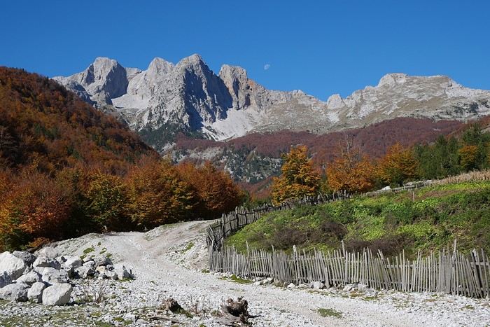
We had planned to go to the Canary Islands, but flight prices are skyrocketing with this new holiday schedule.
So, I’m looking for an alternative to Gran Canaria and El Hierro and found two round-trip flights with Wizz Air to Tirana.
398 €, including baggage and seats—perfect!
Plus, the departure and return times are great, which is pretty rare for a low-cost flight!
All that’s left is to rent a car, plan the route, and book accommodations.
With two weeks, we’ll have to make some choices!
Here’s the final itinerary: Shkodra (2 nights), Valbonë (3 nights), Tirana (1 night), Lake Ohrid (1 night), Korçë (1 night), Përmet (1 night), Gjirokastër (1 night), Himarë (2 nights), Berat (2 nights), and Krujë (1 night).
A mix of countryside and small towns, a bit of the Mediterranean, and some mountains!
Late October isn’t the best season, so let’s keep our fingers crossed for the rest...
Martine and DD in Colorado and Utah
Hello everyone! 🙂
So many silent months, and now Voyage Forum is accessible again. That’s cool because we can pick up our discussions for our mutual enjoyment.
I hope everyone is doing well and that you’ve been able to take some great trips, whether to the USA or elsewhere.
In September 2020, we had planned a round trip to explore Colorado, but unfortunately, a nasty virus messed up our plans, closing borders and keeping us stuck at home. Luckily for us, canceling the car, flights, and accommodations didn’t cost us a thing—everything was refunded.
In 2023, a loop from Las Vegas let us revisit places we’d seen in 2017 and discover new ones, this time spending more time at each stop with some lovely hikes.
In 2024, we finally revisited the 2020 plan, and I’ll start with that.
However, unforeseen circumstances mean I have much less time than before, so I’ll keep my trip reports shorter (ha ha ha—you’ll have less of my prose to endure).
Another change: for those who remember the "Gang of Four crazy sixty-somethings," it was just DD and me this time. Our dear Mimi and Maumau left the Var to focus on raising horses and can’t leave their little green paradise to join us anymore. We were unfortunately much tamer without them.
We traveled from September 11 to October 3.
The itinerary
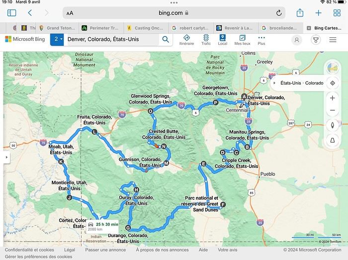
Day 1: Flight Marseille-Paris-Denver, then Manitou Springs (133 km) Day 2: Manitou Springs (49 km) Day 3: Cripple Creek (104 km) Day 4: Salida (254 km) Day 5: Great Sand Dunes (231 km) Day 6: Durango (283 km) Day 7: Durango (Durango-Silverton train) Day 8: Ouray (121 km) Day 9: Ouray (Perimeter Trail hike) Day 10: Cortez (213 km) Day 11: Cortez (Mesa Verde National Park, 134 km) Day 12: Monticello (268 km, detour to Chesler Park) Day 13: Moab (171 km, Delicate Arch) Day 14: Moab (98 km, Fisher Towers) Day 15: Moab (171 km, Canyonlands) Day 16: Fruita (210 km, Colorado National Monument) Day 17: Crested Butte (224 km via Kebler Pass) Day 18: Crested Butte (57 km) Day 19: Glenwood Springs (150 km) Day 20: Glenwood Springs (118 km, Rifle State Park) Day 21: Georgetown (258 km via Independence Pass) Day 22: Denver (123 km), then return flight
We speak very little English. We spent 21 nights there and covered a 3,400 km loop by car and 160 km on foot (we’re still trying to hike while we’re in shape) from Denver in September 2024. We wanted this road trip to help us explore Colorado a bit more—we’d only spent 6 nights there in 2019—and to see it during the fall foliage season. We also wanted to return to Utah (we love Moab) to enjoy its red rocks, which we adore.
In the prices you see (some in euros, others in dollars), I’ve included bank fees and exchange charges. The flights, car, and parking were paid by credit card when we booked in February. Usually, we book around November, but some obligations kept us from doing it earlier. We downloaded the MPC (Mobile Passport Control) app on our phone, which saved us time at immigration.
📊 **Budget: just under 8,500 € for both of us, all included**
📊 **Flights** Marseille-Paris (CDG)-Denver: 2,152 € for both of us, with one checked bag each
📊 **ESTA and America the Beautiful Pass** The ones from our 2023 road trip were still valid
📊 **Parking at Marseille airport: 122 €**
📊 **Car: Nissan Rogue (the French X-Trail) from Hertz: 1,165 €** By booking through Air France (and earning miles), we got a 15% discount. Hertz offers a free Hertz Gold Plus Rewards program, which gives us priority counter service.
📊 **Accommodation: 3,050 €** We stayed in motels and hotels of various ranges (from 100 € to 270 € per night, depending on the city), all booked through Hotels.com or Booking. Booking sometimes offers cheaper rates if you book via the "Booking mobile" app. We also got some preferential rates thanks to our Genius 2 status. Out of 21 nights, only one place didn’t include breakfast.
📊 **Other expenses (activities booked by credit card before leaving)** Durango-Silverton train: 210 € (we booked the enclosed vintage coach in March) Mesa Verde: Balcony House: 15.15 € (booked 14 days before the visit) Timed-entry passes for Arches National Park: 6 € for 3 days (booked June 1 for September entries via http://récreation.gov/). We booked three different days to play with the weather.
📊 **Supplementary insurance with AVA: 204 €** (due to our age 😅 and the high cost of medical consultations in the USA)
📊 **Cash: 1,540 €** We left with 1,000 € exchanged before departure and made two withdrawals (500 $ and 200 $). This cash was used to pay for: - Evening restaurants and tips (between 70 $ and 95 $ for two meals and two drinks) - Two state parks: Dead Horse State Park (20 $) and Rifle State Park (10 $) - The Monarch Pass gondola (24 $) - Midday picnics - Gas (slightly cheaper with cash): 204 $ for 3,400 km - Personal souvenirs and little treats.
Like in our previous road trips, we didn’t rent a GPS. We used the offline GPS app Here We Go, for which we’d downloaded maps of Colorado and Utah from France, as well as a new offline app called Organic Maps as a backup—though we didn’t end up needing it.
❤️❤️❤️ **Highlights (there are so many!)** 📍 The stunning landscapes of Colorado, especially with the fall colors 📍 A step back in time at the old farm in Florissant Fossil Beds National Monument 📍 The prairies of Cripple Creek and the mining remnants of the Vindicator Trail 📍 The cheeky chipmunks in the ghost town of St. Elmo 📍 Great Sand Dunes and its soft sand 📍 The steam train between Durango and Silverton: we’re glad we chose the round-trip because it rained heavily on the way there, but we got to enjoy the scenery on the way back when the sun came out 📍 The unexpected meet-up with Michèle from the group outside a restaurant in Durango 📍 The hot springs in Ouray 📍 Mesa Verde and its still-vibrant past 📍 The red rocks of Moab and Delicate Arch at sunset 📍 The lace-like Fisher Towers and the view from the end of the trail 📍 The gorgeous Route 128 leading to Colorado National Monument—small, easy to visit, and so beautiful 📍 The colors of the fabulous Kebler Pass, Crested Butte, and especially the hike through the golden aspens (Lower and Upper Loop) 📍 The waterfalls at Rifle State Park 📍 The tundra of Independence Pass 📍 The Halloween decorations in Georgetown and Idaho Springs
😞😞 **Flops (there are very few!)** 📍 The viewpoints we missed because they weren’t well-marked or we didn’t see the signs 📍 The closure of some hiking trails (Hanging Lake and parts of Canyonlands) and the Sal Mountain Loop road, which kept us from accessing it 📍😢 The Chesler Park hike we had to cut short due to poor time management—180 km between our stop in Cortez meant we didn’t arrive until 10:30 AM, way too late for a 17 km hike.
Hope this helps! Have a great evening, everyone, and see you soon! 😊
The itinerary
Day 1: Flight Marseille-Paris-Denver, then Manitou Springs (133 km) Day 2: Manitou Springs (49 km) Day 3: Cripple Creek (104 km) Day 4: Salida (254 km) Day 5: Great Sand Dunes (231 km) Day 6: Durango (283 km) Day 7: Durango (Durango-Silverton train) Day 8: Ouray (121 km) Day 9: Ouray (Perimeter Trail hike) Day 10: Cortez (213 km) Day 11: Cortez (Mesa Verde National Park, 134 km) Day 12: Monticello (268 km, detour to Chesler Park) Day 13: Moab (171 km, Delicate Arch) Day 14: Moab (98 km, Fisher Towers) Day 15: Moab (171 km, Canyonlands) Day 16: Fruita (210 km, Colorado National Monument) Day 17: Crested Butte (224 km via Kebler Pass) Day 18: Crested Butte (57 km) Day 19: Glenwood Springs (150 km) Day 20: Glenwood Springs (118 km, Rifle State Park) Day 21: Georgetown (258 km via Independence Pass) Day 22: Denver (123 km), then return flight
We speak very little English. We spent 21 nights there and covered a 3,400 km loop by car and 160 km on foot (we’re still trying to hike while we’re in shape) from Denver in September 2024. We wanted this road trip to help us explore Colorado a bit more—we’d only spent 6 nights there in 2019—and to see it during the fall foliage season. We also wanted to return to Utah (we love Moab) to enjoy its red rocks, which we adore.
In the prices you see (some in euros, others in dollars), I’ve included bank fees and exchange charges. The flights, car, and parking were paid by credit card when we booked in February. Usually, we book around November, but some obligations kept us from doing it earlier. We downloaded the MPC (Mobile Passport Control) app on our phone, which saved us time at immigration.
📊 **Budget: just under 8,500 € for both of us, all included**
📊 **Flights** Marseille-Paris (CDG)-Denver: 2,152 € for both of us, with one checked bag each
📊 **ESTA and America the Beautiful Pass** The ones from our 2023 road trip were still valid
📊 **Parking at Marseille airport: 122 €**
📊 **Car: Nissan Rogue (the French X-Trail) from Hertz: 1,165 €** By booking through Air France (and earning miles), we got a 15% discount. Hertz offers a free Hertz Gold Plus Rewards program, which gives us priority counter service.
📊 **Accommodation: 3,050 €** We stayed in motels and hotels of various ranges (from 100 € to 270 € per night, depending on the city), all booked through Hotels.com or Booking. Booking sometimes offers cheaper rates if you book via the "Booking mobile" app. We also got some preferential rates thanks to our Genius 2 status. Out of 21 nights, only one place didn’t include breakfast.
📊 **Other expenses (activities booked by credit card before leaving)** Durango-Silverton train: 210 € (we booked the enclosed vintage coach in March) Mesa Verde: Balcony House: 15.15 € (booked 14 days before the visit) Timed-entry passes for Arches National Park: 6 € for 3 days (booked June 1 for September entries via http://récreation.gov/). We booked three different days to play with the weather.
📊 **Supplementary insurance with AVA: 204 €** (due to our age 😅 and the high cost of medical consultations in the USA)
📊 **Cash: 1,540 €** We left with 1,000 € exchanged before departure and made two withdrawals (500 $ and 200 $). This cash was used to pay for: - Evening restaurants and tips (between 70 $ and 95 $ for two meals and two drinks) - Two state parks: Dead Horse State Park (20 $) and Rifle State Park (10 $) - The Monarch Pass gondola (24 $) - Midday picnics - Gas (slightly cheaper with cash): 204 $ for 3,400 km - Personal souvenirs and little treats.
Like in our previous road trips, we didn’t rent a GPS. We used the offline GPS app Here We Go, for which we’d downloaded maps of Colorado and Utah from France, as well as a new offline app called Organic Maps as a backup—though we didn’t end up needing it.
❤️❤️❤️ **Highlights (there are so many!)** 📍 The stunning landscapes of Colorado, especially with the fall colors 📍 A step back in time at the old farm in Florissant Fossil Beds National Monument 📍 The prairies of Cripple Creek and the mining remnants of the Vindicator Trail 📍 The cheeky chipmunks in the ghost town of St. Elmo 📍 Great Sand Dunes and its soft sand 📍 The steam train between Durango and Silverton: we’re glad we chose the round-trip because it rained heavily on the way there, but we got to enjoy the scenery on the way back when the sun came out 📍 The unexpected meet-up with Michèle from the group outside a restaurant in Durango 📍 The hot springs in Ouray 📍 Mesa Verde and its still-vibrant past 📍 The red rocks of Moab and Delicate Arch at sunset 📍 The lace-like Fisher Towers and the view from the end of the trail 📍 The gorgeous Route 128 leading to Colorado National Monument—small, easy to visit, and so beautiful 📍 The colors of the fabulous Kebler Pass, Crested Butte, and especially the hike through the golden aspens (Lower and Upper Loop) 📍 The waterfalls at Rifle State Park 📍 The tundra of Independence Pass 📍 The Halloween decorations in Georgetown and Idaho Springs
😞😞 **Flops (there are very few!)** 📍 The viewpoints we missed because they weren’t well-marked or we didn’t see the signs 📍 The closure of some hiking trails (Hanging Lake and parts of Canyonlands) and the Sal Mountain Loop road, which kept us from accessing it 📍😢 The Chesler Park hike we had to cut short due to poor time management—180 km between our stop in Cortez meant we didn’t arrive until 10:30 AM, way too late for a 17 km hike.
Hope this helps! Have a great evening, everyone, and see you soon! 😊
Slovenia, a nature destination
Slovenia was the originally planned destination for summer 2022, as a complement to a road trip through Croatia and Montenegro. Plans changed on a whim in February of that year. Our Balkans road trip would ultimately be limited to Slovenia and take place over 10 days during the Easter school holidays. Flight tickets and car rental were booked right away; all that was left was to finalize our itinerary, already sketched out, and the accommodation reservations.
I decided to add Plitvice Lakes in Croatia to our program. I really wanted to discover them, and for my husband, it was a chance to revisit them several years after a trip to Yugoslavia when he was a teenager.
I’m happy to contribute to the reopening of our forum by posting this travel journal (originally posted in 2022 on another forum, the text has been partially revised and photos added). As usual, a few photos to start with—maybe they’ll inspire you to join in!

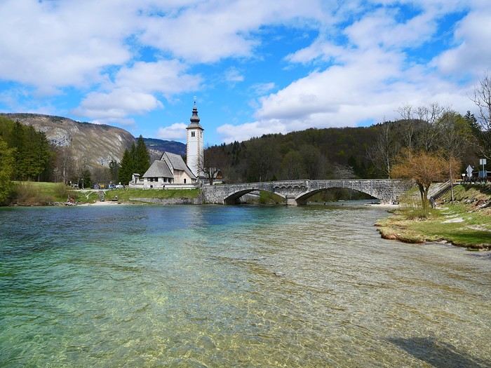
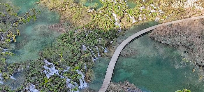

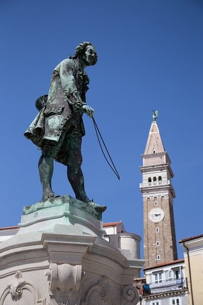
I decided to add Plitvice Lakes in Croatia to our program. I really wanted to discover them, and for my husband, it was a chance to revisit them several years after a trip to Yugoslavia when he was a teenager.
I’m happy to contribute to the reopening of our forum by posting this travel journal (originally posted in 2022 on another forum, the text has been partially revised and photos added). As usual, a few photos to start with—maybe they’ll inspire you to join in!
Kyushu between Fukuoka and Nagasaki in autumn 2024 (Japan)
Fellow travelers,
Don’t they say "never two without three"? It seems so. Here I am again on the forum to share—and let’s be honest, indulge a bit of selfish pleasure—by recounting the story of this third installment in the Land of the Rising Sun.
Where? It’s all in the title. On the island of Kyushu in southern Japan, more precisely in the northwest between Fukuoka and Nagasaki. I hope to take you along with me for 19 nights and 18 full days this autumn of 2024. On the itinerary: gastronomy, crafts, festivals, waterfalls, encounters, and leisurely strolls in all simplicity.
A last-minute flight booked just 7 days before departure, and the route evolved regularly based on whims and accommodation availability, eventually settling on this:
- 5 nights in Fukuoka: Fukuoka city, Ukiha, Itoshima, Dazaifu, Yanagawa - 4 nights in Hasami, Nagasaki Prefecture: Okawachiyama, Arita, Takeo, Kashima, Yobuko, Karatsu, Kabeshima - 6 nights in Nagasaki: Ureshino, Higashi-Sonogi, Nagasaki city, Unzen, Sotome - 4 nights in Fukuoka: Karatsu, Fukuoka city
Most of the trip was done by car for practical reasons—easier access to certain places and freedom of movement—but also for the sheer joy of it. Despite slow traffic at times, driving in rural Japan is a delight.
If the program interests you, see you soon for the start of the journey.
Don’t they say "never two without three"? It seems so. Here I am again on the forum to share—and let’s be honest, indulge a bit of selfish pleasure—by recounting the story of this third installment in the Land of the Rising Sun.
Where? It’s all in the title. On the island of Kyushu in southern Japan, more precisely in the northwest between Fukuoka and Nagasaki. I hope to take you along with me for 19 nights and 18 full days this autumn of 2024. On the itinerary: gastronomy, crafts, festivals, waterfalls, encounters, and leisurely strolls in all simplicity.
A last-minute flight booked just 7 days before departure, and the route evolved regularly based on whims and accommodation availability, eventually settling on this:
- 5 nights in Fukuoka: Fukuoka city, Ukiha, Itoshima, Dazaifu, Yanagawa - 4 nights in Hasami, Nagasaki Prefecture: Okawachiyama, Arita, Takeo, Kashima, Yobuko, Karatsu, Kabeshima - 6 nights in Nagasaki: Ureshino, Higashi-Sonogi, Nagasaki city, Unzen, Sotome - 4 nights in Fukuoka: Karatsu, Fukuoka city
Most of the trip was done by car for practical reasons—easier access to certain places and freedom of movement—but also for the sheer joy of it. Despite slow traffic at times, driving in rural Japan is a delight.
If the program interests you, see you soon for the start of the journey.
15-day itinerary in southern Morocco
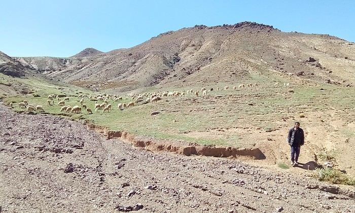
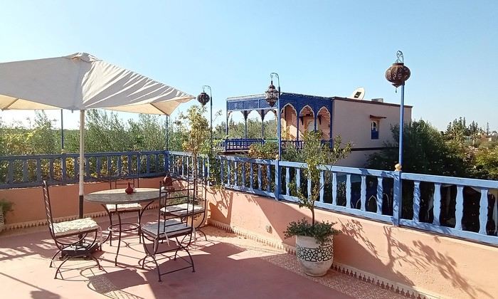
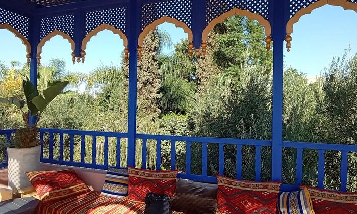 Last October, we landed in Marrakech to spend a few days with family exploring Morocco’s roads.
Transport: a rented Dacia.
Accommodations: small guesthouses.
Last October, we landed in Marrakech to spend a few days with family exploring Morocco’s roads.
Transport: a rented Dacia.
Accommodations: small guesthouses.Our first stop was just a few kilometers from Marrakech, at a lovely house perfect for relaxing and recharging before continuing. It’s called Bleu House, a little paradise on the outskirts of Marrakech. The welcome was very warm, with a beautiful pool and a lovely garden.
Next, we headed toward the Tichka Pass. The road has really improved in recent years—it’s much easier to drive now. No more getting stuck behind trucks, and today, the construction is practically finished.
Morocco has turned green after the recent rains. It’s a joy for the herds and shepherds.
Preparing for a one-month road trip in Uganda
Yiiihiiiiii😎
Hey everyone, and warm greetings to all you Southern African wanderers exploring the eastern lands of this African forum!
Four years later, I can finally create a new thread about my next trip—and not just any trip: Uganda! 🙂 A destination that’s been making me dream more and more over the past few years. Originally planned for 2019 but swapped for Tanzania, Kilimanjaro, and Zanzibar. Then pushed aside for another well-known African destination, Namibia, with 6 friends in 2021 (but ultimately done with just 2 because of Covid). 2022 was supposed to be the year of our Canada trip (initially planned for 2020 and canceled two years in a row for the same health reasons). The 2021 safari with friends finally happened in South Africa in 2023—a classic loop that didn’t require much planning and let me start dreaming about my next African destination while devouring all the Uganda travel journals, frustrated I couldn’t reply or comment. Uganda was then reconsidered for 2024 as a follow-up to a 6-week road trip in Finland and Norway, starting from Paris to save time, money, and the ecological footprint of a transatlantic round trip—but ultimately canceled due to budget constraints, the start of my freelance work (no more paid leave), the high cost of 6 weeks in Scandinavia, and no desire to cheapen our first Uganda trip.
Uganda will be the absolute priority for 2025! 😉 And I plan to use this time to prepare for the trip properly. I also hope to use this period to get back to writing our travel journals. By absolute priority, I mean minimal restrictions and compromises on budget and travel time. 🙂
So, we’re planning to spend a month in Uganda next summer (2025). The exact month will be decided in the coming weeks. Why a month? To explore a good part of the country (really want to go up to Kidepo), enjoy the stops, and avoid putting ourselves at risk on the roads. Also, several rental companies offered me 4x4 quotes with a 10% discount for 30+ days of rental...
Here’s my humble draft itinerary:
Day 1: Late arrival in Entebbe around 11 PM. Day 2: Pick up 4x4 vehicle. Night in Jinja.
Day 3: Drive and night in Sipi Falls. Day 4: Night in Sipi Falls. Day 5: Night in Moroto. Day 6: Night in Moroto. Day 7: Drive to Kidepo NP. Day 8: Safari in Kidepo NP. Day 9: Safari in Kidepo NP. Day 10: Full day drive to Murchison Falls. Day 11: Safari in Murchison Falls. Day 12: Safari in Murchison Falls. Day 13: Ziwa Rhino Sanctuary. Day 14: Lake Albert. Day 15: Full day drive to Kibale Forest. Day 16: Kibale Forest NP. Day 17: Drive to Kilembe (Rwenzori NP). Day 18: Hike in southern Rwenzori region. OR start Weismann’s Peak trek (Day 1). Day 19: Weismann’s Peak trek (Day 2). Day 20: Weismann’s Peak trek (Day 3). Day 21: Weismann’s Peak trek (Day 4). Day 22: Weismann’s Peak trek (Day 5), night in QENP. Day 23: QENP. Day 24: Visit Ishasha and drive to Lake Bunyonyi. Day 25: Drive to Ruhija. Day 26: Ruhija, Bwindi NP, gorilla tracking. Day 27: Mgahinga Gorilla NP... Day 28: Morning trek (gorillas or golden monkeys). Drive and night in Mburo NP.
Day 31: Visit Mburo NP and drive to Entebbe. Mabamba Swamp if we haven’t seen shoebills yet? Return 4x4 (30 days rental). Day 32: Departure from Entebbe (flight at 7:30 PM direct to Johannesburg with Uganda Airlines).
It’s not easy to visualize such a long itinerary. In terms of nights, it would look like this:
● Entebbe (1 night)
● Jinja (1 night)
● Sipi Falls (2 nights) ● Moroto (2 nights) ● Kidepo NP (3 nights) ● Murchison Falls (3 nights)
● Ziwa Rhino Sanctuary (1 night)
● Lake Albert (1 night) ● Kibale Forest (2 nights)
● Rwenzori NP (5 nights) ● QENP (2 nights)
● Lake Bunyonyi (1 night)
● Ruhija (2 nights)
● Mgahinga Gorilla NP (1 night?)
● Mburo NP (2 nights)
● Entebbe (1 night)
Obviously, I already have a lot of questions .
A question I really like: Where would you add extra nights? Keeping the 5 days in Rwenzori, we still have at least 2 nights to add to this itinerary.
Also, I don’t really have a clear idea about the loop’s direction. Instinctively, I thought of doing the gorillas last to end on a high note, but given the state of rental vehicles and traveler feedback, it seems we might not even make it to the end of the trip . Is there a meteorologically better direction? Given we’re likely leaving from early August to early September.
We’ve debated a lot about renting a vehicle with or without a guide, RAV4 or a proper 4x4, rooftop tent or not... In the end, after testing the guided experience in Tanzania and noting the relatively reasonable prices of hard lodgings (compared to Tanzania, Namibia, or Botswana, for example), the high cost of equipped 4x4s, and their unpredictable condition... We’re currently leaning toward a non-equipped 4x4, opting for the newest and most reliable vehicle possible to minimize breakdowns and missed stops. Any agencies/vehicles you’d recommend? Any recent feedback from the past few years?
Where’s the best place to see golden monkeys? I read that the southern part of QENP is no longer accessible. Can’t we go to Ishasha anymore? I’ve seen a lot of disappointed reviews about QENP, but it still seems like a good place to spot leopards and hyenas. If we stick with hard lodgings, which lodge is worth it in QENP, and how many nights should we plan? Are there night drives in Uganda to observe nocturnal wildlife? Initially, I thought of doing two gorilla treks—one in Bwindi (Ruhija) and another in Mgahinga Gorilla NP. But I got excited about Rwenzori (especially with the option to extend the stay a bit) and now I’m considering a trek there instead. However, the trek to Margherita Peak’s summit takes at least 7 days at 1580 $/person (plus extra rental days...), so I’m leaning toward the 5-day Weismann’s Peak trek. Has anyone done the Weissman’s Peak trek? If we skip the gorilla trek, is Mgahinga Gorilla NP still worth visiting?
Thanks in advance for all your comments, answers, feedback, favorite spots, and tips! 🙂
Looking forward to chatting with you all on this forum again! 😉
Pierre & Alison
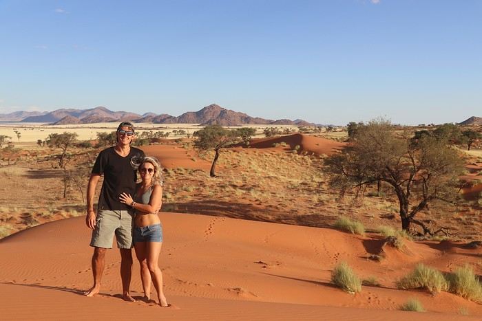
Hey everyone, and warm greetings to all you Southern African wanderers exploring the eastern lands of this African forum!
Four years later, I can finally create a new thread about my next trip—and not just any trip: Uganda! 🙂 A destination that’s been making me dream more and more over the past few years. Originally planned for 2019 but swapped for Tanzania, Kilimanjaro, and Zanzibar. Then pushed aside for another well-known African destination, Namibia, with 6 friends in 2021 (but ultimately done with just 2 because of Covid). 2022 was supposed to be the year of our Canada trip (initially planned for 2020 and canceled two years in a row for the same health reasons). The 2021 safari with friends finally happened in South Africa in 2023—a classic loop that didn’t require much planning and let me start dreaming about my next African destination while devouring all the Uganda travel journals, frustrated I couldn’t reply or comment. Uganda was then reconsidered for 2024 as a follow-up to a 6-week road trip in Finland and Norway, starting from Paris to save time, money, and the ecological footprint of a transatlantic round trip—but ultimately canceled due to budget constraints, the start of my freelance work (no more paid leave), the high cost of 6 weeks in Scandinavia, and no desire to cheapen our first Uganda trip.
Uganda will be the absolute priority for 2025! 😉 And I plan to use this time to prepare for the trip properly. I also hope to use this period to get back to writing our travel journals. By absolute priority, I mean minimal restrictions and compromises on budget and travel time. 🙂
So, we’re planning to spend a month in Uganda next summer (2025). The exact month will be decided in the coming weeks. Why a month? To explore a good part of the country (really want to go up to Kidepo), enjoy the stops, and avoid putting ourselves at risk on the roads. Also, several rental companies offered me 4x4 quotes with a 10% discount for 30+ days of rental...
Here’s my humble draft itinerary:
Day 1: Late arrival in Entebbe around 11 PM. Day 2: Pick up 4x4 vehicle. Night in Jinja.
Day 3: Drive and night in Sipi Falls. Day 4: Night in Sipi Falls. Day 5: Night in Moroto. Day 6: Night in Moroto. Day 7: Drive to Kidepo NP. Day 8: Safari in Kidepo NP. Day 9: Safari in Kidepo NP. Day 10: Full day drive to Murchison Falls. Day 11: Safari in Murchison Falls. Day 12: Safari in Murchison Falls. Day 13: Ziwa Rhino Sanctuary. Day 14: Lake Albert. Day 15: Full day drive to Kibale Forest. Day 16: Kibale Forest NP. Day 17: Drive to Kilembe (Rwenzori NP). Day 18: Hike in southern Rwenzori region. OR start Weismann’s Peak trek (Day 1). Day 19: Weismann’s Peak trek (Day 2). Day 20: Weismann’s Peak trek (Day 3). Day 21: Weismann’s Peak trek (Day 4). Day 22: Weismann’s Peak trek (Day 5), night in QENP. Day 23: QENP. Day 24: Visit Ishasha and drive to Lake Bunyonyi. Day 25: Drive to Ruhija. Day 26: Ruhija, Bwindi NP, gorilla tracking. Day 27: Mgahinga Gorilla NP... Day 28: Morning trek (gorillas or golden monkeys). Drive and night in Mburo NP.
Day 31: Visit Mburo NP and drive to Entebbe. Mabamba Swamp if we haven’t seen shoebills yet? Return 4x4 (30 days rental). Day 32: Departure from Entebbe (flight at 7:30 PM direct to Johannesburg with Uganda Airlines).
It’s not easy to visualize such a long itinerary. In terms of nights, it would look like this:
● Entebbe (1 night)
● Jinja (1 night)
● Sipi Falls (2 nights) ● Moroto (2 nights) ● Kidepo NP (3 nights) ● Murchison Falls (3 nights)
● Ziwa Rhino Sanctuary (1 night)
● Lake Albert (1 night) ● Kibale Forest (2 nights)
● Rwenzori NP (5 nights) ● QENP (2 nights)
● Lake Bunyonyi (1 night)
● Ruhija (2 nights)
● Mgahinga Gorilla NP (1 night?)
● Mburo NP (2 nights)
● Entebbe (1 night)
Obviously, I already have a lot of questions .
A question I really like: Where would you add extra nights? Keeping the 5 days in Rwenzori, we still have at least 2 nights to add to this itinerary.
Also, I don’t really have a clear idea about the loop’s direction. Instinctively, I thought of doing the gorillas last to end on a high note, but given the state of rental vehicles and traveler feedback, it seems we might not even make it to the end of the trip . Is there a meteorologically better direction? Given we’re likely leaving from early August to early September.
We’ve debated a lot about renting a vehicle with or without a guide, RAV4 or a proper 4x4, rooftop tent or not... In the end, after testing the guided experience in Tanzania and noting the relatively reasonable prices of hard lodgings (compared to Tanzania, Namibia, or Botswana, for example), the high cost of equipped 4x4s, and their unpredictable condition... We’re currently leaning toward a non-equipped 4x4, opting for the newest and most reliable vehicle possible to minimize breakdowns and missed stops. Any agencies/vehicles you’d recommend? Any recent feedback from the past few years?
Where’s the best place to see golden monkeys? I read that the southern part of QENP is no longer accessible. Can’t we go to Ishasha anymore? I’ve seen a lot of disappointed reviews about QENP, but it still seems like a good place to spot leopards and hyenas. If we stick with hard lodgings, which lodge is worth it in QENP, and how many nights should we plan? Are there night drives in Uganda to observe nocturnal wildlife? Initially, I thought of doing two gorilla treks—one in Bwindi (Ruhija) and another in Mgahinga Gorilla NP. But I got excited about Rwenzori (especially with the option to extend the stay a bit) and now I’m considering a trek there instead. However, the trek to Margherita Peak’s summit takes at least 7 days at 1580 $/person (plus extra rental days...), so I’m leaning toward the 5-day Weismann’s Peak trek. Has anyone done the Weissman’s Peak trek? If we skip the gorilla trek, is Mgahinga Gorilla NP still worth visiting?
Thanks in advance for all your comments, answers, feedback, favorite spots, and tips! 🙂
Looking forward to chatting with you all on this forum again! 😉
Pierre & Alison
Southwest! 8 weeks with the family, Denver-to-Denver loop, 1st part...
Hey there, VoyageForum!!!
I’ve combed through this site up, down, and sideways to plan our two-month road trip across the American Southwest during the summer of 2022, so it only feels right to give back and revive the USA travel journal section—helping others prep, travel, or relive their own memories! 😏
A quick intro to the stars of this trip is coming soon... in an upcoming post!
Table of Contents:
Road trip introduction Day 1 & 2: the days we double-checked all our papers... Day 3 & 3 bis: The day we discovered Denver... Day 4: The day of the race, the carriage, and the little one’s cough... Day 5: the day the road trip truly began... Day 6 & 6 bis: the day of Nature’s first wonders... Day 7: the day the sky fell on our heads... Day 8 & 8 bis: the day we saw ghosts... Day 9: the day we climbed the mountain... Day 10: the day the theme song from "The Last Picture Show" played on loop in my head... Day 11: the day we lived like Native Americans... Day 12: the day we left civilization behind... Day 13 & 13 bis: the day we explored another planet... Day 14 & 14 bis: the day Caro reunited with HER rocks... Day 15 & 15 bis: the day of the fantastic ride... Day 16: the day we cooled off in Lake Powell... Day 17: the day the Colorado River’s meanders were all ours... Day 18: the day we dipped our feet in the Colorado... Day 19: the day the guys discovered true vastness... Day 20 & 20 bis: the day we covered a few acres of Route 66 before sunset... Day 21: the day the credit card said stop... right before the STRIP... Day 22: the day we finally discovered Cirque du Soleil... Day 23: the day we returned to calm... well, almost... Day 24: the day we reached our home base for 6 nights: Saint George Day 25: the day we should’ve explored Yant Flat... Day 26: the day it was 13°C at Cedar Breaks... Day 27: the day we explored The Narrows in Zion NP... Day 28: the day we discovered Snow Canyon... Day 29: the day we hiked to the "SUBWAY"... Day 30: the day we encountered the abyss—from the north this time... Day 31: the day we arrived in a place where dreams begin... Kanab... Day 32: the day we discovered the first treasures along House Rock Valley... 2nd part: the second part of the journey... Day 33: the day we discovered a magical place... Edmaier's Secret... Day 34: the day Cottonwood Road didn’t open up to us... Day 35: the day of the classic Queen’s Garden + Navajo Loop—and another event that became a classic... Day 36: the second day in Bryce... pure bliss!!! Day 37: the day we swam at the foot of Calf Creek Falls... Day 38: the day we took the Burr Trail, even with storms lurking... Day 39: The day of the goblins... Day 40: the day we enjoyed the peaceful Capitol Reef NP... Day 41: the day of the Rim Overlook and another letdown... Day 42: the day we arrived in... Moab... Day 43: the first day in Arches National Park... Day 44: the day of the Fisher Towers... Day 45: the day of Bow Tie & Corona Arches... Day 46: The day of Shafer Trail + Potash Road... Day 47: The second day in Arches NP... Day 48: the day we discovered Colorado NM in a flash... Day 49: the day of Black Canyon... Day 50: the day we passed through Durango before falling for Silverton... Day 51: the day we went through Ouray and ended up in Gunnison... Day 52: the day of Kebler Pass and arriving at the hot springs... Day 53: the day of hot springs II, then the road back to Denver... Day 54: the last day... Day 55: back home and the RECAP...
I’ve combed through this site up, down, and sideways to plan our two-month road trip across the American Southwest during the summer of 2022, so it only feels right to give back and revive the USA travel journal section—helping others prep, travel, or relive their own memories! 😏
A quick intro to the stars of this trip is coming soon... in an upcoming post!
Table of Contents:
Road trip introduction Day 1 & 2: the days we double-checked all our papers... Day 3 & 3 bis: The day we discovered Denver... Day 4: The day of the race, the carriage, and the little one’s cough... Day 5: the day the road trip truly began... Day 6 & 6 bis: the day of Nature’s first wonders... Day 7: the day the sky fell on our heads... Day 8 & 8 bis: the day we saw ghosts... Day 9: the day we climbed the mountain... Day 10: the day the theme song from "The Last Picture Show" played on loop in my head... Day 11: the day we lived like Native Americans... Day 12: the day we left civilization behind... Day 13 & 13 bis: the day we explored another planet... Day 14 & 14 bis: the day Caro reunited with HER rocks... Day 15 & 15 bis: the day of the fantastic ride... Day 16: the day we cooled off in Lake Powell... Day 17: the day the Colorado River’s meanders were all ours... Day 18: the day we dipped our feet in the Colorado... Day 19: the day the guys discovered true vastness... Day 20 & 20 bis: the day we covered a few acres of Route 66 before sunset... Day 21: the day the credit card said stop... right before the STRIP... Day 22: the day we finally discovered Cirque du Soleil... Day 23: the day we returned to calm... well, almost... Day 24: the day we reached our home base for 6 nights: Saint George Day 25: the day we should’ve explored Yant Flat... Day 26: the day it was 13°C at Cedar Breaks... Day 27: the day we explored The Narrows in Zion NP... Day 28: the day we discovered Snow Canyon... Day 29: the day we hiked to the "SUBWAY"... Day 30: the day we encountered the abyss—from the north this time... Day 31: the day we arrived in a place where dreams begin... Kanab... Day 32: the day we discovered the first treasures along House Rock Valley... 2nd part: the second part of the journey... Day 33: the day we discovered a magical place... Edmaier's Secret... Day 34: the day Cottonwood Road didn’t open up to us... Day 35: the day of the classic Queen’s Garden + Navajo Loop—and another event that became a classic... Day 36: the second day in Bryce... pure bliss!!! Day 37: the day we swam at the foot of Calf Creek Falls... Day 38: the day we took the Burr Trail, even with storms lurking... Day 39: The day of the goblins... Day 40: the day we enjoyed the peaceful Capitol Reef NP... Day 41: the day of the Rim Overlook and another letdown... Day 42: the day we arrived in... Moab... Day 43: the first day in Arches National Park... Day 44: the day of the Fisher Towers... Day 45: the day of Bow Tie & Corona Arches... Day 46: The day of Shafer Trail + Potash Road... Day 47: The second day in Arches NP... Day 48: the day we discovered Colorado NM in a flash... Day 49: the day of Black Canyon... Day 50: the day we passed through Durango before falling for Silverton... Day 51: the day we went through Ouray and ended up in Gunnison... Day 52: the day of Kebler Pass and arriving at the hot springs... Day 53: the day of hot springs II, then the road back to Denver... Day 54: the last day... Day 55: back home and the RECAP...