Results for "Puy+Velay+|+127"
3538 results found.
Trip to Thailand and Laos
Hello! 🙂
January 2026 Here we go again for new adventures and the pleasure of sharing them with you here! First of all, I’d like to thank everyone who helped me with the preparations, even with some last-minute improvisations just days before departure. Thanks to Montagnard74, Jojoone1, Songsam, Attila, Dennis2, NadegerFERM, and the authors whose travel journals about Laos inspired me (Montagnard74, Muriel18, Mavietongs...).
In this story, written by Richard and illustrated by me, we’ll tell you about the journey of four friends: Catherine, Richard, Nathalie, and Bruno. A reinvented but overall successful trip, filled with discoveries and surprises, the scents of spices and frangipani flowers, (too) spicy food, sunsets, and... one big mess.
January 2026 Here we go again for new adventures and the pleasure of sharing them with you here! First of all, I’d like to thank everyone who helped me with the preparations, even with some last-minute improvisations just days before departure. Thanks to Montagnard74, Jojoone1, Songsam, Attila, Dennis2, NadegerFERM, and the authors whose travel journals about Laos inspired me (Montagnard74, Muriel18, Mavietongs...).
In this story, written by Richard and illustrated by me, we’ll tell you about the journey of four friends: Catherine, Richard, Nathalie, and Bruno. A reinvented but overall successful trip, filled with discoveries and surprises, the scents of spices and frangipani flowers, (too) spicy food, sunsets, and... one big mess.
Chatting by the water
For those who want to chat quietly by the riverbanks, this is the place!
Martine from DD in Arizona and New Mexico
Good evening everyone! 🙂
We’re back from our September 2025 road trip, this time to explore Arizona and New Mexico, and it’s time for me to start my travel journal—especially since everything’s already booked for another trip in September 2026 (to California), and I need to get started on the planning.
I was a little worried this new visit to Uncle Sam’s country might not be as "wow" as the others, but we still discovered some incredible places.
For those who don’t know us, we’re a couple in our seventies who speak very little English, but that didn’t stop us from fully enjoying our stay.
For this 6th road trip in the U.S., we spent 21 nights there, drove 4,160 km by car, and walked nearly 160 km in a loop starting from Phoenix.
We’d been to Arizona before (but not this side) and never to New Mexico. This whole road trip was a huge discovery for us.
In the prices mentioned (some in euros, others in dollars), bank fees and exchange charges are included. The flights, car rental, and parking were all paid for in December 2024 when we booked.
We’d downloaded the MPC (Mobile Passport Control) app, but there wasn’t a dedicated line at Phoenix Airport. Still, we got through quickly with friendly, smiling agents.
I don’t drive at all (I hate it), so the stops were chosen based on activities but also, for some, to limit daily mileage for the sole driver. The kilometers listed in the itinerary are the daily distances.
We traveled from September 9th to 22nd, unfortunately once again without our dear friends Mimi and Maumau.
The itinerary
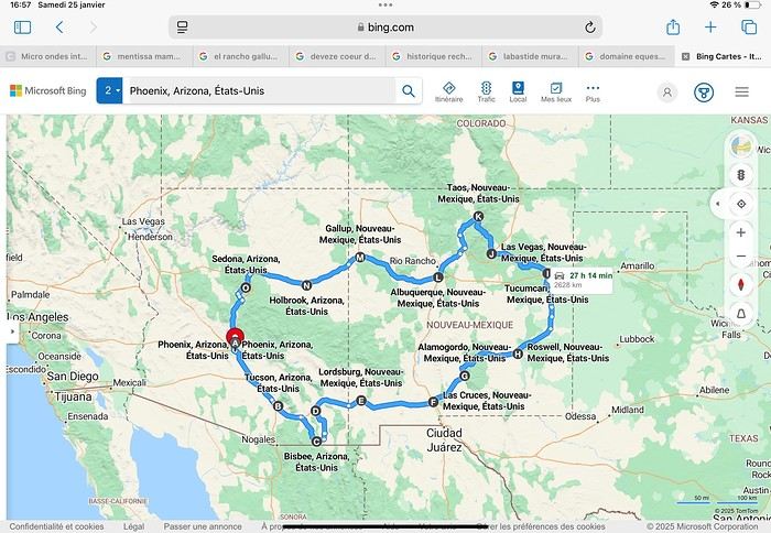
Day 1: Flight Marseille-Paris-Phoenix, then Gold Canyon (133 km) Day 2: Tucson (271 km) Lost Dutchman State Park Day 3: Tucson (155 km) Day 4: Tucson (34 km) Day 5: Bisbee (182 km) Day 6: Lordsburg (345 km) Day 7: Las Cruces (253 km) Day 8: Alamogordo (162 km) Day 9: Roswell (264 km) Day 10: Tucumcari (369 km) Day 11: Las Vegas (281 km) – the one in New Mexico Day 12: Taos (213 km) Day 13: Santa Fe (224 km) Day 14: Albuquerque (123 km) Day 15: Gallup (246 km) Day 16: Holbrook (224 km) Day 17: Flagstaff (179 km) Day 18: Sedona (118 km) Day 19: Sedona (48 km) Day 20: Sedona (41 km) Day 21: Phoenix (256 km) Day 22: Phoenix Airport (35 km)
📊 **Budget**: A little over 7,500 € for both of us, all included. The exchange rate was in our favor (1.17 dollars to 1 €). 📊 **Flights**: Marseille-Paris Charles de Gaulle-Phoenix: 1,787 € for two, with one checked bag each (Air France) 📊 **ESTA**: $42 📊 **America the Beautiful Pass**: $80 📊 **Parking**: 134 € (super eco at Marseille) 📊 **Car rental (Hertz)**: 865 €. Since there were no SUVs left in the reserved category (Nissan Rogue), we got an upgrade (4x4 Ford Explorer). We booked through Air France (15% discount). We’d originally reserved it in December for 1,140 €, but since prices dropped in March, we canceled and rebooked for 865 €. Hertz offers a free Hertz Gold Plus Rewards program, which gives you priority counter service when picking up the car. 📊 **Accommodation**: 2,400 € We stayed in hotels and motels of varying standards (from 60 to 203 € per night, depending on the city), all booked through Booking.com or Hotels.com. Out of 21 nights, only two didn’t include breakfast in the price. Booking.com sometimes offers slightly cheaper rates if you book by phone using the mobile app, and our Genius 3 status on the site also got us some preferential rates. 📊 **Supplementary insurance**: AVA 200 € for medical care if needed 📊 **Cash**: $2,078. We left with 1,000 € exchanged before departure and made two withdrawals of $500. This cash covered: - Evening restaurants and tips - Midday picnics - Gas: $298 for 4,160 km - Museum and private park entries (per person): - Lost Dutchman: $10 - Arizona-Sonora Desert Museum: $28 - Bird Cage Theater: $16 - Tombstone Shootout: $8 - New Mexico Farm & Ranch Museum: $12 - Roswell International UFO Museum: $5 - Billy the Kid Museum: $7 - Rancho de Taos: $22 - West Fork Oak Creek Trail entry: $15 We got a few discounts thanks to our senior age (+65). - Souvenirs and little treats
Like on our previous road trips, we didn’t rent a GPS. We got around using offline GPS apps Here WeGo and Organic Maps, with maps of the states we visited downloaded before we left (on our phones).
❤️❤️❤️ **Highlights** (there are so many!) 📍 Goldfield Ghost Town (even if it’s a reconstruction) 📍 The standing army of Saguaro cacti at Saguaro National Park West 📍 Diving into the cowboy universe of Tombstone 📍 The welcome from Rick and Henry at our guesthouse in Bisbee (Garden at Mile High Ranch) 📍 The tangled rocks of Chiricahua National Monument 📍 The flavored pistachios from Dwayne’s Fresh Jerky and Mac Ginnis Pistachioland 📍 Restaurants: La Posta (Las Cruces), Diner 66 (Albuquerque), and the Haunted Hamburger (Jerome) 📍 The old plazas of New Mexico 📍 The solitude and beauty of the white dunes at White Sands National Park 📍 Stepping back in time at the Billy the Kid Museum (Fort Stanton) 📍 Sections of historic Route 66 and the old motels of Tucumcari, especially at night when all the neon lights are on 📍 Taos Pueblo and diving into Native American culture 📍 After the Rio Grande Bridge, the descent via NM 567 to the very bottom of the Rio Grande Gorge, then the road along the riverbanks to Taos 📍 The tranquility of the Chimayo Sanctuary 📍 Discovering the ingenious native dwellings at Bandelier National Monument and Walnut Canyon National Park 📍 The small towns along the Turquoise Trail 📍 The red rocks of Red Rock Park and the Painted Desert 📍 The extraordinary colors of the petrified trees at Petrified Forest National Park 📍 Sedona, its red rocks, and the reward of the viewpoints at the end of hikes (Devil’s Bridge, The Subway, and West Fork Oak Creek) 📍 The immersion in Mexico when visiting Tlaquepaque 📍 The almost-ghost town of Jerome and its terraced streets 📍 The incredible kindness of Americans, always ready to help and up for a chat ❤️
☹️☹️☹️ **Flops** (there are very few) 📍 Several museums and churches being closed, so we couldn’t visit them 📍 Some museums and visitor centers opening late (10 AM) and closing early (4 PM) 📍 A 64 € phone roaming charge because we got near the Mexican border and picked up their cell tower 📍 The outrageous price ($5.99) for a gallon of gas at the Shell near Phoenix Airport
I hope this helps! Anyway, thanks for reading my long post. Don’t hesitate to reach out, even via PM, if you see I haven’t replied and you’d like more details. Have a great evening, everyone! 🙂
We’re back from our September 2025 road trip, this time to explore Arizona and New Mexico, and it’s time for me to start my travel journal—especially since everything’s already booked for another trip in September 2026 (to California), and I need to get started on the planning.
I was a little worried this new visit to Uncle Sam’s country might not be as "wow" as the others, but we still discovered some incredible places.
For those who don’t know us, we’re a couple in our seventies who speak very little English, but that didn’t stop us from fully enjoying our stay.
For this 6th road trip in the U.S., we spent 21 nights there, drove 4,160 km by car, and walked nearly 160 km in a loop starting from Phoenix.
We’d been to Arizona before (but not this side) and never to New Mexico. This whole road trip was a huge discovery for us.
In the prices mentioned (some in euros, others in dollars), bank fees and exchange charges are included. The flights, car rental, and parking were all paid for in December 2024 when we booked.
We’d downloaded the MPC (Mobile Passport Control) app, but there wasn’t a dedicated line at Phoenix Airport. Still, we got through quickly with friendly, smiling agents.
I don’t drive at all (I hate it), so the stops were chosen based on activities but also, for some, to limit daily mileage for the sole driver. The kilometers listed in the itinerary are the daily distances.
We traveled from September 9th to 22nd, unfortunately once again without our dear friends Mimi and Maumau.
The itinerary
Day 1: Flight Marseille-Paris-Phoenix, then Gold Canyon (133 km) Day 2: Tucson (271 km) Lost Dutchman State Park Day 3: Tucson (155 km) Day 4: Tucson (34 km) Day 5: Bisbee (182 km) Day 6: Lordsburg (345 km) Day 7: Las Cruces (253 km) Day 8: Alamogordo (162 km) Day 9: Roswell (264 km) Day 10: Tucumcari (369 km) Day 11: Las Vegas (281 km) – the one in New Mexico Day 12: Taos (213 km) Day 13: Santa Fe (224 km) Day 14: Albuquerque (123 km) Day 15: Gallup (246 km) Day 16: Holbrook (224 km) Day 17: Flagstaff (179 km) Day 18: Sedona (118 km) Day 19: Sedona (48 km) Day 20: Sedona (41 km) Day 21: Phoenix (256 km) Day 22: Phoenix Airport (35 km)
📊 **Budget**: A little over 7,500 € for both of us, all included. The exchange rate was in our favor (1.17 dollars to 1 €). 📊 **Flights**: Marseille-Paris Charles de Gaulle-Phoenix: 1,787 € for two, with one checked bag each (Air France) 📊 **ESTA**: $42 📊 **America the Beautiful Pass**: $80 📊 **Parking**: 134 € (super eco at Marseille) 📊 **Car rental (Hertz)**: 865 €. Since there were no SUVs left in the reserved category (Nissan Rogue), we got an upgrade (4x4 Ford Explorer). We booked through Air France (15% discount). We’d originally reserved it in December for 1,140 €, but since prices dropped in March, we canceled and rebooked for 865 €. Hertz offers a free Hertz Gold Plus Rewards program, which gives you priority counter service when picking up the car. 📊 **Accommodation**: 2,400 € We stayed in hotels and motels of varying standards (from 60 to 203 € per night, depending on the city), all booked through Booking.com or Hotels.com. Out of 21 nights, only two didn’t include breakfast in the price. Booking.com sometimes offers slightly cheaper rates if you book by phone using the mobile app, and our Genius 3 status on the site also got us some preferential rates. 📊 **Supplementary insurance**: AVA 200 € for medical care if needed 📊 **Cash**: $2,078. We left with 1,000 € exchanged before departure and made two withdrawals of $500. This cash covered: - Evening restaurants and tips - Midday picnics - Gas: $298 for 4,160 km - Museum and private park entries (per person): - Lost Dutchman: $10 - Arizona-Sonora Desert Museum: $28 - Bird Cage Theater: $16 - Tombstone Shootout: $8 - New Mexico Farm & Ranch Museum: $12 - Roswell International UFO Museum: $5 - Billy the Kid Museum: $7 - Rancho de Taos: $22 - West Fork Oak Creek Trail entry: $15 We got a few discounts thanks to our senior age (+65). - Souvenirs and little treats
Like on our previous road trips, we didn’t rent a GPS. We got around using offline GPS apps Here WeGo and Organic Maps, with maps of the states we visited downloaded before we left (on our phones).
❤️❤️❤️ **Highlights** (there are so many!) 📍 Goldfield Ghost Town (even if it’s a reconstruction) 📍 The standing army of Saguaro cacti at Saguaro National Park West 📍 Diving into the cowboy universe of Tombstone 📍 The welcome from Rick and Henry at our guesthouse in Bisbee (Garden at Mile High Ranch) 📍 The tangled rocks of Chiricahua National Monument 📍 The flavored pistachios from Dwayne’s Fresh Jerky and Mac Ginnis Pistachioland 📍 Restaurants: La Posta (Las Cruces), Diner 66 (Albuquerque), and the Haunted Hamburger (Jerome) 📍 The old plazas of New Mexico 📍 The solitude and beauty of the white dunes at White Sands National Park 📍 Stepping back in time at the Billy the Kid Museum (Fort Stanton) 📍 Sections of historic Route 66 and the old motels of Tucumcari, especially at night when all the neon lights are on 📍 Taos Pueblo and diving into Native American culture 📍 After the Rio Grande Bridge, the descent via NM 567 to the very bottom of the Rio Grande Gorge, then the road along the riverbanks to Taos 📍 The tranquility of the Chimayo Sanctuary 📍 Discovering the ingenious native dwellings at Bandelier National Monument and Walnut Canyon National Park 📍 The small towns along the Turquoise Trail 📍 The red rocks of Red Rock Park and the Painted Desert 📍 The extraordinary colors of the petrified trees at Petrified Forest National Park 📍 Sedona, its red rocks, and the reward of the viewpoints at the end of hikes (Devil’s Bridge, The Subway, and West Fork Oak Creek) 📍 The immersion in Mexico when visiting Tlaquepaque 📍 The almost-ghost town of Jerome and its terraced streets 📍 The incredible kindness of Americans, always ready to help and up for a chat ❤️
☹️☹️☹️ **Flops** (there are very few) 📍 Several museums and churches being closed, so we couldn’t visit them 📍 Some museums and visitor centers opening late (10 AM) and closing early (4 PM) 📍 A 64 € phone roaming charge because we got near the Mexican border and picked up their cell tower 📍 The outrageous price ($5.99) for a gallon of gas at the Shell near Phoenix Airport
I hope this helps! Anyway, thanks for reading my long post. Don’t hesitate to reach out, even via PM, if you see I haven’t replied and you’d like more details. Have a great evening, everyone! 🙂
Exploring Senja Island and the Lofoten Archipelago
Hi everyone,
We traveled to Norway in the summer of 2025, from July 17 to 29, to visit Senja Island and the Lofoten archipelago with a rental car. The common thread of these twelve days was clearly hiking, along with a few visits and experiences, and nights spent in a tent or in the car (which made it possible). We chose Narvik Airport for both arrival and departure for several complementary reasons: the desire to visit nearby Senja Island, slightly more affordable airfare, and finally, the rental price of the vehicle—especially the car model we were looking for. We only made one reservation, for the first campsite, as sleeping in a tent made things much easier. But we had the whole structure of the trip planned, a flexible outline that could adapt to the weather conditions we’d encounter. Senja Island isn’t part of the Lofoten archipelago, and during the early stages of planning this trip, we hadn’t planned to visit it. But its relative proximity to Narvik Airport and, above all, its unique geography definitely made us change our minds. We arrived in Evenes, where Narvik Airport is located, nearly 60 km from the city itself. Our first stop was 40 km further in Bjerkvik on the way to Senja, where there’s a Rema 1000 (a very common supermarket chain in Norway). We needed to buy some food and a gas cartridge for our stove. I’d emailed the store manager beforehand, who told me they didn’t sell them but that the two gas stations in the village were likely to have some in stock.
It was only at the Esso station that I found what I needed, but unfortunately, only one cartridge. Luckily, we quickly realized that most campsites (like in Iceland) have a shared kitchen with hotplates. That single small cartridge was just enough for the few nights we spent outside of campsites... We got our first taste of Norway’s characteristic landscapes: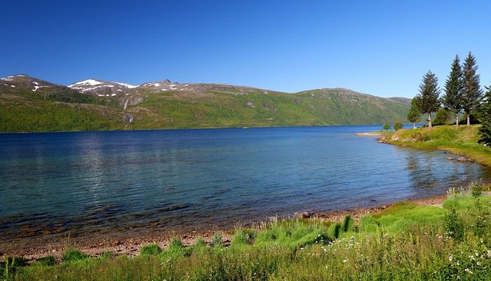
When we arrived at the Senja campsite, it was already 9:30 PM. A sign announced it was full, but luckily, I’d booked it 10 days earlier. By 10:30 PM, as we settled in to eat, it was still broad daylight, and the thermometer read 25°C—despite being at a latitude of 69° North! We went to bed around midnight, exhausted but under the light of a sun that was still very much present. Thanks to Earth’s tilted axis. We’d anticipated this by buying opaque sleep masks because, yes, at this time of year, it’s daylight all the time.
Friday, July 18:
Today, we planned two hikes on the island and a few stops along the way. The map clearly shows that the deepest fjords are in the north and west. Due to time and accessibility, we focused on the northern part of the island. Our first stop was at the viewing platform in Bergbotn:
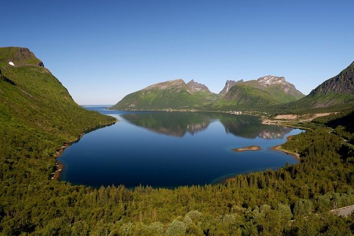
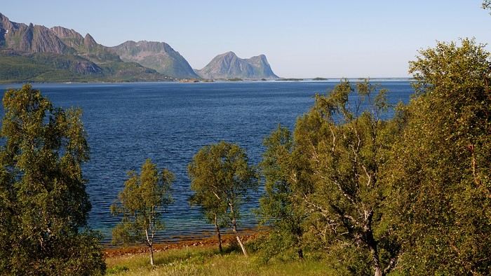
Then we headed toward Skaland, the starting point for our first hike. Along the way, we found plenty of reasons to stop—especially since, on this first day of travel, our thirst for Nordic landscapes was far from quenched.
The town of Skaland is very practical: free parking, picnic tables for after the hike, and a Joker convenience store right next door. Our goal was the summit of Husfjellet: 670 m of elevation gain, between 8 and 9 km in length, and an estimated 4 hours and 30 minutes.
This hike offers two major viewpoints. The first overlooks the Bergsoyan islands to the west:
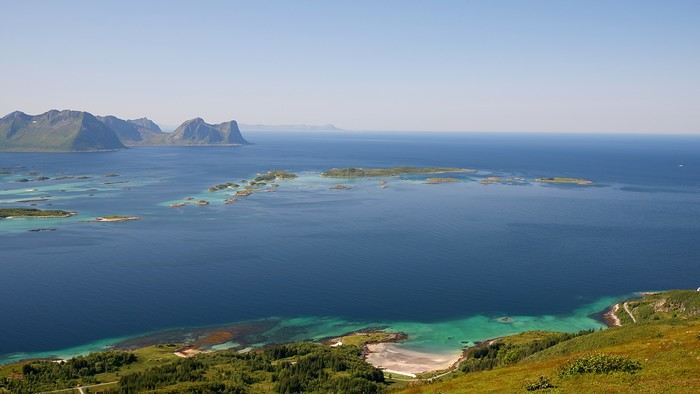
At the summit, the view shifts to the Steinfjorden fjord:
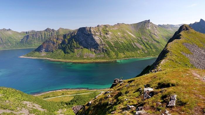
You can even clearly see the "Devil’s Teeth," which we’d see from below later:
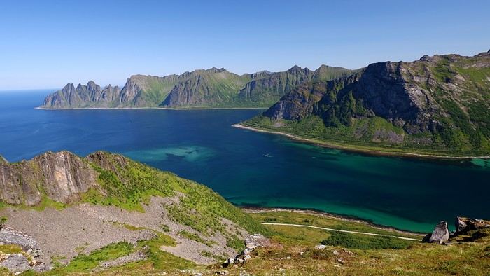
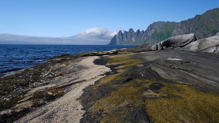
In total, the hike took us 4 hours and 30 minutes, including all the breaks. We treated ourselves to an ice cream in Skaland to recharge for the next hike. We hit the road again and stopped at Tungeneset to get a closer look at the Devil’s Teeth:
We continued to Fjordgard, the starting point for our second hike. Fjordgard isn’t very welcoming. There was a time when you could park right at the start of the hike up Mount Segla. Now, everything’s blocked off, and locals have even taken to blocking all possible parking spots nearby. You now have to park outside the town at a paid parking lot (90 NOK for 3 hours), adding an extra 2 km (round trip) of walking. Still, that was just a minor inconvenience because the hike that followed quickly made us forget all about it. The hike is fairly short (2 hours) but still has 520 m of elevation gain. This hike was a stark contrast to the first. This morning, we had sweeping views of the vast landscape. Here, Mount Segla, perched on the edge of the cliff, dominates the foreground:
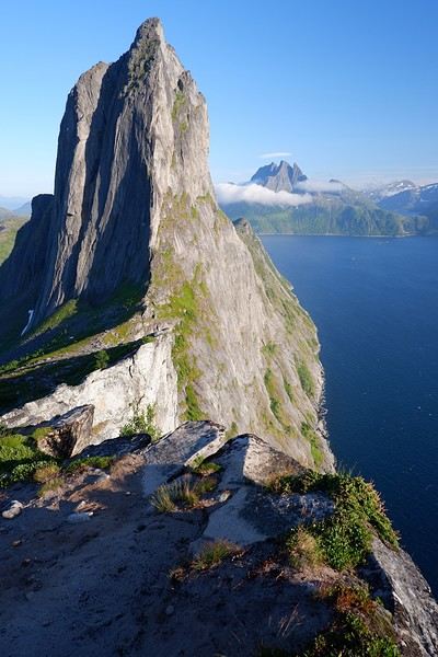
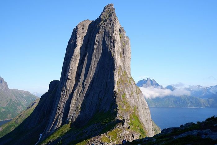
For those prone to vertigo, it might be best to stay at the foot of the mountain, as the trail climbs right along the cliff edge. And from that point on, you quickly understand what verticality really means...
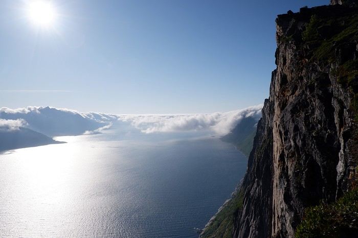
In total, we took 2 hours and 50 minutes, including breaks and the extra walk to the parking lot. The day was already well underway, and with 1,200 m of cumulative elevation gain, it was time to find a spot to eat and sleep. Since we hadn’t made any reservations, we’d planned to bivouac for the night. We weren’t too picky—just practical—so we decided to sleep in the car at the parking lot for tomorrow morning’s hike, just 5 km from Fjordgard.
We traveled to Norway in the summer of 2025, from July 17 to 29, to visit Senja Island and the Lofoten archipelago with a rental car. The common thread of these twelve days was clearly hiking, along with a few visits and experiences, and nights spent in a tent or in the car (which made it possible). We chose Narvik Airport for both arrival and departure for several complementary reasons: the desire to visit nearby Senja Island, slightly more affordable airfare, and finally, the rental price of the vehicle—especially the car model we were looking for. We only made one reservation, for the first campsite, as sleeping in a tent made things much easier. But we had the whole structure of the trip planned, a flexible outline that could adapt to the weather conditions we’d encounter. Senja Island isn’t part of the Lofoten archipelago, and during the early stages of planning this trip, we hadn’t planned to visit it. But its relative proximity to Narvik Airport and, above all, its unique geography definitely made us change our minds. We arrived in Evenes, where Narvik Airport is located, nearly 60 km from the city itself. Our first stop was 40 km further in Bjerkvik on the way to Senja, where there’s a Rema 1000 (a very common supermarket chain in Norway). We needed to buy some food and a gas cartridge for our stove. I’d emailed the store manager beforehand, who told me they didn’t sell them but that the two gas stations in the village were likely to have some in stock.
It was only at the Esso station that I found what I needed, but unfortunately, only one cartridge. Luckily, we quickly realized that most campsites (like in Iceland) have a shared kitchen with hotplates. That single small cartridge was just enough for the few nights we spent outside of campsites... We got our first taste of Norway’s characteristic landscapes:
When we arrived at the Senja campsite, it was already 9:30 PM. A sign announced it was full, but luckily, I’d booked it 10 days earlier. By 10:30 PM, as we settled in to eat, it was still broad daylight, and the thermometer read 25°C—despite being at a latitude of 69° North! We went to bed around midnight, exhausted but under the light of a sun that was still very much present. Thanks to Earth’s tilted axis. We’d anticipated this by buying opaque sleep masks because, yes, at this time of year, it’s daylight all the time.
Friday, July 18:
Today, we planned two hikes on the island and a few stops along the way. The map clearly shows that the deepest fjords are in the north and west. Due to time and accessibility, we focused on the northern part of the island. Our first stop was at the viewing platform in Bergbotn:
Then we headed toward Skaland, the starting point for our first hike. Along the way, we found plenty of reasons to stop—especially since, on this first day of travel, our thirst for Nordic landscapes was far from quenched.
The town of Skaland is very practical: free parking, picnic tables for after the hike, and a Joker convenience store right next door. Our goal was the summit of Husfjellet: 670 m of elevation gain, between 8 and 9 km in length, and an estimated 4 hours and 30 minutes.
This hike offers two major viewpoints. The first overlooks the Bergsoyan islands to the west:
At the summit, the view shifts to the Steinfjorden fjord:
You can even clearly see the "Devil’s Teeth," which we’d see from below later:
In total, the hike took us 4 hours and 30 minutes, including all the breaks. We treated ourselves to an ice cream in Skaland to recharge for the next hike. We hit the road again and stopped at Tungeneset to get a closer look at the Devil’s Teeth:
We continued to Fjordgard, the starting point for our second hike. Fjordgard isn’t very welcoming. There was a time when you could park right at the start of the hike up Mount Segla. Now, everything’s blocked off, and locals have even taken to blocking all possible parking spots nearby. You now have to park outside the town at a paid parking lot (90 NOK for 3 hours), adding an extra 2 km (round trip) of walking. Still, that was just a minor inconvenience because the hike that followed quickly made us forget all about it. The hike is fairly short (2 hours) but still has 520 m of elevation gain. This hike was a stark contrast to the first. This morning, we had sweeping views of the vast landscape. Here, Mount Segla, perched on the edge of the cliff, dominates the foreground:
For those prone to vertigo, it might be best to stay at the foot of the mountain, as the trail climbs right along the cliff edge. And from that point on, you quickly understand what verticality really means...
In total, we took 2 hours and 50 minutes, including breaks and the extra walk to the parking lot. The day was already well underway, and with 1,200 m of cumulative elevation gain, it was time to find a spot to eat and sleep. Since we hadn’t made any reservations, we’d planned to bivouac for the night. We weren’t too picky—just practical—so we decided to sleep in the car at the parking lot for tomorrow morning’s hike, just 5 km from Fjordgard.
Road Trip USA 2023 - Part 2
HIGHWAY 1
Highway 1 runs along the Pacific coast of California from Leggett in the north to Dana Point in the south. It's the longest state route in California, stretching 1,050 km.
It's famous for its breathtaking ocean views. That’s actually why it’s become such a popular route for road trips, with tons of attractions and points of interest all along the way.
After crossing the U.S. interior on our way out (see Road Trip USA 2023 - Part 1), we’re starting our return trip along this route from Leggett.
Videos are embedded throughout the summary. Please click on the image to start the video. To jump to a specific post, here are the appropriate links:
CALIFORNIA:
Scenic Overlooks on Route 1 Between Leggett and Fort Bragg The Pudding Creek Trestle Bridge in Fort Bragg Glass Beach - Fort Bragg Jenner Lookout Point - Highway 1 Goat Rock Beach - Sonoma Coast State Park - Jenner Point Reyes National Seashore - White House Pool Trail Point Reyes National Seashore - Limantour Beach Point Reyes National Seashore - Point Reyes Shipwreck Point Reyes National Seashore - Kehoe Beach Trail Point Reyes National Seashore - McClures Beach Trail Point Reyes National Seashore - Cypress Tree Tunnel Point Reyes National Seashore - Point Reyes Beach North Point Reyes National Seashore - Elephant Seals on Drakes Beach Point Reyes National Seashore - Point Reyes Beach South Point Reyes National Seashore – Elephant Seals Overlooks Point Reyes National Seashore - Chimney Rock Trail Point Reyes National Seashore - Point Reyes Lighthouse Trail Point Reyes National Seashore – Tule Elk Observation Point Bonita Lighthouse Trail - Sausalito Hawk Hill - Sausalito Battery Spencer Trail - Sausalito Rodeo Beach - Sausalito Point Cavallo - Golden Gate View - Sausalito Exploring Downtown Sausalito Visiting Sausalito’s Houseboats Crossing the Golden Gate Bridge - San Francisco Golden Gate Bridge Viewpoints - San Francisco Cruise to Alcatraz Island - San Francisco Visiting Alcatraz Island - San Francisco Civic Center - Downtown San Francisco Market Street & Yerba Buena Gardens - Downtown San Francisco Union Square & Financial District - Downtown San Francisco Fisherman's Wharf, Pier 39 & Embarcadero - San Francisco Sea Lion Observation - Pier 39 - San Francisco Lombard Street & Cable Car - Russian Hill - San Francisco Macondray Lane Historic District - Russian Hill - San Francisco Grace Cathedral & Huntington Park - Nob Hill - San Francisco Telegraph Hill - San Francisco Chinatown - San Francisco Alamo Square & Painted Ladies - Western Addition - San Francisco Palace of Fine Arts - Marina District - San Francisco Presidio of San Francisco California Coastal Trail - Lincoln Park - San Francisco California Palace of the Legion of Honor - Lincoln Park - San Francisco Sutro Baths - Lincoln Park - San Francisco Queen Wilhelmina Garden - Golden Gate Park - San Francisco Bison Paddock - Golden Gate Park - San Francisco Portals of the Past - Golden Gate Park - San Francisco Strawberry Hill - Golden Gate Park – San Francisco Prayerbook Cross & Robin Williams Meadow - Golden Gate Park - San Francisco Hidden Garden Steps & 16th Avenue Tiled Steps - San Francisco Grandview Park - San Francisco Hike - Twin Peaks Three Summits - San Francisco Longboarding Down Twin Peaks Blvd in San Francisco Haight-Ashbury - San Francisco Corona Heights Park - San Francisco Mission Dolores - San Francisco Mural Frescoes (Part 1) - Mission District - San Francisco Mural Frescoes (Part 2) - Mission District - San Francisco Devil's Slide Bunker - Pacifica Mavericks Beach - Half Moon Bay Martins Beach - Half Moon Bay Pigeon Point Lighthouse State Historic Park - Pescadero What to See in Santa Cruz Visiting Capitola What to See in Monterey Carmel-by-the-Sea Lovers Point Park - Pacific Grove Castle Rock, Hurricane Point & Little Sur River Viewpoints Pfeiffer Falls Trail Julia Pfeiffer Burns State Park Vista Point & McWay Falls Highway 1 - Big Sur Viewpoints Salmon Creek Falls San Carpoforo Creek Trail Elephant Seal Vista Point - San Simeon San Simeon Pier Moonstone Beach Boardwalk Shipwreck - Estero Bluffs State Park Surfing Competition in Morro Bay Port San Luis Pier - San Luis Obispo Pismo Beach Monarch Butterfly Grove - Pismo State Beach Nojoqui Falls Park - Solvang Arroyo Hondo Vista Point Solvang, a Charming Danish Town in California Chumash Painted Cave - Santa Barbara Goleta San Marcos Rd & Cachuma Lake Vista Points - Santa Barbara Old Santa Barbara Mission Walking Tour of Santa Barbara’s Historic Downtown West Beach - Santa Barbara What to See in Ventura Paradise Falls - Wildwood Regional Park - Thousand Oaks Sandy Dune & El Matador State Beach - Malibu Point Dume Nature Reserve - Malibu Malibu Pier Road Trip in the Malibu Mountains Los Liones Trail - Santa Monica Santa Monica Pier Rodeo Drive - Beverly Hills Greystone Mansion - Beverly Hills Hollywood Walk of Fame - Los Angeles Griffith Observatory - Los Angeles Hollywood Forever Cemetery - Los Angeles What to See in Venice Beach Venice Beach Skatepark ShoreLine Aquatic Park - Long Beach Alamitos Beach - Long Beach Naples Island - Long Beach Crescent Bay Point Park & Helser Park Kiosk - Laguna Beach Shell Beach at Twin Points - Laguna Beach Prairie Dogs at Agra Vista Point Top Gun House & Oceanside Pier Annie's Canyon Trail - Solana Beach (Via North Rios Trailhead Loop) Old Town San Diego La Jolla Coastal Trail - San Diego Balboa Park - San Diego Pacific Beach - San Diego Mission Beach - San Diego Ocean Beach Tide Pools - San Diego Sunset Cliffs Natural Park - San Diego Tuna Harbor Park - San Diego Seaport Village & Embarcadero Marina Park - San Diego Gaslamp Quarter - Downtown San Diego Coronado Island - San Diego Dead Dolly Lane - Alpine Galleta Meadows Metal Sculptures - Borrego Springs What to See in Palm Springs Robolights - Palm Springs Andreas Canyon Trail - Indian Canyons - Palm Springs Palm Canyon Trail - Indian Canyons - Palm Springs West Fork Falls Trail - Indian Canyons - Palm Springs Tahquitz Canyon Loop Trail - Indian Canyons - Palm Springs Desert Christ Park - Yucca Valley Pioneertown Salvation Mountain - Niland Slab City - Niland
Highway 1 runs along the Pacific coast of California from Leggett in the north to Dana Point in the south. It's the longest state route in California, stretching 1,050 km.
It's famous for its breathtaking ocean views. That’s actually why it’s become such a popular route for road trips, with tons of attractions and points of interest all along the way.
After crossing the U.S. interior on our way out (see Road Trip USA 2023 - Part 1), we’re starting our return trip along this route from Leggett.
Videos are embedded throughout the summary. Please click on the image to start the video. To jump to a specific post, here are the appropriate links:
CALIFORNIA:
Scenic Overlooks on Route 1 Between Leggett and Fort Bragg The Pudding Creek Trestle Bridge in Fort Bragg Glass Beach - Fort Bragg Jenner Lookout Point - Highway 1 Goat Rock Beach - Sonoma Coast State Park - Jenner Point Reyes National Seashore - White House Pool Trail Point Reyes National Seashore - Limantour Beach Point Reyes National Seashore - Point Reyes Shipwreck Point Reyes National Seashore - Kehoe Beach Trail Point Reyes National Seashore - McClures Beach Trail Point Reyes National Seashore - Cypress Tree Tunnel Point Reyes National Seashore - Point Reyes Beach North Point Reyes National Seashore - Elephant Seals on Drakes Beach Point Reyes National Seashore - Point Reyes Beach South Point Reyes National Seashore – Elephant Seals Overlooks Point Reyes National Seashore - Chimney Rock Trail Point Reyes National Seashore - Point Reyes Lighthouse Trail Point Reyes National Seashore – Tule Elk Observation Point Bonita Lighthouse Trail - Sausalito Hawk Hill - Sausalito Battery Spencer Trail - Sausalito Rodeo Beach - Sausalito Point Cavallo - Golden Gate View - Sausalito Exploring Downtown Sausalito Visiting Sausalito’s Houseboats Crossing the Golden Gate Bridge - San Francisco Golden Gate Bridge Viewpoints - San Francisco Cruise to Alcatraz Island - San Francisco Visiting Alcatraz Island - San Francisco Civic Center - Downtown San Francisco Market Street & Yerba Buena Gardens - Downtown San Francisco Union Square & Financial District - Downtown San Francisco Fisherman's Wharf, Pier 39 & Embarcadero - San Francisco Sea Lion Observation - Pier 39 - San Francisco Lombard Street & Cable Car - Russian Hill - San Francisco Macondray Lane Historic District - Russian Hill - San Francisco Grace Cathedral & Huntington Park - Nob Hill - San Francisco Telegraph Hill - San Francisco Chinatown - San Francisco Alamo Square & Painted Ladies - Western Addition - San Francisco Palace of Fine Arts - Marina District - San Francisco Presidio of San Francisco California Coastal Trail - Lincoln Park - San Francisco California Palace of the Legion of Honor - Lincoln Park - San Francisco Sutro Baths - Lincoln Park - San Francisco Queen Wilhelmina Garden - Golden Gate Park - San Francisco Bison Paddock - Golden Gate Park - San Francisco Portals of the Past - Golden Gate Park - San Francisco Strawberry Hill - Golden Gate Park – San Francisco Prayerbook Cross & Robin Williams Meadow - Golden Gate Park - San Francisco Hidden Garden Steps & 16th Avenue Tiled Steps - San Francisco Grandview Park - San Francisco Hike - Twin Peaks Three Summits - San Francisco Longboarding Down Twin Peaks Blvd in San Francisco Haight-Ashbury - San Francisco Corona Heights Park - San Francisco Mission Dolores - San Francisco Mural Frescoes (Part 1) - Mission District - San Francisco Mural Frescoes (Part 2) - Mission District - San Francisco Devil's Slide Bunker - Pacifica Mavericks Beach - Half Moon Bay Martins Beach - Half Moon Bay Pigeon Point Lighthouse State Historic Park - Pescadero What to See in Santa Cruz Visiting Capitola What to See in Monterey Carmel-by-the-Sea Lovers Point Park - Pacific Grove Castle Rock, Hurricane Point & Little Sur River Viewpoints Pfeiffer Falls Trail Julia Pfeiffer Burns State Park Vista Point & McWay Falls Highway 1 - Big Sur Viewpoints Salmon Creek Falls San Carpoforo Creek Trail Elephant Seal Vista Point - San Simeon San Simeon Pier Moonstone Beach Boardwalk Shipwreck - Estero Bluffs State Park Surfing Competition in Morro Bay Port San Luis Pier - San Luis Obispo Pismo Beach Monarch Butterfly Grove - Pismo State Beach Nojoqui Falls Park - Solvang Arroyo Hondo Vista Point Solvang, a Charming Danish Town in California Chumash Painted Cave - Santa Barbara Goleta San Marcos Rd & Cachuma Lake Vista Points - Santa Barbara Old Santa Barbara Mission Walking Tour of Santa Barbara’s Historic Downtown West Beach - Santa Barbara What to See in Ventura Paradise Falls - Wildwood Regional Park - Thousand Oaks Sandy Dune & El Matador State Beach - Malibu Point Dume Nature Reserve - Malibu Malibu Pier Road Trip in the Malibu Mountains Los Liones Trail - Santa Monica Santa Monica Pier Rodeo Drive - Beverly Hills Greystone Mansion - Beverly Hills Hollywood Walk of Fame - Los Angeles Griffith Observatory - Los Angeles Hollywood Forever Cemetery - Los Angeles What to See in Venice Beach Venice Beach Skatepark ShoreLine Aquatic Park - Long Beach Alamitos Beach - Long Beach Naples Island - Long Beach Crescent Bay Point Park & Helser Park Kiosk - Laguna Beach Shell Beach at Twin Points - Laguna Beach Prairie Dogs at Agra Vista Point Top Gun House & Oceanside Pier Annie's Canyon Trail - Solana Beach (Via North Rios Trailhead Loop) Old Town San Diego La Jolla Coastal Trail - San Diego Balboa Park - San Diego Pacific Beach - San Diego Mission Beach - San Diego Ocean Beach Tide Pools - San Diego Sunset Cliffs Natural Park - San Diego Tuna Harbor Park - San Diego Seaport Village & Embarcadero Marina Park - San Diego Gaslamp Quarter - Downtown San Diego Coronado Island - San Diego Dead Dolly Lane - Alpine Galleta Meadows Metal Sculptures - Borrego Springs What to See in Palm Springs Robolights - Palm Springs Andreas Canyon Trail - Indian Canyons - Palm Springs Palm Canyon Trail - Indian Canyons - Palm Springs West Fork Falls Trail - Indian Canyons - Palm Springs Tahquitz Canyon Loop Trail - Indian Canyons - Palm Springs Desert Christ Park - Yucca Valley Pioneertown Salvation Mountain - Niland Slab City - Niland
Hospitalized, very seriously ill in India
Hello,
I’m looking for people who’ve been very seriously ill or had major surgery in India (especially in Kerala). Thanks for sharing your experience.
Come discover the island of Madeira with me
Introduction
We arrived on the island of Madeira (Portugal) at the beginning of May 2023 and stayed for 5 weeks.
This island is renowned for its rich cultural heritage, its famous hikes through lush landscapes, and its seaside resorts. It offers an unforgettable experience for nature lovers.
In this travel journal, you’ll find a list of the many activities we did during our stay to explore the different attractions of this magnificent island.
These attractions are categorized to make it easier to search based on your interests, if needed.
Videos are included throughout the summary. Please click on the image to start the video.
To jump to a specific post, here are the appropriate links:
HIKES:
Calheta - PR19 Caminho Real do Paúl do Mar Santana - Ribeiro Frio - PR11 Vereda dos Balcões Sao Vicente - Gingas - PR16 Levada Fajã do Rodrigues Rabaçal - PR6.1 Levada do Risco & PR6 Levada das 25 fontes Rabaçal - PR6.2 Levada do Alecrim & PR6.3 Vereda da Lagoa do Vento Caniçal - PR8 Vereda da Ponta de São Lourenço São Jorge - PR18 Levada do Rei Ponta do Sol - PR7 modified - Levada Nova & Levada do Moinho Machico - PR5 Vereda das Funduras Funchal - PR1 Vereda do Areeiro (Pico do Areeiro to Pico Ruivo) Funchal - PR1 Vereda do Areeiro (Pico Ruivo to Pico do Areeiro) Funchal - PR1.2 Vereda do Pico Ruivo (outbound) Funchal - PR1.2 Vereda do Pico Ruivo (return) Porto Moniz - Fanal Forest Porto Moniz - PR14 Levada dos Cedros Ribeira Brava - PR17 Caminho do Pináculo e Folhadal (Encumeada) Ribeira Brava - PR17 Caminho do Pináculo e Folhadal (Lombo do Mouro) Ribeira Brava - PR17 Caminho do Pináculo e Folhadal (Bica da Cana) Santana - PR9 Levada do Caldeirão Verde Lamaceiros - Levada Ribeira da Janela Ribeiro Frio - PR10 Levada do Furado Tabua - Levada da Nova (Eastern Sector) Tabua - Levada da Nova (Western Sector) Boa Morte - Levada do Norte Verada da Levada do Facho - Levada do Norte (South) Vale Paraiso - Levada da Serra do Faial Porto Moniz - PR13 Vereda do Fanal Referta - Levada do Castelejo Porto da Cruz - Levada do Castelejo Estanquinhos - Pico Ruivo do Paul da Serra Boaventura - Levada de Cima & Levada da Acha Grande
SEASIDE RESORTS & NATURAL POOLS:
Natural pools of Seixal Seixal Naval Club Seaside Resort - Natural pool Natural pools of Porto Moniz Funchal - Lido Seaside Resort Santana - Foz da Ribeira do Faial Seaside Resort Câmara de Lobos - Salinas Seaside Resort Porto Moniz - Aquário/Cachalote Natural Pools Funchal - Doca do Cavacas Seaside Resort Funchal - Ponta Gorda Seaside Resort Caniço - Roca Mar Hotel Seaside Resort Caniço - Lido Galoma Seaside Resort Calhau de São Jorge Seaside Resort Ribeira Brava Seaside Resort
BEACHES:
São Jorge Beach Calheta Beach Seixal - Laje Beach (Jamaica) Porto de Seixal Beach Caniço - Reis Magos Beach Machico - Machico Beach (Banda d'Além) Machico - São Roque Beach Machico - Ribeira Natal Beach Caniçal - Prainha Beach Porto da Cruz - Alagoa Beach
TOWNS:
Stroll through the town of Ponta do Sol Stroll through the town of Câmara de Lobos Stroll through the town of Ribeira Brava Stroll through the town of Funchal Funchal - Wicker toboggan ride Stroll through the town of Machico Stroll through the town of Santana Stroll through the town of São Vicente São Vicente Caves Park
VIEWPOINTS:
Calheta Region Ponta do Sol Region Ribeira Brava Region Câmara de Lobos Region Funchal Region Santa Cruz Region Porto Moniz Region São Vicente Region Santana Region Machico Region On the road in Madeira
WATERFALLS ALONG THE WAY
Ponta do Sol - Anjos Waterfall Sao Vicente - Água d'Alto Waterfall Seixal - Córrego da Furna Waterfall
We arrived on the island of Madeira (Portugal) at the beginning of May 2023 and stayed for 5 weeks.
This island is renowned for its rich cultural heritage, its famous hikes through lush landscapes, and its seaside resorts. It offers an unforgettable experience for nature lovers.
In this travel journal, you’ll find a list of the many activities we did during our stay to explore the different attractions of this magnificent island.
These attractions are categorized to make it easier to search based on your interests, if needed.
Videos are included throughout the summary. Please click on the image to start the video.
To jump to a specific post, here are the appropriate links:
HIKES:
Calheta - PR19 Caminho Real do Paúl do Mar Santana - Ribeiro Frio - PR11 Vereda dos Balcões Sao Vicente - Gingas - PR16 Levada Fajã do Rodrigues Rabaçal - PR6.1 Levada do Risco & PR6 Levada das 25 fontes Rabaçal - PR6.2 Levada do Alecrim & PR6.3 Vereda da Lagoa do Vento Caniçal - PR8 Vereda da Ponta de São Lourenço São Jorge - PR18 Levada do Rei Ponta do Sol - PR7 modified - Levada Nova & Levada do Moinho Machico - PR5 Vereda das Funduras Funchal - PR1 Vereda do Areeiro (Pico do Areeiro to Pico Ruivo) Funchal - PR1 Vereda do Areeiro (Pico Ruivo to Pico do Areeiro) Funchal - PR1.2 Vereda do Pico Ruivo (outbound) Funchal - PR1.2 Vereda do Pico Ruivo (return) Porto Moniz - Fanal Forest Porto Moniz - PR14 Levada dos Cedros Ribeira Brava - PR17 Caminho do Pináculo e Folhadal (Encumeada) Ribeira Brava - PR17 Caminho do Pináculo e Folhadal (Lombo do Mouro) Ribeira Brava - PR17 Caminho do Pináculo e Folhadal (Bica da Cana) Santana - PR9 Levada do Caldeirão Verde Lamaceiros - Levada Ribeira da Janela Ribeiro Frio - PR10 Levada do Furado Tabua - Levada da Nova (Eastern Sector) Tabua - Levada da Nova (Western Sector) Boa Morte - Levada do Norte Verada da Levada do Facho - Levada do Norte (South) Vale Paraiso - Levada da Serra do Faial Porto Moniz - PR13 Vereda do Fanal Referta - Levada do Castelejo Porto da Cruz - Levada do Castelejo Estanquinhos - Pico Ruivo do Paul da Serra Boaventura - Levada de Cima & Levada da Acha Grande
SEASIDE RESORTS & NATURAL POOLS:
Natural pools of Seixal Seixal Naval Club Seaside Resort - Natural pool Natural pools of Porto Moniz Funchal - Lido Seaside Resort Santana - Foz da Ribeira do Faial Seaside Resort Câmara de Lobos - Salinas Seaside Resort Porto Moniz - Aquário/Cachalote Natural Pools Funchal - Doca do Cavacas Seaside Resort Funchal - Ponta Gorda Seaside Resort Caniço - Roca Mar Hotel Seaside Resort Caniço - Lido Galoma Seaside Resort Calhau de São Jorge Seaside Resort Ribeira Brava Seaside Resort
BEACHES:
São Jorge Beach Calheta Beach Seixal - Laje Beach (Jamaica) Porto de Seixal Beach Caniço - Reis Magos Beach Machico - Machico Beach (Banda d'Além) Machico - São Roque Beach Machico - Ribeira Natal Beach Caniçal - Prainha Beach Porto da Cruz - Alagoa Beach
TOWNS:
Stroll through the town of Ponta do Sol Stroll through the town of Câmara de Lobos Stroll through the town of Ribeira Brava Stroll through the town of Funchal Funchal - Wicker toboggan ride Stroll through the town of Machico Stroll through the town of Santana Stroll through the town of São Vicente São Vicente Caves Park
VIEWPOINTS:
Calheta Region Ponta do Sol Region Ribeira Brava Region Câmara de Lobos Region Funchal Region Santa Cruz Region Porto Moniz Region São Vicente Region Santana Region Machico Region On the road in Madeira
WATERFALLS ALONG THE WAY
Ponta do Sol - Anjos Waterfall Sao Vicente - Água d'Alto Waterfall Seixal - Córrego da Furna Waterfall
Ten dream days at Disney World in Florida
Hi there!
It’s been nearly 6 years since I last posted here or on my travel blog. But I’m back, at least for one post! I’m returning with a dream trip we took in April 2023: a stay at Walt Disney World in Florida.
We went for 10 days. Ten days at an amusement park might seem like a lot, but you should know that Disney isn’t just one park—it’s 4 parks and 2 water parks (only one was open during our trip). So we split those 10 days across 5 parks, which worked out to about 2 days per park.
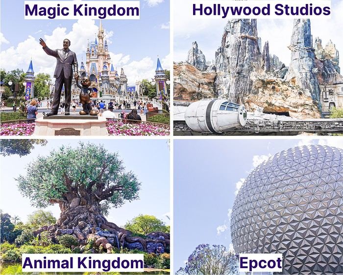
The four main parks each have a different vibe:
Magic Kingdom: The most famous one, the one that most resembles our Disneyland Paris. It’s home to several "lands" (Adventureland, Frontierland, Fantasyland, Tomorrowland, Liberty Square, and Main Street USA). This is the park where you’ll find the iconic castle, the symbol of the parks. Disney’s Hollywood Studios: It’s a bit like the studios at Disneyland Paris, with the well-known Tower of Terror and Toy Story Land. It also features the stunning Star Wars: Galaxy’s Edge (a must-see, even if you’re not a Star Wars fan). Animal Kingdom: A very nature-focused park, divided into several sections, including representations of Africa and Asia, as well as the breathtaking Pandora – The World of Avatar. Epcot: The park of countries, where different nations are represented around a large circular lake—including France!
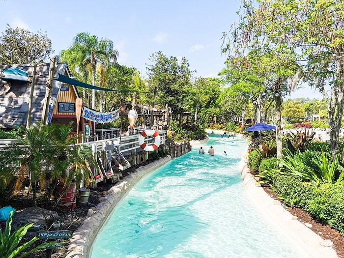
 The water park that was open during our stay was Typhoon Lagoon. We spent a morning there lounging and swimming before heading to Disney Springs (the equivalent of Disney Village in France). We’re not big on pools or chilling out, so we didn’t stay long, but there was no time limit.
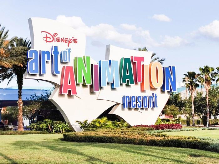
 We chose to stay at the Disney’s Art of Animation hotel, a Resort (huge, like everything there!) with 4 themed areas: Nemo, Cars, The Lion King, and The Little Mermaid (where the rooms for 4 people or fewer are located).
Here’s the itinerary we followed for those 10 days:
Day 1: Flight at 7:35 AM–4:40 PM (with a layover in London), stroller pickup, then shuttle bus to our hotel Day 2: Day at Magic Kingdom Day 3: Day at Hollywood Studios Day 4: Day at Animal Kingdom Day 5: Day at Epcot Day 6: Day at Hollywood Studios Day 7: Relaxing day at Typhoon Lagoon and Disney Springs Day 8: Day at Magic Kingdom Day 9: Day at Epcot Day 10: Day at Magic Kingdom Day 11: Morning at Hollywood Studios, then shuttle bus to the airport, stroller return at the airport, flight at 7:05 PM–1:50 PM (next day)
We rented the stroller from Kingdom Stroller. The rental process was super easy—everything was done online. On the day we arrived and the day we left, there was no staff at the counter, but the stroller was ready with a tag bearing our name. When we left, we just dropped it off at the designated spot, still with no one checking... We used the Mears Connect shuttle: you pick a day and time for them to pick you up at the airport and your hotel. Everything went smoothly, no surprises.
For planning, you’ll need to decide in advance which parks you’ll visit each day because a reservation is required (just like in Paris now). I’d recommend making a schedule ahead of time. Same goes for restaurants—figure out which ones you’d like to eat at beforehand. Some work like fast food and don’t require reservations, while others, the "Table Service" restaurants, operate like traditional restaurants and need to be booked in advance to guarantee a spot. These can be reserved 60 days before the first day of your visit, and that applies to all the restaurants for your entire stay (e.g., if you’re going from February 1st to 11th, you can make reservations for the whole trip 60 days before February 1st).
Not essential, but we found them super handy: MagicBands. These are connected bracelets you buy on-site (not cheap, of course) that let you, once linked to your account in the app, open your hotel room, enter the parks, validate Lightning Lane reservations at attraction entrances, and even make purchases (if you’ve linked a credit card). We got the cheapest ones and loved them!
As for the trip’s wrap-up, if I were to do it again, ... I’d do almost everything the same: The schedule and restaurant reservations I planned were perfect! ... I’d change one thing: Maybe I wouldn’t plan two full days at Epcot because it was the park we enjoyed the least. Some attractions (like the amazing Guardians of the Galaxy: Cosmic Rewind) were great, but it was really hot, the park isn’t shaded, and it felt stifling when the weather was scorching. That said, I don’t regret it because a big storm hit on our second day, forcing us back to the hotel.
That’s all for now—I’ll be back soon with photos from each park and the hotel. You’ll see, it was incredible! See you soon! :)
Magic Kingdom: The most famous one, the one that most resembles our Disneyland Paris. It’s home to several "lands" (Adventureland, Frontierland, Fantasyland, Tomorrowland, Liberty Square, and Main Street USA). This is the park where you’ll find the iconic castle, the symbol of the parks. Disney’s Hollywood Studios: It’s a bit like the studios at Disneyland Paris, with the well-known Tower of Terror and Toy Story Land. It also features the stunning Star Wars: Galaxy’s Edge (a must-see, even if you’re not a Star Wars fan). Animal Kingdom: A very nature-focused park, divided into several sections, including representations of Africa and Asia, as well as the breathtaking Pandora – The World of Avatar. Epcot: The park of countries, where different nations are represented around a large circular lake—including France!
The water park that was open during our stay was Typhoon Lagoon. We spent a morning there lounging and swimming before heading to Disney Springs (the equivalent of Disney Village in France). We’re not big on pools or chilling out, so we didn’t stay long, but there was no time limit.
We chose to stay at the Disney’s Art of Animation hotel, a Resort (huge, like everything there!) with 4 themed areas: Nemo, Cars, The Lion King, and The Little Mermaid (where the rooms for 4 people or fewer are located).Here’s the itinerary we followed for those 10 days:
Day 1: Flight at 7:35 AM–4:40 PM (with a layover in London), stroller pickup, then shuttle bus to our hotel Day 2: Day at Magic Kingdom Day 3: Day at Hollywood Studios Day 4: Day at Animal Kingdom Day 5: Day at Epcot Day 6: Day at Hollywood Studios Day 7: Relaxing day at Typhoon Lagoon and Disney Springs Day 8: Day at Magic Kingdom Day 9: Day at Epcot Day 10: Day at Magic Kingdom Day 11: Morning at Hollywood Studios, then shuttle bus to the airport, stroller return at the airport, flight at 7:05 PM–1:50 PM (next day)
We rented the stroller from Kingdom Stroller. The rental process was super easy—everything was done online. On the day we arrived and the day we left, there was no staff at the counter, but the stroller was ready with a tag bearing our name. When we left, we just dropped it off at the designated spot, still with no one checking... We used the Mears Connect shuttle: you pick a day and time for them to pick you up at the airport and your hotel. Everything went smoothly, no surprises.
For planning, you’ll need to decide in advance which parks you’ll visit each day because a reservation is required (just like in Paris now). I’d recommend making a schedule ahead of time. Same goes for restaurants—figure out which ones you’d like to eat at beforehand. Some work like fast food and don’t require reservations, while others, the "Table Service" restaurants, operate like traditional restaurants and need to be booked in advance to guarantee a spot. These can be reserved 60 days before the first day of your visit, and that applies to all the restaurants for your entire stay (e.g., if you’re going from February 1st to 11th, you can make reservations for the whole trip 60 days before February 1st).
Not essential, but we found them super handy: MagicBands. These are connected bracelets you buy on-site (not cheap, of course) that let you, once linked to your account in the app, open your hotel room, enter the parks, validate Lightning Lane reservations at attraction entrances, and even make purchases (if you’ve linked a credit card). We got the cheapest ones and loved them!
As for the trip’s wrap-up, if I were to do it again, ... I’d do almost everything the same: The schedule and restaurant reservations I planned were perfect! ... I’d change one thing: Maybe I wouldn’t plan two full days at Epcot because it was the park we enjoyed the least. Some attractions (like the amazing Guardians of the Galaxy: Cosmic Rewind) were great, but it was really hot, the park isn’t shaded, and it felt stifling when the weather was scorching. That said, I don’t regret it because a big storm hit on our second day, forcing us back to the hotel.
That’s all for now—I’ll be back soon with photos from each park and the hotel. You’ll see, it was incredible! See you soon! :)
Recap of 17 days between São Paulo, Rio de Janeiro, and Iguaçu/Puerto Iguazu
I’ll repost here the comments I gave in reply to Camidav – see their post https://voyageforum.com/forum/partir-10-jours-bresil-en-autonomie-d10702249/.
As we’ve said several times, 10 days is short for Brazil! But it’s still enough for a “little introduction.” My very recent experience (April 2025) with a 2½-week itinerary might give you some ideas. To start, here’s the route:
- - Saturday, March 29: departure from Lisbon and arrival in São Paulo with LATAM
- - 2 nights in São Paulo
- - Monday, March 31: bus from São Paulo to Paraty
- - Monday 31, Tuesday 1st, and Wednesday, April 2: 3 nights in Paraty
- - Thursday, April 3: bus from Paraty to Angra dos Reis, then ferry > Ilha Grande
- - Thursday 3, Friday 4, and Saturday, April 5: 3 nights in Abraão, on Ilha Grande
- - Sunday, April 6: speedboat > Conceição de Jacareí, then bus > Rio de Janeiro
- - Sunday 6, Monday 7, Tuesday 8, and Wednesday, April 9: 4 nights in Rio
- - Thursday, April 10: flight with LATAM from Rio to Foz do Iguaçu
- - Thursday, April 10: one night in Foz do Iguaçu
- - Friday, April 11: visit to Iguaçu Falls on the Brazilian side, then crossing the border to Puerto Iguazu
- - Friday 11 and Saturday, April 12: 2 nights in Puerto Iguazu
- - Saturday, April 12: visit to the falls on the Argentine side
- - Sunday, April 13: return to Brazil, LATAM flight > São Paulo
- - Sunday 13 and Monday, April 14: 2 nights in São Paulo
- - Tuesday, April 15: flight from São Paulo > Lisbon with LATAM, arriving Wednesday the 16th.
So, it’s clear I’m writing this now from Puerto Iguazu (Argentina), and the end of the trip is near: back to São Paulo and then the flight to Lisbon. I’ll of course share more about all this in the following messages.
Return to "The Wave" (Coyote Buttes North Advanced Lottery): access trail questions
Hi there,
I just got the "congratulations" email last night letting me know that our first-choice access to The Wave for June 16, 2025, was approved in the March 1st lottery draw! We thought we’d missed out since we hadn’t heard anything on the 1st or 2nd of March...
It’s true that for the past two years, it’s no longer 10 and 10 people like before, but 48 and 16 who are allowed to enter the site through the two lottery processes. That helps balance out the surge in applications that must come with the place’s growing global fame...
I haven’t found any info on this, but does anyone know how many applications are typically submitted each month per date for the Advanced Lottery?
So, my somewhat lucky track record for 3 attempts: 2 successes for April 2009 and June 2025, and one miss for September 2011. We’re still a little nervous about the likely high temperatures, with hardly any shade or water on-site 😛. At Easter 2009, it had snowed a bit the day before...
From what I remember, the access trail from Route 89 to Wire Pass Trailhead was doable without a 4x4, with a bit of ground clearance and careful driving (obviously no storms). A simple Toyota RAV4, like the one we’re planning to rent, should be fine in dry conditions?
We’ll be heading there from Page on the morning of 06/16 (how long’s the drive?), then heading to Kanab for 3 nights in the evening.
Thanks for any tips you might have! 😉
Unusual trip to Rajasthan November 2022
Friday, November 4
My flight Barcelona - Abu Dhabi - Delhi went smoothly, it’s on time, and here I am back in India after 3 long years.
As I step off the plane, we head toward customs. It’s 3 AM, I’m tired but happy. The huge customs hall is below ground level and buzzing with people who’ve just arrived. In the end, they’re well organized—Indians to the left, foreigners to the right, and all along the hall, the customs officers’ posts, who remain very zen despite the crowd. It took me less than 2 hours to get out of the airport, which was pretty quick.
For this return trip, I got in touch with a driver from the "Lovers of India" group who was supposed to take me from the airport to Udaipur, passing through non-touristy villages like I love. This French-speaking driver had convinced me to travel by car, which was supposed to make moving from village to village easier. Two or three days before departure, I receive a message from the driver saying he was sick with a cold and sending another driver, his very kind brother who knows Rajasthan well but doesn’t speak French. I’m a bit disappointed by this message and doubtful about the driver’s sincerity, but I don’t have time to find another driver, so I stick to my plans, though I’m not at ease.
At the exit, the driver hasn’t arrived, and I wait half an hour before seeing him show up with a big smile, "Namaste." We don’t waste time and head to the car, which is clean and new.
We get to know each other in the car and hit the road toward Alwar. Along the way, we stop for lunch and to taste my first masala chai, which wakes up my taste buds.
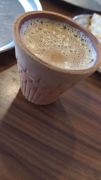
I doze off during the drive, and we arrive at the Atlantic Hotel in Alwar at 10:30 AM. My room is on the ground floor, and I settle in quickly. The Wi-Fi isn’t working, but the staff do everything they can to fix it. At noon, Gajender, the driver, suggests visiting the Qila Fort, which is on the heights of Alwar. The fort is closed for restoration, but safari tours are offered—jeep, guide, driver, and visit for 1600 Rs.
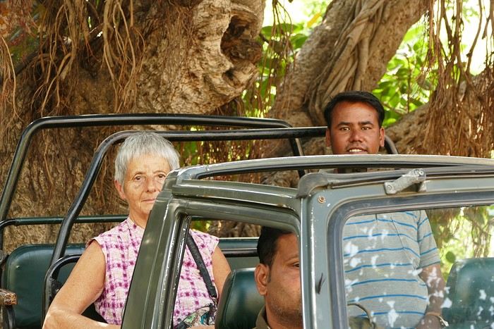
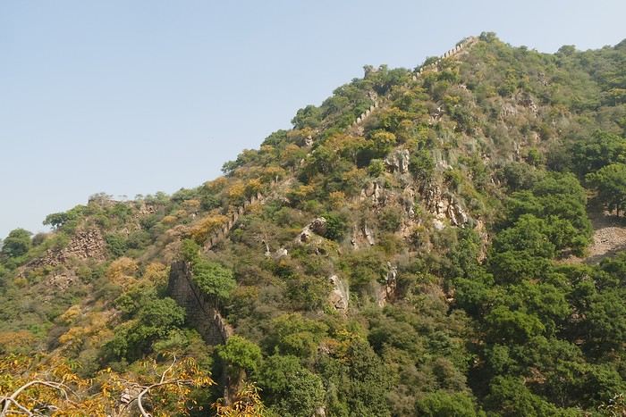
We follow the great wall, which is impressive—the second largest in India and the third in the world.
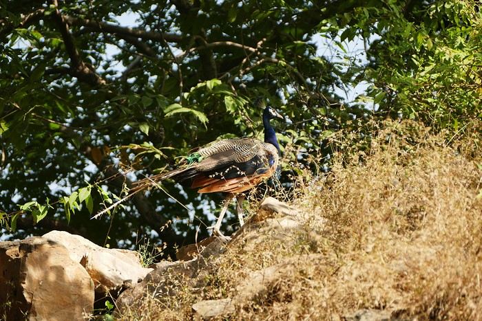
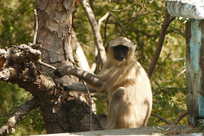
We spot peacocks and monkeys.
The guide shows me an old stepwell lost in nature. It’s always my thing to check out these baoris, which can be stunning, but this one isn’t anything special. We arrive at the palace overlooking the city.
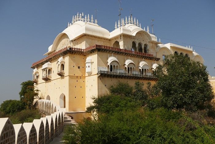
We walk around the palace, and I discover another stepwell that’s not worth lingering over.
The tour is over, and I had a great time despite the fatigue. We head back down to Alwar, near the City Palace, which has been turned into administrative offices. Gaju (the driver’s nickname) finds a parking spot near a dhaba where we have lunch (paneer masala, chapatis, chai)—it’s delicious. With my energy restored, we head to the palace. On the top floor is a museum that I visit.
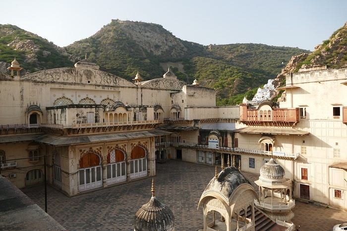
At the exit of the museum, we have to go back down and walk around the palace to get to the Moosi Maharani Chhatri. I’ve been here once before and really liked it, and the place is still the same—calm and relaxing.
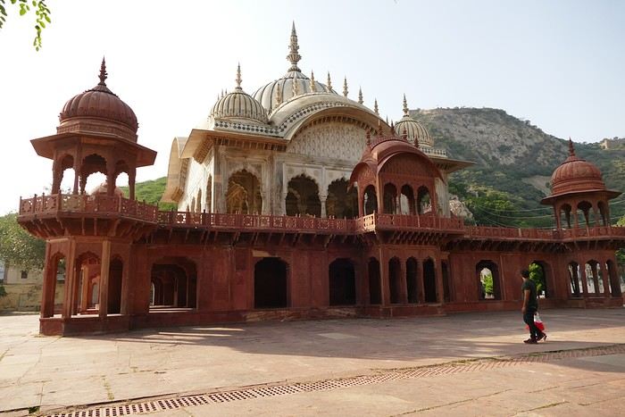
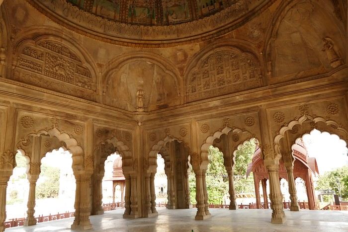
"This monument is the most artistic in Alwar and also the most royal, filled with fascinating history. Maharaja Vinay Singh of Alwar built this two-story cenotaph in 1815 in memory of his father, Maharaja Bakhtawar Singh. It’s also known as Moosi Maharani ki Chhatri, named after the king’s mistress, who performed sati upon his death. After the sati, she was accepted as the king’s wife. It’s an elegant monument, shaped like a flower and built with a mix of brown sandstone and white marble. The first floor is made of sandstone, while the upper floor and the chhatris (cenotaphs) are in white marble. Its sculpted pavilion has dome-shaped arches with intricate lace-like and exquisite floral patterns. There are complex motifs that shine brightly in the sunlight. The colorful circular ceiling is an important part of Moosi Maharani Ki Chhatri and is adorned with faded gold-leaf paintings of mythological figures and scenes. The footprints of Maharaja and Moosi Rani are engraved in marble inside the cenotaph, and locals pay their respects to them."
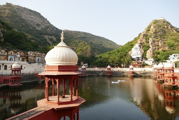
Near the chhatri, there’s a large water reservoir with a magnificent view. The place is peaceful and relaxing, and I stay here for a while, contemplating and daydreaming before heading back to the hotel for some well-deserved rest. The Wi-Fi is working now. I’m the only foreign guest, and since my room is near the entrance, I’ll be well taken care of throughout my stay.
I doze off during the drive, and we arrive at the Atlantic Hotel in Alwar at 10:30 AM. My room is on the ground floor, and I settle in quickly. The Wi-Fi isn’t working, but the staff do everything they can to fix it. At noon, Gajender, the driver, suggests visiting the Qila Fort, which is on the heights of Alwar. The fort is closed for restoration, but safari tours are offered—jeep, guide, driver, and visit for 1600 Rs.
We follow the great wall, which is impressive—the second largest in India and the third in the world.
We spot peacocks and monkeys.
The guide shows me an old stepwell lost in nature. It’s always my thing to check out these baoris, which can be stunning, but this one isn’t anything special. We arrive at the palace overlooking the city.
We walk around the palace, and I discover another stepwell that’s not worth lingering over.
The tour is over, and I had a great time despite the fatigue. We head back down to Alwar, near the City Palace, which has been turned into administrative offices. Gaju (the driver’s nickname) finds a parking spot near a dhaba where we have lunch (paneer masala, chapatis, chai)—it’s delicious. With my energy restored, we head to the palace. On the top floor is a museum that I visit.
At the exit of the museum, we have to go back down and walk around the palace to get to the Moosi Maharani Chhatri. I’ve been here once before and really liked it, and the place is still the same—calm and relaxing.
"This monument is the most artistic in Alwar and also the most royal, filled with fascinating history. Maharaja Vinay Singh of Alwar built this two-story cenotaph in 1815 in memory of his father, Maharaja Bakhtawar Singh. It’s also known as Moosi Maharani ki Chhatri, named after the king’s mistress, who performed sati upon his death. After the sati, she was accepted as the king’s wife. It’s an elegant monument, shaped like a flower and built with a mix of brown sandstone and white marble. The first floor is made of sandstone, while the upper floor and the chhatris (cenotaphs) are in white marble. Its sculpted pavilion has dome-shaped arches with intricate lace-like and exquisite floral patterns. There are complex motifs that shine brightly in the sunlight. The colorful circular ceiling is an important part of Moosi Maharani Ki Chhatri and is adorned with faded gold-leaf paintings of mythological figures and scenes. The footprints of Maharaja and Moosi Rani are engraved in marble inside the cenotaph, and locals pay their respects to them."
Near the chhatri, there’s a large water reservoir with a magnificent view. The place is peaceful and relaxing, and I stay here for a while, contemplating and daydreaming before heading back to the hotel for some well-deserved rest. The Wi-Fi is working now. I’m the only foreign guest, and since my room is near the entrance, I’ll be well taken care of throughout my stay.
A lovely wander at the mercy of the wind in this amazing Rajasthan
Hey there, forum friends 😉
Some of you have mentioned missing the activity on this Indian "page," so let’s try to liven things up a bit—with joy and good vibes (mandatory with me 😜). Plus, it’ll make Jojoone happy 😊.
As big lovers of India—we’ve been six times—my co-traveler husband and I decided to explore Rajasthan this time around. The reason we waited so long to come here? We were dreading the tourist crowds in this state. But thanks to the timing (late March to early April 2024, which is starting to get pretty hot) and Aleph’s great tips, we were *very* far from mass tourism.
We spent three weeks getting around on our own for transport: mostly taxis and trains.
And I’ll admit, we had a rather "Arabian Nights" experience, far from the "real" India (Marien, if you’re reading this 😉). So this travel journal makes no claims other than to share what we saw, experienced, and felt—with all our ignorance about this country (which I’m fully aware of).
But fair warning: I go overboard with emojis, and this journal is super casual because it’s the one I share, almost in "live" mode, with our loved ones.
So, if you’re here, consider yourself almost part of the family 😄.
See you soon and....
Some of you have mentioned missing the activity on this Indian "page," so let’s try to liven things up a bit—with joy and good vibes (mandatory with me 😜). Plus, it’ll make Jojoone happy 😊.
As big lovers of India—we’ve been six times—my co-traveler husband and I decided to explore Rajasthan this time around. The reason we waited so long to come here? We were dreading the tourist crowds in this state. But thanks to the timing (late March to early April 2024, which is starting to get pretty hot) and Aleph’s great tips, we were *very* far from mass tourism.
We spent three weeks getting around on our own for transport: mostly taxis and trains.
And I’ll admit, we had a rather "Arabian Nights" experience, far from the "real" India (Marien, if you’re reading this 😉). So this travel journal makes no claims other than to share what we saw, experienced, and felt—with all our ignorance about this country (which I’m fully aware of).
But fair warning: I go overboard with emojis, and this journal is super casual because it’s the one I share, almost in "live" mode, with our loved ones.
So, if you’re here, consider yourself almost part of the family 😄.
See you soon and....
From Caño Cristales to Tayrona Park
After about 12 hours of flying from Toulouse (via Paris), we landed in Bogotá six years after our first trip to Colombia. This time, our journey will be very different, with only this stop in the Colombian capital in common.
Our travel itinerary
Bogotá / La Macarena (Caño Cristales) / Villa de Leyva / Barichara / San Gil / Girón / Mompox / Ciénaga and the Santa Marta lagoon / Minca / Los Naranjos (Tayrona Park) / Bogotá.
Step 1: Bogotá (and Nemecon)
Bogotá (1/3)
This morning, we had a meet-up with Flora from Aventure Colombia, who helped me organize one of our stops, a few transfers, and tomorrow’s day trip, the program of which I changed at the last minute after deciding to skip the visit to the Salt Cathedral of Zipaquirá. Flora is a kind and lovely person, always available, and she did everything to answer my questions and give me advice.
She’s a local contact I highly recommend. Flora can help you plan your trip, whether you want a fully organized tour or, like us, just need assistance with a specific stop or one or more transfers between cities.
We left Flora after setting a meet-up for our return to Bogotá in a month. As we walked out of her agency, we headed to the wonderful Gold Museum, located just a hundred meters away. I was excited to revisit this amazing museum.
Note: Free entry for those over 60, regardless of nationality. Just show your passport.
Like six years ago, I was amazed by its museography, the beauty of the pieces on display, and that breathtaking shamanic room.
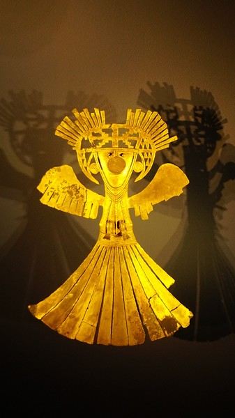
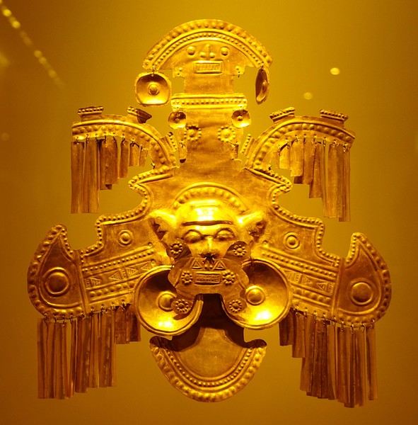
About two hours later, we decided to walk (careful, it’s a climb!) to the Monserrate cable car (3152m). Long wait to buy tickets and board the cable car! Once we arrived, a few raindrops, an impressive panoramic view of Bogotá’s vastness, a quick visit to the basilica (a pilgrimage site for Colombians), a walk through the tourist market, and at the top, plenty of small restaurants where we had our first Colombian meal. After our hearty lunch, we were lucky to see the sun return! No line for the descent. We then headed back to the hotel because Justine wanted to rest and recover from the trip. As for me, I continued my walk. I discovered a really nice craft market recommended by Flora, Pasaje Rivas, returned to Bolívar Square, and wandered through different streets, including the main pedestrian avenue (Calle 7), where there’s always something to see.
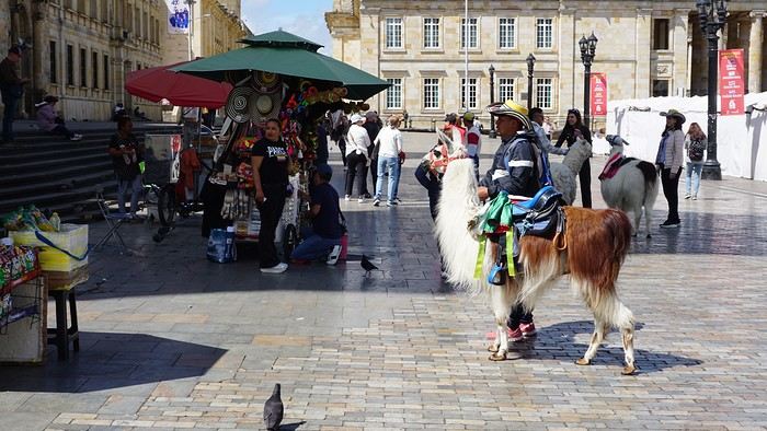
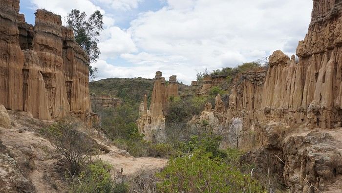
Tomorrow, a change of scenery as we head out for a hike in a small desert (Desierto de Chueca), located about 2 hours from Bogotá in the village of Nemecon. For this outing from Bogotá, with Flora’s help, we booked a car with a driver for the day. Flora also took care of booking the guide (since the site can only be visited with one). Nemecon (2/3) Today, we went to Nemecon to hike about 7.5 km in the ‘Desert of Checua.’ It’s nothing like sandy deserts! Instead, it’s geological formations sculpted by time, wind, and water. After two hours on the road—almost one of them spent navigating traffic jams with cars, trucks, buses, and a continuous flow of motorcycles on either side of our taxi—we reached Nemecon! The village center is really (too?) quiet. We met up with Deisy and headed toward the ‘desert,’ about twenty minutes away on a bumpy dirt road. Once there, a quick briefing, and off we went! Deisy didn’t stop talking (in Spanish) for over 3 hours!!! She told us so much about her region (flower farming, water management, traditions, songs, etc.), the origin of the site, and even mentioned Antonio Banderas, who filmed *The 33* in the village’s salt mine (the story of the survival of 33 Chilean miners after a collapse in their copper and gold mine). One hour of walking to reach the site, one hour to explore it, and one hour to return.
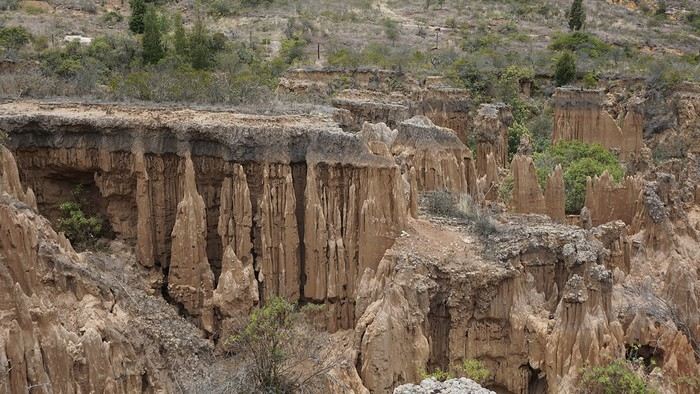
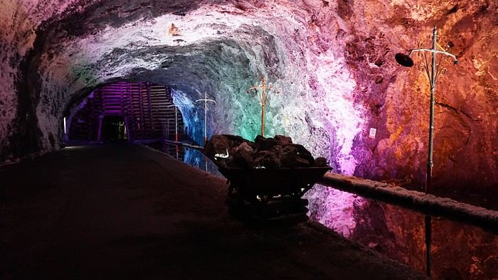
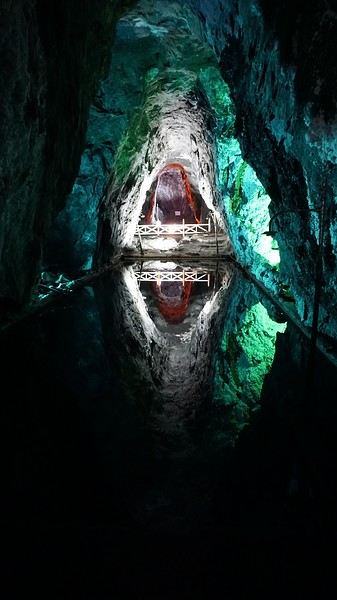
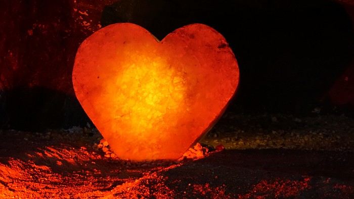
The advantage of this non-stop chatter was that it forced us to brush up on our Spanish at lightning speed. I even wondered if the effort to concentrate wasn’t more exhausting than the physical effort! Especially since on the way back, I got an oral quiz. Deisy wanted to make sure I remembered some of the information she’d given me during the visit: why is this rock white, that one red, and that one black? Back in the village, we had lunch at a restaurant recommended by Deisy before visiting the Nemecon salt mine. Before entering, a guide spent a good half-hour explaining the origin of the salt and the presence of many fossils in the area. Again, concentrating was tough because all the comments were exclusively in Spanish! An hour and a half wandering through the tunnels with a ‘lovely miner’s helmet’ on our heads!
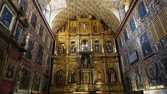
We met our driver at the mine entrance. The return to Bogotá was a bit faster, but traffic in the city center was still heavy! We arrived in front of our hotel between 8:00 and 8:30 PM. It’s been a pretty intense start to the trip! Tonight, our legs are tired. Hopefully, tomorrow will be a bit more relaxed! Bogotá (3/3) We started the day by visiting the Santa Clara Church Museum, located next to the presidential palace. Alejandra (from the local agency ‘Gaia Tours Colombia,’ which organized our stay in Caño Cristales (La Macarena)) had recommended this visit for its rich mural paintings.
A few hundred meters further, after crossing the Plaza Mayor again, we visited the cultural complex housing the Botero Museum, the Mint Museum, and the Bank of the Republic Art Museum. Note that entry is free for all three museums. Botero Museum: There are fewer works by Botero here than in the Medellín museum, but more paintings and sculptures by other artists, all from Botero’s private collection (donated to Colombia). Mint Museum: We limited ourselves to visiting one room (on Flora’s advice) where three gold and gemstone monstrances and a Christ with a crown of emerald thorns are displayed. Photos are not allowed. Art Museum: We visited two temporary exhibitions. Lunchtime came quickly. We had a good meal at a reasonably priced small restaurant in the La Candelaria micro-district, near the Chorro de Quevedo square. We decided to spend the afternoon wandering the streets and alleys of the historic center to discover local street art.
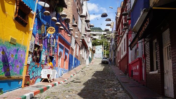
We also passed through very lively pedestrian streets. I also decided to revisit Pasaje Rivas to show Justine all the shops selling more or less artisanal products. Tomorrow morning, we fly to La Macarena at 10:30 AM. Not to dance (you’d be surprised if I told you we were going to take a South American dance class, right?!), but to visit the fabulous Caño Cristales, a river naturally colored by aquatic plants. The planned program includes hiking, horseback riding, canoeing, and swimming among these plants. This site was long inaccessible because the area was controlled by the FARC. Access and tourism development became possible after agreements and amnesty measures between the Colombian government and paramilitary groups. As in other regions, former FARC members have been able to transition into various tourism-related activities.
About two hours later, we decided to walk (careful, it’s a climb!) to the Monserrate cable car (3152m). Long wait to buy tickets and board the cable car! Once we arrived, a few raindrops, an impressive panoramic view of Bogotá’s vastness, a quick visit to the basilica (a pilgrimage site for Colombians), a walk through the tourist market, and at the top, plenty of small restaurants where we had our first Colombian meal. After our hearty lunch, we were lucky to see the sun return! No line for the descent. We then headed back to the hotel because Justine wanted to rest and recover from the trip. As for me, I continued my walk. I discovered a really nice craft market recommended by Flora, Pasaje Rivas, returned to Bolívar Square, and wandered through different streets, including the main pedestrian avenue (Calle 7), where there’s always something to see.
Tomorrow, a change of scenery as we head out for a hike in a small desert (Desierto de Chueca), located about 2 hours from Bogotá in the village of Nemecon. For this outing from Bogotá, with Flora’s help, we booked a car with a driver for the day. Flora also took care of booking the guide (since the site can only be visited with one). Nemecon (2/3) Today, we went to Nemecon to hike about 7.5 km in the ‘Desert of Checua.’ It’s nothing like sandy deserts! Instead, it’s geological formations sculpted by time, wind, and water. After two hours on the road—almost one of them spent navigating traffic jams with cars, trucks, buses, and a continuous flow of motorcycles on either side of our taxi—we reached Nemecon! The village center is really (too?) quiet. We met up with Deisy and headed toward the ‘desert,’ about twenty minutes away on a bumpy dirt road. Once there, a quick briefing, and off we went! Deisy didn’t stop talking (in Spanish) for over 3 hours!!! She told us so much about her region (flower farming, water management, traditions, songs, etc.), the origin of the site, and even mentioned Antonio Banderas, who filmed *The 33* in the village’s salt mine (the story of the survival of 33 Chilean miners after a collapse in their copper and gold mine). One hour of walking to reach the site, one hour to explore it, and one hour to return.
The advantage of this non-stop chatter was that it forced us to brush up on our Spanish at lightning speed. I even wondered if the effort to concentrate wasn’t more exhausting than the physical effort! Especially since on the way back, I got an oral quiz. Deisy wanted to make sure I remembered some of the information she’d given me during the visit: why is this rock white, that one red, and that one black? Back in the village, we had lunch at a restaurant recommended by Deisy before visiting the Nemecon salt mine. Before entering, a guide spent a good half-hour explaining the origin of the salt and the presence of many fossils in the area. Again, concentrating was tough because all the comments were exclusively in Spanish! An hour and a half wandering through the tunnels with a ‘lovely miner’s helmet’ on our heads!
We met our driver at the mine entrance. The return to Bogotá was a bit faster, but traffic in the city center was still heavy! We arrived in front of our hotel between 8:00 and 8:30 PM. It’s been a pretty intense start to the trip! Tonight, our legs are tired. Hopefully, tomorrow will be a bit more relaxed! Bogotá (3/3) We started the day by visiting the Santa Clara Church Museum, located next to the presidential palace. Alejandra (from the local agency ‘Gaia Tours Colombia,’ which organized our stay in Caño Cristales (La Macarena)) had recommended this visit for its rich mural paintings.
A few hundred meters further, after crossing the Plaza Mayor again, we visited the cultural complex housing the Botero Museum, the Mint Museum, and the Bank of the Republic Art Museum. Note that entry is free for all three museums. Botero Museum: There are fewer works by Botero here than in the Medellín museum, but more paintings and sculptures by other artists, all from Botero’s private collection (donated to Colombia). Mint Museum: We limited ourselves to visiting one room (on Flora’s advice) where three gold and gemstone monstrances and a Christ with a crown of emerald thorns are displayed. Photos are not allowed. Art Museum: We visited two temporary exhibitions. Lunchtime came quickly. We had a good meal at a reasonably priced small restaurant in the La Candelaria micro-district, near the Chorro de Quevedo square. We decided to spend the afternoon wandering the streets and alleys of the historic center to discover local street art.
We also passed through very lively pedestrian streets. I also decided to revisit Pasaje Rivas to show Justine all the shops selling more or less artisanal products. Tomorrow morning, we fly to La Macarena at 10:30 AM. Not to dance (you’d be surprised if I told you we were going to take a South American dance class, right?!), but to visit the fabulous Caño Cristales, a river naturally colored by aquatic plants. The planned program includes hiking, horseback riding, canoeing, and swimming among these plants. This site was long inaccessible because the area was controlled by the FARC. Access and tourism development became possible after agreements and amnesty measures between the Colombian government and paramilitary groups. As in other regions, former FARC members have been able to transition into various tourism-related activities.
Photo Safaris in Kenya
Back on the forum, I’m starting to write up two 3-week trips to Kenya in August 2021 and 2023.
In 2021, Quynh and I traveled with Régis (Rjulie95 on VF). Our son joined us in Baringo for the second half of the trip.
In 2023, we went with two friends who’d been dreaming of seeing wild animals ever since we got back from Kenya. We didn’t need much convincing to go with them!
The two itineraries are almost identical (well, when you love something...) but we did make a few tweaks.
- The first part of the trip was with a local driver/guide, Félix, who was recommended by Sylvie56. Sylvie and her husband Ben are Kenya enthusiasts—they’ve been there countless times, always with Félix... and for good reason! He’s fantastic!
- The second part was with Melting Pot Safari, an agency that adapted to our photography needs. Tony Crocetta, the co-founder (along with his Kenyan friend Simon Chebon), is a wildlife photographer himself.
Here are the itineraries for both trips, including accommodations:
In 2021: Day 0: Paris / Nairobi - 67 Airport Hotel Day 1: Nairobi / Amboseli - Simba Cottage Day 2: Amboseli - Simba Cottage Day 3: Amboseli / Aberdares - Fishing Lodge Day 4: Aberdares - Fishing Lodge Day 5: Aberdares - Fishing Lodge Day 6: Aberdares / Samburu - Riverside Camp Day 7: Samburu - Riverside Camp Day 8: Samburu - Riverside Camp Day 9: Samburu / Nakuru - Merica Hotel Day 10: Nakuru / Baringo - Tumbili Cliff Lodge Day 11: Baringo - Tumbili Cliff Lodge Day 12: Baringo - Tumbili Cliff Lodge Day 13: Baringo / Maasai Mara – Meltingpot Bush Camp Day 14 to 18: Maasai Mara – Meltingpot Bush Camp Day 19: Maasai Mara / Nairobi – Roussel Guest House Day 20: Nairobi / Paris
In 2023: Day 0: Lyon / Paris / Nairobi - 67 Airport Hotel Day 1: Nairobi / Meru - Ikweta Camp Day 2: Meru - Ikweta Camp Day 3: Meru - Ikweta Camp Day 4: Meru / Samburu - Riverside Camp Day 5: Samburu – Riverside Camp Day 6: Samburu / Buffalo Springs – Samburu Simba Day 7: Buffalo Springs / Ol Pejeta – Sweetwater Camp Day 8: Ol Pejeta / Amboseli - Simba Cottage Day 9: Amboseli - Simba Cottage Day 10: Amboseli - Simba Cottage Day 11: Amboseli / Nakuru – Lake Nakuru Lodge Day 12: Nakuru / Baringo - Tumbili Cliff Lodge Day 13: Baringo - Tumbili Cliff Lodge Day 14: Baringo - Tumbili Cliff Lodge Day 15: Baringo / Maasai Mara – Meltingpot Bush Camp Day 16 to 20: Maasai Mara – Meltingpot Bush Camp Day 21: Maasai Mara / Nairobi / Paris
Here’s an itinerary—it’s not exactly what we did, but a combination of both.
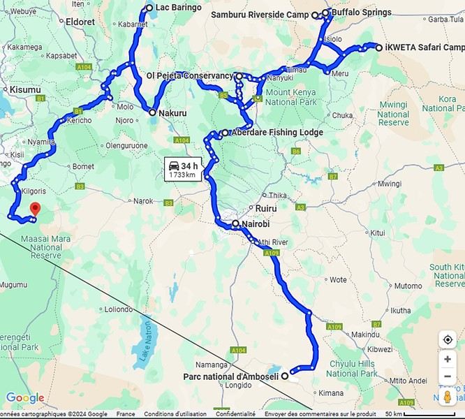
Ready to join us on safari to see some wild animals?
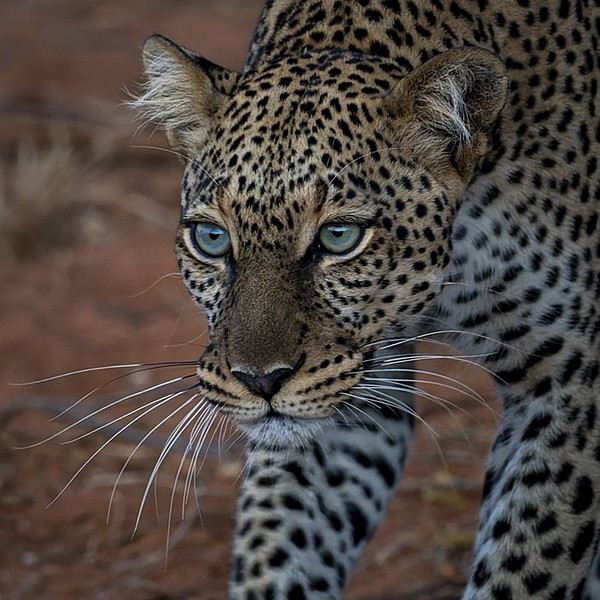
The two itineraries are almost identical (well, when you love something...) but we did make a few tweaks.
- The first part of the trip was with a local driver/guide, Félix, who was recommended by Sylvie56. Sylvie and her husband Ben are Kenya enthusiasts—they’ve been there countless times, always with Félix... and for good reason! He’s fantastic!
- The second part was with Melting Pot Safari, an agency that adapted to our photography needs. Tony Crocetta, the co-founder (along with his Kenyan friend Simon Chebon), is a wildlife photographer himself.
Here are the itineraries for both trips, including accommodations:
In 2021: Day 0: Paris / Nairobi - 67 Airport Hotel Day 1: Nairobi / Amboseli - Simba Cottage Day 2: Amboseli - Simba Cottage Day 3: Amboseli / Aberdares - Fishing Lodge Day 4: Aberdares - Fishing Lodge Day 5: Aberdares - Fishing Lodge Day 6: Aberdares / Samburu - Riverside Camp Day 7: Samburu - Riverside Camp Day 8: Samburu - Riverside Camp Day 9: Samburu / Nakuru - Merica Hotel Day 10: Nakuru / Baringo - Tumbili Cliff Lodge Day 11: Baringo - Tumbili Cliff Lodge Day 12: Baringo - Tumbili Cliff Lodge Day 13: Baringo / Maasai Mara – Meltingpot Bush Camp Day 14 to 18: Maasai Mara – Meltingpot Bush Camp Day 19: Maasai Mara / Nairobi – Roussel Guest House Day 20: Nairobi / Paris
In 2023: Day 0: Lyon / Paris / Nairobi - 67 Airport Hotel Day 1: Nairobi / Meru - Ikweta Camp Day 2: Meru - Ikweta Camp Day 3: Meru - Ikweta Camp Day 4: Meru / Samburu - Riverside Camp Day 5: Samburu – Riverside Camp Day 6: Samburu / Buffalo Springs – Samburu Simba Day 7: Buffalo Springs / Ol Pejeta – Sweetwater Camp Day 8: Ol Pejeta / Amboseli - Simba Cottage Day 9: Amboseli - Simba Cottage Day 10: Amboseli - Simba Cottage Day 11: Amboseli / Nakuru – Lake Nakuru Lodge Day 12: Nakuru / Baringo - Tumbili Cliff Lodge Day 13: Baringo - Tumbili Cliff Lodge Day 14: Baringo - Tumbili Cliff Lodge Day 15: Baringo / Maasai Mara – Meltingpot Bush Camp Day 16 to 20: Maasai Mara – Meltingpot Bush Camp Day 21: Maasai Mara / Nairobi / Paris
Here’s an itinerary—it’s not exactly what we did, but a combination of both.
Ready to join us on safari to see some wild animals?
Back from 3 weeks in Guatemala – self-drive trip
Hi everyone.
I wanted to share a little feedback from our trip to Guatemala—we got back a month ago, and I really appreciated the well-commented posts here that helped us out. So, in turn, I wanted to share our own little recap.
We’ve traveled quite a bit together (we’re 38 and 42), and Guatemala had been on our radar for a while. But with so much info out there, it was hard to sort through it all—especially since we only had 3 weeks on the ground and didn’t want to waste time.
Here’s the itinerary we followed: Antigua, the Pacific coast, Lake Atitlán, a private coffee and bird reserve, Chichicastenango, Sayaxché, El Remate, Río Dulce, and Lake Izabal.
We rented a 4x4, which was essential given the state of some roads.
Our highlights: * **Pacific coast**: So authentic and preserved. We met sea turtles, cooked and baked coconut bread with a women’s community—such a meaningful exchange—and kayaked through a pristine mangrove full of birds. * **Lake Atitlán**: Even though we were worried it might feel too touristy, a private tour let us discover local crafts, hidden workshops (weaving, pottery), and the stunning views from the boat. * **Sayaxché**: The starting point for the Aguateca and Dos Pilas sites—one of our favorite outings. The site is breathtaking: walking through the canyon and jungle-covered ruins with almost no one around. We stayed in a little bungalow on an island, totally off the grid. * **In Petén**, we met an Itza Maya tribe—an unforgettable day sharing a meal and plant-based healing rituals. Wow. This tribe resisted the conquistadors and still lives traditionally. We also took a tour on Lake Petén and swam at hidden little beaches. Tikal was nice, but we preferred Yaxhá. * **Río Dulce**: A day at a private cocoa plantation—an adventure in a buggy with the owner himself. We harvested cocoa and ate the chocolate paste afterward, then swam in a waterfall on the property. Since it’s private, there was no one else around. A real privilege. * **Boat tour on the Río Dulce**: For us, the highlight. We visited a school where they’re committed to giving kids a solid education while blending Maya rituals. * **Lake Izabal**: A peaceful end to the trip in a magical setting. We visited Quiriguá.
We went through an organizer who knows the country really well. We weren’t initially planning on that, but thanks to her, we had experiences we never would’ve found on our own. On top of that, we actually paid less for the trip overall because of her local rates. I’m not getting anything out of this—I just think it could help other travelers. Her business is Secretplaceincostarica (she also does Costa Rica, which we’re now eager to explore).
On the ground, we felt completely safe. The people are lovely, the roads can be a little chaotic at times, but we loved every minute of it.
Happy travels to all! Marie
I wanted to share a little feedback from our trip to Guatemala—we got back a month ago, and I really appreciated the well-commented posts here that helped us out. So, in turn, I wanted to share our own little recap.
We’ve traveled quite a bit together (we’re 38 and 42), and Guatemala had been on our radar for a while. But with so much info out there, it was hard to sort through it all—especially since we only had 3 weeks on the ground and didn’t want to waste time.
Here’s the itinerary we followed: Antigua, the Pacific coast, Lake Atitlán, a private coffee and bird reserve, Chichicastenango, Sayaxché, El Remate, Río Dulce, and Lake Izabal.
We rented a 4x4, which was essential given the state of some roads.
Our highlights: * **Pacific coast**: So authentic and preserved. We met sea turtles, cooked and baked coconut bread with a women’s community—such a meaningful exchange—and kayaked through a pristine mangrove full of birds. * **Lake Atitlán**: Even though we were worried it might feel too touristy, a private tour let us discover local crafts, hidden workshops (weaving, pottery), and the stunning views from the boat. * **Sayaxché**: The starting point for the Aguateca and Dos Pilas sites—one of our favorite outings. The site is breathtaking: walking through the canyon and jungle-covered ruins with almost no one around. We stayed in a little bungalow on an island, totally off the grid. * **In Petén**, we met an Itza Maya tribe—an unforgettable day sharing a meal and plant-based healing rituals. Wow. This tribe resisted the conquistadors and still lives traditionally. We also took a tour on Lake Petén and swam at hidden little beaches. Tikal was nice, but we preferred Yaxhá. * **Río Dulce**: A day at a private cocoa plantation—an adventure in a buggy with the owner himself. We harvested cocoa and ate the chocolate paste afterward, then swam in a waterfall on the property. Since it’s private, there was no one else around. A real privilege. * **Boat tour on the Río Dulce**: For us, the highlight. We visited a school where they’re committed to giving kids a solid education while blending Maya rituals. * **Lake Izabal**: A peaceful end to the trip in a magical setting. We visited Quiriguá.
We went through an organizer who knows the country really well. We weren’t initially planning on that, but thanks to her, we had experiences we never would’ve found on our own. On top of that, we actually paid less for the trip overall because of her local rates. I’m not getting anything out of this—I just think it could help other travelers. Her business is Secretplaceincostarica (she also does Costa Rica, which we’re now eager to explore).
On the ground, we felt completely safe. The people are lovely, the roads can be a little chaotic at times, but we loved every minute of it.
Happy travels to all! Marie
A Month in Laos and Cambodia
Hello everyone,
At the start of November, a bit of rest before winter will be perfect to kick off this travel journal. There aren’t many recent journals about this part of the world, so I’ll take the plunge—my way of celebrating the (unexpected) return of this forum, which has been such a big part of my life for over 15 years.
So, back to Asia at the end of 2023. After Myanmar in 2015 and Vietnam in 2018, we’ve chosen Laos this time. And when talking with friends (you know how it is—everyone asks, "So, where are you going this year?"), a couple of friends asked to join us ("You see, my wife dreams of a trip to Asia, and I dream of traveling like you, independently"). We’ve spent a week with them (and other friends) in Portugal, so we know they’re easygoing and flexible. They’ll only be with us after Christmas (due to lots of grandkids), so deal—we’re bringing them along! A new experience for us.
A new experience that’ll start with tweaking the itinerary. Originally, I planned to stay a month in Laos, but what could be more magical for my friend’s wife than discovering Asia by way of Angkor! Plus, our two daughters asked for some beach time at the end of the trip! So, it’ll be Laos and Cambodia—neither of which we’ve visited before, so no complaints there.
The route will be pretty classic, though a bit scattered to fit our dates and wishes. For us, we’ll arrive in Luang Prabang (LP) to take some time to acclimate, then a few days in the northern Laos mountains, Nong Khiaw and Muang Ngoi. Back to LP for a direct flight to Pakse. Yes, I know—so many amazing places we’ll miss along the way, but as you know, choosing means letting go... From Pakse, I’m leaving a few days open (no bookings), but I’m eyeing Champassak and the 4,000 Islands. That’s where Mariel and Naty (our friends!) will join us on December 30th. I’ve tentatively added the Bolaven Plateau loop to the plan (still no bookings). Their Laos adventure will be short—by January 3rd, we’ll cross the border into Cambodia, heading straight to Siem Reap for 5 days. Then, I’ll fulfill my promise with a magical detour to Koh Rong Sanloem via a night bus (a must-do in Asia!). On to Phnom Penh for 2 days—where our trip ends, while Mariel and Naty will stop in Bangkok for 3 days before flying home.
So, fasten your seatbelts, flight attendants at the doors, and sorry for the long intro—here we go on this Asian adventure!
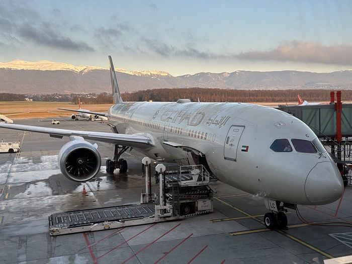
At the start of November, a bit of rest before winter will be perfect to kick off this travel journal. There aren’t many recent journals about this part of the world, so I’ll take the plunge—my way of celebrating the (unexpected) return of this forum, which has been such a big part of my life for over 15 years.
So, back to Asia at the end of 2023. After Myanmar in 2015 and Vietnam in 2018, we’ve chosen Laos this time. And when talking with friends (you know how it is—everyone asks, "So, where are you going this year?"), a couple of friends asked to join us ("You see, my wife dreams of a trip to Asia, and I dream of traveling like you, independently"). We’ve spent a week with them (and other friends) in Portugal, so we know they’re easygoing and flexible. They’ll only be with us after Christmas (due to lots of grandkids), so deal—we’re bringing them along! A new experience for us.
A new experience that’ll start with tweaking the itinerary. Originally, I planned to stay a month in Laos, but what could be more magical for my friend’s wife than discovering Asia by way of Angkor! Plus, our two daughters asked for some beach time at the end of the trip! So, it’ll be Laos and Cambodia—neither of which we’ve visited before, so no complaints there.
The route will be pretty classic, though a bit scattered to fit our dates and wishes. For us, we’ll arrive in Luang Prabang (LP) to take some time to acclimate, then a few days in the northern Laos mountains, Nong Khiaw and Muang Ngoi. Back to LP for a direct flight to Pakse. Yes, I know—so many amazing places we’ll miss along the way, but as you know, choosing means letting go... From Pakse, I’m leaving a few days open (no bookings), but I’m eyeing Champassak and the 4,000 Islands. That’s where Mariel and Naty (our friends!) will join us on December 30th. I’ve tentatively added the Bolaven Plateau loop to the plan (still no bookings). Their Laos adventure will be short—by January 3rd, we’ll cross the border into Cambodia, heading straight to Siem Reap for 5 days. Then, I’ll fulfill my promise with a magical detour to Koh Rong Sanloem via a night bus (a must-do in Asia!). On to Phnom Penh for 2 days—where our trip ends, while Mariel and Naty will stop in Bangkok for 3 days before flying home.
So, fasten your seatbelts, flight attendants at the doors, and sorry for the long intro—here we go on this Asian adventure!
Very nice trip... 15 jours en Croatie English translation pending
C’est fou comme le temps passe vite : le Covid-19 c'est déjà depuis 5 mois ! En Avril il ne fallait pas se découvrir d'un fil, mais oui mais oui du coup on à décidé de ne pas prendre l'avion qui aurait du nous en emmener en Croatie pour une petite semaine de randos, c'est pas comme si on nous n'avait pas laissé le choix :D. En juillet, fait ce qu'il te plait ! Oui mais bon, là cela nous à pas plu quand même de se faire de nouveau annuler l'avion pour un voyage de 2-3 semaines en Pologne et en Allemagne à 5 semaines du Jour J...
C'était ainsi le moment de sortir notre choixpeau magique et faire une analyse SWOT pour décider rapidement ce qu'on allait faire. La combinaison des deux, donc moi même humblement, avons fini par trouver en moins de 4 jours notre nouveau plan B. Bien sûr, une fois de plus je me suis appuyée sur les aides des voyage forumeurs (merci en fait surtout a Blag....) pour ...encarder mon inspiration. Pour une fois les horaires sont très family-friendly et notre départ est orchestré pour un samedi vers 15h00. Sac-à-dos, marmaille, mari, masques et valise chargés c'est parti pour un nouveau petit roadtrip.
L'arrivée sentait bon les vacances mais surtout notre haleine avec ces masques. Au moins tu sais quand tu dois te brosser les dents ou manger un tic tac. Valise en poche ou presque, voiture de location inspectée de fond en combles avec videos et photos comme back up. C'est parti pour deux semaines en....Croatie ! et bien oui, je n'allais pas laisser de côté un travail de cherche et planification d'une dizaine d'heures en janvier filer comme ça.
Alors, pourquoi la Croatie ? Nous y étions déjà (non monsieur nous ne l’avons pas déjà « faite », mon expression de chambrage préférée pour 80% de la populace) en 2015 et c’était très chouette. Le road trip avait consisté à partir de l’Alsace : Munich/Allemagne, Bled/Solvenie, Plitvice (what else ?), ile de Rab, ile de Krk, re Munich. Les paysages étaient magnifiques, on a bien mangé, l’eau était belle, que demander de plus ?... En plus avec le Covid (pays au moment du départ assez bien loti, moins en retour :D), le peu de temps que je disposais pour planifier les étapes d’un road trip et du fait que j’avais dejà du matos pour combler 1 semaine plus moins, cela tombait à pic !
Combien de temps et qui : 15 jours tout rond, mon amoureux, mes deux nenettes (9 et 11 ans)
Vous étiez ou ? DT…..
Mais non en club méd !
Sans déconner ? le club med ? j’aurais même pas besoin de venir sur ce forum pour y aller. Plus sérieusement, le choix était difficile mais finalement c’était : Split, Zadar, Dugi Otok, Omis, Dubrovnik, Hvar, Kastel Luksic
Comment ? Avec un tel itinéraire pas le choix : voiture de location – aie le budget. Aussi en mode routard upper grade car nous avons fait quelques tous les jours des resto Konobas – aie le budget bis. Aussi on a sélectionné quelques logements avec point de chute clé ou assez sympa selon les commentaires d’autres voyageurs – aie le budget tris.
En résumé ? Nous avons adoré : la variété et la beauté des paysages, la mer, les rivières fraiches, les grillades, .. .et on reviendra de nouveau! Ce que nous aurions changé : éliminer Hvar pour rajouter 1 jour a Zadar et 1 jour a Dubrovnik ; Le trajet en Ferry est quand même une source de perte de temps avec toutes les attentes à faire.
C'est parti pour une petite review...
C'était ainsi le moment de sortir notre choixpeau magique et faire une analyse SWOT pour décider rapidement ce qu'on allait faire. La combinaison des deux, donc moi même humblement, avons fini par trouver en moins de 4 jours notre nouveau plan B. Bien sûr, une fois de plus je me suis appuyée sur les aides des voyage forumeurs (merci en fait surtout a Blag....) pour ...encarder mon inspiration. Pour une fois les horaires sont très family-friendly et notre départ est orchestré pour un samedi vers 15h00. Sac-à-dos, marmaille, mari, masques et valise chargés c'est parti pour un nouveau petit roadtrip.
L'arrivée sentait bon les vacances mais surtout notre haleine avec ces masques. Au moins tu sais quand tu dois te brosser les dents ou manger un tic tac. Valise en poche ou presque, voiture de location inspectée de fond en combles avec videos et photos comme back up. C'est parti pour deux semaines en....Croatie ! et bien oui, je n'allais pas laisser de côté un travail de cherche et planification d'une dizaine d'heures en janvier filer comme ça.
Alors, pourquoi la Croatie ? Nous y étions déjà (non monsieur nous ne l’avons pas déjà « faite », mon expression de chambrage préférée pour 80% de la populace) en 2015 et c’était très chouette. Le road trip avait consisté à partir de l’Alsace : Munich/Allemagne, Bled/Solvenie, Plitvice (what else ?), ile de Rab, ile de Krk, re Munich. Les paysages étaient magnifiques, on a bien mangé, l’eau était belle, que demander de plus ?... En plus avec le Covid (pays au moment du départ assez bien loti, moins en retour :D), le peu de temps que je disposais pour planifier les étapes d’un road trip et du fait que j’avais dejà du matos pour combler 1 semaine plus moins, cela tombait à pic !
Combien de temps et qui : 15 jours tout rond, mon amoureux, mes deux nenettes (9 et 11 ans)
Vous étiez ou ? DT…..
Mais non en club méd !
Sans déconner ? le club med ? j’aurais même pas besoin de venir sur ce forum pour y aller. Plus sérieusement, le choix était difficile mais finalement c’était : Split, Zadar, Dugi Otok, Omis, Dubrovnik, Hvar, Kastel Luksic
Comment ? Avec un tel itinéraire pas le choix : voiture de location – aie le budget. Aussi en mode routard upper grade car nous avons fait quelques tous les jours des resto Konobas – aie le budget bis. Aussi on a sélectionné quelques logements avec point de chute clé ou assez sympa selon les commentaires d’autres voyageurs – aie le budget tris.
En résumé ? Nous avons adoré : la variété et la beauté des paysages, la mer, les rivières fraiches, les grillades, .. .et on reviendra de nouveau! Ce que nous aurions changé : éliminer Hvar pour rajouter 1 jour a Zadar et 1 jour a Dubrovnik ; Le trajet en Ferry est quand même une source de perte de temps avec toutes les attentes à faire.
C'est parti pour une petite review...
Two Weeks in Dominica
Hi everyone, I’m sharing my travel journal from Dominica (not to be confused with the Dominican Republic) in January 2020. We wanted to escape the rain, gloom, and cold of France—and we got *some* rain and storms, but also warmth!
DOMINICA A small Caribbean island of 754 km², located between Guadeloupe and Martinique, Dominica is part of the Commonwealth. Roseau is its capital. The locals speak English and Creole. The currency is the East Caribbean Dollar (EC$). In October 2019, we decided to visit this little paradise from January 9 to 24, 2020—14 nights on the island. We traveled as two couples. Flight booking with Air Caraïbes: Orly Terminal 4 to Pointe-à-Pitre by plane, then P-à-P to Roseau with L’Express des Îles (boat) for the outbound trip. Marigot to Pointe-à-Pitre to Orly (all by plane on the return). Air Caraïbes: navigAir: plane + shuttle + boat. They handle everything, even delays. A shuttle waits for us at the airport to take us to the boat.
Accommodation bookings: 7 nights on the Caribbean coast in Salisbury (Sunset Bay Club), 4 nights on the Atlantic coast in Taberi La Plaine (Citrus Creek Plantation), and 3 nights in Marigot (Hibiscus Valley Inn). Car rental booked (Courtesy Rental Car).
Thursday, January 9 8:00 AM: Orly Airport, baggage drop-off—we checked in 48 hours earlier. Scheduled takeoff at 11:10 AM. Arrival in P-à-P at 2:30 PM local time after a 7-hour, 50-minute flight. We collect our luggage, and a shuttle is waiting to take us to the dock for L’Express des Îles. We check in, and a big storm hits P-à-P. Scheduled departure at 5:00 PM for a 2-hour, 20-minute crossing. Lots of waves—many passengers got seasick during the trip. Arrival in Roseau at 7:30 PM. We go through customs. Some clementines to declare… which they confiscated! A taxi takes us to the car rental: Courtesy. The ride is covered by the rental company. We get an automatic. You need a special permit to drive in Dominica (12 €, issued by the rental company). And remember—driving is on the left! It’s dark, and we have a good hour’s drive to reach our hotel. First intersection, headlights coming toward us, honking… we’re on the wrong side—driving on the left, remember? Most roads are in poor condition, narrow, with few signs and little to no street lighting. The island was hit by Tropical Storm Erika in 2015 and Hurricane Maria in September 2017, causing major damage. We finally arrive in Coulibistrie at Sunset Bay Club at 9:30 PM. The owner welcomes us, warms up some bread and cheese, and offers us four beers. We have pâté, sausage, and chips—we have a little picnic on the terrace of our bungalow. We have two adjoining rooms. It’s 11:00 PM when we go to bed… and it’s raining.
Friday, January 10 After a hearty breakfast (French toast or pancakes, jams, fresh juice, coffee or tea, eggs-bacon-cheese, bread, fresh fruit), the sun and rain take turns freely. We head north. Colihaut: a short walk through the village—we’re the only tourists. Portsmouth: lunch on Purple Turtle Beach at Sea Bird Bar and Grill (grilled fish, fries, salad, and the local beer: Kubuli). Then we visit Fort Shirley, part of Cabrits National Park. We do the yellow trail and part of the blue one. We buy a week-long pass, useful for some visits (no entry fee). On the way back, we stop at the market to buy some fruit. We arrive at Sunset in time to watch the sunset over the Caribbean Sea. All day, showers and sunshine.
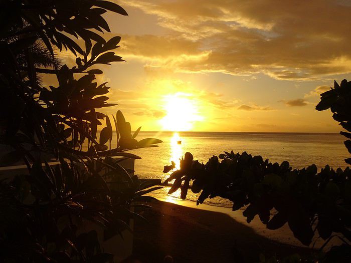 Sunset at Sunset
 Sunset Beach
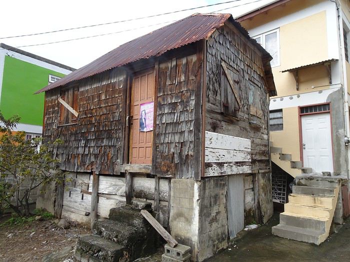 Colihaut
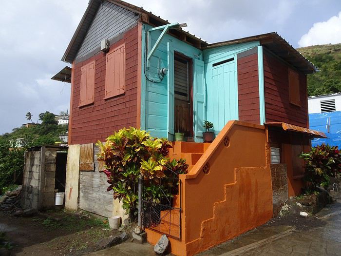 Colihaut


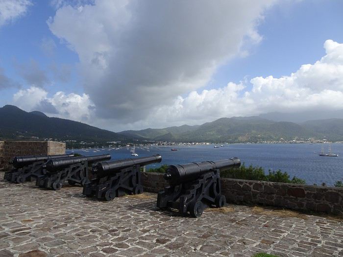
Fort Shirley

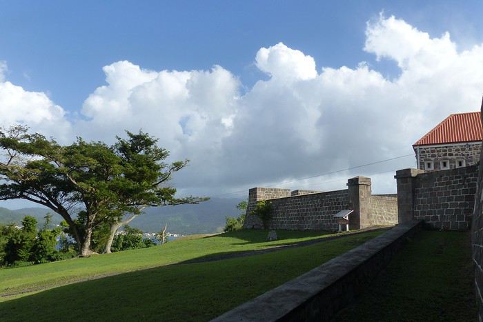
DOMINICA A small Caribbean island of 754 km², located between Guadeloupe and Martinique, Dominica is part of the Commonwealth. Roseau is its capital. The locals speak English and Creole. The currency is the East Caribbean Dollar (EC$). In October 2019, we decided to visit this little paradise from January 9 to 24, 2020—14 nights on the island. We traveled as two couples. Flight booking with Air Caraïbes: Orly Terminal 4 to Pointe-à-Pitre by plane, then P-à-P to Roseau with L’Express des Îles (boat) for the outbound trip. Marigot to Pointe-à-Pitre to Orly (all by plane on the return). Air Caraïbes: navigAir: plane + shuttle + boat. They handle everything, even delays. A shuttle waits for us at the airport to take us to the boat.
Accommodation bookings: 7 nights on the Caribbean coast in Salisbury (Sunset Bay Club), 4 nights on the Atlantic coast in Taberi La Plaine (Citrus Creek Plantation), and 3 nights in Marigot (Hibiscus Valley Inn). Car rental booked (Courtesy Rental Car).
Thursday, January 9 8:00 AM: Orly Airport, baggage drop-off—we checked in 48 hours earlier. Scheduled takeoff at 11:10 AM. Arrival in P-à-P at 2:30 PM local time after a 7-hour, 50-minute flight. We collect our luggage, and a shuttle is waiting to take us to the dock for L’Express des Îles. We check in, and a big storm hits P-à-P. Scheduled departure at 5:00 PM for a 2-hour, 20-minute crossing. Lots of waves—many passengers got seasick during the trip. Arrival in Roseau at 7:30 PM. We go through customs. Some clementines to declare… which they confiscated! A taxi takes us to the car rental: Courtesy. The ride is covered by the rental company. We get an automatic. You need a special permit to drive in Dominica (12 €, issued by the rental company). And remember—driving is on the left! It’s dark, and we have a good hour’s drive to reach our hotel. First intersection, headlights coming toward us, honking… we’re on the wrong side—driving on the left, remember? Most roads are in poor condition, narrow, with few signs and little to no street lighting. The island was hit by Tropical Storm Erika in 2015 and Hurricane Maria in September 2017, causing major damage. We finally arrive in Coulibistrie at Sunset Bay Club at 9:30 PM. The owner welcomes us, warms up some bread and cheese, and offers us four beers. We have pâté, sausage, and chips—we have a little picnic on the terrace of our bungalow. We have two adjoining rooms. It’s 11:00 PM when we go to bed… and it’s raining.
Friday, January 10 After a hearty breakfast (French toast or pancakes, jams, fresh juice, coffee or tea, eggs-bacon-cheese, bread, fresh fruit), the sun and rain take turns freely. We head north. Colihaut: a short walk through the village—we’re the only tourists. Portsmouth: lunch on Purple Turtle Beach at Sea Bird Bar and Grill (grilled fish, fries, salad, and the local beer: Kubuli). Then we visit Fort Shirley, part of Cabrits National Park. We do the yellow trail and part of the blue one. We buy a week-long pass, useful for some visits (no entry fee). On the way back, we stop at the market to buy some fruit. We arrive at Sunset in time to watch the sunset over the Caribbean Sea. All day, showers and sunshine.
Sunset at Sunset
Sunset Beach
Colihaut
Colihaut
Fort Shirley
40 ans de randonnées: quelques expériences marquantes English translation pending
La plus haute altitude: Mont Kanamo, Inde, 2011
24/9/2011 Je me trouve à Kibber, au Spiti, 4270 mètres. Je randonne déjà au Ladakh, puis au Spiti depuis un mois. Je suis complètement accoutumé à la haute altitude. Il fait très beau, pas trop froid, j'ai passé la nuit dans une guest house à Kibber, un village authentique dans un cirque plutôt sec, brun. Après le petit déjeuner chapatis omelette, je pars à 8 heures. En fait, je projette une traversée vers les villages de Langza et Komik mais je ne possède pas de carte détaillée. Je coupe dans les champs déjà récoltés, en cote, pour rejoindre la mauvaise piste vers le hameau de Gete, quelques maisons éparpillées, je vois un groupe de bharals (aussi appelés moutons bleus, abondants dans l'Himalaya indien), je me détourne au sommet des falaises pour la vue sur la vallée principale et le monastère de Kyi juste en contrebas. Je reprends la piste qui tourne vers un petit col puis redescend un peu vers un autre hameau en contrebas, mais je prends à gauche sur une piste en construction, plus tard je rencontre 6 ouvriers, ils ne se fatiguent pas trop. Vers le Sud, juste en face, je vois les vastes alpages de Langza ... pas loin, mais au milieu il y a la profonde entaille des gorges de la Shila. 3 heures 30 de marche déjà, je monte sur une petite butte pour voir l'itinéraire mais non, les gorges sont infranchissables ici, et en amont aussi. J'en profite pour manger le casse croute, pain confiture. Je ne regrette pas, très beau panorama avec le Chau Chau Kang Nilda, 6300 mètres, je décide de continuer un circuit pour revenir à Kibber par un col sur la crête plus à l'Est. La piste se termine, à un campement d'été avec des canaux d'irrigation, déserté fin septembre. Un sentier maintenant monte franchement vers le col, je suis en forme. En arrivant à un petit replat, je tombe sur 3 loups, pour le première fois dans l'Himalaya, je n'en ai vu que dans le parc national Denali en Alaska ! Ils sont aussi surpris que moi et ils s'enfuient. J'atteins le col à 4800 ou 4900 mètres et là, le mont Kanamo, 5975 mètres est proche, semble facile, c'est trop tentant. Je fais face quand même à une difficulté, le manque d'eau. Je dois trouver un camp qui en dispose sans trop redescendre. Je longe plus ou moins la crête vers l'Est vers un deuxième col, puis dans les éboulis vers un troisième col. Enfin la chance me souris, je vois un ruisseau plus bas dans la petite vallée vers le Sud . C'est un excellent camp, même un peu d'herbe, les yaks broutent ici en été. Le temps devient froid et nuageux, je mets mes vêtements chauds. Je cuisine du spaghetti au fromage sous le double toit, je lis un peu, avant 7 heures je suis couché.
25/9 Je ne dors pas très bien, j'ai plutôt trop chaud dans le sac de couchage. Lever à 5 heures 50. La tente est couverte de givre, il y a de la glace dans les gourdes mais le ruisseau coule. Pain confiture et grande tasse de Nescafe. Je pars à 6 heures 45, 35 minutes au col et je cache le gros de mes affaires sous des pierres. Je monte des éboulis raides sur une vague trace en 45 minutes jusqu'à une crête plus facile. Je me sens très bien, l'altitude ne me gêne pas. Je ne fais aucun arrêt. Je monte dans des éboulis très raides, mais stables, sur un épaulement, un peu de neige sur le haut, sans difficultes. En 2 heures 15 depuis le col, je rejoins l'extrémité de l'arrête sommitale du mont Kanamo, à environ 5900 mètres, avec un cairn et des drapeaux à prière, j'ai battu mon record d'altitude. J'ai bien mérité quelques biscuits. Mais le vrai sommet reste inaccessible pour moi, il faut longer la crête étroite et glacée, des crampons seraient nécessaires. En plus, un vent glacé souffle très fort, je ne peux pas rester. Je profite juste un peu de la vue des sommets dechiquetes et du glacier à l'arrière, avec une corniche. La descente ne présente aucune difficulté, même hors sentier, je passe par un petit lac bleu, je ne rencontre personne avant Kibber, bien un renard. Je peux me reposer au Norling Homestay, pas d'eau chaude mais à part cela confortable. Je reçois du the avec des biscuits, et le soir un dal bhat abondant. Je sors un peu dans le village, il semble n'y avoir qu'un seul autre touriste
26/9 À 8 heures 30 je prends le bus local pour Kaza.
A SUIVRE Prochain épisode: mon plus haut camp, au Pakistan. Merci de m'avoir lu.
24/9/2011 Je me trouve à Kibber, au Spiti, 4270 mètres. Je randonne déjà au Ladakh, puis au Spiti depuis un mois. Je suis complètement accoutumé à la haute altitude. Il fait très beau, pas trop froid, j'ai passé la nuit dans une guest house à Kibber, un village authentique dans un cirque plutôt sec, brun. Après le petit déjeuner chapatis omelette, je pars à 8 heures. En fait, je projette une traversée vers les villages de Langza et Komik mais je ne possède pas de carte détaillée. Je coupe dans les champs déjà récoltés, en cote, pour rejoindre la mauvaise piste vers le hameau de Gete, quelques maisons éparpillées, je vois un groupe de bharals (aussi appelés moutons bleus, abondants dans l'Himalaya indien), je me détourne au sommet des falaises pour la vue sur la vallée principale et le monastère de Kyi juste en contrebas. Je reprends la piste qui tourne vers un petit col puis redescend un peu vers un autre hameau en contrebas, mais je prends à gauche sur une piste en construction, plus tard je rencontre 6 ouvriers, ils ne se fatiguent pas trop. Vers le Sud, juste en face, je vois les vastes alpages de Langza ... pas loin, mais au milieu il y a la profonde entaille des gorges de la Shila. 3 heures 30 de marche déjà, je monte sur une petite butte pour voir l'itinéraire mais non, les gorges sont infranchissables ici, et en amont aussi. J'en profite pour manger le casse croute, pain confiture. Je ne regrette pas, très beau panorama avec le Chau Chau Kang Nilda, 6300 mètres, je décide de continuer un circuit pour revenir à Kibber par un col sur la crête plus à l'Est. La piste se termine, à un campement d'été avec des canaux d'irrigation, déserté fin septembre. Un sentier maintenant monte franchement vers le col, je suis en forme. En arrivant à un petit replat, je tombe sur 3 loups, pour le première fois dans l'Himalaya, je n'en ai vu que dans le parc national Denali en Alaska ! Ils sont aussi surpris que moi et ils s'enfuient. J'atteins le col à 4800 ou 4900 mètres et là, le mont Kanamo, 5975 mètres est proche, semble facile, c'est trop tentant. Je fais face quand même à une difficulté, le manque d'eau. Je dois trouver un camp qui en dispose sans trop redescendre. Je longe plus ou moins la crête vers l'Est vers un deuxième col, puis dans les éboulis vers un troisième col. Enfin la chance me souris, je vois un ruisseau plus bas dans la petite vallée vers le Sud . C'est un excellent camp, même un peu d'herbe, les yaks broutent ici en été. Le temps devient froid et nuageux, je mets mes vêtements chauds. Je cuisine du spaghetti au fromage sous le double toit, je lis un peu, avant 7 heures je suis couché.
25/9 Je ne dors pas très bien, j'ai plutôt trop chaud dans le sac de couchage. Lever à 5 heures 50. La tente est couverte de givre, il y a de la glace dans les gourdes mais le ruisseau coule. Pain confiture et grande tasse de Nescafe. Je pars à 6 heures 45, 35 minutes au col et je cache le gros de mes affaires sous des pierres. Je monte des éboulis raides sur une vague trace en 45 minutes jusqu'à une crête plus facile. Je me sens très bien, l'altitude ne me gêne pas. Je ne fais aucun arrêt. Je monte dans des éboulis très raides, mais stables, sur un épaulement, un peu de neige sur le haut, sans difficultes. En 2 heures 15 depuis le col, je rejoins l'extrémité de l'arrête sommitale du mont Kanamo, à environ 5900 mètres, avec un cairn et des drapeaux à prière, j'ai battu mon record d'altitude. J'ai bien mérité quelques biscuits. Mais le vrai sommet reste inaccessible pour moi, il faut longer la crête étroite et glacée, des crampons seraient nécessaires. En plus, un vent glacé souffle très fort, je ne peux pas rester. Je profite juste un peu de la vue des sommets dechiquetes et du glacier à l'arrière, avec une corniche. La descente ne présente aucune difficulté, même hors sentier, je passe par un petit lac bleu, je ne rencontre personne avant Kibber, bien un renard. Je peux me reposer au Norling Homestay, pas d'eau chaude mais à part cela confortable. Je reçois du the avec des biscuits, et le soir un dal bhat abondant. Je sors un peu dans le village, il semble n'y avoir qu'un seul autre touriste
26/9 À 8 heures 30 je prends le bus local pour Kaza.
A SUIVRE Prochain épisode: mon plus haut camp, au Pakistan. Merci de m'avoir lu.
Mais où qu'il est ce truc là (4) English translation pending
Beautiful stops and sites discovered in Morocco in March
In early March, full of carefree joy and happy to return to Morocco, we landed in Marrakech under the sun.
We spent just one night in Marrakech at the Hôtel Toulousain, as we did on our previous trip. And we booked our 3 nights for the end of our trip, the second half of March... Ouch! Ouch! Ouch! But we’re not there yet...
Our first goal is to reach Magdaz, a mountain village in the Tessaout Valley, sometimes called the lost valley. We discovered the village of Magdaz on this forum, and we were charmed by the photos and comments from travelers who came before us. The road is easy—it’s dry, and the tarmac takes us right to the village gates at over 2,000 meters above sea level. We arrive in the afternoon and are left speechless by the beauty of the place. A jewel of Berber architecture! Perfectly restored granaries and kasbahs!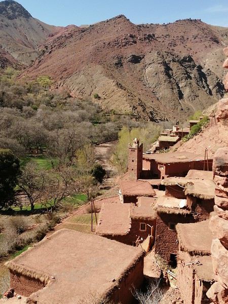
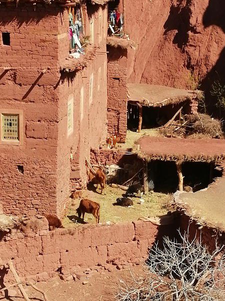
A young man from the village guides us on the visit and opens the doors to the terraces overlooking the village.
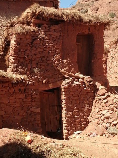 Several magnificent collective granaries have been beautifully restored. The warm colors of the stone capture the light wonderfully. It’s stunning!
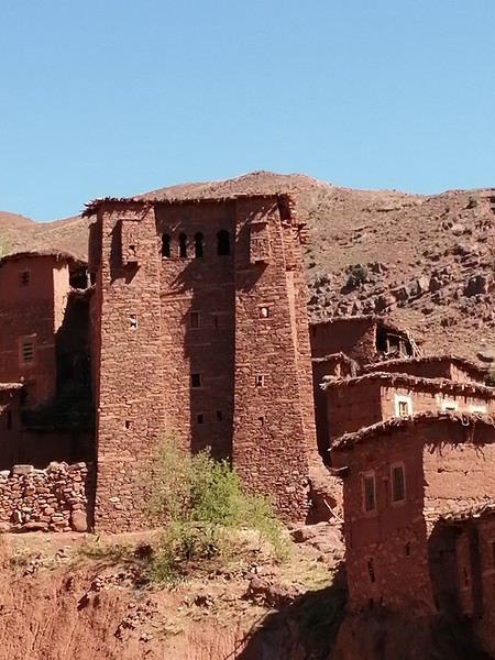
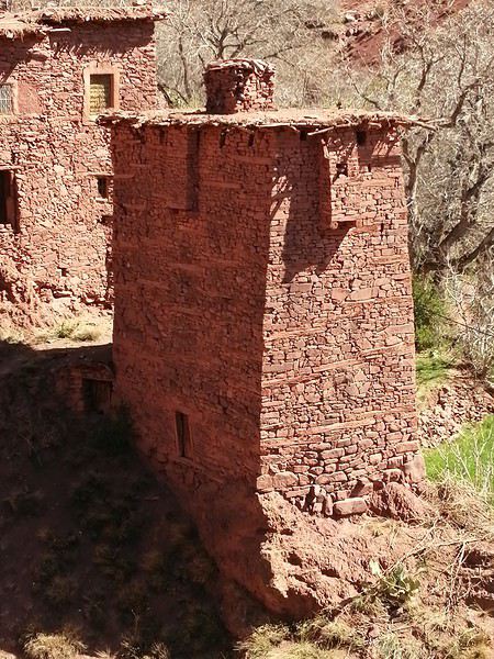
We won’t find anything decent to stay overnight there, so we head back down a bit and settle in at the Assounfou guesthouse. Lovely welcome. The place is in excellent condition and very clean. It’s spacious, but we’re the only ones there. First day full of promise!
Our first goal is to reach Magdaz, a mountain village in the Tessaout Valley, sometimes called the lost valley. We discovered the village of Magdaz on this forum, and we were charmed by the photos and comments from travelers who came before us. The road is easy—it’s dry, and the tarmac takes us right to the village gates at over 2,000 meters above sea level. We arrive in the afternoon and are left speechless by the beauty of the place. A jewel of Berber architecture! Perfectly restored granaries and kasbahs!
A young man from the village guides us on the visit and opens the doors to the terraces overlooking the village.
Several magnificent collective granaries have been beautifully restored. The warm colors of the stone capture the light wonderfully. It’s stunning!
We won’t find anything decent to stay overnight there, so we head back down a bit and settle in at the Assounfou guesthouse. Lovely welcome. The place is in excellent condition and very clean. It’s spacious, but we’re the only ones there. First day full of promise!
Escapade japonaise à Shikoku, Kyushu, Yakushima et Tokyo English translation pending
Bonjour à tous,
Ici, vous trouverez la suite de notre périple au début de l'automne au Japon, qui aura duré 5 semaines et demi en tout, de fin septembre 2019 à début novembre 2019.
La suite, eh oui, car il y a un premier carnet intituléA la découverte du Japon : de Tokyo à l’archipel des Ryukyu (okinawa). Pour ceux que cela intéresserait, je vous mets les liens : Dans cette première partie, se trouve le récit de notre voyage à :
Tokyo (1ére partie), Kyoto et à Miyakojima (okinawa).
J’avais entamé l’écriture de la seconde partie du voyage mais visiblement voyageforum a supprimé ce deuxième carnet portant le même titre + Partie 2 et je ne le découvre que maintenant car je n’avais pas écrit depuis quelques temps. Qu’à cela ne tienne, je redémarre un second carnet avec un nouveau titre afin de partager la suite de notre voyage.
Dans cette deuxième partie, vous trouverez les lieux suivants :
A Shikoku: Takamatsu, Kotohira, La vallée de l’Iya, , Tokushima et Naruto, L’île de Yakushima, A Kyushu : Kagoshima, Chiran, Ibusuki, Takachiho, et Kumamoto, Et pour finir Tokyo (2éme partie). et "la conclusion"
Ici, vous trouverez la suite de notre périple au début de l'automne au Japon, qui aura duré 5 semaines et demi en tout, de fin septembre 2019 à début novembre 2019.
La suite, eh oui, car il y a un premier carnet intituléA la découverte du Japon : de Tokyo à l’archipel des Ryukyu (okinawa). Pour ceux que cela intéresserait, je vous mets les liens : Dans cette première partie, se trouve le récit de notre voyage à :
Tokyo (1ére partie), Kyoto et à Miyakojima (okinawa).
J’avais entamé l’écriture de la seconde partie du voyage mais visiblement voyageforum a supprimé ce deuxième carnet portant le même titre + Partie 2 et je ne le découvre que maintenant car je n’avais pas écrit depuis quelques temps. Qu’à cela ne tienne, je redémarre un second carnet avec un nouveau titre afin de partager la suite de notre voyage.
Dans cette deuxième partie, vous trouverez les lieux suivants :
A Shikoku: Takamatsu, Kotohira, La vallée de l’Iya, , Tokushima et Naruto, L’île de Yakushima, A Kyushu : Kagoshima, Chiran, Ibusuki, Takachiho, et Kumamoto, Et pour finir Tokyo (2éme partie). et "la conclusion"
Aide au choix d'un voyage de 6 semaines en Asie du Sud-est English translation pending
Bonjour à tous
Nous sommes un couple de 75 et 76 ans en bonne forme.
Nous avons l'habitude d'organiser nous meme nos voyage avec l'aide de ce forum.
Nous avons une bonne connaissance de l'Afrique du Nord, mais sur les conseils d'amis nous souhaitons nous "lancer" en Asie du Sud Est.
Nous projetons de partir 6 à 7 semaines à partir du 28 octobre 2020.
Nos poles d'interets sont
-visites
-petits trecs
-vivre au milieu des habitants.
-calme
Il faudrait que le circuit tienne compte des conditions climatiques, surtout" pas trop chaud"
On aime bien se déplacer en bus ou train .
Gros problème....par quel pays débuter?Quel circuit peut-on envisager?
Je suis certain que "ce maudit confinement"permettra un échange fructueux
Je vous en remercie à l'avance.
Voyage 5 mois et 3 semaines en Amérique du Sud English translation pending
Bonjour,
Il n'est jamais trop tard pour rendre compte de son voyage. Le confinement me laisse enfin du temps pour le faire.
Je suis parti le 17 août 2017 et je suis rentré le 7 février 2018. Entre temps, je suis allé en Argentine par cargo puis une fois sur ce continent, j'ai visité l'Uruguay, l'Argentine et le Chili.
Durant tout ce voyage, j'ai tenu un carnet journalier.
Je me propose de vous le livrer.
Qui est à Bangkok en ce moment pour témoigner? English translation pending
Qui est à Bangkok en ce moment pour témoigner un peu de l’ambiance sur place et notamment là où habituellement il y a beaucoup de monde et d’animations comme kao san road ou sukhumvit ?
Je suis actuellement à KohNgai et il n’y a pratiquement personne, c’est à la fois agréable et inquiétant sans parler de la perte économique pour ceux qui vivent du tourisme.
En théorie.... je rejoins Bangkok le 26 mars pour repartir à Paris avec la Qatar mais d’ici là....qui sait ?.?
Je vous invite à découvrir l'île de Curaçao English translation pending
INTRODUCTION
Des vidéos sont insérées tout au long du résumé. Veuillez cliquer sur l'image pour démarrer la vidéo.
En novembre dernier, nous avons séjourné 2 semaines sur l'île de Curaçao afin d'en découvrir les différents attraits touristiques.
Comme la plupart de nos précédents voyages, plusieurs semaines ont été consacrées à la création de notre itinéraire afin de pouvoir être en mesure d'atteindre parfaitement nos objectifs.
Lors de notre séjour, nous avons utilisé l'application Maps.me, une application mobile qui fournit des cartes hors ligne. Cette application s'avère très précieuse lors de nos déplacements en voiture, en randonnée et même lors de nos circuits à pied dans les grandes villes.
J'avais préalablement téléchargé les coordonnées GPS de toutes les attractions prévues à notre itinéraire dans l'application Maps.me, ce qui a facilité grandement nos déplacements.
La réservation de l'hébergement ainsi que la location d'une voiture ont été effectuées sur internet avant notre départ.
Pour faire une histoire courte, Curaçao se trouve dans la mer des Caraïbes entre les îles d'Aruba et Bonaire, à une soixantaine de kilomètres des côtes du Vénézuela.
Cette île n'est pas très grande puisqu'elle mesure 60 km de long par 11 km de large. Willemstad, sa magnifique capitale, est inscrite au patrimoine mondial de l'Unesco.
Elle jouit d'un climat tempéré et est reconnue pour ses splendides plages, ses eaux limpides, ses parcs nationaux, ses grottes et ses fameux flamants roses.
Des vidéos sont insérées tout au long du résumé. Veuillez cliquer sur l'image pour démarrer la vidéo.
En novembre dernier, nous avons séjourné 2 semaines sur l'île de Curaçao afin d'en découvrir les différents attraits touristiques.
Comme la plupart de nos précédents voyages, plusieurs semaines ont été consacrées à la création de notre itinéraire afin de pouvoir être en mesure d'atteindre parfaitement nos objectifs.
Lors de notre séjour, nous avons utilisé l'application Maps.me, une application mobile qui fournit des cartes hors ligne. Cette application s'avère très précieuse lors de nos déplacements en voiture, en randonnée et même lors de nos circuits à pied dans les grandes villes.
J'avais préalablement téléchargé les coordonnées GPS de toutes les attractions prévues à notre itinéraire dans l'application Maps.me, ce qui a facilité grandement nos déplacements.
La réservation de l'hébergement ainsi que la location d'une voiture ont été effectuées sur internet avant notre départ.
Pour faire une histoire courte, Curaçao se trouve dans la mer des Caraïbes entre les îles d'Aruba et Bonaire, à une soixantaine de kilomètres des côtes du Vénézuela.
Cette île n'est pas très grande puisqu'elle mesure 60 km de long par 11 km de large. Willemstad, sa magnifique capitale, est inscrite au patrimoine mondial de l'Unesco.
Elle jouit d'un climat tempéré et est reconnue pour ses splendides plages, ses eaux limpides, ses parcs nationaux, ses grottes et ses fameux flamants roses.
Voyage du West Bengal à Varanasi en passant par Bodhgaya English translation pending
Atteints par le virus "Inde" depuis notre premier voyage en 2013 , (seulement😮 ! ), nous y revoilà pour un 8° séjour ( du 14 au 28 janvier 2020).
Cette fois-ci notre périple nous amènera de Calcutta à Varanasi en passant par des petits villages du Westbengal et par Bodhgaya..
Nous prendrons ensuite notre vol de retour de Delhi à Nice .
Je me lance enfin pour rédiger mon premier cahier de voyage en remerciant aux passage tous ceux et celles qui ont alimenté ce forum en postant carnets, photos et commentaires, fort utiles à la préparation d'un voyage. Je demande d'avance un peu d'indulgence concernant ce récit, où quelques fautes vont peut-être s'immiscer par ci par là car, même si je vis en France depuis longtemps, ma langue maternelle reste l'allemand. Vous voilà prévenus 🙂!
Notre séjour débute à Kolkata ou nous resterons 2 jours entiers. Nous logeons dans un petit hôtel de College street . Le personnel est très sympathique et très serviable, notre chambre très propre, que demander de plus? Certes , c'est bruyant côté rue mais l'avantage d'un petit balcon nous permet d'observer tout le trafic d'en bas. Celui -ci ne s'arrête guère même pendant la nuit...Ceci dit, nous dormons très bien, le voyage a été long !
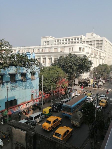
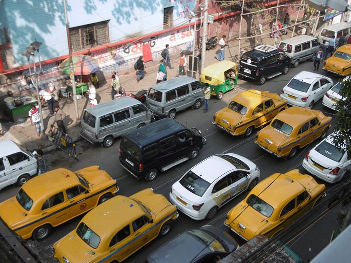
 Vue du balcon de l'hôtel

Je me lance enfin pour rédiger mon premier cahier de voyage en remerciant aux passage tous ceux et celles qui ont alimenté ce forum en postant carnets, photos et commentaires, fort utiles à la préparation d'un voyage. Je demande d'avance un peu d'indulgence concernant ce récit, où quelques fautes vont peut-être s'immiscer par ci par là car, même si je vis en France depuis longtemps, ma langue maternelle reste l'allemand. Vous voilà prévenus 🙂!
Notre séjour débute à Kolkata ou nous resterons 2 jours entiers. Nous logeons dans un petit hôtel de College street . Le personnel est très sympathique et très serviable, notre chambre très propre, que demander de plus? Certes , c'est bruyant côté rue mais l'avantage d'un petit balcon nous permet d'observer tout le trafic d'en bas. Celui -ci ne s'arrête guère même pendant la nuit...Ceci dit, nous dormons très bien, le voyage a été long !
Vue du balcon de l'hôtelVoyage HCMV - centre Vietnam - Con Dao English translation pending
Bonjour à tous, amateurs du Vietnam et d'ailleurs,
Je prépare mon voyage qui aura lieu entre mars et début avril pour une durée de 3 bonnes semaines. Je fais mon A/R par Ho Chi Minh, consciente que cela peut être une contrainte qui m'obligera à faire une boucle puisque je souhaite remonter jusque dans le centre du pays, plus précisément jusqu'à Phong Nha, et terminer par quelques jours sur les îles de Con Dao.
J'ai fait plusieurs voyages en bus de l'Inde à L'Indonésie en passant par la Birmanie, et bien que je sois un peu moins contrainte financièrement qu'à l'époque, je n'ai pas non plus envie de me déplacer en avion ou avec chauffeur privé tout du long. Pour autant j'ai des difficultés à appréhender le meilleur trajet compte tenu de ce que j'aimerai visiter. Voici la liste des "étapes" (non ordonnées) que j'espère pouvoir visiter, cependant je m'en remets à vos expériences pour me dire ce qui est faisable (durée du séjour, distances):
- départ et retour de HCMV - Cat Tien - Phong Nha: j'ai prévu de faire un tour de 2 jours aux grottes de Tu Lan. - Hoi An & alentours - Hué & alentours (Bach Ma...) - Dalat - Con Dao (pour clôturer le séjour, je pense à 4 jours/3 nuits)
Je pensais relier Hué<>Hoi An en scooter. N'hésitez pas à me faire part de vos commentaires !
Merci de votre aide.
Vera
Je prépare mon voyage qui aura lieu entre mars et début avril pour une durée de 3 bonnes semaines. Je fais mon A/R par Ho Chi Minh, consciente que cela peut être une contrainte qui m'obligera à faire une boucle puisque je souhaite remonter jusque dans le centre du pays, plus précisément jusqu'à Phong Nha, et terminer par quelques jours sur les îles de Con Dao.
J'ai fait plusieurs voyages en bus de l'Inde à L'Indonésie en passant par la Birmanie, et bien que je sois un peu moins contrainte financièrement qu'à l'époque, je n'ai pas non plus envie de me déplacer en avion ou avec chauffeur privé tout du long. Pour autant j'ai des difficultés à appréhender le meilleur trajet compte tenu de ce que j'aimerai visiter. Voici la liste des "étapes" (non ordonnées) que j'espère pouvoir visiter, cependant je m'en remets à vos expériences pour me dire ce qui est faisable (durée du séjour, distances):
- départ et retour de HCMV - Cat Tien - Phong Nha: j'ai prévu de faire un tour de 2 jours aux grottes de Tu Lan. - Hoi An & alentours - Hué & alentours (Bach Ma...) - Dalat - Con Dao (pour clôturer le séjour, je pense à 4 jours/3 nuits)
Je pensais relier Hué<>Hoi An en scooter. N'hésitez pas à me faire part de vos commentaires !
Merci de votre aide.
Vera
USA 2018: Ciels de foudre et terres de feu English translation pending
Arrivée très tardive à Denver après un voyage long et fatiguant.
Récupération du SUV standard chez Alamo. Peu, voire pas de choix. Des hyundai Santa Fe et deux Kia. J’opte pour une Santa Fe Sport. Celle-ci est au moins AWD (automatic wheel drive) contrairement aux Kia.
Je n’ai pas réservé d’hôtel à Denver, préférant quitter de suite l’agglomération de la capitale du Colorado pour prendre de l’avance sur ma (très) longue journée de route du lendemain.
Malgré la fatigue et la nuit, je parviens à quitter la ville assez facilement et sans me tromper. Je file droit au nord sur l’interstate 25 North pendant deux bonnes heures avant de me trouver un motel quelque part entre Fort Collins et Cheyenne. Je m’endors comme une souche.
24 août – de Fort Collins à Badlands national park.
Réveil très matinal, décalage horaire oblige. Le lever du jour est encore loin. Le temps d’avaler un café dans salle d’accueil et je reprends la route. J’adore ces voyages en solo dans l’ouest que je m’offre en général tous les deux ans. Ils m’apportent un sentiment de liberté assez grisant. On monte dans sa voiture de location et on part à l’aventure ! En préparant ce voyage, j’ai coché une série de sites que je n’avais pas encore arpentés et quelques autres que j’avais envie de revoir. Tout cela va m’amener à parcourir un nombre impressionnant de kilomètres à travers un cercle qui inclue le Colorado, le South Dakota, le Wyoming, l’Utah, l’Arizona, et le Nouveau Mexique. Je préfère ne pas compter.
Le programme de ce premier jour doit me faire gagner le South Dakota et le Badlands national park, Ca fait de la route pour une visite que je soupçonne un peu trop courte puisque j’ai prévu d’en repartir le lendemain matin. J’aurais dû prévoir davantage. Il fait beau et la route est sympa. Les grandes plaines du Wyoming s’étirent sous le soleil matinal. Je fais une pause dans la petite ville de Custer, du nom du général de triste mémoire.
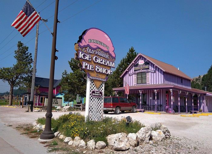 Puis c’est la traversée de Rapid city, agrémentée d’un rapide déjeuner. J’atteints l’entrée nord du Badlands national park en début d’après-midi. Beaucoup plus tôt qu’attendu. Tant mieux, je vais pouvoir en profiter. Le parc est tout en longueur et la route (Badlands loop road) qui le parcours du nord au sud est longue de 45 kilomètres. Le camping du parc que j’ai réservé est situé tout au bout de cette route, près de la sortie sud.
La première impression est excellente. Les falaises déchiquetées sont spectaculaires et plus haute que ce à quoi je m’attendais.
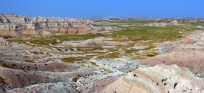
La route descend ensuite dans la vallée des « Yellow mounds ». C’est ma partie préférée du parc. On slalome entre des collines colorées surréalistes. Du jeune, du rouge, de l’orange au milieu d’une herbe vert pale. C’est sauvage, inattendu. J’adore…
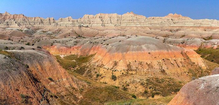
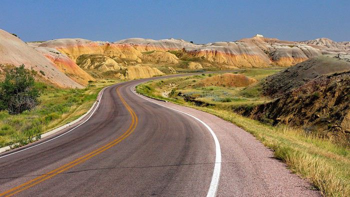
Pas mal de pause à mesure que je progresse vers le sud. Certains points de vue improvisés sont incroyables. Dommage qu’une bande de brume grise bouche l’horizon et gâche un peu la perspective.
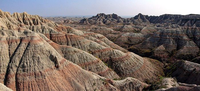
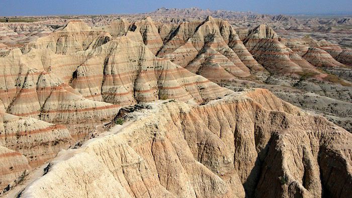
J’arrive au camping. Je mets un bon moment avant de trouver mon emplacement, celui-ci ayant été changé suite à quelques inondations dans la plaine.
Ballades dans la partie sud. Windows trail, tout petit bout du Notch trail et un peu d’improvisation. L’après-midi se déroule tranquillement sous un ciel d’azur.
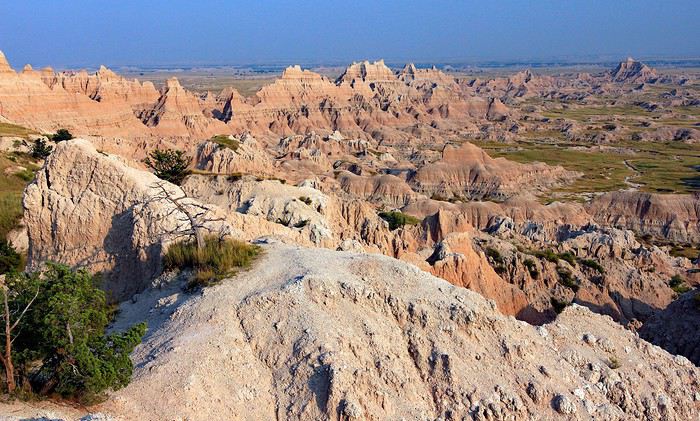
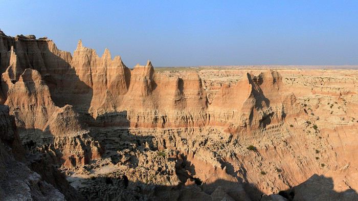
Je m’interroge sur la partie à privilégier pour le coucher de soleil et je songe naturellement aux Yellow mounds.
Retour au nord, donc, après quelques arrêts pour de courtes ballades improvisées au milieu des badlands. Je suis complètement emballé par ce cadre atypique dont la lumière de fin de journée accentue la magie.
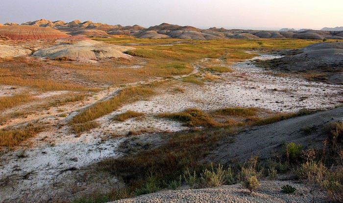
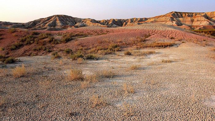
Je termine la journée sur une petite colline à l’entrée des Yellow mounds. Les couleurs qu’on peut y capter sont fabuleuses. Un coucher de soleil de compétition et qui ne ressemble à aucun autre.
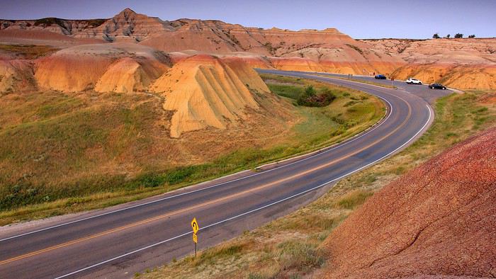
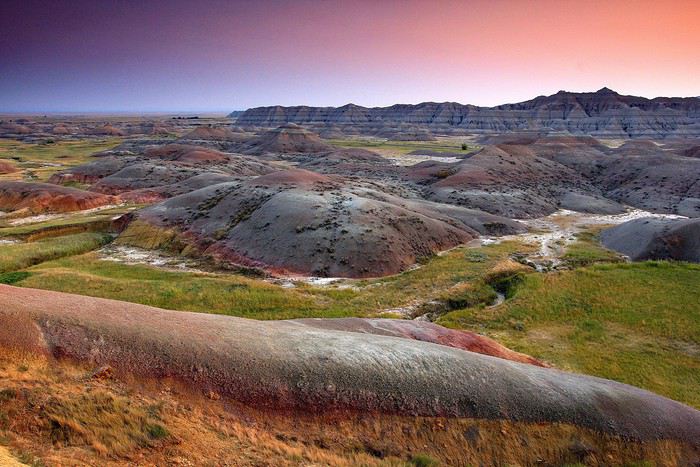
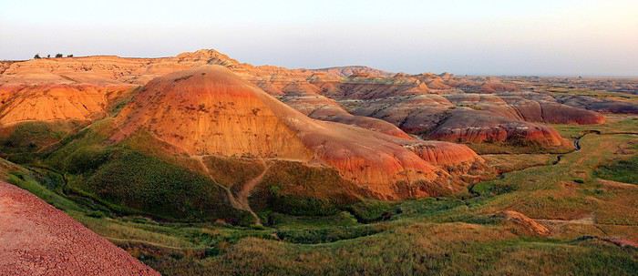
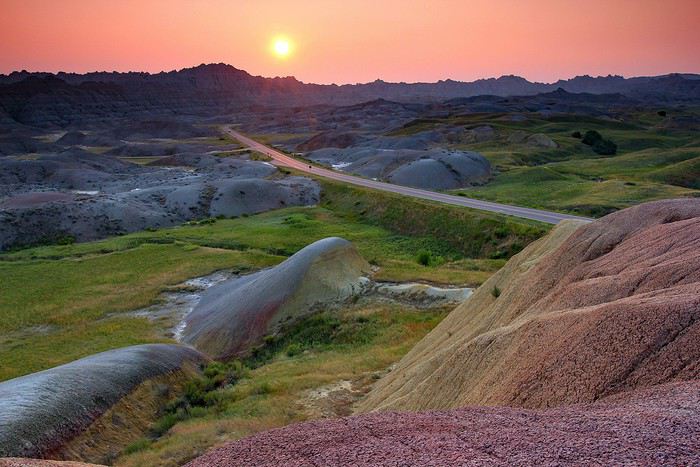
Retour au camping à la nuit tombée. La particularité des campings des national parks, c’est que les rangers y organisent chaque soir des activités en rapport avec la nature. Ce soir, c’est « observation du ciel nocturne ». Deux télescopes ont été installés près du traditionnel amphithéâtre à ciel ouvert. L’un est braqué sur Jupiter, l’autre sur la Lune que je n’avais jamais vue d’aussi prêt. Une belle manière de terminer cette journée riche en découvertes. Je ne regrette décidément pas de m’être imposé ce long détour par le South Dakota.
25 aout 2018 : De Badlands national park à Devils Tower national monument.
Encore un réveil très matinal, volontaire celui-là. Emballé par le spectacle offert par les Yellow mounds au coucher du soleil, j’ai décidé d’aller y admirer le lever du jour.
Je commence par m’installer au point de vue « Conata Basin overlook » qui offre un point de vue général sur la zone. Toujours cette zone de brume au-dessus de l’horizon qui retarde l’arrivée du soleil. Je l’attribue, peut-être à tort, aux nombreux incendies qui ravagent l’ouest depuis des semaines. Je me dis que je vais peut-être devoir subir ce désagrément esthétique pendant le reste du voyage.
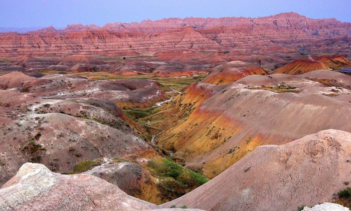
Le soleil finit par dépasser la brume et c’est assez grandiose. Sans doute manque-t-il un ciel dramatique au décor. Mais bon… Apprenons à nous contenter de l’existant.
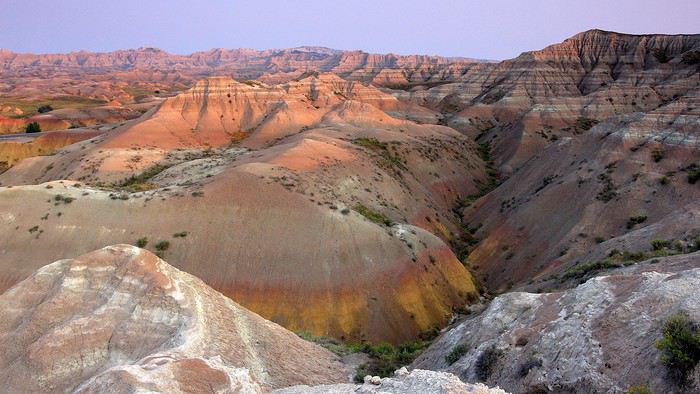
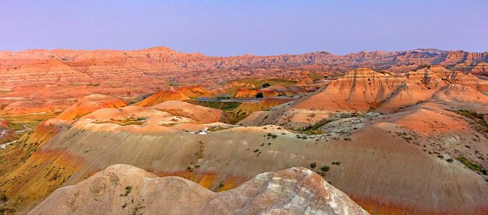
Je poursuis vers le bas de la vallée en opérant un stop rapide à mi-chemin de la descente. Quelques dizaines de mètres de marche permettent de bénéficier d'une vue étendue sur les mounds.
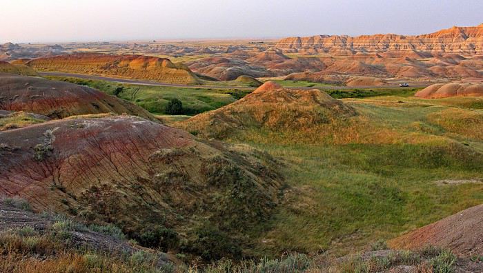
Ma prochaine étape se situe à Yellow Mounds overlook, qui se trouve au sommet de la petite colline colorée de la veille. Presque aussi bien que la veille.
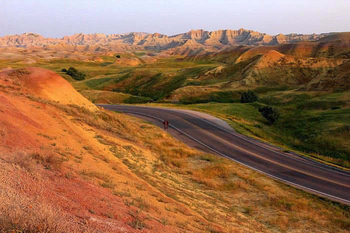
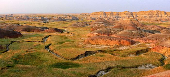
24 août – de Fort Collins à Badlands national park.
Réveil très matinal, décalage horaire oblige. Le lever du jour est encore loin. Le temps d’avaler un café dans salle d’accueil et je reprends la route. J’adore ces voyages en solo dans l’ouest que je m’offre en général tous les deux ans. Ils m’apportent un sentiment de liberté assez grisant. On monte dans sa voiture de location et on part à l’aventure ! En préparant ce voyage, j’ai coché une série de sites que je n’avais pas encore arpentés et quelques autres que j’avais envie de revoir. Tout cela va m’amener à parcourir un nombre impressionnant de kilomètres à travers un cercle qui inclue le Colorado, le South Dakota, le Wyoming, l’Utah, l’Arizona, et le Nouveau Mexique. Je préfère ne pas compter.
Le programme de ce premier jour doit me faire gagner le South Dakota et le Badlands national park, Ca fait de la route pour une visite que je soupçonne un peu trop courte puisque j’ai prévu d’en repartir le lendemain matin. J’aurais dû prévoir davantage. Il fait beau et la route est sympa. Les grandes plaines du Wyoming s’étirent sous le soleil matinal. Je fais une pause dans la petite ville de Custer, du nom du général de triste mémoire.
Puis c’est la traversée de Rapid city, agrémentée d’un rapide déjeuner. J’atteints l’entrée nord du Badlands national park en début d’après-midi. Beaucoup plus tôt qu’attendu. Tant mieux, je vais pouvoir en profiter. Le parc est tout en longueur et la route (Badlands loop road) qui le parcours du nord au sud est longue de 45 kilomètres. Le camping du parc que j’ai réservé est situé tout au bout de cette route, près de la sortie sud.La première impression est excellente. Les falaises déchiquetées sont spectaculaires et plus haute que ce à quoi je m’attendais.
La route descend ensuite dans la vallée des « Yellow mounds ». C’est ma partie préférée du parc. On slalome entre des collines colorées surréalistes. Du jeune, du rouge, de l’orange au milieu d’une herbe vert pale. C’est sauvage, inattendu. J’adore…
Pas mal de pause à mesure que je progresse vers le sud. Certains points de vue improvisés sont incroyables. Dommage qu’une bande de brume grise bouche l’horizon et gâche un peu la perspective.
J’arrive au camping. Je mets un bon moment avant de trouver mon emplacement, celui-ci ayant été changé suite à quelques inondations dans la plaine.
Ballades dans la partie sud. Windows trail, tout petit bout du Notch trail et un peu d’improvisation. L’après-midi se déroule tranquillement sous un ciel d’azur.
Je m’interroge sur la partie à privilégier pour le coucher de soleil et je songe naturellement aux Yellow mounds.
Retour au nord, donc, après quelques arrêts pour de courtes ballades improvisées au milieu des badlands. Je suis complètement emballé par ce cadre atypique dont la lumière de fin de journée accentue la magie.
Je termine la journée sur une petite colline à l’entrée des Yellow mounds. Les couleurs qu’on peut y capter sont fabuleuses. Un coucher de soleil de compétition et qui ne ressemble à aucun autre.
Retour au camping à la nuit tombée. La particularité des campings des national parks, c’est que les rangers y organisent chaque soir des activités en rapport avec la nature. Ce soir, c’est « observation du ciel nocturne ». Deux télescopes ont été installés près du traditionnel amphithéâtre à ciel ouvert. L’un est braqué sur Jupiter, l’autre sur la Lune que je n’avais jamais vue d’aussi prêt. Une belle manière de terminer cette journée riche en découvertes. Je ne regrette décidément pas de m’être imposé ce long détour par le South Dakota.
25 aout 2018 : De Badlands national park à Devils Tower national monument.
Encore un réveil très matinal, volontaire celui-là. Emballé par le spectacle offert par les Yellow mounds au coucher du soleil, j’ai décidé d’aller y admirer le lever du jour.
Je commence par m’installer au point de vue « Conata Basin overlook » qui offre un point de vue général sur la zone. Toujours cette zone de brume au-dessus de l’horizon qui retarde l’arrivée du soleil. Je l’attribue, peut-être à tort, aux nombreux incendies qui ravagent l’ouest depuis des semaines. Je me dis que je vais peut-être devoir subir ce désagrément esthétique pendant le reste du voyage.
Le soleil finit par dépasser la brume et c’est assez grandiose. Sans doute manque-t-il un ciel dramatique au décor. Mais bon… Apprenons à nous contenter de l’existant.
Je poursuis vers le bas de la vallée en opérant un stop rapide à mi-chemin de la descente. Quelques dizaines de mètres de marche permettent de bénéficier d'une vue étendue sur les mounds.
Ma prochaine étape se situe à Yellow Mounds overlook, qui se trouve au sommet de la petite colline colorée de la veille. Presque aussi bien que la veille.
Sulawesi centrale: Luwuk et les iles Banggai English translation pending
Bonjour à tous,
J’ai envie de partager avec vous cette magnifique région que j’ai découverte en Indonésie, sur l’île de Sulawesi, la région de Luwuk Banggai dans l’est de la Sulawesi Centrale. C’est une région à découvrir, encore peu touchée par le tourisme et pourtant splendide, avec un accueil chaleureux et attentionné des indonésiens.
J’ai découvert Luwuk et sa région par hasard en 2019 car c’était la région dont était originaire la famille avec laquelle je vivais à Makassar à l’époque.
La richesse de ce lieu est impressionnante : des chutes d’eau à la couleur turquoise, des randonnées en forêts, de la pêche en pirogue de nuit au ciel étoilé, de la plongée dans des fonds marins intouchés, des minorités ethniques de rendez-vous en terre inconnue, bref, tout y est.
Bonne lecture !
Partie I : Région de Luwuk
Episode 1 : Dormir chez l’habitant dans le village de Tangkiang
La ville de Luwuk est souvent une option choisie par les voyageurs pour aller rapidement vers les iles Toggians. La ville est accessible par avion de Makassar, Menado et Palu et permet de rejoindre Ampana en 4h de voiture, point de départ pour les iles Toggians.
Mais Luwuk et sa région valent le temps que l’on s’y arrête ! Ma première étape fut le village de Tangkiang, à 40mn en moto de Luwuk.
Tangkiang est un village traditionnel de pêcheurs et de cultivateurs, au bord de la mer, hors des sentiers battus. Les villageois sont très accueillants et étaient ravis d’avoir un bule (dit « boulet » pour dire « touriste » 😉 ) découvrant leur quotidien.
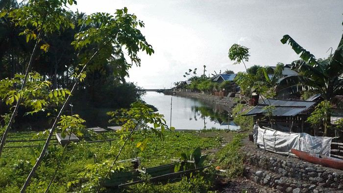
L’entrée du village, entre rivière et mer
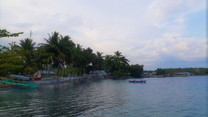 Le bord de mer

Le foot et le volley-ball
Je dormais chez l’habitant, l’occasion de partager la vie d’une famille. J’avais une chambre confortable et ils étaient aux petits soins pour me préparer de délicieux plats. Mes plats préférés restant le poisson frais et le tempé, à base de soja - Un délice !
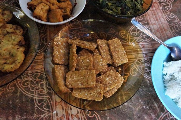
Le tempé, du tofu, beignets de crevettes et kangkung (ou liseron d’eau)
J’allais aussi me baigner dans la rivière du village bien rafraichissante au moment le plus chaud de la journée.
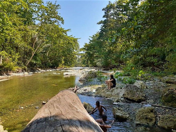
A l’eau !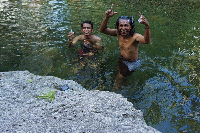 La douche dans la rivière 😎
J’ai découvert la pêche au fil. Ils utilisent des pirogues et des « rompong », des plates-formes en bambou au milieu de la mer pour attirer les poissons. Je suis allée pêcher le poulpe de nuit, en utilisant des petites lumières que l’on mettait dans l’eau pour attirer les poulpes. Fantastique.
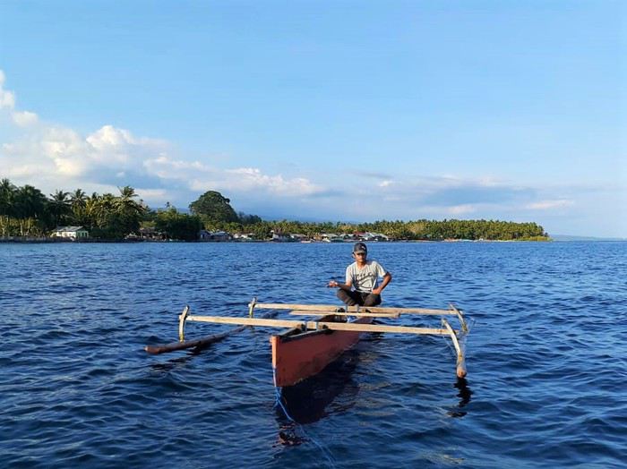 La pêche au fil
Je me suis également baladée dans les collines avoisinantes, qui donnent une très belle vue sur la mer. J’ai adoré récolter le piment, très relaxant, au milieu de la montagne, au calme. J’ai également appris à faire de l’huile de noix de coco avec la coopérative agricole du village.
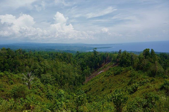
Vue des hauteurs de Tangkiang
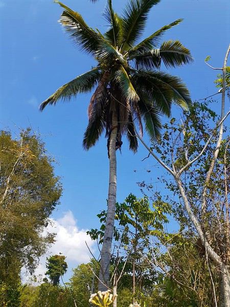
L’escalade du cocotier
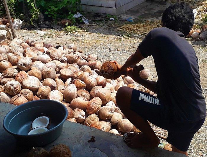 La préparation de l’huile de noix de coco
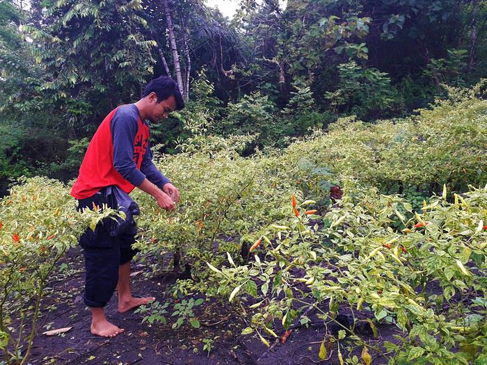
La récolte du piment
Entre Luwuk et Tangkiang, il y a d’autres villages, dont celui de Nambo, où une tisseuse locale vend de très beaux tissus avec l’emblème local, l’oiseau maléo.
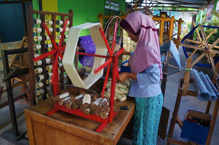 La tisseuse du village de Nambo
INFOS PRATIQUES
Pour accéder à Tangkiang, le plus simple est qu’on vienne vous chercher en moto ou en voiture en fonction de vos besoins à Luwuk.
Kahar, qui est le responsable de la coopérative de noix de coco et de piment et qui se débrouille en anglais, pourra vous accueillir et organiser votre séjour au village. Il m’a donné son accord pour partager ses coordonnées et serait ravi d’aider des « bule » à visiter la région. Son mail est donc abd.kahar024@gmail.com et son numéro Whats App est le +62 853-9424-8801.
Voici Kahar
Une des maisons dont les habitants sont prêts à accueillir les touristes
Il faut savoir que les indonésiens de cette région ne sont pas habitués aux touristes. Ils n’osent pas toujours parler d’argent. Personnellement, j’ai décidé de leur donner 150 000 RP par nuit incluant la nourriture.
La suite au prochain épisode 🙂
J’ai envie de partager avec vous cette magnifique région que j’ai découverte en Indonésie, sur l’île de Sulawesi, la région de Luwuk Banggai dans l’est de la Sulawesi Centrale. C’est une région à découvrir, encore peu touchée par le tourisme et pourtant splendide, avec un accueil chaleureux et attentionné des indonésiens.
J’ai découvert Luwuk et sa région par hasard en 2019 car c’était la région dont était originaire la famille avec laquelle je vivais à Makassar à l’époque.
La richesse de ce lieu est impressionnante : des chutes d’eau à la couleur turquoise, des randonnées en forêts, de la pêche en pirogue de nuit au ciel étoilé, de la plongée dans des fonds marins intouchés, des minorités ethniques de rendez-vous en terre inconnue, bref, tout y est.
Bonne lecture !
Partie I : Région de Luwuk
Episode 1 : Dormir chez l’habitant dans le village de Tangkiang
La ville de Luwuk est souvent une option choisie par les voyageurs pour aller rapidement vers les iles Toggians. La ville est accessible par avion de Makassar, Menado et Palu et permet de rejoindre Ampana en 4h de voiture, point de départ pour les iles Toggians.
Mais Luwuk et sa région valent le temps que l’on s’y arrête ! Ma première étape fut le village de Tangkiang, à 40mn en moto de Luwuk.
Tangkiang est un village traditionnel de pêcheurs et de cultivateurs, au bord de la mer, hors des sentiers battus. Les villageois sont très accueillants et étaient ravis d’avoir un bule (dit « boulet » pour dire « touriste » 😉 ) découvrant leur quotidien.
L’entrée du village, entre rivière et mer
Le bord de merLe foot et le volley-ball
Je dormais chez l’habitant, l’occasion de partager la vie d’une famille. J’avais une chambre confortable et ils étaient aux petits soins pour me préparer de délicieux plats. Mes plats préférés restant le poisson frais et le tempé, à base de soja - Un délice !
Le tempé, du tofu, beignets de crevettes et kangkung (ou liseron d’eau)
J’allais aussi me baigner dans la rivière du village bien rafraichissante au moment le plus chaud de la journée.
A l’eau !
La douche dans la rivière 😎J’ai découvert la pêche au fil. Ils utilisent des pirogues et des « rompong », des plates-formes en bambou au milieu de la mer pour attirer les poissons. Je suis allée pêcher le poulpe de nuit, en utilisant des petites lumières que l’on mettait dans l’eau pour attirer les poulpes. Fantastique.
La pêche au filJe me suis également baladée dans les collines avoisinantes, qui donnent une très belle vue sur la mer. J’ai adoré récolter le piment, très relaxant, au milieu de la montagne, au calme. J’ai également appris à faire de l’huile de noix de coco avec la coopérative agricole du village.
Vue des hauteurs de Tangkiang
L’escalade du cocotier
La préparation de l’huile de noix de cocoLa récolte du piment
Entre Luwuk et Tangkiang, il y a d’autres villages, dont celui de Nambo, où une tisseuse locale vend de très beaux tissus avec l’emblème local, l’oiseau maléo.
La tisseuse du village de NamboINFOS PRATIQUES
Pour accéder à Tangkiang, le plus simple est qu’on vienne vous chercher en moto ou en voiture en fonction de vos besoins à Luwuk.
Kahar, qui est le responsable de la coopérative de noix de coco et de piment et qui se débrouille en anglais, pourra vous accueillir et organiser votre séjour au village. Il m’a donné son accord pour partager ses coordonnées et serait ravi d’aider des « bule » à visiter la région. Son mail est donc abd.kahar024@gmail.com et son numéro Whats App est le +62 853-9424-8801.
Voici Kahar
Une des maisons dont les habitants sont prêts à accueillir les touristes
Il faut savoir que les indonésiens de cette région ne sont pas habitués aux touristes. Ils n’osent pas toujours parler d’argent. Personnellement, j’ai décidé de leur donner 150 000 RP par nuit incluant la nourriture.
La suite au prochain épisode 🙂