Results for "Man+|+99+>+48"
5340 results found.
1 month in northern Laos (Oct 23 to Nov 24, 2025)
Northern Laos, Nov 25
Thursday, Oct 23. Left home at 8:25 AM, took the bus from St Cyp to Perpignan, then a BlaBlaBus to Barcelona airport. Last night, a huge storm crossed France, and the bus was an hour late. We finally left at 11 AM. At the Spanish border, we were checked—several Africans were traveling on the bus, and their document verification took quite a while. In the end, everything was in order, and we set off again a good half-hour later. We finally arrived at Barcelona airport after 2 PM, but no stress since my flight was scheduled for 4:30 PM with Saudia. At check-in, the hostess told me there’d be a 1-hour delay due to bad weather in France and Belgium. In the end, the flight didn’t just have a 1-hour delay but a 5-hour one because of a technical issue. The next flight wouldn’t wait for us. When we arrived in Jeddah, they gave us another ticket for the following day—the flight to Bangkok was scheduled for 11:55 AM. The airline assigned us a room, which was good news since I was exhausted. Friday morning, the flight was still scheduled for 11:55 AM, but the gate wasn’t displayed. It was announced with a 1-hour delay, but that stretched to 4 hours. They handed out drinks and a snack—again, the delay was due to technical problems. In Bangkok, I had a connecting flight to Chiang Rai, where I’d also booked a room—I lost everything. We finally arrived in Bangkok on Saturday at 4 AM. I had to buy another ticket for a 7 AM flight. The formalities were quick, and my flight went smoothly. A taxi took me to Bus Terminal 1, where I caught a bus leaving at 10 AM, and we arrived at the Thailand-Laos border. I shared a taxi with other travelers, which took us to Houay Xai. The guesthouse I’d booked was right across from the stop—that was great. I exchanged some money and bought a SIM card at the guesthouse. Despite the fatigue, I needed to stretch my legs, so I walked down the street to the temple.
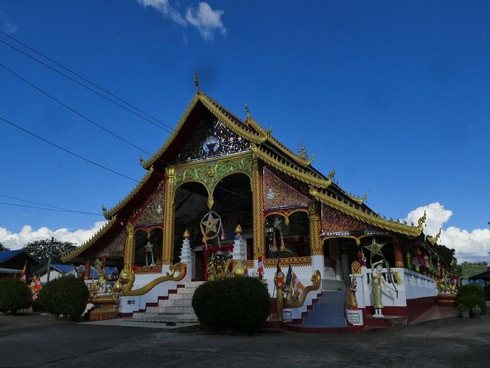
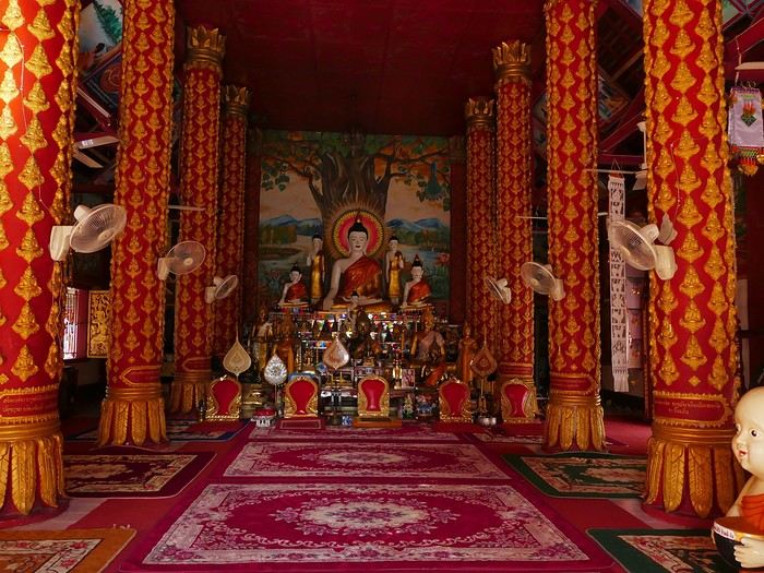
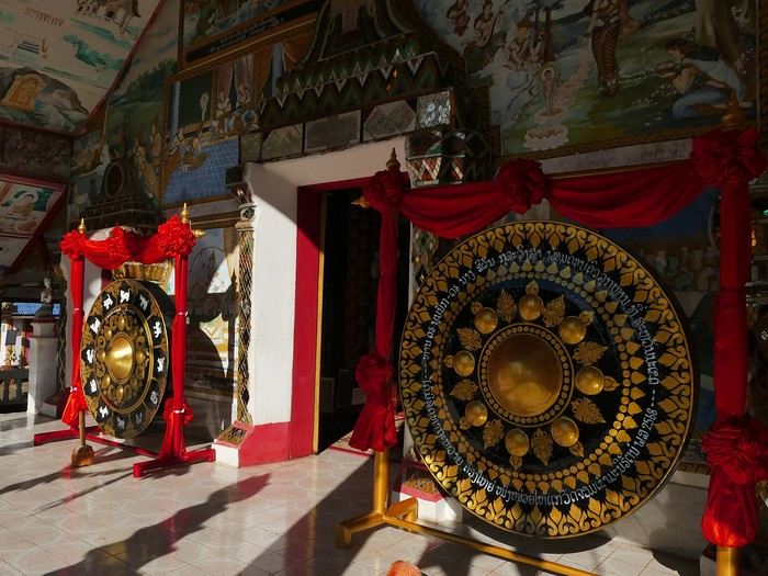
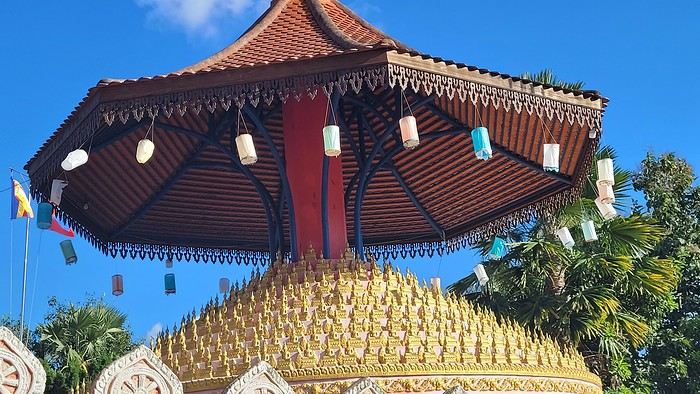
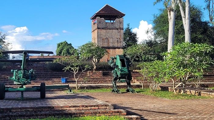
and continued to Fort Carnot, built by the French.
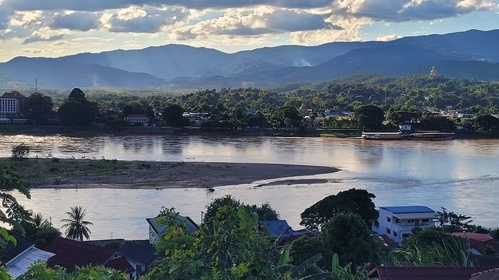
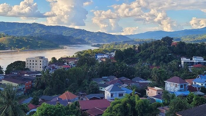
The views of the Mekong are beautiful for a first glimpse of the country.
yum-yum, bon appétit!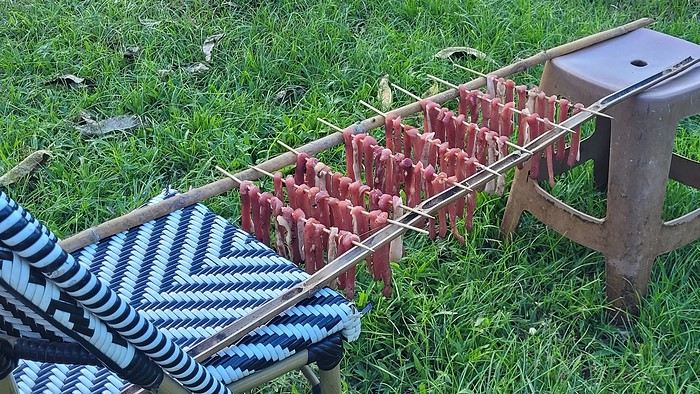
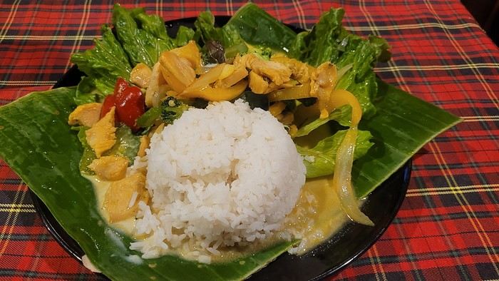
At 6:30 PM, I went to dinner at a restaurant across from the guesthouse—a chicken curry with vegetables.
I didn’t linger and went back to bed. I slept well, even if I woke up often.
Thursday, Oct 23. Left home at 8:25 AM, took the bus from St Cyp to Perpignan, then a BlaBlaBus to Barcelona airport. Last night, a huge storm crossed France, and the bus was an hour late. We finally left at 11 AM. At the Spanish border, we were checked—several Africans were traveling on the bus, and their document verification took quite a while. In the end, everything was in order, and we set off again a good half-hour later. We finally arrived at Barcelona airport after 2 PM, but no stress since my flight was scheduled for 4:30 PM with Saudia. At check-in, the hostess told me there’d be a 1-hour delay due to bad weather in France and Belgium. In the end, the flight didn’t just have a 1-hour delay but a 5-hour one because of a technical issue. The next flight wouldn’t wait for us. When we arrived in Jeddah, they gave us another ticket for the following day—the flight to Bangkok was scheduled for 11:55 AM. The airline assigned us a room, which was good news since I was exhausted. Friday morning, the flight was still scheduled for 11:55 AM, but the gate wasn’t displayed. It was announced with a 1-hour delay, but that stretched to 4 hours. They handed out drinks and a snack—again, the delay was due to technical problems. In Bangkok, I had a connecting flight to Chiang Rai, where I’d also booked a room—I lost everything. We finally arrived in Bangkok on Saturday at 4 AM. I had to buy another ticket for a 7 AM flight. The formalities were quick, and my flight went smoothly. A taxi took me to Bus Terminal 1, where I caught a bus leaving at 10 AM, and we arrived at the Thailand-Laos border. I shared a taxi with other travelers, which took us to Houay Xai. The guesthouse I’d booked was right across from the stop—that was great. I exchanged some money and bought a SIM card at the guesthouse. Despite the fatigue, I needed to stretch my legs, so I walked down the street to the temple.
and continued to Fort Carnot, built by the French.
The views of the Mekong are beautiful for a first glimpse of the country.
yum-yum, bon appétit!
At 6:30 PM, I went to dinner at a restaurant across from the guesthouse—a chicken curry with vegetables.
I didn’t linger and went back to bed. I slept well, even if I woke up often.
The Foam of Days
Now that the curtain has fallen on the past year, it’s time to see what’s happening around here.
It seems pretty quiet, but I’ll read more in detail later.
First, I need to tell you all an anecdote.
My eldest little girl, in her third year of law school, was really scared she wouldn’t pass the year. I told her: “Trust yourself, you’ve worked so hard, and worst case, if you fail, you’ll just redo the year.” “But I don’t think I’ll make it—they changed the rules, and if I mess up even one unit, I have to start all over.” I knew her grades weren’t exactly stellar, and with what I was about to say, I wasn’t taking much of a risk. “Here’s the deal, sweetheart: if you pass, I promise I’ll take you to India, just the two of us.” I have to admit, India is a country I’ve talked about so much to all my grandchildren that in their minds, it’s become a magical, mythical place (hmm).
July had barely begun when my phone rang, her name flashing on the screen. “Mamido, I did it!” My promise came rushing back—oh no, oh no, oh no! “Congratulations, sweetheart!” A little shyly, she said: “Is the India trip still on?”
And me, replying: “Of course it is!”
And that’s that—a promise is a promise, or you risk losing that precious trust that keeps hearts warm and at peace.
We’re leaving in February. Only 8 days—yikes, the carbon footprint! But we can’t miss her tutorials, or she’ll be kicked out. Personally, that works just fine for me.
Going to India has become a challenge for me. It’s far, it’s exhausting, I sweat, I hate mosquitoes, the spices bother my mouth when I used to love them. There’s noise all the time—at night, the dogs bark nonstop, and we almost get run over. I’ll get lost in the streets because my sense of direction has vanished. I don’t like rice anymore. All that chaos and those cultural differences that once enchanted me now just overwhelm me. But I promised.
The upside—and it’s a big one—Raman, the same driver I’ve had forever, will be at the airport with a sign with our names. We’ll stop at the same little shop for chai (or tea, plain and simple) with that aroma that intoxicates me, halfway through the trip.
It’ll be a tiny trip—staying with friends, I’ll show her a few places I love: Chidambaram, Mamallapuram, and the clinic where I worked. Then we’ll head back. My little girl will go home to her parents.
As for me, I’ll leave right away for our Scottish island with Homme for our chilly winter.
How can you love a country so much you want to live there, then suddenly reject it, no longer able to appreciate what once made it special? That’s the mystery of love, I guess.
First, I need to tell you all an anecdote.
My eldest little girl, in her third year of law school, was really scared she wouldn’t pass the year. I told her: “Trust yourself, you’ve worked so hard, and worst case, if you fail, you’ll just redo the year.” “But I don’t think I’ll make it—they changed the rules, and if I mess up even one unit, I have to start all over.” I knew her grades weren’t exactly stellar, and with what I was about to say, I wasn’t taking much of a risk. “Here’s the deal, sweetheart: if you pass, I promise I’ll take you to India, just the two of us.” I have to admit, India is a country I’ve talked about so much to all my grandchildren that in their minds, it’s become a magical, mythical place (hmm).
July had barely begun when my phone rang, her name flashing on the screen. “Mamido, I did it!” My promise came rushing back—oh no, oh no, oh no! “Congratulations, sweetheart!” A little shyly, she said: “Is the India trip still on?”
And me, replying: “Of course it is!”
And that’s that—a promise is a promise, or you risk losing that precious trust that keeps hearts warm and at peace.
We’re leaving in February. Only 8 days—yikes, the carbon footprint! But we can’t miss her tutorials, or she’ll be kicked out. Personally, that works just fine for me.
Going to India has become a challenge for me. It’s far, it’s exhausting, I sweat, I hate mosquitoes, the spices bother my mouth when I used to love them. There’s noise all the time—at night, the dogs bark nonstop, and we almost get run over. I’ll get lost in the streets because my sense of direction has vanished. I don’t like rice anymore. All that chaos and those cultural differences that once enchanted me now just overwhelm me. But I promised.
The upside—and it’s a big one—Raman, the same driver I’ve had forever, will be at the airport with a sign with our names. We’ll stop at the same little shop for chai (or tea, plain and simple) with that aroma that intoxicates me, halfway through the trip.
It’ll be a tiny trip—staying with friends, I’ll show her a few places I love: Chidambaram, Mamallapuram, and the clinic where I worked. Then we’ll head back. My little girl will go home to her parents.
As for me, I’ll leave right away for our Scottish island with Homme for our chilly winter.
How can you love a country so much you want to live there, then suddenly reject it, no longer able to appreciate what once made it special? That’s the mystery of love, I guess.
Martine from DD in Arizona and New Mexico
Good evening everyone! 🙂
We’re back from our September 2025 road trip, this time to explore Arizona and New Mexico, and it’s time for me to start my travel journal—especially since everything’s already booked for another trip in September 2026 (to California), and I need to get started on the planning.
I was a little worried this new visit to Uncle Sam’s country might not be as "wow" as the others, but we still discovered some incredible places.
For those who don’t know us, we’re a couple in our seventies who speak very little English, but that didn’t stop us from fully enjoying our stay.
For this 6th road trip in the U.S., we spent 21 nights there, drove 4,160 km by car, and walked nearly 160 km in a loop starting from Phoenix.
We’d been to Arizona before (but not this side) and never to New Mexico. This whole road trip was a huge discovery for us.
In the prices mentioned (some in euros, others in dollars), bank fees and exchange charges are included. The flights, car rental, and parking were all paid for in December 2024 when we booked.
We’d downloaded the MPC (Mobile Passport Control) app, but there wasn’t a dedicated line at Phoenix Airport. Still, we got through quickly with friendly, smiling agents.
I don’t drive at all (I hate it), so the stops were chosen based on activities but also, for some, to limit daily mileage for the sole driver. The kilometers listed in the itinerary are the daily distances.
We traveled from September 9th to 22nd, unfortunately once again without our dear friends Mimi and Maumau.
The itinerary
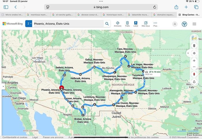
Day 1: Flight Marseille-Paris-Phoenix, then Gold Canyon (133 km) Day 2: Tucson (271 km) Lost Dutchman State Park Day 3: Tucson (155 km) Day 4: Tucson (34 km) Day 5: Bisbee (182 km) Day 6: Lordsburg (345 km) Day 7: Las Cruces (253 km) Day 8: Alamogordo (162 km) Day 9: Roswell (264 km) Day 10: Tucumcari (369 km) Day 11: Las Vegas (281 km) – the one in New Mexico Day 12: Taos (213 km) Day 13: Santa Fe (224 km) Day 14: Albuquerque (123 km) Day 15: Gallup (246 km) Day 16: Holbrook (224 km) Day 17: Flagstaff (179 km) Day 18: Sedona (118 km) Day 19: Sedona (48 km) Day 20: Sedona (41 km) Day 21: Phoenix (256 km) Day 22: Phoenix Airport (35 km)
📊 **Budget**: A little over 7,500 € for both of us, all included. The exchange rate was in our favor (1.17 dollars to 1 €). 📊 **Flights**: Marseille-Paris Charles de Gaulle-Phoenix: 1,787 € for two, with one checked bag each (Air France) 📊 **ESTA**: $42 📊 **America the Beautiful Pass**: $80 📊 **Parking**: 134 € (super eco at Marseille) 📊 **Car rental (Hertz)**: 865 €. Since there were no SUVs left in the reserved category (Nissan Rogue), we got an upgrade (4x4 Ford Explorer). We booked through Air France (15% discount). We’d originally reserved it in December for 1,140 €, but since prices dropped in March, we canceled and rebooked for 865 €. Hertz offers a free Hertz Gold Plus Rewards program, which gives you priority counter service when picking up the car. 📊 **Accommodation**: 2,400 € We stayed in hotels and motels of varying standards (from 60 to 203 € per night, depending on the city), all booked through Booking.com or Hotels.com. Out of 21 nights, only two didn’t include breakfast in the price. Booking.com sometimes offers slightly cheaper rates if you book by phone using the mobile app, and our Genius 3 status on the site also got us some preferential rates. 📊 **Supplementary insurance**: AVA 200 € for medical care if needed 📊 **Cash**: $2,078. We left with 1,000 € exchanged before departure and made two withdrawals of $500. This cash covered: - Evening restaurants and tips - Midday picnics - Gas: $298 for 4,160 km - Museum and private park entries (per person): - Lost Dutchman: $10 - Arizona-Sonora Desert Museum: $28 - Bird Cage Theater: $16 - Tombstone Shootout: $8 - New Mexico Farm & Ranch Museum: $12 - Roswell International UFO Museum: $5 - Billy the Kid Museum: $7 - Rancho de Taos: $22 - West Fork Oak Creek Trail entry: $15 We got a few discounts thanks to our senior age (+65). - Souvenirs and little treats
Like on our previous road trips, we didn’t rent a GPS. We got around using offline GPS apps Here WeGo and Organic Maps, with maps of the states we visited downloaded before we left (on our phones).
❤️❤️❤️ **Highlights** (there are so many!) 📍 Goldfield Ghost Town (even if it’s a reconstruction) 📍 The standing army of Saguaro cacti at Saguaro National Park West 📍 Diving into the cowboy universe of Tombstone 📍 The welcome from Rick and Henry at our guesthouse in Bisbee (Garden at Mile High Ranch) 📍 The tangled rocks of Chiricahua National Monument 📍 The flavored pistachios from Dwayne’s Fresh Jerky and Mac Ginnis Pistachioland 📍 Restaurants: La Posta (Las Cruces), Diner 66 (Albuquerque), and the Haunted Hamburger (Jerome) 📍 The old plazas of New Mexico 📍 The solitude and beauty of the white dunes at White Sands National Park 📍 Stepping back in time at the Billy the Kid Museum (Fort Stanton) 📍 Sections of historic Route 66 and the old motels of Tucumcari, especially at night when all the neon lights are on 📍 Taos Pueblo and diving into Native American culture 📍 After the Rio Grande Bridge, the descent via NM 567 to the very bottom of the Rio Grande Gorge, then the road along the riverbanks to Taos 📍 The tranquility of the Chimayo Sanctuary 📍 Discovering the ingenious native dwellings at Bandelier National Monument and Walnut Canyon National Park 📍 The small towns along the Turquoise Trail 📍 The red rocks of Red Rock Park and the Painted Desert 📍 The extraordinary colors of the petrified trees at Petrified Forest National Park 📍 Sedona, its red rocks, and the reward of the viewpoints at the end of hikes (Devil’s Bridge, The Subway, and West Fork Oak Creek) 📍 The immersion in Mexico when visiting Tlaquepaque 📍 The almost-ghost town of Jerome and its terraced streets 📍 The incredible kindness of Americans, always ready to help and up for a chat ❤️
☹️☹️☹️ **Flops** (there are very few) 📍 Several museums and churches being closed, so we couldn’t visit them 📍 Some museums and visitor centers opening late (10 AM) and closing early (4 PM) 📍 A 64 € phone roaming charge because we got near the Mexican border and picked up their cell tower 📍 The outrageous price ($5.99) for a gallon of gas at the Shell near Phoenix Airport
I hope this helps! Anyway, thanks for reading my long post. Don’t hesitate to reach out, even via PM, if you see I haven’t replied and you’d like more details. Have a great evening, everyone! 🙂
We’re back from our September 2025 road trip, this time to explore Arizona and New Mexico, and it’s time for me to start my travel journal—especially since everything’s already booked for another trip in September 2026 (to California), and I need to get started on the planning.
I was a little worried this new visit to Uncle Sam’s country might not be as "wow" as the others, but we still discovered some incredible places.
For those who don’t know us, we’re a couple in our seventies who speak very little English, but that didn’t stop us from fully enjoying our stay.
For this 6th road trip in the U.S., we spent 21 nights there, drove 4,160 km by car, and walked nearly 160 km in a loop starting from Phoenix.
We’d been to Arizona before (but not this side) and never to New Mexico. This whole road trip was a huge discovery for us.
In the prices mentioned (some in euros, others in dollars), bank fees and exchange charges are included. The flights, car rental, and parking were all paid for in December 2024 when we booked.
We’d downloaded the MPC (Mobile Passport Control) app, but there wasn’t a dedicated line at Phoenix Airport. Still, we got through quickly with friendly, smiling agents.
I don’t drive at all (I hate it), so the stops were chosen based on activities but also, for some, to limit daily mileage for the sole driver. The kilometers listed in the itinerary are the daily distances.
We traveled from September 9th to 22nd, unfortunately once again without our dear friends Mimi and Maumau.
The itinerary
Day 1: Flight Marseille-Paris-Phoenix, then Gold Canyon (133 km) Day 2: Tucson (271 km) Lost Dutchman State Park Day 3: Tucson (155 km) Day 4: Tucson (34 km) Day 5: Bisbee (182 km) Day 6: Lordsburg (345 km) Day 7: Las Cruces (253 km) Day 8: Alamogordo (162 km) Day 9: Roswell (264 km) Day 10: Tucumcari (369 km) Day 11: Las Vegas (281 km) – the one in New Mexico Day 12: Taos (213 km) Day 13: Santa Fe (224 km) Day 14: Albuquerque (123 km) Day 15: Gallup (246 km) Day 16: Holbrook (224 km) Day 17: Flagstaff (179 km) Day 18: Sedona (118 km) Day 19: Sedona (48 km) Day 20: Sedona (41 km) Day 21: Phoenix (256 km) Day 22: Phoenix Airport (35 km)
📊 **Budget**: A little over 7,500 € for both of us, all included. The exchange rate was in our favor (1.17 dollars to 1 €). 📊 **Flights**: Marseille-Paris Charles de Gaulle-Phoenix: 1,787 € for two, with one checked bag each (Air France) 📊 **ESTA**: $42 📊 **America the Beautiful Pass**: $80 📊 **Parking**: 134 € (super eco at Marseille) 📊 **Car rental (Hertz)**: 865 €. Since there were no SUVs left in the reserved category (Nissan Rogue), we got an upgrade (4x4 Ford Explorer). We booked through Air France (15% discount). We’d originally reserved it in December for 1,140 €, but since prices dropped in March, we canceled and rebooked for 865 €. Hertz offers a free Hertz Gold Plus Rewards program, which gives you priority counter service when picking up the car. 📊 **Accommodation**: 2,400 € We stayed in hotels and motels of varying standards (from 60 to 203 € per night, depending on the city), all booked through Booking.com or Hotels.com. Out of 21 nights, only two didn’t include breakfast in the price. Booking.com sometimes offers slightly cheaper rates if you book by phone using the mobile app, and our Genius 3 status on the site also got us some preferential rates. 📊 **Supplementary insurance**: AVA 200 € for medical care if needed 📊 **Cash**: $2,078. We left with 1,000 € exchanged before departure and made two withdrawals of $500. This cash covered: - Evening restaurants and tips - Midday picnics - Gas: $298 for 4,160 km - Museum and private park entries (per person): - Lost Dutchman: $10 - Arizona-Sonora Desert Museum: $28 - Bird Cage Theater: $16 - Tombstone Shootout: $8 - New Mexico Farm & Ranch Museum: $12 - Roswell International UFO Museum: $5 - Billy the Kid Museum: $7 - Rancho de Taos: $22 - West Fork Oak Creek Trail entry: $15 We got a few discounts thanks to our senior age (+65). - Souvenirs and little treats
Like on our previous road trips, we didn’t rent a GPS. We got around using offline GPS apps Here WeGo and Organic Maps, with maps of the states we visited downloaded before we left (on our phones).
❤️❤️❤️ **Highlights** (there are so many!) 📍 Goldfield Ghost Town (even if it’s a reconstruction) 📍 The standing army of Saguaro cacti at Saguaro National Park West 📍 Diving into the cowboy universe of Tombstone 📍 The welcome from Rick and Henry at our guesthouse in Bisbee (Garden at Mile High Ranch) 📍 The tangled rocks of Chiricahua National Monument 📍 The flavored pistachios from Dwayne’s Fresh Jerky and Mac Ginnis Pistachioland 📍 Restaurants: La Posta (Las Cruces), Diner 66 (Albuquerque), and the Haunted Hamburger (Jerome) 📍 The old plazas of New Mexico 📍 The solitude and beauty of the white dunes at White Sands National Park 📍 Stepping back in time at the Billy the Kid Museum (Fort Stanton) 📍 Sections of historic Route 66 and the old motels of Tucumcari, especially at night when all the neon lights are on 📍 Taos Pueblo and diving into Native American culture 📍 After the Rio Grande Bridge, the descent via NM 567 to the very bottom of the Rio Grande Gorge, then the road along the riverbanks to Taos 📍 The tranquility of the Chimayo Sanctuary 📍 Discovering the ingenious native dwellings at Bandelier National Monument and Walnut Canyon National Park 📍 The small towns along the Turquoise Trail 📍 The red rocks of Red Rock Park and the Painted Desert 📍 The extraordinary colors of the petrified trees at Petrified Forest National Park 📍 Sedona, its red rocks, and the reward of the viewpoints at the end of hikes (Devil’s Bridge, The Subway, and West Fork Oak Creek) 📍 The immersion in Mexico when visiting Tlaquepaque 📍 The almost-ghost town of Jerome and its terraced streets 📍 The incredible kindness of Americans, always ready to help and up for a chat ❤️
☹️☹️☹️ **Flops** (there are very few) 📍 Several museums and churches being closed, so we couldn’t visit them 📍 Some museums and visitor centers opening late (10 AM) and closing early (4 PM) 📍 A 64 € phone roaming charge because we got near the Mexican border and picked up their cell tower 📍 The outrageous price ($5.99) for a gallon of gas at the Shell near Phoenix Airport
I hope this helps! Anyway, thanks for reading my long post. Don’t hesitate to reach out, even via PM, if you see I haven’t replied and you’d like more details. Have a great evening, everyone! 🙂
Looking for a beach spot near Bangkok
Hi there,
I’m looking for a beach spot within 3 hours max of Bangkok for the end of my trip (January). I know full well I won’t find that postcard-perfect vibe of the more remote islands! But I don’t have a choice. If you’ve got any ideas... no high-rises, obviously not Pattaya, somewhere quiet, swimming possible, a hotel right on the beach (and not too dirty, the beach itself!) I’ve looked at hotels around Ko Samet or, across from it, on the mainland. I spotted the Bann Pae Cabana. But nothing really exciting on either side. New ideas welcome! 🙂
I’m looking for a beach spot within 3 hours max of Bangkok for the end of my trip (January). I know full well I won’t find that postcard-perfect vibe of the more remote islands! But I don’t have a choice. If you’ve got any ideas... no high-rises, obviously not Pattaya, somewhere quiet, swimming possible, a hotel right on the beach (and not too dirty, the beach itself!) I’ve looked at hotels around Ko Samet or, across from it, on the mainland. I spotted the Bann Pae Cabana. But nothing really exciting on either side. New ideas welcome! 🙂
"Tropical Odyssey" CFC Renaissance – November 1st to 22nd, 2025
We’ve just returned from a cruise that my wife and I will remember—unfortunately, not in a good way.
There’s so much to say that I’ll proceed chapter by chapter.
Pre-Cruise
On January 24th, 2025, I booked through a supposedly attentive cruise agent the repositioning cruise of the CFC Renaissance to the French West Indies, initially departing from Le Havre, then from Dunkirk, on November 1st, 2025.
The return flight was included in the price of this trip.
From January, right after booking, this adventure got off to a bad start.
Used to major cruise lines, I asked my agent to reserve a table for 4 at the "Vatel" restaurant for the second seating, and to link this reservation to the cabin of friends traveling with us. First brush-off: "Ask the maître d’ at the restaurant entrance on the first night."
"To govern is to foresee, and to foresee nothing is to head for disaster," as Émile de Girardin said.
Following this maxim, in February, I started looking for transportation to Le Havre, which was initially the departure port. Then, I asked the travel agent which airport the return flight would land at. I knew flights from Pointe-à-Pitre to Paris served both main Parisian airports. Here, I found myself like a ping-pong ball between the cruise agent and CFC: The cruise agent said, "Ask CFC," and CFC replied, "No, your agent is your intermediary—ask them." It went back and forth like that. Impossible to pre-book the flight that would take us back to our final destination. During the summer, we learned that the departure port was no longer Le Havre but Dunkirk. We canceled our transfers to Le Havre but, of course, lost the cost of the reservations. Meanwhile, we purchased our "Beverage" package—we chose the "Fraîcheur" option, which included all non-alcoholic cocktails, canned sodas, fruit juices, bottled water, and regular coffees. This detail is important for the rest of the story. Every month, I followed up to find out the return airport. Nothing until October 28th (3 days before departure), when CFC finally informed me it was Orly, along with the flight number and time. Of course, on top of booking at full price, I had to arrange my final transfer home. Since I had very little time before the return flight, I had to book an Uber in a rush for the Orly/CDG transfer. Right after, we were told that our first stop in Lisbon—the most anticipated for many cruisers—had been canceled due to a strike at the port of Lisbon and replaced with Vigo, Spain. A completely unremarkable stop—nothing outstanding. As you can see, the prelude was already problematic, yet we’re far from reaching the peak of our disappointments. .......... to be continued soon.
"To govern is to foresee, and to foresee nothing is to head for disaster," as Émile de Girardin said.
Following this maxim, in February, I started looking for transportation to Le Havre, which was initially the departure port. Then, I asked the travel agent which airport the return flight would land at. I knew flights from Pointe-à-Pitre to Paris served both main Parisian airports. Here, I found myself like a ping-pong ball between the cruise agent and CFC: The cruise agent said, "Ask CFC," and CFC replied, "No, your agent is your intermediary—ask them." It went back and forth like that. Impossible to pre-book the flight that would take us back to our final destination. During the summer, we learned that the departure port was no longer Le Havre but Dunkirk. We canceled our transfers to Le Havre but, of course, lost the cost of the reservations. Meanwhile, we purchased our "Beverage" package—we chose the "Fraîcheur" option, which included all non-alcoholic cocktails, canned sodas, fruit juices, bottled water, and regular coffees. This detail is important for the rest of the story. Every month, I followed up to find out the return airport. Nothing until October 28th (3 days before departure), when CFC finally informed me it was Orly, along with the flight number and time. Of course, on top of booking at full price, I had to arrange my final transfer home. Since I had very little time before the return flight, I had to book an Uber in a rush for the Orly/CDG transfer. Right after, we were told that our first stop in Lisbon—the most anticipated for many cruisers—had been canceled due to a strike at the port of Lisbon and replaced with Vigo, Spain. A completely unremarkable stop—nothing outstanding. As you can see, the prelude was already problematic, yet we’re far from reaching the peak of our disappointments. .......... to be continued soon.
Off we go on an adventure in Puglia!
Hey there, VF crew!
After wrapping up our travel journal on Java (link below), we’re now diving into our recent adventure in Puglia! Happy reading... Off we go on an adventure in Java (and a bit of Bali) | Travel journal > Indonesia | Voyage Forum
Day 1 - October 19
When you tell your friends and family you’re itching to escape to the other side of the planet to mingle with the Mongols, you can usually expect a barrage of questionable jokes and terrible puns. For this new adventure, it’s a different destination but the same old story—this time, we’re visiting the "pouilleux" (the "scruffy" ones). We’re taking off straight for Puglia! If you need a cheat sheet to remember where this oddly named place is on a world map, just think of it this way: Puglia is the maiden name on the ID card of the heel of the Italian boot! Personally, I prefer to remember it as the land of creamy burrata, the smell of focaccia fresh from the oven, orecchiette shaped by mamas, golden olive oil that shines like the sun (which beams down here 300 days a year), amaretto that makes you happy, and those famous trulli—those little hobbit-like dry-stone houses straight out of a movie set...
But I’ll stop spoiling the rest of our trip and focus on a factual rundown of this first Puglian day. So, are you joining us on this new adventure beyond our Gallic borders? Either way, Sasha (my youngest) and Luna (Flo’s daughter) didn’t need much convincing to stick with us and keep up the pace!
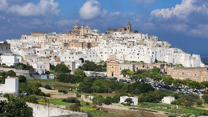
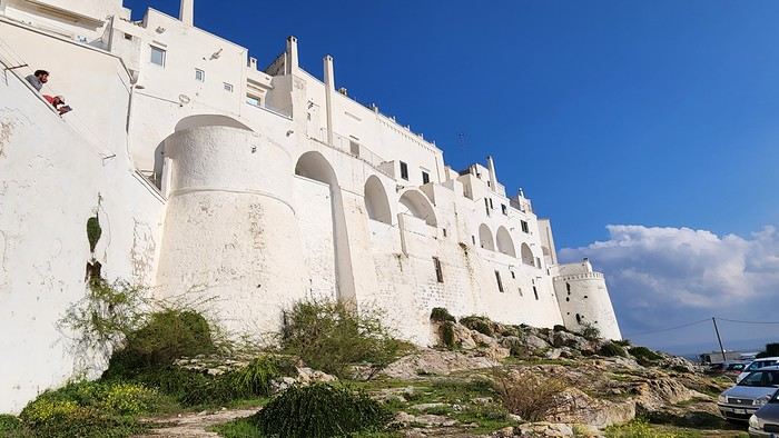
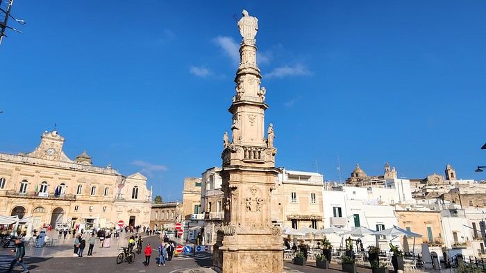
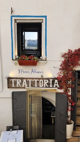
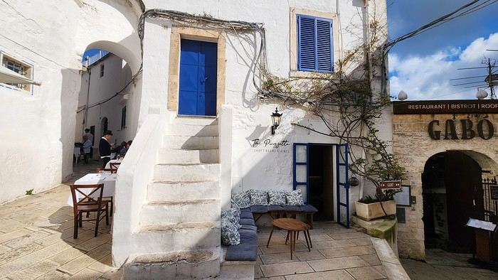
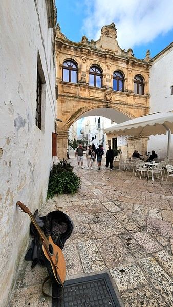
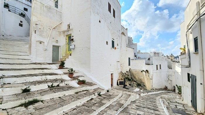
Our plane drops our little crew in Bari, the site of a famously tragic battle lost in 1991. But revenge is sweet! After renting a motorized carriage, we escape the landing zone and head to our military base of operations: Ostuni, a strategic little town where we’ll set up camp for the next four days. Why Ostuni? First, for its central location, which lets us explore a region packed with must-see gems. Second, for its vibe and beauty, which have earned it quite the reputation. Perched high on a hill, the *città bianca* (the "White City") lives up to its nickname. It literally dazzles visitors. The reason? The whitewashed facades of its houses, a testament to the region’s rich architectural heritage.
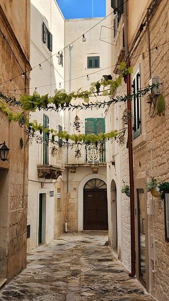
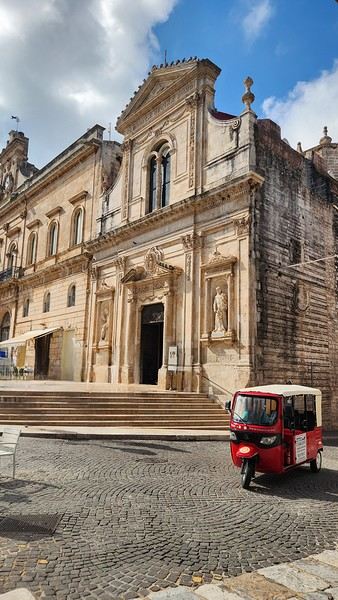
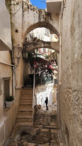
We arrived late last night, so only the two bravest soldiers volunteered to scout ahead at dawn, while the younger recruits stayed behind—for now. But not for long! After the first wave of streets and the next round of exploration, headquarters made the inevitable call to retreat. Reinforcements were needed! A few strategic errands, a breakfast ration, and our battalion marched in tight formation, flag held high, to conquer Ostuni the White! *Charge!* In my squadron leader’s memoirs, I’ll write that I didn’t expect Ostuni to put up such a fight. What I thought would take two hours to conquer turned into a humbling experience—we could only bow in respect to its beauty, its relentless charm. The alleys are whiter, more labyrinthine, narrower, and more photogenic than the last. *Veni, vidi, vici*—but what an entrance, my troops!
After wrapping up our travel journal on Java (link below), we’re now diving into our recent adventure in Puglia! Happy reading... Off we go on an adventure in Java (and a bit of Bali) | Travel journal > Indonesia | Voyage Forum
Day 1 - October 19
When you tell your friends and family you’re itching to escape to the other side of the planet to mingle with the Mongols, you can usually expect a barrage of questionable jokes and terrible puns. For this new adventure, it’s a different destination but the same old story—this time, we’re visiting the "pouilleux" (the "scruffy" ones). We’re taking off straight for Puglia! If you need a cheat sheet to remember where this oddly named place is on a world map, just think of it this way: Puglia is the maiden name on the ID card of the heel of the Italian boot! Personally, I prefer to remember it as the land of creamy burrata, the smell of focaccia fresh from the oven, orecchiette shaped by mamas, golden olive oil that shines like the sun (which beams down here 300 days a year), amaretto that makes you happy, and those famous trulli—those little hobbit-like dry-stone houses straight out of a movie set...
But I’ll stop spoiling the rest of our trip and focus on a factual rundown of this first Puglian day. So, are you joining us on this new adventure beyond our Gallic borders? Either way, Sasha (my youngest) and Luna (Flo’s daughter) didn’t need much convincing to stick with us and keep up the pace!
Our plane drops our little crew in Bari, the site of a famously tragic battle lost in 1991. But revenge is sweet! After renting a motorized carriage, we escape the landing zone and head to our military base of operations: Ostuni, a strategic little town where we’ll set up camp for the next four days. Why Ostuni? First, for its central location, which lets us explore a region packed with must-see gems. Second, for its vibe and beauty, which have earned it quite the reputation. Perched high on a hill, the *città bianca* (the "White City") lives up to its nickname. It literally dazzles visitors. The reason? The whitewashed facades of its houses, a testament to the region’s rich architectural heritage.
We arrived late last night, so only the two bravest soldiers volunteered to scout ahead at dawn, while the younger recruits stayed behind—for now. But not for long! After the first wave of streets and the next round of exploration, headquarters made the inevitable call to retreat. Reinforcements were needed! A few strategic errands, a breakfast ration, and our battalion marched in tight formation, flag held high, to conquer Ostuni the White! *Charge!* In my squadron leader’s memoirs, I’ll write that I didn’t expect Ostuni to put up such a fight. What I thought would take two hours to conquer turned into a humbling experience—we could only bow in respect to its beauty, its relentless charm. The alleys are whiter, more labyrinthine, narrower, and more photogenic than the last. *Veni, vidi, vici*—but what an entrance, my troops!
Road Trip USA 2023 - Part 2
HIGHWAY 1
Highway 1 runs along the Pacific coast of California from Leggett in the north to Dana Point in the south. It's the longest state route in California, stretching 1,050 km.
It's famous for its breathtaking ocean views. That’s actually why it’s become such a popular route for road trips, with tons of attractions and points of interest all along the way.
After crossing the U.S. interior on our way out (see Road Trip USA 2023 - Part 1), we’re starting our return trip along this route from Leggett.
Videos are embedded throughout the summary. Please click on the image to start the video. To jump to a specific post, here are the appropriate links:
CALIFORNIA:
Scenic Overlooks on Route 1 Between Leggett and Fort Bragg The Pudding Creek Trestle Bridge in Fort Bragg Glass Beach - Fort Bragg Jenner Lookout Point - Highway 1 Goat Rock Beach - Sonoma Coast State Park - Jenner Point Reyes National Seashore - White House Pool Trail Point Reyes National Seashore - Limantour Beach Point Reyes National Seashore - Point Reyes Shipwreck Point Reyes National Seashore - Kehoe Beach Trail Point Reyes National Seashore - McClures Beach Trail Point Reyes National Seashore - Cypress Tree Tunnel Point Reyes National Seashore - Point Reyes Beach North Point Reyes National Seashore - Elephant Seals on Drakes Beach Point Reyes National Seashore - Point Reyes Beach South Point Reyes National Seashore – Elephant Seals Overlooks Point Reyes National Seashore - Chimney Rock Trail Point Reyes National Seashore - Point Reyes Lighthouse Trail Point Reyes National Seashore – Tule Elk Observation Point Bonita Lighthouse Trail - Sausalito Hawk Hill - Sausalito Battery Spencer Trail - Sausalito Rodeo Beach - Sausalito Point Cavallo - Golden Gate View - Sausalito Exploring Downtown Sausalito Visiting Sausalito’s Houseboats Crossing the Golden Gate Bridge - San Francisco Golden Gate Bridge Viewpoints - San Francisco Cruise to Alcatraz Island - San Francisco Visiting Alcatraz Island - San Francisco Civic Center - Downtown San Francisco Market Street & Yerba Buena Gardens - Downtown San Francisco Union Square & Financial District - Downtown San Francisco Fisherman's Wharf, Pier 39 & Embarcadero - San Francisco Sea Lion Observation - Pier 39 - San Francisco Lombard Street & Cable Car - Russian Hill - San Francisco Macondray Lane Historic District - Russian Hill - San Francisco Grace Cathedral & Huntington Park - Nob Hill - San Francisco Telegraph Hill - San Francisco Chinatown - San Francisco Alamo Square & Painted Ladies - Western Addition - San Francisco Palace of Fine Arts - Marina District - San Francisco Presidio of San Francisco California Coastal Trail - Lincoln Park - San Francisco California Palace of the Legion of Honor - Lincoln Park - San Francisco Sutro Baths - Lincoln Park - San Francisco Queen Wilhelmina Garden - Golden Gate Park - San Francisco Bison Paddock - Golden Gate Park - San Francisco Portals of the Past - Golden Gate Park - San Francisco Strawberry Hill - Golden Gate Park – San Francisco Prayerbook Cross & Robin Williams Meadow - Golden Gate Park - San Francisco Hidden Garden Steps & 16th Avenue Tiled Steps - San Francisco Grandview Park - San Francisco Hike - Twin Peaks Three Summits - San Francisco Longboarding Down Twin Peaks Blvd in San Francisco Haight-Ashbury - San Francisco Corona Heights Park - San Francisco Mission Dolores - San Francisco Mural Frescoes (Part 1) - Mission District - San Francisco Mural Frescoes (Part 2) - Mission District - San Francisco Devil's Slide Bunker - Pacifica Mavericks Beach - Half Moon Bay Martins Beach - Half Moon Bay Pigeon Point Lighthouse State Historic Park - Pescadero What to See in Santa Cruz Visiting Capitola What to See in Monterey Carmel-by-the-Sea Lovers Point Park - Pacific Grove Castle Rock, Hurricane Point & Little Sur River Viewpoints Pfeiffer Falls Trail Julia Pfeiffer Burns State Park Vista Point & McWay Falls Highway 1 - Big Sur Viewpoints Salmon Creek Falls San Carpoforo Creek Trail Elephant Seal Vista Point - San Simeon San Simeon Pier Moonstone Beach Boardwalk Shipwreck - Estero Bluffs State Park Surfing Competition in Morro Bay Port San Luis Pier - San Luis Obispo Pismo Beach Monarch Butterfly Grove - Pismo State Beach Nojoqui Falls Park - Solvang Arroyo Hondo Vista Point Solvang, a Charming Danish Town in California Chumash Painted Cave - Santa Barbara Goleta San Marcos Rd & Cachuma Lake Vista Points - Santa Barbara Old Santa Barbara Mission Walking Tour of Santa Barbara’s Historic Downtown West Beach - Santa Barbara What to See in Ventura Paradise Falls - Wildwood Regional Park - Thousand Oaks Sandy Dune & El Matador State Beach - Malibu Point Dume Nature Reserve - Malibu Malibu Pier Road Trip in the Malibu Mountains Los Liones Trail - Santa Monica Santa Monica Pier Rodeo Drive - Beverly Hills Greystone Mansion - Beverly Hills Hollywood Walk of Fame - Los Angeles Griffith Observatory - Los Angeles Hollywood Forever Cemetery - Los Angeles What to See in Venice Beach Venice Beach Skatepark ShoreLine Aquatic Park - Long Beach Alamitos Beach - Long Beach Naples Island - Long Beach Crescent Bay Point Park & Helser Park Kiosk - Laguna Beach Shell Beach at Twin Points - Laguna Beach Prairie Dogs at Agra Vista Point Top Gun House & Oceanside Pier Annie's Canyon Trail - Solana Beach (Via North Rios Trailhead Loop) Old Town San Diego La Jolla Coastal Trail - San Diego Balboa Park - San Diego Pacific Beach - San Diego Mission Beach - San Diego Ocean Beach Tide Pools - San Diego Sunset Cliffs Natural Park - San Diego Tuna Harbor Park - San Diego Seaport Village & Embarcadero Marina Park - San Diego Gaslamp Quarter - Downtown San Diego Coronado Island - San Diego Dead Dolly Lane - Alpine Galleta Meadows Metal Sculptures - Borrego Springs What to See in Palm Springs Robolights - Palm Springs Andreas Canyon Trail - Indian Canyons - Palm Springs Palm Canyon Trail - Indian Canyons - Palm Springs West Fork Falls Trail - Indian Canyons - Palm Springs Tahquitz Canyon Loop Trail - Indian Canyons - Palm Springs Desert Christ Park - Yucca Valley Pioneertown Salvation Mountain - Niland Slab City - Niland
Highway 1 runs along the Pacific coast of California from Leggett in the north to Dana Point in the south. It's the longest state route in California, stretching 1,050 km.
It's famous for its breathtaking ocean views. That’s actually why it’s become such a popular route for road trips, with tons of attractions and points of interest all along the way.
After crossing the U.S. interior on our way out (see Road Trip USA 2023 - Part 1), we’re starting our return trip along this route from Leggett.
Videos are embedded throughout the summary. Please click on the image to start the video. To jump to a specific post, here are the appropriate links:
CALIFORNIA:
Scenic Overlooks on Route 1 Between Leggett and Fort Bragg The Pudding Creek Trestle Bridge in Fort Bragg Glass Beach - Fort Bragg Jenner Lookout Point - Highway 1 Goat Rock Beach - Sonoma Coast State Park - Jenner Point Reyes National Seashore - White House Pool Trail Point Reyes National Seashore - Limantour Beach Point Reyes National Seashore - Point Reyes Shipwreck Point Reyes National Seashore - Kehoe Beach Trail Point Reyes National Seashore - McClures Beach Trail Point Reyes National Seashore - Cypress Tree Tunnel Point Reyes National Seashore - Point Reyes Beach North Point Reyes National Seashore - Elephant Seals on Drakes Beach Point Reyes National Seashore - Point Reyes Beach South Point Reyes National Seashore – Elephant Seals Overlooks Point Reyes National Seashore - Chimney Rock Trail Point Reyes National Seashore - Point Reyes Lighthouse Trail Point Reyes National Seashore – Tule Elk Observation Point Bonita Lighthouse Trail - Sausalito Hawk Hill - Sausalito Battery Spencer Trail - Sausalito Rodeo Beach - Sausalito Point Cavallo - Golden Gate View - Sausalito Exploring Downtown Sausalito Visiting Sausalito’s Houseboats Crossing the Golden Gate Bridge - San Francisco Golden Gate Bridge Viewpoints - San Francisco Cruise to Alcatraz Island - San Francisco Visiting Alcatraz Island - San Francisco Civic Center - Downtown San Francisco Market Street & Yerba Buena Gardens - Downtown San Francisco Union Square & Financial District - Downtown San Francisco Fisherman's Wharf, Pier 39 & Embarcadero - San Francisco Sea Lion Observation - Pier 39 - San Francisco Lombard Street & Cable Car - Russian Hill - San Francisco Macondray Lane Historic District - Russian Hill - San Francisco Grace Cathedral & Huntington Park - Nob Hill - San Francisco Telegraph Hill - San Francisco Chinatown - San Francisco Alamo Square & Painted Ladies - Western Addition - San Francisco Palace of Fine Arts - Marina District - San Francisco Presidio of San Francisco California Coastal Trail - Lincoln Park - San Francisco California Palace of the Legion of Honor - Lincoln Park - San Francisco Sutro Baths - Lincoln Park - San Francisco Queen Wilhelmina Garden - Golden Gate Park - San Francisco Bison Paddock - Golden Gate Park - San Francisco Portals of the Past - Golden Gate Park - San Francisco Strawberry Hill - Golden Gate Park – San Francisco Prayerbook Cross & Robin Williams Meadow - Golden Gate Park - San Francisco Hidden Garden Steps & 16th Avenue Tiled Steps - San Francisco Grandview Park - San Francisco Hike - Twin Peaks Three Summits - San Francisco Longboarding Down Twin Peaks Blvd in San Francisco Haight-Ashbury - San Francisco Corona Heights Park - San Francisco Mission Dolores - San Francisco Mural Frescoes (Part 1) - Mission District - San Francisco Mural Frescoes (Part 2) - Mission District - San Francisco Devil's Slide Bunker - Pacifica Mavericks Beach - Half Moon Bay Martins Beach - Half Moon Bay Pigeon Point Lighthouse State Historic Park - Pescadero What to See in Santa Cruz Visiting Capitola What to See in Monterey Carmel-by-the-Sea Lovers Point Park - Pacific Grove Castle Rock, Hurricane Point & Little Sur River Viewpoints Pfeiffer Falls Trail Julia Pfeiffer Burns State Park Vista Point & McWay Falls Highway 1 - Big Sur Viewpoints Salmon Creek Falls San Carpoforo Creek Trail Elephant Seal Vista Point - San Simeon San Simeon Pier Moonstone Beach Boardwalk Shipwreck - Estero Bluffs State Park Surfing Competition in Morro Bay Port San Luis Pier - San Luis Obispo Pismo Beach Monarch Butterfly Grove - Pismo State Beach Nojoqui Falls Park - Solvang Arroyo Hondo Vista Point Solvang, a Charming Danish Town in California Chumash Painted Cave - Santa Barbara Goleta San Marcos Rd & Cachuma Lake Vista Points - Santa Barbara Old Santa Barbara Mission Walking Tour of Santa Barbara’s Historic Downtown West Beach - Santa Barbara What to See in Ventura Paradise Falls - Wildwood Regional Park - Thousand Oaks Sandy Dune & El Matador State Beach - Malibu Point Dume Nature Reserve - Malibu Malibu Pier Road Trip in the Malibu Mountains Los Liones Trail - Santa Monica Santa Monica Pier Rodeo Drive - Beverly Hills Greystone Mansion - Beverly Hills Hollywood Walk of Fame - Los Angeles Griffith Observatory - Los Angeles Hollywood Forever Cemetery - Los Angeles What to See in Venice Beach Venice Beach Skatepark ShoreLine Aquatic Park - Long Beach Alamitos Beach - Long Beach Naples Island - Long Beach Crescent Bay Point Park & Helser Park Kiosk - Laguna Beach Shell Beach at Twin Points - Laguna Beach Prairie Dogs at Agra Vista Point Top Gun House & Oceanside Pier Annie's Canyon Trail - Solana Beach (Via North Rios Trailhead Loop) Old Town San Diego La Jolla Coastal Trail - San Diego Balboa Park - San Diego Pacific Beach - San Diego Mission Beach - San Diego Ocean Beach Tide Pools - San Diego Sunset Cliffs Natural Park - San Diego Tuna Harbor Park - San Diego Seaport Village & Embarcadero Marina Park - San Diego Gaslamp Quarter - Downtown San Diego Coronado Island - San Diego Dead Dolly Lane - Alpine Galleta Meadows Metal Sculptures - Borrego Springs What to See in Palm Springs Robolights - Palm Springs Andreas Canyon Trail - Indian Canyons - Palm Springs Palm Canyon Trail - Indian Canyons - Palm Springs West Fork Falls Trail - Indian Canyons - Palm Springs Tahquitz Canyon Loop Trail - Indian Canyons - Palm Springs Desert Christ Park - Yucca Valley Pioneertown Salvation Mountain - Niland Slab City - Niland
Cambodia and Indonesia in summer: ideal itinerary with kids?
Hi everyone,
After letting our backpacks gather dust for several years, we’ve decided to set off on another adventure—this time as a family, with our 10- and 12-year-old kids! We’re planning a trip from mid-June to the end of July, with two stops: Cambodia (2 weeks) and Indonesia (4 weeks). But before diving into the details, we’ve got quite a few questions and doubts.
About Cambodia: We know this period is the rainy season. Is it really a good idea to go then? And if so, is it better to start with Cambodia and then move on to Indonesia, or does the order not matter from a climate perspective? Here are the activities and sites we’ve shortlisted: · The Mekong and Irrawaddy dolphins: do we actually have a chance of seeing them? · The Mondulkiri Project (elephant sanctuary): is this an ethical project? We want to avoid any form of animal exploitation. · The temples of Angkor: are 2 or 3 days enough to fully enjoy them? · Floating villages: where should we go for an authentic experience? Is it possible to spend the night there? · Hikes with waterfalls, lakes, etc.: are there any must-do treks? · And most importantly, what activities or sites would appeal to kids?
For Indonesia: We were there 15 years ago and loved our itinerary: Yogyakarta / Borobudur → Bromo → Kawah Ijen → Bali → Gili Trawangan. This time, we’re torn: · Retracing part of that route to share it with our kids (even if revisiting the same places isn’t super appealing), · Or exploring new regions. What’s almost certain is that we’d like to spend about two weeks in Raja Ampat. For the other two weeks, we’re undecided. We’re looking for kid-friendly ideas for places and activities, while avoiding too many connections for budget and environmental reasons. Since we’ll already see temples in Cambodia, we’d like to mix things up.
And finally… On our last trip to the region, we traveled without kids and went super free-spirited: only the round-trip tickets were booked, and we improvised the rest day by day without any major issues finding accommodation, food, or accessing the activities we’d spotted. Do you think this style of travel is still doable with two kids? Or has it become too risky or stressful? Are there regions where the "backpacker" approach is still possible, and others where it’s better to book in advance? And for certain activities or sites, is it recommended to hire guides?
Thanks in advance for your tips and experiences!
After letting our backpacks gather dust for several years, we’ve decided to set off on another adventure—this time as a family, with our 10- and 12-year-old kids! We’re planning a trip from mid-June to the end of July, with two stops: Cambodia (2 weeks) and Indonesia (4 weeks). But before diving into the details, we’ve got quite a few questions and doubts.
About Cambodia: We know this period is the rainy season. Is it really a good idea to go then? And if so, is it better to start with Cambodia and then move on to Indonesia, or does the order not matter from a climate perspective? Here are the activities and sites we’ve shortlisted: · The Mekong and Irrawaddy dolphins: do we actually have a chance of seeing them? · The Mondulkiri Project (elephant sanctuary): is this an ethical project? We want to avoid any form of animal exploitation. · The temples of Angkor: are 2 or 3 days enough to fully enjoy them? · Floating villages: where should we go for an authentic experience? Is it possible to spend the night there? · Hikes with waterfalls, lakes, etc.: are there any must-do treks? · And most importantly, what activities or sites would appeal to kids?
For Indonesia: We were there 15 years ago and loved our itinerary: Yogyakarta / Borobudur → Bromo → Kawah Ijen → Bali → Gili Trawangan. This time, we’re torn: · Retracing part of that route to share it with our kids (even if revisiting the same places isn’t super appealing), · Or exploring new regions. What’s almost certain is that we’d like to spend about two weeks in Raja Ampat. For the other two weeks, we’re undecided. We’re looking for kid-friendly ideas for places and activities, while avoiding too many connections for budget and environmental reasons. Since we’ll already see temples in Cambodia, we’d like to mix things up.
And finally… On our last trip to the region, we traveled without kids and went super free-spirited: only the round-trip tickets were booked, and we improvised the rest day by day without any major issues finding accommodation, food, or accessing the activities we’d spotted. Do you think this style of travel is still doable with two kids? Or has it become too risky or stressful? Are there regions where the "backpacker" approach is still possible, and others where it’s better to book in advance? And for certain activities or sites, is it recommended to hire guides?
Thanks in advance for your tips and experiences!
Hitchhiking in the 70s-80s
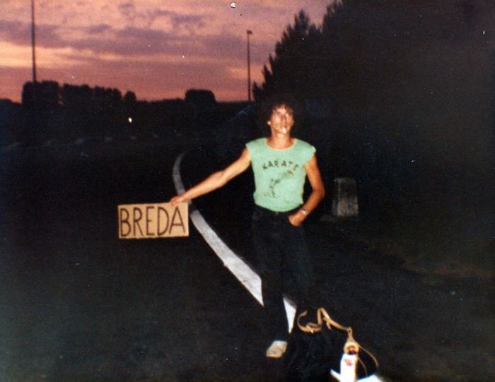
“Hey, your Marker... - My Marker? - The one you used to make hitchhiking signs.”
The marker in question is sitting proudly on the kitchen table. Marielle found it at the bottom of a moving box.
I’ve been meaning to tell the long story of my love affair with hitchhiking for years. Here we go.
To be honest, I’m not quite sure when it started. My earliest memory goes back to a fair with a bike race in my maternal grandparents’ village. I was with my cousin, my little sister, and three girl cousins. There were six of us, ages ranging from six or seven to thirteen or fourteen. Our parents stayed at the fair, and we’d had enough. So we decided to walk home. Only it was four kilometers away. So we hitchhiked. A guy driving an old car picked us all up and dropped us off at the farm. He probably found it amusing to see us thumbing a ride by the side of the road, but maybe it also worried him a bit. With everything you read in the papers...
Around fifteen or sixteen, I started hitchhiking regularly, alone or with a friend, to go to the nearby town. But it was especially when I started boarding school in Orléans that it became more regular. The first year, I’d leave Monday morning and come back Saturday noon by bus. It was an old, uncomfortable bus where we froze in winter. To make matters worse, I often got motion sickness if, as was too often the case, I ended up sitting in the back. In the spring, a high school friend suggested I hitchhike back. It meant a slight detour, but the advantage was taking only national roads.
So that’s how, from the end of tenth grade to twelfth grade, I’d thumb a ride every Saturday on the Pont de Bourgogne. Drivers were used to seeing young people hitchhiking, and it worked pretty well. Our biggest fear? Soldiers! At that time, military service was still mandatory, and on weekends, it wasn’t rare to see them competing with us. They’d keep their uniforms on to go home. That gave people confidence—with everything you read in the papers—and they’d rarely wait more than five minutes. We, with our long hair, were definitely less popular. From time to time, three big red-faced guys in a van coming back from a construction site would flip us off, yelling things like “go get a haircut, you bums!” Those were the good old days.
We still had a good laugh, though. Patrice, the friend I’d hitchhike back from school with on Saturdays, is a musician—I’d later discover he’s an excellent composer. A die-hard Beatles fan, he knows their repertoire by heart and spends his time singing at the top of his lungs while we thumb a ride. One Saturday late morning, we’d been waiting for a while at the exit of Châteauneuf-sur-Loire when a little lady came up to him and asked if he could please sing a little quieter: a baby was sleeping in the house. He put on the most sorry face: “Oh, sorry ma’am, we didn’t realize.” No sooner had the lady gone back inside than he started again. Luckily, a car stopped just then, sparing me the embarrassment of seeing the lady come back out.
Saturday was also the day when the cigarette pack was dangerously low. So before leaving, we’d go buy some “Parisiennes,” the “P4s” as we called them back then. They were slightly thinner cigarettes with a mix of tobacco scraps. Sometimes they tasted like light tobacco, sometimes like dark. Not great, but by the end of the week, our pocket money was gone. They were sold in small packs of four, hence the name P4. We’d only pay 20 centimes. On Saturdays, it was rare for the two of us to manage to scrape together 1.50 F to buy a whole pack of Gauloises...
The last twenty kilometers, I’d usually do alone, Patrice having reached his destination. From time to time, luck would smile on me: an acquaintance would just happen to pass by and stop. One January Saturday, at the exit of Gien, I ran into another guy from Argenton whom I knew a little. That day, the weather was nice, but the temperature was well below zero. It was around noon, and it was the off-peak hour. We were shivering, stamping our feet by the side of the road, when a Citroën “Tube” arrived: it was his father’s boss’s, a mason. They were both sitting in the front, but since they were obese, they had us climb onto the open back. Even though we huddled against the cab to shelter from the wind, the twenty kilometers felt very long, especially since we were only going sixty kilometers an hour. Our hands and cheeks were blue when we finally arrived.
The year I took my baccalaureate, a friend with a 2CV would take me Monday mornings with one or two others we’d pick up in nearby villages. We’d share the gas costs, but it was still cheaper than the bus. And in winter, the bus was my nightmare. You had to get up at five to catch it at six. Not enough sleep, and outside it was freezing or raining—or both. The 2CV was luxury. Plus, Philippe would pick me up at home. On the other hand, since I didn’t have class Saturday mornings—well, I did, but we only had PE the first two hours and nothing after—I’d skip class and slip out right after breakfast to thumb a ride at the Pont de Bourgogne.
Those three high school years were formative in this optional subject that was hitchhiking. Little by little, I learned the rules of the game. First, you shouldn’t walk along the road while thumbing. Cars go too fast and can’t stop easily. Accepting a ride that’s too short is also a no-go. The guy who offers to take you a little way but drops you off at some vague crossroads in the middle of nowhere? No thanks. You need to get dropped off in a town. If it’s a fairly big city, you often have to cross it from one end to the other, but it’s better. At the exit, you have to choose your spot well. Actually, you have to put yourself in the driver’s shoes: they need to see you early enough, not be going too fast, and be able to stop easily without risking an accident. So when leaving a city, it’s better not to go too far. It’s wiser to find a spot where cars go slowly and can stop easily. And preferably near a café. The café is for when you still have a few coins for a coffee and need to warm up. From time to time, you’d run into someone nice who’d make a detour to drop you off at a better spot to start again. Finally, if possible, avoid hitchhiking on Sundays. Cars are packed with whole families who, most of the time, aren’t going far. And then there’s the little worry of those people who rarely leave home: with everything you read in the papers...
During those high school years, it was only short trips, rarely exceeding a hundred kilometers. Later, I aimed bigger, and things were a bit different. In 1973-74, I crossed part of France for the first time on two or three occasions, coming back from the German border or returning to Bordeaux, where we lived briefly. Since there weren’t many highways back then, we took national roads. It was during these trips that I realized it was better to leave in the evening. As I said earlier, Sunday is to be avoided, but on weekdays, there’s another problem: if you leave in the morning, you only make short hops. First, it often takes longer to get going because drivers are people going to work nearby. Which brings us back to those who drop you off in a bad spot, far from everything. There, you have to know how to refuse. You thank the driver for stopping—oh, if only everyone could be like you—while explaining why you’d rather stay put. People don’t take offense, by the way. Those who pick up hitchhikers often hitchhiked themselves when they were in the military or before they had a car. In the late afternoon, you’d often run into salespeople or truckers, in other words, people who drive a lot. At that time, salespeople no longer had appointments and were more relaxed. They wanted to talk about something other than the merits of their products. On the radio, it was time for *Les Grosses Têtes*. You’d also quite often run into small business owners, professionals, or even hippies. The conversations were pleasant and often enriching. A little later in the evening, truckers would take over. They’d already driven a few hundred kilometers, and the depot or customs was still far away. So they’d gladly take a hitchhiker to stay awake at the wheel and chat. The radio with Max Ménier’s show *Les routiers sont sympas*, you’d eventually get tired of it. So a hitchhiker was a change. Others, who’d hit the road at midnight to be at their destination by morning, were nice and offered to let you lie down on the bunk while they drove. When you’d been hitchhiking since six in the evening, freezing in the wind between two vehicles, you weren’t unhappy to take a little nap.
Speaking of Max Ménier, he’d often make announcements for hitchhikers. One evening, I called him. It was getting late, and I still had quite a way to go. No luck: the show had ended for good the day before!
In short, it’s better not to rush, sleep in, and leave after lunch, or better yet, in the late afternoon. Obviously, I’m talking about when you have several hundred kilometers to cover. That’s when you have to play it pro.
First thing, especially at night, but it also applies in the middle of summer when the light is blinding: dress to be seen from far away. I’ll admit I have an advantage over most other hitchhikers: I’m small and don’t scare people. To balance that out, racist drivers often take me for an Arab and are less likely to pick me up, but overall, the balance tips in my favor. Back to the need to be seen: at night, I wear light-colored clothes. In headlights, you can see me from far away.
Second thing: travel light. Forget the big backpack with a frame. Drivers don’t always have room in the trunk or on the back seat, especially if it’s rained and the ground is wet. Plus, it forces them to get out of the car. If they’re nice enough to pick up a hitchhiker, you shouldn’t ask for too much either.
Third thing: bring a cardboard sign and a big marker—like the ones in the photo at the start of this post—to write the name of your destination. In the early 80s, I ran a tourist house in the Cher, but I lived in the Netherlands. In the off-season, it was only open on weekends. On Fridays, I’d leave Holland and return on Mondays. 1200 km round trip. On the way there, in Paris, I’d stand at Porte de la Chapelle. At that spot, the road is very wide, and drivers could stop easily. Obviously, on the sign, I didn’t write Eindhoven, which not everyone knows, and even less Amsterdam because of its seedy reputation. In that case, you’d expect to see a police car stop and two officers in kepis ask for your papers. So as a first destination, I’d write Compiègne. We were well out of Paris, and since it wasn’t too far, a trucker or salesperson was less reluctant to stop. Once past Compiègne, I’d take out my Lille sign. Once in Belgium, it wasn’t really necessary to use a sign anymore, since everyone was going in the same direction. Usually, the guy who picked me up at Porte de la Chapelle would say he wasn’t going far but could take me a little way. Before that, I’d still ask if there was a gas station on the highway where he could drop me off before exiting. While talking, the guy would realize he wasn’t dealing with a dangerous criminal. He’d pretend to check his watch, think for a moment, then say that actually, he was going to Belgium and could take me to the border or a little beyond. To leave Paris on the way back, I’d take the train to Melun, where it was easier to hitchhike than at Porte d’Italie.
Over all those years, I think I was pretty lucky. Or maybe philosophical enough not to imagine a car would stop after a few minutes. An hour’s wait was average. Sure, I sometimes waited three, four, or five hours. Most often at odd hours and in terrible weather. When it doesn’t work, it doesn’t work. But there’s always a moment when things pick up. Sure, when you’re soaked in freezing rain in the early morning after a sleepless night, you’re less philosophical than when I’m writing these lines comfortably at my computer, but it still holds true.
Earlier, I mentioned clothing and the importance of being well-rested before leaving. When you’ve eaten well and just gotten out of the shower, shaved, you’re in a better mood. And somehow, drivers sense it. Or at least, that’s the impression I’ve always had. It’s better to look in shape than disgusted at standing there, half-heartedly thumbing a ride. In short, when I’d start to get fed up with waiting, I’d go into the first café I saw for a coffee. Coming back out, I’d be refreshed, and most of the time, a car would stop within minutes. I’ve often said that when I stood by the side of the road thumbing a ride, I felt a bit like a gambler in front of a slot machine. It was a matter of giving luck a chance. And well, it worked out pretty well.
Then, there are countries where hitchhiking works really well and others where it’s harder. In the 70s-80s, it worked best in Germany and England. In the late afternoon, it wasn’t rare to be invited for tea. Well, that was in England. Tea meant being offered room and board. In Germany, they’d offer you coffee. Once there, they’d first show you the guest room and point out the bathroom before sitting you down in front of a big plate of cold cuts. In the evening, they’d go out in town, and the next morning, they’d usually drop you off at a good spot for hitchhiking. On the other hand, in Mediterranean and Scandinavian countries, you’d better be patient. In Spain or Italy, it’s better to take the train, which was dirt cheap back then. However, if you’re a couple traveling light, it’s already easier in most countries.
In 1982, I went on a trip around Turkey with my girlfriend. We only had two small bags, which was plenty. It was November-December, and we wore our warm, bulky clothes. Leaving Eindhoven at nine in the morning, we arrived in Graz, near the Yugoslav border, at eleven at night. 1300 km in a day! In just four or five vehicles. One to the German border, about fifty kilometers from Eindhoven, the second to Hagen in the Ruhr, the third to Salzburg, and the last to Graz at the Yugoslav border. Record broken. During the night crossing of Yugoslavia, we ran into a trucker close to retirement who lent us the truck’s bunk. So we arrived fresh and rested near Skopje the next morning. We continued to Thessaloniki in northern Greece before taking the train to Istanbul. In Turkey, we traveled a good part of the country by hitchhiking too. With truckers in old, overloaded, slow trucks that climbed hills at fifteen kilometers an hour, but also in cars where five or six people were already crammed in. And every time, we were invited for tea. Once, we were even picked up by a big shot in his Mercedes with a chauffeur. Until then, the average speed was around fifty kilometers an hour. There, we were going two hundred. On a national road, not a nice European highway.
I’ve also hitchhiked in Nepal, from Lumbini, Buddha’s birthplace, to a village on the way to Pokhara. It must have been midday. No bus until the next day. I gave it a try. A small truck overloaded with rice sacks, with two or three young people already perched on top, stopped. I rode on the roof of the cab. At fifty kilometers an hour when it was going well, with a breathtaking view. Coming back from India, I also crossed part of Iran by hitchhiking, from Tehran to the Turkish border. I did this trip with an Austrian I met at the hotel who, like me, had to watch his pennies. We gave it a shot. There was almost no traffic, but to our great surprise, the first car that passed in the area would always stop. They’d just ask for a modest contribution for gas, and it cost next to nothing.
Sometimes, you get scared too. After leaving Turkey in early December 82, we spent about two weeks in the southern Peloponnese harvesting olives. A few days before Christmas, we hitchhiked back to Holland. A girl picked us up in her little Fiat 500. We were driving on a mountain road, and that morning there was a bit of black ice. After crossing a pass, we saw the old Ford Taunus ahead of us at fifty meters start to skid. The driver let out a “heeee!” while grabbing my knees. I reflexively grabbed the wheel. Finally, the Taunus got back on track. And we didn’t swerve. But those few seconds felt very long.
In January 77, while I’d been living in Germany for a few months, I decided to spend a few days in Italy. By hitchhiking, of course. I left in the early afternoon, and by ten at night, I wasn’t far from Frankfurt. I saw a big Mercedes stop. The four or five young people crammed inside were listening to Schlager at full volume. Beer cans littered the floor. They didn’t have a precise destination, and as long as they were going south, that was fine with me. They’d finished their military service that very day and had clearly already celebrated their discharge. The driver was going 160, zigzagging dangerously from one side of the highway to the other. I should have realized he wasn’t entirely sober either. Luckily, there was almost no traffic. Finally, I managed to get dropped off at a gas station just before Frankfurt, relieved. I hope their trip didn’t end tragically.
Another time, coming back from Holland with my wife, we were picked up early in the morning near Senlis by two guys from Lille. They were going to work near Tours and could drop us off at Porte d’Italie. Apparently, they were coworkers but barely knew each other. The driver offered us a beer—at six in the morning, sure!—before opening another can for himself. He was clearly having trouble staying in the right lane. We politely declined, the passenger too. Everyone was tense. Luckily, it was rush hour on the ring road, and we were going slowly. When we got out of the car, the passenger said goodbye with the look of a guy being offered the condemned man’s rum and cigarette.
Finally, there are the annoying remarks from drivers who are either gay when you’re alone or turned on by the sight of your girlfriend when you’re a couple. In those cases, I’d get in the back so the guy wouldn’t feel too confident. And if the conversation got a little too suggestive, we’d deflect until we got dropped off.
And luckily, there are the times, not so rare after all, when you run into really nice people who invite you to eat and sleep at their place and drive you to a good spot the next morning. In Germany and England, that was common. And then there are the big strokes of luck, like during our trip to Turkey when we crossed most of Germany in one car, or that other time when some Germans drove me from the exit of Geneva all the way to the Costa Brava.
Going back to “with everything you read in the papers” and its variant “with everything you see on TV”—and now on the internet—it’s always left me perplexed. Personally, I’ve never heard of hitchhikers assaulting drivers, even if it may have happened. On the other hand, what was most common were hitchhikers being assaulted, especially girls. Anyway, even armed, it seems a bit stupid to assault the driver—wouldn’t that risk causing an accident?
Finally, since that time, I’ve occasionally wanted to hitchhike somewhere far away in France. Most often, too busy with work, it never happened, but the nostalgia hasn’t completely disappeared.
* * *
Other Hitchhikers
And then one day, I... settled down to become a driver myself. Ten years had passed, and you saw fewer and fewer hitchhikers. Or maybe I saw fewer because I had a regular job and wasn’t traveling the same way. And then I understood a few things.
Several times, I was tempted to pick up a hitchhiker, but they didn’t meet the required conditions. They were walking along the road instead of staying at the exit of the previous town. Hard to stop without risking an accident. Or the guy looked really scruffy. Or he was sulking, if not both. Then you think of that famous “with everything you read in the papers.” Not that I was scared, but unfortunately, the few hitchhikers I did pick up later were rarely interesting.
A few years ago, we picked up a young guy at the exit of a small town in Sologne. Not an easy spot for hitchhiking. Bad luck, he was a pretentious little jerk. He was barely 20 or 25 and talked like a bitter old man. He was a waiter in a restaurant. According to him, it was lucky he was there, otherwise the boss would have closed up shop long ago. You’d think he had thirty or forty years of professional experience behind him. As we approached Blois, he started ranting about Arabs, blaming them for all evils. And he laid it on thick. That morning, we were going to a teenager’s funeral who had just committed suicide, so he really got on our nerves, Mr. Know-It-All. Out of anger, I dropped him off next to a shopping center a few kilometers from downtown. Not nice, but it felt good.
Some time ago, we were driving around the Limousin on a Sunday to try out the used Twingo we’d just bought. We picked up a guy in his forties. A German who spoke French well. He started talking about the environment. He was a green Khmer. He got worked up all by himself with his pseudo-eco rant and, after a few kilometers, was almost yelling at us. As we were about to leave the main road for a small one, I dropped him off at a crossroads in the middle of nowhere. Normally, I would have made a little detour to take him to a better spot, but this time, I didn’t feel like doing the... eco-warrior a favor.
On the other hand, I’ve still done my good deed a few times. One June morning, coming back from Orléans, I saw a man in his sixties hitchhiking. The poor guy had had a rough time. He was from Montpellier and was coming back from Caen, where he’d been promised a job. Once there, they bluntly told him the position was already taken, and he had to go back. Except he didn’t have enough money left for the train. He’d spent the night hitchhiking without success. I could only take him as far as Lamotte-Beuvron, where I dropped him off near the fire station. Apparently, there was some vague shelter there or something, but it only opened a few hours later. In the meantime, he settled on the grass in a corner to sleep a little. While he was doing that, I quickly went to the train station to check the price of a ticket to Montpellier. It was within my means. Since he was sound asleep, I slipped the train ticket and 100 francs into his pocket. I couldn’t imagine him continuing to hitchhike all the way to Montpellier. And I bet he didn’t even have a piece of cardboard and a marker!
When we go to Brazil, we usually rent a small car. One day, we were coming back from Paracuru to Fortaleza when we saw a whole family hitchhiking. Two adults and two or three small children. Here near the equator, the sun sets very quickly, and it would soon be night. There was little traffic, and trucks wouldn’t stop because there was no room in the cab. As for the rich people driving big 4x4s, they wouldn’t stoop to picking up the lower classes. The only hope for this kind of family was usually a farmer or artisan who’d let them ride in the back of his pickup. Obviously, they were a bit surprised to see us. Everyone crammed in as best they could in the back of our little car. When we dropped them off, we got a whole string of “Deus lhes abençõe”—God bless you.
Still in Brazil, we were on the road from Barreirinhas to São Luís do Maranhão. About 150 km of deserted road with an isolated mud house here and there. A young woman flagged us down. She was very pregnant and had to get to the clinic twenty or thirty kilometers away to give birth. Someone was supposed to drive her, but the first signs of labor started earlier than expected, and the driver was unavailable. Even driving fast, we weren’t feeling great: it would be just our luck if she gave birth in the car!
Today, we’re in the age of smartphones and carpooling apps. Safety. With everything you see on TV... Three or four years ago, we signed up on a platform. Our first, and only, “client” was a little jerk who didn’t say a word the whole trip. No hello, no goodbye, and certainly no thank you. The next day, we found his Ray-Bans in the car. We didn’t run after him to give them back. Ha!
Travel Journal - 28 Days in China in August 2025
Hi everyone! I’m sharing a modest travel journal from my trip to China in August 2025.
There wasn’t much room for improvisation on this trip—everything was planned in advance. Since August is peak season, I decided to book train tickets early, and once that was set, I reserved all the accommodations too. I got everything on Trip.com.
I bought the flight tickets back in March from Hainan Airlines. They were super expensive, but with these travel dates, I couldn’t exactly dream of a bargain!
I picked up e-SIMs valid for a month from Free just before departure: 10 € for the e-SIM + 19.90 € for a one-month plan with 35 GB of data abroad.
No need for a VPN with these e-SIMs, but D. still got one—a multi-device plan for 5 € with a discount from Let’s VPN, valid for a month. It was for evenings at the hotel on Wi-Fi to avoid burning through the 35 GB with video.
I downloaded Alipay, WeChat, Amap (Baidu Maps), and Trip.com. We also have Google Translate and Maps.me—absolute must-haves.
We’re ready to go!
I’ve been waiting for this day for nearly 15 years!! I travel a lot, but this one—this is MY TRIP 🙂 It’s been postponed so many times: because I wanted to do it with the right person, because I have a Turkish stamp in my passport and heard they don’t issue visas with that, because of COVID... and then China introduced a 30-day visa exemption, and that was the green light! Ugh, they forced us to take our vacation in August this year—far from ideal—but no more delays. Saturday, August 2, 2025: it’s finally the big day!
Days 1 and 2: We got dropped off at Charles de Gaulle at 9:30 AM. I supposedly checked in online, but only for the first flight and without getting the boarding pass... Might as well scrap online check-in in that case. So, we spent over an hour in line at the counter to get them. We didn’t have any checked luggage—just our backpacks as carry-ons—so this was a step we’d never had to deal with before, but whatever, it’s done. No wait at passport control, 5 minutes through security, a quick walk around the terminal, 10 minutes in the boarding area, and it was already time to board. Departure around 12:45 PM, arrival in Chongqing at 4:50 AM. We had a few hours of layover before our next flight. Went through immigration, connecting flight control, and security. Pro tip: check your next flight’s boarding gate right after immigration. We never saw it displayed again anywhere in the terminal.
The Free e-SIMs work—phew!
Took off at 9:30 AM, arrived in Guangzhou (Canton) at 11:20 AM in the rain. I love how Chongqing is translated as "Tchoung King" on the screens in the plane—very French!
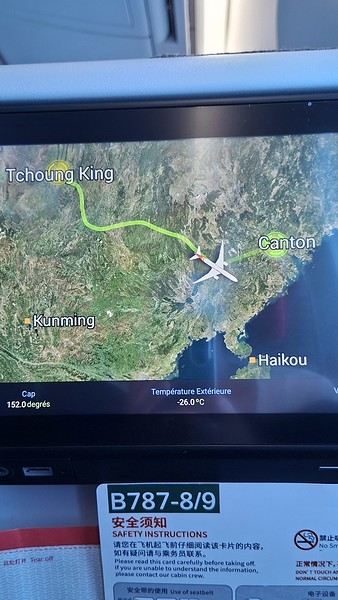
During my first two trips to China, we paid for everything in cash, but this time, we’re going all-in on Alipay and WeChat. I still brought the leftover change from previous trips—it might come in handy. At the metro station, they showed us a QR code to buy tickets via WeChat. There were probably machines and even a ticket counter, but we didn’t see them, and buying via WeChat was pretty simple. 8 yuan to Changshu Lu, which is 22 stops. So far, so good. Then, we had to find the hotel, which wasn’t on Google Maps, Maps.me, or Amap... Easy 😎! We found it without too much hassle, though. Dropped off our stuff and went out to eat. 55 yuan for two claypots with fish/eel, rice, cabbage, and purple eggplant. When we left, it was pouring. We grabbed our umbrellas and set off to explore the neighborhood: Enning Road (we’ll come back later to check out a specific spot), Shangxiajiu (the pedestrian shopping street), Baohua Road... The area is pretty diverse—one street to the next, it’s like stepping into a different world.

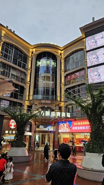
There weren’t many people around, probably because of the rain. We grabbed a quick street food dinner and went to bed—we were exhausted. We struggled to stay awake until 11 PM to adjust to the time change as quickly as possible. There’s a 6-hour time difference.
There wasn’t much room for improvisation on this trip—everything was planned in advance. Since August is peak season, I decided to book train tickets early, and once that was set, I reserved all the accommodations too. I got everything on Trip.com.
I bought the flight tickets back in March from Hainan Airlines. They were super expensive, but with these travel dates, I couldn’t exactly dream of a bargain!
I picked up e-SIMs valid for a month from Free just before departure: 10 € for the e-SIM + 19.90 € for a one-month plan with 35 GB of data abroad.
No need for a VPN with these e-SIMs, but D. still got one—a multi-device plan for 5 € with a discount from Let’s VPN, valid for a month. It was for evenings at the hotel on Wi-Fi to avoid burning through the 35 GB with video.
I downloaded Alipay, WeChat, Amap (Baidu Maps), and Trip.com. We also have Google Translate and Maps.me—absolute must-haves.
We’re ready to go!
I’ve been waiting for this day for nearly 15 years!! I travel a lot, but this one—this is MY TRIP 🙂 It’s been postponed so many times: because I wanted to do it with the right person, because I have a Turkish stamp in my passport and heard they don’t issue visas with that, because of COVID... and then China introduced a 30-day visa exemption, and that was the green light! Ugh, they forced us to take our vacation in August this year—far from ideal—but no more delays. Saturday, August 2, 2025: it’s finally the big day!
Days 1 and 2: We got dropped off at Charles de Gaulle at 9:30 AM. I supposedly checked in online, but only for the first flight and without getting the boarding pass... Might as well scrap online check-in in that case. So, we spent over an hour in line at the counter to get them. We didn’t have any checked luggage—just our backpacks as carry-ons—so this was a step we’d never had to deal with before, but whatever, it’s done. No wait at passport control, 5 minutes through security, a quick walk around the terminal, 10 minutes in the boarding area, and it was already time to board. Departure around 12:45 PM, arrival in Chongqing at 4:50 AM. We had a few hours of layover before our next flight. Went through immigration, connecting flight control, and security. Pro tip: check your next flight’s boarding gate right after immigration. We never saw it displayed again anywhere in the terminal.
The Free e-SIMs work—phew!
Took off at 9:30 AM, arrived in Guangzhou (Canton) at 11:20 AM in the rain. I love how Chongqing is translated as "Tchoung King" on the screens in the plane—very French!
During my first two trips to China, we paid for everything in cash, but this time, we’re going all-in on Alipay and WeChat. I still brought the leftover change from previous trips—it might come in handy. At the metro station, they showed us a QR code to buy tickets via WeChat. There were probably machines and even a ticket counter, but we didn’t see them, and buying via WeChat was pretty simple. 8 yuan to Changshu Lu, which is 22 stops. So far, so good. Then, we had to find the hotel, which wasn’t on Google Maps, Maps.me, or Amap... Easy 😎! We found it without too much hassle, though. Dropped off our stuff and went out to eat. 55 yuan for two claypots with fish/eel, rice, cabbage, and purple eggplant. When we left, it was pouring. We grabbed our umbrellas and set off to explore the neighborhood: Enning Road (we’ll come back later to check out a specific spot), Shangxiajiu (the pedestrian shopping street), Baohua Road... The area is pretty diverse—one street to the next, it’s like stepping into a different world.
There weren’t many people around, probably because of the rain. We grabbed a quick street food dinner and went to bed—we were exhausted. We struggled to stay awake until 11 PM to adjust to the time change as quickly as possible. There’s a 6-hour time difference.
USA Road Trip 2023 - Part 1
In January 2023, we started our second road trip across the United States. We stayed from January to mid-March, which gave us plenty of time to visit several cities, attractions, and parks in multiple states.
This travel journal will be split into two parts due to the considerable number of places we visited.
This first journal covers the following states: Ohio, Indiana, Missouri, Oklahoma, Texas, New Mexico, Arizona, Nevada, and California, and takes you through the outbound leg of our road trip.
The second journal will showcase the attractions we visited on the return trip, which mainly follows the famous Highway 1 along the Pacific coast.
So, I invite you to keep reading this first journal, which serves as a long recap to help you discover the various attractions we explored throughout this road trip.
Videos are included throughout the recap. Please click on the image to start the video.
Here are the links to jump to a specific post:
OHIO:
WinterLand - Christmas Lights at Cleveland Public Square Lake View Cemetery - Cleveland - Part 1 Lake View Cemetery - Cleveland - Part 2 Stroll through Columbus Upper Falls to Lower Falls via Buckeye Trail - Hocking Hills State Park – Logan Cedar Falls & Whispering Falls Hiking Trail - Hocking Hills State Park – Logan Ash Cave Hiking Trail - Hocking Hills State Park – Logan Exploring Cincinnati
INDIANA:
Visiting Indianapolis
MISSOURI:
Exploring St. Louis
OKLAHOMA:
Catoosa Blue Whale Discovering Tulsa Exploring Oklahoma City
TEXAS:
Exploring Shamrock Discovering McLean Exploring Amarillo
NEW MEXICO:
Ancestral Sites Trail - Pecos National Historical Park Discovering Santa Fe The Santuario de Chimayó Stroll through Los Cerrillos Walk through the village of Madrid San Francisco de Asis Catholic Church & The Bottle House - Golden Albuquerque Murals 66 Diner - Albuquerque Stroll through Old Town (Albuquerque) Rinconada Canyon Trail - Petroglyph National Monument Mesa Point Trail - Boca Negra Canyon - Petroglyph National Monument Macaw Trail - Boca Negra Canyon - Petroglyph National Monument Cliff Base Trail - Boca Negra Canyon - Petroglyph National Monument Piedras Marcadas Canyon - Petroglyph National Monument Sandstone Bluffs & Ventana Natural Arch - El Malpais National Monument
ARIZONA:
Stewart's Petrified Wood Shop – Holbrook Stroll through Holbrook Discovering Joseph City Exploring Winslow Grand Falls (The "Chocolate Falls") – Leupp Island Trail - Walnut Canyon National Monument Rim Trail - Walnut Canyon National Monument Wukoki Pueblo Trail – Wupatki National Monument Wupatki Pueblo Trail – Wupatki National Monument Doney Mountain Trail – Wupatki National Monument Citadel & Nalakihu Pueblos Trail – Wupatki National Monument Lomaki & Box Canyon Pueblos Trail – Wupatki National Monument Discovering Flagstaff On the way to Sedona Slide Rock State Park – Sedona Midgley Bridge Trail – Wilson Canyon – Sedona Tlaquepaque Arts & Shopping Village Walking Tour - Sedona Chapel of the Holy Cross - Sedona Hiking at Cathedral Rock - Sedona Hiking the Bell Rock Trail - Sedona Hiking the Airport Loop Trail - Sedona Amitabha Stupa and Peace Park - Sedona Hiking the Boynton Canyon Vortex Trail - Sedona Hiking the Devil's Bridge Trail - Sedona Hiking the Birthing Cave Trail - Sedona Bell Rock Inn - Sedona On the roads of Sedona - Part 1 On the roads of Sedona - Part 2 Keyhole Sink Hiking Trail - Kaibab National Forest Discovering Williams Exploring Ash Fork Discovering Kingman Ramada by Wyndham Kingman Davis Camp Park - Bullhead City Discovering Yucca Lake Havasu Boardwalk Tour A duck catches a lobster – Lake Havasu Boardwalk
CALIFORNIA:
Exploring Needles Discovering Goffs Discovering Amboy Visiting the famous Bagdad Cafe - Newberry Springs Exploring Barstow Vehicles from Hell (Mad Max Cars) - Barstow Peggy Sue's 50's Diner - Yermo Liberty Sculpture Park - Yermo Lake Dolores Water Park - Newberry Springs ZZYZX Road - Mojave National Preserve Alien Fresh Jerky - Baker Kelso Dunes Trail - Mojave National Preserve Hole-in-the-Wall Rings Trail - Mojave National Preserve Visiting Mitchell Caverns - Mojave National Preserve Dante's View - Death Valley National Park Zabriskie Point - Death Valley National Park Golden Canyon - Death Valley National Park Artists Drive & Artists Palette - Death Valley National Park Devil's Golf Course - Death Valley National Park Natural Bridge Trail - Death Valley National Park Badwater Basin - Death Valley National Park Harmony Borax Works - Death Valley National Park Devil's Cornfield - Death Valley National Park Mesquite Flat Sand Dunes - Death Valley National Park Mosaic Canyon Trail - Death Valley National Park On the road - Death Valley National Park
NEVADA:
Cleveland Clinic Lou Ruvo Center for Brain Health - Las Vegas Exploring Downtown Las Vegas SlotZilla Zipline - Fremont Street Experience – Downtown Las Vegas Viva Vision Light Show 1 - Fremont Street Experience - Downtown Las Vegas Viva Vision Light Show 2 - Fremont Street Experience - Downtown Las Vegas Viva Vision Light Show 3 - Fremont Street Experience - Downtown Las Vegas Viva Vision Light Show 4 - Fremont Street Experience - Downtown Las Vegas Free Live Music – Fremont Street Experience - Downtown Las Vegas Chucky – Fremont Street Experience - Downtown Las Vegas Las Vegas Strip - Part 1 Las Vegas Strip - Part 2 Las Vegas Strip - Part 3 Las Vegas Strip - Part 4 Las Vegas Strip - Part 5 Tom Devlin's Monster Museum - Boulder City Hoover Dam Lake Mead - Lakeview Overlook - Boulder City Nelson Ghost Town - Searchlight
CALIFORNIA:
Scenic Route through Joshua Tree National Park via the North Entrance Hidden Valley Trail - Joshua Tree National Park Barker Dam Trail - Joshua Tree National Park Cap Rock Trail - Joshua Tree National Park Keys View Trail - Joshua Tree National Park Hall of Horrors Trail - Joshua Tree National Park Skull Rock Trail - Joshua Tree National Park Arch Rock Trail - Joshua Tree National Park Cholla Cactus Garden Trail - Joshua Tree National Park Lone Pine - Owens Valley Miss Alabama & Shark Fin - Alabama Hills - Owens Valley Lone Ranger Canyon - Alabama Hills - Owens Valley Mobius Arch Loop Trail (Heart Arch & Lathe Arch) - Alabama Hills - Owens Valley Eye of the Alabama Hills Arch - Alabama Hills - Owens Valley Boot & Cyclops Arches - Alabama Hills - Owens Valley One Mile Arch, Bowling Ball and Pins & Gunga Din Area - Alabama Hills - Owens Valley Whitney Portal Arch Trailhead - Alabama Hills - Owens Valley Fish Rocks & Trona Pinnacles - Mojave Desert Red Cliffs Trail - Red Rock Canyon State Park Hagen Canyon Nature Trail - Red Rock Canyon State Park Tour of Historic Downtown Tehachapi View of the Tehachapi Loop – Monolith César E. Chávez National Monument – Keene Discovering Bakersfield Kern County Museum – Bakersfield Bravo Farms, Tree House & Petting Zoo - Traver Walking Tour of Kingsburg Exploring Fresno Simonian Farms & Soul Consoling Japanese Internment Tower - Fresno Duncan Ceramic Products (iLoveToCreate) - Fresno Walking Tour of Modesto Wat Dhammararam Buddhist Temple - Stockton Walking Tour of Stockton Discovering Stockton University of the Pacific - Stockton Visiting Lodi Sutter's Fort State Historic Park - Sacramento California State Capitol - Sacramento Walking Tour - Sacramento Walking Tour - Winters Walking Tour - Napa The Chandelier Tree In Drive-Thru Tree Park - Leggett One Log House - Garberville Grandfather Tree - Piercy The Living Chimney Tree - Avenue of the Giants Stephens Grove Loop Trail - Avenue of the Giants Gould Grove Nature Loop Trail - Avenue of the Giants Fleishmann Grove Trail - Avenue of the Giants Mahan Plaque Trail - Avenue of the Giants Founders Grove Nature Loop Trail - Avenue of the Giants Eternal Tree House & Immortal Tree - Avenue of the Giants Drury-Chaney Loop Trail - Avenue of the Giants Walking Tour - Redcrest
COMING UP NEXT:
USA Road Trip 2023 - Part 2
This travel journal will be split into two parts due to the considerable number of places we visited.
This first journal covers the following states: Ohio, Indiana, Missouri, Oklahoma, Texas, New Mexico, Arizona, Nevada, and California, and takes you through the outbound leg of our road trip.
The second journal will showcase the attractions we visited on the return trip, which mainly follows the famous Highway 1 along the Pacific coast.
So, I invite you to keep reading this first journal, which serves as a long recap to help you discover the various attractions we explored throughout this road trip.
Videos are included throughout the recap. Please click on the image to start the video.
Here are the links to jump to a specific post:
OHIO:
WinterLand - Christmas Lights at Cleveland Public Square Lake View Cemetery - Cleveland - Part 1 Lake View Cemetery - Cleveland - Part 2 Stroll through Columbus Upper Falls to Lower Falls via Buckeye Trail - Hocking Hills State Park – Logan Cedar Falls & Whispering Falls Hiking Trail - Hocking Hills State Park – Logan Ash Cave Hiking Trail - Hocking Hills State Park – Logan Exploring Cincinnati
INDIANA:
Visiting Indianapolis
MISSOURI:
Exploring St. Louis
OKLAHOMA:
Catoosa Blue Whale Discovering Tulsa Exploring Oklahoma City
TEXAS:
Exploring Shamrock Discovering McLean Exploring Amarillo
NEW MEXICO:
Ancestral Sites Trail - Pecos National Historical Park Discovering Santa Fe The Santuario de Chimayó Stroll through Los Cerrillos Walk through the village of Madrid San Francisco de Asis Catholic Church & The Bottle House - Golden Albuquerque Murals 66 Diner - Albuquerque Stroll through Old Town (Albuquerque) Rinconada Canyon Trail - Petroglyph National Monument Mesa Point Trail - Boca Negra Canyon - Petroglyph National Monument Macaw Trail - Boca Negra Canyon - Petroglyph National Monument Cliff Base Trail - Boca Negra Canyon - Petroglyph National Monument Piedras Marcadas Canyon - Petroglyph National Monument Sandstone Bluffs & Ventana Natural Arch - El Malpais National Monument
ARIZONA:
Stewart's Petrified Wood Shop – Holbrook Stroll through Holbrook Discovering Joseph City Exploring Winslow Grand Falls (The "Chocolate Falls") – Leupp Island Trail - Walnut Canyon National Monument Rim Trail - Walnut Canyon National Monument Wukoki Pueblo Trail – Wupatki National Monument Wupatki Pueblo Trail – Wupatki National Monument Doney Mountain Trail – Wupatki National Monument Citadel & Nalakihu Pueblos Trail – Wupatki National Monument Lomaki & Box Canyon Pueblos Trail – Wupatki National Monument Discovering Flagstaff On the way to Sedona Slide Rock State Park – Sedona Midgley Bridge Trail – Wilson Canyon – Sedona Tlaquepaque Arts & Shopping Village Walking Tour - Sedona Chapel of the Holy Cross - Sedona Hiking at Cathedral Rock - Sedona Hiking the Bell Rock Trail - Sedona Hiking the Airport Loop Trail - Sedona Amitabha Stupa and Peace Park - Sedona Hiking the Boynton Canyon Vortex Trail - Sedona Hiking the Devil's Bridge Trail - Sedona Hiking the Birthing Cave Trail - Sedona Bell Rock Inn - Sedona On the roads of Sedona - Part 1 On the roads of Sedona - Part 2 Keyhole Sink Hiking Trail - Kaibab National Forest Discovering Williams Exploring Ash Fork Discovering Kingman Ramada by Wyndham Kingman Davis Camp Park - Bullhead City Discovering Yucca Lake Havasu Boardwalk Tour A duck catches a lobster – Lake Havasu Boardwalk
CALIFORNIA:
Exploring Needles Discovering Goffs Discovering Amboy Visiting the famous Bagdad Cafe - Newberry Springs Exploring Barstow Vehicles from Hell (Mad Max Cars) - Barstow Peggy Sue's 50's Diner - Yermo Liberty Sculpture Park - Yermo Lake Dolores Water Park - Newberry Springs ZZYZX Road - Mojave National Preserve Alien Fresh Jerky - Baker Kelso Dunes Trail - Mojave National Preserve Hole-in-the-Wall Rings Trail - Mojave National Preserve Visiting Mitchell Caverns - Mojave National Preserve Dante's View - Death Valley National Park Zabriskie Point - Death Valley National Park Golden Canyon - Death Valley National Park Artists Drive & Artists Palette - Death Valley National Park Devil's Golf Course - Death Valley National Park Natural Bridge Trail - Death Valley National Park Badwater Basin - Death Valley National Park Harmony Borax Works - Death Valley National Park Devil's Cornfield - Death Valley National Park Mesquite Flat Sand Dunes - Death Valley National Park Mosaic Canyon Trail - Death Valley National Park On the road - Death Valley National Park
NEVADA:
Cleveland Clinic Lou Ruvo Center for Brain Health - Las Vegas Exploring Downtown Las Vegas SlotZilla Zipline - Fremont Street Experience – Downtown Las Vegas Viva Vision Light Show 1 - Fremont Street Experience - Downtown Las Vegas Viva Vision Light Show 2 - Fremont Street Experience - Downtown Las Vegas Viva Vision Light Show 3 - Fremont Street Experience - Downtown Las Vegas Viva Vision Light Show 4 - Fremont Street Experience - Downtown Las Vegas Free Live Music – Fremont Street Experience - Downtown Las Vegas Chucky – Fremont Street Experience - Downtown Las Vegas Las Vegas Strip - Part 1 Las Vegas Strip - Part 2 Las Vegas Strip - Part 3 Las Vegas Strip - Part 4 Las Vegas Strip - Part 5 Tom Devlin's Monster Museum - Boulder City Hoover Dam Lake Mead - Lakeview Overlook - Boulder City Nelson Ghost Town - Searchlight
CALIFORNIA:
Scenic Route through Joshua Tree National Park via the North Entrance Hidden Valley Trail - Joshua Tree National Park Barker Dam Trail - Joshua Tree National Park Cap Rock Trail - Joshua Tree National Park Keys View Trail - Joshua Tree National Park Hall of Horrors Trail - Joshua Tree National Park Skull Rock Trail - Joshua Tree National Park Arch Rock Trail - Joshua Tree National Park Cholla Cactus Garden Trail - Joshua Tree National Park Lone Pine - Owens Valley Miss Alabama & Shark Fin - Alabama Hills - Owens Valley Lone Ranger Canyon - Alabama Hills - Owens Valley Mobius Arch Loop Trail (Heart Arch & Lathe Arch) - Alabama Hills - Owens Valley Eye of the Alabama Hills Arch - Alabama Hills - Owens Valley Boot & Cyclops Arches - Alabama Hills - Owens Valley One Mile Arch, Bowling Ball and Pins & Gunga Din Area - Alabama Hills - Owens Valley Whitney Portal Arch Trailhead - Alabama Hills - Owens Valley Fish Rocks & Trona Pinnacles - Mojave Desert Red Cliffs Trail - Red Rock Canyon State Park Hagen Canyon Nature Trail - Red Rock Canyon State Park Tour of Historic Downtown Tehachapi View of the Tehachapi Loop – Monolith César E. Chávez National Monument – Keene Discovering Bakersfield Kern County Museum – Bakersfield Bravo Farms, Tree House & Petting Zoo - Traver Walking Tour of Kingsburg Exploring Fresno Simonian Farms & Soul Consoling Japanese Internment Tower - Fresno Duncan Ceramic Products (iLoveToCreate) - Fresno Walking Tour of Modesto Wat Dhammararam Buddhist Temple - Stockton Walking Tour of Stockton Discovering Stockton University of the Pacific - Stockton Visiting Lodi Sutter's Fort State Historic Park - Sacramento California State Capitol - Sacramento Walking Tour - Sacramento Walking Tour - Winters Walking Tour - Napa The Chandelier Tree In Drive-Thru Tree Park - Leggett One Log House - Garberville Grandfather Tree - Piercy The Living Chimney Tree - Avenue of the Giants Stephens Grove Loop Trail - Avenue of the Giants Gould Grove Nature Loop Trail - Avenue of the Giants Fleishmann Grove Trail - Avenue of the Giants Mahan Plaque Trail - Avenue of the Giants Founders Grove Nature Loop Trail - Avenue of the Giants Eternal Tree House & Immortal Tree - Avenue of the Giants Drury-Chaney Loop Trail - Avenue of the Giants Walking Tour - Redcrest
COMING UP NEXT:
USA Road Trip 2023 - Part 2
Kattegat Tour and Norway’s Majestic Fjords – 32 Days (Denmark, Sweden, Norway)
Kattegat isn’t just the name of the village in the TV series *Vikings*—it’s also the stretch of water separating Denmark from Sweden... the sea, basically! And further north, you’ve got Norway and its fjords!
Originally, I’d planned to just do a loop around Kattegat, with the *Under* restaurant in Lindesnes as our anniversary treat... but along the way, we thought, why not "push" a little further north, keeping an eye on the budget since we’d chosen to travel by car in June 2025 through Scandinavia.
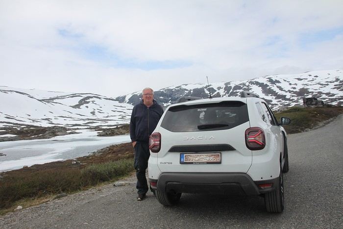
Why by car when most travelers opt for a camper van, while others prefer the comfort of cruises? Well, because we don’t own a camper van, renting one is pricey, and then you’ve got to add fuel costs (those things guzzle gas!), ferry fees, and other "tolls." All things considered, we went for mostly rentals—especially since there were four of us at the start of the trip. We spent the first week in Denmark with our daughter and son-in-law. Then they flew back to Belgium, and we continued our adventure as a couple. For accommodation, we mainly booked Airbnb apartments, which helped keep costs down and, most importantly, let us prepare our own meals (diet, diet!). In this travel journal, you’ll discover (or rediscover, for those who followed my older ones) our unbridled love for theme parks, museums, unique experiences, and—especially in Denmark—Legos! Unfortunately, we didn’t do any hikes this year because the unpredictable weather had made the trails slippery, and since I’d already taken three tumbles during the trip, I didn’t want to risk another! In the end, we traveled for 32 days, covered 6,200 km, and most importantly, discovered the charming country of Denmark, marveled at Norway’s breathtaking fjords—all without suffering the heatwave that hit France and Belgium that June! If you’ve got any questions, don’t hesitate to ask!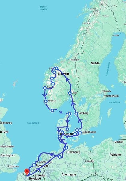
Why by car when most travelers opt for a camper van, while others prefer the comfort of cruises? Well, because we don’t own a camper van, renting one is pricey, and then you’ve got to add fuel costs (those things guzzle gas!), ferry fees, and other "tolls." All things considered, we went for mostly rentals—especially since there were four of us at the start of the trip. We spent the first week in Denmark with our daughter and son-in-law. Then they flew back to Belgium, and we continued our adventure as a couple. For accommodation, we mainly booked Airbnb apartments, which helped keep costs down and, most importantly, let us prepare our own meals (diet, diet!). In this travel journal, you’ll discover (or rediscover, for those who followed my older ones) our unbridled love for theme parks, museums, unique experiences, and—especially in Denmark—Legos! Unfortunately, we didn’t do any hikes this year because the unpredictable weather had made the trails slippery, and since I’d already taken three tumbles during the trip, I didn’t want to risk another! In the end, we traveled for 32 days, covered 6,200 km, and most importantly, discovered the charming country of Denmark, marveled at Norway’s breathtaking fjords—all without suffering the heatwave that hit France and Belgium that June! If you’ve got any questions, don’t hesitate to ask!
Namibia Travel Journal: May 2025 - Trip Review
NAMIBIA TRIP 2025: April 24 to May 20: Feel free to comment or ask us any questions about this amazing journey.
>> Find all our photos and videos for each day on our website here: www.montagne-aventure.net
**DAY 1: Thursday, April 24, 2025: Outbound Flights from Lyon to Windhoek via Munich - Visit to Munich:**

Off we go on a new adventure. The alarm rings at 6:30 AM, the travel bags are packed, and we head to Lyon Airport. We booked our flight tickets with Lufthansa. The first leg to Munich, Germany, is operated by AirBaltic. Departure at 1:05 PM for a 1-hour and 20-minute flight. We arrive at 2:30 PM.
**We now have a 7-hour layover, so we take the opportunity to get some fresh air and explore Munich.** We quickly exit Terminal 2 of the airport and head towards the subway. We buy a group day ticket "Airport-city Day Zone M-5," valid for 2 to 5 people at a price of 30.50 € (instead of 16.30 € per person). We take the S8 line to **Marienplatz** in 35 minutes. **This is the heart of the city.** The weather is overcast, quite cool, but dry. Perfect for a little city trip between two flights while leaving our large luggage in transit at the airport. **Munich is the third-largest German city after Berlin and Hamburg, in the Bavaria region.** **The center has a lot of charm and brings together several religious buildings, easy to explore on foot.** We are impressed by the number of people enjoying these 100% pedestrian streets, which are very pleasant. After Marienplatz, the most famous square with the town hall, we head to the Cathedral of Our Lady, a Gothic church, then continue to **Karlsplatz** and move on to **the food market offering a wide selection of high-end food products in an atmosphere where a certain art of living prevails.** We also visit St. Peter's Church before grabbing a bite to eat. Two good hours were enough for this 10 km city walk. It's time to take the subway back: by 6:30 PM, we are back at the airport. Now, it's time for a bit of waiting and rest. Our second flight is scheduled for 9:35 PM for a 9-hour and 30-minute journey to our final destination in Namibia: **Windhoek.**
> Round-trip flight tickets with Lufthansa from Lyon: 2029 €, or 1,014.50 € per person.
> Lyon Airport parking: 120 €
> Today's expenses: 7 € for 2 pizzas in France / 14 € for the restaurant in Munich / 30.50 € for the daily subway ticket in Munich.
**DAY 2: Friday, April 25, 2024: Arrival in Windhoek, Visit to the Namibian Capital:**
After a 9-hour and 30-minute overnight flight with Discover Airlines, we finally land on Namibian soil just before 7:30 AM. The day is breaking, and the colors are already stunning. We are eager despite the usual fatigue from the flight. The airline was punctual, with friendly staff and good meals, though a bit light. We are the first flight of the day to land, with no more than 15 flights per day here, from 7 AM to 8 PM. We disembark on the tarmac at this airport located in the middle of nowhere, **I finally set foot on African soil for the first time.** We exit among the first from the aircraft to go through the long formalities at the front of the line, as the wait can quickly become endless. Allow at least 5 minutes per person for e-visas. We still wait 45 minutes despite only about twenty people ahead of us. Phew, it's done. We collect our luggage and then withdraw money from an ATM. We make 4 withdrawals of the maximum amount, 2000 NAD $ per withdrawal, for a total of 380 €, or 95.33 € per withdrawal.
Our driver arrives at the same time, perfect timing, we were quick.
We leave the airport at 8:45 AM. By 9:30 AM, we arrive at the **Gracious Whisp vehicle rental agency**, located at the entrance of Windhoek, small and human-sized with a fleet of recent vehicles. More formalities, then a short wait as our vehicle is not yet ready. Time to decompress, catch our breath, and enjoy the very pleasant morning temperature. Not a cloud in sight. Next, a briefing on the vehicle, always with a bit of apprehension due to our approximate English. Allow 45 minutes of explanations, including setting up the roof tent, camping equipment, technical information in case of a flat tire, driving tips in Namibia, and a tour of the 4x4. We have all the necessary equipment for camping: mattresses, sleeping bags, pillows, table, chairs, gas stove, BBQ grill... as well as 2 spare tires, a compressor, a dual tank, and accessories for removing wheels. Off we go, it's time to muster our courage and get behind the wheel. **Heading to SuperSpar Maerua**, fortunately located less than 10 minutes away. We park with the help of a parking attendant; it's very crowded, the space is narrow, but everything goes well despite the cursed right-hand drive. Today's new mission: stock up on groceries. The store is well-stocked with local and imported products, catering to all tastes. We spend 114 € on groceries, from pasta to meat, BBQ lighters to dishwashing products. Two people load our groceries into two carts and transfer them to our vehicle; we feel compelled to leave a tip, 50 NAD $, as we don't have change yet. Now, we head to the hotel, 15 minutes away. Traffic is difficult at a complicated intersection; this will likely be the only traffic jam in Namibia. **We arrive at Kate's Nest Guesthouse & Backpackers around 1:15 PM, quite tired.** We take some well-deserved rest at this recent establishment, quite calm with secure private parking. After a short nap, we enjoy the quiet by the hotel pool. Night falls between 6:30 PM and 7 PM. We eat quietly in our room tonight before starting this long 4x4 road trip in camping mode in the heart of Namibia.
> Today's grocery expenses: 114 € at Super Spar Marua (2395.21 NAD $).
> Round-trip flight tickets with Lufthansa from Lyon: 2029 €, or 1,014.50 € per person.
> Vehicle rental: 4x4 Toyota with roof tent for 24 days: Gracious Whisp Car Rentals: 2,638 € (N$50,640) or **1,319 €** per person - (https://gwcarrentals.com/)
> Distance driven today: 15 km.
> Accommodation: Kate's Nest Guesthouse & Backpackers - 4 Aristotles Street Academia, 9000 Windhoek - 36 € for two for one night.
> Windhoek International Airport website: (https://www.airports.com.na/)
**DAY 3: Saturday, April 26, 2025: Windhoek to Hardap: Mariental Region - Kalahari Desert:**
After a good, restful night, we wake up leisurely around 7 AM. We enjoy the comfort provided by this first and last hotel before 24 nights under the tent.
**We leave Kate's Nest Guesthouse at 8:30 AM to tackle the Namibian roads.** We quickly leave the capital; in just 30 minutes, we find ourselves almost alone in the world. The landscape is dotted with small domes. We leave the **paved B1** quickly to turn left onto the **C15**. **From there, we won't see more than 10 vehicles all day.** After passing through the few houses of **Lekkerwaterpoort**, we tackle our first gravel road. These road sections are limited to 100 km/h, but even at 70 km/h, I find it already challenging. However, I quickly get used to it and gradually pick up speed to reach my cruising speed of around 80 to 90 km/h. **We are on immense straight lines crossing wild expanses as far as the eye can see.** **We come across two baboons, a few ostriches, and numerous cattle and sheep farms.** We pass through the charming village of **Uhlenhorst** with its typical houses and children with broad smiles waving at us. Life here is already very different from Windhoek. **The thermometer rises quickly from 16°C at 8:30 AM to over 28°C in the early afternoon.**
**We arrive at the Hardap Dam reserve at 2 PM.** We stop at the toll booth at the park entrance to pay the entrance fee: 250 NAD $ for 2 people and 1 vehicle. We continue to the dam and then the camp entrance, located a bit further. We had booked in advance, but this place remains little frequented by foreigners.
We take advantage of the hottest hours to rest by the large pool overlooking the immense lake, a very enjoyable moment. Would this be a bit of a vacation?
Around 4:30 PM, we head to the campsite. We overlook this vast water reserve. We arrive first; we will be only 3 vehicles spending the night here. It's time to get to work and set up our equipment for the first time. It takes us a good 20 minutes to set everything up, with a slight apprehension about unfolding the tent. Once this task is done, which we will have to repeat for almost a month, we will become much more efficient over time. Time for rest and contemplation in total silence. The sun gradually sets, and the heat quickly becomes bearable again. Bliss! **This dam is located 20 km northwest of Mariental in an area dotted with conical hills topped with dolerite buttons (Hardap means "hillock" in Nama). It captures the Fish River, which flows south, creating a large lake in the middle of an arid environment. The contrast is striking.** We enjoy our first sunset facing this 360° otherworldly landscape.
Around 7 PM, we start our first BBQ, or "braai" as it's called here. The temperature is perfect. The sun sets, giving way to a star-filled sky of incredible beauty thanks to the absence of any light pollution. The Milky Way will lull us throughout the evening. After some good sausages and potatoes on the BBQ, we head to our roof tent around 9:30 PM with a complete change of scenery in just 24 hours. France already seems so far away...
This campsite has shared showers and toilets, quite clean and functional, as well as a central area with several BBQs and tables. The sites are arranged in a semicircle, each with an electrical outlet. The sites are close to each other but spacious, some slightly shaded. We are only three vehicles tonight, so it's perfectly comfortable and quiet. Not to mention the large pool near the restaurant. Our trip is off to a great start.
> Today's road itinerary: Windhoek > Head south on the B1 to Rehoboth > Turn left onto the C25 then C15 to Stampriet > C20 to Hardap > Full north on the B1 > Then turn left onto the M93 - 5 hours of driving.
> Distance driven today: 354 km.
> Accommodation: Hardap Recreation Resort - 23.3 € for two - Large pool - GR6W+3M2, Hardap Game Reserve, Mariental, Namibia - (http://www.nwr.com.na/resorts/hardap-resort/)
**DAY 4: Sunday, April 27, 2025: Hardap - Brukkaros Volcano - Keetmanshoop - Quivertree Forest Rest Camp**
Our first night under the tent was very pleasant; the little wind quickly calmed down, giving way to absolute silence. The mattress is decent, more comfortable than some nights in Nepal. The length and width give us enough space for maximum comfort, despite my height (1.91 m). We wake up a little before 7 AM as the sun rises, and the lights dazzle us from the start of the day. We pack up the equipment in 30 minutes, quite easily. Then we enjoy the sun, which warms up quickly while we keep our light fleece on.
At 8:30 AM, **we hit the road again, heading south** to our first stop in **Mariental**. We want to do some shopping at SuperSpar, but once we arrive in the parking lot, a young local is fighting with the supermarket security guards and then threatens to throw stones. We don't want to take any risks right at the start, so despite the baton blows he receives, he doesn't stop. We leave empty-handed but fill up with fuel at the Shell station 1 km further. The price per liter is 21.33 NAD $, we fill our 107-liter tank for 107 €. In Namibia, you get served, and they bring the card machine to the window to pay. It's then customary to leave a tip.
We then take the B1 heading due south on a recently renovated road. Around 11:30 AM, we leave it on our right to take **a wild gravel road, the M98**. Just before **Berseba**, we turn right onto a small track, the **D3904 towards Brukkaros Crater up to a camp at 1588 m altitude**. The track then becomes too bumpy. We stop on the counter-slopes where **a wide panorama unfolds over these immense plains as far as the eye can see**. It's 12:15 PM, time for us to eat a rice and tuna salad facing this landscape.
**We are alone in the world until a vehicle arrives and parks next to us.** A bit of apprehension, 4 men head towards us. It turns out to be 4 shepherds looking for a lost foal. The conversation is pleasant, lost in the middle of nowhere. We find ourselves alone again in this absolute silence. **The heat becomes stifling with a good 30°C**. We get back on the road around 1 PM. Back on the B1, **we continue due south to Keetmanshoop**, which we reach around 3 PM. We stop there to do some shopping for 262 NAD $ (12 eggs, a can of tuna, a can of corn, bread, a soda, and a 5-liter water container), or 12.48 €. Two quite insistent children ask us for money or candy at the store exit, yet we give them a small tip, but they continue to cling to the car. Locals parked next to us tell them to leave us alone. Anyway, we finish the trip to **Quivertree Forest**, 15 km away. We will spend the night in this **pleasant farm run by a German**. Upon arrival, as the day before, and as I suppose in the future, we dive straight into the cool pool to relax after all these kilometers. A bliss. Then we take our 4x4 and choose a spot near these famous trees. After the 33°C this afternoon, once 4 PM passed, the temperature drops again and becomes very pleasant. **We are in the middle of the Kokerboom, one of the most interesting and characteristic plants of hot and arid regions. It's not really a tree but a variant of the aloe plant whose botanical name is Aloe Dichotoma. This Kokerboom has a smooth and thick trunk reaching up to 1 m in thickness and 9 m in height. They bloom for the first time at the age of 20 to 30 years.** The flowers are yellow and reach about thirty centimeters during the season between June and July. **They grow mainly in an environment with a high concentration of black rocks absorbing a large amount of heat (38°C). The rocks also serve to anchor the tree with its tentacle-like roots. It also resists frost. Each is between 200 and 300 years old.**
Around 5 PM, we walk to the farm reception to watch the feeding of **two cheetahs**. Magnificent carnivores taking their time to savor their piece of meat. **Then we return near our campsite to enjoy the sunset among these trees. The colors are sublime, as every evening apparently. A magnificent spectacle with colors evolving from yellow to orange then to pink, before giving way once again to a sky filled with thousands of stars.** Our campsite at Quiver Tree Forest Camp is very comfortable; we have a water supply, a stone table, a small lamp, an electrical outlet, a small tree for shade, and a BBQ that we won't use tonight; we'll cook on gas. The sites are far apart, with some shared facilities scattered around, a very beautiful setting. No reservation possible, no need, just show up directly. **The campsite accommodation for 2 people costs 28 €, including the reserve entrance fee of 5 €**. We finish this second bivouac evening around 9:30 PM, time for some reading and sleep in peaceful silence without wind.
> Today's road itinerary: Mariental > B1 heading south to Brukkaros > At Tses turn right towards Berseba via the M98 > Turn right onto the D3904 > 8 km > Brukkaros Volcano (stop at the lower camp as the track is difficult for 1 hour) > Keetmanshoop > Turn left onto the M29 > Quivertree Forest - 4 hours of driving.
> Distance driven today: 371 km.
> Distance walked today: 6 km.
> Today's expenses: Groceries for 12.48 € (262 NAD $) / Fuel for 107 € (1 liter of diesel for 21.33 NAD $).
> Accommodation: Quivertree Forest Rest Camp, P.O. Box 262, Keetmanshoop, Namibia - BBQ, hot showers, toilets, and electricity - No reservation - Pool - 18 €/Person (N$ 340.00 with park entrance) - (http://www.quivertreeforest.com/)
**DAY 5: Monday, April 28, 2025: Quivertree Forest Rest Camp - Giant's Playground - Keetmanshoop - Fish River Canyon - Canyon Roadhouse:**
After an excellent start to the night, we are woken up by the wind shortly before 6 AM, but the sunrise is not far off. We get up at 6:30 AM to enjoy it. The atmosphere is a bit cooler this morning, but the reward is already here.
The adventure continues. At 7:45 AM, we head towards **Giant's Playground**, 4 km away. We take a 3-kilometer walk through this expanse of blocks and igneous rocks.
We continue south at 8:45 AM, passing through Keetmanshoop again where we do some shopping for 25 €, a big stock-up for a good part of the trip: meats, canned goods, pasta, fruits... At 9:30 AM, we take the B4 to Fish River Canyon.
At 11:30 AM, we arrive at the entrance to the NWR park (350 NAD $ entrance for 2 people and 1 vehicle). The track becomes bumpy immediately upon entering the park. After about ten kilometers, we come upon this landscape carved by nature. In the end, it's well worth the detour. We were at the Grand Canyon in the USA exactly (https://www.montagne-aventure.net/2024/04/29/j21-3-juin-2024-grand-canyon-et-lac-powell/) and can thus confirm that this Fish River Canyon is comparable. We make several stops along the southern flank. **Here, nothing is developed; nature is almost in the wild state.** **With 160 km in length, up to 27 km in width, and a depth of 150 m, it is indeed the second-largest canyon in the world.** The history of the canyon is apparent in its different earth layers and stratification: the antiquity of the place is tangible, and the absence of vegetation is surprising. **It consists of two nested canyons, formed at distinct periods. The first distinct layer of schist, sandstone, and eruptive material surrounding the canyon was formed a few two billion years ago, then transformed due to heat and pressure into more solid rock such as gneiss. The inner canyon, carved more recently by the Fish River, has a depth of 270 m.**
We have a picnic once again alone in the world facing this grand panorama at the **Sulphur Spring View Point**. This is where the hiking trail begins, plunging into this narrow canyon, but it is forbidden to venture there alone without a guide. It's 30°C, but a slight wind makes the atmosphere bearable. At 1 PM, we retrace our steps and continue to the **Main View Point** then to the **Hikers View Point**.
In the south of Namibia, the Fish River Canyon, 160 km long, is a true geological wonder: a canyon nested within another canyon, one of the largest in the world. The first sedimentary layers formed two billion years ago; 500 million years ago, a period of tectonic activity caused these layers to crack and tilt, opening a vast canyon in the Earth's crust. The second canyon, with a depth of 270 m, was carved over time by the passage of the Fish River in this new valley.
At 3 PM, we arrive at our very charming camp for the evening, the **Canyon Road House**. We fill up with fuel right away because tomorrow we have a long day of isolated driving: 55 liters for 1240 NAD $. Then we settle into the campsite we had previously reserved in France. We are assigned site 2, very well set up under a tree with its BBQ and stone table just steps from the pool. We quickly set up the tent and jump straight into the pool for the relaxation moment of the day. As usual, the water is quite cool, but it's a real pleasure. Then we stroll around this Canyon Road House, which recreates the atmosphere of the roadside inns of the 1950s with old car wrecks and vintage gas pumps in a bygone era. **Around 5:45 PM, we start a short walk leading us to the top of a hill overlooking the wide plateau where we are to watch the sunset.**
And finally, to end this beautiful day, it's time for the braai, with grilled sausages and white beans on the evening menu.
> Park entrance: 150 DN/person + 50 DN/vehicle (18 € for two). It is possible to enter at two access points: Hobas in the north and Ai-Ais in the south.
> Today's road itinerary: M29 > Keetmanshoop > B1 > B4 > C12 (track) > After Holoog turn right onto the D601 (C37 track) > Accommodation on our right (stop just to check in before 6 PM) > Continue 30 km (30 minutes of track) to the viewpoints after Hobas where you must pay the entrance fee. Sunset View Point to the left > Return before sunset as the park closes (best lights at sunrise). 3 hours.
> Distance driven today: 228 km.
> Distance walked today: 10 km.
> Today's expenses: 25 € for groceries / 17 € for the Fish River Canyon park entrance / 58 € for fuel.
> Accommodation: Canyon Roadhouse, Gondwana Collection Namibia – 34.4 € for two - Pool - Near Hobas - (http://www.gondwana-collection.com/fr/accommodation/canyon-road-campsite)
**DAY 6: Tuesday, April 29, 2025: Canyon Roadhouse - Orange River - South African Border - Vista Trail - Gondwana Sperrgebiet Park - Aus:**
The night was excellent in this very comfortable campsite. **We wake up to the sound of birds** before the alarm at 6:45 AM. Our little morning routine starts as the sun rises. **A big day of driving awaits us to the South African border. This will be the southernmost point of our journey.** We hit the road at 8 AM via the C37, pass through **Hobas**, then turn onto the D207 to **Aussenkehr.** **We cross a mountainous barrier with some high peaks and perfect cones. The rock varies from orange to pink to black.**
We then cross a lunar desert as far as the eye can see on a giant dome; the track winds through nowhere without meeting anyone for hours. The landscapes are surprising. **We spot several ostriches and a gemsbok.** In the middle of this endless expanse, we come to an improbable intersection and continue right onto the D278.
In the middle of these arid lands, we come across a green zone: a vast vineyard. At 10:30 AM, **we come across a "Road closed" sign, fortunately, a local resident waves us to continue; a bit stressed, we proceed.** We start to follow the beautiful Orange River. On the other side of the bank, just a few meters away, South Africa is there. It is the second-longest river in Southern Africa, after the Zambezi. It flows over 2,000 km to the Atlantic. After passing through narrow gorges, we regain altitude before starting the descent, gently heading back north.
**We now cross and follow the Fish River, which joins the Orange River further south** **along this gorge dating back millennia.** At exactly noon, we take a lunch break by the Fish River, still without meeting a soul in this landscape between greenery and aridity. The temperature here is cooler with a pleasant 23°C on the banks, the perfect spot. **We continue on the track to Rosh Pinah**, where we find a paved road again. **The section along the Orange River and the Fish River was officially closed, but we were able to pass without any issues, avoiding a detour of at least 3 hours.** Phew. We now drive at high speed (limited to 120 km/h) through these vast spaces. We come across many ostriches after the **dozens of monkeys along the Fish River**. Around 3 PM, 3 km after the very small town of **Aus**, we reach **our campsite for the evening at Klein Aus Vista**. A new **small peaceful haven very well set up**. As usual, after checking in at reception, we jump straight into the beautiful pool to get our well-deserved dose of coolness, another good thermal shock that our bodies appreciate. Once this moment of relaxation is over, we take our 4x4 to reach the campsite located a bit higher, set apart at the foot of a hill that overlooks us.
After setting up, **around 5 PM, we head to the Vista Trail to climb to the top of a mountain overlooking the vast plain that surrounds us at 360°**. It takes about 30 minutes to climb. The place is just magical, **the perfect viewpoint to admire the sunset**. **We fully savor the moment. We also spot one of the few wild horses in the world capable of living in the desert.** Their numbers have decreased in recent years due to predation and drought (around 100 to 150). At 7 PM, we return to the camp, time for the braai and preparing the meal in this peaceful little camp.
In the south of Namibia, the Fish River Canyon, 160 km long, is a true geological wonder: a canyon nested within another canyon, one of the largest in the world. The first sedimentary layers formed two billion years ago; 500 million years ago, a period of tectonic activity caused these layers to crack and tilt, opening a vast canyon in the Earth's crust. The second canyon, with a depth of 270 m, was carved over time by the passage of the Fish River in this new valley.
> Today's road itinerary: 5 hours of driving: D324 heading south (track) > turn right onto the C10 (track) > D316 heading south > turn right onto the C13 > In Aus turn left onto the B4 > Campsite via a track on the left.
> Fuel station: Solitaire or Aus.
> Distance driven today: 398 km.
> Distance walked today: 7 km.
> Accommodation: Klein-Aus Vista Desert Horse Campsite - Farm Klein-Aus No 8 on the B4 main road to Luederitz Aus 9000, Aus, Namibia - (http://www.klein-aus-vista.com/accommodation/desert-horse-campsite/) 17908 420 DN - Water + Shared shower (hot water). No electricity.
**DAY 7: Wednesday, April 30, 2025: Aus - Kolmanskop - Diaz Point - Luderitz - Kanaan Desert:**
We wake up around 6:45 AM, with partly cloudy weather for once; we feel the ocean's influence gradually. But the sun isn't far off. At 7 AM, we leave the campsite heading west towards Luderitz via the B4. **First stop of the day: Kolmanskop, the ghost town we reach at 8:30 AM**, entry costs 180 NAD $ per person. We discover this **timeless place** in 1.5 hours, moving from building to building amidst violent sand-laden gusts of wind. There's a lot of charm in these different living spaces. **The sand quickly reclaimed the place after this mining town was abandoned.** This was once the headquarters of Consolidated Diamond Mines. It's hard to believe that this former town, where the diamond industry once flourished, had a hospital, a bowling alley, and a theater. The decline in diamond sales after World War II and the discovery of richer deposits put an end to this golden age. By 1956, the town was already completely deserted, and the sand had reclaimed its rights. **These dilapidated buildings swallowed by shifting dunes have something surreal about them.**
At 10:15 AM, we hit the road again **heading to Luderitz, 22 km away**, and first to **Diaz Point** **facing the Atlantic Ocean**. It's a wind-swept peninsula with its characteristic red and white lighthouse. There's a campsite and a coffee shop on site, but the place doesn't inspire rest without shade or shelter from the wind. We return to the city via the D701 track that runs along the ocean, be careful at low tide. We come across **a few fishermen and a fox as well as flamingos.**
We walk through the few streets of the city, much smaller than I imagined, then climb to the **famous little Lutheran church that overlooks the city, the Felsenkirchr.** **The wind blows very strongly here, and the sand is omnipresent, surrounded by the Namib Desert and the southern Atlantic coast.** **A German colonial relic barely touched by the 21st century, Luderitz seems frozen in the past, giving it both a gloomy and a certain charm. In short, it's certainly one of the most incongruous places in Africa.**
At 1:15 PM, just before leaving Luderitz, we do some shopping for 20.50 € and fill up with fuel: 61.50 €, 1290 NAD $ for 61 liters (21.18 $ per liter).
**We return via the B4 to Aus** (paved), **then via rougher tracks**, the C13 then the D707, magnificent as it runs along a mountain range with multiple colors on our right and an endless flat desert on the other side.
To access our campsite for the evening, we must take a **narrow private track for 7 km** on our right to emerge, in this total vastness, at the **isolated Kanaan Desert Retreat on a small hill**. I don't have time today to jump into the pool near the reception; we arrive at 5 PM at 8 small, isolated, and unique sites with a small kitchen, a shower, and a private toilet under a small tarp shelter. **A crazy charm with a unique view...** **This will be my favorite accommodation of this trip. The photos speak for themselves.** We jump into the outdoor shower while savoring the landscape, then prepare our evening braai while enjoying the colors fading, facing this plateau with bushes turning a vivid orange. **A moment that will remain etched for life.** **Savanna atmosphere under a thin emerging moon. Every minute offers different colors. Facing our meal, we have a natural giant screen.**
We end this day contemplating the stars and admire this thin orange moon setting on the horizon (8:42 PM).
**Ghost town just before Luderitz: Kolmanskop** (open from 8 AM to 3 PM - N$ 180 p.p – 9 €). Once, Kolmanskoppe was organized around diamond mining. After finding new, more prolific spots, the town was abandoned and is now a ghost town. The sand and dunes have reclaimed their rights and buried everything humans had built. Houses, train station, bakery, everything has been covered by sand, which passes through the windows, even though they are 1 meter high.
> Today's road itinerary: 5h30: B4 to Luderitz (paved) > Round trip > Kolmanskop on the left > Return via the previous campsite > Then C13 (track) > Turn left D707 (track) > Then track to the right to the campsite.
> Distance driven today: 438 km.
> Distance walked today: 8 km.
> Today's expenses: Groceries at the Spar in Luderitz for 20.50 € / Fuel fill-up in Luderitz for 61.50 €.
> Official Kolmanskop website: (https://kolmanskuppe.com) (open from 8 AM to 1 PM - N$ 180 p.p – 9 €).
> Accommodation: Night at the south of the Namibrand Nature Reserve: Kanaan Desert Retreat – 26.5 € for two - (http://www.kanaannamibia.com/) - Farm 104 Karas 9000 - Sanitary facilities + BBQ + Water + Pool - No electricity - My favorite accommodation of this trip.
**DAY 8: Thursday, May 1, 2025: Kanaan Desert Retreat - Namib Desert - Crossing the Namibrand Nature Reserve – Sesriem Canyon - Elim Dune - Little Sossus Lodge**
After a cooler night than the previous ones with about 10°C, we wake up around 7 AM. We admire, as usual, the sunrise between the desert and the mountains. **The spot from last night was truly perfect, isolated from the world, in total serenity, with a wake-up call to the sound of birds.**
We hit the road a little after 8 AM, heading north via the D707 to Spes Bona, then the gravel road C27 via Betta to Sesriem. **The landscapes roll by and dazzle us.** **We are right in the heart of the Namibrand reserve**, coming across numerous **zebras**, **impalas**, **ruminants that reproduce in large numbers**, and **gemsboks**. At noon, we stop in the shade of a tree to eat. The spot is so romantic facing orange arid mountains and a vast green plateau. **A landscape full of contrasts, timeless and silent.**
**The Namib Desert is the oldest on the planet; its name means "vast arid plain," and it also gave its name to the entire country: Namibia.** The majority of these arid and semi-arid lands dotted with viewpoints are part of the Namib-Naukluft National Park, which covers 23,000 km².
At 1 PM, we enter the Sossusvlei park. We start with the **Sesriem Canyon**, which is 3 km long and 30 m deep. We enter it with a short 1-hour hike into its depths. **It was carved by the Tsauchab River in an agglomerate of sand and pebbles over 15 million years old.** We retrace our steps back to Sesriem, which means "six belts," referring to the number of leather belts (from ox wagons) needed to draw water from the canyon. This remote locality is mainly the gateway to Sossusvlei but offers a gas station and some accommodations. For our part, we sleep 40 km away tonight.
**We then move on to Elim Dune.** It takes about 45 minutes of walking to reach its summit, and the climb is very breath-taking as we progress in the sand where we almost slide back with each step. **A first grand 360° panorama unfolds. The ochre color of the sand contrasts completely with the yellow plain and the brown and black mountains in the distance.**
At 3:15 PM, we start the descent facing Sesriem. We were completely alone once again on this dune. **These Namib dunes are composed of colored quartzite sand, presenting hues ranging from cream to orange and from red to purple. Unlike the ancient dunes of the Kalahari, these move with the wind and adopt distinct, ever-changing shapes.** Star dunes resemble stars seen from above, while transverse dunes, like those on the coast south of Walvis Bay, stand perpendicular to the prevailing southwest wind. The most stable dunes, which thus have the most vegetation, are parabolic dunes, due to the variability of the winds. Longitudinal (seif) dunes measure up to 100 m in height, while barchan dunes, crescent-shaped and predominant at the extreme north of the Skeleton Coast and south of Luderitz, are the most mobile, created by unidirectional winds.
**We get back on the road for 45 minutes to our campsite for the evening, Little Sossus, which we reach at 5 PM**, via C27 then right onto C19. As often upon our arrival, I jump into the cool pool to relax after all this driving, then we proceed to set up the camp. As the day before, the campsite consists of 10 fairly distant sites, with private sanitary facilities and a small roof. We are delighted with this crazy charm. The hot water for our shower is wood-heated: a Namibian lights it every evening around 5 PM.
For a change, or not, the menu features a small BBQ with pork ribs and pasta, facing another sunset, this time with partial cloud cover giving equally splendid colors. Time for a well-deserved rest after long corrugated tracks covered in our 4x4 today.
> Today's road itinerary: 4h45 of driving: Find the D707 and head north (track) > At Spesbona turn left onto the C27 (track) > At Sesriem after entering the park, turn left following View Point Sesriem > Continue 4.5 km to the Sesriem Canyon Parking > Return then head towards Elim Dune > Exit the park then take the D826 > Turn right onto the C19 heading SE > Turn right facing the D854 to the campsite (campsite closes at 7 PM).
> Distance driven today: 272 km.
> Distance walked today: 8 km.
> Today's expenses: Entry to the Sossusvlei Namib-Naukluft Park: 17 € for two (with one car).
> Accommodation: Little Sossus Lodge – 35 € for two - At the junction of the C19 and D854 roads Maltahohe 9000, Maltahohe, Namibia - (http://www.littlesossus.net/) - Pool + Private bathroom + Hot water + Electricity + BBQ + Grocery store (bread to order the day before).
**DAY 9: Friday, May 2, 2025: Little Sossus Lodge - Namib-Naukluft National Park – Sesriem - Sossusvlei - Big Daddy – Deadvlei - Tsauchab River Camp**
Today we start the day early to tackle **the famous dunes of Sossusvlei at first light**. The alarm goes off at 6 AM to leave the camp at 6:45 AM. The wind is blowing quite strongly in gusts this morning, but it only woke us up a quarter of an hour before sunrise. The park opens at 7:15 AM. We start with a small encounter: a friendly **jackal lounging by the roadside.**
We first have to cover the 40 km of track to Sesriem, pay the entrance fee (350 NAD $), and drive 65 km on a paved road this time to reach the **vast salt pan (a lake whose sediments are made of salts) of Sossusvlei**. **It appears amidst the gigantic red dunes that rise on either side. The wind constantly changes the shape of the dunes, as well as their colors, which vary with the light. The setting is breathtaking, giving an impression of immensity and timeless grandeur.**
The paved road ends; the last 4 kilometers become technical and are reserved for 4x4s. Phew, I pass without any problems, though not without stress, switching to L4 mode. **We start the ascent to Big Daddy at 8:45 AM, 325 m of elevation gain in the sand nonetheless.** We climb at an excellent speed despite the strong wind, in exactly 1 hour. At 9:45 AM, we are at the summit of what will remain etched for a long time. The 360° view is simply unimaginable; you have to experience it to believe it. The wind blows violently up there, **it feels like being in the high mountains, on a snow ridge, with a strong transport of sand. The atmosphere is magical.** We start the descent running barefoot in the steep sand.
**We then move on to its neighbor, Deadvlei.** **Here, petrified trees stand in the "vlei" (basin) with their dried branches casting desolate shadows on the white ground. The juxtaposition of the deep blue sky and the towering dunes is captivating.**
We return to the 4x4 parking at 11 AM, the stress rises again for the sandy track passage. We retrace our steps and stop at **Dune 45**.
At noon, we take the opportunity to picnic at the foot of **the beautiful Dune 40**, where there is already no one left. We enjoy the quiet again, well, almost, as the wind remains omnipresent.
At 1 PM, we return to **Sesriem**, where we fill up with fuel (21.15 NAD $ per liter), totaling 1630 for 77 liters (78 €), and do some shopping for 245 NAD $ (two nice pieces of pork, 2 cans, 2 sandwiches for tomorrow, and 1 soda), which is 12.48 €. It's 27°C. We hit the road again, heading to a new destination at 2 PM. We take the C19 back to Little Sossus where we spent the night, then turn left onto the gravel road D854 for about 40 km to **Tsauchab River camp**. Finally, we won't be sleeping here; we are redirected 7 km downstream to **Naukluft View Camp**, which also belongs to Tsauchab River Camp.
We arrive at 4 PM, and thankfully, the fatigue was starting to set in. **Our campsite is located under a small forest, providing some protection from the wind that blew strongly all day. The calm does us a world of good. Once again, a lot of charm**, with very spaced-out sites without any visibility. We can't wait to take our shower. It will be possible from 5 PM with, as the day before, water heated by a wood fire. Time to prepare the campsite for the night. And on the menu, a braai with two superb pieces of pork bought in Sesriem and fries!!!!
**The Namib Desert**
An impressive coastal desert stretching from the Atlantic to a high plateau inland, the narrow Namib Desert runs along the southwest African coast for about 1,300 km. **Considered one of the oldest deserts in the world**, it is bordered to the north by the Kaokoland Desert, which extends into Angola, and to the south by South Africa's Karoo. The narrow Namib is mostly less than 160 km wide. Despite this, it is considered to consist of three sections: the coastal strip influenced by the Atlantic; the Outer Namib, occupying what remains of the western half; and the Inner Namib, comprising the eastern half of the desert. Generally called the Skeleton Coast, the coastal Namib receives almost no rain and depends on regular marine fogs for moisture. From sea level, the terrain rises to 900 m, where the desert meets the base of the Great Escarpment to the east. In the Inner Namib, average annual rainfall is only about 50 mm.
The dryness is such a characteristic of the Namib that it is thought to have been in this arid state for at least 55 million years. It is all the more surprising to learn that animals such as vipers, geckos, zebras, and elephants live in this desert. Some areas of the Namib are also rich in flora, including Welwitschia mirabilis, which grows near the ground with seemingly exhausted leaves, extracting moisture from marine fogs and can live over 1,000 years. In the southern Namib, some dunes are up to 32 km long and 240 m high.
**The frequent fog of the Skeleton Coast:** Driving north along the coast of Namibia, the cold Benguela Current in the Atlantic cools the moist air above the ocean, which, upon meeting the warm desert air, leads to the formation of thick fog banks that drift up to 100 km into the center of the Namib before evaporating under the sun.
> Today's road itinerary: 4 hours of driving: C19 towards Sesriem (track) > D826 (paved) > Foot of Big Daddy via a technical sandy track > Return via the same route > D854 to Tsauchab.
> Gas station: Sesriem.
> Distance driven today: 254 km.
> Distance walked today: 12 km.
> Today's expenses: Park entry at Sesriem for 2 people: 17 € / Fuel fill-up: 78 € / Groceries at Sesriem gas station: 12 € (245 NAD $).
> Accommodation: Tsauchab River Camp - Naukluft View Camp - D054 & D850 GPS: S24 26' 37" E16 10' 11" Sossusvlei 22007, Maltahohe, Namibia - BBQ + Private sanitary facilities + Water - www.tsauchab.com
**DAY 10: Saturday, May 3, 2025: Tsauchab River Camp - Naukluft National Park - Olive Trail Hike (10 km) - Ababis Guest Farm**
We pack up the camp at 8 AM and continue our road trip north via the D854, a bumpy track with many corrugated sections. It's cool this morning, 12°C.
**We enter the Naukluft massif, discovering landscapes with very different terrain than before.** We first need to check in at the campsite, 13 km from the entrance at the end of the track: 350 NAD $ for 2 people and 1 vehicle, then return 4 km back. **On the agenda is the lovely Olive Trail, a 10 km hiking loop that starts 4 km northwest of the park office**, along the D854 that we follow. At 9:45 AM, the hike begins with a fairly steep ascent (about 45 minutes) among the **wild olive trees** from which the trail gets its name. **At the summit, we enjoy a view that embraces the Naukluft Valley.** We then turn east and gradually descend into a deep valley, passing over sometimes slippery rocks. We have a snack around 11:30 AM in these small gorges. **Further on, to cross the wall of a canyon in front of us, some chains are fixed to the rock to help us pass.** We finish this superb loop clockwise at 1:15 PM, taking 3.5 hours including 30 minutes of breaks. We only crossed a small group of 3 people on this wild adventure far from everything. At 1:45 PM, we exit the park and take the **D854 track north to Bullsport**. From there, we turn left and take the C14, which **runs along the bed of the Tsondab River.**
**We arrive at our campsite for the evening, Ababis Guest Farm, at 3 PM.** Quite early for once, allowing us to rest a bit in this peaceful farm where many sheep wander around us. We also enjoy the pool under a magnificent sun, less hot than the previous days, it's 22°C. The camp has only 4 spaced-out sites around shared sanitary facilities. **We are in the middle of a vast plain facing the Naukluft massif mountains.** We will have another beautiful sunset on these mountains. For the first time on this trip, **we will be completely alone at this campsite.** **We haven't encountered many people today**, just 3 during the hike and fewer than 10 vehicles all day.
> Today's road itinerary: Head north on the D854 (track) > Turn left to enter the Naukfluft National Park > Continue on the track then turn right to the Olive Trail hike parking lot (1 hour for 45 km). Return to the D854 and continue north > At Bullsport turn left onto the C14 to Ababis (still a track) > The camp is located on the left facing the D1261 (1 hour for 60 km from Olive Trail). Total: 2 hours of driving for 100 km.
> Gas station: No gas station on the route, except in Solitaire.
> Distance driven today: 115 km.
> Distance walked today: 13 km.
> Accommodation: Ababis Gaestefarm - Night booked by email – payment on site: (https://www.ababis-gaestefarm.de/) - P.O.Box 1004, Maltahöhe - N$ 300.00 per person
**DAY 11: Sunday, May 4, 2025: Ababis Gaestefarm - Namib-Naukluft National Park – Solitaire - Gaub Pass - Kuiseb Canyon - Moon Landscape - Walvis Bay**
The night was, for the first time since the start of this road trip, quite difficult. A strong wind accompanied us all night, making the tent flap constantly. A racket that drove us crazy. We still managed to sleep a few hours. The morning sun brings back our smiles. We hit the road for this new stage a little before 7:45 AM.
We start the day with a first stop less than 15 km away **on the C14 in Solitaire** at 8:15 AM. **This town is lost in the middle of nowhere with its small gas station with a western atmosphere adorned with rusted and sand-covered car wrecks.** After a quick supply stop: 86 NAD $, or 4 € for 1 water container and a box of cookies, we continue north still on the C14, **crossing the Tropic of Capricorn** then devouring this **magnificent track up to Gaub Pass**. **A succession of narrow gorges, turns, climbs, and descents breaking the monotony of the previous long straight lines.** We are right in the heart of no man's land for 200 km. We then start the descent to the **Kuiseb Canyon. It houses the wide bed of the eponymous river, dry almost all year.** Even when it flows for 2 to 3 weeks during the rainy season, it doesn't go beyond Gobabeb and then seeps into the sand. **The drinking water that supplies Walvis Bay is pumped at Rooibank from this underground water table.** **We now cross the Kuiseb Desert where impressive dunes roll down.** We make a short stop at a **natural rock arch** reminding us of our (https://www.montagne-aventure.net/2024/04/29/j19-1-juin-2024-canyonlands-national-park-et-arches-national-park/). Then we gradually descend towards **Walvis Bay** where we will spend the night. At noon, we enter the **Dorob National Park**. The thermometer drops 10°C in 10 minutes as we get closer to the Atlantic Ocean.
At 12:45 PM, much earlier than initially planned, we arrive at the **Moon Landscape** (View Point 4, free) to have a snack, via a very recent surprising dual carriageway in the middle of nowhere, then via the C28. We are again in the hinterlands, the temperature has soared: 30°C without a bit of shade. Even if the colors and the panorama must be exceptional at sunrise or sunset, the detour for this 360° panorama is still worth it. Extreme aridity as far as the eye can see. The place lives up to its name; it really feels like being on the moon. We get back on the road at 1:30 PM via the D1991, C28, then again the A2, which is very new. The latter runs along the beautiful dunes up to the **Dune 7**, where we make another stop.
Then we head towards our final destination of the day, **Walvis Bay. Its port is sheltered by a sand spit, a natural breakwater that protects the city from the powerful assaults of the ocean. Its port was long a strategic place: claimed by the Cape Colony in 1795, it was officially annexed by the British in 1878 to counter Germany's ambitions in the region. A colony of fur seals, pelicans, flamingos, and whale terns have made it their home.**
We do a big grocery shopping at the Spar located in the center for 66 €; it's very easy to park there. Then we fill up with fuel at an Engen station right across for 1117 NAD $ for 54 liters (20.6 NAD $ per liter), which is 54 €. We then **enjoy the seaside in the Lagoon neighborhood**, where it's also easy to park. After kilometers in the desert, **this cool break is more than welcome. The outside temperature is 22°C. In the distance, we can clearly see the clouds lingering over Swakopmund.**
We take the 4x4 one last time to the **Lagoon Chalets where we will spend the night**. The spot is well set up and surprising in the heart of a residential neighborhood. The sites are quite large, separated by fences around very comfortable shared sanitary facilities. BBQ, electricity, and shaded area. We settle in quietly before going out on foot to watch the **sunset over the Pacific Ocean along Lagoon Promenade Road**. We can still see this impressive persistent mist in the distance. The neighborhood is very peaceful, certainly without much charm, but with a very well-developed seafront that inspires relaxation after kilometers without meeting anyone in inhospitable lands. We end the day with our traditional braai: grilled chicken thighs and sautéed potatoes in the coolness of a starry sky.
> Today's road itinerary: 5h30 of driving (or 3h30 of driving for 250 km without the Moon Landscape): Head north on the C14 > Cross the Tropic of Capricorn > Gaub Pass > Kuiseb Canyon on our left in a round trip > Continue to Green Valley and leave the C14 to the right on the D1984 > Turn right on the C28 > Then left D1991 to Moon Landscape D1991 View Point 4 > Return via the same road and stop at Dune 7 for sunset > Walvis Bay.
> Gas station: Solitaire or Walvis Bay.
> Distance driven today: 372 km.
> Distance walked today: 5 km.
> Today's expenses: Fuel fill-up for 54 € + Groceries for 66 € at Spar.
> Accommodation: Walvis Bay: Lagoon Chalets – 36.6 € for two - (http://www.lagoonchaletswb.com/) - 8th Road West, Meersig Meersig 9000, Walvis Bay, Namibia - BBQ – Electricity – Shared sanitary facilities.

**DAY 12: Monday, May 5, 2025: Walvis Bay - Swakopmund - Round Trip to Cape Cross (seals) - Wreck of the Zeila en route - Henties Bay - Spitzkoppe Tented Camp & Campsite**
After an excellent night, a bit cooler and more humid than usual, we wake up around 7 AM and leave the camp at 7:45 AM to **follow the Atlantic coast heading north**. We thus leave **Walvis Bay**, a very pleasant stopover town, and follow the ocean via the B2. **We enter the mist and Swakopmund** at 8:40 AM, parking **near the lighthouse**. The atmosphere is very quiet, the streets seem dead with large empty parking lots and very little traffic, but the few open shops are filled with expatriates enjoying their breakfasts, French bakeries, cafes, travel agencies... **We are in this Benguela Current, a fast cold ocean current that flows from South Africa, up the coasts of Namibia and Angola, towards the northwest to join a warm equatorial current. Hence the supply of very fish-rich waters and this tenacious mist depending on the seasons. In the northern part of the Namib Desert, fogs are frequent during the southern winter. It's almost the only source of moisture since the city of Swakopmund receives, on average, only 11 liters of water per m² in December and January.**
**Swakopmund is wedged between the dunes and the Atlantic rollers. It is the Namibian capital of adventure activities and has a ghostly colonial remnant. With its German architecture, its seaside promenade, it resembles a seaside town of the North Sea or the Baltic.** It is also a bustling African city. **Nearly two-thirds of Swakopmund's population live in Mondesa, a township created during apartheid, northeast of the city center, a legacy of the South African mandate.** The heart of the city is located in the area of the pier, at the foot of the lighthouse, better known as the Mole. During the South African occupation of Swakopmund, the port took a back seat to Walvis Bay.
Continuing on this C34, sometimes on salt, we come across the famous **wreck of the Zeila, stranded in 2008**, on our left. We can see it through the thick fog, being very close to the beach. It's 10:15 AM. Further on, Henties Bay is a bay that attracts many fishermen; it's teeming with vehicles equipped with fishing rods. Besides its fish-rich waters, it enjoys a relaxed atmosphere and a large beach suitable for walks.
We continue further north, heading to Cape Cross, this time a round trip because we will turn off later here in Henties Bay to reach Spitzkoppe via good gravel roads that are quiet alternatives to the very busy paved B2 further south. **Henties Bay is part of the Dorob National Park, a multi-purpose park protecting coastal ecosystems and hosting the many renowned recreational activities of the region. The part of the coast north of Swakopmund up to the Ugab is particularly popular with fishermen who come in droves to fish for saltwater fish.** The small concrete buildings spaced at regular intervals are actually toilets for fishermen and campers. The coastline is also dotted with world-renowned surf spots.
Even before arriving, we can already smell it before we come across thousands of seals (population in 2021: 1.5 million). **The Cape Cross Seal Reserve, the most renowned on the Namibian coast, is home to the most famous breeding colony of fur seals, which seems to take full advantage of the high concentrations of fish present in the icy waters of the Benguela Current. We are impressed by the sight of these 100,000 pinnipeds lounging on the beach and frolicking in the waves.** We have a picnic a little away from the smells facing the ocean in the sun.
At 12:45 PM, it's time to hit the road again. We retrace our steps back to Henties Bay. We stop there to do another big grocery run before not encountering any big cities for many days. We will only buy fresh items day by day until the end of the trip; we have 23 € worth. **In the space of 30 minutes, we go from 15 to 36°C. The thermal shock with an amplitude of more than 20°C.** At 1:45 PM, we hit the road again via the D1918, then we try a very small track on our left, the D1925. It becomes narrow and rough; I have a bit of apprehension. We arrive at a gate to open in the middle of nowhere, then young children run up to us asking for water or food... We then drive to **Spitzkoppe. The arrival right in front of the mountains is majestic, off the beaten path. This mountain appears in the distance like a mirage above the dusty plains of southern Damaraland.** We come across a second gate held by a guard. We enter the "Community Camp" campsite without realizing it through the west entrance. We are given a small paper, then we go to the reception passing **at the foot of these gigantic, magnificent rocks.** Once at the reception, we are informed that this is not the camp we had booked. Ours is located just a little further, and in the end, it's better because the latter was packed. We were able to cross the park very close to these rocks without paying. We exit through the main entrance; 5 Himba children cling to our doors and trunk asking for bread and food again. We continue despite them staying attached, worried about hurting them. Phew, more fear than harm. We cross the few houses and arrive at the right camp at 4:30 PM, the Spitzkoppe Tented & Campsite. The spot is much quieter and well set up. We have site C12, cozy to perfection with its sink, a private shower and toilet, as well as electricity, under the shade of a tree and facing the mountains. The sunset and sunrise will be perfect. We set up the tent and, without delay, head to the pool for a big dose of coolness. Then it's time to prepare the BBQ and **contemplate the fading lights on the Spitzkoppe massif.**
> Today's road itinerary: 5 hours of driving: Head north on the B2 (paved) along the ocean > Swakopmund > C34 (paved) still heading north > On the left, the wreck of the Zeila before Henties Bay > Cape Cross round trip > Henties Bay > D1916 heading east (track) > Turn left onto D3716 > Turn left to the campsite.
> Gas station: Swakopmund or Henties Bay.
> Distance driven today: 344 km.
> Distance walked today: 6 km.
> Today's expenses: Groceries in Henties Bay: 23 € + Cape Cross park entry: 17 €.
> Accommodation: Spitzkoppe Tented Camp & Campsite - Spitzkoppe River Valley 00000, Spitzkoppe river valley, Namibia - (http://spitzkoppemountaincamp.com/) - 26 € - Pool - BBQ - Shower and toilet.
**DAY 13: Tuesday, May 6, 2025: Spitzkoppe - Rock Pools - Uis**
It's 6:45 AM, **we wake up at the foot of one of the most emblematic landscapes of the country, Spitzkoppe, which towers over the valley at 1,728 m.** **The Spitzkoppe massif, "pointed hat" in Afrikaans, is actually a set of three rock formations: Big Spitzkoppe, the granite domes of the Pontok Mountains that surround it, and Little Spitzkoppe, to the southwest. It was first climbed in 1946 and has never stopped attracting experienced climbers; it remains one of the most challenging ascents in the country. The climate in the region is hot**, so try to visit during the cooler months, as it can quickly reach 36°C in the sun in the afternoon. **Spitzkoppe is particularly striking at dusk, as it was last night, and at dawn this morning when the low light sets the rocks ablaze with red and orange hues. The spectacle is unique.**
We re-enter the park managed by the local community (160 NAD $ per person), then start with the **arch sector**. We quietly enjoy all the viewpoints under perfect orange colors. We leave this magnificent spot, reminding us of (https://www.montagne-aventure.net/2024/04/29/j19-1-juin-2024-canyonlands-national-park-et-arches-national-park/), but with much less crowding here. Around 10 AM, we head closer to these mythical peaks, including the main one nicknamed the Matterhorn of Namibia. Then we finish with the **ascent of the rock above Rock Pool. The 360° view of the park is a must-see. Small natural pools carved into the rock bring a bit of water to this arid and rocky landscape.** The wind blows strongly up there, and during a photo shoot with a tripod, it falls forward right onto the lens glass, cracking it... Frustration and shouts, these will be the last quality photos of this trip, and a new bill to pay when we return to replace it... Disgusted.
We continue to **Bushmans Paradise**, have a lunch break in the shade of a rock before hitting the road again around 12:30 PM after thoroughly exploring the park, feeling weakened and sad about my passion: photography...
We fill up with fuel as soon as we arrive in Uis at the price of 21 NAD $ per liter, a total of 1021 NAD $ for 50 liters (52 € by card). **Uis is a former mining town. Tin mining ceased in the early 1990s, but the high white mountain where the ore was dumped is clearly visible. The region is rich in amethysts, Brandberg crystals, and other semi-precious stones; we come across many vendors on the roadside.**
We then head to our final destination of the day, the **Daureb Isib Restcamp**. We arrive quite early for once at 2:45 PM in the heat, but the camp is just perfectly set up, surely the most upscale we will have during this trip. We are in a fortunately shaded area under palm leaves, with a table, chairs with cushions, a sink, a hot shower, toilets, a beautiful pool, and of course our private BBQ. Perfect for regaining a bit of a smile after the fall of my DSLR camera. **We are facing the Brandberg massif, the "fire mountain" in Afrikaans, dominated by Königstein (2,573 m), the highest peak in Namibia.** **The Brandberg owes its name to the reddish-orange glow that forms on its slopes at dawn and dusk, when the sun's rays awaken its red granite faces studded with crystals. It also hides a real treasure inside, as it contains an exceptional concentration of prehistoric rock art**, mainly paintings and some petroglyphs, including the most famous of them, the **White Lady in the Tsisab Gorge**. There are over 43,000 in total, dating back 2,000 to 4,000 years, scattered in hundreds of crevices around the mountain.
Time for the usual swim, laundry, and evening cooking. On the braai menu, local sausages with cheese pasta and leftovers for a good salad the next day.
> Today's road itinerary: 1h45: Head north on the D3716 > Then D1930 (gravel and sand track) to Uis.
> Gas station: Uis.
> Distance driven today: 113 km.
> Distance walked today: 6 km.
> Today's expenses: Fuel fill-up in Uis for 52 € (1,021 NAD $).

> Accommodation: Daureb Isib Restcamp - Erf 672 C/O 3rd & 4th Avenue Uis 9000, Uis, Namibia - (http://www.daurebisib.com/) – 31 € - Pool. Comfort with private bathroom + electricity + Wi-Fi at the restaurant. Clear sky for a beautiful starry night.
**DAY 14: Wednesday, May 7, 2025: Brandberg (Namibia's Highest Mountain) - Damaraland:**
**The Brandberg massif is an isolated, dome-shaped mountain, an inselberg, that towers over the gravel plains scorched by the sun of the Namib Desert to the northwest. It measures 23 km long and 20 km wide. It is the highest point in Namibia at 2,573 meters.**
This massif formed about 130 million years ago when a gigantic viscous mass of magma from deep within the Earth's crust rose through the surrounding rock layers before solidifying. Later, the granite mass was exposed by the erosion of the surrounding rocks.
**The Brandberg is the highest mountain in Namibia, peaking at an altitude of 2,573 m. The indigenous San people call it the "burning mountain," as it appears to glow with a red light at sunset. With its considerable height and width, this massif influences the local climate, attracting more rain on its slopes than the desert below.** The rain seeps through the springs. Unique animal and plant species thrive in this high-altitude environment, and prehistoric paintings adorn the rock faces hidden in the ravines around the base of the mountain.
The first night was also hot since the start of this trip, the thermometer did not drop below 20°C. We wake up gently around 8 AM, a pleasant sleep-in, the sun is already out. After a quick morning cleanup of the 4x4, we have time today, we hit the road at 9:30 AM, getting lost in the Brandberg massif. We are now in the **Damaraland, which stretches from the majestic rock formations of the Brandberg in the south, where we are today, to the bushy expanses at the foot of the rugged mountains of Sesfontein in the north, where we will be tomorrow. It is the perfect destination for wildlife and flora observation.**
We take the track heading towards the **White Lady**, but we want an alternative to this guided visit only. So, just before arriving, we turn right towards a viewpoint named on Google Maps **Rastplatz**. We come across **small Himba villages, living in extreme poverty with no natural resources; the inhabitants ask for water with every passing vehicle...** A bit further, we encounter about ten **ostriches** in the middle of the track, magnificent, as we get closer to the mountains in the background, and a few meters further, **a herd of Oryx**. Then we approach the **bed of the Ugab River**. We then go back and have a snack in the middle of nowhere, under the shade of our 4x4, facing the mountainous massif. We get back on the road around noon, while the temperature is at its peak in this very hot region, 35°C on the gauge with very dry air. We go up the C35 slightly then turn left onto the small track D2319 until we reach the Ugab bed again. Back to Uis in the mid-afternoon.
We did not book the same campsite as the previous night; today we are at the Brandberg Rest Camp. Unfortunately, the camp is not at the same level as the previous one, which was perfect. But the price is also much lower. The sites are next to each other, separated by small fences behind the main building. But it will do just fine. We have our BBQ and electricity, the shared sanitary facilities are decent. We then lounge in the large pool. We will then buy some water for 10 € at the supermarket located right across.
> Gas station: Uis.
> Distance driven today: 118 km.
> Today's expenses: Groceries in Uis: 10 €.
> Accommodation: Brandberg Rest Camp Uis - No 3 Uis Street Namibia 9000, Damaraland, Namibia - (http://www.brandbergrestcamp.com/) - Large pool – Shower – Electricity
**DAY 15: Thursday, May 8, 2025: Damaraland: Petrified Forest - Ugab Valley - Palmwag**
The night was excellent and slightly cooler than the previous one. We wake up around 7 AM and hit the road just before 7:45 AM heading to a new destination as we continue this Namibian road trip. **We cross Damaraland today from south to north.** First via the C35 to **Khorixas**, then turning left onto the C39. **We come across some villagers walking kilometers under the scorching sun with only a small water container in their hand... What a tough life, light-years away from ours.** About 40 km west of this town, we arrive at the **Petrified Forest National Monument**. It is a vast expanse of veld (open vegetation area), dotted with petrified tree trunks that can reach 34 m in length and 6 m in circumference, estimated to be over 260 million years old. These trees belonged to the Gymnospermae family, conifers among which we find today's cycads and welwitschias. The absence of roots and branches suggests that the trunks were deposited here during a significant flood. The site has about fifty trees, some half-buried in sandstone, others perfectly petrified in silica with their bark and growth rings. A guide is mandatory at the entrance to visit the site.
We then continue on this C39 due west to the junction of the D2612. We make a round trip to the south to **Twyfelfontein, which means "uncertain spring" or "bubbling spring" in Damara**. The site is a UNESCO World Heritage site, located at the entrance of the grassy Aba Huab Valley and houses one of the largest collections of rock art on the continent. More than **2,500 petroglyphs** have been discovered on over 200 stones, as well as some rock paintings. They date back about 6,000 years and others 2,500 years. Many engravings depict species that have since disappeared from the region, such as elephants, rhinoceroses, giraffes, and lions. The presence of a seal attests to the existence of links with the coastline at the time, now over 100 km away. It is here, as well as at Brandberg, that the human history of Namibia began with these testimonies of ritual and economic practices among hunter-gatherer peoples.
We continue a bit further south on the D3214 then D3254 to visit the **Organ Pipes, "organ pipes"**. The entrance is also paid, much to our regret... 500 NAD $ for two. We take a well-marked trail leading to a small gorge containing dolerite (coarse-grained basalt) columns 4 m high and aligned on an astonishing 100 m long wall. We are in a volcanic chain stretching over a dozen kilometers, a pile of scoria that seems to have been exposed to fire, the Burnt Mountain "burnt mountain" stands in a bleak and desolate landscape where almost nothing grows.
We head back north and return to the C39 then the C43 to **Palmwag where we will spend the night**. **This concession, covering an area of 5,500 km², is a region of red hills and plains, remarkable for its rolling landscapes as well as its rich fauna and flora**. The region serves as a **buffer zone between Etosha and the Skeleton Coast**. We have a good chance of encountering black rhinos, desert elephants, and lions, as well as spotted hyenas, giraffes, gemsboks, and other antelopes.
We pass the sanitary control barrier at 4 PM, just before entering Palmwag. In our direction, from south to north, we are simply asked about our future destinations and to present my French driver's license. A few meters further, there is a small gas station, then on our left our final destination of the day: the Palmwag Lodge Campsites. We are happy to arrive after this long journey. The welcome is very pleasant, and the site is very comfortable with a real brick shelter housing our shower and toilet, as well as water and electricity. We always have a BBQ available, but today we unfortunately no longer have meat due to concerns about the sanitary control, but we were not sure if it was rather in the other direction that the transport of fresh meat and dairy products is prohibited. We now cross our fingers to be able to observe some different animals, as the place is renowned for elephants, giraffes, and rhinos. We first take some time to relax in the pool before going for a walk around the reserve, without encountering anything unfortunately this evening, but the wake-up will be up to par... Time for the sunset, which is always one of the highlights of the day.
> Today's road itinerary: 5h30 of driving: C35 heading north > Then turn left onto the C39 > Petrified Forest > Go down on the D3612 in a round trip to Twyfelfontain (rock paintings and Organ Pipes) > Go back up on the C39 then C43 to Palmwag > Round trip on the C40 to Mount Grootberg Pass.
For info on the C43, there is a sanitary control at the entrance and exit (transporting raw meat is prohibited).
Palmwag: black rhinos (guided or free visit? at sunrise or sunset).
> Gas station: Twyfelfontain or Palmwag (07:00 – 19:00) – Tire repair in Palmwag.
> Distance driven today: 349 km.
> Distance walked today: km.
> Accommodation: North of Palmwag Lodge Campsites - GPS Coordinates -19.88556°, 13.93694° - Pool – Water and electricity – 34 € - (https://gondwana-collection.com/accommodation/palmwag-campsite?LodgeName=PALMWAG%20CAMPSITE)
**DAY 16: Friday, May 9, 2025: Palmwag - Sesfontein - Entry into Kaokoland - Opuwo**
This morning, we take our time watching for wildlife. We can finally observe our first **kudus** as the sun begins to illuminate the plain in front of us (see video and time-lapse of the day). A few minutes later, we also spot **a couple of giraffes with their calf**, moving calmly and serenely.
**We leave Palmwag** at 9 AM, heading to the northernmost point of Damaraland via the C43 to Sesfontein.
A few kilometers on the track, and we come across **a herd of zebras**, 11 to be exact, in the middle of green hills. Even further, it's more than twenty that cross right in front of us, a treat for our eyes. Their gait is majestic; they are very sensitive to noise. Some are more curious than others and don't hesitate to stay close if we remain quiet. We then cross numerous rough riverbeds. We must always stay very attentive at the wheel because we can drive at over 80 km/h on straight lines and then suddenly have to brake to cross these small streams, usually already dry at this time of year. Many antelopes are still present by the side of the track; the heat is already rising, and they are often lying on the ground at this hour.
**We arrive in Sesfontein at 11:15 AM**, just as the children are leaving school. Transportation is done by donkey-drawn carts. The villagers spend their time in the shade of the trees and in front of the few small shops. The atmosphere of its streets is dusty with a laid-back pace; this town has the feel of an oasis located **by the Hoanib River**, the town of six springs from which it gets its name. Founded in 1896, it was a military outpost built after a cattle plague epidemic. This page of its history is reflected in Fort Sesfontein, erected in 1905 to fight cattle diseases, arms smuggling, and poaching.
We take a lunch break at the exit of the village around 11:30 AM in the shade of a tree, so peaceful, it's 32°C. We continue further north, away from the usual tourist routes, and **enter the Kunene region, also called Kaokoland**. The track becomes narrower and more winding. **These are now vast solitary spaces largely devoid of roads, simply crossed by sandy tracks opened by the South African army just a few decades ago.** The fauna and flora have managed to adapt to this harsh and dry environment, like the desert elephant, an endangered species whose slender legs are perfectly suited to the long journeys the animal must make to find water, a rare resource. This region is also the territory of the Himba people, emblematic of the country. Its name comes from the Kunene River, which marks a narrow belt of vegetation at the Angolan border.
**We arrive in Opuwo at 3 PM**, **this town is the capital of the Kunene region**. Its name means "the end" in the Herero language, a fitting term for this dusty collection of commercial buildings surrounded by traditional huts with round thatched roofs.
**Opuwo is a strong cultural moment of this trip in Himba territory, this semi-nomadic people traditionally settles in an onganda (small village), moving if necessary to find access to water. Himba women are known for their ochre-colored cream, otjize, a mixture of butterfat and ochre powder, applied to protect and moisturize the skin and hair. Fire and smoke play an important role in their culture.** Smoke, often scented with herbs, is used by women for purification. It can also convey prayers to the supreme being, Muluru. In traditional celebrations, there is always a sacred fire that remains lit between the main hut and the animal enclosure, to maintain ties with the ancestors.
Right upon arrival, we fill up with fuel at the Shell station at the price of 21.48 NAD $ per liter, or 67 liters for 1454 NAD $ (72 €) by card. We then quickly stock up on meat at the Spar **where Himba women with bare breasts mix with us, the only white people shopping in the aisles**. **Since the beginning of this trip, this is where life is most bustling**. There are many people on these dusty streets, after kilometers without seeing anyone, the shock is brutal. There are small markets, poverty but also wealth. The town is quite spread out. There are no white people left, **we finally discover the true, harsh African life.**
We arrive at the **Opuwo Country Lodge at 3:30 PM**, located slightly on the heights. We have site 9 at the end of the property for maximum isolation as we like. Once again, we have private sanitary facilities, a BBQ, and electricity. Once settled, we walk 10 minutes to the reception where the pool is located to cool off. An infinity pool that is just magnificent facing the vast landscape before us. But this contrast between this little comfort and the town below makes us uneasy. The employees walk back down. A guard is present at the entrance of the lodge to ensure security; the park where we are is fenced. We enjoy a good braai, then enjoy the few lights of the town gradually lighting up. The night will be quite noisy for once with very loud music rising from a party below until 2:30 AM... And yet it comes from far away... Maybe a bar? In any case, we rule out what we thought was just a party during our visit here on Friday.
> Today's road itinerary: 4 hours of track: Return via the C43 heading south to Opuwo.
> Gas station: Okangwati or Opuwo
> Distance driven today: 261 km.
> Today's expenses: Fuel fill-up in Opuwo for 72 € + Groceries in Opuwo for 21 €.
> Accommodation: Opuwo Country Hotel - Opuwo Hilltop Opuwo 9000, Opuwo, Namibia - -18.044682 / 13.833861 - (http://www.opuwolodge.com/) - N$600.00 - Pool / Water / Private sanitary facilities / Electricity / BBQ.
**DAY 17: Saturday, May 10, 2025: Opuwo to Epupa Falls:**
We take our time this morning by the **Kunene River**, then we hit the road at 8:45 AM. This is our return trip to Opuwo.
After 4 good hours of driving, **we return to the bustling life of Opuwo**. We refill with fuel at the Shell station (21.48 NAD $ per liter) 820 NAD $ (40 €) for 38 liters and do a quick grocery run at the Spar for 488 NAD $ (24 €). We don't take any meat because we have the **sanitary barrier** to cross tomorrow before entering Etosha Park. We pay for these two expenses in cash for the first time; until now, the credit card was always accepted, so we now have to use the cash we withdrew at the airport. Then we head back to the Opuwo Country Lodge, arriving at the campsite at 2 PM. We are the first to arrive, we rest for a moment before heading to the pool and then end the day around our traditional BBQ with sausages and sautéed potatoes. The full moon accompanies us, perfect for nighttime observations in Etosha starting tomorrow.
The campsite's location should be avoided because we again have infernal music that gets louder from 7 PM to 2:30 AM... And yet it comes from far away... Maybe a bar? In any case, we eliminate what we thought was just a party during our visit here on Friday.
> Today's road itinerary: 4 hours of track: Return via the C43 heading south to Opuwo.
> Gas station: Okangwati or Opuwo
> Distance driven today: 180 km.
> Accommodation: Opuwo Country Hotel - Opuwo Hilltop Opuwo 9000, Opuwo, Namibia - -18.044682 / 13.833861 - (http://www.opuwolodge.com/) - N$600.00 - Pool / Water / Electricity / BBQ
**DAY 18: Sunday, May 11, 2025: Epupa Falls:**
Time for a "vacation" day; we wake up leisurely at 8 AM and take our time this morning. Breakfast and even coffee. The night was good, lulled by the sound of the waterfalls.
In the late morning, we head out on the small path along the banks of the Kunene River, which offers magnificent landscapes. We have a beautiful view of Angola from the opposite bank. The falls extend over about 1.5 km and flow over a series of promontories, the highest of which reaches 37 m.
At noon, we return to our campsite to eat in the shade of the palm trees. On the menu: fried eggs and pasta. We take advantage of this afternoon to rest before the last part of this road trip, with reading, writing, and pool time on the agenda.
In the late afternoon, we return to one of the viewpoints overlooking Epupa Falls to once again enjoy the sunset colors from a different angle. We are over the moon; our thoughts wander in all directions. We discuss future trips, adventures, reminisce about our memories, and think about the world around us... We savor the luck of being here. On the way back, a Himba woman asks if we can give her a ride in our 4x4 to Opuwo tomorrow.
Tonight, we dine on our traditional braai with white beans by the Kunene River. We are lulled by the sound of this powerful river flowing under the song of insects. The coolness sets in, and we fall asleep under the stars.
> Distance driven today: 0 km.
> Distance walked today: 10 km.
> Accommodation: Omarunga Lodge Campsites - 68 € for two nights - Site by the river - (https://gondwana-collection.com/fr/accommodation/omarunga-epupa-falls-campsite?LodgeName=OMARUNGA%20EPUPA-FALLS%20CAMPSITE&hsLang=en)

**DAY 19: Monday, May 12, 2025: Epupa to Opuwo**
We enjoy the morning a bit more by the **Kunene River**, then we hit the road at 8:45 AM. This is our return trip to Opuwo.
After 4 good hours on the road, **we return to the bustling life of Opuwo**. We refill with fuel at the Shell station (21.48 NAD $ per liter) for 820 NAD $ (40 €) for 38 liters and do a quick grocery run at the Spar for 488 NAD $ (24 €). We don't take any meat because we have the **sanitary barrier** to cross tomorrow before entering Etosha Park. We pay in cash for these two expenses for the first time; until now, the credit card was always accepted, so we have to use the cash we withdrew at the airport. Then we head back to the Opuwo Country Lodge, arriving at the campsite at 2:30 PM. We are the first to arrive, rest for a moment before heading to the pool, and then end the day with our traditional BBQ: sausages and sautéed potatoes. The full moon accompanies us, perfect for nighttime observations in Etosha starting tomorrow.
The campsite's location should be avoided, as we again have loud music until 2:30 AM... And it comes from far away... Maybe a bar? In any case, we rule out what we thought was just a party during our visit here on Friday.
> Today's road itinerary: 4 hours of track: Return via the C43 heading south to Opuwo.
> Gas station: Okangwati or Opuwo
> Distance driven today: 180 km.
> Accommodation: Opuwo Country Hotel - Opuwo Hilltop Opuwo 9000, Opuwo, Namibia - -18.044682 / 13.833861 - (http://www.opuwolodge.com/) - N$600.00 - Pool / Water / Private sanitary facilities / Electricity / BBQ
**DAY 20: Tuesday, May 13, 2025: Opuwo – Etosha - Olifantsrus**
We wake up before dawn around 6:30 AM. We pack up the camp at 7:15 AM heading to a first waterhole to watch the sunrise and start our day of observations and discoveries. It's 11°C, and as soon as we leave the campsite, we come across numerous zebras, foxes, and springboks with the sun rising on the horizon. Magnificent images.
**At 8:30 AM, we are still alone**, we witness **one of the most beautiful scenes of this trip: 3 lionesses hunting springboks**. It's thanks to the latter, slowing down, that we manage to spot 4 lionesses' heads barely above the tall grass. They hide, stand up, move slowly... We wait without moving. This is their perfect terrain for camouflage. **We are on the lookout and try to be discreet during this hunting scene**. We leave the area to let them finish their remarkable work and continue the track towards the East. The terrain becomes completely flat. It's now been 3 hours since we left the campsite without noticing the time passing, and especially without meeting anyone. Around 10 AM, near a waterhole, we come across a solitary elephant mixed with zebras, buffaloes, and springboks.
Around 11 AM, we take a lunch break; here, it's us who are enclosed in enclosures. Whether in the campsites or the few small equipped areas, we are fenced in by a gate. The animals are free on their territory. The wind has picked up again, just like the sun. We eat alone in absolute calm in the heart of this incredible, unique park; there are no words to describe what nature offers us here, far from any human activity. We start to see some safari vehicles arriving, but the attendance remains much lower than I had imagined. At most, a total of fifteen throughout the day.
Etosha is also a wonderful reserve of vegetation; you can find multiple mopane groves. But also acacias and other trees appreciated by ruminants. The south and east of the park have the most waterholes, which is where most animals gather. In the West, the vegetation is denser, and the wildlife is harder to spot, but it is well present, especially the black-faced impala and Hartmann's mountain zebra, which are found almost nowhere else. The area being less frequented, the bush feeling is more pronounced.
30 minutes of track after eating, **we come across a solitary male lion. The build compared to the females this morning is noticeable from afar**, even though this one is quite far from us unfortunately, unlike this morning when they were right on top of us.
**Etosha is the preferred habitat of lions in Namibia, with about 330 individuals roaming the park's plains, nearly half of the country's wild lions.** The big cats rest under the trees near waterholes, especially the one at Okaukuejo where we arrive today, but it's also a good spot for elephants and rhinos.
We then enter the territory of buffaloes, which we come across by the dozens now. Wow, the encounters keep coming. Then around 2 PM, we follow this immense **Etosha Pan** for the first time, which we will follow for a good part of tomorrow's day.
We arrive at our campsite at 3:30 PM after more than 8 hours of self-safari filled with discoveries. We sleep tonight at the **Olifantsrus Camp**, which we had previously booked in France. We had to wait and click several times for a spot to open up, as the camp has very few sites, and that's a good thing. It is located in one of the wildest areas of Etosha and has a practical observation tower overlooking a waterhole, offering us great opportunities to spot wildlife after nightfall (see photos). **The sunset is once again memorable.** In the guestbook at the reception, where each visitor can note their observations, 3 lions were seen the day before just a few steps from here (1 male, 1 female, and their cub), on a part of the track we didn't cover today; it will be on tomorrow morning's program. We cross our fingers for these predators.
> Today's road itinerary: 6 hours of driving: Leave Opuwo via the C41 (paved road) > Turn right onto the C35 (paved road) to the Galton Gate > Enter Etosha Park.
> Gas station: Opuwo.
> Distance driven today: 369 km.
> Accommodation: Olifantsrus Camping site - 53.4 € for two – Shared sanitary facilities – Electricity – BBQ – No grocery store - (https://www.etoshanationalpark.org/fr/accommodation/olifantsrus-camp)

**DAY 21: Wednesday, May 14, 2025: Etosha National Park: From Olifantsrus to Okaukuejo:**
We wake up before dawn around 6:30 AM. We pack up the camp at 7:15 AM as the gates open, heading to a first waterhole to watch the sunrise and start our day of observations. It's 11°C, and just outside the campsite, we come across numerous zebras, foxes, and springboks with the sun rising on the horizon. Magnificent scenes.
**At 8:30 AM, we are still alone**, and we witness **one of the most beautiful moments of this trip: three lionesses hunting springboks**. Thanks to the springboks slowing down, we manage to spot four lionesses' heads barely above the tall grass. They hide, stand up, and move slowly... We wait without moving. This is their perfect terrain for camouflage. **We stay alert and try to be discreet during this hunting scene**. We leave the area to let them finish their remarkable work and continue the track towards the east. The terrain becomes completely flat. It's been 3 hours since we left the campsite without noticing the time, and especially without meeting anyone. Around 10 AM, near a waterhole, we come across a solitary elephant mixed with zebras, buffaloes, and springboks.
Around 11 AM, we take a lunch break; here, it's us who are enclosed in enclosures. Whether in the campsites or the few small equipped areas, we are fenced in by a gate. The animals are free on their territory. The wind has picked up again, just like the sun. We eat alone in absolute calm in the heart of this incredible, unique park; there are no words to describe what nature offers us here, far from any human activity. We start to see some safari vehicles arriving, but the attendance remains much lower than I had imagined. At most, a total of fifteen throughout the day.
Etosha is also a wonderful reserve of vegetation; you can find multiple mopane groves. But also acacias and other trees appreciated by ruminants. The south and east of the park have the most waterholes, which is where most animals gather. In the west, the vegetation is denser, and the wildlife is harder to spot, but it is well present, especially the black-faced impala and Hartmann's mountain zebra, which are found almost nowhere else. The area being less frequented, the bush feeling is more pronounced.
Thirty minutes of track after eating, **we come across a solitary male lion. The build compared to the females this morning is noticeable from afar**, even though this one is quite far from us unfortunately, unlike this morning when they were right on top of us.
**Etosha is the preferred habitat of lions in Namibia, with about 330 individuals roaming the park's plains, nearly half of the country's wild lions.** The big cats rest under the trees near waterholes, especially the one at Okaukuejo where we arrive today, but it's also a good spot for elephants and rhinos.
We then enter the territory of buffaloes, which we come across by the dozens now. Wow, the encounters keep coming. Then around 2 PM, we follow this immense **Etosha Pan** for the first time, which we will follow for a good part of tomorrow's day.
We arrive at our campsite at 3:30 PM after more than 8 hours of self-safari filled with discoveries. We sleep tonight at the **Okaukuejo Resort**. Upon arrival, this impression of a small town in the middle of hundreds of kilometers without infrastructure remains shocking. **The atmosphere is quite different from last night in our small wild campsite**. However, even though the attendance is higher, we are lucky to get a site in a corner (number 46). **The lit waterhole will also be a reward**. After checking in, we take advantage of the small grocery store to buy two meats for our next BBQs in the park, 3 pork chops and sausages, as well as a cold drink for 252 NAD $. This locality also offers a gas station, a restaurant, and a nice pool, but our goal during this park stay remains focused on the wildlife, so I won't give in this time. Time to set up, followed by a short rest, then our toilette before heading to the "waterhole" for the sunset around 6 PM. **A new grand spectacle unfolds before us, a hundred zebras come to hydrate right before our eyes at the water reserve facing the sunset in a cloud of dust. Then a couple of lions approach stealthily without managing to fill their stomachs. A third guest arrives, a second male lion also comes to drink. The waterhole now becomes the territory of the lions... We are speechless facing what nature offers us, we savor for over an hour scrutinizing the smallest details. What an intense day, images that will remain forever etched in our minds.** It's our turn to have our meal with three beautiful pork chops on the BBQ accompanied by curry vegetables.
At 9 PM, we decide to return to the waterhole, a wonderful idea because we find **an elephant and two black rhinos courting in the water. The male has a hard time seducing his sweetheart and eventually leaves, but a third rhino appears out of nowhere to join her. The scenes unfold under the spotlights** accompanied by a sky full of stars. We eventually go to bed. Looking forward to the rest of the story tomorrow.
> Today's road itinerary: Camp Olifantsrus > Camp Okaukuejo.
> Gas station: Okaukuejo camp.
> Distance driven today: 229 km. > Today's expenses: Groceries for 12 €.
> Accommodation: Okaukuejo Camping Site - 48.12 € for two - Pool - Gas station - Lit waterhole - Grocery store - (https://www.etoshanationalpark.org/fr/accommodation/okaukuejo)

**DAY 22: Thursday, May 15, 2025: Etosha National Park: From Okaukuejo to Halali:**
We wake up around 5:30 AM to a strange noise getting closer, a few thunderclaps, then heavy rain pours down on us! The first since the start of this trip, we had forgotten its sound and smell. We leave the campsite quickly at 7:13 AM as the gates open, the rain stops just in time!
We are right in the heart of the park today. We arrive at the Etosha Pan, an immense flat salt desert that, a few days a year, transforms into a shallow expanse teeming with flamingos and pelicans. At the end of the dry season, everything, from elephants to grasslands, is covered in the white, chalky dust of Etosha.
Around noon, at the Riedfontein waterhole, we spot two male lions in this picturesque savannah. As we've noticed, the females hunt while the males protect the territory. The males and cubs will benefit first.
The day was less emotional than the previous one. We encounter far fewer animals, often at a greater distance. Is it because of the stormy rain we had at dawn this morning, or is it the area? The tracks were also more exhausting, especially the Rhino Drive without meeting a soul. But the view over the immense salt pan as far as the eye can see is worth seeing. Maybe the waterhole at the campsite will surprise us tonight as it did yesterday?
We arrive at 4 PM at the Halali Resort for our last night in the park. We still have a lit waterhole, more intimate than yesterday's, and we can walk around the park thanks to a hiking trail. The sanitary facilities are shared and quite recent, with each site offering its own BBQ and electrical outlet. After setting up and a quick wash, we head on foot to the Halali waterhole for sunset. Tonight's menu features local sausages (beef and pork) with curry pasta.
> Today's road itinerary: Camp Okaukuejo > Camp Halali.
> Gas station: Halali Camp.
> Distance driven today: 242 km.
> Accommodation: Halali Camping Site - 48.12 € for two - Pool - Gas station - Lit waterhole - Grocery store - (https://www.nwr.com.na/resorts/halali-resort/)

**DAY 23: Friday, May 16, 2025: Etosha National Park: From Halali to Namutoni - Waterberg Park:**
We pack up the camp at 7:15 AM as the gates open. It's 17°C, and the sun is out as usual. **We follow the Etosha Pan, still quite wet at this time of year.** The small track offers different viewpoints under a sun gradually rising higher.
The further east we go, the more we encounter gnus, kudus, and impalas. **We are once again spoiled and delighted by everything we discover this morning.** A majestic **giraffe** appears before our eyes just before arriving at **Namutoni** around 9:45 AM, quickly followed by 4 other companions. From there, we change plans, do the **Fischer's Pan** loop, and then decide to exit through the northern gate, allowing us to cover the entire park. Our last encounters will be with these tallest animals, the giraffes, and what a spectacle to see them spread their legs to hydrate, followed by gnus.
Just before the exit, we take a lunch break at an equipped area at 11:30 AM.
**We leave Etosha National Park with a touch of nostalgia through the King Nehale Iya Mpingana gate** at 12:30 PM. We find the beautiful paved B1 road, which is a great relief. Cows and goats take over; driving at 120 km/h on these single-lane, two-way roads with these animals we brush past requires constant vigilance. We fill up with fuel at 1:30 PM in **Oshivelo** (21.33 $ per liter), 93 liters for 99 € by card. Since we hadn't planned to go so far north out of Etosha, we are surprised to go through a **sanitary check** at the exit of the town, but it turns out to be even quicker than the previous one, a simple glance in the fridge by very smiling women, much more pleasant than the staff at the Etosha entrances and exits.
We pass **near Lake Otjikoto** ("deep hole" in Herero), which is **one of the only two natural lakes in Namibia along with its neighbor Lake Guinas**. In 1851, explorers Charles Andersson and Francis Galton came across this karst lake occupying a limestone cauldron 100 m long, 150 m wide, and 55 m deep. Its steep walls, about 20 m high, are the result of the collapse of the rock roof of the sinkhole under water pressure. This lake is also known for the large quantity of weapons and ammunition found in its depths. Remnants of the region's violent past, they were dumped there in 1915 by the retreating German army, refusing to let South African troops get their hands on them. Unfortunately, it's paid entry, and given the late hour, we continue on our way. To our great surprise, there is a lot of traffic on this B1, including many trucks, the first time we've seen so many people in this country. The landscapes change; we even discover deciduous trees taking on their autumn colors.
We pass through **Tsumeb**, and the road continues to **Otjiwarongo**, which means "pleasant place" in the Herero language, and the town lives up to its name. Prosperous and peaceful, with wide avenues and a relaxed atmosphere, we stop there to do some shopping. We buy some local meat to treat ourselves during these last two remaining camping nights: skewers, pork, and sausages, as well as biscuits, a last water tank, and yogurt for Mimi; 388 NAD $ - 20 €. We get back on the road heading south via the B1 for 15 minutes, then turn left onto the C42, still paved, for 30 minutes and 41 km, then left again onto the D2512, a wavy sandy track for 15 minutes.
**We enter the Waterberg National Park this evening.** The arrival facing this mountainous massif in the middle of the plains under the end-of-day lights of a deep red makes us even more eager to discover it. **Composed of impressive sandstone cliffs, tangles of vines, a canopy teeming with birds, elusive wildlife, and improbable dinosaur footprints. The Waterberg occupies a large sandstone plateau 50 km long and 16 km wide, at an altitude of 150 m above the plain.** It is possible to encounter elands, black wildebeests, roan antelopes, buffaloes, and red hartebeests, and with luck, leopards, as well as 200 identified bird species.
We arrive at the NWR campsite at 6 PM, the first time we arrive so late, just before nightfall. It's from here that various hiking trails start for tomorrow's day, including the **Mountain View Trail** that climbs to the edge of the plateau. We quickly settle into this peaceful camp where calm reigns, no more than 5 vehicles tonight. The place is shaded, with fairly recent shared sanitary facilities, electricity, and a BBQ for each. We savor our second-to-last braai under the stars, hearing our plane that brought us to Frankfurt fly over, every day at the same time over the Waterberg then Etosha. Very rare, as there are very few flights that land or fly over Namibian skies.
> Today's road itinerary: 10 hours of driving: B1 then C42 then D2512.
> Gas station: Exit of Etosha Park, Tsumeb, Otavi, or Waterberg Park.
> Distance driven today: 616 km.
> Accommodation: NWR Waterberg Camping Site - Pool - Water - 45 € for two - (https://www.nwr.com.na/resorts/waterberg-resort/#1577510913112-8f243e49-35a647e7-1997)

**DAY 24: Saturday, May 17, 2025: Waterberg Park - Otjiwa:**
We wake up around 7 AM after a very cool night.
**At sunrise, the cliffs appear even redder, and the cries of baboons echo around us.** We come across about thirty of them. We start the hike around 8:15 AM. **The Mountain View Trail will take us to the Waterberg Plateau.** The temperature is pleasant for walking. **The trail starts in a thick forest where the song of birds resonates.** The path is little frequented, so progress is slow and irregular; we regularly have to duck, step over, and climb rocks. However, in 35 minutes, we reach the top of the plateau. We are once again alone in the world in this Namibian nature. **The 360° panorama extends over a wide plain of green shrubs below, then over these steep red cliffs** giving access to this suspended plateau of the Waterberg. To enter, unfortunately, a special permit is required, and you must be accompanied by a guide. We savor the moment under the already hot sun at 9 AM. After an hour reminiscing about our journey on our rocky promontory, we start the descent at 10 AM, completing a loop back to our starting point. **At 10:30 AM, we pass by the small cemetery of German fighters who died in 1904**, then we hit the road back to the B1. We take a lunch break at noon at one of the tables scattered regularly along the paved roads. We are watched by **baboons** perched in their tree. We then decide to make a **detour through the town of Otjiwarongo**, which we didn't have time to explore properly yesterday. **A quick visit to the train station is a must to see locomotive No. 41, built in 1912 by the German company Henschel. It was transported to Namibia to carry ore between the mines of Tsumeb and the port of Swakopmund before being decommissioned in 1960 when the tracks were modified.**
We return to do some shopping and bring back some souvenirs for 300 NAD $ (14 €). We then take the road south on the B1. I start to feel the end of this immense loop through Namibia. Morale is gradually dropping. But we still have plenty of beautiful things to discover. We arrive at 3 PM at the **Otjiwa Safari Lodge. This will be our last night camping after 22 nights sleeping in the wild to the sound of animals.** The nostalgia is palpable. We enter this high-end private park; we don't really feel at home upon arrival. The reception, the pool, the restaurant, everything is very upscale, unlike anything we've experienced during this road trip. However, the reserve has its charm; we come across our beautiful antelopes again. The 10 sites are very comfortable, spaced apart under some bushes. Each has, of course, its BBQ, electricity, lighting, and sink. Before enjoying our last evening, we need to do a thorough dusting of the 4x4 and a good cleaning and organizing of our belongings. Then it's time for our last perfect braai: chicken and pork skewers, as well as tomato-flavored white beans.
> Today's road itinerary: 1h30 of driving: Waterberg > Otjiwarongo > Okonjima wildlife reserve - D2512 then C22 then B1 then turn right onto a 3 km track.
> Gas station: Waterberg Park.
> Distance driven today: 135 km.
> Distance walked today: 6 km.
> Today's expenses: Souvenirs for 14 €.
> Accommodation: Otjiwa Safari Lodge - B1 main road, west side Otjiwarongo 12001, Otjiwarongo, Namibia - (http://www.otjiwa.com.na/) – 40 € for two – From 3 PM.
**DAY 25: Sunday, May 18, 2025: Otjiwa - Windhoek:**
For this last leg of our Namibian journey, we complete the loop back to our starting point, Windhoek. We leave our last campsite at Otjiwa, later than usual, at 10 AM. We head due south on the B1 in less than 3 hours to the country's capital, not without a touch of nostalgia after all these kilometers traveled through Namibia. The landscapes roll by with a lot of melancholy. We make a stop 60 km north, in Okahandja. We take the opportunity to fill up with fuel (21.10 $ per liter), 500 NAD $ for 23 liters; the card machine wasn't working, so we had to withdraw from an ATM at the next gas station. A local was quite insistent at my window, asking for food or money. Anyway, after 15 minutes, we get back on the road.
From here, we take the new A1, a 2x2 lane highway limited, like the previous roads, to 120 km/h. Then we gradually see some of the country's industries before entering the capital in the blink of an eye. We arrive at 1:45 PM at Chameleon Backpackers. It's a small hostel-style hotel with a central pool, a shared kitchen, secure indoor parking, and a restaurant. They also organize tours (3 Day Express, 3 Day Link, 4 Days Etosha, 7 Day Norbert Adventure), very different from everything we've encountered so far, a kind of atmosphere like in Thailand. There are dormitories, rooms with shared bathrooms, and our little cocoon, the Love Bird, a room located alone on the upper floor with its small balcony, a swing, its bathroom, and its large bed with a thatched roof. A lot of charm while overlooking the pool. We eat before setting off to explore the capital.
Windhoek is a modern and well-maintained city, contrasting completely with the rest of the country. It is heavily influenced by its German colonial heritage, still very present in some streets of the capital. The architecture is colorful and surprising. The skyline is shared between the spires of a neo-baroque cathedral, the unusual silhouette of three castles from the German colonial era, and glass and steel skyscrapers. Office workers head to Zoo Park at lunchtime.
We enjoy the smell of grills at some street corners lined with small single-story houses with zinc roofs.
We first head to Windhoek's emblematic monument, its unofficial symbol: Christuskirche, just a 10-minute walk away. This German Lutheran church rises above the traffic at the center of an intersection. Built in 1907 with local sandstone. The roof and other elements were imported from Europe. The result evokes a gingerbread house.
We then walk along the pedestrian shopping street of **Post Street Mall** to admire African crafts, but on this Sunday, most shops are closed; we'll come back tomorrow. We return via the Wernhil shopping center.
> Today's road itinerary: Return to Windhoek in 3 hours via the B1 then the A1. In the capital, turn left onto Florence Nightingale, then right onto Beethoven Street then C28 then B6, then Bismarck Street. Take Church Street and Trift Street towards Voight Street.
> Gas station: Okahandja or Windhoek.
> Distance driven today: 245 km.
> Accommodation: Chameleon Backpackers & Guesthouse – 49 € for two - 5-7 Voigt St, North Windhoek Central, 9000 Windhoek
**DAY 26: Monday, May 19, 2025: Windhoek, Visit to the Namibian Capital:**
Our last sleep in Namibia... The wake-up is a bit sad; we still enjoy this return to comfort in a real bed. After a hearty breakfast, we check out of our little cocoon at 10 AM. We leave our vehicle in the secure parking lot and return for a walk in the center of Windhoek. On this Monday, the center is immediately livelier while still remaining extremely calm for a capital. The pace of life is slow; employees move slowly without rushing, each task is performed with a slowness that is almost surprising. A few skyscrapers further on, we quickly leave the hyper-center. We retrace our steps to the shopping gallery where we linger for a while. We eat around noon with African music in the background, making us even more nostalgic. Then the trip will gradually come to an end, unfortunately, until the moment when we will have to, not without regret, return our rental vehicle around 3 PM... We stop by the hotel again and then head to the rental agency and then to the airport by shuttle, included in our contract.
At 4:20 PM, we are back at the airport. We see ourselves upon arrival as if it were yesterday... Tears are not far off; we wait, the formalities are much quicker than upon arrival. **We board by walking across the tarmac on foot, escorted by about fifteen Namibians, facing the sunset. It will be there until the end, beautifully drawn on the horizon, to say goodbye to Namibia...**
> Round-trip flight tickets with Lufthansa from Lyon: 2029 €, or **1,014.50 €** per person.
> Vehicle rental: 4x4 Toyota with roof tent for 24 days: Gracious Whisp Car Rentals: 2,638 € (N$50,640) or **1,319 €** per person - (https://gwcarrentals.com/)
**DAY 27: Tuesday, May 20, 2025:** Flight FRA 8:15 AM -> 9:35 AM LYS (Air Dolomite No. 1074)
Total expenses including flight tickets + vehicle rental + visa + Lyon parking + food + fuel:
Cost per person: 3467 € Cost for two: 6935 €
>> All our photos and videos for each day on our website here: (https://www.montagne-aventure.net/voyages-découvertes/namibie-2025/)
>> Find all our photos and videos for each day on our website here: www.montagne-aventure.net
**DAY 1: Thursday, April 24, 2025: Outbound Flights from Lyon to Windhoek via Munich - Visit to Munich:**
Off we go on a new adventure. The alarm rings at 6:30 AM, the travel bags are packed, and we head to Lyon Airport. We booked our flight tickets with Lufthansa. The first leg to Munich, Germany, is operated by AirBaltic. Departure at 1:05 PM for a 1-hour and 20-minute flight. We arrive at 2:30 PM.
**We now have a 7-hour layover, so we take the opportunity to get some fresh air and explore Munich.** We quickly exit Terminal 2 of the airport and head towards the subway. We buy a group day ticket "Airport-city Day Zone M-5," valid for 2 to 5 people at a price of 30.50 € (instead of 16.30 € per person). We take the S8 line to **Marienplatz** in 35 minutes. **This is the heart of the city.** The weather is overcast, quite cool, but dry. Perfect for a little city trip between two flights while leaving our large luggage in transit at the airport. **Munich is the third-largest German city after Berlin and Hamburg, in the Bavaria region.** **The center has a lot of charm and brings together several religious buildings, easy to explore on foot.** We are impressed by the number of people enjoying these 100% pedestrian streets, which are very pleasant. After Marienplatz, the most famous square with the town hall, we head to the Cathedral of Our Lady, a Gothic church, then continue to **Karlsplatz** and move on to **the food market offering a wide selection of high-end food products in an atmosphere where a certain art of living prevails.** We also visit St. Peter's Church before grabbing a bite to eat. Two good hours were enough for this 10 km city walk. It's time to take the subway back: by 6:30 PM, we are back at the airport. Now, it's time for a bit of waiting and rest. Our second flight is scheduled for 9:35 PM for a 9-hour and 30-minute journey to our final destination in Namibia: **Windhoek.**
> Round-trip flight tickets with Lufthansa from Lyon: 2029 €, or 1,014.50 € per person.
> Lyon Airport parking: 120 €
> Today's expenses: 7 € for 2 pizzas in France / 14 € for the restaurant in Munich / 30.50 € for the daily subway ticket in Munich.
**DAY 2: Friday, April 25, 2024: Arrival in Windhoek, Visit to the Namibian Capital:**
After a 9-hour and 30-minute overnight flight with Discover Airlines, we finally land on Namibian soil just before 7:30 AM. The day is breaking, and the colors are already stunning. We are eager despite the usual fatigue from the flight. The airline was punctual, with friendly staff and good meals, though a bit light. We are the first flight of the day to land, with no more than 15 flights per day here, from 7 AM to 8 PM. We disembark on the tarmac at this airport located in the middle of nowhere, **I finally set foot on African soil for the first time.** We exit among the first from the aircraft to go through the long formalities at the front of the line, as the wait can quickly become endless. Allow at least 5 minutes per person for e-visas. We still wait 45 minutes despite only about twenty people ahead of us. Phew, it's done. We collect our luggage and then withdraw money from an ATM. We make 4 withdrawals of the maximum amount, 2000 NAD $ per withdrawal, for a total of 380 €, or 95.33 € per withdrawal.
Our driver arrives at the same time, perfect timing, we were quick.
We leave the airport at 8:45 AM. By 9:30 AM, we arrive at the **Gracious Whisp vehicle rental agency**, located at the entrance of Windhoek, small and human-sized with a fleet of recent vehicles. More formalities, then a short wait as our vehicle is not yet ready. Time to decompress, catch our breath, and enjoy the very pleasant morning temperature. Not a cloud in sight. Next, a briefing on the vehicle, always with a bit of apprehension due to our approximate English. Allow 45 minutes of explanations, including setting up the roof tent, camping equipment, technical information in case of a flat tire, driving tips in Namibia, and a tour of the 4x4. We have all the necessary equipment for camping: mattresses, sleeping bags, pillows, table, chairs, gas stove, BBQ grill... as well as 2 spare tires, a compressor, a dual tank, and accessories for removing wheels. Off we go, it's time to muster our courage and get behind the wheel. **Heading to SuperSpar Maerua**, fortunately located less than 10 minutes away. We park with the help of a parking attendant; it's very crowded, the space is narrow, but everything goes well despite the cursed right-hand drive. Today's new mission: stock up on groceries. The store is well-stocked with local and imported products, catering to all tastes. We spend 114 € on groceries, from pasta to meat, BBQ lighters to dishwashing products. Two people load our groceries into two carts and transfer them to our vehicle; we feel compelled to leave a tip, 50 NAD $, as we don't have change yet. Now, we head to the hotel, 15 minutes away. Traffic is difficult at a complicated intersection; this will likely be the only traffic jam in Namibia. **We arrive at Kate's Nest Guesthouse & Backpackers around 1:15 PM, quite tired.** We take some well-deserved rest at this recent establishment, quite calm with secure private parking. After a short nap, we enjoy the quiet by the hotel pool. Night falls between 6:30 PM and 7 PM. We eat quietly in our room tonight before starting this long 4x4 road trip in camping mode in the heart of Namibia.
> Today's grocery expenses: 114 € at Super Spar Marua (2395.21 NAD $).
> Round-trip flight tickets with Lufthansa from Lyon: 2029 €, or 1,014.50 € per person.
> Vehicle rental: 4x4 Toyota with roof tent for 24 days: Gracious Whisp Car Rentals: 2,638 € (N$50,640) or **1,319 €** per person - (https://gwcarrentals.com/)
> Distance driven today: 15 km.
> Accommodation: Kate's Nest Guesthouse & Backpackers - 4 Aristotles Street Academia, 9000 Windhoek - 36 € for two for one night.
> Windhoek International Airport website: (https://www.airports.com.na/)
**DAY 3: Saturday, April 26, 2025: Windhoek to Hardap: Mariental Region - Kalahari Desert:**
After a good, restful night, we wake up leisurely around 7 AM. We enjoy the comfort provided by this first and last hotel before 24 nights under the tent.
**We leave Kate's Nest Guesthouse at 8:30 AM to tackle the Namibian roads.** We quickly leave the capital; in just 30 minutes, we find ourselves almost alone in the world. The landscape is dotted with small domes. We leave the **paved B1** quickly to turn left onto the **C15**. **From there, we won't see more than 10 vehicles all day.** After passing through the few houses of **Lekkerwaterpoort**, we tackle our first gravel road. These road sections are limited to 100 km/h, but even at 70 km/h, I find it already challenging. However, I quickly get used to it and gradually pick up speed to reach my cruising speed of around 80 to 90 km/h. **We are on immense straight lines crossing wild expanses as far as the eye can see.** **We come across two baboons, a few ostriches, and numerous cattle and sheep farms.** We pass through the charming village of **Uhlenhorst** with its typical houses and children with broad smiles waving at us. Life here is already very different from Windhoek. **The thermometer rises quickly from 16°C at 8:30 AM to over 28°C in the early afternoon.**
**We arrive at the Hardap Dam reserve at 2 PM.** We stop at the toll booth at the park entrance to pay the entrance fee: 250 NAD $ for 2 people and 1 vehicle. We continue to the dam and then the camp entrance, located a bit further. We had booked in advance, but this place remains little frequented by foreigners.
We take advantage of the hottest hours to rest by the large pool overlooking the immense lake, a very enjoyable moment. Would this be a bit of a vacation?
Around 4:30 PM, we head to the campsite. We overlook this vast water reserve. We arrive first; we will be only 3 vehicles spending the night here. It's time to get to work and set up our equipment for the first time. It takes us a good 20 minutes to set everything up, with a slight apprehension about unfolding the tent. Once this task is done, which we will have to repeat for almost a month, we will become much more efficient over time. Time for rest and contemplation in total silence. The sun gradually sets, and the heat quickly becomes bearable again. Bliss! **This dam is located 20 km northwest of Mariental in an area dotted with conical hills topped with dolerite buttons (Hardap means "hillock" in Nama). It captures the Fish River, which flows south, creating a large lake in the middle of an arid environment. The contrast is striking.** We enjoy our first sunset facing this 360° otherworldly landscape.
Around 7 PM, we start our first BBQ, or "braai" as it's called here. The temperature is perfect. The sun sets, giving way to a star-filled sky of incredible beauty thanks to the absence of any light pollution. The Milky Way will lull us throughout the evening. After some good sausages and potatoes on the BBQ, we head to our roof tent around 9:30 PM with a complete change of scenery in just 24 hours. France already seems so far away...
This campsite has shared showers and toilets, quite clean and functional, as well as a central area with several BBQs and tables. The sites are arranged in a semicircle, each with an electrical outlet. The sites are close to each other but spacious, some slightly shaded. We are only three vehicles tonight, so it's perfectly comfortable and quiet. Not to mention the large pool near the restaurant. Our trip is off to a great start.
> Today's road itinerary: Windhoek > Head south on the B1 to Rehoboth > Turn left onto the C25 then C15 to Stampriet > C20 to Hardap > Full north on the B1 > Then turn left onto the M93 - 5 hours of driving.
> Distance driven today: 354 km.
> Accommodation: Hardap Recreation Resort - 23.3 € for two - Large pool - GR6W+3M2, Hardap Game Reserve, Mariental, Namibia - (http://www.nwr.com.na/resorts/hardap-resort/)
**DAY 4: Sunday, April 27, 2025: Hardap - Brukkaros Volcano - Keetmanshoop - Quivertree Forest Rest Camp**
Our first night under the tent was very pleasant; the little wind quickly calmed down, giving way to absolute silence. The mattress is decent, more comfortable than some nights in Nepal. The length and width give us enough space for maximum comfort, despite my height (1.91 m). We wake up a little before 7 AM as the sun rises, and the lights dazzle us from the start of the day. We pack up the equipment in 30 minutes, quite easily. Then we enjoy the sun, which warms up quickly while we keep our light fleece on.
At 8:30 AM, **we hit the road again, heading south** to our first stop in **Mariental**. We want to do some shopping at SuperSpar, but once we arrive in the parking lot, a young local is fighting with the supermarket security guards and then threatens to throw stones. We don't want to take any risks right at the start, so despite the baton blows he receives, he doesn't stop. We leave empty-handed but fill up with fuel at the Shell station 1 km further. The price per liter is 21.33 NAD $, we fill our 107-liter tank for 107 €. In Namibia, you get served, and they bring the card machine to the window to pay. It's then customary to leave a tip.
We then take the B1 heading due south on a recently renovated road. Around 11:30 AM, we leave it on our right to take **a wild gravel road, the M98**. Just before **Berseba**, we turn right onto a small track, the **D3904 towards Brukkaros Crater up to a camp at 1588 m altitude**. The track then becomes too bumpy. We stop on the counter-slopes where **a wide panorama unfolds over these immense plains as far as the eye can see**. It's 12:15 PM, time for us to eat a rice and tuna salad facing this landscape.
**We are alone in the world until a vehicle arrives and parks next to us.** A bit of apprehension, 4 men head towards us. It turns out to be 4 shepherds looking for a lost foal. The conversation is pleasant, lost in the middle of nowhere. We find ourselves alone again in this absolute silence. **The heat becomes stifling with a good 30°C**. We get back on the road around 1 PM. Back on the B1, **we continue due south to Keetmanshoop**, which we reach around 3 PM. We stop there to do some shopping for 262 NAD $ (12 eggs, a can of tuna, a can of corn, bread, a soda, and a 5-liter water container), or 12.48 €. Two quite insistent children ask us for money or candy at the store exit, yet we give them a small tip, but they continue to cling to the car. Locals parked next to us tell them to leave us alone. Anyway, we finish the trip to **Quivertree Forest**, 15 km away. We will spend the night in this **pleasant farm run by a German**. Upon arrival, as the day before, and as I suppose in the future, we dive straight into the cool pool to relax after all these kilometers. A bliss. Then we take our 4x4 and choose a spot near these famous trees. After the 33°C this afternoon, once 4 PM passed, the temperature drops again and becomes very pleasant. **We are in the middle of the Kokerboom, one of the most interesting and characteristic plants of hot and arid regions. It's not really a tree but a variant of the aloe plant whose botanical name is Aloe Dichotoma. This Kokerboom has a smooth and thick trunk reaching up to 1 m in thickness and 9 m in height. They bloom for the first time at the age of 20 to 30 years.** The flowers are yellow and reach about thirty centimeters during the season between June and July. **They grow mainly in an environment with a high concentration of black rocks absorbing a large amount of heat (38°C). The rocks also serve to anchor the tree with its tentacle-like roots. It also resists frost. Each is between 200 and 300 years old.**
Around 5 PM, we walk to the farm reception to watch the feeding of **two cheetahs**. Magnificent carnivores taking their time to savor their piece of meat. **Then we return near our campsite to enjoy the sunset among these trees. The colors are sublime, as every evening apparently. A magnificent spectacle with colors evolving from yellow to orange then to pink, before giving way once again to a sky filled with thousands of stars.** Our campsite at Quiver Tree Forest Camp is very comfortable; we have a water supply, a stone table, a small lamp, an electrical outlet, a small tree for shade, and a BBQ that we won't use tonight; we'll cook on gas. The sites are far apart, with some shared facilities scattered around, a very beautiful setting. No reservation possible, no need, just show up directly. **The campsite accommodation for 2 people costs 28 €, including the reserve entrance fee of 5 €**. We finish this second bivouac evening around 9:30 PM, time for some reading and sleep in peaceful silence without wind.
> Today's road itinerary: Mariental > B1 heading south to Brukkaros > At Tses turn right towards Berseba via the M98 > Turn right onto the D3904 > 8 km > Brukkaros Volcano (stop at the lower camp as the track is difficult for 1 hour) > Keetmanshoop > Turn left onto the M29 > Quivertree Forest - 4 hours of driving.
> Distance driven today: 371 km.
> Distance walked today: 6 km.
> Today's expenses: Groceries for 12.48 € (262 NAD $) / Fuel for 107 € (1 liter of diesel for 21.33 NAD $).
> Accommodation: Quivertree Forest Rest Camp, P.O. Box 262, Keetmanshoop, Namibia - BBQ, hot showers, toilets, and electricity - No reservation - Pool - 18 €/Person (N$ 340.00 with park entrance) - (http://www.quivertreeforest.com/)
**DAY 5: Monday, April 28, 2025: Quivertree Forest Rest Camp - Giant's Playground - Keetmanshoop - Fish River Canyon - Canyon Roadhouse:**
After an excellent start to the night, we are woken up by the wind shortly before 6 AM, but the sunrise is not far off. We get up at 6:30 AM to enjoy it. The atmosphere is a bit cooler this morning, but the reward is already here.
The adventure continues. At 7:45 AM, we head towards **Giant's Playground**, 4 km away. We take a 3-kilometer walk through this expanse of blocks and igneous rocks.
We continue south at 8:45 AM, passing through Keetmanshoop again where we do some shopping for 25 €, a big stock-up for a good part of the trip: meats, canned goods, pasta, fruits... At 9:30 AM, we take the B4 to Fish River Canyon.
At 11:30 AM, we arrive at the entrance to the NWR park (350 NAD $ entrance for 2 people and 1 vehicle). The track becomes bumpy immediately upon entering the park. After about ten kilometers, we come upon this landscape carved by nature. In the end, it's well worth the detour. We were at the Grand Canyon in the USA exactly (https://www.montagne-aventure.net/2024/04/29/j21-3-juin-2024-grand-canyon-et-lac-powell/) and can thus confirm that this Fish River Canyon is comparable. We make several stops along the southern flank. **Here, nothing is developed; nature is almost in the wild state.** **With 160 km in length, up to 27 km in width, and a depth of 150 m, it is indeed the second-largest canyon in the world.** The history of the canyon is apparent in its different earth layers and stratification: the antiquity of the place is tangible, and the absence of vegetation is surprising. **It consists of two nested canyons, formed at distinct periods. The first distinct layer of schist, sandstone, and eruptive material surrounding the canyon was formed a few two billion years ago, then transformed due to heat and pressure into more solid rock such as gneiss. The inner canyon, carved more recently by the Fish River, has a depth of 270 m.**
We have a picnic once again alone in the world facing this grand panorama at the **Sulphur Spring View Point**. This is where the hiking trail begins, plunging into this narrow canyon, but it is forbidden to venture there alone without a guide. It's 30°C, but a slight wind makes the atmosphere bearable. At 1 PM, we retrace our steps and continue to the **Main View Point** then to the **Hikers View Point**.
In the south of Namibia, the Fish River Canyon, 160 km long, is a true geological wonder: a canyon nested within another canyon, one of the largest in the world. The first sedimentary layers formed two billion years ago; 500 million years ago, a period of tectonic activity caused these layers to crack and tilt, opening a vast canyon in the Earth's crust. The second canyon, with a depth of 270 m, was carved over time by the passage of the Fish River in this new valley.
At 3 PM, we arrive at our very charming camp for the evening, the **Canyon Road House**. We fill up with fuel right away because tomorrow we have a long day of isolated driving: 55 liters for 1240 NAD $. Then we settle into the campsite we had previously reserved in France. We are assigned site 2, very well set up under a tree with its BBQ and stone table just steps from the pool. We quickly set up the tent and jump straight into the pool for the relaxation moment of the day. As usual, the water is quite cool, but it's a real pleasure. Then we stroll around this Canyon Road House, which recreates the atmosphere of the roadside inns of the 1950s with old car wrecks and vintage gas pumps in a bygone era. **Around 5:45 PM, we start a short walk leading us to the top of a hill overlooking the wide plateau where we are to watch the sunset.**
And finally, to end this beautiful day, it's time for the braai, with grilled sausages and white beans on the evening menu.
> Park entrance: 150 DN/person + 50 DN/vehicle (18 € for two). It is possible to enter at two access points: Hobas in the north and Ai-Ais in the south.
> Today's road itinerary: M29 > Keetmanshoop > B1 > B4 > C12 (track) > After Holoog turn right onto the D601 (C37 track) > Accommodation on our right (stop just to check in before 6 PM) > Continue 30 km (30 minutes of track) to the viewpoints after Hobas where you must pay the entrance fee. Sunset View Point to the left > Return before sunset as the park closes (best lights at sunrise). 3 hours.
> Distance driven today: 228 km.
> Distance walked today: 10 km.
> Today's expenses: 25 € for groceries / 17 € for the Fish River Canyon park entrance / 58 € for fuel.
> Accommodation: Canyon Roadhouse, Gondwana Collection Namibia – 34.4 € for two - Pool - Near Hobas - (http://www.gondwana-collection.com/fr/accommodation/canyon-road-campsite)
**DAY 6: Tuesday, April 29, 2025: Canyon Roadhouse - Orange River - South African Border - Vista Trail - Gondwana Sperrgebiet Park - Aus:**
The night was excellent in this very comfortable campsite. **We wake up to the sound of birds** before the alarm at 6:45 AM. Our little morning routine starts as the sun rises. **A big day of driving awaits us to the South African border. This will be the southernmost point of our journey.** We hit the road at 8 AM via the C37, pass through **Hobas**, then turn onto the D207 to **Aussenkehr.** **We cross a mountainous barrier with some high peaks and perfect cones. The rock varies from orange to pink to black.**
We then cross a lunar desert as far as the eye can see on a giant dome; the track winds through nowhere without meeting anyone for hours. The landscapes are surprising. **We spot several ostriches and a gemsbok.** In the middle of this endless expanse, we come to an improbable intersection and continue right onto the D278.
In the middle of these arid lands, we come across a green zone: a vast vineyard. At 10:30 AM, **we come across a "Road closed" sign, fortunately, a local resident waves us to continue; a bit stressed, we proceed.** We start to follow the beautiful Orange River. On the other side of the bank, just a few meters away, South Africa is there. It is the second-longest river in Southern Africa, after the Zambezi. It flows over 2,000 km to the Atlantic. After passing through narrow gorges, we regain altitude before starting the descent, gently heading back north.
**We now cross and follow the Fish River, which joins the Orange River further south** **along this gorge dating back millennia.** At exactly noon, we take a lunch break by the Fish River, still without meeting a soul in this landscape between greenery and aridity. The temperature here is cooler with a pleasant 23°C on the banks, the perfect spot. **We continue on the track to Rosh Pinah**, where we find a paved road again. **The section along the Orange River and the Fish River was officially closed, but we were able to pass without any issues, avoiding a detour of at least 3 hours.** Phew. We now drive at high speed (limited to 120 km/h) through these vast spaces. We come across many ostriches after the **dozens of monkeys along the Fish River**. Around 3 PM, 3 km after the very small town of **Aus**, we reach **our campsite for the evening at Klein Aus Vista**. A new **small peaceful haven very well set up**. As usual, after checking in at reception, we jump straight into the beautiful pool to get our well-deserved dose of coolness, another good thermal shock that our bodies appreciate. Once this moment of relaxation is over, we take our 4x4 to reach the campsite located a bit higher, set apart at the foot of a hill that overlooks us.
After setting up, **around 5 PM, we head to the Vista Trail to climb to the top of a mountain overlooking the vast plain that surrounds us at 360°**. It takes about 30 minutes to climb. The place is just magical, **the perfect viewpoint to admire the sunset**. **We fully savor the moment. We also spot one of the few wild horses in the world capable of living in the desert.** Their numbers have decreased in recent years due to predation and drought (around 100 to 150). At 7 PM, we return to the camp, time for the braai and preparing the meal in this peaceful little camp.
In the south of Namibia, the Fish River Canyon, 160 km long, is a true geological wonder: a canyon nested within another canyon, one of the largest in the world. The first sedimentary layers formed two billion years ago; 500 million years ago, a period of tectonic activity caused these layers to crack and tilt, opening a vast canyon in the Earth's crust. The second canyon, with a depth of 270 m, was carved over time by the passage of the Fish River in this new valley.
> Today's road itinerary: 5 hours of driving: D324 heading south (track) > turn right onto the C10 (track) > D316 heading south > turn right onto the C13 > In Aus turn left onto the B4 > Campsite via a track on the left.
> Fuel station: Solitaire or Aus.
> Distance driven today: 398 km.
> Distance walked today: 7 km.
> Accommodation: Klein-Aus Vista Desert Horse Campsite - Farm Klein-Aus No 8 on the B4 main road to Luederitz Aus 9000, Aus, Namibia - (http://www.klein-aus-vista.com/accommodation/desert-horse-campsite/) 17908 420 DN - Water + Shared shower (hot water). No electricity.
**DAY 7: Wednesday, April 30, 2025: Aus - Kolmanskop - Diaz Point - Luderitz - Kanaan Desert:**
We wake up around 6:45 AM, with partly cloudy weather for once; we feel the ocean's influence gradually. But the sun isn't far off. At 7 AM, we leave the campsite heading west towards Luderitz via the B4. **First stop of the day: Kolmanskop, the ghost town we reach at 8:30 AM**, entry costs 180 NAD $ per person. We discover this **timeless place** in 1.5 hours, moving from building to building amidst violent sand-laden gusts of wind. There's a lot of charm in these different living spaces. **The sand quickly reclaimed the place after this mining town was abandoned.** This was once the headquarters of Consolidated Diamond Mines. It's hard to believe that this former town, where the diamond industry once flourished, had a hospital, a bowling alley, and a theater. The decline in diamond sales after World War II and the discovery of richer deposits put an end to this golden age. By 1956, the town was already completely deserted, and the sand had reclaimed its rights. **These dilapidated buildings swallowed by shifting dunes have something surreal about them.**
At 10:15 AM, we hit the road again **heading to Luderitz, 22 km away**, and first to **Diaz Point** **facing the Atlantic Ocean**. It's a wind-swept peninsula with its characteristic red and white lighthouse. There's a campsite and a coffee shop on site, but the place doesn't inspire rest without shade or shelter from the wind. We return to the city via the D701 track that runs along the ocean, be careful at low tide. We come across **a few fishermen and a fox as well as flamingos.**
We walk through the few streets of the city, much smaller than I imagined, then climb to the **famous little Lutheran church that overlooks the city, the Felsenkirchr.** **The wind blows very strongly here, and the sand is omnipresent, surrounded by the Namib Desert and the southern Atlantic coast.** **A German colonial relic barely touched by the 21st century, Luderitz seems frozen in the past, giving it both a gloomy and a certain charm. In short, it's certainly one of the most incongruous places in Africa.**
At 1:15 PM, just before leaving Luderitz, we do some shopping for 20.50 € and fill up with fuel: 61.50 €, 1290 NAD $ for 61 liters (21.18 $ per liter).
**We return via the B4 to Aus** (paved), **then via rougher tracks**, the C13 then the D707, magnificent as it runs along a mountain range with multiple colors on our right and an endless flat desert on the other side.
To access our campsite for the evening, we must take a **narrow private track for 7 km** on our right to emerge, in this total vastness, at the **isolated Kanaan Desert Retreat on a small hill**. I don't have time today to jump into the pool near the reception; we arrive at 5 PM at 8 small, isolated, and unique sites with a small kitchen, a shower, and a private toilet under a small tarp shelter. **A crazy charm with a unique view...** **This will be my favorite accommodation of this trip. The photos speak for themselves.** We jump into the outdoor shower while savoring the landscape, then prepare our evening braai while enjoying the colors fading, facing this plateau with bushes turning a vivid orange. **A moment that will remain etched for life.** **Savanna atmosphere under a thin emerging moon. Every minute offers different colors. Facing our meal, we have a natural giant screen.**
We end this day contemplating the stars and admire this thin orange moon setting on the horizon (8:42 PM).
**Ghost town just before Luderitz: Kolmanskop** (open from 8 AM to 3 PM - N$ 180 p.p – 9 €). Once, Kolmanskoppe was organized around diamond mining. After finding new, more prolific spots, the town was abandoned and is now a ghost town. The sand and dunes have reclaimed their rights and buried everything humans had built. Houses, train station, bakery, everything has been covered by sand, which passes through the windows, even though they are 1 meter high.
> Today's road itinerary: 5h30: B4 to Luderitz (paved) > Round trip > Kolmanskop on the left > Return via the previous campsite > Then C13 (track) > Turn left D707 (track) > Then track to the right to the campsite.
> Distance driven today: 438 km.
> Distance walked today: 8 km.
> Today's expenses: Groceries at the Spar in Luderitz for 20.50 € / Fuel fill-up in Luderitz for 61.50 €.
> Official Kolmanskop website: (https://kolmanskuppe.com) (open from 8 AM to 1 PM - N$ 180 p.p – 9 €).
> Accommodation: Night at the south of the Namibrand Nature Reserve: Kanaan Desert Retreat – 26.5 € for two - (http://www.kanaannamibia.com/) - Farm 104 Karas 9000 - Sanitary facilities + BBQ + Water + Pool - No electricity - My favorite accommodation of this trip.
**DAY 8: Thursday, May 1, 2025: Kanaan Desert Retreat - Namib Desert - Crossing the Namibrand Nature Reserve – Sesriem Canyon - Elim Dune - Little Sossus Lodge**
After a cooler night than the previous ones with about 10°C, we wake up around 7 AM. We admire, as usual, the sunrise between the desert and the mountains. **The spot from last night was truly perfect, isolated from the world, in total serenity, with a wake-up call to the sound of birds.**
We hit the road a little after 8 AM, heading north via the D707 to Spes Bona, then the gravel road C27 via Betta to Sesriem. **The landscapes roll by and dazzle us.** **We are right in the heart of the Namibrand reserve**, coming across numerous **zebras**, **impalas**, **ruminants that reproduce in large numbers**, and **gemsboks**. At noon, we stop in the shade of a tree to eat. The spot is so romantic facing orange arid mountains and a vast green plateau. **A landscape full of contrasts, timeless and silent.**
**The Namib Desert is the oldest on the planet; its name means "vast arid plain," and it also gave its name to the entire country: Namibia.** The majority of these arid and semi-arid lands dotted with viewpoints are part of the Namib-Naukluft National Park, which covers 23,000 km².
At 1 PM, we enter the Sossusvlei park. We start with the **Sesriem Canyon**, which is 3 km long and 30 m deep. We enter it with a short 1-hour hike into its depths. **It was carved by the Tsauchab River in an agglomerate of sand and pebbles over 15 million years old.** We retrace our steps back to Sesriem, which means "six belts," referring to the number of leather belts (from ox wagons) needed to draw water from the canyon. This remote locality is mainly the gateway to Sossusvlei but offers a gas station and some accommodations. For our part, we sleep 40 km away tonight.
**We then move on to Elim Dune.** It takes about 45 minutes of walking to reach its summit, and the climb is very breath-taking as we progress in the sand where we almost slide back with each step. **A first grand 360° panorama unfolds. The ochre color of the sand contrasts completely with the yellow plain and the brown and black mountains in the distance.**
At 3:15 PM, we start the descent facing Sesriem. We were completely alone once again on this dune. **These Namib dunes are composed of colored quartzite sand, presenting hues ranging from cream to orange and from red to purple. Unlike the ancient dunes of the Kalahari, these move with the wind and adopt distinct, ever-changing shapes.** Star dunes resemble stars seen from above, while transverse dunes, like those on the coast south of Walvis Bay, stand perpendicular to the prevailing southwest wind. The most stable dunes, which thus have the most vegetation, are parabolic dunes, due to the variability of the winds. Longitudinal (seif) dunes measure up to 100 m in height, while barchan dunes, crescent-shaped and predominant at the extreme north of the Skeleton Coast and south of Luderitz, are the most mobile, created by unidirectional winds.
**We get back on the road for 45 minutes to our campsite for the evening, Little Sossus, which we reach at 5 PM**, via C27 then right onto C19. As often upon our arrival, I jump into the cool pool to relax after all this driving, then we proceed to set up the camp. As the day before, the campsite consists of 10 fairly distant sites, with private sanitary facilities and a small roof. We are delighted with this crazy charm. The hot water for our shower is wood-heated: a Namibian lights it every evening around 5 PM.
For a change, or not, the menu features a small BBQ with pork ribs and pasta, facing another sunset, this time with partial cloud cover giving equally splendid colors. Time for a well-deserved rest after long corrugated tracks covered in our 4x4 today.
> Today's road itinerary: 4h45 of driving: Find the D707 and head north (track) > At Spesbona turn left onto the C27 (track) > At Sesriem after entering the park, turn left following View Point Sesriem > Continue 4.5 km to the Sesriem Canyon Parking > Return then head towards Elim Dune > Exit the park then take the D826 > Turn right onto the C19 heading SE > Turn right facing the D854 to the campsite (campsite closes at 7 PM).
> Distance driven today: 272 km.
> Distance walked today: 8 km.
> Today's expenses: Entry to the Sossusvlei Namib-Naukluft Park: 17 € for two (with one car).
> Accommodation: Little Sossus Lodge – 35 € for two - At the junction of the C19 and D854 roads Maltahohe 9000, Maltahohe, Namibia - (http://www.littlesossus.net/) - Pool + Private bathroom + Hot water + Electricity + BBQ + Grocery store (bread to order the day before).
**DAY 9: Friday, May 2, 2025: Little Sossus Lodge - Namib-Naukluft National Park – Sesriem - Sossusvlei - Big Daddy – Deadvlei - Tsauchab River Camp**
Today we start the day early to tackle **the famous dunes of Sossusvlei at first light**. The alarm goes off at 6 AM to leave the camp at 6:45 AM. The wind is blowing quite strongly in gusts this morning, but it only woke us up a quarter of an hour before sunrise. The park opens at 7:15 AM. We start with a small encounter: a friendly **jackal lounging by the roadside.**
We first have to cover the 40 km of track to Sesriem, pay the entrance fee (350 NAD $), and drive 65 km on a paved road this time to reach the **vast salt pan (a lake whose sediments are made of salts) of Sossusvlei**. **It appears amidst the gigantic red dunes that rise on either side. The wind constantly changes the shape of the dunes, as well as their colors, which vary with the light. The setting is breathtaking, giving an impression of immensity and timeless grandeur.**
The paved road ends; the last 4 kilometers become technical and are reserved for 4x4s. Phew, I pass without any problems, though not without stress, switching to L4 mode. **We start the ascent to Big Daddy at 8:45 AM, 325 m of elevation gain in the sand nonetheless.** We climb at an excellent speed despite the strong wind, in exactly 1 hour. At 9:45 AM, we are at the summit of what will remain etched for a long time. The 360° view is simply unimaginable; you have to experience it to believe it. The wind blows violently up there, **it feels like being in the high mountains, on a snow ridge, with a strong transport of sand. The atmosphere is magical.** We start the descent running barefoot in the steep sand.
**We then move on to its neighbor, Deadvlei.** **Here, petrified trees stand in the "vlei" (basin) with their dried branches casting desolate shadows on the white ground. The juxtaposition of the deep blue sky and the towering dunes is captivating.**
We return to the 4x4 parking at 11 AM, the stress rises again for the sandy track passage. We retrace our steps and stop at **Dune 45**.
At noon, we take the opportunity to picnic at the foot of **the beautiful Dune 40**, where there is already no one left. We enjoy the quiet again, well, almost, as the wind remains omnipresent.
At 1 PM, we return to **Sesriem**, where we fill up with fuel (21.15 NAD $ per liter), totaling 1630 for 77 liters (78 €), and do some shopping for 245 NAD $ (two nice pieces of pork, 2 cans, 2 sandwiches for tomorrow, and 1 soda), which is 12.48 €. It's 27°C. We hit the road again, heading to a new destination at 2 PM. We take the C19 back to Little Sossus where we spent the night, then turn left onto the gravel road D854 for about 40 km to **Tsauchab River camp**. Finally, we won't be sleeping here; we are redirected 7 km downstream to **Naukluft View Camp**, which also belongs to Tsauchab River Camp.
We arrive at 4 PM, and thankfully, the fatigue was starting to set in. **Our campsite is located under a small forest, providing some protection from the wind that blew strongly all day. The calm does us a world of good. Once again, a lot of charm**, with very spaced-out sites without any visibility. We can't wait to take our shower. It will be possible from 5 PM with, as the day before, water heated by a wood fire. Time to prepare the campsite for the night. And on the menu, a braai with two superb pieces of pork bought in Sesriem and fries!!!!
**The Namib Desert**
An impressive coastal desert stretching from the Atlantic to a high plateau inland, the narrow Namib Desert runs along the southwest African coast for about 1,300 km. **Considered one of the oldest deserts in the world**, it is bordered to the north by the Kaokoland Desert, which extends into Angola, and to the south by South Africa's Karoo. The narrow Namib is mostly less than 160 km wide. Despite this, it is considered to consist of three sections: the coastal strip influenced by the Atlantic; the Outer Namib, occupying what remains of the western half; and the Inner Namib, comprising the eastern half of the desert. Generally called the Skeleton Coast, the coastal Namib receives almost no rain and depends on regular marine fogs for moisture. From sea level, the terrain rises to 900 m, where the desert meets the base of the Great Escarpment to the east. In the Inner Namib, average annual rainfall is only about 50 mm.
The dryness is such a characteristic of the Namib that it is thought to have been in this arid state for at least 55 million years. It is all the more surprising to learn that animals such as vipers, geckos, zebras, and elephants live in this desert. Some areas of the Namib are also rich in flora, including Welwitschia mirabilis, which grows near the ground with seemingly exhausted leaves, extracting moisture from marine fogs and can live over 1,000 years. In the southern Namib, some dunes are up to 32 km long and 240 m high.
**The frequent fog of the Skeleton Coast:** Driving north along the coast of Namibia, the cold Benguela Current in the Atlantic cools the moist air above the ocean, which, upon meeting the warm desert air, leads to the formation of thick fog banks that drift up to 100 km into the center of the Namib before evaporating under the sun.
> Today's road itinerary: 4 hours of driving: C19 towards Sesriem (track) > D826 (paved) > Foot of Big Daddy via a technical sandy track > Return via the same route > D854 to Tsauchab.
> Gas station: Sesriem.
> Distance driven today: 254 km.
> Distance walked today: 12 km.
> Today's expenses: Park entry at Sesriem for 2 people: 17 € / Fuel fill-up: 78 € / Groceries at Sesriem gas station: 12 € (245 NAD $).
> Accommodation: Tsauchab River Camp - Naukluft View Camp - D054 & D850 GPS: S24 26' 37" E16 10' 11" Sossusvlei 22007, Maltahohe, Namibia - BBQ + Private sanitary facilities + Water - www.tsauchab.com
**DAY 10: Saturday, May 3, 2025: Tsauchab River Camp - Naukluft National Park - Olive Trail Hike (10 km) - Ababis Guest Farm**
We pack up the camp at 8 AM and continue our road trip north via the D854, a bumpy track with many corrugated sections. It's cool this morning, 12°C.
**We enter the Naukluft massif, discovering landscapes with very different terrain than before.** We first need to check in at the campsite, 13 km from the entrance at the end of the track: 350 NAD $ for 2 people and 1 vehicle, then return 4 km back. **On the agenda is the lovely Olive Trail, a 10 km hiking loop that starts 4 km northwest of the park office**, along the D854 that we follow. At 9:45 AM, the hike begins with a fairly steep ascent (about 45 minutes) among the **wild olive trees** from which the trail gets its name. **At the summit, we enjoy a view that embraces the Naukluft Valley.** We then turn east and gradually descend into a deep valley, passing over sometimes slippery rocks. We have a snack around 11:30 AM in these small gorges. **Further on, to cross the wall of a canyon in front of us, some chains are fixed to the rock to help us pass.** We finish this superb loop clockwise at 1:15 PM, taking 3.5 hours including 30 minutes of breaks. We only crossed a small group of 3 people on this wild adventure far from everything. At 1:45 PM, we exit the park and take the **D854 track north to Bullsport**. From there, we turn left and take the C14, which **runs along the bed of the Tsondab River.**
**We arrive at our campsite for the evening, Ababis Guest Farm, at 3 PM.** Quite early for once, allowing us to rest a bit in this peaceful farm where many sheep wander around us. We also enjoy the pool under a magnificent sun, less hot than the previous days, it's 22°C. The camp has only 4 spaced-out sites around shared sanitary facilities. **We are in the middle of a vast plain facing the Naukluft massif mountains.** We will have another beautiful sunset on these mountains. For the first time on this trip, **we will be completely alone at this campsite.** **We haven't encountered many people today**, just 3 during the hike and fewer than 10 vehicles all day.
> Today's road itinerary: Head north on the D854 (track) > Turn left to enter the Naukfluft National Park > Continue on the track then turn right to the Olive Trail hike parking lot (1 hour for 45 km). Return to the D854 and continue north > At Bullsport turn left onto the C14 to Ababis (still a track) > The camp is located on the left facing the D1261 (1 hour for 60 km from Olive Trail). Total: 2 hours of driving for 100 km.
> Gas station: No gas station on the route, except in Solitaire.
> Distance driven today: 115 km.
> Distance walked today: 13 km.
> Accommodation: Ababis Gaestefarm - Night booked by email – payment on site: (https://www.ababis-gaestefarm.de/) - P.O.Box 1004, Maltahöhe - N$ 300.00 per person
**DAY 11: Sunday, May 4, 2025: Ababis Gaestefarm - Namib-Naukluft National Park – Solitaire - Gaub Pass - Kuiseb Canyon - Moon Landscape - Walvis Bay**
The night was, for the first time since the start of this road trip, quite difficult. A strong wind accompanied us all night, making the tent flap constantly. A racket that drove us crazy. We still managed to sleep a few hours. The morning sun brings back our smiles. We hit the road for this new stage a little before 7:45 AM.
We start the day with a first stop less than 15 km away **on the C14 in Solitaire** at 8:15 AM. **This town is lost in the middle of nowhere with its small gas station with a western atmosphere adorned with rusted and sand-covered car wrecks.** After a quick supply stop: 86 NAD $, or 4 € for 1 water container and a box of cookies, we continue north still on the C14, **crossing the Tropic of Capricorn** then devouring this **magnificent track up to Gaub Pass**. **A succession of narrow gorges, turns, climbs, and descents breaking the monotony of the previous long straight lines.** We are right in the heart of no man's land for 200 km. We then start the descent to the **Kuiseb Canyon. It houses the wide bed of the eponymous river, dry almost all year.** Even when it flows for 2 to 3 weeks during the rainy season, it doesn't go beyond Gobabeb and then seeps into the sand. **The drinking water that supplies Walvis Bay is pumped at Rooibank from this underground water table.** **We now cross the Kuiseb Desert where impressive dunes roll down.** We make a short stop at a **natural rock arch** reminding us of our (https://www.montagne-aventure.net/2024/04/29/j19-1-juin-2024-canyonlands-national-park-et-arches-national-park/). Then we gradually descend towards **Walvis Bay** where we will spend the night. At noon, we enter the **Dorob National Park**. The thermometer drops 10°C in 10 minutes as we get closer to the Atlantic Ocean.
At 12:45 PM, much earlier than initially planned, we arrive at the **Moon Landscape** (View Point 4, free) to have a snack, via a very recent surprising dual carriageway in the middle of nowhere, then via the C28. We are again in the hinterlands, the temperature has soared: 30°C without a bit of shade. Even if the colors and the panorama must be exceptional at sunrise or sunset, the detour for this 360° panorama is still worth it. Extreme aridity as far as the eye can see. The place lives up to its name; it really feels like being on the moon. We get back on the road at 1:30 PM via the D1991, C28, then again the A2, which is very new. The latter runs along the beautiful dunes up to the **Dune 7**, where we make another stop.
Then we head towards our final destination of the day, **Walvis Bay. Its port is sheltered by a sand spit, a natural breakwater that protects the city from the powerful assaults of the ocean. Its port was long a strategic place: claimed by the Cape Colony in 1795, it was officially annexed by the British in 1878 to counter Germany's ambitions in the region. A colony of fur seals, pelicans, flamingos, and whale terns have made it their home.**
We do a big grocery shopping at the Spar located in the center for 66 €; it's very easy to park there. Then we fill up with fuel at an Engen station right across for 1117 NAD $ for 54 liters (20.6 NAD $ per liter), which is 54 €. We then **enjoy the seaside in the Lagoon neighborhood**, where it's also easy to park. After kilometers in the desert, **this cool break is more than welcome. The outside temperature is 22°C. In the distance, we can clearly see the clouds lingering over Swakopmund.**
We take the 4x4 one last time to the **Lagoon Chalets where we will spend the night**. The spot is well set up and surprising in the heart of a residential neighborhood. The sites are quite large, separated by fences around very comfortable shared sanitary facilities. BBQ, electricity, and shaded area. We settle in quietly before going out on foot to watch the **sunset over the Pacific Ocean along Lagoon Promenade Road**. We can still see this impressive persistent mist in the distance. The neighborhood is very peaceful, certainly without much charm, but with a very well-developed seafront that inspires relaxation after kilometers without meeting anyone in inhospitable lands. We end the day with our traditional braai: grilled chicken thighs and sautéed potatoes in the coolness of a starry sky.
> Today's road itinerary: 5h30 of driving (or 3h30 of driving for 250 km without the Moon Landscape): Head north on the C14 > Cross the Tropic of Capricorn > Gaub Pass > Kuiseb Canyon on our left in a round trip > Continue to Green Valley and leave the C14 to the right on the D1984 > Turn right on the C28 > Then left D1991 to Moon Landscape D1991 View Point 4 > Return via the same road and stop at Dune 7 for sunset > Walvis Bay.
> Gas station: Solitaire or Walvis Bay.
> Distance driven today: 372 km.
> Distance walked today: 5 km.
> Today's expenses: Fuel fill-up for 54 € + Groceries for 66 € at Spar.
> Accommodation: Walvis Bay: Lagoon Chalets – 36.6 € for two - (http://www.lagoonchaletswb.com/) - 8th Road West, Meersig Meersig 9000, Walvis Bay, Namibia - BBQ – Electricity – Shared sanitary facilities.
**DAY 12: Monday, May 5, 2025: Walvis Bay - Swakopmund - Round Trip to Cape Cross (seals) - Wreck of the Zeila en route - Henties Bay - Spitzkoppe Tented Camp & Campsite**
After an excellent night, a bit cooler and more humid than usual, we wake up around 7 AM and leave the camp at 7:45 AM to **follow the Atlantic coast heading north**. We thus leave **Walvis Bay**, a very pleasant stopover town, and follow the ocean via the B2. **We enter the mist and Swakopmund** at 8:40 AM, parking **near the lighthouse**. The atmosphere is very quiet, the streets seem dead with large empty parking lots and very little traffic, but the few open shops are filled with expatriates enjoying their breakfasts, French bakeries, cafes, travel agencies... **We are in this Benguela Current, a fast cold ocean current that flows from South Africa, up the coasts of Namibia and Angola, towards the northwest to join a warm equatorial current. Hence the supply of very fish-rich waters and this tenacious mist depending on the seasons. In the northern part of the Namib Desert, fogs are frequent during the southern winter. It's almost the only source of moisture since the city of Swakopmund receives, on average, only 11 liters of water per m² in December and January.**
**Swakopmund is wedged between the dunes and the Atlantic rollers. It is the Namibian capital of adventure activities and has a ghostly colonial remnant. With its German architecture, its seaside promenade, it resembles a seaside town of the North Sea or the Baltic.** It is also a bustling African city. **Nearly two-thirds of Swakopmund's population live in Mondesa, a township created during apartheid, northeast of the city center, a legacy of the South African mandate.** The heart of the city is located in the area of the pier, at the foot of the lighthouse, better known as the Mole. During the South African occupation of Swakopmund, the port took a back seat to Walvis Bay.
Continuing on this C34, sometimes on salt, we come across the famous **wreck of the Zeila, stranded in 2008**, on our left. We can see it through the thick fog, being very close to the beach. It's 10:15 AM. Further on, Henties Bay is a bay that attracts many fishermen; it's teeming with vehicles equipped with fishing rods. Besides its fish-rich waters, it enjoys a relaxed atmosphere and a large beach suitable for walks.
We continue further north, heading to Cape Cross, this time a round trip because we will turn off later here in Henties Bay to reach Spitzkoppe via good gravel roads that are quiet alternatives to the very busy paved B2 further south. **Henties Bay is part of the Dorob National Park, a multi-purpose park protecting coastal ecosystems and hosting the many renowned recreational activities of the region. The part of the coast north of Swakopmund up to the Ugab is particularly popular with fishermen who come in droves to fish for saltwater fish.** The small concrete buildings spaced at regular intervals are actually toilets for fishermen and campers. The coastline is also dotted with world-renowned surf spots.
Even before arriving, we can already smell it before we come across thousands of seals (population in 2021: 1.5 million). **The Cape Cross Seal Reserve, the most renowned on the Namibian coast, is home to the most famous breeding colony of fur seals, which seems to take full advantage of the high concentrations of fish present in the icy waters of the Benguela Current. We are impressed by the sight of these 100,000 pinnipeds lounging on the beach and frolicking in the waves.** We have a picnic a little away from the smells facing the ocean in the sun.
At 12:45 PM, it's time to hit the road again. We retrace our steps back to Henties Bay. We stop there to do another big grocery run before not encountering any big cities for many days. We will only buy fresh items day by day until the end of the trip; we have 23 € worth. **In the space of 30 minutes, we go from 15 to 36°C. The thermal shock with an amplitude of more than 20°C.** At 1:45 PM, we hit the road again via the D1918, then we try a very small track on our left, the D1925. It becomes narrow and rough; I have a bit of apprehension. We arrive at a gate to open in the middle of nowhere, then young children run up to us asking for water or food... We then drive to **Spitzkoppe. The arrival right in front of the mountains is majestic, off the beaten path. This mountain appears in the distance like a mirage above the dusty plains of southern Damaraland.** We come across a second gate held by a guard. We enter the "Community Camp" campsite without realizing it through the west entrance. We are given a small paper, then we go to the reception passing **at the foot of these gigantic, magnificent rocks.** Once at the reception, we are informed that this is not the camp we had booked. Ours is located just a little further, and in the end, it's better because the latter was packed. We were able to cross the park very close to these rocks without paying. We exit through the main entrance; 5 Himba children cling to our doors and trunk asking for bread and food again. We continue despite them staying attached, worried about hurting them. Phew, more fear than harm. We cross the few houses and arrive at the right camp at 4:30 PM, the Spitzkoppe Tented & Campsite. The spot is much quieter and well set up. We have site C12, cozy to perfection with its sink, a private shower and toilet, as well as electricity, under the shade of a tree and facing the mountains. The sunset and sunrise will be perfect. We set up the tent and, without delay, head to the pool for a big dose of coolness. Then it's time to prepare the BBQ and **contemplate the fading lights on the Spitzkoppe massif.**
> Today's road itinerary: 5 hours of driving: Head north on the B2 (paved) along the ocean > Swakopmund > C34 (paved) still heading north > On the left, the wreck of the Zeila before Henties Bay > Cape Cross round trip > Henties Bay > D1916 heading east (track) > Turn left onto D3716 > Turn left to the campsite.
> Gas station: Swakopmund or Henties Bay.
> Distance driven today: 344 km.
> Distance walked today: 6 km.
> Today's expenses: Groceries in Henties Bay: 23 € + Cape Cross park entry: 17 €.
> Accommodation: Spitzkoppe Tented Camp & Campsite - Spitzkoppe River Valley 00000, Spitzkoppe river valley, Namibia - (http://spitzkoppemountaincamp.com/) - 26 € - Pool - BBQ - Shower and toilet.
**DAY 13: Tuesday, May 6, 2025: Spitzkoppe - Rock Pools - Uis**
It's 6:45 AM, **we wake up at the foot of one of the most emblematic landscapes of the country, Spitzkoppe, which towers over the valley at 1,728 m.** **The Spitzkoppe massif, "pointed hat" in Afrikaans, is actually a set of three rock formations: Big Spitzkoppe, the granite domes of the Pontok Mountains that surround it, and Little Spitzkoppe, to the southwest. It was first climbed in 1946 and has never stopped attracting experienced climbers; it remains one of the most challenging ascents in the country. The climate in the region is hot**, so try to visit during the cooler months, as it can quickly reach 36°C in the sun in the afternoon. **Spitzkoppe is particularly striking at dusk, as it was last night, and at dawn this morning when the low light sets the rocks ablaze with red and orange hues. The spectacle is unique.**
We re-enter the park managed by the local community (160 NAD $ per person), then start with the **arch sector**. We quietly enjoy all the viewpoints under perfect orange colors. We leave this magnificent spot, reminding us of (https://www.montagne-aventure.net/2024/04/29/j19-1-juin-2024-canyonlands-national-park-et-arches-national-park/), but with much less crowding here. Around 10 AM, we head closer to these mythical peaks, including the main one nicknamed the Matterhorn of Namibia. Then we finish with the **ascent of the rock above Rock Pool. The 360° view of the park is a must-see. Small natural pools carved into the rock bring a bit of water to this arid and rocky landscape.** The wind blows strongly up there, and during a photo shoot with a tripod, it falls forward right onto the lens glass, cracking it... Frustration and shouts, these will be the last quality photos of this trip, and a new bill to pay when we return to replace it... Disgusted.
We continue to **Bushmans Paradise**, have a lunch break in the shade of a rock before hitting the road again around 12:30 PM after thoroughly exploring the park, feeling weakened and sad about my passion: photography...
We fill up with fuel as soon as we arrive in Uis at the price of 21 NAD $ per liter, a total of 1021 NAD $ for 50 liters (52 € by card). **Uis is a former mining town. Tin mining ceased in the early 1990s, but the high white mountain where the ore was dumped is clearly visible. The region is rich in amethysts, Brandberg crystals, and other semi-precious stones; we come across many vendors on the roadside.**
We then head to our final destination of the day, the **Daureb Isib Restcamp**. We arrive quite early for once at 2:45 PM in the heat, but the camp is just perfectly set up, surely the most upscale we will have during this trip. We are in a fortunately shaded area under palm leaves, with a table, chairs with cushions, a sink, a hot shower, toilets, a beautiful pool, and of course our private BBQ. Perfect for regaining a bit of a smile after the fall of my DSLR camera. **We are facing the Brandberg massif, the "fire mountain" in Afrikaans, dominated by Königstein (2,573 m), the highest peak in Namibia.** **The Brandberg owes its name to the reddish-orange glow that forms on its slopes at dawn and dusk, when the sun's rays awaken its red granite faces studded with crystals. It also hides a real treasure inside, as it contains an exceptional concentration of prehistoric rock art**, mainly paintings and some petroglyphs, including the most famous of them, the **White Lady in the Tsisab Gorge**. There are over 43,000 in total, dating back 2,000 to 4,000 years, scattered in hundreds of crevices around the mountain.
Time for the usual swim, laundry, and evening cooking. On the braai menu, local sausages with cheese pasta and leftovers for a good salad the next day.
> Today's road itinerary: 1h45: Head north on the D3716 > Then D1930 (gravel and sand track) to Uis.
> Gas station: Uis.
> Distance driven today: 113 km.
> Distance walked today: 6 km.
> Today's expenses: Fuel fill-up in Uis for 52 € (1,021 NAD $).
> Accommodation: Daureb Isib Restcamp - Erf 672 C/O 3rd & 4th Avenue Uis 9000, Uis, Namibia - (http://www.daurebisib.com/) – 31 € - Pool. Comfort with private bathroom + electricity + Wi-Fi at the restaurant. Clear sky for a beautiful starry night.
**DAY 14: Wednesday, May 7, 2025: Brandberg (Namibia's Highest Mountain) - Damaraland:**
**The Brandberg massif is an isolated, dome-shaped mountain, an inselberg, that towers over the gravel plains scorched by the sun of the Namib Desert to the northwest. It measures 23 km long and 20 km wide. It is the highest point in Namibia at 2,573 meters.**
This massif formed about 130 million years ago when a gigantic viscous mass of magma from deep within the Earth's crust rose through the surrounding rock layers before solidifying. Later, the granite mass was exposed by the erosion of the surrounding rocks.
**The Brandberg is the highest mountain in Namibia, peaking at an altitude of 2,573 m. The indigenous San people call it the "burning mountain," as it appears to glow with a red light at sunset. With its considerable height and width, this massif influences the local climate, attracting more rain on its slopes than the desert below.** The rain seeps through the springs. Unique animal and plant species thrive in this high-altitude environment, and prehistoric paintings adorn the rock faces hidden in the ravines around the base of the mountain.
The first night was also hot since the start of this trip, the thermometer did not drop below 20°C. We wake up gently around 8 AM, a pleasant sleep-in, the sun is already out. After a quick morning cleanup of the 4x4, we have time today, we hit the road at 9:30 AM, getting lost in the Brandberg massif. We are now in the **Damaraland, which stretches from the majestic rock formations of the Brandberg in the south, where we are today, to the bushy expanses at the foot of the rugged mountains of Sesfontein in the north, where we will be tomorrow. It is the perfect destination for wildlife and flora observation.**
We take the track heading towards the **White Lady**, but we want an alternative to this guided visit only. So, just before arriving, we turn right towards a viewpoint named on Google Maps **Rastplatz**. We come across **small Himba villages, living in extreme poverty with no natural resources; the inhabitants ask for water with every passing vehicle...** A bit further, we encounter about ten **ostriches** in the middle of the track, magnificent, as we get closer to the mountains in the background, and a few meters further, **a herd of Oryx**. Then we approach the **bed of the Ugab River**. We then go back and have a snack in the middle of nowhere, under the shade of our 4x4, facing the mountainous massif. We get back on the road around noon, while the temperature is at its peak in this very hot region, 35°C on the gauge with very dry air. We go up the C35 slightly then turn left onto the small track D2319 until we reach the Ugab bed again. Back to Uis in the mid-afternoon.
We did not book the same campsite as the previous night; today we are at the Brandberg Rest Camp. Unfortunately, the camp is not at the same level as the previous one, which was perfect. But the price is also much lower. The sites are next to each other, separated by small fences behind the main building. But it will do just fine. We have our BBQ and electricity, the shared sanitary facilities are decent. We then lounge in the large pool. We will then buy some water for 10 € at the supermarket located right across.
> Gas station: Uis.
> Distance driven today: 118 km.
> Today's expenses: Groceries in Uis: 10 €.
> Accommodation: Brandberg Rest Camp Uis - No 3 Uis Street Namibia 9000, Damaraland, Namibia - (http://www.brandbergrestcamp.com/) - Large pool – Shower – Electricity
**DAY 15: Thursday, May 8, 2025: Damaraland: Petrified Forest - Ugab Valley - Palmwag**
The night was excellent and slightly cooler than the previous one. We wake up around 7 AM and hit the road just before 7:45 AM heading to a new destination as we continue this Namibian road trip. **We cross Damaraland today from south to north.** First via the C35 to **Khorixas**, then turning left onto the C39. **We come across some villagers walking kilometers under the scorching sun with only a small water container in their hand... What a tough life, light-years away from ours.** About 40 km west of this town, we arrive at the **Petrified Forest National Monument**. It is a vast expanse of veld (open vegetation area), dotted with petrified tree trunks that can reach 34 m in length and 6 m in circumference, estimated to be over 260 million years old. These trees belonged to the Gymnospermae family, conifers among which we find today's cycads and welwitschias. The absence of roots and branches suggests that the trunks were deposited here during a significant flood. The site has about fifty trees, some half-buried in sandstone, others perfectly petrified in silica with their bark and growth rings. A guide is mandatory at the entrance to visit the site.
We then continue on this C39 due west to the junction of the D2612. We make a round trip to the south to **Twyfelfontein, which means "uncertain spring" or "bubbling spring" in Damara**. The site is a UNESCO World Heritage site, located at the entrance of the grassy Aba Huab Valley and houses one of the largest collections of rock art on the continent. More than **2,500 petroglyphs** have been discovered on over 200 stones, as well as some rock paintings. They date back about 6,000 years and others 2,500 years. Many engravings depict species that have since disappeared from the region, such as elephants, rhinoceroses, giraffes, and lions. The presence of a seal attests to the existence of links with the coastline at the time, now over 100 km away. It is here, as well as at Brandberg, that the human history of Namibia began with these testimonies of ritual and economic practices among hunter-gatherer peoples.
We continue a bit further south on the D3214 then D3254 to visit the **Organ Pipes, "organ pipes"**. The entrance is also paid, much to our regret... 500 NAD $ for two. We take a well-marked trail leading to a small gorge containing dolerite (coarse-grained basalt) columns 4 m high and aligned on an astonishing 100 m long wall. We are in a volcanic chain stretching over a dozen kilometers, a pile of scoria that seems to have been exposed to fire, the Burnt Mountain "burnt mountain" stands in a bleak and desolate landscape where almost nothing grows.
We head back north and return to the C39 then the C43 to **Palmwag where we will spend the night**. **This concession, covering an area of 5,500 km², is a region of red hills and plains, remarkable for its rolling landscapes as well as its rich fauna and flora**. The region serves as a **buffer zone between Etosha and the Skeleton Coast**. We have a good chance of encountering black rhinos, desert elephants, and lions, as well as spotted hyenas, giraffes, gemsboks, and other antelopes.
We pass the sanitary control barrier at 4 PM, just before entering Palmwag. In our direction, from south to north, we are simply asked about our future destinations and to present my French driver's license. A few meters further, there is a small gas station, then on our left our final destination of the day: the Palmwag Lodge Campsites. We are happy to arrive after this long journey. The welcome is very pleasant, and the site is very comfortable with a real brick shelter housing our shower and toilet, as well as water and electricity. We always have a BBQ available, but today we unfortunately no longer have meat due to concerns about the sanitary control, but we were not sure if it was rather in the other direction that the transport of fresh meat and dairy products is prohibited. We now cross our fingers to be able to observe some different animals, as the place is renowned for elephants, giraffes, and rhinos. We first take some time to relax in the pool before going for a walk around the reserve, without encountering anything unfortunately this evening, but the wake-up will be up to par... Time for the sunset, which is always one of the highlights of the day.
> Today's road itinerary: 5h30 of driving: C35 heading north > Then turn left onto the C39 > Petrified Forest > Go down on the D3612 in a round trip to Twyfelfontain (rock paintings and Organ Pipes) > Go back up on the C39 then C43 to Palmwag > Round trip on the C40 to Mount Grootberg Pass.
For info on the C43, there is a sanitary control at the entrance and exit (transporting raw meat is prohibited).
Palmwag: black rhinos (guided or free visit? at sunrise or sunset).
> Gas station: Twyfelfontain or Palmwag (07:00 – 19:00) – Tire repair in Palmwag.
> Distance driven today: 349 km.
> Distance walked today: km.
> Accommodation: North of Palmwag Lodge Campsites - GPS Coordinates -19.88556°, 13.93694° - Pool – Water and electricity – 34 € - (https://gondwana-collection.com/accommodation/palmwag-campsite?LodgeName=PALMWAG%20CAMPSITE)
**DAY 16: Friday, May 9, 2025: Palmwag - Sesfontein - Entry into Kaokoland - Opuwo**
This morning, we take our time watching for wildlife. We can finally observe our first **kudus** as the sun begins to illuminate the plain in front of us (see video and time-lapse of the day). A few minutes later, we also spot **a couple of giraffes with their calf**, moving calmly and serenely.
**We leave Palmwag** at 9 AM, heading to the northernmost point of Damaraland via the C43 to Sesfontein.
A few kilometers on the track, and we come across **a herd of zebras**, 11 to be exact, in the middle of green hills. Even further, it's more than twenty that cross right in front of us, a treat for our eyes. Their gait is majestic; they are very sensitive to noise. Some are more curious than others and don't hesitate to stay close if we remain quiet. We then cross numerous rough riverbeds. We must always stay very attentive at the wheel because we can drive at over 80 km/h on straight lines and then suddenly have to brake to cross these small streams, usually already dry at this time of year. Many antelopes are still present by the side of the track; the heat is already rising, and they are often lying on the ground at this hour.
**We arrive in Sesfontein at 11:15 AM**, just as the children are leaving school. Transportation is done by donkey-drawn carts. The villagers spend their time in the shade of the trees and in front of the few small shops. The atmosphere of its streets is dusty with a laid-back pace; this town has the feel of an oasis located **by the Hoanib River**, the town of six springs from which it gets its name. Founded in 1896, it was a military outpost built after a cattle plague epidemic. This page of its history is reflected in Fort Sesfontein, erected in 1905 to fight cattle diseases, arms smuggling, and poaching.
We take a lunch break at the exit of the village around 11:30 AM in the shade of a tree, so peaceful, it's 32°C. We continue further north, away from the usual tourist routes, and **enter the Kunene region, also called Kaokoland**. The track becomes narrower and more winding. **These are now vast solitary spaces largely devoid of roads, simply crossed by sandy tracks opened by the South African army just a few decades ago.** The fauna and flora have managed to adapt to this harsh and dry environment, like the desert elephant, an endangered species whose slender legs are perfectly suited to the long journeys the animal must make to find water, a rare resource. This region is also the territory of the Himba people, emblematic of the country. Its name comes from the Kunene River, which marks a narrow belt of vegetation at the Angolan border.
**We arrive in Opuwo at 3 PM**, **this town is the capital of the Kunene region**. Its name means "the end" in the Herero language, a fitting term for this dusty collection of commercial buildings surrounded by traditional huts with round thatched roofs.
**Opuwo is a strong cultural moment of this trip in Himba territory, this semi-nomadic people traditionally settles in an onganda (small village), moving if necessary to find access to water. Himba women are known for their ochre-colored cream, otjize, a mixture of butterfat and ochre powder, applied to protect and moisturize the skin and hair. Fire and smoke play an important role in their culture.** Smoke, often scented with herbs, is used by women for purification. It can also convey prayers to the supreme being, Muluru. In traditional celebrations, there is always a sacred fire that remains lit between the main hut and the animal enclosure, to maintain ties with the ancestors.
Right upon arrival, we fill up with fuel at the Shell station at the price of 21.48 NAD $ per liter, or 67 liters for 1454 NAD $ (72 €) by card. We then quickly stock up on meat at the Spar **where Himba women with bare breasts mix with us, the only white people shopping in the aisles**. **Since the beginning of this trip, this is where life is most bustling**. There are many people on these dusty streets, after kilometers without seeing anyone, the shock is brutal. There are small markets, poverty but also wealth. The town is quite spread out. There are no white people left, **we finally discover the true, harsh African life.**
We arrive at the **Opuwo Country Lodge at 3:30 PM**, located slightly on the heights. We have site 9 at the end of the property for maximum isolation as we like. Once again, we have private sanitary facilities, a BBQ, and electricity. Once settled, we walk 10 minutes to the reception where the pool is located to cool off. An infinity pool that is just magnificent facing the vast landscape before us. But this contrast between this little comfort and the town below makes us uneasy. The employees walk back down. A guard is present at the entrance of the lodge to ensure security; the park where we are is fenced. We enjoy a good braai, then enjoy the few lights of the town gradually lighting up. The night will be quite noisy for once with very loud music rising from a party below until 2:30 AM... And yet it comes from far away... Maybe a bar? In any case, we rule out what we thought was just a party during our visit here on Friday.
> Today's road itinerary: 4 hours of track: Return via the C43 heading south to Opuwo.
> Gas station: Okangwati or Opuwo
> Distance driven today: 261 km.
> Today's expenses: Fuel fill-up in Opuwo for 72 € + Groceries in Opuwo for 21 €.
> Accommodation: Opuwo Country Hotel - Opuwo Hilltop Opuwo 9000, Opuwo, Namibia - -18.044682 / 13.833861 - (http://www.opuwolodge.com/) - N$600.00 - Pool / Water / Private sanitary facilities / Electricity / BBQ.
**DAY 17: Saturday, May 10, 2025: Opuwo to Epupa Falls:**
We take our time this morning by the **Kunene River**, then we hit the road at 8:45 AM. This is our return trip to Opuwo.
After 4 good hours of driving, **we return to the bustling life of Opuwo**. We refill with fuel at the Shell station (21.48 NAD $ per liter) 820 NAD $ (40 €) for 38 liters and do a quick grocery run at the Spar for 488 NAD $ (24 €). We don't take any meat because we have the **sanitary barrier** to cross tomorrow before entering Etosha Park. We pay for these two expenses in cash for the first time; until now, the credit card was always accepted, so we now have to use the cash we withdrew at the airport. Then we head back to the Opuwo Country Lodge, arriving at the campsite at 2 PM. We are the first to arrive, we rest for a moment before heading to the pool and then end the day around our traditional BBQ with sausages and sautéed potatoes. The full moon accompanies us, perfect for nighttime observations in Etosha starting tomorrow.
The campsite's location should be avoided because we again have infernal music that gets louder from 7 PM to 2:30 AM... And yet it comes from far away... Maybe a bar? In any case, we eliminate what we thought was just a party during our visit here on Friday.
> Today's road itinerary: 4 hours of track: Return via the C43 heading south to Opuwo.
> Gas station: Okangwati or Opuwo
> Distance driven today: 180 km.
> Accommodation: Opuwo Country Hotel - Opuwo Hilltop Opuwo 9000, Opuwo, Namibia - -18.044682 / 13.833861 - (http://www.opuwolodge.com/) - N$600.00 - Pool / Water / Electricity / BBQ
**DAY 18: Sunday, May 11, 2025: Epupa Falls:**
Time for a "vacation" day; we wake up leisurely at 8 AM and take our time this morning. Breakfast and even coffee. The night was good, lulled by the sound of the waterfalls.
In the late morning, we head out on the small path along the banks of the Kunene River, which offers magnificent landscapes. We have a beautiful view of Angola from the opposite bank. The falls extend over about 1.5 km and flow over a series of promontories, the highest of which reaches 37 m.
At noon, we return to our campsite to eat in the shade of the palm trees. On the menu: fried eggs and pasta. We take advantage of this afternoon to rest before the last part of this road trip, with reading, writing, and pool time on the agenda.
In the late afternoon, we return to one of the viewpoints overlooking Epupa Falls to once again enjoy the sunset colors from a different angle. We are over the moon; our thoughts wander in all directions. We discuss future trips, adventures, reminisce about our memories, and think about the world around us... We savor the luck of being here. On the way back, a Himba woman asks if we can give her a ride in our 4x4 to Opuwo tomorrow.
Tonight, we dine on our traditional braai with white beans by the Kunene River. We are lulled by the sound of this powerful river flowing under the song of insects. The coolness sets in, and we fall asleep under the stars.
> Distance driven today: 0 km.
> Distance walked today: 10 km.
> Accommodation: Omarunga Lodge Campsites - 68 € for two nights - Site by the river - (https://gondwana-collection.com/fr/accommodation/omarunga-epupa-falls-campsite?LodgeName=OMARUNGA%20EPUPA-FALLS%20CAMPSITE&hsLang=en)
**DAY 19: Monday, May 12, 2025: Epupa to Opuwo**
We enjoy the morning a bit more by the **Kunene River**, then we hit the road at 8:45 AM. This is our return trip to Opuwo.
After 4 good hours on the road, **we return to the bustling life of Opuwo**. We refill with fuel at the Shell station (21.48 NAD $ per liter) for 820 NAD $ (40 €) for 38 liters and do a quick grocery run at the Spar for 488 NAD $ (24 €). We don't take any meat because we have the **sanitary barrier** to cross tomorrow before entering Etosha Park. We pay in cash for these two expenses for the first time; until now, the credit card was always accepted, so we have to use the cash we withdrew at the airport. Then we head back to the Opuwo Country Lodge, arriving at the campsite at 2:30 PM. We are the first to arrive, rest for a moment before heading to the pool, and then end the day with our traditional BBQ: sausages and sautéed potatoes. The full moon accompanies us, perfect for nighttime observations in Etosha starting tomorrow.
The campsite's location should be avoided, as we again have loud music until 2:30 AM... And it comes from far away... Maybe a bar? In any case, we rule out what we thought was just a party during our visit here on Friday.
> Today's road itinerary: 4 hours of track: Return via the C43 heading south to Opuwo.
> Gas station: Okangwati or Opuwo
> Distance driven today: 180 km.
> Accommodation: Opuwo Country Hotel - Opuwo Hilltop Opuwo 9000, Opuwo, Namibia - -18.044682 / 13.833861 - (http://www.opuwolodge.com/) - N$600.00 - Pool / Water / Private sanitary facilities / Electricity / BBQ
**DAY 20: Tuesday, May 13, 2025: Opuwo – Etosha - Olifantsrus**
We wake up before dawn around 6:30 AM. We pack up the camp at 7:15 AM heading to a first waterhole to watch the sunrise and start our day of observations and discoveries. It's 11°C, and as soon as we leave the campsite, we come across numerous zebras, foxes, and springboks with the sun rising on the horizon. Magnificent images.
**At 8:30 AM, we are still alone**, we witness **one of the most beautiful scenes of this trip: 3 lionesses hunting springboks**. It's thanks to the latter, slowing down, that we manage to spot 4 lionesses' heads barely above the tall grass. They hide, stand up, move slowly... We wait without moving. This is their perfect terrain for camouflage. **We are on the lookout and try to be discreet during this hunting scene**. We leave the area to let them finish their remarkable work and continue the track towards the East. The terrain becomes completely flat. It's now been 3 hours since we left the campsite without noticing the time passing, and especially without meeting anyone. Around 10 AM, near a waterhole, we come across a solitary elephant mixed with zebras, buffaloes, and springboks.
Around 11 AM, we take a lunch break; here, it's us who are enclosed in enclosures. Whether in the campsites or the few small equipped areas, we are fenced in by a gate. The animals are free on their territory. The wind has picked up again, just like the sun. We eat alone in absolute calm in the heart of this incredible, unique park; there are no words to describe what nature offers us here, far from any human activity. We start to see some safari vehicles arriving, but the attendance remains much lower than I had imagined. At most, a total of fifteen throughout the day.
Etosha is also a wonderful reserve of vegetation; you can find multiple mopane groves. But also acacias and other trees appreciated by ruminants. The south and east of the park have the most waterholes, which is where most animals gather. In the West, the vegetation is denser, and the wildlife is harder to spot, but it is well present, especially the black-faced impala and Hartmann's mountain zebra, which are found almost nowhere else. The area being less frequented, the bush feeling is more pronounced.
30 minutes of track after eating, **we come across a solitary male lion. The build compared to the females this morning is noticeable from afar**, even though this one is quite far from us unfortunately, unlike this morning when they were right on top of us.
**Etosha is the preferred habitat of lions in Namibia, with about 330 individuals roaming the park's plains, nearly half of the country's wild lions.** The big cats rest under the trees near waterholes, especially the one at Okaukuejo where we arrive today, but it's also a good spot for elephants and rhinos.
We then enter the territory of buffaloes, which we come across by the dozens now. Wow, the encounters keep coming. Then around 2 PM, we follow this immense **Etosha Pan** for the first time, which we will follow for a good part of tomorrow's day.
We arrive at our campsite at 3:30 PM after more than 8 hours of self-safari filled with discoveries. We sleep tonight at the **Olifantsrus Camp**, which we had previously booked in France. We had to wait and click several times for a spot to open up, as the camp has very few sites, and that's a good thing. It is located in one of the wildest areas of Etosha and has a practical observation tower overlooking a waterhole, offering us great opportunities to spot wildlife after nightfall (see photos). **The sunset is once again memorable.** In the guestbook at the reception, where each visitor can note their observations, 3 lions were seen the day before just a few steps from here (1 male, 1 female, and their cub), on a part of the track we didn't cover today; it will be on tomorrow morning's program. We cross our fingers for these predators.
> Today's road itinerary: 6 hours of driving: Leave Opuwo via the C41 (paved road) > Turn right onto the C35 (paved road) to the Galton Gate > Enter Etosha Park.
> Gas station: Opuwo.
> Distance driven today: 369 km.
> Accommodation: Olifantsrus Camping site - 53.4 € for two – Shared sanitary facilities – Electricity – BBQ – No grocery store - (https://www.etoshanationalpark.org/fr/accommodation/olifantsrus-camp)
**DAY 21: Wednesday, May 14, 2025: Etosha National Park: From Olifantsrus to Okaukuejo:**
We wake up before dawn around 6:30 AM. We pack up the camp at 7:15 AM as the gates open, heading to a first waterhole to watch the sunrise and start our day of observations. It's 11°C, and just outside the campsite, we come across numerous zebras, foxes, and springboks with the sun rising on the horizon. Magnificent scenes.
**At 8:30 AM, we are still alone**, and we witness **one of the most beautiful moments of this trip: three lionesses hunting springboks**. Thanks to the springboks slowing down, we manage to spot four lionesses' heads barely above the tall grass. They hide, stand up, and move slowly... We wait without moving. This is their perfect terrain for camouflage. **We stay alert and try to be discreet during this hunting scene**. We leave the area to let them finish their remarkable work and continue the track towards the east. The terrain becomes completely flat. It's been 3 hours since we left the campsite without noticing the time, and especially without meeting anyone. Around 10 AM, near a waterhole, we come across a solitary elephant mixed with zebras, buffaloes, and springboks.
Around 11 AM, we take a lunch break; here, it's us who are enclosed in enclosures. Whether in the campsites or the few small equipped areas, we are fenced in by a gate. The animals are free on their territory. The wind has picked up again, just like the sun. We eat alone in absolute calm in the heart of this incredible, unique park; there are no words to describe what nature offers us here, far from any human activity. We start to see some safari vehicles arriving, but the attendance remains much lower than I had imagined. At most, a total of fifteen throughout the day.
Etosha is also a wonderful reserve of vegetation; you can find multiple mopane groves. But also acacias and other trees appreciated by ruminants. The south and east of the park have the most waterholes, which is where most animals gather. In the west, the vegetation is denser, and the wildlife is harder to spot, but it is well present, especially the black-faced impala and Hartmann's mountain zebra, which are found almost nowhere else. The area being less frequented, the bush feeling is more pronounced.
Thirty minutes of track after eating, **we come across a solitary male lion. The build compared to the females this morning is noticeable from afar**, even though this one is quite far from us unfortunately, unlike this morning when they were right on top of us.
**Etosha is the preferred habitat of lions in Namibia, with about 330 individuals roaming the park's plains, nearly half of the country's wild lions.** The big cats rest under the trees near waterholes, especially the one at Okaukuejo where we arrive today, but it's also a good spot for elephants and rhinos.
We then enter the territory of buffaloes, which we come across by the dozens now. Wow, the encounters keep coming. Then around 2 PM, we follow this immense **Etosha Pan** for the first time, which we will follow for a good part of tomorrow's day.
We arrive at our campsite at 3:30 PM after more than 8 hours of self-safari filled with discoveries. We sleep tonight at the **Okaukuejo Resort**. Upon arrival, this impression of a small town in the middle of hundreds of kilometers without infrastructure remains shocking. **The atmosphere is quite different from last night in our small wild campsite**. However, even though the attendance is higher, we are lucky to get a site in a corner (number 46). **The lit waterhole will also be a reward**. After checking in, we take advantage of the small grocery store to buy two meats for our next BBQs in the park, 3 pork chops and sausages, as well as a cold drink for 252 NAD $. This locality also offers a gas station, a restaurant, and a nice pool, but our goal during this park stay remains focused on the wildlife, so I won't give in this time. Time to set up, followed by a short rest, then our toilette before heading to the "waterhole" for the sunset around 6 PM. **A new grand spectacle unfolds before us, a hundred zebras come to hydrate right before our eyes at the water reserve facing the sunset in a cloud of dust. Then a couple of lions approach stealthily without managing to fill their stomachs. A third guest arrives, a second male lion also comes to drink. The waterhole now becomes the territory of the lions... We are speechless facing what nature offers us, we savor for over an hour scrutinizing the smallest details. What an intense day, images that will remain forever etched in our minds.** It's our turn to have our meal with three beautiful pork chops on the BBQ accompanied by curry vegetables.
At 9 PM, we decide to return to the waterhole, a wonderful idea because we find **an elephant and two black rhinos courting in the water. The male has a hard time seducing his sweetheart and eventually leaves, but a third rhino appears out of nowhere to join her. The scenes unfold under the spotlights** accompanied by a sky full of stars. We eventually go to bed. Looking forward to the rest of the story tomorrow.
> Today's road itinerary: Camp Olifantsrus > Camp Okaukuejo.
> Gas station: Okaukuejo camp.
> Distance driven today: 229 km. > Today's expenses: Groceries for 12 €.
> Accommodation: Okaukuejo Camping Site - 48.12 € for two - Pool - Gas station - Lit waterhole - Grocery store - (https://www.etoshanationalpark.org/fr/accommodation/okaukuejo)
**DAY 22: Thursday, May 15, 2025: Etosha National Park: From Okaukuejo to Halali:**
We wake up around 5:30 AM to a strange noise getting closer, a few thunderclaps, then heavy rain pours down on us! The first since the start of this trip, we had forgotten its sound and smell. We leave the campsite quickly at 7:13 AM as the gates open, the rain stops just in time!
We are right in the heart of the park today. We arrive at the Etosha Pan, an immense flat salt desert that, a few days a year, transforms into a shallow expanse teeming with flamingos and pelicans. At the end of the dry season, everything, from elephants to grasslands, is covered in the white, chalky dust of Etosha.
Around noon, at the Riedfontein waterhole, we spot two male lions in this picturesque savannah. As we've noticed, the females hunt while the males protect the territory. The males and cubs will benefit first.
The day was less emotional than the previous one. We encounter far fewer animals, often at a greater distance. Is it because of the stormy rain we had at dawn this morning, or is it the area? The tracks were also more exhausting, especially the Rhino Drive without meeting a soul. But the view over the immense salt pan as far as the eye can see is worth seeing. Maybe the waterhole at the campsite will surprise us tonight as it did yesterday?
We arrive at 4 PM at the Halali Resort for our last night in the park. We still have a lit waterhole, more intimate than yesterday's, and we can walk around the park thanks to a hiking trail. The sanitary facilities are shared and quite recent, with each site offering its own BBQ and electrical outlet. After setting up and a quick wash, we head on foot to the Halali waterhole for sunset. Tonight's menu features local sausages (beef and pork) with curry pasta.
> Today's road itinerary: Camp Okaukuejo > Camp Halali.
> Gas station: Halali Camp.
> Distance driven today: 242 km.
> Accommodation: Halali Camping Site - 48.12 € for two - Pool - Gas station - Lit waterhole - Grocery store - (https://www.nwr.com.na/resorts/halali-resort/)
**DAY 23: Friday, May 16, 2025: Etosha National Park: From Halali to Namutoni - Waterberg Park:**
We pack up the camp at 7:15 AM as the gates open. It's 17°C, and the sun is out as usual. **We follow the Etosha Pan, still quite wet at this time of year.** The small track offers different viewpoints under a sun gradually rising higher.
The further east we go, the more we encounter gnus, kudus, and impalas. **We are once again spoiled and delighted by everything we discover this morning.** A majestic **giraffe** appears before our eyes just before arriving at **Namutoni** around 9:45 AM, quickly followed by 4 other companions. From there, we change plans, do the **Fischer's Pan** loop, and then decide to exit through the northern gate, allowing us to cover the entire park. Our last encounters will be with these tallest animals, the giraffes, and what a spectacle to see them spread their legs to hydrate, followed by gnus.
Just before the exit, we take a lunch break at an equipped area at 11:30 AM.
**We leave Etosha National Park with a touch of nostalgia through the King Nehale Iya Mpingana gate** at 12:30 PM. We find the beautiful paved B1 road, which is a great relief. Cows and goats take over; driving at 120 km/h on these single-lane, two-way roads with these animals we brush past requires constant vigilance. We fill up with fuel at 1:30 PM in **Oshivelo** (21.33 $ per liter), 93 liters for 99 € by card. Since we hadn't planned to go so far north out of Etosha, we are surprised to go through a **sanitary check** at the exit of the town, but it turns out to be even quicker than the previous one, a simple glance in the fridge by very smiling women, much more pleasant than the staff at the Etosha entrances and exits.
We pass **near Lake Otjikoto** ("deep hole" in Herero), which is **one of the only two natural lakes in Namibia along with its neighbor Lake Guinas**. In 1851, explorers Charles Andersson and Francis Galton came across this karst lake occupying a limestone cauldron 100 m long, 150 m wide, and 55 m deep. Its steep walls, about 20 m high, are the result of the collapse of the rock roof of the sinkhole under water pressure. This lake is also known for the large quantity of weapons and ammunition found in its depths. Remnants of the region's violent past, they were dumped there in 1915 by the retreating German army, refusing to let South African troops get their hands on them. Unfortunately, it's paid entry, and given the late hour, we continue on our way. To our great surprise, there is a lot of traffic on this B1, including many trucks, the first time we've seen so many people in this country. The landscapes change; we even discover deciduous trees taking on their autumn colors.
We pass through **Tsumeb**, and the road continues to **Otjiwarongo**, which means "pleasant place" in the Herero language, and the town lives up to its name. Prosperous and peaceful, with wide avenues and a relaxed atmosphere, we stop there to do some shopping. We buy some local meat to treat ourselves during these last two remaining camping nights: skewers, pork, and sausages, as well as biscuits, a last water tank, and yogurt for Mimi; 388 NAD $ - 20 €. We get back on the road heading south via the B1 for 15 minutes, then turn left onto the C42, still paved, for 30 minutes and 41 km, then left again onto the D2512, a wavy sandy track for 15 minutes.
**We enter the Waterberg National Park this evening.** The arrival facing this mountainous massif in the middle of the plains under the end-of-day lights of a deep red makes us even more eager to discover it. **Composed of impressive sandstone cliffs, tangles of vines, a canopy teeming with birds, elusive wildlife, and improbable dinosaur footprints. The Waterberg occupies a large sandstone plateau 50 km long and 16 km wide, at an altitude of 150 m above the plain.** It is possible to encounter elands, black wildebeests, roan antelopes, buffaloes, and red hartebeests, and with luck, leopards, as well as 200 identified bird species.
We arrive at the NWR campsite at 6 PM, the first time we arrive so late, just before nightfall. It's from here that various hiking trails start for tomorrow's day, including the **Mountain View Trail** that climbs to the edge of the plateau. We quickly settle into this peaceful camp where calm reigns, no more than 5 vehicles tonight. The place is shaded, with fairly recent shared sanitary facilities, electricity, and a BBQ for each. We savor our second-to-last braai under the stars, hearing our plane that brought us to Frankfurt fly over, every day at the same time over the Waterberg then Etosha. Very rare, as there are very few flights that land or fly over Namibian skies.
> Today's road itinerary: 10 hours of driving: B1 then C42 then D2512.
> Gas station: Exit of Etosha Park, Tsumeb, Otavi, or Waterberg Park.
> Distance driven today: 616 km.
> Accommodation: NWR Waterberg Camping Site - Pool - Water - 45 € for two - (https://www.nwr.com.na/resorts/waterberg-resort/#1577510913112-8f243e49-35a647e7-1997)
**DAY 24: Saturday, May 17, 2025: Waterberg Park - Otjiwa:**
We wake up around 7 AM after a very cool night.
**At sunrise, the cliffs appear even redder, and the cries of baboons echo around us.** We come across about thirty of them. We start the hike around 8:15 AM. **The Mountain View Trail will take us to the Waterberg Plateau.** The temperature is pleasant for walking. **The trail starts in a thick forest where the song of birds resonates.** The path is little frequented, so progress is slow and irregular; we regularly have to duck, step over, and climb rocks. However, in 35 minutes, we reach the top of the plateau. We are once again alone in the world in this Namibian nature. **The 360° panorama extends over a wide plain of green shrubs below, then over these steep red cliffs** giving access to this suspended plateau of the Waterberg. To enter, unfortunately, a special permit is required, and you must be accompanied by a guide. We savor the moment under the already hot sun at 9 AM. After an hour reminiscing about our journey on our rocky promontory, we start the descent at 10 AM, completing a loop back to our starting point. **At 10:30 AM, we pass by the small cemetery of German fighters who died in 1904**, then we hit the road back to the B1. We take a lunch break at noon at one of the tables scattered regularly along the paved roads. We are watched by **baboons** perched in their tree. We then decide to make a **detour through the town of Otjiwarongo**, which we didn't have time to explore properly yesterday. **A quick visit to the train station is a must to see locomotive No. 41, built in 1912 by the German company Henschel. It was transported to Namibia to carry ore between the mines of Tsumeb and the port of Swakopmund before being decommissioned in 1960 when the tracks were modified.**
We return to do some shopping and bring back some souvenirs for 300 NAD $ (14 €). We then take the road south on the B1. I start to feel the end of this immense loop through Namibia. Morale is gradually dropping. But we still have plenty of beautiful things to discover. We arrive at 3 PM at the **Otjiwa Safari Lodge. This will be our last night camping after 22 nights sleeping in the wild to the sound of animals.** The nostalgia is palpable. We enter this high-end private park; we don't really feel at home upon arrival. The reception, the pool, the restaurant, everything is very upscale, unlike anything we've experienced during this road trip. However, the reserve has its charm; we come across our beautiful antelopes again. The 10 sites are very comfortable, spaced apart under some bushes. Each has, of course, its BBQ, electricity, lighting, and sink. Before enjoying our last evening, we need to do a thorough dusting of the 4x4 and a good cleaning and organizing of our belongings. Then it's time for our last perfect braai: chicken and pork skewers, as well as tomato-flavored white beans.
> Today's road itinerary: 1h30 of driving: Waterberg > Otjiwarongo > Okonjima wildlife reserve - D2512 then C22 then B1 then turn right onto a 3 km track.
> Gas station: Waterberg Park.
> Distance driven today: 135 km.
> Distance walked today: 6 km.
> Today's expenses: Souvenirs for 14 €.
> Accommodation: Otjiwa Safari Lodge - B1 main road, west side Otjiwarongo 12001, Otjiwarongo, Namibia - (http://www.otjiwa.com.na/) – 40 € for two – From 3 PM.
**DAY 25: Sunday, May 18, 2025: Otjiwa - Windhoek:**
For this last leg of our Namibian journey, we complete the loop back to our starting point, Windhoek. We leave our last campsite at Otjiwa, later than usual, at 10 AM. We head due south on the B1 in less than 3 hours to the country's capital, not without a touch of nostalgia after all these kilometers traveled through Namibia. The landscapes roll by with a lot of melancholy. We make a stop 60 km north, in Okahandja. We take the opportunity to fill up with fuel (21.10 $ per liter), 500 NAD $ for 23 liters; the card machine wasn't working, so we had to withdraw from an ATM at the next gas station. A local was quite insistent at my window, asking for food or money. Anyway, after 15 minutes, we get back on the road.
From here, we take the new A1, a 2x2 lane highway limited, like the previous roads, to 120 km/h. Then we gradually see some of the country's industries before entering the capital in the blink of an eye. We arrive at 1:45 PM at Chameleon Backpackers. It's a small hostel-style hotel with a central pool, a shared kitchen, secure indoor parking, and a restaurant. They also organize tours (3 Day Express, 3 Day Link, 4 Days Etosha, 7 Day Norbert Adventure), very different from everything we've encountered so far, a kind of atmosphere like in Thailand. There are dormitories, rooms with shared bathrooms, and our little cocoon, the Love Bird, a room located alone on the upper floor with its small balcony, a swing, its bathroom, and its large bed with a thatched roof. A lot of charm while overlooking the pool. We eat before setting off to explore the capital.
Windhoek is a modern and well-maintained city, contrasting completely with the rest of the country. It is heavily influenced by its German colonial heritage, still very present in some streets of the capital. The architecture is colorful and surprising. The skyline is shared between the spires of a neo-baroque cathedral, the unusual silhouette of three castles from the German colonial era, and glass and steel skyscrapers. Office workers head to Zoo Park at lunchtime.
We enjoy the smell of grills at some street corners lined with small single-story houses with zinc roofs.
We first head to Windhoek's emblematic monument, its unofficial symbol: Christuskirche, just a 10-minute walk away. This German Lutheran church rises above the traffic at the center of an intersection. Built in 1907 with local sandstone. The roof and other elements were imported from Europe. The result evokes a gingerbread house.
We then walk along the pedestrian shopping street of **Post Street Mall** to admire African crafts, but on this Sunday, most shops are closed; we'll come back tomorrow. We return via the Wernhil shopping center.
> Today's road itinerary: Return to Windhoek in 3 hours via the B1 then the A1. In the capital, turn left onto Florence Nightingale, then right onto Beethoven Street then C28 then B6, then Bismarck Street. Take Church Street and Trift Street towards Voight Street.
> Gas station: Okahandja or Windhoek.
> Distance driven today: 245 km.
> Accommodation: Chameleon Backpackers & Guesthouse – 49 € for two - 5-7 Voigt St, North Windhoek Central, 9000 Windhoek
**DAY 26: Monday, May 19, 2025: Windhoek, Visit to the Namibian Capital:**
Our last sleep in Namibia... The wake-up is a bit sad; we still enjoy this return to comfort in a real bed. After a hearty breakfast, we check out of our little cocoon at 10 AM. We leave our vehicle in the secure parking lot and return for a walk in the center of Windhoek. On this Monday, the center is immediately livelier while still remaining extremely calm for a capital. The pace of life is slow; employees move slowly without rushing, each task is performed with a slowness that is almost surprising. A few skyscrapers further on, we quickly leave the hyper-center. We retrace our steps to the shopping gallery where we linger for a while. We eat around noon with African music in the background, making us even more nostalgic. Then the trip will gradually come to an end, unfortunately, until the moment when we will have to, not without regret, return our rental vehicle around 3 PM... We stop by the hotel again and then head to the rental agency and then to the airport by shuttle, included in our contract.
At 4:20 PM, we are back at the airport. We see ourselves upon arrival as if it were yesterday... Tears are not far off; we wait, the formalities are much quicker than upon arrival. **We board by walking across the tarmac on foot, escorted by about fifteen Namibians, facing the sunset. It will be there until the end, beautifully drawn on the horizon, to say goodbye to Namibia...**
> Round-trip flight tickets with Lufthansa from Lyon: 2029 €, or **1,014.50 €** per person.
> Vehicle rental: 4x4 Toyota with roof tent for 24 days: Gracious Whisp Car Rentals: 2,638 € (N$50,640) or **1,319 €** per person - (https://gwcarrentals.com/)
**DAY 27: Tuesday, May 20, 2025:** Flight FRA 8:15 AM -> 9:35 AM LYS (Air Dolomite No. 1074)
Total expenses including flight tickets + vehicle rental + visa + Lyon parking + food + fuel:
Cost per person: 3467 € Cost for two: 6935 €
>> All our photos and videos for each day on our website here: (https://www.montagne-aventure.net/voyages-découvertes/namibie-2025/)
Newfoundland: Hikes in Gros Morne National Park
INTRODUCTION
Creating a masterpiece like Gros Morne National Park wasn’t done overnight. So, when you first discover this extraordinary place, it’s easy to understand why Mother Nature took over 485 million years to bring it to life.
Here, glacial valleys, forests, rugged coastline, beaches, and peat bogs follow one another and intertwine to form a unique ecosystem, one that’s rare in the world. After all, this is where geologists found tangible evidence of the theory of continental drift, and it’s one of the few places on Earth where you can see—and even walk on—the Earth’s mantle. This site is a true celebration of the raw, enigmatic power and beauty of the physical world.
Designated a national park in 1973 and later a UNESCO World Heritage Site in 1987, it’s an 1,805 km² playground just waiting for the adventurer in you. Whether you’re traveling solo, with family, or with friends, for a few days or several weeks, you won’t run out of things to do here.
Source: https://www.exploretnl.ca/parc-national-gros-morne
The hikes we did in this region are listed below. Each hike has a link so you can quickly access more information about it.
Videos are embedded throughout the summary. Click on the image to start the video.
Stanleyville Trail Trout River Pond Trail Trout River Pond Trail (Return) Green Gardens Trail Tablelands Trail Scenic Route 431 Lookout Hills Trail Southeast Brook Falls Trail Gros Morne Mountain Trail (James Callaghan Trail) Berry Hill Trail Baker's Brook Falls Trail Berry Hill Pond Trail Western Brook Pond Trail Boat Tour on Western Brook Pond Steve’s Trail Shallow Bay Beach
Creating a masterpiece like Gros Morne National Park wasn’t done overnight. So, when you first discover this extraordinary place, it’s easy to understand why Mother Nature took over 485 million years to bring it to life.
Here, glacial valleys, forests, rugged coastline, beaches, and peat bogs follow one another and intertwine to form a unique ecosystem, one that’s rare in the world. After all, this is where geologists found tangible evidence of the theory of continental drift, and it’s one of the few places on Earth where you can see—and even walk on—the Earth’s mantle. This site is a true celebration of the raw, enigmatic power and beauty of the physical world.
Designated a national park in 1973 and later a UNESCO World Heritage Site in 1987, it’s an 1,805 km² playground just waiting for the adventurer in you. Whether you’re traveling solo, with family, or with friends, for a few days or several weeks, you won’t run out of things to do here.
Source: https://www.exploretnl.ca/parc-national-gros-morne
The hikes we did in this region are listed below. Each hike has a link so you can quickly access more information about it.
Videos are embedded throughout the summary. Click on the image to start the video.
Stanleyville Trail Trout River Pond Trail Trout River Pond Trail (Return) Green Gardens Trail Tablelands Trail Scenic Route 431 Lookout Hills Trail Southeast Brook Falls Trail Gros Morne Mountain Trail (James Callaghan Trail) Berry Hill Trail Baker's Brook Falls Trail Berry Hill Pond Trail Western Brook Pond Trail Boat Tour on Western Brook Pond Steve’s Trail Shallow Bay Beach
West USA Road Trip August 2022
Hello everyone,
I’m starting a travel journal about the amazing round trip I took in August 2022 with a big circuit through the US West.
Here’s what I posted on another travel forum back when VoyageForum hadn’t yet regained its freedom. 😉
Hello!
We got back yesterday in the middle of the afternoon, and here’s a quick first take on the 2022 round trip.
Has America changed? You could say that, yeah. For better? For worse? Who knows. A massive circuit—nearly 8,000 kilometers, actually around 5,000–6,000 miles.
Round-trip flights went smoothly, except for Air France on the way back, which let a rather large dog in the cabin with an owner who let it roam around the plane. Cool, Air France... Outrageous!
The rough itinerary: Salt Lake City. Jackson Hole–Grand Teton. Yellowstone. Cody. Rock Springs. Moab–Arches–Canyonlands. Monument Valley. Grand Canyon. Bryce Canyon. Zion Park. Las Vegas. Death Valley. Mammoth Lakes. Tioga Road. Mariposa. Yosemite Valley. San Francisco.
Tourists on site—a sociological study:
Italians: Always nice but just as loud as ever! Hispanics: Same as the Italians, just a different language. Germans: *Ein, zwei, ach mein Gott!* Order and discipline! Americans: Still no manners whatsoever. Pathetic. I’m only talking about the tourists, not the locals who work there. Quebecers: Pure joy! English-speaking Canadians: Same as the Americans. Asians: For the Japanese, it’s perfect. But the others from the Middle Kingdom... Let’s not start a war over this. There’s already Ukraine going on. And yet... Israelis: Still no manners. The Kibbutz kids are the bane of this country. French: Some excellent, some very good, some good, and some... not much.
Note that tourists in the northern part of the trip were much better behaved than those in the south. "Hello," "Goodbye," offering a hand? Etc. Few Asians in Grand Teton and Yellowstone. Lots of locals. The same goes for hotel staff in the northern part—more attentive. Really cool!
On the other hand, we were pretty surprised not to encounter any African-American locals in Montana, Wyoming, Utah, or even Arizona—whether tourists or employees. It’s quite striking, to be honest.
The Hotels:
Holiday Inn - 206 South West Temple, Salt Lake City, UT 84101, United States. A modern but soulless hotel. Basically, a place to pass through. Minimal breakfast.
Miller Park Lodge - 155 North Jackson Street - Jackson Hole, Wyoming. Not a hotel but a luxury motel. 750 € for two nights!! No breakfast. Huge room where you could hold a tea dance!! Well-located. No staff. Only room of the month-long stay that was fully redone during those two days.
Best Western Weston Inn. 103 Gibbon Avenue, West Yellowstone, MT 59758 Well-located, not far from the park entrance. Minimal breakfast. Friendly staff. Room refreshed every two days.
Best Western Sunset Inn. 1601 8th St, Cody, 82414-4134 Very good. Quiet. Good breakfast. Friendly staff.
Baymont by Wyndham 2717 Dewar Drive, Rock Springs, WY 82901 Very good. Quiet. Good breakfast. Friendly staff. Too many pets that should be "not allowed." Hello, hygiene!
Wingate by Wyndham Moab. 126 South Highway 191, Moab, 84532 End of the "family" hotels. Start of the tourist hotels. Too many pets that should be "not allowed." Hello, hygiene! Minimal breakfast.
Hampton Inn Kayenta. US Highway 160, Kayenta, AZ 86033, United States A stopover hotel run by the Navajos. Friendly staff wearing masks. Lots of people. Too many pets that should be "not allowed." Hello, hygiene! Minimal breakfast.
La Quinta by Wyndham Williams. 1100 Cataract Lake Rd, Williams, AZ 86046, United States Finally, Route 66 for 500 meters! The staff is there. Nothing more. Too many pets that should be "not allowed." Hello, hygiene! Minimal breakfast.
BEST WESTERN PLUS Ruby's Inn. 26 South Main Street, Bryce Canyon City, UT 84764, United States A factory!!! Great Hispanic or Romanian staff! A liquor store in the hotel! Awesome! Very good breakfast, but go early because the crowd—and the jerks—are there! Too many pets that should be "not allowed." Hello, hygiene!
BEST WESTERN Casino Royale - 3411 Las Vegas Boulevard South, Strip, Las Vegas Good hotel at a reasonable price. No breakfast, but Denny’s is next door. Quiet hotel despite the casino. Friendly staff. No memory of seeing any pets!
Shilo Inn Mammoth Lake. 2963 Main Street, Mammoth Lake Disastrous! Ineffective security system. Fire doors propped open with wooden wedges. Tiny breakfast room. No staff in the room. Tables not cleaned. Minimal breakfast. Gross pool. Rooms need work. No, the whole hotel needs to be redone. They say they’re renovating. They’d be better off tearing it down. Too many pets that should be "not allowed." Hello, hygiene! Very bad memory. Apparently, there’s supposed to be staff in this hotel.
Quality Inn Yosemite Valley Gateway. 4994 Bullion Street, Mariposa, CA 95338 Hotel or motel? Booking should clean up its listings! No room refresh! Minimal breakfast. The staff is there. Nothing more.
Comfort Inn by the Bay. 775 Van Ness Avenue, Marina District, San Francisco No room refresh in four days! Minimal breakfast. Friendly and helpful staff. Well-located. Depends on what for, but well-located.
And then there are those who steal apples from the breakfast to put in their bags in the morning, those who fill up their famous US water bottles with orange juice from the breakfast pump, those who don’t clear their tables—I could go on. And also, those who don’t say hello or respond to a greeting!
Met some super nice French people (in the northern parks)! They’ll recognize themselves!
And the magic phrase that opens doors with Americans: "Do you speak French? OK, good!" Laughter guaranteed!
Don’t try that with Asians who run souvenir shops in big cities—they have no sense of humor unless it’s about the color of the green bill.
The park rangers are always available! Great!
And 5,000 photos to sort and organize, plus a few hours of dashcam videos!
See you soon.
Until the next update...
I’m starting a travel journal about the amazing round trip I took in August 2022 with a big circuit through the US West.
Here’s what I posted on another travel forum back when VoyageForum hadn’t yet regained its freedom. 😉
Hello!
We got back yesterday in the middle of the afternoon, and here’s a quick first take on the 2022 round trip.
Has America changed? You could say that, yeah. For better? For worse? Who knows. A massive circuit—nearly 8,000 kilometers, actually around 5,000–6,000 miles.
Round-trip flights went smoothly, except for Air France on the way back, which let a rather large dog in the cabin with an owner who let it roam around the plane. Cool, Air France... Outrageous!
The rough itinerary: Salt Lake City. Jackson Hole–Grand Teton. Yellowstone. Cody. Rock Springs. Moab–Arches–Canyonlands. Monument Valley. Grand Canyon. Bryce Canyon. Zion Park. Las Vegas. Death Valley. Mammoth Lakes. Tioga Road. Mariposa. Yosemite Valley. San Francisco.
Tourists on site—a sociological study:
Italians: Always nice but just as loud as ever! Hispanics: Same as the Italians, just a different language. Germans: *Ein, zwei, ach mein Gott!* Order and discipline! Americans: Still no manners whatsoever. Pathetic. I’m only talking about the tourists, not the locals who work there. Quebecers: Pure joy! English-speaking Canadians: Same as the Americans. Asians: For the Japanese, it’s perfect. But the others from the Middle Kingdom... Let’s not start a war over this. There’s already Ukraine going on. And yet... Israelis: Still no manners. The Kibbutz kids are the bane of this country. French: Some excellent, some very good, some good, and some... not much.
Note that tourists in the northern part of the trip were much better behaved than those in the south. "Hello," "Goodbye," offering a hand? Etc. Few Asians in Grand Teton and Yellowstone. Lots of locals. The same goes for hotel staff in the northern part—more attentive. Really cool!
On the other hand, we were pretty surprised not to encounter any African-American locals in Montana, Wyoming, Utah, or even Arizona—whether tourists or employees. It’s quite striking, to be honest.
The Hotels:
Holiday Inn - 206 South West Temple, Salt Lake City, UT 84101, United States. A modern but soulless hotel. Basically, a place to pass through. Minimal breakfast.
Miller Park Lodge - 155 North Jackson Street - Jackson Hole, Wyoming. Not a hotel but a luxury motel. 750 € for two nights!! No breakfast. Huge room where you could hold a tea dance!! Well-located. No staff. Only room of the month-long stay that was fully redone during those two days.
Best Western Weston Inn. 103 Gibbon Avenue, West Yellowstone, MT 59758 Well-located, not far from the park entrance. Minimal breakfast. Friendly staff. Room refreshed every two days.
Best Western Sunset Inn. 1601 8th St, Cody, 82414-4134 Very good. Quiet. Good breakfast. Friendly staff.
Baymont by Wyndham 2717 Dewar Drive, Rock Springs, WY 82901 Very good. Quiet. Good breakfast. Friendly staff. Too many pets that should be "not allowed." Hello, hygiene!
Wingate by Wyndham Moab. 126 South Highway 191, Moab, 84532 End of the "family" hotels. Start of the tourist hotels. Too many pets that should be "not allowed." Hello, hygiene! Minimal breakfast.
Hampton Inn Kayenta. US Highway 160, Kayenta, AZ 86033, United States A stopover hotel run by the Navajos. Friendly staff wearing masks. Lots of people. Too many pets that should be "not allowed." Hello, hygiene! Minimal breakfast.
La Quinta by Wyndham Williams. 1100 Cataract Lake Rd, Williams, AZ 86046, United States Finally, Route 66 for 500 meters! The staff is there. Nothing more. Too many pets that should be "not allowed." Hello, hygiene! Minimal breakfast.
BEST WESTERN PLUS Ruby's Inn. 26 South Main Street, Bryce Canyon City, UT 84764, United States A factory!!! Great Hispanic or Romanian staff! A liquor store in the hotel! Awesome! Very good breakfast, but go early because the crowd—and the jerks—are there! Too many pets that should be "not allowed." Hello, hygiene!
BEST WESTERN Casino Royale - 3411 Las Vegas Boulevard South, Strip, Las Vegas Good hotel at a reasonable price. No breakfast, but Denny’s is next door. Quiet hotel despite the casino. Friendly staff. No memory of seeing any pets!
Shilo Inn Mammoth Lake. 2963 Main Street, Mammoth Lake Disastrous! Ineffective security system. Fire doors propped open with wooden wedges. Tiny breakfast room. No staff in the room. Tables not cleaned. Minimal breakfast. Gross pool. Rooms need work. No, the whole hotel needs to be redone. They say they’re renovating. They’d be better off tearing it down. Too many pets that should be "not allowed." Hello, hygiene! Very bad memory. Apparently, there’s supposed to be staff in this hotel.
Quality Inn Yosemite Valley Gateway. 4994 Bullion Street, Mariposa, CA 95338 Hotel or motel? Booking should clean up its listings! No room refresh! Minimal breakfast. The staff is there. Nothing more.
Comfort Inn by the Bay. 775 Van Ness Avenue, Marina District, San Francisco No room refresh in four days! Minimal breakfast. Friendly and helpful staff. Well-located. Depends on what for, but well-located.
And then there are those who steal apples from the breakfast to put in their bags in the morning, those who fill up their famous US water bottles with orange juice from the breakfast pump, those who don’t clear their tables—I could go on. And also, those who don’t say hello or respond to a greeting!
Met some super nice French people (in the northern parks)! They’ll recognize themselves!
And the magic phrase that opens doors with Americans: "Do you speak French? OK, good!" Laughter guaranteed!
Don’t try that with Asians who run souvenir shops in big cities—they have no sense of humor unless it’s about the color of the green bill.
The park rangers are always available! Great!
And 5,000 photos to sort and organize, plus a few hours of dashcam videos!
See you soon.
Until the next update...
Skyscrapers, Markets, Ice Cubes, Tourism, and Waterfalls... Thailand's Excesses
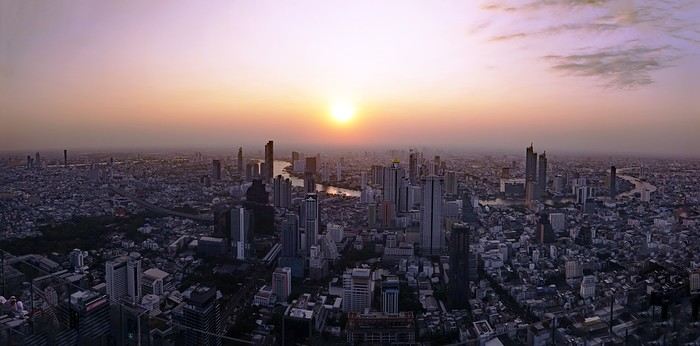
A somewhat lengthy title... I could have simply written: from Bangkok to Chiang Rai, via Chiang Mai, since that was my route. But when poets embellish our travel journals with their verbal flourishes, you’ve got to try not to be too ordinary.
Skyscrapers of excess? You’ll have gathered that from the photo illustrating this journal—though it might change as the trip goes on.
The excess of markets—not so much in their size, though... Chatuchak... But in their sheer number. Day markets, night markets, floating markets, fresh produce markets, fish markets, meat markets, spice markets, fabric markets... and even... amulet markets... For luck, good fortune, protection. Not to mention, sadly, the market for girls—and boys, incidentally. I’ve even heard they’re displayed in windows. I’ve heard about that one, like you have, but I didn’t set foot in it, so I can’t say anything about it. Some even claim there’s a black-market trade in children. Disgusting! It reminded me of the book *The Parcel* by Anosh Irani, which I recommended in another journal. The story is set in India, but I’ve been told it exists in Thailand too. So, the "famous Thai markets" we’re bombarded with in paper and online guides—sure, they amazed me in the first few days, and I don’t regret visiting them. But no matter how big they were, I quickly got my fill since you saw the same things at every stall...
I had a market overdose.
Excess of tourism? I should say *tourists*, since I saw them literally swarming in the streets and those famous markets. I’d forgotten about them. I’d lost the habit, living in an Indian city for so long...
Waterfalls are a bit like markets. At this time of year, they’re not particularly spectacular, but they’re everywhere. There are the ones everyone goes to see. For example, Erawan, which I decided to skip even though it was in my original itinerary—I guessed it’d be a nightmare with the selfie circus. On the other hand, you come across them all over the place, hidden in the mountains and forests, not listed in any guide. Not to mention the ones you can find in temples or even private homes... Yes, really! Thais love waterfalls, so they install them in their gardens—and I even saw one in the middle of the city, right on the street! Sometimes they’re tiny, but very photogenic.
But what do ice cubes have to do with this? Why the excess of ice cubes? Not only are they everywhere by the ton, but they put them in *everything* you drink. You’d think they’d even put them in soup! And it’s not just one or two ice cubes—no! They fill the container to the brim, whatever it is, then pour the liquid on top to fill the gaps. They’ll make you an excellent coffee right in front of you, piping hot, then—bam! An avalanche of ice cubes in the glass. Okay, I’m exaggerating a little. They *do* sometimes ask if you prefer your coffee—or tea—hot. Everything edible, and especially everything drinkable, is refrigerated: vegetables, fruit, hot drinks (I mean, drinks that are *usually* hot), but meat and fish are left out in the open. They just wave a little whisk to shoo away the flies when they get too eager. Mind you, I never put fruit, cheese, eggs, or water in the fridge in France, but I do in India. And I refrigerate meat and fish too... Though sometimes one of those little flies sneaks into the fridge...
You won’t find practical or technical details in this journal, like addresses or prices. Others do that better than me. You also won’t find the names of obscure or unknown places I discovered, or directions to get there.
I don’t really feel like recounting what I saw day by day, following my schedule and route. There might be flashbacks, projections into the future. It’ll depend on my memories, what I felt, what I hated, what comes back to me—and maybe your questions and our exchanges. And for those who’ve never read me before, you’ll have to get used to my parentheses and digressions, maybe on a completely different subject, as my thoughts wander. Stories within stories. There’ll also be long, endless sentences—but still punctuated, so you can follow along. Though I used to curse Proust and his sentences that started on one page and ended on the next, sometimes even further. I’d have to reread them twenty times to follow and understand what he was saying. I hated Proust. But hey, I was 20. Maybe I’d like him now?
See? The digressions are starting already. Forgive me.
You’ll find few photos here. First, the number is limited, and second, photos aren’t the main purpose of either VF or a travel journal. They’re too often used to mask the poverty of the text. And, sorry to say it, but so many of them are just plain ugly! If you really want to see photos, I’ll share some links where you can browse them at your leisure
Unusual trip to Rajasthan November 2022
Friday, November 4
My flight Barcelona - Abu Dhabi - Delhi went smoothly, it’s on time, and here I am back in India after 3 long years.
As I step off the plane, we head toward customs. It’s 3 AM, I’m tired but happy. The huge customs hall is below ground level and buzzing with people who’ve just arrived. In the end, they’re well organized—Indians to the left, foreigners to the right, and all along the hall, the customs officers’ posts, who remain very zen despite the crowd. It took me less than 2 hours to get out of the airport, which was pretty quick.
For this return trip, I got in touch with a driver from the "Lovers of India" group who was supposed to take me from the airport to Udaipur, passing through non-touristy villages like I love. This French-speaking driver had convinced me to travel by car, which was supposed to make moving from village to village easier. Two or three days before departure, I receive a message from the driver saying he was sick with a cold and sending another driver, his very kind brother who knows Rajasthan well but doesn’t speak French. I’m a bit disappointed by this message and doubtful about the driver’s sincerity, but I don’t have time to find another driver, so I stick to my plans, though I’m not at ease.
At the exit, the driver hasn’t arrived, and I wait half an hour before seeing him show up with a big smile, "Namaste." We don’t waste time and head to the car, which is clean and new.
We get to know each other in the car and hit the road toward Alwar. Along the way, we stop for lunch and to taste my first masala chai, which wakes up my taste buds.
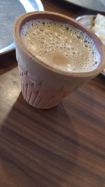
I doze off during the drive, and we arrive at the Atlantic Hotel in Alwar at 10:30 AM. My room is on the ground floor, and I settle in quickly. The Wi-Fi isn’t working, but the staff do everything they can to fix it. At noon, Gajender, the driver, suggests visiting the Qila Fort, which is on the heights of Alwar. The fort is closed for restoration, but safari tours are offered—jeep, guide, driver, and visit for 1600 Rs.
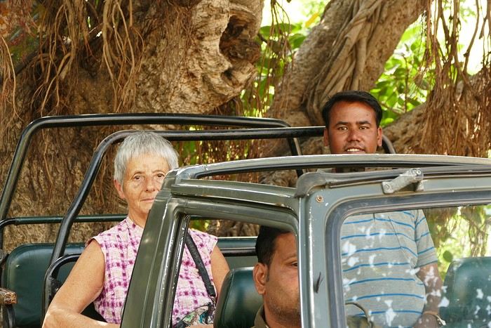
We follow the great wall, which is impressive—the second largest in India and the third in the world.
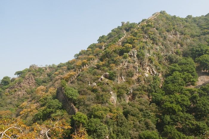
We spot peacocks and monkeys.
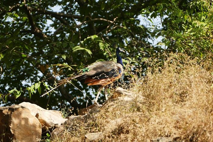
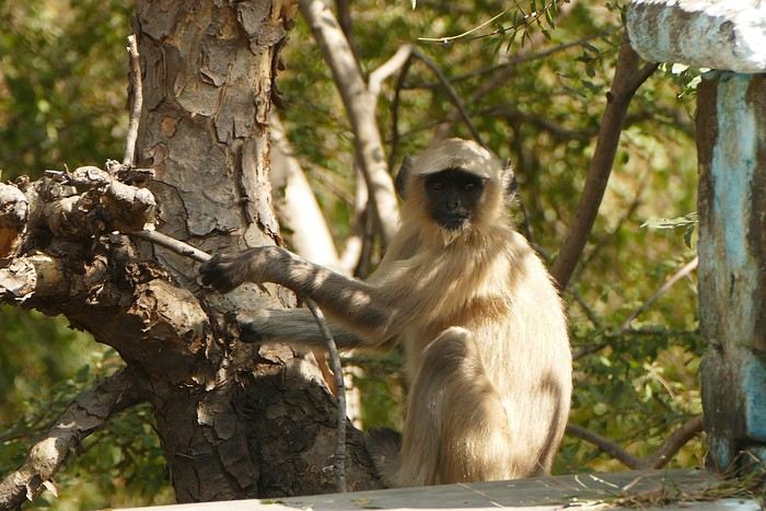
The guide shows me an old stepwell lost in nature. It’s always my thing to check out these baoris, which can be stunning, but this one isn’t anything special. We arrive at the palace overlooking the city.
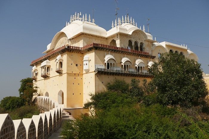
We walk around the palace, and I discover another stepwell that’s not worth lingering over.
The tour is over, and I had a great time despite the fatigue. We head back down to Alwar, near the City Palace, which has been turned into administrative offices. Gaju (the driver’s nickname) finds a parking spot near a dhaba where we have lunch (paneer masala, chapatis, chai)—it’s delicious. With my energy restored, we head to the palace. On the top floor is a museum that I visit.
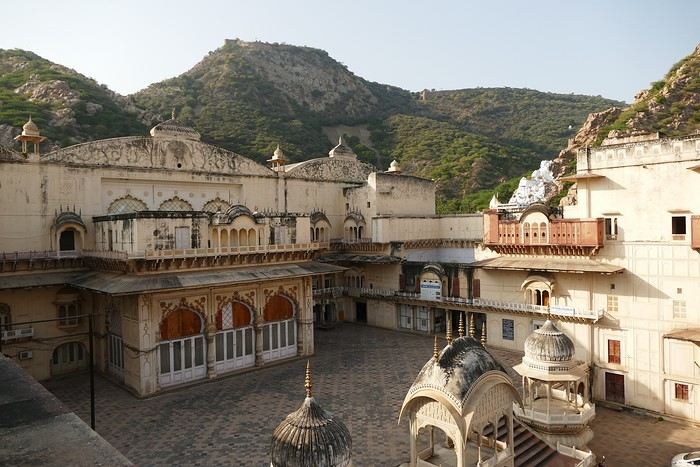
At the exit of the museum, we have to go back down and walk around the palace to get to the Moosi Maharani Chhatri. I’ve been here once before and really liked it, and the place is still the same—calm and relaxing.
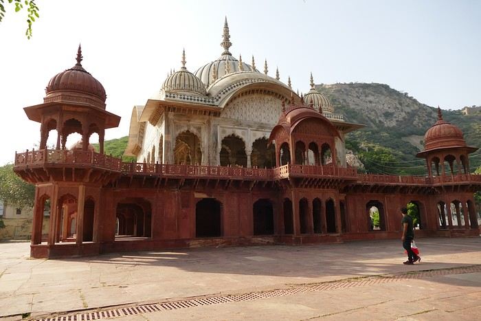
"This monument is the most artistic in Alwar and also the most royal, filled with fascinating history. Maharaja Vinay Singh of Alwar built this two-story cenotaph in 1815 in memory of his father, Maharaja Bakhtawar Singh. It’s also known as Moosi Maharani ki Chhatri, named after the king’s mistress, who performed sati upon his death. After the sati, she was accepted as the king’s wife. It’s an elegant monument, shaped like a flower and built with a mix of brown sandstone and white marble. The first floor is made of sandstone, while the upper floor and the chhatris (cenotaphs) are in white marble. Its sculpted pavilion has dome-shaped arches with intricate lace-like and exquisite floral patterns. There are complex motifs that shine brightly in the sunlight. The colorful circular ceiling is an important part of Moosi Maharani Ki Chhatri and is adorned with faded gold-leaf paintings of mythological figures and scenes. The footprints of Maharaja and Moosi Rani are engraved in marble inside the cenotaph, and locals pay their respects to them."
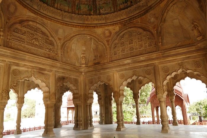
Near the chhatri, there’s a large water reservoir with a magnificent view. The place is peaceful and relaxing, and I stay here for a while, contemplating and daydreaming before heading back to the hotel for some well-deserved rest. The Wi-Fi is working now. I’m the only foreign guest, and since my room is near the entrance, I’ll be well taken care of throughout my stay.
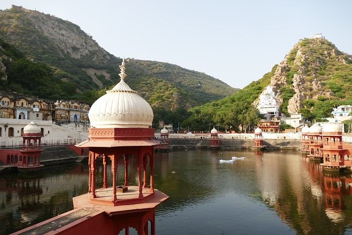
I doze off during the drive, and we arrive at the Atlantic Hotel in Alwar at 10:30 AM. My room is on the ground floor, and I settle in quickly. The Wi-Fi isn’t working, but the staff do everything they can to fix it. At noon, Gajender, the driver, suggests visiting the Qila Fort, which is on the heights of Alwar. The fort is closed for restoration, but safari tours are offered—jeep, guide, driver, and visit for 1600 Rs.
We follow the great wall, which is impressive—the second largest in India and the third in the world.
We spot peacocks and monkeys.
The guide shows me an old stepwell lost in nature. It’s always my thing to check out these baoris, which can be stunning, but this one isn’t anything special. We arrive at the palace overlooking the city.
We walk around the palace, and I discover another stepwell that’s not worth lingering over.
The tour is over, and I had a great time despite the fatigue. We head back down to Alwar, near the City Palace, which has been turned into administrative offices. Gaju (the driver’s nickname) finds a parking spot near a dhaba where we have lunch (paneer masala, chapatis, chai)—it’s delicious. With my energy restored, we head to the palace. On the top floor is a museum that I visit.
At the exit of the museum, we have to go back down and walk around the palace to get to the Moosi Maharani Chhatri. I’ve been here once before and really liked it, and the place is still the same—calm and relaxing.
"This monument is the most artistic in Alwar and also the most royal, filled with fascinating history. Maharaja Vinay Singh of Alwar built this two-story cenotaph in 1815 in memory of his father, Maharaja Bakhtawar Singh. It’s also known as Moosi Maharani ki Chhatri, named after the king’s mistress, who performed sati upon his death. After the sati, she was accepted as the king’s wife. It’s an elegant monument, shaped like a flower and built with a mix of brown sandstone and white marble. The first floor is made of sandstone, while the upper floor and the chhatris (cenotaphs) are in white marble. Its sculpted pavilion has dome-shaped arches with intricate lace-like and exquisite floral patterns. There are complex motifs that shine brightly in the sunlight. The colorful circular ceiling is an important part of Moosi Maharani Ki Chhatri and is adorned with faded gold-leaf paintings of mythological figures and scenes. The footprints of Maharaja and Moosi Rani are engraved in marble inside the cenotaph, and locals pay their respects to them."
Near the chhatri, there’s a large water reservoir with a magnificent view. The place is peaceful and relaxing, and I stay here for a while, contemplating and daydreaming before heading back to the hotel for some well-deserved rest. The Wi-Fi is working now. I’m the only foreign guest, and since my room is near the entrance, I’ll be well taken care of throughout my stay.
The Great Ocean Road in Australia
Tuesday, December 5, 2023
Melbourne – Lorne
We pick up the car 500 meters away, in a Chinatown parking lot that the hotel has a deal with, then it’s off with a *vroom vroom* while listening to a podcast about the victim of a compulsive mythomaniac—who also happens to be her husband—leading a completely compartmentalized double life. Later, he discovers, after contacting his alter-ego from this parallel universe, that he was actually living a *third* life... and maybe even more? We arrive in Torquay, where we stretch our legs along the Koorie Cultural Walk with a view of Bells Beach...
It’s here, just outside Lorne, that the Great Ocean Road officially begins...
We arrive at our apartment, which is pretty nice—Dom and I are really particular about the quality of our terraces. I’ve never really talked about the practical quirks of daily life in Australia. For example, I could tell you that *every single* power outlet we used on this trip had a switch to turn it on or off. No exceptions, ever! Why? They must find it useful, but for us, it’s a total mystery... And of course, their power outlets require an adapter. Just one of many little peculiarities. Another odd observation: *every* toilet, even the most remote ones hidden deep in the bush, always had a roll of toilet paper available. No shortages here!
And then we’re greeted by a big family of cute sparrows...
Another odd observation: *every* toilet, even the most remote ones hidden deep in the bush, always had a roll of toilet paper available. No shortages here!
And then we’re greeted by a big family of cute sparrows...
We spent a long time enjoying their pool before heading out for a walk—all the way to Erskine Falls, about ten kilometers away...
We pick up the car 500 meters away, in a Chinatown parking lot that the hotel has a deal with, then it’s off with a *vroom vroom* while listening to a podcast about the victim of a compulsive mythomaniac—who also happens to be her husband—leading a completely compartmentalized double life. Later, he discovers, after contacting his alter-ego from this parallel universe, that he was actually living a *third* life... and maybe even more? We arrive in Torquay, where we stretch our legs along the Koorie Cultural Walk with a view of Bells Beach...
It’s here, just outside Lorne, that the Great Ocean Road officially begins...
We arrive at our apartment, which is pretty nice—Dom and I are really particular about the quality of our terraces. I’ve never really talked about the practical quirks of daily life in Australia. For example, I could tell you that *every single* power outlet we used on this trip had a switch to turn it on or off. No exceptions, ever! Why? They must find it useful, but for us, it’s a total mystery... And of course, their power outlets require an adapter. Just one of many little peculiarities.
Another odd observation: *every* toilet, even the most remote ones hidden deep in the bush, always had a roll of toilet paper available. No shortages here!
And then we’re greeted by a big family of cute sparrows...We spent a long time enjoying their pool before heading out for a walk—all the way to Erskine Falls, about ten kilometers away...
Mexico Trip Itinerary: Mexico City, Puebla, Oaxaca, Pacific Coast
Hi there,
We’re planning a 15-day family trip in February 2026 (with 3 teens). We’ll be visiting friends who live in Puebla. Initially, I was thinking of the Yucatán, but after reading up on it, I don’t think it’s the right fit for us (too crowded, too touristy). So, we’re leaning toward something like this: - Mexico City: 2 days (Teotihuacán + city) - Puebla: 3 days - Tehuacán: 2 days (to break up the trip—is this a good choice? Is there enough to do for 2 days?) - Oaxaca: 3 days (Hierve el Agua, Monte Albán, city/tours) - Pacific Coast: 4 days (snorkeling, excursions)
Does this seem balanced? We’d like to end on the coast for some relaxation, ocean time, and fun for the kids. I’ve seen lots of excursions offered along the coast but can’t decide where to stay. Puerto Escondido? Huatulco? The beaches seem better for snorkeling in Huatulco, but I’ve read mixed things, and it’s farther away. What do you think?
For transportation, is this doable by bus? I’m struggling to find a decent bus between Tehuacán and Oaxaca (overnight schedules), and I’m not sure how to get around the coast. Also, how do we handle luggage between cities? We usually rent a car.
Finally, I’d love feedback on the Pacific Coast excursions—I get the feeling some are worth it and others aren’t. Is bioluminescence really magical? Are dolphin-watching tours ethical and not too "factory-like"? (We skipped them in Quebec and just watched whales from shore.) Can you see sea turtles up close?
Thanks for your help!
We’re planning a 15-day family trip in February 2026 (with 3 teens). We’ll be visiting friends who live in Puebla. Initially, I was thinking of the Yucatán, but after reading up on it, I don’t think it’s the right fit for us (too crowded, too touristy). So, we’re leaning toward something like this: - Mexico City: 2 days (Teotihuacán + city) - Puebla: 3 days - Tehuacán: 2 days (to break up the trip—is this a good choice? Is there enough to do for 2 days?) - Oaxaca: 3 days (Hierve el Agua, Monte Albán, city/tours) - Pacific Coast: 4 days (snorkeling, excursions)
Does this seem balanced? We’d like to end on the coast for some relaxation, ocean time, and fun for the kids. I’ve seen lots of excursions offered along the coast but can’t decide where to stay. Puerto Escondido? Huatulco? The beaches seem better for snorkeling in Huatulco, but I’ve read mixed things, and it’s farther away. What do you think?
For transportation, is this doable by bus? I’m struggling to find a decent bus between Tehuacán and Oaxaca (overnight schedules), and I’m not sure how to get around the coast. Also, how do we handle luggage between cities? We usually rent a car.
Finally, I’d love feedback on the Pacific Coast excursions—I get the feeling some are worth it and others aren’t. Is bioluminescence really magical? Are dolphin-watching tours ethical and not too "factory-like"? (We skipped them in Quebec and just watched whales from shore.) Can you see sea turtles up close?
Thanks for your help!
A trip to Australia: the Northern Territory.
Thursday, November 2, 2023
Lake Argyle – Katherine
We had a great time. Now we’ve got to pay the price. We’re down one stop before Katherine. Gotta do the whole trip in one go—6 hours of driving. Let’s go! We’re a bit low on fuel with only 300 kilometers of range. The only station at the lake doesn’t open until 9 a.m., and the next (and only) one is 227 kilometers away… Should we risk it? Except for a magnificent frilled-neck lizard darting across the road on its big hind legs and an emu quickly disappearing into the bush, we didn’t see much. Oh—there was also a donkey, lost and panicked in the middle of the road… A quiet road with some beautiful scenery, some worrying bushfires
 and a few opportunities to stop for a "warrior’s rest" (never go beyond the first second of the thought that starts drifting off the road…)
We cross an invisible border as we enter the Northern Territory, which comes with consequences—we immediately lose an hour and a half by changing time zones. The speed limit goes from 110 to 130.
and a few opportunities to stop for a "warrior’s rest" (never go beyond the first second of the thought that starts drifting off the road…)
We cross an invisible border as we enter the Northern Territory, which comes with consequences—we immediately lose an hour and a half by changing time zones. The speed limit goes from 110 to 130.
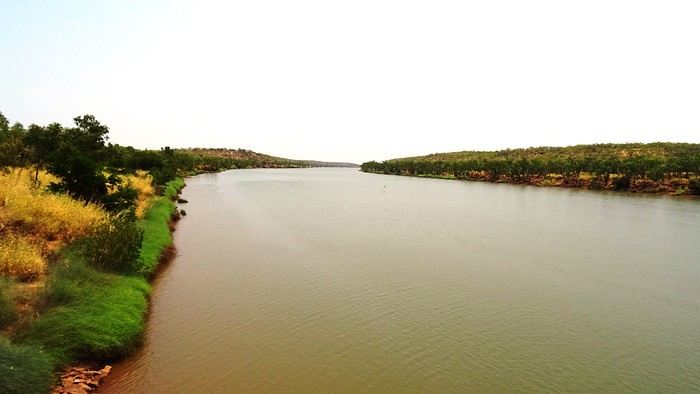
We arrive at the self check-in in Katherine. As usual, we’re a little taken aback at first. The noise, for starters. There’s a group rehearsing, it seems. We go check it out. We pass through the doors separating "The Stuart" from the adjoining bar and stumble upon what feels like collective hysteria. Turns out, it’s a concert. Aboriginal musicians completely fired up by some incredible music! There are just three of them, but they’re delivering a wall of sound that reminds us of South Africa’s finest neo-techno with a trance-like vibe. The crowd is wild! They’re singing in unison, screaming with joy. We get gently kicked out by security because we’re carrying our groceries, and they’re not having it. We promise ourselves we’ll come back once we’ve put them away in our little fridge.
Then we land. We end up finding plenty of nice things. It’s very possible we’ll like this place!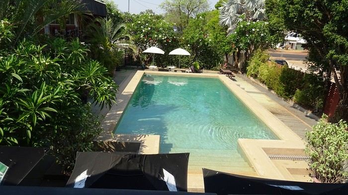
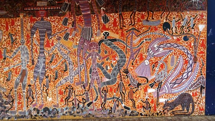 We head back to enjoy our post-battle Happy Hour.
 The concert’s over, but the crowd’s still riding the high. It’s indescribable. People are shouting across the room, screaming just for the fun of it—men and women alike. There’s pool, some beat-up arcade games being shaken like coconut trees. Dom and I feel like anthropologists. We’re pretty blown away. It’s epic! And the beer’s half the price it is elsewhere! We’ll definitely be back—that’s for sure!
We give up on finding a restaurant. Not sure they even exist, at least not this season. So, we’ve got a microwave—we eat at home on our little terrace, with a musical accompaniment from a massive orchestra of birds.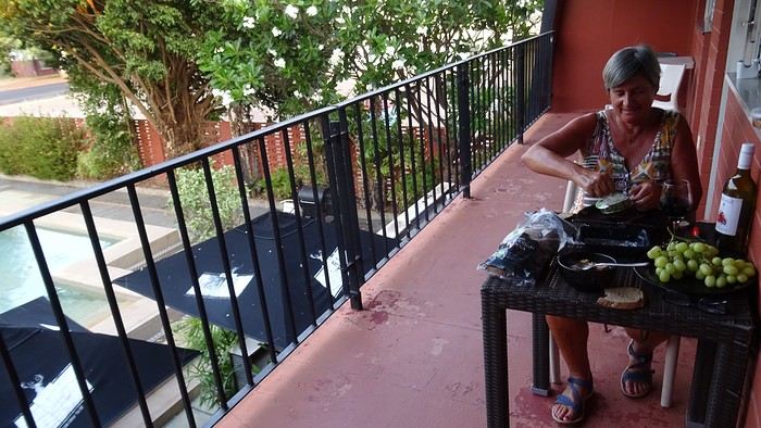 It sounds amazing!
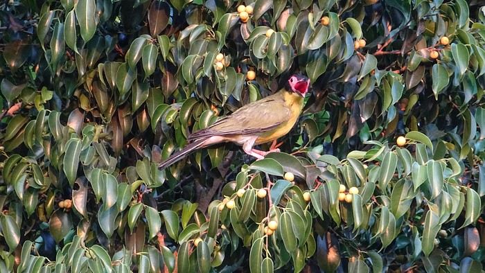
We had a great time. Now we’ve got to pay the price. We’re down one stop before Katherine. Gotta do the whole trip in one go—6 hours of driving. Let’s go! We’re a bit low on fuel with only 300 kilometers of range. The only station at the lake doesn’t open until 9 a.m., and the next (and only) one is 227 kilometers away… Should we risk it? Except for a magnificent frilled-neck lizard darting across the road on its big hind legs and an emu quickly disappearing into the bush, we didn’t see much. Oh—there was also a donkey, lost and panicked in the middle of the road… A quiet road with some beautiful scenery,
some worrying bushfires
and a few opportunities to stop for a "warrior’s rest" (never go beyond the first second of the thought that starts drifting off the road…)
We cross an invisible border as we enter the Northern Territory, which comes with consequences—we immediately lose an hour and a half by changing time zones. The speed limit goes from 110 to 130.
We arrive at the self check-in in Katherine. As usual, we’re a little taken aback at first. The noise, for starters. There’s a group rehearsing, it seems. We go check it out. We pass through the doors separating "The Stuart" from the adjoining bar and stumble upon what feels like collective hysteria. Turns out, it’s a concert. Aboriginal musicians completely fired up by some incredible music! There are just three of them, but they’re delivering a wall of sound that reminds us of South Africa’s finest neo-techno with a trance-like vibe. The crowd is wild! They’re singing in unison, screaming with joy. We get gently kicked out by security because we’re carrying our groceries, and they’re not having it. We promise ourselves we’ll come back once we’ve put them away in our little fridge.
Then we land. We end up finding plenty of nice things. It’s very possible we’ll like this place!
We head back to enjoy our post-battle Happy Hour.
The concert’s over, but the crowd’s still riding the high. It’s indescribable. People are shouting across the room, screaming just for the fun of it—men and women alike. There’s pool, some beat-up arcade games being shaken like coconut trees. Dom and I feel like anthropologists. We’re pretty blown away. It’s epic! And the beer’s half the price it is elsewhere! We’ll definitely be back—that’s for sure!We give up on finding a restaurant. Not sure they even exist, at least not this season. So, we’ve got a microwave—we eat at home on our little terrace, with a musical accompaniment from a massive orchestra of birds.
It sounds amazing!
Bangkok - Chiang Mai - Koh Samui in summer
Hi everyone, I’ve spent two solid months reading the Lonely Planet and pretty much every post about Thailand here, plus French and English blogs. Now I’d love to get your expert opinions on our itinerary.
We’re heading off in August 2025 with our 7-year-old daughter. We only have a maximum of three weeks off, and I’m keeping an eye on flight prices before booking (1400 € per person really stings 😕).
So here’s what I’ve planned—let me know if you spot any major issues or if I’ve been way too "optimistic."
D1 - Arrival in Bangkok / rest, quick visit, overnight stay D2 - More temple visits, etc. D3 - Morning flight to Chiang Mai D4 - More Chiang Mai sightseeing D5 - Day trip to Chiang Rai (guided tour to book: blue and white temple), return to Chiang Mai late in the evening D6 - More Chiang Mai visits / Elephant Nature Park in the afternoon D7 - Morning flight to Koh Samui, sightseeing D8 to D10 - More Koh Samui visits D11 to D13 - Ferry to Koh Phangan D14 to D15 - Ferry to Koh Tao D16 - Return to Koh Samui, then flight to Bangkok D17 - Day trip to Ayutthaya, return to Bangkok in the evening D18 - Flight back to France :(
I know a lot of you recommend heading straight to Chiang Mai to recover from the international flight, but my partner and I NEVER sleep on planes (personally, I’ve been flying to Taiwan since I was little and have never slept more than an hour on a 14-hour flight...), so it’s essential for us to rest upon arrival . That’s also why I opted for domestic flights instead of the sleeper train—I know we’d lose over 10 hours and wouldn’t be able to rest properly in those conditions. And I’m sure you’ll also say BKK > North > South is too much for three weeks, but I really want to see as much as possible. Given how much the flights will cost, I’m not sure when we’ll be able to come back 🏴☠️.
So, questions: 1. Since we’ll only be in Bangkok for a maximum of two nights and need to easily reach the airport with luggage (and a child), which neighborhood should we prioritize? We’d love to experience the evening vibe of Asian night markets, ideally within walking distance of the hotel or just a few metro stops away. I’ve looked at Chinatown, but the BTS seems far... Should we go for somewhere near BTS Saphan Taksin or BTS Krungthonburi? But is the area lively in the evening with food courts, etc.? We’d also like to treat ourselves to a hotel with a pool.
2. Have we planned too many days in the south? Should I skip Koh Tao and just do Koh Samui + Koh Phangan? My partner and daughter aren’t strong swimmers, so we’re looking for beautiful beaches without too much current. Crowded beaches don’t bother us—we just want stunning turquoise waters without killer waves . Going all the way to Koh Tao and then back to Koh Samui to catch the flight to Bangkok seems too stressful. Is it still possible these days (I haven’t seen any recent posts on this) to head to Koh Samui in August and decide on the spot how many nights to spend in Koh Phangan or Koh Tao based on how we feel, booking hotels as we go? Or is that too risky?
If you have any better suggestions for fitting all this in while reducing internal flights, I’m all ears for your great tips
D1 - Arrival in Bangkok / rest, quick visit, overnight stay D2 - More temple visits, etc. D3 - Morning flight to Chiang Mai D4 - More Chiang Mai sightseeing D5 - Day trip to Chiang Rai (guided tour to book: blue and white temple), return to Chiang Mai late in the evening D6 - More Chiang Mai visits / Elephant Nature Park in the afternoon D7 - Morning flight to Koh Samui, sightseeing D8 to D10 - More Koh Samui visits D11 to D13 - Ferry to Koh Phangan D14 to D15 - Ferry to Koh Tao D16 - Return to Koh Samui, then flight to Bangkok D17 - Day trip to Ayutthaya, return to Bangkok in the evening D18 - Flight back to France :(
I know a lot of you recommend heading straight to Chiang Mai to recover from the international flight, but my partner and I NEVER sleep on planes (personally, I’ve been flying to Taiwan since I was little and have never slept more than an hour on a 14-hour flight...), so it’s essential for us to rest upon arrival . That’s also why I opted for domestic flights instead of the sleeper train—I know we’d lose over 10 hours and wouldn’t be able to rest properly in those conditions. And I’m sure you’ll also say BKK > North > South is too much for three weeks, but I really want to see as much as possible. Given how much the flights will cost, I’m not sure when we’ll be able to come back 🏴☠️.
So, questions: 1. Since we’ll only be in Bangkok for a maximum of two nights and need to easily reach the airport with luggage (and a child), which neighborhood should we prioritize? We’d love to experience the evening vibe of Asian night markets, ideally within walking distance of the hotel or just a few metro stops away. I’ve looked at Chinatown, but the BTS seems far... Should we go for somewhere near BTS Saphan Taksin or BTS Krungthonburi? But is the area lively in the evening with food courts, etc.? We’d also like to treat ourselves to a hotel with a pool.
2. Have we planned too many days in the south? Should I skip Koh Tao and just do Koh Samui + Koh Phangan? My partner and daughter aren’t strong swimmers, so we’re looking for beautiful beaches without too much current. Crowded beaches don’t bother us—we just want stunning turquoise waters without killer waves . Going all the way to Koh Tao and then back to Koh Samui to catch the flight to Bangkok seems too stressful. Is it still possible these days (I haven’t seen any recent posts on this) to head to Koh Samui in August and decide on the spot how many nights to spend in Koh Phangan or Koh Tao based on how we feel, booking hotels as we go? Or is that too risky?
If you have any better suggestions for fitting all this in while reducing internal flights, I’m all ears for your great tips
Review of a Mediterranean cruise on the Splendida and 24 hours in Venice – October 2024
Hi everyone,
What a joy to be back here and pick up where we left off after all these months of hiatus.
I hope you’ll enjoy the story of this little trip around the Eastern Mediterranean. This cruise was the perfect way to satisfy our longing to return to Greece and Istanbul. The end of the season, until late November, is the best time to visit the Mediterranean in my opinion—when climate disruptions don’t get in the way.
Departing from Trieste, our stops were Katakolon, Piraeus, Kusadasi, Istanbul, Corfu, and Bari, before returning to Trieste and then Venice, where we planned a very short 24-hour stay.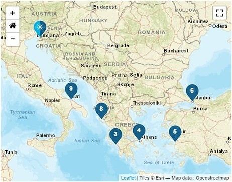
We left home at 6:15 AM—our first cruise departure since moving to Normandy. What I miss most about living in the Gard is how close we were to Marseille Airport. No more hopping over to Marignane in an hour; now we have to plan for a three-hour trip to CDG, even under the best conditions on an early Sunday morning.
It was impossible to book a hotel night before our flight because, starting in April, the Ibis was priced at 450 € per night, and the Mercure was flirting with 800 €—breakfast not included, of course. 😏
I had a feeling there must’ve been a conference or something going on… Turns out, it was just the auto show. They simply adjusted the room prices to match the cost of the cars. 😛
Our flight took us to Venice, where we caught a FlixBus to Trieste. We arrived at Trieste’s train station in the afternoon and walked to our hotel in the city center.
After treating ourselves to an amazing pizza at a restaurant (Di Napoli Maestri Pizzaioli, Via Armando Diaz 10) for a very reasonable price, we enjoyed the mild evening temperature while exploring the stunning buildings of this charming city by night. These magnificent structures are a testament to the city’s past. Trieste became Austrian in 1382 due to its complicated relationship with Venice, and it wasn’t until 1918, at the end of World War I, that it became Italian again. The city’s lighting beautifully highlights the architecture of the buildings.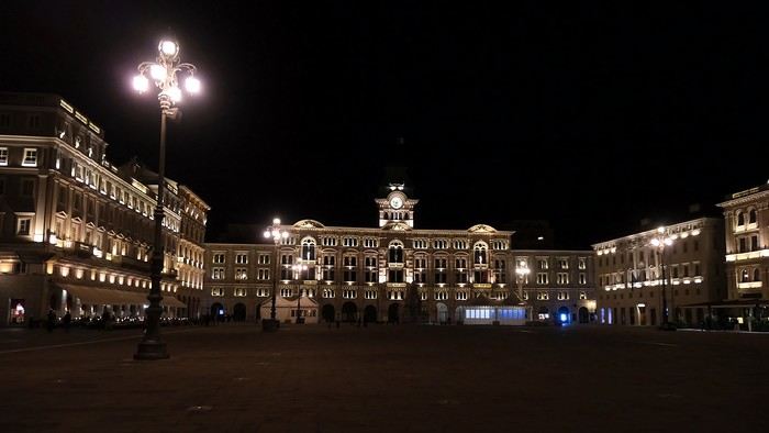
The terraces were lively, and the atmosphere was so warm and inviting that we wanted to stay out even longer.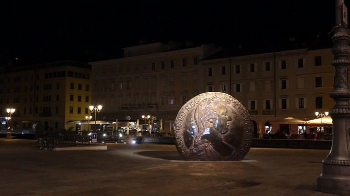
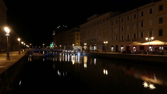
But we’d been up since 4 AM, so we were happy to retreat to the quiet of our hotel, located in the pedestrian center just a few steps from the port (Urban Hotel Design—highly recommended).
More to come soon.
What a joy to be back here and pick up where we left off after all these months of hiatus.
I hope you’ll enjoy the story of this little trip around the Eastern Mediterranean. This cruise was the perfect way to satisfy our longing to return to Greece and Istanbul. The end of the season, until late November, is the best time to visit the Mediterranean in my opinion—when climate disruptions don’t get in the way.
Departing from Trieste, our stops were Katakolon, Piraeus, Kusadasi, Istanbul, Corfu, and Bari, before returning to Trieste and then Venice, where we planned a very short 24-hour stay.
We left home at 6:15 AM—our first cruise departure since moving to Normandy. What I miss most about living in the Gard is how close we were to Marseille Airport. No more hopping over to Marignane in an hour; now we have to plan for a three-hour trip to CDG, even under the best conditions on an early Sunday morning.
It was impossible to book a hotel night before our flight because, starting in April, the Ibis was priced at 450 € per night, and the Mercure was flirting with 800 €—breakfast not included, of course. 😏
I had a feeling there must’ve been a conference or something going on… Turns out, it was just the auto show. They simply adjusted the room prices to match the cost of the cars. 😛
Our flight took us to Venice, where we caught a FlixBus to Trieste. We arrived at Trieste’s train station in the afternoon and walked to our hotel in the city center.
After treating ourselves to an amazing pizza at a restaurant (Di Napoli Maestri Pizzaioli, Via Armando Diaz 10) for a very reasonable price, we enjoyed the mild evening temperature while exploring the stunning buildings of this charming city by night. These magnificent structures are a testament to the city’s past. Trieste became Austrian in 1382 due to its complicated relationship with Venice, and it wasn’t until 1918, at the end of World War I, that it became Italian again. The city’s lighting beautifully highlights the architecture of the buildings.
The terraces were lively, and the atmosphere was so warm and inviting that we wanted to stay out even longer.
But we’d been up since 4 AM, so we were happy to retreat to the quiet of our hotel, located in the pedestrian center just a few steps from the port (Urban Hotel Design—highly recommended).
More to come soon.
From France to Mecca by Bike
Assalamu 'alaykum,
Hi everyone,
This thread is to echo some posts I’ve read on this forum while researching a potential bike trip from Annecy to Mecca. I came across several discussions where members mentioned being very interested in cycling to the holy city.
So, God willing, I plan to attempt this journey from January to June next year. The idea is to head to Turkey first, then assess the most reasonable routes based on the geopolitical situation around Palestine and as far as Iraq. Since the Turkish-Syrian border is closed, the only remaining (and I mean *only* remaining) overland option would be to go through Iraqi Kurdistan, Iraq, then Jordan, and finally Saudi Arabia.
That’s the first major challenge of this project. The second is timing. Due to the schedule, I’ll be starting in the middle of winter across Europe and finishing in the peak of summer in Saudi Arabia. If I’d had a choice, I’d have waited a good dozen years—but well, twelve years...
I won’t go into too much detail about the planned route in this post, but here are the broad strokes already set: Annecy to Istanbul. The rest is a bit too far ahead to map out properly. Crossing the Italian border via the Montgenèvre Pass. Straight through northern Italy as quickly as possible (not necessarily very pleasant) to reach Ljubljana. The fastest route through Croatia to spend as much time as possible in Bosnia-Herzegovina. Serbia via the Sandžak region. It crosses the Pešter plateau, which intimidates me at this time of year—its nickname, the "Siberia of the Balkans," says it all... Then Kosovo, North Macedonia, Greece, and Turkey.
I’m open to any advice on this itinerary. The choice was made to pass through as many Muslim-majority regions as possible. In the middle of winter in the Balkans, I don’t feel mentally up to bivouacking alone in that climate. So, I’ll try to find accommodations in mosques or even with locals as much as possible.
That’s the project in a nutshell. The big catch—some of you may have already noticed—is that I’m doing this solo. Yet, this is strongly discouraged by our Prophet—peace and blessings of Allah be upon him. So, I invite anyone interested in joining this project, whether closely or from afar, to reach out and contact me. Any contribution is welcome, whether it’s company for the whole journey (one can always hope!) or just part of it. Advice, contact suggestions, places to stay, and information about Hajj or Umrah are also appreciated.
Thanks for reading this far. I’ll try to check my VoyageForum account from time to time to see if anyone has responded to this thread and will happily reply to your messages and questions.
Take care, Assalamu'alaykum.
Sam
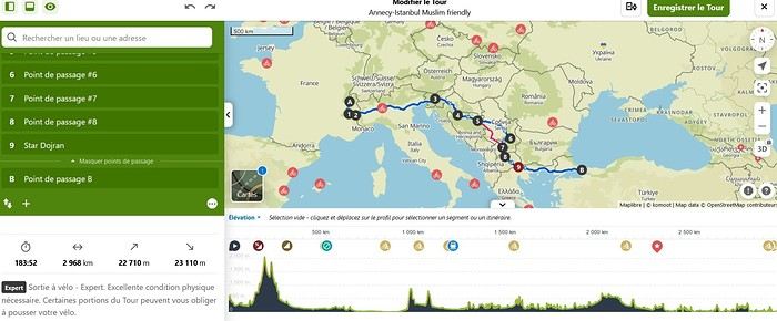
This thread is to echo some posts I’ve read on this forum while researching a potential bike trip from Annecy to Mecca. I came across several discussions where members mentioned being very interested in cycling to the holy city.
So, God willing, I plan to attempt this journey from January to June next year. The idea is to head to Turkey first, then assess the most reasonable routes based on the geopolitical situation around Palestine and as far as Iraq. Since the Turkish-Syrian border is closed, the only remaining (and I mean *only* remaining) overland option would be to go through Iraqi Kurdistan, Iraq, then Jordan, and finally Saudi Arabia.
That’s the first major challenge of this project. The second is timing. Due to the schedule, I’ll be starting in the middle of winter across Europe and finishing in the peak of summer in Saudi Arabia. If I’d had a choice, I’d have waited a good dozen years—but well, twelve years...
I won’t go into too much detail about the planned route in this post, but here are the broad strokes already set: Annecy to Istanbul. The rest is a bit too far ahead to map out properly. Crossing the Italian border via the Montgenèvre Pass. Straight through northern Italy as quickly as possible (not necessarily very pleasant) to reach Ljubljana. The fastest route through Croatia to spend as much time as possible in Bosnia-Herzegovina. Serbia via the Sandžak region. It crosses the Pešter plateau, which intimidates me at this time of year—its nickname, the "Siberia of the Balkans," says it all... Then Kosovo, North Macedonia, Greece, and Turkey.
I’m open to any advice on this itinerary. The choice was made to pass through as many Muslim-majority regions as possible. In the middle of winter in the Balkans, I don’t feel mentally up to bivouacking alone in that climate. So, I’ll try to find accommodations in mosques or even with locals as much as possible.
That’s the project in a nutshell. The big catch—some of you may have already noticed—is that I’m doing this solo. Yet, this is strongly discouraged by our Prophet—peace and blessings of Allah be upon him. So, I invite anyone interested in joining this project, whether closely or from afar, to reach out and contact me. Any contribution is welcome, whether it’s company for the whole journey (one can always hope!) or just part of it. Advice, contact suggestions, places to stay, and information about Hajj or Umrah are also appreciated.
Thanks for reading this far. I’ll try to check my VoyageForum account from time to time to see if anyone has responded to this thread and will happily reply to your messages and questions.
Take care, Assalamu'alaykum.
Sam
Western USA Oct 2024 - Arches and Other Delights...
Aaah, I'm so glad Voyage Forum is back up and running. For reading... and for writing...
My last travel journal was from 2019, when I went hiking and backpacking with my son, who was 15 at the time. We visited some places that were still pretty unknown back then! I was supposed to go in April 2020, still solo, with arches as the main focus. I’d spent nearly two months getting physically prepared, and had managed to snag a bunch of permits for CBS, The Needles, and so on... Of course, it all got postponed—first to October 2020, then April 2021, then October 2021, and finally it happened in April 2022. Maybe I’ll write about that in another journal. The thing is, every time, I spend at least 6 to 8 weeks getting physically ready, even though I work out all year. Huge disappointment during that trip—so much had changed because of Covid, kind of like in the mountains back home. Overcrowding, not just in the national parks (we knew about that), but also in a lot of remote, lesser-known spots. Like the French, Americans realized they had a lot of beautiful places in their own country during those travel bans. And they kept exploring... Prices for pretty much everything had already gone up a lot. Gas, restaurants, cars, but especially lodging! Then, after dealing with so much wind in April, I got a little "fed up" with that time of year. It felt like I had strong winds and sandstorms for 3 out of the 3.5 weeks I was there...
So, the next trip was October 2023, to catch the partial eclipse in New Mexico, and of course, a bunch of arches ;). So many arches. Maybe I’ll write about that one too... Then came (among others) April 2024 for the total eclipse, in Texas, but starting from L.A., with my partner Valérie. Since I’d never visited some places I wanted to see further south of my usual loops, it was the perfect opportunity... And here we are at the end of September 2024. Another trip focused on arches—I never get tired of them. Every time I check one off my list, another gets added. Often it’s a photo I’ve seen online or in the NABS (Natural Arches and Bridges Society) magazine, which I’m a member of. I also scour the WAD (World Arches Database) and make a list of arches I want to visit. Fewer and fewer "viewpoints"—I’ve done all the most famous ones, and unless the sky is amazing, the photos all look the same. Since my goal is always photography *and* hiking, I’m always on the lookout. So this time, a packed itinerary—27 days, very busy. In past trips, if I didn’t plan enough and hiked fast, I’d end up with too many "gaps" in my days. This time, I’d rather have too much than too little (like in 2023, actually).
A few stats: - 6,589 km, including +/-1,400 km of off-road trails - 323 km of hiking, 8,829 m of elevation gain - 142 new arches for my collection, including some stunning ones, some less so, and some downright ugly—but all in the WAD. - Two outings with a Navajo guide - Almost no injuries - 8 bivouacs, including 2 backpacking trips - 4 days of backpacking - 22 freeze-dried meals and 15 Subways eaten - 6 thorns in my shoes (long live the tweezers in my backpack) - 3 kg lost (plus the 5 kg lost during prep)
Almost every day, I posted a little update on Facebook for family and friends. So I’ll be copy-pasting those texts here, written "my way" as usual. Some will like it, some won’t—that’s just how it is... 😏
For months, I planned this trip—looking for info, creating GPS tracks on Google Earth, exchanging tips with NABS members and other passionate friends. I snagged permits for The Needles again (4-5 days), for Fiery Furnace, timed entries for Arches National Park (2), and booked just one campsite, a "triple tour" in Monument Valley, and the first night in a motel. This is the first time I haven’t booked 80% of the motels—I was tired of having constraints because of the weather. This time, I want to be able to adjust my plans based on the weather and what I feel like doing more or less of. Camp when the weather’s nice, hotel/motel when it’s crappy.
Here we go...
Day 1
As usual, early morning flights: BRU-AMS, then AMS-SLC. Those who follow me know I’ve been renting a Rubicon from Rugged for years, which "forces" me to land in SLC. Up at 3:30 AM, but I’d been awake since 2:00 AM—the day’s going to be long. Shuttle to the airport. In Brussels, only two check-in counters open. I get there—no cabin baggage weigh-in, while the agent next to me is weighing everyone’s, even kids’ backpacks! A bit of luck, because as usual, if they weighed my backpack *and* my cabin bag, I’d already be over 20 kg. I check two hold bags, since I’ve got a lot of camping/backpacking gear, lots of freeze-dried meals, the backpacking bag, the Bear Canister needed for The Needles, etc. First flight is 30 minutes late, so the second one is already boarding. I’ve got the SSSS mark on my ticket (extra security check), so I head straight to the front when I arrive at the same time as Zone 3, even though I’m Zone 6. I pretend the check will take a while, and it "works"—they didn’t notice! No way I want to board last and risk them making me check my cabin bag. It’s packed with photo gear, laptop, drone, etc.—unthinkable to have to put it in the hold. Always a worry... SLC: baggage claim, customs, and out in 32 minutes. The MPC app makes something that was already quick even faster at this airport. And all the bags are there. That’s always a relief too. Since I drive at least 3 hours straight after landing, losing a hold bag would really mess up the trip and force me to spend the first night closer to SLC. On the way to Rugged. A young French couple from Reims is in the shuttle with me—they discovered Rugged thanks to my post in a Facebook group! Well, the team has changed again, and they lost half the stuff I’d left last October (plastic boxes, pillow, sugar, gas cartridges, folding chair, Crocs, etc.), but at least there are gas cartridges, so I don’t have to go to REI. REI would’ve been at least an hour out of my way. But as far as I know, there are no gas cartridges in Green River. I still get my tent stake hammer back, and a folding chair—different from mine but identical.
20,000 km Rubicon 4Xe, white. I check the tires—they’re in great shape, as requested. I’ll come back to the hybrid later. I didn’t want a hybrid, but that’s all they had this year. Why? Higher fuel consumption, smaller tank, higher cargo floor.
Stop at the Walmart near Provo, whose layout I know like the back of my hand (Walmarts are often similar). Start-of-trip shopping: water, Coke, Gatorade, UHT milk for cereal (not very common in the US), Special K "Almond and Vanilla", cold meds that work well (and don’t exist back home—you never know), two plastic bins, a pillow for the tent, Trail Mix, that’s about it. On the road to Nebo Loop for the fall colors. I’d driven this route last year, in the opposite direction on my way back to SLC, but it was a bit too late. This time, I’m a little early. At the start of the road, the maples are in the sun, so I go up to 2,200 m for the bright yellow aspens, then head back down. Mostly drone shots—no time to go for a walk. After a day like this, 4.5-5 hours of driving is already a lot... Arrived in Green River at 9:00 PM. Organize all the stuff from the bags properly, then sleep.
A few photos from these first few hours.
My last travel journal was from 2019, when I went hiking and backpacking with my son, who was 15 at the time. We visited some places that were still pretty unknown back then! I was supposed to go in April 2020, still solo, with arches as the main focus. I’d spent nearly two months getting physically prepared, and had managed to snag a bunch of permits for CBS, The Needles, and so on... Of course, it all got postponed—first to October 2020, then April 2021, then October 2021, and finally it happened in April 2022. Maybe I’ll write about that in another journal. The thing is, every time, I spend at least 6 to 8 weeks getting physically ready, even though I work out all year. Huge disappointment during that trip—so much had changed because of Covid, kind of like in the mountains back home. Overcrowding, not just in the national parks (we knew about that), but also in a lot of remote, lesser-known spots. Like the French, Americans realized they had a lot of beautiful places in their own country during those travel bans. And they kept exploring... Prices for pretty much everything had already gone up a lot. Gas, restaurants, cars, but especially lodging! Then, after dealing with so much wind in April, I got a little "fed up" with that time of year. It felt like I had strong winds and sandstorms for 3 out of the 3.5 weeks I was there...
So, the next trip was October 2023, to catch the partial eclipse in New Mexico, and of course, a bunch of arches ;). So many arches. Maybe I’ll write about that one too... Then came (among others) April 2024 for the total eclipse, in Texas, but starting from L.A., with my partner Valérie. Since I’d never visited some places I wanted to see further south of my usual loops, it was the perfect opportunity... And here we are at the end of September 2024. Another trip focused on arches—I never get tired of them. Every time I check one off my list, another gets added. Often it’s a photo I’ve seen online or in the NABS (Natural Arches and Bridges Society) magazine, which I’m a member of. I also scour the WAD (World Arches Database) and make a list of arches I want to visit. Fewer and fewer "viewpoints"—I’ve done all the most famous ones, and unless the sky is amazing, the photos all look the same. Since my goal is always photography *and* hiking, I’m always on the lookout. So this time, a packed itinerary—27 days, very busy. In past trips, if I didn’t plan enough and hiked fast, I’d end up with too many "gaps" in my days. This time, I’d rather have too much than too little (like in 2023, actually).
A few stats: - 6,589 km, including +/-1,400 km of off-road trails - 323 km of hiking, 8,829 m of elevation gain - 142 new arches for my collection, including some stunning ones, some less so, and some downright ugly—but all in the WAD. - Two outings with a Navajo guide - Almost no injuries - 8 bivouacs, including 2 backpacking trips - 4 days of backpacking - 22 freeze-dried meals and 15 Subways eaten - 6 thorns in my shoes (long live the tweezers in my backpack) - 3 kg lost (plus the 5 kg lost during prep)
Almost every day, I posted a little update on Facebook for family and friends. So I’ll be copy-pasting those texts here, written "my way" as usual. Some will like it, some won’t—that’s just how it is... 😏
For months, I planned this trip—looking for info, creating GPS tracks on Google Earth, exchanging tips with NABS members and other passionate friends. I snagged permits for The Needles again (4-5 days), for Fiery Furnace, timed entries for Arches National Park (2), and booked just one campsite, a "triple tour" in Monument Valley, and the first night in a motel. This is the first time I haven’t booked 80% of the motels—I was tired of having constraints because of the weather. This time, I want to be able to adjust my plans based on the weather and what I feel like doing more or less of. Camp when the weather’s nice, hotel/motel when it’s crappy.
Here we go...
Day 1
As usual, early morning flights: BRU-AMS, then AMS-SLC. Those who follow me know I’ve been renting a Rubicon from Rugged for years, which "forces" me to land in SLC. Up at 3:30 AM, but I’d been awake since 2:00 AM—the day’s going to be long. Shuttle to the airport. In Brussels, only two check-in counters open. I get there—no cabin baggage weigh-in, while the agent next to me is weighing everyone’s, even kids’ backpacks! A bit of luck, because as usual, if they weighed my backpack *and* my cabin bag, I’d already be over 20 kg. I check two hold bags, since I’ve got a lot of camping/backpacking gear, lots of freeze-dried meals, the backpacking bag, the Bear Canister needed for The Needles, etc. First flight is 30 minutes late, so the second one is already boarding. I’ve got the SSSS mark on my ticket (extra security check), so I head straight to the front when I arrive at the same time as Zone 3, even though I’m Zone 6. I pretend the check will take a while, and it "works"—they didn’t notice! No way I want to board last and risk them making me check my cabin bag. It’s packed with photo gear, laptop, drone, etc.—unthinkable to have to put it in the hold. Always a worry... SLC: baggage claim, customs, and out in 32 minutes. The MPC app makes something that was already quick even faster at this airport. And all the bags are there. That’s always a relief too. Since I drive at least 3 hours straight after landing, losing a hold bag would really mess up the trip and force me to spend the first night closer to SLC. On the way to Rugged. A young French couple from Reims is in the shuttle with me—they discovered Rugged thanks to my post in a Facebook group! Well, the team has changed again, and they lost half the stuff I’d left last October (plastic boxes, pillow, sugar, gas cartridges, folding chair, Crocs, etc.), but at least there are gas cartridges, so I don’t have to go to REI. REI would’ve been at least an hour out of my way. But as far as I know, there are no gas cartridges in Green River. I still get my tent stake hammer back, and a folding chair—different from mine but identical.
20,000 km Rubicon 4Xe, white. I check the tires—they’re in great shape, as requested. I’ll come back to the hybrid later. I didn’t want a hybrid, but that’s all they had this year. Why? Higher fuel consumption, smaller tank, higher cargo floor.
Stop at the Walmart near Provo, whose layout I know like the back of my hand (Walmarts are often similar). Start-of-trip shopping: water, Coke, Gatorade, UHT milk for cereal (not very common in the US), Special K "Almond and Vanilla", cold meds that work well (and don’t exist back home—you never know), two plastic bins, a pillow for the tent, Trail Mix, that’s about it. On the road to Nebo Loop for the fall colors. I’d driven this route last year, in the opposite direction on my way back to SLC, but it was a bit too late. This time, I’m a little early. At the start of the road, the maples are in the sun, so I go up to 2,200 m for the bright yellow aspens, then head back down. Mostly drone shots—no time to go for a walk. After a day like this, 4.5-5 hours of driving is already a lot... Arrived in Green River at 9:00 PM. Organize all the stuff from the bags properly, then sleep.
A few photos from these first few hours.
Bike trip: from Carcans Maubuisson to Plaisir (Yvelines)
Monday, August 21, 2023 - Rochefort - Marans
No journal for the first two days. Day 1 - CARCANS-ROYAN Day 2 - ROYAN - ROCHEFORT Tonight I'm in MARANS in the "dry marsh" according to the campsite manager—it’s the first time I’ve heard of a "dry marsh"?!
Photos from the first two days
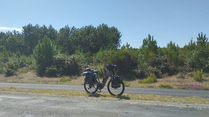 My gear
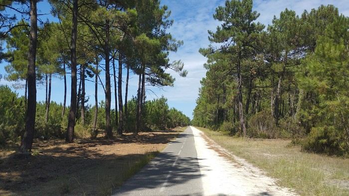
The Landes region—nothing extraordinary, but the calm and serenity are nice.

Le Verdon
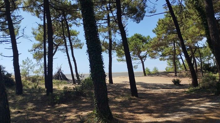
The wild coast
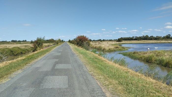
This marsh isn’t dry, though.
Today is the third day of my trip, and I’m writing to you from a campsite in Marans. I’ve set out to bike from Carcans Maubuisson back to Plaisir. Why Carcans? Because we spent a week there as a family—a great week that lets everyone reconnect for a long stretch. Also, on Saturday, we all headed home—some by car, and me by bike. This journey is about 850 km via bike paths and small cycling roads. It’s not a sporting feat, just a nice long ride for fun. As the old Chinese sage says, "The destination doesn’t matter—it’s the journey that counts." But he also told me, "Traveling is great, but what’s the point if you don’t share it?" You see, this old sage has told me a lot of things—he often keeps me company when I’m biking. Of course, he doesn’t pedal, but we travel in harmony. Sure, he can be a bit annoying sometimes, but we still get along. All this to say I’ve created a group to share my story. I’d be happy to share this experience with you—it’s an adventure for me. On Saturday, I wasn’t sure I’d even leave because I’d been dealing with sciatica for days. Luckily, Juliette, a friend of the old Chinese sage, recommended a lifesaving remedy: Alternately stretching your legs with an elastic band under your foot. Obviously, a jam jar rubber band won’t cut it.
From Marans - The mosquitoes are attacking; time to head back to shelter.
The first two legs took me to Royan and then Rochefort. The Sèvre Niortaise flows nearby, and I followed a canal from La Rochelle. You could say the area is as dry as the marsh, judging by the state of the crops.
As I mentioned, it’s the third day, and if Jesus rose again on this day, for me it was more like the crucifixion. The scorching heat—only bearable when you’re moving—combined with rough trail conditions, and the old Chinese sage says, "Terrible roads, slow speed, and watch your limbs." I set out to do 60 km but ended up doing 80, and the last 20 were tough. I kept checking the GPS to see how much farther until the campsite. Today: Rochefort to Marans, sticking to the coast until La Rochelle, then no notable towns after that—just a constant canal. But since the sky isn’t too low, it hasn’t gotten lost. I’ve still got plenty of anecdotes to share, but it’s pitch black out, and the mosquitoes are still around. This morning, I counted ten in my tent, all full of my blood. Yesterday, at the end of the leg to Rochefort, I was really looking forward to crossing the Charente using the transporter bridge, but a sneaky GPS conspiracy led me far from it. I ended up crossing the Charente on a completely ordinary bridge, watching the transporter bridge in the distance with disappointment.
End of the first episode. Until tomorrow, if you’d like!
No journal for the first two days. Day 1 - CARCANS-ROYAN Day 2 - ROYAN - ROCHEFORT Tonight I'm in MARANS in the "dry marsh" according to the campsite manager—it’s the first time I’ve heard of a "dry marsh"?!
Photos from the first two days
My gearThe Landes region—nothing extraordinary, but the calm and serenity are nice.
Le Verdon
The wild coast
This marsh isn’t dry, though.
Today is the third day of my trip, and I’m writing to you from a campsite in Marans. I’ve set out to bike from Carcans Maubuisson back to Plaisir. Why Carcans? Because we spent a week there as a family—a great week that lets everyone reconnect for a long stretch. Also, on Saturday, we all headed home—some by car, and me by bike. This journey is about 850 km via bike paths and small cycling roads. It’s not a sporting feat, just a nice long ride for fun. As the old Chinese sage says, "The destination doesn’t matter—it’s the journey that counts." But he also told me, "Traveling is great, but what’s the point if you don’t share it?" You see, this old sage has told me a lot of things—he often keeps me company when I’m biking. Of course, he doesn’t pedal, but we travel in harmony. Sure, he can be a bit annoying sometimes, but we still get along. All this to say I’ve created a group to share my story. I’d be happy to share this experience with you—it’s an adventure for me. On Saturday, I wasn’t sure I’d even leave because I’d been dealing with sciatica for days. Luckily, Juliette, a friend of the old Chinese sage, recommended a lifesaving remedy: Alternately stretching your legs with an elastic band under your foot. Obviously, a jam jar rubber band won’t cut it.
From Marans - The mosquitoes are attacking; time to head back to shelter.
The first two legs took me to Royan and then Rochefort. The Sèvre Niortaise flows nearby, and I followed a canal from La Rochelle. You could say the area is as dry as the marsh, judging by the state of the crops.
As I mentioned, it’s the third day, and if Jesus rose again on this day, for me it was more like the crucifixion. The scorching heat—only bearable when you’re moving—combined with rough trail conditions, and the old Chinese sage says, "Terrible roads, slow speed, and watch your limbs." I set out to do 60 km but ended up doing 80, and the last 20 were tough. I kept checking the GPS to see how much farther until the campsite. Today: Rochefort to Marans, sticking to the coast until La Rochelle, then no notable towns after that—just a constant canal. But since the sky isn’t too low, it hasn’t gotten lost. I’ve still got plenty of anecdotes to share, but it’s pitch black out, and the mosquitoes are still around. This morning, I counted ten in my tent, all full of my blood. Yesterday, at the end of the leg to Rochefort, I was really looking forward to crossing the Charente using the transporter bridge, but a sneaky GPS conspiracy led me far from it. I ended up crossing the Charente on a completely ordinary bridge, watching the transporter bridge in the distance with disappointment.
End of the first episode. Until tomorrow, if you’d like!
La Bulgarie aux nuances slaves et ottomanes English translation pending
Bonjour à tous,
De retour d'un petit séjour de 10 jours en Europe de l'Est en Bulgarie, je démarre ce 5ème carnet de voyage. C'était une première pour nous dans cette zone géographique et nous avons été saisis par la beauté, la diversité des paysages, la culture et la richesse folklorique de ce petit pays. Nous avons longtemps hésité et n'avions réservé nos billets d'avion que 2 jours précédents notre départ de France. Les frontières n'étaient pas bloquées fin Aout, les tests PCR n'étaient pas encore obligatoires entre les 2 pays, mais qu'en serait-il à notre retour début Septembre? Partir en pleine pandémie n'est pas chose aisée mais l'envie d'explorer cette partie du monde a été plus forte et y a t-il un vrai bonheur sans une légère prise de risque ?
Arrivés à 0h50 le 28 Aout à Sofia, nous logeons dans l’hôtel le plus proche de l'aéroport, sachant que quelques heures plus tard, nous retournerons à ce même aéroport pour y louer une petite voiture. Très bon plan. Transfert immédiat, un service au top!
Le 28 Aout, nous quittons Sofia pour le monastère de Rila à 2h de route de là. La voiture est basique, pas de GPS, mais nous sommes dans l'espace Schengen et notre téléphone portable sera un allié précieux. Pas de frais supplémentaires pour l'utiliser et il nous guidera tout au long de notre séjour, nous faisant éviter embouteillages, routes en travaux. Encore un bon plan.
Le Monastère de Rila (en bulgare : Рилски Манастир, Rilski Manastir) fut fondé au X siècle par saint Jean de Rila, un ermite canonisé par l'Église orthodoxe. Il fait partie du patrimoine mondial de l'Unesco. C'est une merveille. Peu de monde et aucun touriste étranger. Le soir nous avons demandé s'il était possible de loger dans le monastère et un moine nous a conduit dans une cellule avec 2 lits et une petite salle de bain pour une poignée de Leva. Quand les quelques pèlerins ou touristes bulgares avaient quitté les lieux, nous avions le monastère pour nous. Une soirée douce dans un grand calme avec les sons des cloches toutes les heures et les psalmodies des moines. Magique.


Départ aux aurores le 29 Aout vers le sud. Première halte à Melnik, un village traditionnel mais qui a été 'transformé' pour les touristes en une multitude de restaurants et d’hôtels. Il ne demeure que c'est assez joli et nous avons arpenté l'unique grand rue pour traverser le village de bas en haut.

A 8km de là dans la montagne au milieu de cheminées de fées ocres et rouilles, il y a le petit monastère de Rozhen. Pour les courageux, on peut randonner entre Melnik et Rozhen au milieu de ce paysage unique, mais il faisait 36°....donc la voiture était la bienvenue🤪.
 L'entrée du monastère.
Un vrai petit bijou.
De retour d'un petit séjour de 10 jours en Europe de l'Est en Bulgarie, je démarre ce 5ème carnet de voyage. C'était une première pour nous dans cette zone géographique et nous avons été saisis par la beauté, la diversité des paysages, la culture et la richesse folklorique de ce petit pays. Nous avons longtemps hésité et n'avions réservé nos billets d'avion que 2 jours précédents notre départ de France. Les frontières n'étaient pas bloquées fin Aout, les tests PCR n'étaient pas encore obligatoires entre les 2 pays, mais qu'en serait-il à notre retour début Septembre? Partir en pleine pandémie n'est pas chose aisée mais l'envie d'explorer cette partie du monde a été plus forte et y a t-il un vrai bonheur sans une légère prise de risque ?
Arrivés à 0h50 le 28 Aout à Sofia, nous logeons dans l’hôtel le plus proche de l'aéroport, sachant que quelques heures plus tard, nous retournerons à ce même aéroport pour y louer une petite voiture. Très bon plan. Transfert immédiat, un service au top!
Le 28 Aout, nous quittons Sofia pour le monastère de Rila à 2h de route de là. La voiture est basique, pas de GPS, mais nous sommes dans l'espace Schengen et notre téléphone portable sera un allié précieux. Pas de frais supplémentaires pour l'utiliser et il nous guidera tout au long de notre séjour, nous faisant éviter embouteillages, routes en travaux. Encore un bon plan.
Le Monastère de Rila (en bulgare : Рилски Манастир, Rilski Manastir) fut fondé au X siècle par saint Jean de Rila, un ermite canonisé par l'Église orthodoxe. Il fait partie du patrimoine mondial de l'Unesco. C'est une merveille. Peu de monde et aucun touriste étranger. Le soir nous avons demandé s'il était possible de loger dans le monastère et un moine nous a conduit dans une cellule avec 2 lits et une petite salle de bain pour une poignée de Leva. Quand les quelques pèlerins ou touristes bulgares avaient quitté les lieux, nous avions le monastère pour nous. Une soirée douce dans un grand calme avec les sons des cloches toutes les heures et les psalmodies des moines. Magique.
Départ aux aurores le 29 Aout vers le sud. Première halte à Melnik, un village traditionnel mais qui a été 'transformé' pour les touristes en une multitude de restaurants et d’hôtels. Il ne demeure que c'est assez joli et nous avons arpenté l'unique grand rue pour traverser le village de bas en haut.
A 8km de là dans la montagne au milieu de cheminées de fées ocres et rouilles, il y a le petit monastère de Rozhen. Pour les courageux, on peut randonner entre Melnik et Rozhen au milieu de ce paysage unique, mais il faisait 36°....donc la voiture était la bienvenue🤪.
L'entrée du monastère.
Un vrai petit bijou.
La symphonie du nouveau monde English translation pending
2 septembre 2095
Dans trois semaines, j’ai 85 ans. Ca va passer vite. Ce matin ma hanche me fait souffrir. Le médecin que j’ai eu en téléconsultation m’a dit qu’une intervention ne serait pas intéressante pour moi compte tenu du contexte. J’ai vu le Bourdon de la Santé Sociale se poser sur le perron d’Adrien. Depuis quelques jours ceux de la Brigade Géronte volaient en rase motte. Je vais ouvrir les volets, aérer la maison, boire mon verre d’eau et saluer Adrien, lui souhaiter bon voyage éternel.
Depuis les années 2040 les établissements pour personnes âgées et dépendantes n’existent plus et les vieillards restent chez eux jusqu’au bout de leur vie autorisée.
La grande guerre sanitaire de 2020 à 2024 a profondément modifié l’existence et, avec les changements climatiques , les forêts desséchées et les campagnes désertiques se sont multipliées. Les gouverneurs des cinq continents, l’Afrique, l’Asie, l’Europe, l’Amérique et l’Océanie ont édicté la LMN (loi du monde nouveau) et chaque habitant sur la planète s’est adapté à cette nouvelle donne. Les voyages d’agrément et d’affaires n’existent plus depuis longtemps et les sites de voyageurs se sont éteints les uns après les autres.
En ville, les gens courent en tout sens les yeux rivés sur leur écran et, en dehors du bruit sourd des voitures électriques, du bourdonnement des climatiseurs qui tournent à plein régime malgré les lourdes taxes, on dirait des villes de fantômes où les passants, visages penchés, évitent leur congénères en douceur. Durant la GGS (grande guerre sanitaire), les masques obligatoires avaient subtilement modifié les rapports, mais quand les villes avaient pu s’équiper de dômes, bulles transparentes enveloppant les cités et pulsant un air pur débarrassé de particules nocives, les gens qui craignaient l’hypercapnie avaient enfin respiré librement.
Il y a plusieurs mois que je n’y vais plus.
Pour voyager, il suffit de cliquer sur le Mur de Vie installé dans toute habitation. Il est possible de naviguer dans le passé, visiter chaque pays de l’ancien temps exactement comme si on y vivait et sans risques sanitaires. Bruits et odeurs sont diffusés et pour peu que l’on anticipe, le drone d’alimentation peut livrer des plats lyophilisés du pays choisi. Très souvent, je me projette en Inde et me promène dans les rues surpeuplées, grimpe sans fatigue les marches des temples. Un plaisir oublié sans transpiration, sans microbe, sans saleté.
Je vais sucer ma pastille de tétrahydrocannabinol. Depuis que j’ai 80 ans , j’ ai droit à 8 par mois. Dès 70 ans, j’en recevais 4, délivrées par le drone de Santé Sociale. C’est un médicament obligatoire et gratuit que chaque personne doit prendre. La vérification de l’absorption est simple. Il faut poser une infime goutte de sang dans un boîtier santé branché sur le dernier modèle de compteur Linky.
Ainsi, nous sommes tous bien pris en charge au nom de l’Egalité pour Tous inscrit dans la loi des derniers traités trans-mondiaux.
L’effet est apaisant sur ma hanche, il me ramollit le cerveau mais je vais me brancher sur les Cyclades que je ne connais pas et me laisser bercer…
A demain.
Dans trois semaines, j’ai 85 ans. Ca va passer vite. Ce matin ma hanche me fait souffrir. Le médecin que j’ai eu en téléconsultation m’a dit qu’une intervention ne serait pas intéressante pour moi compte tenu du contexte. J’ai vu le Bourdon de la Santé Sociale se poser sur le perron d’Adrien. Depuis quelques jours ceux de la Brigade Géronte volaient en rase motte. Je vais ouvrir les volets, aérer la maison, boire mon verre d’eau et saluer Adrien, lui souhaiter bon voyage éternel.
Depuis les années 2040 les établissements pour personnes âgées et dépendantes n’existent plus et les vieillards restent chez eux jusqu’au bout de leur vie autorisée.
La grande guerre sanitaire de 2020 à 2024 a profondément modifié l’existence et, avec les changements climatiques , les forêts desséchées et les campagnes désertiques se sont multipliées. Les gouverneurs des cinq continents, l’Afrique, l’Asie, l’Europe, l’Amérique et l’Océanie ont édicté la LMN (loi du monde nouveau) et chaque habitant sur la planète s’est adapté à cette nouvelle donne. Les voyages d’agrément et d’affaires n’existent plus depuis longtemps et les sites de voyageurs se sont éteints les uns après les autres.
En ville, les gens courent en tout sens les yeux rivés sur leur écran et, en dehors du bruit sourd des voitures électriques, du bourdonnement des climatiseurs qui tournent à plein régime malgré les lourdes taxes, on dirait des villes de fantômes où les passants, visages penchés, évitent leur congénères en douceur. Durant la GGS (grande guerre sanitaire), les masques obligatoires avaient subtilement modifié les rapports, mais quand les villes avaient pu s’équiper de dômes, bulles transparentes enveloppant les cités et pulsant un air pur débarrassé de particules nocives, les gens qui craignaient l’hypercapnie avaient enfin respiré librement.
Il y a plusieurs mois que je n’y vais plus.
Pour voyager, il suffit de cliquer sur le Mur de Vie installé dans toute habitation. Il est possible de naviguer dans le passé, visiter chaque pays de l’ancien temps exactement comme si on y vivait et sans risques sanitaires. Bruits et odeurs sont diffusés et pour peu que l’on anticipe, le drone d’alimentation peut livrer des plats lyophilisés du pays choisi. Très souvent, je me projette en Inde et me promène dans les rues surpeuplées, grimpe sans fatigue les marches des temples. Un plaisir oublié sans transpiration, sans microbe, sans saleté.
Je vais sucer ma pastille de tétrahydrocannabinol. Depuis que j’ai 80 ans , j’ ai droit à 8 par mois. Dès 70 ans, j’en recevais 4, délivrées par le drone de Santé Sociale. C’est un médicament obligatoire et gratuit que chaque personne doit prendre. La vérification de l’absorption est simple. Il faut poser une infime goutte de sang dans un boîtier santé branché sur le dernier modèle de compteur Linky.
Ainsi, nous sommes tous bien pris en charge au nom de l’Egalité pour Tous inscrit dans la loi des derniers traités trans-mondiaux.
L’effet est apaisant sur ma hanche, il me ramollit le cerveau mais je vais me brancher sur les Cyclades que je ne connais pas et me laisser bercer…
A demain.
My Battle with Excess Weight (How I Lost 5 Kilos in 2 Days, by Bike)
New, seen on TV, you won't believe it. Click here.
During my recent trek, I found that my bike—and my luggage—were heavy. Until now, the weight of my gear hadn’t been an issue. Maybe I’m getting old, or maybe I just can’t handle the SNCF’s stairs anymore.
It hit me in Toulouse. A 3-minute stop turned into a 6-hour delay because of a fire that was hard to control between Toulouse and Montauban. Eventually, our train was canceled, and we were told to take another train that was also waiting for the same destination. It was my fourth train of the day. It was 9:30 PM, and I’d left at 9:30 AM that morning. Suddenly, exhaustion took over.
That’s when I met two bike-packers who, without hesitation, lifted their bikes with all their gear attached, carried them down the steps of the Corail train, and then down the stairs to the underground passage. They were young and fit (they smelled like warm sand), and I definitely wasn’t. It was in that scorching heat, struggling up and down all those stairs (Oh Toulouse, as Nougaro would say, may you be cursed for seven generations), that I decided to go on a diet.
It’s a diet anyone can do, it works, and it’s free. So I’m sharing it right away.
No need to exercise or restrict yourself. No, all you have to do is think and do some research. You need a chair, a table, a scale, a computer, and a spreadsheet. Make a list of everything you’ve brought and weigh it all. Set a goal based on the type of trek and your comfort level. Remove everything that doesn’t help you reach that goal.
My goal: - Trekking in France from May to September, in the plains or at most on a plateau like Mont Aubrac, where at 800 m altitude, it can drop to 10 °C at night even in the middle of summer.
- Sleeping in a tent on a good mattress in a sleeping bag (I’m not changing that). Someone suggested I could sleep under the stars on bubble wrap. No way, are you crazy?
- Not cooking. I buy lunch on the way in the morning and dinner on the way in the afternoon (I’m not changing that either). Someone suggested Ducasse delivers everywhere in France. Uh, have you been smoking lemon weed?
That’s how I lost 5 kg, going from 17.7 kg to 12.8 kg, including luggage but not food or water. But I also reduced the volume and quantity of my gear.
Here are the before photos:
https://photos.app.goo.gl/XDfKaoVvHFNxDXrq5
And after:
https://photos.app.goo.gl/STRVKaWuVcNVeCfS9
of my bike.
You can see that a duffel bag is gone, as well as the extra bags behind the panniers. I don’t even use the mesh pockets at the bottom of each pannier anymore. You can also see I’m still carrying my 1 kg U-lock. I know, it’s unforgivable. I’m on the verge of being banned.
So I might do another trek in September to validate my choices.
For the rear panniers, I can save between 1 and 1.5 kg depending on the solution: Arkel Dry-lites (28 L pair, 0.540 kg) or Vaude Aqua Light (38 L pair, 1.080 kg).
I also need to cut down on the tools I bring. I should be able to shave off about 0.5 kg.
And the bike? I’m thinking about it. Someone suggested the folding Savadeck Z2, which only weighs 10 kg. Carbon? Oh, don’t spread the word—it’s even more taboo than aluminum in some circles, and I won’t even mention the belt drive.
During my recent trek, I found that my bike—and my luggage—were heavy. Until now, the weight of my gear hadn’t been an issue. Maybe I’m getting old, or maybe I just can’t handle the SNCF’s stairs anymore.
It hit me in Toulouse. A 3-minute stop turned into a 6-hour delay because of a fire that was hard to control between Toulouse and Montauban. Eventually, our train was canceled, and we were told to take another train that was also waiting for the same destination. It was my fourth train of the day. It was 9:30 PM, and I’d left at 9:30 AM that morning. Suddenly, exhaustion took over.
That’s when I met two bike-packers who, without hesitation, lifted their bikes with all their gear attached, carried them down the steps of the Corail train, and then down the stairs to the underground passage. They were young and fit (they smelled like warm sand), and I definitely wasn’t. It was in that scorching heat, struggling up and down all those stairs (Oh Toulouse, as Nougaro would say, may you be cursed for seven generations), that I decided to go on a diet.
It’s a diet anyone can do, it works, and it’s free. So I’m sharing it right away.
No need to exercise or restrict yourself. No, all you have to do is think and do some research. You need a chair, a table, a scale, a computer, and a spreadsheet. Make a list of everything you’ve brought and weigh it all. Set a goal based on the type of trek and your comfort level. Remove everything that doesn’t help you reach that goal.
My goal: - Trekking in France from May to September, in the plains or at most on a plateau like Mont Aubrac, where at 800 m altitude, it can drop to 10 °C at night even in the middle of summer.
- Sleeping in a tent on a good mattress in a sleeping bag (I’m not changing that). Someone suggested I could sleep under the stars on bubble wrap. No way, are you crazy?
- Not cooking. I buy lunch on the way in the morning and dinner on the way in the afternoon (I’m not changing that either). Someone suggested Ducasse delivers everywhere in France. Uh, have you been smoking lemon weed?
That’s how I lost 5 kg, going from 17.7 kg to 12.8 kg, including luggage but not food or water. But I also reduced the volume and quantity of my gear.
Here are the before photos:
https://photos.app.goo.gl/XDfKaoVvHFNxDXrq5
And after:
https://photos.app.goo.gl/STRVKaWuVcNVeCfS9
of my bike.
You can see that a duffel bag is gone, as well as the extra bags behind the panniers. I don’t even use the mesh pockets at the bottom of each pannier anymore. You can also see I’m still carrying my 1 kg U-lock. I know, it’s unforgivable. I’m on the verge of being banned.
So I might do another trek in September to validate my choices.
For the rear panniers, I can save between 1 and 1.5 kg depending on the solution: Arkel Dry-lites (28 L pair, 0.540 kg) or Vaude Aqua Light (38 L pair, 1.080 kg).
I also need to cut down on the tools I bring. I should be able to shave off about 0.5 kg.
And the bike? I’m thinking about it. Someone suggested the folding Savadeck Z2, which only weighs 10 kg. Carbon? Oh, don’t spread the word—it’s even more taboo than aluminum in some circles, and I won’t even mention the belt drive.
Avez-vous changé votre rapport aux voyages à cause du Covid? English translation pending
Bonsoir à tous,
Etant en train de réfléchir à d'éventuels futurs voyages, je me heurte bien sûr à la situation de la crise sanitaire.
Cela a-t-il affecté votre façon de voyager et prévoir vos voyages ?
Là par ex, je regarde les destinations où le masque n'est pas obligatoire à l'extérieur, où il n'y a pas (trop) de risque de quarantaine, etc.
Mais aussi les conditions d'annulations/report selon les pays.
Je vois qu'Airbnb ne remboursera pas les voyageurs en cas de confinement ou quarantaine. C'est donc la course aux logement flexibles, il y en a peu... pour l'avion cela dépend de la compagnie.
Mon prochain voyage prévu et payé, c'est avec Wizz Air pour la Pologne. Pas de remboursement (sauf si vol annulé bien sûr) mais les prix étant faibles, je prends le risque ! L'hébergement est annulable également.
Ces paramètres influent sur le choix des futurs destinations.
Et vous, comment procédez-vous ?
Etant en train de réfléchir à d'éventuels futurs voyages, je me heurte bien sûr à la situation de la crise sanitaire.
Cela a-t-il affecté votre façon de voyager et prévoir vos voyages ?
Là par ex, je regarde les destinations où le masque n'est pas obligatoire à l'extérieur, où il n'y a pas (trop) de risque de quarantaine, etc.
Mais aussi les conditions d'annulations/report selon les pays.
Je vois qu'Airbnb ne remboursera pas les voyageurs en cas de confinement ou quarantaine. C'est donc la course aux logement flexibles, il y en a peu... pour l'avion cela dépend de la compagnie.
Mon prochain voyage prévu et payé, c'est avec Wizz Air pour la Pologne. Pas de remboursement (sauf si vol annulé bien sûr) mais les prix étant faibles, je prends le risque ! L'hébergement est annulable également.
Ces paramètres influent sur le choix des futurs destinations.
Et vous, comment procédez-vous ?
Carbone or not carbone? (à vélo) English translation pending
salut à tous,
Ma façon de voyager à vélo évolue. En vieillissant ... Je m'allège. J'ai considérablement réduit le poids de ce que je transporte, je reste maintenant en dessous de 15kg sacoches comprises. Reste le vélo. Je suis confortablement assis sur un tour de fer dont j'ai changé les plateaux qui ne me semblaient pas adaptés à la pratique. J'en suis content , mais il pèse quand même 14,5 kg. J'observe la mode du bikepacking avec des vélos gravel carbone à 8/9 kg . Et je sens la tentation d'augmenter ma collection de vélo ;-). L'autre jour j'ai essayé un vélo carbone route canyon (endurace cf sl) . Agréablement surpris par la nervosité, le poids, ca monte "tout seul" cette histoire (je suis dans les alpes). Mais très désagréablement surpris par le confort. Après un petit col rapidement monté j'avais mal au dos. On sent le moindre gravier, bref je me vois pas rester la-dessus pendant des heures. Certes la géométrie du truc n'est pas celle d'un gravel. Qu'en pensez vous ? Quelle est vôtre expérience ? Quel est le retour de ceux qui font du bikepacking sur des gravels carbone ? L'alu c'est mieux ? Je me sens un peu perplexe, j'attends vos avis et conseils ? Ma pratique c'est de faire des ballades de quelques jours à plus d'un mois, petites routes , pistes voir chemin propres. Je reste en Europe. Bien cordialement à tous, merci de vos réponses
Ma façon de voyager à vélo évolue. En vieillissant ... Je m'allège. J'ai considérablement réduit le poids de ce que je transporte, je reste maintenant en dessous de 15kg sacoches comprises. Reste le vélo. Je suis confortablement assis sur un tour de fer dont j'ai changé les plateaux qui ne me semblaient pas adaptés à la pratique. J'en suis content , mais il pèse quand même 14,5 kg. J'observe la mode du bikepacking avec des vélos gravel carbone à 8/9 kg . Et je sens la tentation d'augmenter ma collection de vélo ;-). L'autre jour j'ai essayé un vélo carbone route canyon (endurace cf sl) . Agréablement surpris par la nervosité, le poids, ca monte "tout seul" cette histoire (je suis dans les alpes). Mais très désagréablement surpris par le confort. Après un petit col rapidement monté j'avais mal au dos. On sent le moindre gravier, bref je me vois pas rester la-dessus pendant des heures. Certes la géométrie du truc n'est pas celle d'un gravel. Qu'en pensez vous ? Quelle est vôtre expérience ? Quel est le retour de ceux qui font du bikepacking sur des gravels carbone ? L'alu c'est mieux ? Je me sens un peu perplexe, j'attends vos avis et conseils ? Ma pratique c'est de faire des ballades de quelques jours à plus d'un mois, petites routes , pistes voir chemin propres. Je reste en Europe. Bien cordialement à tous, merci de vos réponses