tout est dans le titre.
Quelqu'un pourrait-il nous dire où nous pourrions acheter une carte de la ville de Chiang Mai assez détaillée pour y voir les rues et pouvoir se déplacer à pieds?
J'ai fait des copies d'écran de Google Map (nous n'achetons pas de forfait pour téléphone/internet, en voyage on aime être un peu coupés du monde) mais ce n'est pas aussi pratique qu'une vraie carte.
A Bangkok, nous avions trouvé une carte du réseau des bus (qu'on avait un peu rechigné à nous vendre... et je ne sais plus où nous l'avions achetée) et on y voyait toutes les rues c'était super pour se déplacer seuls.
bjr vous trouvez des plans gratuits ( publicitaires) dans tous les hotels et magasins restaus - idem à Bangkok et dans bien d'autres grandes villes touristiques
On eu le siècle des Lumières,
puis un con a dû éteindre
bjr vous trouvez des plans gratuits ( publicitaires) dans tous les hotels et magasins restaus - idem à Bangkok et dans bien d'autres grandes villes touristiques
Oh, ok! Je ne pensais pas que ce serait si facile.
(nous n'achetons pas de forfait pour téléphone/internet, en voyage on aime être un peu coupés du monde)
Encore une fois il n'y a absolument pas besoin d'Internet pour utiliser la puce GPS de son smartphone, si on a une cartographie vectorielle embarquée, par exemple.
Bonjour , je vous conseille de télécharger l’appli ”maps.me” ..
Aucune connexion internet ou autre nécessaire , vous êtes géolocalisé en permanence même au fin fond d’une jungle .
Très bien détaillée et vraiment pratique , idéale pour trouver des endroits vraiment reculés et bien sûr toutes les curiosités touristiques .
Avant notre venue, rien ne manquait au monde; après notre départ, rien ne lui manquera...
Un petit mot sur les cartes délivrées par les hôtels : elles ne sont pas d'une exactitude flagrante, notamment en ce qui concerne l'échelle et les distances.
Avec la température et la fatigue, il peut arriver qu'on commence à pied et finalement on finit comme beaucoup d'autres à prendre un tuk tuk, surtout si on est sur place pendant plusieurs jours.
« Tout le monde s'interroge sur comment laisser une meilleure planète à nos enfants, mais on devrait plutôt penser à laisser de meilleurs enfants pour notre planète. » Clint Eastwood
(nous n'achetons pas de forfait pour téléphone/internet, en voyage on aime être un peu coupés du monde)
Encore une fois il n'y a absolument pas besoin d'Internet pour utiliser la puce GPS de son smartphone, si on a une cartographie vectorielle embarquée, par exemple.
Ah!
Bonjour Denis merci pour l'info.
Je ne sais pas du tout si le mien a une cartographie vectorielle embarquée... Je ne suis pas très calée dans ce domaine 😄
Cela fonctionne sans activer les données mobiles ?
Bonjour , je vous conseille de télécharger l’appli ”maps.me” ..
Aucune connexion internet ou autre nécessaire , vous êtes géolocalisé en permanence même au fin fond d’une jungle .
Très bien détaillée et vraiment pratique , idéale pour trouver des endroits vraiment reculés et bien sûr toutes les curiosités touristiques .
Bonjour Lilian,
Merci pour l'info je vais télécharger ça !
J'ai une petite préférence pour le plan papier mais si on ne trouve pas ce sera parfait.
Je ne sais pas du tout si le mien a une cartographie vectorielle embarquée...
Il faut évidemment télécharger (en wi-fi) la cartographie de Thaïlande dans une des applis de localisation hors ligne (comme celle citée). Quand même beaucoup plus pratique qu'une carte papier car on sait très exactement où on se situe.
Un petit mot sur les cartes délivrées par les hôtels : elles ne sont pas d'une exactitude flagrante, notamment en ce qui concerne l'échelle et les distances.
Avec la température et la fatigue, il peut arriver qu'on commence à pied et finalement on finit comme beaucoup d'autres à prendre un tuk tuk, surtout si on est sur place pendant plusieurs jours.
Toutafé ; je me permets quelques libertés avec la langue française .
Il n'y a pas que les cartes gratuites données par les hôtels ou les offices du tourisme qui sont très souvent assez folkloriques question échelle et autres indications.
Les cartes papier PN Map ou pire Thinknet sont elles aussi remarquables par l'absence de très nombreuses routes alors qu'elles sont théoriquement au 1/200.000* comme les jaunes Michelin sur lesquelles on voit même les hameaux;
et ce qui est remarquable c'est que ces cartes existaient bien avant internet et les satellites d'observation;
comme quoi, le progrès , ben c’était avant ...😠
ben en Thaïlande, on voit quelques villes , villages mais grand chose d'autre ...
Ça peut aider , des fois ...🤪
Un petit mot sur les cartes délivrées par les hôtels : elles ne sont pas d'une exactitude flagrante, notamment en ce qui concerne l'échelle et les distances.
Avec la température et la fatigue, il peut arriver qu'on commence à pied et finalement on finit comme beaucoup d'autres à prendre un tuk tuk, surtout si on est sur place pendant plusieurs jours.
Toutafé ; je me permets quelques libertés avec la langue française .
Il n'y a pas que les cartes gratuites données par les hôtels ou les offices du tourisme qui sont très souvent assez folkloriques question échelle et autres indications.
Les cartes papier PN Map ou pire Thinknet sont elles aussi remarquables par l'absence de très nombreuses routes alors qu'elles sont théoriquement au 1/200.000* comme les jaunes Michelin sur lesquelles on voit même les hameaux;
et ce qui est remarquable c'est que ces cartes existaient bien avant internet et les satellites d'observation;
comme quoi, le progrès , ben c’était avant ...😠
ben en Thaïlande, on voit quelques villes , villages mais grand chose d'autre ...
Ça peut aider , des fois ...🤪
Merci a tous pour vos réponses.
Je crois qu'on va être forcés d'utiliser les cartes sur smartphones alors :)
L'application Mapsme. est très efficace. Il suffit de télécharger le programme et les cartes souhaitées avant de partir sur son téléphone. Sur place, on a la localisation en temps réel par satellite SANS avoir de carte SM dans son téléphone (donc pas d'abonnement ou de service nécessaire. Beaucoup plus pratique qu'une carte papier.
Découvrir le rebord du monde avant d'y tomber......
« Tout le monde s'interroge sur comment laisser une meilleure planète à nos enfants, mais on devrait plutôt penser à laisser de meilleurs enfants pour notre planète. » Clint Eastwood
Deux paires;
une pour voir loin et l'autre pour écrire sur le clavier de mon laptop ;
Tu te couches à quelle heure ? 🙂
De toutes façons j'ai raté le train du smartphone, je n'en ai pas car je suis incapable de m'en servir ..J'ai essayé un peu et ensuite je lui ai appris à voler et il n' a pas aimé ...😮
« Tout le monde s'interroge sur comment laisser une meilleure planète à nos enfants, mais on devrait plutôt penser à laisser de meilleurs enfants pour notre planète. » Clint Eastwood
Je suis du même avis que Denistravel, Lilian 331, Québécois46 ...
Je ne serais trop vous encourager à utiliser un de ces logiciels gratuits qui fonctionnent hors ligne (Maps.me...) et tellement pratiques ! Maps.me est basé sur OpenStreetMap, un projet collaboratif similaire à Wikipédia et chacun peut apporter sa contribution.
MapsMe a révolutionné nos voyages ou simplifié considérablement tous nos déplacements. 🙂 🙂 🙂
Je veux juste ajouter les principaux avantages de Maps.Me par rapport à une carte papier :
Fonction GPS pour se déplacer et se positionner : +
Pour aller à un hôtel, café, temple... Maps.me indique le chemin le plus court, la distance et le temps pour y aller. On peut suivre sa progression sur la carte téléchargée, et si on se trompe, on le voit immédiatement.
Pour ceux qui font du vélo, au bout d'une longue balade il est souvent difficile de savoir où l'on est exactement. On ouvre Maps.Me et GPS du smartphone et l'on voit sa position sur la carte, la distance qui reste à faire, les différents chemins possibles, etc Plus d'une fois en vélo en Thaïlande, MapsMe m'a été vraiment très utile.
Suivre son déplacements dans les transports en commun :
Dans un bus, ou en train, (ou en taxis...), on peut suivre sa progression sur la carte, voir la distance qui reste à parcourir, si il faut descendre à la prochaine station... Cela n'est pas un gadget une fois à cause de notre prononciation, personne ne comprenait le nom de la station où l'on voulait descendre... On regarde Maps.Me et on s’aperçoit que ce n'est pas cette station mais la suivante... On peut aussi voir la vitesse du train, du bus... en temps réel.
Signets : marquage de lieux sur carte du smartphone +
Si au hasard d'un déplacement, on découvre un lieu extra, un café sympa, ... et qu'on a envie de le retrouver le soir ou dans 6 mois, rien de plus facile. Grâce au GPS du Smartphone, on sait exactement où est ce lieu sur la carte Maps.me (ce qui n'est pas toujours évident avec une carte papier si on s'est déplacé au hasard). Il suffit alors de mette un signet sur la carte du smartphone et de l'éditer pour se rappeler ce que c'est, et l'emplacement de notre trouvaille sera bien visible sur la carte et facile à retrouver plus tard.
Même en France, cette fonction est utile : On arrive à une grande ville qu'on ne connaît pas. On gare sa voiture dès qu'on trouve une place. Immédiatement on place un signet sur la carte Maps.me du smartphone grâce à la géolocalisation du GPS. On peut alors se promener tranquille au hasard des rues, sans crainte de galérer pour retrouver sa voiture. Maps.Me nous indiquera le chemin le plus court pour retourner à son véhicule, la distance, le temps nécessaire...
Partager sa position ou comment retrouver des amis ++ 🙂
Votre moitié est restée à l’hôtel et vous partez seul vous baladez en ville. Mais après une ou 2 heures, elle veut venir vous rejoindre dans le superbe café que vous venez de découvrir... Rien de plus simple : Grâce au partage de position votre moitié reçoit sur son smartphone l'emplacement exact où vous vous trouvez.
C'est très simple à utiliser, mais il faut soit du Wifi, soit envoyer un SMS (par un opérateur téléphonique local). Deux méthodes : sur la carte Maps.me, notre position géolocalisée est indiquée par un point rond bleu. On met le doigt dessus : deux options apparaissent en bas : « signet » ou « partager ». On pose le doigt sur « partager » et on peut ensuite choisir le moyen pour envoyer sa position à sa compagne soit par Whatsapp, ou Messenger ou … en utilisant le wifi du café et de l’hôtel, soit par SMS avec l'opérateur téléphonique local.
Sur le SMS ou le message Whatsapp... que reçoit votre moitié, il y a un lien interactif, et lorsque l'on met le doigt dessus MAPS.ME s'ouvre et votre emplacement est indiqué sur la carte de son smartphone. C'est vraiment super pratique. (je conseil de placer immédiatement un signer sur le lieu où se rendre car si on grossit/déplace... la carte, le lieu disparaît).
Même en France, cela est utile : des amis viennent chez vous pour la première fois, un partage de position et ils voient exactement sur leur carte où vous habitez 🙂
Maps.me est facile à utiliser, de manière presque intuitive, mais je conseille quand même de s’entraîner à l'avance.
Maps.me n'est pas parfait : Je ne sais pas si c'est le GPS de mon smartphone qui est lent, mais je trouve que la géolocalisation sur la carte est parfois lente avec Maps.me. La géolocalisation est environ à 5m près en plein air, mais à 10/15m près en locaux. (Pourtant le test du GPS de mon smartphone n'est pas si mauvais selon Quechoisir ou...)
Ni Google maps, ni Maps.me ne sont infaillibles Par exemples, des passages piétons et des passerelles n'apparaissent pas toujours sur ces cartes, et souvent la sortie des gares ferroviaires est plus compliquée avec ces logiciels qu'en réalité.
Autre inconvénient, autant j’apprécie Maps.me comme GPS piéton, autant je le trouve peu pratique comme GPS voiture par exemple à chaque virage même sans croisement c'est « tournez à gauche (ou à droite) » alors qu'on n'a pas le choix, la voiture ne peut que suivre la route... etc
Mon avis :Les cartes Maps.me sont beaucoup plus légères (30 à 80Mo) que celles de Google Maps, mais Maps de google est mieux pour ce qui est de se déplacer avec les bus à Bangkok. Avec Google Maps, on voit les numéraux des bus à utiliser, j'ai même été surpris de voir des thaïlandais l'utiliser pour savoir quel était le numéro du bus à prendre, comment aller d'un point à un autre dans Bangkok... (Par contre la traduction des numéros thaï des bus est parfois incompréhensible.)
Pour ce qui est de trouver son chemin à pied en ville, j'ai comparé les deux, Google Maps et Maps.me, j'ai préféré Maps.me, mais je pense que c'est surtout une question d'habitude du logiciel.
Pour ce qui est des informations diverses qui apparaissent sur les cartes (temples, marchés, ... hotels, restos...) j'ai trouvé ces 2 logiciels complémentaires il y a des infos qui sont sur Maps.Me que je n'ai pas retrouvées sur Google Maps, et l'inverse. Google Maps donne les horaires d'ouverture mais ils ne sont pas toujours vrais (poste fermée alors que Maps google la donnait ouverte).
“Twenty years from now you will be more disappointed by the things that you didn’t do than by the ones you did do. So throw off the bowlines. Sail away from the safe harbour. Catch the trade winds in your sails. Explore. Dream. Discover.” (M. Twain)
c'est parfait - comme cela on visite en restant collé l'écran du telephone,
et joindre l'utile à l’agréable en faisant une chasse au Pokemon aussi
Oui, beaucoup utilisent leur smartphone pour jouer, ou pour passer beaucoup de temps sur les réseaux sociaux... 😐 C'est une dérive que je trouve malheureuse, mais je ne crois pas qu'il faille pour autant se priver de cet outil très utile.
Car les déplacements d'un point à un autre ne sont pas des visites, et cela n'interdit pas de regarder les lieux en chemin... 😉 Au contraire, cela prend moins de temps de trouver son chemin avec Maps.me qu'avec une carte papier; Un coup d’œil sur son téléphone et on voit immédiatement si on est sur la bonne route, et les erreurs sont immédiatement visibles alors qu'avec une carte papier, parfois on marche longtemps avant de s'en rendre compte... 😛
J'insiste Maps.me (...) est vraiment un super outil, que je trouve bien supérieur aux cartes papiers pour les déplacements, outil qui permet de se balader plus léger (plus besoin de s'encombrer de cartes papiers ou de guide ...). Et le partage de position, le positionnement gps sur la carte... sont vraiment des plus utiles 🙂: Des rendez vous qu'on est sûr de trouver car ils apparaissent sur la carte , et pratiquement aucun risque de se perdre.
Maps.me est un gps piéton analogue au gps des voitures; on peut toujours discuter du pour et du contre, mais je trouve que dans une ville qu'on ne connait pas, le gps est vraiment utile.
Jungle Troll, j’étais contre les téléphones portables... mais l'essai d'un smartphone avec des logiciels utiles (Maps.me, Whatsapp, banque en ligne...) m'a complètement fait changé d'avis.
Peut être que je me trompe, mais il me semble que tu es cycliste toi aussi, je trouve que Maps.me est vraiment utile pour nous les cyclistes: Maps.me l'application gps parfaite pour les cyclotouristes.
J'ai une amie qui est contre les smartphones, les gps... mais avec sa carte papier, elle n'a jamais trouvé où j'habitais... 🙁 Mais je respecte complètement son choix !
Bonne journée à tous 🙂
En Thaïlande, j'ai souvent vu des touristes avec carte papier qui hésitaient sur leur chemin à prendre, alors que les touristes s'orientant avec leur smartphone allaient directement à bon port 😉.
“Twenty years from now you will be more disappointed by the things that you didn’t do than by the ones you did do. So throw off the bowlines. Sail away from the safe harbour. Catch the trade winds in your sails. Explore. Dream. Discover.” (M. Twain)
Son plus gros défaut est de ne pas savoir trouver un point de destination à partir d'une adresse postale.
Dans ce cas Google Maps ou Here sont de parfaites alternatives. En faveur de Here pour ma part.
Je suis d'accord avec vous Maps Me est quasi parfait et très agréable à utiliser pour se déplacer.
Une carte papier ne tient absolument pas la comparaison.
Tout à fait d'accord avec tout le monde ( il est gentil et il est beau😉 );
je n'ai pas de smartphone, et je n'en veux pas ;
ça simplifie énormément la chose ..
Je n'ai pas tout compris sur les avantages de Google trucchose par rapport à Maps.me;
ce que je sais par contre, c'est que Google maps montre trop souvent des " routes " qui en fait ne sont praticables qu'en 4x4 et parfois même en 6X6 ..Des fois même avec le plus sophistiqué des engins de franchissement vous resterez là, les bras ballants à vous demander comment faire demi tour ...
Continuez à faire confiance à ces machins merdiques...Rien ne vaut une vraie carte papier.
( document qui n'existe pas en Thaïlande )
ou des "routes " qui sont en fait des sentes où deux VTT ont de la peine à se croiser ...
ou encore mieux , j'ai ça chez moi dans le parc National de Phupalek des routes qui en fait n'existent pas ...
Bjr
en ''hors pistes''
on peut preparer tranquilement son voyage avec les cartes internet type google-map , et aussi en vue aerienne ( avec la date de prise de vue mentionnée sur googlemap ) - et peaufiner avec le streetview (pour voir l etat des routes / pistes)
et ensuite utiliser les cartes papiers, avec l'avantage qu'elle sont alors ecrites en Thai -- sur place dans les villages plus reculés
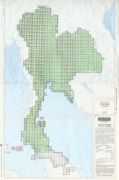
a ChiangMai, dans une grande librairie du centre ( Suriwongse book) , on trouvait de bonnes cartes au 1:20 000 bilingues de chez PNMAP entre autreset on peut acheter aussi au detail les cartes au 1:50K 1:20K 1:10K mais qui sont uniquement en thai - ensuite il faut au cas par cas regarder la date d'édition / impression
sinon les commander
on trouve aussi quasiment toutes les cartes au 1:50K sur le net
par ex
legacy.lib.utexas.edu/maps/ams/thailand/
PS je suis de la génération des cartes papier et cartographe / topographe de formation
On eu le siècle des Lumières,
puis un con a dû éteindre
a ChiangMai, dans une grande librairie du centre ( Suriwongse book) , on trouvait de bonnes cartes au 1:20 000 bilingues de chez PNMAP entre autreset on peut acheter aussi au detail les cartes au 1:50K 1:20K 1:10K mais qui sont uniquement en thai - ensuite il faut au cas par cas regarder la date d'édition / impression
sinon les commander
on trouve aussi quasiment toutes les cartes au 1:50K sur le net
par ex
legacy.lib.utexas.edu/maps/ams/thailand/
PS je suis de la génération des cartes papier et cartographe / topographe de formation
Bonjour Jungle,
rien d'utilisable dans les cartes du lien fourni;
les cartes qu'ils ont et vendent ? datent toutes de 1959 ; il y a donc 60 ans !!
Ça ressemble à des cartes d'Etat Major en beaucoup moins détaillées que celles qu'on trouve à Hanoï au Vietnam qui , elles, sont plus jeunes, établies lors de la guerre contre le Vietnam par les forces armées américaines .
Comment la maison Michelin a-t-elle pu faire ses cartes " jaunes " au 1/200.000* alors qu'elle ne disposait d'aucun satellite ; toutes faites grâce à des photos prises d'avion à basse altitude ?
On y voit tout, jusqu'au moindre hameau, la moindre piste à peine carrossable ..
Les cartes thailandaises PN Maps sont nulles à chier à côté de ces cartes jaunes ;
J'utilise un peu et de moins en moins celle de Udon Thani sur laquelle j'ai une petite partie de ma province Sakon Nakhon.
Carte au 1/220.000 ( 1 cm = 2,2 km ) il manque beaucoup trop de routes ;
la numérotation des routes secondaires est folklorique quand elle existe ...
Beaucoup trop de bleds sont mal placés ; le mien, par ex, n'est pas du tout au bon endroit .
Sur la route 2280 entre Sawang Daen Din et la route 223 ( Phangkhon à Beung Khan ) ;
il y a une sous préfecture qui s'appelle Charoen Sin, elle est placée sur la carte à facile 3 km de son emplacement exact ...!!
Aucune carte papier thaïlandaise ne vaut le coup ( ni son coût d'ailleurs );
Il y a aussi les Thinknet à 1/550.000* ;
alors là, c'est le pompon...Y a quasi que dalle dessus si on veut rouler sur des routes secondaires;
la plupart sont inexistantes et quand elles existent elles ne sont pas numérotées..
Ça aide pas ..🤪
J'ai quelques PN Maps dont la " Central - East - West "
il y a donc Bangkok dessus ;
par contre la charmante bourgade 😛 de Pattaya qui compte environ 1 million d'habitants n'existe pas sur cette carte..
Ils ont un accord avec le Croutard, c'est pas possible autrement !😠
ça sert à quoi ce machin dont on arrivait à se passer tranquillos il y a encore quelques années ?
On dirait vraiment que de plus en plus de personnes aiment que Google and Co sachent où vous vous trouvez au centimètre près ...🤪
Quand je pars sur les routes ou les chemins creux de Thailande , c'est quasi les mains dans les poches; encore qu'elles sont plus sur le guidon de mon VTT que dans mes poches ..
Pourvu qu'on ne m' embête pas ..
Quand je roule en pickup, le téléphone est éteint .
ça sert à quoi ce machin dont on arrivait à se passer tranquillos il y a encore quelques années ?
On dirait vraiment que de plus en plus de personnes aiment que Google and Co sachent où vous vous trouvez au centimètre près ...🤪
Quand je pars sur les routes ou les chemins creux de Thailande , c'est quasi les mains dans les poches; encore qu'elles sont plus sur le guidon de mon VTT que dans mes poches ..
Pourvu qu'on ne m' embête pas ..
Quand je roule en pickup, le téléphone est éteint .
Il y a quelques années il n'y avait pas internet et pourtant vous êtes omni présent sur le forum.
Il faut savoir vivre avec les outils performants du moment.
Facile de comprendre qu'un GPS permet de rejoindre un point B avec différentes options suivant ses paramètres personnels .
Et de revenir à son point de depart facilement (son hotel par ex)
De pouvoir voir le relief dans le détail, les possibilités sont sans fin.
Bjr
je n'ai aucun besoin de geolocalisation (et de toute la pub qui va avec)
meme si je sais parfaitement utiliser ces outils
mais je comprend tres bien que la génération ''telephone portable'' ne puisse s'imaginer que c'est possible de faire sans !
comme mentionné je suis cartographe géometre de formation !
, j'ai appris a dessiner des cartes a la plume, à l'encre de Chine , au pinceau et au tire-ligne
et ce donc, bien avant la naissance d'Internet et des imprimantes laser
On eu le siècle des Lumières,
puis un con a dû éteindre
En plus de toutes les infos données plus haut
, la fabuleuse carte de Nancy Chandler, mais qui va bientôt cesser d’être éditée.
On la trouve aussi dans certaines librairies de Chiang Mai, de bonne carte aussi tout simplement à l'office du Tourisme: 105/1, Chiang Mai - Lamphun Road
Dans les librairies et sur amazon
www.amazon.fr/...ish-books&sr=1-1
Son plus gros défaut est de ne pas savoir trouver un point de destination à partir d'une adresse postale.
Oui je suis d'accord : Avec Maps.me, il faut mieux juste taper un nom de rue, ou sur un repère quelconque (hotel, banque, gare, bâtiments, café... ) , et oublier le numéro de la maison dans la rue. Parfois en France, Maps.me accepte une adresse postale avec numéro (sur Paris par exemple), mais c'est plutôt rare Oui il y a encore des choses à améliorer. 😉
Dans ce cas Google Maps ou Here sont de parfaites alternatives. En faveur de Here pour ma part.
Merci pour ce tuyau à propos de Here. Je l'ai téléchargé pour comparer, oui c'est pas mal.
Par contre les cartes sont plus volumineuses que Maps.me... 994Mo pour la Thaïlande ! 😐
Entièrement d'accord avec avec toi; La géolocalisation en temps réel est un PLUS ! 🙂 Et ce n'est pas que le seul avantage... 😉
Toutes les cartes du monde gratuites et détaillées, des mises à jour régulières,
Partage de position, ...
Bonne journée
“Twenty years from now you will be more disappointed by the things that you didn’t do than by the ones you did do. So throw off the bowlines. Sail away from the safe harbour. Catch the trade winds in your sails. Explore. Dream. Discover.” (M. Twain)
Précédemment (en page 1) j'ai parlé du « partage de position » une fonction que je trouve super pratique pour indiquer précisément un lieu de rendez-vous ou pour partager une bonne adresse ... Mais voilà la manière la plus pratique de partager sa position est par SMS (via un opérateur téléphonie thai), et j'ai lu que vous ne vouliez pas de téléphone.
« (nous n'achetons pas de forfait pour téléphone/internet, en voyage on aime être un peu coupés du monde) »
Nous sommes aussi un couple et dès que l'avion quitte la France, on retire notre SIM française qu'on ne remettra qu'à notre retour. Mais en Thaïlande, c'est quand même pratique de pouvoir se joindre entre nous deux et de pouvoir appeler en Thaïlande (hôtel, taxi...) avec SIM Thai. Par exemple : Dans les rues de Thaïlande, mon épouse allait me rejoindre dans un café, elle eut un accident et s'est retrouvée à l’hôpital... Heureusement l'accident était plus impressionnant que grave, heureusement qu'elle put me prévenir de l’hôpital cela simplifia bien des choses !!! et j'aurais aussi vraiment stressé sans savoir ce qui s’était passé, ni où elle était... 🤪 🙁 🙁
Ou encore à la gare de Bang Saphan si on veut une voiture comme taxi et pas une moto, il faut mieux utiliser son téléphone... (il n'y a que des motos taxis qui attendent à la gare).
Même si on veut tout faire à deux, il y a toujours des nécessités qu' il est plus logique de faire séparément pour gagner du temps...
Je voulais juste vous signaler qu'il existe plusieurs formules bon marché (50thb la SIM, + 200 à 300thb un package pour le 1er mois) qui privilégient les appels en Thaïlande (avec très peu d'internet) ce qui permet de s'appeler entre nous en Thaïlande tout en étant complètement coupé de la France et du monde si on veut 😉 ) .
Par exemple choisir/regarder sur:
www.dtac.co.th/en/prepaid/
www.ais.co.th/...ddon/en/nonstop.html
truemoveh.truecorp.co.th/package/prepaid.
Bon Voyage au PDS 🙂
Je ne recommande pas d'acheter sa SIM thaï et son package à l'aéroport, sauf si la formule touriste convient (genre 700thb pour 15 jours avec beaucoup de données mobiles, ou ….).
D'une manière générale, je recommande plutôt les boutiques spécialisées de chaque opérateur téléphonique (True, AIS, Dtac …) d'une grande ville car on a plus de choix pour son « package ». Par exemple, nous avons préféré une formule qui privilégiait les appels téléphoniques en Thaïlande et entre nous, au détriment des données mobiles, donnant un mois de validité à notre numéro thaï pour 200thb. Et à chaque ajout de 10 ou 20thb de crédit sur notre numéro thaïlandais, la validité de la carte SIM est prolongée d'un mois. On peut ajouter du crédit dans les 7/11 ou grâce aux automates en libre service ou encore aux boutiques des opérateurs...
Je recommande de repérer à l'avance dans la brochure de l'opérateur un package (1mois 200thb) Package, car souvent les vendeur veulent vendre la SIM « Spécial touristes » (699thb pour 15jours avec SIM) (Mais c'est la même chose en France, où certaines boutiques de téléphonie vous orientent avec un baratin mensonger que vers les formules qu'ils veulent vendre... )
“Twenty years from now you will be more disappointed by the things that you didn’t do than by the ones you did do. So throw off the bowlines. Sail away from the safe harbour. Catch the trade winds in your sails. Explore. Dream. Discover.” (M. Twain)
Je salue bien bas le cartographe, et je t'envoie toute ma considération. 🙂 Durant toutes ces années de voyages à travers l'ASE, les cartes ont été mes amies, et j'aimais voir précisément sur la carte, où j'étais, où je me rendais, la route que j'allais emprunter... 😉
Moi non plus je ne comprenais pas tous ces voyageurs qui trouvaient leur chemin avec leur portable. 😮 Et puis il y a trois ans, alors qu'on galérait la nuit sous la pluie à retrouver notre hôtel 😕 (c'est fou ce qu'une même rue peut paraître différente la nuit... ), dans un café une sympathique voyageuse nous a renseigné avec Maps.me et cela a révolutionné tous nos déplacements. 🙂 🙂
Plus besoin de repères visuels pour se positionner sur la carte, mais géolocalisation en temps réel, plus de « Zut !c'est en dehors de la carte papier », avec Maps.me on a les cartes détaillées de TOUTE la Thaïlande sur son portable. On rencontre un voyageur qui vous parle d'un lieu super d' une autre ville, ou d'un temple à la campagne ou de telle plage secrète d'une île peu connue, on ouvre Maps.me et on peut voir précisément l'emplacement de ce tuyau même dans un coin peu fréquenté de Thaïlande. (y). Et si un voyageur sympathique, vous invite dans sa maison en Grèce (ou ailleurs...) on télécharge gratuitement en quelques secondes la carte du pays grâce au wifi du café, et on peut voir précisément où il habite sur son portable, les lieux dont il vous parle, les ferrys pour y aller...
Mais chacun son point de vue, chacun ses préférences... 😉
Bonne journée Jungle Troll.
Il n'y a pas de publicités liées à l’utilisation du GPS avec Maps.me. Et quasiment pas de publicité sur Maps.me, peut être 1 fois sur 10 ouvertures ou encore moins, car c'est un logiciel basé sur OpenStreetMap un projet cartographique collaboratif libre (ou open source) gratuit et mondial, « libre » comme wikipédia, Libreoffice, Openoffice, … (Libre ou Open source ont des définitions différentes, que les spécialistes me pardonnent cette confusion 😉 )
“Twenty years from now you will be more disappointed by the things that you didn’t do than by the ones you did do. So throw off the bowlines. Sail away from the safe harbour. Catch the trade winds in your sails. Explore. Dream. Discover.” (M. Twain)
Je vais 3 semaines en thailande et je voudrais savoir si il est possible d'acheter une carte sim et des cartes 12 call a seven eleven, quand je suis allé a…
Je serais a kho samui du 23 fevrier au 8 mars 2008 je part avec la thai et bangkok air pour l ile 3 heures de transfer es que je peut trouver une carte sim…
Boujour je doit acheter un billet d'avion pour un départ le 30 de ce mois ca urge oui...j'ai pas de cb a mon nom (perdu il y a 3 j) je veux faire vite car il…
Voila notre histoire... Jeune couple ardechoix, nous sommes partis faire le tour du monde depuis maintenant trois ans. Notre but, pas davions... nous faisons…
Hi fellow travelers,
First trip to Vietnam.
We’ll be arriving in Ho Chi Minh City during Tet.
Is it complicated to find accommodation and get around during this period?
Any tips would be welcome.
Thanks for your replies.
Hi, is anyone there in Flores right now? According to some websites, everything is closed and the situation is tough. But our guide says it's fine. Who should we believe? We're supposed to leave on September 2nd. Thanks to anyone in Flores at the moment!
Hi everyone.
I’m planning my trip, and based on all the posts I’ve read, this country is amazing.
Of course, I’ve got a ton of questions for you.
Here’s a possible itinerary: Vientiane - Vang Vieng - Phonsavan - Sam Neua - Nong Khiaw + villages - Phongsali - Luang Namtha and the area - Udomxai - Huay Xai - Luang Prabang and back to Vientiane.
What do you think?
We’re planning to prioritize local transport—is it possible to do this loop?
We’d also love to go kayaking, but I’m not sure if the season’s right or where the best spot is.
For trekking—I read that Phongsali is the most authentic spot to visit villages and see wildlife. Do you know of a reliable agency and a guesthouse with reasonable prices?
Is it worth taking a slow boat for a stretch on the Mekong, and if so, which route?
For accommodations, is it better to book through Booking.com and Agoda or look when we arrive?
Are mosquitoes bad in Laos, and should we take malaria prophylaxis?
What’s the average daily budget (accommodation, food, visits)?
Is renting scooters a good option for exploring towns, and if so, which ones?
From what I’ve read, it’s best to carry cash—euros or dollars? Is it risky to walk around with that much cash?
I’ve still got tons of questions. Thanks to anyone who can help, and I’m open to all tips, info, etc.
Thanks again
Hi there,
I’m planning a trip to Vietnam in February, specifically Da Nang and Hoi An.
Does anyone know a French-speaking guide in the area?
Thanks for your help
Hi there,
I’m planning a family trip (my wife and I, both 47, and our two sons, aged 5 and 12) to Malaysia for the last week of June and the first two weeks of July 2027.
We used to love road trips as a couple, then as a trio, but since our second child arrived, we’ve taken a break with "camping village" style trips.
Now feels like the right time to get back to our old habits, while adjusting the pace for the kids.
We’re craving Asia. We’ve been lucky enough to visit Thailand, Indonesia (Bali and Lombok), and Sri Lanka before.
Friends have raved about Malaysia, so we’re definitely tempted.
For those who know and love Malaysia, what would be a good itinerary starting from Kuala Lumpur, with a maximum of 3-4 stops? We’d like a mix of culture, nature, and relaxation (just to clarify, we’re not big beach fans). All of this without rushing, of course.
Hello,
We’re a family of four with two teens aged 16 and 18. We’re heading to Thailand this summer. We’ll arrive in Bangkok and plan to take a flight to Luang Prabang.
I’ve seen there are some great visits and excursions to do (temples, markets, waterfalls) and maybe even venture a bit north to places like Nong Khiaw, Muang Xay, Muang Ngoy, or Oudom Xay.
But I’ve also heard about the Bokeo region with the Gibbon Experience.
Since we won’t be able to do everything, I’d love to hear about your experiences, impressions, and advice on the two options I’m considering, especially since we’ll be meeting family in Chiang Mai, Thailand, afterward.
Option 1: A loop from Luang Prabang heading slightly north, then a flight from Luang Prabang to Chiang Mai.
Option 2: A few days in Luang Prabang, exploring within a few dozen kilometers around, then heading to Bokeo province for the 2-day/1-night Gibbon Experience. For this option, I saw on Rome2Rio that it’s possible to book a ferry trip on the Mekong from Luang Prabang to Huay Xay—they mention about 8 hours. But is that realistic? What type of boat is it?
Then, to get to Chiang Mai, there aren’t many options—bus or minivan—but how does crossing the border work?
Finally, for those of you who’ve been to Laos in August, what was the weather like?
We’ve already visited Thailand, Vietnam, and Cambodia during the same period over the past four years and weren’t really bothered by bad weather.
I’m starting a discussion about guides in the Mekong Delta because we’ve just finished our trip in this region and had a hard time finding a French-speaking guide. We had Thanh—she speaks French really well and travels all over the delta region, including Ho Chi Minh City. She’s super friendly and flexible. I recommend her wholeheartedly. If it can help someone...
Feel free to contact us for her number.
Hi everyone,
I couldn’t find any recent info on Kuching.
Can anyone recommend a hotel or guesthouse for under 100 RM that’s nice and affordable? No dorms, please.
Also, does it rain a lot in November, and is it still worth visiting Semenggoh or Bako?
We’ll be arriving in Phnom Penh this coming January and we’re thinking of starting our trip with a stop in Kampong Cham, then Kratie.
After Kratie, we’re considering heading toward Siem Reap with a stop in Kampong Thom.
That said, I’m not really sure how long the Kratie–Kampong Thom journey might take or how complicated it is.
Does this stop on the way to Siem Reap seem like a good idea to you?
If we don’t visit the Sambor Prei Kuk site, are there still any walks or sights worth checking out in Kampong Thom?
Silly question—backpack or hard-shell suitcase for the Sepilok, Kinabatangan, Tioman, KL trip?
I’m struggling to fit all my son’s and my stuff into the 70L backpack... and I’m thinking a suitcase would be easier, but I’m not sure if it’ll work for getting around.
Hi there,
I didn’t plan to return to Thailand this year, but my health conditions mean it’ll be the best place for me to stay between two trips to India. The tourism setup there is so well-organized that it’s the most "comfortable" country for a short visit. Thailand feels too sanitized for my taste, and there’s too much religion, Buddha, and the King, but it’s still the best option given how my health has been evolving. I’d considered two weeks in ThaTon for hiking, but I got too sick from the burn-offs during my trips to the mountains around Chiang Rai. So I’m not sure where to go this year. Definitely not the sea, touristy spots, or the mountains with burn-offs...
After a stay on Koh Phayam this coming November, I’d like to spend 2 or 3 days on Koh Phra Thong before heading further south.
Do you think it’s doable to leave Koh Phayam early enough to catch the 10 AM boat from Khura Buri to Koh Phra Thong? The next one isn’t until 4 PM, which would cost me a whole day.
I’m planning a trip to Indonesia, specifically Sulawesi and Java, in September for 10 days.
I don’t know this part of the world at all—any advice is welcome!
I’ll be traveling solo and would also love tips on meeting other travelers or locals.
Hello everyone,
Not long ago, I used to travel as a couple, but my husband has since passed away, and I’ve decided to set off again. The trip I took to Cambodia in January 2025 did me a world of good.
I’m now considering Thailand, a destination we never included in our plans because even 15 years ago, people said it was too touristy. Still, I’m thinking about the itinerary below, but I don’t feel up to arranging buses, trains, or guides on my own while I’m there. I’m looking for one or more drivers and have been in touch with an agency, but their offers are just copy-paste group tours that I don’t want.
So, if you have any contacts, experiences, or advice, I’d be so grateful if you’d share them with me. Here’s my rough plan:
Arrival in Bangkok
Ayutthaya (2 nights)
Kanchanaburi (2 or 3 nights)
Sangkhlaburi/Sai Yok (3 nights)
Sukhothai (2 nights)
Lampang (I’ve planned 3 nights, but that might be a bit much—it depends on what time I arrive in the city)
Chiang Mai
Chiang Dao
Pai
Chiang Rai
I was thinking about the Mae Hong Son loop—thoughts?
What do you think about staying overnight at the Golden Triangle?
When I look online, of course, I can find agencies that organize tours to national parks, etc.
I’m retired but in great physical shape. I’d rather go hiking than sit in hot springs with crowds of tourists who’ve all arranged meet-ups. I don’t want to spend a day at an elephant camp, and I don’t want to visit Karen villages.
I’d love to hear your advice.
Thank you all,
Hi,
On September 1st, we're heading to Kalimantan for six weeks, probably from Pontianak to the Derawan Islands.
I've scoured this site, which is usually my go-to 😉, and others like VoyageForum, but recent info is pretty scarce.
I'd love any tips on places you've visited—our itinerary is still a work in progress.
We're two couples traveling with backpacks, using buses, boats, guesthouses, and homestays.
Thanks in advance!
Hi everyone,
Could you share your thoughts on my 3-week itinerary?
We’re a small group (family + friends) of 12 people, planning to leave around January 21, 2027.
Here’s my itinerary:
3 nights in Bangkok
4 nights in Chiang Mai
3 nights on Koh Samui
3 nights on Koh Phangan
4 nights in Krabi
4 nights in Phuket
I’m also open to any great tips you might have...
Thanks, everyone! Alain.
Hi,
From Malacca to get to Jerantut, is it better to go back to KL and take a bus from there, or take a bus to Tampin and then a train? Any feedback on the "Jungle Train"? (duration, price, comfort, etc.). Thanks
Hi there,
We’re planning a 3-week family trip next summer with our three kids, who’ll be 8, 8, and 7 years old.
After some research, we’re leaning toward Malaysia to combine nature/forests and paradise beaches. The idea is to introduce our kids to the country’s culture, nature, and wildlife.
We want a great trip but without splurging on luxury options like high-end lodges and resorts. We’re looking for comfort with a touch of authenticity—basically, a good middle ground.
I’ve started putting together an itinerary and would love your expert advice and tips to help us build this amazing trip with our little ones.
Day 1: Departure from France
Day 2: Kuala Lumpur
Stay at a hotel near the airport or KL Sentral.
Just one night.
Day 3: Morning flight to Sandakan (Borneo).
Stay in Sepilok
Day 4: Sepilok:
* Orangutan Center
* Malayan Sun Bear Center
* Rainforest Discovery Centre
Day 5: Depart for Kinabatangan.
Boat safari in the late afternoon.
Day 6: Sunrise safari.
Jungle walk.
Evening safari.
Day 7: Final safari.
Return to Sandakan.
Flight to Kuala Lumpur, then to Kota Bharu (or overnight transit depending on schedules).
Day 8: Transfer to the port.
Boat to the Perhentian Islands.
Days 9 to 13: Perhentian Besar
5 full days.
* Snorkeling
* Hiking
* Turtle watching
* Wild beaches
* Relaxation
Day 14: Return to the mainland.
Bus or private car to Taman Negara.
Hi everyone,
We’re heading to Flores and then Bali at the end of September.
We’ve already visited both but this time, once we’re in Labuan Bajo, we’d like to take a boat to the Komodo Islands to see the famous Komodo dragons.
I don’t want to sleep on the boat—just a day trip would be perfect.
Does anyone know a reliable and friendly provider to recommend?
Thanks in advance, and have a great summer!
Summer seems to be the best time weather-wise for Bali.
And since summer’s when we can take a long trip, let’s go for Bali... even though we know it’ll be *packed* with people!
So we’ll steer clear of the island’s south...
Our current plan (19 days on the ground, 7 stops):
- 4 Nights (3 days) in Ubud
2 days for rice terraces / activities (Tegallalang, Campuhan Ridge, Monkey Forest, Bird Park, coffee plantation, market (?), dance "pestacle," cooking class and/or spa)
1 day with a driver for the Temples (Pura Gunung Kawi, Tirta Empul Spring, Pura Mengening, Goa Gajah...)
- 2 nights in Sidemen (1 day for Pura Kehen + Batur Caldera + Pura Besakih and 1 day to relax in the rice terraces)
- 3 nights on Gili Meno (Rest and beaches) from Padangbai
- 2 nights in Amed (1 day from Padangbai with the Abang rice terrace and Tirta Gangga baths, and the next day a boat tour in Amed)
- 4 nights in Pemuteran (1 day for transfer and rest, 1 day to visit Kawah Ijen, and 2 days of snorkeling at Menjangan Island)
- 2 nights in Munduk (1 day with the Dayang rice terrace and the 3-waterfall hike, 1 day at Pura Ulun Danu Bratan)
- 2 nights in Jatiluwih (1 day in the rice terraces, and on the last day, we’ll stop by Pura Taman Ayun in Mengwi and Pura Tanah Lot before catching our red-eye flight).
Accommodations in homestays or hotels.
Transportation to be arranged on-site with the lodgings (?)
Boat to Gili Meno to book in advance (?)
Kawah Ijen excursion to plan ahead (?)—check with the homestay (?)
Thanks for your thoughts/comments to help us explore this destination...
After reading and researching, we're planning the following stops in Cambodia in January 2027:
- Phnom Penh
- Kampong Cham
- Kratie
- Siem Reap
- Battambang
- Kampot (round trip)
I'm wondering about the direction of these stops, which could also influence our international flights.
Either a round trip from Phnom Penh in the order above.
Or landing in Siem Reap with the following order:
This second option would save us the Battambang - PP - Kampot trip but means doing a round trip to Battambang from Siem Reap and placing the "highlight of the trip" (Angkor) at the beginning of our stay.
We’ll be arriving in Phnom Penh this coming January and we’re thinking of starting our trip with a stop in Kampong Cham, then Kratie.
After Kratie, we’re considering heading toward Siem Reap with a stop in Kampong Thom.
However, I’m not quite sure how long the Kratie–Kampong Thom journey might take or how complicated it is.
Does this stop on the way to Siem Reap seem like a good idea to you?
If we don’t visit the Sambor Prei Kuk site, are there still some walks and/or things to see in Kampong Thom?
Hi there,
We’re planning to travel from Chiang Rai to Luang Prabang next November.
We’d like to take a slow boat from Chiang Khong—or rather from Huay Xai in Laos—with an overnight stop in Pakbeng.
Could you let us know if the boat still leaves Huay Xai in the late morning? If so, what time roughly, and what’s the price for the trip?
Thanks for your help!
Alod
We (3 adults: 68, 65, and 25 years old) are just back from a short trip to the Philippines, and I’d like to share a little summary of our journey. First of all, I’d like to thank everyone who contributes to this forum about this destination and answers the questions of those who aren’t familiar with it. I should also mention that my comments are personal and don’t reflect anyone else’s opinions. Since I don’t have any literary or photographic talent, I’ll stick to the facts and share a few details about the sights, hotels, and restaurants.
Preparations:
We chose this destination in December and quickly booked our flight tickets (540 € with Turkish Airlines) for a departure on February 16 and return on March 5, 2019. We then contacted two French-speaking tour operators based in Manila, asking them to put together an itinerary based on our wishes (places to visit, type of accommodation) and our budget. We wanted to see the rice terraces in northern Luzon, the hanging coffins in Sagada, before flying to the Visayas (Bohol, Siquijor, etc.), and the Taal Volcano, while limiting our nights in Manila as much as possible. In the end, we opted for Alize, whose itinerary and quote matched our request almost perfectly. Our exchanges helped us refine our circuit.
International flights:
The round-trip flights went smoothly. Turkish Airlines, while not at the level of Asian or Gulf airlines, does the job just fine.
Day 1:
We landed on time (6:15 PM) on Monday, February 16, at Terminal 3. We exchanged our euros (near the car rental counters), and I can confirm the exchange rate was very good. On the way to the St. Giles Hotel (decent and affordable for a transit night), we got our first glimpse of Manila’s dense traffic. The Makati district, where our hotel was located, offers a wide choice of restaurants, so we grabbed a quick bite to recover from the trip.
Day 2:
This day was dedicated to transferring to Banaue. Fortunately, we had a comfortable van and an excellent driver for this journey, which took all day (8 to 9 hours with stops). We got a taste of driving in the Philippines—and it’s terrifying. You wouldn’t want to drive on these roads. The first thing that struck us was the relatively good condition of the roads and the cleanliness (a change from other Southeast Asian countries). This impression lasted throughout our trip. Around 6 PM, we checked into our room at the Banaue Hotel (large, charm-free, but with a beautiful view of the rice terraces).
Day 3:
With the help of a local guide, we took a jeepney to Batad. And then—wow! The rice terraces form an amphitheater overlooking the small village. Under the sun, it’s simply spectacular and breathtaking! Even though we’re familiar with rice terraces (Sapa, Bali, Thailand, etc.), we were dazzled by so much beauty. We spent the day walking along the terrace walls. This place is timeless and fully deserves its UNESCO World Heritage status. However, we returned to the hotel exhausted (due to our ages and lack of exercise). We had dinner with our driver at the Las Vegas restaurant in the center of Banaue. The meal was decent, cheap, and the Filipino owner played the guitar to accompany our dinner.
Day 4:
Today, our driver took us to Sagada. The mountain road offered spectacular landscapes (about 1.5 to 2 hours). Along the way, we stopped in Bontoc to visit the small but interesting anthropological museum. It features old photos and various objects from the Ifugao tribes, as well as a reconstruction of primitive dwellings.
We then went on a short hike in Sagada with a very friendly local guide who explained the region’s funeral rites. The walk started at the communal cemetery before reaching “Echo Valley,” where we saw the first coffins hanging on the cliff. We continued to the “Underground River” and a small waterfall, ending our journey in the “Lumiang Cave” burial cave. All in all, this day was very interesting. On the way back, we made a few photo stops.
In the evening, on our driver’s recommendation, we ate at the “Bistro,” a French enclave in the center of Banaue (good pizza, roasted quail, homemade fries).
Day 5:
Today was a transfer day. To limit fatigue and nights in Manila, our tour operator arranged a flight from Clark to Tagbilaran (Bohol), saving us 2 to 3 hours of driving. But to catch our flight, we had to leave very early: 5:30 AM. Our kind driver dropped us off on time at the airport. To use it, we had to pay a 150 PHP tax per person. The Philippine Airlines flight (15 minutes) left early and was far from full. Upon arrival, we were taken to the Loboc River Hotel, on the banks of the river of the same name. A very charming lodge lost in a tropical garden. We stayed in a stilt cottage overlooking the river. We relaxed a bit in the lovely pool. This place is really great—the staff is charming, and the food is excellent for a reasonable price.
Day 6:
This day was dedicated to exploring Bohol. The program was classic, starting with the tarsier sanctuary. We saw a few specimens in a small garden, each pointed out by a staff member. It was both good and disappointing because the animals were in pseudo-freedom in a small enclosure. Then we went to the “Chocolate Hills” and climbed 240 steps to admire the panoramic view of the hills—but by 10 AM, it was crowded. On the way back, we stopped at the butterfly garden, which was uninteresting: tiny, with few butterflies. We consoled ourselves by photographing beautiful flowers. To please our teen, we stopped at the Loboc Eco Tourism Adventure Park and crossed the river lying down, suspended from a steel cable (300 PHP). Finally, we had the traditional lunch-cruise on the Loboc River. It was a factory-like experience, and the meal was unremarkable. The only good thing was the singer on each boat and the lush vegetation. Afterward, we visited colonial churches and the cathedral, remnants of the Spanish presence, before returning to the hotel for a well-deserved dip in the pool. Note that for those interested, there’s an arena near the hotel where cockfights are held every Sunday—something Filipinos are passionate (if not obsessed) about.
Day 8:
Very early departure for the port. We boarded a *banca* in search of dolphins. After about an hour of sailing, we were lucky enough to spot around a hundred dolphins. Our boat then headed to the small and charming island of Pamilacan. After a walk through the little village, we came across locals traditionally building a boat. They told us it takes about a month to finish their outrigger boat. Then we had to choose our snorkeling spot between the coral garden, the fish park, and the turtle enclosure. Note that a fee is charged for each spot: 150 PHP per place and per person. It felt a bit like we were being ripped off, especially since the spots weren’t amazing—we’d see much better on Apo for much less. We had lunch on the island at one of the many small eateries (350 PHP per person).
Days 9 and 10:
On our return, we were taken to the Bohol Sea Resort on Panglao Island, where we stayed for 2 nights. It’s a small, recent establishment in a quiet corner of the island. It’s relaxing—maybe a bit too much. It has a nice pool and access to Danao Beach, but the view is blocked by a flotilla of boats. We didn’t try their diving school. The meals were good. If we had to do it again, we’d skip this stop to spend more time in Negros.
Days 11 and 12:
We took a fast ferry (Ocean Jet) from Tagbilaran port to Dumaguete and were taken to the Thalatta Resort, about 20 km away near Zamboanguita. We stayed there for 2 nights. Let’s just say it was our favorite. It’s a small place facing Apo Island. The rooms are simple, and the pool, nestled in a magnificent tropical garden, is fantastic. The staff is friendly, and the meals are very good. The hotel has its own diving center (snorkeling gear provided) and its own boats. We booked the Apo Island excursion: 1,350 PHP per person, including lunch. It was incredible: magnificent corals, colorful fish, and turtles of all sizes. The crew was endlessly kind and didn’t hesitate to dive to guide us to the best spots. In short, a perfect day. This site is ranked among the top 5 diving spots in the Philippines.
Since we were lucky enough to be there on a Wednesday morning, we explored the surprising Malapay Market, a 10-minute walk from our hotel. You’ll find numerous stalls selling vegetables, fruits, live or dried fish, and handicrafts. Enclosures are set up for selling livestock (calves, zebu, pigs). There are also restaurants. We were lucky to see two pigs roasted traditionally on a spit. There are few Europeans, and the people are warm. A great moment.
We left this beautiful place with regret because we didn’t have time to visit the island or go swimming with whale sharks.
Days 12 to 15:
From Dumaguete port, we took a short crossing (1 hour with Ocean Jet) to Siquijor Island to reach the Coco Grove Beach Resort. A beautiful hotel nestled in a spacious tropical garden. Several restaurants and bars, 4 pools. Despite the size of the place, it remains intimate. You can snorkel (corals and fish) right in front of the beautiful beach. We stayed in a very pleasant duplex suite. For those interested, there’s a spa and a diving center. You can also take the Apo Island excursion (offered at 1,950 PHP).
We spent our days relaxing between the pool and the beach. In the evening, the sunsets over Negros and Apo were stunning.
We booked an island tour with a comfortable tricycle from the hotel (1,500 PHP). The circuit was classic and allowed us to go around the island. We discovered beaches, the famous 400-year-old ficus tree with its enormous roots, and its equally famous foot bath with its cleaning fish. Then we visited the St. Isidore Convent before heading to the Cambugahay waterfalls and their four pools. The setting is idyllic, and the water is surprisingly good—we had a lot of fun swimming. We had dinner at a restaurant overlooking the island, where you can see Apo, Cebu, and Negros. In the end, Siquijor turned out to be a real little tropical paradise.
Since the hotel restaurants were expensive, we dined at nearby establishments: Fuego (clean, good—excellent raw fish—and quiet), Chekesch (louder), and the very pleasant Baha Bar, which brews its own beer and offers more refined cuisine.
Days 15 to 16:
We left at dawn to return to Dumaguete and its airport by ferry. We had breakfast at the Coco Grande Hotel, an annex of the previous one. The Philippine Airlines flight went smoothly. A driver took us to the town of Taal. We stayed at Paradores Del Castillo, right in the heart of the old town. It’s a charming old house with only 6 rooms. The various rooms are decorated with antiques—a real little museum. The garden is pleasant and opens onto the town.
It’s an old early 19th-century house converted into a hotel, beautifully arranged with 6 rooms in the heart of the city. The restaurant in the garden is very pleasant and offers a panoramic view.
We visited an old Spanish house before heading to the beautiful Basilica of St. Martin of Tours, one of the most beautiful religious buildings in the Philippines. A mass was in progress, allowing us to gauge the Filipinos’ fervor before we could visit. When we left, it was dark, and we could admire the illuminated building. We ended our evening by exploring the night market with its many fruit and skewer stalls. A nice surprise.
In the morning, we were taken to the shores of Taal Lake, an ancient caldera where a second volcano has formed in the middle of the lake, which in turn contains another lake. We boarded a *banca* to reach the island in the middle of the lake. This was followed by an uphill walk, made difficult by the high temperature (36°C) and the dust on the path. The dust was worsened by the many horses carrying (or bringing back) the less courageous. To illustrate the difficulty of the climb, the trail is marked by the Stations of the Cross and its 14 stations. We were panting while our guide trotted far ahead. Our effort was rewarded when we reached the summit and its viewpoints over the inner lake and the surroundings. The wisps of smoke seen here and there confirmed we were on an active volcano. Inside the lake, there are supposedly 45 small volcanoes, one of which emerged during its last eruption in 1911.
On the way back, we had lunch by the lake before returning to Manila and the Bayleaf Hotel, whose main merit is its location in the Intramuros district. In the late afternoon, we walked along the walls of the old city.
We had dinner on the hotel’s panoramic terrace overlooking the city and the bay.
Day 17:
Last day! Our tour operator joined us for a tour of the Intramuros district. He enriched the visit with comments on the history, geopolitics, and economy of the Philippines. We visited the Manila Cathedral, destroyed 7 times in the past (6 earthquakes and the 1945 bombing). It’s beautiful, and its stained glass is magnificent. We couldn’t enter the San Agustin Church, the oldest Catholic building in Manila. We passed by the memorial to the Battle of Manila, which claimed over 100,000 lives. We visited the area around Casa Manila, which was closed on Monday, and had a drink at Barbara’s cabaret, located in a historic house. A very enriching morning.
Then we went to the Mall of Asia, the world’s largest shopping mall, to buy some souvenirs (Kultura store) before being taken to the airport. We exchanged our last pesos at the buying rate right after check-in.
The return flight went smoothly. We regretted not being able to use the facilities of Istanbul’s new airport, as its opening was delayed by another month.
Finances:
In the end, we spent 1,640 € for the international flights, 4,200 € for the stay (hotels, visits, various transports) with the agency (whose professionalism we can only praise), and about 700 € for meals, tips, and souvenirs.
Summary:
Luckily, we had beautiful weather throughout our stay, with temperatures between 26 and 35°C. Discovering the Philippines was a wonderful experience. The diversity of the landscapes, the kindness of the Filipinos, the cleanliness, and the truly delicious fruits (especially pineapples and mangoes). We were never harassed, unlike in many touristy countries. On the other hand, the food, though generally cheap, wasn’t exceptional.
Since this country is so vast, we might return in the near future.
Though I’m not a specialist on this destination, I’m happy to answer your questions based on my experience.
So, my flight tickets have just been booked for a trip to Cambodia from November 4th to 27th, 2025.
I’ll be traveling solo and want to explore this amazing country while getting a bit off the beaten path.
I’m arriving in Phnom Penh and also departing from Phnom Penh.
My goal is to travel as much as possible by bus and scooter.
What itinerary would you recommend?
What are the must-do things?
I’m open to all tips and info.
Thanks in advance for your help and responses.
We got back enchanted from a 6-week trip to Cambodia!
Our itinerary: Kampot - Kampong Chhnang - Battambang - Siem Reap - Kampong Cham - Sen Monorom (Mondulkiri) - Banlung (Ratanakiri) - Kratie - Kampong Thom - Phnom Penh.
We traveled by bus, minivan, boat (between Battambang and Siem Reap), overnight bus, scooter, tuk-tuk, and rickshaw for shorter distances. We stayed in guesthouses, homestays, and even in the jungle during a trek.
While the Angkor temples are fabulous, it’s the people you should visit Cambodia for—the "Land of Smiles" truly lives up to its nickname! Tourists gather in Angkor but are quite rare elsewhere, even though the country is easy to travel around.
I won’t describe our trip in detail but instead highlight a few favorite moments.
From Kampot, don’t hesitate to head out around 6 AM to see the fishermen return and their wives selling their catch (just 10 minutes away by the coast). Guaranteed picturesque!
In Battambang, known for its food scene, we discovered a cooking class with Smokin’ Pot (authentic Khmer cooking class). They pick you up from your guesthouse to shop for ingredients (we made fish amok and beef lok lak) at their village market, then cook and eat together. A private class—just the two of us! They also send the recipes via WhatsApp as a PDF. +855 12 821 400
In Siem Reap, I can recommend a francophone tuk-tuk driver who was very attentive to our wishes. We visited tourist spots but also more remote villages and local grilled-pork restaurants with him. He’s a wealth of information about local life, and chatting with him was a real pleasure—we left with regret! You can reach him on WhatsApp: Vung Hem, +855 96 614 0146.
We did a 2-day, 1-night trek in Mondulkiri. Don’t expect a super dense jungle—it looks more like a forest similar to ours. But Nara, our Bunong ethnic guide, made the experience adventurous and ultimately very immersive! WhatsApp +855 86 630 489
Bee Bee’s Chalets homestay: If you pass through Banlung in Ratanakiri, we *loved* this family and their budget-friendly bungalows. Playing Uno, enjoying Nita’s cooking (ask for her fish amok—amazing!), it was a true homestay experience! Contact Nita on WhatsApp: +855 88 818 5525.
In Kratie, rent a scooter and follow the Mekong north for 40 km at your own pace. Being so close to the locals was a treat! Same goes for heading south if you have time.
Kampong Thom: Head 25 km out to visit the pre-Angkorian temples of Sambor Prei Kuk. Around a hundred monuments spread across three sites… and hardly anyone there!
A few practical tips:
Though prices are often listed in dollars, you can always pay in riels (1 USD = 4000 riels), which is what we preferred.
PassApp: An app to book tuk-tuks or rickshaws (and most importantly, know the price upfront).
Virak Buntham: A bus company connecting several cities, bookable online.
Feel free to ask me questions about places, accommodations, etc.—I’d be happy to answer!
We’re planning our second trip to Thailand (2 weeks on-site, late April/early May) as a family with our 5- and 7-year-olds.
On our first trip, we visited Bangkok, Ayutthaya, the River Kwai, Koh Lipe, Koh Phi Phi, and Khao Lak. We especially loved Koh Phi Phi for its limestone cliffs and lush vegetation, as well as Koh Lipe for its crystal-clear waters and snorkeling.
This time, I’m thinking of spending 7 days on the islands. I was considering Koh Tao and Koh Phangan. We’d like some scenery, snorkeling right from the beach, and a bit of atmosphere—but not too much (just enough to grab dinner in the evening).
For the other part of the trip, we’re torn between Chiang Mai and Khao Sok. One or the other… or both? We don’t want to rush, but we’re really nature-focused, so we won’t be hitting too many temples…
Hi there, I’ll be on vacation in Malaysia in November and plan to spend 5 days in Penang. After that, I’d like to visit some temples and places in Butterworth or nearby, and also explore the city. Since I usually get around on foot, which neighborhood would be best for me—meaning within a 30-minute walk of attractions, street food stalls, bus lines, etc.? Thanks in advance for your help!
Françoise