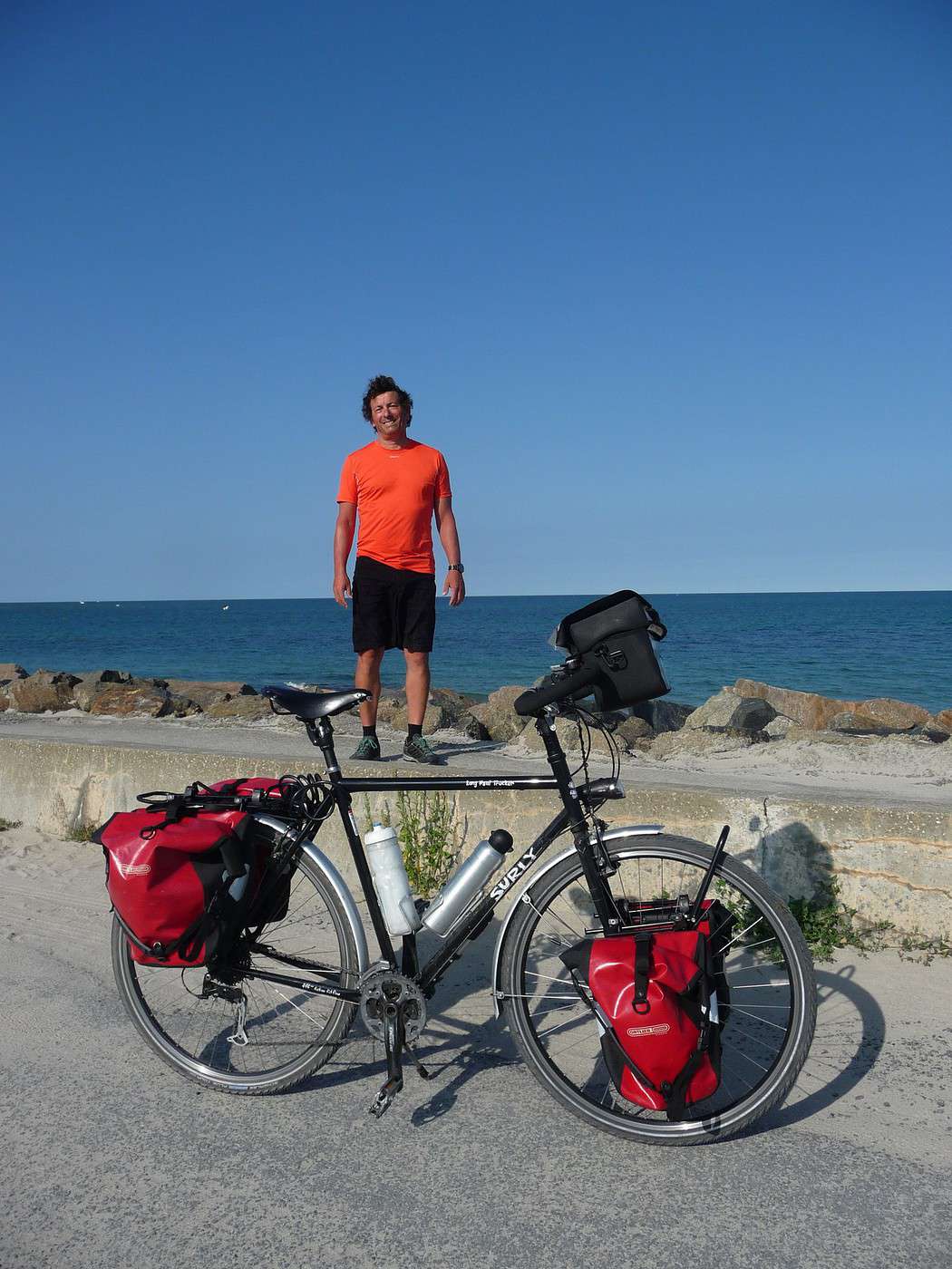
Je pars en mai 2016 pour une traversée NYC /San Francisco et je m'interroge sur la (ou les)route (s) à prendre pour sortir de New York dans les meilleures conditions de sécurité. Merci de me faire part de vos expériences.
Le mieux, depuis Manhattan, est de prendre le ferry qui va à Red Hook sur un des piers de l'East River. Il vous amènera au sud de l'agglomération, sur la côte, dans l'Etat du New Jersey, d'où il est plus aisé de partir vers l'ouest.
Ou, si vous comptez passer un peu plus au nord, traverser la Hudson depuis Manhattan au GW Bridge ( au nord d'Harlem ), la piste cyclable des Palisades file plein nord au travers de jolis parcs juste après le pont. Très facile de sortir de la ville de ce côté-là aussi.
Dans tous les cas ne filez pas plein ouest depuis Manhattan, l'agglomération côté Jersey est juste dingue et vraiment galère...
Bonsoir , en fait j' y suis rentré dans New-York , mais il était fort simple d' y arriver . Voici le trajet pour le N-O ....de Manhattan suivre la piste cyclable qui longe l'Hudson River et prendre le Washington Bridge (road9) pour une dernière image de la grosse pomme . Vous voici au Nord- Ouest de New-York .
«
"Le plus beau voyage, c'est celui qu'on n'a pas encore fait."
Je te remercie beaucoup LEVELO pour ces précisions qui me seront très utiles. De ton côté quel a été ton itinéraire pour entrer ou sortir de NYC et pour quel périple ?
Merci à toi SEDOV. Vu comme ça les choses paraissent simples en effet. Je ne me voyais pas pédaler sur l'autoroute et stresser dès le début de mon voyage. Et toi quel a été ton parcours aux Etats-Unis ?
J'ai vécu à NYC pendant 10 ans et me déplaçais à vélo.
Juste une petite erreur de ma part : le ferry vers le sud t'amènera à Sandy Hook NJ, pas Red Hook qui est à Brooklyn. Balade en bateau vraiment sympa, tu peux monter avec ton vélo. Tu sors ainsi sans effort de la zone urbanisée, et tu peux commencer ton " Coast to Coast " tranquillement.
Si tu veux commencer à pédaler depuis Manhattan alors tu peux traverser la Hudson au George Washington Bridge au nord de l'île. Il y a une piste cyclable avec une vue fabuleuse. La piste cyclable continue vers le nord de l'autre côté, d'abord en site propre puis après tu tombes sur un bon épaulement. C'est assez tranquille. Pour bifurquer vers l'ouest je te conseille de monter jusqu'au niveau de West Point.
Bonsoir , ce périple je l' ai fait de San-Francisco vers N-Y en passant par la Californie , le Yosemite park puis j' ai évité la Death Valley suite aux conseils des rangers (chaleur en juin) un peu contrarié , je suis de fait remonté vers le Nevada pour l' Utah ensuite le Colorado , de merveilleux paysages depuis le début l' Ouest est magique..... puis le Nebraska calme et plat L'Iowa et ensuite Chicago les lacs majeurs , l' Illinois l' Indiana , Ohio Pennsylvanie (juste une journée ) et l' état de New-York , les Adirondacks le St Laurent pour remonter vers Montreal et revenir ensuite finir le périple en descendant à New-York et avoir épuisé mes trois mois que m'autorisaient les USA .11 Etats .
Vol aller KLM et retour Aer Lingus ces deux compagnie acceptent les velos mais avec un supplément .
«
"Le plus beau voyage, c'est celui qu'on n'a pas encore fait."
Merci encore pour tes informations.
En ce qui me concerne c'est un peu la même chose en sens inverse c'est à dire NYC/ Chicago/ Mount Rushmore/ Big Horn Canyon/ Yellowstone/ Grand Teton/ Arches/ Route Utah 12/Bryce Canyon/ Page / Grand Canyon / Las Vegas/ Death Valley/ Lone Pine/ Yosemite / San Francisco.
As-tu des conseils à me donner en règle générale ou en particulier compte tenu de ton expérience dans ce coin du monde ?
Le George Washington Bridge est la porte de sortie de NY vers le New Jersey.
On y accède sans difficultés de Manhattan à vélo.
Les voies de circulations des voitures sont sur 2 niveaux (300 000 véhicules par jour !). Il est gratuit pour les cyclistes. Il faut emprunter des couloirs étroits et des escaliers, mai cela est faisable avec vélo et bagages.
J'ai également fait NY - SF à vélo en 2013 : http://joinamerica.canalblog.com
Bonjour .
Procéder par ordre , billets avion , billets vélo , autorisation Esta ( à faire sur le site Us ) j' ai commandé le rand macnally road atlas et fait des copies de mon trajet (très utile ) état par état , mais j' avais tellement rêvé que je connaissais presque l' itinéraire .
Une liste de tes préparatifs , sinon les oublis 😇 je ne voyage presque jamais avec vêtements de pluie mais les Adirondacks (si sur ton trajet ) sont source de désagréments donc à voir...il fait frais dans les hauteurs du Colarado ( j' avais des gants de laine et des chaussettes pour la nuit ) . Ne pas se jeter sur les campings des " national park " et , surtout dans l' Ouest les éviter le vendredi soir et le samedi car les Américains sont des pêcheurs avertis mais bruyants par contre tellement à l' écoute et les invitations furent nombreuses . Death Valley à ton époque me semble risquée meme avec 20 litres d' eau dans tes sacoches il n' y a que deux campings qu'il te faut réserver impérativement maintenant mais je ne te conseille pas Death Valley en juin juillet . Se renseigner (encore dans l' Ouest après Chicago) auprès des autorités ( Shérif ou autre ) de façon à pouvoir rester la nuit dans les "City Park " qui sont munis de toilettes ou piscine alentour où tu peux prendre ta douche etc ... Je n' ai jamais essuyé de refus . Les fameux pancakes matinaux , surtout ne pas s' en priver .... les plaques minéralogiques ramassées , qui gonfleront tes sacoches . On pourrait écrire à l' infini mais je te laisse la découverte
Que le rêve commence
«
"Le plus beau voyage, c'est celui qu'on n'a pas encore fait."
J'ai également fait NY - SF à vélo en 2013 : joinamerica.canalblog.com
Salut Jo
Ton aventure Américaine est fascinante .Beaucoup de plaisir a la lecture de ton blog , il me reste encore pas mal de page a tournez 😉
Merci du partage
reve de longues escapades en moto avec ma moitie , mais depuis le vélo est arrivé ...
Merci à toi Jo pour cette info. Tu confirmes ainsi les conseils de différents voyageurs passés par New York. Toutefois, compte tenu de la difficulté de certaines étapes en Pennsylvanie, l'option "sud" proposée par Sedov n'est-elle pas plus roulante et donc un peu moins montagneuse. Dans l'idéal, je préfèrerais démarrer doucement ce périple de 3 mois, si c'est possible. J'ai relu partiellement ton blog que j'avais découvert l'année dernière et je t'en félicite.
Je te remercie pour ces quelques conseils. Pour ce qui est de la logistique (billets, Esta, liste des préparatifs...) tout est OK. Pour ce qui est du parcours, je pense que j'achèterai les cartes routières des états traversés au fur et à mesure, sachant que je peux improviser si nécessaire. Concernant l'itinéraire, j'ai encore quelques incertitudes : Sortie de New york par le nord (G Washington Bridge) ou par le ferry vers Sandy Hook NJ. En effet je souhaiterais, si c'est possible, éviter les plus gros pourcentages des cols dans les Appalaches. J'ai entendu parler d'un itinéraire plus "tranquille" plutôt vers le sud mais je ne sais plus lequel. Tu parles de désagréments dans les Adirondacks, de quoi s'agit-il ? Pourquoi ne pas se jeter sur les campings des National Parks ? Les City Parks US sont-ils l'équivalent de nos jardins publics ?
Je pense suivre tes conseils pour éviter Death Valley, pourtant j'aurais bien aimé parfaire mon bronzage mais bon...
Bonsoir , effectivement je citais les Adirondacks mais finalement je me remémorais mon retour de Montréal et je me rends compte que ce serait pour toi un détour en commençant ton périple .
Les Adirondacks sont situés dans l' Etat de N-Y mais au Nord et j' ai eu pas mal de pluie dans cette région .
Tu seras comme moi privé de la Death -Valley .
Pendant mon périple en juin 2014 j' ai croisé un cycliste Roumain qui en revenait sa femme le suivait en camping-car et , sans cesse truffait son maillot de glaçons ...il ne transportait aucune sacoche et sur un vélo typé course ultra leger , nous avons discuté et il m' a aussi déconseillé Death-Valley avec un engin aussi chargé sur cette route .
Les City Parks ( il y en a dans toutes les villes ou villages aussi petits soient-ils ) sont des vrais grands Parks , dotés , de tout le sanitaire dans un état irréprochable , de tables pour dejeuner , avec des bancs , abrités en cas de pluie , équipés de l' électricité .
Dans les Parks nationaux (campings ) il est interdit de laver sa vaisselle dans les locaux il est conseillé de la laver sur sa table , les emplacements sont compris avec la table . L'ultime solution en toute discrétion faire du camping sauvage . J' ai pris des douches en fermant les sanitaires puis à l' aide des gourdes me suis douché très rapidement dans ceux ci sans importuner qui que ce soit ( tard le soir ou dans un village désert) .
Encore une autre chose prends garde au fuseaux horaires , c'est ballot de se retrouver devant une porte fermée .
«
"Le plus beau voyage, c'est celui qu'on n'a pas encore fait."
Je te remercie et tu es une mine d'information. Les Adirondacks sont effectivement situés plus au nord que mon itinéraire supposé et je retiens l'idée des City Parks auxquels je n'aurais pas pensé tout seul. Enfin, concernant la Death Valley, je suivrai ton conseil, les glaçons étant plus utiles lors de l'apéro.
Par ailleurs, je poursuis mes recherches pour trouver la route la plus facile pour aborder les Appalaches car je préfèrerais commencer doucement et ne pas me mettre dans le rouge, si possible. Si quelqu'un a une idée, je suis preneur.
Je recherche des infos sur les meilleurs itinéraires à vélo entre New-York et Miami que je dois faire entre le 15 août et le 30 août! Je sais que je vais avoir…
J'ai comme projet de faire la traversée en vélo de New York à San Francisco J' ai bien trouvé un site US pour la cartographie mais je n'arrive pas à mettre la…
Quelqu'un a fait ce périple à vélo? De New York à Miami. Un rêve que j'ai de faire à ma retraite. Est-ce faisable? Est-ce sécuritaire? Y a-t-il une bonne piste…
J'ai déjà fait différents voyages à vélo, mais toujours limités à 10 jours max. Cette fois-ci j'envisage un voyage plus long, et j'aimerais relier New York à…
Je compte faire une ballade en velo a central park (2 adultes et 2 enfants) je sais pas trop a quel tarif et ou trouver des locations de velo a central park.…
Ca y est j'ai mon billet d'avion, départ mi novembre, retour mi-mars.
arrivée santiago et je repars depuis Buenos Aires.
J'ai deja été dans le sud de l'argentine, notamment le parc torres del Paine, et j'ai très envie d'y retourner pour faire le grand W, j'avais fait le petit.
Je souhaite aussi randonner qq foois et pourquoi pas faire un sommet. Je grimpe et je fais occasionnellement de l'alpinisme, donc ce sera avec un guide de toute façon.
Je compte démarrer vers temuco au chili, j'ai dans l'idée d'aller vers les lac, puis prendre la careterra austral.
Je sais pas si je vais aller jusqu'à Ushuaia, parait que cela vaut pas tant que cela la peine, à part pour dire qu'on a été au bout de la terre.
j'ai vu vite fait qu'il y'avait des lac en Argentine.
Je n'ai pas d'itinéraire précis. Mais ce que je souhiaterai, c'est qu'une fois arriver le plus au sud de mon vooayage, faire une mini croisière pour voir des annimaux.
Des conseils pour cela?
qu'avez vous pris comme sac de couchage? un 0 degré suffit?
et ultime question, réchaud à essence ou est-ce que je peux m'en sortir avec mon réchaud gaz?
Cet été nous prévoyons de pédaler sur l'EV 19 qui longe la Meuse de Langres jusqu'à Rotterdam.
Mon questionnement concerne le retour jusqu'à Nantes.
Savez vous quel est le meilleur retour possible? J'en appelle à vos expériences.
Je voyais que Flixbus ne prenait pas les vélos.
En train, je pense que c'est possible avec de multiples petits trains.
On se questionnait aussi sur l'existence d'un bateau qui irait de Rotterdam jusqu'à St Nazaire et qui pourrait charger des passagers avec vélos.
Toutes vos expériences partagées nous seront bien utiles et nous vous en remercions.
Bonne soirée
Je souhaite faire Morlaix Brest ( via Roscoff et la littoral V45) nous commencerons à rouler le 16 aout pour 13 jours (avec des pauses visites iles , surf etc..) Est ce qu'il y a beaucoup de circulation à cette époque de l'année car j'ai 2 enfants de11 et 13 ans et on n'aime pas rouler au milieu des voitures (on a déjà fait velomaritime ; Caen - Cherbourg, loire : Orléans- Saumur, Velodyssée : Nantes - Royans, les canaux : nivernais , bourgogne etc ... et il y avait beaucoup de voies réservées aux vélos ce qui n'est pas le cas sur cet itinéraire).
Merci de votre aide si vous avez déjà parcourue cet itinéraire fin aout.
Virginie
Hi there,
I’ve been road cycling for several years, and I’m about to switch to gravel in the next few days—I’m waiting for my bike, which should arrive this week.
I’m planning a bikepacking trip in a few weeks along the Véloroute V81, also known as the Vélosud, from Biarritz to Le Barcarès.
Has anyone here already done this route? Any info is welcome, whether it’s about the route itself, gear, or accommodation. I’ll prioritize staying with locals as much as possible. On that note, I just signed up for the brand-new site *Guidon et Couette* ((www.guidon-et-couette.fr)), which offers free accommodation between cyclists across the country, but there’s almost no one listed along my route!
Thanks in advance.
Laurent.
I’m planning to build a new touring bike.
I want to prioritize lightness.
That said, I’m tempted by a suspension fork that could offer some comfort on rougher roads.
The recent appearance of gravel suspension forks on the market might meet my needs—at least on paper.
I’m particularly considering the RockShox Rudy Ultimate XPLR fork.
Unlike MTB forks, its travel is short: either 30 mm or 40 mm.
It weighs 1400 g, which is 400/500 g more than a steel fork.
Any thoughts or real-world feedback on this?
I’m also wondering about the durability of magnesium (lower leg) for long-distance bike touring.
And what’s the impact of skipping the manufacturer-recommended maintenance every 50 and 200 hours? That’s bound to happen on a long trip unless you carry extra gear.
More generally, how reliable are these kinds of forks?
Hi everyone,
I wanted to share with you the incredible feat my friend José, who’s 72 years old, is currently undertaking. He left Auterive near Toulouse on Monday, May 18, 2026, on his non-electric bike, heading for the North Cape in Norway!
You can follow his route on the link below—he’s currently in Sweden:
https://thierry-thomas.travelmap.net/jose-de-toulouse-a-nord-cap-2026
You can zoom in on the map and click on each stopover town to see the photos
I’m making an exception and creating a separate post this time, since it’s all about France. In May, we spent a week in Provence, specifically in the Luberon, exploring the cycling routes *Autour du Luberon à Vélo*, the *Véloroute du Calavon* (part of EuroVelo 8), and the shorter *Les Ocres à Vélo* route. Together, they gave us an amazing journey through rolling hills, vineyards, lavender fields still green in spring, and some of the most stunning landscapes in southern France.
It was, of course, the perched villages that impressed us the most. We visited Gordes, Roussillon, Bonnieux, Lacoste, Lourmarin, Ménerbes, Oppède-le-Vieux, Cucuron, and Lauris. Many of them are among the most beautiful villages in Provence, and it’s hard not to agree with that reputation.
One interesting point is the route of EuroVelo 8 in this part of the region. The official path mainly follows the old railway line of the *Véloroute du Calavon*, which is very comfortable and safe. But in our opinion, cyclists traveling EuroVelo 8 around the Mediterranean would discover even more treasures if the route passed through villages like Bonnieux, Lacoste, or Oppède-le-Vieux.
We were also pleasantly surprised by how safe cycling felt. Most of the route takes small local roads, but traffic is light, drivers are respectful, and road design really takes cyclists into account. It’s one of those places where you can ride peacefully even without separated bike lanes.
Our full story:
Around Luberon by bicycle - the most beautiful villages of Provence
You can also find all our cycling travel stories on the forum:
Cycling Thread - Europe’s most beautiful bike routes
Hi there, we’re a group of 4 cyclists looking to get from Treviso in Italy to Munich with our 4 non-folding bikes. It seems complicated! Are there any solutions? Thanks so much.
hello fellow cycling enthusiasts
here’s a travel journal of the cycling tour through the Rhône-Alpes Auvergne region by Claudio
zouli
it was the plan
http://cbandiera.free.fr/parcours/auvergne-Ralpes/
the trip was completed
story being posted online soon
1100 km in 11 days
beautiful and varied regions
Hi there, we’re planning a Munich to Venice bike trip at the end of June 2026. Getting back from Venice to Toulouse by train with 4 bikes isn’t straightforward. What return options have others who’ve done this trip chosen? Any tips or great deals would be much appreciated. Thanks a bunch! !
Hi everyone,
Happy owner of a Pegasus Estremo bike with a Rohloff hub, which is giving me trouble with the SF11-NCX-FT-E-LITE 700C TS 300/0 fork (serial number TD01329060). It’s starting to show its age, and I’d like to repair it to extend the life of my beloved bike.
The suspension is gone, and there’s an oil leak from the seals.
Does anyone know how to repair it? Where can I find parts that are about fifteen years old? Or where to find an identical replacement fork? Just to clarify, the Magura HS11 brakes are mounted using Firm Tech, meaning they’re on pivots behind the fork, facing the frame.
Hi, I'd like to know if anyone has done this route recently or has reliable info.
Does the track exist, and most importantly, is there sand (for biking)?
Any info is welcome.
Cheers,
diego ambilobe: mangaoka, manondro, ramena
vohemar sambava: masondrono, tanambao
Hi there,
New to bike touring,
I’d love to start with a section of the Via Rhona to explore and share (route to be decided).
Looking forward to exchanging tips!
I’m landing in Madagascar with a buddy before the end of April 2026. We’re planning to bike around for about twenty days or so. We don’t have a specific goal other than exploring the country and meeting the locals.
Ideally, we’d prefer a loop route starting from Antananarivo with a good chunk of it along the coast. On the bike side, we’re used to riding 6 to 8 hours a day, depending on the needs, encounters, and mood 😉 Any feedback or tips from trips around this length?
A big thank you to Lazarou for all the info you share in this forum!
I'm passionate about Morocco, which I cycled through back in 2009.
Last year, my wife and I explored the High Atlas by tandem. Completely smitten, we're heading back in April (Anti Atlas) and May (High and Middle Atlas), still on our tandem.
Do you have any info on the track between Amezri and Ali Ait Nito? Are the river crossings in the Tessaout still there? It's not easy to navigate with a loaded tandem... especially if the river level is high due to this year's heavy snowmelt!
Thanks in advance for any tips you might have, and best wishes for health in this new year!
Claudio specializes in the route of the Savoie lakes
Here are his travels
Between Bornes, Chartreuse, the Savoie foothills, and Dauphiné
Five lakes: Léman, Annecy, Paladru, Aiguebelette, Bourget, not to mention a few ponds along the way
Plenty of accommodation options: camping, hotels, and more...
A lovely route not far from his place
Rural and quite peaceful
A road cycling route created by Serge B...
Tout d'abord... bonne année ! De belles routes à vous en 2017 !
Je voyage depuis quelques années avec un VTT de très bonne qualité mais équipé de freins à disques hydrauliques. Je vis (pédale) avec l'inquiétude d'avoir une panne (fuite, bulle d'air, chaleur qui fait que le liquide...). Mon vélociste me dit qu'il est impossible de les changer pour des V brakes.
Qu'en pensez-vous ? Est-ce que je prends un gros risque à continuer (seule) avec ces freins ? D'avance je vous remercie pour vos bonnes idées.
First post here to share a quick recap of our west-to-east bike trip along Algeria’s coast in January 2025.
It was just the two of us—my partner and I—with French passports and not a word of Arabic. No friends or welcoming hosts in the country.
Under those conditions, we’d strongly advise against going.
Our original plan was to follow the coast from Algiers to Tunis. We ended up cycling from Algiers to Béjaia, then took the train from Béjaia to Annaba (with a stop in Constantine), and finally biked to the border.
We were tailed by police the whole way—whether on our bikes, on the train, or even on foot while exploring towns. On top of that, we couldn’t wild camp and were limited to the few state-approved hotels that accept foreigners. Under those circumstances, connecting with locals was especially tough.
With such an omnipresent and intrusive police presence, we’d definitely recommend against this destination for bike touring. A really sad situation that completely cuts you off from the local population...
We’d been warned, we went to check it out, and we weren’t disappointed!
Hi there,
I’m planning the route to cycle from Lille to Nordkapp with my partner.
Duration: 3 months, from May 1st to July 31st, 2026.
In the attached details below, I need to add some "non-riding" days (rest days, basically).
So I’m looking to "shorten" the trip by taking ferries or trains for some stretches. Which areas could I skip?
Thanks in advance for your great tips.
Have a good evening.
https://www.komoot.com/fr-fr/collection/4023980/-lille-cap-nord-1er-mai-au-31-juillet-2026?ref=collection
I’m planning to bike back from Poland this summer. Does anyone know a way to ship it there without having to take it apart? Otherwise, it’s a real hassle to fine-tune all the settings before departure!
Thanks in advance.
Hi, has anyone recently bought Primus or Butagaz gas, possibly puncture-style, in Dubrovnik or the surrounding area? Same question for Albania... thanks. aichatou
Just a few words about the loop I did by bike in Yunnan.
Entry and exit
I entered China through the Sino-Vietnamese border crossing at Lào Cai / Hekou under the 30-day visa exemption currently available to French nationals and others.
The process was simple and quick. A Chinese police officer even helped me complete my electronic pre-registration at a computer kiosk. I wasn’t aware this formality was required—it’s similar to Thailand’s TM6.
No issues with the bike.
I left the country via the Sino-Laotian border crossing at Mohan / Boten.
The atmosphere was a bit chaotic there, but again, no problems with the bike.
The timing
I visited Yunnan in February 2026.
Weather-wise, at higher altitudes (between 1,500 and 2,000 meters), it was around ten degrees at night and in the mornings, and around twenty degrees at the hottest part of the day.
I had two days of rain, so I took the bus to keep moving. Otherwise, clear blue skies.
Culturally, Chinese New Year fell on February 17th (and the 15 days following), right in the middle of my trip. Because of this, my take on the traffic might be off.
Accommodation and food
I always found a hotel to stay in for prices ranging from 8 to 15 €. Except in Kunming (the capital), where many hotels were fully booked (Chinese New Year). I ended up at a 100 € hotel with great value for money.
A bowl of noodles costs about 1.5 € on average.
Onboard electronics
Since my smartphone doesn’t support eSIMs, I subscribed to a China plan with my carrier. Otherwise, for much cheaper, Alipay offers eSIMs for foreigners that allow access to services usually blocked for Chinese users (WhatsApp, Facebook, etc.).
An internet connection is essential for paying with Alipay or WeChat, as this payment method is widespread.
I only managed to use Alipay.
Either way, always carry cash because sometimes there’s no signal, or the merchant only accepts WeChat.
Also, it’s best to bring a power adapter when you arrive rather than struggling to find one.
Traffic and roads
The Chinese aren’t reckless drivers. They follow traffic rules and watch out for cyclists. This is slightly less true in Xishuangbanna (the region bordering Myanmar and Laos).
In urban areas, there are almost always wide bike lanes, separated from other roads, where bikes, electric mini-scooters, and scooters share the space pretty harmoniously.
The roads are in great condition, and traffic is generally manageable—even light—except for one stretch (Eshan -> Yangwu).
Most traffic is absorbed by expressways, China’s equivalent of highways: toll roads that are off-limits to slow vehicles.
You’re never far from these expressways; sometimes you even ride alongside them, which can be noisy at times.
The climbs are usually reasonable, around 5% to 6%. From what I remember, the steepest section was between Menglun and Mengla, with gradients of 8% to 10%, sometimes more.
Riding at these altitudes—though modest—took a bit of getting used to.
The route
I didn’t plan anything in advance. My only goal was to reach Kunming. I don’t know why, but just hearing the name of that city, like Yunnan, always felt dreamy to me.
Hi! I’m planning to visit the Stockholm Archipelago by bike in early April.
Do you know if the boats will be running between the different islands at that time of year? For those who’ve already been, all your tips and recommendations are welcome—accommodation, etc. Also, do you know where I can rent a bike in Stockholm? Thanks so much in advance for your help!
Hello there, pedal-powered Young Boys!
Claudio (still from Faverges)
dreaming about a cycling getaway in Italy from Faverges (train all the way to Turin)
from Turin down to Venice along the Po River and back via the Padana (Alta Italia da attraversare – Northern Italy to cross)
The tricky part is getting from Chioggia to Venice.
I read it’s possible by hopping on a boat from island to island,
but it sounds a bit stressful.
Has anyone already tackled this route?
I’m currently looking for a bike to do my first bike trip across France, with the ultimate goal of cycling through Latin America. I’ve got a lot of questions and I’d love to hear if you have any answers or advice to share.
First off, I’ve been through this before with hiking. I want to get top-quality gear right away. When I started hiking, I ended up buying everything three times—first beginner gear, then intermediate, then expert, etc.
For biking, I’d prefer to skip that process and invest right now in a bike that could ideally handle Latin America.
I’ve set a total max budget of around 5000 € (roughly 4000–4500 € for the bike and the rest for accessories: panniers, helmet, cycling shorts, etc.).
So, I’ve got quite a few questions:
* I’ve read in several places that some people recommend buying the bike directly in Latin America. Since I need a first bike to train in Europe, would it be better to buy an entry-level bike in France (and sell it before the big departure)? Or is it preferable to start right away with my final bike to get used to it? Is buying it there just to save a bit of money?
* For a long-term trip (around six months) in Latin America, is it better to go for a gravel bike or a mountain bike?
* Should I buy a new bike or a refurbished one? Even more so given that I’m planning a long trip—could a refurbished bike end up causing more breakdowns?
If you have any advice on models, technical features to prioritize, or recommended sellers or resellers, I’d love to hear it. I’m a total beginner—I’ve only just started watching videos and reading up on the subject, and all the technical specs are new to me!
Calling all travelers.
We’ll be landing at Lyon Airport and want to bike to La Verpillière train station (with panniers and camping gear, etc.) to catch a TER to Voreppe.
What’s the safest route for this bike trip?
Thanks in advance
hi,
I'm planning a recumbent bike trip from the Pyrenees to Greece. On the EuroVelo 8 route, it doesn't specify the path through the Alps.
Are there any experienced cyclists here who can tell me where they go to avoid climbing too high?
Also, is there another traveler/bike forum better suited for broadening the responses?
thanks