June 2024.
While hiking with my brother on the GR 36 Tour du Morvan, I catch sight now and then of strange rectangular markers fixed to tree trunks. Against a bright orange background, a deep black Greek tau topped with a white dove. My first encounter with the Assisi Way.
The Way of St. Francis: a pilgrimage route linking Vézelay in Burgundy to Assisi in Italy, covering nearly 1,800 km.
It felt like an obvious next step—I immediately knew I’d take it on, attempt the adventure solo.
In the months that followed, I talked about my project to everyone—family, friends, my partner. An avalanche of comments, more or less the same but varying depending on each person’s character and life experiences. But deep down, it all boiled down to one legitimate question: why?
And the answers?
Hesitant, awkward, partial, even confused. I quickly realized they weren’t so easy to find. It was as if my project seemed more like a whim, a kind of intimate caprice, rather than a well-thought-out plan.
Of course, I knew the reasons that pushed me to leave—you always have to give some. Loved ones need to understand to feel reassured, and that’s understandable.
But I fear that when I list them, they’ll sound like the same old checklist anyone embarking on this kind of journey might give.
Of all the reasons I could mention, I’ll highlight just one here: the call of the road, the solo adventure that brings a powerful sense of freedom.
A bit like Monsieur Seguin’s goat, who from her comfortable pen gazes longingly at the unconstrained horizon of the mountain.
But if I’m being honest, I think I didn’t really know what I was looking for—or, more importantly, what I’d find. Deep down, when I reflect on it, one word keeps coming up that explains nothing and everything at once: desire.
Now well past sixty, I know that when I ask myself who I am or where I’m going, two things bring me fully back to myself: hiking and writing.
And my intention was also to anchor this adventure through words, day by day. Writing down my feelings, emotions, discoveries, and reflections each evening. The famous travel journal that grounds the daily experience in reality.
When I discovered the app "Polarstep," which was initially just meant to keep my loved ones updated and reassured, inform them of my progress, and maintain a connection, I found an opportunity to do it a little differently than usual.
No retrospective notes polished up after returning, but spontaneous writing—recounting everything that crossed my mind during the day and publishing it immediately. A journey lived in real time.
This text is the exact transcription of my daily writings. Rereading them, I didn’t change a thing—just corrected a few mistakes and tweaked some awkward phrasing here and there. Short texts, fitting the format imposed by this kind of app. Writing as if addressing others.
Now, all that was left was to walk.
April 18, 2026 – Vézelay.
January 2026
Here we go again for new adventures and the pleasure of sharing them with you here! First of all, I’d like to thank everyone who helped me with the preparations, even with some last-minute improvisations just days before departure. Thanks to Montagnard74, Jojoone1, Songsam, Attila, Dennis2, NadegerFERM, and the authors whose travel journals about Laos inspired me (Montagnard74, Muriel18, Mavietongs...).
In this story, written by Richard and illustrated by me, we’ll tell you about the journey of four friends: Catherine, Richard, Nathalie, and Bruno. A reinvented but overall successful trip, filled with discoveries and surprises, the scents of spices and frangipani flowers, (too) spicy food, sunsets, and... one big mess.
This trip had been on my mind for about fifteen years.
But the discomfort of overnight stays, the difficulty of communication, and the prices of the few car rentals kept making me postpone the project.
Then, everything suddenly fell into place—I told myself, it’s time!
The preparations took longer than usual; the destination is still far from mainstream.
A bit of Kazakhstan?
Not this time.
The south or not the south?
Yes, the south it is.
Pre-book or play it by ear?
Only two stops were left to chance.
To help me find the perfect route, I made great use of this forum (thanks to everyone for patiently answering my questions!), scoured travel journals and blogs (Christian, Jeff), zoomed in on Google Maps and Yandex, and bought the guide published by OunTravela on this destination (the guide has been updated since).
---/---
Got your passport, international driver’s permit, bank cards, and euros?
Off we go to Lyon—just one night left before our early morning flight.
Tomorrow night, we’ll be sleeping in Bishkek!
(Steak for my partner’s mischievous nephews...)
You’ll find here a post with some practical tips.
And here, the uncommented version of the travel journal.
I must say, my personal situation has "changed a bit" since my last journals (my 3 kids are grown up + a divorce finalized in early 2021). So, no more long-haul family trips; now I’m focusing on multi-day hikes for my vacations. I found a hiking buddy in 2021 to join me on the Laugavegur trek in Iceland, but this year, no one was available.
That’s how the idea of a solo trek in Lapland took root—a region I’ve been dreaming about ever since I read Marie Lefevre’s 2012 journal on the topic.
Marie, who I hiked with for the first time in 2015 during my very first multi-day trek, and whom I can never thank enough for sharing her knowledge and saving me so much time.
To build my confidence for this solo trek, I hiked around Cantal in May (okay, I’m capable of spending nights alone in the middle of nowhere without being overly terrified) and camped in the Mercantour in July, where a massive storm made me realize I still had room for improvement in managing wet conditions...
After some research, I bought 2 Nylofume bags—large, ultra-lightweight ones to protect my gear in my backpack—and a set of 4 Aloksak bags in different sizes for my passport, camera, battery, etc. (and I’m so glad I did!!)
Well, I think I’m all set...
My 16/08 - Day 1 - Ritsem – Gisuris (well, almost)
Wed 17/08 – Day 2 - Partly in the tent + minimal progress toward Gisuris
Thu 18/08 – Day 3 - Gisuris – Laddejakha (23 km)
Fri 19/08 – Day 4 – Laddejakha – Arasluokta (13 km)
Sat 20/08 - Day 5 - Arasluokta – Staloluokta (12 km)
Sun 21/08 – Day 6 - Staloluokta – Duottar (18 km)
Mon 22/08 Day 7 - Duottar – Dareluoppal (10 km) Sammarlappa (15.3 km)
Tue 23/08 - Day 8 - Sammarlappa – Tarrekaise (12 km) + halfway to Tarrekaise-Nunjes (approx. 3 km)
Wed 24/08 – Day 9 – Finish Tarrekaise-Nunjes (approx. 4 km) Kvikkjokk (12.6 km)
Thu 25/08 and Fri 26/08 – Around Kvikkjokk
Food and gear summary
Aaah, I'm so glad Voyage Forum is back up and running. For reading... and for writing...
My last travel journal was from 2019, when I went hiking and backpacking with my son, who was 15 at the time. We visited some places that were still pretty unknown back then!
I was supposed to go in April 2020, still solo, with arches as the main focus.
I’d spent nearly two months getting physically prepared, and had managed to snag a bunch of permits for CBS, The Needles, and so on...
Of course, it all got postponed—first to October 2020, then April 2021, then October 2021, and finally it happened in April 2022. Maybe I’ll write about that in another journal. The thing is, every time, I spend at least 6 to 8 weeks getting physically ready, even though I work out all year.
Huge disappointment during that trip—so much had changed because of Covid, kind of like in the mountains back home. Overcrowding, not just in the national parks (we knew about that), but also in a lot of remote, lesser-known spots. Like the French, Americans realized they had a lot of beautiful places in their own country during those travel bans. And they kept exploring... Prices for pretty much everything had already gone up a lot. Gas, restaurants, cars, but especially lodging!
Then, after dealing with so much wind in April, I got a little "fed up" with that time of year. It felt like I had strong winds and sandstorms for 3 out of the 3.5 weeks I was there...
So, the next trip was October 2023, to catch the partial eclipse in New Mexico, and of course, a bunch of arches ;). So many arches. Maybe I’ll write about that one too...
Then came (among others) April 2024 for the total eclipse, in Texas, but starting from L.A., with my partner Valérie. Since I’d never visited some places I wanted to see further south of my usual loops, it was the perfect opportunity...
And here we are at the end of September 2024. Another trip focused on arches—I never get tired of them.
Every time I check one off my list, another gets added. Often it’s a photo I’ve seen online or in the NABS (Natural Arches and Bridges Society) magazine, which I’m a member of. I also scour the WAD (World Arches Database) and make a list of arches I want to visit. Fewer and fewer "viewpoints"—I’ve done all the most famous ones, and unless the sky is amazing, the photos all look the same. Since my goal is always photography *and* hiking, I’m always on the lookout.
So this time, a packed itinerary—27 days, very busy. In past trips, if I didn’t plan enough and hiked fast, I’d end up with too many "gaps" in my days. This time, I’d rather have too much than too little (like in 2023, actually).
A few stats:
- 6,589 km, including +/-1,400 km of off-road trails
- 323 km of hiking, 8,829 m of elevation gain
- 142 new arches for my collection, including some stunning ones, some less so, and some downright ugly—but all in the WAD.
- Two outings with a Navajo guide
- Almost no injuries
- 8 bivouacs, including 2 backpacking trips
- 4 days of backpacking
- 22 freeze-dried meals and 15 Subways eaten
- 6 thorns in my shoes (long live the tweezers in my backpack)
- 3 kg lost (plus the 5 kg lost during prep)
Almost every day, I posted a little update on Facebook for family and friends. So I’ll be copy-pasting those texts here, written "my way" as usual. Some will like it, some won’t—that’s just how it is... 😏
For months, I planned this trip—looking for info, creating GPS tracks on Google Earth, exchanging tips with NABS members and other passionate friends. I snagged permits for The Needles again (4-5 days), for Fiery Furnace, timed entries for Arches National Park (2), and booked just one campsite, a "triple tour" in Monument Valley, and the first night in a motel. This is the first time I haven’t booked 80% of the motels—I was tired of having constraints because of the weather. This time, I want to be able to adjust my plans based on the weather and what I feel like doing more or less of. Camp when the weather’s nice, hotel/motel when it’s crappy.
Here we go...
Day 1
As usual, early morning flights: BRU-AMS, then AMS-SLC.
Those who follow me know I’ve been renting a Rubicon from Rugged for years, which "forces" me to land in SLC.
Up at 3:30 AM, but I’d been awake since 2:00 AM—the day’s going to be long. Shuttle to the airport.
In Brussels, only two check-in counters open. I get there—no cabin baggage weigh-in, while the agent next to me is weighing everyone’s, even kids’ backpacks! A bit of luck, because as usual, if they weighed my backpack *and* my cabin bag, I’d already be over 20 kg. I check two hold bags, since I’ve got a lot of camping/backpacking gear, lots of freeze-dried meals, the backpacking bag, the Bear Canister needed for The Needles, etc.
First flight is 30 minutes late, so the second one is already boarding. I’ve got the SSSS mark on my ticket (extra security check), so I head straight to the front when I arrive at the same time as Zone 3, even though I’m Zone 6. I pretend the check will take a while, and it "works"—they didn’t notice! No way I want to board last and risk them making me check my cabin bag. It’s packed with photo gear, laptop, drone, etc.—unthinkable to have to put it in the hold. Always a worry...
SLC: baggage claim, customs, and out in 32 minutes. The MPC app makes something that was already quick even faster at this airport. And all the bags are there. That’s always a relief too. Since I drive at least 3 hours straight after landing, losing a hold bag would really mess up the trip and force me to spend the first night closer to SLC.
On the way to Rugged. A young French couple from Reims is in the shuttle with me—they discovered Rugged thanks to my post in a Facebook group!
Well, the team has changed again, and they lost half the stuff I’d left last October (plastic boxes, pillow, sugar, gas cartridges, folding chair, Crocs, etc.), but at least there are gas cartridges, so I don’t have to go to REI. REI would’ve been at least an hour out of my way. But as far as I know, there are no gas cartridges in Green River.
I still get my tent stake hammer back, and a folding chair—different from mine but identical.
20,000 km Rubicon 4Xe, white. I check the tires—they’re in great shape, as requested. I’ll come back to the hybrid later. I didn’t want a hybrid, but that’s all they had this year.
Why? Higher fuel consumption, smaller tank, higher cargo floor.
Stop at the Walmart near Provo, whose layout I know like the back of my hand (Walmarts are often similar). Start-of-trip shopping: water, Coke, Gatorade, UHT milk for cereal (not very common in the US), Special K "Almond and Vanilla", cold meds that work well (and don’t exist back home—you never know), two plastic bins, a pillow for the tent, Trail Mix, that’s about it.
On the road to Nebo Loop for the fall colors. I’d driven this route last year, in the opposite direction on my way back to SLC, but it was a bit too late. This time, I’m a little early. At the start of the road, the maples are in the sun, so I go up to 2,200 m for the bright yellow aspens, then head back down. Mostly drone shots—no time to go for a walk. After a day like this, 4.5-5 hours of driving is already a lot... Arrived in Green River at 9:00 PM.
Organize all the stuff from the bags properly, then sleep.
This adventure began during Covid... Yep, Covid turned a lot of things upside down, but most of all, it kept us cooped up for a few months and stopped us from traveling for a while—even longer for a die-hard fan of the American West like me.
While borders were closed, I started imagining what an ideal itinerary might look like—one that would string together all the Southwest must-sees in just two weeks, during the best time of year: September and October. When the U.S. announced in September 2021 that borders would reopen in the coming weeks, I regained hope and began scouting flight tickets for a departure in September 2022.
But here’s the thing: tackling solo hikes, each one tougher than the last, right in the heart of the Wilderness, could be a risky—even reckless—endeavor for a father of three. After a quick chat with some virtual friends who are just as passionate about the Southwest as I am, with good physical condition and nearly the same list of must-visit spots, Franck and his brother Sullivan were in! 🙂
In November, we snagged flight tickets from Nice to San Francisco for the modest sum of 400 €, and a few days later, I booked a Toyota Tacoma pickup for 840 € !
It’s not cheap for just 15 days, and a pickup isn’t exactly ideal for luggage, but the prices for full-size 4x4s have become totally outrageous! Due to border closures, rental companies had to offload a lot of these big 4x4s, which tourists love. Then, supply and demand did the rest !
Franck and I spent the winter and spring trying to cram the equivalent of three weeks of hikes into two. But even with physical limits, we had to stay reasonable! Three to four months before departure, we entered the lotteries for different must-see spots: The Subway, Coyote Buttes North (home to the famous Wave), and Coyote Buttes South (CBS).
The Wave is the holy grail for any Southwest enthusiast. Since 2015, we’ve tried our luck with the online and on-site lotteries about ten times, but the spots are unfortunately limited: just 20 per day. A glimmer of hope, though—since early 2022, that number has increased to 64 people allowed per day, with 48 spots awarded via the online lottery.
After all three of us tried our luck for The Wave, on June 1st at exactly 5 PM, I got an email that started with, "Congratulations! You were successful in the Coyote Buttes North (The Wave) September 2022 Permit Lottery at Coyote Buttes North (The Wave)...". At 5:01 PM, I called Franck, whose dream it’s been for over 20 years—ever since the first photos were published in a travel magazine! He didn’t believe me when I told him, and I had to forward the email for him to finally accept the unbelievable: we were going to The Wave and all the incredible spots scattered across the protected area of Coyote Buttes North.
I’ve already been to Coyote Buttes South twice, but there are areas I couldn’t explore in the middle of summer because they were too remote. So, I had no trouble letting my buddies convince me to go back for a third time. Plus, given how hard it is to access, we had no trouble securing a permit online as long as we logged in at exactly 8 PM on the dot!
For The Subway, all three of us struck out. No big deal—we won at CBN and CBS!
Among the sites to visit, there are two that I’m particularly attached to because I know my chances of wanting to see them again are slim. The first is Angel Arch, one of the most legendary arches in the Southwest, due to its remoteness from any trace of civilization. To get there, the recommended hike is Upper Salt Creek, and you’re looking at a 50 km round-trip in an area with no water (in September) and populated by bears.
The second site is the Hopi Salt Trail, in Navajo land, which, after a very tough hike, lets you marvel at the turquoise-blue waters of the Little Colorado before it meets the Colorado River. The Hopi Salt Trail is, like The Wave, the holy grail for any Southwest enthusiast, and the windows of opportunity to see the water in that magical color are very short each year. For this, you have to monitor the Little Colorado’s gauges downstream from Cameron: if the level stays at its lowest for 10 consecutive days—meaning no rain—you can hope for turquoise water. The ideal period rarely exceeds 30 days a year, and it’s usually in June that all the stars align.
But unfortunately, one month before departure, while the flow rate at Cameron looked promising, several storms in September dashed our hopes of doing the Hopi Salt Trail, even at the end of the road trip.
We still had two consolation prizes, though:
After a last-minute cancellation, while keeping an eye out for available spots for The Subway, it turned out that three spots opened up exactly on the day we’d planned to go—so we rushed to grab them!!
Regarding the 4x4 rental, the prices for full-size models dropped by several hundred dollars, and we ended up finding a Chevrolet Tahoe for less than $1000. A steal and a serious boost in comfort, so we could store all our gear and food without worry!
Here’s the initial plan in a perfect world:
D1 The White Domes - Camping
D2 Sunrise at The White Domes - The Subway
D3 Coyote Buttes North
D4 Coyote Buttes South - White Pocket
D5 Wahweap Hoodoos - Sidestep Canyon - Colourful Canyon - White Rocks - Sunset at Yellow Rock
D6 Broken Bow Arch - Reflection Canyon
D7 Coyote Gulch
D8 The Volcano (or The Oasis - Zebra Slot Canyon if the weather’s good) - North Caineville Mesa
D9 The Needles: Squaw Canyon - Lost Canyon combo - Druid Arch - Chesler Park
D10 Upper Salt Creek Day 1 - Camping
D11 Upper Salt Creek Day 2
D12 Hopi-Navajo Territory: Ha Ho No Geh Canyon, Coal Mine Canyon, Bends of the Little Colorado
D13 Grand Canyon: South Kaibab Trail and Bright Angel Trail
D14 Upper East Zion: East Temple Loop, Jughandle Arch, Center of the Universe, and Checkerboard Mesa Summit
And several backup options in case of bad weather, including Spencer Trail, West Cove, and Buffington Pockets.
We’re a couple in our fifties who’ve been traveling independently for ages—mostly in Asia, a bit in Africa, very little in the Americas, and never ever in West Asia until November 2023, when we discovered the Sultanate of Oman.
If we waited so long to explore this part of the world, it’s because a few questions were nagging at us, like:
Can two Landais party lovers like us survive 15 days without apéro 😄?
Or, more seriously: Can a feminist like me enjoy traveling in such a conservative country?
That is the question (and I feel your pain with this unbearable suspense 😅).
Ready to dive in?
PS: Apologies in advance for the casual tone of this travel journal—it’s the one I shared with our loved ones in real time, which explains everything.
We did the Langtang trek (hike) from September 10th to 17th, with the first and last days being the trip from Kathmandu and back—so 6 days of actual walking. It’s a fairly well-known trek but certainly not as famous or crowded as those in the Annapurna or Everest regions, which is why we chose it.
In theory, it’s mandatory to have a guide for this trek. In reality, it seems there are ways to bypass the regulations: we met at least two people hiking without a guide—a South Korean, a New Zealander, and possibly also a couple of English women and an American couple, though we’re not sure if they had a guide.
The agency we booked with had told us it was an affordable trek for relatively older people in good shape—which is our case (I’m 72 myself). I have to say upfront that we found it quite challenging, maybe because we didn’t have good weather—it was the end of the monsoon season. To be clear, no matter your fitness level, I’d say doing this trek in the middle of the monsoon season would be suicidal.
Day 1 – Journey from Kathmandu to Syapru Besi
On Monday, September 8th, there had been violent protests in Kathmandu against the government, which had, among other things, blocked access to social media and been accused of nepotism and corruption. There were 19 deaths. The situation was very tense on the day of our departure, Wednesday the 10th. The agency warned us that public transport was very unreliable. So, we decided to take a jeep, at an additional cost of $100 ($160 minus what was already budgeted for the bus).
We left a little before 7 a.m. and it took us a good hour just to reach the outskirts of Kathmandu. Along the way, we saw several houses and vehicles set on fire by protesters.
The road to Syapru Besi is only 120 km, but it’s frankly awful. It’s always narrow, winds through endless mountains, and the shoulders range from bad to confusing to nonexistent. Several sections are just dirt tracks. We didn’t regret opting for the jeep, as we could stop several times at our convenience—if only to let Y (my Thai partner) throw up everything she had. She’d taken her usual motion sickness medication, but the constant turns, accelerations, and braking eventually made her terribly carsick.
In Nuwakot, we stopped for breakfast at a nice little restaurant, Jimbu. It was around 8:30 a.m., and we’d barely covered 60 km. The restaurant has a lovely garden overlooking the Trishuli Ganga, the river flowing down from Syapru Besi. First photo: the river in the bottom right corner, mist and clouds over the mountain on the other side.
An hour later, my second photo: the hills along the Trishuli Ganga. You can see the different crops—lush green rice paddies in the lower right and corn, already yellowed and likely harvested, in the foreground on the left. And of course, the mist and clouds through which you can glimpse the mountain on the other side of the river.
So glad this forum is back up!
Here’s a recap of our three little weeks in the Azores in August 2024, camping on Terceira, Flores/Corvo, and São Miguel, with a special focus on the camping side—something I struggled to find info on before we left.
As others have mentioned, a trip to the Azores isn’t something you can improvise last-minute, especially in August. The rental car fleet is limited, so prices go up as availability drops, and vacation rentals/hotels are scarce. Plus, inter-island flights and ferries aren’t exactly frequent.
I picked our destination in mid-April, and there were already few rental car options left (some local companies had nothing), and no accommodations on Flores for our dates—or only very expensive ones requiring multiple location changes. Since we love camping, we decided to bring our gear without really knowing what to expect.
Flight with TAP (426 €):
Outbound: Lyon → Lisbon → Terceira
Return: São Miguel → Lisbon (9-hour stopover for a quick visit) → Lyon
Inter-island flights with SATA:
Terceira → Flores (via Horta): 87 €
Flores → São Miguel: 90 €
I rented all three cars from the same local company, Ilha Grande—they weren’t picky about the car’s condition. For a Clio (or similar):
Terceira (4 days): 461 €
Flores (5 days): 623 €
São Miguel (8 days): 730 €
Weather: The first two weeks were gorgeous—blue skies, no rain, and even hotter than we expected, around 30°C (temperatures barely dropped at night). The last week of August brought more fine rain (mostly at night) and temps between 20 and 25°C (a light jacket was nice in the mornings and evenings).
TERCEIRA: A great introduction!
When I looked at what each island had to offer, Terceira wasn’t at the top of my list, but flying into Terceira cut costs and fit our schedule well, so we spent 4 days there. It turned out to be a lovely start.
For camping, we stayed at Salga Campismo in Porto Judeu, 20 minutes from the airport. We discovered that the island’s campsites were packed with locals—extended families or groups of friends having big, festive gatherings with barbecues and long tables. They spend their summers camping instead of at home, and some even commute to work from there. They had huge tents for sleeping, plus tarps for cooking and relaxing—way more gear than the tourists. Since the week of August 15th is peak vacation time (like in France), we struggled to find a spot, and the nights were pretty noisy.
This was the only campsite of the trip with numbered pitches. It’s right by the ocean, next to natural pools. Facilities were decent, with hot showers and picnic tables. Lots of shaded spots.
Cost: 4 € per small tent + 2 € per person. Electrical outlets were free (20 € deposit).
During our explorations, we passed by Cinco Ribeiras campsite (west coast), which seemed similar.
Camping gas: Always ask the campsite reception if any travelers left a gas canister before buying a new one! Before the trip, I emailed each island’s tourism office, and they gave me addresses for Campingaz bottles.
On Terceira, No. 13 Rua João Vaz Corte Real in Angra do Heroísmo (an agricultural store in the industrial zone). CV300 cartridge: 10 €.
Note: The tourism office gave me the name of the neighboring store, which didn’t carry that brand.
Fridge: No fridges at any campsite on any island. We had a foldable cooler and found bags of crushed ice in supermarkets’ fish sections.
Things to see:
Key takeaway: Do the must-see spots early in your stay in case the weather doesn’t cooperate. We were lucky and saw all the viewpoints without clouds—apparently not always the case!
Our main visits/hikes on Terceira:
Miradouro Serra do Cume (a must—*the* iconic Terceira photo)
Furnas do Enxofre (free): Few fumaroles, but a pretty 1 km walk through moss and endemic plants.
Hike PRC01 TER – Misterios Negros (some acrobatic sections, but a very scenic path).
Monte Brasil + Angra do Heroísmo: Lovely town.
Hike PR02 TER – Baía da Agualva: Nice, but not much shade (along the coast).
Quatro Ribeiras: Church and swimming in natural pools.
Biscoitos natural pools: Too touristy (but still free).
FLORES: Our favorite!
This was the island I *had* to visit, and we weren’t disappointed—no mass tourism, just stunning nature.
For camping, we chose Santa Cruz campsite. Unlike Terceira, it was only tourists here. Very little shade, but ocean views. Modern facilities with hot showers, clotheslines, and a charging station. A big area with picnic tables, each with a barbecue and sink, all sheltered. Right across from gorgeous natural pools.
FREE (you can leave a tip for the caretaker).
For Campingaz, the campsite manager stores canisters and gear left by campers. Otherwise, you can find them at Movipesca.
During a hike, we passed by Fajã Grande campsite (campsites here double as picnic spots for everyone). It’s terraced, with no shade, but very clean facilities and a small bar/restaurant nearby. Natural pools across the street. When we stopped by midday, there were only a few tents. Fajã Grande felt even quieter than Santa Cruz, with just one supermarket.
We also picnicked at Ponta Delgada campsite in the north. Impeccable facilities, lots of picnic tables with barbecues. Empty when we were there. A bit out of the way.
Rental car or not on Flores? Given the high cost, I really debated whether we needed a car. In Santa Cruz, the port, airport, and supermarkets are walkable, and the most famous hikes are one-way, not loops. So I contacted a taxi (the tourism office emails a list of drivers—they don’t wait for customers; you have to call). Prices were around 20 € for Santa Cruz to Fajã Grande, for example. That means you could take several taxi trips before the rental car (over 100 €/day) pays off. But it does mean planning your route and schedule in advance, leaving little room for spontaneity. The taxi I contacted was already booked solid in July, so I decided to keep the car and adjust our hikes to make loops. (FYI, we’re in our 50s, two couples splitting costs—maybe a different calculation if we were 25!) No regrets—it gave us way more freedom.
Our main visits/hikes:
Hike (amazing): Poço da Ribeira do Ferreiro (the iconic waterfalls) → Fajã Grande → Poço do Bacalhau (swim in the waterfall) → Aldeia da Cuada → Poço da Ribeira do Ferreiro.
Hike PR04: Loop from Miradouro da Fajã de Lopo Vaz, then down to the beach via the trail. Return along the pebble beach before climbing back up. Worth it, but the descent and ascent are steep.
By car: Miradouro do Portal (great view of the coast to Fajã Grande) – Rocha dos Bordões (basalt columns) – Miradouro das Lagoas Rasa e Funda (a must) – Miradouro da Fajã do Conde.
Hike: Miradouro das Lagoas Funda e Comprida, Lagoa Negra, Seca e Branda, Lagoa Branca. A bit muddy and not as memorable as other hikes. The best part (a must) is the view from the starting miradouro.
By car: The north of the island.
CORVO: Stunning!!
No spots left on the ferry (12 seats), so we took a tourist zodiac (booked a few weeks ahead by email, but there were still spots the day of—several boats make the trip). On the way out, we cruised along Flores’ coast to see waterfalls and caves. On the return, they looked for dolphins (we saw some! 🙂 ).
Boat price: 35 € per person.
At Corvo, minibuses shuttle between the port and the top of the caldera (10 € round-trip per person).
Lots of people just stop at the viewpoint when the shuttle arrives, so we weren’t too crowded on the caldera hike. But it’s too tight on time to walk back down to the port. If you really want to, I think you’d need to stay overnight. All boats spend the same amount of time on the island.
SÃO MIGUEL: Back to civilization—but not just that!
São Miguel is way more touristy than the other islands (though still nothing compared to other destinations), but it’s worth it for all the natural sites.
For camping, to avoid long drives, we started at Sete Cidades campsite on the west side. A big, free, terraced campsite with some shade. We were there the last week of August, when crowds start thinning, so there was space—a mix of tourists and locals. A few picnic tables with barbecues. For facilities, one side for men, one for women, each with one toilet (cleaned regularly) and three outdoor cold showers (swimsuits recommended). You can charge your phone in the caretaker’s hut.
After exploring the west, we moved to Furnas for the rest of the trip. We arrived on a Friday night, and the campsite was packed with locals spending the weekend. It emptied out Sunday afternoon. A large, shady campsite with several bathroom blocks (hot showers). There’s a restaurant, but only two picnic tables.
Cost: 3.5 € per small tent + 3.5 € per person.
Campingaz: We bought canisters at Decathlon in Ponta Delgada (next to Decathlon, there’s a big shopping center for groceries). Didn’t ask at Sete Cidades, but at Furnas, there was a closet full of gas bottles of all sizes left by campers.
Main visits/hikes:
Sete Cidades and the surrounding lakes (lots of viewpoints and short hikes): Beautiful.
Swimming in the hot springs at Ponta da Ferraria (west side of the island).
Furnas: The lake, fumaroles, and parks (like Terra Nostra).
Lagoa do Fogo (gorgeous).
Gorreana tea factory (nice hike through the tea fields + guided tour), Ribeira Grande, Ermida de Nossa Senhora da Paz.
The east coast and Ribeira dos Caldeirões park.
Ponta Delgada.
Final thoughts: The Azores are a fantastic discovery for nature lovers—lakes, waterfalls, and tranquility.
Almost all sites are accessible without hiking (though it’s a shame not to). The “miradouros” (viewpoints) have parking, often with toilets and picnic tables (always very clean), which helps protect nature.
Camping is totally doable and really enjoyable!
Our only disappointment: Not finding good fruits and veggies (except for São Miguel’s delicious but expensive pineapples).
If you have any questions, I’d be happy to help!
Christine
After our amazing experience in the Lofoten Islands in summer 2023, I suggested to Jean Marie another trek I’d been wanting to do for a long time: the Skye Trail in Scotland.
A few photos of this stunning island and he was sold and ready to go.
The route is available on the excellent WalkHighlands site HERE (there’s also a Cicerone guide on the subject).
And since I thought it was a shame it avoided the Black Cuillins, I added a 3-day detour in that area.
We took advantage of the May bank holidays in 2024, partly to avoid the peak tourist season and also the midge period—because for some reason, mosquitoes love me 😠!!
27/04 – Day 1 – Transfer to Skye and start of the trek: Rubha Hunish - Flodigarry
28/04 – Day 2 – Flodigarry – just before the Old Man of Storr
29/04 – Day 3 – Old Man of Storr – Portree, then bus to Sligachan
30/04 - Day 4 - Sligachan - Glenbrittle campsite via the Fairy Pools
01/05 – Day 5 – Round trip to Sgùrr na Banachdich from Glenbrittle campsite
02/05 – Day 6 – Round trip to Coire Lagan and walk on the Rubh an Dùnain peninsula
03/05 – Day 7 – Return (hitchhiking) to Sligachan campsite and hike in the Red Cuillins
04/05 – Day 8 – Resuming the Skye Trail – Sligachan – Elgol
05/05 – Day 9 – Elgol – Somewhere on the climb to Bla Bheinn
06/05 – Day 10 – Somewhere on the climb to Bla Bheinn - Broadford
07/05 – Day 11 – Visit to the Armadale Castle and park
08 & 09/05 – Return to Glasgow, visit the city, and return flight
And here’s the summary
This travel journal is the second part of the trip whose first part you can find here: 1st part...
Sunday, August 7: the day we discover a magical place... Edmaier's Secret...
We got up at 8:00 AM, had breakfast on the terrace of our tiny house, and then set off again toward yesterday’s trail. This time, we stopped after 4.5 miles on House Rock Valley Road at the Buckskin Gulch Trail parking lot.
We weren’t interested in that trail today—the slot canyon is muddy anyway after the recent storms...
Instead, we explored a lesser-known area that became our playground. And what a playground it was, folks—an out-of-this-world spot, THE highlight of our trip!!! 😏
Just imagine being in the middle of these landscapes, and the cherry on top... no one else around!!!!! Well, we did meet a couple who were coming back—it was 9:30 AM 😮. Did they camp there? Did they turn back? 🙁
After paying the entry permit online, we set off with plenty of water (6L for the four of us) plus a gallon we hid along the way for the return trip. 😉
After a one-hour approach hike along a wash, we reached the sea of sand.
We had to cross it to reach our goal: a strip about 2 km long and 1 km wide that you can explore freely since there’s no marked trail...
We entered a few GPS points into our Garmin Etrex, and off we went!!! 😎
It was... magical, enchanting, a true love-at-first-sight moment!
Brain Rock, waves, fine and brittle rock, colors—it goes up, it goes down.
Just thinking about it gives me chills... I remember sitting still for two minutes, taking in these wonders with such emotion that I teared up...
Let’s be clear—it was a fantastic time to visit, and Jordan is an amazing country!
100% sunshine and temperatures between 25 and 35°C, depending on the altitude.
No stress at all: Jordanians live up to their reputation as a charming, helpful, and fun-loving people. No hassles, no pushy sales—just pure joy sharing time and laughter with them.
Over 11 days, we intentionally skipped the north to spend more time in Petra, Wadi Rum, Dana, and diving in Aqaba. No regrets whatsoever 😄
Practical tips at the end of the travel journal.
Road trip:
Arrived at 10 PM (Nantes-Frankfurt/Amman in under 9 hours). Spent the night near the airport.
Day 1: Left at 8 AM for Mount Nebo and the Dead Sea Center—picnic in the middle of the lovely Wadi Himara (great spot, 2-hour round trip—thanks to the GPS coordinates from the agency. It takes guts to leave your car parked alone with all the luggage inside, but honestly, no stress at all).
Afternoon at the Movenpick (pricey but nice) to enjoy the Dead Sea. Dinner on-site. Perfect relaxation for a first day.
Day 2: Drove south along the Dead Sea. First stop at Wadi Mujib (great, fun, and full of water—max 2-hour round trip). Then a second swim in the Dead Sea, 10 km past the Wadi Mujib Center, which we preferred over the Movenpick spot because it felt wilder. Just pull over when you see tents along the road where you can take a shower after swimming (a must! Cost: 3 JOD per shower). The scenery is stunning, and the swim feels more natural than at the hotels. A really cool experience.
Around 3 PM, took the scenic route after the Dead Sea toward Little Petra (1.5 hours). Don’t take the King’s Highway directly—instead, continue on the Wadi Arabia road, then turn left (Route 60) after the town of Feifa and the ‘Jo Petrol’ gas station. Worth it!
Visited Little Petra in the late afternoon and had dinner + stayed overnight at the Seven Wonder Luxury Camp. TOP: warm welcome and great advice on the best order for hikes in Petra based on sunlight and avoiding backtracking. We regretted not staying two nights…
Day 3: PETRA
Petra info: Not many people around, so we really enjoyed it (thanks to the geopolitical situation). We’ll share the times of our circuits since we were able to catch the sun on the key sites (9:30 AM for the Treasury).
As amateur photographers, we took our time on all the visits and circuits—you can shave off about 25% of the suggested times.
But rushing can ruin Petra’s magic! For us, two full days is the minimum.
First day in Petra with arrival at 7:30 AM. Free parking in front of the visitor center… Program: Siq, Khazneh (40 min), then the amazing “High Place of Sacrifice” circuit between 9:30 AM and 12:30 PM, starting directly to the left before the theater. This avoids climbing in the sun (great tip from our camp host the night before!).
Arrived at the Great Temple, lunch at the ‘The Bassin’ self-service (17 JOD per person!). Expensive, but it’s a good place to rest 😉
Then visited the churches with viewpoints over the temples, accompanied by two friends 🙂, the Colonnaded Street, and the tombs (in the sun at 4 PM), the Theater… then back via the Khazneh and the Siq (another 40 min!).
Arrived at the Seven Wonder Hotel in Petra at 5 PM, exhausted!! Good hotel, simple room, but an amazing rooftop with a pool—perfect for relaxing after Petra. A car is necessary to reach the visitor center and possibly downtown for dinner (the hotel dining room isn’t cozy at all).
Two great places to eat:
Mr. Falafel for lunch or dinner (also makes takeaway meals for 4 JOD)—simple but delicious!
My Mom's Recipe Restaurant—great decor on the terrace and really tasty food.
Day 4: Little Petra to the Monastery circuit. You need a special ticket issued on the road to Little Petra (you can get there by taxi from the visitor center for 10 JOD or by shuttle), where they take you in a 4x4 to the start of the trail. This saves an hour of walking in the sun but costs 5 JOD per person. Started the trail around 8:30 AM. Count 3 hours to get all the way down. Great circuit that avoids climbing the 800 steps (just descending them!).
Before reaching the Monastery, tea break at the “End of the World Coffee” following the “best view” sign—the name isn’t exaggerated!!!! Breathtaking desert views in a charming setting. We could’ve stayed forever!
Great tip: Picnic at Petra (free tables available next to the BASIN restaurant, and sandwiches for sale—though not great—if you didn’t bring your own).
Then we wandered around the site: a small circuit behind the Nabatean Restaurant with a view of the entire site, returning via the path that runs above Qasr al-Bint, the Great Temple, and the Colonnaded Street to reach the Street of Facades. This path offers another stunning view overlooking the temples and tombs. We took our time, and it was amazing…
Back to Seven Wonder by 3:30 PM… The call of the pool, and we were exhausted!
Day 5: Last day in Petra with the Al Khubtha Trail circuit to see the Khazneh from above. Really fun to do (2.5-hour round trip, including 30 minutes of contemplation 😊. Best in the morning to see the Khazneh in the sun 👉 9:15 AM). Return via the tombs, and we recommend going straight up while staying left of the main path (amazing circuit with the best view of the theater—gorgeous).
Back to the car at 1 PM, lunch at Mr. Falafel, and headed to Aqaba via Little Petra and the Dead Sea (the Wadi Arabia road we loved!) to take the “Rift Valley—West Route” to Aqaba. The scenery loses its charm once you hit Route 65—we ended up regretting not taking the shorter route… but if you haven’t taken the Wadi Arabia road before, don’t miss it!
Arrived at the Bedouin Garden Village at 5 PM (Aqaba, South Beach), and diving briefing 😊! Simple hotel with a great vibe and a nice little pool. However, not the cleanest (rooms and common areas)—you can tell there’s been a lack of guests lately, which is a shame because the location, decor, and atmosphere are all great.
On the other hand, disappointed by the southern beaches—dirty and almost deserted, with nothing open for dinner in the evening.
Day 6-7: Morning dives (great marine life, easy shore dives with unique wrecks—cargo ship, tank, plane sunk near the shore). Lots of colorful fish, though small.
Afternoons and evenings in Aqaba, which turned out to be a lively and pleasant city. Sunset drinks by the embankment near the giant flag—a great mix of local life, loud racing boats, music… we loved it.
Dinner at Al Shami Restaurant—delicious, affordable, and a really nice terrace with a view of the beautiful Sharif Hussein bin Ali Mosque. Perfect lemon-mint juice!
Day 8: Two final dives in the morning, then drove to Wadi Rum (1 hour). Welcomed by Khaled and Claire from Mars on Earth (a top agency we highly recommend—they put together a “semi-custom” stay based on our schedule and desire to avoid crowds. Claire is French, which makes booking and planning ahead via email much easier).
Afternoon in a private 4x4 in northern Wadi Rum to see the most famous and visited sites (lots of improbable selfies 😠!). Gorgeous sunset with Bedouin tea over the fire. Khaled is amazing, with a beautiful smile… Arrived at the tent camp for the night. Great location, unique dinner, and a fun evening around the fire with Khaled leading cool games that got everyone chatting. Beautiful tent with a view of the stars…
Day 9: Trek to Burdah Rock Bridge (3 hours)—for sporty types only, as it’s a tough climb and descent with no protection or pitons… basically climbing with just a 3-meter rope held by our guide to help us! But what an amazing memory, incredible views, and a real adventure for my 57 years! Would do it again in a heartbeat 😊!
Then headed south in Wadi Rum. Let’s just say it was our favorite area… we strongly recommend spending a full day there… Wild, red, and empty—another planet! Salem, our climbing guide, took us to wonderful spots with breathtaking views. We wished the day could’ve lasted 48 hours!
End of the day: sunset, Bedouin tea, beautiful views… Just the classics 😉, but we loved it!
Then spent the night under the stars. Salem set up comfortable mattresses and thick blankets, prepared tea and dinner over the wood fire. An amazing experience—like being a kid again, with a sky so stunning we fought sleep just to keep our eyes open.
Day 10: Woke up around 7 AM after a great night under the stars! Breakfast… and then it was time to head back to Claire and Khaled’s to pick up our car.
Drove to Wadi Ghuweir (2.5 hours from the King’s Highway). A truly magnificent wadi reached after a steep descent (don’t take a Fiat 500 for the climb back up!). Make sure to hike 2 hours in to reach a lush oasis with water where you can swim in the middle of the wadi… We didn’t know and stopped 15 minutes too early… I still regret it!! If there’s no water at the start of the hike, it’s because it’s flowing underground—don’t give up thinking the wadi is dry! That’s why it’s Claire’s and Family in Jordan’s favorite wadi. A must-do!
Picnic in the wadi.
Around 4 PM, headed to Dana—visited this tiny, unique village, half in ruins and half restored while keeping its old-world charm.
Stayed overnight and had dinner at Dana Luxury Huts (amazing view with a private balcony, great triangular rooms—though the bathroom is tiny). Run by a family. Delicious food cooked by the mom. Bedouin tea after dinner around the fire—such a nice moment.
Day 11: “Sheq Al Reesh” trek in Dana Valley booked through the Luxury Huts hotel. Four hours in a totally different landscape from the desert—unique and guided by a fantastic guide who prepared a memorable lunch over a fire on the cliffside. We really loved this hike and the peacefulness of Dana. A great stop to break up the long drive back to the airport.
Left Dana at 2 PM for Kerak Castle (2.5-hour drive). Nice visit, especially the underground passages.
Then drove to Madaba (1.5 hours) to explore the city by night, do some last-minute shopping, and wait for our 3:30 AM flight… not fun!
Good to know:
Late October was a perfect time—temperatures between 25 and 35°C depending on location (mountains or sea), with lows of 13°C at night in Wadi Rum 👉 A fleece is enough; it’s not that cold in the desert, and the blankets are amazing. Eleven days is the perfect amount of time to take it slow, stop for "Bedouin tea" invitations in unexpected places, and soak in the colors!
We don’t regret doing the trip "backwards"—starting with the Dead Sea and ending with Wadi Rum and Dana (usually, people start with the King’s Highway).
We recommend the ‘Family In Jordan’ guide for those who want an easy way to find trailheads and routes.
Don’t hesitate to explore multiple wadis—not just Wadi Mujib!
We highly recommend Mars on Earth for organizing your Wadi Rum stay. Very professional, with great bivouac and camp locations.
No pushy salespeople. Jordanians are very respectful (especially toward women), super smiley, and helpful. We felt completely at ease—almost too much so 😉
Renting a car is a great option, but if possible, choose a mid-size category with a "real" engine and check the tires. The hills are tough, and some roads turn into semi-off-road for 500 meters… No issues driving—roads are in good condition. The only problem is the aggressive speed bumps everywhere. The Dana-Madaba King’s Highway is long (4 hours).
Budget varies a lot depending on your choices: from a simple lunch for 4 JOD to a dinner for 30 JOD, depending on how touristy the restaurant is… On average, 8–10 JOD for a good local or seafood dish + drink, and 30–40 JOD for a night in a hotel (except the Movenpick, unfortunately ☹). Watch out for Fridays—it’s really hard to find picnic supplies!
If you’re still hesitant, the Jordan Pass is a must and very cost-effective since it includes your visa. Get it online.
Consider hubs like Madrid or Frankfurt—often faster and cheaper than flying via Paris and Air France if you live in the provinces!
We all have two lives. And the second one kicks off the day you realize you only have one, with the determination to spend the time you have left on what truly adds sparkle to your life, Kevin! I like to elegantly introduce a trip with a philosophical quote. First, it gives you the illusion that I’m some kind of deep thinker, and second, it lets me fill up the first few lines of my blank page when I don’t know how to tell you I’m diving back into what really lights up my life: another adventure beyond the horizon! And nearly every other year, like a toxic relationship, my horizon tends to take shape in Uncle Sam’s backyard. And this, despite his cousin Donald calling the shots. Speaking of which, it was partly that impulsive guy who pushed us to be just as impulsive and snag our four flight tickets at a ridiculously low price—a direct result of foreign tourism taking a hit from BetaMax’s repeated antics... Four tickets? Who are the other lucky ones? In this case, our lucky ones are actually lucky ladies: My Flo, always up for exploring the world with me on foot, camelback, or scooter, is obviously in on the fun. The other two seats went to our daughters, Sasha and Luna, both thrilled to be part of this new American adventure...
But what’s the American West like in February?... A gamble. Let’s call it Russian roulette since we’re not landing during peak weather season. That’s why we encouraged our transportation and accommodation to get cozy and produce a little camper van, so we can stay ultra-flexible in the face of any weather tantrums. We’ll be roaming in Kara the van with the motto "Follow the sun!" Bad weather? We bolt. Snow? We speed up. Sunny? We act like it was the plan all along and soak it up.
"Okay, but why keep coming back to the same corner of the globe? After ten American adventures, you must be tired of seeing the same things, right?" But I’m not crazy, you know!... The American West is like making love to your gorgeous wife over and over, always enjoying it just as much. And contrary to what you might think, the American West isn’t just the Grand Canyon, Monument Valley, Las Vegas, and Bryce Canyon. Proof is, after ten trips to the U.S., my retinas are still untouched by three-quarters of the places I scribbled on a napkin for this adventure... Oh, and add to that my wife, who I’ve easily converted to my religion, and boom... relapse is even easier! Because yes, we’ve landed in Los Angeles after a sunny flight over Greenland, still under Danish flag for now. And we’re already heading east through the XXL traffic of L.A.’s eight-lane highways, eager to dive into our first discoveries. But first, night is taking over the sky, and second, we’ve been officially awake for 24 hours, so I suggest wrapping up this intro. I’ll tell you more tomorrow morning. Sound good?
We traveled to Norway in the summer of 2025, from July 17 to 29, to visit Senja Island and the Lofoten archipelago with a rental car. The common thread of these twelve days was clearly hiking, along with a few visits and experiences, and nights spent in a tent or in the car (which made it possible).
We chose Narvik Airport for both arrival and departure for several complementary reasons: the desire to visit nearby Senja Island, slightly more affordable airfare, and finally, the rental price of the vehicle—especially the car model we were looking for.
We only made one reservation, for the first campsite, as sleeping in a tent made things much easier. But we had the whole structure of the trip planned, a flexible outline that could adapt to the weather conditions we’d encounter.
Senja Island isn’t part of the Lofoten archipelago, and during the early stages of planning this trip, we hadn’t planned to visit it. But its relative proximity to Narvik Airport and, above all, its unique geography definitely made us change our minds.
We arrived in Evenes, where Narvik Airport is located, nearly 60 km from the city itself.
Our first stop was 40 km further in Bjerkvik on the way to Senja, where there’s a Rema 1000 (a very common supermarket chain in Norway). We needed to buy some food and a gas cartridge for our stove. I’d emailed the store manager beforehand, who told me they didn’t sell them but that the two gas stations in the village were likely to have some in stock.
It was only at the Esso station that I found what I needed, but unfortunately, only one cartridge. Luckily, we quickly realized that most campsites (like in Iceland) have a shared kitchen with hotplates. That single small cartridge was just enough for the few nights we spent outside of campsites...
We got our first taste of Norway’s characteristic landscapes:
When we arrived at the Senja campsite, it was already 9:30 PM. A sign announced it was full, but luckily, I’d booked it 10 days earlier. By 10:30 PM, as we settled in to eat, it was still broad daylight, and the thermometer read 25°C—despite being at a latitude of 69° North!
We went to bed around midnight, exhausted but under the light of a sun that was still very much present. Thanks to Earth’s tilted axis. We’d anticipated this by buying opaque sleep masks because, yes, at this time of year, it’s daylight all the time.
Friday, July 18:
Today, we planned two hikes on the island and a few stops along the way. The map clearly shows that the deepest fjords are in the north and west.
Due to time and accessibility, we focused on the northern part of the island.
Our first stop was at the viewing platform in Bergbotn:
Then we headed toward Skaland, the starting point for our first hike. Along the way, we found plenty of reasons to stop—especially since, on this first day of travel, our thirst for Nordic landscapes was far from quenched.
The town of Skaland is very practical: free parking, picnic tables for after the hike, and a Joker convenience store right next door.
Our goal was the summit of Husfjellet: 670 m of elevation gain, between 8 and 9 km in length, and an estimated 4 hours and 30 minutes.
This hike offers two major viewpoints. The first overlooks the Bergsoyan islands to the west:
At the summit, the view shifts to the Steinfjorden fjord:
You can even clearly see the "Devil’s Teeth," which we’d see from below later:
In total, the hike took us 4 hours and 30 minutes, including all the breaks. We treated ourselves to an ice cream in Skaland to recharge for the next hike.
We hit the road again and stopped at Tungeneset to get a closer look at the Devil’s Teeth:
We continued to Fjordgard, the starting point for our second hike.
Fjordgard isn’t very welcoming. There was a time when you could park right at the start of the hike up Mount Segla. Now, everything’s blocked off, and locals have even taken to blocking all possible parking spots nearby. You now have to park outside the town at a paid parking lot (90 NOK for 3 hours), adding an extra 2 km (round trip) of walking.
Still, that was just a minor inconvenience because the hike that followed quickly made us forget all about it.
The hike is fairly short (2 hours) but still has 520 m of elevation gain.
This hike was a stark contrast to the first. This morning, we had sweeping views of the vast landscape. Here, Mount Segla, perched on the edge of the cliff, dominates the foreground:
For those prone to vertigo, it might be best to stay at the foot of the mountain, as the trail climbs right along the cliff edge. And from that point on, you quickly understand what verticality really means...
In total, we took 2 hours and 50 minutes, including breaks and the extra walk to the parking lot.
The day was already well underway, and with 1,200 m of cumulative elevation gain, it was time to find a spot to eat and sleep. Since we hadn’t made any reservations, we’d planned to bivouac for the night.
We weren’t too picky—just practical—so we decided to sleep in the car at the parking lot for tomorrow morning’s hike, just 5 km from Fjordgard.
I’ve combed through this site up, down, and sideways to plan our two-month road trip across the American Southwest during the summer of 2022, so it only feels right to give back and revive the USA travel journal section—helping others prep, travel, or relive their own memories! 😏
A quick intro to the stars of this trip is coming soon... in an upcoming post!
Table of Contents:
Road trip introduction
Day 1 & 2: the days we double-checked all our papers...
Day 3 & 3 bis: The day we discovered Denver...
Day 4: The day of the race, the carriage, and the little one’s cough...
Day 5: the day the road trip truly began...
Day 6 & 6 bis: the day of Nature’s first wonders...
Day 7: the day the sky fell on our heads...
Day 8 & 8 bis: the day we saw ghosts...
Day 9: the day we climbed the mountain...
Day 10: the day the theme song from "The Last Picture Show" played on loop in my head...
Day 11: the day we lived like Native Americans...
Day 12: the day we left civilization behind...
Day 13 & 13 bis: the day we explored another planet...
Day 14 & 14 bis: the day Caro reunited with HER rocks...
Day 15 & 15 bis: the day of the fantastic ride...
Day 16: the day we cooled off in Lake Powell...
Day 17: the day the Colorado River’s meanders were all ours...
Day 18: the day we dipped our feet in the Colorado...
Day 19: the day the guys discovered true vastness...
Day 20 & 20 bis: the day we covered a few acres of Route 66 before sunset...
Day 21: the day the credit card said stop... right before the STRIP...
Day 22: the day we finally discovered Cirque du Soleil...
Day 23: the day we returned to calm... well, almost...
Day 24: the day we reached our home base for 6 nights: Saint George
Day 25: the day we should’ve explored Yant Flat...
Day 26: the day it was 13°C at Cedar Breaks...
Day 27: the day we explored The Narrows in Zion NP...
Day 28: the day we discovered Snow Canyon...
Day 29: the day we hiked to the "SUBWAY"...
Day 30: the day we encountered the abyss—from the north this time...
Day 31: the day we arrived in a place where dreams begin... Kanab...
Day 32: the day we discovered the first treasures along House Rock Valley...
2nd part: the second part of the journey...
Day 33: the day we discovered a magical place... Edmaier's Secret...
Day 34: the day Cottonwood Road didn’t open up to us...
Day 35: the day of the classic Queen’s Garden + Navajo Loop—and another event that became a classic...
Day 36: the second day in Bryce... pure bliss!!!
Day 37: the day we swam at the foot of Calf Creek Falls...
Day 38: the day we took the Burr Trail, even with storms lurking...
Day 39: The day of the goblins...
Day 40: the day we enjoyed the peaceful Capitol Reef NP...
Day 41: the day of the Rim Overlook and another letdown...
Day 42: the day we arrived in... Moab...
Day 43: the first day in Arches National Park...
Day 44: the day of the Fisher Towers...
Day 45: the day of Bow Tie & Corona Arches...
Day 46: The day of Shafer Trail + Potash Road...
Day 47: The second day in Arches NP...
Day 48: the day we discovered Colorado NM in a flash...
Day 49: the day of Black Canyon...
Day 50: the day we passed through Durango before falling for Silverton...
Day 51: the day we went through Ouray and ended up in Gunnison...
Day 52: the day of Kebler Pass and arriving at the hot springs...
Day 53: the day of hot springs II, then the road back to Denver...
Day 54: the last day...
Day 55: back home and the RECAP...
While planning a trip to the LOFOTEN for summer 2023 using the excellent guide *Hiking in the Lofoten*, we discovered this trek.
Sure, it’s rated as difficult, but it lets you cross the LOFOTEN on foot from north to south in 11 stages, covering 160 km and 9,193 m of elevation gain (or the reverse, of course).
So, it’s a multi-day hike, with wild camping, and no need to rent a car. Perfect...
What’s making us hesitate a bit are the island transfers (okay, I’ll admit, the difficulty is also a factor for me). These transfers require taking public transport and/or hitchhiking. But the stages are designed with this in mind, and the transfers are well explained. Plus, water isn’t an issue, and you can resupply several times, which helps keep the pack weight down.
For Jean Marie, my partner, this will be his first multi-day trek, but he’s an experienced and hardy hiker. As for me, even though I’m not as tough, I’ve already done some multi-day hikes. So, we should complement each other well.
So, are we going for it? Sold!!
Here’s the trek map: HERE
03/08 – Day 1 - Delp – Sandsletta
04/08 - Day 2 – Sandsletta – Svolvaer
05/08 - Day 3 – Svolvaer – Kleppstad + transfer to the start of Day 4
06/08 – Day 4 – Vikjorda hamlet – Store Lake
07/08 – Day 5 – Store Lake – Leknes - Transfer to Napp on Flakstadøya Island
08/08 – Day 6 – Napp – Nusfjord
09/08 – Day 7 – Nusfjord – Ramberg
10/08 – Day 8 – Ramberg – Selfjord Bay (Moskenesøya Island)
11/08 – Day 9 - Selfjord – Bunes Beach
12/08 – Day 10 - Bunes Beach - Krokvatnet Lake
13/08 – Day 11 - Krokvatnet Lake – Moskenes (campsite) and round trip to Å by bus
14/08 – Day 12 – Hike up Reinebringen – Reine – Tour of Agvatnet Lake
15/08 – Return to Bodø - flight back to France on 16/08
And here’s the inevitable recap
"The Most Refreshing Way to Travel Around Belgium"
This is the title of the guide published by Pierre Pauquay at Éditions HELVETIQ Sàrl, Lausanne, Switzerland, 2023.
I set off for Belgium with my camper van and my electric-assist bike, eager to deepen both my theoretical and practical knowledge of this country’s emblematic beverage while exploring the land. This guide became my trusted companion throughout the journey, which took place from June 4 to July 4, 2024.
Out of the 40 routes presented, I chose 21, covering a broad swath of Belgium—both Wallonia (14 routes) and Flanders (6 routes), plus one route around the Brussels-Capital region with a visit to the famous Grimbergen brewery.
Every route included a stop at a brewery, whether lesser-known or famous, artisanal or industrial, family-run or Trappist.
In total, I logged 1,111.2 km of biking over 58 hours and 42 minutes of pedaling, averaging 3 hours of cycling per ride of 55.6 km. I visited 21 breweries, toured a few, and had just one flat tire (I didn’t count the number of beers, but I tasted them all...).
I wasn’t always able to park my camper van near the brewery planned for that day’s route, but I made sure to enjoy the famous nectar only after completing the physical exercise required by the loops.
Traveling by camper van, I needed routes that formed a loop, starting and ending in the same place. Except in Brussels, I never had to rely on campsites for a safe night’s stay. I always found a welcoming public or private parking spot, secure enough to prepare for the next day’s ride.
I discovered Belgium from top to bottom, through hills (not very high) and valleys (very flat and often windy), at my own pace. I stopped whenever a photo caught my eye, grabbed a bite or a drink in the villages I passed through, and often felt like I was truly part of the landscape, in sync with the country’s rhythm and curious to see how people lived...
More to come, with photos in a future post...
Thanks for reading...
Five years of an unintended break... The closure of VF, COVID... What a joy to rediscover the pleasure of sharing!
I’ve stayed true to my habits: the following account is a collection of practical tips rather than a travel journal...
Madagascar is as big as France and Belgium combined. In three weeks, choices have to be made! It was the Great Tsingy that inspired our trip. We decided to focus on the southwest and the RN7. We skipped the Deep South and the North. Oh well...
OUR ITINERARY IN 3 WEEKS:
Fri 6 June – Direct AF flight to Tana – Flight arrives at 10:30 PM – Tana
Sat – Antsirabe
Sun – Miandrivazo
Mon – Drive to the Masiakampy pier – Descent of the Tsiribihina River by pirogue - Bivouac
Tue – Descent of the Tsiribihina River by pirogue - Bivouac
Wed – Descent of the Tsiribihina River by pirogue – Bekopaka
Thu – Pirogue on the Manambolo River and Small Tsingy of Bemaraha – Bekopaka
Fri – Great Tsingy of Bemaraha – Bekopaka
Sat – Avenue of the Baobabs – Morondava
Sun – Belo sur Mer
Mon – Free day – Belo sur Mer
Tue – Manja
Wed – Andavadoaka
Thu – Free day – Andavadoaka
Fri – Salary Lagoon – Mangily
Sat – Ranohira
Sun – Isalo National Park - Ranohira
Mon – Anja Reserve - Ambalavao - Fianarantsoa
Tue – FCE train canceled – Visit to a Tanala village - Manakara
Wed – Pirogue on the Pangalanes Canal – Ranomafana
Thu – Ranomafana NP – Ranomafana
Fri – Ambositra – Antsirabe
Sat 28 June – AF flight to Paris – Flight departs at 11:55 PM
TRIP ORGANIZATION:
I prepared my trip using the usual guides (LP and Rough Guide), the internet, and the Freytag & Berndt map (1:1,000,000). I’m old-school—I still love visualizing my route on a paper map, even though in Madagascar, it’s misleading because some National Roads are only national in name!...
The agency:
Since we couldn’t deal directly with a driver-guide (we lacked reliable info to take the plunge), we went through an agency to organize the logistics of our trip. We didn’t feel like using bush taxis (not enough time) or driving a 4x4 ourselves (neither the skills nor the boldness).
The French agency connected us with a local agency, to whom I sent my detailed itinerary by email. A few exchanges via email and WhatsApp calls allowed us to finalize everything quickly after some adjustments.
As you’ve gathered... we multiplied the commissions, which inflated the budget. That said, in the end, we were thrilled with our decision and our choice.
Our trip was booked by the end of 2024, and reservations were made immediately. No bad surprises: the bookings in the planned hotels were honored, often with one of the best rooms.
On our last day in Tana, before departure, we were lucky enough to meet the director I’d been communicating with, who helped build and validate our circuit. A very warm debriefing.
The driver-guide:
The agency assigned us Faly, 33, a driver-guide for over 10 years.
He stayed with us from start to finish: he picked us up at the airport on arrival and dropped us off 23 days later.
A very experienced driver (which is important here), an open and cultured guide, reliable, punctual, and a great companion. And a provider of good advice throughout the trip.
We made the most of the long stretches on dirt roads or highways to listen to him talk about daily life, rituals, wildlife, and flora... No time wasted! With a great playlist in the background, we combined business with pleasure!
Faly’s accommodation and meals were included (quite often, hotels offer free lodging and meals to driver-guides who bring clients), as was the fuel. That didn’t stop us from inviting Faly to share a beer or our evening meal sometimes. He didn’t always accept, wanting to let us "enjoy our romantic evenings," as he put it. Present without being intrusive!
Faly is fully capable of organizing a tailor-made trip directly. I recommend him without any hesitation—we were delighted with his service. I’ll gladly share his contact details via PM to anyone who asks.
Local guides:
It’s the national guide’s prerogative to choose the local guides (mandatory in the parks).
Thanks to his experience, Faly always booked us amazing, competent, and interesting local guides.
Hotels:
I told the agency I wanted charming, comfortable accommodations, without falling into flashy luxury.
We loved all the hotels (except the Hôtel Kanto in Manja). The rooms, mostly bungalows, were always spacious and clean. Unfortunately, I can’t give the prices—I didn’t get the details.
Breakfast is always included, usually fresh and hearty. Very often, a small bottle of water is provided in the room.
Tana
Hôtel Les 3 Métis
Power cuts are common (!) in Tana. Bring a headlamp.
Antsirabe
Ecolodge – Les chambres du voyageur
Maybe our favorite! A few bungalows, beautifully arranged in a splendid tropical garden. The dog Kodak welcomes us warmly.
Miandrivazo
Hôtel Princesse Tsiribihina
Magnificent view of the valley.
Bekopaka
Hôtel Orchidée du Bemaraha
2 (yes, 2) beautiful pools, a large open common room.
Morondava
Hôtel Baobab Café
Brand new or at least, according to Faly, just renovated.
Very comfortable but without much charm (international style).
Belo sur Mer
Ecolodge du Menabe
The bungalows, all made of wood, bamboo, and thatch, are set on the beach. Very spacious and fully equipped!
Large open-air restaurant by the sea.
No hot water from the tap—it’s available in plastic bottles heated by the sun in front of each bungalow. Actually, we never used it...
Another very, very beautiful spot.
Manja
Hôtel Kanto
The only hotel on this leg of the journey, so no choice. The owner knows it and, as a result, doesn’t bother.
It’s a real dive! Tiny, dark room, a sordid bathroom with only a trickle of water—we skipped the shower! Clean sheets, though.
Obviously, no Wi-Fi.
The only place where I didn’t leave a tip.
We were well warned about the discomfort of this stop, both by the agency and Faly. We weren’t surprised, and it even became a running joke during the trip.
On the other hand, we found a nice little market in town.
Andavadoaka
Manga Lodge
What bliss! Especially after the horrible Hôtel Kanto.
A paradise-like spot, overlooking three beautiful deserted white-sand beaches.
Meals are served on the terrace facing the sea. Stunning sunset.
We loved spending a day lounging here! We were the only guests and were pampered.
Mangily (Ifaty)
Mangily is the "suburb" of Ifaty.
Hôtel Vovo Telo
A large beachfront bungalow complex. More touristy but pleasant—we spent a lovely evening there with our feet in the sand.
Ranohira
Le Relais de la Reine
A splendid resort built by a Frenchman, at the foot of the rocks, very well integrated into the environment.
Beautiful marked trail starting from the garden.
Fianarantsoa
Villa Sylvestre
Contrary to what its name suggests, it’s a hotel right in the city center. Quite decent, though.
Manakara
Parthenay Club
Pretty bungalows in a large garden by the sea, but swimming isn’t safe—the water is too dangerous and rough.
Ranomafana
Hôtel Thermal
Very spacious rooms.
Meals:
Not all our meals were included. It’s really not expensive.
1 meat or fish dish: around 35,000 Ar
1 full menu (starter, main, dessert): around 70,000 Ar
1 large THB beer (65 cl): between 8,000 and 12,000 Ar
1 piña colada: 15,000 Ar
1 flavored rum: 6,000 Ar (sometimes free)
1 glass of baobab juice (!): 5,000 Ar
We always ate very well. Rice is everywhere, served in large quantities.
Zebu meat is quite good if not overcooked.
Personally, I prefer fish, and I feasted: grouper, captain, crab, small lobsters...
We happily discovered baobab juice (especially in Belo, on the west coast).
And of course, flavored rums!
We bought 2 packs of 6 bottles of mineral water at Carrefour (!) (about 5,000 Ar per large bottle) at the start of our trip. That was enough, especially since we often got water in the bungalows.
We had a few picnics included in our trip. Instead of picking up the hotel’s lunchbox, Faly prepared delicious, fresh, and varied picnics for us: tuna pasta salad, fried rice with eggs, grilled vegetables, and avocado...
An exceptional address not to miss:
Mad Zébu – Belo sur Tsiribihina
A highly reputed restaurant, a favorite of LP and Rough Guide, and rightly so! Gourmet cuisine, refined and elegant. Barely more expensive than elsewhere, and it’s worth it.
We stopped there on our way up to Bekopaka and the Tsingy NP. Fully booked! So Faly reserved for our return, three days later. We’re still thanking him! What a treat!
THE BUDGET:
Ariary exchange rate: 5,000 Ar = 1 €
Pre-trip expenses:
Direct Air France flights: 930 € per person round trip
Cost of the circuit with the agency: 2,880 € per person
The visa:
Issued on arrival, very quickly. 35 € per person for a stay under 30 days. Super simple. Super fast.
On-site expenses:
As soon as we arrived at the airport (it was nearly midnight), Faly advised us to exchange our euros for all our needs. There are few opportunities on our route to find an ATM or an open bank with a good rate. To be more comfortable, he took us to a small office under military protection just outside the airport. I exchanged 1,200 € (I had asked the agency for advice on the amount to bring) at a rate of 4,750 Ar and became a millionaire. Faly recounted all the stacks.
That covered all our expenses (meals, drinks, tips) without ever feeling deprived. Personal purchases were made at the end of the trip. Convenient—it served as an adjustment variable. We spent our last million (200 €) on marquetry and vanilla.
Tip: We asked for 200,000 Ar in 5,000 Ar bills for tips. That wasn’t too much—I even ran short of small bills in the last two days.
Tips:
Madagascar is a poor country where every service deserves a small reward. While not mandatory, it’s customary. But no one ever demanded or expected it openly. On the contrary, I sometimes had to remind a porter to give them my small bill.
We never carried our luggage—porters were always present when the car arrived or waiting at our door to watch for our departure. I gave each of them 5,000 Ar.
In restaurants, I rounded up to the nearest ten and left the change.
Local guides also expect a tip: I gave around 20,000 Ar per day for the two of us.
Finally, the national guide also expects a gratuity. I had read online to budget 5 € per day per person. I added more since we were so happy with his services. The tip was given at the end of the trip, in euros, outside the budget.
Total budget all included (excluding personal purchases): 8,690 €
Clearly, Madagascar is a country where life isn’t expensive, but travel costs add up quickly due to the need to rent a 4x4 with a driver.
HIGHLIGHTS:
· The dirt roads
Yes, I’m listing them among the highlights!
We loved those long hours spent driving at 20 km/h on rocky, muddy, white, red, or gray sand tracks... surrounded by tropical vegetation, palm trees, pandanus, mango trees...
The experiences were sometimes thrilling: crossing a river on a ferry (just planks of wood fixed on two motorized pirogues side by side) or crossing a river without a ferry, with just a kid running ahead of the 4x4 to show the way; soft sand where the 4x4 easily gets stuck...
The tracks are quite narrow, and crossing paths with a bush taxi, a zebu cart, or a herd of goats is always epic. So many beautiful images, so many beautiful photos! Much more beautiful than on asphalt.
So yes, we loved those long stretches on dirt roads. For us, it was clearly part of the journey.
Faly was particularly careful, and the 4x4 was comfortable. No injuries, no fatigue, even after 7 or 8 hours on rough tracks.
The national roads (including the famous RN7) are badly damaged by cyclones, huge trucks, and lack of maintenance. Potholes have turned into ostrich nests, and we didn’t drive much faster than on the dirt roads.
· The landscapes, villages, encounters...
We crossed a variety of stunning landscapes: mountains with slopes covered in terraced crops, rice fields from apple green to emerald green, sugarcane fields, then tropical forests, baobab forests (they deserve a special paragraph below), traveler’s tree forests. And then coastlines with white sand dunes against a backdrop of blue hues!... Magical!
We also passed through many villages with houses whose architecture varied by region. The Betsileo houses display beautiful decorative brick reliefs. On the west coast, the houses are more precarious, made of bamboo with palm-thatched roofs. In the Highlands region, we found solid houses with pastel plaster. Each region has its own landscape, crops, habitat, and clothing.
Zebu carts are often the only means of transport in remote villages. We saw them very frequently. Again, the cart’s decoration depends on the region.
And then, we met many villagers coming out of the bush and walking to the next market, carrying their crops on their heads or shoulders.
More beautiful photos!
· The descent of the Tsiribihina River
We boarded around 9 AM in a long pirogue with Gana, the local guide, and two pirogue men. So, five of us. The pirogue is long but narrow, about 65 cm wide. We sat one behind the other at the front on seats padded with what would become our mattresses during the bivouacs.
We only took the bare essentials for two nights.
A little goodbye to Faly, whom we’d see again in three days! Don’t forget us!
The river is silty—meaning orange, opaque but clean.
We glided along silently. Gana showed us the trees, birds, crocodiles (we saw five—apparently, we were lucky). The pirogue men rowed to get us as close as possible to these crocs sunbathing on the roots of big trees. Yeah, right!... as soon as we got too close, *splash*, they disappeared into the water.
We marveled at the mini rice fields lining the river. Every tiny plot, no matter how small, is cultivated. Above them, banana fields. And on the water, a whole life of fishermen and villagers living with and from the river.
Gana warned us we’d eat on the pirogue because the journey was long. So, I expected chips... But no—fried rice and zebu steak, cooked right in the pirogue!! Incredible!
In the middle of the afternoon, we reached a small beach where we disembarked. Gana led us about a hundred meters to a sublime waterfall. We were alone there. We had time to swim. We’d brought our swimsuits and a towel (bought at the Carrefour in Antsirabe on Faly’s wise advice!). This swim in this paradise-like spot remains one of our best memories.
We found our pirogue again and set off until our first bivouac. We’d sailed for 7 hours today.
The tents were set up on a wide beach, without a single tree. A moment of solitude... Uh, where can we go to the bathroom?... Especially since it was a full moon, so we felt like we were in the spotlight. Anyway... we did as everyone else—walked away, dug a hole, and the others turned their backs.
A hearty meal on the beach before a comfortable and silent night.
The next day, same program, with slightly different landscapes. The gorges widened, the trees were different. But still many colorful birds. Again, we ate on the pirogue: grilled chicken and vegetables. 9 hours of sailing. A similar bivouac. This time, we got it.
On the third day, we finished the descent with 5 hours of sailing.
So, 7 hours, 9 hours, 5 hours... doing nothing. It might sound boring... but it wasn’t. Like the dirt roads, these were contemplative moments. It glides, it’s calm, relaxing, and there’s a lot of life on this river, animal and human. Contemplation. Suspended time.
On arrival, we disembarked at a sort of joyful, bustling river port. Of course, Faly was already there to pick us up.
· The Tsingy de Bemaraha NP (Small and Great)
I have vertigo.
During my research, several agencies advised me against visiting the Great Tsingy. "Stick to the Small ones," they said. Grrr, no, not what I wanted—we’ve dreamed of this for years! The agency we chose also warned me but didn’t discourage me.
So we started with the Small Tsingy, quite close to Bekopaka, guided by Alisha. This forest of sharp limestone rocks is impressive. No vertigo issues here.
The day was completed with a short pirogue ride on the Manambolo River and a visit to two caves with pretty formations.
The next day, Faly and Alisha drove us to the Great Tsingy (a good hour on a terrible track). Arriving at the park entrance, Alisha equipped us with harnesses, carabiners, and gave us some safety instructions. Faly was also equipped. Wait? He’s coming with us? I quickly understood he was there for me—if I got stuck, he could go back with me, and Philippe could continue with Alisha. A wise precaution that delighted and reassured me. In the end, it was unnecessary since the famous bridge crossing was fully secured by the harness and carabiners. 18 meters on planks, one by one, it didn’t sway too much—I walked looking straight ahead, not a glance down. I even managed to smile in the middle of the crossing—I have a photo to prove it! I was overjoyed!
The circuit in the Great Tsingy is a loop, so we didn’t have to cross the bridge again.
We climbed to viewpoints offering breathtaking panoramic views. It’s extraordinary, unique, incredible.
All this to say that if you have vertigo, don’t hesitate! It’s doable! It’s completely safe and really worth pushing your limits a bit! For those who’ve done treetop adventure courses, it’s similar. Also, no need to be a great athlete—just a bit of agility to climb a few ladders and high steps. Don’t censor yourself!
I even had a small regret—the loop was a bit short (about 2 hours). I would’ve liked to continue or even redo it, with less apprehension.
Tip: Do the Small Tsingy before the Great ones, or not at all. And if you can only do one, do the Great ones without hesitation.
· Canoeing in the Belo mangrove
The Belo sur Mer ecolodge lends small individual canoes for free to go to the mangrove. We left at high tide, paddled for about twenty minutes to reach a fairly sparse forest where we could easily venture in. Very shallow water, crystal clear—we could see the roots of all these trees, schools of tiny fish... It was quite surprising. Until then, I only knew impenetrable, tangled mangroves. Here, nothing like that—we walked through an aquatic forest. We loved this adventure so much we left a bit late. The tide had gone out, and we had to carry our canoes for the last few meters... Of course, the staff came to help (probably laughing silently!).
The lodge owners gave all the necessary explanations and lent a waterproof bag for the phone (because yes, it’s worth taking photos!). A very useful precaution—the canoes are small, low in the water, and paddling quickly soaks you.
Again, this isn’t just for Tony Estanguet! It didn’t cause us any problems, not even sore muscles the next day. A great experience. It’ll take about 2 hours.
· Isalo NP
Big surprise when we saw this huge rocky massif appear on the RN7! A massif of colored sandstone, carved with crevasses giving it a ruined look.
Le Relais de la Reine is a little gem cleverly nestled in the heart of these rocks. A small marked trail starts from the garden. We picked up the description at reception and set off. Without a guide, alone following the markers, it took us 2 hours to complete this magnificent little trail, giving us a first glimpse of the massif before the hike the next day. And we enjoyed being completely alone for this walk. It’s free, easy, and well-signposted. Don’t miss it.
In the evening, Faly took us to the so-called Isalo Window site—a hole in a wall through which we could see the sunset. We met all the tourists in the area here. We weren’t blown away by the show...
The next day, we left early to reach the start of the hike. We met Zozoly at the guides’ office in the small town of Ranohira. During this hike, we climbed through the rocks to a viewpoint offering stunning 360° views of the massif. Then we reached a site called the "natural pool," breathtakingly beautiful, especially since we were alone again. A sort of oasis, a cascading waterfall, palm trees and tree ferns, fine sand, all nestled at the bottom of a small canyon. Paradise-like. We resisted swimming, but it was really tempting.
A long walk on the plateaus then led us to a well-equipped picnic site where a local team prepared grills. Concrete tables were tiered in a spacious, shady clearing where a whole family of ring-tailed lemurs frolicked. They knew the tourists’ habits and tried to snatch food. Playful and not very shy, they amused us with their antics! We had to resist not luring them with a piece of banana!! Thousands of photos!!
After the meal, we set off again with Zozoly for another landscape. This time, we were by a small river at the bottom of a canyon with high walls covered in vegetation. The trail was narrow and slippery, on a ledge of the wall. We progressed carefully. No danger, though. We first reached the Blue Pool, which only turns blue in photos (surprise!), then the Black Pool fed by a shower of waterfalls. Two magnificent spots that showed us a completely different aspect of the massif.
· Anja Reserve
This ficus forest is home to many groups of lemurs. Used to humans, whom they don’t fear, they move around us, ignoring us completely. It’s almost annoying... The best place on our trip to see lemurs.
· The FCE train
To the great regret of Manakara’s inhabitants, the FCE train hasn’t reached here for over a year and a half. As a result, there are far fewer tourists—the train was part of the experience.
We drove there and didn’t regret coming to this port on the east coast.
· Visit to a Tanala village
This visit wasn’t part of our program—it was added by the agency to compensate for the train not running. Which was the case.
Not big fans of this kind of visit, where we feel like we’re at a zoo, voyeuristic, lacking authenticity, we followed the local guide with some skepticism and exchanged dubious looks. And yet... the guide’s explanations about village life and the warm, smiling welcome from the villagers charmed us and dispelled all our concerns. We learned a lot, met smiling families, and were able to enter these beautiful bamboo houses. A very pleasant surprise, rich in lessons.
· The Pangalanes Canal
Arriving in Manakara, we crossed a bridge overlooking the Pangalanes Canal. A cry of surprise: the water is turquoise!
We took a short pirogue ride with a team of three pirogue men and Joël, a local guide who explained the drama caused by the train’s halt. We stopped in a fishing village where Joël bought fish for the barbecue. We ended up on a beach where the team prepared the meal while we went to watch the fishermen return on the nearby beach.
We admired the fishermen’s dexterity in untangling their nets, sorting their fish, cleaning their gear. On our return, we found a small table set up on the beach, in the shade of palm trees and casuarinas. Lobsters, captain fish, grilled vegetables, sautéed potatoes. A real feast (included in the trip cost).
· Ranomafana NP
A 4-5 hour hike (some climbing) in a dense secondary forest to look for lemurs. As usual, we were accompanied by a local guide who, while waiting to find our furry friends, gave us lots of info on the vegetation, birds, and Tanala ethnic rituals. In the forest, we met 4 or 5 trackers, armed with radios to alert guides of their findings. In the end, we saw several lemurs of different types. Quite far, quite high... A nice complement to our lemur encounters in Isalo.
Here, it rains 200 days a year. We started the hike in thick fog, but the forest’s density protected us from the humidity.
Be careful—it can be a bit frustrating to see the lemurs so far away, so high. Nothing like the Anja Reserve or Isalo NP. Here, what’s fun is the hunt.
· The baobabs
We were captivated by these kings of the forest, noble, imposing, majestic. We spotted them from very far away, towering over the rest of the vegetation. Alone, in small groups, or in forests, our trip allowed us to see hundreds of them! Mainly on the west coast. All different—bald, hairy, shaggy, short and stout, tall and thin, like Laurel and Hardy. Philippe took to naming them. Respectfully!
OUR FAVORITES:
· The variety of landscapes.
· The Tsingy NP.
OUR DISAPPOINTMENTS:
· The Avenue of the Baobabs, very overrated and the only place where we saw crowds. We saw many other "forests" of baobabs that were much more impressive.
· It’s hard to approach the population calmly as swarms of children run up as soon as we arrive, asking for sweets. Without any aggression, their smiles and laughter quickly made us forget this small inconvenience. We never gave out candy, clothes, or money. We left pens at a school and clothes with Faly.
IF WE WERE TO DO IT AGAIN:
· Same period, same duration, same pace, same itinerary, but if we were to do it again today, I’d go through Faly directly!
· Maybe we should’ve stayed in Ambalavao instead of Fianarantsoa.
· Plan a longer loop in the Great Tsingy—it felt a bit too short.
MISCELLANEOUS:
The welcome: ‘Samala Vazaha,’ there are many, many kids, sometimes overwhelming, never aggressive. We were impressed by the villagers’ smiles and good humor, towards us or even among themselves—laughter was everywhere.
Safety: No problems. Out of (excessive?) caution, we spread all our money across several bags that we padlocked whenever we left the hotel.
Bribes: We were stopped several times on the road by police or gendarmes. They checked our papers, sometimes our passports. Faly was perfectly in order. No discussion, no bribes, a cordial greeting from the officers.
However, several times we found ourselves at small "tolls" on the tracks for villagers who had leveled the road or filled a hole, or for the young guy who ran through the river to show the way... Faly complied without discussion: every service deserves a small bill.
Language: French is still widely spoken.
Credit card: Unused.
Cash: You need it!
The climate at this time: Ideal—blue skies, sunshine, and mild temperatures (20-25°C) throughout our trip. Temperatures started to drop by our departure—winter was setting in.
Clothing: T-shirt or polo and a vest sometimes in the evening, sandals on our feet, hiking shoes for all the hikes.
Tip: We left a bag in the car (completely safe) with things we didn’t need daily and dirty laundry. The two bags to take out at each stop were much lighter.
Before leaving, we left several polos and T-shirts with Faly, which, once washed, will make a few people happy.
Tourist crowds at this time: Low—we were sometimes the only guests at the hotel. Faly explained that at the Isalo picnic site, in high season, you have to queue for a table, whereas we had our pick.
Photos: Lots! Too many! That’s the problem with digital—we take so many!
Health issues: Nothing serious, just the usual mild traveler’s diarrhea.
Mosquitoes: They’re voracious. We took anti-malaria treatment. I’m still not sure if it was the right thing to do... I’m always very skeptical about such precautions.
Internet: Free Wi-Fi at the lodges’ reception (except at Hôtel Kanto!), sometimes (rarely) in the bungalows.
Phone: We didn’t try to get a local SIM card—the evening Wi-Fi was enough for us to make calls and send messages via WhatsApp. Make sure to turn off mobile data and switch to airplane mode (I activated it a bit late—received calls, spam ones at that, were charged...).
Electricity: French plugs.
Personal purchases: Beautiful wooden objects (sculptures and marquetry) or zebu horn items in Ambositra. 1 kg of vanilla (400,000 Ar – 80 € per kg) in Tana.
IN CONCLUSION:
A trip of contemplation. A pause for admiration, as our local guide in Isalo NP said. Nothing else to do but walk, look, and enjoy. Here, there are no old stones, no museums—it’s a trip where nature reigns supreme. And what nature!
Here’s a quick summary of six trips across Southern Africa, covering South Africa, Namibia, Botswana, Zimbabwe, and more. I traveled for a total of 23 months, over 100,000 km, and crossed 9 countries from South Africa to Tanzania. To do this, I bought an old Land Cruiser—a 1989 BJ 75 with a long chassis and a 3.4L turbo engine—which I converted into a bush camper set up for self-sufficiency in Africa: dual fuel tanks (235 L total) plus 2 x 20-liter jerry cans of diesel, 2 spare tires, a compressor, a toolbox with repair gear, a 50-liter water tank plus 2 x 30-liter and 2 x 10-liter jerry cans, a roof tent, multiple storage boxes, a sturdy roof rack, and even a paramotor. I also packed a first-aid kit and shipped the camper to South Africa by freight. My son joined me for part of the journey.
Key countries and highlights: South Africa in every direction, including its wildlife parks; in Namibia, the classics like Etosha, Fish River, Sossusvlei, Kaudum, but especially Damaraland and Kaokoland; in Botswana, a full loop of the Okavango, crossing the Makgadikgadi Pan, Moremi Park, the Linyanti River; and a tour of Zimbabwe with its national parks. During the last trip in 2020, due to COVID, we found refuge on a 250 km² Namibian farm with its own wildlife reserve. While crossing Damaraland and Kaokoland, we were completely self-sufficient, with supplies for over a month and 130 L of water.
In South Africa and Namibia, one issue that surprised us was the fences stretching for millions of kilometers along the tracks. Namibia is one and a half times the size of France but has a population of only about 2.5 million, mostly concentrated in a dozen small towns of 10,000 to 50,000 people—except for the capital, Windhoek (296,000). Paradoxically, compared to France, the space for freedom is extremely limited. Everything is private and requires payment. Even the Namib Desert is fenced... and you need a permit just to pick up a rock! For someone used to wild camping, it can get frustrating. Sometimes we ignored the rules, but the best solution is to ask a farmer (a real one, like a sheep or cattle rancher—not the ones with 3-meter electrified fences, which are lodges or private reserves) if you can camp on their land.
To truly enjoy freedom in Namibia, you need to venture into the northwest, along the Skeleton Coast, in Damaraland and Kaokoland. However, it’s essential to know your vehicle inside out, be a good mechanic, bring spare parts, and plan for potential breakdowns. Take care of your ride because a major issue out there can be a matter of survival. My motto: "Don’t break down, don’t break down, don’t break down..." Safari pros only venture into this region with two 4x4s. In Messum Crater, we met a couple waiting for rescue (thanks to a satellite device from their rental company) after their driveshaft broke. Keep in mind that in these areas, you’ll cover about 80 km in 8 hours.
Here are some of the issues we faced: a broken rear suspension leaf, several broken bolts on the front leaf springs, the spare tire mount breaking multiple times (replaced on the spot), a cracked water radiator in 1998 causing overheating and a seized valve stem in its guide, plus a bent rocker arm (field repair, valve adjustment, damaged head gasket, daily radiator refills, and a scratched cylinder—engine fully rebuilt upon return). Five roof rack mounts broke and were repaired at a technical high school in South Africa. The battery mount also broke (fixed with a steel plate found on the trail). The fuel filter clogged several times (changed or cleaned on the spot). A huge impact on the windshield from a piece of coal falling from a power plant supply truck (temporary repair with Araldite). The brake master cylinder failed in Marienfluss (repaired, seals replaced in Tsumeb). Multiple flat tires from acacia thorns. The rear door latch broke (homemade aluminum rod repair in Franschhoek). The voltmeter and ammeter failed (repaired on the spot). During the freight trip, despite locking the doors and having a partition between the front and back, someone managed to get in through the small side window, forced open the locks on two accessible storage boxes, and stole my tools (replaced later). A ball joint on the paramotor frame came loose mid-flight, damaging the wing and propeller (propeller shipped from France, homemade repair).
Health issues on the way to Tanzania: a painful sciatica and many sleepless nights (cortisone injection in Dodoma).
Summer 2022 left me with a sense of unfinished business, so here I am back in Swedish Lapland for summer 2024, ready to attempt the Sarek crossing again—and this time, tackle part of the Kungsleden too.
After much hesitation, my partner Jean Marie and I decided to start with the Kungsleden, which is, from what we’ve read, stunning but very busy (and it really is!!), and finish with the wilder option: SAREK! This park is known as Europe’s last true wilderness—sounds like a dream, right?!
The downside of this plan is that there’s no way to resupply in Sarek, and the Kungsleden isn’t exactly set up for long-distance trekking either, so we’ll have to carry a lot of food for the first part of the trip with Sarek in mind. Oh well, we’re motivated!
Our plan is to start in Abisko (the classic route), head to Vakkotavare (also classic, but with some variations to avoid the official trail and the crowds), then continue the Kungsleden from Saltoluokta. Before reaching Aktse, we’ll set off on an east-to-west crossing of Sarek (weather-dependent, since aside from the Skarja hut in the center of the park, there’s no shelter if conditions turn bad).
At least we’ll be on the right side of the park to climb Skierfe and enjoy the jaw-dropping view of Rappaladen if we have to bail on Sarek.
All in all, that’s 17 days of trekking, including 1 rest day and 1 buffer day for weather delays.
So if you’re interested, I invite you to follow our fully packed backpacks!
08/03 - Abisko – 5km before Abiskojaure
Some info (guides we used for prep, SFT map, sending food to Saltoluokta)
08/04 – 5km before Abiskojaure - on the east shore of Lake Alisjavri
08/05 – East shore of Lake Alisjavri – just before Tjaktja
08/06 – Just before Tjaktja – above the Salka hut via Nallo
08/07 - Salka – just past Singi + side trip to Djalson Lake
08/08 - Singi – Teusajaure
08/09 - Teusajaure - Vakkotavare (end of the first section of the Kungsleden)
08/10 – rest day in Saltoluokta + round trip to the Sámi village of Pietjaure
08/11 – Saltoluokta – Sitojaure
08/12 - Sitojaure - Skierfe - Sarek or no Sarek?
08/13 – Skierfe – somewhere above Rapadalen
08/14 – Somewhere above Rapadalen – above the Skarki hut
08/15 – Above the Skarki hut - Skarja
08/16 – Camping at Skarja
08/17 – Ruohtesvagge
08/18 – Ruohtesvagge - Padjelantaleden
08/19 – Padjelantaleden - Ritsem – End of the trek
08/20–24 - End of the trip (Lullea - Stockholm)
And of course, the recap
Hi everyone,
We’re just back from a month-long trip to Morocco in our camper van.
After crossing France (we left from the Nantes area) and Spain, we arrived in Algeciras where we bought our boat tickets to Tangier. When we got to Tangier, as we were going through customs, you can imagine our surprise when the customs officer took our road map of Morocco and pointed out the label "Western Sahara" (just like in the forum’s destination section, by the way!).
He wanted it to say "Moroccan Sahara" instead!!! But there was nothing we could do—it was an old map... He wouldn’t listen, and after long discussions with the other (younger) customs officers, he finally gave it back and let us through... Unbelievable! Later, we heard that other travelers had their maps confiscated outright.
So, hide it well if you want to keep yours!!!
Anyway, we skirted around Tangier’s suburbs—pretty grim—and finally arrived in Asilah.
Following the coast and the long promenade along the beach, we reached the campsite. It was a bit crowded, not much shade, but it wasn’t far from the medina or the beach, and it wasn’t expensive.
There’s some life here: Moroccan families seem to live on-site, in tents or basic bungalows. A woman was cooking tagine on a brazier—we were right in the atmosphere! The night was quiet, and we slept well. We set off on foot, walking along the seafront to the medina...
We’d already been here in 2009. It was less touristy back then! Still, at this early hour, the little streets inside were very quiet. The walls had been freshly whitewashed, and there were even more murals than before.
Around 11:30 AM, we strolled along the ramparts by the sea. There was a nice breeze! And a lot more people around. We enjoyed a milkshake on the terrace of a café overlooking the beach that stretches out at the foot of the medina.
Some young guys were having fun diving off the rocks—and even off the top of the wall!
Last trip in September 2022 with my new wife.
Third trip to the States for her, sixth for me...
LA, the Pacific coast, then we head east toward the sequoias and that’s when... fever, shivers... sick—"honey, pass me some Doliprane, I’ve got COVID." We go up into the forest, nap for 2 hours, then hit the road again—feeling a bit better... I’m thirsty, I’m *always* thirsty, everything I drink tastes awful... I’m exhausted, I go to bed around 6:30 PM. Once we get to the hotels, I’m up 6 or 7 times a night to pee. I pull over on the side of the road to empty my bladder... glug-glug pee, glug-glug pee.
We barely scratch the surface of sightseeing—I spend a whole day in SF sleeping... we head home, I sleep for 4 days straight. Doctor, ER. Nearly diabetic coma + pulmonary embolism + an 18 cm piece of *well-done* meat... 15 days in the hospital... antibiotic treatment, 2 shots a day for a month + insulin.
But we had a great trip:
https://youtu.be/dLRJ1kY9q1M?feature=shared
Hi there!
It’s been nearly 6 years since I last posted here or on my travel blog. But I’m back, at least for one post! I’m returning with a dream trip we took in April 2023: a stay at Walt Disney World in Florida.
We went for 10 days. Ten days at an amusement park might seem like a lot, but you should know that Disney isn’t just one park—it’s 4 parks and 2 water parks (only one was open during our trip). So we split those 10 days across 5 parks, which worked out to about 2 days per park.
The four main parks each have a different vibe:
Magic Kingdom: The most famous one, the one that most resembles our Disneyland Paris. It’s home to several "lands" (Adventureland, Frontierland, Fantasyland, Tomorrowland, Liberty Square, and Main Street USA). This is the park where you’ll find the iconic castle, the symbol of the parks.
Disney’s Hollywood Studios: It’s a bit like the studios at Disneyland Paris, with the well-known Tower of Terror and Toy Story Land. It also features the stunning Star Wars: Galaxy’s Edge (a must-see, even if you’re not a Star Wars fan).
Animal Kingdom: A very nature-focused park, divided into several sections, including representations of Africa and Asia, as well as the breathtaking Pandora – The World of Avatar.
Epcot: The park of countries, where different nations are represented around a large circular lake—including France!
The water park that was open during our stay was Typhoon Lagoon. We spent a morning there lounging and swimming before heading to Disney Springs (the equivalent of Disney Village in France). We’re not big on pools or chilling out, so we didn’t stay long, but there was no time limit.
We chose to stay at the Disney’s Art of Animation hotel, a Resort (huge, like everything there!) with 4 themed areas: Nemo, Cars, The Lion King, and The Little Mermaid (where the rooms for 4 people or fewer are located).
Here’s the itinerary we followed for those 10 days:
Day 1: Flight at 7:35 AM–4:40 PM (with a layover in London), stroller pickup, then shuttle bus to our hotel
Day 2: Day at Magic Kingdom
Day 3: Day at Hollywood Studios
Day 4: Day at Animal Kingdom
Day 5: Day at Epcot
Day 6: Day at Hollywood Studios
Day 7: Relaxing day at Typhoon Lagoon and Disney Springs
Day 8: Day at Magic Kingdom
Day 9: Day at Epcot
Day 10: Day at Magic Kingdom
Day 11: Morning at Hollywood Studios, then shuttle bus to the airport, stroller return at the airport, flight at 7:05 PM–1:50 PM (next day)
We rented the stroller from Kingdom Stroller. The rental process was super easy—everything was done online. On the day we arrived and the day we left, there was no staff at the counter, but the stroller was ready with a tag bearing our name. When we left, we just dropped it off at the designated spot, still with no one checking...
We used the Mears Connect shuttle: you pick a day and time for them to pick you up at the airport and your hotel. Everything went smoothly, no surprises.
For planning, you’ll need to decide in advance which parks you’ll visit each day because a reservation is required (just like in Paris now). I’d recommend making a schedule ahead of time.
Same goes for restaurants—figure out which ones you’d like to eat at beforehand. Some work like fast food and don’t require reservations, while others, the "Table Service" restaurants, operate like traditional restaurants and need to be booked in advance to guarantee a spot. These can be reserved 60 days before the first day of your visit, and that applies to all the restaurants for your entire stay (e.g., if you’re going from February 1st to 11th, you can make reservations for the whole trip 60 days before February 1st).
Not essential, but we found them super handy: MagicBands. These are connected bracelets you buy on-site (not cheap, of course) that let you, once linked to your account in the app, open your hotel room, enter the parks, validate Lightning Lane reservations at attraction entrances, and even make purchases (if you’ve linked a credit card). We got the cheapest ones and loved them!
As for the trip’s wrap-up, if I were to do it again,
... I’d do almost everything the same: The schedule and restaurant reservations I planned were perfect!
... I’d change one thing: Maybe I wouldn’t plan two full days at Epcot because it was the park we enjoyed the least. Some attractions (like the amazing Guardians of the Galaxy: Cosmic Rewind) were great, but it was really hot, the park isn’t shaded, and it felt stifling when the weather was scorching. That said, I don’t regret it because a big storm hit on our second day, forcing us back to the hotel.
That’s all for now—I’ll be back soon with photos from each park and the hotel. You’ll see, it was incredible!
See you soon! :)
This short stay in Doha is part of a longer trip. It lets us break up a flight to the Seychelles.
Friday, January 16, The Corniche
Despite the adventures we had the day before (read about it here), we just can’t get up later than 8 a.m. Our minds are a bit clearer and a bit more positive after some sleep.
View of the Corniche from the 12th floor.
Breakfast is sumptuous—it really lifts our spirits.
On this Friday morning, almost everything is closed, so we head out to explore the Corniche, which is just a few hundred meters from our hotel in Old Doha.
A marathon is happening today on the Corniche, so the road is closed and empty, making it easy to cross. The palm-shaped streetlights are gorgeous when they’re lit up at night.
A little reminder of Qatar’s once-thriving pearl trade.
A memory of a much more recent past.
The sun is shining, but it’s not very warm—just 19°C at the hottest part of the day. Tough luck, last week it was 24°C.
The walk along the crescent-shaped Corniche is pretty long. From the old town to the modern center, where massive Dubai-style towers rise, it’s a 6 km promenade along the waterfront.
Many dhows are docked, waiting for tourists to take a little cruise in the bay, but visitors are scarce.
The skyscrapers are so stunning, you can’t help but admire them.
Hi everyone! I’m sharing a modest travel journal from my trip to China in August 2025.
There wasn’t much room for improvisation on this trip—everything was planned in advance. Since August is peak season, I decided to book train tickets early, and once that was set, I reserved all the accommodations too. I got everything on Trip.com.
I bought the flight tickets back in March from Hainan Airlines. They were super expensive, but with these travel dates, I couldn’t exactly dream of a bargain!
I picked up e-SIMs valid for a month from Free just before departure: 10 € for the e-SIM + 19.90 € for a one-month plan with 35 GB of data abroad.
No need for a VPN with these e-SIMs, but D. still got one—a multi-device plan for 5 € with a discount from Let’s VPN, valid for a month. It was for evenings at the hotel on Wi-Fi to avoid burning through the 35 GB with video.
I downloaded Alipay, WeChat, Amap (Baidu Maps), and Trip.com. We also have Google Translate and Maps.me—absolute must-haves.
We’re ready to go!
I’ve been waiting for this day for nearly 15 years!! I travel a lot, but this one—this is MY TRIP 🙂 It’s been postponed so many times: because I wanted to do it with the right person, because I have a Turkish stamp in my passport and heard they don’t issue visas with that, because of COVID... and then China introduced a 30-day visa exemption, and that was the green light! Ugh, they forced us to take our vacation in August this year—far from ideal—but no more delays. Saturday, August 2, 2025: it’s finally the big day!
Days 1 and 2: We got dropped off at Charles de Gaulle at 9:30 AM. I supposedly checked in online, but only for the first flight and without getting the boarding pass... Might as well scrap online check-in in that case. So, we spent over an hour in line at the counter to get them. We didn’t have any checked luggage—just our backpacks as carry-ons—so this was a step we’d never had to deal with before, but whatever, it’s done. No wait at passport control, 5 minutes through security, a quick walk around the terminal, 10 minutes in the boarding area, and it was already time to board. Departure around 12:45 PM, arrival in Chongqing at 4:50 AM.
We had a few hours of layover before our next flight. Went through immigration, connecting flight control, and security. Pro tip: check your next flight’s boarding gate right after immigration. We never saw it displayed again anywhere in the terminal.
The Free e-SIMs work—phew!
Took off at 9:30 AM, arrived in Guangzhou (Canton) at 11:20 AM in the rain. I love how Chongqing is translated as "Tchoung King" on the screens in the plane—very French!
During my first two trips to China, we paid for everything in cash, but this time, we’re going all-in on Alipay and WeChat. I still brought the leftover change from previous trips—it might come in handy. At the metro station, they showed us a QR code to buy tickets via WeChat. There were probably machines and even a ticket counter, but we didn’t see them, and buying via WeChat was pretty simple. 8 yuan to Changshu Lu, which is 22 stops. So far, so good.
Then, we had to find the hotel, which wasn’t on Google Maps, Maps.me, or Amap... Easy 😎! We found it without too much hassle, though. Dropped off our stuff and went out to eat. 55 yuan for two claypots with fish/eel, rice, cabbage, and purple eggplant. When we left, it was pouring. We grabbed our umbrellas and set off to explore the neighborhood: Enning Road (we’ll come back later to check out a specific spot), Shangxiajiu (the pedestrian shopping street), Baohua Road... The area is pretty diverse—one street to the next, it’s like stepping into a different world.
There weren’t many people around, probably because of the rain. We grabbed a quick street food dinner and went to bed—we were exhausted. We struggled to stay awake until 11 PM to adjust to the time change as quickly as possible. There’s a 6-hour time difference.
Kattegat isn’t just the name of the village in the TV series *Vikings*—it’s also the stretch of water separating Denmark from Sweden... the sea, basically! And further north, you’ve got Norway and its fjords!
Originally, I’d planned to just do a loop around Kattegat, with the *Under* restaurant in Lindesnes as our anniversary treat... but along the way, we thought, why not "push" a little further north, keeping an eye on the budget since we’d chosen to travel by car in June 2025 through Scandinavia.
Why by car when most travelers opt for a camper van, while others prefer the comfort of cruises?
Well, because we don’t own a camper van, renting one is pricey, and then you’ve got to add fuel costs (those things guzzle gas!), ferry fees, and other "tolls." All things considered, we went for mostly rentals—especially since there were four of us at the start of the trip.
We spent the first week in Denmark with our daughter and son-in-law. Then they flew back to Belgium, and we continued our adventure as a couple.
For accommodation, we mainly booked Airbnb apartments, which helped keep costs down and, most importantly, let us prepare our own meals (diet, diet!).
In this travel journal, you’ll discover (or rediscover, for those who followed my older ones) our unbridled love for theme parks, museums, unique experiences, and—especially in Denmark—Legos!
Unfortunately, we didn’t do any hikes this year because the unpredictable weather had made the trails slippery, and since I’d already taken three tumbles during the trip, I didn’t want to risk another!
In the end, we traveled for 32 days, covered 6,200 km, and most importantly, discovered the charming country of Denmark, marveled at Norway’s breathtaking fjords—all without suffering the heatwave that hit France and Belgium that June!
If you’ve got any questions, don’t hesitate to ask!
And we still haven’t seen everything!
Before setting off for new horizons at the end of this year, it’s time for me to share my trip to Cape Verde this summer 2025.
I particularly love these spontaneous trips, and our stay in Cape Verde is one of those because it was only at the beginning of April that we decided on this getaway, which had been catching our eye for a while, given our love for the mountains.
As always—well, when it’s open—I turned to VF, and I want to immediately thank Marie, aka ptitortue, who helped me a lot in planning this trip through her travel journals and our exchanges!
Because Cape Verde is both small and vast! We decided not to rush from one airport to another, to enjoy the places and the people, but also to relax, since the work backlog from being stuck in May (see my previous travel journal 😅) had to be caught up on in June.
So, 4 islands will be our winners from 06/28 to 07/19:
Santiago first for logistical reasons, as round-trip flights from the capital Praia were the cheapest (650 €/person from Lyon via Lisbon with TAP, still!)
São Vicente, because it’s the gateway to the next one but ultimately more than that...
Santo Antão, pretty much the main goal of the trip since Marie (and the photos) had really sold it to me.
And finally, Sal Island, for some rest—a non-negotiable condition for my other half—and we’ll see that I should’ve listened to Marie...
That said, what a chatterbox I am—buckle up, flight attendants at the doors, off we go on new beautiful escapes! (Thanks to Sophie for the easy loan)
Last note for my eager fan club 😏: yes, there will be alcohol—how could there not be in the land of grogue!
Four days of beach relaxation in this truly curious place let me unwind 15 years ago after trekking through Asia or Africa: swimming in clear, clean water and easing jet lag was my goal; seeing that mirage in the middle of the desert also piqued my curiosity... And then Dubai developed, and now I go there once a year for 15 days without ever getting bored!! My backpacker budget doesn’t stop me from enjoying what I love about travel: discovering cultures, architecture, and beaches with turquoise waters.
I’m sharing my favorite spots here for those who love simplicity and the thrill of being amazed!
Dubai stretches over 50 km long. I stay in the historic Bur Dubai neighborhood, which is very "Indian" and separated from Deira (the more "Arab/African" district) by a creek.
You cross from one side to the other on abras, small traditional wooden boats that run all day. My hotel is 4 minutes from the Al Ghubaiba bus station, 5 minutes from the Al Ghubaiba metro, and 6 minutes from the Al Ghubaiba boat station!!! It’s easy to get around from here, and at night, it’s lively—safe to go out, with few tourists but mostly the local middle class who built (and are still building) Dubai. It’s simple and very international.
- **Transport:**
...**Getting there:** I fly with Emirates from Paris. Taking the 9:30 PM flight, I sleep on the plane, land at 6:35 AM, exchange 200 euros once I’ve picked up my luggage, change in the restroom, grab a taxi to the hotel, drop off my suitcase, and head straight to the beach!
...**On the ground:** I buy a silver NOL card, which works for buses, metro, and boats. I top it up as needed—it’s valid for 2 years.
...**Taxis:** They have reliable meters. Pink ones are driven by women. Airport-to-hotel fare: 12 €. You’ll find them everywhere, and they don’t complain about short trips. Between 3 PM and 4 PM, it’s trickier because of shift changes.
- **Best times to visit:**
For me, it’s April-May and October-November: not too hot for walking but warm enough to swim! Watch out for air conditioning—your worst enemy. It’s everywhere, even at bus stops. Bring a big scarf or sarong to cover your throat and head—going from 32°C to 16°C when you enter a mall, bus, or taxi is pretty harsh!
- **Hotel:**
I stay at the Grand Astoria (Fahidi Street) because the value for price and location is great. It’s very clean, and I skip breakfast because near the bus station, there’s a big Carrefour hypermarket where I buy breakfast supplies, water, camel milk, and picnic snacks.
There are two nightclubs downstairs—bring earplugs if you want to sleep before 2 AM. Wi-Fi is spotty; you have to change the password every two days. The staff is lovely. Rooms have a TV (4 Indian channels + BBC), a kettle with tea/coffee sachets, and a mini-fridge you fill yourself.
- **Bur Dubai: "My neighborhood"**
In the morning, you can see kids in uniforms waiting for the school bus with their parents—second-generation migrants who’ve settled here. They speak English, Arabic, and their mother tongue, have great education, and are in high demand (I see job ads in the local newspapers in the hotel lobby). From the U.S. to the Middle East, Singapore to South Africa, they have bright futures. In the evenings, families stroll along the creek, and it’s common for bench neighbors to ask where you’re from. The whole world crosses paths here. Even with basic English, it’s friendly and warm—the "take care" as people go their separate ways is a nice touch.
Bur Dubai has plenty to explore if you don’t feel like going far: along the creek, there’s a cluster of reconstructed houses forming the Al Shindagha Museum. One ticket lets you visit all the houses, each with a theme tied to the history of the seven emirates (Dubai is one). It takes a full day, but if you stop for lunch, there are tons of restaurants for all budgets, some right by the water.
Walking in the opposite direction, you reach Al Seef, a reconstruction of old Dubai as a small pearl-fishing port. The architecture is lovely, with souvenir shops. My favorite is the Iranian grocery store, where you’ll find camel milk chocolate, black lemon, and sweets with rose, pistachio, and candied apricot. It’s peaceful to walk around here, even as a solo woman. There are free restrooms everywhere, wooden or stone benches, and a nice breeze in the evening. Plenty of waterfront restaurants or places to grab a drink, plus a few towers across the way—nothing spectacular, but they’re prettily lit. There’s a souk with souvenir shops for those who like that!
- **Restaurants:**
Bur Dubai has restaurants representing regions of India and the Indian subcontinent. My favorites:
Across from the hotel, Paklyari—a Pakistani spot with excellent mutton biryani for 5 €. At Al Seef, Nablus has a great setting by the water.
Across in Deira, the Italian restaurant on the 18th floor of the Rotana—go half an hour before sunset for an amazing view of the creek and skyline. The truffle pizza is 24 €. You can take a taxi from Bur, and after dinner, get dropped off at Al Seef to walk back along the creek.
For a great thali, Kathhiyawadi is a 10-minute walk from Burjuman metro.
My latest discovery: Bordomavi (near the Rashid Al Hadees Masjid 1 bus stop). One of the servers is Algerian and speaks French. You can swim at the small beach with showers/toilets, then have lunch at the restaurant (57 € for two, with starter, main, dessert, and drinks). The setting is peaceful, in a little fishing port with a cool photo op—traditional boats with the modern skyline in the background!
- **Sunset drinks:**
The terrace at Concorde Creek View (Bur Dubai) has a creek view, and Canopy by Hilton (Al Seef) overlooks the creek and skyline. You can get a day pass for the pool, including meals and drinks.
- **Lassi:** Near the hotel, SreeRaj Lassi Bar has great ice cream and lassi.
*Tip: Everything is takeout-friendly, including leftovers—great for a picnic the next day.
- **Market:**
Don’t miss the Waterfront Market—a huge hall where locals buy fish, meat, fruits, and vegetables from all over the world. I love buying fish, shrimp, and cuttlefish, then having it prepared at Yahya’s waterfront restaurant (grilled, in sauce, fried, etc.) with salad, hummus, tabbouleh, and rice. It’s on the way between "my" beach and the hotel, so I stop by easily. I stock up on fruit, and at the Lulu supermarket upstairs, I grab yogurt, water, etc. No need to carry everything—a taxi (available at the main exit) will drop me right at the hotel!
- **Beach:**
My favorite: Al Mamzar Park (15-minute taxi ride, 9 €). It has four lifeguarded beaches with showers and restrooms. Opens at 8 AM, but note: Mondays and Wednesdays are for women and young children only! Entry is 1.50 €. On Beach #2, you can rent sun loungers and umbrellas. Beach #3 (the prettiest) has stone tables with benches under big umbrellas—free! I arrive at 8 AM, set up, and walk for an hour along the water, spotting starfish, colorful fish, birds, and occasionally small jellyfish. From bikinis to burkinis, everyone swims as they like! Dubai is judgment-free—no side-eye, just smiles and greetings. I love seeing joyful, full-figured women on women-only days, playing darbuka and singing. Indian women do yoga (even headstands!), Chinese women practice tai chi... I read a lot and swim far out to the buoy limits. Lifeguards keep watch. It’s safe on land too. Once, a 4x4 driver gave me a dirty look for "serving whisky" to my mom from a plastic bottle—until I made him smell it. It was mint tea! Embarrassed, he immediately called his brother, a gym teacher in Poitiers, to apologize in French! People in Dubai are smiley, polite, and very respectful of elders. On weekends, the park is packed with groups and families barbecuing—joyful chaos in every language!
By 1:30 PM, depending on my mood, I’ll get dropped off at the Waterfront Market for fish or a thali restaurant. Sometimes I take the bus—it stops near the abras on the Deira side. Just cross by boat, then it’s a 3-minute walk to the hotel. Takes 45 minutes (vs. 15 by taxi).
For a treat, try Kite Beach (Abu Manara Masjid bus stop). The SoleMio section offers comfy sun loungers, fluffy towels, and umbrellas for 80 € for two in the front row. Go early—you’ll feel like you have the place to yourself, with the Burj Al Arab in the background. It gets busy on weekends.
From there, you can take a taxi to Dubai Mall (not far) to check out the dancing fountains at sunset, for example.
You can also buy day passes at some hotels with sun loungers, towels, pool access, and lunch credit. I tried the Ritz-Carlton—decent (170 € for two, including meals). Lunch was fine, and the view of the lit-up towers at sunset, with the giant wheel, was stunning. I took the metro back in the evening.
There are plenty of free beaches too, like La Mer—worth seeing more for the decor than the beach itself.
- **Even though my main "sightseeing" involves walking around with my head up, admiring the towers in DIFC (amazing), visiting the stunning Mohammed bin Rashid Library (near Creek metro), wandering the souks (including Little India in Bur and the Iranian mosque), or the spice souks in Deira (go early when it’s quiet),**
A day trip to Abu Dhabi is worth it. Take the Bur Dubai-Abu Dhabi bus (pay with your NOL card). If you leave early, you’ll see the sunrise over the desert. At the station, buy a bus ticket to the Louvre, cross the footbridge over the highway, and wait for the bus. After the museum, take a taxi to the Grand Mosque, then another taxi back to the bus station. A full but doable day—no need to stay overnight!
In the evening, I love taking the metro (mostly above ground) and passing between the towering, lit-up skyscrapers—it feels like a sci-fi movie. Just missing flying taxis (they’re in the works!)
Sharjah, the closest emirate, has a fantastic Orientalist museum. From Bur Dubai’s maritime station, boats go to Sharjah in 30 minutes, near the aquarium and maritime museum.
- **Shopping:**
I buy Indian chai tea spices, incense, camel milk chocolate, Iranian sweets, and fabric from Indian shops selling saris and fabric by the meter. I have a tailor make shirts, tunics, etc. Some shops sell buttons and trimmings to jazz things up.
- **Malls:**
To attract customers, mall owners come up with wild ideas: a ski slope at Dubai Mall (worth seeing once), pretty wooden souks at Madinat, and a giant aquarium at Dubai Mall. At sunset, you can watch the dancing fountains to popular global tunes at the foot of the world’s tallest tower. At its base, there’s an excellent Iraqi restaurant, Samad Al Iraki, where the tea server is Tunisian and speaks French! The Ibn Battuta Mall is unique—you can go there straight from Abu Dhabi by bus, for example. Malls have plenty of dining options and are a place to (finally) see locals... though they’re not that interesting. Malls are served by the metro, while buses run along the coast. In Burjuman Mall, there’s a cybercafé on the ground floor where you can print.
A few helpful sites:
Visit Dubai - Official Tourism Site
RTA (Roads and Transport Authority) - RTA Services
"But what do *you* do in Dubai?" my friends ask, surprised... Yes, I love traveling to countries where I ride on bumpy roads in buses that break down, sleep in places with mosquitoes and cockroaches, and swelter in heat and humidity. But even far from that kind of travel, Dubai has an exotic charm. There’s something for every taste and budget—once you get past the flight ticket (around 680 €, probably cheaper with a layover). Dubai is about relaxing, swimming, being amazed, chatting, and tasting... A safe, clean vacation with no rudeness, and as a woman, it’s a relief to let your guard down. You come back refreshed and at peace!
Hope my experience helps...
Next trip: March 2026, with plans to visit the Guggenheim in Abu Dhabi and whatever other curiosities pop up like magic...
Feel free to add to my experience with your own!
Happy travels,
Laurence
Tuesday, November 18th, flight from Montpellier to Oran and 4 days at Ali’s place in a rented apartment for 8,000 dinars per day. Saturday the 22nd, direct flight from Oran to Ghardaïa for 33 euros, which I booked through Booking since you can’t book domestic Air Algérie flights from France unless you have an Algerian credit card.
The only foreigner on board, they asked me three times if everything was okay, if I needed anything... Upon arrival, the police knew, asked where I was staying, I waited for the hostel taxi (Taskift for 8,000 dinars with half-board), they took a photo of his papers, and that was it.
Tuesday the 25th, Ghardaïa to Ouargla by minibus for 400 dinars, then a big bus to Biskra for 750 dinars. Night at the brand-new Cristal Hotel for 4,500 dinars. And of course, on the way to the balconies of Ghoufi and the Aurès massif—breathtaking!!!
Wednesday the 26th, left too late for Batna, no shared taxis after 3 PM, but my taxi to the bus station handed me off to a minibus driver and asked him to find me a taxi in Batna for Timgad. One call, and it was all set. 250 dinars to Batna and 1,200 dinars to Timgad. It was dark, 1°C, and raining—slippery.
Phew, arrived at 6:45 PM. Lovely Trajan Hotel right on the Roman ruins site for 9,000 dinars.
Thursday the 27th, Timgad at 9 AM, 5°C, and no more than 8°C expected all day. Gotta bundle up for the visit. Snow on the mountain and a freezing cold wind.
That’s the logistics. The euro is at 180 dinars.
Thanks to the Algerians for taking such good care of me like a queen—I can’t wait to come back. See you soon
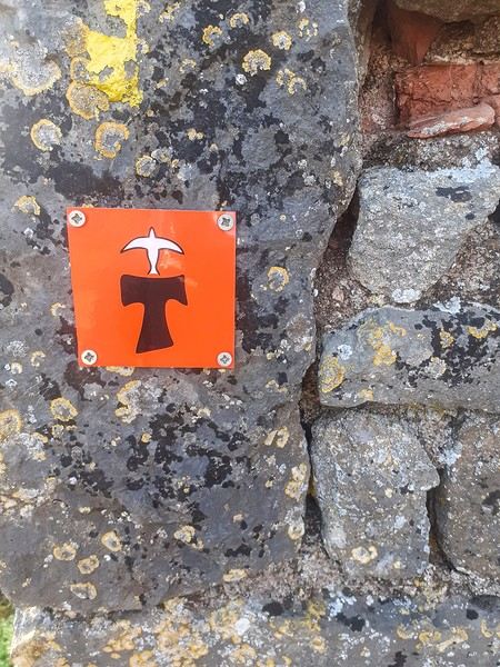
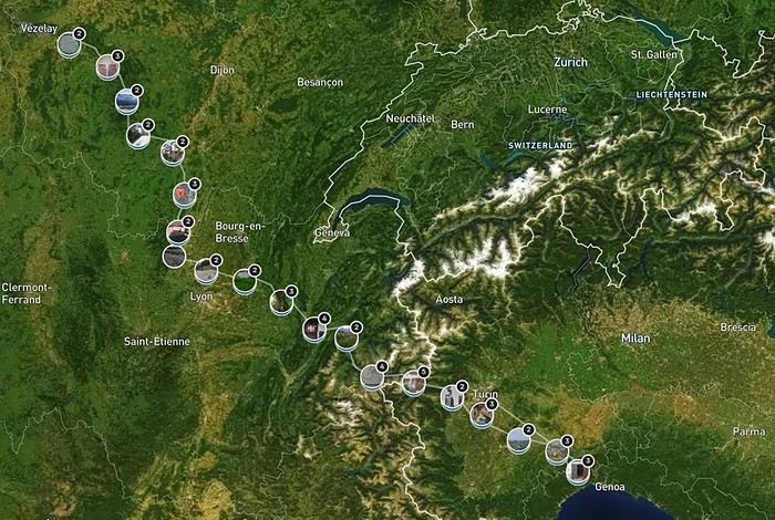


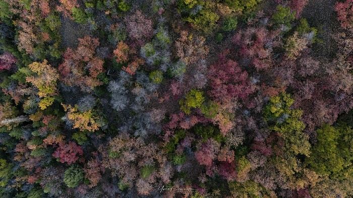
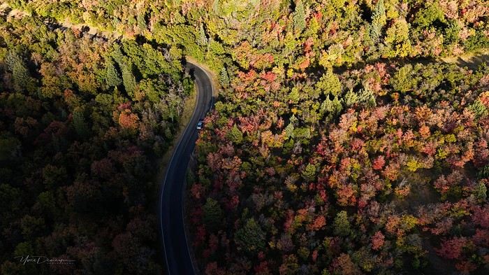
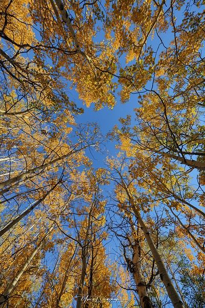
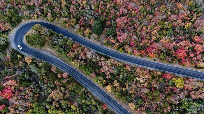
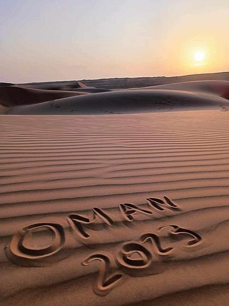
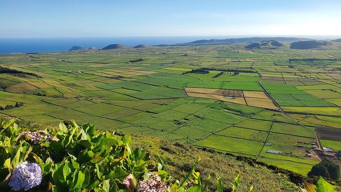
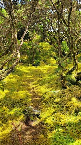
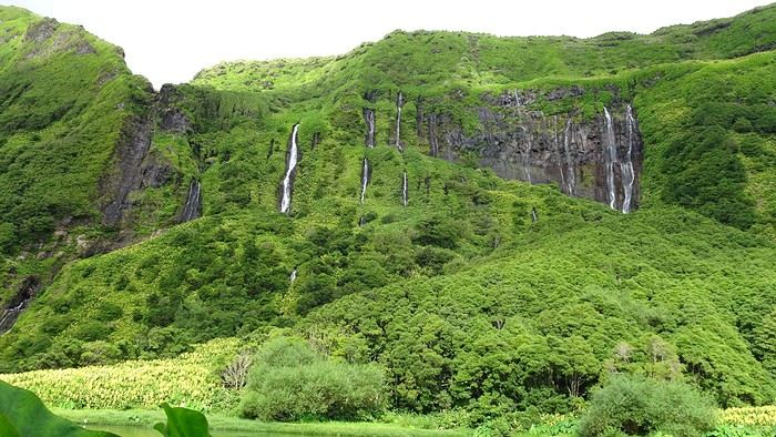 By car: Miradouro do Portal (great view of the coast to Fajã Grande) – Rocha dos Bordões (basalt columns) – Miradouro das Lagoas Rasa e Funda (a must) – Miradouro da Fajã do Conde.
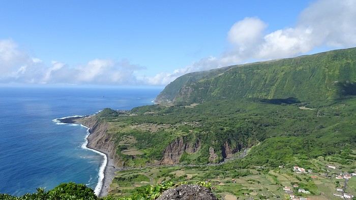 Hike: Miradouro das Lagoas Funda e Comprida, Lagoa Negra, Seca e Branda, Lagoa Branca. A bit muddy and not as memorable as other hikes. The best part (a must) is the view from the starting miradouro.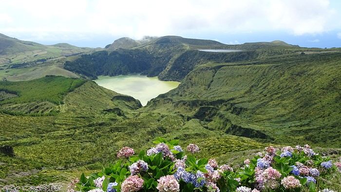
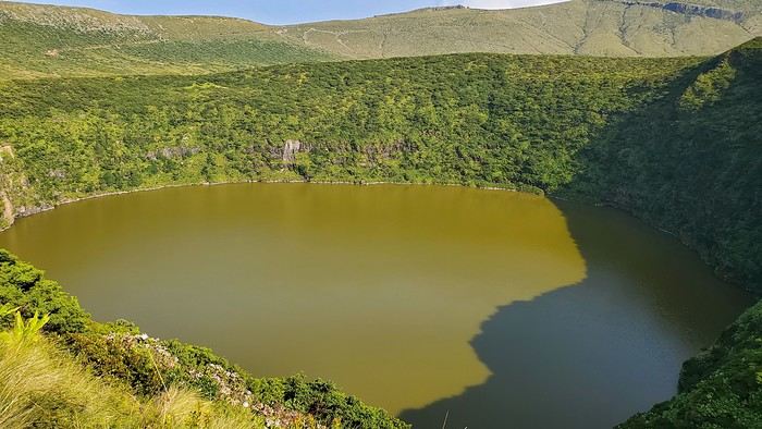
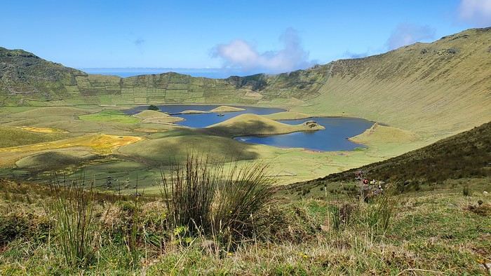
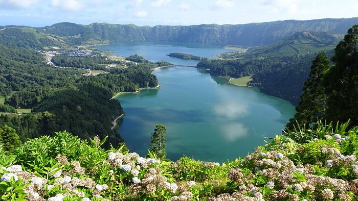

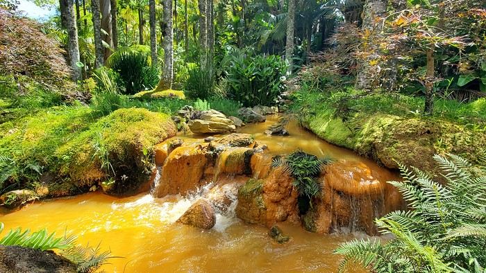
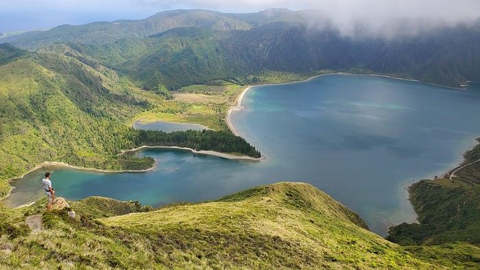
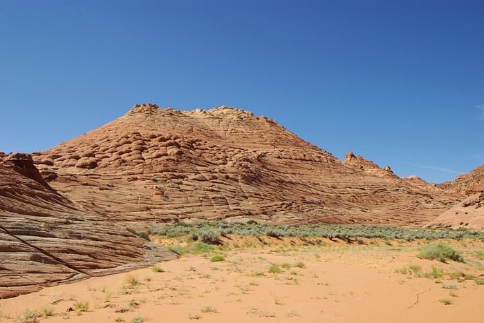
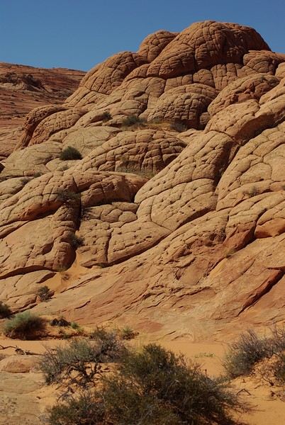
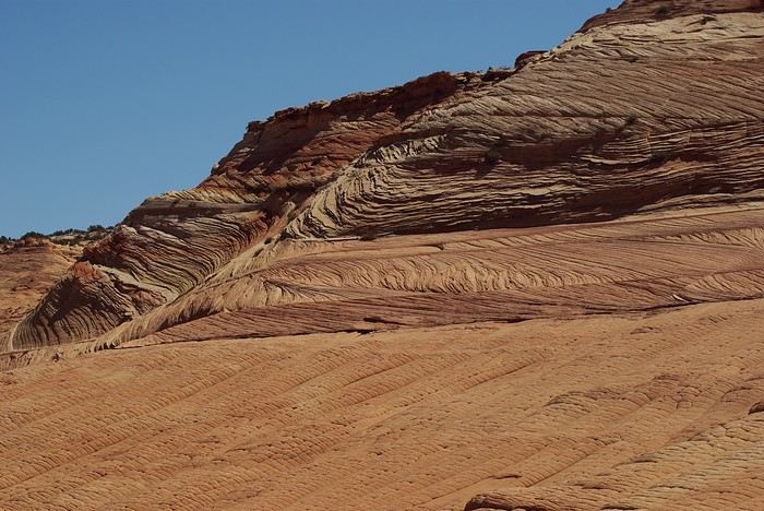
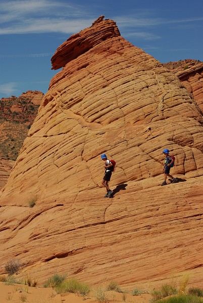
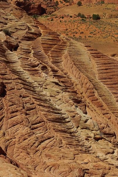
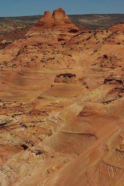
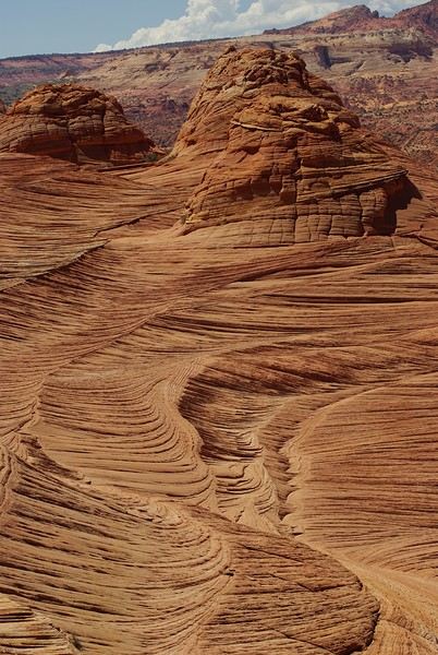
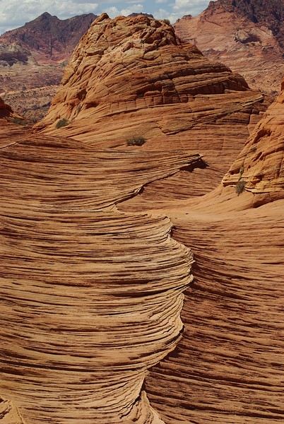
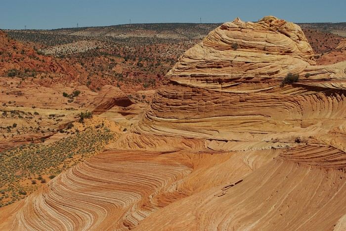


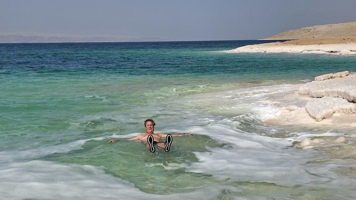


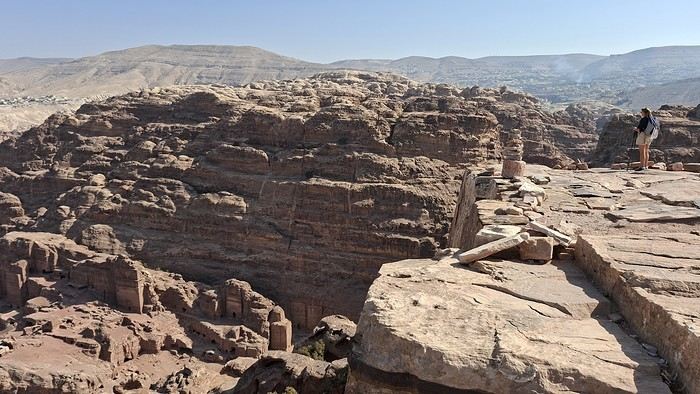
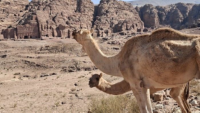
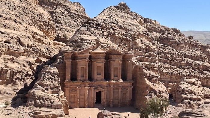
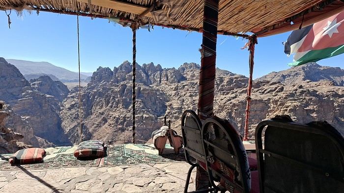
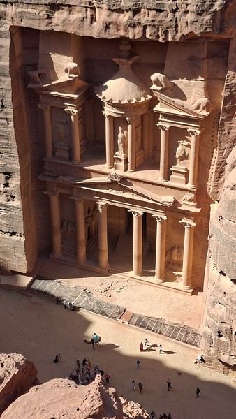
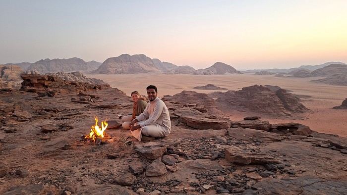
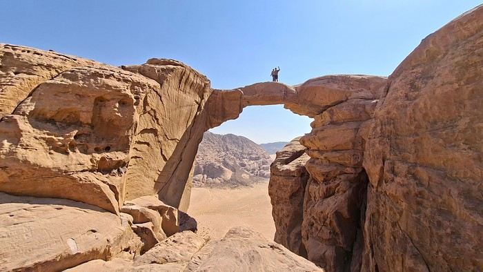
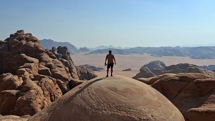


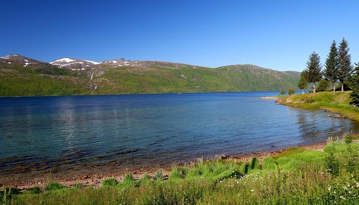
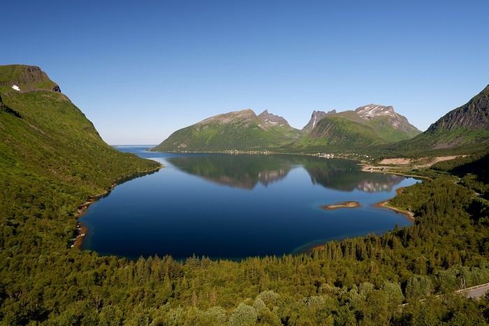
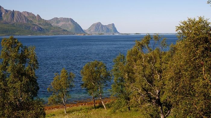
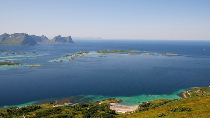
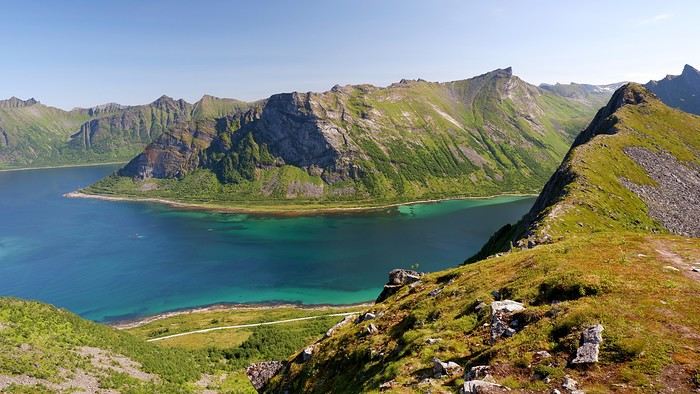
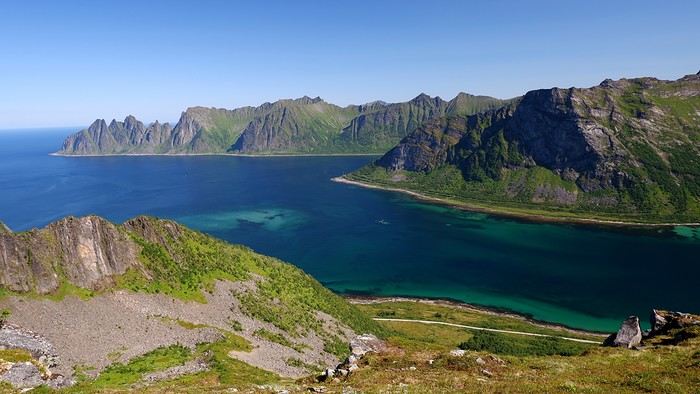
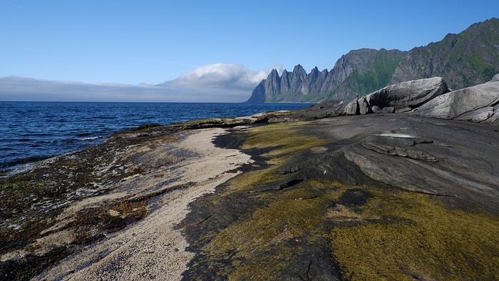
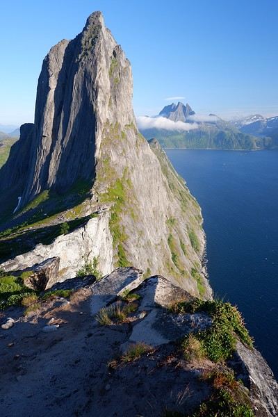
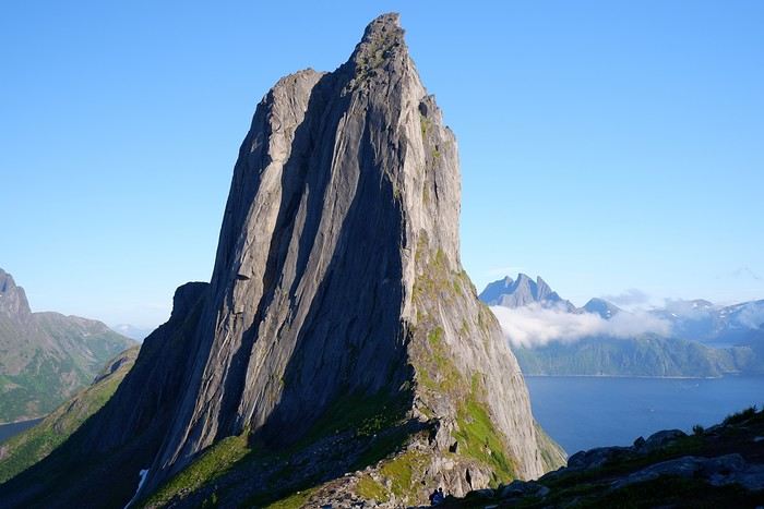
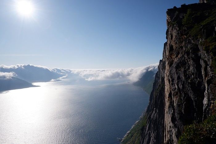
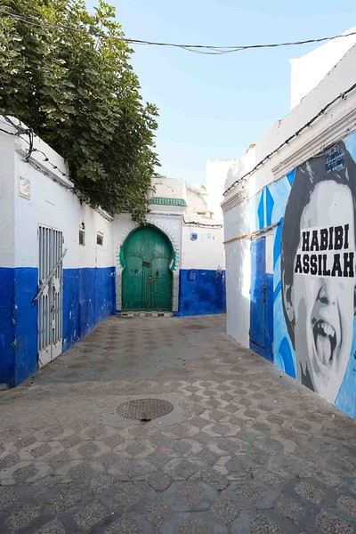
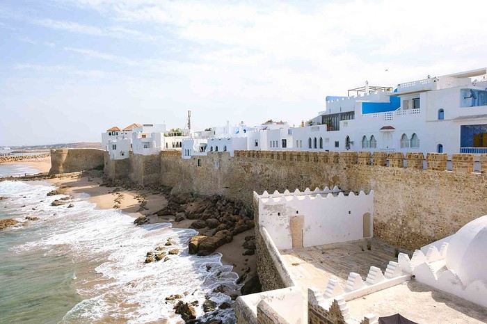
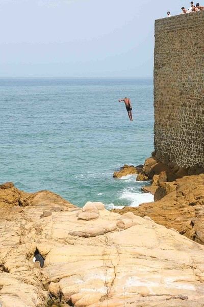
 The water park that was open during our stay was Typhoon Lagoon. We spent a morning there lounging and swimming before heading to Disney Springs (the equivalent of Disney Village in France). We’re not big on pools or chilling out, so we didn’t stay long, but there was no time limit.
 We chose to stay at the Disney’s Art of Animation hotel, a Resort (huge, like everything there!) with 4 themed areas: Nemo, Cars, The Lion King, and The Little Mermaid (where the rooms for 4 people or fewer are located).
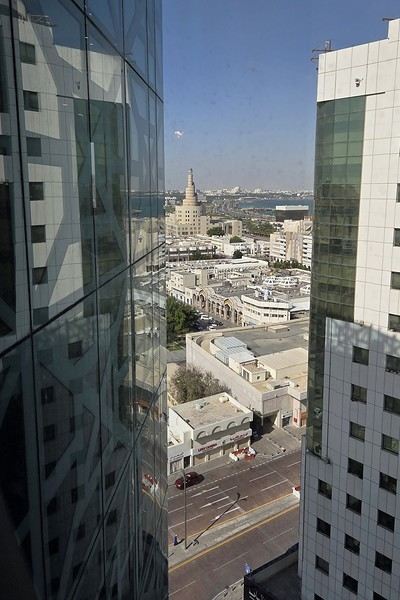
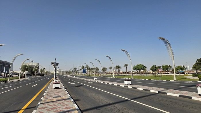
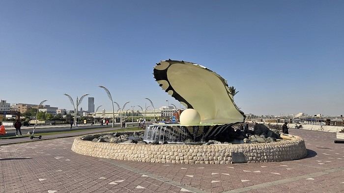
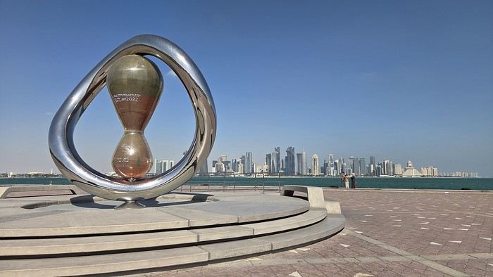
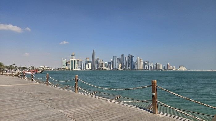

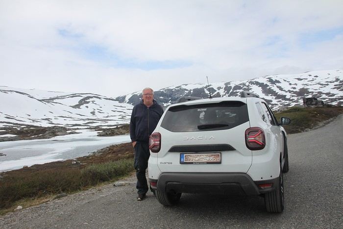
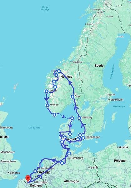

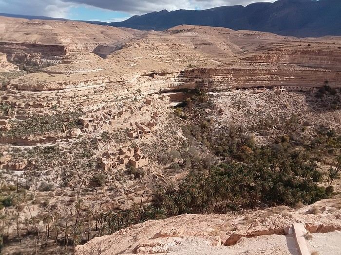 Tuesday, November 18th, flight from Montpellier to Oran and 4 days at Ali’s place in a rented apartment for 8,000 dinars per day. Saturday the 22nd, direct flight from Oran to Ghardaïa for 33 euros, which I booked through Booking since you can’t book domestic Air Algérie flights from France unless you have an Algerian credit card.
The only foreigner on board, they asked me three times if everything was okay, if I needed anything... Upon arrival, the police knew, asked where I was staying, I waited for the hostel taxi (Taskift for 8,000 dinars with half-board), they took a photo of his papers, and that was it.
Tuesday the 25th, Ghardaïa to Ouargla by minibus for 400 dinars, then a big bus to Biskra for 750 dinars. Night at the brand-new Cristal Hotel for 4,500 dinars. And of course, on the way to the balconies of Ghoufi and the Aurès massif—breathtaking!!!
Wednesday the 26th, left too late for Batna, no shared taxis after 3 PM, but my taxi to the bus station handed me off to a minibus driver and asked him to find me a taxi in Batna for Timgad. One call, and it was all set. 250 dinars to Batna and 1,200 dinars to Timgad. It was dark, 1°C, and raining—slippery.
Phew, arrived at 6:45 PM. Lovely Trajan Hotel right on the Roman ruins site for 9,000 dinars.
Thursday the 27th, Timgad at 9 AM, 5°C, and no more than 8°C expected all day. Gotta bundle up for the visit. Snow on the mountain and a freezing cold wind.
That’s the logistics. The euro is at 180 dinars.
Thanks to the Algerians for taking such good care of me like a queen—I can’t wait to come back. See you soon
Tuesday, November 18th, flight from Montpellier to Oran and 4 days at Ali’s place in a rented apartment for 8,000 dinars per day. Saturday the 22nd, direct flight from Oran to Ghardaïa for 33 euros, which I booked through Booking since you can’t book domestic Air Algérie flights from France unless you have an Algerian credit card.
The only foreigner on board, they asked me three times if everything was okay, if I needed anything... Upon arrival, the police knew, asked where I was staying, I waited for the hostel taxi (Taskift for 8,000 dinars with half-board), they took a photo of his papers, and that was it.
Tuesday the 25th, Ghardaïa to Ouargla by minibus for 400 dinars, then a big bus to Biskra for 750 dinars. Night at the brand-new Cristal Hotel for 4,500 dinars. And of course, on the way to the balconies of Ghoufi and the Aurès massif—breathtaking!!!
Wednesday the 26th, left too late for Batna, no shared taxis after 3 PM, but my taxi to the bus station handed me off to a minibus driver and asked him to find me a taxi in Batna for Timgad. One call, and it was all set. 250 dinars to Batna and 1,200 dinars to Timgad. It was dark, 1°C, and raining—slippery.
Phew, arrived at 6:45 PM. Lovely Trajan Hotel right on the Roman ruins site for 9,000 dinars.
Thursday the 27th, Timgad at 9 AM, 5°C, and no more than 8°C expected all day. Gotta bundle up for the visit. Snow on the mountain and a freezing cold wind.
That’s the logistics. The euro is at 180 dinars.
Thanks to the Algerians for taking such good care of me like a queen—I can’t wait to come back. See you soon