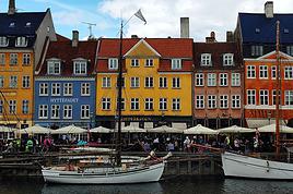
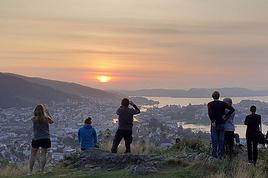
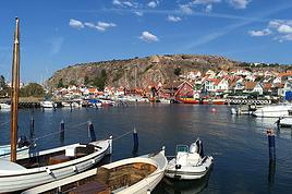
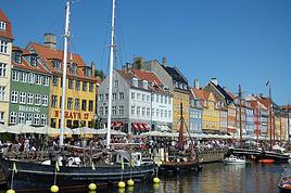
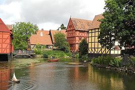
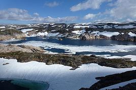
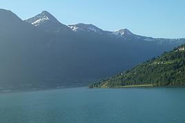
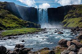
Kattegat isn’t just the name of the village in the TV series *Vikings*—it’s also the stretch of water separating Denmark from Sweden... the sea, basically! And further north, you’ve got Norway and its fjords!
Originally, I’d planned to just do a loop around Kattegat, with the *Under* restaurant in Lindesnes as our anniversary treat... but along the way, we thought, why not "push" a little further north, keeping an eye on the budget since we’d chosen to travel by car in June 2025 through Scandinavia.
Why by car when most travelers opt for a camper van, while others prefer the comfort of cruises?
Well, because we don’t own a camper van, renting one is pricey, and then you’ve got to add fuel costs (those things guzzle gas!), ferry fees, and other "tolls." All things considered, we went for mostly rentals—especially since there were four of us at the start of the trip.
We spent the first week in Denmark with our daughter and son-in-law. Then they flew back to Belgium, and we continued our adventure as a couple.
For accommodation, we mainly booked Airbnb apartments, which helped keep costs down and, most importantly, let us prepare our own meals (diet, diet!).
In this travel journal, you’ll discover (or rediscover, for those who followed my older ones) our unbridled love for theme parks, museums, unique experiences, and—especially in Denmark—Legos!
Unfortunately, we didn’t do any hikes this year because the unpredictable weather had made the trails slippery, and since I’d already taken three tumbles during the trip, I didn’t want to risk another!
In the end, we traveled for 32 days, covered 6,200 km, and most importantly, discovered the charming country of Denmark, marveled at Norway’s breathtaking fjords—all without suffering the heatwave that hit France and Belgium that June!
If you’ve got any questions, don’t hesitate to ask!
Hello and welcome aboard this travel journal.
We’re heading to Slovakia together!
Why this country?
After visiting Hungary, Slovenia, Romania, and Poland in recent years, I’ve fallen in love with Eastern European countries. I adore the Slavic soul, its Austro-Hungarian villages, the gentle landscapes, the Carpathian Mountains, and that slightly mysterious atmosphere.
Slovakia evokes a certain imagination with its deep forests, medieval castles, and cobbled villages.
After seeing photos of the High Tatras—especially Lake Štrbské Pleso and Spiš Castle—I thought, "Let’s do it! We’re going!"
So, will Slovakia live up to what I imagine?
We’ll find out together.
We decided to travel as a group of six (five adults and a six-year-old child), by car (we needed two).
Here’s the day-by-day itinerary for this family trip, which started with a 3-day stay in Vienna (see the dedicated travel journal):
The itinerary:
Day 1: Drive from Vienna to Banská Štiavnica and visit the town, then drive to Handlová
Day 2: Bojnice Castle, the village of Čičmany, and a walk in the treetops at Bojnice, return to Handlová
Day 3: Depart for Orava, visit Orava Castle and the Orava Skansen, drive to Veľký Slavkov
Day 4: Visit Slovak Paradise—its gorges, lakes, and ice cave—overnight in Veľký Slavkov
Day 5: Visit Bardejov, the "Death Road," wooden churches, and Ľubovňa Castle, overnight in Veľký Slavkov
Day 6: Walks and hikes in the High Tatras, Lake Štrbské Pleso, Solisko summit, treetop walk in Ždiar, overnight in Veľký Slavkov
Day 7: Drive to Košice, visit Spiš Castle, Tokaj wine route in Veľká Trňa, overnight in Košice
Day 8: Visit Košice, overnight in Košice
Day 9: Drive to Bratislava, stop at the Aragonite Cave in the Slovak Karst, overnight in Bratislava
Day 10: Visit Bratislava, overnight stay
Day 11 and 12: Return to France
Budget:
I’m giving prices for 2 adults / 1 child.
Slovakia is more expensive than it seems, and some expenses shouldn’t be underestimated.
Transportation:
Tolls and gas from France: 500 € round trip
Slovak vignette for one month: 17.10 €
Gas is fixed at 1.49 € per liter (E10)
Parking at sites (all paid by the day, even in the most remote villages, even if you stay for just an hour). Payment is often required in cash upon arrival: total 63 €
We didn’t pay at Spiš (we arrived before the cashier) or Ľubovňa (we arrived after the cashier left). Parking at Orava Village was free. In Košice and Bratislava, we parked for free at our accommodations.
Public transport in Bratislava and Košice: 1-1.2 € for a bus ticket. Vending machines are available at some stops; otherwise, buy via SMS (Slovak phones only) or official sales points.
Accommodation:
We mostly chose houses so we could cook ourselves and save on food. I’ve rated our satisfaction with these accommodations from 1 to 5 stars.
Padua: DC Hotel: 1 night, 77 € *****
Handlová: Chata Remata: 2 nights, 120 € *****
Veľký Slavkov: Aplend: 4 nights, 220 € **
Košice: Luxury Old Town Loft 320m²: 2 nights, 120 € *****
Bratislava: Hotel Viktor: 2 nights, 138 € ***
Brescia: Hotel Antica Fonte: 1 night, 82 € *****
Total: 757 €
Food:
Groceries at Lidl for 5 meals for 3: 100 € (really cheap)
Restaurants: 10-15 € per dish, ice cream 1-2.4 € per scoop, crêpes 8-12 €, a glass of wine 6-10 €... total: 500 €
Visits:
There are discounts for seniors and children, which is great.
We spent nearly 600 € in total, which is a lot.
However, it’s a cultural destination with many castles, museums, caves, wine cellars, and nature activities: cable cars, canopy walks, paid hikes (Slovak Paradise gorges)...
In the end, this trip to Slovakia cost nearly 2500 € for 3.
We also need to add the Vienna portion to that.
Now, here’s the day-by-day account of this beautiful journey.
Our trip lasted a month, from March 10 to April 10, 2024, and was done aboard our Land Rover Defender 110. For those interested, our 4x4 is equipped with mountain-approved 3PMFSF all-terrain tires (non-studded), a removable electric winch that can be attached to either the front or rear of the vehicle, two sand recovery boards, and we bring two pairs of snow chains. We sleep in our Land Rover, which is equipped with a diesel-powered independent heater, a small fridge, and has a layout that allows the dinette to be converted into a bed.
Starting from the Paris region, we crossed Belgium and Germany, took the ferry from Travemünde in northern Germany to Helsinki, followed the Russian border up to northern Finland, then headed into Norway all the way to the North Cape before returning via Norway, taking the ferry from Larvik in Norway to Hirtshals in Denmark, then passing through Germany and Belgium on our way back to France.
Tonight, March 10, 2024, we’ll be sleeping at our daughter’s place in the North.
Tuesday, March 11, we’ll cross Belgium and then enter Germany, where we’ll camp in Bremen.
Wednesday, March 12, we’ll have a quick visit to Bremen in the morning. We had planned to visit Lübeck, but some electrical issues with the car delayed us, so we head straight to the German port of Travemünde, where we’re set to embark at 11:30 PM to cross the Baltic Sea and arrive in Helsinki after 31 hours of sailing (one-way cabin ticket cost: 850 €—quite expensive since we booked last minute).
On the ferry, there are mostly semi-trucks and only a few campervans and passenger cars. The boat is quiet, and the Baltic Sea is calm.
About two hours before arriving in Helsinki, we hear noise along the hull. Surprise—looking out the porthole, we realize we’re sailing on frozen sea ice!
Thursday, March 14, we arrive at the port of Helsinki at 9:30 AM. Disembarking takes a while. As soon as we’re out, we head straight to Rastila Camping (cost: 27 €), about ten kilometers east of Helsinki. Then we go to a Land Rover garage to fix our headlight switch, which stopped working (a real hassle in Finland since you have to drive with low beams on at all times).
After the repair, we visit the stunning Temppeliaukio Church, which is built underground.
On our way back to the campsite, we stop at the supermarket for supplies. Prices are similar to France, except for imported products.
We stayed in Iceland from August 27 to September 13, 2023. Actually, this was our second trip to the island.
During our first visit, we rented a camper van from Snail Motorhome Rental, a family-run business that provided outstanding service.
Unfortunately, we discovered that this company no longer exists.
So, we rented a camper van through a third party, specifically via the Nordic Travel Group website.
We chose City Car Rental, located near Keflavik Airport, because the rental cost was really appealing.
Apart from the quality of the sleeping bags and the size of the pillows we rented, our experience with this company was very positive.
We noticed a significant increase in tourism since our last trip in 2015.
Several sites have been redeveloped, and parking is now paid in many places.
Accommodations have multiplied, not only near major cities but also in remote areas.
One notable advantage, however, was discovering the wide variety of food products available in supermarkets. In 2015, the selection was very limited.
I invite you to continue reading this travel journal and watch the videos that will let you explore this destination, which has everything to charm outdoor enthusiasts.
Videos are embedded throughout the summary. Click on the image to start the video.
To jump to a specific post, here are the relevant links:
Hlauptungufoss, Midfoss and Bruarfoss
Geysir, Blesi and Strokkur
Gullfoss
Brúarhlöð Canyon
Faxafoss
Kiðjabergsvöllur – Belvedere
Kerið Crater
Reykjadalur Valley – Hike to the hot springs
Seljalandsfoss
Gljúfrabúi Waterfall
Seljavallalaug – One of Iceland’s oldest geothermal pools
Skógafoss – Fimmvörðuháls hiking trail (partial)
Kvernufoss
Plane wreck at Solheimasandur
Dyrhólaey Peninsula
Reynisfjara Beach – Puffins and seals
Vík í Mýrdal
Fjaðrárgljúfur Canyon
Skaftafell National Park – Svartifoss, Magnusarfoss & Hundafoss
Svínafellsjökull Glacier
Hofskirkja Church
Fjallsárlón Glacial Lagoon (West)
Fjallsárlón Glacial Lagoon (East)
Jökulsárlón Glacial Lagoon
Litlanefsfoss and Hengifoss
Rjúkandi (Rjúkandafoss)
Stuðlagil Canyon
Selfoss and Dettifoss
Krafla – Viti Crater Lake
Krafla – Leirhnjúkur Lava Field
Hverir Geothermal Site (Námafjall)
Hverir – Hverarönd Geothermal Site – Blue Lagoon
Grjótagjá – Hot Spring Cave
Stóragjá – Hot Spring Cave
Goðafoss
Akureyri Zipline
Hofsós – Pool by the Skagafjörður Fjord
Víðimýrarkirkja Church
Hvítserkur Rock – The Troll of Northwest Iceland
Gislahellir (Gisli's Cave)
Dynjandi (Fjallfoss) – One of Iceland’s most beautiful waterfalls
Hellulaug (Natural hot spring pool)
Stykkishólmur – Stykkishólmshöfn Port
Kirkjufell & Kirkjufellsfoss
Ólafsvík – Bugsfoss
Lóndrangar Basalt Columns
Arnarstapi
Ytri-Tunga Farm – Seal watching
Deildartunguhver Hot Spring
Hraunfossar & Barnafoss
Exploring Reykjavik
Reykjavik – Whale Safari – Whale watching
Raufarholshellir Lava Tunnel
Gígvatnsvatn Lake (Green Lake/Graenevatn)
Seltún Geothermal Site (Krýsuvík)
Kleifarvatn Lake
Blue Lagoon Thermal Spa
Gunnuhver Geothermal Site
Reykjanes Peninsula – Reykjanesviti Lighthouse
Reykjanes Peninsula – Valahnúkamöl – Reykjanestá
Ægissíðufoss
Super Jeep excursion to Landmannalaugar
Hiking in Landmannalaugar
Scenery along the way
It’s been a while since I last posted... so I’m jumping back in with this amazing trip we took in October 2025:
We’re doing this trip with fellow traveler friends who, like us, have already been to Japan. That means we can aim for a different side of Japan, away from the usual tourist circuits. That’s why I opted to rent a car instead of relying on trains.
I was drawn to the castles and the samurai-novel atmosphere.
When I plotted the sites I wanted to visit on Google Maps, it suggested a return route via the island of Shikoku, so it turned into a nice loop around the Seto Inland Sea between Kyushu, Chugoku, and Shikoku.
The trip will be just the four of us, doing it all independently.
I rented a car from Budget in Fukuoka. Before heading over, I watched several videos to get an idea of what to expect—road signs, parking, and general driving behavior. In Japan, they drive on the left, but that’s not an issue since in Southern Africa we also drive on the “wrong side of the road,” so I’m used to it.
For accommodations, after checking with two agencies, I decided to handle it myself. It saved a significant amount of money, and I was able to choose exactly what I wanted.
I know I can be picky about the type of lodging I want, especially in Japan where you can really treat yourself. We stayed in some stunning ryokans, once in little cabins run by monks next to a temple, and more.
CORSICA From September 24, 2024 to October 9, 2024
Thank you, thank you, thank you for reactivating my favorite forum, which has given me so many ideas for my trips since... 2008—it’s been ages, as they say!
So, to celebrate its return, I’m sharing this little travel journal from our latest road trip, not too long ago, since it was Corsica in the autumn.
Autumn is the ideal season to visit Corsica: fewer tourists, perfect temperatures around 25°C, and, most importantly, less stress on the roads. You can feel it everywhere. Servers and shopkeepers are more relaxed and have time to chat (yes, Corsicans do talk... but not all of them!)
09/24 Arrival in Erbalunga
Whether you're from northern France or Belgium, like us, the easiest way to reach the Isle of Beauty is by flying from Lille-Lesquin Airport. Volotea offers two destinations: Bastia and Ajaccio. Be careful, though—while the ticket prices are attractive, the airline makes up for it with baggage fees. A 25kg suitcase for 212 €—that really drives up the cost of transportation!
For us, it’ll be Bastia.
After this short flight and an arrival that lets you clearly see the east coast of Cap Corse, we’re welcomed by our friend Jean-Claude, who’s kindly hosting us for a few days. We met this Corsican and his wife during our four-year stay in French Guiana, and I have to say, he completely changed my opinion of Corsicans and even made me want to visit his island.
The house, clinging to the rock above the sea, is stunning and offers a breathtaking view of the island of Elba. I’d always heard of Elba but must admit I wouldn’t have known where to place it before. We’ll stay here for five nights, long enough to explore the north of the island.
Since we’ve just arrived, Jean-Claude wants to show us his village, ERLALUNGA, a quiet little port, and the small village of CASTELLO above it, where he spent a lot of time in his childhood...
My buddy Christian and I (Patrick) are off for 28 days in Argentina in March.
We’ve already shared several trips as a duo (Bolivia Peru, Namibia, Laos, Costa Rica).
Since we’re starting from the idea that at our age (65) we won’t be coming back here—there are just too many other corners of the world to discover—we did the "grand tour" of Argentina, with 6 domestic flights to make the most of our 28 days.
Here are our stops:
1) Departure from Brussels to Buenos Aires via Madrid
2) Arrival and first contact with Buenos Aires
3) Early morning flight to Ushuaia. Boat trip on the Beagle Channel
4) Ushuaia: hikes in Tierra del Fuego National Park
5) Ushuaia: last hike and flight to El Calafate
6) El Calafate to El Chaltén by bus. First hike
7) El Chaltén: hike
8) El Chaltén: hike
9) El Chaltén: hike and bus back to El Calafate
10) El Calafate: Perito Moreno Glacier
11) Flight to Bariloche. Car rental and surrounding areas
12) Seven Lakes Region
13) Nahuel Huapi National Park region
14) Flight to Salta. Car rental
15) To Tilcara
16) To Humahuaca
17) To Purmamarca
18) To Jujuy via the salt flats
19) To Cafayate
20) Around Cafayate
21) To Cachi
22) Back to Salta
23) Flight to Iguazu
24) Waterfalls on the Argentine side
25) Waterfalls on the Brazilian side and flight to Buenos Aires
26) Buenos Aires
27) Return flight
28) Morning arrival
Happy reading!..
This time, I landed in Monastir on a direct flight from Nice, again with Tunisair. We left about ten minutes late, and the flight lasted around 1 hour 30 minutes. A meal was served on board (cucumber salad with Edam-like cheese, carrots, and two small portions of dishes I couldn’t identify—semolina with peppers, olives, and parsley, two small rolls, a square of processed cheese, and a chocolate cake). It’s worth noting because it’s not common on flights this short.
In February, France and Tunisia were in the same time zone, but now Tunisia is one hour behind. This time difference and the flight duration work perfectly for a short 15-day trip since it takes me a few days to adjust to jet lag.
Luckily, I’d asked my hotel about the taxi fare from the airport because the drivers (there were several around me) didn’t hesitate to quote outrageous prices. The actual fare is 20 dinars, but one asked for 120 dinars. I refused, and another offered 60 dinars. I replied, "That’s too expensive—I’ll take the metro!" (Having tried the Tunis metro, I had no desire to repeat the experience in Monastir with a suitcase!). I started walking toward the metro, and one of the drivers caught up with me, saying, "20 dinars is fine!" I’ll skip the details, but the negotiation took a little while.
When I arrived at the hotel, I told the receptionist someone had asked for 120 dinars. He put his hands to his head and said, "They’re awful!" He remembered our phone call two days earlier when I’d booked (he’s the one who told me I could take the metro).
The Mezri Hotel isn’t expensive. I got a sea-view room for 75 dinars (22 €). (I’d booked a balcony room for 90 dinars but wouldn’t have had time to enjoy it.) It’s well-located but noisy because there’s no double glazing.
The receptionist is a very kind older gentleman. He called a friend whose wife is from Tozeur to find out if I should take a bus or a *louage* tomorrow and what time.
I arrived at the hotel around 7:00 PM and had time to stroll along the corniche to the ribat. Despite some run-down buildings, the seaside seemed livelier and cheerier than Sousse’s.
Monastir is the hometown of former president Bourguiba. I passed his mausoleum by taxi. There are Tunisian flags along the avenue by the sea because every year on April 6—the anniversary of Habib Bourguiba’s death—the president of the Republic visits the Bourguiba Mausoleum in Monastir to pay respects.
The taxi driver mentioned other Tunisian presidents. He complained about rising prices and insecurity, blaming President Kaïs Saïed (I’d already heard that security was better under Ben Ali).
At the end of my stay, I’ll take time to explore Monastir, but tomorrow morning, I’m off to Tozeur—a long bus ride awaits me.
From Southern Shikoku, between land and sea, to the blue waters of Miyakojima and finally Tokyo’s megacity
Hi everyone,
I have to admit, I really hesitated before deciding to write this travel journal... Writing one takes a lot of time and energy, and since this is my 4th trip, I wondered if it would even interest anyone other than myself (both for the discovery and the writing). But after a few people asked, "Are you going to write a journal?" and especially after rediscovering the joy of reading other travelers’ journals about Japan or elsewhere on this forum, I’ve decided to share my 4th installment in the Land of the Rising Sun here.
The itinerary:
27 full days, from late May to late June 2025, right in the middle of the rainy season, including:
-->13 days in Shikoku, from Kochi (Kochi Prefecture) to Matsuyama (Ehime Prefecture)
-->7 days in Miyakojima (Okinawa Prefecture)
-->7 days in Tokyo
The trip was decided on fairly last-minute again this year.
Since I regularly check flight prices to track fluctuations for this destination even without concrete plans, stumbling upon a slightly cheaper direct flight (900 €) than what I’d seen in previous months (around 1,200–1,400 € on average) for a Paris-Tokyo route with Japanese airline ANA was too tempting to resist the urge to return to this enchanting country. After much hesitation between exploring the San’in region (Matsue, Tottori, Yamaguchi) and Southern Shikoku, the decision was made—I took the plunge! The ticket is booked: Paris to Kochi with a layover in Tokyo, all with ANA, the airline I’d been dreaming of... for 1,120 € per person. Okay, it’s not cheap, but it’s better than in 2023.
Departure in 2 weeks! Now I just have to get everything ready!
Intense prep work over these next 2 weeks to:
finalize a more precise itinerary and reach an agreement—yep, because even though we both love Japan, our preferences differ slightly, and we have to choose between exploring new places or revisiting beloved spots...
decide how much time to spend in each area without rushing while still exploring
research places that might interest us and watch videos about Japan
book accommodations: yes, it’s possible to do this on the spot, but last year, we realized that last-minute options were pretty expensive, so we’re booking ahead—though we’ll keep a few options open in case better deals pop up later
reserve rental cars
order yen
check the weather regularly and wonder if choosing the *tsuyu* (rainy season) was really a good idea—are we going to be drenched the whole time???
"What hard work," you might say! Going to Japan for a month—what a tough life!
Despite this being my 4th trip, the excitement is just as intense as the first time.
The only small downside is that when we booked the flight, there weren’t many seats left, so we’re only sitting together on the international return flight. Plus, on the way there, we have middle seats.
Another lingering question: what French-language films will be available? According to the internet, the selection seems limited.
Oh well, these are just minor details—it’s already time to fly!
PS: I’ll be posting slowly and irregularly... so for those interested, be patient, and maybe set an alert...
Here’s a little story about my first trip to Japan with my partner.
We went for our first visit from October 29 to November 13, 2024.
I had planned this entire trip back in November 2020, but given the health situation at the time, I had to cancel...
Here’s the classic route we took:
We booked everything ourselves and got a regional pass for the area from Kyoto to Hiroshima.
The hotels were reserved 3 months in advance on Book... and Agod... (1030 € for 2 people for 13 nights = 80 €/night).
For the flight, we chose a Qatar Airways flight with a layover to break up the long journey (950 € per person).
We also got a pass on the same site (Japan-Experience) to take the train connecting Narita Airport to Shibuya Station (the N'EX Narita Express).
Since the airport is 75 km from central Tokyo, we opted for this mode of transport, even though there are cheaper alternatives.
After reading various posts on VoyageForum, I understood how important it was to have a Welcome Suica card to pay for public transport (subway, tram, bus, boat throughout the country), and we were able to buy one at Narita Airport.
It turned out to be super useful!
After a long but smooth journey, we found ourselves at Narita Airport in the evening.
Even though we had a pass for the Narita Express, we had to go to a counter to make a reservation for the train (mandatory).
Then, once we arrived at Shibuya Station, we took the subway for 2 stops and finally reached our hotel, exhausted (Hotel Asia Center of Japan – 270 € for 3 nights with breakfast included).
A horseback ride by the sea on the Caribbean island of Saint Martin
or ... on the beach, but at a walk and trot!
It was probably these visions that gave me the irresistible urge to do this horseback trek—to walk on the sand, but as a rider, and also enjoy a swim that was anything but ordinary.
From wish to reality ... all it took was heading to Ranch du Galion. Here we are, on the heights of the east coast of the charming island of Saint Martin, in the heart of the Caribbean.
After a first horseback ride that we really enjoyed, with a simple trip to the beach, it didn’t take much to make us want to repeat the pleasant experience. My daughter Emma had been dreaming of it too—so why not share this change of scenery, but this time opting for a slightly longer trek?
It’s the big day. And Jess is there to greet us this morning with a big smile. Jess—or Jessica—is the one who runs this tropical ranch with passion; she looks after a whole little family of horses. This morning, she’ll be our guide and companion for this seaside horseback ride.
So, we set off along the wild shores of the stunning Anse du Galion.
In the enclosures, behind the fences and ropes, some stallions already seem impatient to stretch their legs! They know the place, the routines, and the trails ... and the soothing reward halfway through—a dip in the sea. Maybe that’s what’s causing a little excitement among these mounts!
Horses and ... an iguana slipping into the bushes. Given its appearance—its crest, its parched skin, and the dewlap hanging under its head—you’d think it wasn’t exactly young.
Anyway, back to the horses. Among the mares and stallions, I try to spot "Avenir" and his elegant gait—he was "my" horse during my last trek here, on the trails and sands of Galion.
Well, spotting him isn’t going to be easy! My memories are a bit fuzzy, and several of these horses look like him ...
--
Before setting off on the trek, it’s time for Jess to choose our mounts. For riders with little experience ... it’ll be calm horses, well-used to trekking—definitely easier and more enjoyable.
Titia, a beautiful white mare for my daughter, and Prince, a gentle stallion for me. A little anecdote along the way: we’re really staying in the family for this horseback ride—these two horses are actually related: "my" Prince is the son of the lovely Titia!
For those who can’t travel right now, I thought I’d offer a little escape—maybe!—through some images of Corsica (where I’ve lived for 48 years).
This won’t be a structured travel journal or a step-by-step story, just a mishmash of landscapes and more...
Through these photos, we’ll jump from one place to another, one season to the next, with no real order.
I debated adding details to each image but decided that for daydreaming, you don’t need much chatter—maybe just a place name.
....
Around Ajaccio:
-1-
.
-2-
.
-3-
.
-4-
.
The last sunset of 2025 over the Gulf of Ajaccio.
-5-
.
Five years of an unintended break... The closure of VF, COVID... What a joy to rediscover the pleasure of sharing!
I’ve stayed true to my habits: the following account is a collection of practical tips rather than a travel journal...
Madagascar is as big as France and Belgium combined. In three weeks, choices have to be made! It was the Great Tsingy that inspired our trip. We decided to focus on the southwest and the RN7. We skipped the Deep South and the North. Oh well...
OUR ITINERARY IN 3 WEEKS:
Fri 6 June – Direct AF flight to Tana – Flight arrives at 10:30 PM – Tana
Sat – Antsirabe
Sun – Miandrivazo
Mon – Drive to the Masiakampy pier – Descent of the Tsiribihina River by pirogue - Bivouac
Tue – Descent of the Tsiribihina River by pirogue - Bivouac
Wed – Descent of the Tsiribihina River by pirogue – Bekopaka
Thu – Pirogue on the Manambolo River and Small Tsingy of Bemaraha – Bekopaka
Fri – Great Tsingy of Bemaraha – Bekopaka
Sat – Avenue of the Baobabs – Morondava
Sun – Belo sur Mer
Mon – Free day – Belo sur Mer
Tue – Manja
Wed – Andavadoaka
Thu – Free day – Andavadoaka
Fri – Salary Lagoon – Mangily
Sat – Ranohira
Sun – Isalo National Park - Ranohira
Mon – Anja Reserve - Ambalavao - Fianarantsoa
Tue – FCE train canceled – Visit to a Tanala village - Manakara
Wed – Pirogue on the Pangalanes Canal – Ranomafana
Thu – Ranomafana NP – Ranomafana
Fri – Ambositra – Antsirabe
Sat 28 June – AF flight to Paris – Flight departs at 11:55 PM
TRIP ORGANIZATION:
I prepared my trip using the usual guides (LP and Rough Guide), the internet, and the Freytag & Berndt map (1:1,000,000). I’m old-school—I still love visualizing my route on a paper map, even though in Madagascar, it’s misleading because some National Roads are only national in name!...
The agency:
Since we couldn’t deal directly with a driver-guide (we lacked reliable info to take the plunge), we went through an agency to organize the logistics of our trip. We didn’t feel like using bush taxis (not enough time) or driving a 4x4 ourselves (neither the skills nor the boldness).
The French agency connected us with a local agency, to whom I sent my detailed itinerary by email. A few exchanges via email and WhatsApp calls allowed us to finalize everything quickly after some adjustments.
As you’ve gathered... we multiplied the commissions, which inflated the budget. That said, in the end, we were thrilled with our decision and our choice.
Our trip was booked by the end of 2024, and reservations were made immediately. No bad surprises: the bookings in the planned hotels were honored, often with one of the best rooms.
On our last day in Tana, before departure, we were lucky enough to meet the director I’d been communicating with, who helped build and validate our circuit. A very warm debriefing.
The driver-guide:
The agency assigned us Faly, 33, a driver-guide for over 10 years.
He stayed with us from start to finish: he picked us up at the airport on arrival and dropped us off 23 days later.
A very experienced driver (which is important here), an open and cultured guide, reliable, punctual, and a great companion. And a provider of good advice throughout the trip.
We made the most of the long stretches on dirt roads or highways to listen to him talk about daily life, rituals, wildlife, and flora... No time wasted! With a great playlist in the background, we combined business with pleasure!
Faly’s accommodation and meals were included (quite often, hotels offer free lodging and meals to driver-guides who bring clients), as was the fuel. That didn’t stop us from inviting Faly to share a beer or our evening meal sometimes. He didn’t always accept, wanting to let us "enjoy our romantic evenings," as he put it. Present without being intrusive!
Faly is fully capable of organizing a tailor-made trip directly. I recommend him without any hesitation—we were delighted with his service. I’ll gladly share his contact details via PM to anyone who asks.
Local guides:
It’s the national guide’s prerogative to choose the local guides (mandatory in the parks).
Thanks to his experience, Faly always booked us amazing, competent, and interesting local guides.
Hotels:
I told the agency I wanted charming, comfortable accommodations, without falling into flashy luxury.
We loved all the hotels (except the Hôtel Kanto in Manja). The rooms, mostly bungalows, were always spacious and clean. Unfortunately, I can’t give the prices—I didn’t get the details.
Breakfast is always included, usually fresh and hearty. Very often, a small bottle of water is provided in the room.
Tana
Hôtel Les 3 Métis
Power cuts are common (!) in Tana. Bring a headlamp.
Antsirabe
Ecolodge – Les chambres du voyageur
Maybe our favorite! A few bungalows, beautifully arranged in a splendid tropical garden. The dog Kodak welcomes us warmly.
Miandrivazo
Hôtel Princesse Tsiribihina
Magnificent view of the valley.
Bekopaka
Hôtel Orchidée du Bemaraha
2 (yes, 2) beautiful pools, a large open common room.
Morondava
Hôtel Baobab Café
Brand new or at least, according to Faly, just renovated.
Very comfortable but without much charm (international style).
Belo sur Mer
Ecolodge du Menabe
The bungalows, all made of wood, bamboo, and thatch, are set on the beach. Very spacious and fully equipped!
Large open-air restaurant by the sea.
No hot water from the tap—it’s available in plastic bottles heated by the sun in front of each bungalow. Actually, we never used it...
Another very, very beautiful spot.
Manja
Hôtel Kanto
The only hotel on this leg of the journey, so no choice. The owner knows it and, as a result, doesn’t bother.
It’s a real dive! Tiny, dark room, a sordid bathroom with only a trickle of water—we skipped the shower! Clean sheets, though.
Obviously, no Wi-Fi.
The only place where I didn’t leave a tip.
We were well warned about the discomfort of this stop, both by the agency and Faly. We weren’t surprised, and it even became a running joke during the trip.
On the other hand, we found a nice little market in town.
Andavadoaka
Manga Lodge
What bliss! Especially after the horrible Hôtel Kanto.
A paradise-like spot, overlooking three beautiful deserted white-sand beaches.
Meals are served on the terrace facing the sea. Stunning sunset.
We loved spending a day lounging here! We were the only guests and were pampered.
Mangily (Ifaty)
Mangily is the "suburb" of Ifaty.
Hôtel Vovo Telo
A large beachfront bungalow complex. More touristy but pleasant—we spent a lovely evening there with our feet in the sand.
Ranohira
Le Relais de la Reine
A splendid resort built by a Frenchman, at the foot of the rocks, very well integrated into the environment.
Beautiful marked trail starting from the garden.
Fianarantsoa
Villa Sylvestre
Contrary to what its name suggests, it’s a hotel right in the city center. Quite decent, though.
Manakara
Parthenay Club
Pretty bungalows in a large garden by the sea, but swimming isn’t safe—the water is too dangerous and rough.
Ranomafana
Hôtel Thermal
Very spacious rooms.
Meals:
Not all our meals were included. It’s really not expensive.
1 meat or fish dish: around 35,000 Ar
1 full menu (starter, main, dessert): around 70,000 Ar
1 large THB beer (65 cl): between 8,000 and 12,000 Ar
1 piña colada: 15,000 Ar
1 flavored rum: 6,000 Ar (sometimes free)
1 glass of baobab juice (!): 5,000 Ar
We always ate very well. Rice is everywhere, served in large quantities.
Zebu meat is quite good if not overcooked.
Personally, I prefer fish, and I feasted: grouper, captain, crab, small lobsters...
We happily discovered baobab juice (especially in Belo, on the west coast).
And of course, flavored rums!
We bought 2 packs of 6 bottles of mineral water at Carrefour (!) (about 5,000 Ar per large bottle) at the start of our trip. That was enough, especially since we often got water in the bungalows.
We had a few picnics included in our trip. Instead of picking up the hotel’s lunchbox, Faly prepared delicious, fresh, and varied picnics for us: tuna pasta salad, fried rice with eggs, grilled vegetables, and avocado...
An exceptional address not to miss:
Mad Zébu – Belo sur Tsiribihina
A highly reputed restaurant, a favorite of LP and Rough Guide, and rightly so! Gourmet cuisine, refined and elegant. Barely more expensive than elsewhere, and it’s worth it.
We stopped there on our way up to Bekopaka and the Tsingy NP. Fully booked! So Faly reserved for our return, three days later. We’re still thanking him! What a treat!
THE BUDGET:
Ariary exchange rate: 5,000 Ar = 1 €
Pre-trip expenses:
Direct Air France flights: 930 € per person round trip
Cost of the circuit with the agency: 2,880 € per person
The visa:
Issued on arrival, very quickly. 35 € per person for a stay under 30 days. Super simple. Super fast.
On-site expenses:
As soon as we arrived at the airport (it was nearly midnight), Faly advised us to exchange our euros for all our needs. There are few opportunities on our route to find an ATM or an open bank with a good rate. To be more comfortable, he took us to a small office under military protection just outside the airport. I exchanged 1,200 € (I had asked the agency for advice on the amount to bring) at a rate of 4,750 Ar and became a millionaire. Faly recounted all the stacks.
That covered all our expenses (meals, drinks, tips) without ever feeling deprived. Personal purchases were made at the end of the trip. Convenient—it served as an adjustment variable. We spent our last million (200 €) on marquetry and vanilla.
Tip: We asked for 200,000 Ar in 5,000 Ar bills for tips. That wasn’t too much—I even ran short of small bills in the last two days.
Tips:
Madagascar is a poor country where every service deserves a small reward. While not mandatory, it’s customary. But no one ever demanded or expected it openly. On the contrary, I sometimes had to remind a porter to give them my small bill.
We never carried our luggage—porters were always present when the car arrived or waiting at our door to watch for our departure. I gave each of them 5,000 Ar.
In restaurants, I rounded up to the nearest ten and left the change.
Local guides also expect a tip: I gave around 20,000 Ar per day for the two of us.
Finally, the national guide also expects a gratuity. I had read online to budget 5 € per day per person. I added more since we were so happy with his services. The tip was given at the end of the trip, in euros, outside the budget.
Total budget all included (excluding personal purchases): 8,690 €
Clearly, Madagascar is a country where life isn’t expensive, but travel costs add up quickly due to the need to rent a 4x4 with a driver.
HIGHLIGHTS:
· The dirt roads
Yes, I’m listing them among the highlights!
We loved those long hours spent driving at 20 km/h on rocky, muddy, white, red, or gray sand tracks... surrounded by tropical vegetation, palm trees, pandanus, mango trees...
The experiences were sometimes thrilling: crossing a river on a ferry (just planks of wood fixed on two motorized pirogues side by side) or crossing a river without a ferry, with just a kid running ahead of the 4x4 to show the way; soft sand where the 4x4 easily gets stuck...
The tracks are quite narrow, and crossing paths with a bush taxi, a zebu cart, or a herd of goats is always epic. So many beautiful images, so many beautiful photos! Much more beautiful than on asphalt.
So yes, we loved those long stretches on dirt roads. For us, it was clearly part of the journey.
Faly was particularly careful, and the 4x4 was comfortable. No injuries, no fatigue, even after 7 or 8 hours on rough tracks.
The national roads (including the famous RN7) are badly damaged by cyclones, huge trucks, and lack of maintenance. Potholes have turned into ostrich nests, and we didn’t drive much faster than on the dirt roads.
· The landscapes, villages, encounters...
We crossed a variety of stunning landscapes: mountains with slopes covered in terraced crops, rice fields from apple green to emerald green, sugarcane fields, then tropical forests, baobab forests (they deserve a special paragraph below), traveler’s tree forests. And then coastlines with white sand dunes against a backdrop of blue hues!... Magical!
We also passed through many villages with houses whose architecture varied by region. The Betsileo houses display beautiful decorative brick reliefs. On the west coast, the houses are more precarious, made of bamboo with palm-thatched roofs. In the Highlands region, we found solid houses with pastel plaster. Each region has its own landscape, crops, habitat, and clothing.
Zebu carts are often the only means of transport in remote villages. We saw them very frequently. Again, the cart’s decoration depends on the region.
And then, we met many villagers coming out of the bush and walking to the next market, carrying their crops on their heads or shoulders.
More beautiful photos!
· The descent of the Tsiribihina River
We boarded around 9 AM in a long pirogue with Gana, the local guide, and two pirogue men. So, five of us. The pirogue is long but narrow, about 65 cm wide. We sat one behind the other at the front on seats padded with what would become our mattresses during the bivouacs.
We only took the bare essentials for two nights.
A little goodbye to Faly, whom we’d see again in three days! Don’t forget us!
The river is silty—meaning orange, opaque but clean.
We glided along silently. Gana showed us the trees, birds, crocodiles (we saw five—apparently, we were lucky). The pirogue men rowed to get us as close as possible to these crocs sunbathing on the roots of big trees. Yeah, right!... as soon as we got too close, *splash*, they disappeared into the water.
We marveled at the mini rice fields lining the river. Every tiny plot, no matter how small, is cultivated. Above them, banana fields. And on the water, a whole life of fishermen and villagers living with and from the river.
Gana warned us we’d eat on the pirogue because the journey was long. So, I expected chips... But no—fried rice and zebu steak, cooked right in the pirogue!! Incredible!
In the middle of the afternoon, we reached a small beach where we disembarked. Gana led us about a hundred meters to a sublime waterfall. We were alone there. We had time to swim. We’d brought our swimsuits and a towel (bought at the Carrefour in Antsirabe on Faly’s wise advice!). This swim in this paradise-like spot remains one of our best memories.
We found our pirogue again and set off until our first bivouac. We’d sailed for 7 hours today.
The tents were set up on a wide beach, without a single tree. A moment of solitude... Uh, where can we go to the bathroom?... Especially since it was a full moon, so we felt like we were in the spotlight. Anyway... we did as everyone else—walked away, dug a hole, and the others turned their backs.
A hearty meal on the beach before a comfortable and silent night.
The next day, same program, with slightly different landscapes. The gorges widened, the trees were different. But still many colorful birds. Again, we ate on the pirogue: grilled chicken and vegetables. 9 hours of sailing. A similar bivouac. This time, we got it.
On the third day, we finished the descent with 5 hours of sailing.
So, 7 hours, 9 hours, 5 hours... doing nothing. It might sound boring... but it wasn’t. Like the dirt roads, these were contemplative moments. It glides, it’s calm, relaxing, and there’s a lot of life on this river, animal and human. Contemplation. Suspended time.
On arrival, we disembarked at a sort of joyful, bustling river port. Of course, Faly was already there to pick us up.
· The Tsingy de Bemaraha NP (Small and Great)
I have vertigo.
During my research, several agencies advised me against visiting the Great Tsingy. "Stick to the Small ones," they said. Grrr, no, not what I wanted—we’ve dreamed of this for years! The agency we chose also warned me but didn’t discourage me.
So we started with the Small Tsingy, quite close to Bekopaka, guided by Alisha. This forest of sharp limestone rocks is impressive. No vertigo issues here.
The day was completed with a short pirogue ride on the Manambolo River and a visit to two caves with pretty formations.
The next day, Faly and Alisha drove us to the Great Tsingy (a good hour on a terrible track). Arriving at the park entrance, Alisha equipped us with harnesses, carabiners, and gave us some safety instructions. Faly was also equipped. Wait? He’s coming with us? I quickly understood he was there for me—if I got stuck, he could go back with me, and Philippe could continue with Alisha. A wise precaution that delighted and reassured me. In the end, it was unnecessary since the famous bridge crossing was fully secured by the harness and carabiners. 18 meters on planks, one by one, it didn’t sway too much—I walked looking straight ahead, not a glance down. I even managed to smile in the middle of the crossing—I have a photo to prove it! I was overjoyed!
The circuit in the Great Tsingy is a loop, so we didn’t have to cross the bridge again.
We climbed to viewpoints offering breathtaking panoramic views. It’s extraordinary, unique, incredible.
All this to say that if you have vertigo, don’t hesitate! It’s doable! It’s completely safe and really worth pushing your limits a bit! For those who’ve done treetop adventure courses, it’s similar. Also, no need to be a great athlete—just a bit of agility to climb a few ladders and high steps. Don’t censor yourself!
I even had a small regret—the loop was a bit short (about 2 hours). I would’ve liked to continue or even redo it, with less apprehension.
Tip: Do the Small Tsingy before the Great ones, or not at all. And if you can only do one, do the Great ones without hesitation.
· Canoeing in the Belo mangrove
The Belo sur Mer ecolodge lends small individual canoes for free to go to the mangrove. We left at high tide, paddled for about twenty minutes to reach a fairly sparse forest where we could easily venture in. Very shallow water, crystal clear—we could see the roots of all these trees, schools of tiny fish... It was quite surprising. Until then, I only knew impenetrable, tangled mangroves. Here, nothing like that—we walked through an aquatic forest. We loved this adventure so much we left a bit late. The tide had gone out, and we had to carry our canoes for the last few meters... Of course, the staff came to help (probably laughing silently!).
The lodge owners gave all the necessary explanations and lent a waterproof bag for the phone (because yes, it’s worth taking photos!). A very useful precaution—the canoes are small, low in the water, and paddling quickly soaks you.
Again, this isn’t just for Tony Estanguet! It didn’t cause us any problems, not even sore muscles the next day. A great experience. It’ll take about 2 hours.
· Isalo NP
Big surprise when we saw this huge rocky massif appear on the RN7! A massif of colored sandstone, carved with crevasses giving it a ruined look.
Le Relais de la Reine is a little gem cleverly nestled in the heart of these rocks. A small marked trail starts from the garden. We picked up the description at reception and set off. Without a guide, alone following the markers, it took us 2 hours to complete this magnificent little trail, giving us a first glimpse of the massif before the hike the next day. And we enjoyed being completely alone for this walk. It’s free, easy, and well-signposted. Don’t miss it.
In the evening, Faly took us to the so-called Isalo Window site—a hole in a wall through which we could see the sunset. We met all the tourists in the area here. We weren’t blown away by the show...
The next day, we left early to reach the start of the hike. We met Zozoly at the guides’ office in the small town of Ranohira. During this hike, we climbed through the rocks to a viewpoint offering stunning 360° views of the massif. Then we reached a site called the "natural pool," breathtakingly beautiful, especially since we were alone again. A sort of oasis, a cascading waterfall, palm trees and tree ferns, fine sand, all nestled at the bottom of a small canyon. Paradise-like. We resisted swimming, but it was really tempting.
A long walk on the plateaus then led us to a well-equipped picnic site where a local team prepared grills. Concrete tables were tiered in a spacious, shady clearing where a whole family of ring-tailed lemurs frolicked. They knew the tourists’ habits and tried to snatch food. Playful and not very shy, they amused us with their antics! We had to resist not luring them with a piece of banana!! Thousands of photos!!
After the meal, we set off again with Zozoly for another landscape. This time, we were by a small river at the bottom of a canyon with high walls covered in vegetation. The trail was narrow and slippery, on a ledge of the wall. We progressed carefully. No danger, though. We first reached the Blue Pool, which only turns blue in photos (surprise!), then the Black Pool fed by a shower of waterfalls. Two magnificent spots that showed us a completely different aspect of the massif.
· Anja Reserve
This ficus forest is home to many groups of lemurs. Used to humans, whom they don’t fear, they move around us, ignoring us completely. It’s almost annoying... The best place on our trip to see lemurs.
· The FCE train
To the great regret of Manakara’s inhabitants, the FCE train hasn’t reached here for over a year and a half. As a result, there are far fewer tourists—the train was part of the experience.
We drove there and didn’t regret coming to this port on the east coast.
· Visit to a Tanala village
This visit wasn’t part of our program—it was added by the agency to compensate for the train not running. Which was the case.
Not big fans of this kind of visit, where we feel like we’re at a zoo, voyeuristic, lacking authenticity, we followed the local guide with some skepticism and exchanged dubious looks. And yet... the guide’s explanations about village life and the warm, smiling welcome from the villagers charmed us and dispelled all our concerns. We learned a lot, met smiling families, and were able to enter these beautiful bamboo houses. A very pleasant surprise, rich in lessons.
· The Pangalanes Canal
Arriving in Manakara, we crossed a bridge overlooking the Pangalanes Canal. A cry of surprise: the water is turquoise!
We took a short pirogue ride with a team of three pirogue men and Joël, a local guide who explained the drama caused by the train’s halt. We stopped in a fishing village where Joël bought fish for the barbecue. We ended up on a beach where the team prepared the meal while we went to watch the fishermen return on the nearby beach.
We admired the fishermen’s dexterity in untangling their nets, sorting their fish, cleaning their gear. On our return, we found a small table set up on the beach, in the shade of palm trees and casuarinas. Lobsters, captain fish, grilled vegetables, sautéed potatoes. A real feast (included in the trip cost).
· Ranomafana NP
A 4-5 hour hike (some climbing) in a dense secondary forest to look for lemurs. As usual, we were accompanied by a local guide who, while waiting to find our furry friends, gave us lots of info on the vegetation, birds, and Tanala ethnic rituals. In the forest, we met 4 or 5 trackers, armed with radios to alert guides of their findings. In the end, we saw several lemurs of different types. Quite far, quite high... A nice complement to our lemur encounters in Isalo.
Here, it rains 200 days a year. We started the hike in thick fog, but the forest’s density protected us from the humidity.
Be careful—it can be a bit frustrating to see the lemurs so far away, so high. Nothing like the Anja Reserve or Isalo NP. Here, what’s fun is the hunt.
· The baobabs
We were captivated by these kings of the forest, noble, imposing, majestic. We spotted them from very far away, towering over the rest of the vegetation. Alone, in small groups, or in forests, our trip allowed us to see hundreds of them! Mainly on the west coast. All different—bald, hairy, shaggy, short and stout, tall and thin, like Laurel and Hardy. Philippe took to naming them. Respectfully!
OUR FAVORITES:
· The variety of landscapes.
· The Tsingy NP.
OUR DISAPPOINTMENTS:
· The Avenue of the Baobabs, very overrated and the only place where we saw crowds. We saw many other "forests" of baobabs that were much more impressive.
· It’s hard to approach the population calmly as swarms of children run up as soon as we arrive, asking for sweets. Without any aggression, their smiles and laughter quickly made us forget this small inconvenience. We never gave out candy, clothes, or money. We left pens at a school and clothes with Faly.
IF WE WERE TO DO IT AGAIN:
· Same period, same duration, same pace, same itinerary, but if we were to do it again today, I’d go through Faly directly!
· Maybe we should’ve stayed in Ambalavao instead of Fianarantsoa.
· Plan a longer loop in the Great Tsingy—it felt a bit too short.
MISCELLANEOUS:
The welcome: ‘Samala Vazaha,’ there are many, many kids, sometimes overwhelming, never aggressive. We were impressed by the villagers’ smiles and good humor, towards us or even among themselves—laughter was everywhere.
Safety: No problems. Out of (excessive?) caution, we spread all our money across several bags that we padlocked whenever we left the hotel.
Bribes: We were stopped several times on the road by police or gendarmes. They checked our papers, sometimes our passports. Faly was perfectly in order. No discussion, no bribes, a cordial greeting from the officers.
However, several times we found ourselves at small "tolls" on the tracks for villagers who had leveled the road or filled a hole, or for the young guy who ran through the river to show the way... Faly complied without discussion: every service deserves a small bill.
Language: French is still widely spoken.
Credit card: Unused.
Cash: You need it!
The climate at this time: Ideal—blue skies, sunshine, and mild temperatures (20-25°C) throughout our trip. Temperatures started to drop by our departure—winter was setting in.
Clothing: T-shirt or polo and a vest sometimes in the evening, sandals on our feet, hiking shoes for all the hikes.
Tip: We left a bag in the car (completely safe) with things we didn’t need daily and dirty laundry. The two bags to take out at each stop were much lighter.
Before leaving, we left several polos and T-shirts with Faly, which, once washed, will make a few people happy.
Tourist crowds at this time: Low—we were sometimes the only guests at the hotel. Faly explained that at the Isalo picnic site, in high season, you have to queue for a table, whereas we had our pick.
Photos: Lots! Too many! That’s the problem with digital—we take so many!
Health issues: Nothing serious, just the usual mild traveler’s diarrhea.
Mosquitoes: They’re voracious. We took anti-malaria treatment. I’m still not sure if it was the right thing to do... I’m always very skeptical about such precautions.
Internet: Free Wi-Fi at the lodges’ reception (except at Hôtel Kanto!), sometimes (rarely) in the bungalows.
Phone: We didn’t try to get a local SIM card—the evening Wi-Fi was enough for us to make calls and send messages via WhatsApp. Make sure to turn off mobile data and switch to airplane mode (I activated it a bit late—received calls, spam ones at that, were charged...).
Electricity: French plugs.
Personal purchases: Beautiful wooden objects (sculptures and marquetry) or zebu horn items in Ambositra. 1 kg of vanilla (400,000 Ar – 80 € per kg) in Tana.
IN CONCLUSION:
A trip of contemplation. A pause for admiration, as our local guide in Isalo NP said. Nothing else to do but walk, look, and enjoy. Here, there are no old stones, no museums—it’s a trip where nature reigns supreme. And what nature!
After a pretty disastrous weather-wise trip to Gran Canaria, we’re hoping this time the sun will shine in Puglia.
It’s not a sure thing, though—the weather’s been awful all over Europe in early May.
For those who’d like to (re)read the story without the digressions, it’s here.
Saturday, May 16:
This time we’re flying out of Charleroi (Brussels South): the ticket prices, flight times, and proximity all worked for us.
The airport (Ryanair) was recently renovated... but it’s still not very well organized. There are hardly any seats in the boarding areas, and... the restrooms cost money!!!
The flight goes smoothly, though, and we land in Bari a little late.
We quickly pick up our rental car, a very local-looking Pandina (even more so than the Fiat 500 in this region), and hit the Italian roads... and their unique driving quirks (like the fact that the countless road signs along the streets and in towns are purely decorative 😏, and that Italian cars don’t have turn signals 😮... except for rental cars).
About an hour later, we arrive at our first accommodation, right in the middle of the countryside near Monopoli.
The owner isn’t there, but they’ve left us a ton of info via messages and even turned on the space heater, which is a nice touch.
We explore the property:
And the next morning before breakfast, its immediate surroundings:
Sunday, May 17:
After our "seaside" experience in Gran Canaria last weekend (packed with people and locals), we decide to start inland.
After a hearty breakfast,
we head toward Alberobello, a super touristy village famous for its trulli—those stone houses with conical roofs.
We easily find a free parking spot on a street near the Aia Piccola district, where some trulli are still lived in year-round.
We almost immediately come across the Trullo Sovrano (the only two-story one), which you can visit (but we skip it—it’s opening time, and there’s already a line).
From there, we head down toward the Basilica of Cosma e Damiano... but we don’t go in because there’s a mass.
Now we’re on the main Piazza del Popolo, which connects the two districts of Alberobello: Rione Aia Piccola and Rione Monti, the more touristy one.
Okay, it wasn’t a total disaster either. Actually, I hesitated before starting this travel journal: is it even worth writing about a holiday that won’t leave an unforgettable memory?
In the end, I went for it (there aren’t many recent travel journals about this destination).
So, read on... or don’t .
Every time we’ve been to the Canary Islands, it’s been by default (basically: where can we go in winter or early spring when we only have a week—so not too far, not too much jet lag, but with decent weather?).
This time, we had two weeks, but the winter plan kept changing: first Thailand (dropped for personal reasons), then Martinique (dropped because of work leave dates that weren’t up to me), and finally, the Canary Islands.
We’ve already been to Tenerife (which we really liked) and Lanzarote (which we liked a little less).
This year, two options: Gran Canaria or one of the smaller islands west of Tenerife (La Palma, or even La Gomera or El Hierro).
We chose Gran Canaria... not sure it was the right call!
Whose fault is it?
Storm Thérèse’s!
Yes, Storm Thérèse followed us on arrival, and its effects lasted quite a while. We had to adapt, cancel visits, change activities...
But even without Thérèse...
Saturday 21/03
Departure from Orly at 6:10 AM with Transavia.
The plane took off on time and landed a little early, tossed around by strong winds before touching down.
It had just rained, but it was (almost) no longer raining.
We quickly picked up our luggage and then the car at the Cicar counter.
We got a Seat Arona instead of the Corsa we’d booked. Well, while the driving position didn’t feel great at first (I got used to it), the engine’s smoothness and power were much appreciated on the island’s winding and sometimes steep roads.
It was only 10 AM, and we couldn’t theoretically check into our accommodation until 3 PM (the owner promised to message me if it was ready earlier).
So, we headed to the (big) *Jardín Botánico Viera y Clavijo*, where we planned to spend a few hours.
We found a huge parking lot... empty.
The passenger in the car in front of us (yes, we weren’t the only ones at the closed gate—there was a car in front and one behind) went to ask for info: it was closed due to the storm 😕.
So, we calmly headed toward Puerto de las Nieves, on the northwest coast of the island.
The plan: go to a restaurant, visit the village, and do some shopping while waiting for early afternoon.
As soon as we got out of the car, it started raining... we took shelter under the awning of a shop, waiting for it to pass. But the rain turned into a downpour, and within minutes, awning or not, Gore-Tex or not, we were soaked!
Since we were already wet, we might as well go to the restaurant—they weren’t far! But here’s the thing: contrary to what Google Maps said, they all opened at 1 PM, not noon!
Back to the car, wading through 5 cm of water because all the village streets were flooded .
The rain let up, we did some shopping, went to eat, and I got a message from the owner saying the accommodation was ready 🙂.
So, off we went to La Suerte, a few kilometers north of Agaete.
The downside of the place, especially with luggage, is that you have to climb several flights of stairs via an outdoor staircase (after parking more or less far away on a steep street) to get there 😛).
Of course, on the way from the car to the apartment, it started pouring again—the bags got soaked!
Enough rain for today! We settled in quietly, and by late afternoon, we could (finally!) go admire the view from the terrace.
Spitsbergen, 80° North latitude. A lost archipelago on the edge of the world, northeast of Greenland, the last lands before the pole. I’m aboard the *Grigoriy Mikheev*, a Russian ship from the Murmansk Polar Research Institute. Russian flag, Russian crew. Chartered by OceanWide Expeditions.
Last night, we were stuck in drifting pack ice in the long Hinlopen Strait. This incident led to an unforgettable barbecue and party on the ship’s foredeck, but we had to abandon our plan to head south and circle Spitsbergen. This summer, there’s too much ice in the strait, and it’s too thick.
At dawn, the tide turned, allowing us to break free and head north again. The ship is now moving slowly through sea ice density that satellite maps estimate at around five-tenths. Our progress is punctuated by dull thuds: the ship’s bow constantly shoves and fractures enormous ice floes.
At breakfast, Tarik, our expedition leader, informs us that our program will be significantly altered. Since we can’t cross the strait, we’ll turn back and head north. To kick off our Plan B, Tarik plans a landing tonight on the small island of Låg (Lågøya), at 80°10' North. Last summer, he saw a large walrus colony there and hopes we’ll find them again. The weather is perfect—glorious sunshine—and walruses are truly addicted to sunbathing on the beaches.
We’ve now exited the strait and are sailing far from the coast. In case the walrus colony is there, we don’t want the ship’s approach to scare them into the water before we even see them. So, we scan the shore methodically with binoculars. We pass several bays, round a cape, and examine several shorelines littered with driftwood, but no walruses in sight. Several times, clusters of large rounded rocks trigger false alarms… but no, they’re just rocks…
Suddenly, Tarik spots them through his binoculars! On an isolated peninsula, our expedition leader’s highly trained eye has picked out, among those brown masses, the shape and white color of the enormous tusks of what he calls "the heavyweights of the Arctic!"
Now, fifteen or twenty pairs of binoculars are pointed in the indicated direction…
Sure enough, I see them now! They’re there, huge, sprawled in the sun on the beach. Without Tarik’s sharp eye, we might have missed them. They’re so tightly packed together that they really look like a mass of brown rocks. Only the white, saber-shaped tusks and the occasional furtive movements hint that they’re animals.
It’s 11 PM, and on the deck of the *Grigoriy Mikheev*, as you can imagine, excitement has ramped up several notches. Several of us have already rushed to our cabins to gear up, pulling on boots and life jackets in anticipation of a landing that promises to be absolutely amazing.
Tarik reins in our enthusiasm a bit: Okay, so we were lucky to find them, but now we need to think about how to approach them. Not that they’re dangerous—at least not on land… Their enormous bulk and their pseudo-feet (flippers) only allow for very limited mobility. But when they feel threatened, their first instinct is to head for the water, where their perfect ease keeps them safe.
So, the challenge will be not to scare them off, to avoid them bolting into the water in the first few seconds! That’s exactly what would happen if we arrived by Zodiac right in front of them.
So, Tarik decides we’ll make a wide detour to land on the other side of the peninsula where they are. From there, we’ll leave the Zodiacs on the beach and cross the peninsula on foot, about a kilometer and a half. That way, we’ll approach the herd from behind. This approach will also keep us downwind of them.
There you go—with a few precautions, they shouldn’t hear us coming or catch our scent.
Everyone is geared up now and practically bursting with impatience… While the Zodiacs are being lowered into the water, Tarik and Delphine recap the approach rules: absolute silence, communication only by signs, no dragging feet on the rocks, watch your step, and strict coordination with slow movements.
Here we go… we’re off now! Spray flying from the Zodiac’s bow, icy air whipping our faces, gloves gripping the side ropes, freezing splashes, pure emotion… Ahh, I love this!
We describe a wide curve offshore to round the peninsula. Ahead of us, the magnificent landscape of this intensely blue sea unfolds, with the hills of Lågøya and, in the distance, the ice-covered mountains of Nordaustlandet under the sun. It’s midnight now. In July, at 80 degrees North, the sun is just like midday.
This navigation takes us far from the walruses, on the other side of the cape. Easy landing on a shoreline of large pebbles covered in giant seaweed brought in by the currents. They look like long strips of plastic—sometimes translucent, sometimes white, beige, or orange. In places, there are huge tangled layers of it. Our boots sink into this material, which gives off a strong iodine smell. Unfortunately, there’s also some plastic waste—fishing floats and net debris. Seeing this here is crazy…
A little farther on, in a cove, tides and storms have piled up numerous tree trunks from Siberia.
We begin crossing the peninsula on foot, staying close together. We’re walking on a nearly deserted polar tundra. We’re only ten degrees of latitude from the North Pole here. The violent winds and extreme temperatures that dominate this island for nine months of the year allow only a few rare plants to grow, close to the ground, between the rocks. In places, rocks are covered with large patches of black lichen.
Gérard, rifle slung over his shoulder, constantly scans the terrain. Tarik and Delphine are also very vigilant. We know no one ever lands here, and although this environment isn’t ideal for bears, you never know—better to be cautious. The terrain is mostly flat, but whenever a small rise blocks our view, Gérard moves ahead and only signals us to proceed when he’s sure there’s no "big man in fur" (tradition dictates we don’t name the polar bear).
After a few hundred meters, we find an enormous whale vertebra. Judging by the state of the bone, it’s likely a relic from the whaling era that ravaged this area in the 17th century and all over northern Spitsbergen.
A little farther on, the remains of a grave catch our attention. The only human trace on this remote island, this burial is surely very old, also likely dating from the whalers’ time. But this whaler’s final resting place didn’t shelter him for long—there’s not much left, just a piece of skull and a few broken bones.
Due to the permafrost, the body could only be buried a few dozen centimeters deep, between some planks held in place by large stones. This makeshift grave was probably ravaged by a bear shortly after the burial. Several stone blocks are overturned, the planks are broken open. We only linger for a minute to pay our respects to this whaler, whose poor remains now merge with the mineral landscape.
A slight rise bulges in the center of the peninsula, and here we are at the highest point. If our orientation is correct, we’re heading straight for the walrus colony.
A moment of emotion… my heart’s pounding.
Yes, they’re there, about three hundred meters ahead of us! They haven’t moved since we spotted them from the *Grigoriy Mikheev*’s deck. They’re sprawled in a heap, packed tightly together in the sun, on the shingle beach.
The light breeze blowing in our faces confirms we’re on the right track—not to be sniffed out from afar by the big beasts.
By signs, Tarik tells us we’ll approach slowly, in stages, moving about thirty meters at a time, making as little noise as possible with our boots, then freezing completely for a minute or two, crouching down to let them forget us.
This strategy proves excellent. We’re now less than a hundred meters away, and it doesn’t seem like our presence is perceived as a threat by the "heavyweights of the Arctic."
At this distance, let’s not kid ourselves: we’re certainly spotted, but our way of approaching must seem reassuring—or at least manageable—since they’re only a few meters from the water and know they could dash into it in seconds if they felt the need.
We now advance in shorter stages—twenty meters at a time, then just ten, crouching, then freezing like statues, our breathing nearly held from emotion and concentration.
We’re now thirty meters from the mastodons. Our presence must be starting to stress them because they’re moving more. While still sprawled against each other, some suddenly rear up on their flipper-feet, grunting and snorting like monstrous pigs.
Their head shakes make their two enormous ivory sabers sway. They jab them into the fat of their neighbors, who in turn stir and emit irritated snorts.
At Tarik’s signal, we move a few more meters, "on velvet paws"… We’re right there now. I hold my breath, throat tight…
Intense emotion, a fantastic spectacle—these enormous Arctic animals sprawled in the sun, with the magnificent backdrop of snow-covered mountains across the sound. I think to myself: *I’m here… this can’t be real!*
It’s nearly 2 AM now, the air is crystal clear, and the Arctic sun bathes this scene in what might be the most beautiful light I’ve ever seen.
We’re about fifteen meters away now. Tarik signals that we won’t go any closer. The walruses are still lying down, but occasionally, our close presence and the clicking of cameras trigger bouts of agitation that ripple through the herd, causing some jostling. They’re so tightly packed and tangled that it’s a bit hard to count them. In the end, we tally sixteen, plus one "little one," half-crushed in the general mass.
Seen from here, they’re truly impressive! The "sumo wrestlers of the Arctic!" According to Tarik, they must weigh about a ton—slightly more for the males than the females—and the "little one" must already be around 200 kg. When the weather’s nice like today, they love sprawling on the beaches to soak up the sun.
Walruses are marvels of Arctic adaptation. They can modify their blood circulation depending on thermal conditions. They withstand extreme cold by directing most of their circulation to vital organs (heart, lungs) and minimizing peripheral blood flow (skin and limbs) to prevent heat loss. Conversely, when they sunbathe, they direct most of their blood flow to the skin, turning themselves into true solar collectors.
At this latitude, there’s practically no difference in sunlight between day and night. Noon or midnight, the sun’s angle barely changes. Walruses make the most of these fair-weather phases by sprawling in the sun 23 hours out of 24… Enough to make siesta lovers dream, right? Twenty-three hours of lounging… and the twenty-fourth for eating!
And when we say "eating," what a feast! The proverb *"Who sleeps dines"* is fully justified here: when a walrus decides to feed, it gulps down between 50 and 60 kg of shellfish in an hour! Its food consists of large bivalve mollusks, which it tears from the seabed with its tusks and sucks up nonstop!
A 50 kg meal certainly justifies a 23-hour nap for digestion, right? And speaking of digestion—it’s what the "big guys" in front of us are doing right now!
You might wonder how we know this… Well, I’ll tell you: if you were here, downwind (or should I say *down the winds!*) of these marine giants, you’d have no doubt! Pfft… what flatulence! I can confirm that today’s scent is called *"Morsanus, from the North"* (*"Because I’m worth it!"*).
Mmm, yeah… Tarik, you had a great idea putting us upwind… at least *they* can’t smell us, but we sure can!
But… heepp! Delphine discreetly signals to get our attention—she’s just spotted something: in the smooth water of the bay, a small V-shaped ripple runs along the beach, then turns toward the shore…
So the colony wasn’t complete on the beach… Here’s an 800 kg bather stepping ashore now, right before our astonished eyes! She lifts her head and stays like that for a long moment, her enormous tusks half out of the water. She looks exhausted, resting a bit before coming out. Or more likely, she’s hesitating to climb onto the beach because she’s seen us…
The shapeless head stays still for a moment, then violently snorts like a clogged drain!
A misshapen head where you can’t make out anything that usually makes a head! No eyes, no ears, no mouth… A sort of monstrous cabbage!
But the temptation to join the warmth of the "sunbathers" is too strong! Here’s our pachyderm bather climbing the few meters of the shore and sprawling right in the middle of her companions, who greet her with jostling, grunts, and tusk jabs! Then everything settles back into order—800 kg of fat and flesh added to the fifteen or so tons of local biomass. Welcome to the club!
It seems the walruses have gotten a bit used to us now. They’re moving and grunting much less. I realize it wasn’t obvious to approach them like this without scaring them into the water… It’s thanks to Tarik and Delphine’s advice that we managed it. It’s also, let’s be honest, because we’re all passionate here, and there’s been total discipline and cohesion from the start of this approach.
It’s past 2 AM now—time to head back… We’ll leave them to their wild world, to their life at the beginning of the world. We’re happy to have disturbed them as little as possible and not to have disrupted their nap too much. We leave stealthily, first backing up a few meters, then turning around and crossing the peninsula again, walking slowly, avoiding making noise with our boots as long as we’re still close.
We find the Zodiacs on the shoreline with the giant kelp. The sea is like a lake—easy boarding. We make another wide loop to round the cape, passing offshore. The sharp cold stings my cheeks and ears again—I put my hat back on. The cold—I hadn’t thought about it at all during our encounter with the walruses.
In the Zodiac, with the engine noise, no one speaks. The faces and smiles are those of men and women who’ve just crossed an inner frontier—the one that separates dream from reality. But tonight, that frontier was porous, and the dream entered reality.
We return to the *Grigoriy Mikheev*, waiting at anchor. It’s past 3 AM, but I don’t feel any fatigue. A few minutes later, I’m in my bunk, rocked by a gentle swell and the hum of the engines.
In the soft warmth of the blanket, a strange sleep overtakes me… A sleep filled with luminous, icy landscapes, with large beasts bearing saber-like tusks. Large beasts that sleep, snore, snort, grunt, and jostle in their sleep… in *my* sleep.
An unforgettable memory.
It was July 2004, in Spitsbergen.
Don’t they say "never two without three"? It seems so. Here I am again on the forum to share—and let’s be honest, indulge a bit of selfish pleasure—by recounting the story of this third installment in the Land of the Rising Sun.
Where? It’s all in the title. On the island of Kyushu in southern Japan, more precisely in the northwest between Fukuoka and Nagasaki. I hope to take you along with me for 19 nights and 18 full days this autumn of 2024. On the itinerary: gastronomy, crafts, festivals, waterfalls, encounters, and leisurely strolls in all simplicity.
A last-minute flight booked just 7 days before departure, and the route evolved regularly based on whims and accommodation availability, eventually settling on this:
- 5 nights in Fukuoka: Fukuoka city, Ukiha, Itoshima, Dazaifu, Yanagawa
- 4 nights in Hasami, Nagasaki Prefecture: Okawachiyama, Arita, Takeo, Kashima, Yobuko, Karatsu, Kabeshima
- 6 nights in Nagasaki: Ureshino, Higashi-Sonogi, Nagasaki city, Unzen, Sotome
- 4 nights in Fukuoka: Karatsu, Fukuoka city
Most of the trip was done by car for practical reasons—easier access to certain places and freedom of movement—but also for the sheer joy of it. Despite slow traffic at times, driving in rural Japan is a delight.
If the program interests you, see you soon for the start of the journey.
June 2024.
While hiking with my brother on the GR 36 Tour du Morvan, I catch sight now and then of strange rectangular markers fixed to tree trunks. Against a bright orange background, a deep black Greek tau topped with a white dove. My first encounter with the Assisi Way.
The Way of St. Francis: a pilgrimage route linking Vézelay in Burgundy to Assisi in Italy, covering nearly 1,800 km.
It felt like an obvious next step—I immediately knew I’d take it on, attempt the adventure solo.
In the months that followed, I talked about my project to everyone—family, friends, my partner. An avalanche of comments, more or less the same but varying depending on each person’s character and life experiences. But deep down, it all boiled down to one legitimate question: why?
And the answers?
Hesitant, awkward, partial, even confused. I quickly realized they weren’t so easy to find. It was as if my project seemed more like a whim, a kind of intimate caprice, rather than a well-thought-out plan.
Of course, I knew the reasons that pushed me to leave—you always have to give some. Loved ones need to understand to feel reassured, and that’s understandable.
But I fear that when I list them, they’ll sound like the same old checklist anyone embarking on this kind of journey might give.
Of all the reasons I could mention, I’ll highlight just one here: the call of the road, the solo adventure that brings a powerful sense of freedom.
A bit like Monsieur Seguin’s goat, who from her comfortable pen gazes longingly at the unconstrained horizon of the mountain.
But if I’m being honest, I think I didn’t really know what I was looking for—or, more importantly, what I’d find. Deep down, when I reflect on it, one word keeps coming up that explains nothing and everything at once: desire.
Now well past sixty, I know that when I ask myself who I am or where I’m going, two things bring me fully back to myself: hiking and writing.
And my intention was also to anchor this adventure through words, day by day. Writing down my feelings, emotions, discoveries, and reflections each evening. The famous travel journal that grounds the daily experience in reality.
When I discovered the app "Polarstep," which was initially just meant to keep my loved ones updated and reassured, inform them of my progress, and maintain a connection, I found an opportunity to do it a little differently than usual.
No retrospective notes polished up after returning, but spontaneous writing—recounting everything that crossed my mind during the day and publishing it immediately. A journey lived in real time.
This text is the exact transcription of my daily writings. Rereading them, I didn’t change a thing—just corrected a few mistakes and tweaked some awkward phrasing here and there. Short texts, fitting the format imposed by this kind of app. Writing as if addressing others.
Now, all that was left was to walk.
April 18, 2026 – Vézelay.
January 2026
Here we go again for new adventures and the pleasure of sharing them with you here! First of all, I’d like to thank everyone who helped me with the preparations, even with some last-minute improvisations just days before departure. Thanks to Montagnard74, Jojoone1, Songsam, Attila, Dennis2, NadegerFERM, and the authors whose travel journals about Laos inspired me (Montagnard74, Muriel18, Mavietongs...).
In this story, written by Richard and illustrated by me, we’ll tell you about the journey of four friends: Catherine, Richard, Nathalie, and Bruno. A reinvented but overall successful trip, filled with discoveries and surprises, the scents of spices and frangipani flowers, (too) spicy food, sunsets, and... one big mess.
5-day cruise around Komodo
Not usually a fan of organized trips, during my stay in Labuan Bajo on Flores in May 2024, I started looking for a fisherman who could show me the islands around Komodo. At the port, I met Ari, a former freediver who knows the islands well, especially the best spots for fish and coral.
At the Bohême guest house, I proposed this outing, and one of the activity leaders was happy to join. We headed to Angel Island, where Ari took us snorkeling around the island. During this beautiful day, we appreciated his professionalism, and I suggested coming back the following year for a 5-day cruise. We had to agree on a budget and the period to consider.
Over the next year, we kept in touch via WhatsApp.
However, a month before departure, Ari told me he had lent his boat to a friend, who ran it aground on a rock, causing it to sink. No boat, no cruise! Since we had an agreement, I asked him to find another solution. His searches in the port, where everyone knows each other, turned out to be fruitful.
A certain "Captain" Kambar agreed to take us. He sometimes charters his boat for local travel agencies and could free up the requested period.
There will be six of us on board, as in the meantime, my daughter’s friend, Amandine, could join us for the cruise. Ari will act as a guide, and a mechanic will also be present.
To reserve the boat for September 4th, Ari asked me to transfer a deposit of 5 million IDR to his account. After some hesitation, I decided to trust him and made the transfer. A few days later, he confirmed receipt of the amount.
In early September, we arrived in Labuan Bajo. Our first mission was to check the boat’s condition, the presence of life jackets, what we would eat, and if there were any restrictions on drinks. Everything was in order and met our expectations.
The day before departure, we met a 26-year-old Czech woman traveling alone after a stay in New Zealand. The description of our cruise excited her, and she got Ari’s number.
That evening, at the restaurant, while we discussed the final preparations, Thérèsa joined us and asked if she could come along for the five-day cruise.
Since she seemed like good company, I gladly accepted. However, following Indonesian custom, I negotiated firmly with Ari for a discount, and he agreed to lower the price by 2 million.
On September 4th, we set sail to explore the islands of Komodo and, above all, the seabeds, equipped with fins, masks, and snorkels.
We had brought a board game for the trips between islands or for the evenings. In the end, it wasn’t used: the crossings rarely lasted more than an hour, except for two two-hour trips, and the conditions on board weren’t suitable for playing.
The first island we visited is north of Labuan Bajo: Seraya Small.
We didn’t disembark but anchored a short distance away. The coral reef, between 5 and 10 meters deep, offered visibility of 8 to 10 meters. We started with a few dives from the boat, as the water was so inviting. As with most of the upcoming sites, we were the only ones enjoying this little paradise.
Over about a kilometer along the drop-off, colorful corals and fish abound. As long as you don’t go past the rocky point on the right, the currents remain very weak, and the spot is accessible to beginners. After enjoying the sea enough, we returned to the boat, where Ari had prepared a good meal of rice, chicken, and vegetables. It was simple but excellent after all that effort.
In the afternoon, we discovered Bero Island, where it was very hot. There were fewer fish and corals than at Seraya, but the corals were on white sand, allowing for beautiful, bright photos.
In the evening, we visited Hatamin, a fishing village. The population is very young and curious about our visit. At our request, we could have watched a local dance, but it would have taken some time to organize, and we didn’t plan to return. Ari asked if we wanted to take a shower, as on the boat, we could only rinse off with a little water from a basin.
On the second day, snorkeling near Hatamin, a small paradise island with white sand like in a travel brochure. A small temple is located in the middle of the island. In the water, we saw our first small reef sharks, some clownfish, and a sergeant major fish that followed us throughout our swim. The most beautiful part to explore is opposite the beach. Many corals and fish of all colors. A sailboat was anchored a short distance away, but we didn’t see anyone except an old man who apparently lived in the temple above.
In the afternoon, we headed to the nearby island of Sabolong Besar. It’s a pretty little island with a harmonious resort made up of luxury huts that don’t spoil the landscape. In some places, the water is very clear with good visibility, and some schools of very young blacktip reef sharks swirl near the boat. There are beautiful corals on the left side of the resort and a bit of current when you approach the drop-off. Since the area to explore wasn’t very large, we had time to head to Sabolong Kecil. Then we went to the fishing village of Messah, where a Muslim celebration was taking place. There were people everywhere with many food offerings—what activity! It was like an anthill.
And at the end of the day, we anchored near Kanawa with a beautiful sunset.
On the third day, we discovered Kanawa and some hawksbill turtles. There were many colorful corals, but we didn’t stay long. During this day, the stops were close together, making it intense with four visits.
Then we arrived at Sebayur Besar with a different snorkeling approach: Ari dropped us in the current, and we drifted for over a kilometer before he came to pick us up. At first, it seemed a bit worrying to see the boat move away while we were offshore, but we were quickly carried by the current and passed almost too quickly by so many corals and fish to see. What a pleasure to drift and freedive with little effort.
The drift lasted a good hour, and we reached Siaba Island, where the water was colder. There were many boats, and we had quickly lost the habit of seeing other tourists. Visibility was average—it was a nice spot, but after the drift at Sebayur, we liked it less.
Around 1 p.m., we anchored with other boats because Ari met up with some friends, and we ate heartily since the cool water had whetted our appetites.
In the afternoon, we were at Manta Point. The water was cool, and there was a lot of excitement trying to follow the giant manta rays. We managed to dive down and get close to them, but it took a lot of effort and breath because, despite their leisurely appearance, they move quite fast for us little swimmers. Here, they come to feed and then return to the depths, and it’s not always certain you’ll encounter them.
We ended the day at Makassar with a two-hour sail. There was a lot of wind and swell, the boat rocked, and we hoped there wouldn’t be an engine breakdown. We had to take down the tent on the boat’s roof, which had also been used for sleeping. Makassar’s beach is pink, caused by microorganisms called foraminifera. There are many beach huts along the shore, and we were alone, though it must get busy here during the day.
On the fourth day, we visited Padar Island for its viewpoint amid hordes of tourists, then headed to Rinca and its Komodo dragons. Rinca is much less crowded than Komodo, which is why we chose this visit. We saw a few and took the usual photos. In the late afternoon, we snorkeled at Pempend Island, where the sea was choppy and the water a bit murky.
And on the last day, we visited Strawberry Rock, named after the reddish rock overlooking the sea. There were many corals, but the water was rough with reduced visibility, and then we went to Kelor with its tourist "bars" and the pretty viewpoint.
In conclusion, we shared amazing moments and managed to complete our program. Luckily, the weather was very kind, and not a drop of rain fell in early September, except just upon returning to the port. It’s worth noting that after five intense days in the water from morning to night, we were glad to return to dry land because we were exhausted.
My daughter and her friend were so thrilled that, in return, they developed a website for Ari to help him get known, and I can share the link if you’d like.
I visit Voyage Forum from time to time, so if you have any questions, don’t hesitate—I’ll answer them.
Hi everyone,
We’re just back from a month-long trip to Morocco in our camper van.
After crossing France (we left from the Nantes area) and Spain, we arrived in Algeciras where we bought our boat tickets to Tangier. When we got to Tangier, as we were going through customs, you can imagine our surprise when the customs officer took our road map of Morocco and pointed out the label "Western Sahara" (just like in the forum’s destination section, by the way!).
He wanted it to say "Moroccan Sahara" instead!!! But there was nothing we could do—it was an old map... He wouldn’t listen, and after long discussions with the other (younger) customs officers, he finally gave it back and let us through... Unbelievable! Later, we heard that other travelers had their maps confiscated outright.
So, hide it well if you want to keep yours!!!
Anyway, we skirted around Tangier’s suburbs—pretty grim—and finally arrived in Asilah.
Following the coast and the long promenade along the beach, we reached the campsite. It was a bit crowded, not much shade, but it wasn’t far from the medina or the beach, and it wasn’t expensive.
There’s some life here: Moroccan families seem to live on-site, in tents or basic bungalows. A woman was cooking tagine on a brazier—we were right in the atmosphere! The night was quiet, and we slept well. We set off on foot, walking along the seafront to the medina...
We’d already been here in 2009. It was less touristy back then! Still, at this early hour, the little streets inside were very quiet. The walls had been freshly whitewashed, and there were even more murals than before.
Around 11:30 AM, we strolled along the ramparts by the sea. There was a nice breeze! And a lot more people around. We enjoyed a milkshake on the terrace of a café overlooking the beach that stretches out at the foot of the medina.
Some young guys were having fun diving off the rocks—and even off the top of the wall!
I'm back in the "travel journal" section to share our 15-day adventure in Kenya in November 2024.
It was pretty much our first time in East Africa (since Zanzibar doesn’t really count 😜).
As usual, I’m sharing the journal I made for our loved ones—still as casual and cheerful as ever, just to give them a little break from their tough workdays 😄.
We organized the whole trip ourselves, and to be original here LOL, we took some *very* well-trodden paths: Naivasha, Tsavo, and Diani.
But what I loved about this country is that it’s so easy to go off the beaten track—even on the "tourist highways" 😉.
So, if you're a safari fanatic or after stunning wildlife photos, you might be disappointed. But if you want to discover other sides of Kenya, you might just find what you're looking for 😉.
Looking forward to sharing this fun journey with you all 😊.
Another trip planned during Covid. Actually, for 2020, I had three trips booked, with tickets purchased and everything.
This one to Uzbekistan was planned for April 2020. We postponed it to April 2021, but it was canceled again, and we couldn’t reschedule for April 2022 because our friends who were coming with us were busy. So, we chose summer, knowing the temperatures would likely be very high.
We left as a group of five: a couple we usually travel with and one of their friends, whom I knew. She was traveling alone and had dreamed of this trip but didn’t want to go by herself.
For organization, we went through an agency to handle the train tickets and our trip to the Aral Sea. It’s not my usual style, but back in 2020, we were already in touch with them, and they were very understanding during the two cancellations. It wasn’t easy, given the economic crisis Covid caused, especially in Uzbekistan.
Again, I’m writing this travel journal from memory since I didn’t take any notes. (It’s good to give your brain a workout now and then!)
Day 1: Off to Tashkent
We flew in the afternoon to Istanbul, had a 2-hour-15-minute layover in Turkey, and then took an overnight flight to arrive early in the morning in Tashkent.
Problem (again): just before taking off from Saint-Exupéry, the plane had an issue with the landing gear. We waited two hours, and after a few hammer and wrench adjustments, we finally took off. Of course, by the time we arrived in Istanbul, it was a mad dash through the airport to catch our connecting flight.
We landed at 7:30 AM in Tashkent, and of the five suitcases in our little group, two were missing (one of ours and the solo traveler’s). Big problem because we were leaving at 2:30 PM by train for the Aral Sea, and we wouldn’t be near an airport again for three days. Plus, at the small airport in the Uzbek capital, no one spoke English (or French, or the Ardèche dialect). Fortunately, we had booked a guide for a quick morning tour of the capital. We had seven hours to kill, and it seemed smart to do it this way (and yes, sometimes we do think ahead).
With him speaking English and, more importantly, Uzbek, the delivery of our suitcases was arranged.
So, we set off to explore the capital. It’s very Soviet in design—wide avenues and ugly buildings.
We visited the Khasti Imam historical complex (first name to pronounce at your own risk—there will be plenty more during the trip).
Lots of "oohs" and "aahs" about how beautiful it was, but in the end, compared to what we saw later, it was really just small potatoes.
We checked out Chorsu Bazaar, the city’s large covered market. The guide was friendly and gave us plenty of tips for the rest of the trip. He suggested a restaurant, which we accepted, so we could get familiar with local customs. The good thing was, it didn’t seem like a tourist trap.
Next, we headed to the train station because our train was at 2:30 PM. The guide left us, and then another problem arose. While going through security, one of the staff made it clear that our train was canceled and our ticket needed to be changed to the train leaving around 8:20 PM. Heatwave moment (it was 38°C).
Our issue was that we were supposed to arrive in Nukus (our destination) at 6:00 AM and take a minibus for a round trip to Moynaq and the Aral Sea (four hours each way). The plan was to spend 2-3 hours there and return, so a 10-11-hour timeline. Leaving at 6:00 AM made it doable, but with the train now leaving at 8:20 PM, we’d arrive in Nukus at noon, which messed up the rest of the plan.
I was fuming at the agency (I really don’t like using agencies), so I called the local contact, who quickly sent our guide back (because trying to communicate, change tickets, and get information was tough).
I asked the manager to find us flight tickets to make up for the delay, but nothing—zilch—was possible.
We were stuck!
My buddy and I were determined to get to Moynaq, but the women in the group were less motivated.
No choice but to board the train for an overnight journey. We had a cabin for two (and our friend had one to herself). Big scare at first—no AC, and it felt like 150°. They told us it would work once the train started moving, which it did.
A frugal meal in the dining car (spaghetti with meat—the only dish on offer) and we had a good night’s sleep.
The +: Finally, we’re here!
The -: A lot of hassles to start the trip
Hi everyone,
We're back in India for the 7th time (for the other trips, check here:
https://www.unendroitoualler.fr/asie/) ... But this time, no more exploring or trekking! With age, we're just spending a quiet month in southern India, a country we particularly love...
Our journey starts in Kovalam, then Monroe Island, Varkala, Kochi, Kannur, Udupi, and finally, as in recent years, Gokarna.
No problem getting around—there’s the train all along the coast...
Night in Trivandrum
Prepaid taxi to the « Safire Residency », where we stayed last year. This hotel is still just as nice and welcoming (980 INR). Then, dinner at the restaurant « Ariya Niwas » where we enjoyed those delicious dosas again! (We missed them!)
Our trip to Norway was two years ago already, but I thought it might still be of interest—and it’ll let me relive it a bit by proxy.
Before booking our flight tickets, we debated the route: should we prioritize the north with the Lofoten and Senja islands, or the south with its countless fjords? I was tempted to stay in the south—the country is so vast, and the drive north is long... but my husband really didn’t want to miss the Lofoten. In the end, we figured that since Norway is known for being expensive, we might only visit once (funny how we said the same thing before our first trip to the American West, and look how that turned out 😎), so we didn’t want to skip anything. That meant a 2–3 day drive up north. With 22 days on the ground, it was doable. Especially since, as usual, we skip big cities and gave Oslo a pass.
Practical details:
- Flight tickets: 1195 € for 4 with Air France (Paris–Oslo outbound, Tromsø–Bergen–Paris return)
- Car rental: 2020 € for 21 days (including the outrageous drop-off fee between Oslo and Tromsø—about 1000 €)
- Tolls and ferries: 250 € for the portion billed directly by the rental company. Some ferries required advance booking and payment at the time of reservation—I’ll note their prices as I go through the story.
- Hotels: 4135 €, averaging 188 € per night. We blew past our usual budgets from trips to the U.S., but oh well...
- Food: 1570 €, averaging 71 € per day for 4 in a country where everything’s expensive... How’d we manage? We rarely ate out, mostly grocery shopped, and even packed half a suitcase with non-perishables: pasta, rice, a few cans, and even some cured sausage! We also stayed 3 nights at Clarion Collection hotels, where an evening buffet was included in the room rate.
Last February, I made a trip using "public transport" from France to southern Senegal via Spain, Morocco, Western Sahara, and Mauritania.
It’s a journey of about 5,000 km, where I took trains (as far as Marrakech), ferries (to cross Gibraltar and then to reach Casamance from Dakar), and mostly buses on the long desert straightaways. I hadn’t planned any stops in advance or booked any hotels, except for the very first train to Spain, which left plenty of room for the unexpected.
Why travel by land and sea? In recent years, flight-free travel has been gaining popularity. On social media, posts explaining how to cross Europe by train as quickly as possible go viral. Traveling without flying—and making sure people know about it—has become a great way to earn a badge of eco-responsibility: an essential totem for anyone wanting to prove both their dedication to the ecological cause and the wisdom of slow travel.
I haven’t flown in years, and this journey to West Africa could easily be filed under "responsible travel." But it wouldn’t be honest to say that: in reality, it wasn’t really my aversion to flying that motivated this long trek. I see overland travel primarily as a way to experience the world’s geography at a grounded, earthly pace—the pace of the locals. Besides, I’ll be flying back, which disqualifies any claim to being a model of sustainability.
So no eco-badge, and no adventurer’s badge either: you won’t find any heroic tales of camel rides in lost lands or mineral train wagons in this account (popular with influencers, the Mauritania iron ore train now attracts tourists from all over the world, turning "the experience" into something you "have to do at least once in your life"). This five-part story, written on the road, has no other ambition than to recount a journey through places and people, and to share the thoughts they inspire in me. As simply and, I hope, as humbly as possible.
I’m posting the episodes here, which you can also find on my blog (with more photos) at the following links:
Episode 1: Spain, from Avignon to Algeciras
Episode 2: Morocco, from Tangier to Tarfaya
Episode 3: Western Sahara, from Tarfaya to Guerguerat
Episode 4: Mauritania, from Guerguerat to Nouakchott
Episode 5: Senegal, from Rosso to Saloulou
To help those who might want to make the same trip, I’ve also put together a summary of the route with recommendations—you can read it at the end of the story and on the blog:
From France to Senegal Without Flying: Route and Itinerary Recommendations
Foreword
This text has been proofread many times.
Sorry if some points in this A to Z have already been covered on this forum.
Text and drawings by the author.
Peru is still a very vast country, with so much to see, and obviously this text can't list all the attractions of the country.
*Abiseo (River)
A national park that's very hard to access and doesn’t seem open to visitors.
Includes the Gran Pajaten site (see below).
Personally, it really sparks my imagination
(not visited personally)
*Aguas Calientes
the town next to Machu Picchu, more precisely below the archaeological site.
As far as I know, you can only get there by train.
Reminds me of the market where stalls line both sides of the tracks near Bangkok.
I love it
*Altiplano: somewhere the "heart" of the Andes.
I was able to trek across it on foot, starting from Caracollo in Bolivia, and of course, it’s vast plains to explore.
This is where people live in a very rural way.
Andean populations are quite austere compared to those in the lowlands or on the coast.
You really have to appreciate the harshness of life to live there.
Life is anything but superficial.
I set a compass heading and found myself walking west toward the expanse of water near a place called La Joya.
For pitching the tent, the nights were still chilly
*Canyon del Colca
One of the deepest canyons in the world.
Personally, I hiked down and back up on foot.
The toughest stretch I’ve ever covered in my life.
*Ceviche
More or less the national dish.
A marinade of fish, shellfish, and lime.
But you can find it in some restaurants in Europe, France, and certainly in Belgium or Switzerland.
In the small restaurants of Pisco, you can eat excellent ceviche
*Cerro Sechín:
Mostly bas-reliefs. A site little known to travelers in the Casma province.
The first vestiges of a pre-Inca civilization with iconography similar to that of Chavín
(not visited personally)
*Chan Chan
A large city of the Chimú civilization and relatively vast to visit.
You can see adobe walls with bas-reliefs.
Visit from Trujillo, take a colectivo.
Plan for the whole day
*Charango: a small guitar widely used in Andean music
*Chauchilla
A necropolis near Nazca where you can see mummies exposed on the ground.
YouTubers can do paranormal experiments there.
And for anyone wondering about the fate of the soul and body after death, here’s the answer: the body remains after death.
You can imagine your own flesh and body exposed to the winds of the Pampa and before eternity...
(not visited personally)
*Chavín de Huántar (Lanzón) The site’s appeal lies in its mountainous surroundings, the Lanzón stela, and the sculpted heads on the façades.
What few people know is that the Chavín civilization began its expansion centuries before the Incas.
Unfortunately, you can’t get too close to see the Lanzón—the day I was there, it was protected by grilles.
To get there: minibus from Huaraz or trek from Olleros.
Then cross a high pass (over 5,000m). If you do it solo on foot, be careful—the path isn’t obvious from Olleros
*Chullpa: funerary tower, notably at Sillustani in the Lake Titicaca region
*Chimú: pre-Inca civilization whose center was Chan Chan.
*Chola/Cholitas (Bolivia): typical clothing style of women from the Andean plateaus
*Chompa: pronounce it *Chompaaa!* A common term for a wool sweater with vicuña patterns, often knitted from alpaca wool.
If you dress like this, it’s a bit kitschy around the edges
*Cuy That one isn’t a guinea pig like in Guyana but an actual guinea pig.
During a trip to Peru, I was hiking near a village north of Quillabamba (the terminus of the train line that passes through Aguas Calientes), and I was invited to stay in a house.
The family raised a few of these pets. Apparently, the locals eat them.
Since I’m not much of a meat-eater, it doesn’t really tempt me. How about you?
*Pacific Coast or how to talk about a place you haven’t visited?
Except for the coast near Pisco and San Andrés, I haven’t visited any coastal cities.
But that doesn’t mean these places lack interest or poetry.
For fans of clichéd images, pelicans, seabirds, and fishing boats appear by the sea.
*Gran Pajaten: also closed to the public. Features anthropomorphic bas-reliefs.
(not visited personally)
*Huaca.
Visit the Huaca del Sol and Huaca de la Luna, especially near Trujillo.
However, you can skip them—Chan Chan is still more interesting.
Don’t forget to spend time visiting Chan Chan
*Huacachina
A small oasis in the desert near Ica.
Yes, we’re talking about an oasis because for those who’ve never traveled to Peru, the coastal strip along the Pacific is almost entirely desert, from north to south.
Peru is territorially made up of three different regions: the desert coast, the Altiplano stretching north to south with mountain ranges (the Cordilleras), and the Amazon basin to the east.
(not visited personally)
*Inca Kola
It’s neither Coca-Cola nor Pepsi but a unique cola with a slightly orange color.
Tastes like bubble gum
*Intiwatana: a carved rock shaped like a parallelepiped.
Is it a sundial?
*Ballestas Islands: a highlight in Peru, though very touristy.
You can only get there by boat from the port of San Andrés, a few kilometers from Pisco.
It’s a surreal place to me—actually islets with cavities where sea lions and fur seals live.
Since it’s a protected area, you’re not allowed to disembark.
Guano is harvested there, which can be used as fertilizer.
*Kuelap: a fortress built by the Chachapoyas people.
Rarely visited by travelers.
(not visited personally)
*Larco Museum: an iconic museum in Lima with a large collection of pieces from archaeological and pre-Columbian sites.
From what I remember, it has many pieces from the Moche civilization.
As for the Moche statuettes, the prudish might look away.
Probably a veneration of the god Priapus without knowing it.
*Nazca Lines
Discovered by German archaeologist Maria Reiche, they stretch for kilometers.
The designs in the desert around Nazca depict animals and cabalistic signs.
The question I ask myself is why the creators of these lines represented a monkey and a hummingbird—species endemic to the tropical forest, not the desert plains around Nazca.
*Machu Picchu: means "old mountain" in Quechua.
There’s also Wayna Picchu.
The ruins of the site emerge from a sort of small plateau above Aguas Calientes.
When the mist rises above the site and the bend of the Urubamba River, it’s truly magical...
Also the starting point of the Inca Trail.
*Coca tea
A decoction/infusion of the coca plant, meant to ease altitude sickness or *soroche*
*Chullo A rough translation would be a Peruvian wool hat.
*Moche: a civilization established in the Moche Valley, hence the term *Mochica*.
What characterizes this civilization are the distinctive clay pieces representing faces and erotic statuettes
*Papa a la Huancaína
A local potato dish
*Pisac: a typical market near Cusco
*Pisco Sour: perhaps the Peruvian equivalent of the *caipirinha* you drink in Brazil.
*Puya Raimondii
A Bromeliaceae that still looks like a cactus, endemic to the Altiplano
*Quechua
The language spoken by the indigenous people of the high plateaus (as well as Aymara in Bolivia)
*Quipu A knotted string used for counting. Widely used by the Inca administration.
*Sacsayhuamán (Q’enqo, Inca Bath)
From Cusco’s Plaza de Armas, take the streets that climb above the city.
Sacsayhuamán is called a fortress and is made up of large stone blocks. You wonder how the Incas could cut such huge blocks to assemble them—just like some streets in Cusco.
The Q’enqo block is enigmatic; no one really knows what it represents.
*Savia Andina An Andean folk group.
*Tambo (=> Ollantaytambo)
The Inca emperor (Atahualpa, Manco Capac) had the mission of controlling a vast empire.
An empire that was still very extensive.
Hence the importance of these *tambos* or relay stations.
Napoleon created the civil code; the Incas invented the *tambos* and *quipus*.
*Tawantinsuyu: the Inca Empire
*Tinku: a warrior dance practiced mainly in Bolivia
*Golden Tumi: a sacrificial weapon. Often featured in Peru travel guides.
See illustration
*Terra X: a documentary series from the German TV channel that aired on Arte.
Some episodes focused on pre-Inca and Inca Peru.
I must have some old recording tapes.
In memory of Gottfried Kirchner as a source of inspiration.
*Uros: I checked—it actually refers to the people who live on these floating islands.
Even if it’s touristy, it’s a must-visit because it’s incredible how people can live on islets made from nothing.
Take the boat from Puno
*Vicuña, llama, guanaco: camelids characteristic of the Altiplano
*Wayna Picchu The young Picchu mountain.
In the first minutes of *Aguirre, the Wrath of God*, you see Klaus Kinski—well, Aguirre—making his way along the Inca Trail. Werner Herzog must have broken his back filming those sequences.
For our latest 3-week family trip (yes, the kids are growing up, and two of them are about to enter the working world), we’re heading to South America!
For our first time on this continent, I had planned a classic 3-week loop in Peru.
But since we won’t be returning to this part of the world anytime soon, I thought: why not follow in the footsteps of Franck, aka Bibouns51, who, in 18 days, didn’t just stick to Peru but also added two of the planet’s most stunning landscapes to his itinerary... the Salar de Uyuni in Bolivia and its neighbor, the fabulous Atacama Desert in northern Chile !!
So, I set about the tricky task of limiting the regions we’d visit in Peru to those we considered must-sees, to avoid rushing too much. The visit schedules were optimized, including several comfortable overnight buses that have the huge advantage of letting us hop between regions.
So, we’re off on a somewhat adventurous trip with three domestic flights (two on the first day and one on the last), two overnight buses for quick hops, several car rentals, the services of a few drivers to make the trip more comfortable, and even a tour operator for crossing the Salar...
Our main concern is altitude sickness, and we’re bringing Diamox, aspirin, etc., just in case.
Our second worry before departure was not even getting off the ground... Yes, for once, we’re leaving from France—Marseille, to be exact. The week before our departure, with the surprise air traffic controllers’ strike, I remembered why we usually prefer to leave from abroad, like Turin or Barcelona... In the end, it wasn’t the air traffic controllers who made us nervous but the early July wildfires that paralyzed the airport a few days before our departure. Fortunately, the fires were quickly brought under control, and on the big day, everything was smooth sailing!
Detailed itinerary (which changed on Day 1 due to departure hiccups):
Day 0: Flight Marseille - Madrid - Lima
PERU
Theoretical and abandoned Day 1: Flight Lima - Cuzco and visit Cuzco (Puka Pukara, Tambomachay, Cristo Blanco Observatory, Sacsayhuaman sunset) - Night in Cuzco
Day 2: Taxi -> Chinchero - Moray - Maras Salt Mines - Ollantaytambo - Train to Aguas Calientes
Day 3: Machu Picchu - Return train to Ollantaytambo
Day 4: 2-day taxi -> Pisac - Tipon - Andahuaylillas - Huaro - Night in San Pedro
Day 5: Palcoyo - Checacupe - Vinicunca - Return and night in Cuzco
Day 6: Day in Cuzco (catch-up on Sacsayhuaman, San Blas district, Temple of the Sun) - Overnight bus to Arequipa
Day 7: Rental car -> On the road to Colca Canyon, night in Cabanaconde
Day 8: Descent to the bottom of Colca Canyon, night at Oasis Sangalle
Day 9: Ascent from the canyon - Maca - Chivay - Return and night in Arequipa
Day 10: Visit Arequipa (Santa Catalina Convent, La Recoleta Church and Monastery, La Compañía Church, Cathedral) - Overnight bus to Puno
Day 11: Lake Titicaca - Night in Puno
BOLIVIA
Day 12: Shared taxi -> Road to La Paz, visit downtown La Paz - Night 1 in La Paz
Day 13: Moon Valley and Las Animas Valley - Night 2 in La Paz
Day 14: Day in La Paz - Night 3 in La Paz
Day 15: Flight to Uyuni - Day 1 of Salar de Uyuni tour - Night at the edge of the Salar
Day 16: Crossing the Lipez region and lagoons - Night near Laguna Colorada
Day 17: Sol de Mañana
CHILE
Day 17 cont.: Pre-booked transfer to SPDA - 4x4 rental - Pukara de Quitor - Stargazing tour - Night 1 in SPDA
Day 18: Death Valley and Moon Valley - Night 2 in SPDA
Day 19: Miscanti and Miniques Lagoons, Salar de Aguas Calientes and its Piedra Roja, Tebenquiche Lagoon and Quebrada del Diablo - Night 3 in SPDA
Day 20: Rainbow Valley and swim in the Puritama River - Night 4 in SPDA
Day 21: Tebenquiche Lagoon - Bus to Calama - Flight to Santiago
Day 22: Return Santiago - Madrid - Marseille
Day 0 - 11/07: Destination Lima
Our first flight from Marseille went smoothly to our Iberia layover in Madrid.
In Madrid, just after getting off the plane around 8 PM, and as we were walking through the terminal, we got a rude awakening!!
We saw the word "Cancelled" next to our flight number on the display boards. Thinking it must be a glitch, we checked another screen, but the system was stubborn, and the same dreaded word appeared !
So, we headed to the Iberia counter, where an agent confirmed that our Friday evening flight was canceled and rescheduled for the next morning. The reason? A breakdown and no replacement plane, even though we were in Madrid, Iberia’s home base!
To make matters worse, I remembered our super-tight schedule, planned to the minute, with no buffer day in Lima. Since I’m a bit phobic of megacities and hadn’t found anything appealing in the Peruvian capital in our guidebooks, we’d planned to leave Lima as soon as possible for Cusco, the heart of the Sacred Valley, to spend our first day there.
Bad idea, because we already knew the 4-hour buffer wouldn’t be enough, and we’d miss the domestic flight, which was, of course, non-refundable and non-changeable. So, we had to call LATAM from Madrid to find another flight for Saturday evening and negotiate a rate to recover some of our initial outlay.
After an hour on the phone with customer service, several endless holds, and three failed attempts to dictate our credit card number over the phone to a Spaniard speaking English with a thick accent, we finally managed to confirm the transaction, securing our new flight tickets for a moderate extra cost of just 150 € total.
At first, we were pretty bummed about losing a day and incurring extra fees to reschedule the domestic flight, but then, when we learned from an Iberia customer service rep that we’d receive the max compensation of 600 € per traveler, we even ended up grinning... because 3000 € in refunds for only losing the first day in Cusco? We’d sign up for that 10 times over!!
Iberia then took care of us, putting us up in a hotel where we had dinner before a short 5-hour night and an early morning departure. I took the opportunity to improvise a quick day of sightseeing in Lima, focusing on the Barranco and Miraflores districts.
This short stay in Doha is part of a longer trip. It lets us break up a flight to the Seychelles.
Friday, January 16, The Corniche
Despite the adventures we had the day before (read about it here), we just can’t get up later than 8 a.m. Our minds are a bit clearer and a bit more positive after some sleep.
View of the Corniche from the 12th floor.
Breakfast is sumptuous—it really lifts our spirits.
On this Friday morning, almost everything is closed, so we head out to explore the Corniche, which is just a few hundred meters from our hotel in Old Doha.
A marathon is happening today on the Corniche, so the road is closed and empty, making it easy to cross. The palm-shaped streetlights are gorgeous when they’re lit up at night.
A little reminder of Qatar’s once-thriving pearl trade.
A memory of a much more recent past.
The sun is shining, but it’s not very warm—just 19°C at the hottest part of the day. Tough luck, last week it was 24°C.
The walk along the crescent-shaped Corniche is pretty long. From the old town to the modern center, where massive Dubai-style towers rise, it’s a 6 km promenade along the waterfront.
Many dhows are docked, waiting for tourists to take a little cruise in the bay, but visitors are scarce.
The skyscrapers are so stunning, you can’t help but admire them.
Yes, you might be surprised: my first trip to Iceland dates back to July 1974.
It’s been a little over 50 years since I first set foot on Icelandic soil. I was 23 years old.
At the time, I was a geography student. I had just earned my bachelor’s degree and was finishing my master’s (what we’d now call a "master’s 2") in physical geography, with two specialties: glaciology and volcanology. In both fields, professors showed us slides of Iceland—glaciers and volcanoes—and in tutorials, we worked on maps and documents related to the physical geography of Iceland.
So there you have it: ice and fire, in Icelandic « ís og eldur », I learned that year that it was Iceland’s national motto, and that’s what drew me there for my first big trip.
Iceland in 1974 was very different from today. It wasn’t a common destination. There were practically no tourists or tourist infrastructure. Some sites now famous and overcrowded were only accessible after hours of hiking on rough, unmarked trails. GPS didn’t exist, but I had managed to get local 1:100,000 maps that were pretty well done.
I took my time to circle the entire island, camping in the wild. Most of my meager budget went toward the flight ticket and renting a Volkswagen "Beetle."
There were no paved roads in the country except in central Reykjavík and the main street of Akureyri. What’s now called Route 1 was everywhere dirt and gravel, pretty bumpy in places.
According to my maps, this road didn’t allow for a full loop around Iceland: a section of about a hundred kilometers was missing on the south coast. But when I arrived in that area, I learned at a gas station that the last missing section had just been completed, finally allowing a full loop without backtracking. It was the section crossing the vast Skeiðarársandur, southwest of Vatnajökull.
The new road was just a bulldozer track through this black ash desert. We crossed the multiple channels of the sandur on long single-lane wooden bridges. On these long pilings, the road was made of roughly nailed thick planks that made an awful racket when the car drove over them.
A nasty surprise: the cost of living. The difference with France seemed huge—everything was two to three times more expensive than back home. Prices were way beyond my tiny budget, and I wondered how I’d manage to get by.
The Icelanders back then were very different from today. From the start, I felt like a real outsider, ostracized, even outright rejected. Several times, when I asked for permission to pitch my small tent near a farm, the door would slam shut as soon as I asked (in English). Without a word… *Bam!*
So I struggled to feed myself, lacking money. I mostly bought loaves of sliced bread and corn flakes (unknown in France at the time), which I ate with cold, sugary milk. It was the cheapest and most filling thing I could find.
In Reykjavík, my only luxury was daring to enter a snack bar. There, I’d treat myself to a coffee or tea, having quickly learned that after paying for a cup once, you could go back to the counter and have it refilled as much as you wanted.
I dreaded being asked if I wanted something to eat because I couldn’t afford it. Luckily, no one asked. So, alone in my corner, I’d pull out my loaf of sliced bread from my backpack and make sandwiches with the contents of the two plastic bottles on every table—one red, one yellow: ketchup and sweet mustard.
I avoided the sideways glances from other customers. I’d eat my sandwiches and leave, both full and warmed up.
One time, near Selfoss, I saw a truck stop by the road and pick up two large aluminum cans left at the end of a farm track. A little further down the road, two more similar cans. I realized these cans were there to be collected by… well, I didn’t know who.
No one in sight for miles. So, I’ll admit it: I stopped and opened one of those large cans, which contained a dairy product—a kind of very dense, compact white cheese (I later learned it was skyr). I scooped a nice layer from the top, smoothed the surface with my spoon, and carefully closed the can again.
Yes, I know it wasn’t right, but that was over fifty years ago, and I can admit it now since the statute of limitations has surely passed, right?
Another time, I boiled a piece of dried fish, hard as wood, for a long time on my camping stove—fish I’d taken from huge outdoor drying racks by the side of the road.
On the road heading north from Reykjavík, the Akranes underwater tunnel didn’t exist yet. To get to Borgarnes and Snæfellsnes, you had to go around Hvalfjörður. Following the shore of this long fjord, I stumbled upon a whaling station in full operation. Intrigued by the plumes of steam and the sounds of machinery from the road, I stopped, and surprisingly, no one stopped me from entering the vast platform where workers were butchering a large whale. I’ll never forget the acrid smell of those huge piles of meat and bones, fat and guts, the screams of saws and winches, the steam from the boilers… A monstrous, hallucinatory sight that would shape a major interest for the rest of my life: whales.
At the end of my journey, I spent three days in the Westman Islands. The famous eruption of the Eldfell volcano had happened just months earlier, in 1973, and was barely over.
Visiting Heimaey was one of the goals of my trip to Iceland, given my volcanology studies.
Part of the fishing port was filled in by lava flows, and the entrance channel was reduced to just a few meters wide. Most of the village was covered by a layer of black, hot ash eight to ten meters thick.
I walked on the roofs of houses—every now and then, a chimney or skylight would stick out. In the rain, this hot ash released intense steam; you couldn’t see twenty meters ahead. It felt like being in a giant outdoor sauna.
The entire population had been evacuated during the eruption, but some residents were starting to return. Bulldozers and excavators were gradually clearing this gigantic mass of ash, street by street, layer by layer, avoiding demolishing the buried houses. A constant stream of trucks dumped these millions of tons of ash into the sea from a cliff.
To finish clearing the houses, it was done with shovels and wheelbarrows, and this task was left to the homeowners.
One day, I had the chance to lend a hand (or rather, a shovel) to a couple finishing clearing their house. They offered to let me pitch my tent near their place, on a thick layer of warm ash (I’d never experienced such comfort through my sleeping mat), and I’ll never forget that they gave me a big bowl of delicious soup they’d just made. The best meal I had during that trip.
The next day, climbing the volcano, which was still smoking and spewing furiously, I nearly suffocated from sulfur dioxide and almost melted the soles of my shoes.
So it was during this initiatory trip, 50 years ago, that my addiction to Iceland was born.
The following year in Paris, by sheer chance—and perhaps helped by the magic of my amazing Kodachrome slides—I met a young woman who would become my wife. Very quickly, she became as hooked as I was on "the island of the world’s creation" (as I called it back then), and later, it was often her who’d say, "So… how about going back to Iceland this year?" We went back many times, in every season, summer and winter, and in every region of the country.
And every time, when the plane starts its descent toward Keflavík Airport, we look at each other like kids invited to a birthday party, discovering the cake buffet… "Here we are… we’re back!"
Our travel conditions changed a lot afterward. With a better budget but still traveling independently, renting well-equipped 4x4s that let us go almost anywhere, at our own pace, including the highlands of the country’s interior.
But always taking our time, dedicating each trip to fully exploring one region rather than rushing through kilometers. And leaving time for beautiful hikes or simply doing nothing—sitting at a viewpoint and just watching, observing the wild nature, in contemplative mode…
Always staying with locals in the countryside, preferably on real farms with animals, thanks to an association of farmers offering accommodations.
We speak fluent English and have learned a few common Icelandic phrases and expressions over time. With a bit of experience, we developed our little techniques for starting interesting conversations with Icelanders… who, thankfully, are no longer as distant as they were in 1974!
We even made friends there.
We particularly loved the rugged, wild Iceland—not necessarily the desolate highlands of the interior, but rather the isolated regions where a few very old families still cling to their land and roots. With a soft spot for the Snæfellsnes Peninsula and especially the Westfjords, the "Vestfirðir," as the Icelanders call them. But we also love the Northeast, and even the far Northeast, so remote and where almost no one goes.
Over time, we’ve done a lot of reading. We’ve learned a great deal about Iceland—its painful history, its tormented geography, its economy, its incredible medieval literature (the Sagas), and some quirks of its culture.
And we greatly appreciate its contemporary authors, whose books fill several shelves in our library.
In 2008, on a return trip to Iceland, we went to the Westman Islands, to Heimaey. I hadn’t been back since my first trip in 1974, right after the Eldfell eruption. It was a pilgrimage for me, so many years later!
An emotional moment seeing the huge frozen lava flow again. On the trails now set up to explore this vast chaos, people have put up signs indicating the names of the streets buried under the lava and the nature of the crushed buildings fifteen meters below. Plaques mark the locations of public buildings—here was the school, down there was the hospital…
The part of the town that was under ash has been cleared, but not entirely—two streets were left partially buried, probably to show tourists. The volcano is still hot at the top. We climbed it, but this time I didn’t melt my soles.
We often talk about Iceland. We still call it "the island of the world’s creation" and tell our traveler friends how much this country fascinated and enchanted us. Those who’ve never been find it a bit odd, but everyone who’s been there understands.
You may have noticed I’m talking about it in the past tense… Indeed, I’ll admit that for several years now, we haven’t been back to Iceland, and I don’t think we’ll return. What we see on social media and in the news puts us off a bit. Mass tourism has arrived, and many developments have been made—not always for the best.
Now, with two and a half million visitors a year, Iceland welcomes nearly six times its population. Tourism has become a key source of income for Icelanders. Good for them, maybe, but we don’t like it at all.
We’re a bit wild, perhaps.
And besides… the world is vast… We loved Iceland passionately, but we’ve always been inveterate travelers in general.
So over the past fifty years, we’ve certainly explored all of Iceland’s regions, but also in the North Atlantic—the beautiful Norway, the stunning Lofoten Islands, the Shetland archipelago, the rugged and grand Faroe Islands, and then further north in the Arctic—the icy Greenland, Svalbard at the edge of the world, and even the Sjuøyane, the last islands before the North Pole, with small groups of enthusiasts and scientists on expedition ships.
And many other regions of the world, but always with a taste for slightly offbeat places, both in terms of landscapes and nature and ways of life.
Central Asia, the Azores, Peru, Bolivia, the Andes, Chile, Argentina, the vast Patagonia, Tierra del Fuego… and other little secret gems we won’t reveal. Not even on Voyage Forum.
But everywhere—yes, I mean everywhere—wherever you are, wherever you go, there’s always a moment when you think of Iceland…
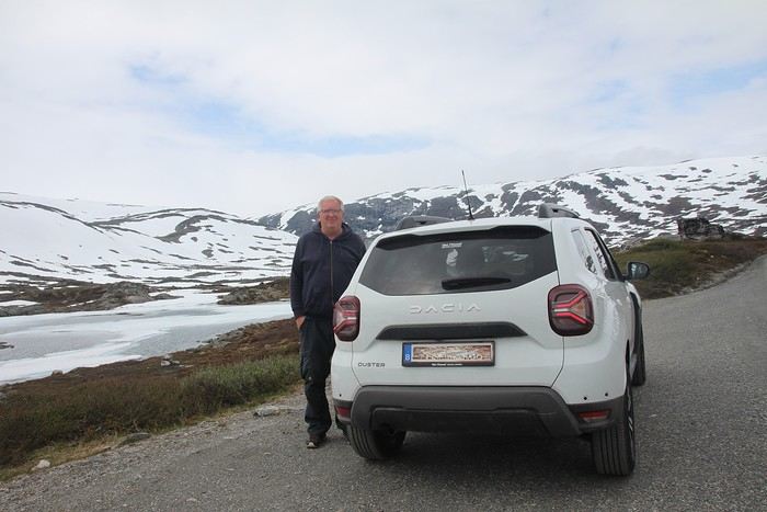
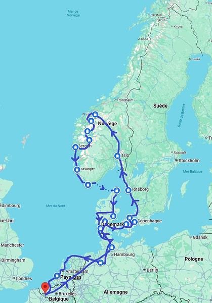
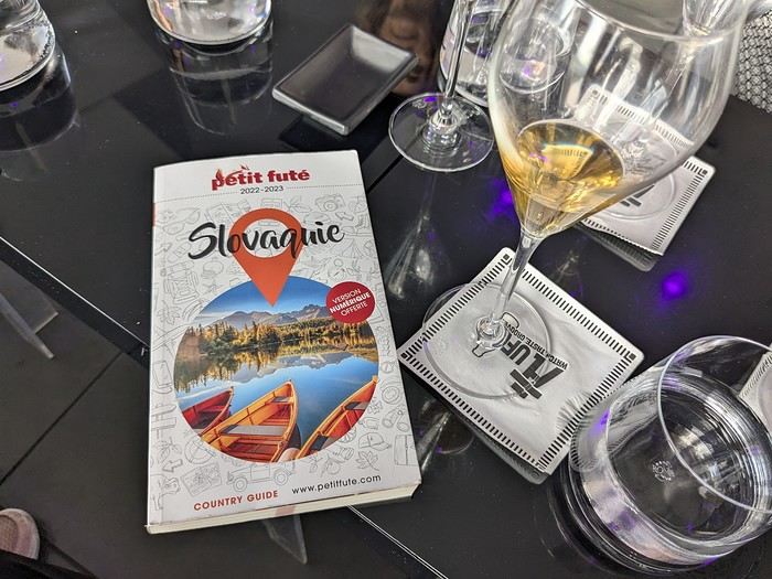 Why this country?
After visiting Hungary, Slovenia, Romania, and Poland in recent years, I’ve fallen in love with Eastern European countries. I adore the Slavic soul, its Austro-Hungarian villages, the gentle landscapes, the Carpathian Mountains, and that slightly mysterious atmosphere.
Slovakia evokes a certain imagination with its deep forests, medieval castles, and cobbled villages.
After seeing photos of the High Tatras—especially Lake Štrbské Pleso and Spiš Castle—I thought, "Let’s do it! We’re going!"
So, will Slovakia live up to what I imagine?
We’ll find out together.
We decided to travel as a group of six (five adults and a six-year-old child), by car (we needed two).
Here’s the day-by-day itinerary for this family trip, which started with a 3-day stay in Vienna (see the dedicated travel journal):
Why this country?
After visiting Hungary, Slovenia, Romania, and Poland in recent years, I’ve fallen in love with Eastern European countries. I adore the Slavic soul, its Austro-Hungarian villages, the gentle landscapes, the Carpathian Mountains, and that slightly mysterious atmosphere.
Slovakia evokes a certain imagination with its deep forests, medieval castles, and cobbled villages.
After seeing photos of the High Tatras—especially Lake Štrbské Pleso and Spiš Castle—I thought, "Let’s do it! We’re going!"
So, will Slovakia live up to what I imagine?
We’ll find out together.
We decided to travel as a group of six (five adults and a six-year-old child), by car (we needed two).
Here’s the day-by-day itinerary for this family trip, which started with a 3-day stay in Vienna (see the dedicated travel journal):
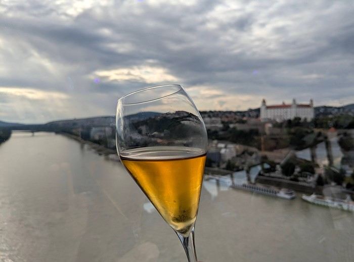
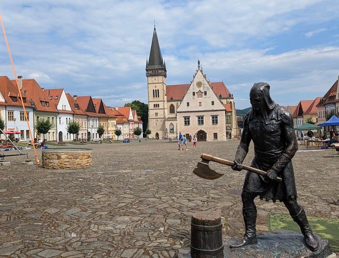
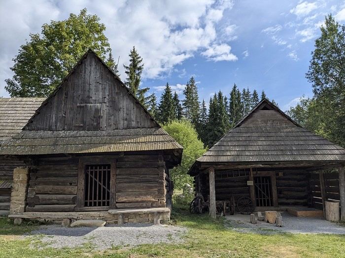
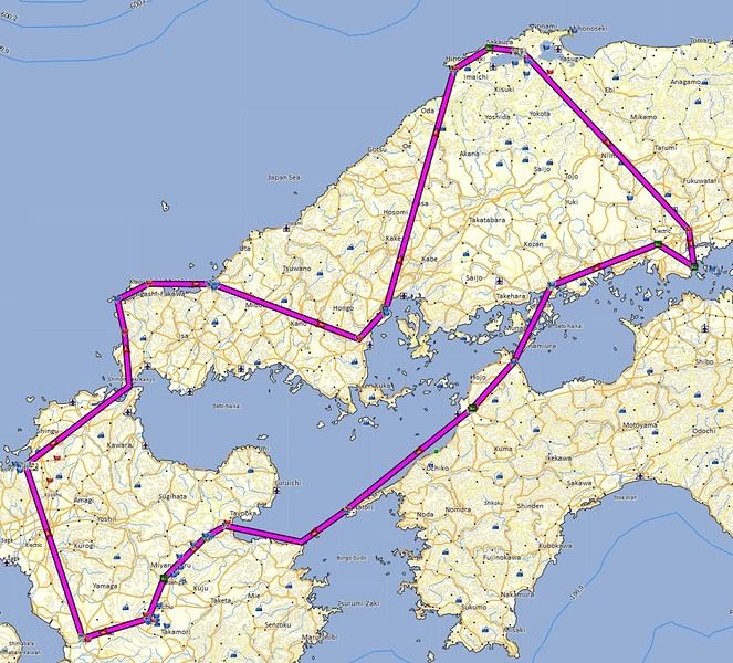
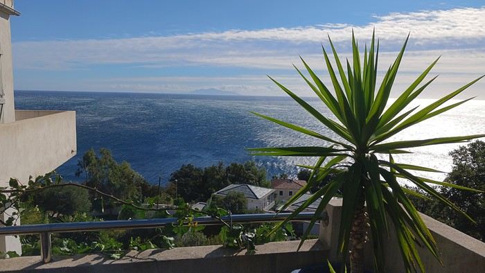
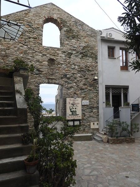
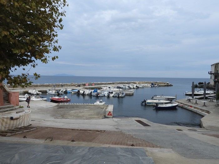
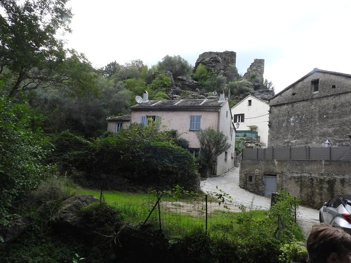
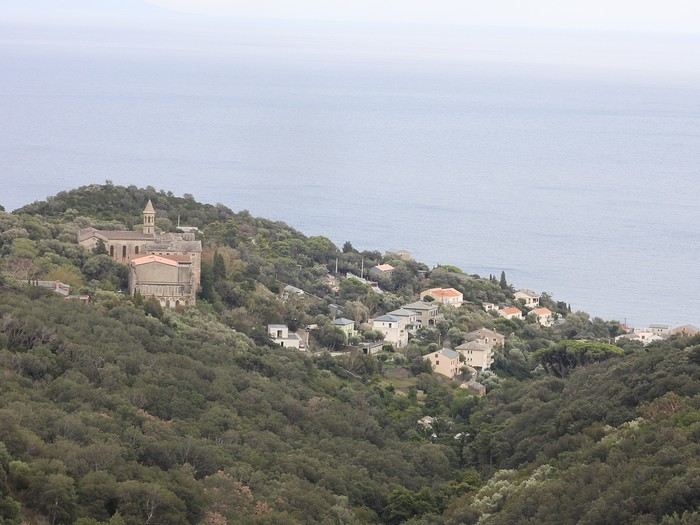

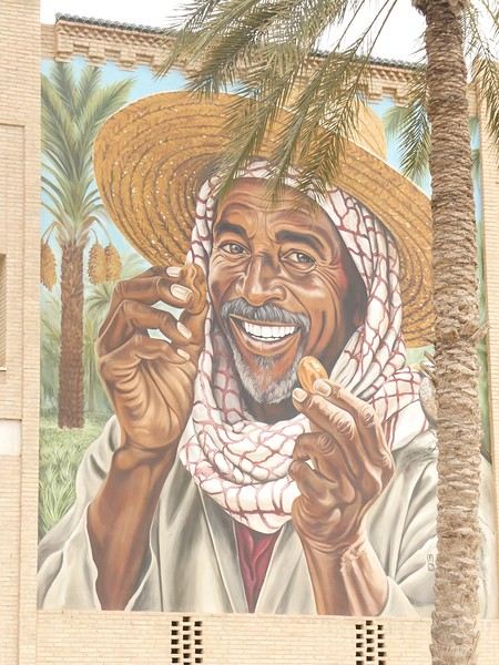




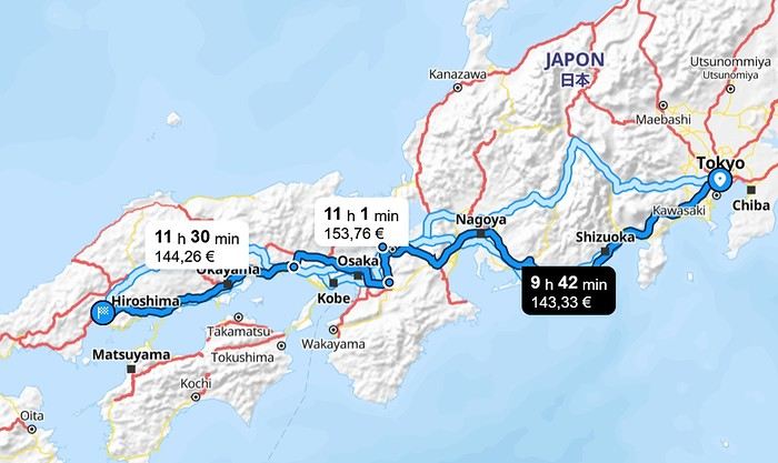
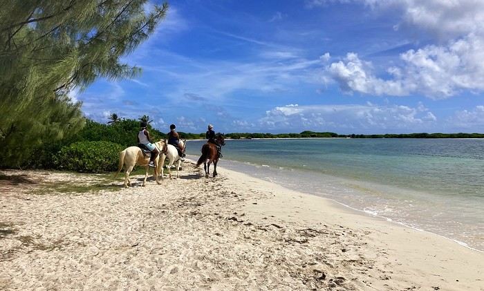
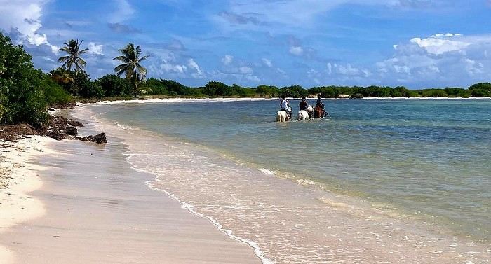
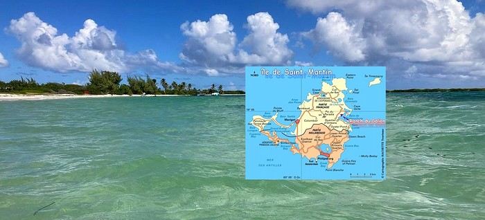
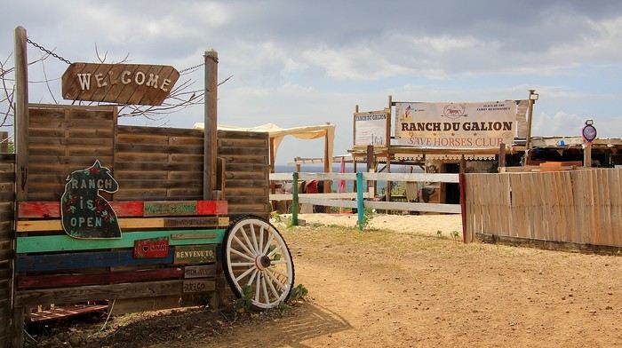
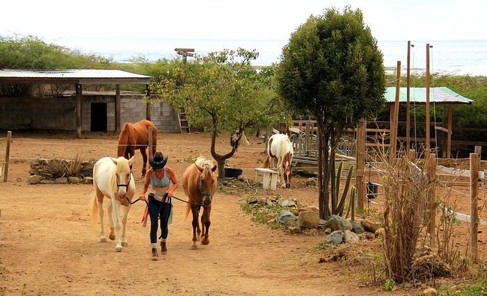
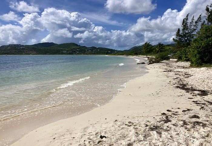
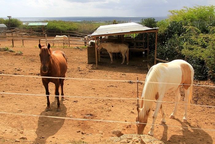
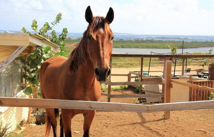
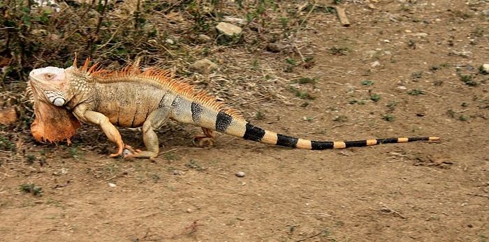
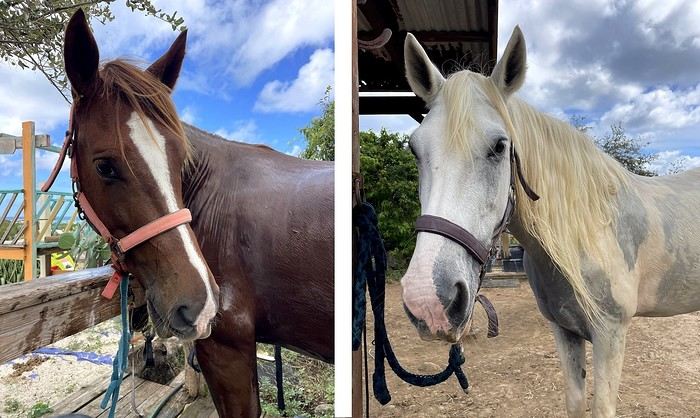
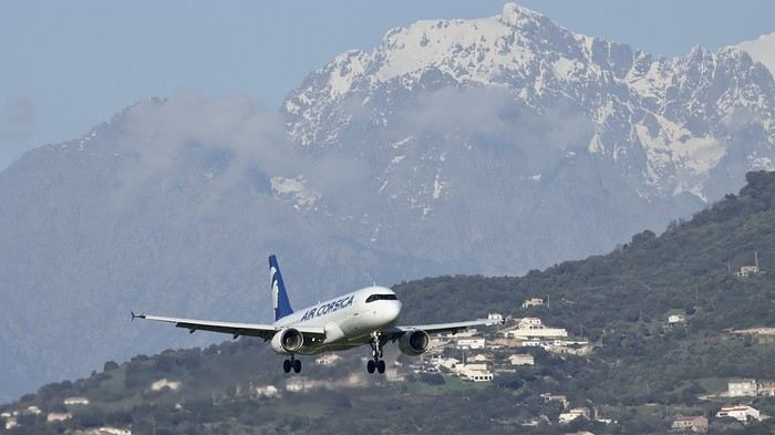 .
.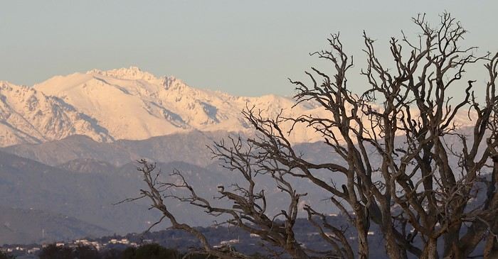 .
.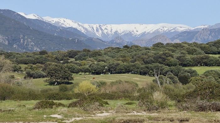 .
.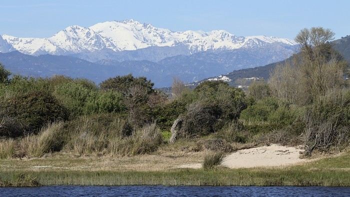 .
.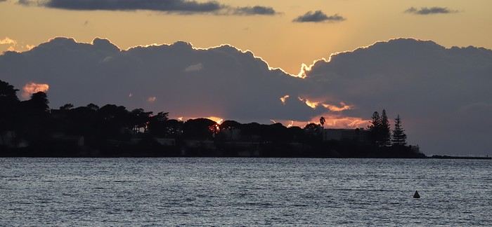 .
.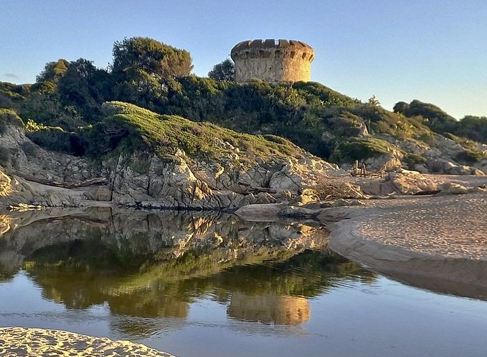 .
.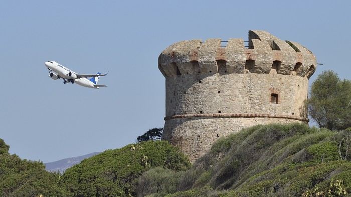 .
.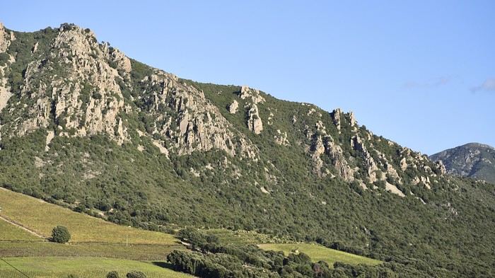 .
. .
.








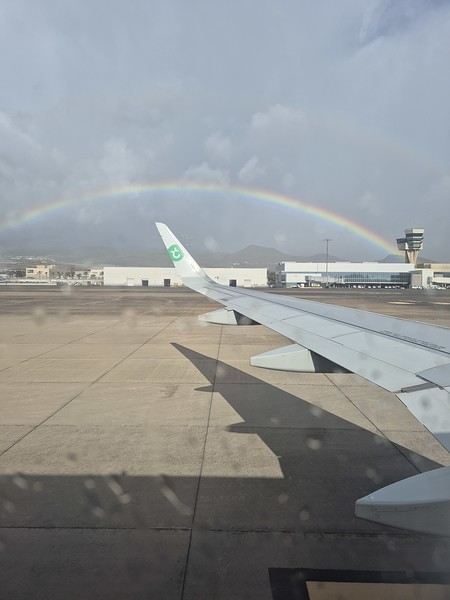
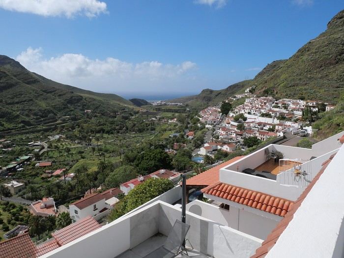
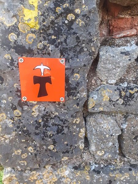
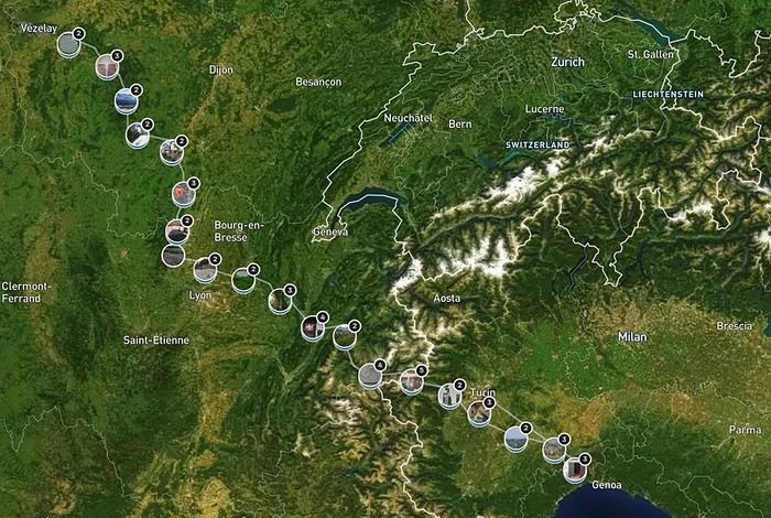

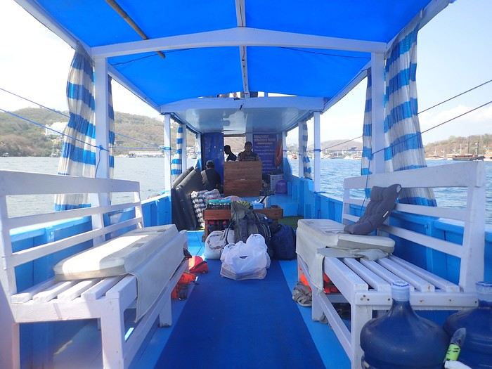 Not usually a fan of organized trips, during my stay in Labuan Bajo on Flores in May 2024, I started looking for a fisherman who could show me the islands around Komodo. At the port, I met Ari, a former freediver who knows the islands well, especially the best spots for fish and coral.
At the Bohême guest house, I proposed this outing, and one of the activity leaders was happy to join. We headed to Angel Island, where Ari took us snorkeling around the island. During this beautiful day, we appreciated his professionalism, and I suggested coming back the following year for a 5-day cruise. We had to agree on a budget and the period to consider.
Over the next year, we kept in touch via WhatsApp.
However, a month before departure, Ari told me he had lent his boat to a friend, who ran it aground on a rock, causing it to sink. No boat, no cruise! Since we had an agreement, I asked him to find another solution. His searches in the port, where everyone knows each other, turned out to be fruitful.
A certain "Captain" Kambar agreed to take us. He sometimes charters his boat for local travel agencies and could free up the requested period.
Not usually a fan of organized trips, during my stay in Labuan Bajo on Flores in May 2024, I started looking for a fisherman who could show me the islands around Komodo. At the port, I met Ari, a former freediver who knows the islands well, especially the best spots for fish and coral.
At the Bohême guest house, I proposed this outing, and one of the activity leaders was happy to join. We headed to Angel Island, where Ari took us snorkeling around the island. During this beautiful day, we appreciated his professionalism, and I suggested coming back the following year for a 5-day cruise. We had to agree on a budget and the period to consider.
Over the next year, we kept in touch via WhatsApp.
However, a month before departure, Ari told me he had lent his boat to a friend, who ran it aground on a rock, causing it to sink. No boat, no cruise! Since we had an agreement, I asked him to find another solution. His searches in the port, where everyone knows each other, turned out to be fruitful.
A certain "Captain" Kambar agreed to take us. He sometimes charters his boat for local travel agencies and could free up the requested period.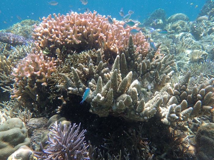
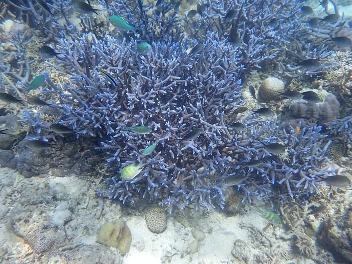 The first island we visited is north of Labuan Bajo: Seraya Small.
We didn’t disembark but anchored a short distance away. The coral reef, between 5 and 10 meters deep, offered visibility of 8 to 10 meters. We started with a few dives from the boat, as the water was so inviting. As with most of the upcoming sites, we were the only ones enjoying this little paradise.
Over about a kilometer along the drop-off, colorful corals and fish abound. As long as you don’t go past the rocky point on the right, the currents remain very weak, and the spot is accessible to beginners. After enjoying the sea enough, we returned to the boat, where Ari had prepared a good meal of rice, chicken, and vegetables. It was simple but excellent after all that effort.
The first island we visited is north of Labuan Bajo: Seraya Small.
We didn’t disembark but anchored a short distance away. The coral reef, between 5 and 10 meters deep, offered visibility of 8 to 10 meters. We started with a few dives from the boat, as the water was so inviting. As with most of the upcoming sites, we were the only ones enjoying this little paradise.
Over about a kilometer along the drop-off, colorful corals and fish abound. As long as you don’t go past the rocky point on the right, the currents remain very weak, and the spot is accessible to beginners. After enjoying the sea enough, we returned to the boat, where Ari had prepared a good meal of rice, chicken, and vegetables. It was simple but excellent after all that effort.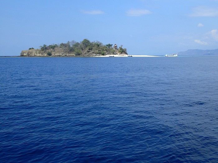 In the afternoon, we discovered Bero Island, where it was very hot. There were fewer fish and corals than at Seraya, but the corals were on white sand, allowing for beautiful, bright photos.
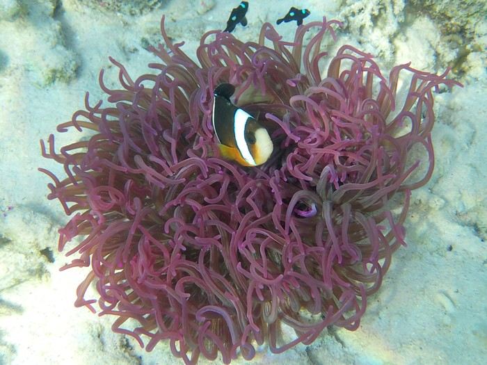 In the evening, we visited Hatamin, a fishing village. The population is very young and curious about our visit. At our request, we could have watched a local dance, but it would have taken some time to organize, and we didn’t plan to return. Ari asked if we wanted to take a shower, as on the boat, we could only rinse off with a little water from a basin.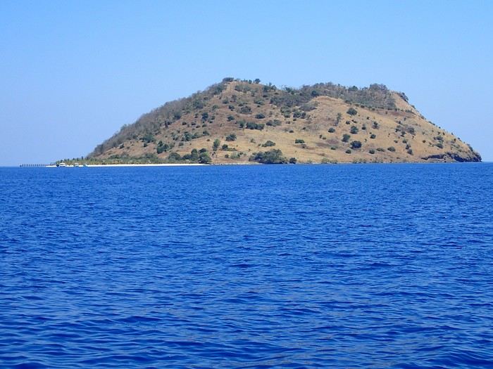
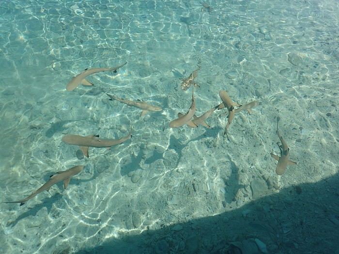
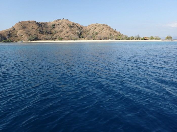
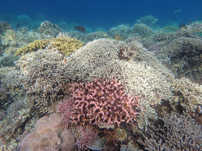 On the third day, we discovered Kanawa and some hawksbill turtles. There were many colorful corals, but we didn’t stay long. During this day, the stops were close together, making it intense with four visits.
Then we arrived at Sebayur Besar with a different snorkeling approach: Ari dropped us in the current, and we drifted for over a kilometer before he came to pick us up. At first, it seemed a bit worrying to see the boat move away while we were offshore, but we were quickly carried by the current and passed almost too quickly by so many corals and fish to see. What a pleasure to drift and freedive with little effort.
On the third day, we discovered Kanawa and some hawksbill turtles. There were many colorful corals, but we didn’t stay long. During this day, the stops were close together, making it intense with four visits.
Then we arrived at Sebayur Besar with a different snorkeling approach: Ari dropped us in the current, and we drifted for over a kilometer before he came to pick us up. At first, it seemed a bit worrying to see the boat move away while we were offshore, but we were quickly carried by the current and passed almost too quickly by so many corals and fish to see. What a pleasure to drift and freedive with little effort.