hi there
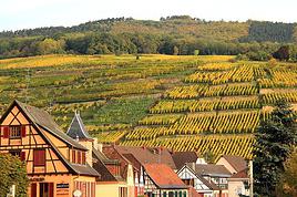
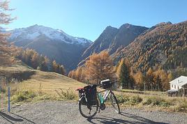
I live near Dole, so not too far away, and I sometimes go hiking (Camino de Santiago, Saint-Guilhem-le-Désert, etc.), and I’d love it if someone could suggest a trek in the Vosges—I really don’t know the area well. (Yeah, I know, I’m a little embarrassed about that.)
If you could recommend a nice route.
Arrival by car or train, doesn’t matter.
Thanks so much!
Hello,
I’m heading to Réunion in early October with my girlfriend for two weeks.
Out of the 15 days, we’d like to do about 5 days of hiking—maybe a 3-day/2-night trek and two day hikes.
I’ve seen tons of hiking options online, but I’m a bit overwhelmed when it comes to choosing. Hikes like the Tour de Mafate trek, Piton des Neiges, Piton de la Fournaise… we’d love to do those too.
We’ll have a rental car if needed. No problem walking for 6 hours a day (we’re pretty active).
Which hikes would you recommend?
Thanks in advance!
Hi there,
We’re planning to hike the GRR2 this summer with a local agency that offers a self-guided south-to-north route. We’re active and hike regularly, but we’ve never done a trek just the two of us without a guide.
I’d love to know if this trail has any dangerous areas? Drop-offs? Are there spots where it’s easy to lose the path?
I’ve seen that some agencies offer a GPS app—does the signal even reach everywhere inland? 🤪
Thanks! 😄
Looking forward to hearing from you! !
Hi there,
Apart from the few short hikes I’ve ticked off around Ampefy (Lily Falls to the Third Falls, geysers), do you have any must-do recommendations for a day hike between Ampefy and Antsirabe or around Antsirabe itself? I’m looking for a big, full-day trek, even if there’s a lot of elevation gain.
P.S.: I’ll have a private driver.
Thanks in advance! !
Hi there,
I'm looking for hiking ideas starting from Valbonë.
No more than 500/600m of elevation gain, no more than 15 kilometers.
I don’t plan on doing the hike to Theth.
Thanks! 🙂
I'm looking for hiking ideas starting from Valbonë.
No more than 500/600m of elevation gain, no more than 15 kilometers.
I don’t plan on doing the hike to Theth.
Thanks! 🙂
Hi there,
I’m planning a 6-day trip from Orléans to Tours.
There are very few detailed maps to figure out the main stages and what you’ll find along the way. Even though I’ve downloaded the Miam Miam Dodo app, it’s pretty tedious (everything is split into small map sections).
I’ve settled on the first leg: Orléans to Meung-sur-Loire, about 18 km. For the next one, I’m hesitating because I’d like to do around 20–25 km, but I see Beaugency is only about 10 km away, and Mer is almost 30 km. So, I’m stuck.
On top of that, I’m torn between taking the GR 3 route or the GR 655 (south).
If any of you know the area or have already done this hike/pilgrimage, I’d love to hear your tips for this section that goes through Blois and ends in Tours.
For the last legs, I’ve planned Blois -> ? Chaumont (no accommodations) -> Amboise -> Tours, knowing the final stage is about 30 km.
Thanks in advance for your help! 😉
Thanks in advance for your help! 😉
Hey everyone!
I’m heading to Morocco in 2 weeks to climb M'Goun.
Which side is the most practical for logistics, please? I’ll be hiring a muleteer/cook.
I’m torn between starting from the Happy Valley (Agouti, Aït Bouguemez) or the southern slope (Skoura, Kalaat El M'Gouna).
I tried to go 5 years ago, 2 weeks before COVID, and ended up switching to Siroua based on Willempsie’s advice, given the season... but mid-May should be fine now, right?
Thanks for your help,
Pacoloco
Hi everyone!
New to this forum, I’m planning a pretty big project for 2028. I’m heading to Nepal to do a trek from Kathmandu all the way to Everest Base Camp (a cool 5,300 m 😄). This trek is a bit special because even though I’ll be part of a group, I’m going solo (so far, no problem—I’m used to it). But it’s my first real trek, and it’s also a humanitarian one: once I reach base camp, I’ll stay an extra week to help clean up the waste left by tens of thousands of climbers! Since I’m originally from South America, from two countries that share the Andes, I have a deep respect for mountains—they fascinate me. So Everest… it’s kind of the trip of a lifetime!
So, a little question for those who’ve done treks to Everest before… any tips for good mental preparation (I’m already working on the physical side)?
Thanks in advance for your advice! 🙂
Hi there,
I’d like to spend a week in the Dolomites (4 days of trekking and a few day hikes). Unfortunately, it’ll be in August (no choice). My questions are:
- For a first time in the Dolomites, which 4-day trek should I pick? I’d love the most spectacular and varied landscapes possible. Around 1,000m elevation gain per day.
- Is it busier the first or last week of August?
- Will it still feel "quiet" while hiking? Not like a conga line in August...?
Thanks so much for your help! !
Thanks so much for your help! !
Hi there.
I’ve hiked the GR trail mentioned in the title from Wissembourg all the way to Menton.
Now I’ve got the section from Wissembourg to Rotterdam left.
But I can’t find any maps for this route—I’m looking for someone who’s done this part of the trail.
Thanks in advance! 😊
Hey everyone,
My plan for next November is to head back (yet again) to the Annapurnas to complete a route I’d always promised myself I’d do one day. Here’s the breakdown:
1. Start from Sikles and join the Annapurna Circuit by first going through Kori, then the Namun La (or Namun Bhanjyang). It’s a bit of a forgotten route, and I haven’t found much info on it—no .gpx files or firsthand accounts. Still, I’ve roughly mapped it out using different sources.
2. After that, I plan to head up to Phu to do the direct Phu Pass/Naar Pass traverse to Naar. It’s doable in 2 days, but why not in 1 if the weather’s good and I set off early enough?
3. Finally, I’ll head toward the Mesokanto North Pass (after a short camp at Tilicho North BC) to descend the entire Gandaki Valley down to Nayapul.
I’m obviously looking for any tips or feedback (if you’ve got any), and maybe a travel buddy who’s up for a little off-the-beaten-path adventure. 😄
Hi everyone, we’re heading to Java in August, specifically to KAWAH IJEN. I’ve seen that there are new requirements like a medical certificate since 2024—is this still the case? Can our 6-year-old daughter do the ascent? Can she go down to see the blue flames at night with gas masks? If not, is it better during the day? Thanks for your feedback!
Hi there,
We’re planning a two-week couple’s trip hopping between the Cape Verde islands at the end of November 2025.
Our arrival and departure airport will be on the island of SAL.
We’ve got some hikes lined up.
Based on your experiences, what recommendations and suggestions do you have?
Thanks in advance for your valuable tips!
Hi,
Could recent travelers let me know the price for the 2D/1N trek in the rice terraces when booking directly on-site upon arrival? Is it possible to join a group? Thanks for your replies, best regards
Hi there,
I’d like to visit several islands in the Cyclades in late June - early July 2026 for about 15 days.
Stay 3 to 4 days on each one and do some hiking.
Your suggestions are welcome—islands, accommodation, hikes, or anything else.
Thanks in advance.
Twizzle
Hi there,
This August, I hiked the Vosges section (Vosges massif) of the GR5 (Lauterbourg-Wissembourg-gr53-gr5-Belfort) using the TopoGuide "Traversée du Massif des Vosges" (ref 502, April 2024 edition). My experience was partly ruined by a few things I feel I should share here to help others avoid the same pitfalls—or at least disappointments.
Having used "TopoGuide" books before, I’d always trusted them for organizing treks lasting several weeks, or even months.
Beyond the satisfactory mapping (reproductions of IGN 1:25,000 maps), these guides include route descriptions that are usually enough to find your way. On that point, I have no serious criticism of the Vosges crossing guide.
In addition to the route details, the guide provides "average" time estimates for traveling from point A to point B—useful info for gauging effort and planning likely stages. However, I eventually realized I couldn’t rely on these time estimates. I’d assumed they were calculated by the FFRP, considering that 100m of positive elevation gain roughly equals 1km on flat terrain, with an average walking speed of 4km/h. So, I’d recommend anyone using this guide to recalculate all the time estimates to avoid nasty surprises on tight stages. 🤪
Another key feature of the guide, in my opinion, is its info on accommodation options—especially budget-friendly ones suited for long-distance hikers on a tight budget. A section called "préparation des étapes" includes a table with a column meant to highlight "refuges" and "gîtes d'étapes." That column had me feeling optimistic: these budget accommodations were listed as plentiful along the route. After all, we were in the territory of the famous Club Vosgien—it made sense there’d be plenty of hiker-friendly lodging options. The reality on the ground was quite different. The TopoGuide wasn’t really to blame here, except that a serious warning wouldn’t have hurt. First, regarding the "refuges," most were run by associations. With rare exceptions, the volunteers only opened them on weekends. You can’t really blame people for not volunteering on weekdays, but it makes things tricky when the info about weekend-only openings often turns out to be wrong. As for the "gîtes d'étape," I was mostly disappointed when I was told that a place was booked for weeks: the vast majority of what was listed as a "gîte d'étape" turned out to be "gîtes ruraux." The advice here? If you don’t want to—or can’t—camp, double-check all the accommodation details before you set off. It’s time-consuming and tedious, but if you can, camping is still the best option. 😐 On a brighter note, during the first part of my trip, I came across several cabins that offered alternatives to camping. 🙂
P.S.: Even the youth hostel in Saverne was closed in the middle of August... 😕
Hey everyone!
I’d like to explore the northeast of Madagascar, using bush taxis, boats, and my own two feet.
I already have an ideal itinerary in mind, but I’d love to know if it’s doable at a relaxed pace in one month. The goal, of course, is to avoid being constantly focused on time and days and to travel spontaneously.
I’m aware that the roads are rough and there are a lot of unexpected delays, which isn’t a problem in itself. I just struggle to estimate the *time* it takes to get between stops.
Potential itinerary:
Tana – Sainte Marie Island (4 days) – Maroantsetra (3 days) – Masoala Park (8-day trek?) – Antalaha – Marojejy Park (3 days) – Ambilobe – Nosy Be (5 days) – Tana
The days listed are just rough averages. Cities don’t interest me, and I don’t plan to visit Tana.
I’d really appreciate any info or tips from you all! 😊
Thanks in advance,
Romain
hi everyone,
we’re a group of 10 adults who hike together every year, and we’re looking for our next destination for October. Our main criterion is avoiding crowds, even if it means not being at the most wow-worthy spot. Is there still a chance to find some solitude in Madeira, or has it become difficult? Would Cape Verde be a better bet if we pick the right islands?
I know it’s a very personal opinion—super subjective depending on how much company you can tolerate—but it’s really our top priority.
Thanks for any recent insights; it seems like tourism in Madeira is really booming!
have a great day,
Sandra
Hello!
We’re spending a few days in Toraja country at the end of May. We’d love to do a day trek—taking our time—on a route that’s stunning in terms of scenery, but not a level 5 in difficulty!
Any suggestions you can share, please?
Thanks in advance
Hi there,
We’re flying from Montreal to Lyon this August to go hiking in the French Alps. We’ve rented a car and will be staying at campgrounds. We’re planning to do day hikes and want to stay a few days in one spot, do a few hikes, then move on to our next camping spot. Could you share your favorite spots or any recommendations for places to spend a few days with great hikes?
A few details: We arrive in early August and leave in early September. We’re looking for day hikes (or shorter), moderate difficulty, with a cumulative elevation gain of no more than 1000m, and of course, beautiful scenery! We’d prefer not to drive too much—maybe it’s best not to head too far south and deal with unnecessary heat? Along the same lines, if you know of any great campgrounds where we can start our hike directly without needing the car, we’d love to hear your suggestions!
Thanks! :-)
I wanted to share an incredible experience I had recently that really left an impression on me: hiking the Mercantour independently. It’s an absolutely stunning mountain range, with varied landscapes that go from lush forests to rocky ridges, passing through high-altitude lakes with unbelievable colors. I chose a one-week route, sleeping under the stars in a bivouac.
It was a pretty demanding adventure, with significant elevation changes and sometimes unpredictable weather. But every effort was rewarded with breathtaking views. I was lucky enough to spot marmots, chamois, and even ibex in the distance. It’s truly a total immersion in nature!
A little tip for those tempted by the adventure: plan your route and gear carefully. Independence requires good preparation. I particularly appreciated having a good water filtration system and lightweight cookware. And for safety, aside from a map and compass (or GPS), I never leave without my two-way radio. In these remote areas where there’s no mobile signal, it’s a real safety net in case of trouble or just to communicate with other hikers if you’re in a group. It can really make a difference!
If any of you have already hiked in the Mercantour or have questions about my experience, don’t hesitate to ask. I’d love to chat with you about this beautiful range or other hiking destinations.
See you on the trails! 🙂
Hi! In March, we’ll be spending two weeks in the Drakensberg region and Golden Highlands National Park (Clarens). From what I understand, you have to pay to hike if you're in a national park. I can’t find the rates or info on whether there are multi-day passes if we hike for several days. Could you help me out, please?
Thanks
Hi there,
My wife and I are heading to Norwegian Lapland for a week soon. We arrive in Tromsø on January 9th and plan to visit Senja Island. We’d love to go snowshoeing there and would appreciate some tips:
1. Is it possible to go snowshoeing without a guide this time of year on Senja Island? Are there well-marked trails? If not, could anyone recommend some good local guides?
2. We’d also love recommendations for great snowshoeing routes on the island if possible.
3. Is 5 days in Dovær in the northern part of the island too long at this time of year?
4. Renting snowshoeing gear in Norway is super expensive—does anyone know a good place to rent between Tromsø and Senja Island?
Thanks!
hi,
we’d like to do a trek in Nepal, and we’re thinking of the Annapurna Circuit—it’s cheaper than the Everest trek.
Our plan is to do it without a guide or porter. We’re used to the mountains, not so much to high altitude, but if we acclimate well, there’s no reason it should go wrong ;)
No guide = handling permits, transport, and accommodation on our own...
So my question is: is it possible to book lodges in advance before departure? Or, even better, day by day?
I’ve read some older posts, so I’m asking again to get up-to-date info on what’s happening now. We’re planning to go mid-November 2026 or March 2027.
Thanks for your tips! :)
A message in a bottle:
For a three-week trip in November... is it possible to go hiking without a guide in northern Vietnam, getting around to the hiking sites by public transport, bikes, or on foot? And if so, which areas specifically?
Thanks to anyone who replies!8
Good evening everyone,
Can you advise me on this?
I’m looking for public transport between Le Hohneck and the village of Bonhomme, where I plan to leave my car.
I’m hiking between these two points.
Thanks so much for your help!
Yves
Is wild camping possible? Are there campsites and places to restock along the way, and is water available?
Thanks for your answers!
Pierrick
I’m heading to Nepal at the end of April 2026 with my brother, the two kids, and my mom.
My mom is 75, in good shape, she walks but isn’t a big sports enthusiast. My daughter is 16, she’s not really into hiking but with the right vibe, she’ll step up.
I’m looking for a 5-6 day trek that’s not too difficult—around 4-5 hours of walking and 500-600m of elevation gain per day. What’s our goal?
Well, like everyone, we’d love something not too crowded. We want to experience Nepali village life away from the main routes—terraced fields, all that. Some encounters, authenticity, sharing... And if we can catch a glimpse of some high peaks, even better.
Any suggestions?
Hi there,
Could anyone give me some tips on 2-day treks in these areas? We're heading there in November...
Thanks so much!
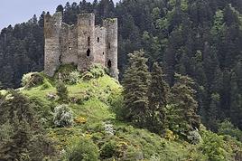
A really nice nature walk at the entrance to the lake in the Natura 2000-listed nature reserve. It’s a great opportunity to see lots of bird species, plants, and the famous European pond turtle, as well as some beautiful medieval architecture remnants with Thomas II’s castle. The walk is slightly spoiled by the noise from the Savoie parachute club’s planes, which take off every fifteen minutes and dump fuel on the site non-stop, even after nightfall.