bonjour à tous 😉
est ce que quelqu'un pourrez m'informer comment je pourrais faire pour traverser la loire en vélo.
je ne veux pas prendre le pont de st nazaire mais rentrer dans les terres en suivant la loire pour pouvoir prendre un bateau.
si quelqu'un connait bien la région n'hésite pas.
De plus à l'endroit où je vais prendre le bateau je souhaiterai dormir dans un camping pour pouvoir reprendre le bac le matin et repartir en vélo en direction de ST brévins.
je suis avec mon fils adolescent donc il ne faut pas que j'ai trop de kilomètre entre le camping et l'endroit du bac de passage.
je prends tous les renseignements possibles
merci à tous
si vous avez pas de réponse à vos messages pas de panique je pars en déplacement pdt 3 à 4 jours mais je vous repondrai plus tard
C'est vrai que le pont de St Nazaire c'est pas la joie 😕 en vélo: dénivelée important et surtout au ras des bagnoles. Et si la montée se fait sur 2 voies, la descente, elle, est sur une voie et permet ainsi aux automobilistes en délire de te titiller le porte bagages de très très près 🤪 ...
Pour les bacs de Loire, tu peux passer à Indret (La Montagne) - Basse-Indre et au Pellerin - Coueron, deux bacs donc, le passage est gratuit tant pour les vélos que pour les bagnoles.
Un circuit sympa d'une 20aine de km peut être: embarquement à Indret, arrivée à Basse-Indre, suivre le quai sur la gauche, vers l'aval, et rejoindre après la butte la D107, direction Coueron, route assez passante mais avec des bas-côtés fort larges, à Coueron suivre les flèches Le Pellerin par le bac, embarquer au Paradis (si si c'est le nom du lieu-dit où est l'embarcadère, quand j'étais petit, on allait souvent en bateau boire un café au Paradis). Au Pellerin, on peut visiter les petites rues au-dessus des quais, et voir les grosses maisons des architectes du Canal de La Martinière.
Après, tu files le long de la Loire vers la gauche, une petite route longe le fleuve au bout des quais, puis remonte vers La Télindière. Puis sur la grosse route à gauche, direction La Montagne, passage devant la charmante petite chapelle de Bethleem, St Jean de Boiseau, puis La Montagne et Indret. Une belle excursion pas trop fréquentée de bagnoles à se faire en famille, qui plus est agrémentée de deux traversées maritimes!
Le plus proche camping, et fort sympathique, est celui du Migron, à Frossay, duquel on peut facilement partir en vadrouille le long du Canal de La Martinière, la partie (presque) finale de la Loire à vélo. Il est municipal, et sans doute ouvert que l'été. Ca te met à 16 km (que du plat) du Pellerin. A Cordemais aussi, un camping que je ne connais pas, ainsi qu'à St Etienne de Montluc (12km de Coueron, itinéraire plat par le marais Audubon, joli joli, et des observatoires à cigognes).
Pour plus amples renseignements (c'est chez moi, et j'aime bien parler de chez moi!), tu peux m'envoyer un MP!
JE TE REMERCIE
je veux passer de st nazaire à éventuellement couéron et passer le bac direction st brévin les pins. en tout cas tes rens sont utiles pour l'instant toute les routes que tu me dis sint vagues mais avec une carte j'y verrais plus clair.
au niveau équipement, je suis avec une remorque large de deux enfants donc sécurité oblige.
sinon si un jours tu veux des rens via la normandie ou le loir et cher n'hésite pas
à plus
Je ne comprends pas : il n'y a pas de bac à St Nazaire. Le bac le plus en aval est à une 40aine de km dans les terres, à à peu près 30 km de Nantes. Pas du tout au bout de l'estuaire donc! A la place du Pont de St Naz, donc, il y a... le pont de St Naz... 😐
oui je ne t'ai pas dit mais j'arrive de la turballe pour faire étape à st nazaire puis aprés st brévin mais je fais l'étape st naz st brévin en 2 voir 3 jours suivant le nombre de kilomètre qui vont me séparer st naz au bac.
en moyenne je fais 60 km/jour pour mon fils.
j'espère que tu vas arriver à me comprendre
à plus
Alors, sur cette carte, tu vois très clairement les 2 bacs sus mentionnés. Le trajet La Turballe Coueron Le Pellerin St Brévin fait dans les 120 km, sans grosse difficulté, tu peux donc le faire en deux jours. Et le camping de Cordemais me semble indiqué pour faire halte, même si la vue sur la centrale thermique ne doit pas être des plus réjouissantes... 😕 En tous cas ça a le mérite d'être exactement à mi-chemin...
génial
je te remercie encore et n'hésite pas si tu viens par là contacte moi
j'habite à blois et j'ai une résidence en normandie donc pas de problème pour loger
à plus
henri
Je ferai de Blois à Anger et les environs à vélo en Septembre. Ma première nuit est à Blois donc j'arriverai par le TGV à St-Pierre des corps. Toi qui habites Blois j'aimerais te demander s'il y a un transport facile comme un shuttle entre St-Pierre des corps et Blois. Quelle est la distance entre ces deux villes? Aussi, je ne voudrais rien manquer alors si tu pouvais me dire ce qu'il faut voir et visiter à Blois ainsi que les bons restos j'apprécierais beaucoup!
Thanks, j'ai bien hâte de visiter ce petit coin de pays!!!!
bonjour
de st pierre des corps à blois tu as le train environ une demie heure
la distance est de 50 km, ce train suit la loire en passant par amboise
tu dois avoir des trains toute les 30 minutes
Pour les visites: tu as le chateau, les jardins de l'évécher avec la cathedrale , l'ancienne ville qui se trouve en contrebas du chateau il faut que tu restes au alentour du centre ville.
pour les restau cela dépend de ton budget pour un repas parce que blois est assez cher touristes obliges!!!!!!!!!
salut Rosalie je suis Daniel j ai lue que tu partais sur la loire en vélo moi aussi.je vais partir d Orléan à Nantes 2 semaines de vélo couché en camping si tu veux partager avec moi écris moi
Je ne suis pas complètement d'accord avec toi Thibo, je trouve que traverser le pont de Saint-Nazaire en vélo c'est une chose à essayer, car ça ne se fait pas tous les jours, encore moins pour un visiteur de la région. Je l'ai fait seul une fois (N-S et S-N (aller-retour)) et ça ne m'a pas déplu : impréssionnant la hauteur en vélo quand on regarde derrière que qu'on vient de faire une fois en haut du pont, dire que maintenant c'est la descente^^, bonne vue sur le fleuve et Saint-Nazaire... Je trouve ça super. M'enfin bon, il ne faut pas non plus le traverser pendant les heures de pointes quand on sait qu'il y a des ralentissements assez importants (d'où le fait qu'on irait plus vite en vélo que les véhicules motorisés en descente qui pourrait être un peu dangereux si l'on ne contrôle pas sa vitesse) et aussi regarder la météo avant : s'ils prévoient de la flotte (même peu), du vent (+40km/h) et d'autres phénomènes dangereux possibles, il est évident qu'il faut éviter de le prendre.
La montée est dure, peut être fait à pied à condition que la personne marche sur le trottoir étroit et que le vélo roule à coté sur la route (à droite des bandes blanches) si possible avec la lumière arrière d'allumée. La descente se fait à vélo bien sûr, mais faîtes attention à la fin du pont (limite entre pont et voies 2x2) : serrer à droite sinon trous... /!\ sans pédaler il est possible d'arriver à 45 km/h donc faites attention quand même (repérer les limites à la montée ;) )
Pour ceux ne voulant vraiment pas utiliser le pont de Saint-Nazaire, la prochaine traversée de la Loire se fait sur bateau (de Couëron au Pellerin) ou un peu plus loin de Indre à La Montagne (gratuit, toutes les 15-20min). Mais honnêtement si c'est pour revenir sur la côte ça ne vaut pas le coup... Il faudrait compter au moins 70km de plus.
En ce qui conserne les campings sur Nantes, je n'y sait pas grand chose, mais je vous conseille de vous rendre sur la cote (Saint-Brévin, Noirmoutier, Pornic, Pornichet etc...) où le nombre de campings est grandiose et plus sympathique. Vous avez de tous les choix, emplacements géographique agréable (côte, Saint-Nazaire, Brière etc... à visiter) même si vous êtes en vélo prenez plusieurs campings, gérez votre séjour^^
J'ai fait le trajet en sens inverse l'an passé, Nantes St Pierre des Corps, et une autre fois les environs de Blois. Profite de ce beau coin de France, tu vas t'en mettre plein les mirettes !!!
J'ai quelques cartes en pdf avec plein d'infos pratiques, hébergements etc... Je peux te passer ça par couriel si ça t'intérresse bien sur !
Pour les trains entre St Pierre et Blois http://www.ter-sncf.com/Images/ligne%205%201A3_tcm8-36791.pdf
Pour ce qui est du vélo, tous les trains ne sont pas très pratiques, à l'époque j'ai fait Grenoble St Pierre des corps avec plusieurs changements. j'ai failli craquer 🏴☠️.
Demande au chef de gare ou au contrôleur ou se trouve le wagon adapté, ça t'éviteras des remarques désobligenates...
Je crois que la signalétique a été améliorée, un gros autocolant sur la porte du wagon spécial vélo.
Pour le clin d'oeil, à La Chaussée St Victor un très bon restau avec de la bière Québécoise, lolll, j'ai aussi d'autres bonnes adresses à dispsition.
Bonne ballade, si je peux encore être utile ce sera avec le plus grand plaisir.
Le temps de rafraichir ma mémoire... et je t'envoie ça!
En matière de bonnes adresses mes goûts sont comme la météo, assez variable... Et comme le change ne te sera guère favorable je vais tâcher de sélectionner à prix serré.
Mais on a qu'une vie et parfois ça vaut le coup de casser sa tirelire !!!
Merci pour la citation, elle n'est pas de moi... mais depuis quelques années c'est ma façon de vivre.
bonjour
je prépare mon périple a velo de st guenole, pointe sud de la bretagne jusqu a lyon
j ai une hésitation sur l itinéraire a partir de nevers ou un peu avant:
1. quitter la loire vers chatillon sur loire pour rejoindre le canal du nivernais a clamecy jusqu a decize ou rester sur l itineraire la loire a velo ou encore prendre le canal lateral mais ca a pas l air top de l avis quasi général
2.une fois a digoin, prendre le canal jusqu a roanne (et puis?) ou bien rejoindre paray le monial cluny etc ca je connais un peu
j ai un vélo type vtc, peut être une petite remorque pour le chat (ou sacoche avant) sinon deux sacoches a l arrière
voila
merci de vos infos
je glane ici et la sur plusieurs sites et c est un plaisir
beaux voyages
vive la liberté et le partage
joannah et merlin
Nous faisons tout un périple cet été à vélo chargé et nous cherchons après le canal de la martinière à traverser la loire en évitant le pont de saint nazaire.…
Arrivant en train à St Nazaire, nous voudrions traverser la Loire pour rejoindre St Brevin et le trajet de la Loire à vélo. Le pont de St Nazaire à vélo est il…
Pour notre tour de france nous pensons traverser la loire a st nazaire par le pont, est-il facilement accesible pour notre tandem et sa remorque?le vent…
Voyager à vélo › France › Rhône-Alpes / Ouest · 7 replies
Nous avons un projet de traversée Est Ouest de la France à Vélo l'été prochain: de Grenoble à la Rochelle. Nous = 2 adultes + 2 enfants de 9 et 12 ans l'idée…
Voyager à vélo › France › Provence-Côte d'Azur / Ouest · 3 replies
Résidant à la Réunion depuis plus de 20 ans j'envisage cet été (entre le 20 juillet et le 10 août) de rejoindre à vélo Avignon en partant de Nantes. J'ai une…
17 jours, 1400 km et 17 500 m de D+ à vélo dans le Nord du Vietnam ! 🇻🇳 🚲🇻🇳
Du brouillard du Fansipan aux paysages spectaculaires de la Ha Giang Loop, des villages reculés aux marchés hauts en couleurs...
J’ai traversé le Nord du pays à vélo au plus près de ses habitants, entre boue, chaleur, cols interminables et rencontres inoubliables.
Et surtout, j’ai découvert un Vietnam bien différent des circuits touristiques.
Je vous emmène avec moi dans cette aventure, à travers une vidéo qui retrace ces 17 jours de voyage. 🙂
Si le Vietnam vous attire, venez faire un bout de route avec moi !
Another long-time dream of Claudio’s: the Petit Mont Cenis pass and the dam at the eponymous lake.
A place where many Italians, including my father, worked in the 1950s–60s.
Faverges → St-Michel-de-Maurienne → Lanslebourg → Petit Mont Cenis → return. 315 km, 3 days. Bivouac at St-Michel-de-M.
Brouter link
Leg One: Faverges → St-Michel-de-Maurienne
Leg Two: St-Michel → Lanslebourg → Mont Cenis Lake → St-Michel
Leg Three: St-Michel → Faverges
And it finally happened in August 2026: in the Maurienne Valley about the famous cycle route known as the V67
🇷🇼 Cycling in Rwanda: 4 episodes, an off-the-beaten-path adventure
After 3 weeks and nearly 1,200 km by bike across Rwanda, I made 4 videos to share this adventure in a different way: the landscapes, the encounters, the villages… but above all, all those incredible scenes of everyday life.
The 4 episodes are available here:
👉 https://www.youtube.com/playlist?list=PLGnfbxjccWAg
The 4th episode focuses on rural Rwandan life: simple, authentic, and sometimes surprising scenes that you only truly discover when you take the time to travel by bike.
If you have a few minutes, let yourself be transported to Rwanda…
Bonjour je cherche des renseignement pour monter au cap Nord par l'euro vélo 7
quelqu'un l'a t, il déjà fait et ou est le mieux pour attaquer l'euro vélo 7
Merci
Hi,
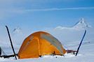
We bought the MSR bike tent model (2-person + large awning that can fit 2 bikes) back in 2005. It’s served us really well, especially during a year-long trip in Africa. Now, one of the poles is broken, and we’d love to replace it since that’s the only issue with the tent—we still love it! The poles are 9.35 mm in diameter, with 8 sections of 49 cm and 2 sections of 28 cm. Total length when assembled: 416 cm. Actually, two large sections are broken: one straight and one curved. It’s a pain to find replacements since this model is no longer sold anywhere.
Would anyone have this model lying around unused and be willing to sell me a pole?
Looking for a female travel companion for a cycling trip (arriving by plane in Porto Alegre, Brazil, and cycling toward Montevideo, Uruguay, returning by plane to France from Buenos Aires, Argentina) – 1,500 km
Hello everyone!
I’m planning a cycling trip across Brazil, Uruguay, and Argentina, with a departure set for late October, November, or December. I’m looking for a travel companion to share this long-distance adventure with.
Experience:
I already have solid experience in bicycle touring in Georgia, Kazakhstan, and Kyrgyzstan. Currently, I maintain excellent physical condition by cycling an average of 250 km over 3 days per week (4 hours a day at 20 km/h).
The trip & the pace:
Daily pace: Between 50 and 80 km per day, to make steady progress while taking time to explore.
Accommodation: Flexible and authentic. We’ll alternate between wild camping, campsites, Warmshowers, small guesthouses, and budget hotels depending on opportunities and the weather.
Looking forward to reading your message and planning this amazing journey together!
Hi everyone,
In early April, I’m redoing the Vélo Francette (La Rochelle to Ouistreham), and then I’d like to cycle along the Cotentin Peninsula (which I don’t know at all), follow the coast up to Cherbourg, and then head back down to at least Saint-Malo. I’d love to know if it’s pleasant for cycling—are the roads nice? Not too windy? What are the must-see spots? Any great campsites? All your tips and advice are more than welcome, and I thank you in advance.
Hi there,
I’m planning to bike to meet some friends in Côte d’Ivoire in early November.
I’ll be starting in Abidjan and heading to Abengourou, which is close to the Ghana border.
I’d like to take the trails. Does anyone have recent info on eastern Côte d’Ivoire?
Any tips, safety advice, or must-see stops? I’m open to all suggestions.
Thanks in advance for your help!
Fx
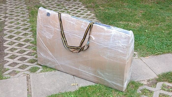
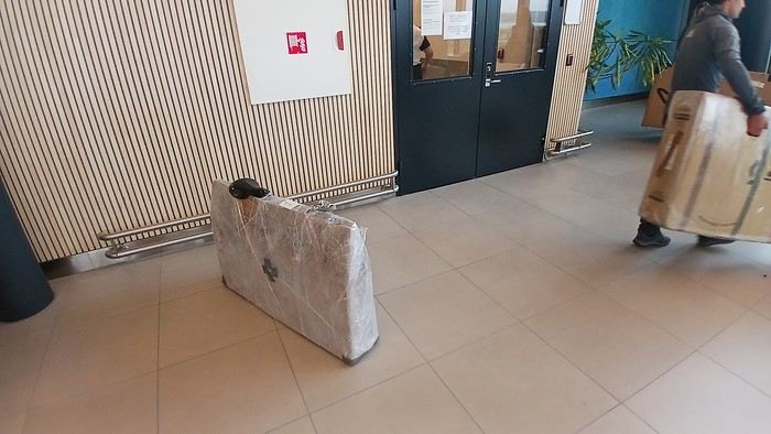
After testing it for three years across various modes of transport, I’m sharing this video of a bike packing case. It’s made from recycled cardboard and shrink-wrapped, with adjustable thickness and added bubble wrap depending on the level of protection you want.
Installing spacers at the fork and chainstays makes the packaging compact. With the fifteen-odd euros for shrink-wrapping at the airport, this case travels really well.
https://youtu.be/_GDJi-GqmkM
- Low bulk (1.10m x 0.70m x 0.25m for a large frame), it fits vertically in train luggage compartments and the total dimensions (x+y+z) don’t exceed 2.40m.
- Two carrying solutions for public transport and easy handling by airport staff (no more tears in the cardboard from openings).
- Discreet packaging when dealing with bus drivers and train conductors, as it looks like an ordinary parcel.
- No need to return to the starting point to retrieve the case from your outbound trip, which you’d otherwise have to store somewhere, or deal with a bulky cover to pack in your panniers.
- You can still check tire pressure through the plastic film without damaging the packaging too much.
Drawbacks: Around 3 hours for this lengthy and meticulous process—removing the wheels, pedals, handlebars, and derailleur without misaligning them, then securing all components to the frame.
If you get a chance to test it, send me your feedback for future improvements.
I just took a trip in Tunisia from Tozeur to Douz, skirting Chott el Jerid to the south. I’m back with the urge to keep going further south via the 4x4 tracks to connect Douz to Ksar Ghilane. Has anyone driven this route recently or explored southern Tunisia?
Thanks for your tips!
fix
😎Fellow traveling cyclists or not, all of you who love travel, the pleasure of physical effort, nature, beautiful machines, people with true passions they seek to fulfill, and who also enjoy reading great literature about all this—the *200* magazine is for you just as it is for me. I should mention I have no financial or other interest in this (in an era where we accuse our politicians of all sorts of vile interests, I prefer to take precautions). I’ve been subscribed since the beginning, and every three months, I get my 130 pages of dreams (the magazine just went from 110 to 130 pages).
It covers everything from the trans-America route to the TCR (Trans Continental Race) from Belgium to a small town in Turkey, with mind-blowing averages—4,000 km and 80,000 m of elevation gain in 8 days and 15 hours for the winner. Let that sink in, and all of it without assistance—accepting a patch could penalize you. There’s also a story about crossing Iran, encountering one of the world’s most welcoming populations, following in the footsteps of Nicolas Bouvier, as well as retirees leisurely traversing France. The common thread in all these stories? Beautiful writing. Take, for example, a stunning article: *"Passengers of the Cold: From Edinburgh to Thurso, at the very north of Scotland, 550 km of moors, coasts, and icy wind. In Thurso, the road ends at a quay, facing the Orkney Islands. We wanted a November trip, off-season. We wanted to surprise winter. Just before the snow."* A sublime piece on the experience of facing adversity and the chance encounters along the road and in the elements.
Before I embarked on my own bike trips, I dreamed a lot about them—from the Atacama to the Gobi, along the Mekong, and not forgetting France. And now, these 130 pages every quarter keep those dreamy vibes alive through stories written in the most beautiful prose.
I’ll stop here because it might sound like I’m advertising, but if you don’t know *200*, I invite you to discover it. It’ll give you wings for the most incredible challenges or simply reinforce your desire for slow rides with your eyes open to others and nature.
A little news to wrap up: Axel Carion and a friend just broke the record for crossing South America from Colombia to Ushuaia in 59 days. On its own, that doesn’t mean much, but I can’t help it—it makes me dream. You should see how he talks about it, the flashes of that wild nature he’s stored away: a snowstorm at Paso Jama and the surreal sight of the suddenly snow-covered Licancabur!
Luc
PS: The magazine is called *200* because a day’s ride starts at 200 km—well, I’ve never done a ride like that since my longest was 167 km (with 18 kg of luggage, mind you), but why not one day? The magazine will explain how to tackle your first 200, and then the question in conclusion: when will you do your first 300?😏
I’ve got my flight ticket sorted—departing in mid-November and returning in mid-March. I’ll arrive in Santiago and leave from Buenos Aires.
I’ve already been to southern Argentina, specifically Torres del Paine National Park, and I’d love to go back to do the full W trek (I only did the shorter version last time).
I also want to do some hiking and maybe even tackle a summit. I climb and occasionally do some mountaineering, so I’ll definitely be going with a guide.
I plan to start around Temuco in Chile, with the idea of heading toward the lakes, then taking the Carretera Austral.
I’m not sure if I’ll go all the way to Ushuaia—it’s supposed to not be *that* worth it, except for the bragging rights of saying you’ve been to the end of the world.
I saw there are lakes in Argentina too.
I don’t have a precise itinerary, but what I’d love is, once I reach the southernmost point of my trip, to take a mini-cruise to see some wildlife. Any tips for that?
What kind of sleeping bag did you take? Is a 0°C (32°F) one enough?
And one last question: white gas stove or can I get by with my gas stove?
I'm developing a free and open-source web app for planning walking and cycling trips (and even car trips). You can create a route by clicking directly on the map to add waypoints, and it can consist of multiple stages. The app provides tools to edit the stages and the overall route, and to display useful information (distances, altitudes, and elevation changes). A relief profile can be shown as a graph for a specific stage or the entire route.
Once the route is ready, it can be exported as a GPX file, which can then be used with a GPS or a mobile navigation app.
The app is built in JavaScript and runs entirely in the web browser. It uses the Leaflet library and several OpenStreetMap-based services. Initially developed for my personal needs (I enjoy hiking and cycle touring), I’d be happy to share it with anyone who might find it useful. It’s free to use, doesn’t require an account, and the source code is available.
hello fellow cycling enthusiasts
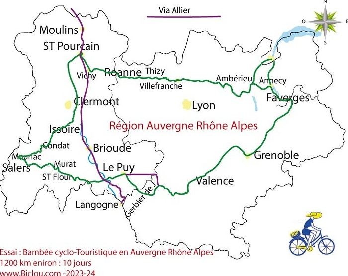
here’s a travel journal of the cycling tour through the Rhône-Alpes Auvergne region by Claudio
zouli
it was the plan
http://cbandiera.free.fr/parcours/auvergne-Ralpes/
the trip was completed
story being posted online soon
1100 km in 11 days
beautiful and varied regions
Hello,
We’d like to go on a 3- to 4-month bike trip starting in December, crossing from Assam (northeast India) to New Delhi via Nepal.
Are there routes with light traffic along the Brahmaputra and through Nepal?
We’re also looking for any info on accommodations, wild camping, local interactions, etc.
Thanks,
Michel
Hello,
Has anyone here had experience using a gas stove in Sardinia and Sicily? I’m wondering if screw-on gas canisters (not the blue Campingaz ones, but brands like Coleman, Primus, etc.) are easy to find.
I’m planning to cycle from Morlaix to Brest (via Roscoff and the V45 coastal route). We’ll start riding on August 16th for 13 days (with stops for island visits, surfing, etc.). Is there a lot of traffic at this time of year? I’ve got two kids, 11 and 13, and we don’t like riding in the middle of cars (we’ve already done the Vélomaritime—Caen to Cherbourg—the Loire route from Orléans to Saumur, the Vélodyssée from Nantes to Royans, and the canals like the Nivernais and Bourgogne, where there were plenty of bike-only lanes, which isn’t the case on this route).
Thanks for your help if you’ve already done this route in late August!
Virginie
Hi there,
I’ve been road cycling for several years, and I’m about to switch to gravel in the next few days—I’m waiting for my bike, which should arrive this week.
I’m planning a bikepacking trip in a few weeks along the Véloroute V81, also known as the Vélosud, from Biarritz to Le Barcarès.
Has anyone here already done this route? Any info is welcome, whether it’s about the route itself, gear, or accommodation. I’ll prioritize staying with locals as much as possible. On that note, I just signed up for the brand-new site *Guidon et Couette* ((www.guidon-et-couette.fr)), which offers free accommodation between cyclists across the country, but there’s almost no one listed along my route!
Thanks in advance.
Laurent.
Hi there, I’m planning a cross-Canada bike trip, and I’ve got a question that might seem silly, but could someone tell me how to pack a bike (in a box, with a fragile sticker... I don’t know) for a flight? Thanks in advance!
This summer, we’re planning to cycle along the EV 19 that follows the Meuse River from Langres all the way to Rotterdam.
My question is about getting back to Nantes.
Do any of you know what the best return option might be? I’d love to hear about your experiences.
I saw that FlixBus doesn’t take bikes.
By train, I think it’s possible but would involve multiple local trains.
We were also wondering if there’s a boat from Rotterdam to Saint-Nazaire that could take passengers with bikes.
Any tips or experiences you can share would be really helpful—thanks in advance!
Have a great evening
I’ve gotten used to crossing Europe by bus to return by bike.
It was really convenient to take the bike without having to disassemble it.
But FlixBus no longer accepts bikes...
What alternatives do you know about?
Thanks.
Hi there,
I’m planning to ride the Dutch section of the EuroVelo 19, from Maastricht to Rotterdam.
Since it’s too complicated to bring my bike on the train, I’m looking to rent one locally.
I’d love any tips or bike rental shop recommendations—I’m struggling to find options even in Rotterdam.
The plan is to rent in Rotterdam, take the train to Maastricht with the bike, then cycle back to Rotterdam.
Thanks in advance for any advice or suggestions!
Nath
I’m planning to build a new touring bike.
I want to prioritize lightness.
That said, I’m tempted by a suspension fork that could offer some comfort on rougher roads.
The recent appearance of gravel suspension forks on the market might meet my needs—at least on paper.
I’m particularly considering the RockShox Rudy Ultimate XPLR fork.
Unlike MTB forks, its travel is short: either 30 mm or 40 mm.
It weighs 1400 g, which is 400/500 g more than a steel fork.
Any thoughts or real-world feedback on this?
I’m also wondering about the durability of magnesium (lower leg) for long-distance bike touring.
And what’s the impact of skipping the manufacturer-recommended maintenance every 50 and 200 hours? That’s bound to happen on a long trip unless you carry extra gear.
More generally, how reliable are these kinds of forks?
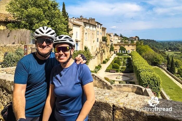
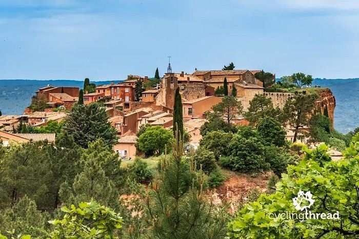
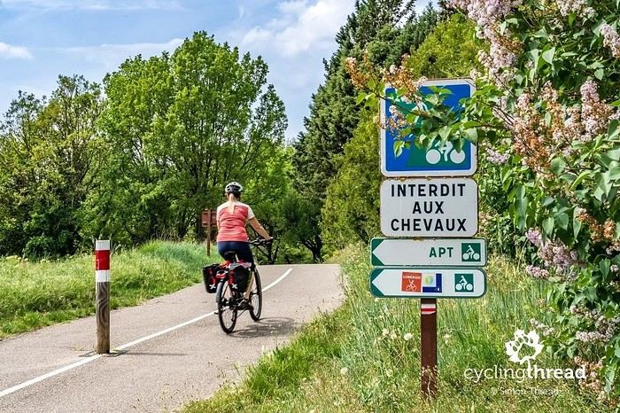
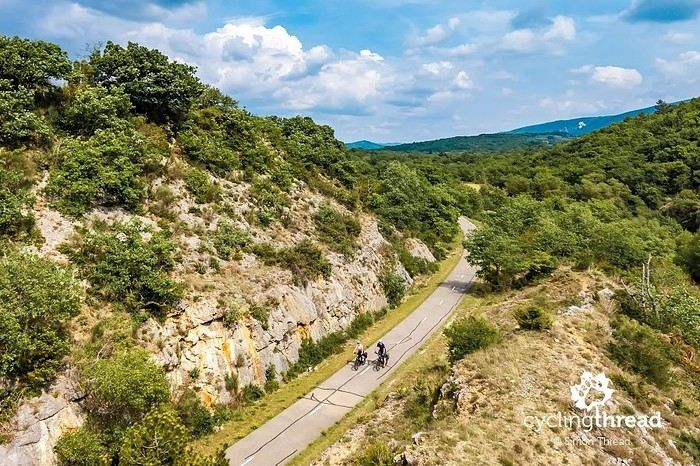
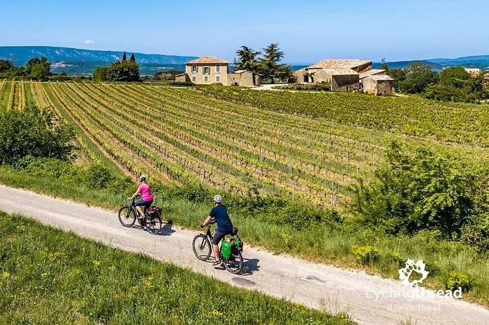
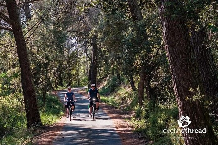
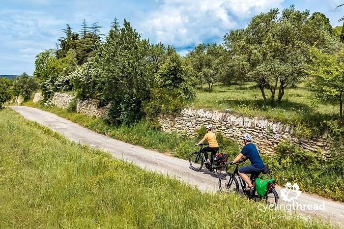
I’m making an exception and creating a separate post this time, since it’s all about France. In May, we spent a week in Provence, specifically in the Luberon, exploring the cycling routes *Autour du Luberon à Vélo*, the *Véloroute du Calavon* (part of EuroVelo 8), and the shorter *Les Ocres à Vélo* route. Together, they gave us an amazing journey through rolling hills, vineyards, lavender fields still green in spring, and some of the most stunning landscapes in southern France.
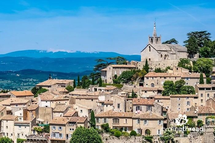
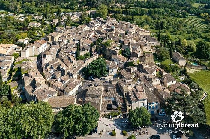
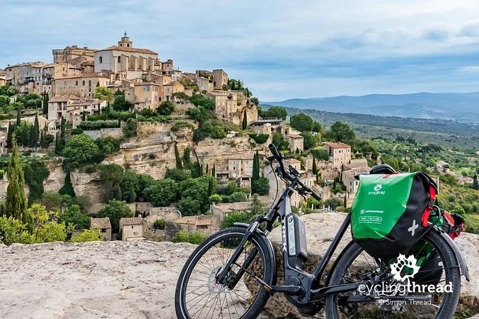
It was, of course, the perched villages that impressed us the most. We visited Gordes, Roussillon, Bonnieux, Lacoste, Lourmarin, Ménerbes, Oppède-le-Vieux, Cucuron, and Lauris. Many of them are among the most beautiful villages in Provence, and it’s hard not to agree with that reputation.
One interesting point is the route of EuroVelo 8 in this part of the region. The official path mainly follows the old railway line of the *Véloroute du Calavon*, which is very comfortable and safe. But in our opinion, cyclists traveling EuroVelo 8 around the Mediterranean would discover even more treasures if the route passed through villages like Bonnieux, Lacoste, or Oppède-le-Vieux.
We were also pleasantly surprised by how safe cycling felt. Most of the route takes small local roads, but traffic is light, drivers are respectful, and road design really takes cyclists into account. It’s one of those places where you can ride peacefully even without separated bike lanes.
Our full story:
Around Luberon by bicycle - the most beautiful villages of Provence
You can also find all our cycling travel stories on the forum:
Cycling Thread - Europe’s most beautiful bike routes
Hi there, we’re a group of 4 cyclists looking to get from Treviso in Italy to Munich with our 4 non-folding bikes. It seems complicated! Are there any solutions? Thanks so much.

 Pas mal du tout de penser ainsi monsieur! 😉