Bonjour
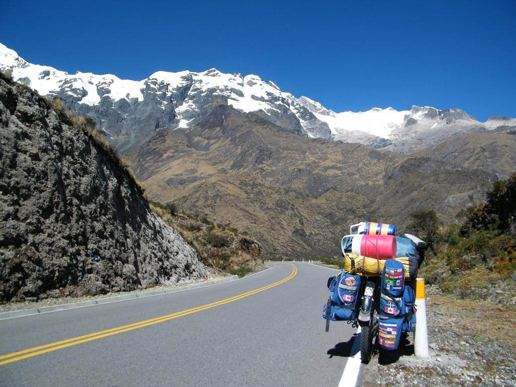
Alors ma question est : pensez vous qu'il soit possible de faire le trajet cuzco hydroelctrica en vélo sans guide ? étant donné qu'apparemment il y a des bus, et autres taxis, ou encore trecks organisés, le sentier doit être praticable. Mais je m'interroge surtout sur après : y a t il des hôtels à hydroelectrica susceptibles de garder vélo, remorque et tout le bazar en attendant ma visite à pieds du machu picchu ???
merci à tous pour vos retours d'expériences !
Salut
Je te conseille de laisser ton vélo a Santa Teresa plutôt qu'à Hidroeléctrica, mais tu sais, finalement tu peux allez jusqu'à Aguas Calientes en velo, entre Hidro et AC il y a un petit sentier a coté de la voie ferrée, il y a juste qq passages sur lesquels tu devras marcher sur les vois. je prefere faire ca que laisser mon vélo avec qq (et je suis de la région ;).
Saludos
Zuri
Guide et chauffeur francophone au Pérou / Pompier
"Si vous pensez que l'aventure est dangereuse, essayez la routine… Elle est mortelle".
Merci beaucoup de ta réponse Huri,
la question était aussi, puis je faire ce trajet sans guide, sans me perdre ? il n'y a a pas d'endroit où on hésite et toujours des gens ? et comme je le dis, j'ai une remorque et quelques saccoches, donc ce n'est pas un vélo tout simple, c'est un peu plus encombrant sur le trajet, mais tu penses que c'est faisable ?
Au départ, je voulais faire l'aller par le Salkantay, et en regardant un peu de plus près, les chemins m'ont semblé impraticables en vélo, qu'en penses tu ?
Si j'arrive à Aguas Calientes, il faudra aussi de toutes façons que je laisse mon vélo dans un hôtel ou un restaurant non ? risque de vol c'est ça ? même du vélo ? qu'est ce que tu me conseillerai de faire alors ? car même si je laissais mon vélo à Cusco, le problème serait le même (pire à la limite, car je le laisserai plus longtemps...)
Merci beaucoup ! tu es d'où exactement ? tu parles parfaitement le français, bravo ! j'espère que mon niveau en espagnol sera aussi bien après mon périple !
buen dia !
La route de Santa Maria à Santa Teresa est assez mauvaise (voir très mauvaise par endroit) et assez raide.
Je pense que laisser ton vélo en bas (Santa Maria) n'est pas une mauvaise idée, mais faut trouver un endroit de confiance et ça, personne ne pourra rien te garantir. Après ce ne sont pas tous des voleurs, mais faut reconnaitre que le nombre de vol augmente avec le nombre de touristes. Les villages sur cette route sont donc en bonne posture à ce niveau là à mon avis.
A la louche, si tu veux aller en vélo jusqu'en haut. Tu vas galérer pas mal par endroit, mais depuis santa Maria tu devrais atteindre aguas calientes en 1 jour, les paysages sont superbes!!! Attention au retour par contre, chemin mauvais, pente raide et précipices!!!!
Cuzco Hydroelectrica ce sont des routes pas des sentiers, donc aucune possiblite de te perdre. Si tu as des doutes a Ollantaybambo ou a Santa Maria tu demandes. Il y a un col a passer, pas loin de 4500 metres je crois.
tout depend de la periode à laquuelle tu vas faire ce trajet.
De decembre à avril, c'est la saison des pluies et les eboulements et des glissements de terrain sont "monnaie courante"
il y a quelques jours, c'etait le route cuzco-Quillabamba et pourtant c'est une "belle route"....Tout est relatif, c'est plutot une piste.....
Cela veut dire que belle route ne veut rien dire dans ce coin.....
personnellement, je pense que tu vas devant des galères surtout avec ta remorque qui ne doit certainement pas être tres legère.
La solution de laisser ton attelage dans ton hotel a Cuzco est a reconsidérer tout comme on laisse les bagages dans ces hotels quand on fait le machu-picchu
Bonjour,
merci à tous pour vos réponses !
non en fait, je pense faire ce trajet en mai - juin, donc a priori, l'état de la route serait meilleure. Ok alors si je passe par là, je pense que je laisserai mon vélo à santa maria en suivant vos conseils.
cela dit, en regardant de plus près, je me suis dit que j'aurais bien visité aussi le choquequira, dont on dit beaucoup de bien. Je sais bien qu'il y a le canyon de Apurimac à traverser, mais sinon je pense que l'on peut pousser le vélo dedans non ? le chemin est il praticable à vélo (même en poussant ?). L'idée serait après de faire la route jusqu'à santa maria, laisser donc mon vélo là et aller au machu picchu...
des gens ont ils fait ce trajet seuls ? y a t il des endroits où l'on peut se perdre ?
merci à tous et excellente nouvelle année !
merci pour la réponse... en fait, je ne parlais pas spécialement de chaleur, mais plutôt de l'aspect du chemin, par exemple s'il y a des passages à escalader ou des passages très étroits... ???
merci !
Je ne vois pas du tout l'interet de prendre un velo a Choquequirao. C'est un chemin raide apres les premiers kms faciles, et tu devras marcher de toutes facons.
Par contre, dans la region de Cuzco, il y a plein de pistes, certaines avec de petites ruines peu touristiques, et des villages sans touristes aussi, qu'il est interessant de faire a velo. Juste un exemple a Ollantaytambo tu peux suivre la vallee secondaire vers le Nord, a Huilloc et au dela.
J'ai fait ce trajet 2 fois en vélo. Les 2 fois, j'avais laissé la tente à Cuzco pour m'alléger le plus possible parce qu'il y a de bonnes montées et on est déjà en altitude.
De belles petites étapes pour avoir le temps de visiter :
Cuzco - Pisaq (les terrasses)
Pisaq -Ollantaytambo (les ruines)
Ollantaytambo (2792m) à Santa Maria (je crois que tu voudras te faire amener au sommet du col (Abra Malaga 4350 m) par un autre moyen de transport (taxi) car ça monte de 1560 m en ± 45 km (avec une remorque, ce sera trop lourd). Au fait, amèneras-tu ton chien finalement ? À partir du col (il y fait environ 4-5°C) ça descend presque tout le long (3312m) et ça devrait maintenant être complètement asphalté jusqu'à Santa Maria (±27°C) où il y a quelques petits hôtels (mais c'est bien mieux à Santa Teresa).
Avec ta remorque, je ne te conseille pas le trajet entre Santa Maria et Santa Teresa (route de terre et caillous, que des montées raides, descentes et remontées raides et très étroites avec des virages trop serrés côtoyant le précipice par endroits (même moi, j'y ai eu un peu la trouille). J'ai été contente de le faire la première fois car le paysage est magnifique, mais la 2e fois, j'ai pris un lift. De Santa Teresa à la Hidroelectrica ça se fait en vélo, c'est pas très loin, mais c'est "beaucoup d'ouvrage" (chemin de terre et caillous, chaud et sec - les bouts côtoyants la rivière sont très beaux).
À la barrière de la Hidroelectrica où il faut s'enregistrer, depuis l'année dernière, les consignes sont très strictes: ils ne laissent plus passer des vélos si les cyclistes n'ont pas de billet de train. De toute façon le sentier qui longe la voie ferrée est conçu pour des piétons ou des vélos de montagnes non chargés (avec du bagage, et ce que tu serais d'ailleurs obligée de faire avec ta remorque, les cyclistes empruntent la voie ferrée) ce qui est dangereux car si le train arrive, il n'y a pas l'espace de dégagement nécessaire à côté de la voie).
Ce qui fait que les 2 fois où je suis passée par là, j'ai pris le train avec mon vélo. Par contre, c'est une randonnée spectaculaire et géniale à faire à pied (±10km).
Pour mettre le vélo sur un train de la Hidroelectrica à MaPi, c'est assez facile. Pour quitter MaPi avec le vélo sur le même train que soi, c'est toujours plus compliqué. Il n'y a pas de train sur lequel tu peux voyager avec une bodega qui voyagerait en même temps que toi jusqu'à Poroy ou qui débarquerait le vélo à la même gare que toi - à moins d'arrêter à Ollantaytambo ou retourner à la Hidroelectrica. Avant un tremblement de terre (après 2008) la liaison en train était plus simple avec un vélo entre MaPI jusqu'à la gare de Cuzco. Depuis le tremblement de terre, même les passagers débarquent à Poroy (±13 km du centre de Cuzco) mais celui avec la bodega n'arrête pas à la même gare. L'été dernier, j'ai dû attendre le début de la semaine pour avoir de l'espace sur le train ayant une bodega allant vers Ollantaytambo (la fin de semaine, les wagons sont souvent réservés pour les péruviens qui amènent leur récolte à Cuzco ou Ollantaytambo).
En résumé :
- aucun hébergement possible à la Hidroelectrica ou endroit sécure pour laisser ton vélo (à moins d'avoir un ami qui y travaille)
- je ne te conseille pas de prendre le sentier entre la Hidroelectrica avec ton vélo
- si tu veux en faire un bout en vélo, à Santa Teresa, tu pourras plus facilement trouver un endroit fiable pour laisser ton vélo qu'à Santa Maria (c'est probablement le plus simple à faire)
- c'est compliqué de gérer le vélo avec les trains mais ça se fait si tu n'es pas pressée : l'été dernier (c'était ma 3e fois à Machu Picchu avec mon vélo), j'y ai été retardée 2 jours de plus que prévu pour pouvoir mettre le vélo sur le même train et j'ai fini par être tannée d'être considérée comme une touriste "porte-feuille sur 2 pattes" (ce à quoi on est pas habitué quand on arrive à vélo dans un village ordinaire) j'avais vraiment hâte d'en partir
- pas besoin de guide, les gens sur place vont pouvoir bien tout t'expliquer, sinon tu peux me recontacter
Autrement, il s'est passé pleins de trucs depuis qu'on s'est écrit la dernière fois... je t'enverrai un MP bientôt...
Le mieux sera de laisser ton vélo a Santa Teresa, en juin tu n'auras aucun souci pour la route, tu peux me contacter si tu veux une carte IGN de la région pour ne pas te perdre.
J'ai fait une fois le Choquequirao en velo mais que la descent (je pratique le downhill) donc pour la montée mon vélo etait sur une mule ;) si tu as envie de pousser ton vélo il va etre tres tres dur mais pas impossible, je te conseille en tout cas faire le salkantay, plus accessible en vélo et tu arrives a Santa Teresa pour continuer vers Machupicchu.
Saludos
Zuri
Guide et chauffeur francophone au Pérou / Pompier
"Si vous pensez que l'aventure est dangereuse, essayez la routine… Elle est mortelle".
bonjour, et merci à nouveau pour vos réponses
alors je suis un peu embêtée car finalement il semblerait que ce soit mieux de laisser mon vélo à santa theresa, mais que le trajet santa maria santa theresa ne soit pas très praticable en vélo... c'est vrai que mettre mon vélo dans moyen de transport ne m'enchante pas des masses, surtout si c'est pour le laisser ensuite dans un hôtel et ne pas l'utiliser, le plus simple aurait donc été pour moi de le laisser à santa maria... personne n'aurait une adresse de confiance à me donner ??? ça me permettrait de continuer le trajet ensuite à pieds jusqu'au machu picchu.
Par contre, je reste sur mon idée d'aller d'abord à Choquequirao. Pour répondre à ta question Willemspie, l'intérêt est de ne pas laisser mon vélo et mes bagages à n'importe qui en bas à Cochara durant plusieurs jours, le temps de faire tout le trajet jusqu'à Choquequirao puis jusqu'à santa maria puis jusqu'au Machu Picchu, puis Cusco et enfin retourner à Cochara. Cette option sans le vélo me coûterait à la fois beaucoup plus cher (bus trains...) et beaucoup plus de temps (au moins 10-15 jours pour tout ça)
alors que je me demandais si je pouvais faire Cochara - Choquequirao - Santa Maria en vélo, (imaginons que je trouve quelqu'un de confiance) de laisser ensuite mon vélo à Santa Maria, uniquement le temps de faire l'aller retour jusqu'au Machu Picchu, et là être libre de repartir en vélo à partir de Santa Maria. Même s'il me faut galérer un peu et pousser mon vélo pas mal, je pense que je préfère cette option.. Maintenant bien sûr, c'est pour cela que je pose ce post, si c'est juste impossible parce qu'il y a des endroits très étroits et très dangereux, je ne prendrai pas ce risque... Quitte à prendre une mule pour pousser mon vélo, si c'est nécessaire.. Qu'en pensez vous ?
Martine, je t'ai envoyé un mp
Zuri, oui, je veux bien une carte ign de la région, avec plaisir, merci
17 days, 1,400 km, and 17,500 m of elevation gain cycling in northern Vietnam! 🇻🇳 🚴🇻🇳
From the misty Fansipan to the breathtaking landscapes of the Ha Giang Loop, from remote villages to vibrant markets...
I cycled through the north of the country, getting up close with its people—through mud, heat, endless mountain passes, and unforgettable encounters.
Most importantly, I discovered a Vietnam far different from the usual tourist circuits.
Join me on this adventure through a video that captures these 17 days of travel. :)
If Vietnam calls to you, come ride a stretch with me!
Bonjour
quelles sont les moyen les plus simple pour revenir du Cap Nord sans pédaler
train, Bateau, avion ?
qui à déjà fait l’expérience ?
Merci de nous renseigner
Hi,
can anyone give us some tips on how to get to North Cape from Lyon Gerland?
What’s the best route to join the EuroVelo 7?
How many kilometers is it from Lyon to North Cape via EuroVelo 7?
The best month to leave—we’re thinking early May.
Thanks for any advice!
Looking for a female travel companion for a cycling trip (arriving by plane in Porto Alegre, Brazil, and cycling toward Montevideo, Uruguay, returning by plane to France from Buenos Aires, Argentina) – 1,500 km
Hello everyone!
I’m planning a cycling trip across Brazil, Uruguay, and Argentina, with a departure set for late October, November, or December. I’m looking for a travel companion to share this long-distance adventure with.
Experience:
I already have solid experience in bicycle touring in Georgia, Kazakhstan, and Kyrgyzstan. Currently, I maintain excellent physical condition by cycling an average of 250 km over 3 days per week (4 hours a day at 20 km/h).
The trip & the pace:
Daily pace: Between 50 and 80 km per day, to make steady progress while taking time to explore.
Accommodation: Flexible and authentic. We’ll alternate between wild camping, campsites, Warmshowers, small guesthouses, and budget hotels depending on opportunities and the weather.
Looking forward to reading your message and planning this amazing journey together!
I’m planning to leave Nice for Toulouse around 10/15 and I’m looking for tips / great deals regarding:
- The route: I was thinking of taking Nice - Grasse - Draguignan - Salernes - Cadarache - Cavaillon - Arles, then the Camargue, Sète, and the Canal du Midi to Toulouse. The idea is to avoid high-traffic roads and too many steep climbs. Are there any spots to avoid or must-see stops? Since it’s been a while since I’ve been on the road, I was thinking that sleeping indoors might be preferable. If you have any budget-friendly accommodation suggestions along part of the route, don’t hesitate!
Thanks in advance, and if you’re in the area around that time, we could ride together... Ciao.
Another long-time dream of Claudio’s: the Petit Mont Cenis pass and the dam at the eponymous lake.
A place where many Italians, including my father, worked in the 1950s–60s.
Faverges → St-Michel-de-Maurienne → Lanslebourg → Petit Mont Cenis → return. 315 km, 3 days. Bivouac at St-Michel-de-M.
Brouter link
Leg One: Faverges → St-Michel-de-Maurienne
Leg Two: St-Michel → Lanslebourg → Mont Cenis Lake → St-Michel
Leg Three: St-Michel → Faverges
And it finally happened in August 2026: in the Maurienne Valley about the famous cycle route known as the V67
🇷🇼 Cycling in Rwanda: 4 episodes, an off-the-beaten-path adventure
After 3 weeks and nearly 1,200 km by bike across Rwanda, I made 4 videos to share this adventure in a different way: the landscapes, the encounters, the villages… but above all, all those incredible scenes of everyday life.
The 4 episodes are available here:
👉 https://www.youtube.com/playlist?list=PLGnfbxjccWAg
The 4th episode focuses on rural Rwandan life: simple, authentic, and sometimes surprising scenes that you only truly discover when you take the time to travel by bike.
If you have a few minutes, let yourself be transported to Rwanda…
Hi, I'm looking for info on cycling to Nordkapp via the EuroVelo 7. Has anyone done it already, and where’s the best place to start the EuroVelo 7?
Thanks
Hi,
We bought the MSR bike tent model (2-person + large awning that can fit 2 bikes) back in 2005. It’s served us really well, especially during a year-long trip in Africa. Now, one of the poles is broken, and we’d love to replace it since that’s the only issue with the tent—we still love it! The poles are 9.35 mm in diameter, with 8 sections of 49 cm and 2 sections of 28 cm. Total length when assembled: 416 cm. Actually, two large sections are broken: one straight and one curved. It’s a pain to find replacements since this model is no longer sold anywhere.
Would anyone have this model lying around unused and be willing to sell me a pole?
Hi everyone,
In early April, I’m redoing the Vélo Francette (La Rochelle to Ouistreham), and then I’d like to cycle along the Cotentin Peninsula (which I don’t know at all), follow the coast up to Cherbourg, and then head back down to at least Saint-Malo. I’d love to know if it’s pleasant for cycling—are the roads nice? Not too windy? What are the must-see spots? Any great campsites? All your tips and advice are more than welcome, and I thank you in advance.
Hi there,
I’m planning to bike to meet some friends in Côte d’Ivoire in early November.
I’ll be starting in Abidjan and heading to Abengourou, which is close to the Ghana border.
I’d like to take the trails. Does anyone have recent info on eastern Côte d’Ivoire?
Any tips, safety advice, or must-see stops? I’m open to all suggestions.
Thanks in advance for your help!
Fx
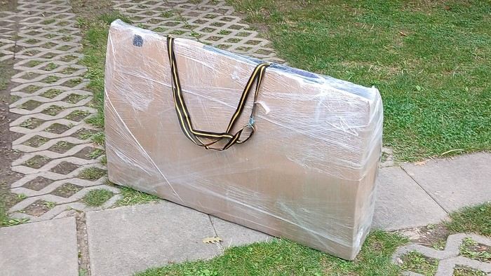
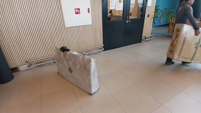
After testing it for three years across various modes of transport, I’m sharing this video of a bike packing case. It’s made from recycled cardboard and shrink-wrapped, with adjustable thickness and added bubble wrap depending on the level of protection you want.
Installing spacers at the fork and chainstays makes the packaging compact. With the fifteen-odd euros for shrink-wrapping at the airport, this case travels really well.
https://youtu.be/_GDJi-GqmkM
- Low bulk (1.10m x 0.70m x 0.25m for a large frame), it fits vertically in train luggage compartments and the total dimensions (x+y+z) don’t exceed 2.40m.
- Two carrying solutions for public transport and easy handling by airport staff (no more tears in the cardboard from openings).
- Discreet packaging when dealing with bus drivers and train conductors, as it looks like an ordinary parcel.
- No need to return to the starting point to retrieve the case from your outbound trip, which you’d otherwise have to store somewhere, or deal with a bulky cover to pack in your panniers.
- You can still check tire pressure through the plastic film without damaging the packaging too much.
Drawbacks: Around 3 hours for this lengthy and meticulous process—removing the wheels, pedals, handlebars, and derailleur without misaligning them, then securing all components to the frame.
If you get a chance to test it, send me your feedback for future improvements.
I just took a trip in Tunisia from Tozeur to Douz, skirting Chott el Jerid to the south. I’m back with the urge to keep going further south via the 4x4 tracks to connect Douz to Ksar Ghilane. Has anyone driven this route recently or explored southern Tunisia?
Thanks for your tips!
fix
😎Fellow traveling cyclists or not, all of you who love travel, the pleasure of physical effort, nature, beautiful machines, people with true passions they seek to fulfill, and who also enjoy reading great literature about all this—the *200* magazine is for you just as it is for me. I should mention I have no financial or other interest in this (in an era where we accuse our politicians of all sorts of vile interests, I prefer to take precautions). I’ve been subscribed since the beginning, and every three months, I get my 130 pages of dreams (the magazine just went from 110 to 130 pages).
It covers everything from the trans-America route to the TCR (Trans Continental Race) from Belgium to a small town in Turkey, with mind-blowing averages—4,000 km and 80,000 m of elevation gain in 8 days and 15 hours for the winner. Let that sink in, and all of it without assistance—accepting a patch could penalize you. There’s also a story about crossing Iran, encountering one of the world’s most welcoming populations, following in the footsteps of Nicolas Bouvier, as well as retirees leisurely traversing France. The common thread in all these stories? Beautiful writing. Take, for example, a stunning article: *"Passengers of the Cold: From Edinburgh to Thurso, at the very north of Scotland, 550 km of moors, coasts, and icy wind. In Thurso, the road ends at a quay, facing the Orkney Islands. We wanted a November trip, off-season. We wanted to surprise winter. Just before the snow."* A sublime piece on the experience of facing adversity and the chance encounters along the road and in the elements.
Before I embarked on my own bike trips, I dreamed a lot about them—from the Atacama to the Gobi, along the Mekong, and not forgetting France. And now, these 130 pages every quarter keep those dreamy vibes alive through stories written in the most beautiful prose.
I’ll stop here because it might sound like I’m advertising, but if you don’t know *200*, I invite you to discover it. It’ll give you wings for the most incredible challenges or simply reinforce your desire for slow rides with your eyes open to others and nature.
A little news to wrap up: Axel Carion and a friend just broke the record for crossing South America from Colombia to Ushuaia in 59 days. On its own, that doesn’t mean much, but I can’t help it—it makes me dream. You should see how he talks about it, the flashes of that wild nature he’s stored away: a snowstorm at Paso Jama and the surreal sight of the suddenly snow-covered Licancabur!
Luc
PS: The magazine is called *200* because a day’s ride starts at 200 km—well, I’ve never done a ride like that since my longest was 167 km (with 18 kg of luggage, mind you), but why not one day? The magazine will explain how to tackle your first 200, and then the question in conclusion: when will you do your first 300?😏
I’ve got my flight ticket sorted—departing in mid-November and returning in mid-March. I’ll arrive in Santiago and leave from Buenos Aires.
I’ve already been to southern Argentina, specifically Torres del Paine National Park, and I’d love to go back to do the full W trek (I only did the shorter version last time).
I also want to do some hiking and maybe even tackle a summit. I climb and occasionally do some mountaineering, so I’ll definitely be going with a guide.
I plan to start around Temuco in Chile, with the idea of heading toward the lakes, then taking the Carretera Austral.
I’m not sure if I’ll go all the way to Ushuaia—it’s supposed to not be *that* worth it, except for the bragging rights of saying you’ve been to the end of the world.
I saw there are lakes in Argentina too.
I don’t have a precise itinerary, but what I’d love is, once I reach the southernmost point of my trip, to take a mini-cruise to see some wildlife. Any tips for that?
What kind of sleeping bag did you take? Is a 0°C (32°F) one enough?
And one last question: white gas stove or can I get by with my gas stove?
I'm developing a free and open-source web app for planning walking and cycling trips (and even car trips). You can create a route by clicking directly on the map to add waypoints, and it can consist of multiple stages. The app provides tools to edit the stages and the overall route, and to display useful information (distances, altitudes, and elevation changes). A relief profile can be shown as a graph for a specific stage or the entire route.
Once the route is ready, it can be exported as a GPX file, which can then be used with a GPS or a mobile navigation app.
The app is built in JavaScript and runs entirely in the web browser. It uses the Leaflet library and several OpenStreetMap-based services. Initially developed for my personal needs (I enjoy hiking and cycle touring), I’d be happy to share it with anyone who might find it useful. It’s free to use, doesn’t require an account, and the source code is available.
hello fellow cycling enthusiasts
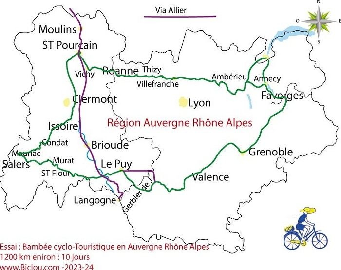
here’s a travel journal of the cycling tour through the Rhône-Alpes Auvergne region by Claudio
zouli
it was the plan
http://cbandiera.free.fr/parcours/auvergne-Ralpes/
the trip was completed
story being posted online soon
1100 km in 11 days
beautiful and varied regions
Hello,
We’d like to go on a 3- to 4-month bike trip starting in December, crossing from Assam (northeast India) to New Delhi via Nepal.
Are there routes with light traffic along the Brahmaputra and through Nepal?
We’re also looking for any info on accommodations, wild camping, local interactions, etc.
Thanks,
Michel
I’m planning to cycle from Morlaix to Brest (via Roscoff and the V45 coastal route). We’ll start riding on August 16th for 13 days (with stops for island visits, surfing, etc.). Is there a lot of traffic at this time of year? I’ve got two kids, 11 and 13, and we don’t like riding in the middle of cars (we’ve already done the Vélomaritime—Caen to Cherbourg—the Loire route from Orléans to Saumur, the Vélodyssée from Nantes to Royans, and the canals like the Nivernais and Bourgogne, where there were plenty of bike-only lanes, which isn’t the case on this route).
Thanks for your help if you’ve already done this route in late August!
Virginie
Hi there,
I’ve been road cycling for several years, and I’m about to switch to gravel in the next few days—I’m waiting for my bike, which should arrive this week.
I’m planning a bikepacking trip in a few weeks along the Véloroute V81, also known as the Vélosud, from Biarritz to Le Barcarès.
Has anyone here already done this route? Any info is welcome, whether it’s about the route itself, gear, or accommodation. I’ll prioritize staying with locals as much as possible. On that note, I just signed up for the brand-new site *Guidon et Couette* ((www.guidon-et-couette.fr)), which offers free accommodation between cyclists across the country, but there’s almost no one listed along my route!
Thanks in advance.
Laurent.
Hi there, I’m planning a cross-Canada bike trip, and I’ve got a question that might seem silly, but could someone tell me how to pack a bike (in a box, with a fragile sticker... I don’t know) for a flight? Thanks in advance!
This summer, we’re planning to cycle along the EV 19 that follows the Meuse River from Langres all the way to Rotterdam.
My question is about getting back to Nantes.
Do any of you know what the best return option might be? I’d love to hear about your experiences.
I saw that FlixBus doesn’t take bikes.
By train, I think it’s possible but would involve multiple local trains.
We were also wondering if there’s a boat from Rotterdam to Saint-Nazaire that could take passengers with bikes.
Any tips or experiences you can share would be really helpful—thanks in advance!
Have a great evening
I’ve gotten used to crossing Europe by bus to return by bike.
It was really convenient to take the bike without having to disassemble it.
But FlixBus no longer accepts bikes...
What alternatives do you know about?
Thanks.
Hi there,
I’m planning to ride the Dutch section of the EuroVelo 19, from Maastricht to Rotterdam.
Since it’s too complicated to bring my bike on the train, I’m looking to rent one locally.
I’d love any tips or bike rental shop recommendations—I’m struggling to find options even in Rotterdam.
The plan is to rent in Rotterdam, take the train to Maastricht with the bike, then cycle back to Rotterdam.
Thanks in advance for any advice or suggestions!
Nath
I’m planning to build a new touring bike.
I want to prioritize lightness.
That said, I’m tempted by a suspension fork that could offer some comfort on rougher roads.
The recent appearance of gravel suspension forks on the market might meet my needs—at least on paper.
I’m particularly considering the RockShox Rudy Ultimate XPLR fork.
Unlike MTB forks, its travel is short: either 30 mm or 40 mm.
It weighs 1400 g, which is 400/500 g more than a steel fork.
Any thoughts or real-world feedback on this?
I’m also wondering about the durability of magnesium (lower leg) for long-distance bike touring.
And what’s the impact of skipping the manufacturer-recommended maintenance every 50 and 200 hours? That’s bound to happen on a long trip unless you carry extra gear.
More generally, how reliable are these kinds of forks?
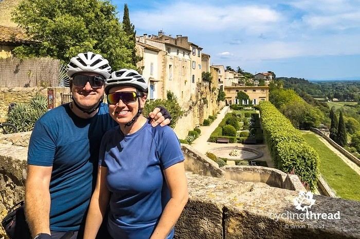
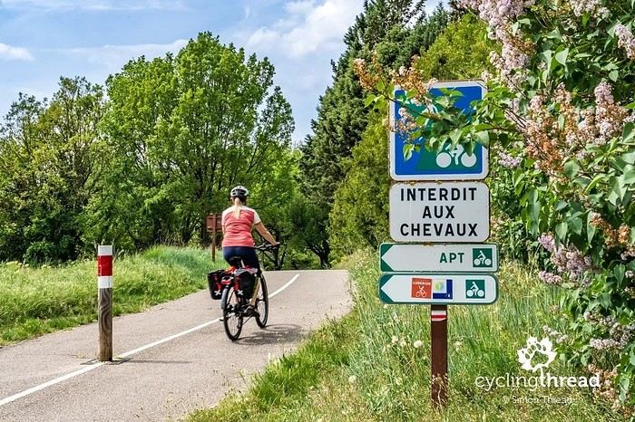
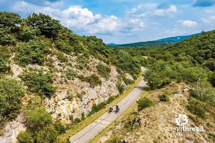
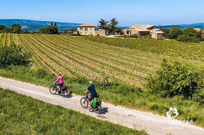
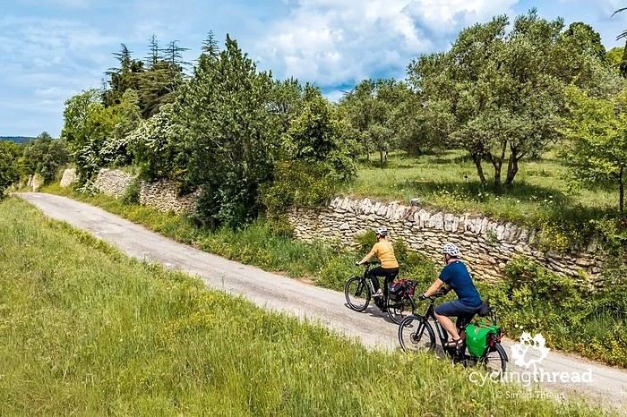
I’m making an exception and creating a separate post this time, since it’s all about France. In May, we spent a week in Provence, specifically in the Luberon, exploring the cycling routes *Autour du Luberon à Vélo*, the *Véloroute du Calavon* (part of EuroVelo 8), and the shorter *Les Ocres à Vélo* route. Together, they gave us an amazing journey through rolling hills, vineyards, lavender fields still green in spring, and some of the most stunning landscapes in southern France.
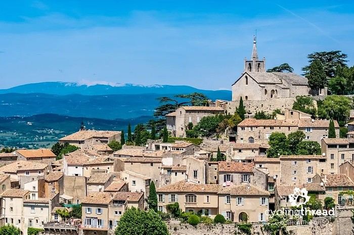
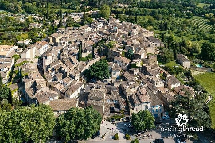
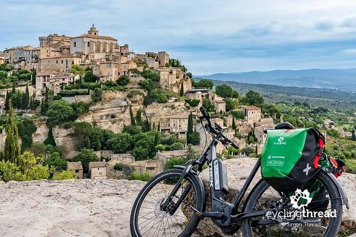
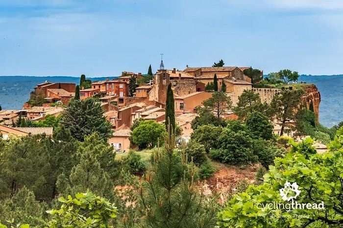
It was, of course, the perched villages that impressed us the most. We visited Gordes, Roussillon, Bonnieux, Lacoste, Lourmarin, Ménerbes, Oppède-le-Vieux, Cucuron, and Lauris. Many of them are among the most beautiful villages in Provence, and it’s hard not to agree with that reputation.
One interesting point is the route of EuroVelo 8 in this part of the region. The official path mainly follows the old railway line of the *Véloroute du Calavon*, which is very comfortable and safe. But in our opinion, cyclists traveling EuroVelo 8 around the Mediterranean would discover even more treasures if the route passed through villages like Bonnieux, Lacoste, or Oppède-le-Vieux.
We were also pleasantly surprised by how safe cycling felt. Most of the route takes small local roads, but traffic is light, drivers are respectful, and road design really takes cyclists into account. It’s one of those places where you can ride peacefully even without separated bike lanes.
Our full story:
Around Luberon by bicycle - the most beautiful villages of Provence
You can also find all our cycling travel stories on the forum:
Cycling Thread - Europe’s most beautiful bike routes