Travel journals · Amérique du Nord
FR
BI
Bibouns51 6 days ago
Off on a winter adventure in the American West!
Day 1 – February 14

We all have two lives. And the second one kicks off the day you realize you only have one, with the determination to spend the time you have left on what truly adds sparkle to your life, Kevin! I like to elegantly introduce a trip with a philosophical quote. First, it gives you the illusion that I’m some kind of deep thinker, and second, it lets me fill up the first few lines of my blank page when I don’t know how to tell you I’m diving back into what really lights up my life: another adventure beyond the horizon! And nearly every other year, like a toxic relationship, my horizon tends to take shape in Uncle Sam’s backyard. And this, despite his cousin Donald calling the shots. Speaking of which, it was partly that impulsive guy who pushed us to be just as impulsive and snag our four flight tickets at a ridiculously low price—a direct result of foreign tourism taking a hit from BetaMax’s repeated antics... Four tickets? Who are the other lucky ones? In this case, our lucky ones are actually lucky ladies: My Flo, always up for exploring the world with me on foot, camelback, or scooter, is obviously in on the fun. The other two seats went to our daughters, Sasha and Luna, both thrilled to be part of this new American adventure...

But what’s the American West like in February?... A gamble. Let’s call it Russian roulette since we’re not landing during peak weather season. That’s why we encouraged our transportation and accommodation to get cozy and produce a little camper van, so we can stay ultra-flexible in the face of any weather tantrums. We’ll be roaming in Kara the van with the motto "Follow the sun!" Bad weather? We bolt. Snow? We speed up. Sunny? We act like it was the plan all along and soak it up.

"Okay, but why keep coming back to the same corner of the globe? After ten American adventures, you must be tired of seeing the same things, right?" But I’m not crazy, you know!... The American West is like making love to your gorgeous wife over and over, always enjoying it just as much. And contrary to what you might think, the American West isn’t just the Grand Canyon, Monument Valley, Las Vegas, and Bryce Canyon. Proof is, after ten trips to the U.S., my retinas are still untouched by three-quarters of the places I scribbled on a napkin for this adventure... Oh, and add to that my wife, who I’ve easily converted to my religion, and boom... relapse is even easier! Because yes, we’ve landed in Los Angeles after a sunny flight over Greenland, still under Danish flag for now. And we’re already heading east through the XXL traffic of L.A.’s eight-lane highways, eager to dive into our first discoveries. But first, night is taking over the sky, and second, we’ve been officially awake for 24 hours, so I suggest wrapping up this intro. I’ll tell you more tomorrow morning. Sound good?


Open
6C
6cha38 4 weeks ago
Our family trip from Denver to Yellowstone – a recap
Hi there,

I’m diving into a recap of our loop—pretty classic, really—Denver-Yellowstone-Denver this past summer, from July 24 to August 17. Given the sheer number of trip reports already out there (or in the works), and since I don’t have the writing chops or the photography skills of many of you, I’ll keep it practical—well, I’ll try, at least—to share our take on some of the less-visited parks and spots.

First off, a huge thank you to everyone whose trip reports, blogs, websites, comments, and more helped us put together this itinerary. Looking back, it could’ve been even better optimized: a few disappointments when we missed out on some great discoveries, often because we were short on time. Plenty of reasons to come back to the area!

We’re traveling with our four (almost) teens—18, 16, 14, and nearly 12 years old. To keep the trip enjoyable for everyone, we had to make compromises on both sides: cutting a visit short to spend more time swimming, waking up at dawn, and so on. But logistics also played a big role—things like laundry, grocery shopping, and keeping luggage organized could’ve quickly become time-consuming without a little planning. And honestly, I think we visited every Walmart along the way! Blame it on the lack of fridges in some accommodations and, more importantly, the *very* limited space in the car, which made it impossible to bring a proper cooler. I’ll come back to the car saga later.

For accommodations, this year we alternated between basic cabins in KOA campgrounds and Yellowstone (when staying more than one night in the same place) and hotels. Always with a pool (except in Yellowstone, of course), which let the kids burn off energy—because they always have reserves, even after packed days!—and, let’s be honest, gave us a chance to relax. No Wi-Fi issues either; we all had plans with 25 GB of data (a big thanks to Gilles for the amazing deal at 0.99 €). It worked perfectly, even for texts and calls between phones—no extra charges.

Now, onto our route: as I mentioned, a classic Denver-Yellowstone-Denver loop. To avoid rushing through the parks or spending all our time on the road, we prioritized staying as close to them as possible, with at least two nights in each place. And I’ve got to say, it’s really nice to settle in, even if it’s just for two nights. It also helped us deal with the weather, which wasn’t always great during this trip. The trade-off? With vacation time being limited, some driving days ended up being long. We knew that going in, but since we kept a relaxed pace with no time constraints (don’t ask me for timings—I don’t keep track of the clock on vacation, except in the morning to get everyone up before noon!), we sometimes ended up with marathon days.

With that said, I’ll dive into the trip itself in the next post.
Open
PI
Pinacoladada 3 months ago
USA Road Trip - November 2023
After staying in Aruba in November 2023, we picked up our camper van, which we had left in a hotel parking lot in Miami, Florida.

This isn’t our first road trip across the United States. Since we’re retired, we took the opportunity to travel along the American West Coast, starting with the Everglades in Florida to visit a few parks where we could spot alligators.

We also made a few stops in Mississippi and Texas to explore the most important cities in those states.

Did you know that Austin is home to the world’s largest urban bat colony? It’s truly impressive to see thousands of them take flight at dusk.

I invite you to keep reading this travel journal and watch the videos that’ll give you a little more insight into these different destinations.

Videos are embedded throughout the summary. Just click on the image to start the video.

To jump to a specific post, here are the relevant links:

FLORIDA:

Big Cypress National Preserve - Ochopee Captain Mitch's Everglades Airboat Tours Marco Island

MISSISSIPPI:

Exploring Biloxi

TEXAS:

Downtown Houston Corpus Christi San Antonio Attractions McNutt Sculpture Garden - San Antonio Mission San José - San Antonio Austin Attractions The World’s Largest Urban Bat Colony - Austin Downtown Fort Worth Attractions Downtown Dallas
Open
PI
Pinacoladada 3 months ago
Road Trip USA 2023 - Part 2
HIGHWAY 1

Highway 1 runs along the Pacific coast of California from Leggett in the north to Dana Point in the south. It's the longest state route in California, stretching 1,050 km.

It's famous for its breathtaking ocean views. That’s actually why it’s become such a popular route for road trips, with tons of attractions and points of interest all along the way.

After crossing the U.S. interior on our way out (see Road Trip USA 2023 - Part 1), we’re starting our return trip along this route from Leggett.

Videos are embedded throughout the summary. Please click on the image to start the video. To jump to a specific post, here are the appropriate links:

CALIFORNIA:

Scenic Overlooks on Route 1 Between Leggett and Fort Bragg The Pudding Creek Trestle Bridge in Fort Bragg Glass Beach - Fort Bragg Jenner Lookout Point - Highway 1 Goat Rock Beach - Sonoma Coast State Park - Jenner Point Reyes National Seashore - White House Pool Trail Point Reyes National Seashore - Limantour Beach Point Reyes National Seashore - Point Reyes Shipwreck Point Reyes National Seashore - Kehoe Beach Trail Point Reyes National Seashore - McClures Beach Trail Point Reyes National Seashore - Cypress Tree Tunnel Point Reyes National Seashore - Point Reyes Beach North Point Reyes National Seashore - Elephant Seals on Drakes Beach Point Reyes National Seashore - Point Reyes Beach South Point Reyes National Seashore – Elephant Seals Overlooks Point Reyes National Seashore - Chimney Rock Trail Point Reyes National Seashore - Point Reyes Lighthouse Trail Point Reyes National Seashore – Tule Elk Observation Point Bonita Lighthouse Trail - Sausalito Hawk Hill - Sausalito Battery Spencer Trail - Sausalito Rodeo Beach - Sausalito Point Cavallo - Golden Gate View - Sausalito Exploring Downtown Sausalito Visiting Sausalito’s Houseboats Crossing the Golden Gate Bridge - San Francisco Golden Gate Bridge Viewpoints - San Francisco Cruise to Alcatraz Island - San Francisco Visiting Alcatraz Island - San Francisco Civic Center - Downtown San Francisco Market Street & Yerba Buena Gardens - Downtown San Francisco Union Square & Financial District - Downtown San Francisco Fisherman's Wharf, Pier 39 & Embarcadero - San Francisco Sea Lion Observation - Pier 39 - San Francisco Lombard Street & Cable Car - Russian Hill - San Francisco Macondray Lane Historic District - Russian Hill - San Francisco Grace Cathedral & Huntington Park - Nob Hill - San Francisco Telegraph Hill - San Francisco Chinatown - San Francisco Alamo Square & Painted Ladies - Western Addition - San Francisco Palace of Fine Arts - Marina District - San Francisco Presidio of San Francisco California Coastal Trail - Lincoln Park - San Francisco California Palace of the Legion of Honor - Lincoln Park - San Francisco Sutro Baths - Lincoln Park - San Francisco Queen Wilhelmina Garden - Golden Gate Park - San Francisco Bison Paddock - Golden Gate Park - San Francisco Portals of the Past - Golden Gate Park - San Francisco Strawberry Hill - Golden Gate Park – San Francisco Prayerbook Cross & Robin Williams Meadow - Golden Gate Park - San Francisco Hidden Garden Steps & 16th Avenue Tiled Steps - San Francisco Grandview Park - San Francisco Hike - Twin Peaks Three Summits - San Francisco Longboarding Down Twin Peaks Blvd in San Francisco Haight-Ashbury - San Francisco Corona Heights Park - San Francisco Mission Dolores - San Francisco Mural Frescoes (Part 1) - Mission District - San Francisco Mural Frescoes (Part 2) - Mission District - San Francisco Devil's Slide Bunker - Pacifica Mavericks Beach - Half Moon Bay Martins Beach - Half Moon Bay Pigeon Point Lighthouse State Historic Park - Pescadero What to See in Santa Cruz Visiting Capitola What to See in Monterey Carmel-by-the-Sea Lovers Point Park - Pacific Grove Castle Rock, Hurricane Point & Little Sur River Viewpoints Pfeiffer Falls Trail Julia Pfeiffer Burns State Park Vista Point & McWay Falls Highway 1 - Big Sur Viewpoints Salmon Creek Falls San Carpoforo Creek Trail Elephant Seal Vista Point - San Simeon San Simeon Pier Moonstone Beach Boardwalk Shipwreck - Estero Bluffs State Park Surfing Competition in Morro Bay Port San Luis Pier - San Luis Obispo Pismo Beach Monarch Butterfly Grove - Pismo State Beach Nojoqui Falls Park - Solvang Arroyo Hondo Vista Point Solvang, a Charming Danish Town in California Chumash Painted Cave - Santa Barbara Goleta San Marcos Rd & Cachuma Lake Vista Points - Santa Barbara Old Santa Barbara Mission Walking Tour of Santa Barbara’s Historic Downtown West Beach - Santa Barbara What to See in Ventura Paradise Falls - Wildwood Regional Park - Thousand Oaks Sandy Dune & El Matador State Beach - Malibu Point Dume Nature Reserve - Malibu Malibu Pier Road Trip in the Malibu Mountains Los Liones Trail - Santa Monica Santa Monica Pier Rodeo Drive - Beverly Hills Greystone Mansion - Beverly Hills Hollywood Walk of Fame - Los Angeles Griffith Observatory - Los Angeles Hollywood Forever Cemetery - Los Angeles What to See in Venice Beach Venice Beach Skatepark ShoreLine Aquatic Park - Long Beach Alamitos Beach - Long Beach Naples Island - Long Beach Crescent Bay Point Park & Helser Park Kiosk - Laguna Beach Shell Beach at Twin Points - Laguna Beach Prairie Dogs at Agra Vista Point Top Gun House & Oceanside Pier Annie's Canyon Trail - Solana Beach (Via North Rios Trailhead Loop) Old Town San Diego La Jolla Coastal Trail - San Diego Balboa Park - San Diego Pacific Beach - San Diego Mission Beach - San Diego Ocean Beach Tide Pools - San Diego Sunset Cliffs Natural Park - San Diego Tuna Harbor Park - San Diego Seaport Village & Embarcadero Marina Park - San Diego Gaslamp Quarter - Downtown San Diego Coronado Island - San Diego Dead Dolly Lane - Alpine Galleta Meadows Metal Sculptures - Borrego Springs What to See in Palm Springs Robolights - Palm Springs Andreas Canyon Trail - Indian Canyons - Palm Springs Palm Canyon Trail - Indian Canyons - Palm Springs West Fork Falls Trail - Indian Canyons - Palm Springs Tahquitz Canyon Loop Trail - Indian Canyons - Palm Springs Desert Christ Park - Yucca Valley Pioneertown Salvation Mountain - Niland Slab City - Niland
Open
VA
Valmichel86 4 months ago
California! Nevada! Utah! Oh!
After my trip to Oregon in 2018 (see Travel Journal "Oregon and Only Oregon"), I vaguely intended to return to the West (the western USA, of course—the west of France is where I almost live) someday, later... with no specific date or plan.

November 2018, I stumbled upon a promotion for round-trip flights from Paris to San Francisco. Well, I *stumbled*—they must’ve collected some "data" on me to make sure this deal crossed my path. And it worked! My ESTA was still valid, and two days later, it was decided: May 13, 2019 (departure from Paris) to June 15, 2019 (return to Paris).

The travel style? Just like last year: low-budget trip, rental car, and accommodation only in campgrounds, with no reservations to stay as free as possible.

Exceptions? 3 nights in a youth hostel upon arrival in downtown San Francisco, and 1 night on the way back (right before flying) in Montara, near Pacifica—a spot that seemed well-located for driving back to the airport in the middle of the night.

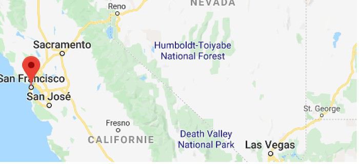
Now, to sketch out the rough itinerary. Here’s what it looked like after the trip:

Westernmost point: Montara Lighthouse on the coast, 30 km south of San Francisco (California); Easternmost point: Zion National Park (Utah). Northernmost point: Reno (Nevada). Southernmost point: Spring Mountain Ranch State Park in Blue Diamond, near Las Vegas (Nevada).

Another view:


I’ll be spending 33 days in this little area! I’m a slow traveler.

Meanwhile, I realized that in some places I wanted to visit (Las Vegas and National Parks), it was better to book ahead. So, I added to my reservations: - 2 nights in a hostel in Las Vegas - 6 nights of camping in the national parks (2 at Zion NP, 2 at Yosemite NP, 2 at Sequoia-Kings Canyon NP). Between all these dated stops, it’s a choose-your-own-adventure from the ideas I found.

I’m also a slow writer—slow writer, slow traveler—so it’ll take me a while to wrap this up. I’ll start tomorrow.
Open
SC
Scot2021 4 months ago
Southwest Part 2: 55 Days in Colorado, New Mexico, Arizona, Nevada, and Utah
This travel journal is the second part of the trip whose first part you can find here: 1st part...

Sunday, August 7: the day we discover a magical place... Edmaier's Secret...

We got up at 8:00 AM, had breakfast on the terrace of our tiny house, and then set off again toward yesterday’s trail. This time, we stopped after 4.5 miles on House Rock Valley Road at the Buckskin Gulch Trail parking lot. We weren’t interested in that trail today—the slot canyon is muddy anyway after the recent storms...

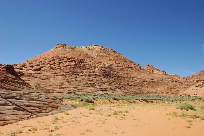
Instead, we explored a lesser-known area that became our playground. And what a playground it was, folks—an out-of-this-world spot, THE highlight of our trip!!! 😏

Just imagine being in the middle of these landscapes, and the cherry on top... no one else around!!!!! Well, we did meet a couple who were coming back—it was 9:30 AM 😮. Did they camp there? Did they turn back? 🙁

After paying the entry permit online, we set off with plenty of water (6L for the four of us) plus a gallon we hid along the way for the return trip. 😉 After a one-hour approach hike along a wash, we reached the sea of sand.


We had to cross it to reach our goal: a strip about 2 km long and 1 km wide that you can explore freely since there’s no marked trail... We entered a few GPS points into our Garmin Etrex, and off we went!!! 😎 It was... magical, enchanting, a true love-at-first-sight moment!


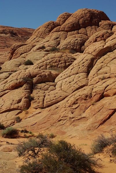
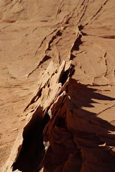
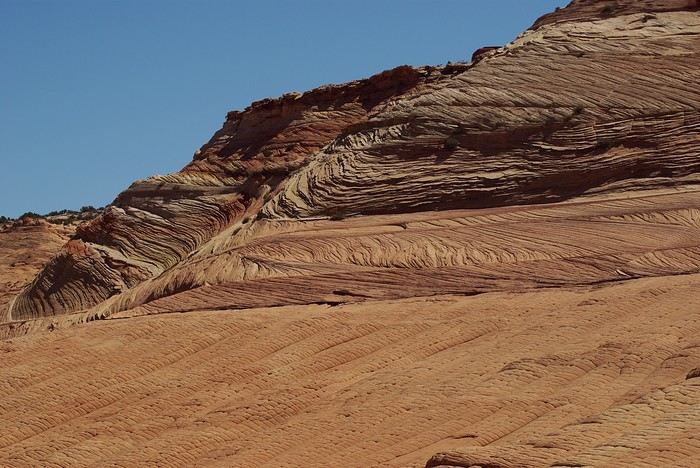
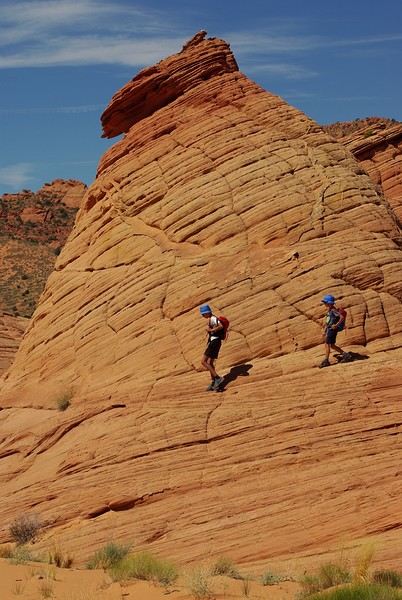
Brain Rock, waves, fine and brittle rock, colors—it goes up, it goes down.


Just thinking about it gives me chills... I remember sitting still for two minutes, taking in these wonders with such emotion that I teared up...


Open
DU
Ducono 6 months ago · Usafan
Unlikely California and Nevada Spots for Artists
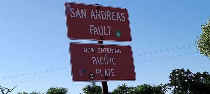
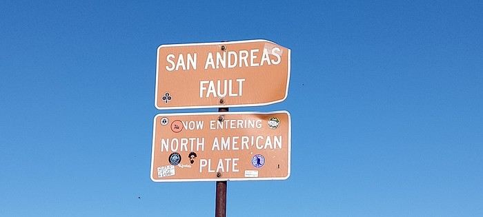
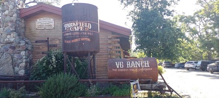
Hi there, after 5 trips to the American West, where should we go in May 2025? My last stay in SF ended badly for me (diabetes flare-up, hospitalization after returning to France), but my wife insists on SF and places we haven’t seen yet... so I’ve decided to skip the big parks and head for some offbeat spots instead... So, SF, then south to the crossroads where James Dean died. No luck—roadworks everywhere, impossible to stop—but I’d noted we could check out the San Andreas Fault near Parkfield and its bar before heading to Bakersfield.


Open
US
Usafan 6 months ago
Time-Lapse Video of My Road Trip in the Western USA – November 2013 & Travel Journal
I’ve never done a travel journal on VF before... so I’m giving it a go this year 😉. Just to share a bit of my 3-week trip around the West.

Since I couldn’t find anyone to share the trip with this year, I decided to go solo for 3 weeks at the last minute. So, it wasn’t a super organized or original trip—flight tickets booked last-minute, a loosely planned itinerary—but it was a choice I made.

I wanted to book zero hotels and just drive wherever I felt like. No set hikes or specific goals. Just a classic route through places I already knew for the most part, taking the time to soak in the landscapes. So, don’t expect a story about epic hikes leading to caves or hidden arches in unusual spots. It was more like a return to the roots of my first trip, with one twist: I wanted to explore some areas by mountain bike. Just to see things a little differently.

First up, instead of photos, I’ll share a little time-lapse I made during the trip.

Thursday, October 31: Left Nice early in the morning for Phoenix via London.

The trip was a bit long because I had to wait 5.5 hours in London. My flight ticket was booked kinda late, so I didn’t have much choice.

And then it hit me—when you’re prepping for a trip, you always think you’ll forget something. It was in London that I realized I’d left my driver’s license on my living room shelf. I searched everywhere, but nope, I didn’t bring it.🤪

Luckily, I had an international permit, but the rental contract clearly stated that both licenses had to be presented.

I called a friend to ask her to overnight it to my first hotel, crossing my fingers that the mail wouldn’t take two weeks to arrive.

The flight with British Airways went pretty well. Comfortable enough to watch two movies, eat, take a little nap, and boom—I was in Phoenix.

Around 8 PM local time, I got to the Alamo car rental agency, and surprise—they didn’t care about my license at all. They glanced at the international permit, told me to bring the other one when I got it (basically, they didn’t give a damn), and handed me my car! Woohoo! 😛


I headed to my hotel (the only one I’d booked for my first night), explained to the front desk that my license should arrive by mail so they’d be in the loop, and crashed for a well-deserved first night in the U.S.

Friday, November 1 (And yes! It was a holiday in France, which would complicate my mail situation later.)

I woke up super early with my first goal: find a decent mountain bike at a good price but sturdy enough to handle some national park trails.

As I mentioned earlier, I decided to switch things up this year and explore some mountain bike trails—or just ride whenever I got the chance 😉.

I checked two Walmarts before finally finding a solid bike for under $150. Some might wonder why I bought one—well, the reason’s simple. Renting a bike costs between $40 and $70 a day. My trip lasted 22 days. QED (that’s "quod erat demonstrandum" for those who didn’t get it).

I bought the bike, which fit in my Jeep Compass by folding down the back seats (not super convenient, but it worked).


Off I went on my first adventures.

I decided to head to Apache Junction.

First stop: the Apache Trail at Goldfield Ghost Town. Pretty cute, though super touristy. Some classic Western decor, a little chapel overlooking everything, a museum, a mine, a small Disneyland-style train, souvenir shops, and places to grab a snack. Nothing mind-blowing, but still a fun little visit—especially if you’ve got kids.


I got lucky and explored the ghost town with two school buses—about a hundred excited kids. Total chaos for a ghost town, but hilarious to watch from a distance 😎.

A little further down the Apache Trail, there’s Lost Dutchman State Park. I didn’t linger too long because my goal was to reach the lakes, and after my Walmart adventure and some driving, it was already almost 1 PM. I munched on a bag of chips and hit the road (lots of 20–25 mph speed limits).

I spotted N 1st Water Road along the way, planning to come back in a few days.

My plan to get to the lakes ASAP got derailed when I found a parking lot with a horse trail right in the middle of the saguaros.

I asked a ranger in the lot if I could ride the trail on my mountain bike. He said it’d probably be tough but gave me the green light.

Off I went in my padded shorts and helmet. First bike ride through the cacti with my trusty travel companion (my bike, obviously).


I started off super excited on what seemed like an easy trail, but I quickly realized horse trails don’t account for some key biking challenges 😎—like climbing rocks isn’t exactly a breeze on a mountain bike 😛. No biggie, I carried the bike a few times but got to see my first saguaros up close! A pretty cool way to explore—I don’t regret buying the bike at all!

I got back on the road after drinking 1.5 liters of water (even in November, the sun’s no joke) and headed toward Canyon Lake. With vibes like Lake Powell, I was blown away by the scenery and decided to hang out a bit—just to "soak it in" and enjoy the quiet to end my day. I didn’t see more of the Apache Trail because night falls fast, and for my first day, I figured that was plenty.


I’d decided not to stress about seeing everything at all costs since I’ve traveled a lot in the U.S. and plan to keep coming back. Whatever I missed, I’d catch next time—but I wanted to fully enjoy a few landscapes.

I drove back to Phoenix, grabbed a good burger, and spent the evening in my hotel room planning the next day. Originally, I was only supposed to stay one night in Phoenix, but with my license still MIA, I changed my plans. In the end, I was solo, no reservations anywhere, so I’d just take it day by day!

Saturday, November 2:

I decided to wake up early and head to Tucson for the day. The drive from Phoenix was pretty easy. About 2 hours later, I was at the entrance of Saguaro National Park.

And guess what? There was a little trail perfect for mountain biking. I parked my Jeep at the park entrance and hopped on my bike. I ended up biking the whole park from start to finish—about 20 kilometers, with a paved main road and a gorgeous central trail right through the saguaros! Stunning!


Even being careful, I still got a few cactus spines in my left arm from brushing too close (it stings!). Not easy to remove, so I’d advise anyone with the same idea to be more careful than I was. You’ll figure it out fast! 😉

I spent most of the day in this amazing park—it’s totally worth the detour. It feels like hundreds of chimneys all lined up at equal distances. A unique landscape you’ve gotta see.

Next, I headed to Tucson to check out the airplane boneyard. I’d seen it in a movie years ago and always wanted to see it for myself. Mission accomplished! It was pretty intense, but unfortunately, it didn’t seem possible to get to the most interesting plane alignments. There’s a museum with different types of planes and a guided tour. I settled for peeking through the fences at the planes guarded by military patrols.


I left around 6 PM and got back to Phoenix around 7:30–8 PM, super happy with my day of biking through the cacti!

Sunday, November 3:

Morning by the pool, lounging around—pure bliss. Around 11 AM, I headed to the Premium Outlets. Feeling pretty pleased with myself, I bought 5 pairs of Levi’s for the price of one in France. Just for that, I knew coming to the U.S. was worth it! After that, nothing super exciting—except a cotton field south of Phoenix that I couldn’t stop admiring for a good hour.


I drove around the city—pretty dead on a Sunday—and headed back to the Apache Trail to tackle N 1st Water Road, which I’d spotted two days earlier. A really fun trail to bike if you’ve got a mountain bike 😉. It gives access to several hikes and offers some great scenery. Highly recommend it.


Open
MA
Marcalamar 6 months ago
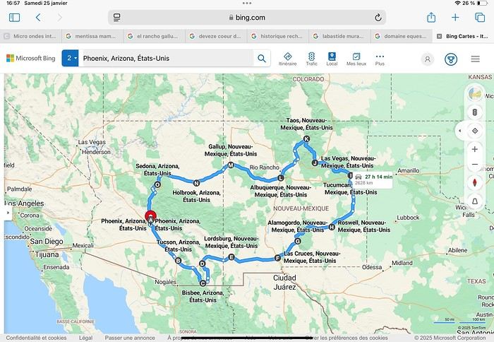
Martine from DD in Arizona and New Mexico
Good evening everyone! 🙂

We’re back from our September 2025 road trip, this time to explore Arizona and New Mexico, and it’s time for me to start my travel journal—especially since everything’s already booked for another trip in September 2026 (to California), and I need to get started on the planning.

I was a little worried this new visit to Uncle Sam’s country might not be as "wow" as the others, but we still discovered some incredible places.

For those who don’t know us, we’re a couple in our seventies who speak very little English, but that didn’t stop us from fully enjoying our stay.

For this 6th road trip in the U.S., we spent 21 nights there, drove 4,160 km by car, and walked nearly 160 km in a loop starting from Phoenix.

We’d been to Arizona before (but not this side) and never to New Mexico. This whole road trip was a huge discovery for us.

In the prices mentioned (some in euros, others in dollars), bank fees and exchange charges are included. The flights, car rental, and parking were all paid for in December 2024 when we booked.

We’d downloaded the MPC (Mobile Passport Control) app, but there wasn’t a dedicated line at Phoenix Airport. Still, we got through quickly with friendly, smiling agents.

I don’t drive at all (I hate it), so the stops were chosen based on activities but also, for some, to limit daily mileage for the sole driver. The kilometers listed in the itinerary are the daily distances.

We traveled from September 9th to 22nd, unfortunately once again without our dear friends Mimi and Maumau.

The itinerary


Day 1: Flight Marseille-Paris-Phoenix, then Gold Canyon (133 km) Day 2: Tucson (271 km) Lost Dutchman State Park Day 3: Tucson (155 km) Day 4: Tucson (34 km) Day 5: Bisbee (182 km) Day 6: Lordsburg (345 km) Day 7: Las Cruces (253 km) Day 8: Alamogordo (162 km) Day 9: Roswell (264 km) Day 10: Tucumcari (369 km) Day 11: Las Vegas (281 km) – the one in New Mexico Day 12: Taos (213 km) Day 13: Santa Fe (224 km) Day 14: Albuquerque (123 km) Day 15: Gallup (246 km) Day 16: Holbrook (224 km) Day 17: Flagstaff (179 km) Day 18: Sedona (118 km) Day 19: Sedona (48 km) Day 20: Sedona (41 km) Day 21: Phoenix (256 km) Day 22: Phoenix Airport (35 km)

📊 **Budget**: A little over 7,500 € for both of us, all included. The exchange rate was in our favor (1.17 dollars to 1 €). 📊 **Flights**: Marseille-Paris Charles de Gaulle-Phoenix: 1,787 € for two, with one checked bag each (Air France) 📊 **ESTA**: $42 📊 **America the Beautiful Pass**: $80 📊 **Parking**: 134 € (super eco at Marseille) 📊 **Car rental (Hertz)**: 865 €. Since there were no SUVs left in the reserved category (Nissan Rogue), we got an upgrade (4x4 Ford Explorer). We booked through Air France (15% discount). We’d originally reserved it in December for 1,140 €, but since prices dropped in March, we canceled and rebooked for 865 €. Hertz offers a free Hertz Gold Plus Rewards program, which gives you priority counter service when picking up the car. 📊 **Accommodation**: 2,400 € We stayed in hotels and motels of varying standards (from 60 to 203 € per night, depending on the city), all booked through Booking.com or Hotels.com. Out of 21 nights, only two didn’t include breakfast in the price. Booking.com sometimes offers slightly cheaper rates if you book by phone using the mobile app, and our Genius 3 status on the site also got us some preferential rates. 📊 **Supplementary insurance**: AVA 200 € for medical care if needed 📊 **Cash**: $2,078. We left with 1,000 € exchanged before departure and made two withdrawals of $500. This cash covered: - Evening restaurants and tips - Midday picnics - Gas: $298 for 4,160 km - Museum and private park entries (per person): - Lost Dutchman: $10 - Arizona-Sonora Desert Museum: $28 - Bird Cage Theater: $16 - Tombstone Shootout: $8 - New Mexico Farm & Ranch Museum: $12 - Roswell International UFO Museum: $5 - Billy the Kid Museum: $7 - Rancho de Taos: $22 - West Fork Oak Creek Trail entry: $15 We got a few discounts thanks to our senior age (+65). - Souvenirs and little treats

Like on our previous road trips, we didn’t rent a GPS. We got around using offline GPS apps Here WeGo and Organic Maps, with maps of the states we visited downloaded before we left (on our phones).

❤️❤️❤️ **Highlights** (there are so many!) 📍 Goldfield Ghost Town (even if it’s a reconstruction) 📍 The standing army of Saguaro cacti at Saguaro National Park West 📍 Diving into the cowboy universe of Tombstone 📍 The welcome from Rick and Henry at our guesthouse in Bisbee (Garden at Mile High Ranch) 📍 The tangled rocks of Chiricahua National Monument 📍 The flavored pistachios from Dwayne’s Fresh Jerky and Mac Ginnis Pistachioland 📍 Restaurants: La Posta (Las Cruces), Diner 66 (Albuquerque), and the Haunted Hamburger (Jerome) 📍 The old plazas of New Mexico 📍 The solitude and beauty of the white dunes at White Sands National Park 📍 Stepping back in time at the Billy the Kid Museum (Fort Stanton) 📍 Sections of historic Route 66 and the old motels of Tucumcari, especially at night when all the neon lights are on 📍 Taos Pueblo and diving into Native American culture 📍 After the Rio Grande Bridge, the descent via NM 567 to the very bottom of the Rio Grande Gorge, then the road along the riverbanks to Taos 📍 The tranquility of the Chimayo Sanctuary 📍 Discovering the ingenious native dwellings at Bandelier National Monument and Walnut Canyon National Park 📍 The small towns along the Turquoise Trail 📍 The red rocks of Red Rock Park and the Painted Desert 📍 The extraordinary colors of the petrified trees at Petrified Forest National Park 📍 Sedona, its red rocks, and the reward of the viewpoints at the end of hikes (Devil’s Bridge, The Subway, and West Fork Oak Creek) 📍 The immersion in Mexico when visiting Tlaquepaque 📍 The almost-ghost town of Jerome and its terraced streets 📍 The incredible kindness of Americans, always ready to help and up for a chat ❤️

☹️☹️☹️ **Flops** (there are very few) 📍 Several museums and churches being closed, so we couldn’t visit them 📍 Some museums and visitor centers opening late (10 AM) and closing early (4 PM) 📍 A 64 € phone roaming charge because we got near the Mexican border and picked up their cell tower 📍 The outrageous price ($5.99) for a gallon of gas at the Shell near Phoenix Airport

I hope this helps! Anyway, thanks for reading my long post. Don’t hesitate to reach out, even via PM, if you see I haven’t replied and you’d like more details. Have a great evening, everyone! 🙂
Open
MA
Marcalamar 7 months ago
Martine and DD in Colorado and Utah
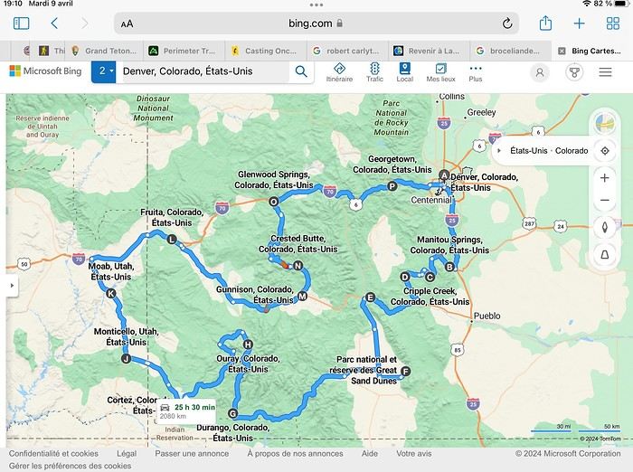
Hello everyone! 🙂 So many silent months, and now Voyage Forum is accessible again. That’s cool because we can pick up our discussions for our mutual enjoyment. I hope everyone is doing well and that you’ve been able to take some great trips, whether to the USA or elsewhere. In September 2020, we had planned a round trip to explore Colorado, but unfortunately, a nasty virus messed up our plans, closing borders and keeping us stuck at home. Luckily for us, canceling the car, flights, and accommodations didn’t cost us a thing—everything was refunded. In 2023, a loop from Las Vegas let us revisit places we’d seen in 2017 and discover new ones, this time spending more time at each stop with some lovely hikes. In 2024, we finally revisited the 2020 plan, and I’ll start with that. However, unforeseen circumstances mean I have much less time than before, so I’ll keep my trip reports shorter (ha ha ha—you’ll have less of my prose to endure). Another change: for those who remember the "Gang of Four crazy sixty-somethings," it was just DD and me this time. Our dear Mimi and Maumau left the Var to focus on raising horses and can’t leave their little green paradise to join us anymore. We were unfortunately much tamer without them. We traveled from September 11 to October 3.

The itinerary


Day 1: Flight Marseille-Paris-Denver, then Manitou Springs (133 km) Day 2: Manitou Springs (49 km) Day 3: Cripple Creek (104 km) Day 4: Salida (254 km) Day 5: Great Sand Dunes (231 km) Day 6: Durango (283 km) Day 7: Durango (Durango-Silverton train) Day 8: Ouray (121 km) Day 9: Ouray (Perimeter Trail hike) Day 10: Cortez (213 km) Day 11: Cortez (Mesa Verde National Park, 134 km) Day 12: Monticello (268 km, detour to Chesler Park) Day 13: Moab (171 km, Delicate Arch) Day 14: Moab (98 km, Fisher Towers) Day 15: Moab (171 km, Canyonlands) Day 16: Fruita (210 km, Colorado National Monument) Day 17: Crested Butte (224 km via Kebler Pass) Day 18: Crested Butte (57 km) Day 19: Glenwood Springs (150 km) Day 20: Glenwood Springs (118 km, Rifle State Park) Day 21: Georgetown (258 km via Independence Pass) Day 22: Denver (123 km), then return flight

We speak very little English. We spent 21 nights there and covered a 3,400 km loop by car and 160 km on foot (we’re still trying to hike while we’re in shape) from Denver in September 2024. We wanted this road trip to help us explore Colorado a bit more—we’d only spent 6 nights there in 2019—and to see it during the fall foliage season. We also wanted to return to Utah (we love Moab) to enjoy its red rocks, which we adore.

In the prices you see (some in euros, others in dollars), I’ve included bank fees and exchange charges. The flights, car, and parking were paid by credit card when we booked in February. Usually, we book around November, but some obligations kept us from doing it earlier. We downloaded the MPC (Mobile Passport Control) app on our phone, which saved us time at immigration.

📊 **Budget: just under 8,500 € for both of us, all included**

📊 **Flights** Marseille-Paris (CDG)-Denver: 2,152 € for both of us, with one checked bag each

📊 **ESTA and America the Beautiful Pass** The ones from our 2023 road trip were still valid

📊 **Parking at Marseille airport: 122 €**

📊 **Car: Nissan Rogue (the French X-Trail) from Hertz: 1,165 €** By booking through Air France (and earning miles), we got a 15% discount. Hertz offers a free Hertz Gold Plus Rewards program, which gives us priority counter service.

📊 **Accommodation: 3,050 €** We stayed in motels and hotels of various ranges (from 100 € to 270 € per night, depending on the city), all booked through Hotels.com or Booking. Booking sometimes offers cheaper rates if you book via the "Booking mobile" app. We also got some preferential rates thanks to our Genius 2 status. Out of 21 nights, only one place didn’t include breakfast.

📊 **Other expenses (activities booked by credit card before leaving)** Durango-Silverton train: 210 € (we booked the enclosed vintage coach in March) Mesa Verde: Balcony House: 15.15 € (booked 14 days before the visit) Timed-entry passes for Arches National Park: 6 € for 3 days (booked June 1 for September entries via http://récreation.gov/). We booked three different days to play with the weather.

📊 **Supplementary insurance with AVA: 204 €** (due to our age 😅 and the high cost of medical consultations in the USA)

📊 **Cash: 1,540 €** We left with 1,000 € exchanged before departure and made two withdrawals (500 $ and 200 $). This cash was used to pay for: - Evening restaurants and tips (between 70 $ and 95 $ for two meals and two drinks) - Two state parks: Dead Horse State Park (20 $) and Rifle State Park (10 $) - The Monarch Pass gondola (24 $) - Midday picnics - Gas (slightly cheaper with cash): 204 $ for 3,400 km - Personal souvenirs and little treats.

Like in our previous road trips, we didn’t rent a GPS. We used the offline GPS app Here We Go, for which we’d downloaded maps of Colorado and Utah from France, as well as a new offline app called Organic Maps as a backup—though we didn’t end up needing it.

❤️❤️❤️ **Highlights (there are so many!)** 📍 The stunning landscapes of Colorado, especially with the fall colors 📍 A step back in time at the old farm in Florissant Fossil Beds National Monument 📍 The prairies of Cripple Creek and the mining remnants of the Vindicator Trail 📍 The cheeky chipmunks in the ghost town of St. Elmo 📍 Great Sand Dunes and its soft sand 📍 The steam train between Durango and Silverton: we’re glad we chose the round-trip because it rained heavily on the way there, but we got to enjoy the scenery on the way back when the sun came out 📍 The unexpected meet-up with Michèle from the group outside a restaurant in Durango 📍 The hot springs in Ouray 📍 Mesa Verde and its still-vibrant past 📍 The red rocks of Moab and Delicate Arch at sunset 📍 The lace-like Fisher Towers and the view from the end of the trail 📍 The gorgeous Route 128 leading to Colorado National Monument—small, easy to visit, and so beautiful 📍 The colors of the fabulous Kebler Pass, Crested Butte, and especially the hike through the golden aspens (Lower and Upper Loop) 📍 The waterfalls at Rifle State Park 📍 The tundra of Independence Pass 📍 The Halloween decorations in Georgetown and Idaho Springs

😞😞 **Flops (there are very few!)** 📍 The viewpoints we missed because they weren’t well-marked or we didn’t see the signs 📍 The closure of some hiking trails (Hanging Lake and parts of Canyonlands) and the Sal Mountain Loop road, which kept us from accessing it 📍😢 The Chesler Park hike we had to cut short due to poor time management—180 km between our stop in Cortez meant we didn’t arrive until 10:30 AM, way too late for a 17 km hike.

Hope this helps! Have a great evening, everyone, and see you soon! 😊
Open
PI
Pinacoladada 9 months ago
USA Road Trip 2023 - Part 1
In January 2023, we started our second road trip across the United States. We stayed from January to mid-March, which gave us plenty of time to visit several cities, attractions, and parks in multiple states.

This travel journal will be split into two parts due to the considerable number of places we visited.

This first journal covers the following states: Ohio, Indiana, Missouri, Oklahoma, Texas, New Mexico, Arizona, Nevada, and California, and takes you through the outbound leg of our road trip.

The second journal will showcase the attractions we visited on the return trip, which mainly follows the famous Highway 1 along the Pacific coast.

So, I invite you to keep reading this first journal, which serves as a long recap to help you discover the various attractions we explored throughout this road trip.

Videos are included throughout the recap. Please click on the image to start the video.

Here are the links to jump to a specific post:

OHIO:

WinterLand - Christmas Lights at Cleveland Public Square Lake View Cemetery - Cleveland - Part 1 Lake View Cemetery - Cleveland - Part 2 Stroll through Columbus Upper Falls to Lower Falls via Buckeye Trail - Hocking Hills State Park – Logan Cedar Falls & Whispering Falls Hiking Trail - Hocking Hills State Park – Logan Ash Cave Hiking Trail - Hocking Hills State Park – Logan Exploring Cincinnati

INDIANA:

Visiting Indianapolis

MISSOURI:

Exploring St. Louis

OKLAHOMA:

Catoosa Blue Whale Discovering Tulsa Exploring Oklahoma City

TEXAS:

Exploring Shamrock Discovering McLean Exploring Amarillo

NEW MEXICO:

Ancestral Sites Trail - Pecos National Historical Park Discovering Santa Fe The Santuario de Chimayó Stroll through Los Cerrillos Walk through the village of Madrid San Francisco de Asis Catholic Church & The Bottle House - Golden Albuquerque Murals 66 Diner - Albuquerque Stroll through Old Town (Albuquerque) Rinconada Canyon Trail - Petroglyph National Monument Mesa Point Trail - Boca Negra Canyon - Petroglyph National Monument Macaw Trail - Boca Negra Canyon - Petroglyph National Monument Cliff Base Trail - Boca Negra Canyon - Petroglyph National Monument Piedras Marcadas Canyon - Petroglyph National Monument Sandstone Bluffs & Ventana Natural Arch - El Malpais National Monument

ARIZONA:

Stewart's Petrified Wood Shop – Holbrook Stroll through Holbrook Discovering Joseph City Exploring Winslow Grand Falls (The "Chocolate Falls") – Leupp Island Trail - Walnut Canyon National Monument Rim Trail - Walnut Canyon National Monument Wukoki Pueblo Trail – Wupatki National Monument Wupatki Pueblo Trail – Wupatki National Monument Doney Mountain Trail – Wupatki National Monument Citadel & Nalakihu Pueblos Trail – Wupatki National Monument Lomaki & Box Canyon Pueblos Trail – Wupatki National Monument Discovering Flagstaff On the way to Sedona Slide Rock State Park – Sedona Midgley Bridge Trail – Wilson Canyon – Sedona Tlaquepaque Arts & Shopping Village Walking Tour - Sedona Chapel of the Holy Cross - Sedona Hiking at Cathedral Rock - Sedona Hiking the Bell Rock Trail - Sedona Hiking the Airport Loop Trail - Sedona Amitabha Stupa and Peace Park - Sedona Hiking the Boynton Canyon Vortex Trail - Sedona Hiking the Devil's Bridge Trail - Sedona Hiking the Birthing Cave Trail - Sedona Bell Rock Inn - Sedona On the roads of Sedona - Part 1 On the roads of Sedona - Part 2 Keyhole Sink Hiking Trail - Kaibab National Forest Discovering Williams Exploring Ash Fork Discovering Kingman Ramada by Wyndham Kingman Davis Camp Park - Bullhead City Discovering Yucca Lake Havasu Boardwalk Tour A duck catches a lobster – Lake Havasu Boardwalk

CALIFORNIA:

Exploring Needles Discovering Goffs Discovering Amboy Visiting the famous Bagdad Cafe - Newberry Springs Exploring Barstow Vehicles from Hell (Mad Max Cars) - Barstow Peggy Sue's 50's Diner - Yermo Liberty Sculpture Park - Yermo Lake Dolores Water Park - Newberry Springs ZZYZX Road - Mojave National Preserve Alien Fresh Jerky - Baker Kelso Dunes Trail - Mojave National Preserve Hole-in-the-Wall Rings Trail - Mojave National Preserve Visiting Mitchell Caverns - Mojave National Preserve Dante's View - Death Valley National Park Zabriskie Point - Death Valley National Park Golden Canyon - Death Valley National Park Artists Drive & Artists Palette - Death Valley National Park Devil's Golf Course - Death Valley National Park Natural Bridge Trail - Death Valley National Park Badwater Basin - Death Valley National Park Harmony Borax Works - Death Valley National Park Devil's Cornfield - Death Valley National Park Mesquite Flat Sand Dunes - Death Valley National Park Mosaic Canyon Trail - Death Valley National Park On the road - Death Valley National Park

NEVADA:

Cleveland Clinic Lou Ruvo Center for Brain Health - Las Vegas Exploring Downtown Las Vegas SlotZilla Zipline - Fremont Street Experience – Downtown Las Vegas Viva Vision Light Show 1 - Fremont Street Experience - Downtown Las Vegas Viva Vision Light Show 2 - Fremont Street Experience - Downtown Las Vegas Viva Vision Light Show 3 - Fremont Street Experience - Downtown Las Vegas Viva Vision Light Show 4 - Fremont Street Experience - Downtown Las Vegas Free Live Music – Fremont Street Experience - Downtown Las Vegas Chucky – Fremont Street Experience - Downtown Las Vegas Las Vegas Strip - Part 1 Las Vegas Strip - Part 2 Las Vegas Strip - Part 3 Las Vegas Strip - Part 4 Las Vegas Strip - Part 5 Tom Devlin's Monster Museum - Boulder City Hoover Dam Lake Mead - Lakeview Overlook - Boulder City Nelson Ghost Town - Searchlight

CALIFORNIA:

Scenic Route through Joshua Tree National Park via the North Entrance Hidden Valley Trail - Joshua Tree National Park Barker Dam Trail - Joshua Tree National Park Cap Rock Trail - Joshua Tree National Park Keys View Trail - Joshua Tree National Park Hall of Horrors Trail - Joshua Tree National Park Skull Rock Trail - Joshua Tree National Park Arch Rock Trail - Joshua Tree National Park Cholla Cactus Garden Trail - Joshua Tree National Park Lone Pine - Owens Valley Miss Alabama & Shark Fin - Alabama Hills - Owens Valley Lone Ranger Canyon - Alabama Hills - Owens Valley Mobius Arch Loop Trail (Heart Arch & Lathe Arch) - Alabama Hills - Owens Valley Eye of the Alabama Hills Arch - Alabama Hills - Owens Valley Boot & Cyclops Arches - Alabama Hills - Owens Valley One Mile Arch, Bowling Ball and Pins & Gunga Din Area - Alabama Hills - Owens Valley Whitney Portal Arch Trailhead - Alabama Hills - Owens Valley Fish Rocks & Trona Pinnacles - Mojave Desert Red Cliffs Trail - Red Rock Canyon State Park Hagen Canyon Nature Trail - Red Rock Canyon State Park Tour of Historic Downtown Tehachapi View of the Tehachapi Loop – Monolith César E. Chávez National Monument – Keene Discovering Bakersfield Kern County Museum – Bakersfield Bravo Farms, Tree House & Petting Zoo - Traver Walking Tour of Kingsburg Exploring Fresno Simonian Farms & Soul Consoling Japanese Internment Tower - Fresno Duncan Ceramic Products (iLoveToCreate) - Fresno Walking Tour of Modesto Wat Dhammararam Buddhist Temple - Stockton Walking Tour of Stockton Discovering Stockton University of the Pacific - Stockton Visiting Lodi Sutter's Fort State Historic Park - Sacramento California State Capitol - Sacramento Walking Tour - Sacramento Walking Tour - Winters Walking Tour - Napa The Chandelier Tree In Drive-Thru Tree Park - Leggett One Log House - Garberville Grandfather Tree - Piercy The Living Chimney Tree - Avenue of the Giants Stephens Grove Loop Trail - Avenue of the Giants Gould Grove Nature Loop Trail - Avenue of the Giants Fleishmann Grove Trail - Avenue of the Giants Mahan Plaque Trail - Avenue of the Giants Founders Grove Nature Loop Trail - Avenue of the Giants Eternal Tree House & Immortal Tree - Avenue of the Giants Drury-Chaney Loop Trail - Avenue of the Giants Walking Tour - Redcrest

COMING UP NEXT:

USA Road Trip 2023 - Part 2
Open
MY
MycoVtt 10 months ago · Rrrawww
Western USA Oct 2024 - Arches and Other Delights...
Aaah, I'm so glad Voyage Forum is back up and running. For reading... and for writing...

My last travel journal was from 2019, when I went hiking and backpacking with my son, who was 15 at the time. We visited some places that were still pretty unknown back then! I was supposed to go in April 2020, still solo, with arches as the main focus. I’d spent nearly two months getting physically prepared, and had managed to snag a bunch of permits for CBS, The Needles, and so on... Of course, it all got postponed—first to October 2020, then April 2021, then October 2021, and finally it happened in April 2022. Maybe I’ll write about that in another journal. The thing is, every time, I spend at least 6 to 8 weeks getting physically ready, even though I work out all year. Huge disappointment during that trip—so much had changed because of Covid, kind of like in the mountains back home. Overcrowding, not just in the national parks (we knew about that), but also in a lot of remote, lesser-known spots. Like the French, Americans realized they had a lot of beautiful places in their own country during those travel bans. And they kept exploring... Prices for pretty much everything had already gone up a lot. Gas, restaurants, cars, but especially lodging! Then, after dealing with so much wind in April, I got a little "fed up" with that time of year. It felt like I had strong winds and sandstorms for 3 out of the 3.5 weeks I was there...

So, the next trip was October 2023, to catch the partial eclipse in New Mexico, and of course, a bunch of arches ;). So many arches. Maybe I’ll write about that one too... Then came (among others) April 2024 for the total eclipse, in Texas, but starting from L.A., with my partner Valérie. Since I’d never visited some places I wanted to see further south of my usual loops, it was the perfect opportunity... And here we are at the end of September 2024. Another trip focused on arches—I never get tired of them. Every time I check one off my list, another gets added. Often it’s a photo I’ve seen online or in the NABS (Natural Arches and Bridges Society) magazine, which I’m a member of. I also scour the WAD (World Arches Database) and make a list of arches I want to visit. Fewer and fewer "viewpoints"—I’ve done all the most famous ones, and unless the sky is amazing, the photos all look the same. Since my goal is always photography *and* hiking, I’m always on the lookout. So this time, a packed itinerary—27 days, very busy. In past trips, if I didn’t plan enough and hiked fast, I’d end up with too many "gaps" in my days. This time, I’d rather have too much than too little (like in 2023, actually).

A few stats: - 6,589 km, including +/-1,400 km of off-road trails - 323 km of hiking, 8,829 m of elevation gain - 142 new arches for my collection, including some stunning ones, some less so, and some downright ugly—but all in the WAD. - Two outings with a Navajo guide - Almost no injuries - 8 bivouacs, including 2 backpacking trips - 4 days of backpacking - 22 freeze-dried meals and 15 Subways eaten - 6 thorns in my shoes (long live the tweezers in my backpack) - 3 kg lost (plus the 5 kg lost during prep)

Almost every day, I posted a little update on Facebook for family and friends. So I’ll be copy-pasting those texts here, written "my way" as usual. Some will like it, some won’t—that’s just how it is... 😏

For months, I planned this trip—looking for info, creating GPS tracks on Google Earth, exchanging tips with NABS members and other passionate friends. I snagged permits for The Needles again (4-5 days), for Fiery Furnace, timed entries for Arches National Park (2), and booked just one campsite, a "triple tour" in Monument Valley, and the first night in a motel. This is the first time I haven’t booked 80% of the motels—I was tired of having constraints because of the weather. This time, I want to be able to adjust my plans based on the weather and what I feel like doing more or less of. Camp when the weather’s nice, hotel/motel when it’s crappy.

Here we go...

Day 1

As usual, early morning flights: BRU-AMS, then AMS-SLC. Those who follow me know I’ve been renting a Rubicon from Rugged for years, which "forces" me to land in SLC. Up at 3:30 AM, but I’d been awake since 2:00 AM—the day’s going to be long. Shuttle to the airport. In Brussels, only two check-in counters open. I get there—no cabin baggage weigh-in, while the agent next to me is weighing everyone’s, even kids’ backpacks! A bit of luck, because as usual, if they weighed my backpack *and* my cabin bag, I’d already be over 20 kg. I check two hold bags, since I’ve got a lot of camping/backpacking gear, lots of freeze-dried meals, the backpacking bag, the Bear Canister needed for The Needles, etc. First flight is 30 minutes late, so the second one is already boarding. I’ve got the SSSS mark on my ticket (extra security check), so I head straight to the front when I arrive at the same time as Zone 3, even though I’m Zone 6. I pretend the check will take a while, and it "works"—they didn’t notice! No way I want to board last and risk them making me check my cabin bag. It’s packed with photo gear, laptop, drone, etc.—unthinkable to have to put it in the hold. Always a worry... SLC: baggage claim, customs, and out in 32 minutes. The MPC app makes something that was already quick even faster at this airport. And all the bags are there. That’s always a relief too. Since I drive at least 3 hours straight after landing, losing a hold bag would really mess up the trip and force me to spend the first night closer to SLC. On the way to Rugged. A young French couple from Reims is in the shuttle with me—they discovered Rugged thanks to my post in a Facebook group! Well, the team has changed again, and they lost half the stuff I’d left last October (plastic boxes, pillow, sugar, gas cartridges, folding chair, Crocs, etc.), but at least there are gas cartridges, so I don’t have to go to REI. REI would’ve been at least an hour out of my way. But as far as I know, there are no gas cartridges in Green River. I still get my tent stake hammer back, and a folding chair—different from mine but identical.

20,000 km Rubicon 4Xe, white. I check the tires—they’re in great shape, as requested. I’ll come back to the hybrid later. I didn’t want a hybrid, but that’s all they had this year. Why? Higher fuel consumption, smaller tank, higher cargo floor.

Stop at the Walmart near Provo, whose layout I know like the back of my hand (Walmarts are often similar). Start-of-trip shopping: water, Coke, Gatorade, UHT milk for cereal (not very common in the US), Special K "Almond and Vanilla", cold meds that work well (and don’t exist back home—you never know), two plastic bins, a pillow for the tent, Trail Mix, that’s about it. On the road to Nebo Loop for the fall colors. I’d driven this route last year, in the opposite direction on my way back to SLC, but it was a bit too late. This time, I’m a little early. At the start of the road, the maples are in the sun, so I go up to 2,200 m for the bright yellow aspens, then head back down. Mostly drone shots—no time to go for a walk. After a day like this, 4.5-5 hours of driving is already a lot... Arrived in Green River at 9:00 PM. Organize all the stuff from the bags properly, then sleep.

A few photos from these first few hours.


Open
MA
Marati 11 months ago · Cheesecake14
The "Must-Sees" of the American West
This adventure began during Covid... Yep, Covid turned a lot of things upside down, but most of all, it kept us cooped up for a few months and stopped us from traveling for a while—even longer for a die-hard fan of the American West like me.

While borders were closed, I started imagining what an ideal itinerary might look like—one that would string together all the Southwest must-sees in just two weeks, during the best time of year: September and October. When the U.S. announced in September 2021 that borders would reopen in the coming weeks, I regained hope and began scouting flight tickets for a departure in September 2022.

But here’s the thing: tackling solo hikes, each one tougher than the last, right in the heart of the Wilderness, could be a risky—even reckless—endeavor for a father of three. After a quick chat with some virtual friends who are just as passionate about the Southwest as I am, with good physical condition and nearly the same list of must-visit spots, Franck and his brother Sullivan were in! 🙂

In November, we snagged flight tickets from Nice to San Francisco for the modest sum of 400 €, and a few days later, I booked a Toyota Tacoma pickup for 840 € !

It’s not cheap for just 15 days, and a pickup isn’t exactly ideal for luggage, but the prices for full-size 4x4s have become totally outrageous! Due to border closures, rental companies had to offload a lot of these big 4x4s, which tourists love. Then, supply and demand did the rest !

Franck and I spent the winter and spring trying to cram the equivalent of three weeks of hikes into two. But even with physical limits, we had to stay reasonable! Three to four months before departure, we entered the lotteries for different must-see spots: The Subway, Coyote Buttes North (home to the famous Wave), and Coyote Buttes South (CBS).

The Wave is the holy grail for any Southwest enthusiast. Since 2015, we’ve tried our luck with the online and on-site lotteries about ten times, but the spots are unfortunately limited: just 20 per day. A glimmer of hope, though—since early 2022, that number has increased to 64 people allowed per day, with 48 spots awarded via the online lottery.

After all three of us tried our luck for The Wave, on June 1st at exactly 5 PM, I got an email that started with, "Congratulations! You were successful in the Coyote Buttes North (The Wave) September 2022 Permit Lottery at Coyote Buttes North (The Wave)...". At 5:01 PM, I called Franck, whose dream it’s been for over 20 years—ever since the first photos were published in a travel magazine! He didn’t believe me when I told him, and I had to forward the email for him to finally accept the unbelievable: we were going to The Wave and all the incredible spots scattered across the protected area of Coyote Buttes North.

I’ve already been to Coyote Buttes South twice, but there are areas I couldn’t explore in the middle of summer because they were too remote. So, I had no trouble letting my buddies convince me to go back for a third time. Plus, given how hard it is to access, we had no trouble securing a permit online as long as we logged in at exactly 8 PM on the dot!

For The Subway, all three of us struck out. No big deal—we won at CBN and CBS!

Among the sites to visit, there are two that I’m particularly attached to because I know my chances of wanting to see them again are slim. The first is Angel Arch, one of the most legendary arches in the Southwest, due to its remoteness from any trace of civilization. To get there, the recommended hike is Upper Salt Creek, and you’re looking at a 50 km round-trip in an area with no water (in September) and populated by bears.

The second site is the Hopi Salt Trail, in Navajo land, which, after a very tough hike, lets you marvel at the turquoise-blue waters of the Little Colorado before it meets the Colorado River. The Hopi Salt Trail is, like The Wave, the holy grail for any Southwest enthusiast, and the windows of opportunity to see the water in that magical color are very short each year. For this, you have to monitor the Little Colorado’s gauges downstream from Cameron: if the level stays at its lowest for 10 consecutive days—meaning no rain—you can hope for turquoise water. The ideal period rarely exceeds 30 days a year, and it’s usually in June that all the stars align.

But unfortunately, one month before departure, while the flow rate at Cameron looked promising, several storms in September dashed our hopes of doing the Hopi Salt Trail, even at the end of the road trip.

We still had two consolation prizes, though:

After a last-minute cancellation, while keeping an eye out for available spots for The Subway, it turned out that three spots opened up exactly on the day we’d planned to go—so we rushed to grab them!! Regarding the 4x4 rental, the prices for full-size models dropped by several hundred dollars, and we ended up finding a Chevrolet Tahoe for less than $1000. A steal and a serious boost in comfort, so we could store all our gear and food without worry!

Here’s the initial plan in a perfect world: D1 The White Domes - Camping D2 Sunrise at The White Domes - The Subway D3 Coyote Buttes North D4 Coyote Buttes South - White Pocket D5 Wahweap Hoodoos - Sidestep Canyon - Colourful Canyon - White Rocks - Sunset at Yellow Rock D6 Broken Bow Arch - Reflection Canyon D7 Coyote Gulch D8 The Volcano (or The Oasis - Zebra Slot Canyon if the weather’s good) - North Caineville Mesa D9 The Needles: Squaw Canyon - Lost Canyon combo - Druid Arch - Chesler Park D10 Upper Salt Creek Day 1 - Camping D11 Upper Salt Creek Day 2 D12 Hopi-Navajo Territory: Ha Ho No Geh Canyon, Coal Mine Canyon, Bends of the Little Colorado D13 Grand Canyon: South Kaibab Trail and Bright Angel Trail D14 Upper East Zion: East Temple Loop, Jughandle Arch, Center of the Universe, and Checkerboard Mesa Summit And several backup options in case of bad weather, including Spencer Trail, West Cove, and Buffington Pockets.

Enough talking—time for action!
Open
BA
Balouder last year · Vandfaure
Eastern Canada and a few parks in September (Bic, Gaspésie, Forillon, Bonaventure Island...)
Eastern Canada: the Eastern Townships, Gaspésie, New Brunswick, Acadia, and Nova Scotia.

Forests, lakes, lighthouses, parks, and encounters. To sum up this trip: amazing encounters, stunning parks, wildlife, and passionate, fascinating Parks Rangers. Bic Park, Gaspésie, Forillon, Bonaventure Island, Cape Breton Highlands Park, Hopewell Rock

My tips:

Don’t hesitate to chat with the park rangers and check out the activities they organize—it’s really interesting.

If you want to see wildlife, get up early.

The kilometers go by pretty easily; driving 500 km in Canada with an automatic car on long, straight roads with light traffic isn’t much more tiring than doing 120 km on Ireland’s narrow roads...

Try to catch a Quebecois film at the cinema or on TV.

For the ferry, plan ahead. Taking it at least once is a great experience.

For the rest, once you know what you want to see, just go with your gut—it’s easy.

The Trip:

Arrived in Montreal on 09/02. Family meal where we tried homemade *pouding chômeur*.

We spent 3 days exploring the Eastern Townships: the Abbey of Saint-Benoît-du-Lac, Bolton, Magog (its wine fair and thunderstorms), Granby, Bromont and its little lake, and its spa…

Gaspésie, New Brunswick, Nova Scotia:

We didn’t stop in Quebec City or at the Montmorency Falls, as we’d already visited them on a previous trip. Otherwise, plan an extra day and a stop in the lovely city of Quebec.

Day 1: Left on 09/05 for Saint-Fabien and Bic Park, famous for its coastline, marshy landscapes, and harbor seals (brochure). About 500 km. Stayed overnight in Saint-Fabien.

Along the way, we saw *barachois*—bodies of water usually at the mouth of a river, separated from the sea by a gravel, sand, or pebble barrier. They can be freshwater or saltwater. The fresh water of the St. Lawrence River mixes with the sea up to Orléans Island. And there’s a measurable tide up to the Trois-Rivières bridge. Visited Bic Park and observed seals molting with the park rangers. More park photos.

Days 2 & 3: Headed to Sainte-Anne-des-Monts (about 200 km). The lighthouse route guided us 😊.

Two nights in Sainte-Anne-des-Monts for a short hike in Gaspésie Park (brochure) and its stunning landscapes between mountains, forests, rivers, and lakes. We didn’t see any caribou or moose, but from the top of Xalibu (a well-marked 5-hour round-trip hike), we had a 360° view of Mont Jacques-Cartier and Mont Albert. More photos. This was Muriel’s favorite park—it’s exactly what she imagined Canadian forests, rivers, and lakes to be. You can also stay overnight in the park (especially by Lac Cascapédia), which is better but pricier 😢.

Days 4 to 6: Left for Forillon Park (brochure) near Gaspé (200 km). Magical... We were lucky—we came face-to-face with a mother bear and her cubs (brown bears). It was incredible. We also saw beavers at work...

Our lodging was out of the ordinary—what luck! A ranch in the middle of the woods. We stayed 3 nights. This is my favorite park. More Forillon photos.

Gaspé in Mi’gmaq means "end of the land." But for Jacques Cartier, it was the beginning of the country. On July 6, 1534, he and his crew made contact with the first Indigenous people of the Mi’gmaq Nation off the Baie des Chaleurs. On July 24, 1534, he landed in Gaspé, planted a 30-foot cross, and claimed the region for the King of France, where they met the St. Lawrence Iroquoians. Visited Bonaventure Island (brochure) and its 100,000 northern gannets. Bonaventure Park photos.

Not to mention our first freshly caught and cooked lobster, bought at a fish market on the port.

Day 7: Finished the Gaspésie loop with a stop in Campbellton (300 km) before crossing into New Brunswick. Stopped at Bourdage Tradition farm. We could’ve gone as far as Caraquet, which would’ve been better. Rain all day.

Day 8: Headed to Cape Breton Highlands National Park in Nova Scotia. Overnight in Moncton to split the drive (500 km). We stopped in Acadia, a truly unique region with incredibly friendly and open people. New Brunswick is over 80% forest—it’s impressive how many trucks and dead raccoons you see on the side of the road.

Sunset at Hopewell Rock—bring mosquito repellent! There are thousands, it’s awful. Photos.

Days 9 to 11: Left for Sydney (500 km) for 3 days exploring Cape Breton Highlands Park. If you have time, stop at the "Train Station Inn in Tatamagouche"—I love the concept. You can eat there, sleep there, or just visit.

The Cape Breton Highlands Park loop is over 300 km. Photos. Our apartment was in North Sydney, a bit far from Chéticamp (2-hour drive) and 1.5 hours from the park entrance. But the road itself is beautiful. We should’ve found lodging in Chéticamp or Ingonish. At the time, we were also planning to visit Louisbourg, but it was too much.

Day 12: Time to head back, but there were still over 1,500 km to go. We’d planned to stop at "Le Pays de la Sagouine," a local heroine from Antonine Maillet’s imagination, played by the wonderful local actress Viola Léger. A fantastic place for shows and passion—don’t miss it if you get the chance. Another overnight in Moncton to split the trip (550 km).

Returned through Gaspésie and the Matapédia Valley, famous for its salmon fishing. We met a guy from Haute-Savoie who’d been living there for 15 years, making a living from fishing (he runs a shop) and dog sledding in winter.

Day 13: Things didn’t go exactly as planned. We were supposed to take the ferry from Rimouski to Tadoussac and the Saguenay Fjord. But due to Storm Florence, all boats were docked. We tried the ferry from Trois-Pistoles, but all crossings were canceled. The only other way was a 500 km detour to Quebec City. So we decided to spend the night of 09/17 in Trois-Pistoles (we’d already driven 600–700 km that day).

Days 14 & 15: We changed our plans, heading to Trois-Rivières and La Mauricie Park for a quick seaplane tour. There, we had an amazing encounter at the "Gîte de la Vieille Caisse" (the Old Bank Inn). The welcome was warm, breakfast was hearty, and the outdoor spa in the rain was great. We took our flight with Hydravion Aventure—the team was super friendly, and it was close to our inn. We’ll be back to explore this side of the St. Lawrence 😊.

Returned to family for a quiet end to the trip, with a little hike on Bromont Mountain, a visit to the Bombardier Museum, and a detour to local vineyards to buy a few bottles as souvenirs.

Bromont is the local ski resort, open until midnight on weekends.

We were 10 days too early for the fall colors and the cranberry harvest. I think it’s worth seeing.

If we go back, we’ll try to combine a trip to the north shore of the St. Lawrence (Mauricie, Lac Saint-Jean, Saguenay), the cranberry harvest, and a day at the Saint-Tite Festival. It must be amazing...

In summary: Parks, forests, but also plains, fields, farms, lighthouses, beaches, small fishing ports, hikes, family moments, and encounters...

Trip Cost:

We spent 3,400 € total for two, including souvenirs. The exchange rate with the Canadian dollar was pretty good.

Flights: 830 € for two.

Accommodations: 750 € for 14 nights, averaging 54 € per night in B&Bs and Airbnbs (family stays not included).

Car rental: 600 € for 3 weeks + 350 € for gas. We drove over 6,000 km—it’s a lot but doable. We wanted to go to New Brunswick and Nova Scotia.

Park entry fees were about 8 CAD per person. We didn’t get a pass because some parks are national (Forillon), others are Quebec national parks, and some are neither.

The seaplane cost 99 CAD per person for 30 minutes.

For meals, we had a cooler to do some basic cooking in apartments or hostels. We ate out 4 evenings.
Open
MI
Minibou37 last year
Ten dream days at Disney World in Florida
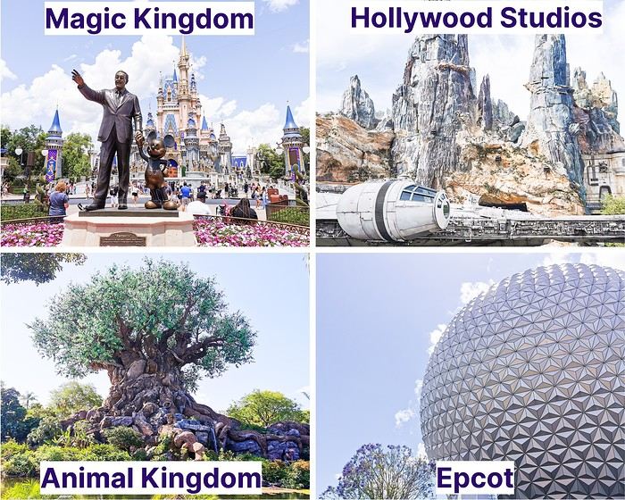
Hi there! It’s been nearly 6 years since I last posted here or on my travel blog. But I’m back, at least for one post! I’m returning with a dream trip we took in April 2023: a stay at Walt Disney World in Florida. We went for 10 days. Ten days at an amusement park might seem like a lot, but you should know that Disney isn’t just one park—it’s 4 parks and 2 water parks (only one was open during our trip). So we split those 10 days across 5 parks, which worked out to about 2 days per park. The four main parks each have a different vibe:

Magic Kingdom: The most famous one, the one that most resembles our Disneyland Paris. It’s home to several "lands" (Adventureland, Frontierland, Fantasyland, Tomorrowland, Liberty Square, and Main Street USA). This is the park where you’ll find the iconic castle, the symbol of the parks. Disney’s Hollywood Studios: It’s a bit like the studios at Disneyland Paris, with the well-known Tower of Terror and Toy Story Land. It also features the stunning Star Wars: Galaxy’s Edge (a must-see, even if you’re not a Star Wars fan). Animal Kingdom: A very nature-focused park, divided into several sections, including representations of Africa and Asia, as well as the breathtaking Pandora – The World of Avatar. Epcot: The park of countries, where different nations are represented around a large circular lake—including France!

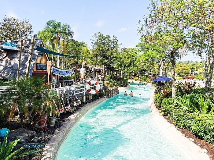
The water park that was open during our stay was Typhoon Lagoon. We spent a morning there lounging and swimming before heading to Disney Springs (the equivalent of Disney Village in France). We’re not big on pools or chilling out, so we didn’t stay long, but there was no time limit.

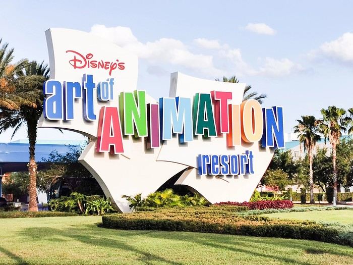
We chose to stay at the Disney’s Art of Animation hotel, a Resort (huge, like everything there!) with 4 themed areas: Nemo, Cars, The Lion King, and The Little Mermaid (where the rooms for 4 people or fewer are located).


Here’s the itinerary we followed for those 10 days:

Day 1: Flight at 7:35 AM–4:40 PM (with a layover in London), stroller pickup, then shuttle bus to our hotel Day 2: Day at Magic Kingdom Day 3: Day at Hollywood Studios Day 4: Day at Animal Kingdom Day 5: Day at Epcot Day 6: Day at Hollywood Studios Day 7: Relaxing day at Typhoon Lagoon and Disney Springs Day 8: Day at Magic Kingdom Day 9: Day at Epcot Day 10: Day at Magic Kingdom Day 11: Morning at Hollywood Studios, then shuttle bus to the airport, stroller return at the airport, flight at 7:05 PM–1:50 PM (next day)

We rented the stroller from Kingdom Stroller. The rental process was super easy—everything was done online. On the day we arrived and the day we left, there was no staff at the counter, but the stroller was ready with a tag bearing our name. When we left, we just dropped it off at the designated spot, still with no one checking... We used the Mears Connect shuttle: you pick a day and time for them to pick you up at the airport and your hotel. Everything went smoothly, no surprises.

For planning, you’ll need to decide in advance which parks you’ll visit each day because a reservation is required (just like in Paris now). I’d recommend making a schedule ahead of time. Same goes for restaurants—figure out which ones you’d like to eat at beforehand. Some work like fast food and don’t require reservations, while others, the "Table Service" restaurants, operate like traditional restaurants and need to be booked in advance to guarantee a spot. These can be reserved 60 days before the first day of your visit, and that applies to all the restaurants for your entire stay (e.g., if you’re going from February 1st to 11th, you can make reservations for the whole trip 60 days before February 1st).

Not essential, but we found them super handy: MagicBands. These are connected bracelets you buy on-site (not cheap, of course) that let you, once linked to your account in the app, open your hotel room, enter the parks, validate Lightning Lane reservations at attraction entrances, and even make purchases (if you’ve linked a credit card). We got the cheapest ones and loved them!

As for the trip’s wrap-up, if I were to do it again, ... I’d do almost everything the same: The schedule and restaurant reservations I planned were perfect! ... I’d change one thing: Maybe I wouldn’t plan two full days at Epcot because it was the park we enjoyed the least. Some attractions (like the amazing Guardians of the Galaxy: Cosmic Rewind) were great, but it was really hot, the park isn’t shaded, and it felt stifling when the weather was scorching. That said, I don’t regret it because a big storm hit on our second day, forcing us back to the hotel.

That’s all for now—I’ll be back soon with photos from each park and the hotel. You’ll see, it was incredible! See you soon! :)
Open
RJ
Rjulie95 last year · Marcus54
Photographic Discovery of Vancouver Island
Let’s catch up with a new travel journal from July 2024—only 6 months late, no biggie!

We’ll be talking about this gorgeous island, its tail end, wildlife (old habits die hard), and the sheer joy of it all 🙂
Open
MI
Mitch341 last year · Usafan
West USA Road Trip August 2022
Hello everyone,

I’m starting a travel journal about the amazing round trip I took in August 2022 with a big circuit through the US West.

Here’s what I posted on another travel forum back when VoyageForum hadn’t yet regained its freedom. 😉

Hello!

We got back yesterday in the middle of the afternoon, and here’s a quick first take on the 2022 round trip.

Has America changed? You could say that, yeah. For better? For worse? Who knows. A massive circuit—nearly 8,000 kilometers, actually around 5,000–6,000 miles.

Round-trip flights went smoothly, except for Air France on the way back, which let a rather large dog in the cabin with an owner who let it roam around the plane. Cool, Air France... Outrageous!

The rough itinerary: Salt Lake City. Jackson Hole–Grand Teton. Yellowstone. Cody. Rock Springs. Moab–Arches–Canyonlands. Monument Valley. Grand Canyon. Bryce Canyon. Zion Park. Las Vegas. Death Valley. Mammoth Lakes. Tioga Road. Mariposa. Yosemite Valley. San Francisco.

Tourists on site—a sociological study:

Italians: Always nice but just as loud as ever! Hispanics: Same as the Italians, just a different language. Germans: *Ein, zwei, ach mein Gott!* Order and discipline! Americans: Still no manners whatsoever. Pathetic. I’m only talking about the tourists, not the locals who work there. Quebecers: Pure joy! English-speaking Canadians: Same as the Americans. Asians: For the Japanese, it’s perfect. But the others from the Middle Kingdom... Let’s not start a war over this. There’s already Ukraine going on. And yet... Israelis: Still no manners. The Kibbutz kids are the bane of this country. French: Some excellent, some very good, some good, and some... not much.

Note that tourists in the northern part of the trip were much better behaved than those in the south. "Hello," "Goodbye," offering a hand? Etc. Few Asians in Grand Teton and Yellowstone. Lots of locals. The same goes for hotel staff in the northern part—more attentive. Really cool!

On the other hand, we were pretty surprised not to encounter any African-American locals in Montana, Wyoming, Utah, or even Arizona—whether tourists or employees. It’s quite striking, to be honest.

The Hotels:

Holiday Inn - 206 South West Temple, Salt Lake City, UT 84101, United States. A modern but soulless hotel. Basically, a place to pass through. Minimal breakfast.

Miller Park Lodge - 155 North Jackson Street - Jackson Hole, Wyoming. Not a hotel but a luxury motel. 750 € for two nights!! No breakfast. Huge room where you could hold a tea dance!! Well-located. No staff. Only room of the month-long stay that was fully redone during those two days.

Best Western Weston Inn. 103 Gibbon Avenue, West Yellowstone, MT 59758 Well-located, not far from the park entrance. Minimal breakfast. Friendly staff. Room refreshed every two days.

Best Western Sunset Inn. 1601 8th St, Cody, 82414-4134 Very good. Quiet. Good breakfast. Friendly staff.

Baymont by Wyndham 2717 Dewar Drive, Rock Springs, WY 82901 Very good. Quiet. Good breakfast. Friendly staff. Too many pets that should be "not allowed." Hello, hygiene!

Wingate by Wyndham Moab. 126 South Highway 191, Moab, 84532 End of the "family" hotels. Start of the tourist hotels. Too many pets that should be "not allowed." Hello, hygiene! Minimal breakfast.

Hampton Inn Kayenta. US Highway 160, Kayenta, AZ 86033, United States A stopover hotel run by the Navajos. Friendly staff wearing masks. Lots of people. Too many pets that should be "not allowed." Hello, hygiene! Minimal breakfast.

La Quinta by Wyndham Williams. 1100 Cataract Lake Rd, Williams, AZ 86046, United States Finally, Route 66 for 500 meters! The staff is there. Nothing more. Too many pets that should be "not allowed." Hello, hygiene! Minimal breakfast.

BEST WESTERN PLUS Ruby's Inn. 26 South Main Street, Bryce Canyon City, UT 84764, United States A factory!!! Great Hispanic or Romanian staff! A liquor store in the hotel! Awesome! Very good breakfast, but go early because the crowd—and the jerks—are there! Too many pets that should be "not allowed." Hello, hygiene!

BEST WESTERN Casino Royale - 3411 Las Vegas Boulevard South, Strip, Las Vegas Good hotel at a reasonable price. No breakfast, but Denny’s is next door. Quiet hotel despite the casino. Friendly staff. No memory of seeing any pets!

Shilo Inn Mammoth Lake. 2963 Main Street, Mammoth Lake Disastrous! Ineffective security system. Fire doors propped open with wooden wedges. Tiny breakfast room. No staff in the room. Tables not cleaned. Minimal breakfast. Gross pool. Rooms need work. No, the whole hotel needs to be redone. They say they’re renovating. They’d be better off tearing it down. Too many pets that should be "not allowed." Hello, hygiene! Very bad memory. Apparently, there’s supposed to be staff in this hotel.

Quality Inn Yosemite Valley Gateway. 4994 Bullion Street, Mariposa, CA 95338 Hotel or motel? Booking should clean up its listings! No room refresh! Minimal breakfast. The staff is there. Nothing more.

Comfort Inn by the Bay. 775 Van Ness Avenue, Marina District, San Francisco No room refresh in four days! Minimal breakfast. Friendly and helpful staff. Well-located. Depends on what for, but well-located.

And then there are those who steal apples from the breakfast to put in their bags in the morning, those who fill up their famous US water bottles with orange juice from the breakfast pump, those who don’t clear their tables—I could go on. And also, those who don’t say hello or respond to a greeting!

Met some super nice French people (in the northern parks)! They’ll recognize themselves!

And the magic phrase that opens doors with Americans: "Do you speak French? OK, good!" Laughter guaranteed!

Don’t try that with Asians who run souvenir shops in big cities—they have no sense of humor unless it’s about the color of the green bill.

The park rangers are always available! Great!

And 5,000 photos to sort and organize, plus a few hours of dashcam videos!

See you soon.

Until the next update...
Open
DU
Ducono last year · Caussat
Cécile from the Salton Sea to Alcatraz
And off we go again for what’s certainly our last trip to the American West... After the disaster of September 2022, the diabetes flare-up, and the pulmonary embolism, we’re spending ten days in the spots we missed and some unlikely places. After flying over Scotland, still English,

Greenland, still Danish,


And Lake Huron, still half Canadian,

We land early in Detroit... a nightmare of an airport. A long, dreadful baggage check process, but we still make it to gate A10 just in the nick of time—only for disaster to strike! My passport has my first and last name, my boarding pass has my first and last name, BUT not on Delta’s computer—so we’re denied boarding! We head to the Air France-Delta-KLM desk, where an employee listens to us sympathetically. He books us two seats on an 8:30 AM flight to SF... Then passes us off to two colleagues who offer us a night in a hotel... and send a message to the baggage service to keep our checked luggage safe... In the end, we go to bed earlier, wake up earlier, but since we’ll still get some sleep on the plane, we might be able to look back on this whole mess with a smile... well, we hope so, anyway. 10:17 PM in Detroit—time to sleep. Our clean clothes and toiletries are in the plane. We’ll bounce back!!;
Open
PI
Pinacoladada last year
USA 2022 Road Trip
During our first road trip across the United States, we covered 23,000 km and crossed 28 states in 53 days.

Originally, we had planned to drive Route 66 all the way to Oatman in Arizona and visit various national parks in the American West over a two-month period.

This itinerary was planned before our departure, and all the relevant information had been gathered to stick to the schedule.

Everything went so smoothly that we finished visiting the national parks well ahead of our planned return date.

It helped that having a bed, a portable toilet, and a cooler in our vehicle gave us some autonomy since we didn’t have to worry about accommodation.

So, we decided to extend our road trip to the cities of Nashville and Memphis in Tennessee.

We then headed to Louisiana to visit Baton Rouge and New Orleans.

We crossed Mississippi and Alabama before driving along Florida’s west coast all the way to Key West.

We returned via Florida’s east coast and then crossed the eastern U.S. states to get back to Quebec through the Jackman border crossing in Maine.

So, I invite you to keep reading this long recap, which will let you discover the different attractions we visited throughout this amazing journey.

Videos are included throughout the recap. Click on the image to start the video.

To jump to a specific post, here are the relevant links:

Route 66 - Illinois & Missouri Route 66 - St. Louis (Missouri) - Gateway Arch National Park Route 66 - Cuba (Missouri) - City Murals Route 66 - Springfield (Missouri) - Fantastic Caverns Route 66 - Kansas & Oklahoma Route 66 - Texas & Arizona Route 66 - Texas - The Stations of the Cross in Groom Route 66 - Texas - Panhandle - VW Slug Bug Ranch Texas - Palo Duro Canyon State Park - Juniper Trails Texas - Palo Duro Canyon State Park - The Lighthouse Trail Route 66 - Texas - Amarillo - Cadillac Ranch Route 66 - New Mexico - Santa Rosa Blue Hole New Mexico - Bandelier National Monument - Alcove House Trail via Main Loop Trail New Mexico - Bandelier National Monument - Tsankawi Ruins Trail New Mexico - White Rock Overlook Route 66 - New Mexico - Albuquerque - Old Town New Mexico - White Sands National Park New Mexico - White Sands National Park - Dune Life Nature Trail New Mexico - White Sands National Park - Playa Trail New Mexico - White Sands National Park - Interdune Boardwalk New Mexico - Gila Cliff Dwellings National Monument New Mexico - Grants - Ice Cave & Bandera Volcano New Mexico - Gallup - Pyramide Rock Trail & Church Rock Trail Arizona - Holbrook - Painted Desert Arizona - Petrified Forest National Park - Puerco Pueblo & Newspaper Rock Viewpoint Arizona - Petrified Forest National Park - Blue Mesa Arizona - Petrified Forest National Park - The Teepees, Agate Bridge & Jasper Forest Overlook Arizona - Petrified Forest National Park - Crystal Forest Trail Arizona - Petrified Forest National Park - Giant Logs Trail Arizona - Winslow - Two Guns Ghost Town Arizona - Cameron - Little Colorado River Gorge Overlooks Arizona - Grand Canyon National Park - Shoshone Point Trail Arizona - Grand Canyon National Park - Desert View Drive Arizona - Grand Canyon National Park - Rim Route (Orange) & Village Route (Blue) Arizona - Grand Canyon National Park - Hermit Route (Red Line) Route 66 - Arizona - Historic Town of Oatman Arizona - Bullhead City Community Park Nevada - Red Rock Canyon - Calico I & II & Sandstone Quarry Nevada - Red Rock Canyon - Willow Springs Nevada - Red Rock Canyon Lookouts Nevada - Valley of Fire State Park - White Domes Trail Nevada - Valley of Fire State Park - Seven Wonders Trail, Pink Canyon, Fire Wave Nevada - Valley of Fire State Park - Rainbow Vista Trail Nevada - Valley of Fire State Park - Mouse's Tank Trail Nevada - Valley of Fire State Park - Rock Formations Nevada - Valley of Fire State Park - Scenic Routes Nevada - Cathedral Gorge State Park - Slot Canyons Nevada - Cathedral Gorge State Park - Eagle Point & Miller Point Utah - Bryce Canyon National Park - Mossy Cave & Tropic Ditch Waterfall Trail Utah - Bryce Canyon National Park - Scenic Drive Utah - Zion National Park - Pa'rus Trail Utah - Zion National Park - Sand Bench Trail Utah - Zion National Park - Emerald Pools Trail Utah - Zion National Park - West Rim Trail (Trail connecting to Angels Landing) Utah - Zion National Park - Riverside Walk Utah - Zion National Park - Court of The Patriarchs & Big Bend Utah - Zion National Park - Mount Carmel Highway Scenic Drive Utah - Kanab - Jackson Flat Reservoir Utah - Toadstools Trail in Grand Staircase-Escalante National Monument Arizona - Page - Glen Canyon Dam Overlook Arizona - Page - Glen Canyon National Recreation Area Arizona - Page - Horseshoe Bend Overlook Arizona - Page - Upper Antelope Canyon Arizona - Page - Navajo Canyon Boat Tour at Lake Powell Arizona - Page - Antelope Canyon X Arizona - Canyon de Chelly National Monument - Chelly Canyon Arizona - Canyon de Chelly National Monument - Canyon del Muerto Arizona - Monument Valley Navajo Tribal Park Utah - Mexican Hat Utah - Mexican Hat - Goosenecks State Park Utah - Mexican Hat - Valley of the Gods Utah - The Moki Dugway Scenic Backway Utah - Blanding - Natural Bridges National Monument Utah - Lake Powell - Hite Crossing Bridge Utah - Lake Powell - Glen Canyon National Recreation Area - Hite Overlook Utah - Capitol Reef National Park - Chimney Rock Loop Trail Utah - Capitol Reef National Park - Hickman Bridge Trail Utah - Capitol Reef National Park - Grand Wash Trail Utah - Capitol Reef National Park - Sunset Point Trail Utah - Capitol Reef National Park - Goosenecks Trail Utah - Capitol Reef National Park - Viewpoints - Fruita Area Utah - Capitol Reef National Park - Viewpoints - Scenic Drive Utah - Capitol Reef National Park - Cassidy Arch Trail Utah - Capitol Reef National Park - On the way to Capitol Gorge Trailhead Utah - Capitol Reef National Park - Capitol Gorge Trailhead Utah - Monroe - Mystic Hot Springs Utah - Scenic Overlooks on UT-24, UT-119 & I-70 Utah - Arches National Park - Park Avenue Trail Utah - Arches National Park - Courthouse Towers Section's Viewpoints Utah - Arches National Park - Balanced Rock, Pothole Arch, Ham Rock & Garden of Eden Utah - Arches National Park - Double Arch Trail, Cove Arch, Cove of Caves & Panorama Point Utah - Arches National Park - Windows Loop & Turret Arch Trail Utah - Arches National Park - Delicate Arch Trail Utah - Arches National Park - Upper Delicate Arch Viewpoint Trail Utah - Arches National Park - Fiery Furnace Section - Viewpoints Utah - Arches National Park - Sand Dune Arch Trail Utah - Arches National Park - Skyline Arch Trail Utah - Arches National Park - Devils Garden Trail Utah - Dead Horse Point State Park - West Rim Trail Utah - Dead Horse Point State Park - East Rim Trail Utah - Moab - Utah State Route 279 (Potash Road) Utah - Moab - Shafer Trail - Potash Evaporation Ponds Utah - Moab - Potash Road Dinosaur Tracks and Petroglyphs Utah - Moab - Potash Road - Corona, Bowtie & Pinto Arches Trail Utah - Moab - Potash Road - Wall Street Climbing Area Utah - Moab - Kane Springs Road Utah - Moab - Kane Springs Road - Side By Side Adventure Utah - Moab - Kane Springs Road to Moab Utah - Canyonlands National Park - Island in the Sky - Mesa Arch Trail Utah - Canyonlands National Park - Island in the Sky - Aztec Butte Trail Utah - Canyonlands National Park - Island in the Sky - Whale Rock Trail Utah - Canyonlands National Park - Island in the Sky - Upheaval Dome Trail Utah - Canyonlands National Park - Island in the Sky - Grand View Point Overlook Trail Utah - Canyonlands National Park - Island in the Sky - White Rim Overlook Trail Utah - Canyonlands National Park - Island in the Sky - Overlooks Utah - Moab - Wilson Arch Utah - Monticello - Newspaper Rock State Historical Monument Utah - Canyonlands National Park - The Needles - Road Side Ruin Trail Utah - Canyonlands National Park - The Needles - Cave Spring Trail Utah - Canyonlands National Park - The Needles - Pothole Point Trail Utah - Canyonlands National Park - The Needles - Big Spring Canyon Overlook Trail Utah - Canyonlands National Park - The Needles - Overlooks Colorado - Mesa Verde National Park - Mesa Top Ruins Road Colorado - Mesa Verde National Park - Chapin Mesa Road Colorado - Mesa Verde National Park - Mesa Top Loop Colorado - Mesa Verde National Park - Wetherill Mesa Road Colorado - Great Sand Dunes National Park Colorado - Mosca - Zapata Falls Colorado - Colorado Springs - Garden of the Gods Colorado - Black Canyon of the Gunnison National Park Colorado - Gunnison - Curecanti National Recreation Area Colorado - Gunnison - Blue Mesa Dam & Reservoir Colorado - Lake Pueblo State Park (Pueblo Reservoir) Kentucky - Mayfield, 5 months after an EF4 tornado Tennessee - Nashville - Downtown Walking Tour Tennessee - Graceland Mansion - Home of Elvis Presley Tennessee - Graceland - Lisa Marie & Hound Dog II Jets Tennessee - Graceland - Elvis Presley Automobile Museum & Exhibits Tennessee - Exploring Memphis Louisiana - Exploring Baton Rouge Louisiana - Exploring Lafayette Louisiana - Exploring Houma Louisiana - New Orleans - French Quarter Tour Louisiana - New Orleans - Garden District Tour Louisiana - New Orleans - Creole Queen Mississippi River Cruise Florida - Clearwater Beach Florida - Sanibel Island - Bowman's Beach Florida - Siesta Key Beach Florida - Captiva Island - Turner Beach Florida - Key Largo - Sunset Florida - Key West - Smathers Beach Florida - Miami Beach - Art Deco District Florida - Miami Beach South Carolina - Myrtle Beach Virginia - Virginia Beach Maine - Scarborough - Pine Point Beach
Open
PI
Pinacoladada last year
Exploring the Lower North Shore and Labrador – Come Join the Adventure!
After visiting Newfoundland Island, we took the ferry to Blanc-Sablon, a municipality located on the Lower North Shore in Quebec, Canada.

Instead of heading back to Quebec via Sydney in Nova Scotia, we decided to explore the Lower North Shore—the least-known region of Quebec—as well as Labrador, which is part of the province of Newfoundland and Labrador.

From Blanc-Sablon, we drove to the municipality of Vieux-Fort via Route 138. This road ends in that municipality.

Afterward, we crossed Labrador to return to the Old Capital. Only one road allows this route. It wasn’t fully paved during our trip, but it is now.

We made stops in different areas to go on hikes that let us discover some incredible landscapes.

I hope this travel journal inspires you to venture into these stunning regions.

Videos are embedded throughout the summary. Click on the image to start the video.

Lower North Shore:

Lower North Shore - Blanc-Sablon - Brador Falls Lookout Lower North Shore - Blanc-Sablon - Astragalus Trail (Milk-Vetch Trail) Lower North Shore - Bonne-Espérance - Granny Hill Trail

Labrador:

Red Bay - Tracey Hill Trail Mary's Harbour - White Water Falls Trail Mary's Harbour - Gin Cove Hiking Trail Mary's Harbour - Dr. Moret Hiking Trail Happy Valley-Goose Bay - Birch Island Walk North West River - Sunday Hill Lookout Trail Churchill Falls - Bowdoin Canyon Nature Trail Labrador City - Tanya Lake Loop Trail Labrador City - Crystal Falls Hiking Trail

North Shore

North Shore - Manic 2, 3, 5 Hydroelectric Plants and Daniel-Johnson Dam Baie-Comeau - Pioneers Park Tadoussac Village

**********

More landscapes of the Lower North Shore, Labrador, and the North Shore
Open
PI
Pinacoladada last year
Newfoundland - Hikes in the Eastern Part of the Island
The Eastern region is a landscape of protected coasts and bays, charming little fishing villages, exceptional scenic routes, and hiking trails in the heart of preserved habitats where many migratory bird species live, including puffins.

Stretching from Cape Bonavista in the north, where John Cabot landed in 1497, to Fortune and Grand Bank in the south, this part of Newfoundland was the first to be discovered and settled.

Visiting this region is like stepping back in time and discovering the cultural and artistic richness of this province, all at a more relaxed pace.

Source: https://www.exploretnl.ca/region-est

Videos are embedded throughout the summary. Please click on the image to start the video.

Bonavista Peninsula - Trinity - Gun Hill Trail Bonavista Peninsula - Trinity East - Skerwink Trail Bonavista Peninsula - Elliston - Puffin viewing site Bonavista Peninsula - Elliston - Spillars Cove (Cable John Cove) Bonavista - Dungeon Provincial Park Bonavista - John Cabot Municipal Park Bonavista Peninsula - Cape Bonavista Lighthouse St. Lawrence - Cape Chapeau Rouge Trail
Open
PI
Pinacoladada last year
Newfoundland - Hikes in the Avalon Peninsula
The Avalon Peninsula, located in the southeast of Newfoundland Island, isn't just a picturesque place—it's also teeming with natural wonders: icebergs, whales, migratory seabirds, and wild caribou.

It was the first region of the province to be settled. Moreover, it's rich in legends, traditions, and the history of the early adventurers who conquered the New World.

St. John's, the capital, is one of the oldest and easternmost cities in North America. With its colorful houses nestled in the heart of steep rocky hills, it has the traditional charm of a small port town.

Below are the hikes we did in this region. A link is attached to each hike to give you quicker access to the relevant information.

Videos are embedded throughout the summary. Please click on the image to start the video.

Chance Cove Coastal Hiking Trail Cape St. Mary's Ecological Reserve Holyrood - Salmonier Nature Park La Manche Provincial Park - Suspension Bridge Trail Cape Spear - Lighthouse Trail St. John's - Deadman's Bay Trail Quidi Vidi - Sugarloaf Trail St. John's - Signal Hill National Historic Site St. John's - North Head Trail Loop - Signal Hill Salmon Cove - Salmon Cove Sands Provincial Park
Open
PI
Pinacoladada last year
Newfoundland - Hikes in the Central Region of the Island
A land of adventure, the central region of Newfoundland is a vast area of dense forests and rugged coastlines.

To the north, between April and June, icebergs from Greenland drift along the famous "Iceberg Alley."

Inland, forests, lakes, and rivers dominate—once precious resources for Indigenous peoples and European settlers.

To the east lies Terra-Nova National Park and its typical habitat, made up of islands, ponds, bogs, and forests.

Finally, the southern coast, dotted with spectacular fjords, is home to several isolated fishing villages as well as the Miawpukek First Nation of Conne River, the province’s only recognized reserve.

Source: https://www.exploretnl.ca/region-centre

Below is a list of the hikes we did in this region. Each hike has a link attached so you can quickly access more information about it.

Videos are embedded throughout the summary. Click on the image to start the video.

King's Point - Alexander Murray Trail Grand Falls-Windsor - Thunder Brook Falls Trail King's Point - Rattling Brook Falls Trail Harbour Breton - Gun Hill Lookout Trail Harbour Breton - Deadman's Cove Trail Harbour Breton - Rocky Point Lighthouse Trail Harbour Breton Community Dildo Run Provincial Park - Black Head Trail Twillingate - Lower Little Harbour Trail Twillingate - Rockcut Twillingate Trails Twillingate - Lower Head Loop Trail Twillingate - Cuckhold's Point Trail Twillingate - Top of Twillingate Trail Terra-Nova National Park - Mill Cove Lookout Trail Eastport - Sandy Cove Lookout Trail
Open
PI
Pinacoladada last year
Newfoundland: Hikes in Gros Morne National Park
INTRODUCTION

Creating a masterpiece like Gros Morne National Park wasn’t done overnight. So, when you first discover this extraordinary place, it’s easy to understand why Mother Nature took over 485 million years to bring it to life.

Here, glacial valleys, forests, rugged coastline, beaches, and peat bogs follow one another and intertwine to form a unique ecosystem, one that’s rare in the world. After all, this is where geologists found tangible evidence of the theory of continental drift, and it’s one of the few places on Earth where you can see—and even walk on—the Earth’s mantle. This site is a true celebration of the raw, enigmatic power and beauty of the physical world.

Designated a national park in 1973 and later a UNESCO World Heritage Site in 1987, it’s an 1,805 km² playground just waiting for the adventurer in you. Whether you’re traveling solo, with family, or with friends, for a few days or several weeks, you won’t run out of things to do here.

Source: https://www.exploretnl.ca/parc-national-gros-morne

The hikes we did in this region are listed below. Each hike has a link so you can quickly access more information about it.

Videos are embedded throughout the summary. Click on the image to start the video.

Stanleyville Trail Trout River Pond Trail Trout River Pond Trail (Return) Green Gardens Trail Tablelands Trail Scenic Route 431 Lookout Hills Trail Southeast Brook Falls Trail Gros Morne Mountain Trail (James Callaghan Trail) Berry Hill Trail Baker's Brook Falls Trail Berry Hill Pond Trail Western Brook Pond Trail Boat Tour on Western Brook Pond Steve’s Trail Shallow Bay Beach
Open
PI
Pinacoladada last year
Newfoundland - Hikes in the Western Part of the Island
INTRODUCTION

Trip taken in 2021, but still relevant for exploring the island of Newfoundland.

We went on multiple hikes in this Canadian province, which offers a unique and breathtaking landscape.

GPS coordinates: 46.20884, -60.24498 Marine Atlantic Ferry

To do this, we traveled to North Sydney, Nova Scotia, to board a Marine Atlantic ferry that took us to Port aux Basques in Newfoundland. The crossing takes about 7 hours.

The ferry *Highlanders* features spacious cabins for two or four people, a restaurant, a retail store, and a play area for kids.

The reclining seats are comfortable and include a headphone jack and a USB charging port.

We went out on the open-air panoramic observation deck several times to admire the Atlantic Ocean, hoping to spot some marine wildlife. Unfortunately, we didn’t see any.

This short video gives you an overview of the facilities. For more details, I invite you to check out Marine Atlantic’s website at the following address: https://www.marineatlantique.ca/.

https://youtu.be/oV9_7AcJnEQ
Open
PI
Pinacoladada last year
Come discover Prince Edward Island
FOREWORD

In July 2018, we decided to go on a road trip to Prince Edward Island. We had four days off, so it was the perfect opportunity to set off on an adventure.

This time, I hadn’t had much time to prepare an itinerary. I’d only done a bit of research online to try and find tourist attractions that might interest us.

I should say that it wasn’t our first visit to the island, and since our stay was quite short, we decided to complete the island loop by making stops along the coast to admire the lighthouses, small fishing villages, beaches, and the stunning steep cliffs.

We also made a few stops at lookouts along the road and even went for a hike in Greenwich National Park.

Our trip was more of an escape into nature. When we travel, we feel best when we’re far from the noise and crowds.

So, I invite you to discover the fabulous landscapes of Prince Edward Island.

To get there, we had to cover nearly 1,000 km. It took us a full day, and we had to cross parts of Quebec and New Brunswick.

The roads are beautiful. However, there isn’t much to see except the vast forests lining the highways.

The Confederation Bridge, which is 12.9 kilometers long, connects New Brunswick to Prince Edward Island.

There’s no fee to enter the island when you cross this bridge. However, a toll must be paid when leaving the island.

https://www.confederationbridge.com/fr/tolls-fees

https://youtu.be/UWhn5bqLONU
Open
EL
Ellobo last year
Louisiana - Mississippi - Tennessee - Arkansas - April 2024
The context: The urge to return to the USA, to explore a new part of the country. I don’t need much convincing to go back to Uncle Sam’s land. My wife’s on board too. So, off we go for my 9th trip to the USA! (I didn’t take notes, so this is from memory)

Day 1: The departure: Flight with two layovers. I usually avoid layovers in the US before the final destination because of immigration. This time, my flight was Lyon/Munich, then Munich/Chicago, and finally Chicago/New Orleans. The layover in Chicago was 3 hours, and since I’d been through this airport twice before and found it super efficient both times, I wasn’t too worried when I booked my tickets—especially with Lufthansa. Unfortunately, there were several flight changes before departure, the last one leaving us with only a 2h14 layover in Chicago. I called Lufthansa to check if that would be enough, and they told me immigration in Chicago takes about an hour and 45 minutes (according to their calculations). So, I left feeling confident. A 15-minute delay leaving Lyon, then a 1-hour delay leaving Munich—now I’m starting to worry. When we arrived in Chicago, we rushed, cut in line, and made it to immigration. And then—an impossible queue. Game over, we missed our last flight. Of course, Lufthansa rebooked us for the next morning, arriving around 10 AM, and booked us a hotel. I found someone to call Alamo in New Orleans to make sure my rental car would still be there. Everything’s sorted—except our luggage, which we have no idea where it is! My little worry is that we land at 9:45 AM the next morning, and we’ve booked a tour at 11 AM at Laura Plantation, which is about an hour’s drive away! Wait and see…

The +: We're back in the USA The -: Once again, flight delays
Open
EL
Ellobo last year · Mitch341
15 days in Texas in October 2022
Ah! This trip to Texas, postponed so many times because of Covid. I wanted to discover this state, but not in the summer due to the temperatures. I’ll try to dig into my memories since I didn’t take any notes.

Day 1: Departure

Early morning flight from Lyon to Frankfurt (I often fly with Lufthansa). We only have a 50-minute layover, but I trust German organization—it’s not just talk, since it took us only 30 minutes to get to the boarding gate. Arriving in Houston, we’re excited because it’s been 3 years since we last visited the USA, and we’ve missed it.

Everything goes smoothly with the formalities and the car rental, so 1.5 hours after landing, I park near Sam Houston Park to start our discovery. The park is pretty, clean, and has the unique feature of housing some well-preserved Victorian houses. The sun is shining, and it’s always fun to see old wooden houses surrounded by gleaming skyscrapers. A quick drive to the Rothko Chapel, which is dedicated to all faiths. There are also modern artworks in an annex building and outside. Then we head to Pasadena to reach our hotel and go to bed since we’ve been awake for a while!

Hotel: A classic Days Inn. It’s standard, but the beds are comfortable, and it’s a quiet place. The + of the day: We're back in the USA The -: Nothing

Day 2: NASA and then Galveston

Of course, we wake up super early. A quick trip to the nearby Walmart for the usual small purchases. Surprise—I can’t buy a bottle of California white wine because in Texas, there are set hours for buying alcohol. Talk about a bummer for my apéro! Next, we head to Kemah, a small, hyper-touristy port where everything is kitschy but clean and nice. It’s a bit overdone, but since NASA doesn’t open until 10 AM and it’s still early, we might as well enjoy the good weather in a pleasant spot.

We arrive at the NASA Houston center without any issues. It’s smaller than the one in Florida and organized a bit differently. There are trains that take passengers to the different sites, but you need to get tickets (included in the price), and once you’ve finished visiting one site, you have to return to the center to get a ticket for another. Not very practical.

We choose to visit the training center and the rockets, skipping the control room, which, based on the photos, looks like the one at Cape Canaveral. The training center is a cool place because it’s still in use. Engineers are working on machines and computers. We don’t see any astronauts training, but we see the space chair, the shuttle’s robotic arm, and lots of gadgets—this hangar is like Gyro Gearloose’s or Doc’s domain!

Next, we head to the rocket hangar, featuring the Saturn V, the same one as at Cape Canaveral. Finally, we wrap up our tour by returning to the center, where a Boeing 747 with a shuttle attached to its back dominates the outside. We can visit the shuttle, and we don’t miss the chance.

A few exhibits inside complete the experience and satisfy our thirst for knowledge. I love the space exploration era, and gotta say, the Americans do it right. Then we drive to Galveston, about 100 km away. Why Galveston? It’s by the sea, so swimming in late October isn’t unpleasant, and there’s a neighborhood called East End Historic District filled with stunning Victorian houses, each more beautiful than the last. Plus, it’s Halloween season, so the decorations are over the top! They really go all out!

Madame takes a swim, but I find the water too cold for my taste. Apéro (they didn’t trick me twice—I had time to go back to another Walmart!) Dinner + bedtime

Hotel: A classic Quality Inn. No issues. The +: NASA, even if it’s smaller than Cape Canaveral The -: I would’ve preferred the water in the Gulf of Mexico to be a bit warmer
Open
PI
Pierresd last year · Marifb
Kayaking in Greenland - Disko Bay: Circumnavigation of Arve Princess Island
After two rather rainy kayaking experiences in Alaska at the end of summer in recent years, we chose a slightly drier destination for this late August 2018: the west coast of Greenland. The temperature will certainly be a bit colder, especially at this time of year, but we’re betting on a beautiful end to the season. According to temperature charts, it should be around 5 to 10°C with a few night frosts. The tundra will already have its autumn colors, and by the end of the trip, we might be lucky enough to see the northern lights when the nights get darker.

We’re setting off as a group of three in two inflatable double-seater kayaks (Gumotex) brought from France. The plan is to spend two weeks circumnavigating Arve Princess Island, located north of Ilulissat in Disko Bay, with a possible boat drop-off at the southern tip of the island.

This seems like a fairly classic route in the area—we found several descriptions online (thanks to the authors). With their help and Google Earth, we identified all potential campsites and entered their coordinates into a GPS. The western part of the island, facing the bay, seems ideal for whale watching, while the more rugged eastern side offers access to several glacial walls. We’re somewhat familiar with the area from two winter expeditions on skis and pulkas.

Plus, the commitment is limited due to the island’s proximity to several small villages, including Qeqertaq, Oqaatsut, and even Ilulissat. In fact, we saw fishing boats almost every day. The distance suits us well: 200 kilometers in 16 full days on site, which should leave some leeway in case of bad weather or for hiking.

We booked our flights in June with Air Greenland to Ilulissat for the last week of August and the first week of September. On both the outbound and return trips, we stayed overnight in Copenhagen. The France-Copenhagen flight was with Air France.

We were allowed 3 x 20 kg in the hold. Each kayak with its accessories fits into a 20 kg bag; the last hold bag is for shared gear: tent, stoves, dry bags… We only brought 1.5 kg of semolina for food. In the end, we had 61 kg of gear, and no excess baggage was charged.

Individual gear (clothes and sleeping bags…) was distributed in the cabin luggage.

For the boat transfer, we contacted an agency: Blue Jay, which gave us a number to call upon arrival.

Day 0: Wednesday, August 22 Departure day. After work, I drove from Gap to Marseille’s Marignane Airport for the first leg of the trip to Copenhagen. I enjoyed the rather mild local temperatures: 35°C in the shade. After a layover in Paris, I arrived at the Copenhagen hotel, located two train stops from the airport, where my companions were already settled. No issues—everyone was on time with their luggage.

Day 1 The flight to Greenland was at 9 AM. We had a layover in Kangerlussuaq, where we changed planes, then stopped in Aasiaat before reaching Ilulissat Airport at 3 PM under beautiful sunshine.

We called Blue Jay for the boat transfer: they could take us to the island as early as 6 PM; otherwise, we’d have to wait until the next day. That left us 3 hours to prepare our gear and, most importantly, do our shopping for the two-week trip—it seemed tight, but we gave it a shot.

A quick taxi ride took us to Pisiffik, where we easily found everything we needed: bread, butter, cheese, cold cuts, rice, pasta, jam, muesli… There was no C fuel or methylated spirits for the stoves, but this time we knew the trick: at Stark, a bit uphill from the town, we found the precious liquids. Two hours later, we filled our dry bags and containers with our purchases, and by 5:30 PM, we met Klaus, the Blue Jay manager, directly at the port.

The vacation seemed to truly begin as we sped by boat through the icebergs toward Arve Princess Island. Forty-five minutes later, we spotted a beach lined with rocks where Klaus dropped us off quickly (he had another transfer to make right after).
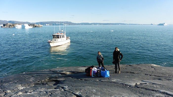
Here we were on the island, in the middle of nowhere, with all our luggage and food to organize, the tent to set up, and the kayaks to inflate—just 10 hours after leaving the Copenhagen hotel. We got to work, bothered by the flies. Despite our head nets, it was barely tolerable—there were so many of them. They swarmed by the dozens into every bag we opened. It was quite mild: 10°C.

Everything was ready by evening, and we were very happy to have completed all these transfers (planes and boat in a single day) as we slipped into our sleeping bags.
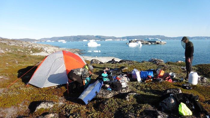
During the night, the wind picked up, and we went out several times to check the tent and kayak anchors. We noticed how bright it was—it was still quite twilight even at 1 AM.

Day 2 5:30 AM wake-up—the south wind was still strong, but since we were heading north, we decided to give it a try anyway.

This was also the moment we loaded the kayaks: since there were only three of us for two double-seater kayaks, we filled the hatch of one kayak, which allowed us to fit all our food. It would have been very difficult if there had been four of us for two kayaks.

Finally, we set off north along the western coast of the island. The conditions were far from ideal—the sea was rough, and the kayaks had a lot of wind resistance. But the main problem was the spray skirt: the gear on deck weighed it down, and the skirt kept coming off… We’d have to deal with it. Barely underway, and whales were already breaking the surface—it was our first time seeing them, and we were very impressed. Too bad the wind didn’t allow for longer contemplation; stopping paddling was impossible with such strong gusts.

We passed a few headlands and even considered stopping due to the conditions. To find some semblance of shelter, we had to hug the coast closely without cutting across the numerous bays, which significantly lengthened the journey. But as the morning went on, the wind died down, and the sea calmed. We spotted several whales and our first seals. It was almost pleasant during the picnic break. By late afternoon, we reached Kangerup Sarqâ Bay, where we had identified a great campsite with a very large beach and a river. But the wind had shifted—it was now coming from the north, making the last hour difficult due to fatigue and headwinds.

The campsite was ideal and beautiful, facing numerous icebergs grounded in the bay.
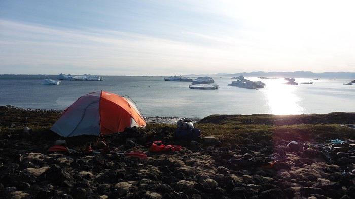
The GPS alerted us to another major drawback of inflatable kayaks: their slowness. It took us 7.5 hours of actual paddling (excluding breaks) to cover 28 km, averaging 3.7 km/h—somewhat disappointing. But we knew this before leaving, and once again, we’d have to make do!

Day 3 Surprise: at 6 AM wake-up, it was raining, foggy, with a south wind, and the sea was choppy even in the bay. It seemed wise to skip paddling, even though stopping on the second day was tough on morale. We went back to sleep, especially since the travel fatigue and the harsh conditions of the previous day had taken their toll.

At 11 AM, the navigation conditions weren’t any better—at the ends of the bay, we saw huge waves crashing onto the rocks, and giving up for the day became obvious. However, the rain had stopped, so we set off for a hike along the large lake bordering the bay. The wind hadn’t let up, and it was quite cold.

The tundra was starting to take on its autumn colors, and the contrast between the white lichens and the red vegetation was stunning. At the lake, we took out the fishing rods and quickly caught two beautiful Arctic char over 50 cm long.

As the afternoon wore on, the sun seemed closer. Along the beach, we gathered driftwood (mostly old planks) to cook our catch in foil over a fire. Eating our own food in such a beautiful place next to a good fire was comforting after the day’s setback.
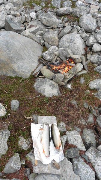


In the middle of the night, an Arctic fox entered the tent’s rear awning. It seemed barely intimidated when we shooed it away with loud shouts and then with stones.

Day 4 6:15 AM wake-up—3°C. We were on the water by 8 AM. The wind had dropped significantly, but the sea was shrouded in fog, and it was very cold in these damp conditions.
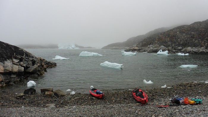


We passed the bay’s headland, Kangea, and headed toward the abandoned village of Agpat. The atmosphere was very austere—we hugged black rocks in fog that limited visibility to 50 meters, revealing large icebergs as we went.
Suddenly, the water’s surface stirred in front of my kayak, and a huge gray back emerged from the sea. The collision was inevitable, but the whale seemed to understand and dove immediately, passing under the kayak and resurfacing a few meters away. I felt the kayak rock in the white foam and quickly paddled to escape the turbulence. What an emotion!

A light wind began to clear the fog, and the sun made beautiful appearances. Despite the cold, we stopped to visit the abandoned village, which left a strange impression. All the houses were still in good condition and wide open—some must have been very spacious in their time. We went back to sea, and in front of the large Kaangerdluk Bay, we hesitated—the headwind was strong, and large waves split the water. The next beach, from the island of Nua where we stopped to think, was over 8 km away. It was barely 2 PM, but caution led us to stop here for the day. We had covered 12 km—exactly the distance needed to stay on schedule. The afternoon was spent hiking on the island’s hills and gathering mussels and wood.


In the evening, we cooked these large Greenlandic mussels over a wood fire and savored them under the beautiful evening light. The weather was now fine, but the thermometer read -5°C in the sun…

Day 5 Bright sunshine, a glassy sea, and -8°C at 6 AM. Everything was green for setting off, even if putting on damp kayaking gear was a bit unpleasant in the cold. It was the first time we’d paddled on a flat sea since the start of the trip, and our average speed increased slightly.


We entered the Smallesund Strait, marking the end of the island’s west coast. We were close to the large Torssukatak Fjord, where two glaciers flow. The access pass to the fjord was very narrow, and numerous ice chunks blocked access to the beaches. The wind had picked up and was now hitting us head-on (again). Just before entering the fjord, we landed on a steep beach made of large pebbles on Oqaitsut Island. It was very cold with the wind, and moving forward became difficult. We decided to stop for the day both because of the conditions and because the next campsite was far away, given how rugged the fjord was.
We eventually found a flat spot for the tent despite the steep slope. Even with the wind, the weather was beautiful, and we set off on foot for the northeastern cape of the island, overlooking the fjord. The view was far-reaching and exceptional—up close, the large fjord filled with ice and its steep granite cliffs, and in the distance, the ice cap and glacial walls.
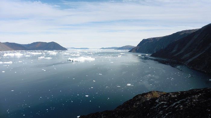
We spotted the village of Qeqertaq, whose network we could pick up, allowing us to check the weather forecast, which was rather good. While securing the kayaks in the evening, I noticed the strange behavior of one kayak at the end of the stage was due to the loss of the skeg—impossible to know where it detached. We’d have to do without it.

Day 6 Still that icy headwind from the northeast. We set off anyway for a long stage to reach the large pass connecting the Torssukatak and Ata Fjords.
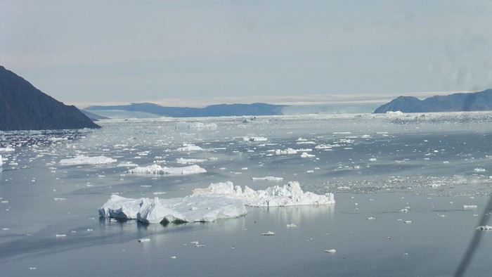
We advanced laboriously along the high cliffs of the fjord’s southern shore. They faced due north and blocked the sun. We felt the cold and dampness of the rock. It was really cold, especially in the extremities. We picnicked on the western cape of Qeqertakavasak Island. The cold didn’t allow us to stop for more than 20 minutes… But the wind dropped, and the sea was now very smooth. It was heavily cluttered with ice between the icebergs and old pack ice. The goal was to reach the large rocky promontory of Anapnuna, wedged between the Kujatdleq and Kangilerngata Glaciers, but the ice made progress difficult. We stopped to gain height on a small island and spot a passage of open water, but all we saw was white—passing seemed impossible. The currents were very complex, and entire sections of ice were being swept in one direction and then another at an impressive speed.


We wandered through this labyrinth until landing on a beach on the small island of Takissut, where we set up camp, exhausted from the 30 km covered and the vigilance required by the abundance of ice. The place was sublime under the evening sun—we were surrounded by ice and mountains, with the Kangilerngata Glacier in the distance. The summer contrasts were striking between the water, icebergs, sky, and flaming tundra—all colors were represented. Absolute calm reigned.
The lack of drinking water at this spot wasn’t too much of a constraint: as soon as we arrived on the beach, we placed containers under the icebergs stranded in the intertidal zone. They were all full by the time we finished setting up.

Day 7 We had to change our plans: we wouldn’t reach the rocky promontory, too well protected by the ice. We set off under the sun for Igdluluarssuit Island. Although we had spotted a passage just before launching, we quickly found ourselves surrounded by ice. It was everywhere, and finding water to paddle became complicated. We tried to force our way in every direction, even retracing our steps. Everything moved at an impressive speed—we were in the middle of a whirlpool of ice.
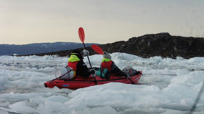
The tension rose, and each boat had its share of big scares. I was trapped against ice floes that dragged me toward an iceberg—the pressure on the kayak was enormous; it was going to capsize or puncture! But with a few strong strokes and paddling against the ice, I managed to free myself from the trap. Barely 10 minutes later, my companions were sandwiched perpendicularly between two icebergs that were closing in. The situation was desperate—the kayak was bending and twisting more and more, but with some strong paddle strokes, it finally freed itself. After these particularly unpleasant moments, we were completely blocked. The drifting ice floes had tightened, and the kayaks were no longer even in the water… The only solution: wait with the kayaks on these floes, which were too thin to walk on (even though we didn’t try). Within minutes, the situation cleared—a waterway opened, and we rushed into it. We paddled with one goal: find a larger pool of water. After going back and forth, our path took shape—we had to force the passage several times, attacking the ice directly with the kayaks, and finally, we escaped the worst of the labyrinth. We reached land on the west side of the island and saw that the rest would be easier. To reach the island, we just had to cross the Arsiviup Ikera Strait, which was lightly cluttered. We reached the eastern cape of the island, ideal for camping, even though we had only paddled for 3 hours. We set up camp and hiked to the island’s summit, which overlooks the entire pass and the glaciers.
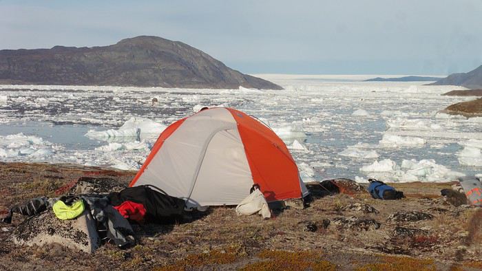
Everything was magnificent, no matter the direction. At 2 PM, we were at the summit—the beauty of the place and the picnic facing the glacier in the sun without wind made us forget the near-disaster from a few hours earlier. It would be impossible to approach the glacier by kayak, but from our summit on foot, it seemed so close, and contemplating it safely on solid ground was a great moment.
The pass was incredibly complex—everything was in motion, and an impassable passage could become open water within minutes. We were delighted when we returned to camp. A slightly lost whale among the ice accompanied us along the shore. The place was truly beautiful, but the temperature dropped again under the clear sky, preventing us from eating outside.

Day 8 Clear and cold at wake-up: -9°C. The sea had frozen in many places. We hesitated about the rest of the trip—should we start heading back to Ilulissat or linger in the pass, especially to approach the Eqi Glacier? After the incidents of the previous day, we decided to think carefully and paddled to the southern cape of our island to check the ice conditions toward Eqi. The weather had clouded over in the meantime, and the sky was quite gray. At the cape, we spotted the glacier’s wall, still 15 km away.


The fjord was quite cluttered, but it seemed passable. However, there was no guarantee the view would be much better 1 km from the glacier than 15 km away, especially since the front was quite active and therefore dangerous. We decided to head south without passing by the glacier. The cold temperatures encountered in the pass also motivated us to move away from the glaciers and the ice cap. We navigated under a threatening sky but without wind. The kayaks cut through the thin layer of ice on the surface with a crinkling paper sound. We reached the Ata campsite in the late afternoon after 5 hours of rowing without a single break…
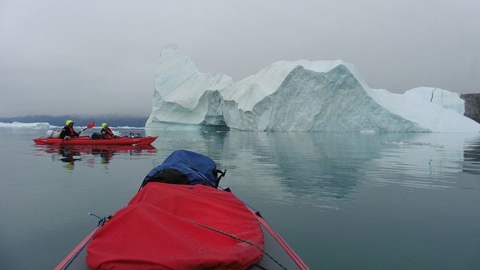
The wind had picked up, and we discovered a nice surprise: a refuge with a table and a comfortable bench lined with mattresses. Facing the worsening weather, we settled in comfortably. The kerosene stove was too complex for our three brains—we couldn’t get it started, too bad, as it was 0°C inside. The rest of the afternoon was spent fishing in the large lake, where we landed a beautiful Arctic char, more than enough for three. A good night’s sleep without the risk of foxes or the sound of a tent shaking in the wind.

Day 9 6 AM wake-up to the sound of rain hitting the cabin. The decision was made looking out the window—wind, rain, and fog obscured the sea: we went back to sleep.

New wake-up, and the rain had stopped—we could go out and stock up on fish. We set off on foot toward the lake, following its western shore. It was very overcast, and the wind encouraged us to keep moving. We made our way to a smaller lake at the end of the large one, where we caught a huge Arctic char. A small clearing brightened the picnic, and we headed back to our cabin.

This 20 km hike kept us busy all day: walking on slippery scree and the micro-relief of the peat bogs took time.

Day 10 The sky was clear, but a light south wind made paddling intense. We set off southeast to reach the opposite shore of the fjord. It was very cold, and it was impossible to stop paddling for even a moment without immediately losing ground due to the wind. We crossed the Kangerluarsuk Fjord. I recognized the cape I had reached on skis in the winter of 2017. We found a nice campsite on the southern shore of the fjord: Uiartag. It wasn’t even noon, but facing this headwind, we preferred to stop here rather than exhaust ourselves for a few extra kilometers. Like the previous ones, this campsite was very comfortable: the ground was covered with a thick layer of lichens and mosses, very pleasant to lie on.
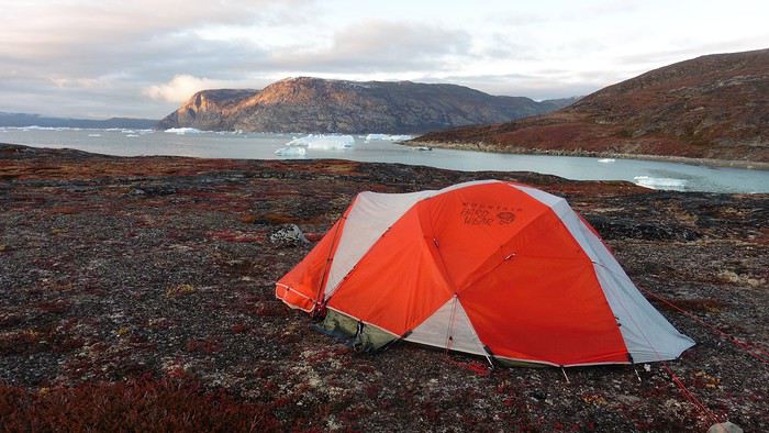
We set off on a hike to the heights of the cape, where the weather alternated between large clearings and snow showers. We noticed the loss of the thermometer, poorly attached to the backpack. On the way back, in the small bay of our beach, a whale swam calmly 10 meters from the shore—a beautiful surprise.
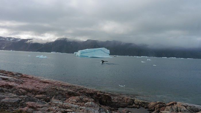
The sky cleared completely, and the temperature dropped as night approached.

Open
PE
Peggy16 last year
July 2015: A Quick Stop in New Mexico Before Exploring Utah in Depth
This year, we hadn’t planned on going to the United States. After two trips in 2012 and 2014, we needed to refill the piggy bank... But we didn’t count on luck: one late September afternoon in 2014, while randomly browsing the web, I stumbled upon flight tickets for $753 per person for July 2015! After some calculations and hesitation, we decided to shorten the trip compared to the previous year (22 days this time), cut down on hotel costs (80 € per night on average), and skip expensive activities (no helicopter rides, rafting, or guided tours with outfitters, etc.), but we couldn’t pass up such a great opportunity!
Here’s the budget breakdown: - Flight tickets: 3,012 € for 4 (booked directly on AA’s website). One layover on the way out (CDG / Charlotte / Phoenix) and one on the way back (LAX / London / CDG). - Hotels: 1,685 € for 22 nights, averaging 76.60 € per night. We stuck to our budget (and even did better!), thanks to affordable hotels in NM, bookings made when the exchange rate was still favorable, and 2 free nights used on Hotels.com. - Car: 952 € for 22 days renting a standard SUV (Jeep Grand Cherokee). We went through AutoEurope, and the rental company was Dollar. - Gas: Around $20 per day on average (for 5,440 km). - Food: Just under $70 per day on average (for 4 people). We did a lot of grocery shopping for picnics, ate a lot of fast food, and only went to restaurants a few times. - America the Beautiful Pass: Free (the one we bought in July 2014 was still valid until the end of July 2015). - Not covered by the pass: $175 (entry fees for State Parks, a guided tour at Mesa Verde, Pow Wow entry, etc.).

In total, we spent 7,760 € for 4 people over 22 days. On top of that, we added $50 for the NYNY roller coaster (a gift for Hugo) and $135 for the *Mystère* show (a gift for Calista and me).

Here’s the itinerary: - Lost Dutchman SP, Goldfield Ghost Town, and Apache Trail - Chiricahua NM - White Sands NM - White Sands NM, Valley of Fires SP, and Old Town Albuquerque - Taos Pueblo, Pow Wow, and Chimayo - Bandelier NM and Santa Fe - Kasha Katuwe Tent Rocks NM - Shiprock and Mesa Verde NP - Bluff, Gooseneck SP, Road Canyon, and UT95 - Little Wild Horse Canyon and Goblin Valley SP - Capitol Reef NP (Cohab Canyon and Sulphur Creek) - Burr Trail - Zebra Slot Canyon and Lower Calf Creek Falls - Mossy Cave and Cedar Breaks NM - Kanarra Creek and Zion NP (Kolob Canyons) - Coyote Buttes South (Paw Hole) - Zion NP (Progeny Peak) - Snow Canyon SP - Lake Mead and Las Vegas - Las Vegas - Las Vegas - Los Angeles and the trip back
Open

Recommended for you

Previous Page 1 of 31 Next