Skip to content
Regions of Mauritius

Travel guide · Mauritius

Regions of Mauritius

last edited Aug 19, 2020 · 2 versions

Mauritius (the island)

Morne Brabant, Maurice

Mauritius is the main island of the Republic of Mauritius. It is home to the capital, Port Louis, over 95% of the population with a high density of more than 650 inhabitants per km², the economic activity, and the vast majority of the Mauritian tourism sector.

Rodrigues

Réserve François Leguat, Maurice

Located 560 kilometres northeast of Mauritius, the island of Rodrigues, surrounded by its crystal-clear lagoon, is a top spot for diving in the Indian Ocean, as well as a great place for sailing, windsurfing, kite-surfing, or deep-sea fishing.

Rodrigues

Located 560 kilometres northeast of Mauritius, the island of Rodrigues, surrounded by its crystal-clear lagoon, is a top diving spot in the Indian Ocean but also a great place for sailing, windsurfing, kite-surfing, or deep-sea fishing.

Overview

Île aux Cocos, Maurice
Île aux Cocos, Maurice · © VoyageForum

Located 560 kilometres northeast of Mauritius, the island of Rodrigues, surrounded by its crystal-clear lagoon, is a top diving spot in the Indian Ocean but also a great place for sailing, windsurfing, kite-surfing, or deep-sea fishing.

Of volcanic origin, the island covers just 110 km² yet has a rugged landscape. It has held autonomous status within the Republic of Mauritius since 12 October 2002. Around 40,000 people live here, primarily relying on fishing and, to a lesser extent, tourism. Unlike neighbouring Mauritius, where religions mix, Rodrigues is 97% Catholic.

Main towns

With a population of 6,000 or 7,000, Port Mathurin is Rodrigues’ main settlement. It serves as the administrative capital and economic hub. A dozen other villages also have over 1,000 residents.

Tourist attractions

Heritage

Beaches, nature, and coastline

Climate and weather

Rodrigues has a hotter and drier climate than Mauritius, especially toward the end of the year. Cyclones are also more frequent and "severe" here.

View guide page: Rodrigues

Port Mathurin

With around 8,000 inhabitants, it is the capital of Rodrigues.

Overview of Port Mathurin

With around 8,000 inhabitants, it is the capital of Rodrigues.

Key Facts

  • Type of place: small town.
  • Tourist interest: (worth a stop if you are in the area).
  • Location:
  • Distances:
  • Local time: Heure : 2440.
  • Population: 8,050 inhabitants (2016).
  • Area:
  • Altitude: sea level.
  • Website:

History of Port Mathurin

What to See and Do in Port Mathurin

In the Surrounding Area

Climate and Weather in Port Mathurin

Transport

Getting There

Getting Around

Accommodation

Eating Out

Useful Addresses

  1. == Further Information
View guide page: Port Mathurin

François Leguat Giant Tortoise and Cave Reserve

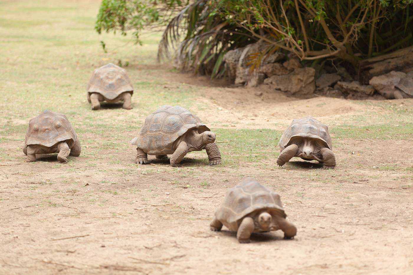
In the southwest of Rodrigues Island, this reserve is home to giant tortoises. You can also explore several caves, including the Grande Caverne and the Cave of the Virgin.

Overview of the François Leguat Reserve

In the southwest of Rodrigues Island, not far from the airport, this reserve is home to giant tortoises. You can also explore several caves, including the Grande Caverne and the Cave of the Virgin.

Key Details

  • Type of place: nature reserve.
  • Tourist interest: (worth seeing).
  • Features:
  • Local time: Heure : 2441
  • Annual visitors:
  • Area:
  • Altitude: sea level.

Environment

Site Physiognomy

Wildlife and Flora

Climate and Weather

Precautions

What to See and Do

Practical Information

  • Location:
  • Distances:
  • Opening period:
  • Rates:

Getting There

Getting Around

Accommodation and Dining

Nearby Attractions

  1. == In Addition
View guide page: François Leguat Giant Tortoise and Cave Reserve

Cocos Island

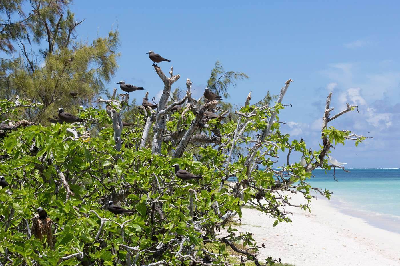
This small uninhabited island, a few kilometres off the west coast of Rodrigues, is a nature reserve for many birds.

Overview of Cocos Island

This small uninhabited island, a few kilometres off the west coast of Rodrigues, is a nature reserve for many birds.

Key details

  • Type of place: birdwatching site.
  • Tourist interest: (recommended).
  • Features:
  • Local time: Heure : 2638
  • Annual visitors:
  • Area: 0.2 km².
  • Altitude: sea level.

Environment

Landscape

Wildlife and flora

Climate and weather

Precautions

What to see and do

Practical information

  • Location:
  • Distances:
  • Opening period:
  • Rates:

Getting there

Getting around

Accommodation and dining

What to see nearby

  1. == Further reading
View guide page: Cocos Island

Mauritius (the island)

Mauritius is the main island of the Republic of Mauritius. It is home to the capital, Port Louis, over 95% of the population, the country's economic activity, and the vast majority of Mauritius's tourism sector.

Overview

Grand Bassin, Maurice
Grand Bassin, Maurice · © VoyageForum

Mauritius is the main island of the Republic of Mauritius. It is home to the capital, Port Louis, over 95% of the population, the country's economic activity, and the vast majority of Mauritius's tourism sector.

Main towns

Tourist attractions

Towns and their heritage

Beaches and coastline

Nature and activities

Climate and weather

Mauritius has a mild tropical climate. The northern and western regions are warmer and drier than the rest of the island.

During the southern summer, from November to April, the weather is hot (especially in December-February) and humid. Rainfall is heavy in February-March, particularly on the central plateau. The southern summer is also cyclone season, but generally, cyclones here are far less violent than in the Caribbean, for example, and rarely "destructive." In any case, the authorities do an excellent job of informing and protecting the population. In the southern winter, temperatures are slightly cooler, as they are year-round on the central plateau compared to the coasts.

View guide page: Mauritius (the island)

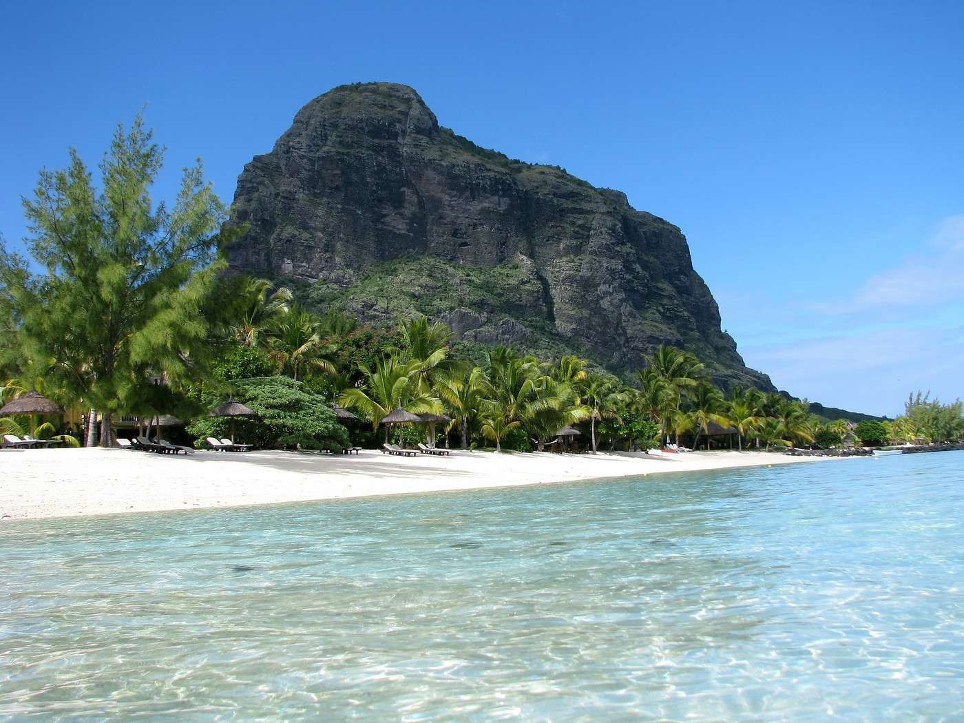
Le Morne Brabant

A peninsula with beautiful beaches topped by a high hill at the far southwest of Mauritius. It’s a UNESCO World Heritage site for its landscapes and its "symbolism" regarding slavery.

Overview of Le Morne Brabant

It’s a peninsula with beautiful beaches topped by a high hill at the far southwest of Mauritius. It’s a UNESCO World Heritage site for its landscapes and its "symbolism" regarding slavery.

Key details

  • Type of place: peninsula.
  • Tourist interest: (worth seeing).
  • Location:
  • Local time: Heure : 2415.
  • Area:
  • Highest point: 555 m.

Environment of Le Morne Brabant

Wildlife and flora

What to see and do

In the surrounding area

Climate and weather

Precautions

Transport

Getting there

Getting around

Sleep and eat

Further information

View guide page: Le Morne Brabant

Port Louis

The Mauritian capital has a few historical traces of its French and British past, as well as contributions from Indian and Chinese communities. The Aapravasi Ghat, the wharf where Indian workers once disembarked, is a UNESCO World Heritage site. Overview of Port Louis Port Louis Climate and Weather What to See in Port Louis Things to Do in Port Louis Getting to Port Louis Getting Around Port Louis Staying and Eating in Port Louis Living in Port Louis

Further information

View guide page: Port Louis

Overview of Port Louis

Overview of Port Louis

Mauritius’ capital has a few historical traces of its French and British past, as well as contributions from Indian and Chinese communities. The Aapravasi Ghat, the quay where Indian workers once disembarked, is a UNESCO World Heritage site.

Landmarks

  • Type of place: large city.
  • Tourist interest: (worth seeing).
  • Location:
  • Distances:
  • Local time: Heure : 2416.
  • Population: 149,672 (2015).
  • Area: 46.7 km².
  • Altitude: sea level.

History of Port Louis

Precautions

Useful Addresses

  • Tourist Office:

Services

  • Local agencies:
  • Banks:
  • Hospital:
  • Internet:
  • Laundries:
  • Vehicle rental:
  • Post office:
View guide page: Overview of Port Louis

Port Louis Climate and Weather

Climate Overview

Best Time to Visit Port Louis

Jan.Feb.Mar.Apr.MayJun.Jul.Aug.Sep.Oct.Nov.Dec.
Climate

Climate and Forecast

Additional Information

View guide page: Port Louis Climate and Weather

What to See in Port Louis

Overview

UNESCO Heritage

Aapravasi Ghat
These are the remains of the site where Indian labourers disembarked on the island between 1834 and 1910. The site is a UNESCO World Heritage Site for its historical significance.

Districts

Sites, Monuments, and Architectural Ensembles

Religious Buildings

Museums

Parks and Gardens

In the Surrounding Area

Further Information

View guide page: What to See in Port Louis

Aapravasi Ghat

These are the remains of the site where Indian labourers disembarked on the island between 1834 and 1910. The site is a UNESCO World Heritage Site for its historical significance.

Overview of Aapravasi Ghat

These are the remains of the site where Indian labourers disembarked on the island between 1834 and 1910. The site is a UNESCO World Heritage Site for its historical significance.

  • Tourist interest: (worth a stop if you are in the area).

History of Aapravasi Ghat

What to see and do

Practical information

  • Location:
  • Address: Ex-DWC Building, 1 Quay St, Port Louis.
  • Opening hours:
  • Price:

Transport

Accommodation and dining

Nearby attractions

  1. == In addition
View guide page: Aapravasi Ghat

Getting to Port Louis

By air

Since Mauritius only has one airport, Sir Seewoosagur Ramgoolam International Airport (near Mahebourg), this is the one serving the capital.

By land

By bus

Distances

By sea

Ferries

Cargo

Cruises

Sailboats

View guide page: Getting to Port Louis

Cape Malheureux

This large village in the far north offers a picturesque, photogenic view with its church set against the sea.

Overview of Cape Malheureux

This large village in the far north of Mauritius offers a picturesque, photogenic view with its church set against the sea.

Key details

  • Type of place: small town.
  • Tourist interest: (worth seeing).
  • Location:
  • Distances:
  • Local time: Heure : 2417.
  • Population: 5,070 inhabitants (2012).
  • Area:
  • Altitude: sea level.

History of Cape Malheureux

What to see and do in Cape Malheureux

Nearby

Climate and weather

Transport

Getting there

Getting around

Accommodation

Eating

Useful addresses

Further information

View guide page: Cape Malheureux

Chamarel

A village in the southwest of Mauritius, inland, whose surroundings attract many visitors. Key attractions include Chamarel Waterfall, the Seven Coloured Earths, Black River Gorges National Park, and an adventure leisure park.

Overview of Chamarel

This is a village in the southwest of Mauritius, inland, whose surroundings attract many visitors. Key attractions include: Chamarel Waterfall, The Seven Coloured Earths, the Black River Gorges National Park, and an adventure leisure park.

Key Details

  • Type of place: village.
  • Tourist interest: (worth a stop if you are in the area).
  • Location:
  • Distances:
  • Local time: Heure : 2418.
  • Population: 783 inhabitants (2011).
  • Area:
  • Altitude:

History of Chamarel

What to See and Do in Chamarel

In the Surrounding Area

Climate and Weather in Chamarel

Transport

Getting There

Getting Around

Accommodation

Eating Out

Useful Addresses

Further Information

View guide page: Chamarel

Curepipe

The second-largest city in Mauritius is located on the central plateau, amid sugarcane fields. You can see many beautiful Creole houses and buildings here, as well as the Trou-aux-Cerfs crater, which offers a lovely panoramic view of the area.

Overview of Curepipe

The second-largest city in Mauritius is located on the central plateau, in the region of sugarcane fields. You can see many beautiful houses and other "Creole" buildings here. The town is also home to the Trou-aux-Cerfs crater, which offers a lovely panoramic view of the surrounding area.

Key Details

  • Type of place: city.
  • Tourist interest: (worth a stop if you are in the area).
  • Location:
  • Distances:
  • Local time: Heure : 2419.
  • Population: 79,014 (2011).
  • Area: 24 km².
  • Altitude: 561 m.

History of Curepipe

What to See and Do in Curepipe

In the Surrounding Area

Climate and Weather in Curepipe

Transportation

Getting There

Getting Around

Accommodation

Dining

Useful Addresses

Further Information

View guide page: Curepipe

Flacq

On the east coast, this large town (officially called Centre de Flacq) hosts Mauritius’s biggest open-air market. You’ll also find beaches here and the departure point (at Trou d’eau Douce) for boats to Île aux Cerfs.

Overview of Flacq

On the east coast, this large town (officially called Centre de Flacq) hosts the biggest open-air market in Mauritius. You’ll also find beaches here and the departure point (at Trou d’eau Douce) for boats to Ile aux Cerfs.

Key Facts

  • Type of place: small town.
  • Tourist interest: (worth a stop if you are in the area).
  • Location:
  • Distances:
  • Local time: Heure : 2420.
  • Population: 15,791 inhabitants (2011).
  • Area:
  • Altitude: sea level.
  • Website:

History of Flacq

What to See and Do in Flacq

In the Surrounding Area

Climate and Weather in Flacq

Transport

Getting There

Getting Around

Accommodation

Eating Out

Useful Addresses

  1. == Additional Information
View guide page: Flacq

Flic en Flac

A coastal village south of Port Louis that has evolved into a renowned beach resort—and an all-inclusive destination—known for its long beach and diving.

Overview of Flic en Flac

A coastal village south of Port Louis that has evolved into a renowned beach resort—and an all-inclusive destination—known for its long beach and diving.

Key Details

  • Type of place: village.
  • Tourist interest: (worth seeing).
  • Location:
  • Distances:
  • Local time: Heure : 2421.
  • Population: 2,197 inhabitants (2011).
  • Area:
  • Altitude: sea level.

History of Flic en Flac

What to See and Do in Flic en Flac

In the Surrounding Area

Climate and Weather

Transportation

Getting There

Getting Around

Accommodation

Dining

Useful Addresses

Additional Information

View guide page: Flic en Flac

Ile aux Cerfs

This small uninhabited island near the coast boasts Mauritius’s most stunning beaches. It’s a popular spot for excursions, water activities, and diving.

Overview of Ile aux Cerfs

This small uninhabited island, very close to the coast, has the most beautiful beaches in Mauritius. It’s a popular excursion spot for various water activities and diving.

Key facts

  • Type of place: island.
  • Tourist interest: (recommended).
  • Location:
  • Local time: Heure : 2423
  • Population: uninhabited.
  • Area:
  • Highest point:
  • Coastline:

History of Ile aux Cerfs

Environment of the island

Wildlife and flora

Precautions

What to see and do on Ile aux Cerfs

In the area

Climate and weather

Transport

Getting there

Getting around

Sleeping and eating

Useful addresses

Further reading

View guide page: Ile aux Cerfs

Mahebourg

It's the "big city" (quiet) in the southeast, close to the airport. You can see old colonial houses and a (new) waterfront. Nearby is the Blue Bay site and its marine park.

Overview of Mahebourg

It's the "big city" (quiet) in the southeast of Mauritius, close to the airport. You can see old colonial houses and a (new) waterfront. Nearby is the site of Blue Bay and its marine park.

Key Details

  • Type of place: small town.
  • Tourist interest: (worth a stop if you are in the area).
  • Location:
  • Distances:
  • Local time: Heure : 2424.
  • Population: 15,457 inhabitants (2015).
  • Area:
  • Altitude: sea level.

History of Mahebourg

What to see and do in Mahebourg

In the surrounding area

Climate and weather

Transport

Getting there

Getting around

Accommodation

Eating

Useful addresses

Further information

View guide page: Mahebourg

Pamplemousses

A small town between Grand Baie and Port Louis, known for its magnificent botanical garden.

Overview of Pamplemousses

A small town between Grand Baie and Port Louis known for its magnificent botanical garden.

Key Details

  • Type of place: city.
  • Tourist interest: (worth seeing).
  • Location:
  • Distances:
  • Local time: Heure : 2425.
  • Population: 9,295 inhabitants (2011).
  • Area:
  • Altitude:
  • Website:

History of Pamplemousses

What to See and Do in Pamplemousses

In the Surrounding Area

Climate and Weather

Transportation

Getting There

Getting Around

Accommodation

Dining

Useful Addresses

  1. == Additional Information
View guide page: Pamplemousses

Souillac (Mauritius)

A small port on the southern coast with a charming seafront that's far less touristy than the north. Two interesting sites nearby: Rochester Falls and the Gris Gris cliffs.

Overview of Souillac

A small port on the southern coast of Mauritius with a charming seafront that's far less touristy than the north. Two interesting sites nearby: the Rochester Falls and the Gris Gris cliffs.

Key details

  • Type of place: small town.
  • Tourist interest: (worth seeing).
  • Location:
  • Distances:
  • Local time: Heure : 2427.
  • Population: 4,411 inhabitants (2011).
  • Area:
  • Altitude: sea level.

History of Souillac

What to see and do in Souillac

Nearby

Climate and weather in Souillac

Transport

Getting there

Getting around

Accommodation

Eating

Useful addresses

  1. == Additional information
View guide page: Souillac (Mauritius)

Tamarin

With its beautiful beach and waves, the Tamarin site on the southwest coast of Mauritius is a favourite among surfers.

Overview of Tamarin

With its beautiful beach and waves, the Tamarin site on the southwest coast of Mauritius is a favourite among surfers.

Key Information

  • Type of place: small town.
  • Tourist interest: (worth a stop if you are in the area).
  • Location:
  • Distances:
  • Local time: Heure : 2428.
  • Population: 3,766 inhabitants (2011).
  • Area:
  • Altitude: sea level.

History of Tamarin

What to See and Do in Tamarin

Nearby

Climate and Weather in Tamarin

Transport

Getting There

Getting Around

Accommodation

Eating

Useful Addresses

Further Information

View guide page: Tamarin

Triolet

The town is home to one of Mauritius's main Hindu temples that you can visit.

Overview of Triolet

The town is home to one of Mauritius's main Hindu temples that you can visit.

Key details

  • Type of place: small town.
  • Tourist interest: (worth seeing).
  • Location:
  • Distances:
  • Local time: Heure : 2429.
  • Population: 23,386 inhabitants (2011).
  • Area:
  • Altitude:
  • Website:

History of Triolet

What to see and do in Triolet

In the surrounding area

Climate and weather in Triolet

Transport

Getting there

Getting around

Accommodation

Eating out

Useful addresses

  1. == Further information
View guide page: Triolet

Trou aux Biches

One of the beach resorts near Grand Baie on the north coast of Mauritius, known for its all-inclusive hotels.

Overview of Trou aux Biches

It’s one of the beach resorts near Grand Baie, on the north coast of Mauritius. It’s particularly known for its all-inclusive hotels.

Key facts

  • Type of place: small town.
  • Tourist interest: (worth seeing).
  • Location:
  • Distances:
  • Local time: Heure : 2430.
  • Population:
  • Area:
  • Altitude: sea level.

History of Trou aux Biches

What to see and do

Nearby

Climate and weather

Getting around

How to get there

Getting around

Where to stay

Where to eat

Useful addresses

Further reading

View guide page: Trou aux Biches

Black River Gorges National Park

This is a large, forested and hilly park near Chamarel. It’s a popular spot for birdwatching and hiking.

Overview of Black River Gorges

This is a large, forested and hilly park next to Chamarel. It’s a popular spot for birdwatching and hiking.

Key details

  • Type of place: national park.
  • Tourist interest: (recommended).
  • Features:
  • Local time: Heure : 2431
  • Annual visitors:
  • Area: 67.54 km².
  • Altitude:

Environment

Landscape of the park

Wildlife and flora

Climate and weather

Precautions

What to see and do

Practical information

  • Location:
  • Distances:
  • Opening period:
  • Rates:

Getting there

Getting around

Accommodation and dining

Nearby attractions

Additional information

View guide page: Black River Gorges National Park

Blue Bay

South of Mahébourg, this is a stunning beach with magnificent seabeds perfect for diving, protected as a nature reserve. Several hotels are located here or nearby.

Overview of Blue Bay

South of Mahebourg, it’s a stunning beach and, above all, magnificent seabeds perfect for diving, protected as a nature reserve. Several hotels are located here or nearby.

Key Details

  • Type of place: beach.
  • Tourist interest: (worth seeing).
  • Features:
  • Location:
  • Length:

Environment

Precautions

What to See and Do

What to See Nearby

Climate and Weather

Transport

Getting There

Getting Around

Accommodation

Eating

Additional Information

View guide page: Blue Bay

Casela World of Adventures

A mix of amusement park, bird sanctuary, and zoo, this place lets you see everything from birds to tigers and lions.

Overview of Casela World of Adventures

A mix of amusement park, bird sanctuary, and zoo, this place lets you see everything from birds to tigers and lions.

  • Tourist interest: (worth a stop if you are in the area).

Visiting the Site

Setting and Environment

The Species

Activities

Practical Information

  • Location:
  • Address: Royal Road, Cascavelle, Cascavelle 90203.
  • Opening hours:
  • Price:
  • How to get there:

Nearby Attractions

Additional Information

View guide page: Casela World of Adventures

Hunter's Domain

On the east coast, it's a private reserve where you can observe various animals. Right next door, the Ylang-Ylang Domain lets you discover these tall trees.

Overview of Hunter's Domain

On the east coast of Mauritius, it's a private reserve where you can observe various animals. Right next door, the Ylang-Ylang Domain lets you discover these tall trees.

Key Details

  • Type of place: nature reserve.
  • Tourist interest: (worth a stop if you are in the area).
  • Features:
  • Local time: Heure : 2434
  • Annual visitors:
  • Area: 10 km².
  • Altitude:

Environment

Site Physiognomy

Wildlife and Flora

Climate and Weather

Precautions

What to See and Do

Practical Information

  • Location:
  • Distances:
  • Opening period:
  • Rates:

Getting There

Getting Around

Accommodation and Dining

Nearby Attractions

  1. == En complément
View guide page: Hunter's Domain

Ganga Talao

In the south, in the highlands of Mauritius, Ganga Talao is a crater lake that is home to the island's most important Hindu temple. It is also a pilgrimage site.

Overview of Ganga Talao

In the south, in the highlands of the island, Ganga Talao is a crater lake that is home to the most important Hindu temple in Mauritius. It is also a pilgrimage site.

Key details

  • Type of place: lake.
  • Tourist interest: (recommended).
  • Features: crater lake.
  • Area:
  • Altitude: 540 m.

Lake environment

Wildlife and flora

Climate and weather

Precautions

What to see and do

Practical information

  • Location:
  • Distances:

Getting there

Accommodation and dining

Nearby attractions

  1. == En complément
View guide page: Ganga Talao

Amber Island

Just off the coast, south of Grand Gaube, this island is a nature reserve. It’s a destination for beaches and birdwatching.

Overview of Amber Island

Just off the coast, south of Grand Gaube, this island is a nature reserve. It’s a destination for beaches and birdwatching.

Key details

  • Type of place: nature reserve.
  • Tourist interest: (recommended).
  • Features:
  • Local time: Heure : 2436
  • Annual visitors:
  • Area: 1.28 km².
  • Elevation:

Environment

Island landscape

Wildlife and flora

Climate and weather

Precautions

What to see and do

Practical information

  • Location:
  • Distances:
  • Opening period:
  • Rates:
  • Website:

Getting there

Getting around

Accommodation and dining

Nearby attractions

  1. == Further reading
View guide page: Amber Island

Rochester Falls

Located just next to Souillac, these are the main waterfalls of Mauritius.

Overview of Rochester Falls

Located just next to Souillac, these are the main waterfalls of Mauritius.

Key Details

  • Type of place: waterfall.
  • Tourist interest: (worth seeing).
  • Features:
  • Height: 10 m.
  • Altitude: 152 m.

Site Environment

Climate and Weather

Precautions

What to See and Do

Practical Information

  • Location:
  • Distances:

Getting There

Accommodation and Dining

Nearby Attractions

  1. == En complément
View guide page: Rochester Falls

The Seven Coloured Earths

Next to Chamarel, this is a natural curiosity of volcanic origin with sand dunes in different colours.

Overview of the Seven Coloured Earths

Next to Chamarel, this is a natural curiosity of volcanic origin with sand dunes in different colours.

Key details

  • Type of place: dune.
  • Tourist interest: (recommended).
  • Features: sand dunes.
  • Location:
  • Area:
  • Altitude:

Site environment

Wildlife and vegetation

What to see and do

In the surrounding area

Climate and weather

Precautions

Getting there

Sleeping and eating

  1. == En complément
View guide page: The Seven Coloured Earths

Grand Baie

At the northern tip of Mauritius, nestled in its bay, this is an upmarket beach resort with many all-inclusive options. Activities include beaches, diving and other water sports, fishing, and sea excursions, particularly to the reserve islet of Coin de Mire.

Overview of Grand Baie

At the northern tip of Mauritius, nestled in its bay, this is an upmarket beach resort with many all-inclusive options. Activities include beaches, diving and other water sports, fishing, and sea excursions, particularly to the reserve islet of Coin de Mire.
Key facts

  • Type of place: small town.
  • Tourist interest: (worth seeing).
  • Location:
  • Distances:
  • Local time: Heure : 2445.
  • Population: 11,910 (2011).
  • Area:
  • Altitude: sea level.

History of Grand Baie

What to see and do in Grand Baie

In the surrounding area

Climate and weather in Grand Baie

Transport

Getting there

Getting around

Accommodation

Eating

Useful addresses

Further information

View guide page: Grand Baie

Pereybere

It’s a family-friendly, local beach resort with a long stretch of sand. It’s located next to Grand Baie, on the north coast of Mauritius.

Overview of Pereybere

It’s a family-friendly, local beach resort with a long stretch of sand. It’s located next to Grand Baie, on the north coast of Mauritius.

Key Facts

  • Type of place: village.
  • Tourist interest: (worth seeing).
  • Location:
  • Distances:
  • Local time: Heure : 27327.
  • Population:
  • Area:
  • Altitude: sea level.

History of Pereybere

What to See and Do in Pereybere

In the Area

Climate and Weather in Pereybere

Transport

Getting There

Getting Around

Sleep

Eat

Useful Addresses

Further Information

View guide page: Pereybere

Something wrong or out of date? Report this page