Skip to content
Regions of Réunion

Travel guide · Réunion

Regions of Réunion

last edited Jan 8, 2020 · 2 versions

The Coastline

Grande Anse, Réunion

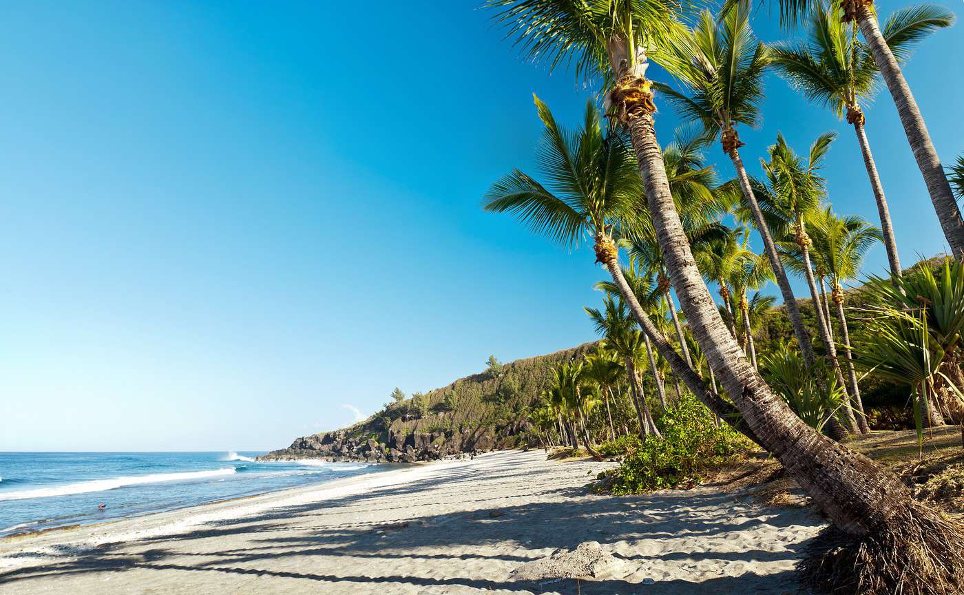
The "coastline" is the narrow coastal strip that circles the island. This is where 80% of Réunion’s residents live and where the department’s major cities, including Saint-Denis, are located. A road following the sea encircles the island, offering a chance to discover its diverse landscapes and the striking contrasts between the more developed West coast and the wilder East.

The "Hauts"

Parc national de la Réunion, Réunion

On Réunion, the "Hauts" refers to the rugged inland areas that are not directly on the coast—meaning the vast majority of the island. This is where nature lovers, hikers, and outdoor enthusiasts will find what they’re looking for, particularly in Réunion National Park, which covers over 40% of the island.

Reunion Island Coastline

The "coastline" is the narrow coastal strip that encircles the island. This is where 80% of Reunion’s population lives and where the department’s major towns, including Saint-Denis, are located. A road following the sea loops around the island, offering a…

Read the full guide: Reunion Island Coastline

The Highlands

On Réunion Island, the "Hauts" (Highlands) refer to the rugged inland areas that are not directly on the coast. This covers the vast majority of the island. It’s in the Highlands that nature lovers, hikers, and outdoor enthusiasts will find what they’re looking for, particularly through the Réunion National Park, which covers over 40% of the island.

Overview

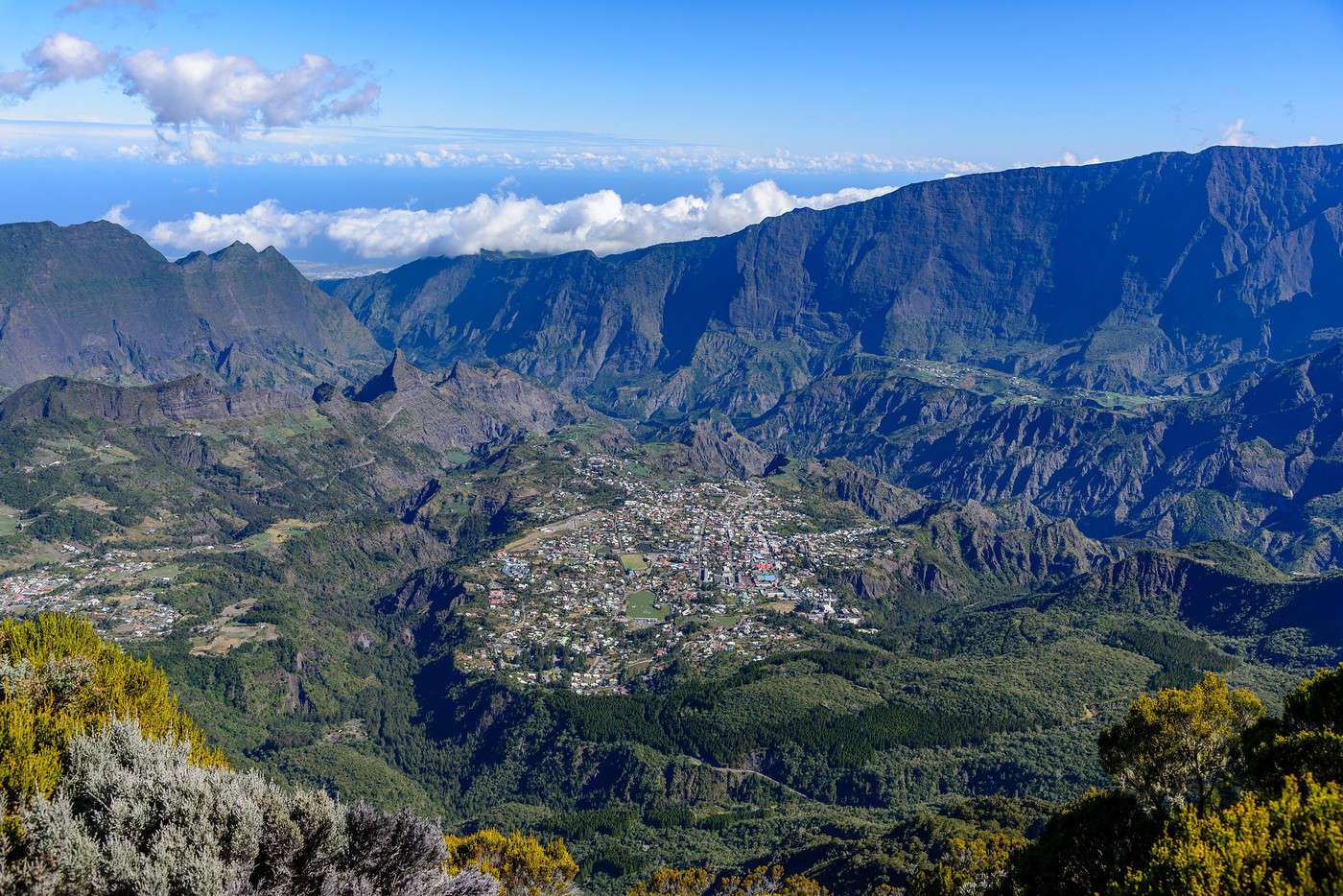
Cirque de Cilaos, Réunion
Cirque de Cilaos, Réunion · © VoyageForum

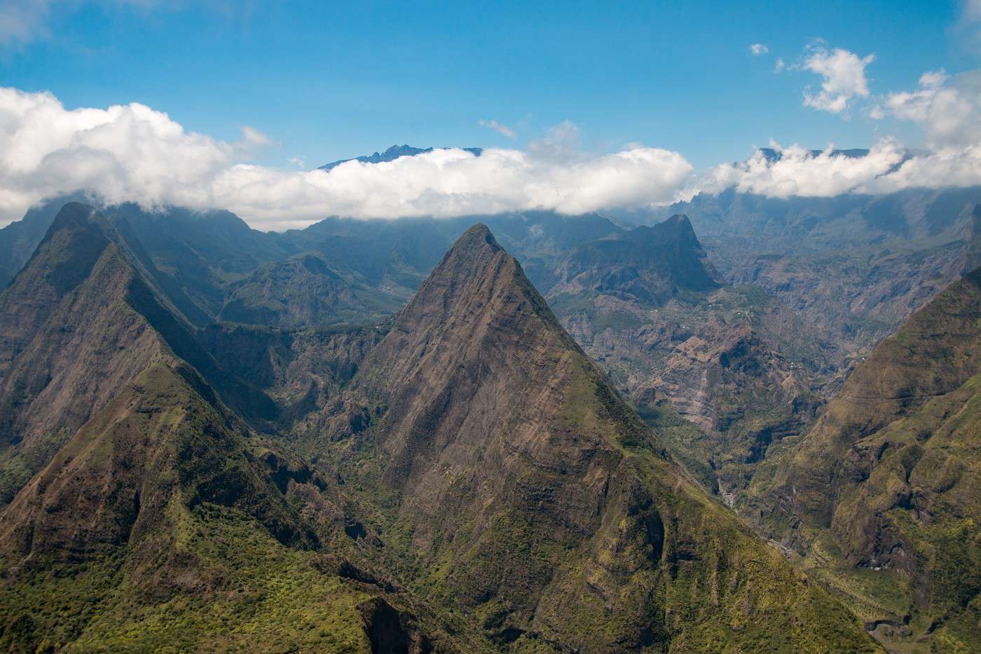
On Réunion Island, the "Hauts" (Highlands) refer to the rugged inland areas that are not directly on the coast. This covers the vast majority of the island. It’s in the Highlands that nature lovers, hikers, and outdoor enthusiasts will find what they’re looking for, particularly through the Réunion National Park, which covers over 40% of the island.

Main towns

The interior is home to very few towns or large villages. Le Tampon (not far from the coast) is by far the largest settlement, ahead of Cilaos or Hell-Bourg, located in the heart of the island, which remain good bases for exploring the region.

Tourist attractions

Towns and their heritage

Like on the coast, the inland towns are primarily stopovers or bases for discovering the surrounding areas.

Nature and activities

It’s in the Highlands that the nickname "the intense island" truly comes to life! A wild, diverse landscape where forests, rivers, waterfalls, cirques, peaks, desert plains, volcanoes, and lava fields blend together, offering an almost endless range of outdoor activities—hiking first and foremost, but also white-water sports.

Climate and weather

View guide page: The Highlands

Cilaos

At the heart of the island and the cirque of the same name, Cilaos is famous for its wine and lentils. But it is also, and above all, a base for exploring the surrounding area, especially on foot.

Overview of Cilaos

At the heart of the island and the cirque of the same name, Cilaos is famous for its wine and lentils. But it is also, and above all, a base for exploring the surrounding area, especially on foot.

Key facts

  • Type of place: small town.
  • Tourist interest: (worth a stop if you are in the area).
  • Location:
  • Distances:
  • Local time: Heure : 2533.
  • Population: 5,350 inhabitants (2015).
  • Area: 84.40 km².
  • Altitude: from 370 to 3,071 m

History of Cilaos

What to see and do in Cilaos

In the surrounding area

Climate and weather in Cilaos

Transport

Getting there

Getting around

Accommodation

Eating

Useful addresses

Further information

View guide page: Cilaos

Hell-Bourg

This hamlet in the municipality of Salazie is certified as one of the "Most Beautiful Villages of France". Several waterfalls and hikes to explore in the surrounding area.

Overview of Hell-Bourg

This hamlet in the municipality of Salazie is certified "Most Beautiful Village of France". Several waterfalls and hikes to explore in the surrounding area.

Key Details

  • Type of place: village.
  • Tourist interest: (worth seeing).
  • Location:
  • Distances:
  • Local time: Heure : 2534.
  • Population:
  • Area:
  • Altitude: 1,344 m.

History of Hell-Bourg

What to See and Do in Hell-Bourg

In the Surrounding Area

Climate and Weather in Hell-Bourg

Transportation

Getting There

Getting Around

Accommodation

Dining

Useful Addresses

Additional Information

View guide page: Hell-Bourg

Le Tampon

It is the main inland city and the gateway to the scenic route leading to the heart of the island, particularly to Piton de la Fournaise.

Overview of Le Tampon

It is the main inland city of Réunion and the gateway to the scenic route leading to the heart of the island, particularly to Piton de la Fournaise.

Key Facts

  • Type of place: city.
  • Tourist interest: (worth a stop if you are in the area).
  • Location:
  • Distances:
  • Local time: Heure : 2535.
  • Population: 76,310 inhabitants (2015).
  • Area: 165.43 km².
  • Altitude: from 287 to 2,418 m.

History of Le Tampon

What to See and Do in Le Tampon

In the Surrounding Area

Climate and Weather

Transportation

Getting There

Getting Around

Accommodation

Dining

Useful Addresses

Further Information

View guide page: Le Tampon

Plaine des Palmistes

A commune between Plaine des Cafres and Saint-Benoît on the RN3 road that crosses the island through its centre.

Overview of Plaine des Palmistes

It’s a commune between Cafres Plain and Saint-Benoît on the RN3 road that crosses the island through its centre.

Key details

  • Type of place: small town.
  • Tourist interest: (worth a stop if you are in the area).
  • Location:
  • Distances:
  • Local time: Heure : 2536.
  • Population: 6,157 inhabitants (2015).
  • Area: 83.19 km².
  • Altitude: from 720 to 2,402 m.

History of Plaine des Palmistes

What to see and do in Plaine des Palmistes

In the surrounding area

Climate and weather

Transport

Getting there

Getting around

Accommodation

Eating

Useful addresses

Further information

View guide page: Plaine des Palmistes

Salazie

In the northern part of Réunion, the small town of Salazie lies at the heart of the cirque of the same name, offering numerous hiking opportunities.

Overview of Salazie

In the northern part of Réunion, the small town of Salazie lies at the heart of the cirque of the same name, offering numerous hiking opportunities.

Key Information

  • Type of place: small town.
  • Tourist interest: (worth a stop if you are in the area).
  • Location:
  • Distances:
  • Local time: Heure : 2537.
  • Population: 7,384 inhabitants (2015).
  • Area: 103.82 km².
  • Altitude: from 230 to 3,071 m.

History of Salazie

What to See and Do in Salazie

Nearby

Climate and Weather in Salazie

Transportation

Getting There

Getting Around

Accommodation

Dining

Useful Addresses

Further Information

View guide page: Salazie

Cilaos Cirque

This vast valley, with the town of Cilaos at its heart, is a favorite among visitors for its landscapes and hiking opportunities. Like the island's other cirques, it is a UNESCO World Heritage site.

Overview of Cilaos Cirque

This vast valley, with the town of Cilaos at its heart, is a favorite among visitors for its landscapes and hiking opportunities. Like the island's other cirques, it is a UNESCO World Heritage site.

Key Facts

  • Type of place: valley.
  • Tourist interest: (recommended).
  • Features:
  • Area:
  • Altitude: from 370 to 3,071 m.

The Cirque's Environment

Wildlife and Flora

Climate and Weather

Precautions

What to See and Do

Practical Information

  • Location:
  • Distances:

Getting There

Getting Around

Accommodation and Dining

Nearby Attractions

Further Reading

View guide page: Cilaos Cirque

Mafate Cirque

It's the most isolated and beautiful of Réunion's three UNESCO-listed cirques. Accessible only by hiking trails. Introducing the Cirque de Mafate Climate and Weather in Mafate Cirque What to see and do in Cirque de Mafate Practical Information for Cirque de Mafate

Additional Information

View guide page: Mafate Cirque

Introducing the Cirque de Mafate

Overview

It’s the most isolated and the most beautiful of Réunion’s three UNESCO-listed cirques. Access is only by hiking trails.

Key facts

  • Type of place: valley.
  • Tourist interest: (must-see or highly recommended).
  • Features:
  • Location:
  • Distances:
  • Local time: Heure : 2539
  • Annual visitors:
  • Area: 14 km long by 7 km wide.
  • Altitude:

Environment

Landscape of the area

Wildlife and flora

Precautions

View guide page: Introducing the Cirque de Mafate

Climate and Weather in Mafate Cirque

Climate Overview

Best Time to Visit

Jan.Feb.Mar.Apr.MayJun.Jul.Aug.Sep.Oct.Nov.Dec.
Climate

: very favorable | : favorable | : moderately favorable | : unfavorable.

Climate and Forecasts

Additional Information

View guide page: Climate and Weather in Mafate Cirque

Practical Information for Cirque de Mafate

Practical Info

  • Opening period:
  • Rates:
  • Website:

Getting There

Distances

Getting Around

Sleeping

Eating

View guide page: Practical Information for Cirque de Mafate

Salazie Cirque

It’s a stunning cirque with beautiful landscapes, waterfalls like "Bridal Veil Falls," and above all, countless hiking opportunities.

Overview of Salazie Cirque

It’s a stunning cirque with beautiful landscapes, waterfalls like "Bridal Veil Falls," and above all, countless hiking opportunities.

Key Details

  • Type of place: valley.
  • Tourist interest: (recommended).
  • Features:
  • Area:
  • Altitude: from 230 to 3,070 m.

The Cirque’s Environment

Wildlife and Flora

Climate and Weather

Precautions

What to See and Do

Practical Information

  • Location:
  • Distances:

Getting There

Getting Around

Accommodation and Dining

Nearby Attractions

Additional Information

View guide page: Salazie Cirque

Belouve and Bébour Forests

A stunning high-altitude forest complex stretching between Plaine des Palmistes and the Cirque de Salazie, perfect for hiking.

Overview of Belouve and Bébour Forests

This is a stunning high-altitude forest complex stretching between Plaine des Palmistes and Salazie Cirque. It’s ideal for hiking.

Key Details

  • Type of place: forest.
  • Tourist interest: (worth seeing).
  • Features:
  • Location:
  • Area:
  • Altitude:

Forest Environment

Wildlife and Flora

What to See and Do

Nearby Attractions

Climate and Weather

Precautions

Getting There

Accommodation and Dining

Additional Information

View guide page: Belouve and Bébour Forests

Maïdo

It’s a rocky peak overlooking the Mafate cirque. A highly popular tourist destination (the second most visited site on the island), it offers not only stunning landscapes and panoramic views but also hiking opportunities and a mountain-biking trail that descends all the way to Saint-Gilles, by the sea.

Overview of Maïdo

It’s a rocky peak overlooking Mafate Cirque. A highly popular tourist destination (the second most visited site on the island), it offers not only stunning landscapes and panoramic views but also hiking opportunities and a mountain-biking trail that descends all the way to Saint-Gilles, by the sea.

Key details

  • Type of place: rock formation.
  • Tourist interest: (worth seeing).
  • Features:
  • Location:
  • Summit: 2,205 m.

Environment

Wildlife and flora

What to see and do

Nearby

Climate and weather

Precautions

Getting there

Sleeping and eating

Further information

View guide page: Maïdo

Réunion National Park

This new label brings together all the cirques and other peaks in the island’s centre, now also classified as a UNESCO World Heritage site. The area covers over 40% of Réunion’s territory. Introduction to Réunion National Park Climate and Weather in Réunion National Park Things to see and do in Réunion National Park Practical information for Réunion National Park

Further information

View guide page: Réunion National Park

Introduction to Réunion National Park

Overview

This new label brings together all the cirques and other peaks in the centre of the island, now also classified as a UNESCO World Heritage site. Together, they cover over 40% of Réunion's territory.

Key facts

  • Type of place: major national park.
  • Tourist interest: (must-see or highly recommended).
  • Features:
  • Location:
  • Local time: Heure : 2543
  • Annual visitors:
  • Area: 1,054.47 km².
  • Altitude: from sea level to 3,071 m (Piton des Neiges).

Environment

Landscape of the park

Wildlife and flora

Precautions

View guide page: Introduction to Réunion National Park

Climate and Weather in Réunion National Park

Climate Overview

Best Time to Visit

Jan.Feb.Mar.Apr.MayJun.Jul.Aug.Sep.Oct.Nov.Dec.
Climate

: very favorable | : favorable | : moderately favorable | : unfavorable.

Climate and Forecasts

Additional Information

View guide page: Climate and Weather in Réunion National Park

Things to see and do in Réunion National Park

Things to see and do

Among the cirques and peaks that make up a large part of Réunion National Park, here are some highlights:

Cirque de Cilaos, Réunion
Cilaos Cirque
This vast valley, with the town of Cilaos at its heart, is a favorite among visitors for its landscapes and hiking opportunities. Like the island's other cirques, it is a UNESCO World Heritage site.
Cirque de Mafate, Réunion
Mafate Cirque
It's the most isolated and beautiful of Réunion's three UNESCO-listed cirques. Accessible only by hiking trails.
Cirque de Salazie, Réunion
Salazie Cirque
It’s a stunning cirque with beautiful landscapes, waterfalls like "Bridal Veil Falls," and above all, countless hiking opportunities.
Piton de la Fournaise, Réunion
Piton de la Fournaise
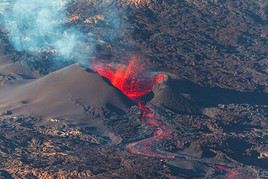
This is the (very) active volcano of Réunion. You can hike here and sometimes even witness its eruptions from the "Pas de Bellecombe". It is a UNESCO World Heritage site.
Piton des Neiges, Réunion
Piton des Neiges
This is the summit of Réunion (3,070 m) and can be climbed on a trek. Nearby is the impressive Trou de Fer canyon, which has become a tourist attraction thanks to helicopter flyovers and canyoning opportunities.

Hikes

Starting points

Other activities

Nearby

View guide page: Things to see and do in Réunion National Park

Practical information for Réunion National Park

Practical info

  • Opening period:
  • Rates:

Getting there

Distances

Getting around

Sleeping

Eating

View guide page: Practical information for Réunion National Park

Pas de Bellecombe

This pass offers an extraordinary viewpoint over the Fournaise and is the most visited natural site on Réunion.

Overview of Pas de Bellecombe

This pass offers an extraordinary viewpoint over the Fournaise and is the most visited natural site on Réunion.

Key details

  • Type of place: mountain pass.
  • Tourist interest: (recommended).
  • Features:
  • Massif: Massif du Piton de la Fournaise.
  • Summit: 2,311 m.

Pas de Bellecombe’s surroundings

Wildlife and flora

Climate and weather

Precautions

What to see and do

Practical information

  • Location:
  • Distances:

Getting there

Sleeping and eating

What to see nearby

Further reading

View guide page: Pas de Bellecombe

Piton de la Fournaise

This is the (very) active volcano of Réunion. You can hike here and sometimes even witness its eruptions from the "Pas de Bellecombe". It is a UNESCO World Heritage site.

Overview of Piton de la Fournaise

This is the (very) active volcano of Réunion. You can hike here and sometimes even witness its eruptions from the "Pas de Bellecombe". It is a UNESCO World Heritage site.

Key Facts

  • Type of place: volcano.
  • Tourist interest: (recommended).
  • Characteristics: active volcano.
  • Massif: Massif du Piton de la Fournaise.
  • Summit: 2,632 m.

Site Environment

Wildlife and Flora

Climate and Weather

Precautions

What to See and Do

Practical Information

  • Location:
  • Distances:

Getting There

Sleeping and Eating

Nearby Attractions

Additional Information

View guide page: Piton de la Fournaise

Piton des Neiges

This is the summit of Réunion (3,070 m) and can be climbed on a trek. Nearby is the impressive Trou de Fer canyon, which has become a tourist attraction thanks to helicopter flyovers and canyoning opportunities.

Overview of Piton des Neiges

This is the summit of Réunion (3,070 m) and can be climbed on a trek. Nearby is the impressive Trou de Fer canyon, which has become a tourist attraction thanks to helicopter flyovers and canyoning opportunities.

Key details

  • Type of place: volcano.
  • Tourist interest: (worth seeing).
  • Features:
  • Massif: Piton des Neiges Massif.
  • Summit: 3,070 m.

Site environment

Wildlife and flora

Climate and weather

Precautions

What to see and do

Practical information

  • Location:
  • Distances:

Getting there

Sleeping and eating

What to see nearby

Further information

View guide page: Piton des Neiges

Cafres Plain

A high plateau on the volcano route between Piton des Neiges and Piton de la Fournaise. The area is a great starting point for hikes in these directions. It’s also on Cafres Plain that the Volcano House is located—a superb museum dedicated to volcanism.

Overview of Cafres Plain

This is a high plateau on Volcano Road (in the commune of Le Tampon) between Piton des Neiges and that of Fournaise. The area is a great starting point for hikes in these directions. It’s also on Cafres Plain that the Volcano House is located—a superb museum dedicated to volcanism.

Key Details

  • Type of place: plateau or plain.
  • Tourist interest: (worth seeing).
  • Features:
  • Location:
  • Area:
  • Altitude:
  • Website:

Plateau Environment

Wildlife and Flora

What to See and Do

Nearby

Climate and Weather

Precautions

Getting There

Sleeping and Eating

Additional Information

View guide page: Cafres Plain

Plains of Sands

A stunning desert expanse of volcanic scoria between the Plains of Cafres and the Piton de la Fournaise. It’s crossed by the volcano road.

Overview of the Plains of Sands

A stunning desert expanse of volcanic scoria between Cafres Plain and Piton de la Fournaise. You cross it via Volcano Road to reach Pas de Bellecombe.

Key details

  • Type of place: plateau or plain.
  • Tourist interest: (recommended).
  • Features:
  • Location:
  • Area:
  • Altitude:

Site environment

Wildlife and flora

What to see and do

Nearby

Climate and weather

Precautions

Getting there

Sleeping and eating

Further information

View guide page: Plains of Sands

Volcano Road

A highly popular route, this magnificent little road starts from the upper part of the Tampon municipality (Bourg Murat) and ends at the Pas de Bellecombe, which overlooks the Piton de la Fournaise volcano.

Overview of the Volcano Road

A highly popular route, this magnificent little road starts from the upper part of the Tampon municipality (Bourg Murat) and ends at the Pas de Bellecombe, which overlooks the Piton de la Fournaise volcano.
Key Details

  • Type of place: scenic route.
  • Tourist interest: (recommended).
  • Theme: scenic route.
  • Location:
  • Local time: Heure : 2549
  • Length:
  • Altitude:

The Road

What to See and Do

Itinerary

Nearby

Climate and Weather

Transportation

Getting There

Getting Around

Accommodation

Food

Additional Information

View guide page: Volcano Road

Takamaka Valley

A beautiful valley in eastern Réunion. It is one of the wettest places in the world. Canyoning and rafting are possible here.

Overview of Takamaka Valley

This is a beautiful valley in eastern Réunion. It is one of the wettest places in the world. Canyoning and rafting are possible here.

Key details

  • Type of place: valley.
  • Tourist interest: (worth seeing).
  • Features:
  • Length:
  • Altitude:

Valley environment

Wildlife and flora

Climate and weather

Precautions

What to see and do

Practical information

  • Location:
  • Distances:

Getting there

Getting around

Sleeping and eating

What to see nearby

  1. == En complément
View guide page: Takamaka Valley

Something wrong or out of date? Report this page