UNESCO World Heritage Sites
Argentina has 11 sites inscribed on the UNESCO World Heritage list:
Pampas and northern plains:
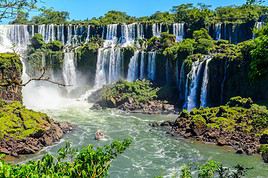
Iguazu Falls ★★★★ (1984)
These world-famous falls straddle Argentina and Brazil. They lie within the eponymous national park, a UNESCO World Heritage site. 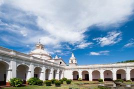
Jesuit Block and Estancias of Córdoba ★ (2000)
These are several Jesuit buildings dating from the 17th century, constructed either in the city of Córdoba (notably the university) or in its surroundings (Alta Gracia, Jesús María, etc.). 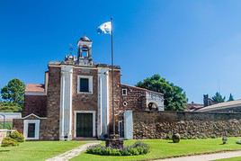
Jesuit Missions of Argentina ★★★ (1983)
In the northeast of the country, near Paraguay and Iguazu, these missions date back to the 17th century and are listed as UNESCO World Heritage Sites, just like others in neighboring countries. Northwest Argentina:
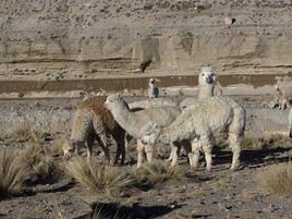
Inca Trails of the Andes ★★★ (2014)
Also known as Qhapaq Ñan. These are the remains of the roads (23,000 km) built by the Incas over several centuries to consolidate their economic and political power across the Andean region. They span six countries. 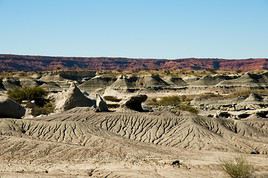
Ischigualasto Natural Park ★★★ (2000)
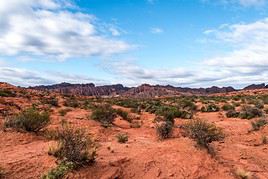
Also known as the "Valley of the Moon", this UNESCO-listed park (like its neighbour Talampaya) features stunning semi-desert landscapes with unusual geological formations. It is also home to numerous dinosaur fossils. 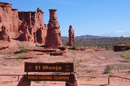
Talampaya National Park ★★★ (2000)
A UNESCO-listed park adjacent to Ischigualasto, Talampaya offers stunning semi-desert landscapes of rock formations, canyons, and is home to numerous petroglyphs. Hiking is available here. 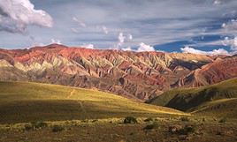
Quebrada de Humahuaca ★★★★ (2003)
A UNESCO-listed valley stretching about 150 km in northwestern Argentina, remarkable for its landscapes, small villages, and various pre-Columbian and colonial remains. Patagonia and Tierra del Fuego:
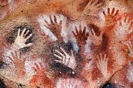
Cueva de las Manos ★★ (1999)
These are UNESCO-listed caves rich in rock art. They are located in the Rio Pinturas canyon, in southern Patagonia. 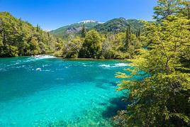
Los Alerces National Park ★★★ (2017)
This is a lovely UNESCO-listed park established in 2017, featuring lakes, rivers, and forests in the Esquel region. Visitors can fish, hike, and go boating here. 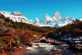
Los Glaciares National Park ★★★★ (1981)
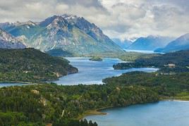
A stunning park of lakes, glaciers (including the famous Perito Moreno), and mountains (such as Fitz Roy and Cerro Torre, which you can climb), designated a UNESCO World Heritage site. Hiking and many other outdoor activities are available here. 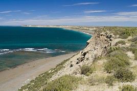
Valdés Peninsula ★★★★ (1999)
This peninsula in northern Patagonia is a paradise for nature lovers. You can observe numerous birds as well as colonies of sea lions, elephant seals, and whales. Pampas and Northern Plains
Chaco and Mesopotamia
Colón ★Opposite Uruguay, Colón is a popular local tourist destination known for its old town, thermal baths, and activities on the Rio Uruguay. 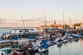
Corrientes ★Capital of the province of the same name on the banks of the Paraná River, the city has an old centre and colonial-era buildings. Formosa ★It's a large city in northern Argentina, not particularly touristy, on the border with Paraguay. Jesuit Missions of Argentina ★★★In the northeast of the country, near Paraguay and Iguazu, these missions date back to the 17th century and are listed as UNESCO World Heritage Sites, just like others in neighboring countries. 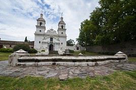
San Ignacio Mini Mission ★★In the border town of Paraguay’s San Ignacio, this is one of the most beautiful Jesuit missions in the region listed as a UNESCO World Heritage site and the most interesting from a tourism perspective. Others nearby include Santa Ana and Loreto. Paraná ★Capital of the Entre Ríos province, Paraná offers an interesting mix of architecture and numerous parks that make it pleasant. 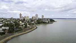
Posadas ★The capital of Misiones Province mainly serves as a gateway to Paraguay, a stopover on the way to northwestern Argentina, or occasionally as a base for exploring the nearby Argentine Jesuit Missions. 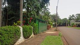
Puerto Iguazú ★This is the town near the namesake falls and the recommended base (certainly better than its Brazilian counterpart) for exploring them. Resistencia ★The main urban centre of Argentina’s Chaco region, on the banks of the Paraná River. Natural Heritage
Iguazu Falls ★★★★These world-famous falls straddle Argentina and Brazil. They lie within the eponymous national park, a UNESCO World Heritage site. 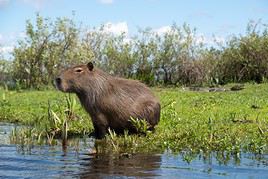
Ibera Marshes ★★Vast wetlands in northeastern Argentina teeming with wildlife (caimans, anacondas, wolves, birds). Explore by canoe. Chaco National Park ★★This park, in the eponymous province, is known for its varied landscape (savanna, marshes, lagoons) and wildlife (birds, monkeys, pumas, anacondas). Hiking is possible here. 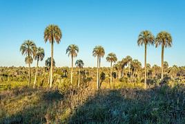
El Palmar National Park ★Close to Colón, this small park is known for its palm grove and wildlife (mammals, reptiles, birds). Mburucuya National Park ★A partly marshy area in northern Argentina that is home to rich wildlife (birds, monkeys, caimans). Mocona Falls ★★These are 15-meter-high waterfalls stretching 3 kilometers wide east of Posadas, on the Uruguay River, at the border of Brazil. Pampas
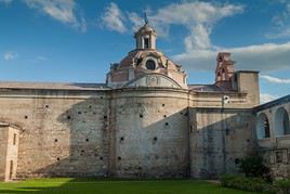
Alta Gracia ★A town about thirty kilometres south of Córdoba with a beautiful 17th-century Jesuit estate, several museums (including one dedicated to Che Guevara, who lived in Alta Gracia for twelve years), and a replica of the Lourdes Basilica with its Virgin. 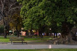
Bahia Blanca ★A large port south of Mar del Plata with quite beautiful 19th-century "European-style" architecture. 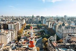
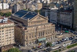
Buenos Aires ★★★Museums, monuments, lively neighbourhoods, and a touch of old Europe make Argentina’s capital a pleasant city to explore. 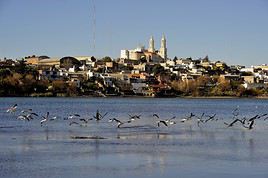
Carmen de Patagones ★A small town on the edge of Patagonia, featuring beautiful buildings and remnants from the Spanish era. Cayastá ★A few kilometres north of Santa Fe, these are the ruins of the first settlement of Santa Fe (Santa Fe la Vieja). 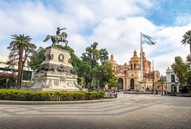
Córdoba ★★It's a large urban area in the center and the capital of the province of the same name. Córdoba is known for its colonial architecture and historic monuments, including its UNESCO-listed Jesuit complexes. 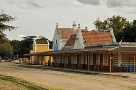
Jesús María ★A town fifty kilometres north of Córdoba whose 17th-century Jesuit works are listed as UNESCO World Heritage under the "Jesuit Estancias of Córdoba". 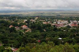
La Cumbre ★A small town near Córdoba that serves as a base for the many outdoor activities available in the surrounding area. 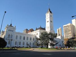
La Plata ★Capital of the Buenos Aires province, this cultural city boasts renowned museums and beautiful late 19th-century architecture born from urban planning. It also features a Le Corbusier villa listed as a UNESCO World Heritage site. 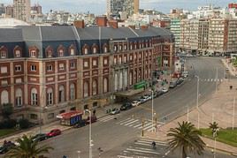
Mar del Plata ★★Argentina’s top seaside resort. Beyond its beaches, the city also offers several museums and beautiful Victorian mansions. 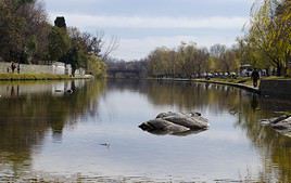
Mina Clavero ★In the heart of the Traslasierra Valley, the town serves as a base for outdoor activities in the surrounding area (trekking, climbing, kayaking, fishing). 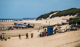
Necochea ★The city offers vast beaches south of Mar del Plata with waves for surfing and a nearby forest for walks. 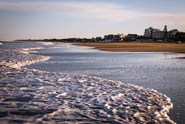
Pinamar ★A seaside resort with beautiful architecture on the Atlantic coast, north of Mar del Plata. 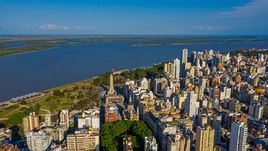
Rosario ★Argentina’s third-largest urban area is pleasant and popular for its lively atmosphere, museums, and riverside waterfront along the Paraná River. 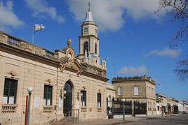
San Antonio de Areco ★★Northwest of the capital, this small town with gaucho culture and traditions is one of the most beautiful in the Pampas, with its historic buildings. 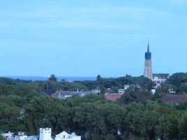
San Isidro ★On the outskirts of Buenos Aires, facing the Rio de la Plata, the city has a beautiful cathedral and an old town centre. 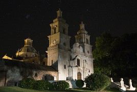
Santa Catalina ★About a hundred kilometres north of Cordoba, the village is home to Jesuit establishments (17th century) classified as UNESCO World Heritage Sites under the "Jesuit Estancias of Cordoba". Santa Fe ★Or more precisely Santa Fe de la Vera Cruz, a cultural city with a historic center. It is also the provincial capital. 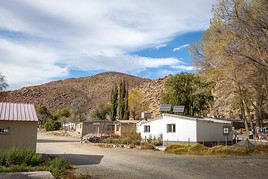
Santa Rosa ★In the centre of the country, the capital of La Pampa Province is primarily a transport hub for overland travel. 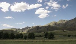
Sierra de La Ventana ★★A village in the heart of the mountains of the same name, where you can hike, fish, or go climbing. 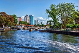
Tigre ★It's a pretty upscale suburb of Buenos Aires from which you can take a boat to Uruguay or explore the Paraná Delta. 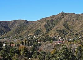
Villa General Belgrano ★A village south of Córdoba founded by Germans in a Bavarian architectural style, featuring a huge Oktoberfest in October. 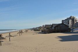
Villa Gesell ★A popular seaside resort on the northern coast of Mar del Plata. Natural Heritage
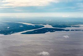
Paraná Delta ★★It begins at the mouth of the Río de la Plata, near Buenos Aires. From the town of Tigre (north of the capital), you can take beautiful boat trips among its islands. Mar Chiquita Lagoon ★★This lagoon near Mar del Plata, on the Atlantic coast, is partly surrounded by dunes. It offers beautiful landscapes and is renowned for fishing and its birdlife. 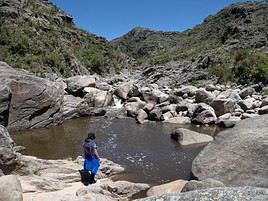
Los Gigantes ★These rock formations near Córdoba are a premier climbing destination in the country. 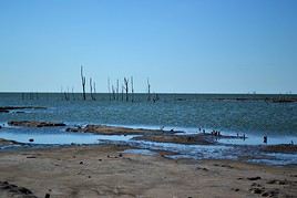
Mar Chiquita ★Near Córdoba, this is the largest saltwater lake in Argentina, not to be confused with its namesake on the Atlantic coast. It attracts a variety of bird species and caimans amid some beautiful landscapes. Lihué Calel National Park ★In the heart of the country, this fairly isolated and rather desert-like site is home to diverse wildlife (puma, guanaco, birds) and petroglyphs. Hiking is possible here. Punta Rasa Reserve ★A small natural reserve at the mouth of the Rio de la Plata, known for birdwatching. It’s also a popular spot for kitesurfing. Rio de la Plata ★★This is the estuary separating Uruguay and Argentina. Crossing between Carmelo (Uruguay) and Tigre (Argentina) offers a pleasant trip through the many small islands on the Argentine side. Northwest Argentina
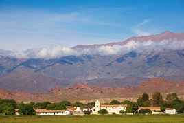
Cachi ★★A charming small colonial town in the northern part of the Calchaquí Valleys. 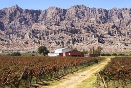
Cafayate ★★In the south of the Calchaquí Valleys, this colonial-style town is known for its vineyards and as a base for exploring the surrounding area. 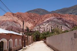
Catamarca ★Officially named San Fernando del Valle de Catamarca, this is a city with colonial architecture and the capital of Catamarca Province. Sacred City of the Quilmes ★This archaeological site between Tucuman and Cafayate preserves the remains of a fortified city built by the Quilmes indigenous people. 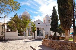
Humahuaca ★★A small colonial-style town in the heart of the Quebrada de Humahuaca. 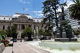
Jujuy ★Or more precisely San Salvador de Jujuy. Capital of the Jujuy province, the city has several buildings from the Spanish era and the 19th century. La Rioja ★The city, capital of the province of the same name, is a blend of architecture featuring European and "local" styles. 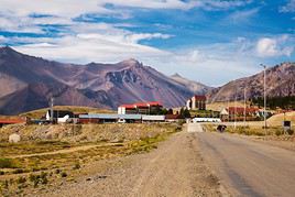
Las Leñas ★It’s a ski resort south of Mendoza and one of the most important in the country. 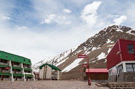
Los Penitentes ★A winter sports resort near Mendoza and the Chilean border. 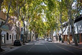
Mendoza ★★At the foot of the Andes, Mendoza is renowned for its wine production. While it is home to several museums, charming squares, churches, and notable buildings—and is considered a pleasant place—it is also, and above all, a great base for exploring the surrounding area. 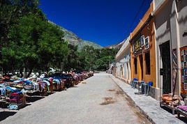
Purmamarca ★★A charming little village at the heart of the Cerro de los Siete Colores ("Hill of Seven Colors") and the UNESCO-listed Quebrada de Humahuaca. 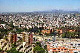
Salta ★★One of the major cities in northwestern Argentina, located at nearly 1,200 meters above sea level. It’s quite pleasant with its colonial center and has become a near-essential stop for anyone looking to explore this part of the country. 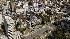
San Miguel de Tucumán ★Large city in northwestern Argentina (often simply called Tucumán) with several beautiful buildings, including its cathedral, and museums. 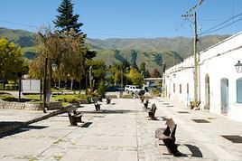
Tafi del Valle ★★A charming resort town in the Calchaquí Valleys. Tafi is also known for its pre-Columbian menhirs and hiking opportunities in the surrounding area. 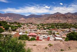
Tilcara ★★This is a charming small town at the entrance to the Quebrada de Humahuaca, serving as a base for exploring the surrounding area. The town is also home to the Pucara de Tilcara, a reconstruction of a fortress built 900 years ago by the Tilcara Indians. Natural Heritage
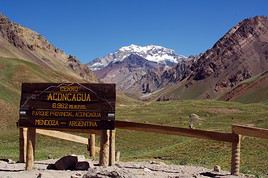
Aconcagua ★★★This is the highest peak in the Andes (6,962 m), located in the provincial park of the same name, near the city of Mendoza and Chile. You can climb it or, more "modestly," enjoy its stunning landscapes during treks in the area. 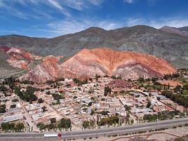
Hill of the Seven Colors ★★★A curious little mountain made up of seven colors near the village of Purmamarca. The site is characteristic of the Quebrada de Humahuaca region, a UNESCO World Heritage site in which it is located. La Payunia ★★★A nature reserve on the edge of Patagonia, made up of lava fields and over 800 volcanic cones. The landscape is quite strange and wild. Laguna de los Pozuelos ★A small high-altitude lake near Bolivia. Several colonies of flamingos and vicuñas call it home. Ischigualasto Natural Park ★★★Also known as the "Valley of the Moon", this UNESCO-listed park (like its neighbour Talampaya) features stunning semi-desert landscapes with unusual geological formations. It is also home to numerous dinosaur fossils. Baritu National Park ★★It's a tropical forest park (the country's only one) on the Bolivian border. It hosts a fairly diverse wildlife (birds, monkeys, pumas). You can hike there. Calilegua National Park ★★This site in northwestern Argentina protects the Andean cloud forest. Hiking and birdwatching are possible here. Talampaya National Park ★★★A UNESCO-listed park adjacent to Ischigualasto, Talampaya offers stunning semi-desert landscapes of rock formations, canyons, and is home to numerous petroglyphs. Hiking is available here. Quebrada de Humahuaca ★★★★A UNESCO-listed valley stretching about 150 km in northwestern Argentina, remarkable for its landscapes, small villages, and various pre-Columbian and colonial remains. Mendoza River ★In the province of the same name, the river is renowned for rafting. 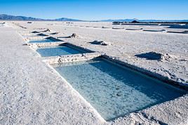
Salinas Grandes ★★★★This is a vast and astonishing salt desert located three hours from Jujuy and perched at an altitude of 3,350 m. 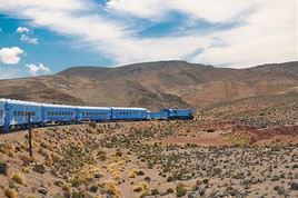
Train to the Clouds ★★★Or "Train to the Clouds". A tourist train (200 km and 20 stops) running between Salta and La Polvorilla, operating more or less regularly depending on the season. The route is stunning, climbing to over 4,000 metres above sea level. 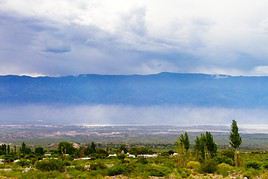
Calchaquí Valleys ★★★★Located between Cafayate and Salta in their "tourist" section, these valleys are one of Argentina’s most stunning landscapes. You’ll also find small towns, pre-Columbian and colonial sites, and Los Cardones National Park. They’ve become almost essential for any trip to northwestern Argentina. Patagonia and Tierra del Fuego
Patagonia
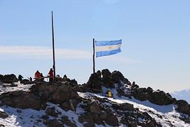
Cerro Catedral ★One of the largest ski resorts in South America, near San Carlos de Bariloche. 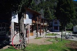
Colonia Suiza ★A small village founded on the lakeside by Swiss settlers in the 19th century, with a style reminiscent of Switzerland. 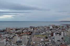
Comodoro Rivadavia ★This is "the" major port city on the Atlantic coast of Patagonia. It’s not really a tourist destination. Cueva de las Manos ★★These are UNESCO-listed caves rich in rock art. They are located in the Rio Pinturas canyon, in southern Patagonia. Dolavon ★It is the best "preserved" in its style of all the towns in the Atlantic region founded by Welsh migrants in the 19th century (Trelew, Gaiman...). 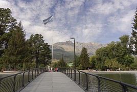
El Bolsón ★A pleasant Andean town serving as a base for exploring the surrounding area and enjoying outdoor activities. 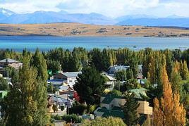
El Calafate ★This is a tourist town due to its location on the shores of Lake Argentino and, most importantly, its proximity to Los Glaciares National Park. More broadly, it also serves as the air gateway to the entire region, both on the Argentine and Chilean sides. 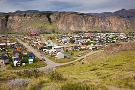
El Chaltén ★Small village in Los Glaciares National Park, serving as a possible starting point for climbing nearby Fitz Roy and Cerro Torre. 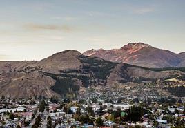
Esquel ★The town, on the Andean foothills, mainly serves as a base or stopover for exploring the surrounding area. Gaiman ★One of the "Welsh towns" on the Atlantic coast, with traditions and tourist activities centered around its founding by Welsh settlers in the 19th century. 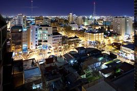
Neuquén ★It’s a major urban hub in northern Patagonia, typically used by travellers as a transport hub. Puerto Deseado ★A small town at the mouth of the river of the same name, which has preserved some remnants from the 19th century when it welcomed numerous cargo ships and ocean liners. 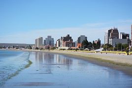
Puerto Madryn ★On the coast in northern Patagonia. It’s primarily a base for visiting the Valdés Peninsula. 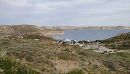
Puerto Pirámides ★This is a village on the Valdés Peninsula and often a stopover when exploring it. 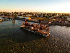
Rio Gallegos ★The capital of the Santa Cruz province is primarily the gateway to Tierra del Fuego or the southern Andes parks. 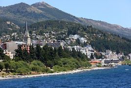
San Carlos de Bariloche ★★At the foot of the Andes, surrounded by lakes and mountains, the city—more simply called Bariloche—is popular for the outdoor sports activities its surroundings offer (skiing, hiking, climbing, rafting). 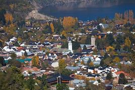
San Martin de los Andes ★This small town in the stunning Lake District is a tourist destination for winter (skiing) and summer (hiking, mountain biking, rafting). It’s also the base for exploring the nearby Lanin National Park and the starting point for the scenic Seven Lakes Route. 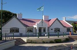
Trelew ★One of the Welsh towns in the region. It mainly serves as a base for exploring the surrounding areas (Valdés Peninsula, Punta Tombo). 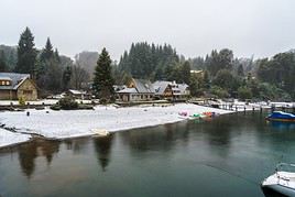
Villa La Angostura ★★A large tourist town in the Patagonian Andes, set amidst stunning lake and mountain landscapes where all kinds of outdoor activities can be enjoyed. Natural Heritage
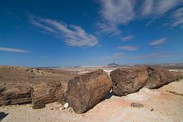
Petrified Forests ★A desert area designated as a natural park, where you can see numerous fossilized trees. 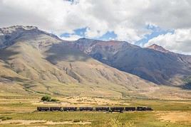
La Trochita ★★Also known as the "Old Patagonian Express", this is a tourist steam train line running through beautiful landscapes, mainly departing from Esquel towards Nahuel Pan. 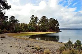
Lake Aluminé ★Near the Chilean border, this (navigable) lake and its surroundings are home to several Mapuche communities and, above all, plenty of spots perfect for hiking (and skiing). 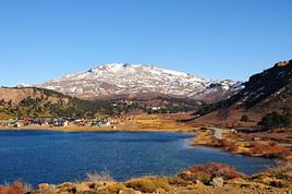
Lake Caviahue ★Near the Chilean border, this lake and its surroundings offer multiple hiking and skiing opportunities in beautiful volcanic landscapes. 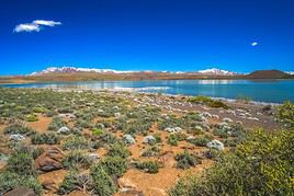
Laguna Blanca National Park ★★It's a volcanic desert on the foothills of the Andes, near a lake. The area is home to many waterfowl. Hiking is possible here. 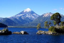
Lanin National Park ★★In the Lake District, near Chile, Lanin offers stunning lake and mountain landscapes perfect for hiking and other outdoor activities. Los Alerces National Park ★★★This is a lovely UNESCO-listed park established in 2017, featuring lakes, rivers, and forests in the Esquel region. Visitors can fish, hike, and go boating here. 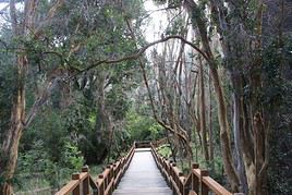
Los Arrayanes National Park ★★A forested site accessible by land from Villa La Angostura or by boat via Nahuel Huapi Lake from San Carlos de Bariloche. Hiking is available here. Los Glaciares National Park ★★★★A stunning park of lakes, glaciers (including the famous Perito Moreno), and mountains (such as Fitz Roy and Cerro Torre, which you can climb), designated a UNESCO World Heritage site. Hiking and many other outdoor activities are available here. 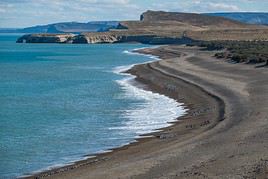
Monte León National Park ★★★On the southern coast of Patagonia, this spot offers stunning, desolate marine landscapes along with abundant wildlife (birds, penguins, sea lions). Valdés Peninsula ★★★★This peninsula in northern Patagonia is a paradise for nature lovers. You can observe numerous birds as well as colonies of sea lions, elephant seals, and whales. 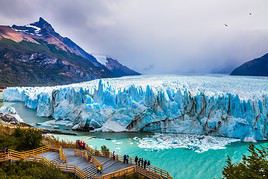
Perito Moreno ★★★★Stunning, it is often described as the most beautiful glacier on the South American continent. Easily accessible, it is located in Los Glaciares National Park, not far from El Calafate. You can try glacial trekking here. 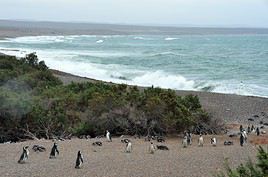
Punta Tombo ★★This peninsula south of Trelew is home to a vast colony of Magellanic penguins from September to April. 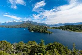
Lake District ★★★A stunning (tourist) region in the central Andes, particularly along the "Seven Lakes Route". Amid extraordinary landscapes, you can enjoy skiing, hiking, and various other outdoor sports. 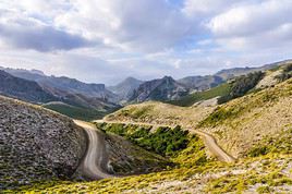
Seven Lakes Route ★★★A scenic route spanning around a hundred kilometres from San Martín de los Andes to Villa La Angostura, at the heart of the Lake District. Tierra del Fuego
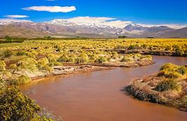
Río Grande ★This is the largest city in Tierra del Fuego, about a hundred kilometres before Ushuaia. 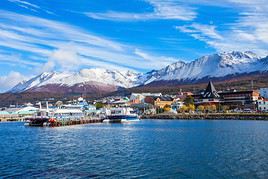
Ushuaia ★The city, with its overhyped reputation, is considered the southernmost in the world. In reality, Ushuaia is just the base for exploring the region, or even beyond by boat (Falklands, Antarctica). Natural Heritage
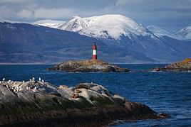
Beagle Channel ★★★It’s a narrow strait between the southern part of the main island of Argentine or Chilean Tierra del Fuego and smaller surrounding islands. You can take stunning boat or kayak trips here to explore the landscapes and wildlife. 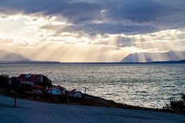
Lake Fagnano ★Large lake north of Ushuaia straddling Argentina and Chile. It can be explored on foot or by boat. 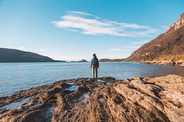
Tierra del Fuego National Park ★★★This is a mountainous area near Ushuaia with stunning coastal, lake, and forest landscapes where you can hike and observe local wildlife and flora. However, only part of the site is open to the public. ★★★★These world-famous falls straddle Argentina and Brazil. They lie within the eponymous national park, a UNESCO World Heritage site. ★★★★A stunning park of lakes, glaciers (including the famous Perito Moreno), and mountains (such as Fitz Roy and Cerro Torre, which you can… ★★★★This peninsula in northern Patagonia is a paradise for nature lovers. You can observe numerous birds as well as colonies of sea lions… ★★★★Stunning, it is often described as the most beautiful glacier on the South American continent. Easily accessible, it is located in Los… ★★★★A UNESCO-listed valley stretching about 150 km in northwestern Argentina, remarkable for its landscapes, small villages, and various… ★★★★This is a vast and astonishing salt desert located three hours from Jujuy and perched at an altitude of 3,350 m. ★★★★Located between Cafayate and Salta in their "tourist" section, these valleys are one of Argentina’s most stunning landscapes… ★★★This is the highest peak in the Andes (6,962 m), located in the provincial park of the same name, near the city of Mendoza and Chile. You… ★★★Museums, monuments, lively neighbourhoods, and a touch of old Europe make Argentina’s capital a pleasant city to explore. ★★★It’s a narrow strait between the southern part of the main island of Argentine or Chilean Tierra del Fuego and smaller surrounding… ★★★A curious little mountain made up of seven colors near the village of Purmamarca. The site is characteristic of the Quebrada de Humahuaca… ★★★Also known as Qhapaq Ñan. These are the remains of the roads (23,000 km) built by the Incas over several centuries to consolidate their… ★★★A nature reserve on the edge of Patagonia, made up of lava fields and over 800 volcanic cones. The landscape is quite strange and wild. ★★★In the northeast of the country, near Paraguay and Iguazu, these missions date back to the 17th century and are listed as UNESCO World… ★★★This is a lovely UNESCO-listed park established in 2017, featuring lakes, rivers, and forests in the Esquel region. Visitors can fish… ★★★On the southern coast of Patagonia, this spot offers stunning, desolate marine landscapes along with abundant wildlife (birds, penguins… ★★★A popular Andean park known for its stunning landscapes, perfect for hiking. ★★★A UNESCO-listed park adjacent to Ischigualasto, Talampaya offers stunning semi-desert landscapes of rock formations, canyons, and is home… ★★★This is a mountainous area near Ushuaia with stunning coastal, lake, and forest landscapes where you can hike and observe local wildlife… ★★★Also known as the "Valley of the Moon", this UNESCO-listed park (like its neighbour Talampaya) features stunning semi-desert landscapes… ★★★A stunning (tourist) region in the central Andes, particularly along the "Seven Lakes Route". Amid extraordinary landscapes, you can enjoy… ★★★A scenic route spanning around a hundred kilometres from San Martín de los Andes to Villa La Angostura, at the heart of the Lake District. ★★★Or "Train to the Clouds". A tourist train (200 km and 20 stops) running between Salta and La Polvorilla, operating more or less regularly… ★★A charming small colonial town in the northern part of the Calchaquí Valleys. ★★In the south of the Calchaquí Valleys, this colonial-style town is known for its vineyards and as a base for exploring the surrounding area. ★★It's a large urban area in the center and the capital of the province of the same name. Córdoba is known for its colonial architecture and… ★★These are UNESCO-listed caves rich in rock art. They are located in the Rio Pinturas canyon, in southern Patagonia. ★★It begins at the mouth of the Río de la Plata, near Buenos Aires. From the town of Tigre (north of the capital), you can take beautiful… ★★Vast wetlands in northeastern Argentina teeming with wildlife (caimans, anacondas, wolves, birds). Explore by canoe. ★★A small colonial-style town in the heart of the Quebrada de Humahuaca. ★★Also known as the "Old Patagonian Express", this is a tourist steam train line running through beautiful landscapes, mainly departing from… ★★This lagoon near Mar del Plata, on the Atlantic coast, is partly surrounded by dunes. It offers beautiful landscapes and is renowned for… ★★Argentina’s top seaside resort. Beyond its beaches, the city also offers several museums and beautiful Victorian mansions. ★★At the foot of the Andes, Mendoza is renowned for its wine production. While it is home to several museums, charming squares, churches, and… ★★In the border town of Paraguay’s San Ignacio, this is one of the most beautiful Jesuit missions in the region listed as a UNESCO… ★★It's a tropical forest park (the country's only one) on the Bolivian border. It hosts a fairly diverse wildlife (birds, monkeys, pumas)… ★★This site in northwestern Argentina protects the Andean cloud forest. Hiking and birdwatching are possible here. ★★This park, in the eponymous province, is known for its varied landscape (savanna, marshes, lagoons) and wildlife (birds, monkeys, pumas… ★★It's a volcanic desert on the foothills of the Andes, near a lake. The area is home to many waterfowl. Hiking is possible here. ★★In the Lake District, near Chile, Lanin offers stunning lake and mountain landscapes perfect for hiking and other outdoor activities. ★★A forested site accessible by land from Villa La Angostura or by boat via Nahuel Huapi Lake from San Carlos de Bariloche. Hiking is… ★★This is a beautiful arid park with pinkish hues from the Andean foothills, perfect for hiking. ★★This peninsula south of Trelew is home to a vast colony of Magellanic penguins from September to April. ★★A charming little village at the heart of the Cerro de los Siete Colores ("Hill of Seven Colors") and the UNESCO-listed Quebrada de… ★★This is the estuary separating Uruguay and Argentina. Crossing between Carmelo (Uruguay) and Tigre (Argentina) offers a pleasant trip… ★★One of the major cities in northwestern Argentina, located at nearly 1,200 meters above sea level. It’s quite pleasant with its… ★★These are 15-meter-high waterfalls stretching 3 kilometers wide east of Posadas, on the Uruguay River, at the border of Brazil. ★★Northwest of the capital, this small town with gaucho culture and traditions is one of the most beautiful in the Pampas, with its historic… ★★At the foot of the Andes, surrounded by lakes and mountains, the city—more simply called Bariloche—is popular for the outdoor… ★★A village in the heart of the mountains of the same name, where you can hike, fish, or go climbing. ★★A charming resort town in the Calchaquí Valleys. Tafi is also known for its pre-Columbian menhirs and hiking opportunities in the… ★★This is a charming small town at the entrance to the Quebrada de Humahuaca, serving as a base for exploring the surrounding area. The town… ★★A large tourist town in the Patagonian Andes, set amidst stunning lake and mountain landscapes where all kinds of outdoor activities can be… ★A town about thirty kilometres south of Córdoba with a beautiful 17th-century Jesuit estate, several museums (including one dedicated to… ★A large port south of Mar del Plata with quite beautiful 19th-century "European-style" architecture. ★A desert area designated as a natural park, where you can see numerous fossilized trees. ★A small town on the edge of Patagonia, featuring beautiful buildings and remnants from the Spanish era. ★Officially named San Fernando del Valle de Catamarca, this is a city with colonial architecture and the capital of Catamarca Province. ★A few kilometres north of Santa Fe, these are the ruins of the first settlement of Santa Fe (Santa Fe la Vieja). ★One of the largest ski resorts in South America, near San Carlos de Bariloche. ★This archaeological site between Tucuman and Cafayate preserves the remains of a fortified city built by the Quilmes indigenous people. ★Opposite Uruguay, Colón is a popular local tourist destination known for its old town, thermal baths, and activities on the Rio Uruguay. ★A small village founded on the lakeside by Swiss settlers in the 19th century, with a style reminiscent of Switzerland. ★This is "the" major port city on the Atlantic coast of Patagonia. It’s not really a tourist destination. ★Capital of the province of the same name on the banks of the Paraná River, the city has an old centre and colonial-era buildings. ★It is the best "preserved" in its style of all the towns in the Atlantic region founded by Welsh migrants in the 19th century (Trelew… ★A pleasant Andean town serving as a base for exploring the surrounding area and enjoying outdoor activities. ★This is a tourist town due to its location on the shores of Lake Argentino and, most importantly, its proximity to Los Glaciares National… ★Small village in Los Glaciares National Park, serving as a possible starting point for climbing nearby Fitz Roy and Cerro Torre. ★These are several Jesuit buildings dating from the 17th century, constructed either in the city of Córdoba (notably the university) or in… ★The town, on the Andean foothills, mainly serves as a base or stopover for exploring the surrounding area. ★It's a large city in northern Argentina, not particularly touristy, on the border with Paraguay. ★One of the "Welsh towns" on the Atlantic coast, with traditions and tourist activities centered around its founding by Welsh settlers in… ★A town fifty kilometres north of Córdoba whose 17th-century Jesuit works are listed as UNESCO World Heritage under the "Jesuit Estancias of… ★Or more precisely San Salvador de Jujuy. Capital of the Jujuy province, the city has several buildings from the Spanish era and the 19th… ★A small town near Córdoba that serves as a base for the many outdoor activities available in the surrounding area. ★Capital of the Buenos Aires province, this cultural city boasts renowned museums and beautiful late 19th-century architecture born from… ★The city, capital of the province of the same name, is a blend of architecture featuring European and "local" styles. ★Near the Chilean border, this (navigable) lake and its surroundings are home to several Mapuche communities and, above all, plenty of spots… ★Near the Chilean border, this lake and its surroundings offer multiple hiking and skiing opportunities in beautiful volcanic landscapes. ★Large lake north of Ushuaia straddling Argentina and Chile. It can be explored on foot or by boat. ★A small high-altitude lake near Bolivia. Several colonies of flamingos and vicuñas call it home. ★It’s a ski resort south of Mendoza and one of the most important in the country. ★These rock formations near Córdoba are a premier climbing destination in the country. ★A winter sports resort near Mendoza and the Chilean border. ★Near Córdoba, this is the largest saltwater lake in Argentina, not to be confused with its namesake on the Atlantic coast. It attracts a… ★In the heart of the Traslasierra Valley, the town serves as a base for outdoor activities in the surrounding area (trekking, climbing… ★The city offers vast beaches south of Mar del Plata with waves for surfing and a nearby forest for walks. ★It’s a major urban hub in northern Patagonia, typically used by travellers as a transport hub. ★Capital of the Entre Ríos province, Paraná offers an interesting mix of architecture and numerous parks that make it pleasant. ★Close to Colón, this small park is known for its palm grove and wildlife (mammals, reptiles, birds). ★In the heart of the country, this fairly isolated and rather desert-like site is home to diverse wildlife (puma, guanaco, birds) and… ★A partly marshy area in northern Argentina that is home to rich wildlife (birds, monkeys, caimans). ★The area is a marshland on the Paraguayan border, primarily renowned for birdwatching. ★A seaside resort with beautiful architecture on the Atlantic coast, north of Mar del Plata. ★The capital of Misiones Province mainly serves as a gateway to Paraguay, a stopover on the way to northwestern Argentina, or occasionally… ★A small town at the mouth of the river of the same name, which has preserved some remnants from the 19th century when it welcomed numerous… ★This is the town near the namesake falls and the recommended base (certainly better than its Brazilian counterpart) for exploring them. ★On the coast in northern Patagonia. It’s primarily a base for visiting the Valdés Peninsula. ★This is a village on the Valdés Peninsula and often a stopover when exploring it. ★A small natural reserve at the mouth of the Rio de la Plata, known for birdwatching. It’s also a popular spot for kitesurfing. ★The main urban centre of Argentina’s Chaco region, on the banks of the Paraná River. ★The capital of the Santa Cruz province is primarily the gateway to Tierra del Fuego or the southern Andes parks. ★This is the largest city in Tierra del Fuego, about a hundred kilometres before Ushuaia. ★In the province of the same name, the river is renowned for rafting. ★Argentina’s third-largest urban area is pleasant and popular for its lively atmosphere, museums, and riverside waterfront along the… ★On the outskirts of Buenos Aires, facing the Rio de la Plata, the city has a beautiful cathedral and an old town centre. ★This small town in the stunning Lake District is a tourist destination for winter (skiing) and summer (hiking, mountain biking, rafting)… ★Large city in northwestern Argentina (often simply called Tucumán) with several beautiful buildings, including its cathedral, and museums. ★About a hundred kilometres north of Cordoba, the village is home to Jesuit establishments (17th century) classified as UNESCO World… ★Or more precisely Santa Fe de la Vera Cruz, a cultural city with a historic center. It is also the provincial capital. ★In the centre of the country, the capital of La Pampa Province is primarily a transport hub for overland travel. ★It's a pretty upscale suburb of Buenos Aires from which you can take a boat to Uruguay or explore the Paraná Delta. ★One of the Welsh towns in the region. It mainly serves as a base for exploring the surrounding areas (Valdés Peninsula, Punta Tombo). ★The city, with its overhyped reputation, is considered the southernmost in the world. In reality, Ushuaia is just the base for exploring… ★A village south of Córdoba founded by Germans in a Bavarian architectural style, featuring a huge Oktoberfest in October. ★A popular seaside resort on the northern coast of Mar del Plata. Cachi
A charming small colonial town in the northern part of the Calchaquí Valleys.
Overview of Cachi
It's a charming small colonial town in the northern part of the Calchaquí Valleys.
Key Facts
- Type of place: small town.
- Tourist interest: ★★ (worth seeing).
- Local time: Heure : 12890
- Population: 2,616 inhabitants (2011).
History of Cachi
What to see and do in Cachi
In the surrounding area
Climate and weather in Cachi
Transportation
Getting there
Getting around
Where to stay
Where to eat
Useful addresses
Additional information
Cafayate
In the south of the Calchaquí Valleys, this colonial-style town is known for its vineyards and as a base for exploring the surrounding area.
Overview of Cafayate
In the south of the Calchaquí Valleys, this colonial-style town is known for its vineyards and as a base for exploring the surrounding area.
Key Facts
- Type of place: small town.
- Tourist interest: ★★ (worth seeing).
- Local time: Heure : 12891.
- Population: 14,850 inhabitants (2011).
History of Cafayate
What to see and do in Cafayate
In the surrounding area
Climate and weather in Cafayate
Transport
Getting there
Getting around
Accommodation
Food
Useful addresses
Further information
Catamarca
Officially named San Fernando del Valle de Catamarca, this is a city with colonial architecture and the capital of Catamarca Province.
Overview of Catamarca
Officially named San Fernando del Valle de Catamarca, this is a city with colonial architecture and the capital of Catamarca Province.
Key Facts
- Tourist interest: ★ (worth a stop if you are in the area).
- Local time: Heure : 12892.
- Population: 159,139 inhabitants (2011).
History of Catamarca
What to See and Do in Catamarca
In the Surrounding Area
Climate and Weather in Catamarca
Transportation
Getting There
Getting Around
Accommodation
Dining
Useful Addresses
Further Information
Humahuaca
A small colonial-style town in the heart of the Quebrada de Humahuaca.
Overview of Humahuaca
It's a small colonial-style town in the heart of the Quebrada de Humahuaca.
Key Facts
- Type of place: small town.
- Tourist interest: ★★ (worth seeing).
- Local time: Heure : 12893.
- Population: 10,256 (2011)
History of Humahuaca
What to See and Do in Humahuaca
In the Surrounding Area
Climate and Weather in Humahuaca
Transportation
Getting There
Getting Around
Where to Stay
Where to Eat
Useful Addresses
Further Information
Jujuy
Or more precisely San Salvador de Jujuy. Capital of the Jujuy province, the city has several buildings from the Spanish era and the 19th century.
Overview of Jujuy
Or more precisely San Salvador de Jujuy. Capital of the Jujuy province, the city has several buildings from the Spanish era and the 19th century.
Key facts
- Tourist interest: ★ (worth a stop if you are in the area).
- Local time: Heure : 12894.
- Population: 257,970 inhabitants (2011).
History of Jujuy
What to see and do in Jujuy
In the surrounding area
Climate and weather in Jujuy
Transport
Getting there
Getting around
Where to stay
Where to eat
Useful addresses
Further information
Las Leñas
It’s a ski resort south of Mendoza and one of the most important in the country.
Overview of Las Leñas
It’s a ski resort south of Mendoza and one of the most important in the country.
Key Facts
- Type of place: ski resort.
- Tourist interest: ★ (worth a stop if you are in the area).
- Altitude: from 2,240 to 3,430 m.
Resort Environment
Climate and Weather
Precautions
Facilities and Activities
Ski Area
- Cross-country ski trails:
Other Winter Activities
Summer Activities
Practical Information
Accommodation and Dining
Events
What to See and Do Nearby
Additional Information
Los Penitentes
A winter sports resort near Mendoza and the Chilean border.
Overview of Los Penitentes
This is a winter sports resort near Mendoza and the Chilean border.
Key Facts
- Type of place: ski resort.
- Tourist interest: ★ (worth a stop if you are in the area).
Resort Environment
Climate and Weather
Precautions
Facilities and Activities
Ski Area
- Cross-country ski trails:
Other Winter Activities
Summer Activities
Practical Information
Accommodation and Dining
Events
What to See and Do Nearby
- == Additional Information
Purmamarca
A charming little village at the heart of the Cerro de los Siete Colores ("Hill of Seven Colors") and the UNESCO-listed Quebrada de Humahuaca.
Introduction to Purmamarca
A charming village at the heart of the Hill of the Seven Colors ("Hill of Seven Colors") and the UNESCO-listed Quebrada de Humahuaca.
Key Facts
- Tourist interest: ★★ (worth seeing).
- Local time: Heure : 12899.
- Population: 2,500 inhabitants (2011).
History of Purmamarca
What to See and Do in Purmamarca
In the Surrounding Area
Climate and Weather in Purmamarca
Transportation
Getting There
Getting Around
Where to Stay
Where to Eat
Useful Addresses
Further Information
San Miguel de Tucumán
Large city in northwestern Argentina (often simply called Tucumán) with several beautiful buildings, including its cathedral, and museums.
Overview of San Miguel de Tucumán
It is a large city (often simply called Tucumán) in northwestern Argentina with several beautiful buildings, including its cathedral, and museums.
Key facts
- Tourist interest: ★ (worth a stop if you are in the area).
- Local time: Heure : 12902.
- Population: 527,607 (2010).
History of San Miguel de Tucumán
What to see and do
In the surrounding area
Climate and weather
Transport
Getting there
Getting around
Where to stay
Where to eat
Useful addresses
Further information
Tafi del Valle
A charming resort town in the Calchaquí Valleys. Tafi is also known for its pre-Columbian menhirs and hiking opportunities in the surrounding area.
Overview of Tafi del Valle
A charming resort town in the Calchaquí Valleys. Tafi is also known for its pre-Columbian menhirs and hiking opportunities in the surrounding area.
Key facts
- Type of place: small town.
- Tourist interest: ★★ (worth seeing).
- Local time: Heure : 12903.
- Population: 3,403 inhabitants (2011).
History of Tafi del Valle
What to see and do in Tafi del Valle
In the surrounding area
Climate and weather
Transport
Getting there
Getting around
Where to stay
Where to eat
Useful addresses
- == Further information
Tilcara
This is a charming small town at the entrance to the Quebrada de Humahuaca, serving as a base for exploring the surrounding area. The town is also home to the Pucara de Tilcara, a reconstruction of a fortress built 900 years ago by the Tilcara Indians.
Overview of Tilcara
This is a charming small town at the entrance to the Quebrada de Humahuaca, serving as a base for exploring the surrounding area. The town is also home to the Pucara de Tilcara, a reconstruction of a fortress built 900 years ago by the Tilcara Indians.
Key Information
- Type of place: small town.
- Tourist interest: ★★ (worth seeing).
- Local time: Heure : 12904.
- Population: 6,249 (2011).
History of Tilcara
What to See and Do in Tilcara
In the Surrounding Area
Climate and Weather in Tilcara
Transportation
Getting There
Getting Around
Accommodation
Dining
Useful Addresses
Additional Information
Aconcagua
This is the highest peak in the Andes (6,962 m), located in the provincial park of the same name, near the city of Mendoza and Chile. You can climb it or, more "modestly," enjoy its stunning landscapes during treks in the area.
Overview of Aconcagua
This is the highest peak in the Andes (6,962 m), located in the provincial park of the same name, near the city of Mendoza and Chile. You can climb it or, more "modestly," enjoy its stunning landscapes during treks in the area.
Key Facts
- Tourist interest: ★★★ (recommended).
- Massif: Main Cordillera (Andes).
Aconcagua's Environment
Wildlife and Flora
Climate and Weather
Precautions
What to See and Do
Climbing Aconcagua
Practical Information
Getting There
Accommodation and Dining
Nearby Attractions
Further Reading
Hill of the Seven Colors
A curious little mountain made up of seven colors near the village of Purmamarca. The site is characteristic of the Quebrada de Humahuaca region, a UNESCO World Heritage site in which it is located.
Overview of the Hill of the Seven Colors
This is a curious little mountain made up of seven colors near the village of Purmamarca. The site is characteristic of the Quebrada de Humahuaca region, a UNESCO World Heritage site in which it is located.
Key Details
- Tourist interest: ★★★ (recommended).
Site Environment
Wildlife and Flora
Climate and Weather
Precautions
What to See and Do
Practical Information
Getting There
Sleeping and Eating
Nearby Attractions
- == En complément
Laguna de los Pozuelos
A small high-altitude lake near Bolivia. Several colonies of flamingos and vicuñas call it home.
Overview of Laguna de los Pozuelos
This is a small high-altitude lake near Bolivia. Several colonies of flamingos and vicuñas call it home.
Key details
- Tourist interest: ★ (worth a stop if you are in the area).
- Features: high-altitude salt lake.
Lake environment
Wildlife and flora
Climate and weather
Precautions
What to see and do
Practical information
Getting there
Sleeping and eating
What to see nearby
Further reading
Ischigualasto Natural Park
Also known as the "Valley of the Moon", this UNESCO-listed park (like its neighbour Talampaya) features stunning semi-desert landscapes with unusual geological formations. It is also home to numerous dinosaur fossils.
Overview of Ischigualasto Park
Also known as the "Valley of the Moon", this UNESCO-listed park (like its neighbour Talampaya) features stunning semi-desert landscapes with unusual geological formations. It is also home to numerous dinosaur fossils.
Key details
- Type of place: national park.
- Tourist interest: ★★★ (recommended).
- Local time: Heure : 12909
Environment
Park landscape
Wildlife and flora
Climate and weather
Precautions
What to see
What to do
Practical information
Getting there
Getting around
Sleeping and eating
What to see nearby
Further reading
Baritu National Park
It's a tropical forest park (the country's only one) on the Bolivian border. It hosts a fairly diverse wildlife (birds, monkeys, pumas). You can hike there.
Overview of Baritu National Park
It's a tropical forest park (Argentina's only one) on the Bolivian border. It hosts a fairly diverse wildlife (birds, monkeys, pumas). You can hike there.
Key facts
- Type of place: national park.
- Tourist interest: ★★ (worth seeing).
- Local time: Heure : 12910
- Altitude: from 1,500 to 2,500 m.
Environment
Landscape of the park
Wildlife and flora
Climate and weather
Precautions
What to see and do
Practical information
Getting there
Getting around
Sleeping and eating
What to see nearby
- == En complément
Calilegua National Park
This site in northwestern Argentina protects the Andean cloud forest. Hiking and birdwatching are possible here.
Overview of Calilegua National Park
This site in northwestern Argentina aims to protect the Andean cloud forest. Hiking and birdwatching are possible here.
Key facts
- Type of place: national park.
- Tourist interest: ★★ (worth seeing).
- Local time: Heure : 12911
Environment
Landscape
Wildlife and flora
Climate and weather
Precautions
What to see and do
Practical information
Getting there
Getting around
Sleeping and eating
What to see nearby
Further reading
Talampaya National Park
A UNESCO-listed park adjacent to Ischigualasto, Talampaya offers stunning semi-desert landscapes of rock formations, canyons, and is home to numerous petroglyphs. Hiking is available here.
Overview of Talampaya National Park
A UNESCO-listed park adjacent to Ischigualasto, Talampaya offers stunning semi-desert landscapes of rock formations, canyons, and is home to numerous petroglyphs. Hiking is available here.
Key Facts
- Type of place: national park.
- Tourist interest: ★★★ (recommended).
- Local time: Heure : 12912
Environment
Landscape of the Park
Wildlife and Vegetation
Climate and Weather
Precautions
What to See and Do
Practical Information
Getting There
Getting Around
Accommodation and Dining
Nearby Attractions
Further Reading
Quebrada de Humahuaca
A UNESCO-listed valley stretching about 150 km in northwestern Argentina, remarkable for its landscapes, small villages, and various pre-Columbian and colonial remains.
Overview of Quebrada de Humahuaca
A UNESCO-listed valley stretching about 150 km in northwestern Argentina, remarkable for its landscapes, small villages, and various pre-Columbian and colonial remains.
Key Facts
- Intérêt touristique: ★★★★ (must-see or highly recommended).
Valley Environment
Wildlife and Flora
Climate and Weather
Precautions
What to See
What to Do
Practical Information
Getting There
Getting Around
Accommodation and Dining
Nearby Attractions
Further Reading
Mendoza River
In the province of the same name, the river is renowned for rafting.
Overview of the Mendoza River
In the province of the same name, the river is renowned for rafting.
Key Details
- Tourist interest: ★ (worth a stop if you are in the area).
Environment
What to See and Do
Practical Information
Getting There
Accommodation and Dining
Nearby Attractions
- == En complément
Salinas Grandes
This is a vast and astonishing salt desert located three hours from Jujuy and perched at an altitude of 3,350 m.
Overview of Salinas Grandes
This is a vast and astonishing salt desert located three hours from Jujuy and perched at an altitude of 3,350 m.
Key Details
- Tourist interest: ★★★★ (must-see or highly recommended).
Site Environment
Wildlife and Flora
What to See and Do
Nearby Attractions
Climate and Weather
Precautions
Getting There
Sleeping and Eating
Additional Information
Train to the Clouds
Or "Train to the Clouds". A tourist train (200 km and 20 stops) running between Salta and La Polvorilla, operating more or less regularly depending on the season. The route is stunning, climbing to over 4,000 metres above sea level.
Overview of the Train to the Clouds
Or "Train to the Clouds". A tourist train (bus) route (200 km and 20 stops) between Salta and La Polvorilla, operating more or less regularly depending on the season. The route is stunning, climbing to over 4,000 metres above sea level.
Key details
- Type of place: tourist train.
- Tourist interest: ★★★ (recommended).
- Local time: Heure : 12916
- Altitude: from 1,187 m (Salta) to 4,220 m (La Polvorilla).
The route
Journey
What to see and do
In the surrounding area
Climate and weather
Sleeping and eating
Further information
Calchaquí Valleys
Located between Cafayate and Salta in their "tourist" section, these valleys are one of Argentina’s most stunning landscapes. You’ll also find small towns, pre-Columbian and colonial sites, and Los Cardones National Park. They’ve become almost essential for any trip to northwestern Argentina.
Overview of the Calchaquí Valleys
Roughly located within the triangle formed by Cachi, Cafayate, and Salta in their "tourist" section, these valleys are one of the most beautiful sites in Argentina in terms of landscapes. You’ll also discover small towns, pre-Columbian and colonial sites, as well as Los Cardones National Park. These valleys have become almost essential for any trip to northwestern Argentina.
Landmarks
- Tourist interest: ★★★★ (must-see or highly recommended).
Site Environment
Wildlife and vegetation
Climate and weather
Precautions
What to see and do
Practical information
Getting there
Getting around
Sleeping and eating
What to see nearby
Additional information
Formosa
It's a large city in northern Argentina, not particularly touristy, on the border with Paraguay.
Overview of Formosa
It's a large city in northern Argentina, not particularly touristy, located on the border with Paraguay.
Key Facts
- Tourist interest: ★ (worth a stop if you are in the area).
- Local time: Heure : 12918.
- Population: 234,000 inhabitants (2010).
History of Formosa
What to See and Do in Formosa
In the Surrounding Area
Climate and Weather in Formosa
Transportation
Getting There
Getting Around
Accommodation
Food
Useful Addresses
Additional Information
Resistencia
The main urban centre of Argentina’s Chaco region, on the banks of the Paraná River.
Overview of Resistencia
The main urban centre of Argentina’s Chaco region, on the banks of the Paraná River.
Key facts
- Tourist interest: ★ (worth a stop if you are in the area).
- Local time: Heure : 12919.
- Population: 291,720 (2010).
History of Resistencia
What to see and do in Resistencia
In the surrounding area
Climate and weather in Resistencia
Transport
Getting there
Getting around
Where to stay
Where to eat
Useful addresses
Further information
Chaco National Park
This park, in the eponymous province, is known for its varied landscape (savanna, marshes, lagoons) and wildlife (birds, monkeys, pumas, anacondas). Hiking is possible here.
Overview of Chaco National Park
This park, in the eponymous province, is known for its varied landscape (savanna, marshes, lagoons) and wildlife (birds, monkeys, pumas, anacondas). Hiking is possible here.
Key details
- Type of place: national park.
- Tourist interest: ★★ (worth seeing).
- Local time: Heure : 12920
Environment
Site features
Wildlife and flora
Climate and weather
Precautions
What to see and do
Practical information
Getting there
Getting around
Accommodation and dining
Nearby attractions
Further reading
Rio Pilcomayo National Park
The area is a marshland on the Paraguayan border, primarily renowned for birdwatching.
Overview of Rio Pilcomayo National Park
The area is a marshland on the Paraguayan border, primarily renowned for birdwatching.
Key details
- Type of place: birdwatching site.
- Tourist interest: ★ (worth a stop if you are in the area).
- Local time: Heure : 12921
Environment
Landscape
Wildlife and vegetation
Climate and weather
Precautions
What to see and do
Practical information
Getting there
Getting around
Accommodation and dining
Nearby attractions
- == In addition
Corrientes
Capital of the province of the same name on the banks of the Paraná River, the city has an old centre and colonial-era buildings.
Overview of Corrientes
It's the capital of the province of the same name on the banks of the Paraná River. The city has an old centre and colonial-era buildings.
Key facts
- Tourist interest: ★ (worth a stop if you are in the area).
- Local time: Heure : 12922.
- Population: 346,334 (2010).
History of Corrientes
What to see and do in Corrientes
In the surrounding area
Climate and weather
Transport
Getting there
Getting around
Sleep
Eat
Useful addresses
Further information
Paraná
Capital of the Entre Ríos province, Paraná offers an interesting mix of architecture and numerous parks that make it pleasant.
Overview of Paraná
Capital of the Entre Ríos province, Paraná offers an interesting mix of architecture and numerous parks that make it pleasant.
Key facts
- Tourist interest: ★ (worth a stop if you are in the area).
- Local time: Heure : 12924.
- Population: 247,863 inhabitants (2010).
History of Paraná
What to see and do in Paraná
In the surrounding area
Climate and weather in Paraná
Transportation
Getting there
Getting around
Where to stay
Where to eat
Useful addresses
Further information
Posadas
The capital of Misiones Province mainly serves as a gateway to Paraguay, a stopover on the way to northwestern Argentina, or occasionally as a base for exploring the nearby Argentine Jesuit Missions.
Overview of Posadas
The capital of Misiones Province mainly serves as a gateway to Paraguay, a stopover on the way to northwestern Argentina, or occasionally as a base for exploring the nearby Jesuit Missions.
Key facts
- Type of place: landmark town.
- Tourist interest: ★ (worth a stop if you are in the area).
- Local time: Heure : 12925.
- Population: 275,028 (2010).
History of Posadas
What to see and do in Posadas
In the surrounding area
Climate and weather in Posadas
Transport
Getting there
Getting around
Accommodation
Food
Useful addresses
Further information
Puerto Iguazú
This is the town near the namesake falls and the recommended base (certainly better than its Brazilian counterpart) for exploring them.
Overview of Puerto Iguazú
This is the town near the namesake falls and the recommended base (certainly better than its Brazilian counterpart) for exploring them.
Key facts
- Tourist interest: ★ (worth a stop if you are in the area).
- Local time: Heure : 12926.
- Population: 82,227 (2010).
History of Puerto Iguazú
What to see and do
In the surrounding area
Climate and weather
Transport
Getting there
Getting around
Accommodation
Food
Useful addresses
Further information
Ibera Marshes
Vast wetlands in northeastern Argentina teeming with wildlife (caimans, anacondas, wolves, birds). Explore by canoe.
Overview of Ibera Marshes
These are vast wetlands in northeastern Argentina teeming with wildlife (caimans, anacondas, wolves, birds). The area can be explored by canoe.
Key Details
- Tourist interest: ★★ (worth seeing).
- Local time: Heure : 12928
Environment
Landscape
Wildlife and vegetation
Climate and weather
Precautions
What to see and do
Practical information
Getting there
Getting around
Accommodation and dining
Nearby attractions
Further reading
El Palmar National Park
Close to Colón, this small park is known for its palm grove and wildlife (mammals, reptiles, birds).
Overview of El Palmar National Park
Close to the city of Colón, this small park is known for its palm grove and wildlife (mammals, reptiles, birds).
Key Details
- Type de lieu: national park.
- Intérêt touristique: ★ (worth a stop if you are in the area).
- Heure locale: Heure : 12929
Environment
Landscape
Wildlife and Flora
Climate and Weather
Precautions
What to See and Do
Practical Information
Getting There
Getting Around
Sleeping and Eating
Nearby Attractions
Further Reading
Mburucuya National Park
A partly marshy area in northern Argentina that is home to rich wildlife (birds, monkeys, caimans).
Overview of Mburucuya National Park
A partly marshy area in northern Argentina that is home to rich wildlife (birds, monkeys, caimans).
Key details
- Type of place: national park.
- Tourist interest: ★ (worth a stop if you are in the area).
- Local time: Heure : 12930
Environment
Landscape
Wildlife and flora
Climate and weather
Precautions
What to see and do
Practical information
Getting there
Getting around
Sleeping and eating
What to see nearby
Further reading
Mocona Falls
These are 15-meter-high waterfalls stretching 3 kilometers wide east of Posadas, on the Uruguay River, at the border of Brazil.
Overview of Mocona Falls
These are 15-meter-high waterfalls stretching 3 kilometers wide east of Posadas, on the Uruguay River, at the border of Brazil.
Key details
- Type of place: waterfall.
- Tourist interest: ★★ (worth seeing).
Environment around the falls
Climate and weather
Precautions
What to see and do
Practical information
Getting there
Accommodation and dining
What to see nearby
Additional information
Alta Gracia
A town about thirty kilometres south of Córdoba with a beautiful 17th-century Jesuit estate, several museums (including one dedicated to Che Guevara, who lived in Alta Gracia for twelve years), and a replica of the Lourdes Basilica with its Virgin.
Overview of Alta Gracia
A town about thirty kilometres south of Córdoba with a beautiful 17th-century Jesuit estate listed as a UNESCO World Heritage site, several museums (including one dedicated to Che Guevara, who lived in Alta Gracia for twelve years), and a replica of the Lourdes Basilica with its Virgin.
Key facts
- Tourist interest: ★ (worth a stop if you are in the area).
- Local time: Heure : 12932.
- Population: 55,064 inhabitants (2017).
History of Alta Gracia
What to see and do in Alta Gracia
In the surrounding area
Climate and weather in Alta Gracia
Transport
Getting there
Getting around
Accommodation
Food
Useful addresses
- == Additional information
Bahia Blanca
A large port south of Mar del Plata with quite beautiful 19th-century "European-style" architecture.
Overview of Bahia Blanca
A large port south of Mar del Plata with quite beautiful 19th-century "European-style" architecture.
Key Details
- Tourist interest: ★ (worth a stop if you are in the area).
- Local time: Heure : 12933.
- Population: 301,572 (2011).
History of Bahia Blanca
What to See and Do in Bahia Blanca
In the Surrounding Area
Climate and Weather
Transportation
Getting There
Getting Around
Accommodation
Food
Useful Addresses
Further Information
Buenos Aires
View guide page: Buenos AiresPreview temporarily unavailable.
Preview temporarily unavailable.
Preview temporarily unavailable.
Preview temporarily unavailable.
Preview temporarily unavailable.
Preview temporarily unavailable.
Preview temporarily unavailable.
Preview temporarily unavailable.
Preview temporarily unavailable.
Preview temporarily unavailable.
Preview temporarily unavailable.
Preview temporarily unavailable.
Preview temporarily unavailable.
Preview temporarily unavailable.
Carmen de Patagones
A small town on the edge of Patagonia, featuring beautiful buildings and remnants from the Spanish era.
Overview of Carmen de Patagones
A small town on the edge of Patagonia, featuring beautiful buildings and remnants from the Spanish era.
Key Details
- Type of place: small town.
- Tourist interest: ★ (worth a stop if you are in the area).
- Local time: Heure : 12935.
- Population: 20,533 (2010).
History of Carmen de Patagones
What to See and Do
Nearby
Climate and Weather
Getting Around
How to Get There
Getting Around
Where to Stay
Where to Eat
Useful Addresses
- == Additional Information
Cayastá
A few kilometres north of Santa Fe, these are the ruins of the first settlement of Santa Fe (Santa Fe la Vieja).
Overview of Cayastá
A few kilometres north of Santa Fe, these are the ruins of the first settlement of Santa Fe (Santa Fe la Vieja).
- Type of site: historic remains.
- Tourist interest: ★ (worth a stop if you are in the area).
History of Cayastá
What to see and do
Practical information
- Address: Cayastá, Santa Fe.
What to see nearby
- == In addition
Jesús María
A town fifty kilometres north of Córdoba whose 17th-century Jesuit works are listed as UNESCO World Heritage under the "Jesuit Estancias of Córdoba".
Overview of Jesús María
A town fifty kilometres north of Córdoba whose 17th-century Jesuit works are listed as UNESCO World Heritage under the "Jesuit Estancias of Córdoba".
Key facts
- Type of place: small town.
- Tourist interest: ★ (worth a stop if you are in the area).
- Local time: Heure : 12938.
- Population: 31,602 (2010).
History of Jesús María
What to see and do in Jesús María
In the surrounding area
Climate and weather
Transport
Getting there
Getting around
Accommodation
Eating
Useful addresses
- == Further information
Mar del Plata
Argentina’s top seaside resort. Beyond its beaches, the city also offers several museums and beautiful Victorian mansions.
Overview of Mar del Plata
This is THE seaside resort of Argentina. Beyond the beaches, the city also boasts quite a few museums and beautiful Victorian mansions.
Key Facts
- Tourist interest: ★★ (worth seeing).
- Local time: Heure : 12941.
- Population: 860,000 inhabitants (2016).
History of Mar del Plata
What to See and Do in Mar del Plata
In the Surrounding Area
Climate and Weather
Transportation
Getting There
Getting Around
Accommodation
Dining
Useful Addresses
Further Information
Mina Clavero
In the heart of the Traslasierra Valley, the town serves as a base for outdoor activities in the surrounding area (trekking, climbing, kayaking, fishing).
Overview of Mina Clavero
In the heart of the Traslasierra Valley, the town serves as a base for outdoor activities in the surrounding area (trekking, climbing, kayaking, fishing).
Key details
- Type of place: small town.
- Tourist interest: ★ (worth a stop if you are in the area).
- Local time: Heure : 12942.
- Population: 9,328 (2012).
History of Mina Clavero
What to see and do in Mina Clavero
In the surrounding area
Climate and weather
Transport
Getting there
Getting around
Accommodation
Food
Useful addresses
Further information
Necochea
The city offers vast beaches south of Mar del Plata with waves for surfing and a nearby forest for walks.
Overview of Necochea
The city offers vast beaches south of Mar del Plata with waves for surfing and a nearby forest for walks.
Key Details
- Tourist interest: ★ (worth a stop if you are in the area).
- Local time: Heure : 12943.
- Population: 92,933 (2010).
History of Necochea
What to See and Do in Necochea
In the Surrounding Area
Climate and Weather in Necochea
Transportation
Getting There
Getting Around
Where to Stay
Where to Eat
Useful Addresses
- == Additional Information
Pinamar
A seaside resort with beautiful architecture on the Atlantic coast, north of Mar del Plata.
Overview of Pinamar
A seaside resort with beautiful architecture on the Atlantic coast, north of Mar del Plata.
Key details
- Type of place: small town.
- Tourist interest: ★ (worth a stop if you are in the area).
- Local time: Heure : 12944.
- Population: 25,589 (2011).
History of Pinamar
What to see and do in Pinamar
In the surrounding area
Climate and weather in Pinamar
Transport
Getting there
Getting around
Accommodation
Food
Useful addresses
Further information
Rosario
Argentina’s third-largest urban area is pleasant and popular for its lively atmosphere, museums, and riverside waterfront along the Paraná River.
Overview of Rosario
The third-largest urban area in Argentina is pleasant and popular for its lively atmosphere, museums, and riverside "waterfront" along the Paraná River.
Key Facts
- Type of place: large city.
- Tourist interest: ★ (worth a stop if you are in the area).
- Local time: Heure : 12945.
- Population: 1,198,528 inhabitants (2011).
History of Rosario
What to See and Do in Rosario
In the Surrounding Area
Climate and Weather in Rosario
Transportation
Getting There
Getting Around
Accommodation
Dining
Useful Addresses
Further Information
San Antonio de Areco
Northwest of the capital, this small town with gaucho culture and traditions is one of the most beautiful in the Pampas, with its historic buildings.
Overview of San Antonio de Areco
Northwest of Buenos Aires, this small town with gaucho culture and traditions is one of the most beautiful in the Pampas, with its historic buildings.
Key Facts
- Type of place: small town.
- Tourist interest: ★★ (worth seeing).
- Local time: Heure : 12946.
- Population: 23,138 (2010).
History of San Antonio de Areco
What to see and do in San Antonio de Areco
In the surrounding area
Climate and weather
Transport
Getting there
Getting around
Where to stay
Where to eat
Useful addresses
Further reading
Tigre
It's a pretty upscale suburb of Buenos Aires from which you can take a boat to Uruguay or explore the Paraná Delta.
Overview of Tigre
It's a pretty upscale suburb of Buenos Aires from which you can take a boat to Uruguay or explore the Paraná Delta.
Key Facts
- Tourist interest: ★ (worth a stop if you are in the area).
- Local time: Heure : 12948.
- Population: 380,709 (2013).
History of Tigre
What to See and Do in Tigre
In the Surrounding Area
Climate and Weather in Tigre
Transportation
Getting There
Getting Around
Accommodation
Dining
Useful Addresses
Further Information
Villa General Belgrano
A village south of Córdoba founded by Germans in a Bavarian architectural style, featuring a huge Oktoberfest in October.
Overview of Villa General Belgrano
It's a large village south of Córdoba, founded by Germans in a Bavarian architectural style, complete with a huge Oktoberfest in October.
Key Facts
- Type of place: small town.
- Tourist interest: ★ (worth a stop if you are in the area).
- Local time: Heure : 12949.
- Population: 8,629 (2012).
History of Villa General Belgrano
What to See and Do in Villa General Belgrano
In the Surrounding Area
Climate and Weather
Transportation
Getting There
Getting Around
Accommodation
Dining
Useful Addresses
- == Additional Information
Villa Gesell
A popular seaside resort on the northern coast of Mar del Plata.
Overview of Villa Gesell
It is a popular seaside resort on the northern coast of Mar del Plata.
Key Details
- Type of place: small town.
- Tourist interest: ★ (worth a stop if you are in the area).
- Local time: Heure : 12950.
- Population: 31,730 (2010).
History of Villa Gesell
What to See and Do in Villa Gesell
In the Surrounding Area
Climate and Weather
Transportation
Getting There
Getting Around
Accommodation
Dining
Useful Addresses
Further Information
Paraná Delta
It begins at the mouth of the Río de la Plata, near Buenos Aires. From the town of Tigre (north of the capital), you can take beautiful boat trips among its islands.
Overview of the Paraná Delta
It begins at the mouth of the Río de la Plata, near Buenos Aires. From the town of Tigre (north of the capital), you can take beautiful boat trips among its islands.
Landmarks
- Tourist interest: ★★ (worth seeing).
Environment
What to see and do
Practical information
Getting there
Sleeping and eating
What to see nearby
- == Additional information
Mar Chiquita Lagoon
This lagoon near Mar del Plata, on the Atlantic coast, is partly surrounded by dunes. It offers beautiful landscapes and is renowned for fishing and its birdlife.
Overview of Mar Chiquita Lagoon
This lagoon near Mar del Plata, on the Atlantic coast (not to be confused with its namesake near Córdoba), is partly surrounded by dunes. It offers beautiful landscapes and is renowned for fishing and its birdlife.
Key details
- Tourist interest: ★★ (worth seeing).
Lake environment
Wildlife and flora
Climate and weather
Precautions
What to see and do
Practical information
Getting there
Sleeping and eating
Nearby attractions
- == En complément
Mar Chiquita
Near Córdoba, this is the largest saltwater lake in Argentina, not to be confused with its namesake on the Atlantic coast. It attracts a variety of bird species and caimans amid some beautiful landscapes.
Overview of Mar Chiquita
Near Córdoba, this is the largest (saltwater) lake in Argentina, not to be confused with its namesake on the Atlantic coast. It attracts a variety of bird species and caimans amid some beautiful landscapes.
Key Facts
- Tourist interest: ★ (worth a stop if you are in the area).
Lake Environment
Wildlife and Flora
Climate and Weather
Precautions
What to See and Do
Practical Information
Getting There
Sleeping and Eating
Nearby Attractions
- == En complément
Lihué Calel National Park
In the heart of the country, this fairly isolated and rather desert-like site is home to diverse wildlife (puma, guanaco, birds) and petroglyphs. Hiking is possible here.
Overview of Lihué Calel National Park
In the heart of Argentina, this fairly isolated and rather desert-like site is home to diverse wildlife (puma, guanaco, birds) and petroglyphs. Hiking is possible here.
Key details
- Type of place: national park.
- Tourist interest: ★ (worth a stop if you are in the area).
- Local time: Heure : 12954
Environment
Landscape of the park
Wildlife and flora
Climate and weather
Precautions
What to see and do
Practical information
Getting there
Getting around
Sleeping and eating
Nearby attractions
Additional information
Sierra de las Quijadas National Park
This is a beautiful arid park with pinkish hues from the Andean foothills, perfect for hiking.
Overview of Sierra de las Quijadas Park
This is a beautiful arid park with pinkish hues from the Andean foothills, perfect for hiking.
Key Details
- Type of place: nature reserve.
- Tourist interest: ★★ (worth seeing).
- Local time: Heure : 12955
Environment
Park Landscape
Wildlife and Flora
Climate and Weather
Precautions
What to See and Do
Practical Information
Getting There
Getting Around
Sleeping and Eating
Nearby Attractions
Further Reading
Punta Rasa Reserve
A small natural reserve at the mouth of the Rio de la Plata, known for birdwatching. It’s also a popular spot for kitesurfing.
Overview of Punta Rasa Reserve
This is a small natural reserve at the mouth of the Rio de la Plata, known for birdwatching. It’s also a popular spot for kitesurfing.
Key Details
- Type of place: birdwatching site.
- Tourist interest: ★ (worth a stop if you are in the area).
- Local time: Heure : 12956
Environment
Site Physiognomy
Wildlife and Flora
Climate and Weather
Precautions
What to See and Do
Practical Information
Getting There
Getting Around
Sleeping and Eating
Nearby Attractions
- == In Addition
Sierra de La Ventana
A village in the heart of the mountains of the same name, where you can hike, fish, or go climbing.
Overview of Sierra de La Ventana
This is a village in the heart of the mountains of the same name, where you can hike, fish, or go climbing.
Key details
- Tourist interest: ★★ (worth seeing).
- Local time: Heure : 12957.
- Population: 1,819 inhabitants (2011).
History of Sierra de La Ventana
What to see and do in Sierra de La Ventana
In the surrounding area
Climate and weather
Transport
Getting there
Getting around
Where to stay
Where to eat
Useful addresses
- == Additional information
Colonia Suiza
A small village founded on the lakeside by Swiss settlers in the 19th century, with a style reminiscent of Switzerland.
Overview of Colonia Suiza
This is a small village founded on the lakeside by Swiss settlers in the 19th century, with a style reminiscent of Switzerland.
Key Details
- Tourist interest: ★ (worth a stop if you are in the area).
- Local time: Heure : 12958.
- Population: 150 inhabitants (2011).
History of Colonia Suiza
What to See and Do
Nearby
Climate and Weather
Transportation
Getting There
Getting Around
Accommodation
Dining
Useful Addresses
- == Additional Information
Comodoro Rivadavia
This is "the" major port city on the Atlantic coast of Patagonia. It’s not really a tourist destination.
Overview of Comodoro Rivadavia
This is "the" major port city on the Atlantic coast of Patagonia. It’s not really a tourist destination.
Key Facts
- Type of place: landmark town.
- Tourist interest: ★ (worth a stop if you are in the area).
- Local time: Heure : 12959.
- Population: 182,631 (2011).
History of Comodoro Rivadavia
What to See and Do
In the Surrounding Area
Climate and Weather
Transportation
Getting There
Getting Around
Accommodation
Food and Drink
Useful Addresses
Further Information
Cueva de las Manos
These are UNESCO-listed caves rich in rock art. They are located in the Rio Pinturas canyon, in southern Patagonia.
Overview of Cueva de las Manos
These are caves rich in UNESCO-listed rock art. They are located in the Rio Pinturas canyon, in southern Patagonia.
Key Details
- Intérêt touristique: ★★ (worth seeing).
Site Layout
What to See and Do
Practical Information
- Adresse: Santa Cruz Province, Argentina.
Getting There
Sleeping and Eating
Nearby Attractions
Further Information
Dolavon
It is the best "preserved" in its style of all the towns in the Atlantic region founded by Welsh migrants in the 19th century (Trelew, Gaiman...).
Overview of Dolavon
It is the best "preserved" in its style of all the towns in the Atlantic region founded by Welsh migrants in the 19th century (Trelew, Gaiman...).
Key Facts
- Type of place: small town.
- Tourist interest: ★ (worth a stop if you are in the area).
- Local time: Heure : 12961.
- Population: 3,307 inhabitants (2010).
History of Dolavon
What to see and do in Dolavon
In the surrounding area
Climate and weather in Dolavon
Transport
Getting there
Getting around
Accommodation
Food
Useful addresses
- == Additional information
El Bolsón
A pleasant Andean town serving as a base for exploring the surrounding area and enjoying outdoor activities.
Overview of El Bolsón
A pleasant Andean town serving as a base for exploring the surrounding area and enjoying outdoor activities.
Key Facts
- Type of place: small town.
- Tourist interest: ★ (worth a stop if you are in the area).
- Local time: Heure : 12962.
- Population: 19,009 inhabitants (2010)
History of El Bolsón
What to See and Do in El Bolsón
In the Surrounding Area
Climate and Weather
Transportation
Getting There
Getting Around
Accommodation
Food
Useful Addresses
Additional Information
El Calafate
This is a tourist town due to its location on the shores of Lake Argentino and, most importantly, its proximity to Los Glaciares National Park. More broadly, it also serves as the air gateway to the entire region, both on the Argentine and Chilean sides.
Overview of El Calafate
El Calafate is a tourist destination due to its location on the shores of Lake Argentino and, most importantly, its proximity to the Los Glaciares National Park. More broadly, it also serves as the air gateway to the entire region, both on the Argentine and Chilean sides.
Key Facts
- Tourist interest: ★ (worth a stop if you are in the area).
- Local time: Heure : 12963.
- Population: 21,132 inhabitants (2014).
History of El Calafate
What to See and Do in El Calafate
In the Surrounding Area
Climate and Weather in El Calafate
Transportation
Getting There
Getting Around
Accommodation
Dining
Useful Addresses
Additional Information
El Chaltén
Small village in Los Glaciares National Park, serving as a possible starting point for climbing nearby Fitz Roy and Cerro Torre.
Overview of El Chaltén
A village in Los Glaciares National Park, serving as a possible starting point for climbing nearby Fitz Roy and Cerro Torre.
Key facts
- Tourist interest: ★ (worth a stop if you are in the area).
- Local time: Heure : 12964.
- Population: 1,627 (2011).
History of El Chaltén
What to see and do in El Chaltén
In the surrounding area
Climate and weather in El Chaltén
Transport
Getting there
Getting around
Accommodation
Food
Useful addresses
Further information
Esquel
The town, on the Andean foothills, mainly serves as a base or stopover for exploring the surrounding area.
Overview of Esquel
The town, on the Andean foothills, mainly serves as a base or stopover for exploring the surrounding area.
Key facts
- Type of place: landmark town.
- Tourist interest: ★ (worth a stop if you are in the area).
- Local time: Heure : 12965.
- Population: 32,234 (2012).
History of Esquel
What to see and do in Esquel
In the surrounding area
Climate and weather in Esquel
Transport
Getting there
Getting around
Where to stay
Where to eat
Useful addresses
Further information
Gaiman
One of the "Welsh towns" on the Atlantic coast, with traditions and tourist activities centered around its founding by Welsh settlers in the 19th century.
Overview of Gaiman
One of the "Welsh towns" on the Atlantic coast (Trelew, Dolavon, etc.) with traditions and tourist activities centered around its founding by Welsh settlers in the 19th century.
Key Facts
- Type of place: small town.
- Tourist interest: ★ (worth a stop if you are in the area).
- Local time: Heure : 12966.
- Population: 6,627 (2011).
History of Gaiman
What to See and Do in Gaiman
In the Surrounding Area
Climate and Weather in Gaiman
Transportation
Getting There
Getting Around
Accommodation
Dining
Useful Addresses
- == Additional Information
Neuquén
It’s a major urban hub in northern Patagonia, typically used by travellers as a transport hub.
Overview of Neuquén
It’s a major urban hub in northern Patagonia, typically used by travellers as a transport hub.
Key facts
- Type of place: landmark town.
- Tourist interest: ★ (worth a stop if you are in the area).
- Local time: Heure : 12967.
- Population: 231,780 (2011).
History of Neuquén
What to see and do in Neuquén
In the surrounding area
Climate and weather in Neuquén
Transport
Getting there
Getting around
Where to stay
Where to eat
Useful addresses
Further information
Puerto Deseado
A small town at the mouth of the river of the same name, which has preserved some remnants from the 19th century when it welcomed numerous cargo ships and ocean liners.
Overview of Puerto Deseado
This is a small town at the mouth of the river of the same name, which has preserved some remnants from the 19th century when it welcomed numerous cargo ships and ocean liners.
Key details
- Type of place: small town.
- Tourist interest: ★ (worth a stop if you are in the area).
- Local time: Heure : 12968.
- Population: 11,962 inhabitants (2011)
History of Puerto Deseado
What to see and do in Puerto Deseado
In the surrounding area
Climate and weather in Puerto Deseado
Transport
Getting there
Getting around
Where to stay
Where to eat
Useful addresses
Further information
Puerto Madryn
On the coast in northern Patagonia. It’s primarily a base for visiting the Valdés Peninsula.
Overview of Puerto Madryn
The city is located on the coast in northern Patagonia. It’s primarily a base for visiting the Valdés Peninsula.
Key facts
- Type of place: landmark town.
- Tourist interest: ★ (worth a stop if you are in the area).
- Local time: Heure : 12969.
- Population: 107,673 (2018).
History of Puerto Madryn
What to see and do in Puerto Madryn
In the surrounding area
Climate and weather in Puerto Madryn
Transportation
Getting there
Getting around
Where to stay
Where to eat
Useful addresses
Further information
Puerto Pirámides
This is a village on the Valdés Peninsula and often a stopover when exploring it.
Overview of Puerto Pirámides
This is a village on the Valdés Peninsula and often a stopover when exploring it.
Key facts
- Tourist interest: ★ (worth a stop if you are in the area).
- Local time: Heure : 12970.
- Population: 565 inhabitants (2011)
History of Puerto Pirámides
What to see and do in Puerto Pirámides
In the surrounding area
Climate and weather
Transport
Getting there
Getting around
Accommodation
Eating
Useful addresses
Further information
Rio Gallegos
The capital of the Santa Cruz province is primarily the gateway to Tierra del Fuego or the southern Andes parks.
Overview of Rio Gallegos
The capital of the Santa Cruz province is primarily the gateway to Tierra del Fuego or the southern Andes parks.
Key Facts
- Tourist interest: ★ (worth a stop if you are in the area).
- Local time: Heure : 12971.
- Population: 95,796 inhabitants (2010).
History of Rio Gallegos
What to See and Do in Rio Gallegos
In the Surrounding Area
Climate and Weather
Transportation
Getting There
Getting Around
Accommodation
Dining
Useful Addresses
Additional Information
San Carlos de Bariloche
At the foot of the Andes, surrounded by lakes and mountains, the city—more simply called Bariloche—is popular for the outdoor sports activities its surroundings offer (skiing, hiking, climbing, rafting).
Overview of San Carlos de Bariloche
At the foot of the Andes, surrounded by lakes and mountains, the city—more simply called Bariloche—is popular for the outdoor sports activities its surroundings offer (skiing, hiking, climbing, rafting).
Key Facts
- Tourist interest: ★★ (worth seeing).
- Local time: Heure : 12972.
- Population: 112,887 inhabitants (2010).
History of San Carlos de Bariloche
What to See and Do in Bariloche
In the Surroundings
Climate and Weather
Transportation
Getting There
Getting Around
Accommodation
Dining
Useful Addresses
Further Reading
San Martin de los Andes
This small town in the stunning Lake District is a tourist destination for winter (skiing) and summer (hiking, mountain biking, rafting). It’s also the base for exploring the nearby Lanin National Park and the starting point for the scenic Seven Lakes Route.
Overview of San Martin de los Andes
This small town in the stunning Lake District is a tourist destination for winter (skiing) and summer (hiking, mountain biking, rafting). It’s also the base for exploring the nearby Lanin National Park and the starting point for the scenic Seven Lakes Route.
Key Facts
- Type of place: small town.
- Tourist interest: ★ (worth a stop if you are in the area).
- Local time: Heure : 12973.
- Population: 28,599 (2010).
History of San Martin
What to See and Do in San Martin
In the Surrounding Area
Climate and Weather
Transportation
Getting There
Getting Around
Accommodation
Dining
Useful Addresses
Additional Information
Trelew
One of the Welsh towns in the region. It mainly serves as a base for exploring the surrounding areas (Valdés Peninsula, Punta Tombo).
Overview of Trelew
It's one of the Welsh towns in the region, alongside others like Gaiman or Dolavon. It mainly serves as a base for exploring the surrounding areas (Valdés Peninsula, Punta Tombo).
Key Facts
- Type of place: landmark town.
- Tourist interest: ★ (worth a stop if you are in the area).
- Local time: Heure : 12974.
- Population: 99,430 inhabitants (2010).
History of Trelew
What to See and Do in Trelew
In the Surrounding Area
Climate and Weather in Trelew
Transportation
Getting There
Getting Around
Accommodation
Food
Useful Addresses
Additional Information
Villa La Angostura
A large tourist town in the Patagonian Andes, set amidst stunning lake and mountain landscapes where all kinds of outdoor activities can be enjoyed.
Overview of Villa La Angostura
This is a large tourist town in the Patagonian Andes, nestled in stunning landscapes of lakes and mountains where all kinds of outdoor activities can be enjoyed.
Key Facts
- Type of place: small town.
- Tourist interest: ★★ (worth seeing).
- Local time: Heure : 12975.
- Population: 11,063 (2010).
History of Villa La Angostura
What to See and Do in Villa La Angostura
In the Surrounding Area
Climate and Weather
Transportation
Getting There
Getting Around
Accommodation
Dining
Useful Addresses
Further Information
Petrified Forests
A desert area designated as a natural park, where you can see numerous fossilized trees.
Overview of Petrified Forests
This is a desert area designated as a natural park, where you can see numerous fossilized trees.
Key Details
- Type of place: national park.
- Tourist interest: ★ (worth a stop if you are in the area).
- Local time: Heure : 12976
Environment
Site Physiognomy
Wildlife and Flora
Climate and Weather
Precautions
What to See and Do
Practical Information
Getting There
Getting Around
Accommodation and Dining
Nearby Attractions
- == Additional Information
Cerro Catedral
One of the largest ski resorts in South America, near San Carlos de Bariloche.
Overview of Cerro Catedral
It's one of the largest ski resorts in South America, not far from San Carlos de Bariloche.
Key Facts
- Type of place: ski resort.
- Tourist interest: ★ (worth a stop if you are in the area).
- Altitude: from 1,030 to 2,100 m.
Resort Environment
Climate and Weather
Precautions
Facilities and Activities
Ski Area
- Length of slopes: 120 km.
- Cross-country ski trails:
Other Winter Activities
Summer Activities
Practical Information
Accommodation and Dining
Events
What to See and Do Nearby
- == Complementary Information
Preview temporarily unavailable.
Preview temporarily unavailable.
Preview temporarily unavailable.
Preview temporarily unavailable.
Preview temporarily unavailable.
Preview temporarily unavailable.
Preview temporarily unavailable.
Preview temporarily unavailable.
Preview temporarily unavailable.
Preview temporarily unavailable.
Preview temporarily unavailable.
Preview temporarily unavailable.
Preview temporarily unavailable.
Preview temporarily unavailable.
Preview temporarily unavailable.
Preview temporarily unavailable.
Preview temporarily unavailable.
Preview temporarily unavailable.
Preview temporarily unavailable.
Preview temporarily unavailable.
Preview temporarily unavailable.
Preview temporarily unavailable.
Preview temporarily unavailable.
Preview temporarily unavailable.
Preview temporarily unavailable.
Preview temporarily unavailable.
Preview temporarily unavailable.
Preview temporarily unavailable.
Preview temporarily unavailable.
Preview temporarily unavailable.
Preview temporarily unavailable.
Preview temporarily unavailable.
Preview temporarily unavailable.
Preview temporarily unavailable.
Something wrong or out of date? Report this page