Your photos of Morocco
FR

Translated into English.

PE Peloche ·
To Groschats:

Your comments are a bit sweeping: 1/ MartinPierre (https://www.martinpierre.fr/pages/treks-en-afrique.html) and I have each, independently, completed over 2,000 km of treks in the Moroccan Atlas using these maps. For my part, mostly between 2012 and 2016 (so before the current OpentopoMap maps, which have only been very good for the last 3 or 4 years).

2/ The western part of the Atlas (west of Imlil), stretching 350 km and which I’ve crossed entirely, is poorly documented on Opentopomap: few trails marked, and, more importantly, VILLAGES. On treks lasting 3 to 4 weeks, it’s crucial to know how much food you need to carry.

Example of the Assif Tizirt valley (south of Imintanoute): Opentopomap: https://opentopomap.org/#map=14/30.87755/-8.81005

Old map (screenshot): https://drive.google.com/open?id=1parbOc9eHOCd9mcKiBO__RodYuaE_l9J

3/ Extensive hiking in the Atlas has shown us that almost none of the villages marked on these old maps (which were indeed created by French cartographers in the 1960s) have disappeared. Thanks to modern developments (road access, electricity, satellite TV, mobile phones, contraception), these villages have been repopulating for the past decade.

Conclusion: the two types of maps complement each other, and on my next trek, I’ll take both.

Side note: Here, the 1:25,000 IGN maps are still far superior to Opentopomap maps (I’m not even talking about the very latest IGN maps, whose quality the marketing teams rave about...).
CA Casellego ·
Sources of the OUM-er-R'BIA: Middle Atlas: 30 km below AÏN LEUH: P 7311
CA Casellego ·
Zaouiat Ahansal. Dar Ahansal: AMEZRAY (Youssef Oucaldi) the guesthouse and the campsite

view of the granary from the guesthouse


the granary

Amezray the lower part

walk along the river

PE Peloche ·
To Manon (Casellego)

I know this village well: my guide friend lives there.

The granary was restored by a very discreet American association: https://www.facebook.com/Atlas-Cultural-Foundation-162914583766284 https://atlasculturalfoundation.org/

Photos of the Zaouiat granary before (a ruin) and after restoration (first granary on the page): https://atlasculturalfoundation.org/cultural-preservation/

Many granaries have been restored in the Ahansal Valley. https://atlasculturalfoundation.org/wp-content/uploads/2016/12/map-key.pdf
CA Casellego ·
A huge thank you! What beautiful restoration work. I had no idea there were so many other restored granaries in the valley. Does your friend run the guesthouse right next door? I really loved discovering this enclave, and the ride in the local minibus along the track remains an unforgettable memory...
CA Casellego ·
Zaouiat Ahansal. AGOUDIM..on the way to TAGHIA..several guesthouses. Arrival following the riverbed.


CA Casellego ·
ANERGUI. 'Ecolodge Tighremt' (Lahcen Agoujil). Remote guesthouse. There's also the guesthouse "chez CHIFFRI" in the village.


During the moussem
TR Trostang Globetrotter ·
Anergui remains a big, really big moment for me too. I spent Eid with family at Gîte Chriffi. Unforgettable!
TR Trostang Globetrotter ·
Don't hesitate to add to the discussion *Fortified Granaries of Morocco* with anyone you know. It'd be great, but it's still on a volunteer basis. 😉
HA Hannahannah Globetrotter ·
Somewhere between Tanalt and Anzi, I noticed this house with very careful architecture for water drainage.
PO Poticar Regular ·
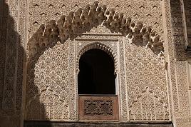
Out of context, artisanal craftsmanship.

Bracelet box, around 1990, Anti-Atlas, somewhere... Silver-thread inlaid vase, Meknes around 1980.
AX Axelfl Regular ·
Sources of the OUM-er-R'BIA: Middle Atlas: 30 km below AÏN LEUH: P 7311

Thanks Manon, I don’t know this region of Morocco at all. But the landscapes seem really beautiful. Maybe you should pick the right time of year to avoid the cold. When were you there?
PO Poticar Regular ·
Like this... Cedars between Ifrane and the Oum Erbia, 2009. Ain Leu, top of the village, 2009. Sources of the Oum Erbia, 2009. Oh! Those constructions (recent at the time) on both banks of the river! Sources of the Oum Erbia again. At the top of the image, the first waterfall. The Oum Erbia. In 2009, both banks weren't yet completely covered with huts.
HA Hannahannah Globetrotter ·
I have photos of the waterfall from January 2010—I need to dig them up.
PO Poticar Regular ·
With a few dead monkeys at the base, fallen from the top? 😏
HA Hannahannah Globetrotter ·
No, with a great girl in the middle of the waterfall among the rocks, but I want to blur her face. I love the spot—I discovered it for the monkeys and then the little lake further on, Aguelmam Azegza. Have you ever seen monkeys fall? 😉 I’m naive, sure, but you’re pushing it.
LE Levelo Veteran ·
Don't get it. Between the floating face and the falling dead monkeys... A parallel universe, maybe 🤪.
PO Poticar Regular ·
Didn’t see it happen. Two had already arrived... for several hours. Not pretty. We were swimming at the foot of the waterfall back then, and the car was "watched" by the kids who were squabbling over who saw who first.
HA Hannahannah Globetrotter ·
Maybe in limbo.
CA Casellego ·
In spring... poppies... stork chicks... dahlias covered in tiny white flowers... LAKE AFENOURIR... APRIL


Similar discussions

You might also like