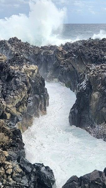
Bom dia, travelers,
A little feedback from our discovery of Madeira—there aren’t many out there! Hoping it might be useful to some of you 🙂
We stayed 7 days in Madeira between May 18th and 25th.
Base: Funchal, the Lido hotel area. A practical neighborhood (lots of restaurants, shops, buses, etc.) but lacking charm. While getting back to Funchal is quick thanks to the road infrastructure, the outskirts of the city are particularly congested in the morning and evening, often due to tourist buses blocking traffic. Plus, even though Funchal enjoys milder weather compared to the rest of the island, you won’t see any sunrises or sunsets there! In short, if I were to do it again, I wouldn’t stay in Funchal for 7 days, even if it’s convenient to unpack once and for all.
Car rental for the week with Avis through locationdevoiture.fr (now Carigami). Zero-excess insurance, two drivers included, full tank on pickup, return with a full tank. After everything I’d read, I was dreading it. No issues at pickup or return. A Citroën C3 with 4,000 km on the clock, which served us perfectly. We brought our own GPS and map, which came in handy. There are signs, of course, but not always where you need them 😛.
Guides & maps: The Rother for hikes, the *Évasion* guide (quite general but very complete), and the Sunflower (borrowed), which I liked less—I found the explanations less clear and a bit messy, but maybe it was just me being unclear 😇. We also had the Freytag & Berndt map at 1:40,000, very useful when exploring the tiniest roads.
Day 1: In the morning, we head to CURRAL DAS FREIRAS. The viewpoint is pretty, very well developed (too much?). We take a short walk down the path as recommended in the Sunflower guide. The environment is wild but doesn’t offer much in terms of views.
We then head east via the expressway. Destination: PONTA DE SÃO LOURENÇO. The sky is overcast there, while just earlier, we were under the sun 😕! We’ll have to deal with the weather’s whims—a constant in Madeira! Off we go for a 3.5-hour round-trip hike, including photo stops, a picnic, and the climb to Ponta do Furado at the very end.
It’s nice, very open, and unlike anywhere else on the island. But it’s also *very* crowded. Mass tourism where everyone’s staring at their feet, barely a smile, hardly a hello 😠. The vibe kind of kills the charm. We were there at lunchtime but didn’t escape the crowds.
Practical detail that matters: no restrooms at the parking lot, none at the Casa do Sardinha, and an environment with no trees or bushes where you can see for miles. Ladies, plan ahead... A hike you should do regardless, with no major difficulty aside from the final climb, though it "undulates" constantly. The trail is perfectly safe.
Back at the parking lot, we take the road to PORTO DA CRUZ, a small village nestled at the foot of the mountain. The natural pools, being cleaned, are empty, and the seaside promenade, splashed by waves, feels a bit gloomy. The charm isn’t there. Return to Funchal via PORTELA and the MIRADOURO DOS INGLESES, which is tricky to find—hidden at the back of a lovely park, tended like an old lady from the 19th century, maybe the former owner of the place...
Thanks for this (early) feedback... We're waiting for the rest....😉
I went to Madeira during the first week of May. We really loved the São Lourenço hike (under the sun😛) and didn’t feel too crowded (there were some people, sure, but lots of locals since it was the weekend).
I didn’t write a trip report on VF—I jumped into creating a website instead... So if you want a sneak peek of our "Madeiran" week, check out my profile (for now, I’ve only had time to add 3 destinations—the rest will come little by little, and it’s even more time-consuming than writing a travel journal on VF 😕).
It’s only fair, really. I get so much pleasure reading other travelers’ journals, I should contribute my own little bit too 😉.
Thanks for following me 🙂 !
Hi Jeff, so glad to see you back on the Madeira forum!
Don’t worry too much—you’ll understand better as my story unfolds, and even more in the final wrap-up.
The disappointment is partly my fault: for forgetting that this island sits in the middle of the Atlantic, battered by winds and storms, shaped by harsh conditions into something a little rough around the edges. For dreaming of that "eternal spring" the tourism industry sells us—like a gentle, sunlit summer. For willfully ignoring all those centuries when humans, insatiable conquerors, enslaved this piece of land in the name of wheat, then sugarcane, vineyards, and finally tourism—the new gold of our era.
But Madeira hides its most beautiful treasures, and what wonder awaits those who know where to look...
We also loved São Lourenço a lot, but we preferred the other hikes we did even more. Sometimes it comes down to little things—a ray of sunshine, too many people, a moment of fatigue... It’s true that there was a real crowd that day. Nowhere else have I felt that way!
I quickly checked out your site (an idea I really liked, but I’m too "limited" with my computer skills ). It seems like you also played hide-and-seek with the sun and clouds!
Hi Noëlle, thanks for checking out my travel journal and taking the time to leave a little note! 🙂.
I hope the rest of it gives you what you're looking for. Madeira is a gorgeous destination, but it’s one that you’ve got to earn 😉.
Good evening!
Your travel journal is really great—I didn’t have the energy to make one!
For São Lourenço, we were advised (on the forum) to go in the late afternoon: fewer people and, most importantly, the sun lighting up the rocks (but lots of wind)!
The week before ours had been gorgeous, but we had fog, so I was disappointed at first. Looking back, though, it was still amazing (trip from last year, late May/early June)!
I’ll be following the rest with pleasure!
I really like what I see in your photos! A lot, actually!
But it’s true that the images don’t show the "developed" and "crowded" aspects!
It’s not easy to decide: should we skip a nice hike or visit just because it’s packed? I’ll admit, that’s a bit of a temptation for me. But then, we risk only seeing the secondary spots! Or visiting at off-peak hours—but that’s not always doable!
Anyway, I’m thrilled to join you on this new travel journal.
Here’s the continuation and the story of our second day on the island.
Day 2: The plan was to tackle the island’s highest peaks. We’d scheduled a climb up PICO ARIEIRO, then a visit to the Ninho da Manta viewpoint, followed by the short BALCÕES walk at Ribeiro Frio, and finally, after Santana, the hike up PICO RUIVO. Three short walks, with car rides in between to see the best of each spot—carefully calculated for the best effort-to-reward ratio 😛. Reality had other plans.
Early in the morning, we drove up to PICO ARIEIRO, a 45-minute trip from Funchal, without much hope. Clouds were gathering overhead. Yet, when we arrived at the parking lot, we were above the nimbus clouds. It was barely 9°C (19°C in Funchal when we left), and the wind was freezing. Bundled up in polar fleece, windbreakers, and scarves, we set off for the viewpoint, a 15-minute walk away. The air was incredibly pure, the landscape breathtaking, and best of all, hardly anyone was on the trail winding through the rocks. We exchanged glances, hesitated—the hike was rated "black" (difficult, vertigo-inducing) in the Rother guide. I’d studied the route but never dared to attempt it. But the opportunity was too good to pass up. We had water, snacks, so we went for it. We didn’t regret it—it became our number one highlight of the trip 🙂.
The route was simply stunning, the viewpoints jaw-dropping. Tunnels, staircases carved into the rock, metal ladders, cliffside paths—and always, always landscapes that defy imagination, raw and wild beauty barely touched by humans. Without a doubt, THIS is the hike to do in Madeira. I found it well secured. Of course, you need to be careful and wear proper shoes, but unless you’re paralyzed by vertigo, it’s not overly difficult—and I’m a scaredy-cat! It’s pretty tiring, though (constantly going up or down 🤪).
Since I hate round trips, once we reached PICO RUIVO and properly summited it, I suggested descending to Achada da Teixeira instead of going back the same way. My sweetheart wasn’t thrilled. Achada da Teixeira is just a parking lot for those doing the Pico Ruivo hike as a round trip. My plan? Find a car to drive us back down to Santana. From there, we could take a taxi to our car on the other side of the mountain (just to remind you, none of this was planned). My partner hesitated, and if there was no one around… I played my last card. It *is* possible to walk to Santana on foot. I conveniently omitted that it would add 3 more hours of hiking 😇.
The descent to Teixeira was lovely—the trail was easy and almost deserted. When we arrived at the parking lot, two cars were about to leave. The first one, seeing me approach, rolled up its windows and locked its doors. I didn’t know I looked that scary 😕😊! I approached the second car with my best smile and explained our predicament in English, dramatizing a little. *Please, can you drive us, it will be so nice*—we felt like we were on *Pékin Express*! Unfortunately, they were Germans who didn’t speak English. My partner, who’d been watching with amusement, reluctantly joined in, dusting off his schoolboy German. After leaving us to flounder in a mix of English, German, and French for a while, the couple finally agreed to drive us to Santana—incidentally, the only road down from Teixeira—while implying we were reckless for not planning our return trip properly *(Ach die Franzosen!)*. Once there, in the main square across from the police station, a taxi stand welcomed us. The ride cost 40 € for a good half-hour back to Pico Arieiro.
Pico Arieiro: done. Pico Ruivo: done too. We skipped Balcões because at Ribeiro Frio, it was packed—buses and cars clogging the road, making it hard to pass. After our nearly solitary adventure, we weren’t in the mood for crowds. Back at the hotel, we fully appreciated the pool and jacuzzi. Hey, it’s vacation too 😛😊! The next day, we painfully rediscovered muscles in our thighs and calves we’d forgotten existed. The price to pay for an exceptional hike!
Here’s one last photo just for fun—taken from the top of Pico Ruivo, looking toward the refuge and the path to Achada da Teixeira.
Thanks for these beautiful photos and this story—unfortunately, we experienced it in the fog, always hoping it would lift!!!
And yes, Madeira is truly magnificent, but so much better without the fog!
Keep up the good work.
PS: 2 photos taken just a few hours apart—one at the top of Pico Ruivo, the other by the sea at the bottom of Santana!!!!
Good evening and thank you for joining me in these "travel memories" 🙂
Indeed, São Lourenço must be stunning at the end of the day. That’s partly why I regretted staying in Funchal all week. No matter how close you are, you’re never in the right place at the right time!
As for the mist and clouds, no worries—we got our fair share too , and even some rain. If there’s one thing certain about Madeira, it’s the unpredictability of the weather 😉! From one hour to the next in the same spot, it’s either sunshine or pea soup fog. At the same moment, from one kilometer to the next, it’s the same story! How on earth do you make sense of it? You can almost watch the clouds race by with the naked eye, no timelapse needed
See you soon for the next part—a week’s travel journal goes by fast, much faster than a three-week road trip 😉
Nice to catch up with you on the trails of Madeira. I really enjoy traveling with you 🙂.
Yes, the photos aren’t too bad, and in reality, it was really pretty too—but *but*—impressions and memories depend on so many things! And I’m particularly sensitive to all those "little" things. That’s why I try as hard as I can to pick the right moment, but it doesn’t always work out, as you can see 😕!
Not easy to know what to do: skip a nice hike/sight because it’s too crowded? I’ll admit, that’s kind of the temptation I have
You’re not wrong. A while back, in my American dreams, I refused to even consider Yellowstone because of the crowds, and even now, I’m hesitant about Delicate Arch, which feels more like a big concert venue than a natural site.
But I don’t think that’s the right solution. Sometimes we get it wrong, and we don’t have all the facts to judge. In Madeira, I ended up on supposedly overcrowded hiking spots—just me and my partner, with amazing weather, completely baffled (but thrilled). Though I’ll admit, after the first one (Sao Lourenço), I got a little scared. A crowd walking in single file, staring blankly at their shoes, expressionless faces, not responding to smiles or hellos (I tried 3 or 4 languages for real 🤪). It felt like the Paris metro or a bad sci-fi movie with robots taking over the world. Add in a light mist and an end-of-the-world landscape—hello, atmosphere. The charm of a place can turn creepy fast 🏴☠️.
See you tomorrow for the rest—I’m off to bed, work tomorrow!
Aaaah, there we go! Now I have regrets!!!
We too had hesitated a lot about doing the Pico Arieiro hike (even though our hosts raved about it every morning) because of the "darkness" in the Rother guide... (and also because I had some knee issues, that's true!).
Clearly, we should've given it a try! (Even if it meant turning back early).
We encountered way more people on the Pico Ruivo hike (especially when we were coming back down) than at São Lourenço... go figure 🤪.
I was also a bit disappointed by the ever-changing weather (though it was always mild).
Thanks for these photos because Madeira still remains a very fond memory overall.
Muriel
I’m discovering your new travel journal with great pleasure. Though the title does worry me a little😕
The photos are really beautiful, but unfortunately, for me, it’s too high up and too empty🤪
To me, Madeira is a sunny island with a bit of history—an Austrian empress used to come here to relax in the sun. I think there’s even a statue of her in some gardens.
Looking forward to reading the rest of your journal!
Hélène
Your travel journal reassures me way more than your title does!
What I see in it I really like: nice walks and lovely landscapes!
Even if Madeira isn’t on the cards for this year (Scotland in a month), I already have the *Guide du Routard*!
And your journal just convinces me even more that I’ll visit this island...
I’m happy to follow your travel journal because we’re thinking of going to Madeira for about two weeks. Even though the island is small, we’re planning to stay in two or three different places. The photos are gorgeous!
I thought the weather would be nice at this time of year, so I hadn’t considered the possibility of fog—good to know so I won’t be surprised.
I’m jotting down everything that might interest me.
Looking forward to the next update.
Thanks for sharing!
Oh no, don’t feel that way! With a knee problem, it wouldn’t have been great anyway. There are still some steep descents and a few flights of high, uneven steps that a sore knee definitely wouldn’t appreciate.
As for turning back, it’s tough on a route this beautiful at every turn. We only planned to do a tiny stretch (the first viewpoint), but one extension led to another, and we ended up at the end 😛!
I was a bit disappointed by the changing weather too
Ah, the weather—it’s always the unpredictable part 😏. You plan so many great things, prepare everything carefully, and then—bam—a big cloud, a gust of wind, and everything’s ruined 🤪.
Hi there, I'm starting a new travel journal with my itinerary and memories in mind, and maybe a few photos if I can find some. The context: April 2020, I was…
The latest travel journal about Turkmenistan dates back to 2019. Here’s a quick update on this vast desert country, which is now a bit easier to visit than before.
This is my first travel journal. If you have any questions, don’t hesitate to ask. The country is slowly opening up, but it’s still possible to visit sites where you’ll be completely alone. In five days, I saw two Hongkongers, a few Germans, and a Chilean at the crater, ten Chinese people in a capital bazaar, and that’s it!
It’s possible to visit Turkmenistan from Uzbekistan. The easiest and most economical way is to take a taxi to the border from Bukhara. The trip takes a little over an hour.
Crossing the border takes quite a while because many Turkmen bring back items bought in Uzbekistan to resell in Turkmenistan. For example, diapers, baby products, or beauty products.
It took me over 2.5 hours to cross the border. To visit Turkmenistan, it’s mandatory to have a guide and go through a travel agency. British agencies often offer three-, five-, or seven-day trips for over 1,500 or 2,000 €.
But if your budget is more limited, you can contact a few Turkmen agencies directly by email, and they’ll make you an offer between 700 and 1,300 € for three to seven days. I took a five-day trip from Turkmenabat in the northeast of the country to Dashoguz in the north. The goal was to visit the main UNESCO-listed sites, including Merv, and archaeological sites like Nisa or Gonur Tepe.
Your guide will also be your driver. They’ll pick you up at the border. The formalities are very long because customs officers have to stamp multiple documents, and obtaining the visa you previously requested from your travel agency requires several checks. But the process goes relatively smoothly, even if each step takes a while.
Once on the other side, the first surprise is the brand-new highway all the way to Turkmenabat. A very long line of trucks stretches for several kilometers on the Turkmen side to cross the border into Uzbekistan. According to my guide, Turkmen trucks transport gas and cotton (though not this season, since the harvest is in September), but they mainly fill up their tanks because fuel is much cheaper in Turkmenistan. A full tank for a car costs about 3 €, which is unbeatable.
From the Farap border post, the goal is to reach the city of Mary, which is home to the UNESCO-listed site of Merv in its suburbs, about thirty kilometers away. This city is known as a foundation by Alexander the Great in the 4th century BC under the name Alexandria of Margiana. Several fortresses are visible.
After more than three hours on the road, we have lunch at a Turkish restaurant called Aladdin. Several quotes from the president are visible along the highway, but the road is in good condition, and we move along easily. This will be by far the best road in the country—things will get much worse later.
Roundabouts are particularly interesting because they feature emblems of Turkmen culture, like the dog, a carpet, the Ahal Teke horse, or Muslim symbols, even though the presence of Islamic artifacts is quite limited.
After exploring Dawson City, the final stop on our incredible road trip to the Yukon (see travel journal), it was time to head back to Quebec.
Instead of returning directly, we took advantage of this cross-country drive to make several stops in British Columbia and Alberta.
This part of the trip allowed us to discover some of the most beautiful attractions in Western Canada, from breathtaking landscapes to iconic natural sites that are must-sees in Canada.
Between majestic mountains, turquoise lakes, and jaw-dropping panoramas, every stop added a memorable touch to this already exceptional adventure.
A wonderful way to wrap up this journey across Canada while fully enjoying the richness and diversity of its vast landscapes.
In the upcoming posts, you’ll discover the highlights that marked our journey through Western Canada.
I invite you to watch the associated videos to fully experience the atmosphere, landscapes, and attractions we were lucky enough to explore.
Here are the links to specific posts:
Adventure on the Alaska Highway: Bald Eagles, Bison & Moose
Adventure on the Alaska Highway: Bison, Caribou & Bears
Yellowhead Highway (Alberta): Roche Miette, Jasper Lake & Emerald Pond
Maligne Lake Road (Jasper) | Moose and Elk
Exploring Mount Robson Provincial Park (BC)
Must-Sees on the Icefields Parkway - Alberta
David Thompson Highway (AB): A Stunning Scenic Route
What to See in Yoho National Park (BC)
Johnston Canyon: Hike to the Lower & Upper Falls
Iconic Sites of East Kootenay, BC
Lundbreck Falls - A Spectacular Waterfall in Southern Alberta
Trails of Red Rock Canyon & Blakiston Falls - Waterton
Waterton Village Under the Snow - A Unique Place
Writing-on-Stone: A Park Famous for Its Hoodoos
Red Rock Coulee Natural Area, Alberta – A Supernatural Landscape
Dinosaur Provincial Park, Alberta - Mysterious Badlands
Drumheller: Dinos, Hoodoos & Badlands Interpretive Trail
Hike at Horsethief Canyon | Drumheller Badlands
Red Deer: Public Art & Murals
It’s an understatement to say that Japan is a world apart. All around me, people exclaim: "How lucky you are to be able to go there! I’ve always dreamed of visiting, of finding myself in that culture blending tradition and technology!" Yes, they’re right. Until the moment their dreams become reality and things appear as they truly are, without the filter of fantasized preconceptions. Because in the collective unconscious, Japan indeed seems like a civilization—if not neutral—at least stripped of any social maturation. As if it had emerged all at once from its canonical ages, offering only the best of its traditions, and as if those traditions were undoubtedly the foundation of its extraordinary discipline. Yet, as always, the truth is far more complex. Modern Japan is likely shaped by its millennia-old traditions. But that Japan is also the result of its own uncertainties and contradictions. I’ve always been wary. I’ve never understood why the cleaning women on the platform bow when the train arrives. At some point, too much discipline, too much deference—it makes you smile, it raises questions.
Finally, thanks to F., a dream is coming true! Not the dream of going to Japan—a country I’ve visited more than any other, except for Réunion and the UK—but the dream of completing the fastest round-the-world trip of my career. Indeed, due to the restrictions imposed by the Russians*, the plane flies over the Caucasus and China on the way there; on the return, it gracefully heads toward the Arctic after skirting the Aleutian Islands, Alaska, and Greenland. So, in nearly 26 hours of flight, I complete my 6th round-the-world trip. A round-the-world trip with just one stopover. Or two, if you count our impromptu detour to Okinawa.
(* In response to Western sanctions, Russia closed its airspace to Western airlines on February 28, 2022, except for Air Serbia, Turkish Airlines, Pegasus, and Belavia. This decision adds 2 to 3 hours to flight times and, incidentally, increases operating costs.)
The empire of noise. The empire that dazzles. In Japan, the auditory and visual space is constantly fed. No respite. You have to be strong. Navigating public transport feels like playing the most advanced video game: moving between language barriers and a different organization, the hero tries to ignore the numerous visual and auditory distractions. Mostly auditory, though. Because in Japan, there’s a culture of noise that has undoubtedly inspired our national railways. Everything must be announced. So, here and there, all along the route, we find agents whose sole role is to endlessly repeat safety messages through megaphones more or less suited to the situation. The result is a constant murmur, a kind of tinnitus, a subtle but incessant buzz that fades only at bedtime and returns with a vengeance at first light, when we descend back into the supposedly sterile depths of Osaka’s subway. "To go right, please turn right, kudasaï. When descending the stairs, please mind the steps, kudasaï. To go straight, please take the left corridor, kudasaï." That *kudasaï* ("please" in Japanese), I assure you, has permanently lodged itself in my auditory cells.
Screens are no exception; the brain is constantly stimulated. But paradoxically, passengers massively retreat into their own worlds via their screens. Literally glued to their phones, earbuds firmly in place, people escape into the virtual aisles of a furniture store, a game, a movie... In the train cars, raised voices are rare. The field is clear for announcements and other jingles. Each stop is announced by a little tune unique to each station. Simply incredible.
If we usually judge a country by the welcome its inhabitants offer, in Japan, we’re left wanting. Indeed, the Lost in Translation* spirit doesn’t just apply to verbal exchanges—it applies to everything, especially non-verbal communication. In Japan, me, the slightly North African Corsican, I’m at a loss. I speak loudly, I gesture, in front of a hotel concierge just as lost. Each for our own reasons. Yes, he speaks some English, but we can’t seem to connect. It’s a losing battle trying to find a bit of compassion from a local who’s far from familiar with Western concerns. I try to buy tickets for the World Expo? I run into a systematization as rigid as it is abrupt, which the concierge can’t seem to navigate. While we might still have a shred of common sense, here in Japan, everything is digitized. Soon, no one will be surprised that a QR code becomes essential just to go to the bathroom.
(* Film by Sofia Coppola, released in 2003, which explores isolation, unease, Japanese culture, and language through the experiences of two protagonists.)
In the end, we get that ticket for the Expo. After providing personal information on yet another account created for the occasion, we buy electronic tickets—a QR code, then—to regulate the comings and goings, the souls and aspirations of all these wandering beings scattered across the globe. And it’s probably for the best... Because we’ll be tens of thousands of visitors—100,000 to 150,000 per day—walking the aisles of this enormous improvised amusement park, a kind of delirious superstructure surrounded by the Grand Ring, the largest wooden construction in the world. Inside the park, the pavilions, flagship vessels of their respective countries, compete in ingenuity, proportionate to their GDP, to attract visitors. But you have to wait up to two hours to visit the most popular ones! Fortunately, about a hundred countries can be explored without waiting in shared, more spacious areas. What will I remember from this adventure? The beauty of that wooden structure, despite any environmental or financial considerations—200M € for barely renewable elements; a certain poetry, even magic, in the expression of this event—conversing with Juliette Petit, the splendid representative of Vanuatu, had something indescribable; a close-up experience of Japanese discipline when it came time to return to the subway after that epic evening—thousands upon thousands of people converging at the same time toward a single place without any interruption in the flow.
But my real passion is the countryside. So, I’ll especially remember that brief escape, on the very first day, to the Mino-o waterfall, where the journey itself was already enchanting. Quickly leaving the underground lines, our train speeds through the city’s endless expanse and drops us at the foot of a hill, the abrupt edge of the urban sprawl. The slope was too steep to build anything? We leave behind an impressive hotel, a capitalist eyesore defying the laws of elevation to tackle the climb toward the waterfall. A bucolic walk where the stroller can choose between a paved path or more epic trails. Here and there, stalls, temples, everywhere, a certain serenity. The city’s pulse gives way to a magnificent spectacle magnified by giant sequoias. From the depths of a ravine, we try to glimpse the sky beyond the foliage. Everything is oversized. Here, you can breathe.
***
In reality, Japan has never undertaken any real work of memory. Aside from a few feeble gestures to appease Washington in its choice of Asian partners, one wonders if the Japanese have ever truly grasped the horror they were forced to participate in. While our Judeo-Christian society has more or less assimilated the notions of forgiveness and self-questioning, where does Japanese society stand, juggling a millennia-old Zen philosophy and the unabashed Machiavellianism of an emperor utterly possessed? Is it just me, or does there float in the atmosphere a kind of unease, a malaise, an awkward relationship with reality? For me, bowing to a train as it enters the station is just the result of a poorly directed moral dilemma...
Ah, how distant is the time of sakoku, that closure of the country—both concrete and ideological—that was in vogue for two centuries. Because if no one could enter, no one could leave either! A boon for neighboring countries. But from 1854, following the skirmishes of Commodore Matthew Perry, who demanded Japan’s participation in trade, the country suddenly became aware of the disparities separating it from the West. Bring Japan up to the level of other nations? Industrialization, competition, search for raw materials... Hirohito (1901–1989) emerges on the scene, a bit expansionist and willing to stop at nothing to achieve his goals. Above all, he knew how to use, in his own way, the incredible capacity for self-sacrifice of his people...
We protest, we condemn, we all rally behind an acceptable discourse when it comes to discussing the use of the atomic bomb. Yet, we forget one essential thing: Hiroshima wasn’t enough to make Hirohito yield. While we’re bombarded with anti-fascist elements, as if the sole purpose of school curricula were to prevent us from voting for the National Rally, we completely overlook those events of rare cruelty that took place on the other side of the globe at a time contemporary with Nazi atrocities. Why? Because it was farther away, on the other side of the world? Because we must both condemn the use of nuclear weapons and Nazism? What a dangerous game. Killing civilians is beyond comprehension, everyone agrees on that. But hasn’t Japan ever been guilty of such atrocities? Our empathy is legitimate; it won’t, however, remove from my mind the idea that there was no other solution. Nagasaki is the most telling proof of that.
At least in France, in school textbooks, Hitler will have completely overshadowed the existence of people crueler and more abject than him. Certainly, Adolf was a deeply disturbed man whom events propelled to power. But I’m justified in believing that his approach was probably more humane than that of Joseph Stalin at the height of his art*. And if Hirohito followed the same line as Hitler, in the sense that he represented the superior race, he would apply with conviction what was Stalin’s credo: contempt for his own people when sending them to slaughter, and an even fiercer contempt for the human race when it didn’t have the good fortune to be Japanese. Just look at how China was invaded and by what means millions of Chinese were annihilated, burned, deported, buried alive! Operation Scorched Earth or Three Alls Policy for kill all, burn all, loot all? No comment. Even today, the Japanese are convinced they waged a patriotic war, when clearly, that war served only vague ideological (and certainly economic) interests.
(* "In many ways, Hitler’s National Socialism was far more humane than Communism: it wasn’t unthinkable to speak to the SS or the Gestapo, and dissuading them from sending you to a prison camp wasn’t utopian. To some extent (compared to the Communists), you could still expect a semblance of justice. All those who lived under Hitler and under Communism will tell you: as the front lines shifted, they always managed to end up in Germany, where, though it was a strange place ruled by a madman, life went on. Under Communism, there was no life; totalitarianism was absolute. Probably, Hitler’s conservatism prevented him from fully imitating Bolshevism." Seraphim Rose in The Revolutions of the 19th and 20th Centuries (circa 1970))
In Naha, we visit two strategic sites: the Imperial Navy headquarters and Maeda Escarpment, in Urasoe, better known as Hacksaw Ridge. I love this confrontation with history. In the hand-dug tunnels of the headquarters, we meet Japanese people seeking information. They’re not responsible for this tragedy. Neither are we. I would have liked to tell them that, to hug them, to move on. To finally believe in those peace messages displayed here and there. Yes, it’s curious to read those calls for peace* when no real work of memory** has been undertaken. Two civilizations, two perspectives, a profound misunderstanding. When I analyze the waste of that war—and particularly the waste of those Pacific battles—like Peleliu in autumn 1944 and Okinawa in spring 1945—I can’t bring myself to share in the pathological patriotism that reigns within these walls. There, the room where the last message of Admiral Minoru Ōta was transmitted in Morse, praising the merits of the archipelago’s people. A tangled mix that, yes, is charged with positive emotions but, no, won’t remove from my mind the idea that this people was completely conditioned, completely disconnected from reality. Allying with the Axis powers? Invading the South Pacific? And finding that noble! Everyone sees things through their own lens.
(* Peace Declaration by Denny Tamaki, Governor of Okinawa, June 2020.
** "Recognizing the atrocities committed by one’s country requires a mix of democratic culture and self-confidence that is more the exception than the rule." Dominique Moïsi in Les Échos, April 30, 2015)
Okinawa. 200,000 dead. Stemming from bushido, the way of the warrior, this conditioning reached its peak with the kamikaze philosophy in particular and suicide in general. So, schematically, here’s how things went: as the island was encircled—Peleliu, Iwo Jima, Okinawa—and all hope was lost, the order was given to kill ten American soldiers before taking one’s own life. The deceit of this system, where surrender is synonymous with dishonor, involves creating tunnels and secret pockets where Japanese soldiers hide and from which they emerge. Long before the atomic bomb, the knell of their war had sounded. Hiroshima and Nagasaki are just the result of human pride, of which Hirohito’s reign is the finest example. Why was this henchman of Satan left in place until his death? I don’t understand. While the humiliation inflicted on Germany repeatedly was abject, especially for its people, the absence of any real and pressing accountability for Hirohito in this large-scale carnage he instigated leaves room for the wildest interpretations. As if to underscore my point, Emperor Naruhito visited Okinawa the same day we did, paying his respects to the inhabitants who fell in battle. I looked at the faces in the monorail serving the south of the island. There were elderly people who undoubtedly lost their parents eighty years ago. To what extent can they blame this tragedy on the delusional visions of their leaders?
On Maeda Escarpment, I salute the courage of Desmond Doss, that conscientious objector who fought to serve his country while refusing to ever carry a weapon. There, at the top of a steep ridge, you can see to the north the Allies’ advance, while to the south, the slope is gentler down to Shuri, in front of the headquarters. The underground is a Swiss cheese filled with enemies. Desmond works as a medic. He manages to save 75 wounded from certain death by evacuating them at night from the battlefield using makeshift ropes.
Back in Osaka, far from the somewhat dilapidated tropical islands, I rediscover the splendor and grandeur of Japan’s second-largest city. To tell the truth, and this applies to Okinawa too, the density is so insane on this archipelago that you sometimes wonder if it’s not just one giant city spread across the vast territory. Because between Tokyo and Osaka, while there are some mountains and forests, it’s the city that dominates; during rush hour, a rapid train connects the two cities every five minutes. We get lost in rather quiet alleys parallel to the main streets, only to find ourselves in the covered and lively galleries of Dōtonbori. We’re looking for a place to eat—above all, we’re trying to navigate the unlimited options stretching endlessly along the sidewalks. It’s absolutely mind-blowing. And while I introduce F. to a part of history that our Western societies have quickly forgotten, he initiates me into Japanese gastronomy despite my well-known aversion to Asian food. But nothing beats having a master in the field! We feast on okonomiyaki, Japanese pancakes expertly prepared and served on a teppan embedded in our table.
Night falls on Japan, and I still haven’t found the answer. Like in Singapore, one can praise the calm and serenity of human relationships, the delicacy that may just be hypocrisy, the politeness, the discipline. But above all, we notice that in the absence of freedom, in the absence of madness, poetry struggles to take root, boredom looms, as does real madness. Bushido still exists, honor is there and must be preserved. But the youth drowns in electronics and in willingly sterile cults (otaku), unable to discern what’s essential, failing to believe in their dreams. You have to succeed? Young people commit suicide because of school bullying, the slightly older ones because of work-related difficulties or marital problems. Nothing exceptional, we might say—average*—but you’d expect better from a country so well-organized, a country that makes so many Westerners dream. Yes, night falls on Japan. Empire of noise, empire of the senses, a very strange land where you find clean toilets in subway corridors but where the very meaning of life seems stifled by the mirages of technology. Above all, a civilization deprived of a penance that would prove salutary. We’re caught between two waters. Those of a shallow modernity without depth or anchor; those of a past that was majestic but irreparably tainted by the demonic madness of an overly adored emperor.
How can one fully thrive when guilt has no outlet?
(* France and Japan share a common statistic of 17 suicides per 100,000 inhabitants, which, depending on density, means 30 per day in France and 70 in Japan...)
Here’s a little story about my first trip to Japan with my partner.
We went for our first visit from October 29 to November 13, 2024.
I had planned this entire trip back in November 2020, but given the health situation at the time, I had to cancel...
Here’s the classic route we took:
We booked everything ourselves and got a regional pass for the area from Kyoto to Hiroshima.
The hotels were reserved 3 months in advance on Book... and Agod... (1030 € for 2 people for 13 nights = 80 €/night).
For the flight, we chose a Qatar Airways flight with a layover to break up the long journey (950 € per person).
We also got a pass on the same site (Japan-Experience) to take the train connecting Narita Airport to Shibuya Station (the N'EX Narita Express).
Since the airport is 75 km from central Tokyo, we opted for this mode of transport, even though there are cheaper alternatives.
After reading various posts on VoyageForum, I understood how important it was to have a Welcome Suica card to pay for public transport (subway, tram, bus, boat throughout the country), and we were able to buy one at Narita Airport.
It turned out to be super useful!
After a long but smooth journey, we found ourselves at Narita Airport in the evening.
Even though we had a pass for the Narita Express, we had to go to a counter to make a reservation for the train (mandatory).
Then, once we arrived at Shibuya Station, we took the subway for 2 stops and finally reached our hotel, exhausted (Hotel Asia Center of Japan – 270 € for 3 nights with breakfast included).
I’m sharing our three-week trip to Japan from late October to mid-November 2025. There were four of us—my partner and a couple of friends.
I’ve traveled often with my friend Christian (Bolivia, Argentina, Costa Rica, Namibia, Laos), but this time our partners joined us.
The rough itinerary:
Arrival in Tokyo. Visiting Shinjuku/Shibuya districts + day trip to Kamakura
5 days in the Japanese Alps, from Matsumoto to Kanazawa (via Kamikochi, Hirayu Onsen, and Takayama)
5 days in Kyoto
Nara, Osaka, Koyasan
Return to Tokyo (Asakusa district), with a day trip to Nikko
We booked our flights well in advance (9 months ahead): the flight cost 1086 € per person. Compared to over 2000 € if we’d booked for the same dates just 3 months prior.
For accommodations, we mostly used Booking.com. The onsen was booked via Japanican, and in Kyoto, we stayed in an Airbnb.
We also made 5 train reservations a month in advance on Klook or directly on the train’s website.
Day 1: Departure from Brussels (October 24, 2025)
Early morning takeoff at 6 AM to Munich (1.5-hour layover) with Lufthansa, then a 12-hour flight with ANA, arriving the next morning at 7 AM at Tokyo Haneda.
Day 2: Arrival in Tokyo
Airport formalities were quick. The eSIM we bought before leaving activated as soon as we landed (10 GB plan with Saily—more than enough for our mobile internet needs, mainly Google Maps and Google Translate).
We’d received 4 ICOCA cards from our neighbors, which we loaded with 15000 ¥ each.
We took the Keihin train, then the Yamanote Line. It’s easy to navigate since everything is in English, and each station is announced on scrolling displays in English too.
We got off the Yamanote Line at the station just after Shinjuku because it’s easier to exit that massive station with our luggage. So we ended up in Shin-Okubo, right in the Korean district.
A 10-minute walk took us to Villa Fontaine Hotel. A great hotel, well-located north of the Kabukichō district. The room even seemed bigger than we’d expected.
It was 15°C, but it rained—and kept raining on and off all day. Belgian weather, basically.
We went for a walk in Shinjuku Gyoen Park. Not as pretty in the rain, but the big greenhouse was interesting.
Then our first ramen (hearty and for 1000 ¥—pretty much the price of all our ramen during the trip).
We headed back to the hotel since check-in was after 3 PM. Shower and relax before going out for dinner.
Dinner was barbecue at Shichirin Yakiniku Anan (1700 ¥ each—good and cheap). Ordering via tablet wasn’t easy, but luckily it was in English.
We ended the evening with a stroll through Kabukichō before a well-deserved sleep.
I love islands. So it’s no surprise that the Azores have been catching my eye for a few years now. The first time I suggested them to my dear partner back in 2021, he preferred the Lofoten Islands—an excellent choice, as it turned out, since we got to visit them with hardly any crowds. But for various reasons, the opportunity didn’t come up again in the following years. Until last year, that is. But by then, we’d left it too late—too late for the Azores, I mean—and the choice of accommodations on Flores and São Jorge was extremely limited. We decided to skip it without even looking at car rentals. So this year, we booked our flights, lodgings, and cars well in advance (between December of last year and early this year).
The Azores consist of nine islands, so you have to make choices. I quickly ruled out São Miguel, which deserves a week all to itself: from reading various blogs, some travelers seemed disappointed after visiting the other islands, even feeling it lacked the charm unique to the Azores. True or not, that was reason enough to leave it out.
In the end, we wanted to go to Flores for its lush nature (and because it’s reputed to be the most breathtaking), to São Jorge for its rural/nature vibe, and to Terceira for its cultural side and its *impérios* (more on that later). With the time we had, we could add another island without rushing. We like to take our time and wander a bit. Generally, whether it’s a viewpoint or a hike, we always spend more time than everyone else. Pico won out over Faial thanks to its wine culture. And of course, there’s Corvo, which is usually visited as a day trip from Flores. I thought it’d be nice to spend the night there to experience the atmosphere once most tourists had left. I hesitated between one or two nights and ultimately went with two (so we wouldn’t be rushed by the boat schedule). It was an excellent decision.
Here’s how it all panned out:
August 25: departure for Terceira via Lisbon at 7:40 AM;
August 25–29: Terceira;
August 29: flight to Corvo. It was supposed to take half a day, and we were meant to arrive in the early afternoon, but between schedule changes and delays, it ended up taking almost the whole day;
August 29–31: Corvo;
August 31: boat to Flores around 8:30 AM;
August 31–September 5: Flores;
September 5: flight to Faial in the early afternoon (originally scheduled for the morning, but the times changed)—visit to Horta;
September 6: boat to São Jorge around 9:00 AM;
September 6–11: São Jorge;
September 11: boat to Pico at 11:15 AM;
September 11–16: Pico;
September 16: flight to Paris via Lisbon from Pico around 10:30 AM.
We had to juggle a bit to optimize the prices of our flight tickets from Paris and the inter-island travel.
Hi everyone, I’m Patrick, 67 years old, a seasoned traveler (already 22 trips outside Europe).
In autumn 2025, I took my first 3-week trip to Japan, with stops in Tokyo, Kamakura, Matsumoto, Kamikochi, Takayama, Kanazawa, Kyoto, Nara, Osaka, Koyasan, Tokyo again, and Nikko.
I wanted to go back in May 2026 and explore some lesser-known places to complement my first trip.
Last year, there were four of us traveling together to discover Japan (a fairly classic itinerary). This time, I’ll be traveling solo for part of the trip and with a couple of French friends for the rest.
The weather was gorgeous in May, averaging around 25°C, with two very hot days in Kyoto and only two rainy days.
As usual, I organized everything myself, gathering plenty of information from various sites, including this one.
Transportation:
An ICOCA card is essential.
I got a 5-day Kansai-Hiroshima pass because I took the shinkansen between Hiroshima and Osaka three times, and it paid for itself quickly.
Accommodations:
Mostly through Booking. No issues at all. Average cost was 46 € per night.
Meals:
For breakfast, I alternated between buying food at a konbini to eat in my room or on the train and grabbing something at local cafés.
For lunch and dinner, I tried to vary my meals as much as possible—lots of sashimi, sushi, and ramen.
Okonomiyaki in Osaka and Hiroshima.
Oysters in every form (raw, grilled, fried) in Onomichi and Hiroshima.
A variety of seafood (shrimp, shellfish) in Hiroshima and Matsumoto.
Fish whose names often escaped me, but notably mackerel and eel (unagi).
Tempura and gyoza.
Chicken skewers (yakitori) and one teppanyaki meal.
One omakase meal (9 different dishes).
In the end, not much meat aside from a few yakitori skewers. No splurges on super expensive wagyu or Kobe beef.
Average dinner cost: 4,800 yen, drinks included.
The Itinerary:
Day 1: Departure from Brussels
Day 2: Arrival in Osaka
Day 3: To Himeji, then Kurashiki
Day 4: To Fukuyama, then Tomo no Ura, then Onomichi
Day 5: Cycling the Shimanami Kaido
Day 6: To Takahara, then Hiroshima
Day 7: To Kyoto to attend the Aoi Matsuri parade
Day 8: To Miyajima
Day 9: Hiroshima, then Kyoto
Day 10: Southern Kyoto
Day 11: Northern Kyoto
Day 12: Final day in Kyoto, then to Nagatsugawa
Day 13: Start of the Nakasendo Trail (Magome to Tsumago)
Day 14: Second day of the trail (Kiso Fukushima)
Day 15: Third day of the trail (Narai), then Matsumoto
Day 16: To Mt. Fuji (Kawaguchiko)
Day 17: To Tokyo
Day 18: Excursion to Enoshima and Kamakura
Day 19: Flight home, with a 10-hour layover in Hong Kong
Day 20: Arrival in Brussels
I’m reposting here a travel journal originally published on the Routard forum in 2022 during VoyageForum’s hiatus. Without altering its content, I’ll try to streamline it. The few comments on the political situation reflect my feelings at the time and don’t account for events since then! I’d rather avoid debates on the topic. The photos are nothing fancy—just illustrative.
The context: we’re coming out of COVID. We’re looking for a not-too-distant destination, and Jordan has been catching our eye for a while. After some thought, we wonder if we shouldn’t take advantage of the geography to hop over to Israel. After all, Jerusalem is less than 100 km from Amman. Plus, Transavia lets you combine both destinations.
To plan our trip (February 19 to March 4, 2022), we contacted three French-speaking agencies in Amman. Their itinerary proposals were pretty similar, but the prices varied significantly. Given the many positive reviews we read on travel forums and a very attractive rate compared to competitors, we quickly settled on Ahmad Ababseh’s agency. Still, deep down, we had a slight worry—so many glowing reviews seemed a bit over the top, but we took the chance.
During the preparation, which happened in a very short timeframe (less than 10 days), Ahmad didn’t provide detailed roadbooks, and we made do with brief email or phone exchanges. Few details were shared either. We discussed hotels, with Ahmad preferring the ones he knew. We picked our hotel for our arrival in Amman, but before agreeing, Ahmad insisted on inspecting the rooms.
For payment, Ahmad only asked for a 500 € deposit and trusted our word for the balance, which we paid upon arrival. He also committed in writing to refund the full deposit if our trip was canceled due to COVID.
Finally, for the Israeli part, Ahmad contacted an agency in Jerusalem to handle the logistics. He didn’t take a commission.
"So, my little wanderers, back at the decks? What’s this mystery destination you’ve got in store for us at the start of the year?"
Yes, the schoolyard bell’s ringing again! We’re hitting the road... or rather, the skies! At first glance, our destination might surprise more than a few. First off, simply because I was here exactly twenty years ago, and I don’t usually like retracing my own footsteps. Secondly, because the name of this place screams mass tourism—basically the opposite of what Flo and I look for.
Despite that, in this land of backsheesh, I’d promised myself I’d come back one day to experience it my way. And since Flo told me, during our wanderer chats, that this destination straddling Africa and the Middle East was in her top 2 travel dreams, the stars aligned for this roots-style trip to quickly make it onto our pharaonic festivities program! Unless you’re totally clueless in general knowledge, you’ve probably guessed by now—we’re off to Egypt! Of course, a few classics will be on our itinerary, but above all, we want to soak up a culture that can’t be appreciated in four-star resorts or on a Nile cruise boat. And let’s be clear, these next two weeks won’t be a walk in the park—neither for our two daughters who are joining us, nor for our bodies!
And that’s clear from the get-go: after our first flight, eight hours of trying (and failing) to sleep on Milan airport’s metal seats, our second flight, landing, passport stamps, our Uber ride, and our first Cairo kilometers, we finally drop our exhaustion at the little guesthouse we booked in Giza. Doesn’t all that energy deserve a little reward?
Oh, absolutely! And here it is: a full-on slap in the face for everyone! But just look at this view from our hotel terrace? For 20 € a night for four, even with this incredible view, I figured the room must be pretty shabby, right? Nope... Is the staff rude, then? Nope... Okay, so what’s the catch? You’re gonna tell me breakfast is included too? Well, yes! Honestly, this Egypt trip is off to a great start.
And the rest of the afternoon, spent rubbing shoulders with locals, only confirmed this vibe. After digesting our pyramid view, we dove into the hustle and bustle of our neighborhood with the goal of exchanging money, eating at street stalls, and testing the hospitality of the locals. Ten out of ten!
Eight little sun breads with baba ganoush and falafel? 80 pounds, or 1.5 €. A dozen Middle Eastern pastries? Same! 80 pounds! Two hawawshis, those little pita breads stuffed with meat and spices? 10 pounds each, or about twenty cents! Not to mention all those smiles and free "welcomes" left and right!!!
What a welcome! We end this first day with a sunset over the three sisters of Giza—where we’ll obviously be gawking tomorrow...
I’m sharing a little recap of this new 4-week trip to China—nothing fancy, just my experience.
We’re taking advantage of the extended visa exemption to return to China for the 4th time. I loved last summer’s trip so much that I’m a bit worried about being disappointed this year. Plus, I’ve had a few hiccups before this departure: my WeChat account got blocked, and I couldn’t recover it (luckily, Alipay still works fine); I couldn’t verify my 12306 account for weeks; Trip.com failed to book our second train; and I’ve got an injury that’ll slow me down during the trip... Ugh, I hate starting a trip with these kinds of issues. Then, oh surprise! Just before leaving, my 12306 account got verified! Super easy to use from that point on—I could book a few train tickets without fees.
We’re sticking with Free’s e-SIMs, which work great in China.
August 2–3
Anyway, on the morning of August 2nd, we took the RER to CDG. As usual, we couldn’t check in online. It’s always a bit frustrating, especially since we didn’t have any checked luggage. We flew with Air China. We arrived at the check-in counter at 9:50 AM, 2 hours and 40 minutes before the flight. The line for our check-in stretched 300 meters across the airport in both directions. What a joke!! We spent 1 hour and 45 minutes in that line just to reach the counter and get our boarding passes. By then, it was 11:35 AM, and boarding had already started at 11:20 AM. The screens showed a 25-minute walk to our gate—on the other side of the airport, of course—plus we had to go through passport control and security... Long story short, the plane didn’t leave without us 🙂 We boarded among the last passengers, and we took off at 12:30 PM. We’d flown Air China four times before, but this time, it felt *really* low-cost. The check-in chaos, the cramped seats (12 seats per row), no music by artists known outside China, mediocre food, and a boarding area at Beijing Airport with only 10 seats—worthy of Ryanair or EasyJet. And yet, the price was sky-high. Again, D.’s vacation requests were denied outside of July and August, so we’re traveling from August 2nd to 30th. We couldn’t have picked a worse time for inflated prices, and with the situation in Iran, we got hit with a 390 € fuel surcharge. I’ve never paid so much for flights—I felt like I’d bought business class, but nope, far from it!!
We landed in Beijing around 4:15 AM. It was 28°C with thick fog. We drove and drove and drove for 20 minutes, as usual in Beijing. Then we went through a first check, a second check, a third check, and waited for our connecting flight at 6:40 AM. A small Airbus A320, but way more space than in the Boeing 777 from the first flight. We landed in Kunming, Yunnan, around 10:15 AM in the rain.
We headed to the subway. You can’t pay at the machines with Alipay here either, so we set up the transport QR code directly in Alipay to scan at the subway gates. The process is a bit long the first time if you haven’t entered your info before, but once it’s done, it’s *so* much easier! We took Line 6 to the terminus for 6 yuan each.
We’d booked a hotel nearby, on the 16th floor. It’s actually studios on different floors of a huge residential building. The view’s pretty nice from here. We settled in quickly—back to those wooden beds, or rather, mattresses as hard as wood, which we *hadn’t* missed...
Then we went out for our first bowl of noodles of the trip and wandered through the shopping streets of the old town.
It was crowded, and the weather was cool—around 19–20°C. We tried a local specialty: milk skin, thick, dried, then grilled with rose jam. Yeah... we won’t be having that again. The taste and texture of the milk skin... no thanks.
We saw a lot of wild mushroom hotpot too. It’s on our list for later. We also passed through the Jinma and Biji gates, where I played with reflections in puddles. I *love* doing that 🙂
At the end of the day, we headed to a temple advertised as open 24/7 on Amap. Of course, when we got there, it was closed. We’ll go back tomorrow. That was the first of many disappointments with Amap this trip—I hadn’t had that issue on previous visits.
We were exhausted after that sleepless flight. Night was falling, and we decided to grab a quick bite without much appetite. We shared a delicious vegetable fried rice for 12 yuan—we even left half of it. The portions are *huge*.
After a couple of small purchases, we headed back at 9 PM, wiped out, after walking 17 km between the airports and these first steps in Kunming. I expected to see quite a few Western travelers here, but we didn’t spot a single one. Instead, we met lots of curious Chinese people, many of them super friendly and helpful—almost *too* eager, like when they’d run to serve us as fast as possible. It’s a bit much, but it’s great to be back!
When we started looking for a summer destination a few months ago, our first criterion was to avoid extreme heat and heatwaves. We had already been to Norway two years ago and are considering going back in the future for other occasions. So, we had some fun asking ChatGPT which destinations enjoyed a mild climate during the summer without going too far. Among the list provided by the AI were the Canary Islands... The idea of a place we wouldn’t have thought of first, both not too far away and exotic enough, appealed to us: “Hmm, why not?”
This destination had never really attracted me, though Magali was a bit more interested. Five years earlier, COVID had caused a short break in my professional activity, and I had planned a trip because the flight price was attractive, and I was looking for a destination different from what usually appeals to me, more than out of deep interest. From a distance and with a social judgment I acknowledge (it’s not great, but it’s not completely wrong), I had the image of a destination for party-goers enjoying the sun without the slightest interest in local culture, with concrete coastlines and denatured landscapes—everything I detest the most. Still, I had done some quick research on the different islands and spotted Lanzarote for its beautiful volcanic landscapes, hiking trails, beaches, and the impression of a good balance between activity and fewer crowds than Tenerife or Gran Canaria. Then I dropped the idea of going, without ever reconsidering traveling to the Canaries...
Until now! Because we started researching the different islands of the archipelago to see which ones might appeal to us the most. It was La Gomera, the third smallest island of the archipelago, more praised for its hiking trails and preserved nature than for its beaches, away from mass tourism (fifty times fewer tourists than Tenerife) but still a bit more developed than its wild neighbor El Hierro, that caught our attention. Contrary to what might be suggested later, I’m not at all addicted to AI, but I use it from time to time to synthesize quick research or simply for experimentation. Since ChatGPT had started anticipating my tastes lately as if it had become my buddy (often successfully, sometimes off the mark), I asked which Canary Island would suit me best for a trip with my family. The tool answered first with... La Gomera. So, I tested it and teased it a bit to see if this suggestion was well-founded, as the method sometimes makes it contradict itself. But no luck: “You’d appreciate the wild nature of El Hierro, but with family, you’ll find little activity for the kids. You won’t like the touristy vibe of the big islands like Tenerife, Gran Canaria, Lanzarote, and Fuerteventura. You could consider La Palma, but it’s really La Gomera that will suit you best, based on your interests and the criteria given.” So, we dug deeper into our research and were convinced without a shadow of a doubt that this island was the one waiting for us.
Without knowing it, we had Canarians in our circle who revealed their origins when they heard about our travel plans. One from Tenerife insisted we’d be better off choosing Tenerife (obviously...) because it also has preserved spots and that La Gomera, “you can explore it in two or three days, you’ll get bored quickly...” The other, a colleague from Gran Canaria who had never visited La Gomera, still recommended it without hesitation because it turned out her parents had just gone there on vacation: they loved it and had encountered few tourists. She also tended to think this destination was usually the subject of short stays, but according to what her parents told her, taking your time there was also a great idea. However, in our research, the idea that La Gomera is an island you can explore in three or four days max kept coming up. So, we considered combining its visit with La Palma or El Hierro, the other two that caught our eye. But hopping between islands by ferry represents a significant budget for non-Canarians, even more so for a family of four. Then, scrutinizing Google Maps, it seemed obvious that two weeks were too short to discover two islands as they deserve, and that there seemed to be plenty to see in La Gomera, given its very unique culture. After all, we read that some people spend several months a year there, others never even leave... Finally, these landscapes and this atmosphere, which seemed to us a mix of Europe, North Africa, and Latin America, tempted us. So, it would be two weeks in La Gomera, deal!
La Gomera is therefore the second... well, the third smallest island of the Canaries since La Graciosa was recently recognized as a fully inhabited island. It has the shape of a rough circle about 20 to 25 kilometers in diameter and has just over 20,000 inhabitants, half of them in its capital, San Sebastián de la Gomera, the only real town. Like its Canarian sisters, La Gomera is a volcanic formation that rose about 10 million years ago. The island is very mountainous and rugged, covered with red and black rocky landscapes. Geological activity has shaped, between the sprawling massifs that end in steep cliffs in the ocean, six coastal valleys with tropical vegetation that have favored human settlement. They divide the island like slices of a cake; from the north clockwise: the agricultural Vallehermoso, the rustic Agulo, the green, humid, and fertile Hermigua, the sunny capital San Sebastián de la Gomera, the southern and isolated Alajeró-Santiago, and the seaside Valle Gran Rey. They constitute the six municipalities (more like cantons to our French understanding) of the territory.
The large solidified magma massifs that shape the heart of the island have created a large depression more protected from the sun at its center, allowing the growth of a vast laurel forest, today grouped within the Garajonay National Park, La Gomera’s green lung, which has earned it the status of a World Biosphere Reserve. Its completely European appearance contrasts sharply with the rocky and tropical landscapes of the rest of the island. Thus, the climate varies greatly from one point to another on the island: in summer, you can quickly go from a dry and sunny valley at 35°C to a humid forest area at altitude at 18°C.
La Gomera was populated late. As with the rest of the Canaries, human presence is thought to have begun about 2,000 years ago. Groups of animist Berbers, probably fleeing persecution, gradually populated the archipelago, especially the western islands and La Gomera, becoming its small aboriginal population: the Guanches (or later Gomeros). The animist and pastoral civilization of the Guanches thrived until the Spanish takeover in the 15th century, which, after a short period of harmony and mixing with the indigenous people, suddenly ended in bloodshed... La Gomera later became the “Columbus Island” after Christopher Columbus’s stopover, increasing the blending of populations. In the 20th century, many Gomeros emigrated to Cuba and other Latin American countries in search of a better life, bringing back a mix of cultures and traits quite palpable in today’s Gomeran culture. It is, however, in La Gomera that the vestiges of Guanche culture seem to have left the most traces, in the language, gastronomy, social practices... Moreover, most Gomeros, especially in remote villages, have a particular identifiable type and proudly claim their ancestral roots, even making La Gomera a bit exotic in the eyes of other Canarians.
Perhaps that’s why it has never really wanted to develop its tourist infrastructure too much. If we set aside the tourists who visit for the day by bus or boat from Tenerife on a marked itinerary (and whom we ultimately rarely encounter), La Gomera has remained a hidden gem, a destination focused on nature discovery that attracts hikers, nature-loving divers, and scientists for its fauna and flora, and to a lesser extent, beachgoers who don’t seek overly developed coastlines. Tourist activity is therefore limited. Roughly speaking, you’ll find a majority of Spaniards, including a substantial number of residents from other Canary Islands, many Germans who have a particular fondness for La Gomera and spend long stays there or own second homes, to the point that the German cultural footprint is clearly noticeable in some places (it’s said to be Angela Merkel’s favorite holiday spot), and still quite a few French. The presence of other nationalities seemed negligible to us. Most travelers come mainly for hiking, but it’s also a prime spot for whale watching. Additionally, the seaside resorts of La Gomera—San Sebastián, Santiago, and especially Valle Gran Rey—are well-known destinations for hippies, especially German ones, ranging from chic boho hippies to old-school hippies who’ve been there for decades, quite similar to those you’d meet in India in Goa, Rishikesh, or Paharganj. Thus, practices like naturism, vegetarianism, and local organic production are quite well established in some areas.
Some practical info:
- The round-trip flight from Paris to Tenerife cost us 365 € per person (outbound with Transavia, return with EasyJet), including checked luggage and three seats reserved side by side.
- We chose two bases to explore the island: one week in Valle Gran Rey, reputed to be the most pleasant of the three seaside resorts, and one week in Hermigua, more mountainous and close to the natural park. We booked two houses with balconies and views: the first at 120 € per night, the second at 99 €.
- The round-trip ferry between Tenerife and La Gomera cost us 270 € with the company Baleària Canarias, including discounts for children aged 4 and 12, but I don’t have the exact details. It was a bit cheaper than with the other company, Fred Olsen.
- Finally, we rented a car through the agency Cicar for 360 € for 16 days, which comes to 22.50 € per day.
- Apart from that, we didn’t plan anything and decided the day before or even the morning of what we wanted to do. We didn’t invest in any paper guide on the Canaries, as information on La Gomera was scarce, but we used the very comprehensive site La Gomera Travel, a travel guide published by the Canary Islands Tourism Council, a real goldmine of almost exhaustive information on the island.
Alright, off we go for 16 days of adventure discovering La Gomera!
If you're looking for great tips and offbeat spots, if you love exploring uncharted parts of a country, if the exotic is your adrenaline, then move along!
Our 15 days in early May in this part of Turkey (a country I first discovered during a city trip to Istanbul in 2017) will only tread well-worn paths and revisit popular routes. Simply because I kept hoping until the very end that our flight to Jordan wouldn’t be canceled. Events in the Gulf proved me wrong, so we left with:
Zero preparation.
Not a single hotel booked (well, except the first one), no visits planned, just a flight ticket bought three weeks earlier. No guidebook, no app—just the desire to explore southern Turkey and Cappadocia, whose images and the chance to stretch our legs had caught my eye.
Oh, wait—I did bring along a new guide: Gemini! Yes, my friends, generative AI was my chief advisor throughout the trip for sites to visit, accommodations, routes, and even restaurants! An experiment I wanted to try to form my own opinion on using this new technology. And what better way to test it than a Turkish getaway?
The verdict? You’ll have to wait for the trip recap to find out!
The main idea of the trip is also relaxation.
So, the plan is Antalya for a few days, the Turkish Riviera for a few more, Cappadocia as the highlight, and a return via Antalya to wrap up the trip. And it was all planned by AI!
So, if you're ready, fasten your seatbelts—cabin crew, doors to automatic and cross check—boarding for Turkey now!
This trip had been on my mind for about fifteen years.
But the discomfort of overnight stays, the difficulty of communication, and the prices of the few car rental options kept making me postpone the project.
And then, everything suddenly fell into place—I told myself, it’s time!
The preparations took longer than usual; the destination is still far from mainstream.
A bit of Kazakhstan?
Not in the end.
The south or not the south?
Yes, in the end.
Pre-book or go with the flow?
Only two stops were a leap into the unknown.
To help me find the ideal route, I made great use of this forum (thanks to everyone for patiently answering my questions!), pored over travel journals and blogs (Christian, Jeff), zoomed in on Google Maps and Yandex, and bought the guide published by OunTravela about this destination (the guide has been updated since).
---/---
You’ve got your passport, international driver’s license, bank cards, and euros?
Off we go to Lyon—just one night left before our early morning flight.
Tomorrow night, we’ll be sleeping in Bishkek!
(Steak for my partner’s mischievous nephews...)
You’ll find here a post with some practical information.
And here, the version of the travel journal without comments.
---/---
As a supplement, the route track.
Not necessarily ultra-accurate since Google has serious gaps for this destination...
Here we go with this second travel journal dedicated to the American West! It’s a must when you love it! 😊
We had left off in the charming town of Bisbee, which once thrived thanks to its copper mines. Today, mining is a thing of the past, and the town seems a bit sleepy.
Unfortunately, I didn’t dig deep enough on-site to answer all the questions my observations raised. Guess I’ll have to *dig* into the subject a bit more... no pun intended! 😊
Let’s hop back in the car and head a little further south to check out the esplanade that offers a view—if you can call it that—of the impressive open-pit mine.
Then, it’s off to the Lowell neighborhood.
Preserved almost exactly as it was, this area must’ve been bustling in its heyday. The vintage cars are still around, storefronts and signs look like they’re straight out of another era, and the whole place has a pretty amazing vibe. You’d almost think you were on Route 66!
Here, we’re not just discovering an old neighborhood—it’s a little slice of American history. And, a detail that’s great for my physical health: the area isn’t too spread out.
Lucky me! 😊
I won’t post too many photos here since I think I can turn them into a future photo exhibit. Between these and some shots from Route 66, I should have more than enough material! So, let’s keep a few under wraps... to preserve the surprise. 😊
After as many weeks as I have fingers on my right hand, we're hitting the road again, fully recovered from our pharaonic adventure. Back in France to drop off our daughters (sorry, girls!), this time it's just the two of us, ready to be welcomed by a new destination. They say it offers one of the richest cultural heritages in the world for those willing to put in the effort. It's the land of the ancient Silk Road, where we'll follow a journey steeped in history and discoveries straight out of *One Thousand and One Nights*. A former Soviet bloc region independent only since 1991, we'll be walking in the footsteps of Genghis Khan, Tamerlane, Alexander the Great, Marco Polo...
Another fun fact about this country: it's strictly forbidden to import porn on your phone. True story. The same goes for painkillers! Unless it's about sodomy—though the two don’t seem connected, that’s just how it is. Don’t ask me why! Anyway, I’m getting off track. Here’s the big question: Where do you think we’ve just landed?... To give you a hint, the locals are known for being incredibly welcoming. No sooner said than done—our first taxi driver, proud to transport French travelers, refused to let us pay for the ride. Great vibes for these two weeks ahead. So, any guesses?
Uzbekistan!!!
Hi everyone.
Because that’s also what sparks the desire in every traveler (well, at least for me) to set foot on Australian soil: discovering a new continent.
Right now, I’ve got some time on my hands—those who follow me know that. A nasty muscle tear (which really doesn’t want to heal) is keeping me grounded for another week, so I’ve decided to open a new travel journal, recounting my recent trip from December 14, 2024, to January 12, 2025, in Australia.
The origins of this trip started last May in Crete, an island I chose for a 10-day break. It’s really lovely, by the way, but that’s not the point… It’s around this time every year that we decide on our next winter destination, and Argentina was at the top of the list—Sydney wasn’t even on the radar… I’d been looking at flights to Buenos Aires for a while, and the prices were shocking…
But by the pool one lazy afternoon, scrolling on my iPhone, a promo from Geneva to Sydney caught my eye. The deal ticked two boxes on my traveler’s bucket list: a flight to Australia and a flight with Singapore Airlines, often ranked as the world’s best airline.
A quick chat with the missus (well, of course!) and the decision was made: off to the land of kangaroos!
Now, once you add luggage and Economy Plus, it still comes to 1600 € per person, but that’s a reasonable price.
Either way, we already know what we’re in for—Australia is a budget commitment!
For a long time, the Yukon had been one of those dream travel destinations for us. Its vast wilderness, majestic mountains, and fascinating history tied to the gold rush irresistibly drew us in.
We finally made this ambitious project a reality: a road trip across Canada heading toward the Yukon.
Since the journey from Quebec is considerable, we chose to turn the trip itself into a series of adventures.
Instead of just racking up the kilometers, we made plenty of stops to discover several tourist attractions spread across different provinces.
Along the way, each province offered its share of landscapes and discoveries. We crossed vast forests, admired beautiful lakes, explored historic sites, and visited several local attractions that helped us better appreciate Canada’s diversity.
These breaks made the trip much more enjoyable and allowed us to take the time to fully enjoy each region we visited.
One of the great pleasures of a road trip is the freedom it provides. We could adjust our itinerary based on our mood, extend a visit we particularly enjoyed, or stop spontaneously at a spectacular viewpoint.
Often, it’s these unexpected discoveries that become the best memories.
As we moved northwest, the landscapes became more and more impressive. The roads seemed endless, the mountains drew closer, and nature took on an even greater presence. Traffic gradually thinned out, giving way to a sense of freedom that’s hard to describe.
Arriving in the Yukon marked the culmination of several days of travel. From the first kilometers, we were amazed by the vastness of the territory.
The breathtaking panoramas, the wildlife everywhere, and the unique atmosphere of the Canadian North more than made up for all the kilometers we’d covered.
This road trip to the Yukon reminded us that the destination is important, but the journey is just as much a part of it.
The many stops we made along the way allowed us to discover extraordinary places we probably never would’ve visited otherwise.
Every province we crossed helped make this adventure even more memorable.
The Yukon will certainly remain one of the highlights of our travels, but the memories we gathered along the way hold a special place in our hearts too.
That’s what makes a great Canadian road trip so magical: every kilometer tells a story.
In the upcoming posts, you’ll discover the places that caught our attention throughout this road trip.
Don’t hesitate to watch the videos to complete the experience and explore these attractions as if you were there.
To jump to a specific post, here are the appropriate links:
Roland Lake Falls - Lac-Pythonga (Quebec) | First Stop on the Way to the Yukon
Must-See Stops in Ontario
Stop at the Center of Canada | Manitoba
Stop in Winnipeg (Manitoba)
Discovering Regina (Saskatchewan)
Stops in Moose Jaw, Chaplin & Saskatoon (Saskatchewan)
Stops in Vegreville & Edmonton (Alberta)
Stop at West Edmonton Mall, a World of Attractions Under One Roof
Stops in Beaverlodge (AB) & Dawson Creek (BC)
Adventure on the Alaska Highway: Between Dawson Creek and Liard River (BC)
Discovering Liard River Hot Springs (BC)
The Sign Post Forest (Watson Lake)
Stops at Rancheria Falls, Teslin, and Tagish
Discovering Carcross and Its Must-See Spots
Carcross Desert Yukon: A Surprising Desert in the Heart of Canada
Must-See Stop at Emerald Lake (Yukon)
Hike at Miles Canyon (Whitehorse) - Yukon
Discovering Whitehorse
Spectacular Northern Lights - Fish Lake - Whitehorse (Yukon)
Must-See Stops Between Whitehorse and Dawson City
Road Trip on the Dempster Highway (Yukon) - 100 km of Adventure
Complete Visit of the Historic Town of Dawson City in the Yukon
Midnight Dome Dawson City - Magical Northern Lights in the Yukon
For those planning a trip to Kerala, here’s a quick, practical summary.
For the most part: the stunning landscapes, the natural kindness of the locals, their cuisine, and their culture—you’ll get to enjoy all of that once you’re there...
Flight (arrival and departure to/from Cochin)
Avoid Air India and opt for flights via the Middle East: Saudi Arabia, Qatar, United Arab Emirates, Oman, etc.
Price: between 500 € and 600 €
Accommodations
Average price: 20 € per night for a couple (max: 40 €, min: 10 €, often including breakfast), via the usual booking sites.
Homestays (staying in the owner’s house) are of a higher standard.
Only 2 nights were spent in questionable cleanliness. The rest were good, even very good, or even *very* very good.
Car with Driver
All-inclusive daily price: tolls, fuel, driver’s lodging and meals... and of course, we often shared our meals with our driver too.
Toyota sedan (e.g., Corolla) for 4 travelers (1 in front, 3 in the back): 50 € / day,
Toyota SUV (e.g., Innova) for up to 6 travelers: 60 € / day
DM me if you’d like more details.
Overall budget (excluding flights and shopping)
Around 1500 € for 1 couple for the 3 weeks... in "2-couple mode"!
(i.e., sharing the driver’s cost).
Itinerary
Night 1: Arrival in Cochin in the morning, departure for Attirappily
Beautiful waterfalls
Night 2: Thrissur
Via Vallachira, not much tourist interest, a stop to ease into the trip and shorten the journey to Wayanad
Nights 3, 4, 5: Wayanad, staying in Sultan Battery
Coffee and tea plantations, dam lake, URAVU (bamboo craft workshop), ...
Night 6: Ooty
Botanical garden, then a really fun tourist train the next afternoon to Metupalaiyam
Night 7: Toward Coimbatore
Nights 8, 9, 10: Munnar
City visit, stunning tea plantations
Nights 11, 12: Thekkady/Kumilly
Amazing tea plantations, sightseeing, Jeep ride, not-so-interesting boat tour on Periyar Lake, trekking options
Night 13: Marari Beach (near Alleppey)
4-hour backwaters tour, then beach (swimming, dinner)
Nights 14, 15, 16: Munroe Island
Super chill, walks around the island (small coir rope factory), sunrise by boat or canoe, sunset
Night 17: Varkala
Gorgeous beaches, shopping
Night 18: Trivandrum
City center visit, then train back to Cochin the next day in 3 hours.
Night 19: Cochin
Fort Kochi is a lovely way to wrap up the trip
Have a great trip in this incredible region, so unique in India!
I’m inviting you on a stroll through my drawings—a completely subjective, far from exhaustive, and totally personal take, since it’s based on my own sketches. I put this travel journal together after returning in late 2024, mostly using felt-tip pens and pencils, with a few collages thrown in. I worked from our personal photos.
Let’s start with the shotengai...
Our first "wow" moment came as we stepped out of the subway in Asakusa, the Tokyo neighborhood where we’d booked our hotel for our first five nights. Exhausted after our long flight, we finally arrived and took an exit that led straight into a shotengai—one of those covered shopping streets that pop up in city centers and flourished between the 1950s and 1980s.
It was an instant aesthetic shock, like a close encounter of the third kind between the modern city, a typical Asian market with its street stalls, the vintage vibe of the arcade, the sheer abundance of goods, and the bustling crowd—a mix of tourists, pilgrims (thanks to nearby Senso-ji Temple), and locals (it’s a very working-class area).
In the end, it set the tone for a feeling we’d experience throughout the trip. Wherever we went, shotengai turned out to be fantastic spots for finding little restaurants, shops, or even fresh produce. Some are like real mazes, like in Kyoto, where we spent ages trying to relocate a restaurant we’d loved ;-)
In Kanazawa, the Omicho Market:
And in Kyoto, Nishiki Market:
This travel journal is therefore intended solely for my photos, to present a consistent style.
All the shots were taken with a simple Samsung Galaxy smartphone and with whatever was at hand.
All stays combined, I’ve spent the equivalent of three years at most in Thailand, and I’m not a big expert on the country.
However, after many trips, lots of reading on VoyageForum and other sites, and conversations with many locals as well as expats, my view of the country is becoming clearer, though it’s constantly evolving. You never stop discovering and learning.
I guess I wanted to piece together a puzzle, mainly for those who want to get an idea of the country here and for those who miss it.
I don’t know if this minimalist sharing will interest anyone, but it’ll do me good to put it together. After so many months without traveling and then these other long months with VF closed, there’s plenty of material available.
There’ll be a mix of places, periods, and subjects, but it might well be intentional.
I suspect many Thais have dogs because they make excellent guards for the home. Nothing better to deter burglars or to signal the presence of a snake. You’ll often see Thais tapping the top of their dog’s head, but don’t be fooled: it’s a sign of affection from them. Judging by the dogs’ reactions, they’re used to it.
Thailand is one of the countries on the planet where rabies is still present, so keep that in mind. It’s not just bites that can be dangerous, so don’t let just any dog lick you. Especially on a wound, of course.
Even though dogs often fear humans—this dangerous and unpredictable predator—we still need to stay cautious.
Be careful when walking into alleys because the dog will defend its master’s big property, be careful at night, and be careful when they’re in packs.
It sometimes crosses our minds that Thailand isn’t really made for walking around, and dogs are one of the reasons.
That said, it’s not uncommon to see them chasing bikes or scooters. Cars, though, are much rarer—they’re too big.
It seems Thais prefer to give their dogs freedom by not locking them behind gates. Though sometimes the gate is closed, the little side door is wide open. Oh, and sometimes there’s no gate in front of the property, or it’s been broken for years.
You’ll often see dogs sleeping on the side of the road, sometimes right on the road. When you arrive, they move aside nonchalantly—or not at all. It’s less funny when they suddenly appear from thick vegetation, which reminds visitors not to drive too fast. As a result, you’ll notice that dogs with injuries or missing legs aren’t that rare.
Since they believe in reincarnation and respect for all forms of life, they don’t chase dog packs away too much, and they don’t sterilize them enough. Seeing a small pack roaming freely in the countryside, you might think it’s best not to cross paths with them at the edge of a field.
A darker side of this is that euthanasia isn’t often practiced. Twice, we saw dogs at temples on the brink of death, enduring terrible suffering. No one did anything about it. The image (and the smell) of one of them, dying and emitting the stench of death, still comes back to me sometimes.
Some of you may have seen the YouTube vlog of a French woman living in Phuket who was given a little pig by her Thai friends. The well-fed animal quickly became a happy, enormous beast with its own garden. Yet, it didn’t take long for it to fall seriously ill and become incurable. In her video, the French woman described how difficult it was to find a vet willing to perform euthanasia.
You’ll often see bowls by the side of the road. Thais leave food and water in them for stray cats and dogs. Overall, they have a big heart for animals.
If you ever pop into a shopping mall, you might see people pushing their small dogs in strollers. It’s not a gimmick—it’s just that these strollers are provided for customers to put their pets in, otherwise you can’t bring them inside. It looks a bit odd when you expect to see a baby.
And we still haven’t seen everything!
Before setting off for new horizons at the end of this year, it’s time for me to share my trip to Cape Verde this summer 2025.
I particularly love these spontaneous trips, and our stay in Cape Verde is one of those because it was only at the beginning of April that we decided on this getaway, which had been catching our eye for a while, given our love for the mountains.
As always—well, when it’s open—I turned to VF, and I want to immediately thank Marie, aka ptitortue, who helped me a lot in planning this trip through her travel journals and our exchanges!
Because Cape Verde is both small and vast! We decided not to rush from one airport to another, to enjoy the places and the people, but also to relax, since the work backlog from being stuck in May (see my previous travel journal 😅) had to be caught up on in June.
So, 4 islands will be our winners from 06/28 to 07/19:
Santiago first for logistical reasons, as round-trip flights from the capital Praia were the cheapest (650 €/person from Lyon via Lisbon with TAP, still!)
São Vicente, because it’s the gateway to the next one but ultimately more than that...
Santo Antão, pretty much the main goal of the trip since Marie (and the photos) had really sold it to me.
And finally, Sal Island, for some rest—a non-negotiable condition for my other half—and we’ll see that I should’ve listened to Marie...
That said, what a chatterbox I am—buckle up, flight attendants at the doors, off we go on new beautiful escapes! (Thanks to Sophie for the easy loan)
Last note for my eager fan club 😏: yes, there will be alcohol—how could there not be in the land of grogue!
Alright, this year, we're heading back to South America!
The initial plan was to retrace the route we imagined in the summer of 2020: a trip to northern Argentina starting from Córdoba.
Unfortunately, the flight to Córdoba no longer exists, and airfares to Javier Milei’s country are both outrageously priced and involve multiple layovers.
So, I tweaked Google Flights every which way and finally found a flight within my budget—departing from Clermont-Ferrand!
Not to Argentina, though...
Our transatlantic flight will cross the snow-capped Andes, landing in Santiago, Chile, with a return from Lima!
In between, two domestic flights and a big road trip loop starting from the coastal city of Arica to explore the treasures of northern Chile.
Our mode of transport: a pseudo 4x4 that won’t take us through sand dunes or devilish tracks but will let us tackle the entire secondary network, including unpaved main roads, while still being insured.
Is the suitcase packed with all-season clothes?
Are the driver’s license and passport ready?
Bank cards and a few euros too?
Off we go for just over 3 weeks of southern wanderings!
--/--
To keep all my esteemed readers on track, here are a few maps outlining the Arica-Arica loop!
1- From Arica to San Pedro de Atacama via Pica and the Salar de Huasco
2- Around San Pedro
3- From San Pedro to Cariquima
4- From Cariquima to Putre
5 - From Putre to Arica
Gas stations in this part of Chile are located in Arica, Iquique, Pozo Almonte, Pica, Calama, and San Pedro de Atacama.
It was winter, a winter with beautiful weather,
A season that only exists in the southwest of America,
I remember very well what I told you that morning
A month ago... A century ago, an eternity ago...
We’ll go... wherever you want, whenever you want...
Well, yeah, back from our adventure in our enchanting American West just a month ago, we’re already taking a bite out of one of its lesser-known competitors. "Flo, if you had to pick just one reason to justify your love for the U.S., what would it be?" The greasy, dripping burgers? No, I don’t think I’m going out on a limb by saying it’d be the wide-open spaces... And that’s exactly what our new quest is taking us to—a land on the other side of the globe where the horizon also seems endless, where silence tastes like salty wind and sand, where freedom is measured in kilometers of desert tracks, where the GPS is mostly there to confirm you’re lost in the middle of nowhere... Add to that magic formula the fact that you’ll see more zebras, giraffes, wildebeest, and elephants than people per square kilometer, and you can imagine us setting foot in Southern Africa for the first time, more precisely at the small airport in Windhoek, capital of... of...? Brush up on your geography, damn it! We’re landing in Namibia!!!
To be honest, Namibian landscapes have been flirting with me for ages. So how did I resist this island of temptation for so long? First, the budget. Let’s just say that for the same amount of effort (and kidneys), the bank lets you choose two other adventures almost anywhere else on the planet. Then there were my girls. Yeah, back then, they were too little to dose up on Malarone, the only malaria remedy at the time... Long story short, ten years later, all the planets have aligned. First, I won the Euromillions! Well, almost... Let’s just say my girls are now old enough... not to take Malarone, but to stop following me on all my adventures! Jackpot! "Flo, how about a little two-person caprice, just the two of us, tackling the Namibian tracks?"
As we landed on the runway, first wow effect: The horizon is immense. It’s flat as can be, incredibly flat... So much flat space! Did I mention it was flat?... Looking into the distance, it feels like your gaze could circle the Earth without hitting a single obstacle—until you end up staring at your own backside. "Oh, what a nice view!" Well, it’s the first time I’ve seen my butt from this angle! Touching moment... Sorry, I’m rambling—must be the exhaustion from the three-flight marathon we just powered through via Ethiopia and South Africa... And yet, no time to philosophize about my anatomy. As usual, we want to rack up our first kilometers to be front and center at dawn tomorrow. After wrapping up the tedious Namibian immigration formalities and meeting the 4x4 that’ll be our companion day and night for the next fifteen days, we’re off! We’re not exactly fresh, but we’re ready to tackle the next five hundred kilometers in night mode, cruise control set due south! Just outside Windhoek, the local wildlife—a jackal—welcomes us with a smile: "Welcome to Namibia!" That’s what it said! Honest... Okay, first endless straight road, first flaming sunset, first corrugated dirt track, first Milky Way with zero light pollution... You get it—it’s definitely the day of firsts... First night camping, too, in the big trunk of our Toyota Fortuner parked by the side of the track... The real adventure, the kind that smells under the arms, can finally begin...
Off to Southern Africa again! This time, the trip wasn’t just about wildlife—it was also about the local cultures and the breathtaking landscapes Mother Nature has to offer. It was an emotional rollercoaster in every way, as you’ll see.
We visited two countries: Zambia, known for its reserves, and Malawi, which is less well-known but absolutely worth a visit. Our flight landed in Lilongwe, Malawi’s capital, where our vehicle was waiting—though with a 3-hour delay. It was a 4x4 without the rooftop tent this time, since we stayed in lodges (prices are very reasonable in Malawi). Just a heads-up: don’t exchange money at the airport or banks—the official rate was 1,750 Malawian kwacha to $1. On the black market, the rate was between 3,000 and 3,500 kwacha, making the cost of living much cheaper.
With that out of the way, our first stop was South Luangwa National Park in Zambia. The first hiccup came at the Malawi-Zambia border: we were missing a document the rental company had forgotten. After some back-and-forth, they sent it via WhatsApp ($20 to get it validated by the police). But things got worse—the car’s chassis number was off by one digit from the registered one. I thought our trip was over before it even started! After what felt like forever, we got through with a "tip" of $200. Total border crossing time: 3 hours, costing nearly $400. We arrived in South Luangwa after dark.
Thankfully, the next day made up for it with an incredible day in the park (check out the photos).
We spent two full days in South Luangwa before heading to Katete for the Kulamba ceremony.
Kulamba is an annual event held at the end of August, celebrating the Chewa people, who live across Zambia, Malawi, and Mozambique. The Chewa king attends, and representatives from neighboring nations bring offerings. Thousands gather for dances, speeches, and a massive market. There are few tourists, making it a truly authentic experience.
After a few days in Zambia, we returned to Malawi (the border crossing this time was smooth—just 45 minutes). Next stop: Lake Malawi.
Lake Malawi covers over 20% of the country and stretches 580 km. It’s home to a family of fish called cichlids, some of which are endemic to the lake. I recommend taking a day trip from Cape Maclear for snorkeling and to watch the fishing eagles swoop down to catch fish.
We hit the road again to visit Liwonde Reserve, where we had a few surprises. The lodge was on the other side of the river that borders the park, and the elephants didn’t seem to care. On the way from reception to our rooms, elephants blocked our path, and one even charged just before the stairs leading to our treehouse-style rooms.
To top it off, monkeys ransacked our rooms, tearing through plastic bags for food. A mixed experience, but no real harm done.
Next up: the mountains, specifically the Mulanje Massif. This is where Malawi’s tea is grown, and it’s also a great spot for day hikes or multi-day treks. The scenery is stunning, though sometimes the mist rolls in and hides it.
After the mountains, we visited another reserve: Majete. The park is growing and now has more wildlife. We saw lions and even caught a fleeting glimpse of a leopard. And of course, the elephants got involved again—this time giving us a real scare.
During the morning game drive with a guide, we stopped to watch a herd of elephants feeding. Everything was fine until, for some reason, a female got spooked—probably for her calf—and positioned herself in front of us on the track. After a few minutes, we thought the elephants would move on, but then a young one started provoking us. The problem? We had females and calves in front of us, but also two large adult males—one behind us and one to the side.
We were trapped, and even our guide looked nervous. After what felt like an eternity (though it was only a few minutes), the herd finally moved on, freeing the track. That afternoon, we did a self-drive safari and—you guessed it—we had zero interest in running into elephants again.
The next day, we headed back to Lilongwe for our flight home. It was a fantastic, varied trip with some intense moments (sometimes *too* intense). Malawi offers amazing opportunities for those who want more than just wildlife reserves.
Preamble:
Africa was calling to me, so a year ago, with our usual travel companions, we decided to return to the continent we love so much.
Where to go?
Uganda quickly caught our attention—wildlife we’re used to seeing, plus gorillas and the shoebill we missed in Zambia.
We got in touch with Paul, who’s been mentioned several times on the forum back in September, booked our flight tickets, secured the gorilla permits, and by early October, the most important things were done.
We still had plenty of time to hold our "prep meetings" for the final itinerary.
Three days before departure, I sprained my ankle (my weak spot, as you’ll recall from our Colombia trip).
I wasn’t in great spirits, but after a year of waiting, nothing was going to stop me.
We’d see how it goes!
Off we went for our new adventures
So, a new year has begun. It’s time to reconnect with the VF buddies and wish you all my best for 2026—a year I hope is obviously full of travel, since, as I just made up:
"If travel’s good, everything’s good" 😄.
To celebrate, I’m inviting you into my new "travel journal," the one from our latest trip in November 2025, a little two-week adventure.
This time, we headed to The Gambia, a tiny country tucked right in the middle of Senegal, before making our way to Casamance.
The Gambia is English-speaking, Senegal is French-speaking, but the locals? They couldn’t care less—because in this part of the world, they mostly speak Wolof, Fula, Jola, or Mandinka.
Hence the title: Senegambia 😉.
As usual, I’m sharing the live updates I sent to friends and family—super casual, of course.
I know this isn’t the kind of destination that draws crowds, but if you love adventure, laughter, and emotion, it might just be your thing 😊.
I hope this travel journal might interest some people, but since we were completely self-sufficient (tent, sleeping bag, pot, cooking over a wood fire…) almost every day, I don’t have many hotel addresses or great restaurant tips to share! Sorry!
We used the Maio map at 1:50,000 scale. It’s part of the Boa Vista/Sal/Maio map. Bought on Amazon, but currently unavailable as of the latest news.
The people of Maio are extremely welcoming and warm, and we were always more than well received in the villages where we pitched our tent!
We’re usually big hikers, but since Maio is a beach island (gorgeous ones, at that!), we alternated a few hours of walking in the morning with some relaxation in the afternoon: beach, reading, fishing, resting…
1 euro = 110 escudos
Day 1 (Friday) Transfers by plane: Fogo-Praia-Maio
We opted for the plane to save some time on transfers, as the boat connections between Fogo and Praia take a while, and those between Praia and Maio are almost nonexistent.
You should budget around 40-50 euros per flight per person.
There are 2 flights per week between Praia and Maio—on Tuesdays and Fridays when we were there (January 2016), but currently on Mondays and Fridays.
A bit of a delay leaving Praia, but we arrived on Maio without any problems around 4 PM.
We took an *aluguer* (shared transport, 200 escudos per person) to the center of Vila do Maio, but it’s totally doable on foot with a backpack.
Since it was already a bit late, for this first night, we dropped our bags at Big Game Maio. A standard European-style hotel run by a very nice Italian family. It’s a bit pricey for us (5500 escudos for 2 people with breakfast), but after our 2 weeks in a tent on Fogo, we were happy to find a little comfort. And the breakfast is ultra-generous, with fresh products (cured ham, fruit, cheese, bread) and top quality. The hotel restaurant offers dishes that are a clever mix of Italian and Cape Verdean cuisine. Excellent!
Little tip: We didn’t try it, but Big Game Maio offers big-game fishing trips, diving, and quad rentals.
The hotel is 2 minutes from Vila’s beautiful beach, and we went for a dip at sunset and took a stroll around town. They’re redeveloping the waterfront with pretty sidewalks and light stone walls.
Vila beach
Sunset behind Santiago
Day 2 (Saturday): rest day + fishing
After 2 weeks of hiking and since Vila is such a peaceful place where it’s nice to take your time, we decided to spend an extra day there. We took the path heading south along the coast to reach Ponta Preta beach in 20 minutes. The path isn’t very pretty because there’s quite a bit of construction going on, which prevents you from really walking along the shore. Lots of real estate agencies, especially Italian ones, have taken over the land. But Ponta Preta beach is a stunning black-sand beach where we had the whole place to ourselves. We decided to go fishing from the rocks.
At 1 PM, the sun was blazing, so we headed back to Vila and dried the fish for the following days.
At 6 PM, we went fishing again, but this time at night from the rocks at the end of Vila beach.
8:30 PM: back to shower and eat at the restaurant.
The rocks and sea at Ponta Preta
Day 3 (Sunday): from Vila do Maio to Calheta de Baixo, via Monte Batalha (path 101) Hiking time: 5h
Since there aren’t many “summits” on Maio, we decided to head to Calheta de Baixo but via Monte Batalha. We left at 8:20 AM and somehow made it to Monte Batalha by 11 AM (2h40 of hiking). But the path is really hard to find in the middle of the dry grass and acacia trees. We kind of cut through randomly, aiming for the summit. Even though it’s not very high (around 300 m), the view is amazing—you can see all of Maio at 360°!
Short 30-minute break. The descent through the “forest” of acacias is even worse for finding your way. We oriented ourselves a bit by the sun to find the road connecting Vila to Calheta. We arrived around 1:30 PM at Calheta de Baixo. A very pretty little seaside village with colorful houses. An idyllic beach, a newly renovated square, and super-friendly people. We pitched our tent facing the sea on the terrace of an abandoned house (after asking the locals for permission).
We cooked some of the dried fish we’d caught the day before, along with fresh beans we’d brought from Fogo (and were still carrying!).
At the summit of Monte Batalha
Calheta
Calheta de Baixo
Day 4 (Monday): From Calheta de Baixo to Morrinho on foot. Hiking time: 3h. Then hitching a bus to Cascabulho, and a car to Pedro Vaz.
We left around 9:30 AM heading north (path 201), following the coastline where the beaches just keep coming—each one wilder and more beautiful than the last: Praia de Soca, Calheta Braca, Ponta de Pau Seco, Calhetina. We reached the dunes of Baia de Santana. There’s no real path, so you have to follow the coast, then go around the dunes, and when you spot the 3 coconut trees, head east toward them to find the track leading to Morrinho. Again, we discovered a village with a Wild West vibe, with colorful houses lined up on either side of a paved road. Just enough time to accept a drink offered by a local before jumping onto the passing school bus that took us to Cascabulho. There, we waited for a ride. A political delegation of 10 cars drove right past us without stopping. Luckily, one of the cars had a flat tire and came by 30 minutes later—and that one, thankfully, gave us a lift! They were heading to the inauguration of a water pump in Pedro Vaz. So that’s where we stopped too. After getting permission from the school principal, we pitched our tent in front of the village school… and became the attraction for all the kids who kept us company until nightfall! A woman gave us 2 jugs of water, but with all that company, it was tough to take a peaceful shower!!
Dinner: pasta with beans.
We were woken up by rain during the night and had to rush to bring all our stuff inside the tent!
The beaches just keep coming...
The dunes
The 3 coconut trees, a landmark to find the track
Day 5 (Tuesday): Rest day and fishing at Boca da Ribeira beach
We packed up at 8 AM because the kids had school. We filled the 2 water jugs that the woman lent us and headed down to camp at Boca da Ribeira beach, which is a bit further east of Pedro Vaz. It took less than an hour to get there. This time, we really were alone in the world! We pitched the tent and spent the day fishing, reading, playing, and swimming regularly because the sun was beating down hard!!! We caught a nice fish that we grilled over the fire in the evening. With the crabs and shellfish we gathered, we made a seafood rice! Yum! What a feast!
That night, once the tent was zipped up, we felt something like rain on the tent fabric. I decided to go out and gather our things, and then—shock!!! It wasn’t raindrops we were feeling and hearing, but bugs attracted by the light!! Not just a few bugs—a huge swarm of them!!! Thousands of bugs covering the whole tent, the ropes, slipping into the seams and hems! Everywhere! The blue tent had turned green!!! After that, it was a real struggle to get back inside without letting any in! A real challenge, and there were always 3 or 4 that managed to sneak in anyway. Total war!!!
Boca da Ribeira beach
Day 6 (Wednesday): From Boca da Ribeira to Ribeira Dom João. Hiking time: 3h30
We woke up leisurely and waited for the sun to dry our things, damp from the dew. A man passed by, and we gave him the water jugs we’d borrowed, which saved us a trip back to Pedro Vaz to return them to the woman.
We left around 10 AM. We followed the sea to Alcatraz, then headed toward Pilão Cão. The path runs alongside the small hills on our right, and we passed above Lagoa Cimidor. The terrain is arid, and the path is hard to find among the many goat tracks.
After 3h30 of hiking, we reached Ribeira Dom João with 2 young people we’d met along the way.
Since it was a public holiday in Cape Verde, the kids didn’t have school, and with the principal’s permission, we pitched our tent in the kindergarten. She even kindly opened the school toilets for us. The neighbor gave us the water we needed to wash up and cook. We cooked beef steaks on charcoal. A nice change from fish!! Charcoal is a widespread artisanal product on the island. People almost never cook directly over wood but always with these big chunks of charcoal.
The hills on our right
Ribeira Dom João
Day 7 (Thursday): From Ribeira Dom João to Vila do Maio. Hiking time: 3h30
We woke up at 6:30 AM to clear out of the school by 8 AM. The neighbor made us coffee to save time. It took us 2 hours to reach Barreiro, another Wild West-style town! Since we didn’t want to walk on the road, we took the old track and reached Vila do Maio in 1h30.
Last night before taking the plane back to Praia the next day.
Barreiro
The old track
The church in Vila do Maio
That’s where this trip ends!
Maio is truly a magical island! A remote, isolated place with incredible, wild beaches and villages with a Wild West feel—colorful houses on either side of well-paved, well-maintained, and decorated streets. And the locals are so warm and welcoming.
Even for hikers like us, it was a great discovery, and we were able to alternate hiking and relaxation with great pleasure! Too bad the area around Vila do Maio is being overrun by real estate construction—ongoing, unfinished, abandoned…
Hi everyone, we're back from a DIY USA road trip we organized from July 31, 2026, to August 26, 2026.
The destination: The Southwest USA, including Texas, Arizona, and New Mexico. Roughly 7,000 kilometers covered.
The car: A Chevrolet Equinox for two, rented through BSP Auto and Avis. Inside, we had 2 suitcases, a travel bag, two carry-on bags, a Walmart cooler, photo gear, and water bottles (a 40-pack).
The route: Dallas DFW, Fort Worth, Houston, Austin, San Antonio, Alpine, El Paso, Tucson, Sedona, Albuquerque, Amarillo, and back to Dallas to finish with a departure from DFW.
The travelers: Two seniors well advanced in years (73 and 75) but still active (nothing too physically demanding—to stay alive and fund our trips), fully independent physically, though a bit less so mentally. Big USA fans, a country where anything is possible. More walkers than hikers, preferring 3-star hotels over roadside motels, Italian restaurants over US food, frequent stops for photos, museums over nothing, naps over forced marches. Not too whiny, just enough to stay French in the land of the "great Satan," as they say.
Not great with languages—street English (but handy), and my Spanish is non-existent except for: "Hola! Una cerveza por favor!" That’s about it. My wife understands everything but refuses to speak.
The cost of the road trip: Around 12,000 €, including AF flights, the car, gas, gifts, visits, and everything else. Well managed, since we’d budgeted 13,500 € initially.
The positive side: A delight, with those endless open roads. Museums to discover. The realization of the Hispanic presence and its important history in this part of America. Lovely locals. Tourists who were more or less friendly. A terrible Texan accent that was hard to understand. Gas stations that were like real stores, with prepared food, alcohol sold in Arizona and New Mexico, and employees who were always up for a laugh!
The negative side: The heat throughout the trip... 43°C in Dallas at the end. Impossible to walk the streets. Lots of homeless people in downtown Dallas. Hotel breakfasts that were always the same. You get used to it.
So, it was positive overall, but the concept is starting to wear us out. We might rethink the DIY road trip model for next time. If the man upstairs grants us more time.
Next up, we’ll wait for the first batch of sorted photos to go through the wringer.
Traveling with just one spare pair of underwear, considering a hot shower a miracle, never staying in the same place too long by sleeping wherever night catches us, taking whatever local, improbable, and rickety transport we can find—this is the DNA of us wanderers. Except this time, the script for our movie is going to be a whole different genre. On paper, the destination doesn’t exactly scream epic adventure: Réunion! And what’s more... we won’t be two, or four, or even ten. We’ll be a solid thirty. All from the same family. Yes, thirty. At this point, it’s not just a trip—it’s a summer camp on the move! Why inflict this on such a peaceful island? Because my brother decided to get married there with his lovely bride. A great idea, you might say... especially when it involves relocating the equivalent of a small Ardennes village 10,000 kilometers from home for three weeks! So who’s stepping up to be the guide and wave the little flag?
So, for an exceptional trip, exceptional stories! Don’t worry, the debates at the supermarket over whether to choose plain chips or roast chicken chips, the beach picnics washed down with ti’ punch, and other rougail sausages to digest by the pool will only make it into the family archives. Here, I’ll stick to the tales of our beautiful escapes, the ones where we explore the wild corners of this little volcanic rock planted in the middle of the Indian Ocean. So where exactly are we headed?
For the first week—the subject of this first installment—we’re taking it easy. We’ll start by rediscovering the coastline, from the Souffleur in Saint-Leu to the Hermitage lagoon, before a little trip to the Cirque de Cilaos and its legendary road with 400 turns, just to get our legs warmed up.




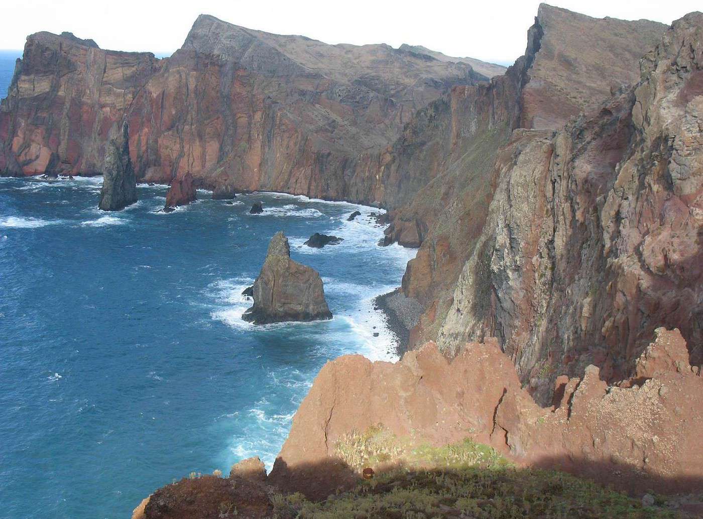


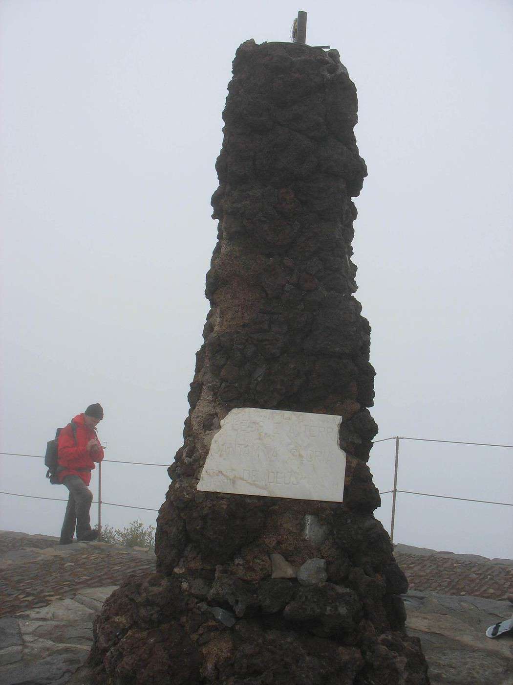
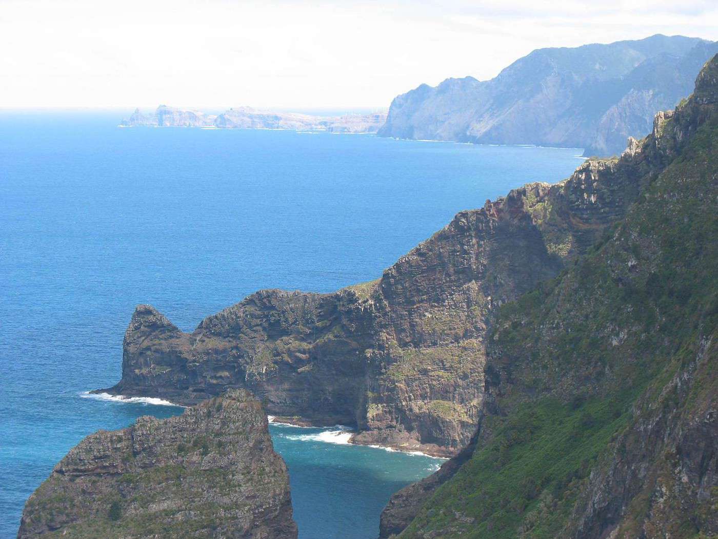
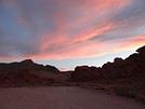
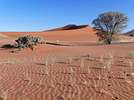
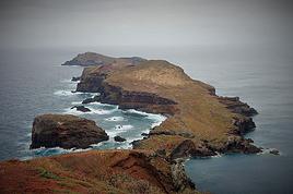

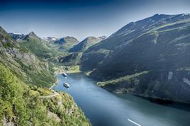







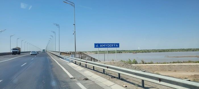
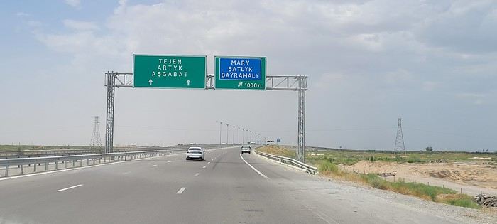
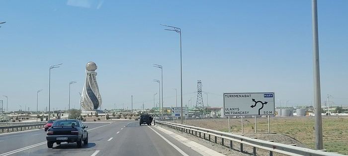
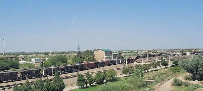
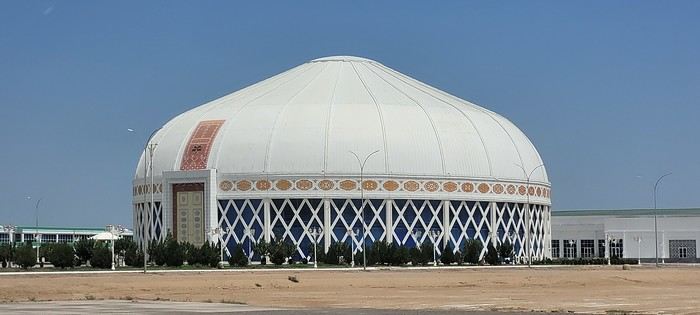
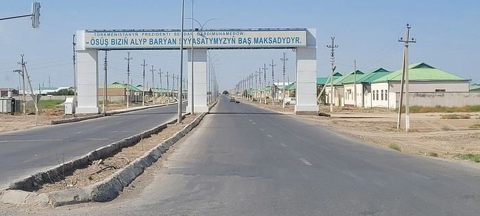
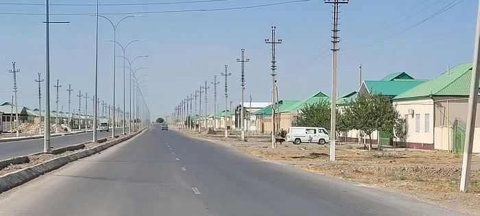 Roundabouts are particularly interesting because they feature emblems of Turkmen culture, like the dog, a carpet, the Ahal Teke horse, or Muslim symbols, even though the presence of Islamic artifacts is quite limited.
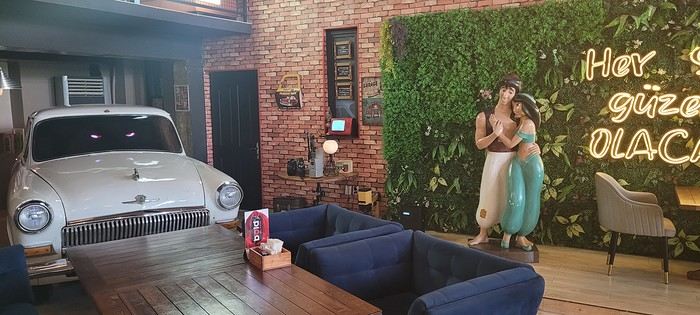

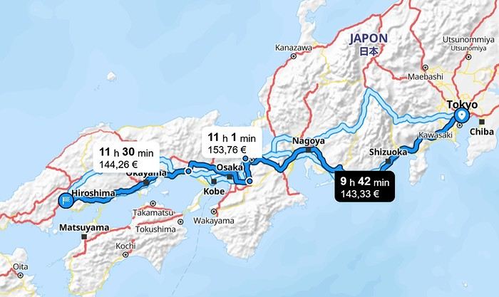
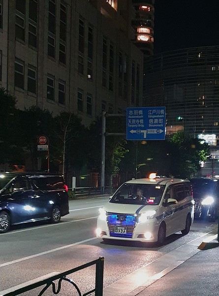

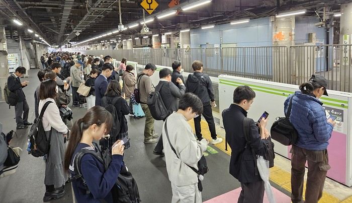
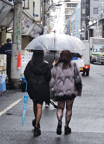
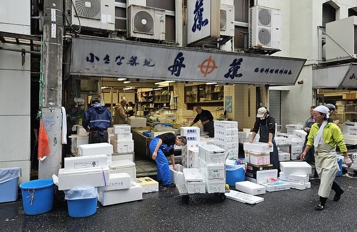 It was 15°C, but it rained—and kept raining on and off all day. Belgian weather, basically.
We went for a walk in Shinjuku Gyoen Park. Not as pretty in the rain, but the big greenhouse was interesting.
It was 15°C, but it rained—and kept raining on and off all day. Belgian weather, basically.
We went for a walk in Shinjuku Gyoen Park. Not as pretty in the rain, but the big greenhouse was interesting.
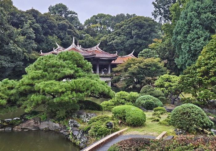
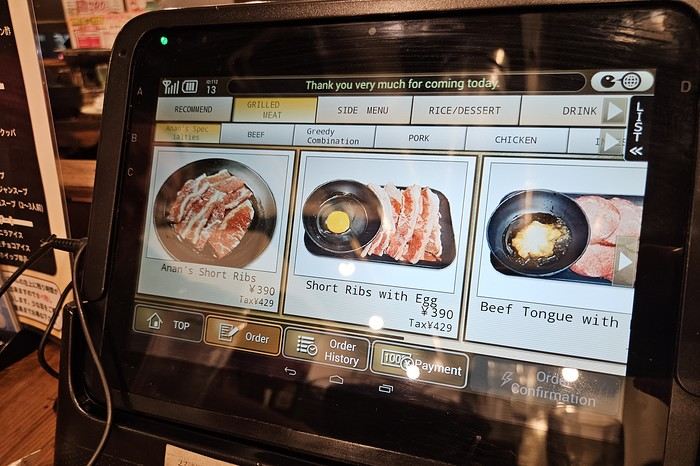
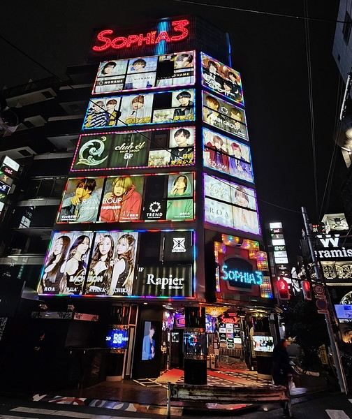
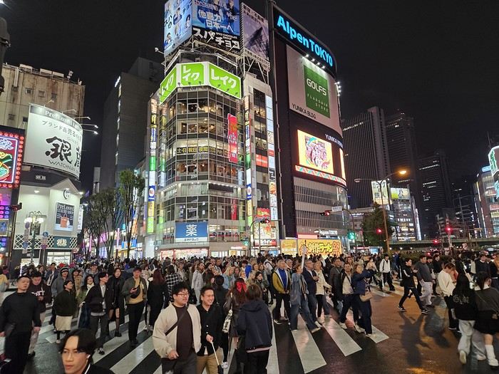

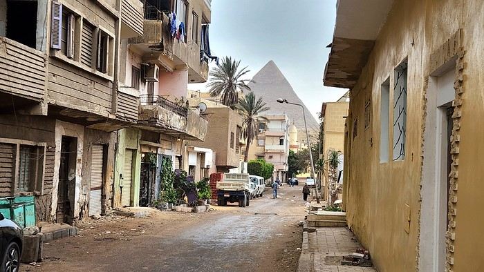
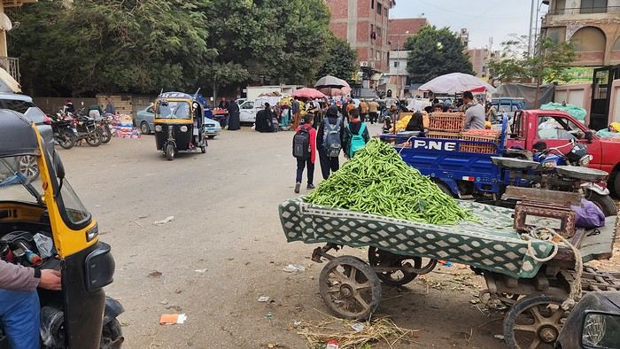
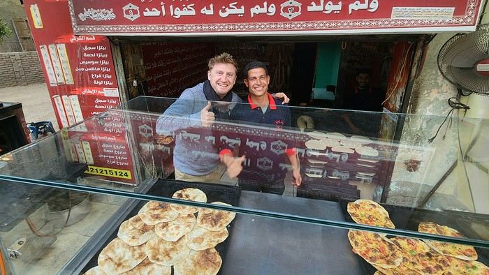
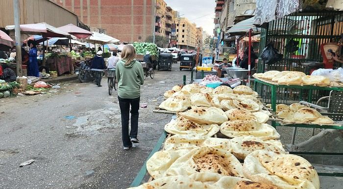
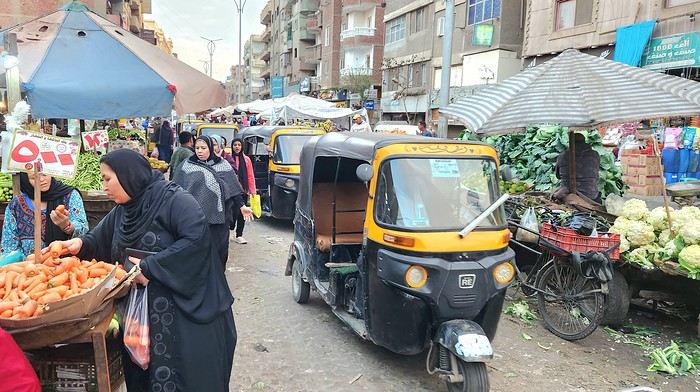
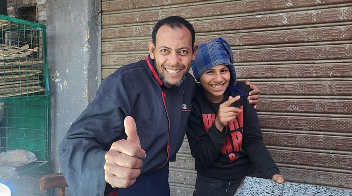
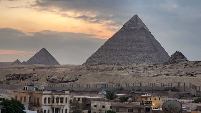
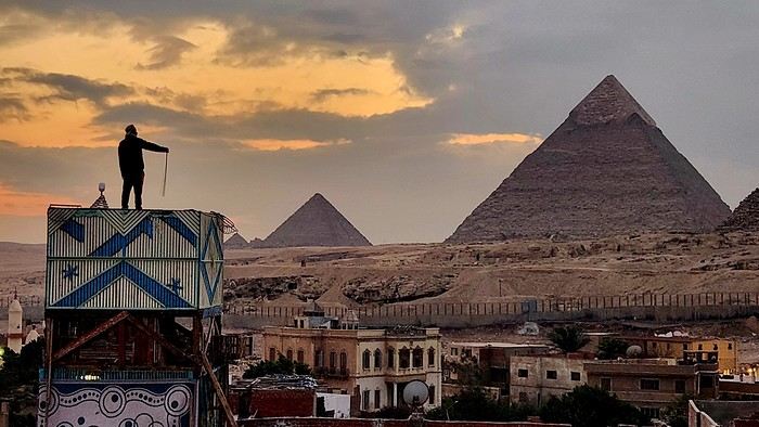
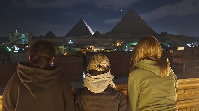

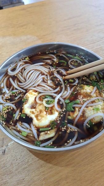
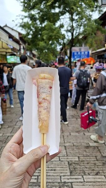
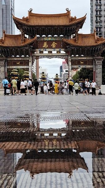

 The large solidified magma massifs that shape the heart of the island have created a large depression more protected from the sun at its center, allowing the growth of a vast laurel forest, today grouped within the Garajonay National Park, La Gomera’s green lung, which has earned it the status of a World Biosphere Reserve. Its completely European appearance contrasts sharply with the rocky and tropical landscapes of the rest of the island. Thus, the climate varies greatly from one point to another on the island: in summer, you can quickly go from a dry and sunny valley at 35°C to a humid forest area at altitude at 18°C.

 A little sneak peek?







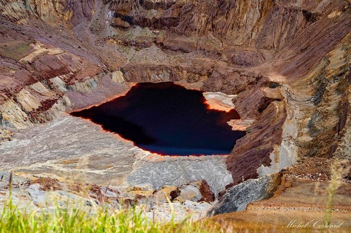
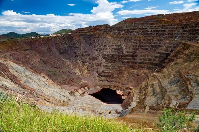
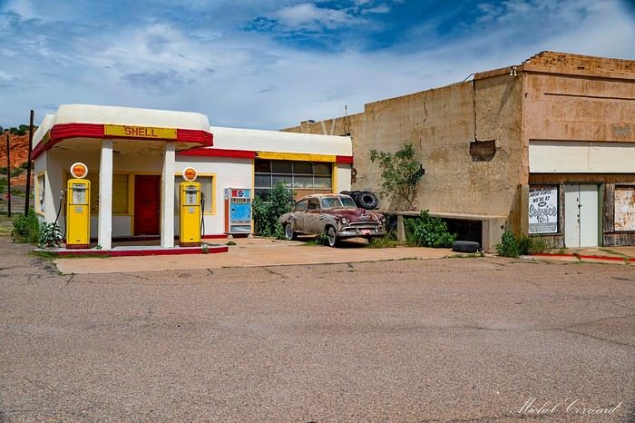
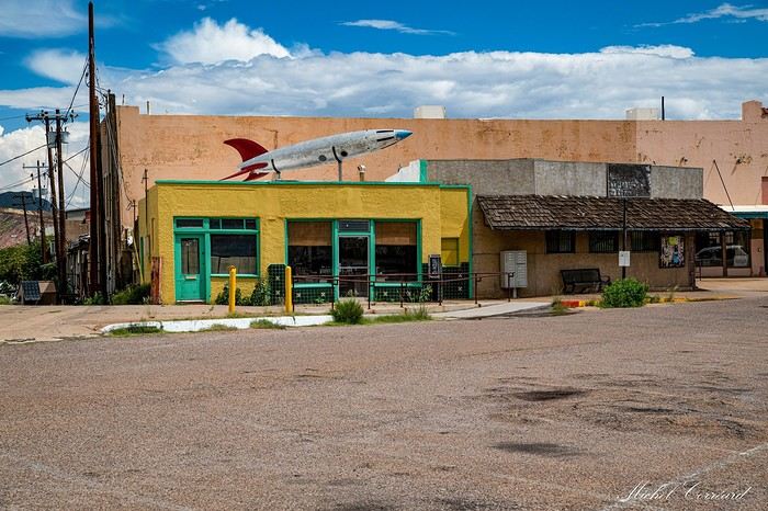
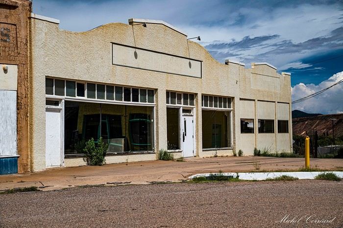
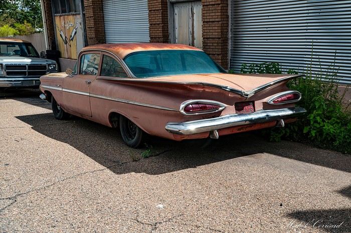
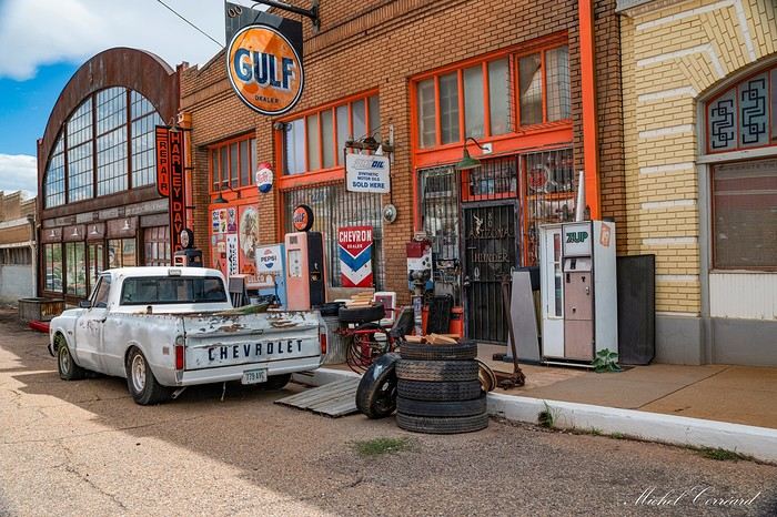
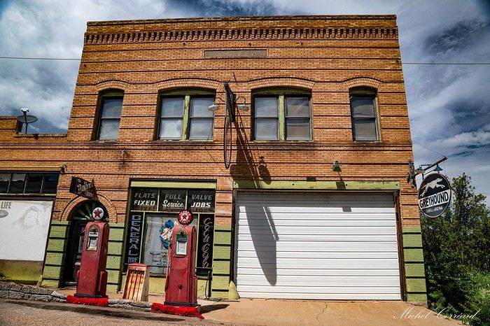
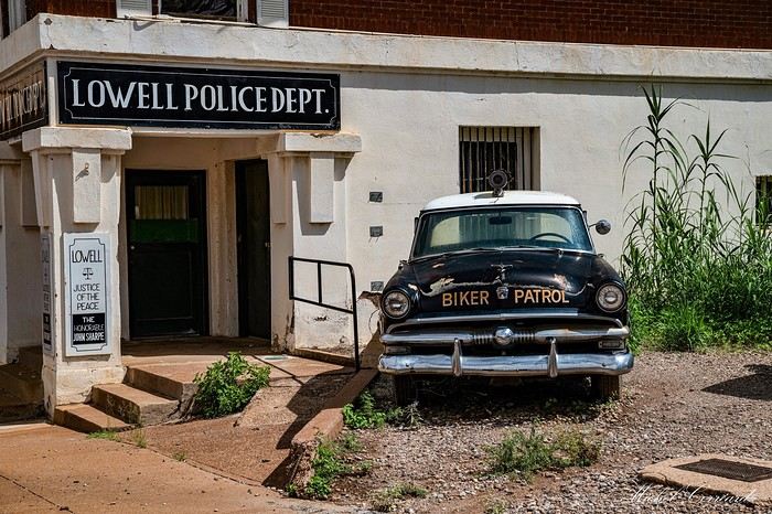




 I’m inviting you on a stroll through my drawings—a completely subjective, far from exhaustive, and totally personal take, since it’s based on my own sketches. I put this travel journal together after returning in late 2024, mostly using felt-tip pens and pencils, with a few collages thrown in. I worked from our personal photos.
 And in Kyoto, Nishiki Market:




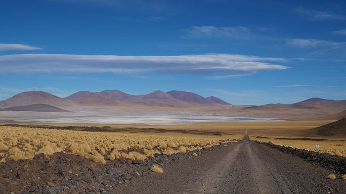
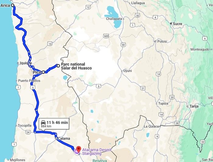 2- Around San Pedro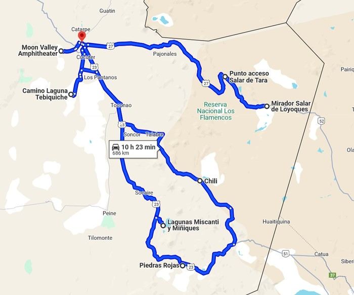
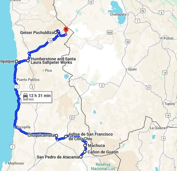
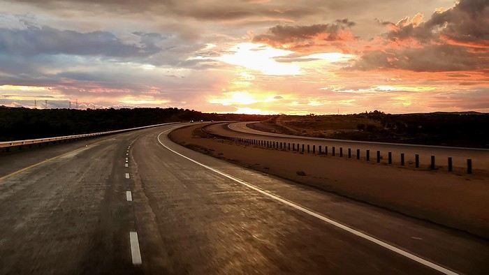
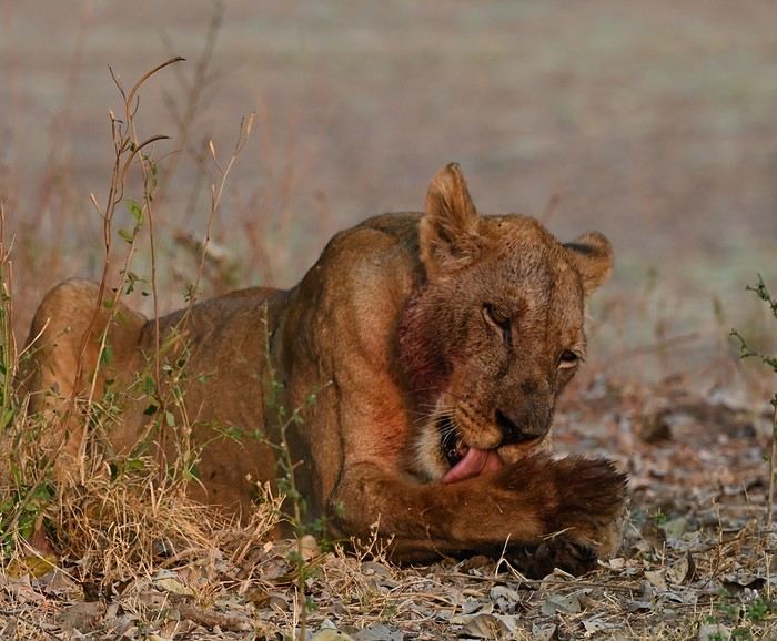

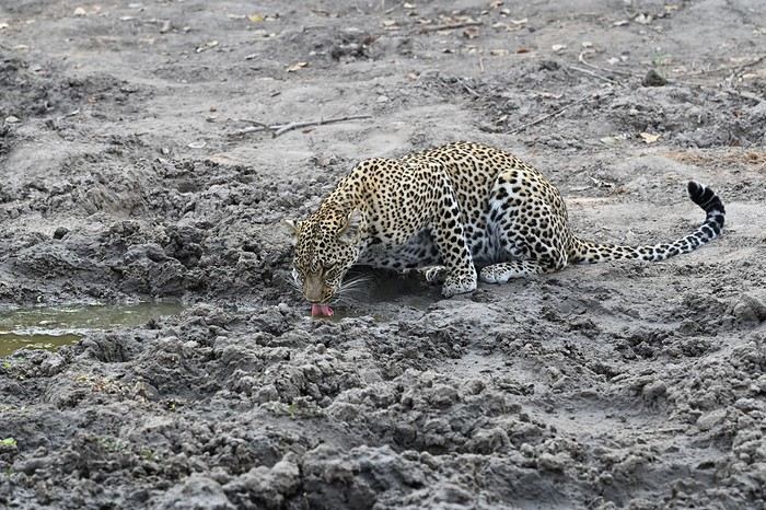
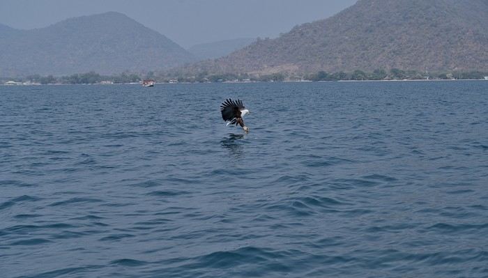
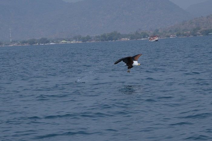
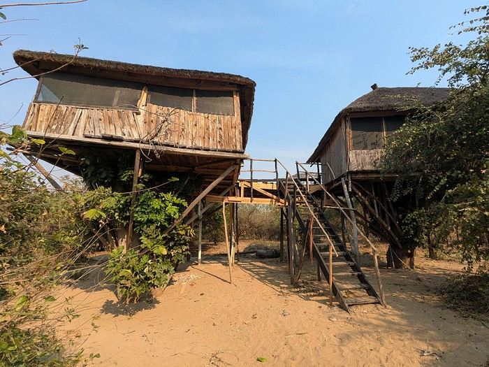
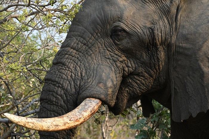 We were trapped, and even our guide looked nervous. After what felt like an eternity (though it was only a few minutes), the herd finally moved on, freeing the track. That afternoon, we did a self-drive safari and—you guessed it—we had zero interest in running into elephants again.
The next day, we headed back to Lilongwe for our flight home. It was a fantastic, varied trip with some intense moments (sometimes *too* intense). Malawi offers amazing opportunities for those who want more than just wildlife reserves.
We were trapped, and even our guide looked nervous. After what felt like an eternity (though it was only a few minutes), the herd finally moved on, freeing the track. That afternoon, we did a self-drive safari and—you guessed it—we had zero interest in running into elephants again.
The next day, we headed back to Lilongwe for our flight home. It was a fantastic, varied trip with some intense moments (sometimes *too* intense). Malawi offers amazing opportunities for those who want more than just wildlife reserves.
 Vila beach
 Sunset behind Santiago
 The rocks and sea at Ponta Preta
 At the summit of Monte Batalha
 Calheta
 Calheta de Baixo
 The beaches just keep coming...
 The dunes
 The 3 coconut trees, a landmark to find the track
 Boca da Ribeira beach
 The hills on our right
 Ribeira Dom João
 Barreiro
 The old track
 The church in Vila do Maio