Hello,
A little-visited corner of northeastern California, yet stunning:
Lassen Volcanic NP.
The story behind this photo: after the tough climb up Cinder Cone, the sky darkens and the storm rumbles. It takes another path, but we still wait nearly an hour for a ray of sunshine to pierce the cloud layer and light up Painted Dunes.
Fred
A road... leading to the "BISTI BADLANDS"—the badlands.
Upon arrival, the thermometer reads nearly 38°C. The place is lunar-like, and there’s no clear trail to follow, so with GPS in hand, Philippe finds the first rock formations of incredible diversity. It’s stunning—all these surprisingly sculpted rocks. I’m amazed, but the heat is getting to me now; the temperature rises to 40°C. It’s tough! We’ve never drunk so much. We pass through tormented, colorful expanses made up of small canyons and hills. We reach the Bisti Wilderness site—landscapes eroded by wind and rain—then the CRACKED EGGS. Here, the stones look like enormous eggs, a bit of Easter in the New Mexico desert. Very strange... when suddenly, Philippe says, "Oh crap, the phone’s not working anymore! No more GPS!!!" We couldn’t continue the hike because, without GPS, it’s really reckless to wander around here. The only solution? Turn back... We head toward the car by sight. I’m really overheating—quick, into the car, quick, the AC!
What’s going on with this stupid phone? Well, here’s the culprit... Philippe, I don’t know how he did it, but the phone’s brightness was set to the lowest—so, a black screen! Ugh! "Phiphi, you’re kidding me!"
Thank goodness it works again because, without our trusty GPS, we feel LOST!
What a story—from now on, we’re bringing two phones...
Hello,
A little-visited corner of northeastern California, yet magnificent:
Lassen Volcanic NP
The story behind this photo: after the tough climb up Cinder Cone, the sky darkens and the storm rumbles. It takes another path, but we still wait nearly an hour for a ray of sunshine to pierce the cloud layer and illuminate Painted Dunes.
Fred
Some photos capture a moment of eternity... this is one of them!
I say: all these eggs are fishy. Haven’t you seen *Alien* (the first movie), when they discover all those eggs in an abandoned ship... maybe you guys left just in time... thanks to Philippe and his phone...
Hi Fabienne,
I read in the travel guide:
"The area, also called Eggs Factory (the nursery), measures 50 m long by 20 m wide and is packed with spherical formations over 1 m in diameter for some, resembling huge eggs ready to hatch. Some movie buffs will see a reproduction of the eggs from which the Facehuggers emerge in the *Alien* saga, while others will see fossilized dinosaur eggs."
Well spotted!
Have a great day.
All these photos are such a treat, and I love your perspective and captions on them.
Michèle
Hello Philippe.
Actually, GPS is definitely a very useful tool. Personally, I travel without one, and no iPhone either—it’s a choice, old-school style, with good maps and a good sense of direction. Plus, maps never break down, and there’s no need to worry about whether there’s Wi-Fi or not. Cheers, Bernard.
Hello,
A little-visited corner of northeastern California, yet stunning:
Lassen Volcanic NP
The story behind this photo: after the tough climb up Cinder Cone, the sky darkens and the storm rumbles. It takes another path, but we still wait nearly an hour for a ray of sunshine to pierce the cloud layer and light up Painted Dunes.
Fred
It’s so beautiful! It looks like a painting... in fact, I’m wondering if I should use it as a model if you give me permission! 🙂
Hi Titoualsace.
Just a quick note: A GPS or a GPS app on your smartphone only uses data to download its route (easily done at your hotel or campsite). Once you're out in the field, you don’t need Wi-Fi or any internet connection. Your device picks up the satellite system.
By the way, in the remote areas of the West, to save battery, it’s highly recommended to turn off Wi-Fi, mobile data, and Bluetooth. A power bank is also handy. Sure, a map is always useful, like a compass, but good luck finding one without GPS! For info, this is "King of Wing."
😮 I didn’t know about this place! This region is truly full of surprises, and nature seems to have gone all out here. So I went "investigating" online about this strange geological phenomenon and read that a volcanologist from Berkeley might have found the explanation (basically, millennia-old infiltrations into a layer of volcanic ash, from what I understood!).
hi there! 🙂
Another route! This one takes us out of Death Valley toward Lone Pine.
While we were quietly at the summit taking photos and soaking in the views, two US Air Force planes flew over Panamint Valley at very low altitude with a deafening roar—gave us quite a scare!
And Factory Butte, which I loved, seen from a different angle.
A place Jean-Luc ("Bluemesa") knows very well in Colorado, along Route 50:
Curecanti NRA, between Gunnison and Montrose.
Here’s the map:
www.nps.gov/.../Map_CURE_2015-2.pdf
Another route! The one that takes us out of Death Valley toward Lone Pine.
While we were quietly at the summit taking photos and soaking in the view, two US Air Force planes flew over Panamint Valley at very low altitude with a deafening noise, giving us a serious scare.
That reminds me of one of those unlikely encounters that also add to the charm of the US...
So: we’re driving toward Death Valley, and before Panamint Valley, a sign on our right announces a viewpoint, "Father Crowley Overlook" (that’s probably where you stopped, Martine).
We pull over to take a look, follow the little trail up to the viewpoint... and there we find a beautiful landscape but especially about ten big, burly guys sitting in a row on camping chairs at the edge of the canyon, next to them a cooler, and most importantly, all equipped with high-end cameras and massive zoom lenses.
I think to myself: "Hmm, bird enthusiasts," I look around for raptors, nothing, I don’t see any signs of nests on the cliffs either... nothing... they’re just chatting... So I decide to go strike up a conversation, "Hi, how are you doing?" and ask them what they’re photographing. They explain that this spot is well-known for jet planes flying over at treetop level. And sure enough, they wait for hours just to photograph them!!!
There you go, Martine, you’ve got your explanation—and if you search "jet Father Crowley," you’ll find dozens of photos of jets over the area!!!
Below is this spot, without the jets (we didn’t wait...).
Hello,
A little-visited corner of northeastern California, yet stunning:
Lassen Volcanic NP
The story behind this photo: after the tough climb up Cinder Cone, the sky darkens and the storm rumbles. It takes a different path, but we still wait nearly an hour for a ray of sunshine to pierce the cloud layer and light up Painted Dunes.
Fred
Hi! We’ll be there next September. We can’t wait to explore these underrated regions...
Sonia
Hello,
A little-visited corner of northeastern California, yet stunning:
Lassen Volcanic NP
The story behind this photo: after the tough climb up Cinder Cone, the sky darkens and the storm rumbles. It takes another path, but we still wait nearly an hour for a ray of sunshine to pierce the cloud layer and light up Painted Dunes.
Fred
Hi there! We’ll be there next September. We can’t wait to explore these lesser-known areas...
Sonia
Good evening! 🙂
I had already gotten some initial info about my travel journal!!! Thanks Fabienne for adding to the details!!! I checked out "Jet father crowley." It’s exactly what we saw!! I hurried to send the video to our travel companions!!!
The photo of Lassen Volcanic NP is stunning!!!
Have a great weekend everyone!
Martine 🙂
Thanks Pekor.
Gotta say, the locations make it so much easier to get a great shot.
Being in the right place at the right time is also a factor to consider, and it often forces us to tweak our itineraries.
Have a great Sunday!
Fred
Hi Sonia,
Lassen Volcanic NP is one of the real hidden gems from our fifth trip out West.
If it’s on your route, you’re absolutely right to plan it.
Lucky for you, the Bumpass Hell trail should reopen in August.
A little local bonus for you!
Happy planning!
This travel journal is the second part of the trip whose first part you can find here: 1st part ... Sunday, August 7 : the day we discover a magical place...…
Hi everyone, we're back from a DIY USA road trip we organized from July 31, 2026, to August 26, 2026. The destination: The Southwest USA, including Texas,…
Japan, five weeks between unknown lands and familiar paths
Hello everyone,
I invite you to follow me on this fifth exploration trip to Japan.
Five weeks or so!
For the itinerary, my usual mix:
New discoveries, well-known places, and others less so.
At the heart of the trip, a two-week road trip by car.
I wavered for a long time between the San'in region, from Tottori to Yamaguchi, and southern Kyushu.
By a narrow margin, southern Kyushu won out.
Waterfalls that seem even more impressive.
A more exotic atmosphere.
Tea-growing lands to savor...
Kagoshima will be the starting point.
Then a loop from west to east.
And, of course, the must-see stops...
Those little Japanese touches.
Gourmet cuisine.
Japanese, but not only!
And then, the soul of the trip, I hope:
Human connections.
Big or small.
Otherwise?
Several local festivals.
Osaka, unexpected.
Miyakojima, between beauty and small disappointments.
Tokyo... it's Tokyo!
So, travel with me.
The suitcase is waiting, with stories that are sometimes generous, but always driven by the love of travel experienced firsthand.
I love islands. So it’s no surprise that the Azores have been catching my eye for a few years now. The first time I suggested them to my dear partner back in 2021, he preferred the Lofoten Islands—an excellent choice, as it turned out, since we got to visit with hardly any crowds. But for various reasons, the opportunity didn’t come up again in the following years. Until last year, that is. But by then, we’d left it too late—too late for the Azores, I mean—and the accommodation options on Flores and São Jorge were extremely limited. We decided to skip it without even looking at car rentals. So this year, we booked our flights, lodging, and cars *way* in advance (between December of last year and early this year).
The Azores consist of nine islands, so you have to make choices. I quickly ruled out São Miguel, which deserves a week all to itself: from what I’d read on various blogs, some travelers seemed disappointed after visiting the other islands, even feeling it lacked the Azores’ unique charm. True or not, that was reason enough to skip it.
In the end, we wanted to go to Flores for its lush nature (and because it’s reputed to be the most breathtaking), São Jorge for its rural/nature vibe, and Terceira for its cultural side and *impérios* (more on that later). With the time we had, we could add another island without rushing. We like to take our time and wander a bit—whether it’s a viewpoint or a hike, we always spend longer than *everyone* else. Pico won out over Faial thanks to its wine culture. And of course, there’s Corvo, which is usually visited as a day trip from Flores. I thought it’d be nice to spend the night there to experience the atmosphere once most tourists had left. I hesitated between one or two nights but ultimately went with two (so we wouldn’t be rushed by the boat schedule). It was an excellent decision.
Here’s how it all panned out:
August 25: departure for Terceira via Lisbon at 7:40 AM;
August 25–29: Terceira;
August 29: flight to Corvo. It was supposed to take half a day, and we were meant to arrive in the early afternoon, but between schedule changes and delays, it ended up taking almost the whole day;
August 29–31: Corvo;
August 31: boat to Flores around 8:30 AM;
August 31–September 5: Flores;
September 5: flight to Faial in the early afternoon (originally scheduled for the morning, but the times changed)—visit to Horta;
September 6: boat to São Jorge around 9:00 AM;
September 6–11: São Jorge;
September 11: boat to Pico at 11:15 AM;
September 11–16: Pico;
September 16: flight to Paris via Lisbon from Pico around 10:30 AM.
We had to juggle a bit to optimize the prices of our flight tickets from Paris and the inter-island travel.
After a first trip in 2009 (already!) where, roughly, we did a circuit passing through Hazyview, a private reserve in Sabi Sands, Santa Lucia and Isimangaliso, Hluhluwe and the South African part of Kgalagadi Transfrontier Park, then a quick stop in 2013 to go to Lesotho, we wanted to come back to this country.
Why not the Cape region this time, but there was no way we were coming back to this part of the world without going on a safari. Mountain Zebra or the Karoo seem more about landscapes than animals, and Addo doesn’t excite me much either... So it’ll be Kruger.
Flight prices, schedules, and durations led us to a Paris-Cape Town, return Johannesburg-Paris with British Airways, via Heathrow.
Now we just had to figure out how to fit in quite a few things without driving too many kilometers or changing accommodation every day, at least in the Cape region.
Here’s what we ended up with:
Arrival in Cape Town on Saturday, October 10 at 11 AM
2 nights in Hermanus
1 night in Franschhoek
2 nights at Mountceder in the Cederberg
3 nights in Hout Bay
Sunday: transition day—flight to Johannesburg, drive toward Kruger, night in Lydenburg.
Kruger: 1 night in Letaba, 2 in Satara, 1 in Lower Sabie.
Last night in Mbombela (formerly Nelspruit) before heading back to the airport for an early evening return flight.
For those who want to read the full story without interruptions, it’s here.
Friday, 10/9
A pretty stressful departure.
First, I woke up in the middle of the night, convinced I’d swapped my first and last names during check-in 🤪... Couldn’t get back to sleep, even though I knew British Airways wouldn’t answer before 9 AM.
Well, for them, everything was fine... but then they started talking about ETA... an ETA for England 😮? ??
Yes, it’s recent. Apparently, you don’t need one for an air-to-air transit... but you never know, it’s better to have it just in case. No one could give me a clear answer that it wasn’t necessary.
In the end, we didn’t get it... and we didn’t need it.
But here’s the thing: our flight ended up leaving Paris 45 minutes late (10 minutes due to a schedule change and 35 minutes of actual delay), so our 2-hour layover shrank to 1 hour and 15 minutes.
That should be doable, right?
The board showed our flight at Gate B: great, it’s right next door!
But at Gate B, three employees were just there to tell everyone who showed up that security had to be done at Gate A... and off we went, sprinting through the corridors, endless escalators going up and down, a little shuttle ride, security at Gate A ("You’re going to be cutting it close!" Oh really? 😠), then pretty much the same route back, only to end up just a few dozen meters from where we started! 😠
Boarding was already well underway, and after all that running, we were hot and thirsty, but phew! We made it onto the plane!
Saturday, 10/10
On the other hand, nothing to complain about on this London-Cape Town flight—it arrived early!
I booked a (small) Suzuki S-Presso because it seemed to have a higher ground clearance than its competitors.
Unfortunately, we ended up with a Tata Tiago (yes, it exists), which is lower (and also smaller, with an even more sluggish engine... yes, we were able to compare because in Johannesburg, we *did* get an S-Presso).
Somehow, we managed to fit everything in the trunk ("Whatever you do, don’t leave anything visible!") and off we went to our first accommodation in Hermanus, under a glorious sun.
Nikki welcomed us warmly, explained what there was to see in the area, and advised us to book a restaurant for that evening.
After dropping off our bags, we headed to the "cliff path," just 3 minutes from our place.
This part of the coast is famous for its southern right whales from June to November.
Let’s cut to the chase: there *were* whales, but they were very far away and very sleepy 😕.
At best, we saw (photos taken at 600mm):
A few ripples or a faint spray,
a bit of tail...
...or a bit of head.
Too bad—the owner of our next accommodation told us she’d seen around thirty of them up close here in early September.
With no whales in sight, the dassies (or rock hyraxes) were everywhere... and fun to watch.
There’s an old Chinese proverb I particularly like: "Dú wán juán shù, búrú xing wán li lú." In slightly more familiar terms, it means you always learn more by traveling ten thousand miles than by reading ten thousand books. And I’m the perfect guy for this because, first, I don’t have time to read ten thousand books about our new destination... And second, the proverb is literally made in our new adventure playground: China!
China... or should I say, "Paradox-land"! A country we see everywhere—on the news or on the "Made in China" labels of half the objects around us—but one we actually know very little about. A country hurtling toward the future while still casually chatting with its rich past. A country that, through our Western lens, seems uniform and just filled with Chinese people who all look alike, yet reveals an incredible cultural, natural, demographic, and culinary diversity as soon as you dig a little deeper. A country with a reputation for being logistically tricky for solo travelers, yet where you can book public toilets on your smartphone. In short, a delightful mess of disorienting contradictions—and, of course, a destination that was bound to charm our wandering soles for a while.
That "while" will be two weeks... And the "we," since I wanted the best in the world to join me, will be Flo and me in this backpacking duo stamped with wanderlust!
Just the two of us for two weeks to explore a tiny part of this continent-sized country, trying to understand how old wooden stilt houses coexist in the middle of futuristic skyscrapers glowing with lights, tasting all the weird and wonderful things that come our way, and—incidentally—covering the famous ten thousand kilometers from our proverb.
Well... we’ll probably cover a little less than that, but enough to let us write our own travel journal instead of reading others’... Because you know us—between living our lives watching others live theirs by reading ten thousand books, or writing our own by truly roaming the world, we’ve long since chosen our side! And you, who’s reading this—team book or team live?
When it comes to the Caribbean island of Saint-Martin, it's customary to praise its coastline and dreamy beaches—and they certainly deserve it.
But in this story, I’d like to highlight other memories, aspects, and impressions for a slightly different change of scenery.
Enjoy the read—some text and, above all, lots of photos.
« Byenveni sou zile Sen Maten! » (Welcome to the island of Saint-Martin)
--
--
Full and luminous
To avoid seeming too conventional at the start of this alternative take on Saint-Martin... here’s not a stunning sunrise over the sea but rather a moonrise—a less "typical" choice.
And when you get to witness it, it’s a truly unique moment of contemplation.
However, three conditions are essential for this spectacle: a full moon phase, a cloud-free horizon, and—most importantly—a moonrise at twilight.
That early evening, all the conditions aligned—lucky us!
Just above the sea, a strange glow gradually appeared. A huge moon was about to shine against a deep blue night sky.
What’s more, its light sparkled on the water’s surface—gorgeous! But so fleeting.
We’re on the east coast of the island, by the wide stretch of light sand at Baie Orientale, Saint-Martin’s own.
Now, just because I wanted to start with something a little different doesn’t mean we should overlook the bright sunrises you can see on this bay. They’re far more common than a beautiful full moonrise, but they also require two things: being an early riser and a clear horizon without misty clouds.
Views to soak in without restraint...
Other memories of beautiful lights and lovely colors—a morning when the sun had a brief meet-up with the rain, creating a stunning rainbow.
And let’s talk about the moon again... On a clear night, a "blood moon," the result of a lunar eclipse that had turned our familiar satellite red.
--
--
A butterfly with golden wings!
In the tropics, swarms of butterflies flutter everywhere, from flower to flower. They sip the sweet nectar from stamens and blooming corollas with delight.
Here, a monarch, one of the great migratory butterflies, taking its time to enjoy the pollen of this Ixora coccinea—or Japanese hydrangea, but let’s stick to Saint-Martin.
This one is an *Agraulis vanillae*, to be precise—and thanks to the internet for the ID.
Photographing them isn’t always easy; these fearless butterflies often fly off before you can get a good focus, challenging both the framing eye and the autofocus!
But on the island, I noticed some butterflies were much easier to shoot—those decorating a few murals. ;)
One of the graffiti artists behind several Saint-Martin murals has made it his signature. The talented Jimmy Sheik slips a little butterfly into each of his works, even if it’s not the main subject. It’s a nod to his home island, Guadeloupe, whose territory—with Basse-Terre and Grande-Terre—looks uncannily like a giant butterfly.
In the photo above, a great initiative: turning this beach bungalow, abandoned after Hurricane Irma’s (2017) devastation, into a mural canvas—it’s a real success. Well done, artist!
No wonder Tangier has inspired so many artists, writers, painters, and musicians… The "Pearl of the North" will be the first stop on a 12-day journey that will take us through Rabat, Fez, and Meknes.
This is my 15th trip to Morocco, and I’d never been to Tangier before! A round-trip flight from Carcassonne for just 55 € sealed the deal, and here we are, landing two hours later.
Four medinas, four perspectives—an enchantment that remains untouched. Once again, Richard and I will combine our viewpoints in a travel journal, sharing them with you—his through words, mine through images.
My partner and I traveled from Sunday, July 5, 2026, to Wednesday, July 22, 2026.
We spent a long time debating whether to rent a car or use public transportation. In the end, after reading so many posts about travelers getting scammed by police or rental companies—even those recommended by blogs and reviews—we decided to stick with public transport. It worked out really well. Sure, we had a little less freedom to go where we wanted, but it was way less stressful for us.
Sunday, July 5:
Arrived at Cancun Airport. Withdrew cash from the ATM in the terminal just before exiting. The ADO bus counter (they pronounce it "A-Jee-O") is right behind you when you're facing the ATM. Bus to downtown Cancun cost 145 pesos per person.
Stayed at "Rose 5," booked on Booking. The studio was super clean and perfect for one night. The owner’s instructions for accessing the place were very precise, with photos included. Check-in was self-service with a code. The ADO bus terminal isn’t far, and there are shops and restaurants nearby. We really appreciated that the AC was already on when we arrived. By the way, I’d recommend always booking places with AC—it’s *really* hot in Mexico.
Monday, July 6:
Bought a SIM card with data from a TELCEL store. My partner, who’s on Free Mobile, was able to use her regular plan. Just so you know, I found the network pretty unstable. As soon as we left the cities, neither of us—me with TELCEL or her with Free—had any signal.
Another thing to watch out for: roaming charges. I had to turn my SIM back on for less than 30 seconds to get a bank SMS code, and my phone apparently connected to the internet—resulting in an 8-euro roaming fee.
Left on an ADO bus to Chiquila for 278 pesos per person. During our trip, ADO buses were always on time, comfortable, and clean. The AC is *cranked* though, so bring something to cover up with—it gets cold. Some routes were fully booked even in the low season, so try to reserve 1 or 2 days in advance either via the app (when it works) or at the counter.
When we arrived at the ADO terminal in Chiquila, the ferry company counters were right next to it. Ferries leave every 30 minutes, alternating between companies, so no need to book ahead. Just take whichever one is leaving next (330 pesos per person).
When we got to Holbox (pronounced "Hol-bosh"), we’d booked a place via Booking called "Casa de Nana." It was a huge studio with a fridge, cooking plate, and utensils. The best part? The *location*. It was 100 meters from the beach and 200 meters from a Chedraui supermarket. They provided bath towels and beach towels, and the AC worked perfectly. There’s a key box so you can leave your keys inside when you go out. The only downside was that no one was there to let us in when we arrived, so we had to wait a while. The Wi-Fi was good, which was lucky because during our 4-day stay in Holbox, the phone network *never* worked. According to locals, that’s pretty common in Holbox, along with water outages.
Luckily, I’d had the good idea to download an offline map, which helped us find our way back to the place more easily. You can walk there from the dock.
The restaurant next to our place (La Barracuda) was great if you like seafood—I’d recommend their octopus dishes.
Tuesday, July 7:
We did a kayak tour in Holbox’s mangroves at 6 AM. We were looking for a sunrise kayak tour with a French-speaking guide. That’s exactly what we got with "Kayaking Holbox," where Diego, the owner, speaks English and French. He was joined by Gustavo, another guide.
We’d booked for a group tour, but we were the only ones. Diego still went ahead with it instead of canceling due to lack of participants, so we got a private tour at the group rate—really professional of him. They showed us this amazing ecosystem for over 3 hours. We saw all kinds of birds: pink flamingos, pelicans, egrets, frigatebirds... rays, a horseshoe crab, and a little crocodile that was *so* well hidden. Diego and Gustavo have a real eye for spotting animals—I could’ve passed by the crocodile 100 times and never seen it, it blended in so well. Their explanations about the flora and fauna were super interesting. We also got a little break where we tasted mangoes and bananas that taste *nothing* like the ones in France. A real treat—those little Mexican yellow mangoes! I’d definitely recommend Diego and his agency for a French-language kayak tour (1000 pesos per person).
In the evening, we walked to Punta Coco to see the bioluminescence. No need for a guided tour—if you really don’t want to walk, you can take a taxi. At Punta Coco, you have to pass the beach bar/restaurant and then go left into a kind of inlet that forms a lagoon. You have to wiggle your feet or move your hands in the water to create movement, which makes the light appear. Just don’t expect the kind of photos you’ve seen online—they’re all edited! It’s fun to see, but you won’t be dazzled by the light...
Wednesday, July 8:
Whale shark tour with "My Holbox Tours." Why recommend this agency over others for swimming with whale sharks? Simply because Valérie surrounds herself with top professionals to make your experience unforgettable. We were with Captain Fernando, who does everything to position the boat perfectly and make your swim easier. In the water, we were with Humberto, who also goes above and beyond to make sure you have an incredible time. He doesn’t just "supervise" like some guides from other companies who leave you on your own. No, Humberto reads the whale shark’s trajectory and guides you—all you have to do is follow him. He really puts in the effort, even holding your hand to guide you through this quick but intense encounter. Humberto also films the moment and will offer to show you the videos and sell them to you. His footage is really high quality.
Fernando and Humberto also prepared food for us. Special mention for their guacamole! Valérie is there to make sure everything goes smoothly on the boat and to answer your questions in French, English, or Spanish about these animals. If you choose My Holbox Tours, you can be sure you’ll get a top-notch experience.
About the tour itself: before you go, you should know that the sharks can be *really* far away. The day we went, it took 3.5 hours by boat to reach them. The boats are small, and let me tell you—on the way there, when we weren’t going with the waves, it was *rough*. Out of 9 passengers, 4 got seasick. But once you’re face-to-face with the shark, you forget all about that. Even if swimming with a whale shark isn’t exactly a walk in the park—they swim pretty fast, so you need some endurance to keep up. You’ll usually get 2 turns. Our first swim lasted a little over 4 minutes, and the second about 2 minutes because the shark was moving fast and we were still tired from the first swim. It might seem short, but when you’re swimming, it feels *long*. Either way, it’s an experience you *have* to do—but choose your company wisely. On the way back, there’s a stop at Cabo Catoche. Honestly, the snorkeling is pretty disappointing if you’ve done it elsewhere in the world. But the lunch stop at Cabo Catoche is really nice for relaxing (white sand and hammocks).
Thursday, July 9:
Short morning walk to Punta Mosquito at 6 AM. Really nice.
Ferry to Chiquila (330 pesos per person) + ADO bus to Valladolid (300 pesos per person).
In Valladolid, we booked "Casa Lucia" via Booking. The hotel is gorgeous, with a colonial style, and very close to the ADO bus terminal and downtown. It’s super quiet and clean. There’s a shared kitchen you can use with a fridge, microwave, and water dispenser, plus a big table by the pool and a nice indoor terrace. Breakfast was simple but included. The only small downsides were the tiny room and bathroom, no mirror in the room, and a noisy fan.
Friday, July 10:
Not far from the ADO bus terminal is the colectivo station for Chichen Itza. They offer a round-trip to Chichen Itza with an option to stop at Ik Kil cenote on the way back and then drop you off in Valladolid for 370 pesos per person (Ik Kil entrance included).
For the Chichen Itza visit, we’d booked a tour with a guide often mentioned in groups—his name is Juan Pat. He’s a Maya who lives near the site and speaks excellent French. He reserves spots in advance for you and queues up to be the first on-site. It cost 500 pesos per person + entrance fees. His tour lasts 2 hours and focuses mainly on the main pyramid and the ball court. He’s passionate and fascinating, even if some of his claims, as a Maya, might be a little biased. I think it’s *really* important to have a guide—otherwise, you’ll miss so much. You can contact Juan Pat on WhatsApp at +52 985 121 2381.
Afterward, we went to Ik Kil cenote (showers and life jackets mandatory, lockers available). It’s *very* crowded, but still really beautiful with its lush vegetation.
Saturday, July 11:
Since we didn’t have a car but still wanted to visit other cenotes that seemed hard to reach by public transport, we decided to book a taxi for the day. We agreed on 1200 pesos to take us to 3 different cenotes and wait for us at each one. (To find taxis, just look where they park near the ADO bus station.)
He picked us up at Zaci cenote, which we’d walked to. We got there at opening time and were the first ones there—had the place to ourselves for a while! 150 pesos per person. A pretty cenote in the city center with lush vegetation. It’s a bit like Ik Kil but without the deep cylindrical effect.
Cenote Xcanahaltun: the most beautiful cenote we visited. Entry 250 pesos per person. It’s a closed cenote with a hole that lets light in—a cave-like setting. You can kayak inside. There are little fish at the edge that nibble dead skin off your feet. Since it’s closed, the water is *freezing*!
Cenote Palomitas: entry 250 pesos per person. Another stunning closed cenote, even more enclosed than Xcanahaltun. The hole in the ceiling is smaller, so it was pretty dark when we arrived—kind of an eerie vibe. But when the staff turned on the lights, it looked like a "Gothic cathedral" full of bright stalactites.
Cenote Sac Aua: entry 290 pesos per person. The ticket includes a guided cave tour (tip-based). This cenote is really unique with its central island and way less crowded than Suytun. Just so you know, the water is *really* cold in cenotes. In these three, in July, we had the place to ourselves for a while and never saw more than 2 families at once—so peaceful!
Sunday, July 12:
ADO bus to Bacalar (536 pesos per person).
In Bacalar, we stayed via Airbnb with a host named Luli, who offers several rooms with shared bathroom and kitchen.
The room is nicely decorated in a pleasant setting. It’s ideally located near the lagoon and downtown. The shared kitchen is handy. The mosquito net over the bed is useful because there are *a lot* of mosquitoes in Bacalar. Luli provides a water jug, which is really nice. The only big downside is the lack of water pressure in the shower—we had to rinse off by filling a bucket. Also, there’s no real door separating the room from the bathroom. We never met Luli in person, but she was very responsive via messages. The terrace in the middle of the vegetation is lovely.
From the ADO terminal to the place, we took a taxi for 40 pesos. Since this driver was honest about the price (we’d checked beforehand), we decided to use him every time we needed a taxi in Bacalar. Here’s his WhatsApp: +52 983 184 3585.
Monday, July 13:
We did a boat tour on the lagoon with "Bacalar Francophone Activities." Since we were just the two of us, it cost 3500 pesos. If we’d managed to be 4 people, it would’ve been 1000 pesos per person.
We had a private 4-hour tour on the lagoon with Steeve and his very comfortable boat. He’s from Quebec, so his French is perfect. During those 4 hours, Steeve showed us the lagoon’s iconic spots *and* places other boats don’t go. He told us about the lagoon’s history and gave great tips on where to go and where to eat. As a little bonus, he gave us a video taken with his drone during our swimming break.
Tuesday, July 14:
We went to Los Rapidos by taxi (400 pesos round trip) and entry was 225 pesos per person. It’s *very* touristy but really beautiful. You can eat there (expensive), relax, and go down the "rapids" as many times as you want. It’s worth it if you spend a few hours there. You can’t bring in food or drinks—you leave them at the entrance and pick them up on the way out.
Wednesday, July 15:
On Wednesdays, navigation is banned on Bacalar Lagoon, so we’d planned another excursion.
Visit to Calakmul from Bacalar with ABCtours (WhatsApp +52 983 319 8359).
This agency organized a trip from Bacalar to Calakmul with a French-speaking guide. Communication beforehand via WhatsApp was smooth. Mr. Checo, the driver, and Fernando, the guide (who spoke great French), picked us up on the day. Mr. Checo drove very carefully on the long road and always made sure we were comfortable. Fernando is passionate about flora and fauna—he’s a biologist with a degree in ornithology, so he knows *everything* about animals. The slightest sound or song, and he knows what it is. He’s got an eye for spotting them, from the biggest to the smallest.
During the trip, we stopped at km 27 for a short forest walk, then went to see the two main pyramids on the site. On the way back, we stopped at the bat cave for the magical spectacle of millions of bats flying out at dusk. In the end, we saw or glimpsed (some briefly) spider monkeys, howler monkeys, a toucan, 2 tapirs, turkeys, 2 deer, and lots of birds. If, like us, you’re more into flora and fauna than archaeology, I’d *highly* recommend this agency and tour with Fernando.
It’s not cheap, but the road between Bacalar and the site is *long* (3.5 hours). Price: 3900 pesos per person for 2 (3500 for 3, 3200 for 4).
Thursday, July 16:
ADO bus to Playa del Carmen (614 pesos per person).
In Playa del Carmen, we stayed in an Airbnb. The building is on the town hall square, next to the casino.
The best thing about this place is the *location*—super close to Fifth Avenue (La Quinta). The kitchen is pretty basic, but the fridge works well. There are supermarkets nearby. The rooftop pool is really nice. The two big downsides, though, are the soundproofing (you can *hear* the neighbor’s alarm and all the events on the square) and the *total* lack of water pressure in the shower. We had to fill a trash can with water to pour over ourselves. When we told the owner, he said it wasn’t normal and someone would come fix it, but we never heard back. Based on previous reviews, this seems to be a known issue that never gets resolved.
Playa del Carmen is *very* touristy on Fifth Avenue, but in a fun, musical vibe—we never felt unsafe. There are *tons* of little souvenir shops for tourists on this street. There’s a beautiful monumental sculpture on the beach (the two figures meeting in the air), next to which you can see the Voladores show (men climbing a pole, tying themselves with ropes, and descending headfirst while "flying" around the pole). The show is tip-based and happens several times a day. In our opinion, Calle 38 is prettier than Fifth Avenue—it’s lush, green, and quieter, with the sea at the end. Great for an early evening stroll. We had really good meals at great prices at "El Tio Noy" tacos, just a few meters from Fifth Avenue in a side street.
For souvenirs, we’d recommend going to Walmart instead of Fifth Avenue—you’ll find skulls, tequila, mezcal, keychains, mugs, glasses... at good, fixed prices.
Friday, July 17:
We did the excursion to Isla Contoy. Isla Contoy is an uninhabited, highly protected island. Only 200 people are allowed to land per day on a rotating basis, so only a few companies have permission to dock there. Most agencies subcontract the day to a third-party company.
We booked through VRM (Viviendo Riviera Maya), but it was Ocean Tours Mexico that handled the tour. Contoy is a little paradise. We were accompanied by multilingual guides, including French speakers, throughout the day. Steffy gave us info about the island during a short walk on the marked trails, and Leño Tlatemoa kept the mood up on the boat rides with music and dancing. Isla Contoy is *truly* stunning, and the lunch was delicious: grilled fish and chicken, guacamole and tortilla chips, rice, fruit, drinks (everything is brought and taken back by the guides). The snorkeling part was pretty disappointing if you’ve done it in Cozumel, though. The stop at Isla Mujeres isn’t very interesting either—it’s too short to explore, and the island is *extremely* touristy. Still, the excursion was very well organized, and we had a great day (2970 pesos per person).
Saturday, July 18:
We wanted to go snorkeling in Cozumel but thought the prices from French-speaking agencies were too high. Plus, for snorkeling, we figured we didn’t *need* a French-speaking guide.
So we found a much cheaper solution by taking the ferry from Playa del Carmen ourselves and choosing an agency in Playa. The round-trip ferry cost 663.50 pesos per person. Then we took a taxi to the snorkeling boat (100 pesos). The agency we chose is called Mystic Snorkel—they don’t have a physical office. The tour cost 1400 pesos per person. It was a small boat, but that day we were the only ones, so we got a private tour at the group rate. We stopped at 4 different sites, all very different and beautiful. We saw all kinds of fish, corals, a nurse shark, and turtles. El Cielo, with its huge starfish, is *exceptional*. If you’re going snorkeling in the Yucatan Peninsula, this is *the* tour to do—the other sites are pretty "poor" in comparison.
Sunday, July 19:
Morning dive with Triton Diving. I chose the Cozumel dive option. Great experience.
Booking via WhatsApp was easy. On the day of the dive, Selene, who speaks French, was our guide. She’s *very* attentive to the group’s safety. The briefings are clear and precise. In Cozumel, we did 2 very different sites: the first was a drift dive with lots of life—beautiful corals and fish. The second was a wreck, the C53, a 56-meter boat you can enter. Not much marine life, but a beautiful wreck intentionally sunk for divers—still in great condition. An unforgettable moment. Selene even took videos during the dive, which the club sends you for free afterward. I’d *highly* recommend this club.
Just so you know, in Playa del Carmen, the beaches were full of sargassum during our stay, despite barriers and daily cleanup. Locals told us the problem is getting worse and the sargassum is arriving earlier in the season. Tourism has taken a *big* hit this summer, and they’re wondering if tourism can even survive the sargassum season anymore. A lot of tourists are heading to the islands—Isla Mujeres and Cozumel—to enjoy the beaches, as the west side of those islands is sargassum-free.
Monday, July 20:
Colectivo to Puerto Morelos. First, a colectivo toward Cancun that drops you off between Puerto Morelos town and Puerto Morelos beach (40 pesos per person), then another from that junction to the beach (10 pesos per person).
In Puerto Morelos, we’d booked a room via Airbnb at "Piedra del Caribe." *Best* place we stayed in Mexico. It’s an aparthotel. Our room was ready before check-in, so they let us in early. The place matched the description—spacious, with a comfortable king-size bed. The shower had *great* pressure, which isn’t a given in Mexico. The staff was super friendly and welcoming. They let us use the pool, restrooms, and rooftop shower after check-out while we waited for our ride to Cancun Airport. They even kept our luggage. I *highly* recommend this place.
In Puerto Morelos, there was *way* less sargassum than in Playa del Carmen—it was actually swimmable.
We did the snorkeling tour with the fishermen’s cooperative for 450 pesos per person for 2 hours. The reef is close to the beach (you’re not allowed to swim there), so the boat ride is short. It’s not as pretty as Cozumel, but it’s nice and affordable. On Puerto Morelos’s page, you can also access a small, not-very-well-preserved reef. There’s also a cenote in the sea where fresh water mixes with saltwater—the water is murky there. We had a great dinner and excellent cocktails at "La Choza del Puerto."
Tuesday, July 21:
Wandered around Puerto Morelos (check out the church and read everything—it’s entertaining!), relaxed by the hotel pool, and left for Cancun Airport by taxi (400 pesos) booked via InDrive to head back to France.
Our highlights:
- Holbox
- The whale shark tour
- The cenotes
- The local flora and fauna (so present!)
- Isla Contoy
- Cabo Catoche (except for the snorkeling)
What we liked least:
- The bioluminescence (barely visible despite good conditions)
- The food—we found it not very diverse in taquerias
- The constant tipping
- The lack of water pressure in showers (fixed, wall-mounted, no hose or showerhead)
Don’t hesitate to ask if you have any questions while it’s still fresh in our minds.
The latest travel journal about Turkmenistan dates back to 2019. Here’s a quick update on this vast desert country, which is now a bit easier to visit than before.
This is my first travel journal. If you have any questions, don’t hesitate to ask. The country is slowly opening up, but it’s still possible to visit sites where you’ll be completely alone. In five days, I saw two Hongkongers, a few Germans, and a Chilean at the crater, ten Chinese people in a capital bazaar, and that’s it!
It’s possible to visit Turkmenistan from Uzbekistan. The easiest and most economical way is to take a taxi to the border from Bukhara. The trip takes a little over an hour.
Crossing the border takes quite a while because many Turkmen bring back items bought in Uzbekistan to resell in Turkmenistan. For example, diapers, baby products, or beauty products.
It took me over 2.5 hours to cross the border. To visit Turkmenistan, it’s mandatory to have a guide and go through a travel agency. British agencies often offer three-, five-, or seven-day trips for over 1,500 or 2,000 €.
But if your budget is more limited, you can contact a few Turkmen agencies directly by email, and they’ll make you an offer between 700 and 1,300 € for three to seven days. I took a five-day trip from Turkmenabat in the northeast of the country to Dashoguz in the north. The goal was to visit the main UNESCO-listed sites, including Merv, and archaeological sites like Nisa or Gonur Tepe.
Your guide will also be your driver. They’ll pick you up at the border. The formalities are very long because customs officers have to stamp multiple documents, and obtaining the visa you previously requested from your travel agency requires several checks. But the process goes relatively smoothly, even if each step takes a while.
Once on the other side, the first surprise is the brand-new highway all the way to Turkmenabat. A very long line of trucks stretches for several kilometers on the Turkmen side to cross the border into Uzbekistan. According to my guide, Turkmen trucks transport gas and cotton (though not this season, since the harvest is in September), but they mainly fill up their tanks because fuel is much cheaper in Turkmenistan. A full tank for a car costs about 3 €, which is unbeatable.
From the Farap border post, the goal is to reach the city of Mary, which is home to the UNESCO-listed site of Merv in its suburbs, about thirty kilometers away. This city is known as a foundation by Alexander the Great in the 4th century BC under the name Alexandria of Margiana. Several fortresses are visible.
After more than three hours on the road, we have lunch at a Turkish restaurant called Aladdin. Several quotes from the president are visible along the highway, but the road is in good condition, and we move along easily. This will be by far the best road in the country—things will get much worse later.
Roundabouts are particularly interesting because they feature emblems of Turkmen culture, like the dog, a carpet, the Ahal Teke horse, or Muslim symbols, even though the presence of Islamic artifacts is quite limited.
Ours was supposed to happen in 2020. Everything was ready: the itinerary, the flight tickets, hotel reservations and Machu Picchu, the rental car, dreams of high altitudes and wide-open spaces. And then the world stopped.
Like so many other plans, our trip to Peru was put on hold. Disappointment was followed by a more concrete reality: paperwork, endless back-and-forth, and battles to recover some of the costs we’d already paid.
The years went by. Life moved on, with its shifting priorities and unexpected twists. Rescheduling this trip wasn’t possible until 2025.
The itinerary stayed mostly true to what we’d imagined five years earlier. One major difference, though—in 2020, we’d planned to rent a car and explore the roads completely independently. Most importantly, we hadn’t included the three-day Ausangate trek, due to lack of time.
For 2025, our plans evolved. 4x4 rental prices had skyrocketed, and when we looked at our schedule more closely, we realized quite a few days didn’t actually need a vehicle. So we made a different choice and opted for private drivers instead. A decision we never regretted. Always punctual, thoughtful, and available... they were so much more than just drivers.
All our reservations were made in January, except for the trek, which we booked in February.
Finding reliable drivers on our own was tough, so we asked Laurent from Tout Pérou to handle it for us. Going through Tout Pérou also gave us a discount on the train ride to Aguas Calientes, so Laurent booked those tickets too. He also bought our Machu Picchu entrance tickets at the same price we would’ve paid on the official website. When comparing domestic flight prices, we found it was cheaper to book from Peru, so Laurent took care of those as well.
This time, nothing was going to stop us. Peru was waiting. And we were ready. 🙂
Introduction:
As has become a habit, I’ve organized a trip for late October—a surprise trip for my poor wife, who follows along without saying much (or almost nothing).
She knows she’s going away, when, but not where!
Our friends and family keep bombarding me with questions to get the info, but I’m holding strong.
The guesses are flying, the best one being, “Knowing him, he’s definitely heading somewhere sunny, even if all the southern destinations have already been done for a short stay.”
It makes me laugh because there are still a few places I haven’t discovered yet.
So yes, choosing to go to Belgium at the end of October—especially for someone as sensitive to the cold as I am—is bold.
I’m not quite at Philippe Abrams’ level, but still, heading *Noooorth* from me is pretty daring.
So, contrary to my friends’ predictions, I’m not flying south but taking my car, turning the wheel north, and off we go!
Day 1: The outbound trip
When I say I’m not flying, it’s only half true because we’re leaving the day French media—with their signature doom-and-gloom—announce a terrible storm.
While Storm Austen is indeed forecasted, the Belgians are reporting it as the first storm of the year with a bit more restraint.
The drive won’t be entirely smooth as we reach the Hauts-de-France region: the wind is strong, the rain is heavy, but it’s not the apocalypse. Just drive carefully and slow down—sounds like a road safety message!
We left Lyon at 8 AM and arrived in Bruges at 4 PM, “...and that’s even with the trucks at the entrance to Angoulême!”
What’s he talking about—going through Angoulême?
French cinephiles will get the reference.
We got a warm welcome at our B&B, and since it was barely drizzling, we took a quick stroll around town to stretch our legs.
Headed to the Markt, visited the Prinsenhof, the Palace of the Dukes of Flanders. We actually went in because it started pouring.
It’s free, a first taste of Flemish culture, and it’s great.
A little tired, we headed back to our B&B, mostly because the heavy rain forced us to.
We got soaked (some people must be laughing).
After drying off, we went to the nearest restaurant, Parazzar, typically Bruges-style, and my wife tried her first beer.
Personally, I don’t like beer—*What the heck was I thinking?*—so I had a red wine, a Tinto, which would’ve been local back in Charles V’s time.
First fries—because I *love* them—and it’s time to call it a night.
A good night’s sleep awaits.
The +: We made it!
The -: It’s raining, it’s windy, it’s wet—party at the...
And we still haven’t seen everything!
Before setting off for new horizons at the end of this year, it’s time for me to share my trip to Cape Verde this summer 2025.
I particularly love these spontaneous trips, and our stay in Cape Verde is one of those because it was only at the beginning of April that we decided on this getaway, which had been catching our eye for a while, given our love for the mountains.
As always—well, when it’s open—I turned to VF, and I want to immediately thank Marie, aka ptitortue, who helped me a lot in planning this trip through her travel journals and our exchanges!
Because Cape Verde is both small and vast! We decided not to rush from one airport to another, to enjoy the places and the people, but also to relax, since the work backlog from being stuck in May (see my previous travel journal 😅) had to be caught up on in June.
So, 4 islands will be our winners from 06/28 to 07/19:
Santiago first for logistical reasons, as round-trip flights from the capital Praia were the cheapest (650 €/person from Lyon via Lisbon with TAP, still!)
São Vicente, because it’s the gateway to the next one but ultimately more than that...
Santo Antão, pretty much the main goal of the trip since Marie (and the photos) had really sold it to me.
And finally, Sal Island, for some rest—a non-negotiable condition for my other half—and we’ll see that I should’ve listened to Marie...
That said, what a chatterbox I am—buckle up, flight attendants at the doors, off we go on new beautiful escapes! (Thanks to Sophie for the easy loan)
Last note for my eager fan club 😏: yes, there will be alcohol—how could there not be in the land of grogue!
Traveling with just one spare pair of underwear, considering a hot shower a miracle, never staying in the same place too long by sleeping wherever night catches us, taking whatever local, improbable, and rickety transport we can find—this is the DNA of us wanderers. Except this time, the script for our movie is going to be a whole different genre. On paper, the destination doesn’t exactly scream epic adventure: Réunion! And what’s more... we won’t be two, or four, or even ten. We’ll be a solid thirty. All from the same family. Yes, thirty. At this point, it’s not just a trip—it’s a summer camp on the move! Why inflict this on such a peaceful island? Because my brother decided to get married there with his lovely bride. A great idea, you might say... especially when it involves relocating the equivalent of a small Ardennes village 10,000 kilometers from home for three weeks! So who’s stepping up to be the guide and wave the little flag?
So, for an exceptional trip, exceptional stories! Don’t worry, the debates at the supermarket over whether to choose plain chips or roast chicken chips, the beach picnics washed down with ti’ punch, and other rougail sausages to digest by the pool will only make it into the family archives. Here, I’ll stick to the tales of our beautiful escapes, the ones where we explore the wild corners of this little volcanic rock planted in the middle of the Indian Ocean. So where exactly are we headed?
For the first week—the subject of this first installment—we’re taking it easy. We’ll start by rediscovering the coastline, from the Souffleur in Saint-Leu to the Hermitage lagoon, before a little trip to the Cirque de Cilaos and its legendary road with 400 turns, just to get our legs warmed up.
Last October, we landed in Marrakech to spend a few days with family exploring Morocco’s roads.
Transport: a rented Dacia.
Accommodations: small guesthouses.
Our first stop was just a few kilometers from Marrakech, at a lovely house perfect for relaxing and recharging before continuing. It’s called Bleu House, a little paradise on the outskirts of Marrakech. The welcome was very warm, with a beautiful pool and a lovely garden.
Next, we headed toward the Tichka Pass. The road has really improved in recent years—it’s much easier to drive now. No more getting stuck behind trucks, and today, the construction is practically finished.
Morocco has turned green after the recent rains. It’s a joy for the herds and shepherds.
This travel journal is therefore intended solely for my photos, to present a consistent style.
All the shots were taken with a simple Samsung Galaxy smartphone and with whatever was at hand.
All stays combined, I’ve spent the equivalent of three years at most in Thailand, and I’m not a big expert on the country.
However, after many trips, lots of reading on VoyageForum and other sites, and conversations with many locals as well as expats, my view of the country is becoming clearer, though it’s constantly evolving. You never stop discovering and learning.
I guess I wanted to piece together a puzzle, mainly for those who want to get an idea of the country here and for those who miss it.
I don’t know if this minimalist sharing will interest anyone, but it’ll do me good to put it together. After so many months without traveling and then these other long months with VF closed, there’s plenty of material available.
There’ll be a mix of places, periods, and subjects, but it might well be intentional.
I suspect many Thais have dogs because they make excellent guards for the home. Nothing better to deter burglars or to signal the presence of a snake. You’ll often see Thais tapping the top of their dog’s head, but don’t be fooled: it’s a sign of affection from them. Judging by the dogs’ reactions, they’re used to it.
Thailand is one of the countries on the planet where rabies is still present, so keep that in mind. It’s not just bites that can be dangerous, so don’t let just any dog lick you. Especially on a wound, of course.
Even though dogs often fear humans—this dangerous and unpredictable predator—we still need to stay cautious.
Be careful when walking into alleys because the dog will defend its master’s big property, be careful at night, and be careful when they’re in packs.
It sometimes crosses our minds that Thailand isn’t really made for walking around, and dogs are one of the reasons.
That said, it’s not uncommon to see them chasing bikes or scooters. Cars, though, are much rarer—they’re too big.
It seems Thais prefer to give their dogs freedom by not locking them behind gates. Though sometimes the gate is closed, the little side door is wide open. Oh, and sometimes there’s no gate in front of the property, or it’s been broken for years.
You’ll often see dogs sleeping on the side of the road, sometimes right on the road. When you arrive, they move aside nonchalantly—or not at all. It’s less funny when they suddenly appear from thick vegetation, which reminds visitors not to drive too fast. As a result, you’ll notice that dogs with injuries or missing legs aren’t that rare.
Since they believe in reincarnation and respect for all forms of life, they don’t chase dog packs away too much, and they don’t sterilize them enough. Seeing a small pack roaming freely in the countryside, you might think it’s best not to cross paths with them at the edge of a field.
A darker side of this is that euthanasia isn’t often practiced. Twice, we saw dogs at temples on the brink of death, enduring terrible suffering. No one did anything about it. The image (and the smell) of one of them, dying and emitting the stench of death, still comes back to me sometimes.
Some of you may have seen the YouTube vlog of a French woman living in Phuket who was given a little pig by her Thai friends. The well-fed animal quickly became a happy, enormous beast with its own garden. Yet, it didn’t take long for it to fall seriously ill and become incurable. In her video, the French woman described how difficult it was to find a vet willing to perform euthanasia.
You’ll often see bowls by the side of the road. Thais leave food and water in them for stray cats and dogs. Overall, they have a big heart for animals.
If you ever pop into a shopping mall, you might see people pushing their small dogs in strollers. It’s not a gimmick—it’s just that these strollers are provided for customers to put their pets in, otherwise you can’t bring them inside. It looks a bit odd when you expect to see a baby.
I had to leave Thailand as my 60-day visa was coming to an end, and this time I opted for a 14-day visit to Japan. I’d already spent 3 days in Tokyo a few years ago on a business trip, which left me with a great impression. Y, my Thai partner, had never been there. That’s why we chose a fairly classic itinerary, including a few castles and Kyoto among other things.
Before diving into the details of our trip, I’d like to recap the expenses we incurred. This will be useful for some of you, and it’ll help us prepare for our next trip to Japan.
I’ve categorized our expenses into 5 groups:
- Hotels: 1150 € (breakfast included)
- Transportation: 278 € (trains, buses)
- Big expenses: 487 € (souvenirs and a few necessary items)
- Excursions: 116 € (museum visits, temples, castles)
- Daily expenses: 1125 € (meals, small purchases)
Total = 3194 €, or 228 € per day on average. I’m excluding flights, as those depend on everyone’s arrangements (departure location, travel dates, etc.).
Jpeg below: apologies for “hotel” without a circumflex—my software isn’t French!
For hotels, we always chose decent but not luxurious places, well-located to let us walk to and from transportation hubs. We systematically avoided taxis, which are notoriously expensive in Japan. We’ve also gotten into the habit over several trips of traveling with minimal luggage: one duffel bag each (7-8 kg) plus the small carry-on allowed on planes (2-3 kg). This lets us travel with three sets of clothes (what we’re wearing plus two changes). We add a checked bag for the return trip to accommodate the things we buy along the way.
‘Transportation’ and ‘Big expenses’: I’ll give more details in the day-by-day account.
We didn’t do any extravagant excursions, like safaris or sports activities.
Meals and food make up the bulk of our daily expenses. We often ate at izakayas, which offer great value—between 2000 and 6000 yen for two (about 11-12 to 33-34 € for two, usually around 20-25 €). We didn’t hold back, but we also didn’t go to high-end restaurants.
More to come while I gather my photos: General Remarks.
Hi everyone, I’m Patrick, 67 years old, a seasoned traveler (already 22 trips outside Europe).
In autumn 2025, I took my first 3-week trip to Japan, with stops in Tokyo, Kamakura, Matsumoto, Kamikochi, Takayama, Kanazawa, Kyoto, Nara, Osaka, Koyasan, Tokyo again, and Nikko.
I wanted to go back in May 2026 and explore some lesser-known places to complement my first trip.
Last year, there were four of us traveling together to discover Japan (a fairly classic itinerary). This time, I’ll be traveling solo for part of the trip and with a couple of French friends for the rest.
The weather was gorgeous in May, averaging around 25°C, with two very hot days in Kyoto and only two rainy days.
As usual, I organized everything myself, gathering plenty of information from various sites, including this one.
Transportation:
An ICOCA card is essential.
I got a 5-day Kansai-Hiroshima pass because I took the shinkansen between Hiroshima and Osaka three times, and it paid for itself quickly.
Accommodations:
Mostly through Booking. No issues at all. Average cost was 46 € per night.
Meals:
For breakfast, I alternated between buying food at a konbini to eat in my room or on the train and grabbing something at local cafés.
For lunch and dinner, I tried to vary my meals as much as possible—lots of sashimi, sushi, and ramen.
Okonomiyaki in Osaka and Hiroshima.
Oysters in every form (raw, grilled, fried) in Onomichi and Hiroshima.
A variety of seafood (shrimp, shellfish) in Hiroshima and Matsumoto.
Fish whose names often escaped me, but notably mackerel and eel (unagi).
Tempura and gyoza.
Chicken skewers (yakitori) and one teppanyaki meal.
One omakase meal (9 different dishes).
In the end, not much meat aside from a few yakitori skewers. No splurges on super expensive wagyu or Kobe beef.
Average dinner cost: 4,800 yen, drinks included.
The Itinerary:
Day 1: Departure from Brussels
Day 2: Arrival in Osaka
Day 3: To Himeji, then Kurashiki
Day 4: To Fukuyama, then Tomo no Ura, then Onomichi
Day 5: Cycling the Shimanami Kaido
Day 6: To Takahara, then Hiroshima
Day 7: To Kyoto to attend the Aoi Matsuri parade
Day 8: To Miyajima
Day 9: Hiroshima, then Kyoto
Day 10: Southern Kyoto
Day 11: Northern Kyoto
Day 12: Final day in Kyoto, then to Nagatsugawa
Day 13: Start of the Nakasendo Trail (Magome to Tsumago)
Day 14: Second day of the trail (Kiso Fukushima)
Day 15: Third day of the trail (Narai), then Matsumoto
Day 16: To Mt. Fuji (Kawaguchiko)
Day 17: To Tokyo
Day 18: Excursion to Enoshima and Kamakura
Day 19: Flight home, with a 10-hour layover in Hong Kong
Day 20: Arrival in Brussels
Hello,
Following our trip on the Great Divide Mountain Bike Route this summer, we’re sharing our experience in this travel journal.
We’re Richard and Bernadette, both 64 years old, and we’re gravel bike-packing cyclists.
We’ve completed several gravel bike trips in France and neighboring countries, and Richard has also done some in South America.
We left on July 22, 2026, from Geneva to Calgary via Frankfurt with our bikes carefully packed in boxes, and we returned on October 8 from El Paso to Geneva via Chicago and Frankfurt.
The GDMBR is a mountain route that closely follows the Pacific/Atlantic continental divide, starting in Banff, Canada, and ending at the Mexican border in Antelope Wells, New Mexico. This crossing of the American West is one of the longest mountain biking routes in the world, winding through wild valleys, mountain ranges, and desert plateaus. It stretches about 4,400 km with a total elevation gain of around 60,000 m. The average altitude is 2,000 m, and the highest point reaches 3,600 m. The route is 80% off-pavement (gravel roads, dirt, and a few trail segments). It’s also known for the annual Tour Divide race, which brings together the best riders in the discipline every June and follows roughly the same route.
We prepared for this trip over several months, using a few websites and an older guidebook (the 2013 English edition).
With this, we were able to organize our journey with as much information as possible, a GPS track, and gear suited to the weather conditions, terrain, and sparse resupply points in remote areas.
Once we arrived in Banff, we picked up bear spray to handle a particular challenge: the wildlife we weren’t familiar with.
After landing in Calgary, we assembled and equipped our bikes at the airport. That first evening, we were welcomed by Mike, who invited us to his place when we were looking for a spot to pitch our tent. Then we made our way to Banff over two days, taking a fairly quiet road to Canmore and then a bike path.
A visit to Banff, a charming tourist town in the national park. Its famous Fairmont Hotel.
The starting point of the GDMBR at the arch of this hotel complex.
Here we are, immersed in the wilderness—just a few pedal strokes away from the town, the contrast is striking. Powerful rivers, vast landscapes, and our first encounter with a mule deer.
Spray Lake, our first basic campsite: no showers, dry toilets, no water fountain—we filter lake water. Most GDMBR campsites are like this.
We took the west side of the lake—a longer and wilder route. A few fallen trees blocked the path, forcing us to carry our bikes. But the stunning landscapes made it all worth it!
Our first single track through a forest marked by past wildfires.
Most campgrounds have tables and metal fire rings for safe campfires, which makes setting up camp much easier—especially nice after a long, tiring day!
During this trip, we mostly slept in our tent, either in established campgrounds or wild bivouacs.
When we started looking for a summer destination a few months ago, our first criterion was to avoid extreme heat and heatwaves. We had already been to Norway two years ago and are considering going back in the future for other occasions. So, we had some fun asking ChatGPT which destinations enjoyed a mild climate during the summer without going too far. Among the list provided by the AI were the Canary Islands... The idea of a place we wouldn’t have thought of first, both not too far away and exotic enough, appealed to us: “Hmm, why not?”
This destination had never really attracted me, though Magali was a bit more interested. Five years earlier, COVID had caused a short break in my professional activity, and I had planned a trip because the flight price was attractive, and I was looking for a destination different from what usually appeals to me, more than out of deep interest. From a distance and with a social judgment I acknowledge (it’s not great, but it’s not completely wrong), I had the image of a destination for party-goers enjoying the sun without the slightest interest in local culture, with concrete coastlines and denatured landscapes—everything I detest the most. Still, I had done some quick research on the different islands and spotted Lanzarote for its beautiful volcanic landscapes, hiking trails, beaches, and the impression of a good balance between activity and fewer crowds than Tenerife or Gran Canaria. Then I dropped the idea of going, without ever reconsidering traveling to the Canaries...
Until now! Because we started researching the different islands of the archipelago to see which ones might appeal to us the most. It was La Gomera, the third smallest island of the archipelago, more praised for its hiking trails and preserved nature than for its beaches, away from mass tourism (fifty times fewer tourists than Tenerife) but still a bit more developed than its wild neighbor El Hierro, that caught our attention. Contrary to what might be suggested later, I’m not at all addicted to AI, but I use it from time to time to synthesize quick research or simply for experimentation. Since ChatGPT had started anticipating my tastes lately as if it had become my buddy (often successfully, sometimes off the mark), I asked which Canary Island would suit me best for a trip with my family. The tool answered first with... La Gomera. So, I tested it and teased it a bit to see if this suggestion was well-founded, as the method sometimes makes it contradict itself. But no luck: “You’d appreciate the wild nature of El Hierro, but with family, you’ll find little activity for the kids. You won’t like the touristy vibe of the big islands like Tenerife, Gran Canaria, Lanzarote, and Fuerteventura. You could consider La Palma, but it’s really La Gomera that will suit you best, based on your interests and the criteria given.” So, we dug deeper into our research and were convinced without a shadow of a doubt that this island was the one waiting for us.
Without knowing it, we had Canarians in our circle who revealed their origins when they heard about our travel plans. One from Tenerife insisted we’d be better off choosing Tenerife (obviously...) because it also has preserved spots and that La Gomera, “you can explore it in two or three days, you’ll get bored quickly...” The other, a colleague from Gran Canaria who had never visited La Gomera, still recommended it without hesitation because it turned out her parents had just gone there on vacation: they loved it and had encountered few tourists. She also tended to think this destination was usually the subject of short stays, but according to what her parents told her, taking your time there was also a great idea. However, in our research, the idea that La Gomera is an island you can explore in three or four days max kept coming up. So, we considered combining its visit with La Palma or El Hierro, the other two that caught our eye. But hopping between islands by ferry represents a significant budget for non-Canarians, even more so for a family of four. Then, scrutinizing Google Maps, it seemed obvious that two weeks were too short to discover two islands as they deserve, and that there seemed to be plenty to see in La Gomera, given its very unique culture. After all, we read that some people spend several months a year there, others never even leave... Finally, these landscapes and this atmosphere, which seemed to us a mix of Europe, North Africa, and Latin America, tempted us. So, it would be two weeks in La Gomera, deal!
La Gomera is therefore the second... well, the third smallest island of the Canaries since La Graciosa was recently recognized as a fully inhabited island. It has the shape of a rough circle about 20 to 25 kilometers in diameter and has just over 20,000 inhabitants, half of them in its capital, San Sebastián de la Gomera, the only real town. Like its Canarian sisters, La Gomera is a volcanic formation that rose about 10 million years ago. The island is very mountainous and rugged, covered with red and black rocky landscapes. Geological activity has shaped, between the sprawling massifs that end in steep cliffs in the ocean, six coastal valleys with tropical vegetation that have favored human settlement. They divide the island like slices of a cake; from the north clockwise: the agricultural Vallehermoso, the rustic Agulo, the green, humid, and fertile Hermigua, the sunny capital San Sebastián de la Gomera, the southern and isolated Alajeró-Santiago, and the seaside Valle Gran Rey. They constitute the six municipalities (more like cantons to our French understanding) of the territory.
The large solidified magma massifs that shape the heart of the island have created a large depression more protected from the sun at its center, allowing the growth of a vast laurel forest, today grouped within the Garajonay National Park, La Gomera’s green lung, which has earned it the status of a World Biosphere Reserve. Its completely European appearance contrasts sharply with the rocky and tropical landscapes of the rest of the island. Thus, the climate varies greatly from one point to another on the island: in summer, you can quickly go from a dry and sunny valley at 35°C to a humid forest area at altitude at 18°C.
La Gomera was populated late. As with the rest of the Canaries, human presence is thought to have begun about 2,000 years ago. Groups of animist Berbers, probably fleeing persecution, gradually populated the archipelago, especially the western islands and La Gomera, becoming its small aboriginal population: the Guanches (or later Gomeros). The animist and pastoral civilization of the Guanches thrived until the Spanish takeover in the 15th century, which, after a short period of harmony and mixing with the indigenous people, suddenly ended in bloodshed... La Gomera later became the “Columbus Island” after Christopher Columbus’s stopover, increasing the blending of populations. In the 20th century, many Gomeros emigrated to Cuba and other Latin American countries in search of a better life, bringing back a mix of cultures and traits quite palpable in today’s Gomeran culture. It is, however, in La Gomera that the vestiges of Guanche culture seem to have left the most traces, in the language, gastronomy, social practices... Moreover, most Gomeros, especially in remote villages, have a particular identifiable type and proudly claim their ancestral roots, even making La Gomera a bit exotic in the eyes of other Canarians.
Perhaps that’s why it has never really wanted to develop its tourist infrastructure too much. If we set aside the tourists who visit for the day by bus or boat from Tenerife on a marked itinerary (and whom we ultimately rarely encounter), La Gomera has remained a hidden gem, a destination focused on nature discovery that attracts hikers, nature-loving divers, and scientists for its fauna and flora, and to a lesser extent, beachgoers who don’t seek overly developed coastlines. Tourist activity is therefore limited. Roughly speaking, you’ll find a majority of Spaniards, including a substantial number of residents from other Canary Islands, many Germans who have a particular fondness for La Gomera and spend long stays there or own second homes, to the point that the German cultural footprint is clearly noticeable in some places (it’s said to be Angela Merkel’s favorite holiday spot), and still quite a few French. The presence of other nationalities seemed negligible to us. Most travelers come mainly for hiking, but it’s also a prime spot for whale watching. Additionally, the seaside resorts of La Gomera—San Sebastián, Santiago, and especially Valle Gran Rey—are well-known destinations for hippies, especially German ones, ranging from chic boho hippies to old-school hippies who’ve been there for decades, quite similar to those you’d meet in India in Goa, Rishikesh, or Paharganj. Thus, practices like naturism, vegetarianism, and local organic production are quite well established in some areas.
Some practical info:
- The round-trip flight from Paris to Tenerife cost us 365 € per person (outbound with Transavia, return with EasyJet), including checked luggage and three seats reserved side by side.
- We chose two bases to explore the island: one week in Valle Gran Rey, reputed to be the most pleasant of the three seaside resorts, and one week in Hermigua, more mountainous and close to the natural park. We booked two houses with balconies and views: the first at 120 € per night, the second at 99 €.
- The round-trip ferry between Tenerife and La Gomera cost us 270 € with the company Baleària Canarias, including discounts for children aged 4 and 12, but I don’t have the exact details. It was a bit cheaper than with the other company, Fred Olsen.
- Finally, we rented a car through the agency Cicar for 360 € for 16 days, which comes to 22.50 € per day.
- Apart from that, we didn’t plan anything and decided the day before or even the morning of what we wanted to do. We didn’t invest in any paper guide on the Canaries, as information on La Gomera was scarce, but we used the very comprehensive site La Gomera Travel, a travel guide published by the Canary Islands Tourism Council, a real goldmine of almost exhaustive information on the island.
Alright, off we go for 16 days of adventure discovering La Gomera!
In the summer of 2026, we packed our backpacks again to wander around Jotunheimen National Park in Norway.
We’d never heard of this park just a few months earlier—we discovered it by following threads online.
It’s billed as the most mountainous park in the country, which really appealed to us after scrapping our original plan further north.
Unfortunately, it’s also the most crowded, which immediately made it less appealing! The presence of the highest peak in the Scandinavian Alps and the "famous" Bessengen ridge (famous because it’s apparently well-known across the country) probably has a lot to do with that.
Since we’d managed to avoid the crowds on the Kungsleden trails by camping away from the huts and timing our hike to miss the biggest groups of walkers, we figured we had the formula down and gave in to the call of the Norwegian mountains.
It’s the most mountainous park, sure, but also quite challenging in terms of progress, as we’d soon discover during the trek. And with uncooperative weather, we got the winning combo of a demanding hike. But I’m getting ahead of myself...
For the end of the trip, we planned a few days in Dovrefjell National Park—these two parks are easily connected by public transport—to see something different and, most importantly, to try and spot the musk oxen that live there.
My 04/08 - Arrival in Oslo
Wed 05/08 - Bygdin – Torfinsbu
Thu 06/08 - Torfinsbu - Gjendebu
Fri 07/08 - Gjendebu - Fondsbu
Sat 08/08 - Day hike to Slotafjellet
Sun 09/08 - Day hike to Lake Kvitevatnet
Mon 10/08 - Fondsbu - Gjendebu
Tue 11/08 - Gjendebu - Before the Bessengen ridge
Wed 12/08 - Bessengen ridge – Maurvangen campsite
Thu 13/08 - Knutshoe ridge
Fri 14/08 - Bus transfer to Spiterstulen hut via Lom
Sat 15/08 - Day hike to Galdhøpiggen
Sun 16/08 to Wed 19/08: Dovrefjell
End of the trip and wrap-up
After a pretty disastrous weather-wise trip to Gran Canaria, we’re hoping this time the sun will shine in Puglia.
It’s not a sure thing, though—the weather’s been awful all over Europe in early May.
For those who’d like to (re)read the story without the digressions, it’s here.
Saturday, May 16:
This time we’re flying out of Charleroi (Brussels South): the ticket prices, flight times, and proximity all worked for us.
The airport (Ryanair) was recently renovated... but it’s still not very well organized. There are hardly any seats in the boarding areas, and... the restrooms cost money!!!
The flight goes smoothly, though, and we land in Bari a little late.
We quickly pick up our rental car, a very local-looking Pandina (even more so than the Fiat 500 in this region), and hit the Italian roads... and their unique driving quirks (like the fact that the countless road signs along the streets and in towns are purely decorative 😏, and that Italian cars don’t have turn signals 😮... except for rental cars).
About an hour later, we arrive at our first accommodation, right in the middle of the countryside near Monopoli.
The owner isn’t there, but they’ve left us a ton of info via messages and even turned on the space heater, which is a nice touch.
We explore the property:
And the next morning before breakfast, its immediate surroundings:
Sunday, May 17:
After our "seaside" experience in Gran Canaria last weekend (packed with people and locals), we decide to start inland.
After a hearty breakfast,
we head toward Alberobello, a super touristy village famous for its trulli—those stone houses with conical roofs.
We easily find a free parking spot on a street near the Aia Piccola district, where some trulli are still lived in year-round.
We almost immediately come across the Trullo Sovrano (the only two-story one), which you can visit (but we skip it—it’s opening time, and there’s already a line).
From there, we head down toward the Basilica of Cosma e Damiano... but we don’t go in because there’s a mass.
Now we’re on the main Piazza del Popolo, which connects the two districts of Alberobello: Rione Aia Piccola and Rione Monti, the more touristy one.
"So, my little wanderers, back at the decks? What’s this mystery destination you’ve got in store for us at the start of the year?"
Yes, the schoolyard bell’s ringing again! We’re hitting the road... or rather, the skies! At first glance, our destination might surprise more than a few. First off, simply because I was here exactly twenty years ago, and I don’t usually like retracing my own footsteps. Secondly, because the name of this place screams mass tourism—basically the opposite of what Flo and I look for.
Despite that, in this land of backsheesh, I’d promised myself I’d come back one day to experience it my way. And since Flo told me, during our wanderer chats, that this destination straddling Africa and the Middle East was in her top 2 travel dreams, the stars aligned for this roots-style trip to quickly make it onto our pharaonic festivities program! Unless you’re totally clueless in general knowledge, you’ve probably guessed by now—we’re off to Egypt! Of course, a few classics will be on our itinerary, but above all, we want to soak up a culture that can’t be appreciated in four-star resorts or on a Nile cruise boat. And let’s be clear, these next two weeks won’t be a walk in the park—neither for our two daughters who are joining us, nor for our bodies!
And that’s clear from the get-go: after our first flight, eight hours of trying (and failing) to sleep on Milan airport’s metal seats, our second flight, landing, passport stamps, our Uber ride, and our first Cairo kilometers, we finally drop our exhaustion at the little guesthouse we booked in Giza. Doesn’t all that energy deserve a little reward?
Oh, absolutely! And here it is: a full-on slap in the face for everyone! But just look at this view from our hotel terrace? For 20 € a night for four, even with this incredible view, I figured the room must be pretty shabby, right? Nope... Is the staff rude, then? Nope... Okay, so what’s the catch? You’re gonna tell me breakfast is included too? Well, yes! Honestly, this Egypt trip is off to a great start.
And the rest of the afternoon, spent rubbing shoulders with locals, only confirmed this vibe. After digesting our pyramid view, we dove into the hustle and bustle of our neighborhood with the goal of exchanging money, eating at street stalls, and testing the hospitality of the locals. Ten out of ten!
Eight little sun breads with baba ganoush and falafel? 80 pounds, or 1.5 €. A dozen Middle Eastern pastries? Same! 80 pounds! Two hawawshis, those little pita breads stuffed with meat and spices? 10 pounds each, or about twenty cents! Not to mention all those smiles and free "welcomes" left and right!!!
What a welcome! We end this first day with a sunset over the three sisters of Giza—where we’ll obviously be gawking tomorrow...
We're leaving on November 1st for five weeks, just the two of us, from north to south and then east: Santiago, Puerto Varas and the Lake District, Punta Arenas, Puerto Natales and Torres del Paine, El Calafate, El Chaltén, Ushuaïa, then Montevideo, José Ignacio, and Buenos Aires, returning on December 3rd. Everything is planned by us, without an agency, just like our previous trips. I’d like to thank everyone who shared their travel stories—they’ve been a huge inspiration. I’ll post an update here each week: first about the trip itself, with some great tips, and then a few lines about an experiment I’m running alongside it. Feel free to ask questions—I’ll answer as soon as I have signal.
The experiment is about the *method*. For twenty years, every trip started with a paper notebook, then the same Excel spreadsheet: one line per stop, dates, where we sleep, how we get there, what we do. But every time, the same limitations: paper gets messy, the spreadsheet doesn’t recalculate when a stop changes, neither tracks what’s left to book or by when, confirmations get buried in my inbox, tickets stay in a binder at home, and every evening, I’m juggling updates across three group chats.
So I built a tool that centralizes everything: the stops and their dates, which auto-update; what’s left to book, with deadlines and reminders; confirmations, organized by email forwarding; the planned and actual budget; the offline map on my phone; and the evening journal for my loved ones. This trip is the first I’m doing entirely with it, from planning to return—each update will share what worked and what didn’t. It’s already been a huge help in the planning phase, but now, let the adventure begin!
Hi there,
I wanted to share my huge disappointment after my trip to Madeira.
The island is known for its hikes, so I was really interested in checking them out.
Unfortunately, in 2026, the freedom associated with mountain trails was heavily restricted. The most beautiful hikes are now paid and require mandatory time slots for entry—talk about planning ahead! The control is based on tickets, not time slots, which clearly shows that nature preservation wasn’t the priority behind this measure...
Of course, you can find alternatives to the paid PRs, but if, like me, you value the freedom to hike, don’t go to Madeira!
Hello and welcome aboard this travel journal.
We’re heading to Slovakia together!
Why this country?
After visiting Hungary, Slovenia, Romania, and Poland in recent years, I’ve fallen in love with Eastern European countries. I adore the Slavic soul, its Austro-Hungarian villages, the gentle landscapes, the Carpathian Mountains, and that slightly mysterious atmosphere.
Slovakia evokes a certain imagination with its deep forests, medieval castles, and cobbled villages.
After seeing photos of the High Tatras—especially Lake Štrbské Pleso and Spiš Castle—I thought, "Let’s do it! We’re going!"
So, will Slovakia live up to what I imagine?
We’ll find out together.
We decided to travel as a group of six (five adults and a six-year-old child), by car (we needed two).
Here’s the day-by-day itinerary for this family trip, which started with a 3-day stay in Vienna (see the dedicated travel journal):
The itinerary:
Day 1: Drive from Vienna to Banská Štiavnica and visit the town, then drive to Handlová
Day 2: Bojnice Castle, the village of Čičmany, and a walk in the treetops at Bojnice, return to Handlová
Day 3: Depart for Orava, visit Orava Castle and the Orava Skansen, drive to Veľký Slavkov
Day 4: Visit Slovak Paradise—its gorges, lakes, and ice cave—overnight in Veľký Slavkov
Day 5: Visit Bardejov, the "Death Road," wooden churches, and Ľubovňa Castle, overnight in Veľký Slavkov
Day 6: Walks and hikes in the High Tatras, Lake Štrbské Pleso, Solisko summit, treetop walk in Ždiar, overnight in Veľký Slavkov
Day 7: Drive to Košice, visit Spiš Castle, Tokaj wine route in Veľká Trňa, overnight in Košice
Day 8: Visit Košice, overnight in Košice
Day 9: Drive to Bratislava, stop at the Aragonite Cave in the Slovak Karst, overnight in Bratislava
Day 10: Visit Bratislava, overnight stay
Day 11 and 12: Return to France
Budget:
I’m giving prices for 2 adults / 1 child.
Slovakia is more expensive than it seems, and some expenses shouldn’t be underestimated.
Transportation:
Tolls and gas from France: 500 € round trip
Slovak vignette for one month: 17.10 €
Gas is fixed at 1.49 € per liter (E10)
Parking at sites (all paid by the day, even in the most remote villages, even if you stay for just an hour). Payment is often required in cash upon arrival: total 63 €
We didn’t pay at Spiš (we arrived before the cashier) or Ľubovňa (we arrived after the cashier left). Parking at Orava Village was free. In Košice and Bratislava, we parked for free at our accommodations.
Public transport in Bratislava and Košice: 1-1.2 € for a bus ticket. Vending machines are available at some stops; otherwise, buy via SMS (Slovak phones only) or official sales points.
Accommodation:
We mostly chose houses so we could cook ourselves and save on food. I’ve rated our satisfaction with these accommodations from 1 to 5 stars.
Padua: DC Hotel: 1 night, 77 € *****
Handlová: Chata Remata: 2 nights, 120 € *****
Veľký Slavkov: Aplend: 4 nights, 220 € **
Košice: Luxury Old Town Loft 320m²: 2 nights, 120 € *****
Bratislava: Hotel Viktor: 2 nights, 138 € ***
Brescia: Hotel Antica Fonte: 1 night, 82 € *****
Total: 757 €
Food:
Groceries at Lidl for 5 meals for 3: 100 € (really cheap)
Restaurants: 10-15 € per dish, ice cream 1-2.4 € per scoop, crêpes 8-12 €, a glass of wine 6-10 €... total: 500 €
Visits:
There are discounts for seniors and children, which is great.
We spent nearly 600 € in total, which is a lot.
However, it’s a cultural destination with many castles, museums, caves, wine cellars, and nature activities: cable cars, canopy walks, paid hikes (Slovak Paradise gorges)...
In the end, this trip to Slovakia cost nearly 2500 € for 3.
We also need to add the Vienna portion to that.
Now, here’s the day-by-day account of this beautiful journey.
Actually, we ended up going to Japan almost by chance. I’d caught glimpses of the country during business trips, and it had been on my “wish list” for a while, but I thought we’d go “when the kids were grown up.”
But this summer (2016), the kids couldn’t agree on a destination—their wishes were completely opposite. Then, realizing that flight tickets weren’t outrageously priced—and having read that Japan wasn’t as expensive as people think—we, the parents, suggested Japan… while warning that it would be scorching hot and humid and that no one should complain. Our eldest (18) was immediately thrilled: “Oh! Mom! I’ve always dreamed of going to Japan!” She convinced her brother (16) that it was the perfect destination. Deal sealed: we’re going to Japan, but no one complains about the heat.
After some forum discussions and family brainstorming, I settled on the following itinerary. One non-negotiable shaped part of our choices: being in Hiroshima on August 6th to attend the lantern floating ceremony. To avoid overloading the trip with extra transport, we skipped Nara, Nikko, and Kamakura.
Day 1 - Arrival at 8:30 AM in Osaka – Kyoto - around the station
Day 2 - Kyoto - East - night: Kyoto
Day 3 - Kyoto - North and center - night: Kyoto
Day 4 - Osaka (stroll with Osaka Safari) - Fushimi Inari -night : Kyoto
Day 5 - Train - Naoshima - night: Uno
Day 6 - Teshima -night: Uno
Day 7 - Naoshima – Hiroshima - night: Hiroshima
Day 8 - Hiroshima – Commemorations - night: Hiroshima
Day 10 - Miyajima- night: Miyajima
Day 10 - Miyajima - Himeji Castle - night: Osaka
Day 11 - Osaka - night: Osaka
Day 12 - Kyoto - West -night: Osaka
Day 13 - Kanazawa to Ainokura - night: Ainokura
Day 14 - Shirakawa-go - Takayama - night: Takayama
Day 15 - Kamikochi night: Takayama
Day 16 - Takayama - return to Kanazawa night: Kanazawa
Day 17 - Kanazawa -night: Kanazawa
Day 18 - Travel to Tokyo (Shibuya) -night: Tokyo
Day 19 - Tokyo (visit with Tokyo Free Guide – Yoyogi Park - Meiji Shrine - Harajuku - Takeshita-dori - Omote Sando - Odaiba) - night: Tokyo
Day 20 - Tokyo (with Tokyo Safari) - night: Tokyo
Day 21 - Tokyo (Tsukiji, Hama-Rikyu Onshi Teien, Asakusa and Senso-ji, Kappabashi, Ameyoko, and Ueno) - night: Tokyo
Day 22 - Tokyo (Shibuya-Yoyogi Park again - Ikebukuro - Shinjuku (Tokyo Metropolitan Government Building, Omoide-yokocho, Golden Gai) - night: Tokyo
Day 23 - Tokyo (Yanaka – Ueno – Edo-Tokyo Museum - Takashita-Dori again - back to Shibuya) - departure at 10:50 PM for Paris
(You can access the published days directly by clicking on them).
The itinerary perfectly matched our expectations: a good pace, a wide variety of visits, the must-sees, but also a first taste of rural Japan. If we were to do it again, I’d do exactly the same (except for the back-and-forth between Kyoto and Osaka on Days 4 and 12, which were due to my desire to explore Osaka with Osaka Safari). Of course, we had to skip some sights, especially in Kyoto where we missed a few “highlights,” but that was a deliberate choice—I’d limited our time in the city, which is known for being stifling in summer.
For accommodations, we mixed Airbnb apartments and quadruple rooms in guesthouses and ryokan. It worked out perfectly. The apartments gave us more space and the chance to dine in some evenings, while the guesthouses and ryokan helped us experience Japanese customs.
First, a quick recap: all four of us were enchanted by our trip.
Japan is a constant source of wonder, just like the preface of *Tokyo Sanpo* by Florent Chavouet describes—I’ll take this opportunity to plug the book, which I read with great pleasure after our vacation.
That’s exactly it: everything is a reason for amazement. Everything is so different from home. I wanted to photograph everything around me constantly. I promise, I won’t say “photograph like a Japanese” anymore—during this trip, *I* was the Japanese. And I better understand the culture shock Japanese travelers experience in Europe.
As a friend of mine put it: “It’s simple—they have ten fingers, so they count in base 10. Otherwise, they do everything differently from us.” Well summarized.
Another thing: everything is easy. Everything seems to have its place and be exactly where it should be. The smallest detail seems to have been thought out to make life easier. Things that come to mind: the incredibly well-designed signage in train stations and the subway, the ubiquitous public toilets, designated smoking areas, those hyper-detailed maps with all the useful information available at every place we visited… These maps are so well done that we got into the habit of picking them up systematically. It’s that simple: I came back to Paris with a complete collection. And when we arrived in Takayama by car, our first stop was at the train station to get THE map. But this order goes beyond all these practical elements. There’s a certain *je ne sais quoi* that makes you feel like everything is exactly where it should be. Even during rush hour, in the crowds, people manage to avoid each other in a smooth, collision-free flow—the opposite of the Paris metro. Anyone who’s experienced certain transfers in Paris at certain times will understand.
The exquisite politeness of the Japanese and their desire to be helpful are another highlight of the trip. Every person we met tried to help us and make our lives easier. It was really great.
Oh! I almost forgot: Japan’s hyper-safe side. I’ve rarely felt as safe as I did in Japan. No need to keep an eye on your belongings—they’re not going anywhere. One example among many: in Tokyo, Japanese women leave their bags open with their smartphones casually placed on top. Even I could’ve taken them without them noticing, let alone a pickpocket… No wonder France is seen as dangerous.
That said, I’m not claiming Japanese society is flawless. The role of women and gender relations are downright shocking and archaic from our European perspective. I also don’t think I could live in such a codified society, where the individual is so dissolved into the collective. But for a vacation, it’s simply delightful. On that note, I recommend *Nââânde?!* by Eriko Nakamura, which I discovered after our trip on the recommendation of our eldest’s friend. It’s the story of a Japanese woman married to a Frenchman living in Paris, recounting her astonishment at French habits and customs. Even though I tried to be careful, I’m sure I made quite a few blunders.
As for the climate, it didn’t stop us from enjoying our trip. Sure, we were hot—*really* hot—but by protecting ourselves from the sun (hat for me, caps for the others, plus umbrellas—Japanese-style parasols) and drinking liters and liters of water, it was manageable and didn’t bother us too much, even if we probably had a slower pace than we would’ve with milder weather. That said, with small children, we would’ve struggled more.
Last point before diving into the trip details: the cost. Despite what I’d read, traveling in Japan is still expensive. I’m not talking about our specific trip, where—using our daughter’s 18th birthday and our 20th wedding anniversary as an excuse—I splurged on a few extras that drove up the cost. I was particularly surprised by the price of quadruple rooms, which is roughly the same as two double rooms. So for a family, that’s a significant extra cost. The various paid sites in Kyoto also add up. As for food, it’s generally cheap, but it would be a shame not to budget for a few extras to try some less affordable specialties—like Hida beef in our case.
We traveled to Norway in the summer of 2025, from July 17 to 29, to visit Senja Island and the Lofoten archipelago with a rental car. The common thread of these twelve days was clearly hiking, along with a few visits and experiences, and nights spent in a tent or in the car (which made it possible).
We chose Narvik Airport for both arrival and departure for several complementary reasons: the desire to visit nearby Senja Island, slightly more affordable airfare, and finally, the rental price of the vehicle—especially the car model we were looking for.
We only made one reservation, for the first campsite, as sleeping in a tent made things much easier. But we had the whole structure of the trip planned, a flexible outline that could adapt to the weather conditions we’d encounter.
Senja Island isn’t part of the Lofoten archipelago, and during the early stages of planning this trip, we hadn’t planned to visit it. But its relative proximity to Narvik Airport and, above all, its unique geography definitely made us change our minds.
We arrived in Evenes, where Narvik Airport is located, nearly 60 km from the city itself.
Our first stop was 40 km further in Bjerkvik on the way to Senja, where there’s a Rema 1000 (a very common supermarket chain in Norway). We needed to buy some food and a gas cartridge for our stove. I’d emailed the store manager beforehand, who told me they didn’t sell them but that the two gas stations in the village were likely to have some in stock.
It was only at the Esso station that I found what I needed, but unfortunately, only one cartridge. Luckily, we quickly realized that most campsites (like in Iceland) have a shared kitchen with hotplates. That single small cartridge was just enough for the few nights we spent outside of campsites...
We got our first taste of Norway’s characteristic landscapes:
When we arrived at the Senja campsite, it was already 9:30 PM. A sign announced it was full, but luckily, I’d booked it 10 days earlier. By 10:30 PM, as we settled in to eat, it was still broad daylight, and the thermometer read 25°C—despite being at a latitude of 69° North!
We went to bed around midnight, exhausted but under the light of a sun that was still very much present. Thanks to Earth’s tilted axis. We’d anticipated this by buying opaque sleep masks because, yes, at this time of year, it’s daylight all the time.
Friday, July 18:
Today, we planned two hikes on the island and a few stops along the way. The map clearly shows that the deepest fjords are in the north and west.
Due to time and accessibility, we focused on the northern part of the island.
Our first stop was at the viewing platform in Bergbotn:
Then we headed toward Skaland, the starting point for our first hike. Along the way, we found plenty of reasons to stop—especially since, on this first day of travel, our thirst for Nordic landscapes was far from quenched.
The town of Skaland is very practical: free parking, picnic tables for after the hike, and a Joker convenience store right next door.
Our goal was the summit of Husfjellet: 670 m of elevation gain, between 8 and 9 km in length, and an estimated 4 hours and 30 minutes.
This hike offers two major viewpoints. The first overlooks the Bergsoyan islands to the west:
At the summit, the view shifts to the Steinfjorden fjord:
You can even clearly see the "Devil’s Teeth," which we’d see from below later:
In total, the hike took us 4 hours and 30 minutes, including all the breaks. We treated ourselves to an ice cream in Skaland to recharge for the next hike.
We hit the road again and stopped at Tungeneset to get a closer look at the Devil’s Teeth:
We continued to Fjordgard, the starting point for our second hike.
Fjordgard isn’t very welcoming. There was a time when you could park right at the start of the hike up Mount Segla. Now, everything’s blocked off, and locals have even taken to blocking all possible parking spots nearby. You now have to park outside the town at a paid parking lot (90 NOK for 3 hours), adding an extra 2 km (round trip) of walking.
Still, that was just a minor inconvenience because the hike that followed quickly made us forget all about it.
The hike is fairly short (2 hours) but still has 520 m of elevation gain.
This hike was a stark contrast to the first. This morning, we had sweeping views of the vast landscape. Here, Mount Segla, perched on the edge of the cliff, dominates the foreground:
For those prone to vertigo, it might be best to stay at the foot of the mountain, as the trail climbs right along the cliff edge. And from that point on, you quickly understand what verticality really means...
In total, we took 2 hours and 50 minutes, including breaks and the extra walk to the parking lot.
The day was already well underway, and with 1,200 m of cumulative elevation gain, it was time to find a spot to eat and sleep. Since we hadn’t made any reservations, we’d planned to bivouac for the night.
We weren’t too picky—just practical—so we decided to sleep in the car at the parking lot for tomorrow morning’s hike, just 5 km from Fjordgard.
January 2026
Here we go again for new adventures and the pleasure of sharing them with you here! First of all, I’d like to thank everyone who helped me with the preparations, even with some last-minute improvisations just days before departure. Thanks to Montagnard74, Jojoone1, Songsam, Attila, Dennis2, NadegerFERM, and the authors whose travel journals about Laos inspired me (Montagnard74, Muriel18, Mavietongs...).
In this story, written by Richard and illustrated by me, we’ll tell you about the journey of four friends: Catherine, Richard, Nathalie, and Bruno. A reinvented but overall successful trip, filled with discoveries and surprises, the scents of spices and frangipani flowers, (too) spicy food, sunsets, and... one big mess.
I’m sharing a little recap of this new 4-week trip to China—nothing fancy, just my experience.
We’re taking advantage of the extended visa exemption to return to China for the 4th time. I loved last summer’s trip so much that I’m a bit worried about being disappointed this year. Plus, I’ve had a few hiccups before this departure: my WeChat account got blocked, and I couldn’t recover it (luckily, Alipay still works fine); I couldn’t verify my 12306 account for weeks; Trip.com failed to book our second train; and I’ve got an injury that’ll slow me down during the trip... Ugh, I hate starting a trip with these kinds of issues. Then, oh surprise! Just before leaving, my 12306 account got verified! Super easy to use from that point on—I could book a few train tickets without fees.
We’re sticking with Free’s e-SIMs, which work great in China.
August 2–3
Anyway, on the morning of August 2nd, we took the RER to CDG. As usual, we couldn’t check in online. It’s always a bit frustrating, especially since we didn’t have any checked luggage. We flew with Air China. We arrived at the check-in counter at 9:50 AM, 2 hours and 40 minutes before the flight. The line for our check-in stretched 300 meters across the airport in both directions. What a joke!! We spent 1 hour and 45 minutes in that line just to reach the counter and get our boarding passes. By then, it was 11:35 AM, and boarding had already started at 11:20 AM. The screens showed a 25-minute walk to our gate—on the other side of the airport, of course—plus we had to go through passport control and security... Long story short, the plane didn’t leave without us 🙂 We boarded among the last passengers, and we took off at 12:30 PM. We’d flown Air China four times before, but this time, it felt *really* low-cost. The check-in chaos, the cramped seats (12 seats per row), no music by artists known outside China, mediocre food, and a boarding area at Beijing Airport with only 10 seats—worthy of Ryanair or EasyJet. And yet, the price was sky-high. Again, D.’s vacation requests were denied outside of July and August, so we’re traveling from August 2nd to 30th. We couldn’t have picked a worse time for inflated prices, and with the situation in Iran, we got hit with a 390 € fuel surcharge. I’ve never paid so much for flights—I felt like I’d bought business class, but nope, far from it!!
We landed in Beijing around 4:15 AM. It was 28°C with thick fog. We drove and drove and drove for 20 minutes, as usual in Beijing. Then we went through a first check, a second check, a third check, and waited for our connecting flight at 6:40 AM. A small Airbus A320, but way more space than in the Boeing 777 from the first flight. We landed in Kunming, Yunnan, around 10:15 AM in the rain.
We headed to the subway. You can’t pay at the machines with Alipay here either, so we set up the transport QR code directly in Alipay to scan at the subway gates. The process is a bit long the first time if you haven’t entered your info before, but once it’s done, it’s *so* much easier! We took Line 6 to the terminus for 6 yuan each.
We’d booked a hotel nearby, on the 16th floor. It’s actually studios on different floors of a huge residential building. The view’s pretty nice from here. We settled in quickly—back to those wooden beds, or rather, mattresses as hard as wood, which we *hadn’t* missed...
Then we went out for our first bowl of noodles of the trip and wandered through the shopping streets of the old town.
It was crowded, and the weather was cool—around 19–20°C. We tried a local specialty: milk skin, thick, dried, then grilled with rose jam. Yeah... we won’t be having that again. The taste and texture of the milk skin... no thanks.
We saw a lot of wild mushroom hotpot too. It’s on our list for later. We also passed through the Jinma and Biji gates, where I played with reflections in puddles. I *love* doing that 🙂
At the end of the day, we headed to a temple advertised as open 24/7 on Amap. Of course, when we got there, it was closed. We’ll go back tomorrow. That was the first of many disappointments with Amap this trip—I hadn’t had that issue on previous visits.
We were exhausted after that sleepless flight. Night was falling, and we decided to grab a quick bite without much appetite. We shared a delicious vegetable fried rice for 12 yuan—we even left half of it. The portions are *huge*.
After a couple of small purchases, we headed back at 9 PM, wiped out, after walking 17 km between the airports and these first steps in Kunming. I expected to see quite a few Western travelers here, but we didn’t spot a single one. Instead, we met lots of curious Chinese people, many of them super friendly and helpful—almost *too* eager, like when they’d run to serve us as fast as possible. It’s a bit much, but it’s great to be back!






 And Factory Butte, which I loved, seen from a different angle.

 Martine 🙂




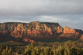






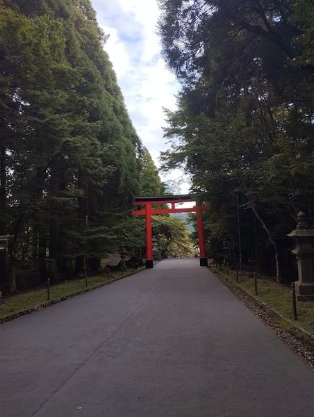
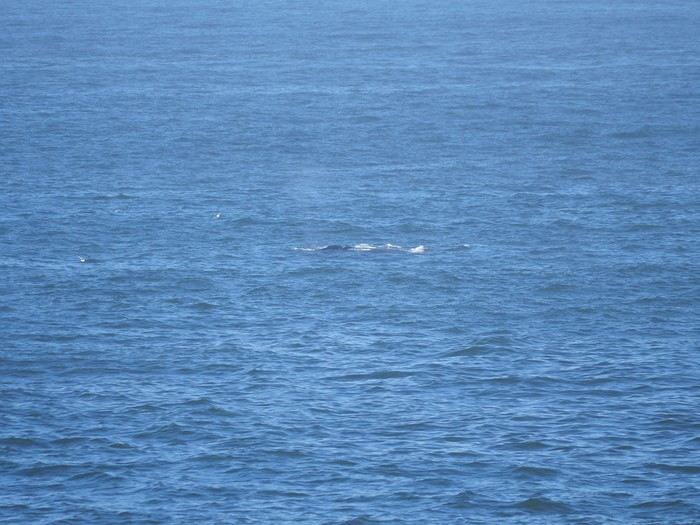
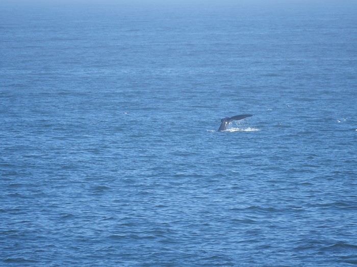
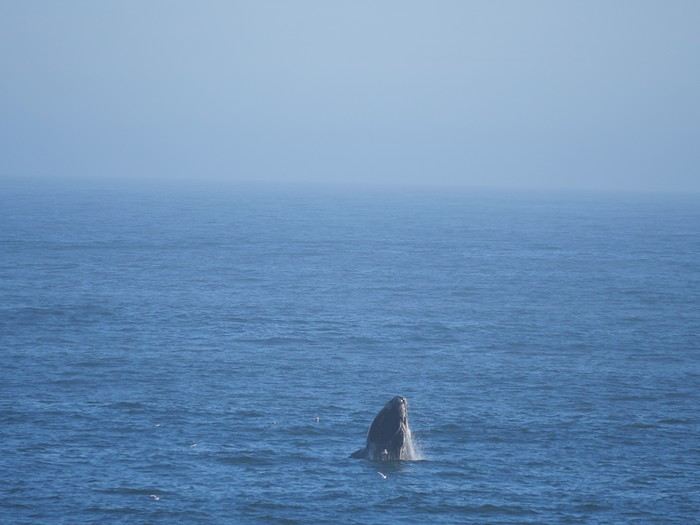
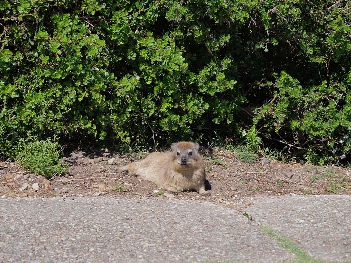
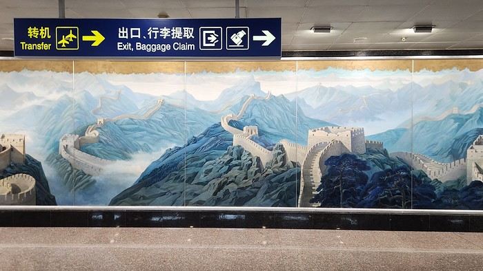
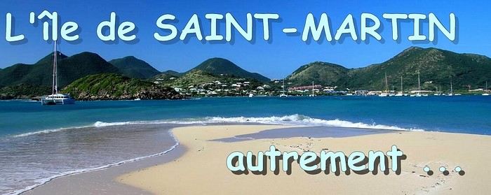 When it comes to the Caribbean island of Saint-Martin, it's customary to praise its coastline and dreamy beaches—and they certainly deserve it.
But in this story, I’d like to highlight other memories, aspects, and impressions for a slightly different change of scenery.
Enjoy the read—some text and, above all, lots of photos.
« Byenveni sou zile Sen Maten! » (Welcome to the island of Saint-Martin)
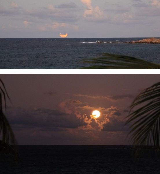
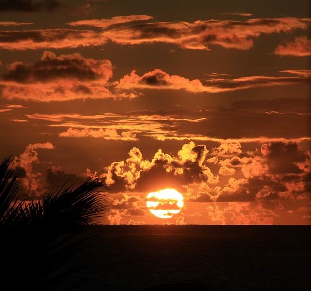
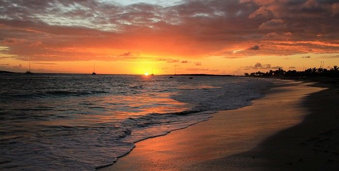
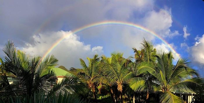
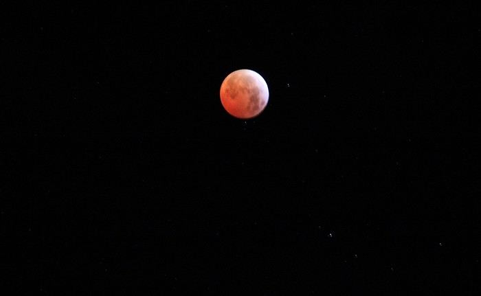
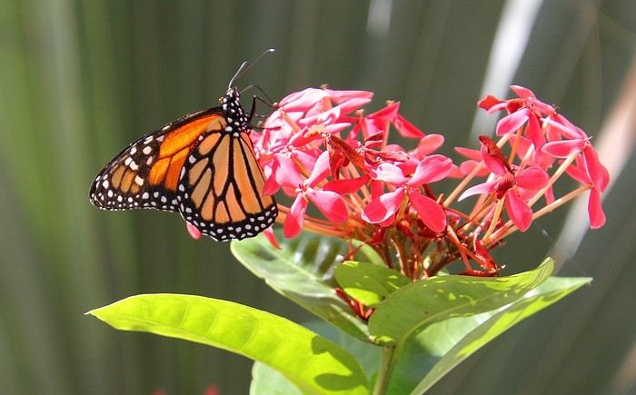
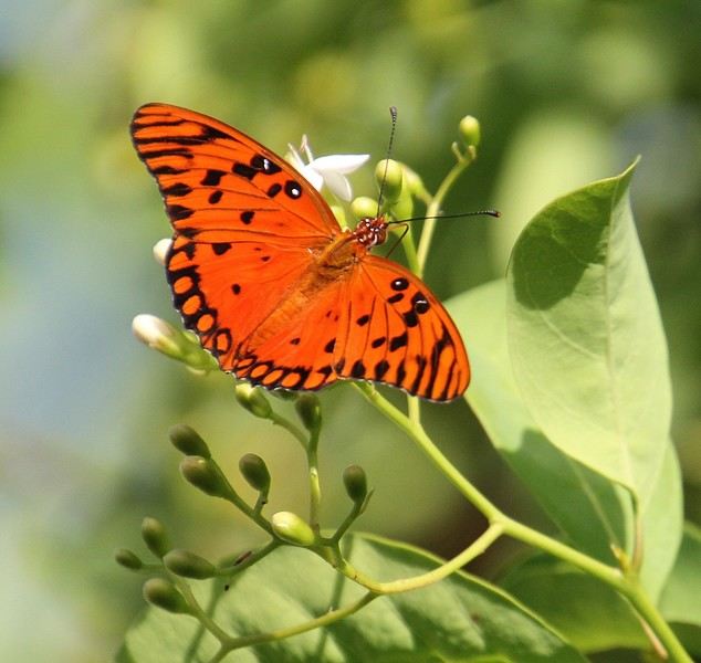
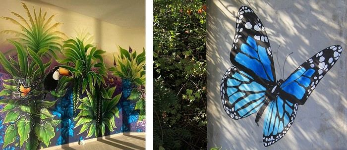
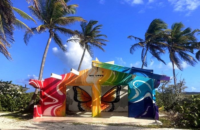

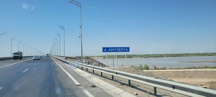
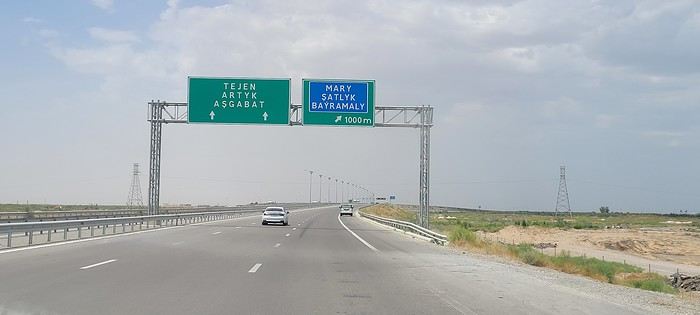
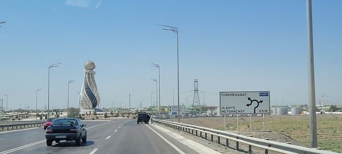
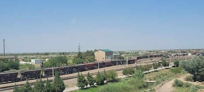
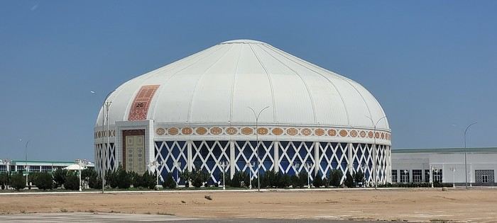
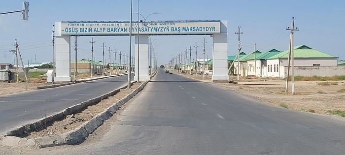
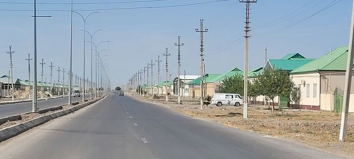 Roundabouts are particularly interesting because they feature emblems of Turkmen culture, like the dog, a carpet, the Ahal Teke horse, or Muslim symbols, even though the presence of Islamic artifacts is quite limited.
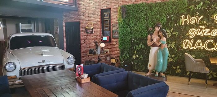


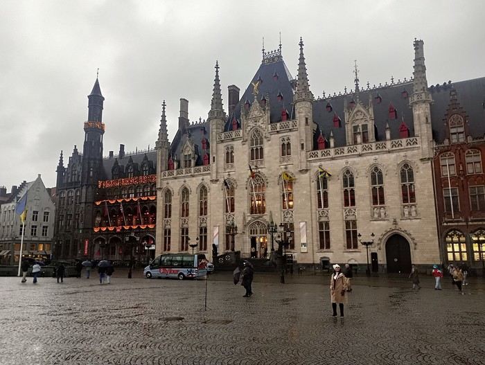
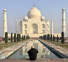

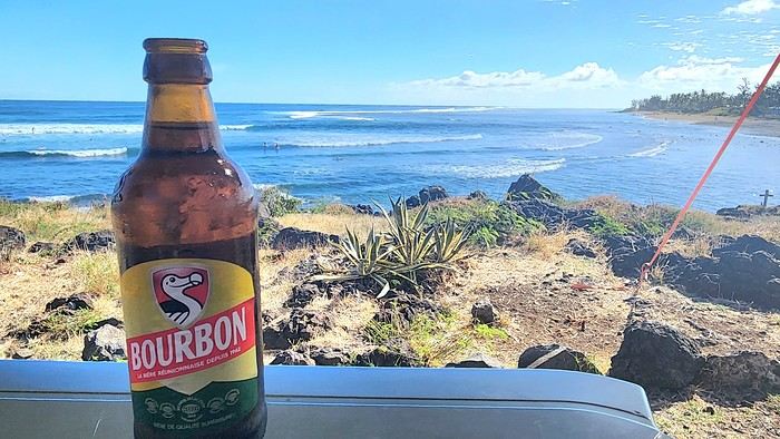
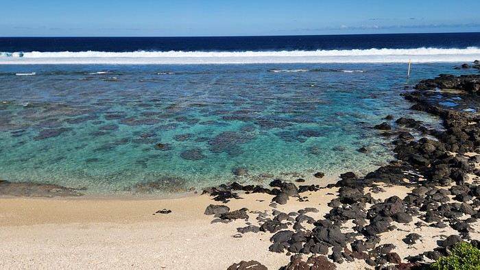
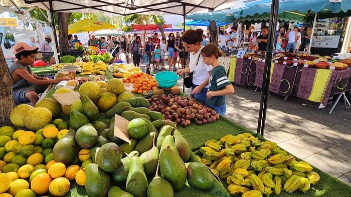
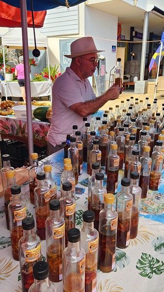
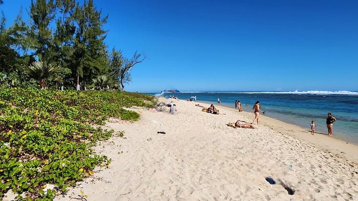
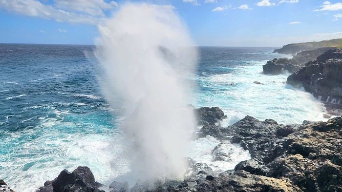
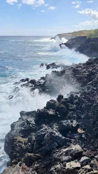
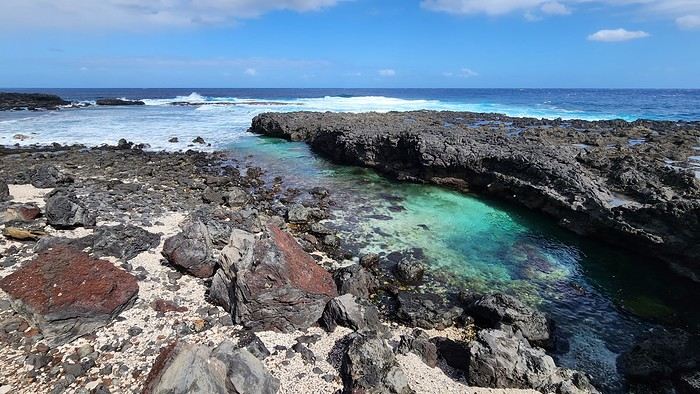
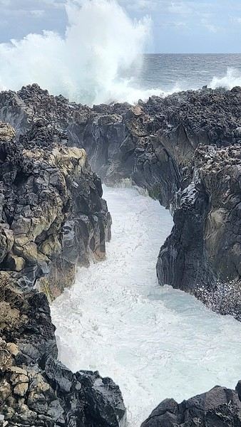
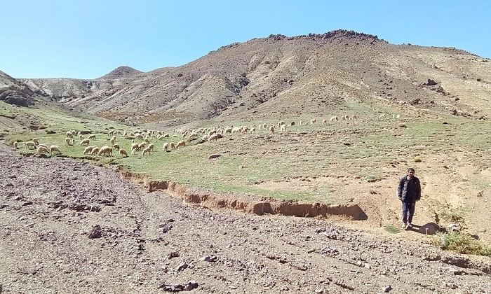
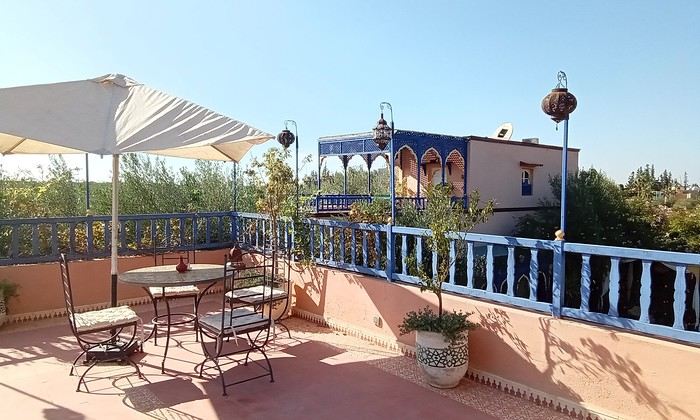
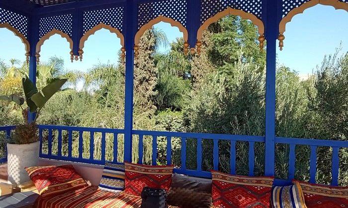 Last October, we landed in Marrakech to spend a few days with family exploring Morocco’s roads.
Transport: a rented Dacia.
Accommodations: small guesthouses.

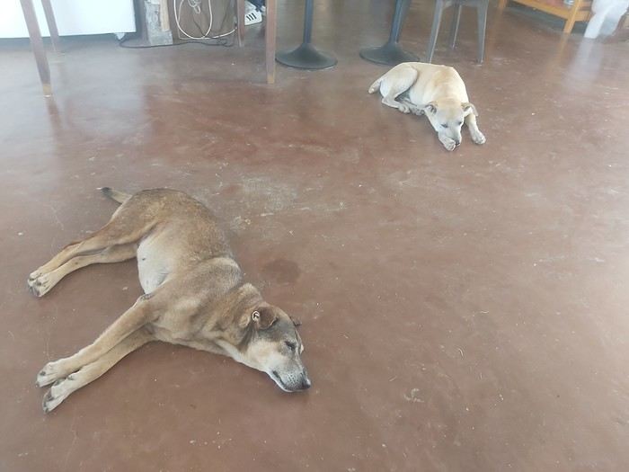

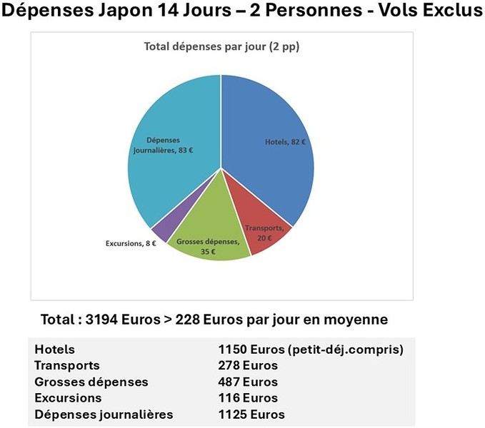
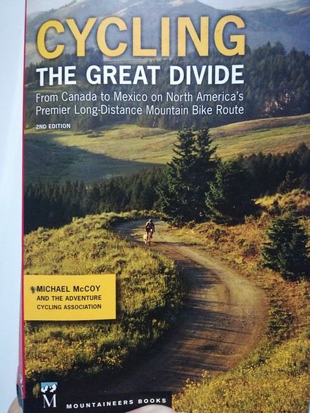
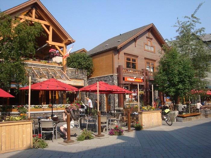
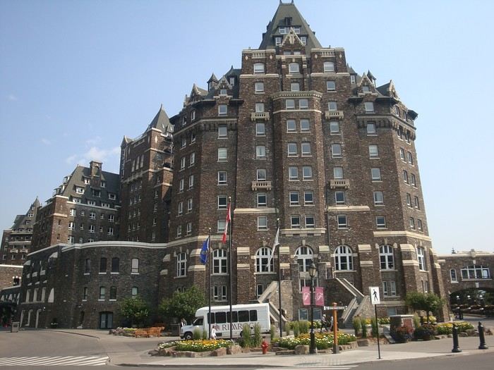
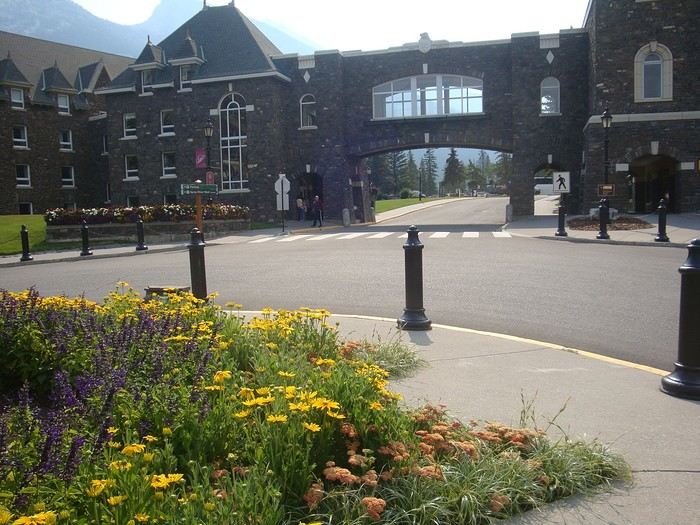
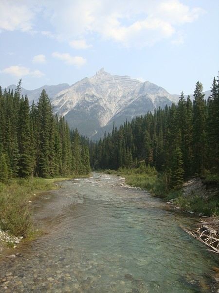
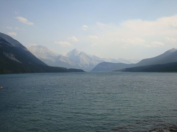

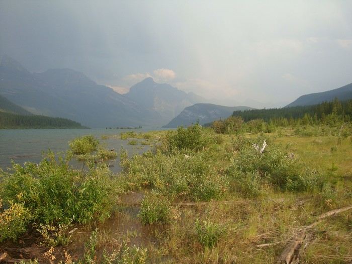
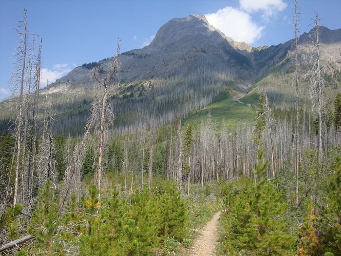
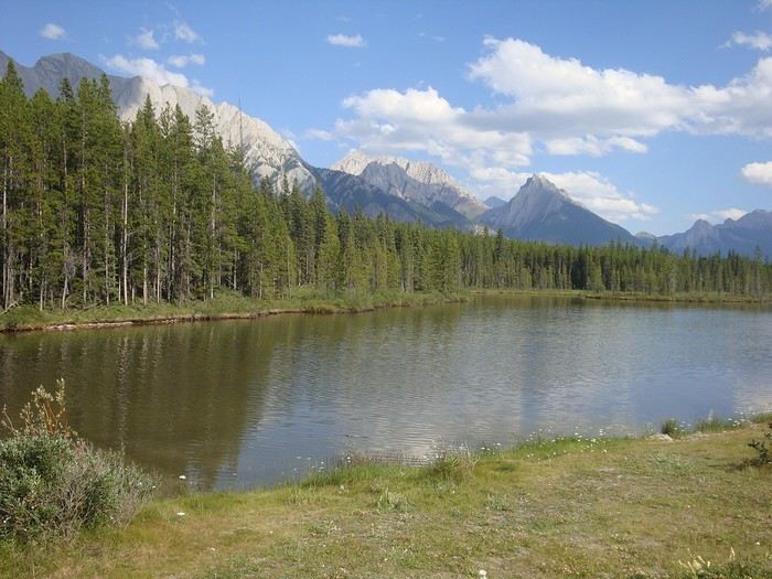
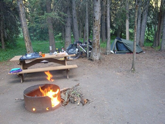

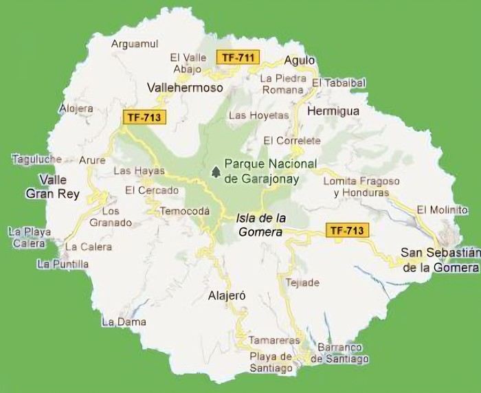 The large solidified magma massifs that shape the heart of the island have created a large depression more protected from the sun at its center, allowing the growth of a vast laurel forest, today grouped within the Garajonay National Park, La Gomera’s green lung, which has earned it the status of a World Biosphere Reserve. Its completely European appearance contrasts sharply with the rocky and tropical landscapes of the rest of the island. Thus, the climate varies greatly from one point to another on the island: in summer, you can quickly go from a dry and sunny valley at 35°C to a humid forest area at altitude at 18°C.
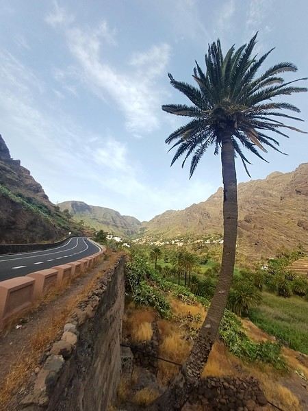

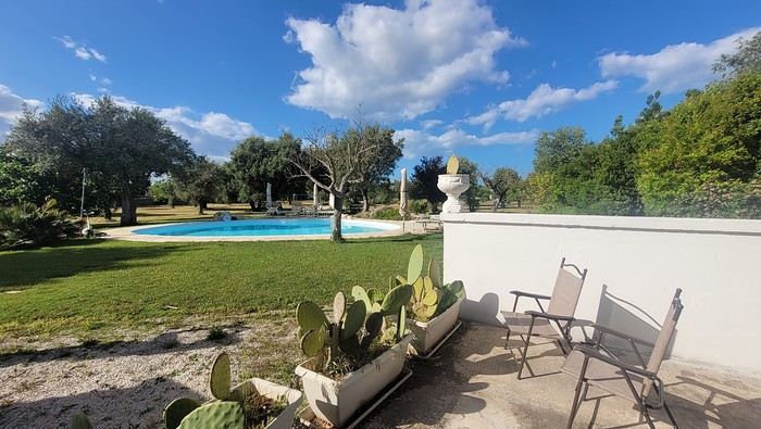
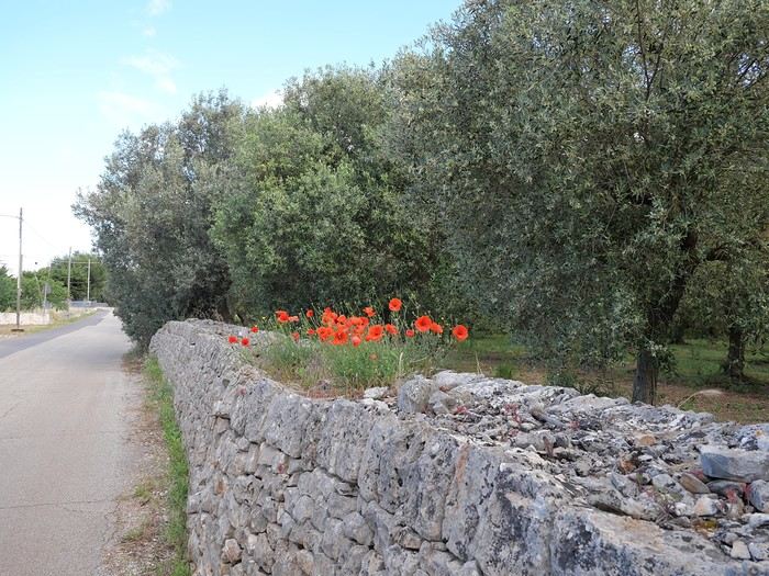
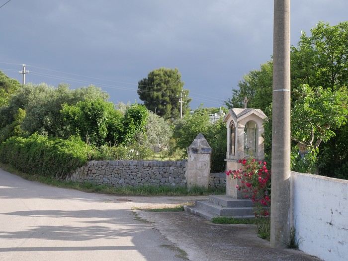
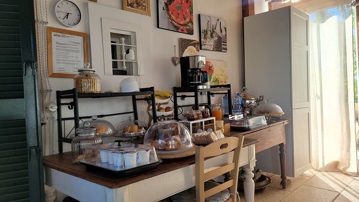
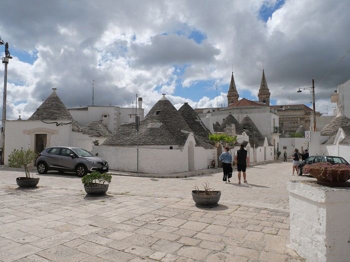
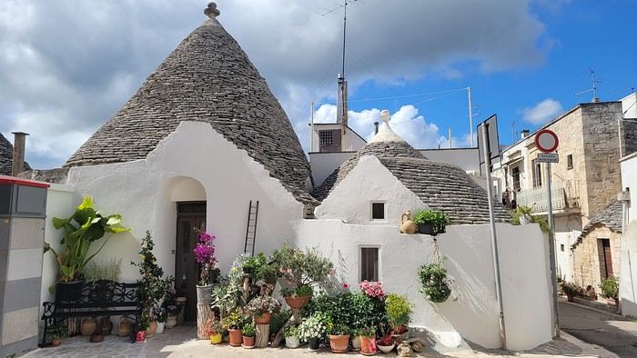
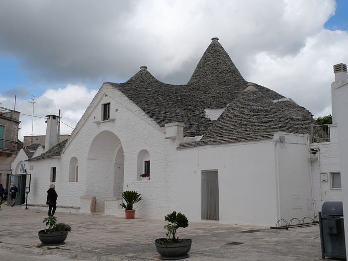
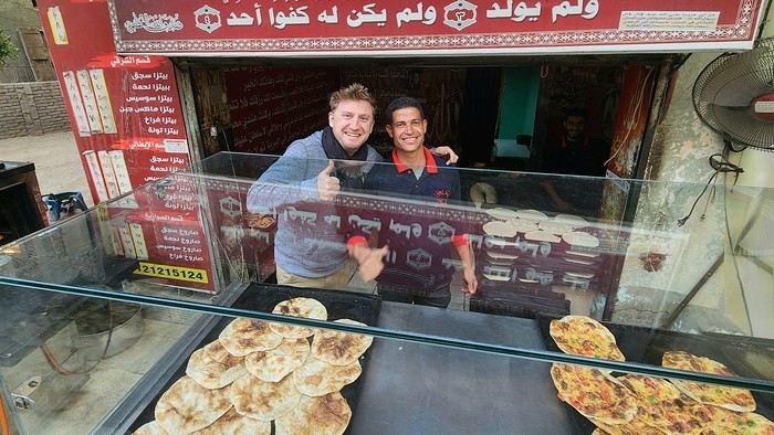
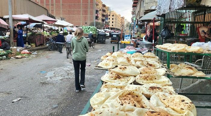
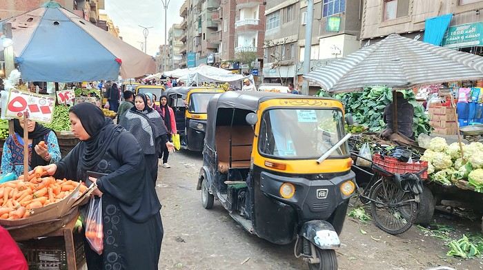
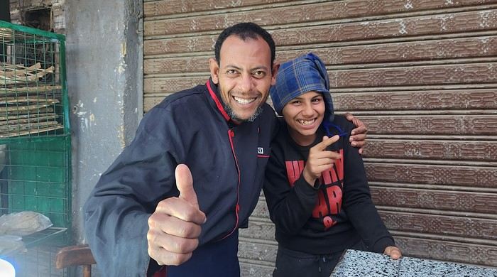
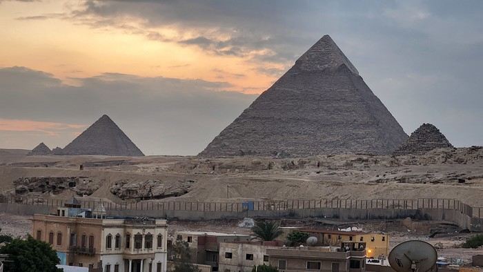
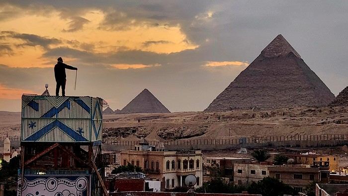
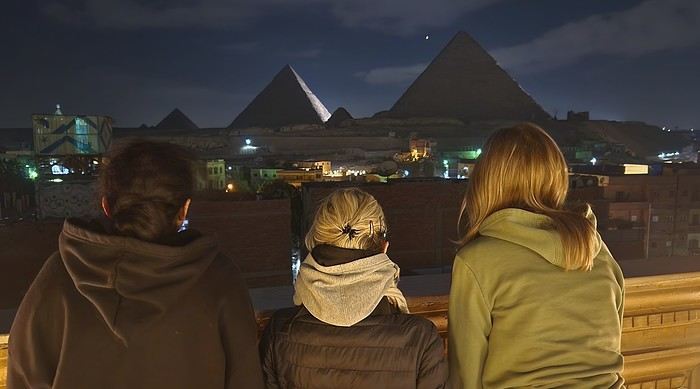

 Why this country?
After visiting Hungary, Slovenia, Romania, and Poland in recent years, I’ve fallen in love with Eastern European countries. I adore the Slavic soul, its Austro-Hungarian villages, the gentle landscapes, the Carpathian Mountains, and that slightly mysterious atmosphere.
Slovakia evokes a certain imagination with its deep forests, medieval castles, and cobbled villages.
After seeing photos of the High Tatras—especially Lake Štrbské Pleso and Spiš Castle—I thought, "Let’s do it! We’re going!"
So, will Slovakia live up to what I imagine?
We’ll find out together.
We decided to travel as a group of six (five adults and a six-year-old child), by car (we needed two).
Here’s the day-by-day itinerary for this family trip, which started with a 3-day stay in Vienna (see the dedicated travel journal):