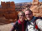
 Glacier View Turnout
The entire horizon is dominated by the mountain range!!! A true postcard view.
Amid the jagged, irregular peaks, the glaciers are still there, even in mid-September.
On the left, the Middle Teton Glacier, where you can still see some white; in the center, the Tepee Glacier, almost completely melted; and on the right, the Teton Glacier, more imposing with its moraine.

Below the rocks, you can clearly see the two plateaus filled with the silvery tufts of sagebrush framing the tall trees around the Snake River. Blacktail Ponds Overlook The scenery changes completely! The viewpoint overlooks a soft green meadow crisscrossed by small streams flowing into the Snake River!! I love these bucolic spots!!! This area is known for its wildlife, but we didn’t see any. Maybe we should’ve left the parking lot and walked a bit!!!

 A few miles later, we leave US 191 to take the small paved road, Antelope Flats Road, to visit the
Mormon Row Historic District
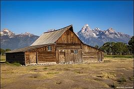
We quickly arrive at this former site founded by Mormon pioneers in the late 19th century. There’s a collection of wooden buildings (barns, cabins), most of which are still intact, with the mountains as a backdrop!!
It’s absolutely stunning!!!
We wander around this historic place for a while, half-expecting Laura or Charles Ingalls to show up.
Unfortunately, a horde of Asian visitors running around like rabbits, spending hours taking cliché photos or rolling in the grass while shouting, ruined the tranquility of the place. But it’s still a feast for the eyes.


 Chapel of the Transfiguration
It’s in Moose, very close to Mormon Row, and we get there in just a few minutes by car.
Phew, even though we’re not alone, the noisy crowd didn’t make it this far, and we enjoy the peacefulness of the place.
This charming little wooden chapel dates back to 1925.

 Its altar faces a large window with a view of the mountain range.


Menor’s Ferry Historic District A short loop from the parking lot takes us near the Snake River, where we can see a replica of the ferry that allowed pioneers to cross it.
 A few white buildings are still standing and in great condition.
 We learn that the first building was the bedroom in 1894,


 followed by the kitchen in 1895,
and finally the general store in 1905.
 It’s still in operation, and besides the goods you’d find back then, they sell excellent honey.
We found the little museum really interesting.
After this pleasant trip back in time, we hit the road again toward Moose.
Moose Wilson Road
I really wanted to take this little road, but unfortunately, when we got to the turnoff, we found it blocked with a sign saying it was closed due to the presence of bears and moose!!!
Bummer, no luck—it was exactly why I’d planned to take it!!
Too bad, we turn back and get back on US 191.
We’re surprised to see a beautiful bike path connecting Moose to Jackson.
Jackson
A quick but very interesting stop at the Visitor Center and
Town Square.
 Thayne
We settle into our motel. We’re happy we don’t have to get back in the car for dinner. We love Mexican food, and the restaurant run by the owners is just a few meters from our room.
Another beautiful day, full of stunning landscapes and trips back in time—just the way we like it.
The chilly temperatures of Yellowstone are gone. At 4 PM, it was 25°C.
Time to pack away our puffy jackets and wool hats at the bottom of the suitcase!!!
They won’t see the light of day again until we reach 2,900 meters at Cripple Creek.
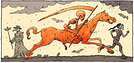

 It’s topped by two deer fighting.
 The place is nice, and we find the "trapper" vibe in the shops.
 We hit the road again—rolling hills covered in fir trees have replaced the pastures, and we follow the winding river.
Some ranch entrances are really beautiful.
 After leaving Wyoming, with its horses, prairies, and tumultuous rivers, we cross a tiny bit of Idaho.
Montpelier
This town was founded by Mormon pioneers of the Oregon/California Trail.
We’d planned to visit the Butch Cassidy Museum: 833 Washington Street.
This small museum is housed in the last bank Butch Cassidy and his gang robbed.
Unfortunately, it’s Sunday, and it’s closed.
Too bad!! Especially since what we see through the windows awakens our inner kids, and we would’ve loved to learn more about this slice of history.
We settle for photographing the outside.


 It’s a cute little town, too funny with its bears holding up the benches.
 And its bowler hats.
 We also discover a funny vehicle that drives on both roads and rails, and we take the chance to chat with the worker operating it.
 And when we see the piles of wood in front of the houses, we think once again that winters must be harsh here.
 A beautiful house, unfortunately abandoned and boarded up.
 Paris
Like Montpelier, this town was founded by pioneers of the Oregon Trail, and the signs remind us of that.

 We start to see the neatness of Mormon towns and their huge temples set on immaculate lawns.

 Geneva, Bern, Montpelier, and now Saint Charles—the names of the towns in the area remind us that the founders were also European emigrants.
Many buildings in ruins that must have been beautiful in their heyday.





 Logan
The city is upscale, with wide streets and very clean. I’d almost say it’s sterile, both in the way the lawns are kept
 and the pretty houses.


 as well as in the way the residents dress (suits and ties, and dresses below the knee).


 However, Mimi and I really liked the welcome wreaths of fresh flowers on the front doors.


 Salt appears in the form of vast white expanses where the lake has dried up. Soon, the road is flanked by water on both sides, and we arrive on the island proper.
This 24 km-long by 6 km-wide island—the largest in the Great Salt Lake—connected to the mainland by a 10 km causeway, was another love-at-first-sight moment for us nature lovers.
Right away, we spot a few bison, including this one rolling in the grass, leaving us with nothing but a cloud of dust to photograph.
 Buffalo Point Trail
The hike starts at the Buffalo Point parking lot. As soon as we step out of the car, a warm, powerful wind hits us. We begin walking, more or less sheltered from the gusts, on a narrow trail that climbs gently through the everlastings.
 Benches placed here and there let us catch our breath and admire the view.
 After about half an hour (600 m with 70 m elevation gain), we reach Buffalo Point—and that’s when things get wild. The wind is extremely strong. We cling to anything we can (our little husbands come in handy!) and hold tight to our cameras, afraid they’ll blow away!!!
No one at the summit!! Just the four of us facing the vastness, with the wind howling and our clothes flapping!!!
Despite its force, it’s gentle!!!
Pure bliss in this 360° view.
We can’t get enough of this panoramic scenery—wherever we look, it’s a feast for the eyes.
The Great Salt Lake and its islands
 The hills

 The shores
 The causeway that turned the island into a *nearly* island
 Honestly, the effort to get to the top was nothing compared to the spectacle that awaited us.
The light is soft, the colors muted, all in harmony of grays, blues, and whites amid the golden prairies.
 In some places, it looks like the lake, sand, salt, and sky almost blend together.
 It’s so beautiful!!!
We head back down the same trail!!!
 I suggest a swim at Bridger Bay to have some fun in the water and experience the lake’s salinity, but I’m the only one who wants to. We drop the idea since we’ve only just started exploring the island and still have many kilometers to go before reaching Rock Springs.
Most of the island isn’t accessible on foot, except for the hiking trails. By car, only the East Side Road crosses it from north to south, following the shoreline to Fielding Garr Ranch.
The road is squeezed between salt marshes and a chain of hills.
Another lone bison, legs deep in the sand!!!
 The road stretches lazily, and once again, we’re under its spell.
Gentle terrain, rolling ochre hills bordered by lush grassy prairies and tiny flowers, colors so soft they seem diluted!!!


 The light is beautiful, it’s preserved, wild yet peaceful!!!
Everything is so gentle on this island!!!
 Vintage tractors exhibit
 We also really love the grassy landscapes of the west coast

 We arrive near the old farming machines, and the series of mishaps begins.
After nearly falling off a machine that suddenly lifted while he was sitting on it,
 DD ends up with the seat of another in his hand.
Maumau is laughing so hard he’s choking
 The visit continues


 1950s modern kitchen
 The laundry room
 The bathroom
 I find the comfort surprisingly modern for the 1950s in such an isolated place.
We finish up in the farmyard. There’s a steel horse you can climb on to try your hand at lassoing.
Mimi isn’t doing too badly (she cheated a little for the photo, but shhh)
 As for me, as clumsy as I am with my ten thumbs and two left hands, I can’t do anything!! Maumau kindly comes to show me the technique!! When he walks away, I decide to lasso him!!


 Last photos...
The lake steaming from water evaporation gives us one last beautiful show!!!

 Goodbye, Antelope Canyon!!!!


 Green River
We need to be careful—the turnoff for Pilot Butte shouldn’t be far now.
We take Wild Horse Canyon Road, which winds between gray rocks.
It climbs and climbs…
The striations on the other side of the valley look like giant fern leaves.
 We scan both sides! There are 1,500 mustangs living in the Pilot Butte area—where are they?
Suddenly, we spot four of them, way up high on a hill.

 Maybe we’ll get lucky and see some up close a little farther on.
The road runs along the ridge, and we keep going.
Below us, the valley, the highway, and the railroad tracks look tiny.


 Flaming Gorge
This canyon, carved by the Green River, gets its name from the red sandstone cliffs surrounding the water. Just before Dutch John, we start spotting red rocks in the distance.
 A dam was built in 1964 to store water and generate hydroelectric power.
The road actually crosses right over the top of the dam’s arch.

 We don’t stop there. We head straight to Red Canyon Lodge, where we’ve planned a short hike along the canyon.
The road leading there winds through beautiful forests again.
 We park near the lodge and cross a small meadow.


 But we can easily imagine how stunning the contrast between the red rock, green vegetation, and the blue sky and river must be at sunset.

 We’ll later realize the overlook parking lot was just 2 minutes by car from the lodge, but this morning walk did us a world of good.
After this little detour, we hit the road again toward Vernal.
Canyons, meadows—we continue south.
We pass an open-pit phosphate mine where dust from the extraction mixes with an opaline, turquoise lake that stands out sharply against the red rocks.
 Vernal
We don’t stop there and keep following the Green River and its pretty meanders.



























































 Roundabouts are particularly interesting because they feature emblems of Turkmen culture, like the dog, a carpet, the Ahal Teke horse, or Muslim symbols, even though the presence of Islamic artifacts is quite limited.



 Why this country?
After visiting Hungary, Slovenia, Romania, and Poland in recent years, I’ve fallen in love with Eastern European countries. I adore the Slavic soul, its Austro-Hungarian villages, the gentle landscapes, the Carpathian Mountains, and that slightly mysterious atmosphere.
Slovakia evokes a certain imagination with its deep forests, medieval castles, and cobbled villages.
After seeing photos of the High Tatras—especially Lake Štrbské Pleso and Spiš Castle—I thought, "Let’s do it! We’re going!"
So, will Slovakia live up to what I imagine?
We’ll find out together.
We decided to travel as a group of six (five adults and a six-year-old child), by car (we needed two).
Here’s the day-by-day itinerary for this family trip, which started with a 3-day stay in Vienna (see the dedicated travel journal):















 When it comes to the Caribbean island of Saint-Martin, it's customary to praise its coastline and dreamy beaches—and they certainly deserve it.
But in this story, I’d like to highlight other memories, aspects, and impressions for a slightly different change of scenery.
Enjoy the read—some text and, above all, lots of photos.
« Byenveni sou zile Sen Maten! » (Welcome to the island of Saint-Martin)






































 Come along, I'm taking you to this country where it's so nice to wander and slow down...











