Hi everyone,
in a few months I need to bring my Thai partner to France.
I’m going to prepare the "attestation d’accueil" for 3 months.
On the form, they ask me to act as a financial guarantor for her stay—no problem for me. But on the visa application, France asks her to prove she has sufficient income to get the visa. Is it still necessary for her to prove that, given that I’m acting as her financial guarantor?
Thanks
837 similar discussions in English
My buddy Christian and I (Patrick) are off for 28 days in Argentina in March.
We’ve already shared several trips as a duo (Bolivia Peru, Namibia, Laos, Costa Rica).
Since we’re starting from the idea that at our age (65) we won’t be coming back here—there are just too many other corners of the world to discover—we did the "grand tour" of Argentina, with 6 domestic flights to make the most of our 28 days.
Here are our stops:
1) Departure from Brussels to Buenos Aires via Madrid
2) Arrival and first contact with Buenos Aires
3) Early morning flight to Ushuaia. Boat trip on the Beagle Channel
4) Ushuaia: hikes in Tierra del Fuego National Park
5) Ushuaia: last hike and flight to El Calafate
6) El Calafate to El Chaltén by bus. First hike
7) El Chaltén: hike
8) El Chaltén: hike
9) El Chaltén: hike and bus back to El Calafate
10) El Calafate: Perito Moreno Glacier
11) Flight to Bariloche. Car rental and surrounding areas
12) Seven Lakes Region
13) Nahuel Huapi National Park region
14) Flight to Salta. Car rental
15) To Tilcara
16) To Humahuaca
17) To Purmamarca
18) To Jujuy via the salt flats
19) To Cafayate
20) Around Cafayate
21) To Cachi
22) Back to Salta
23) Flight to Iguazu
24) Waterfalls on the Argentine side
25) Waterfalls on the Brazilian side and flight to Buenos Aires
26) Buenos Aires
27) Return flight
28) Morning arrival
Happy reading!..
Hi there,
My partner and I are heading to Nepal for 15 days in March—she’s a schoolteacher. We’ll be trekking to Everest Base Camp and then doing the loop via the Gokyo Lakes.
We’d love to set up a fundraiser to donate to a school in Namche, along with visiting the school. It’s something that really matters to us. But it’s been tough to get in touch with a school—any ideas on how to go about this? Thanks!
This trip is a more budget-friendly—and shorter—alternative to the 14-day Aranui 5 cruise, which includes a few days at sea and a detour to Bora Bora in the Leeward Islands on the way back. The advantage of the cruise is that it lets you see and visit (though far too quickly) the two islands of Tahuata and Fatu Hiva, which don’t have airports. By plane, you’ll only be able to land on 4 of the 6 islands. However, Tahuata is accessible from Hiva Oa via a day trip (or two-day trip) shuttle. Plan for two extra days in your total time dedicated to the Marquesas Islands (called *Fenua Enata* in Marquesan language).
Our itinerary is perfect for those who aren’t excited by cruises and prefer to get closer to the local communities. This 9-day trip cost us around 2500 € all-inclusive. For a 14-day cruise on the Aranui, expect to pay 2300 € per person for a basic cabin for four, or 3800 € per person for a superior double cabin.
Air Tahiti offers a 4-island Marquesas Pass (Nuku Hiva, Ua Pou, Ua Huka, and Hiva Oa) for 86,000 XPF (about 700 €). The journey is made on an ATR 72 from Tahiti to Nuku Hiva or Hiva Oa, and on a 19-seat Twin Otter between the islands (often only 13 or 15 seats are available due to cargo, so book well in advance). We’re traveling as a couple. We booked our family-run guesthouse stays at the Tourism Fair in early February, where you can meet the owners and make your choice. Stays are almost always half-board or breakfast-only. Transfers are usually included, but you can always book a car or taxi.
**NUKU HIVA**
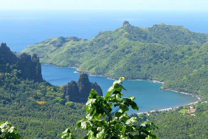
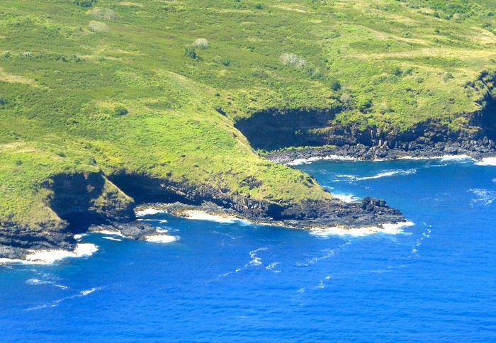
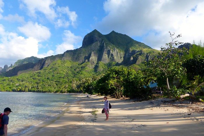
**A LITTLE GEOGRAPHY** Nuku Hiva (NH) is located about 1,500 km from Tahiti, in the north of French Polynesia. At 387 km², it’s the second-largest island in French Polynesia after Tahiti. It was formed by incredible volcanic phenomena and cataclysms between 1 and 6 million years ago, which lifted the island thousands of meters above the sea. Even after millennia of slow erosion, collapses, and settling, NH remains the most majestic of the Marquesas, with its sheer cliffs, deep valleys featuring immense waterfalls, and black walls that were once the inner walls of enormous volcanoes.
**A LITTLE HISTORY** The first contact between NH’s inhabitants and Europeans was in 1595 with Spanish navigators who only stayed briefly. It wasn’t until the late 18th century that Europeans arrived in greater numbers on NH (and the other Marquesas Islands), disrupting a very fragile social and cultural balance. It’s believed that nearly 100,000 people lived on Nuku Hiva at that time—a population decimated over the decades by epidemics, diseases brought by Europeans, and alcohol used for barter. The disastrous result: by the 1930s, only 2,500 people remained, having largely lost their identity and living in poverty. Today, the island has about 2,600 inhabitants spread across several villages, with Taiohae as the main one.
**NUKU HIVA IN LITERATURE**
1 / One of the famous writers who visited NH and stayed there was Herman Melville, who arrived in July 1842, the author of *Moby Dick*. The island had just come under French protectorate. Seduced by the enchanting *vahinés* and dazzled by his paradisiacal vision of the place, Melville deserted his ship. He ended up a prisoner of a local tribe, the Taipi, in Taipivai, where he stayed for a month and a half until an Australian ship captain secured his release in exchange for a musket and a roll of cotton fabric! Melville wrote a novel about this tumultuous episode in his life, considered a classic of travel literature. The book, *Typee: A Peep at Polynesian Life*, published in 1846 in the United States, was a huge success.
2 / Another famous Scottish writer, Robert Louis Stevenson, arrived in NH aboard a yacht that anchored in Anaho Bay, the island’s most beautiful, in July 1888. Stevenson was already known for two magnificent novels that marked their era: *Treasure Island* and *Dr. Jekyll & Mr. Hyde*. Stevenson, too, was captivated by the island’s natural beauty, though he also noted the devastating decline in identity, socio-cultural life, and physical health of a population ravaged by disease and alcohol. His account of his stay, *In the South Seas: An Account of Experiences and Observations in the Marquesas, Paumotus, and Gilbert Islands During Two Cruises on the Yacht Casco (1888) and the Schooner Equator (1889)*, was published in 1896 in New York, four years after his death in Apia, Western Samoa, where he had settled. It was also published in London in 1900.
3 / In August 1903, Victor Segalen, a French naval doctor, ethnologist, and archaeologist, landed in NH from the ship *La Durance*, sent to Polynesia to recover the possessions of the painter Paul Gauguin, who had died in April of that year. He, too, was enthralled by the Marquesas but lamented the loss of identity, dignity, and pride of the Māori, alienated by a Christianization that destroyed their culture and customs, denied their gods, and erased their past. He wrote about his experience, doubts, and fears in *Les Immémoriaux*.
4 / In December 1907, Jack London arrived in NH aboard the sailboat *Stark*, following in the footsteps of his illustrious predecessor, Herman Melville. London was in poor physical condition, exhausted from his relentless travels that had taken him from the Klondike in Canada to Japan, Australia, and London in Europe. He was appalled and shocked by Nuku Hiva’s degraded health situation: where Melville had encountered over 2,000 vigorous and healthy Marquesan warriors, London found only 12 suffering from various diseases—the rest had been wiped out by tuberculosis! His approach remained humanistic, and he maintained a sharp geopolitical awareness of these traditional Polynesian cultures, weakened by the inexorable advance of modernity in the early 20th century. He continued his journey to the Tuamotu Islands and Tahiti, publishing *Martin Eden*, the moving account of his initiatory voyage in the South Pacific, in 1911.
5 / Finally, Alain Gerbault, a writer, linguist, ethnologist, and tireless traveler, arrived in the Marquesas via the Panama Canal in December 1933. He was completely exhausted after an endless crossing on a small sailboat, the *Firecrest*. Enthralled by his stay in the Marquesas, he continued to the Tuamotu Islands in 1934, then Tahiti in 1935. Gerbault fought for the preservation of traditions, as well as the songs and dances banned by the Churches and the French Administration (these bans lasted over 50 years, mind you...!!!). Bora Bora remained his favorite island. A staunch Pétainist during World War II, he was forced to flee Bora Bora for Samoa, then Tonga, and finally Timor, a half-Portuguese island and thus neutral during the war. His travel accounts, *In Pursuit of the Sun: Logbook from New York to Tahiti* and *A Paradise Is Dying*, were published in the late 1940s. He died in Timor in 1941, and his ashes were repatriated to Bora Bora.
Back to our trip and stay.
**Day 1: April 27**
Departure from Papeete at 6:30 AM—we had to wake up two hours earlier and reach the airport in the dark. Takeoff at dawn, good weather en route, flight duration: 4 hours.
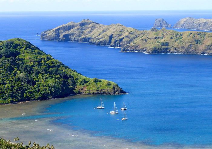
Arrival around 10:30 AM in Nuku Hiva, the first stop of this trip. We booked two nights in half-board at Pension Koku’u, transfers included. Maybe not such a great idea, those included transfers, especially on this unique island where the airport is located on *Terre Déserte*, on the other side of the mountain, opposite and about 45 km from the main village of Taiohae. They’re charged at a steep price. Expect 6,000 XPF round-trip by taxi, but 15,000 XPF charged by guesthouses or hotels. The difference is notable. It wasn’t the best idea, but we can’t go back. Even for residents like us who know how to travel in Polynesia, the Air Tahiti employee who sold me the Pass couldn’t give any useful advice about the stay itself—probably because he’d never been to the Marquesas. It’s really annoying! In short, the good idea to remember is renting a car (like a Suzuki) to be free to manage your time and stop at leisure. The road signage is a bit basic, but you’ll manage just fine. Our host Alvane waits for us—without a sign (sic!)—and after searching for each other for 5 minutes, we’re off on a journey of over an hour (with photo stops) in a Land Rover with smooth tires (luckily, it’s not raining!). The recently paved and marked mountain road is impeccable. No time to catch our breath at the guesthouse; we leave immediately (not a great idea after waking up at dawn plus 4 hours on a plane) for a half-day hike that was also included in the prepaid stay. A sandwich was provided (really pathetic for the physical effort required), we have water, and we fill a few bottles at the spring near the ceremonial site of Taipivai, our first stop. Then the hike begins in the Hanaheu Valley, descending toward Anaho Bay and its namesake beach. A magnificent and wild spot, a few sailboats anchored, we swim—the water is really warm, over 30°C at the shore. That warm is rare and not necessarily pleasant. We then have to climb a very steep slope; this hike is actually quite tough. The air is still, humid, and stifling under the foliage, there’s a bit of mud, and tiny ants (which don’t bite, I’ll have you know), locally called *fofolles*, running over shoes, ankles, and calves. Not very pleasant...! On top of that, there are mosquitoes to protect against! In hindsight, it seems wise to bring energy bars from Papeete if you plan to hike on the afternoon of your arrival day. We weren’t careful... Result: a moment of weakness for me and a hyperventilation attack climbing back up from Anaho Bay!!! We return to the guesthouse at night. There we find Claudine and her four children—Marquesan-style atmosphere, friendly and casual. We share family life. Very simple room with a bathroom, no mosquitoes, we can sleep with the window open, but the night will be noisy, as is often the case in Polynesia. Roosters are everywhere and don’t sleep, dogs bark or whine. So we end up waking up early... like everyone else.
**Day 2: April 28**
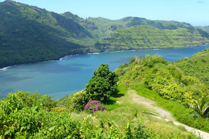
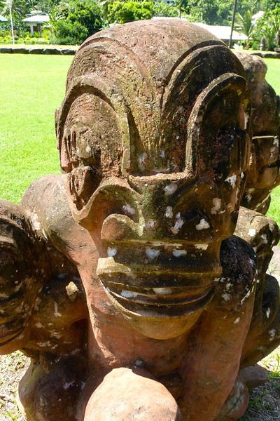
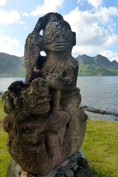
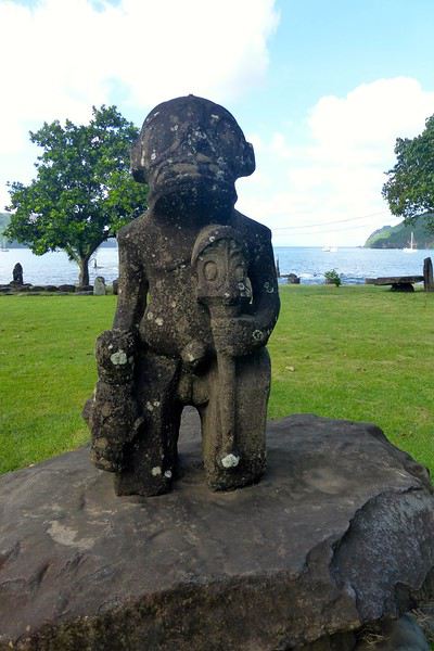
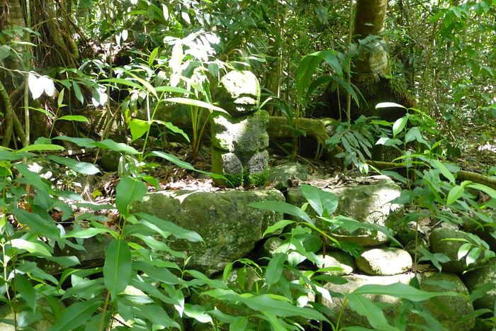
We booked a full-day excursion with Thierry: it starts with a 45-minute boat ride to reach Hakatea Beach, hidden in a small secret bay like many along Nuku Hiva’s coasts. From there, the hike lasts all day—11 km round-trip on flat but also rugged terrain (ancient paved and elevated paths over 1,000 years old)—and river crossings. Bring the right shoes (like plastic Crocs with high socks—not very stylish but practical). We cross the former village of Hakaui, walk along the foundations of dwellings, and there are still weathered tikis in the lush vegetation. The ultimate goal of this hike is to reach the tall Vaipo waterfall. The place is magical, with openings in the vegetation and immense trees allowing photos of the treetops and caves where funeral canoes containing the bones of chiefs or great warriors were once placed. We return the same way to the beach and take another boat ride to reach Taihoae’s port. Back at the guesthouse after a glimpse of Taihoae’s waterfront.
**UA POU**
**Day 3: April 29**
Back to the airport in the late morning for the second flight of the trip to Ua Pou. 20-minute crossing in a Twin Otter (18 seats but only 13 occupied due to cargo between the islands). Beautiful weather, blue sea, nice photos to take upon departure from NH and arrival in UP. We’re greeted by Jérôme, a former military man turned tourism professional, who runs Pension Pukue’e with his wife Elisa, a native of UP. We’re in for two exceptional days. The guesthouse is comfortable, Jérôme and Elisa are very professional and pleasant. Jérôme is also a professional hiker, and Elisa is an excellent cook. We leave quickly for a half-day excursion to Hohoi, after a stop at the archaeological, cultural, and religious site of Maui’a, the Tavaka tribe’s territory. Jérôme is there to explain how Marquesan society functioned at the time and the events that took place on a site still largely buried under vegetation. Then we visit a flower-stone sculptor he knows—the only place in the Marquesas where you’ll find these stones. They’re collected in the river flowing into the sea at Hohoi, sometimes on the beach itself. Back to the guesthouse.
**Day 4: April 30**
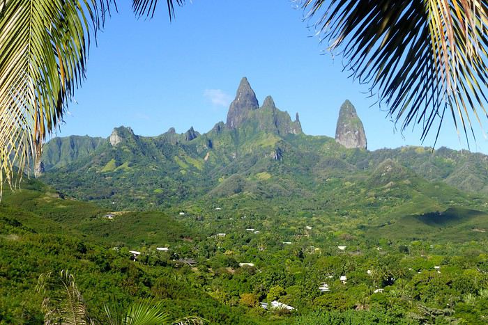
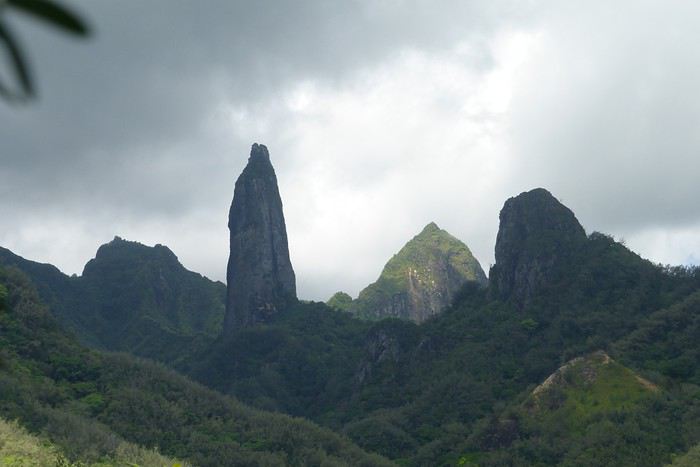
A nature hike in the mountains—moderately difficult—toward the Vaiea waterfall is on our program for a good 4 hours. It’s hot, there are mosquitoes, and the dip in the pool under the waterfall (24°C water) is a rare pleasure. Lunch at a friend of Jérôme’s, a former chef for French minister François Fillon, who prepares delicious food. Elisa picks us up by car to return to the guesthouse. Ua Pou is a beautiful and elegant island with its sharp peaks and wild nature. Our favorite, thanks to Jérôme and his wife.
**UA HUKA**
**Day 4: May 1**
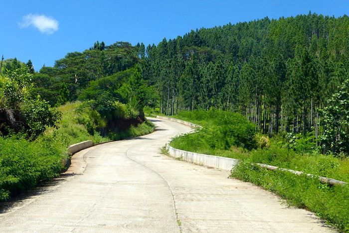
Departure for Ua Huka, the smallest inhabited island in the northern group of the Marquesas, located about 1,300 km northeast of Tahiti. Landing is at the oldest airfield in the Marquesas, built in 1972, between the villages of Vaipaee and Hane. Ua Huka has about 680 inhabitants, according to the last census, spread across 3 villages (since the 1870s): Vaipaee, Hane, and Hokatu. The island peaks at Mount Hitikau at only 884 meters. Its origin: a Hawaiian-type shield volcano that—over a few million years—collapsed to become a caldera (or elliptical depression) in which two small volcanoes appeared, the craters of Tahoatikiau and Teepoepo, now part of the Vaikivi Park. The island is rugged and wild, lower than the others, so less cloud-covered and drier. The bays are jagged, the coastline in ochre tones above the intense blue of the sea, and the beaches are constantly disturbed by the powerful surf. The village of Hokatu is only a few kilometers away (just 14 km of road on the island), but Maurice, our host, drives slowly, and it takes time to go up and down. The road is entirely paved or concreted, which isn’t the case on Ua Pou, for example. The guesthouse is disappointing, perched above the village and thus isolated. Beautiful view of the famous Hane motu and the sparkling sea under the bright sun. Apart from that, there are mosquitoes and cockroaches, the bungalow isn’t clean. Meals are taken with Maurice and Delphine in the village—fine dining isn’t on the menu! Ouch!!! We didn’t luck out...
**Day 5: May 2**
Early in the morning, after breakfast, Delphine takes us to the craft center, which turns out to be a letdown—the items for sale are, in my opinion, crude and poorly carved. Nothing like what’s offered at the Marquesas Fair, held twice a year in Papeete, where you can admire and buy small wonders: wood carvings, flower stone, and coral. Delphine is disappointed we’re not interested, and it shows... She’s a bit sulky! These are items meant for Aranui cruise passengers who land on Ua Huka once every two weeks... Solo travelers like us don’t seem to interest her much. The rest of the day—spent with Maurice—is dedicated to visiting cultural centers and small museums, like the Sea Museum in Hane with its ancient canoes, the municipal archaeological museum on the Te Tumu site above the airfield, the petroglyph house near Hokatu Beach, and finally the Papuakeikaraa arboretum, which gathers endemic plants from all over Polynesia and an impressive citrus collection. No excursion planned to Vaikivi Park, toward the previously mentioned craters that recall the island’s volcanic past. Also missing are the viewpoints, the unique endemic vegetation, and especially the petroglyphs. Too bad... at that price!!! Still, in the evening, we go fishing—with sandwiches and drinks in coolers—with other villagers from the dock at the end of the paved road. It’s cool, windy, no mosquitoes, lots of fish caught, and a great atmosphere. Plus, magnificently starry skies.
Ua Huka is one of the rare islands not invaded by the black rat, which has preserved its birdlife, particularly the ultramarine lorikeet (or *pihiti* in Marquesan), which feeds almost exclusively on flower nectar (banana, coconut, hibiscus, mango, guava trees). A dog imported from New Zealand has been specially trained to detect rats: it inspects cargo unloaded from boats and the docks.
I recommend spending two full days on the island—one for visiting the various museums, the other for hiking in the island’s center park, where the archaeological sites are in their raw state: foundations of agricultural terrace walls, gathering places (or *tohua*), dwelling pavements (or *paepae*), sacred sites (or *me’ae* in Marquesan, *marae* in Tahitian) with their tikis and petroglyphs.
To finish, a bit of info on the island’s name, tied to Marquesan oral culture: according to the legend of the creation of the six Marquesas Islands, Ua Huka is the one that puts the finishing touch on the construction of the god Oatea’s house, each island having a defined architectural function. Ua Huka represents the hole (*ua*) where the god deposits what’s left (*huka* in Marquesan) of the unused materials during construction.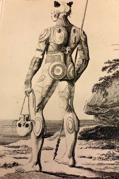
**HIVA OA**
**Day 6: May 3**
Departure in the late morning for Hiva Oa. Maurice—who had other things to do—dropped us off at the airfield 3 hours early... so this stop is a bit of a flop, even if we decided to stay positive! Hiva Oa is the third-largest island in French Polynesia after Tahiti and Nuku Hiva, and before Raiatea in the Leeward Islands. The island is beautiful, lush, verdant, and jagged. The mountains soar into the sky, the sea views are grand, the light is sublime—we’re lucky. Beautiful weather. Tania from Pension Kanahau waits for us at the airport. We’re in for two wonderful days with her. Tania is welcoming, smiling, and dynamic. What a pleasure to be with her, at her place—she cooks divinely and serves the best tuna in the world (the Big Eye reserved for the Japanese) and croquettes made with lobster, shrimp, and crab with breadfruit cubes, for example. Comfortable bungalow, no mosquitoes at night, we can sleep with the window open. It’s fantastic! After settling in, Tania takes us to town in Atuona, a pleasant and well-laid-out little village. We start with lunch—a delicious raw fish in coconut milk—then continue with the must-see attractions: the Catholic cemetery where Paul Gauguin and Jacques Brel’s graves are, overlooking the town; the abandoned Protestant cemetery, reclaimed by the bush, with impressive Marquesan warrior tombs made of huge coral slabs and adorned with a tiki head (harder to find, as no one goes there... ask for directions!); the craft center; the Gauguin Museum (and the Jacques Brel Museum); and the waterfront. While we stroll peacefully, Tania organizes an excursion for the next day, May 4, a full day with Pifa O’Connor, a 36-year-old who knows his island inside out, is passionate about local history, and with whom we’ll hit it off.
**Day 7: May 4**
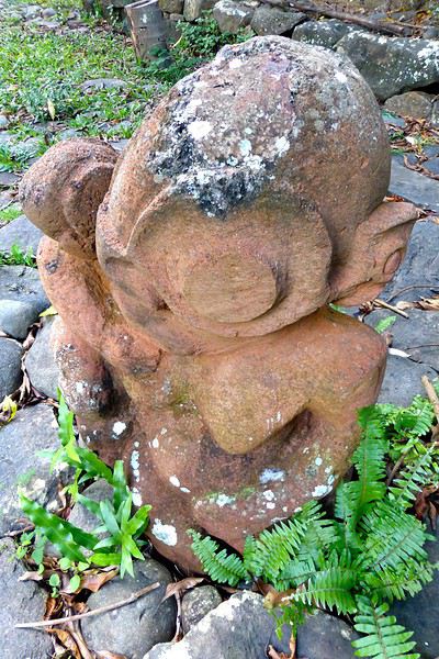
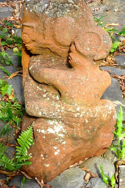
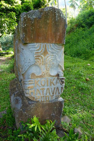
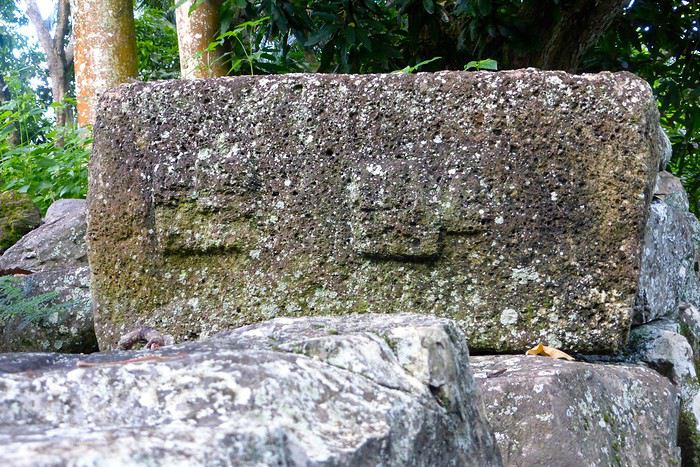
Pifa arrives at 8 AM sharp at the guesthouse, and we immediately buy sandwiches and water at a small supermarket in Atuona. First, we make a brief stop by the roadside at an unmarked spot, from which we descend a small path through dense vegetation leading to the famous smiling tiki—the only one of its kind in the Marquesas and Polynesia. The place is improbable, the tiki isn’t huge, but it’s beautiful and impressive. Then we’re off on the road that, dizzyingly, runs along and overlooks the island’s northern coast, at the edge of the ancient volcano. Few vehicles pass, the road—now a rocky track—is full of potholes, and we proceed slowly. (Note that this road has been fully paved since 2018.) The panoramas are majestic, with every shade of green against the blue sea. We stop again at the top of a cliff adorned with a huge stone, the *sacrifice stone*, from which young virgin girls were once thrown into the sea to appease angry gods. Another pause for lunch this time, at a small restaurant near the exceptional archaeological site of Puamau. We’ll experience the highlights of this trip during this excursion with our guide, Pifa, who spares no explanations. We discover, on a vast esplanade, the ceremonial complexes of Ta’a Oa and Meae Te I’Ipona, the latter featuring superb tikis, particularly the reclining tiki—or *Maki Taua Pepe*—representing Motherhood, a woman giving birth in a squatting position, as was often the case in many civilizations. Also notable is the *Takaii*, the largest tiki recorded in Polynesia to date. There’s also a huge stone with a now-blunt edge, on which the circumcision of chiefs’ and notables’ pre-adolescent sons was performed. A tough ordeal! But that’s not all! It seems there are more on the mountainside rising steeply behind the archaeological site—overturned tikis, platforms, and, apparently, a giant tiki at the top, which must have fallen but was visible from afar on the sea 30 or 40 years ago, according to the island’s elders. This meeting, worship, and living place—it was actually a small town—is immense. Thousands of people once lived in this part of the island. The site—a religious, social, and cultural sanctuary—would be the size of the largest Mayan sites in Yucatán, but the few concerned owners—two or three families who own the mountainside—don’t want to hear about intensive clearing or tree cutting for now. UNESCO rightly asks for some compliance efforts to grant special treatment to Hiva Oa in particular and the Marquesas in general. We’re not there yet, unfortunately, due to insurmountable local rigidities! This kind of attitude is quite typical in Polynesia: people are afraid to uncover *marae* buried under vegetation—they’re taboo and sometimes said to emit negative and deadly waves, so it’s better not to disturb or anger the ancient spirits or gods who might take revenge. The old religion is never far away in Polynesia, despite the successes of the missionaries.
We return to the guesthouse in the late afternoon. Last night in the Marquesas with Tania, who prepares a fine and delicious meal. Note that dinner costs 2,500 XPF per person.
**Day 8: May 5**
We take the plane as planned, via Nuku Hiva (short stopover). Arrival on time in Papeete.
May this travel journal inspire many of you to visit the Marquesas one day. It’s far, it’s expensive, it’s the trip of a lifetime—it’s unforgettable and unmissable.
Our itinerary is perfect for those who aren’t excited by cruises and prefer to get closer to the local communities. This 9-day trip cost us around 2500 € all-inclusive. For a 14-day cruise on the Aranui, expect to pay 2300 € per person for a basic cabin for four, or 3800 € per person for a superior double cabin.
Air Tahiti offers a 4-island Marquesas Pass (Nuku Hiva, Ua Pou, Ua Huka, and Hiva Oa) for 86,000 XPF (about 700 €). The journey is made on an ATR 72 from Tahiti to Nuku Hiva or Hiva Oa, and on a 19-seat Twin Otter between the islands (often only 13 or 15 seats are available due to cargo, so book well in advance). We’re traveling as a couple. We booked our family-run guesthouse stays at the Tourism Fair in early February, where you can meet the owners and make your choice. Stays are almost always half-board or breakfast-only. Transfers are usually included, but you can always book a car or taxi.
**NUKU HIVA**
**A LITTLE GEOGRAPHY** Nuku Hiva (NH) is located about 1,500 km from Tahiti, in the north of French Polynesia. At 387 km², it’s the second-largest island in French Polynesia after Tahiti. It was formed by incredible volcanic phenomena and cataclysms between 1 and 6 million years ago, which lifted the island thousands of meters above the sea. Even after millennia of slow erosion, collapses, and settling, NH remains the most majestic of the Marquesas, with its sheer cliffs, deep valleys featuring immense waterfalls, and black walls that were once the inner walls of enormous volcanoes.
**A LITTLE HISTORY** The first contact between NH’s inhabitants and Europeans was in 1595 with Spanish navigators who only stayed briefly. It wasn’t until the late 18th century that Europeans arrived in greater numbers on NH (and the other Marquesas Islands), disrupting a very fragile social and cultural balance. It’s believed that nearly 100,000 people lived on Nuku Hiva at that time—a population decimated over the decades by epidemics, diseases brought by Europeans, and alcohol used for barter. The disastrous result: by the 1930s, only 2,500 people remained, having largely lost their identity and living in poverty. Today, the island has about 2,600 inhabitants spread across several villages, with Taiohae as the main one.
**NUKU HIVA IN LITERATURE**
1 / One of the famous writers who visited NH and stayed there was Herman Melville, who arrived in July 1842, the author of *Moby Dick*. The island had just come under French protectorate. Seduced by the enchanting *vahinés* and dazzled by his paradisiacal vision of the place, Melville deserted his ship. He ended up a prisoner of a local tribe, the Taipi, in Taipivai, where he stayed for a month and a half until an Australian ship captain secured his release in exchange for a musket and a roll of cotton fabric! Melville wrote a novel about this tumultuous episode in his life, considered a classic of travel literature. The book, *Typee: A Peep at Polynesian Life*, published in 1846 in the United States, was a huge success.
2 / Another famous Scottish writer, Robert Louis Stevenson, arrived in NH aboard a yacht that anchored in Anaho Bay, the island’s most beautiful, in July 1888. Stevenson was already known for two magnificent novels that marked their era: *Treasure Island* and *Dr. Jekyll & Mr. Hyde*. Stevenson, too, was captivated by the island’s natural beauty, though he also noted the devastating decline in identity, socio-cultural life, and physical health of a population ravaged by disease and alcohol. His account of his stay, *In the South Seas: An Account of Experiences and Observations in the Marquesas, Paumotus, and Gilbert Islands During Two Cruises on the Yacht Casco (1888) and the Schooner Equator (1889)*, was published in 1896 in New York, four years after his death in Apia, Western Samoa, where he had settled. It was also published in London in 1900.
3 / In August 1903, Victor Segalen, a French naval doctor, ethnologist, and archaeologist, landed in NH from the ship *La Durance*, sent to Polynesia to recover the possessions of the painter Paul Gauguin, who had died in April of that year. He, too, was enthralled by the Marquesas but lamented the loss of identity, dignity, and pride of the Māori, alienated by a Christianization that destroyed their culture and customs, denied their gods, and erased their past. He wrote about his experience, doubts, and fears in *Les Immémoriaux*.
4 / In December 1907, Jack London arrived in NH aboard the sailboat *Stark*, following in the footsteps of his illustrious predecessor, Herman Melville. London was in poor physical condition, exhausted from his relentless travels that had taken him from the Klondike in Canada to Japan, Australia, and London in Europe. He was appalled and shocked by Nuku Hiva’s degraded health situation: where Melville had encountered over 2,000 vigorous and healthy Marquesan warriors, London found only 12 suffering from various diseases—the rest had been wiped out by tuberculosis! His approach remained humanistic, and he maintained a sharp geopolitical awareness of these traditional Polynesian cultures, weakened by the inexorable advance of modernity in the early 20th century. He continued his journey to the Tuamotu Islands and Tahiti, publishing *Martin Eden*, the moving account of his initiatory voyage in the South Pacific, in 1911.
5 / Finally, Alain Gerbault, a writer, linguist, ethnologist, and tireless traveler, arrived in the Marquesas via the Panama Canal in December 1933. He was completely exhausted after an endless crossing on a small sailboat, the *Firecrest*. Enthralled by his stay in the Marquesas, he continued to the Tuamotu Islands in 1934, then Tahiti in 1935. Gerbault fought for the preservation of traditions, as well as the songs and dances banned by the Churches and the French Administration (these bans lasted over 50 years, mind you...!!!). Bora Bora remained his favorite island. A staunch Pétainist during World War II, he was forced to flee Bora Bora for Samoa, then Tonga, and finally Timor, a half-Portuguese island and thus neutral during the war. His travel accounts, *In Pursuit of the Sun: Logbook from New York to Tahiti* and *A Paradise Is Dying*, were published in the late 1940s. He died in Timor in 1941, and his ashes were repatriated to Bora Bora.
Back to our trip and stay.
**Day 1: April 27**
Departure from Papeete at 6:30 AM—we had to wake up two hours earlier and reach the airport in the dark. Takeoff at dawn, good weather en route, flight duration: 4 hours.
Arrival around 10:30 AM in Nuku Hiva, the first stop of this trip. We booked two nights in half-board at Pension Koku’u, transfers included. Maybe not such a great idea, those included transfers, especially on this unique island where the airport is located on *Terre Déserte*, on the other side of the mountain, opposite and about 45 km from the main village of Taiohae. They’re charged at a steep price. Expect 6,000 XPF round-trip by taxi, but 15,000 XPF charged by guesthouses or hotels. The difference is notable. It wasn’t the best idea, but we can’t go back. Even for residents like us who know how to travel in Polynesia, the Air Tahiti employee who sold me the Pass couldn’t give any useful advice about the stay itself—probably because he’d never been to the Marquesas. It’s really annoying! In short, the good idea to remember is renting a car (like a Suzuki) to be free to manage your time and stop at leisure. The road signage is a bit basic, but you’ll manage just fine. Our host Alvane waits for us—without a sign (sic!)—and after searching for each other for 5 minutes, we’re off on a journey of over an hour (with photo stops) in a Land Rover with smooth tires (luckily, it’s not raining!). The recently paved and marked mountain road is impeccable. No time to catch our breath at the guesthouse; we leave immediately (not a great idea after waking up at dawn plus 4 hours on a plane) for a half-day hike that was also included in the prepaid stay. A sandwich was provided (really pathetic for the physical effort required), we have water, and we fill a few bottles at the spring near the ceremonial site of Taipivai, our first stop. Then the hike begins in the Hanaheu Valley, descending toward Anaho Bay and its namesake beach. A magnificent and wild spot, a few sailboats anchored, we swim—the water is really warm, over 30°C at the shore. That warm is rare and not necessarily pleasant. We then have to climb a very steep slope; this hike is actually quite tough. The air is still, humid, and stifling under the foliage, there’s a bit of mud, and tiny ants (which don’t bite, I’ll have you know), locally called *fofolles*, running over shoes, ankles, and calves. Not very pleasant...! On top of that, there are mosquitoes to protect against! In hindsight, it seems wise to bring energy bars from Papeete if you plan to hike on the afternoon of your arrival day. We weren’t careful... Result: a moment of weakness for me and a hyperventilation attack climbing back up from Anaho Bay!!! We return to the guesthouse at night. There we find Claudine and her four children—Marquesan-style atmosphere, friendly and casual. We share family life. Very simple room with a bathroom, no mosquitoes, we can sleep with the window open, but the night will be noisy, as is often the case in Polynesia. Roosters are everywhere and don’t sleep, dogs bark or whine. So we end up waking up early... like everyone else.
**Day 2: April 28**
We booked a full-day excursion with Thierry: it starts with a 45-minute boat ride to reach Hakatea Beach, hidden in a small secret bay like many along Nuku Hiva’s coasts. From there, the hike lasts all day—11 km round-trip on flat but also rugged terrain (ancient paved and elevated paths over 1,000 years old)—and river crossings. Bring the right shoes (like plastic Crocs with high socks—not very stylish but practical). We cross the former village of Hakaui, walk along the foundations of dwellings, and there are still weathered tikis in the lush vegetation. The ultimate goal of this hike is to reach the tall Vaipo waterfall. The place is magical, with openings in the vegetation and immense trees allowing photos of the treetops and caves where funeral canoes containing the bones of chiefs or great warriors were once placed. We return the same way to the beach and take another boat ride to reach Taihoae’s port. Back at the guesthouse after a glimpse of Taihoae’s waterfront.
**UA POU**
**Day 3: April 29**
Back to the airport in the late morning for the second flight of the trip to Ua Pou. 20-minute crossing in a Twin Otter (18 seats but only 13 occupied due to cargo between the islands). Beautiful weather, blue sea, nice photos to take upon departure from NH and arrival in UP. We’re greeted by Jérôme, a former military man turned tourism professional, who runs Pension Pukue’e with his wife Elisa, a native of UP. We’re in for two exceptional days. The guesthouse is comfortable, Jérôme and Elisa are very professional and pleasant. Jérôme is also a professional hiker, and Elisa is an excellent cook. We leave quickly for a half-day excursion to Hohoi, after a stop at the archaeological, cultural, and religious site of Maui’a, the Tavaka tribe’s territory. Jérôme is there to explain how Marquesan society functioned at the time and the events that took place on a site still largely buried under vegetation. Then we visit a flower-stone sculptor he knows—the only place in the Marquesas where you’ll find these stones. They’re collected in the river flowing into the sea at Hohoi, sometimes on the beach itself. Back to the guesthouse.
**Day 4: April 30**
A nature hike in the mountains—moderately difficult—toward the Vaiea waterfall is on our program for a good 4 hours. It’s hot, there are mosquitoes, and the dip in the pool under the waterfall (24°C water) is a rare pleasure. Lunch at a friend of Jérôme’s, a former chef for French minister François Fillon, who prepares delicious food. Elisa picks us up by car to return to the guesthouse. Ua Pou is a beautiful and elegant island with its sharp peaks and wild nature. Our favorite, thanks to Jérôme and his wife.
**UA HUKA**
**Day 4: May 1**
Departure for Ua Huka, the smallest inhabited island in the northern group of the Marquesas, located about 1,300 km northeast of Tahiti. Landing is at the oldest airfield in the Marquesas, built in 1972, between the villages of Vaipaee and Hane. Ua Huka has about 680 inhabitants, according to the last census, spread across 3 villages (since the 1870s): Vaipaee, Hane, and Hokatu. The island peaks at Mount Hitikau at only 884 meters. Its origin: a Hawaiian-type shield volcano that—over a few million years—collapsed to become a caldera (or elliptical depression) in which two small volcanoes appeared, the craters of Tahoatikiau and Teepoepo, now part of the Vaikivi Park. The island is rugged and wild, lower than the others, so less cloud-covered and drier. The bays are jagged, the coastline in ochre tones above the intense blue of the sea, and the beaches are constantly disturbed by the powerful surf. The village of Hokatu is only a few kilometers away (just 14 km of road on the island), but Maurice, our host, drives slowly, and it takes time to go up and down. The road is entirely paved or concreted, which isn’t the case on Ua Pou, for example. The guesthouse is disappointing, perched above the village and thus isolated. Beautiful view of the famous Hane motu and the sparkling sea under the bright sun. Apart from that, there are mosquitoes and cockroaches, the bungalow isn’t clean. Meals are taken with Maurice and Delphine in the village—fine dining isn’t on the menu! Ouch!!! We didn’t luck out...
**Day 5: May 2**
Early in the morning, after breakfast, Delphine takes us to the craft center, which turns out to be a letdown—the items for sale are, in my opinion, crude and poorly carved. Nothing like what’s offered at the Marquesas Fair, held twice a year in Papeete, where you can admire and buy small wonders: wood carvings, flower stone, and coral. Delphine is disappointed we’re not interested, and it shows... She’s a bit sulky! These are items meant for Aranui cruise passengers who land on Ua Huka once every two weeks... Solo travelers like us don’t seem to interest her much. The rest of the day—spent with Maurice—is dedicated to visiting cultural centers and small museums, like the Sea Museum in Hane with its ancient canoes, the municipal archaeological museum on the Te Tumu site above the airfield, the petroglyph house near Hokatu Beach, and finally the Papuakeikaraa arboretum, which gathers endemic plants from all over Polynesia and an impressive citrus collection. No excursion planned to Vaikivi Park, toward the previously mentioned craters that recall the island’s volcanic past. Also missing are the viewpoints, the unique endemic vegetation, and especially the petroglyphs. Too bad... at that price!!! Still, in the evening, we go fishing—with sandwiches and drinks in coolers—with other villagers from the dock at the end of the paved road. It’s cool, windy, no mosquitoes, lots of fish caught, and a great atmosphere. Plus, magnificently starry skies.
Ua Huka is one of the rare islands not invaded by the black rat, which has preserved its birdlife, particularly the ultramarine lorikeet (or *pihiti* in Marquesan), which feeds almost exclusively on flower nectar (banana, coconut, hibiscus, mango, guava trees). A dog imported from New Zealand has been specially trained to detect rats: it inspects cargo unloaded from boats and the docks.
I recommend spending two full days on the island—one for visiting the various museums, the other for hiking in the island’s center park, where the archaeological sites are in their raw state: foundations of agricultural terrace walls, gathering places (or *tohua*), dwelling pavements (or *paepae*), sacred sites (or *me’ae* in Marquesan, *marae* in Tahitian) with their tikis and petroglyphs.
To finish, a bit of info on the island’s name, tied to Marquesan oral culture: according to the legend of the creation of the six Marquesas Islands, Ua Huka is the one that puts the finishing touch on the construction of the god Oatea’s house, each island having a defined architectural function. Ua Huka represents the hole (*ua*) where the god deposits what’s left (*huka* in Marquesan) of the unused materials during construction.
**HIVA OA**
**Day 6: May 3**
Departure in the late morning for Hiva Oa. Maurice—who had other things to do—dropped us off at the airfield 3 hours early... so this stop is a bit of a flop, even if we decided to stay positive! Hiva Oa is the third-largest island in French Polynesia after Tahiti and Nuku Hiva, and before Raiatea in the Leeward Islands. The island is beautiful, lush, verdant, and jagged. The mountains soar into the sky, the sea views are grand, the light is sublime—we’re lucky. Beautiful weather. Tania from Pension Kanahau waits for us at the airport. We’re in for two wonderful days with her. Tania is welcoming, smiling, and dynamic. What a pleasure to be with her, at her place—she cooks divinely and serves the best tuna in the world (the Big Eye reserved for the Japanese) and croquettes made with lobster, shrimp, and crab with breadfruit cubes, for example. Comfortable bungalow, no mosquitoes at night, we can sleep with the window open. It’s fantastic! After settling in, Tania takes us to town in Atuona, a pleasant and well-laid-out little village. We start with lunch—a delicious raw fish in coconut milk—then continue with the must-see attractions: the Catholic cemetery where Paul Gauguin and Jacques Brel’s graves are, overlooking the town; the abandoned Protestant cemetery, reclaimed by the bush, with impressive Marquesan warrior tombs made of huge coral slabs and adorned with a tiki head (harder to find, as no one goes there... ask for directions!); the craft center; the Gauguin Museum (and the Jacques Brel Museum); and the waterfront. While we stroll peacefully, Tania organizes an excursion for the next day, May 4, a full day with Pifa O’Connor, a 36-year-old who knows his island inside out, is passionate about local history, and with whom we’ll hit it off.
**Day 7: May 4**
Pifa arrives at 8 AM sharp at the guesthouse, and we immediately buy sandwiches and water at a small supermarket in Atuona. First, we make a brief stop by the roadside at an unmarked spot, from which we descend a small path through dense vegetation leading to the famous smiling tiki—the only one of its kind in the Marquesas and Polynesia. The place is improbable, the tiki isn’t huge, but it’s beautiful and impressive. Then we’re off on the road that, dizzyingly, runs along and overlooks the island’s northern coast, at the edge of the ancient volcano. Few vehicles pass, the road—now a rocky track—is full of potholes, and we proceed slowly. (Note that this road has been fully paved since 2018.) The panoramas are majestic, with every shade of green against the blue sea. We stop again at the top of a cliff adorned with a huge stone, the *sacrifice stone*, from which young virgin girls were once thrown into the sea to appease angry gods. Another pause for lunch this time, at a small restaurant near the exceptional archaeological site of Puamau. We’ll experience the highlights of this trip during this excursion with our guide, Pifa, who spares no explanations. We discover, on a vast esplanade, the ceremonial complexes of Ta’a Oa and Meae Te I’Ipona, the latter featuring superb tikis, particularly the reclining tiki—or *Maki Taua Pepe*—representing Motherhood, a woman giving birth in a squatting position, as was often the case in many civilizations. Also notable is the *Takaii*, the largest tiki recorded in Polynesia to date. There’s also a huge stone with a now-blunt edge, on which the circumcision of chiefs’ and notables’ pre-adolescent sons was performed. A tough ordeal! But that’s not all! It seems there are more on the mountainside rising steeply behind the archaeological site—overturned tikis, platforms, and, apparently, a giant tiki at the top, which must have fallen but was visible from afar on the sea 30 or 40 years ago, according to the island’s elders. This meeting, worship, and living place—it was actually a small town—is immense. Thousands of people once lived in this part of the island. The site—a religious, social, and cultural sanctuary—would be the size of the largest Mayan sites in Yucatán, but the few concerned owners—two or three families who own the mountainside—don’t want to hear about intensive clearing or tree cutting for now. UNESCO rightly asks for some compliance efforts to grant special treatment to Hiva Oa in particular and the Marquesas in general. We’re not there yet, unfortunately, due to insurmountable local rigidities! This kind of attitude is quite typical in Polynesia: people are afraid to uncover *marae* buried under vegetation—they’re taboo and sometimes said to emit negative and deadly waves, so it’s better not to disturb or anger the ancient spirits or gods who might take revenge. The old religion is never far away in Polynesia, despite the successes of the missionaries.
We return to the guesthouse in the late afternoon. Last night in the Marquesas with Tania, who prepares a fine and delicious meal. Note that dinner costs 2,500 XPF per person.
**Day 8: May 5**
We take the plane as planned, via Nuku Hiva (short stopover). Arrival on time in Papeete.
May this travel journal inspire many of you to visit the Marquesas one day. It’s far, it’s expensive, it’s the trip of a lifetime—it’s unforgettable and unmissable.
Hello,
I’m a volunteer leader at a youth center (MJC), and we’ve been deeply moved by everything happening in Madagascar—extreme poverty, endangered animals, deforestation, and so on. Plus, one of our teens has a Malagasy friend, so our group wants to travel there next year. Throughout this year, they’ve planned fundraisers to collect donations (sheets, dish towels, schoolbooks, hygiene products, etc.) and funds to cover their trip and stay.
They’re really motivated and generous—they already volunteer in schools and senior centers, and they’re always welcomed warmly.
But so far, they haven’t found any organizations in Madagascar willing to host them for two weeks (orphanages, schools, animal protection parks, etc.). Does anyone know of any contacts, please? Looking forward to your replies. Have a great evening!
Hello,
My wife and I would like to spend between 7 and 10 days on the islands of Palau at the end of December / beginning of January. We’d like to get in touch with a local tourism agency or guide to plan a rich and optimized experience, but we’re not finding much online.
We’re just starting our research, but if you have any tips on must-see spots or contacts for local guides, we’d love to hear them!
Thanks in advance!
Hello,
We’re traveling as a family with two boys aged 10 and 12 to Cairo in February. During our trip, we’re planning to take an overnight train (with or without a sleeper) for the Cairo-Aswan route.
Do you know how I can book this remotely?
Also, I’m looking for: - A local contact to sail the Nile by felucca for 3 days from Aswan - A contact to guide us in Cairo
Looking forward to your tips, and thanks in advance! Marie
Also, I’m looking for: - A local contact to sail the Nile by felucca for 3 days from Aswan - A contact to guide us in Cairo
Looking forward to your tips, and thanks in advance! Marie
hi
I’ve been in UZBEKISTAN for a few days now, and I really want to get to the Aral Sea. The route is mostly off-road, so I’m told going through an agency is mandatory (or is it??).
Anyone have any feedback on specific agencies, the cost (I’m traveling solo), or whether it’s better to book in advance or just arrange it last-minute when I get to the region?
Thanks in advance! 😛
Here’s my account of our trip to Thailand with my partner from November 22 to December 5, 2025.
First off, I’d like to wish all Voyageforum.com users a very happy 2026, full of happiness and amazing discoveries on your travels!
It’s thanks to the tips I gathered on this site that I planned the trip.
We traveled with Malaysia Airlines (the flight price was great, but no movies in French, not even subtitled) because we wanted to explore Kuala Lumpur and visit southern Thailand.
Our departure from Roissy was delayed because the plane had to go through the robotic de-icing trucks—pretty impressive!
After a 12-hour flight, we arrived at the beautiful Kuala Lumpur airport around 7 AM.
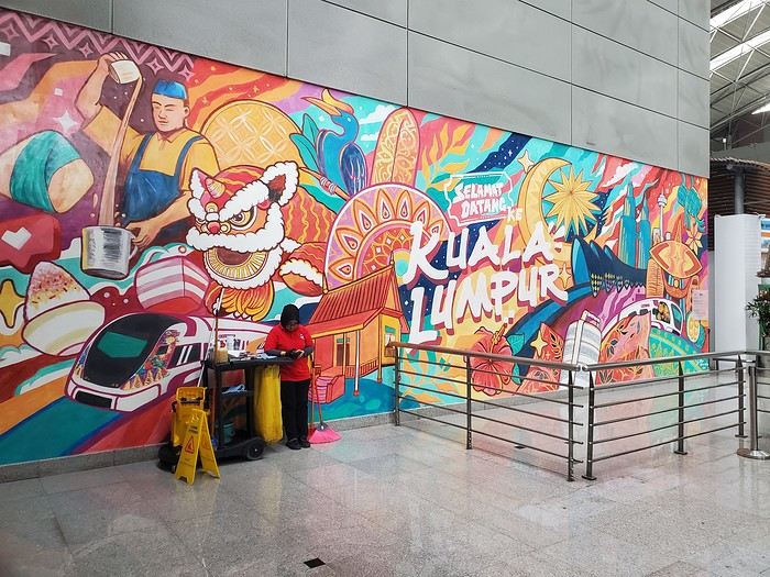
Don’t forget to fill out the immigration form requested by Malaysia 3 days before arrival. We left without any issues and took the Klia Ekspress train to KL Sentral station (30 minutes, 10 €). We’d booked accommodation in a tower near the station and had to communicate with the landlord to get the keys. But while we thought there’d be Wi-Fi at the station, there wasn’t—we asked the tourism office, and they said there wasn’t any. We didn’t want to buy a local SIM card since we were leaving the next day. Eventually, we went to a Starbucks to get online, but just as we decided to head to our place, a torrential downpour hit, and we couldn’t find a sidewalk to reach our destination. We went back to the station, took the elevated metro, and finally made it to our landlord and the room on the 45th floor.
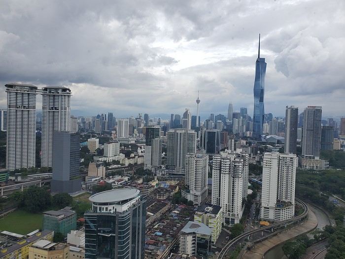
Don’t forget to fill out the immigration form requested by Malaysia 3 days before arrival. We left without any issues and took the Klia Ekspress train to KL Sentral station (30 minutes, 10 €). We’d booked accommodation in a tower near the station and had to communicate with the landlord to get the keys. But while we thought there’d be Wi-Fi at the station, there wasn’t—we asked the tourism office, and they said there wasn’t any. We didn’t want to buy a local SIM card since we were leaving the next day. Eventually, we went to a Starbucks to get online, but just as we decided to head to our place, a torrential downpour hit, and we couldn’t find a sidewalk to reach our destination. We went back to the station, took the elevated metro, and finally made it to our landlord and the room on the 45th floor.
Hi,
We’re leaving for South Africa soon (on 10/9) and I was wondering if there’s a need for things like paracetamol, since we can bring some! And if so, how should we go about it—can we drop them off at a private lodge, in Kruger, in Cape Town...?
Thanks for any tips or experiences you can share—quickly, since we’re leaving soon! 😉
Hello everyone,
Not long ago, I used to travel as a couple, but my husband has since passed away, and I’ve decided to set off again. The trip I took to Cambodia in January 2025 did me a world of good.
I’m now considering Thailand, a destination we never included in our plans because even 15 years ago, people said it was too touristy. Still, I’m thinking about the itinerary below, but I don’t feel up to arranging buses, trains, or guides on my own while I’m there. I’m looking for one or more drivers and have been in touch with an agency, but their offers are just copy-paste group tours that I don’t want.
So, if you have any contacts, experiences, or advice, I’d be so grateful if you’d share them with me. Here’s my rough plan:
Arrival in Bangkok
Ayutthaya (2 nights)
Kanchanaburi (2 or 3 nights)
Sangkhlaburi/Sai Yok (3 nights)
Sukhothai (2 nights)
Lampang (I’ve planned 3 nights, but that might be a bit much—it depends on what time I arrive in the city)
Chiang Mai
Chiang Dao
Pai
Chiang Rai
I was thinking about the Mae Hong Son loop—thoughts?
What do you think about staying overnight at the Golden Triangle?
When I look online, of course, I can find agencies that organize tours to national parks, etc.
I’m retired but in great physical shape. I’d rather go hiking than sit in hot springs with crowds of tourists who’ve all arranged meet-ups. I don’t want to spend a day at an elephant camp, and I don’t want to visit Karen villages.
I’d love to hear your advice.
Thank you all,
Hello
Out of all my travels, I haven’t been to Vietnam yet. Does anyone have plans to visit the country?
Looking forward to hearing from you, Christine
Out of all my travels, I haven’t been to Vietnam yet. Does anyone have plans to visit the country?
Looking forward to hearing from you, Christine
Hi! I’m a fit, sporty, dynamic, and enthusiastic woman looking for someone to join me in exploring Georgia, Albania, or Armenia (not all at once 😄). Traveling simply and positively is my style. I’m used to traveling with "strangers," and it’s always gone well, but this time, I don’t have partners for these destinations. Preferably leaving in April, May, or July–September. Thanks!
Hi everyone,
The idea of traveling to Bolivia came to me after seeing Jean-François (Max68)’s photos on his website. I thought we *had* to see those stunning landscapes with the colorful lagoons for ourselves. But a self-drive trip didn’t seem doable at first. A few years ago, everyone advised against going to the South Lipez with just one car.
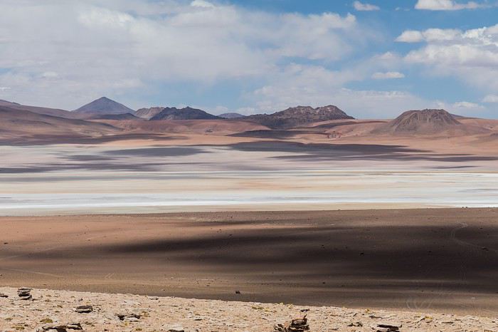 Laguna Kara
It was only after reading Laurent (Lolobe) and Pascal (Pepe874)’s travel journals—who explored the South Lipez solo with a car from Biz Rent a Car—that I thought we might be able to do the same. Meanwhile, we’d already contacted a local agency to organize a trip with a driver and guide. But the idea of a self-drive adventure really appealed to us. With encouragement and tips from Thierry (Tbernay) and Jean-François (Max68), we decided to plan our own self-drive trip. I’d like to thank them for their advice—it was *super* helpful. And a big thanks to all the other forum members for the info shared during our prep!
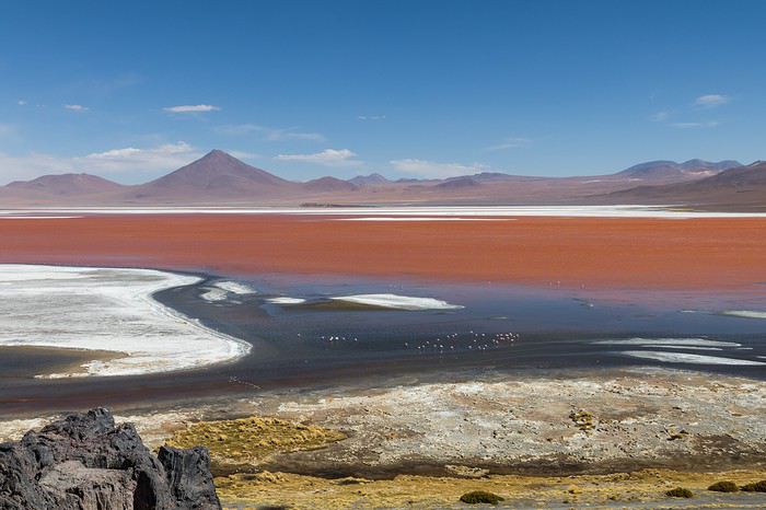 Laguna Colorada
Planning this trip happened during a tough time for our family. My mother-in-law’s illness and passing, plus a few health issues of my own, made us doubt the trip multiple times and nearly scrap the whole thing.
We booked our international flights in February with Swiss. They offered the best balance of travel time and price from Switzerland. Swiss operates Zurich–São Paulo with their own fleet, and São Paulo–Santa Cruz with GOL. In June, GOL canceled the Saturday flight and rebooked us on Sunday. Spending over 24 hours in that huge Brazilian city didn’t work for us at all, so we asked Swiss to put us on the next Zurich–São Paulo flight. Too bad—we lost a day in Bolivia and had to skip the Tarabucco market on Sunday.
Right after, we also booked the car in February. After contacting Imbex and Biz, we went with Biz. Not speaking Spanish, we were relieved to communicate with Alejandra in French. The contact was great—she answered all our questions patiently. Sometimes it took a few days to get a reply, but we could also reach her on WhatsApp. After our trip, we can *only* recommend Biz for rentals in Bolivia. The cars are well-prepped for the South Lipez tracks. The agency is reliable, and the vehicles are new and well-maintained.
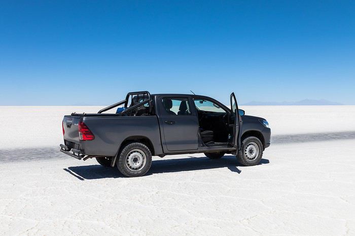 “Our” car, a Toyota Hilux
While planning, we realized the presidential elections would happen while we were in Bolivia. The risk of *bloqueos* (roadblocks and protests) was very real. But in Bolivia, *bloqueos* seem common—you always have to account for that kind of hassle. In late August/early September, Uyuni and the Salar region were blocked for days, leading to food, fuel, and cash shortages. Worried about a blockade in Uyuni and missing the Salar, we decided to visit it first *just in case*.
On election day, the whole country shut down. Planes were grounded, buses and taxis couldn’t circulate, and private cars were banned. There were a few exceptions—ambulances, police, or certain professions—but as tourists, we couldn’t get permission to drive. We asked the embassy, and Biz even requested a permit from the electoral office. So we had to plan to be somewhere with things to do *without* the car.
We decided not to book any accommodations in advance—a first for us. Usually, we plan our stops and reserve lodges, hotels, or campgrounds well ahead. This time, only the room in Sucre was booked, so we’d have a base when we arrived.
In July, Alex (Delhenry) reached out to propose joining part of the trip. He didn’t realize we were leaving in October. Still, we got fresh updates when he returned from the South Lipez. Thanks, Alex—your tips, especially about the Guadalupe–Tupiza stretch, were *super* useful.
In September, we connected with Jean-Louis (Avx) and Anne (Xeta), who were also heading to Bolivia in October, one and two weeks after us. We had dinner with Jean-Louis and his friend after our South Lipez trip and stayed in touch with Anne. It was great to chat with them! Unfortunately, Anne and her husband had a much rockier trip—they got hit hard by post-election issues.
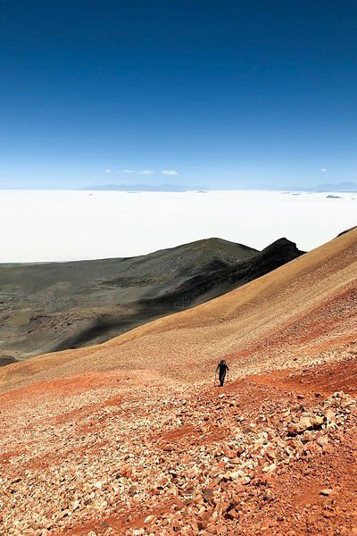 Climbing Volcán Tunupa
Our itinerary wasn’t set in stone—we decided to wing it on the spot. Two weeks before departure, I reconnected with Alejandra at Biz to move the car rental up by a day. With the elections, we wanted to leave Sucre ASAP and focus on the South Lipez. Outside Uyuni and Tupiza, the risk of blockades was zero. We also planned a two-night buffer in Sucre before our flights, just in case. It might sound overcautious, but in hindsight, we made the right call. If we’d left Sucre a day later, we wouldn’t have made it to Potosí—it was completely blocked. On the way back, we *just* dodged blockades in Potosí and elsewhere. Sometimes, you’ve gotta trust your gut.
Here’s our route—only the first two nights in Sucre were booked ahead:
D1 Departure from Switzerland
D2 Sucre (La Selenita)
D3 Sucre (La Selenita)
D4 Colchani (Hotel de Sal Luna Salada)
D5 Jirira (Auberge Doña Lupe)
D6 On the Salar (in the car)
D7 A few kilometers from Estancia Catal (in the car)
D8 Laguna Hedionda (Hotel Los Flamencos)
D9 Laguna Colorada (Lodge by the lagoon)
D10 Middle of nowhere, en route Laguna Verde–Mina Horsu–Quetena Chico (in the car)
D11 Quetena Chico (Lamphaya Lodge Andino)
D12 Quetena Chico (Lamphaya Lodge Andino)
D13 Guadalupe (Guest room at Celia’s)
D14 Along the Rio Grande (in the car)
D15 Tupiza (Hotel Mitru)
D16 Tupiza (Hotel Mitru)
D17 Sucre (La Selenita)
D18 Sucre (La Selenita)
D19 Santa Cruz (Hotel Sun)
D20 Departure from Santa Cruz
D21 Arrival in Switzerland
As you can see, we spent 13 nights in the South Lipez. Initially, we’d planned for nine, but Jean-François (Max68) suggested staying longer. Great advice—we didn’t regret it one bit. We could’ve even added 2–3 more days without getting bored.
Self-driving in the South Lipez takes some prep and a good GPS. We kept it simple and used maps.me to navigate. It’s a solid app—just save your waypoints ahead of time. For some stretches, I used Google Earth to visualize the tracks and sites. If you stick to the tour operator routes, you *almost* can’t get lost. But we often veered off the beaten path and took different routes. Some days, we didn’t see another car. So in case of a breakdown, it’s key to have water and food for several days. In some spots, there’s *zero* signal—your phone won’t work. Another must: it gets *cold* in the South Lipez, and a good sleeping bag is essential. We brought down sleeping bags rated for -10°C and didn’t regret it during our car nights.
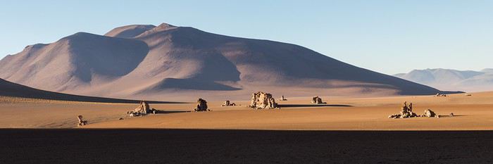 The Dalí Desert
Some tracks are *super* rocky—flat tires are a real risk. On those stretches, maps.me’s estimated travel time was way off. Some sections barely let us go over 15 km/h.
Lots of forum members recommend doing the South Lipez “loop” from Tupiza to Uyuni—ending with the Salar—to avoid Uyuni’s crowds. That might work for organized tours, but for self-drive, the direction *doesn’t* matter. I’ll say this: the few vehicles we saw mostly came from Tupiza and Chile, not Uyuni. So if starting from Uyuni works better for you, go for it! Ending in Tupiza means heading toward warmer weather. For our planned stops and climbs, starting in Uyuni helped with acclimatization. Spending a few nights between 3,600–3,800 m before going over 4,000 m is a smart move.
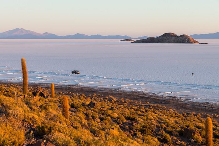 Uyuni Salt Flats in the morning
Overall, we barely saw anyone—except at Laguna Hedionda and Chalviri. There were several tour groups at Hotel Los Flamencos (Laguna Hedionda), but we didn’t cross paths during the day. Hardly anyone on the Salar, on the roads, or at the lodges in the evenings. The *only* place that shocked us was Chalviri. We’d planned to stay there, but it was fully booked—and we counted *forty* tour jeeps on-site. This was around noon! At the Polques hot springs (Chalviri), it was *packed*—we quickly nixed the idea of a dip. Plus, the vibe wasn’t great: soaking right by the road with lodges and restaurants in the background? Meh. Still, lots of tourists love it, so it’s up to you.
For the photos, I kept the colors and mood we saw. The lagoons’ hues are often stunning, but some online photos are *way* over-edited and oversaturated. The South Lipez’s landscapes are breathtaking—no need for excessive retouching.
If you don’t want to read all the details, the start of the travel journal is here: https://voyageforum.com/v.f?post=9888761;a=9888761
The idea of traveling to Bolivia came to me after seeing Jean-François (Max68)’s photos on his website. I thought we *had* to see those stunning landscapes with the colorful lagoons for ourselves. But a self-drive trip didn’t seem doable at first. A few years ago, everyone advised against going to the South Lipez with just one car.
Laguna KaraIt was only after reading Laurent (Lolobe) and Pascal (Pepe874)’s travel journals—who explored the South Lipez solo with a car from Biz Rent a Car—that I thought we might be able to do the same. Meanwhile, we’d already contacted a local agency to organize a trip with a driver and guide. But the idea of a self-drive adventure really appealed to us. With encouragement and tips from Thierry (Tbernay) and Jean-François (Max68), we decided to plan our own self-drive trip. I’d like to thank them for their advice—it was *super* helpful. And a big thanks to all the other forum members for the info shared during our prep!
Laguna ColoradaPlanning this trip happened during a tough time for our family. My mother-in-law’s illness and passing, plus a few health issues of my own, made us doubt the trip multiple times and nearly scrap the whole thing.
We booked our international flights in February with Swiss. They offered the best balance of travel time and price from Switzerland. Swiss operates Zurich–São Paulo with their own fleet, and São Paulo–Santa Cruz with GOL. In June, GOL canceled the Saturday flight and rebooked us on Sunday. Spending over 24 hours in that huge Brazilian city didn’t work for us at all, so we asked Swiss to put us on the next Zurich–São Paulo flight. Too bad—we lost a day in Bolivia and had to skip the Tarabucco market on Sunday.
Right after, we also booked the car in February. After contacting Imbex and Biz, we went with Biz. Not speaking Spanish, we were relieved to communicate with Alejandra in French. The contact was great—she answered all our questions patiently. Sometimes it took a few days to get a reply, but we could also reach her on WhatsApp. After our trip, we can *only* recommend Biz for rentals in Bolivia. The cars are well-prepped for the South Lipez tracks. The agency is reliable, and the vehicles are new and well-maintained.
“Our” car, a Toyota HiluxWhile planning, we realized the presidential elections would happen while we were in Bolivia. The risk of *bloqueos* (roadblocks and protests) was very real. But in Bolivia, *bloqueos* seem common—you always have to account for that kind of hassle. In late August/early September, Uyuni and the Salar region were blocked for days, leading to food, fuel, and cash shortages. Worried about a blockade in Uyuni and missing the Salar, we decided to visit it first *just in case*.
On election day, the whole country shut down. Planes were grounded, buses and taxis couldn’t circulate, and private cars were banned. There were a few exceptions—ambulances, police, or certain professions—but as tourists, we couldn’t get permission to drive. We asked the embassy, and Biz even requested a permit from the electoral office. So we had to plan to be somewhere with things to do *without* the car.
We decided not to book any accommodations in advance—a first for us. Usually, we plan our stops and reserve lodges, hotels, or campgrounds well ahead. This time, only the room in Sucre was booked, so we’d have a base when we arrived.
In July, Alex (Delhenry) reached out to propose joining part of the trip. He didn’t realize we were leaving in October. Still, we got fresh updates when he returned from the South Lipez. Thanks, Alex—your tips, especially about the Guadalupe–Tupiza stretch, were *super* useful.
In September, we connected with Jean-Louis (Avx) and Anne (Xeta), who were also heading to Bolivia in October, one and two weeks after us. We had dinner with Jean-Louis and his friend after our South Lipez trip and stayed in touch with Anne. It was great to chat with them! Unfortunately, Anne and her husband had a much rockier trip—they got hit hard by post-election issues.
Climbing Volcán TunupaOur itinerary wasn’t set in stone—we decided to wing it on the spot. Two weeks before departure, I reconnected with Alejandra at Biz to move the car rental up by a day. With the elections, we wanted to leave Sucre ASAP and focus on the South Lipez. Outside Uyuni and Tupiza, the risk of blockades was zero. We also planned a two-night buffer in Sucre before our flights, just in case. It might sound overcautious, but in hindsight, we made the right call. If we’d left Sucre a day later, we wouldn’t have made it to Potosí—it was completely blocked. On the way back, we *just* dodged blockades in Potosí and elsewhere. Sometimes, you’ve gotta trust your gut.
Here’s our route—only the first two nights in Sucre were booked ahead:
D1 Departure from Switzerland
D2 Sucre (La Selenita)
D3 Sucre (La Selenita)
D4 Colchani (Hotel de Sal Luna Salada)
D5 Jirira (Auberge Doña Lupe)
D6 On the Salar (in the car)
D7 A few kilometers from Estancia Catal (in the car)
D8 Laguna Hedionda (Hotel Los Flamencos)
D9 Laguna Colorada (Lodge by the lagoon)
D10 Middle of nowhere, en route Laguna Verde–Mina Horsu–Quetena Chico (in the car)
D11 Quetena Chico (Lamphaya Lodge Andino)
D12 Quetena Chico (Lamphaya Lodge Andino)
D13 Guadalupe (Guest room at Celia’s)
D14 Along the Rio Grande (in the car)
D15 Tupiza (Hotel Mitru)
D16 Tupiza (Hotel Mitru)
D17 Sucre (La Selenita)
D18 Sucre (La Selenita)
D19 Santa Cruz (Hotel Sun)
D20 Departure from Santa Cruz
D21 Arrival in Switzerland
As you can see, we spent 13 nights in the South Lipez. Initially, we’d planned for nine, but Jean-François (Max68) suggested staying longer. Great advice—we didn’t regret it one bit. We could’ve even added 2–3 more days without getting bored.
Self-driving in the South Lipez takes some prep and a good GPS. We kept it simple and used maps.me to navigate. It’s a solid app—just save your waypoints ahead of time. For some stretches, I used Google Earth to visualize the tracks and sites. If you stick to the tour operator routes, you *almost* can’t get lost. But we often veered off the beaten path and took different routes. Some days, we didn’t see another car. So in case of a breakdown, it’s key to have water and food for several days. In some spots, there’s *zero* signal—your phone won’t work. Another must: it gets *cold* in the South Lipez, and a good sleeping bag is essential. We brought down sleeping bags rated for -10°C and didn’t regret it during our car nights.
The Dalí DesertSome tracks are *super* rocky—flat tires are a real risk. On those stretches, maps.me’s estimated travel time was way off. Some sections barely let us go over 15 km/h.
Lots of forum members recommend doing the South Lipez “loop” from Tupiza to Uyuni—ending with the Salar—to avoid Uyuni’s crowds. That might work for organized tours, but for self-drive, the direction *doesn’t* matter. I’ll say this: the few vehicles we saw mostly came from Tupiza and Chile, not Uyuni. So if starting from Uyuni works better for you, go for it! Ending in Tupiza means heading toward warmer weather. For our planned stops and climbs, starting in Uyuni helped with acclimatization. Spending a few nights between 3,600–3,800 m before going over 4,000 m is a smart move.
Uyuni Salt Flats in the morningOverall, we barely saw anyone—except at Laguna Hedionda and Chalviri. There were several tour groups at Hotel Los Flamencos (Laguna Hedionda), but we didn’t cross paths during the day. Hardly anyone on the Salar, on the roads, or at the lodges in the evenings. The *only* place that shocked us was Chalviri. We’d planned to stay there, but it was fully booked—and we counted *forty* tour jeeps on-site. This was around noon! At the Polques hot springs (Chalviri), it was *packed*—we quickly nixed the idea of a dip. Plus, the vibe wasn’t great: soaking right by the road with lodges and restaurants in the background? Meh. Still, lots of tourists love it, so it’s up to you.
For the photos, I kept the colors and mood we saw. The lagoons’ hues are often stunning, but some online photos are *way* over-edited and oversaturated. The South Lipez’s landscapes are breathtaking—no need for excessive retouching.
If you don’t want to read all the details, the start of the travel journal is here: https://voyageforum.com/v.f?post=9888761;a=9888761
hi there,
We’re heading to southern England this summer in our camper van, including a stop in London.
Does anyone have a good experience with a campsite near London that has easy access to public transport to get into the city center? Ideally, we’d like to leave the camper van at the campsite...
Thanks so much in advance for your help!
After two rather rainy kayaking experiences in Alaska at the end of summer in recent years, we chose a slightly drier destination for this late August 2018: the west coast of Greenland. The temperature will certainly be a bit colder, especially at this time of year, but we’re betting on a beautiful end to the season. According to temperature charts, it should be around 5 to 10°C with a few night frosts. The tundra will already have its autumn colors, and by the end of the trip, we might be lucky enough to see the northern lights when the nights get darker.
We’re setting off as a group of three in two inflatable double-seater kayaks (Gumotex) brought from France. The plan is to spend two weeks circumnavigating Arve Princess Island, located north of Ilulissat in Disko Bay, with a possible boat drop-off at the southern tip of the island.
This seems like a fairly classic route in the area—we found several descriptions online (thanks to the authors). With their help and Google Earth, we identified all potential campsites and entered their coordinates into a GPS. The western part of the island, facing the bay, seems ideal for whale watching, while the more rugged eastern side offers access to several glacial walls. We’re somewhat familiar with the area from two winter expeditions on skis and pulkas.
Plus, the commitment is limited due to the island’s proximity to several small villages, including Qeqertaq, Oqaatsut, and even Ilulissat. In fact, we saw fishing boats almost every day. The distance suits us well: 200 kilometers in 16 full days on site, which should leave some leeway in case of bad weather or for hiking.
We booked our flights in June with Air Greenland to Ilulissat for the last week of August and the first week of September. On both the outbound and return trips, we stayed overnight in Copenhagen. The France-Copenhagen flight was with Air France.
We were allowed 3 x 20 kg in the hold. Each kayak with its accessories fits into a 20 kg bag; the last hold bag is for shared gear: tent, stoves, dry bags… We only brought 1.5 kg of semolina for food. In the end, we had 61 kg of gear, and no excess baggage was charged.
Individual gear (clothes and sleeping bags…) was distributed in the cabin luggage.
For the boat transfer, we contacted an agency: Blue Jay, which gave us a number to call upon arrival.
Day 0: Wednesday, August 22 Departure day. After work, I drove from Gap to Marseille’s Marignane Airport for the first leg of the trip to Copenhagen. I enjoyed the rather mild local temperatures: 35°C in the shade. After a layover in Paris, I arrived at the Copenhagen hotel, located two train stops from the airport, where my companions were already settled. No issues—everyone was on time with their luggage.
Day 1 The flight to Greenland was at 9 AM. We had a layover in Kangerlussuaq, where we changed planes, then stopped in Aasiaat before reaching Ilulissat Airport at 3 PM under beautiful sunshine.
We called Blue Jay for the boat transfer: they could take us to the island as early as 6 PM; otherwise, we’d have to wait until the next day. That left us 3 hours to prepare our gear and, most importantly, do our shopping for the two-week trip—it seemed tight, but we gave it a shot.
A quick taxi ride took us to Pisiffik, where we easily found everything we needed: bread, butter, cheese, cold cuts, rice, pasta, jam, muesli… There was no C fuel or methylated spirits for the stoves, but this time we knew the trick: at Stark, a bit uphill from the town, we found the precious liquids. Two hours later, we filled our dry bags and containers with our purchases, and by 5:30 PM, we met Klaus, the Blue Jay manager, directly at the port.
The vacation seemed to truly begin as we sped by boat through the icebergs toward Arve Princess Island. Forty-five minutes later, we spotted a beach lined with rocks where Klaus dropped us off quickly (he had another transfer to make right after).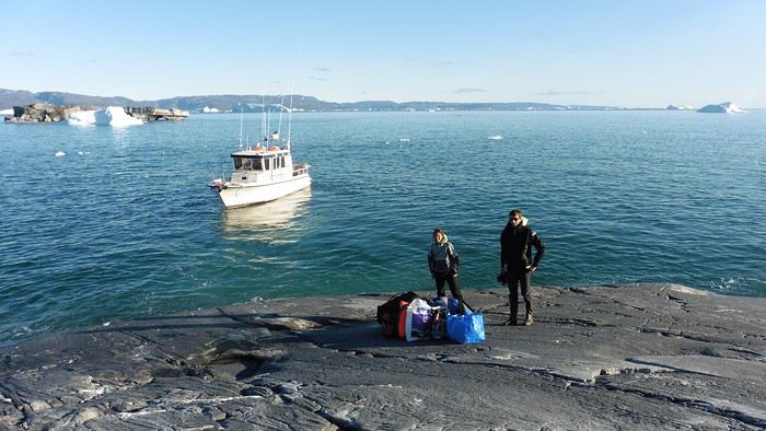
Here we were on the island, in the middle of nowhere, with all our luggage and food to organize, the tent to set up, and the kayaks to inflate—just 10 hours after leaving the Copenhagen hotel. We got to work, bothered by the flies. Despite our head nets, it was barely tolerable—there were so many of them. They swarmed by the dozens into every bag we opened. It was quite mild: 10°C.
Everything was ready by evening, and we were very happy to have completed all these transfers (planes and boat in a single day) as we slipped into our sleeping bags.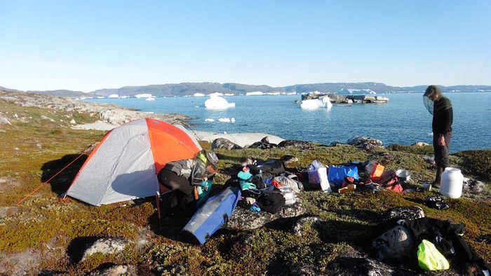
During the night, the wind picked up, and we went out several times to check the tent and kayak anchors. We noticed how bright it was—it was still quite twilight even at 1 AM.
Day 2 5:30 AM wake-up—the south wind was still strong, but since we were heading north, we decided to give it a try anyway.
This was also the moment we loaded the kayaks: since there were only three of us for two double-seater kayaks, we filled the hatch of one kayak, which allowed us to fit all our food. It would have been very difficult if there had been four of us for two kayaks.
Finally, we set off north along the western coast of the island. The conditions were far from ideal—the sea was rough, and the kayaks had a lot of wind resistance. But the main problem was the spray skirt: the gear on deck weighed it down, and the skirt kept coming off… We’d have to deal with it. Barely underway, and whales were already breaking the surface—it was our first time seeing them, and we were very impressed. Too bad the wind didn’t allow for longer contemplation; stopping paddling was impossible with such strong gusts.
We passed a few headlands and even considered stopping due to the conditions. To find some semblance of shelter, we had to hug the coast closely without cutting across the numerous bays, which significantly lengthened the journey. But as the morning went on, the wind died down, and the sea calmed. We spotted several whales and our first seals. It was almost pleasant during the picnic break. By late afternoon, we reached Kangerup Sarqâ Bay, where we had identified a great campsite with a very large beach and a river. But the wind had shifted—it was now coming from the north, making the last hour difficult due to fatigue and headwinds.
The campsite was ideal and beautiful, facing numerous icebergs grounded in the bay.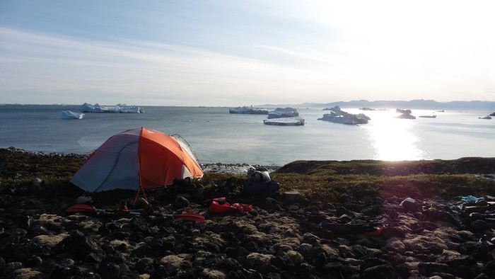
The GPS alerted us to another major drawback of inflatable kayaks: their slowness. It took us 7.5 hours of actual paddling (excluding breaks) to cover 28 km, averaging 3.7 km/h—somewhat disappointing. But we knew this before leaving, and once again, we’d have to make do!
Day 3 Surprise: at 6 AM wake-up, it was raining, foggy, with a south wind, and the sea was choppy even in the bay. It seemed wise to skip paddling, even though stopping on the second day was tough on morale. We went back to sleep, especially since the travel fatigue and the harsh conditions of the previous day had taken their toll.
At 11 AM, the navigation conditions weren’t any better—at the ends of the bay, we saw huge waves crashing onto the rocks, and giving up for the day became obvious. However, the rain had stopped, so we set off for a hike along the large lake bordering the bay. The wind hadn’t let up, and it was quite cold.
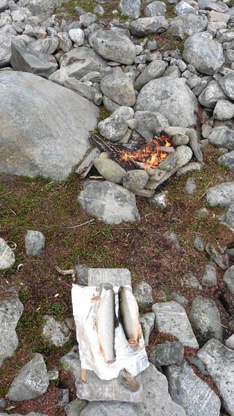
The tundra was starting to take on its autumn colors, and the contrast between the white lichens and the red vegetation was stunning. At the lake, we took out the fishing rods and quickly caught two beautiful Arctic char over 50 cm long.
As the afternoon wore on, the sun seemed closer. Along the beach, we gathered driftwood (mostly old planks) to cook our catch in foil over a fire. Eating our own food in such a beautiful place next to a good fire was comforting after the day’s setback.
In the middle of the night, an Arctic fox entered the tent’s rear awning. It seemed barely intimidated when we shooed it away with loud shouts and then with stones.
Day 4 6:15 AM wake-up—3°C. We were on the water by 8 AM. The wind had dropped significantly, but the sea was shrouded in fog, and it was very cold in these damp conditions.
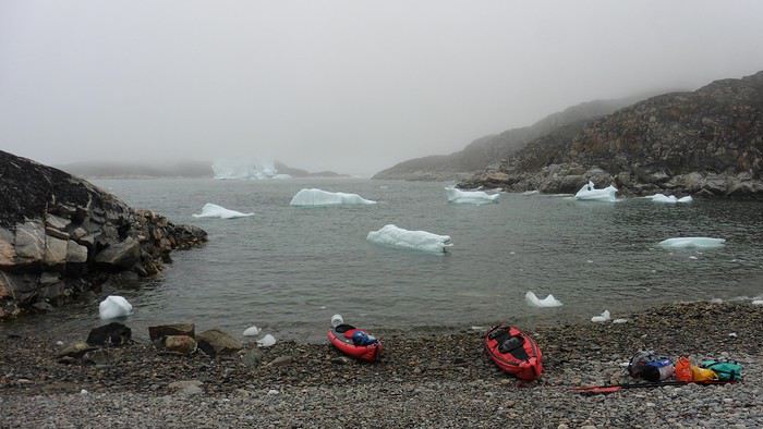
We passed the bay’s headland, Kangea, and headed toward the abandoned village of Agpat. The atmosphere was very austere—we hugged black rocks in fog that limited visibility to 50 meters, revealing large icebergs as we went.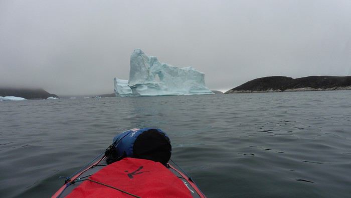
Suddenly, the water’s surface stirred in front of my kayak, and a huge gray back emerged from the sea. The collision was inevitable, but the whale seemed to understand and dove immediately, passing under the kayak and resurfacing a few meters away. I felt the kayak rock in the white foam and quickly paddled to escape the turbulence. What an emotion!
A light wind began to clear the fog, and the sun made beautiful appearances. Despite the cold, we stopped to visit the abandoned village, which left a strange impression. All the houses were still in good condition and wide open—some must have been very spacious in their time. We went back to sea, and in front of the large Kaangerdluk Bay, we hesitated—the headwind was strong, and large waves split the water. The next beach, from the island of Nua where we stopped to think, was over 8 km away. It was barely 2 PM, but caution led us to stop here for the day. We had covered 12 km—exactly the distance needed to stay on schedule. The afternoon was spent hiking on the island’s hills and gathering mussels and wood.
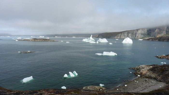
In the evening, we cooked these large Greenlandic mussels over a wood fire and savored them under the beautiful evening light. The weather was now fine, but the thermometer read -5°C in the sun…
Day 5 Bright sunshine, a glassy sea, and -8°C at 6 AM. Everything was green for setting off, even if putting on damp kayaking gear was a bit unpleasant in the cold. It was the first time we’d paddled on a flat sea since the start of the trip, and our average speed increased slightly.
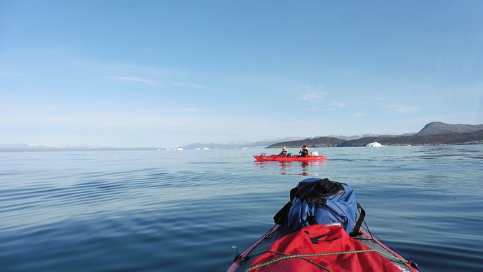
We entered the Smallesund Strait, marking the end of the island’s west coast. We were close to the large Torssukatak Fjord, where two glaciers flow. The access pass to the fjord was very narrow, and numerous ice chunks blocked access to the beaches. The wind had picked up and was now hitting us head-on (again). Just before entering the fjord, we landed on a steep beach made of large pebbles on Oqaitsut Island. It was very cold with the wind, and moving forward became difficult. We decided to stop for the day both because of the conditions and because the next campsite was far away, given how rugged the fjord was.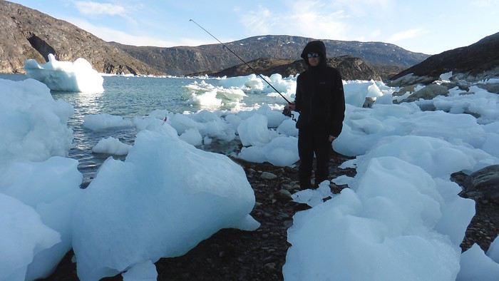
We eventually found a flat spot for the tent despite the steep slope. Even with the wind, the weather was beautiful, and we set off on foot for the northeastern cape of the island, overlooking the fjord. The view was far-reaching and exceptional—up close, the large fjord filled with ice and its steep granite cliffs, and in the distance, the ice cap and glacial walls.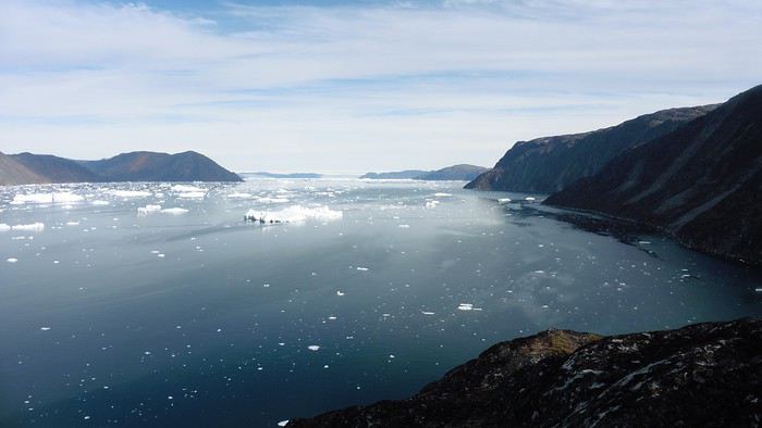
We spotted the village of Qeqertaq, whose network we could pick up, allowing us to check the weather forecast, which was rather good. While securing the kayaks in the evening, I noticed the strange behavior of one kayak at the end of the stage was due to the loss of the skeg—impossible to know where it detached. We’d have to do without it.
Day 6 Still that icy headwind from the northeast. We set off anyway for a long stage to reach the large pass connecting the Torssukatak and Ata Fjords.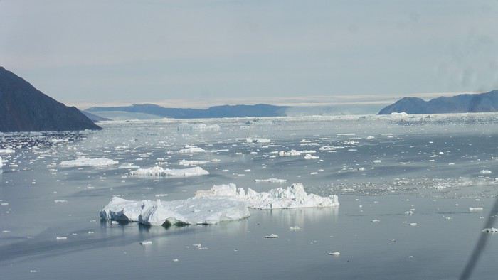
We advanced laboriously along the high cliffs of the fjord’s southern shore. They faced due north and blocked the sun. We felt the cold and dampness of the rock. It was really cold, especially in the extremities. We picnicked on the western cape of Qeqertakavasak Island. The cold didn’t allow us to stop for more than 20 minutes… But the wind dropped, and the sea was now very smooth. It was heavily cluttered with ice between the icebergs and old pack ice. The goal was to reach the large rocky promontory of Anapnuna, wedged between the Kujatdleq and Kangilerngata Glaciers, but the ice made progress difficult. We stopped to gain height on a small island and spot a passage of open water, but all we saw was white—passing seemed impossible. The currents were very complex, and entire sections of ice were being swept in one direction and then another at an impressive speed.
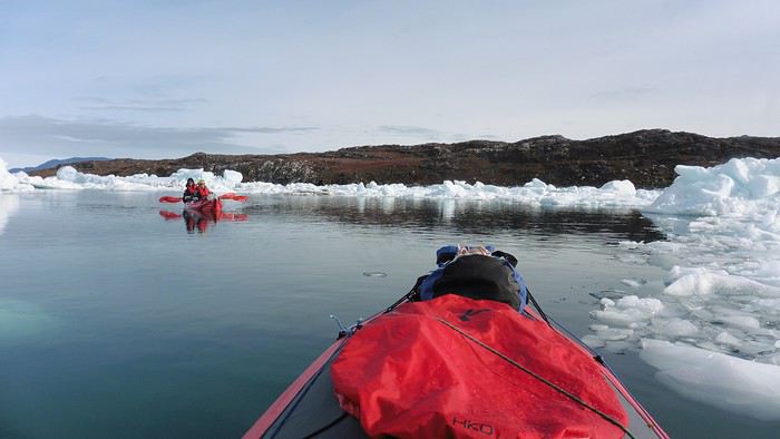
We wandered through this labyrinth until landing on a beach on the small island of Takissut, where we set up camp, exhausted from the 30 km covered and the vigilance required by the abundance of ice. The place was sublime under the evening sun—we were surrounded by ice and mountains, with the Kangilerngata Glacier in the distance. The summer contrasts were striking between the water, icebergs, sky, and flaming tundra—all colors were represented. Absolute calm reigned.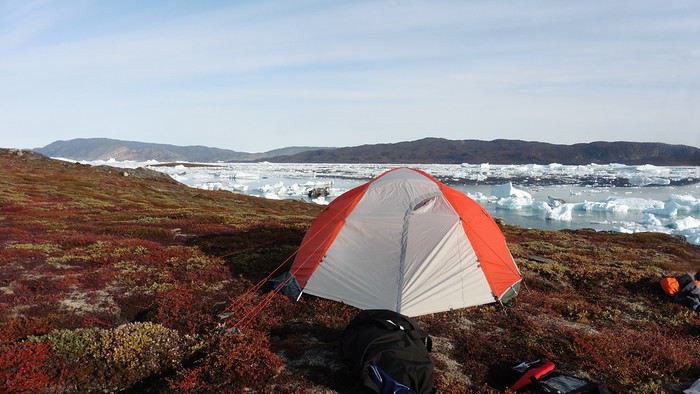
The lack of drinking water at this spot wasn’t too much of a constraint: as soon as we arrived on the beach, we placed containers under the icebergs stranded in the intertidal zone. They were all full by the time we finished setting up.
Day 7 We had to change our plans: we wouldn’t reach the rocky promontory, too well protected by the ice. We set off under the sun for Igdluluarssuit Island. Although we had spotted a passage just before launching, we quickly found ourselves surrounded by ice. It was everywhere, and finding water to paddle became complicated. We tried to force our way in every direction, even retracing our steps. Everything moved at an impressive speed—we were in the middle of a whirlpool of ice.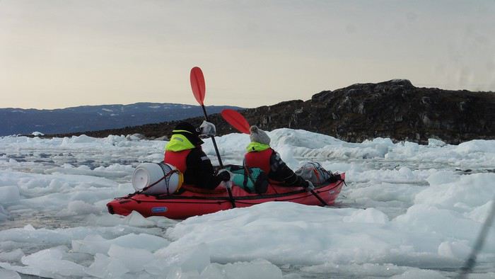
The tension rose, and each boat had its share of big scares. I was trapped against ice floes that dragged me toward an iceberg—the pressure on the kayak was enormous; it was going to capsize or puncture! But with a few strong strokes and paddling against the ice, I managed to free myself from the trap. Barely 10 minutes later, my companions were sandwiched perpendicularly between two icebergs that were closing in. The situation was desperate—the kayak was bending and twisting more and more, but with some strong paddle strokes, it finally freed itself. After these particularly unpleasant moments, we were completely blocked. The drifting ice floes had tightened, and the kayaks were no longer even in the water… The only solution: wait with the kayaks on these floes, which were too thin to walk on (even though we didn’t try). Within minutes, the situation cleared—a waterway opened, and we rushed into it. We paddled with one goal: find a larger pool of water. After going back and forth, our path took shape—we had to force the passage several times, attacking the ice directly with the kayaks, and finally, we escaped the worst of the labyrinth. We reached land on the west side of the island and saw that the rest would be easier. To reach the island, we just had to cross the Arsiviup Ikera Strait, which was lightly cluttered. We reached the eastern cape of the island, ideal for camping, even though we had only paddled for 3 hours. We set up camp and hiked to the island’s summit, which overlooks the entire pass and the glaciers.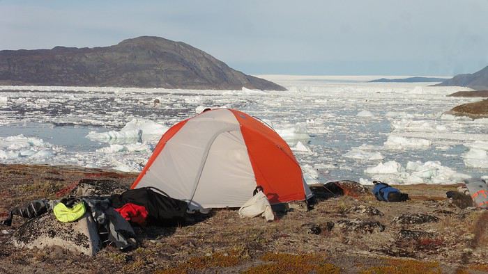
Everything was magnificent, no matter the direction. At 2 PM, we were at the summit—the beauty of the place and the picnic facing the glacier in the sun without wind made us forget the near-disaster from a few hours earlier. It would be impossible to approach the glacier by kayak, but from our summit on foot, it seemed so close, and contemplating it safely on solid ground was a great moment.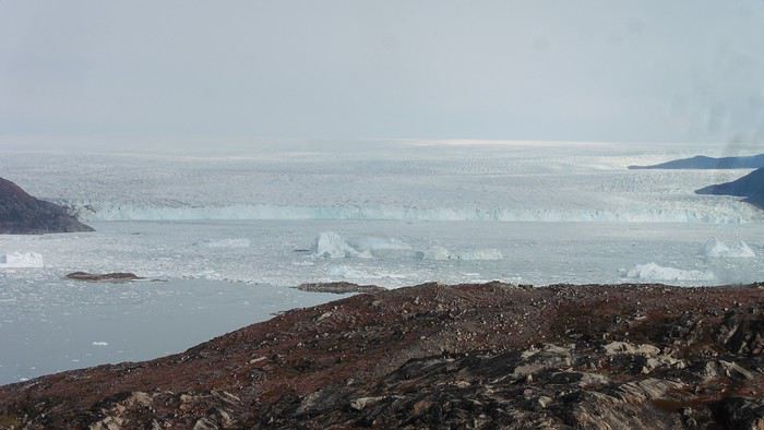
The pass was incredibly complex—everything was in motion, and an impassable passage could become open water within minutes. We were delighted when we returned to camp. A slightly lost whale among the ice accompanied us along the shore. The place was truly beautiful, but the temperature dropped again under the clear sky, preventing us from eating outside.
Day 8 Clear and cold at wake-up: -9°C. The sea had frozen in many places. We hesitated about the rest of the trip—should we start heading back to Ilulissat or linger in the pass, especially to approach the Eqi Glacier? After the incidents of the previous day, we decided to think carefully and paddled to the southern cape of our island to check the ice conditions toward Eqi. The weather had clouded over in the meantime, and the sky was quite gray. At the cape, we spotted the glacier’s wall, still 15 km away.
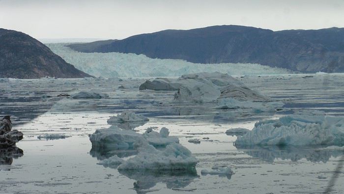
The fjord was quite cluttered, but it seemed passable. However, there was no guarantee the view would be much better 1 km from the glacier than 15 km away, especially since the front was quite active and therefore dangerous. We decided to head south without passing by the glacier. The cold temperatures encountered in the pass also motivated us to move away from the glaciers and the ice cap. We navigated under a threatening sky but without wind. The kayaks cut through the thin layer of ice on the surface with a crinkling paper sound. We reached the Ata campsite in the late afternoon after 5 hours of rowing without a single break…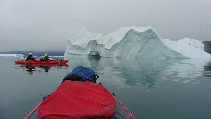
The wind had picked up, and we discovered a nice surprise: a refuge with a table and a comfortable bench lined with mattresses. Facing the worsening weather, we settled in comfortably. The kerosene stove was too complex for our three brains—we couldn’t get it started, too bad, as it was 0°C inside. The rest of the afternoon was spent fishing in the large lake, where we landed a beautiful Arctic char, more than enough for three. A good night’s sleep without the risk of foxes or the sound of a tent shaking in the wind.
Day 9 6 AM wake-up to the sound of rain hitting the cabin. The decision was made looking out the window—wind, rain, and fog obscured the sea: we went back to sleep.
New wake-up, and the rain had stopped—we could go out and stock up on fish. We set off on foot toward the lake, following its western shore. It was very overcast, and the wind encouraged us to keep moving. We made our way to a smaller lake at the end of the large one, where we caught a huge Arctic char. A small clearing brightened the picnic, and we headed back to our cabin.
This 20 km hike kept us busy all day: walking on slippery scree and the micro-relief of the peat bogs took time.
Day 10 The sky was clear, but a light south wind made paddling intense. We set off southeast to reach the opposite shore of the fjord. It was very cold, and it was impossible to stop paddling for even a moment without immediately losing ground due to the wind. We crossed the Kangerluarsuk Fjord. I recognized the cape I had reached on skis in the winter of 2017. We found a nice campsite on the southern shore of the fjord: Uiartag. It wasn’t even noon, but facing this headwind, we preferred to stop here rather than exhaust ourselves for a few extra kilometers. Like the previous ones, this campsite was very comfortable: the ground was covered with a thick layer of lichens and mosses, very pleasant to lie on.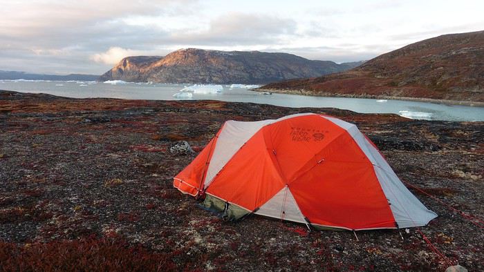
We set off on a hike to the heights of the cape, where the weather alternated between large clearings and snow showers. We noticed the loss of the thermometer, poorly attached to the backpack. On the way back, in the small bay of our beach, a whale swam calmly 10 meters from the shore—a beautiful surprise.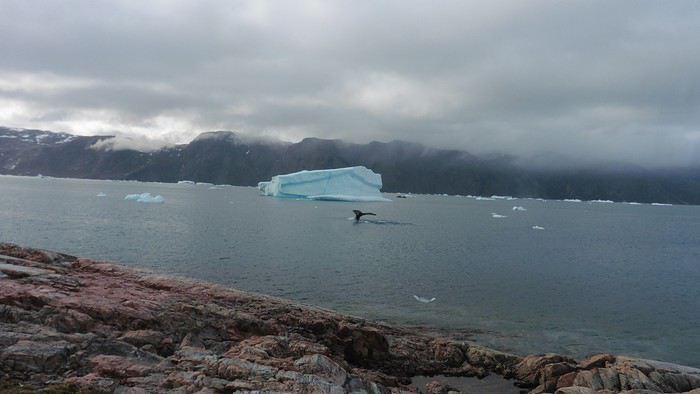
The sky cleared completely, and the temperature dropped as night approached.
We’re setting off as a group of three in two inflatable double-seater kayaks (Gumotex) brought from France. The plan is to spend two weeks circumnavigating Arve Princess Island, located north of Ilulissat in Disko Bay, with a possible boat drop-off at the southern tip of the island.
This seems like a fairly classic route in the area—we found several descriptions online (thanks to the authors). With their help and Google Earth, we identified all potential campsites and entered their coordinates into a GPS. The western part of the island, facing the bay, seems ideal for whale watching, while the more rugged eastern side offers access to several glacial walls. We’re somewhat familiar with the area from two winter expeditions on skis and pulkas.
Plus, the commitment is limited due to the island’s proximity to several small villages, including Qeqertaq, Oqaatsut, and even Ilulissat. In fact, we saw fishing boats almost every day. The distance suits us well: 200 kilometers in 16 full days on site, which should leave some leeway in case of bad weather or for hiking.
We booked our flights in June with Air Greenland to Ilulissat for the last week of August and the first week of September. On both the outbound and return trips, we stayed overnight in Copenhagen. The France-Copenhagen flight was with Air France.
We were allowed 3 x 20 kg in the hold. Each kayak with its accessories fits into a 20 kg bag; the last hold bag is for shared gear: tent, stoves, dry bags… We only brought 1.5 kg of semolina for food. In the end, we had 61 kg of gear, and no excess baggage was charged.
Individual gear (clothes and sleeping bags…) was distributed in the cabin luggage.
For the boat transfer, we contacted an agency: Blue Jay, which gave us a number to call upon arrival.
Day 0: Wednesday, August 22 Departure day. After work, I drove from Gap to Marseille’s Marignane Airport for the first leg of the trip to Copenhagen. I enjoyed the rather mild local temperatures: 35°C in the shade. After a layover in Paris, I arrived at the Copenhagen hotel, located two train stops from the airport, where my companions were already settled. No issues—everyone was on time with their luggage.
Day 1 The flight to Greenland was at 9 AM. We had a layover in Kangerlussuaq, where we changed planes, then stopped in Aasiaat before reaching Ilulissat Airport at 3 PM under beautiful sunshine.
We called Blue Jay for the boat transfer: they could take us to the island as early as 6 PM; otherwise, we’d have to wait until the next day. That left us 3 hours to prepare our gear and, most importantly, do our shopping for the two-week trip—it seemed tight, but we gave it a shot.
A quick taxi ride took us to Pisiffik, where we easily found everything we needed: bread, butter, cheese, cold cuts, rice, pasta, jam, muesli… There was no C fuel or methylated spirits for the stoves, but this time we knew the trick: at Stark, a bit uphill from the town, we found the precious liquids. Two hours later, we filled our dry bags and containers with our purchases, and by 5:30 PM, we met Klaus, the Blue Jay manager, directly at the port.
The vacation seemed to truly begin as we sped by boat through the icebergs toward Arve Princess Island. Forty-five minutes later, we spotted a beach lined with rocks where Klaus dropped us off quickly (he had another transfer to make right after).
Here we were on the island, in the middle of nowhere, with all our luggage and food to organize, the tent to set up, and the kayaks to inflate—just 10 hours after leaving the Copenhagen hotel. We got to work, bothered by the flies. Despite our head nets, it was barely tolerable—there were so many of them. They swarmed by the dozens into every bag we opened. It was quite mild: 10°C.
Everything was ready by evening, and we were very happy to have completed all these transfers (planes and boat in a single day) as we slipped into our sleeping bags.
During the night, the wind picked up, and we went out several times to check the tent and kayak anchors. We noticed how bright it was—it was still quite twilight even at 1 AM.
Day 2 5:30 AM wake-up—the south wind was still strong, but since we were heading north, we decided to give it a try anyway.
This was also the moment we loaded the kayaks: since there were only three of us for two double-seater kayaks, we filled the hatch of one kayak, which allowed us to fit all our food. It would have been very difficult if there had been four of us for two kayaks.
Finally, we set off north along the western coast of the island. The conditions were far from ideal—the sea was rough, and the kayaks had a lot of wind resistance. But the main problem was the spray skirt: the gear on deck weighed it down, and the skirt kept coming off… We’d have to deal with it. Barely underway, and whales were already breaking the surface—it was our first time seeing them, and we were very impressed. Too bad the wind didn’t allow for longer contemplation; stopping paddling was impossible with such strong gusts.
We passed a few headlands and even considered stopping due to the conditions. To find some semblance of shelter, we had to hug the coast closely without cutting across the numerous bays, which significantly lengthened the journey. But as the morning went on, the wind died down, and the sea calmed. We spotted several whales and our first seals. It was almost pleasant during the picnic break. By late afternoon, we reached Kangerup Sarqâ Bay, where we had identified a great campsite with a very large beach and a river. But the wind had shifted—it was now coming from the north, making the last hour difficult due to fatigue and headwinds.
The campsite was ideal and beautiful, facing numerous icebergs grounded in the bay.
The GPS alerted us to another major drawback of inflatable kayaks: their slowness. It took us 7.5 hours of actual paddling (excluding breaks) to cover 28 km, averaging 3.7 km/h—somewhat disappointing. But we knew this before leaving, and once again, we’d have to make do!
Day 3 Surprise: at 6 AM wake-up, it was raining, foggy, with a south wind, and the sea was choppy even in the bay. It seemed wise to skip paddling, even though stopping on the second day was tough on morale. We went back to sleep, especially since the travel fatigue and the harsh conditions of the previous day had taken their toll.
At 11 AM, the navigation conditions weren’t any better—at the ends of the bay, we saw huge waves crashing onto the rocks, and giving up for the day became obvious. However, the rain had stopped, so we set off for a hike along the large lake bordering the bay. The wind hadn’t let up, and it was quite cold.
The tundra was starting to take on its autumn colors, and the contrast between the white lichens and the red vegetation was stunning. At the lake, we took out the fishing rods and quickly caught two beautiful Arctic char over 50 cm long.
As the afternoon wore on, the sun seemed closer. Along the beach, we gathered driftwood (mostly old planks) to cook our catch in foil over a fire. Eating our own food in such a beautiful place next to a good fire was comforting after the day’s setback.
In the middle of the night, an Arctic fox entered the tent’s rear awning. It seemed barely intimidated when we shooed it away with loud shouts and then with stones.
Day 4 6:15 AM wake-up—3°C. We were on the water by 8 AM. The wind had dropped significantly, but the sea was shrouded in fog, and it was very cold in these damp conditions.
We passed the bay’s headland, Kangea, and headed toward the abandoned village of Agpat. The atmosphere was very austere—we hugged black rocks in fog that limited visibility to 50 meters, revealing large icebergs as we went.
Suddenly, the water’s surface stirred in front of my kayak, and a huge gray back emerged from the sea. The collision was inevitable, but the whale seemed to understand and dove immediately, passing under the kayak and resurfacing a few meters away. I felt the kayak rock in the white foam and quickly paddled to escape the turbulence. What an emotion!
A light wind began to clear the fog, and the sun made beautiful appearances. Despite the cold, we stopped to visit the abandoned village, which left a strange impression. All the houses were still in good condition and wide open—some must have been very spacious in their time. We went back to sea, and in front of the large Kaangerdluk Bay, we hesitated—the headwind was strong, and large waves split the water. The next beach, from the island of Nua where we stopped to think, was over 8 km away. It was barely 2 PM, but caution led us to stop here for the day. We had covered 12 km—exactly the distance needed to stay on schedule. The afternoon was spent hiking on the island’s hills and gathering mussels and wood.
In the evening, we cooked these large Greenlandic mussels over a wood fire and savored them under the beautiful evening light. The weather was now fine, but the thermometer read -5°C in the sun…
Day 5 Bright sunshine, a glassy sea, and -8°C at 6 AM. Everything was green for setting off, even if putting on damp kayaking gear was a bit unpleasant in the cold. It was the first time we’d paddled on a flat sea since the start of the trip, and our average speed increased slightly.
We entered the Smallesund Strait, marking the end of the island’s west coast. We were close to the large Torssukatak Fjord, where two glaciers flow. The access pass to the fjord was very narrow, and numerous ice chunks blocked access to the beaches. The wind had picked up and was now hitting us head-on (again). Just before entering the fjord, we landed on a steep beach made of large pebbles on Oqaitsut Island. It was very cold with the wind, and moving forward became difficult. We decided to stop for the day both because of the conditions and because the next campsite was far away, given how rugged the fjord was.
We eventually found a flat spot for the tent despite the steep slope. Even with the wind, the weather was beautiful, and we set off on foot for the northeastern cape of the island, overlooking the fjord. The view was far-reaching and exceptional—up close, the large fjord filled with ice and its steep granite cliffs, and in the distance, the ice cap and glacial walls.
We spotted the village of Qeqertaq, whose network we could pick up, allowing us to check the weather forecast, which was rather good. While securing the kayaks in the evening, I noticed the strange behavior of one kayak at the end of the stage was due to the loss of the skeg—impossible to know where it detached. We’d have to do without it.
Day 6 Still that icy headwind from the northeast. We set off anyway for a long stage to reach the large pass connecting the Torssukatak and Ata Fjords.
We advanced laboriously along the high cliffs of the fjord’s southern shore. They faced due north and blocked the sun. We felt the cold and dampness of the rock. It was really cold, especially in the extremities. We picnicked on the western cape of Qeqertakavasak Island. The cold didn’t allow us to stop for more than 20 minutes… But the wind dropped, and the sea was now very smooth. It was heavily cluttered with ice between the icebergs and old pack ice. The goal was to reach the large rocky promontory of Anapnuna, wedged between the Kujatdleq and Kangilerngata Glaciers, but the ice made progress difficult. We stopped to gain height on a small island and spot a passage of open water, but all we saw was white—passing seemed impossible. The currents were very complex, and entire sections of ice were being swept in one direction and then another at an impressive speed.
We wandered through this labyrinth until landing on a beach on the small island of Takissut, where we set up camp, exhausted from the 30 km covered and the vigilance required by the abundance of ice. The place was sublime under the evening sun—we were surrounded by ice and mountains, with the Kangilerngata Glacier in the distance. The summer contrasts were striking between the water, icebergs, sky, and flaming tundra—all colors were represented. Absolute calm reigned.
The lack of drinking water at this spot wasn’t too much of a constraint: as soon as we arrived on the beach, we placed containers under the icebergs stranded in the intertidal zone. They were all full by the time we finished setting up.
Day 7 We had to change our plans: we wouldn’t reach the rocky promontory, too well protected by the ice. We set off under the sun for Igdluluarssuit Island. Although we had spotted a passage just before launching, we quickly found ourselves surrounded by ice. It was everywhere, and finding water to paddle became complicated. We tried to force our way in every direction, even retracing our steps. Everything moved at an impressive speed—we were in the middle of a whirlpool of ice.
The tension rose, and each boat had its share of big scares. I was trapped against ice floes that dragged me toward an iceberg—the pressure on the kayak was enormous; it was going to capsize or puncture! But with a few strong strokes and paddling against the ice, I managed to free myself from the trap. Barely 10 minutes later, my companions were sandwiched perpendicularly between two icebergs that were closing in. The situation was desperate—the kayak was bending and twisting more and more, but with some strong paddle strokes, it finally freed itself. After these particularly unpleasant moments, we were completely blocked. The drifting ice floes had tightened, and the kayaks were no longer even in the water… The only solution: wait with the kayaks on these floes, which were too thin to walk on (even though we didn’t try). Within minutes, the situation cleared—a waterway opened, and we rushed into it. We paddled with one goal: find a larger pool of water. After going back and forth, our path took shape—we had to force the passage several times, attacking the ice directly with the kayaks, and finally, we escaped the worst of the labyrinth. We reached land on the west side of the island and saw that the rest would be easier. To reach the island, we just had to cross the Arsiviup Ikera Strait, which was lightly cluttered. We reached the eastern cape of the island, ideal for camping, even though we had only paddled for 3 hours. We set up camp and hiked to the island’s summit, which overlooks the entire pass and the glaciers.
Everything was magnificent, no matter the direction. At 2 PM, we were at the summit—the beauty of the place and the picnic facing the glacier in the sun without wind made us forget the near-disaster from a few hours earlier. It would be impossible to approach the glacier by kayak, but from our summit on foot, it seemed so close, and contemplating it safely on solid ground was a great moment.
The pass was incredibly complex—everything was in motion, and an impassable passage could become open water within minutes. We were delighted when we returned to camp. A slightly lost whale among the ice accompanied us along the shore. The place was truly beautiful, but the temperature dropped again under the clear sky, preventing us from eating outside.
Day 8 Clear and cold at wake-up: -9°C. The sea had frozen in many places. We hesitated about the rest of the trip—should we start heading back to Ilulissat or linger in the pass, especially to approach the Eqi Glacier? After the incidents of the previous day, we decided to think carefully and paddled to the southern cape of our island to check the ice conditions toward Eqi. The weather had clouded over in the meantime, and the sky was quite gray. At the cape, we spotted the glacier’s wall, still 15 km away.
The fjord was quite cluttered, but it seemed passable. However, there was no guarantee the view would be much better 1 km from the glacier than 15 km away, especially since the front was quite active and therefore dangerous. We decided to head south without passing by the glacier. The cold temperatures encountered in the pass also motivated us to move away from the glaciers and the ice cap. We navigated under a threatening sky but without wind. The kayaks cut through the thin layer of ice on the surface with a crinkling paper sound. We reached the Ata campsite in the late afternoon after 5 hours of rowing without a single break…
The wind had picked up, and we discovered a nice surprise: a refuge with a table and a comfortable bench lined with mattresses. Facing the worsening weather, we settled in comfortably. The kerosene stove was too complex for our three brains—we couldn’t get it started, too bad, as it was 0°C inside. The rest of the afternoon was spent fishing in the large lake, where we landed a beautiful Arctic char, more than enough for three. A good night’s sleep without the risk of foxes or the sound of a tent shaking in the wind.
Day 9 6 AM wake-up to the sound of rain hitting the cabin. The decision was made looking out the window—wind, rain, and fog obscured the sea: we went back to sleep.
New wake-up, and the rain had stopped—we could go out and stock up on fish. We set off on foot toward the lake, following its western shore. It was very overcast, and the wind encouraged us to keep moving. We made our way to a smaller lake at the end of the large one, where we caught a huge Arctic char. A small clearing brightened the picnic, and we headed back to our cabin.
This 20 km hike kept us busy all day: walking on slippery scree and the micro-relief of the peat bogs took time.
Day 10 The sky was clear, but a light south wind made paddling intense. We set off southeast to reach the opposite shore of the fjord. It was very cold, and it was impossible to stop paddling for even a moment without immediately losing ground due to the wind. We crossed the Kangerluarsuk Fjord. I recognized the cape I had reached on skis in the winter of 2017. We found a nice campsite on the southern shore of the fjord: Uiartag. It wasn’t even noon, but facing this headwind, we preferred to stop here rather than exhaust ourselves for a few extra kilometers. Like the previous ones, this campsite was very comfortable: the ground was covered with a thick layer of lichens and mosses, very pleasant to lie on.
We set off on a hike to the heights of the cape, where the weather alternated between large clearings and snow showers. We noticed the loss of the thermometer, poorly attached to the backpack. On the way back, in the small bay of our beach, a whale swam calmly 10 meters from the shore—a beautiful surprise.
The sky cleared completely, and the temperature dropped as night approached.
😎Fellow traveling cyclists or not, all of you who love travel, the pleasure of physical effort, nature, beautiful machines, people with true passions they seek to fulfill, and who also enjoy reading great literature about all this—the *200* magazine is for you just as it is for me. I should mention I have no financial or other interest in this (in an era where we accuse our politicians of all sorts of vile interests, I prefer to take precautions). I’ve been subscribed since the beginning, and every three months, I get my 130 pages of dreams (the magazine just went from 110 to 130 pages).
It covers everything from the trans-America route to the TCR (Trans Continental Race) from Belgium to a small town in Turkey, with mind-blowing averages—4,000 km and 80,000 m of elevation gain in 8 days and 15 hours for the winner. Let that sink in, and all of it without assistance—accepting a patch could penalize you. There’s also a story about crossing Iran, encountering one of the world’s most welcoming populations, following in the footsteps of Nicolas Bouvier, as well as retirees leisurely traversing France. The common thread in all these stories? Beautiful writing. Take, for example, a stunning article: *"Passengers of the Cold: From Edinburgh to Thurso, at the very north of Scotland, 550 km of moors, coasts, and icy wind. In Thurso, the road ends at a quay, facing the Orkney Islands. We wanted a November trip, off-season. We wanted to surprise winter. Just before the snow."* A sublime piece on the experience of facing adversity and the chance encounters along the road and in the elements.
Before I embarked on my own bike trips, I dreamed a lot about them—from the Atacama to the Gobi, along the Mekong, and not forgetting France. And now, these 130 pages every quarter keep those dreamy vibes alive through stories written in the most beautiful prose.
I’ll stop here because it might sound like I’m advertising, but if you don’t know *200*, I invite you to discover it. It’ll give you wings for the most incredible challenges or simply reinforce your desire for slow rides with your eyes open to others and nature.
A little news to wrap up: Axel Carion and a friend just broke the record for crossing South America from Colombia to Ushuaia in 59 days. On its own, that doesn’t mean much, but I can’t help it—it makes me dream. You should see how he talks about it, the flashes of that wild nature he’s stored away: a snowstorm at Paso Jama and the surreal sight of the suddenly snow-covered Licancabur!
Luc PS: The magazine is called *200* because a day’s ride starts at 200 km—well, I’ve never done a ride like that since my longest was 167 km (with 18 kg of luggage, mind you), but why not one day? The magazine will explain how to tackle your first 200, and then the question in conclusion: when will you do your first 300?😏
Hello everyone!
It’s such a pleasure to be back on VoyageForum after so many years. A long time ago, I used it to plan and share a wonderful trip between Namibia and Botswana.
This time, I’m preparing a family trip for next summer (two parents, a 15-year-old boy, and an 11-year-old girl) that’ll be our big Christmas gift. I already have the flight tickets: we arrive in Denpasar on July 13th and return from Singapore on August 12th.
Our main focus is Indonesia, but since we don’t often get the chance to travel this far, I wanted to take the opportunity to stop in Kuala Lumpur and Singapore on the way back. It’ll give my kids—especially my son, who’s passionate about geography—a taste of these two major cities.
We prefer quiet spots (no need for party vibes or trendy places), though the girls (yes, there are two of them!) still enjoy discovering local crafts, souvenir shops, and the like. We don’t mind organizing things ourselves—I actually love doing that—and I assumed it’d be easy to arrange transport between hotels by booking through them. We’re not chasing cultural discoveries (one beautiful temple is enough; no need to see all 35, even if they’re stunning).
After reading tons of websites, guides, and forum posts, I’ve put together an itinerary I’d love to get your thoughts on. It’s already changed many times… and I’m sure it’ll change again! The goal is to avoid obvious mistakes, see if we’re trying to do too much, or if some places aren’t worth the effort. Here’s what it looks like so far:
- **Day 1**: Arrival in Denpasar in the late afternoon. Transport to a hotel outside Denpasar.
- **Days 2–5 (4 days)**: Bali. We’d like to stay in one or two quiet spots, away from the southern area, to explore the famous rice terraces, temples, and maybe do some light hiking.
- **Day 6**: Transfer to Lombok by fast ferry from Padang Bai (to avoid going back to the busy southern port, since I’ve heard traffic there is chaotic).
- **Days 6–11 (5 days)**: Lombok. We’d especially like to climb Mount Rinjani (we’re in good enough shape for it) and spend 2–3 days in a nice, quiet seaside spot (I was thinking of the southern Gilis near Lembar or the beautiful beaches in the south of the island).
- **Day 11**: Flight from Lombok Airport to Labuan Bajo.
- **Days 12–14**: 3-day/2-night cruise to Rinca and the various "hot spots" of Komodo National Park.
- **Day 15**: Labuan Bajo. I was thinking of doing a beginner’s diving excursion.
- **Day 16**: Flight back to Denpasar, then transfer to Banyuwangi by bus/boat (apparently possible via Express Bahari).
- **Day 17**: Morning visit to Ijen Crater, then return to the same hotel to relax for the rest of the day.
- **Day 18**: Transfer to a base camp for a sunrise visit to Mount Bromo on Day 19. - **Day 19**: Visit Bromo. We’d like to spend the whole day there to enjoy the site once most people have left. - **Day 20**: Transfer to Surabaya or Yogyakarta. - **Day 21**: Flight to Medan, then transfer to Bukit Lawang. - **Days 22–25**: Bukit Lawang. Jungle trek for 2–3 days and some downtime for 1–2 days. - **Day 23**: Transfer to Dumai. - **Day 25**: Boat from Dumai to Malacca.
The rest isn’t as relevant here.
I have a few big doubts, especially: - Is it worth spending 4 days in Bali and 5 in Lombok, or would it be better to focus on just one island? If so, we’d probably lean toward Lombok—it seems quieter, and Rinjani is calling our name…
- I’m counting on the Komodo trip to explore the islands and marine life in the area. It sounds like a true paradise (manta rays, turtles, Komodo dragons…). From what I’ve read, snorkeling in Bali or Lombok doesn’t offer the same experiences. Do you think that’s really the case? I’ve seen some unflattering comments about Labuan Bajo… Originally, I wanted to do the Lombok–Flores crossing by boat, but the "mandatory" whale shark stop in Sumbawa seems controversial, so I ruled it out.
- For the stretch between Days 16 and 21, I’m not sure about the best way to organize things to enjoy Ijen and Bromo without being in constant rush mode or sleeping for just 3 days. I can’t decide whether to stay near the crater (the hotels seem basic—is it worth spending 2 nights there?) or farther away, even if it means more travel. I’ve also considered skipping Bromo to attempt the Semeru climb. There are also some nice spice plantations nearby (Margo Utomo in Kalibaru). Any thoughts?
Anyway, thanks for making it this far! :-)
Looking forward to reading your replies! !
Hi everyone.
I wanted to share a little feedback from our trip to Guatemala—we got back a month ago, and I really appreciated the well-commented posts here that helped us out. So, in turn, I wanted to share our own little recap.
We’ve traveled quite a bit together (we’re 38 and 42), and Guatemala had been on our radar for a while. But with so much info out there, it was hard to sort through it all—especially since we only had 3 weeks on the ground and didn’t want to waste time.
Here’s the itinerary we followed: Antigua, the Pacific coast, Lake Atitlán, a private coffee and bird reserve, Chichicastenango, Sayaxché, El Remate, Río Dulce, and Lake Izabal.
We rented a 4x4, which was essential given the state of some roads.
Our highlights: * **Pacific coast**: So authentic and preserved. We met sea turtles, cooked and baked coconut bread with a women’s community—such a meaningful exchange—and kayaked through a pristine mangrove full of birds. * **Lake Atitlán**: Even though we were worried it might feel too touristy, a private tour let us discover local crafts, hidden workshops (weaving, pottery), and the stunning views from the boat. * **Sayaxché**: The starting point for the Aguateca and Dos Pilas sites—one of our favorite outings. The site is breathtaking: walking through the canyon and jungle-covered ruins with almost no one around. We stayed in a little bungalow on an island, totally off the grid. * **In Petén**, we met an Itza Maya tribe—an unforgettable day sharing a meal and plant-based healing rituals. Wow. This tribe resisted the conquistadors and still lives traditionally. We also took a tour on Lake Petén and swam at hidden little beaches. Tikal was nice, but we preferred Yaxhá. * **Río Dulce**: A day at a private cocoa plantation—an adventure in a buggy with the owner himself. We harvested cocoa and ate the chocolate paste afterward, then swam in a waterfall on the property. Since it’s private, there was no one else around. A real privilege. * **Boat tour on the Río Dulce**: For us, the highlight. We visited a school where they’re committed to giving kids a solid education while blending Maya rituals. * **Lake Izabal**: A peaceful end to the trip in a magical setting. We visited Quiriguá.
We went through an organizer who knows the country really well. We weren’t initially planning on that, but thanks to her, we had experiences we never would’ve found on our own. On top of that, we actually paid less for the trip overall because of her local rates. I’m not getting anything out of this—I just think it could help other travelers. Her business is Secretplaceincostarica (she also does Costa Rica, which we’re now eager to explore).
On the ground, we felt completely safe. The people are lovely, the roads can be a little chaotic at times, but we loved every minute of it.
Happy travels to all! Marie
Hello,
If Ethiopia fascinates you, draws you in, and like me you don’t want to visit this country solo… maybe we could exchange ideas with the goal of sharing a driver and a French-speaking guide (?). I’ve traveled a lot on my own (Peru, West Africa, Myanmar, Thailand, Cambodia, a few European countries, some U.S. states, Greece, Mexico, etc.—backpacking, hostels, public transport, local restaurants),
also with a friend (Iran, Tibet, China, Russia, Gabon, South India),
with my husband (Egypt, Vietnam, Canada 3 times, Florida, Jordan, North India, Dominican Republic, Czech Republic, Slovakia, Croatia, among others).
He doesn’t want to travel anymore, my girlfriends aren’t interested in Ethiopia, and I don’t feel like going alone this time.
My last solo trip was last October (2024) in San Francisco. I loved it. I’m in my seventies now… pfff… but in great shape, physically resilient, good walking endurance, 40 years old in my head… I love music, I choose restaurants more for the local vibe than the menu (I adapt)… no fixed schedule, but I can adjust there too—sandwich or fruit for lunch, a little beer in the evening, and most importantly: no stress! Cool, cool… When traveling as a duo, if one of us wants to spend the day or evening alone, we meet up afterward, and it’s perfect. I’m more talkative in writing than in person—I love listening! So… if the adventure tempts you, don’t hesitate.
I’m in touch with a woman currently there who gave me the contact info for the guide she’s traveling with in the southern region, near the Omo tribes (she has a Facebook companion).
I spoke on the phone this morning with a "seasoned traveler" —we have a lot in common, and we’d be up for going together.
Forming a small group (4/5 people) would be ideal. February is a great time (climate-wise). The south is generally safer than the north, but nothing’s set in stone—nothing’s planned yet. Everything’s open to discussion and we’ll figure it out together!
Best to you, and looking forward to exchanging ideas!
Annick
Hello!
For the few who’ve traveled to Iran, loved the country, and discovered its incredible thousand-year-old beauty and the amazing kindness of its people—one of the last places still untouched by mass tourism—
I’d have loved to go back, but given the current situation, it’s not possible right now, and likely won’t be for a long time.
In the meantime, a neighboring country, Uzbekistan, definitely deserves a visit!
I discovered it through photo reports, and it reminds me a lot of Iran. So, I’m planning to check it out.
On foot, on horseback, or by car 😄—this time, I’m going with a car 🚗😊😍
I’m looking for an independent, motivated travel companion to explore this seemingly wonderful country.
Who’s in? ⭐
My husband and I are planning a 10-day trip to Northern Vietnam in November, traveling independently (no agency organizing everything) and using local buses. We’d like to spend at least 3 days in each place (including Meo Vac). We’re wondering if it’s possible to find local guides for day hikes, and if so, in which towns/villages (Meo Vac plus one or two other spots to explore the surrounding area).
Thanks!
Hi everyone,
I’d love to share a little travel journal from our 14-day/12-night road trip with our two teens (14 and 17) in February/March 2020. A huge thank you to all of you who helped me plan this trip to South Africa—your patience with my endless questions was amazing!
We left Lyon on Saturday, February 22 at 7:00 AM and arrived in Johannesburg at 10:00 PM after a short layover in Amsterdam. Flights cost 440 € per person (booked in October), with carry-on luggage. We added just one checked bag for the whole family (80 € round-trip with the free Flying Blue membership). Since we’d be moving around a lot, we packed light! In Lyon, we reserved parking at P5 in advance for 70 € for 14 days. The Air France/KLM flight was smooth. When we landed, we picked up our bags and had booked a night at the Aero Guest Lodge, just 5 minutes from the airport, with a free shuttle and breakfast. All you have to do is send a WhatsApp message when you arrive at the airport to let the shuttle driver know. The tricky part? Finding him in the terminal—he wasn’t holding a sign with the hotel’s name. 🤪 A South African called him for me since my English wasn’t great (and I had to get used to the accent 😛), and helped us spot the driver (who was actually less than 5 meters away!) with other guests. When we got to the hotel: all good, except we were 10 people in a van meant for 7. The room was spacious—one king-size bed and two single beds for the kids—with a simple but clean bathroom, a garden, pool, and breakfast (which we didn’t try). All for 65 €, so an awesome value!
 After a restful night, we woke up at 6:00 AM to catch the shuttle back to the airport. Just a heads-up: there’s only one shuttle per hour in the morning, and Kulula canceled our 9:00 AM flight, moving it to 8:00 AM—so no time for breakfast (it starts at 6:30).
We waited 15 minutes in the lovely garden for the driver, who dropped us off at the airport in 5 minutes.
We checked in for our flight to Cape Town, which cost around 40 € (including two checked bags per person).
We grabbed breakfast at the airport instead (less than 20 € for all four of us—one of the nice surprises of South Africa!), and arrived in Cape Town at 10:20 AM.
 After quickly picking up our bags, we headed to the Avis counter and left with a Toyota Corolla for 80 € for 4 days (rented with the Flying Blue card—free additional driver).
Everything’s on the left... not easy, but it works if you plan your route well.
We drove to our Airbnb in Constantia. We were surprised to see animals, bikes, and pedestrians on the highway!
We arrived around 11:30 AM at our rental—a huge house in the vineyards, in a super secure neighborhood, about 15-20 minutes from Hout Bay. It felt like Beverly Hills, but with super-high walls and barbed wire around the villas. 😕

We dropped off our bags, changed into shorts (it was around 30°C/86°F), and headed to the Bay Harbour Market in Hout Bay. We had lunch there—such a great vibe! We wandered through the stalls, everyone picked their own dish, and we sat down on the terrace. There was music, artisans of all kinds... a really nice moment.

I’d withdrawn 50 € before leaving... and that gave me change to pay the parking attendant. Lunch cost around 30 € for four, including food and drinks.

After browsing the artisan stalls, we headed to Hout Bay Beach near the restaurant, Marina Wharf (another small tip for the parking attendant—we’d have to get used to that!). We stopped to admire the sea lions. An ice cream for 1 €? No way we were saying no! 🙂
The fatigue was starting to hit, so we headed to the grocery store 10 minutes away (Constantia shopping center) and then had an aperitif in front of the vineyards, opening a delicious bottle of white wine.
I’d love to share a little travel journal from our 14-day/12-night road trip with our two teens (14 and 17) in February/March 2020. A huge thank you to all of you who helped me plan this trip to South Africa—your patience with my endless questions was amazing!
We left Lyon on Saturday, February 22 at 7:00 AM and arrived in Johannesburg at 10:00 PM after a short layover in Amsterdam. Flights cost 440 € per person (booked in October), with carry-on luggage. We added just one checked bag for the whole family (80 € round-trip with the free Flying Blue membership). Since we’d be moving around a lot, we packed light! In Lyon, we reserved parking at P5 in advance for 70 € for 14 days. The Air France/KLM flight was smooth. When we landed, we picked up our bags and had booked a night at the Aero Guest Lodge, just 5 minutes from the airport, with a free shuttle and breakfast. All you have to do is send a WhatsApp message when you arrive at the airport to let the shuttle driver know. The tricky part? Finding him in the terminal—he wasn’t holding a sign with the hotel’s name. 🤪 A South African called him for me since my English wasn’t great (and I had to get used to the accent 😛), and helped us spot the driver (who was actually less than 5 meters away!) with other guests. When we got to the hotel: all good, except we were 10 people in a van meant for 7. The room was spacious—one king-size bed and two single beds for the kids—with a simple but clean bathroom, a garden, pool, and breakfast (which we didn’t try). All for 65 €, so an awesome value!
After a restful night, we woke up at 6:00 AM to catch the shuttle back to the airport. Just a heads-up: there’s only one shuttle per hour in the morning, and Kulula canceled our 9:00 AM flight, moving it to 8:00 AM—so no time for breakfast (it starts at 6:30).
We waited 15 minutes in the lovely garden for the driver, who dropped us off at the airport in 5 minutes.
We checked in for our flight to Cape Town, which cost around 40 € (including two checked bags per person).
We grabbed breakfast at the airport instead (less than 20 € for all four of us—one of the nice surprises of South Africa!), and arrived in Cape Town at 10:20 AM.
After quickly picking up our bags, we headed to the Avis counter and left with a Toyota Corolla for 80 € for 4 days (rented with the Flying Blue card—free additional driver).
Everything’s on the left... not easy, but it works if you plan your route well.
We drove to our Airbnb in Constantia. We were surprised to see animals, bikes, and pedestrians on the highway!
We arrived around 11:30 AM at our rental—a huge house in the vineyards, in a super secure neighborhood, about 15-20 minutes from Hout Bay. It felt like Beverly Hills, but with super-high walls and barbed wire around the villas. 😕We dropped off our bags, changed into shorts (it was around 30°C/86°F), and headed to the Bay Harbour Market in Hout Bay. We had lunch there—such a great vibe! We wandered through the stalls, everyone picked their own dish, and we sat down on the terrace. There was music, artisans of all kinds... a really nice moment.
I’d withdrawn 50 € before leaving... and that gave me change to pay the parking attendant. Lunch cost around 30 € for four, including food and drinks.
After browsing the artisan stalls, we headed to Hout Bay Beach near the restaurant, Marina Wharf (another small tip for the parking attendant—we’d have to get used to that!). We stopped to admire the sea lions. An ice cream for 1 €? No way we were saying no! 🙂
The fatigue was starting to hit, so we headed to the grocery store 10 minutes away (Constantia shopping center) and then had an aperitif in front of the vineyards, opening a delicious bottle of white wine.
Hi everyone...
Must be around 5,000 photos to sort through!
Makes sense after 3 intense weeks in SA.
Anyway, to set the mood, here are a few photos... Well, yeah, they’re not amazing!
Suspense, suspense...
Must be around 5,000 photos to sort through!
Makes sense after 3 intense weeks in SA.
Anyway, to set the mood, here are a few photos... Well, yeah, they’re not amazing!
Suspense, suspense...
Hi there,
While reading some travel journals, I notice that we always reflect on the people of the countries we visit.
I’d love to hear your thoughts on which people charmed you the most during your travels?
I’m not looking for controversy, just reflections and personal feelings. Looking forward to reading your replies...
Hi everyone, I’ve spent two solid months reading the Lonely Planet and pretty much every post about Thailand here, plus French and English blogs. Now I’d love to get your expert opinions on our itinerary.
We’re heading off in August 2025 with our 7-year-old daughter. We only have a maximum of three weeks off, and I’m keeping an eye on flight prices before booking (1400 € per person really stings 😕).
So here’s what I’ve planned—let me know if you spot any major issues or if I’ve been way too "optimistic."
D1 - Arrival in Bangkok / rest, quick visit, overnight stay D2 - More temple visits, etc. D3 - Morning flight to Chiang Mai D4 - More Chiang Mai sightseeing D5 - Day trip to Chiang Rai (guided tour to book: blue and white temple), return to Chiang Mai late in the evening D6 - More Chiang Mai visits / Elephant Nature Park in the afternoon D7 - Morning flight to Koh Samui, sightseeing D8 to D10 - More Koh Samui visits D11 to D13 - Ferry to Koh Phangan D14 to D15 - Ferry to Koh Tao D16 - Return to Koh Samui, then flight to Bangkok D17 - Day trip to Ayutthaya, return to Bangkok in the evening D18 - Flight back to France :(
I know a lot of you recommend heading straight to Chiang Mai to recover from the international flight, but my partner and I NEVER sleep on planes (personally, I’ve been flying to Taiwan since I was little and have never slept more than an hour on a 14-hour flight...), so it’s essential for us to rest upon arrival . That’s also why I opted for domestic flights instead of the sleeper train—I know we’d lose over 10 hours and wouldn’t be able to rest properly in those conditions. And I’m sure you’ll also say BKK > North > South is too much for three weeks, but I really want to see as much as possible. Given how much the flights will cost, I’m not sure when we’ll be able to come back 🏴☠️.
So, questions: 1. Since we’ll only be in Bangkok for a maximum of two nights and need to easily reach the airport with luggage (and a child), which neighborhood should we prioritize? We’d love to experience the evening vibe of Asian night markets, ideally within walking distance of the hotel or just a few metro stops away. I’ve looked at Chinatown, but the BTS seems far... Should we go for somewhere near BTS Saphan Taksin or BTS Krungthonburi? But is the area lively in the evening with food courts, etc.? We’d also like to treat ourselves to a hotel with a pool.
2. Have we planned too many days in the south? Should I skip Koh Tao and just do Koh Samui + Koh Phangan? My partner and daughter aren’t strong swimmers, so we’re looking for beautiful beaches without too much current. Crowded beaches don’t bother us—we just want stunning turquoise waters without killer waves . Going all the way to Koh Tao and then back to Koh Samui to catch the flight to Bangkok seems too stressful. Is it still possible these days (I haven’t seen any recent posts on this) to head to Koh Samui in August and decide on the spot how many nights to spend in Koh Phangan or Koh Tao based on how we feel, booking hotels as we go? Or is that too risky?
If you have any better suggestions for fitting all this in while reducing internal flights, I’m all ears for your great tips
Hi,
We’re heading to Buenos Aires for 3 days in November and would like to do a guided tour of a few neighborhoods. There are "free" tours, but none in French. Does anyone have a guide to recommend so we can really get to know the city beyond just the architecture?
Thanks
Hi everyone,
I was in Delhi for work and decided to leave my suitcase there so I could enjoy the rest of my vacation in Southeast Asia. However, my flight from Bangkok to Delhi, scheduled for tomorrow (Sunday, October 5th), was rescheduled, and I’ll miss my connection to Paris. When I looked at flights, I realized that the Bangkok-Paris flight costs half as much as the new Bangkok-Delhi flight (with a different airline).
So here’s my question (a shot in the dark): Is anyone traveling between Delhi and Paris in the next few days? Would it be possible to pick up my suitcase in Delhi’s hold (I’ll pay the extra fee) and bring it to Paris?
I thought about having it shipped, but I need it fairly quickly, and I don’t trust the delivery times. Plus, the costs are outrageous.
Thank you so much in advance!
Have a wonderful day,
Sacha
Sometimes a trip to Thailand starts in a hotel near an airport, where guests have misunderstood the meaning of the name easyJet...

We know all too well that this long flight will leave us a bit jet-lagged when we arrive...
all while hoping we won’t start our stay completely...
Still, we’re lucid enough to notice that they could’ve at least leveled the ground before adding the decor at the airport:
As always, our arrival is under the watchful eye of some...
under the frankly curious gaze of others...
but of course, there are plenty who couldn’t care less...
All that’s left is to set off exploring, while staying cautious so we don’t get caught off guard...
We know all too well that this long flight will leave us a bit jet-lagged when we arrive...
all while hoping we won’t start our stay completely...
Still, we’re lucid enough to notice that they could’ve at least leveled the ground before adding the decor at the airport:
As always, our arrival is under the watchful eye of some...
under the frankly curious gaze of others...
but of course, there are plenty who couldn’t care less...
All that’s left is to set off exploring, while staying cautious so we don’t get caught off guard...
We did the Langtang trek (hike) from September 10th to 17th, with the first and last days being the trip from Kathmandu and back—so 6 days of actual walking. It’s a fairly well-known trek but certainly not as famous or crowded as those in the Annapurna or Everest regions, which is why we chose it.
In theory, it’s mandatory to have a guide for this trek. In reality, it seems there are ways to bypass the regulations: we met at least two people hiking without a guide—a South Korean, a New Zealander, and possibly also a couple of English women and an American couple, though we’re not sure if they had a guide.
The agency we booked with had told us it was an affordable trek for relatively older people in good shape—which is our case (I’m 72 myself). I have to say upfront that we found it quite challenging, maybe because we didn’t have good weather—it was the end of the monsoon season. To be clear, no matter your fitness level, I’d say doing this trek in the middle of the monsoon season would be suicidal.
Day 1 – Journey from Kathmandu to Syapru Besi
On Monday, September 8th, there had been violent protests in Kathmandu against the government, which had, among other things, blocked access to social media and been accused of nepotism and corruption. There were 19 deaths. The situation was very tense on the day of our departure, Wednesday the 10th. The agency warned us that public transport was very unreliable. So, we decided to take a jeep, at an additional cost of $100 ($160 minus what was already budgeted for the bus).
We left a little before 7 a.m. and it took us a good hour just to reach the outskirts of Kathmandu. Along the way, we saw several houses and vehicles set on fire by protesters.
The road to Syapru Besi is only 120 km, but it’s frankly awful. It’s always narrow, winds through endless mountains, and the shoulders range from bad to confusing to nonexistent. Several sections are just dirt tracks. We didn’t regret opting for the jeep, as we could stop several times at our convenience—if only to let Y (my Thai partner) throw up everything she had. She’d taken her usual motion sickness medication, but the constant turns, accelerations, and braking eventually made her terribly carsick.
In Nuwakot, we stopped for breakfast at a nice little restaurant, Jimbu. It was around 8:30 a.m., and we’d barely covered 60 km. The restaurant has a lovely garden overlooking the Trishuli Ganga, the river flowing down from Syapru Besi. First photo: the river in the bottom right corner, mist and clouds over the mountain on the other side.
An hour later, my second photo: the hills along the Trishuli Ganga. You can see the different crops—lush green rice paddies in the lower right and corn, already yellowed and likely harvested, in the foreground on the left. And of course, the mist and clouds through which you can glimpse the mountain on the other side of the river.