Hello everyone,
I’m starting a travel journal about the amazing round trip I took in August 2022 with a big circuit through the US West.
Here’s what I posted on another travel forum back when VoyageForum hadn’t yet regained its freedom. 😉
Hello!
We got back yesterday in the middle of the afternoon, and here’s a quick first take on the 2022 round trip.
Has America changed? You could say that, yeah. For better? For worse? Who knows.
A massive circuit—nearly 8,000 kilometers, actually around 5,000–6,000 miles.
Round-trip flights went smoothly, except for Air France on the way back, which let a rather large dog in the cabin with an owner who let it roam around the plane. Cool, Air France... Outrageous!
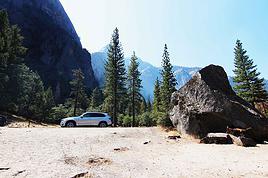
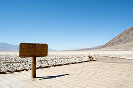
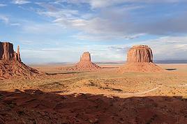
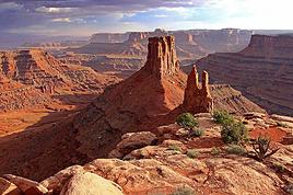
The rough itinerary: Salt Lake City. Jackson Hole–Grand Teton. Yellowstone. Cody. Rock Springs. Moab–Arches–Canyonlands. Monument Valley. Grand Canyon. Bryce Canyon. Zion Park. Las Vegas. Death Valley. Mammoth Lakes. Tioga Road. Mariposa. Yosemite Valley. San Francisco.
Tourists on site—a sociological study:
Italians: Always nice but just as loud as ever!
Hispanics: Same as the Italians, just a different language.
Germans: *Ein, zwei, ach mein Gott!* Order and discipline!
Americans: Still no manners whatsoever. Pathetic. I’m only talking about the tourists, not the locals who work there.
Quebecers: Pure joy!
English-speaking Canadians: Same as the Americans.
Asians: For the Japanese, it’s perfect. But the others from the Middle Kingdom... Let’s not start a war over this. There’s already Ukraine going on. And yet...
Israelis: Still no manners. The Kibbutz kids are the bane of this country.
French: Some excellent, some very good, some good, and some... not much.
Note that tourists in the northern part of the trip were much better behaved than those in the south. "Hello," "Goodbye," offering a hand? Etc. Few Asians in Grand Teton and Yellowstone. Lots of locals. The same goes for hotel staff in the northern part—more attentive. Really cool!
On the other hand, we were pretty surprised not to encounter any African-American locals in Montana, Wyoming, Utah, or even Arizona—whether tourists or employees. It’s quite striking, to be honest.
The Hotels:
Holiday Inn - 206 South West Temple, Salt Lake City, UT 84101, United States.
A modern but soulless hotel. Basically, a place to pass through. Minimal breakfast.
Miller Park Lodge - 155 North Jackson Street - Jackson Hole, Wyoming.
Not a hotel but a luxury motel. 750 € for two nights!! No breakfast. Huge room where you could hold a tea dance!!
Well-located. No staff.
Only room of the month-long stay that was fully redone during those two days.
Best Western Weston Inn. 103 Gibbon Avenue, West Yellowstone, MT 59758
Well-located, not far from the park entrance. Minimal breakfast. Friendly staff.
Room refreshed every two days.
Best Western Sunset Inn. 1601 8th St, Cody, 82414-4134
Very good. Quiet. Good breakfast. Friendly staff.
Baymont by Wyndham 2717 Dewar Drive, Rock Springs, WY 82901
Very good. Quiet. Good breakfast. Friendly staff.
Too many pets that should be "not allowed." Hello, hygiene!
Wingate by Wyndham Moab. 126 South Highway 191, Moab, 84532
End of the "family" hotels. Start of the tourist hotels.
Too many pets that should be "not allowed." Hello, hygiene!
Minimal breakfast.
Hampton Inn Kayenta. US Highway 160, Kayenta, AZ 86033, United States
A stopover hotel run by the Navajos. Friendly staff wearing masks. Lots of people.
Too many pets that should be "not allowed." Hello, hygiene!
Minimal breakfast.
La Quinta by Wyndham Williams. 1100 Cataract Lake Rd, Williams, AZ 86046, United States
Finally, Route 66 for 500 meters!
The staff is there. Nothing more.
Too many pets that should be "not allowed." Hello, hygiene!
Minimal breakfast.
BEST WESTERN PLUS Ruby's Inn. 26 South Main Street, Bryce Canyon City, UT 84764, United States
A factory!!!
Great Hispanic or Romanian staff! A liquor store in the hotel! Awesome!
Very good breakfast, but go early because the crowd—and the jerks—are there!
Too many pets that should be "not allowed." Hello, hygiene!
BEST WESTERN Casino Royale - 3411 Las Vegas Boulevard South, Strip, Las Vegas
Good hotel at a reasonable price.
No breakfast, but Denny’s is next door.
Quiet hotel despite the casino. Friendly staff.
No memory of seeing any pets!
Shilo Inn Mammoth Lake. 2963 Main Street, Mammoth Lake
Disastrous! Ineffective security system. Fire doors propped open with wooden wedges.
Tiny breakfast room. No staff in the room. Tables not cleaned. Minimal breakfast.
Gross pool.
Rooms need work. No, the whole hotel needs to be redone. They say they’re renovating. They’d be better off tearing it down.
Too many pets that should be "not allowed." Hello, hygiene!
Very bad memory.
Apparently, there’s supposed to be staff in this hotel.
Quality Inn Yosemite Valley Gateway. 4994 Bullion Street, Mariposa, CA 95338
Hotel or motel? Booking should clean up its listings!
No room refresh! Minimal breakfast.
The staff is there. Nothing more.
Comfort Inn by the Bay. 775 Van Ness Avenue, Marina District, San Francisco
No room refresh in four days! Minimal breakfast.
Friendly and helpful staff.
Well-located. Depends on what for, but well-located.
And then there are those who steal apples from the breakfast to put in their bags in the morning, those who fill up their famous US water bottles with orange juice from the breakfast pump, those who don’t clear their tables—I could go on. And also, those who don’t say hello or respond to a greeting!
Met some super nice French people (in the northern parks)! They’ll recognize themselves!
And the magic phrase that opens doors with Americans: "Do you speak French? OK, good!" Laughter guaranteed!
Don’t try that with Asians who run souvenir shops in big cities—they have no sense of humor unless it’s about the color of the green bill.
The park rangers are always available! Great!
And 5,000 photos to sort and organize, plus a few hours of dashcam videos!
See you soon.
Until the next update...
...
After Southern Tanzania, I’m sharing a travel story about the Cantal region with you...
...
For us, at the start of 2025, Le CANTAL was a true “Terra Incognita”!!
After seeing some tempting TV reports, we decided to fill this gap—especially in terms of landscapes. On the same trip, we’ll also head to the Arcachon Basin, the International Seaplane Gathering in Biscarrosse, and my native Landes region...
So, on May 20th, we left Marseille in the rain and thunder, heading toward Nîmes, Saint-Hippolyte, Mont Aigoual, Florac, and stopping in Marvejols to give my arthritic back a break for the night.
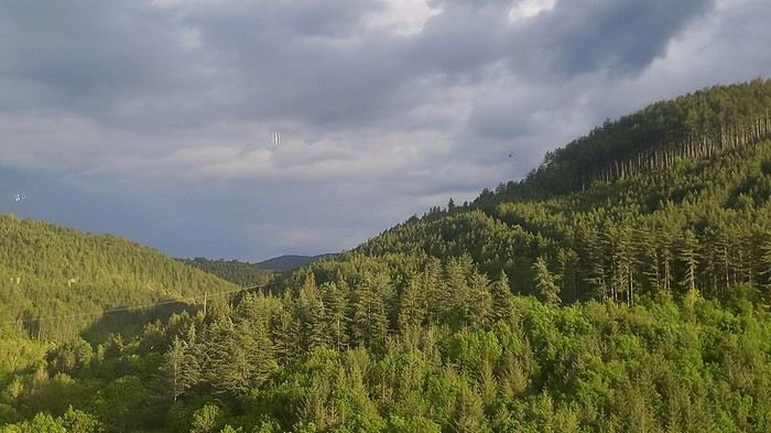
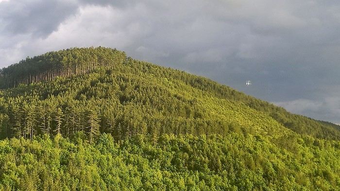
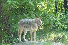
The next morning, we decided to revisit the Parc aux Loups du Gévaudan (Europe’s largest wolf park). As someone used to photo safaris in the wilds of East Africa, I’m not a fan of zoos at all—but I *do* have a deep admiration for wolves!!
Since it’s pretty unlikely I’ll ever see one in the wild, I’ll settle for this Parc aux Loups in Marvejols. This will be our third visit to this incredible gathering of these fascinating canines.
Some are still finishing their chilly night...
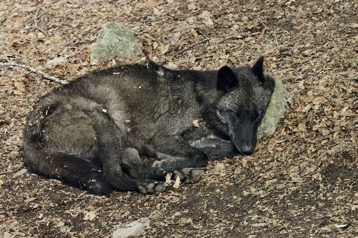
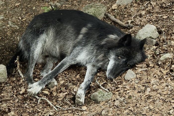
...
After Southern Tanzania, I’m sharing a travel story about the Cantal region with you...
...
For us, at the start of 2025, Le CANTAL was a true “Terra Incognita”!!
After seeing some tempting TV reports, we decided to fill this gap—especially in terms of landscapes. On the same trip, we’ll also head to the Arcachon Basin, the International Seaplane Gathering in Biscarrosse, and my native Landes region...
So, on May 20th, we left Marseille in the rain and thunder, heading toward Nîmes, Saint-Hippolyte, Mont Aigoual, Florac, and stopping in Marvejols to give my arthritic back a break for the night.
The next morning, we decided to revisit the Parc aux Loups du Gévaudan (Europe’s largest wolf park). As someone used to photo safaris in the wilds of East Africa, I’m not a fan of zoos at all—but I *do* have a deep admiration for wolves!!
Since it’s pretty unlikely I’ll ever see one in the wild, I’ll settle for this Parc aux Loups in Marvejols. This will be our third visit to this incredible gathering of these fascinating canines.
Some are still finishing their chilly night...
...
Here we go!!!
I left home at 4 AM on October 31st and headed to Barcelona. Driving through Barcelona on the ring road stresses me out a bit, but at 6 AM the traffic is smooth, and I arrive at the airport without any issues. I call the valet, who quickly comes to pick up my car. He takes photos of it from all angles before letting me go.
Baggage check-in hasn’t started yet, and there are already several of us waiting.
Once free, everything happens very quickly. The flight to Abu Dhabi is on time and goes smoothly. I’ve never had any problems with this airline, which I’ve been using for several years.
The flight to Bangkok arrives at 7 AM as scheduled. This is my first time in Thailand and Bangkok. I’m used to traveling in India, and I notice that everything here is well organized—the customs process is quick, and the luggage is already on the carousel.
I booked a taxi on Booking. All I have to do is find the right exit and door based on the agency’s instructions. A large sign with the names of people who booked is posted on a wall. A hostess greets me and calls the taxi, which arrives 5 minutes later. I booked one night at the Lost Inn BKK hotel in the Phra Nakhon district, and we arrive at 9 AM. The welcome isn’t warm, and I have to wait until noon, sitting on a chair, before I can check into my room. I’m exhausted, and sleeping sitting up isn’t ideal. Noon finally arrives—the room is small but clean, which is fine for one night. I quickly take a shower to wake up because I plan to spend the afternoon visiting the Grand Palace. First, I need to exchange some money, and the banks are all close together on the same street, which is very convenient. When I enter one, a hostess gives me a ticket and invites me to sit down. There are about twenty counters, and I wait quietly until my number is called. The exchange is quick, so I can head out to find the Royal Palace. It’s actually very easy, and the walk is pleasant.
Entry to the Royal Palace (500 baht).
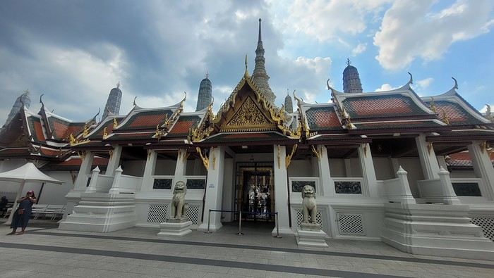
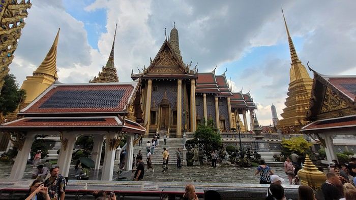
It’s magnificent and grand, and there are quite a few of us visiting. The sky is gray, it’s very humid, and a shower interrupts the visit. It’s a vast complex of temples and palaces. The buildings are colorful and sparkling, with a great sense of serenity (without the tourists, of course). I quietly enjoy the place and try to take photos without tourists, which isn’t easy.
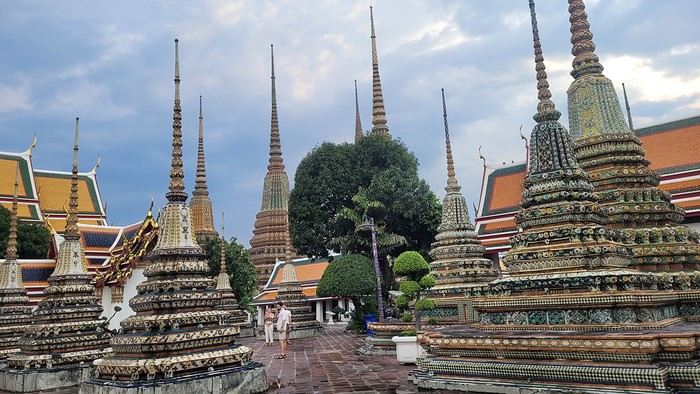
Very close to the Grand Palace is Wat Pho, one of the oldest Buddhist temples in the capital.
It’s very famous for its 46-meter-long reclining Buddha statue.
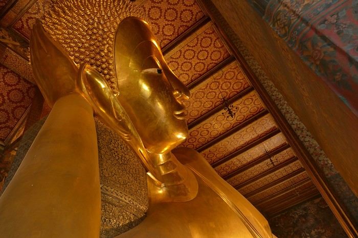
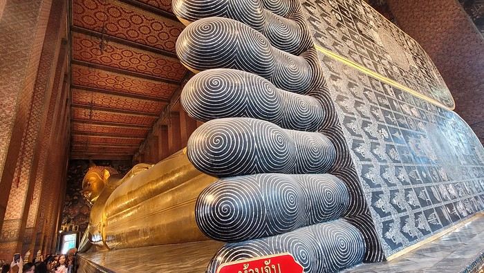
Walking around the temple, you can see different representations of Buddha, all covered in gold leaf.
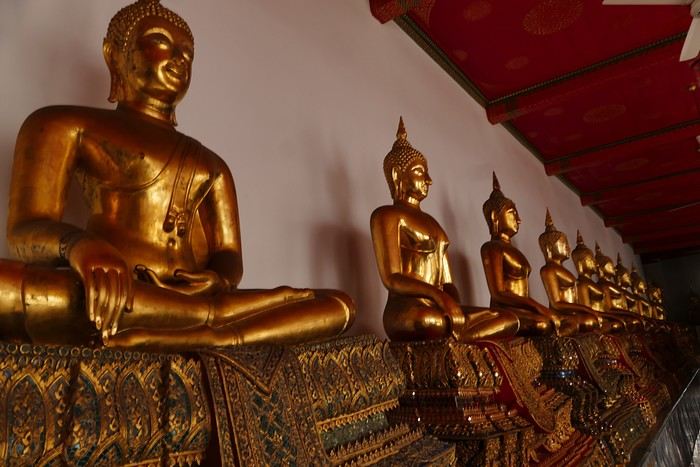
Inside the temple, on one side, monks recite their prayers, while the other side is reserved for tourists who come to meditate in silence.
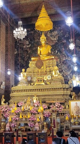
Before returning to the hotel, I have dinner at an Indian restaurant. I go to bed early because tomorrow’s wake-up call will be very early again.
Saturday, November 2nd Wake-up at 4 AM, departure from the hotel at 4:30 AM. The taxi I booked via Booking is waiting for me and takes me to the airport. The trip is fairly quick—he takes small roads, and at this hour, there’s no traffic.
The flight to Phnom Penh is on time. Before boarding, I realize I left my fleece jacket on the carousel, but it’s too late to go back for it.
The flight goes well, and customs is quick.
At the exit, I take a tuk-tuk to Julieka’s GH near the museum. The welcome is friendly. I won’t be able to check into my room until noon, so I take the opportunity to exchange some euros on the market street. The street is lined with restaurants, and I’ll have my first meal there.
The museum is right across the street, so I don’t waste any time visiting it.
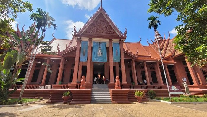
The representations of Hindu deities are very different from those in India, and I don’t recognize them. Many beautiful Buddhas are on display.
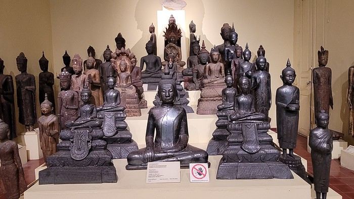
The museum is very pleasant, and there aren’t too many people, which is a plus.
At the exit, I return to the GH, settle into my room—which is decent and clean.
The Royal Palace is 1 km away. I walk along a garden, and at the end of the street is the Tonlé Sap, but I turn right. I arrive at a large esplanade and see the buildings with tiered roofs and glazed tiles. The entrance to the palace is a little further away.
At the entrance, I notice there isn’t the same crowd as at the one in BKK.
Khmer architecture is magnificent. The complex consists of gardens, palaces, pagodas with golden roofs, and slender spires.
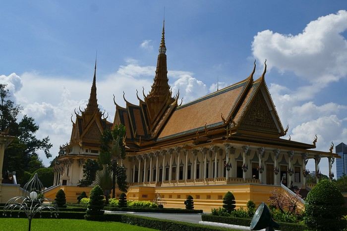
The Silver Pagoda houses the small Emerald Buddha, which is actually made of jade. The silver flooring is covered with carpets. Photos are not allowed.
The walls surrounding the pagoda are covered with frescoes depicting scenes from the Ramayana.
Baggage check-in hasn’t started yet, and there are already several of us waiting.
Once free, everything happens very quickly. The flight to Abu Dhabi is on time and goes smoothly. I’ve never had any problems with this airline, which I’ve been using for several years.
The flight to Bangkok arrives at 7 AM as scheduled. This is my first time in Thailand and Bangkok. I’m used to traveling in India, and I notice that everything here is well organized—the customs process is quick, and the luggage is already on the carousel.
I booked a taxi on Booking. All I have to do is find the right exit and door based on the agency’s instructions. A large sign with the names of people who booked is posted on a wall. A hostess greets me and calls the taxi, which arrives 5 minutes later. I booked one night at the Lost Inn BKK hotel in the Phra Nakhon district, and we arrive at 9 AM. The welcome isn’t warm, and I have to wait until noon, sitting on a chair, before I can check into my room. I’m exhausted, and sleeping sitting up isn’t ideal. Noon finally arrives—the room is small but clean, which is fine for one night. I quickly take a shower to wake up because I plan to spend the afternoon visiting the Grand Palace. First, I need to exchange some money, and the banks are all close together on the same street, which is very convenient. When I enter one, a hostess gives me a ticket and invites me to sit down. There are about twenty counters, and I wait quietly until my number is called. The exchange is quick, so I can head out to find the Royal Palace. It’s actually very easy, and the walk is pleasant.
Entry to the Royal Palace (500 baht).
It’s magnificent and grand, and there are quite a few of us visiting. The sky is gray, it’s very humid, and a shower interrupts the visit. It’s a vast complex of temples and palaces. The buildings are colorful and sparkling, with a great sense of serenity (without the tourists, of course). I quietly enjoy the place and try to take photos without tourists, which isn’t easy.
Very close to the Grand Palace is Wat Pho, one of the oldest Buddhist temples in the capital.
It’s very famous for its 46-meter-long reclining Buddha statue.
Walking around the temple, you can see different representations of Buddha, all covered in gold leaf.
Inside the temple, on one side, monks recite their prayers, while the other side is reserved for tourists who come to meditate in silence.
Before returning to the hotel, I have dinner at an Indian restaurant. I go to bed early because tomorrow’s wake-up call will be very early again.
Saturday, November 2nd Wake-up at 4 AM, departure from the hotel at 4:30 AM. The taxi I booked via Booking is waiting for me and takes me to the airport. The trip is fairly quick—he takes small roads, and at this hour, there’s no traffic.
The flight to Phnom Penh is on time. Before boarding, I realize I left my fleece jacket on the carousel, but it’s too late to go back for it.
The flight goes well, and customs is quick.
At the exit, I take a tuk-tuk to Julieka’s GH near the museum. The welcome is friendly. I won’t be able to check into my room until noon, so I take the opportunity to exchange some euros on the market street. The street is lined with restaurants, and I’ll have my first meal there.
The museum is right across the street, so I don’t waste any time visiting it.
The representations of Hindu deities are very different from those in India, and I don’t recognize them. Many beautiful Buddhas are on display.
The museum is very pleasant, and there aren’t too many people, which is a plus.
At the exit, I return to the GH, settle into my room—which is decent and clean.
The Royal Palace is 1 km away. I walk along a garden, and at the end of the street is the Tonlé Sap, but I turn right. I arrive at a large esplanade and see the buildings with tiered roofs and glazed tiles. The entrance to the palace is a little further away.
At the entrance, I notice there isn’t the same crowd as at the one in BKK.
Khmer architecture is magnificent. The complex consists of gardens, palaces, pagodas with golden roofs, and slender spires.
The Silver Pagoda houses the small Emerald Buddha, which is actually made of jade. The silver flooring is covered with carpets. Photos are not allowed.
The walls surrounding the pagoda are covered with frescoes depicting scenes from the Ramayana.
Hey there, VoyageForum!!!
I’ve combed through this site up, down, and sideways to plan our two-month road trip across the American Southwest during the summer of 2022, so it only feels right to give back and revive the USA travel journal section—helping others prep, travel, or relive their own memories! 😏
A quick intro to the stars of this trip is coming soon... in an upcoming post!
Table of Contents:
Road trip introduction Day 1 & 2: the days we double-checked all our papers... Day 3 & 3 bis: The day we discovered Denver... Day 4: The day of the race, the carriage, and the little one’s cough... Day 5: the day the road trip truly began... Day 6 & 6 bis: the day of Nature’s first wonders... Day 7: the day the sky fell on our heads... Day 8 & 8 bis: the day we saw ghosts... Day 9: the day we climbed the mountain... Day 10: the day the theme song from "The Last Picture Show" played on loop in my head... Day 11: the day we lived like Native Americans... Day 12: the day we left civilization behind... Day 13 & 13 bis: the day we explored another planet... Day 14 & 14 bis: the day Caro reunited with HER rocks... Day 15 & 15 bis: the day of the fantastic ride... Day 16: the day we cooled off in Lake Powell... Day 17: the day the Colorado River’s meanders were all ours... Day 18: the day we dipped our feet in the Colorado... Day 19: the day the guys discovered true vastness... Day 20 & 20 bis: the day we covered a few acres of Route 66 before sunset... Day 21: the day the credit card said stop... right before the STRIP... Day 22: the day we finally discovered Cirque du Soleil... Day 23: the day we returned to calm... well, almost... Day 24: the day we reached our home base for 6 nights: Saint George Day 25: the day we should’ve explored Yant Flat... Day 26: the day it was 13°C at Cedar Breaks... Day 27: the day we explored The Narrows in Zion NP... Day 28: the day we discovered Snow Canyon... Day 29: the day we hiked to the "SUBWAY"... Day 30: the day we encountered the abyss—from the north this time... Day 31: the day we arrived in a place where dreams begin... Kanab... Day 32: the day we discovered the first treasures along House Rock Valley... 2nd part: the second part of the journey... Day 33: the day we discovered a magical place... Edmaier's Secret... Day 34: the day Cottonwood Road didn’t open up to us... Day 35: the day of the classic Queen’s Garden + Navajo Loop—and another event that became a classic... Day 36: the second day in Bryce... pure bliss!!! Day 37: the day we swam at the foot of Calf Creek Falls... Day 38: the day we took the Burr Trail, even with storms lurking... Day 39: The day of the goblins... Day 40: the day we enjoyed the peaceful Capitol Reef NP... Day 41: the day of the Rim Overlook and another letdown... Day 42: the day we arrived in... Moab... Day 43: the first day in Arches National Park... Day 44: the day of the Fisher Towers... Day 45: the day of Bow Tie & Corona Arches... Day 46: The day of Shafer Trail + Potash Road... Day 47: The second day in Arches NP... Day 48: the day we discovered Colorado NM in a flash... Day 49: the day of Black Canyon... Day 50: the day we passed through Durango before falling for Silverton... Day 51: the day we went through Ouray and ended up in Gunnison... Day 52: the day of Kebler Pass and arriving at the hot springs... Day 53: the day of hot springs II, then the road back to Denver... Day 54: the last day... Day 55: back home and the RECAP...
I’ve combed through this site up, down, and sideways to plan our two-month road trip across the American Southwest during the summer of 2022, so it only feels right to give back and revive the USA travel journal section—helping others prep, travel, or relive their own memories! 😏
A quick intro to the stars of this trip is coming soon... in an upcoming post!
Table of Contents:
Road trip introduction Day 1 & 2: the days we double-checked all our papers... Day 3 & 3 bis: The day we discovered Denver... Day 4: The day of the race, the carriage, and the little one’s cough... Day 5: the day the road trip truly began... Day 6 & 6 bis: the day of Nature’s first wonders... Day 7: the day the sky fell on our heads... Day 8 & 8 bis: the day we saw ghosts... Day 9: the day we climbed the mountain... Day 10: the day the theme song from "The Last Picture Show" played on loop in my head... Day 11: the day we lived like Native Americans... Day 12: the day we left civilization behind... Day 13 & 13 bis: the day we explored another planet... Day 14 & 14 bis: the day Caro reunited with HER rocks... Day 15 & 15 bis: the day of the fantastic ride... Day 16: the day we cooled off in Lake Powell... Day 17: the day the Colorado River’s meanders were all ours... Day 18: the day we dipped our feet in the Colorado... Day 19: the day the guys discovered true vastness... Day 20 & 20 bis: the day we covered a few acres of Route 66 before sunset... Day 21: the day the credit card said stop... right before the STRIP... Day 22: the day we finally discovered Cirque du Soleil... Day 23: the day we returned to calm... well, almost... Day 24: the day we reached our home base for 6 nights: Saint George Day 25: the day we should’ve explored Yant Flat... Day 26: the day it was 13°C at Cedar Breaks... Day 27: the day we explored The Narrows in Zion NP... Day 28: the day we discovered Snow Canyon... Day 29: the day we hiked to the "SUBWAY"... Day 30: the day we encountered the abyss—from the north this time... Day 31: the day we arrived in a place where dreams begin... Kanab... Day 32: the day we discovered the first treasures along House Rock Valley... 2nd part: the second part of the journey... Day 33: the day we discovered a magical place... Edmaier's Secret... Day 34: the day Cottonwood Road didn’t open up to us... Day 35: the day of the classic Queen’s Garden + Navajo Loop—and another event that became a classic... Day 36: the second day in Bryce... pure bliss!!! Day 37: the day we swam at the foot of Calf Creek Falls... Day 38: the day we took the Burr Trail, even with storms lurking... Day 39: The day of the goblins... Day 40: the day we enjoyed the peaceful Capitol Reef NP... Day 41: the day of the Rim Overlook and another letdown... Day 42: the day we arrived in... Moab... Day 43: the first day in Arches National Park... Day 44: the day of the Fisher Towers... Day 45: the day of Bow Tie & Corona Arches... Day 46: The day of Shafer Trail + Potash Road... Day 47: The second day in Arches NP... Day 48: the day we discovered Colorado NM in a flash... Day 49: the day of Black Canyon... Day 50: the day we passed through Durango before falling for Silverton... Day 51: the day we went through Ouray and ended up in Gunnison... Day 52: the day of Kebler Pass and arriving at the hot springs... Day 53: the day of hot springs II, then the road back to Denver... Day 54: the last day... Day 55: back home and the RECAP...
This trip had been on my mind for about fifteen years.
But the discomfort of overnight stays, the difficulty of communication, and the prices of the few car rental options kept making me postpone the project.
And then, everything suddenly fell into place—I told myself, it’s time!
The preparations took longer than usual; the destination is still far from mainstream.
A bit of Kazakhstan? Not in the end.
The south or not the south? Yes, in the end.
Pre-book or go with the flow? Only two stops were a leap into the unknown.
To help me find the ideal route, I made great use of this forum (thanks to everyone for patiently answering my questions!), pored over travel journals and blogs (Christian, Jeff), zoomed in on Google Maps and Yandex, and bought the guide published by OunTravela about this destination (the guide has been updated since).
---/---
You’ve got your passport, international driver’s license, bank cards, and euros?
Off we go to Lyon—just one night left before our early morning flight.
Tomorrow night, we’ll be sleeping in Bishkek! (Steak for my partner’s mischievous nephews...)

You’ll find here a post with some practical information.
And here, the version of the travel journal without comments.
---/---
As a supplement, the route track. Not necessarily ultra-accurate since Google has serious gaps for this destination...
From Bishkek to Karakol:

From Karakol to Kochkor:

From Kochkor to Baetov:

From Baetov to Kara-Köl:

From Kara-Köl to Bishkek:


But the discomfort of overnight stays, the difficulty of communication, and the prices of the few car rental options kept making me postpone the project.
And then, everything suddenly fell into place—I told myself, it’s time!
The preparations took longer than usual; the destination is still far from mainstream.
A bit of Kazakhstan? Not in the end.
The south or not the south? Yes, in the end.
Pre-book or go with the flow? Only two stops were a leap into the unknown.
To help me find the ideal route, I made great use of this forum (thanks to everyone for patiently answering my questions!), pored over travel journals and blogs (Christian, Jeff), zoomed in on Google Maps and Yandex, and bought the guide published by OunTravela about this destination (the guide has been updated since).
---/---
You’ve got your passport, international driver’s license, bank cards, and euros?
Off we go to Lyon—just one night left before our early morning flight.
Tomorrow night, we’ll be sleeping in Bishkek! (Steak for my partner’s mischievous nephews...)
You’ll find here a post with some practical information.
And here, the version of the travel journal without comments.
---/---
As a supplement, the route track. Not necessarily ultra-accurate since Google has serious gaps for this destination...
From Bishkek to Karakol:
From Karakol to Kochkor:
From Kochkor to Baetov:
From Baetov to Kara-Köl:
From Kara-Köl to Bishkek:
Hello fellow travelers!
I’m adding my small contribution to the reopening celebration by posting this travel journal from India, made in January 2024. We’re 4 friends (2 couples), and we did a 3-week loop in Rajasthan, stopping by Delhi and Agra (which, as everyone knows, aren’t in Rajasthan 😛). Delhi - Agra - Jaipur - Bundi - Udaipur - Jodhpur - Jaisalmer - Delhi
We rented a car with a driver from Agra to Jaisalmer, 550 € for 14 days. https://chauffeurpriveeninde.com/fr/
We took the train from Delhi to Agra and the plane (Spicejet) from Jaisalmer to Delhi.
Most of the accommodations were booked on Booking before we left.
I’m sharing this story written by Richard and illustrated by me. We dedicate it to Nathalie and Bruno, our amazing travel companions.
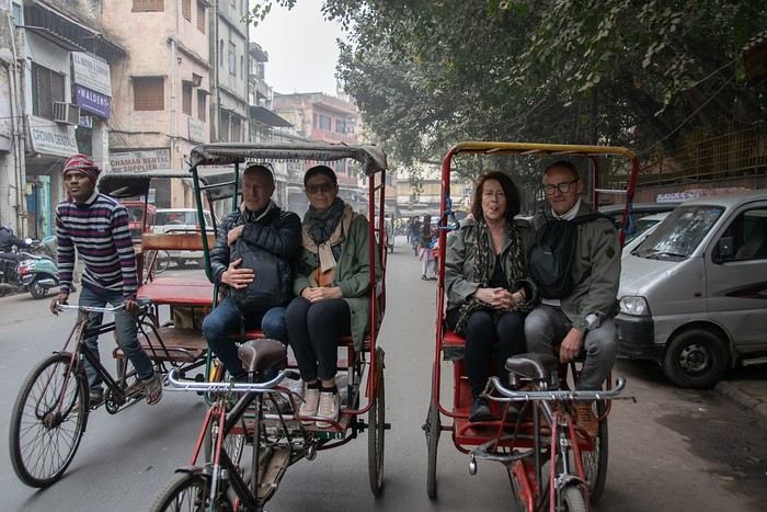
I’m adding my small contribution to the reopening celebration by posting this travel journal from India, made in January 2024. We’re 4 friends (2 couples), and we did a 3-week loop in Rajasthan, stopping by Delhi and Agra (which, as everyone knows, aren’t in Rajasthan 😛). Delhi - Agra - Jaipur - Bundi - Udaipur - Jodhpur - Jaisalmer - Delhi
We rented a car with a driver from Agra to Jaisalmer, 550 € for 14 days. https://chauffeurpriveeninde.com/fr/
We took the train from Delhi to Agra and the plane (Spicejet) from Jaisalmer to Delhi.
Most of the accommodations were booked on Booking before we left.
I’m sharing this story written by Richard and illustrated by me. We dedicate it to Nathalie and Bruno, our amazing travel companions.
Preamble: Why La Gomera?
When we started looking for a summer destination a few months ago, our first criterion was to avoid extreme heat and heatwaves. We had already been to Norway two years ago and are considering going back in the future for other occasions. So, we had some fun asking ChatGPT which destinations enjoyed a mild climate during the summer without going too far. Among the list provided by the AI were the Canary Islands... The idea of a place we wouldn’t have thought of first, both not too far away and exotic enough, appealed to us: “Hmm, why not?”
This destination had never really attracted me, though Magali was a bit more interested. Five years earlier, COVID had caused a short break in my professional activity, and I had planned a trip because the flight price was attractive, and I was looking for a destination different from what usually appeals to me, more than out of deep interest. From a distance and with a social judgment I acknowledge (it’s not great, but it’s not completely wrong), I had the image of a destination for party-goers enjoying the sun without the slightest interest in local culture, with concrete coastlines and denatured landscapes—everything I detest the most. Still, I had done some quick research on the different islands and spotted Lanzarote for its beautiful volcanic landscapes, hiking trails, beaches, and the impression of a good balance between activity and fewer crowds than Tenerife or Gran Canaria. Then I dropped the idea of going, without ever reconsidering traveling to the Canaries...
Until now! Because we started researching the different islands of the archipelago to see which ones might appeal to us the most. It was La Gomera, the third smallest island of the archipelago, more praised for its hiking trails and preserved nature than for its beaches, away from mass tourism (fifty times fewer tourists than Tenerife) but still a bit more developed than its wild neighbor El Hierro, that caught our attention. Contrary to what might be suggested later, I’m not at all addicted to AI, but I use it from time to time to synthesize quick research or simply for experimentation. Since ChatGPT had started anticipating my tastes lately as if it had become my buddy (often successfully, sometimes off the mark), I asked which Canary Island would suit me best for a trip with my family. The tool answered first with... La Gomera. So, I tested it and teased it a bit to see if this suggestion was well-founded, as the method sometimes makes it contradict itself. But no luck: “You’d appreciate the wild nature of El Hierro, but with family, you’ll find little activity for the kids. You won’t like the touristy vibe of the big islands like Tenerife, Gran Canaria, Lanzarote, and Fuerteventura. You could consider La Palma, but it’s really La Gomera that will suit you best, based on your interests and the criteria given.” So, we dug deeper into our research and were convinced without a shadow of a doubt that this island was the one waiting for us.
Without knowing it, we had Canarians in our circle who revealed their origins when they heard about our travel plans. One from Tenerife insisted we’d be better off choosing Tenerife (obviously...) because it also has preserved spots and that La Gomera, “you can explore it in two or three days, you’ll get bored quickly...” The other, a colleague from Gran Canaria who had never visited La Gomera, still recommended it without hesitation because it turned out her parents had just gone there on vacation: they loved it and had encountered few tourists. She also tended to think this destination was usually the subject of short stays, but according to what her parents told her, taking your time there was also a great idea. However, in our research, the idea that La Gomera is an island you can explore in three or four days max kept coming up. So, we considered combining its visit with La Palma or El Hierro, the other two that caught our eye. But hopping between islands by ferry represents a significant budget for non-Canarians, even more so for a family of four. Then, scrutinizing Google Maps, it seemed obvious that two weeks were too short to discover two islands as they deserve, and that there seemed to be plenty to see in La Gomera, given its very unique culture. After all, we read that some people spend several months a year there, others never even leave... Finally, these landscapes and this atmosphere, which seemed to us a mix of Europe, North Africa, and Latin America, tempted us. So, it would be two weeks in La Gomera, deal!
La Gomera is therefore the second... well, the third smallest island of the Canaries since La Graciosa was recently recognized as a fully inhabited island. It has the shape of a rough circle about 20 to 25 kilometers in diameter and has just over 20,000 inhabitants, half of them in its capital, San Sebastián de la Gomera, the only real town. Like its Canarian sisters, La Gomera is a volcanic formation that rose about 10 million years ago. The island is very mountainous and rugged, covered with red and black rocky landscapes. Geological activity has shaped, between the sprawling massifs that end in steep cliffs in the ocean, six coastal valleys with tropical vegetation that have favored human settlement. They divide the island like slices of a cake; from the north clockwise: the agricultural Vallehermoso, the rustic Agulo, the green, humid, and fertile Hermigua, the sunny capital San Sebastián de la Gomera, the southern and isolated Alajeró-Santiago, and the seaside Valle Gran Rey. They constitute the six municipalities (more like cantons to our French understanding) of the territory. The large solidified magma massifs that shape the heart of the island have created a large depression more protected from the sun at its center, allowing the growth of a vast laurel forest, today grouped within the Garajonay National Park, La Gomera’s green lung, which has earned it the status of a World Biosphere Reserve. Its completely European appearance contrasts sharply with the rocky and tropical landscapes of the rest of the island. Thus, the climate varies greatly from one point to another on the island: in summer, you can quickly go from a dry and sunny valley at 35°C to a humid forest area at altitude at 18°C.
La Gomera was populated late. As with the rest of the Canaries, human presence is thought to have begun about 2,000 years ago. Groups of animist Berbers, probably fleeing persecution, gradually populated the archipelago, especially the western islands and La Gomera, becoming its small aboriginal population: the Guanches (or later Gomeros). The animist and pastoral civilization of the Guanches thrived until the Spanish takeover in the 15th century, which, after a short period of harmony and mixing with the indigenous people, suddenly ended in bloodshed... La Gomera later became the “Columbus Island” after Christopher Columbus’s stopover, increasing the blending of populations. In the 20th century, many Gomeros emigrated to Cuba and other Latin American countries in search of a better life, bringing back a mix of cultures and traits quite palpable in today’s Gomeran culture. It is, however, in La Gomera that the vestiges of Guanche culture seem to have left the most traces, in the language, gastronomy, social practices... Moreover, most Gomeros, especially in remote villages, have a particular identifiable type and proudly claim their ancestral roots, even making La Gomera a bit exotic in the eyes of other Canarians.
Perhaps that’s why it has never really wanted to develop its tourist infrastructure too much. If we set aside the tourists who visit for the day by bus or boat from Tenerife on a marked itinerary (and whom we ultimately rarely encounter), La Gomera has remained a hidden gem, a destination focused on nature discovery that attracts hikers, nature-loving divers, and scientists for its fauna and flora, and to a lesser extent, beachgoers who don’t seek overly developed coastlines. Tourist activity is therefore limited. Roughly speaking, you’ll find a majority of Spaniards, including a substantial number of residents from other Canary Islands, many Germans who have a particular fondness for La Gomera and spend long stays there or own second homes, to the point that the German cultural footprint is clearly noticeable in some places (it’s said to be Angela Merkel’s favorite holiday spot), and still quite a few French. The presence of other nationalities seemed negligible to us. Most travelers come mainly for hiking, but it’s also a prime spot for whale watching. Additionally, the seaside resorts of La Gomera—San Sebastián, Santiago, and especially Valle Gran Rey—are well-known destinations for hippies, especially German ones, ranging from chic boho hippies to old-school hippies who’ve been there for decades, quite similar to those you’d meet in India in Goa, Rishikesh, or Paharganj. Thus, practices like naturism, vegetarianism, and local organic production are quite well established in some areas.
Some practical info: - The round-trip flight from Paris to Tenerife cost us 365 € per person (outbound with Transavia, return with EasyJet), including checked luggage and three seats reserved side by side. - We chose two bases to explore the island: one week in Valle Gran Rey, reputed to be the most pleasant of the three seaside resorts, and one week in Hermigua, more mountainous and close to the natural park. We booked two houses with balconies and views: the first at 120 € per night, the second at 99 €. - The round-trip ferry between Tenerife and La Gomera cost us 270 € with the company Baleària Canarias, including discounts for children aged 4 and 12, but I don’t have the exact details. It was a bit cheaper than with the other company, Fred Olsen. - Finally, we rented a car through the agency Cicar for 360 € for 16 days, which comes to 22.50 € per day. - Apart from that, we didn’t plan anything and decided the day before or even the morning of what we wanted to do. We didn’t invest in any paper guide on the Canaries, as information on La Gomera was scarce, but we used the very comprehensive site La Gomera Travel, a travel guide published by the Canary Islands Tourism Council, a real goldmine of almost exhaustive information on the island.
Alright, off we go for 16 days of adventure discovering La Gomera!

And we start the trip with music!
We start the trip with music!
When we started looking for a summer destination a few months ago, our first criterion was to avoid extreme heat and heatwaves. We had already been to Norway two years ago and are considering going back in the future for other occasions. So, we had some fun asking ChatGPT which destinations enjoyed a mild climate during the summer without going too far. Among the list provided by the AI were the Canary Islands... The idea of a place we wouldn’t have thought of first, both not too far away and exotic enough, appealed to us: “Hmm, why not?”
This destination had never really attracted me, though Magali was a bit more interested. Five years earlier, COVID had caused a short break in my professional activity, and I had planned a trip because the flight price was attractive, and I was looking for a destination different from what usually appeals to me, more than out of deep interest. From a distance and with a social judgment I acknowledge (it’s not great, but it’s not completely wrong), I had the image of a destination for party-goers enjoying the sun without the slightest interest in local culture, with concrete coastlines and denatured landscapes—everything I detest the most. Still, I had done some quick research on the different islands and spotted Lanzarote for its beautiful volcanic landscapes, hiking trails, beaches, and the impression of a good balance between activity and fewer crowds than Tenerife or Gran Canaria. Then I dropped the idea of going, without ever reconsidering traveling to the Canaries...
Until now! Because we started researching the different islands of the archipelago to see which ones might appeal to us the most. It was La Gomera, the third smallest island of the archipelago, more praised for its hiking trails and preserved nature than for its beaches, away from mass tourism (fifty times fewer tourists than Tenerife) but still a bit more developed than its wild neighbor El Hierro, that caught our attention. Contrary to what might be suggested later, I’m not at all addicted to AI, but I use it from time to time to synthesize quick research or simply for experimentation. Since ChatGPT had started anticipating my tastes lately as if it had become my buddy (often successfully, sometimes off the mark), I asked which Canary Island would suit me best for a trip with my family. The tool answered first with... La Gomera. So, I tested it and teased it a bit to see if this suggestion was well-founded, as the method sometimes makes it contradict itself. But no luck: “You’d appreciate the wild nature of El Hierro, but with family, you’ll find little activity for the kids. You won’t like the touristy vibe of the big islands like Tenerife, Gran Canaria, Lanzarote, and Fuerteventura. You could consider La Palma, but it’s really La Gomera that will suit you best, based on your interests and the criteria given.” So, we dug deeper into our research and were convinced without a shadow of a doubt that this island was the one waiting for us.
Without knowing it, we had Canarians in our circle who revealed their origins when they heard about our travel plans. One from Tenerife insisted we’d be better off choosing Tenerife (obviously...) because it also has preserved spots and that La Gomera, “you can explore it in two or three days, you’ll get bored quickly...” The other, a colleague from Gran Canaria who had never visited La Gomera, still recommended it without hesitation because it turned out her parents had just gone there on vacation: they loved it and had encountered few tourists. She also tended to think this destination was usually the subject of short stays, but according to what her parents told her, taking your time there was also a great idea. However, in our research, the idea that La Gomera is an island you can explore in three or four days max kept coming up. So, we considered combining its visit with La Palma or El Hierro, the other two that caught our eye. But hopping between islands by ferry represents a significant budget for non-Canarians, even more so for a family of four. Then, scrutinizing Google Maps, it seemed obvious that two weeks were too short to discover two islands as they deserve, and that there seemed to be plenty to see in La Gomera, given its very unique culture. After all, we read that some people spend several months a year there, others never even leave... Finally, these landscapes and this atmosphere, which seemed to us a mix of Europe, North Africa, and Latin America, tempted us. So, it would be two weeks in La Gomera, deal!
La Gomera is therefore the second... well, the third smallest island of the Canaries since La Graciosa was recently recognized as a fully inhabited island. It has the shape of a rough circle about 20 to 25 kilometers in diameter and has just over 20,000 inhabitants, half of them in its capital, San Sebastián de la Gomera, the only real town. Like its Canarian sisters, La Gomera is a volcanic formation that rose about 10 million years ago. The island is very mountainous and rugged, covered with red and black rocky landscapes. Geological activity has shaped, between the sprawling massifs that end in steep cliffs in the ocean, six coastal valleys with tropical vegetation that have favored human settlement. They divide the island like slices of a cake; from the north clockwise: the agricultural Vallehermoso, the rustic Agulo, the green, humid, and fertile Hermigua, the sunny capital San Sebastián de la Gomera, the southern and isolated Alajeró-Santiago, and the seaside Valle Gran Rey. They constitute the six municipalities (more like cantons to our French understanding) of the territory.
The large solidified magma massifs that shape the heart of the island have created a large depression more protected from the sun at its center, allowing the growth of a vast laurel forest, today grouped within the Garajonay National Park, La Gomera’s green lung, which has earned it the status of a World Biosphere Reserve. Its completely European appearance contrasts sharply with the rocky and tropical landscapes of the rest of the island. Thus, the climate varies greatly from one point to another on the island: in summer, you can quickly go from a dry and sunny valley at 35°C to a humid forest area at altitude at 18°C.La Gomera was populated late. As with the rest of the Canaries, human presence is thought to have begun about 2,000 years ago. Groups of animist Berbers, probably fleeing persecution, gradually populated the archipelago, especially the western islands and La Gomera, becoming its small aboriginal population: the Guanches (or later Gomeros). The animist and pastoral civilization of the Guanches thrived until the Spanish takeover in the 15th century, which, after a short period of harmony and mixing with the indigenous people, suddenly ended in bloodshed... La Gomera later became the “Columbus Island” after Christopher Columbus’s stopover, increasing the blending of populations. In the 20th century, many Gomeros emigrated to Cuba and other Latin American countries in search of a better life, bringing back a mix of cultures and traits quite palpable in today’s Gomeran culture. It is, however, in La Gomera that the vestiges of Guanche culture seem to have left the most traces, in the language, gastronomy, social practices... Moreover, most Gomeros, especially in remote villages, have a particular identifiable type and proudly claim their ancestral roots, even making La Gomera a bit exotic in the eyes of other Canarians.
Perhaps that’s why it has never really wanted to develop its tourist infrastructure too much. If we set aside the tourists who visit for the day by bus or boat from Tenerife on a marked itinerary (and whom we ultimately rarely encounter), La Gomera has remained a hidden gem, a destination focused on nature discovery that attracts hikers, nature-loving divers, and scientists for its fauna and flora, and to a lesser extent, beachgoers who don’t seek overly developed coastlines. Tourist activity is therefore limited. Roughly speaking, you’ll find a majority of Spaniards, including a substantial number of residents from other Canary Islands, many Germans who have a particular fondness for La Gomera and spend long stays there or own second homes, to the point that the German cultural footprint is clearly noticeable in some places (it’s said to be Angela Merkel’s favorite holiday spot), and still quite a few French. The presence of other nationalities seemed negligible to us. Most travelers come mainly for hiking, but it’s also a prime spot for whale watching. Additionally, the seaside resorts of La Gomera—San Sebastián, Santiago, and especially Valle Gran Rey—are well-known destinations for hippies, especially German ones, ranging from chic boho hippies to old-school hippies who’ve been there for decades, quite similar to those you’d meet in India in Goa, Rishikesh, or Paharganj. Thus, practices like naturism, vegetarianism, and local organic production are quite well established in some areas.
Some practical info: - The round-trip flight from Paris to Tenerife cost us 365 € per person (outbound with Transavia, return with EasyJet), including checked luggage and three seats reserved side by side. - We chose two bases to explore the island: one week in Valle Gran Rey, reputed to be the most pleasant of the three seaside resorts, and one week in Hermigua, more mountainous and close to the natural park. We booked two houses with balconies and views: the first at 120 € per night, the second at 99 €. - The round-trip ferry between Tenerife and La Gomera cost us 270 € with the company Baleària Canarias, including discounts for children aged 4 and 12, but I don’t have the exact details. It was a bit cheaper than with the other company, Fred Olsen. - Finally, we rented a car through the agency Cicar for 360 € for 16 days, which comes to 22.50 € per day. - Apart from that, we didn’t plan anything and decided the day before or even the morning of what we wanted to do. We didn’t invest in any paper guide on the Canaries, as information on La Gomera was scarce, but we used the very comprehensive site La Gomera Travel, a travel guide published by the Canary Islands Tourism Council, a real goldmine of almost exhaustive information on the island.
Alright, off we go for 16 days of adventure discovering La Gomera!
And we start the trip with music!
We start the trip with music!
Day 1 – February 14
We all have two lives. And the second one kicks off the day you realize you only have one, with the determination to spend the time you have left on what truly adds sparkle to your life, Kevin! I like to elegantly introduce a trip with a philosophical quote. First, it gives you the illusion that I’m some kind of deep thinker, and second, it lets me fill up the first few lines of my blank page when I don’t know how to tell you I’m diving back into what really lights up my life: another adventure beyond the horizon! And nearly every other year, like a toxic relationship, my horizon tends to take shape in Uncle Sam’s backyard. And this, despite his cousin Donald calling the shots. Speaking of which, it was partly that impulsive guy who pushed us to be just as impulsive and snag our four flight tickets at a ridiculously low price—a direct result of foreign tourism taking a hit from BetaMax’s repeated antics... Four tickets? Who are the other lucky ones? In this case, our lucky ones are actually lucky ladies: My Flo, always up for exploring the world with me on foot, camelback, or scooter, is obviously in on the fun. The other two seats went to our daughters, Sasha and Luna, both thrilled to be part of this new American adventure...
But what’s the American West like in February?... A gamble. Let’s call it Russian roulette since we’re not landing during peak weather season. That’s why we encouraged our transportation and accommodation to get cozy and produce a little camper van, so we can stay ultra-flexible in the face of any weather tantrums. We’ll be roaming in Kara the van with the motto "Follow the sun!" Bad weather? We bolt. Snow? We speed up. Sunny? We act like it was the plan all along and soak it up.
"Okay, but why keep coming back to the same corner of the globe? After ten American adventures, you must be tired of seeing the same things, right?" But I’m not crazy, you know!... The American West is like making love to your gorgeous wife over and over, always enjoying it just as much. And contrary to what you might think, the American West isn’t just the Grand Canyon, Monument Valley, Las Vegas, and Bryce Canyon. Proof is, after ten trips to the U.S., my retinas are still untouched by three-quarters of the places I scribbled on a napkin for this adventure... Oh, and add to that my wife, who I’ve easily converted to my religion, and boom... relapse is even easier! Because yes, we’ve landed in Los Angeles after a sunny flight over Greenland, still under Danish flag for now. And we’re already heading east through the XXL traffic of L.A.’s eight-lane highways, eager to dive into our first discoveries. But first, night is taking over the sky, and second, we’ve been officially awake for 24 hours, so I suggest wrapping up this intro. I’ll tell you more tomorrow morning. Sound good?


We all have two lives. And the second one kicks off the day you realize you only have one, with the determination to spend the time you have left on what truly adds sparkle to your life, Kevin! I like to elegantly introduce a trip with a philosophical quote. First, it gives you the illusion that I’m some kind of deep thinker, and second, it lets me fill up the first few lines of my blank page when I don’t know how to tell you I’m diving back into what really lights up my life: another adventure beyond the horizon! And nearly every other year, like a toxic relationship, my horizon tends to take shape in Uncle Sam’s backyard. And this, despite his cousin Donald calling the shots. Speaking of which, it was partly that impulsive guy who pushed us to be just as impulsive and snag our four flight tickets at a ridiculously low price—a direct result of foreign tourism taking a hit from BetaMax’s repeated antics... Four tickets? Who are the other lucky ones? In this case, our lucky ones are actually lucky ladies: My Flo, always up for exploring the world with me on foot, camelback, or scooter, is obviously in on the fun. The other two seats went to our daughters, Sasha and Luna, both thrilled to be part of this new American adventure...
But what’s the American West like in February?... A gamble. Let’s call it Russian roulette since we’re not landing during peak weather season. That’s why we encouraged our transportation and accommodation to get cozy and produce a little camper van, so we can stay ultra-flexible in the face of any weather tantrums. We’ll be roaming in Kara the van with the motto "Follow the sun!" Bad weather? We bolt. Snow? We speed up. Sunny? We act like it was the plan all along and soak it up.
"Okay, but why keep coming back to the same corner of the globe? After ten American adventures, you must be tired of seeing the same things, right?" But I’m not crazy, you know!... The American West is like making love to your gorgeous wife over and over, always enjoying it just as much. And contrary to what you might think, the American West isn’t just the Grand Canyon, Monument Valley, Las Vegas, and Bryce Canyon. Proof is, after ten trips to the U.S., my retinas are still untouched by three-quarters of the places I scribbled on a napkin for this adventure... Oh, and add to that my wife, who I’ve easily converted to my religion, and boom... relapse is even easier! Because yes, we’ve landed in Los Angeles after a sunny flight over Greenland, still under Danish flag for now. And we’re already heading east through the XXL traffic of L.A.’s eight-lane highways, eager to dive into our first discoveries. But first, night is taking over the sky, and second, we’ve been officially awake for 24 hours, so I suggest wrapping up this intro. I’ll tell you more tomorrow morning. Sound good?
From Southern Shikoku, between land and sea, to the blue waters of Miyakojima and finally Tokyo’s megacity
Hi everyone,
I have to admit, I really hesitated before deciding to write this travel journal... Writing one takes a lot of time and energy, and since this is my 4th trip, I wondered if it would actually interest anyone other than myself (both for the discovery and the writing). But after a few "Are you going to write a journal?" requests and especially the renewed pleasure from reading other travelers’ travel journals about Japan or elsewhere on this forum or elsewhere, I’ve decided to share this 4th installment in the Land of the Rising Sun here.
The itinerary: 27 full days, from late May to late June 2025, right in the middle of the rainy season, including:
-->13 days in Shikoku, from Kochi (Kochi Prefecture) to Matsuyama (Ehime Prefecture)

-->7 days in Miyakojima (Okinawa Prefecture)

-->7 days in Tokyo

The trip was decided on fairly last-minute this year, as usual.
I regularly check flight prices to track fluctuations for this destination, even without concrete plans. Finding a slightly cheaper direct flight (900 €) than what I’d seen in previous months (around 1,200–1,400 € on average) for a Paris-Tokyo route with Japanese airline ANA was too tempting to resist the urge to return to this enchanting country. After long hesitations between exploring the San’in region (Matsue, Tottori, Yamaguchi) and southern Shikoku, the decision was made—I took the plunge! The tickets are booked: Paris to Kochi with a layover in Tokyo, all with ANA, the airline I’d been dreaming of... for 1,120 € per person. Okay, it’s not cheap, but it’s still better than in 2023.
We leave in 2 weeks!! Now it’s just a matter of getting everything ready!
Intense work ahead in these 2 weeks to:
finalize a more precise itinerary and reach an agreement—yep, because even though we both love Japan, our preferences differ slightly, and we have to choose between exploring new places or taking time to revisit beloved spots... decide how much time to spend in each selected area without rushing while still exploring research places that might interest us and watch videos about Japan book accommodations: yes, it’s possible to do this on the spot as we go, but last year, we noticed that last-minute options were pretty expensive, so we’re booking ahead—even if it means keeping a few options open while we decide or see if better deals pop up later reserve rental cars order yen check the weather regularly and wonder if choosing the *tsuyu* (rainy season) was really a good idea—and whether we’ll be stuck in non-stop rain???
What a tough job, right? Traveling to Japan for a month—such a hard life! Despite this being my 4th trip, the excitement is just as intense as the first time.
The only small downside is that when we booked the flight tickets, there were only a few seats left, so we’re only sitting together on the international return flight. Plus, on the outbound flight, we’ve got the middle seats. Another lingering question: what French-language films will be available? According to the internet, the selection seems limited. Oh well, these are just minor details—it’s almost time to fly!
PS: I’ll be posting slowly and irregularly... so for those interested, be patient or maybe set an alert...
Hi everyone,
I have to admit, I really hesitated before deciding to write this travel journal... Writing one takes a lot of time and energy, and since this is my 4th trip, I wondered if it would actually interest anyone other than myself (both for the discovery and the writing). But after a few "Are you going to write a journal?" requests and especially the renewed pleasure from reading other travelers’ travel journals about Japan or elsewhere on this forum or elsewhere, I’ve decided to share this 4th installment in the Land of the Rising Sun here.
The itinerary: 27 full days, from late May to late June 2025, right in the middle of the rainy season, including:
-->13 days in Shikoku, from Kochi (Kochi Prefecture) to Matsuyama (Ehime Prefecture)
-->7 days in Miyakojima (Okinawa Prefecture)
-->7 days in Tokyo
The trip was decided on fairly last-minute this year, as usual.
I regularly check flight prices to track fluctuations for this destination, even without concrete plans. Finding a slightly cheaper direct flight (900 €) than what I’d seen in previous months (around 1,200–1,400 € on average) for a Paris-Tokyo route with Japanese airline ANA was too tempting to resist the urge to return to this enchanting country. After long hesitations between exploring the San’in region (Matsue, Tottori, Yamaguchi) and southern Shikoku, the decision was made—I took the plunge! The tickets are booked: Paris to Kochi with a layover in Tokyo, all with ANA, the airline I’d been dreaming of... for 1,120 € per person. Okay, it’s not cheap, but it’s still better than in 2023.
We leave in 2 weeks!! Now it’s just a matter of getting everything ready!
Intense work ahead in these 2 weeks to:
finalize a more precise itinerary and reach an agreement—yep, because even though we both love Japan, our preferences differ slightly, and we have to choose between exploring new places or taking time to revisit beloved spots... decide how much time to spend in each selected area without rushing while still exploring research places that might interest us and watch videos about Japan book accommodations: yes, it’s possible to do this on the spot as we go, but last year, we noticed that last-minute options were pretty expensive, so we’re booking ahead—even if it means keeping a few options open while we decide or see if better deals pop up later reserve rental cars order yen check the weather regularly and wonder if choosing the *tsuyu* (rainy season) was really a good idea—and whether we’ll be stuck in non-stop rain???
What a tough job, right? Traveling to Japan for a month—such a hard life! Despite this being my 4th trip, the excitement is just as intense as the first time.
The only small downside is that when we booked the flight tickets, there were only a few seats left, so we’re only sitting together on the international return flight. Plus, on the outbound flight, we’ve got the middle seats. Another lingering question: what French-language films will be available? According to the internet, the selection seems limited. Oh well, these are just minor details—it’s almost time to fly!
PS: I’ll be posting slowly and irregularly... so for those interested, be patient or maybe set an alert...
Five years of an unintended break... The closure of VF, COVID... What a joy to rediscover the pleasure of sharing!
I’ve stayed true to my habits: the following account is a collection of practical tips rather than a travel journal...
Madagascar is as big as France and Belgium combined. In three weeks, choices have to be made! It was the Great Tsingy that inspired our trip. We decided to focus on the southwest and the RN7. We skipped the Deep South and the North. Oh well...
OUR ITINERARY IN 3 WEEKS:
Fri 6 June – Direct AF flight to Tana – Flight arrives at 10:30 PM – Tana Sat – Antsirabe Sun – Miandrivazo Mon – Drive to the Masiakampy pier – Descent of the Tsiribihina River by pirogue - Bivouac Tue – Descent of the Tsiribihina River by pirogue - Bivouac Wed – Descent of the Tsiribihina River by pirogue – Bekopaka Thu – Pirogue on the Manambolo River and Small Tsingy of Bemaraha – Bekopaka Fri – Great Tsingy of Bemaraha – Bekopaka Sat – Avenue of the Baobabs – Morondava Sun – Belo sur Mer Mon – Free day – Belo sur Mer Tue – Manja Wed – Andavadoaka Thu – Free day – Andavadoaka Fri – Salary Lagoon – Mangily Sat – Ranohira Sun – Isalo National Park - Ranohira Mon – Anja Reserve - Ambalavao - Fianarantsoa Tue – FCE train canceled – Visit to a Tanala village - Manakara Wed – Pirogue on the Pangalanes Canal – Ranomafana Thu – Ranomafana NP – Ranomafana Fri – Ambositra – Antsirabe Sat 28 June – AF flight to Paris – Flight departs at 11:55 PM
TRIP ORGANIZATION: I prepared my trip using the usual guides (LP and Rough Guide), the internet, and the Freytag & Berndt map (1:1,000,000). I’m old-school—I still love visualizing my route on a paper map, even though in Madagascar, it’s misleading because some National Roads are only national in name!...
The agency: Since we couldn’t deal directly with a driver-guide (we lacked reliable info to take the plunge), we went through an agency to organize the logistics of our trip. We didn’t feel like using bush taxis (not enough time) or driving a 4x4 ourselves (neither the skills nor the boldness). The French agency connected us with a local agency, to whom I sent my detailed itinerary by email. A few exchanges via email and WhatsApp calls allowed us to finalize everything quickly after some adjustments. As you’ve gathered... we multiplied the commissions, which inflated the budget. That said, in the end, we were thrilled with our decision and our choice. Our trip was booked by the end of 2024, and reservations were made immediately. No bad surprises: the bookings in the planned hotels were honored, often with one of the best rooms. On our last day in Tana, before departure, we were lucky enough to meet the director I’d been communicating with, who helped build and validate our circuit. A very warm debriefing.
The driver-guide: The agency assigned us Faly, 33, a driver-guide for over 10 years. He stayed with us from start to finish: he picked us up at the airport on arrival and dropped us off 23 days later. A very experienced driver (which is important here), an open and cultured guide, reliable, punctual, and a great companion. And a provider of good advice throughout the trip. We made the most of the long stretches on dirt roads or highways to listen to him talk about daily life, rituals, wildlife, and flora... No time wasted! With a great playlist in the background, we combined business with pleasure! Faly’s accommodation and meals were included (quite often, hotels offer free lodging and meals to driver-guides who bring clients), as was the fuel. That didn’t stop us from inviting Faly to share a beer or our evening meal sometimes. He didn’t always accept, wanting to let us "enjoy our romantic evenings," as he put it. Present without being intrusive! Faly is fully capable of organizing a tailor-made trip directly. I recommend him without any hesitation—we were delighted with his service. I’ll gladly share his contact details via PM to anyone who asks.
Local guides: It’s the national guide’s prerogative to choose the local guides (mandatory in the parks). Thanks to his experience, Faly always booked us amazing, competent, and interesting local guides.
Hotels: I told the agency I wanted charming, comfortable accommodations, without falling into flashy luxury. We loved all the hotels (except the Hôtel Kanto in Manja). The rooms, mostly bungalows, were always spacious and clean. Unfortunately, I can’t give the prices—I didn’t get the details. Breakfast is always included, usually fresh and hearty. Very often, a small bottle of water is provided in the room.
Tana Hôtel Les 3 Métis Power cuts are common (!) in Tana. Bring a headlamp.
Antsirabe Ecolodge – Les chambres du voyageur Maybe our favorite! A few bungalows, beautifully arranged in a splendid tropical garden. The dog Kodak welcomes us warmly.
Miandrivazo Hôtel Princesse Tsiribihina Magnificent view of the valley.
Bekopaka Hôtel Orchidée du Bemaraha 2 (yes, 2) beautiful pools, a large open common room.
Morondava Hôtel Baobab Café Brand new or at least, according to Faly, just renovated. Very comfortable but without much charm (international style).
Belo sur Mer Ecolodge du Menabe The bungalows, all made of wood, bamboo, and thatch, are set on the beach. Very spacious and fully equipped! Large open-air restaurant by the sea. No hot water from the tap—it’s available in plastic bottles heated by the sun in front of each bungalow. Actually, we never used it... Another very, very beautiful spot.
Manja Hôtel Kanto The only hotel on this leg of the journey, so no choice. The owner knows it and, as a result, doesn’t bother. It’s a real dive! Tiny, dark room, a sordid bathroom with only a trickle of water—we skipped the shower! Clean sheets, though. Obviously, no Wi-Fi. The only place where I didn’t leave a tip. We were well warned about the discomfort of this stop, both by the agency and Faly. We weren’t surprised, and it even became a running joke during the trip. On the other hand, we found a nice little market in town.
Andavadoaka Manga Lodge What bliss! Especially after the horrible Hôtel Kanto. A paradise-like spot, overlooking three beautiful deserted white-sand beaches. Meals are served on the terrace facing the sea. Stunning sunset. We loved spending a day lounging here! We were the only guests and were pampered.
Mangily (Ifaty) Mangily is the "suburb" of Ifaty. Hôtel Vovo Telo A large beachfront bungalow complex. More touristy but pleasant—we spent a lovely evening there with our feet in the sand.
Ranohira Le Relais de la Reine A splendid resort built by a Frenchman, at the foot of the rocks, very well integrated into the environment. Beautiful marked trail starting from the garden.
Fianarantsoa Villa Sylvestre Contrary to what its name suggests, it’s a hotel right in the city center. Quite decent, though.
Manakara Parthenay Club Pretty bungalows in a large garden by the sea, but swimming isn’t safe—the water is too dangerous and rough.
Ranomafana Hôtel Thermal Very spacious rooms.
Meals: Not all our meals were included. It’s really not expensive. 1 meat or fish dish: around 35,000 Ar 1 full menu (starter, main, dessert): around 70,000 Ar 1 large THB beer (65 cl): between 8,000 and 12,000 Ar 1 piña colada: 15,000 Ar 1 flavored rum: 6,000 Ar (sometimes free) 1 glass of baobab juice (!): 5,000 Ar
We always ate very well. Rice is everywhere, served in large quantities. Zebu meat is quite good if not overcooked. Personally, I prefer fish, and I feasted: grouper, captain, crab, small lobsters...
We happily discovered baobab juice (especially in Belo, on the west coast). And of course, flavored rums!
We bought 2 packs of 6 bottles of mineral water at Carrefour (!) (about 5,000 Ar per large bottle) at the start of our trip. That was enough, especially since we often got water in the bungalows.
We had a few picnics included in our trip. Instead of picking up the hotel’s lunchbox, Faly prepared delicious, fresh, and varied picnics for us: tuna pasta salad, fried rice with eggs, grilled vegetables, and avocado...
An exceptional address not to miss: Mad Zébu – Belo sur Tsiribihina A highly reputed restaurant, a favorite of LP and Rough Guide, and rightly so! Gourmet cuisine, refined and elegant. Barely more expensive than elsewhere, and it’s worth it. We stopped there on our way up to Bekopaka and the Tsingy NP. Fully booked! So Faly reserved for our return, three days later. We’re still thanking him! What a treat!
THE BUDGET: Ariary exchange rate: 5,000 Ar = 1 €
Pre-trip expenses: Direct Air France flights: 930 € per person round trip Cost of the circuit with the agency: 2,880 € per person
The visa: Issued on arrival, very quickly. 35 € per person for a stay under 30 days. Super simple. Super fast.
On-site expenses: As soon as we arrived at the airport (it was nearly midnight), Faly advised us to exchange our euros for all our needs. There are few opportunities on our route to find an ATM or an open bank with a good rate. To be more comfortable, he took us to a small office under military protection just outside the airport. I exchanged 1,200 € (I had asked the agency for advice on the amount to bring) at a rate of 4,750 Ar and became a millionaire. Faly recounted all the stacks. That covered all our expenses (meals, drinks, tips) without ever feeling deprived. Personal purchases were made at the end of the trip. Convenient—it served as an adjustment variable. We spent our last million (200 €) on marquetry and vanilla. Tip: We asked for 200,000 Ar in 5,000 Ar bills for tips. That wasn’t too much—I even ran short of small bills in the last two days.
Tips: Madagascar is a poor country where every service deserves a small reward. While not mandatory, it’s customary. But no one ever demanded or expected it openly. On the contrary, I sometimes had to remind a porter to give them my small bill. We never carried our luggage—porters were always present when the car arrived or waiting at our door to watch for our departure. I gave each of them 5,000 Ar. In restaurants, I rounded up to the nearest ten and left the change. Local guides also expect a tip: I gave around 20,000 Ar per day for the two of us. Finally, the national guide also expects a gratuity. I had read online to budget 5 € per day per person. I added more since we were so happy with his services. The tip was given at the end of the trip, in euros, outside the budget.
Total budget all included (excluding personal purchases): 8,690 € Clearly, Madagascar is a country where life isn’t expensive, but travel costs add up quickly due to the need to rent a 4x4 with a driver.
HIGHLIGHTS:
· The dirt roads Yes, I’m listing them among the highlights! We loved those long hours spent driving at 20 km/h on rocky, muddy, white, red, or gray sand tracks... surrounded by tropical vegetation, palm trees, pandanus, mango trees... The experiences were sometimes thrilling: crossing a river on a ferry (just planks of wood fixed on two motorized pirogues side by side) or crossing a river without a ferry, with just a kid running ahead of the 4x4 to show the way; soft sand where the 4x4 easily gets stuck... The tracks are quite narrow, and crossing paths with a bush taxi, a zebu cart, or a herd of goats is always epic. So many beautiful images, so many beautiful photos! Much more beautiful than on asphalt. So yes, we loved those long stretches on dirt roads. For us, it was clearly part of the journey. Faly was particularly careful, and the 4x4 was comfortable. No injuries, no fatigue, even after 7 or 8 hours on rough tracks. The national roads (including the famous RN7) are badly damaged by cyclones, huge trucks, and lack of maintenance. Potholes have turned into ostrich nests, and we didn’t drive much faster than on the dirt roads.
· The landscapes, villages, encounters... We crossed a variety of stunning landscapes: mountains with slopes covered in terraced crops, rice fields from apple green to emerald green, sugarcane fields, then tropical forests, baobab forests (they deserve a special paragraph below), traveler’s tree forests. And then coastlines with white sand dunes against a backdrop of blue hues!... Magical! We also passed through many villages with houses whose architecture varied by region. The Betsileo houses display beautiful decorative brick reliefs. On the west coast, the houses are more precarious, made of bamboo with palm-thatched roofs. In the Highlands region, we found solid houses with pastel plaster. Each region has its own landscape, crops, habitat, and clothing. Zebu carts are often the only means of transport in remote villages. We saw them very frequently. Again, the cart’s decoration depends on the region. And then, we met many villagers coming out of the bush and walking to the next market, carrying their crops on their heads or shoulders. More beautiful photos!
· The descent of the Tsiribihina River We boarded around 9 AM in a long pirogue with Gana, the local guide, and two pirogue men. So, five of us. The pirogue is long but narrow, about 65 cm wide. We sat one behind the other at the front on seats padded with what would become our mattresses during the bivouacs. We only took the bare essentials for two nights. A little goodbye to Faly, whom we’d see again in three days! Don’t forget us! The river is silty—meaning orange, opaque but clean. We glided along silently. Gana showed us the trees, birds, crocodiles (we saw five—apparently, we were lucky). The pirogue men rowed to get us as close as possible to these crocs sunbathing on the roots of big trees. Yeah, right!... as soon as we got too close, *splash*, they disappeared into the water. We marveled at the mini rice fields lining the river. Every tiny plot, no matter how small, is cultivated. Above them, banana fields. And on the water, a whole life of fishermen and villagers living with and from the river. Gana warned us we’d eat on the pirogue because the journey was long. So, I expected chips... But no—fried rice and zebu steak, cooked right in the pirogue!! Incredible! In the middle of the afternoon, we reached a small beach where we disembarked. Gana led us about a hundred meters to a sublime waterfall. We were alone there. We had time to swim. We’d brought our swimsuits and a towel (bought at the Carrefour in Antsirabe on Faly’s wise advice!). This swim in this paradise-like spot remains one of our best memories. We found our pirogue again and set off until our first bivouac. We’d sailed for 7 hours today. The tents were set up on a wide beach, without a single tree. A moment of solitude... Uh, where can we go to the bathroom?... Especially since it was a full moon, so we felt like we were in the spotlight. Anyway... we did as everyone else—walked away, dug a hole, and the others turned their backs. A hearty meal on the beach before a comfortable and silent night. The next day, same program, with slightly different landscapes. The gorges widened, the trees were different. But still many colorful birds. Again, we ate on the pirogue: grilled chicken and vegetables. 9 hours of sailing. A similar bivouac. This time, we got it. On the third day, we finished the descent with 5 hours of sailing. So, 7 hours, 9 hours, 5 hours... doing nothing. It might sound boring... but it wasn’t. Like the dirt roads, these were contemplative moments. It glides, it’s calm, relaxing, and there’s a lot of life on this river, animal and human. Contemplation. Suspended time. On arrival, we disembarked at a sort of joyful, bustling river port. Of course, Faly was already there to pick us up.
· The Tsingy de Bemaraha NP (Small and Great) I have vertigo. During my research, several agencies advised me against visiting the Great Tsingy. "Stick to the Small ones," they said. Grrr, no, not what I wanted—we’ve dreamed of this for years! The agency we chose also warned me but didn’t discourage me. So we started with the Small Tsingy, quite close to Bekopaka, guided by Alisha. This forest of sharp limestone rocks is impressive. No vertigo issues here. The day was completed with a short pirogue ride on the Manambolo River and a visit to two caves with pretty formations. The next day, Faly and Alisha drove us to the Great Tsingy (a good hour on a terrible track). Arriving at the park entrance, Alisha equipped us with harnesses, carabiners, and gave us some safety instructions. Faly was also equipped. Wait? He’s coming with us? I quickly understood he was there for me—if I got stuck, he could go back with me, and Philippe could continue with Alisha. A wise precaution that delighted and reassured me. In the end, it was unnecessary since the famous bridge crossing was fully secured by the harness and carabiners. 18 meters on planks, one by one, it didn’t sway too much—I walked looking straight ahead, not a glance down. I even managed to smile in the middle of the crossing—I have a photo to prove it! I was overjoyed! The circuit in the Great Tsingy is a loop, so we didn’t have to cross the bridge again. We climbed to viewpoints offering breathtaking panoramic views. It’s extraordinary, unique, incredible. All this to say that if you have vertigo, don’t hesitate! It’s doable! It’s completely safe and really worth pushing your limits a bit! For those who’ve done treetop adventure courses, it’s similar. Also, no need to be a great athlete—just a bit of agility to climb a few ladders and high steps. Don’t censor yourself! I even had a small regret—the loop was a bit short (about 2 hours). I would’ve liked to continue or even redo it, with less apprehension. Tip: Do the Small Tsingy before the Great ones, or not at all. And if you can only do one, do the Great ones without hesitation.
· Canoeing in the Belo mangrove The Belo sur Mer ecolodge lends small individual canoes for free to go to the mangrove. We left at high tide, paddled for about twenty minutes to reach a fairly sparse forest where we could easily venture in. Very shallow water, crystal clear—we could see the roots of all these trees, schools of tiny fish... It was quite surprising. Until then, I only knew impenetrable, tangled mangroves. Here, nothing like that—we walked through an aquatic forest. We loved this adventure so much we left a bit late. The tide had gone out, and we had to carry our canoes for the last few meters... Of course, the staff came to help (probably laughing silently!). The lodge owners gave all the necessary explanations and lent a waterproof bag for the phone (because yes, it’s worth taking photos!). A very useful precaution—the canoes are small, low in the water, and paddling quickly soaks you. Again, this isn’t just for Tony Estanguet! It didn’t cause us any problems, not even sore muscles the next day. A great experience. It’ll take about 2 hours.
· Isalo NP Big surprise when we saw this huge rocky massif appear on the RN7! A massif of colored sandstone, carved with crevasses giving it a ruined look. Le Relais de la Reine is a little gem cleverly nestled in the heart of these rocks. A small marked trail starts from the garden. We picked up the description at reception and set off. Without a guide, alone following the markers, it took us 2 hours to complete this magnificent little trail, giving us a first glimpse of the massif before the hike the next day. And we enjoyed being completely alone for this walk. It’s free, easy, and well-signposted. Don’t miss it. In the evening, Faly took us to the so-called Isalo Window site—a hole in a wall through which we could see the sunset. We met all the tourists in the area here. We weren’t blown away by the show... The next day, we left early to reach the start of the hike. We met Zozoly at the guides’ office in the small town of Ranohira. During this hike, we climbed through the rocks to a viewpoint offering stunning 360° views of the massif. Then we reached a site called the "natural pool," breathtakingly beautiful, especially since we were alone again. A sort of oasis, a cascading waterfall, palm trees and tree ferns, fine sand, all nestled at the bottom of a small canyon. Paradise-like. We resisted swimming, but it was really tempting. A long walk on the plateaus then led us to a well-equipped picnic site where a local team prepared grills. Concrete tables were tiered in a spacious, shady clearing where a whole family of ring-tailed lemurs frolicked. They knew the tourists’ habits and tried to snatch food. Playful and not very shy, they amused us with their antics! We had to resist not luring them with a piece of banana!! Thousands of photos!! After the meal, we set off again with Zozoly for another landscape. This time, we were by a small river at the bottom of a canyon with high walls covered in vegetation. The trail was narrow and slippery, on a ledge of the wall. We progressed carefully. No danger, though. We first reached the Blue Pool, which only turns blue in photos (surprise!), then the Black Pool fed by a shower of waterfalls. Two magnificent spots that showed us a completely different aspect of the massif.
· Anja Reserve This ficus forest is home to many groups of lemurs. Used to humans, whom they don’t fear, they move around us, ignoring us completely. It’s almost annoying... The best place on our trip to see lemurs.
· The FCE train To the great regret of Manakara’s inhabitants, the FCE train hasn’t reached here for over a year and a half. As a result, there are far fewer tourists—the train was part of the experience. We drove there and didn’t regret coming to this port on the east coast.
· Visit to a Tanala village This visit wasn’t part of our program—it was added by the agency to compensate for the train not running. Which was the case. Not big fans of this kind of visit, where we feel like we’re at a zoo, voyeuristic, lacking authenticity, we followed the local guide with some skepticism and exchanged dubious looks. And yet... the guide’s explanations about village life and the warm, smiling welcome from the villagers charmed us and dispelled all our concerns. We learned a lot, met smiling families, and were able to enter these beautiful bamboo houses. A very pleasant surprise, rich in lessons.
· The Pangalanes Canal Arriving in Manakara, we crossed a bridge overlooking the Pangalanes Canal. A cry of surprise: the water is turquoise! We took a short pirogue ride with a team of three pirogue men and Joël, a local guide who explained the drama caused by the train’s halt. We stopped in a fishing village where Joël bought fish for the barbecue. We ended up on a beach where the team prepared the meal while we went to watch the fishermen return on the nearby beach. We admired the fishermen’s dexterity in untangling their nets, sorting their fish, cleaning their gear. On our return, we found a small table set up on the beach, in the shade of palm trees and casuarinas. Lobsters, captain fish, grilled vegetables, sautéed potatoes. A real feast (included in the trip cost).
· Ranomafana NP A 4-5 hour hike (some climbing) in a dense secondary forest to look for lemurs. As usual, we were accompanied by a local guide who, while waiting to find our furry friends, gave us lots of info on the vegetation, birds, and Tanala ethnic rituals. In the forest, we met 4 or 5 trackers, armed with radios to alert guides of their findings. In the end, we saw several lemurs of different types. Quite far, quite high... A nice complement to our lemur encounters in Isalo. Here, it rains 200 days a year. We started the hike in thick fog, but the forest’s density protected us from the humidity. Be careful—it can be a bit frustrating to see the lemurs so far away, so high. Nothing like the Anja Reserve or Isalo NP. Here, what’s fun is the hunt.
· The baobabs We were captivated by these kings of the forest, noble, imposing, majestic. We spotted them from very far away, towering over the rest of the vegetation. Alone, in small groups, or in forests, our trip allowed us to see hundreds of them! Mainly on the west coast. All different—bald, hairy, shaggy, short and stout, tall and thin, like Laurel and Hardy. Philippe took to naming them. Respectfully!
OUR FAVORITES: · The variety of landscapes. · The Tsingy NP.
OUR DISAPPOINTMENTS: · The Avenue of the Baobabs, very overrated and the only place where we saw crowds. We saw many other "forests" of baobabs that were much more impressive. · It’s hard to approach the population calmly as swarms of children run up as soon as we arrive, asking for sweets. Without any aggression, their smiles and laughter quickly made us forget this small inconvenience. We never gave out candy, clothes, or money. We left pens at a school and clothes with Faly.
IF WE WERE TO DO IT AGAIN: · Same period, same duration, same pace, same itinerary, but if we were to do it again today, I’d go through Faly directly! · Maybe we should’ve stayed in Ambalavao instead of Fianarantsoa. · Plan a longer loop in the Great Tsingy—it felt a bit too short.
MISCELLANEOUS: The welcome: ‘Samala Vazaha,’ there are many, many kids, sometimes overwhelming, never aggressive. We were impressed by the villagers’ smiles and good humor, towards us or even among themselves—laughter was everywhere. Safety: No problems. Out of (excessive?) caution, we spread all our money across several bags that we padlocked whenever we left the hotel. Bribes: We were stopped several times on the road by police or gendarmes. They checked our papers, sometimes our passports. Faly was perfectly in order. No discussion, no bribes, a cordial greeting from the officers. However, several times we found ourselves at small "tolls" on the tracks for villagers who had leveled the road or filled a hole, or for the young guy who ran through the river to show the way... Faly complied without discussion: every service deserves a small bill. Language: French is still widely spoken. Credit card: Unused. Cash: You need it! The climate at this time: Ideal—blue skies, sunshine, and mild temperatures (20-25°C) throughout our trip. Temperatures started to drop by our departure—winter was setting in. Clothing: T-shirt or polo and a vest sometimes in the evening, sandals on our feet, hiking shoes for all the hikes. Tip: We left a bag in the car (completely safe) with things we didn’t need daily and dirty laundry. The two bags to take out at each stop were much lighter. Before leaving, we left several polos and T-shirts with Faly, which, once washed, will make a few people happy. Tourist crowds at this time: Low—we were sometimes the only guests at the hotel. Faly explained that at the Isalo picnic site, in high season, you have to queue for a table, whereas we had our pick. Photos: Lots! Too many! That’s the problem with digital—we take so many! Health issues: Nothing serious, just the usual mild traveler’s diarrhea. Mosquitoes: They’re voracious. We took anti-malaria treatment. I’m still not sure if it was the right thing to do... I’m always very skeptical about such precautions. Internet: Free Wi-Fi at the lodges’ reception (except at Hôtel Kanto!), sometimes (rarely) in the bungalows. Phone: We didn’t try to get a local SIM card—the evening Wi-Fi was enough for us to make calls and send messages via WhatsApp. Make sure to turn off mobile data and switch to airplane mode (I activated it a bit late—received calls, spam ones at that, were charged...). Electricity: French plugs. Personal purchases: Beautiful wooden objects (sculptures and marquetry) or zebu horn items in Ambositra. 1 kg of vanilla (400,000 Ar – 80 € per kg) in Tana.
IN CONCLUSION: A trip of contemplation. A pause for admiration, as our local guide in Isalo NP said. Nothing else to do but walk, look, and enjoy. Here, there are no old stones, no museums—it’s a trip where nature reigns supreme. And what nature!
I’ve stayed true to my habits: the following account is a collection of practical tips rather than a travel journal...
Madagascar is as big as France and Belgium combined. In three weeks, choices have to be made! It was the Great Tsingy that inspired our trip. We decided to focus on the southwest and the RN7. We skipped the Deep South and the North. Oh well...
OUR ITINERARY IN 3 WEEKS:
Fri 6 June – Direct AF flight to Tana – Flight arrives at 10:30 PM – Tana Sat – Antsirabe Sun – Miandrivazo Mon – Drive to the Masiakampy pier – Descent of the Tsiribihina River by pirogue - Bivouac Tue – Descent of the Tsiribihina River by pirogue - Bivouac Wed – Descent of the Tsiribihina River by pirogue – Bekopaka Thu – Pirogue on the Manambolo River and Small Tsingy of Bemaraha – Bekopaka Fri – Great Tsingy of Bemaraha – Bekopaka Sat – Avenue of the Baobabs – Morondava Sun – Belo sur Mer Mon – Free day – Belo sur Mer Tue – Manja Wed – Andavadoaka Thu – Free day – Andavadoaka Fri – Salary Lagoon – Mangily Sat – Ranohira Sun – Isalo National Park - Ranohira Mon – Anja Reserve - Ambalavao - Fianarantsoa Tue – FCE train canceled – Visit to a Tanala village - Manakara Wed – Pirogue on the Pangalanes Canal – Ranomafana Thu – Ranomafana NP – Ranomafana Fri – Ambositra – Antsirabe Sat 28 June – AF flight to Paris – Flight departs at 11:55 PM
TRIP ORGANIZATION: I prepared my trip using the usual guides (LP and Rough Guide), the internet, and the Freytag & Berndt map (1:1,000,000). I’m old-school—I still love visualizing my route on a paper map, even though in Madagascar, it’s misleading because some National Roads are only national in name!...
The agency: Since we couldn’t deal directly with a driver-guide (we lacked reliable info to take the plunge), we went through an agency to organize the logistics of our trip. We didn’t feel like using bush taxis (not enough time) or driving a 4x4 ourselves (neither the skills nor the boldness). The French agency connected us with a local agency, to whom I sent my detailed itinerary by email. A few exchanges via email and WhatsApp calls allowed us to finalize everything quickly after some adjustments. As you’ve gathered... we multiplied the commissions, which inflated the budget. That said, in the end, we were thrilled with our decision and our choice. Our trip was booked by the end of 2024, and reservations were made immediately. No bad surprises: the bookings in the planned hotels were honored, often with one of the best rooms. On our last day in Tana, before departure, we were lucky enough to meet the director I’d been communicating with, who helped build and validate our circuit. A very warm debriefing.
The driver-guide: The agency assigned us Faly, 33, a driver-guide for over 10 years. He stayed with us from start to finish: he picked us up at the airport on arrival and dropped us off 23 days later. A very experienced driver (which is important here), an open and cultured guide, reliable, punctual, and a great companion. And a provider of good advice throughout the trip. We made the most of the long stretches on dirt roads or highways to listen to him talk about daily life, rituals, wildlife, and flora... No time wasted! With a great playlist in the background, we combined business with pleasure! Faly’s accommodation and meals were included (quite often, hotels offer free lodging and meals to driver-guides who bring clients), as was the fuel. That didn’t stop us from inviting Faly to share a beer or our evening meal sometimes. He didn’t always accept, wanting to let us "enjoy our romantic evenings," as he put it. Present without being intrusive! Faly is fully capable of organizing a tailor-made trip directly. I recommend him without any hesitation—we were delighted with his service. I’ll gladly share his contact details via PM to anyone who asks.
Local guides: It’s the national guide’s prerogative to choose the local guides (mandatory in the parks). Thanks to his experience, Faly always booked us amazing, competent, and interesting local guides.
Hotels: I told the agency I wanted charming, comfortable accommodations, without falling into flashy luxury. We loved all the hotels (except the Hôtel Kanto in Manja). The rooms, mostly bungalows, were always spacious and clean. Unfortunately, I can’t give the prices—I didn’t get the details. Breakfast is always included, usually fresh and hearty. Very often, a small bottle of water is provided in the room.
Tana Hôtel Les 3 Métis Power cuts are common (!) in Tana. Bring a headlamp.
Antsirabe Ecolodge – Les chambres du voyageur Maybe our favorite! A few bungalows, beautifully arranged in a splendid tropical garden. The dog Kodak welcomes us warmly.
Miandrivazo Hôtel Princesse Tsiribihina Magnificent view of the valley.
Bekopaka Hôtel Orchidée du Bemaraha 2 (yes, 2) beautiful pools, a large open common room.
Morondava Hôtel Baobab Café Brand new or at least, according to Faly, just renovated. Very comfortable but without much charm (international style).
Belo sur Mer Ecolodge du Menabe The bungalows, all made of wood, bamboo, and thatch, are set on the beach. Very spacious and fully equipped! Large open-air restaurant by the sea. No hot water from the tap—it’s available in plastic bottles heated by the sun in front of each bungalow. Actually, we never used it... Another very, very beautiful spot.
Manja Hôtel Kanto The only hotel on this leg of the journey, so no choice. The owner knows it and, as a result, doesn’t bother. It’s a real dive! Tiny, dark room, a sordid bathroom with only a trickle of water—we skipped the shower! Clean sheets, though. Obviously, no Wi-Fi. The only place where I didn’t leave a tip. We were well warned about the discomfort of this stop, both by the agency and Faly. We weren’t surprised, and it even became a running joke during the trip. On the other hand, we found a nice little market in town.
Andavadoaka Manga Lodge What bliss! Especially after the horrible Hôtel Kanto. A paradise-like spot, overlooking three beautiful deserted white-sand beaches. Meals are served on the terrace facing the sea. Stunning sunset. We loved spending a day lounging here! We were the only guests and were pampered.
Mangily (Ifaty) Mangily is the "suburb" of Ifaty. Hôtel Vovo Telo A large beachfront bungalow complex. More touristy but pleasant—we spent a lovely evening there with our feet in the sand.
Ranohira Le Relais de la Reine A splendid resort built by a Frenchman, at the foot of the rocks, very well integrated into the environment. Beautiful marked trail starting from the garden.
Fianarantsoa Villa Sylvestre Contrary to what its name suggests, it’s a hotel right in the city center. Quite decent, though.
Manakara Parthenay Club Pretty bungalows in a large garden by the sea, but swimming isn’t safe—the water is too dangerous and rough.
Ranomafana Hôtel Thermal Very spacious rooms.
Meals: Not all our meals were included. It’s really not expensive. 1 meat or fish dish: around 35,000 Ar 1 full menu (starter, main, dessert): around 70,000 Ar 1 large THB beer (65 cl): between 8,000 and 12,000 Ar 1 piña colada: 15,000 Ar 1 flavored rum: 6,000 Ar (sometimes free) 1 glass of baobab juice (!): 5,000 Ar
We always ate very well. Rice is everywhere, served in large quantities. Zebu meat is quite good if not overcooked. Personally, I prefer fish, and I feasted: grouper, captain, crab, small lobsters...
We happily discovered baobab juice (especially in Belo, on the west coast). And of course, flavored rums!
We bought 2 packs of 6 bottles of mineral water at Carrefour (!) (about 5,000 Ar per large bottle) at the start of our trip. That was enough, especially since we often got water in the bungalows.
We had a few picnics included in our trip. Instead of picking up the hotel’s lunchbox, Faly prepared delicious, fresh, and varied picnics for us: tuna pasta salad, fried rice with eggs, grilled vegetables, and avocado...
An exceptional address not to miss: Mad Zébu – Belo sur Tsiribihina A highly reputed restaurant, a favorite of LP and Rough Guide, and rightly so! Gourmet cuisine, refined and elegant. Barely more expensive than elsewhere, and it’s worth it. We stopped there on our way up to Bekopaka and the Tsingy NP. Fully booked! So Faly reserved for our return, three days later. We’re still thanking him! What a treat!
THE BUDGET: Ariary exchange rate: 5,000 Ar = 1 €
Pre-trip expenses: Direct Air France flights: 930 € per person round trip Cost of the circuit with the agency: 2,880 € per person
The visa: Issued on arrival, very quickly. 35 € per person for a stay under 30 days. Super simple. Super fast.
On-site expenses: As soon as we arrived at the airport (it was nearly midnight), Faly advised us to exchange our euros for all our needs. There are few opportunities on our route to find an ATM or an open bank with a good rate. To be more comfortable, he took us to a small office under military protection just outside the airport. I exchanged 1,200 € (I had asked the agency for advice on the amount to bring) at a rate of 4,750 Ar and became a millionaire. Faly recounted all the stacks. That covered all our expenses (meals, drinks, tips) without ever feeling deprived. Personal purchases were made at the end of the trip. Convenient—it served as an adjustment variable. We spent our last million (200 €) on marquetry and vanilla. Tip: We asked for 200,000 Ar in 5,000 Ar bills for tips. That wasn’t too much—I even ran short of small bills in the last two days.
Tips: Madagascar is a poor country where every service deserves a small reward. While not mandatory, it’s customary. But no one ever demanded or expected it openly. On the contrary, I sometimes had to remind a porter to give them my small bill. We never carried our luggage—porters were always present when the car arrived or waiting at our door to watch for our departure. I gave each of them 5,000 Ar. In restaurants, I rounded up to the nearest ten and left the change. Local guides also expect a tip: I gave around 20,000 Ar per day for the two of us. Finally, the national guide also expects a gratuity. I had read online to budget 5 € per day per person. I added more since we were so happy with his services. The tip was given at the end of the trip, in euros, outside the budget.
Total budget all included (excluding personal purchases): 8,690 € Clearly, Madagascar is a country where life isn’t expensive, but travel costs add up quickly due to the need to rent a 4x4 with a driver.
HIGHLIGHTS:
· The dirt roads Yes, I’m listing them among the highlights! We loved those long hours spent driving at 20 km/h on rocky, muddy, white, red, or gray sand tracks... surrounded by tropical vegetation, palm trees, pandanus, mango trees... The experiences were sometimes thrilling: crossing a river on a ferry (just planks of wood fixed on two motorized pirogues side by side) or crossing a river without a ferry, with just a kid running ahead of the 4x4 to show the way; soft sand where the 4x4 easily gets stuck... The tracks are quite narrow, and crossing paths with a bush taxi, a zebu cart, or a herd of goats is always epic. So many beautiful images, so many beautiful photos! Much more beautiful than on asphalt. So yes, we loved those long stretches on dirt roads. For us, it was clearly part of the journey. Faly was particularly careful, and the 4x4 was comfortable. No injuries, no fatigue, even after 7 or 8 hours on rough tracks. The national roads (including the famous RN7) are badly damaged by cyclones, huge trucks, and lack of maintenance. Potholes have turned into ostrich nests, and we didn’t drive much faster than on the dirt roads.
· The landscapes, villages, encounters... We crossed a variety of stunning landscapes: mountains with slopes covered in terraced crops, rice fields from apple green to emerald green, sugarcane fields, then tropical forests, baobab forests (they deserve a special paragraph below), traveler’s tree forests. And then coastlines with white sand dunes against a backdrop of blue hues!... Magical! We also passed through many villages with houses whose architecture varied by region. The Betsileo houses display beautiful decorative brick reliefs. On the west coast, the houses are more precarious, made of bamboo with palm-thatched roofs. In the Highlands region, we found solid houses with pastel plaster. Each region has its own landscape, crops, habitat, and clothing. Zebu carts are often the only means of transport in remote villages. We saw them very frequently. Again, the cart’s decoration depends on the region. And then, we met many villagers coming out of the bush and walking to the next market, carrying their crops on their heads or shoulders. More beautiful photos!
· The descent of the Tsiribihina River We boarded around 9 AM in a long pirogue with Gana, the local guide, and two pirogue men. So, five of us. The pirogue is long but narrow, about 65 cm wide. We sat one behind the other at the front on seats padded with what would become our mattresses during the bivouacs. We only took the bare essentials for two nights. A little goodbye to Faly, whom we’d see again in three days! Don’t forget us! The river is silty—meaning orange, opaque but clean. We glided along silently. Gana showed us the trees, birds, crocodiles (we saw five—apparently, we were lucky). The pirogue men rowed to get us as close as possible to these crocs sunbathing on the roots of big trees. Yeah, right!... as soon as we got too close, *splash*, they disappeared into the water. We marveled at the mini rice fields lining the river. Every tiny plot, no matter how small, is cultivated. Above them, banana fields. And on the water, a whole life of fishermen and villagers living with and from the river. Gana warned us we’d eat on the pirogue because the journey was long. So, I expected chips... But no—fried rice and zebu steak, cooked right in the pirogue!! Incredible! In the middle of the afternoon, we reached a small beach where we disembarked. Gana led us about a hundred meters to a sublime waterfall. We were alone there. We had time to swim. We’d brought our swimsuits and a towel (bought at the Carrefour in Antsirabe on Faly’s wise advice!). This swim in this paradise-like spot remains one of our best memories. We found our pirogue again and set off until our first bivouac. We’d sailed for 7 hours today. The tents were set up on a wide beach, without a single tree. A moment of solitude... Uh, where can we go to the bathroom?... Especially since it was a full moon, so we felt like we were in the spotlight. Anyway... we did as everyone else—walked away, dug a hole, and the others turned their backs. A hearty meal on the beach before a comfortable and silent night. The next day, same program, with slightly different landscapes. The gorges widened, the trees were different. But still many colorful birds. Again, we ate on the pirogue: grilled chicken and vegetables. 9 hours of sailing. A similar bivouac. This time, we got it. On the third day, we finished the descent with 5 hours of sailing. So, 7 hours, 9 hours, 5 hours... doing nothing. It might sound boring... but it wasn’t. Like the dirt roads, these were contemplative moments. It glides, it’s calm, relaxing, and there’s a lot of life on this river, animal and human. Contemplation. Suspended time. On arrival, we disembarked at a sort of joyful, bustling river port. Of course, Faly was already there to pick us up.
· The Tsingy de Bemaraha NP (Small and Great) I have vertigo. During my research, several agencies advised me against visiting the Great Tsingy. "Stick to the Small ones," they said. Grrr, no, not what I wanted—we’ve dreamed of this for years! The agency we chose also warned me but didn’t discourage me. So we started with the Small Tsingy, quite close to Bekopaka, guided by Alisha. This forest of sharp limestone rocks is impressive. No vertigo issues here. The day was completed with a short pirogue ride on the Manambolo River and a visit to two caves with pretty formations. The next day, Faly and Alisha drove us to the Great Tsingy (a good hour on a terrible track). Arriving at the park entrance, Alisha equipped us with harnesses, carabiners, and gave us some safety instructions. Faly was also equipped. Wait? He’s coming with us? I quickly understood he was there for me—if I got stuck, he could go back with me, and Philippe could continue with Alisha. A wise precaution that delighted and reassured me. In the end, it was unnecessary since the famous bridge crossing was fully secured by the harness and carabiners. 18 meters on planks, one by one, it didn’t sway too much—I walked looking straight ahead, not a glance down. I even managed to smile in the middle of the crossing—I have a photo to prove it! I was overjoyed! The circuit in the Great Tsingy is a loop, so we didn’t have to cross the bridge again. We climbed to viewpoints offering breathtaking panoramic views. It’s extraordinary, unique, incredible. All this to say that if you have vertigo, don’t hesitate! It’s doable! It’s completely safe and really worth pushing your limits a bit! For those who’ve done treetop adventure courses, it’s similar. Also, no need to be a great athlete—just a bit of agility to climb a few ladders and high steps. Don’t censor yourself! I even had a small regret—the loop was a bit short (about 2 hours). I would’ve liked to continue or even redo it, with less apprehension. Tip: Do the Small Tsingy before the Great ones, or not at all. And if you can only do one, do the Great ones without hesitation.
· Canoeing in the Belo mangrove The Belo sur Mer ecolodge lends small individual canoes for free to go to the mangrove. We left at high tide, paddled for about twenty minutes to reach a fairly sparse forest where we could easily venture in. Very shallow water, crystal clear—we could see the roots of all these trees, schools of tiny fish... It was quite surprising. Until then, I only knew impenetrable, tangled mangroves. Here, nothing like that—we walked through an aquatic forest. We loved this adventure so much we left a bit late. The tide had gone out, and we had to carry our canoes for the last few meters... Of course, the staff came to help (probably laughing silently!). The lodge owners gave all the necessary explanations and lent a waterproof bag for the phone (because yes, it’s worth taking photos!). A very useful precaution—the canoes are small, low in the water, and paddling quickly soaks you. Again, this isn’t just for Tony Estanguet! It didn’t cause us any problems, not even sore muscles the next day. A great experience. It’ll take about 2 hours.
· Isalo NP Big surprise when we saw this huge rocky massif appear on the RN7! A massif of colored sandstone, carved with crevasses giving it a ruined look. Le Relais de la Reine is a little gem cleverly nestled in the heart of these rocks. A small marked trail starts from the garden. We picked up the description at reception and set off. Without a guide, alone following the markers, it took us 2 hours to complete this magnificent little trail, giving us a first glimpse of the massif before the hike the next day. And we enjoyed being completely alone for this walk. It’s free, easy, and well-signposted. Don’t miss it. In the evening, Faly took us to the so-called Isalo Window site—a hole in a wall through which we could see the sunset. We met all the tourists in the area here. We weren’t blown away by the show... The next day, we left early to reach the start of the hike. We met Zozoly at the guides’ office in the small town of Ranohira. During this hike, we climbed through the rocks to a viewpoint offering stunning 360° views of the massif. Then we reached a site called the "natural pool," breathtakingly beautiful, especially since we were alone again. A sort of oasis, a cascading waterfall, palm trees and tree ferns, fine sand, all nestled at the bottom of a small canyon. Paradise-like. We resisted swimming, but it was really tempting. A long walk on the plateaus then led us to a well-equipped picnic site where a local team prepared grills. Concrete tables were tiered in a spacious, shady clearing where a whole family of ring-tailed lemurs frolicked. They knew the tourists’ habits and tried to snatch food. Playful and not very shy, they amused us with their antics! We had to resist not luring them with a piece of banana!! Thousands of photos!! After the meal, we set off again with Zozoly for another landscape. This time, we were by a small river at the bottom of a canyon with high walls covered in vegetation. The trail was narrow and slippery, on a ledge of the wall. We progressed carefully. No danger, though. We first reached the Blue Pool, which only turns blue in photos (surprise!), then the Black Pool fed by a shower of waterfalls. Two magnificent spots that showed us a completely different aspect of the massif.
· Anja Reserve This ficus forest is home to many groups of lemurs. Used to humans, whom they don’t fear, they move around us, ignoring us completely. It’s almost annoying... The best place on our trip to see lemurs.
· The FCE train To the great regret of Manakara’s inhabitants, the FCE train hasn’t reached here for over a year and a half. As a result, there are far fewer tourists—the train was part of the experience. We drove there and didn’t regret coming to this port on the east coast.
· Visit to a Tanala village This visit wasn’t part of our program—it was added by the agency to compensate for the train not running. Which was the case. Not big fans of this kind of visit, where we feel like we’re at a zoo, voyeuristic, lacking authenticity, we followed the local guide with some skepticism and exchanged dubious looks. And yet... the guide’s explanations about village life and the warm, smiling welcome from the villagers charmed us and dispelled all our concerns. We learned a lot, met smiling families, and were able to enter these beautiful bamboo houses. A very pleasant surprise, rich in lessons.
· The Pangalanes Canal Arriving in Manakara, we crossed a bridge overlooking the Pangalanes Canal. A cry of surprise: the water is turquoise! We took a short pirogue ride with a team of three pirogue men and Joël, a local guide who explained the drama caused by the train’s halt. We stopped in a fishing village where Joël bought fish for the barbecue. We ended up on a beach where the team prepared the meal while we went to watch the fishermen return on the nearby beach. We admired the fishermen’s dexterity in untangling their nets, sorting their fish, cleaning their gear. On our return, we found a small table set up on the beach, in the shade of palm trees and casuarinas. Lobsters, captain fish, grilled vegetables, sautéed potatoes. A real feast (included in the trip cost).
· Ranomafana NP A 4-5 hour hike (some climbing) in a dense secondary forest to look for lemurs. As usual, we were accompanied by a local guide who, while waiting to find our furry friends, gave us lots of info on the vegetation, birds, and Tanala ethnic rituals. In the forest, we met 4 or 5 trackers, armed with radios to alert guides of their findings. In the end, we saw several lemurs of different types. Quite far, quite high... A nice complement to our lemur encounters in Isalo. Here, it rains 200 days a year. We started the hike in thick fog, but the forest’s density protected us from the humidity. Be careful—it can be a bit frustrating to see the lemurs so far away, so high. Nothing like the Anja Reserve or Isalo NP. Here, what’s fun is the hunt.
· The baobabs We were captivated by these kings of the forest, noble, imposing, majestic. We spotted them from very far away, towering over the rest of the vegetation. Alone, in small groups, or in forests, our trip allowed us to see hundreds of them! Mainly on the west coast. All different—bald, hairy, shaggy, short and stout, tall and thin, like Laurel and Hardy. Philippe took to naming them. Respectfully!
OUR FAVORITES: · The variety of landscapes. · The Tsingy NP.
OUR DISAPPOINTMENTS: · The Avenue of the Baobabs, very overrated and the only place where we saw crowds. We saw many other "forests" of baobabs that were much more impressive. · It’s hard to approach the population calmly as swarms of children run up as soon as we arrive, asking for sweets. Without any aggression, their smiles and laughter quickly made us forget this small inconvenience. We never gave out candy, clothes, or money. We left pens at a school and clothes with Faly.
IF WE WERE TO DO IT AGAIN: · Same period, same duration, same pace, same itinerary, but if we were to do it again today, I’d go through Faly directly! · Maybe we should’ve stayed in Ambalavao instead of Fianarantsoa. · Plan a longer loop in the Great Tsingy—it felt a bit too short.
MISCELLANEOUS: The welcome: ‘Samala Vazaha,’ there are many, many kids, sometimes overwhelming, never aggressive. We were impressed by the villagers’ smiles and good humor, towards us or even among themselves—laughter was everywhere. Safety: No problems. Out of (excessive?) caution, we spread all our money across several bags that we padlocked whenever we left the hotel. Bribes: We were stopped several times on the road by police or gendarmes. They checked our papers, sometimes our passports. Faly was perfectly in order. No discussion, no bribes, a cordial greeting from the officers. However, several times we found ourselves at small "tolls" on the tracks for villagers who had leveled the road or filled a hole, or for the young guy who ran through the river to show the way... Faly complied without discussion: every service deserves a small bill. Language: French is still widely spoken. Credit card: Unused. Cash: You need it! The climate at this time: Ideal—blue skies, sunshine, and mild temperatures (20-25°C) throughout our trip. Temperatures started to drop by our departure—winter was setting in. Clothing: T-shirt or polo and a vest sometimes in the evening, sandals on our feet, hiking shoes for all the hikes. Tip: We left a bag in the car (completely safe) with things we didn’t need daily and dirty laundry. The two bags to take out at each stop were much lighter. Before leaving, we left several polos and T-shirts with Faly, which, once washed, will make a few people happy. Tourist crowds at this time: Low—we were sometimes the only guests at the hotel. Faly explained that at the Isalo picnic site, in high season, you have to queue for a table, whereas we had our pick. Photos: Lots! Too many! That’s the problem with digital—we take so many! Health issues: Nothing serious, just the usual mild traveler’s diarrhea. Mosquitoes: They’re voracious. We took anti-malaria treatment. I’m still not sure if it was the right thing to do... I’m always very skeptical about such precautions. Internet: Free Wi-Fi at the lodges’ reception (except at Hôtel Kanto!), sometimes (rarely) in the bungalows. Phone: We didn’t try to get a local SIM card—the evening Wi-Fi was enough for us to make calls and send messages via WhatsApp. Make sure to turn off mobile data and switch to airplane mode (I activated it a bit late—received calls, spam ones at that, were charged...). Electricity: French plugs. Personal purchases: Beautiful wooden objects (sculptures and marquetry) or zebu horn items in Ambositra. 1 kg of vanilla (400,000 Ar – 80 € per kg) in Tana.
IN CONCLUSION: A trip of contemplation. A pause for admiration, as our local guide in Isalo NP said. Nothing else to do but walk, look, and enjoy. Here, there are no old stones, no museums—it’s a trip where nature reigns supreme. And what nature!
During our first road trip across the United States, we covered 23,000 km and crossed 28 states in 53 days.
Originally, we had planned to drive Route 66 all the way to Oatman in Arizona and visit various national parks in the American West over a two-month period.
This itinerary was planned before our departure, and all the relevant information had been gathered to stick to the schedule.
Everything went so smoothly that we finished visiting the national parks well ahead of our planned return date.
It helped that having a bed, a portable toilet, and a cooler in our vehicle gave us some autonomy since we didn’t have to worry about accommodation.
So, we decided to extend our road trip to the cities of Nashville and Memphis in Tennessee.
We then headed to Louisiana to visit Baton Rouge and New Orleans.
We crossed Mississippi and Alabama before driving along Florida’s west coast all the way to Key West.
We returned via Florida’s east coast and then crossed the eastern U.S. states to get back to Quebec through the Jackman border crossing in Maine.
So, I invite you to keep reading this long recap, which will let you discover the different attractions we visited throughout this amazing journey.
Videos are included throughout the recap. Click on the image to start the video.
To jump to a specific post, here are the relevant links:
Route 66 - Illinois & Missouri Route 66 - St. Louis (Missouri) - Gateway Arch National Park Route 66 - Cuba (Missouri) - City Murals Route 66 - Springfield (Missouri) - Fantastic Caverns Route 66 - Kansas & Oklahoma Route 66 - Texas & Arizona Route 66 - Texas - The Stations of the Cross in Groom Route 66 - Texas - Panhandle - VW Slug Bug Ranch Texas - Palo Duro Canyon State Park - Juniper Trails Texas - Palo Duro Canyon State Park - The Lighthouse Trail Route 66 - Texas - Amarillo - Cadillac Ranch Route 66 - New Mexico - Santa Rosa Blue Hole New Mexico - Bandelier National Monument - Alcove House Trail via Main Loop Trail New Mexico - Bandelier National Monument - Tsankawi Ruins Trail New Mexico - White Rock Overlook Route 66 - New Mexico - Albuquerque - Old Town New Mexico - White Sands National Park New Mexico - White Sands National Park - Dune Life Nature Trail New Mexico - White Sands National Park - Playa Trail New Mexico - White Sands National Park - Interdune Boardwalk New Mexico - Gila Cliff Dwellings National Monument New Mexico - Grants - Ice Cave & Bandera Volcano New Mexico - Gallup - Pyramide Rock Trail & Church Rock Trail Arizona - Holbrook - Painted Desert Arizona - Petrified Forest National Park - Puerco Pueblo & Newspaper Rock Viewpoint Arizona - Petrified Forest National Park - Blue Mesa Arizona - Petrified Forest National Park - The Teepees, Agate Bridge & Jasper Forest Overlook Arizona - Petrified Forest National Park - Crystal Forest Trail Arizona - Petrified Forest National Park - Giant Logs Trail Arizona - Winslow - Two Guns Ghost Town Arizona - Cameron - Little Colorado River Gorge Overlooks Arizona - Grand Canyon National Park - Shoshone Point Trail Arizona - Grand Canyon National Park - Desert View Drive Arizona - Grand Canyon National Park - Rim Route (Orange) & Village Route (Blue) Arizona - Grand Canyon National Park - Hermit Route (Red Line) Route 66 - Arizona - Historic Town of Oatman Arizona - Bullhead City Community Park Nevada - Red Rock Canyon - Calico I & II & Sandstone Quarry Nevada - Red Rock Canyon - Willow Springs Nevada - Red Rock Canyon Lookouts Nevada - Valley of Fire State Park - White Domes Trail Nevada - Valley of Fire State Park - Seven Wonders Trail, Pink Canyon, Fire Wave Nevada - Valley of Fire State Park - Rainbow Vista Trail Nevada - Valley of Fire State Park - Mouse's Tank Trail Nevada - Valley of Fire State Park - Rock Formations Nevada - Valley of Fire State Park - Scenic Routes Nevada - Cathedral Gorge State Park - Slot Canyons Nevada - Cathedral Gorge State Park - Eagle Point & Miller Point Utah - Bryce Canyon National Park - Mossy Cave & Tropic Ditch Waterfall Trail Utah - Bryce Canyon National Park - Scenic Drive Utah - Zion National Park - Pa'rus Trail Utah - Zion National Park - Sand Bench Trail Utah - Zion National Park - Emerald Pools Trail Utah - Zion National Park - West Rim Trail (Trail connecting to Angels Landing) Utah - Zion National Park - Riverside Walk Utah - Zion National Park - Court of The Patriarchs & Big Bend Utah - Zion National Park - Mount Carmel Highway Scenic Drive Utah - Kanab - Jackson Flat Reservoir Utah - Toadstools Trail in Grand Staircase-Escalante National Monument Arizona - Page - Glen Canyon Dam Overlook Arizona - Page - Glen Canyon National Recreation Area Arizona - Page - Horseshoe Bend Overlook Arizona - Page - Upper Antelope Canyon Arizona - Page - Navajo Canyon Boat Tour at Lake Powell Arizona - Page - Antelope Canyon X Arizona - Canyon de Chelly National Monument - Chelly Canyon Arizona - Canyon de Chelly National Monument - Canyon del Muerto Arizona - Monument Valley Navajo Tribal Park Utah - Mexican Hat Utah - Mexican Hat - Goosenecks State Park Utah - Mexican Hat - Valley of the Gods Utah - The Moki Dugway Scenic Backway Utah - Blanding - Natural Bridges National Monument Utah - Lake Powell - Hite Crossing Bridge Utah - Lake Powell - Glen Canyon National Recreation Area - Hite Overlook Utah - Capitol Reef National Park - Chimney Rock Loop Trail Utah - Capitol Reef National Park - Hickman Bridge Trail Utah - Capitol Reef National Park - Grand Wash Trail Utah - Capitol Reef National Park - Sunset Point Trail Utah - Capitol Reef National Park - Goosenecks Trail Utah - Capitol Reef National Park - Viewpoints - Fruita Area Utah - Capitol Reef National Park - Viewpoints - Scenic Drive Utah - Capitol Reef National Park - Cassidy Arch Trail Utah - Capitol Reef National Park - On the way to Capitol Gorge Trailhead Utah - Capitol Reef National Park - Capitol Gorge Trailhead Utah - Monroe - Mystic Hot Springs Utah - Scenic Overlooks on UT-24, UT-119 & I-70 Utah - Arches National Park - Park Avenue Trail Utah - Arches National Park - Courthouse Towers Section's Viewpoints Utah - Arches National Park - Balanced Rock, Pothole Arch, Ham Rock & Garden of Eden Utah - Arches National Park - Double Arch Trail, Cove Arch, Cove of Caves & Panorama Point Utah - Arches National Park - Windows Loop & Turret Arch Trail Utah - Arches National Park - Delicate Arch Trail Utah - Arches National Park - Upper Delicate Arch Viewpoint Trail Utah - Arches National Park - Fiery Furnace Section - Viewpoints Utah - Arches National Park - Sand Dune Arch Trail Utah - Arches National Park - Skyline Arch Trail Utah - Arches National Park - Devils Garden Trail Utah - Dead Horse Point State Park - West Rim Trail Utah - Dead Horse Point State Park - East Rim Trail Utah - Moab - Utah State Route 279 (Potash Road) Utah - Moab - Shafer Trail - Potash Evaporation Ponds Utah - Moab - Potash Road Dinosaur Tracks and Petroglyphs Utah - Moab - Potash Road - Corona, Bowtie & Pinto Arches Trail Utah - Moab - Potash Road - Wall Street Climbing Area Utah - Moab - Kane Springs Road Utah - Moab - Kane Springs Road - Side By Side Adventure Utah - Moab - Kane Springs Road to Moab Utah - Canyonlands National Park - Island in the Sky - Mesa Arch Trail Utah - Canyonlands National Park - Island in the Sky - Aztec Butte Trail Utah - Canyonlands National Park - Island in the Sky - Whale Rock Trail Utah - Canyonlands National Park - Island in the Sky - Upheaval Dome Trail Utah - Canyonlands National Park - Island in the Sky - Grand View Point Overlook Trail Utah - Canyonlands National Park - Island in the Sky - White Rim Overlook Trail Utah - Canyonlands National Park - Island in the Sky - Overlooks Utah - Moab - Wilson Arch Utah - Monticello - Newspaper Rock State Historical Monument Utah - Canyonlands National Park - The Needles - Road Side Ruin Trail Utah - Canyonlands National Park - The Needles - Cave Spring Trail Utah - Canyonlands National Park - The Needles - Pothole Point Trail Utah - Canyonlands National Park - The Needles - Big Spring Canyon Overlook Trail Utah - Canyonlands National Park - The Needles - Overlooks Colorado - Mesa Verde National Park - Mesa Top Ruins Road Colorado - Mesa Verde National Park - Chapin Mesa Road Colorado - Mesa Verde National Park - Mesa Top Loop Colorado - Mesa Verde National Park - Wetherill Mesa Road Colorado - Great Sand Dunes National Park Colorado - Mosca - Zapata Falls Colorado - Colorado Springs - Garden of the Gods Colorado - Black Canyon of the Gunnison National Park Colorado - Gunnison - Curecanti National Recreation Area Colorado - Gunnison - Blue Mesa Dam & Reservoir Colorado - Lake Pueblo State Park (Pueblo Reservoir) Kentucky - Mayfield, 5 months after an EF4 tornado Tennessee - Nashville - Downtown Walking Tour Tennessee - Graceland Mansion - Home of Elvis Presley Tennessee - Graceland - Lisa Marie & Hound Dog II Jets Tennessee - Graceland - Elvis Presley Automobile Museum & Exhibits Tennessee - Exploring Memphis Louisiana - Exploring Baton Rouge Louisiana - Exploring Lafayette Louisiana - Exploring Houma Louisiana - New Orleans - French Quarter Tour Louisiana - New Orleans - Garden District Tour Louisiana - New Orleans - Creole Queen Mississippi River Cruise Florida - Clearwater Beach Florida - Sanibel Island - Bowman's Beach Florida - Siesta Key Beach Florida - Captiva Island - Turner Beach Florida - Key Largo - Sunset Florida - Key West - Smathers Beach Florida - Miami Beach - Art Deco District Florida - Miami Beach South Carolina - Myrtle Beach Virginia - Virginia Beach Maine - Scarborough - Pine Point Beach
Originally, we had planned to drive Route 66 all the way to Oatman in Arizona and visit various national parks in the American West over a two-month period.
This itinerary was planned before our departure, and all the relevant information had been gathered to stick to the schedule.
Everything went so smoothly that we finished visiting the national parks well ahead of our planned return date.
It helped that having a bed, a portable toilet, and a cooler in our vehicle gave us some autonomy since we didn’t have to worry about accommodation.
So, we decided to extend our road trip to the cities of Nashville and Memphis in Tennessee.
We then headed to Louisiana to visit Baton Rouge and New Orleans.
We crossed Mississippi and Alabama before driving along Florida’s west coast all the way to Key West.
We returned via Florida’s east coast and then crossed the eastern U.S. states to get back to Quebec through the Jackman border crossing in Maine.
So, I invite you to keep reading this long recap, which will let you discover the different attractions we visited throughout this amazing journey.
Videos are included throughout the recap. Click on the image to start the video.
To jump to a specific post, here are the relevant links:
Route 66 - Illinois & Missouri Route 66 - St. Louis (Missouri) - Gateway Arch National Park Route 66 - Cuba (Missouri) - City Murals Route 66 - Springfield (Missouri) - Fantastic Caverns Route 66 - Kansas & Oklahoma Route 66 - Texas & Arizona Route 66 - Texas - The Stations of the Cross in Groom Route 66 - Texas - Panhandle - VW Slug Bug Ranch Texas - Palo Duro Canyon State Park - Juniper Trails Texas - Palo Duro Canyon State Park - The Lighthouse Trail Route 66 - Texas - Amarillo - Cadillac Ranch Route 66 - New Mexico - Santa Rosa Blue Hole New Mexico - Bandelier National Monument - Alcove House Trail via Main Loop Trail New Mexico - Bandelier National Monument - Tsankawi Ruins Trail New Mexico - White Rock Overlook Route 66 - New Mexico - Albuquerque - Old Town New Mexico - White Sands National Park New Mexico - White Sands National Park - Dune Life Nature Trail New Mexico - White Sands National Park - Playa Trail New Mexico - White Sands National Park - Interdune Boardwalk New Mexico - Gila Cliff Dwellings National Monument New Mexico - Grants - Ice Cave & Bandera Volcano New Mexico - Gallup - Pyramide Rock Trail & Church Rock Trail Arizona - Holbrook - Painted Desert Arizona - Petrified Forest National Park - Puerco Pueblo & Newspaper Rock Viewpoint Arizona - Petrified Forest National Park - Blue Mesa Arizona - Petrified Forest National Park - The Teepees, Agate Bridge & Jasper Forest Overlook Arizona - Petrified Forest National Park - Crystal Forest Trail Arizona - Petrified Forest National Park - Giant Logs Trail Arizona - Winslow - Two Guns Ghost Town Arizona - Cameron - Little Colorado River Gorge Overlooks Arizona - Grand Canyon National Park - Shoshone Point Trail Arizona - Grand Canyon National Park - Desert View Drive Arizona - Grand Canyon National Park - Rim Route (Orange) & Village Route (Blue) Arizona - Grand Canyon National Park - Hermit Route (Red Line) Route 66 - Arizona - Historic Town of Oatman Arizona - Bullhead City Community Park Nevada - Red Rock Canyon - Calico I & II & Sandstone Quarry Nevada - Red Rock Canyon - Willow Springs Nevada - Red Rock Canyon Lookouts Nevada - Valley of Fire State Park - White Domes Trail Nevada - Valley of Fire State Park - Seven Wonders Trail, Pink Canyon, Fire Wave Nevada - Valley of Fire State Park - Rainbow Vista Trail Nevada - Valley of Fire State Park - Mouse's Tank Trail Nevada - Valley of Fire State Park - Rock Formations Nevada - Valley of Fire State Park - Scenic Routes Nevada - Cathedral Gorge State Park - Slot Canyons Nevada - Cathedral Gorge State Park - Eagle Point & Miller Point Utah - Bryce Canyon National Park - Mossy Cave & Tropic Ditch Waterfall Trail Utah - Bryce Canyon National Park - Scenic Drive Utah - Zion National Park - Pa'rus Trail Utah - Zion National Park - Sand Bench Trail Utah - Zion National Park - Emerald Pools Trail Utah - Zion National Park - West Rim Trail (Trail connecting to Angels Landing) Utah - Zion National Park - Riverside Walk Utah - Zion National Park - Court of The Patriarchs & Big Bend Utah - Zion National Park - Mount Carmel Highway Scenic Drive Utah - Kanab - Jackson Flat Reservoir Utah - Toadstools Trail in Grand Staircase-Escalante National Monument Arizona - Page - Glen Canyon Dam Overlook Arizona - Page - Glen Canyon National Recreation Area Arizona - Page - Horseshoe Bend Overlook Arizona - Page - Upper Antelope Canyon Arizona - Page - Navajo Canyon Boat Tour at Lake Powell Arizona - Page - Antelope Canyon X Arizona - Canyon de Chelly National Monument - Chelly Canyon Arizona - Canyon de Chelly National Monument - Canyon del Muerto Arizona - Monument Valley Navajo Tribal Park Utah - Mexican Hat Utah - Mexican Hat - Goosenecks State Park Utah - Mexican Hat - Valley of the Gods Utah - The Moki Dugway Scenic Backway Utah - Blanding - Natural Bridges National Monument Utah - Lake Powell - Hite Crossing Bridge Utah - Lake Powell - Glen Canyon National Recreation Area - Hite Overlook Utah - Capitol Reef National Park - Chimney Rock Loop Trail Utah - Capitol Reef National Park - Hickman Bridge Trail Utah - Capitol Reef National Park - Grand Wash Trail Utah - Capitol Reef National Park - Sunset Point Trail Utah - Capitol Reef National Park - Goosenecks Trail Utah - Capitol Reef National Park - Viewpoints - Fruita Area Utah - Capitol Reef National Park - Viewpoints - Scenic Drive Utah - Capitol Reef National Park - Cassidy Arch Trail Utah - Capitol Reef National Park - On the way to Capitol Gorge Trailhead Utah - Capitol Reef National Park - Capitol Gorge Trailhead Utah - Monroe - Mystic Hot Springs Utah - Scenic Overlooks on UT-24, UT-119 & I-70 Utah - Arches National Park - Park Avenue Trail Utah - Arches National Park - Courthouse Towers Section's Viewpoints Utah - Arches National Park - Balanced Rock, Pothole Arch, Ham Rock & Garden of Eden Utah - Arches National Park - Double Arch Trail, Cove Arch, Cove of Caves & Panorama Point Utah - Arches National Park - Windows Loop & Turret Arch Trail Utah - Arches National Park - Delicate Arch Trail Utah - Arches National Park - Upper Delicate Arch Viewpoint Trail Utah - Arches National Park - Fiery Furnace Section - Viewpoints Utah - Arches National Park - Sand Dune Arch Trail Utah - Arches National Park - Skyline Arch Trail Utah - Arches National Park - Devils Garden Trail Utah - Dead Horse Point State Park - West Rim Trail Utah - Dead Horse Point State Park - East Rim Trail Utah - Moab - Utah State Route 279 (Potash Road) Utah - Moab - Shafer Trail - Potash Evaporation Ponds Utah - Moab - Potash Road Dinosaur Tracks and Petroglyphs Utah - Moab - Potash Road - Corona, Bowtie & Pinto Arches Trail Utah - Moab - Potash Road - Wall Street Climbing Area Utah - Moab - Kane Springs Road Utah - Moab - Kane Springs Road - Side By Side Adventure Utah - Moab - Kane Springs Road to Moab Utah - Canyonlands National Park - Island in the Sky - Mesa Arch Trail Utah - Canyonlands National Park - Island in the Sky - Aztec Butte Trail Utah - Canyonlands National Park - Island in the Sky - Whale Rock Trail Utah - Canyonlands National Park - Island in the Sky - Upheaval Dome Trail Utah - Canyonlands National Park - Island in the Sky - Grand View Point Overlook Trail Utah - Canyonlands National Park - Island in the Sky - White Rim Overlook Trail Utah - Canyonlands National Park - Island in the Sky - Overlooks Utah - Moab - Wilson Arch Utah - Monticello - Newspaper Rock State Historical Monument Utah - Canyonlands National Park - The Needles - Road Side Ruin Trail Utah - Canyonlands National Park - The Needles - Cave Spring Trail Utah - Canyonlands National Park - The Needles - Pothole Point Trail Utah - Canyonlands National Park - The Needles - Big Spring Canyon Overlook Trail Utah - Canyonlands National Park - The Needles - Overlooks Colorado - Mesa Verde National Park - Mesa Top Ruins Road Colorado - Mesa Verde National Park - Chapin Mesa Road Colorado - Mesa Verde National Park - Mesa Top Loop Colorado - Mesa Verde National Park - Wetherill Mesa Road Colorado - Great Sand Dunes National Park Colorado - Mosca - Zapata Falls Colorado - Colorado Springs - Garden of the Gods Colorado - Black Canyon of the Gunnison National Park Colorado - Gunnison - Curecanti National Recreation Area Colorado - Gunnison - Blue Mesa Dam & Reservoir Colorado - Lake Pueblo State Park (Pueblo Reservoir) Kentucky - Mayfield, 5 months after an EF4 tornado Tennessee - Nashville - Downtown Walking Tour Tennessee - Graceland Mansion - Home of Elvis Presley Tennessee - Graceland - Lisa Marie & Hound Dog II Jets Tennessee - Graceland - Elvis Presley Automobile Museum & Exhibits Tennessee - Exploring Memphis Louisiana - Exploring Baton Rouge Louisiana - Exploring Lafayette Louisiana - Exploring Houma Louisiana - New Orleans - French Quarter Tour Louisiana - New Orleans - Garden District Tour Louisiana - New Orleans - Creole Queen Mississippi River Cruise Florida - Clearwater Beach Florida - Sanibel Island - Bowman's Beach Florida - Siesta Key Beach Florida - Captiva Island - Turner Beach Florida - Key Largo - Sunset Florida - Key West - Smathers Beach Florida - Miami Beach - Art Deco District Florida - Miami Beach South Carolina - Myrtle Beach Virginia - Virginia Beach Maine - Scarborough - Pine Point Beach
Monday, August 21, 2023 - Rochefort - Marans
No journal for the first two days. Day 1 - CARCANS-ROYAN Day 2 - ROYAN - ROCHEFORT Tonight I'm in MARANS in the "dry marsh" according to the campsite manager—it’s the first time I’ve heard of a "dry marsh"?!
Photos from the first two days
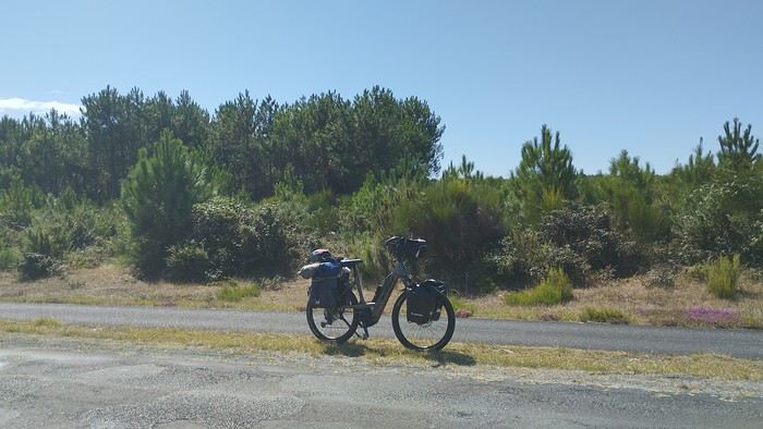 My gear
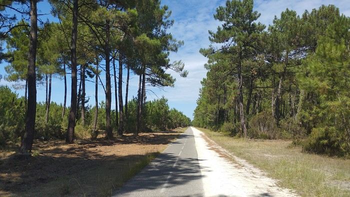
The Landes region—nothing extraordinary, but the calm and serenity are nice.

Le Verdon
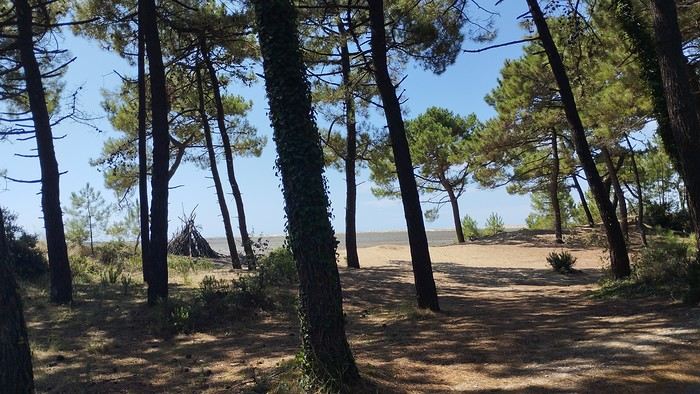
The wild coast
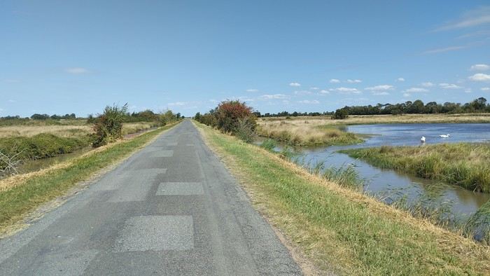
This marsh isn’t dry, though.
Today is the third day of my trip, and I’m writing to you from a campsite in Marans. I’ve set out to bike from Carcans Maubuisson back to Plaisir. Why Carcans? Because we spent a week there as a family—a great week that lets everyone reconnect for a long stretch. Also, on Saturday, we all headed home—some by car, and me by bike. This journey is about 850 km via bike paths and small cycling roads. It’s not a sporting feat, just a nice long ride for fun. As the old Chinese sage says, "The destination doesn’t matter—it’s the journey that counts." But he also told me, "Traveling is great, but what’s the point if you don’t share it?" You see, this old sage has told me a lot of things—he often keeps me company when I’m biking. Of course, he doesn’t pedal, but we travel in harmony. Sure, he can be a bit annoying sometimes, but we still get along. All this to say I’ve created a group to share my story. I’d be happy to share this experience with you—it’s an adventure for me. On Saturday, I wasn’t sure I’d even leave because I’d been dealing with sciatica for days. Luckily, Juliette, a friend of the old Chinese sage, recommended a lifesaving remedy: Alternately stretching your legs with an elastic band under your foot. Obviously, a jam jar rubber band won’t cut it.
From Marans - The mosquitoes are attacking; time to head back to shelter.
The first two legs took me to Royan and then Rochefort. The Sèvre Niortaise flows nearby, and I followed a canal from La Rochelle. You could say the area is as dry as the marsh, judging by the state of the crops.
As I mentioned, it’s the third day, and if Jesus rose again on this day, for me it was more like the crucifixion. The scorching heat—only bearable when you’re moving—combined with rough trail conditions, and the old Chinese sage says, "Terrible roads, slow speed, and watch your limbs." I set out to do 60 km but ended up doing 80, and the last 20 were tough. I kept checking the GPS to see how much farther until the campsite. Today: Rochefort to Marans, sticking to the coast until La Rochelle, then no notable towns after that—just a constant canal. But since the sky isn’t too low, it hasn’t gotten lost. I’ve still got plenty of anecdotes to share, but it’s pitch black out, and the mosquitoes are still around. This morning, I counted ten in my tent, all full of my blood. Yesterday, at the end of the leg to Rochefort, I was really looking forward to crossing the Charente using the transporter bridge, but a sneaky GPS conspiracy led me far from it. I ended up crossing the Charente on a completely ordinary bridge, watching the transporter bridge in the distance with disappointment.
End of the first episode. Until tomorrow, if you’d like!
No journal for the first two days. Day 1 - CARCANS-ROYAN Day 2 - ROYAN - ROCHEFORT Tonight I'm in MARANS in the "dry marsh" according to the campsite manager—it’s the first time I’ve heard of a "dry marsh"?!
Photos from the first two days
My gearThe Landes region—nothing extraordinary, but the calm and serenity are nice.
Le Verdon
The wild coast
This marsh isn’t dry, though.
Today is the third day of my trip, and I’m writing to you from a campsite in Marans. I’ve set out to bike from Carcans Maubuisson back to Plaisir. Why Carcans? Because we spent a week there as a family—a great week that lets everyone reconnect for a long stretch. Also, on Saturday, we all headed home—some by car, and me by bike. This journey is about 850 km via bike paths and small cycling roads. It’s not a sporting feat, just a nice long ride for fun. As the old Chinese sage says, "The destination doesn’t matter—it’s the journey that counts." But he also told me, "Traveling is great, but what’s the point if you don’t share it?" You see, this old sage has told me a lot of things—he often keeps me company when I’m biking. Of course, he doesn’t pedal, but we travel in harmony. Sure, he can be a bit annoying sometimes, but we still get along. All this to say I’ve created a group to share my story. I’d be happy to share this experience with you—it’s an adventure for me. On Saturday, I wasn’t sure I’d even leave because I’d been dealing with sciatica for days. Luckily, Juliette, a friend of the old Chinese sage, recommended a lifesaving remedy: Alternately stretching your legs with an elastic band under your foot. Obviously, a jam jar rubber band won’t cut it.
From Marans - The mosquitoes are attacking; time to head back to shelter.
The first two legs took me to Royan and then Rochefort. The Sèvre Niortaise flows nearby, and I followed a canal from La Rochelle. You could say the area is as dry as the marsh, judging by the state of the crops.
As I mentioned, it’s the third day, and if Jesus rose again on this day, for me it was more like the crucifixion. The scorching heat—only bearable when you’re moving—combined with rough trail conditions, and the old Chinese sage says, "Terrible roads, slow speed, and watch your limbs." I set out to do 60 km but ended up doing 80, and the last 20 were tough. I kept checking the GPS to see how much farther until the campsite. Today: Rochefort to Marans, sticking to the coast until La Rochelle, then no notable towns after that—just a constant canal. But since the sky isn’t too low, it hasn’t gotten lost. I’ve still got plenty of anecdotes to share, but it’s pitch black out, and the mosquitoes are still around. This morning, I counted ten in my tent, all full of my blood. Yesterday, at the end of the leg to Rochefort, I was really looking forward to crossing the Charente using the transporter bridge, but a sneaky GPS conspiracy led me far from it. I ended up crossing the Charente on a completely ordinary bridge, watching the transporter bridge in the distance with disappointment.
End of the first episode. Until tomorrow, if you’d like!
Hi everyone, we're back from a DIY USA road trip we organized from July 31, 2026, to August 26, 2026.
The destination: The Southwest USA, including Texas, Arizona, and New Mexico. Roughly 7,000 kilometers covered.
The car: A Chevrolet Equinox for two, rented through BSP Auto and Avis. Inside, we had 2 suitcases, a travel bag, two carry-on bags, a Walmart cooler, photo gear, and water bottles (a 40-pack).
The route: Dallas DFW, Fort Worth, Houston, Austin, San Antonio, Alpine, El Paso, Tucson, Sedona, Albuquerque, Amarillo, and back to Dallas to finish with a departure from DFW.
The travelers: Two seniors well advanced in years (73 and 75) but still active (nothing too physically demanding—to stay alive and fund our trips), fully independent physically, though a bit less so mentally. Big USA fans, a country where anything is possible. More walkers than hikers, preferring 3-star hotels over roadside motels, Italian restaurants over US food, frequent stops for photos, museums over nothing, naps over forced marches. Not too whiny, just enough to stay French in the land of the "great Satan," as they say. Not great with languages—street English (but handy), and my Spanish is non-existent except for: "Hola! Una cerveza por favor!" That’s about it. My wife understands everything but refuses to speak.
The cost of the road trip: Around 12,000 €, including AF flights, the car, gas, gifts, visits, and everything else. Well managed, since we’d budgeted 13,500 € initially.
The positive side: A delight, with those endless open roads. Museums to discover. The realization of the Hispanic presence and its important history in this part of America. Lovely locals. Tourists who were more or less friendly. A terrible Texan accent that was hard to understand. Gas stations that were like real stores, with prepared food, alcohol sold in Arizona and New Mexico, and employees who were always up for a laugh!
The negative side: The heat throughout the trip... 43°C in Dallas at the end. Impossible to walk the streets. Lots of homeless people in downtown Dallas. Hotel breakfasts that were always the same. You get used to it.
So, it was positive overall, but the concept is starting to wear us out. We might rethink the DIY road trip model for next time. If the man upstairs grants us more time.
Next up, we’ll wait for the first batch of sorted photos to go through the wringer.
See you soon.
The destination: The Southwest USA, including Texas, Arizona, and New Mexico. Roughly 7,000 kilometers covered.
The car: A Chevrolet Equinox for two, rented through BSP Auto and Avis. Inside, we had 2 suitcases, a travel bag, two carry-on bags, a Walmart cooler, photo gear, and water bottles (a 40-pack).
The route: Dallas DFW, Fort Worth, Houston, Austin, San Antonio, Alpine, El Paso, Tucson, Sedona, Albuquerque, Amarillo, and back to Dallas to finish with a departure from DFW.
The travelers: Two seniors well advanced in years (73 and 75) but still active (nothing too physically demanding—to stay alive and fund our trips), fully independent physically, though a bit less so mentally. Big USA fans, a country where anything is possible. More walkers than hikers, preferring 3-star hotels over roadside motels, Italian restaurants over US food, frequent stops for photos, museums over nothing, naps over forced marches. Not too whiny, just enough to stay French in the land of the "great Satan," as they say. Not great with languages—street English (but handy), and my Spanish is non-existent except for: "Hola! Una cerveza por favor!" That’s about it. My wife understands everything but refuses to speak.
The cost of the road trip: Around 12,000 €, including AF flights, the car, gas, gifts, visits, and everything else. Well managed, since we’d budgeted 13,500 € initially.
The positive side: A delight, with those endless open roads. Museums to discover. The realization of the Hispanic presence and its important history in this part of America. Lovely locals. Tourists who were more or less friendly. A terrible Texan accent that was hard to understand. Gas stations that were like real stores, with prepared food, alcohol sold in Arizona and New Mexico, and employees who were always up for a laugh!
The negative side: The heat throughout the trip... 43°C in Dallas at the end. Impossible to walk the streets. Lots of homeless people in downtown Dallas. Hotel breakfasts that were always the same. You get used to it.
So, it was positive overall, but the concept is starting to wear us out. We might rethink the DIY road trip model for next time. If the man upstairs grants us more time.
Next up, we’ll wait for the first batch of sorted photos to go through the wringer.
See you soon.
HIGHWAY 1
Highway 1 runs along the Pacific coast of California from Leggett in the north to Dana Point in the south. It's the longest state route in California, stretching 1,050 km.
It's famous for its breathtaking ocean views. That’s actually why it’s become such a popular route for road trips, with tons of attractions and points of interest all along the way.
After crossing the U.S. interior on our way out (see Road Trip USA 2023 - Part 1), we’re starting our return trip along this route from Leggett.
Videos are embedded throughout the summary. Please click on the image to start the video. To jump to a specific post, here are the appropriate links:
CALIFORNIA:
Scenic Overlooks on Route 1 Between Leggett and Fort Bragg The Pudding Creek Trestle Bridge in Fort Bragg Glass Beach - Fort Bragg Jenner Lookout Point - Highway 1 Goat Rock Beach - Sonoma Coast State Park - Jenner Point Reyes National Seashore - White House Pool Trail Point Reyes National Seashore - Limantour Beach Point Reyes National Seashore - Point Reyes Shipwreck Point Reyes National Seashore - Kehoe Beach Trail Point Reyes National Seashore - McClures Beach Trail Point Reyes National Seashore - Cypress Tree Tunnel Point Reyes National Seashore - Point Reyes Beach North Point Reyes National Seashore - Elephant Seals on Drakes Beach Point Reyes National Seashore - Point Reyes Beach South Point Reyes National Seashore – Elephant Seals Overlooks Point Reyes National Seashore - Chimney Rock Trail Point Reyes National Seashore - Point Reyes Lighthouse Trail Point Reyes National Seashore – Tule Elk Observation Point Bonita Lighthouse Trail - Sausalito Hawk Hill - Sausalito Battery Spencer Trail - Sausalito Rodeo Beach - Sausalito Point Cavallo - Golden Gate View - Sausalito Exploring Downtown Sausalito Visiting Sausalito’s Houseboats Crossing the Golden Gate Bridge - San Francisco Golden Gate Bridge Viewpoints - San Francisco Cruise to Alcatraz Island - San Francisco Visiting Alcatraz Island - San Francisco Civic Center - Downtown San Francisco Market Street & Yerba Buena Gardens - Downtown San Francisco Union Square & Financial District - Downtown San Francisco Fisherman's Wharf, Pier 39 & Embarcadero - San Francisco Sea Lion Observation - Pier 39 - San Francisco Lombard Street & Cable Car - Russian Hill - San Francisco Macondray Lane Historic District - Russian Hill - San Francisco Grace Cathedral & Huntington Park - Nob Hill - San Francisco Telegraph Hill - San Francisco Chinatown - San Francisco Alamo Square & Painted Ladies - Western Addition - San Francisco Palace of Fine Arts - Marina District - San Francisco Presidio of San Francisco California Coastal Trail - Lincoln Park - San Francisco California Palace of the Legion of Honor - Lincoln Park - San Francisco Sutro Baths - Lincoln Park - San Francisco Queen Wilhelmina Garden - Golden Gate Park - San Francisco Bison Paddock - Golden Gate Park - San Francisco Portals of the Past - Golden Gate Park - San Francisco Strawberry Hill - Golden Gate Park – San Francisco Prayerbook Cross & Robin Williams Meadow - Golden Gate Park - San Francisco Hidden Garden Steps & 16th Avenue Tiled Steps - San Francisco Grandview Park - San Francisco Hike - Twin Peaks Three Summits - San Francisco Longboarding Down Twin Peaks Blvd in San Francisco Haight-Ashbury - San Francisco Corona Heights Park - San Francisco Mission Dolores - San Francisco Mural Frescoes (Part 1) - Mission District - San Francisco Mural Frescoes (Part 2) - Mission District - San Francisco Devil's Slide Bunker - Pacifica Mavericks Beach - Half Moon Bay Martins Beach - Half Moon Bay Pigeon Point Lighthouse State Historic Park - Pescadero What to See in Santa Cruz Visiting Capitola What to See in Monterey Carmel-by-the-Sea Lovers Point Park - Pacific Grove Castle Rock, Hurricane Point & Little Sur River Viewpoints Pfeiffer Falls Trail Julia Pfeiffer Burns State Park Vista Point & McWay Falls Highway 1 - Big Sur Viewpoints Salmon Creek Falls San Carpoforo Creek Trail Elephant Seal Vista Point - San Simeon San Simeon Pier Moonstone Beach Boardwalk Shipwreck - Estero Bluffs State Park Surfing Competition in Morro Bay Port San Luis Pier - San Luis Obispo Pismo Beach Monarch Butterfly Grove - Pismo State Beach Nojoqui Falls Park - Solvang Arroyo Hondo Vista Point Solvang, a Charming Danish Town in California Chumash Painted Cave - Santa Barbara Goleta San Marcos Rd & Cachuma Lake Vista Points - Santa Barbara Old Santa Barbara Mission Walking Tour of Santa Barbara’s Historic Downtown West Beach - Santa Barbara What to See in Ventura Paradise Falls - Wildwood Regional Park - Thousand Oaks Sandy Dune & El Matador State Beach - Malibu Point Dume Nature Reserve - Malibu Malibu Pier Road Trip in the Malibu Mountains Los Liones Trail - Santa Monica Santa Monica Pier Rodeo Drive - Beverly Hills Greystone Mansion - Beverly Hills Hollywood Walk of Fame - Los Angeles Griffith Observatory - Los Angeles Hollywood Forever Cemetery - Los Angeles What to See in Venice Beach Venice Beach Skatepark ShoreLine Aquatic Park - Long Beach Alamitos Beach - Long Beach Naples Island - Long Beach Crescent Bay Point Park & Helser Park Kiosk - Laguna Beach Shell Beach at Twin Points - Laguna Beach Prairie Dogs at Agra Vista Point Top Gun House & Oceanside Pier Annie's Canyon Trail - Solana Beach (Via North Rios Trailhead Loop) Old Town San Diego La Jolla Coastal Trail - San Diego Balboa Park - San Diego Pacific Beach - San Diego Mission Beach - San Diego Ocean Beach Tide Pools - San Diego Sunset Cliffs Natural Park - San Diego Tuna Harbor Park - San Diego Seaport Village & Embarcadero Marina Park - San Diego Gaslamp Quarter - Downtown San Diego Coronado Island - San Diego Dead Dolly Lane - Alpine Galleta Meadows Metal Sculptures - Borrego Springs What to See in Palm Springs Robolights - Palm Springs Andreas Canyon Trail - Indian Canyons - Palm Springs Palm Canyon Trail - Indian Canyons - Palm Springs West Fork Falls Trail - Indian Canyons - Palm Springs Tahquitz Canyon Loop Trail - Indian Canyons - Palm Springs Desert Christ Park - Yucca Valley Pioneertown Salvation Mountain - Niland Slab City - Niland
Highway 1 runs along the Pacific coast of California from Leggett in the north to Dana Point in the south. It's the longest state route in California, stretching 1,050 km.
It's famous for its breathtaking ocean views. That’s actually why it’s become such a popular route for road trips, with tons of attractions and points of interest all along the way.
After crossing the U.S. interior on our way out (see Road Trip USA 2023 - Part 1), we’re starting our return trip along this route from Leggett.
Videos are embedded throughout the summary. Please click on the image to start the video. To jump to a specific post, here are the appropriate links:
CALIFORNIA:
Scenic Overlooks on Route 1 Between Leggett and Fort Bragg The Pudding Creek Trestle Bridge in Fort Bragg Glass Beach - Fort Bragg Jenner Lookout Point - Highway 1 Goat Rock Beach - Sonoma Coast State Park - Jenner Point Reyes National Seashore - White House Pool Trail Point Reyes National Seashore - Limantour Beach Point Reyes National Seashore - Point Reyes Shipwreck Point Reyes National Seashore - Kehoe Beach Trail Point Reyes National Seashore - McClures Beach Trail Point Reyes National Seashore - Cypress Tree Tunnel Point Reyes National Seashore - Point Reyes Beach North Point Reyes National Seashore - Elephant Seals on Drakes Beach Point Reyes National Seashore - Point Reyes Beach South Point Reyes National Seashore – Elephant Seals Overlooks Point Reyes National Seashore - Chimney Rock Trail Point Reyes National Seashore - Point Reyes Lighthouse Trail Point Reyes National Seashore – Tule Elk Observation Point Bonita Lighthouse Trail - Sausalito Hawk Hill - Sausalito Battery Spencer Trail - Sausalito Rodeo Beach - Sausalito Point Cavallo - Golden Gate View - Sausalito Exploring Downtown Sausalito Visiting Sausalito’s Houseboats Crossing the Golden Gate Bridge - San Francisco Golden Gate Bridge Viewpoints - San Francisco Cruise to Alcatraz Island - San Francisco Visiting Alcatraz Island - San Francisco Civic Center - Downtown San Francisco Market Street & Yerba Buena Gardens - Downtown San Francisco Union Square & Financial District - Downtown San Francisco Fisherman's Wharf, Pier 39 & Embarcadero - San Francisco Sea Lion Observation - Pier 39 - San Francisco Lombard Street & Cable Car - Russian Hill - San Francisco Macondray Lane Historic District - Russian Hill - San Francisco Grace Cathedral & Huntington Park - Nob Hill - San Francisco Telegraph Hill - San Francisco Chinatown - San Francisco Alamo Square & Painted Ladies - Western Addition - San Francisco Palace of Fine Arts - Marina District - San Francisco Presidio of San Francisco California Coastal Trail - Lincoln Park - San Francisco California Palace of the Legion of Honor - Lincoln Park - San Francisco Sutro Baths - Lincoln Park - San Francisco Queen Wilhelmina Garden - Golden Gate Park - San Francisco Bison Paddock - Golden Gate Park - San Francisco Portals of the Past - Golden Gate Park - San Francisco Strawberry Hill - Golden Gate Park – San Francisco Prayerbook Cross & Robin Williams Meadow - Golden Gate Park - San Francisco Hidden Garden Steps & 16th Avenue Tiled Steps - San Francisco Grandview Park - San Francisco Hike - Twin Peaks Three Summits - San Francisco Longboarding Down Twin Peaks Blvd in San Francisco Haight-Ashbury - San Francisco Corona Heights Park - San Francisco Mission Dolores - San Francisco Mural Frescoes (Part 1) - Mission District - San Francisco Mural Frescoes (Part 2) - Mission District - San Francisco Devil's Slide Bunker - Pacifica Mavericks Beach - Half Moon Bay Martins Beach - Half Moon Bay Pigeon Point Lighthouse State Historic Park - Pescadero What to See in Santa Cruz Visiting Capitola What to See in Monterey Carmel-by-the-Sea Lovers Point Park - Pacific Grove Castle Rock, Hurricane Point & Little Sur River Viewpoints Pfeiffer Falls Trail Julia Pfeiffer Burns State Park Vista Point & McWay Falls Highway 1 - Big Sur Viewpoints Salmon Creek Falls San Carpoforo Creek Trail Elephant Seal Vista Point - San Simeon San Simeon Pier Moonstone Beach Boardwalk Shipwreck - Estero Bluffs State Park Surfing Competition in Morro Bay Port San Luis Pier - San Luis Obispo Pismo Beach Monarch Butterfly Grove - Pismo State Beach Nojoqui Falls Park - Solvang Arroyo Hondo Vista Point Solvang, a Charming Danish Town in California Chumash Painted Cave - Santa Barbara Goleta San Marcos Rd & Cachuma Lake Vista Points - Santa Barbara Old Santa Barbara Mission Walking Tour of Santa Barbara’s Historic Downtown West Beach - Santa Barbara What to See in Ventura Paradise Falls - Wildwood Regional Park - Thousand Oaks Sandy Dune & El Matador State Beach - Malibu Point Dume Nature Reserve - Malibu Malibu Pier Road Trip in the Malibu Mountains Los Liones Trail - Santa Monica Santa Monica Pier Rodeo Drive - Beverly Hills Greystone Mansion - Beverly Hills Hollywood Walk of Fame - Los Angeles Griffith Observatory - Los Angeles Hollywood Forever Cemetery - Los Angeles What to See in Venice Beach Venice Beach Skatepark ShoreLine Aquatic Park - Long Beach Alamitos Beach - Long Beach Naples Island - Long Beach Crescent Bay Point Park & Helser Park Kiosk - Laguna Beach Shell Beach at Twin Points - Laguna Beach Prairie Dogs at Agra Vista Point Top Gun House & Oceanside Pier Annie's Canyon Trail - Solana Beach (Via North Rios Trailhead Loop) Old Town San Diego La Jolla Coastal Trail - San Diego Balboa Park - San Diego Pacific Beach - San Diego Mission Beach - San Diego Ocean Beach Tide Pools - San Diego Sunset Cliffs Natural Park - San Diego Tuna Harbor Park - San Diego Seaport Village & Embarcadero Marina Park - San Diego Gaslamp Quarter - Downtown San Diego Coronado Island - San Diego Dead Dolly Lane - Alpine Galleta Meadows Metal Sculptures - Borrego Springs What to See in Palm Springs Robolights - Palm Springs Andreas Canyon Trail - Indian Canyons - Palm Springs Palm Canyon Trail - Indian Canyons - Palm Springs West Fork Falls Trail - Indian Canyons - Palm Springs Tahquitz Canyon Loop Trail - Indian Canyons - Palm Springs Desert Christ Park - Yucca Valley Pioneertown Salvation Mountain - Niland Slab City - Niland
Well, here we go,
despite the lack of info on Zambia, I managed to pull off this pretty special trip.
I’d posted asking for tips but got very few replies. So I leaned heavily on Giradhino’s travel journal to plan the route.
The context: After visiting Kenya, then Namibia, then Botswana, I wanted to see another Southern African country—hence Zambia. This time, we’re two couples: us (of course) and our friends we’ve traveled with to the last two countries mentioned. The idea was to do a self-drive trip, picking up a 4x4 at the airport and figuring it out as we went.
We rented our fully equipped vehicle from Hemingways, an agency in Livingstone. Great agency (really), I’ll talk more about them later. It came with rooftop tents and all the gear for cooking and everything... However, our goal was to sleep in lodges and only use the tents as a last resort. Mission accomplished—we never even unfolded the tents. Guess we’re getting old 🙂
The route (summary): Lusaka - Kasanka NP - Bangweulu NP - Mutinondo - Kapishya - North Luangwa - South Luangwa and back to Lusaka.
That said, let’s hit the road for this travel journal of a pretty lively trip. Reminder: I’m more of a filmmaker, so I’ve got tons of footage but very few photos. The ones I have were taken on my phone, so they’re not great quality. My wife’s the one who handles that side of things.
Day 1:
At 9 a.m. sharp (or close enough), we leave the Lyon area, heading to Paris CDG. Our flight’s at 9:30 p.m., but it’s a busy Saturday with holiday traffic, so we play it safe to avoid jams—especially since the Olympics (hosted in Paris, in case you didn’t know) are causing extra traffic issues.
We’re relaxed and happy to be on our way. The drive goes smoothly. We take the eastern route around Paris to reach a hotel with parking at a better price than the airport lots. We leave the car there, and a shuttle takes us to Terminal 2. Bad luck—we’re actually flying from Terminal 1! The transfer between terminals is quick, though, so no stress.
After the usual formalities (with Rwandair), we end up in the Duty Free.
A rare rant-free moment: Usually, I let off steam in my travel journals now and then, but this time it’s the opposite. I had a terrible memory of CDG and had been avoiding it for years. But this time—Olympics effect? A big change? What a pleasant surprise! The staff were plentiful and super friendly at every pre-flight step, making everything easier. Comfortable seats for waiting to board. Well done, CDG!
We buy Ricard, Jack Daniel’s, and Get 27 to handle any situation that might come up. We board on time, and that’s when our adventures with Rwandair really begin. Yep, the first hiccup!
We’d booked our tickets back in October and (since we don’t hold back!) had paid extra for preferred seats on all our flights. Since October, we’d received emails about schedule changes—just a few minutes here and there. Unfortunately, we never got an email saying that *on top of* the schedule change, the plane’s configuration had also changed. So when we boarded with our seats (all four of us together at row 25), we were furious to see that the preferred seats were now row 23. We’d been *completely* scammed. We’d paid extra to end up in seats we’d been trying to avoid! You could say Rwandair double-dipped on the same seats. What a rip-off! We tried to negotiate an upgrade, but the flight was full. So our flight to Kigali started with a real sense of anger.
The +: We’re on our way The -: Rwandair
The context: After visiting Kenya, then Namibia, then Botswana, I wanted to see another Southern African country—hence Zambia. This time, we’re two couples: us (of course) and our friends we’ve traveled with to the last two countries mentioned. The idea was to do a self-drive trip, picking up a 4x4 at the airport and figuring it out as we went.
We rented our fully equipped vehicle from Hemingways, an agency in Livingstone. Great agency (really), I’ll talk more about them later. It came with rooftop tents and all the gear for cooking and everything... However, our goal was to sleep in lodges and only use the tents as a last resort. Mission accomplished—we never even unfolded the tents. Guess we’re getting old 🙂
The route (summary): Lusaka - Kasanka NP - Bangweulu NP - Mutinondo - Kapishya - North Luangwa - South Luangwa and back to Lusaka.
That said, let’s hit the road for this travel journal of a pretty lively trip. Reminder: I’m more of a filmmaker, so I’ve got tons of footage but very few photos. The ones I have were taken on my phone, so they’re not great quality. My wife’s the one who handles that side of things.
Day 1:
At 9 a.m. sharp (or close enough), we leave the Lyon area, heading to Paris CDG. Our flight’s at 9:30 p.m., but it’s a busy Saturday with holiday traffic, so we play it safe to avoid jams—especially since the Olympics (hosted in Paris, in case you didn’t know) are causing extra traffic issues.
We’re relaxed and happy to be on our way. The drive goes smoothly. We take the eastern route around Paris to reach a hotel with parking at a better price than the airport lots. We leave the car there, and a shuttle takes us to Terminal 2. Bad luck—we’re actually flying from Terminal 1! The transfer between terminals is quick, though, so no stress.
After the usual formalities (with Rwandair), we end up in the Duty Free.
A rare rant-free moment: Usually, I let off steam in my travel journals now and then, but this time it’s the opposite. I had a terrible memory of CDG and had been avoiding it for years. But this time—Olympics effect? A big change? What a pleasant surprise! The staff were plentiful and super friendly at every pre-flight step, making everything easier. Comfortable seats for waiting to board. Well done, CDG!
We buy Ricard, Jack Daniel’s, and Get 27 to handle any situation that might come up. We board on time, and that’s when our adventures with Rwandair really begin. Yep, the first hiccup!
We’d booked our tickets back in October and (since we don’t hold back!) had paid extra for preferred seats on all our flights. Since October, we’d received emails about schedule changes—just a few minutes here and there. Unfortunately, we never got an email saying that *on top of* the schedule change, the plane’s configuration had also changed. So when we boarded with our seats (all four of us together at row 25), we were furious to see that the preferred seats were now row 23. We’d been *completely* scammed. We’d paid extra to end up in seats we’d been trying to avoid! You could say Rwandair double-dipped on the same seats. What a rip-off! We tried to negotiate an upgrade, but the flight was full. So our flight to Kigali started with a real sense of anger.
The +: We’re on our way The -: Rwandair
Hi everyone,
We (two adults, 74 and 70 years old) had already shared a travel journal about our first trip to the Philippines in February/March 2019 on this forum (https://voyageforum.com/v.f?post=9377175;search_string=carnet%20philippines). We had visited Manila, the Banaue rice terraces, Sagada, the Visayas (Bohol, Siquijor, Dumaguette), and on our way back to Luzon, the Taal volcano before returning to France. Delighted by this trip, organized by the French-speaking agency Alizé, we decided to further explore this beautiful country, this time focusing on Coron and Palawan.
Before writing this journal, I should mention that these are personal comments and don’t reflect any differing opinions. Without any literary or photographic talent, I’ll stick to the facts and share a few details about the visits, hotels, and restaurants.
Preparations
We decided to return in mid-January 2025 and consulted three French-speaking tour operators to create a trip based on our wishes (places to visit, type of accommodation) and budget. Comparing three operators helped us weigh their advice and make our choices. Only our first operator respected the budget, a second came close, and the third proposed a slightly more upscale trip. In the end, we chose the agency from our first trip. Our discussions helped refine our itinerary, and when we reviewed it point by point, the document provided was perfect, full of great tips. The most debated point was a 3-day, 2-night cruise between Coron and Palawan. We were tempted but worried about being the only "older" travelers among younger people and feared two uncomfortable nights. Reassured by our tour operator, we finally opted for this "exploration." We’ll come back to that later. Once the choice was made and dates set, we booked our international flights with Cathay Pacific for 750 € per person, which offers the best schedules (short layovers) at an acceptable price for flights arriving in Cebu. Our trip started on February 25 and returned to Paris on March 15.
International flights
The round-trip flights went smoothly. Cathay does the job well, without frills. The service quality seems to have slightly declined compared to our previous trips with them. Hong Kong Airport is huge but very practical. Note that not all airlines serve Cebu. Recommendation: Fill out your Philippine entry form within 72 hours before your flight. This can prevent issues with the airline (possible boarding refusal) and saves a lot of time upon arrival (see the Philippine embassy website).
Domestic flights
For our two domestic flights—Cebu to Coron and Puerto Princesa to Cebu—our tour operator chose Philippine Airlines and their propeller planes. No problems there.
Day 1: We landed around 12 PM (local time) after 17 hours of travel. A driver was waiting for us at the airport exit and took us to our hotel, intentionally chosen near the airport (Mandaue, about 10 minutes away) to help us recover and get a good night’s sleep before our early morning domestic flight the next day. The Mayoo Hotel, reasonably priced, was perfect for this. Large, beautiful room in a new building—clean, comfortable, with a spa. We could relax by the pool on the 16th floor and enjoy the city view. The breakfast was exceptional, and the staff was smiling, attentive, and helpful. An ATM in the lobby allowed for withdrawals. However, the hotel is in a neighborhood with nothing to see or do. We dined at the Korean restaurant K-GOGI across from the hotel—a real attraction and a great discovery.
Day 2: After a restful night, we were driven to the airport around 6:30 AM for an 8:10 AM flight from Cebu to Busuanga (Coron).
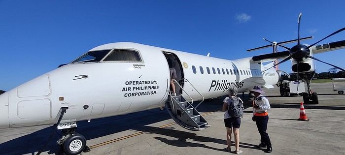
The flight was uneventful. Upon arrival, we paid 200 pesos per person for the Coron tourist fee before a 40-minute transfer to our hotel: Natura Resort, located outside the city in a secluded spot. The setting is stunning—a beautifully maintained tropical garden, a pleasant pool, and the option to book massages. The cottages are tropical-style with thatched roofs, simple and unpretentious.
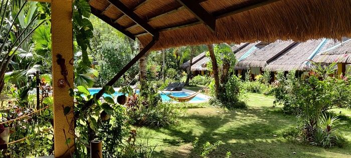
The owner, who speaks French, told us that given the heat and our ages, climbing the 721 steps to the top of Mount Tapyas wasn’t necessary. She gave us a few rooftop recommendations to watch the sunset over Coron Bay. After a good swim in the pool and a meal at the resort’s pleasant restaurant, we hired a tricycle to go into town. We were told it costs 150 pesos one way, and depending on the return time, it could exceed 250 pesos. But our driver gave us his WhatsApp number and charged the same price regardless of the time. He just earned two days’ worth of customers. He dropped us off at the port where bangkas (local boats) gather for day trips. It was the end of the day, so there was a rush. A few shops around the port sold waterproof bags for marine excursions at reasonable prices (compared to back home), after some bargaining. We wandered the town’s alleys looking for the Top Hotel, whose rooftop is famous. Indeed, it’s perfectly located to admire the sunset and enjoy a refreshing drink.
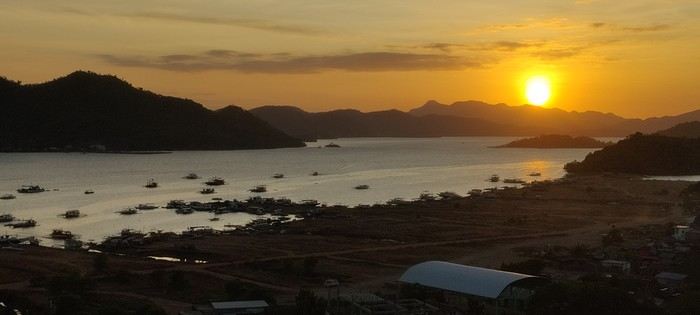
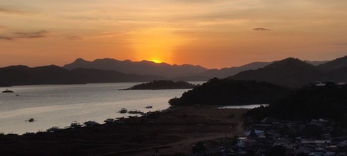
We dined nearby at a small Chinese restaurant, then just had to call our driver to head back. The night wasn’t entirely restful—our hotel had a soundtrack of all the countryside animals, and it seemed they had no set bedtime! :
Preparations
We decided to return in mid-January 2025 and consulted three French-speaking tour operators to create a trip based on our wishes (places to visit, type of accommodation) and budget. Comparing three operators helped us weigh their advice and make our choices. Only our first operator respected the budget, a second came close, and the third proposed a slightly more upscale trip. In the end, we chose the agency from our first trip. Our discussions helped refine our itinerary, and when we reviewed it point by point, the document provided was perfect, full of great tips. The most debated point was a 3-day, 2-night cruise between Coron and Palawan. We were tempted but worried about being the only "older" travelers among younger people and feared two uncomfortable nights. Reassured by our tour operator, we finally opted for this "exploration." We’ll come back to that later. Once the choice was made and dates set, we booked our international flights with Cathay Pacific for 750 € per person, which offers the best schedules (short layovers) at an acceptable price for flights arriving in Cebu. Our trip started on February 25 and returned to Paris on March 15.
International flights
The round-trip flights went smoothly. Cathay does the job well, without frills. The service quality seems to have slightly declined compared to our previous trips with them. Hong Kong Airport is huge but very practical. Note that not all airlines serve Cebu. Recommendation: Fill out your Philippine entry form within 72 hours before your flight. This can prevent issues with the airline (possible boarding refusal) and saves a lot of time upon arrival (see the Philippine embassy website).
Domestic flights
For our two domestic flights—Cebu to Coron and Puerto Princesa to Cebu—our tour operator chose Philippine Airlines and their propeller planes. No problems there.
Day 1: We landed around 12 PM (local time) after 17 hours of travel. A driver was waiting for us at the airport exit and took us to our hotel, intentionally chosen near the airport (Mandaue, about 10 minutes away) to help us recover and get a good night’s sleep before our early morning domestic flight the next day. The Mayoo Hotel, reasonably priced, was perfect for this. Large, beautiful room in a new building—clean, comfortable, with a spa. We could relax by the pool on the 16th floor and enjoy the city view. The breakfast was exceptional, and the staff was smiling, attentive, and helpful. An ATM in the lobby allowed for withdrawals. However, the hotel is in a neighborhood with nothing to see or do. We dined at the Korean restaurant K-GOGI across from the hotel—a real attraction and a great discovery.
Day 2: After a restful night, we were driven to the airport around 6:30 AM for an 8:10 AM flight from Cebu to Busuanga (Coron).
The flight was uneventful. Upon arrival, we paid 200 pesos per person for the Coron tourist fee before a 40-minute transfer to our hotel: Natura Resort, located outside the city in a secluded spot. The setting is stunning—a beautifully maintained tropical garden, a pleasant pool, and the option to book massages. The cottages are tropical-style with thatched roofs, simple and unpretentious.
The owner, who speaks French, told us that given the heat and our ages, climbing the 721 steps to the top of Mount Tapyas wasn’t necessary. She gave us a few rooftop recommendations to watch the sunset over Coron Bay. After a good swim in the pool and a meal at the resort’s pleasant restaurant, we hired a tricycle to go into town. We were told it costs 150 pesos one way, and depending on the return time, it could exceed 250 pesos. But our driver gave us his WhatsApp number and charged the same price regardless of the time. He just earned two days’ worth of customers. He dropped us off at the port where bangkas (local boats) gather for day trips. It was the end of the day, so there was a rush. A few shops around the port sold waterproof bags for marine excursions at reasonable prices (compared to back home), after some bargaining. We wandered the town’s alleys looking for the Top Hotel, whose rooftop is famous. Indeed, it’s perfectly located to admire the sunset and enjoy a refreshing drink.
We dined nearby at a small Chinese restaurant, then just had to call our driver to head back. The night wasn’t entirely restful—our hotel had a soundtrack of all the countryside animals, and it seemed they had no set bedtime! :
Hello everyone! 🙂
So many silent months, and now Voyage Forum is accessible again. That’s cool because we can pick up our discussions for our mutual enjoyment.
I hope everyone is doing well and that you’ve been able to take some great trips, whether to the USA or elsewhere.
In September 2020, we had planned a round trip to explore Colorado, but unfortunately, a nasty virus messed up our plans, closing borders and keeping us stuck at home. Luckily for us, canceling the car, flights, and accommodations didn’t cost us a thing—everything was refunded.
In 2023, a loop from Las Vegas let us revisit places we’d seen in 2017 and discover new ones, this time spending more time at each stop with some lovely hikes.
In 2024, we finally revisited the 2020 plan, and I’ll start with that.
However, unforeseen circumstances mean I have much less time than before, so I’ll keep my trip reports shorter (ha ha ha—you’ll have less of my prose to endure).
Another change: for those who remember the "Gang of Four crazy sixty-somethings," it was just DD and me this time. Our dear Mimi and Maumau left the Var to focus on raising horses and can’t leave their little green paradise to join us anymore. We were unfortunately much tamer without them.
We traveled from September 11 to October 3.
The itinerary
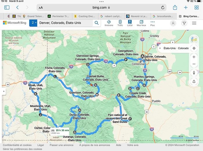
Day 1: Flight Marseille-Paris-Denver, then Manitou Springs (133 km) Day 2: Manitou Springs (49 km) Day 3: Cripple Creek (104 km) Day 4: Salida (254 km) Day 5: Great Sand Dunes (231 km) Day 6: Durango (283 km) Day 7: Durango (Durango-Silverton train) Day 8: Ouray (121 km) Day 9: Ouray (Perimeter Trail hike) Day 10: Cortez (213 km) Day 11: Cortez (Mesa Verde National Park, 134 km) Day 12: Monticello (268 km, detour to Chesler Park) Day 13: Moab (171 km, Delicate Arch) Day 14: Moab (98 km, Fisher Towers) Day 15: Moab (171 km, Canyonlands) Day 16: Fruita (210 km, Colorado National Monument) Day 17: Crested Butte (224 km via Kebler Pass) Day 18: Crested Butte (57 km) Day 19: Glenwood Springs (150 km) Day 20: Glenwood Springs (118 km, Rifle State Park) Day 21: Georgetown (258 km via Independence Pass) Day 22: Denver (123 km), then return flight
We speak very little English. We spent 21 nights there and covered a 3,400 km loop by car and 160 km on foot (we’re still trying to hike while we’re in shape) from Denver in September 2024. We wanted this road trip to help us explore Colorado a bit more—we’d only spent 6 nights there in 2019—and to see it during the fall foliage season. We also wanted to return to Utah (we love Moab) to enjoy its red rocks, which we adore.
In the prices you see (some in euros, others in dollars), I’ve included bank fees and exchange charges. The flights, car, and parking were paid by credit card when we booked in February. Usually, we book around November, but some obligations kept us from doing it earlier. We downloaded the MPC (Mobile Passport Control) app on our phone, which saved us time at immigration.
📊 **Budget: just under 8,500 € for both of us, all included**
📊 **Flights** Marseille-Paris (CDG)-Denver: 2,152 € for both of us, with one checked bag each
📊 **ESTA and America the Beautiful Pass** The ones from our 2023 road trip were still valid
📊 **Parking at Marseille airport: 122 €**
📊 **Car: Nissan Rogue (the French X-Trail) from Hertz: 1,165 €** By booking through Air France (and earning miles), we got a 15% discount. Hertz offers a free Hertz Gold Plus Rewards program, which gives us priority counter service.
📊 **Accommodation: 3,050 €** We stayed in motels and hotels of various ranges (from 100 € to 270 € per night, depending on the city), all booked through Hotels.com or Booking. Booking sometimes offers cheaper rates if you book via the "Booking mobile" app. We also got some preferential rates thanks to our Genius 2 status. Out of 21 nights, only one place didn’t include breakfast.
📊 **Other expenses (activities booked by credit card before leaving)** Durango-Silverton train: 210 € (we booked the enclosed vintage coach in March) Mesa Verde: Balcony House: 15.15 € (booked 14 days before the visit) Timed-entry passes for Arches National Park: 6 € for 3 days (booked June 1 for September entries via http://récreation.gov/). We booked three different days to play with the weather.
📊 **Supplementary insurance with AVA: 204 €** (due to our age 😅 and the high cost of medical consultations in the USA)
📊 **Cash: 1,540 €** We left with 1,000 € exchanged before departure and made two withdrawals (500 $ and 200 $). This cash was used to pay for: - Evening restaurants and tips (between 70 $ and 95 $ for two meals and two drinks) - Two state parks: Dead Horse State Park (20 $) and Rifle State Park (10 $) - The Monarch Pass gondola (24 $) - Midday picnics - Gas (slightly cheaper with cash): 204 $ for 3,400 km - Personal souvenirs and little treats.
Like in our previous road trips, we didn’t rent a GPS. We used the offline GPS app Here We Go, for which we’d downloaded maps of Colorado and Utah from France, as well as a new offline app called Organic Maps as a backup—though we didn’t end up needing it.
❤️❤️❤️ **Highlights (there are so many!)** 📍 The stunning landscapes of Colorado, especially with the fall colors 📍 A step back in time at the old farm in Florissant Fossil Beds National Monument 📍 The prairies of Cripple Creek and the mining remnants of the Vindicator Trail 📍 The cheeky chipmunks in the ghost town of St. Elmo 📍 Great Sand Dunes and its soft sand 📍 The steam train between Durango and Silverton: we’re glad we chose the round-trip because it rained heavily on the way there, but we got to enjoy the scenery on the way back when the sun came out 📍 The unexpected meet-up with Michèle from the group outside a restaurant in Durango 📍 The hot springs in Ouray 📍 Mesa Verde and its still-vibrant past 📍 The red rocks of Moab and Delicate Arch at sunset 📍 The lace-like Fisher Towers and the view from the end of the trail 📍 The gorgeous Route 128 leading to Colorado National Monument—small, easy to visit, and so beautiful 📍 The colors of the fabulous Kebler Pass, Crested Butte, and especially the hike through the golden aspens (Lower and Upper Loop) 📍 The waterfalls at Rifle State Park 📍 The tundra of Independence Pass 📍 The Halloween decorations in Georgetown and Idaho Springs
😞😞 **Flops (there are very few!)** 📍 The viewpoints we missed because they weren’t well-marked or we didn’t see the signs 📍 The closure of some hiking trails (Hanging Lake and parts of Canyonlands) and the Sal Mountain Loop road, which kept us from accessing it 📍😢 The Chesler Park hike we had to cut short due to poor time management—180 km between our stop in Cortez meant we didn’t arrive until 10:30 AM, way too late for a 17 km hike.
Hope this helps! Have a great evening, everyone, and see you soon! 😊
The itinerary
Day 1: Flight Marseille-Paris-Denver, then Manitou Springs (133 km) Day 2: Manitou Springs (49 km) Day 3: Cripple Creek (104 km) Day 4: Salida (254 km) Day 5: Great Sand Dunes (231 km) Day 6: Durango (283 km) Day 7: Durango (Durango-Silverton train) Day 8: Ouray (121 km) Day 9: Ouray (Perimeter Trail hike) Day 10: Cortez (213 km) Day 11: Cortez (Mesa Verde National Park, 134 km) Day 12: Monticello (268 km, detour to Chesler Park) Day 13: Moab (171 km, Delicate Arch) Day 14: Moab (98 km, Fisher Towers) Day 15: Moab (171 km, Canyonlands) Day 16: Fruita (210 km, Colorado National Monument) Day 17: Crested Butte (224 km via Kebler Pass) Day 18: Crested Butte (57 km) Day 19: Glenwood Springs (150 km) Day 20: Glenwood Springs (118 km, Rifle State Park) Day 21: Georgetown (258 km via Independence Pass) Day 22: Denver (123 km), then return flight
We speak very little English. We spent 21 nights there and covered a 3,400 km loop by car and 160 km on foot (we’re still trying to hike while we’re in shape) from Denver in September 2024. We wanted this road trip to help us explore Colorado a bit more—we’d only spent 6 nights there in 2019—and to see it during the fall foliage season. We also wanted to return to Utah (we love Moab) to enjoy its red rocks, which we adore.
In the prices you see (some in euros, others in dollars), I’ve included bank fees and exchange charges. The flights, car, and parking were paid by credit card when we booked in February. Usually, we book around November, but some obligations kept us from doing it earlier. We downloaded the MPC (Mobile Passport Control) app on our phone, which saved us time at immigration.
📊 **Budget: just under 8,500 € for both of us, all included**
📊 **Flights** Marseille-Paris (CDG)-Denver: 2,152 € for both of us, with one checked bag each
📊 **ESTA and America the Beautiful Pass** The ones from our 2023 road trip were still valid
📊 **Parking at Marseille airport: 122 €**
📊 **Car: Nissan Rogue (the French X-Trail) from Hertz: 1,165 €** By booking through Air France (and earning miles), we got a 15% discount. Hertz offers a free Hertz Gold Plus Rewards program, which gives us priority counter service.
📊 **Accommodation: 3,050 €** We stayed in motels and hotels of various ranges (from 100 € to 270 € per night, depending on the city), all booked through Hotels.com or Booking. Booking sometimes offers cheaper rates if you book via the "Booking mobile" app. We also got some preferential rates thanks to our Genius 2 status. Out of 21 nights, only one place didn’t include breakfast.
📊 **Other expenses (activities booked by credit card before leaving)** Durango-Silverton train: 210 € (we booked the enclosed vintage coach in March) Mesa Verde: Balcony House: 15.15 € (booked 14 days before the visit) Timed-entry passes for Arches National Park: 6 € for 3 days (booked June 1 for September entries via http://récreation.gov/). We booked three different days to play with the weather.
📊 **Supplementary insurance with AVA: 204 €** (due to our age 😅 and the high cost of medical consultations in the USA)
📊 **Cash: 1,540 €** We left with 1,000 € exchanged before departure and made two withdrawals (500 $ and 200 $). This cash was used to pay for: - Evening restaurants and tips (between 70 $ and 95 $ for two meals and two drinks) - Two state parks: Dead Horse State Park (20 $) and Rifle State Park (10 $) - The Monarch Pass gondola (24 $) - Midday picnics - Gas (slightly cheaper with cash): 204 $ for 3,400 km - Personal souvenirs and little treats.
Like in our previous road trips, we didn’t rent a GPS. We used the offline GPS app Here We Go, for which we’d downloaded maps of Colorado and Utah from France, as well as a new offline app called Organic Maps as a backup—though we didn’t end up needing it.
❤️❤️❤️ **Highlights (there are so many!)** 📍 The stunning landscapes of Colorado, especially with the fall colors 📍 A step back in time at the old farm in Florissant Fossil Beds National Monument 📍 The prairies of Cripple Creek and the mining remnants of the Vindicator Trail 📍 The cheeky chipmunks in the ghost town of St. Elmo 📍 Great Sand Dunes and its soft sand 📍 The steam train between Durango and Silverton: we’re glad we chose the round-trip because it rained heavily on the way there, but we got to enjoy the scenery on the way back when the sun came out 📍 The unexpected meet-up with Michèle from the group outside a restaurant in Durango 📍 The hot springs in Ouray 📍 Mesa Verde and its still-vibrant past 📍 The red rocks of Moab and Delicate Arch at sunset 📍 The lace-like Fisher Towers and the view from the end of the trail 📍 The gorgeous Route 128 leading to Colorado National Monument—small, easy to visit, and so beautiful 📍 The colors of the fabulous Kebler Pass, Crested Butte, and especially the hike through the golden aspens (Lower and Upper Loop) 📍 The waterfalls at Rifle State Park 📍 The tundra of Independence Pass 📍 The Halloween decorations in Georgetown and Idaho Springs
😞😞 **Flops (there are very few!)** 📍 The viewpoints we missed because they weren’t well-marked or we didn’t see the signs 📍 The closure of some hiking trails (Hanging Lake and parts of Canyonlands) and the Sal Mountain Loop road, which kept us from accessing it 📍😢 The Chesler Park hike we had to cut short due to poor time management—180 km between our stop in Cortez meant we didn’t arrive until 10:30 AM, way too late for a 17 km hike.
Hope this helps! Have a great evening, everyone, and see you soon! 😊
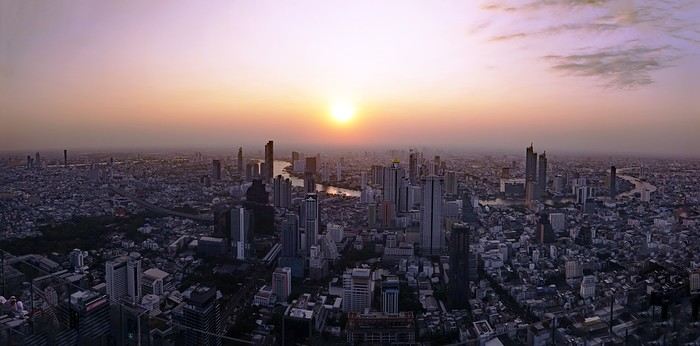
A somewhat lengthy title... I could have simply written: from Bangkok to Chiang Rai, via Chiang Mai, since that was my route. But when poets embellish our travel journals with their verbal flourishes, you’ve got to try not to be too ordinary.
Skyscrapers of excess? You’ll have gathered that from the photo illustrating this journal—though it might change as the trip goes on.
The excess of markets—not so much in their size, though... Chatuchak... But in their sheer number. Day markets, night markets, floating markets, fresh produce markets, fish markets, meat markets, spice markets, fabric markets... and even... amulet markets... For luck, good fortune, protection. Not to mention, sadly, the market for girls—and boys, incidentally. I’ve even heard they’re displayed in windows. I’ve heard about that one, like you have, but I didn’t set foot in it, so I can’t say anything about it. Some even claim there’s a black-market trade in children. Disgusting! It reminded me of the book *The Parcel* by Anosh Irani, which I recommended in another journal. The story is set in India, but I’ve been told it exists in Thailand too. So, the "famous Thai markets" we’re bombarded with in paper and online guides—sure, they amazed me in the first few days, and I don’t regret visiting them. But no matter how big they were, I quickly got my fill since you saw the same things at every stall...
I had a market overdose.
Excess of tourism? I should say *tourists*, since I saw them literally swarming in the streets and those famous markets. I’d forgotten about them. I’d lost the habit, living in an Indian city for so long...
Waterfalls are a bit like markets. At this time of year, they’re not particularly spectacular, but they’re everywhere. There are the ones everyone goes to see. For example, Erawan, which I decided to skip even though it was in my original itinerary—I guessed it’d be a nightmare with the selfie circus. On the other hand, you come across them all over the place, hidden in the mountains and forests, not listed in any guide. Not to mention the ones you can find in temples or even private homes... Yes, really! Thais love waterfalls, so they install them in their gardens—and I even saw one in the middle of the city, right on the street! Sometimes they’re tiny, but very photogenic.
But what do ice cubes have to do with this? Why the excess of ice cubes? Not only are they everywhere by the ton, but they put them in *everything* you drink. You’d think they’d even put them in soup! And it’s not just one or two ice cubes—no! They fill the container to the brim, whatever it is, then pour the liquid on top to fill the gaps. They’ll make you an excellent coffee right in front of you, piping hot, then—bam! An avalanche of ice cubes in the glass. Okay, I’m exaggerating a little. They *do* sometimes ask if you prefer your coffee—or tea—hot. Everything edible, and especially everything drinkable, is refrigerated: vegetables, fruit, hot drinks (I mean, drinks that are *usually* hot), but meat and fish are left out in the open. They just wave a little whisk to shoo away the flies when they get too eager. Mind you, I never put fruit, cheese, eggs, or water in the fridge in France, but I do in India. And I refrigerate meat and fish too... Though sometimes one of those little flies sneaks into the fridge...
You won’t find practical or technical details in this journal, like addresses or prices. Others do that better than me. You also won’t find the names of obscure or unknown places I discovered, or directions to get there.
I don’t really feel like recounting what I saw day by day, following my schedule and route. There might be flashbacks, projections into the future. It’ll depend on my memories, what I felt, what I hated, what comes back to me—and maybe your questions and our exchanges. And for those who’ve never read me before, you’ll have to get used to my parentheses and digressions, maybe on a completely different subject, as my thoughts wander. Stories within stories. There’ll also be long, endless sentences—but still punctuated, so you can follow along. Though I used to curse Proust and his sentences that started on one page and ended on the next, sometimes even further. I’d have to reread them twenty times to follow and understand what he was saying. I hated Proust. But hey, I was 20. Maybe I’d like him now?
See? The digressions are starting already. Forgive me.
You’ll find few photos here. First, the number is limited, and second, photos aren’t the main purpose of either VF or a travel journal. They’re too often used to mask the poverty of the text. And, sorry to say it, but so many of them are just plain ugly! If you really want to see photos, I’ll share some links where you can browse them at your leisure
We stayed in Iceland from August 27 to September 13, 2023. Actually, this was our second trip to the island.
During our first visit, we rented a camper van from Snail Motorhome Rental, a family-run business that provided outstanding service.
Unfortunately, we discovered that this company no longer exists.
So, we rented a camper van through a third party, specifically via the Nordic Travel Group website.
We chose City Car Rental, located near Keflavik Airport, because the rental cost was really appealing.
Apart from the quality of the sleeping bags and the size of the pillows we rented, our experience with this company was very positive.
We noticed a significant increase in tourism since our last trip in 2015.
Several sites have been redeveloped, and parking is now paid in many places.
Accommodations have multiplied, not only near major cities but also in remote areas.
One notable advantage, however, was discovering the wide variety of food products available in supermarkets. In 2015, the selection was very limited.
I invite you to continue reading this travel journal and watch the videos that will let you explore this destination, which has everything to charm outdoor enthusiasts.
Videos are embedded throughout the summary. Click on the image to start the video.
To jump to a specific post, here are the relevant links:
Hlauptungufoss, Midfoss and Bruarfoss Geysir, Blesi and Strokkur Gullfoss Brúarhlöð Canyon Faxafoss Kiðjabergsvöllur – Belvedere Kerið Crater Reykjadalur Valley – Hike to the hot springs Seljalandsfoss Gljúfrabúi Waterfall Seljavallalaug – One of Iceland’s oldest geothermal pools Skógafoss – Fimmvörðuháls hiking trail (partial) Kvernufoss Plane wreck at Solheimasandur Dyrhólaey Peninsula Reynisfjara Beach – Puffins and seals Vík í Mýrdal Fjaðrárgljúfur Canyon Skaftafell National Park – Svartifoss, Magnusarfoss & Hundafoss Svínafellsjökull Glacier Hofskirkja Church Fjallsárlón Glacial Lagoon (West) Fjallsárlón Glacial Lagoon (East) Jökulsárlón Glacial Lagoon Litlanefsfoss and Hengifoss Rjúkandi (Rjúkandafoss) Stuðlagil Canyon Selfoss and Dettifoss Krafla – Viti Crater Lake Krafla – Leirhnjúkur Lava Field Hverir Geothermal Site (Námafjall) Hverir – Hverarönd Geothermal Site – Blue Lagoon Grjótagjá – Hot Spring Cave Stóragjá – Hot Spring Cave Goðafoss Akureyri Zipline Hofsós – Pool by the Skagafjörður Fjord Víðimýrarkirkja Church Hvítserkur Rock – The Troll of Northwest Iceland Gislahellir (Gisli's Cave) Dynjandi (Fjallfoss) – One of Iceland’s most beautiful waterfalls Hellulaug (Natural hot spring pool) Stykkishólmur – Stykkishólmshöfn Port Kirkjufell & Kirkjufellsfoss Ólafsvík – Bugsfoss Lóndrangar Basalt Columns Arnarstapi Ytri-Tunga Farm – Seal watching Deildartunguhver Hot Spring Hraunfossar & Barnafoss Exploring Reykjavik Reykjavik – Whale Safari – Whale watching Raufarholshellir Lava Tunnel Gígvatnsvatn Lake (Green Lake/Graenevatn) Seltún Geothermal Site (Krýsuvík) Kleifarvatn Lake Blue Lagoon Thermal Spa Gunnuhver Geothermal Site Reykjanes Peninsula – Reykjanesviti Lighthouse Reykjanes Peninsula – Valahnúkamöl – Reykjanestá Ægissíðufoss Super Jeep excursion to Landmannalaugar Hiking in Landmannalaugar Scenery along the way
During our first visit, we rented a camper van from Snail Motorhome Rental, a family-run business that provided outstanding service.
Unfortunately, we discovered that this company no longer exists.
So, we rented a camper van through a third party, specifically via the Nordic Travel Group website.
We chose City Car Rental, located near Keflavik Airport, because the rental cost was really appealing.
Apart from the quality of the sleeping bags and the size of the pillows we rented, our experience with this company was very positive.
We noticed a significant increase in tourism since our last trip in 2015.
Several sites have been redeveloped, and parking is now paid in many places.
Accommodations have multiplied, not only near major cities but also in remote areas.
One notable advantage, however, was discovering the wide variety of food products available in supermarkets. In 2015, the selection was very limited.
I invite you to continue reading this travel journal and watch the videos that will let you explore this destination, which has everything to charm outdoor enthusiasts.
Videos are embedded throughout the summary. Click on the image to start the video.
To jump to a specific post, here are the relevant links:
Hlauptungufoss, Midfoss and Bruarfoss Geysir, Blesi and Strokkur Gullfoss Brúarhlöð Canyon Faxafoss Kiðjabergsvöllur – Belvedere Kerið Crater Reykjadalur Valley – Hike to the hot springs Seljalandsfoss Gljúfrabúi Waterfall Seljavallalaug – One of Iceland’s oldest geothermal pools Skógafoss – Fimmvörðuháls hiking trail (partial) Kvernufoss Plane wreck at Solheimasandur Dyrhólaey Peninsula Reynisfjara Beach – Puffins and seals Vík í Mýrdal Fjaðrárgljúfur Canyon Skaftafell National Park – Svartifoss, Magnusarfoss & Hundafoss Svínafellsjökull Glacier Hofskirkja Church Fjallsárlón Glacial Lagoon (West) Fjallsárlón Glacial Lagoon (East) Jökulsárlón Glacial Lagoon Litlanefsfoss and Hengifoss Rjúkandi (Rjúkandafoss) Stuðlagil Canyon Selfoss and Dettifoss Krafla – Viti Crater Lake Krafla – Leirhnjúkur Lava Field Hverir Geothermal Site (Námafjall) Hverir – Hverarönd Geothermal Site – Blue Lagoon Grjótagjá – Hot Spring Cave Stóragjá – Hot Spring Cave Goðafoss Akureyri Zipline Hofsós – Pool by the Skagafjörður Fjord Víðimýrarkirkja Church Hvítserkur Rock – The Troll of Northwest Iceland Gislahellir (Gisli's Cave) Dynjandi (Fjallfoss) – One of Iceland’s most beautiful waterfalls Hellulaug (Natural hot spring pool) Stykkishólmur – Stykkishólmshöfn Port Kirkjufell & Kirkjufellsfoss Ólafsvík – Bugsfoss Lóndrangar Basalt Columns Arnarstapi Ytri-Tunga Farm – Seal watching Deildartunguhver Hot Spring Hraunfossar & Barnafoss Exploring Reykjavik Reykjavik – Whale Safari – Whale watching Raufarholshellir Lava Tunnel Gígvatnsvatn Lake (Green Lake/Graenevatn) Seltún Geothermal Site (Krýsuvík) Kleifarvatn Lake Blue Lagoon Thermal Spa Gunnuhver Geothermal Site Reykjanes Peninsula – Reykjanesviti Lighthouse Reykjanes Peninsula – Valahnúkamöl – Reykjanestá Ægissíðufoss Super Jeep excursion to Landmannalaugar Hiking in Landmannalaugar Scenery along the way
Hello everyone!
We're off! After exploring the north, the four friends have now discovered the south. We’re excited to share this new travel journal, dedicated to our little group and our strong friendship, written by Richard and illustrated with Kate’s photos. I’ll chime in from time to time with practical tips.
First of all, a big thank you to everyone on VoyageForum who helped us plan this trip. It would’ve been quite different if we’d just relied on guidebooks.
The itinerary lasted just over 3 weeks: Mahabalipuram, Pondicherry, Thanjavur, the Chettinad region, Madurai, Munnar, Munroe Island, Cochin, and Chennai. We traveled by train, taxi, and private car with a driver, took a domestic flight, and stayed in guesthouses, Airbnb apartments, and hotels. For each of us, including flights, the total budget barely reached 2000 €, and we didn’t hold back—knowing we avoid resorts and love street food and small Indian restaurants.
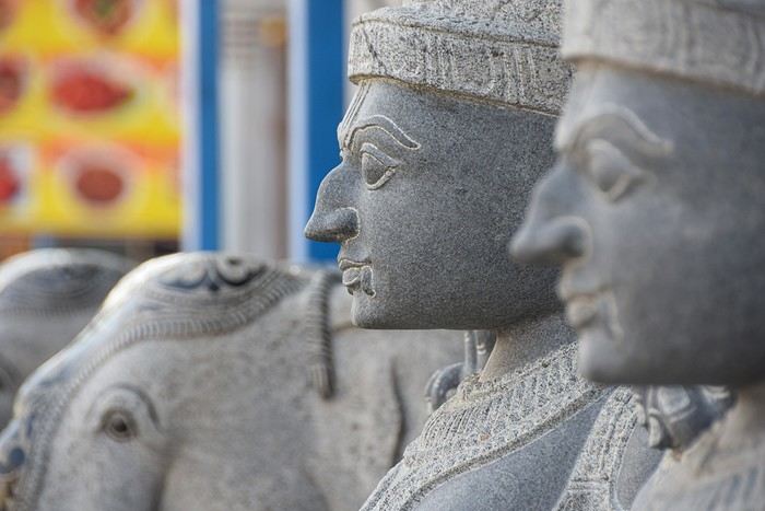
We're off! After exploring the north, the four friends have now discovered the south. We’re excited to share this new travel journal, dedicated to our little group and our strong friendship, written by Richard and illustrated with Kate’s photos. I’ll chime in from time to time with practical tips.
First of all, a big thank you to everyone on VoyageForum who helped us plan this trip. It would’ve been quite different if we’d just relied on guidebooks.
The itinerary lasted just over 3 weeks: Mahabalipuram, Pondicherry, Thanjavur, the Chettinad region, Madurai, Munnar, Munroe Island, Cochin, and Chennai. We traveled by train, taxi, and private car with a driver, took a domestic flight, and stayed in guesthouses, Airbnb apartments, and hotels. For each of us, including flights, the total budget barely reached 2000 €, and we didn’t hold back—knowing we avoid resorts and love street food and small Indian restaurants.
So happy the forum reopened last October!!!
I’ve started reading again (posts, travel journals) and chiming in on a few discussions. Now I’m stepping it up by writing a new travel journal—I’ve already posted a few between 2018 and 2020.
My latest trip was to Italy from August 27 to September 26, 2024. As the title says, it was a wander through Tuscany in parts of the region that aren’t the most visited. No Firenze-Siena-Pisa trilogy, no San Gimignano; there’ll be a quick detour into Siena, but I’ll skip the best-known sights. That choice, plus traveling in September, should help dodge overtourism. It worked out—crowds were light, sometimes very light, the whole way. Here’s the practical rundown: - a long trip outside peak season (ah, retirees!) - solo camping (caravan) - a mix of activities (hiking, mountain biking, sightseeing) in places that aren’t always packed with tourists. Still, I don’t feel like I ended up in some hidden-away spots. Not sure if this will draw any readers.
DAY 1: Tuesday, August 27, 2024 The heat was intense on the drive in across the plain; two big storms—more rain and hail than lightning and thunder—threw the weather off, the first near Imola, the second on the four-lane road up the Savio valley. I left the Cesena-Roma four-lane at the Verghereto exit and climbed up to Balze (1,100 meters). The campsite is even higher (1,200 meters), in the forest near the source of the Tevere (Tiber). Staying up here will cut down on driving for the first part of the trip: a route through the Appennino (Apennines) on the border between Toscana and Emilia-Romagna. The temperature was surprisingly mild for the altitude, the air thick with moisture by late afternoon. I drove back down from the campsite to Balze (2 km on the road) to grab groceries (it’s doable) and scout tomorrow’s hike. .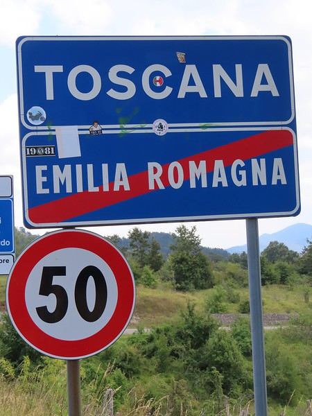
The endpoint of the planned hike is just a few meters from this sign (the trail crosses this road about 3 km from Balze). I realized Balze and the source of the Tevere (Tiber) are actually in Emilia-Romagna, not Toscana. I always thought the Tevere (Tiber), which flows toward Roma (Tyrrhenian side), started in Toscana! I’ll come back to this quirk in Day 3’s write-up.
My latest trip was to Italy from August 27 to September 26, 2024. As the title says, it was a wander through Tuscany in parts of the region that aren’t the most visited. No Firenze-Siena-Pisa trilogy, no San Gimignano; there’ll be a quick detour into Siena, but I’ll skip the best-known sights. That choice, plus traveling in September, should help dodge overtourism. It worked out—crowds were light, sometimes very light, the whole way. Here’s the practical rundown: - a long trip outside peak season (ah, retirees!) - solo camping (caravan) - a mix of activities (hiking, mountain biking, sightseeing) in places that aren’t always packed with tourists. Still, I don’t feel like I ended up in some hidden-away spots. Not sure if this will draw any readers.
DAY 1: Tuesday, August 27, 2024 The heat was intense on the drive in across the plain; two big storms—more rain and hail than lightning and thunder—threw the weather off, the first near Imola, the second on the four-lane road up the Savio valley. I left the Cesena-Roma four-lane at the Verghereto exit and climbed up to Balze (1,100 meters). The campsite is even higher (1,200 meters), in the forest near the source of the Tevere (Tiber). Staying up here will cut down on driving for the first part of the trip: a route through the Appennino (Apennines) on the border between Toscana and Emilia-Romagna. The temperature was surprisingly mild for the altitude, the air thick with moisture by late afternoon. I drove back down from the campsite to Balze (2 km on the road) to grab groceries (it’s doable) and scout tomorrow’s hike. .
The endpoint of the planned hike is just a few meters from this sign (the trail crosses this road about 3 km from Balze). I realized Balze and the source of the Tevere (Tiber) are actually in Emilia-Romagna, not Toscana. I always thought the Tevere (Tiber), which flows toward Roma (Tyrrhenian side), started in Toscana! I’ll come back to this quirk in Day 3’s write-up.
After our first trip discovering the American West with our teens, Cécile asked me to go back for a romantic getaway to this wonderful destination. Whatever my wife wants, so here we are on a plane in September 2022, heading to San Francisco. Since we’d already visited the main parks two years earlier, this time we took the scenic route:
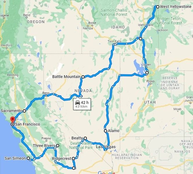
We arrived late in the evening, spent a short night at the hotel, and picked up our rental car to hit Highway 1 and the Pacific coast. The sky was gray, foggy, and a bit disappointing for now.
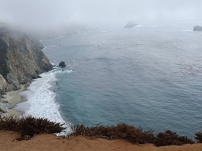
As Brittany lovers, we know coastal weather can change quickly... but no! Bixby Bridge was just a quick view from the car, and it was only 11°C outside.
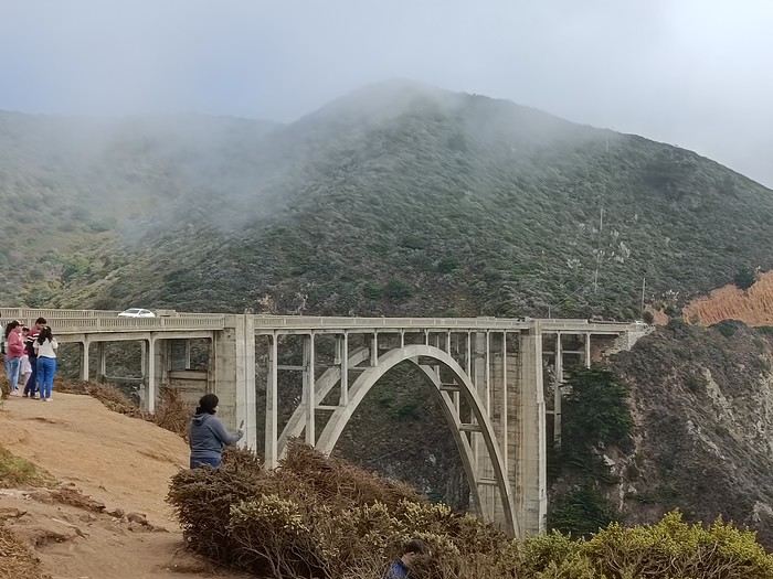
We had a quick picnic on the spot, quickly bothered by the local wildlife.
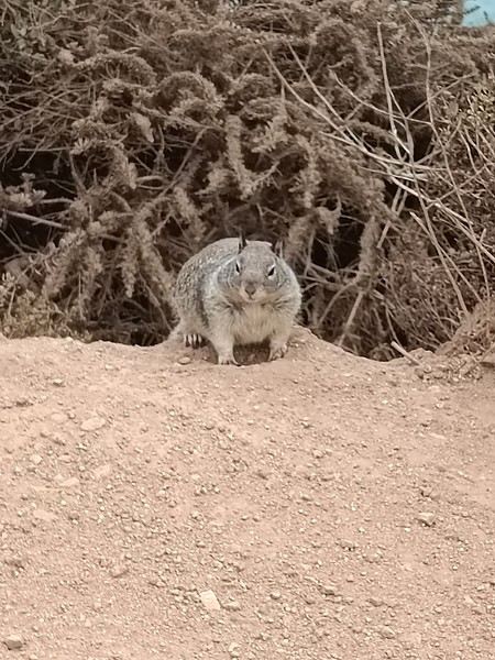
And then—miracle! This charming animal made the wind shift and brought us sunshine. So this coast is absolutely worth the trip—it’s just stunning.
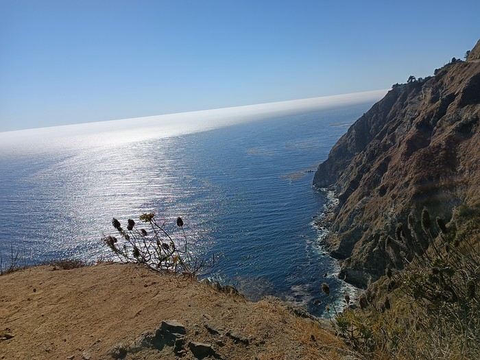
Only the sound of the wind and the seals’ calls disturbed the tranquility of the moment.
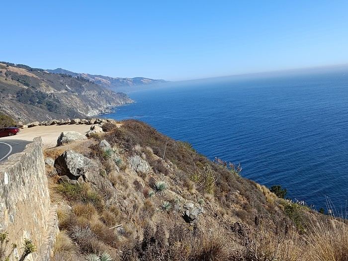
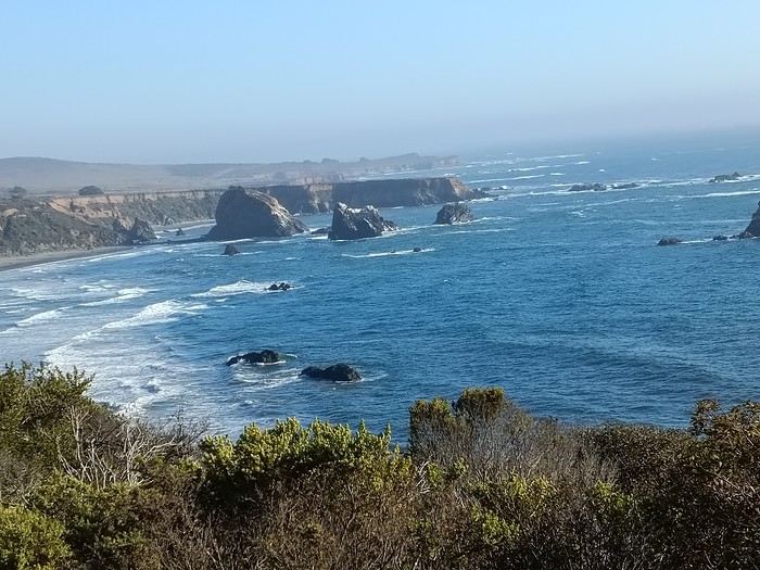
But even the best things come to an end, and we turned inland toward the sequoias. We drove through a long plain with fruit trees, vineyards, and endless straight roads.
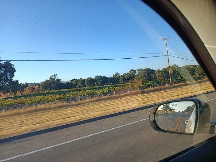
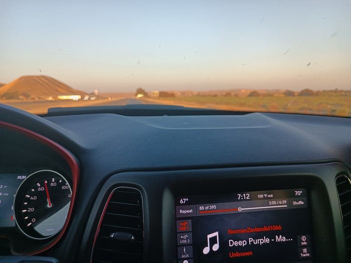
First night at the hotel, tired but happy! !
We arrived late in the evening, spent a short night at the hotel, and picked up our rental car to hit Highway 1 and the Pacific coast. The sky was gray, foggy, and a bit disappointing for now.
As Brittany lovers, we know coastal weather can change quickly... but no! Bixby Bridge was just a quick view from the car, and it was only 11°C outside.
We had a quick picnic on the spot, quickly bothered by the local wildlife.
And then—miracle! This charming animal made the wind shift and brought us sunshine. So this coast is absolutely worth the trip—it’s just stunning.
Only the sound of the wind and the seals’ calls disturbed the tranquility of the moment.
But even the best things come to an end, and we turned inland toward the sequoias. We drove through a long plain with fruit trees, vineyards, and endless straight roads.
First night at the hotel, tired but happy! !
I'm starting a new travel journal in Italy.
It's about a month-long trip (from September 3, 2025, to October 4, 2025), or rather a part of it. This section matches the title: an opera festival in Verona (one evening) and the Dolomites in the Veneto region.
I'm posting the part of the trip I think will interest French-speaking readers the most (since this is where I saw the most French travelers).
Here’s a quick summary:
- Trip in September 2025
- Solo travel with camping (caravan)
- Small geographic area: besides Verona, the surroundings of the Marmolada massif and Cortina d'Ampezzo.
- Main but not exclusive activity: hiking.
Since I have limited internet access where I am now, I’ll be writing slowly. Here we go!
Day 1: Thursday, September 4, 2025
I arrived in Veneto under the sun and with warm weather. I drove to Verona and tried to find a spot at the campsite (Verona Village) located south of the city. Unfortunately, it was full. Booking on the website was mandatory, but when I tried to reserve a few days ago, the site never moved from the "reservation" step to the "payment" step (I don’t know why—it’s always like that in these cases). I found another solution over the phone; the drive from southern Verona to the northeast was a bit long, but I finally settled at the "Oro Verde" campsite. It’s an "agricampeggio" (farm camping or rural campsite) on the outskirts of the city, and its name (green gold) suggests they produce olives there. Since it wasn’t late, I biked to the Adige River, following the recommended route into the city.
Since I have limited internet access where I am now, I’ll be writing slowly. Here we go!
Day 1: Thursday, September 4, 2025
I arrived in Veneto under the sun and with warm weather. I drove to Verona and tried to find a spot at the campsite (Verona Village) located south of the city. Unfortunately, it was full. Booking on the website was mandatory, but when I tried to reserve a few days ago, the site never moved from the "reservation" step to the "payment" step (I don’t know why—it’s always like that in these cases). I found another solution over the phone; the drive from southern Verona to the northeast was a bit long, but I finally settled at the "Oro Verde" campsite. It’s an "agricampeggio" (farm camping or rural campsite) on the outskirts of the city, and its name (green gold) suggests they produce olives there. Since it wasn’t late, I biked to the Adige River, following the recommended route into the city.
Preamble
June 2024. While hiking with my brother on the GR 36 Tour du Morvan, I catch sight now and then of strange rectangular markers fixed to tree trunks. Against a bright orange background, a deep black Greek tau topped with a white dove. My first encounter with the Assisi Way. The Way of St. Francis: a pilgrimage route linking Vézelay in Burgundy to Assisi in Italy, covering nearly 1,800 km. It felt like an obvious next step—I immediately knew I’d take it on, attempt the adventure solo.
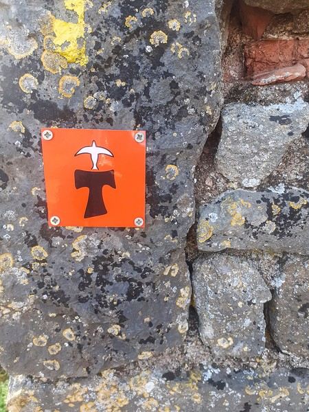
In the months that followed, I talked about my project to everyone—family, friends, my partner. An avalanche of comments, more or less the same but varying depending on each person’s character and life experiences. But deep down, it all boiled down to one legitimate question: why?
And the answers? Hesitant, awkward, partial, even confused. I quickly realized they weren’t so easy to find. It was as if my project seemed more like a whim, a kind of intimate caprice, rather than a well-thought-out plan. Of course, I knew the reasons that pushed me to leave—you always have to give some. Loved ones need to understand to feel reassured, and that’s understandable. But I fear that when I list them, they’ll sound like the same old checklist anyone embarking on this kind of journey might give. Of all the reasons I could mention, I’ll highlight just one here: the call of the road, the solo adventure that brings a powerful sense of freedom. A bit like Monsieur Seguin’s goat, who from her comfortable pen gazes longingly at the unconstrained horizon of the mountain. But if I’m being honest, I think I didn’t really know what I was looking for—or, more importantly, what I’d find. Deep down, when I reflect on it, one word keeps coming up that explains nothing and everything at once: desire.
Now well past sixty, I know that when I ask myself who I am or where I’m going, two things bring me fully back to myself: hiking and writing. And my intention was also to anchor this adventure through words, day by day. Writing down my feelings, emotions, discoveries, and reflections each evening. The famous travel journal that grounds the daily experience in reality. When I discovered the app "Polarstep," which was initially just meant to keep my loved ones updated and reassured, inform them of my progress, and maintain a connection, I found an opportunity to do it a little differently than usual. No retrospective notes polished up after returning, but spontaneous writing—recounting everything that crossed my mind during the day and publishing it immediately. A journey lived in real time.
This text is the exact transcription of my daily writings. Rereading them, I didn’t change a thing—just corrected a few mistakes and tweaked some awkward phrasing here and there. Short texts, fitting the format imposed by this kind of app. Writing as if addressing others.
Now, all that was left was to walk. April 18, 2026 – Vézelay.
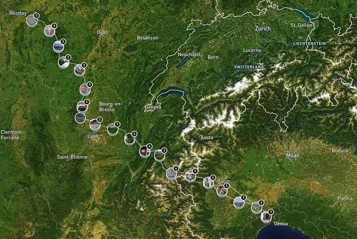
June 2024. While hiking with my brother on the GR 36 Tour du Morvan, I catch sight now and then of strange rectangular markers fixed to tree trunks. Against a bright orange background, a deep black Greek tau topped with a white dove. My first encounter with the Assisi Way. The Way of St. Francis: a pilgrimage route linking Vézelay in Burgundy to Assisi in Italy, covering nearly 1,800 km. It felt like an obvious next step—I immediately knew I’d take it on, attempt the adventure solo.
In the months that followed, I talked about my project to everyone—family, friends, my partner. An avalanche of comments, more or less the same but varying depending on each person’s character and life experiences. But deep down, it all boiled down to one legitimate question: why?
And the answers? Hesitant, awkward, partial, even confused. I quickly realized they weren’t so easy to find. It was as if my project seemed more like a whim, a kind of intimate caprice, rather than a well-thought-out plan. Of course, I knew the reasons that pushed me to leave—you always have to give some. Loved ones need to understand to feel reassured, and that’s understandable. But I fear that when I list them, they’ll sound like the same old checklist anyone embarking on this kind of journey might give. Of all the reasons I could mention, I’ll highlight just one here: the call of the road, the solo adventure that brings a powerful sense of freedom. A bit like Monsieur Seguin’s goat, who from her comfortable pen gazes longingly at the unconstrained horizon of the mountain. But if I’m being honest, I think I didn’t really know what I was looking for—or, more importantly, what I’d find. Deep down, when I reflect on it, one word keeps coming up that explains nothing and everything at once: desire.
Now well past sixty, I know that when I ask myself who I am or where I’m going, two things bring me fully back to myself: hiking and writing. And my intention was also to anchor this adventure through words, day by day. Writing down my feelings, emotions, discoveries, and reflections each evening. The famous travel journal that grounds the daily experience in reality. When I discovered the app "Polarstep," which was initially just meant to keep my loved ones updated and reassured, inform them of my progress, and maintain a connection, I found an opportunity to do it a little differently than usual. No retrospective notes polished up after returning, but spontaneous writing—recounting everything that crossed my mind during the day and publishing it immediately. A journey lived in real time.
This text is the exact transcription of my daily writings. Rereading them, I didn’t change a thing—just corrected a few mistakes and tweaked some awkward phrasing here and there. Short texts, fitting the format imposed by this kind of app. Writing as if addressing others.
Now, all that was left was to walk. April 18, 2026 – Vézelay.
Hi everyone,
We’re just back from a month-long trip to Morocco in our camper van.
After crossing France (we left from the Nantes area) and Spain, we arrived in Algeciras where we bought our boat tickets to Tangier. When we got to Tangier, as we were going through customs, you can imagine our surprise when the customs officer took our road map of Morocco and pointed out the label "Western Sahara" (just like in the forum’s destination section, by the way!).
He wanted it to say "Moroccan Sahara" instead!!! But there was nothing we could do—it was an old map... He wouldn’t listen, and after long discussions with the other (younger) customs officers, he finally gave it back and let us through... Unbelievable! Later, we heard that other travelers had their maps confiscated outright.
So, hide it well if you want to keep yours!!!
Anyway, we skirted around Tangier’s suburbs—pretty grim—and finally arrived in Asilah.
Following the coast and the long promenade along the beach, we reached the campsite. It was a bit crowded, not much shade, but it wasn’t far from the medina or the beach, and it wasn’t expensive. There’s some life here: Moroccan families seem to live on-site, in tents or basic bungalows. A woman was cooking tagine on a brazier—we were right in the atmosphere! The night was quiet, and we slept well. We set off on foot, walking along the seafront to the medina... We’d already been here in 2009. It was less touristy back then! Still, at this early hour, the little streets inside were very quiet. The walls had been freshly whitewashed, and there were even more murals than before. Around 11:30 AM, we strolled along the ramparts by the sea. There was a nice breeze! And a lot more people around. We enjoyed a milkshake on the terrace of a café overlooking the beach that stretches out at the foot of the medina. Some young guys were having fun diving off the rocks—and even off the top of the wall!
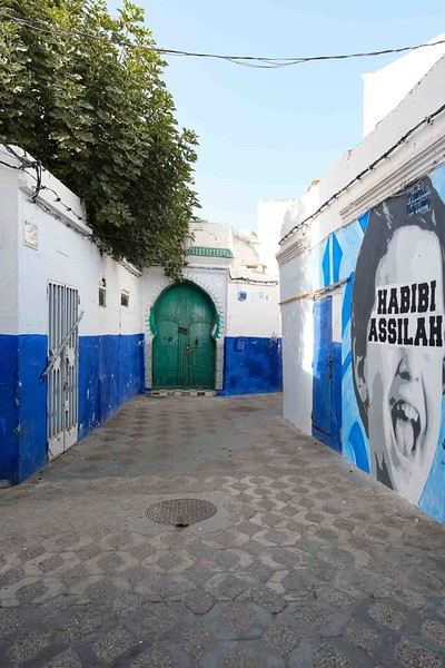
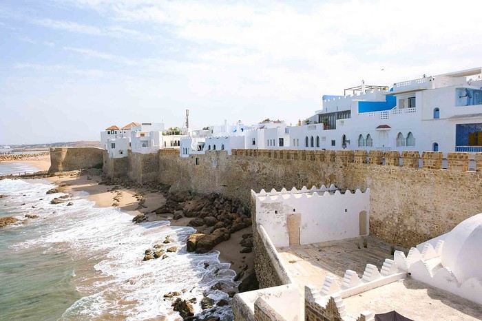
Anyway, we skirted around Tangier’s suburbs—pretty grim—and finally arrived in Asilah.
Following the coast and the long promenade along the beach, we reached the campsite. It was a bit crowded, not much shade, but it wasn’t far from the medina or the beach, and it wasn’t expensive. There’s some life here: Moroccan families seem to live on-site, in tents or basic bungalows. A woman was cooking tagine on a brazier—we were right in the atmosphere! The night was quiet, and we slept well. We set off on foot, walking along the seafront to the medina... We’d already been here in 2009. It was less touristy back then! Still, at this early hour, the little streets inside were very quiet. The walls had been freshly whitewashed, and there were even more murals than before. Around 11:30 AM, we strolled along the ramparts by the sea. There was a nice breeze! And a lot more people around. We enjoyed a milkshake on the terrace of a café overlooking the beach that stretches out at the foot of the medina. Some young guys were having fun diving off the rocks—and even off the top of the wall!
I’d been wanting to discover Sulawesi for years. But then life happened—COVID, the cost of flight tickets, you name it. Long story short, years went by, but we finally set off as a family for a three-week trip in southern Sulawesi: Rammang Rammang, Rantepao, Sengkang, Bira, and Selayar.
I like to spend a good amount of time in the places I visit, giving myself the chance to really get to know the area and meet locals. So no island-hopping this time—just the south. But when I say "just," it’s not restrictive at all, given how rich this island is in landscapes, little encounters, and magical moments.
Wednesday 07/08 - Thursday 07/09: We left Montpellier for what was supposed to be five flights, though we only took four to start, landing in Jakarta. We picked up our luggage there to catch a flight to Makassar the next day. That’s the only way we could get an affordable ticket (702 €). I won’t bore you with the flight details—there’s not much to say. We arrived at 7 PM and considered heading straight to Makassar that evening. But we opted for a recovery night before taking off again. Good thing we did, because my son’s suitcase was missing... First contact with the locals was a bit stressful—a trip without your luggage isn’t exactly fun. But right away, a woman reassured us: the suitcase was just enjoying some extra time in Singapore. Maybe it was doing some last-minute shopping. Anyway, nothing serious—it was supposed to arrive at 9 AM the next day. That gave us some breathing room since our flight wasn’t until noon. So off we went to our hotel (Days Hotel & Suites) near the airport. It was cheap (40 € for three rooms—my kids are older and need their space), but it wasn’t worth much more. The place had definitely seen better days. But no big deal—we were only there for the night, and... we got to watch France beat Morocco in the World Cup live at 3 AM. That’s what really mattered!
Friday 07/10: In search of the lost suitcase First challenge of the morning: finding our missing suitcase. They sent us to the airport basement, to the staff entrance. We were greeted with smiles, and an airport employee led me through the underground corridors back to the baggage claim. Right on time at 9 AM, the suitcase arrived, just like they’d promised. We were finally complete! Off we went to change terminals, grab a well-deserved meal, and board our fifth flight to Makassar. Little side note: I struggled for a while trying to book domestic flights directly on the airlines’ websites with no luck. Without meaning to advertise (though I guess I am a little), I realized it’d be easier to use sites like tiket.com or Traveloka. That turned out to be a great choice—I even ended up booking hotels through them later in the trip. 12:40 PM: We were on our way to Makassar. First good news: we were the only tourists. Well, the only European tourists on the flight, anyway. No, you’re not dreaming—the bag is full of... potato chip packets. To each their own souvenirs, I guess...
When we arrived in Makassar, a driver was waiting to take us straight to Rammang Rammang: 250,000 IDR (12 €) to our guesthouse (Rammang Rammang House). Forget about meeting people on the bus—we were headed straight to the first stop of our trip, and it was already stunning.
My kids’ guesthouse: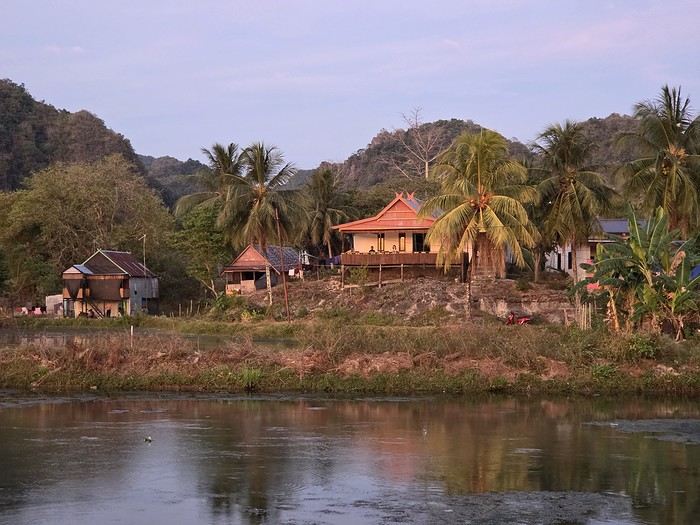
Ours: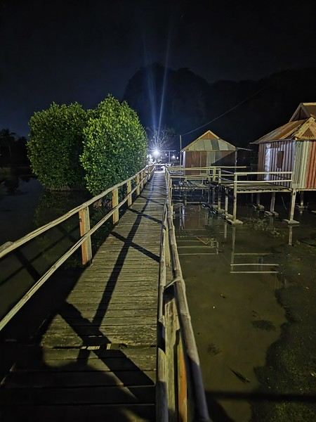
View of the little lake:
But not everything is straightforward around here. I wanted to get a local SIM card for internet and calls. I found them expensive at Jakarta’s airport (20 € for 20 GB), so I decided to wait. Well, no luck in Rammang Rammang either. You can’t just buy one from the local shop—you need a Telkomsat store (they have the best coverage). So we’d have to wait for Rantepao to get Wi-Fi... When I say "local shop," I mean the little shack around the corner. No big deal—we’d find one easily in Rantepao for 5 € and 25 GB. So there we were, offline, just the four of us enjoying the amazing view.
Saturday 07/11: Rammang Rammang We woke up early to the sound of wedding music blasting through the village (everyone’s invited!). Off we went to explore the area. A little walking, a little boat ride (shared with a French tourist and a Polish one—yes, there *are* tourists here, just not many; 750,000 IDR for up to 8 people) through a lovely canal, and we discovered the karst site. It was peaceful and beautiful. The river: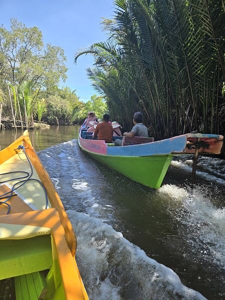 The karst site:
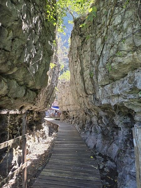
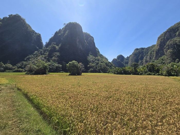
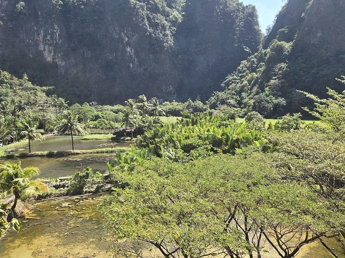
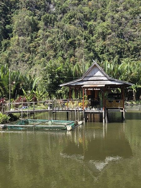
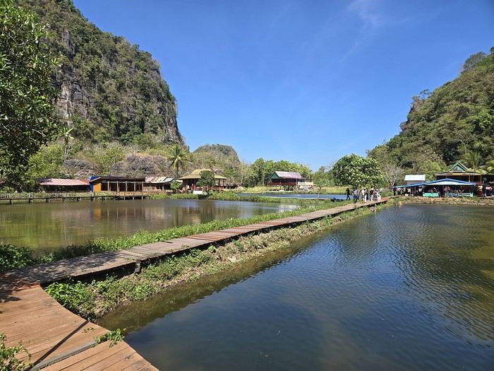
Wednesday 07/08 - Thursday 07/09: We left Montpellier for what was supposed to be five flights, though we only took four to start, landing in Jakarta. We picked up our luggage there to catch a flight to Makassar the next day. That’s the only way we could get an affordable ticket (702 €). I won’t bore you with the flight details—there’s not much to say. We arrived at 7 PM and considered heading straight to Makassar that evening. But we opted for a recovery night before taking off again. Good thing we did, because my son’s suitcase was missing... First contact with the locals was a bit stressful—a trip without your luggage isn’t exactly fun. But right away, a woman reassured us: the suitcase was just enjoying some extra time in Singapore. Maybe it was doing some last-minute shopping. Anyway, nothing serious—it was supposed to arrive at 9 AM the next day. That gave us some breathing room since our flight wasn’t until noon. So off we went to our hotel (Days Hotel & Suites) near the airport. It was cheap (40 € for three rooms—my kids are older and need their space), but it wasn’t worth much more. The place had definitely seen better days. But no big deal—we were only there for the night, and... we got to watch France beat Morocco in the World Cup live at 3 AM. That’s what really mattered!
Friday 07/10: In search of the lost suitcase First challenge of the morning: finding our missing suitcase. They sent us to the airport basement, to the staff entrance. We were greeted with smiles, and an airport employee led me through the underground corridors back to the baggage claim. Right on time at 9 AM, the suitcase arrived, just like they’d promised. We were finally complete! Off we went to change terminals, grab a well-deserved meal, and board our fifth flight to Makassar. Little side note: I struggled for a while trying to book domestic flights directly on the airlines’ websites with no luck. Without meaning to advertise (though I guess I am a little), I realized it’d be easier to use sites like tiket.com or Traveloka. That turned out to be a great choice—I even ended up booking hotels through them later in the trip. 12:40 PM: We were on our way to Makassar. First good news: we were the only tourists. Well, the only European tourists on the flight, anyway. No, you’re not dreaming—the bag is full of... potato chip packets. To each their own souvenirs, I guess...
When we arrived in Makassar, a driver was waiting to take us straight to Rammang Rammang: 250,000 IDR (12 €) to our guesthouse (Rammang Rammang House). Forget about meeting people on the bus—we were headed straight to the first stop of our trip, and it was already stunning.
My kids’ guesthouse:
Ours:
View of the little lake:
But not everything is straightforward around here. I wanted to get a local SIM card for internet and calls. I found them expensive at Jakarta’s airport (20 € for 20 GB), so I decided to wait. Well, no luck in Rammang Rammang either. You can’t just buy one from the local shop—you need a Telkomsat store (they have the best coverage). So we’d have to wait for Rantepao to get Wi-Fi... When I say "local shop," I mean the little shack around the corner. No big deal—we’d find one easily in Rantepao for 5 € and 25 GB. So there we were, offline, just the four of us enjoying the amazing view.
Saturday 07/11: Rammang Rammang We woke up early to the sound of wedding music blasting through the village (everyone’s invited!). Off we went to explore the area. A little walking, a little boat ride (shared with a French tourist and a Polish one—yes, there *are* tourists here, just not many; 750,000 IDR for up to 8 people) through a lovely canal, and we discovered the karst site. It was peaceful and beautiful. The river:
The karst site:
We did the Langtang trek (hike) from September 10th to 17th, with the first and last days being the trip from Kathmandu and back—so 6 days of actual walking. It’s a fairly well-known trek but certainly not as famous or crowded as those in the Annapurna or Everest regions, which is why we chose it.
In theory, it’s mandatory to have a guide for this trek. In reality, it seems there are ways to bypass the regulations: we met at least two people hiking without a guide—a South Korean, a New Zealander, and possibly also a couple of English women and an American couple, though we’re not sure if they had a guide.
The agency we booked with had told us it was an affordable trek for relatively older people in good shape—which is our case (I’m 72 myself). I have to say upfront that we found it quite challenging, maybe because we didn’t have good weather—it was the end of the monsoon season. To be clear, no matter your fitness level, I’d say doing this trek in the middle of the monsoon season would be suicidal.
Day 1 – Journey from Kathmandu to Syapru Besi
On Monday, September 8th, there had been violent protests in Kathmandu against the government, which had, among other things, blocked access to social media and been accused of nepotism and corruption. There were 19 deaths. The situation was very tense on the day of our departure, Wednesday the 10th. The agency warned us that public transport was very unreliable. So, we decided to take a jeep, at an additional cost of $100 ($160 minus what was already budgeted for the bus).
We left a little before 7 a.m. and it took us a good hour just to reach the outskirts of Kathmandu. Along the way, we saw several houses and vehicles set on fire by protesters.
The road to Syapru Besi is only 120 km, but it’s frankly awful. It’s always narrow, winds through endless mountains, and the shoulders range from bad to confusing to nonexistent. Several sections are just dirt tracks. We didn’t regret opting for the jeep, as we could stop several times at our convenience—if only to let Y (my Thai partner) throw up everything she had. She’d taken her usual motion sickness medication, but the constant turns, accelerations, and braking eventually made her terribly carsick.
In Nuwakot, we stopped for breakfast at a nice little restaurant, Jimbu. It was around 8:30 a.m., and we’d barely covered 60 km. The restaurant has a lovely garden overlooking the Trishuli Ganga, the river flowing down from Syapru Besi. First photo: the river in the bottom right corner, mist and clouds over the mountain on the other side.
An hour later, my second photo: the hills along the Trishuli Ganga. You can see the different crops—lush green rice paddies in the lower right and corn, already yellowed and likely harvested, in the foreground on the left. And of course, the mist and clouds through which you can glimpse the mountain on the other side of the river.
In theory, it’s mandatory to have a guide for this trek. In reality, it seems there are ways to bypass the regulations: we met at least two people hiking without a guide—a South Korean, a New Zealander, and possibly also a couple of English women and an American couple, though we’re not sure if they had a guide.
The agency we booked with had told us it was an affordable trek for relatively older people in good shape—which is our case (I’m 72 myself). I have to say upfront that we found it quite challenging, maybe because we didn’t have good weather—it was the end of the monsoon season. To be clear, no matter your fitness level, I’d say doing this trek in the middle of the monsoon season would be suicidal.
Day 1 – Journey from Kathmandu to Syapru Besi
On Monday, September 8th, there had been violent protests in Kathmandu against the government, which had, among other things, blocked access to social media and been accused of nepotism and corruption. There were 19 deaths. The situation was very tense on the day of our departure, Wednesday the 10th. The agency warned us that public transport was very unreliable. So, we decided to take a jeep, at an additional cost of $100 ($160 minus what was already budgeted for the bus).
We left a little before 7 a.m. and it took us a good hour just to reach the outskirts of Kathmandu. Along the way, we saw several houses and vehicles set on fire by protesters.
The road to Syapru Besi is only 120 km, but it’s frankly awful. It’s always narrow, winds through endless mountains, and the shoulders range from bad to confusing to nonexistent. Several sections are just dirt tracks. We didn’t regret opting for the jeep, as we could stop several times at our convenience—if only to let Y (my Thai partner) throw up everything she had. She’d taken her usual motion sickness medication, but the constant turns, accelerations, and braking eventually made her terribly carsick.
In Nuwakot, we stopped for breakfast at a nice little restaurant, Jimbu. It was around 8:30 a.m., and we’d barely covered 60 km. The restaurant has a lovely garden overlooking the Trishuli Ganga, the river flowing down from Syapru Besi. First photo: the river in the bottom right corner, mist and clouds over the mountain on the other side.
An hour later, my second photo: the hills along the Trishuli Ganga. You can see the different crops—lush green rice paddies in the lower right and corn, already yellowed and likely harvested, in the foreground on the left. And of course, the mist and clouds through which you can glimpse the mountain on the other side of the river.
Hey there, community! Back this weekend, below is my travel journal from my adventure in Indonesia. Enjoy the read!!!
Day 1 - August 10, 2025 New life downloading for three weeks! And for that, Flo and I launched a public tender... A public tender? What’s that got to do with a travel journal???... Well, when you think about it, few destinations tick all the boxes for an August adventure: Meaning, finding a place that’s exotic in the middle of August, not too expensive, not too packed with tourists, warm but not *too* warm, with postcard-perfect landscapes, dreamy beaches, tasty cuisine with a hint of exoticism, friendly and welcoming locals, where you’re free to sleep under the stars among the mosquitos, take transport surrounded by chickens, and even eat from a pig trough if you feel like it—well, turns out it’s not that easy to find! I’d even say, given how thick the list of requirements is, there’s a big risk the tender could be declared unsuccessful for failing to meet just one criterion. Let’s just say the candidates better submit a rock-solid proposal!
After reviewing all the responses and presentations from the candidates, the obvious choice for us is... Indonesia! Except that trying to explore a country as vast as Indonesia and its 17,504 islands in less than five years is a bit like reading the summary of a Proust novel without taking the time to savor each of its 950 pages! Don’t worry, I won’t name them all here. Besides, do they even all have names? No! Only 7,870 have been named—their parents clearly ran out of ideas for the rest. Anyway, our society, which worships the "work more to earn more" mantra, unfortunately limits our adventure time. So we’ll only get to see a small part of Indonesia, and we’ll have to make a tough choice to head for the best of the best in this archipelago of over seventeen thousand islands. Each one has its own selling points: Sumatra, Sulawesi, Java, the Celebes, Bali, Borneo, Papua, Timor, the Moluccas... So many names that smell of adventure... Another tender, another list of requirements, another review of proposals... Drumroll... Splash splash... And the lucky winner is... Ta-da... Java, Bali’s big sister, where I’ve already been eight years ago... Java the programming language. The Java of Broadway. We’re gonna *do* the Java. Java the coffee. And yes, Java is also an island!
This island, four times smaller than France, is home to 136 million people, making it the most populated island in the world! Fun fact: Indonesia, with its 260 million inhabitants, is just shy of the podium for the world’s most populated countries, after the winning trio of India, China, and the United States. And it’s on this island of Java that you’ll find Jakarta, the (soon-to-be-former) capital and main airport of the country, where we’ll soon land after our nineteen-hour flight! Yep, nineteen hours! I mean, Indonesia in general—and Java in particular—is a *tad* farther than going on vacation to Grandma Yoyo’s! Not sure where it is? Easy. Grab a map. Plant your finger on the big island at the bottom right—aka Australia for those who struggle with geography—move it up two centimeters, and bam, welcome to Indonesia!
Nice transition, right? Because "Welcome to Indonesia" is exactly what the friendly flight attendant just said to me as we got off the plane! That’s it, our chakras are open, we’ve arrived at our (air)port. Time for rest, pool, cocktails, and a beach with our toes spread out... Wait, if you bought that, you clearly don’t know us yet! Since we still have energy to burn and need to adjust to the flight and time difference, we tackle the long administrative formalities to enter Indonesia, just to earn the right to hop in a 45-minute Grab taxi to the train station. The train station? What train station?... What do you usually do at a train station? Take a train, of course! Off we go for a three-hour train ride to Bandung, where we’ll officially start our adventure tomorrow after our first Indonesian night...
Unfortunately, we were a bit slow off the mark, which meant we missed the 6:25 PM train by two minutes. Oh well, we’ll have to wait until 11 PM. We take the opportunity to stretch our legs in Jakarta, soak up the atmosphere, and enjoy the delicious smells wafting from the *warungs*—those little typical street restaurants. A quick stop at the National Monument, a detour to a night market to devour our first *kwetiaw goreng* and *teh manis* for 60,000 rupiahs (that’s 3 € for two), and just like that, our penalty is lifted, and we’re allowed to hit the road again. Off to Bandung, where we arrive at 2 AM for... a *very* short night...
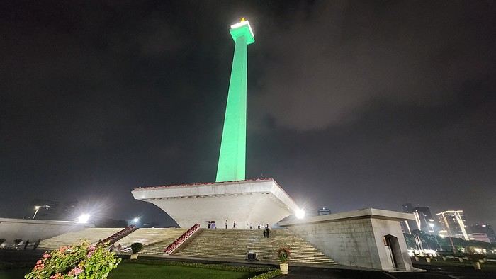
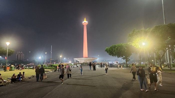
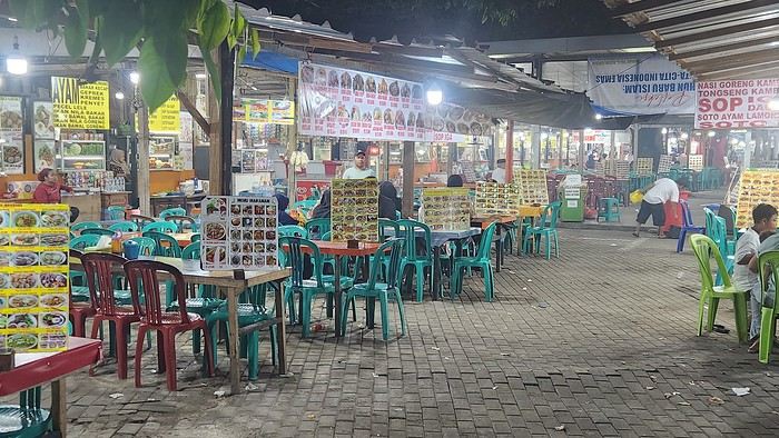
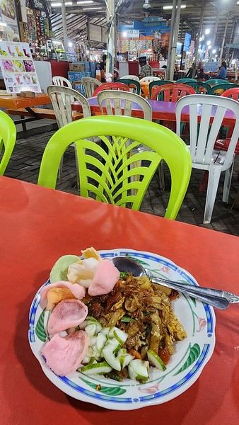
Day 1 - August 10, 2025 New life downloading for three weeks! And for that, Flo and I launched a public tender... A public tender? What’s that got to do with a travel journal???... Well, when you think about it, few destinations tick all the boxes for an August adventure: Meaning, finding a place that’s exotic in the middle of August, not too expensive, not too packed with tourists, warm but not *too* warm, with postcard-perfect landscapes, dreamy beaches, tasty cuisine with a hint of exoticism, friendly and welcoming locals, where you’re free to sleep under the stars among the mosquitos, take transport surrounded by chickens, and even eat from a pig trough if you feel like it—well, turns out it’s not that easy to find! I’d even say, given how thick the list of requirements is, there’s a big risk the tender could be declared unsuccessful for failing to meet just one criterion. Let’s just say the candidates better submit a rock-solid proposal!
After reviewing all the responses and presentations from the candidates, the obvious choice for us is... Indonesia! Except that trying to explore a country as vast as Indonesia and its 17,504 islands in less than five years is a bit like reading the summary of a Proust novel without taking the time to savor each of its 950 pages! Don’t worry, I won’t name them all here. Besides, do they even all have names? No! Only 7,870 have been named—their parents clearly ran out of ideas for the rest. Anyway, our society, which worships the "work more to earn more" mantra, unfortunately limits our adventure time. So we’ll only get to see a small part of Indonesia, and we’ll have to make a tough choice to head for the best of the best in this archipelago of over seventeen thousand islands. Each one has its own selling points: Sumatra, Sulawesi, Java, the Celebes, Bali, Borneo, Papua, Timor, the Moluccas... So many names that smell of adventure... Another tender, another list of requirements, another review of proposals... Drumroll... Splash splash... And the lucky winner is... Ta-da... Java, Bali’s big sister, where I’ve already been eight years ago... Java the programming language. The Java of Broadway. We’re gonna *do* the Java. Java the coffee. And yes, Java is also an island!
This island, four times smaller than France, is home to 136 million people, making it the most populated island in the world! Fun fact: Indonesia, with its 260 million inhabitants, is just shy of the podium for the world’s most populated countries, after the winning trio of India, China, and the United States. And it’s on this island of Java that you’ll find Jakarta, the (soon-to-be-former) capital and main airport of the country, where we’ll soon land after our nineteen-hour flight! Yep, nineteen hours! I mean, Indonesia in general—and Java in particular—is a *tad* farther than going on vacation to Grandma Yoyo’s! Not sure where it is? Easy. Grab a map. Plant your finger on the big island at the bottom right—aka Australia for those who struggle with geography—move it up two centimeters, and bam, welcome to Indonesia!
Nice transition, right? Because "Welcome to Indonesia" is exactly what the friendly flight attendant just said to me as we got off the plane! That’s it, our chakras are open, we’ve arrived at our (air)port. Time for rest, pool, cocktails, and a beach with our toes spread out... Wait, if you bought that, you clearly don’t know us yet! Since we still have energy to burn and need to adjust to the flight and time difference, we tackle the long administrative formalities to enter Indonesia, just to earn the right to hop in a 45-minute Grab taxi to the train station. The train station? What train station?... What do you usually do at a train station? Take a train, of course! Off we go for a three-hour train ride to Bandung, where we’ll officially start our adventure tomorrow after our first Indonesian night...
Unfortunately, we were a bit slow off the mark, which meant we missed the 6:25 PM train by two minutes. Oh well, we’ll have to wait until 11 PM. We take the opportunity to stretch our legs in Jakarta, soak up the atmosphere, and enjoy the delicious smells wafting from the *warungs*—those little typical street restaurants. A quick stop at the National Monument, a detour to a night market to devour our first *kwetiaw goreng* and *teh manis* for 60,000 rupiahs (that’s 3 € for two), and just like that, our penalty is lifted, and we’re allowed to hit the road again. Off to Bandung, where we arrive at 2 AM for... a *very* short night...
This first trip of 2025 will have the taste of Asia.
More precisely, Thailand!
It’s not my first time—I’ve often traveled across Southeast Asia between 2000 and 2015. (This travel journal, for example...)
But it’ll be my partner’s first steps in this part of the world.
The itinerary we’ve chosen will alternate between familiar sights for me and new discoveries for both of us.
I’ll get to see how the country has changed in 20 years—and what’s stayed the same!
We were torn between the north and the south of the kingdom. Fears of smoke from slash-and-burn farming and a desire to relax on the sand tipped the scales toward the south...
What if we rented a car?
I think driving in sprawling Bangkok would be a bit ambitious, so we’ll only book our vehicle from Hua Hin to return it in Surat Thani.
Other transportation will range from tuk-tuks to overnight trains and ride-hailing services.
And of course, the plane!
I’d love to travel from Auvergne to Bangkok by road, but 15 days wouldn’t be enough...
Plus, the current geopolitical situation isn’t exactly favorable...
So, once again, we’ll be stuck for hours in the less-than-comfortable economy class of Qatar Airways.
The arrival time was on schedule, entry formalities were quick, and all our luggage made it.
We left Lyon in wind and cold—now we’re breathing in the warm, humid air of กรุงเทพมหานคร.
To reach our hotel, we first took the metro, which dropped us off in the city center in about 30 minutes for the incredible price of 1.18 €.
A few taps on the GRAB app, and we booked a ride-hailing service for the last few kilometers.
We waited a while for our driver due to insane traffic in the area, but once in the 4x4, we were at our lodging in no time.
We chose this small hotel for its riverside location, tranquility, and price.
It’ll do the job perfectly—the only downside is the weak breakfast.
The room is inviting, and we collapse onto the bed for a well-deserved short nap.
Wake-up call in an hour for our first visits!
See you soon...
More precisely, Thailand!
It’s not my first time—I’ve often traveled across Southeast Asia between 2000 and 2015. (This travel journal, for example...)
But it’ll be my partner’s first steps in this part of the world.
The itinerary we’ve chosen will alternate between familiar sights for me and new discoveries for both of us.
I’ll get to see how the country has changed in 20 years—and what’s stayed the same!
We were torn between the north and the south of the kingdom. Fears of smoke from slash-and-burn farming and a desire to relax on the sand tipped the scales toward the south...
What if we rented a car?
I think driving in sprawling Bangkok would be a bit ambitious, so we’ll only book our vehicle from Hua Hin to return it in Surat Thani.
Other transportation will range from tuk-tuks to overnight trains and ride-hailing services.
And of course, the plane!
I’d love to travel from Auvergne to Bangkok by road, but 15 days wouldn’t be enough...
Plus, the current geopolitical situation isn’t exactly favorable...
So, once again, we’ll be stuck for hours in the less-than-comfortable economy class of Qatar Airways.
The arrival time was on schedule, entry formalities were quick, and all our luggage made it.
We left Lyon in wind and cold—now we’re breathing in the warm, humid air of กรุงเทพมหานคร.
To reach our hotel, we first took the metro, which dropped us off in the city center in about 30 minutes for the incredible price of 1.18 €.
A few taps on the GRAB app, and we booked a ride-hailing service for the last few kilometers.
We waited a while for our driver due to insane traffic in the area, but once in the 4x4, we were at our lodging in no time.
We chose this small hotel for its riverside location, tranquility, and price.
It’ll do the job perfectly—the only downside is the weak breakfast.
The room is inviting, and we collapse onto the bed for a well-deserved short nap.
Wake-up call in an hour for our first visits!
See you soon...
My train to Mathura is at 2 PM, and we’ll arrive an hour late—all good. I booked a hotel on booking, but unfortunately, it’s really far from the ghats. Walking there is out of the question—what a shame.
The hotel itself is fine, and there are several restaurants right across the street, which will be handy for dinner. This won’t be an exception, though—starting at 10 PM, they must wake up because I can hear them talking loudly, and music is playing along. My room faces the entrance, so it’s going to be tough. At midnight, I ask them to lower the volume, but they don’t listen. By 1 AM, I lose my temper, and this time, everything stops. Finally, I can get some sleep—until 4 AM, when they start up again for a little while before quiet returns until 6 AM. But when do they sleep? The noise never seems to bother them—it’s unbelievable, and I’m finding it harder and harder to tolerate. It makes a huge difference.
The next morning, as I leave, they tell me they’ll give me another room for the following night. Oh, two nights like that wouldn’t be possible—I’m exhausted.
I head out to explore the ghats and take a rickshaw, which I share with a family, to Vrindavan, a city of temples dedicated to Krishna. I visit several while wandering through the lively streets, surrounded by a crowd of devotees. By 1 PM, I’m near the Bankey Bihari Temple, but I can’t go in—it just closed. Nearby, there are restaurants, so I take the opportunity to grab my usual aloo paratha with a lassi.

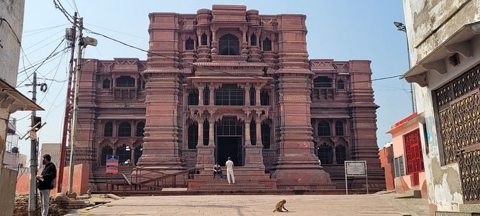
The work women do here is incredibly hard, and their pay must be miserable.

I want to leave Vrindavan for Govardhan. Two young guys on a motorcycle in front of the temple approach me, and the driver offers to take me part of the way. I’m pretty skeptical, but he insists, and I eventually agree. I didn’t fully understand what was happening. Once on the bike, his friend hops on too, and suddenly I’m sandwiched between them for a multi-kilometer ride—*travel Indian-style*. We quickly drop off the friend, and I breathe easier for the rest of the trip. At an intersection, he stops—Govardhan is straight ahead, but to get to his village, he needs to turn right. We wait for the bus for a few minutes, and he flags it down so I can hop on and continue my journey. What an adventure.
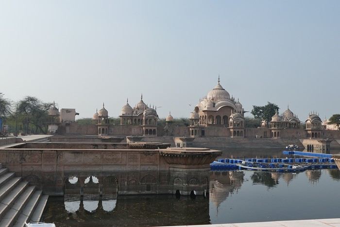
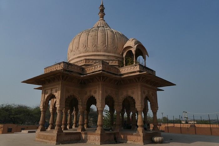
the neighbor with its beautiful dome.
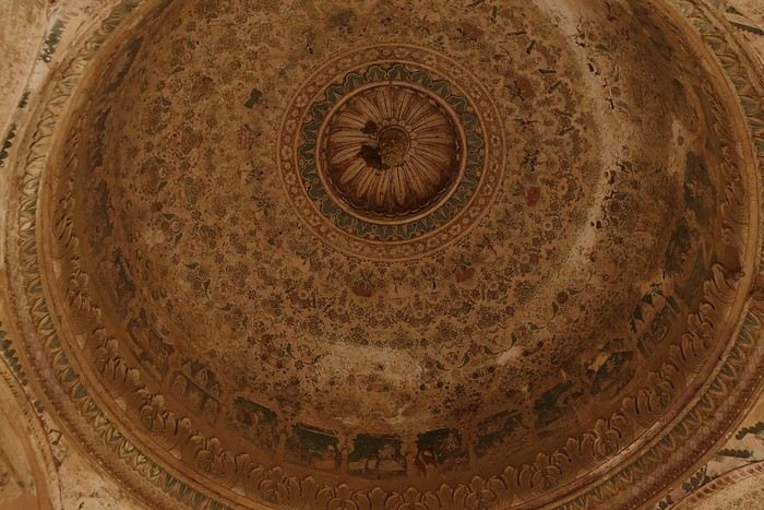
The work women do here is incredibly hard, and their pay must be miserable.
I want to leave Vrindavan for Govardhan. Two young guys on a motorcycle in front of the temple approach me, and the driver offers to take me part of the way. I’m pretty skeptical, but he insists, and I eventually agree. I didn’t fully understand what was happening. Once on the bike, his friend hops on too, and suddenly I’m sandwiched between them for a multi-kilometer ride—*travel Indian-style*. We quickly drop off the friend, and I breathe easier for the rest of the trip. At an intersection, he stops—Govardhan is straight ahead, but to get to his village, he needs to turn right. We wait for the bus for a few minutes, and he flags it down so I can hop on and continue my journey. What an adventure.
the neighbor with its beautiful dome.