Discussions similar to: Suivre une formation nitrox mélange air plongée
FR

813 similar discussions in English

16 days in Peru in August 2023
Hi everyone, The years go by and Machu Picchu has been on our "to-do list" for a few decades now... But Peru is, fortunately, so much more than this legendary site...

We went as a couple for a 15-day trip. For the first time, we delegated the logistics to a local agency (Paprika in Arequipa). This agency offers "classic" small-group tours and the option to do it privately, which we chose.

No complaints—they were perfect for organizing transportation, hotels, and French-speaking guides.

The "classic" southern Peru loop is: Lima, Paracas, Nazca, Arequipa, Colca, Titicaca, Cusco, Sacred Valley, Cusco. Nothing very original... but why get creative when there’s already so much beauty to discover?

We opted for a shorter loop, skipping Paracas/Nazca because the small planes in Nazca weren’t a unanimous hit, and it saved us dozens of hours on the bus. But we added a stop at Palccoyo (the rainbow mountains) between Titicaca and Cusco.

It might seem like a shame, but we don’t regret it at all.
Open
3-Week Road Trip for Two: Montréal to Montréal
Following the (wise) advice of "Les Caribous," I'm starting a post to describe the trip I'd like to take from mid-September 2025 for three weeks. Here’s the planned route: Departing from Nantes. Montréal/Ottawa/Mont-Tremblant/Mauricie/Lac St-Jean/Saguenay Fjord/Tadoussac/Gaspésie, then returning via Québec and Montréal. I’d love some tips on must-see spots and how long to spend at each stop. We’re not big "hikers," so minimal hiking. Don’t hesitate to suggest cutting stops—especially if they seem unnecessary or too time-consuming. Advice on accommodation and vehicle rentals would also be much appreciated. Thanks to everyone who’d like to share their experiences and tips!
Open
From France to Mecca by Bike
Assalamu 'alaykum, Hi everyone,

This thread is to echo some posts I’ve read on this forum while researching a potential bike trip from Annecy to Mecca. I came across several discussions where members mentioned being very interested in cycling to the holy city.

So, God willing, I plan to attempt this journey from January to June next year. The idea is to head to Turkey first, then assess the most reasonable routes based on the geopolitical situation around Palestine and as far as Iraq. Since the Turkish-Syrian border is closed, the only remaining (and I mean *only* remaining) overland option would be to go through Iraqi Kurdistan, Iraq, then Jordan, and finally Saudi Arabia.

That’s the first major challenge of this project. The second is timing. Due to the schedule, I’ll be starting in the middle of winter across Europe and finishing in the peak of summer in Saudi Arabia. If I’d had a choice, I’d have waited a good dozen years—but well, twelve years...

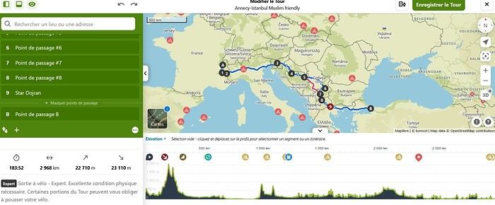
I won’t go into too much detail about the planned route in this post, but here are the broad strokes already set: Annecy to Istanbul. The rest is a bit too far ahead to map out properly. Crossing the Italian border via the Montgenèvre Pass. Straight through northern Italy as quickly as possible (not necessarily very pleasant) to reach Ljubljana. The fastest route through Croatia to spend as much time as possible in Bosnia-Herzegovina. Serbia via the Sandžak region. It crosses the Pešter plateau, which intimidates me at this time of year—its nickname, the "Siberia of the Balkans," says it all... Then Kosovo, North Macedonia, Greece, and Turkey.

I’m open to any advice on this itinerary. The choice was made to pass through as many Muslim-majority regions as possible. In the middle of winter in the Balkans, I don’t feel mentally up to bivouacking alone in that climate. So, I’ll try to find accommodations in mosques or even with locals as much as possible.

That’s the project in a nutshell. The big catch—some of you may have already noticed—is that I’m doing this solo. Yet, this is strongly discouraged by our Prophet—peace and blessings of Allah be upon him. So, I invite anyone interested in joining this project, whether closely or from afar, to reach out and contact me. Any contribution is welcome, whether it’s company for the whole journey (one can always hope!) or just part of it. Advice, contact suggestions, places to stay, and information about Hajj or Umrah are also appreciated.

Thanks for reading this far. I’ll try to check my VoyageForum account from time to time to see if anyone has responded to this thread and will happily reply to your messages and questions.

Take care, Assalamu'alaykum.

Sam

Open
Cruise on the Explora Journey
Hi there A few photos from the Explora Journey—the ship is stunning, and I can confirm the dining is on par with Michelin-starred restaurants. Plus, you get to choose between several restaurants where everything is included, even drinks and champagne!
Open
Various ideas to revive/improve the site
Hello,

After 20 years of operation and a 4-year hiatus, we were happy to rediscover this forum following its acquisition by Myatlas.

At the very beginning of the adventure, there was a section allowing members to share their ideas—good or bad, feasible or not—with the team in charge to help perfect the forum.

So, to help VoyageForum regain its momentum and adapt to new audiences and a new environment, why not put our heads together and suggest some improvement ideas in this thread?

I’ll get the ball rolling!

Travel journals are limited to 300 photos because photo storage is expensive. This limitation is completely understandable, and Myatlas found a solution by offering a paid subscription for those who wanted to exceed the free photo limit. Maybe this approach could be adapted here? Limiting without offering an alternative is a reason members leave.
Open
ETA Thailand (Electronic Travel Authorization)
Hi, does anyone know the status of the ETA that’s supposed to go into effect in December 2024 (and needs to be requested on the e-visa portal www.thaievisa.go.th)? Is it officially starting on December 1st? I’ve got my flight on the 7th of December and I’m on a Non-O Retirement visa with a re-entry. From what I understand, it’ll only apply to visa-free entries and should allow a 60-day stay in the kingdom with the option to extend for 30 more days. So I’m wondering if I need to apply for this since I already have a valid visa. Thanks in advance for your answers! 😊
Open
Passport not stamped when leaving Thailand
Hi there, I just got back to France and realized I don’t have a stamp in my French passport. Is it normal that at Suvarnabhumi Airport customs didn’t stamp my passport? I’m really worried because I have to go back in a month and I don’t know what to expect when I arrive at Thai customs. I’m afraid of the consequences, like a fine or worse—being blacklisted from entering Thailand. Has anyone else had this happen? And if it’s not normal, what can I do to avoid any problems?
Open
Preparing for a one-month road trip in Uganda
Yiiihiiiiii😎

Hey everyone, and warm greetings to all you Southern African wanderers exploring the eastern lands of this African forum!

Four years later, I can finally create a new thread about my next trip—and not just any trip: Uganda! 🙂 A destination that’s been making me dream more and more over the past few years. Originally planned for 2019 but swapped for Tanzania, Kilimanjaro, and Zanzibar. Then pushed aside for another well-known African destination, Namibia, with 6 friends in 2021 (but ultimately done with just 2 because of Covid). 2022 was supposed to be the year of our Canada trip (initially planned for 2020 and canceled two years in a row for the same health reasons). The 2021 safari with friends finally happened in South Africa in 2023—a classic loop that didn’t require much planning and let me start dreaming about my next African destination while devouring all the Uganda travel journals, frustrated I couldn’t reply or comment. Uganda was then reconsidered for 2024 as a follow-up to a 6-week road trip in Finland and Norway, starting from Paris to save time, money, and the ecological footprint of a transatlantic round trip—but ultimately canceled due to budget constraints, the start of my freelance work (no more paid leave), the high cost of 6 weeks in Scandinavia, and no desire to cheapen our first Uganda trip.

Uganda will be the absolute priority for 2025! 😉 And I plan to use this time to prepare for the trip properly. I also hope to use this period to get back to writing our travel journals. By absolute priority, I mean minimal restrictions and compromises on budget and travel time. 🙂

So, we’re planning to spend a month in Uganda next summer (2025). The exact month will be decided in the coming weeks. Why a month? To explore a good part of the country (really want to go up to Kidepo), enjoy the stops, and avoid putting ourselves at risk on the roads. Also, several rental companies offered me 4x4 quotes with a 10% discount for 30+ days of rental...

Here’s my humble draft itinerary:

Day 1: Late arrival in Entebbe around 11 PM. Day 2: Pick up 4x4 vehicle. Night in Jinja.

Day 3: Drive and night in Sipi Falls. Day 4: Night in Sipi Falls. Day 5: Night in Moroto. Day 6: Night in Moroto. Day 7: Drive to Kidepo NP. Day 8: Safari in Kidepo NP. Day 9: Safari in Kidepo NP. Day 10: Full day drive to Murchison Falls. Day 11: Safari in Murchison Falls. Day 12: Safari in Murchison Falls. Day 13: Ziwa Rhino Sanctuary. Day 14: Lake Albert. Day 15: Full day drive to Kibale Forest. Day 16: Kibale Forest NP. Day 17: Drive to Kilembe (Rwenzori NP). Day 18: Hike in southern Rwenzori region. OR start Weismann’s Peak trek (Day 1). Day 19: Weismann’s Peak trek (Day 2). Day 20: Weismann’s Peak trek (Day 3). Day 21: Weismann’s Peak trek (Day 4). Day 22: Weismann’s Peak trek (Day 5), night in QENP. Day 23: QENP. Day 24: Visit Ishasha and drive to Lake Bunyonyi. Day 25: Drive to Ruhija. Day 26: Ruhija, Bwindi NP, gorilla tracking. Day 27: Mgahinga Gorilla NP... Day 28: Morning trek (gorillas or golden monkeys). Drive and night in Mburo NP.

Day 31: Visit Mburo NP and drive to Entebbe. Mabamba Swamp if we haven’t seen shoebills yet? Return 4x4 (30 days rental). Day 32: Departure from Entebbe (flight at 7:30 PM direct to Johannesburg with Uganda Airlines).

It’s not easy to visualize such a long itinerary. In terms of nights, it would look like this:

● Entebbe (1 night)

● Jinja (1 night)

● Sipi Falls (2 nights) ● Moroto (2 nights) ● Kidepo NP (3 nights) ● Murchison Falls (3 nights)

● Ziwa Rhino Sanctuary (1 night)

● Lake Albert (1 night) ● Kibale Forest (2 nights)

● Rwenzori NP (5 nights) ● QENP (2 nights)

● Lake Bunyonyi (1 night)

● Ruhija (2 nights)

● Mgahinga Gorilla NP (1 night?)

● Mburo NP (2 nights)

● Entebbe (1 night)

Obviously, I already have a lot of questions .

A question I really like: Where would you add extra nights? Keeping the 5 days in Rwenzori, we still have at least 2 nights to add to this itinerary.

Also, I don’t really have a clear idea about the loop’s direction. Instinctively, I thought of doing the gorillas last to end on a high note, but given the state of rental vehicles and traveler feedback, it seems we might not even make it to the end of the trip . Is there a meteorologically better direction? Given we’re likely leaving from early August to early September.

We’ve debated a lot about renting a vehicle with or without a guide, RAV4 or a proper 4x4, rooftop tent or not... In the end, after testing the guided experience in Tanzania and noting the relatively reasonable prices of hard lodgings (compared to Tanzania, Namibia, or Botswana, for example), the high cost of equipped 4x4s, and their unpredictable condition... We’re currently leaning toward a non-equipped 4x4, opting for the newest and most reliable vehicle possible to minimize breakdowns and missed stops. Any agencies/vehicles you’d recommend? Any recent feedback from the past few years?

Where’s the best place to see golden monkeys? I read that the southern part of QENP is no longer accessible. Can’t we go to Ishasha anymore? I’ve seen a lot of disappointed reviews about QENP, but it still seems like a good place to spot leopards and hyenas. If we stick with hard lodgings, which lodge is worth it in QENP, and how many nights should we plan? Are there night drives in Uganda to observe nocturnal wildlife? Initially, I thought of doing two gorilla treks—one in Bwindi (Ruhija) and another in Mgahinga Gorilla NP. But I got excited about Rwenzori (especially with the option to extend the stay a bit) and now I’m considering a trek there instead. However, the trek to Margherita Peak’s summit takes at least 7 days at 1580 $/person (plus extra rental days...), so I’m leaning toward the 5-day Weismann’s Peak trek. Has anyone done the Weissman’s Peak trek? If we skip the gorilla trek, is Mgahinga Gorilla NP still worth visiting?

Thanks in advance for all your comments, answers, feedback, favorite spots, and tips! 🙂

Looking forward to chatting with you all on this forum again! 😉

Pierre & Alison

Open
Sri Lanka Visa / ETA
Hi everyone!

So happy the forum is back—I’ve been part of it since 2012! ☺️

After lots of twists and turns with Sri Lanka’s visa (called ETA) over the past few months, here’s a quick recap of the current situation for travelers:

- You need to get an ETA, either online or on arrival. I recommend doing it online because it’s cheaper (here’s a step-by-step guide to avoid common pitfalls: https://www.tongsetsrilanka.com/mode-demploi-pour-eta-au-sri-lanka)

- It’s valid for 30 days and costs $50 online or $60 on arrival.

- It was supposed to be free starting October 1st, but due to the elections and Parliament being dissolved, that didn’t happen. Stay tuned in December in case the topic comes up again.

- The online ETA is recorded in your passport, so you don’t need to show any documents, but I’d still recommend traveling with the confirmation.

- If you didn’t receive the confirmation email, you can check the status on the official ETA website.

- The only official site is eta.gov.lk. Watch out for agency websites pretending to be the official one.

- Avoid filling out your ETA on the French version—it’s buggy. Use my guide and do it in English instead. 😅

Happy travels! Caroline
Open
Trip to Algeria around Christmas
Hello, My husband and I (retired) are planning to spend a few days in Algeria around Christmas. I know a visa is required and that the application must be made in person (hotel reservation, travel insurance certificate, proof of sufficient funds), and the collection too. A few questions: -Is getting the visa easy or "problematic"? -Any hotel, guide, or points of interest recommendations for Algiers, Oran, Constantine? Thanks in advance for all your answers, and long live Voyage-Forum! Laurence
Open
One month in the United States with 3 teens: what to see and where to go?
Hello,

I’m Bruno, and I need some advice for planning a long, amazing trip (at least 1 month) to the United States. I want to show my kids the incredible places I visited nearly 30 years ago! 🤪

How do I travel with 3 teens, who should I call, and what do you recommend?

Things have changed so much since then, and it’s way easier to travel at 20 with just a backpack! ^^

Thanks in advance! 😏
Open
Concrete changes in how you travel during the crisis
Hi everyone,

I was wondering how the coronavirus pandemic has impacted the way you travel or plan your trips. I know some of these points have been discussed before, but what I’m interested in here is the concrete, present, and personal—no politics and nothing post-COVID.

Here are a few ideas—do any of these resonate with you?

- Traveling shorter distances / for shorter durations - Favoring rural or less crowded areas over urban or overcrowded ones - Opting for private transportation over public transit - Traveling solo or at least in pairs rather than in groups - Waiting until the crisis is over and saving money in the meantime - Reassessing health risks (and updating your first-aid kit/medications and vaccinations) - ...

I’m sure you’ll have other things to add. The floor is yours!
Open
Photo Contest, September 2020: Departure or Arrival Scenes and Places
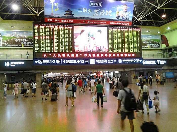
Hello everyone, 🙂 This month’s theme is: places, departure or arrival scenes. The places include: train or bus stations, passenger ports, and airports. Here, for example, is Beijing West Railway Station This is Beijing West Railway Station. You can submit a photo of the whole place, a part of it (inside or outside, the platforms), or a detail (like a station clock) as long as it clearly shows it’s a departure or arrival spot—such as a timetable display. Or here’s another example:

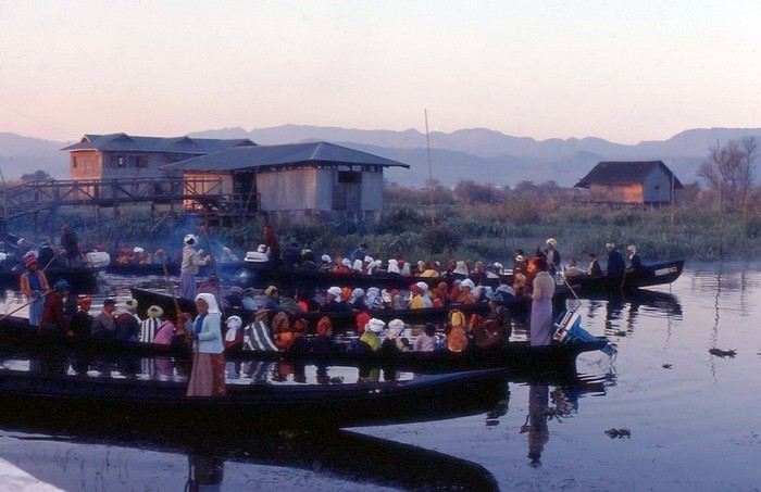
Even if you’re not in one of these places, a departure or arrival scene is welcome: Example: Early morning departure from a pagoda at Inle Lake (Myanmar) as people head back to their villages in the surrounding hills

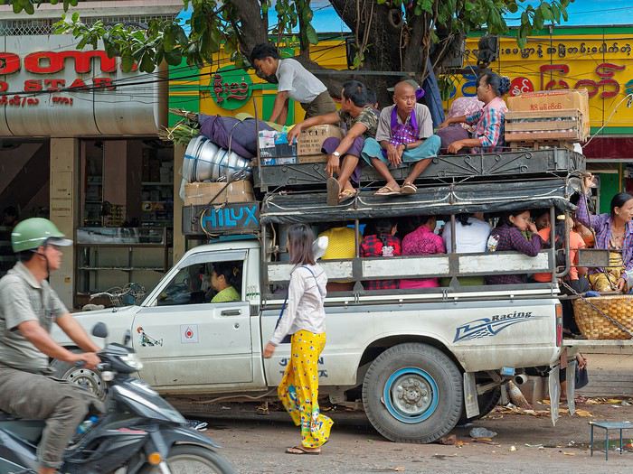
A vehicle about to leave:

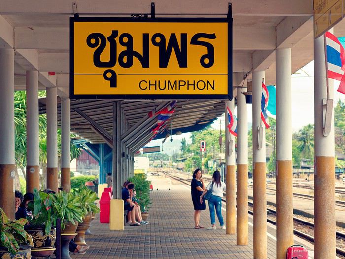
People are also allowed, as long as they’re clearly identified as travelers about to depart or who have just arrived. Bus station in Thailand (a photo I’d shared for the "solitude" theme)

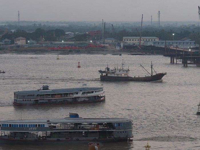
Another example: in the foreground, a boat docked, and just above, another that has just left (Rangoon, Myanmar—these boats serve cities in the Irrawaddy Delta, and in some areas, they’re still the only means of transport for locals).

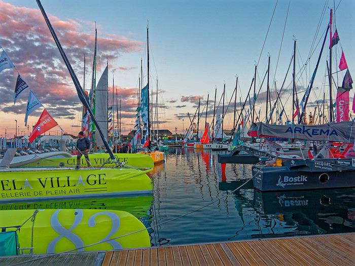
You can also include departures or arrivals from races, but again, it must be at the start or finish, not during the race: Boats before the start of the Route du Rhum in Saint-Malo:

Participation: Each participant can submit up to 3 photos, until Tuesday, September 22 at 11:59 PM Paris time. Each photo must be posted in a separate message, with its number (1, 2, or 3). Don’t forget to add a short description (comment, location, etc.).

Voting: Every VoyageForum member can vote for the 4 photos they think are the best, based on their own criteria and the theme (I’m trying this format this month). Voting will take place from Wednesday, September 23 to Tuesday, September 29 at 11:59 PM Paris time.

Photos should be ranked in order of preference: - 1st photo: 4 points - 2nd: 3 points - 3rd: 2 points - 4th: 1 point

Each member can vote only once for 4 photos. No ties for 4th place with half a point each.

The winner is the photographer whose photo receives the most points. Results will be announced on September 30. In case of a tie, the number of first-place votes will decide. The winner will have the honor of organizing October’s contest.

Give me two or three days to put together the slideshow—I’ll definitely reach out to Masterpo via PM for advice if I’m stuck (and if he’s willing).

Good luck to everyone—may the best photographer win! Let’s get started! For discussion, it’s here
Open
Costa Rica: Two Incredible Weeks
Hi everyone,

Taking advantage of the quiet days that Covid-19 has brought us, I thought it was time to share my experience in Costa Rica. Once again, I found a lot of helpful information on this forum, so if I can help in return, I’d be happy to!

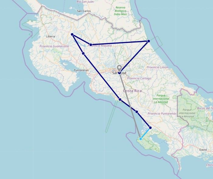
Here’s some general info: - 2-week trip in a 4x4 during the dry season, from 01/27 to 02/10 - Two 27-year-old travelers, no kids And here’s our itinerary: Day 1: Arrival in San José Day 2: San José - Tortuguero Day 3: Tortuguero Day 4: Tortuguero - Arenal Day 5: Arenal Day 6: Arenal - Tenorio Day 7: Tenorio - Monteverde Day 8: Monteverde - Quepos Day 9: Quepos Day 10: Quepos - Uvita Day 11: Uvita - Sierpe - Bahía Drake Day 12 & 13: Bahía Drake Day 14: Bahía Drake - San José Day 15: Flight back to Switzerland...

Of course, we had to make choices—it’s impossible to see everything in two weeks—but honestly, we’re *really* happy with our route. We even saw more than we expected!

So, ready 😉? Here we go!

DAY 1 – Arrival in San José

After a smooth Zürich-Frankfurt-San José flight, we finally made it to San José 😎!! After months of planning and excitement, we’re here! Since we’d booked a 4x4 with the ToutCostaRica agency for the next day, we stayed at one of their hotels, the Melrost. One of their agents was there to pick us up at the airport and take us to the hotel, which is really close. It was early evening, and it was already dark, so no exploring the city tonight. We treated ourselves to a first local beer on the terrace, listening to the birds, and then headed straight to bed.

Hotel Melrost: A simple little building, but super convenient for just one night in San José (well, Alajuela) before moving on. The room was great, and breakfast was excellent!


DAY 2 – Off to Tortuguero

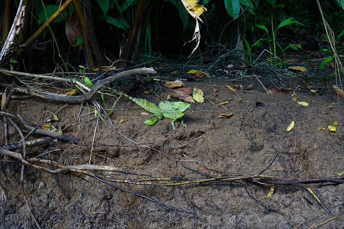
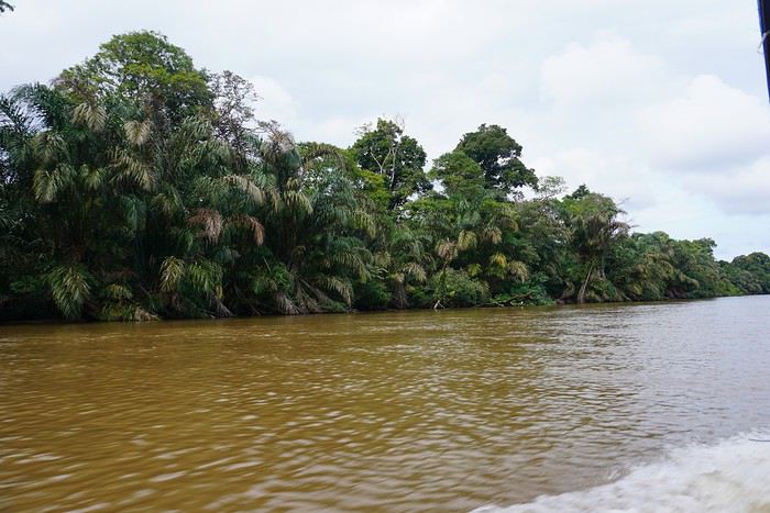
This morning, we had a meet-up at the hotel with ToutCostaRica, where we’d rented our 4x4. They held a briefing in small groups for all the car renters to discuss our routes, tips, the country, and other advice. We found it interesting, but *way* too long! They could’ve kept it shorter—reminding us to wear sunscreen in the sun and not to leave valuables in the car seems pretty obvious... Anyway, after a while, we thanked them for all the advice and set off in our brand-new Toyota Rav4! The rental went perfectly with TCR—everything was great. After leaving the traffic jams of San José behind, we hit some pretty little roads (some in better shape than others) until we reached La Pavona. There, we left our car in a guarded parking lot and took a boat (departure at 3:00 PM) to Tortuguero on the Caribbean coast. Just the boat ride was amazing—we were lucky enough to spot a basilisk, iguanas, and tons of birds. After 40 minutes, we docked right at the pier of our hotel, Casa Marbella. After dropping off our stuff in the room, we headed out to explore the village via its one main street. Lively, colorful, and hot! Since we didn’t have anything else planned for the day, we went back to the hotel terrace to enjoy a juice by the canals. Then, a quick dinner and off to bed to be fresh for tomorrow morning!

Casa Marbella: Really nice, with a convenient pier/terrace for arriving and leaving by boat. Breakfast was absolutely delicious! The room was good, though the AC wasn’t working.


More to come soon!
Open
Adventures of a Bygone Era: The Philippines in 1984
After several discussions on VF about travel journals from the Philippines, I decided to write this curiosity: a trip report from a journey made in 1984, when traveling to the Philippines was still an adventure.

A curiosity because writing a travel journal about a trip 35 years later isn’t common, but also (mostly?) because exploring the Philippines at that time had little in common with traveling there today.

Obviously, I’ve forgotten a number of facts, most of the details, but with the help of a few notes from that time and a stack of slides (yes, there was life before digital 😊), many memories came back and added to the highlights I’d never forgotten. The scanned slides aren’t always great quality, but there are still quite a few to brighten up this chatter. Back then, we didn’t snap photos like we do now—film was too expensive—so I don’t have pictures of every place we visited... too bad, comparing some of those spots to how they look today would’ve been interesting.

Why "Adventures"? Why call it "Adventures" in the Philippines in 1984, a word so often used for a simple exotic trip? - Because the lack of information (no *Guide du Routard*, no *Lonely Planet*, no *Michelin Guide*, nothing, and obviously no internet) gave this trip what’s at the heart of adventure: the unknown. - Because the political situation made the stay sometimes dangerous. - Because transportation conditions were always epic, often perilous. - Because the question of where we’d spend the night came up almost every evening. - And for... quite a few other reasons.

That said, we weren’t exactly explorers!

Why the Philippines? First of all, why go to the Philippines in 1984—a country not exactly set up for tourism and about which we knew very little? How could we get an idea of the beauty of the Philippines and its points of interest when we had no guides or photos?

The idea came to us from Thailand a year earlier, during our first long-haul trip. After touring the north of the country, we met a Frenchman living in Phuket, where there were only a few tourists in Patong, with just a few small hotels and guesthouses. Kata and Karon had no buildings or roads, Rawai only had three palm-thatched bungalows, including ours, and the other islands were unknown to tourists. There was plenty to discover, and we wanted to return to this beautiful country... but the Frenchman made us dream about the Philippines—a country to explore, with wild landscapes.

Long evenings of discussion over multiple Sprite-Mekong cocktails (what memories of those headaches!) finally convinced us we had to go to the Philippines.

Episode 0: Before Departure The decision was made: we’d go to the Philippines in May 1984. Our friends and family were surprised when we announced we were going on vacation to the Philippines (a bit like saying today we were going paddleboarding in the Kerguelen Islands 🤪).

These days, preparing for each of our trips takes long evenings of research, planning, and noting down good addresses... etc. But for the Philippines in 1984, preparation was quick: we had very little information about the country, we were leaving almost at random, and the discovery would only be more exciting.

We still had a few bits of info gathered here and there: the rice terraces in northern Luzon, volcanoes, Negros where we were supposed to visit an acquaintance, Cebu and its marine life (we ended up going elsewhere), and absolutely avoid Mindanao, which was practically at war with the regime. That was about it, but it was already a great itinerary.

Nothing was organized in advance; we’d see day by day. We had no idea about travel times or even the existence of transportation options. The main (and sometimes only) way to connect two islands was by overloaded, rusty ferry. Only the big cities had airports.

Let’s Go: Episode 1: Paris to Manila My travel journals always start after arriving at the airport—the Europe-to-“Other Continent” trip isn’t interesting—but the flight to the Philippines was already an adventure, so I’ll make an exception.

This was the era when only a few Asian airlines were on par with Western ones: Thai, Singapore Airlines, and Philippine Airlines. They had beautiful, brand-new planes, and to attract customers (almost exclusively “businessmen”) from the usual airlines (Air France, Lufthansa, British Airways), there was opulence on board: unlimited champagne, all sorts of cocktails... Compared to today’s long-haul flights, there was still one small difference: no personal screens, just one screen at the front of the cabin with one mandatory movie. And I don’t know why, but we only got James Bond films, both ways... that must’ve been the trend at the time.

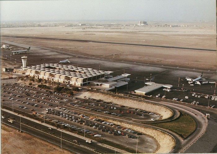
The tourism boom to Southeast Asia hadn’t started yet, and the “Asian Tigers” weren’t a thing, so there weren’t many business trips. That meant long-haul flights made stops everywhere to fill the planes. Our Philippine Airlines Boeing 747 left London, picked us up in Paris, then stopped in Frankfurt to take on a few Germans. I don’t know why we then made a stop in Dubai—a totally exotic place at the time. There was nothing to do there... things have changed a lot since. It was a small town lost in the desert. The airport was tiny, with just one or two buildings and a supermarket. During the stopover, everyone had to get off the plane and walk to the supermarket. Photo and electronic equipment were dirt cheap—I guess that was the only reason for the stop. Maybe it was their first commercial move. Emirates didn’t exist yet, as I checked online, but anyway, the idea that such a remote place could have its own airline was unthinkable.

Online, I found this photo of Dubai Airport in 1980. Anyone who’s transited through today’s massive airport with its rows of A380s will appreciate it:
Next stop: New Delhi to drop off some Europeans and pick up a few Indians, and finally, the terminus: Manila. I don’t remember how long the trip took with its five stops—an unimaginable journey today. Despite all those stops to fill the plane, there was still enough space to stretch out on the four center seats of the 747, something that never happens these days despite all the flights in every direction.

So here we are, finally at Manila Airport around midnight.

Episode 1: Manila and Baguio To start, a quick note on the political and economic situation in the Philippines in 1984, which had consequences for us as tourists, as we’d soon realize upon arrival.

After several centuries of Spanish colonization, the Philippines became American at the start of the 20th century, then independent. In 1966, Marcos took power, and little by little, his regime sank into corruption and mismanagement, becoming a dictatorship with martial law, all for the benefit of his family and friends, who enriched themselves endlessly. The peak was the assassination of opposition leader Benigno Aquino in August 1983, which triggered harshly repressed protests. So we arrived a few months later in a very poor country, with omnipresent corruption and an extremely tense political situation, as we’d soon see for ourselves. Major protests took place in the main cities during our trip—I’ll come back to that. Two years later, Marcos fled to Hawaii after being forced out of power following rigged elections. This historical context explains a lot of the situations we found ourselves in over the following weeks.

Arriving in the middle of the night isn’t very cheerful. Manila was already a huge city with many slums, where you could find a few business hotels like the Hilton or Intercontinental—way out of our budget—and plenty of run-down hotels. Luckily, two Indians we’d chatted with on the plane offered to take us to their usual hotel. They came to Manila twice a year for business. We accepted their offer, relieved not to have to look for a place to stay in the middle of the night, figuring the address must be good since they came back every time... we were wrong 🙁

We left the airport and immediately got a taste of the local vibe when we got into the taxi: the police asked for our passports. We thought: what’s more normal than police in a dictatorship?

But that wasn’t it at all. Our two Indian friends explained that the police were noting our names along with the taxi number and time. Crime in Manila was so bad that the taxi driver would be held responsible if anything happened to us... welcome to the Philippines 😎 😎

Historically, the Philippines was a very violent country, where everything was settled with guns or machetes. Previous governments had banned carrying weapons, but Marcos later allowed the free sale and carrying of guns, and disputes were settled with pistols again (or worse, as we’d discover later). Since he’d released most of the criminals from prison to form a paramilitary militia at his service (I’ll talk about our encounter with these “heroes” later), it was pretty dangerous to go into many parts of Manila, where these “tonton macoutes” ruled.

We arrived at our hotel without incident... and then things started badly. The room was infested with big cockroaches—exactly what I hate most in those kinds of countries. No way to find another hotel at that hour. After the long flight, the urge to take a shower was so strong that we squeezed into the bathroom as best we could. After that, I don’t remember—I guess we must’ve fallen asleep exhausted under the sheets in the heat... air conditioning wasn’t widespread yet.

The next day, we just wanted to leave that dump as soon as possible. So we decided to head north right away, stopping in Baguio, and we’d visit Manila a bit on the way back.

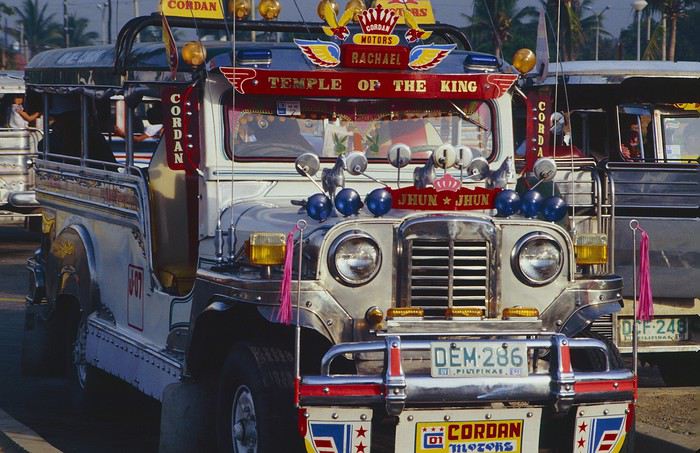
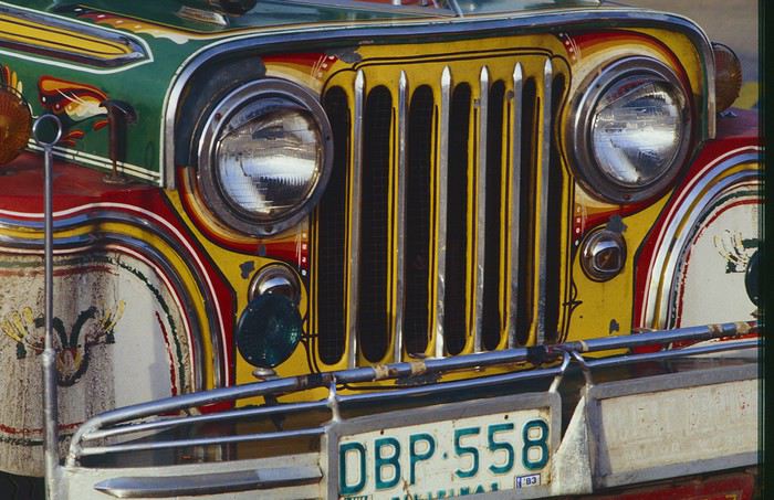
When we stepped outside, we discovered a pretty run-down neighborhood with potholed streets. But we also discovered the jeepneys. They were everywhere, flooding the streets.
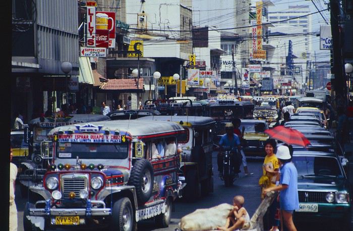


They had crazy sound systems, each one blasting louder than the last. The interiors were kitschy but fun. There weren’t many private cars—almost all transportation was by jeepney, with buses reserved for intercity trips.
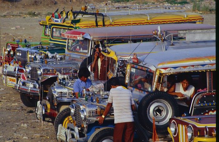
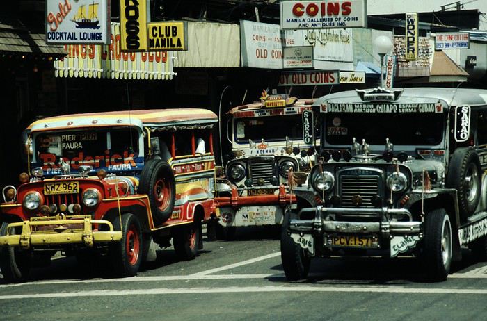
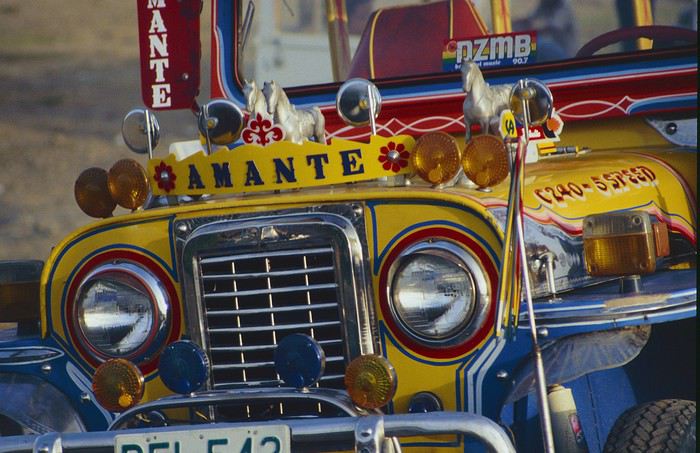


Before heading to the bus terminal for the north, somewhere on the outskirts of the city, we needed to exchange some money. I don’t remember how we ended up in a policeman’s jeep who offered his services: - Exchange money on the black market at a better rate than the banks. - Take us wherever we wanted, in this case, the bus terminal.

We accepted both offers (we’d still checked the official exchange rate from dollars to pesos). So we found ourselves in his jeep. After exchanging money, we left in his vehicle and stopped for gas. Without turning off the engine, he calmly smoked a cigarette while filling up. Since we were in a jeep with no doors or roof, we were ready to jump out if things went south, our travel bag in hand.

But we weren’t done with surprises yet. Once we left the small streets, we ended up in a neighborhood with wide avenues and not much traffic, which didn’t justify his incredible behavior. At every intersection, he made the sign of the cross, closed his eyes, and crossed without looking. I was more stunned than terrified! It wasn’t until we got out of the car later that I told Anne-Marie what had happened. I’d seen everything because the cop had put me in the front seat. Luckily, A-Marie hadn’t noticed anything from the back. Crossing Manila by trusting God rather than the rules of the road was ultimately effective. We were lucky—the trip was off to a good start. 🙂 🙂

We then passed through a neighborhood where slums stretched on for a while, and we left our policeman—friendly but a bit crazy—with relief.

A few hours by bus later, here we are in Baguio, cool in the mountains. My memories of Baguio are pretty fuzzy. I remember a small town. After some research while writing this journal, I found that the population was 120,000 in 1980. Given the population density in each home, that confirms my memory of a smallish town. Outside the “official” district with the president’s summer residence and government buildings, there were two or three paved streets with nice houses. The rest was very dirty and very poor, with lots of slums and dirt roads.
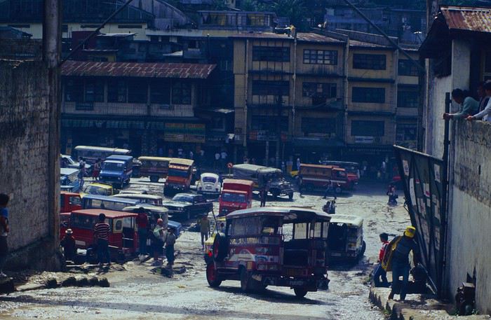
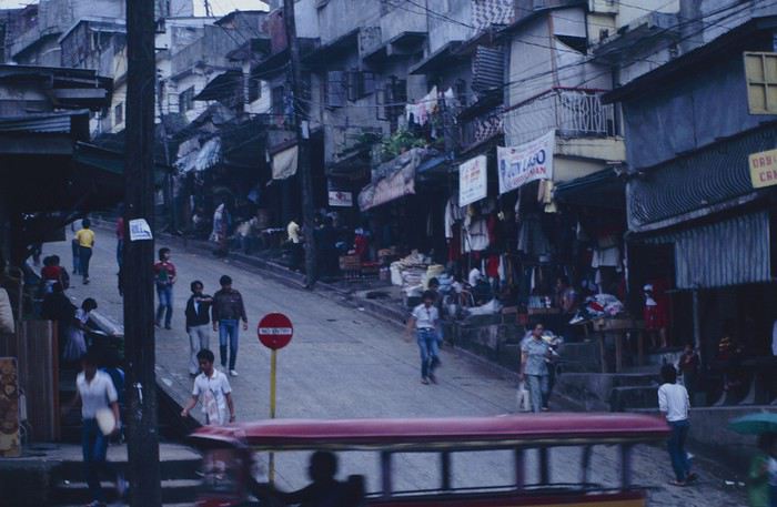
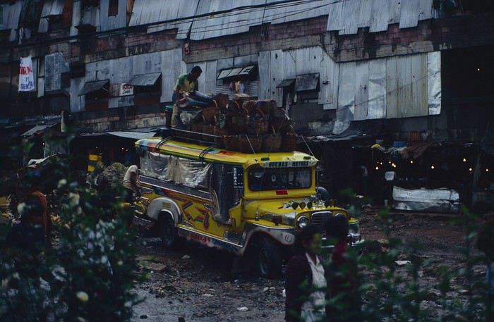


People we met on the street invited us to stay with them. These days, we wouldn’t just show up at strangers’ houses, which we should’ve done in Baguio—it would’ve saved us from an unimaginable and dangerous situation... which I won’t say anything about... !😊

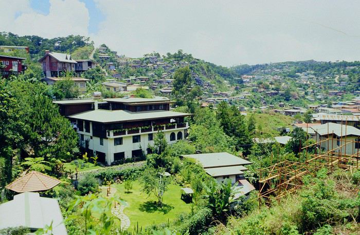
The simple wooden house was on stilts at the edge of a hill with a view of the mountains. Since it was the start of the rainy season in a city that gets a lot of rain, we saw a lot of water. Our outings in town happened between downpours.

View from our lodging:
Episode 2: Baguio to Bontoc Aside from the situation briefly mentioned above, it was on the next leg to Bontoc that the adventure really began: an endless and dangerous road, a bus from another era, breathtaking landscapes, and surprising people.

We didn’t know the distance or how long it would take to get to Bontoc. When we arrived after about ten hours, we learned that Baguio to Bontoc was 140 km.

We got on a bus with wooden seats and settled in, two to a seat meant for two. As the bus filled up, passengers squeezed in three or four per seat, with chickens and baskets full of all sorts of things in the aisle. A little embarrassed, we didn’t know if we should squeeze in three on our seat. The seats were super tight (luckily, Filipinos are small), and I didn’t know where to put my legs given my height. I don’t remember if we stayed alone on our bench or if we ended up sharing with others.
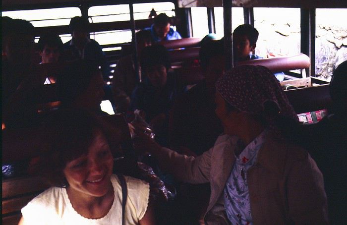


The “road” was a dirt track (or rather, a mud track) with endless turns. We held on as best we could to our slippery wooden seats—it was shaking in every direction. The woman behind us was carsick and throwing up... gross... but what were we doing there? Then we plunged into the Sierra Madre... just the name is dreamy!

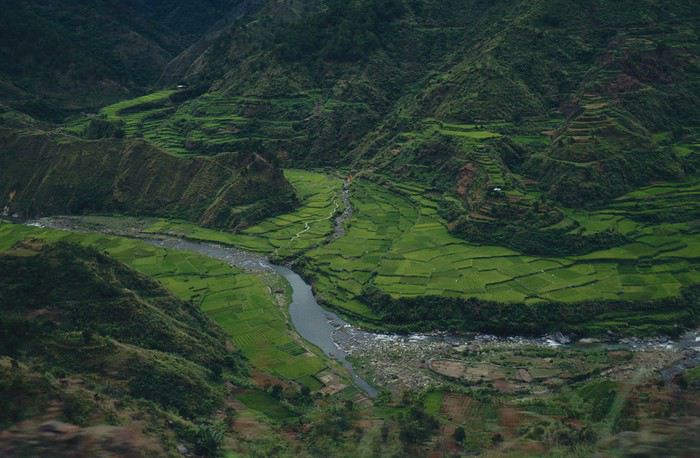
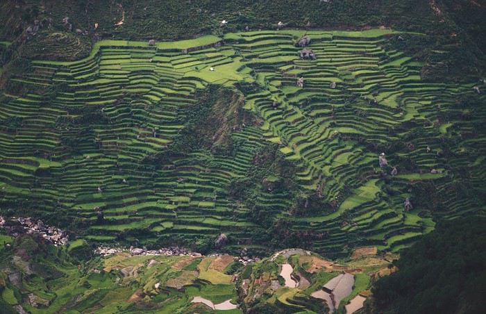
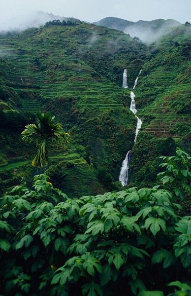
Rice terraces started to appear:
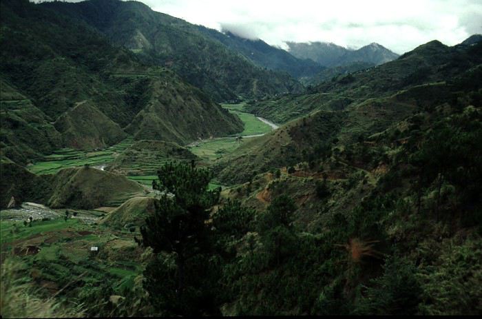


they took up more and more space along cliffs where we weren’t always reassured,
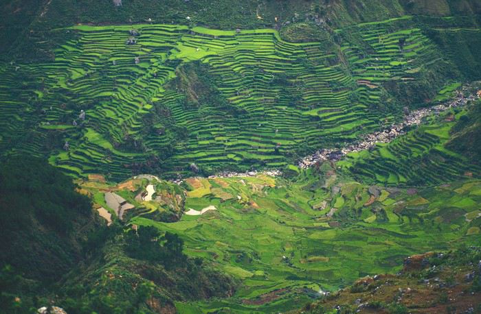


with lots of waterfalls (all that water had to go somewhere).
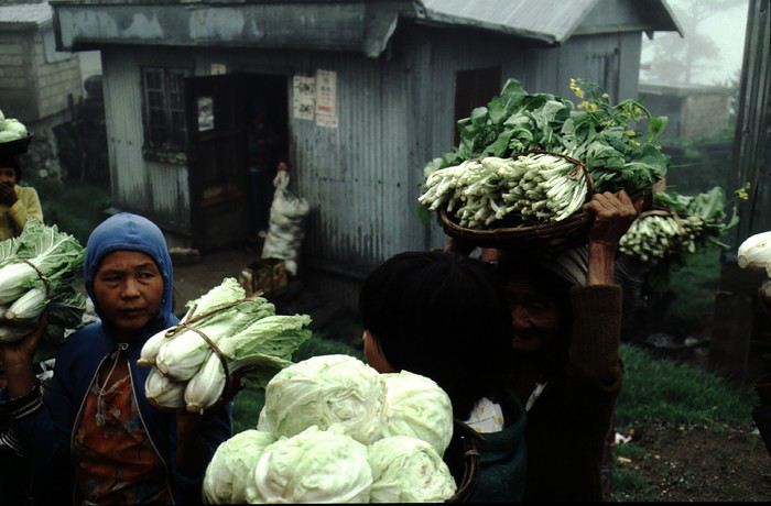
A few miserable villages stretched along the track, most often just a few houses balancing between the road and the drop. The bus stopped in every village—people got on or off and settled inside or on the roof. Street vendors offered their products to the bus passengers—a common sight in Asia, even today.


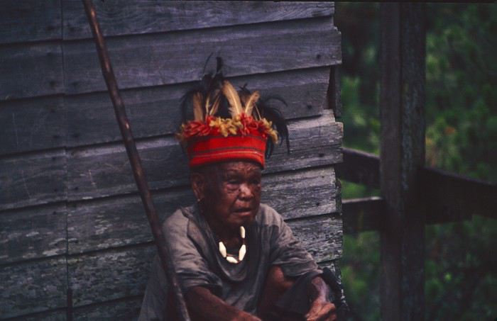
We were in another world—villagers were in loincloths, others had spears. The atmosphere was strange... but all good, we wanted exoticism, and we got it:
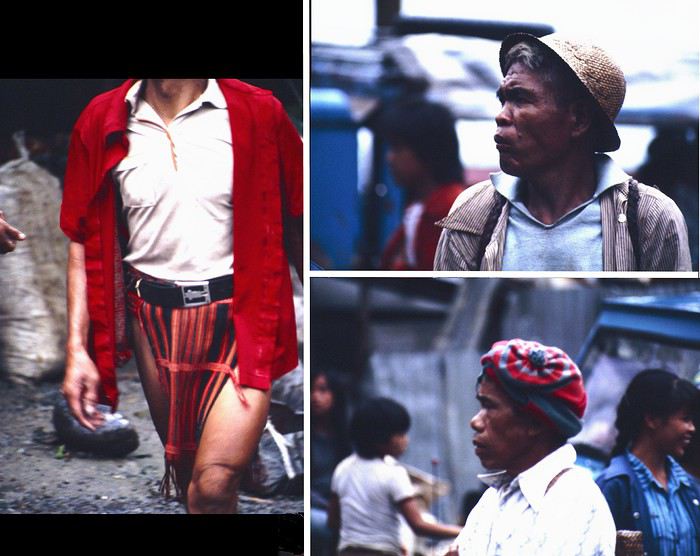
This so-called traditional outfit was everyday wear—it wasn’t for tourists since there weren’t any.
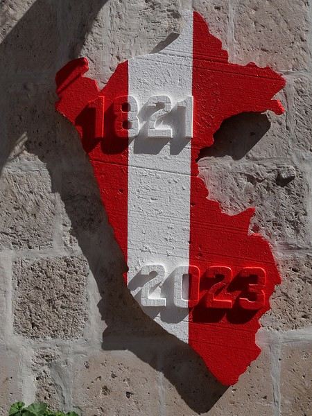
Open
Self-drive in southwestern Uganda, February 2020
Since I used this forum a lot to prepare our trip, here’s a little feedback from our 15-day self-drive adventure in southwestern Uganda. For those who have questions, don’t hesitate! I’ll do my best to answer them 😉

We’d already traveled quite a bit in South Africa and once in Namibia, always self-driving. When the idea of visiting Uganda came up, we debated—especially me 😛—whether to go solo or with a guide. My husband quickly convinced me to do it self-drive, so I started planning and organizing the trip accordingly. We began preparations and bookings in June 2019 for a trip scheduled during the first two weeks of February 2020. We deliberately chose to explore just a small part of Uganda and take our time. We traveled as a group of four, with our oldest son and his partner.

Here’s our itinerary: - February 1: Departure from Brussels, arrival and overnight in Entebbe - February 2: Drive to Lake Mburo and overnight there - February 3: Drive to Lake Bunyonyi and overnight there - February 4: Boat ride on the lake, then departure for Kisoro. Overnight there - February 5: Trek in Mount Mgahinga National Park for the youngsters. Overnight in Kisoro - February 6: Drive to Bwindi Impenetrable Forest. Overnight in Rushaga - February 7: Gorilla tracking in Rushaga. Overnight in Rushaga - February 8: Drive to Queen Elizabeth National Park – Southern sector – Overnight on the park’s edge - February 9: Morning in the southern sector of the park, then crossing to the northern part – Short safari in the late afternoon – Overnight by the Kazinga Channel - February 10: Safari and boat cruise – Second night on site - February 11: Drive to Kibale Forest – Overnight there - February 12: Chimpanzee tracking in the morning – Bigodi swamps in the afternoon – Second night there - February 13: Scenic drive to see the crater lakes + walk at Lake Nkuruba Nature Reserve – Third night there - February 14: Return to Entebbe - February 15: Morning boat ride in the Mabamba swamps – Afternoon by Lake Victoria and midnight flight to Brussels. That’s the broad outline of our trip.

We fell in love with this country: the people, the kids shouting "muzungu," the colors, the landscapes, the wildlife... But we were also saddened by the poverty in some villages and the child labor, especially in "quarries."

I’ll try to post a day-by-day account if it interests anyone.

Open
Back from 3 weeks in the Sultanate of Oman
Back from 3 weeks in Oman. My wife and I just returned from 3 weeks in the Sultanate of Oman. I have to say we had a really enjoyable trip. While we usually prefer self-organized trips (real or imagined sense of freedom?), this time we opted for a pre-organized trip with the agency "Omanselfdrivetour" run by Paul Sistac—and we don’t regret it! Based on a 15-day itinerary, we asked for a few adjustments and additions to make it a slightly more active 3-week trip. We rented a 4x4, which is essential for accessing many mountain villages. The road book, prepared by Paul, suggested visits and activities along the routes connecting our accommodations (always well-chosen for their character). We were free to follow it or not, but I have to say it was so well done that we pretty much did and saw everything it suggested—our days were packed! Oman is a country that lends itself well to many outdoor activities thanks to its mountain ranges (the highest peak is at 3000 m) and especially its "Wadis." A "Wadi" simply means "valley," but the local geology makes these valleys often very deep, resembling beautiful canyons. You can explore them by car in the wider ones, on hikes (some with water) in others, and even canyoning (with the right gear) in the narrowest ones with waterfalls, like the stunning Snake Canyon. There are also great mountain hikes, well-marked, often leading to villages abandoned in recent years or decades. These villages are usually hours away on foot, nestled under massive rock overhangs (like those in Saab bani Khamis or Masirat al Jawamid), sheltered from the tropical sun and attacks. For sunbathers, the Indian Ocean coastline offers beautiful beaches and some luxurious hotels. You can also rent kayaks to get a closer look at the rocky shores. Snorkeling is possible too (some spots are well-known), though conditions weren’t ideal during the few days we were by the sea (too much wind and murky waters). Most of the country, however, is a vast desert. We spent 2 days in the Wahiba Sands dunes, but it wasn’t really our cup of tea. Oman has some scattered historical monuments, like well-restored forts that reflect its history of internal rivalries—similar to our medieval castles. The capital, Muscat, is pleasant and has a few great sights to explore over 2 days, like the old center (with the Sultan’s Palace and the National Museum), the Sultan Qaboos Grand Mosque, and the Opera House. Sultan Qaboos, who passed away on January 10, 2020, after nearly half a century of rule, was sometimes called the "Philanthropist Sultan." He worked to modernize his country and open it up to tourism. Visitors are warmly welcomed by a tolerant and hospitable population. Omanis are always ready to help passing travelers, happy that they’re interested in their country (it’s not uncommon to be offered coffee, fruit, or other gifts for no reason). The only downside: despite trash bins being everywhere, their use isn’t yet universal. So, if you’re thinking of visiting Oman, now’s the time—before the crowds of tourists arrive on low-cost flights. If I can humbly and modestly help anyone plan their trip, I’d be happy to.
Open
More reasons to travel solo in Asia
Hello everyone, I’ve been reading your posts and I can feel my excitement growing... I’m 56, very sporty and sociable, and I’ve never traveled alone before—it’s been on my mind though. I also dream of Asia: Cambodia, Thailand, Myanmar? I love discovering landscapes, but most of all, the people. Last year, I went trekking in Ladakh with two friends, and we did it on our own. It was an incredible visual experience—the Ladakh Valley is stunning—but staying with locals, in early July with very few tourists, was an unforgettable experience. On the other hand, I wouldn’t go to India alone. I didn’t like the way men treated women there. Though, I’ve only been once... Anyway, thanks in advance for giving me more reasons to take the plunge solo. Am I too old for this? Thanks a million! Laurence from Bayonne
Open
Bike trip and camping in Denmark in summer (cities and regions)
Hello, This is still just a plan: My wife and I are considering a bike trip in Denmark. The timeframe would be July 2020, for a solid three weeks. We’d prefer to do a loop to avoid seeing the same landscapes and cities. We also camp. We have our own well-equipped bikes and a single-wheel "Bob" trailer. We’ll likely start and finish in Copenhagen, covering 40 to 60 km per day while leaving time to explore the cities and regions. Through word of mouth, we know Denmark is another cycling country, so we won’t have any trouble finding bike paths. However, when it comes to documents, we’re a bit lost. Since we don’t know the country at all, we’re not sure what’s most interesting to see and travel through. We have the double-sided *Dänemark* map at 1:150,000 from Freytag & Berndt. It shows bike routes and campgrounds (which is great!), but it’s not very practical for biking. Our experience in the Netherlands with "road" maps that quickly fell apart in the rain showed us the limits of those documents... Are there more practical resources? Like a bike guide similar to what we have in France or for European bike routes? Is there a system for identifying bike route numbers like in Holland? And of course, we’d love any practical tips—cost of living, campground prices, hospitality (which I’m sure is excellent), weather quirks, coastal areas, wind (memories of the Netherlands!!!), and, of course, your personal favorites... Thanks in advance to all contributors; Pierre and Dominique from Lorient
Open
Between Réunion and Nosy Bé
Saturday, September 28, 2019

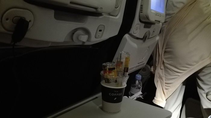
On the Orly-Saint-Denis flight, under the pretext that Air France had paired their delicious chicken with mushrooms meal with a little bottle of rum, Dom noticed that some passengers hadn’t even opened theirs. So he bribed a flight attendant to bring him the abandoned mini bottles! Needless to say, the guy slept like a baby!


Sunday, September 29, 2019 Saint-Pierre

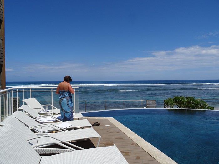
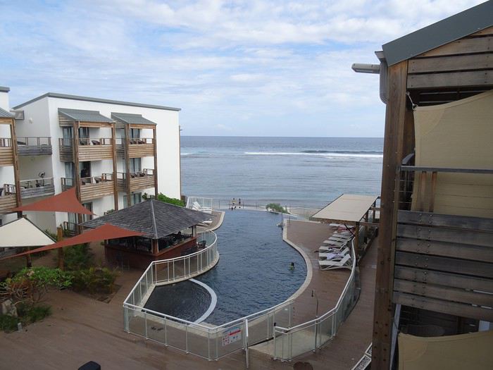
A flawless journey (well, except for a minor distraction in the massive Hertz queue that led me to cut in front of a few young couples, who weren’t too happy about it—though I joked with the agent about it: *"It happens!"*). We ended up at Hôtel Le Battant des Lames in Saint-Pierre, a gorgeous combo of an infinity pool and the Indian Ocean. We rushed straight into the pool—after over ten hours of sitting on a plane, it felt *amazing*!


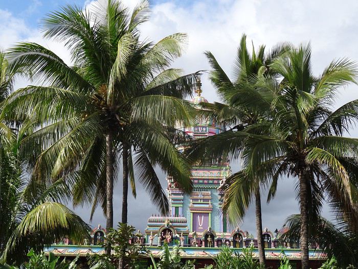
We didn’t waste any time—you know Dom—exploring the city on foot. It’s lovely: the seaside is well-developed, it’s tropical, but with the budget of a wealthy country.


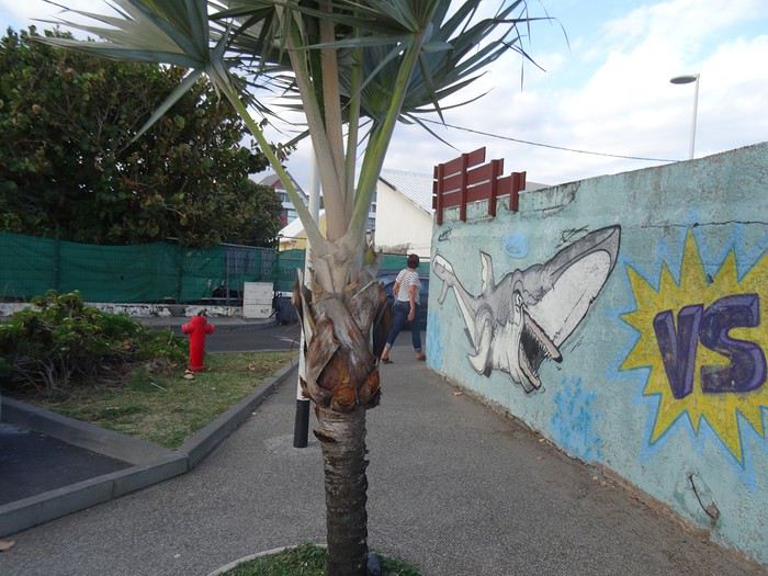
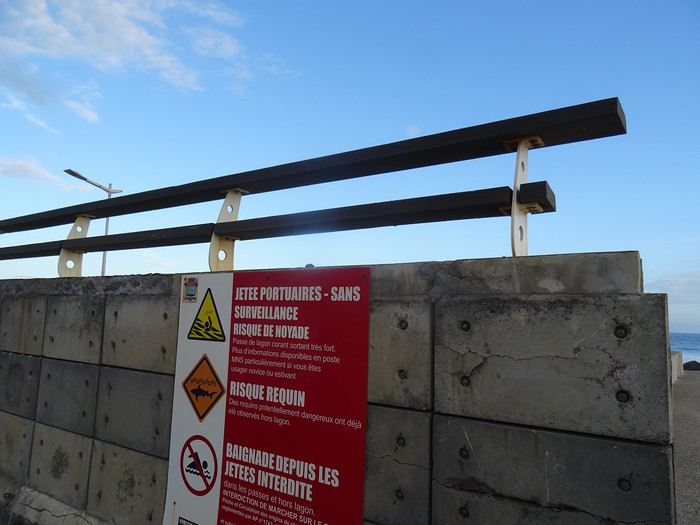
Réunion is also famous for its killer sharks…


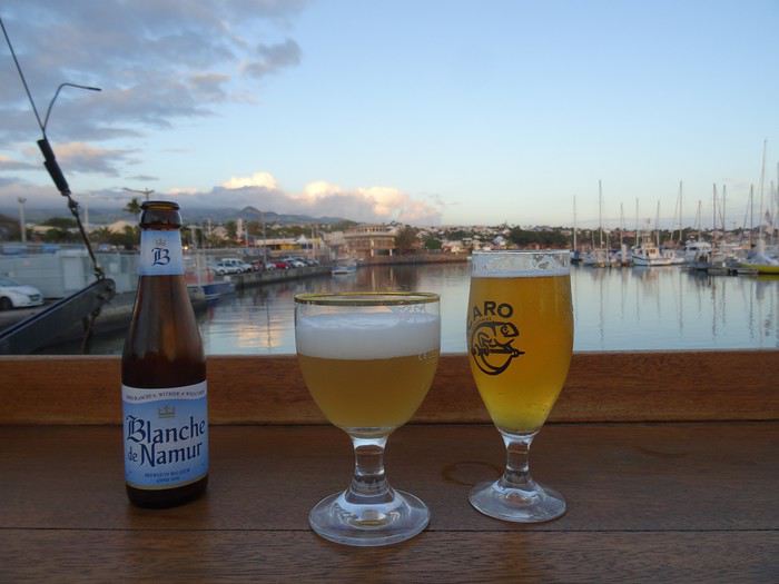
A Creole music group was playing at a seaside bar, so we settled in.


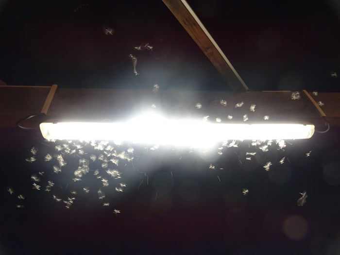
Night fell, and with it, swarms of insects suddenly invaded the city!


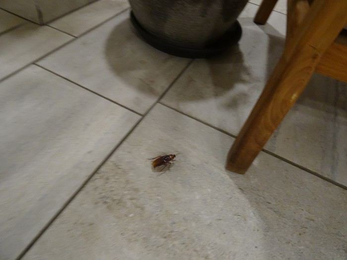
One of the few signs of the tropics here! Insects, geckos, and cockroaches...


Monday, September 30, 2019

Saint-Pierre


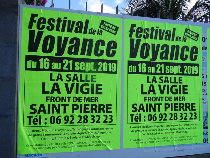
We were disappointed, of course! We could’ve gotten a photo of our *aura* and missed the chance by just a week! In tears, we decided to tackle the island’s most famous site.

Excursion to Piton de la Fournaise. The plan was to head to one of the nearby parking lots and take a relaxed stroll. But it quickly turned into… something else.

First, I realized the built-in GPS operates on a pretty basic algorithm—like the earliest models. If there’s a bumpy road that even the toughest Mitsubishi 4x4 struggles with, a path through a junkyard, or any shortcut to save a few meters, it’ll proudly suggest it. So instead of taking the main road—the royal route to the famous volcano—we ended up on charming little mountain roads…


Open
Wild destination: Botswana
It’s been almost six months since we returned from our 15-day trip to Botswana, ending in front of the majestic Victoria Falls in Zimbabwe.

Our itinerary: 1 night at Maun Lodge in Maun 3 nights in the Central Kalahari at Deception Valley Lodge 1 night at Maun Lodge in Maun 3 nights in the Okavango Delta at Sango Safari Camp 3 nights in Chobe National Park at Chobe Safari Lodge 2 nights at Victoria Falls at A’Zambezi River Lodge

We were on a tight budget, so we opted to rent a vehicle for the Central Kalahari and the Okavango Delta.

The lodges are expensive but all-inclusive—meals, drinks (alcohol included), laundry, and the usual two daily safaris. In short, everything.

The lodges mentioned above offer a very high-end experience, with a guide and a 4x4 for each tent. We shared a 4x4 once at Sango Safari with an English couple.

Another little tip: I’d avoid staying at Chobe Riverfront like we did. It’s extremely touristy and overpriced. I think we should’ve spent one night there for the cruise and two other nights at a lodge deeper in Chobe National Park.

We arrived in Maun after an endless flight: Paris-Frankfurt-Johannesburg-Maun. We headed to the car rental agency to pick up our 4x4, and what a surprise to learn they’d canceled our booking—no vehicle! After 6 hours of waiting, we finally received our 4x4 at our hotel, fell asleep peacefully, and were ready to head to our first destination: the Central Kalahari!
Open
Oh djadja in Karamoja...
Back from two weeks in Karamoja, northeastern Uganda, from Moroto to Kidepo Valley National Park.

A few notes from a few months ago for those who might be interested and whom this area wouldn’t leave indifferent. And rightly so.

First, about access to the region: There have been huge improvements to the infrastructure lately. Although not yet finished, the roadworks have made a big difference, and it’ll be even quicker to get there soon. Currently, allow 8 hours. First from Kampala to Mbale, then from Mbale to Moroto via Soroti. The Jinja to Mbale section is under construction, so that slows things down—count 3.5 to 4 hours from Kampala if there aren’t too many traffic jams on the way out or back. From Mbale to Moroto via Soroti, allow another 4 hours, with only a few kilometers of good dirt road left now that the tarmac is being laid. In a few months, it’ll be done, maybe even sooner.

You can do it in two legs with an overnight in Mbale itself or at Sipi Falls, or go direct. In Mbale, stay at Nurali’s if you really want to keep costs down—also a great spot for Indian food. The vibe is nostalgic, like stepping back in time with granny’s oilcloth table cover (if your granny were Indian). Otherwise, Wash and Wills has a nice pool and a view of the mountains across the way. Lovely garden.

For those who don’t mind driving on dirt roads when it hasn’t rained too much, or who aren’t afraid of taking longer, I’d still recommend going via Nakapiripirit from Mbale. It’s longer, more tiring, and tougher (and if it rains a lot, it can be a real hassle), but wow, is it ever more beautiful. Your call.

Once you arrive in Karamoja, it’s time to enjoy the region you’ve taken the time to reach. So many people only go for Kidepo—what a shame, since the area has so much more to offer. The people are incredibly friendly, and the local culture is so diverse and fascinating.

In Moroto, accommodation options are multiplying like loaves and fishes. At Tita’s, the Karatunga campsite, and of course the institution, Mount Moroto Hotel, which feels a bit stuck in time but is where you’ll find a bit of Moroto’s history. In short, something for every taste and budget. The same goes for meals—you can eat for 5,000 UGX (1.25 €) in local spots or 25,000 UGX (6 €) at the fancier places in town. No risk of going broke here.

Same in Kaabong. From a sleepy little town, it’s slowly but surely moving toward a gentle, steady kind of modernity. There are hotels and guesthouses like Kaabong Resort, which I’d recommend. Forget the name and the appearances—ignore the "Resort" part that’s just there to lure you in. In the end, it’s a cozy little place where you’ll hear both local radio and Madonna’s greatest hits (from the late ‘90s). The staff are welcoming and attentive. They really want to make you happy, and it shows. Here too, you can eat for 5,000 UGX in the village or 15,000–20,000 UGX at the hotels.

Between Moroto and Kaabong, stop in Kotido—more new developments there too. And more guesthouses and restaurants with very reasonable prices. La Maison is a spot that, for the more Francophone among us, will feel like a little taste of France. But Kotido is really worth it for the Karamoja region’s biggest livestock market, held on Wednesdays. Colors, noise, smells—so much joy in being there, right in the middle of all that energy pulsing with the pastoral life of Karamoja. Not a single herder will refuse a photo, proudly sporting the "Karamojong package": a vibrant piece of fabric, a military jacket harking back to the Karamojong’s glorious fighting days, an ostrich-feather hat (or a Guangzhou knockoff), a walking stick, and the dual-purpose stool (for sitting or resting your head, used vertically or horizontally depending on how tired you are and how much local beer you’ve had).

In Moroto, take the local tracks—either across the plains or along the Mount Moroto range. The area is mostly pastoral, with manyattas seeking protection not just from raiders (now rare) but also from grazing animals. On the tracks along the mountains, you’ll cross a few small streams and see some camps for gold prospectors or marble cutters, as well as other geological wonders that are putting pressure on the area from unscrupulous investors. You can also follow the tracks into the valleys to discover the Tepeth villages—more agricultural, more remote, surrounded by unexpected greenery.

KaraTunga can help you explore all this. It’s a local agency I haven’t used myself, but they can provide guides and offer services like mountain hikes or manyatta visits...
Open
Trouble finding seats on trains in India?
Hi,

I’ve read that trains in India are packed and it’s pretty tough to find seats 2-3 days in advance... Apparently, there’s still a small tourist quota for available seats, but they’re limited. Would anyone have more specific info on this?
Open
Independent trek in Lower Dolpo + looking for a trekking partner, details to be decided
Hi there,

I’m heading to Nepal for two months in October/November, including a 20-day trek that I’m planning in Dolpo this time (after the Dhaulagiri Circuit and the Three Passes trek in the Khumbu region in previous years).

1/ Is it possible to organize a trek in Dolpo solo—that is, without going through an agency? (I know permits are mandatory, but I’ve heard conflicting info about whether a guide is required.)

I’m considering one of these two routes: - Lower Dolpo loop + variations - Dunai to Lo Manthang traverse (I’d love any tips if someone’s done this route, especially about resupply points)

2/ If it’s not allowed, are there guides or agencies in Dunai that might offer services? I’d appreciate any local contacts.

3/ Lastly, I’m looking for 1–3 trekking partners. Dates and route to be decided together. Experience with high-altitude trekking would be a plus, but simplicity, a thirst for adventure, and a good sense of humor are non-negotiable. Also, up for a self-sufficient experience (no guide or porters), depending on the answers to the points above.

Thanks in advance for your replies!

Olivier
Open
Three Passes Trek in Nepal
Hi there. I know this topic has been covered countless times, but I can't seem to find clear answers to my questions.

I'm currently looking into doing the Three Passes Trek, including some adjacent routes like EBC, Kala Patthar, Gokyo Ri, and maybe Chukung Ri. I'm planning to do this trek between April and May.

But I have a few questions.

In terms of difficulty, I think I'm physically up for it—I'm athletic and used to mountain hiking in France—but is there any specific training I should do? Just to note, I did the Annapurna Base Camp last year without any issues.

Is it doable without a guide? I’d prefer to skip a guide and porter so I can really move freely. Is that crazy, or is it common? I’m mostly concerned about the Cho La and Renjo La passes (more about the route and risk of getting lost than safety).

Finally, I’m wondering about the duration. I’m a fast hiker, but I plan to take my time to acclimatize properly and enjoy the scenery (and maybe relax a bit in those landscapes🙂(By the way, does living at 2,000m altitude for 90% of the year help with AMS?) How much time should I budget for the trek to be safe, even if it means spending 2-3 extra days around Lukla-Namche? I was thinking of setting aside 20 days—does that sound reasonable?

Thanks for reading, and sorry in advance for any spelling mistakes. If I think of more questions, I’ll post them in this thread.

Cheers
Open
Istanbul Trip in 2014 (Full Story)
ISTANBUL STAY in 2014 - (Full story)

dFrom Monday, March 10, 2014, to Sunday, March 16, 2014.

After my first trip to Istanbul in 1979 by motorcycle (Honda Gold Wing), where I stayed for about ten days at a campsite very close to Istanbul, I wanted to revisit this city that had already charmed me back in 1979.

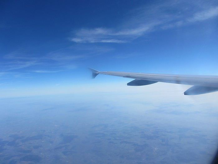
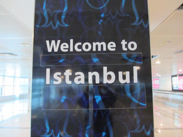
Our flight from Lyon (6:45 AM) wasn’t direct. Basically, we left home at 3:00 AM, and it takes us about 1 to 1.25 hours to get to Lyon Saint-Exupéry Airport. I always leave a little extra time in case of bad weather (snow) or a flat tire. Our flight departed Lyon on time, heading to Frankfurt with an arrival at 8:15 AM, and a connecting flight to Istanbul at 9:05 AM. Needless to say, you can’t dawdle in the airport to get to your gate—Frankfurt Airport is huge compared to Lyon’s. After a 2-hour, 55-minute flight, we landed at Istanbul Atatürk Airport, followed by a good hour of waiting to clear customs and immigration.


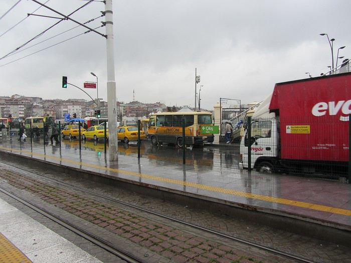
To get to our hotel from the airport, we took the metro and then the tram. When we travel in big cities, I always bring my TomTom GPS, which is super helpful for knowing which station to get off at to be as close as possible to the hotel.


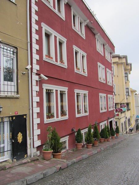
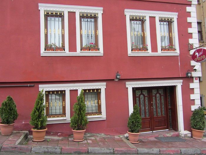
And here it is—our little hotel, "Hotel DARA," just a 5- to 10-minute walk from the Blue Mosque and right next to one of the many entrances to the Grand Bazaar.


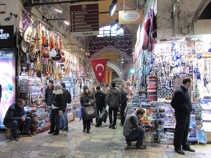
Speaking of which, when we arrived in Istanbul in the rain, once we got our room, we headed straight to the Grand Bazaar to take shelter from the downpour. Located along 58 indoor streets accessible through 18 gates, it’s home to 4,000 shops. It’s right in the heart of the city.
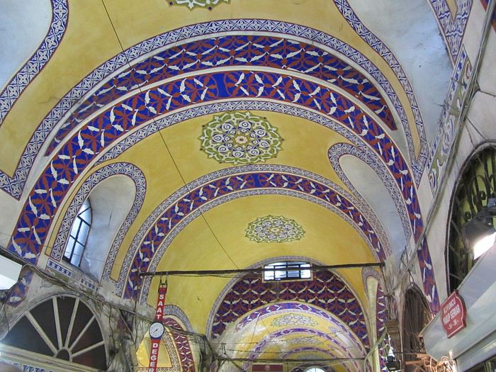
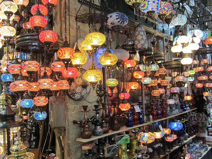
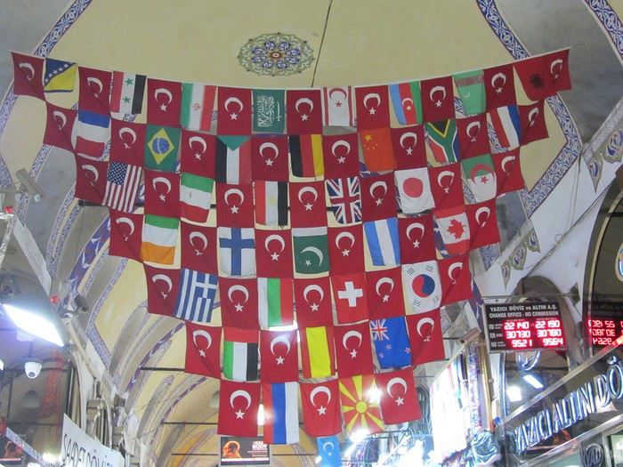
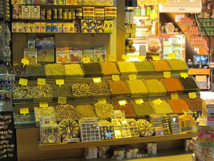
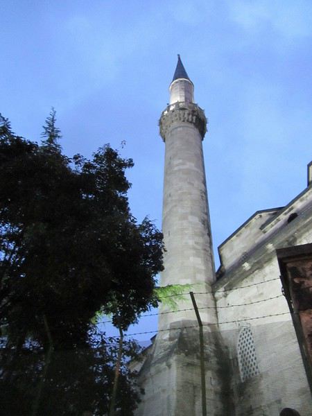
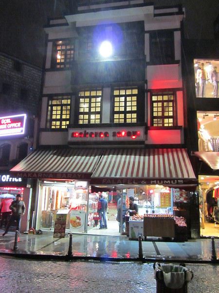
Like all bazaars, it’s organized into sections, each grouping a certain type of craft: jewelry, carpets, textiles, mosaics, silverware...


And when we left the Grand Bazaar, surprise—the rain had stopped, and the sun and a bright blue sky had returned.


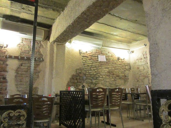
And here’s the restaurant we went to every evening during our stay—a cozy spot with varied dishes, friendly staff, and not too expensive, with a mostly local crowd.


Tuesday, March 11.


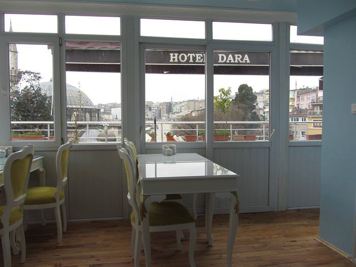
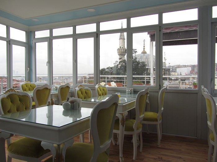
Disappointment this morning—the blue sky didn’t last. We woke up to gray skies and a light rain, so we couldn’t have breakfast on the rooftop terrace of our hotel, where the view is amazing.


The breakfast was hearty and great, with both sweet and savory options, and a server who immediately hit it off with my partner, even though she didn’t speak a word of French. My partner got a kiss every morning.

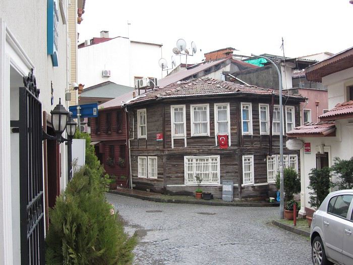
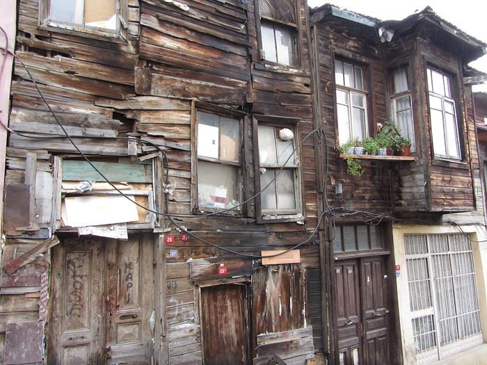
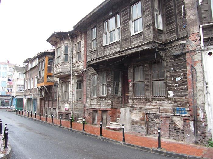
We wandered around the neighborhood below our hotel, an area with the few remaining wooden houses. In 1979, I remember there were many more, but now they’re either falling into ruin or being torn down for more modern buildings.


The Little Hagia Sophia Mosque. Küçük Ayasofya

Open
Banggai Islands (Sulawesi)
Hi everyone,

Just sharing a bit about a place we loved in Sulawesi, in an area that’s almost unknown to Western tourists.

Afni and Ilak, a lovely Indonesian couple, built two bungalows on a beach on Banggai Island (the main island of the Banggai archipelago).

The Banggai Islands are an archipelago east of Sulawesi, off the coast of Luwuk. The main island is quite large, with a small town and several villages. From there, you can head to other smaller islands. There are diving spots, snorkeling, paradise-like beaches, Bajo villages, and more. However, there’s no dive center that I know of, no restaurants for Westerners. Very few people speak English—if anyone at all on the smaller islands.

There are still some tourist facilities, though. But since no information is available in English, it remains mostly a destination for local Indonesian tourism for now. That’s what makes it so charming.

When we went there, the bungalows were already built, but the place wasn’t officially open yet because some essential amenities (kitchen, bathroom) were missing. So we’d walk 20 minutes to the nearby village to shower and eat at our hosts’ house. Now it seems all the amenities are finished, and it’s officially open.

We spent about ten days there, on Banggai Island and Mbuang Mbuang Island.

Mbuang Mbuang has stunning lagoons, diving and snorkeling spots, and a hidden jellyfish lake (don’t believe those who say there are only 5 or 6 in the world—they’re forgetting to count this one!). It’s also a bit of an adventure, since: - No one speaks English in the village - There was no phone signal (so no Google Translate to help communicate) - No restaurants (not even a warung!) - Ferries don’t run every day

But the locals are incredibly kind and ready to help, so you never feel lost.

In short, it’s a destination to visit soon—it has all the makings of a new tourist hotspot.

You’ll need plenty of time, though, as the journeys are long, especially if you want to explore islands beyond Banggai. Like anywhere off the beaten path, don’t expect all the Western-style services.

To get there, the easiest way is to fly to Luwuk (there are flights from Makassar and Manado) and take an overnight ferry.

Here’s a little YouTube link about the place: https://www.youtube.com/watch?v=e9S2CubaneE

Benjamin
Open
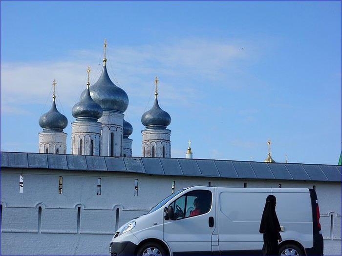
Makaryevo Monastery: The Magic of the Volga...
Hello,

Today is January 7th, Orthodox Christmas Day.

It’s the perfect occasion to share on VF a religious site that left a lasting impression on us.

For a long time, we’d admired photos of the Makaryevo Women’s Monastery on Russian websites. They’re always taken from cruise hydrofoils that, in season, depart from Nizhny Novgorod.

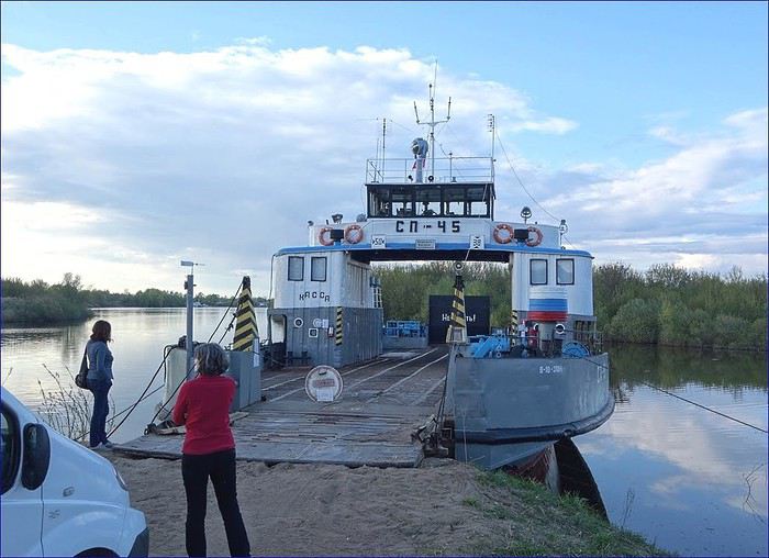
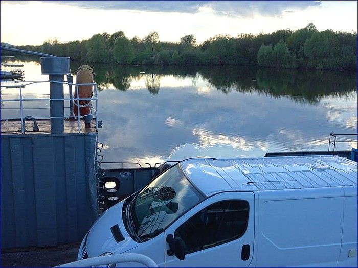
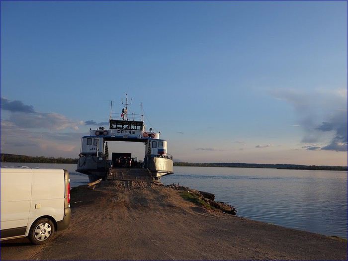
This gave us the idea for a crazy challenge: to visit the monastery during a river cruise, with our little plumber’s van that’s become the common thread of our travels!

This challenge seemed impossible to pull off.

The equation was indeed impossible to solve

1. Find a dock 2. Load the van onto a boat 3. Cross the Volga 4. Arrive at sunset 5. Sail past the monastery 6. All with no reliable information. NONE!

Incredibly, every obstacle fell into place one after another! Gifting us unforgettable moments.

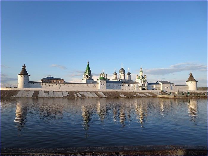
The photos follow our exact journey.

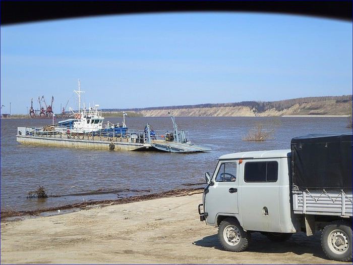
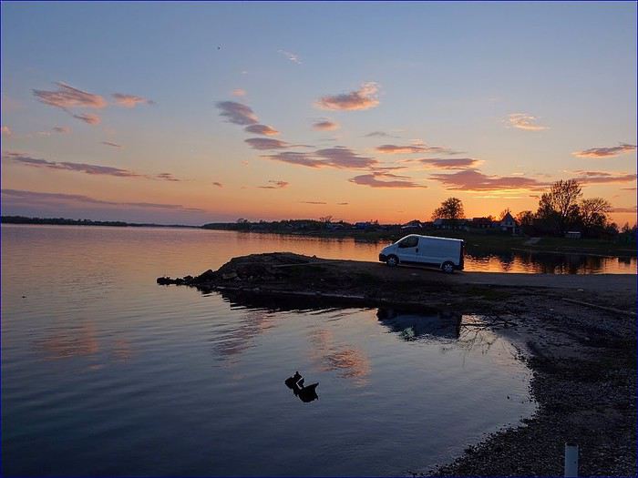
1. We arrive on the southern bank of the Volga, searching for a ferry to Makaryevo. First attempt, first failure—we’re way too far east. We find a second ferry, but it serves a different town on the northern bank.


2. We keep going and meet some fishermen. But even they don’t know where to board a vehicle for the monastery.


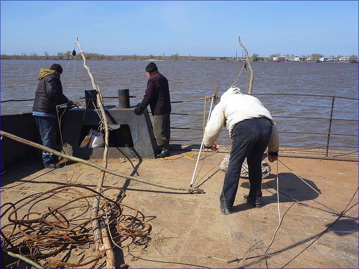
3. After several fruitless searches, a young man who speaks a few words of English points us to a dock where, in summer, boats *might* serve the monastery. Miraculously, at the end of a rough track, we find an old ferry moored. But no one’s on board, and a chain blocks the entrance. After an hour of waiting, a worker arrives and tells us they *will* cross the Volga tonight, but the exit ramp at Makaryevo isn’t accessible for our vehicle. The captain joins him, and seeing our disappointed faces, they confer, discuss, and load some planks to raise the ramp!

Another miracle!

4. We board, with just one passenger accompanying us— the Trafic is the only vehicle on board.


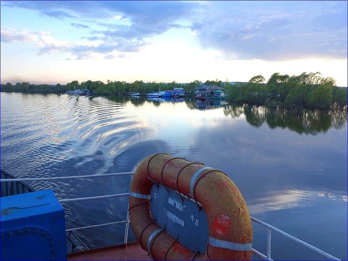
5. The crossing was magical. And longer than expected, since the Volga here is several kilometers wide, and we’re navigating between countless islands!


6. Under a sky that gradually clears, we discover there are homes on the river— invisible from the banks—that form small communities where people get around by boat!


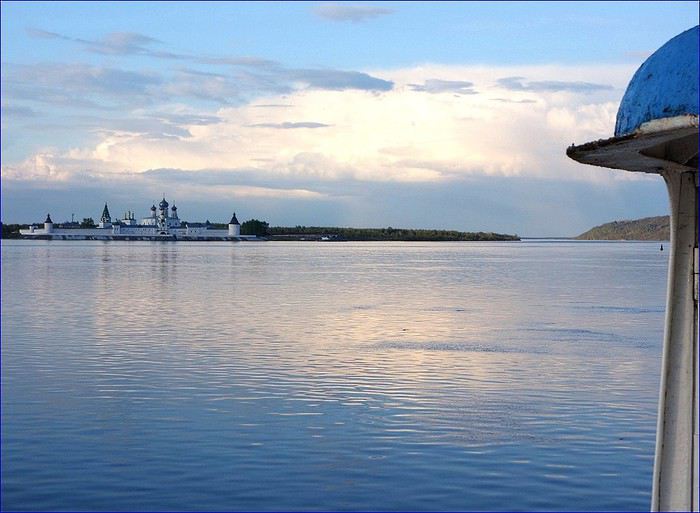
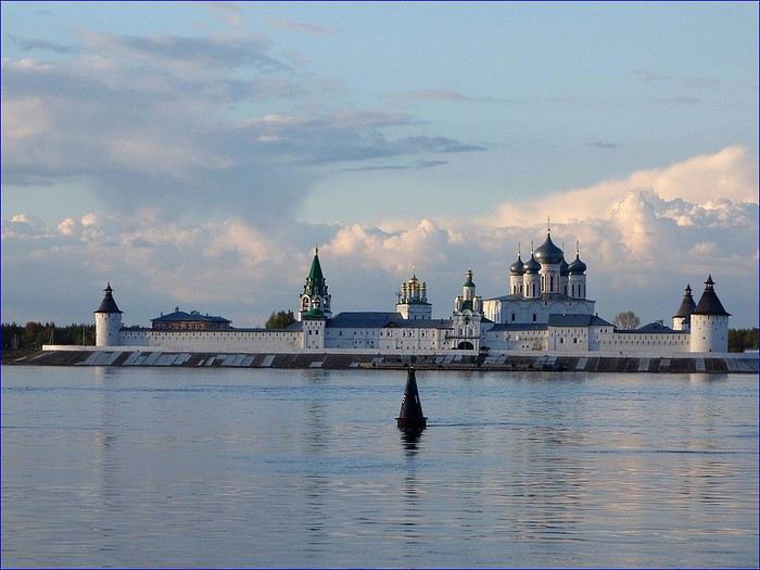
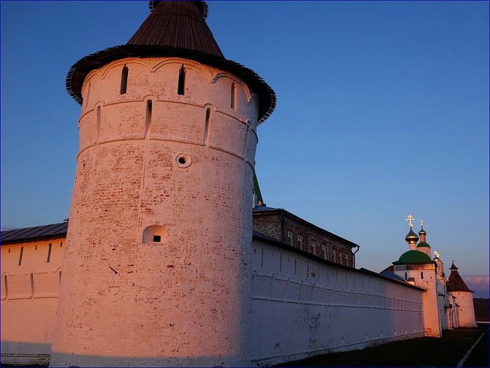
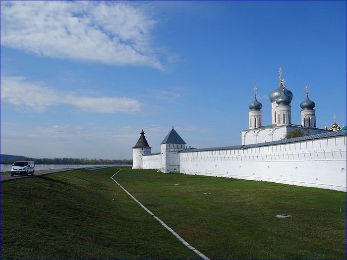
7. Then, suddenly, around a bend in the channel, the monastery appears in the distance on the northern bank.


8. At the exact moment our boat rounds the buoy and nears the monastery, the sun breaks through the clouds!


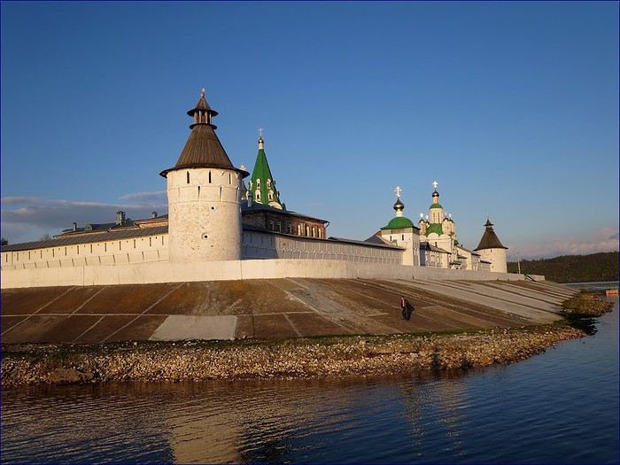
9. A breathtaking sight, with our boat gliding along the monastery walls in absolute silence.


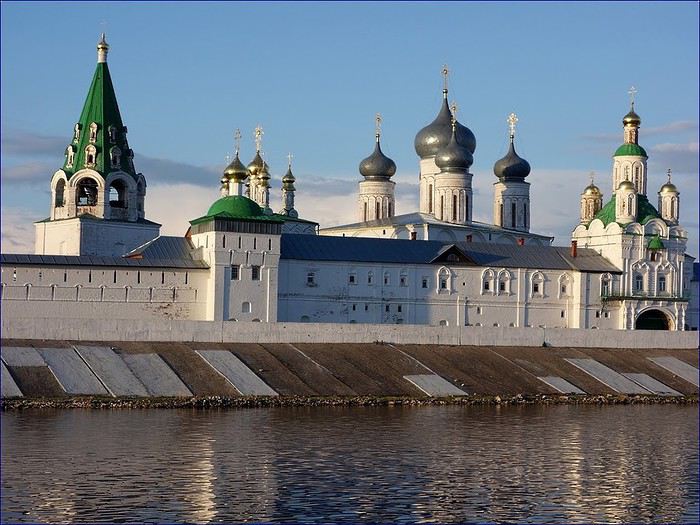
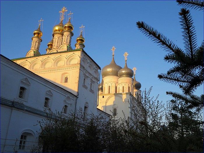
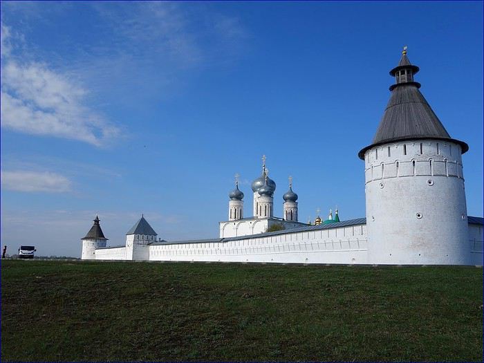
10. The sky, now a deep blue, makes the vibrant colors of the onion domes pop.


11. We sail slowly past the monastery under extraordinary light— something our little compact camera can’t fully capture.


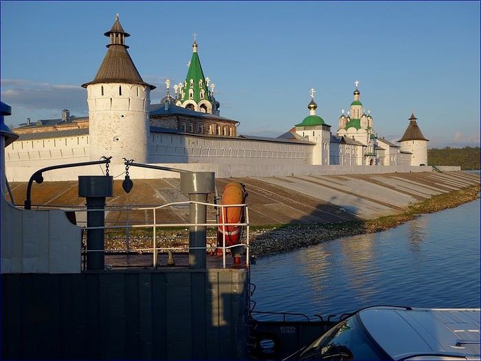
12. As promised, the captain and his crew adjust the exit ramp. You can’t tell from the photo, but even with the planks, it was a close call— the van’s chassis barely cleared the ramp. We thanked them warmly.


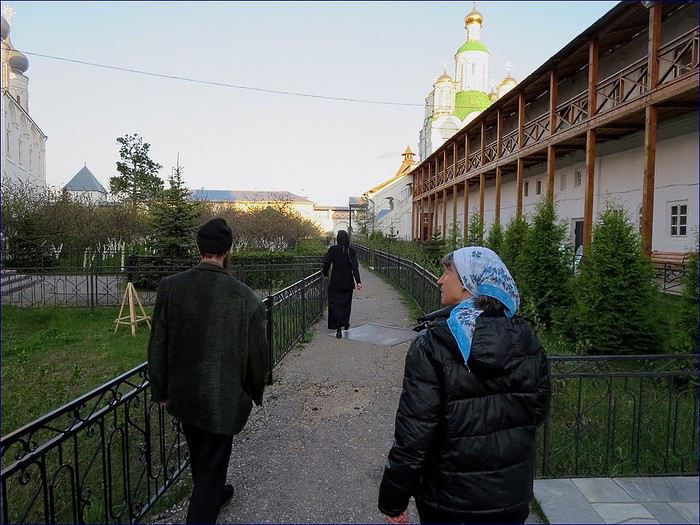
13. By the end of the day, the monastery is, of course, closed. But another miracle happens! It turns out the passenger who crossed with us is the mayor’s wife. When Sylvie told her we were from France, she called her husband, who immediately contacted the Mother Superior. Like in a dream, the monastery opens just for us. A nun and a guard come to meet us and take us through the chapels and gardens!


14. A visit all the more intimate since only the silent nuns, deep in prayer, are present in these sacred spaces.


15. After dinner in our little van, we enjoy the exceptional light illuminating the now-closed monastery. We’re the only visitors, and the site feels like a massive ship anchored on the Volga.


16. The setting sun now bathes the monastery walls in gorgeous pink hues!


17. Gradually, the legendary Volga itself takes on magical colors! For the night, I’ll just back the van up to level it. It’ll take us a while to fall asleep after such intense moments.


18. Just as inexplicably, the magic continues the next morning! Seeing I’m struggling with my knee, the guard lets us drive slowly along the monastery’s perimeter path. So there we are at dawn, solitary wanderers between the Volga and the monastery walls.


19. The morning light now illuminates the monastery’s eastern façade, which we hadn’t admired yesterday. An exceptional moment.


20. Even more impressive when we realize we’re on the nuns’ prayer path. We cross paths with them—tall, silent, black-clad figures, fully covered.


We leave Makaryevo with regret, following the Volga toward Kostroma on the Golden Ring. That’s about all there is to add.

We’ve already taken three long trips through Russia in our little van. The travel journals are shared in the link in our signature.

Best regards, Sylvie & Bernard
Open
Four weeks in Botswana
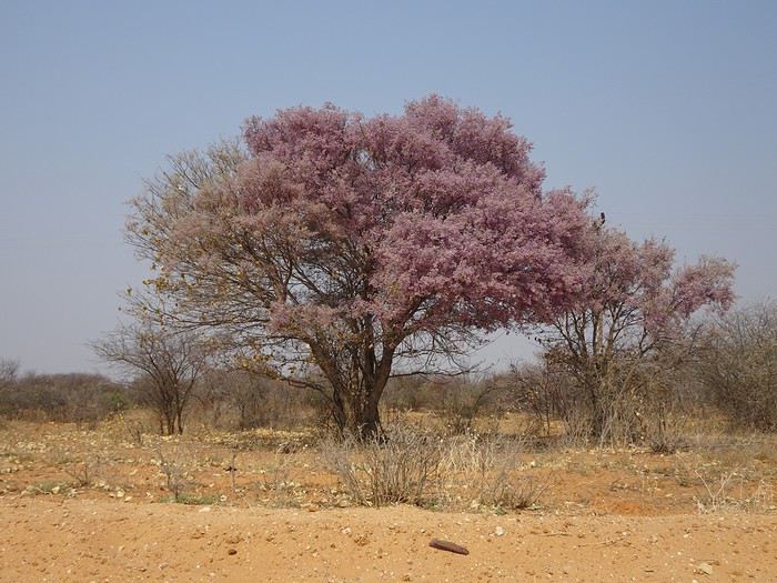
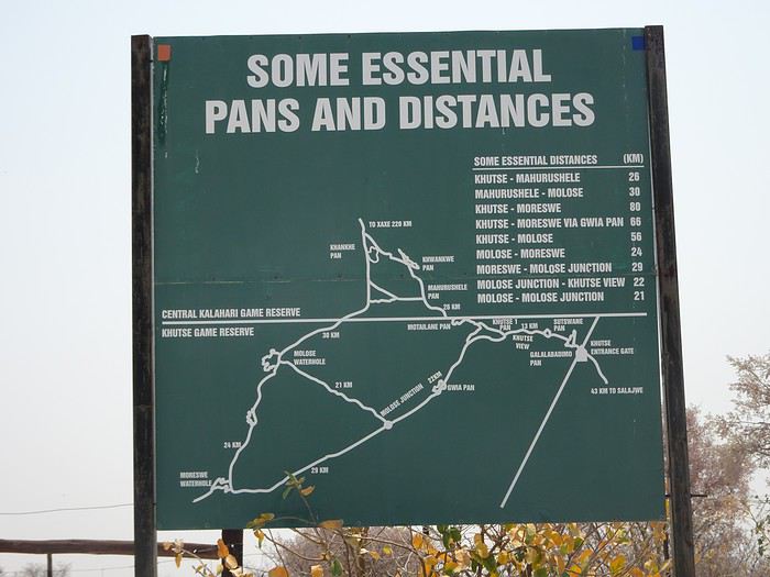
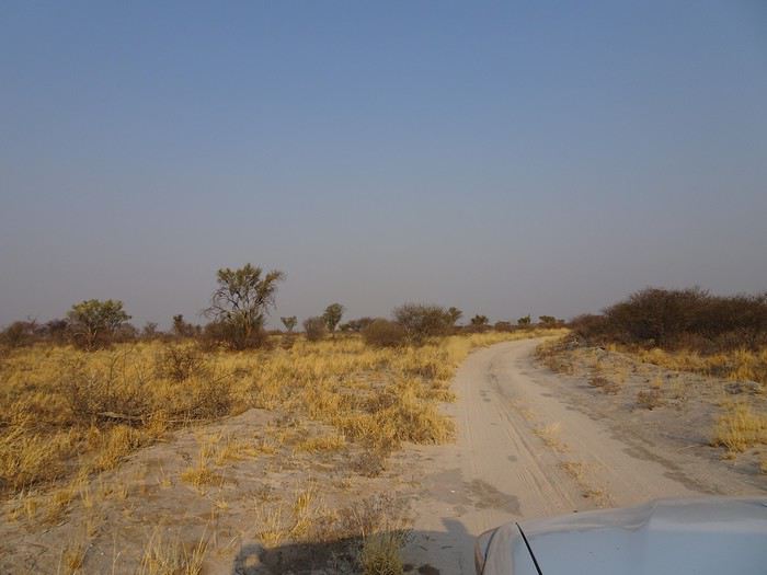
Saturday, September 22, 2018 This morning, we woke up at dawn at 6:00 AM. Headed to Letlhakeng, the last town where we could fill up on fuel before starting our crossing of the Kalahari. Our consumption since Johannesburg has been 11L/100 km. We took the direction of Khutse Game Reserve, whose entrance is about a hundred kilometers north of Letlhakeng. Access is via a gravel road along which we saw magnificent pink trees.


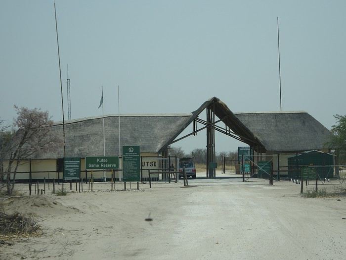
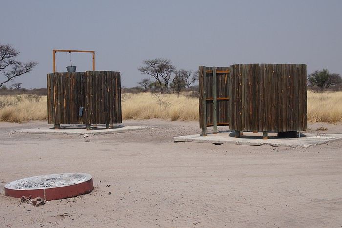
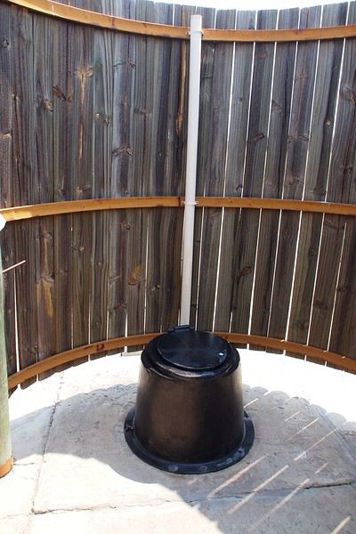
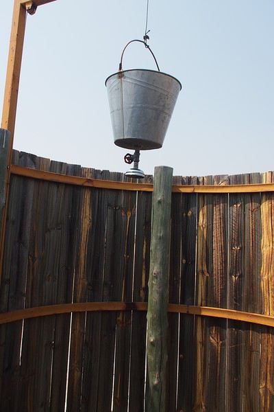
At Khutse Gate, we registered in the entry log and paid the access fees for 6 days: 120 Pulas/day/person and 50 Pulas/day/vehicle. Our stays at the Xaka and Deception Valley campsites had been reserved by our tour operator but not paid, contrary to what they’d told us. So we settled the 2 unpaid days of camping at 30 Pulas/day/person. The park rangers informed us that the southern triangle of Khutse Game Reserve, with its tip at Moreswe Pan, had burned. Note that these two campsites are government-run, which explains the low prices. Private campsites cost ten to fifteen times more. We headed to Khutse campsite, site 5. To enter the parks, you must have a reservation either at a lodge or a campsite. Since the number of spots in the campsites is limited, this means you have to book well in advance. We ate the salad we’d prepared the night before at our campsite. It was very hot—39°C. We made a round trip to Khankhe Pan. On the track, we encountered three South African cars, one of which was stuck in the sand and blocking the way. We helped push the car to get it unstuck. We saw very few animals at Khankhe Pan. We returned to the campsite, which has dry toilets and a shower you have to supply with your own water. We tried out the shower.


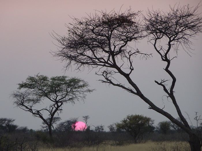
We witnessed our first Kalahari sunset. These sunsets are unmatched, and that didn’t change throughout the trip.


During the trip, we followed the solar rhythm—waking up at 6:00 AM, having dinner at sunset around 6:30 PM, and retiring to our tents by 8:30 PM.

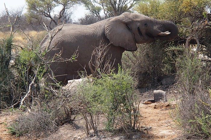
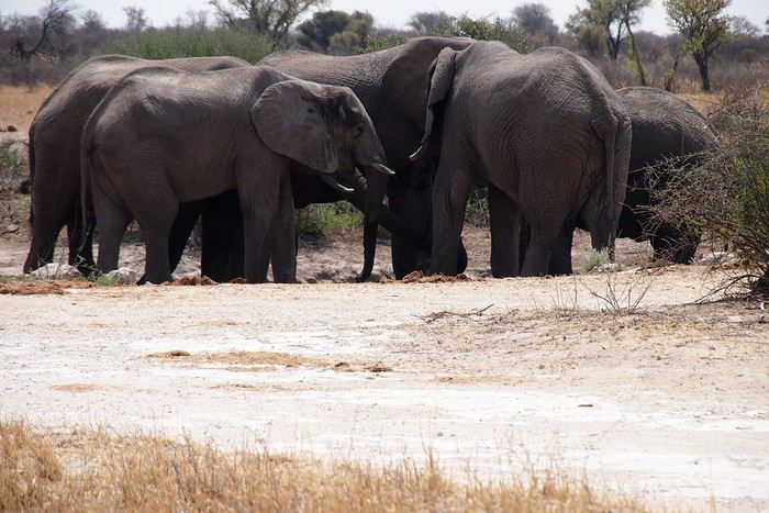
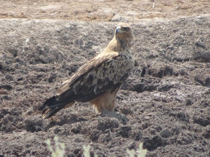
Sunday, September 23, 2018 Up at 6:00 AM. It was 15°C. We were cold last night. Tonight, we’ll use blankets in addition to our sleeping bags. We headed southwest and, past Gwian Pan, turned northwest toward the Molose waterhole, where we saw our first elephants and our first raptor. Indeed, on the track leading to the Molose waterhole, we could see the traces of the massive fire that had ravaged the southern part of Khutse, as the park rangers had warned us.


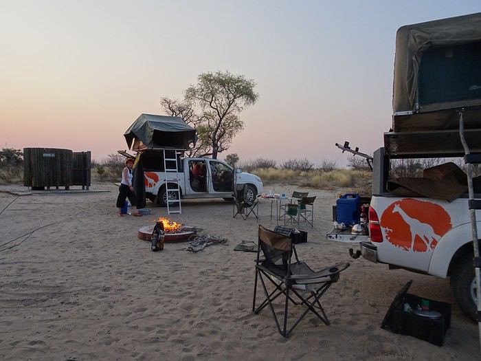
Our first braai at Khankhe campsite.

Open

You might also like