Results for "Canaries+(îles)+événement"
About 3,795 results.
More options
Many results are in French, the community’s main language. English translations are added over time.
Search results
Donne infos sur la Crète
Kalimera tout le monde!🙂
L'année passée (septembre) j'ai passé 2 inoubliables semaines en Crête, voyage sac à dos, bus, motels bons marchés et tout le tralala et je suis prête à vous donner plein d'infos et de conseils qui pourraient vous être utile pour votre prochain voyage...
N'hésitez pas à me contacter!
Camille
L'année passée (septembre) j'ai passé 2 inoubliables semaines en Crête, voyage sac à dos, bus, motels bons marchés et tout le tralala et je suis prête à vous donner plein d'infos et de conseils qui pourraient vous être utile pour votre prochain voyage...
N'hésitez pas à me contacter!
Camille
21-Day Trip to La Gomera and La Palma
Travel Journal: 21 Days in La Gomera and La Palma
From February 6 to February 26, 2024
Tuesday, February 6 We left around 9 AM with our car, along with Pierre-Paul and Patricia, heading to the Bluepark parking lot in Bartenheim. As expected, we were awaited and left promptly for EuroAirport Basel. Took off at 12:25 PM for a 4-hour-15-minute flight under excellent conditions. Beautiful arrival in Tenerife with Teide in sight under a clear blue sky. Fifteen minutes later, we waited for bus No. 40 to Los Cristianos with quite a few other tourists, but we managed to find four seats. From the bus station, it was a 20-minute walk to our hotel. We checked into a lovely apartment for the four of us, complete with all the comforts. Outside, it was quite warm—at least 25°C! After dropping off our luggage, we went for a stroll. The immediate surroundings of the hotel held no interest for us: a modern, concrete area filled with hotels, bars, tourist agencies, and unappealing restaurants all offering the same bland international cuisine. Pat went to cool off at the pool, unfortunately overrun by loud, drunk English tourists. I took a walk to the paseo maritimo that leads to the port, skirting the seafront. The promenade was pleasant, but it could have been any seaside resort in the world—same old scene: a succession of bars with blaring music where many elderly people sipped cold beers waiting for the sunset, the backdrop a wall of resort-style hotels resembling rabbit hutches! Upon reaching the port, I scouted the route we’d take the next day to the Fred Olsen ferry. Back at the apartment, in the early evening, we looked for a non-touristy restaurant for dinner. Monique stopped a woman to ask her opinion! In this area, she told us, there’s no restaurant that serves Canarian or Spanish cuisine! The only place with decent restaurants is at the port. Off we went to the port, where we sat down at Al Bordo restaurant and ordered a seafood paella for four. Excellent, and at a very reasonable price (36 € for two). We returned to the hotel along the seafront.
Wednesday, February 7
Woke up at 6 AM. Had breakfast in the apartment with what we’d bought the day before at a supermarket. It was still dark when we left on foot toward the port, walking along the calm seafront at this early hour. Forty minutes later, we arrived and waited 10 minutes before the ferry docked. At 9:30 AM, we left the port of Los Cristianos for a 50-minute crossing on a calm sea under a beautiful blue sky. There were quite a few people on this large ferry, but many had no luggage, meaning they were visiting La Gomera for the day and would take the ferry back in the evening. Upon disembarking, we went straight to our rental car agency to pick up the car we’d booked online a few months earlier. It was a nice Peugeot 2008, spacious enough for the four of us and our luggage. We immediately took the beautiful road from San Sebastián that climbs directly into the mountains toward our rental in Vallehermoso. The road was in perfect condition—it seemed brand new, like all the others we’d take on this island later. This side of the island is very arid with little vegetation, and the terrain is particularly rugged, as it is throughout the island. We stopped at our first miradors, which would be followed by many more throughout our Canarian trip. Our first visit was to the small village of Agulo, perched on a promontory above the sea and at the foot of a high cliff. The village features typical Canarian houses with windows flush with the façade and black volcanic stone masonry on white or reddish-brown walls. The first recommended restaurant was already booked for a group, so we settled for the shaded terrace of the excellent El Alameda bar-restaurant. From Agulo, you can access the Abrante viewpoint via a winding road, where the view of Agulo, 600 meters below, is exceptional. A glass ledge over the void lets you test your fear of heights!
We drove to Vallehermoso to do our grocery shopping at the supermarket—a habit that would continue until the end of the trip. Our little house, "Casa rural El Encatadora," is located in a beautiful flower-filled valley a few kilometers west of Vallehermoso. Each of us had a bedroom with an en-suite bathroom, plus a living room, kitchen, and a small terrace overlooking the quiet street at the valley’s end, which didn’t bother us at all.
Thursday, February 8 The good weather seemed to follow us since our arrival in the Canary Islands. This morning, we took the road—still as beautiful and new—toward Arure, high up to the west. The landscape was magnificent, with breathtaking glimpses of the sea far below. In Arure, we parked in front of Conchita’s bar, where a hike (Rother No. 30) starts toward two viewpoints: Alojera, which we reached after 45 minutes on a lovely path. Monique, tired from the first steep climb, stopped at the first viewpoint and hitchhiked back to Arure. Meanwhile, we continued toward the second viewpoint, Los Barranquillos, where the view of the surroundings was partially hidden by misty clouds rising from the sea. The entire mountain is sculpted by ancient, endless terraces climbing until the slope becomes too steep for construction—visible traces of the hard work of past inhabitants trying to survive in a harsh environment. We had a decent lunch at La Conchita bar, then drove to the small seaside town of Puerto la Caleta, sheltered by an immense cliff plunging into the sea. Black sand beach, rough sea—despite our encouragement, Pat didn’t dare to swim! As for the old village of Caleta, it’s perched on the mountainside, and visiting it requires climbing steep, stair-filled alleys to discover a few traditional houses. Back at the casa, dinner in, and card games...
 Vallehermoso
Friday, February 9 This morning, the sky was overcast, and the peaks around us were shrouded in clouds. We took the same road as yesterday to hike Las Creces. Quickly gaining altitude, we entered a thick fog—visibility was very limited. We stopped at the Las Creces parking lot; visibility improved, and the sun wasn’t far off. The hike is entirely within a beautiful laurel forest, with the sun playing hide-and-seek, but it wasn’t cold despite the altitude. After finishing the loop trail, we decided to picnic—not there, as it was too chilly—but on Vallehermoso’s beach, where we found a nice picnic area sheltered by large black rocks. A short digestive walk on the surrounding hill to admire the little beach from above. Back in Vallehermoso, we did some grocery shopping, then tried to return to the casa—only to find ourselves locked out because we’d left the key in the lock inside! After several attempts and with the help of Yéli, a relative of the owner we called for help, we were finally able to get back in!
Saturday, February 10
It rained last night, and the sky remained overcast. Monique decided to rest this morning. PP, Pat, and I set off on the hike that starts from the house toward the Marichal reservoir. The sun wasn’t far off, and by 11 AM, it was fully out. The pleasant hike passed by many flower-filled gardens and orchards—orange, lemon, and mandarin trees in fruit. The path climbed gently toward the reservoir, where the view of the Cano rock dominating the landscape was magnificent. The last part of the climb was a bit tough, overgrown with lush vegetation, and the trail was slippery from last night’s rain. We descended via a different, much more pleasant path and returned to the casa just in time for lunch, prepared by Monique. This valley is rich with its many farmers and market gardeners who’ve cultivated the entire valley, taking advantage of the water flowing down from the mountain, captured upstream and redistributed through countless pipes snaking along the paths. Numerous tanks also store water during dry periods. The houses are scattered across both sides of the valley, and these colorful little homes add a beautiful touch to the landscape. The many palm trees give this valley a distinctly tropical feel—you could almost imagine yourself in the Caribbean. Add to that some salsa music drifting from a hut where farmers were working, and the picture is complete. A well-chilled beer apéro capped off a lovely morning. The afternoon was dedicated to rest, relaxation, reading, and games.
Sunday, February 11 The blue sky returned, though a few clouds still capped the highest peaks. Today, we visited Garajonay National Park, which covers the highest central mountains. Up there, we were above the clouds, and the panoramas from the various viewpoints were stunning: first, Cherelepin, accessible from the Laguna Grande parking lot, then Alto de Garajonay, offering an exceptional view of Teide—over 3,000 meters high—emerging from the clouds on Tenerife, far in the distance. We continued to the Los Roques viewpoints, then stopped for lunch at the Degollada de Peraza restaurant, where the view of the barranco was impressive. We descended toward San Sebastián and checked into our new lodging, La Cabezada, located in the countryside about 3 km above San Sebastián. It’s a small apartment adjacent to the owner’s, with a lovely terrace overlooking the surrounding mountains and surrounded by a beautiful garden. Apéro, then dinner on our beautiful terrace.
Monday, February 12 This morning, we went down to visit San Sebastián de La Gomera: its old tower, main street with some beautiful traditional houses, and the Church of the Assumption. Back at the casa for lunch. In the afternoon, Pat, PP, and I set off on the short hike from San Sebastián beach to La Guancha beach. We drove down and parked on the beach. The path climbs along the hill overlooking San Sebastián, passes by the tall Christ statue dominating the landscape, and roughly follows the coast down to the isolated Guancha beach. A beautiful hike under a hot sun, and a swim was welcome, even if the beach and sea access weren’t very comfortable due to large pebbles and quickly deepening water. Apart from two nudist bathers, there was no one on this beach. We returned the same way.
Tuesday, February 13 Rest day. We went down to town to stroll and do some shopping. I took the opportunity to visit the parador, beautifully situated above the city in a lovely garden overlooking the port and town. Together, we went for a cuba libre at the "Cuba Libre" bar, then had lunch at Breñusca (mediocre paella!). Back at the casa, then we went back down to town to see a carnival parade, a "passacalles," which actually passed an hour earlier than scheduled. Oh well.
Wednesday, February 14 Each to their own program this morning. Pat went swimming at San Sebastián beach, Monique rested at the casa, and PP and I set off on the hike from Playa de Avalos to the Ermita de Guadalupe on Playa del Cangrejo. It wasn’t easy to find the right road or the parking spot, but we managed. The path seemed to have suffered landslides, according to a sign at the trailhead! We decided to check it out, ready to turn back if it seemed too dangerous. In the end, apart from one or two slightly tricky spots where we had to climb a pile of rocks, the trail remained passable, though a bit vertigo-inducing in places. The narrow path clings to very vertical cliffs nearly 300 meters above sea level! But what a magnificent view. At one point, the trail runs alongside a wall of basaltic pipes. We returned via the drivable track that parallels the trail a bit lower. Back at the house for lunch. In the late afternoon, we returned to town to attend the "Entierro de las Sardinas" (Burial of the Sardine), which closes the Canarian carnival festivities. While waiting, we strolled through the parador’s gardens and had mojitos in town. Around 9 PM, we heard the noise and cries of the mourners. The procession advanced, led by a large papier-mâché sardine on a float, surrounded by wailing mourners. The procession headed toward the sea, where the sardine was burned, and a mini fireworks display ended the procession. It was all very good-natured, and everyone had fun. We ended the evening with dinner at a good fish restaurant, El Pajar.
 Entierro de la Sardina in San Sebastián de La Gomera
Thursday, February 15
Woke up at 5:15 AM. The only suitable ferry was at 7 AM, which would get us to La Palma by late morning rather than evening. We packed our bags, had breakfast, then headed to the port, left our rental car, and boarded the ferry to Tenerife, from where we’d continue to La Palma. Calm sea, beautiful sun—by 10:30 AM, we disembarked in La Palma. We picked up our car and immediately headed to our new apartment in Breña Alta. It’s a large apartment with a superb terrace facing the sea, fully equipped and very comfortable. The hosts recommended Casa Goyo restaurant, near the airport and close to us. It’s a restaurant with many small rooms, some of which can be reserved for families. The fish-based cuisine (chipirones, pulpo) was excellent, hearty, and reasonably priced. Since it’s in the airport’s flight path, we occasionally heard planes landing. Quick and efficient service. Afterward, we visited Santa Cruz de La Palma, which reminded us of the historic quarters of La Orotava in Tenerife or the capital of Gran Canaria.
Friday, February 16
Beautiful weather, blue sky. We headed to the San Bartolo viewpoint toward the northeast coast, then to the lovely village of San Andrés, which we explored. From there, we walked along the shore to the natural pools of Charco Azul, where we swam in the cool but "swimmable" sea. Back in San Andrés for lunch at the "San Andrés" restaurant on the beautiful church square. Very good fish-based meal. We got back in the car and continued along the north coast to the port of Espindola and the natural pools of Fajana near the Cumplida lighthouse. A fairly strong wind whipped up beautiful waves crashing onto the rocky coast in bursts of foam. Back in Santa Cruz, we stopped at the Mercadona supermarket to buy fresh shrimp for dinner. San Andrés
Saturday, February 17
Uniform blue sky, even on the heights. We took the beautiful road that winds up to the summit of the Caldera de Taburiente. Several viewpoints offer 360° views of the entire island and beyond: you can make out La Gomera, El Hierro, and, of course, Tenerife with the perfect triangle of Teide. We parked at the Los Andes viewpoint parking lot and started our hike to Pico de la Cruz along a trail following the ridge, offering superb views into the caldera. We got back in the car and passed by the Roque de los Muchachos astronomical complex, composed of numerous observatories, some with very aesthetic mirror telescopes. We hiked from the Roque de los Muchachos parking lot to the various viewpoints, always as impressive. Picnic on site, then back to Santa Cruz. We stopped by our car dealer because the oil warning light came on—better safe than sorry. The representative reassured us but preferred to give us a Fiat Cross SUV instead. The Caldera de Taburiente
Sunday, February 18 The weather was a bit mixed, with cloudy patches. We set off to hike the Barranco de la Cuba de Galga. Unfortunately, the Los Tilos trail had been closed for several months due to a major landslide. The parking lot by the road was already quite full, and indeed, we crossed paths with many hikers along the way—it’s an easy hike with little elevation gain, which is rare here in La Palma! The beautiful path winds through a very narrow, deep gorge covered in lush tropical vegetation—you’d think you were in a Southeast Asian forest, especially with the humidity in the gorge bringing out earthy and floral scents. Halfway through, Monique turned back while the rest of us continued to the Cuba de Galga. A light drizzle accompanied us on the return. For lunch, we went to Chipi Chipi restaurant in the heights of Santa Cruz. The cool air forced us to leave the lovely terrace for the slightly noisy dining room. The meal was very good and hearty. Afternoon spent resting at our house.
 La Cuba de la Galga
Monday, February 19 A few clouds still clung to the nearby mountain peaks. We headed south to Los Canarios. We stopped in front of the small San Antonio Abad church, where a path leads to the viewpoint in 15 minutes. Then we visited the San Antonio Volcano Interpretation Center and climbed to the viewpoint via the trail along the crater’s edge, offering a plunging view into the crater. Then PP, Pat, and I headed toward the Teneguía volcano but turned back given the remaining distance and the intense heat bearing down on us! Plus, the landscape was rather arid and not very interesting. We got back in the car and drove down to the salt flats at the island’s southern tip. The ocean crashes here in large waves, exploding against the volcanic rocks and feeding a "blowhole" carved into the rock. We stopped for drinks at the salt flats restaurant, then headed home. The salt flats in Fuencaliente
Tuesday, February 20 Beautiful weather with a few clouds clinging to the mountains, as usual. A relaxed morning since my parking reservation at La Cumbrecita didn’t start until 1 PM. It takes about 30 minutes from Santa Cruz to reach the valley floor via a beautiful but narrow road toward the end, though there’s very little traffic. Meanwhile, the clouds had disappeared, and the view from the La Cumbrecita viewpoint was superb. We recognized Pico de la Cruz in the distance, where we’d been a few days earlier. We then took the path leading to the Las Chozas viewpoint through a magnificent Canarian pine forest. We picnicked on site, then took the path to the Los Roques viewpoint. We returned the same way since the direct route was closed for construction. Back in Santa Cruz, we visited the Sanctuary of Las Nieves, with its beautiful golden Baroque altar. Hike from La Cumbrecita
Wednesday, February 21 After packing our things and loading the car, we left Santa Cruz under a very blue sky for Los Llanos de Aridane, where we stopped to visit this lovely town. The Church of Nuestra Señora de los Remedios has a beautiful coffered ceiling and an original papier-mâché Christ statue from the 16th century. Around it, colorful old Canarian houses brighten the streets of the town center. We took the opportunity to stroll, do some shopping, and finally sat down at La Pergola restaurant for a mediocre lunch. We got back in the car to check into our new house in Arecida. On the way, we stopped at the Mirador del Time, which once again offered an impressive panorama, allowing us—for the first time—to see the damage caused by the Tajogaite volcano eruption in 2021. You can clearly see the still-smoking crater and the large black lava flow covering the landscape down to the sea. We really liked our new accommodation: a local house that’s been renovated on the heights of Arecida, not far from the Canarian pine forest. From several terraces, we have a 360° view of the sea and mountains. We even have a private pool! There are two beautiful, brand-new bedrooms, each with its own bathroom—the best. Plus, we’re on the GR 131 trail that runs along the Barranco de las Angustias toward the northeast.
 Los Llanos de Aridane
Thursday, February 22 Once again, beautiful weather greeted us when we woke up. We started the GR 131 with the goal of reaching the Torre del Time viewpoint—about 400 meters of elevation gain. The path, quite steep at first, winds through a superb Canarian pine forest. A few viewpoints let you appreciate the sheer drop of the Barranco de las Angustias—watch out for vertigo! At the Torre del Time viewpoint, there’s a nearly 1,000-meter vertical drop. We returned via another path, the PLP1, which meanders first through this beautiful forest, then along lovely flower-filled gardens adjacent to beautiful properties that cascade from the forest down to the road serving these neighborhoods. This afternoon, we tried to get closer to the area devastated by the 2021 lava flows. Several roads are still closed or reserved for residents, while others—brand new—have been rebuilt to open up this densely populated and cultivated region. In some places, the lava flow slightly diverted, sparing some properties that logically should have disappeared. Now, they’re encircled by a massive cooled lava field. In other spots, twisted and charred metal scraps or greenhouse remains protrude from the lava—all that’s left of the former banana plantations. A little higher up, you can see the slightly smoking crater of Tajogaite, responsible for this disaster. Back to Casa Barreros.
 View of Los Llanos and, in the background, the 2021 lava flow
Friday, February 23
Though the sky was still blue, the temperature had dropped due to a chilly wind. By midday, it still rose to 22°C. Today, we headed north, specifically to the town of Tijarafe, where a very narrow road descends to the small port, Porís de Candelaria. The 3.7-kilometer road drops 700 meters in elevation, with gradients up to 30%—it was going to be intense! Indeed, the descent was scary, with the void right next to the very narrow road where passing was impossible except at a few rare spots. Everything went well—there was little traffic at this early hour. From the parking lot at the bottom, a path leads to Porís de Candelaria. It’s surprising to see this small fishing hamlet nestled in the shelter of an immense cave opening onto the sea, which was quite rough today. The sun, at this time of year, would appear late in the cave, which remained in shadow for much of the day. We returned via the same road, strolled through the small town of Puntagorda, and had lunch at El Jardín de los Naranjos restaurant—excellent meal. Fishing hamlet of Candelaria
Saturday, February 24 The air was still cool, but the sun was beautiful. While Monique stayed home to rest, the three of us headed to the village of Las Tricias to hike the Buracas Caves trail. We left the car parked on the LP1 road and took the small paved road down to the sign marking the trail’s start. The signage for all the trails we took here, as in La Gomera, was very well done. The path descended steadily, then more steeply toward the caves where the island’s first inhabitants lived—some petroglyphs are still visible in certain caves. The path then climbed back up, passing magnificent dragon trees and more or less elaborate huts occupied by Germans who’ve lived here for many years. Back at Casa Barreros for some rest.
Sunday, February 25 The weather once again blessed us with a beautiful day. This morning, we visited the local produce market held on weekends in Puntagorda. You’ll find agricultural products, crafts, and food to keep you going. A little further on, there’s a glass viewpoint overlooking the barranco plunging toward the sea, with a view of the thrill-seekers trying the zip line right next to it. Lunch at Naranjos—definitely a good spot—with their shrimp and spice tagliatelle. Back home for an afternoon of relaxation.
Monday, February 26 We left Arecida under a cloudy sky. Driving up from Los Llanos de Aridane toward the east, an enormous cascade of clouds poured from the mountain peaks into the Los Llanos plain—very impressive. Arriving in Santa Cruz, we went for a stroll, did some last-minute shopping, then had a final good-quality paella at La Chalana on the paseo maritimo. We left the car in the parking lot and took the 5 PM Olsen ferry to Tenerife on a slightly choppy sea, but the ferry didn’t rock too much. Arriving at 7:15 PM, we dropped off our things near the port in our reserved apartment and went for dinner at Abordo—rubbery chipirones. A digestive stroll among the ever-increasing number of tourists in Los Cristianos—restaurants were packed to the brim, the season is in full swing here. Gone is the calm of La Gomera and La Palma, and the laid-back tourism of German hikers among whom a few French were hiding!
Tuesday, February 27 To make our homemade breakfast more enjoyable, we went to buy pastries at the local bakery, then took one last walk on the paseo along the beaches, mingling with the many mobility scooters driven by elderly or disabled people, joggers, and tourists. Last apéro near the bus station, then off to the airport. After a smooth 4-hour-30-minute flight, we arrived in Basel-Mulhouse at 10:20 PM.
THE END
Conclusion A fantastic trip to two islands with magnificent and diverse nature, where landscapes range from desert-like to tropical depending on exposure to winds and clouds. Thanks to the many beautiful viewpoints, you can truly appreciate these exceptionally dynamic reliefs. A hiker’s paradise, the trails are all very well marked, though the choice of easy or moderate paths for "casual walkers" is quite limited. Another notable advantage, in our opinion, is that these islands are very lightly developed—you’ll hardly see any of those ugly hotel blocks that spoil the landscapes of some other Canary Islands. It’s true that the beaches on these two islands don’t meet traditional international tourism criteria: they’re small, with black sand, and often difficult to access. Special mention for the quality of the road network (except for a few small local roads), which seems brand new, well-paved, and well-signposted. We also enjoyed exceptional weather for February, with fewer than three days of gray or rainy weather out of 21.
Almost all the accommodations we chose met or exceeded our expectations, often at reasonable prices: an average of 98 € per night for an apartment or house with two bedrooms for four people.
All photos can be viewed by clicking this link: https://photos.app.goo.gl/G44pPk4g9PW1rNzg8
Tuesday, February 6 We left around 9 AM with our car, along with Pierre-Paul and Patricia, heading to the Bluepark parking lot in Bartenheim. As expected, we were awaited and left promptly for EuroAirport Basel. Took off at 12:25 PM for a 4-hour-15-minute flight under excellent conditions. Beautiful arrival in Tenerife with Teide in sight under a clear blue sky. Fifteen minutes later, we waited for bus No. 40 to Los Cristianos with quite a few other tourists, but we managed to find four seats. From the bus station, it was a 20-minute walk to our hotel. We checked into a lovely apartment for the four of us, complete with all the comforts. Outside, it was quite warm—at least 25°C! After dropping off our luggage, we went for a stroll. The immediate surroundings of the hotel held no interest for us: a modern, concrete area filled with hotels, bars, tourist agencies, and unappealing restaurants all offering the same bland international cuisine. Pat went to cool off at the pool, unfortunately overrun by loud, drunk English tourists. I took a walk to the paseo maritimo that leads to the port, skirting the seafront. The promenade was pleasant, but it could have been any seaside resort in the world—same old scene: a succession of bars with blaring music where many elderly people sipped cold beers waiting for the sunset, the backdrop a wall of resort-style hotels resembling rabbit hutches! Upon reaching the port, I scouted the route we’d take the next day to the Fred Olsen ferry. Back at the apartment, in the early evening, we looked for a non-touristy restaurant for dinner. Monique stopped a woman to ask her opinion! In this area, she told us, there’s no restaurant that serves Canarian or Spanish cuisine! The only place with decent restaurants is at the port. Off we went to the port, where we sat down at Al Bordo restaurant and ordered a seafood paella for four. Excellent, and at a very reasonable price (36 € for two). We returned to the hotel along the seafront.
Wednesday, February 7
Woke up at 6 AM. Had breakfast in the apartment with what we’d bought the day before at a supermarket. It was still dark when we left on foot toward the port, walking along the calm seafront at this early hour. Forty minutes later, we arrived and waited 10 minutes before the ferry docked. At 9:30 AM, we left the port of Los Cristianos for a 50-minute crossing on a calm sea under a beautiful blue sky. There were quite a few people on this large ferry, but many had no luggage, meaning they were visiting La Gomera for the day and would take the ferry back in the evening. Upon disembarking, we went straight to our rental car agency to pick up the car we’d booked online a few months earlier. It was a nice Peugeot 2008, spacious enough for the four of us and our luggage. We immediately took the beautiful road from San Sebastián that climbs directly into the mountains toward our rental in Vallehermoso. The road was in perfect condition—it seemed brand new, like all the others we’d take on this island later. This side of the island is very arid with little vegetation, and the terrain is particularly rugged, as it is throughout the island. We stopped at our first miradors, which would be followed by many more throughout our Canarian trip. Our first visit was to the small village of Agulo, perched on a promontory above the sea and at the foot of a high cliff. The village features typical Canarian houses with windows flush with the façade and black volcanic stone masonry on white or reddish-brown walls. The first recommended restaurant was already booked for a group, so we settled for the shaded terrace of the excellent El Alameda bar-restaurant. From Agulo, you can access the Abrante viewpoint via a winding road, where the view of Agulo, 600 meters below, is exceptional. A glass ledge over the void lets you test your fear of heights!
We drove to Vallehermoso to do our grocery shopping at the supermarket—a habit that would continue until the end of the trip. Our little house, "Casa rural El Encatadora," is located in a beautiful flower-filled valley a few kilometers west of Vallehermoso. Each of us had a bedroom with an en-suite bathroom, plus a living room, kitchen, and a small terrace overlooking the quiet street at the valley’s end, which didn’t bother us at all.
Thursday, February 8 The good weather seemed to follow us since our arrival in the Canary Islands. This morning, we took the road—still as beautiful and new—toward Arure, high up to the west. The landscape was magnificent, with breathtaking glimpses of the sea far below. In Arure, we parked in front of Conchita’s bar, where a hike (Rother No. 30) starts toward two viewpoints: Alojera, which we reached after 45 minutes on a lovely path. Monique, tired from the first steep climb, stopped at the first viewpoint and hitchhiked back to Arure. Meanwhile, we continued toward the second viewpoint, Los Barranquillos, where the view of the surroundings was partially hidden by misty clouds rising from the sea. The entire mountain is sculpted by ancient, endless terraces climbing until the slope becomes too steep for construction—visible traces of the hard work of past inhabitants trying to survive in a harsh environment. We had a decent lunch at La Conchita bar, then drove to the small seaside town of Puerto la Caleta, sheltered by an immense cliff plunging into the sea. Black sand beach, rough sea—despite our encouragement, Pat didn’t dare to swim! As for the old village of Caleta, it’s perched on the mountainside, and visiting it requires climbing steep, stair-filled alleys to discover a few traditional houses. Back at the casa, dinner in, and card games...
VallehermosoFriday, February 9 This morning, the sky was overcast, and the peaks around us were shrouded in clouds. We took the same road as yesterday to hike Las Creces. Quickly gaining altitude, we entered a thick fog—visibility was very limited. We stopped at the Las Creces parking lot; visibility improved, and the sun wasn’t far off. The hike is entirely within a beautiful laurel forest, with the sun playing hide-and-seek, but it wasn’t cold despite the altitude. After finishing the loop trail, we decided to picnic—not there, as it was too chilly—but on Vallehermoso’s beach, where we found a nice picnic area sheltered by large black rocks. A short digestive walk on the surrounding hill to admire the little beach from above. Back in Vallehermoso, we did some grocery shopping, then tried to return to the casa—only to find ourselves locked out because we’d left the key in the lock inside! After several attempts and with the help of Yéli, a relative of the owner we called for help, we were finally able to get back in!
Saturday, February 10
It rained last night, and the sky remained overcast. Monique decided to rest this morning. PP, Pat, and I set off on the hike that starts from the house toward the Marichal reservoir. The sun wasn’t far off, and by 11 AM, it was fully out. The pleasant hike passed by many flower-filled gardens and orchards—orange, lemon, and mandarin trees in fruit. The path climbed gently toward the reservoir, where the view of the Cano rock dominating the landscape was magnificent. The last part of the climb was a bit tough, overgrown with lush vegetation, and the trail was slippery from last night’s rain. We descended via a different, much more pleasant path and returned to the casa just in time for lunch, prepared by Monique. This valley is rich with its many farmers and market gardeners who’ve cultivated the entire valley, taking advantage of the water flowing down from the mountain, captured upstream and redistributed through countless pipes snaking along the paths. Numerous tanks also store water during dry periods. The houses are scattered across both sides of the valley, and these colorful little homes add a beautiful touch to the landscape. The many palm trees give this valley a distinctly tropical feel—you could almost imagine yourself in the Caribbean. Add to that some salsa music drifting from a hut where farmers were working, and the picture is complete. A well-chilled beer apéro capped off a lovely morning. The afternoon was dedicated to rest, relaxation, reading, and games.
Sunday, February 11 The blue sky returned, though a few clouds still capped the highest peaks. Today, we visited Garajonay National Park, which covers the highest central mountains. Up there, we were above the clouds, and the panoramas from the various viewpoints were stunning: first, Cherelepin, accessible from the Laguna Grande parking lot, then Alto de Garajonay, offering an exceptional view of Teide—over 3,000 meters high—emerging from the clouds on Tenerife, far in the distance. We continued to the Los Roques viewpoints, then stopped for lunch at the Degollada de Peraza restaurant, where the view of the barranco was impressive. We descended toward San Sebastián and checked into our new lodging, La Cabezada, located in the countryside about 3 km above San Sebastián. It’s a small apartment adjacent to the owner’s, with a lovely terrace overlooking the surrounding mountains and surrounded by a beautiful garden. Apéro, then dinner on our beautiful terrace.
Monday, February 12 This morning, we went down to visit San Sebastián de La Gomera: its old tower, main street with some beautiful traditional houses, and the Church of the Assumption. Back at the casa for lunch. In the afternoon, Pat, PP, and I set off on the short hike from San Sebastián beach to La Guancha beach. We drove down and parked on the beach. The path climbs along the hill overlooking San Sebastián, passes by the tall Christ statue dominating the landscape, and roughly follows the coast down to the isolated Guancha beach. A beautiful hike under a hot sun, and a swim was welcome, even if the beach and sea access weren’t very comfortable due to large pebbles and quickly deepening water. Apart from two nudist bathers, there was no one on this beach. We returned the same way.
Tuesday, February 13 Rest day. We went down to town to stroll and do some shopping. I took the opportunity to visit the parador, beautifully situated above the city in a lovely garden overlooking the port and town. Together, we went for a cuba libre at the "Cuba Libre" bar, then had lunch at Breñusca (mediocre paella!). Back at the casa, then we went back down to town to see a carnival parade, a "passacalles," which actually passed an hour earlier than scheduled. Oh well.
Wednesday, February 14 Each to their own program this morning. Pat went swimming at San Sebastián beach, Monique rested at the casa, and PP and I set off on the hike from Playa de Avalos to the Ermita de Guadalupe on Playa del Cangrejo. It wasn’t easy to find the right road or the parking spot, but we managed. The path seemed to have suffered landslides, according to a sign at the trailhead! We decided to check it out, ready to turn back if it seemed too dangerous. In the end, apart from one or two slightly tricky spots where we had to climb a pile of rocks, the trail remained passable, though a bit vertigo-inducing in places. The narrow path clings to very vertical cliffs nearly 300 meters above sea level! But what a magnificent view. At one point, the trail runs alongside a wall of basaltic pipes. We returned via the drivable track that parallels the trail a bit lower. Back at the house for lunch. In the late afternoon, we returned to town to attend the "Entierro de las Sardinas" (Burial of the Sardine), which closes the Canarian carnival festivities. While waiting, we strolled through the parador’s gardens and had mojitos in town. Around 9 PM, we heard the noise and cries of the mourners. The procession advanced, led by a large papier-mâché sardine on a float, surrounded by wailing mourners. The procession headed toward the sea, where the sardine was burned, and a mini fireworks display ended the procession. It was all very good-natured, and everyone had fun. We ended the evening with dinner at a good fish restaurant, El Pajar.
Entierro de la Sardina in San Sebastián de La GomeraThursday, February 15
Woke up at 5:15 AM. The only suitable ferry was at 7 AM, which would get us to La Palma by late morning rather than evening. We packed our bags, had breakfast, then headed to the port, left our rental car, and boarded the ferry to Tenerife, from where we’d continue to La Palma. Calm sea, beautiful sun—by 10:30 AM, we disembarked in La Palma. We picked up our car and immediately headed to our new apartment in Breña Alta. It’s a large apartment with a superb terrace facing the sea, fully equipped and very comfortable. The hosts recommended Casa Goyo restaurant, near the airport and close to us. It’s a restaurant with many small rooms, some of which can be reserved for families. The fish-based cuisine (chipirones, pulpo) was excellent, hearty, and reasonably priced. Since it’s in the airport’s flight path, we occasionally heard planes landing. Quick and efficient service. Afterward, we visited Santa Cruz de La Palma, which reminded us of the historic quarters of La Orotava in Tenerife or the capital of Gran Canaria.
Friday, February 16
Beautiful weather, blue sky. We headed to the San Bartolo viewpoint toward the northeast coast, then to the lovely village of San Andrés, which we explored. From there, we walked along the shore to the natural pools of Charco Azul, where we swam in the cool but "swimmable" sea. Back in San Andrés for lunch at the "San Andrés" restaurant on the beautiful church square. Very good fish-based meal. We got back in the car and continued along the north coast to the port of Espindola and the natural pools of Fajana near the Cumplida lighthouse. A fairly strong wind whipped up beautiful waves crashing onto the rocky coast in bursts of foam. Back in Santa Cruz, we stopped at the Mercadona supermarket to buy fresh shrimp for dinner.
San AndrésSaturday, February 17
Uniform blue sky, even on the heights. We took the beautiful road that winds up to the summit of the Caldera de Taburiente. Several viewpoints offer 360° views of the entire island and beyond: you can make out La Gomera, El Hierro, and, of course, Tenerife with the perfect triangle of Teide. We parked at the Los Andes viewpoint parking lot and started our hike to Pico de la Cruz along a trail following the ridge, offering superb views into the caldera. We got back in the car and passed by the Roque de los Muchachos astronomical complex, composed of numerous observatories, some with very aesthetic mirror telescopes. We hiked from the Roque de los Muchachos parking lot to the various viewpoints, always as impressive. Picnic on site, then back to Santa Cruz. We stopped by our car dealer because the oil warning light came on—better safe than sorry. The representative reassured us but preferred to give us a Fiat Cross SUV instead.
The Caldera de TaburienteSunday, February 18 The weather was a bit mixed, with cloudy patches. We set off to hike the Barranco de la Cuba de Galga. Unfortunately, the Los Tilos trail had been closed for several months due to a major landslide. The parking lot by the road was already quite full, and indeed, we crossed paths with many hikers along the way—it’s an easy hike with little elevation gain, which is rare here in La Palma! The beautiful path winds through a very narrow, deep gorge covered in lush tropical vegetation—you’d think you were in a Southeast Asian forest, especially with the humidity in the gorge bringing out earthy and floral scents. Halfway through, Monique turned back while the rest of us continued to the Cuba de Galga. A light drizzle accompanied us on the return. For lunch, we went to Chipi Chipi restaurant in the heights of Santa Cruz. The cool air forced us to leave the lovely terrace for the slightly noisy dining room. The meal was very good and hearty. Afternoon spent resting at our house.
La Cuba de la GalgaMonday, February 19 A few clouds still clung to the nearby mountain peaks. We headed south to Los Canarios. We stopped in front of the small San Antonio Abad church, where a path leads to the viewpoint in 15 minutes. Then we visited the San Antonio Volcano Interpretation Center and climbed to the viewpoint via the trail along the crater’s edge, offering a plunging view into the crater. Then PP, Pat, and I headed toward the Teneguía volcano but turned back given the remaining distance and the intense heat bearing down on us! Plus, the landscape was rather arid and not very interesting. We got back in the car and drove down to the salt flats at the island’s southern tip. The ocean crashes here in large waves, exploding against the volcanic rocks and feeding a "blowhole" carved into the rock. We stopped for drinks at the salt flats restaurant, then headed home.
The salt flats in FuencalienteTuesday, February 20 Beautiful weather with a few clouds clinging to the mountains, as usual. A relaxed morning since my parking reservation at La Cumbrecita didn’t start until 1 PM. It takes about 30 minutes from Santa Cruz to reach the valley floor via a beautiful but narrow road toward the end, though there’s very little traffic. Meanwhile, the clouds had disappeared, and the view from the La Cumbrecita viewpoint was superb. We recognized Pico de la Cruz in the distance, where we’d been a few days earlier. We then took the path leading to the Las Chozas viewpoint through a magnificent Canarian pine forest. We picnicked on site, then took the path to the Los Roques viewpoint. We returned the same way since the direct route was closed for construction. Back in Santa Cruz, we visited the Sanctuary of Las Nieves, with its beautiful golden Baroque altar.
Hike from La CumbrecitaWednesday, February 21 After packing our things and loading the car, we left Santa Cruz under a very blue sky for Los Llanos de Aridane, where we stopped to visit this lovely town. The Church of Nuestra Señora de los Remedios has a beautiful coffered ceiling and an original papier-mâché Christ statue from the 16th century. Around it, colorful old Canarian houses brighten the streets of the town center. We took the opportunity to stroll, do some shopping, and finally sat down at La Pergola restaurant for a mediocre lunch. We got back in the car to check into our new house in Arecida. On the way, we stopped at the Mirador del Time, which once again offered an impressive panorama, allowing us—for the first time—to see the damage caused by the Tajogaite volcano eruption in 2021. You can clearly see the still-smoking crater and the large black lava flow covering the landscape down to the sea. We really liked our new accommodation: a local house that’s been renovated on the heights of Arecida, not far from the Canarian pine forest. From several terraces, we have a 360° view of the sea and mountains. We even have a private pool! There are two beautiful, brand-new bedrooms, each with its own bathroom—the best. Plus, we’re on the GR 131 trail that runs along the Barranco de las Angustias toward the northeast.
Los Llanos de AridaneThursday, February 22 Once again, beautiful weather greeted us when we woke up. We started the GR 131 with the goal of reaching the Torre del Time viewpoint—about 400 meters of elevation gain. The path, quite steep at first, winds through a superb Canarian pine forest. A few viewpoints let you appreciate the sheer drop of the Barranco de las Angustias—watch out for vertigo! At the Torre del Time viewpoint, there’s a nearly 1,000-meter vertical drop. We returned via another path, the PLP1, which meanders first through this beautiful forest, then along lovely flower-filled gardens adjacent to beautiful properties that cascade from the forest down to the road serving these neighborhoods. This afternoon, we tried to get closer to the area devastated by the 2021 lava flows. Several roads are still closed or reserved for residents, while others—brand new—have been rebuilt to open up this densely populated and cultivated region. In some places, the lava flow slightly diverted, sparing some properties that logically should have disappeared. Now, they’re encircled by a massive cooled lava field. In other spots, twisted and charred metal scraps or greenhouse remains protrude from the lava—all that’s left of the former banana plantations. A little higher up, you can see the slightly smoking crater of Tajogaite, responsible for this disaster. Back to Casa Barreros.
View of Los Llanos and, in the background, the 2021 lava flowFriday, February 23
Though the sky was still blue, the temperature had dropped due to a chilly wind. By midday, it still rose to 22°C. Today, we headed north, specifically to the town of Tijarafe, where a very narrow road descends to the small port, Porís de Candelaria. The 3.7-kilometer road drops 700 meters in elevation, with gradients up to 30%—it was going to be intense! Indeed, the descent was scary, with the void right next to the very narrow road where passing was impossible except at a few rare spots. Everything went well—there was little traffic at this early hour. From the parking lot at the bottom, a path leads to Porís de Candelaria. It’s surprising to see this small fishing hamlet nestled in the shelter of an immense cave opening onto the sea, which was quite rough today. The sun, at this time of year, would appear late in the cave, which remained in shadow for much of the day. We returned via the same road, strolled through the small town of Puntagorda, and had lunch at El Jardín de los Naranjos restaurant—excellent meal.
Fishing hamlet of CandelariaSaturday, February 24 The air was still cool, but the sun was beautiful. While Monique stayed home to rest, the three of us headed to the village of Las Tricias to hike the Buracas Caves trail. We left the car parked on the LP1 road and took the small paved road down to the sign marking the trail’s start. The signage for all the trails we took here, as in La Gomera, was very well done. The path descended steadily, then more steeply toward the caves where the island’s first inhabitants lived—some petroglyphs are still visible in certain caves. The path then climbed back up, passing magnificent dragon trees and more or less elaborate huts occupied by Germans who’ve lived here for many years. Back at Casa Barreros for some rest.
Sunday, February 25 The weather once again blessed us with a beautiful day. This morning, we visited the local produce market held on weekends in Puntagorda. You’ll find agricultural products, crafts, and food to keep you going. A little further on, there’s a glass viewpoint overlooking the barranco plunging toward the sea, with a view of the thrill-seekers trying the zip line right next to it. Lunch at Naranjos—definitely a good spot—with their shrimp and spice tagliatelle. Back home for an afternoon of relaxation.
Monday, February 26 We left Arecida under a cloudy sky. Driving up from Los Llanos de Aridane toward the east, an enormous cascade of clouds poured from the mountain peaks into the Los Llanos plain—very impressive. Arriving in Santa Cruz, we went for a stroll, did some last-minute shopping, then had a final good-quality paella at La Chalana on the paseo maritimo. We left the car in the parking lot and took the 5 PM Olsen ferry to Tenerife on a slightly choppy sea, but the ferry didn’t rock too much. Arriving at 7:15 PM, we dropped off our things near the port in our reserved apartment and went for dinner at Abordo—rubbery chipirones. A digestive stroll among the ever-increasing number of tourists in Los Cristianos—restaurants were packed to the brim, the season is in full swing here. Gone is the calm of La Gomera and La Palma, and the laid-back tourism of German hikers among whom a few French were hiding!
Tuesday, February 27 To make our homemade breakfast more enjoyable, we went to buy pastries at the local bakery, then took one last walk on the paseo along the beaches, mingling with the many mobility scooters driven by elderly or disabled people, joggers, and tourists. Last apéro near the bus station, then off to the airport. After a smooth 4-hour-30-minute flight, we arrived in Basel-Mulhouse at 10:20 PM.
THE END
Conclusion A fantastic trip to two islands with magnificent and diverse nature, where landscapes range from desert-like to tropical depending on exposure to winds and clouds. Thanks to the many beautiful viewpoints, you can truly appreciate these exceptionally dynamic reliefs. A hiker’s paradise, the trails are all very well marked, though the choice of easy or moderate paths for "casual walkers" is quite limited. Another notable advantage, in our opinion, is that these islands are very lightly developed—you’ll hardly see any of those ugly hotel blocks that spoil the landscapes of some other Canary Islands. It’s true that the beaches on these two islands don’t meet traditional international tourism criteria: they’re small, with black sand, and often difficult to access. Special mention for the quality of the road network (except for a few small local roads), which seems brand new, well-paved, and well-signposted. We also enjoyed exceptional weather for February, with fewer than three days of gray or rainy weather out of 21.
Almost all the accommodations we chose met or exceeded our expectations, often at reasonable prices: an average of 98 € per night for an apartment or house with two bedrooms for four people.
All photos can be viewed by clicking this link: https://photos.app.goo.gl/G44pPk4g9PW1rNzg8
Croisière MSC Musica du 18 novembre 2014
bonjour a tous qui fait la croisière sur le musica de msc le 18/11/2014 départ de Marseille
Oman, le pays des Mille et Une Merveilles
Qui n’a jamais eu envie de vivre les aventures de Sindbad le marin, qui n’a jamais rêvé de Shéhérazade lors de ses lectures des contes Les Mille et Une Nuits? Ou encore de la reine de Saba...
Eh bien! En parcourant le Sultanat d’Oman, nous allons à leur recherche ou plutôt découvrir ce pays des Mille et Une Merveilles décrites dans les célèbres contes persans dont a fait partie l’actuel Sultanat.
Voici l’itinéraire prévu pour ces deux semaines :
21/12 Lyon – Mascate 22/12 Mascate 23/12 Mascate – Wadi Tiwi 24/12 Wadi Shab – Sour 25/12 Ras Al Jinz – Wadi Bani Kalid 26/12 Wahiba Sands 27/12 Sugar Dunes – Sanctuaire Oryx 28/12 Mirbat 29/12 Wadi Darbat – Salalah 30/12 Mughsayl – Rakyut 31/12 Rub Al Khali - Haima 01/01 Jabreen - Nizwa 02/01 Tanuf - Bahla – Jebel Shams 03/01 Jebel Shams – Al Hamra - Misfat 04/01 Bilad Sayt – Wadi Bani Awf – Mascate 05/01 Mascate - Lyon
Montagnes, Wadis, déserts et plages, chacun y trouvera son bonheur. Voici un petit aperçu de ce qui vous attend.
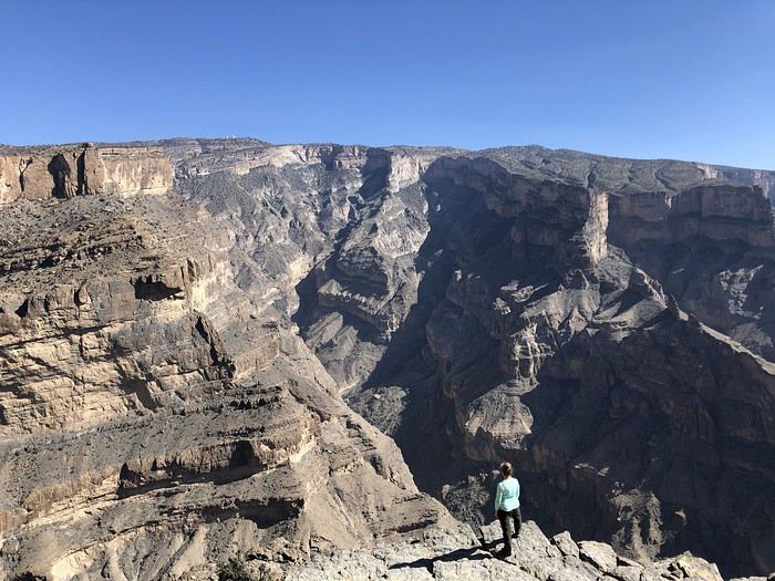
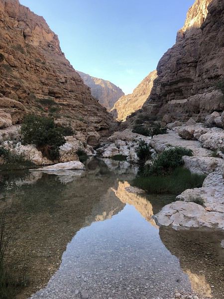
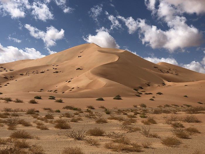
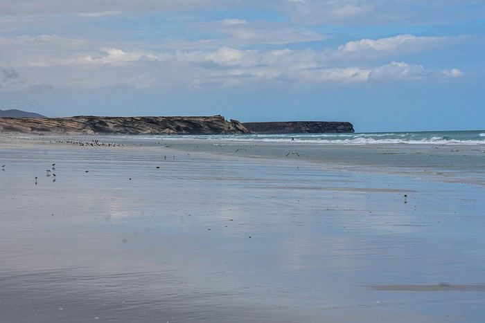
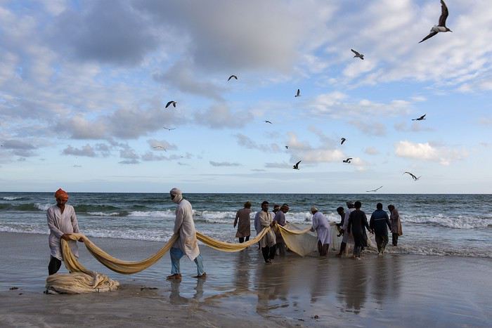
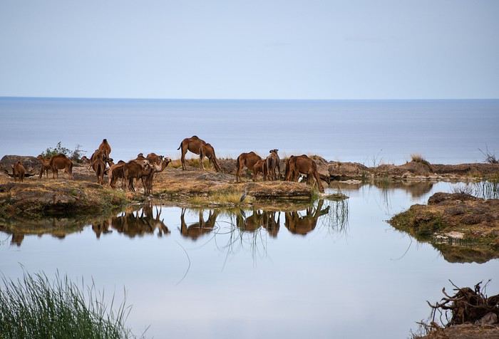
Alors si vous voulez bien me suivre...
Eh bien! En parcourant le Sultanat d’Oman, nous allons à leur recherche ou plutôt découvrir ce pays des Mille et Une Merveilles décrites dans les célèbres contes persans dont a fait partie l’actuel Sultanat.
Voici l’itinéraire prévu pour ces deux semaines :
21/12 Lyon – Mascate 22/12 Mascate 23/12 Mascate – Wadi Tiwi 24/12 Wadi Shab – Sour 25/12 Ras Al Jinz – Wadi Bani Kalid 26/12 Wahiba Sands 27/12 Sugar Dunes – Sanctuaire Oryx 28/12 Mirbat 29/12 Wadi Darbat – Salalah 30/12 Mughsayl – Rakyut 31/12 Rub Al Khali - Haima 01/01 Jabreen - Nizwa 02/01 Tanuf - Bahla – Jebel Shams 03/01 Jebel Shams – Al Hamra - Misfat 04/01 Bilad Sayt – Wadi Bani Awf – Mascate 05/01 Mascate - Lyon
Montagnes, Wadis, déserts et plages, chacun y trouvera son bonheur. Voici un petit aperçu de ce qui vous attend.
Alors si vous voulez bien me suivre...
Retour de deux semaines d'itinérance en Islande en famille
Nous sommes partis deux semaines cet été du 7 au 21 août avec nos deux (grands) enfants qui sont maintenant de jeunes adultes majeurs. Cela fait déjà un moment qu'ils partent avec leurs ami(e)s une partie de l'été mais ils ont insisté pour se libérer deux semaines pour nous accompagner en Islande. Sûrement la réminiscence de bons moments passés ensemble lors de voyages précédents ...
Nous avons dormi la moitié des nuits en camping et pour le reste on a mixé des logements en airbnb et en auberges de jeunesse.
Pour le véhicule, nous avons loué un Dacia Duster 4wd histoire de pouvoir arpenter quelques "F roads" mais notre itinéraire est resté tout de même très classique avec une large majorité de sites accessibles depuis la route circulaire n°1.
Pour l'avion, vols Icelandair réservés 10 mois à l'avance (environ 350 euros/personne).
Je vais passer sur tous les aspects techniques de préparation du voyage car je détaille tout ça déjà ici: jeveuxcamperenislande.blogspot.com/
Voici le résumé de ce qu'on a vécu:
Jour 1:
A l'origine, on devait arriver avant midi sur Keflavik, ce qui nous laissait une partie de l'après-midi pour visiter le cercle d'or mais un changement d'horaire de la part d'Icelandair en février a chamboulé nos plans car nous ne sommes arrivés qu'à 15h45. Le temps de récupérer les bagages, la voiture (plutôt long), faire les courses et prendre la route prévue jusqu'à notre logement, il est déjà 20 h. La fatigue aidant, nous ne ferons rien ce jour-là 🤪 Vivement demain !
Jour 2:
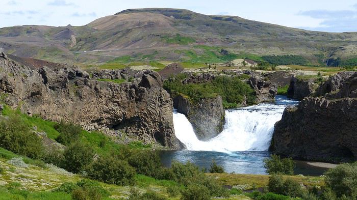
Ça y est, nous sommes frais et dispos prêts à avaler du bitume et user nos semelles ! Ah, non en fait, il va falloir d'abord se procurer un réchaud. J'avais lu avant de partir que la marque Coleman était très répandue ici, j'avais donc amené mon réchaud US dans les valises mais peine perdue car il n'est pas compatible avec les cartouches Coleman vendues en Islande. J'ai failli emmener mon brûleur Camping Gaz (qui est vraiment compact) mais j'avais aussi lu qu'on avait du mal à trouver les cartouches correspondantes sur place. Alors, j'ai dû lire le guide d'une autre destination car des cartouches Camping Gaz, j'en ai vues partout 😛. Nous nous arrêtons donc à Sellfoss et là où j'imaginais que cela n'allait être qu'une simple formalité, nous avons passé plus d'une heure à trouver un réchaud. Ce n'est que dans une station essence où heureusement il leur restait un exemplaire payé quand même 60 euros ... Nous démarrons donc finalement qu'en fin de matinée. Premier pique-nique et plutôt un bon souvenir car nous mangeons pile en face des chutes Hjalparfoss:
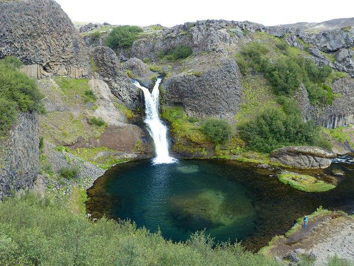
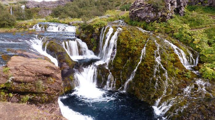
Nous reprenons la route puis une piste bien caillouteuse de 7 km jusqu'à Stöng puis le très photogénique cirque de Gjàin:
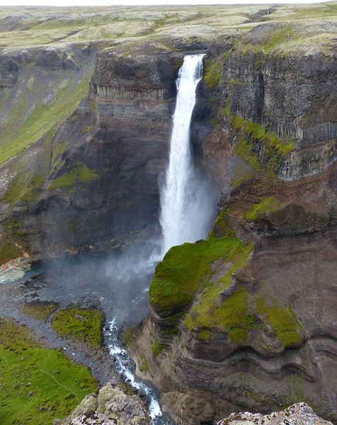
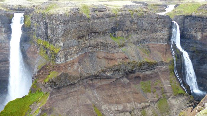
J'avais entendu le plus grand bien des chutes Hàifoss qui se trouvent aussi à 7 km d'une piste bien caillouteuse. Je confirme, le site est assez grandiose et quasi désert. En revanche, ça souffle pas mal là-haut et je comprends pourquoi l'unique table de pique-nique est collée le long d'une paroi sans la vue sur la cascade:
Nous reprenons ensuite notre route car l'objectif du soir est d'atteindre le terrain de camping du Landmannalaugar. La piste F208 nous attend (plutôt roulante si ce ne sont les cailloux qui la parsèment). Nous atteindrons le camping et réussiront à franchir les deux derniers gués pour poser la voiture quasiment au pied de la tente. Ambiance camp de base assurée le soir et pressentiment que la journée de demain va envoyer du lourd 😉 Plus de détails et de photos de cette journée ici: En route vers le Landmannalaugar
A suivre ...
Jour 1:
A l'origine, on devait arriver avant midi sur Keflavik, ce qui nous laissait une partie de l'après-midi pour visiter le cercle d'or mais un changement d'horaire de la part d'Icelandair en février a chamboulé nos plans car nous ne sommes arrivés qu'à 15h45. Le temps de récupérer les bagages, la voiture (plutôt long), faire les courses et prendre la route prévue jusqu'à notre logement, il est déjà 20 h. La fatigue aidant, nous ne ferons rien ce jour-là 🤪 Vivement demain !
Jour 2:
Ça y est, nous sommes frais et dispos prêts à avaler du bitume et user nos semelles ! Ah, non en fait, il va falloir d'abord se procurer un réchaud. J'avais lu avant de partir que la marque Coleman était très répandue ici, j'avais donc amené mon réchaud US dans les valises mais peine perdue car il n'est pas compatible avec les cartouches Coleman vendues en Islande. J'ai failli emmener mon brûleur Camping Gaz (qui est vraiment compact) mais j'avais aussi lu qu'on avait du mal à trouver les cartouches correspondantes sur place. Alors, j'ai dû lire le guide d'une autre destination car des cartouches Camping Gaz, j'en ai vues partout 😛. Nous nous arrêtons donc à Sellfoss et là où j'imaginais que cela n'allait être qu'une simple formalité, nous avons passé plus d'une heure à trouver un réchaud. Ce n'est que dans une station essence où heureusement il leur restait un exemplaire payé quand même 60 euros ... Nous démarrons donc finalement qu'en fin de matinée. Premier pique-nique et plutôt un bon souvenir car nous mangeons pile en face des chutes Hjalparfoss:
Nous reprenons la route puis une piste bien caillouteuse de 7 km jusqu'à Stöng puis le très photogénique cirque de Gjàin:
J'avais entendu le plus grand bien des chutes Hàifoss qui se trouvent aussi à 7 km d'une piste bien caillouteuse. Je confirme, le site est assez grandiose et quasi désert. En revanche, ça souffle pas mal là-haut et je comprends pourquoi l'unique table de pique-nique est collée le long d'une paroi sans la vue sur la cascade:
Nous reprenons ensuite notre route car l'objectif du soir est d'atteindre le terrain de camping du Landmannalaugar. La piste F208 nous attend (plutôt roulante si ce ne sont les cailloux qui la parsèment). Nous atteindrons le camping et réussiront à franchir les deux derniers gués pour poser la voiture quasiment au pied de la tente. Ambiance camp de base assurée le soir et pressentiment que la journée de demain va envoyer du lourd 😉 Plus de détails et de photos de cette journée ici: En route vers le Landmannalaugar
A suivre ...
Botswana: et si on la faisait cette diagonale du fou?
Depuis mon retour d'Afrique du Sud et après avoir discuté avec mon loueur de 4x4 ( qui est donc un bon vendeur), je sais déjà que je vais y retourner, pas cette année, d'autres projets étaient déjà là, qui encombraient le tapis.
Ce sera en 2015 donc, en Août très probablement et pour 4 semaines maximum.
Qu'est ce donc que la diagonale du fou ? C'est un concept issu d'une discussion qui a eu lieu entre Jean Luc ( Voyajou) et Max ( Max68), je ne sais plus où ils ont parlé de ça, mais je l'ai lu, j'en suis sûr. Le problème avec ces 2 là, c'est qu'ils écrivent tellement qu'on ne peut plus les suivre ! 😛
La diagonale du fou, donc, serait un trajet qui irait grosso modo de Kasane au Namaqualand en passant par Chobe, Moremi, Central Kalahari GR, KTP, AugrabieFalls , Namaqualand.
C'est une bonne période pour visiter Chobe/Moremi puisqu'il s'agit de la saison sèche, les pistes y sont plus faciles même si le niveau d'eau peut-être élevé sur l'Okawongo. C'est une excellente période pour le namaqualand, fin Août les chances d'y trouver un grand tapis de fleurs y sont maximales. Le Kalahari et les pans pour les paysages, les ciels étoilés et la tranquillité. Le KTP pour se vacciner définitivement des félins. Les Augrabies Falls puisqu'on passe par là et même si le débit sera celui d'un vieillard prostatique...
C'est aussi une mauvaise période puisque c'est la haute saison, donc plus de monde et plus cher, puisqu'il va faire très froid la nuit , puisqu'on ne verra pas la queue d'une bestiole dans le Kalahari et parce qu'il n'y a aucune chance pour que Jean Luc soit là pour sortir mon Toyota de l'ornière.😕 C'est dommage, ç'eût été une belle photo vous en conviendrez.😏
Premier problème, Par où commencer ? Soit je loue à partir de Joburg pour ensuite me taper une route interminable vers Kasane en faisant quelques étapes, j'ai pensé au parc Marekele pour se reposer du voyage, petit parc qui semble intéressant avec ses vautours du cap, un plan d'eau actif près des bush tents et de beaux paysages en général , mais pas beaucoup d'action par ailleurs, pas grave, ça viendra ensuite. Puis Serowe et Khama rhino sanctuary, puis Khubu Island , puis Kasane et on attaque la descente. Ce qui fait donc 5 jours pour monter 😮 Autre possibilité, faire Paris Joburg Kasane en avion : 200€ de plus par passager et 500 € de plus pour le transfert du 4x4😮, ce qui gonfle le budget de plus de 1000€, qu'on peut éventuellement "récupérer" en partie en raccourcissant la durée du voyage de 2 jours pleins.
Projet 1 : Jour 1 : récupération du 4x4=>Marakele Jour 2 : Marakele Jour 3 : Serowe Jour 4 : Khubu Island Jour 5 : Kasane Jour 6 : Kasane, boat tour Jour 7 : Chobe Ihaha Jour 8 : Chobe Ihaha Jour 9 : Chobe Savuti Jour 10 : Chobe =>Moremi Jour 11 : Moremi Jour 12 : Moremi=> Maun-courses-full tank=> Nxai pan Jour 13 : Nxai Pan Jour 14 : Nxai =>CKGR Jour 16 : CKGR Jour 17 : CKGR=> Ghanzi Jour 18 : Ghanzi => Kaa Jour 19 : Kaa=>KTP Af Sud Jour 20 : KTP Jour 21 : KTP Jour 22 : KTP Jour 23 : KTP=> Augrabie Falls Jour 24 : Augrabies Falls => Namaqualand Jour 25 : Namaqualand Jour 26 : Namaqualand Jour 27 : Namaqualand=> Kuruman Jour 28 : Kuruman => Joburg
Projet 2 : Jour 1 : Kasane Jour 2 : Kasane, boat tour Jour 3 : Chobe Ihaha Jour 4 : Chobe Ihaha Jour 5 : Chobe Savuti Jour 6 : Chobe =>Moremi Jour 7 : Moremi Jour 8 : Moremi=> Maun Jour 9 : Nxai Pan et/ou Makgadikgadi ou Khubu Island ( à répartir sur les 4 jours) Jour 10 : Makg Jour 11 : Makg Jour 12 : Makg Jour 13 : Makg=>CKGR Jour 14 : CKGR Jour 15 : CKGR=> Ghanzi Jour 16 : Ghanzi => Kaa Jour 17 : Kaa=>KTP Af Sud Jour 18 : KTP Jour 19 : KTP Jour 20 : KTP Jour 21 : KTP=> Augrabie Falls Jour 22 : Augrabies Falls => Namaquland Jour 23 : Namaqualand Jour 24 : Namaqualand Jour 25 : Namaqualand=> Kuruman Jour 26 : Kuruman => Joburg Trajet raccourci de 2 jours pour limiter les dégâts financiers...
Voilà la base de travail, je dois encore pas mal étudier les camps entre Maun et Kasane, les réservations y sont indispensables mais semble t'il complètement fantaisistes, si on ne réserve pas, on ne peut pas toujours entrer, mais certains entrent quand même et trouvent une place sur les emplacements réservés, bref , c'est un joyeux bordel et il en ressort qu'il vaut mieux arriver très tôt... Pour ces réservations fantaisistes mais indispensables, est-il préférable de les faire en direct ( en étant patient)ou de passer par une agence à Kasane ou Maun ? Le boat tour, c'est indispensable ? J'ai volontairement shunté les VF du fait d'un niveau d'eau bas, mais pourquoi pas au clair de lune ?
La piste Ihaha=> Savuti=> Moremi est réputée compliquée. En cette saison, la complication vient surtout du sable profond ou du niveau des rivières ? ( la boue ne devrait pas être un problème en août ?).
Les pistes du Kalahari me semblent assez faciles en cette saison.
Pour le KTP, côté Botswanais, ça a l'air plus coton...au moins la piste directe qui part de Kaa doit être potable ?
Voilà les premiers questionnements, sont également bienvenus les conseil de choix de camping, voir même d'emplacements dans les campings quand on doit réserver, les conseils de lodges au KTP puisque nous y passerons au moins 2 nuits pour oublier la tente et essayer d'avoir un peu plus chaud.
Des accom dans le Namaqualand ? Je pars pour y camper à priori, mais je crains le froid, là plus qu'ailleurs.
Qu'est ce donc que la diagonale du fou ? C'est un concept issu d'une discussion qui a eu lieu entre Jean Luc ( Voyajou) et Max ( Max68), je ne sais plus où ils ont parlé de ça, mais je l'ai lu, j'en suis sûr. Le problème avec ces 2 là, c'est qu'ils écrivent tellement qu'on ne peut plus les suivre ! 😛
La diagonale du fou, donc, serait un trajet qui irait grosso modo de Kasane au Namaqualand en passant par Chobe, Moremi, Central Kalahari GR, KTP, AugrabieFalls , Namaqualand.
C'est une bonne période pour visiter Chobe/Moremi puisqu'il s'agit de la saison sèche, les pistes y sont plus faciles même si le niveau d'eau peut-être élevé sur l'Okawongo. C'est une excellente période pour le namaqualand, fin Août les chances d'y trouver un grand tapis de fleurs y sont maximales. Le Kalahari et les pans pour les paysages, les ciels étoilés et la tranquillité. Le KTP pour se vacciner définitivement des félins. Les Augrabies Falls puisqu'on passe par là et même si le débit sera celui d'un vieillard prostatique...
C'est aussi une mauvaise période puisque c'est la haute saison, donc plus de monde et plus cher, puisqu'il va faire très froid la nuit , puisqu'on ne verra pas la queue d'une bestiole dans le Kalahari et parce qu'il n'y a aucune chance pour que Jean Luc soit là pour sortir mon Toyota de l'ornière.😕 C'est dommage, ç'eût été une belle photo vous en conviendrez.😏
Premier problème, Par où commencer ? Soit je loue à partir de Joburg pour ensuite me taper une route interminable vers Kasane en faisant quelques étapes, j'ai pensé au parc Marekele pour se reposer du voyage, petit parc qui semble intéressant avec ses vautours du cap, un plan d'eau actif près des bush tents et de beaux paysages en général , mais pas beaucoup d'action par ailleurs, pas grave, ça viendra ensuite. Puis Serowe et Khama rhino sanctuary, puis Khubu Island , puis Kasane et on attaque la descente. Ce qui fait donc 5 jours pour monter 😮 Autre possibilité, faire Paris Joburg Kasane en avion : 200€ de plus par passager et 500 € de plus pour le transfert du 4x4😮, ce qui gonfle le budget de plus de 1000€, qu'on peut éventuellement "récupérer" en partie en raccourcissant la durée du voyage de 2 jours pleins.
Projet 1 : Jour 1 : récupération du 4x4=>Marakele Jour 2 : Marakele Jour 3 : Serowe Jour 4 : Khubu Island Jour 5 : Kasane Jour 6 : Kasane, boat tour Jour 7 : Chobe Ihaha Jour 8 : Chobe Ihaha Jour 9 : Chobe Savuti Jour 10 : Chobe =>Moremi Jour 11 : Moremi Jour 12 : Moremi=> Maun-courses-full tank=> Nxai pan Jour 13 : Nxai Pan Jour 14 : Nxai =>CKGR Jour 16 : CKGR Jour 17 : CKGR=> Ghanzi Jour 18 : Ghanzi => Kaa Jour 19 : Kaa=>KTP Af Sud Jour 20 : KTP Jour 21 : KTP Jour 22 : KTP Jour 23 : KTP=> Augrabie Falls Jour 24 : Augrabies Falls => Namaqualand Jour 25 : Namaqualand Jour 26 : Namaqualand Jour 27 : Namaqualand=> Kuruman Jour 28 : Kuruman => Joburg
Projet 2 : Jour 1 : Kasane Jour 2 : Kasane, boat tour Jour 3 : Chobe Ihaha Jour 4 : Chobe Ihaha Jour 5 : Chobe Savuti Jour 6 : Chobe =>Moremi Jour 7 : Moremi Jour 8 : Moremi=> Maun Jour 9 : Nxai Pan et/ou Makgadikgadi ou Khubu Island ( à répartir sur les 4 jours) Jour 10 : Makg Jour 11 : Makg Jour 12 : Makg Jour 13 : Makg=>CKGR Jour 14 : CKGR Jour 15 : CKGR=> Ghanzi Jour 16 : Ghanzi => Kaa Jour 17 : Kaa=>KTP Af Sud Jour 18 : KTP Jour 19 : KTP Jour 20 : KTP Jour 21 : KTP=> Augrabie Falls Jour 22 : Augrabies Falls => Namaquland Jour 23 : Namaqualand Jour 24 : Namaqualand Jour 25 : Namaqualand=> Kuruman Jour 26 : Kuruman => Joburg Trajet raccourci de 2 jours pour limiter les dégâts financiers...
Voilà la base de travail, je dois encore pas mal étudier les camps entre Maun et Kasane, les réservations y sont indispensables mais semble t'il complètement fantaisistes, si on ne réserve pas, on ne peut pas toujours entrer, mais certains entrent quand même et trouvent une place sur les emplacements réservés, bref , c'est un joyeux bordel et il en ressort qu'il vaut mieux arriver très tôt... Pour ces réservations fantaisistes mais indispensables, est-il préférable de les faire en direct ( en étant patient)ou de passer par une agence à Kasane ou Maun ? Le boat tour, c'est indispensable ? J'ai volontairement shunté les VF du fait d'un niveau d'eau bas, mais pourquoi pas au clair de lune ?
La piste Ihaha=> Savuti=> Moremi est réputée compliquée. En cette saison, la complication vient surtout du sable profond ou du niveau des rivières ? ( la boue ne devrait pas être un problème en août ?).
Les pistes du Kalahari me semblent assez faciles en cette saison.
Pour le KTP, côté Botswanais, ça a l'air plus coton...au moins la piste directe qui part de Kaa doit être potable ?
Voilà les premiers questionnements, sont également bienvenus les conseil de choix de camping, voir même d'emplacements dans les campings quand on doit réserver, les conseils de lodges au KTP puisque nous y passerons au moins 2 nuits pour oublier la tente et essayer d'avoir un peu plus chaud.
Des accom dans le Namaqualand ? Je pars pour y camper à priori, mais je crains le froid, là plus qu'ailleurs.
Alerte au Tsunami inquiétante!
Je n'ai pas encore de confirmation mais on pouvait lire ce matin dans le journal "the nation" ....
http://www.nationmultimedia.com/breakingnews/read.php?newsid=20002519
En gros....(avec mon pauvre Anglais - désolé par avance !)
Le centre de prévention des catastrophes vient de publier un communiqué en demandant aux Thais d'être à l'écoute des secousses du coté de la mer d'Andaman et aux alentours de Ranong !
Le centre a publié une annonce sur les chaines de télévision indiquant que 31 secousses (échelle 4.0 à 5.3 sur l'échelle de Richter ) se sont produits à quelques 400 kilomètres à l'O de Ranong. Il a indiqué que les secousses étaient irrégulieres ect ....... Pur finir, que ces pouvaient mener à une formation d'un nouveau volcan sous-marin qui entrenerait alors un nouveau Tsunamis si le volcan éclatait.....
Bon, je ne sais pas vraiment si le niveau d'alerte est aussi inquiétant qu'il y parait mais je pense qu'il est pas idiot d'en parler sur le forum...prevention valant mieux que .....!😉
Si vous avez d'autres nouvelles ....
En gros....(avec mon pauvre Anglais - désolé par avance !)
Le centre de prévention des catastrophes vient de publier un communiqué en demandant aux Thais d'être à l'écoute des secousses du coté de la mer d'Andaman et aux alentours de Ranong !
Le centre a publié une annonce sur les chaines de télévision indiquant que 31 secousses (échelle 4.0 à 5.3 sur l'échelle de Richter ) se sont produits à quelques 400 kilomètres à l'O de Ranong. Il a indiqué que les secousses étaient irrégulieres ect ....... Pur finir, que ces pouvaient mener à une formation d'un nouveau volcan sous-marin qui entrenerait alors un nouveau Tsunamis si le volcan éclatait.....
Bon, je ne sais pas vraiment si le niveau d'alerte est aussi inquiétant qu'il y parait mais je pense qu'il est pas idiot d'en parler sur le forum...prevention valant mieux que .....!😉
Si vous avez d'autres nouvelles ....
Quelles îles choisir dans le sud de l'Europe pour la mi-mai?
Je souhaiterais partir le 10 mai mais j'hésite avec les canaries, la crete, la grèce, la croatie ou la tunisie. je recherche la chaleur pour pouvoir me baigner a cette epoque et aussi faire des visites...
Croisière "Îles et terres du soleil" sur le Costa Magica le 24 avril 2009
nous partons le 24/04/2009 pour l'espagne le maroc les canaries madere et funchal
pouvez vous me dire vers quelle heure part le bus de la gare de Nice pour Savone
quelles excursions prendrent tout le long de cette croisiere
Compte rendu croisière Iles du soleil (4 au 15 octobre 2019)
Bonsoir à tous,
Nous voila de retour après un passage dans les Canaries, c'était Super.
je vais vous raconter notre petit périple.
Pour Rappel;
1° 04/10/19 Marseille (embarq) 17h00
2° 05/10/19 Plaisirs en Mer
3° 06/10/19 Plaisirs en Mer
4° 07/10/19 Arrecife Canaries 13H00 19h00
5° 08/10/19 Santa Cruz de Ténerife 08H00 17H00
6° 09/10/19 FUNCHAL (Madére) 08H00 17H00
7° 10/10/19 Plaisirs en Mer
8° 11/10/19 MALAGA 08H00 13H00
9° 12/10/19 Plaisirs en Mer
10° 13/10/19 CIVITAVECCHIA (ROME) 09H00 20H00
11° 14/10/19 SAVONE 08H00 17H00
12° 15/10/19 Marseille (Débarq) sniff sniff 08H00
Nous voilà parti pour 12 jours.On va coucher sur Marseille. Vendredi 04 Octobre, on se lève 7h30 petit déjeuner et hop nous prenons la route. Nous arrivons au port, on se gare au parking puis allons déposer les bagages et enregistrements au terminal À A 13h15, Appel du N°1. bateau. Pour nous ce sera à 13h45, on a le N° 3 . On a déjà voyagé avec le Pacifica, on va à la cabine récupérer la Costa Card et après on va rentrer la CB comme ça on peut boire un verre en déjeunant. C’est la course à la place libre tout le monde fait la queue. On réussi à trouver 2 place à une table de 6. On déjeune rapide et on va voir si nos valises sont arrivées. Elles sont là bien. Donc on va au spa prendre un forfait pour la croisière 133 €. A 16h30 exercice de sécurité + le baratin habituel sur le bateau.La française qui explique les conditions à bord et les excursions à du retard donc on décide de s’éclipser pour aller au spa se faire relaxer. On part chacun notre tour discrètement, 😉 Bon je sais c’est pas bien mais comme c’est toujours le même baratin et en plus on le fait au théâtre
Nous voilà parti pour 12 jours.On va coucher sur Marseille. Vendredi 04 Octobre, on se lève 7h30 petit déjeuner et hop nous prenons la route. Nous arrivons au port, on se gare au parking puis allons déposer les bagages et enregistrements au terminal À A 13h15, Appel du N°1. bateau. Pour nous ce sera à 13h45, on a le N° 3 . On a déjà voyagé avec le Pacifica, on va à la cabine récupérer la Costa Card et après on va rentrer la CB comme ça on peut boire un verre en déjeunant. C’est la course à la place libre tout le monde fait la queue. On réussi à trouver 2 place à une table de 6. On déjeune rapide et on va voir si nos valises sont arrivées. Elles sont là bien. Donc on va au spa prendre un forfait pour la croisière 133 €. A 16h30 exercice de sécurité + le baratin habituel sur le bateau.La française qui explique les conditions à bord et les excursions à du retard donc on décide de s’éclipser pour aller au spa se faire relaxer. On part chacun notre tour discrètement, 😉 Bon je sais c’est pas bien mais comme c’est toujours le même baratin et en plus on le fait au théâtre
Mieux les cabines à babord ou tribord sur la croisière "Iles et terres du soleil"?
Bonjour
Nous pensons prendre la croisière Casablanca Canaries Madère qui part le 24 avril avec MSC et nous nous posons la question de savoir s'il vaut mieux prendre une cabine à babord ou à tribord.
Quelqu'un a-t-il un avis là-dessus?
Merci
Croisière "Îles et terres de soleil" sur le Costa Mediterranea le 23 août
Qui peut me renseigner sur la croisière "îles et terres de soleil" sur le Costa Mediterranea le 23 aôut 2011?
J'hésite à m'inscrire bien que le prix soit des plus attractif pour 12 jours de croisière. Merci de vos réponses
Croisière "îles et terres du Soleil" du 27 octobre 2011 sur le Deliziosa
Bonjour,
J'envisage de faire ce voyage avec mes enfants (21 ans, 17 ans et 8 ans) au mois d'octobre. Les villes a visiter sont : BARCELONE - ESPAGNE CASABLANCA - MAROC SANTA CRUZ DE TENERIFE - CANARIES FUNCHAL - MADERE MALAGA -ESPAGNE CIVITAVECCHIA / ROME - ITALIE Pouvez vous me dire quelles sont les villes à visiter seuls et surtout ce qu'il y a à voir. Concernant le parking à Nice quelles solutions pour avoir un cout le plus bas possible ? Question de mes enfants : dans le pack boissons sans alcool y a t il du coca ? Qui fait cette croisiere ?
J'envisage de faire ce voyage avec mes enfants (21 ans, 17 ans et 8 ans) au mois d'octobre. Les villes a visiter sont : BARCELONE - ESPAGNE CASABLANCA - MAROC SANTA CRUZ DE TENERIFE - CANARIES FUNCHAL - MADERE MALAGA -ESPAGNE CIVITAVECCHIA / ROME - ITALIE Pouvez vous me dire quelles sont les villes à visiter seuls et surtout ce qu'il y a à voir. Concernant le parking à Nice quelles solutions pour avoir un cout le plus bas possible ? Question de mes enfants : dans le pack boissons sans alcool y a t il du coca ? Qui fait cette croisiere ?
Croisière "Îles et terres du soleil" sur le Costa Concordia
Bonjour,
je compte faire cette croisière avec un bébé. Savez-vous si les lieux de débarquement sont loin des centres-ville car je ne voudrais pas faire des heures de bus pour visiter.Nous souhaiterions dans la mesure du possible rester piétons voici l'itinéraire barcelone casablanca santa cruz de tenerife (canaries) funchal (madere) malaga(espagne) civitavecchia(italie)
merci
je compte faire cette croisière avec un bébé. Savez-vous si les lieux de débarquement sont loin des centres-ville car je ne voudrais pas faire des heures de bus pour visiter.Nous souhaiterions dans la mesure du possible rester piétons voici l'itinéraire barcelone casablanca santa cruz de tenerife (canaries) funchal (madere) malaga(espagne) civitavecchia(italie)
merci
Croisière "Îles et terres du soleil" sur le Costa Serena en novembre 2009
Bonjour
Nous partons sur le Costa Serena le 27 novembre 2009 pour notre toute premiere croisiere ! Nous avons choisis la croisière iles et terres du soleil : espagne, maroc, canaries, madere... Il ne nous reste que quelques jours pour essayer de faire connaissance afin de peut être partager quelques visites...
A bientôt
Nathalie & Frédéric
Nous partons sur le Costa Serena le 27 novembre 2009 pour notre toute premiere croisiere ! Nous avons choisis la croisière iles et terres du soleil : espagne, maroc, canaries, madere... Il ne nous reste que quelques jours pour essayer de faire connaissance afin de peut être partager quelques visites...
A bientôt
Nathalie & Frédéric
Quelles iles font partie de l'espace Schengen?
Bonjour
Pourriez vous m'indiquer quelles osnt les iles faisant partis de l'espace schengen?
Mon mari et moi voulions allez aux Antilles...lui avec son visa schengen, moi je suis francaise donc no problemo, or il parait que les Antilles ne font pas parties de schengen!!!!
Alors quelles sont les iles ou il peut circuler avec sont visa! Canaries?!Sicile?!......
Merci!!
Pourriez vous m'indiquer quelles osnt les iles faisant partis de l'espace schengen?
Mon mari et moi voulions allez aux Antilles...lui avec son visa schengen, moi je suis francaise donc no problemo, or il parait que les Antilles ne font pas parties de schengen!!!!
Alors quelles sont les iles ou il peut circuler avec sont visa! Canaries?!Sicile?!......
Merci!!
Croisière "Îles et terre du soleil" sur le Costa Magica
Je pars le 13 avril 2009 dans la croisière intitulée " Pays et îles du soleil ". C’est ma première croisière et je pars seule avec mes filles de 16 et 13 ans.
L’itinéraire c’est : Barcelone, Funchal, Malaga, Casablanca, Lanzarote, Canaries.
Pour ceux qui ont déjà fait cette croisière, avez des conseils pour les excursions ?
Est-ce que c’est dangereux pour nous (femmes seules) de se promener à Casablanca ?
Nous partons avec le Costa Magica. Avez des conseils pour se repérer vite, les endroits les plus agréables, resto, …
C’est quoi les frais de séjour à bord ?
J’ai acheté ma croisière chez AB CROISIERE, qui indiquait que tout était compris (sauf les excursions et boissons). Aurais-je encore d’autres frais dans le bateau ?
Par ailleurs, j’aimerais bien trouver d’autres personnes avec des enfants pour faire les excursions.
Nous parlons l’espagnol et portugais.
Merci beaucoup pour vos réponses.
Quelles îles du Cap Vert en février
Bonjour, Famille avec 2 enfants (14 et 9) envisageons le Cap Vert en février pour une dizaine de jours.
Quelles îles (en faire 2 ?) semblent les plus appropriées, on est plutôt balade natures, découverte de petits villages, et un peu de jolies plages quand même 😉
On prend généralement des airbnb mais j'ai pas encore regardé ...
Niveau santé, sécurité, vaccins ?
Merci à vous.
Merci à vous.
Croisière "Îles et Terres du Soleil" sur le Costa Romantica le 2 avril 2012
Ouverture d'une discution concernant la croisière du 02 Avril 2012 "Iles et terres du soleil" sur le Costa Romantica.
Croisière effectuée en 2009 sauf Agadir.
Pour le reste des excursions, je reste à votre disposition pour des renseignements.
Cordialement.
Bonne soirée à tous
Croisière "Îles et terres du soleil" sur le Costa Luminosa le 13 octobre
Bonsoir, nous partons sur le luminosa le 13 octobre itineraire barcelone casablanca arrecife tenerife funchal malaga . Pouvez vous me dire si on à cette période de l année nous aurons encore un peu de chance de voir le soleil . Nous avons la cabine 6252cat b5 est t elle bien située ? Et une derniére question pour ceux qui ont fait cette croisiére , avez-vous apprécier ? Merci pour vos réponses et à bientot pour un compte rendu.😏