Results for "Allemagne+souvenir+artisanat"
About 20,831 results.
More options
Many results are in French, the community’s main language. English translations are added over time.
Search results
Manifestations à Madagascar ce jour 26 janvier 2009
manifestations a mada la radio d etat en feu, barrages routiers
le president rentre d urgence veut retablir l ordre apr la force
attention aux futur partant a mada
a plus
Berlin impressions (live)
Hi there,
I arrived in Berlin last night. In another discussion, I shared how much of a "nightmare" the flights from Nice were.
I’ll be posting some impressions here—what I liked and what I didn’t like as much.
This is my first time in Berlin. I’m staying for two weeks. For now, I’m alone, but I’ll be joined by someone in a few days.
Just to clarify, I won’t be posting any photos because my camera gave up the ghost the day before I left. It refused to read memory cards, and I don’t have a smartphone—just a tablet that I leave at the hotel.
Speaking of photos, a few years ago, at the Ducasse d’Ath in Belgium, I met a retired teacher who wasn’t taking any pictures of the festival. I asked her, "You’re not taking any photos?" She told me that during a trip to Nicaragua, she’d photographed howler monkeys and only noticed when looking at the pictures later that the males had huge testicles—something she hadn’t realized in person. She said, "Since then, I don’t bother with photos anymore!" I’ve thought about that often and wonder if I should do the same and stop taking pictures. Still, I’ll probably get a smartphone since it’s hard to go without one these days.
I arrived in Berlin last night. In another discussion, I shared how much of a "nightmare" the flights from Nice were.
I’ll be posting some impressions here—what I liked and what I didn’t like as much.
This is my first time in Berlin. I’m staying for two weeks. For now, I’m alone, but I’ll be joined by someone in a few days.
Just to clarify, I won’t be posting any photos because my camera gave up the ghost the day before I left. It refused to read memory cards, and I don’t have a smartphone—just a tablet that I leave at the hotel.
Speaking of photos, a few years ago, at the Ducasse d’Ath in Belgium, I met a retired teacher who wasn’t taking any pictures of the festival. I asked her, "You’re not taking any photos?" She told me that during a trip to Nicaragua, she’d photographed howler monkeys and only noticed when looking at the pictures later that the males had huge testicles—something she hadn’t realized in person. She said, "Since then, I don’t bother with photos anymore!" I’ve thought about that often and wonder if I should do the same and stop taking pictures. Still, I’ll probably get a smartphone since it’s hard to go without one these days.
Pacifica Capitales Baltes 9 mai 2015 Baltique 12 jours Kiel - Saint-Pétersbourg
Bonjour,
nous partons à 4 adultes sur le Costa Pacifica au départ de Kiel, le 9 mai pendant 12 jours. Nous avons pris l'acheminement en avion au départ de Roissy à 12h35 pour arrivée à Hambourg à 14h05.
Pour St Petersbourg, nous sommes passé par Irina, et c'est Nariné qui nous fera visiter. Pour 2 jours pleins, pour 4 personnes, c'est 70 €/jour/personne.
Nous sommes un couple qui ne pratiquons pas les langues étrangères, j'aimerais savoir si nous pouvons nous débrouiller dans les visites des différentes villes, ainsi que sur le navire (nous avons effectué une croisière sur la Pacifica, mais c'était en méditerranée)
Il y a peu de plans avec les propositions de parcours sur le forum.
Voici notre trajet :
...........................Arrivée.......................Départ
KIEL.......................................................19h Navigation GDYNIA..................8h...........................18h KLAIPEDA..............8h...........................17h RIGA.......................9h...........................17h TALLIN...................12h..........................18h ST PETER..............8h ST PETER.............................................18h HELSINKI...............8h...........................13h NYNASHAMN........8h............................17h Navigation KIEL.......................8h
Savez-vous s'il y a une navette proposée par Costa pour aller de Nynashamn à Stockholm ?
Oui, j'ai vu le parcours bleu pour sortir du port, et puis les indications pour prendre le train.
Merci d'avance pour les réponses auxquelles je répondrai rapidement.
nous partons à 4 adultes sur le Costa Pacifica au départ de Kiel, le 9 mai pendant 12 jours. Nous avons pris l'acheminement en avion au départ de Roissy à 12h35 pour arrivée à Hambourg à 14h05.
Pour St Petersbourg, nous sommes passé par Irina, et c'est Nariné qui nous fera visiter. Pour 2 jours pleins, pour 4 personnes, c'est 70 €/jour/personne.
Nous sommes un couple qui ne pratiquons pas les langues étrangères, j'aimerais savoir si nous pouvons nous débrouiller dans les visites des différentes villes, ainsi que sur le navire (nous avons effectué une croisière sur la Pacifica, mais c'était en méditerranée)
Il y a peu de plans avec les propositions de parcours sur le forum.
Voici notre trajet :
...........................Arrivée.......................Départ
KIEL.......................................................19h Navigation GDYNIA..................8h...........................18h KLAIPEDA..............8h...........................17h RIGA.......................9h...........................17h TALLIN...................12h..........................18h ST PETER..............8h ST PETER.............................................18h HELSINKI...............8h...........................13h NYNASHAMN........8h............................17h Navigation KIEL.......................8h
Savez-vous s'il y a une navette proposée par Costa pour aller de Nynashamn à Stockholm ?
Oui, j'ai vu le parcours bleu pour sortir du port, et puis les indications pour prendre le train.
Merci d'avance pour les réponses auxquelles je répondrai rapidement.
Programme en Bavière avec enfants
Bonsoir à tous,
Le temps très pluvieux m'a inspirée pour préparer mes prochaines vacances estivales😛.
Nous sommes 4, dont deux enfants de 10 et 12 ans.
Après avoir lu vos différents posts, j'envisage le parcours suivant, de manière à allier découverte du patrimoine et de la nature :
- Nuremberg : 3 nuits/4 jours - Ratisbonne : 2 nuits/trois jours - Munich : 4 nuits/5 jours - Lac de Chiemsee (Seebruck) : 3 nuits/4 jours, - Salzbourg : 3 nuits/4 jours - et Schwangau : 3 nuits/4 jours.
Qu'en pensez-vous ? Est-ce que le temps de séjours dans chaque ville nous permet de la visiter correctement, ainsi que ses alentours ? Je précise que nous sommes relativement férus de musées (notamment peinture), mais qu'avec les enfants, nous tempérons nos élans 🤪!!
Merci d'avance de vos avis,
Le temps très pluvieux m'a inspirée pour préparer mes prochaines vacances estivales😛.
Nous sommes 4, dont deux enfants de 10 et 12 ans.
Après avoir lu vos différents posts, j'envisage le parcours suivant, de manière à allier découverte du patrimoine et de la nature :
- Nuremberg : 3 nuits/4 jours - Ratisbonne : 2 nuits/trois jours - Munich : 4 nuits/5 jours - Lac de Chiemsee (Seebruck) : 3 nuits/4 jours, - Salzbourg : 3 nuits/4 jours - et Schwangau : 3 nuits/4 jours.
Qu'en pensez-vous ? Est-ce que le temps de séjours dans chaque ville nous permet de la visiter correctement, ainsi que ses alentours ? Je précise que nous sommes relativement férus de musées (notamment peinture), mais qu'avec les enfants, nous tempérons nos élans 🤪!!
Merci d'avance de vos avis,
Petit road trip Allemagne, Slovénie, Croatie, Bosnie-Herzégovine, Italie
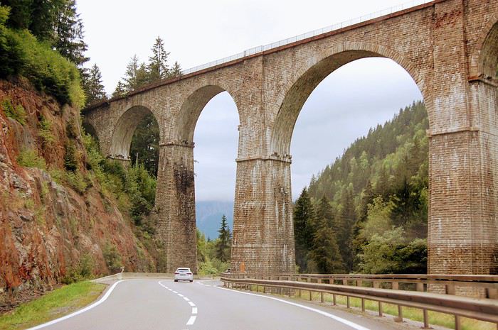 Nous prenons la route pour un road trip de 2 semaines pour rejoindre la Croatie. La voiture, c’est un mode de voyage que l’on apprécie tout particulièrement, une variété de paysages à couper le souffle et des rencontres inoubliables.
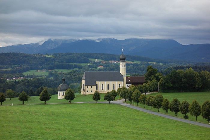 On suit l’A4 jusqu’en Allemagne, on poursuit sur la 8 jusqu’à Munich. Nous avons décidé d’y poser nos sacs pour une première étape.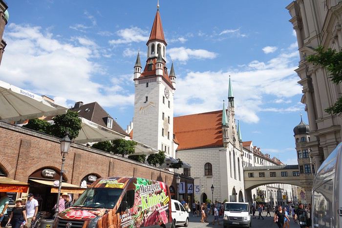
Munich, capitale de la Bavière, est une ville agréable à visiter.
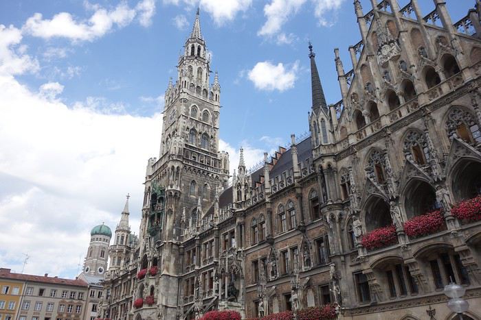 L’hôtel de ville, date de 1900 et fut totalement détruit pendant la seconde guerre mondiale.
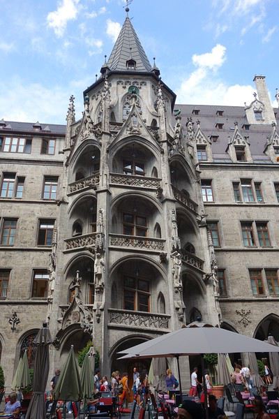 De style gothique, il est très imposant sur le plan architectural.
Il est l’un des principaux symboles de Munich.
De style gothique, il est très imposant sur le plan architectural.
Il est l’un des principaux symboles de Munich.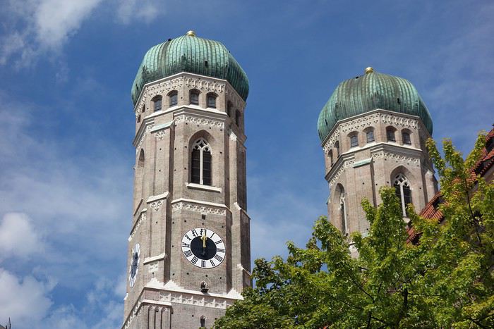 La cathédrale de Munich, avec ses deux clochers à bulbe est un édifice immense est aujourd'hui encore le bâtiment le plus haut du centre ville.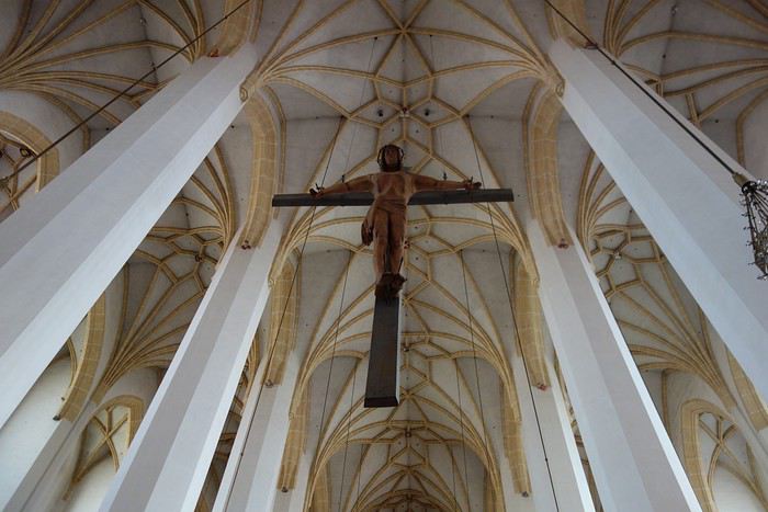
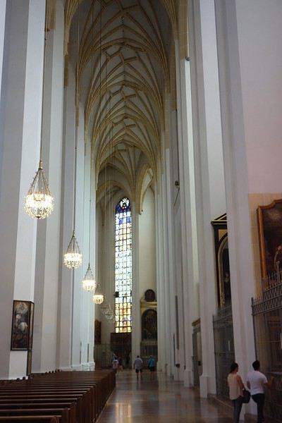 Son intérieur très sobre se démarque de la décoration souvent surchargée que l'on trouve dans de nombreuses églises bavaroises baroques.
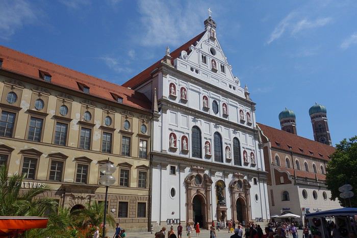 L'imposante façade blanche de l'église Saint-Michel resplendit en plein centre ville de Munich. Il y a fort à parier que son style Renaissance, qui a servi de modèle au baroque de toute l’Allemagne du Sud, vous impressionnera. Décorée de multiples statues, cette église du XVIe siècle est un véritable chef-d'œuvre de la
Renaissance.
L'imposante façade blanche de l'église Saint-Michel resplendit en plein centre ville de Munich. Il y a fort à parier que son style Renaissance, qui a servi de modèle au baroque de toute l’Allemagne du Sud, vous impressionnera. Décorée de multiples statues, cette église du XVIe siècle est un véritable chef-d'œuvre de la
Renaissance.
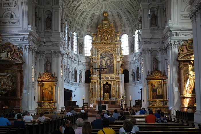 Construite pour les jésuites, Saint-Michel devait contenir l'influence du protestantisme en magnifiant l'art catholique. Cette église abrite le tombeau du célèbre roi Louis II de Bavière.
Circuit de la Hanse 1: Allemagne, Pays Bas et Belgique
Bonjour,
- Alors t'as fait quoi cet été ? - Les villes de la Hanse. - Euh ... et sinon, ça va bien ?
Et oui, voilà le genre de truc qui m'arrive. 😕
Lorsqu'en 2008, nous avions fait un circuit sur la Pologne et les pays baltes, nous découvrions la Ligue Hanséatique, cette association de marchands et de villes qui contrôlerons tout le commerce à partir de 1200 sur la Mer du Nord et la Baltique. Ces villes accumuleront les richesses et il en restait de superbes maisons ou hôtels de ville. Par contre, il nous manquait les villes + au sud avec l'Allemagne, les Pays-Bas et la Belgique. Alors c'est parti mon kiki, sur Juillet 2011.
Organisation :
- On part de Bordeaux, pas le + près on va dire ( voir itinéraire Google Maps ) avec ma voiture. - Un PC portable pour réserver les hôtels au fur et à mesure - Une préparation minime puisqu'on décide ça 15 jours avant de partir ! - Juillet 2011 sera le pire depuis 50 ou 60 ans 🤪 De la pluie, du froid et du gris à tous les étages ! Et en plus, dans le Nord de l'Europe, c'est encore + fun.
Je ne vais pas vraiment décrire tout ce qu'on a vu, mais lister les villes avec le + important. Pour + de détails, voir le circuit complet ICI.
Nous ferons donc : Valenciennes - Cologne - Lüneburg - Wismar - Stralsund - Lübeck - Hambourg - Brême - Amsterdam - Anvers - Gand et Bruges.
VALENCIENNES : Ou plutôt Guise à quelques kms. Pour faire une coupure après notre journée d'hier pour venir depuis Bordeaux, nous visiterons le Familistère de Guise.

Découverte dans le film "Louise Michel" c'était une cité ouvrière construite par le propriétaire des poêles Godin. Vraiment étonnant et vient juste d'être restaurée.
Après un passage à côté au musée Matisse de Cateau-Cambrésis, nous partons pour Cologne.

Juste le temps de faire un tour sur les quais. Il fait 15° !
COLOGNE :
Un peu de soleil ce matin. Nous partons pour la cathédrale, le monument le + visité d'Allemagne.

L'intérieur est grandiose et très aéré.

Nous allons ensuite à l'ancien hôtel de ville, de l'époque de la Hanse mais qui ne se visite pas 😕

L'après-midi est mauvaise avec le retour de la pluie et on se fera 3 musées : Wallraf, Ludwig et Arts Appliqués. Peu de choses à voir dans le centre-ville au niveau médiéval. Incontournable, l'immeuble de la vraie "eau de Cologne" quand même 😛

CELLE - LÜNEBURG :
Nous passons juste à Celle sur la route vers Lüneburg. La ville est réputée pour ses maisons à colombage ... et c'est pas usurpé !

Tout le centre est ainsi. Du 100% et aucune faute de goût ! Même après avoir habité Strasbourg, je suis soufflé ...

Après 1h30 de voiture, nous voici à Lüneburg. La ville tiendra sa richesse de ses mines de sel qui approvisionnaient tous les ports pour conserver le hareng, principal marchandise de la Baltique.

Une architecture unique de briques avec des fenêtres arrondies. C'est ici que nous verrons les + belles de notre circuit.

Voic l'ancien port avec son moulin et sa grue en bois.

Beaucoup d'anciens entrepôts ou maisons de marchands riches. On sent bien que la ville a été importante à l'époque.
LÜNEBURG - WISMAR : Ce matin, nous pouvons visiter l'hôtel de ville de Lüneburg. Interdit de prendre des photos, donc voici ce que j'ai pu avoir sur Internet.

Encore un petit tour en ville avec des briques noires ou grises

Ensuite c'est 180 kms pour aller à Wismar, en ex-Allemagne de l'Est.

Alors là c'est la catastrophe compléte ! On a une averse infernale avec du vent. En plus, c'est Samedi et tous les magasins ferment à 13h00. Nous sommes seuls dans les rues désertes. On est à 2 doigts de s'ouvrir les veines 😇
Pour résumer l'ambiance, voici une photo où même les parapluies abandonnent et se foutent à la poubelle.

Nous allons sur le port où devait se tenir LA fête maritime de l'année avec drakkars, goélettes et animations. Tout le monde est planqué sous les toiles. Les saucisses refroidissent et la bière s'évente.
On va se réfugier au restaurant de l'hôtel, bien ouvert lui ... et on met le chauffage à fond dans la chambre pour la nuit.
- Alors t'as fait quoi cet été ? - Les villes de la Hanse. - Euh ... et sinon, ça va bien ?
Et oui, voilà le genre de truc qui m'arrive. 😕
Lorsqu'en 2008, nous avions fait un circuit sur la Pologne et les pays baltes, nous découvrions la Ligue Hanséatique, cette association de marchands et de villes qui contrôlerons tout le commerce à partir de 1200 sur la Mer du Nord et la Baltique. Ces villes accumuleront les richesses et il en restait de superbes maisons ou hôtels de ville. Par contre, il nous manquait les villes + au sud avec l'Allemagne, les Pays-Bas et la Belgique. Alors c'est parti mon kiki, sur Juillet 2011.
Organisation :
- On part de Bordeaux, pas le + près on va dire ( voir itinéraire Google Maps ) avec ma voiture. - Un PC portable pour réserver les hôtels au fur et à mesure - Une préparation minime puisqu'on décide ça 15 jours avant de partir ! - Juillet 2011 sera le pire depuis 50 ou 60 ans 🤪 De la pluie, du froid et du gris à tous les étages ! Et en plus, dans le Nord de l'Europe, c'est encore + fun.
Je ne vais pas vraiment décrire tout ce qu'on a vu, mais lister les villes avec le + important. Pour + de détails, voir le circuit complet ICI.
Nous ferons donc : Valenciennes - Cologne - Lüneburg - Wismar - Stralsund - Lübeck - Hambourg - Brême - Amsterdam - Anvers - Gand et Bruges.
VALENCIENNES : Ou plutôt Guise à quelques kms. Pour faire une coupure après notre journée d'hier pour venir depuis Bordeaux, nous visiterons le Familistère de Guise.
Découverte dans le film "Louise Michel" c'était une cité ouvrière construite par le propriétaire des poêles Godin. Vraiment étonnant et vient juste d'être restaurée.
Après un passage à côté au musée Matisse de Cateau-Cambrésis, nous partons pour Cologne.
Juste le temps de faire un tour sur les quais. Il fait 15° !
COLOGNE :
Un peu de soleil ce matin. Nous partons pour la cathédrale, le monument le + visité d'Allemagne.
L'intérieur est grandiose et très aéré.
Nous allons ensuite à l'ancien hôtel de ville, de l'époque de la Hanse mais qui ne se visite pas 😕
L'après-midi est mauvaise avec le retour de la pluie et on se fera 3 musées : Wallraf, Ludwig et Arts Appliqués. Peu de choses à voir dans le centre-ville au niveau médiéval. Incontournable, l'immeuble de la vraie "eau de Cologne" quand même 😛
CELLE - LÜNEBURG :
Nous passons juste à Celle sur la route vers Lüneburg. La ville est réputée pour ses maisons à colombage ... et c'est pas usurpé !
Tout le centre est ainsi. Du 100% et aucune faute de goût ! Même après avoir habité Strasbourg, je suis soufflé ...
Après 1h30 de voiture, nous voici à Lüneburg. La ville tiendra sa richesse de ses mines de sel qui approvisionnaient tous les ports pour conserver le hareng, principal marchandise de la Baltique.
Une architecture unique de briques avec des fenêtres arrondies. C'est ici que nous verrons les + belles de notre circuit.
Voic l'ancien port avec son moulin et sa grue en bois.
Beaucoup d'anciens entrepôts ou maisons de marchands riches. On sent bien que la ville a été importante à l'époque.
LÜNEBURG - WISMAR : Ce matin, nous pouvons visiter l'hôtel de ville de Lüneburg. Interdit de prendre des photos, donc voici ce que j'ai pu avoir sur Internet.
Encore un petit tour en ville avec des briques noires ou grises
Ensuite c'est 180 kms pour aller à Wismar, en ex-Allemagne de l'Est.
Alors là c'est la catastrophe compléte ! On a une averse infernale avec du vent. En plus, c'est Samedi et tous les magasins ferment à 13h00. Nous sommes seuls dans les rues désertes. On est à 2 doigts de s'ouvrir les veines 😇
Pour résumer l'ambiance, voici une photo où même les parapluies abandonnent et se foutent à la poubelle.
Nous allons sur le port où devait se tenir LA fête maritime de l'année avec drakkars, goélettes et animations. Tout le monde est planqué sous les toiles. Les saucisses refroidissent et la bière s'évente.
On va se réfugier au restaurant de l'hôtel, bien ouvert lui ... et on met le chauffage à fond dans la chambre pour la nuit.
Quels objets souvenirs symbolisent le mieux un pays?
Bonjour,
parmis les pays ou les régions du monde que vous traversez il vous arrive à tous de vouloir rapporter un objet souvenir de ce pays.
Par exemple un papyrus ou une statuette d'Egypte. Une matriochka de Russie Un parfum de France
Pourriez vous me donner par pays le nom des objets symbolisant le mieux un souvenir ???
Merci de votre aide.
Par exemple un papyrus ou une statuette d'Egypte. Une matriochka de Russie Un parfum de France
Pourriez vous me donner par pays le nom des objets symbolisant le mieux un souvenir ???
Merci de votre aide.
Marché de Noël d'Alsace (France)
Salut tout le monde!
Nous ne sommes qu'au mois de septembre mais je pense déjà aux marchés de Noël. j'aimerai savoir si ceux d'Alsace valent le détour. Si oui, lesquels?! et question logement? J'aimerai m'y rendre un week-end, ce qui nous permettrai de voir uen marché de ^Noël alsacien et de découvrir un peu la région...
Merci beaucoup...
InterRail de 21 jours en Scandinavie en plein hiver
Interrail en Scandinavie: 1ère étape Copenhague

Après l'interrail Grèce+Balkans de l'été 2013, nous sommes prêts pour un nouveau voyage de 5000 km en train à travers 11 destinations et 4 pays : Danemark, Suède, Norvège et Finlande pour découvrir la Scandinavie en plein hiver. Ce voyage que nous avons surnommé Scandirail16 commence à l’aube d’un des premiers jours de la nouvelle ann��e avec la première étape d’une série: Copenhague. Le premier jour de voyage s’annonce long : 12 heures et 4 trains si tout va bien et que nous ne ratons aucune correspondance (pour certaines nous avons seulement 5 minutes). Partis de Strasbourg, après quelques minutes nous sommes déjà outre-Rhin et le français n’est plus qu’un souvenir. Notre premier changement aura lieu à Offenburg, petite ville du Baden-Württemberg. Etant pile à l’heure, nous pouvons prendre notre correspondance pour Mannheim sans nous presser, aidés entre autres par le fait qu’en Allemagne les quais de départ des trains sont fixes et donc connus d’avance. Avant même d’avoir le temps de nous installer, le contrôleur de la Deutsche Bahn est déjà là pour nous accueillir, en allemand et semble perplexe lorsque nous lui répondons en anglais (qu’il ne semble pas comprendre). Heureusement l’un de nous se débrouille en allemand et nous réussissons à passer la barrière linguistique. Il est à peine plus de 7 heures et, après une courte nuit, nous commençons à nous endormir quand nous arrivons à Mannheim. Là aussi nous avons peu de temps pour changer de train mais, grâce à la précision allemande, nous pouvons prendre notre correspondance sans devoir courir. Une fois dans le train pour Hambourg, où nous attend notre dernier train de la journée, nous pouvons nous relaxer, rattraper un peu de sommeil et boire un cappuccino bien chaud en admirant par la fenêtre les paysages enneigés qui défilent.
Vers midi, nous arrivons dans la deuxième ville la plus peuplée d’Allemagne alors qu’une tempête de neige s’abat sur la ville et nous ressentons alors le choc thermique. Cette fois nous avons un peu de temps avant notre correspondance pour Copenhague et profitons de la gare qui ressemble à un centre commercial pour avaler quelque chose de chaud. Il est à peine plus de 13 heures quand notre dernier train arrive, avec une dizaine de minutes de retard (juste pour démentir la précision allemande citée plus haut), avant que nous ne nous transformions en glaçons.
Mais ce retard est vite pardonné par la surprise que nous réserve le premier jour de notre InterRail. Arrivés à Puttgarden, une petite gare du nord de l’Allemagne, notre train s’arrête et on nous annonce une attente de vingt minutes avant de pouvoir… embarquer sur le ferry qui nous emmènera au Danemark.
Une fois dans le train pour Hambourg, où nous attend notre dernier train de la journée, nous pouvons nous relaxer, rattraper un peu de sommeil et boire un cappuccino bien chaud en admirant par la fenêtre les paysages enneigés qui défilent.
Vers midi, nous arrivons dans la deuxième ville la plus peuplée d’Allemagne alors qu’une tempête de neige s’abat sur la ville et nous ressentons alors le choc thermique. Cette fois nous avons un peu de temps avant notre correspondance pour Copenhague et profitons de la gare qui ressemble à un centre commercial pour avaler quelque chose de chaud. Il est à peine plus de 13 heures quand notre dernier train arrive, avec une dizaine de minutes de retard (juste pour démentir la précision allemande citée plus haut), avant que nous ne nous transformions en glaçons.
Mais ce retard est vite pardonné par la surprise que nous réserve le premier jour de notre InterRail. Arrivés à Puttgarden, une petite gare du nord de l’Allemagne, notre train s’arrête et on nous annonce une attente de vingt minutes avant de pouvoir… embarquer sur le ferry qui nous emmènera au Danemark.

Embarquer sur un bateau tout en restant confortablement assis dans le train, ça n’arrive pas tous les jours ! Pour des raisons de sécurité nous ne pouvons rester dans le train, qui est maintenant dans la cale, tous les passagers sont donc invités à descendre du train pour se rendre dans le bateau. La traversée dure environ 45 minutes et nos compagnons de voyage en profitent pour grignoter un en-cas et dévaliser les différents duty-free. Nous montons sur le pont et affrontons le vent glacial pour prendre des photos du coucher de soleil sur la mer quand le commandant nous annonce l’arrivée imminente et nous invite à retourner dans le train. Nous arrivons dans la capitale danoise peu avant 19h et déposons nos bagages à l’hôtel, à deux pas de la gare avant de sortir pour un dîner en ville. Nous passons devant le Parc Tivoli, nous longeons Stroget, la rue du shopping au centre-ville et peu après la place Kongens Nytorv nous entrons dans la cour intérieure d’une bâtisse élégante qui doit être fort agréable les soirées d’été. Nous entrons chez Banksia, dans une ambiance hygge comme on dit ici (comprenez relax, avec des bougies, une lumière tamisée et une ambiance chaleureuse) où le chef australien nous invite à découvrir la cuisine et les vins de son pays. Ayant déjà testé les spécialités danoises il y a quelques mois, nous tentons un voyage en Océanie, entre kangourou et soupe de crocodile, le tout très raffiné et délicat.

Rassasiés et réchauffés après cette première longue journée de voyage hivernal vers la Scandinavie, nous rentrons à l’hôtel pour profiter d’un sommeil réparateur avant de poursuivre notre périple en direction de Göteborg, en Suède.
Après l'interrail Grèce+Balkans de l'été 2013, nous sommes prêts pour un nouveau voyage de 5000 km en train à travers 11 destinations et 4 pays : Danemark, Suède, Norvège et Finlande pour découvrir la Scandinavie en plein hiver. Ce voyage que nous avons surnommé Scandirail16 commence à l’aube d’un des premiers jours de la nouvelle ann��e avec la première étape d’une série: Copenhague. Le premier jour de voyage s’annonce long : 12 heures et 4 trains si tout va bien et que nous ne ratons aucune correspondance (pour certaines nous avons seulement 5 minutes). Partis de Strasbourg, après quelques minutes nous sommes déjà outre-Rhin et le français n’est plus qu’un souvenir. Notre premier changement aura lieu à Offenburg, petite ville du Baden-Württemberg. Etant pile à l’heure, nous pouvons prendre notre correspondance pour Mannheim sans nous presser, aidés entre autres par le fait qu’en Allemagne les quais de départ des trains sont fixes et donc connus d’avance. Avant même d’avoir le temps de nous installer, le contrôleur de la Deutsche Bahn est déjà là pour nous accueillir, en allemand et semble perplexe lorsque nous lui répondons en anglais (qu’il ne semble pas comprendre). Heureusement l’un de nous se débrouille en allemand et nous réussissons à passer la barrière linguistique. Il est à peine plus de 7 heures et, après une courte nuit, nous commençons à nous endormir quand nous arrivons à Mannheim. Là aussi nous avons peu de temps pour changer de train mais, grâce à la précision allemande, nous pouvons prendre notre correspondance sans devoir courir.
Une fois dans le train pour Hambourg, où nous attend notre dernier train de la journée, nous pouvons nous relaxer, rattraper un peu de sommeil et boire un cappuccino bien chaud en admirant par la fenêtre les paysages enneigés qui défilent.
Vers midi, nous arrivons dans la deuxième ville la plus peuplée d’Allemagne alors qu’une tempête de neige s’abat sur la ville et nous ressentons alors le choc thermique. Cette fois nous avons un peu de temps avant notre correspondance pour Copenhague et profitons de la gare qui ressemble à un centre commercial pour avaler quelque chose de chaud. Il est à peine plus de 13 heures quand notre dernier train arrive, avec une dizaine de minutes de retard (juste pour démentir la précision allemande citée plus haut), avant que nous ne nous transformions en glaçons.
Mais ce retard est vite pardonné par la surprise que nous réserve le premier jour de notre InterRail. Arrivés à Puttgarden, une petite gare du nord de l’Allemagne, notre train s’arrête et on nous annonce une attente de vingt minutes avant de pouvoir… embarquer sur le ferry qui nous emmènera au Danemark.Embarquer sur un bateau tout en restant confortablement assis dans le train, ça n’arrive pas tous les jours ! Pour des raisons de sécurité nous ne pouvons rester dans le train, qui est maintenant dans la cale, tous les passagers sont donc invités à descendre du train pour se rendre dans le bateau. La traversée dure environ 45 minutes et nos compagnons de voyage en profitent pour grignoter un en-cas et dévaliser les différents duty-free. Nous montons sur le pont et affrontons le vent glacial pour prendre des photos du coucher de soleil sur la mer quand le commandant nous annonce l’arrivée imminente et nous invite à retourner dans le train. Nous arrivons dans la capitale danoise peu avant 19h et déposons nos bagages à l’hôtel, à deux pas de la gare avant de sortir pour un dîner en ville. Nous passons devant le Parc Tivoli, nous longeons Stroget, la rue du shopping au centre-ville et peu après la place Kongens Nytorv nous entrons dans la cour intérieure d’une bâtisse élégante qui doit être fort agréable les soirées d’été. Nous entrons chez Banksia, dans une ambiance hygge comme on dit ici (comprenez relax, avec des bougies, une lumière tamisée et une ambiance chaleureuse) où le chef australien nous invite à découvrir la cuisine et les vins de son pays. Ayant déjà testé les spécialités danoises il y a quelques mois, nous tentons un voyage en Océanie, entre kangourou et soupe de crocodile, le tout très raffiné et délicat.
Rassasiés et réchauffés après cette première longue journée de voyage hivernal vers la Scandinavie, nous rentrons à l’hôtel pour profiter d’un sommeil réparateur avant de poursuivre notre périple en direction de Göteborg, en Suède.
Marché de Noël à Strasbourg?
Salut à tous,
Je suis un étudiant étranger à Paris. Je compte à voyager à Strasbourg en vacance de Noel (en fait, je serai à Strasbourg le 24 et 25). C'est la premier fois que je viens à Strasbourg. Un de mon amis m'a dit qu'il y avait un marché de Noël là-bas mais je ne sais pas où il est. Outre, Avez-vous des autres endroits intéressants à me recommander? Je voudrais en profiter pour découvrir la ville Strasbourg aussi.
Désolé si mon français n'est pas bon. J'attends avec intérêt votre réponse.
BJ
Je suis un étudiant étranger à Paris. Je compte à voyager à Strasbourg en vacance de Noel (en fait, je serai à Strasbourg le 24 et 25). C'est la premier fois que je viens à Strasbourg. Un de mon amis m'a dit qu'il y avait un marché de Noël là-bas mais je ne sais pas où il est. Outre, Avez-vous des autres endroits intéressants à me recommander? Je voudrais en profiter pour découvrir la ville Strasbourg aussi.
Désolé si mon français n'est pas bon. J'attends avec intérêt votre réponse.
BJ
Tourisme sexuel: nous sommes tous responsables
bonjour
aujourd'hui je m'apprête à partir à Madagascar, en lisant le LP guide, je trouve un chapitre sur le tourisme sexuel et cela me rappelle un souvenir triste :
J'ai vécu 1 an au Sri lanka et un jour j'ai vu un allemand avec un jeune sri lankais (trop jeune), je me suis insurgée et j'ai commencé à m'agiter, je voulais le dénoncer auprès de la police local etc... mais mes amis sri lankais m'ont retenui en me disant que c'est moi qui aurait des problèmes car cela était couvert par certaines "crapules" du village où cela se déroulait.
c'est horrible, j'ose espérer qu'aujourd'hui en tant que touristes nous avons peut être un poid le regard que l'on porte lourd de reproches et même un risque de dénonciation de ce type d'activité. Mais qu'en est-il vraiment ?
cela vous est-il arrivé ? qu'avez vous fait ? qui contacter ?
il existe des sites maintenant : http://www.ecpat-france.org/
merci de partager vos opinions et expériences
cordialement
aujourd'hui je m'apprête à partir à Madagascar, en lisant le LP guide, je trouve un chapitre sur le tourisme sexuel et cela me rappelle un souvenir triste :
J'ai vécu 1 an au Sri lanka et un jour j'ai vu un allemand avec un jeune sri lankais (trop jeune), je me suis insurgée et j'ai commencé à m'agiter, je voulais le dénoncer auprès de la police local etc... mais mes amis sri lankais m'ont retenui en me disant que c'est moi qui aurait des problèmes car cela était couvert par certaines "crapules" du village où cela se déroulait.
c'est horrible, j'ose espérer qu'aujourd'hui en tant que touristes nous avons peut être un poid le regard que l'on porte lourd de reproches et même un risque de dénonciation de ce type d'activité. Mais qu'en est-il vraiment ?
cela vous est-il arrivé ? qu'avez vous fait ? qui contacter ?
il existe des sites maintenant : http://www.ecpat-france.org/
merci de partager vos opinions et expériences
cordialement
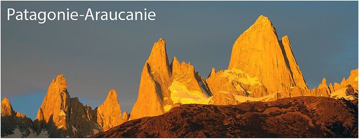
Patagonie Araucanie
Bonjour à tous,
Le carnet en images est disponible en cliquant ici
Bonne lecture! Marie
texte seul :
Ce coin du vaste monde nous tentait depuis longtemps mais je gardais un si mauvais souvenir du voyage en avion effectué il y a une dizaine d’années à destination de Buenos Aires, ainsi que des interminables passages de douane entre Chili et Argentine, qu’il a fallu que Fred insiste un peu (beaucoup) pour me décider. Il a bien fait ! Nous avons fait un superbe voyage, bien au-delà de mes espérances ! PREPARATIFS Décidée à voyager à notre propre rythme, sans être tributaire de check-in/out, heures de repas, attentes diverses et variées, nuisances sonores, je choisissai comme souvent d’être totalement autonome pour nous déplacer, manger et dormir. Compte-tenu des aléas climatiques (40èmes rugissants, Chili pluvieux, Argentine désertique, pour schématiser) j’écartai l’option voiture + tente au profit de la location d’un camper 4X4. Après recherches, je retenai finalement Holiday Rent RV, qui proposait un 4X4 simple cabine avec cellule aménagée, au départ de Punta Arenas avec retour à Santiago (les distances sont énormes donc en 3 semaines mieux vaut éviter une boucle), à nos dates. Tout ça pour un prix exorbitant, mais on ne vit qu’une fois, la fiabilité du véhicule est essentielle à la sérénité du voyage et l’entreprise avait l’air sérieuse. C’est donc en juin que j’ai réservé : -le camper, inclus 300 km/j et les papiers pour les passages de frontière car pour aller de Punta Arenas à Santiago, il faut passer en Argentine, à moins de prendre des ferries, à réserver à l’avance (option non retenue pour rester libres de notre rythme) -les vols Luxembourg-Paris-Santiago avec Air France, en croisant les doigts pour passer entre 2 grèves, -le vol Santiago-Punta Arenas avec Sky, une low cost qui fait des vols intérieurs au Chili, -un Air b and B pour les 2 premières nuits à Punta Arenas, -une voiture chez Hertz prise à l’aéroport de Punta Arenas à notre arrivée et rendue le lendemain en ville (située à 20 km de l’aéroport). J’ai ensuite préparé les détails du voyage, avec - une carte Michelin Chili Argentine au 1/2000000, -les cartes Compass Mapa Turistico Chiletur Copec au 1/400000 N° 5, 6, 7 et 8, -les guides Lonely Planet Chili et Argentine, -le guide Cicerone Trekking in Torres del Paine -Maps.me, Windymaps, Wikiloc et Google Earth -enfin la lecture de nombreux carnets de voyage, en particulier sur voyage forum (merci aux auteurs !) -j’ai trouvé les sites internet des parcs nationaux chiliens et argentins assez peu informatifs avec surtout des liens commerciaux …Il m’a été impossible de réserver les campings gérés par la CONAF (l’organisme public qui gère les parcs) dans le Parc Torres del Paine, car ma carte Visa ne passait pas. J’ai appris 1 mois avant le départ (donc trop tard car tout était pris) que la Mastercard fonctionnerait… -A El Chalten, côté argentin, pour camper dans le parc National des Glaciers, la réservation n’est pas nécessaire donc j’ai prévu si la météo le permet d’y faire un trek de quelques jours donc on a pris notre matériel de bivouac. -carte Revolut achetée juste avant le départ (pour éviter les frais exorbitants de retrait aux ATM en Argentine) : gros bug pas encore résolu donc inutilisable. J’ai donc pris du cash à échanger contre des pesos argentins. Au Chili, retrait en ATM comme d’habitude. De Luxembourg à Punta Arenas 01 et 02/12/18 Sam 01/12/18 Décollage du Luxembourg à 16h00, puis redécollage de Paris à 23H40 et arrivée à Santiago le lendemain à 10h00. Fred a bien dormi, moi quasiment pas (trop de bons films !) On a aperçu les Andes et leurs belles couleurs chaudes qu’on aime tant ! Dimanche 02/12/18 On récupère les bagages (ouf ! c’est toujours une appréhension), on retire des pesos chiliens, on mange un bout et on redécolle à 15h00 vers Punta Arenas via une escale de 30 mn à Puerto Montt. Superbe vol le long de la chaîne des volcans : je me réjouis d’avoir choisi de visiter l’Araucanie après la Patagonie. A posteriori, je pense pouvoir identifier en bas de l’image la ville de Pucon, sa péninsule et le volcan Villarica (2840 m) et plus loin le volcan Quetrupillan (2382 m) et au fond en Argentine le volcan Lanin (3747m) Ici de droite à gauche les volcans Osorno (2652 m), Tronador (sur la frontière 3491m) et Puntiagudo (2493 m) et le Lago Llanquihue Courte escale de 30 mn à Puerto Montt pour débarquer / embarquer des passagers. Puis nous entrons dans les nuages et je m’endors jusqu’à Punta Arenas où nous atterrissons sous la pluie à 19h40 comme prévu. Récupération des bagages puis de la voiture chez Hertz. Bonne surprise, nous sommes surclassés faute de disponibilité de la petite citadine réservée : après explications détaillées sur la voiture, le cric, etc. (1ère fois que ça nous arrive !) nous embarquons à bord d’un rutilant pick up Toyota Hilux quasi neuf ! Cool ! J’ai repéré pour demain une piste dont je ne connais pas l’état dans un coin qui m’a l’air superbe : nous sommes parés ! Encore quelques km jusqu’à notre Air b and B réservé pour 2 jours. https://www.airbnb.fr/rooms/12978706?euid=e9d9d048-3930-9b28-f275-f7af641a78f8&guests=1&adults=1 La propriétaire semblait ne nous attendre que demain mais pas de problème le studio est prêt et douillet. Nous faisons encore qq achats pour grignoter ce soir et demain matin et hop au lit après 36h de voyage…
Seno de Skyring à l’ouest de Rio Verde. Lundi 03/12/18 Le camper n’est disponible qu’à partir de demain : nous avons donc toute la journée pour récupérer du voyage et faire un gros ravitaillement. Mais si le destin nous a offert ce joli pick up, il faut en profiter, d’autant que la météo devrait s’améliorer en milieu de journée. On commence donc par la corvée courses et achat de gaz pour le trek (trouvé dans un magasin ourdoor en ville), sous la pluie et les bourrasques, et nous filons ensuite vers cette piste repérée sur Google Earth. https://goo.gl/maps/wfmBrVcNCUz Le goudron cesse en quittant la Ruta 9 mais la piste est bonne. Le vent souffle fort et ça se dégage peu à peu. Caracara indifférent aux bourrasques. Notre premier guanaco ! Voilà le petit ferry près de Rio Verde qui mène à la Isla Riesco. Premiers condors, on n’en revient pas ! Il doit y avoir une carcasse dans le coin… Florilège d’oies, cygnes et autres canards… Tiens un probable élevage de saumon (Cermaq) Petit arrêt à une cascade lieu de dévotion à la Virgencita de Montserrat. Le paysage est magnifique et grandiose, ça souffle fort sur le détroit, peu profond et la mer est courte et hachée. Quelques fermes ponctuent la piste, très belle jusqu’au pont sur le Rio Perez. Elle continue un peu au-delà mais s’éloigne de la côte et perd de son intérêt. Demi-tour donc pour refaire avec plaisir cette très belle piste, nous sommes mieux éclairés : ces flamants roses nous avaient échappés. Je n’en reviens pas de la quantité et de la diversité d’oiseaux vus en une après-midi, dès le 1er jour de notre voyage. Et voilà aussi des nandous ! Nous rendons la voiture à l‘agence Hertz de Punta Arenas downtown, bien sale et en ayant un peu dépassé le forfait kilométrique (250 km), sans surcoût. Retour en taxi (il y en a partout en ville et c’est très bon marché) à notre douillet studio et gros dodo ! En route pour Torres del Paine J1 Mardi 04/12/18 Check météo grâce au WIFI avant de partir : moyen et variable…tous les espoirs sont donc permis ! Le taxi dépêché par le loueur est en avance au RDV et à 7h45 pétantes, il nous emmène au dépôt de HolidayRent RV, à 40 km au sud de Punta Arenas. Notre chauffeur roule avec un œil sur la route (déserte en cette heure matinale) et l’autre sur l’océan. Son œil de lynx a aperçu des souffles de baleines, que nous apercevrons en effet à plusieurs reprises, de très loin. Il nous explique que les bateaux au loin sont japonais avec à bord des « esclaves » d’origine asiatique (philippins ou indonésiens si on a bien compris) et visiblement ils ne sont pas très populaires dans le détroit de Magellan ! Timo nous accueille et nous présente le camper : le porteur est un Nissan Navarra NV300 simple cabine avec seulement 5000 km au compteur (correspondant sans doute au voyage aller depuis Santiago), de bons gros pneus tout terrain, 2 roues de secours et une sangle et quelques outils (pas de compresseur) La cellule n’est pas neuve mais fonctionnelle et en très bon état. L’espace intérieur est confortable avec pas mal de rangements, cuisine, douche, toilettes, chauffage, eau chaude, table et lit permanent. Nous sommes ravis ! Nous prenons le temps de ranger la bouffe et nos affaires et c’est parti ! Encore des flamants roses le long de la Ruta 9, et plus loin des ibis près de cette maisonnette entourée de sa forêt « moussue » On mange au bord de la mer à Puerto Natales (trop tôt, les resto sont encore fermés) et on continue vers Puerto Prat, joli coin tranquille ! Piste pénible en travaux (apparemment très prolongés) jusqu’au sud du parc Torres del Paine. Le paysage devient magnifique et en plus il n’y a quasiment que nous sur cette route. Où sont les foules annoncées dans les guides et blogs de voyage ? Très bonne surprise ! A l’extrémité nord du Lago Torro, nous arrivons dans une ample vallée et prenons nos tickets à l’entrée de Rio Serrano (de mémoire 20 ou 30 €/pers pour 3 jours voire plus tant qu’on ne sort pas du parc) La ranger nous indique les endroits autorisés pour dormir en van, camper ou camping car (en dehors des campings donc sans payer en plus. En fait les endroits avec toilettes publiques soit Serrano Entrance, Laguna Amarga entrance, Sarmiento Entrance, Pudeto au départ du catamaran et Grey Ranger station ) mais n’a pas d’info sur la Laguna Azul où j’ai envie d’aller ce soir. Il n’est pas possible de vidanger dans le parc. Nous longeons la rivière Paine puis le fameux Lago Pehoe d’un bleu hypnotique. Belles rafales ! Grain sur les Cuernos (2600 m), montagnes emblématiques du parc faites de roches sédimentaires, noires à leur base et au sommet et granitiques à mi-hauteur. Le temps change à toute vitesse et ça s’améliore. On en profite pour faire une petite rando ! A qq minutes du parking point de départ de la rando vers le Mirador Cuernos, toute une troupe de guanacos peu farouches ! On passe près de la cascade Salto Grande. Belle forêt d’arbres morts dont le bois a été blanchi par les éléments, un peu comme du bois flotté. La balade n’est pas très longue mais très belle et variée. On en prend plein les yeux grâce à une belle éclaircie ! Au retour, les guanacos sont toujours là… On reprend le camper dans une superbe lumière pour filer vers l’est. Arrêt au Mirador Nordenskjöld où se dévoilent les Torres (2850m), autres célébrités du parc. La lumière rasante souligne joliment les reliefs. Le Rio Paine serpente dans la plaine. Encore des guanacos, des dizaines ! Avec cette lumière de fin de journée, cette partie du parc, très peu fréquentée nous enchante. Remarquez cette jolie silhouette de guanaco au 1er plan : ces animaux aiment les crêtes pour mieux surveiller leur environnement et voir arriver le puma (qu’on ne verra pas !) Le ranger de la Laguna Azul nous accueille et après avoir un peu hésité, accepte quand nous lui expliquons que nous avons des toilettes à bord, de nous laisser passer la nuit au bord de la Laguna Azul. Le camping (superbe) est fermé (pour une raison que j’ignore) et nous sommes seuls. Quel luxe !
Mercredi 05/12/18 Torres del Paine J2 Nuit très calme car le vent est tombé quand le soleil s’est couché (observation qu’on renouvellera souvent) Pas encore recalée à l‘heure chilienne, je me réveille avant l’aube : il fait grand beau ! Petite rando matinale le long de la Laguna Azul pour assister à l’arrivée des premiers rayons sur les Torres. C’est superbe mais bref. La lumière blanchit très vite ! On reprend la route vers l’ouest du parc, soleil dans le dos (comme hier soir !), seuls (il est encore tôt) et on en prend encore une fois plein les yeux ! Réflexion… Méandres… Glaciers… Les Cuernos encore… Salto Grande Les lupins sont à leur apogée ! La piste vers Grey Ranger Station est le domaine des lièvres qui détalent dans tous les sens, sans trop se presser d’ailleurs… Vers 9h on démarre la rando vers le Mirador Grey, situé au bout d’une étrange presqu’île. Quelques icebergs échappés du glacier Grey ont dérivé jusqu’ici. Voilà les passagers qui vont embarquer sur le catamaran pour aller voir ce glacier de plus près. L’accès de l’ancien embarcadère est sous un éboulis de roche et il faut désormais marcher un peu jusqu’à trouver un endroit assez profond pour le bateau. Les notros sont en fleurs ! Un glacier est passé par là, à en juger par l’état de ce rocher…. Très jolie balade, d’un excellent rapport effort/intérêt (comme celle d’hier au Mirador Cuernos) Une petite pause puis nous enchaînons avec la rando au Mirador Ferrier dont parle JF dans son blog et dont les photos m’ont fait envie, en dépit de la dénivelée. J’ai agonisé dans la montée (trop chaud et pas assez d’eau, ciel devenant laiteux) et ai fait demi-tour aux 2/3. Fred a poursuivi jusqu’en haut et m’a gentiment assuré qu’il n’avait pas vu grand-chose de plus que moi…. Déjeuner et sieste puis on reprend la route vers l’est du parc alors que le temps se couvre. J’avais prévu 4 jours dans ce parc, histoire d’avoir une chance d’apercevoir les sommets : nous avons eu la chance d’avoir de suite du beau temps, aussi décidons-nous puisque la météo se gâte d’aller chercher le soleil ailleurs. Nous sortons du parc et nous posons pour la nuit à l’extrémité est de la Laguna Amarga, avec la vue sur les Torres désormais ennuagées. Jeudi 06/12 vers El Calafate et le Glacier Perito Moreno Nous longeons le très beau Lago Samiento puis passons la frontière dès son ouverture (à 8h) à Cerro Castillo. Très bonne surprise, les choses se sont bien améliorées en 10 ans : douaniers aimables, informatique, 10 mn à chaque poste de douane et c’est plié ! Nous prenons ensuite la Ruta 40, qui devient piste à partir de Tapi Aike. Contrairement à ce qu’indique notre carte, il n’y a pas d’essence à Cerro Castillo mais nous avons sur le toit un bidon de 20l en réserve donc il n’est pas nécessaire de faire le détour par Esperanza, même si nous avons fait notre dernier plein à Puerto Natales. Il semble y avoir de l’essence à Tapi Aike mais notre loueur nous l’a déconseillée. La piste est assez rugueuse et notre rétroviseur droit qui bougeait de plus en plus, saute en marche ! Heureusement il reste suspendu par les fils électriques ce qui lui évite de se fracasser au sol. Inspection du bazar : talon d’Achille de notre camper, la seule pièce bricolée artisanalement a été bâclée. Des rallonges de rétroviseurs ont été fabriquées, avec 3 points de fixation MAIS un seul boulon, de faible diamètre, et un minable écrou sans frein à filer et pas Nilstop. Il était impossible que ce système résiste à plus de quelques heures de piste….pfff… Heureusement c’est le rétro de droite mais nous considérons maintenant d’un œil suspicieux son collègue, à G, nettement plus indispensable. On parvient à remettre le minable petit boulon et on assure le rétro avec un bout de ficelle, conscient de la précarité de notre « réparation » et qu’il nous faudra revisser régulièrement le bazar… Pas grand-monde sur cette piste, à part quelques nandous en goguette. Nous arrivons à El Calafate quelques minutes avant midi et je m’éjecte de la voiture quand nous apercevons un bureau de change tandis que Fred va se garer. Je change 390 € (toute leur fortune je crois car j’avais proposé 400 ) puis nous allons prendre de l’essence (on est sur la réserve depuis 30 km) Déjeuner au bord du Lago Argentino puis on continue vers le glacier Perito Moreno (entrée de mémoire à environ 30 €/personne) On croise une foule de bus et camionnettes qui ramènent leurs passagers sur El Calafate : le site se vide, tant mieux ! A partir de 17h00 on peut se garer au parking du haut, plus proche du glacier et éviter la navette. Le site est très bien aménagé, avec des km de passerelles qui offrent des vues variées sur le front glaciaire (5km de large, 60 m de haut dans sa partie émergée). Il n’y a plus grand monde et carrément personne quand on s’éloigne un peu. Le glacier (30 km de long) vient buter sur la presqu’île où nous sommes car il progresse d’environ 2 m/jour. C’est un des rares glaciers à ne pas reculer et ça ne m’étonne pas car il bénéficie d’un microclimat étonnant. Nous sommes restés 2 demi-journées sur place et il est resté en permanence sous un nuage de précipitations alors qu’il faisait beau partout ailleurs ! Nous restons sur place 2 ou 3h (pas de gros vêlage, quelques craquements) et décidons de dormir à proximité au cas où la météo serait meilleure demain (la dame à l’entrée nous a expliqué que l’on pouvait ré-entrer gratuitement le lendemain si on apportait une preuve qu’on avait dormi au camping le plus proche à Lago Roca ou sinon à demi-tarif). On se trouve finalement un coin plus près juste après avoir franchi le Rio Malo (en allant vers Lago Roca) avec une vue superbe ! A l’est ciel bleu, à l’ouest côté montagnes et glacier : pluie ! Beau ciel de fin de journée ! Vendredi 07/12/18 vers El Chalten Trek J1 Encore un beau lever de soleil ! Privilège du bivouac en pleine nature… Le glacier est toujours sous les nuages donc on laisse tomber et on va faire un tour vers Punta Bandera, point de départ des croisières à la journée sur le Lago Argentino vers d’autres glaciers (Upsala et Spegazzini) Ça souffle ! Arc en ciel sur les montagnes, où se cantonnent les nuages. Ici le vent est si fréquent que toutes les fermes ont planté des rideaux d’arbres protecteurs. Grands espaces pour ces chevaux… Quelques peupliers aussi pour cette jolie maison sur la rive sud du Lago Argentino, que nous contournons par l’est. Joli grain ! Cet iceberg a dérivé sur plus de 100 km avant de s’échouer sur les hauts-fonds de la partie est du lac. Bel arc en ciel au-dessus de cette dune ébouriffée par les rafales. Soudain jaillit sur l’horizon la silhouette caractéristique du Fitz Roy (3375 m) figure emblématique de El Chalten, situé à plus de 100 km. Longue ligne droite de 90 km le long du Lago Viedma, où peinent les cyclistes, obligés de pousser leurs vélos contre le vent. Je repère le glacier de Piedras Blancas que nous irons voir de plus Soudain, au détour d’un virage, le village de El Chalten apparait, au pied du massif. Nous achetons une carte du coin dans une petite librairie (Chalten Trekking Map Fitz Roy-Torre au 1/50000, ne couvre pas le Cerro Huemul, trek sur 4 grosses journées, que j’avais prévu de faire mais je préfère renoncer à cause du vent, très fort et qui doit durer. Pour ce trek il faut de toute façon s’enregistrer auprès des rangers et obtenir leur autorisation) Comme il fait beau, on décide de démarrer dès aujourd’hui mon plan B : un trek plus facile sur 3 jours vers le Campamento de Agostini puis le C. Poincenot puis retour sur El Chalten. Nous laissons le camper au parking situé à l’extrémité nord du village et grimpons sur un joli sentier fleuri. Il fait trop chaud ( !) sans doute environ 25°C…mais le paysage est superbe et le ciel aussi ! Voilà le sommet du Cero Solo avec son glacier suspendu devant lequel se détachent les silhouettes des arbres posés sur la crête. C’est étonnant de voir une telle proximité entre forêts denses et glaciers ! Nous passons ensuite une jolie zone de marais, avec quelques taons et moustiques peu entreprenants (nous n’aurons quasiment pas eu de moustiques au cours de ce voyage) Après 1h30 de marche tranquille, nous arrivons au Mirador Torre où se dévoile une succession de pics chatouillant les nuages : à droite El Chalten (ou Fitz Roy), puis le Cerro Poincenot, l��aiguille Saint Exupéry, et tout à gauche le massif Cerro Solo. Au-delà du Mirador, il n’y a plus grand-monde… Gros plan sur le Glaciar Grande, Qui domine la très belle vallée du Rio Fitz Roy, que nous allons remonter jusqu’à sa source au niveau de la Laguna Torre. Juste avant celle-ci nous bifurquons à G pour aller poser la tente et les sacs au Campamento Poincenot. L’endroit est très abrité sous de vieux arbres. Pas d’aménagement en dehors d’une cahute avec des toilettes sèches. On trouve facilement un coin bien plat (attention aux potentielles chutes de branches car les arbres sont laissés à l’état naturel et plus tous jeunes) L’eau se prend à la rivière, glaciaire donc chargée de limon. Après une pause goûter, on embarque les bouteilles vides au cas où on trouverait de l’eau plus claire et on se remet en route vers le Mirador Maestri, situé à 1h de marche au-dessus de la Laguna Torre. Voilà la Laguna Torre, lovée dans sa moraine glaciaire, avec un minuscule iceberg…Nous ne sommes qu’à 634 m d’altitude ! C’est formidable d’arpenter ces paysages de haute montagne sans l’essoufflement de la marche en altitude ! Il est plus de 16h00 et les gens qui font cette randonnée à la journée sont tous repartis. On n’est pas gênés par la foule sur cet étroit sentier… Ces 3 aiguilles jouent les timides, dans les nuages… Nous voilà tout près du Glaciar Grande, nappé de chocolat en poudre (oui, je suis gourmande !) Le sentier longe une petite forêt, où coule un ruisseau d’eau claire : on en profite pour faire le plein ! Drôle de parasite ? Jolies baies roses qu’on n’osera pas goûter… Furtive apparition du Glaciar Fitz Roy Norte ( ?) Retour au camp pour une soirée tranquille (une vingtaine de tentes très éparpillées à tout casser) Samedi 08/12/18 Trek El Chalten J2 Très bonne nuit, bien qu’un peu chaude ! Qui l’eût dit ? On se lève tôt pour profiter de la belle lumière matinale sur les aiguilles au-dessus de la laguna Torre. C’est superbe ! Difficile de s’arracher à cette contemplation…mais nous avons hâte de découvrir la suite du parcours, d’autant plus qu’il fait encore beau, quelle chance ! On récupère les sacs puis on redescend la belle vallée du Rio Fitz Roy, non sans quelques regards déjà nostalgiques en arrière… J’adore ces forêts d’arbres morts. J’adore ces nuages lenticulaires (je crois que ce sont les ciels qui m’ont le plus enthousiasmée en Patagonie) Après une heure de marche, on tourne à gauche vers la Laguna Hija encore à l’ombre. Nous poursuivons vers le nord et l’énorme paroi du Fitz Roy se dévoile peu à peu. La grande Laguna Madre est au soleil et les petits moutons courent sous les rafales ! Voilà le Fitz Roy (3405 m) et ses vassaux : grandiose ! Le Campamento Poincenot est lui aussi très abrité dans cette belle forêt. Nous y installons la tente, pique - niquons en compagnie d’un chien discret surgi de nulle part, pas du tout affamé, faisons une petite sieste (on a marché une douzaine de km ce matin) avant d’attaquer la rude grimpette vers la Laguna de Los Tres. Heureusement il y a pas mal de vent pour rafraichir un peu l’atmosphère ! Arrivé en haut, le bleu azur de cette lagune entourée de glaciers et de pics granitiques nous coupe le souffle (nan ce ne sont pas les 400 m de dénivelé en 1 km !) Pause contemplative à l’abri du vent derrière un rocher, puis on descend vers la lagune histoire d’échapper un peu à la foule massée au col (on est quand même à 4h30 de marche aller de El Chalten mais cette rando est le MUST du coin) Puis on avise un sentier qui grimpe sur une petite butte située à G : allons voir…. En arrivant à son sommet, on est ébahis par la découverte d’une 2ème lagune (il suffisait de regarder la carte pour s’en douter mais à cause du vent elle était restée rangée !) Incroyable vue sur la Laguna de Los Tres et la Laguna Sucia où plongent les cascades nées du Glaciar Rio Blanco. On se pose à l’abri du vent qui chasse enfin les nuages bloqués sur le Fitz Roy. Quel spectacle ! On aperçoit même les traces des alpinistes partis à l’assaut des parois granitiques…impressionnant ! Sur ce panoramique, on voit à G la petite butte qui permet de voir les 2 lagunes, c’est à 10 mn du col et pourtant presque personne n’y va : très dommage ! Quelle chance encore avec la météo ! On décide de profiter de cette belle journée pour encore faire l’aller-retour jusqu’au Mirador Piedras Blancas. Après une petite sieste dans la tente, on suit un joli sentier désert en cette fin de journée, qui chemine dans la forêt. Jolie vue sur le glacier, pas époustouflante (tout est relatif après cette journée magnifique !) mais la rando est facile et « à plat ». Retour au Campamento Poincenot avec 24 km au compteur. Ici encore tout au plus une vingtaine de tentes. On s’installe dans la clairière adjacente à la tente pour manger et profiter du coucher du soleil sur les aiguilles. Dimanche 09/12/18 Trek El Chalten J3 Fred jette un œil hors de la tente : le Fitz Roy est déjà au soleil ! C’est…beau, très beau ! Sans doute des alpinistes ont-ils passé la nuit quelque par tout là-haut ? La descente est une formalité, tandis que le ciel se couvre peu à peu…on a bien fait d’en profiter à fond hier ! En approchant du parking on croise pas mal de randonneurs alors qu’il est déjà 10h00. On quitte El Chalten vers 13h00 après avoir récupéré notre linge propre (il y a un lavadero efficace dans une rue perpendiculaire à la rue principale côté nord-est entre Calle 8 et Calle Trevisan) C’est parti pour 500 km de quasi no man’s land ! Le mauvais goudron file vers le nord dans une pampa aride et vide, sous un ciel bas et gris. Dire que c’est l’été…On dépasse l’Estancia La Siberia… puis quelques rares estancias dont il est difficile de dire si elles sont encore habitées qui se nichent dans les creux de colline où coule sans doute une petite source. 2 ou 3 moutons par ci par là….Quelques guanacos sauvages….Quelle drôle de vie loin de tout, sans électricité et à des dizaines de km du 1er bourg. La vie réapparait à Gobernardo Gregores où coule le Rio Chico : vertes prairies, grands arbres, vaches, chevaux et moutons et humains ! Et c’est reparti pour la pampa désertique, jusqu’à la bifurcation vers le Parque Nacional Perito Moreno. Je n’avais trouvé que peu d’informations sur ce parc (à ne pas confondre avec le glacier ou la ville éponymes) et n’avais pas prévu d’y aller, faute de temps. Mais grâce à une météo complaisante les premiers jours, nous avons désormais 4 jours d’avance sur mon planning prévisionnel et lassés par la pampa monotone, nous sommes irrésistiblement attirés par les montagnes aperçues au loin, 100 km à l’ouest. On décide de se poser dans le coin et de choisir demain en fonction de la météo d’y aller ou pas… Belle lumière de fin de journée…. Lundi 10/12/18 Parque Nacional Perito Moreno On a dormi à une vingtaine de km de la ruta 40 sur la piste 37. Il reste environ 80 km de piste jusqu’au parc. Les nuages restent accrochés sur les Andes mais la lumière est si belle sur les herbes blondes de la pampa, Où paissent des dizaines de guanacos Que nous décidons de poursuivre vers l’ouest. La piste justifie à elle seule tous ces kilomètres ! Elle longe le Rio Belgrano qui a sculpté un émouvant paysage dont les reliefs sont soulignés par la lumière rasante qui nous accompagne. On adore ! Le charme est rompu quand notre rétroviseur qui s’était fait oublier sur la Ruta 40 (mal) goudronnée, dégringole à nouveau. Cette fois l’unique vis qui le maintenait est cassée…pas d’autre solution que de couper les fils électriques et de le ranger à l’intérieur. Inspection de celui de gauche : il bouge mais il semble encore tenir le coup…on resserre tant bien que mal les mauvaises vis déglinguées et mal soudées qui le maintiennent. Reprenons�� Etonnantes touffes écarlates d’une plante que nous ne reverrons nulle part ailleurs…si quelqu’un sait l’identifier ? Au loin une estancia sur le Rio Belgrano. En approchant du parc il y a désormais des centaines de guanacos ! Nous arrivons assez tôt au visitor center, où il faut noter ses cordonnées dans un cahier. Je n’ai guère d’infos sur ce parc et il est trop tôt pour voir un ranger. Heureusement les murs sont tapissés de photos et indications sur les randonnées offertes par le parc. En voici quelques photos. On choisit d’aller faire une balade sur la Péninsula Belgrano. Encore un coup de cœur quand on découvre d’un coup, après un petit col, l’incroyable couleur du Lago Belgrano (qui nous rappelle celle du Lago Pehoe à Torres del Paine) Une fois de plus la météo nous gâte puisque le soleil réussit à s’imposer, au moins sur le lac. Nous faisons la boucle dans le sens horaire, en longeant d’abord les eaux d’un bleu céruléen de la partie sud du lac. La région est très volcanique et les montagnes nous rappellent le Landmannalaugar en Islande. Nous dépassons deux petites lagunes puis arrivons sur les berges éclatantes de la très belle Laguna Pescado. Le vent souffle très fort et nous emmène quelques gouttes de la pluie qui tombe 30 km à l’ouest, créant ce petit arc en ciel. Nous longeons une autre lagune, rougie par des algues en nappe, Puis arrivons à un point de vue sur l’isthme de la péninsule : à G la partie du Lago Belgrano qui reçoit des alluvions grises issues des glaciers, à droite le même lac ! A voir aussi sur Google Earth ! Magnifique petite rando ! Vu personne ! On décide ensuite d’aller voir la falaise où nichent les condors près de l’Estancia La Oriental. Les nids sont vides et on se contente donc d’admirer le coin, profitant de jolies lumières. Personne non plus ici… Le temps se gâte pour de bon sur le parc et les nuages nous envahissent. Un dernier petit tour pour aller observer les oiseaux de la Laguna del Mie, peu nombreux à cette époque, puis nous quittons le parc, enchantés de notre journée. Il y a de quoi s’occuper plusieurs jours dans ce parc ! On n’y a vu personne sauf en repartant 3 voitures qui arrivaient… C’est reparti pour 100 km de piste, puis nous reprenons la Ruta 40 vers le nord. Nous loupons le village et la pompe à essence de Bajo Caracoles, tellement l’agglomération est petite ! On a cru qu’il s’agissait d’une estancia. La pompe est camouflée sous des centaines d’autocollants. Ce carrefour revêt pourtant une grande importance stratégique car nous sommes loin de tout ! On y trouve donc de quoi refaire le plein (de carburant et d’eau), un poste sanitaire avec une vieille ambulance, un juge de paix (on se croirait dans Lucky Luke, on a d’ailleurs vu Rantanplan mais pas Ma Dalton), un vieil hôtel décrépit, deux gomeria (mamaillou réparateur de pneus) et 2 (!) « camping » Vraiment le bled hitchcockien ! Et encore…il faisait beau ! On y rencontre 2 jeunes Français qui font une boucle avec un petit van loué à Pucon, dont ils sont ravis. Ils comptent tracer plein nord jusqu’à Bariloche tandis que nous allons prendre le temps de visiter la Cueva de las Manos près du Rio Pintura, située à une vingtaine de km de piste de Bajo Caracoles. On y arrive juste avant le coucher du soleil et on se gare en surplomb du canyon. Jolie vue encore une fois ! Mardi 11/12/18 Cueva de las Manos, Rio Pintura Comme d’habitude, on se réveille très tôt, il fait (encore !) beau ! Les visites des peintures rupestres ne commencent qu’à 10h00 aussi prenons nous le temps de descendre dans le canyon pour longer un peu le Rio Pintura vers l’amont. C’est une véritable oasis dans le désert et nous dérangeons quelques oiseaux. Nous sommes hélas vites arrêtés par un profond méandre. A 10h nous débutons la visite (privée, nous sommes les seuls touristes) avec une guide parlant anglais (la langue de l’ennemi, celui qui a « volé » les Malvinas aux Argentins, très peu parlée dans le coin) qui nous détaille les peintures au pochoir âgées de 10000 ans, qui s’étalent sur quelques centaines de mètres le long de la paroi sud du canyon. Puis elle nous laisse apprécier tranquillement le site, sous la bonne garde d’un collègue chargé de nous empêcher de faire des bêtises, qui nous suit à quelques mètres. Un peu lourdingue comme procédé d’autant que les peintures sont protégées par des grilles. Disons que ça crée des emplois… Il aurait sûrement été plus amusant, avec beaucoup plus de temps, d’explorer la paroi nord du canyon où il y aurait plus de 80 sites de peintures. Mais le canyon est superbe ! Mardi 11/12/18 piste 41 vers le Paso Rodolfo Roballos En route vers le Paso Rodolpho Roballos, pour retourner au Chili. Depuis le franchissement de la frontière à Cerro Castillo près du Torres del Paine, 5 jours plus tôt et 450 km à vol d’oiseau plus au sud, c’est la 1ère possibilité pour franchir la frontière en voiture. Le but est de visiter le futur Patagonia National Park dans la Vallée Chacabuco. Pour y arriver nous voilà à nouveau sur une piste de 100 km qui file plein ouest, qui va s’avérer superbe ! Au loin sur la frontière se profile la haute silhouette du Monte San Lorenzo (3706 m) située tout près de Cochrane, notre prochaine étape « urbaine ». Encore un bleu incroyable pour le Lago Ghio près duquel nous faisons une pause déjeuner. Nous approchons enfin des contreforts des Andes, très volcaniques dans cette région, très désertiques sauf dans de rares oasis si inattendus dans cet univers si minéral, bien que très coloré ! Les derniers km avant la frontière sont particulièrement magnifiques ! Nous laissons filer vers le nord la piste qui longe la frontière côté argentin vers Los Antiguos, qui semble prometteuse et arrivons à la frontière à l’heure du déjeuner, vers 15h00. En 5 mn les formalités sont réglées côté argentin (la parilla n’a pas eu le temps de refroidir !) On aperçoit un tatou contrebandier entre les 2 postes frontière. Contrôle sanitaire au poste chilien, car il est interdit d’importer au Chili certains produits frais comme les œufs non cuits, la viande, les fruits et légumes, sauf s’ils ont été achetés au Chili (si l’emballage permet de s’en assurer) On fait d’abord les papiers puis un douanier nous accompagne pour vérifier frigo et placards. Trop marrant de voir alors un chien surgir de nulle part, qui attend posément à qq mètres dans l’espoir de récupérer quelque victuaille…On est dans les clous, on nous demande juste de laisser là notre poubelle pleine d’épluchures… volontiers !
Mardi 11/12/18 Valle Chacabuco futur Patagonia NP Sitôt franchie la frontière, nous entrons dans le nouveau Patagonia NP sur lequel j’ai lu des commentaires enthousiastes. J’ai repéré une rando sur Wikiloc (heureusement car peu ou pas d’indications quand on arrive dans le parc par ce côté est) et comme il fait beau, nous décidons malgré l’heure déjà avancée de nous y lancer. Nous passons dans le camping situé le plus à l’est (personne à part un 4X4+tente hollandais), très bien aménagé avec douches chaudes solaires et trouvons le départ de la piste étroite et pentue (4X4 nécessaire) qui permet d’accéder après qq km au départ de la randonnée. Après 5 mn de marche, nouveau choc visuel en découvrant le Lago Cochrane ! La lumière de fin de journée est une fois de plus superbe et un joli sentier nous mène sous un festival de nuages lenticulaires jusqu’à un lac suspendu (Lago Chico) au-dessus du grand Lago Cochrane. On se fait aboyer dessus par un guanaco territorial ! Quelle allure ! Au retour les eaux du Lago Cochrane sont passés du bleu marine ou gris argent. A en juger par le lichen qui pousse partout sur les arbres, nous avons vraiment beaucoup de chance avec la météo ! De retour au camper, nous décidons de rester là pour la nuit, afin de profiter des belles couleurs du couchant sur le Monte San Lorenzo et le Lago Cochrane. Mercredi 12/12/18 Valle Chacabuco (Patagonia NP), Cochrane, lago General Carrera Ciel grisouille au réveil, on hésite à aller se balader dans la Valle Aviles… bof, le coin ne nous inspire pas vraiment alors on reprend la piste qui descend la vallée vers l’ouest. Je suis franchement déçue par les paysages, tellement encensés dans nombre de récits de voyageurs arrivés via la Carreterra Austral, qui présentent cette vallée comme encore plus belle… Bof… Quelques kilomètres avant d’arriver au visitor center, nous prenons le temps d’admirer les premiers pas d’un jeune guanaco qui vient de naître, encore tout mouillé avec son cordon ombilical. Il est d’abord un peu groggy et vacille sur ses longues pattes, puis en quelques dizaines de minutes parvient à garder son équilibrer et après quelques tâtonnements à commencer à téter sa mère : Emouvant… La visite du visitor center est surtout intéressante pour sa belle architecture cossue rappelant un peu celle de certains parcs des Etats-Unis mais le parc cherche encore ses marques (peu de randos proposées, celle que nous avons faite pourtant superbe et facile n’est pas citée quand on se renseigne au visitor center, peut-être à cause des difficultés d’accès en voiture. Pas de cartes à disposition, même contre rétribution). Il a été créé par un couple d’américains philanthropes (et « hommes » d’affaires) qui a racheté les terres des estancias de la vallée, mis en place des mesures de sauvegarde et de restauration de la faune et de la flore, aidés par de nombreux bénévoles. Puis il l’a donné à l‘état chilien qui en assure désormais la gestion. Franchement le côté argentin de l’autre côté du Paso Roballos nous a semblé bien plus spectaculaire et nous aurions aimé pouvoir y randonner. Le problème est que tant en Argentine qu’au Chili, les clôtures sont omniprésentes, même loin de tout, même sans bétail visible et les pancartes propriedad privada fleurissent partout. Vraiment désolant et glauque de voir ces cadavres d’animaux (guanacos et moutons) restés suspendus sur des clôtures qu’ils n’ont pas réussi à franchir…. Nous quittons le parc, puis tournons vers le sud le long du Rio Baker en direction de Cochrane où nus espérons en plus d’un ravitaillement en bouffe pouvoir trouver de quoi réparer nos rétroviseurs. Le village a vraiment des airs de bout du monde, assez dans son jus, mais rigolo avec du soleil ! Grâce à maps.me (géniale application de cartographie collaborative) nous trouvons une ferreteria (= quincaillerie) où nous achetons boulons, écrous, rondelles, clé de 13, burin et marteau ! Nous faisons sauter les restes de soudures cassées et refixons solidement les 2 rétroviseurs, ouf ! Cela devrait tenir jusqu’à Santiago. Nous prenons ensuite la piste X899 qui serpente aux milieux des églantines en fleur pour aller déjeuner au bord du Lago Cochrane. Après avoir ensuite envisagé de pousser jusqu’à Caleta Tortel (200 km de piste A/R…on n’est pas assez motivés), nous quittons Cochrane vers le nord et faisons un petit arrêt jusqu’à la Confluencia (du Rio Baker et du Rio nef), elle aussi encensée dans le Lonely Planet et les blogs lus avant de partir. Rebof… Rerebof aussi pour les quelques dizaines de km sur la Careterra Austral jusqu’à Puerto Bertrand. La piste est très fréquentée, les camions roulent comme des fous (on a eu une grosse frayeur en voyant un camion arrivant en face faire un dérapage certes contrôlé dans un virage sur de la tôle ondulée et gravillonnée), les cyclistes serrent les dents et les fesses en inhalant un air hyper poussiéreux. Vraiment pas cool cette piste ! Bref, arrivés à Puerto Bertrand, on fait le point et on décide de filer plein est vers Chile Chico en longeant le Lago General Carrera. Piste superbe, soleil dans le dos encore une fois, mais longue ! On se pose pour la nuit au bord du lac et les grains nous offrent un joli spectacle ! Jeudi 13/12/18 Reserva Nacional Jeinemeini Ciel couvert ce matin pour la trentaine de km qui nous séparent de la ville de Chile Chico. En route nous remarquons cette mine à ciel ouvert (Mine d’or et d’argent de Cerro Bayo si j’en crois mes recherches sur le net) Ravitaillement à Chile Chico (nous allons franchir la frontière mais dans le sens Chili vers Argentine, pas de contrôle sanitaire), passage à la bibliothèque municipale (bibliothécaire très aimable qui parle un peu Anglais) où, en ouvrant un compte on peut ensuite accéder avec ce même compte à tous les WIFI des bibliothèques du pays, gratuitement (heureusement car le débit est si lent et qu’il ne nous a pas toujours été possible de télécharger nos mails) Sur ce voyage nous n’avons pas acheté de carte SIM car ça ne nous a pas semblé pertinent. On a communiqué par SMS et on s’est passé d’internet (qui nous aurait pourtant été utile car nous avons pas mal improvisé pour la suite du voyage, même si le hasard a finalement bien guidé nos pas !) Mais pas sûr que posséder une carte SIM nous aurait permis de beaucoup surfer….on a eu l’impression que la couverture réseau n’était pas terrible. Nous quittons ensuite Chile Chico vers le sud, en direction du Lago Jeinemeni, mais à mi-chemin environ nous prenons une piste (4X4) vers le départ d’une rando repérée sur wikiloc dans des formations rocheuses tarabiscotées. Je piaffe d’impatience car depuis Chile Chico nous avons longé un massif volcanique très baroque, qui mériterait d’être exploré en long en large et en travers ! Le temps est assez couvert et je traine en espérant qu’il s’améliore… Nous démarrons la boucle dans le sens horaire (vraiment à privilégier) et on commence à grimper dans une vallée étroite avec quelques pierres qui se dressent vers le ciel. Puis la vallée s’élargit et le ciel se dégage et on a l’impression d’émerger en arrivant au col derrière lequel, surprise !, on découvre une incroyable vallée multicolore dont rien ne laissait soupçonner l’existence! Au Nord, à 30 km le Lago General Carrera ou plutôt le Lago Buenos Aires car c’est sans doute sa partie argentine que nous voyons. Au fond de la vallée le Rio Jeinemeni qui fait la frontière avec l’Argentine. On aperçoit aussi la piste qui va du Paso Roballos à Los Antiguos. Impressionnant pic noir que je suppose être le Cerro Rocoso. Petits îlots de mousse verte fluorescente. Joli ciel pour rehausser ces gros rochers blancs. Dernières longueurs jusqu’au camper… Le ciel est bien couvert vers le Lago Jeinemeni aussi décidons nous de passer la frontière ce soir. Passage rapide encore une fois, on se trouve un joli coin pour la nuit un peu après Los Antiguos, à l’abri du vent qui souffle sur le Lago Buenos Aires. Vendredi 14/12/18, journée de route vers San Carlos de Bariloche 3 photos seulement sélectionnées pour cette journée de transition, qui s’annonçait comme la plus ch..te du voyage et va tenir toutes ses promesses ! Jolie lumière matinale quand nous quittons notre bivouac. Le massif volcanique au sud de Chile Chico est bien éclairé ! Plein d’essence à Perito Moreno, puis en toute décontraction, nous loupons la route vers le nord et filons plein est sur la Ruta 43 pendant 75 km avant de réaliser notre erreur. Dommage on avait pour une fois le vent dans le dos ! Enfin relativisons, on n’est pas en vélo ! Grmbl…demi-tour quasiment jusqu’à Perito Moreno où on repart sur la Ruta 40 après avoir hésité à refaire le plein à Perito Moreno. Après calculs, pas la peine, il y a une pompe à Rio Mayo… Paysage monotone comme sur la Ruta 43…arrivés à Rio Mayo, 2 ou 3 voitures font la queue à la pompe. Un camion-citerne la réapprovisionne…ça va prendre plus d’une heure, durant laquelle tout le monde prend sagement la file pour attendre. Heureusement il y a tout près une bonne boulangerie donc on en profite pour casser la croûte… Le plein enfin effectué, nous quittons le village et quelques centaines de mètres plus loin nous faisons arrêter pour un contrôle de police. On poireaute un peu le temps qu’ils s’occupent de la voiture devant nous et après un contrôle écourté par la barrière de la langue, nous repartons…. Il y a PLEIN de postes de contrôles policiers en Argentine mais nous n’avons jamais été embêtés. Pas de harcèlement non plus au Chili. Il faut juste penser à garder ses feux allumés et bien sûr respecter la signalisation… Journée chiante pour journée chiante, on roule jusqu’au crépuscule et on se pose sur la rive ouest du Lago Epuyen entre Esquel et Bariloche. Beaux paysages montagneux pour les dernières dizaines de km. On a hâte d’être à demain pour découvrir la suite. Samedi 15/12/18 Route des 7 lacs. La route panoramique des 7 lacs serpente entre lacs et montagnes entre San Carlos de Bariloche et San Martin de Los Andes. Une fois de plus la météo est avec nous et c’est sous le ciel bleu que nous démarrons la journée, entre lupins et genêts, à leur apogée. Après 3000 km, nous rencontrons notre 1er feu de signalisation à San Carlos de Bariloche ! Le vent souffle en rafales sur le Lago Nahuel Huapi qui baigne la ville. Les lacs aux eaux turquoises se succèdent jusqu’à San Martin de Los Andes (1er village rencontré où je me verrais bien vivre) Au nord de ce village, le paysage devient plus sec, plus austère, plus dépaysant aussi. Le Volcan Lanin (3768m) domine le paysage et le Paso Mamuil Malal par lequel nous allons retourner au Chili. Ce passage est superbe, suffisamment haut (modestement 1200 m !) pour y trouver de beaux araucarias. Quel étrange squelette ! Petite pause au Lago Tromen puis nous franchissons la frontière : douanier chilien zélé mais sympa qui s’essaie à quelques mots de Français et qui du coup en oublie la boîte d’œufs capturée dans le frigo (il aurait fallu les faire cuire) et posée sur la banquette. Heureusement j’y ai pensé quelques km plus loin et nous avons évité l’omelette ! Avec ce 4ème passage terrestre de frontière, nous quittons définitivement l’Argentine. Après quelques km, on se pose dans une forêt d’araucarias : les perruches semblent apprécier les jeunes pousses. Dimanche 16/12/18 Parque Nacional Villarica Temps gris ce matin : nous admirons quelques jolies églises en bois dans le village Mapuche de Currarehue, avant de poursuivre vers la rando prévue aujourd’hui. La piste devient très mauvaise et nous faisons les derniers km à pied dans la forêt jusqu’au départ proprement dit du Sendero Pichillancahue. Nous grimpons dans une forêt d’araucarias noyée dans les nuages. Puis nous passons au-dessus et retrouvons le soleil ! Pas de doute nous sommes sur un volcan (dernière éruption en 2015 !) Nous traversons quelques névés et arrivons au glacier Pichillancahue, situé sur le flanc est du Volcan Villarica. Nous croisons quelques randonneurs à la descente, c’est dimanche et les Chiliens sont de bons marcheurs ! Le soleil nous accompagne dans la forêt où l’on verrait bien folâtrer quelques dinosaures. Le sous-bois sous les araucarias est très clair, ces forêts très aérées sont bien agréables. Nous reprenons la route jusqu’à Pucon pour un gros ravitaillement dans un grand supermarché et roulons encore quelques km jusqu’à la rive nord-est du lac Villarica où après avoir franchi un gué débonnaire nous découvrons un coin magnifique pour la nuit. Coïncidence incroyable, nous rencontrons un certain Vincent, Français accompagné de sa fille et de 2 clientes, qui loue des vans au départ de Pucon. C’est lui qui a loué un van aux 2 Français rencontrés à Bajo Caracoles ! Ils sont là pour le coucher du soleil. Au fil de la discussion, me vient l’idée stupide de me garer au bord de l’eau. Le sable est profond mais nous avons une sangle et Vincent un gros pick up 4X4. Bingo, nous sommes plantés ! En 2 coups de sangle, Vincent extirpe le tronc d’arbre coincé sous notre voiture puis nous ramène sur le sable ferme ! Merci Vincent ! Beau coucher de soleil encore une fois ! Lundi 17/12/18 Vallée du Rio Maichin, campagne Mapuche Comme annoncé par Vincent, grand ciel bleu au réveil ! En effet, le Volcan Villarica fume un peu. Nous avons dormi près de ces arrayanes, dont l’étrange écorce orange desquame un peu comme celle des bouleaux. J’ai repéré sur Google Earth la vallée du Rio Maichin, qui part de Currarehue et longe la frontière vers le nord. Quelques km après Pucon, nous sommes attirés par une pancarte prometteuse indiquant « Los Nevados » avec un idéogramme indiquant une randonnée. Confiants, nous suivons la piste sur une dizaine de km. Elle se détériore et nous continuons à pied avant de nous perdre sur d’anciens chemins de bûcheronnage. La vue sur le Villarica n’est que partielle, aucun intérêt ! Mieux vaut préparer ses randonnées que compter sur les indications trouvées sur place ! Après Currarehue, nous prenons la piste du Rio Maichin. C’est très vert, très champêtre et harmonieux. Plusieurs passerelles relient les villages situés sur la rive est à la piste. Au sud le Villarica Au nord le Sollipulli Partout des ibis, des prairies fleuries Pause déjeuner à Reigolil au bord de la rivière, où on se fait un copain grâce à une carcasse de poulet ! Le Lago Caburga est très bucolique. Puis on longe le Lago Colico avant d’arriver au joli village de Melipeuco, porte d’entrée du PN Conguillio. J’avais envisagé de faire une grosse rando https://www.wikiloc.com/hiking-trails/volcan-sollipulli-trekking-al-nevado-vista-al-glaciar-22606304 sur le flanc nord du volcan Sollipulli mais la piste d’accès est 4X4 et je suis refroidie par les 2 dernières randos où nous avons dû faire les derniers km de piste à pied. D’autre part je me rends compte que finalement les parcs sont très peu fréquentés en décembre et qu’on n’est vraiment pas gênés par la foule ! Donc nous zappons cette rando un peu sauvage pour aller découvrir le PN Conguillio, bien plus facile d’accès ! Lundi 17/12/18 Parque Nacional Conguillio J1 Nous payons notre entrée (de mémoire 6000 pesos/pers soit environ 7 €) et partons faire la petite rando vers la cascade du Rio Truful Truful. Ce petit effondrement volcanique nous fait penser à Gjain en Islande mais ici la couche de cendre est impressionnante, plusieurs mètres d’épaisseur ! Et tout là-haut derrière les araucarias, une dune de cendres noires. Plusieurs sentiers sillonnent le parc mais celui de la Sierra Nevada fait l’unanimité : c’est pour demain ! La piste longe le flanc est du volcan Llaima (3195m) entrée coulée de lave et désert de cendres noires, c’est superbe ! Nous nous posons pour la nuit au bord de la Laguna Verde. Personne d’autre que nous à l’horizon pour profiter de cet incroyable paysage ! Un camping-car et une tente sont cachés un peu plus loin à l’abri du vent. Sinon personne…Les silhouettes exotiques des araucarias se détachent sur les neiges de la Sierra Nevada au Nord, qui flirte avec les 2600 m. Laguna Verde, la bien nommée, dans la lumière du couchant. Mardi 18/12/18 PN Conguillio J2, Sierra Nevada Le soleil rosit les pentes du Llaima et de la Sierra Nevada, encore une belle journée qui s’annonce, quelle chance ! Bel éclairage sur les crevasses du volcan. Petit arrêt à la Laguna Arco Iris puis nous nous garons entre 2 araucarias au départ de la rando Sendero Sierra Nevada. Il est 7h30 et il fait encore bien frais. Le sentier grimpe tranquillement dans une forêt d’arbres majestueux. Un premier mirador nous offre une belle vue sur le Lago Conguillio et un affluent (j’adore les estuaires) Le soleil allume la cime des arbres ! Au sud-ouest, le volcan Llaima. Ici aussi, le lichen envahit les arbres, profitant d’une météo globalement très humide. Pas aujourd’hui ! A une centaine de km, le Villarica fume gentiment. Ces forêts d’araucarias sont vraiment étranges ! Belle bête, presque grosse comme la main ! Nous sommes maintenant sur une crête avec à droite ce cirque sauvage très austère et à gauche le Llaima. Nous franchissons quelques névés peu pentus pour arriver à ce superbe point de vue. On redescend tranquillement, non sans voir une autre mygale. Et plus loin ce joli pic noir. A part quelques condors nous sommes étonnés de ne pas voir plus d’animaux dans ces parcs pourtant vastes et sauvages. Chez nous on est presque sûr quand on se balade en montagne de voir au moins un chamois un bouquetin ou un chevreuil, même en dehors des parcs naturels. Ici en dehors des guanacos plus au sud, de quelques renards, d’un tatou et d’une mouffette, pas grand-chose. Bizarre…. Posés à la terrasse du restaurant (fermé) au bord du Lago Conguillio, nous réfléchissons à la suite de notre voyage. Puisque nous sommes tout près allons voir à quoi ressemble la Reserva Nacional Malalcahuello Nalcas. Nous quittons le parc par le Nord en jetant un œil au passage à la Laguna Captren. Entre les grands volcans, Llaima au sud, Lonquimay et Tolhuaca au nord, de grasses prairies et de jolies routes bordées de lupins. Mardi 18/12/18 Reserva Nacional Malalcahuello Nalcas Nous passons le village de Curacautin et nous retrouvons très vite sur les pentes du volcan Lonquimay, où se trouve une station de ski. A l’ouest un univers en noir et blanc et à l’est un paysage tout en nuance de jaune, d’ocre et de terre de Sienne ponctué de petits araucarias vert tendre. La piste, excellente continue au-delà du petit cratère Navidad située sur le flanc nord-est du Lonquimay (2865 m). Derrière lui, le Tolhuaca (2806 m) et tout au nord le Volcan Callaqui (3164 m) Au fond de la vallée, derrière des petits cratères secondaires boisés, le Lago Ralco. Nous nous posons pour la nuit à 1850 m près du Mirador de Los Volcanes. On a vu en tout une unique voiture dans ce parc hyperfacile d’accès et aux paysages étonnamment lunaires.
Mercredi 19/12/18, Malalcahuello Nalcas J2, Parque Nacional Tolhuaca, Océan pacifique Un nouveau jour se lève sur les grands volcans puis sur le petit cratère Navidad. Pas tentés par la rando qui y mène (on a déjà goûté à ce type de terrain : un pas en avant, 2 pas en arrière), la vue d’ici n’est pas si mal…. Demi-tour vers Curacautin puis vers le PN Tolhuaca pour une rando matinale vers la Laguna Verde (encore une !) Balade assez ingrate avec plein (disons plusieurs…3 en fait) de mygales jusqu’à une lagune certes jolie mais qui ne mérite pas cette pénible grimpette. Changeons de décor, on en a assez des forêts humides pleine d’araignées, allons voir l’Océan, le Pacifique ! C’est un caprice facile à satisfaire dans un pays dont la largeur moyenne n’est que de 180 km (pour 4300 km de long. Il est donc 24 fois plus long que large !) Nous sommes tout près de l’autoroute panaméricaine, alias Ruta 5, dénomination plus modeste qui convient mieux à ce long ruban de bitume, voie de communication empruntée par des vélos sur la bande d’arrêt d’urgence à contresens, des cavaliers à cheval, des livreurs poussant un diable pour traverser les 4 voies en escaladant la barrière centrale, sport couramment pratiqué par divers piétons et cyclistes. Plus statiques, des dizaines de petits stands où les gens vendent le fruit de leur labeur dans les champs, de quoi boire et manger. Installés sous un parasol ou un auvent bricolé, solitaires ou en famille. Nous n’avons pas vu d’accident. On a trouvé d’ailleurs que Chiliens et Argentins conduisaient en général assez prudemment, avec pas mal de bon sens. Au pif, nous choisissons d’aller vers Cauquenes, puis Pelluchue. La mer est bordée d’une zone de collines boisées qui nous rappellent les Vosges. L’exploitation forestière y est intense, eucalyptus et sapins sur des milliers d’hectares et sur des dizaines de camions ! Voilà l’Océan Pacifique, nimbé d’une nappe de brouillard due au courant froid de Humboldt venu de l’Antarctique, qui explique que le climat soit si différent, à latitude égale de celui que nous avons en Europe. Nous avons voyagé de Punta Arenas à Santiago, ce qui correspond grosso-modo à aller du nord de l’Allemagne à Casablanca. Nous avons vu des dizaines de glaciers dont le plus actif est aussi le plus bas, puisque le front glaciaire du Perito Moreno est à moins de 200 m d’altitude ! Nos poussons un peu plus au nord jusqu’au village de Chanco et la Reserva Nacional Federico Albert, où nous trouvons un coin pour la nuit à l’abri des dunes. Le coin est dégueulasse, jonché de restes de poubelles, couches et autres restes de pique- nique accumulés sans doute depuis des années. Le bout du bout de la piste, moins fréquenté, est à peu près fréquentable. Nous avions jusqu’ici été agréablement surpris de la propreté du pays mais nous réalisons qu’en fait la propreté est inversement proportionnelle à la densité de population ! Jeudi 20/12/18, côte Pacifique Après un petit tour sur la plage histoire de vérifier que le courant de Humboldt fait bien son boulot : oui c’est froid ! nous repassons par le coquet village de Chanco et longeons la côte vers le nord. Impossible de s’approcher du Faro Cabo Carranza, Propriedad Privada. A la sortie nord du village de Los Pellines, enfin quelque chose qui ressemble à un petit port de pêche. Pas vraiment de protection pour ces bateaux de pêche qui sont tirés sur la plage par un tracteur après chaque sortie. La côte est peu découpée et les abris naturels sont très rares. Plus au nord nous arrivons à la ville de Constitution, où se trouve une usine de cellulose alimentée par les forêts environnantes. Devant l’usine, nous prenons vers le sud pour longer la côte, qui s’avère assez jolie puisqu’on y trouve d’énormes promontoires rocheux colonisés par les oiseaux. On fait un tour sur la plage et on remarque alors toute une colonie de lions de mer derrière l’énorme rocher tout blanc de guano. Quelle bonne surprise ! Une escadrille de pélicans nous survole. Plus loin, encore des falaises pleines d’oiseaux dont certains apprécient un environnement moins rocailleux. Plus au sud, nous sommes intrigués par de longs quais qui s’avancent très loin dans la mer. Il s’agit d’un port de pêche construit sur pilotis. Les bateaux y sont hissés et entreposés après chaque sortie. C’est le Puerto Maguillines. Timidement, comme l’activité semble très réduite, nous nous aventurons sur l’un des quais, dans l’indifférence totale des quelques pêcheurs présents. A en juger par la quantité de bateaux, l’activité doit en saison être bouillonnante. Ça doit être un sacré spectacle ! Quel endroit étrange que cette côte boisée et ce port de pêche incroyable ! Après avoir sorti et rangé ce bateau, les pêcheurs quittent le quai à bord de rutilants pick-up 4X4. Mais d’autres sont en marge des profits de la pêche… Nous retournons voir les otaries de Steller et réalisons qu’il y en a une autre colonie de l’autre côté du rocher, que nous pouvons approcher d’assez près, sans déranger ce pêcheur d’algues. Ravis de notre virée à la mer, il est temps de remonter vers le nord car nous reprenons l’avion après-demain… Nous reprenons la Ruta 5 en direction de Santiago où nous nous retrouvons dans les bouchons de fin de journée. Mais on ne s’ennuie pas car le spectacle est permanent, en particulier aux péages où des camelots passent leur journée entre les files de voiture à vendre fruits, pâtisseries, pain ou boissons. Non, la vie n’est pas si douce pour tout le monde…(photo prise en toute innocence, on a réalisé après coup l’ironie de la situation) On quitte enfin les interminables faubourgs de Santiago vers le sud-est en direction de San Gabriel puis de la vallée de Lo Valdès, choisie au pif sur notre carte au 1/2000000ème... La vallée serait superbe si elle n’était pas empoussiérée par l’exploitation minière et les camions qui sillonnent la vallée. On se pose pour la nuit, demain est un autre jour… Vendredi 21/12/18 Parque valle del yeso, Termas del Plomo A travers un voile de poussière, le soleil brille… Impossible de se balader dans cette atmosphère, changeons de vallée ! Au pif, on se dirige vers la vallée adjacente, juste un peu plus au nord, qui mène aux Termas del Plomo. Très jolie vallée colorée avec une bonne piste qui mène à un barrage, l’Embalse El Yeso. Nous passons au-dessus du barrage et découvrons le lac dont le niveau semble avoir été abaissé pour réaliser des travaux sur l’ouvrage. Encore une couleur irréelle ! Il y a là quelques jolis oiseaux peu craintifs… La piste longe le lac vers le haut de la vallée. Elle est étroite mais semble arrosée. En effet, nous croisons quelques camions chargés de minerai. Plus loin dans la partie asséchée du lac, une voiture en fâcheuse posture…. La large vallée à la fois glaciaire et volcanique nous émerveille. On n’en revient pas de découvrir ce coin par hasard. De pauvres bicoques défiant les éboulis servent d’abris que l’on espère uniquement estivaux à quelques familles de bergers. Nous quittons à présent la piste de la mine, pour entrer dans le Parque Valle del Yeso. L’enchantement continue ! Zone géothermale, pics colorés, glaciers étincelants contrastent avec un fond de vallée verdoyant où paissent vaches et chevaux. Nous longeons en rive droite le Rio Yeso que nous franchissons par un gué facile juste avant d’arriver aux Termas del Plomo. Le coin est à peine aménagé avec juste un bloc sanitaire parfaitement discret. Quelques jolis oiseaux profitent de l’endroit, au pied de cette étrange résurgence d’eau tiède sans doute ferrugineuse. Mais les sources chaudes alimentent en fait les 2 bassins situés juste à côté. Maps.me nous indique une rando en boucle de qq km vers une lagune. On mange un morceau et on se met en route dans un sens anti-horaire (bonne idée) Nous quittons le camp et remontons d‘abord une vallée très minérale, puis grimpons le long d’un ruisselet entouré de verdure, en évitant de déranger ces vaches sacrées tout droit sorties du Zanskar. D’un coup apparait la lagune dont les berges offrent un dégradé irréel du bleu au vert. Nous sommes chaleureusement accueillis par deux Chiliens qui parlent un peu Anglais. Incrédules, ils nous demandent comment on a fait pour trouver cet endroit : une pincée de maps.me et beaucoup de hasard ! Ce sont des moniteurs de plongée et l’un d’eux vient de se baigner dans l’eau vraiment très fraiche (on est à 3000 m) Ils insistent pour nous prendre en photo (j’ai horreur de ça mais ça semble leur faire tellement plaisir) avec la lagune, puis la montagne, puis les deux. Puis ils repartent (ils font la boucle dans l’autre sens) et nous sommes seuls à profiter de la laguna de Los patos (des canards), que nous quittons à regret… On redescend non sans se tromper un peu en suivant cet appétissant sentier, qui nous offre une jolie vue vers le haut de la vallée empruntée tout à l’heure. C’est un cul de sac pas indispensable, meiux vaut suivre la trace de maps.me. Retour au camp où nous retrouvons nos 2 chiliens volubiles. Fred va faire trempette (l’eau est à 31°C) tandis que je fais encore quelques photos puis il nous faut quitter ce très bel endroit. Nous regagnons la piste minière, repassons près de la voiture toujours plantée, longeons à nouveau le lac et nous armons de courage pour la traversée des faubourgs de Santiago du sud-est jusqu’au nord-ouest, un vendredi soir. Pas de périphérique autour de Santiago ! Laborieux mais personne ne s’énerve! Bref, on arrive bien crevé à Colina où nous devons rendre le camper demain à 11h30. Record battu en matière de saleté…. On se gare au fond d’une rue en impasse qui mène à un parc (Parque Natural Farellones de Santa Helena) gardé nuit et jour par un vigile, qui nous autorise gentiment à nous garer là pour la nuit. Nuit très calme contrairement à toute attente pour un vendredi soir en milieu urbain. Samedi 22/11/18 le retour Grand rangement et ménage ce matin. On a donné la veille une partie de os victuailles au garde du soir et le reste ce matin à la gardienne du matin. Passage à la station de lavage, longuet, car on ne lave pas soi-même et les laveurs sont très perfectionnistes. Plein d’essence. On arrive 2 mn avant l’heure prévue du RDV, ouf. Une famille est en train de prendre en main son camper donc on nous demande de patienter. Finalement ils ont confondu heure de départ de leur taxi vers l’aéroport (13h00) et heure de check out (11h30) donc on doit se fâcher à 12h45 quand rien n’est encore fait, d’autant que je veux souligner les problèmes que nous avons eus avec ces maudits rétroviseurs. Ils se confondent en excuses, et promettent de nous rembourser la journée perdue à bricoler. Nous expédions le check out, le taxi arrive et nous arrivons bien à temps à l’aéroport pour le décollage à 16h45. On passe les Andes puis vol sans histoire et retour tranquille à la maison depuis Luxembourg. Demain, c’est Noël !
On ne peut fuir son pays, comme l’avait déjà affirmé Danton
La rubrique « Pensées, réflexions de voyageurs est en basses eaux, les Matthews et les Rhume n’ont plus rien à se mettre sous la dent. Est ce que mon sujet va les faire revenir?
Voila, je suis profondement déprimé par notre pays pour ce qu’il a été encore récemment et pour ce qu’il devient. En bref, je suis toujours ravi de m’en éloigner. Au retour, passer les barrières de Roissy est une épreuve , même s’il y a le plaisir de revoir mes proches.
En fait je ne m’éloigne pas tant que cela, car je suis rattrapé par l’admiration, l’attachement, l’amour porté à la France par mes interlocuteurs. j’en suis ému tout en étant mal à l’aise. ils peuvent être critiques sur les Français, mais l’art de vivre, l’architecture, les arts, les parfums, la gastronomie, les paysages les subjugent. Bien sûr il peut y avoir des amoureux déçus, tels des Japonais arrivant dans le pays idéalisé dans leurs rêves , sont confrontés à la réalité de la saleté, du laisser aller ou de la laideur: Le syndrome français, pendant du syndrome de Florence. Il y a une telle unanimité pour notre pays qui peut déclencher des jalousies et des propos amers d’ anglosaxons toujours a l’affut pour nous flinguer. J’en suis troublé.
Reflexions de Bobo? Dois je me faire soigner pour schizophrènie? Ou oui, nos aIeux ont construit un pays exceptionnel.
Voila, je suis profondement déprimé par notre pays pour ce qu’il a été encore récemment et pour ce qu’il devient. En bref, je suis toujours ravi de m’en éloigner. Au retour, passer les barrières de Roissy est une épreuve , même s’il y a le plaisir de revoir mes proches.
En fait je ne m’éloigne pas tant que cela, car je suis rattrapé par l’admiration, l’attachement, l’amour porté à la France par mes interlocuteurs. j’en suis ému tout en étant mal à l’aise. ils peuvent être critiques sur les Français, mais l’art de vivre, l’architecture, les arts, les parfums, la gastronomie, les paysages les subjugent. Bien sûr il peut y avoir des amoureux déçus, tels des Japonais arrivant dans le pays idéalisé dans leurs rêves , sont confrontés à la réalité de la saleté, du laisser aller ou de la laideur: Le syndrome français, pendant du syndrome de Florence. Il y a une telle unanimité pour notre pays qui peut déclencher des jalousies et des propos amers d’ anglosaxons toujours a l’affut pour nous flinguer. J’en suis troublé.
Reflexions de Bobo? Dois je me faire soigner pour schizophrènie? Ou oui, nos aIeux ont construit un pays exceptionnel.
8 jours en randonnée à vélo sur le Rhin
2 filles en randonnée à vélo de Huningue à Lauterbourg
« ...Cigogne, aux vieilles tours fidèle, Oh ! vole et monte à tire-d'aile De l'église à la citadelle, Du haut clocher au grand donjon.. » (Victor Hugo - Attente)
Depuis les années 1960, les mythiques cigognes d'Alsace ont déserté les plaines et se montrent plus rarement au sommet des églises ou des citadelles à tel point que des programmes de réintroduction ont été décidés. On en rencontre parfois au détour d'un chemin, picorant au milieu des blés ou se la coulant douce dans de grands nids douillets en haut des édifices religieux ou sur les cheminées des maisons, maculant les toitures du blanc de leurs fientes ; ou encore, improbable rencontre, une cigogne égarée dans un village, prête à emprunter une voiture !
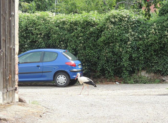
Fatigué et quelque peu surchauffé par la longue traversée de deux jours d’Ouest en Est, Arnaldur le petit camion décide de poser sa vieille carcasse à Huningue, près de Bâle pendant que ses deux joyeuses conductrices, chargées comme des ânes bâtés, partent pour une nouvelle aventure à vélo de plus de 400 kms le long du Rhin, avec étape culturo-gastronomique de 2 jours à Strasbourg et quelques incursions en Allemagne juste pour le plaisir de rajouter quelques kilomètres et quelques côtes au compteur d'un parcours extrêmement plat.
Comme mise en bouche et mise en train avant le départ, une petite excursion à Bâle s'impose. Bâle est distante de quelques kilomètres par la passerelle des 3 Pays. Pourquoi ce nom me direz-vous ? La plus longue passerelle au monde exclusivement réservée aux piétons et aux cyclos, inaugurée en 2007, est située, comme son nom l'indique, à la frontière des 3 pays que sont l'Allemagne, la France et la Suisse. Voies en site propre ou voies partagées bien matérialisées, panneaux indicatifs, ici en Suisse, tout est fait pour que le cycliste circule en toute sécurité et en toute sérénité. Alors, allons faire un petit tour chez nos amis suisses. Tschuss !
En dehors des pistes cyclables, Bâle est étonnante pour :
la magnificence du Rathaus (Hôtel de ville, pour ceux et celles qui ne pipent pas un mot d'allemand ou pour ceux et celles dont le lycée est un lointain souvenir - pour rappel, Bâle est situé en Suisse alémanique), la beauté de la vieille ville, les rues piétonnes; le Rhin, large, propre et majestueux où des dizaines de personnes se laissent dériver par le courant. Le principe ? Remonter à pied la large avenue piétonne sur un ou deux kilomètres en portant un sac « bouée » (un sac étanche où mettre ses vêtements, sac qui se gonfle quand on le ferme et peut servir de bouée pour les moins téméraires), se mettre à l'eau et se laisser porter par le fleuve jusqu'à l'arrivée, un truc de fou mais génial; les petits bateaux à fond plat reliés à un câble qui permettent de traverser le fleuve à la seule force du courant; les prix...prohibitifs ! Le petit café sur la place du marché à 4,50CHF (soit 4€), sans parler du coût de tous les produits alimentaires, aïe aïe aïe !
Après cette brève escapade précédée d'une petite virée de repérage (40 kms quand même), c'est le jour J. Le camion est stationné juste devant le camping de Huningue, tous volets tirés dans l'attente de nos retrouvailles dans 8 jours. Les pneus sont bien gonflés, les sacoches bien accrochées, les filles équipées, tenue moulante et couche culotte de rigueur, casque hyper sexy. On repasse au pied de la passerelle puis on longe le parc des eaux vives, paradis des amateurs de canoë kayak et c'est parti les kikis par le canal de Huningue !
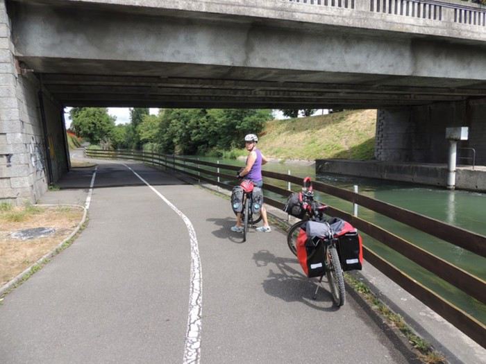
Etape 1 Huningue Ottmarsheim 45 kms
Très vite, nous pénétrons dans le parc de la petite Camargue Alsacienne. C'est un bel espace protégé où batifolent une multitude d'oiseaux et où étangs et mares foisonnent. Au détour d'un chemin, la pisciculture impériale construite sous Napoléon 3 se dresse au milieu des bois. Il n'y a pas âme qui vive ici, il parait qu'on entend le croassement des grenouilles et le gazouillement des oiseaux. Enfin, c'est ce qu'on me dit et je le crois sur parole !
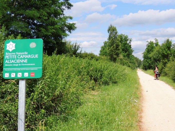
Le soleil est un compagnon de virée bien agréable pour musarder sur les chemins de halage qui mènent jusqu'à la grande usine hydroélectrique de Kembs et de ses deux immenses écluses construites par Le Corbusier et par Niffer à la liaison du grand canal d'Alsace.
La vélo-route s'écarte pour onduler à travers la campagne jusqu'au château de Hombourg, on devrait même dire jusqu'aux châteaux : d'un côté, une bâtisse remarquable qui accueille un golf et à proximité le château Burrus, bâti comme un véritable château médiéval par l'industriel Maurice... Burrus. Au diable les varices (l'avarice) !
Les premières maisons à colombages typiquement alsaciennes se détachent dans un ciel si gris qu’un canard s'est perdu. C'est le terminus de l'étape à Ottmarsheim et son chef d’œuvre d'art roman, une église en pierre calcaire de forme octogonale magnifiée par une immense tour, avec des voûtes intérieures ornées de superbes fresques colorées.
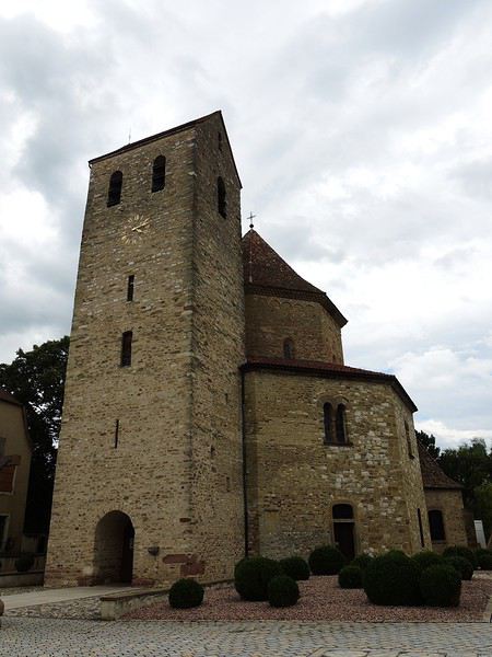
Etape 2 Ottmarsheim Biesheim 70 kms
L'étape débute sous un chaleureux soleil qui malheureusement se voile la face assez rapidement. En direction de Neuf-Brisach, un embranchement sur la droite permet de découvrir l'église de Bantzenhein puis après la traversée de Chalampé de rejoindre l'autre rive du fleuve en Allemagne pour faire un petit tour sur une île située entre le Rhin et le grand canal d'Alsace. Ce qui ne devait être qu'une petite escapade joyeuse devient un cauchemar. Le ciel vire au gris très foncé prélude sympathique à un orage carabiné qui nous balance des trombes d'eau qui nous transpercent jusqu'aux os. Aucun hangar, aucune cabane, rien pour se mettre à l'abri, le tonnerre gronde et les éclairs nous poussent aux fesses. Jamais pédalé aussi vite !
On se change sous un abribus (c'est tout ce qu'on a trouvé) devant les sourires goguenards de flics allemands en faction sur le parking voisin et bien au sec dans leur voiture, EUX. Nous poursuivons côté allemand, par des chemins boisés et ...humides avant de retraverser le Rhin vers Fessenheim, son usine hydroélectrique aux turbines géantes, ses écluses impressionnantes et sa jolie...centrale nucléaire. Accueil chaleureux (radioactif?) garanti par les défenseurs du nucléaire ! Plus original, à l'entrée du village, un petit musée est consacré à Victor Schoelcher, le père de l'abolition de l'esclavage.
C'est par la porte de Strasbourg qu'on pénètre dans Neuf-Brisach, une superbe citadelle encerclée par les immenses doubles fortifications de Vauban, construites sur ordre du Roi Soleil (qui est revenu - le soleil, pas le Roi !), un vrai chef d’œuvre. Mais Neuf-Brisach brise menu notre enthousiasme : mon pneu arrière est crevé, on ne trouve aucun réparateur vélo dans le secteur et j'ai oublié ma chambre à air de rechange.
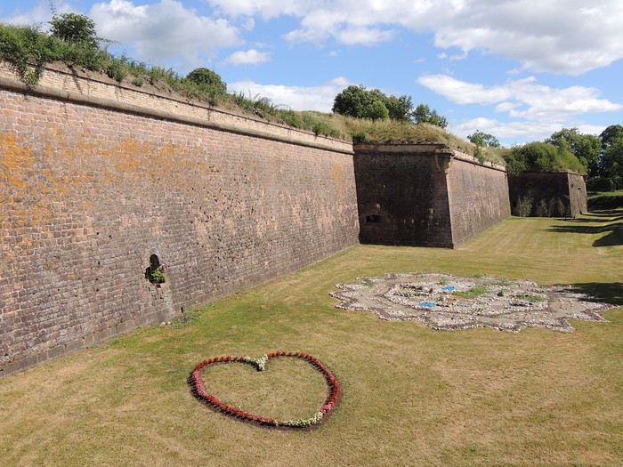
Étape 3 : Biesheim Rhinau 65 kms
Quelques kilomètres après le départ, il faut pratiquer une nouvelle opération chirurgicale sur mon vélo. Mon poids (chiche?) ajouté à celui des sacoches a réveillé le petit caillou encore fiché dans mon pneu et responsable de la crevaison la veille. Conclusion : redémontage de roue, trempage de chambre à air dans le ruisseau tout proche, pose de rustine, remontage de roue et mine affligée de ma partenaire...Aléas de l'usage du cyclopède ! La véloroute est ensuite juste bucolique.
Par de petits chemins champêtres, elle suit le canal de Neuf Brisach puis l'ancien canal du Rhône au Rhin, fréquenté aujourd'hui par les vélos, par quelques canards pacifiques qui jouissent ici d'une relative quiétude et par quelques pêcheurs tout aussi tranquilles. Faut dire que le canal regorge de poissons. Ici ou là, quelques casemates jalonnent le chemin.
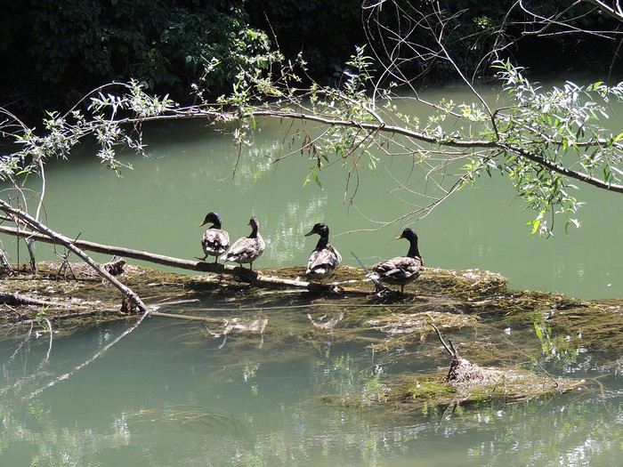
On est sur la ligne Maginot ! D'ailleurs, le fameux Maginot a sa statue au mémorial de Marckolsheim. Est ce qu'il la mérite le Dédé, à l'origine de la fameuse ligne si dissuasive et infranchissable que les Allemands l'ont passée les doigts dans le nez et la fleur au fusil ? On aurait mieux fait de ressortir Vauban de sa tombe !
Quelques coups de pédale et quelques virages plus loin, les « Jardins de Gaïa » (une entreprise de thé bio) sont posés là comme une invitation au voyage, au beau milieu d'une zone artisanale sans aucun charme. Bluffants ces jardins zen où se délecter les papilles !
Plus loin, c'est l’étonnante église de Neunkirch, haut lieu de pèlerinage alsacien (faut voir l'immense oratoire), plus blanche même que l’immatriculée contraception (immaculée conception, pardon!). Y a pas un chat dans le bourg, pas plus que de pèlerins ! On se croirait seules au monde et sans doute que nous le sommes, les bêtes. On passe au petit port de Boofzheim et on atteint Rhinau au bord du grand canal d'Alsace, terminus de l'étape.
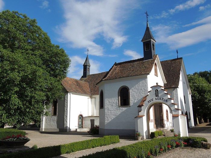
Étape 4 : Rhinau Strasbourg 65 kms
Ce matin, le ciel est aussi gris que mes cheveux, si gris que le canard de tout à l'heure s'est pendu. Tire la bobinette et la chevillette cherra, disait le loup au petit chaperon rouge. Enfilons les capelines et le ciel s'ouvrira, nous disons-nous aussitôt avant de bifurquer vers le château d'Osthouse, de prolonger à la force de nos mollets galbés et puissants jusqu'à Erstein où De Gaulle et Leclerc, nous apprend-on, ont suivi la messe de minuit le 24 décembre 1944 et que ça nous fait une belle jambe .Tout ça avant que nous ne soyons à deux doigts de nous faire catapulter les 4 fers en l'air par un automobiliste pas content de nous voir rouler en sens interdit !
Il pleut comme vache qui pisse mais les cygnes sur le canal sont imperturbables et nous, nous gardons notre appétit, notre sourire humide mais joyeux et restons optimistes. Mais que nenni, la pluie est notre compagne de route toute la journée. On trace fièrement à vitesse grand V sur la véloroute qui longe le canal jusqu'à l'entrée de la capitale alsacienne où l'on se retrouve de plein pied dans la civilisation.
Etape 5 Strasbourg
Strasbourg, capitale de l'Europe, même dans la grisaille, présente un florilège de petits bijoux : la cathédrale Notre Dame, incontournable, le palais des Rohan, la petite France, les anciens ponts couverts, la Neustadt, le parc de l'Orangerie, le barrage Vauban, etc. et plus modernes, les différents édifices de l'Union Européenne. Sans parler de la gastronomie ! A pied ou à vélo (600 kms de pistes cyclables), elle mérite amplement d'être arpentée et de mouiller la chemise. La tour de la cathédrale culmine à 142 m et quand on ose grimper les 332 marches qui mènent à la passerelle (hein Marie ?), on a une vision magistrale de la ville à 360°. Même les cloches qui sonnent ont une autre tonalité (enfin, c'est ce qu'on m'a dit, moi, je ne suis pas montée).
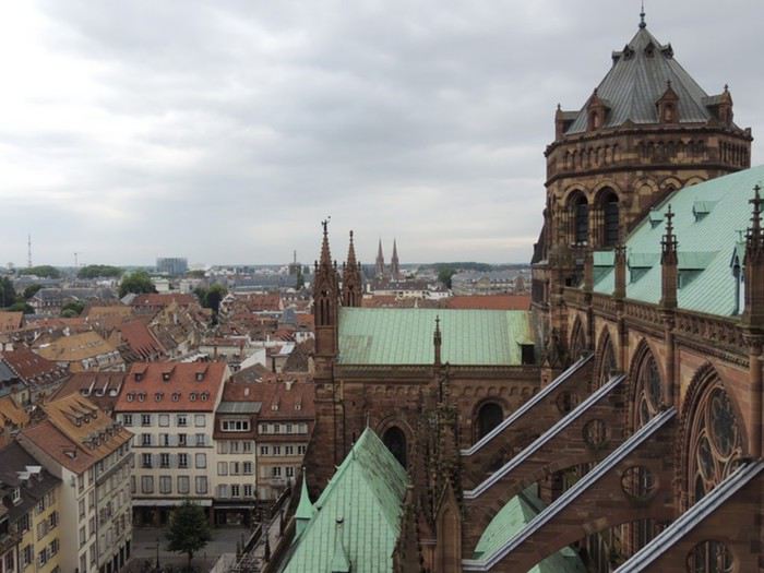
La petite France est un quartier très pittoresque, un petit joyau à lui tout seul avec ses canaux et ses maisons à colombage. En atteste les touristes plus nombreux qu'ailleurs qui s’y agglutinent.
A proximité, le barrage Vauban ((Vauban, toujours Vauban!) et les anciens ponts couverts - qui ne le sont plus vraiment, sont beaux à en tomber raides !
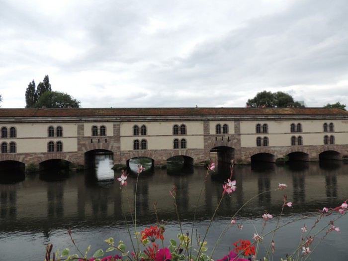
Le quartier européen, moderne voire futuriste, situé à la périphérie de la ville, est gigantesque (y a des euros qui se perdent!). C'est dimanche, il y a beaucoup moins d'effervescence qu'en semaine où élus, assistants, secrétaires, interprètes...tirés à quatre épingles, arpentent couloirs et salles de conférences. Ironie quand même que l'immense bâtiment qui abrite la cour européenne des droits de l'homme quand on connaît l'opposition de certains pays à ouvrir leurs frontières aux réfugiés. Certains d'entre eux campent depuis des années devant cette cour juste dans l'espoir de voir enfin leurs droits reconnus...sans succès.
Etape 6 Strasbourg Stattmatten 68 kms
Après 1 jour et ½ à Strasbourg à arpenter les différents quartiers, après avoir dégusté de bons produits liquides ou solides (ah ! le bibeleskaes, fromage blanc alsacien accompagné de pommes de terre et de jambon), on se remet en selle sans gémir. C'est une étape campagnarde et ensoleillée, agrémentée par le château de Pourtalès, la grande écluse à poisson de Gambsheim et par le village de Sessenheim où Goethe est une icône. Tout ça pourquoi ? Parce qu'étudiant à Strasbourg, venu passer quelques jours avec un copain dans le village, il s’amouracha de Frédérique Brion, la fille du pasteur du village qui du coup est devenue elle aussi la star de la commune (elle a même une rue à son nom, c'est dire !). On a donc : le circuit Goethe, la grange de Goethe, le tumulus de Goethe, le musée Goethe. A part ça, pas grand monde, pas un café ouvert, pas une épicerie, un seul resto fermé le lundi...juste une bonne boulangerie qui dépanne bien en cas de petit creux - c'est le cas) et à l'entrée du bourg une collection originale de vieux tacots Citroën.
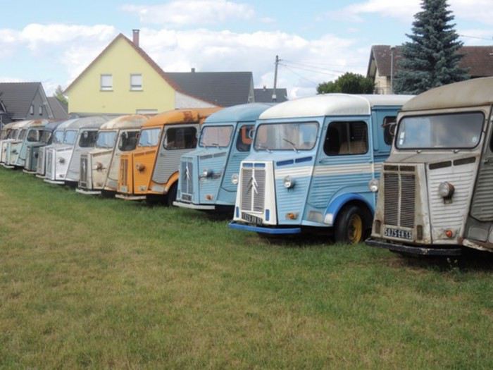
Etape 7 Stattmatten Munchausen via Rastatt 71 kms
Que de soleil encore ! Cette avant-dernière étape étant assez courte, vélos, sacoches et fifilles traversent sa majesté le Rhin par le bac pour une nouvelle incursion en territoire allemand, vers Rastatt et le château de Louis-Guillaume de Bade, rose comme un flamand (le château, pas Louis !).
A quelques kilomètres de là, le fameux Louis-Guillaume, riche et néanmoins très amoureux de son épouse Sybilla Augusta, eut la délicate attention de lui construire dans un étonnant parc à l’anglaise, un autre palais plus grandiose encore, appelé sans ironie le château de la favorite. On peut y rencontrer des créatures très pacifiques et des allemands en goguette.
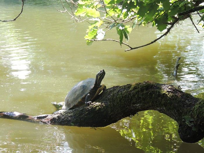
La route serpente par de petites routes campagnardes. On retraverse le Rhin pour rejoindre Munchausen par le delta de la Sauer. Les travaux de modification du cours du fleuve ont métamorphosé le delta, composé de forêts de saules blancs et de prairies humides. C'est un paradis pour la faune (oh ! un cygne noir) et pour les pêcheurs qui se déplacent sur des barques à fond plat.
Etape 8 Munchausen Lauterburg via Berg 42 kms
C'est la dernière étape de la randonnée avant de nouvelles aventures, une étape tranquille sans grand intérêt culturel, mais le Rhin reste notre fidèle compagnon un bon moment avant que la colline de Berg propose quelques petites montées que nous n'avons jamais eues jusque là : la véloroute du Rhin, dans sa partie alsacienne, est plate comme une planche à pain. Retour au point de départ par le train.
Tout commence bien, installation confortable dans le TER au départ de la minuscule gare de Lauterburg puis ça devient vite épique. Au changement de train à Strasbourg, on a 15' : pas d’ascenseur pour les vélos, on se résout à un passage périlleux par l'escalator, on arrive ric-rac sur le quai, on escalade le wagon par 3 marches super hautes, on pose les vélos comme on peut dans un coin et on s'assoit fourbues et dégoulinantes. La descente en gare de Saint Louis près de Bâle est tout aussi rocambolesque ! Tout ça pour dire que rien n'est vraiment fait pour le transport des randonneurs à vélo, ça change de certains autres pays...
Hébergement Als hôtel à Ottmarsheim Citotel la clef des champs à Biesheim Chambre d'hôtes chez Clémence à Rhinau City résidence Strasbourg Chambre d'hôtes chez Meg à Stattmatten Gîte d'accueil pays rhénan à Munchhausen
« ...Cigogne, aux vieilles tours fidèle, Oh ! vole et monte à tire-d'aile De l'église à la citadelle, Du haut clocher au grand donjon.. » (Victor Hugo - Attente)
Depuis les années 1960, les mythiques cigognes d'Alsace ont déserté les plaines et se montrent plus rarement au sommet des églises ou des citadelles à tel point que des programmes de réintroduction ont été décidés. On en rencontre parfois au détour d'un chemin, picorant au milieu des blés ou se la coulant douce dans de grands nids douillets en haut des édifices religieux ou sur les cheminées des maisons, maculant les toitures du blanc de leurs fientes ; ou encore, improbable rencontre, une cigogne égarée dans un village, prête à emprunter une voiture !
Fatigué et quelque peu surchauffé par la longue traversée de deux jours d’Ouest en Est, Arnaldur le petit camion décide de poser sa vieille carcasse à Huningue, près de Bâle pendant que ses deux joyeuses conductrices, chargées comme des ânes bâtés, partent pour une nouvelle aventure à vélo de plus de 400 kms le long du Rhin, avec étape culturo-gastronomique de 2 jours à Strasbourg et quelques incursions en Allemagne juste pour le plaisir de rajouter quelques kilomètres et quelques côtes au compteur d'un parcours extrêmement plat.
Comme mise en bouche et mise en train avant le départ, une petite excursion à Bâle s'impose. Bâle est distante de quelques kilomètres par la passerelle des 3 Pays. Pourquoi ce nom me direz-vous ? La plus longue passerelle au monde exclusivement réservée aux piétons et aux cyclos, inaugurée en 2007, est située, comme son nom l'indique, à la frontière des 3 pays que sont l'Allemagne, la France et la Suisse. Voies en site propre ou voies partagées bien matérialisées, panneaux indicatifs, ici en Suisse, tout est fait pour que le cycliste circule en toute sécurité et en toute sérénité. Alors, allons faire un petit tour chez nos amis suisses. Tschuss !
En dehors des pistes cyclables, Bâle est étonnante pour :
la magnificence du Rathaus (Hôtel de ville, pour ceux et celles qui ne pipent pas un mot d'allemand ou pour ceux et celles dont le lycée est un lointain souvenir - pour rappel, Bâle est situé en Suisse alémanique), la beauté de la vieille ville, les rues piétonnes; le Rhin, large, propre et majestueux où des dizaines de personnes se laissent dériver par le courant. Le principe ? Remonter à pied la large avenue piétonne sur un ou deux kilomètres en portant un sac « bouée » (un sac étanche où mettre ses vêtements, sac qui se gonfle quand on le ferme et peut servir de bouée pour les moins téméraires), se mettre à l'eau et se laisser porter par le fleuve jusqu'à l'arrivée, un truc de fou mais génial; les petits bateaux à fond plat reliés à un câble qui permettent de traverser le fleuve à la seule force du courant; les prix...prohibitifs ! Le petit café sur la place du marché à 4,50CHF (soit 4€), sans parler du coût de tous les produits alimentaires, aïe aïe aïe !
Après cette brève escapade précédée d'une petite virée de repérage (40 kms quand même), c'est le jour J. Le camion est stationné juste devant le camping de Huningue, tous volets tirés dans l'attente de nos retrouvailles dans 8 jours. Les pneus sont bien gonflés, les sacoches bien accrochées, les filles équipées, tenue moulante et couche culotte de rigueur, casque hyper sexy. On repasse au pied de la passerelle puis on longe le parc des eaux vives, paradis des amateurs de canoë kayak et c'est parti les kikis par le canal de Huningue !
Etape 1 Huningue Ottmarsheim 45 kms
Très vite, nous pénétrons dans le parc de la petite Camargue Alsacienne. C'est un bel espace protégé où batifolent une multitude d'oiseaux et où étangs et mares foisonnent. Au détour d'un chemin, la pisciculture impériale construite sous Napoléon 3 se dresse au milieu des bois. Il n'y a pas âme qui vive ici, il parait qu'on entend le croassement des grenouilles et le gazouillement des oiseaux. Enfin, c'est ce qu'on me dit et je le crois sur parole !
Le soleil est un compagnon de virée bien agréable pour musarder sur les chemins de halage qui mènent jusqu'à la grande usine hydroélectrique de Kembs et de ses deux immenses écluses construites par Le Corbusier et par Niffer à la liaison du grand canal d'Alsace.
La vélo-route s'écarte pour onduler à travers la campagne jusqu'au château de Hombourg, on devrait même dire jusqu'aux châteaux : d'un côté, une bâtisse remarquable qui accueille un golf et à proximité le château Burrus, bâti comme un véritable château médiéval par l'industriel Maurice... Burrus. Au diable les varices (l'avarice) !
Les premières maisons à colombages typiquement alsaciennes se détachent dans un ciel si gris qu’un canard s'est perdu. C'est le terminus de l'étape à Ottmarsheim et son chef d’œuvre d'art roman, une église en pierre calcaire de forme octogonale magnifiée par une immense tour, avec des voûtes intérieures ornées de superbes fresques colorées.
Etape 2 Ottmarsheim Biesheim 70 kms
L'étape débute sous un chaleureux soleil qui malheureusement se voile la face assez rapidement. En direction de Neuf-Brisach, un embranchement sur la droite permet de découvrir l'église de Bantzenhein puis après la traversée de Chalampé de rejoindre l'autre rive du fleuve en Allemagne pour faire un petit tour sur une île située entre le Rhin et le grand canal d'Alsace. Ce qui ne devait être qu'une petite escapade joyeuse devient un cauchemar. Le ciel vire au gris très foncé prélude sympathique à un orage carabiné qui nous balance des trombes d'eau qui nous transpercent jusqu'aux os. Aucun hangar, aucune cabane, rien pour se mettre à l'abri, le tonnerre gronde et les éclairs nous poussent aux fesses. Jamais pédalé aussi vite !
On se change sous un abribus (c'est tout ce qu'on a trouvé) devant les sourires goguenards de flics allemands en faction sur le parking voisin et bien au sec dans leur voiture, EUX. Nous poursuivons côté allemand, par des chemins boisés et ...humides avant de retraverser le Rhin vers Fessenheim, son usine hydroélectrique aux turbines géantes, ses écluses impressionnantes et sa jolie...centrale nucléaire. Accueil chaleureux (radioactif?) garanti par les défenseurs du nucléaire ! Plus original, à l'entrée du village, un petit musée est consacré à Victor Schoelcher, le père de l'abolition de l'esclavage.
C'est par la porte de Strasbourg qu'on pénètre dans Neuf-Brisach, une superbe citadelle encerclée par les immenses doubles fortifications de Vauban, construites sur ordre du Roi Soleil (qui est revenu - le soleil, pas le Roi !), un vrai chef d’œuvre. Mais Neuf-Brisach brise menu notre enthousiasme : mon pneu arrière est crevé, on ne trouve aucun réparateur vélo dans le secteur et j'ai oublié ma chambre à air de rechange.
Étape 3 : Biesheim Rhinau 65 kms
Quelques kilomètres après le départ, il faut pratiquer une nouvelle opération chirurgicale sur mon vélo. Mon poids (chiche?) ajouté à celui des sacoches a réveillé le petit caillou encore fiché dans mon pneu et responsable de la crevaison la veille. Conclusion : redémontage de roue, trempage de chambre à air dans le ruisseau tout proche, pose de rustine, remontage de roue et mine affligée de ma partenaire...Aléas de l'usage du cyclopède ! La véloroute est ensuite juste bucolique.
Par de petits chemins champêtres, elle suit le canal de Neuf Brisach puis l'ancien canal du Rhône au Rhin, fréquenté aujourd'hui par les vélos, par quelques canards pacifiques qui jouissent ici d'une relative quiétude et par quelques pêcheurs tout aussi tranquilles. Faut dire que le canal regorge de poissons. Ici ou là, quelques casemates jalonnent le chemin.
On est sur la ligne Maginot ! D'ailleurs, le fameux Maginot a sa statue au mémorial de Marckolsheim. Est ce qu'il la mérite le Dédé, à l'origine de la fameuse ligne si dissuasive et infranchissable que les Allemands l'ont passée les doigts dans le nez et la fleur au fusil ? On aurait mieux fait de ressortir Vauban de sa tombe !
Quelques coups de pédale et quelques virages plus loin, les « Jardins de Gaïa » (une entreprise de thé bio) sont posés là comme une invitation au voyage, au beau milieu d'une zone artisanale sans aucun charme. Bluffants ces jardins zen où se délecter les papilles !
Plus loin, c'est l’étonnante église de Neunkirch, haut lieu de pèlerinage alsacien (faut voir l'immense oratoire), plus blanche même que l’immatriculée contraception (immaculée conception, pardon!). Y a pas un chat dans le bourg, pas plus que de pèlerins ! On se croirait seules au monde et sans doute que nous le sommes, les bêtes. On passe au petit port de Boofzheim et on atteint Rhinau au bord du grand canal d'Alsace, terminus de l'étape.
Étape 4 : Rhinau Strasbourg 65 kms
Ce matin, le ciel est aussi gris que mes cheveux, si gris que le canard de tout à l'heure s'est pendu. Tire la bobinette et la chevillette cherra, disait le loup au petit chaperon rouge. Enfilons les capelines et le ciel s'ouvrira, nous disons-nous aussitôt avant de bifurquer vers le château d'Osthouse, de prolonger à la force de nos mollets galbés et puissants jusqu'à Erstein où De Gaulle et Leclerc, nous apprend-on, ont suivi la messe de minuit le 24 décembre 1944 et que ça nous fait une belle jambe .Tout ça avant que nous ne soyons à deux doigts de nous faire catapulter les 4 fers en l'air par un automobiliste pas content de nous voir rouler en sens interdit !
Il pleut comme vache qui pisse mais les cygnes sur le canal sont imperturbables et nous, nous gardons notre appétit, notre sourire humide mais joyeux et restons optimistes. Mais que nenni, la pluie est notre compagne de route toute la journée. On trace fièrement à vitesse grand V sur la véloroute qui longe le canal jusqu'à l'entrée de la capitale alsacienne où l'on se retrouve de plein pied dans la civilisation.
Etape 5 Strasbourg
Strasbourg, capitale de l'Europe, même dans la grisaille, présente un florilège de petits bijoux : la cathédrale Notre Dame, incontournable, le palais des Rohan, la petite France, les anciens ponts couverts, la Neustadt, le parc de l'Orangerie, le barrage Vauban, etc. et plus modernes, les différents édifices de l'Union Européenne. Sans parler de la gastronomie ! A pied ou à vélo (600 kms de pistes cyclables), elle mérite amplement d'être arpentée et de mouiller la chemise. La tour de la cathédrale culmine à 142 m et quand on ose grimper les 332 marches qui mènent à la passerelle (hein Marie ?), on a une vision magistrale de la ville à 360°. Même les cloches qui sonnent ont une autre tonalité (enfin, c'est ce qu'on m'a dit, moi, je ne suis pas montée).
La petite France est un quartier très pittoresque, un petit joyau à lui tout seul avec ses canaux et ses maisons à colombage. En atteste les touristes plus nombreux qu'ailleurs qui s’y agglutinent.
A proximité, le barrage Vauban ((Vauban, toujours Vauban!) et les anciens ponts couverts - qui ne le sont plus vraiment, sont beaux à en tomber raides !
Le quartier européen, moderne voire futuriste, situé à la périphérie de la ville, est gigantesque (y a des euros qui se perdent!). C'est dimanche, il y a beaucoup moins d'effervescence qu'en semaine où élus, assistants, secrétaires, interprètes...tirés à quatre épingles, arpentent couloirs et salles de conférences. Ironie quand même que l'immense bâtiment qui abrite la cour européenne des droits de l'homme quand on connaît l'opposition de certains pays à ouvrir leurs frontières aux réfugiés. Certains d'entre eux campent depuis des années devant cette cour juste dans l'espoir de voir enfin leurs droits reconnus...sans succès.
Etape 6 Strasbourg Stattmatten 68 kms
Après 1 jour et ½ à Strasbourg à arpenter les différents quartiers, après avoir dégusté de bons produits liquides ou solides (ah ! le bibeleskaes, fromage blanc alsacien accompagné de pommes de terre et de jambon), on se remet en selle sans gémir. C'est une étape campagnarde et ensoleillée, agrémentée par le château de Pourtalès, la grande écluse à poisson de Gambsheim et par le village de Sessenheim où Goethe est une icône. Tout ça pourquoi ? Parce qu'étudiant à Strasbourg, venu passer quelques jours avec un copain dans le village, il s’amouracha de Frédérique Brion, la fille du pasteur du village qui du coup est devenue elle aussi la star de la commune (elle a même une rue à son nom, c'est dire !). On a donc : le circuit Goethe, la grange de Goethe, le tumulus de Goethe, le musée Goethe. A part ça, pas grand monde, pas un café ouvert, pas une épicerie, un seul resto fermé le lundi...juste une bonne boulangerie qui dépanne bien en cas de petit creux - c'est le cas) et à l'entrée du bourg une collection originale de vieux tacots Citroën.
Etape 7 Stattmatten Munchausen via Rastatt 71 kms
Que de soleil encore ! Cette avant-dernière étape étant assez courte, vélos, sacoches et fifilles traversent sa majesté le Rhin par le bac pour une nouvelle incursion en territoire allemand, vers Rastatt et le château de Louis-Guillaume de Bade, rose comme un flamand (le château, pas Louis !).
A quelques kilomètres de là, le fameux Louis-Guillaume, riche et néanmoins très amoureux de son épouse Sybilla Augusta, eut la délicate attention de lui construire dans un étonnant parc à l’anglaise, un autre palais plus grandiose encore, appelé sans ironie le château de la favorite. On peut y rencontrer des créatures très pacifiques et des allemands en goguette.
La route serpente par de petites routes campagnardes. On retraverse le Rhin pour rejoindre Munchausen par le delta de la Sauer. Les travaux de modification du cours du fleuve ont métamorphosé le delta, composé de forêts de saules blancs et de prairies humides. C'est un paradis pour la faune (oh ! un cygne noir) et pour les pêcheurs qui se déplacent sur des barques à fond plat.
Etape 8 Munchausen Lauterburg via Berg 42 kms
C'est la dernière étape de la randonnée avant de nouvelles aventures, une étape tranquille sans grand intérêt culturel, mais le Rhin reste notre fidèle compagnon un bon moment avant que la colline de Berg propose quelques petites montées que nous n'avons jamais eues jusque là : la véloroute du Rhin, dans sa partie alsacienne, est plate comme une planche à pain. Retour au point de départ par le train.
Tout commence bien, installation confortable dans le TER au départ de la minuscule gare de Lauterburg puis ça devient vite épique. Au changement de train à Strasbourg, on a 15' : pas d’ascenseur pour les vélos, on se résout à un passage périlleux par l'escalator, on arrive ric-rac sur le quai, on escalade le wagon par 3 marches super hautes, on pose les vélos comme on peut dans un coin et on s'assoit fourbues et dégoulinantes. La descente en gare de Saint Louis près de Bâle est tout aussi rocambolesque ! Tout ça pour dire que rien n'est vraiment fait pour le transport des randonneurs à vélo, ça change de certains autres pays...
Hébergement Als hôtel à Ottmarsheim Citotel la clef des champs à Biesheim Chambre d'hôtes chez Clémence à Rhinau City résidence Strasbourg Chambre d'hôtes chez Meg à Stattmatten Gîte d'accueil pays rhénan à Munchhausen
Compte rendu de nos escales - croisière fjords Norvège du 30 mai au 12 juin 2016
Bonjour,
Nous avons fait la croisière « Fjords luxuriants » sur le MSC Splendida, du 30 mai au 12 juin 2016. Je me suis beaucoup inspirée des contributions trouvées sur le forum, à mon tour de restituer l’organisation de nos visites. Toutes les escales ont été faites par nous-mêmes, la plupart à pied, seul le transfert du cap Nord a été réservé (directement au cours de la croisière) via MSC. Toutes les escales sont très faciles à organiser par soi-même, en Norvège, tout le monde parle anglais, et dans les boutiques, on croise souvent des français (Bergen). Pour le pique-nique, nous prenions de quoi pique-niquer (light) au buffet du petit déjeuner comme la plupart des passagers, cela nous permettait surtout de manger un peu moins que sur le bateau ! Avant de partir, nous sommes passés à la banque prendre des noks (pour 300 euros), à la dernière escale de Bergen, on a tout terminé !) A chaque escale, l’office de tourisme distribue sur le quai des plans de la ville, que l’on peut également télécharger via internet sur les sites des OT. Nos guides papier : Lonely Planet et le Guide Bleu (dont nous avions photocopié les pages car trop volumineux à emporter). Wifi : disponible dans toutes les escales, gratuitement (Ville, musées, bibliothèque, …) ou pour le prix d’une boisson dans les cafés. Nos portables étaient débranchés en mer, rallumés dans les ports pour les SMS. La vie est chère en Norvège, mais on le savait : 8 euros la bière, 5 euros les tickets de bus, 4 à 10 euros les entrées des musées…. La météo compte pour beaucoup dans cette croisière, nous avons eu une tempête de neige et des bourrasques de vent au cap nord, de la pluie à Tromso, et tout le reste soleil et ciel bleu.
Mercredi 1er juin : Escale à Alesund : 10h-16h30 : météo : brume et éclaircies, bruine en fin d'aprè-midi
Premier port de pêche de Norvège, spécialité : la morue, Alesund se tient sur une péninsule étroite en forme d'hameçon qui se jette dans la mer. Le 23 janvier 1904, un incendie ravage cette ville prospère de 12 000 habitants à l'époque : le centre ville ancien, soit 800 bâtiments de bois, est entièrement détruit, ouf, un seul mort. Seules restent l'église et la prison, construites en pierre. Tout le pays se mobilise, aidé par les pays étrangers : l'empereur Guillaume II envoie les premiers secours et les vivres par bateau depuis l'Allemagne. En trois ans, Alesund est rebâtie dans le style Art nouveau (Jugendstil) en vogue à l'époque, par des architectes formés en Allemagne et des artisans norvégiens. A ce jour, la ville compte 23 000 habitants, répartis sur la péninsule et les îles alentours. Les spécialités : ateliers de verre soufflé, meubles modernes, pêche à la morue, antiquités.
Le débarquement se fait à 10 heures, nous passerons la journée à découvrir cette ville, mais il est très facile de retourner au bateau pour y manger le midi. Les sommets des montagnes sont encore sous la neige, mais en ville, les habitants se promènent en tee-shirt, malgré les 9 degrés.
Visite de la ville le long du port (à gauche) vers la jetée plantée d’un phare, un coup d'oeil à l'atelier de verre d'Ingrid, un chat roulé en boule surveille les touristes, deux verriers sont au travail pour fondre des créations artisanales, juste un peu fragiles à transporter.
Découverte de la pharmacie qui abrite le Centre de l'Art Nouveau (Jugendstilsenter), l'accueil se trouve au milieu des comptoirs et des armoires de l'officine, une machine à remonter le temps retrace le terrible incendie de 1904, avant une exposition consacrée aux architectes et aux artisans. A l'étage, dans les appartements de la famille du pharmacien, la salle à manger, le salon du piano et une collection d'objets Art Nouveau : textiles, céramiques, meubles et vaisselle.
Nous marchons jusqu'à l'église en pierre (fermée), bordée d'un cimetière-parc et de belles maisons en bois peintes couleur pastel. Puis nous repartons de l'autre côté du port, à droite, jusqu'au débarcadère du Hurtigruten. Un passage dans la rue piétonne et pavée bordée de magasins de toutes sortes, et puis nous montons les 418 marches vers le point de vue de la colline d'Aksla, d'où l'on a une vue d'ensemble de notre grand paquebot, amarré à côté d'un autre géant des mers américain.
Nous ferons une pause vue, pique-nique et repos au deux tiers de la montée. Redescente par le parc municipal, ornée d'une statue en bronze de Rollon, dépeignant sous les traits d'un Vercingétorix romantique ce chef viking local qui arracha en 911 au roi de France le duché de Normandie. Son descendant Guillaume le Conquérant ira envahir l'Angleterre en 1066.
Dernière étape du jour au Scandic Hôtel (vers la jetée du phare), où, pour le prix d'un café (15 couronnes), on a la connexion WIFI gratuite, en plus d'une belle vue sur le port depuis un salon cosy. De notre balade, nous retiendrons également qu'il n'y a que très peu de poubelles dans les rues, mais que tout est propre !
Retour au bateau vers 16h avec une petite bruine de fin d'après-midi. Le bateau des autorités portuaires nous accompagne jusqu'en mer, avec corne de brume, grands saluts et jets d'eau croisés. Aujourd'hui, c'est nous les stars !
la suite demain....
Nous avons fait la croisière « Fjords luxuriants » sur le MSC Splendida, du 30 mai au 12 juin 2016. Je me suis beaucoup inspirée des contributions trouvées sur le forum, à mon tour de restituer l’organisation de nos visites. Toutes les escales ont été faites par nous-mêmes, la plupart à pied, seul le transfert du cap Nord a été réservé (directement au cours de la croisière) via MSC. Toutes les escales sont très faciles à organiser par soi-même, en Norvège, tout le monde parle anglais, et dans les boutiques, on croise souvent des français (Bergen). Pour le pique-nique, nous prenions de quoi pique-niquer (light) au buffet du petit déjeuner comme la plupart des passagers, cela nous permettait surtout de manger un peu moins que sur le bateau ! Avant de partir, nous sommes passés à la banque prendre des noks (pour 300 euros), à la dernière escale de Bergen, on a tout terminé !) A chaque escale, l’office de tourisme distribue sur le quai des plans de la ville, que l’on peut également télécharger via internet sur les sites des OT. Nos guides papier : Lonely Planet et le Guide Bleu (dont nous avions photocopié les pages car trop volumineux à emporter). Wifi : disponible dans toutes les escales, gratuitement (Ville, musées, bibliothèque, …) ou pour le prix d’une boisson dans les cafés. Nos portables étaient débranchés en mer, rallumés dans les ports pour les SMS. La vie est chère en Norvège, mais on le savait : 8 euros la bière, 5 euros les tickets de bus, 4 à 10 euros les entrées des musées…. La météo compte pour beaucoup dans cette croisière, nous avons eu une tempête de neige et des bourrasques de vent au cap nord, de la pluie à Tromso, et tout le reste soleil et ciel bleu.
Mercredi 1er juin : Escale à Alesund : 10h-16h30 : météo : brume et éclaircies, bruine en fin d'aprè-midi
Premier port de pêche de Norvège, spécialité : la morue, Alesund se tient sur une péninsule étroite en forme d'hameçon qui se jette dans la mer. Le 23 janvier 1904, un incendie ravage cette ville prospère de 12 000 habitants à l'époque : le centre ville ancien, soit 800 bâtiments de bois, est entièrement détruit, ouf, un seul mort. Seules restent l'église et la prison, construites en pierre. Tout le pays se mobilise, aidé par les pays étrangers : l'empereur Guillaume II envoie les premiers secours et les vivres par bateau depuis l'Allemagne. En trois ans, Alesund est rebâtie dans le style Art nouveau (Jugendstil) en vogue à l'époque, par des architectes formés en Allemagne et des artisans norvégiens. A ce jour, la ville compte 23 000 habitants, répartis sur la péninsule et les îles alentours. Les spécialités : ateliers de verre soufflé, meubles modernes, pêche à la morue, antiquités.
Le débarquement se fait à 10 heures, nous passerons la journée à découvrir cette ville, mais il est très facile de retourner au bateau pour y manger le midi. Les sommets des montagnes sont encore sous la neige, mais en ville, les habitants se promènent en tee-shirt, malgré les 9 degrés.
Visite de la ville le long du port (à gauche) vers la jetée plantée d’un phare, un coup d'oeil à l'atelier de verre d'Ingrid, un chat roulé en boule surveille les touristes, deux verriers sont au travail pour fondre des créations artisanales, juste un peu fragiles à transporter.
Découverte de la pharmacie qui abrite le Centre de l'Art Nouveau (Jugendstilsenter), l'accueil se trouve au milieu des comptoirs et des armoires de l'officine, une machine à remonter le temps retrace le terrible incendie de 1904, avant une exposition consacrée aux architectes et aux artisans. A l'étage, dans les appartements de la famille du pharmacien, la salle à manger, le salon du piano et une collection d'objets Art Nouveau : textiles, céramiques, meubles et vaisselle.
Nous marchons jusqu'à l'église en pierre (fermée), bordée d'un cimetière-parc et de belles maisons en bois peintes couleur pastel. Puis nous repartons de l'autre côté du port, à droite, jusqu'au débarcadère du Hurtigruten. Un passage dans la rue piétonne et pavée bordée de magasins de toutes sortes, et puis nous montons les 418 marches vers le point de vue de la colline d'Aksla, d'où l'on a une vue d'ensemble de notre grand paquebot, amarré à côté d'un autre géant des mers américain.
Nous ferons une pause vue, pique-nique et repos au deux tiers de la montée. Redescente par le parc municipal, ornée d'une statue en bronze de Rollon, dépeignant sous les traits d'un Vercingétorix romantique ce chef viking local qui arracha en 911 au roi de France le duché de Normandie. Son descendant Guillaume le Conquérant ira envahir l'Angleterre en 1066.
Dernière étape du jour au Scandic Hôtel (vers la jetée du phare), où, pour le prix d'un café (15 couronnes), on a la connexion WIFI gratuite, en plus d'une belle vue sur le port depuis un salon cosy. De notre balade, nous retiendrons également qu'il n'y a que très peu de poubelles dans les rues, mais que tout est propre !
Retour au bateau vers 16h avec une petite bruine de fin d'après-midi. Le bateau des autorités portuaires nous accompagne jusqu'en mer, avec corne de brume, grands saluts et jets d'eau croisés. Aujourd'hui, c'est nous les stars !
la suite demain....
Colmar-Bâle en train (TER): coût du trajet et visites?
🙂Bonjour,
j'ai vu qu'il y avait possibilité d'aller à Bâle à la journée au départ de Colmar: je suppose que c'est moins cher en TER qu'avec le tgv Lyria ?
Par contre au niveau tarif toujours, je suppose que c'est un tarif en dehors des tarifs attractifs proposés par la région Alsace ?
Pour Bâle, si vous avez des conseils ( restau, salons de thé, bureau de change?)
merci beaucoup Kajolka
Pour Bâle, si vous avez des conseils ( restau, salons de thé, bureau de change?)
merci beaucoup Kajolka
Projet de partir vivre en décroissance sur un voilier aux Antilles
Notre projet est de partir vivre en décroissance et en autarcie quasi complète sur un voilier avec toute ma famille aux Antilles.
Je sais cela peut paraître fou, mais très bien réfléchit pour notre part.
Certain ne traite d'inconscient d'autre nous félicite pour notre courage les derniers nous envies mais n'osent pas franchir le pas.
Je vous rassure, la préparation vient enfin de commencer et doit s'achever d'ici 3 ans.
Achat de matériel indispensable et minimisée, cours et stage de survie en milieu équatoriale, achat du bateau, achat de livre et documentation d'auto suffisance et auto nutrition.
La raison est simple, si nous voulons continuez a vivre sur cette terre nous devons le faire de matière plus simple et plus naturel Beaucoup de choses nous ont fait prendre conscience de la dérive du monde: la nature qui nous entour, le gouvernement, la mondialisation, les films et documentaires...
Si vous désirez réagir ou nous soutenir n'hésitez pas, nous avons 3 ans pour faire connaissance
La raison est simple, si nous voulons continuez a vivre sur cette terre nous devons le faire de matière plus simple et plus naturel Beaucoup de choses nous ont fait prendre conscience de la dérive du monde: la nature qui nous entour, le gouvernement, la mondialisation, les films et documentaires...
Si vous désirez réagir ou nous soutenir n'hésitez pas, nous avons 3 ans pour faire connaissance
Les voyages en groupe à vélo?
Coucou d’une américaine à Washington, DC!
Je m’intéresse à faire un voyage à vélo, pas toute seule, mais avec d’autres – et en plus, avec les francophones. Existe-t’il des groupes français qui organisent les voyages à vélo?
L’été dernier, j’ai fait des vacances en Turquie avec l’UCPA – un voyage de randonné. C’ était chouette, et une bonne façon de voyager en même temps que pratiquer mon français. J’aimerais faire la meme chose, mais à vélo. Malheureusement, l’UCPA n’offre pas beaucoup d’options en vélo (ou ce qu'ils ont, pour la plupart, sont en VTT, que je ne fais pas).
D’autrement, si vous connaissez des événements français de vélo qui pourraient être intéressants pour une américaine, j’aimerais bien en apprendre aussi.
Merci! Claudia
Je m’intéresse à faire un voyage à vélo, pas toute seule, mais avec d’autres – et en plus, avec les francophones. Existe-t’il des groupes français qui organisent les voyages à vélo?
L’été dernier, j’ai fait des vacances en Turquie avec l’UCPA – un voyage de randonné. C’ était chouette, et une bonne façon de voyager en même temps que pratiquer mon français. J’aimerais faire la meme chose, mais à vélo. Malheureusement, l’UCPA n’offre pas beaucoup d’options en vélo (ou ce qu'ils ont, pour la plupart, sont en VTT, que je ne fais pas).
D’autrement, si vous connaissez des événements français de vélo qui pourraient être intéressants pour une américaine, j’aimerais bien en apprendre aussi.
Merci! Claudia
Namibia Travel Journal: May 2025 - Trip Review
NAMIBIA TRIP 2025: April 24 to May 20: Feel free to comment or ask us any questions about this amazing journey.
>> Find all our photos and videos for each day on our website here: www.montagne-aventure.net
**DAY 1: Thursday, April 24, 2025: Outbound Flights from Lyon to Windhoek via Munich - Visit to Munich:**

Off we go on a new adventure. The alarm rings at 6:30 AM, the travel bags are packed, and we head to Lyon Airport. We booked our flight tickets with Lufthansa. The first leg to Munich, Germany, is operated by AirBaltic. Departure at 1:05 PM for a 1-hour and 20-minute flight. We arrive at 2:30 PM.
**We now have a 7-hour layover, so we take the opportunity to get some fresh air and explore Munich.** We quickly exit Terminal 2 of the airport and head towards the subway. We buy a group day ticket "Airport-city Day Zone M-5," valid for 2 to 5 people at a price of 30.50 € (instead of 16.30 € per person). We take the S8 line to **Marienplatz** in 35 minutes. **This is the heart of the city.** The weather is overcast, quite cool, but dry. Perfect for a little city trip between two flights while leaving our large luggage in transit at the airport. **Munich is the third-largest German city after Berlin and Hamburg, in the Bavaria region.** **The center has a lot of charm and brings together several religious buildings, easy to explore on foot.** We are impressed by the number of people enjoying these 100% pedestrian streets, which are very pleasant. After Marienplatz, the most famous square with the town hall, we head to the Cathedral of Our Lady, a Gothic church, then continue to **Karlsplatz** and move on to **the food market offering a wide selection of high-end food products in an atmosphere where a certain art of living prevails.** We also visit St. Peter's Church before grabbing a bite to eat. Two good hours were enough for this 10 km city walk. It's time to take the subway back: by 6:30 PM, we are back at the airport. Now, it's time for a bit of waiting and rest. Our second flight is scheduled for 9:35 PM for a 9-hour and 30-minute journey to our final destination in Namibia: **Windhoek.**
> Round-trip flight tickets with Lufthansa from Lyon: 2029 €, or 1,014.50 € per person.
> Lyon Airport parking: 120 €
> Today's expenses: 7 € for 2 pizzas in France / 14 € for the restaurant in Munich / 30.50 € for the daily subway ticket in Munich.
**DAY 2: Friday, April 25, 2024: Arrival in Windhoek, Visit to the Namibian Capital:**
After a 9-hour and 30-minute overnight flight with Discover Airlines, we finally land on Namibian soil just before 7:30 AM. The day is breaking, and the colors are already stunning. We are eager despite the usual fatigue from the flight. The airline was punctual, with friendly staff and good meals, though a bit light. We are the first flight of the day to land, with no more than 15 flights per day here, from 7 AM to 8 PM. We disembark on the tarmac at this airport located in the middle of nowhere, **I finally set foot on African soil for the first time.** We exit among the first from the aircraft to go through the long formalities at the front of the line, as the wait can quickly become endless. Allow at least 5 minutes per person for e-visas. We still wait 45 minutes despite only about twenty people ahead of us. Phew, it's done. We collect our luggage and then withdraw money from an ATM. We make 4 withdrawals of the maximum amount, 2000 NAD $ per withdrawal, for a total of 380 €, or 95.33 € per withdrawal.
Our driver arrives at the same time, perfect timing, we were quick.
We leave the airport at 8:45 AM. By 9:30 AM, we arrive at the **Gracious Whisp vehicle rental agency**, located at the entrance of Windhoek, small and human-sized with a fleet of recent vehicles. More formalities, then a short wait as our vehicle is not yet ready. Time to decompress, catch our breath, and enjoy the very pleasant morning temperature. Not a cloud in sight. Next, a briefing on the vehicle, always with a bit of apprehension due to our approximate English. Allow 45 minutes of explanations, including setting up the roof tent, camping equipment, technical information in case of a flat tire, driving tips in Namibia, and a tour of the 4x4. We have all the necessary equipment for camping: mattresses, sleeping bags, pillows, table, chairs, gas stove, BBQ grill... as well as 2 spare tires, a compressor, a dual tank, and accessories for removing wheels. Off we go, it's time to muster our courage and get behind the wheel. **Heading to SuperSpar Maerua**, fortunately located less than 10 minutes away. We park with the help of a parking attendant; it's very crowded, the space is narrow, but everything goes well despite the cursed right-hand drive. Today's new mission: stock up on groceries. The store is well-stocked with local and imported products, catering to all tastes. We spend 114 € on groceries, from pasta to meat, BBQ lighters to dishwashing products. Two people load our groceries into two carts and transfer them to our vehicle; we feel compelled to leave a tip, 50 NAD $, as we don't have change yet. Now, we head to the hotel, 15 minutes away. Traffic is difficult at a complicated intersection; this will likely be the only traffic jam in Namibia. **We arrive at Kate's Nest Guesthouse & Backpackers around 1:15 PM, quite tired.** We take some well-deserved rest at this recent establishment, quite calm with secure private parking. After a short nap, we enjoy the quiet by the hotel pool. Night falls between 6:30 PM and 7 PM. We eat quietly in our room tonight before starting this long 4x4 road trip in camping mode in the heart of Namibia.
> Today's grocery expenses: 114 € at Super Spar Marua (2395.21 NAD $).
> Round-trip flight tickets with Lufthansa from Lyon: 2029 €, or 1,014.50 € per person.
> Vehicle rental: 4x4 Toyota with roof tent for 24 days: Gracious Whisp Car Rentals: 2,638 € (N$50,640) or **1,319 €** per person - (https://gwcarrentals.com/)
> Distance driven today: 15 km.
> Accommodation: Kate's Nest Guesthouse & Backpackers - 4 Aristotles Street Academia, 9000 Windhoek - 36 € for two for one night.
> Windhoek International Airport website: (https://www.airports.com.na/)
**DAY 3: Saturday, April 26, 2025: Windhoek to Hardap: Mariental Region - Kalahari Desert:**
After a good, restful night, we wake up leisurely around 7 AM. We enjoy the comfort provided by this first and last hotel before 24 nights under the tent.
**We leave Kate's Nest Guesthouse at 8:30 AM to tackle the Namibian roads.** We quickly leave the capital; in just 30 minutes, we find ourselves almost alone in the world. The landscape is dotted with small domes. We leave the **paved B1** quickly to turn left onto the **C15**. **From there, we won't see more than 10 vehicles all day.** After passing through the few houses of **Lekkerwaterpoort**, we tackle our first gravel road. These road sections are limited to 100 km/h, but even at 70 km/h, I find it already challenging. However, I quickly get used to it and gradually pick up speed to reach my cruising speed of around 80 to 90 km/h. **We are on immense straight lines crossing wild expanses as far as the eye can see.** **We come across two baboons, a few ostriches, and numerous cattle and sheep farms.** We pass through the charming village of **Uhlenhorst** with its typical houses and children with broad smiles waving at us. Life here is already very different from Windhoek. **The thermometer rises quickly from 16°C at 8:30 AM to over 28°C in the early afternoon.**
**We arrive at the Hardap Dam reserve at 2 PM.** We stop at the toll booth at the park entrance to pay the entrance fee: 250 NAD $ for 2 people and 1 vehicle. We continue to the dam and then the camp entrance, located a bit further. We had booked in advance, but this place remains little frequented by foreigners.
We take advantage of the hottest hours to rest by the large pool overlooking the immense lake, a very enjoyable moment. Would this be a bit of a vacation?
Around 4:30 PM, we head to the campsite. We overlook this vast water reserve. We arrive first; we will be only 3 vehicles spending the night here. It's time to get to work and set up our equipment for the first time. It takes us a good 20 minutes to set everything up, with a slight apprehension about unfolding the tent. Once this task is done, which we will have to repeat for almost a month, we will become much more efficient over time. Time for rest and contemplation in total silence. The sun gradually sets, and the heat quickly becomes bearable again. Bliss! **This dam is located 20 km northwest of Mariental in an area dotted with conical hills topped with dolerite buttons (Hardap means "hillock" in Nama). It captures the Fish River, which flows south, creating a large lake in the middle of an arid environment. The contrast is striking.** We enjoy our first sunset facing this 360° otherworldly landscape.
Around 7 PM, we start our first BBQ, or "braai" as it's called here. The temperature is perfect. The sun sets, giving way to a star-filled sky of incredible beauty thanks to the absence of any light pollution. The Milky Way will lull us throughout the evening. After some good sausages and potatoes on the BBQ, we head to our roof tent around 9:30 PM with a complete change of scenery in just 24 hours. France already seems so far away...
This campsite has shared showers and toilets, quite clean and functional, as well as a central area with several BBQs and tables. The sites are arranged in a semicircle, each with an electrical outlet. The sites are close to each other but spacious, some slightly shaded. We are only three vehicles tonight, so it's perfectly comfortable and quiet. Not to mention the large pool near the restaurant. Our trip is off to a great start.
> Today's road itinerary: Windhoek > Head south on the B1 to Rehoboth > Turn left onto the C25 then C15 to Stampriet > C20 to Hardap > Full north on the B1 > Then turn left onto the M93 - 5 hours of driving.
> Distance driven today: 354 km.
> Accommodation: Hardap Recreation Resort - 23.3 € for two - Large pool - GR6W+3M2, Hardap Game Reserve, Mariental, Namibia - (http://www.nwr.com.na/resorts/hardap-resort/)
**DAY 4: Sunday, April 27, 2025: Hardap - Brukkaros Volcano - Keetmanshoop - Quivertree Forest Rest Camp**
Our first night under the tent was very pleasant; the little wind quickly calmed down, giving way to absolute silence. The mattress is decent, more comfortable than some nights in Nepal. The length and width give us enough space for maximum comfort, despite my height (1.91 m). We wake up a little before 7 AM as the sun rises, and the lights dazzle us from the start of the day. We pack up the equipment in 30 minutes, quite easily. Then we enjoy the sun, which warms up quickly while we keep our light fleece on.
At 8:30 AM, **we hit the road again, heading south** to our first stop in **Mariental**. We want to do some shopping at SuperSpar, but once we arrive in the parking lot, a young local is fighting with the supermarket security guards and then threatens to throw stones. We don't want to take any risks right at the start, so despite the baton blows he receives, he doesn't stop. We leave empty-handed but fill up with fuel at the Shell station 1 km further. The price per liter is 21.33 NAD $, we fill our 107-liter tank for 107 €. In Namibia, you get served, and they bring the card machine to the window to pay. It's then customary to leave a tip.
We then take the B1 heading due south on a recently renovated road. Around 11:30 AM, we leave it on our right to take **a wild gravel road, the M98**. Just before **Berseba**, we turn right onto a small track, the **D3904 towards Brukkaros Crater up to a camp at 1588 m altitude**. The track then becomes too bumpy. We stop on the counter-slopes where **a wide panorama unfolds over these immense plains as far as the eye can see**. It's 12:15 PM, time for us to eat a rice and tuna salad facing this landscape.
**We are alone in the world until a vehicle arrives and parks next to us.** A bit of apprehension, 4 men head towards us. It turns out to be 4 shepherds looking for a lost foal. The conversation is pleasant, lost in the middle of nowhere. We find ourselves alone again in this absolute silence. **The heat becomes stifling with a good 30°C**. We get back on the road around 1 PM. Back on the B1, **we continue due south to Keetmanshoop**, which we reach around 3 PM. We stop there to do some shopping for 262 NAD $ (12 eggs, a can of tuna, a can of corn, bread, a soda, and a 5-liter water container), or 12.48 €. Two quite insistent children ask us for money or candy at the store exit, yet we give them a small tip, but they continue to cling to the car. Locals parked next to us tell them to leave us alone. Anyway, we finish the trip to **Quivertree Forest**, 15 km away. We will spend the night in this **pleasant farm run by a German**. Upon arrival, as the day before, and as I suppose in the future, we dive straight into the cool pool to relax after all these kilometers. A bliss. Then we take our 4x4 and choose a spot near these famous trees. After the 33°C this afternoon, once 4 PM passed, the temperature drops again and becomes very pleasant. **We are in the middle of the Kokerboom, one of the most interesting and characteristic plants of hot and arid regions. It's not really a tree but a variant of the aloe plant whose botanical name is Aloe Dichotoma. This Kokerboom has a smooth and thick trunk reaching up to 1 m in thickness and 9 m in height. They bloom for the first time at the age of 20 to 30 years.** The flowers are yellow and reach about thirty centimeters during the season between June and July. **They grow mainly in an environment with a high concentration of black rocks absorbing a large amount of heat (38°C). The rocks also serve to anchor the tree with its tentacle-like roots. It also resists frost. Each is between 200 and 300 years old.**
Around 5 PM, we walk to the farm reception to watch the feeding of **two cheetahs**. Magnificent carnivores taking their time to savor their piece of meat. **Then we return near our campsite to enjoy the sunset among these trees. The colors are sublime, as every evening apparently. A magnificent spectacle with colors evolving from yellow to orange then to pink, before giving way once again to a sky filled with thousands of stars.** Our campsite at Quiver Tree Forest Camp is very comfortable; we have a water supply, a stone table, a small lamp, an electrical outlet, a small tree for shade, and a BBQ that we won't use tonight; we'll cook on gas. The sites are far apart, with some shared facilities scattered around, a very beautiful setting. No reservation possible, no need, just show up directly. **The campsite accommodation for 2 people costs 28 €, including the reserve entrance fee of 5 €**. We finish this second bivouac evening around 9:30 PM, time for some reading and sleep in peaceful silence without wind.
> Today's road itinerary: Mariental > B1 heading south to Brukkaros > At Tses turn right towards Berseba via the M98 > Turn right onto the D3904 > 8 km > Brukkaros Volcano (stop at the lower camp as the track is difficult for 1 hour) > Keetmanshoop > Turn left onto the M29 > Quivertree Forest - 4 hours of driving.
> Distance driven today: 371 km.
> Distance walked today: 6 km.
> Today's expenses: Groceries for 12.48 € (262 NAD $) / Fuel for 107 € (1 liter of diesel for 21.33 NAD $).
> Accommodation: Quivertree Forest Rest Camp, P.O. Box 262, Keetmanshoop, Namibia - BBQ, hot showers, toilets, and electricity - No reservation - Pool - 18 €/Person (N$ 340.00 with park entrance) - (http://www.quivertreeforest.com/)
**DAY 5: Monday, April 28, 2025: Quivertree Forest Rest Camp - Giant's Playground - Keetmanshoop - Fish River Canyon - Canyon Roadhouse:**
After an excellent start to the night, we are woken up by the wind shortly before 6 AM, but the sunrise is not far off. We get up at 6:30 AM to enjoy it. The atmosphere is a bit cooler this morning, but the reward is already here.
The adventure continues. At 7:45 AM, we head towards **Giant's Playground**, 4 km away. We take a 3-kilometer walk through this expanse of blocks and igneous rocks.
We continue south at 8:45 AM, passing through Keetmanshoop again where we do some shopping for 25 €, a big stock-up for a good part of the trip: meats, canned goods, pasta, fruits... At 9:30 AM, we take the B4 to Fish River Canyon.
At 11:30 AM, we arrive at the entrance to the NWR park (350 NAD $ entrance for 2 people and 1 vehicle). The track becomes bumpy immediately upon entering the park. After about ten kilometers, we come upon this landscape carved by nature. In the end, it's well worth the detour. We were at the Grand Canyon in the USA exactly (https://www.montagne-aventure.net/2024/04/29/j21-3-juin-2024-grand-canyon-et-lac-powell/) and can thus confirm that this Fish River Canyon is comparable. We make several stops along the southern flank. **Here, nothing is developed; nature is almost in the wild state.** **With 160 km in length, up to 27 km in width, and a depth of 150 m, it is indeed the second-largest canyon in the world.** The history of the canyon is apparent in its different earth layers and stratification: the antiquity of the place is tangible, and the absence of vegetation is surprising. **It consists of two nested canyons, formed at distinct periods. The first distinct layer of schist, sandstone, and eruptive material surrounding the canyon was formed a few two billion years ago, then transformed due to heat and pressure into more solid rock such as gneiss. The inner canyon, carved more recently by the Fish River, has a depth of 270 m.**
We have a picnic once again alone in the world facing this grand panorama at the **Sulphur Spring View Point**. This is where the hiking trail begins, plunging into this narrow canyon, but it is forbidden to venture there alone without a guide. It's 30°C, but a slight wind makes the atmosphere bearable. At 1 PM, we retrace our steps and continue to the **Main View Point** then to the **Hikers View Point**.
In the south of Namibia, the Fish River Canyon, 160 km long, is a true geological wonder: a canyon nested within another canyon, one of the largest in the world. The first sedimentary layers formed two billion years ago; 500 million years ago, a period of tectonic activity caused these layers to crack and tilt, opening a vast canyon in the Earth's crust. The second canyon, with a depth of 270 m, was carved over time by the passage of the Fish River in this new valley.
At 3 PM, we arrive at our very charming camp for the evening, the **Canyon Road House**. We fill up with fuel right away because tomorrow we have a long day of isolated driving: 55 liters for 1240 NAD $. Then we settle into the campsite we had previously reserved in France. We are assigned site 2, very well set up under a tree with its BBQ and stone table just steps from the pool. We quickly set up the tent and jump straight into the pool for the relaxation moment of the day. As usual, the water is quite cool, but it's a real pleasure. Then we stroll around this Canyon Road House, which recreates the atmosphere of the roadside inns of the 1950s with old car wrecks and vintage gas pumps in a bygone era. **Around 5:45 PM, we start a short walk leading us to the top of a hill overlooking the wide plateau where we are to watch the sunset.**
And finally, to end this beautiful day, it's time for the braai, with grilled sausages and white beans on the evening menu.
> Park entrance: 150 DN/person + 50 DN/vehicle (18 € for two). It is possible to enter at two access points: Hobas in the north and Ai-Ais in the south.
> Today's road itinerary: M29 > Keetmanshoop > B1 > B4 > C12 (track) > After Holoog turn right onto the D601 (C37 track) > Accommodation on our right (stop just to check in before 6 PM) > Continue 30 km (30 minutes of track) to the viewpoints after Hobas where you must pay the entrance fee. Sunset View Point to the left > Return before sunset as the park closes (best lights at sunrise). 3 hours.
> Distance driven today: 228 km.
> Distance walked today: 10 km.
> Today's expenses: 25 € for groceries / 17 € for the Fish River Canyon park entrance / 58 € for fuel.
> Accommodation: Canyon Roadhouse, Gondwana Collection Namibia – 34.4 € for two - Pool - Near Hobas - (http://www.gondwana-collection.com/fr/accommodation/canyon-road-campsite)
**DAY 6: Tuesday, April 29, 2025: Canyon Roadhouse - Orange River - South African Border - Vista Trail - Gondwana Sperrgebiet Park - Aus:**
The night was excellent in this very comfortable campsite. **We wake up to the sound of birds** before the alarm at 6:45 AM. Our little morning routine starts as the sun rises. **A big day of driving awaits us to the South African border. This will be the southernmost point of our journey.** We hit the road at 8 AM via the C37, pass through **Hobas**, then turn onto the D207 to **Aussenkehr.** **We cross a mountainous barrier with some high peaks and perfect cones. The rock varies from orange to pink to black.**
We then cross a lunar desert as far as the eye can see on a giant dome; the track winds through nowhere without meeting anyone for hours. The landscapes are surprising. **We spot several ostriches and a gemsbok.** In the middle of this endless expanse, we come to an improbable intersection and continue right onto the D278.
In the middle of these arid lands, we come across a green zone: a vast vineyard. At 10:30 AM, **we come across a "Road closed" sign, fortunately, a local resident waves us to continue; a bit stressed, we proceed.** We start to follow the beautiful Orange River. On the other side of the bank, just a few meters away, South Africa is there. It is the second-longest river in Southern Africa, after the Zambezi. It flows over 2,000 km to the Atlantic. After passing through narrow gorges, we regain altitude before starting the descent, gently heading back north.
**We now cross and follow the Fish River, which joins the Orange River further south** **along this gorge dating back millennia.** At exactly noon, we take a lunch break by the Fish River, still without meeting a soul in this landscape between greenery and aridity. The temperature here is cooler with a pleasant 23°C on the banks, the perfect spot. **We continue on the track to Rosh Pinah**, where we find a paved road again. **The section along the Orange River and the Fish River was officially closed, but we were able to pass without any issues, avoiding a detour of at least 3 hours.** Phew. We now drive at high speed (limited to 120 km/h) through these vast spaces. We come across many ostriches after the **dozens of monkeys along the Fish River**. Around 3 PM, 3 km after the very small town of **Aus**, we reach **our campsite for the evening at Klein Aus Vista**. A new **small peaceful haven very well set up**. As usual, after checking in at reception, we jump straight into the beautiful pool to get our well-deserved dose of coolness, another good thermal shock that our bodies appreciate. Once this moment of relaxation is over, we take our 4x4 to reach the campsite located a bit higher, set apart at the foot of a hill that overlooks us.
After setting up, **around 5 PM, we head to the Vista Trail to climb to the top of a mountain overlooking the vast plain that surrounds us at 360°**. It takes about 30 minutes to climb. The place is just magical, **the perfect viewpoint to admire the sunset**. **We fully savor the moment. We also spot one of the few wild horses in the world capable of living in the desert.** Their numbers have decreased in recent years due to predation and drought (around 100 to 150). At 7 PM, we return to the camp, time for the braai and preparing the meal in this peaceful little camp.
In the south of Namibia, the Fish River Canyon, 160 km long, is a true geological wonder: a canyon nested within another canyon, one of the largest in the world. The first sedimentary layers formed two billion years ago; 500 million years ago, a period of tectonic activity caused these layers to crack and tilt, opening a vast canyon in the Earth's crust. The second canyon, with a depth of 270 m, was carved over time by the passage of the Fish River in this new valley.
> Today's road itinerary: 5 hours of driving: D324 heading south (track) > turn right onto the C10 (track) > D316 heading south > turn right onto the C13 > In Aus turn left onto the B4 > Campsite via a track on the left.
> Fuel station: Solitaire or Aus.
> Distance driven today: 398 km.
> Distance walked today: 7 km.
> Accommodation: Klein-Aus Vista Desert Horse Campsite - Farm Klein-Aus No 8 on the B4 main road to Luederitz Aus 9000, Aus, Namibia - (http://www.klein-aus-vista.com/accommodation/desert-horse-campsite/) 17908 420 DN - Water + Shared shower (hot water). No electricity.
**DAY 7: Wednesday, April 30, 2025: Aus - Kolmanskop - Diaz Point - Luderitz - Kanaan Desert:**
We wake up around 6:45 AM, with partly cloudy weather for once; we feel the ocean's influence gradually. But the sun isn't far off. At 7 AM, we leave the campsite heading west towards Luderitz via the B4. **First stop of the day: Kolmanskop, the ghost town we reach at 8:30 AM**, entry costs 180 NAD $ per person. We discover this **timeless place** in 1.5 hours, moving from building to building amidst violent sand-laden gusts of wind. There's a lot of charm in these different living spaces. **The sand quickly reclaimed the place after this mining town was abandoned.** This was once the headquarters of Consolidated Diamond Mines. It's hard to believe that this former town, where the diamond industry once flourished, had a hospital, a bowling alley, and a theater. The decline in diamond sales after World War II and the discovery of richer deposits put an end to this golden age. By 1956, the town was already completely deserted, and the sand had reclaimed its rights. **These dilapidated buildings swallowed by shifting dunes have something surreal about them.**
At 10:15 AM, we hit the road again **heading to Luderitz, 22 km away**, and first to **Diaz Point** **facing the Atlantic Ocean**. It's a wind-swept peninsula with its characteristic red and white lighthouse. There's a campsite and a coffee shop on site, but the place doesn't inspire rest without shade or shelter from the wind. We return to the city via the D701 track that runs along the ocean, be careful at low tide. We come across **a few fishermen and a fox as well as flamingos.**
We walk through the few streets of the city, much smaller than I imagined, then climb to the **famous little Lutheran church that overlooks the city, the Felsenkirchr.** **The wind blows very strongly here, and the sand is omnipresent, surrounded by the Namib Desert and the southern Atlantic coast.** **A German colonial relic barely touched by the 21st century, Luderitz seems frozen in the past, giving it both a gloomy and a certain charm. In short, it's certainly one of the most incongruous places in Africa.**
At 1:15 PM, just before leaving Luderitz, we do some shopping for 20.50 € and fill up with fuel: 61.50 €, 1290 NAD $ for 61 liters (21.18 $ per liter).
**We return via the B4 to Aus** (paved), **then via rougher tracks**, the C13 then the D707, magnificent as it runs along a mountain range with multiple colors on our right and an endless flat desert on the other side.
To access our campsite for the evening, we must take a **narrow private track for 7 km** on our right to emerge, in this total vastness, at the **isolated Kanaan Desert Retreat on a small hill**. I don't have time today to jump into the pool near the reception; we arrive at 5 PM at 8 small, isolated, and unique sites with a small kitchen, a shower, and a private toilet under a small tarp shelter. **A crazy charm with a unique view...** **This will be my favorite accommodation of this trip. The photos speak for themselves.** We jump into the outdoor shower while savoring the landscape, then prepare our evening braai while enjoying the colors fading, facing this plateau with bushes turning a vivid orange. **A moment that will remain etched for life.** **Savanna atmosphere under a thin emerging moon. Every minute offers different colors. Facing our meal, we have a natural giant screen.**
We end this day contemplating the stars and admire this thin orange moon setting on the horizon (8:42 PM).
**Ghost town just before Luderitz: Kolmanskop** (open from 8 AM to 3 PM - N$ 180 p.p – 9 €). Once, Kolmanskoppe was organized around diamond mining. After finding new, more prolific spots, the town was abandoned and is now a ghost town. The sand and dunes have reclaimed their rights and buried everything humans had built. Houses, train station, bakery, everything has been covered by sand, which passes through the windows, even though they are 1 meter high.
> Today's road itinerary: 5h30: B4 to Luderitz (paved) > Round trip > Kolmanskop on the left > Return via the previous campsite > Then C13 (track) > Turn left D707 (track) > Then track to the right to the campsite.
> Distance driven today: 438 km.
> Distance walked today: 8 km.
> Today's expenses: Groceries at the Spar in Luderitz for 20.50 € / Fuel fill-up in Luderitz for 61.50 €.
> Official Kolmanskop website: (https://kolmanskuppe.com) (open from 8 AM to 1 PM - N$ 180 p.p – 9 €).
> Accommodation: Night at the south of the Namibrand Nature Reserve: Kanaan Desert Retreat – 26.5 € for two - (http://www.kanaannamibia.com/) - Farm 104 Karas 9000 - Sanitary facilities + BBQ + Water + Pool - No electricity - My favorite accommodation of this trip.
**DAY 8: Thursday, May 1, 2025: Kanaan Desert Retreat - Namib Desert - Crossing the Namibrand Nature Reserve – Sesriem Canyon - Elim Dune - Little Sossus Lodge**
After a cooler night than the previous ones with about 10°C, we wake up around 7 AM. We admire, as usual, the sunrise between the desert and the mountains. **The spot from last night was truly perfect, isolated from the world, in total serenity, with a wake-up call to the sound of birds.**
We hit the road a little after 8 AM, heading north via the D707 to Spes Bona, then the gravel road C27 via Betta to Sesriem. **The landscapes roll by and dazzle us.** **We are right in the heart of the Namibrand reserve**, coming across numerous **zebras**, **impalas**, **ruminants that reproduce in large numbers**, and **gemsboks**. At noon, we stop in the shade of a tree to eat. The spot is so romantic facing orange arid mountains and a vast green plateau. **A landscape full of contrasts, timeless and silent.**
**The Namib Desert is the oldest on the planet; its name means "vast arid plain," and it also gave its name to the entire country: Namibia.** The majority of these arid and semi-arid lands dotted with viewpoints are part of the Namib-Naukluft National Park, which covers 23,000 km².
At 1 PM, we enter the Sossusvlei park. We start with the **Sesriem Canyon**, which is 3 km long and 30 m deep. We enter it with a short 1-hour hike into its depths. **It was carved by the Tsauchab River in an agglomerate of sand and pebbles over 15 million years old.** We retrace our steps back to Sesriem, which means "six belts," referring to the number of leather belts (from ox wagons) needed to draw water from the canyon. This remote locality is mainly the gateway to Sossusvlei but offers a gas station and some accommodations. For our part, we sleep 40 km away tonight.
**We then move on to Elim Dune.** It takes about 45 minutes of walking to reach its summit, and the climb is very breath-taking as we progress in the sand where we almost slide back with each step. **A first grand 360° panorama unfolds. The ochre color of the sand contrasts completely with the yellow plain and the brown and black mountains in the distance.**
At 3:15 PM, we start the descent facing Sesriem. We were completely alone once again on this dune. **These Namib dunes are composed of colored quartzite sand, presenting hues ranging from cream to orange and from red to purple. Unlike the ancient dunes of the Kalahari, these move with the wind and adopt distinct, ever-changing shapes.** Star dunes resemble stars seen from above, while transverse dunes, like those on the coast south of Walvis Bay, stand perpendicular to the prevailing southwest wind. The most stable dunes, which thus have the most vegetation, are parabolic dunes, due to the variability of the winds. Longitudinal (seif) dunes measure up to 100 m in height, while barchan dunes, crescent-shaped and predominant at the extreme north of the Skeleton Coast and south of Luderitz, are the most mobile, created by unidirectional winds.
**We get back on the road for 45 minutes to our campsite for the evening, Little Sossus, which we reach at 5 PM**, via C27 then right onto C19. As often upon our arrival, I jump into the cool pool to relax after all this driving, then we proceed to set up the camp. As the day before, the campsite consists of 10 fairly distant sites, with private sanitary facilities and a small roof. We are delighted with this crazy charm. The hot water for our shower is wood-heated: a Namibian lights it every evening around 5 PM.
For a change, or not, the menu features a small BBQ with pork ribs and pasta, facing another sunset, this time with partial cloud cover giving equally splendid colors. Time for a well-deserved rest after long corrugated tracks covered in our 4x4 today.
> Today's road itinerary: 4h45 of driving: Find the D707 and head north (track) > At Spesbona turn left onto the C27 (track) > At Sesriem after entering the park, turn left following View Point Sesriem > Continue 4.5 km to the Sesriem Canyon Parking > Return then head towards Elim Dune > Exit the park then take the D826 > Turn right onto the C19 heading SE > Turn right facing the D854 to the campsite (campsite closes at 7 PM).
> Distance driven today: 272 km.
> Distance walked today: 8 km.
> Today's expenses: Entry to the Sossusvlei Namib-Naukluft Park: 17 € for two (with one car).
> Accommodation: Little Sossus Lodge – 35 € for two - At the junction of the C19 and D854 roads Maltahohe 9000, Maltahohe, Namibia - (http://www.littlesossus.net/) - Pool + Private bathroom + Hot water + Electricity + BBQ + Grocery store (bread to order the day before).
**DAY 9: Friday, May 2, 2025: Little Sossus Lodge - Namib-Naukluft National Park – Sesriem - Sossusvlei - Big Daddy – Deadvlei - Tsauchab River Camp**
Today we start the day early to tackle **the famous dunes of Sossusvlei at first light**. The alarm goes off at 6 AM to leave the camp at 6:45 AM. The wind is blowing quite strongly in gusts this morning, but it only woke us up a quarter of an hour before sunrise. The park opens at 7:15 AM. We start with a small encounter: a friendly **jackal lounging by the roadside.**
We first have to cover the 40 km of track to Sesriem, pay the entrance fee (350 NAD $), and drive 65 km on a paved road this time to reach the **vast salt pan (a lake whose sediments are made of salts) of Sossusvlei**. **It appears amidst the gigantic red dunes that rise on either side. The wind constantly changes the shape of the dunes, as well as their colors, which vary with the light. The setting is breathtaking, giving an impression of immensity and timeless grandeur.**
The paved road ends; the last 4 kilometers become technical and are reserved for 4x4s. Phew, I pass without any problems, though not without stress, switching to L4 mode. **We start the ascent to Big Daddy at 8:45 AM, 325 m of elevation gain in the sand nonetheless.** We climb at an excellent speed despite the strong wind, in exactly 1 hour. At 9:45 AM, we are at the summit of what will remain etched for a long time. The 360° view is simply unimaginable; you have to experience it to believe it. The wind blows violently up there, **it feels like being in the high mountains, on a snow ridge, with a strong transport of sand. The atmosphere is magical.** We start the descent running barefoot in the steep sand.
**We then move on to its neighbor, Deadvlei.** **Here, petrified trees stand in the "vlei" (basin) with their dried branches casting desolate shadows on the white ground. The juxtaposition of the deep blue sky and the towering dunes is captivating.**
We return to the 4x4 parking at 11 AM, the stress rises again for the sandy track passage. We retrace our steps and stop at **Dune 45**.
At noon, we take the opportunity to picnic at the foot of **the beautiful Dune 40**, where there is already no one left. We enjoy the quiet again, well, almost, as the wind remains omnipresent.
At 1 PM, we return to **Sesriem**, where we fill up with fuel (21.15 NAD $ per liter), totaling 1630 for 77 liters (78 €), and do some shopping for 245 NAD $ (two nice pieces of pork, 2 cans, 2 sandwiches for tomorrow, and 1 soda), which is 12.48 €. It's 27°C. We hit the road again, heading to a new destination at 2 PM. We take the C19 back to Little Sossus where we spent the night, then turn left onto the gravel road D854 for about 40 km to **Tsauchab River camp**. Finally, we won't be sleeping here; we are redirected 7 km downstream to **Naukluft View Camp**, which also belongs to Tsauchab River Camp.
We arrive at 4 PM, and thankfully, the fatigue was starting to set in. **Our campsite is located under a small forest, providing some protection from the wind that blew strongly all day. The calm does us a world of good. Once again, a lot of charm**, with very spaced-out sites without any visibility. We can't wait to take our shower. It will be possible from 5 PM with, as the day before, water heated by a wood fire. Time to prepare the campsite for the night. And on the menu, a braai with two superb pieces of pork bought in Sesriem and fries!!!!
**The Namib Desert**
An impressive coastal desert stretching from the Atlantic to a high plateau inland, the narrow Namib Desert runs along the southwest African coast for about 1,300 km. **Considered one of the oldest deserts in the world**, it is bordered to the north by the Kaokoland Desert, which extends into Angola, and to the south by South Africa's Karoo. The narrow Namib is mostly less than 160 km wide. Despite this, it is considered to consist of three sections: the coastal strip influenced by the Atlantic; the Outer Namib, occupying what remains of the western half; and the Inner Namib, comprising the eastern half of the desert. Generally called the Skeleton Coast, the coastal Namib receives almost no rain and depends on regular marine fogs for moisture. From sea level, the terrain rises to 900 m, where the desert meets the base of the Great Escarpment to the east. In the Inner Namib, average annual rainfall is only about 50 mm.
The dryness is such a characteristic of the Namib that it is thought to have been in this arid state for at least 55 million years. It is all the more surprising to learn that animals such as vipers, geckos, zebras, and elephants live in this desert. Some areas of the Namib are also rich in flora, including Welwitschia mirabilis, which grows near the ground with seemingly exhausted leaves, extracting moisture from marine fogs and can live over 1,000 years. In the southern Namib, some dunes are up to 32 km long and 240 m high.
**The frequent fog of the Skeleton Coast:** Driving north along the coast of Namibia, the cold Benguela Current in the Atlantic cools the moist air above the ocean, which, upon meeting the warm desert air, leads to the formation of thick fog banks that drift up to 100 km into the center of the Namib before evaporating under the sun.
> Today's road itinerary: 4 hours of driving: C19 towards Sesriem (track) > D826 (paved) > Foot of Big Daddy via a technical sandy track > Return via the same route > D854 to Tsauchab.
> Gas station: Sesriem.
> Distance driven today: 254 km.
> Distance walked today: 12 km.
> Today's expenses: Park entry at Sesriem for 2 people: 17 € / Fuel fill-up: 78 € / Groceries at Sesriem gas station: 12 € (245 NAD $).
> Accommodation: Tsauchab River Camp - Naukluft View Camp - D054 & D850 GPS: S24 26' 37" E16 10' 11" Sossusvlei 22007, Maltahohe, Namibia - BBQ + Private sanitary facilities + Water - www.tsauchab.com
**DAY 10: Saturday, May 3, 2025: Tsauchab River Camp - Naukluft National Park - Olive Trail Hike (10 km) - Ababis Guest Farm**
We pack up the camp at 8 AM and continue our road trip north via the D854, a bumpy track with many corrugated sections. It's cool this morning, 12°C.
**We enter the Naukluft massif, discovering landscapes with very different terrain than before.** We first need to check in at the campsite, 13 km from the entrance at the end of the track: 350 NAD $ for 2 people and 1 vehicle, then return 4 km back. **On the agenda is the lovely Olive Trail, a 10 km hiking loop that starts 4 km northwest of the park office**, along the D854 that we follow. At 9:45 AM, the hike begins with a fairly steep ascent (about 45 minutes) among the **wild olive trees** from which the trail gets its name. **At the summit, we enjoy a view that embraces the Naukluft Valley.** We then turn east and gradually descend into a deep valley, passing over sometimes slippery rocks. We have a snack around 11:30 AM in these small gorges. **Further on, to cross the wall of a canyon in front of us, some chains are fixed to the rock to help us pass.** We finish this superb loop clockwise at 1:15 PM, taking 3.5 hours including 30 minutes of breaks. We only crossed a small group of 3 people on this wild adventure far from everything. At 1:45 PM, we exit the park and take the **D854 track north to Bullsport**. From there, we turn left and take the C14, which **runs along the bed of the Tsondab River.**
**We arrive at our campsite for the evening, Ababis Guest Farm, at 3 PM.** Quite early for once, allowing us to rest a bit in this peaceful farm where many sheep wander around us. We also enjoy the pool under a magnificent sun, less hot than the previous days, it's 22°C. The camp has only 4 spaced-out sites around shared sanitary facilities. **We are in the middle of a vast plain facing the Naukluft massif mountains.** We will have another beautiful sunset on these mountains. For the first time on this trip, **we will be completely alone at this campsite.** **We haven't encountered many people today**, just 3 during the hike and fewer than 10 vehicles all day.
> Today's road itinerary: Head north on the D854 (track) > Turn left to enter the Naukfluft National Park > Continue on the track then turn right to the Olive Trail hike parking lot (1 hour for 45 km). Return to the D854 and continue north > At Bullsport turn left onto the C14 to Ababis (still a track) > The camp is located on the left facing the D1261 (1 hour for 60 km from Olive Trail). Total: 2 hours of driving for 100 km.
> Gas station: No gas station on the route, except in Solitaire.
> Distance driven today: 115 km.
> Distance walked today: 13 km.
> Accommodation: Ababis Gaestefarm - Night booked by email – payment on site: (https://www.ababis-gaestefarm.de/) - P.O.Box 1004, Maltahöhe - N$ 300.00 per person
**DAY 11: Sunday, May 4, 2025: Ababis Gaestefarm - Namib-Naukluft National Park – Solitaire - Gaub Pass - Kuiseb Canyon - Moon Landscape - Walvis Bay**
The night was, for the first time since the start of this road trip, quite difficult. A strong wind accompanied us all night, making the tent flap constantly. A racket that drove us crazy. We still managed to sleep a few hours. The morning sun brings back our smiles. We hit the road for this new stage a little before 7:45 AM.
We start the day with a first stop less than 15 km away **on the C14 in Solitaire** at 8:15 AM. **This town is lost in the middle of nowhere with its small gas station with a western atmosphere adorned with rusted and sand-covered car wrecks.** After a quick supply stop: 86 NAD $, or 4 € for 1 water container and a box of cookies, we continue north still on the C14, **crossing the Tropic of Capricorn** then devouring this **magnificent track up to Gaub Pass**. **A succession of narrow gorges, turns, climbs, and descents breaking the monotony of the previous long straight lines.** We are right in the heart of no man's land for 200 km. We then start the descent to the **Kuiseb Canyon. It houses the wide bed of the eponymous river, dry almost all year.** Even when it flows for 2 to 3 weeks during the rainy season, it doesn't go beyond Gobabeb and then seeps into the sand. **The drinking water that supplies Walvis Bay is pumped at Rooibank from this underground water table.** **We now cross the Kuiseb Desert where impressive dunes roll down.** We make a short stop at a **natural rock arch** reminding us of our (https://www.montagne-aventure.net/2024/04/29/j19-1-juin-2024-canyonlands-national-park-et-arches-national-park/). Then we gradually descend towards **Walvis Bay** where we will spend the night. At noon, we enter the **Dorob National Park**. The thermometer drops 10°C in 10 minutes as we get closer to the Atlantic Ocean.
At 12:45 PM, much earlier than initially planned, we arrive at the **Moon Landscape** (View Point 4, free) to have a snack, via a very recent surprising dual carriageway in the middle of nowhere, then via the C28. We are again in the hinterlands, the temperature has soared: 30°C without a bit of shade. Even if the colors and the panorama must be exceptional at sunrise or sunset, the detour for this 360° panorama is still worth it. Extreme aridity as far as the eye can see. The place lives up to its name; it really feels like being on the moon. We get back on the road at 1:30 PM via the D1991, C28, then again the A2, which is very new. The latter runs along the beautiful dunes up to the **Dune 7**, where we make another stop.
Then we head towards our final destination of the day, **Walvis Bay. Its port is sheltered by a sand spit, a natural breakwater that protects the city from the powerful assaults of the ocean. Its port was long a strategic place: claimed by the Cape Colony in 1795, it was officially annexed by the British in 1878 to counter Germany's ambitions in the region. A colony of fur seals, pelicans, flamingos, and whale terns have made it their home.**
We do a big grocery shopping at the Spar located in the center for 66 €; it's very easy to park there. Then we fill up with fuel at an Engen station right across for 1117 NAD $ for 54 liters (20.6 NAD $ per liter), which is 54 €. We then **enjoy the seaside in the Lagoon neighborhood**, where it's also easy to park. After kilometers in the desert, **this cool break is more than welcome. The outside temperature is 22°C. In the distance, we can clearly see the clouds lingering over Swakopmund.**
We take the 4x4 one last time to the **Lagoon Chalets where we will spend the night**. The spot is well set up and surprising in the heart of a residential neighborhood. The sites are quite large, separated by fences around very comfortable shared sanitary facilities. BBQ, electricity, and shaded area. We settle in quietly before going out on foot to watch the **sunset over the Pacific Ocean along Lagoon Promenade Road**. We can still see this impressive persistent mist in the distance. The neighborhood is very peaceful, certainly without much charm, but with a very well-developed seafront that inspires relaxation after kilometers without meeting anyone in inhospitable lands. We end the day with our traditional braai: grilled chicken thighs and sautéed potatoes in the coolness of a starry sky.
> Today's road itinerary: 5h30 of driving (or 3h30 of driving for 250 km without the Moon Landscape): Head north on the C14 > Cross the Tropic of Capricorn > Gaub Pass > Kuiseb Canyon on our left in a round trip > Continue to Green Valley and leave the C14 to the right on the D1984 > Turn right on the C28 > Then left D1991 to Moon Landscape D1991 View Point 4 > Return via the same road and stop at Dune 7 for sunset > Walvis Bay.
> Gas station: Solitaire or Walvis Bay.
> Distance driven today: 372 km.
> Distance walked today: 5 km.
> Today's expenses: Fuel fill-up for 54 € + Groceries for 66 € at Spar.
> Accommodation: Walvis Bay: Lagoon Chalets – 36.6 € for two - (http://www.lagoonchaletswb.com/) - 8th Road West, Meersig Meersig 9000, Walvis Bay, Namibia - BBQ – Electricity – Shared sanitary facilities.

**DAY 12: Monday, May 5, 2025: Walvis Bay - Swakopmund - Round Trip to Cape Cross (seals) - Wreck of the Zeila en route - Henties Bay - Spitzkoppe Tented Camp & Campsite**
After an excellent night, a bit cooler and more humid than usual, we wake up around 7 AM and leave the camp at 7:45 AM to **follow the Atlantic coast heading north**. We thus leave **Walvis Bay**, a very pleasant stopover town, and follow the ocean via the B2. **We enter the mist and Swakopmund** at 8:40 AM, parking **near the lighthouse**. The atmosphere is very quiet, the streets seem dead with large empty parking lots and very little traffic, but the few open shops are filled with expatriates enjoying their breakfasts, French bakeries, cafes, travel agencies... **We are in this Benguela Current, a fast cold ocean current that flows from South Africa, up the coasts of Namibia and Angola, towards the northwest to join a warm equatorial current. Hence the supply of very fish-rich waters and this tenacious mist depending on the seasons. In the northern part of the Namib Desert, fogs are frequent during the southern winter. It's almost the only source of moisture since the city of Swakopmund receives, on average, only 11 liters of water per m² in December and January.**
**Swakopmund is wedged between the dunes and the Atlantic rollers. It is the Namibian capital of adventure activities and has a ghostly colonial remnant. With its German architecture, its seaside promenade, it resembles a seaside town of the North Sea or the Baltic.** It is also a bustling African city. **Nearly two-thirds of Swakopmund's population live in Mondesa, a township created during apartheid, northeast of the city center, a legacy of the South African mandate.** The heart of the city is located in the area of the pier, at the foot of the lighthouse, better known as the Mole. During the South African occupation of Swakopmund, the port took a back seat to Walvis Bay.
Continuing on this C34, sometimes on salt, we come across the famous **wreck of the Zeila, stranded in 2008**, on our left. We can see it through the thick fog, being very close to the beach. It's 10:15 AM. Further on, Henties Bay is a bay that attracts many fishermen; it's teeming with vehicles equipped with fishing rods. Besides its fish-rich waters, it enjoys a relaxed atmosphere and a large beach suitable for walks.
We continue further north, heading to Cape Cross, this time a round trip because we will turn off later here in Henties Bay to reach Spitzkoppe via good gravel roads that are quiet alternatives to the very busy paved B2 further south. **Henties Bay is part of the Dorob National Park, a multi-purpose park protecting coastal ecosystems and hosting the many renowned recreational activities of the region. The part of the coast north of Swakopmund up to the Ugab is particularly popular with fishermen who come in droves to fish for saltwater fish.** The small concrete buildings spaced at regular intervals are actually toilets for fishermen and campers. The coastline is also dotted with world-renowned surf spots.
Even before arriving, we can already smell it before we come across thousands of seals (population in 2021: 1.5 million). **The Cape Cross Seal Reserve, the most renowned on the Namibian coast, is home to the most famous breeding colony of fur seals, which seems to take full advantage of the high concentrations of fish present in the icy waters of the Benguela Current. We are impressed by the sight of these 100,000 pinnipeds lounging on the beach and frolicking in the waves.** We have a picnic a little away from the smells facing the ocean in the sun.
At 12:45 PM, it's time to hit the road again. We retrace our steps back to Henties Bay. We stop there to do another big grocery run before not encountering any big cities for many days. We will only buy fresh items day by day until the end of the trip; we have 23 € worth. **In the space of 30 minutes, we go from 15 to 36°C. The thermal shock with an amplitude of more than 20°C.** At 1:45 PM, we hit the road again via the D1918, then we try a very small track on our left, the D1925. It becomes narrow and rough; I have a bit of apprehension. We arrive at a gate to open in the middle of nowhere, then young children run up to us asking for water or food... We then drive to **Spitzkoppe. The arrival right in front of the mountains is majestic, off the beaten path. This mountain appears in the distance like a mirage above the dusty plains of southern Damaraland.** We come across a second gate held by a guard. We enter the "Community Camp" campsite without realizing it through the west entrance. We are given a small paper, then we go to the reception passing **at the foot of these gigantic, magnificent rocks.** Once at the reception, we are informed that this is not the camp we had booked. Ours is located just a little further, and in the end, it's better because the latter was packed. We were able to cross the park very close to these rocks without paying. We exit through the main entrance; 5 Himba children cling to our doors and trunk asking for bread and food again. We continue despite them staying attached, worried about hurting them. Phew, more fear than harm. We cross the few houses and arrive at the right camp at 4:30 PM, the Spitzkoppe Tented & Campsite. The spot is much quieter and well set up. We have site C12, cozy to perfection with its sink, a private shower and toilet, as well as electricity, under the shade of a tree and facing the mountains. The sunset and sunrise will be perfect. We set up the tent and, without delay, head to the pool for a big dose of coolness. Then it's time to prepare the BBQ and **contemplate the fading lights on the Spitzkoppe massif.**
> Today's road itinerary: 5 hours of driving: Head north on the B2 (paved) along the ocean > Swakopmund > C34 (paved) still heading north > On the left, the wreck of the Zeila before Henties Bay > Cape Cross round trip > Henties Bay > D1916 heading east (track) > Turn left onto D3716 > Turn left to the campsite.
> Gas station: Swakopmund or Henties Bay.
> Distance driven today: 344 km.
> Distance walked today: 6 km.
> Today's expenses: Groceries in Henties Bay: 23 € + Cape Cross park entry: 17 €.
> Accommodation: Spitzkoppe Tented Camp & Campsite - Spitzkoppe River Valley 00000, Spitzkoppe river valley, Namibia - (http://spitzkoppemountaincamp.com/) - 26 € - Pool - BBQ - Shower and toilet.
**DAY 13: Tuesday, May 6, 2025: Spitzkoppe - Rock Pools - Uis**
It's 6:45 AM, **we wake up at the foot of one of the most emblematic landscapes of the country, Spitzkoppe, which towers over the valley at 1,728 m.** **The Spitzkoppe massif, "pointed hat" in Afrikaans, is actually a set of three rock formations: Big Spitzkoppe, the granite domes of the Pontok Mountains that surround it, and Little Spitzkoppe, to the southwest. It was first climbed in 1946 and has never stopped attracting experienced climbers; it remains one of the most challenging ascents in the country. The climate in the region is hot**, so try to visit during the cooler months, as it can quickly reach 36°C in the sun in the afternoon. **Spitzkoppe is particularly striking at dusk, as it was last night, and at dawn this morning when the low light sets the rocks ablaze with red and orange hues. The spectacle is unique.**
We re-enter the park managed by the local community (160 NAD $ per person), then start with the **arch sector**. We quietly enjoy all the viewpoints under perfect orange colors. We leave this magnificent spot, reminding us of (https://www.montagne-aventure.net/2024/04/29/j19-1-juin-2024-canyonlands-national-park-et-arches-national-park/), but with much less crowding here. Around 10 AM, we head closer to these mythical peaks, including the main one nicknamed the Matterhorn of Namibia. Then we finish with the **ascent of the rock above Rock Pool. The 360° view of the park is a must-see. Small natural pools carved into the rock bring a bit of water to this arid and rocky landscape.** The wind blows strongly up there, and during a photo shoot with a tripod, it falls forward right onto the lens glass, cracking it... Frustration and shouts, these will be the last quality photos of this trip, and a new bill to pay when we return to replace it... Disgusted.
We continue to **Bushmans Paradise**, have a lunch break in the shade of a rock before hitting the road again around 12:30 PM after thoroughly exploring the park, feeling weakened and sad about my passion: photography...
We fill up with fuel as soon as we arrive in Uis at the price of 21 NAD $ per liter, a total of 1021 NAD $ for 50 liters (52 € by card). **Uis is a former mining town. Tin mining ceased in the early 1990s, but the high white mountain where the ore was dumped is clearly visible. The region is rich in amethysts, Brandberg crystals, and other semi-precious stones; we come across many vendors on the roadside.**
We then head to our final destination of the day, the **Daureb Isib Restcamp**. We arrive quite early for once at 2:45 PM in the heat, but the camp is just perfectly set up, surely the most upscale we will have during this trip. We are in a fortunately shaded area under palm leaves, with a table, chairs with cushions, a sink, a hot shower, toilets, a beautiful pool, and of course our private BBQ. Perfect for regaining a bit of a smile after the fall of my DSLR camera. **We are facing the Brandberg massif, the "fire mountain" in Afrikaans, dominated by Königstein (2,573 m), the highest peak in Namibia.** **The Brandberg owes its name to the reddish-orange glow that forms on its slopes at dawn and dusk, when the sun's rays awaken its red granite faces studded with crystals. It also hides a real treasure inside, as it contains an exceptional concentration of prehistoric rock art**, mainly paintings and some petroglyphs, including the most famous of them, the **White Lady in the Tsisab Gorge**. There are over 43,000 in total, dating back 2,000 to 4,000 years, scattered in hundreds of crevices around the mountain.
Time for the usual swim, laundry, and evening cooking. On the braai menu, local sausages with cheese pasta and leftovers for a good salad the next day.
> Today's road itinerary: 1h45: Head north on the D3716 > Then D1930 (gravel and sand track) to Uis.
> Gas station: Uis.
> Distance driven today: 113 km.
> Distance walked today: 6 km.
> Today's expenses: Fuel fill-up in Uis for 52 € (1,021 NAD $).

> Accommodation: Daureb Isib Restcamp - Erf 672 C/O 3rd & 4th Avenue Uis 9000, Uis, Namibia - (http://www.daurebisib.com/) – 31 € - Pool. Comfort with private bathroom + electricity + Wi-Fi at the restaurant. Clear sky for a beautiful starry night.
**DAY 14: Wednesday, May 7, 2025: Brandberg (Namibia's Highest Mountain) - Damaraland:**
**The Brandberg massif is an isolated, dome-shaped mountain, an inselberg, that towers over the gravel plains scorched by the sun of the Namib Desert to the northwest. It measures 23 km long and 20 km wide. It is the highest point in Namibia at 2,573 meters.**
This massif formed about 130 million years ago when a gigantic viscous mass of magma from deep within the Earth's crust rose through the surrounding rock layers before solidifying. Later, the granite mass was exposed by the erosion of the surrounding rocks.
**The Brandberg is the highest mountain in Namibia, peaking at an altitude of 2,573 m. The indigenous San people call it the "burning mountain," as it appears to glow with a red light at sunset. With its considerable height and width, this massif influences the local climate, attracting more rain on its slopes than the desert below.** The rain seeps through the springs. Unique animal and plant species thrive in this high-altitude environment, and prehistoric paintings adorn the rock faces hidden in the ravines around the base of the mountain.
The first night was also hot since the start of this trip, the thermometer did not drop below 20°C. We wake up gently around 8 AM, a pleasant sleep-in, the sun is already out. After a quick morning cleanup of the 4x4, we have time today, we hit the road at 9:30 AM, getting lost in the Brandberg massif. We are now in the **Damaraland, which stretches from the majestic rock formations of the Brandberg in the south, where we are today, to the bushy expanses at the foot of the rugged mountains of Sesfontein in the north, where we will be tomorrow. It is the perfect destination for wildlife and flora observation.**
We take the track heading towards the **White Lady**, but we want an alternative to this guided visit only. So, just before arriving, we turn right towards a viewpoint named on Google Maps **Rastplatz**. We come across **small Himba villages, living in extreme poverty with no natural resources; the inhabitants ask for water with every passing vehicle...** A bit further, we encounter about ten **ostriches** in the middle of the track, magnificent, as we get closer to the mountains in the background, and a few meters further, **a herd of Oryx**. Then we approach the **bed of the Ugab River**. We then go back and have a snack in the middle of nowhere, under the shade of our 4x4, facing the mountainous massif. We get back on the road around noon, while the temperature is at its peak in this very hot region, 35°C on the gauge with very dry air. We go up the C35 slightly then turn left onto the small track D2319 until we reach the Ugab bed again. Back to Uis in the mid-afternoon.
We did not book the same campsite as the previous night; today we are at the Brandberg Rest Camp. Unfortunately, the camp is not at the same level as the previous one, which was perfect. But the price is also much lower. The sites are next to each other, separated by small fences behind the main building. But it will do just fine. We have our BBQ and electricity, the shared sanitary facilities are decent. We then lounge in the large pool. We will then buy some water for 10 € at the supermarket located right across.
> Gas station: Uis.
> Distance driven today: 118 km.
> Today's expenses: Groceries in Uis: 10 €.
> Accommodation: Brandberg Rest Camp Uis - No 3 Uis Street Namibia 9000, Damaraland, Namibia - (http://www.brandbergrestcamp.com/) - Large pool – Shower – Electricity
**DAY 15: Thursday, May 8, 2025: Damaraland: Petrified Forest - Ugab Valley - Palmwag**
The night was excellent and slightly cooler than the previous one. We wake up around 7 AM and hit the road just before 7:45 AM heading to a new destination as we continue this Namibian road trip. **We cross Damaraland today from south to north.** First via the C35 to **Khorixas**, then turning left onto the C39. **We come across some villagers walking kilometers under the scorching sun with only a small water container in their hand... What a tough life, light-years away from ours.** About 40 km west of this town, we arrive at the **Petrified Forest National Monument**. It is a vast expanse of veld (open vegetation area), dotted with petrified tree trunks that can reach 34 m in length and 6 m in circumference, estimated to be over 260 million years old. These trees belonged to the Gymnospermae family, conifers among which we find today's cycads and welwitschias. The absence of roots and branches suggests that the trunks were deposited here during a significant flood. The site has about fifty trees, some half-buried in sandstone, others perfectly petrified in silica with their bark and growth rings. A guide is mandatory at the entrance to visit the site.
We then continue on this C39 due west to the junction of the D2612. We make a round trip to the south to **Twyfelfontein, which means "uncertain spring" or "bubbling spring" in Damara**. The site is a UNESCO World Heritage site, located at the entrance of the grassy Aba Huab Valley and houses one of the largest collections of rock art on the continent. More than **2,500 petroglyphs** have been discovered on over 200 stones, as well as some rock paintings. They date back about 6,000 years and others 2,500 years. Many engravings depict species that have since disappeared from the region, such as elephants, rhinoceroses, giraffes, and lions. The presence of a seal attests to the existence of links with the coastline at the time, now over 100 km away. It is here, as well as at Brandberg, that the human history of Namibia began with these testimonies of ritual and economic practices among hunter-gatherer peoples.
We continue a bit further south on the D3214 then D3254 to visit the **Organ Pipes, "organ pipes"**. The entrance is also paid, much to our regret... 500 NAD $ for two. We take a well-marked trail leading to a small gorge containing dolerite (coarse-grained basalt) columns 4 m high and aligned on an astonishing 100 m long wall. We are in a volcanic chain stretching over a dozen kilometers, a pile of scoria that seems to have been exposed to fire, the Burnt Mountain "burnt mountain" stands in a bleak and desolate landscape where almost nothing grows.
We head back north and return to the C39 then the C43 to **Palmwag where we will spend the night**. **This concession, covering an area of 5,500 km², is a region of red hills and plains, remarkable for its rolling landscapes as well as its rich fauna and flora**. The region serves as a **buffer zone between Etosha and the Skeleton Coast**. We have a good chance of encountering black rhinos, desert elephants, and lions, as well as spotted hyenas, giraffes, gemsboks, and other antelopes.
We pass the sanitary control barrier at 4 PM, just before entering Palmwag. In our direction, from south to north, we are simply asked about our future destinations and to present my French driver's license. A few meters further, there is a small gas station, then on our left our final destination of the day: the Palmwag Lodge Campsites. We are happy to arrive after this long journey. The welcome is very pleasant, and the site is very comfortable with a real brick shelter housing our shower and toilet, as well as water and electricity. We always have a BBQ available, but today we unfortunately no longer have meat due to concerns about the sanitary control, but we were not sure if it was rather in the other direction that the transport of fresh meat and dairy products is prohibited. We now cross our fingers to be able to observe some different animals, as the place is renowned for elephants, giraffes, and rhinos. We first take some time to relax in the pool before going for a walk around the reserve, without encountering anything unfortunately this evening, but the wake-up will be up to par... Time for the sunset, which is always one of the highlights of the day.
> Today's road itinerary: 5h30 of driving: C35 heading north > Then turn left onto the C39 > Petrified Forest > Go down on the D3612 in a round trip to Twyfelfontain (rock paintings and Organ Pipes) > Go back up on the C39 then C43 to Palmwag > Round trip on the C40 to Mount Grootberg Pass.
For info on the C43, there is a sanitary control at the entrance and exit (transporting raw meat is prohibited).
Palmwag: black rhinos (guided or free visit? at sunrise or sunset).
> Gas station: Twyfelfontain or Palmwag (07:00 – 19:00) – Tire repair in Palmwag.
> Distance driven today: 349 km.
> Distance walked today: km.
> Accommodation: North of Palmwag Lodge Campsites - GPS Coordinates -19.88556°, 13.93694° - Pool – Water and electricity – 34 € - (https://gondwana-collection.com/accommodation/palmwag-campsite?LodgeName=PALMWAG%20CAMPSITE)
**DAY 16: Friday, May 9, 2025: Palmwag - Sesfontein - Entry into Kaokoland - Opuwo**
This morning, we take our time watching for wildlife. We can finally observe our first **kudus** as the sun begins to illuminate the plain in front of us (see video and time-lapse of the day). A few minutes later, we also spot **a couple of giraffes with their calf**, moving calmly and serenely.
**We leave Palmwag** at 9 AM, heading to the northernmost point of Damaraland via the C43 to Sesfontein.
A few kilometers on the track, and we come across **a herd of zebras**, 11 to be exact, in the middle of green hills. Even further, it's more than twenty that cross right in front of us, a treat for our eyes. Their gait is majestic; they are very sensitive to noise. Some are more curious than others and don't hesitate to stay close if we remain quiet. We then cross numerous rough riverbeds. We must always stay very attentive at the wheel because we can drive at over 80 km/h on straight lines and then suddenly have to brake to cross these small streams, usually already dry at this time of year. Many antelopes are still present by the side of the track; the heat is already rising, and they are often lying on the ground at this hour.
**We arrive in Sesfontein at 11:15 AM**, just as the children are leaving school. Transportation is done by donkey-drawn carts. The villagers spend their time in the shade of the trees and in front of the few small shops. The atmosphere of its streets is dusty with a laid-back pace; this town has the feel of an oasis located **by the Hoanib River**, the town of six springs from which it gets its name. Founded in 1896, it was a military outpost built after a cattle plague epidemic. This page of its history is reflected in Fort Sesfontein, erected in 1905 to fight cattle diseases, arms smuggling, and poaching.
We take a lunch break at the exit of the village around 11:30 AM in the shade of a tree, so peaceful, it's 32°C. We continue further north, away from the usual tourist routes, and **enter the Kunene region, also called Kaokoland**. The track becomes narrower and more winding. **These are now vast solitary spaces largely devoid of roads, simply crossed by sandy tracks opened by the South African army just a few decades ago.** The fauna and flora have managed to adapt to this harsh and dry environment, like the desert elephant, an endangered species whose slender legs are perfectly suited to the long journeys the animal must make to find water, a rare resource. This region is also the territory of the Himba people, emblematic of the country. Its name comes from the Kunene River, which marks a narrow belt of vegetation at the Angolan border.
**We arrive in Opuwo at 3 PM**, **this town is the capital of the Kunene region**. Its name means "the end" in the Herero language, a fitting term for this dusty collection of commercial buildings surrounded by traditional huts with round thatched roofs.
**Opuwo is a strong cultural moment of this trip in Himba territory, this semi-nomadic people traditionally settles in an onganda (small village), moving if necessary to find access to water. Himba women are known for their ochre-colored cream, otjize, a mixture of butterfat and ochre powder, applied to protect and moisturize the skin and hair. Fire and smoke play an important role in their culture.** Smoke, often scented with herbs, is used by women for purification. It can also convey prayers to the supreme being, Muluru. In traditional celebrations, there is always a sacred fire that remains lit between the main hut and the animal enclosure, to maintain ties with the ancestors.
Right upon arrival, we fill up with fuel at the Shell station at the price of 21.48 NAD $ per liter, or 67 liters for 1454 NAD $ (72 €) by card. We then quickly stock up on meat at the Spar **where Himba women with bare breasts mix with us, the only white people shopping in the aisles**. **Since the beginning of this trip, this is where life is most bustling**. There are many people on these dusty streets, after kilometers without seeing anyone, the shock is brutal. There are small markets, poverty but also wealth. The town is quite spread out. There are no white people left, **we finally discover the true, harsh African life.**
We arrive at the **Opuwo Country Lodge at 3:30 PM**, located slightly on the heights. We have site 9 at the end of the property for maximum isolation as we like. Once again, we have private sanitary facilities, a BBQ, and electricity. Once settled, we walk 10 minutes to the reception where the pool is located to cool off. An infinity pool that is just magnificent facing the vast landscape before us. But this contrast between this little comfort and the town below makes us uneasy. The employees walk back down. A guard is present at the entrance of the lodge to ensure security; the park where we are is fenced. We enjoy a good braai, then enjoy the few lights of the town gradually lighting up. The night will be quite noisy for once with very loud music rising from a party below until 2:30 AM... And yet it comes from far away... Maybe a bar? In any case, we rule out what we thought was just a party during our visit here on Friday.
> Today's road itinerary: 4 hours of track: Return via the C43 heading south to Opuwo.
> Gas station: Okangwati or Opuwo
> Distance driven today: 261 km.
> Today's expenses: Fuel fill-up in Opuwo for 72 € + Groceries in Opuwo for 21 €.
> Accommodation: Opuwo Country Hotel - Opuwo Hilltop Opuwo 9000, Opuwo, Namibia - -18.044682 / 13.833861 - (http://www.opuwolodge.com/) - N$600.00 - Pool / Water / Private sanitary facilities / Electricity / BBQ.
**DAY 17: Saturday, May 10, 2025: Opuwo to Epupa Falls:**
We take our time this morning by the **Kunene River**, then we hit the road at 8:45 AM. This is our return trip to Opuwo.
After 4 good hours of driving, **we return to the bustling life of Opuwo**. We refill with fuel at the Shell station (21.48 NAD $ per liter) 820 NAD $ (40 €) for 38 liters and do a quick grocery run at the Spar for 488 NAD $ (24 €). We don't take any meat because we have the **sanitary barrier** to cross tomorrow before entering Etosha Park. We pay for these two expenses in cash for the first time; until now, the credit card was always accepted, so we now have to use the cash we withdrew at the airport. Then we head back to the Opuwo Country Lodge, arriving at the campsite at 2 PM. We are the first to arrive, we rest for a moment before heading to the pool and then end the day around our traditional BBQ with sausages and sautéed potatoes. The full moon accompanies us, perfect for nighttime observations in Etosha starting tomorrow.
The campsite's location should be avoided because we again have infernal music that gets louder from 7 PM to 2:30 AM... And yet it comes from far away... Maybe a bar? In any case, we eliminate what we thought was just a party during our visit here on Friday.
> Today's road itinerary: 4 hours of track: Return via the C43 heading south to Opuwo.
> Gas station: Okangwati or Opuwo
> Distance driven today: 180 km.
> Accommodation: Opuwo Country Hotel - Opuwo Hilltop Opuwo 9000, Opuwo, Namibia - -18.044682 / 13.833861 - (http://www.opuwolodge.com/) - N$600.00 - Pool / Water / Electricity / BBQ
**DAY 18: Sunday, May 11, 2025: Epupa Falls:**
Time for a "vacation" day; we wake up leisurely at 8 AM and take our time this morning. Breakfast and even coffee. The night was good, lulled by the sound of the waterfalls.
In the late morning, we head out on the small path along the banks of the Kunene River, which offers magnificent landscapes. We have a beautiful view of Angola from the opposite bank. The falls extend over about 1.5 km and flow over a series of promontories, the highest of which reaches 37 m.
At noon, we return to our campsite to eat in the shade of the palm trees. On the menu: fried eggs and pasta. We take advantage of this afternoon to rest before the last part of this road trip, with reading, writing, and pool time on the agenda.
In the late afternoon, we return to one of the viewpoints overlooking Epupa Falls to once again enjoy the sunset colors from a different angle. We are over the moon; our thoughts wander in all directions. We discuss future trips, adventures, reminisce about our memories, and think about the world around us... We savor the luck of being here. On the way back, a Himba woman asks if we can give her a ride in our 4x4 to Opuwo tomorrow.
Tonight, we dine on our traditional braai with white beans by the Kunene River. We are lulled by the sound of this powerful river flowing under the song of insects. The coolness sets in, and we fall asleep under the stars.
> Distance driven today: 0 km.
> Distance walked today: 10 km.
> Accommodation: Omarunga Lodge Campsites - 68 € for two nights - Site by the river - (https://gondwana-collection.com/fr/accommodation/omarunga-epupa-falls-campsite?LodgeName=OMARUNGA%20EPUPA-FALLS%20CAMPSITE&hsLang=en)

**DAY 19: Monday, May 12, 2025: Epupa to Opuwo**
We enjoy the morning a bit more by the **Kunene River**, then we hit the road at 8:45 AM. This is our return trip to Opuwo.
After 4 good hours on the road, **we return to the bustling life of Opuwo**. We refill with fuel at the Shell station (21.48 NAD $ per liter) for 820 NAD $ (40 €) for 38 liters and do a quick grocery run at the Spar for 488 NAD $ (24 €). We don't take any meat because we have the **sanitary barrier** to cross tomorrow before entering Etosha Park. We pay in cash for these two expenses for the first time; until now, the credit card was always accepted, so we have to use the cash we withdrew at the airport. Then we head back to the Opuwo Country Lodge, arriving at the campsite at 2:30 PM. We are the first to arrive, rest for a moment before heading to the pool, and then end the day with our traditional BBQ: sausages and sautéed potatoes. The full moon accompanies us, perfect for nighttime observations in Etosha starting tomorrow.
The campsite's location should be avoided, as we again have loud music until 2:30 AM... And it comes from far away... Maybe a bar? In any case, we rule out what we thought was just a party during our visit here on Friday.
> Today's road itinerary: 4 hours of track: Return via the C43 heading south to Opuwo.
> Gas station: Okangwati or Opuwo
> Distance driven today: 180 km.
> Accommodation: Opuwo Country Hotel - Opuwo Hilltop Opuwo 9000, Opuwo, Namibia - -18.044682 / 13.833861 - (http://www.opuwolodge.com/) - N$600.00 - Pool / Water / Private sanitary facilities / Electricity / BBQ
**DAY 20: Tuesday, May 13, 2025: Opuwo – Etosha - Olifantsrus**
We wake up before dawn around 6:30 AM. We pack up the camp at 7:15 AM heading to a first waterhole to watch the sunrise and start our day of observations and discoveries. It's 11°C, and as soon as we leave the campsite, we come across numerous zebras, foxes, and springboks with the sun rising on the horizon. Magnificent images.
**At 8:30 AM, we are still alone**, we witness **one of the most beautiful scenes of this trip: 3 lionesses hunting springboks**. It's thanks to the latter, slowing down, that we manage to spot 4 lionesses' heads barely above the tall grass. They hide, stand up, move slowly... We wait without moving. This is their perfect terrain for camouflage. **We are on the lookout and try to be discreet during this hunting scene**. We leave the area to let them finish their remarkable work and continue the track towards the East. The terrain becomes completely flat. It's now been 3 hours since we left the campsite without noticing the time passing, and especially without meeting anyone. Around 10 AM, near a waterhole, we come across a solitary elephant mixed with zebras, buffaloes, and springboks.
Around 11 AM, we take a lunch break; here, it's us who are enclosed in enclosures. Whether in the campsites or the few small equipped areas, we are fenced in by a gate. The animals are free on their territory. The wind has picked up again, just like the sun. We eat alone in absolute calm in the heart of this incredible, unique park; there are no words to describe what nature offers us here, far from any human activity. We start to see some safari vehicles arriving, but the attendance remains much lower than I had imagined. At most, a total of fifteen throughout the day.
Etosha is also a wonderful reserve of vegetation; you can find multiple mopane groves. But also acacias and other trees appreciated by ruminants. The south and east of the park have the most waterholes, which is where most animals gather. In the West, the vegetation is denser, and the wildlife is harder to spot, but it is well present, especially the black-faced impala and Hartmann's mountain zebra, which are found almost nowhere else. The area being less frequented, the bush feeling is more pronounced.
30 minutes of track after eating, **we come across a solitary male lion. The build compared to the females this morning is noticeable from afar**, even though this one is quite far from us unfortunately, unlike this morning when they were right on top of us.
**Etosha is the preferred habitat of lions in Namibia, with about 330 individuals roaming the park's plains, nearly half of the country's wild lions.** The big cats rest under the trees near waterholes, especially the one at Okaukuejo where we arrive today, but it's also a good spot for elephants and rhinos.
We then enter the territory of buffaloes, which we come across by the dozens now. Wow, the encounters keep coming. Then around 2 PM, we follow this immense **Etosha Pan** for the first time, which we will follow for a good part of tomorrow's day.
We arrive at our campsite at 3:30 PM after more than 8 hours of self-safari filled with discoveries. We sleep tonight at the **Olifantsrus Camp**, which we had previously booked in France. We had to wait and click several times for a spot to open up, as the camp has very few sites, and that's a good thing. It is located in one of the wildest areas of Etosha and has a practical observation tower overlooking a waterhole, offering us great opportunities to spot wildlife after nightfall (see photos). **The sunset is once again memorable.** In the guestbook at the reception, where each visitor can note their observations, 3 lions were seen the day before just a few steps from here (1 male, 1 female, and their cub), on a part of the track we didn't cover today; it will be on tomorrow morning's program. We cross our fingers for these predators.
> Today's road itinerary: 6 hours of driving: Leave Opuwo via the C41 (paved road) > Turn right onto the C35 (paved road) to the Galton Gate > Enter Etosha Park.
> Gas station: Opuwo.
> Distance driven today: 369 km.
> Accommodation: Olifantsrus Camping site - 53.4 € for two – Shared sanitary facilities – Electricity – BBQ – No grocery store - (https://www.etoshanationalpark.org/fr/accommodation/olifantsrus-camp)

**DAY 21: Wednesday, May 14, 2025: Etosha National Park: From Olifantsrus to Okaukuejo:**
We wake up before dawn around 6:30 AM. We pack up the camp at 7:15 AM as the gates open, heading to a first waterhole to watch the sunrise and start our day of observations. It's 11°C, and just outside the campsite, we come across numerous zebras, foxes, and springboks with the sun rising on the horizon. Magnificent scenes.
**At 8:30 AM, we are still alone**, and we witness **one of the most beautiful moments of this trip: three lionesses hunting springboks**. Thanks to the springboks slowing down, we manage to spot four lionesses' heads barely above the tall grass. They hide, stand up, and move slowly... We wait without moving. This is their perfect terrain for camouflage. **We stay alert and try to be discreet during this hunting scene**. We leave the area to let them finish their remarkable work and continue the track towards the east. The terrain becomes completely flat. It's been 3 hours since we left the campsite without noticing the time, and especially without meeting anyone. Around 10 AM, near a waterhole, we come across a solitary elephant mixed with zebras, buffaloes, and springboks.
Around 11 AM, we take a lunch break; here, it's us who are enclosed in enclosures. Whether in the campsites or the few small equipped areas, we are fenced in by a gate. The animals are free on their territory. The wind has picked up again, just like the sun. We eat alone in absolute calm in the heart of this incredible, unique park; there are no words to describe what nature offers us here, far from any human activity. We start to see some safari vehicles arriving, but the attendance remains much lower than I had imagined. At most, a total of fifteen throughout the day.
Etosha is also a wonderful reserve of vegetation; you can find multiple mopane groves. But also acacias and other trees appreciated by ruminants. The south and east of the park have the most waterholes, which is where most animals gather. In the west, the vegetation is denser, and the wildlife is harder to spot, but it is well present, especially the black-faced impala and Hartmann's mountain zebra, which are found almost nowhere else. The area being less frequented, the bush feeling is more pronounced.
Thirty minutes of track after eating, **we come across a solitary male lion. The build compared to the females this morning is noticeable from afar**, even though this one is quite far from us unfortunately, unlike this morning when they were right on top of us.
**Etosha is the preferred habitat of lions in Namibia, with about 330 individuals roaming the park's plains, nearly half of the country's wild lions.** The big cats rest under the trees near waterholes, especially the one at Okaukuejo where we arrive today, but it's also a good spot for elephants and rhinos.
We then enter the territory of buffaloes, which we come across by the dozens now. Wow, the encounters keep coming. Then around 2 PM, we follow this immense **Etosha Pan** for the first time, which we will follow for a good part of tomorrow's day.
We arrive at our campsite at 3:30 PM after more than 8 hours of self-safari filled with discoveries. We sleep tonight at the **Okaukuejo Resort**. Upon arrival, this impression of a small town in the middle of hundreds of kilometers without infrastructure remains shocking. **The atmosphere is quite different from last night in our small wild campsite**. However, even though the attendance is higher, we are lucky to get a site in a corner (number 46). **The lit waterhole will also be a reward**. After checking in, we take advantage of the small grocery store to buy two meats for our next BBQs in the park, 3 pork chops and sausages, as well as a cold drink for 252 NAD $. This locality also offers a gas station, a restaurant, and a nice pool, but our goal during this park stay remains focused on the wildlife, so I won't give in this time. Time to set up, followed by a short rest, then our toilette before heading to the "waterhole" for the sunset around 6 PM. **A new grand spectacle unfolds before us, a hundred zebras come to hydrate right before our eyes at the water reserve facing the sunset in a cloud of dust. Then a couple of lions approach stealthily without managing to fill their stomachs. A third guest arrives, a second male lion also comes to drink. The waterhole now becomes the territory of the lions... We are speechless facing what nature offers us, we savor for over an hour scrutinizing the smallest details. What an intense day, images that will remain forever etched in our minds.** It's our turn to have our meal with three beautiful pork chops on the BBQ accompanied by curry vegetables.
At 9 PM, we decide to return to the waterhole, a wonderful idea because we find **an elephant and two black rhinos courting in the water. The male has a hard time seducing his sweetheart and eventually leaves, but a third rhino appears out of nowhere to join her. The scenes unfold under the spotlights** accompanied by a sky full of stars. We eventually go to bed. Looking forward to the rest of the story tomorrow.
> Today's road itinerary: Camp Olifantsrus > Camp Okaukuejo.
> Gas station: Okaukuejo camp.
> Distance driven today: 229 km. > Today's expenses: Groceries for 12 €.
> Accommodation: Okaukuejo Camping Site - 48.12 € for two - Pool - Gas station - Lit waterhole - Grocery store - (https://www.etoshanationalpark.org/fr/accommodation/okaukuejo)

**DAY 22: Thursday, May 15, 2025: Etosha National Park: From Okaukuejo to Halali:**
We wake up around 5:30 AM to a strange noise getting closer, a few thunderclaps, then heavy rain pours down on us! The first since the start of this trip, we had forgotten its sound and smell. We leave the campsite quickly at 7:13 AM as the gates open, the rain stops just in time!
We are right in the heart of the park today. We arrive at the Etosha Pan, an immense flat salt desert that, a few days a year, transforms into a shallow expanse teeming with flamingos and pelicans. At the end of the dry season, everything, from elephants to grasslands, is covered in the white, chalky dust of Etosha.
Around noon, at the Riedfontein waterhole, we spot two male lions in this picturesque savannah. As we've noticed, the females hunt while the males protect the territory. The males and cubs will benefit first.
The day was less emotional than the previous one. We encounter far fewer animals, often at a greater distance. Is it because of the stormy rain we had at dawn this morning, or is it the area? The tracks were also more exhausting, especially the Rhino Drive without meeting a soul. But the view over the immense salt pan as far as the eye can see is worth seeing. Maybe the waterhole at the campsite will surprise us tonight as it did yesterday?
We arrive at 4 PM at the Halali Resort for our last night in the park. We still have a lit waterhole, more intimate than yesterday's, and we can walk around the park thanks to a hiking trail. The sanitary facilities are shared and quite recent, with each site offering its own BBQ and electrical outlet. After setting up and a quick wash, we head on foot to the Halali waterhole for sunset. Tonight's menu features local sausages (beef and pork) with curry pasta.
> Today's road itinerary: Camp Okaukuejo > Camp Halali.
> Gas station: Halali Camp.
> Distance driven today: 242 km.
> Accommodation: Halali Camping Site - 48.12 € for two - Pool - Gas station - Lit waterhole - Grocery store - (https://www.nwr.com.na/resorts/halali-resort/)

**DAY 23: Friday, May 16, 2025: Etosha National Park: From Halali to Namutoni - Waterberg Park:**
We pack up the camp at 7:15 AM as the gates open. It's 17°C, and the sun is out as usual. **We follow the Etosha Pan, still quite wet at this time of year.** The small track offers different viewpoints under a sun gradually rising higher.
The further east we go, the more we encounter gnus, kudus, and impalas. **We are once again spoiled and delighted by everything we discover this morning.** A majestic **giraffe** appears before our eyes just before arriving at **Namutoni** around 9:45 AM, quickly followed by 4 other companions. From there, we change plans, do the **Fischer's Pan** loop, and then decide to exit through the northern gate, allowing us to cover the entire park. Our last encounters will be with these tallest animals, the giraffes, and what a spectacle to see them spread their legs to hydrate, followed by gnus.
Just before the exit, we take a lunch break at an equipped area at 11:30 AM.
**We leave Etosha National Park with a touch of nostalgia through the King Nehale Iya Mpingana gate** at 12:30 PM. We find the beautiful paved B1 road, which is a great relief. Cows and goats take over; driving at 120 km/h on these single-lane, two-way roads with these animals we brush past requires constant vigilance. We fill up with fuel at 1:30 PM in **Oshivelo** (21.33 $ per liter), 93 liters for 99 € by card. Since we hadn't planned to go so far north out of Etosha, we are surprised to go through a **sanitary check** at the exit of the town, but it turns out to be even quicker than the previous one, a simple glance in the fridge by very smiling women, much more pleasant than the staff at the Etosha entrances and exits.
We pass **near Lake Otjikoto** ("deep hole" in Herero), which is **one of the only two natural lakes in Namibia along with its neighbor Lake Guinas**. In 1851, explorers Charles Andersson and Francis Galton came across this karst lake occupying a limestone cauldron 100 m long, 150 m wide, and 55 m deep. Its steep walls, about 20 m high, are the result of the collapse of the rock roof of the sinkhole under water pressure. This lake is also known for the large quantity of weapons and ammunition found in its depths. Remnants of the region's violent past, they were dumped there in 1915 by the retreating German army, refusing to let South African troops get their hands on them. Unfortunately, it's paid entry, and given the late hour, we continue on our way. To our great surprise, there is a lot of traffic on this B1, including many trucks, the first time we've seen so many people in this country. The landscapes change; we even discover deciduous trees taking on their autumn colors.
We pass through **Tsumeb**, and the road continues to **Otjiwarongo**, which means "pleasant place" in the Herero language, and the town lives up to its name. Prosperous and peaceful, with wide avenues and a relaxed atmosphere, we stop there to do some shopping. We buy some local meat to treat ourselves during these last two remaining camping nights: skewers, pork, and sausages, as well as biscuits, a last water tank, and yogurt for Mimi; 388 NAD $ - 20 €. We get back on the road heading south via the B1 for 15 minutes, then turn left onto the C42, still paved, for 30 minutes and 41 km, then left again onto the D2512, a wavy sandy track for 15 minutes.
**We enter the Waterberg National Park this evening.** The arrival facing this mountainous massif in the middle of the plains under the end-of-day lights of a deep red makes us even more eager to discover it. **Composed of impressive sandstone cliffs, tangles of vines, a canopy teeming with birds, elusive wildlife, and improbable dinosaur footprints. The Waterberg occupies a large sandstone plateau 50 km long and 16 km wide, at an altitude of 150 m above the plain.** It is possible to encounter elands, black wildebeests, roan antelopes, buffaloes, and red hartebeests, and with luck, leopards, as well as 200 identified bird species.
We arrive at the NWR campsite at 6 PM, the first time we arrive so late, just before nightfall. It's from here that various hiking trails start for tomorrow's day, including the **Mountain View Trail** that climbs to the edge of the plateau. We quickly settle into this peaceful camp where calm reigns, no more than 5 vehicles tonight. The place is shaded, with fairly recent shared sanitary facilities, electricity, and a BBQ for each. We savor our second-to-last braai under the stars, hearing our plane that brought us to Frankfurt fly over, every day at the same time over the Waterberg then Etosha. Very rare, as there are very few flights that land or fly over Namibian skies.
> Today's road itinerary: 10 hours of driving: B1 then C42 then D2512.
> Gas station: Exit of Etosha Park, Tsumeb, Otavi, or Waterberg Park.
> Distance driven today: 616 km.
> Accommodation: NWR Waterberg Camping Site - Pool - Water - 45 € for two - (https://www.nwr.com.na/resorts/waterberg-resort/#1577510913112-8f243e49-35a647e7-1997)

**DAY 24: Saturday, May 17, 2025: Waterberg Park - Otjiwa:**
We wake up around 7 AM after a very cool night.
**At sunrise, the cliffs appear even redder, and the cries of baboons echo around us.** We come across about thirty of them. We start the hike around 8:15 AM. **The Mountain View Trail will take us to the Waterberg Plateau.** The temperature is pleasant for walking. **The trail starts in a thick forest where the song of birds resonates.** The path is little frequented, so progress is slow and irregular; we regularly have to duck, step over, and climb rocks. However, in 35 minutes, we reach the top of the plateau. We are once again alone in the world in this Namibian nature. **The 360° panorama extends over a wide plain of green shrubs below, then over these steep red cliffs** giving access to this suspended plateau of the Waterberg. To enter, unfortunately, a special permit is required, and you must be accompanied by a guide. We savor the moment under the already hot sun at 9 AM. After an hour reminiscing about our journey on our rocky promontory, we start the descent at 10 AM, completing a loop back to our starting point. **At 10:30 AM, we pass by the small cemetery of German fighters who died in 1904**, then we hit the road back to the B1. We take a lunch break at noon at one of the tables scattered regularly along the paved roads. We are watched by **baboons** perched in their tree. We then decide to make a **detour through the town of Otjiwarongo**, which we didn't have time to explore properly yesterday. **A quick visit to the train station is a must to see locomotive No. 41, built in 1912 by the German company Henschel. It was transported to Namibia to carry ore between the mines of Tsumeb and the port of Swakopmund before being decommissioned in 1960 when the tracks were modified.**
We return to do some shopping and bring back some souvenirs for 300 NAD $ (14 €). We then take the road south on the B1. I start to feel the end of this immense loop through Namibia. Morale is gradually dropping. But we still have plenty of beautiful things to discover. We arrive at 3 PM at the **Otjiwa Safari Lodge. This will be our last night camping after 22 nights sleeping in the wild to the sound of animals.** The nostalgia is palpable. We enter this high-end private park; we don't really feel at home upon arrival. The reception, the pool, the restaurant, everything is very upscale, unlike anything we've experienced during this road trip. However, the reserve has its charm; we come across our beautiful antelopes again. The 10 sites are very comfortable, spaced apart under some bushes. Each has, of course, its BBQ, electricity, lighting, and sink. Before enjoying our last evening, we need to do a thorough dusting of the 4x4 and a good cleaning and organizing of our belongings. Then it's time for our last perfect braai: chicken and pork skewers, as well as tomato-flavored white beans.
> Today's road itinerary: 1h30 of driving: Waterberg > Otjiwarongo > Okonjima wildlife reserve - D2512 then C22 then B1 then turn right onto a 3 km track.
> Gas station: Waterberg Park.
> Distance driven today: 135 km.
> Distance walked today: 6 km.
> Today's expenses: Souvenirs for 14 €.
> Accommodation: Otjiwa Safari Lodge - B1 main road, west side Otjiwarongo 12001, Otjiwarongo, Namibia - (http://www.otjiwa.com.na/) – 40 € for two – From 3 PM.
**DAY 25: Sunday, May 18, 2025: Otjiwa - Windhoek:**
For this last leg of our Namibian journey, we complete the loop back to our starting point, Windhoek. We leave our last campsite at Otjiwa, later than usual, at 10 AM. We head due south on the B1 in less than 3 hours to the country's capital, not without a touch of nostalgia after all these kilometers traveled through Namibia. The landscapes roll by with a lot of melancholy. We make a stop 60 km north, in Okahandja. We take the opportunity to fill up with fuel (21.10 $ per liter), 500 NAD $ for 23 liters; the card machine wasn't working, so we had to withdraw from an ATM at the next gas station. A local was quite insistent at my window, asking for food or money. Anyway, after 15 minutes, we get back on the road.
From here, we take the new A1, a 2x2 lane highway limited, like the previous roads, to 120 km/h. Then we gradually see some of the country's industries before entering the capital in the blink of an eye. We arrive at 1:45 PM at Chameleon Backpackers. It's a small hostel-style hotel with a central pool, a shared kitchen, secure indoor parking, and a restaurant. They also organize tours (3 Day Express, 3 Day Link, 4 Days Etosha, 7 Day Norbert Adventure), very different from everything we've encountered so far, a kind of atmosphere like in Thailand. There are dormitories, rooms with shared bathrooms, and our little cocoon, the Love Bird, a room located alone on the upper floor with its small balcony, a swing, its bathroom, and its large bed with a thatched roof. A lot of charm while overlooking the pool. We eat before setting off to explore the capital.
Windhoek is a modern and well-maintained city, contrasting completely with the rest of the country. It is heavily influenced by its German colonial heritage, still very present in some streets of the capital. The architecture is colorful and surprising. The skyline is shared between the spires of a neo-baroque cathedral, the unusual silhouette of three castles from the German colonial era, and glass and steel skyscrapers. Office workers head to Zoo Park at lunchtime.
We enjoy the smell of grills at some street corners lined with small single-story houses with zinc roofs.
We first head to Windhoek's emblematic monument, its unofficial symbol: Christuskirche, just a 10-minute walk away. This German Lutheran church rises above the traffic at the center of an intersection. Built in 1907 with local sandstone. The roof and other elements were imported from Europe. The result evokes a gingerbread house.
We then walk along the pedestrian shopping street of **Post Street Mall** to admire African crafts, but on this Sunday, most shops are closed; we'll come back tomorrow. We return via the Wernhil shopping center.
> Today's road itinerary: Return to Windhoek in 3 hours via the B1 then the A1. In the capital, turn left onto Florence Nightingale, then right onto Beethoven Street then C28 then B6, then Bismarck Street. Take Church Street and Trift Street towards Voight Street.
> Gas station: Okahandja or Windhoek.
> Distance driven today: 245 km.
> Accommodation: Chameleon Backpackers & Guesthouse – 49 € for two - 5-7 Voigt St, North Windhoek Central, 9000 Windhoek
**DAY 26: Monday, May 19, 2025: Windhoek, Visit to the Namibian Capital:**
Our last sleep in Namibia... The wake-up is a bit sad; we still enjoy this return to comfort in a real bed. After a hearty breakfast, we check out of our little cocoon at 10 AM. We leave our vehicle in the secure parking lot and return for a walk in the center of Windhoek. On this Monday, the center is immediately livelier while still remaining extremely calm for a capital. The pace of life is slow; employees move slowly without rushing, each task is performed with a slowness that is almost surprising. A few skyscrapers further on, we quickly leave the hyper-center. We retrace our steps to the shopping gallery where we linger for a while. We eat around noon with African music in the background, making us even more nostalgic. Then the trip will gradually come to an end, unfortunately, until the moment when we will have to, not without regret, return our rental vehicle around 3 PM... We stop by the hotel again and then head to the rental agency and then to the airport by shuttle, included in our contract.
At 4:20 PM, we are back at the airport. We see ourselves upon arrival as if it were yesterday... Tears are not far off; we wait, the formalities are much quicker than upon arrival. **We board by walking across the tarmac on foot, escorted by about fifteen Namibians, facing the sunset. It will be there until the end, beautifully drawn on the horizon, to say goodbye to Namibia...**
> Round-trip flight tickets with Lufthansa from Lyon: 2029 €, or **1,014.50 €** per person.
> Vehicle rental: 4x4 Toyota with roof tent for 24 days: Gracious Whisp Car Rentals: 2,638 € (N$50,640) or **1,319 €** per person - (https://gwcarrentals.com/)
**DAY 27: Tuesday, May 20, 2025:** Flight FRA 8:15 AM -> 9:35 AM LYS (Air Dolomite No. 1074)
Total expenses including flight tickets + vehicle rental + visa + Lyon parking + food + fuel:
Cost per person: 3467 € Cost for two: 6935 €
>> All our photos and videos for each day on our website here: (https://www.montagne-aventure.net/voyages-découvertes/namibie-2025/)
>> Find all our photos and videos for each day on our website here: www.montagne-aventure.net
**DAY 1: Thursday, April 24, 2025: Outbound Flights from Lyon to Windhoek via Munich - Visit to Munich:**
Off we go on a new adventure. The alarm rings at 6:30 AM, the travel bags are packed, and we head to Lyon Airport. We booked our flight tickets with Lufthansa. The first leg to Munich, Germany, is operated by AirBaltic. Departure at 1:05 PM for a 1-hour and 20-minute flight. We arrive at 2:30 PM.
**We now have a 7-hour layover, so we take the opportunity to get some fresh air and explore Munich.** We quickly exit Terminal 2 of the airport and head towards the subway. We buy a group day ticket "Airport-city Day Zone M-5," valid for 2 to 5 people at a price of 30.50 € (instead of 16.30 € per person). We take the S8 line to **Marienplatz** in 35 minutes. **This is the heart of the city.** The weather is overcast, quite cool, but dry. Perfect for a little city trip between two flights while leaving our large luggage in transit at the airport. **Munich is the third-largest German city after Berlin and Hamburg, in the Bavaria region.** **The center has a lot of charm and brings together several religious buildings, easy to explore on foot.** We are impressed by the number of people enjoying these 100% pedestrian streets, which are very pleasant. After Marienplatz, the most famous square with the town hall, we head to the Cathedral of Our Lady, a Gothic church, then continue to **Karlsplatz** and move on to **the food market offering a wide selection of high-end food products in an atmosphere where a certain art of living prevails.** We also visit St. Peter's Church before grabbing a bite to eat. Two good hours were enough for this 10 km city walk. It's time to take the subway back: by 6:30 PM, we are back at the airport. Now, it's time for a bit of waiting and rest. Our second flight is scheduled for 9:35 PM for a 9-hour and 30-minute journey to our final destination in Namibia: **Windhoek.**
> Round-trip flight tickets with Lufthansa from Lyon: 2029 €, or 1,014.50 € per person.
> Lyon Airport parking: 120 €
> Today's expenses: 7 € for 2 pizzas in France / 14 € for the restaurant in Munich / 30.50 € for the daily subway ticket in Munich.
**DAY 2: Friday, April 25, 2024: Arrival in Windhoek, Visit to the Namibian Capital:**
After a 9-hour and 30-minute overnight flight with Discover Airlines, we finally land on Namibian soil just before 7:30 AM. The day is breaking, and the colors are already stunning. We are eager despite the usual fatigue from the flight. The airline was punctual, with friendly staff and good meals, though a bit light. We are the first flight of the day to land, with no more than 15 flights per day here, from 7 AM to 8 PM. We disembark on the tarmac at this airport located in the middle of nowhere, **I finally set foot on African soil for the first time.** We exit among the first from the aircraft to go through the long formalities at the front of the line, as the wait can quickly become endless. Allow at least 5 minutes per person for e-visas. We still wait 45 minutes despite only about twenty people ahead of us. Phew, it's done. We collect our luggage and then withdraw money from an ATM. We make 4 withdrawals of the maximum amount, 2000 NAD $ per withdrawal, for a total of 380 €, or 95.33 € per withdrawal.
Our driver arrives at the same time, perfect timing, we were quick.
We leave the airport at 8:45 AM. By 9:30 AM, we arrive at the **Gracious Whisp vehicle rental agency**, located at the entrance of Windhoek, small and human-sized with a fleet of recent vehicles. More formalities, then a short wait as our vehicle is not yet ready. Time to decompress, catch our breath, and enjoy the very pleasant morning temperature. Not a cloud in sight. Next, a briefing on the vehicle, always with a bit of apprehension due to our approximate English. Allow 45 minutes of explanations, including setting up the roof tent, camping equipment, technical information in case of a flat tire, driving tips in Namibia, and a tour of the 4x4. We have all the necessary equipment for camping: mattresses, sleeping bags, pillows, table, chairs, gas stove, BBQ grill... as well as 2 spare tires, a compressor, a dual tank, and accessories for removing wheels. Off we go, it's time to muster our courage and get behind the wheel. **Heading to SuperSpar Maerua**, fortunately located less than 10 minutes away. We park with the help of a parking attendant; it's very crowded, the space is narrow, but everything goes well despite the cursed right-hand drive. Today's new mission: stock up on groceries. The store is well-stocked with local and imported products, catering to all tastes. We spend 114 € on groceries, from pasta to meat, BBQ lighters to dishwashing products. Two people load our groceries into two carts and transfer them to our vehicle; we feel compelled to leave a tip, 50 NAD $, as we don't have change yet. Now, we head to the hotel, 15 minutes away. Traffic is difficult at a complicated intersection; this will likely be the only traffic jam in Namibia. **We arrive at Kate's Nest Guesthouse & Backpackers around 1:15 PM, quite tired.** We take some well-deserved rest at this recent establishment, quite calm with secure private parking. After a short nap, we enjoy the quiet by the hotel pool. Night falls between 6:30 PM and 7 PM. We eat quietly in our room tonight before starting this long 4x4 road trip in camping mode in the heart of Namibia.
> Today's grocery expenses: 114 € at Super Spar Marua (2395.21 NAD $).
> Round-trip flight tickets with Lufthansa from Lyon: 2029 €, or 1,014.50 € per person.
> Vehicle rental: 4x4 Toyota with roof tent for 24 days: Gracious Whisp Car Rentals: 2,638 € (N$50,640) or **1,319 €** per person - (https://gwcarrentals.com/)
> Distance driven today: 15 km.
> Accommodation: Kate's Nest Guesthouse & Backpackers - 4 Aristotles Street Academia, 9000 Windhoek - 36 € for two for one night.
> Windhoek International Airport website: (https://www.airports.com.na/)
**DAY 3: Saturday, April 26, 2025: Windhoek to Hardap: Mariental Region - Kalahari Desert:**
After a good, restful night, we wake up leisurely around 7 AM. We enjoy the comfort provided by this first and last hotel before 24 nights under the tent.
**We leave Kate's Nest Guesthouse at 8:30 AM to tackle the Namibian roads.** We quickly leave the capital; in just 30 minutes, we find ourselves almost alone in the world. The landscape is dotted with small domes. We leave the **paved B1** quickly to turn left onto the **C15**. **From there, we won't see more than 10 vehicles all day.** After passing through the few houses of **Lekkerwaterpoort**, we tackle our first gravel road. These road sections are limited to 100 km/h, but even at 70 km/h, I find it already challenging. However, I quickly get used to it and gradually pick up speed to reach my cruising speed of around 80 to 90 km/h. **We are on immense straight lines crossing wild expanses as far as the eye can see.** **We come across two baboons, a few ostriches, and numerous cattle and sheep farms.** We pass through the charming village of **Uhlenhorst** with its typical houses and children with broad smiles waving at us. Life here is already very different from Windhoek. **The thermometer rises quickly from 16°C at 8:30 AM to over 28°C in the early afternoon.**
**We arrive at the Hardap Dam reserve at 2 PM.** We stop at the toll booth at the park entrance to pay the entrance fee: 250 NAD $ for 2 people and 1 vehicle. We continue to the dam and then the camp entrance, located a bit further. We had booked in advance, but this place remains little frequented by foreigners.
We take advantage of the hottest hours to rest by the large pool overlooking the immense lake, a very enjoyable moment. Would this be a bit of a vacation?
Around 4:30 PM, we head to the campsite. We overlook this vast water reserve. We arrive first; we will be only 3 vehicles spending the night here. It's time to get to work and set up our equipment for the first time. It takes us a good 20 minutes to set everything up, with a slight apprehension about unfolding the tent. Once this task is done, which we will have to repeat for almost a month, we will become much more efficient over time. Time for rest and contemplation in total silence. The sun gradually sets, and the heat quickly becomes bearable again. Bliss! **This dam is located 20 km northwest of Mariental in an area dotted with conical hills topped with dolerite buttons (Hardap means "hillock" in Nama). It captures the Fish River, which flows south, creating a large lake in the middle of an arid environment. The contrast is striking.** We enjoy our first sunset facing this 360° otherworldly landscape.
Around 7 PM, we start our first BBQ, or "braai" as it's called here. The temperature is perfect. The sun sets, giving way to a star-filled sky of incredible beauty thanks to the absence of any light pollution. The Milky Way will lull us throughout the evening. After some good sausages and potatoes on the BBQ, we head to our roof tent around 9:30 PM with a complete change of scenery in just 24 hours. France already seems so far away...
This campsite has shared showers and toilets, quite clean and functional, as well as a central area with several BBQs and tables. The sites are arranged in a semicircle, each with an electrical outlet. The sites are close to each other but spacious, some slightly shaded. We are only three vehicles tonight, so it's perfectly comfortable and quiet. Not to mention the large pool near the restaurant. Our trip is off to a great start.
> Today's road itinerary: Windhoek > Head south on the B1 to Rehoboth > Turn left onto the C25 then C15 to Stampriet > C20 to Hardap > Full north on the B1 > Then turn left onto the M93 - 5 hours of driving.
> Distance driven today: 354 km.
> Accommodation: Hardap Recreation Resort - 23.3 € for two - Large pool - GR6W+3M2, Hardap Game Reserve, Mariental, Namibia - (http://www.nwr.com.na/resorts/hardap-resort/)
**DAY 4: Sunday, April 27, 2025: Hardap - Brukkaros Volcano - Keetmanshoop - Quivertree Forest Rest Camp**
Our first night under the tent was very pleasant; the little wind quickly calmed down, giving way to absolute silence. The mattress is decent, more comfortable than some nights in Nepal. The length and width give us enough space for maximum comfort, despite my height (1.91 m). We wake up a little before 7 AM as the sun rises, and the lights dazzle us from the start of the day. We pack up the equipment in 30 minutes, quite easily. Then we enjoy the sun, which warms up quickly while we keep our light fleece on.
At 8:30 AM, **we hit the road again, heading south** to our first stop in **Mariental**. We want to do some shopping at SuperSpar, but once we arrive in the parking lot, a young local is fighting with the supermarket security guards and then threatens to throw stones. We don't want to take any risks right at the start, so despite the baton blows he receives, he doesn't stop. We leave empty-handed but fill up with fuel at the Shell station 1 km further. The price per liter is 21.33 NAD $, we fill our 107-liter tank for 107 €. In Namibia, you get served, and they bring the card machine to the window to pay. It's then customary to leave a tip.
We then take the B1 heading due south on a recently renovated road. Around 11:30 AM, we leave it on our right to take **a wild gravel road, the M98**. Just before **Berseba**, we turn right onto a small track, the **D3904 towards Brukkaros Crater up to a camp at 1588 m altitude**. The track then becomes too bumpy. We stop on the counter-slopes where **a wide panorama unfolds over these immense plains as far as the eye can see**. It's 12:15 PM, time for us to eat a rice and tuna salad facing this landscape.
**We are alone in the world until a vehicle arrives and parks next to us.** A bit of apprehension, 4 men head towards us. It turns out to be 4 shepherds looking for a lost foal. The conversation is pleasant, lost in the middle of nowhere. We find ourselves alone again in this absolute silence. **The heat becomes stifling with a good 30°C**. We get back on the road around 1 PM. Back on the B1, **we continue due south to Keetmanshoop**, which we reach around 3 PM. We stop there to do some shopping for 262 NAD $ (12 eggs, a can of tuna, a can of corn, bread, a soda, and a 5-liter water container), or 12.48 €. Two quite insistent children ask us for money or candy at the store exit, yet we give them a small tip, but they continue to cling to the car. Locals parked next to us tell them to leave us alone. Anyway, we finish the trip to **Quivertree Forest**, 15 km away. We will spend the night in this **pleasant farm run by a German**. Upon arrival, as the day before, and as I suppose in the future, we dive straight into the cool pool to relax after all these kilometers. A bliss. Then we take our 4x4 and choose a spot near these famous trees. After the 33°C this afternoon, once 4 PM passed, the temperature drops again and becomes very pleasant. **We are in the middle of the Kokerboom, one of the most interesting and characteristic plants of hot and arid regions. It's not really a tree but a variant of the aloe plant whose botanical name is Aloe Dichotoma. This Kokerboom has a smooth and thick trunk reaching up to 1 m in thickness and 9 m in height. They bloom for the first time at the age of 20 to 30 years.** The flowers are yellow and reach about thirty centimeters during the season between June and July. **They grow mainly in an environment with a high concentration of black rocks absorbing a large amount of heat (38°C). The rocks also serve to anchor the tree with its tentacle-like roots. It also resists frost. Each is between 200 and 300 years old.**
Around 5 PM, we walk to the farm reception to watch the feeding of **two cheetahs**. Magnificent carnivores taking their time to savor their piece of meat. **Then we return near our campsite to enjoy the sunset among these trees. The colors are sublime, as every evening apparently. A magnificent spectacle with colors evolving from yellow to orange then to pink, before giving way once again to a sky filled with thousands of stars.** Our campsite at Quiver Tree Forest Camp is very comfortable; we have a water supply, a stone table, a small lamp, an electrical outlet, a small tree for shade, and a BBQ that we won't use tonight; we'll cook on gas. The sites are far apart, with some shared facilities scattered around, a very beautiful setting. No reservation possible, no need, just show up directly. **The campsite accommodation for 2 people costs 28 €, including the reserve entrance fee of 5 €**. We finish this second bivouac evening around 9:30 PM, time for some reading and sleep in peaceful silence without wind.
> Today's road itinerary: Mariental > B1 heading south to Brukkaros > At Tses turn right towards Berseba via the M98 > Turn right onto the D3904 > 8 km > Brukkaros Volcano (stop at the lower camp as the track is difficult for 1 hour) > Keetmanshoop > Turn left onto the M29 > Quivertree Forest - 4 hours of driving.
> Distance driven today: 371 km.
> Distance walked today: 6 km.
> Today's expenses: Groceries for 12.48 € (262 NAD $) / Fuel for 107 € (1 liter of diesel for 21.33 NAD $).
> Accommodation: Quivertree Forest Rest Camp, P.O. Box 262, Keetmanshoop, Namibia - BBQ, hot showers, toilets, and electricity - No reservation - Pool - 18 €/Person (N$ 340.00 with park entrance) - (http://www.quivertreeforest.com/)
**DAY 5: Monday, April 28, 2025: Quivertree Forest Rest Camp - Giant's Playground - Keetmanshoop - Fish River Canyon - Canyon Roadhouse:**
After an excellent start to the night, we are woken up by the wind shortly before 6 AM, but the sunrise is not far off. We get up at 6:30 AM to enjoy it. The atmosphere is a bit cooler this morning, but the reward is already here.
The adventure continues. At 7:45 AM, we head towards **Giant's Playground**, 4 km away. We take a 3-kilometer walk through this expanse of blocks and igneous rocks.
We continue south at 8:45 AM, passing through Keetmanshoop again where we do some shopping for 25 €, a big stock-up for a good part of the trip: meats, canned goods, pasta, fruits... At 9:30 AM, we take the B4 to Fish River Canyon.
At 11:30 AM, we arrive at the entrance to the NWR park (350 NAD $ entrance for 2 people and 1 vehicle). The track becomes bumpy immediately upon entering the park. After about ten kilometers, we come upon this landscape carved by nature. In the end, it's well worth the detour. We were at the Grand Canyon in the USA exactly (https://www.montagne-aventure.net/2024/04/29/j21-3-juin-2024-grand-canyon-et-lac-powell/) and can thus confirm that this Fish River Canyon is comparable. We make several stops along the southern flank. **Here, nothing is developed; nature is almost in the wild state.** **With 160 km in length, up to 27 km in width, and a depth of 150 m, it is indeed the second-largest canyon in the world.** The history of the canyon is apparent in its different earth layers and stratification: the antiquity of the place is tangible, and the absence of vegetation is surprising. **It consists of two nested canyons, formed at distinct periods. The first distinct layer of schist, sandstone, and eruptive material surrounding the canyon was formed a few two billion years ago, then transformed due to heat and pressure into more solid rock such as gneiss. The inner canyon, carved more recently by the Fish River, has a depth of 270 m.**
We have a picnic once again alone in the world facing this grand panorama at the **Sulphur Spring View Point**. This is where the hiking trail begins, plunging into this narrow canyon, but it is forbidden to venture there alone without a guide. It's 30°C, but a slight wind makes the atmosphere bearable. At 1 PM, we retrace our steps and continue to the **Main View Point** then to the **Hikers View Point**.
In the south of Namibia, the Fish River Canyon, 160 km long, is a true geological wonder: a canyon nested within another canyon, one of the largest in the world. The first sedimentary layers formed two billion years ago; 500 million years ago, a period of tectonic activity caused these layers to crack and tilt, opening a vast canyon in the Earth's crust. The second canyon, with a depth of 270 m, was carved over time by the passage of the Fish River in this new valley.
At 3 PM, we arrive at our very charming camp for the evening, the **Canyon Road House**. We fill up with fuel right away because tomorrow we have a long day of isolated driving: 55 liters for 1240 NAD $. Then we settle into the campsite we had previously reserved in France. We are assigned site 2, very well set up under a tree with its BBQ and stone table just steps from the pool. We quickly set up the tent and jump straight into the pool for the relaxation moment of the day. As usual, the water is quite cool, but it's a real pleasure. Then we stroll around this Canyon Road House, which recreates the atmosphere of the roadside inns of the 1950s with old car wrecks and vintage gas pumps in a bygone era. **Around 5:45 PM, we start a short walk leading us to the top of a hill overlooking the wide plateau where we are to watch the sunset.**
And finally, to end this beautiful day, it's time for the braai, with grilled sausages and white beans on the evening menu.
> Park entrance: 150 DN/person + 50 DN/vehicle (18 € for two). It is possible to enter at two access points: Hobas in the north and Ai-Ais in the south.
> Today's road itinerary: M29 > Keetmanshoop > B1 > B4 > C12 (track) > After Holoog turn right onto the D601 (C37 track) > Accommodation on our right (stop just to check in before 6 PM) > Continue 30 km (30 minutes of track) to the viewpoints after Hobas where you must pay the entrance fee. Sunset View Point to the left > Return before sunset as the park closes (best lights at sunrise). 3 hours.
> Distance driven today: 228 km.
> Distance walked today: 10 km.
> Today's expenses: 25 € for groceries / 17 € for the Fish River Canyon park entrance / 58 € for fuel.
> Accommodation: Canyon Roadhouse, Gondwana Collection Namibia – 34.4 € for two - Pool - Near Hobas - (http://www.gondwana-collection.com/fr/accommodation/canyon-road-campsite)
**DAY 6: Tuesday, April 29, 2025: Canyon Roadhouse - Orange River - South African Border - Vista Trail - Gondwana Sperrgebiet Park - Aus:**
The night was excellent in this very comfortable campsite. **We wake up to the sound of birds** before the alarm at 6:45 AM. Our little morning routine starts as the sun rises. **A big day of driving awaits us to the South African border. This will be the southernmost point of our journey.** We hit the road at 8 AM via the C37, pass through **Hobas**, then turn onto the D207 to **Aussenkehr.** **We cross a mountainous barrier with some high peaks and perfect cones. The rock varies from orange to pink to black.**
We then cross a lunar desert as far as the eye can see on a giant dome; the track winds through nowhere without meeting anyone for hours. The landscapes are surprising. **We spot several ostriches and a gemsbok.** In the middle of this endless expanse, we come to an improbable intersection and continue right onto the D278.
In the middle of these arid lands, we come across a green zone: a vast vineyard. At 10:30 AM, **we come across a "Road closed" sign, fortunately, a local resident waves us to continue; a bit stressed, we proceed.** We start to follow the beautiful Orange River. On the other side of the bank, just a few meters away, South Africa is there. It is the second-longest river in Southern Africa, after the Zambezi. It flows over 2,000 km to the Atlantic. After passing through narrow gorges, we regain altitude before starting the descent, gently heading back north.
**We now cross and follow the Fish River, which joins the Orange River further south** **along this gorge dating back millennia.** At exactly noon, we take a lunch break by the Fish River, still without meeting a soul in this landscape between greenery and aridity. The temperature here is cooler with a pleasant 23°C on the banks, the perfect spot. **We continue on the track to Rosh Pinah**, where we find a paved road again. **The section along the Orange River and the Fish River was officially closed, but we were able to pass without any issues, avoiding a detour of at least 3 hours.** Phew. We now drive at high speed (limited to 120 km/h) through these vast spaces. We come across many ostriches after the **dozens of monkeys along the Fish River**. Around 3 PM, 3 km after the very small town of **Aus**, we reach **our campsite for the evening at Klein Aus Vista**. A new **small peaceful haven very well set up**. As usual, after checking in at reception, we jump straight into the beautiful pool to get our well-deserved dose of coolness, another good thermal shock that our bodies appreciate. Once this moment of relaxation is over, we take our 4x4 to reach the campsite located a bit higher, set apart at the foot of a hill that overlooks us.
After setting up, **around 5 PM, we head to the Vista Trail to climb to the top of a mountain overlooking the vast plain that surrounds us at 360°**. It takes about 30 minutes to climb. The place is just magical, **the perfect viewpoint to admire the sunset**. **We fully savor the moment. We also spot one of the few wild horses in the world capable of living in the desert.** Their numbers have decreased in recent years due to predation and drought (around 100 to 150). At 7 PM, we return to the camp, time for the braai and preparing the meal in this peaceful little camp.
In the south of Namibia, the Fish River Canyon, 160 km long, is a true geological wonder: a canyon nested within another canyon, one of the largest in the world. The first sedimentary layers formed two billion years ago; 500 million years ago, a period of tectonic activity caused these layers to crack and tilt, opening a vast canyon in the Earth's crust. The second canyon, with a depth of 270 m, was carved over time by the passage of the Fish River in this new valley.
> Today's road itinerary: 5 hours of driving: D324 heading south (track) > turn right onto the C10 (track) > D316 heading south > turn right onto the C13 > In Aus turn left onto the B4 > Campsite via a track on the left.
> Fuel station: Solitaire or Aus.
> Distance driven today: 398 km.
> Distance walked today: 7 km.
> Accommodation: Klein-Aus Vista Desert Horse Campsite - Farm Klein-Aus No 8 on the B4 main road to Luederitz Aus 9000, Aus, Namibia - (http://www.klein-aus-vista.com/accommodation/desert-horse-campsite/) 17908 420 DN - Water + Shared shower (hot water). No electricity.
**DAY 7: Wednesday, April 30, 2025: Aus - Kolmanskop - Diaz Point - Luderitz - Kanaan Desert:**
We wake up around 6:45 AM, with partly cloudy weather for once; we feel the ocean's influence gradually. But the sun isn't far off. At 7 AM, we leave the campsite heading west towards Luderitz via the B4. **First stop of the day: Kolmanskop, the ghost town we reach at 8:30 AM**, entry costs 180 NAD $ per person. We discover this **timeless place** in 1.5 hours, moving from building to building amidst violent sand-laden gusts of wind. There's a lot of charm in these different living spaces. **The sand quickly reclaimed the place after this mining town was abandoned.** This was once the headquarters of Consolidated Diamond Mines. It's hard to believe that this former town, where the diamond industry once flourished, had a hospital, a bowling alley, and a theater. The decline in diamond sales after World War II and the discovery of richer deposits put an end to this golden age. By 1956, the town was already completely deserted, and the sand had reclaimed its rights. **These dilapidated buildings swallowed by shifting dunes have something surreal about them.**
At 10:15 AM, we hit the road again **heading to Luderitz, 22 km away**, and first to **Diaz Point** **facing the Atlantic Ocean**. It's a wind-swept peninsula with its characteristic red and white lighthouse. There's a campsite and a coffee shop on site, but the place doesn't inspire rest without shade or shelter from the wind. We return to the city via the D701 track that runs along the ocean, be careful at low tide. We come across **a few fishermen and a fox as well as flamingos.**
We walk through the few streets of the city, much smaller than I imagined, then climb to the **famous little Lutheran church that overlooks the city, the Felsenkirchr.** **The wind blows very strongly here, and the sand is omnipresent, surrounded by the Namib Desert and the southern Atlantic coast.** **A German colonial relic barely touched by the 21st century, Luderitz seems frozen in the past, giving it both a gloomy and a certain charm. In short, it's certainly one of the most incongruous places in Africa.**
At 1:15 PM, just before leaving Luderitz, we do some shopping for 20.50 € and fill up with fuel: 61.50 €, 1290 NAD $ for 61 liters (21.18 $ per liter).
**We return via the B4 to Aus** (paved), **then via rougher tracks**, the C13 then the D707, magnificent as it runs along a mountain range with multiple colors on our right and an endless flat desert on the other side.
To access our campsite for the evening, we must take a **narrow private track for 7 km** on our right to emerge, in this total vastness, at the **isolated Kanaan Desert Retreat on a small hill**. I don't have time today to jump into the pool near the reception; we arrive at 5 PM at 8 small, isolated, and unique sites with a small kitchen, a shower, and a private toilet under a small tarp shelter. **A crazy charm with a unique view...** **This will be my favorite accommodation of this trip. The photos speak for themselves.** We jump into the outdoor shower while savoring the landscape, then prepare our evening braai while enjoying the colors fading, facing this plateau with bushes turning a vivid orange. **A moment that will remain etched for life.** **Savanna atmosphere under a thin emerging moon. Every minute offers different colors. Facing our meal, we have a natural giant screen.**
We end this day contemplating the stars and admire this thin orange moon setting on the horizon (8:42 PM).
**Ghost town just before Luderitz: Kolmanskop** (open from 8 AM to 3 PM - N$ 180 p.p – 9 €). Once, Kolmanskoppe was organized around diamond mining. After finding new, more prolific spots, the town was abandoned and is now a ghost town. The sand and dunes have reclaimed their rights and buried everything humans had built. Houses, train station, bakery, everything has been covered by sand, which passes through the windows, even though they are 1 meter high.
> Today's road itinerary: 5h30: B4 to Luderitz (paved) > Round trip > Kolmanskop on the left > Return via the previous campsite > Then C13 (track) > Turn left D707 (track) > Then track to the right to the campsite.
> Distance driven today: 438 km.
> Distance walked today: 8 km.
> Today's expenses: Groceries at the Spar in Luderitz for 20.50 € / Fuel fill-up in Luderitz for 61.50 €.
> Official Kolmanskop website: (https://kolmanskuppe.com) (open from 8 AM to 1 PM - N$ 180 p.p – 9 €).
> Accommodation: Night at the south of the Namibrand Nature Reserve: Kanaan Desert Retreat – 26.5 € for two - (http://www.kanaannamibia.com/) - Farm 104 Karas 9000 - Sanitary facilities + BBQ + Water + Pool - No electricity - My favorite accommodation of this trip.
**DAY 8: Thursday, May 1, 2025: Kanaan Desert Retreat - Namib Desert - Crossing the Namibrand Nature Reserve – Sesriem Canyon - Elim Dune - Little Sossus Lodge**
After a cooler night than the previous ones with about 10°C, we wake up around 7 AM. We admire, as usual, the sunrise between the desert and the mountains. **The spot from last night was truly perfect, isolated from the world, in total serenity, with a wake-up call to the sound of birds.**
We hit the road a little after 8 AM, heading north via the D707 to Spes Bona, then the gravel road C27 via Betta to Sesriem. **The landscapes roll by and dazzle us.** **We are right in the heart of the Namibrand reserve**, coming across numerous **zebras**, **impalas**, **ruminants that reproduce in large numbers**, and **gemsboks**. At noon, we stop in the shade of a tree to eat. The spot is so romantic facing orange arid mountains and a vast green plateau. **A landscape full of contrasts, timeless and silent.**
**The Namib Desert is the oldest on the planet; its name means "vast arid plain," and it also gave its name to the entire country: Namibia.** The majority of these arid and semi-arid lands dotted with viewpoints are part of the Namib-Naukluft National Park, which covers 23,000 km².
At 1 PM, we enter the Sossusvlei park. We start with the **Sesriem Canyon**, which is 3 km long and 30 m deep. We enter it with a short 1-hour hike into its depths. **It was carved by the Tsauchab River in an agglomerate of sand and pebbles over 15 million years old.** We retrace our steps back to Sesriem, which means "six belts," referring to the number of leather belts (from ox wagons) needed to draw water from the canyon. This remote locality is mainly the gateway to Sossusvlei but offers a gas station and some accommodations. For our part, we sleep 40 km away tonight.
**We then move on to Elim Dune.** It takes about 45 minutes of walking to reach its summit, and the climb is very breath-taking as we progress in the sand where we almost slide back with each step. **A first grand 360° panorama unfolds. The ochre color of the sand contrasts completely with the yellow plain and the brown and black mountains in the distance.**
At 3:15 PM, we start the descent facing Sesriem. We were completely alone once again on this dune. **These Namib dunes are composed of colored quartzite sand, presenting hues ranging from cream to orange and from red to purple. Unlike the ancient dunes of the Kalahari, these move with the wind and adopt distinct, ever-changing shapes.** Star dunes resemble stars seen from above, while transverse dunes, like those on the coast south of Walvis Bay, stand perpendicular to the prevailing southwest wind. The most stable dunes, which thus have the most vegetation, are parabolic dunes, due to the variability of the winds. Longitudinal (seif) dunes measure up to 100 m in height, while barchan dunes, crescent-shaped and predominant at the extreme north of the Skeleton Coast and south of Luderitz, are the most mobile, created by unidirectional winds.
**We get back on the road for 45 minutes to our campsite for the evening, Little Sossus, which we reach at 5 PM**, via C27 then right onto C19. As often upon our arrival, I jump into the cool pool to relax after all this driving, then we proceed to set up the camp. As the day before, the campsite consists of 10 fairly distant sites, with private sanitary facilities and a small roof. We are delighted with this crazy charm. The hot water for our shower is wood-heated: a Namibian lights it every evening around 5 PM.
For a change, or not, the menu features a small BBQ with pork ribs and pasta, facing another sunset, this time with partial cloud cover giving equally splendid colors. Time for a well-deserved rest after long corrugated tracks covered in our 4x4 today.
> Today's road itinerary: 4h45 of driving: Find the D707 and head north (track) > At Spesbona turn left onto the C27 (track) > At Sesriem after entering the park, turn left following View Point Sesriem > Continue 4.5 km to the Sesriem Canyon Parking > Return then head towards Elim Dune > Exit the park then take the D826 > Turn right onto the C19 heading SE > Turn right facing the D854 to the campsite (campsite closes at 7 PM).
> Distance driven today: 272 km.
> Distance walked today: 8 km.
> Today's expenses: Entry to the Sossusvlei Namib-Naukluft Park: 17 € for two (with one car).
> Accommodation: Little Sossus Lodge – 35 € for two - At the junction of the C19 and D854 roads Maltahohe 9000, Maltahohe, Namibia - (http://www.littlesossus.net/) - Pool + Private bathroom + Hot water + Electricity + BBQ + Grocery store (bread to order the day before).
**DAY 9: Friday, May 2, 2025: Little Sossus Lodge - Namib-Naukluft National Park – Sesriem - Sossusvlei - Big Daddy – Deadvlei - Tsauchab River Camp**
Today we start the day early to tackle **the famous dunes of Sossusvlei at first light**. The alarm goes off at 6 AM to leave the camp at 6:45 AM. The wind is blowing quite strongly in gusts this morning, but it only woke us up a quarter of an hour before sunrise. The park opens at 7:15 AM. We start with a small encounter: a friendly **jackal lounging by the roadside.**
We first have to cover the 40 km of track to Sesriem, pay the entrance fee (350 NAD $), and drive 65 km on a paved road this time to reach the **vast salt pan (a lake whose sediments are made of salts) of Sossusvlei**. **It appears amidst the gigantic red dunes that rise on either side. The wind constantly changes the shape of the dunes, as well as their colors, which vary with the light. The setting is breathtaking, giving an impression of immensity and timeless grandeur.**
The paved road ends; the last 4 kilometers become technical and are reserved for 4x4s. Phew, I pass without any problems, though not without stress, switching to L4 mode. **We start the ascent to Big Daddy at 8:45 AM, 325 m of elevation gain in the sand nonetheless.** We climb at an excellent speed despite the strong wind, in exactly 1 hour. At 9:45 AM, we are at the summit of what will remain etched for a long time. The 360° view is simply unimaginable; you have to experience it to believe it. The wind blows violently up there, **it feels like being in the high mountains, on a snow ridge, with a strong transport of sand. The atmosphere is magical.** We start the descent running barefoot in the steep sand.
**We then move on to its neighbor, Deadvlei.** **Here, petrified trees stand in the "vlei" (basin) with their dried branches casting desolate shadows on the white ground. The juxtaposition of the deep blue sky and the towering dunes is captivating.**
We return to the 4x4 parking at 11 AM, the stress rises again for the sandy track passage. We retrace our steps and stop at **Dune 45**.
At noon, we take the opportunity to picnic at the foot of **the beautiful Dune 40**, where there is already no one left. We enjoy the quiet again, well, almost, as the wind remains omnipresent.
At 1 PM, we return to **Sesriem**, where we fill up with fuel (21.15 NAD $ per liter), totaling 1630 for 77 liters (78 €), and do some shopping for 245 NAD $ (two nice pieces of pork, 2 cans, 2 sandwiches for tomorrow, and 1 soda), which is 12.48 €. It's 27°C. We hit the road again, heading to a new destination at 2 PM. We take the C19 back to Little Sossus where we spent the night, then turn left onto the gravel road D854 for about 40 km to **Tsauchab River camp**. Finally, we won't be sleeping here; we are redirected 7 km downstream to **Naukluft View Camp**, which also belongs to Tsauchab River Camp.
We arrive at 4 PM, and thankfully, the fatigue was starting to set in. **Our campsite is located under a small forest, providing some protection from the wind that blew strongly all day. The calm does us a world of good. Once again, a lot of charm**, with very spaced-out sites without any visibility. We can't wait to take our shower. It will be possible from 5 PM with, as the day before, water heated by a wood fire. Time to prepare the campsite for the night. And on the menu, a braai with two superb pieces of pork bought in Sesriem and fries!!!!
**The Namib Desert**
An impressive coastal desert stretching from the Atlantic to a high plateau inland, the narrow Namib Desert runs along the southwest African coast for about 1,300 km. **Considered one of the oldest deserts in the world**, it is bordered to the north by the Kaokoland Desert, which extends into Angola, and to the south by South Africa's Karoo. The narrow Namib is mostly less than 160 km wide. Despite this, it is considered to consist of three sections: the coastal strip influenced by the Atlantic; the Outer Namib, occupying what remains of the western half; and the Inner Namib, comprising the eastern half of the desert. Generally called the Skeleton Coast, the coastal Namib receives almost no rain and depends on regular marine fogs for moisture. From sea level, the terrain rises to 900 m, where the desert meets the base of the Great Escarpment to the east. In the Inner Namib, average annual rainfall is only about 50 mm.
The dryness is such a characteristic of the Namib that it is thought to have been in this arid state for at least 55 million years. It is all the more surprising to learn that animals such as vipers, geckos, zebras, and elephants live in this desert. Some areas of the Namib are also rich in flora, including Welwitschia mirabilis, which grows near the ground with seemingly exhausted leaves, extracting moisture from marine fogs and can live over 1,000 years. In the southern Namib, some dunes are up to 32 km long and 240 m high.
**The frequent fog of the Skeleton Coast:** Driving north along the coast of Namibia, the cold Benguela Current in the Atlantic cools the moist air above the ocean, which, upon meeting the warm desert air, leads to the formation of thick fog banks that drift up to 100 km into the center of the Namib before evaporating under the sun.
> Today's road itinerary: 4 hours of driving: C19 towards Sesriem (track) > D826 (paved) > Foot of Big Daddy via a technical sandy track > Return via the same route > D854 to Tsauchab.
> Gas station: Sesriem.
> Distance driven today: 254 km.
> Distance walked today: 12 km.
> Today's expenses: Park entry at Sesriem for 2 people: 17 € / Fuel fill-up: 78 € / Groceries at Sesriem gas station: 12 € (245 NAD $).
> Accommodation: Tsauchab River Camp - Naukluft View Camp - D054 & D850 GPS: S24 26' 37" E16 10' 11" Sossusvlei 22007, Maltahohe, Namibia - BBQ + Private sanitary facilities + Water - www.tsauchab.com
**DAY 10: Saturday, May 3, 2025: Tsauchab River Camp - Naukluft National Park - Olive Trail Hike (10 km) - Ababis Guest Farm**
We pack up the camp at 8 AM and continue our road trip north via the D854, a bumpy track with many corrugated sections. It's cool this morning, 12°C.
**We enter the Naukluft massif, discovering landscapes with very different terrain than before.** We first need to check in at the campsite, 13 km from the entrance at the end of the track: 350 NAD $ for 2 people and 1 vehicle, then return 4 km back. **On the agenda is the lovely Olive Trail, a 10 km hiking loop that starts 4 km northwest of the park office**, along the D854 that we follow. At 9:45 AM, the hike begins with a fairly steep ascent (about 45 minutes) among the **wild olive trees** from which the trail gets its name. **At the summit, we enjoy a view that embraces the Naukluft Valley.** We then turn east and gradually descend into a deep valley, passing over sometimes slippery rocks. We have a snack around 11:30 AM in these small gorges. **Further on, to cross the wall of a canyon in front of us, some chains are fixed to the rock to help us pass.** We finish this superb loop clockwise at 1:15 PM, taking 3.5 hours including 30 minutes of breaks. We only crossed a small group of 3 people on this wild adventure far from everything. At 1:45 PM, we exit the park and take the **D854 track north to Bullsport**. From there, we turn left and take the C14, which **runs along the bed of the Tsondab River.**
**We arrive at our campsite for the evening, Ababis Guest Farm, at 3 PM.** Quite early for once, allowing us to rest a bit in this peaceful farm where many sheep wander around us. We also enjoy the pool under a magnificent sun, less hot than the previous days, it's 22°C. The camp has only 4 spaced-out sites around shared sanitary facilities. **We are in the middle of a vast plain facing the Naukluft massif mountains.** We will have another beautiful sunset on these mountains. For the first time on this trip, **we will be completely alone at this campsite.** **We haven't encountered many people today**, just 3 during the hike and fewer than 10 vehicles all day.
> Today's road itinerary: Head north on the D854 (track) > Turn left to enter the Naukfluft National Park > Continue on the track then turn right to the Olive Trail hike parking lot (1 hour for 45 km). Return to the D854 and continue north > At Bullsport turn left onto the C14 to Ababis (still a track) > The camp is located on the left facing the D1261 (1 hour for 60 km from Olive Trail). Total: 2 hours of driving for 100 km.
> Gas station: No gas station on the route, except in Solitaire.
> Distance driven today: 115 km.
> Distance walked today: 13 km.
> Accommodation: Ababis Gaestefarm - Night booked by email – payment on site: (https://www.ababis-gaestefarm.de/) - P.O.Box 1004, Maltahöhe - N$ 300.00 per person
**DAY 11: Sunday, May 4, 2025: Ababis Gaestefarm - Namib-Naukluft National Park – Solitaire - Gaub Pass - Kuiseb Canyon - Moon Landscape - Walvis Bay**
The night was, for the first time since the start of this road trip, quite difficult. A strong wind accompanied us all night, making the tent flap constantly. A racket that drove us crazy. We still managed to sleep a few hours. The morning sun brings back our smiles. We hit the road for this new stage a little before 7:45 AM.
We start the day with a first stop less than 15 km away **on the C14 in Solitaire** at 8:15 AM. **This town is lost in the middle of nowhere with its small gas station with a western atmosphere adorned with rusted and sand-covered car wrecks.** After a quick supply stop: 86 NAD $, or 4 € for 1 water container and a box of cookies, we continue north still on the C14, **crossing the Tropic of Capricorn** then devouring this **magnificent track up to Gaub Pass**. **A succession of narrow gorges, turns, climbs, and descents breaking the monotony of the previous long straight lines.** We are right in the heart of no man's land for 200 km. We then start the descent to the **Kuiseb Canyon. It houses the wide bed of the eponymous river, dry almost all year.** Even when it flows for 2 to 3 weeks during the rainy season, it doesn't go beyond Gobabeb and then seeps into the sand. **The drinking water that supplies Walvis Bay is pumped at Rooibank from this underground water table.** **We now cross the Kuiseb Desert where impressive dunes roll down.** We make a short stop at a **natural rock arch** reminding us of our (https://www.montagne-aventure.net/2024/04/29/j19-1-juin-2024-canyonlands-national-park-et-arches-national-park/). Then we gradually descend towards **Walvis Bay** where we will spend the night. At noon, we enter the **Dorob National Park**. The thermometer drops 10°C in 10 minutes as we get closer to the Atlantic Ocean.
At 12:45 PM, much earlier than initially planned, we arrive at the **Moon Landscape** (View Point 4, free) to have a snack, via a very recent surprising dual carriageway in the middle of nowhere, then via the C28. We are again in the hinterlands, the temperature has soared: 30°C without a bit of shade. Even if the colors and the panorama must be exceptional at sunrise or sunset, the detour for this 360° panorama is still worth it. Extreme aridity as far as the eye can see. The place lives up to its name; it really feels like being on the moon. We get back on the road at 1:30 PM via the D1991, C28, then again the A2, which is very new. The latter runs along the beautiful dunes up to the **Dune 7**, where we make another stop.
Then we head towards our final destination of the day, **Walvis Bay. Its port is sheltered by a sand spit, a natural breakwater that protects the city from the powerful assaults of the ocean. Its port was long a strategic place: claimed by the Cape Colony in 1795, it was officially annexed by the British in 1878 to counter Germany's ambitions in the region. A colony of fur seals, pelicans, flamingos, and whale terns have made it their home.**
We do a big grocery shopping at the Spar located in the center for 66 €; it's very easy to park there. Then we fill up with fuel at an Engen station right across for 1117 NAD $ for 54 liters (20.6 NAD $ per liter), which is 54 €. We then **enjoy the seaside in the Lagoon neighborhood**, where it's also easy to park. After kilometers in the desert, **this cool break is more than welcome. The outside temperature is 22°C. In the distance, we can clearly see the clouds lingering over Swakopmund.**
We take the 4x4 one last time to the **Lagoon Chalets where we will spend the night**. The spot is well set up and surprising in the heart of a residential neighborhood. The sites are quite large, separated by fences around very comfortable shared sanitary facilities. BBQ, electricity, and shaded area. We settle in quietly before going out on foot to watch the **sunset over the Pacific Ocean along Lagoon Promenade Road**. We can still see this impressive persistent mist in the distance. The neighborhood is very peaceful, certainly without much charm, but with a very well-developed seafront that inspires relaxation after kilometers without meeting anyone in inhospitable lands. We end the day with our traditional braai: grilled chicken thighs and sautéed potatoes in the coolness of a starry sky.
> Today's road itinerary: 5h30 of driving (or 3h30 of driving for 250 km without the Moon Landscape): Head north on the C14 > Cross the Tropic of Capricorn > Gaub Pass > Kuiseb Canyon on our left in a round trip > Continue to Green Valley and leave the C14 to the right on the D1984 > Turn right on the C28 > Then left D1991 to Moon Landscape D1991 View Point 4 > Return via the same road and stop at Dune 7 for sunset > Walvis Bay.
> Gas station: Solitaire or Walvis Bay.
> Distance driven today: 372 km.
> Distance walked today: 5 km.
> Today's expenses: Fuel fill-up for 54 € + Groceries for 66 € at Spar.
> Accommodation: Walvis Bay: Lagoon Chalets – 36.6 € for two - (http://www.lagoonchaletswb.com/) - 8th Road West, Meersig Meersig 9000, Walvis Bay, Namibia - BBQ – Electricity – Shared sanitary facilities.
**DAY 12: Monday, May 5, 2025: Walvis Bay - Swakopmund - Round Trip to Cape Cross (seals) - Wreck of the Zeila en route - Henties Bay - Spitzkoppe Tented Camp & Campsite**
After an excellent night, a bit cooler and more humid than usual, we wake up around 7 AM and leave the camp at 7:45 AM to **follow the Atlantic coast heading north**. We thus leave **Walvis Bay**, a very pleasant stopover town, and follow the ocean via the B2. **We enter the mist and Swakopmund** at 8:40 AM, parking **near the lighthouse**. The atmosphere is very quiet, the streets seem dead with large empty parking lots and very little traffic, but the few open shops are filled with expatriates enjoying their breakfasts, French bakeries, cafes, travel agencies... **We are in this Benguela Current, a fast cold ocean current that flows from South Africa, up the coasts of Namibia and Angola, towards the northwest to join a warm equatorial current. Hence the supply of very fish-rich waters and this tenacious mist depending on the seasons. In the northern part of the Namib Desert, fogs are frequent during the southern winter. It's almost the only source of moisture since the city of Swakopmund receives, on average, only 11 liters of water per m² in December and January.**
**Swakopmund is wedged between the dunes and the Atlantic rollers. It is the Namibian capital of adventure activities and has a ghostly colonial remnant. With its German architecture, its seaside promenade, it resembles a seaside town of the North Sea or the Baltic.** It is also a bustling African city. **Nearly two-thirds of Swakopmund's population live in Mondesa, a township created during apartheid, northeast of the city center, a legacy of the South African mandate.** The heart of the city is located in the area of the pier, at the foot of the lighthouse, better known as the Mole. During the South African occupation of Swakopmund, the port took a back seat to Walvis Bay.
Continuing on this C34, sometimes on salt, we come across the famous **wreck of the Zeila, stranded in 2008**, on our left. We can see it through the thick fog, being very close to the beach. It's 10:15 AM. Further on, Henties Bay is a bay that attracts many fishermen; it's teeming with vehicles equipped with fishing rods. Besides its fish-rich waters, it enjoys a relaxed atmosphere and a large beach suitable for walks.
We continue further north, heading to Cape Cross, this time a round trip because we will turn off later here in Henties Bay to reach Spitzkoppe via good gravel roads that are quiet alternatives to the very busy paved B2 further south. **Henties Bay is part of the Dorob National Park, a multi-purpose park protecting coastal ecosystems and hosting the many renowned recreational activities of the region. The part of the coast north of Swakopmund up to the Ugab is particularly popular with fishermen who come in droves to fish for saltwater fish.** The small concrete buildings spaced at regular intervals are actually toilets for fishermen and campers. The coastline is also dotted with world-renowned surf spots.
Even before arriving, we can already smell it before we come across thousands of seals (population in 2021: 1.5 million). **The Cape Cross Seal Reserve, the most renowned on the Namibian coast, is home to the most famous breeding colony of fur seals, which seems to take full advantage of the high concentrations of fish present in the icy waters of the Benguela Current. We are impressed by the sight of these 100,000 pinnipeds lounging on the beach and frolicking in the waves.** We have a picnic a little away from the smells facing the ocean in the sun.
At 12:45 PM, it's time to hit the road again. We retrace our steps back to Henties Bay. We stop there to do another big grocery run before not encountering any big cities for many days. We will only buy fresh items day by day until the end of the trip; we have 23 € worth. **In the space of 30 minutes, we go from 15 to 36°C. The thermal shock with an amplitude of more than 20°C.** At 1:45 PM, we hit the road again via the D1918, then we try a very small track on our left, the D1925. It becomes narrow and rough; I have a bit of apprehension. We arrive at a gate to open in the middle of nowhere, then young children run up to us asking for water or food... We then drive to **Spitzkoppe. The arrival right in front of the mountains is majestic, off the beaten path. This mountain appears in the distance like a mirage above the dusty plains of southern Damaraland.** We come across a second gate held by a guard. We enter the "Community Camp" campsite without realizing it through the west entrance. We are given a small paper, then we go to the reception passing **at the foot of these gigantic, magnificent rocks.** Once at the reception, we are informed that this is not the camp we had booked. Ours is located just a little further, and in the end, it's better because the latter was packed. We were able to cross the park very close to these rocks without paying. We exit through the main entrance; 5 Himba children cling to our doors and trunk asking for bread and food again. We continue despite them staying attached, worried about hurting them. Phew, more fear than harm. We cross the few houses and arrive at the right camp at 4:30 PM, the Spitzkoppe Tented & Campsite. The spot is much quieter and well set up. We have site C12, cozy to perfection with its sink, a private shower and toilet, as well as electricity, under the shade of a tree and facing the mountains. The sunset and sunrise will be perfect. We set up the tent and, without delay, head to the pool for a big dose of coolness. Then it's time to prepare the BBQ and **contemplate the fading lights on the Spitzkoppe massif.**
> Today's road itinerary: 5 hours of driving: Head north on the B2 (paved) along the ocean > Swakopmund > C34 (paved) still heading north > On the left, the wreck of the Zeila before Henties Bay > Cape Cross round trip > Henties Bay > D1916 heading east (track) > Turn left onto D3716 > Turn left to the campsite.
> Gas station: Swakopmund or Henties Bay.
> Distance driven today: 344 km.
> Distance walked today: 6 km.
> Today's expenses: Groceries in Henties Bay: 23 € + Cape Cross park entry: 17 €.
> Accommodation: Spitzkoppe Tented Camp & Campsite - Spitzkoppe River Valley 00000, Spitzkoppe river valley, Namibia - (http://spitzkoppemountaincamp.com/) - 26 € - Pool - BBQ - Shower and toilet.
**DAY 13: Tuesday, May 6, 2025: Spitzkoppe - Rock Pools - Uis**
It's 6:45 AM, **we wake up at the foot of one of the most emblematic landscapes of the country, Spitzkoppe, which towers over the valley at 1,728 m.** **The Spitzkoppe massif, "pointed hat" in Afrikaans, is actually a set of three rock formations: Big Spitzkoppe, the granite domes of the Pontok Mountains that surround it, and Little Spitzkoppe, to the southwest. It was first climbed in 1946 and has never stopped attracting experienced climbers; it remains one of the most challenging ascents in the country. The climate in the region is hot**, so try to visit during the cooler months, as it can quickly reach 36°C in the sun in the afternoon. **Spitzkoppe is particularly striking at dusk, as it was last night, and at dawn this morning when the low light sets the rocks ablaze with red and orange hues. The spectacle is unique.**
We re-enter the park managed by the local community (160 NAD $ per person), then start with the **arch sector**. We quietly enjoy all the viewpoints under perfect orange colors. We leave this magnificent spot, reminding us of (https://www.montagne-aventure.net/2024/04/29/j19-1-juin-2024-canyonlands-national-park-et-arches-national-park/), but with much less crowding here. Around 10 AM, we head closer to these mythical peaks, including the main one nicknamed the Matterhorn of Namibia. Then we finish with the **ascent of the rock above Rock Pool. The 360° view of the park is a must-see. Small natural pools carved into the rock bring a bit of water to this arid and rocky landscape.** The wind blows strongly up there, and during a photo shoot with a tripod, it falls forward right onto the lens glass, cracking it... Frustration and shouts, these will be the last quality photos of this trip, and a new bill to pay when we return to replace it... Disgusted.
We continue to **Bushmans Paradise**, have a lunch break in the shade of a rock before hitting the road again around 12:30 PM after thoroughly exploring the park, feeling weakened and sad about my passion: photography...
We fill up with fuel as soon as we arrive in Uis at the price of 21 NAD $ per liter, a total of 1021 NAD $ for 50 liters (52 € by card). **Uis is a former mining town. Tin mining ceased in the early 1990s, but the high white mountain where the ore was dumped is clearly visible. The region is rich in amethysts, Brandberg crystals, and other semi-precious stones; we come across many vendors on the roadside.**
We then head to our final destination of the day, the **Daureb Isib Restcamp**. We arrive quite early for once at 2:45 PM in the heat, but the camp is just perfectly set up, surely the most upscale we will have during this trip. We are in a fortunately shaded area under palm leaves, with a table, chairs with cushions, a sink, a hot shower, toilets, a beautiful pool, and of course our private BBQ. Perfect for regaining a bit of a smile after the fall of my DSLR camera. **We are facing the Brandberg massif, the "fire mountain" in Afrikaans, dominated by Königstein (2,573 m), the highest peak in Namibia.** **The Brandberg owes its name to the reddish-orange glow that forms on its slopes at dawn and dusk, when the sun's rays awaken its red granite faces studded with crystals. It also hides a real treasure inside, as it contains an exceptional concentration of prehistoric rock art**, mainly paintings and some petroglyphs, including the most famous of them, the **White Lady in the Tsisab Gorge**. There are over 43,000 in total, dating back 2,000 to 4,000 years, scattered in hundreds of crevices around the mountain.
Time for the usual swim, laundry, and evening cooking. On the braai menu, local sausages with cheese pasta and leftovers for a good salad the next day.
> Today's road itinerary: 1h45: Head north on the D3716 > Then D1930 (gravel and sand track) to Uis.
> Gas station: Uis.
> Distance driven today: 113 km.
> Distance walked today: 6 km.
> Today's expenses: Fuel fill-up in Uis for 52 € (1,021 NAD $).
> Accommodation: Daureb Isib Restcamp - Erf 672 C/O 3rd & 4th Avenue Uis 9000, Uis, Namibia - (http://www.daurebisib.com/) – 31 € - Pool. Comfort with private bathroom + electricity + Wi-Fi at the restaurant. Clear sky for a beautiful starry night.
**DAY 14: Wednesday, May 7, 2025: Brandberg (Namibia's Highest Mountain) - Damaraland:**
**The Brandberg massif is an isolated, dome-shaped mountain, an inselberg, that towers over the gravel plains scorched by the sun of the Namib Desert to the northwest. It measures 23 km long and 20 km wide. It is the highest point in Namibia at 2,573 meters.**
This massif formed about 130 million years ago when a gigantic viscous mass of magma from deep within the Earth's crust rose through the surrounding rock layers before solidifying. Later, the granite mass was exposed by the erosion of the surrounding rocks.
**The Brandberg is the highest mountain in Namibia, peaking at an altitude of 2,573 m. The indigenous San people call it the "burning mountain," as it appears to glow with a red light at sunset. With its considerable height and width, this massif influences the local climate, attracting more rain on its slopes than the desert below.** The rain seeps through the springs. Unique animal and plant species thrive in this high-altitude environment, and prehistoric paintings adorn the rock faces hidden in the ravines around the base of the mountain.
The first night was also hot since the start of this trip, the thermometer did not drop below 20°C. We wake up gently around 8 AM, a pleasant sleep-in, the sun is already out. After a quick morning cleanup of the 4x4, we have time today, we hit the road at 9:30 AM, getting lost in the Brandberg massif. We are now in the **Damaraland, which stretches from the majestic rock formations of the Brandberg in the south, where we are today, to the bushy expanses at the foot of the rugged mountains of Sesfontein in the north, where we will be tomorrow. It is the perfect destination for wildlife and flora observation.**
We take the track heading towards the **White Lady**, but we want an alternative to this guided visit only. So, just before arriving, we turn right towards a viewpoint named on Google Maps **Rastplatz**. We come across **small Himba villages, living in extreme poverty with no natural resources; the inhabitants ask for water with every passing vehicle...** A bit further, we encounter about ten **ostriches** in the middle of the track, magnificent, as we get closer to the mountains in the background, and a few meters further, **a herd of Oryx**. Then we approach the **bed of the Ugab River**. We then go back and have a snack in the middle of nowhere, under the shade of our 4x4, facing the mountainous massif. We get back on the road around noon, while the temperature is at its peak in this very hot region, 35°C on the gauge with very dry air. We go up the C35 slightly then turn left onto the small track D2319 until we reach the Ugab bed again. Back to Uis in the mid-afternoon.
We did not book the same campsite as the previous night; today we are at the Brandberg Rest Camp. Unfortunately, the camp is not at the same level as the previous one, which was perfect. But the price is also much lower. The sites are next to each other, separated by small fences behind the main building. But it will do just fine. We have our BBQ and electricity, the shared sanitary facilities are decent. We then lounge in the large pool. We will then buy some water for 10 € at the supermarket located right across.
> Gas station: Uis.
> Distance driven today: 118 km.
> Today's expenses: Groceries in Uis: 10 €.
> Accommodation: Brandberg Rest Camp Uis - No 3 Uis Street Namibia 9000, Damaraland, Namibia - (http://www.brandbergrestcamp.com/) - Large pool – Shower – Electricity
**DAY 15: Thursday, May 8, 2025: Damaraland: Petrified Forest - Ugab Valley - Palmwag**
The night was excellent and slightly cooler than the previous one. We wake up around 7 AM and hit the road just before 7:45 AM heading to a new destination as we continue this Namibian road trip. **We cross Damaraland today from south to north.** First via the C35 to **Khorixas**, then turning left onto the C39. **We come across some villagers walking kilometers under the scorching sun with only a small water container in their hand... What a tough life, light-years away from ours.** About 40 km west of this town, we arrive at the **Petrified Forest National Monument**. It is a vast expanse of veld (open vegetation area), dotted with petrified tree trunks that can reach 34 m in length and 6 m in circumference, estimated to be over 260 million years old. These trees belonged to the Gymnospermae family, conifers among which we find today's cycads and welwitschias. The absence of roots and branches suggests that the trunks were deposited here during a significant flood. The site has about fifty trees, some half-buried in sandstone, others perfectly petrified in silica with their bark and growth rings. A guide is mandatory at the entrance to visit the site.
We then continue on this C39 due west to the junction of the D2612. We make a round trip to the south to **Twyfelfontein, which means "uncertain spring" or "bubbling spring" in Damara**. The site is a UNESCO World Heritage site, located at the entrance of the grassy Aba Huab Valley and houses one of the largest collections of rock art on the continent. More than **2,500 petroglyphs** have been discovered on over 200 stones, as well as some rock paintings. They date back about 6,000 years and others 2,500 years. Many engravings depict species that have since disappeared from the region, such as elephants, rhinoceroses, giraffes, and lions. The presence of a seal attests to the existence of links with the coastline at the time, now over 100 km away. It is here, as well as at Brandberg, that the human history of Namibia began with these testimonies of ritual and economic practices among hunter-gatherer peoples.
We continue a bit further south on the D3214 then D3254 to visit the **Organ Pipes, "organ pipes"**. The entrance is also paid, much to our regret... 500 NAD $ for two. We take a well-marked trail leading to a small gorge containing dolerite (coarse-grained basalt) columns 4 m high and aligned on an astonishing 100 m long wall. We are in a volcanic chain stretching over a dozen kilometers, a pile of scoria that seems to have been exposed to fire, the Burnt Mountain "burnt mountain" stands in a bleak and desolate landscape where almost nothing grows.
We head back north and return to the C39 then the C43 to **Palmwag where we will spend the night**. **This concession, covering an area of 5,500 km², is a region of red hills and plains, remarkable for its rolling landscapes as well as its rich fauna and flora**. The region serves as a **buffer zone between Etosha and the Skeleton Coast**. We have a good chance of encountering black rhinos, desert elephants, and lions, as well as spotted hyenas, giraffes, gemsboks, and other antelopes.
We pass the sanitary control barrier at 4 PM, just before entering Palmwag. In our direction, from south to north, we are simply asked about our future destinations and to present my French driver's license. A few meters further, there is a small gas station, then on our left our final destination of the day: the Palmwag Lodge Campsites. We are happy to arrive after this long journey. The welcome is very pleasant, and the site is very comfortable with a real brick shelter housing our shower and toilet, as well as water and electricity. We always have a BBQ available, but today we unfortunately no longer have meat due to concerns about the sanitary control, but we were not sure if it was rather in the other direction that the transport of fresh meat and dairy products is prohibited. We now cross our fingers to be able to observe some different animals, as the place is renowned for elephants, giraffes, and rhinos. We first take some time to relax in the pool before going for a walk around the reserve, without encountering anything unfortunately this evening, but the wake-up will be up to par... Time for the sunset, which is always one of the highlights of the day.
> Today's road itinerary: 5h30 of driving: C35 heading north > Then turn left onto the C39 > Petrified Forest > Go down on the D3612 in a round trip to Twyfelfontain (rock paintings and Organ Pipes) > Go back up on the C39 then C43 to Palmwag > Round trip on the C40 to Mount Grootberg Pass.
For info on the C43, there is a sanitary control at the entrance and exit (transporting raw meat is prohibited).
Palmwag: black rhinos (guided or free visit? at sunrise or sunset).
> Gas station: Twyfelfontain or Palmwag (07:00 – 19:00) – Tire repair in Palmwag.
> Distance driven today: 349 km.
> Distance walked today: km.
> Accommodation: North of Palmwag Lodge Campsites - GPS Coordinates -19.88556°, 13.93694° - Pool – Water and electricity – 34 € - (https://gondwana-collection.com/accommodation/palmwag-campsite?LodgeName=PALMWAG%20CAMPSITE)
**DAY 16: Friday, May 9, 2025: Palmwag - Sesfontein - Entry into Kaokoland - Opuwo**
This morning, we take our time watching for wildlife. We can finally observe our first **kudus** as the sun begins to illuminate the plain in front of us (see video and time-lapse of the day). A few minutes later, we also spot **a couple of giraffes with their calf**, moving calmly and serenely.
**We leave Palmwag** at 9 AM, heading to the northernmost point of Damaraland via the C43 to Sesfontein.
A few kilometers on the track, and we come across **a herd of zebras**, 11 to be exact, in the middle of green hills. Even further, it's more than twenty that cross right in front of us, a treat for our eyes. Their gait is majestic; they are very sensitive to noise. Some are more curious than others and don't hesitate to stay close if we remain quiet. We then cross numerous rough riverbeds. We must always stay very attentive at the wheel because we can drive at over 80 km/h on straight lines and then suddenly have to brake to cross these small streams, usually already dry at this time of year. Many antelopes are still present by the side of the track; the heat is already rising, and they are often lying on the ground at this hour.
**We arrive in Sesfontein at 11:15 AM**, just as the children are leaving school. Transportation is done by donkey-drawn carts. The villagers spend their time in the shade of the trees and in front of the few small shops. The atmosphere of its streets is dusty with a laid-back pace; this town has the feel of an oasis located **by the Hoanib River**, the town of six springs from which it gets its name. Founded in 1896, it was a military outpost built after a cattle plague epidemic. This page of its history is reflected in Fort Sesfontein, erected in 1905 to fight cattle diseases, arms smuggling, and poaching.
We take a lunch break at the exit of the village around 11:30 AM in the shade of a tree, so peaceful, it's 32°C. We continue further north, away from the usual tourist routes, and **enter the Kunene region, also called Kaokoland**. The track becomes narrower and more winding. **These are now vast solitary spaces largely devoid of roads, simply crossed by sandy tracks opened by the South African army just a few decades ago.** The fauna and flora have managed to adapt to this harsh and dry environment, like the desert elephant, an endangered species whose slender legs are perfectly suited to the long journeys the animal must make to find water, a rare resource. This region is also the territory of the Himba people, emblematic of the country. Its name comes from the Kunene River, which marks a narrow belt of vegetation at the Angolan border.
**We arrive in Opuwo at 3 PM**, **this town is the capital of the Kunene region**. Its name means "the end" in the Herero language, a fitting term for this dusty collection of commercial buildings surrounded by traditional huts with round thatched roofs.
**Opuwo is a strong cultural moment of this trip in Himba territory, this semi-nomadic people traditionally settles in an onganda (small village), moving if necessary to find access to water. Himba women are known for their ochre-colored cream, otjize, a mixture of butterfat and ochre powder, applied to protect and moisturize the skin and hair. Fire and smoke play an important role in their culture.** Smoke, often scented with herbs, is used by women for purification. It can also convey prayers to the supreme being, Muluru. In traditional celebrations, there is always a sacred fire that remains lit between the main hut and the animal enclosure, to maintain ties with the ancestors.
Right upon arrival, we fill up with fuel at the Shell station at the price of 21.48 NAD $ per liter, or 67 liters for 1454 NAD $ (72 €) by card. We then quickly stock up on meat at the Spar **where Himba women with bare breasts mix with us, the only white people shopping in the aisles**. **Since the beginning of this trip, this is where life is most bustling**. There are many people on these dusty streets, after kilometers without seeing anyone, the shock is brutal. There are small markets, poverty but also wealth. The town is quite spread out. There are no white people left, **we finally discover the true, harsh African life.**
We arrive at the **Opuwo Country Lodge at 3:30 PM**, located slightly on the heights. We have site 9 at the end of the property for maximum isolation as we like. Once again, we have private sanitary facilities, a BBQ, and electricity. Once settled, we walk 10 minutes to the reception where the pool is located to cool off. An infinity pool that is just magnificent facing the vast landscape before us. But this contrast between this little comfort and the town below makes us uneasy. The employees walk back down. A guard is present at the entrance of the lodge to ensure security; the park where we are is fenced. We enjoy a good braai, then enjoy the few lights of the town gradually lighting up. The night will be quite noisy for once with very loud music rising from a party below until 2:30 AM... And yet it comes from far away... Maybe a bar? In any case, we rule out what we thought was just a party during our visit here on Friday.
> Today's road itinerary: 4 hours of track: Return via the C43 heading south to Opuwo.
> Gas station: Okangwati or Opuwo
> Distance driven today: 261 km.
> Today's expenses: Fuel fill-up in Opuwo for 72 € + Groceries in Opuwo for 21 €.
> Accommodation: Opuwo Country Hotel - Opuwo Hilltop Opuwo 9000, Opuwo, Namibia - -18.044682 / 13.833861 - (http://www.opuwolodge.com/) - N$600.00 - Pool / Water / Private sanitary facilities / Electricity / BBQ.
**DAY 17: Saturday, May 10, 2025: Opuwo to Epupa Falls:**
We take our time this morning by the **Kunene River**, then we hit the road at 8:45 AM. This is our return trip to Opuwo.
After 4 good hours of driving, **we return to the bustling life of Opuwo**. We refill with fuel at the Shell station (21.48 NAD $ per liter) 820 NAD $ (40 €) for 38 liters and do a quick grocery run at the Spar for 488 NAD $ (24 €). We don't take any meat because we have the **sanitary barrier** to cross tomorrow before entering Etosha Park. We pay for these two expenses in cash for the first time; until now, the credit card was always accepted, so we now have to use the cash we withdrew at the airport. Then we head back to the Opuwo Country Lodge, arriving at the campsite at 2 PM. We are the first to arrive, we rest for a moment before heading to the pool and then end the day around our traditional BBQ with sausages and sautéed potatoes. The full moon accompanies us, perfect for nighttime observations in Etosha starting tomorrow.
The campsite's location should be avoided because we again have infernal music that gets louder from 7 PM to 2:30 AM... And yet it comes from far away... Maybe a bar? In any case, we eliminate what we thought was just a party during our visit here on Friday.
> Today's road itinerary: 4 hours of track: Return via the C43 heading south to Opuwo.
> Gas station: Okangwati or Opuwo
> Distance driven today: 180 km.
> Accommodation: Opuwo Country Hotel - Opuwo Hilltop Opuwo 9000, Opuwo, Namibia - -18.044682 / 13.833861 - (http://www.opuwolodge.com/) - N$600.00 - Pool / Water / Electricity / BBQ
**DAY 18: Sunday, May 11, 2025: Epupa Falls:**
Time for a "vacation" day; we wake up leisurely at 8 AM and take our time this morning. Breakfast and even coffee. The night was good, lulled by the sound of the waterfalls.
In the late morning, we head out on the small path along the banks of the Kunene River, which offers magnificent landscapes. We have a beautiful view of Angola from the opposite bank. The falls extend over about 1.5 km and flow over a series of promontories, the highest of which reaches 37 m.
At noon, we return to our campsite to eat in the shade of the palm trees. On the menu: fried eggs and pasta. We take advantage of this afternoon to rest before the last part of this road trip, with reading, writing, and pool time on the agenda.
In the late afternoon, we return to one of the viewpoints overlooking Epupa Falls to once again enjoy the sunset colors from a different angle. We are over the moon; our thoughts wander in all directions. We discuss future trips, adventures, reminisce about our memories, and think about the world around us... We savor the luck of being here. On the way back, a Himba woman asks if we can give her a ride in our 4x4 to Opuwo tomorrow.
Tonight, we dine on our traditional braai with white beans by the Kunene River. We are lulled by the sound of this powerful river flowing under the song of insects. The coolness sets in, and we fall asleep under the stars.
> Distance driven today: 0 km.
> Distance walked today: 10 km.
> Accommodation: Omarunga Lodge Campsites - 68 € for two nights - Site by the river - (https://gondwana-collection.com/fr/accommodation/omarunga-epupa-falls-campsite?LodgeName=OMARUNGA%20EPUPA-FALLS%20CAMPSITE&hsLang=en)
**DAY 19: Monday, May 12, 2025: Epupa to Opuwo**
We enjoy the morning a bit more by the **Kunene River**, then we hit the road at 8:45 AM. This is our return trip to Opuwo.
After 4 good hours on the road, **we return to the bustling life of Opuwo**. We refill with fuel at the Shell station (21.48 NAD $ per liter) for 820 NAD $ (40 €) for 38 liters and do a quick grocery run at the Spar for 488 NAD $ (24 €). We don't take any meat because we have the **sanitary barrier** to cross tomorrow before entering Etosha Park. We pay in cash for these two expenses for the first time; until now, the credit card was always accepted, so we have to use the cash we withdrew at the airport. Then we head back to the Opuwo Country Lodge, arriving at the campsite at 2:30 PM. We are the first to arrive, rest for a moment before heading to the pool, and then end the day with our traditional BBQ: sausages and sautéed potatoes. The full moon accompanies us, perfect for nighttime observations in Etosha starting tomorrow.
The campsite's location should be avoided, as we again have loud music until 2:30 AM... And it comes from far away... Maybe a bar? In any case, we rule out what we thought was just a party during our visit here on Friday.
> Today's road itinerary: 4 hours of track: Return via the C43 heading south to Opuwo.
> Gas station: Okangwati or Opuwo
> Distance driven today: 180 km.
> Accommodation: Opuwo Country Hotel - Opuwo Hilltop Opuwo 9000, Opuwo, Namibia - -18.044682 / 13.833861 - (http://www.opuwolodge.com/) - N$600.00 - Pool / Water / Private sanitary facilities / Electricity / BBQ
**DAY 20: Tuesday, May 13, 2025: Opuwo – Etosha - Olifantsrus**
We wake up before dawn around 6:30 AM. We pack up the camp at 7:15 AM heading to a first waterhole to watch the sunrise and start our day of observations and discoveries. It's 11°C, and as soon as we leave the campsite, we come across numerous zebras, foxes, and springboks with the sun rising on the horizon. Magnificent images.
**At 8:30 AM, we are still alone**, we witness **one of the most beautiful scenes of this trip: 3 lionesses hunting springboks**. It's thanks to the latter, slowing down, that we manage to spot 4 lionesses' heads barely above the tall grass. They hide, stand up, move slowly... We wait without moving. This is their perfect terrain for camouflage. **We are on the lookout and try to be discreet during this hunting scene**. We leave the area to let them finish their remarkable work and continue the track towards the East. The terrain becomes completely flat. It's now been 3 hours since we left the campsite without noticing the time passing, and especially without meeting anyone. Around 10 AM, near a waterhole, we come across a solitary elephant mixed with zebras, buffaloes, and springboks.
Around 11 AM, we take a lunch break; here, it's us who are enclosed in enclosures. Whether in the campsites or the few small equipped areas, we are fenced in by a gate. The animals are free on their territory. The wind has picked up again, just like the sun. We eat alone in absolute calm in the heart of this incredible, unique park; there are no words to describe what nature offers us here, far from any human activity. We start to see some safari vehicles arriving, but the attendance remains much lower than I had imagined. At most, a total of fifteen throughout the day.
Etosha is also a wonderful reserve of vegetation; you can find multiple mopane groves. But also acacias and other trees appreciated by ruminants. The south and east of the park have the most waterholes, which is where most animals gather. In the West, the vegetation is denser, and the wildlife is harder to spot, but it is well present, especially the black-faced impala and Hartmann's mountain zebra, which are found almost nowhere else. The area being less frequented, the bush feeling is more pronounced.
30 minutes of track after eating, **we come across a solitary male lion. The build compared to the females this morning is noticeable from afar**, even though this one is quite far from us unfortunately, unlike this morning when they were right on top of us.
**Etosha is the preferred habitat of lions in Namibia, with about 330 individuals roaming the park's plains, nearly half of the country's wild lions.** The big cats rest under the trees near waterholes, especially the one at Okaukuejo where we arrive today, but it's also a good spot for elephants and rhinos.
We then enter the territory of buffaloes, which we come across by the dozens now. Wow, the encounters keep coming. Then around 2 PM, we follow this immense **Etosha Pan** for the first time, which we will follow for a good part of tomorrow's day.
We arrive at our campsite at 3:30 PM after more than 8 hours of self-safari filled with discoveries. We sleep tonight at the **Olifantsrus Camp**, which we had previously booked in France. We had to wait and click several times for a spot to open up, as the camp has very few sites, and that's a good thing. It is located in one of the wildest areas of Etosha and has a practical observation tower overlooking a waterhole, offering us great opportunities to spot wildlife after nightfall (see photos). **The sunset is once again memorable.** In the guestbook at the reception, where each visitor can note their observations, 3 lions were seen the day before just a few steps from here (1 male, 1 female, and their cub), on a part of the track we didn't cover today; it will be on tomorrow morning's program. We cross our fingers for these predators.
> Today's road itinerary: 6 hours of driving: Leave Opuwo via the C41 (paved road) > Turn right onto the C35 (paved road) to the Galton Gate > Enter Etosha Park.
> Gas station: Opuwo.
> Distance driven today: 369 km.
> Accommodation: Olifantsrus Camping site - 53.4 € for two – Shared sanitary facilities – Electricity – BBQ – No grocery store - (https://www.etoshanationalpark.org/fr/accommodation/olifantsrus-camp)
**DAY 21: Wednesday, May 14, 2025: Etosha National Park: From Olifantsrus to Okaukuejo:**
We wake up before dawn around 6:30 AM. We pack up the camp at 7:15 AM as the gates open, heading to a first waterhole to watch the sunrise and start our day of observations. It's 11°C, and just outside the campsite, we come across numerous zebras, foxes, and springboks with the sun rising on the horizon. Magnificent scenes.
**At 8:30 AM, we are still alone**, and we witness **one of the most beautiful moments of this trip: three lionesses hunting springboks**. Thanks to the springboks slowing down, we manage to spot four lionesses' heads barely above the tall grass. They hide, stand up, and move slowly... We wait without moving. This is their perfect terrain for camouflage. **We stay alert and try to be discreet during this hunting scene**. We leave the area to let them finish their remarkable work and continue the track towards the east. The terrain becomes completely flat. It's been 3 hours since we left the campsite without noticing the time, and especially without meeting anyone. Around 10 AM, near a waterhole, we come across a solitary elephant mixed with zebras, buffaloes, and springboks.
Around 11 AM, we take a lunch break; here, it's us who are enclosed in enclosures. Whether in the campsites or the few small equipped areas, we are fenced in by a gate. The animals are free on their territory. The wind has picked up again, just like the sun. We eat alone in absolute calm in the heart of this incredible, unique park; there are no words to describe what nature offers us here, far from any human activity. We start to see some safari vehicles arriving, but the attendance remains much lower than I had imagined. At most, a total of fifteen throughout the day.
Etosha is also a wonderful reserve of vegetation; you can find multiple mopane groves. But also acacias and other trees appreciated by ruminants. The south and east of the park have the most waterholes, which is where most animals gather. In the west, the vegetation is denser, and the wildlife is harder to spot, but it is well present, especially the black-faced impala and Hartmann's mountain zebra, which are found almost nowhere else. The area being less frequented, the bush feeling is more pronounced.
Thirty minutes of track after eating, **we come across a solitary male lion. The build compared to the females this morning is noticeable from afar**, even though this one is quite far from us unfortunately, unlike this morning when they were right on top of us.
**Etosha is the preferred habitat of lions in Namibia, with about 330 individuals roaming the park's plains, nearly half of the country's wild lions.** The big cats rest under the trees near waterholes, especially the one at Okaukuejo where we arrive today, but it's also a good spot for elephants and rhinos.
We then enter the territory of buffaloes, which we come across by the dozens now. Wow, the encounters keep coming. Then around 2 PM, we follow this immense **Etosha Pan** for the first time, which we will follow for a good part of tomorrow's day.
We arrive at our campsite at 3:30 PM after more than 8 hours of self-safari filled with discoveries. We sleep tonight at the **Okaukuejo Resort**. Upon arrival, this impression of a small town in the middle of hundreds of kilometers without infrastructure remains shocking. **The atmosphere is quite different from last night in our small wild campsite**. However, even though the attendance is higher, we are lucky to get a site in a corner (number 46). **The lit waterhole will also be a reward**. After checking in, we take advantage of the small grocery store to buy two meats for our next BBQs in the park, 3 pork chops and sausages, as well as a cold drink for 252 NAD $. This locality also offers a gas station, a restaurant, and a nice pool, but our goal during this park stay remains focused on the wildlife, so I won't give in this time. Time to set up, followed by a short rest, then our toilette before heading to the "waterhole" for the sunset around 6 PM. **A new grand spectacle unfolds before us, a hundred zebras come to hydrate right before our eyes at the water reserve facing the sunset in a cloud of dust. Then a couple of lions approach stealthily without managing to fill their stomachs. A third guest arrives, a second male lion also comes to drink. The waterhole now becomes the territory of the lions... We are speechless facing what nature offers us, we savor for over an hour scrutinizing the smallest details. What an intense day, images that will remain forever etched in our minds.** It's our turn to have our meal with three beautiful pork chops on the BBQ accompanied by curry vegetables.
At 9 PM, we decide to return to the waterhole, a wonderful idea because we find **an elephant and two black rhinos courting in the water. The male has a hard time seducing his sweetheart and eventually leaves, but a third rhino appears out of nowhere to join her. The scenes unfold under the spotlights** accompanied by a sky full of stars. We eventually go to bed. Looking forward to the rest of the story tomorrow.
> Today's road itinerary: Camp Olifantsrus > Camp Okaukuejo.
> Gas station: Okaukuejo camp.
> Distance driven today: 229 km. > Today's expenses: Groceries for 12 €.
> Accommodation: Okaukuejo Camping Site - 48.12 € for two - Pool - Gas station - Lit waterhole - Grocery store - (https://www.etoshanationalpark.org/fr/accommodation/okaukuejo)
**DAY 22: Thursday, May 15, 2025: Etosha National Park: From Okaukuejo to Halali:**
We wake up around 5:30 AM to a strange noise getting closer, a few thunderclaps, then heavy rain pours down on us! The first since the start of this trip, we had forgotten its sound and smell. We leave the campsite quickly at 7:13 AM as the gates open, the rain stops just in time!
We are right in the heart of the park today. We arrive at the Etosha Pan, an immense flat salt desert that, a few days a year, transforms into a shallow expanse teeming with flamingos and pelicans. At the end of the dry season, everything, from elephants to grasslands, is covered in the white, chalky dust of Etosha.
Around noon, at the Riedfontein waterhole, we spot two male lions in this picturesque savannah. As we've noticed, the females hunt while the males protect the territory. The males and cubs will benefit first.
The day was less emotional than the previous one. We encounter far fewer animals, often at a greater distance. Is it because of the stormy rain we had at dawn this morning, or is it the area? The tracks were also more exhausting, especially the Rhino Drive without meeting a soul. But the view over the immense salt pan as far as the eye can see is worth seeing. Maybe the waterhole at the campsite will surprise us tonight as it did yesterday?
We arrive at 4 PM at the Halali Resort for our last night in the park. We still have a lit waterhole, more intimate than yesterday's, and we can walk around the park thanks to a hiking trail. The sanitary facilities are shared and quite recent, with each site offering its own BBQ and electrical outlet. After setting up and a quick wash, we head on foot to the Halali waterhole for sunset. Tonight's menu features local sausages (beef and pork) with curry pasta.
> Today's road itinerary: Camp Okaukuejo > Camp Halali.
> Gas station: Halali Camp.
> Distance driven today: 242 km.
> Accommodation: Halali Camping Site - 48.12 € for two - Pool - Gas station - Lit waterhole - Grocery store - (https://www.nwr.com.na/resorts/halali-resort/)
**DAY 23: Friday, May 16, 2025: Etosha National Park: From Halali to Namutoni - Waterberg Park:**
We pack up the camp at 7:15 AM as the gates open. It's 17°C, and the sun is out as usual. **We follow the Etosha Pan, still quite wet at this time of year.** The small track offers different viewpoints under a sun gradually rising higher.
The further east we go, the more we encounter gnus, kudus, and impalas. **We are once again spoiled and delighted by everything we discover this morning.** A majestic **giraffe** appears before our eyes just before arriving at **Namutoni** around 9:45 AM, quickly followed by 4 other companions. From there, we change plans, do the **Fischer's Pan** loop, and then decide to exit through the northern gate, allowing us to cover the entire park. Our last encounters will be with these tallest animals, the giraffes, and what a spectacle to see them spread their legs to hydrate, followed by gnus.
Just before the exit, we take a lunch break at an equipped area at 11:30 AM.
**We leave Etosha National Park with a touch of nostalgia through the King Nehale Iya Mpingana gate** at 12:30 PM. We find the beautiful paved B1 road, which is a great relief. Cows and goats take over; driving at 120 km/h on these single-lane, two-way roads with these animals we brush past requires constant vigilance. We fill up with fuel at 1:30 PM in **Oshivelo** (21.33 $ per liter), 93 liters for 99 € by card. Since we hadn't planned to go so far north out of Etosha, we are surprised to go through a **sanitary check** at the exit of the town, but it turns out to be even quicker than the previous one, a simple glance in the fridge by very smiling women, much more pleasant than the staff at the Etosha entrances and exits.
We pass **near Lake Otjikoto** ("deep hole" in Herero), which is **one of the only two natural lakes in Namibia along with its neighbor Lake Guinas**. In 1851, explorers Charles Andersson and Francis Galton came across this karst lake occupying a limestone cauldron 100 m long, 150 m wide, and 55 m deep. Its steep walls, about 20 m high, are the result of the collapse of the rock roof of the sinkhole under water pressure. This lake is also known for the large quantity of weapons and ammunition found in its depths. Remnants of the region's violent past, they were dumped there in 1915 by the retreating German army, refusing to let South African troops get their hands on them. Unfortunately, it's paid entry, and given the late hour, we continue on our way. To our great surprise, there is a lot of traffic on this B1, including many trucks, the first time we've seen so many people in this country. The landscapes change; we even discover deciduous trees taking on their autumn colors.
We pass through **Tsumeb**, and the road continues to **Otjiwarongo**, which means "pleasant place" in the Herero language, and the town lives up to its name. Prosperous and peaceful, with wide avenues and a relaxed atmosphere, we stop there to do some shopping. We buy some local meat to treat ourselves during these last two remaining camping nights: skewers, pork, and sausages, as well as biscuits, a last water tank, and yogurt for Mimi; 388 NAD $ - 20 €. We get back on the road heading south via the B1 for 15 minutes, then turn left onto the C42, still paved, for 30 minutes and 41 km, then left again onto the D2512, a wavy sandy track for 15 minutes.
**We enter the Waterberg National Park this evening.** The arrival facing this mountainous massif in the middle of the plains under the end-of-day lights of a deep red makes us even more eager to discover it. **Composed of impressive sandstone cliffs, tangles of vines, a canopy teeming with birds, elusive wildlife, and improbable dinosaur footprints. The Waterberg occupies a large sandstone plateau 50 km long and 16 km wide, at an altitude of 150 m above the plain.** It is possible to encounter elands, black wildebeests, roan antelopes, buffaloes, and red hartebeests, and with luck, leopards, as well as 200 identified bird species.
We arrive at the NWR campsite at 6 PM, the first time we arrive so late, just before nightfall. It's from here that various hiking trails start for tomorrow's day, including the **Mountain View Trail** that climbs to the edge of the plateau. We quickly settle into this peaceful camp where calm reigns, no more than 5 vehicles tonight. The place is shaded, with fairly recent shared sanitary facilities, electricity, and a BBQ for each. We savor our second-to-last braai under the stars, hearing our plane that brought us to Frankfurt fly over, every day at the same time over the Waterberg then Etosha. Very rare, as there are very few flights that land or fly over Namibian skies.
> Today's road itinerary: 10 hours of driving: B1 then C42 then D2512.
> Gas station: Exit of Etosha Park, Tsumeb, Otavi, or Waterberg Park.
> Distance driven today: 616 km.
> Accommodation: NWR Waterberg Camping Site - Pool - Water - 45 € for two - (https://www.nwr.com.na/resorts/waterberg-resort/#1577510913112-8f243e49-35a647e7-1997)
**DAY 24: Saturday, May 17, 2025: Waterberg Park - Otjiwa:**
We wake up around 7 AM after a very cool night.
**At sunrise, the cliffs appear even redder, and the cries of baboons echo around us.** We come across about thirty of them. We start the hike around 8:15 AM. **The Mountain View Trail will take us to the Waterberg Plateau.** The temperature is pleasant for walking. **The trail starts in a thick forest where the song of birds resonates.** The path is little frequented, so progress is slow and irregular; we regularly have to duck, step over, and climb rocks. However, in 35 minutes, we reach the top of the plateau. We are once again alone in the world in this Namibian nature. **The 360° panorama extends over a wide plain of green shrubs below, then over these steep red cliffs** giving access to this suspended plateau of the Waterberg. To enter, unfortunately, a special permit is required, and you must be accompanied by a guide. We savor the moment under the already hot sun at 9 AM. After an hour reminiscing about our journey on our rocky promontory, we start the descent at 10 AM, completing a loop back to our starting point. **At 10:30 AM, we pass by the small cemetery of German fighters who died in 1904**, then we hit the road back to the B1. We take a lunch break at noon at one of the tables scattered regularly along the paved roads. We are watched by **baboons** perched in their tree. We then decide to make a **detour through the town of Otjiwarongo**, which we didn't have time to explore properly yesterday. **A quick visit to the train station is a must to see locomotive No. 41, built in 1912 by the German company Henschel. It was transported to Namibia to carry ore between the mines of Tsumeb and the port of Swakopmund before being decommissioned in 1960 when the tracks were modified.**
We return to do some shopping and bring back some souvenirs for 300 NAD $ (14 €). We then take the road south on the B1. I start to feel the end of this immense loop through Namibia. Morale is gradually dropping. But we still have plenty of beautiful things to discover. We arrive at 3 PM at the **Otjiwa Safari Lodge. This will be our last night camping after 22 nights sleeping in the wild to the sound of animals.** The nostalgia is palpable. We enter this high-end private park; we don't really feel at home upon arrival. The reception, the pool, the restaurant, everything is very upscale, unlike anything we've experienced during this road trip. However, the reserve has its charm; we come across our beautiful antelopes again. The 10 sites are very comfortable, spaced apart under some bushes. Each has, of course, its BBQ, electricity, lighting, and sink. Before enjoying our last evening, we need to do a thorough dusting of the 4x4 and a good cleaning and organizing of our belongings. Then it's time for our last perfect braai: chicken and pork skewers, as well as tomato-flavored white beans.
> Today's road itinerary: 1h30 of driving: Waterberg > Otjiwarongo > Okonjima wildlife reserve - D2512 then C22 then B1 then turn right onto a 3 km track.
> Gas station: Waterberg Park.
> Distance driven today: 135 km.
> Distance walked today: 6 km.
> Today's expenses: Souvenirs for 14 €.
> Accommodation: Otjiwa Safari Lodge - B1 main road, west side Otjiwarongo 12001, Otjiwarongo, Namibia - (http://www.otjiwa.com.na/) – 40 € for two – From 3 PM.
**DAY 25: Sunday, May 18, 2025: Otjiwa - Windhoek:**
For this last leg of our Namibian journey, we complete the loop back to our starting point, Windhoek. We leave our last campsite at Otjiwa, later than usual, at 10 AM. We head due south on the B1 in less than 3 hours to the country's capital, not without a touch of nostalgia after all these kilometers traveled through Namibia. The landscapes roll by with a lot of melancholy. We make a stop 60 km north, in Okahandja. We take the opportunity to fill up with fuel (21.10 $ per liter), 500 NAD $ for 23 liters; the card machine wasn't working, so we had to withdraw from an ATM at the next gas station. A local was quite insistent at my window, asking for food or money. Anyway, after 15 minutes, we get back on the road.
From here, we take the new A1, a 2x2 lane highway limited, like the previous roads, to 120 km/h. Then we gradually see some of the country's industries before entering the capital in the blink of an eye. We arrive at 1:45 PM at Chameleon Backpackers. It's a small hostel-style hotel with a central pool, a shared kitchen, secure indoor parking, and a restaurant. They also organize tours (3 Day Express, 3 Day Link, 4 Days Etosha, 7 Day Norbert Adventure), very different from everything we've encountered so far, a kind of atmosphere like in Thailand. There are dormitories, rooms with shared bathrooms, and our little cocoon, the Love Bird, a room located alone on the upper floor with its small balcony, a swing, its bathroom, and its large bed with a thatched roof. A lot of charm while overlooking the pool. We eat before setting off to explore the capital.
Windhoek is a modern and well-maintained city, contrasting completely with the rest of the country. It is heavily influenced by its German colonial heritage, still very present in some streets of the capital. The architecture is colorful and surprising. The skyline is shared between the spires of a neo-baroque cathedral, the unusual silhouette of three castles from the German colonial era, and glass and steel skyscrapers. Office workers head to Zoo Park at lunchtime.
We enjoy the smell of grills at some street corners lined with small single-story houses with zinc roofs.
We first head to Windhoek's emblematic monument, its unofficial symbol: Christuskirche, just a 10-minute walk away. This German Lutheran church rises above the traffic at the center of an intersection. Built in 1907 with local sandstone. The roof and other elements were imported from Europe. The result evokes a gingerbread house.
We then walk along the pedestrian shopping street of **Post Street Mall** to admire African crafts, but on this Sunday, most shops are closed; we'll come back tomorrow. We return via the Wernhil shopping center.
> Today's road itinerary: Return to Windhoek in 3 hours via the B1 then the A1. In the capital, turn left onto Florence Nightingale, then right onto Beethoven Street then C28 then B6, then Bismarck Street. Take Church Street and Trift Street towards Voight Street.
> Gas station: Okahandja or Windhoek.
> Distance driven today: 245 km.
> Accommodation: Chameleon Backpackers & Guesthouse – 49 € for two - 5-7 Voigt St, North Windhoek Central, 9000 Windhoek
**DAY 26: Monday, May 19, 2025: Windhoek, Visit to the Namibian Capital:**
Our last sleep in Namibia... The wake-up is a bit sad; we still enjoy this return to comfort in a real bed. After a hearty breakfast, we check out of our little cocoon at 10 AM. We leave our vehicle in the secure parking lot and return for a walk in the center of Windhoek. On this Monday, the center is immediately livelier while still remaining extremely calm for a capital. The pace of life is slow; employees move slowly without rushing, each task is performed with a slowness that is almost surprising. A few skyscrapers further on, we quickly leave the hyper-center. We retrace our steps to the shopping gallery where we linger for a while. We eat around noon with African music in the background, making us even more nostalgic. Then the trip will gradually come to an end, unfortunately, until the moment when we will have to, not without regret, return our rental vehicle around 3 PM... We stop by the hotel again and then head to the rental agency and then to the airport by shuttle, included in our contract.
At 4:20 PM, we are back at the airport. We see ourselves upon arrival as if it were yesterday... Tears are not far off; we wait, the formalities are much quicker than upon arrival. **We board by walking across the tarmac on foot, escorted by about fifteen Namibians, facing the sunset. It will be there until the end, beautifully drawn on the horizon, to say goodbye to Namibia...**
> Round-trip flight tickets with Lufthansa from Lyon: 2029 €, or **1,014.50 €** per person.
> Vehicle rental: 4x4 Toyota with roof tent for 24 days: Gracious Whisp Car Rentals: 2,638 € (N$50,640) or **1,319 €** per person - (https://gwcarrentals.com/)
**DAY 27: Tuesday, May 20, 2025:** Flight FRA 8:15 AM -> 9:35 AM LYS (Air Dolomite No. 1074)
Total expenses including flight tickets + vehicle rental + visa + Lyon parking + food + fuel:
Cost per person: 3467 € Cost for two: 6935 €
>> All our photos and videos for each day on our website here: (https://www.montagne-aventure.net/voyages-découvertes/namibie-2025/)
Vélo à la carte
Bonjour à tous!
Je réfléchis à me faire un vélo à la carte. Un vélo de voyage, pour aller partout!
Durabilité, solidité, réparabilité sont les maîtres mots^^ Un vélo capable un jour de faire le tour du monde.
Le Hic, c'est que, je m'y connais pas encore assez pour choisir précisément les composants! Avant de passer chez un pro, j'aimerais donc d’abord compléter et améliorer la liste de mes achats avec vous et avec une idée du prix.

Merci pour vos retours. Le tableau sera éditer/améliorer en fonction de vos remarques :)
Maxime
Je réfléchis à me faire un vélo à la carte. Un vélo de voyage, pour aller partout!
Durabilité, solidité, réparabilité sont les maîtres mots^^ Un vélo capable un jour de faire le tour du monde.
Le Hic, c'est que, je m'y connais pas encore assez pour choisir précisément les composants! Avant de passer chez un pro, j'aimerais donc d’abord compléter et améliorer la liste de mes achats avec vous et avec une idée du prix.
Merci pour vos retours. Le tableau sera éditer/améliorer en fonction de vos remarques :)
Maxime