Results for "Taïwan"
About 3,098 results.
More options
Many results are in French, the community’s main language. English translations are added over time.
Search results
Vos conseils d'hôtels en Chine?
Qui connait ces hôtels? A conseiller, à éviter? Vos cosneils, svp. nous partons en voyage de noce en juin prochain pour 3 semaines. Nous avons sélectionné quelques hotels via le net, votre avis serait chouette. Merci.
Pékin: -red lantern house, Beijing City Central International Youth Hostel X'ian: -Xi'an Shuyuan International Youth Hostel Bell Tower Youth Hostel King Palace hotel Xian Kunming: - Camellia hotel Kunming Dali: - San ta yuan hotel dali city Lijiang: - Ting Yuan Youth hostel lijiang Old Town Youth hostel lijiang Wang Gu Cheng Inn De Feng Inn Guilin: - Yangshuo Culture House Yangshuo Backstreet Youth Hostel Water Buffalo Guesthouse Feiying International Youth hotel Shangai: - - Le Tour Shanghai Youth Hostel Koala International Youth Hostel Shanghai City Central Youth Hostel
Voilà, en gros, ceux qu'on a sélectionné. Avez vous des comentaires? Il nous manque des hotels pour Zongdian. Nous cherchons des hotels à petits budgets plein de charme. Merci.
Marie et Raphael.
Pékin: -red lantern house, Beijing City Central International Youth Hostel X'ian: -Xi'an Shuyuan International Youth Hostel Bell Tower Youth Hostel King Palace hotel Xian Kunming: - Camellia hotel Kunming Dali: - San ta yuan hotel dali city Lijiang: - Ting Yuan Youth hostel lijiang Old Town Youth hostel lijiang Wang Gu Cheng Inn De Feng Inn Guilin: - Yangshuo Culture House Yangshuo Backstreet Youth Hostel Water Buffalo Guesthouse Feiying International Youth hotel Shangai: - - Le Tour Shanghai Youth Hostel Koala International Youth Hostel Shanghai City Central Youth Hostel
Voilà, en gros, ceux qu'on a sélectionné. Avez vous des comentaires? Il nous manque des hotels pour Zongdian. Nous cherchons des hotels à petits budgets plein de charme. Merci.
Marie et Raphael.
Vols aériens Angkor (Cambodge) - Yangoon (Birmanie)
Bonjour
J'ai entendu dire que des vols avaient été mis en place entre Angkor et Yangoon ; certains d'entre vous les ont-ils utilisés? La sécurité est elle satisfaisante? Merci d'avance !
J'ai entendu dire que des vols avaient été mis en place entre Angkor et Yangoon ; certains d'entre vous les ont-ils utilisés? La sécurité est elle satisfaisante? Merci d'avance !
Chiang Rai en Thaïlande
qui peut me parler un peu de chiang rai (pour la ville, pas pour un trek), j'arrive un soir par air asia de BKK, combien de temps pensez vous qu'il faut y consacrer raisonnablement, (je pars ensuite vers le laos...mais je ne suis pas hyper préssée...)
si vous pouvez aussi (!, les mauvaises habitudes se prennent vite...) me donner les coordonnées d'une GH propre..etc..;sans luxe, mais ou je puisse retenir une chambre, car à 22 h j'aurais peut etre pas envie de "galerer"...
merci d'avance à tous, nush
si en plus (mais fo peut etre pas exagerer😉) quelqu'un peut me dire s'il y a un ou plusieurs bus par jour pour aller a chaing kong, ca serait "nickel..."
si vous pouvez aussi (!, les mauvaises habitudes se prennent vite...) me donner les coordonnées d'une GH propre..etc..;sans luxe, mais ou je puisse retenir une chambre, car à 22 h j'aurais peut etre pas envie de "galerer"...
merci d'avance à tous, nush
si en plus (mais fo peut etre pas exagerer😉) quelqu'un peut me dire s'il y a un ou plusieurs bus par jour pour aller a chaing kong, ca serait "nickel..."
Vietnam: conseils d'entretien de la Bonus Honda 125 cc
Bonjour a tous,
A defaut d'avoir trouve une Minsk a Saigon🙁 (espece apparemment en voie de disparition dans le sud du Viet Nam), j'ai opte pour une bonne vieille Bonus Honda 125 cc. Elle est en bon etat, et a part quelques reparations minimes (comme le cable des gas..) elle tient bien la route.😎
J'aurais aime savoir si quelques un d'entre vous auraient des conseils a me donner, en mecanique ou autre sur l'entretient de la Bonus ? Et a quelle vitesse (en tours/minute) puis je permettre de rouler.. pour faire du 80 km/h, je dois monter a 7000 tr/min, ce qui me semble un peu beaucoup (je n'y connais quasiment rien en moto), et je sais pas si le moteur peut tenir a une allure pareille..🤪
Merci pour vos conseils !
A defaut d'avoir trouve une Minsk a Saigon🙁 (espece apparemment en voie de disparition dans le sud du Viet Nam), j'ai opte pour une bonne vieille Bonus Honda 125 cc. Elle est en bon etat, et a part quelques reparations minimes (comme le cable des gas..) elle tient bien la route.😎
J'aurais aime savoir si quelques un d'entre vous auraient des conseils a me donner, en mecanique ou autre sur l'entretient de la Bonus ? Et a quelle vitesse (en tours/minute) puis je permettre de rouler.. pour faire du 80 km/h, je dois monter a 7000 tr/min, ce qui me semble un peu beaucoup (je n'y connais quasiment rien en moto), et je sais pas si le moteur peut tenir a une allure pareille..🤪
Merci pour vos conseils !
Coût de la vie en Chine?
bonjour a tous,
j*aimerais avoir des infos sur le cout de la vie en chine.nous ne prendrons que des hotels bas de gamme et mangerons dans la rue.nous avons le temps(pas de date de retour).
de plus est-il possible d*aller au tibet
d*avance merci
Rice cooker - lequel prendre?
Bon voilà : j'en ai marre de louper la cuisson des différents types de riz que je cuisine, donc je voudrais acheter un rice cooker électrique. On m'a dit qu'il y a des modèles qu'on peut paramétrer en fonction du type de riz qu'on cuit (riz basmati, riz japonais à sushi, riz gluant thaï, etc etc etc).
Est-ce que vous auriez des modèles à recommander ou à déconseiller ? Comme je suis très primitive en matière d'électro-ménager (même pas de micro-ondes, vous rendez-vous compte !! 😉), tout conseil sera bon à prendre.
Merci d'avance
Est-ce que vous auriez des modèles à recommander ou à déconseiller ? Comme je suis très primitive en matière d'électro-ménager (même pas de micro-ondes, vous rendez-vous compte !! 😉), tout conseil sera bon à prendre.
Merci d'avance
Distances et route entre chutes d'Igacu et Sao Paulo (Brésil)
quelqu'un peut il me donner la distance entre les chutes d'igacu et sao paulo et les differentes possibilitées de se rendre de celle ci a sao paulo ( bus, avion, train ect.... et si possible quelques prix
merci 😉
Budget et coût de la vie pour 3 semaines à Shangai (Chine)
Bonjour à tous,
je pars en inde mi mars pour deux mois, et j'ai presque envie de me prendre un aller retour Mumbai/Shangai pendant cette période. J'aurais donc voulu connaitre le cout de la vie la bas pour 3 semaines en sachant que je ne resterai sûrement pas tout le temps à Shangaï, j'irais visiter les environs.
schuss !
😛
je pars en inde mi mars pour deux mois, et j'ai presque envie de me prendre un aller retour Mumbai/Shangai pendant cette période. J'aurais donc voulu connaitre le cout de la vie la bas pour 3 semaines en sachant que je ne resterai sûrement pas tout le temps à Shangaï, j'irais visiter les environs.
schuss !
😛
Billets à bon prix pour Birmanie
je souhaite partir en birmanie -myanmar cet été, et je commence à chercher des billets d'avion à bons prix. Est ce que quelqu'un peut m'aider quant aux agences qui font des prix interessants pour cette destination ? Est ce que c'est vraiment interessant de passer par Bangkok et de là prendre un vol pour rangoon ? Merci...
Megacom SIM card, how does it work?
Hi there,
I’ve never bought a SIM card abroad or even used prepaid cards in France...
So I’m wondering how it all works?
You buy a SIM card and pop it into your phone. Okay, so far so good... 😏
But after that?
I can’t find the price of prepaid cards or how they work with MegaCom.
If someone could give me a step-by-step guide... 😊
Thanks! 🙂
I’ve never bought a SIM card abroad or even used prepaid cards in France...
So I’m wondering how it all works?
You buy a SIM card and pop it into your phone. Okay, so far so good... 😏
But after that?
I can’t find the price of prepaid cards or how they work with MegaCom.
If someone could give me a step-by-step guide... 😊
Thanks! 🙂
April 2026 Theme Discussion: Feeling Peachy?
Hey there!
This is the spot where we can chill and chat about fishing at sea worldwide 😊
Here are two charming fishermen taking a well-deserved break near Zanzibar!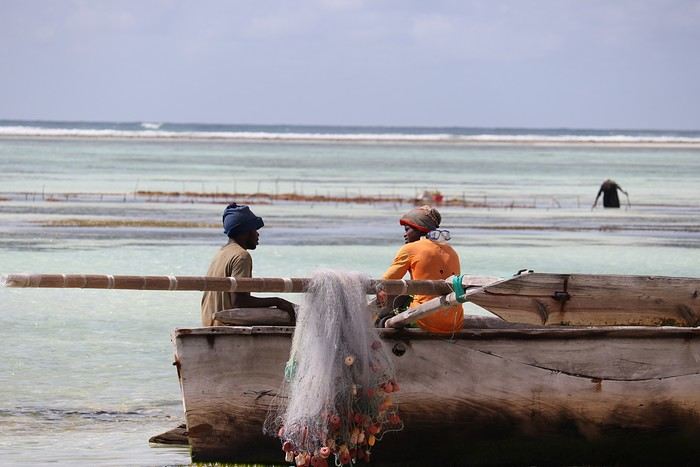
This is the spot where we can chill and chat about fishing at sea worldwide 😊
Here are two charming fishermen taking a well-deserved break near Zanzibar!
Three beautiful weeks during the Japanese autumn
I’m sharing our three-week trip to Japan from late October to mid-November 2025. There were four of us—my partner and a couple of friends.
I’ve traveled often with my friend Christian (Bolivia, Argentina, Costa Rica, Namibia, Laos), but this time our partners joined us.
The rough itinerary:
Arrival in Tokyo. Visiting Shinjuku/Shibuya districts + day trip to Kamakura
5 days in the Japanese Alps, from Matsumoto to Kanazawa (via Kamikochi, Hirayu Onsen, and Takayama)
5 days in Kyoto
Nara, Osaka, Koyasan
Return to Tokyo (Asakusa district), with a day trip to Nikko
We booked our flights well in advance (9 months ahead): the flight cost 1086 € per person. Compared to over 2000 € if we’d booked for the same dates just 3 months prior.
For accommodations, we mostly used Booking.com. The onsen was booked via Japanican, and in Kyoto, we stayed in an Airbnb.
We also made 5 train reservations a month in advance on Klook or directly on the train’s website.
Day 1: Departure from Brussels (October 24, 2025) Early morning takeoff at 6 AM to Munich (1.5-hour layover) with Lufthansa, then a 12-hour flight with ANA, arriving the next morning at 7 AM at Tokyo Haneda.
Day 2: Arrival in Tokyo Airport formalities were quick. The eSIM we bought before leaving activated as soon as we landed (10 GB plan with Saily—more than enough for our mobile internet needs, mainly Google Maps and Google Translate). We’d received 4 ICOCA cards from our neighbors, which we loaded with 15000 ¥ each. We took the Keihin train, then the Yamanote Line. It’s easy to navigate since everything is in English, and each station is announced on scrolling displays in English too.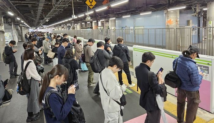
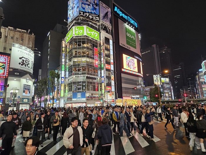
We got off the Yamanote Line at the station just after Shinjuku because it’s easier to exit that massive station with our luggage. So we ended up in Shin-Okubo, right in the Korean district. A 10-minute walk took us to Villa Fontaine Hotel. A great hotel, well-located north of the Kabukichō district. The room even seemed bigger than we’d expected.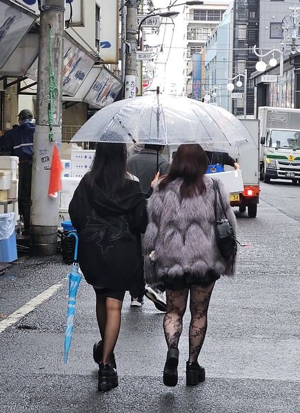
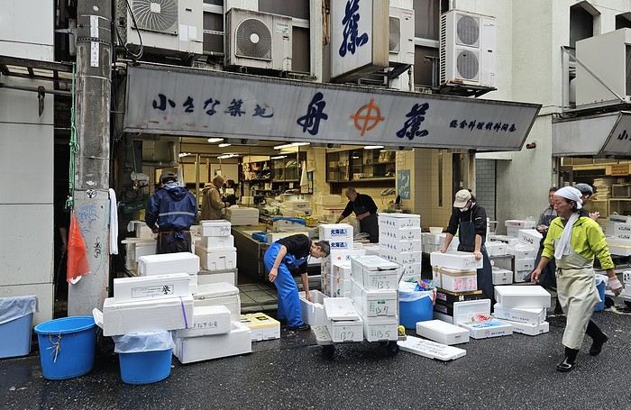 It was 15°C, but it rained—and kept raining on and off all day. Belgian weather, basically.
We went for a walk in Shinjuku Gyoen Park. Not as pretty in the rain, but the big greenhouse was interesting.
It was 15°C, but it rained—and kept raining on and off all day. Belgian weather, basically.
We went for a walk in Shinjuku Gyoen Park. Not as pretty in the rain, but the big greenhouse was interesting.
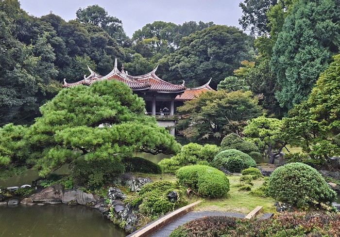
Then our first ramen (hearty and for 1000 ¥—pretty much the price of all our ramen during the trip). We headed back to the hotel since check-in was after 3 PM. Shower and relax before going out for dinner. Dinner was barbecue at Shichirin Yakiniku Anan (1700 ¥ each—good and cheap). Ordering via tablet wasn’t easy, but luckily it was in English.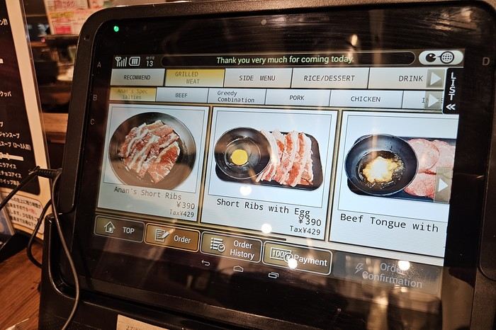
We ended the evening with a stroll through Kabukichō before a well-deserved sleep.
Day 1: Departure from Brussels (October 24, 2025) Early morning takeoff at 6 AM to Munich (1.5-hour layover) with Lufthansa, then a 12-hour flight with ANA, arriving the next morning at 7 AM at Tokyo Haneda.
Day 2: Arrival in Tokyo Airport formalities were quick. The eSIM we bought before leaving activated as soon as we landed (10 GB plan with Saily—more than enough for our mobile internet needs, mainly Google Maps and Google Translate). We’d received 4 ICOCA cards from our neighbors, which we loaded with 15000 ¥ each. We took the Keihin train, then the Yamanote Line. It’s easy to navigate since everything is in English, and each station is announced on scrolling displays in English too.
We got off the Yamanote Line at the station just after Shinjuku because it’s easier to exit that massive station with our luggage. So we ended up in Shin-Okubo, right in the Korean district. A 10-minute walk took us to Villa Fontaine Hotel. A great hotel, well-located north of the Kabukichō district. The room even seemed bigger than we’d expected.
It was 15°C, but it rained—and kept raining on and off all day. Belgian weather, basically.
We went for a walk in Shinjuku Gyoen Park. Not as pretty in the rain, but the big greenhouse was interesting.
Then our first ramen (hearty and for 1000 ¥—pretty much the price of all our ramen during the trip). We headed back to the hotel since check-in was after 3 PM. Shower and relax before going out for dinner. Dinner was barbecue at Shichirin Yakiniku Anan (1700 ¥ each—good and cheap). Ordering via tablet wasn’t easy, but luckily it was in English.
We ended the evening with a stroll through Kabukichō before a well-deserved sleep.
Which airline for Seoul?
Hi there,
When I run searches on Skyscanner, I see that only Lufthansa has flights to Seoul with just one stop. Air France doesn’t show up, even though I thought the French airline served Seoul? I can’t even log into the Air France website—it keeps glitching.
When I run searches on Skyscanner, I see that only Lufthansa has flights to Seoul with just one stop. Air France doesn’t show up, even though I thought the French airline served Seoul? I can’t even log into the Air France website—it keeps glitching.
Travel Journal - 28 Days in China in August 2025
Hi everyone! I’m sharing a modest travel journal from my trip to China in August 2025.
There wasn’t much room for improvisation on this trip—everything was planned in advance. Since August is peak season, I decided to book train tickets early, and once that was set, I reserved all the accommodations too. I got everything on Trip.com.
I bought the flight tickets back in March from Hainan Airlines. They were super expensive, but with these travel dates, I couldn’t exactly dream of a bargain!
I picked up e-SIMs valid for a month from Free just before departure: 10 € for the e-SIM + 19.90 € for a one-month plan with 35 GB of data abroad.
No need for a VPN with these e-SIMs, but D. still got one—a multi-device plan for 5 € with a discount from Let’s VPN, valid for a month. It was for evenings at the hotel on Wi-Fi to avoid burning through the 35 GB with video.
I downloaded Alipay, WeChat, Amap (Baidu Maps), and Trip.com. We also have Google Translate and Maps.me—absolute must-haves.
We’re ready to go!
I’ve been waiting for this day for nearly 15 years!! I travel a lot, but this one—this is MY TRIP 🙂 It’s been postponed so many times: because I wanted to do it with the right person, because I have a Turkish stamp in my passport and heard they don’t issue visas with that, because of COVID... and then China introduced a 30-day visa exemption, and that was the green light! Ugh, they forced us to take our vacation in August this year—far from ideal—but no more delays. Saturday, August 2, 2025: it’s finally the big day!
Days 1 and 2: We got dropped off at Charles de Gaulle at 9:30 AM. I supposedly checked in online, but only for the first flight and without getting the boarding pass... Might as well scrap online check-in in that case. So, we spent over an hour in line at the counter to get them. We didn’t have any checked luggage—just our backpacks as carry-ons—so this was a step we’d never had to deal with before, but whatever, it’s done. No wait at passport control, 5 minutes through security, a quick walk around the terminal, 10 minutes in the boarding area, and it was already time to board. Departure around 12:45 PM, arrival in Chongqing at 4:50 AM. We had a few hours of layover before our next flight. Went through immigration, connecting flight control, and security. Pro tip: check your next flight’s boarding gate right after immigration. We never saw it displayed again anywhere in the terminal.
The Free e-SIMs work—phew!
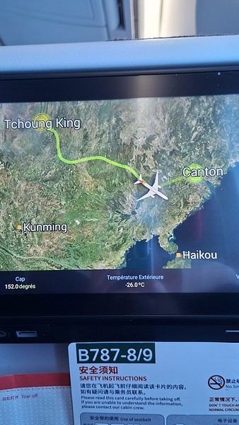
Took off at 9:30 AM, arrived in Guangzhou (Canton) at 11:20 AM in the rain. I love how Chongqing is translated as "Tchoung King" on the screens in the plane—very French!
During my first two trips to China, we paid for everything in cash, but this time, we’re going all-in on Alipay and WeChat. I still brought the leftover change from previous trips—it might come in handy. At the metro station, they showed us a QR code to buy tickets via WeChat. There were probably machines and even a ticket counter, but we didn’t see them, and buying via WeChat was pretty simple. 8 yuan to Changshu Lu, which is 22 stops. So far, so good. Then, we had to find the hotel, which wasn’t on Google Maps, Maps.me, or Amap... Easy 😎! We found it without too much hassle, though. Dropped off our stuff and went out to eat. 55 yuan for two claypots with fish/eel, rice, cabbage, and purple eggplant. When we left, it was pouring. We grabbed our umbrellas and set off to explore the neighborhood: Enning Road (we’ll come back later to check out a specific spot), Shangxiajiu (the pedestrian shopping street), Baohua Road... The area is pretty diverse—one street to the next, it’s like stepping into a different world.

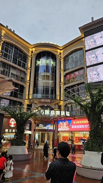
There weren’t many people around, probably because of the rain. We grabbed a quick street food dinner and went to bed—we were exhausted. We struggled to stay awake until 11 PM to adjust to the time change as quickly as possible. There’s a 6-hour time difference.
There wasn’t much room for improvisation on this trip—everything was planned in advance. Since August is peak season, I decided to book train tickets early, and once that was set, I reserved all the accommodations too. I got everything on Trip.com.
I bought the flight tickets back in March from Hainan Airlines. They were super expensive, but with these travel dates, I couldn’t exactly dream of a bargain!
I picked up e-SIMs valid for a month from Free just before departure: 10 € for the e-SIM + 19.90 € for a one-month plan with 35 GB of data abroad.
No need for a VPN with these e-SIMs, but D. still got one—a multi-device plan for 5 € with a discount from Let’s VPN, valid for a month. It was for evenings at the hotel on Wi-Fi to avoid burning through the 35 GB with video.
I downloaded Alipay, WeChat, Amap (Baidu Maps), and Trip.com. We also have Google Translate and Maps.me—absolute must-haves.
We’re ready to go!
I’ve been waiting for this day for nearly 15 years!! I travel a lot, but this one—this is MY TRIP 🙂 It’s been postponed so many times: because I wanted to do it with the right person, because I have a Turkish stamp in my passport and heard they don’t issue visas with that, because of COVID... and then China introduced a 30-day visa exemption, and that was the green light! Ugh, they forced us to take our vacation in August this year—far from ideal—but no more delays. Saturday, August 2, 2025: it’s finally the big day!
Days 1 and 2: We got dropped off at Charles de Gaulle at 9:30 AM. I supposedly checked in online, but only for the first flight and without getting the boarding pass... Might as well scrap online check-in in that case. So, we spent over an hour in line at the counter to get them. We didn’t have any checked luggage—just our backpacks as carry-ons—so this was a step we’d never had to deal with before, but whatever, it’s done. No wait at passport control, 5 minutes through security, a quick walk around the terminal, 10 minutes in the boarding area, and it was already time to board. Departure around 12:45 PM, arrival in Chongqing at 4:50 AM. We had a few hours of layover before our next flight. Went through immigration, connecting flight control, and security. Pro tip: check your next flight’s boarding gate right after immigration. We never saw it displayed again anywhere in the terminal.
The Free e-SIMs work—phew!
Took off at 9:30 AM, arrived in Guangzhou (Canton) at 11:20 AM in the rain. I love how Chongqing is translated as "Tchoung King" on the screens in the plane—very French!
During my first two trips to China, we paid for everything in cash, but this time, we’re going all-in on Alipay and WeChat. I still brought the leftover change from previous trips—it might come in handy. At the metro station, they showed us a QR code to buy tickets via WeChat. There were probably machines and even a ticket counter, but we didn’t see them, and buying via WeChat was pretty simple. 8 yuan to Changshu Lu, which is 22 stops. So far, so good. Then, we had to find the hotel, which wasn’t on Google Maps, Maps.me, or Amap... Easy 😎! We found it without too much hassle, though. Dropped off our stuff and went out to eat. 55 yuan for two claypots with fish/eel, rice, cabbage, and purple eggplant. When we left, it was pouring. We grabbed our umbrellas and set off to explore the neighborhood: Enning Road (we’ll come back later to check out a specific spot), Shangxiajiu (the pedestrian shopping street), Baohua Road... The area is pretty diverse—one street to the next, it’s like stepping into a different world.
There weren’t many people around, probably because of the rain. We grabbed a quick street food dinner and went to bed—we were exhausted. We struggled to stay awake until 11 PM to adjust to the time change as quickly as possible. There’s a 6-hour time difference.
VF Members' Cruise Departure Calendar for 2026
hi there
Here’s the cruise schedule for 2026.
It’s a great way to get ideas and maybe even meet up with other members.
2 essential rules:
1) never "quote" the calendar when replying—this’ll avoid any confusion 2) follow the format below DD/MM - username / SHIP IN CAPS / number of days / cruise title / departure port DON’T FORGET THE SPACES between the / /
REMINDER Despite my requests, few people follow the requested format. Cruises that stray too far from it won’t be listed anymore—sorry!PLEASE respect the templates! COPY AND PASTE THE FORMAT BELOW AND REPLACE WITH YOUR DETAILS IF YOU’RE STRUGGLING DD/MM - username / SHIP IN CAPS / number of days / cruise title / departure port DON’T FORGET THE SPACES between the / / It takes time to fix mistakes, so THANKS TO EVERYONE for your help!
YOUR TURN 😉
NUMBER OF CRUISES 2026: JANUARY FEBRUARY MARCH APRIL MAY JUNE JULY AUGUST SEPTEMBER OCTOBER NOVEMBER DECEMBER
1) never "quote" the calendar when replying—this’ll avoid any confusion 2) follow the format below DD/MM - username / SHIP IN CAPS / number of days / cruise title / departure port DON’T FORGET THE SPACES between the / /
REMINDER Despite my requests, few people follow the requested format. Cruises that stray too far from it won’t be listed anymore—sorry!PLEASE respect the templates! COPY AND PASTE THE FORMAT BELOW AND REPLACE WITH YOUR DETAILS IF YOU’RE STRUGGLING DD/MM - username / SHIP IN CAPS / number of days / cruise title / departure port DON’T FORGET THE SPACES between the / / It takes time to fix mistakes, so THANKS TO EVERYONE for your help!
YOUR TURN 😉
NUMBER OF CRUISES 2026: JANUARY FEBRUARY MARCH APRIL MAY JUNE JULY AUGUST SEPTEMBER OCTOBER NOVEMBER DECEMBER
Looking for feedback and advice on a Thailand-Laos-Cambodia itinerary plan
Hi everyone,
I’m starting to plan my next trip to Southeast Asia this winter (2.5 months, leaving in early December), and here’s a rough outline of my route—I’d love to share it with you and hear your thoughts and tips.
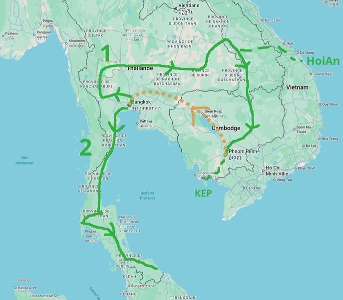
- I’ll start in Bangkok and already have three spots I’ve marked: Ayutthaya, Kanchanaburi, and Uthai Thani (I haven’t been to any of these places yet). - Next, I’d like to cross the country from west to east to reach the Laos border. I’d love suggestions for any interesting stops along this route—I don’t know this part of Thailand at all... - Then I’ll head into Laos, probably at Savannakhet (you can usually get a visa at the border). - > I’m tempted to spend a week in Hoi An, Vietnam, since I loved that city and the area when I visited two years ago. No visa needed for Vietnam now, so it could be a nice little detour. On the map, it doesn’t look too far, but I know you’ve got to be careful with these things, and I’m not sure if it’s a good idea. Any opinions on this? - Back to Laos (maybe via Dakta), and I’ll head south along the Mekong, probably doing the Bolaven Plateau loop that I missed last time. Then Paksé, the 4,000 Islands... I’ve been before, but I’d happily go back. - Crossing into Cambodia, I’ll follow the Mekong down to Phnom Penh (I know this area and love how untouristy it is). From there, I’ll probably spend a few days in Kep (quieter than Kampot). Still undecided, though. - Then back to Thailand (BKK), likely by plane from Phnom Penh since the borders between the two countries are currently closed (plus, let’s be honest, Cambodian roads... ;-). We’ll see how things look when the time comes. - After that, I’d like to explore southern Thailand, taking it slow with short hops. I’ve got my eye on Khao Sok National Park, and I’ve heard good things about Krabi... Again, I don’t know this region well, so any info or tips would be great.
So, I think this should be doable in 2.5 months, especially since I prefer short hops of 300 km max to avoid getting too tired, and I like staying 2-3 days in each place to explore. Plus, I’ll take a week off to relax if I find a spot I love—maybe by the sea for some real downtime.
Thanks for your feedback and for sharing your favorite spots! Pascal
- I’ll start in Bangkok and already have three spots I’ve marked: Ayutthaya, Kanchanaburi, and Uthai Thani (I haven’t been to any of these places yet). - Next, I’d like to cross the country from west to east to reach the Laos border. I’d love suggestions for any interesting stops along this route—I don’t know this part of Thailand at all... - Then I’ll head into Laos, probably at Savannakhet (you can usually get a visa at the border). - > I’m tempted to spend a week in Hoi An, Vietnam, since I loved that city and the area when I visited two years ago. No visa needed for Vietnam now, so it could be a nice little detour. On the map, it doesn’t look too far, but I know you’ve got to be careful with these things, and I’m not sure if it’s a good idea. Any opinions on this? - Back to Laos (maybe via Dakta), and I’ll head south along the Mekong, probably doing the Bolaven Plateau loop that I missed last time. Then Paksé, the 4,000 Islands... I’ve been before, but I’d happily go back. - Crossing into Cambodia, I’ll follow the Mekong down to Phnom Penh (I know this area and love how untouristy it is). From there, I’ll probably spend a few days in Kep (quieter than Kampot). Still undecided, though. - Then back to Thailand (BKK), likely by plane from Phnom Penh since the borders between the two countries are currently closed (plus, let’s be honest, Cambodian roads... ;-). We’ll see how things look when the time comes. - After that, I’d like to explore southern Thailand, taking it slow with short hops. I’ve got my eye on Khao Sok National Park, and I’ve heard good things about Krabi... Again, I don’t know this region well, so any info or tips would be great.
So, I think this should be doable in 2.5 months, especially since I prefer short hops of 300 km max to avoid getting too tired, and I like staying 2-3 days in each place to explore. Plus, I’ll take a week off to relax if I find a spot I love—maybe by the sea for some real downtime.
Thanks for your feedback and for sharing your favorite spots! Pascal
Madagascar - June 2025
Five years of an unintended break... The closure of VF, COVID... What a joy to rediscover the pleasure of sharing!
I’ve stayed true to my habits: the following account is a collection of practical tips rather than a travel journal...
Madagascar is as big as France and Belgium combined. In three weeks, choices have to be made! It was the Great Tsingy that inspired our trip. We decided to focus on the southwest and the RN7. We skipped the Deep South and the North. Oh well...
OUR ITINERARY IN 3 WEEKS:
Fri 6 June – Direct AF flight to Tana – Flight arrives at 10:30 PM – Tana Sat – Antsirabe Sun – Miandrivazo Mon – Drive to the Masiakampy pier – Descent of the Tsiribihina River by pirogue - Bivouac Tue – Descent of the Tsiribihina River by pirogue - Bivouac Wed – Descent of the Tsiribihina River by pirogue – Bekopaka Thu – Pirogue on the Manambolo River and Small Tsingy of Bemaraha – Bekopaka Fri – Great Tsingy of Bemaraha – Bekopaka Sat – Avenue of the Baobabs – Morondava Sun – Belo sur Mer Mon – Free day – Belo sur Mer Tue – Manja Wed – Andavadoaka Thu – Free day – Andavadoaka Fri – Salary Lagoon – Mangily Sat – Ranohira Sun – Isalo National Park - Ranohira Mon – Anja Reserve - Ambalavao - Fianarantsoa Tue – FCE train canceled – Visit to a Tanala village - Manakara Wed – Pirogue on the Pangalanes Canal – Ranomafana Thu – Ranomafana NP – Ranomafana Fri – Ambositra – Antsirabe Sat 28 June – AF flight to Paris – Flight departs at 11:55 PM
TRIP ORGANIZATION: I prepared my trip using the usual guides (LP and Rough Guide), the internet, and the Freytag & Berndt map (1:1,000,000). I’m old-school—I still love visualizing my route on a paper map, even though in Madagascar, it’s misleading because some National Roads are only national in name!...
The agency: Since we couldn’t deal directly with a driver-guide (we lacked reliable info to take the plunge), we went through an agency to organize the logistics of our trip. We didn’t feel like using bush taxis (not enough time) or driving a 4x4 ourselves (neither the skills nor the boldness). The French agency connected us with a local agency, to whom I sent my detailed itinerary by email. A few exchanges via email and WhatsApp calls allowed us to finalize everything quickly after some adjustments. As you’ve gathered... we multiplied the commissions, which inflated the budget. That said, in the end, we were thrilled with our decision and our choice. Our trip was booked by the end of 2024, and reservations were made immediately. No bad surprises: the bookings in the planned hotels were honored, often with one of the best rooms. On our last day in Tana, before departure, we were lucky enough to meet the director I’d been communicating with, who helped build and validate our circuit. A very warm debriefing.
The driver-guide: The agency assigned us Faly, 33, a driver-guide for over 10 years. He stayed with us from start to finish: he picked us up at the airport on arrival and dropped us off 23 days later. A very experienced driver (which is important here), an open and cultured guide, reliable, punctual, and a great companion. And a provider of good advice throughout the trip. We made the most of the long stretches on dirt roads or highways to listen to him talk about daily life, rituals, wildlife, and flora... No time wasted! With a great playlist in the background, we combined business with pleasure! Faly’s accommodation and meals were included (quite often, hotels offer free lodging and meals to driver-guides who bring clients), as was the fuel. That didn’t stop us from inviting Faly to share a beer or our evening meal sometimes. He didn’t always accept, wanting to let us "enjoy our romantic evenings," as he put it. Present without being intrusive! Faly is fully capable of organizing a tailor-made trip directly. I recommend him without any hesitation—we were delighted with his service. I’ll gladly share his contact details via PM to anyone who asks.
Local guides: It’s the national guide’s prerogative to choose the local guides (mandatory in the parks). Thanks to his experience, Faly always booked us amazing, competent, and interesting local guides.
Hotels: I told the agency I wanted charming, comfortable accommodations, without falling into flashy luxury. We loved all the hotels (except the Hôtel Kanto in Manja). The rooms, mostly bungalows, were always spacious and clean. Unfortunately, I can’t give the prices—I didn’t get the details. Breakfast is always included, usually fresh and hearty. Very often, a small bottle of water is provided in the room.
Tana Hôtel Les 3 Métis Power cuts are common (!) in Tana. Bring a headlamp.
Antsirabe Ecolodge – Les chambres du voyageur Maybe our favorite! A few bungalows, beautifully arranged in a splendid tropical garden. The dog Kodak welcomes us warmly.
Miandrivazo Hôtel Princesse Tsiribihina Magnificent view of the valley.
Bekopaka Hôtel Orchidée du Bemaraha 2 (yes, 2) beautiful pools, a large open common room.
Morondava Hôtel Baobab Café Brand new or at least, according to Faly, just renovated. Very comfortable but without much charm (international style).
Belo sur Mer Ecolodge du Menabe The bungalows, all made of wood, bamboo, and thatch, are set on the beach. Very spacious and fully equipped! Large open-air restaurant by the sea. No hot water from the tap—it’s available in plastic bottles heated by the sun in front of each bungalow. Actually, we never used it... Another very, very beautiful spot.
Manja Hôtel Kanto The only hotel on this leg of the journey, so no choice. The owner knows it and, as a result, doesn’t bother. It’s a real dive! Tiny, dark room, a sordid bathroom with only a trickle of water—we skipped the shower! Clean sheets, though. Obviously, no Wi-Fi. The only place where I didn’t leave a tip. We were well warned about the discomfort of this stop, both by the agency and Faly. We weren’t surprised, and it even became a running joke during the trip. On the other hand, we found a nice little market in town.
Andavadoaka Manga Lodge What bliss! Especially after the horrible Hôtel Kanto. A paradise-like spot, overlooking three beautiful deserted white-sand beaches. Meals are served on the terrace facing the sea. Stunning sunset. We loved spending a day lounging here! We were the only guests and were pampered.
Mangily (Ifaty) Mangily is the "suburb" of Ifaty. Hôtel Vovo Telo A large beachfront bungalow complex. More touristy but pleasant—we spent a lovely evening there with our feet in the sand.
Ranohira Le Relais de la Reine A splendid resort built by a Frenchman, at the foot of the rocks, very well integrated into the environment. Beautiful marked trail starting from the garden.
Fianarantsoa Villa Sylvestre Contrary to what its name suggests, it’s a hotel right in the city center. Quite decent, though.
Manakara Parthenay Club Pretty bungalows in a large garden by the sea, but swimming isn’t safe—the water is too dangerous and rough.
Ranomafana Hôtel Thermal Very spacious rooms.
Meals: Not all our meals were included. It’s really not expensive. 1 meat or fish dish: around 35,000 Ar 1 full menu (starter, main, dessert): around 70,000 Ar 1 large THB beer (65 cl): between 8,000 and 12,000 Ar 1 piña colada: 15,000 Ar 1 flavored rum: 6,000 Ar (sometimes free) 1 glass of baobab juice (!): 5,000 Ar
We always ate very well. Rice is everywhere, served in large quantities. Zebu meat is quite good if not overcooked. Personally, I prefer fish, and I feasted: grouper, captain, crab, small lobsters...
We happily discovered baobab juice (especially in Belo, on the west coast). And of course, flavored rums!
We bought 2 packs of 6 bottles of mineral water at Carrefour (!) (about 5,000 Ar per large bottle) at the start of our trip. That was enough, especially since we often got water in the bungalows.
We had a few picnics included in our trip. Instead of picking up the hotel’s lunchbox, Faly prepared delicious, fresh, and varied picnics for us: tuna pasta salad, fried rice with eggs, grilled vegetables, and avocado...
An exceptional address not to miss: Mad Zébu – Belo sur Tsiribihina A highly reputed restaurant, a favorite of LP and Rough Guide, and rightly so! Gourmet cuisine, refined and elegant. Barely more expensive than elsewhere, and it’s worth it. We stopped there on our way up to Bekopaka and the Tsingy NP. Fully booked! So Faly reserved for our return, three days later. We’re still thanking him! What a treat!
THE BUDGET: Ariary exchange rate: 5,000 Ar = 1 €
Pre-trip expenses: Direct Air France flights: 930 € per person round trip Cost of the circuit with the agency: 2,880 € per person
The visa: Issued on arrival, very quickly. 35 € per person for a stay under 30 days. Super simple. Super fast.
On-site expenses: As soon as we arrived at the airport (it was nearly midnight), Faly advised us to exchange our euros for all our needs. There are few opportunities on our route to find an ATM or an open bank with a good rate. To be more comfortable, he took us to a small office under military protection just outside the airport. I exchanged 1,200 € (I had asked the agency for advice on the amount to bring) at a rate of 4,750 Ar and became a millionaire. Faly recounted all the stacks. That covered all our expenses (meals, drinks, tips) without ever feeling deprived. Personal purchases were made at the end of the trip. Convenient—it served as an adjustment variable. We spent our last million (200 €) on marquetry and vanilla. Tip: We asked for 200,000 Ar in 5,000 Ar bills for tips. That wasn’t too much—I even ran short of small bills in the last two days.
Tips: Madagascar is a poor country where every service deserves a small reward. While not mandatory, it’s customary. But no one ever demanded or expected it openly. On the contrary, I sometimes had to remind a porter to give them my small bill. We never carried our luggage—porters were always present when the car arrived or waiting at our door to watch for our departure. I gave each of them 5,000 Ar. In restaurants, I rounded up to the nearest ten and left the change. Local guides also expect a tip: I gave around 20,000 Ar per day for the two of us. Finally, the national guide also expects a gratuity. I had read online to budget 5 € per day per person. I added more since we were so happy with his services. The tip was given at the end of the trip, in euros, outside the budget.
Total budget all included (excluding personal purchases): 8,690 € Clearly, Madagascar is a country where life isn’t expensive, but travel costs add up quickly due to the need to rent a 4x4 with a driver.
HIGHLIGHTS:
· The dirt roads Yes, I’m listing them among the highlights! We loved those long hours spent driving at 20 km/h on rocky, muddy, white, red, or gray sand tracks... surrounded by tropical vegetation, palm trees, pandanus, mango trees... The experiences were sometimes thrilling: crossing a river on a ferry (just planks of wood fixed on two motorized pirogues side by side) or crossing a river without a ferry, with just a kid running ahead of the 4x4 to show the way; soft sand where the 4x4 easily gets stuck... The tracks are quite narrow, and crossing paths with a bush taxi, a zebu cart, or a herd of goats is always epic. So many beautiful images, so many beautiful photos! Much more beautiful than on asphalt. So yes, we loved those long stretches on dirt roads. For us, it was clearly part of the journey. Faly was particularly careful, and the 4x4 was comfortable. No injuries, no fatigue, even after 7 or 8 hours on rough tracks. The national roads (including the famous RN7) are badly damaged by cyclones, huge trucks, and lack of maintenance. Potholes have turned into ostrich nests, and we didn’t drive much faster than on the dirt roads.
· The landscapes, villages, encounters... We crossed a variety of stunning landscapes: mountains with slopes covered in terraced crops, rice fields from apple green to emerald green, sugarcane fields, then tropical forests, baobab forests (they deserve a special paragraph below), traveler’s tree forests. And then coastlines with white sand dunes against a backdrop of blue hues!... Magical! We also passed through many villages with houses whose architecture varied by region. The Betsileo houses display beautiful decorative brick reliefs. On the west coast, the houses are more precarious, made of bamboo with palm-thatched roofs. In the Highlands region, we found solid houses with pastel plaster. Each region has its own landscape, crops, habitat, and clothing. Zebu carts are often the only means of transport in remote villages. We saw them very frequently. Again, the cart’s decoration depends on the region. And then, we met many villagers coming out of the bush and walking to the next market, carrying their crops on their heads or shoulders. More beautiful photos!
· The descent of the Tsiribihina River We boarded around 9 AM in a long pirogue with Gana, the local guide, and two pirogue men. So, five of us. The pirogue is long but narrow, about 65 cm wide. We sat one behind the other at the front on seats padded with what would become our mattresses during the bivouacs. We only took the bare essentials for two nights. A little goodbye to Faly, whom we’d see again in three days! Don’t forget us! The river is silty—meaning orange, opaque but clean. We glided along silently. Gana showed us the trees, birds, crocodiles (we saw five—apparently, we were lucky). The pirogue men rowed to get us as close as possible to these crocs sunbathing on the roots of big trees. Yeah, right!... as soon as we got too close, *splash*, they disappeared into the water. We marveled at the mini rice fields lining the river. Every tiny plot, no matter how small, is cultivated. Above them, banana fields. And on the water, a whole life of fishermen and villagers living with and from the river. Gana warned us we’d eat on the pirogue because the journey was long. So, I expected chips... But no—fried rice and zebu steak, cooked right in the pirogue!! Incredible! In the middle of the afternoon, we reached a small beach where we disembarked. Gana led us about a hundred meters to a sublime waterfall. We were alone there. We had time to swim. We’d brought our swimsuits and a towel (bought at the Carrefour in Antsirabe on Faly’s wise advice!). This swim in this paradise-like spot remains one of our best memories. We found our pirogue again and set off until our first bivouac. We’d sailed for 7 hours today. The tents were set up on a wide beach, without a single tree. A moment of solitude... Uh, where can we go to the bathroom?... Especially since it was a full moon, so we felt like we were in the spotlight. Anyway... we did as everyone else—walked away, dug a hole, and the others turned their backs. A hearty meal on the beach before a comfortable and silent night. The next day, same program, with slightly different landscapes. The gorges widened, the trees were different. But still many colorful birds. Again, we ate on the pirogue: grilled chicken and vegetables. 9 hours of sailing. A similar bivouac. This time, we got it. On the third day, we finished the descent with 5 hours of sailing. So, 7 hours, 9 hours, 5 hours... doing nothing. It might sound boring... but it wasn’t. Like the dirt roads, these were contemplative moments. It glides, it’s calm, relaxing, and there’s a lot of life on this river, animal and human. Contemplation. Suspended time. On arrival, we disembarked at a sort of joyful, bustling river port. Of course, Faly was already there to pick us up.
· The Tsingy de Bemaraha NP (Small and Great) I have vertigo. During my research, several agencies advised me against visiting the Great Tsingy. "Stick to the Small ones," they said. Grrr, no, not what I wanted—we’ve dreamed of this for years! The agency we chose also warned me but didn’t discourage me. So we started with the Small Tsingy, quite close to Bekopaka, guided by Alisha. This forest of sharp limestone rocks is impressive. No vertigo issues here. The day was completed with a short pirogue ride on the Manambolo River and a visit to two caves with pretty formations. The next day, Faly and Alisha drove us to the Great Tsingy (a good hour on a terrible track). Arriving at the park entrance, Alisha equipped us with harnesses, carabiners, and gave us some safety instructions. Faly was also equipped. Wait? He’s coming with us? I quickly understood he was there for me—if I got stuck, he could go back with me, and Philippe could continue with Alisha. A wise precaution that delighted and reassured me. In the end, it was unnecessary since the famous bridge crossing was fully secured by the harness and carabiners. 18 meters on planks, one by one, it didn’t sway too much—I walked looking straight ahead, not a glance down. I even managed to smile in the middle of the crossing—I have a photo to prove it! I was overjoyed! The circuit in the Great Tsingy is a loop, so we didn’t have to cross the bridge again. We climbed to viewpoints offering breathtaking panoramic views. It’s extraordinary, unique, incredible. All this to say that if you have vertigo, don’t hesitate! It’s doable! It’s completely safe and really worth pushing your limits a bit! For those who’ve done treetop adventure courses, it’s similar. Also, no need to be a great athlete—just a bit of agility to climb a few ladders and high steps. Don’t censor yourself! I even had a small regret—the loop was a bit short (about 2 hours). I would’ve liked to continue or even redo it, with less apprehension. Tip: Do the Small Tsingy before the Great ones, or not at all. And if you can only do one, do the Great ones without hesitation.
· Canoeing in the Belo mangrove The Belo sur Mer ecolodge lends small individual canoes for free to go to the mangrove. We left at high tide, paddled for about twenty minutes to reach a fairly sparse forest where we could easily venture in. Very shallow water, crystal clear—we could see the roots of all these trees, schools of tiny fish... It was quite surprising. Until then, I only knew impenetrable, tangled mangroves. Here, nothing like that—we walked through an aquatic forest. We loved this adventure so much we left a bit late. The tide had gone out, and we had to carry our canoes for the last few meters... Of course, the staff came to help (probably laughing silently!). The lodge owners gave all the necessary explanations and lent a waterproof bag for the phone (because yes, it’s worth taking photos!). A very useful precaution—the canoes are small, low in the water, and paddling quickly soaks you. Again, this isn’t just for Tony Estanguet! It didn’t cause us any problems, not even sore muscles the next day. A great experience. It’ll take about 2 hours.
· Isalo NP Big surprise when we saw this huge rocky massif appear on the RN7! A massif of colored sandstone, carved with crevasses giving it a ruined look. Le Relais de la Reine is a little gem cleverly nestled in the heart of these rocks. A small marked trail starts from the garden. We picked up the description at reception and set off. Without a guide, alone following the markers, it took us 2 hours to complete this magnificent little trail, giving us a first glimpse of the massif before the hike the next day. And we enjoyed being completely alone for this walk. It’s free, easy, and well-signposted. Don’t miss it. In the evening, Faly took us to the so-called Isalo Window site—a hole in a wall through which we could see the sunset. We met all the tourists in the area here. We weren’t blown away by the show... The next day, we left early to reach the start of the hike. We met Zozoly at the guides’ office in the small town of Ranohira. During this hike, we climbed through the rocks to a viewpoint offering stunning 360° views of the massif. Then we reached a site called the "natural pool," breathtakingly beautiful, especially since we were alone again. A sort of oasis, a cascading waterfall, palm trees and tree ferns, fine sand, all nestled at the bottom of a small canyon. Paradise-like. We resisted swimming, but it was really tempting. A long walk on the plateaus then led us to a well-equipped picnic site where a local team prepared grills. Concrete tables were tiered in a spacious, shady clearing where a whole family of ring-tailed lemurs frolicked. They knew the tourists’ habits and tried to snatch food. Playful and not very shy, they amused us with their antics! We had to resist not luring them with a piece of banana!! Thousands of photos!! After the meal, we set off again with Zozoly for another landscape. This time, we were by a small river at the bottom of a canyon with high walls covered in vegetation. The trail was narrow and slippery, on a ledge of the wall. We progressed carefully. No danger, though. We first reached the Blue Pool, which only turns blue in photos (surprise!), then the Black Pool fed by a shower of waterfalls. Two magnificent spots that showed us a completely different aspect of the massif.
· Anja Reserve This ficus forest is home to many groups of lemurs. Used to humans, whom they don’t fear, they move around us, ignoring us completely. It’s almost annoying... The best place on our trip to see lemurs.
· The FCE train To the great regret of Manakara’s inhabitants, the FCE train hasn’t reached here for over a year and a half. As a result, there are far fewer tourists—the train was part of the experience. We drove there and didn’t regret coming to this port on the east coast.
· Visit to a Tanala village This visit wasn’t part of our program—it was added by the agency to compensate for the train not running. Which was the case. Not big fans of this kind of visit, where we feel like we’re at a zoo, voyeuristic, lacking authenticity, we followed the local guide with some skepticism and exchanged dubious looks. And yet... the guide’s explanations about village life and the warm, smiling welcome from the villagers charmed us and dispelled all our concerns. We learned a lot, met smiling families, and were able to enter these beautiful bamboo houses. A very pleasant surprise, rich in lessons.
· The Pangalanes Canal Arriving in Manakara, we crossed a bridge overlooking the Pangalanes Canal. A cry of surprise: the water is turquoise! We took a short pirogue ride with a team of three pirogue men and Joël, a local guide who explained the drama caused by the train’s halt. We stopped in a fishing village where Joël bought fish for the barbecue. We ended up on a beach where the team prepared the meal while we went to watch the fishermen return on the nearby beach. We admired the fishermen’s dexterity in untangling their nets, sorting their fish, cleaning their gear. On our return, we found a small table set up on the beach, in the shade of palm trees and casuarinas. Lobsters, captain fish, grilled vegetables, sautéed potatoes. A real feast (included in the trip cost).
· Ranomafana NP A 4-5 hour hike (some climbing) in a dense secondary forest to look for lemurs. As usual, we were accompanied by a local guide who, while waiting to find our furry friends, gave us lots of info on the vegetation, birds, and Tanala ethnic rituals. In the forest, we met 4 or 5 trackers, armed with radios to alert guides of their findings. In the end, we saw several lemurs of different types. Quite far, quite high... A nice complement to our lemur encounters in Isalo. Here, it rains 200 days a year. We started the hike in thick fog, but the forest’s density protected us from the humidity. Be careful—it can be a bit frustrating to see the lemurs so far away, so high. Nothing like the Anja Reserve or Isalo NP. Here, what’s fun is the hunt.
· The baobabs We were captivated by these kings of the forest, noble, imposing, majestic. We spotted them from very far away, towering over the rest of the vegetation. Alone, in small groups, or in forests, our trip allowed us to see hundreds of them! Mainly on the west coast. All different—bald, hairy, shaggy, short and stout, tall and thin, like Laurel and Hardy. Philippe took to naming them. Respectfully!
OUR FAVORITES: · The variety of landscapes. · The Tsingy NP.
OUR DISAPPOINTMENTS: · The Avenue of the Baobabs, very overrated and the only place where we saw crowds. We saw many other "forests" of baobabs that were much more impressive. · It’s hard to approach the population calmly as swarms of children run up as soon as we arrive, asking for sweets. Without any aggression, their smiles and laughter quickly made us forget this small inconvenience. We never gave out candy, clothes, or money. We left pens at a school and clothes with Faly.
IF WE WERE TO DO IT AGAIN: · Same period, same duration, same pace, same itinerary, but if we were to do it again today, I’d go through Faly directly! · Maybe we should’ve stayed in Ambalavao instead of Fianarantsoa. · Plan a longer loop in the Great Tsingy—it felt a bit too short.
MISCELLANEOUS: The welcome: ‘Samala Vazaha,’ there are many, many kids, sometimes overwhelming, never aggressive. We were impressed by the villagers’ smiles and good humor, towards us or even among themselves—laughter was everywhere. Safety: No problems. Out of (excessive?) caution, we spread all our money across several bags that we padlocked whenever we left the hotel. Bribes: We were stopped several times on the road by police or gendarmes. They checked our papers, sometimes our passports. Faly was perfectly in order. No discussion, no bribes, a cordial greeting from the officers. However, several times we found ourselves at small "tolls" on the tracks for villagers who had leveled the road or filled a hole, or for the young guy who ran through the river to show the way... Faly complied without discussion: every service deserves a small bill. Language: French is still widely spoken. Credit card: Unused. Cash: You need it! The climate at this time: Ideal—blue skies, sunshine, and mild temperatures (20-25°C) throughout our trip. Temperatures started to drop by our departure—winter was setting in. Clothing: T-shirt or polo and a vest sometimes in the evening, sandals on our feet, hiking shoes for all the hikes. Tip: We left a bag in the car (completely safe) with things we didn’t need daily and dirty laundry. The two bags to take out at each stop were much lighter. Before leaving, we left several polos and T-shirts with Faly, which, once washed, will make a few people happy. Tourist crowds at this time: Low—we were sometimes the only guests at the hotel. Faly explained that at the Isalo picnic site, in high season, you have to queue for a table, whereas we had our pick. Photos: Lots! Too many! That’s the problem with digital—we take so many! Health issues: Nothing serious, just the usual mild traveler’s diarrhea. Mosquitoes: They’re voracious. We took anti-malaria treatment. I’m still not sure if it was the right thing to do... I’m always very skeptical about such precautions. Internet: Free Wi-Fi at the lodges’ reception (except at Hôtel Kanto!), sometimes (rarely) in the bungalows. Phone: We didn’t try to get a local SIM card—the evening Wi-Fi was enough for us to make calls and send messages via WhatsApp. Make sure to turn off mobile data and switch to airplane mode (I activated it a bit late—received calls, spam ones at that, were charged...). Electricity: French plugs. Personal purchases: Beautiful wooden objects (sculptures and marquetry) or zebu horn items in Ambositra. 1 kg of vanilla (400,000 Ar – 80 € per kg) in Tana.
IN CONCLUSION: A trip of contemplation. A pause for admiration, as our local guide in Isalo NP said. Nothing else to do but walk, look, and enjoy. Here, there are no old stones, no museums—it’s a trip where nature reigns supreme. And what nature!
I’ve stayed true to my habits: the following account is a collection of practical tips rather than a travel journal...
Madagascar is as big as France and Belgium combined. In three weeks, choices have to be made! It was the Great Tsingy that inspired our trip. We decided to focus on the southwest and the RN7. We skipped the Deep South and the North. Oh well...
OUR ITINERARY IN 3 WEEKS:
Fri 6 June – Direct AF flight to Tana – Flight arrives at 10:30 PM – Tana Sat – Antsirabe Sun – Miandrivazo Mon – Drive to the Masiakampy pier – Descent of the Tsiribihina River by pirogue - Bivouac Tue – Descent of the Tsiribihina River by pirogue - Bivouac Wed – Descent of the Tsiribihina River by pirogue – Bekopaka Thu – Pirogue on the Manambolo River and Small Tsingy of Bemaraha – Bekopaka Fri – Great Tsingy of Bemaraha – Bekopaka Sat – Avenue of the Baobabs – Morondava Sun – Belo sur Mer Mon – Free day – Belo sur Mer Tue – Manja Wed – Andavadoaka Thu – Free day – Andavadoaka Fri – Salary Lagoon – Mangily Sat – Ranohira Sun – Isalo National Park - Ranohira Mon – Anja Reserve - Ambalavao - Fianarantsoa Tue – FCE train canceled – Visit to a Tanala village - Manakara Wed – Pirogue on the Pangalanes Canal – Ranomafana Thu – Ranomafana NP – Ranomafana Fri – Ambositra – Antsirabe Sat 28 June – AF flight to Paris – Flight departs at 11:55 PM
TRIP ORGANIZATION: I prepared my trip using the usual guides (LP and Rough Guide), the internet, and the Freytag & Berndt map (1:1,000,000). I’m old-school—I still love visualizing my route on a paper map, even though in Madagascar, it’s misleading because some National Roads are only national in name!...
The agency: Since we couldn’t deal directly with a driver-guide (we lacked reliable info to take the plunge), we went through an agency to organize the logistics of our trip. We didn’t feel like using bush taxis (not enough time) or driving a 4x4 ourselves (neither the skills nor the boldness). The French agency connected us with a local agency, to whom I sent my detailed itinerary by email. A few exchanges via email and WhatsApp calls allowed us to finalize everything quickly after some adjustments. As you’ve gathered... we multiplied the commissions, which inflated the budget. That said, in the end, we were thrilled with our decision and our choice. Our trip was booked by the end of 2024, and reservations were made immediately. No bad surprises: the bookings in the planned hotels were honored, often with one of the best rooms. On our last day in Tana, before departure, we were lucky enough to meet the director I’d been communicating with, who helped build and validate our circuit. A very warm debriefing.
The driver-guide: The agency assigned us Faly, 33, a driver-guide for over 10 years. He stayed with us from start to finish: he picked us up at the airport on arrival and dropped us off 23 days later. A very experienced driver (which is important here), an open and cultured guide, reliable, punctual, and a great companion. And a provider of good advice throughout the trip. We made the most of the long stretches on dirt roads or highways to listen to him talk about daily life, rituals, wildlife, and flora... No time wasted! With a great playlist in the background, we combined business with pleasure! Faly’s accommodation and meals were included (quite often, hotels offer free lodging and meals to driver-guides who bring clients), as was the fuel. That didn’t stop us from inviting Faly to share a beer or our evening meal sometimes. He didn’t always accept, wanting to let us "enjoy our romantic evenings," as he put it. Present without being intrusive! Faly is fully capable of organizing a tailor-made trip directly. I recommend him without any hesitation—we were delighted with his service. I’ll gladly share his contact details via PM to anyone who asks.
Local guides: It’s the national guide’s prerogative to choose the local guides (mandatory in the parks). Thanks to his experience, Faly always booked us amazing, competent, and interesting local guides.
Hotels: I told the agency I wanted charming, comfortable accommodations, without falling into flashy luxury. We loved all the hotels (except the Hôtel Kanto in Manja). The rooms, mostly bungalows, were always spacious and clean. Unfortunately, I can’t give the prices—I didn’t get the details. Breakfast is always included, usually fresh and hearty. Very often, a small bottle of water is provided in the room.
Tana Hôtel Les 3 Métis Power cuts are common (!) in Tana. Bring a headlamp.
Antsirabe Ecolodge – Les chambres du voyageur Maybe our favorite! A few bungalows, beautifully arranged in a splendid tropical garden. The dog Kodak welcomes us warmly.
Miandrivazo Hôtel Princesse Tsiribihina Magnificent view of the valley.
Bekopaka Hôtel Orchidée du Bemaraha 2 (yes, 2) beautiful pools, a large open common room.
Morondava Hôtel Baobab Café Brand new or at least, according to Faly, just renovated. Very comfortable but without much charm (international style).
Belo sur Mer Ecolodge du Menabe The bungalows, all made of wood, bamboo, and thatch, are set on the beach. Very spacious and fully equipped! Large open-air restaurant by the sea. No hot water from the tap—it’s available in plastic bottles heated by the sun in front of each bungalow. Actually, we never used it... Another very, very beautiful spot.
Manja Hôtel Kanto The only hotel on this leg of the journey, so no choice. The owner knows it and, as a result, doesn’t bother. It’s a real dive! Tiny, dark room, a sordid bathroom with only a trickle of water—we skipped the shower! Clean sheets, though. Obviously, no Wi-Fi. The only place where I didn’t leave a tip. We were well warned about the discomfort of this stop, both by the agency and Faly. We weren’t surprised, and it even became a running joke during the trip. On the other hand, we found a nice little market in town.
Andavadoaka Manga Lodge What bliss! Especially after the horrible Hôtel Kanto. A paradise-like spot, overlooking three beautiful deserted white-sand beaches. Meals are served on the terrace facing the sea. Stunning sunset. We loved spending a day lounging here! We were the only guests and were pampered.
Mangily (Ifaty) Mangily is the "suburb" of Ifaty. Hôtel Vovo Telo A large beachfront bungalow complex. More touristy but pleasant—we spent a lovely evening there with our feet in the sand.
Ranohira Le Relais de la Reine A splendid resort built by a Frenchman, at the foot of the rocks, very well integrated into the environment. Beautiful marked trail starting from the garden.
Fianarantsoa Villa Sylvestre Contrary to what its name suggests, it’s a hotel right in the city center. Quite decent, though.
Manakara Parthenay Club Pretty bungalows in a large garden by the sea, but swimming isn’t safe—the water is too dangerous and rough.
Ranomafana Hôtel Thermal Very spacious rooms.
Meals: Not all our meals were included. It’s really not expensive. 1 meat or fish dish: around 35,000 Ar 1 full menu (starter, main, dessert): around 70,000 Ar 1 large THB beer (65 cl): between 8,000 and 12,000 Ar 1 piña colada: 15,000 Ar 1 flavored rum: 6,000 Ar (sometimes free) 1 glass of baobab juice (!): 5,000 Ar
We always ate very well. Rice is everywhere, served in large quantities. Zebu meat is quite good if not overcooked. Personally, I prefer fish, and I feasted: grouper, captain, crab, small lobsters...
We happily discovered baobab juice (especially in Belo, on the west coast). And of course, flavored rums!
We bought 2 packs of 6 bottles of mineral water at Carrefour (!) (about 5,000 Ar per large bottle) at the start of our trip. That was enough, especially since we often got water in the bungalows.
We had a few picnics included in our trip. Instead of picking up the hotel’s lunchbox, Faly prepared delicious, fresh, and varied picnics for us: tuna pasta salad, fried rice with eggs, grilled vegetables, and avocado...
An exceptional address not to miss: Mad Zébu – Belo sur Tsiribihina A highly reputed restaurant, a favorite of LP and Rough Guide, and rightly so! Gourmet cuisine, refined and elegant. Barely more expensive than elsewhere, and it’s worth it. We stopped there on our way up to Bekopaka and the Tsingy NP. Fully booked! So Faly reserved for our return, three days later. We’re still thanking him! What a treat!
THE BUDGET: Ariary exchange rate: 5,000 Ar = 1 €
Pre-trip expenses: Direct Air France flights: 930 € per person round trip Cost of the circuit with the agency: 2,880 € per person
The visa: Issued on arrival, very quickly. 35 € per person for a stay under 30 days. Super simple. Super fast.
On-site expenses: As soon as we arrived at the airport (it was nearly midnight), Faly advised us to exchange our euros for all our needs. There are few opportunities on our route to find an ATM or an open bank with a good rate. To be more comfortable, he took us to a small office under military protection just outside the airport. I exchanged 1,200 € (I had asked the agency for advice on the amount to bring) at a rate of 4,750 Ar and became a millionaire. Faly recounted all the stacks. That covered all our expenses (meals, drinks, tips) without ever feeling deprived. Personal purchases were made at the end of the trip. Convenient—it served as an adjustment variable. We spent our last million (200 €) on marquetry and vanilla. Tip: We asked for 200,000 Ar in 5,000 Ar bills for tips. That wasn’t too much—I even ran short of small bills in the last two days.
Tips: Madagascar is a poor country where every service deserves a small reward. While not mandatory, it’s customary. But no one ever demanded or expected it openly. On the contrary, I sometimes had to remind a porter to give them my small bill. We never carried our luggage—porters were always present when the car arrived or waiting at our door to watch for our departure. I gave each of them 5,000 Ar. In restaurants, I rounded up to the nearest ten and left the change. Local guides also expect a tip: I gave around 20,000 Ar per day for the two of us. Finally, the national guide also expects a gratuity. I had read online to budget 5 € per day per person. I added more since we were so happy with his services. The tip was given at the end of the trip, in euros, outside the budget.
Total budget all included (excluding personal purchases): 8,690 € Clearly, Madagascar is a country where life isn’t expensive, but travel costs add up quickly due to the need to rent a 4x4 with a driver.
HIGHLIGHTS:
· The dirt roads Yes, I’m listing them among the highlights! We loved those long hours spent driving at 20 km/h on rocky, muddy, white, red, or gray sand tracks... surrounded by tropical vegetation, palm trees, pandanus, mango trees... The experiences were sometimes thrilling: crossing a river on a ferry (just planks of wood fixed on two motorized pirogues side by side) or crossing a river without a ferry, with just a kid running ahead of the 4x4 to show the way; soft sand where the 4x4 easily gets stuck... The tracks are quite narrow, and crossing paths with a bush taxi, a zebu cart, or a herd of goats is always epic. So many beautiful images, so many beautiful photos! Much more beautiful than on asphalt. So yes, we loved those long stretches on dirt roads. For us, it was clearly part of the journey. Faly was particularly careful, and the 4x4 was comfortable. No injuries, no fatigue, even after 7 or 8 hours on rough tracks. The national roads (including the famous RN7) are badly damaged by cyclones, huge trucks, and lack of maintenance. Potholes have turned into ostrich nests, and we didn’t drive much faster than on the dirt roads.
· The landscapes, villages, encounters... We crossed a variety of stunning landscapes: mountains with slopes covered in terraced crops, rice fields from apple green to emerald green, sugarcane fields, then tropical forests, baobab forests (they deserve a special paragraph below), traveler’s tree forests. And then coastlines with white sand dunes against a backdrop of blue hues!... Magical! We also passed through many villages with houses whose architecture varied by region. The Betsileo houses display beautiful decorative brick reliefs. On the west coast, the houses are more precarious, made of bamboo with palm-thatched roofs. In the Highlands region, we found solid houses with pastel plaster. Each region has its own landscape, crops, habitat, and clothing. Zebu carts are often the only means of transport in remote villages. We saw them very frequently. Again, the cart’s decoration depends on the region. And then, we met many villagers coming out of the bush and walking to the next market, carrying their crops on their heads or shoulders. More beautiful photos!
· The descent of the Tsiribihina River We boarded around 9 AM in a long pirogue with Gana, the local guide, and two pirogue men. So, five of us. The pirogue is long but narrow, about 65 cm wide. We sat one behind the other at the front on seats padded with what would become our mattresses during the bivouacs. We only took the bare essentials for two nights. A little goodbye to Faly, whom we’d see again in three days! Don’t forget us! The river is silty—meaning orange, opaque but clean. We glided along silently. Gana showed us the trees, birds, crocodiles (we saw five—apparently, we were lucky). The pirogue men rowed to get us as close as possible to these crocs sunbathing on the roots of big trees. Yeah, right!... as soon as we got too close, *splash*, they disappeared into the water. We marveled at the mini rice fields lining the river. Every tiny plot, no matter how small, is cultivated. Above them, banana fields. And on the water, a whole life of fishermen and villagers living with and from the river. Gana warned us we’d eat on the pirogue because the journey was long. So, I expected chips... But no—fried rice and zebu steak, cooked right in the pirogue!! Incredible! In the middle of the afternoon, we reached a small beach where we disembarked. Gana led us about a hundred meters to a sublime waterfall. We were alone there. We had time to swim. We’d brought our swimsuits and a towel (bought at the Carrefour in Antsirabe on Faly’s wise advice!). This swim in this paradise-like spot remains one of our best memories. We found our pirogue again and set off until our first bivouac. We’d sailed for 7 hours today. The tents were set up on a wide beach, without a single tree. A moment of solitude... Uh, where can we go to the bathroom?... Especially since it was a full moon, so we felt like we were in the spotlight. Anyway... we did as everyone else—walked away, dug a hole, and the others turned their backs. A hearty meal on the beach before a comfortable and silent night. The next day, same program, with slightly different landscapes. The gorges widened, the trees were different. But still many colorful birds. Again, we ate on the pirogue: grilled chicken and vegetables. 9 hours of sailing. A similar bivouac. This time, we got it. On the third day, we finished the descent with 5 hours of sailing. So, 7 hours, 9 hours, 5 hours... doing nothing. It might sound boring... but it wasn’t. Like the dirt roads, these were contemplative moments. It glides, it’s calm, relaxing, and there’s a lot of life on this river, animal and human. Contemplation. Suspended time. On arrival, we disembarked at a sort of joyful, bustling river port. Of course, Faly was already there to pick us up.
· The Tsingy de Bemaraha NP (Small and Great) I have vertigo. During my research, several agencies advised me against visiting the Great Tsingy. "Stick to the Small ones," they said. Grrr, no, not what I wanted—we’ve dreamed of this for years! The agency we chose also warned me but didn’t discourage me. So we started with the Small Tsingy, quite close to Bekopaka, guided by Alisha. This forest of sharp limestone rocks is impressive. No vertigo issues here. The day was completed with a short pirogue ride on the Manambolo River and a visit to two caves with pretty formations. The next day, Faly and Alisha drove us to the Great Tsingy (a good hour on a terrible track). Arriving at the park entrance, Alisha equipped us with harnesses, carabiners, and gave us some safety instructions. Faly was also equipped. Wait? He’s coming with us? I quickly understood he was there for me—if I got stuck, he could go back with me, and Philippe could continue with Alisha. A wise precaution that delighted and reassured me. In the end, it was unnecessary since the famous bridge crossing was fully secured by the harness and carabiners. 18 meters on planks, one by one, it didn’t sway too much—I walked looking straight ahead, not a glance down. I even managed to smile in the middle of the crossing—I have a photo to prove it! I was overjoyed! The circuit in the Great Tsingy is a loop, so we didn’t have to cross the bridge again. We climbed to viewpoints offering breathtaking panoramic views. It’s extraordinary, unique, incredible. All this to say that if you have vertigo, don’t hesitate! It’s doable! It’s completely safe and really worth pushing your limits a bit! For those who’ve done treetop adventure courses, it’s similar. Also, no need to be a great athlete—just a bit of agility to climb a few ladders and high steps. Don’t censor yourself! I even had a small regret—the loop was a bit short (about 2 hours). I would’ve liked to continue or even redo it, with less apprehension. Tip: Do the Small Tsingy before the Great ones, or not at all. And if you can only do one, do the Great ones without hesitation.
· Canoeing in the Belo mangrove The Belo sur Mer ecolodge lends small individual canoes for free to go to the mangrove. We left at high tide, paddled for about twenty minutes to reach a fairly sparse forest where we could easily venture in. Very shallow water, crystal clear—we could see the roots of all these trees, schools of tiny fish... It was quite surprising. Until then, I only knew impenetrable, tangled mangroves. Here, nothing like that—we walked through an aquatic forest. We loved this adventure so much we left a bit late. The tide had gone out, and we had to carry our canoes for the last few meters... Of course, the staff came to help (probably laughing silently!). The lodge owners gave all the necessary explanations and lent a waterproof bag for the phone (because yes, it’s worth taking photos!). A very useful precaution—the canoes are small, low in the water, and paddling quickly soaks you. Again, this isn’t just for Tony Estanguet! It didn’t cause us any problems, not even sore muscles the next day. A great experience. It’ll take about 2 hours.
· Isalo NP Big surprise when we saw this huge rocky massif appear on the RN7! A massif of colored sandstone, carved with crevasses giving it a ruined look. Le Relais de la Reine is a little gem cleverly nestled in the heart of these rocks. A small marked trail starts from the garden. We picked up the description at reception and set off. Without a guide, alone following the markers, it took us 2 hours to complete this magnificent little trail, giving us a first glimpse of the massif before the hike the next day. And we enjoyed being completely alone for this walk. It’s free, easy, and well-signposted. Don’t miss it. In the evening, Faly took us to the so-called Isalo Window site—a hole in a wall through which we could see the sunset. We met all the tourists in the area here. We weren’t blown away by the show... The next day, we left early to reach the start of the hike. We met Zozoly at the guides’ office in the small town of Ranohira. During this hike, we climbed through the rocks to a viewpoint offering stunning 360° views of the massif. Then we reached a site called the "natural pool," breathtakingly beautiful, especially since we were alone again. A sort of oasis, a cascading waterfall, palm trees and tree ferns, fine sand, all nestled at the bottom of a small canyon. Paradise-like. We resisted swimming, but it was really tempting. A long walk on the plateaus then led us to a well-equipped picnic site where a local team prepared grills. Concrete tables were tiered in a spacious, shady clearing where a whole family of ring-tailed lemurs frolicked. They knew the tourists’ habits and tried to snatch food. Playful and not very shy, they amused us with their antics! We had to resist not luring them with a piece of banana!! Thousands of photos!! After the meal, we set off again with Zozoly for another landscape. This time, we were by a small river at the bottom of a canyon with high walls covered in vegetation. The trail was narrow and slippery, on a ledge of the wall. We progressed carefully. No danger, though. We first reached the Blue Pool, which only turns blue in photos (surprise!), then the Black Pool fed by a shower of waterfalls. Two magnificent spots that showed us a completely different aspect of the massif.
· Anja Reserve This ficus forest is home to many groups of lemurs. Used to humans, whom they don’t fear, they move around us, ignoring us completely. It’s almost annoying... The best place on our trip to see lemurs.
· The FCE train To the great regret of Manakara’s inhabitants, the FCE train hasn’t reached here for over a year and a half. As a result, there are far fewer tourists—the train was part of the experience. We drove there and didn’t regret coming to this port on the east coast.
· Visit to a Tanala village This visit wasn’t part of our program—it was added by the agency to compensate for the train not running. Which was the case. Not big fans of this kind of visit, where we feel like we’re at a zoo, voyeuristic, lacking authenticity, we followed the local guide with some skepticism and exchanged dubious looks. And yet... the guide’s explanations about village life and the warm, smiling welcome from the villagers charmed us and dispelled all our concerns. We learned a lot, met smiling families, and were able to enter these beautiful bamboo houses. A very pleasant surprise, rich in lessons.
· The Pangalanes Canal Arriving in Manakara, we crossed a bridge overlooking the Pangalanes Canal. A cry of surprise: the water is turquoise! We took a short pirogue ride with a team of three pirogue men and Joël, a local guide who explained the drama caused by the train’s halt. We stopped in a fishing village where Joël bought fish for the barbecue. We ended up on a beach where the team prepared the meal while we went to watch the fishermen return on the nearby beach. We admired the fishermen’s dexterity in untangling their nets, sorting their fish, cleaning their gear. On our return, we found a small table set up on the beach, in the shade of palm trees and casuarinas. Lobsters, captain fish, grilled vegetables, sautéed potatoes. A real feast (included in the trip cost).
· Ranomafana NP A 4-5 hour hike (some climbing) in a dense secondary forest to look for lemurs. As usual, we were accompanied by a local guide who, while waiting to find our furry friends, gave us lots of info on the vegetation, birds, and Tanala ethnic rituals. In the forest, we met 4 or 5 trackers, armed with radios to alert guides of their findings. In the end, we saw several lemurs of different types. Quite far, quite high... A nice complement to our lemur encounters in Isalo. Here, it rains 200 days a year. We started the hike in thick fog, but the forest’s density protected us from the humidity. Be careful—it can be a bit frustrating to see the lemurs so far away, so high. Nothing like the Anja Reserve or Isalo NP. Here, what’s fun is the hunt.
· The baobabs We were captivated by these kings of the forest, noble, imposing, majestic. We spotted them from very far away, towering over the rest of the vegetation. Alone, in small groups, or in forests, our trip allowed us to see hundreds of them! Mainly on the west coast. All different—bald, hairy, shaggy, short and stout, tall and thin, like Laurel and Hardy. Philippe took to naming them. Respectfully!
OUR FAVORITES: · The variety of landscapes. · The Tsingy NP.
OUR DISAPPOINTMENTS: · The Avenue of the Baobabs, very overrated and the only place where we saw crowds. We saw many other "forests" of baobabs that were much more impressive. · It’s hard to approach the population calmly as swarms of children run up as soon as we arrive, asking for sweets. Without any aggression, their smiles and laughter quickly made us forget this small inconvenience. We never gave out candy, clothes, or money. We left pens at a school and clothes with Faly.
IF WE WERE TO DO IT AGAIN: · Same period, same duration, same pace, same itinerary, but if we were to do it again today, I’d go through Faly directly! · Maybe we should’ve stayed in Ambalavao instead of Fianarantsoa. · Plan a longer loop in the Great Tsingy—it felt a bit too short.
MISCELLANEOUS: The welcome: ‘Samala Vazaha,’ there are many, many kids, sometimes overwhelming, never aggressive. We were impressed by the villagers’ smiles and good humor, towards us or even among themselves—laughter was everywhere. Safety: No problems. Out of (excessive?) caution, we spread all our money across several bags that we padlocked whenever we left the hotel. Bribes: We were stopped several times on the road by police or gendarmes. They checked our papers, sometimes our passports. Faly was perfectly in order. No discussion, no bribes, a cordial greeting from the officers. However, several times we found ourselves at small "tolls" on the tracks for villagers who had leveled the road or filled a hole, or for the young guy who ran through the river to show the way... Faly complied without discussion: every service deserves a small bill. Language: French is still widely spoken. Credit card: Unused. Cash: You need it! The climate at this time: Ideal—blue skies, sunshine, and mild temperatures (20-25°C) throughout our trip. Temperatures started to drop by our departure—winter was setting in. Clothing: T-shirt or polo and a vest sometimes in the evening, sandals on our feet, hiking shoes for all the hikes. Tip: We left a bag in the car (completely safe) with things we didn’t need daily and dirty laundry. The two bags to take out at each stop were much lighter. Before leaving, we left several polos and T-shirts with Faly, which, once washed, will make a few people happy. Tourist crowds at this time: Low—we were sometimes the only guests at the hotel. Faly explained that at the Isalo picnic site, in high season, you have to queue for a table, whereas we had our pick. Photos: Lots! Too many! That’s the problem with digital—we take so many! Health issues: Nothing serious, just the usual mild traveler’s diarrhea. Mosquitoes: They’re voracious. We took anti-malaria treatment. I’m still not sure if it was the right thing to do... I’m always very skeptical about such precautions. Internet: Free Wi-Fi at the lodges’ reception (except at Hôtel Kanto!), sometimes (rarely) in the bungalows. Phone: We didn’t try to get a local SIM card—the evening Wi-Fi was enough for us to make calls and send messages via WhatsApp. Make sure to turn off mobile data and switch to airplane mode (I activated it a bit late—received calls, spam ones at that, were charged...). Electricity: French plugs. Personal purchases: Beautiful wooden objects (sculptures and marquetry) or zebu horn items in Ambositra. 1 kg of vanilla (400,000 Ar – 80 € per kg) in Tana.
IN CONCLUSION: A trip of contemplation. A pause for admiration, as our local guide in Isalo NP said. Nothing else to do but walk, look, and enjoy. Here, there are no old stones, no museums—it’s a trip where nature reigns supreme. And what nature!
Sao Tomé, the forgotten island
Hey there, it's me again—back with my usual travel journal share for our loved ones, from our 15-day trip in October 2019.
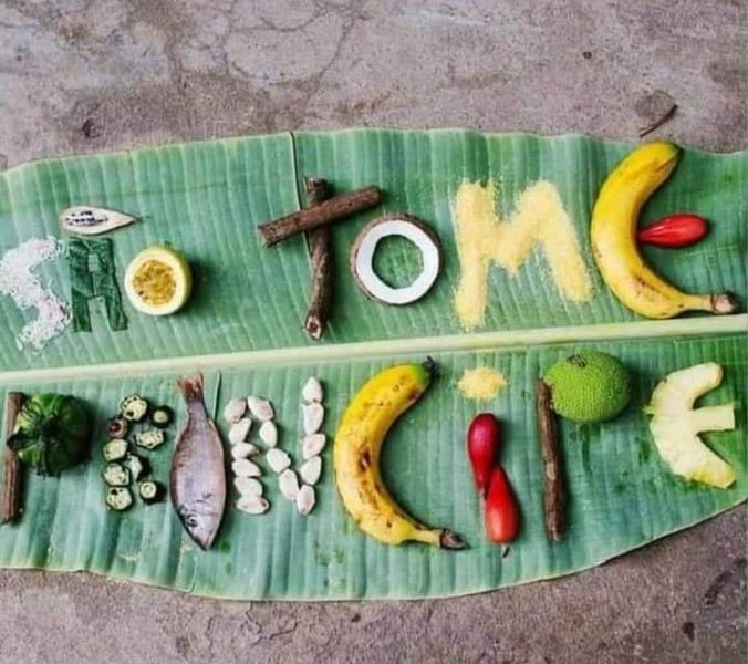
"Ah, here it is at last—that sweet scent of elsewhere so dear to Cricri and Lulu’s noses, that mix of apprehension and desire when facing the unknown.
We’re really diving into the unknown this time, taking you to the island of SAO TOMÉ... also known as the island: *‘Wait, what did you say?’* 😄. Because apparently, no one’s heard of Sao Tomé—except our Portuguese friends.
It’s an archipelago of three islands smack in the middle of the world, right on the equator, off the coast of Gabon.
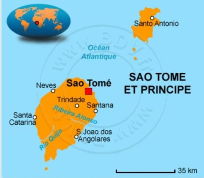
No, these aren’t the sun-soaked, Polynesian lagoon islands. Here, *‘it rains, it pours...’* pretty much all the time, it seems.
There’s not much to *‘see’* in the traditional tourist sense—EXCEPT for stunning landscapes, lush vegetation, a few beaches with golden or black sand, colonial buildings still in their original state, a single main road, and plenty of *‘tracks’* that are more or less drivable. All this surrounded by an African population that speaks Portuguese and is known for its warm welcome.
Well, that should be enough for our happiness—and hopefully yours too! 😊
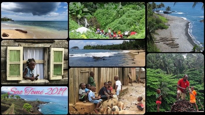
Ready for landing?
"Ah, here it is at last—that sweet scent of elsewhere so dear to Cricri and Lulu’s noses, that mix of apprehension and desire when facing the unknown.
We’re really diving into the unknown this time, taking you to the island of SAO TOMÉ... also known as the island: *‘Wait, what did you say?’* 😄. Because apparently, no one’s heard of Sao Tomé—except our Portuguese friends.
It’s an archipelago of three islands smack in the middle of the world, right on the equator, off the coast of Gabon.
No, these aren’t the sun-soaked, Polynesian lagoon islands. Here, *‘it rains, it pours...’* pretty much all the time, it seems.
There’s not much to *‘see’* in the traditional tourist sense—EXCEPT for stunning landscapes, lush vegetation, a few beaches with golden or black sand, colonial buildings still in their original state, a single main road, and plenty of *‘tracks’* that are more or less drivable. All this surrounded by an African population that speaks Portuguese and is known for its warm welcome.
Well, that should be enough for our happiness—and hopefully yours too! 😊
Ready for landing?
VoyageForum Members' 2025 Cruise Departure Calendar
hi everyone
I’ll go ahead and restart the cruise calendar for 2025 for now.
It can give people ideas and might help members meet up!
Two essential rules: don’t “quote” the calendar when replying—this’ll avoid any confusion and if you can, list your cruise in this example format: enter the month first, then date /username / SHIP / number of days / destination / departure port
FEBRUARY
14/02- poupou10 / CELEBRITY INFINITY /11 days / Greece Turkey Cyprus / Piraeus (Athens) AUGUST 01/08- poupou10 / REGAL PRINCESS /13 days / British Isles / Southampton YOUR TURN 😉 NUMBER OF CRUISES 2025: 2 JANUARY FEBRUARY 14/02- poupou10 / CELEBRITY INFINITY /11 days / Greece Turkey Cyprus / Piraeus (Athens) MARCH APRIL MAY JUNE JULY AUGUST 01/08- poupou10 / REGAL PRINCESS /13 days / British Isles / Southampton SEPTEMBER OCTOBER NOVEMBER DECEMBER
Two essential rules: don’t “quote” the calendar when replying—this’ll avoid any confusion and if you can, list your cruise in this example format: enter the month first, then date /username / SHIP / number of days / destination / departure port
FEBRUARY
14/02- poupou10 / CELEBRITY INFINITY /11 days / Greece Turkey Cyprus / Piraeus (Athens) AUGUST 01/08- poupou10 / REGAL PRINCESS /13 days / British Isles / Southampton YOUR TURN 😉 NUMBER OF CRUISES 2025: 2 JANUARY FEBRUARY 14/02- poupou10 / CELEBRITY INFINITY /11 days / Greece Turkey Cyprus / Piraeus (Athens) MARCH APRIL MAY JUNE JULY AUGUST 01/08- poupou10 / REGAL PRINCESS /13 days / British Isles / Southampton SEPTEMBER OCTOBER NOVEMBER DECEMBER
Retour aux Marquises: les îles méridionales Hiva Oa, Tahuata et Fatu Iva
INTRO
En ces temps épidémiques troublés, la Polynésie Française - et en particulier l' archipel des Marquises - ont des atouts exceptionnels en matière de tourisme. A ce jour, l' épidémie de Coronavirus a juste effleuré le Territoire -presque uniquement Tahiti et Moorea - dont les îles éloignées ont été strictement confinées dès le départ, les offres sanitaires et hospitalières sur place étant très limitées. Pour l' instant, la situation est sous contrôle.
Le tourisme retrouve lentement ses marques depuis la mi-juillet. Il s'agit actuellement plus de tourisme local que de tourisme international, bien que la destination Polynésie / Marquises soit attirante : beauté et unicité des paysages, authenticité d'un archipel, certes situé à 4 heures d'avion ATR de Tahiti, mais que l' on peut facilement découvrir en solo et donc en dehors de la très onéreuse croisière sur l' Aranui, sécurité physique mais aussi sanitaire. Les Européens - dont une majorité de Français - arrivent... Ils avaient déjà leurs billets depuis des mois et l' entrée sur le territoire est facilitée.
Nous devions faire ce second voyage aux Marquises en mai dernier, mais il fut annulé jusqu'à la reprise progressive des vols en interne.
Nous avons simplement acheté un billet Air Tahiti en ligne, sans utiliser le Pass Marquises qui ne permet pas de visiter les deux îles les plus méridionales, à savoir Tahuata et Fatu Iva, dépourvues d'aéroport. On ne peut y aller qu' en bateau, en excursion à la journée ( ou plus bien sur ) pour Tahuata et en navette municipale au départ de Hiva Oa pour aller à Fatu Iva.
Les horaires changeant fréquemment, la première chose à faire est de se renseigner sur les jours de passage vers Fatu Iva. En ce moment, il y en a trois : le lundi ( départ à 2 heures du matin ), le mardi ( départ à 6 heures ) et le samedi ( départ à 6 heures également ). Mais tout cela aura peut-être changé dans 3 mois. Il faut donc une stratégie d'approche !
On peut rajouter la visite de ces deux îles à celles qui sont incluses dans le Pass, à savoir Nuku Hiva, Ua Pou, Ua Huka et Hiva Oa. Prévoir alors une extension de 8 jours environ, à partir de Hiva Oa.
Pourquoi vouloir absolument visiter ces deux îles peu accessibles ? Justement parce qu'il faut les mériter ! Elles demeurent très différentes.
L' une, Tahuata, a un lagon, des plages de sable blanc, des falaises abruptes, des baies échancrées ourlées d'une végétation luxuriante, des couleurs uniques dans les bleus et turquoise et culmine à plus de 1000 mètres.
L' autre, Fatu Iva , est une beauté sauvage et altière avec ses à-pics qui dévalent vers l' océan bleu outremer ( ou 'moana' en tahitien ), connue surtout pour sa fameuse baie des Vierges, considérée par beaucoup - en particulier les navigateurs - comme la plus belle île de Polynésie.
Dans mon premier carnet sur les Marquises, j' avais déjà mentionné notre séjour à Hiva Oa, un peu trop court. Cette fois, entre notre arrivée et notre retour, nous passerons 4 nuits à Hiva Oa et 4 nuits à Fatu Iva. Une journée et demie sera consacrée aussi à Hiva Oa.
Avant de partir à la découverte de ces îles polynésiennes lointaines et peu visitées, quelques chiffres édifiants qui montrent que les Marquises ont échappé de peu à l' oubli, à la perte de leur identité singulière et à la disparition de leur culture. L' archipel comptait 20000 habitants en 1842, seulement 2000 en 1920, environ 8000 actuellement en 2020. Au début des années 1920, c'est grâce à la politique nataliste du Dr Rollin, administrateur des Marquises de l' époque, que la situation commença lentement à s' améliorer. Ensuite et paradoxalement, ce fut un évêque, Mgr Lecleac'h, qui s'érigea en animateur engagé du réveil identitaire, via la sauvegarde du patrimoine, la reconnaissance de la langue marquisienne ( et non tahitienne ), les danses ( jugées trop lascives par les missionnaires ), les chants, le tatouage, enfin l' artisanat inspiré des motifs et des symboles de la culture ancienne. L' icône du renouveau marquisien est sans conteste le tiki, demi-dieu et créateur de l' homme. En lui réside la divinité et les ancêtres légendaires.

TAHUATA ou Île Lumière
DANS LA LEGENDE DES MARQUISES C' est la plus petite île habitée des Marquises dont le nom signifie l' aube en marquisien. J' aurai, plus tard, l' occasion de revenir sur la légende de la création des Marquises : dans cette légende, Tahuata représente le dernier acte de la construction avant l' aube. La symbolique de son nom est liée à l' arrivée de la lumière du jour, signifiant la fin de la construction de la 'Grande Maison', alias l' archipel des Marquises.
UN PEU DE GEOLOGIE Tahuata et Fatu Iva sont soeurs géologiquement parlant. Ce sont des îles plus jeunes que celles du nord de l' archipel ( de 5, 5 millions d'années au Nord-Ouest à seulement 1,2 million d'années au Sud-Est ) L' activité volcanique passée s' est matérialisée sous la forme de volcans dits boucliers, différents des volcans hawaiïens ou tahitiens, qui , suite à des secousses sismiques violentes et répétées, se sont peu à peu effondrés, disparaissant sous les flots de la moitié voire davantage des boucliers initiaux. Résultat : les calderas sont imbriquées l'une dans l' autre , la caldeira initiale étant dotée d'un volcan interne plus petit et plus récent. C 'est le cas à Fatu Iva par exemple.
UN PEU DE GEOGRAPHIE
Située à seulement 4 kms de Hiva Oa , on ne peut rejoindre Tahuata que par mer après 40 à 60 mn de navigation selon le temps ( il existe un catamaran communal, le Tahuata Nui mais qui est souvent en panne pour une durée indéterminée... ). On choisira entre l' excursion à la journée ou le passage simple en speedboat privé, assez cher. Ou si l' on doit résider à Tahuata, on s'arrangera au préalable avec la pension de famille choisie pour discuter des modalités et du prix de la course aller-retour entre Tahuata et Hiva Oa. Le canal dit du Bordelais qui est emprunté par les bateaux peut être extrêmement agité par des courants violents et rallonger un peu la course. (Petite digression sur ce fameux canal du Bordelais... Qui est donc ce Bordelais ? Un certain Joseph Capri ( ou Kabri ou Kabris ), originaire de Bordeaux même, initialement matelot de son état sur un bâtiment baleinier qui fait naufrage sur la côte de Nuku Hiva. Kabri , capturé par les guerriers du roi anthropophage de NH, s'apprête à mourir et à finir rôti à la broche, mais est sauvé in extremis par la fille du roi qui demande sa grâce. Celle-ci est accordée, il épouse la belle dans la foulée, le roi tatoue son gendre lui-même, lui offre des parures en tapa et mousse et le nomme grand juge du pays. Il tue, torture, garrotte, découpe en morceaux. Il pacifie à sa manière ! La vie est douce et belle, il a six enfants de sa princesse marquisienne ... Et puis un jour où il sommeille dans la nature, il est kidnappé par le navigateur russe Krunsenstern qui, à coups de knout, le ramène au navire puis à St Petersbourg pour y être interrogé et jugé. Kabri parvient à s' échapper vers Paris, demande à rencontrer Louis XVIII qu'il traite comme son cousin. Ce dernier - contre toute attente - le reçoit et lui donne un peu d'argent, mais la chance a définitivement tourné pour Kabri qui se retrouve à Valenciennes, gagnant son pain comme bête de foire. Il mourra à 42 ans, épuisé et sans avoir pu repartir vers son île marquisienne et vers sa famille nombreuse. Les autorités lui éviteront post mortem l' infamie d'une exhumation et d'un empaillage, son tatouage corporel et facial ayant conquis un amateur !!!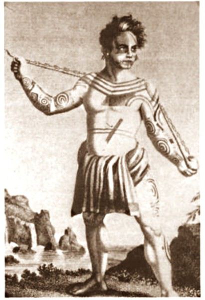 JB Kabri le Tatoué, dessin publié dans le livre de Von Langsdorff
Retour à Tahuata... L' île n'est entourée que partiellement de récifs coralliens ( comme Mangareva aux îles Gambier ) , et est agrémentée de magnifiques plages de sable blanc, en particulier celle de Hanamoenoa. Avec ses versants escarpés se terminant en falaises, des vallées étroites et profondes ouvrant sur des baies échancrées à la végétation dense telles celles jumelles de Iva Iva Nui et de Iva Iva Iti, Tahuata surprend et attire. ' C'est une des rares fois où j' eus le désir de posséder de la terre ', écrivit en son temps le navigateur Alain Gerbault, conquis par une île qu'il qualifiait d'enchanteresse. Son relief est très accidenté et les communications terrestres - sur des pistes improbables - entre les vallées sont difficiles. L' île culmine au Mont Tumu-Mea-Ufa à 1050 m. Sa superficie est de 60 km2, avec une population de 650 à 700 habitants environ. L' île comporte 4 villages : Vaitahu, petit port historique, avec son église aux murs de galets et un magnifique vitrail, son musée d'art et d'histoire, et sa proximité avec des sites archéologiques; Hapatoni, autre village avec sa voie pavée ou ' allée de la reine ', construite sur ordre de la reine Vaekehu II au 19ème siècle, bordée d'arbres centenaires de tamanu plantés par les anciens , et ses ' me'ae ' ( ou ' marae ' en tahitien). Egalement Motopu et Hanatetena, deux plus petits villages. Il y a d'autres chemins pavés dans l' île, à Hapatoni en particulier, et des pétroglyphes à Hanatahua. On peut donc passer plus d'une journée à Tahuata, y séjourner dans l' une de ses pensions. Les chemins et pistes de l' île se prêtent parfaitement à la randonnée pédestre.
UN PEU D HISTOIRE
Plusieurs édifices du village de Vaitahu commémorent un passé souvent tragique. On peut y voir les trois stèles érigées en souvenir de l' arrivée des Espagnols en 1595, puis de celle de militaires français en 1838 et enfin de la prise de possession de l' archipel par l' amiral Abel Dupetit-Thouars en 1842. Alvaro de Mendaña y Neira jeta l' ancre à Vaitahu en 1595, un premier contact avec ceux que l' on appelait à l' époque dans les mers du Sud et ailleurs ' les naturels ' qui tourna rapidement au massacre par les soldats espagnols de 200 villageois, guerriers et civils mélangés. On peut comprendre, dans ce contexte, que l' arrivée d'Occidentaux au 18ème siècle et au début du 19ème siècle ait suscité beaucoup de méfiance, d'animosité et d'hostilité de la part des habitants de Tahuata, et des autres îles également. Les premières tentatives d' évangélisation protestante d'abord en 1797 puis catholique en 1839 se soldèrent par un échec retentissant ( le gouvernement français avait l' habitude d'envoyer les missionnaires en éclaireurs afin de tâter le terrain.. ). Le religieux ayant failli à sa mission, il restait donc le politique et le militaire : l' expédition Dupetit-Thouars arrive en vue de Tahuata mi - avril 1842. Les Français sont dans un premier temps plutôt bien reçus par le chef / roi Iotete qui a récemment subi la pression de la marine américaine et qui se dit que la France le protégera. On attribue donc un terrain en hauteur aux Français pour la construction d'un fortin et d'une garnison. Dupetit-Thouars veut aller vite et propose à Iotete de se mettre sous la protection du roi de France, Louis-Philippe. Iotete accepte et, le 1er mai, est organisée une cérémonie pour la prise de possession officielle des îles Sud de l' archipel des Marquises - et par extension de tout l' archipel - par la France en présence des missionnaires et du neveu de Iotete, Maheono, également chef de Hanatetena. Et puis rapidement, un malaise grandissant s'installe, l' ambiance se dégrade, Iotete devient peu accommodant et versatile, ne supportant pas de se voir privé de son autorité de chef incontesté. Il fugue dans la montagne, organise la résistance aux Français que l' on vient pourtant de fêter, et finit par assiéger le fortin à moitié achevé avec ses guerriers. Résultat : des morts et des blessés des deux côtés et un chaos inattendu. Après palabres et promesses, l' amiral, fidèle à sa stratégie initiale, convainc Iotete - contacté et ramené à la raison par son neveu - de revenir à la table des négociations, et les termes d' une paix durable sont établis définitivement. Iotete a tenté de lutter mais a perdu et la guerre et son pouvoir, son ' mana '. Il mourra l' année suivante, une fin triste et sans avenir pour un chef qui ne sera pas élevé au rang de dieu le jour de ses funérailles.
 Prise de possession officielle de Tahuata
De g. à d. : Maheono, Iotete ( en habit militaire d'apparat à galons d'or époque Louis XV ), le père Baudichon, Abel Dupetit-Thouars
Prise de possession officielle de Tahuata
De g. à d. : Maheono, Iotete ( en habit militaire d'apparat à galons d'or époque Louis XV ), le père Baudichon, Abel Dupetit-Thouars
 Iotete le 1er Mais 1842 ( portrait par Max Radiguet )
 Iotete le 1er mai 1842 ( portrait par Max Radiguet )
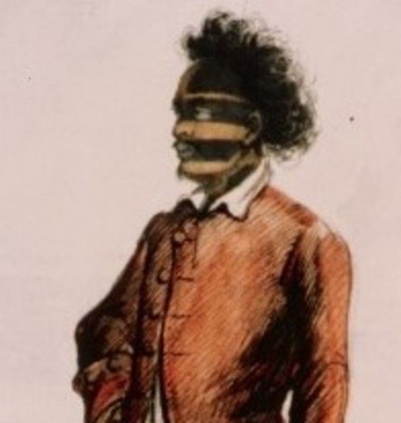 Maheono, neveu de Iotete et son saisissant tatouage facial
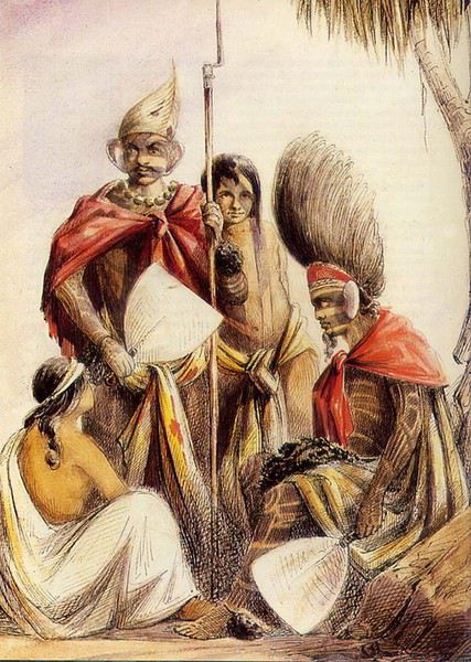 Guerriers marquisiens 19ème siècle
L' amiral repart bientôt sur son navire La Reine Blanche vers Tahiti où il va obtenir le 9 septembre 1842 de la reine Pomaré IV son acceptation formelle de placer son île sous protectorat français. C' est ainsi que Les Marquises alias La Terre des Hommes ( ou Te Fenua Enata en marquisien ) devient la première colonie française dans le Pacifique Sud un peu avant Tahiti.
FAUNE ET FLORE Depuis sa disparition de Hiva Oa, suite à l' introduction malheureuse d'un rapace nocturne, le grand-duc de Virginie ( ou Bubo Virginiasus en latin ), la seule population survivante de ' pahi ' ou martin-chasseur des Marquises, vit à Tahuata, en grand danger d'extinction, car en déclin lent mais constant. il ne resterait que 300 individus au mieux. La destruction du grand-duc est autorisée à cause de son impact fatal sur la faune aviaire locale. Des excursions à pied et à cheval, en excursion à la demi-journée ou à la journée entière, à la découverte du ' pahi ' sont possibles. Contacter le comité de tourisme de Tahuata.
ACTIVITES TRADITIONNELLES
Il y a à Tahuata plusieurs centres d'artisanat et ce dernier est le plus réputé des Marquises, en particulier pour la sculpture sur os. Dans l' île, on est souvent sculpteur de père en fils; les hommes travaillent le bois de rose, l' os de cheval, de chèvre et de mouton et le rostre d'espadon. Dans la vallée d'Hapatoni, ce sont surtout d' expertes sculptrices qui sont à l' oeuvre, souvent depuis des années. Au travail de l' os ou du rostre d'espadon, elles ajoutent la confection de bijoux originaux. La culture du coprah est bien présente à Tahuata et permet aux agriculteurs de gagner un revenu fixe. Les cultures vivrières et les récoltes d'agrumes tels les pamplemousses, très réputés permettent l' autosuffisance alimentaire des habitants de l' île et un peu d'exportation vers le marché et les supermarchés de Papeete ( via la diaspora marquisienne installée à Tahiti ). Pêche et chasse participent également, pleinement, de ce désir d'autosuffisance. La nature est généreuse et tout pousse à profusion et l' on vit simplement mais plutôt bien à Tahuata comme ailleurs aux Marquises, d'autant que désormais, les cargos mixtes apportent régulièrement de Tahiti ce qui manque aux îliens.
Fatu Iva L' île de tous les superlatifs / L'île érotique

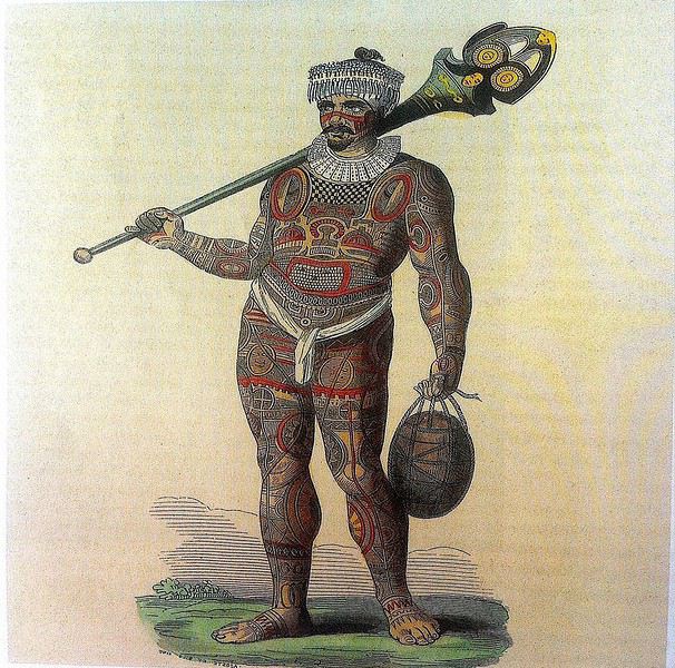
Guerrier marquisien tatoué originaire de Fatu Iva 19ème siècle On notera sur sa poitrine les motifs reconstitués d'une tête de tiki, que l' on retrouve aussi sur la crosse du casse-tête ( ou ' u'u ' en marquisien ), arme réservée au guerrier. Cette tête est supposée augmenter le ' mana ' ( alias la puissance ), les yeux en amande évoquent cette puissance surnaturelle tandis que la bouche étirée où apparaissent parfois langue et dents, est censée défier l' adversaire.
SELON LA LEGENDE Dans la légende de la construction de l' archipel des Marquises, selon laquelle chaque île est partie intégrante de la Maison des Dieux, Fatu Iva représente la toiture faite de 9 ( Iva ) tresses ( Fatu ) de feuilles de palmier. Elle s'est aussi appelée Santa Magdalena, nom donné par Alvaro de Mendaña en l' honneur de la sainte du même nom.
UN PEU DE GEOGRAPHIE Fatu Iva est une île située à 75 kms de Hiva Oa, d'une superficie de 84 km2. Longue de 10 kilomètres et large de 4, elle a la forme d'un croissant ou d'un haricot. Elle culmine au Mont Touaouoho à 960 mètres et héberge une population d'environ 600 habitants. C' est l' île la plus australe de l' archipel, la plus isolée aussi car il est impossible d'y construire un aéroport en raison du relief accidenté ou même un aérodrome comme à Ua Pou par exemple. C' est aussi la plus pluvieuse, étant la plus proche du tropique du Capricorne. Les pluies étant abondantes, l' île est recouverte d'une végétation luxuriante en particulier en son centre où prospère une forêt primaire tropicale dense. C' est aussi l'île la plus sauvage et la plus spectaculaire de l' archipel. Géologiquement parlant, elle est constituée de deux caldeiras volcaniques enchâssées l' une dans l' autre. La première date de 2 millions d'années environ, la seconde, deux fois plus petite est née d'une énorme éruption, comme en témoignent les massives chandelles basaltiques qui montent au ciel tout autour de la baie de Hanavave, dite baie des Vierges. Initialement appelée baie des Verges par les Marquisiens, elle a été rebaptisée par de pudibonds missionnaires, effarouchés par l' imagerie locale et ses sous-entendus. Fatu Iva n' a que deux villages situées chacun sur le bord extérieur des deux caldeiras : Hanavave aux colonnes basaltiques et Omoa, chef-lieu de l' île , village surplombé par un piton rocheux qui surprend par son profil rappelant la tête d'un moai de l' île de Pâques.
UN PEU D'HISTOIRE Comme les autres îles de l' archipel, Fatu Iva fut initialement peuplée par des Polynésiens venus de l' ouest. Les rivalités entre tribus étaient au départ incessantes et donnèrent lieu à des batailles sanglantes. C' est en juillet 1595 que l'île - tout comme celle de Tahuata - fut abordée pour la première fois par un occidental, le navigateur espagnol Alvaro de Mendaña de Neira , le premier du genre à avoir établi des contacts avec des populations polynésiennes. Mais il n' y débarqua pas. Il crût tout d'abord avoir découvert les Iles Salomon, le but ultime de son voyage, mais se rendit rapidement compte qu' il avait découvert une nouvelle terre dans un archipel d' îles auxquelles il donna le nom de ' Marquesas de Mendoza ' pour remercier le Vice-Roi du Pérou - alias Garcia Hurtado de Mendoza y Maurique, IV marquis de Cañete - qui l' avait aidé à monter et financer son expédition, et pour honorer en même temps son épouse et ses filles. En 1935, l' anthropologue norvégien Thor Heyerdahl - et futur aventurier du Kon Tiki - aborda Fatu Iva avec l' idée bien ancrée d' en faire son éden. Il y vécut un an avec sa femme, d'abord à Omoa, puis à Ouia, une vallée inconfortablement située sur la côte au vent et désormais retournée à l' état naturel, ayant été abandonnée par ses quelques habitants. Heyerdahl avait à l' époque avancé l' hypothèse erronée que les Maori descendaient des Indiens d'Amérique du Sud alors qu'ils sont originellement arrivés en pirogue de l' Asie du Sud-Est, et plus particulièrement de Taïwan. ( Je vous renvoie à mon carnet sur Taïwan où j' aborde ce sujet )
De 1960 à 1966, une majorité d'hommes de Fatu Iva partirent travailler au CEP de Mururoa, participant ainsi de l' émigration économique ayant commencé à l' époque, et s'étant poursuivie jusqu'à nos jours, les perspectives en termes d' emploi étant plus que limitées si l' on ne veut pas rester ou devenir agriculteur ou coprahculteur comme ses parents ou grands-parents.
FAUNE ET FLORE L' île est une terre d'abondance pour les agrumes, les fruits en général et les fleurs... Tout pousse ou presque. Elle possède une espèce endémique très menacée aujourd'hui : le Monarque ( ou oma'o ke'eke'e en marquisien ', dont il ne restait il y a peu que 6 couples au monde ! Le rat noir et le chat haret ont littéralement décimé cette espèce, dévorant oeufs, oisillons et même femelles en couvaison. Un programme de sauvegarde de l' espèce a été mis en place, avec des résultats encourageants, le nombre de couples ayant augmenté ces dernières années.
ECONOMIE L' île est ravitaillée uniquement par bateau. Une unique route partiellement bétonnée des deux côtés, et partiellement à l' état de piste, et longue de 17 kilomètres relie les deux villages. On peut également aller d'un village à l' autre par la mer en un quart d'heure de navigation. Le secteur primaire prévaut à Fatu Iva, en particulier la culture du coprah, et puis la pêche au thon, à l' espadon et au thazard. On y a cultivé le noni à outrance à une certaine époque mais celle-ci est un peu révolue, les bienfaits miraculeux du noni n' ayant pas vraiment été prouvés scientifiquement. Comme à Rurutu, on a abandonné la culture du café qui était pourtant prometteuse il y a une quarantaine d'années. En revanche, on trouve davantage de vergers et des vanillières. La chasse aux cochons et aux chèvres permet l' auto-suffisance en viande quand le ravitaillement venu de Tahiti vient à manquer ou arrive irrégulièrement. L' artisanat s'est développé grâce au tourisme et aux expositions semestrielles organisées à Papeete. La spécialité - principalement féminine - de Fatu Iva est le tapa dont les dessins s'inspirent des anciens tatouages marquisiens. La sculpture sur bois ou os ou noix de coco est plutôt réservée aux hommes, nourrie des anciennes figures et des symboles centenaires : tikis sculptés en bois de rose ou en bois noir, casse-tête, plats de présentation.
Suivez-moi en page 2.....
TAHUATA ou Île Lumière
DANS LA LEGENDE DES MARQUISES C' est la plus petite île habitée des Marquises dont le nom signifie l' aube en marquisien. J' aurai, plus tard, l' occasion de revenir sur la légende de la création des Marquises : dans cette légende, Tahuata représente le dernier acte de la construction avant l' aube. La symbolique de son nom est liée à l' arrivée de la lumière du jour, signifiant la fin de la construction de la 'Grande Maison', alias l' archipel des Marquises.
UN PEU DE GEOLOGIE Tahuata et Fatu Iva sont soeurs géologiquement parlant. Ce sont des îles plus jeunes que celles du nord de l' archipel ( de 5, 5 millions d'années au Nord-Ouest à seulement 1,2 million d'années au Sud-Est ) L' activité volcanique passée s' est matérialisée sous la forme de volcans dits boucliers, différents des volcans hawaiïens ou tahitiens, qui , suite à des secousses sismiques violentes et répétées, se sont peu à peu effondrés, disparaissant sous les flots de la moitié voire davantage des boucliers initiaux. Résultat : les calderas sont imbriquées l'une dans l' autre , la caldeira initiale étant dotée d'un volcan interne plus petit et plus récent. C 'est le cas à Fatu Iva par exemple.
UN PEU DE GEOGRAPHIE
Située à seulement 4 kms de Hiva Oa , on ne peut rejoindre Tahuata que par mer après 40 à 60 mn de navigation selon le temps ( il existe un catamaran communal, le Tahuata Nui mais qui est souvent en panne pour une durée indéterminée... ). On choisira entre l' excursion à la journée ou le passage simple en speedboat privé, assez cher. Ou si l' on doit résider à Tahuata, on s'arrangera au préalable avec la pension de famille choisie pour discuter des modalités et du prix de la course aller-retour entre Tahuata et Hiva Oa. Le canal dit du Bordelais qui est emprunté par les bateaux peut être extrêmement agité par des courants violents et rallonger un peu la course. (Petite digression sur ce fameux canal du Bordelais... Qui est donc ce Bordelais ? Un certain Joseph Capri ( ou Kabri ou Kabris ), originaire de Bordeaux même, initialement matelot de son état sur un bâtiment baleinier qui fait naufrage sur la côte de Nuku Hiva. Kabri , capturé par les guerriers du roi anthropophage de NH, s'apprête à mourir et à finir rôti à la broche, mais est sauvé in extremis par la fille du roi qui demande sa grâce. Celle-ci est accordée, il épouse la belle dans la foulée, le roi tatoue son gendre lui-même, lui offre des parures en tapa et mousse et le nomme grand juge du pays. Il tue, torture, garrotte, découpe en morceaux. Il pacifie à sa manière ! La vie est douce et belle, il a six enfants de sa princesse marquisienne ... Et puis un jour où il sommeille dans la nature, il est kidnappé par le navigateur russe Krunsenstern qui, à coups de knout, le ramène au navire puis à St Petersbourg pour y être interrogé et jugé. Kabri parvient à s' échapper vers Paris, demande à rencontrer Louis XVIII qu'il traite comme son cousin. Ce dernier - contre toute attente - le reçoit et lui donne un peu d'argent, mais la chance a définitivement tourné pour Kabri qui se retrouve à Valenciennes, gagnant son pain comme bête de foire. Il mourra à 42 ans, épuisé et sans avoir pu repartir vers son île marquisienne et vers sa famille nombreuse. Les autorités lui éviteront post mortem l' infamie d'une exhumation et d'un empaillage, son tatouage corporel et facial ayant conquis un amateur !!!
JB Kabri le Tatoué, dessin publié dans le livre de Von LangsdorffRetour à Tahuata... L' île n'est entourée que partiellement de récifs coralliens ( comme Mangareva aux îles Gambier ) , et est agrémentée de magnifiques plages de sable blanc, en particulier celle de Hanamoenoa. Avec ses versants escarpés se terminant en falaises, des vallées étroites et profondes ouvrant sur des baies échancrées à la végétation dense telles celles jumelles de Iva Iva Nui et de Iva Iva Iti, Tahuata surprend et attire. ' C'est une des rares fois où j' eus le désir de posséder de la terre ', écrivit en son temps le navigateur Alain Gerbault, conquis par une île qu'il qualifiait d'enchanteresse. Son relief est très accidenté et les communications terrestres - sur des pistes improbables - entre les vallées sont difficiles. L' île culmine au Mont Tumu-Mea-Ufa à 1050 m. Sa superficie est de 60 km2, avec une population de 650 à 700 habitants environ. L' île comporte 4 villages : Vaitahu, petit port historique, avec son église aux murs de galets et un magnifique vitrail, son musée d'art et d'histoire, et sa proximité avec des sites archéologiques; Hapatoni, autre village avec sa voie pavée ou ' allée de la reine ', construite sur ordre de la reine Vaekehu II au 19ème siècle, bordée d'arbres centenaires de tamanu plantés par les anciens , et ses ' me'ae ' ( ou ' marae ' en tahitien). Egalement Motopu et Hanatetena, deux plus petits villages. Il y a d'autres chemins pavés dans l' île, à Hapatoni en particulier, et des pétroglyphes à Hanatahua. On peut donc passer plus d'une journée à Tahuata, y séjourner dans l' une de ses pensions. Les chemins et pistes de l' île se prêtent parfaitement à la randonnée pédestre.
UN PEU D HISTOIRE
Plusieurs édifices du village de Vaitahu commémorent un passé souvent tragique. On peut y voir les trois stèles érigées en souvenir de l' arrivée des Espagnols en 1595, puis de celle de militaires français en 1838 et enfin de la prise de possession de l' archipel par l' amiral Abel Dupetit-Thouars en 1842. Alvaro de Mendaña y Neira jeta l' ancre à Vaitahu en 1595, un premier contact avec ceux que l' on appelait à l' époque dans les mers du Sud et ailleurs ' les naturels ' qui tourna rapidement au massacre par les soldats espagnols de 200 villageois, guerriers et civils mélangés. On peut comprendre, dans ce contexte, que l' arrivée d'Occidentaux au 18ème siècle et au début du 19ème siècle ait suscité beaucoup de méfiance, d'animosité et d'hostilité de la part des habitants de Tahuata, et des autres îles également. Les premières tentatives d' évangélisation protestante d'abord en 1797 puis catholique en 1839 se soldèrent par un échec retentissant ( le gouvernement français avait l' habitude d'envoyer les missionnaires en éclaireurs afin de tâter le terrain.. ). Le religieux ayant failli à sa mission, il restait donc le politique et le militaire : l' expédition Dupetit-Thouars arrive en vue de Tahuata mi - avril 1842. Les Français sont dans un premier temps plutôt bien reçus par le chef / roi Iotete qui a récemment subi la pression de la marine américaine et qui se dit que la France le protégera. On attribue donc un terrain en hauteur aux Français pour la construction d'un fortin et d'une garnison. Dupetit-Thouars veut aller vite et propose à Iotete de se mettre sous la protection du roi de France, Louis-Philippe. Iotete accepte et, le 1er mai, est organisée une cérémonie pour la prise de possession officielle des îles Sud de l' archipel des Marquises - et par extension de tout l' archipel - par la France en présence des missionnaires et du neveu de Iotete, Maheono, également chef de Hanatetena. Et puis rapidement, un malaise grandissant s'installe, l' ambiance se dégrade, Iotete devient peu accommodant et versatile, ne supportant pas de se voir privé de son autorité de chef incontesté. Il fugue dans la montagne, organise la résistance aux Français que l' on vient pourtant de fêter, et finit par assiéger le fortin à moitié achevé avec ses guerriers. Résultat : des morts et des blessés des deux côtés et un chaos inattendu. Après palabres et promesses, l' amiral, fidèle à sa stratégie initiale, convainc Iotete - contacté et ramené à la raison par son neveu - de revenir à la table des négociations, et les termes d' une paix durable sont établis définitivement. Iotete a tenté de lutter mais a perdu et la guerre et son pouvoir, son ' mana '. Il mourra l' année suivante, une fin triste et sans avenir pour un chef qui ne sera pas élevé au rang de dieu le jour de ses funérailles.
Prise de possession officielle de Tahuata
De g. à d. : Maheono, Iotete ( en habit militaire d'apparat à galons d'or époque Louis XV ), le père Baudichon, Abel Dupetit-Thouars
Iotete le 1er Mais 1842 ( portrait par Max Radiguet )
Iotete le 1er mai 1842 ( portrait par Max Radiguet )
Maheono, neveu de Iotete et son saisissant tatouage facial
Guerriers marquisiens 19ème siècleL' amiral repart bientôt sur son navire La Reine Blanche vers Tahiti où il va obtenir le 9 septembre 1842 de la reine Pomaré IV son acceptation formelle de placer son île sous protectorat français. C' est ainsi que Les Marquises alias La Terre des Hommes ( ou Te Fenua Enata en marquisien ) devient la première colonie française dans le Pacifique Sud un peu avant Tahiti.
FAUNE ET FLORE Depuis sa disparition de Hiva Oa, suite à l' introduction malheureuse d'un rapace nocturne, le grand-duc de Virginie ( ou Bubo Virginiasus en latin ), la seule population survivante de ' pahi ' ou martin-chasseur des Marquises, vit à Tahuata, en grand danger d'extinction, car en déclin lent mais constant. il ne resterait que 300 individus au mieux. La destruction du grand-duc est autorisée à cause de son impact fatal sur la faune aviaire locale. Des excursions à pied et à cheval, en excursion à la demi-journée ou à la journée entière, à la découverte du ' pahi ' sont possibles. Contacter le comité de tourisme de Tahuata.
ACTIVITES TRADITIONNELLES
Il y a à Tahuata plusieurs centres d'artisanat et ce dernier est le plus réputé des Marquises, en particulier pour la sculpture sur os. Dans l' île, on est souvent sculpteur de père en fils; les hommes travaillent le bois de rose, l' os de cheval, de chèvre et de mouton et le rostre d'espadon. Dans la vallée d'Hapatoni, ce sont surtout d' expertes sculptrices qui sont à l' oeuvre, souvent depuis des années. Au travail de l' os ou du rostre d'espadon, elles ajoutent la confection de bijoux originaux. La culture du coprah est bien présente à Tahuata et permet aux agriculteurs de gagner un revenu fixe. Les cultures vivrières et les récoltes d'agrumes tels les pamplemousses, très réputés permettent l' autosuffisance alimentaire des habitants de l' île et un peu d'exportation vers le marché et les supermarchés de Papeete ( via la diaspora marquisienne installée à Tahiti ). Pêche et chasse participent également, pleinement, de ce désir d'autosuffisance. La nature est généreuse et tout pousse à profusion et l' on vit simplement mais plutôt bien à Tahuata comme ailleurs aux Marquises, d'autant que désormais, les cargos mixtes apportent régulièrement de Tahiti ce qui manque aux îliens.
Fatu Iva L' île de tous les superlatifs / L'île érotique
Guerrier marquisien tatoué originaire de Fatu Iva 19ème siècle On notera sur sa poitrine les motifs reconstitués d'une tête de tiki, que l' on retrouve aussi sur la crosse du casse-tête ( ou ' u'u ' en marquisien ), arme réservée au guerrier. Cette tête est supposée augmenter le ' mana ' ( alias la puissance ), les yeux en amande évoquent cette puissance surnaturelle tandis que la bouche étirée où apparaissent parfois langue et dents, est censée défier l' adversaire.
SELON LA LEGENDE Dans la légende de la construction de l' archipel des Marquises, selon laquelle chaque île est partie intégrante de la Maison des Dieux, Fatu Iva représente la toiture faite de 9 ( Iva ) tresses ( Fatu ) de feuilles de palmier. Elle s'est aussi appelée Santa Magdalena, nom donné par Alvaro de Mendaña en l' honneur de la sainte du même nom.
UN PEU DE GEOGRAPHIE Fatu Iva est une île située à 75 kms de Hiva Oa, d'une superficie de 84 km2. Longue de 10 kilomètres et large de 4, elle a la forme d'un croissant ou d'un haricot. Elle culmine au Mont Touaouoho à 960 mètres et héberge une population d'environ 600 habitants. C' est l' île la plus australe de l' archipel, la plus isolée aussi car il est impossible d'y construire un aéroport en raison du relief accidenté ou même un aérodrome comme à Ua Pou par exemple. C' est aussi la plus pluvieuse, étant la plus proche du tropique du Capricorne. Les pluies étant abondantes, l' île est recouverte d'une végétation luxuriante en particulier en son centre où prospère une forêt primaire tropicale dense. C' est aussi l'île la plus sauvage et la plus spectaculaire de l' archipel. Géologiquement parlant, elle est constituée de deux caldeiras volcaniques enchâssées l' une dans l' autre. La première date de 2 millions d'années environ, la seconde, deux fois plus petite est née d'une énorme éruption, comme en témoignent les massives chandelles basaltiques qui montent au ciel tout autour de la baie de Hanavave, dite baie des Vierges. Initialement appelée baie des Verges par les Marquisiens, elle a été rebaptisée par de pudibonds missionnaires, effarouchés par l' imagerie locale et ses sous-entendus. Fatu Iva n' a que deux villages situées chacun sur le bord extérieur des deux caldeiras : Hanavave aux colonnes basaltiques et Omoa, chef-lieu de l' île , village surplombé par un piton rocheux qui surprend par son profil rappelant la tête d'un moai de l' île de Pâques.
UN PEU D'HISTOIRE Comme les autres îles de l' archipel, Fatu Iva fut initialement peuplée par des Polynésiens venus de l' ouest. Les rivalités entre tribus étaient au départ incessantes et donnèrent lieu à des batailles sanglantes. C' est en juillet 1595 que l'île - tout comme celle de Tahuata - fut abordée pour la première fois par un occidental, le navigateur espagnol Alvaro de Mendaña de Neira , le premier du genre à avoir établi des contacts avec des populations polynésiennes. Mais il n' y débarqua pas. Il crût tout d'abord avoir découvert les Iles Salomon, le but ultime de son voyage, mais se rendit rapidement compte qu' il avait découvert une nouvelle terre dans un archipel d' îles auxquelles il donna le nom de ' Marquesas de Mendoza ' pour remercier le Vice-Roi du Pérou - alias Garcia Hurtado de Mendoza y Maurique, IV marquis de Cañete - qui l' avait aidé à monter et financer son expédition, et pour honorer en même temps son épouse et ses filles. En 1935, l' anthropologue norvégien Thor Heyerdahl - et futur aventurier du Kon Tiki - aborda Fatu Iva avec l' idée bien ancrée d' en faire son éden. Il y vécut un an avec sa femme, d'abord à Omoa, puis à Ouia, une vallée inconfortablement située sur la côte au vent et désormais retournée à l' état naturel, ayant été abandonnée par ses quelques habitants. Heyerdahl avait à l' époque avancé l' hypothèse erronée que les Maori descendaient des Indiens d'Amérique du Sud alors qu'ils sont originellement arrivés en pirogue de l' Asie du Sud-Est, et plus particulièrement de Taïwan. ( Je vous renvoie à mon carnet sur Taïwan où j' aborde ce sujet )
De 1960 à 1966, une majorité d'hommes de Fatu Iva partirent travailler au CEP de Mururoa, participant ainsi de l' émigration économique ayant commencé à l' époque, et s'étant poursuivie jusqu'à nos jours, les perspectives en termes d' emploi étant plus que limitées si l' on ne veut pas rester ou devenir agriculteur ou coprahculteur comme ses parents ou grands-parents.
FAUNE ET FLORE L' île est une terre d'abondance pour les agrumes, les fruits en général et les fleurs... Tout pousse ou presque. Elle possède une espèce endémique très menacée aujourd'hui : le Monarque ( ou oma'o ke'eke'e en marquisien ', dont il ne restait il y a peu que 6 couples au monde ! Le rat noir et le chat haret ont littéralement décimé cette espèce, dévorant oeufs, oisillons et même femelles en couvaison. Un programme de sauvegarde de l' espèce a été mis en place, avec des résultats encourageants, le nombre de couples ayant augmenté ces dernières années.
ECONOMIE L' île est ravitaillée uniquement par bateau. Une unique route partiellement bétonnée des deux côtés, et partiellement à l' état de piste, et longue de 17 kilomètres relie les deux villages. On peut également aller d'un village à l' autre par la mer en un quart d'heure de navigation. Le secteur primaire prévaut à Fatu Iva, en particulier la culture du coprah, et puis la pêche au thon, à l' espadon et au thazard. On y a cultivé le noni à outrance à une certaine époque mais celle-ci est un peu révolue, les bienfaits miraculeux du noni n' ayant pas vraiment été prouvés scientifiquement. Comme à Rurutu, on a abandonné la culture du café qui était pourtant prometteuse il y a une quarantaine d'années. En revanche, on trouve davantage de vergers et des vanillières. La chasse aux cochons et aux chèvres permet l' auto-suffisance en viande quand le ravitaillement venu de Tahiti vient à manquer ou arrive irrégulièrement. L' artisanat s'est développé grâce au tourisme et aux expositions semestrielles organisées à Papeete. La spécialité - principalement féminine - de Fatu Iva est le tapa dont les dessins s'inspirent des anciens tatouages marquisiens. La sculpture sur bois ou os ou noix de coco est plutôt réservée aux hommes, nourrie des anciennes figures et des symboles centenaires : tikis sculptés en bois de rose ou en bois noir, casse-tête, plats de présentation.
Suivez-moi en page 2.....