Results for "Ouest+de+la+France+itinéraire"
About 119,642 results.
More options
Many results are in French, the community’s main language. English translations are added over time.
Search results
De Perth à Darwin: 4 semaines de road trip en septembre/octobre 2018
Bonjour,
Après m'être maintes fois inspirée et régalée des carnets de voyages des autres, c'est à mon tour de me lancer.
Nous voyageons en couple avec mon mari depuis bientôt 10 ans. A chaque voyage nous tenions des carnets de voyage papiers puis nous sommes passés à un site internet en 2016. C'était à l'occasion de notre tour du monde, outre l'aspect souvenir il servait aussi à tenir informer nos proches et à partager notre quotidien. Si ça vous intéresse voici le lien : point2vues.fr . On se sert tellement des expériences des autres pour préparer nos voyages que l'étape logique était de rendre la pareille. Voici donc notre premier carnet de voyage publique !
C’était une première pour nous en Australie. Nous sommes partis de Paris le 22/09/2018 et sommes revenus le 19/10/2018. Nous avons pris deux allers simples : - Paris-Doha-Colombo-Kuala Lumpur-Perth (vive les économies !) - Darwin-Singapour-Paris
Ce voyage nous a coûté tout compris : 5570€ pour deux. Voici le détail de nos dépenses : - billets d'avion : 1677€ - voiture (location + essence) : 2246€ - Uber de l'aeroport : 14€ - nourriture : 347€ - logement : 308€ (dont 95€ d'hôtel Parisien ) - plongées : 682€ - entrées des parcs : 79€ - santé (une première!) : 95€ - souvenirs et divers extras : 99€ - courses divers (hors nourriture) :19€
Nous avons parcouru 8800 km en un peu moins de 4 semaines. Il est très facile de rouler en Australie. Nous avions emporté notre tente avec le nécessaire à trek (matelas, sac de couchages, popote, réchaud) et avons fait le plus souvent du camping sauvage (nous nous aidions des applications comme wikicamp ou campermate afin de trouver les zones autorisées). Ce qui explique le peu de dépense en logement et en nourriture. Nous avons cuisiné la plupart de nos repas. Notre plus gros budget a été celui de la voiture, surtout du fait que les agences de location surchargent le "one way" (le fait de rendre la voiture dans une ville différente de celle où on a récupéré la voiture), quasiment 1000 € pour nous, contre environ 500€ de location de voiture (un SUV : Hyundai Tucson).
Nous n'avons rencontré quasiment aucun autre voyageur qui voyageait de cette façon (tente à planter à même le sol). Ce qui est le plus rependu là-bas ce sont soit les minivans ou 4x4 aménagés soit les 4x4 avec tente sur le toit. Le 4x4 est plus qu'un luxe ici car beaucoup de routes de la côte ouest ne sont accessibles qu'aux 4x4 (on en a fait les frais avec notre SUV qui n'avait pas l'option 4x4...). On a croisé aussi pas mal de caravanes (4x4 elles aussi!) mais surtout sur la côte.
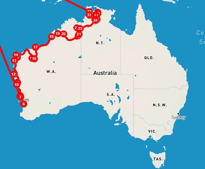
Voici notre parcours :
Après m'être maintes fois inspirée et régalée des carnets de voyages des autres, c'est à mon tour de me lancer.
Nous voyageons en couple avec mon mari depuis bientôt 10 ans. A chaque voyage nous tenions des carnets de voyage papiers puis nous sommes passés à un site internet en 2016. C'était à l'occasion de notre tour du monde, outre l'aspect souvenir il servait aussi à tenir informer nos proches et à partager notre quotidien. Si ça vous intéresse voici le lien : point2vues.fr . On se sert tellement des expériences des autres pour préparer nos voyages que l'étape logique était de rendre la pareille. Voici donc notre premier carnet de voyage publique !
C’était une première pour nous en Australie. Nous sommes partis de Paris le 22/09/2018 et sommes revenus le 19/10/2018. Nous avons pris deux allers simples : - Paris-Doha-Colombo-Kuala Lumpur-Perth (vive les économies !) - Darwin-Singapour-Paris
Ce voyage nous a coûté tout compris : 5570€ pour deux. Voici le détail de nos dépenses : - billets d'avion : 1677€ - voiture (location + essence) : 2246€ - Uber de l'aeroport : 14€ - nourriture : 347€ - logement : 308€ (dont 95€ d'hôtel Parisien ) - plongées : 682€ - entrées des parcs : 79€ - santé (une première!) : 95€ - souvenirs et divers extras : 99€ - courses divers (hors nourriture) :19€
Nous avons parcouru 8800 km en un peu moins de 4 semaines. Il est très facile de rouler en Australie. Nous avions emporté notre tente avec le nécessaire à trek (matelas, sac de couchages, popote, réchaud) et avons fait le plus souvent du camping sauvage (nous nous aidions des applications comme wikicamp ou campermate afin de trouver les zones autorisées). Ce qui explique le peu de dépense en logement et en nourriture. Nous avons cuisiné la plupart de nos repas. Notre plus gros budget a été celui de la voiture, surtout du fait que les agences de location surchargent le "one way" (le fait de rendre la voiture dans une ville différente de celle où on a récupéré la voiture), quasiment 1000 € pour nous, contre environ 500€ de location de voiture (un SUV : Hyundai Tucson).
Nous n'avons rencontré quasiment aucun autre voyageur qui voyageait de cette façon (tente à planter à même le sol). Ce qui est le plus rependu là-bas ce sont soit les minivans ou 4x4 aménagés soit les 4x4 avec tente sur le toit. Le 4x4 est plus qu'un luxe ici car beaucoup de routes de la côte ouest ne sont accessibles qu'aux 4x4 (on en a fait les frais avec notre SUV qui n'avait pas l'option 4x4...). On a croisé aussi pas mal de caravanes (4x4 elles aussi!) mais surtout sur la côte.
Voici notre parcours :
Devant le Rideau de Bambou
Enfin les vacances !
Celles-ci se font un peu dans la précipitation car six jours avant le départ, nous ne savons toujours pas où nous allons célébrer l’anniversaire de Ry. Pourtant ce ne sont pas les destinations qui manquent : Nouvelle Zélande, Tasmanie ou encore Corée du Sud.
Finalement nous choisissons la dernière pour son exotisme, en prime en cette période de vacances de Pâques, la Corée risque d’être moins fréquentée que les deux autres.
Le temps d’imprimer quelques pages du site Internet de l’Office de Tourisme de Corée, de demander quelques renseignements pratiques à un ami tombé amoureux de ce pays et de feuilleter rapidement quelques blogs sur VF (histoire d’avoir une petite idée sur ce qu’il y a à faire et à voir pendant les dix petits jours dont nous disposons) et c’est déjà l’heure de boucler la valise.
En fait, nous ne retenons que deux choses : 1) à Seoul, mieux vaut rester dans le quartier d’Insadong et 2) considérer d’aller faire un tour à Busan - Gyeongju. C’est peu !
Pour ma part, j’ai évidemment hâte de découvrir « the rest of the peninsula » pour reprendre la formule de Huyn (voir le compte-rendu précèdent) et de pouvoir comparer le Nord avec le Sud…
Perth Lundi 30 Mars 2015
C’est la course. Après une journée de boulot bien remplie, je retrouve Ry à la gare pour faire la tournée des bureaux de change dans l’espoir de trouver des Wons. Contre toute attente, nous en trouvons… cinq minutes avant l’heure de fermeture ! Toucher cette (petite !) liasse de beaux billets de 50 000 Wons me permet de réaliser que ça y est, nous sommes bien en vacances et que nous partons en voyage pour de vrai !
Quelques heures plus tard, nous nous faisons déposer à l’aéroport et récupérons les cartes d’embarquement pour les deux vols avec Singapore Airlines qui nous permettrons d’arriver à destination dans 13 heures… enfin 15 car nous sommes très en avance !
23h30. Tout va bien puisque je gagne les 4 premières parties de Yahtzee… avant que Ry ne me mette 3 Yahtzees (pour les novices, 1 Yahtzee = 5 dés identiques = 50 points) dans la dernière partie ! Ecœuré. Heureusement, une fois installés au fond de l’avion, l’hôtesse m’apporte rapidement un G&T maison qui me rend bientôt euphorique... Malheureux au jeu, heureux en amour !
Singapour Mardi 31 Mars 2015
6h15. Une brume de chaleur recouvre les pistes de Changi Airport. Le transfert d’un terminal à l’autre se fait rapidement, c’est que nous commençons à bien le connaitre cet aéroport ! L’escale est courte mais nous permet de prendre un café, d’essayer des nouveaux parfums et after shave et surtout de nous dégourdir les jambes.
8h30. Du hublot, je regarde les dernières manœuvres des bagagistes qui s’affairent encore autour de l’avion et les reflets du soleil sur les carlingues des avions sagement stationnés un peu plus loin. Nous attendons les passagers retardataires.
L’accélération me parait bien longue mais l’avion quitte la piste avant qu’il n’y en ait plus (préférable) puis se perd rapidement dans les nuages. Les volets se baissent il n’y a plus rien à voir, nous allons survoler les Mers de Chine pendant les cinq ou six heures suivantes.
Quelques heures plus tard, le pilote nous ramène à la réalité en annonçant la descente sur Séoul où il pleut et où la température n’est que de 12°. Une épaisse couche de nuages recouvre la Corée… du Nord au Sud ! Il n’y a donc toujours rien à voir sinon qu’un bout de mer juste quelques secondes avant de rouler sur le tarmac mouillé.
Welcome to Incheon
15h30. Sur les interminables tapis roulants nous découvrons la Corée, enfin quelques publicités touristiques et derrière les baies vitrées, les pistes et un ciel bas et gris. Au hasard, nous choisissons cette file d’attente plutôt que ses voisines. Elle s’avère être plus lente que celle à droite mais plus rapide que celle à gauche en prime celle-ci passe devant une douanière souriante plutôt que devant des douaniers trop sérieux. Empreintes digitales scannées, léger sourire pour la photo et en échange : un petit tampon apposé avec délicatesse sur mon tout nouveau passeport.
Puisque nous voyageons légers, nous ne devons pas cette fois nous inquiéter pour savoir si nos valises apparaîtront ou pas sur l’un des carrousels. Direction les portes coulissantes du hall des arrivées derrière lesquelles des familles guettent les passagers avec impatience, des agents agitent des panneaux où sont écrits les noms de leurs clients et des chauffeurs de taxi évaluent leurs chances de trouver le voyageur idéal. Personne ne semble être intéressé par notre arrivée.
Au guichet de l’Office du Tourisme, en plus de récupérer une carte de Séoul et plusieurs dépliants touristiques, nous apprenons que nous pouvons attendre le bus 6011 sur le quai couvert à la Porte 7 et que nous pouvons payer directement au chauffer les 10,000 Wons ($US10) nécessaires pour aller à Angkuk, une station de métro dans le quartier d’Insadong. Le prochain bus est dans 20 minutes. Nickel et efficace, ça me plait !
Ce qui me plait moins c’est ce temps pourri car dehors ça caille et ça mouille. Ce ne sont pas les bus qui manquent ! Ils vont partout, aussi dans les différents coins de la méga-capitale que vers les petites villes de province du pays. Le nôtre arrive à l’heure indiquée et embarque une demi-douzaine de passagers que le chauffeur salue en faisant une courbette dans l’allée centrale avant de reprendre le volant.
Autoroutes, terrains vagues, plans d’eau, constructions diverses, le tout sous un ciel gris digne des cieux du Plat Pays. Un immense pont enjambe un bras de mer qui se perd dans le crachin, des alignements de barres d’immeubles, des champs vides puis un autre pont, quelques collines et voilà déjà les interminables faubourgs de la capitale.
Le boulevard que nous suivons est bordé d’immeubles hétéroclites plus ou moins récents, sans grand intérêt, et d’arbres aux branches fraichement élaguées ainsi que de quelques autres en pleine floraison. Sur les larges trottoirs, déjà envahis par les écoliers et bientôt par les employés de bureaux sortent leur parapluie. A gauche, derrière un long mur en pierres et en briques émergent un ensemble de toits recourbés : le Palais National et de son musée. Quelques centaines de mètres plus loin voilà notre arrêt… juste devant le QG de la Police… gardé par un cordon de jeunes recrues.
Nous repérons l’Amandier, une pâtisserie de l’autre côté du boulevard Yulgok-ro, le point de départ des instructions pour trouver notre logement ce soir. Nous suivons donc une petite rue bordée d’un côté d’un beau mur et de l’autre de plusieurs écoles en train de se vider. Nous découvrons Angkuk-dong, un quartier pittoresque avec ses petites rues et ses vieilles maisons. Atmosphère paisible de petit village juste à quelques pas de l’un des boulevards les plus importants et encombrés de Séoul.
Premier hic mais il est important, la carte de visite de la pension traditionnelle, où nous avons réservé une chambre pour ce soir, est en anglais et non en coréen ! Première demande de renseignement donc auprès d’une jeune fleuriste qui de suite sort son portable pour afficher la carte du quartier. Facile il suffit de suivre le dédale de ruelles !?!?
Au moins nous partons dans la bonne direction mais nous ne tardons pas à redemander notre direction à un monsieur cette fois. Ce dernier se gratte rapidement la tête puis décide d’arrêter à son tour un passant. Grande discussion entre eux, rotations de têtes ponctuées d’interjections interrogatives. Le second sort à son tour un portable mais pour, il nous semble, composer le numéro de téléphone sur la carte de visite. Nouvelle discussion cette fois ponctuée d’interjections affirmatives. Il y a donc amélioration. Il finit par pointer une ruelle derrière nous qui monte et qui semble se terminer en cul-de-sac. Quoi, tout ça pour ça ! Courbettes de remerciement et premier essai (plutôt lamentable) de coréen.
Effectivement, 50 mètres plus loin, nous apercevons un muret et un portique en bois. Derrière se cache un ensemble de bâtiments surmontés de toits traditionnels en tuiles sombres. Un panneau confirme que nous sommes bien arrivés.
Nouveau hic, nous avons beau sonner, taper sur la porte de plus en plus fort, toujours pas de réponse. Restons Zen ! Nouveau round de sonneries suivi d’une autre série de tambourinage mais le résultat reste le même. Au moment nous concluons qu’il va falloir trouver une solution de rechange, voilà une vieille dame qui apparait derrière nous. Code secret entré, nous entrons. Un court passage mène à une espèce de petit patio entouré de panneaux en bois et de portes en papier havre de paix tout à fait charmant et dépaysement complet. Après avoir laissé nos chaussures sur la première marche et fait coulisser une paire de portes nous découvrons notre chambre ou plutôt notre cellule ! Elle est minuscule et mis à part une télé accrochée au mur elle est complètement vide ?! Pas de panique, les futons et couvertures sont pliés dans la buanderie près des toilettes… frigorifiées ! Hum, pas vraiment enthousiastes…
Autres hics, après un dialogue très laborieux, il en ressort que le prix est de 90,000 Wons par nuit (petit déj. coréen inclus) et que nous devons rester un minimum de trois nuits, ce qui ne nous emballe pas vraiment.
Mise en place du plan B, c’est-à-dire nouveau déambulage dans les rues de Bukchong à la tombée de la nuit à la recherche d’une alternative ! Heureusement la pluie a cessé.
Par hasard, trois cents mètres plus loin nous tombons sur un panneau sur le trottoir indiquant l’Association des Homestay/Guesthouses du quartier. Nous trouvons les bureaux aux fins fonds d’un dédale de ruelles alors qu’ils sont sur le point de fermer. Le jeune gars nous déniche ce qu’il nous faut au Moon Guesthouse qui se trouve parait-il à proximité, juste de l’autre côté de la station de métro, suivre Samil-daero et prendre une petite rue derrière le palais Unhyeongung. O miracle nous trouvons l’endroit du premier coup, au fond d’une ruelle, près d’une cour de récréation.
Le format et décor sont identiques à ceux de la pension de tout à l’heure, mais la chambre est bien plus spacieuse et plus agréable. La jeune fille de la maison, encore dans son uniforme d’école, traduit les instructions du père et nous confie le code secret… après nous avoir allégé notre portefeuille de 100,000 Wons.
Nous ressortons rapidement poussés par la faim… et la curiosité. Nous nous retrouvons dans des ruelles sombres et sans trottoir et partons en direction de l’une des rues principales illuminées de néons multicolores. Il faut remonter les cols, le vent et l’humidité nous fait frissonner. Ce n’est vraiment pas encore le Printemps… Une fois encore, nous avons quitté un Automne austral plus que clément pour un Printemps septentrional encore boréal !
Tels des papillons de nuit, l’attraction des enseignes lumineuses est trop forte, elle nous emmène vers une rue piétonne (Insadong-gil) encore animée malgré le mauvais temps. Boutiques élégantes, restaurants, magasins divers et kiosques où l’on trouve aussi bien des marrons chauds, des gâteaux de riz que des beignets de poissons ou autres crêpes mystérieuses.
Le crachin revient pour un encore. Nous entrons donc dans un petit resto tout simple où sont attablés un couple et quelques collègues de boulot. Une jeune serveuse nous tend une page plastifiée avec quelques photos de plats en guise de menu. Les soupes semblent appétissantes, idem pour cette espèce d’omelette aux légumes.
Voilà donc notre premier repas (sud) coréen qui arrive… qui arrive encore et encore. Nous nous retrouvons avec une demi-douzaine de timbales remplies d’assortiments de condiments de légumes, de poissons et d’algues plus autant de raviers remplis de sauces la table se métamorphose en palette colorée. Quant à l’éventail des saveurs, il est tout simplement surprenant tout comme celui des épices d’ailleurs… Puis viennent les soupes fumantes (délicieuses) et cette omelette qui n’en est pas une, il s’agit en fait de choux frit, garni et… épicé !
La bouche en feu, l’air frais de dehors fait du bien. Sur le chemin du retour nous passons devant quelques hôtels dont l’Ibis qui propose des chambres à 87,000 Wons !? Nous savons déjà où nous allons dormir demain !
En attendant, nous regagnons notre futon au Moon. Inutile de nous bercés ce soir.
Séoul Mercredi 1 Avril 2015
Ce sont les cris des gamins en train de jouer dans la cour de récréation de l’école d’à côté qui nous sortent de nos rêves. Personne dans la maisonnette mais la cuisine est juste à côté. Il suffit de lire le monde d’emploi pour se faire un café et suivre les instructions pour trouver le reste… et de faire la vaisselle avant de partir.
Nous déposons nos valises à l’Ibis, ravis non seulement d’échanger un futon contre un bon lit et d’avoir une vraie salle-de-bains mais en plus de faire des économies !
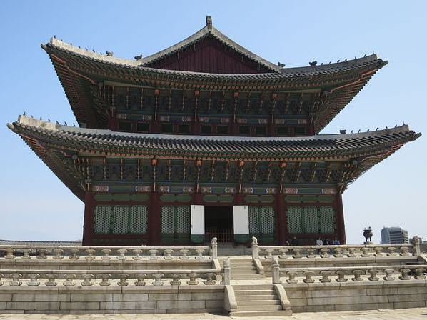
C’est sous un ciel bien nuageux que nous dirigeons vers le premier d’une longue série de temples que nous comptons visiter à Séoul : le palais Gyengbokgung.
L’entrée, sur le côté, est plutôt discrète et ne permet pas d’avoir une vue d’ensemble du palais et de sa multitude de bâtiments. Au guichet, nous optons pour un passe qui permet de visiter cinq temples pour 10,000 Wons. Pas sûr que nous les visitions tous mais les calculs sont vite faits.
Comme la Cité Interdite de Pékin, ce palais est composé d’une succession de portes, cours, palais, pavillons, temples, jardins, bassins, de ponts et autres enfilades de bâtiments servant aux soldats et au personnel, le tout respectant une certaine symétrie.
Cet ensemble a été construit en 1394 par le roi Taejo, premier roi de la dynastie Joseon. Malheureusement, la majorité du palais a été détruite par les flammes au cours des invasions japonaises de 1592–1598. Gyeongbokgung a été laissé à l'abandon pendant plus de 250 ans, puis il a finalement été reconstruit à l’identique en 1868 sous l'ordre du prince régent de l’époque. 500 bâtiments ont été construits sur un terrain de plus de 40 hectares constituant ainsi une véritable petite ville.
Gyeongbokgung fut détruit à plus de 90% une seconde fois lors de l'occupation japonaise (1910-45) et remplacé par des bâtiments de l’administration coloniale japonaise. J’imagine que beaucoup de touristes japonais doivent ressentir un certain malaise quand ils visitent les palais et temples coréens car pratiquement tous ont été détruits ou endommagés par leurs ancêtres…
Depuis 1990, un effort considérable a été fait pour rétablir pleinement le palais Gyeongbokgung dans son ancienne gloire. Les bâtiments coloniaux ont été démolis, la porte de Heungnyemun a été restaurée dans son état d'origine ainsi que les quartiers royaux et le palais de l'Est du prince héritier. Près de la moitié des structures existantes avant l'occupation japonaise de la Corée a maintenant été restaurée ou reconstruite.
Ceci explique pourquoi tout apparait être trop beau, trop parfait, les peintures trop fraiches pour être vrai, un peu à l’image du château de la princesse à EuroDisney !!! Mais à l’opposé d’EuroDisney, tout a été reconstruit très scrupuleusement à l’identique selon les plans d’origine par des artisans talentueux.
Il ne nous reste plus qu’à déambuler sur les pavés des cours successives et à admirer l’extraordinaire travail de restauration effectué depuis deux décades et demie et à tomber sous le charme des lieux. Le vent a fini par chasser les derniers nuages et le soleil apparait enfin. Nous découvrons ainsi combien les montagnes sont proches et forment un superbe arrière-plan.
Chaque bâtiment a un nom, souvent presque similaire mais toujours imprononçable ! Tous finissent par se mélanger ainsi que leurs fonctions d’ailleurs. Quel est celui qui servait de lieu de résidence du roi… ou de la reine, celui qui faisait office de salle du trône, de salle de réception extraordinaire… ou ordinaire, celui réservé aux banquets… ou aux études des princes ? Geunjeongmun, Heungnyemun, Sajeongjeon, Oejeon, Najeon, Jaseondang, Gyeonghoeru, Gyeonghoeru, Hyangwonjeong, Sajeongjeon… la liste continue mais aucun ne nous échappe !
Si la plupart des bâtiments sont fermés ceux qui ne le sont pas révèlent des intérieurs somptueusement décorés et extrêmement colorés. L’un d’eux, Jagyeongjeon, résidence de la reine Sinjeong (reconstruit en 1888 et l’unique demeure royale à ne pas avoir été rasée lors de l’occupation japonaise) permet de voir et comprendre l’ingénieux système de chauffage (au sol s’il vous plait !) et d’admirer de superbes cheminées disposées à l’extérieur.
A proximité de la jolie pagode se trouve un intéressant petit musée où sont exposés objets, bijoux, armes, gravures et illustrations de la vie à la cour. Dehors ce sont des statues en pierre qui tiennent la vedette. Enfin juste derrière, l’aménagement d’une ‘rue’ des années soixante avec ses vitrines, atelier, épicerie, quincaillerie…etc. permet de se replonger dans les années yé-yé. Que de chemin parcouru depuis !
Après avoir refait le tour en sens inverse (pour s’assurer de n’avoir rien oublié !!!) nous tombons sur les cérémonies de la relève de la garde à la Porte Gwangwamun. Parade en habits traditionnels aux sons d’anciens instruments de musique… on pourrait bien se croire revenu au temps des rois... mais les bruits de circulation nous ramènent vite à la réalité du présent.
C’est déjà l’heure du déjeuner et les voyages dans le temps ouvrent l’appétit. Heureusement nous trouvons rapidement notre bonheur dans un charmant petit restaurant dans le quartier de Bukchon. Une fois encore ce sont les photos des plats qui nous sauvent. Celle-ci a l’air sympa… Arrive un véritable banquet, la grande table se recouvre d’une multitude de petits plats bien mystérieux mais tous délicieux. La serveuse nous montre le mode d’emploi : telle sauce pour tel plat, telle salade pour tel sauce. Elle oublie seulement de préciser que toutes sont fortement épicées.
Nous allons bruler l’excèdent d’énergie en marchant dans les petites rues tranquilles de Bukchon en direction du palais Changdeokgung aussi nommé palais de la Prospérité dont l’histoire est aussi compliquée que celle du palais Gyeongbokgung.
Commencé en 1405, sous le règne du roi Taejong (sombre histoire d’égo) puis agrandit sous ce celui du roi Sejo, le palais Changdeokgung finit par remplacer le palais Gyeongbokgung et devient le palais favori des rois de la dynastie Joseon. 1592, première catastrophe : les Japonais débarquent et brulent le tout. 1609, les Coréens reconstruisent l’ensemble. 1623, deuxième catastrophe, une révolte qui tourne mal et qui se termine par l’incendie d’une partie du palais. Nouvelles reconstructions, nouvelles catastrophes, elles ne manquent, cependant Changdeokgung reste le palais le mieux préservé parmi les cinq palais de la dynastie Joseon encore debout. C’est aussi dans ce palais que Sunjong, le dernier empereur de Corée, vécut jusqu’à sa mort en 1926.
Aujourd’hui il ne reste que treize bâtiments dans l’enceinte du palais et vingt-huit pavillons dispersés dans les jardins. Contrairement aux bâtiments du palais Gyeongbokgung qui suivent un ordre architectural strict, ceux du Changdeokgung suivent les principes du Feng Shui et s’accordent davantage à la topographie des lieux.
Une fois la porte monumentale Donhwamun (restaurée en 1608) franchie, nous suivons un groupe d’écoliers en excursion sur le plus vieux pont de Séoul (Geumcheongyo, construit en 1411) mais les laissons volontiers prendre un peu d’avance afin de pouvoir admirer l’imposant Injeongjeon (salle du trône) et l’élégant Seonjeongjeon (salle de réception et de travail), situé un peu plus loin, en toute tranquillité. Si le style (double toits, tuiles, couleurs, intérieurs) de ces deux bâtiments est assez similaire à ceux du palais Gyeongbokgung, les bâtiments suivants donnent dans le sobre et le rustique grâce à leurs murs blancs tranchant avec le bois sombre des piliers, portes et terrasses. Le tout est agrémenté par de nombreux bosquets d’arbres en fleurs qui font le bonheur d’une poignée de photographes hyper bien équipés.
Une queue de touristes se forme près d’une grille fermée. Intrigués nous allons voir ça de plus près et comprenons rapidement qu’ils attendent l’heure de la visite guidée en anglais du Jardin Secret. Délestés d’une paire de milliers de Wons, nous nous joignons au groupe. La visite du Jardin Secret (Huwon) ne se faisant qu’en groupe, nous attendons patiemment trois heures.
La jeune guide ajuste son microphone puis commence son monologue que nous écoutons religieusement. Ainsi nous apprenons que ces collines boisées servaient de lieux de repos, de promenade et de jeux aux membres à la famille royale, que l’on y trouve plus d’une centaine d’essences différentes et que ni la disposition ni la végétation n’ont pratiquement pas changé depuis des siècles. La balade est agréable et est ponctuée de nombreux arrêts permettant d’admirer et d’approcher plusieurs pavillons perdus, des bassins fleuris et des fontaines… aux noms très exotiques (Buyongjeong, Buyongji, Juhabru, Eosumun, Yeonghwadang, Bullomun, Aeryeonjeong, Yeongyeongdang sans oublier la plus minuscule des chutes (Ongnyucheon) que l’on repère grâce au poème gravé sur un rocher.
La promenade se termine par la visite d’un ensemble de bâtiments qui servaient aux servants et aux gardes et par ce cyprès 5 fois centenaire, vaillant vieillard soutenu par de solides piliers en bois.
Il nous reste encore un peu de temps pour refaire un petit tour dans le palais et admirer les jardins tout au fond où sont regroupés des dizaines d’arbres en fleurs et même de prendre un café à la cafétéria. Alors que nous nous dirigeons vers la sortie nous croisons des jeunes musiciens et acteurs en costume traditionnels qui se préparent pour le spectacle sons et lumières de ce soir… sur invitation uniquement !
Il est grand temps d’aller reposer nos pauvres pieds dans notre chambre d’hôtel, juste une heure devrait suffire !!! Une heure + prolongations plus tard, nous revoilà repartis pour une visite du quartier. Celle-ci nous mène jusqu’à une grande avenue sans grand intérêt, puis dans les allées d’un immense marché spécialisé dans les pièces détachées électriques et électroniques ?!
Enfin nous tombons sur ce que nous cherchions : la rivière Cheonggyecheon, un petit cours d’eau récemment aménagé en promenade. Mais il est déjà trop tard, le soleil se couche. Il ne nous reste plus qu’à refaire exactement le chemin en sens inverse, le plus sûr moyen de ne pas se perdre puis de faire la tournée des petits restaurants d’Insadong … bien emmitouflés car ça caille ce soir !
Séoul Jeudi 2 Avril 2015
Après un petit déjeuner dinette dans la chambre, nous voilà prêts pour une nouvelle journée découverte de la capitale. Programme chargé (comme d’hab. !) avec nouvelles visites de palais, temples, jardins mais dans d’autres quartiers.
Comme hier, le vent chasse les nuages gris et permet au soleil de montrer ses beaux rayons. Premier sur notre liste, le sanctuaire deJongmyo situé près de l’avenue aperçue hier en fin d’après-midi. L’entrée n’est pas facile à trouver car les palissades entourant un chantier la camouflent plutôt bien. Quand finalement nous la trouvons, une corde barre le passage. Pas de panique, le sanctuaire ne se visite qu’en visite guidée, il nous faut simplement attendre une petite demi-heure pour la suivante.
Nous en profitons donc pour aller faire un tour dans les allées du petit parc juste en face. Curieusement ce petit espace de verdure est très fréquenté… par des hommes d’un certain âge assis sur des bancs et s’imprégnant des rayons d’un soleil printanier. Si certains donnent à manger aux oiseaux, d’autres préfèrent lire des journaux ou encore faire quelques exercices d’assouplissement, mais la plupart restent concentrés devant les damiers de leur jeu de Go. Pendant de longues minutes, nous nous joignons aux petits groupes d’observateurs-experts rassemblés silencieusement autour des parties les plus serrées mais rien à faire nous n’arrivons pas à saisir la stratégie employée pour entourer et ramasser les pastilles blanches et noires.
Nous sommes une bonne vingtaine de touristes à marcher derrière la jeune guide qui a revêtue pour l’occasion son beau costume traditionnel. Nous la suivons sur des chemins dont la partie centrale est pavée et uniquement réservée aux dignitaires… que nous ne sommes pas donc prière de rester sur les graviers !
Ce sanctuaire confucéen, nous apprend-t-elle est dédié aux membres de la famille royale de la dynastie Chosŏn. L’ensemble comprend plusieurs bâtiments sombres dispersés dans un beau parc, mais les principaux sont le Jeongjeon et le Yeongnyeongjeon. Le premier construit en 1394, détruit en 1592 par l’on sait qui, puis reconstruit en 1601, abrite, dans les dix-neuf salles qu’il comporte, 49 tablettes en bois commémorant les rois et reines qui se sont succédés au fil des siècles. Le second (construit plus tard pour accommoder les nouveaux rois décédés), est la copie conforme du premier mais ne comprend que seize chambres contenant 34 tablettes… que nous ne verrons d’ailleurs pas car tous deux sont fermés !?
Nous ne pouvons donc qu’apprécier l’architecture extérieure (tuiles noires, boiseries et colonnes en rouge foncé) du fond de la grande cour pavée qui s’étend devant les édifices bâtis tout en largeur et nous contenter de regarder les panneaux remplis de photographies prises lors des rituels qui ont lieu chaque premier Dimanche de Mai.
Une visite plutôt décevante que nous oublions rapidement en remontant la rue commerçante que nous commençons à bien connaitre. Une fois encore, en passant devant l’un des magasins d’instruments de musique, je ne peux pas m’empêcher de taper sur les tambours qui envahissent une partie du trottoir.
Nous nous retrouvons bientôt devant les murs d’enceinte du palais Changdeokgung, (celui que nous avons visité hier après-midi) mais encore bien loin du restaurant traditionnel à ne pas manquer dans le quartier universitaire et branché de Marronnier Park que Ry avait repéré dans l’une des brochures du Tourism Office.
Un taxi nous y emmène en quelques minutes… enfin nous dépose dans la rue car pour trouver le fameux restaurant en question, c’est toute une autre histoire.
Commerçants et passants à qui nous demandons ne semblent pas connaitre. L’un d’eux nous prend en charge, nous fait faire le tour du pâté de maisons une paire de fois avant de tomber sur deux de ces amis qui lui (nous) apprennent que le restaurant n’existe plus depuis quelques mois. Déçus et affamés mais impressionnés par la gentillesse des Coréens, il ne nous reste plus qu’à aller avaler un sandwich au Paris Croissant du coin. Pour nous consoler, nous commandons même une demi-douzaine de mini-croissants en guise de dessert. Quelle surprise quand nous réalisons qu’ils ont un gout d’ail certes discret mais… franchement désagréable !!!
C’est en mâchouillant des chewing-gums que nous arrivons devant l’entrée du quatrième palais, celui de Changgyeonggung (le palais d’Eté) qui connecte avec le Jardin Secret lui aussi visité hier.
L’agencement des édifices est aussi classique mais moins impressionnant et solennel que celui du palais Gyeongbokgung. Portique principal (Honghwamun), petit pont (Okcheongyo), autre porte (Myeongjeongmun), cour pavée et escaliers conduisant aux Myeongjeongjeon (salle des Audiences), Munjeongjeon (salle du Conseil), Sungmundang et Binyangmun (j’ai depuis oublié la différence qu’il existe entre ces deux-là !) puis une autre cour plus spacieuse où sont regroupés le Haminjeong (espèce de kiosque à musique surélevé) le Gyeongchunjeon, la résidence de la reine-mère et Hwanggyeongjeon, celle du roi et de la reine sans oublier le Tongmyeongjeon ni le Yanghwadang et surtout pas le Punggidae ni l’Angbuilgu dont les fonctions exactes m’échappent !!!
Une courte averse vient perturbée la visite et nous n’avons que le temps de nous abriter sous le Haminjeong (le kiosque). Après une longue promenade dans les recoins détrempés du parc, il ne nous reste plus qu’à regagner notre hôtel.
En chemin, nous passons devant le palais Unhyeongung. Sur notre lancée, nous franchissons la porte d’entrée pour découvrir un petit palais plutôt sobre mais enchanteur avec ses nombreuses colonnes, planchers extérieurs et panneaux en bois. Si le site date du XIVème siècle, les trois structures que nous visitons sont bien plus récentes (1864). C’est dans ce petit palais que naquit et grandit Gojong (le 26ème roi de la dynastie Joseon) avant d’accéder au trône. C’est également dans ces lieux qu’il se mariât en 1866.
Le bâtiment principal (Norakdang), était utilisé lors de réunions, fêtes et autres évènements importants (dont le mariage du roi) et également comme l’une des deux résidences réservées aux femmes. Le bâtiment à côté (Naondang) servait lui de salle de travail au père du roi et le troisième (Irodang) était l’autre résidence réservée aux femmes. Contrairement aux précédents palais que nous avons visités et qui nous paraissaient toujours vides et sans âme, celui-ci est plus gai presque vivant grâce à toute une série de mises en scène retraçant la vie quotidienne à l’époque à l’aide de mannequins costumés. Par les fenêtres ouvertes, nous pouvons apprécier la décoration, le mobilier et deviner la fonction de chacune des pièces. Un bien agréable voyage dans le temps, renforcé alors que nous apprêtons à sortir, par un petit groupe de jeunes gens et un couple de jeunes mariés en costume traditionnels en train de poser et de prendre des photos.
Nous apprenons ainsi que ce petit palais est particulièrement prisé par les jeunes mariés coréens non seulement pour le décor mais aussi parce que chaque année se tient une spectaculaire réédition costumée du mariage royal.
Après une pause à l’hôtel, il est temps de repartir, sous la pluie cette fois, jusqu’au marché couvert de Gwangjang, situé à proximité du sanctuaire de Jongmyo visité ce matin. Re-rue commerçante (sous les néons maintenant) et re-tapage sur les tambours (protégés par des feuilles plastifiées).
Eclairs, coups de tonnerre, nous n’échappons au déluge que de justesse en nous joignant à la queue qui s’est formée sous l’abribus. Quelques minutes plus tard, nous trouvons l’une des entrées du marché.
Dans cette allée, les marchands de vêtements sont en train de fermer boutique mais les magasins alimentaires sont eux encore ouverts et plein de monde. Les différentes allées du marché convergent vers un espace central où sont regroupés plein de bouisbouis et stands à bouffe entourés de banquettes en bois. De puissants projecteurs permettent de voir ce que les cuisinières sont en train de préparer et de cuire. Les étals sont remplis de choses colorées (le rouge domine), la plupart appétissantes. Pas facile de trouver une paire de places sur les bancs, ni de comprendre ce qui est proposé. Notre solution : pointer du doigt l’assiette du voisin en espérant que nous avons les mêmes gouts culinaires… Nous nous en sortons plutôt bien !
Nous apprécions également l’atmosphère populaire et chaleureuse qui règne dans ces espèces de halles où les gens se retrouvent autour d’un repas simple, sans chichi et bon marché. Rassasiés, il ne nous reste plus qu’à faire une paire d’allées, de regarder la quantité de produits inconnus étalés un peu partout et parfois tenter de deviner ce qu’ils peuvent bien être.
Retour à l’hôtel… sans oublier de passer au Paris Croissant pour le petit déjeuner demain matin. Hélas, il n’y a plus de croissants ni de petits pains au chocolat. Il nous faut donc nous rabattre sur les muffins… en s’assurant qu’ils sont bien aux myrtilles et non à l’ail ou pire aux piments…
Séoul Vendredi 3 Avril 2015 Happy Birthday Ry
Pour cette journée spéciale, une mission : trouver une bouteille de Champagne de France. Nous avions bien commencé nos recherches les jours précédents mais sans succès, en fait nous n’avions déniché que du mousseux chinois. Heureusement nous avons trouvé à la réception de l’hôtel un dépliant touristique mentionnant l’existence d’un quartier français à Séoul (Seorae Maeul). Qui dit Français dit Champagne !
Après un bon petit déjeuner au lit, première célébration de ce grand jour, nous découvrons que le soleil n’est pas au rendez-vous, ou plutôt qu’il est prisonnier derrière un manteau brumeux. Pas de risque d’insolation aujourd’hui !
Cette fois nous allons pouvoir faire notre marche le long de la rivière Cheonggyecheon, ce cours d’eau sauvé du bitume qui le cachait et aujourd’hui aménagé en promenade. Oasis de verdure coincé au milieu des gratte-ciel dont les façades ne reflètent que le gris du ciel. Par contre les gargouillis des rapides artificiels couvrent parfaitement les bruits de la circulation. En chemin, nous ne croisons que quelques joggeuses et employés de bureau (en retard !) puis, alors que nous arrivons aux ‘chutes’ finales, un groupe de jeunes touristes emmitouflées en plein concours de selfies.
Arrivés à la place Cheonggye (marquée d’une curieuse sculpture mauve en forme de coquillage allongé), nous n’avons que le choix de remonter à la surface pour retrouver la foule et les embouteillages. Foule des grands jours car nous tombons en plein milieu d’une distribution gratuite d’arbustes par un parti politique ou association quelconque. Il doit s’agir d’un grand évènement puisque plusieurs équipes de télévision se disputent le meilleur endroit pour le filmer. Peut-être figurerons-nous aux actualités télévisées de ce soir !
Nous poursuivons le long de cette large avenue (Sejong-Daero) bordée de banques et autres prestigieuses institutions jusqu’à la Seoul Plazza où se trouve le City Hall et l’entrée du palais Deoksugung le cinquième et dernier des grands palais.
A l’origine ce site était le lieu de résidence du prince Wolsan (frère du roi Seonjong) mais lorsque tous les autres palais royaux furent détruits ou endommagés lors de l’invasion japonaise en 1592, les bâtiments résidentiels encore debout servirent de … palais royal de secours durant la période de reconstruction. Près de trois siècles plus tard, en 1897 le roi Gojong réinvestit les lieux et fait ajouter plusieurs nouveaux édifices traditionnels et d’architecture occidentale, renforçant ainsi sa détermination à moderniser le royaume. Surprise donc en voyant, jouxtant les superbes anciens bâtiments en bois, une paire de buildings de style néo-classique qui auraient plus leur place à Londres qu’à Séoul et qui font office de nos jours de musées.
La page culturelle tournée, il est temps de nous préoccuper de notre Champagne. Le métro permet de passer de l’autre côté du fleuve Han et de se perdre dans les banlieues où les hautes et étroites tours d’habitations sont aussi nombreuses que les arbres dans la forêt de Fontainebleau. Nous marchons le long d’une voie rapide puis tournons à gauche avant la passerelle pour piétons. Changement radical de décor. Nous nous retrouvons maintenant dans une petite rue qui tourne et monte doucement, bordée de magasins et d’immeubles de quelques étages. Il y règne presque une ambiance de village tant tout est calme. Il faut chercher les quelques enseignes en français mais elles existent bien, prouvant ainsi que nous sommes bien arrivés à Seorae.
Ce petit bout de banlieue tranquille est devenu, depuis le déménagement du l’Ecole Française de Séoul, le point de ralliement d’une importante partie de la communauté française expatriée dans cette partie du monde. Nous y trouvons de nombreux commerces incontournables en rapport avec la culture française : boulangerie, épicerie fine, restaurants, cafés, coiffeurs, même une boutique d’outillage et surtout un marchand de vins… Ouf ! Incroyable mais vrai nous achetons l’unique bouteille de Champagne !
Nous laissons la visite du Parc Montmartre à une autre fois, le temps n’étant toujours pas propice à la balade dans la nature et commençons à marcher en direction du quartier de Gangman. Plus judicieusement nous hélons un taxi qui quelques minutes plus tard nous dépose au croisement de deux immenses avenues : le cœur de ce quartier branché rendu célèbre le temps d’une chanson et d’une dance reconnues aujourd’hui dans le monde entier.
Au pied des gratte-ciel, les magasins et boutiques de luxe se succèdent à l’infini. Sur les larges trottoirs, les jeunes rivalisent pour trouver la tenue ou la coupe de cheveux la plus… cool ou la plus déjantée. Dans les petites rues parallèles bordées d’enfilades de fils électriques, ce sont les bars, bistrots, restaurants qui se disputent la jeune clientèle.
C’est d’ailleurs ici que nous trouvons un petit resto au décor zen et au menu encore plus zen (plat unique : Anping chicken, deux options très épicé ou hyper épicé). Le serveur nous remet une paire de ciseaux ( ?) puis arrive avec une espèce de plat à paella rempli de grosses pates (d’où les ciseaux) et de gros morceaux de poulet, le tout baignant dans une épaisse sauce rouge. Je n’ose pas imaginer ce que doit être la seconde option car dès la deuxième bouchée, je me sens devenir dragon ! Quant à l’exercice manuel, je ne peux que constater mon cruel manque de dextérité à l’emploi de baguettes en métal rondes pour désosser les morceaux de poulet.
L’exploration du quartier se poursuit la bouche ouverte, non pas sous l’effet de surprise (bien que…) mais plus simplement pour la rafraichir. Idem dans le métro bondé sur le trajet du retour à l’hôtel… au risque de me faire passer pour l’idiot du village...
Le temps de mettre la bouteille au frais et d’en profiter pour sucer quelques glaçons et nous revoilà repartis vers la rue commerçante (celle avec les tambours !) en direction de la tour de télécommunication perchée en haut de sa montagne et qui me nargue depuis mon arrivée.
Le soleil ayant enfin percé la carapace nuageuse, nous pouvons espérer assister à son coucher tout en admirant la vue panoramique sur la capitale. Arrivés au pied de la petite montagne, nous réalisons qu’il nous faut encore prendre un taxi jusqu’au téléphérique… Le soleil prenant une teinte orangé, nous achetons vite nos tickets. Horreur, la queue, que nous pensions minuscule, s’étale dans les escaliers. Pas moyen d’en voir la fin. 45mn plus tard, nous nous serrons comme des anchois dans un bocal dans l’unique cabine du téléphérique. Le soleil ne nous a pas attendus ! Panorama nocturne donc qui prend la forme d’un immense tapis lumineux qui se perd dans la brume et la nuit. Quelle déception ! Cinq minutes plus tard, nous sommes de nouveau dans notre bocal… vide cette fois !?
Une nouvelle fois les milliers de néons colorés clignotants nous attirent irrésistiblement. C’est ainsi que nous découvrons les rues animées du marché de Myeongdong. Avalanche de lumières, foule compacte en train de faire du lèche-vitrine ou de savourer les spécialités disponibles sous les toiles de tente et parasols qui ont envahis le milieu de la rue.
De loin, nous repérons la Jongno Tower qui, depuis plusieurs jours nous, sert de phare et nous permet de retrouver notre chemin dans ce labyrinthe de petites rues dégoulinantes de lumières.
Il est maintenant grand temps de sabler le Champagne !
Séoul Samedi 4 Avril 2015
Aujourd’hui changement d’air puisque nous partons à Busan, la deuxième ville de la Corée du Sud, située sur les bords de la Mer du Japon. Hélas pas de baignade prévue car la météo n’annonce pas du beau temps… pour le sud !
Il ne faut que quelques minutes en métro pour se retrouver sur le parvis de la gare ferroviaire de Séoul, également le point de rendez-vous des sans-abris et clochards de la capitale. Sous les petits chapiteaux en toile, c’est la prêche avant la distribution. A droite de l’ancien bâtiment en briques rouges et au dôme vert se trouve l’entrée de la nouvelle gare tout en verre et en acier. Tickets du KTX (TVG local) en poche il ne nous reste qu’une petite heure pour prendre café et croissant au Paris Croissant de la gare et même en profiter pour acheter des sandwiches pour le déjeuner qui se prendra dans le train.
Au début des années 2000, la SNCF ayant fait de bonnes affaires ici, il n’est donc pas surprenant de constater, entre les TGVs coréens et français, certains traits de similitude à commencer par un certain look, le confort (ou plutôt le manque de), certains bruits et aussi certaines odeurs. Il ne manque plus que le jingle… mais les Coréens ont les leurs !
A la minute près, le train démarre doucement puis retrouve l’air libre pour filer sur le pont qui enjambe le fleuve et se faufiler entre les nouveaux gratte-ciel et innombrables tours d’habitations de la rive sud.
Banlieues, zones industrielles, routes, lignes électriques, poteaux, ponts, tunnels, champs vides, bouts de montagne puis une incroyable marée de serres envahissant tous les recoins des vallées qui se succèdent le long des 417 km qui séparent Séoul de Busan. La séquence des paysages se répète à deux reprises, l’une à Daejeon et l’autre à Dongdaegu, deux villes étapes.
2h18 plus tard nous voilà arrivés à Busan. Il fait gris et froid et le ciel est de plus en plus menaçant. La météo ne semble pas avoir refroidi les nombreux touristes coréens qui, une fois le weekend arrivé, se précipitent à Busan… et envahissent les hôtels !
Nous découvrons que le hasard du calendrier ne fait pas bien les choses pour nous : pénurie de chambres et forte augmentation du prix le weekend, heureusement nous pouvons compter sur l’efficacité de la jeune fille au guichet du Tourism Office de la gare qui nous trouve la dernière chambre d’un hôtel pas trop onéreux à 100 mètres de la gare.
H��tel de marins en transit. La chambre est curieuse : immense avec un salon et des tentures rouges et la vue minable : plongeante sur un chantier et les parkings de la gare puis au-delà panoramique sur les haubans d’un pont, des grues et tout au fond sur les reliefs qui disparaissent dans la brume.
Eclairs, tonnerres et averses. Installés au chaud dans notre beau salon, nous épluchons les prospectus touristiques récupérés à la gare et préparons quelques itinéraires les choses à voir sont en effet dispersées et la topographie des lieux ne simplifie pas la tâche.
Ce n’est pas la pluie qui ne cesse de tomber qui va nous arrêter. Direction la station de métro en face de la gare, derrière la fontaine illuminée. Ici le métro est plus facile à négocier, d’une part il y a moins de lignes et d’autre part les distributeurs plus compréhensibles en plus c’est moins cher !
Direction le marché de Jagalchi, un marché aux poissons qui vaut apparemment le détour. Pendant le trajet nous observons les passagers qui ont un petit air de province en tout cas une attitude plus relâchée.
Nous descendons deux stations plus loin. Les averses sont encore plus intenses et le jour n’en a plus pour très longtemps. Nous marchons avec précipitation mais précaution sur les trottoirs détrempés, encombrés d’étalages bâchés et envahis par des piétons mouillés et résignés. Nous suivons les néons qui conduisent vers les quais et une petite allée bordée d’un coté de petits restaurants et de l’autre d’étalages remplis de fruits de mers et de poissons, de pieuvres, de calamars et autres créatures inconnues. Grosse bousculade dans les flaques d’eau et sur les pavés glissants, mais ambiance bon-enfant malgré le déluge qui nous tombe dessus.
Chaque petit restaurant a sa crieuse de menu et une ‘cuisine’ placée juste à l’entrée, sur le trottoir. L’avantage est que nous pouvons voir ce qui cuit dans les marmites ou sur les braises. Nous trouvons le seul bouiboui dont une partie de la minuscule salle-à-manger contient également des tables et des chaises et non uniquement des tables basses sur des tatamis.
Il règne une sacrée ambiance et de bonnes odeurs dans ce troquet du bout du monde. Ça ne traine pas ici et les tables sont constamment renouvelées par trois serveuses rigolotes. Il suffit de pointer un poisson sur le grill et d’attendre… à peine quelques minutes avant de voir débarquer une dizaine de petites assiettes remplies d’un tas de trucs différents souvent froids mais hyper épicés. Riz et poisson suivent rapidement. Mais qu’est-ce que c’est bon tous ces machins ! Quelques instants plus tard, la bouche est en feu, les papilles en ‘foufele’ et l’estomac heu-reux.
Métamorphosés en radiateurs ambulants, nous poursuivons la balade dans le marché mais la pluie gâche le plaisir de la promenade digestive. Autant revenir demain. Après un bref détour par la gare pour acheter un gobelet de chocolat chaud, il ne nous reste qu’à nous mettre sous la couette, écouter la pluie cogner sur les vitres et regarder les éclairs à travers les rideaux… rouges.
Busan Dimanche 5 Avril 2015
Derrière les vitres, j’aperçois un ciel bas et gris mais pas de pluie. La température aujourd’hui ne devrait pas dépasser 9° nous a averti la speakerine hier soir.
Le petit dej. se passe au Paris Croissant de la gare, pourquoi s’en priver ?! Ce matin nous distinguons un peu plus clairement les immeubles et maisons accrochés aux flancs des reliefs en face de la gare et au-dessus de Chinatown, ce paysage me ramène presque à Nagasaki ou à Valparaiso.
Nous reprenons la promenade au marché de Jagalchi, là où nous l’avions laissée hier soir, c’est-à-dire devant le bâtiment moderne de deux étages : le marché officiel où sont rassemblés plusieurs dizaines de vendeurs de poissons et de fruits de mer. Du jamais vu et ce à plusieurs niveaux. D’abord le nombre et la grandeur des aquariums, basins, baignoires de chacun des vendeurs, ensuite l’extraordinaire variété d’espèces de poissons, d’algues, de coquillages, l’incroyable quantité des produits proposés (de quoi nourrir la Terre entière !), puis l’odeur d’iode et plus qui prend les narines et enfin le bruit des bulles dans tous ces aquariums.
L’air frais des quais fait du bien. Du ponton nous admirons les chalutiers, bien serrés cote à cote comme s’ils se tenaient au chaud et plus loin les installations portuaires qui s’étendent à perte de vue. A droite, il y a tellement de maisons bleues accrochées à la colline que Maxime s’y perdrait.
Quant à nous, nous nous perdons dans les ruelles commerçantes du marché d’en face. Ici les poissons sont remplacés par… tout le reste, des légumes aux vêtements, de l’outillage aux confiseries... etc. Curieusement, les rares touristes occidentaux que nous croisons parlent tous le russe. Mais est-ce vraiment surprenant ? Vladivostok n’est qu’a une poignée de centaines de milles marins !
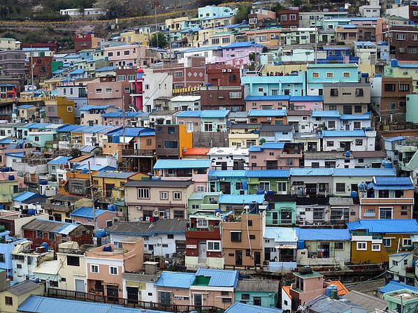
Il est temps d’aller voir de plus près ces fameuses maisons bleues qui nous intriguent depuis notre arrivée à Busan. Pour quelques Euros, un taxi nous emmène sur les hauteurs jusqu’à l’école primaire du village de Taegeukdo.
Plutôt que de descendre vers le village, nous préférons remonter la route qui va vers un parc boisé. Peut-être aurons-nous une meilleure vue de là-haut ? Pas vraiment car le chemin forestier tourne le dos au village mais au fur et à mesure que nous grimpons, nous découvrons toute une série de vues panoramiques brumeuses sur Busan, son port, ses différents quartiers, ses plages et les montagnes qui l’entourent. Dans les arbres, qui commencent à peine à bourgeonner, quelques écureuils jouent à cache-cache au-dessus de nos têtes. Impossible de connaitre toutes ces essences mais nous prenons bien soin d’emmagasiner les senteurs de cette forêt, elles sont si différentes de celles que l’on trouve dans les forêts d’eucalyptus australiennes.
Le chemin se termine dans un parc où sont regroupées des dizaines de sculptures d’artistes coréens. Culture et Nature. Nous rebroussons chemin plutôt que de nous aventurer sur les sentiers boueux et sombres à l’intérieur de la forêt.
De nouveau devant l’école primaire, cette fois nous traversons la rue qui domine le village accroché aux flancs abrupts des collines. Nous découvrons un panorama aussi surprenant qu’inattendu, une myriade de petits cubes colorés et d’étroits passages qui descendent jusqu’à la mer que l’on aperçoit tout en bas. Sur les hauteurs du village, quelques jardins potagers et arbres en fleurs forment une ceinture pas encore verte.
L’histoire de ce village, devenu maintenant une attraction touristique prisée, est récente puisqu’elle ne remonte qu’à la guerre civile (début des années 50) quand quelques 4000 adeptes du mouvement religieux Taegeukdo fuyant les régions détruites par la guerre, s’installèrent sur ces collines, à l’écart de Busan. Ils y construisirent 800 cabanes en bois et furent rapidement rejoints par d’autres adeptes ou habitants à la recherche de logements à petit loyer. Dans les années 80, la population atteint le nombre de 20000 puis commence à chuter dans les années 90, (les nouveaux appartements dans les tours d’habitation que l’on construit à tour de bras sont certainement plus confortables et spacieux). Aujourd’hui le village ne compterait ‘que’ 10000 habitants… et de nombreuses maisons vides !
Depuis 2010, afin de rompre le déclin de la communauté, la ville a pris toute une série de mesures pour promouvoir l’identité traditionnelle du village tout en le transformant en village d’art et de culture. Les maisons vides sont ainsi devenues des galeries d’art, des ateliers, des cafés, boutiques…etc. A voir le nombre de touristes, ce Dimanche, on peut croire que le succès est au déjà au rendez-vous… pour certains en tout cas !
A notre tour donc d’explorer ce labyrinthe de passages et de visiter les différentes ‘maisons d’art’ et installations dispersées partout dans le village. Si certaines sont plus intéressantes que d’autres, toutes conservent un coté amateur et local rafraichissant car sans prétention. Heureux d’avoir fait le détour jusqu’ici. Tous ces exercices physiques et culturels de la matinée nous ont ouvert l’appétit. Un taxi nous ramène au marché Jagalchi et notre mémoire nous ramène au même restaurant qu’hier soir !
Après avoir soigneusement choisi nos poissons à l’extérieur, nous nous installons à l’intérieur où nous sommes de suite reconnus par le personnel surpris de nous revoir. En quelques instants, notre statut passe de touristes anonymes à celui de Stars of the week… et de constater que plusieurs raviers supplémentaires contenant d’autres délicieux kimchis sont servis discrètement. Repus, nous saluons notre petit monde et partons prendre le métro en direction de Haeundae Beach qui se trouve à l’autre extrémité de la ville. Après près d’une heure de trajet, nous émergeons sur une avenue venteuse bordée d’immeubles luxueux, d’hôtels, de restaurants et clubs et ce jusqu’à la promenade qui longe la plage.
Froid, vent, nuages et légère pluie, pas vraiment le meilleur temps pour aller à la plage. D’ailleurs nous n’y trouvons pas grand-monde sinon que les conducteurs d’engins qui ratissent le sable. Sur la mer, plusieurs dragueurs (les bateaux, pas les mecs !) s’arrangent pour boucher la vue sur les reliefs de la cote et les trois ilots rocheux aux formes particulières. Quant au bord de mer, il a tout simplement été, comme partout ailleurs, le terrain de jeu des spéculateurs et des constructeurs qui se sont appliqués à le gâcher complètement en édifiant des milliers d’appartements sur des dizaines de niveaux. Bienvenue à la Costa del Sol ou la Gold Coast version coréenne.
Au bout de la plage, se trouve entre deux petites digues artificielles Mipo Harbour, un minuscule port où quelques petits bateaux de pêche ne cessent d’acquiescer de la proue devant quelques hangars et plusieurs restaurants. Au-delà, la cote devient inaccessible car trop rocheuse et trop raide.
Pour poursuivre la balade le long de la cote, il n’y a pas d’autre choix que de prendre Dalmaji Road qui à cette époque de l’année attire une foule incroyable de promeneurs et de voitures nous ne tardons pas à comprendre pourquoi…
En effet, tout le long de cette route du bord de mer, des milliers de cerisiers et pruniers en pleine floraison forment un fantastique dôme de pétales. C’est une vision tout à fait extraordinaire que partage allègrement toute la population de la ville. Ravis de participer à cette allégresse et de tomber sous le charme de Sakura.
Nous suivons les ondulations de la route, à gauche maisons et appartements de luxe, hôtels avec salle de réception de mariage (si l’on en juge le nombre de jeunes mariés !), à droite les versants boisés des collines qui se métamorphosent en falaises dès qu’elles touchent la mer, une mer grise très discrète que l’on aperçoit parfois au travers d’une trouée.
Plusieurs kilomètres plus loin, alors que nous venons de dépasser un petit port avec un phare rouge et un phare blanc, nous faisons demi-tour. La nuit commence à tomber et la démarche devient de plus en plus mécanique. D’ailleurs la foule a disparu, il ne reste que les purs et durs munis de leurs appareil-photos qui ressemblent à des télescopes.
A Mipo Harbour nous trouvons un restaurant sur la mer. Spécialités fruits de mer et poissons… crus de préférence. Quelques difficultés à comprendre le menu car personne ne parle une langue commune… Ah le pouvoir des photos, voilà le manager qui nous sort son portable et nous montre toute une série de photos de plats garnis. Même le chef, avec ses bottes blanches en caoutchouc, sort de sa cuisine pour nous montrer des fruits de mer inconnus. Abracadabra… nous commandons une photo deux et une photo cinq… plus quelques sushis… au cas où !
Quelques instants plus tard, le ballet des plats commencent. La promenade digestive sur la plage est obligatoire tant nous avons mangé. Ne sentant même plus le froid, nous faisons de grands dessins dans le sable sous la lumière des projecteurs. Sur la promenade, un joueur de flûte traditionnelle joue au vent, plus loin qu’un jeune rocker accorde sa guitare. Nous retrouvons l’avenue de la station de métro. Nous ne la reconnaissons à peine maintenant qu’elle a revêtu sa tenue de soirée. Mini Vegas.
Décidément c’est fou ce que l’on voyage à Busan !!!
Busan Lundi 6 Avril 2015
Les exercices pédestres d'hier nous aurons fait passer une bonne nuit et notre beau moral n'est même pas atteint en découvrant qu'il peut toujours, que le ciel est toujours aussi gris et le vent toujours aussi frais. Aujourd'hui, nous changeons d'air, Adios Busan, Hello Gyeongju ! Evidemment, nous réalisons bien que la météo 70 kilomètres plus au nord ne risque pas d'être très différente.
Nous en avons confirmation tout au long du trajet car derrière la buée et au travers les gouttelettes de pluie accrochées aux vitres, les paysages de collines qui aimeraient être montagnes, les champs qui attendent de redevenir rizières et les routes qui rêvent de devenir autoroutes, sont plutôt malmenés par des averses discrètes puis torrentielles.
Quand nous débarquons dans la petite gare des bus, près du fleuve, le Dieu de la Pluie fait une trêve remarquée et bienvenue. Petit tour au kiosque du Tourism Office (il y en a vraiment partout) pour récupérer plans, prospectus et surtout une adresse d'hôtel.
Là nous apprenons que cette ville n'est pas simple. La gare de bus où nous sommes est située à 2-3 kilomètres du centre-ville et les hôtels sont regroupés près du lac à 8 kilomètres du centre-ville. Dans cette partie de la ville, à part l'hôtel de luxe juste à côté, il n'y a que des motels (autre mot pour désigner les Love hotels) nous informe l'hôtesse d'un air mi-navré mi-horrifié.
Une petite marche en trainant la valise sur les trottoirs mouillés peut parfois être un remède contre l'indécision. En avant donc en direction du centre-ville. Nous passons devant plusieurs magasins proposant la spécialité du coin : le Barley Bread, dans des boites de toutes les tailles (nous le gouterons plus tard et constaterons qu'il s'agit en fait de petits pancakes).
Plus étonnant, après le premier gros carrefour, nous découvrons une première série de tumulus au milieu d'un parc. Les voilà donc ces fameuses tombes royales et princières. Nous aurons surement l'occasion de les voir de plus près, quand nous serons installés. Patience.
De méchants nuages noirs s'accumulent au-dessus de nos têtes alors que nous arrivons devant la station de trains cette fois. Nouvelle visite au Tourism Office, même son de cloche, les hôtels sont près du lac. Nous montons dans le premier taxi. Le chauffeur fonce sur la route bordée d'arbres en fleurs longeant le fleuve puis le lac. Arrivés à destination, nous constatons que les hôtels ne sont en fait que des resorts entourés de terrains de golf, loin de tout et sans intérêt pour nous !
Demi-tour direction l'hôtel près de la gare de bus. Nous venons de perdre une bonne heure et de dépenser une petite fortune en taxi pour revenir exactement là où nous sommes arrivés. Il y a des jours comme ça !!!
Au diable l'avarice, ce sera l'Hotel The DY. C'est vrai qu'il est confortable et puis la salle de bains sort tout droit d'un ouvrage de science-fiction. En fait après avoir été débité d'environ 150 000 Wons, nous finissons par lui trouver que des avantages… On se console comme l'on peut !
Après un sérieux épluchage des prospectus touristiques, il en ressort que la plupart des zones historiques sont assez éparpillées dans la ville mais surtout autour de la ville. Nous prendrons donc une excursion demain pour aller voir les monuments les plus éloignés et resterons en ville aujourd'hui.
Grâce à la culture florissante de la dynastie Silla (de 57 avant J.-C. à 935 après J.-C.), ce ne sont pas les vestiges qui manquent dans cette ancienne capitale et ses environs. Entre les temples, palais, forteresses, remparts, tombes, pagodes, bas-reliefs, sculptures et musées, il y a de quoi faire et nous avons assez perdu de temps… mais nous avons faim !
L’heure du lunch est passée mais nous trouvons facilement un petit restaurant dans les abords du quartier chaud. Nous sommes les uniques clients parmi les empilements de cartons. Comme à Busan, la charmante femme sort son portable pour nous montrer le menu. Quelques instants plus tard, une demi-douzaine de raviers remplis de kimchis sont servis en attendant l’arrivée d’une délicieuse soupe toute fumante.
La température extérieure ne passe pas au-dessus de 9° mais il ne pleut pas. Nous partons inspecter ces curieux dômes en terre couverts de pelouse fraichement coupée (comment font les jardiniers ?!).
Passé le portail en bois, nous découvrons un parc pour le moins particulier. Quelques étangs pour le bonheur des canards puis une c’est une succession de grosses bosses de terre arrondies et régulières, certaines plus imposantes que d'autres elles diffusent une atmosphère paisible et à la fois étrange aux lieux. L'une des tombes, (Cheonmachong - datant du V ou VIème siècle), est ouverte au public. Elle a été aménagée de façon à comprendre leur secret de fabrication (rondins et pierres, le tout couvert de terre) et d'apprécier ce qu'elles contiennent grâce à la série de vitrines où sont exposés de nombreux objets funéraires retrouvés lors de l'excavation dans les années soixante-dix. Les dimensions de cette tombe, même si elle est loin d'être la plus grande, restent imposantes : 47 m de diamètre presque 13 m de hauteur.
La balade est bien agréable d'autant plus que les arbres en fleurs sont nombreux et de toute beauté. En tout cas ils nous font oublier le froid et l'humidité. Au-dessus des gros murs formant l'enceinte du parc, l'on aperçoit les toits compliqués d'un temple et ceux des maisons traditionnelles rescapées. C'est par là que nous nous dirigeons.
A l'entrée du temple Sunghyejeon, un petit pavillon contient trois anciennes plaques commémorant trois anciens rois Silla. Plus loin plusieurs petits bâtiments de couleurs différentes sont fermés. Dans l'un d'eux, un groupe d'hommes est rassemblé devant une table basse tout en longueur. Pas moyen de savoir s'ils se sont réunis pour prier ou pour tenir un meeting bien arrosé.
Quelques nouvelles constructions, futurs restaurants faussement traditionnels séparent le petit temple de la vaste pelouse bordée de rangées d'arbres en fleurs qui entoure l'Observatoire Cheomseongdae. Ce dernier, construit dans la première partie du VIIème siècle sous le règne de la reine Seondeok, servait à l'observation des étoiles et à faire des prévisions météorologiques. En forme de cylindre il est composé de 362 pierres (correspondant au nombre de jours dans une année lunaire), repose sur une pierre de base de plus de 5 m de côté et il s'élève à une hauteur de 9 m. Il est donc relativement petit, surtout au milieu de cet espace vide, mais le fait qu'il soit encore debout est un miracle.
Plus loin, les champs jaunes de colza sont pris d'assaut par des touristes qui se photographient les uns les autres. Ça change des cerisiers ! Au fond les jardins et rizières n'attendent que le soleil pour commencer la nouvelle saison. Bientôt ils seront la vedette du show.
Nous continuons d'explorer le site du palais en ruines de Wolseong, la forêt de Gyerim et apercevons le bassin d'Anapji, sur le site du palais en ruines d'Imhaejeon. Dans une petite salle de projection surchauffée, nous assistons à la diffusion d'un petit film d'animation retraçant l'histoire des Silla et illustrant en 3D la disposition des lieux et la grandeur de leurs palais et pagodes maintenant en ruines ou ayant complètement disparus. Non seulement nous nous sommes réchauffés mais en prime nous avons une meilleure appréciation de l'importance et l'éclat qu'a apporté la dynastie Silla à cette région.
Un signe indique un autre temple (Bunhwangsa) à moins d'un kilomètre et demi. Nous suivons donc la longue route bordée d'arbres en fleurs et recouverte de pétales blancs. C'est magique on dirait de la neige… d'ailleurs le ciel est si gris et bas que l'on a l'impression qu'il va neiger d'un instant à l'autre.
Toujours pas de temple, à la place nous errons au milieu des rues en terre d'une zone semi-industrielle déprimante et d'une banlieue oubliée. Nous rebroussons chemin et revenons du côté de l'Observatoire. Nous poussons la porte d'un petit café sympa. Le jeune couple derrière le comptoir nous propose de gouter à leur assortiment coloré de gâteaux de riz faits maison. Evidemment que je craque !
Le jour commence à disparaitre et il est temps de regagner notre chambre.
Une paire d'heures plus tard, nous trouvons l'énergie pour affronter le vent glacé qui souffle. Nous allons voir les lampions qui éclairent l'autre rive. En fait nous ne sommes pas déçus, car en plus des illuminations multicolores des cerisiers, des tentes sont installées le long du fleuve. Nous sommes en pleine mini fête foraine avec des spectacles traditionnels et karaoké, des stands à bouffe et de jeux d'adresse. Excellente occasion pour se fondre au milieu d'une atmosphère locale, sympathique et joyeuse et de gouter à quelques délicieuses recettes locales bien épicées qui nous font vite oublier le froid ambiant.
Gyeongju Mardi 7 Avril 2015
Petit dej. dans la chambre. De la fenêtre, je constate que le ciel est toujours aussi bas et gris qu'hier.
A 10h. nous attendons le bus dans les bureaux de l'agence en compagnie d'une trentaine de retraités coréens et d'un couple de Français ! Nous le savions, la visite guidée ne se fait qu'en Coréen. A écouter le flot rapide de la voix de la guide et à regarder l'air concentré des passagers, je crois que nous passons à côté d’un récit passionnant.
Et c'est parti. Le bus reprend en partie la route parcourue hier en taxi avant de rejoindre les premières collines et la voie rapide qui mène à la gare « TGV » où nous récupérons d'autres passagers venus de Busan.
La vraie visite peut commencer. Direction les faubourgs au sud et un parc (Taejong Muyeol) adossé à une colline boisée. Là se trouve, comme l’indique la stèle gravée, la tombe du roi Myeol (654-661), le 29éme de la lignée des Silla et qui, avec l’aide de son copain l’Empereur de Chine, unifiât la péninsule coréenne. Impression de déjà-vu car rien ne ressemble plus à un cumulus qu'un autre cumulus, certes ces trois ci sont regroupés de manière particulièrement symétriques.
Nous profitons d'une petite porte ouverte pour nous diriger vers un sous-bois un peu à l'écart et découvrir une tombe semi-sphérique bien plus discrète mais bien plus originale et jolie que les autres. Celle-ci est encerclée de pierres et ornée de statues et de stèles en pierre. Un panneau nous apprend qu'il s'agit de la tombe du Roi Heonan (857-861) le 47ème de la lignée des Silla.
Contents de retrouver la chaleur du bus et nos petits retraités coréens sympathiques, nous retournons en ville pour visiter d’autres cumulus (on n’en sort plus !), ceux justement que nous avions découverts hier en arpentant le parc Cheonmachong ! La balade est aussi agréable qu’hier et nous en profitons pour marcher vers les allées sur le côté du parc, là où sont rassemblées des centaines de pierres gravées provenant des différentes tombes. Très joli puzzle géant apparemment insoluble.
Troisième arrêt, dans un autre parc à proximité du musée. Nous sommes sur le site de l’ancienne forteresse Banwolseong érigée au premier siècle par le roi Pasa (cinquième des Silla) mais dont il ne reste ici que quelques douves.
De l’autre côté de la route, les ruines du palais du Prince Héritier: Donggung qui comprenait de nombreux bâtiments dont le célèbre Imhaejeon Hall où étaient reçus les dignitaires les plus importants et où se tenaient les fêtes les plus prestigieuses.
Nous avons trois quarts d’heure pour admirer les trois ravissants pavillons (reconstruits) en bois peints en rouge et finement décorés et faire le tour du très romantique bassin d’Anapji. C’est exactement le temps qu’il faut pour examiner au plus près les plus beaux objets (tuiles, bijoux, statuettes, poteries…) repêchés dans ce bassin et aujourd’hui les témoins de la grandeur de la dynastie Silla et de la splendeur de l’art à cette époque, et pour se promener autour du bassin en s’émerveillant devant la beauté des arbres en fleurs et la vivacité de cet écureuil curieux.
La culture, ça creuse ! Arrêt pour le déjeuner, près de l’observatoire. Nous suivons nos petits retraités dans une salle de restaurant déjà prête. La guide nous propose de nous asseoir avec eux et de profiter du super menu à 10,000 Wons (8 Euros).
Bien nous en a pris car une fois de plus nous gouttons à une variété de plats les plus exquis les uns que les autres. Nous repérons également la manière de manger certains d’entre eux, comme par exemple ces feuilles que l’on enduit allègrement de sauce épicée puis que l’on enroule autour d’une boulette de riz ou encore la séquence à suivre pour le parfait Hot Pot.
Un thé brulant pour faciliter la digestion et nous empêcher de piquer du nez. C’est qu’il en reste des choses à voir !
Et ça repart, cette fois en direction du sud-est vers le Mont Toham. Il ne faut pas longtemps pour observer et s’amuser du mouvement parfaitement synchronisé que font les têtes des passagers à chaque virage… et il y en a pour arriver jusqu’au parking de la grotte de Seokguram ! Sur les hauteurs, au milieu d’une forêt humide et brumeuse, le thermomètre plonge. Pour se réchauffer, c’est au pas de course que nous parcourons le chemin forestier qui mène à la grotte.
Cette grotte artificielle, aménagée au VIIIème siècle, contient une superbe statue de Bouddha entourée d’une dizaine d’autres délicatement sculptées dans du granite blanc représentant Bodhisattvas et disciples. En partie effondrée à cause d’infiltrations, la coupole fut entièrement reconstruite et consolidée entre 1913 et 1915. On n’y voit que du feu car tous les regards se dirigent instinctivement vers le sourire apaisant du Bouddha. Ne pouvant pas rester planter devant la vitre protectrice, nous faisons plusieurs fois le tour de la grotte.
Les petits temples, situés en contrebas sont soit en pleine rénovation soit en pleine décoration. L’anniversaire de Bouddha approchant, des centaines de lanternes de couleurs différentes sont soigneusement accrochées un peu partout et donne à la forêt un peu air de fête. Sur le chemin du retour qui monte, nous nous arrêtons fréquemment pour photographier de jolies fleurs sauvages… signe que le Printemps n’est plus très loin.
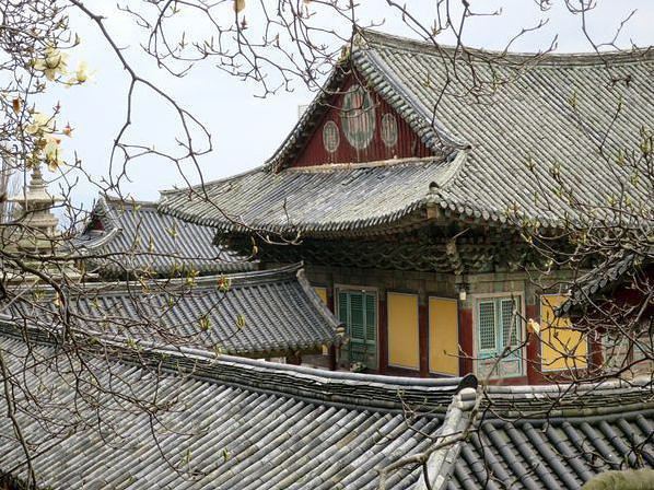
Il ne nous reste qu’un arrêt et c’est sans conteste le clou de l’excursion : le temple de Bulguksa. Construit entre 751 et 774, ce temple était l’épicentre du bouddhisme durant la dynastie des Silla, on y venait prier pour la protection du royaume face à une invasion extérieure. Les prières ne devaient pas être très efficaces car (comme pour la majorité des temples en Corée d’ailleurs) Bulguksa fut d��truit lors de l’invasion japonaise en 1593. La plupart des principaux bâtiments furent rapidement reconstruits mais il est intéressant d’apprendre que la restauration complète ne date que de 1973. Ce laborieux travail fut récompensé en 1995 quand ce complexe religieux fut inscrit sur les listes du Patrimoine Mondial.
Nous franchissons un premier porche en bois abritant quatre féroces statues en bois et poursuivons jusqu’au pied des escaliers ou ponts Yeonhwagyo et Chilbogyo qui conduisent à l’entrée principale du Geungnakjeon. Les élégantes terrasses en pierre surélevées supportent un ensemble de bâtiments en bois plus beaux et plus délicatement décorés les uns que les autres. Deux yeux ne suffisent pas pour apprécier toute la finesse des décorations et des sculptures ni l’harmonie des couleurs ou encore les détails des panneaux en bois aussi bien à l’extérieur qu’à l’intérieur. C’est tout simplement époustouflant.
Nous visitons lentement chacune des parties censées représenter le pays de Bouddha. D’abord ici, le Geungnakjeon Hall (Salle de la Béatitude Suprême), là le Birojeon et son Vairocana Hall et plus loin le Daeungjeon Hall (Salle de la Grande Illumination), sans oublier les deux pagodes (Seolgatap et Dabotap). Nous venons de visiter certainement l’un des plus beaux temples de Corée.
En attendant que tout le groupe regagne le bus, nous regardons les groupes de jeunes qui, après une donation, s’efforcent à pousser, le plus fort possible, le vieux balancier en bois sur la grosse cloche de manière à la faire résonner le plus longtemps possible.
Après avoir déposé une famille à la gare, nous faisons la tournée des hôtels près du lac pour y déposer différents groupes de retraités. Ce petit détour nous permet de passer devant le temple et la pagode de Bunhwangsa, que nous n’avions pas trouvés hier…
Retour à l’hôtel et appréciation de son confort…
Encore une fois la nuit est tombée d’un coup. Nous tentons de trouver un petit resto dans les rues derrière l’hôtel. Celui que nous trouvons est parfait, rendez-vous populaire dont la spécialité de la cheffe est le Hot Pot… Exactement ce qu’il fallait pour conclure cette froide mais superbe journée.
Gyeongju Mercredi 8 Avril 2015
8h.30 J’ouvre les rideaux pour découvrir un ciel plombé qui recouvre les montagnes à l’horizon. Les passants que j’aperçois sont emmitouflés et la chaussée mouillée. Mais en cherchant bien, on arrive à distinguer quelques trouées lumineuses qui approchent.
Le café et le croissant avalés, je sors en direction de la forteresse censée se trouver dans les environs proches. Je parcours ce boulevard qui se réveille doucement et sent si bon la province avec son animation tranquille. Les devantures des commerces s’ouvrent les unes après les autres, les petits vieux se saluent et les ménagères sont déjà à l’affut des bonnes affaires.
Mais toujours pas de forteresse ?! Peut-être est-elle comme celle d’hier, juste un emplacement vide et non pas des ruines comme je l’espérais.
Dépité, je fais demi-tour en passant par une petite rue piétonne balisée de panneaux relatant des anecdotes historiques sur la ville et ses habitants et illustrées de photos anciennes. Voyage dans une autre époque ou plutôt sur autre planète tant tout est devenu méconnaissable… sauf ces étonnantes mottes de terre (collines plutôt) rondes, abritant des tombes royales…
Elles sont vraiment partout dans la ville ! Celles-ci ne semblent pas être particulièrement protégées et l’endroit ressemble davantage à un parc de jeu pour gamins intrépides d’autant plus que de grands arbres ont fini par pousser sur les pentes. L’une de ces mini collines est toutefois entourée de barrières et en partie recouverte par des bâches bleues. Un panneau indique que des recherches archéologiques sont en cours. Plus loin une stèle m’apprend que le roi Gustaf VI Adolph de Suède est venu ici au début du siècle dernier pour participer aux travaux d’excavations d’une autre tombe. Peut-être fallait-il un Royal pour déterrer un Royal !?
Parmi l’ensemble des tumulus en voilà un tronqué, trépané, la belle harmonie des courbes est soudainement rompue peut-être à cause d’un prince fauché ou mal aimé !
Dans un coin du parc des groupes de retraités se forment en fonction de la couleur de la veste qu’ils portent. Le groupe rouge à droite, le jaune au centre et le bleu à gauche, il semblerait que les équipes s’apprêtent à participer aux de travaux communautaires prévus pour ce matin.
Je reprends la direction de l’hôtel en passant par les petites rues du quartier qui se la jouait à la Las Vegas hier soir avec ses cascades de néons. Atmosphère de gueule de bois ce matin, les bars et love hotels se refont une beauté ou plus simplement la grâce matinée.
Comme l’indique le panneau électronique à côté du conducteur, nous ne sommes que sept passagers dans ce bus qui relie Gyeongju à Seoul. Les gros fauteuils rouges sont spacieux et se transforment en lits confortables.
Midi. On démarre et le temps de rejoindre l’autoroute sur les hauteurs et lire trois pages de mon thriller et je m’endors. A intervalles réguliers, j’ouvre un œil pour m’assurer que je ne loupe rien point de vue paysage et le referme illico rassuré. Collines couvertes d’arbres déplumés, vallées couvertes de serres et zones urbaines couvertes de tours d’habitations le tout parcouru de quelques rivières qui deviennent parfois fleuves avant de disparaitre derrière une nouvelle série de petites montagnes.
Arrêt à mi-chemin dans un restoroute géant où j’arpente un rayon de boites et de bouteilles chaudes de café/moka/chocolat et trouve même un paquet de Digestive.
Trois nouvelles pages de mon thriller qui ne me thrille pas trop et nous voilà bientôt dans les banlieues interminables de la capitale et un peu plus tard dans l’immense gare de bus aperçue quelques jours plus tôt alors que nous cherchions notre bouteille de Champagne. Le soleil fait des clins d’œil et ils sont les bienvenus.
Ligne de métro directe mais wagons pleins. Pas drôle de voyager à l’heure de pointe. Enfin nous retrouvons notre petit quartier et nos points de repère. C’est carrément un retour à la maison puisque nous retrouvons le même hôtel, la même chambre (mais pas au même étage !).
Nous profitons de cette fin d’après-midi ensoleillée pour aller nous promener dans le quartier de Bukchon, réputé pour ses rues pittoresques et l’architecture des maisons traditionnelles aperçues le premier jour.
La réputation n’est pas surfaite car à mesure que nous grimpons sur la colline nous nous ‘perdons’ un labyrinthe de petites rues tranquilles, certaines bordées d’adorables maisons en bois, et de superbes vues panoramiques sur la ville moderne. Etonnants contrastes : paisible, frénétique, tradition, modernité.
Le soleil disparait et la température descend dramatiquement. Nous nous retrouvons dans la rue piétonne d’Insadong à faire du lèche-vitrine devant les magasins de souvenirs avant de nous attabler vite fait à l’intérieur d’un restaurant traditionnel au décor très agréable et surtout… bien chauffé !
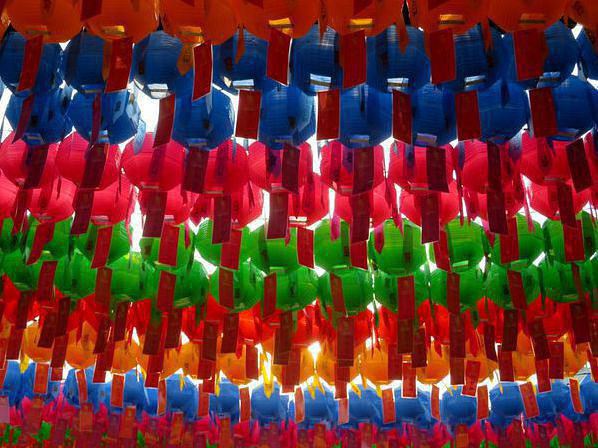
Séoul Jeudi 9 Avril 2015
En ouvrant la fenêtre au verre teinté, je découvre que le ciel que je croyais gris-marron est en fait bleu et que le soleil brille. Bras-le-bas le combat. Je descends vite acheter des croissants et pains au chocolat au Paris Croissant du coin, rien que pour le plaisir de pouvoir les tremper dans ma tasse de café.
Quelques ‘instants’ plus tard, nous allons profiter de cette magnifique journée de Printemps en prenant… le métro ! Direction l’Assemblée Nationale située sur la rive sud du fleuve, là où se trouvent non seulement le Parlement mais également un parc et une longue avenue bordée d’arbres en fleurs.
Nous ne sommes pas les seuls à descendre à cette station d’ordinaire… ordinaire. Il suffit de suivre la foule dans les couloirs puis sur les escaliers roulants. Dehors un ciel légèrement voilé nous accueille. Tous ensemble et presque au pas, nous traversons une large avenue puis passons les grilles gardées par un cordon de jeunes policiers. En haut de la pelouse, en partie occupée par des groupes de pique-niqueurs, se trouve un immense parallélépipède gris soutenu par des colonnes carrées et surmonté d'un dôme vert. Plutôt moche ce truc, en fait on pourrait se croire de l’autre côté de la ligne de démarcation !!!
Heureusement le parc est agréable et, à voir la foule, très populaire. De nombreux groupes d’amis, de collègues ou des familles se sont déjà installés pour un déjeuner sur l’herbe, certains très élaborés et incluant barbecues portables.
Nous poursuivons vers les berges et prenons la route en contrebas, fermée à la circulation mais envahie par les badauds venus admirer les splendeurs du Printemps enfin de retour. Les hivers pouvant être longs et rigoureux en Corée, ce spectacle extraordinaire, qui se renouvelle chaque année, est toujours attendu avec impatience et occasionne une certaine ferveur difficilement compréhensible pour ceux, qui comme nous, habitent un endroit où les températures ne descendent pas en-dessous de zéro et où les saisons ne sont pas vraiment marquées.
Comme à Busan, nous tombons sous le charme de Sakura, en plus sous le soleil et au milieu d’une foule souriante et de bonne humeur. Au bout de l’avenue fleurie, des arrangements floraux multicolores volent la vedette aux cerisiers et pruniers. Comme les autres, nous faisons demi-tour pour profiter de la féerie encore plus longtemps.
Nouveau petit tour en métro pour revenir dans le centre-ville, plus exactement au marché Namdaemun, en face de la station Hoehyeon. A croire que la population de Séoul qui n’était pas dans les jardins de l’Assemblée Nationale doit se trouver ici ! Toutes les rues de ce quartier commerçant, grouillent de monde.
En fait, en plus d’être un lieu historique ce marché est une véritable institution. Depuis le XVème siècle, ces souks version coréenne, proposent de tout, absolument tout. Bien vite nous nous retrouvons au milieu de ce qui partait être un croisement entre le marché d’Aligre et un super Monoprix sur plusieurs niveaux.
Successions d’étalages où s’empilent des vêtements, des cosmétiques, des ustensiles de cuisine, de la vaisselle, de l’outillage, des appareils électroménagers, des produits agricoles et de la mer (vivants, séchés, frais, décomposés…), de fruits secs, de graines sans oublier les bouisbouis et les mini-restaurants.
Bref, le genre d’endroit où les yeux, les narines et dans une moindre mesure les oreilles sont sollicités en permanence. Nous y goutons l’une des soupes les plus fades de notre séjour mais aussi les gaufres locales les plus délicieuses préparées par deux grand-mères pleines d’énergie.
Au bout d’une allée, nous apercevons le double toit de la Porte Sungnyemun. Nous allons donc la voir de plus prés. La célèbre porte se trouve à l’intersection d’avenues importantes, au pied d’un assortiment de buildings récents assez moches ou en construction. Le contraste entre deux architectures, l’ancienne et la moderne, ne peut difficilement être aussi flagrant.
Sungnyemun est la porte sud de Séoul et la plus grande structure en pierres avec une entrée en forme d’arche. Elle est surmontée d’un magnifique bâtiment en bois de deux étages finement décoré. La porte fut érigée en 1398 sous le règne du roi Taejo, le fondateur de la dynastie Joeson. Elle perdit une partie de ses murs lors de l’occupation japonaise en 1907 puis fut sérieusement endommagée durant la guerre de Corée (1950-53). Entre 1960 et 1962, elle fut entièrement démontée, restaurée puis remontée. Ce long travail de restauration fut réduit à néant en février 2008 par un déséquilibré qui y mit le feu. Après cinq nouvelles années de restauration, le trésor national No1 fut ouvert au public en mai 2013. Les apparences sont donc parfois trompeuses… car ce magnifique bâtiment que l’on croyait plusieurs fois centenaire est en fait plus récent que la Bank of Korea qui lui fait face !
Du carrefour, nous reconnaissons d’un côté l’Hôtel de Ville, de l’autre la gare. Le plan semble indiquer que la station de la gare sera la plus directe pour revenir vers Insandong. D’après la brochure du Tourist Office, il resterait encore un temple et une pagode dans les parages qui auraient échappés à mon radar.
Quelques demandes de renseignement plus tard, nous voilà devant le portique du temple Jogyesa protégé par de féroces silhouettes guerrières et décoré de centaines de rangées de lanternes de couleurs qui ondulent doucement à la légère brise.
Comme pour la Porte Sungnyemun, le mélange ancien et moderne est saisissant et encore plus brutal ici car il n’existe même pas un petit espace vert pour servir de transition.
Un portique imposant, deux superbes pavillons en bois mais où est donc la pagode !? Elle est bien là, toute minuscule dans un coin, vraiment rien de spectaculaire… contrairement aux admirables panneaux en bois décorant les deux pavillons. Derrière les baies vitrées du Dewungjeon (temple principal) on aperçoit trois bouddhas dorés et vénérés par une vingtaine de croyants. L’un des avantages des temples en bois est qu’ils peuvent être démontés et reconstruits ailleurs. C’est le cas du Dewungjeon originaire de la province de Jeolla dans le sud mais réassemblé ici en 1938.
Perchés sur une nacelle, deux jeunes ajoutent des guirlandes aux branches d’un grand pin et alignent toujours plus de rangées de lanternes en préparation de l’anniversaire de Bouddha : un évènement important pour l’Ordre du bouddhisme coréen de Jogye dont Jogyesa est le temple principal. Les rayons du soleil couchant illuminent une dernière fois les dorures des toits et des peintures. Il est temps de regagner l’hôtel et de souffler un peu.
Impossible de quitter ce pays sans gouter aux grillades coréennes. La mission de cette dernière soirée à Séoul est donc d’arpenter les rues du quartier et de trouver un restaurant spécialisé dans les grillades. Mission accomplie moins de vingt minutes plus tard. Nous n’avons qu’un regret, celui de ne pas l’avoir fait plus tôt !!!
Sur le chemin du retour, nous faisons un premier arrêt devant la charrette du marchand de marrons chauds puis un second à la pâtisserie traditionnelle du coin dont la devanture est remplie d’une incroyable sélection de gâteaux de riz. Ils remplaceront, demain matin, les croissants et pains au chocolat du petit déjeuner !
Séoul Vendredi 10 Avril 2015
Réveil tardif pour ce dernier jour des vacances… déjà ! Dehors, beau soleil, une magnifique journée printanière qui s’annonce mais nous n’aurons pas la chance d’en profiter. Je me console en dégustant des gâteaux de riz et en regardant un documentaire québécois sur TV5. Ici nous avons même le choix : TV5 Asie ou TV5 Pacifique. Entre les deux mes yeux zappent.
11h. Il est temps de trainer nos petites valises sur les trottoirs de ce petit quartier que nous commençons à bien connaitre. Pincement au cœur car nous n’avons pas vraiment envie de partir. Notre désir de revenir s’accroit à mesure que nous approchons de l’arrêt de bus… situé à proximité de l’Amandier, le point de départ de nos ‘aventures’ sud-coréennes. Nous en profitons pour y aller acheter notre lunch.
Malgré la circulation le 6011 arrive à l’heure indiquée. Comme à l’aller, les rares passagers ne tardent pas à piquer un somme. C’est vrai que le paysage, même ensoleillé, n’est pas folichon : successions de banlieues avec des tours numérotées, de zones industrielles et de zones en travaux entrecoupées de canaux et de rizières et d’espaces verts qui ne le sont pas encore.
Une fois passée la douane, il nous reste une paire d’heures pour découvrir cet aéroport (classé, depuis plusieurs années, premier au monde ?!) avant de nous envoler direction plein sud.
Du hublot et au travers des nuages, je suis des yeux la côte déchirée de l’ouest de la péninsule qui peu à peu finit par se perdre dans une brume puis se confondre avec l’océan.
A quand la prochaine fois ?
Quant à la comparaison entre le Nord et le Sud de la péninsule ? Il n’y a bien sûr pas photo et le Chti que je suis doit admettre que pour une fois le Sud est bien mieux que le Nord !
J’ai également appris que les Coréens du Sud aiment manger épicé… (très épicé !) mais qu’ils partagent avec moi une sacrée « sweet tooth » (chose plutôt rare en Asie). C’est aussi ici que j’ai trouvé les meilleurs croissants au monde… (OK après la France !) et qu’heureusement ils ne se sont pas toujours à l’ail !!!
La Corée du Sud est un joli pays avec une longue histoire, Seoul et Busan sont deux villes excitantes, et les Coréens sont des gens charmants et serviables. Ces quelques jours passés chez eux nous ont tellement enchantés que nous avons hâte d’y retourner.
Pour les photos, c’est ici et là.
Changement de mentalité thaïlandaise?
Suite aux quelques propos que j'ai pu échanger avec Thuan sur un autre topic et ne voulant pas flooder indéfiniment le topic d'un autre membre, je crée ce sujet afin de poser une question sur la mentalité thailandaise !
Je me demandais simplement au vu de la fascination de la jeunesse thailandaise pour l'occident si les mentalités n'étaient pas en train de changer et si la jeunesse thai en voulant suivre un mode de vie et des preceptes occidentaux, ne perdraient pas certaines valeurs ou si au contraire la jeunesse thailandaise finalement évoluaient dans le bon sens en jumelant deux cultures différentes en y prenant le meilleur de chacune !
J'imagine que ce changement s'il y a, doit être beaucoup plus manifeste à Bangkok que dans le reste du pays !
Namibia Travel Journal: May 2025 - Trip Review
NAMIBIA TRIP 2025: April 24 to May 20: Feel free to comment or ask us any questions about this amazing journey.
>> Find all our photos and videos for each day on our website here: www.montagne-aventure.net
**DAY 1: Thursday, April 24, 2025: Outbound Flights from Lyon to Windhoek via Munich - Visit to Munich:**

Off we go on a new adventure. The alarm rings at 6:30 AM, the travel bags are packed, and we head to Lyon Airport. We booked our flight tickets with Lufthansa. The first leg to Munich, Germany, is operated by AirBaltic. Departure at 1:05 PM for a 1-hour and 20-minute flight. We arrive at 2:30 PM.
**We now have a 7-hour layover, so we take the opportunity to get some fresh air and explore Munich.** We quickly exit Terminal 2 of the airport and head towards the subway. We buy a group day ticket "Airport-city Day Zone M-5," valid for 2 to 5 people at a price of 30.50 € (instead of 16.30 € per person). We take the S8 line to **Marienplatz** in 35 minutes. **This is the heart of the city.** The weather is overcast, quite cool, but dry. Perfect for a little city trip between two flights while leaving our large luggage in transit at the airport. **Munich is the third-largest German city after Berlin and Hamburg, in the Bavaria region.** **The center has a lot of charm and brings together several religious buildings, easy to explore on foot.** We are impressed by the number of people enjoying these 100% pedestrian streets, which are very pleasant. After Marienplatz, the most famous square with the town hall, we head to the Cathedral of Our Lady, a Gothic church, then continue to **Karlsplatz** and move on to **the food market offering a wide selection of high-end food products in an atmosphere where a certain art of living prevails.** We also visit St. Peter's Church before grabbing a bite to eat. Two good hours were enough for this 10 km city walk. It's time to take the subway back: by 6:30 PM, we are back at the airport. Now, it's time for a bit of waiting and rest. Our second flight is scheduled for 9:35 PM for a 9-hour and 30-minute journey to our final destination in Namibia: **Windhoek.**
> Round-trip flight tickets with Lufthansa from Lyon: 2029 €, or 1,014.50 € per person.
> Lyon Airport parking: 120 €
> Today's expenses: 7 € for 2 pizzas in France / 14 € for the restaurant in Munich / 30.50 € for the daily subway ticket in Munich.
**DAY 2: Friday, April 25, 2024: Arrival in Windhoek, Visit to the Namibian Capital:**
After a 9-hour and 30-minute overnight flight with Discover Airlines, we finally land on Namibian soil just before 7:30 AM. The day is breaking, and the colors are already stunning. We are eager despite the usual fatigue from the flight. The airline was punctual, with friendly staff and good meals, though a bit light. We are the first flight of the day to land, with no more than 15 flights per day here, from 7 AM to 8 PM. We disembark on the tarmac at this airport located in the middle of nowhere, **I finally set foot on African soil for the first time.** We exit among the first from the aircraft to go through the long formalities at the front of the line, as the wait can quickly become endless. Allow at least 5 minutes per person for e-visas. We still wait 45 minutes despite only about twenty people ahead of us. Phew, it's done. We collect our luggage and then withdraw money from an ATM. We make 4 withdrawals of the maximum amount, 2000 NAD $ per withdrawal, for a total of 380 €, or 95.33 € per withdrawal.
Our driver arrives at the same time, perfect timing, we were quick.
We leave the airport at 8:45 AM. By 9:30 AM, we arrive at the **Gracious Whisp vehicle rental agency**, located at the entrance of Windhoek, small and human-sized with a fleet of recent vehicles. More formalities, then a short wait as our vehicle is not yet ready. Time to decompress, catch our breath, and enjoy the very pleasant morning temperature. Not a cloud in sight. Next, a briefing on the vehicle, always with a bit of apprehension due to our approximate English. Allow 45 minutes of explanations, including setting up the roof tent, camping equipment, technical information in case of a flat tire, driving tips in Namibia, and a tour of the 4x4. We have all the necessary equipment for camping: mattresses, sleeping bags, pillows, table, chairs, gas stove, BBQ grill... as well as 2 spare tires, a compressor, a dual tank, and accessories for removing wheels. Off we go, it's time to muster our courage and get behind the wheel. **Heading to SuperSpar Maerua**, fortunately located less than 10 minutes away. We park with the help of a parking attendant; it's very crowded, the space is narrow, but everything goes well despite the cursed right-hand drive. Today's new mission: stock up on groceries. The store is well-stocked with local and imported products, catering to all tastes. We spend 114 € on groceries, from pasta to meat, BBQ lighters to dishwashing products. Two people load our groceries into two carts and transfer them to our vehicle; we feel compelled to leave a tip, 50 NAD $, as we don't have change yet. Now, we head to the hotel, 15 minutes away. Traffic is difficult at a complicated intersection; this will likely be the only traffic jam in Namibia. **We arrive at Kate's Nest Guesthouse & Backpackers around 1:15 PM, quite tired.** We take some well-deserved rest at this recent establishment, quite calm with secure private parking. After a short nap, we enjoy the quiet by the hotel pool. Night falls between 6:30 PM and 7 PM. We eat quietly in our room tonight before starting this long 4x4 road trip in camping mode in the heart of Namibia.
> Today's grocery expenses: 114 € at Super Spar Marua (2395.21 NAD $).
> Round-trip flight tickets with Lufthansa from Lyon: 2029 €, or 1,014.50 € per person.
> Vehicle rental: 4x4 Toyota with roof tent for 24 days: Gracious Whisp Car Rentals: 2,638 € (N$50,640) or **1,319 €** per person - (https://gwcarrentals.com/)
> Distance driven today: 15 km.
> Accommodation: Kate's Nest Guesthouse & Backpackers - 4 Aristotles Street Academia, 9000 Windhoek - 36 € for two for one night.
> Windhoek International Airport website: (https://www.airports.com.na/)
**DAY 3: Saturday, April 26, 2025: Windhoek to Hardap: Mariental Region - Kalahari Desert:**
After a good, restful night, we wake up leisurely around 7 AM. We enjoy the comfort provided by this first and last hotel before 24 nights under the tent.
**We leave Kate's Nest Guesthouse at 8:30 AM to tackle the Namibian roads.** We quickly leave the capital; in just 30 minutes, we find ourselves almost alone in the world. The landscape is dotted with small domes. We leave the **paved B1** quickly to turn left onto the **C15**. **From there, we won't see more than 10 vehicles all day.** After passing through the few houses of **Lekkerwaterpoort**, we tackle our first gravel road. These road sections are limited to 100 km/h, but even at 70 km/h, I find it already challenging. However, I quickly get used to it and gradually pick up speed to reach my cruising speed of around 80 to 90 km/h. **We are on immense straight lines crossing wild expanses as far as the eye can see.** **We come across two baboons, a few ostriches, and numerous cattle and sheep farms.** We pass through the charming village of **Uhlenhorst** with its typical houses and children with broad smiles waving at us. Life here is already very different from Windhoek. **The thermometer rises quickly from 16°C at 8:30 AM to over 28°C in the early afternoon.**
**We arrive at the Hardap Dam reserve at 2 PM.** We stop at the toll booth at the park entrance to pay the entrance fee: 250 NAD $ for 2 people and 1 vehicle. We continue to the dam and then the camp entrance, located a bit further. We had booked in advance, but this place remains little frequented by foreigners.
We take advantage of the hottest hours to rest by the large pool overlooking the immense lake, a very enjoyable moment. Would this be a bit of a vacation?
Around 4:30 PM, we head to the campsite. We overlook this vast water reserve. We arrive first; we will be only 3 vehicles spending the night here. It's time to get to work and set up our equipment for the first time. It takes us a good 20 minutes to set everything up, with a slight apprehension about unfolding the tent. Once this task is done, which we will have to repeat for almost a month, we will become much more efficient over time. Time for rest and contemplation in total silence. The sun gradually sets, and the heat quickly becomes bearable again. Bliss! **This dam is located 20 km northwest of Mariental in an area dotted with conical hills topped with dolerite buttons (Hardap means "hillock" in Nama). It captures the Fish River, which flows south, creating a large lake in the middle of an arid environment. The contrast is striking.** We enjoy our first sunset facing this 360° otherworldly landscape.
Around 7 PM, we start our first BBQ, or "braai" as it's called here. The temperature is perfect. The sun sets, giving way to a star-filled sky of incredible beauty thanks to the absence of any light pollution. The Milky Way will lull us throughout the evening. After some good sausages and potatoes on the BBQ, we head to our roof tent around 9:30 PM with a complete change of scenery in just 24 hours. France already seems so far away...
This campsite has shared showers and toilets, quite clean and functional, as well as a central area with several BBQs and tables. The sites are arranged in a semicircle, each with an electrical outlet. The sites are close to each other but spacious, some slightly shaded. We are only three vehicles tonight, so it's perfectly comfortable and quiet. Not to mention the large pool near the restaurant. Our trip is off to a great start.
> Today's road itinerary: Windhoek > Head south on the B1 to Rehoboth > Turn left onto the C25 then C15 to Stampriet > C20 to Hardap > Full north on the B1 > Then turn left onto the M93 - 5 hours of driving.
> Distance driven today: 354 km.
> Accommodation: Hardap Recreation Resort - 23.3 € for two - Large pool - GR6W+3M2, Hardap Game Reserve, Mariental, Namibia - (http://www.nwr.com.na/resorts/hardap-resort/)
**DAY 4: Sunday, April 27, 2025: Hardap - Brukkaros Volcano - Keetmanshoop - Quivertree Forest Rest Camp**
Our first night under the tent was very pleasant; the little wind quickly calmed down, giving way to absolute silence. The mattress is decent, more comfortable than some nights in Nepal. The length and width give us enough space for maximum comfort, despite my height (1.91 m). We wake up a little before 7 AM as the sun rises, and the lights dazzle us from the start of the day. We pack up the equipment in 30 minutes, quite easily. Then we enjoy the sun, which warms up quickly while we keep our light fleece on.
At 8:30 AM, **we hit the road again, heading south** to our first stop in **Mariental**. We want to do some shopping at SuperSpar, but once we arrive in the parking lot, a young local is fighting with the supermarket security guards and then threatens to throw stones. We don't want to take any risks right at the start, so despite the baton blows he receives, he doesn't stop. We leave empty-handed but fill up with fuel at the Shell station 1 km further. The price per liter is 21.33 NAD $, we fill our 107-liter tank for 107 €. In Namibia, you get served, and they bring the card machine to the window to pay. It's then customary to leave a tip.
We then take the B1 heading due south on a recently renovated road. Around 11:30 AM, we leave it on our right to take **a wild gravel road, the M98**. Just before **Berseba**, we turn right onto a small track, the **D3904 towards Brukkaros Crater up to a camp at 1588 m altitude**. The track then becomes too bumpy. We stop on the counter-slopes where **a wide panorama unfolds over these immense plains as far as the eye can see**. It's 12:15 PM, time for us to eat a rice and tuna salad facing this landscape.
**We are alone in the world until a vehicle arrives and parks next to us.** A bit of apprehension, 4 men head towards us. It turns out to be 4 shepherds looking for a lost foal. The conversation is pleasant, lost in the middle of nowhere. We find ourselves alone again in this absolute silence. **The heat becomes stifling with a good 30°C**. We get back on the road around 1 PM. Back on the B1, **we continue due south to Keetmanshoop**, which we reach around 3 PM. We stop there to do some shopping for 262 NAD $ (12 eggs, a can of tuna, a can of corn, bread, a soda, and a 5-liter water container), or 12.48 €. Two quite insistent children ask us for money or candy at the store exit, yet we give them a small tip, but they continue to cling to the car. Locals parked next to us tell them to leave us alone. Anyway, we finish the trip to **Quivertree Forest**, 15 km away. We will spend the night in this **pleasant farm run by a German**. Upon arrival, as the day before, and as I suppose in the future, we dive straight into the cool pool to relax after all these kilometers. A bliss. Then we take our 4x4 and choose a spot near these famous trees. After the 33°C this afternoon, once 4 PM passed, the temperature drops again and becomes very pleasant. **We are in the middle of the Kokerboom, one of the most interesting and characteristic plants of hot and arid regions. It's not really a tree but a variant of the aloe plant whose botanical name is Aloe Dichotoma. This Kokerboom has a smooth and thick trunk reaching up to 1 m in thickness and 9 m in height. They bloom for the first time at the age of 20 to 30 years.** The flowers are yellow and reach about thirty centimeters during the season between June and July. **They grow mainly in an environment with a high concentration of black rocks absorbing a large amount of heat (38°C). The rocks also serve to anchor the tree with its tentacle-like roots. It also resists frost. Each is between 200 and 300 years old.**
Around 5 PM, we walk to the farm reception to watch the feeding of **two cheetahs**. Magnificent carnivores taking their time to savor their piece of meat. **Then we return near our campsite to enjoy the sunset among these trees. The colors are sublime, as every evening apparently. A magnificent spectacle with colors evolving from yellow to orange then to pink, before giving way once again to a sky filled with thousands of stars.** Our campsite at Quiver Tree Forest Camp is very comfortable; we have a water supply, a stone table, a small lamp, an electrical outlet, a small tree for shade, and a BBQ that we won't use tonight; we'll cook on gas. The sites are far apart, with some shared facilities scattered around, a very beautiful setting. No reservation possible, no need, just show up directly. **The campsite accommodation for 2 people costs 28 €, including the reserve entrance fee of 5 €**. We finish this second bivouac evening around 9:30 PM, time for some reading and sleep in peaceful silence without wind.
> Today's road itinerary: Mariental > B1 heading south to Brukkaros > At Tses turn right towards Berseba via the M98 > Turn right onto the D3904 > 8 km > Brukkaros Volcano (stop at the lower camp as the track is difficult for 1 hour) > Keetmanshoop > Turn left onto the M29 > Quivertree Forest - 4 hours of driving.
> Distance driven today: 371 km.
> Distance walked today: 6 km.
> Today's expenses: Groceries for 12.48 € (262 NAD $) / Fuel for 107 € (1 liter of diesel for 21.33 NAD $).
> Accommodation: Quivertree Forest Rest Camp, P.O. Box 262, Keetmanshoop, Namibia - BBQ, hot showers, toilets, and electricity - No reservation - Pool - 18 €/Person (N$ 340.00 with park entrance) - (http://www.quivertreeforest.com/)
**DAY 5: Monday, April 28, 2025: Quivertree Forest Rest Camp - Giant's Playground - Keetmanshoop - Fish River Canyon - Canyon Roadhouse:**
After an excellent start to the night, we are woken up by the wind shortly before 6 AM, but the sunrise is not far off. We get up at 6:30 AM to enjoy it. The atmosphere is a bit cooler this morning, but the reward is already here.
The adventure continues. At 7:45 AM, we head towards **Giant's Playground**, 4 km away. We take a 3-kilometer walk through this expanse of blocks and igneous rocks.
We continue south at 8:45 AM, passing through Keetmanshoop again where we do some shopping for 25 €, a big stock-up for a good part of the trip: meats, canned goods, pasta, fruits... At 9:30 AM, we take the B4 to Fish River Canyon.
At 11:30 AM, we arrive at the entrance to the NWR park (350 NAD $ entrance for 2 people and 1 vehicle). The track becomes bumpy immediately upon entering the park. After about ten kilometers, we come upon this landscape carved by nature. In the end, it's well worth the detour. We were at the Grand Canyon in the USA exactly (https://www.montagne-aventure.net/2024/04/29/j21-3-juin-2024-grand-canyon-et-lac-powell/) and can thus confirm that this Fish River Canyon is comparable. We make several stops along the southern flank. **Here, nothing is developed; nature is almost in the wild state.** **With 160 km in length, up to 27 km in width, and a depth of 150 m, it is indeed the second-largest canyon in the world.** The history of the canyon is apparent in its different earth layers and stratification: the antiquity of the place is tangible, and the absence of vegetation is surprising. **It consists of two nested canyons, formed at distinct periods. The first distinct layer of schist, sandstone, and eruptive material surrounding the canyon was formed a few two billion years ago, then transformed due to heat and pressure into more solid rock such as gneiss. The inner canyon, carved more recently by the Fish River, has a depth of 270 m.**
We have a picnic once again alone in the world facing this grand panorama at the **Sulphur Spring View Point**. This is where the hiking trail begins, plunging into this narrow canyon, but it is forbidden to venture there alone without a guide. It's 30°C, but a slight wind makes the atmosphere bearable. At 1 PM, we retrace our steps and continue to the **Main View Point** then to the **Hikers View Point**.
In the south of Namibia, the Fish River Canyon, 160 km long, is a true geological wonder: a canyon nested within another canyon, one of the largest in the world. The first sedimentary layers formed two billion years ago; 500 million years ago, a period of tectonic activity caused these layers to crack and tilt, opening a vast canyon in the Earth's crust. The second canyon, with a depth of 270 m, was carved over time by the passage of the Fish River in this new valley.
At 3 PM, we arrive at our very charming camp for the evening, the **Canyon Road House**. We fill up with fuel right away because tomorrow we have a long day of isolated driving: 55 liters for 1240 NAD $. Then we settle into the campsite we had previously reserved in France. We are assigned site 2, very well set up under a tree with its BBQ and stone table just steps from the pool. We quickly set up the tent and jump straight into the pool for the relaxation moment of the day. As usual, the water is quite cool, but it's a real pleasure. Then we stroll around this Canyon Road House, which recreates the atmosphere of the roadside inns of the 1950s with old car wrecks and vintage gas pumps in a bygone era. **Around 5:45 PM, we start a short walk leading us to the top of a hill overlooking the wide plateau where we are to watch the sunset.**
And finally, to end this beautiful day, it's time for the braai, with grilled sausages and white beans on the evening menu.
> Park entrance: 150 DN/person + 50 DN/vehicle (18 € for two). It is possible to enter at two access points: Hobas in the north and Ai-Ais in the south.
> Today's road itinerary: M29 > Keetmanshoop > B1 > B4 > C12 (track) > After Holoog turn right onto the D601 (C37 track) > Accommodation on our right (stop just to check in before 6 PM) > Continue 30 km (30 minutes of track) to the viewpoints after Hobas where you must pay the entrance fee. Sunset View Point to the left > Return before sunset as the park closes (best lights at sunrise). 3 hours.
> Distance driven today: 228 km.
> Distance walked today: 10 km.
> Today's expenses: 25 € for groceries / 17 € for the Fish River Canyon park entrance / 58 € for fuel.
> Accommodation: Canyon Roadhouse, Gondwana Collection Namibia – 34.4 € for two - Pool - Near Hobas - (http://www.gondwana-collection.com/fr/accommodation/canyon-road-campsite)
**DAY 6: Tuesday, April 29, 2025: Canyon Roadhouse - Orange River - South African Border - Vista Trail - Gondwana Sperrgebiet Park - Aus:**
The night was excellent in this very comfortable campsite. **We wake up to the sound of birds** before the alarm at 6:45 AM. Our little morning routine starts as the sun rises. **A big day of driving awaits us to the South African border. This will be the southernmost point of our journey.** We hit the road at 8 AM via the C37, pass through **Hobas**, then turn onto the D207 to **Aussenkehr.** **We cross a mountainous barrier with some high peaks and perfect cones. The rock varies from orange to pink to black.**
We then cross a lunar desert as far as the eye can see on a giant dome; the track winds through nowhere without meeting anyone for hours. The landscapes are surprising. **We spot several ostriches and a gemsbok.** In the middle of this endless expanse, we come to an improbable intersection and continue right onto the D278.
In the middle of these arid lands, we come across a green zone: a vast vineyard. At 10:30 AM, **we come across a "Road closed" sign, fortunately, a local resident waves us to continue; a bit stressed, we proceed.** We start to follow the beautiful Orange River. On the other side of the bank, just a few meters away, South Africa is there. It is the second-longest river in Southern Africa, after the Zambezi. It flows over 2,000 km to the Atlantic. After passing through narrow gorges, we regain altitude before starting the descent, gently heading back north.
**We now cross and follow the Fish River, which joins the Orange River further south** **along this gorge dating back millennia.** At exactly noon, we take a lunch break by the Fish River, still without meeting a soul in this landscape between greenery and aridity. The temperature here is cooler with a pleasant 23°C on the banks, the perfect spot. **We continue on the track to Rosh Pinah**, where we find a paved road again. **The section along the Orange River and the Fish River was officially closed, but we were able to pass without any issues, avoiding a detour of at least 3 hours.** Phew. We now drive at high speed (limited to 120 km/h) through these vast spaces. We come across many ostriches after the **dozens of monkeys along the Fish River**. Around 3 PM, 3 km after the very small town of **Aus**, we reach **our campsite for the evening at Klein Aus Vista**. A new **small peaceful haven very well set up**. As usual, after checking in at reception, we jump straight into the beautiful pool to get our well-deserved dose of coolness, another good thermal shock that our bodies appreciate. Once this moment of relaxation is over, we take our 4x4 to reach the campsite located a bit higher, set apart at the foot of a hill that overlooks us.
After setting up, **around 5 PM, we head to the Vista Trail to climb to the top of a mountain overlooking the vast plain that surrounds us at 360°**. It takes about 30 minutes to climb. The place is just magical, **the perfect viewpoint to admire the sunset**. **We fully savor the moment. We also spot one of the few wild horses in the world capable of living in the desert.** Their numbers have decreased in recent years due to predation and drought (around 100 to 150). At 7 PM, we return to the camp, time for the braai and preparing the meal in this peaceful little camp.
In the south of Namibia, the Fish River Canyon, 160 km long, is a true geological wonder: a canyon nested within another canyon, one of the largest in the world. The first sedimentary layers formed two billion years ago; 500 million years ago, a period of tectonic activity caused these layers to crack and tilt, opening a vast canyon in the Earth's crust. The second canyon, with a depth of 270 m, was carved over time by the passage of the Fish River in this new valley.
> Today's road itinerary: 5 hours of driving: D324 heading south (track) > turn right onto the C10 (track) > D316 heading south > turn right onto the C13 > In Aus turn left onto the B4 > Campsite via a track on the left.
> Fuel station: Solitaire or Aus.
> Distance driven today: 398 km.
> Distance walked today: 7 km.
> Accommodation: Klein-Aus Vista Desert Horse Campsite - Farm Klein-Aus No 8 on the B4 main road to Luederitz Aus 9000, Aus, Namibia - (http://www.klein-aus-vista.com/accommodation/desert-horse-campsite/) 17908 420 DN - Water + Shared shower (hot water). No electricity.
**DAY 7: Wednesday, April 30, 2025: Aus - Kolmanskop - Diaz Point - Luderitz - Kanaan Desert:**
We wake up around 6:45 AM, with partly cloudy weather for once; we feel the ocean's influence gradually. But the sun isn't far off. At 7 AM, we leave the campsite heading west towards Luderitz via the B4. **First stop of the day: Kolmanskop, the ghost town we reach at 8:30 AM**, entry costs 180 NAD $ per person. We discover this **timeless place** in 1.5 hours, moving from building to building amidst violent sand-laden gusts of wind. There's a lot of charm in these different living spaces. **The sand quickly reclaimed the place after this mining town was abandoned.** This was once the headquarters of Consolidated Diamond Mines. It's hard to believe that this former town, where the diamond industry once flourished, had a hospital, a bowling alley, and a theater. The decline in diamond sales after World War II and the discovery of richer deposits put an end to this golden age. By 1956, the town was already completely deserted, and the sand had reclaimed its rights. **These dilapidated buildings swallowed by shifting dunes have something surreal about them.**
At 10:15 AM, we hit the road again **heading to Luderitz, 22 km away**, and first to **Diaz Point** **facing the Atlantic Ocean**. It's a wind-swept peninsula with its characteristic red and white lighthouse. There's a campsite and a coffee shop on site, but the place doesn't inspire rest without shade or shelter from the wind. We return to the city via the D701 track that runs along the ocean, be careful at low tide. We come across **a few fishermen and a fox as well as flamingos.**
We walk through the few streets of the city, much smaller than I imagined, then climb to the **famous little Lutheran church that overlooks the city, the Felsenkirchr.** **The wind blows very strongly here, and the sand is omnipresent, surrounded by the Namib Desert and the southern Atlantic coast.** **A German colonial relic barely touched by the 21st century, Luderitz seems frozen in the past, giving it both a gloomy and a certain charm. In short, it's certainly one of the most incongruous places in Africa.**
At 1:15 PM, just before leaving Luderitz, we do some shopping for 20.50 € and fill up with fuel: 61.50 €, 1290 NAD $ for 61 liters (21.18 $ per liter).
**We return via the B4 to Aus** (paved), **then via rougher tracks**, the C13 then the D707, magnificent as it runs along a mountain range with multiple colors on our right and an endless flat desert on the other side.
To access our campsite for the evening, we must take a **narrow private track for 7 km** on our right to emerge, in this total vastness, at the **isolated Kanaan Desert Retreat on a small hill**. I don't have time today to jump into the pool near the reception; we arrive at 5 PM at 8 small, isolated, and unique sites with a small kitchen, a shower, and a private toilet under a small tarp shelter. **A crazy charm with a unique view...** **This will be my favorite accommodation of this trip. The photos speak for themselves.** We jump into the outdoor shower while savoring the landscape, then prepare our evening braai while enjoying the colors fading, facing this plateau with bushes turning a vivid orange. **A moment that will remain etched for life.** **Savanna atmosphere under a thin emerging moon. Every minute offers different colors. Facing our meal, we have a natural giant screen.**
We end this day contemplating the stars and admire this thin orange moon setting on the horizon (8:42 PM).
**Ghost town just before Luderitz: Kolmanskop** (open from 8 AM to 3 PM - N$ 180 p.p – 9 €). Once, Kolmanskoppe was organized around diamond mining. After finding new, more prolific spots, the town was abandoned and is now a ghost town. The sand and dunes have reclaimed their rights and buried everything humans had built. Houses, train station, bakery, everything has been covered by sand, which passes through the windows, even though they are 1 meter high.
> Today's road itinerary: 5h30: B4 to Luderitz (paved) > Round trip > Kolmanskop on the left > Return via the previous campsite > Then C13 (track) > Turn left D707 (track) > Then track to the right to the campsite.
> Distance driven today: 438 km.
> Distance walked today: 8 km.
> Today's expenses: Groceries at the Spar in Luderitz for 20.50 € / Fuel fill-up in Luderitz for 61.50 €.
> Official Kolmanskop website: (https://kolmanskuppe.com) (open from 8 AM to 1 PM - N$ 180 p.p – 9 €).
> Accommodation: Night at the south of the Namibrand Nature Reserve: Kanaan Desert Retreat – 26.5 € for two - (http://www.kanaannamibia.com/) - Farm 104 Karas 9000 - Sanitary facilities + BBQ + Water + Pool - No electricity - My favorite accommodation of this trip.
**DAY 8: Thursday, May 1, 2025: Kanaan Desert Retreat - Namib Desert - Crossing the Namibrand Nature Reserve – Sesriem Canyon - Elim Dune - Little Sossus Lodge**
After a cooler night than the previous ones with about 10°C, we wake up around 7 AM. We admire, as usual, the sunrise between the desert and the mountains. **The spot from last night was truly perfect, isolated from the world, in total serenity, with a wake-up call to the sound of birds.**
We hit the road a little after 8 AM, heading north via the D707 to Spes Bona, then the gravel road C27 via Betta to Sesriem. **The landscapes roll by and dazzle us.** **We are right in the heart of the Namibrand reserve**, coming across numerous **zebras**, **impalas**, **ruminants that reproduce in large numbers**, and **gemsboks**. At noon, we stop in the shade of a tree to eat. The spot is so romantic facing orange arid mountains and a vast green plateau. **A landscape full of contrasts, timeless and silent.**
**The Namib Desert is the oldest on the planet; its name means "vast arid plain," and it also gave its name to the entire country: Namibia.** The majority of these arid and semi-arid lands dotted with viewpoints are part of the Namib-Naukluft National Park, which covers 23,000 km².
At 1 PM, we enter the Sossusvlei park. We start with the **Sesriem Canyon**, which is 3 km long and 30 m deep. We enter it with a short 1-hour hike into its depths. **It was carved by the Tsauchab River in an agglomerate of sand and pebbles over 15 million years old.** We retrace our steps back to Sesriem, which means "six belts," referring to the number of leather belts (from ox wagons) needed to draw water from the canyon. This remote locality is mainly the gateway to Sossusvlei but offers a gas station and some accommodations. For our part, we sleep 40 km away tonight.
**We then move on to Elim Dune.** It takes about 45 minutes of walking to reach its summit, and the climb is very breath-taking as we progress in the sand where we almost slide back with each step. **A first grand 360° panorama unfolds. The ochre color of the sand contrasts completely with the yellow plain and the brown and black mountains in the distance.**
At 3:15 PM, we start the descent facing Sesriem. We were completely alone once again on this dune. **These Namib dunes are composed of colored quartzite sand, presenting hues ranging from cream to orange and from red to purple. Unlike the ancient dunes of the Kalahari, these move with the wind and adopt distinct, ever-changing shapes.** Star dunes resemble stars seen from above, while transverse dunes, like those on the coast south of Walvis Bay, stand perpendicular to the prevailing southwest wind. The most stable dunes, which thus have the most vegetation, are parabolic dunes, due to the variability of the winds. Longitudinal (seif) dunes measure up to 100 m in height, while barchan dunes, crescent-shaped and predominant at the extreme north of the Skeleton Coast and south of Luderitz, are the most mobile, created by unidirectional winds.
**We get back on the road for 45 minutes to our campsite for the evening, Little Sossus, which we reach at 5 PM**, via C27 then right onto C19. As often upon our arrival, I jump into the cool pool to relax after all this driving, then we proceed to set up the camp. As the day before, the campsite consists of 10 fairly distant sites, with private sanitary facilities and a small roof. We are delighted with this crazy charm. The hot water for our shower is wood-heated: a Namibian lights it every evening around 5 PM.
For a change, or not, the menu features a small BBQ with pork ribs and pasta, facing another sunset, this time with partial cloud cover giving equally splendid colors. Time for a well-deserved rest after long corrugated tracks covered in our 4x4 today.
> Today's road itinerary: 4h45 of driving: Find the D707 and head north (track) > At Spesbona turn left onto the C27 (track) > At Sesriem after entering the park, turn left following View Point Sesriem > Continue 4.5 km to the Sesriem Canyon Parking > Return then head towards Elim Dune > Exit the park then take the D826 > Turn right onto the C19 heading SE > Turn right facing the D854 to the campsite (campsite closes at 7 PM).
> Distance driven today: 272 km.
> Distance walked today: 8 km.
> Today's expenses: Entry to the Sossusvlei Namib-Naukluft Park: 17 € for two (with one car).
> Accommodation: Little Sossus Lodge – 35 € for two - At the junction of the C19 and D854 roads Maltahohe 9000, Maltahohe, Namibia - (http://www.littlesossus.net/) - Pool + Private bathroom + Hot water + Electricity + BBQ + Grocery store (bread to order the day before).
**DAY 9: Friday, May 2, 2025: Little Sossus Lodge - Namib-Naukluft National Park – Sesriem - Sossusvlei - Big Daddy – Deadvlei - Tsauchab River Camp**
Today we start the day early to tackle **the famous dunes of Sossusvlei at first light**. The alarm goes off at 6 AM to leave the camp at 6:45 AM. The wind is blowing quite strongly in gusts this morning, but it only woke us up a quarter of an hour before sunrise. The park opens at 7:15 AM. We start with a small encounter: a friendly **jackal lounging by the roadside.**
We first have to cover the 40 km of track to Sesriem, pay the entrance fee (350 NAD $), and drive 65 km on a paved road this time to reach the **vast salt pan (a lake whose sediments are made of salts) of Sossusvlei**. **It appears amidst the gigantic red dunes that rise on either side. The wind constantly changes the shape of the dunes, as well as their colors, which vary with the light. The setting is breathtaking, giving an impression of immensity and timeless grandeur.**
The paved road ends; the last 4 kilometers become technical and are reserved for 4x4s. Phew, I pass without any problems, though not without stress, switching to L4 mode. **We start the ascent to Big Daddy at 8:45 AM, 325 m of elevation gain in the sand nonetheless.** We climb at an excellent speed despite the strong wind, in exactly 1 hour. At 9:45 AM, we are at the summit of what will remain etched for a long time. The 360° view is simply unimaginable; you have to experience it to believe it. The wind blows violently up there, **it feels like being in the high mountains, on a snow ridge, with a strong transport of sand. The atmosphere is magical.** We start the descent running barefoot in the steep sand.
**We then move on to its neighbor, Deadvlei.** **Here, petrified trees stand in the "vlei" (basin) with their dried branches casting desolate shadows on the white ground. The juxtaposition of the deep blue sky and the towering dunes is captivating.**
We return to the 4x4 parking at 11 AM, the stress rises again for the sandy track passage. We retrace our steps and stop at **Dune 45**.
At noon, we take the opportunity to picnic at the foot of **the beautiful Dune 40**, where there is already no one left. We enjoy the quiet again, well, almost, as the wind remains omnipresent.
At 1 PM, we return to **Sesriem**, where we fill up with fuel (21.15 NAD $ per liter), totaling 1630 for 77 liters (78 €), and do some shopping for 245 NAD $ (two nice pieces of pork, 2 cans, 2 sandwiches for tomorrow, and 1 soda), which is 12.48 €. It's 27°C. We hit the road again, heading to a new destination at 2 PM. We take the C19 back to Little Sossus where we spent the night, then turn left onto the gravel road D854 for about 40 km to **Tsauchab River camp**. Finally, we won't be sleeping here; we are redirected 7 km downstream to **Naukluft View Camp**, which also belongs to Tsauchab River Camp.
We arrive at 4 PM, and thankfully, the fatigue was starting to set in. **Our campsite is located under a small forest, providing some protection from the wind that blew strongly all day. The calm does us a world of good. Once again, a lot of charm**, with very spaced-out sites without any visibility. We can't wait to take our shower. It will be possible from 5 PM with, as the day before, water heated by a wood fire. Time to prepare the campsite for the night. And on the menu, a braai with two superb pieces of pork bought in Sesriem and fries!!!!
**The Namib Desert**
An impressive coastal desert stretching from the Atlantic to a high plateau inland, the narrow Namib Desert runs along the southwest African coast for about 1,300 km. **Considered one of the oldest deserts in the world**, it is bordered to the north by the Kaokoland Desert, which extends into Angola, and to the south by South Africa's Karoo. The narrow Namib is mostly less than 160 km wide. Despite this, it is considered to consist of three sections: the coastal strip influenced by the Atlantic; the Outer Namib, occupying what remains of the western half; and the Inner Namib, comprising the eastern half of the desert. Generally called the Skeleton Coast, the coastal Namib receives almost no rain and depends on regular marine fogs for moisture. From sea level, the terrain rises to 900 m, where the desert meets the base of the Great Escarpment to the east. In the Inner Namib, average annual rainfall is only about 50 mm.
The dryness is such a characteristic of the Namib that it is thought to have been in this arid state for at least 55 million years. It is all the more surprising to learn that animals such as vipers, geckos, zebras, and elephants live in this desert. Some areas of the Namib are also rich in flora, including Welwitschia mirabilis, which grows near the ground with seemingly exhausted leaves, extracting moisture from marine fogs and can live over 1,000 years. In the southern Namib, some dunes are up to 32 km long and 240 m high.
**The frequent fog of the Skeleton Coast:** Driving north along the coast of Namibia, the cold Benguela Current in the Atlantic cools the moist air above the ocean, which, upon meeting the warm desert air, leads to the formation of thick fog banks that drift up to 100 km into the center of the Namib before evaporating under the sun.
> Today's road itinerary: 4 hours of driving: C19 towards Sesriem (track) > D826 (paved) > Foot of Big Daddy via a technical sandy track > Return via the same route > D854 to Tsauchab.
> Gas station: Sesriem.
> Distance driven today: 254 km.
> Distance walked today: 12 km.
> Today's expenses: Park entry at Sesriem for 2 people: 17 € / Fuel fill-up: 78 € / Groceries at Sesriem gas station: 12 € (245 NAD $).
> Accommodation: Tsauchab River Camp - Naukluft View Camp - D054 & D850 GPS: S24 26' 37" E16 10' 11" Sossusvlei 22007, Maltahohe, Namibia - BBQ + Private sanitary facilities + Water - www.tsauchab.com
**DAY 10: Saturday, May 3, 2025: Tsauchab River Camp - Naukluft National Park - Olive Trail Hike (10 km) - Ababis Guest Farm**
We pack up the camp at 8 AM and continue our road trip north via the D854, a bumpy track with many corrugated sections. It's cool this morning, 12°C.
**We enter the Naukluft massif, discovering landscapes with very different terrain than before.** We first need to check in at the campsite, 13 km from the entrance at the end of the track: 350 NAD $ for 2 people and 1 vehicle, then return 4 km back. **On the agenda is the lovely Olive Trail, a 10 km hiking loop that starts 4 km northwest of the park office**, along the D854 that we follow. At 9:45 AM, the hike begins with a fairly steep ascent (about 45 minutes) among the **wild olive trees** from which the trail gets its name. **At the summit, we enjoy a view that embraces the Naukluft Valley.** We then turn east and gradually descend into a deep valley, passing over sometimes slippery rocks. We have a snack around 11:30 AM in these small gorges. **Further on, to cross the wall of a canyon in front of us, some chains are fixed to the rock to help us pass.** We finish this superb loop clockwise at 1:15 PM, taking 3.5 hours including 30 minutes of breaks. We only crossed a small group of 3 people on this wild adventure far from everything. At 1:45 PM, we exit the park and take the **D854 track north to Bullsport**. From there, we turn left and take the C14, which **runs along the bed of the Tsondab River.**
**We arrive at our campsite for the evening, Ababis Guest Farm, at 3 PM.** Quite early for once, allowing us to rest a bit in this peaceful farm where many sheep wander around us. We also enjoy the pool under a magnificent sun, less hot than the previous days, it's 22°C. The camp has only 4 spaced-out sites around shared sanitary facilities. **We are in the middle of a vast plain facing the Naukluft massif mountains.** We will have another beautiful sunset on these mountains. For the first time on this trip, **we will be completely alone at this campsite.** **We haven't encountered many people today**, just 3 during the hike and fewer than 10 vehicles all day.
> Today's road itinerary: Head north on the D854 (track) > Turn left to enter the Naukfluft National Park > Continue on the track then turn right to the Olive Trail hike parking lot (1 hour for 45 km). Return to the D854 and continue north > At Bullsport turn left onto the C14 to Ababis (still a track) > The camp is located on the left facing the D1261 (1 hour for 60 km from Olive Trail). Total: 2 hours of driving for 100 km.
> Gas station: No gas station on the route, except in Solitaire.
> Distance driven today: 115 km.
> Distance walked today: 13 km.
> Accommodation: Ababis Gaestefarm - Night booked by email – payment on site: (https://www.ababis-gaestefarm.de/) - P.O.Box 1004, Maltahöhe - N$ 300.00 per person
**DAY 11: Sunday, May 4, 2025: Ababis Gaestefarm - Namib-Naukluft National Park – Solitaire - Gaub Pass - Kuiseb Canyon - Moon Landscape - Walvis Bay**
The night was, for the first time since the start of this road trip, quite difficult. A strong wind accompanied us all night, making the tent flap constantly. A racket that drove us crazy. We still managed to sleep a few hours. The morning sun brings back our smiles. We hit the road for this new stage a little before 7:45 AM.
We start the day with a first stop less than 15 km away **on the C14 in Solitaire** at 8:15 AM. **This town is lost in the middle of nowhere with its small gas station with a western atmosphere adorned with rusted and sand-covered car wrecks.** After a quick supply stop: 86 NAD $, or 4 € for 1 water container and a box of cookies, we continue north still on the C14, **crossing the Tropic of Capricorn** then devouring this **magnificent track up to Gaub Pass**. **A succession of narrow gorges, turns, climbs, and descents breaking the monotony of the previous long straight lines.** We are right in the heart of no man's land for 200 km. We then start the descent to the **Kuiseb Canyon. It houses the wide bed of the eponymous river, dry almost all year.** Even when it flows for 2 to 3 weeks during the rainy season, it doesn't go beyond Gobabeb and then seeps into the sand. **The drinking water that supplies Walvis Bay is pumped at Rooibank from this underground water table.** **We now cross the Kuiseb Desert where impressive dunes roll down.** We make a short stop at a **natural rock arch** reminding us of our (https://www.montagne-aventure.net/2024/04/29/j19-1-juin-2024-canyonlands-national-park-et-arches-national-park/). Then we gradually descend towards **Walvis Bay** where we will spend the night. At noon, we enter the **Dorob National Park**. The thermometer drops 10°C in 10 minutes as we get closer to the Atlantic Ocean.
At 12:45 PM, much earlier than initially planned, we arrive at the **Moon Landscape** (View Point 4, free) to have a snack, via a very recent surprising dual carriageway in the middle of nowhere, then via the C28. We are again in the hinterlands, the temperature has soared: 30°C without a bit of shade. Even if the colors and the panorama must be exceptional at sunrise or sunset, the detour for this 360° panorama is still worth it. Extreme aridity as far as the eye can see. The place lives up to its name; it really feels like being on the moon. We get back on the road at 1:30 PM via the D1991, C28, then again the A2, which is very new. The latter runs along the beautiful dunes up to the **Dune 7**, where we make another stop.
Then we head towards our final destination of the day, **Walvis Bay. Its port is sheltered by a sand spit, a natural breakwater that protects the city from the powerful assaults of the ocean. Its port was long a strategic place: claimed by the Cape Colony in 1795, it was officially annexed by the British in 1878 to counter Germany's ambitions in the region. A colony of fur seals, pelicans, flamingos, and whale terns have made it their home.**
We do a big grocery shopping at the Spar located in the center for 66 €; it's very easy to park there. Then we fill up with fuel at an Engen station right across for 1117 NAD $ for 54 liters (20.6 NAD $ per liter), which is 54 €. We then **enjoy the seaside in the Lagoon neighborhood**, where it's also easy to park. After kilometers in the desert, **this cool break is more than welcome. The outside temperature is 22°C. In the distance, we can clearly see the clouds lingering over Swakopmund.**
We take the 4x4 one last time to the **Lagoon Chalets where we will spend the night**. The spot is well set up and surprising in the heart of a residential neighborhood. The sites are quite large, separated by fences around very comfortable shared sanitary facilities. BBQ, electricity, and shaded area. We settle in quietly before going out on foot to watch the **sunset over the Pacific Ocean along Lagoon Promenade Road**. We can still see this impressive persistent mist in the distance. The neighborhood is very peaceful, certainly without much charm, but with a very well-developed seafront that inspires relaxation after kilometers without meeting anyone in inhospitable lands. We end the day with our traditional braai: grilled chicken thighs and sautéed potatoes in the coolness of a starry sky.
> Today's road itinerary: 5h30 of driving (or 3h30 of driving for 250 km without the Moon Landscape): Head north on the C14 > Cross the Tropic of Capricorn > Gaub Pass > Kuiseb Canyon on our left in a round trip > Continue to Green Valley and leave the C14 to the right on the D1984 > Turn right on the C28 > Then left D1991 to Moon Landscape D1991 View Point 4 > Return via the same road and stop at Dune 7 for sunset > Walvis Bay.
> Gas station: Solitaire or Walvis Bay.
> Distance driven today: 372 km.
> Distance walked today: 5 km.
> Today's expenses: Fuel fill-up for 54 € + Groceries for 66 € at Spar.
> Accommodation: Walvis Bay: Lagoon Chalets – 36.6 € for two - (http://www.lagoonchaletswb.com/) - 8th Road West, Meersig Meersig 9000, Walvis Bay, Namibia - BBQ – Electricity – Shared sanitary facilities.

**DAY 12: Monday, May 5, 2025: Walvis Bay - Swakopmund - Round Trip to Cape Cross (seals) - Wreck of the Zeila en route - Henties Bay - Spitzkoppe Tented Camp & Campsite**
After an excellent night, a bit cooler and more humid than usual, we wake up around 7 AM and leave the camp at 7:45 AM to **follow the Atlantic coast heading north**. We thus leave **Walvis Bay**, a very pleasant stopover town, and follow the ocean via the B2. **We enter the mist and Swakopmund** at 8:40 AM, parking **near the lighthouse**. The atmosphere is very quiet, the streets seem dead with large empty parking lots and very little traffic, but the few open shops are filled with expatriates enjoying their breakfasts, French bakeries, cafes, travel agencies... **We are in this Benguela Current, a fast cold ocean current that flows from South Africa, up the coasts of Namibia and Angola, towards the northwest to join a warm equatorial current. Hence the supply of very fish-rich waters and this tenacious mist depending on the seasons. In the northern part of the Namib Desert, fogs are frequent during the southern winter. It's almost the only source of moisture since the city of Swakopmund receives, on average, only 11 liters of water per m² in December and January.**
**Swakopmund is wedged between the dunes and the Atlantic rollers. It is the Namibian capital of adventure activities and has a ghostly colonial remnant. With its German architecture, its seaside promenade, it resembles a seaside town of the North Sea or the Baltic.** It is also a bustling African city. **Nearly two-thirds of Swakopmund's population live in Mondesa, a township created during apartheid, northeast of the city center, a legacy of the South African mandate.** The heart of the city is located in the area of the pier, at the foot of the lighthouse, better known as the Mole. During the South African occupation of Swakopmund, the port took a back seat to Walvis Bay.
Continuing on this C34, sometimes on salt, we come across the famous **wreck of the Zeila, stranded in 2008**, on our left. We can see it through the thick fog, being very close to the beach. It's 10:15 AM. Further on, Henties Bay is a bay that attracts many fishermen; it's teeming with vehicles equipped with fishing rods. Besides its fish-rich waters, it enjoys a relaxed atmosphere and a large beach suitable for walks.
We continue further north, heading to Cape Cross, this time a round trip because we will turn off later here in Henties Bay to reach Spitzkoppe via good gravel roads that are quiet alternatives to the very busy paved B2 further south. **Henties Bay is part of the Dorob National Park, a multi-purpose park protecting coastal ecosystems and hosting the many renowned recreational activities of the region. The part of the coast north of Swakopmund up to the Ugab is particularly popular with fishermen who come in droves to fish for saltwater fish.** The small concrete buildings spaced at regular intervals are actually toilets for fishermen and campers. The coastline is also dotted with world-renowned surf spots.
Even before arriving, we can already smell it before we come across thousands of seals (population in 2021: 1.5 million). **The Cape Cross Seal Reserve, the most renowned on the Namibian coast, is home to the most famous breeding colony of fur seals, which seems to take full advantage of the high concentrations of fish present in the icy waters of the Benguela Current. We are impressed by the sight of these 100,000 pinnipeds lounging on the beach and frolicking in the waves.** We have a picnic a little away from the smells facing the ocean in the sun.
At 12:45 PM, it's time to hit the road again. We retrace our steps back to Henties Bay. We stop there to do another big grocery run before not encountering any big cities for many days. We will only buy fresh items day by day until the end of the trip; we have 23 € worth. **In the space of 30 minutes, we go from 15 to 36°C. The thermal shock with an amplitude of more than 20°C.** At 1:45 PM, we hit the road again via the D1918, then we try a very small track on our left, the D1925. It becomes narrow and rough; I have a bit of apprehension. We arrive at a gate to open in the middle of nowhere, then young children run up to us asking for water or food... We then drive to **Spitzkoppe. The arrival right in front of the mountains is majestic, off the beaten path. This mountain appears in the distance like a mirage above the dusty plains of southern Damaraland.** We come across a second gate held by a guard. We enter the "Community Camp" campsite without realizing it through the west entrance. We are given a small paper, then we go to the reception passing **at the foot of these gigantic, magnificent rocks.** Once at the reception, we are informed that this is not the camp we had booked. Ours is located just a little further, and in the end, it's better because the latter was packed. We were able to cross the park very close to these rocks without paying. We exit through the main entrance; 5 Himba children cling to our doors and trunk asking for bread and food again. We continue despite them staying attached, worried about hurting them. Phew, more fear than harm. We cross the few houses and arrive at the right camp at 4:30 PM, the Spitzkoppe Tented & Campsite. The spot is much quieter and well set up. We have site C12, cozy to perfection with its sink, a private shower and toilet, as well as electricity, under the shade of a tree and facing the mountains. The sunset and sunrise will be perfect. We set up the tent and, without delay, head to the pool for a big dose of coolness. Then it's time to prepare the BBQ and **contemplate the fading lights on the Spitzkoppe massif.**
> Today's road itinerary: 5 hours of driving: Head north on the B2 (paved) along the ocean > Swakopmund > C34 (paved) still heading north > On the left, the wreck of the Zeila before Henties Bay > Cape Cross round trip > Henties Bay > D1916 heading east (track) > Turn left onto D3716 > Turn left to the campsite.
> Gas station: Swakopmund or Henties Bay.
> Distance driven today: 344 km.
> Distance walked today: 6 km.
> Today's expenses: Groceries in Henties Bay: 23 € + Cape Cross park entry: 17 €.
> Accommodation: Spitzkoppe Tented Camp & Campsite - Spitzkoppe River Valley 00000, Spitzkoppe river valley, Namibia - (http://spitzkoppemountaincamp.com/) - 26 € - Pool - BBQ - Shower and toilet.
**DAY 13: Tuesday, May 6, 2025: Spitzkoppe - Rock Pools - Uis**
It's 6:45 AM, **we wake up at the foot of one of the most emblematic landscapes of the country, Spitzkoppe, which towers over the valley at 1,728 m.** **The Spitzkoppe massif, "pointed hat" in Afrikaans, is actually a set of three rock formations: Big Spitzkoppe, the granite domes of the Pontok Mountains that surround it, and Little Spitzkoppe, to the southwest. It was first climbed in 1946 and has never stopped attracting experienced climbers; it remains one of the most challenging ascents in the country. The climate in the region is hot**, so try to visit during the cooler months, as it can quickly reach 36°C in the sun in the afternoon. **Spitzkoppe is particularly striking at dusk, as it was last night, and at dawn this morning when the low light sets the rocks ablaze with red and orange hues. The spectacle is unique.**
We re-enter the park managed by the local community (160 NAD $ per person), then start with the **arch sector**. We quietly enjoy all the viewpoints under perfect orange colors. We leave this magnificent spot, reminding us of (https://www.montagne-aventure.net/2024/04/29/j19-1-juin-2024-canyonlands-national-park-et-arches-national-park/), but with much less crowding here. Around 10 AM, we head closer to these mythical peaks, including the main one nicknamed the Matterhorn of Namibia. Then we finish with the **ascent of the rock above Rock Pool. The 360° view of the park is a must-see. Small natural pools carved into the rock bring a bit of water to this arid and rocky landscape.** The wind blows strongly up there, and during a photo shoot with a tripod, it falls forward right onto the lens glass, cracking it... Frustration and shouts, these will be the last quality photos of this trip, and a new bill to pay when we return to replace it... Disgusted.
We continue to **Bushmans Paradise**, have a lunch break in the shade of a rock before hitting the road again around 12:30 PM after thoroughly exploring the park, feeling weakened and sad about my passion: photography...
We fill up with fuel as soon as we arrive in Uis at the price of 21 NAD $ per liter, a total of 1021 NAD $ for 50 liters (52 € by card). **Uis is a former mining town. Tin mining ceased in the early 1990s, but the high white mountain where the ore was dumped is clearly visible. The region is rich in amethysts, Brandberg crystals, and other semi-precious stones; we come across many vendors on the roadside.**
We then head to our final destination of the day, the **Daureb Isib Restcamp**. We arrive quite early for once at 2:45 PM in the heat, but the camp is just perfectly set up, surely the most upscale we will have during this trip. We are in a fortunately shaded area under palm leaves, with a table, chairs with cushions, a sink, a hot shower, toilets, a beautiful pool, and of course our private BBQ. Perfect for regaining a bit of a smile after the fall of my DSLR camera. **We are facing the Brandberg massif, the "fire mountain" in Afrikaans, dominated by Königstein (2,573 m), the highest peak in Namibia.** **The Brandberg owes its name to the reddish-orange glow that forms on its slopes at dawn and dusk, when the sun's rays awaken its red granite faces studded with crystals. It also hides a real treasure inside, as it contains an exceptional concentration of prehistoric rock art**, mainly paintings and some petroglyphs, including the most famous of them, the **White Lady in the Tsisab Gorge**. There are over 43,000 in total, dating back 2,000 to 4,000 years, scattered in hundreds of crevices around the mountain.
Time for the usual swim, laundry, and evening cooking. On the braai menu, local sausages with cheese pasta and leftovers for a good salad the next day.
> Today's road itinerary: 1h45: Head north on the D3716 > Then D1930 (gravel and sand track) to Uis.
> Gas station: Uis.
> Distance driven today: 113 km.
> Distance walked today: 6 km.
> Today's expenses: Fuel fill-up in Uis for 52 € (1,021 NAD $).

> Accommodation: Daureb Isib Restcamp - Erf 672 C/O 3rd & 4th Avenue Uis 9000, Uis, Namibia - (http://www.daurebisib.com/) – 31 € - Pool. Comfort with private bathroom + electricity + Wi-Fi at the restaurant. Clear sky for a beautiful starry night.
**DAY 14: Wednesday, May 7, 2025: Brandberg (Namibia's Highest Mountain) - Damaraland:**
**The Brandberg massif is an isolated, dome-shaped mountain, an inselberg, that towers over the gravel plains scorched by the sun of the Namib Desert to the northwest. It measures 23 km long and 20 km wide. It is the highest point in Namibia at 2,573 meters.**
This massif formed about 130 million years ago when a gigantic viscous mass of magma from deep within the Earth's crust rose through the surrounding rock layers before solidifying. Later, the granite mass was exposed by the erosion of the surrounding rocks.
**The Brandberg is the highest mountain in Namibia, peaking at an altitude of 2,573 m. The indigenous San people call it the "burning mountain," as it appears to glow with a red light at sunset. With its considerable height and width, this massif influences the local climate, attracting more rain on its slopes than the desert below.** The rain seeps through the springs. Unique animal and plant species thrive in this high-altitude environment, and prehistoric paintings adorn the rock faces hidden in the ravines around the base of the mountain.
The first night was also hot since the start of this trip, the thermometer did not drop below 20°C. We wake up gently around 8 AM, a pleasant sleep-in, the sun is already out. After a quick morning cleanup of the 4x4, we have time today, we hit the road at 9:30 AM, getting lost in the Brandberg massif. We are now in the **Damaraland, which stretches from the majestic rock formations of the Brandberg in the south, where we are today, to the bushy expanses at the foot of the rugged mountains of Sesfontein in the north, where we will be tomorrow. It is the perfect destination for wildlife and flora observation.**
We take the track heading towards the **White Lady**, but we want an alternative to this guided visit only. So, just before arriving, we turn right towards a viewpoint named on Google Maps **Rastplatz**. We come across **small Himba villages, living in extreme poverty with no natural resources; the inhabitants ask for water with every passing vehicle...** A bit further, we encounter about ten **ostriches** in the middle of the track, magnificent, as we get closer to the mountains in the background, and a few meters further, **a herd of Oryx**. Then we approach the **bed of the Ugab River**. We then go back and have a snack in the middle of nowhere, under the shade of our 4x4, facing the mountainous massif. We get back on the road around noon, while the temperature is at its peak in this very hot region, 35°C on the gauge with very dry air. We go up the C35 slightly then turn left onto the small track D2319 until we reach the Ugab bed again. Back to Uis in the mid-afternoon.
We did not book the same campsite as the previous night; today we are at the Brandberg Rest Camp. Unfortunately, the camp is not at the same level as the previous one, which was perfect. But the price is also much lower. The sites are next to each other, separated by small fences behind the main building. But it will do just fine. We have our BBQ and electricity, the shared sanitary facilities are decent. We then lounge in the large pool. We will then buy some water for 10 € at the supermarket located right across.
> Gas station: Uis.
> Distance driven today: 118 km.
> Today's expenses: Groceries in Uis: 10 €.
> Accommodation: Brandberg Rest Camp Uis - No 3 Uis Street Namibia 9000, Damaraland, Namibia - (http://www.brandbergrestcamp.com/) - Large pool – Shower – Electricity
**DAY 15: Thursday, May 8, 2025: Damaraland: Petrified Forest - Ugab Valley - Palmwag**
The night was excellent and slightly cooler than the previous one. We wake up around 7 AM and hit the road just before 7:45 AM heading to a new destination as we continue this Namibian road trip. **We cross Damaraland today from south to north.** First via the C35 to **Khorixas**, then turning left onto the C39. **We come across some villagers walking kilometers under the scorching sun with only a small water container in their hand... What a tough life, light-years away from ours.** About 40 km west of this town, we arrive at the **Petrified Forest National Monument**. It is a vast expanse of veld (open vegetation area), dotted with petrified tree trunks that can reach 34 m in length and 6 m in circumference, estimated to be over 260 million years old. These trees belonged to the Gymnospermae family, conifers among which we find today's cycads and welwitschias. The absence of roots and branches suggests that the trunks were deposited here during a significant flood. The site has about fifty trees, some half-buried in sandstone, others perfectly petrified in silica with their bark and growth rings. A guide is mandatory at the entrance to visit the site.
We then continue on this C39 due west to the junction of the D2612. We make a round trip to the south to **Twyfelfontein, which means "uncertain spring" or "bubbling spring" in Damara**. The site is a UNESCO World Heritage site, located at the entrance of the grassy Aba Huab Valley and houses one of the largest collections of rock art on the continent. More than **2,500 petroglyphs** have been discovered on over 200 stones, as well as some rock paintings. They date back about 6,000 years and others 2,500 years. Many engravings depict species that have since disappeared from the region, such as elephants, rhinoceroses, giraffes, and lions. The presence of a seal attests to the existence of links with the coastline at the time, now over 100 km away. It is here, as well as at Brandberg, that the human history of Namibia began with these testimonies of ritual and economic practices among hunter-gatherer peoples.
We continue a bit further south on the D3214 then D3254 to visit the **Organ Pipes, "organ pipes"**. The entrance is also paid, much to our regret... 500 NAD $ for two. We take a well-marked trail leading to a small gorge containing dolerite (coarse-grained basalt) columns 4 m high and aligned on an astonishing 100 m long wall. We are in a volcanic chain stretching over a dozen kilometers, a pile of scoria that seems to have been exposed to fire, the Burnt Mountain "burnt mountain" stands in a bleak and desolate landscape where almost nothing grows.
We head back north and return to the C39 then the C43 to **Palmwag where we will spend the night**. **This concession, covering an area of 5,500 km², is a region of red hills and plains, remarkable for its rolling landscapes as well as its rich fauna and flora**. The region serves as a **buffer zone between Etosha and the Skeleton Coast**. We have a good chance of encountering black rhinos, desert elephants, and lions, as well as spotted hyenas, giraffes, gemsboks, and other antelopes.
We pass the sanitary control barrier at 4 PM, just before entering Palmwag. In our direction, from south to north, we are simply asked about our future destinations and to present my French driver's license. A few meters further, there is a small gas station, then on our left our final destination of the day: the Palmwag Lodge Campsites. We are happy to arrive after this long journey. The welcome is very pleasant, and the site is very comfortable with a real brick shelter housing our shower and toilet, as well as water and electricity. We always have a BBQ available, but today we unfortunately no longer have meat due to concerns about the sanitary control, but we were not sure if it was rather in the other direction that the transport of fresh meat and dairy products is prohibited. We now cross our fingers to be able to observe some different animals, as the place is renowned for elephants, giraffes, and rhinos. We first take some time to relax in the pool before going for a walk around the reserve, without encountering anything unfortunately this evening, but the wake-up will be up to par... Time for the sunset, which is always one of the highlights of the day.
> Today's road itinerary: 5h30 of driving: C35 heading north > Then turn left onto the C39 > Petrified Forest > Go down on the D3612 in a round trip to Twyfelfontain (rock paintings and Organ Pipes) > Go back up on the C39 then C43 to Palmwag > Round trip on the C40 to Mount Grootberg Pass.
For info on the C43, there is a sanitary control at the entrance and exit (transporting raw meat is prohibited).
Palmwag: black rhinos (guided or free visit? at sunrise or sunset).
> Gas station: Twyfelfontain or Palmwag (07:00 – 19:00) – Tire repair in Palmwag.
> Distance driven today: 349 km.
> Distance walked today: km.
> Accommodation: North of Palmwag Lodge Campsites - GPS Coordinates -19.88556°, 13.93694° - Pool – Water and electricity – 34 € - (https://gondwana-collection.com/accommodation/palmwag-campsite?LodgeName=PALMWAG%20CAMPSITE)
**DAY 16: Friday, May 9, 2025: Palmwag - Sesfontein - Entry into Kaokoland - Opuwo**
This morning, we take our time watching for wildlife. We can finally observe our first **kudus** as the sun begins to illuminate the plain in front of us (see video and time-lapse of the day). A few minutes later, we also spot **a couple of giraffes with their calf**, moving calmly and serenely.
**We leave Palmwag** at 9 AM, heading to the northernmost point of Damaraland via the C43 to Sesfontein.
A few kilometers on the track, and we come across **a herd of zebras**, 11 to be exact, in the middle of green hills. Even further, it's more than twenty that cross right in front of us, a treat for our eyes. Their gait is majestic; they are very sensitive to noise. Some are more curious than others and don't hesitate to stay close if we remain quiet. We then cross numerous rough riverbeds. We must always stay very attentive at the wheel because we can drive at over 80 km/h on straight lines and then suddenly have to brake to cross these small streams, usually already dry at this time of year. Many antelopes are still present by the side of the track; the heat is already rising, and they are often lying on the ground at this hour.
**We arrive in Sesfontein at 11:15 AM**, just as the children are leaving school. Transportation is done by donkey-drawn carts. The villagers spend their time in the shade of the trees and in front of the few small shops. The atmosphere of its streets is dusty with a laid-back pace; this town has the feel of an oasis located **by the Hoanib River**, the town of six springs from which it gets its name. Founded in 1896, it was a military outpost built after a cattle plague epidemic. This page of its history is reflected in Fort Sesfontein, erected in 1905 to fight cattle diseases, arms smuggling, and poaching.
We take a lunch break at the exit of the village around 11:30 AM in the shade of a tree, so peaceful, it's 32°C. We continue further north, away from the usual tourist routes, and **enter the Kunene region, also called Kaokoland**. The track becomes narrower and more winding. **These are now vast solitary spaces largely devoid of roads, simply crossed by sandy tracks opened by the South African army just a few decades ago.** The fauna and flora have managed to adapt to this harsh and dry environment, like the desert elephant, an endangered species whose slender legs are perfectly suited to the long journeys the animal must make to find water, a rare resource. This region is also the territory of the Himba people, emblematic of the country. Its name comes from the Kunene River, which marks a narrow belt of vegetation at the Angolan border.
**We arrive in Opuwo at 3 PM**, **this town is the capital of the Kunene region**. Its name means "the end" in the Herero language, a fitting term for this dusty collection of commercial buildings surrounded by traditional huts with round thatched roofs.
**Opuwo is a strong cultural moment of this trip in Himba territory, this semi-nomadic people traditionally settles in an onganda (small village), moving if necessary to find access to water. Himba women are known for their ochre-colored cream, otjize, a mixture of butterfat and ochre powder, applied to protect and moisturize the skin and hair. Fire and smoke play an important role in their culture.** Smoke, often scented with herbs, is used by women for purification. It can also convey prayers to the supreme being, Muluru. In traditional celebrations, there is always a sacred fire that remains lit between the main hut and the animal enclosure, to maintain ties with the ancestors.
Right upon arrival, we fill up with fuel at the Shell station at the price of 21.48 NAD $ per liter, or 67 liters for 1454 NAD $ (72 €) by card. We then quickly stock up on meat at the Spar **where Himba women with bare breasts mix with us, the only white people shopping in the aisles**. **Since the beginning of this trip, this is where life is most bustling**. There are many people on these dusty streets, after kilometers without seeing anyone, the shock is brutal. There are small markets, poverty but also wealth. The town is quite spread out. There are no white people left, **we finally discover the true, harsh African life.**
We arrive at the **Opuwo Country Lodge at 3:30 PM**, located slightly on the heights. We have site 9 at the end of the property for maximum isolation as we like. Once again, we have private sanitary facilities, a BBQ, and electricity. Once settled, we walk 10 minutes to the reception where the pool is located to cool off. An infinity pool that is just magnificent facing the vast landscape before us. But this contrast between this little comfort and the town below makes us uneasy. The employees walk back down. A guard is present at the entrance of the lodge to ensure security; the park where we are is fenced. We enjoy a good braai, then enjoy the few lights of the town gradually lighting up. The night will be quite noisy for once with very loud music rising from a party below until 2:30 AM... And yet it comes from far away... Maybe a bar? In any case, we rule out what we thought was just a party during our visit here on Friday.
> Today's road itinerary: 4 hours of track: Return via the C43 heading south to Opuwo.
> Gas station: Okangwati or Opuwo
> Distance driven today: 261 km.
> Today's expenses: Fuel fill-up in Opuwo for 72 € + Groceries in Opuwo for 21 €.
> Accommodation: Opuwo Country Hotel - Opuwo Hilltop Opuwo 9000, Opuwo, Namibia - -18.044682 / 13.833861 - (http://www.opuwolodge.com/) - N$600.00 - Pool / Water / Private sanitary facilities / Electricity / BBQ.
**DAY 17: Saturday, May 10, 2025: Opuwo to Epupa Falls:**
We take our time this morning by the **Kunene River**, then we hit the road at 8:45 AM. This is our return trip to Opuwo.
After 4 good hours of driving, **we return to the bustling life of Opuwo**. We refill with fuel at the Shell station (21.48 NAD $ per liter) 820 NAD $ (40 €) for 38 liters and do a quick grocery run at the Spar for 488 NAD $ (24 €). We don't take any meat because we have the **sanitary barrier** to cross tomorrow before entering Etosha Park. We pay for these two expenses in cash for the first time; until now, the credit card was always accepted, so we now have to use the cash we withdrew at the airport. Then we head back to the Opuwo Country Lodge, arriving at the campsite at 2 PM. We are the first to arrive, we rest for a moment before heading to the pool and then end the day around our traditional BBQ with sausages and sautéed potatoes. The full moon accompanies us, perfect for nighttime observations in Etosha starting tomorrow.
The campsite's location should be avoided because we again have infernal music that gets louder from 7 PM to 2:30 AM... And yet it comes from far away... Maybe a bar? In any case, we eliminate what we thought was just a party during our visit here on Friday.
> Today's road itinerary: 4 hours of track: Return via the C43 heading south to Opuwo.
> Gas station: Okangwati or Opuwo
> Distance driven today: 180 km.
> Accommodation: Opuwo Country Hotel - Opuwo Hilltop Opuwo 9000, Opuwo, Namibia - -18.044682 / 13.833861 - (http://www.opuwolodge.com/) - N$600.00 - Pool / Water / Electricity / BBQ
**DAY 18: Sunday, May 11, 2025: Epupa Falls:**
Time for a "vacation" day; we wake up leisurely at 8 AM and take our time this morning. Breakfast and even coffee. The night was good, lulled by the sound of the waterfalls.
In the late morning, we head out on the small path along the banks of the Kunene River, which offers magnificent landscapes. We have a beautiful view of Angola from the opposite bank. The falls extend over about 1.5 km and flow over a series of promontories, the highest of which reaches 37 m.
At noon, we return to our campsite to eat in the shade of the palm trees. On the menu: fried eggs and pasta. We take advantage of this afternoon to rest before the last part of this road trip, with reading, writing, and pool time on the agenda.
In the late afternoon, we return to one of the viewpoints overlooking Epupa Falls to once again enjoy the sunset colors from a different angle. We are over the moon; our thoughts wander in all directions. We discuss future trips, adventures, reminisce about our memories, and think about the world around us... We savor the luck of being here. On the way back, a Himba woman asks if we can give her a ride in our 4x4 to Opuwo tomorrow.
Tonight, we dine on our traditional braai with white beans by the Kunene River. We are lulled by the sound of this powerful river flowing under the song of insects. The coolness sets in, and we fall asleep under the stars.
> Distance driven today: 0 km.
> Distance walked today: 10 km.
> Accommodation: Omarunga Lodge Campsites - 68 € for two nights - Site by the river - (https://gondwana-collection.com/fr/accommodation/omarunga-epupa-falls-campsite?LodgeName=OMARUNGA%20EPUPA-FALLS%20CAMPSITE&hsLang=en)

**DAY 19: Monday, May 12, 2025: Epupa to Opuwo**
We enjoy the morning a bit more by the **Kunene River**, then we hit the road at 8:45 AM. This is our return trip to Opuwo.
After 4 good hours on the road, **we return to the bustling life of Opuwo**. We refill with fuel at the Shell station (21.48 NAD $ per liter) for 820 NAD $ (40 €) for 38 liters and do a quick grocery run at the Spar for 488 NAD $ (24 €). We don't take any meat because we have the **sanitary barrier** to cross tomorrow before entering Etosha Park. We pay in cash for these two expenses for the first time; until now, the credit card was always accepted, so we have to use the cash we withdrew at the airport. Then we head back to the Opuwo Country Lodge, arriving at the campsite at 2:30 PM. We are the first to arrive, rest for a moment before heading to the pool, and then end the day with our traditional BBQ: sausages and sautéed potatoes. The full moon accompanies us, perfect for nighttime observations in Etosha starting tomorrow.
The campsite's location should be avoided, as we again have loud music until 2:30 AM... And it comes from far away... Maybe a bar? In any case, we rule out what we thought was just a party during our visit here on Friday.
> Today's road itinerary: 4 hours of track: Return via the C43 heading south to Opuwo.
> Gas station: Okangwati or Opuwo
> Distance driven today: 180 km.
> Accommodation: Opuwo Country Hotel - Opuwo Hilltop Opuwo 9000, Opuwo, Namibia - -18.044682 / 13.833861 - (http://www.opuwolodge.com/) - N$600.00 - Pool / Water / Private sanitary facilities / Electricity / BBQ
**DAY 20: Tuesday, May 13, 2025: Opuwo – Etosha - Olifantsrus**
We wake up before dawn around 6:30 AM. We pack up the camp at 7:15 AM heading to a first waterhole to watch the sunrise and start our day of observations and discoveries. It's 11°C, and as soon as we leave the campsite, we come across numerous zebras, foxes, and springboks with the sun rising on the horizon. Magnificent images.
**At 8:30 AM, we are still alone**, we witness **one of the most beautiful scenes of this trip: 3 lionesses hunting springboks**. It's thanks to the latter, slowing down, that we manage to spot 4 lionesses' heads barely above the tall grass. They hide, stand up, move slowly... We wait without moving. This is their perfect terrain for camouflage. **We are on the lookout and try to be discreet during this hunting scene**. We leave the area to let them finish their remarkable work and continue the track towards the East. The terrain becomes completely flat. It's now been 3 hours since we left the campsite without noticing the time passing, and especially without meeting anyone. Around 10 AM, near a waterhole, we come across a solitary elephant mixed with zebras, buffaloes, and springboks.
Around 11 AM, we take a lunch break; here, it's us who are enclosed in enclosures. Whether in the campsites or the few small equipped areas, we are fenced in by a gate. The animals are free on their territory. The wind has picked up again, just like the sun. We eat alone in absolute calm in the heart of this incredible, unique park; there are no words to describe what nature offers us here, far from any human activity. We start to see some safari vehicles arriving, but the attendance remains much lower than I had imagined. At most, a total of fifteen throughout the day.
Etosha is also a wonderful reserve of vegetation; you can find multiple mopane groves. But also acacias and other trees appreciated by ruminants. The south and east of the park have the most waterholes, which is where most animals gather. In the West, the vegetation is denser, and the wildlife is harder to spot, but it is well present, especially the black-faced impala and Hartmann's mountain zebra, which are found almost nowhere else. The area being less frequented, the bush feeling is more pronounced.
30 minutes of track after eating, **we come across a solitary male lion. The build compared to the females this morning is noticeable from afar**, even though this one is quite far from us unfortunately, unlike this morning when they were right on top of us.
**Etosha is the preferred habitat of lions in Namibia, with about 330 individuals roaming the park's plains, nearly half of the country's wild lions.** The big cats rest under the trees near waterholes, especially the one at Okaukuejo where we arrive today, but it's also a good spot for elephants and rhinos.
We then enter the territory of buffaloes, which we come across by the dozens now. Wow, the encounters keep coming. Then around 2 PM, we follow this immense **Etosha Pan** for the first time, which we will follow for a good part of tomorrow's day.
We arrive at our campsite at 3:30 PM after more than 8 hours of self-safari filled with discoveries. We sleep tonight at the **Olifantsrus Camp**, which we had previously booked in France. We had to wait and click several times for a spot to open up, as the camp has very few sites, and that's a good thing. It is located in one of the wildest areas of Etosha and has a practical observation tower overlooking a waterhole, offering us great opportunities to spot wildlife after nightfall (see photos). **The sunset is once again memorable.** In the guestbook at the reception, where each visitor can note their observations, 3 lions were seen the day before just a few steps from here (1 male, 1 female, and their cub), on a part of the track we didn't cover today; it will be on tomorrow morning's program. We cross our fingers for these predators.
> Today's road itinerary: 6 hours of driving: Leave Opuwo via the C41 (paved road) > Turn right onto the C35 (paved road) to the Galton Gate > Enter Etosha Park.
> Gas station: Opuwo.
> Distance driven today: 369 km.
> Accommodation: Olifantsrus Camping site - 53.4 € for two – Shared sanitary facilities – Electricity – BBQ – No grocery store - (https://www.etoshanationalpark.org/fr/accommodation/olifantsrus-camp)

**DAY 21: Wednesday, May 14, 2025: Etosha National Park: From Olifantsrus to Okaukuejo:**
We wake up before dawn around 6:30 AM. We pack up the camp at 7:15 AM as the gates open, heading to a first waterhole to watch the sunrise and start our day of observations. It's 11°C, and just outside the campsite, we come across numerous zebras, foxes, and springboks with the sun rising on the horizon. Magnificent scenes.
**At 8:30 AM, we are still alone**, and we witness **one of the most beautiful moments of this trip: three lionesses hunting springboks**. Thanks to the springboks slowing down, we manage to spot four lionesses' heads barely above the tall grass. They hide, stand up, and move slowly... We wait without moving. This is their perfect terrain for camouflage. **We stay alert and try to be discreet during this hunting scene**. We leave the area to let them finish their remarkable work and continue the track towards the east. The terrain becomes completely flat. It's been 3 hours since we left the campsite without noticing the time, and especially without meeting anyone. Around 10 AM, near a waterhole, we come across a solitary elephant mixed with zebras, buffaloes, and springboks.
Around 11 AM, we take a lunch break; here, it's us who are enclosed in enclosures. Whether in the campsites or the few small equipped areas, we are fenced in by a gate. The animals are free on their territory. The wind has picked up again, just like the sun. We eat alone in absolute calm in the heart of this incredible, unique park; there are no words to describe what nature offers us here, far from any human activity. We start to see some safari vehicles arriving, but the attendance remains much lower than I had imagined. At most, a total of fifteen throughout the day.
Etosha is also a wonderful reserve of vegetation; you can find multiple mopane groves. But also acacias and other trees appreciated by ruminants. The south and east of the park have the most waterholes, which is where most animals gather. In the west, the vegetation is denser, and the wildlife is harder to spot, but it is well present, especially the black-faced impala and Hartmann's mountain zebra, which are found almost nowhere else. The area being less frequented, the bush feeling is more pronounced.
Thirty minutes of track after eating, **we come across a solitary male lion. The build compared to the females this morning is noticeable from afar**, even though this one is quite far from us unfortunately, unlike this morning when they were right on top of us.
**Etosha is the preferred habitat of lions in Namibia, with about 330 individuals roaming the park's plains, nearly half of the country's wild lions.** The big cats rest under the trees near waterholes, especially the one at Okaukuejo where we arrive today, but it's also a good spot for elephants and rhinos.
We then enter the territory of buffaloes, which we come across by the dozens now. Wow, the encounters keep coming. Then around 2 PM, we follow this immense **Etosha Pan** for the first time, which we will follow for a good part of tomorrow's day.
We arrive at our campsite at 3:30 PM after more than 8 hours of self-safari filled with discoveries. We sleep tonight at the **Okaukuejo Resort**. Upon arrival, this impression of a small town in the middle of hundreds of kilometers without infrastructure remains shocking. **The atmosphere is quite different from last night in our small wild campsite**. However, even though the attendance is higher, we are lucky to get a site in a corner (number 46). **The lit waterhole will also be a reward**. After checking in, we take advantage of the small grocery store to buy two meats for our next BBQs in the park, 3 pork chops and sausages, as well as a cold drink for 252 NAD $. This locality also offers a gas station, a restaurant, and a nice pool, but our goal during this park stay remains focused on the wildlife, so I won't give in this time. Time to set up, followed by a short rest, then our toilette before heading to the "waterhole" for the sunset around 6 PM. **A new grand spectacle unfolds before us, a hundred zebras come to hydrate right before our eyes at the water reserve facing the sunset in a cloud of dust. Then a couple of lions approach stealthily without managing to fill their stomachs. A third guest arrives, a second male lion also comes to drink. The waterhole now becomes the territory of the lions... We are speechless facing what nature offers us, we savor for over an hour scrutinizing the smallest details. What an intense day, images that will remain forever etched in our minds.** It's our turn to have our meal with three beautiful pork chops on the BBQ accompanied by curry vegetables.
At 9 PM, we decide to return to the waterhole, a wonderful idea because we find **an elephant and two black rhinos courting in the water. The male has a hard time seducing his sweetheart and eventually leaves, but a third rhino appears out of nowhere to join her. The scenes unfold under the spotlights** accompanied by a sky full of stars. We eventually go to bed. Looking forward to the rest of the story tomorrow.
> Today's road itinerary: Camp Olifantsrus > Camp Okaukuejo.
> Gas station: Okaukuejo camp.
> Distance driven today: 229 km. > Today's expenses: Groceries for 12 €.
> Accommodation: Okaukuejo Camping Site - 48.12 € for two - Pool - Gas station - Lit waterhole - Grocery store - (https://www.etoshanationalpark.org/fr/accommodation/okaukuejo)

**DAY 22: Thursday, May 15, 2025: Etosha National Park: From Okaukuejo to Halali:**
We wake up around 5:30 AM to a strange noise getting closer, a few thunderclaps, then heavy rain pours down on us! The first since the start of this trip, we had forgotten its sound and smell. We leave the campsite quickly at 7:13 AM as the gates open, the rain stops just in time!
We are right in the heart of the park today. We arrive at the Etosha Pan, an immense flat salt desert that, a few days a year, transforms into a shallow expanse teeming with flamingos and pelicans. At the end of the dry season, everything, from elephants to grasslands, is covered in the white, chalky dust of Etosha.
Around noon, at the Riedfontein waterhole, we spot two male lions in this picturesque savannah. As we've noticed, the females hunt while the males protect the territory. The males and cubs will benefit first.
The day was less emotional than the previous one. We encounter far fewer animals, often at a greater distance. Is it because of the stormy rain we had at dawn this morning, or is it the area? The tracks were also more exhausting, especially the Rhino Drive without meeting a soul. But the view over the immense salt pan as far as the eye can see is worth seeing. Maybe the waterhole at the campsite will surprise us tonight as it did yesterday?
We arrive at 4 PM at the Halali Resort for our last night in the park. We still have a lit waterhole, more intimate than yesterday's, and we can walk around the park thanks to a hiking trail. The sanitary facilities are shared and quite recent, with each site offering its own BBQ and electrical outlet. After setting up and a quick wash, we head on foot to the Halali waterhole for sunset. Tonight's menu features local sausages (beef and pork) with curry pasta.
> Today's road itinerary: Camp Okaukuejo > Camp Halali.
> Gas station: Halali Camp.
> Distance driven today: 242 km.
> Accommodation: Halali Camping Site - 48.12 € for two - Pool - Gas station - Lit waterhole - Grocery store - (https://www.nwr.com.na/resorts/halali-resort/)

**DAY 23: Friday, May 16, 2025: Etosha National Park: From Halali to Namutoni - Waterberg Park:**
We pack up the camp at 7:15 AM as the gates open. It's 17°C, and the sun is out as usual. **We follow the Etosha Pan, still quite wet at this time of year.** The small track offers different viewpoints under a sun gradually rising higher.
The further east we go, the more we encounter gnus, kudus, and impalas. **We are once again spoiled and delighted by everything we discover this morning.** A majestic **giraffe** appears before our eyes just before arriving at **Namutoni** around 9:45 AM, quickly followed by 4 other companions. From there, we change plans, do the **Fischer's Pan** loop, and then decide to exit through the northern gate, allowing us to cover the entire park. Our last encounters will be with these tallest animals, the giraffes, and what a spectacle to see them spread their legs to hydrate, followed by gnus.
Just before the exit, we take a lunch break at an equipped area at 11:30 AM.
**We leave Etosha National Park with a touch of nostalgia through the King Nehale Iya Mpingana gate** at 12:30 PM. We find the beautiful paved B1 road, which is a great relief. Cows and goats take over; driving at 120 km/h on these single-lane, two-way roads with these animals we brush past requires constant vigilance. We fill up with fuel at 1:30 PM in **Oshivelo** (21.33 $ per liter), 93 liters for 99 € by card. Since we hadn't planned to go so far north out of Etosha, we are surprised to go through a **sanitary check** at the exit of the town, but it turns out to be even quicker than the previous one, a simple glance in the fridge by very smiling women, much more pleasant than the staff at the Etosha entrances and exits.
We pass **near Lake Otjikoto** ("deep hole" in Herero), which is **one of the only two natural lakes in Namibia along with its neighbor Lake Guinas**. In 1851, explorers Charles Andersson and Francis Galton came across this karst lake occupying a limestone cauldron 100 m long, 150 m wide, and 55 m deep. Its steep walls, about 20 m high, are the result of the collapse of the rock roof of the sinkhole under water pressure. This lake is also known for the large quantity of weapons and ammunition found in its depths. Remnants of the region's violent past, they were dumped there in 1915 by the retreating German army, refusing to let South African troops get their hands on them. Unfortunately, it's paid entry, and given the late hour, we continue on our way. To our great surprise, there is a lot of traffic on this B1, including many trucks, the first time we've seen so many people in this country. The landscapes change; we even discover deciduous trees taking on their autumn colors.
We pass through **Tsumeb**, and the road continues to **Otjiwarongo**, which means "pleasant place" in the Herero language, and the town lives up to its name. Prosperous and peaceful, with wide avenues and a relaxed atmosphere, we stop there to do some shopping. We buy some local meat to treat ourselves during these last two remaining camping nights: skewers, pork, and sausages, as well as biscuits, a last water tank, and yogurt for Mimi; 388 NAD $ - 20 €. We get back on the road heading south via the B1 for 15 minutes, then turn left onto the C42, still paved, for 30 minutes and 41 km, then left again onto the D2512, a wavy sandy track for 15 minutes.
**We enter the Waterberg National Park this evening.** The arrival facing this mountainous massif in the middle of the plains under the end-of-day lights of a deep red makes us even more eager to discover it. **Composed of impressive sandstone cliffs, tangles of vines, a canopy teeming with birds, elusive wildlife, and improbable dinosaur footprints. The Waterberg occupies a large sandstone plateau 50 km long and 16 km wide, at an altitude of 150 m above the plain.** It is possible to encounter elands, black wildebeests, roan antelopes, buffaloes, and red hartebeests, and with luck, leopards, as well as 200 identified bird species.
We arrive at the NWR campsite at 6 PM, the first time we arrive so late, just before nightfall. It's from here that various hiking trails start for tomorrow's day, including the **Mountain View Trail** that climbs to the edge of the plateau. We quickly settle into this peaceful camp where calm reigns, no more than 5 vehicles tonight. The place is shaded, with fairly recent shared sanitary facilities, electricity, and a BBQ for each. We savor our second-to-last braai under the stars, hearing our plane that brought us to Frankfurt fly over, every day at the same time over the Waterberg then Etosha. Very rare, as there are very few flights that land or fly over Namibian skies.
> Today's road itinerary: 10 hours of driving: B1 then C42 then D2512.
> Gas station: Exit of Etosha Park, Tsumeb, Otavi, or Waterberg Park.
> Distance driven today: 616 km.
> Accommodation: NWR Waterberg Camping Site - Pool - Water - 45 € for two - (https://www.nwr.com.na/resorts/waterberg-resort/#1577510913112-8f243e49-35a647e7-1997)

**DAY 24: Saturday, May 17, 2025: Waterberg Park - Otjiwa:**
We wake up around 7 AM after a very cool night.
**At sunrise, the cliffs appear even redder, and the cries of baboons echo around us.** We come across about thirty of them. We start the hike around 8:15 AM. **The Mountain View Trail will take us to the Waterberg Plateau.** The temperature is pleasant for walking. **The trail starts in a thick forest where the song of birds resonates.** The path is little frequented, so progress is slow and irregular; we regularly have to duck, step over, and climb rocks. However, in 35 minutes, we reach the top of the plateau. We are once again alone in the world in this Namibian nature. **The 360° panorama extends over a wide plain of green shrubs below, then over these steep red cliffs** giving access to this suspended plateau of the Waterberg. To enter, unfortunately, a special permit is required, and you must be accompanied by a guide. We savor the moment under the already hot sun at 9 AM. After an hour reminiscing about our journey on our rocky promontory, we start the descent at 10 AM, completing a loop back to our starting point. **At 10:30 AM, we pass by the small cemetery of German fighters who died in 1904**, then we hit the road back to the B1. We take a lunch break at noon at one of the tables scattered regularly along the paved roads. We are watched by **baboons** perched in their tree. We then decide to make a **detour through the town of Otjiwarongo**, which we didn't have time to explore properly yesterday. **A quick visit to the train station is a must to see locomotive No. 41, built in 1912 by the German company Henschel. It was transported to Namibia to carry ore between the mines of Tsumeb and the port of Swakopmund before being decommissioned in 1960 when the tracks were modified.**
We return to do some shopping and bring back some souvenirs for 300 NAD $ (14 €). We then take the road south on the B1. I start to feel the end of this immense loop through Namibia. Morale is gradually dropping. But we still have plenty of beautiful things to discover. We arrive at 3 PM at the **Otjiwa Safari Lodge. This will be our last night camping after 22 nights sleeping in the wild to the sound of animals.** The nostalgia is palpable. We enter this high-end private park; we don't really feel at home upon arrival. The reception, the pool, the restaurant, everything is very upscale, unlike anything we've experienced during this road trip. However, the reserve has its charm; we come across our beautiful antelopes again. The 10 sites are very comfortable, spaced apart under some bushes. Each has, of course, its BBQ, electricity, lighting, and sink. Before enjoying our last evening, we need to do a thorough dusting of the 4x4 and a good cleaning and organizing of our belongings. Then it's time for our last perfect braai: chicken and pork skewers, as well as tomato-flavored white beans.
> Today's road itinerary: 1h30 of driving: Waterberg > Otjiwarongo > Okonjima wildlife reserve - D2512 then C22 then B1 then turn right onto a 3 km track.
> Gas station: Waterberg Park.
> Distance driven today: 135 km.
> Distance walked today: 6 km.
> Today's expenses: Souvenirs for 14 €.
> Accommodation: Otjiwa Safari Lodge - B1 main road, west side Otjiwarongo 12001, Otjiwarongo, Namibia - (http://www.otjiwa.com.na/) – 40 € for two – From 3 PM.
**DAY 25: Sunday, May 18, 2025: Otjiwa - Windhoek:**
For this last leg of our Namibian journey, we complete the loop back to our starting point, Windhoek. We leave our last campsite at Otjiwa, later than usual, at 10 AM. We head due south on the B1 in less than 3 hours to the country's capital, not without a touch of nostalgia after all these kilometers traveled through Namibia. The landscapes roll by with a lot of melancholy. We make a stop 60 km north, in Okahandja. We take the opportunity to fill up with fuel (21.10 $ per liter), 500 NAD $ for 23 liters; the card machine wasn't working, so we had to withdraw from an ATM at the next gas station. A local was quite insistent at my window, asking for food or money. Anyway, after 15 minutes, we get back on the road.
From here, we take the new A1, a 2x2 lane highway limited, like the previous roads, to 120 km/h. Then we gradually see some of the country's industries before entering the capital in the blink of an eye. We arrive at 1:45 PM at Chameleon Backpackers. It's a small hostel-style hotel with a central pool, a shared kitchen, secure indoor parking, and a restaurant. They also organize tours (3 Day Express, 3 Day Link, 4 Days Etosha, 7 Day Norbert Adventure), very different from everything we've encountered so far, a kind of atmosphere like in Thailand. There are dormitories, rooms with shared bathrooms, and our little cocoon, the Love Bird, a room located alone on the upper floor with its small balcony, a swing, its bathroom, and its large bed with a thatched roof. A lot of charm while overlooking the pool. We eat before setting off to explore the capital.
Windhoek is a modern and well-maintained city, contrasting completely with the rest of the country. It is heavily influenced by its German colonial heritage, still very present in some streets of the capital. The architecture is colorful and surprising. The skyline is shared between the spires of a neo-baroque cathedral, the unusual silhouette of three castles from the German colonial era, and glass and steel skyscrapers. Office workers head to Zoo Park at lunchtime.
We enjoy the smell of grills at some street corners lined with small single-story houses with zinc roofs.
We first head to Windhoek's emblematic monument, its unofficial symbol: Christuskirche, just a 10-minute walk away. This German Lutheran church rises above the traffic at the center of an intersection. Built in 1907 with local sandstone. The roof and other elements were imported from Europe. The result evokes a gingerbread house.
We then walk along the pedestrian shopping street of **Post Street Mall** to admire African crafts, but on this Sunday, most shops are closed; we'll come back tomorrow. We return via the Wernhil shopping center.
> Today's road itinerary: Return to Windhoek in 3 hours via the B1 then the A1. In the capital, turn left onto Florence Nightingale, then right onto Beethoven Street then C28 then B6, then Bismarck Street. Take Church Street and Trift Street towards Voight Street.
> Gas station: Okahandja or Windhoek.
> Distance driven today: 245 km.
> Accommodation: Chameleon Backpackers & Guesthouse – 49 € for two - 5-7 Voigt St, North Windhoek Central, 9000 Windhoek
**DAY 26: Monday, May 19, 2025: Windhoek, Visit to the Namibian Capital:**
Our last sleep in Namibia... The wake-up is a bit sad; we still enjoy this return to comfort in a real bed. After a hearty breakfast, we check out of our little cocoon at 10 AM. We leave our vehicle in the secure parking lot and return for a walk in the center of Windhoek. On this Monday, the center is immediately livelier while still remaining extremely calm for a capital. The pace of life is slow; employees move slowly without rushing, each task is performed with a slowness that is almost surprising. A few skyscrapers further on, we quickly leave the hyper-center. We retrace our steps to the shopping gallery where we linger for a while. We eat around noon with African music in the background, making us even more nostalgic. Then the trip will gradually come to an end, unfortunately, until the moment when we will have to, not without regret, return our rental vehicle around 3 PM... We stop by the hotel again and then head to the rental agency and then to the airport by shuttle, included in our contract.
At 4:20 PM, we are back at the airport. We see ourselves upon arrival as if it were yesterday... Tears are not far off; we wait, the formalities are much quicker than upon arrival. **We board by walking across the tarmac on foot, escorted by about fifteen Namibians, facing the sunset. It will be there until the end, beautifully drawn on the horizon, to say goodbye to Namibia...**
> Round-trip flight tickets with Lufthansa from Lyon: 2029 €, or **1,014.50 €** per person.
> Vehicle rental: 4x4 Toyota with roof tent for 24 days: Gracious Whisp Car Rentals: 2,638 € (N$50,640) or **1,319 €** per person - (https://gwcarrentals.com/)
**DAY 27: Tuesday, May 20, 2025:** Flight FRA 8:15 AM -> 9:35 AM LYS (Air Dolomite No. 1074)
Total expenses including flight tickets + vehicle rental + visa + Lyon parking + food + fuel:
Cost per person: 3467 € Cost for two: 6935 €
>> All our photos and videos for each day on our website here: (https://www.montagne-aventure.net/voyages-découvertes/namibie-2025/)
>> Find all our photos and videos for each day on our website here: www.montagne-aventure.net
**DAY 1: Thursday, April 24, 2025: Outbound Flights from Lyon to Windhoek via Munich - Visit to Munich:**
Off we go on a new adventure. The alarm rings at 6:30 AM, the travel bags are packed, and we head to Lyon Airport. We booked our flight tickets with Lufthansa. The first leg to Munich, Germany, is operated by AirBaltic. Departure at 1:05 PM for a 1-hour and 20-minute flight. We arrive at 2:30 PM.
**We now have a 7-hour layover, so we take the opportunity to get some fresh air and explore Munich.** We quickly exit Terminal 2 of the airport and head towards the subway. We buy a group day ticket "Airport-city Day Zone M-5," valid for 2 to 5 people at a price of 30.50 € (instead of 16.30 € per person). We take the S8 line to **Marienplatz** in 35 minutes. **This is the heart of the city.** The weather is overcast, quite cool, but dry. Perfect for a little city trip between two flights while leaving our large luggage in transit at the airport. **Munich is the third-largest German city after Berlin and Hamburg, in the Bavaria region.** **The center has a lot of charm and brings together several religious buildings, easy to explore on foot.** We are impressed by the number of people enjoying these 100% pedestrian streets, which are very pleasant. After Marienplatz, the most famous square with the town hall, we head to the Cathedral of Our Lady, a Gothic church, then continue to **Karlsplatz** and move on to **the food market offering a wide selection of high-end food products in an atmosphere where a certain art of living prevails.** We also visit St. Peter's Church before grabbing a bite to eat. Two good hours were enough for this 10 km city walk. It's time to take the subway back: by 6:30 PM, we are back at the airport. Now, it's time for a bit of waiting and rest. Our second flight is scheduled for 9:35 PM for a 9-hour and 30-minute journey to our final destination in Namibia: **Windhoek.**
> Round-trip flight tickets with Lufthansa from Lyon: 2029 €, or 1,014.50 € per person.
> Lyon Airport parking: 120 €
> Today's expenses: 7 € for 2 pizzas in France / 14 € for the restaurant in Munich / 30.50 € for the daily subway ticket in Munich.
**DAY 2: Friday, April 25, 2024: Arrival in Windhoek, Visit to the Namibian Capital:**
After a 9-hour and 30-minute overnight flight with Discover Airlines, we finally land on Namibian soil just before 7:30 AM. The day is breaking, and the colors are already stunning. We are eager despite the usual fatigue from the flight. The airline was punctual, with friendly staff and good meals, though a bit light. We are the first flight of the day to land, with no more than 15 flights per day here, from 7 AM to 8 PM. We disembark on the tarmac at this airport located in the middle of nowhere, **I finally set foot on African soil for the first time.** We exit among the first from the aircraft to go through the long formalities at the front of the line, as the wait can quickly become endless. Allow at least 5 minutes per person for e-visas. We still wait 45 minutes despite only about twenty people ahead of us. Phew, it's done. We collect our luggage and then withdraw money from an ATM. We make 4 withdrawals of the maximum amount, 2000 NAD $ per withdrawal, for a total of 380 €, or 95.33 € per withdrawal.
Our driver arrives at the same time, perfect timing, we were quick.
We leave the airport at 8:45 AM. By 9:30 AM, we arrive at the **Gracious Whisp vehicle rental agency**, located at the entrance of Windhoek, small and human-sized with a fleet of recent vehicles. More formalities, then a short wait as our vehicle is not yet ready. Time to decompress, catch our breath, and enjoy the very pleasant morning temperature. Not a cloud in sight. Next, a briefing on the vehicle, always with a bit of apprehension due to our approximate English. Allow 45 minutes of explanations, including setting up the roof tent, camping equipment, technical information in case of a flat tire, driving tips in Namibia, and a tour of the 4x4. We have all the necessary equipment for camping: mattresses, sleeping bags, pillows, table, chairs, gas stove, BBQ grill... as well as 2 spare tires, a compressor, a dual tank, and accessories for removing wheels. Off we go, it's time to muster our courage and get behind the wheel. **Heading to SuperSpar Maerua**, fortunately located less than 10 minutes away. We park with the help of a parking attendant; it's very crowded, the space is narrow, but everything goes well despite the cursed right-hand drive. Today's new mission: stock up on groceries. The store is well-stocked with local and imported products, catering to all tastes. We spend 114 € on groceries, from pasta to meat, BBQ lighters to dishwashing products. Two people load our groceries into two carts and transfer them to our vehicle; we feel compelled to leave a tip, 50 NAD $, as we don't have change yet. Now, we head to the hotel, 15 minutes away. Traffic is difficult at a complicated intersection; this will likely be the only traffic jam in Namibia. **We arrive at Kate's Nest Guesthouse & Backpackers around 1:15 PM, quite tired.** We take some well-deserved rest at this recent establishment, quite calm with secure private parking. After a short nap, we enjoy the quiet by the hotel pool. Night falls between 6:30 PM and 7 PM. We eat quietly in our room tonight before starting this long 4x4 road trip in camping mode in the heart of Namibia.
> Today's grocery expenses: 114 € at Super Spar Marua (2395.21 NAD $).
> Round-trip flight tickets with Lufthansa from Lyon: 2029 €, or 1,014.50 € per person.
> Vehicle rental: 4x4 Toyota with roof tent for 24 days: Gracious Whisp Car Rentals: 2,638 € (N$50,640) or **1,319 €** per person - (https://gwcarrentals.com/)
> Distance driven today: 15 km.
> Accommodation: Kate's Nest Guesthouse & Backpackers - 4 Aristotles Street Academia, 9000 Windhoek - 36 € for two for one night.
> Windhoek International Airport website: (https://www.airports.com.na/)
**DAY 3: Saturday, April 26, 2025: Windhoek to Hardap: Mariental Region - Kalahari Desert:**
After a good, restful night, we wake up leisurely around 7 AM. We enjoy the comfort provided by this first and last hotel before 24 nights under the tent.
**We leave Kate's Nest Guesthouse at 8:30 AM to tackle the Namibian roads.** We quickly leave the capital; in just 30 minutes, we find ourselves almost alone in the world. The landscape is dotted with small domes. We leave the **paved B1** quickly to turn left onto the **C15**. **From there, we won't see more than 10 vehicles all day.** After passing through the few houses of **Lekkerwaterpoort**, we tackle our first gravel road. These road sections are limited to 100 km/h, but even at 70 km/h, I find it already challenging. However, I quickly get used to it and gradually pick up speed to reach my cruising speed of around 80 to 90 km/h. **We are on immense straight lines crossing wild expanses as far as the eye can see.** **We come across two baboons, a few ostriches, and numerous cattle and sheep farms.** We pass through the charming village of **Uhlenhorst** with its typical houses and children with broad smiles waving at us. Life here is already very different from Windhoek. **The thermometer rises quickly from 16°C at 8:30 AM to over 28°C in the early afternoon.**
**We arrive at the Hardap Dam reserve at 2 PM.** We stop at the toll booth at the park entrance to pay the entrance fee: 250 NAD $ for 2 people and 1 vehicle. We continue to the dam and then the camp entrance, located a bit further. We had booked in advance, but this place remains little frequented by foreigners.
We take advantage of the hottest hours to rest by the large pool overlooking the immense lake, a very enjoyable moment. Would this be a bit of a vacation?
Around 4:30 PM, we head to the campsite. We overlook this vast water reserve. We arrive first; we will be only 3 vehicles spending the night here. It's time to get to work and set up our equipment for the first time. It takes us a good 20 minutes to set everything up, with a slight apprehension about unfolding the tent. Once this task is done, which we will have to repeat for almost a month, we will become much more efficient over time. Time for rest and contemplation in total silence. The sun gradually sets, and the heat quickly becomes bearable again. Bliss! **This dam is located 20 km northwest of Mariental in an area dotted with conical hills topped with dolerite buttons (Hardap means "hillock" in Nama). It captures the Fish River, which flows south, creating a large lake in the middle of an arid environment. The contrast is striking.** We enjoy our first sunset facing this 360° otherworldly landscape.
Around 7 PM, we start our first BBQ, or "braai" as it's called here. The temperature is perfect. The sun sets, giving way to a star-filled sky of incredible beauty thanks to the absence of any light pollution. The Milky Way will lull us throughout the evening. After some good sausages and potatoes on the BBQ, we head to our roof tent around 9:30 PM with a complete change of scenery in just 24 hours. France already seems so far away...
This campsite has shared showers and toilets, quite clean and functional, as well as a central area with several BBQs and tables. The sites are arranged in a semicircle, each with an electrical outlet. The sites are close to each other but spacious, some slightly shaded. We are only three vehicles tonight, so it's perfectly comfortable and quiet. Not to mention the large pool near the restaurant. Our trip is off to a great start.
> Today's road itinerary: Windhoek > Head south on the B1 to Rehoboth > Turn left onto the C25 then C15 to Stampriet > C20 to Hardap > Full north on the B1 > Then turn left onto the M93 - 5 hours of driving.
> Distance driven today: 354 km.
> Accommodation: Hardap Recreation Resort - 23.3 € for two - Large pool - GR6W+3M2, Hardap Game Reserve, Mariental, Namibia - (http://www.nwr.com.na/resorts/hardap-resort/)
**DAY 4: Sunday, April 27, 2025: Hardap - Brukkaros Volcano - Keetmanshoop - Quivertree Forest Rest Camp**
Our first night under the tent was very pleasant; the little wind quickly calmed down, giving way to absolute silence. The mattress is decent, more comfortable than some nights in Nepal. The length and width give us enough space for maximum comfort, despite my height (1.91 m). We wake up a little before 7 AM as the sun rises, and the lights dazzle us from the start of the day. We pack up the equipment in 30 minutes, quite easily. Then we enjoy the sun, which warms up quickly while we keep our light fleece on.
At 8:30 AM, **we hit the road again, heading south** to our first stop in **Mariental**. We want to do some shopping at SuperSpar, but once we arrive in the parking lot, a young local is fighting with the supermarket security guards and then threatens to throw stones. We don't want to take any risks right at the start, so despite the baton blows he receives, he doesn't stop. We leave empty-handed but fill up with fuel at the Shell station 1 km further. The price per liter is 21.33 NAD $, we fill our 107-liter tank for 107 €. In Namibia, you get served, and they bring the card machine to the window to pay. It's then customary to leave a tip.
We then take the B1 heading due south on a recently renovated road. Around 11:30 AM, we leave it on our right to take **a wild gravel road, the M98**. Just before **Berseba**, we turn right onto a small track, the **D3904 towards Brukkaros Crater up to a camp at 1588 m altitude**. The track then becomes too bumpy. We stop on the counter-slopes where **a wide panorama unfolds over these immense plains as far as the eye can see**. It's 12:15 PM, time for us to eat a rice and tuna salad facing this landscape.
**We are alone in the world until a vehicle arrives and parks next to us.** A bit of apprehension, 4 men head towards us. It turns out to be 4 shepherds looking for a lost foal. The conversation is pleasant, lost in the middle of nowhere. We find ourselves alone again in this absolute silence. **The heat becomes stifling with a good 30°C**. We get back on the road around 1 PM. Back on the B1, **we continue due south to Keetmanshoop**, which we reach around 3 PM. We stop there to do some shopping for 262 NAD $ (12 eggs, a can of tuna, a can of corn, bread, a soda, and a 5-liter water container), or 12.48 €. Two quite insistent children ask us for money or candy at the store exit, yet we give them a small tip, but they continue to cling to the car. Locals parked next to us tell them to leave us alone. Anyway, we finish the trip to **Quivertree Forest**, 15 km away. We will spend the night in this **pleasant farm run by a German**. Upon arrival, as the day before, and as I suppose in the future, we dive straight into the cool pool to relax after all these kilometers. A bliss. Then we take our 4x4 and choose a spot near these famous trees. After the 33°C this afternoon, once 4 PM passed, the temperature drops again and becomes very pleasant. **We are in the middle of the Kokerboom, one of the most interesting and characteristic plants of hot and arid regions. It's not really a tree but a variant of the aloe plant whose botanical name is Aloe Dichotoma. This Kokerboom has a smooth and thick trunk reaching up to 1 m in thickness and 9 m in height. They bloom for the first time at the age of 20 to 30 years.** The flowers are yellow and reach about thirty centimeters during the season between June and July. **They grow mainly in an environment with a high concentration of black rocks absorbing a large amount of heat (38°C). The rocks also serve to anchor the tree with its tentacle-like roots. It also resists frost. Each is between 200 and 300 years old.**
Around 5 PM, we walk to the farm reception to watch the feeding of **two cheetahs**. Magnificent carnivores taking their time to savor their piece of meat. **Then we return near our campsite to enjoy the sunset among these trees. The colors are sublime, as every evening apparently. A magnificent spectacle with colors evolving from yellow to orange then to pink, before giving way once again to a sky filled with thousands of stars.** Our campsite at Quiver Tree Forest Camp is very comfortable; we have a water supply, a stone table, a small lamp, an electrical outlet, a small tree for shade, and a BBQ that we won't use tonight; we'll cook on gas. The sites are far apart, with some shared facilities scattered around, a very beautiful setting. No reservation possible, no need, just show up directly. **The campsite accommodation for 2 people costs 28 €, including the reserve entrance fee of 5 €**. We finish this second bivouac evening around 9:30 PM, time for some reading and sleep in peaceful silence without wind.
> Today's road itinerary: Mariental > B1 heading south to Brukkaros > At Tses turn right towards Berseba via the M98 > Turn right onto the D3904 > 8 km > Brukkaros Volcano (stop at the lower camp as the track is difficult for 1 hour) > Keetmanshoop > Turn left onto the M29 > Quivertree Forest - 4 hours of driving.
> Distance driven today: 371 km.
> Distance walked today: 6 km.
> Today's expenses: Groceries for 12.48 € (262 NAD $) / Fuel for 107 € (1 liter of diesel for 21.33 NAD $).
> Accommodation: Quivertree Forest Rest Camp, P.O. Box 262, Keetmanshoop, Namibia - BBQ, hot showers, toilets, and electricity - No reservation - Pool - 18 €/Person (N$ 340.00 with park entrance) - (http://www.quivertreeforest.com/)
**DAY 5: Monday, April 28, 2025: Quivertree Forest Rest Camp - Giant's Playground - Keetmanshoop - Fish River Canyon - Canyon Roadhouse:**
After an excellent start to the night, we are woken up by the wind shortly before 6 AM, but the sunrise is not far off. We get up at 6:30 AM to enjoy it. The atmosphere is a bit cooler this morning, but the reward is already here.
The adventure continues. At 7:45 AM, we head towards **Giant's Playground**, 4 km away. We take a 3-kilometer walk through this expanse of blocks and igneous rocks.
We continue south at 8:45 AM, passing through Keetmanshoop again where we do some shopping for 25 €, a big stock-up for a good part of the trip: meats, canned goods, pasta, fruits... At 9:30 AM, we take the B4 to Fish River Canyon.
At 11:30 AM, we arrive at the entrance to the NWR park (350 NAD $ entrance for 2 people and 1 vehicle). The track becomes bumpy immediately upon entering the park. After about ten kilometers, we come upon this landscape carved by nature. In the end, it's well worth the detour. We were at the Grand Canyon in the USA exactly (https://www.montagne-aventure.net/2024/04/29/j21-3-juin-2024-grand-canyon-et-lac-powell/) and can thus confirm that this Fish River Canyon is comparable. We make several stops along the southern flank. **Here, nothing is developed; nature is almost in the wild state.** **With 160 km in length, up to 27 km in width, and a depth of 150 m, it is indeed the second-largest canyon in the world.** The history of the canyon is apparent in its different earth layers and stratification: the antiquity of the place is tangible, and the absence of vegetation is surprising. **It consists of two nested canyons, formed at distinct periods. The first distinct layer of schist, sandstone, and eruptive material surrounding the canyon was formed a few two billion years ago, then transformed due to heat and pressure into more solid rock such as gneiss. The inner canyon, carved more recently by the Fish River, has a depth of 270 m.**
We have a picnic once again alone in the world facing this grand panorama at the **Sulphur Spring View Point**. This is where the hiking trail begins, plunging into this narrow canyon, but it is forbidden to venture there alone without a guide. It's 30°C, but a slight wind makes the atmosphere bearable. At 1 PM, we retrace our steps and continue to the **Main View Point** then to the **Hikers View Point**.
In the south of Namibia, the Fish River Canyon, 160 km long, is a true geological wonder: a canyon nested within another canyon, one of the largest in the world. The first sedimentary layers formed two billion years ago; 500 million years ago, a period of tectonic activity caused these layers to crack and tilt, opening a vast canyon in the Earth's crust. The second canyon, with a depth of 270 m, was carved over time by the passage of the Fish River in this new valley.
At 3 PM, we arrive at our very charming camp for the evening, the **Canyon Road House**. We fill up with fuel right away because tomorrow we have a long day of isolated driving: 55 liters for 1240 NAD $. Then we settle into the campsite we had previously reserved in France. We are assigned site 2, very well set up under a tree with its BBQ and stone table just steps from the pool. We quickly set up the tent and jump straight into the pool for the relaxation moment of the day. As usual, the water is quite cool, but it's a real pleasure. Then we stroll around this Canyon Road House, which recreates the atmosphere of the roadside inns of the 1950s with old car wrecks and vintage gas pumps in a bygone era. **Around 5:45 PM, we start a short walk leading us to the top of a hill overlooking the wide plateau where we are to watch the sunset.**
And finally, to end this beautiful day, it's time for the braai, with grilled sausages and white beans on the evening menu.
> Park entrance: 150 DN/person + 50 DN/vehicle (18 € for two). It is possible to enter at two access points: Hobas in the north and Ai-Ais in the south.
> Today's road itinerary: M29 > Keetmanshoop > B1 > B4 > C12 (track) > After Holoog turn right onto the D601 (C37 track) > Accommodation on our right (stop just to check in before 6 PM) > Continue 30 km (30 minutes of track) to the viewpoints after Hobas where you must pay the entrance fee. Sunset View Point to the left > Return before sunset as the park closes (best lights at sunrise). 3 hours.
> Distance driven today: 228 km.
> Distance walked today: 10 km.
> Today's expenses: 25 € for groceries / 17 € for the Fish River Canyon park entrance / 58 € for fuel.
> Accommodation: Canyon Roadhouse, Gondwana Collection Namibia – 34.4 € for two - Pool - Near Hobas - (http://www.gondwana-collection.com/fr/accommodation/canyon-road-campsite)
**DAY 6: Tuesday, April 29, 2025: Canyon Roadhouse - Orange River - South African Border - Vista Trail - Gondwana Sperrgebiet Park - Aus:**
The night was excellent in this very comfortable campsite. **We wake up to the sound of birds** before the alarm at 6:45 AM. Our little morning routine starts as the sun rises. **A big day of driving awaits us to the South African border. This will be the southernmost point of our journey.** We hit the road at 8 AM via the C37, pass through **Hobas**, then turn onto the D207 to **Aussenkehr.** **We cross a mountainous barrier with some high peaks and perfect cones. The rock varies from orange to pink to black.**
We then cross a lunar desert as far as the eye can see on a giant dome; the track winds through nowhere without meeting anyone for hours. The landscapes are surprising. **We spot several ostriches and a gemsbok.** In the middle of this endless expanse, we come to an improbable intersection and continue right onto the D278.
In the middle of these arid lands, we come across a green zone: a vast vineyard. At 10:30 AM, **we come across a "Road closed" sign, fortunately, a local resident waves us to continue; a bit stressed, we proceed.** We start to follow the beautiful Orange River. On the other side of the bank, just a few meters away, South Africa is there. It is the second-longest river in Southern Africa, after the Zambezi. It flows over 2,000 km to the Atlantic. After passing through narrow gorges, we regain altitude before starting the descent, gently heading back north.
**We now cross and follow the Fish River, which joins the Orange River further south** **along this gorge dating back millennia.** At exactly noon, we take a lunch break by the Fish River, still without meeting a soul in this landscape between greenery and aridity. The temperature here is cooler with a pleasant 23°C on the banks, the perfect spot. **We continue on the track to Rosh Pinah**, where we find a paved road again. **The section along the Orange River and the Fish River was officially closed, but we were able to pass without any issues, avoiding a detour of at least 3 hours.** Phew. We now drive at high speed (limited to 120 km/h) through these vast spaces. We come across many ostriches after the **dozens of monkeys along the Fish River**. Around 3 PM, 3 km after the very small town of **Aus**, we reach **our campsite for the evening at Klein Aus Vista**. A new **small peaceful haven very well set up**. As usual, after checking in at reception, we jump straight into the beautiful pool to get our well-deserved dose of coolness, another good thermal shock that our bodies appreciate. Once this moment of relaxation is over, we take our 4x4 to reach the campsite located a bit higher, set apart at the foot of a hill that overlooks us.
After setting up, **around 5 PM, we head to the Vista Trail to climb to the top of a mountain overlooking the vast plain that surrounds us at 360°**. It takes about 30 minutes to climb. The place is just magical, **the perfect viewpoint to admire the sunset**. **We fully savor the moment. We also spot one of the few wild horses in the world capable of living in the desert.** Their numbers have decreased in recent years due to predation and drought (around 100 to 150). At 7 PM, we return to the camp, time for the braai and preparing the meal in this peaceful little camp.
In the south of Namibia, the Fish River Canyon, 160 km long, is a true geological wonder: a canyon nested within another canyon, one of the largest in the world. The first sedimentary layers formed two billion years ago; 500 million years ago, a period of tectonic activity caused these layers to crack and tilt, opening a vast canyon in the Earth's crust. The second canyon, with a depth of 270 m, was carved over time by the passage of the Fish River in this new valley.
> Today's road itinerary: 5 hours of driving: D324 heading south (track) > turn right onto the C10 (track) > D316 heading south > turn right onto the C13 > In Aus turn left onto the B4 > Campsite via a track on the left.
> Fuel station: Solitaire or Aus.
> Distance driven today: 398 km.
> Distance walked today: 7 km.
> Accommodation: Klein-Aus Vista Desert Horse Campsite - Farm Klein-Aus No 8 on the B4 main road to Luederitz Aus 9000, Aus, Namibia - (http://www.klein-aus-vista.com/accommodation/desert-horse-campsite/) 17908 420 DN - Water + Shared shower (hot water). No electricity.
**DAY 7: Wednesday, April 30, 2025: Aus - Kolmanskop - Diaz Point - Luderitz - Kanaan Desert:**
We wake up around 6:45 AM, with partly cloudy weather for once; we feel the ocean's influence gradually. But the sun isn't far off. At 7 AM, we leave the campsite heading west towards Luderitz via the B4. **First stop of the day: Kolmanskop, the ghost town we reach at 8:30 AM**, entry costs 180 NAD $ per person. We discover this **timeless place** in 1.5 hours, moving from building to building amidst violent sand-laden gusts of wind. There's a lot of charm in these different living spaces. **The sand quickly reclaimed the place after this mining town was abandoned.** This was once the headquarters of Consolidated Diamond Mines. It's hard to believe that this former town, where the diamond industry once flourished, had a hospital, a bowling alley, and a theater. The decline in diamond sales after World War II and the discovery of richer deposits put an end to this golden age. By 1956, the town was already completely deserted, and the sand had reclaimed its rights. **These dilapidated buildings swallowed by shifting dunes have something surreal about them.**
At 10:15 AM, we hit the road again **heading to Luderitz, 22 km away**, and first to **Diaz Point** **facing the Atlantic Ocean**. It's a wind-swept peninsula with its characteristic red and white lighthouse. There's a campsite and a coffee shop on site, but the place doesn't inspire rest without shade or shelter from the wind. We return to the city via the D701 track that runs along the ocean, be careful at low tide. We come across **a few fishermen and a fox as well as flamingos.**
We walk through the few streets of the city, much smaller than I imagined, then climb to the **famous little Lutheran church that overlooks the city, the Felsenkirchr.** **The wind blows very strongly here, and the sand is omnipresent, surrounded by the Namib Desert and the southern Atlantic coast.** **A German colonial relic barely touched by the 21st century, Luderitz seems frozen in the past, giving it both a gloomy and a certain charm. In short, it's certainly one of the most incongruous places in Africa.**
At 1:15 PM, just before leaving Luderitz, we do some shopping for 20.50 € and fill up with fuel: 61.50 €, 1290 NAD $ for 61 liters (21.18 $ per liter).
**We return via the B4 to Aus** (paved), **then via rougher tracks**, the C13 then the D707, magnificent as it runs along a mountain range with multiple colors on our right and an endless flat desert on the other side.
To access our campsite for the evening, we must take a **narrow private track for 7 km** on our right to emerge, in this total vastness, at the **isolated Kanaan Desert Retreat on a small hill**. I don't have time today to jump into the pool near the reception; we arrive at 5 PM at 8 small, isolated, and unique sites with a small kitchen, a shower, and a private toilet under a small tarp shelter. **A crazy charm with a unique view...** **This will be my favorite accommodation of this trip. The photos speak for themselves.** We jump into the outdoor shower while savoring the landscape, then prepare our evening braai while enjoying the colors fading, facing this plateau with bushes turning a vivid orange. **A moment that will remain etched for life.** **Savanna atmosphere under a thin emerging moon. Every minute offers different colors. Facing our meal, we have a natural giant screen.**
We end this day contemplating the stars and admire this thin orange moon setting on the horizon (8:42 PM).
**Ghost town just before Luderitz: Kolmanskop** (open from 8 AM to 3 PM - N$ 180 p.p – 9 €). Once, Kolmanskoppe was organized around diamond mining. After finding new, more prolific spots, the town was abandoned and is now a ghost town. The sand and dunes have reclaimed their rights and buried everything humans had built. Houses, train station, bakery, everything has been covered by sand, which passes through the windows, even though they are 1 meter high.
> Today's road itinerary: 5h30: B4 to Luderitz (paved) > Round trip > Kolmanskop on the left > Return via the previous campsite > Then C13 (track) > Turn left D707 (track) > Then track to the right to the campsite.
> Distance driven today: 438 km.
> Distance walked today: 8 km.
> Today's expenses: Groceries at the Spar in Luderitz for 20.50 € / Fuel fill-up in Luderitz for 61.50 €.
> Official Kolmanskop website: (https://kolmanskuppe.com) (open from 8 AM to 1 PM - N$ 180 p.p – 9 €).
> Accommodation: Night at the south of the Namibrand Nature Reserve: Kanaan Desert Retreat – 26.5 € for two - (http://www.kanaannamibia.com/) - Farm 104 Karas 9000 - Sanitary facilities + BBQ + Water + Pool - No electricity - My favorite accommodation of this trip.
**DAY 8: Thursday, May 1, 2025: Kanaan Desert Retreat - Namib Desert - Crossing the Namibrand Nature Reserve – Sesriem Canyon - Elim Dune - Little Sossus Lodge**
After a cooler night than the previous ones with about 10°C, we wake up around 7 AM. We admire, as usual, the sunrise between the desert and the mountains. **The spot from last night was truly perfect, isolated from the world, in total serenity, with a wake-up call to the sound of birds.**
We hit the road a little after 8 AM, heading north via the D707 to Spes Bona, then the gravel road C27 via Betta to Sesriem. **The landscapes roll by and dazzle us.** **We are right in the heart of the Namibrand reserve**, coming across numerous **zebras**, **impalas**, **ruminants that reproduce in large numbers**, and **gemsboks**. At noon, we stop in the shade of a tree to eat. The spot is so romantic facing orange arid mountains and a vast green plateau. **A landscape full of contrasts, timeless and silent.**
**The Namib Desert is the oldest on the planet; its name means "vast arid plain," and it also gave its name to the entire country: Namibia.** The majority of these arid and semi-arid lands dotted with viewpoints are part of the Namib-Naukluft National Park, which covers 23,000 km².
At 1 PM, we enter the Sossusvlei park. We start with the **Sesriem Canyon**, which is 3 km long and 30 m deep. We enter it with a short 1-hour hike into its depths. **It was carved by the Tsauchab River in an agglomerate of sand and pebbles over 15 million years old.** We retrace our steps back to Sesriem, which means "six belts," referring to the number of leather belts (from ox wagons) needed to draw water from the canyon. This remote locality is mainly the gateway to Sossusvlei but offers a gas station and some accommodations. For our part, we sleep 40 km away tonight.
**We then move on to Elim Dune.** It takes about 45 minutes of walking to reach its summit, and the climb is very breath-taking as we progress in the sand where we almost slide back with each step. **A first grand 360° panorama unfolds. The ochre color of the sand contrasts completely with the yellow plain and the brown and black mountains in the distance.**
At 3:15 PM, we start the descent facing Sesriem. We were completely alone once again on this dune. **These Namib dunes are composed of colored quartzite sand, presenting hues ranging from cream to orange and from red to purple. Unlike the ancient dunes of the Kalahari, these move with the wind and adopt distinct, ever-changing shapes.** Star dunes resemble stars seen from above, while transverse dunes, like those on the coast south of Walvis Bay, stand perpendicular to the prevailing southwest wind. The most stable dunes, which thus have the most vegetation, are parabolic dunes, due to the variability of the winds. Longitudinal (seif) dunes measure up to 100 m in height, while barchan dunes, crescent-shaped and predominant at the extreme north of the Skeleton Coast and south of Luderitz, are the most mobile, created by unidirectional winds.
**We get back on the road for 45 minutes to our campsite for the evening, Little Sossus, which we reach at 5 PM**, via C27 then right onto C19. As often upon our arrival, I jump into the cool pool to relax after all this driving, then we proceed to set up the camp. As the day before, the campsite consists of 10 fairly distant sites, with private sanitary facilities and a small roof. We are delighted with this crazy charm. The hot water for our shower is wood-heated: a Namibian lights it every evening around 5 PM.
For a change, or not, the menu features a small BBQ with pork ribs and pasta, facing another sunset, this time with partial cloud cover giving equally splendid colors. Time for a well-deserved rest after long corrugated tracks covered in our 4x4 today.
> Today's road itinerary: 4h45 of driving: Find the D707 and head north (track) > At Spesbona turn left onto the C27 (track) > At Sesriem after entering the park, turn left following View Point Sesriem > Continue 4.5 km to the Sesriem Canyon Parking > Return then head towards Elim Dune > Exit the park then take the D826 > Turn right onto the C19 heading SE > Turn right facing the D854 to the campsite (campsite closes at 7 PM).
> Distance driven today: 272 km.
> Distance walked today: 8 km.
> Today's expenses: Entry to the Sossusvlei Namib-Naukluft Park: 17 € for two (with one car).
> Accommodation: Little Sossus Lodge – 35 € for two - At the junction of the C19 and D854 roads Maltahohe 9000, Maltahohe, Namibia - (http://www.littlesossus.net/) - Pool + Private bathroom + Hot water + Electricity + BBQ + Grocery store (bread to order the day before).
**DAY 9: Friday, May 2, 2025: Little Sossus Lodge - Namib-Naukluft National Park – Sesriem - Sossusvlei - Big Daddy – Deadvlei - Tsauchab River Camp**
Today we start the day early to tackle **the famous dunes of Sossusvlei at first light**. The alarm goes off at 6 AM to leave the camp at 6:45 AM. The wind is blowing quite strongly in gusts this morning, but it only woke us up a quarter of an hour before sunrise. The park opens at 7:15 AM. We start with a small encounter: a friendly **jackal lounging by the roadside.**
We first have to cover the 40 km of track to Sesriem, pay the entrance fee (350 NAD $), and drive 65 km on a paved road this time to reach the **vast salt pan (a lake whose sediments are made of salts) of Sossusvlei**. **It appears amidst the gigantic red dunes that rise on either side. The wind constantly changes the shape of the dunes, as well as their colors, which vary with the light. The setting is breathtaking, giving an impression of immensity and timeless grandeur.**
The paved road ends; the last 4 kilometers become technical and are reserved for 4x4s. Phew, I pass without any problems, though not without stress, switching to L4 mode. **We start the ascent to Big Daddy at 8:45 AM, 325 m of elevation gain in the sand nonetheless.** We climb at an excellent speed despite the strong wind, in exactly 1 hour. At 9:45 AM, we are at the summit of what will remain etched for a long time. The 360° view is simply unimaginable; you have to experience it to believe it. The wind blows violently up there, **it feels like being in the high mountains, on a snow ridge, with a strong transport of sand. The atmosphere is magical.** We start the descent running barefoot in the steep sand.
**We then move on to its neighbor, Deadvlei.** **Here, petrified trees stand in the "vlei" (basin) with their dried branches casting desolate shadows on the white ground. The juxtaposition of the deep blue sky and the towering dunes is captivating.**
We return to the 4x4 parking at 11 AM, the stress rises again for the sandy track passage. We retrace our steps and stop at **Dune 45**.
At noon, we take the opportunity to picnic at the foot of **the beautiful Dune 40**, where there is already no one left. We enjoy the quiet again, well, almost, as the wind remains omnipresent.
At 1 PM, we return to **Sesriem**, where we fill up with fuel (21.15 NAD $ per liter), totaling 1630 for 77 liters (78 €), and do some shopping for 245 NAD $ (two nice pieces of pork, 2 cans, 2 sandwiches for tomorrow, and 1 soda), which is 12.48 €. It's 27°C. We hit the road again, heading to a new destination at 2 PM. We take the C19 back to Little Sossus where we spent the night, then turn left onto the gravel road D854 for about 40 km to **Tsauchab River camp**. Finally, we won't be sleeping here; we are redirected 7 km downstream to **Naukluft View Camp**, which also belongs to Tsauchab River Camp.
We arrive at 4 PM, and thankfully, the fatigue was starting to set in. **Our campsite is located under a small forest, providing some protection from the wind that blew strongly all day. The calm does us a world of good. Once again, a lot of charm**, with very spaced-out sites without any visibility. We can't wait to take our shower. It will be possible from 5 PM with, as the day before, water heated by a wood fire. Time to prepare the campsite for the night. And on the menu, a braai with two superb pieces of pork bought in Sesriem and fries!!!!
**The Namib Desert**
An impressive coastal desert stretching from the Atlantic to a high plateau inland, the narrow Namib Desert runs along the southwest African coast for about 1,300 km. **Considered one of the oldest deserts in the world**, it is bordered to the north by the Kaokoland Desert, which extends into Angola, and to the south by South Africa's Karoo. The narrow Namib is mostly less than 160 km wide. Despite this, it is considered to consist of three sections: the coastal strip influenced by the Atlantic; the Outer Namib, occupying what remains of the western half; and the Inner Namib, comprising the eastern half of the desert. Generally called the Skeleton Coast, the coastal Namib receives almost no rain and depends on regular marine fogs for moisture. From sea level, the terrain rises to 900 m, where the desert meets the base of the Great Escarpment to the east. In the Inner Namib, average annual rainfall is only about 50 mm.
The dryness is such a characteristic of the Namib that it is thought to have been in this arid state for at least 55 million years. It is all the more surprising to learn that animals such as vipers, geckos, zebras, and elephants live in this desert. Some areas of the Namib are also rich in flora, including Welwitschia mirabilis, which grows near the ground with seemingly exhausted leaves, extracting moisture from marine fogs and can live over 1,000 years. In the southern Namib, some dunes are up to 32 km long and 240 m high.
**The frequent fog of the Skeleton Coast:** Driving north along the coast of Namibia, the cold Benguela Current in the Atlantic cools the moist air above the ocean, which, upon meeting the warm desert air, leads to the formation of thick fog banks that drift up to 100 km into the center of the Namib before evaporating under the sun.
> Today's road itinerary: 4 hours of driving: C19 towards Sesriem (track) > D826 (paved) > Foot of Big Daddy via a technical sandy track > Return via the same route > D854 to Tsauchab.
> Gas station: Sesriem.
> Distance driven today: 254 km.
> Distance walked today: 12 km.
> Today's expenses: Park entry at Sesriem for 2 people: 17 € / Fuel fill-up: 78 € / Groceries at Sesriem gas station: 12 € (245 NAD $).
> Accommodation: Tsauchab River Camp - Naukluft View Camp - D054 & D850 GPS: S24 26' 37" E16 10' 11" Sossusvlei 22007, Maltahohe, Namibia - BBQ + Private sanitary facilities + Water - www.tsauchab.com
**DAY 10: Saturday, May 3, 2025: Tsauchab River Camp - Naukluft National Park - Olive Trail Hike (10 km) - Ababis Guest Farm**
We pack up the camp at 8 AM and continue our road trip north via the D854, a bumpy track with many corrugated sections. It's cool this morning, 12°C.
**We enter the Naukluft massif, discovering landscapes with very different terrain than before.** We first need to check in at the campsite, 13 km from the entrance at the end of the track: 350 NAD $ for 2 people and 1 vehicle, then return 4 km back. **On the agenda is the lovely Olive Trail, a 10 km hiking loop that starts 4 km northwest of the park office**, along the D854 that we follow. At 9:45 AM, the hike begins with a fairly steep ascent (about 45 minutes) among the **wild olive trees** from which the trail gets its name. **At the summit, we enjoy a view that embraces the Naukluft Valley.** We then turn east and gradually descend into a deep valley, passing over sometimes slippery rocks. We have a snack around 11:30 AM in these small gorges. **Further on, to cross the wall of a canyon in front of us, some chains are fixed to the rock to help us pass.** We finish this superb loop clockwise at 1:15 PM, taking 3.5 hours including 30 minutes of breaks. We only crossed a small group of 3 people on this wild adventure far from everything. At 1:45 PM, we exit the park and take the **D854 track north to Bullsport**. From there, we turn left and take the C14, which **runs along the bed of the Tsondab River.**
**We arrive at our campsite for the evening, Ababis Guest Farm, at 3 PM.** Quite early for once, allowing us to rest a bit in this peaceful farm where many sheep wander around us. We also enjoy the pool under a magnificent sun, less hot than the previous days, it's 22°C. The camp has only 4 spaced-out sites around shared sanitary facilities. **We are in the middle of a vast plain facing the Naukluft massif mountains.** We will have another beautiful sunset on these mountains. For the first time on this trip, **we will be completely alone at this campsite.** **We haven't encountered many people today**, just 3 during the hike and fewer than 10 vehicles all day.
> Today's road itinerary: Head north on the D854 (track) > Turn left to enter the Naukfluft National Park > Continue on the track then turn right to the Olive Trail hike parking lot (1 hour for 45 km). Return to the D854 and continue north > At Bullsport turn left onto the C14 to Ababis (still a track) > The camp is located on the left facing the D1261 (1 hour for 60 km from Olive Trail). Total: 2 hours of driving for 100 km.
> Gas station: No gas station on the route, except in Solitaire.
> Distance driven today: 115 km.
> Distance walked today: 13 km.
> Accommodation: Ababis Gaestefarm - Night booked by email – payment on site: (https://www.ababis-gaestefarm.de/) - P.O.Box 1004, Maltahöhe - N$ 300.00 per person
**DAY 11: Sunday, May 4, 2025: Ababis Gaestefarm - Namib-Naukluft National Park – Solitaire - Gaub Pass - Kuiseb Canyon - Moon Landscape - Walvis Bay**
The night was, for the first time since the start of this road trip, quite difficult. A strong wind accompanied us all night, making the tent flap constantly. A racket that drove us crazy. We still managed to sleep a few hours. The morning sun brings back our smiles. We hit the road for this new stage a little before 7:45 AM.
We start the day with a first stop less than 15 km away **on the C14 in Solitaire** at 8:15 AM. **This town is lost in the middle of nowhere with its small gas station with a western atmosphere adorned with rusted and sand-covered car wrecks.** After a quick supply stop: 86 NAD $, or 4 € for 1 water container and a box of cookies, we continue north still on the C14, **crossing the Tropic of Capricorn** then devouring this **magnificent track up to Gaub Pass**. **A succession of narrow gorges, turns, climbs, and descents breaking the monotony of the previous long straight lines.** We are right in the heart of no man's land for 200 km. We then start the descent to the **Kuiseb Canyon. It houses the wide bed of the eponymous river, dry almost all year.** Even when it flows for 2 to 3 weeks during the rainy season, it doesn't go beyond Gobabeb and then seeps into the sand. **The drinking water that supplies Walvis Bay is pumped at Rooibank from this underground water table.** **We now cross the Kuiseb Desert where impressive dunes roll down.** We make a short stop at a **natural rock arch** reminding us of our (https://www.montagne-aventure.net/2024/04/29/j19-1-juin-2024-canyonlands-national-park-et-arches-national-park/). Then we gradually descend towards **Walvis Bay** where we will spend the night. At noon, we enter the **Dorob National Park**. The thermometer drops 10°C in 10 minutes as we get closer to the Atlantic Ocean.
At 12:45 PM, much earlier than initially planned, we arrive at the **Moon Landscape** (View Point 4, free) to have a snack, via a very recent surprising dual carriageway in the middle of nowhere, then via the C28. We are again in the hinterlands, the temperature has soared: 30°C without a bit of shade. Even if the colors and the panorama must be exceptional at sunrise or sunset, the detour for this 360° panorama is still worth it. Extreme aridity as far as the eye can see. The place lives up to its name; it really feels like being on the moon. We get back on the road at 1:30 PM via the D1991, C28, then again the A2, which is very new. The latter runs along the beautiful dunes up to the **Dune 7**, where we make another stop.
Then we head towards our final destination of the day, **Walvis Bay. Its port is sheltered by a sand spit, a natural breakwater that protects the city from the powerful assaults of the ocean. Its port was long a strategic place: claimed by the Cape Colony in 1795, it was officially annexed by the British in 1878 to counter Germany's ambitions in the region. A colony of fur seals, pelicans, flamingos, and whale terns have made it their home.**
We do a big grocery shopping at the Spar located in the center for 66 €; it's very easy to park there. Then we fill up with fuel at an Engen station right across for 1117 NAD $ for 54 liters (20.6 NAD $ per liter), which is 54 €. We then **enjoy the seaside in the Lagoon neighborhood**, where it's also easy to park. After kilometers in the desert, **this cool break is more than welcome. The outside temperature is 22°C. In the distance, we can clearly see the clouds lingering over Swakopmund.**
We take the 4x4 one last time to the **Lagoon Chalets where we will spend the night**. The spot is well set up and surprising in the heart of a residential neighborhood. The sites are quite large, separated by fences around very comfortable shared sanitary facilities. BBQ, electricity, and shaded area. We settle in quietly before going out on foot to watch the **sunset over the Pacific Ocean along Lagoon Promenade Road**. We can still see this impressive persistent mist in the distance. The neighborhood is very peaceful, certainly without much charm, but with a very well-developed seafront that inspires relaxation after kilometers without meeting anyone in inhospitable lands. We end the day with our traditional braai: grilled chicken thighs and sautéed potatoes in the coolness of a starry sky.
> Today's road itinerary: 5h30 of driving (or 3h30 of driving for 250 km without the Moon Landscape): Head north on the C14 > Cross the Tropic of Capricorn > Gaub Pass > Kuiseb Canyon on our left in a round trip > Continue to Green Valley and leave the C14 to the right on the D1984 > Turn right on the C28 > Then left D1991 to Moon Landscape D1991 View Point 4 > Return via the same road and stop at Dune 7 for sunset > Walvis Bay.
> Gas station: Solitaire or Walvis Bay.
> Distance driven today: 372 km.
> Distance walked today: 5 km.
> Today's expenses: Fuel fill-up for 54 € + Groceries for 66 € at Spar.
> Accommodation: Walvis Bay: Lagoon Chalets – 36.6 € for two - (http://www.lagoonchaletswb.com/) - 8th Road West, Meersig Meersig 9000, Walvis Bay, Namibia - BBQ – Electricity – Shared sanitary facilities.
**DAY 12: Monday, May 5, 2025: Walvis Bay - Swakopmund - Round Trip to Cape Cross (seals) - Wreck of the Zeila en route - Henties Bay - Spitzkoppe Tented Camp & Campsite**
After an excellent night, a bit cooler and more humid than usual, we wake up around 7 AM and leave the camp at 7:45 AM to **follow the Atlantic coast heading north**. We thus leave **Walvis Bay**, a very pleasant stopover town, and follow the ocean via the B2. **We enter the mist and Swakopmund** at 8:40 AM, parking **near the lighthouse**. The atmosphere is very quiet, the streets seem dead with large empty parking lots and very little traffic, but the few open shops are filled with expatriates enjoying their breakfasts, French bakeries, cafes, travel agencies... **We are in this Benguela Current, a fast cold ocean current that flows from South Africa, up the coasts of Namibia and Angola, towards the northwest to join a warm equatorial current. Hence the supply of very fish-rich waters and this tenacious mist depending on the seasons. In the northern part of the Namib Desert, fogs are frequent during the southern winter. It's almost the only source of moisture since the city of Swakopmund receives, on average, only 11 liters of water per m² in December and January.**
**Swakopmund is wedged between the dunes and the Atlantic rollers. It is the Namibian capital of adventure activities and has a ghostly colonial remnant. With its German architecture, its seaside promenade, it resembles a seaside town of the North Sea or the Baltic.** It is also a bustling African city. **Nearly two-thirds of Swakopmund's population live in Mondesa, a township created during apartheid, northeast of the city center, a legacy of the South African mandate.** The heart of the city is located in the area of the pier, at the foot of the lighthouse, better known as the Mole. During the South African occupation of Swakopmund, the port took a back seat to Walvis Bay.
Continuing on this C34, sometimes on salt, we come across the famous **wreck of the Zeila, stranded in 2008**, on our left. We can see it through the thick fog, being very close to the beach. It's 10:15 AM. Further on, Henties Bay is a bay that attracts many fishermen; it's teeming with vehicles equipped with fishing rods. Besides its fish-rich waters, it enjoys a relaxed atmosphere and a large beach suitable for walks.
We continue further north, heading to Cape Cross, this time a round trip because we will turn off later here in Henties Bay to reach Spitzkoppe via good gravel roads that are quiet alternatives to the very busy paved B2 further south. **Henties Bay is part of the Dorob National Park, a multi-purpose park protecting coastal ecosystems and hosting the many renowned recreational activities of the region. The part of the coast north of Swakopmund up to the Ugab is particularly popular with fishermen who come in droves to fish for saltwater fish.** The small concrete buildings spaced at regular intervals are actually toilets for fishermen and campers. The coastline is also dotted with world-renowned surf spots.
Even before arriving, we can already smell it before we come across thousands of seals (population in 2021: 1.5 million). **The Cape Cross Seal Reserve, the most renowned on the Namibian coast, is home to the most famous breeding colony of fur seals, which seems to take full advantage of the high concentrations of fish present in the icy waters of the Benguela Current. We are impressed by the sight of these 100,000 pinnipeds lounging on the beach and frolicking in the waves.** We have a picnic a little away from the smells facing the ocean in the sun.
At 12:45 PM, it's time to hit the road again. We retrace our steps back to Henties Bay. We stop there to do another big grocery run before not encountering any big cities for many days. We will only buy fresh items day by day until the end of the trip; we have 23 € worth. **In the space of 30 minutes, we go from 15 to 36°C. The thermal shock with an amplitude of more than 20°C.** At 1:45 PM, we hit the road again via the D1918, then we try a very small track on our left, the D1925. It becomes narrow and rough; I have a bit of apprehension. We arrive at a gate to open in the middle of nowhere, then young children run up to us asking for water or food... We then drive to **Spitzkoppe. The arrival right in front of the mountains is majestic, off the beaten path. This mountain appears in the distance like a mirage above the dusty plains of southern Damaraland.** We come across a second gate held by a guard. We enter the "Community Camp" campsite without realizing it through the west entrance. We are given a small paper, then we go to the reception passing **at the foot of these gigantic, magnificent rocks.** Once at the reception, we are informed that this is not the camp we had booked. Ours is located just a little further, and in the end, it's better because the latter was packed. We were able to cross the park very close to these rocks without paying. We exit through the main entrance; 5 Himba children cling to our doors and trunk asking for bread and food again. We continue despite them staying attached, worried about hurting them. Phew, more fear than harm. We cross the few houses and arrive at the right camp at 4:30 PM, the Spitzkoppe Tented & Campsite. The spot is much quieter and well set up. We have site C12, cozy to perfection with its sink, a private shower and toilet, as well as electricity, under the shade of a tree and facing the mountains. The sunset and sunrise will be perfect. We set up the tent and, without delay, head to the pool for a big dose of coolness. Then it's time to prepare the BBQ and **contemplate the fading lights on the Spitzkoppe massif.**
> Today's road itinerary: 5 hours of driving: Head north on the B2 (paved) along the ocean > Swakopmund > C34 (paved) still heading north > On the left, the wreck of the Zeila before Henties Bay > Cape Cross round trip > Henties Bay > D1916 heading east (track) > Turn left onto D3716 > Turn left to the campsite.
> Gas station: Swakopmund or Henties Bay.
> Distance driven today: 344 km.
> Distance walked today: 6 km.
> Today's expenses: Groceries in Henties Bay: 23 € + Cape Cross park entry: 17 €.
> Accommodation: Spitzkoppe Tented Camp & Campsite - Spitzkoppe River Valley 00000, Spitzkoppe river valley, Namibia - (http://spitzkoppemountaincamp.com/) - 26 € - Pool - BBQ - Shower and toilet.
**DAY 13: Tuesday, May 6, 2025: Spitzkoppe - Rock Pools - Uis**
It's 6:45 AM, **we wake up at the foot of one of the most emblematic landscapes of the country, Spitzkoppe, which towers over the valley at 1,728 m.** **The Spitzkoppe massif, "pointed hat" in Afrikaans, is actually a set of three rock formations: Big Spitzkoppe, the granite domes of the Pontok Mountains that surround it, and Little Spitzkoppe, to the southwest. It was first climbed in 1946 and has never stopped attracting experienced climbers; it remains one of the most challenging ascents in the country. The climate in the region is hot**, so try to visit during the cooler months, as it can quickly reach 36°C in the sun in the afternoon. **Spitzkoppe is particularly striking at dusk, as it was last night, and at dawn this morning when the low light sets the rocks ablaze with red and orange hues. The spectacle is unique.**
We re-enter the park managed by the local community (160 NAD $ per person), then start with the **arch sector**. We quietly enjoy all the viewpoints under perfect orange colors. We leave this magnificent spot, reminding us of (https://www.montagne-aventure.net/2024/04/29/j19-1-juin-2024-canyonlands-national-park-et-arches-national-park/), but with much less crowding here. Around 10 AM, we head closer to these mythical peaks, including the main one nicknamed the Matterhorn of Namibia. Then we finish with the **ascent of the rock above Rock Pool. The 360° view of the park is a must-see. Small natural pools carved into the rock bring a bit of water to this arid and rocky landscape.** The wind blows strongly up there, and during a photo shoot with a tripod, it falls forward right onto the lens glass, cracking it... Frustration and shouts, these will be the last quality photos of this trip, and a new bill to pay when we return to replace it... Disgusted.
We continue to **Bushmans Paradise**, have a lunch break in the shade of a rock before hitting the road again around 12:30 PM after thoroughly exploring the park, feeling weakened and sad about my passion: photography...
We fill up with fuel as soon as we arrive in Uis at the price of 21 NAD $ per liter, a total of 1021 NAD $ for 50 liters (52 € by card). **Uis is a former mining town. Tin mining ceased in the early 1990s, but the high white mountain where the ore was dumped is clearly visible. The region is rich in amethysts, Brandberg crystals, and other semi-precious stones; we come across many vendors on the roadside.**
We then head to our final destination of the day, the **Daureb Isib Restcamp**. We arrive quite early for once at 2:45 PM in the heat, but the camp is just perfectly set up, surely the most upscale we will have during this trip. We are in a fortunately shaded area under palm leaves, with a table, chairs with cushions, a sink, a hot shower, toilets, a beautiful pool, and of course our private BBQ. Perfect for regaining a bit of a smile after the fall of my DSLR camera. **We are facing the Brandberg massif, the "fire mountain" in Afrikaans, dominated by Königstein (2,573 m), the highest peak in Namibia.** **The Brandberg owes its name to the reddish-orange glow that forms on its slopes at dawn and dusk, when the sun's rays awaken its red granite faces studded with crystals. It also hides a real treasure inside, as it contains an exceptional concentration of prehistoric rock art**, mainly paintings and some petroglyphs, including the most famous of them, the **White Lady in the Tsisab Gorge**. There are over 43,000 in total, dating back 2,000 to 4,000 years, scattered in hundreds of crevices around the mountain.
Time for the usual swim, laundry, and evening cooking. On the braai menu, local sausages with cheese pasta and leftovers for a good salad the next day.
> Today's road itinerary: 1h45: Head north on the D3716 > Then D1930 (gravel and sand track) to Uis.
> Gas station: Uis.
> Distance driven today: 113 km.
> Distance walked today: 6 km.
> Today's expenses: Fuel fill-up in Uis for 52 € (1,021 NAD $).
> Accommodation: Daureb Isib Restcamp - Erf 672 C/O 3rd & 4th Avenue Uis 9000, Uis, Namibia - (http://www.daurebisib.com/) – 31 € - Pool. Comfort with private bathroom + electricity + Wi-Fi at the restaurant. Clear sky for a beautiful starry night.
**DAY 14: Wednesday, May 7, 2025: Brandberg (Namibia's Highest Mountain) - Damaraland:**
**The Brandberg massif is an isolated, dome-shaped mountain, an inselberg, that towers over the gravel plains scorched by the sun of the Namib Desert to the northwest. It measures 23 km long and 20 km wide. It is the highest point in Namibia at 2,573 meters.**
This massif formed about 130 million years ago when a gigantic viscous mass of magma from deep within the Earth's crust rose through the surrounding rock layers before solidifying. Later, the granite mass was exposed by the erosion of the surrounding rocks.
**The Brandberg is the highest mountain in Namibia, peaking at an altitude of 2,573 m. The indigenous San people call it the "burning mountain," as it appears to glow with a red light at sunset. With its considerable height and width, this massif influences the local climate, attracting more rain on its slopes than the desert below.** The rain seeps through the springs. Unique animal and plant species thrive in this high-altitude environment, and prehistoric paintings adorn the rock faces hidden in the ravines around the base of the mountain.
The first night was also hot since the start of this trip, the thermometer did not drop below 20°C. We wake up gently around 8 AM, a pleasant sleep-in, the sun is already out. After a quick morning cleanup of the 4x4, we have time today, we hit the road at 9:30 AM, getting lost in the Brandberg massif. We are now in the **Damaraland, which stretches from the majestic rock formations of the Brandberg in the south, where we are today, to the bushy expanses at the foot of the rugged mountains of Sesfontein in the north, where we will be tomorrow. It is the perfect destination for wildlife and flora observation.**
We take the track heading towards the **White Lady**, but we want an alternative to this guided visit only. So, just before arriving, we turn right towards a viewpoint named on Google Maps **Rastplatz**. We come across **small Himba villages, living in extreme poverty with no natural resources; the inhabitants ask for water with every passing vehicle...** A bit further, we encounter about ten **ostriches** in the middle of the track, magnificent, as we get closer to the mountains in the background, and a few meters further, **a herd of Oryx**. Then we approach the **bed of the Ugab River**. We then go back and have a snack in the middle of nowhere, under the shade of our 4x4, facing the mountainous massif. We get back on the road around noon, while the temperature is at its peak in this very hot region, 35°C on the gauge with very dry air. We go up the C35 slightly then turn left onto the small track D2319 until we reach the Ugab bed again. Back to Uis in the mid-afternoon.
We did not book the same campsite as the previous night; today we are at the Brandberg Rest Camp. Unfortunately, the camp is not at the same level as the previous one, which was perfect. But the price is also much lower. The sites are next to each other, separated by small fences behind the main building. But it will do just fine. We have our BBQ and electricity, the shared sanitary facilities are decent. We then lounge in the large pool. We will then buy some water for 10 € at the supermarket located right across.
> Gas station: Uis.
> Distance driven today: 118 km.
> Today's expenses: Groceries in Uis: 10 €.
> Accommodation: Brandberg Rest Camp Uis - No 3 Uis Street Namibia 9000, Damaraland, Namibia - (http://www.brandbergrestcamp.com/) - Large pool – Shower – Electricity
**DAY 15: Thursday, May 8, 2025: Damaraland: Petrified Forest - Ugab Valley - Palmwag**
The night was excellent and slightly cooler than the previous one. We wake up around 7 AM and hit the road just before 7:45 AM heading to a new destination as we continue this Namibian road trip. **We cross Damaraland today from south to north.** First via the C35 to **Khorixas**, then turning left onto the C39. **We come across some villagers walking kilometers under the scorching sun with only a small water container in their hand... What a tough life, light-years away from ours.** About 40 km west of this town, we arrive at the **Petrified Forest National Monument**. It is a vast expanse of veld (open vegetation area), dotted with petrified tree trunks that can reach 34 m in length and 6 m in circumference, estimated to be over 260 million years old. These trees belonged to the Gymnospermae family, conifers among which we find today's cycads and welwitschias. The absence of roots and branches suggests that the trunks were deposited here during a significant flood. The site has about fifty trees, some half-buried in sandstone, others perfectly petrified in silica with their bark and growth rings. A guide is mandatory at the entrance to visit the site.
We then continue on this C39 due west to the junction of the D2612. We make a round trip to the south to **Twyfelfontein, which means "uncertain spring" or "bubbling spring" in Damara**. The site is a UNESCO World Heritage site, located at the entrance of the grassy Aba Huab Valley and houses one of the largest collections of rock art on the continent. More than **2,500 petroglyphs** have been discovered on over 200 stones, as well as some rock paintings. They date back about 6,000 years and others 2,500 years. Many engravings depict species that have since disappeared from the region, such as elephants, rhinoceroses, giraffes, and lions. The presence of a seal attests to the existence of links with the coastline at the time, now over 100 km away. It is here, as well as at Brandberg, that the human history of Namibia began with these testimonies of ritual and economic practices among hunter-gatherer peoples.
We continue a bit further south on the D3214 then D3254 to visit the **Organ Pipes, "organ pipes"**. The entrance is also paid, much to our regret... 500 NAD $ for two. We take a well-marked trail leading to a small gorge containing dolerite (coarse-grained basalt) columns 4 m high and aligned on an astonishing 100 m long wall. We are in a volcanic chain stretching over a dozen kilometers, a pile of scoria that seems to have been exposed to fire, the Burnt Mountain "burnt mountain" stands in a bleak and desolate landscape where almost nothing grows.
We head back north and return to the C39 then the C43 to **Palmwag where we will spend the night**. **This concession, covering an area of 5,500 km², is a region of red hills and plains, remarkable for its rolling landscapes as well as its rich fauna and flora**. The region serves as a **buffer zone between Etosha and the Skeleton Coast**. We have a good chance of encountering black rhinos, desert elephants, and lions, as well as spotted hyenas, giraffes, gemsboks, and other antelopes.
We pass the sanitary control barrier at 4 PM, just before entering Palmwag. In our direction, from south to north, we are simply asked about our future destinations and to present my French driver's license. A few meters further, there is a small gas station, then on our left our final destination of the day: the Palmwag Lodge Campsites. We are happy to arrive after this long journey. The welcome is very pleasant, and the site is very comfortable with a real brick shelter housing our shower and toilet, as well as water and electricity. We always have a BBQ available, but today we unfortunately no longer have meat due to concerns about the sanitary control, but we were not sure if it was rather in the other direction that the transport of fresh meat and dairy products is prohibited. We now cross our fingers to be able to observe some different animals, as the place is renowned for elephants, giraffes, and rhinos. We first take some time to relax in the pool before going for a walk around the reserve, without encountering anything unfortunately this evening, but the wake-up will be up to par... Time for the sunset, which is always one of the highlights of the day.
> Today's road itinerary: 5h30 of driving: C35 heading north > Then turn left onto the C39 > Petrified Forest > Go down on the D3612 in a round trip to Twyfelfontain (rock paintings and Organ Pipes) > Go back up on the C39 then C43 to Palmwag > Round trip on the C40 to Mount Grootberg Pass.
For info on the C43, there is a sanitary control at the entrance and exit (transporting raw meat is prohibited).
Palmwag: black rhinos (guided or free visit? at sunrise or sunset).
> Gas station: Twyfelfontain or Palmwag (07:00 – 19:00) – Tire repair in Palmwag.
> Distance driven today: 349 km.
> Distance walked today: km.
> Accommodation: North of Palmwag Lodge Campsites - GPS Coordinates -19.88556°, 13.93694° - Pool – Water and electricity – 34 € - (https://gondwana-collection.com/accommodation/palmwag-campsite?LodgeName=PALMWAG%20CAMPSITE)
**DAY 16: Friday, May 9, 2025: Palmwag - Sesfontein - Entry into Kaokoland - Opuwo**
This morning, we take our time watching for wildlife. We can finally observe our first **kudus** as the sun begins to illuminate the plain in front of us (see video and time-lapse of the day). A few minutes later, we also spot **a couple of giraffes with their calf**, moving calmly and serenely.
**We leave Palmwag** at 9 AM, heading to the northernmost point of Damaraland via the C43 to Sesfontein.
A few kilometers on the track, and we come across **a herd of zebras**, 11 to be exact, in the middle of green hills. Even further, it's more than twenty that cross right in front of us, a treat for our eyes. Their gait is majestic; they are very sensitive to noise. Some are more curious than others and don't hesitate to stay close if we remain quiet. We then cross numerous rough riverbeds. We must always stay very attentive at the wheel because we can drive at over 80 km/h on straight lines and then suddenly have to brake to cross these small streams, usually already dry at this time of year. Many antelopes are still present by the side of the track; the heat is already rising, and they are often lying on the ground at this hour.
**We arrive in Sesfontein at 11:15 AM**, just as the children are leaving school. Transportation is done by donkey-drawn carts. The villagers spend their time in the shade of the trees and in front of the few small shops. The atmosphere of its streets is dusty with a laid-back pace; this town has the feel of an oasis located **by the Hoanib River**, the town of six springs from which it gets its name. Founded in 1896, it was a military outpost built after a cattle plague epidemic. This page of its history is reflected in Fort Sesfontein, erected in 1905 to fight cattle diseases, arms smuggling, and poaching.
We take a lunch break at the exit of the village around 11:30 AM in the shade of a tree, so peaceful, it's 32°C. We continue further north, away from the usual tourist routes, and **enter the Kunene region, also called Kaokoland**. The track becomes narrower and more winding. **These are now vast solitary spaces largely devoid of roads, simply crossed by sandy tracks opened by the South African army just a few decades ago.** The fauna and flora have managed to adapt to this harsh and dry environment, like the desert elephant, an endangered species whose slender legs are perfectly suited to the long journeys the animal must make to find water, a rare resource. This region is also the territory of the Himba people, emblematic of the country. Its name comes from the Kunene River, which marks a narrow belt of vegetation at the Angolan border.
**We arrive in Opuwo at 3 PM**, **this town is the capital of the Kunene region**. Its name means "the end" in the Herero language, a fitting term for this dusty collection of commercial buildings surrounded by traditional huts with round thatched roofs.
**Opuwo is a strong cultural moment of this trip in Himba territory, this semi-nomadic people traditionally settles in an onganda (small village), moving if necessary to find access to water. Himba women are known for their ochre-colored cream, otjize, a mixture of butterfat and ochre powder, applied to protect and moisturize the skin and hair. Fire and smoke play an important role in their culture.** Smoke, often scented with herbs, is used by women for purification. It can also convey prayers to the supreme being, Muluru. In traditional celebrations, there is always a sacred fire that remains lit between the main hut and the animal enclosure, to maintain ties with the ancestors.
Right upon arrival, we fill up with fuel at the Shell station at the price of 21.48 NAD $ per liter, or 67 liters for 1454 NAD $ (72 €) by card. We then quickly stock up on meat at the Spar **where Himba women with bare breasts mix with us, the only white people shopping in the aisles**. **Since the beginning of this trip, this is where life is most bustling**. There are many people on these dusty streets, after kilometers without seeing anyone, the shock is brutal. There are small markets, poverty but also wealth. The town is quite spread out. There are no white people left, **we finally discover the true, harsh African life.**
We arrive at the **Opuwo Country Lodge at 3:30 PM**, located slightly on the heights. We have site 9 at the end of the property for maximum isolation as we like. Once again, we have private sanitary facilities, a BBQ, and electricity. Once settled, we walk 10 minutes to the reception where the pool is located to cool off. An infinity pool that is just magnificent facing the vast landscape before us. But this contrast between this little comfort and the town below makes us uneasy. The employees walk back down. A guard is present at the entrance of the lodge to ensure security; the park where we are is fenced. We enjoy a good braai, then enjoy the few lights of the town gradually lighting up. The night will be quite noisy for once with very loud music rising from a party below until 2:30 AM... And yet it comes from far away... Maybe a bar? In any case, we rule out what we thought was just a party during our visit here on Friday.
> Today's road itinerary: 4 hours of track: Return via the C43 heading south to Opuwo.
> Gas station: Okangwati or Opuwo
> Distance driven today: 261 km.
> Today's expenses: Fuel fill-up in Opuwo for 72 € + Groceries in Opuwo for 21 €.
> Accommodation: Opuwo Country Hotel - Opuwo Hilltop Opuwo 9000, Opuwo, Namibia - -18.044682 / 13.833861 - (http://www.opuwolodge.com/) - N$600.00 - Pool / Water / Private sanitary facilities / Electricity / BBQ.
**DAY 17: Saturday, May 10, 2025: Opuwo to Epupa Falls:**
We take our time this morning by the **Kunene River**, then we hit the road at 8:45 AM. This is our return trip to Opuwo.
After 4 good hours of driving, **we return to the bustling life of Opuwo**. We refill with fuel at the Shell station (21.48 NAD $ per liter) 820 NAD $ (40 €) for 38 liters and do a quick grocery run at the Spar for 488 NAD $ (24 €). We don't take any meat because we have the **sanitary barrier** to cross tomorrow before entering Etosha Park. We pay for these two expenses in cash for the first time; until now, the credit card was always accepted, so we now have to use the cash we withdrew at the airport. Then we head back to the Opuwo Country Lodge, arriving at the campsite at 2 PM. We are the first to arrive, we rest for a moment before heading to the pool and then end the day around our traditional BBQ with sausages and sautéed potatoes. The full moon accompanies us, perfect for nighttime observations in Etosha starting tomorrow.
The campsite's location should be avoided because we again have infernal music that gets louder from 7 PM to 2:30 AM... And yet it comes from far away... Maybe a bar? In any case, we eliminate what we thought was just a party during our visit here on Friday.
> Today's road itinerary: 4 hours of track: Return via the C43 heading south to Opuwo.
> Gas station: Okangwati or Opuwo
> Distance driven today: 180 km.
> Accommodation: Opuwo Country Hotel - Opuwo Hilltop Opuwo 9000, Opuwo, Namibia - -18.044682 / 13.833861 - (http://www.opuwolodge.com/) - N$600.00 - Pool / Water / Electricity / BBQ
**DAY 18: Sunday, May 11, 2025: Epupa Falls:**
Time for a "vacation" day; we wake up leisurely at 8 AM and take our time this morning. Breakfast and even coffee. The night was good, lulled by the sound of the waterfalls.
In the late morning, we head out on the small path along the banks of the Kunene River, which offers magnificent landscapes. We have a beautiful view of Angola from the opposite bank. The falls extend over about 1.5 km and flow over a series of promontories, the highest of which reaches 37 m.
At noon, we return to our campsite to eat in the shade of the palm trees. On the menu: fried eggs and pasta. We take advantage of this afternoon to rest before the last part of this road trip, with reading, writing, and pool time on the agenda.
In the late afternoon, we return to one of the viewpoints overlooking Epupa Falls to once again enjoy the sunset colors from a different angle. We are over the moon; our thoughts wander in all directions. We discuss future trips, adventures, reminisce about our memories, and think about the world around us... We savor the luck of being here. On the way back, a Himba woman asks if we can give her a ride in our 4x4 to Opuwo tomorrow.
Tonight, we dine on our traditional braai with white beans by the Kunene River. We are lulled by the sound of this powerful river flowing under the song of insects. The coolness sets in, and we fall asleep under the stars.
> Distance driven today: 0 km.
> Distance walked today: 10 km.
> Accommodation: Omarunga Lodge Campsites - 68 € for two nights - Site by the river - (https://gondwana-collection.com/fr/accommodation/omarunga-epupa-falls-campsite?LodgeName=OMARUNGA%20EPUPA-FALLS%20CAMPSITE&hsLang=en)
**DAY 19: Monday, May 12, 2025: Epupa to Opuwo**
We enjoy the morning a bit more by the **Kunene River**, then we hit the road at 8:45 AM. This is our return trip to Opuwo.
After 4 good hours on the road, **we return to the bustling life of Opuwo**. We refill with fuel at the Shell station (21.48 NAD $ per liter) for 820 NAD $ (40 €) for 38 liters and do a quick grocery run at the Spar for 488 NAD $ (24 €). We don't take any meat because we have the **sanitary barrier** to cross tomorrow before entering Etosha Park. We pay in cash for these two expenses for the first time; until now, the credit card was always accepted, so we have to use the cash we withdrew at the airport. Then we head back to the Opuwo Country Lodge, arriving at the campsite at 2:30 PM. We are the first to arrive, rest for a moment before heading to the pool, and then end the day with our traditional BBQ: sausages and sautéed potatoes. The full moon accompanies us, perfect for nighttime observations in Etosha starting tomorrow.
The campsite's location should be avoided, as we again have loud music until 2:30 AM... And it comes from far away... Maybe a bar? In any case, we rule out what we thought was just a party during our visit here on Friday.
> Today's road itinerary: 4 hours of track: Return via the C43 heading south to Opuwo.
> Gas station: Okangwati or Opuwo
> Distance driven today: 180 km.
> Accommodation: Opuwo Country Hotel - Opuwo Hilltop Opuwo 9000, Opuwo, Namibia - -18.044682 / 13.833861 - (http://www.opuwolodge.com/) - N$600.00 - Pool / Water / Private sanitary facilities / Electricity / BBQ
**DAY 20: Tuesday, May 13, 2025: Opuwo – Etosha - Olifantsrus**
We wake up before dawn around 6:30 AM. We pack up the camp at 7:15 AM heading to a first waterhole to watch the sunrise and start our day of observations and discoveries. It's 11°C, and as soon as we leave the campsite, we come across numerous zebras, foxes, and springboks with the sun rising on the horizon. Magnificent images.
**At 8:30 AM, we are still alone**, we witness **one of the most beautiful scenes of this trip: 3 lionesses hunting springboks**. It's thanks to the latter, slowing down, that we manage to spot 4 lionesses' heads barely above the tall grass. They hide, stand up, move slowly... We wait without moving. This is their perfect terrain for camouflage. **We are on the lookout and try to be discreet during this hunting scene**. We leave the area to let them finish their remarkable work and continue the track towards the East. The terrain becomes completely flat. It's now been 3 hours since we left the campsite without noticing the time passing, and especially without meeting anyone. Around 10 AM, near a waterhole, we come across a solitary elephant mixed with zebras, buffaloes, and springboks.
Around 11 AM, we take a lunch break; here, it's us who are enclosed in enclosures. Whether in the campsites or the few small equipped areas, we are fenced in by a gate. The animals are free on their territory. The wind has picked up again, just like the sun. We eat alone in absolute calm in the heart of this incredible, unique park; there are no words to describe what nature offers us here, far from any human activity. We start to see some safari vehicles arriving, but the attendance remains much lower than I had imagined. At most, a total of fifteen throughout the day.
Etosha is also a wonderful reserve of vegetation; you can find multiple mopane groves. But also acacias and other trees appreciated by ruminants. The south and east of the park have the most waterholes, which is where most animals gather. In the West, the vegetation is denser, and the wildlife is harder to spot, but it is well present, especially the black-faced impala and Hartmann's mountain zebra, which are found almost nowhere else. The area being less frequented, the bush feeling is more pronounced.
30 minutes of track after eating, **we come across a solitary male lion. The build compared to the females this morning is noticeable from afar**, even though this one is quite far from us unfortunately, unlike this morning when they were right on top of us.
**Etosha is the preferred habitat of lions in Namibia, with about 330 individuals roaming the park's plains, nearly half of the country's wild lions.** The big cats rest under the trees near waterholes, especially the one at Okaukuejo where we arrive today, but it's also a good spot for elephants and rhinos.
We then enter the territory of buffaloes, which we come across by the dozens now. Wow, the encounters keep coming. Then around 2 PM, we follow this immense **Etosha Pan** for the first time, which we will follow for a good part of tomorrow's day.
We arrive at our campsite at 3:30 PM after more than 8 hours of self-safari filled with discoveries. We sleep tonight at the **Olifantsrus Camp**, which we had previously booked in France. We had to wait and click several times for a spot to open up, as the camp has very few sites, and that's a good thing. It is located in one of the wildest areas of Etosha and has a practical observation tower overlooking a waterhole, offering us great opportunities to spot wildlife after nightfall (see photos). **The sunset is once again memorable.** In the guestbook at the reception, where each visitor can note their observations, 3 lions were seen the day before just a few steps from here (1 male, 1 female, and their cub), on a part of the track we didn't cover today; it will be on tomorrow morning's program. We cross our fingers for these predators.
> Today's road itinerary: 6 hours of driving: Leave Opuwo via the C41 (paved road) > Turn right onto the C35 (paved road) to the Galton Gate > Enter Etosha Park.
> Gas station: Opuwo.
> Distance driven today: 369 km.
> Accommodation: Olifantsrus Camping site - 53.4 € for two – Shared sanitary facilities – Electricity – BBQ – No grocery store - (https://www.etoshanationalpark.org/fr/accommodation/olifantsrus-camp)
**DAY 21: Wednesday, May 14, 2025: Etosha National Park: From Olifantsrus to Okaukuejo:**
We wake up before dawn around 6:30 AM. We pack up the camp at 7:15 AM as the gates open, heading to a first waterhole to watch the sunrise and start our day of observations. It's 11°C, and just outside the campsite, we come across numerous zebras, foxes, and springboks with the sun rising on the horizon. Magnificent scenes.
**At 8:30 AM, we are still alone**, and we witness **one of the most beautiful moments of this trip: three lionesses hunting springboks**. Thanks to the springboks slowing down, we manage to spot four lionesses' heads barely above the tall grass. They hide, stand up, and move slowly... We wait without moving. This is their perfect terrain for camouflage. **We stay alert and try to be discreet during this hunting scene**. We leave the area to let them finish their remarkable work and continue the track towards the east. The terrain becomes completely flat. It's been 3 hours since we left the campsite without noticing the time, and especially without meeting anyone. Around 10 AM, near a waterhole, we come across a solitary elephant mixed with zebras, buffaloes, and springboks.
Around 11 AM, we take a lunch break; here, it's us who are enclosed in enclosures. Whether in the campsites or the few small equipped areas, we are fenced in by a gate. The animals are free on their territory. The wind has picked up again, just like the sun. We eat alone in absolute calm in the heart of this incredible, unique park; there are no words to describe what nature offers us here, far from any human activity. We start to see some safari vehicles arriving, but the attendance remains much lower than I had imagined. At most, a total of fifteen throughout the day.
Etosha is also a wonderful reserve of vegetation; you can find multiple mopane groves. But also acacias and other trees appreciated by ruminants. The south and east of the park have the most waterholes, which is where most animals gather. In the west, the vegetation is denser, and the wildlife is harder to spot, but it is well present, especially the black-faced impala and Hartmann's mountain zebra, which are found almost nowhere else. The area being less frequented, the bush feeling is more pronounced.
Thirty minutes of track after eating, **we come across a solitary male lion. The build compared to the females this morning is noticeable from afar**, even though this one is quite far from us unfortunately, unlike this morning when they were right on top of us.
**Etosha is the preferred habitat of lions in Namibia, with about 330 individuals roaming the park's plains, nearly half of the country's wild lions.** The big cats rest under the trees near waterholes, especially the one at Okaukuejo where we arrive today, but it's also a good spot for elephants and rhinos.
We then enter the territory of buffaloes, which we come across by the dozens now. Wow, the encounters keep coming. Then around 2 PM, we follow this immense **Etosha Pan** for the first time, which we will follow for a good part of tomorrow's day.
We arrive at our campsite at 3:30 PM after more than 8 hours of self-safari filled with discoveries. We sleep tonight at the **Okaukuejo Resort**. Upon arrival, this impression of a small town in the middle of hundreds of kilometers without infrastructure remains shocking. **The atmosphere is quite different from last night in our small wild campsite**. However, even though the attendance is higher, we are lucky to get a site in a corner (number 46). **The lit waterhole will also be a reward**. After checking in, we take advantage of the small grocery store to buy two meats for our next BBQs in the park, 3 pork chops and sausages, as well as a cold drink for 252 NAD $. This locality also offers a gas station, a restaurant, and a nice pool, but our goal during this park stay remains focused on the wildlife, so I won't give in this time. Time to set up, followed by a short rest, then our toilette before heading to the "waterhole" for the sunset around 6 PM. **A new grand spectacle unfolds before us, a hundred zebras come to hydrate right before our eyes at the water reserve facing the sunset in a cloud of dust. Then a couple of lions approach stealthily without managing to fill their stomachs. A third guest arrives, a second male lion also comes to drink. The waterhole now becomes the territory of the lions... We are speechless facing what nature offers us, we savor for over an hour scrutinizing the smallest details. What an intense day, images that will remain forever etched in our minds.** It's our turn to have our meal with three beautiful pork chops on the BBQ accompanied by curry vegetables.
At 9 PM, we decide to return to the waterhole, a wonderful idea because we find **an elephant and two black rhinos courting in the water. The male has a hard time seducing his sweetheart and eventually leaves, but a third rhino appears out of nowhere to join her. The scenes unfold under the spotlights** accompanied by a sky full of stars. We eventually go to bed. Looking forward to the rest of the story tomorrow.
> Today's road itinerary: Camp Olifantsrus > Camp Okaukuejo.
> Gas station: Okaukuejo camp.
> Distance driven today: 229 km. > Today's expenses: Groceries for 12 €.
> Accommodation: Okaukuejo Camping Site - 48.12 € for two - Pool - Gas station - Lit waterhole - Grocery store - (https://www.etoshanationalpark.org/fr/accommodation/okaukuejo)
**DAY 22: Thursday, May 15, 2025: Etosha National Park: From Okaukuejo to Halali:**
We wake up around 5:30 AM to a strange noise getting closer, a few thunderclaps, then heavy rain pours down on us! The first since the start of this trip, we had forgotten its sound and smell. We leave the campsite quickly at 7:13 AM as the gates open, the rain stops just in time!
We are right in the heart of the park today. We arrive at the Etosha Pan, an immense flat salt desert that, a few days a year, transforms into a shallow expanse teeming with flamingos and pelicans. At the end of the dry season, everything, from elephants to grasslands, is covered in the white, chalky dust of Etosha.
Around noon, at the Riedfontein waterhole, we spot two male lions in this picturesque savannah. As we've noticed, the females hunt while the males protect the territory. The males and cubs will benefit first.
The day was less emotional than the previous one. We encounter far fewer animals, often at a greater distance. Is it because of the stormy rain we had at dawn this morning, or is it the area? The tracks were also more exhausting, especially the Rhino Drive without meeting a soul. But the view over the immense salt pan as far as the eye can see is worth seeing. Maybe the waterhole at the campsite will surprise us tonight as it did yesterday?
We arrive at 4 PM at the Halali Resort for our last night in the park. We still have a lit waterhole, more intimate than yesterday's, and we can walk around the park thanks to a hiking trail. The sanitary facilities are shared and quite recent, with each site offering its own BBQ and electrical outlet. After setting up and a quick wash, we head on foot to the Halali waterhole for sunset. Tonight's menu features local sausages (beef and pork) with curry pasta.
> Today's road itinerary: Camp Okaukuejo > Camp Halali.
> Gas station: Halali Camp.
> Distance driven today: 242 km.
> Accommodation: Halali Camping Site - 48.12 € for two - Pool - Gas station - Lit waterhole - Grocery store - (https://www.nwr.com.na/resorts/halali-resort/)
**DAY 23: Friday, May 16, 2025: Etosha National Park: From Halali to Namutoni - Waterberg Park:**
We pack up the camp at 7:15 AM as the gates open. It's 17°C, and the sun is out as usual. **We follow the Etosha Pan, still quite wet at this time of year.** The small track offers different viewpoints under a sun gradually rising higher.
The further east we go, the more we encounter gnus, kudus, and impalas. **We are once again spoiled and delighted by everything we discover this morning.** A majestic **giraffe** appears before our eyes just before arriving at **Namutoni** around 9:45 AM, quickly followed by 4 other companions. From there, we change plans, do the **Fischer's Pan** loop, and then decide to exit through the northern gate, allowing us to cover the entire park. Our last encounters will be with these tallest animals, the giraffes, and what a spectacle to see them spread their legs to hydrate, followed by gnus.
Just before the exit, we take a lunch break at an equipped area at 11:30 AM.
**We leave Etosha National Park with a touch of nostalgia through the King Nehale Iya Mpingana gate** at 12:30 PM. We find the beautiful paved B1 road, which is a great relief. Cows and goats take over; driving at 120 km/h on these single-lane, two-way roads with these animals we brush past requires constant vigilance. We fill up with fuel at 1:30 PM in **Oshivelo** (21.33 $ per liter), 93 liters for 99 € by card. Since we hadn't planned to go so far north out of Etosha, we are surprised to go through a **sanitary check** at the exit of the town, but it turns out to be even quicker than the previous one, a simple glance in the fridge by very smiling women, much more pleasant than the staff at the Etosha entrances and exits.
We pass **near Lake Otjikoto** ("deep hole" in Herero), which is **one of the only two natural lakes in Namibia along with its neighbor Lake Guinas**. In 1851, explorers Charles Andersson and Francis Galton came across this karst lake occupying a limestone cauldron 100 m long, 150 m wide, and 55 m deep. Its steep walls, about 20 m high, are the result of the collapse of the rock roof of the sinkhole under water pressure. This lake is also known for the large quantity of weapons and ammunition found in its depths. Remnants of the region's violent past, they were dumped there in 1915 by the retreating German army, refusing to let South African troops get their hands on them. Unfortunately, it's paid entry, and given the late hour, we continue on our way. To our great surprise, there is a lot of traffic on this B1, including many trucks, the first time we've seen so many people in this country. The landscapes change; we even discover deciduous trees taking on their autumn colors.
We pass through **Tsumeb**, and the road continues to **Otjiwarongo**, which means "pleasant place" in the Herero language, and the town lives up to its name. Prosperous and peaceful, with wide avenues and a relaxed atmosphere, we stop there to do some shopping. We buy some local meat to treat ourselves during these last two remaining camping nights: skewers, pork, and sausages, as well as biscuits, a last water tank, and yogurt for Mimi; 388 NAD $ - 20 €. We get back on the road heading south via the B1 for 15 minutes, then turn left onto the C42, still paved, for 30 minutes and 41 km, then left again onto the D2512, a wavy sandy track for 15 minutes.
**We enter the Waterberg National Park this evening.** The arrival facing this mountainous massif in the middle of the plains under the end-of-day lights of a deep red makes us even more eager to discover it. **Composed of impressive sandstone cliffs, tangles of vines, a canopy teeming with birds, elusive wildlife, and improbable dinosaur footprints. The Waterberg occupies a large sandstone plateau 50 km long and 16 km wide, at an altitude of 150 m above the plain.** It is possible to encounter elands, black wildebeests, roan antelopes, buffaloes, and red hartebeests, and with luck, leopards, as well as 200 identified bird species.
We arrive at the NWR campsite at 6 PM, the first time we arrive so late, just before nightfall. It's from here that various hiking trails start for tomorrow's day, including the **Mountain View Trail** that climbs to the edge of the plateau. We quickly settle into this peaceful camp where calm reigns, no more than 5 vehicles tonight. The place is shaded, with fairly recent shared sanitary facilities, electricity, and a BBQ for each. We savor our second-to-last braai under the stars, hearing our plane that brought us to Frankfurt fly over, every day at the same time over the Waterberg then Etosha. Very rare, as there are very few flights that land or fly over Namibian skies.
> Today's road itinerary: 10 hours of driving: B1 then C42 then D2512.
> Gas station: Exit of Etosha Park, Tsumeb, Otavi, or Waterberg Park.
> Distance driven today: 616 km.
> Accommodation: NWR Waterberg Camping Site - Pool - Water - 45 € for two - (https://www.nwr.com.na/resorts/waterberg-resort/#1577510913112-8f243e49-35a647e7-1997)
**DAY 24: Saturday, May 17, 2025: Waterberg Park - Otjiwa:**
We wake up around 7 AM after a very cool night.
**At sunrise, the cliffs appear even redder, and the cries of baboons echo around us.** We come across about thirty of them. We start the hike around 8:15 AM. **The Mountain View Trail will take us to the Waterberg Plateau.** The temperature is pleasant for walking. **The trail starts in a thick forest where the song of birds resonates.** The path is little frequented, so progress is slow and irregular; we regularly have to duck, step over, and climb rocks. However, in 35 minutes, we reach the top of the plateau. We are once again alone in the world in this Namibian nature. **The 360° panorama extends over a wide plain of green shrubs below, then over these steep red cliffs** giving access to this suspended plateau of the Waterberg. To enter, unfortunately, a special permit is required, and you must be accompanied by a guide. We savor the moment under the already hot sun at 9 AM. After an hour reminiscing about our journey on our rocky promontory, we start the descent at 10 AM, completing a loop back to our starting point. **At 10:30 AM, we pass by the small cemetery of German fighters who died in 1904**, then we hit the road back to the B1. We take a lunch break at noon at one of the tables scattered regularly along the paved roads. We are watched by **baboons** perched in their tree. We then decide to make a **detour through the town of Otjiwarongo**, which we didn't have time to explore properly yesterday. **A quick visit to the train station is a must to see locomotive No. 41, built in 1912 by the German company Henschel. It was transported to Namibia to carry ore between the mines of Tsumeb and the port of Swakopmund before being decommissioned in 1960 when the tracks were modified.**
We return to do some shopping and bring back some souvenirs for 300 NAD $ (14 €). We then take the road south on the B1. I start to feel the end of this immense loop through Namibia. Morale is gradually dropping. But we still have plenty of beautiful things to discover. We arrive at 3 PM at the **Otjiwa Safari Lodge. This will be our last night camping after 22 nights sleeping in the wild to the sound of animals.** The nostalgia is palpable. We enter this high-end private park; we don't really feel at home upon arrival. The reception, the pool, the restaurant, everything is very upscale, unlike anything we've experienced during this road trip. However, the reserve has its charm; we come across our beautiful antelopes again. The 10 sites are very comfortable, spaced apart under some bushes. Each has, of course, its BBQ, electricity, lighting, and sink. Before enjoying our last evening, we need to do a thorough dusting of the 4x4 and a good cleaning and organizing of our belongings. Then it's time for our last perfect braai: chicken and pork skewers, as well as tomato-flavored white beans.
> Today's road itinerary: 1h30 of driving: Waterberg > Otjiwarongo > Okonjima wildlife reserve - D2512 then C22 then B1 then turn right onto a 3 km track.
> Gas station: Waterberg Park.
> Distance driven today: 135 km.
> Distance walked today: 6 km.
> Today's expenses: Souvenirs for 14 €.
> Accommodation: Otjiwa Safari Lodge - B1 main road, west side Otjiwarongo 12001, Otjiwarongo, Namibia - (http://www.otjiwa.com.na/) – 40 € for two – From 3 PM.
**DAY 25: Sunday, May 18, 2025: Otjiwa - Windhoek:**
For this last leg of our Namibian journey, we complete the loop back to our starting point, Windhoek. We leave our last campsite at Otjiwa, later than usual, at 10 AM. We head due south on the B1 in less than 3 hours to the country's capital, not without a touch of nostalgia after all these kilometers traveled through Namibia. The landscapes roll by with a lot of melancholy. We make a stop 60 km north, in Okahandja. We take the opportunity to fill up with fuel (21.10 $ per liter), 500 NAD $ for 23 liters; the card machine wasn't working, so we had to withdraw from an ATM at the next gas station. A local was quite insistent at my window, asking for food or money. Anyway, after 15 minutes, we get back on the road.
From here, we take the new A1, a 2x2 lane highway limited, like the previous roads, to 120 km/h. Then we gradually see some of the country's industries before entering the capital in the blink of an eye. We arrive at 1:45 PM at Chameleon Backpackers. It's a small hostel-style hotel with a central pool, a shared kitchen, secure indoor parking, and a restaurant. They also organize tours (3 Day Express, 3 Day Link, 4 Days Etosha, 7 Day Norbert Adventure), very different from everything we've encountered so far, a kind of atmosphere like in Thailand. There are dormitories, rooms with shared bathrooms, and our little cocoon, the Love Bird, a room located alone on the upper floor with its small balcony, a swing, its bathroom, and its large bed with a thatched roof. A lot of charm while overlooking the pool. We eat before setting off to explore the capital.
Windhoek is a modern and well-maintained city, contrasting completely with the rest of the country. It is heavily influenced by its German colonial heritage, still very present in some streets of the capital. The architecture is colorful and surprising. The skyline is shared between the spires of a neo-baroque cathedral, the unusual silhouette of three castles from the German colonial era, and glass and steel skyscrapers. Office workers head to Zoo Park at lunchtime.
We enjoy the smell of grills at some street corners lined with small single-story houses with zinc roofs.
We first head to Windhoek's emblematic monument, its unofficial symbol: Christuskirche, just a 10-minute walk away. This German Lutheran church rises above the traffic at the center of an intersection. Built in 1907 with local sandstone. The roof and other elements were imported from Europe. The result evokes a gingerbread house.
We then walk along the pedestrian shopping street of **Post Street Mall** to admire African crafts, but on this Sunday, most shops are closed; we'll come back tomorrow. We return via the Wernhil shopping center.
> Today's road itinerary: Return to Windhoek in 3 hours via the B1 then the A1. In the capital, turn left onto Florence Nightingale, then right onto Beethoven Street then C28 then B6, then Bismarck Street. Take Church Street and Trift Street towards Voight Street.
> Gas station: Okahandja or Windhoek.
> Distance driven today: 245 km.
> Accommodation: Chameleon Backpackers & Guesthouse – 49 € for two - 5-7 Voigt St, North Windhoek Central, 9000 Windhoek
**DAY 26: Monday, May 19, 2025: Windhoek, Visit to the Namibian Capital:**
Our last sleep in Namibia... The wake-up is a bit sad; we still enjoy this return to comfort in a real bed. After a hearty breakfast, we check out of our little cocoon at 10 AM. We leave our vehicle in the secure parking lot and return for a walk in the center of Windhoek. On this Monday, the center is immediately livelier while still remaining extremely calm for a capital. The pace of life is slow; employees move slowly without rushing, each task is performed with a slowness that is almost surprising. A few skyscrapers further on, we quickly leave the hyper-center. We retrace our steps to the shopping gallery where we linger for a while. We eat around noon with African music in the background, making us even more nostalgic. Then the trip will gradually come to an end, unfortunately, until the moment when we will have to, not without regret, return our rental vehicle around 3 PM... We stop by the hotel again and then head to the rental agency and then to the airport by shuttle, included in our contract.
At 4:20 PM, we are back at the airport. We see ourselves upon arrival as if it were yesterday... Tears are not far off; we wait, the formalities are much quicker than upon arrival. **We board by walking across the tarmac on foot, escorted by about fifteen Namibians, facing the sunset. It will be there until the end, beautifully drawn on the horizon, to say goodbye to Namibia...**
> Round-trip flight tickets with Lufthansa from Lyon: 2029 €, or **1,014.50 €** per person.
> Vehicle rental: 4x4 Toyota with roof tent for 24 days: Gracious Whisp Car Rentals: 2,638 € (N$50,640) or **1,319 €** per person - (https://gwcarrentals.com/)
**DAY 27: Tuesday, May 20, 2025:** Flight FRA 8:15 AM -> 9:35 AM LYS (Air Dolomite No. 1074)
Total expenses including flight tickets + vehicle rental + visa + Lyon parking + food + fuel:
Cost per person: 3467 € Cost for two: 6935 €
>> All our photos and videos for each day on our website here: (https://www.montagne-aventure.net/voyages-découvertes/namibie-2025/)
Kyushu between Fukuoka and Nagasaki in autumn 2024 (Japan)
Fellow travelers,
Don’t they say "never two without three"? It seems so. Here I am again on the forum to share—and let’s be honest, indulge a bit of selfish pleasure—by recounting the story of this third installment in the Land of the Rising Sun.
Where? It’s all in the title. On the island of Kyushu in southern Japan, more precisely in the northwest between Fukuoka and Nagasaki. I hope to take you along with me for 19 nights and 18 full days this autumn of 2024. On the itinerary: gastronomy, crafts, festivals, waterfalls, encounters, and leisurely strolls in all simplicity.
A last-minute flight booked just 7 days before departure, and the route evolved regularly based on whims and accommodation availability, eventually settling on this:
- 5 nights in Fukuoka: Fukuoka city, Ukiha, Itoshima, Dazaifu, Yanagawa - 4 nights in Hasami, Nagasaki Prefecture: Okawachiyama, Arita, Takeo, Kashima, Yobuko, Karatsu, Kabeshima - 6 nights in Nagasaki: Ureshino, Higashi-Sonogi, Nagasaki city, Unzen, Sotome - 4 nights in Fukuoka: Karatsu, Fukuoka city
Most of the trip was done by car for practical reasons—easier access to certain places and freedom of movement—but also for the sheer joy of it. Despite slow traffic at times, driving in rural Japan is a delight.
If the program interests you, see you soon for the start of the journey.
Don’t they say "never two without three"? It seems so. Here I am again on the forum to share—and let’s be honest, indulge a bit of selfish pleasure—by recounting the story of this third installment in the Land of the Rising Sun.
Where? It’s all in the title. On the island of Kyushu in southern Japan, more precisely in the northwest between Fukuoka and Nagasaki. I hope to take you along with me for 19 nights and 18 full days this autumn of 2024. On the itinerary: gastronomy, crafts, festivals, waterfalls, encounters, and leisurely strolls in all simplicity.
A last-minute flight booked just 7 days before departure, and the route evolved regularly based on whims and accommodation availability, eventually settling on this:
- 5 nights in Fukuoka: Fukuoka city, Ukiha, Itoshima, Dazaifu, Yanagawa - 4 nights in Hasami, Nagasaki Prefecture: Okawachiyama, Arita, Takeo, Kashima, Yobuko, Karatsu, Kabeshima - 6 nights in Nagasaki: Ureshino, Higashi-Sonogi, Nagasaki city, Unzen, Sotome - 4 nights in Fukuoka: Karatsu, Fukuoka city
Most of the trip was done by car for practical reasons—easier access to certain places and freedom of movement—but also for the sheer joy of it. Despite slow traffic at times, driving in rural Japan is a delight.
If the program interests you, see you soon for the start of the journey.
La Russie en camping-car
Bonjour,
A travers différent forum , j'ai cru comprendre qu'un camping car ne pouvait circuler seul en Russie, sauf en passant par une agence qui convoie un groupe . Pouvez vous me dire ce qu'il en est ? si c'est le cas par quelle agence estes vous passée?
Le camping sauvage est -il autorisé ?
Merci Michel
A travers différent forum , j'ai cru comprendre qu'un camping car ne pouvait circuler seul en Russie, sauf en passant par une agence qui convoie un groupe . Pouvez vous me dire ce qu'il en est ? si c'est le cas par quelle agence estes vous passée?
Le camping sauvage est -il autorisé ?
Merci Michel
On part en vadrouille dans les Balkans!
Et bien le confinement a de beaux jours devant lui ! Chose promise, chose due (publier une journée de vadrouille par jour de confinement) ! Après le carnet sur un voyage aux Etats-Unis (voyageforum.com/...-americain-d9943984/), après le carnet sur une vadrouille en Jordanie (https://voyageforum.com/discussion/on-part-en-vadrouille-en-jordanie-d9991360/), voici maintenant un carnet dans les balkans, voyage réalisé il y a maintenant quelques années :
Et on garde les bonnes habitudes, publication d'une journée par jour, à chaque fois à 17h30 ! Bonne lecture et n'hésite pas à laisser un commentaire, une question, une remarque, ...
Franck
Et on garde les bonnes habitudes, publication d'une journée par jour, à chaque fois à 17h30 ! Bonne lecture et n'hésite pas à laisser un commentaire, une question, une remarque, ...
Franck
Mais où qu'il est ce truc là? (3)
Bonjour!
Je reprends donc la main en ouvrant un nouveau sujet.
Où est-ce?
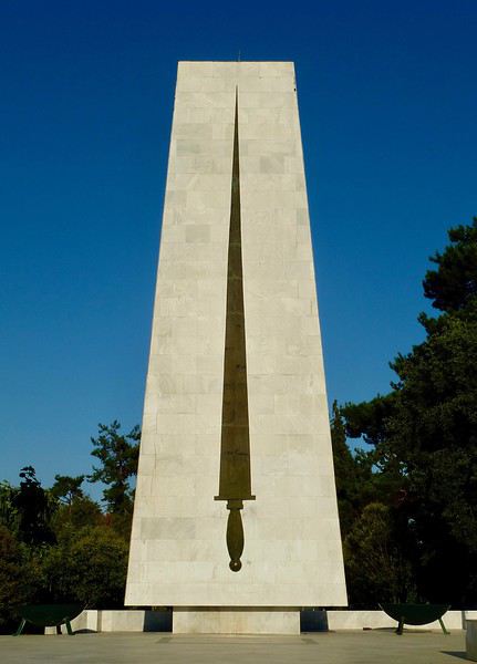
Un indice? Je n'ai pas (encore?) fait de carnet sur ce pays....
À vous de jouer!
Je reprends donc la main en ouvrant un nouveau sujet.
Où est-ce?
Un indice? Je n'ai pas (encore?) fait de carnet sur ce pays....
À vous de jouer!
Visite région de Tafraout - Taroudant - Agadir
Bonjour,
Nous (un couple + garçon de 7 ans) réfléchissons à un voyage d'une dizaine de jours au Maroc, à partir d'Agadir. Nous souhaiterions visiter l'intérieur des terres 6-7 jours puis finir dans un hôtel à Agadir pour plus de farniente (et satisfaire notre fils !).
Deux questions : - Est-ce que le climat de cette région-là est agréable fin février ? (je crains les nuits froides, notamment dans les hébergements plus sommaires). Ou pensez-vous qu'il vaut mieux attendre les vacances d'avril ?
- Quel serait LE point de chute sympathique pour passer 6 jours (dépaysant, beaux paysages, marchés et villages...) : nous avons pensé à Tafraout. Qu'en pensez-vous ? Nous souhaiterions nous poser dans uen seul endroit (à la rigueur 2) et éviter de faire des heures de route...
Par avance merci pour vos conseils !
Nous (un couple + garçon de 7 ans) réfléchissons à un voyage d'une dizaine de jours au Maroc, à partir d'Agadir. Nous souhaiterions visiter l'intérieur des terres 6-7 jours puis finir dans un hôtel à Agadir pour plus de farniente (et satisfaire notre fils !).
Deux questions : - Est-ce que le climat de cette région-là est agréable fin février ? (je crains les nuits froides, notamment dans les hébergements plus sommaires). Ou pensez-vous qu'il vaut mieux attendre les vacances d'avril ?
- Quel serait LE point de chute sympathique pour passer 6 jours (dépaysant, beaux paysages, marchés et villages...) : nous avons pensé à Tafraout. Qu'en pensez-vous ? Nous souhaiterions nous poser dans uen seul endroit (à la rigueur 2) et éviter de faire des heures de route...
Par avance merci pour vos conseils !
Traversée en kayak Nanortalik-Narsarsuaq via le fjord Tasermiut
Un an après notre voyage en kayak gonflable à Disko au milieu des icebergs et des baleines nous sommes décidés pour retourner au Groenland. Dans ce pays grand comme quasiment 4 fois la France le choix de la « région » est un peu laborieux tant les possibilités sont nombreuses. Le fjord d’Uummannaq où je me suis rendu en hiver il y a 6 mois nous semble être formidable. Il y a un loueur (ce qui nous permettrait d’avoir un kayak rigide), des baleines, d’immenses montagnes et des icebergs en quantité. En revanche la zone est toujours sous le risque « imminent » d’un tsunami (pour une grande partie du nord du fjord). Nous craignons également l’immensité du fjord et son exposition au vent et à la houle avec en plus, selon le parcours de nombreuses traversées entre les îles dépassant les 10 km et nous ne sommes pas des kayakistes confirmés. Pour finir les températures à nos dates de congés (fin août et début septembre) risquent d’être déjà bien froides (-5/5°C) pour la pratique agréable d’un sport nautique.
Tout ceci considéré, nous continuons à imaginer des parcours avec Google Earth dans tout le pays mais les montagnes aux environs de Nanortalik sur la pointe sud du pays nous paraissent également vite idéales. Cette zone, bien desservie depuis Copenhague (vols directs !), possède de grands réseaux de fjords bien encaissés et donc protégés des caprices de la haute mer. Différents transferts en bateau proposés par la Disko Line permettent d’envisager des traversées plus ou moins longues entre les différents villages. Nous « dessinons » donc un parcours entre le village de Nanortalik et l’aéroport d’arrivée à Narsarsuaq.
Le fjord de Tasermiut apparait être le joyau du coin et ne pas s’y rendre serait bien dommage. Mais en aller-retour, visiter ce fjord nous ferait faire un détour de 140 km ! Le seul moyen d’y pagayer en restant dans les temps (15 jours de kayak) est de le parcourir en aller simple et donc de s’en échapper par la terre une fois au fond. La carte au 1/100 000e montre une vallée large et plate reliant le fond du fjord de Tasermiut à celui du Sondre Sermilik par un portage d’une petite vingtaine de kilomètres.
La traversée dans le sens Nanortalik>Narsarsuaq via le fjord de Tasermiut fait ainsi 240 km soit une bonne quinzaine de kilomètres obligatoires à effectuer pour les 15 jours de voyage. D’expérience cette distance est le compromis parfait entre les jours de rando, les jours d’avancée et la marge de sécurité. 3 portages jalonnent l’itinéraire pour un total de 30 km à effectuer à pied environ. Notre trajet passe par le village d’Ammasivik au kilomètre 160 où nous pourrons nous ravitailler. Nous ne sommes donc pas obligés d’emporter 15 jours de nourriture ce qui limite largement le poids et le volume des vivres à embarquer.
Le sud du Groenland présente également l’avantage d’avoir des températures clémentes même en septembre, pas d’ours polaire (surtout à la fin de l’été), des côtes très vertes qui contrastent avec la mer où les glaciers et de gros icebergs qui remontent depuis la côte Est le cap Farewell parfois jusqu’à Qaqortoq.
Le vol est donc réservé en mai pour la dernière semaine d’août et la première de septembre. Manque de chance, l’aller retour direct depuis Copenhague est hors de prix à nos dates mais en choisissant à l’aller un Copenhague- Narsarsuaq avec Air Greenland et un retour Narsarsuaq-Reykjavik avec Air Iceland le tarif devient plus raisonnable. C’est l’option que nous choisissons même si passer par Reykjavik complique un peu le voyage de retour sur Paris…. Depuis Narsarsuaq nous gagnerons Nanortalik en 6h de bateau. Ce trajet est réservé auprès de la Disko Line, 3 mois à l’avance, nous prenons les dernières places disponibles malgré des trajets presque quotidiens. Seulement 50 minutes séparent notre arrivée en avion et le départ du bateau mais normalement ce dernier attend les passagers… Nous prenons donc ce risque pour gagner du temps sur place. A Narsarsuaq, la présence de l’agence BlueIce tenue par un Français nous permettrait la location d’un kayak rigide mais avec 30 km de portage ce n’est pas envisageable c’est donc avec notre kayak gonflable biplace Gumotex Swing 2 que nous partons. C’est un kayak que je connais bien et avec lequel j’ai déjà effectué 2 voyages de plusieurs jours dans le grand Nord. Son seul véritable inconvénient est sa vitesse de croisière assez lente du fait de sa largeur importante et de son fond plat. Il est en revanche assez léger (14 kilos à vide) très très stable et comme tous les gonflables, facile à remettre à flot après un dessalage. C’est un kayak très robuste qui n’a d’ailleurs pas pris une ride en dépit de nombreux jours d’utilisation dans des conditions parfois rudes (gel, glace, transport en avion…) Pour un poids total de 20 kilos avec tous ses équipements : pagaies, pompe, jupes et gilets compris il remplit pile un sac de 150 l. Les autres 20 kilos que nous autorise la franchise bagage sont occupés par le matériel de camping (tente 3 saisons et duvet 0°C confort) et 8 kilos de nourriture (4 kilos de muesli maison, 3 kilos de semoule complète et 1 kilo de comté). Même si tout peut se procurer sur place, cette nourriture pratique en camping et goûteuse constitue tout de même un petit plus ! En vue du portage, tout est empaqueté dans un gros sac à dos de randonnée de100 litres qui pèse à lui seul 3 kilos à vide tout de même. Nous partons avec un réchaud multi combustible gaz/essence MSR ainsi qu’un second réchaud Trangia à alcool à brûler au cas où. Cette année, nous avons également investi dans des combinaisons étanches pour le confort et la sécurité. Du fait de leur volume et de leur poids nous n’osons pas les prendre comme « accessoire » de cabine, elles occupent donc la moitié de notre bagage à main. L’autre moitié est occupée par nos vêtements Nous partons à deux (nous sommes frères) et je connais un peu la région pour avoir déjà effectué un tour en kayak en 2015 du côté de Narsaq.
Mardi 20 août Réveil avec une petite boule au ventre après le boulot c’est le départ et un couac à une seule étape et tout le voyage tombe à l’eau. Mais la première partie s’effectue sans anicroches: Chorges (05)-parking de l’hôtel Ibis de Villeurbanne où nous laissons la voiture premier « portage » à pied de 3 km entre le parking et la gare de Lyon Part Dieu Lyon-Roissy en TGV Roissy-Copenhague en avion avec Air France et nous sommes à l’hôtel à Copenhague.
Mercredi 21 août A 12h nous décollons pour Narsarsuaq que nous atteignons à 13h après 5h d’avion. Ce vol direct est un plaisir par rapport à toutes les escales nécessaires pour se rendre à d’autres destinations du Groenland. Même pas fatigués par ce court voyage, nous embarquons à l’heure dans le bateau de la Disko Line. Et à 19h avec 45 minutes d’avance nous voilà au bout du pays, sur la pointe sud, à Nanortalik.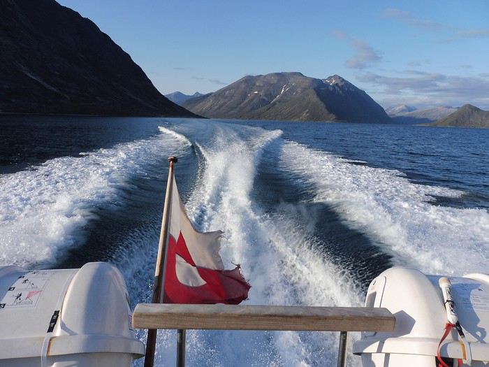
Il fait beau, doux et nous repérons à quelques encablures du port une collinette cachée pour installer la tente.
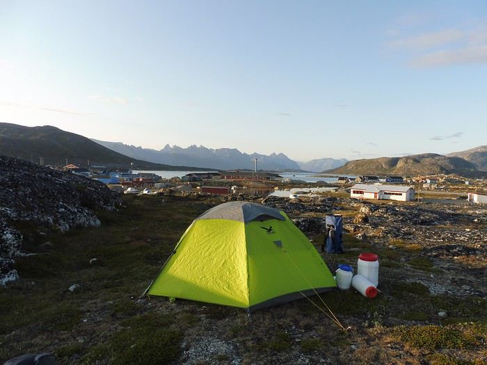
Le gros supermarché ferme à 18h mais un autre plus petit est toujours ouvert. Il ne nous manque pas grand-chose pour compléter nos vivres. Nous achetons des sauces, du salami, du beurre, des tortillas, des biscuits et un litre d’alcool à brûler. Nous prenons en tout 10 jours de vivres ce qui nous laisse un peu de marge pour atteindre Ammasivik situé à 160 km d’ici. Nous sommes donc presque prêts à partir mais nous n’avons pas trouvé de cartouche de gaz. La station essence nous permettrait de partir avec ce carburant mais nous voulons quand même tenter notre chance avec le gaz dans le gros magasin. C’est quand même plus pratique que l’essence à utiliser.
Jeudi 22 août A 7h, dès l’ouverture nous sommes au magasin et bonne pioche nous trouvons du gaz. Retour au port où nous gonflons le kayak.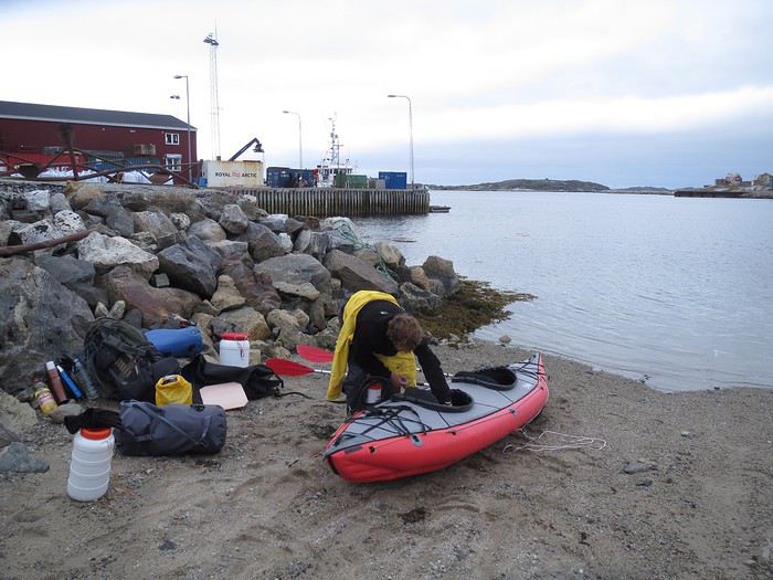
Il a bien survécu au transport et à 9h nous pagayons en direction du fjord de Tasermiut sous un temps correct malgré un bon plafond nuageux. Comme constaté en bateau la veille, il n’y a pas un seul iceberg en vue. L’embouchure du fjord est pourtant une zone où beaucoup viennent se bloquer. C’est aussi un endroit où passent parfois des baleines de Minke et nous sommes aux aguets. Mais tandis que nous gagnons l’entrée du fjord aucun signe de vie animale n’est observé. Le fjord est très large et nous remontons sa rive Ouest puis, nous le traversons pour tenter de se protéger du petit vent arrière qui commence à se lever. A l’abri d’un cap, la pause midi est agréable, nous mangeons notre « ration » : deux tortillas avec du salami et du beurre puis une tasse de muesli.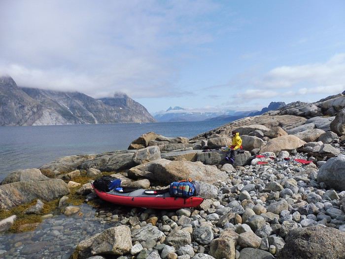
Juste avant le village de Tasiusaq nous repérons un talus bien plat qui parait idéal pour le bivouac. Nous montons le camp vers 16h en face de nos premiers icebergs. La marée est basse et le coin est rempli de grosses moules. Nous en ramassons une pleine casserole. Le démarrage du réchaud est inquiétant, le gaz produit une minuscule flamme bleue avec laquelle nous mettons 1h15 pour faire bouillir 3 litres d’eau ! Nous essayons divers réglages et nettoyage mais rien n’y fait le réchaud ne tire pas. Nous nous servirons de l’alcool pour tout le reste du séjour…
Vendredi 23 août Nuit claire et beau temps à 6h au réveil. Nous reprenons notre route, les montagnes commencent à être spectaculaires notamment sur la rive Est où de grandes aiguilles de granit montent vers le ciel. A l’embouchure de la rivière Kuussuaq nous hésitons à nous arrêter : c’est ici qu’il faudrait franchir un isthme de 1 km pour rejoindre un grand lac dont l’extrémité Est est bordée de la forêt Qinngua. Cette forêt naturelle si particulière mérite apparemment une visite mais cela nous ferait faire un détour de 40 km. Les arbres n’étant pas la spécificité du pays nous décidons de tracer notre route.
Vers 13h nous atteignons la vallée de Qooromiut bordée d’une immense tour rocheuse : Ulamertorsuaq. C’est un bel endroit pour planter la tente et s’offrir une demi-journée de randonnée le long de la rivière qui coule dans la vallée.
La végétation est sublime, la toundra commence à se colorer de rouge et l’eau de la rivière est d’un bleu étincelant. Le ciel est noir et très menaçant mais il ne pleut pas, nous remontons la rive gauche de la rivière jusqu’à ce que l’heure nous rappelle. Nous constatons qu’au milieu des saules et des éboulis la progression n’est pas rapide ce qui nous laisse dubitatifs pour les 20 km du portage dans quelques jours. 23h30 quelque chose gratte vers les sacs stockés à l’extérieur de la tente. Je sors et partout où le faisceau de ma lampe éclaire, une paire d’yeux me fixe. Je compte 4 renards que j’effraie comme je peux jusqu’à leur terrier situé seulement à une centaine de mètres de la tente. 1h nouvelle visite du camp je sors à nouveau et la seule chose que je peux faire est d’obstruer pour la nuit l’entrée du terrier avec une pierre. 2h30 décidément la nuit va être longue, le terrier doit avoir plusieurs entrées puisque la pierre est toujours en place mais les renards toujours autour de la tente ! A coup de rame nous les repoussons à nouveau. Ils nous laisseront tranquilles.
Samedi 24 août La nuit n’a pas été reposante du tout. II y a un bon brouillard mais nous devinons que le ciel bleu n’est pas loin. Nous retirons la pierre du terrier et constatons effectivement un autre trou quelques mètres plus loin…Nous reprenons la mer et après 2 km nous sommes en vue de la célèbre montagne en forme de M : Nalumarsortoq.
Elle émerge du brouillard dans une forêt de pics tous plus beaux les uns que les autres. Nous regrettons de ne pas nous être arrêtés dans cette vallée hier. D’ailleurs de nombreuses tentes sont visibles, l’endroit est réputé. La météo n’incite pas à la randonnée et nous poursuivons en kayak vers le fond du fjord. Vers midi le temps se lève alors que nous atteignons la vallée de Klosterdalen. Au pied de l’immense face Ouest de la montagne Ketil nous montons la tente dans un endroit paradisiaque.
Il est encore tôt et nous partons à pied dans la vallée. Nous sommes vite entourés de hauts bouleaux qui nous dépassent largement. Visiblement il n’y a pas que dans la forêt de Qinngua qu’on peut voir de vrais arbres au Groenland. Battus par les vents leurs troncs sont très tortueux. De retour du camp, la marée est basse et nous ramassons des moules pour agrémenter notre semoule. La cuisine est faite au feu de bois sous le soleil couchant qui illumine les sommets de la rive opposés.
Dimanche 25 août Grand ciel bleu à 6h.
Au matin, le sommet de la montagne Ketil nous apparait pour la première fois et il est blanchi par la neige. Sa face de plus de 1400 m est vraiment impressionnante, dans presque toute sa diagonale, elle est balafrée par une grosse fissure type « âge de glace ». Le chargement du kayak est maintenant une routine. Sur le pont avant, le gros sac de rangement du kayak de 150 l qui contient le gros sac de randonnée de 100 l qui contient lui-même trois sacs étanches de 30 l : deux de nourritures et un d’outillage divers (popote, réchauds, outils, pharmacie…) Sur le pont arrière deux sacs étanches de 60 l contiennent les vêtements, les baskets, la tente et le gaz. Tout est attaché avec des sangles réglables fixées au kayak via la ligne de vie. C’est beaucoup plus pratique qu’avec les tendeurs que nous utilisions les années précédentes. A l’intérieur 2 autres petits bidons contiennent également de la nourriture, un troisième est rempli par les deux duvets. Les bidons sont un peu plus durs à caler et à remplir que les sacs qui sont plus souples. Mais ils ont l’avantage d’être hermétique �� tout : eau et renards notamment et au fond du kayak il y a toujours un peu d’eau provenant de nos Crocs™ lors des embarquements. Le fond du fjord n’est plus très loin et l’immense muraille glaciaire qui le ferme commence à être bien nette. Pour la première fois du séjour nous naviguons sur une mer d’huile.
Nous sommes décidés à attaquer le portage dès aujourd’hui pour anticiper la difficulté que celui-ci pourrait représenter. Mais c’est quand même avec regrets que nous regardons les nombreuses pentes douces des montagnes de la rive Ouest qui doivent offrir des panoramas spectaculaires sur les versants à pics de la rive Est. Heureusement l’arrivée au fond du fjord nous console.
La muraille glaciaire est sublime, c’est un véritable mur de glace de 1000 m de haut et de 2 km de large qui descend presque jusqu’à la mer.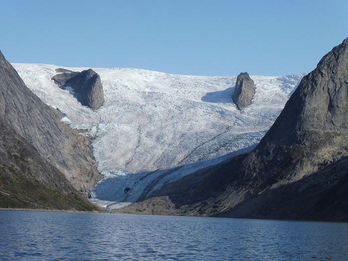
Le glacier Sermitsiaq est également grandiose avec toutes ses aiguilles qui jalonnent sa descente dans un lac. Il est 10h lorsque nous touchons la plage de la vallée Tillersuaq que nous allons devoir remonter à pied. Nous déchargeons toutes les affaires, plions le kayak et répartissons le tout dans les sacs à dos. Heureusement qu’il ne pleut pas ! 1h de rangement plus tard il faut se résigner tout ne tiendra pas dans les sacs à dos. Ce n’est pas la place qui manque mais le poids, les deux sacs à dos sont donnés pour 20 kg et nous les dépassons largement. Une rupture des bretelles serait bien compliquée à gérer. Nous devrons en plus des énormes sacs sur le dos porter les dernières bricoles à la main. Les sacs sont durs à soulever, leurs poids doit avoisiner les 30 kilos. Nous nous engageons dans la vallée, pour notre plus grand bonheur la végétation est très basse rendant la marche facile.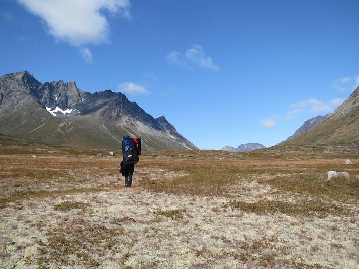
Le rythme s’installe : 15 à 20 minutes de marche avant que les épaules ne réclament une pause de 3 à 5 minutes. La vallée est très accueillante large, plate, très verte, avec sur les côtés des montagnes et des glaciers magnifiques.
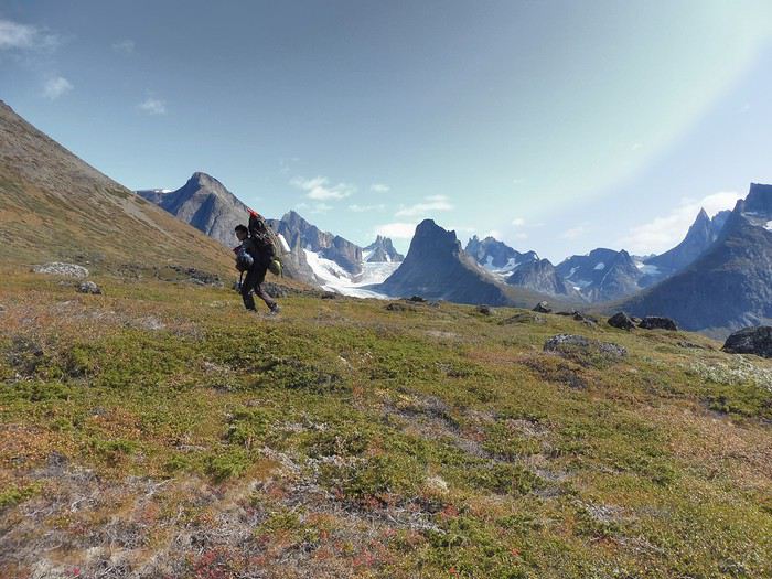
Notre progression est plus rapide que nos estimations, sûrement aux alentours de 2.5 km/h et en début de soirée nous avons parcouru 12 km. Le coin est magnifique, une belle ambiance sauvage s’est installée. Nous sommes au col et nous distinguons à la fois les montagnes du Tasermiut et celles du Sondre Sermilik, c’est très beau.
Lundi 26 août 7 km nous séparent du fjord de Sondre Sermilik, nos sacs semblent plus lourds que la veille. Nous descendons le long de la rivière alternant les passages dans des saules un peu trop hauts, des tourbières peu commodes ou des gravières de la rivière.
Sur ces petits galets la marche se déroule bien. A chaque pas nous pensons tomber nez à nez avec des bœufs musqués. Quelques bêtes ont été introduites il y a 5 ans dans la vallée et nous rencontrons de nombreuses crottes et traces mais ils restent invisibles. L’arrivée sur le fjord est un grand moment. Le ciel ne pourrait pas être plus bleu lorsque nous débouchons sur une butte parfaitement plate qui surplombe le fjord d’une dizaine de mètres.
Un bivouac parfait. Il nous a fallu deux demi-journées pour effectuer le portage. Le dos bien fatigué nous partons pour le reste de l’après midi en randonnée sur le cap de la vallée Isortoq qui culmine à 500 m d’altitude.
La vue sur notre parcours à pied et les vallées environnantes est superbe.
Le repas du soir pris au coin du feu sur l’immense plage déserte de l’estuaire de la rivière est également un moment marquant du séjour.
Le vol est donc réservé en mai pour la dernière semaine d’août et la première de septembre. Manque de chance, l’aller retour direct depuis Copenhague est hors de prix à nos dates mais en choisissant à l’aller un Copenhague- Narsarsuaq avec Air Greenland et un retour Narsarsuaq-Reykjavik avec Air Iceland le tarif devient plus raisonnable. C’est l’option que nous choisissons même si passer par Reykjavik complique un peu le voyage de retour sur Paris…. Depuis Narsarsuaq nous gagnerons Nanortalik en 6h de bateau. Ce trajet est réservé auprès de la Disko Line, 3 mois à l’avance, nous prenons les dernières places disponibles malgré des trajets presque quotidiens. Seulement 50 minutes séparent notre arrivée en avion et le départ du bateau mais normalement ce dernier attend les passagers… Nous prenons donc ce risque pour gagner du temps sur place. A Narsarsuaq, la présence de l’agence BlueIce tenue par un Français nous permettrait la location d’un kayak rigide mais avec 30 km de portage ce n’est pas envisageable c’est donc avec notre kayak gonflable biplace Gumotex Swing 2 que nous partons. C’est un kayak que je connais bien et avec lequel j’ai déjà effectué 2 voyages de plusieurs jours dans le grand Nord. Son seul véritable inconvénient est sa vitesse de croisière assez lente du fait de sa largeur importante et de son fond plat. Il est en revanche assez léger (14 kilos à vide) très très stable et comme tous les gonflables, facile à remettre à flot après un dessalage. C’est un kayak très robuste qui n’a d’ailleurs pas pris une ride en dépit de nombreux jours d’utilisation dans des conditions parfois rudes (gel, glace, transport en avion…) Pour un poids total de 20 kilos avec tous ses équipements : pagaies, pompe, jupes et gilets compris il remplit pile un sac de 150 l. Les autres 20 kilos que nous autorise la franchise bagage sont occupés par le matériel de camping (tente 3 saisons et duvet 0°C confort) et 8 kilos de nourriture (4 kilos de muesli maison, 3 kilos de semoule complète et 1 kilo de comté). Même si tout peut se procurer sur place, cette nourriture pratique en camping et goûteuse constitue tout de même un petit plus ! En vue du portage, tout est empaqueté dans un gros sac à dos de randonnée de100 litres qui pèse à lui seul 3 kilos à vide tout de même. Nous partons avec un réchaud multi combustible gaz/essence MSR ainsi qu’un second réchaud Trangia à alcool à brûler au cas où. Cette année, nous avons également investi dans des combinaisons étanches pour le confort et la sécurité. Du fait de leur volume et de leur poids nous n’osons pas les prendre comme « accessoire » de cabine, elles occupent donc la moitié de notre bagage à main. L’autre moitié est occupée par nos vêtements Nous partons à deux (nous sommes frères) et je connais un peu la région pour avoir déjà effectué un tour en kayak en 2015 du côté de Narsaq.
Mardi 20 août Réveil avec une petite boule au ventre après le boulot c’est le départ et un couac à une seule étape et tout le voyage tombe à l’eau. Mais la première partie s’effectue sans anicroches: Chorges (05)-parking de l’hôtel Ibis de Villeurbanne où nous laissons la voiture premier « portage » à pied de 3 km entre le parking et la gare de Lyon Part Dieu Lyon-Roissy en TGV Roissy-Copenhague en avion avec Air France et nous sommes à l’hôtel à Copenhague.
Mercredi 21 août A 12h nous décollons pour Narsarsuaq que nous atteignons à 13h après 5h d’avion. Ce vol direct est un plaisir par rapport à toutes les escales nécessaires pour se rendre à d’autres destinations du Groenland. Même pas fatigués par ce court voyage, nous embarquons à l’heure dans le bateau de la Disko Line. Et à 19h avec 45 minutes d’avance nous voilà au bout du pays, sur la pointe sud, à Nanortalik.
Il fait beau, doux et nous repérons à quelques encablures du port une collinette cachée pour installer la tente.
Le gros supermarché ferme à 18h mais un autre plus petit est toujours ouvert. Il ne nous manque pas grand-chose pour compléter nos vivres. Nous achetons des sauces, du salami, du beurre, des tortillas, des biscuits et un litre d’alcool à brûler. Nous prenons en tout 10 jours de vivres ce qui nous laisse un peu de marge pour atteindre Ammasivik situé à 160 km d’ici. Nous sommes donc presque prêts à partir mais nous n’avons pas trouvé de cartouche de gaz. La station essence nous permettrait de partir avec ce carburant mais nous voulons quand même tenter notre chance avec le gaz dans le gros magasin. C’est quand même plus pratique que l’essence à utiliser.
Jeudi 22 août A 7h, dès l’ouverture nous sommes au magasin et bonne pioche nous trouvons du gaz. Retour au port où nous gonflons le kayak.
Il a bien survécu au transport et à 9h nous pagayons en direction du fjord de Tasermiut sous un temps correct malgré un bon plafond nuageux. Comme constaté en bateau la veille, il n’y a pas un seul iceberg en vue. L’embouchure du fjord est pourtant une zone où beaucoup viennent se bloquer. C’est aussi un endroit où passent parfois des baleines de Minke et nous sommes aux aguets. Mais tandis que nous gagnons l’entrée du fjord aucun signe de vie animale n’est observé. Le fjord est très large et nous remontons sa rive Ouest puis, nous le traversons pour tenter de se protéger du petit vent arrière qui commence à se lever. A l’abri d’un cap, la pause midi est agréable, nous mangeons notre « ration » : deux tortillas avec du salami et du beurre puis une tasse de muesli.
Juste avant le village de Tasiusaq nous repérons un talus bien plat qui parait idéal pour le bivouac. Nous montons le camp vers 16h en face de nos premiers icebergs. La marée est basse et le coin est rempli de grosses moules. Nous en ramassons une pleine casserole. Le démarrage du réchaud est inquiétant, le gaz produit une minuscule flamme bleue avec laquelle nous mettons 1h15 pour faire bouillir 3 litres d’eau ! Nous essayons divers réglages et nettoyage mais rien n’y fait le réchaud ne tire pas. Nous nous servirons de l’alcool pour tout le reste du séjour…
Vendredi 23 août Nuit claire et beau temps à 6h au réveil. Nous reprenons notre route, les montagnes commencent à être spectaculaires notamment sur la rive Est où de grandes aiguilles de granit montent vers le ciel. A l’embouchure de la rivière Kuussuaq nous hésitons à nous arrêter : c’est ici qu’il faudrait franchir un isthme de 1 km pour rejoindre un grand lac dont l’extrémité Est est bordée de la forêt Qinngua. Cette forêt naturelle si particulière mérite apparemment une visite mais cela nous ferait faire un détour de 40 km. Les arbres n’étant pas la spécificité du pays nous décidons de tracer notre route.
Vers 13h nous atteignons la vallée de Qooromiut bordée d’une immense tour rocheuse : Ulamertorsuaq. C’est un bel endroit pour planter la tente et s’offrir une demi-journée de randonnée le long de la rivière qui coule dans la vallée.
La végétation est sublime, la toundra commence à se colorer de rouge et l’eau de la rivière est d’un bleu étincelant. Le ciel est noir et très menaçant mais il ne pleut pas, nous remontons la rive gauche de la rivière jusqu’à ce que l’heure nous rappelle. Nous constatons qu’au milieu des saules et des éboulis la progression n’est pas rapide ce qui nous laisse dubitatifs pour les 20 km du portage dans quelques jours. 23h30 quelque chose gratte vers les sacs stockés à l’extérieur de la tente. Je sors et partout où le faisceau de ma lampe éclaire, une paire d’yeux me fixe. Je compte 4 renards que j’effraie comme je peux jusqu’à leur terrier situé seulement à une centaine de mètres de la tente. 1h nouvelle visite du camp je sors à nouveau et la seule chose que je peux faire est d’obstruer pour la nuit l’entrée du terrier avec une pierre. 2h30 décidément la nuit va être longue, le terrier doit avoir plusieurs entrées puisque la pierre est toujours en place mais les renards toujours autour de la tente ! A coup de rame nous les repoussons à nouveau. Ils nous laisseront tranquilles.
Samedi 24 août La nuit n’a pas été reposante du tout. II y a un bon brouillard mais nous devinons que le ciel bleu n’est pas loin. Nous retirons la pierre du terrier et constatons effectivement un autre trou quelques mètres plus loin…Nous reprenons la mer et après 2 km nous sommes en vue de la célèbre montagne en forme de M : Nalumarsortoq.
Elle émerge du brouillard dans une forêt de pics tous plus beaux les uns que les autres. Nous regrettons de ne pas nous être arrêtés dans cette vallée hier. D’ailleurs de nombreuses tentes sont visibles, l’endroit est réputé. La météo n’incite pas à la randonnée et nous poursuivons en kayak vers le fond du fjord. Vers midi le temps se lève alors que nous atteignons la vallée de Klosterdalen. Au pied de l’immense face Ouest de la montagne Ketil nous montons la tente dans un endroit paradisiaque.
Il est encore tôt et nous partons à pied dans la vallée. Nous sommes vite entourés de hauts bouleaux qui nous dépassent largement. Visiblement il n’y a pas que dans la forêt de Qinngua qu’on peut voir de vrais arbres au Groenland. Battus par les vents leurs troncs sont très tortueux. De retour du camp, la marée est basse et nous ramassons des moules pour agrémenter notre semoule. La cuisine est faite au feu de bois sous le soleil couchant qui illumine les sommets de la rive opposés.
Dimanche 25 août Grand ciel bleu à 6h.
Au matin, le sommet de la montagne Ketil nous apparait pour la première fois et il est blanchi par la neige. Sa face de plus de 1400 m est vraiment impressionnante, dans presque toute sa diagonale, elle est balafrée par une grosse fissure type « âge de glace ». Le chargement du kayak est maintenant une routine. Sur le pont avant, le gros sac de rangement du kayak de 150 l qui contient le gros sac de randonnée de 100 l qui contient lui-même trois sacs étanches de 30 l : deux de nourritures et un d’outillage divers (popote, réchauds, outils, pharmacie…) Sur le pont arrière deux sacs étanches de 60 l contiennent les vêtements, les baskets, la tente et le gaz. Tout est attaché avec des sangles réglables fixées au kayak via la ligne de vie. C’est beaucoup plus pratique qu’avec les tendeurs que nous utilisions les années précédentes. A l’intérieur 2 autres petits bidons contiennent également de la nourriture, un troisième est rempli par les deux duvets. Les bidons sont un peu plus durs à caler et à remplir que les sacs qui sont plus souples. Mais ils ont l’avantage d’être hermétique �� tout : eau et renards notamment et au fond du kayak il y a toujours un peu d’eau provenant de nos Crocs™ lors des embarquements. Le fond du fjord n’est plus très loin et l’immense muraille glaciaire qui le ferme commence à être bien nette. Pour la première fois du séjour nous naviguons sur une mer d’huile.
Nous sommes décidés à attaquer le portage dès aujourd’hui pour anticiper la difficulté que celui-ci pourrait représenter. Mais c’est quand même avec regrets que nous regardons les nombreuses pentes douces des montagnes de la rive Ouest qui doivent offrir des panoramas spectaculaires sur les versants à pics de la rive Est. Heureusement l’arrivée au fond du fjord nous console.
La muraille glaciaire est sublime, c’est un véritable mur de glace de 1000 m de haut et de 2 km de large qui descend presque jusqu’à la mer.
Le glacier Sermitsiaq est également grandiose avec toutes ses aiguilles qui jalonnent sa descente dans un lac. Il est 10h lorsque nous touchons la plage de la vallée Tillersuaq que nous allons devoir remonter à pied. Nous déchargeons toutes les affaires, plions le kayak et répartissons le tout dans les sacs à dos. Heureusement qu’il ne pleut pas ! 1h de rangement plus tard il faut se résigner tout ne tiendra pas dans les sacs à dos. Ce n’est pas la place qui manque mais le poids, les deux sacs à dos sont donnés pour 20 kg et nous les dépassons largement. Une rupture des bretelles serait bien compliquée à gérer. Nous devrons en plus des énormes sacs sur le dos porter les dernières bricoles à la main. Les sacs sont durs à soulever, leurs poids doit avoisiner les 30 kilos. Nous nous engageons dans la vallée, pour notre plus grand bonheur la végétation est très basse rendant la marche facile.
Le rythme s’installe : 15 à 20 minutes de marche avant que les épaules ne réclament une pause de 3 à 5 minutes. La vallée est très accueillante large, plate, très verte, avec sur les côtés des montagnes et des glaciers magnifiques.
Notre progression est plus rapide que nos estimations, sûrement aux alentours de 2.5 km/h et en début de soirée nous avons parcouru 12 km. Le coin est magnifique, une belle ambiance sauvage s’est installée. Nous sommes au col et nous distinguons à la fois les montagnes du Tasermiut et celles du Sondre Sermilik, c’est très beau.
Lundi 26 août 7 km nous séparent du fjord de Sondre Sermilik, nos sacs semblent plus lourds que la veille. Nous descendons le long de la rivière alternant les passages dans des saules un peu trop hauts, des tourbières peu commodes ou des gravières de la rivière.
Sur ces petits galets la marche se déroule bien. A chaque pas nous pensons tomber nez à nez avec des bœufs musqués. Quelques bêtes ont été introduites il y a 5 ans dans la vallée et nous rencontrons de nombreuses crottes et traces mais ils restent invisibles. L’arrivée sur le fjord est un grand moment. Le ciel ne pourrait pas être plus bleu lorsque nous débouchons sur une butte parfaitement plate qui surplombe le fjord d’une dizaine de mètres.
Un bivouac parfait. Il nous a fallu deux demi-journées pour effectuer le portage. Le dos bien fatigué nous partons pour le reste de l’après midi en randonnée sur le cap de la vallée Isortoq qui culmine à 500 m d’altitude.
La vue sur notre parcours à pied et les vallées environnantes est superbe.
Le repas du soir pris au coin du feu sur l’immense plage déserte de l’estuaire de la rivière est également un moment marquant du séjour.
Renseignements pour premier voyage en Russie, 7 jours de St-Petersbourg à Moscou
Bonjour à toutes et tous,
J'aurais besoin de votre avis éclairé et de quelques renseignements concernant mon 1er voyage en russie avec ma copine.
Nous avons 33 et 28 ans et souhaitons partir en plein Hiver du 26 Décembre 2019 au 03 Janvier 2020. Arrivée à St Petersbourg le 26 , train de nuit du 29 au 30 direction Moscou, puis retour de Moscou le 03.
1) 1ère question la plus bête de toutes, pour la flèche rouge, le train de nuit de St Petersbourg à Moscou, la période hivernale pose t elle aucun problème ?
2) J'ai vu que les formalités de Visa sont fastidieuses, mais que ça se fait au final assez bien malgré tout.
Y a t il des provinciaux qui sont passés par des agences spécialisées ? ou vous êtes vous déplacés, nous habitons sur LILLE.
( Si je ne dis pas de bêtise la demande ne peut se faire que 3 mois avant le départ ).
3) Avez-vous des " bons plans " d 'hôtels ou logements sur ces 2 villes, je suis en pleine recherche et l'hébergement ne parait trop excessif.
4) Si vous avez des astuces ou conseils qu'els qu'ils soient, nous sommes preneurs.
J'aurais besoin de votre avis éclairé et de quelques renseignements concernant mon 1er voyage en russie avec ma copine.
Nous avons 33 et 28 ans et souhaitons partir en plein Hiver du 26 Décembre 2019 au 03 Janvier 2020. Arrivée à St Petersbourg le 26 , train de nuit du 29 au 30 direction Moscou, puis retour de Moscou le 03.
1) 1ère question la plus bête de toutes, pour la flèche rouge, le train de nuit de St Petersbourg à Moscou, la période hivernale pose t elle aucun problème ?
2) J'ai vu que les formalités de Visa sont fastidieuses, mais que ça se fait au final assez bien malgré tout.
Y a t il des provinciaux qui sont passés par des agences spécialisées ? ou vous êtes vous déplacés, nous habitons sur LILLE.
( Si je ne dis pas de bêtise la demande ne peut se faire que 3 mois avant le départ ).
3) Avez-vous des " bons plans " d 'hôtels ou logements sur ces 2 villes, je suis en pleine recherche et l'hébergement ne parait trop excessif.
4) Si vous avez des astuces ou conseils qu'els qu'ils soient, nous sommes preneurs.
Cinq semaines en bus en Colombie
J’ai enfin réalisé un vieux rêve, celui de visiter la Colombie. Jusqu’ici, le seul pays d’Amérique du Sud que j’avais visité, quelques 4 ou 5 fois, était le Brésil. Pourquoi la Colombie ? Une bonne question, vu qu’il y a d’autres destinations attirantes et populaires, semble-t-il : l’Equateur, le Pérou, la Bolivie entre autres. La réponse la plus simple est qu’il faut bien commencer quelque part.
J’avais cependant d’autres motivations pour choisir la Colombie. C’est un pays réputé pour l’amabilité de ses habitants et pour sa beauté naturelle (mais quel autre pays en Amérique du Sud ne l’est pas ?).
La Colombie est connue pour la pureté de l’Espagnol qu’on y parle, et c’est une langue qui m’a de plus en plus intéressé au fil des années. Puisque nous y sommes, n’oublions pas de mentionner que la Colombie est le pays de Gabriel García Marquez, un auteur que j’ai lu et relu en Français aussi bien qu’en Espagnol (j’ai même lu « Cem Anos de Solidão » en Portugais !). Je sais que la fiction magico-réaliste, dont il est le représentant le plus célèbre, n’est pas du goût de tout le monde, mais je le trouve suffisamment divertissant pour lui pardonner quelques excès d’imagination, et l’idée d’aller voir sur place si je pouvais retrouver la Colombie qu’il décrit dans ses romans me titillait.
Certes, le pays reste encore grevé par une mauvaise réputation sur le plan sécuritaire : la FARC, les cartels, les kidnappings, les vols, les agressions etc. Mais il semble qu’un processus de « nettoyage » de l’environnement social et politique s’est enclenché ces dernières années. Moi-même et mon fils A, qui m’a accompagné dans ce voyage, nous ne sommes d’ailleurs pas des voyageurs néophytes ou inexpérimentés, et le fait que la Colombie n’est pas encore submergée par des vagues de tourisme n’était qu’une raison supplémentaire pour y aller. De plus, le pays est bien assez grand pour qu’on puisse éviter les régions qui restent insécures.
Joignant nos deux agendas, moi et mon fils, nous disposions de 5 semaines et demie pour ce voyage. Nous ne voulions pas couvrir plusieurs pays dans un marathon effréné. Disons-le d’entrée, notre style de voyage n’est pas de « faire » un maximum de sites en un temps record, ni de cocher les cases dites « incontournables ». Ce qui nous intéresse le plus, c’est de rencontrer les gens du pays, et pour A qui est un photographe professionnel, de tirer des portraits de personnes. Cependant, le choix du périple en Colombie nous avait fait inclure quelques derniers jours en Equateur, pour prendre notre vol de retour à Quito.
Je vais commencer par quelques commentaires d’ordre général et quelques statistiques budgétaires et autres, avant de passer à un narratif plus détaillé.
Commentaires généraux et statistiques
Pour les 33 jours passés en Colombie (presque 5 semaines), nous avons parcouru 2600 kms en bus. Voici le résumé du budget par personne : - Bus : 195 Euros (en moyenne 7.5 Euros pour chaque 100 kms) - Hôtels et « hostales » : 405 Euros (en moyenne 12 Euros par nuit) - Repas : 395 Euros (en moyenne 12 Euros par jour) - Taxis (et quelques téléfériques) : 60 Euros - Extras : 145 Euros - Cadeaux : 150 Euros
D’où un total par personne de 1350 Euros, soit une moyenne de 40 Euros par jour. A cela, il faut ajouter l’avion que nous avons pris de Cartagena à Cali, une distance de quelques 1000 kms, avec LATAM, ce qui nous a coûté 102 Euros par personne.
Quelques commentaires :
- Logement : o Les prix des hôtels ont pas mal varié, de 15 à plus de 30 Euros par nuit pour une chambre à 2 lits séparés (ci-dessus, je compte les frais coupés en deux). Souvent avec petit déjeuner compris et même une fois, pour 1 jour, en pension complète. Il se peut qu’une chambre double, pour un couple, coûterait un peu moins cher.
- Transport : o En général, les bus sont en général assez propres et confortables. Les terminaux le sont aussi, ils sont parfois même « nickel ». Ils sont faciles d’usage et nous n’avons jamais eu à attendre plus d’une demi-heure pour prendre le bus suivant. o Les routes ne sont pas mauvaises, à part quelques exceptions. En revanche, il ne faut pas s’attendre à de belles Nationales Françaises, et nous n’avons jamais vu une seule autoroute. o Contre toute attente et en dépit de tous les commentaires émis par d’autres voyageurs, nous n’avons jamais trouvé que les gens roulaient mal ou qu’ils étaient frénétiques sur la route. o Pour ceux qui auraient des critiques concernant les routes et le style de conduite en Colombie, je dirais d’aller voir comment c’est en Inde, ou (pour ce qui est du style de conduite) en Thaïlande ! o Vu l’absence de « Nationales » à la Française et le nombre ahurissant de virages dans les montagnes, les trajets en bus ne sont pas à conseiller pour tout le monde. o Les paysages qui défilent sont souvent à couper le souffle et on aurait envie de prendre des photos et des vidéos toutes les 2 ou 3 minutes. Tenant compte de mes commentaires positifs sur la qualité des routes et le style de conduite des gens, louer une voiture serait une alternative intéressante au bus, permettant de s’arrêter où on veut et de prendre quelques belles photos, justement. o Les taxis : nous n’avons jamais eu de problèmes avec les taxis. On nous a toujours scrupuleusement rendu la monnaie (comme partout ailleurs). Les quelques fois où il ne semblait pas y avoir de compteur, nous avons fixé le prix au préalable, parfois avec une petite négociation (mais jamais rien de dramatique). Ah oui, nous avons pris souvent des taxis en pleine rue et même la nuit : aucun problème.
- Repas : o Les petits déjeuners étaient simples. Typiquement des œufs brouillés ou sur le plat (« huevos revueltos » ou « huevos fritos »), une « arepa » (galette de mais, fade sauf si elle est frite ou grillée), du café. Parfois aussi un jus de fruit. o Le café est une grande déception en Colombie. A part quelques rarissimes exceptions, le « tinto » est ce qu’il y a de pire dans le genre café soluble dilué au maximum. Je reviendrai là-dessus. o Pour le midi aussi bien que le soir, surtout de la viande (porc, poulet, bœuf) avec des haricots (« frijoles »), un œuf sur le plat, une « arepa ». Bonne viande. Portions gigantesques pour le prix. Attention aux prises de poids, surtout si on abuse des « bandejas paisas » ! Nourriture copieuse donc, parfois bien goûteuse mais un peu monotone à la longue. Cependant, je vais donner une mention spéciale pour les soupes presque toujours servies en entrée, les « sopitas » : elles sont toujours bonnes et souvent la meilleure partie du repas … bien que souvent un tantinet trop salées à mon goût.
- Extras : o Bières : que des canettes ou des bouteilles (Club Colombia, Aguila), jamais de pression. Bière acceptable sans plus, mais certes pas cher, le plus souvent à 1 Euro (3500 COP) ou moins. o Cafés : presque invisible sur le budget. Le « tinto » est servi entre 500 et 1000 COP, c.-à-d. 0.15 à 0.3 Euro. J’allais oublier : sucré d’office 1 fois sur 2 (9 fois sur 10 ?), pouah quelle horreur ! o Les « empanadas », sortes de chaussons faits à partir de farine de maïs et farcis de viande et de légumes, sont ce qui nous a servi de rattrapage quand nous avons fait court sur le petit déjeuner. Vendus très bon marché un peu partout dans la rue et les terminaux routiers, ça cale bien pour quelques heures et ce n’est parfois pas mauvais non plus !
J’avais cependant d’autres motivations pour choisir la Colombie. C’est un pays réputé pour l’amabilité de ses habitants et pour sa beauté naturelle (mais quel autre pays en Amérique du Sud ne l’est pas ?).
La Colombie est connue pour la pureté de l’Espagnol qu’on y parle, et c’est une langue qui m’a de plus en plus intéressé au fil des années. Puisque nous y sommes, n’oublions pas de mentionner que la Colombie est le pays de Gabriel García Marquez, un auteur que j’ai lu et relu en Français aussi bien qu’en Espagnol (j’ai même lu « Cem Anos de Solidão » en Portugais !). Je sais que la fiction magico-réaliste, dont il est le représentant le plus célèbre, n’est pas du goût de tout le monde, mais je le trouve suffisamment divertissant pour lui pardonner quelques excès d’imagination, et l’idée d’aller voir sur place si je pouvais retrouver la Colombie qu’il décrit dans ses romans me titillait.
Certes, le pays reste encore grevé par une mauvaise réputation sur le plan sécuritaire : la FARC, les cartels, les kidnappings, les vols, les agressions etc. Mais il semble qu’un processus de « nettoyage » de l’environnement social et politique s’est enclenché ces dernières années. Moi-même et mon fils A, qui m’a accompagné dans ce voyage, nous ne sommes d’ailleurs pas des voyageurs néophytes ou inexpérimentés, et le fait que la Colombie n’est pas encore submergée par des vagues de tourisme n’était qu’une raison supplémentaire pour y aller. De plus, le pays est bien assez grand pour qu’on puisse éviter les régions qui restent insécures.
Joignant nos deux agendas, moi et mon fils, nous disposions de 5 semaines et demie pour ce voyage. Nous ne voulions pas couvrir plusieurs pays dans un marathon effréné. Disons-le d’entrée, notre style de voyage n’est pas de « faire » un maximum de sites en un temps record, ni de cocher les cases dites « incontournables ». Ce qui nous intéresse le plus, c’est de rencontrer les gens du pays, et pour A qui est un photographe professionnel, de tirer des portraits de personnes. Cependant, le choix du périple en Colombie nous avait fait inclure quelques derniers jours en Equateur, pour prendre notre vol de retour à Quito.
Je vais commencer par quelques commentaires d’ordre général et quelques statistiques budgétaires et autres, avant de passer à un narratif plus détaillé.
Commentaires généraux et statistiques
Pour les 33 jours passés en Colombie (presque 5 semaines), nous avons parcouru 2600 kms en bus. Voici le résumé du budget par personne : - Bus : 195 Euros (en moyenne 7.5 Euros pour chaque 100 kms) - Hôtels et « hostales » : 405 Euros (en moyenne 12 Euros par nuit) - Repas : 395 Euros (en moyenne 12 Euros par jour) - Taxis (et quelques téléfériques) : 60 Euros - Extras : 145 Euros - Cadeaux : 150 Euros
D’où un total par personne de 1350 Euros, soit une moyenne de 40 Euros par jour. A cela, il faut ajouter l’avion que nous avons pris de Cartagena à Cali, une distance de quelques 1000 kms, avec LATAM, ce qui nous a coûté 102 Euros par personne.
Quelques commentaires :
- Logement : o Les prix des hôtels ont pas mal varié, de 15 à plus de 30 Euros par nuit pour une chambre à 2 lits séparés (ci-dessus, je compte les frais coupés en deux). Souvent avec petit déjeuner compris et même une fois, pour 1 jour, en pension complète. Il se peut qu’une chambre double, pour un couple, coûterait un peu moins cher.
- Transport : o En général, les bus sont en général assez propres et confortables. Les terminaux le sont aussi, ils sont parfois même « nickel ». Ils sont faciles d’usage et nous n’avons jamais eu à attendre plus d’une demi-heure pour prendre le bus suivant. o Les routes ne sont pas mauvaises, à part quelques exceptions. En revanche, il ne faut pas s’attendre à de belles Nationales Françaises, et nous n’avons jamais vu une seule autoroute. o Contre toute attente et en dépit de tous les commentaires émis par d’autres voyageurs, nous n’avons jamais trouvé que les gens roulaient mal ou qu’ils étaient frénétiques sur la route. o Pour ceux qui auraient des critiques concernant les routes et le style de conduite en Colombie, je dirais d’aller voir comment c’est en Inde, ou (pour ce qui est du style de conduite) en Thaïlande ! o Vu l’absence de « Nationales » à la Française et le nombre ahurissant de virages dans les montagnes, les trajets en bus ne sont pas à conseiller pour tout le monde. o Les paysages qui défilent sont souvent à couper le souffle et on aurait envie de prendre des photos et des vidéos toutes les 2 ou 3 minutes. Tenant compte de mes commentaires positifs sur la qualité des routes et le style de conduite des gens, louer une voiture serait une alternative intéressante au bus, permettant de s’arrêter où on veut et de prendre quelques belles photos, justement. o Les taxis : nous n’avons jamais eu de problèmes avec les taxis. On nous a toujours scrupuleusement rendu la monnaie (comme partout ailleurs). Les quelques fois où il ne semblait pas y avoir de compteur, nous avons fixé le prix au préalable, parfois avec une petite négociation (mais jamais rien de dramatique). Ah oui, nous avons pris souvent des taxis en pleine rue et même la nuit : aucun problème.
- Repas : o Les petits déjeuners étaient simples. Typiquement des œufs brouillés ou sur le plat (« huevos revueltos » ou « huevos fritos »), une « arepa » (galette de mais, fade sauf si elle est frite ou grillée), du café. Parfois aussi un jus de fruit. o Le café est une grande déception en Colombie. A part quelques rarissimes exceptions, le « tinto » est ce qu’il y a de pire dans le genre café soluble dilué au maximum. Je reviendrai là-dessus. o Pour le midi aussi bien que le soir, surtout de la viande (porc, poulet, bœuf) avec des haricots (« frijoles »), un œuf sur le plat, une « arepa ». Bonne viande. Portions gigantesques pour le prix. Attention aux prises de poids, surtout si on abuse des « bandejas paisas » ! Nourriture copieuse donc, parfois bien goûteuse mais un peu monotone à la longue. Cependant, je vais donner une mention spéciale pour les soupes presque toujours servies en entrée, les « sopitas » : elles sont toujours bonnes et souvent la meilleure partie du repas … bien que souvent un tantinet trop salées à mon goût.
- Extras : o Bières : que des canettes ou des bouteilles (Club Colombia, Aguila), jamais de pression. Bière acceptable sans plus, mais certes pas cher, le plus souvent à 1 Euro (3500 COP) ou moins. o Cafés : presque invisible sur le budget. Le « tinto » est servi entre 500 et 1000 COP, c.-à-d. 0.15 à 0.3 Euro. J’allais oublier : sucré d’office 1 fois sur 2 (9 fois sur 10 ?), pouah quelle horreur ! o Les « empanadas », sortes de chaussons faits à partir de farine de maïs et farcis de viande et de légumes, sont ce qui nous a servi de rattrapage quand nous avons fait court sur le petit déjeuner. Vendus très bon marché un peu partout dans la rue et les terminaux routiers, ça cale bien pour quelques heures et ce n’est parfois pas mauvais non plus !
Traverser les États-Unis à vélo, est - ouest
Bonjour,
Je planche sur une traversée des USA en vélo, cote Est à Ouest, en 2019. Bien sur il y a 1000 questions a ce jour mais j'avance... Je voulais savoir si il y a des personnes qui ont déjà fait ce voyage qui serait susceptible de me renseigner et de m'aider a avancer dans mon projet. Merci et à bientot...
Iran, pays des poètes et des fleurs
Bonjour,
Je vais commencer mon 2ème carnet de voyage après l’Éthiopie, donc soyez indulgents, je ne suis experte🙂.
Nous sommes partis à 3 pour découvrir le sud de l'Iran avec une connaissance iranienne qui a bien voulu de manière temporaire être notre guide et chauffeur sur place.
Voici notre itinéraire, un itinéraire assez classique pour une première découverte :
Saturday 21/04 – Arrivée à Téheran à 3h30 + formalités visa à l'aéroport. Route vers Kashan via Qom pour un petit déjeuner copieux.
A Kashan : : visites du Bazar, des Bagh-e Fin gardens , historical house Manar-e-Zayn al-Din , Hamam Khan, under ground city , mosqués Mir Emad et Masjed-e-Jame. Route pour le village Abyaneh, nuit à Abyaneh.
Sunday 22/04 – visit Natanz mosquée , route vers Ispahan : visite Armenian church , pont Pol-e Sharestan, temple de feu Ateshgah, nuit à Ispahan
Monday 23/04 – visite de 2 mosqués, les jardins de Manar-e Jonban et Bagh-e Golha, la tour aux pigeons Borj-e Kabutar, la place Maydan-e Imam, Palais Qapu, le Chehel Sotun, le Chahar Bagh et le bazar Gheisariyeh, un repas excellent dans salon de thé typique. Une ballade sur le pont Allahverdi Khan au soleil couchant. Nuit à Ispahan.
Tuesday 24/04 : Route vers Yazd. Visite de la mosquée de Nain, le chateau , la maison de la glace , un caravansérail , et Chak Chak, le village zoroastrien avec un feu éternel. Nuit à Yazd.
Wednesday 25/04 : visite de la vieille ville, du temple de feu, de la tour du silence , des jardins , une mosquée . Nuit à Yazd.
Thursday 26/04 : Route vers Kerman et visite du Hamam-e Ibrahim Khan et le Bazar Bozorg . Visite de la tombe de Moshtagheye Sofi et de Saryaz et Fahraj . Nuit à Kerman
Friday 27/04 : Visite des jardins de Shazdeh , rain castle , les jardins Qajar de Mahan, la cité fortifiée de Rayan. Repos à Shahdad dans un caravansérail puis route de nuit vers le désert de Kalut. Nuit à la belle étoile dans le désert.
Saturday 28/04 : Marche très matinale dans le désert puis ballade en 4x4 jusqu'à la rivière salée. Retour dans l'après midi au caravansérail pour un repos mérité. Visite du village de Shahdad dans la soirée avec ses arrivées d'eau traditionnel.
Sunday 29/04 : Route vers Meymand : visite du village troglodyte, du temple de feu, de la mosquée. Repas dans une maison traditionnel et nuit dans une grotte.
Monday 30/04 : Route et ferry jusqu'à l'ile de Qeshm. Ballade en soirée au chateau Portugais. Nuit à Qeshm.
Tuesday 1/05 : Visite des grottes Khorbas, de Stars Valley, de la plage au bord du Golfe Persique, des mangroves en bâteau , du canyon, de la petite ile de Hormuz avec son village de pêcheurs traditionnel. Nuit à Qeshm.
Wednesday 2/05 : Retour en ferry et route vers Firuzabad. Visite du chateau Qaleh Dokhtar, le palais Sassanide . Nuit et repas chez des nomades.
Thursday 3/05 : Route vers Shiraz. Visite de Bagh-e Eram, du Manar-e Ali Ibn Hamzeh, de Hafez , le complexe Vakil, la citadelle Arg-e Karim Khan Zand, la maison Narengestan. Nuit à Shiraz
Friday 4/05 : Visite de la Mosquée rose, de Naqsh-e-Rostam, de Persepolis, repos et vol retour pour la France.
Et voici quelques photos.
Et voici quelques photos.
En Arizona et autour, chez les indiens d'hier et d'aujourd'hui
2018, 9ème voyage dans l'ouest américain, et toujours du nouveau
Il y a 4 ans, j'avais dit que je ne retournerai plus aux États-Unis... Mais rester sur les déceptions de l'ouest canadien l'an passé, ce n'était pas possible : le ciel enfumé, la foule dans les parcs, sur les routes, la queue pour stationner, manger et même pour prendre des photos ! Insupportable, loin de ma vision du Grand West avec ses étendues sauvages et la solitude des déserts. Dès décembre, la décision était prise, ce serait en mai, dans le sud. Mais quoi aller voir ? Pas les villes bien sûr. Les parcs nationaux de l'ouest, on les a tous vu (34), ainsi que 45 "National Monuments" et autres sites gérés par le NPS. Cela ne veux pas dire qu'on a tout vu dans tous les parcs, mais au moins ce qui était le plus à notre portée). Il restait de nombreux NM, certains plutôt secondaires, voire confidentiels car à l'écart de tout.
Alors j'ai bâti un circuit, au départ de Los Angeles, vers l'Arizona et le Nouveau-Mexique, avec des petites incursions au Colorado, Utah et Nevada.
Les lieux visités portent des noms rarement voire jamais évoqués ici. En voici quelques uns :
San Andreas Canyon, voyageforum.com/...st=9067317;a=9067317 Coachella Valley Vista, Anza-Borego SP, voyageforum.com/...st=9068699;a=9068699 Bombay Beach Ruins, Salvation Mountain, Anglodone Dunes, Ted Kipf Road, voyageforum.com/...st=9069378;a=9069378 Kofa NWR avec Castel Dome Mine voyageforum.com/...st=9071268;a=9071268
Sedona (les classiques) voyageforum.com/...st=9072792;a=9072792 Tuzigot NM voyageforum.com/...st=9073820;a=9073820 Brooken Arrow en 4x4 rose voyageforum.com/...st=9074181;a=9074181 et Montezuma NM , Tonto Natural Bridge et Apache trail voyageforum.com/...st=9075049;a=9075049 Boyce Arboretum, Saguaro east NP voyageforum.com/...st=9076427;a=9076427
Tumacacori NM, voyageforum.com/...st=9077261;a=9077261 Montezuma Pass et Coronado National Memorial voyageforum.com/...st=9077975;a=9077975 Bisbee et Tombstone voyageforum.com/...st=9078499;a=9078499 Chiricahua NM voyageforum.com/...st=9085930;a=9085930 la route 42 à travers la Chiricahua Forest, Chiricahua Desert Museum voyageforum.com/...st=9088094;a=9088094 City of Rocks et Gila Cliff NM voyageforum.com/...st=9089485;a=9089485 Zuni Pueblo, voyageforum.com/...st=9091283;a=9091283
Shiprock voyageforum.com/...st=9095816;a=9095816
Durango Silverton Railroad voyageforum.com/...st=9102131;a=9102131
Canyon of the Anciens et Hoveweep NM voyageforum.com/...st=9111809;a=9111809
MV voyageforum.com/...st=9113288;a=9113288
le circuit guidé Mistery Valley voyageforum.com/...st=9114201;a=9114201
Zuni Pueblo, voyageforum.com/...st=9091283;a=9091283
Shiprock voyageforum.com/...st=9095816;a=9095816
Durango Silverton Railroad voyageforum.com/...st=9102131;a=9102131
Canyon of the Anciens et Hoveweep NM voyageforum.com/...st=9111809;a=9111809
MV voyageforum.com/...st=9113288;a=9113288
le circuit guidé Mistery Valley voyageforum.com/...st=9114201;a=9114201
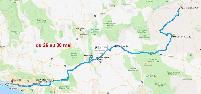
2 nuits chez les Hopis pour visite guidée de Blue Canyon et Coal Mine Canyon voyageforum.com/...st=9121647;a=9121647
un grand bout de R66 avec Sitgreave Pass et Oatman https://voyageforum.com/v.f?post=9130229;a=9130229
En 3 semaines, 5757 km dont au moins 160 de pistes, certaines pas toujours très carrossables. J'hésite à écrire encore un carnet de voyage, la plupart de ces lieux sont insignifiants pour la majorité des lecteurs de VF. Il y a maintenant 710 CV sur les USA, au moins un nouveau chaque semaine. Mais je suis prêt à donner des infos sur les lieux visités.
Au passage, je tiens à remercier Isap29, Caribou44, Papj59 et les maîtres Sedonax et Wavemaster pour les infos qui m'ont aidé à bâtir ce voyage, ainsi que Itat dont l'absence se fait ressentir sur ce forum.
Bern
Il y a 4 ans, j'avais dit que je ne retournerai plus aux États-Unis... Mais rester sur les déceptions de l'ouest canadien l'an passé, ce n'était pas possible : le ciel enfumé, la foule dans les parcs, sur les routes, la queue pour stationner, manger et même pour prendre des photos ! Insupportable, loin de ma vision du Grand West avec ses étendues sauvages et la solitude des déserts. Dès décembre, la décision était prise, ce serait en mai, dans le sud. Mais quoi aller voir ? Pas les villes bien sûr. Les parcs nationaux de l'ouest, on les a tous vu (34), ainsi que 45 "National Monuments" et autres sites gérés par le NPS. Cela ne veux pas dire qu'on a tout vu dans tous les parcs, mais au moins ce qui était le plus à notre portée). Il restait de nombreux NM, certains plutôt secondaires, voire confidentiels car à l'écart de tout.
Alors j'ai bâti un circuit, au départ de Los Angeles, vers l'Arizona et le Nouveau-Mexique, avec des petites incursions au Colorado, Utah et Nevada.
Les lieux visités portent des noms rarement voire jamais évoqués ici. En voici quelques uns :
San Andreas Canyon, voyageforum.com/...st=9067317;a=9067317 Coachella Valley Vista, Anza-Borego SP, voyageforum.com/...st=9068699;a=9068699 Bombay Beach Ruins, Salvation Mountain, Anglodone Dunes, Ted Kipf Road, voyageforum.com/...st=9069378;a=9069378 Kofa NWR avec Castel Dome Mine voyageforum.com/...st=9071268;a=9071268
Sedona (les classiques) voyageforum.com/...st=9072792;a=9072792 Tuzigot NM voyageforum.com/...st=9073820;a=9073820 Brooken Arrow en 4x4 rose voyageforum.com/...st=9074181;a=9074181 et Montezuma NM , Tonto Natural Bridge et Apache trail voyageforum.com/...st=9075049;a=9075049 Boyce Arboretum, Saguaro east NP voyageforum.com/...st=9076427;a=9076427
Tumacacori NM, voyageforum.com/...st=9077261;a=9077261 Montezuma Pass et Coronado National Memorial voyageforum.com/...st=9077975;a=9077975 Bisbee et Tombstone voyageforum.com/...st=9078499;a=9078499 Chiricahua NM voyageforum.com/...st=9085930;a=9085930 la route 42 à travers la Chiricahua Forest, Chiricahua Desert Museum voyageforum.com/...st=9088094;a=9088094 City of Rocks et Gila Cliff NM voyageforum.com/...st=9089485;a=9089485
Zuni Pueblo, voyageforum.com/...st=9091283;a=9091283
Shiprock voyageforum.com/...st=9095816;a=9095816
Durango Silverton Railroad voyageforum.com/...st=9102131;a=9102131
Canyon of the Anciens et Hoveweep NM voyageforum.com/...st=9111809;a=9111809
MV voyageforum.com/...st=9113288;a=9113288
le circuit guidé Mistery Valley voyageforum.com/...st=9114201;a=91142012 nuits chez les Hopis pour visite guidée de Blue Canyon et Coal Mine Canyon voyageforum.com/...st=9121647;a=9121647
un grand bout de R66 avec Sitgreave Pass et Oatman https://voyageforum.com/v.f?post=9130229;a=9130229
En 3 semaines, 5757 km dont au moins 160 de pistes, certaines pas toujours très carrossables. J'hésite à écrire encore un carnet de voyage, la plupart de ces lieux sont insignifiants pour la majorité des lecteurs de VF. Il y a maintenant 710 CV sur les USA, au moins un nouveau chaque semaine. Mais je suis prêt à donner des infos sur les lieux visités.
Au passage, je tiens à remercier Isap29, Caribou44, Papj59 et les maîtres Sedonax et Wavemaster pour les infos qui m'ont aidé à bâtir ce voyage, ainsi que Itat dont l'absence se fait ressentir sur ce forum.
Bern
L'Afrique du Sud en passant par l'Egypte
Voici mes impressions de mon premier voyage en Afrique du sud.
Je remercie tous ceux qui sur ce forum mon permis de réaliser ce voyage par moi mème et mon inciter à faire ce voyage.😉
Nous sommes parti en couple un peu inquiet suite aux avis du site France diplomatie mais finalement nous n'avons pas eu de problèmes de sécurité sur place.
Voici notre parcours :
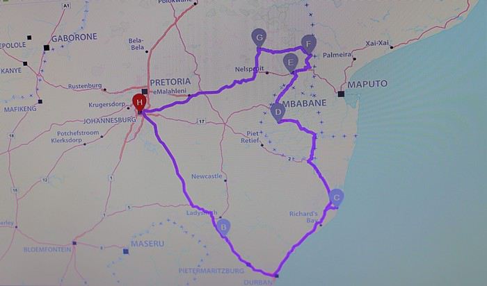
J1 Johannesburg --Clarens J2 Clarens -- Escourt J3 Escourt--St Lucia J4 St Lucia J5 St lucia-- Malkerns(Swasiland) J6 Malkerns -- Malelane J7 Malelane J8 Malelane-- Orpen restcamp J9 Orpen restcamp--Letaba J10 Letaba restcamp j11 Letaba--lower Sabie J12 lower Sabie--Graskop J13 Graskop-- Polokswane J14 Polokswane-- Johannesburg
On s'est concentré sur l'est du pays et sur le parc Kruger car notre principale objectif était de voir des animaux et surtout des félins que nous n'avions pas vu en Namibie!
Nous avons réservé le vol et les hébergements au parc Kruger 10 mois à l'avance et avons chercher à limiter les couts au maximun.
Nous avons voyagé avec Egyptair et avons eu un petit imprévu...
Notre vol qui devait partir vers les 15h a été retardé de 8h suite a une menace terroriste : alors que nous étions dans l'avion 2 policiers armés ont fait descendre un homme de l'avion puis nous avons du sortir et attendre de longues heures notre réembarquement après une fouille poussée!
Nous avions une escale de 3h au Caire avant notre avion pour Johannesburg aussi nous l'avons loupé! Le voyage commençait bien!
Nous sommes arrivé à 4h du matin au Caire mais Egyptair nous a bien pris en charge et nous a hébergé au Méridien situé dans l'aéroport.
On nous a proposé une excursion pour visiter les pyramides en attendant notre vol pour l'Afrique du sud prévu qu'à 21h...
Après un très bon petit déjeuner et une courte sieste nous sommes partis pour une visite improvisée des pyramides et du sphinx.
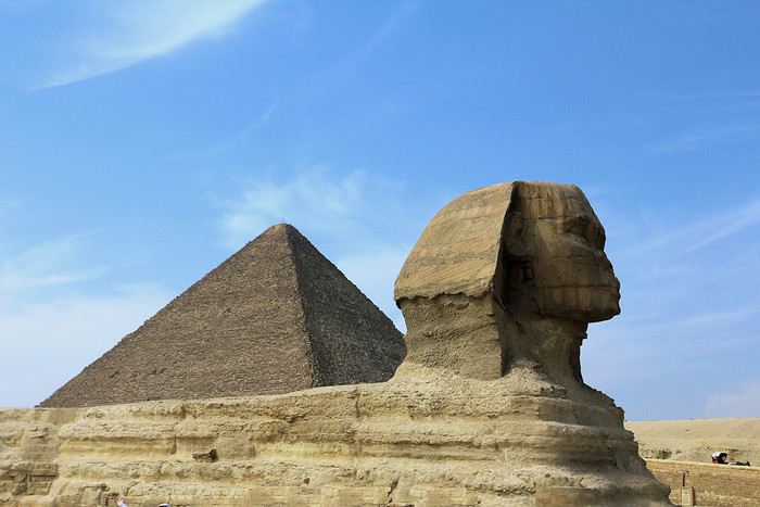
Après un très bon déjeuné et une courte sieste nous sommes partis pour une visite improvisée des pyramides et du sphinx!
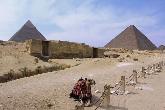
Nous avons sympathisé avec la petite dizaine de passagers qui était comme nous coincés au Caire.
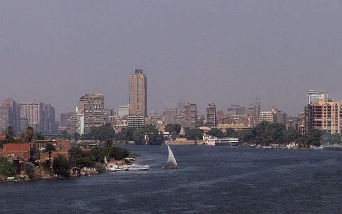
Finalement après une escale à Nairobi nous finissons par atterrir sur le sol sudafricain.
Nous avions prévu de dormir à Clarens le premier jours mais vu notre périple au Caire nous nous dirigeons directement sur Escourt .
Malgré notre fatigue la prise de main de notre (petite) voiture et la conduite à gauche se passe bien!
Nous avions pris une tablette et utiliser Mapsme qui c'est révélé très pratique pour trouver notre route et qui ne demande pas d'internet.
Nous avions prévu de découvrir le Drakensberg mais vu notre retard nous devons éliminer cette visite...
Nous sommes très bien accueilli à Escourt au At home BB malgré le vent glacial qui nous oblige à mettre le chauffage à fond : on ne s'attendait pas à ça en Afrique du sud!
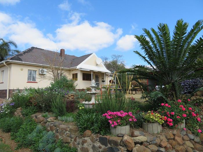
Nous ne tardons pas à nous écrouler dans le lit. Le lendemain nous avons le droit à un bon petit déjeuner avant de faire une longue route pour St Lucia.
Nous constatons que les terres sont exploités intensivement et parcourons des kilomètres de monoculture tantôt des forêts tracés au cordeau tantôt de la canne à sucre, des bananiers ou des champs d'ananas.
Je pensais voir plus de paysages sauvages qui sont très rares en dehors des parcs...🙁
Je remercie tous ceux qui sur ce forum mon permis de réaliser ce voyage par moi mème et mon inciter à faire ce voyage.😉
Nous sommes parti en couple un peu inquiet suite aux avis du site France diplomatie mais finalement nous n'avons pas eu de problèmes de sécurité sur place.
Voici notre parcours :
J1 Johannesburg --Clarens J2 Clarens -- Escourt J3 Escourt--St Lucia J4 St Lucia J5 St lucia-- Malkerns(Swasiland) J6 Malkerns -- Malelane J7 Malelane J8 Malelane-- Orpen restcamp J9 Orpen restcamp--Letaba J10 Letaba restcamp j11 Letaba--lower Sabie J12 lower Sabie--Graskop J13 Graskop-- Polokswane J14 Polokswane-- Johannesburg
On s'est concentré sur l'est du pays et sur le parc Kruger car notre principale objectif était de voir des animaux et surtout des félins que nous n'avions pas vu en Namibie!
Nous avons réservé le vol et les hébergements au parc Kruger 10 mois à l'avance et avons chercher à limiter les couts au maximun.
Nous avons voyagé avec Egyptair et avons eu un petit imprévu...
Notre vol qui devait partir vers les 15h a été retardé de 8h suite a une menace terroriste : alors que nous étions dans l'avion 2 policiers armés ont fait descendre un homme de l'avion puis nous avons du sortir et attendre de longues heures notre réembarquement après une fouille poussée!
Nous avions une escale de 3h au Caire avant notre avion pour Johannesburg aussi nous l'avons loupé! Le voyage commençait bien!
Nous sommes arrivé à 4h du matin au Caire mais Egyptair nous a bien pris en charge et nous a hébergé au Méridien situé dans l'aéroport.
On nous a proposé une excursion pour visiter les pyramides en attendant notre vol pour l'Afrique du sud prévu qu'à 21h...
Après un très bon petit déjeuner et une courte sieste nous sommes partis pour une visite improvisée des pyramides et du sphinx.
Après un très bon déjeuné et une courte sieste nous sommes partis pour une visite improvisée des pyramides et du sphinx!
Nous avons sympathisé avec la petite dizaine de passagers qui était comme nous coincés au Caire.
Finalement après une escale à Nairobi nous finissons par atterrir sur le sol sudafricain.
Nous avions prévu de dormir à Clarens le premier jours mais vu notre périple au Caire nous nous dirigeons directement sur Escourt .
Malgré notre fatigue la prise de main de notre (petite) voiture et la conduite à gauche se passe bien!
Nous avions pris une tablette et utiliser Mapsme qui c'est révélé très pratique pour trouver notre route et qui ne demande pas d'internet.
Nous avions prévu de découvrir le Drakensberg mais vu notre retard nous devons éliminer cette visite...
Nous sommes très bien accueilli à Escourt au At home BB malgré le vent glacial qui nous oblige à mettre le chauffage à fond : on ne s'attendait pas à ça en Afrique du sud!
Nous ne tardons pas à nous écrouler dans le lit. Le lendemain nous avons le droit à un bon petit déjeuner avant de faire une longue route pour St Lucia.
Nous constatons que les terres sont exploités intensivement et parcourons des kilomètres de monoculture tantôt des forêts tracés au cordeau tantôt de la canne à sucre, des bananiers ou des champs d'ananas.
Je pensais voir plus de paysages sauvages qui sont très rares en dehors des parcs...🙁
Thailand Travel Journal: From Chiang Mai to Bangkok, We Didn’t Buddha Our Fun
We’re excited to share our sixth travel journal with photos from Southeast Asia, this one entirely dedicated to Thailand. As a reminder, our previous travel journals can be accessed directly by clicking on the username "jojoone1" to the left of each post.
For a change, let’s start with the conclusion: our trip left us with an excellent memory. Very often, everything went like clockwork—short wait times, quick problem-solving, and the curious feeling of being pampered. Sometimes, life isn’t so cruel after all.
It’s only fair to admit that day after day, we encountered Thais who were smiling, helpful, kind, funny, and sometimes even touching. There were a few exceptions, but they were just the trees hiding the (tropical) forest. After this year’s experience, we won’t be the ones to tell you that Thailand isn’t the Land of Smiles or that laughter is just for business. We’ve witnessed so many kind behaviors and gestures that we no longer understand how anyone could complain about the people here—except for bad experiences in ultra-touristy spots packed with travelers lacking any finesse. It got to the point where it made us reflect. And we concluded that we probably have funny, friendly faces (?). We also know we’re the first to smile at them, and every day there, we show respect to everyone we meet. In any case, we have fond thoughts for many of the people we crossed paths with. Thanks to them, our trip took on a whole new human dimension.
A quick note about the photos: last year, the VoyageForum team made a change to how photos are uploaded. This gives us the choice between displaying high-definition photos (but losing ownership rights) or non-HD photos (less sharp, but the originals won’t be spread online without compensation or credit). We opted for the second solution, if only as a matter of principle. It does leave us with some regrets, especially since Françoise switched to the Canon EOS 7D Mark II, whose performance is notably better than the 7D.
Our first trip with Emirates was satisfying but left a mixed impression. Sure, it was the first time all four of our flights were on an Airbus A380. The crews were super friendly, and the meal trays were the best on the first two flights. On the return flights, the meals weren’t great and weren’t filling enough. Overall, the crews seemed disorganized and rushed—clearly some new recruits. The Doha-Paris flight, if memory serves, was on an A380-600, and in that configuration, we were packed in like it hadn’t been in years. In conclusion, it’s hard to say at this stage whether Qatar or Emirates comes out on top.
From our perspective, the journey from northern Thailand to Bangkok can be done via two different routes. This year, we took one of them, which allowed us to alternate between well-known destinations and original visits. Note that some of this year’s visits include cities we’ve already been to. So for a more complete view (Bangkok and Chiang Mai, for example), you’ll need to check out our previous travel journals.
We’ve improved our Thai vocabulary with a few more words and hope next year to move from kindergarten to first grade... For those reading us for the first time, we can only advise against visiting this country on an organized tour or looking for a French-speaking guide. The Thais have organized themselves well—they now have proven tourism practices. Maybe a guidebook for culture, a few basic English words, and a little organization are all you need for a great trip.
CHIANG MAI
Chiang Mai and its region are packed with treasures—so much so that one or two visits might not be enough.
At the airport, you go to a counter that provides a taxi ticket. The fare is 150 baht for a regular car and 200 baht for a larger vehicle. When our turn came, a large vehicle showed up, but we were only charged 150 baht. Okay, fine.
The hotels we’d selected three years ago had significantly increased their rates, so we had to find a new base. In the city center, hotels with large pools are overpriced, and despite the wide selection, it was hard to decide. We ended up at a hotel near the airport, the Baan U Sabai Boutique House. The superior room with a balcony can be negotiated for just under 40 €. It’s a beautiful, fairly new complex in traditional teak style, with very well-kept rooms and a long pool. Given the rather stormy weather in early July, it was the first time in Thailand we swam in cool water. It encouraged us to swim rather than just lounge...
At the end of the hotel street, you come out onto a busy main road where you can hail a songthaew (a kind of shared taxi). It’s easy to be offered a ride to the city center for 2 x 20 baht, but getting a return trip for less than 2 x 40 baht is tough, especially in the evening. Our red songthaew took us straight to Chiang Mai Gate, one of the city’s gates, located southeast of the historic square. We then took Phra Pok Khlao Road for a few dozen meters and chose the first little restaurant that looked nice. Within minutes, we had our dishes and smoothies for a total of 235 baht. Great quality, despite the place looking very touristy. The owner set the tone by handing out smiles left and right.
There’s an amazing spot in Chiang Mai to grab a coffee: Baan Phor Liang Meun. Once you reach Chiang Mai Gate, take Phra Pok Khlao Road for a few meters, then turn onto soi 2 (alley 2). It’s actually the first on the left. After a few dozen meters, you’ll find yourself walking alongside what looks like a Khmer temple.
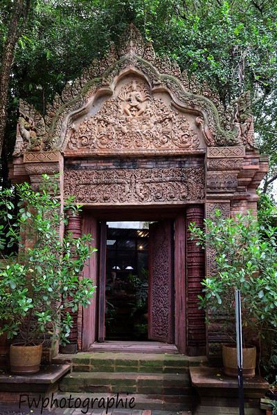
When you enter, you’re in a vast space—like a temple-garden—where you can eat a small dish or sip a good café crème as if you were in Angkor. The tables are far apart, so you’re as close to birds and squirrels as you are to other customers.
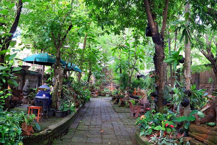
In the small building where the staff works, they provide high-quality mosquito repellent for free—something we’ll now buy regularly at 7/11. They’re small plastic bottles, mostly pink or orange, with Thai writing and "floral fragrance" in English. The scent is actually pleasant. Remember to shake the bottle before opening and pressing, or you’ll end up with cream all over your shorts...
The creator of this space has been sculpting terracotta works since the early 1980s using clay from the Lamphun region—the most consistent clay found in all of Thailand. This café is like visiting an ancient temple, with its abundance of statues, high-reliefs, and bas-reliefs. It’s undeniably a romantic spot for couples—a haven of calm in a very lively city.
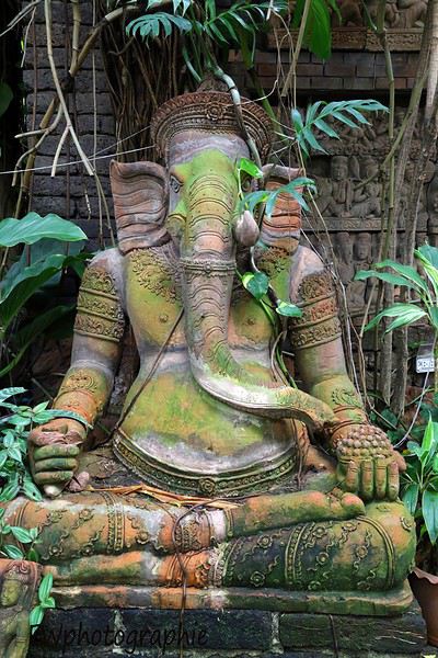
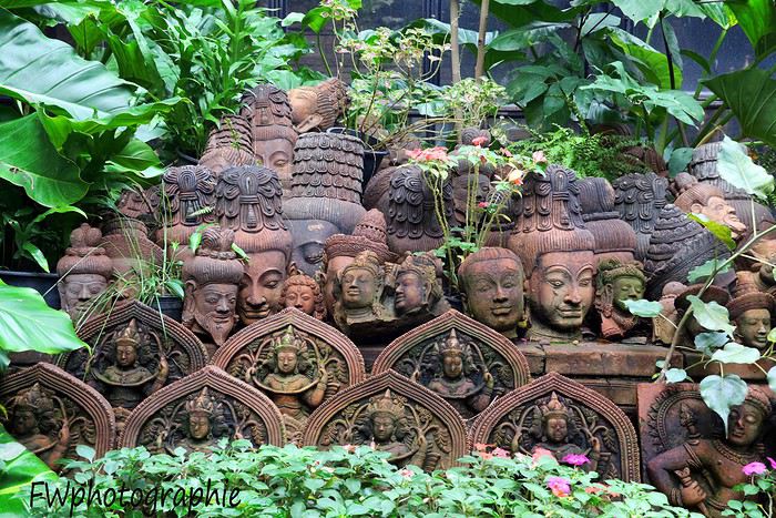
Mon carnet de voyage de Vancouver jusqu'à San Francisco
Bonsoir à tous !
Ce soir j'ai décidé de partager avec vous les souvenirs de mon voyage sur la côte Pacifique du Canada et Etats-Unis effectué en juillet/août 2017 ! Mon carnet de voyage reste "modeste", mais je souhaite tout de même partager avec vous les bons souvenirs, ce que je recommande, ce que je déconseille... et aussi un petit mémo personnel, à chaud ! J'ai peur d'oublier trop de choses si je tarde à écrire ce récit.
Il y a à peine un mois de cela, je me pointais sur le forum pour annoncer que je partais dans...une semaine. Oui, oui, un voyage que je qualifierais de "grosse dernière minute". Mais ce n'est pas pour autant qu'il a été raté, loin de là. Même s'il y a eu quelques erreurs qui auraient pu être évitées, mais bon...disons que cela reste normal, du moins, je crois.
J'ai donc réservé le 20 juillet dernier, pour un départ le 27 de Paris jusqu'à Vancouver. Retour prévu le 14 août au départ de San Francisco. A ce moment, je n'avais absolument rien d'autre de réservé : ni hôtel, ni voiture, ni excursion. J'ai réservé mes hébergements dans les jours suivants pour les grandes villes (SF, Seattle, Vancouver...). J'avais également effectué deux préservations pour les voitures : une au Canada, une aux Etats-Unis.
Départ le 27 juillet : J'avais prévu de prendre la route depuis la Bretagne à 3H, pour un avion à 12H... Le timing et le battement auraient été largement suffisants, mais finalement, comme je ne dormais pas ..je suis parti à 1H. 5H30 à Paris, 6H20 à Roissy. Je laisse la voiture dans un parking à 12km que j'avais réservé la veille : Parkingpascher. Je recommande. Très content de leurs services. Vol retardé de 2H. J'ai finalement beaucoup regretté d'être parti si tôt de chez moi.
J'arrive donc vers 15H à Vancouver. Nous sommes toujours le 27 juillet en heure locale. Mon "hébergement" était situé à Burnaby, au métro "Metrotown". J'ai du marcher environ 30/40minutes avant de trouver la bonne adresse. J'en ai chié, j'étais crevé avec ma valise et tout mon matériel... Mais j'ai fini par arriver ! Je ne m'attendais pas à ce type d'hébergement, au début ca surprend mais on finit par s'y faire ! C'était trop propre et très correct.
De mémoire je crois que je suis parti me doucher, je me suis allongé 5min sur le lit, et me suis réveillé 12H après le lendemain... J'étais crevé et était réveillé depuis presque 48H.
Vendredi 28/07 : Réveil dans un petit quartier résidentiel. Départ 7H30 pour arpenter les rues de Vancouver !
Tout comme pour une grande globalité du voyage, je n'avais quasi rien envisagé ni préparé de mes visites, mais cela ne m'a pas empêché de découvrir des merveilles ! J'arrive dans le downtown "Waterfront", je décide de commencer à remonter les rues... Je marche autour des building pendant quelques dizaines de minutes, puis je finis par me rendre en direction de Chinatown (j'avais du trouver un plan entre temps, je crois)
Visite du jardin du Dr...Yun see ? J'ai oublié le nom 😄 C'est très joli, mais... on n'y reste pas des heures ! Oui, vous remarquerez que je n'aime pas trop m'attarder à un endroit une fois que c'est "vu".
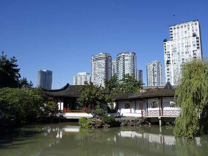
J'ai faim ! Il faut que je trouve un endroit où manger quelque chose de consistant et bon, car je n'ai pas mangé depuis près de 24H. J'ai dégusté un très bon petit breakfast, au milieu d'un brouhaha mais dans une atmosphère qui me plaisait plutôt bien. Je ne me souviens plus de l'emplacement, mais c'était en retournant en direction de Waterfront, et ce juste avant la fameuse rue touristique qui remonte ... Vous me compléterez sans doute !
Retour vers Waterfront aux alentours de midi. Seabus en direction de North Vancouver ! Très belle petite balade.
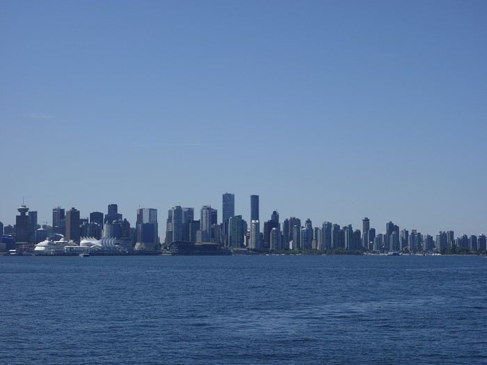
Découverte du marché couvert. Atmosphère très agréable, tout est vraiment superbe et donne envie. Passage par un stand information center. Je me rends ensuite 2 blocs plus haut que le marché, car je dois trouver une banque pour retirer de l'argent.
Retour au marché après un passage dans les rues de North Vancouver (qui donnent une vue magnifique sur Vancouver) J'ai ensuite pris le bus en direction de Capilano Suspension bridge park. La route jusque là est superbe... On passe dans des quartiers résidentiels tout simplement MAGNIFIQUE ! J'adore.
Arrivée au parc. Naïvement, je n'avais même pas émis l'hypothèse que le parc puisse être payant...mais il l'était bien... 40$ ou 38 de mémoire, ca m'a fait mal quand même. Mon budget ayant littéralement explosé sur ce voyage, mais bon, passons.
L'environnement est magique et typique. Peut être trop de touristes à mon goût. L'impression de tomber dans un mini disneyland. Plus tard dans mon voyage, j'ai rencontré des gens qui étaient au parc el même jour que moi et qui, eux, ont adoré... Moi j'ai bien aimé, mais pas forcément plus. Faire la queue 45min pour passer sur le pont, m'ouais... Bon. Ca faisait partie du folklore. J'avoue quand même que c'était magnifique !
Retour en bus à l'embarcadère du SeaBus. Il est bien 17H, 17H30 pour alors.
De Waterfront, je remonte quelques blocs pour prendre un bus et foncer tout droit à Stanley Park. Havre de paix sublime, calme et parfait pour s'abriter de la chaleur en fin de journée.
Je déambule dans le parc pendant 2H...je profite. Et je regrette aussi à ce moment d'avoir laissé mon drone dans ma valise; uniquement pour ce moment, mais me rappelle aussi qu'il aurait pénible de le trainer toute la journée. C'est comme ça.
Je choisis de rentrer à Burnaby en bus plutôt qu'en train... Cela m'a permis d'observer la ville. Trajet de plus d'une heure mais c'était sympa. Je rentre vers 21H. (après être parti à 7H30, ca fait une sacrée journée)
Je rentre dans ma chambre le soir, où je réserve le trajet pour le lendemain jusqu'à Victoria. Je réserve un bus qui comprend le trajet+le ferry. Je ne me souviens plus de la compagnie.
Il faisait très chaud, et je trouve que c'était une bonne journée de découverte à Vancouver, je pense qu'il y avait d'avantage de choses à voir dans cette ville, mais ... j'avais fait le choix à l'avance de ne pas y rester plus longtemps. J'aurais peut etre du y consacrer une autre journée, mais guère plus.
La suite de mon récit bientôt !
Ce soir j'ai décidé de partager avec vous les souvenirs de mon voyage sur la côte Pacifique du Canada et Etats-Unis effectué en juillet/août 2017 ! Mon carnet de voyage reste "modeste", mais je souhaite tout de même partager avec vous les bons souvenirs, ce que je recommande, ce que je déconseille... et aussi un petit mémo personnel, à chaud ! J'ai peur d'oublier trop de choses si je tarde à écrire ce récit.
Il y a à peine un mois de cela, je me pointais sur le forum pour annoncer que je partais dans...une semaine. Oui, oui, un voyage que je qualifierais de "grosse dernière minute". Mais ce n'est pas pour autant qu'il a été raté, loin de là. Même s'il y a eu quelques erreurs qui auraient pu être évitées, mais bon...disons que cela reste normal, du moins, je crois.
J'ai donc réservé le 20 juillet dernier, pour un départ le 27 de Paris jusqu'à Vancouver. Retour prévu le 14 août au départ de San Francisco. A ce moment, je n'avais absolument rien d'autre de réservé : ni hôtel, ni voiture, ni excursion. J'ai réservé mes hébergements dans les jours suivants pour les grandes villes (SF, Seattle, Vancouver...). J'avais également effectué deux préservations pour les voitures : une au Canada, une aux Etats-Unis.
Départ le 27 juillet : J'avais prévu de prendre la route depuis la Bretagne à 3H, pour un avion à 12H... Le timing et le battement auraient été largement suffisants, mais finalement, comme je ne dormais pas ..je suis parti à 1H. 5H30 à Paris, 6H20 à Roissy. Je laisse la voiture dans un parking à 12km que j'avais réservé la veille : Parkingpascher. Je recommande. Très content de leurs services. Vol retardé de 2H. J'ai finalement beaucoup regretté d'être parti si tôt de chez moi.
J'arrive donc vers 15H à Vancouver. Nous sommes toujours le 27 juillet en heure locale. Mon "hébergement" était situé à Burnaby, au métro "Metrotown". J'ai du marcher environ 30/40minutes avant de trouver la bonne adresse. J'en ai chié, j'étais crevé avec ma valise et tout mon matériel... Mais j'ai fini par arriver ! Je ne m'attendais pas à ce type d'hébergement, au début ca surprend mais on finit par s'y faire ! C'était trop propre et très correct.
De mémoire je crois que je suis parti me doucher, je me suis allongé 5min sur le lit, et me suis réveillé 12H après le lendemain... J'étais crevé et était réveillé depuis presque 48H.
Vendredi 28/07 : Réveil dans un petit quartier résidentiel. Départ 7H30 pour arpenter les rues de Vancouver !
Tout comme pour une grande globalité du voyage, je n'avais quasi rien envisagé ni préparé de mes visites, mais cela ne m'a pas empêché de découvrir des merveilles ! J'arrive dans le downtown "Waterfront", je décide de commencer à remonter les rues... Je marche autour des building pendant quelques dizaines de minutes, puis je finis par me rendre en direction de Chinatown (j'avais du trouver un plan entre temps, je crois)
Visite du jardin du Dr...Yun see ? J'ai oublié le nom 😄 C'est très joli, mais... on n'y reste pas des heures ! Oui, vous remarquerez que je n'aime pas trop m'attarder à un endroit une fois que c'est "vu".
J'ai faim ! Il faut que je trouve un endroit où manger quelque chose de consistant et bon, car je n'ai pas mangé depuis près de 24H. J'ai dégusté un très bon petit breakfast, au milieu d'un brouhaha mais dans une atmosphère qui me plaisait plutôt bien. Je ne me souviens plus de l'emplacement, mais c'était en retournant en direction de Waterfront, et ce juste avant la fameuse rue touristique qui remonte ... Vous me compléterez sans doute !
Retour vers Waterfront aux alentours de midi. Seabus en direction de North Vancouver ! Très belle petite balade.
Découverte du marché couvert. Atmosphère très agréable, tout est vraiment superbe et donne envie. Passage par un stand information center. Je me rends ensuite 2 blocs plus haut que le marché, car je dois trouver une banque pour retirer de l'argent.
Retour au marché après un passage dans les rues de North Vancouver (qui donnent une vue magnifique sur Vancouver) J'ai ensuite pris le bus en direction de Capilano Suspension bridge park. La route jusque là est superbe... On passe dans des quartiers résidentiels tout simplement MAGNIFIQUE ! J'adore.
Arrivée au parc. Naïvement, je n'avais même pas émis l'hypothèse que le parc puisse être payant...mais il l'était bien... 40$ ou 38 de mémoire, ca m'a fait mal quand même. Mon budget ayant littéralement explosé sur ce voyage, mais bon, passons.
L'environnement est magique et typique. Peut être trop de touristes à mon goût. L'impression de tomber dans un mini disneyland. Plus tard dans mon voyage, j'ai rencontré des gens qui étaient au parc el même jour que moi et qui, eux, ont adoré... Moi j'ai bien aimé, mais pas forcément plus. Faire la queue 45min pour passer sur le pont, m'ouais... Bon. Ca faisait partie du folklore. J'avoue quand même que c'était magnifique !
Retour en bus à l'embarcadère du SeaBus. Il est bien 17H, 17H30 pour alors.
De Waterfront, je remonte quelques blocs pour prendre un bus et foncer tout droit à Stanley Park. Havre de paix sublime, calme et parfait pour s'abriter de la chaleur en fin de journée.
Je déambule dans le parc pendant 2H...je profite. Et je regrette aussi à ce moment d'avoir laissé mon drone dans ma valise; uniquement pour ce moment, mais me rappelle aussi qu'il aurait pénible de le trainer toute la journée. C'est comme ça.
Je choisis de rentrer à Burnaby en bus plutôt qu'en train... Cela m'a permis d'observer la ville. Trajet de plus d'une heure mais c'était sympa. Je rentre vers 21H. (après être parti à 7H30, ca fait une sacrée journée)
Je rentre dans ma chambre le soir, où je réserve le trajet pour le lendemain jusqu'à Victoria. Je réserve un bus qui comprend le trajet+le ferry. Je ne me souviens plus de la compagnie.
Il faisait très chaud, et je trouve que c'était une bonne journée de découverte à Vancouver, je pense qu'il y avait d'avantage de choses à voir dans cette ville, mais ... j'avais fait le choix à l'avance de ne pas y rester plus longtemps. J'aurais peut etre du y consacrer une autre journée, mais guère plus.
La suite de mon récit bientôt !
Clopin clopant sur les sentiers battus d'Utah - mai 2017
L'heure des vacances a sonné. Voici un ixième carnet de voyage, pour ceux qui ne partent pas, partiront plus tard ou, comme nous, sont partis plus tôt.
Ouest USA : 4ème opus. A ce stade là, on peut déjà être qualifié de "mordus". C'est d'ailleurs ce que pense notre entourage. Mordus, on l'a été dès notre premier voyage, parcours classique, en été. Dès le retour on s'était dit qu'on reviendrait. Et on l'a fait, en plein hiver, un "short trip" qui nous a laissé émerveillés, éblouis de lumière et de panoramas époustouflants. On y est retourné, encore, plus au sud, l'automne dernier. Et toujours cette même sensation de découverte, cet ensorcellement des sens, cette ivresse des grands espaces.
Alors, quand on a annoncé ce quatrième voyage, au printemps cette-fois ci, ça n'a étonné personne. Si j'avais eu des doutes les trois premières fois, là, je n'en avais plus. Au programme l'Utah, une grosse pointure, un séjour centré sur la randonnée et des sites à la carrure impressionnante. Je ne me suis pas posé de questions ou si peu. J'aurais sans doute du. Si la météo a été avec nous en cette fin mai, d'autres événements inattendus ont perturbé nos projets. Un séjour en demi-teinte, qui oscille la plupart du temps entre euphorie et frustration.
L'Utah, on n'avait fait que l'effleurer lors de nos précédents voyages. Démarrant invariablement nos parcours plus au sud, nous n'avions encore jamais franchi la ligne fictive liant Bryce à l'Ouest à Monument Valley et Durango à l'Est. Pour ce voyage, nous nous contenterons donc d'un seul état et comptabiliserons beaucoup moins de miles que les fois précédentes. Je pensais que ce serait un atout mais finalement, nous avons un peu regretté un certain manque de diversité.
Avant de clore ce préambule, je veux, encore une fois, remercier tous ceux qui m'ont aidée, directement ou indirectement à mettre sur pied ce voyage. Leur aide m'a été précieuse et je leur suis infiniment reconnaissante pour avoir partagé leurs expérience et informations. 🙂
Itinéraire prévu (du 22 mai au 4 juin) :
J1 Arrivée à Salt Lake City J2 SLC > Moab J3 Moab J4 Moab J5 Moab > Monticello J6 Monticello J7 Monticello > Caineville via UT 95 J8 Caineville > Torrey via UT 24 J9 Torrey J10 Torrey > Escalante via UT 12 J11 Escalante > Cannonville J12 Cannonville > Cedar City J13 Cedar City > Provo J14 Provo > SLC et vol retour
Volontairement, je n'ai pas détaillé les activités des différentes journées puisque la réalité a été un temps soit peu différente de ce qui était programmé à l'origine.
La suite ici
Ouest USA : 4ème opus. A ce stade là, on peut déjà être qualifié de "mordus". C'est d'ailleurs ce que pense notre entourage. Mordus, on l'a été dès notre premier voyage, parcours classique, en été. Dès le retour on s'était dit qu'on reviendrait. Et on l'a fait, en plein hiver, un "short trip" qui nous a laissé émerveillés, éblouis de lumière et de panoramas époustouflants. On y est retourné, encore, plus au sud, l'automne dernier. Et toujours cette même sensation de découverte, cet ensorcellement des sens, cette ivresse des grands espaces.
Alors, quand on a annoncé ce quatrième voyage, au printemps cette-fois ci, ça n'a étonné personne. Si j'avais eu des doutes les trois premières fois, là, je n'en avais plus. Au programme l'Utah, une grosse pointure, un séjour centré sur la randonnée et des sites à la carrure impressionnante. Je ne me suis pas posé de questions ou si peu. J'aurais sans doute du. Si la météo a été avec nous en cette fin mai, d'autres événements inattendus ont perturbé nos projets. Un séjour en demi-teinte, qui oscille la plupart du temps entre euphorie et frustration.
L'Utah, on n'avait fait que l'effleurer lors de nos précédents voyages. Démarrant invariablement nos parcours plus au sud, nous n'avions encore jamais franchi la ligne fictive liant Bryce à l'Ouest à Monument Valley et Durango à l'Est. Pour ce voyage, nous nous contenterons donc d'un seul état et comptabiliserons beaucoup moins de miles que les fois précédentes. Je pensais que ce serait un atout mais finalement, nous avons un peu regretté un certain manque de diversité.
Avant de clore ce préambule, je veux, encore une fois, remercier tous ceux qui m'ont aidée, directement ou indirectement à mettre sur pied ce voyage. Leur aide m'a été précieuse et je leur suis infiniment reconnaissante pour avoir partagé leurs expérience et informations. 🙂
Itinéraire prévu (du 22 mai au 4 juin) :
J1 Arrivée à Salt Lake City J2 SLC > Moab J3 Moab J4 Moab J5 Moab > Monticello J6 Monticello J7 Monticello > Caineville via UT 95 J8 Caineville > Torrey via UT 24 J9 Torrey J10 Torrey > Escalante via UT 12 J11 Escalante > Cannonville J12 Cannonville > Cedar City J13 Cedar City > Provo J14 Provo > SLC et vol retour
Volontairement, je n'ai pas détaillé les activités des différentes journées puisque la réalité a été un temps soit peu différente de ce qui était programmé à l'origine.
La suite ici
17 jours de 4x4 en Mongolie
Bonsoir a tous,
Notre road trip se rapproche, 17 jours de 4*4 en Mongolie. Voici l'idée :
Oulan bator
Baga gazarin chuluu
Ulaan savarga
Dalandzadgad
Yolin am canyon
Bayanzag (ou bayanzag juste avant yolin)
Dunes de konghor
Ulaan tsav
Khermen tsav
Bugiin khondii
Bogd
Arvaikheer
Chutes orkhon
Tovkhon
Khogno khan
Oulan bator.
Jusqu'aux dunes de konghor, pas de souci je pense. Apres je sais que pour ulaan tsav et surtout khermen tsav et bugiin khondii cela devient compliqué et possiblement non faisable en 17 jours. Dans ce cas, on peut peut être aller à ulaan tsav, remonter par bayanlig et bogd sans passer par khermen tsav ni bugiin khondii.
Merci aux habitués...ou moins habitués de nous éclairer de vos lumières!
Greg
Jusqu'aux dunes de konghor, pas de souci je pense. Apres je sais que pour ulaan tsav et surtout khermen tsav et bugiin khondii cela devient compliqué et possiblement non faisable en 17 jours. Dans ce cas, on peut peut être aller à ulaan tsav, remonter par bayanlig et bogd sans passer par khermen tsav ni bugiin khondii.
Merci aux habitués...ou moins habitués de nous éclairer de vos lumières!
Greg