Results for "escalade+|+6+>+183"
10393 results found.
Inde: trois semaines en Orissa English translation pending
Je pars fin octobre pour 3 semaines en Orissa, (4ème voyage en Inde) souhaitant consacrer tout mon temps à cette région.
Bhubaneswar ... et un tour un peu complet de la région, y compris visite d'une des nombreuses réserves et approche des tribus.
Transports collectifs et location de voiture épisodique. Tous renseignements et bonnes adresses pour budget limité, seront les bienvenus. (j'ai 60 ans, voyage en solo, et ne peux plus escalader des montagnes sac au dos).
Merci d'avance.
DOUMI
Hôtel Adria en Croatie English translation pending
Bonjour
Nous partons 15 jours à l'Hotel ADRIA avec nos 2 pitchounes 6 et 2 ans. Les avis semblent partagées. Nous nous demandions comment étaient les piscines intérieure et extérieure. Nous avons vu des tobogans sur une photo. Est ce vraiment le cas? Comment est la salle de sport? les animations pour enfants? Merci de ces informations zaze
Nous partons 15 jours à l'Hotel ADRIA avec nos 2 pitchounes 6 et 2 ans. Les avis semblent partagées. Nous nous demandions comment étaient les piscines intérieure et extérieure. Nous avons vu des tobogans sur une photo. Est ce vraiment le cas? Comment est la salle de sport? les animations pour enfants? Merci de ces informations zaze
Enceinte, que visiter au Pérou en 21 jours? English translation pending
Salut !
Nous avions pris nos billets pour le Pérou quelques jours avant d'apprendre que j'étais enceinte. Le voyage comme la grossesse sont deux bonnes nouvelles, mais je voudrais que mon séjour se passe le plus sympa possible, sans être HS tous les jours.
Que puis-je visiter ? Quels médicaments dois-je prendre sur moi ? Mes vaccins ne sont pas à jour...
Mais tout se passe à merveilles, je n'attends plus que de partir.
Merci 😉
Margotte
Nous avions pris nos billets pour le Pérou quelques jours avant d'apprendre que j'étais enceinte. Le voyage comme la grossesse sont deux bonnes nouvelles, mais je voudrais que mon séjour se passe le plus sympa possible, sans être HS tous les jours.
Que puis-je visiter ? Quels médicaments dois-je prendre sur moi ? Mes vaccins ne sont pas à jour...
Mais tout se passe à merveilles, je n'attends plus que de partir.
Merci 😉
Margotte
Ao Nang déception? (Thaïlande) English translation pending
🙁 Lors de mon dernier petit périple avec fredo 92 nous avons posés notre sac pour 2 nuitées à Ao Nang city. Paysage superbe, arrivée en bateau de phi phi grandiose, oui mais aprés ? Quelle déception. J'ai eu l'impression de me retrouver malgré 10 000 Kms de voyage à Juan les pins ou sur la costa brava. Magasins, restaus, grande rue à 99 pour cent occidentalisé. Seul les tuck tuck locaux et les baths que j'avais dans la poche mon rappelé en fin de soirée que j'étais en thailande. Et que dire de raillay ?
Avis sur itinéraire de trois semaines au Guatemala English translation pending
Bonjour à tous,
Mes préparations du tour du monde avancent, voilà que l'itinéraire pour 3 semaines au Guaté est fixé (entre juillet et aout). Avant de le fixer définitivement, j'aimerais avoir vos avis sur cet itinéraire, ce qui manque ou ce qu'il y a en trop...
Jour 1: Arrivée à Guatémala City et départ pour Antigua Jour 2-3: Antigua (ascension du volcan Pacaya) Jour 4-5: Lac Atitlán (Santiago) Jour 6: Quetzaltenango Jour 7: Chichicastenango Jour 8-9-10-11-12: Nebaj + trek Jour 13-14: Coban + Semuc Champey Jour 15-16: Flores Jour 17-18: Tikal (dormir une nuit sur place) Jour 19-20: Rio Dulce vers Livingston Jour 21: départ de Guatémala city vers Cancun
Merci à tous,
Pat
Mes préparations du tour du monde avancent, voilà que l'itinéraire pour 3 semaines au Guaté est fixé (entre juillet et aout). Avant de le fixer définitivement, j'aimerais avoir vos avis sur cet itinéraire, ce qui manque ou ce qu'il y a en trop...
Jour 1: Arrivée à Guatémala City et départ pour Antigua Jour 2-3: Antigua (ascension du volcan Pacaya) Jour 4-5: Lac Atitlán (Santiago) Jour 6: Quetzaltenango Jour 7: Chichicastenango Jour 8-9-10-11-12: Nebaj + trek Jour 13-14: Coban + Semuc Champey Jour 15-16: Flores Jour 17-18: Tikal (dormir une nuit sur place) Jour 19-20: Rio Dulce vers Livingston Jour 21: départ de Guatémala city vers Cancun
Merci à tous,
Pat
Trek du Machu Picchu et Huayhuash au Pérou English translation pending
Bonjour,
Je souhaiterais pouvoir combiner en juillet 2007, la Cordillère Huayhuash et le Chemin de l'Inca vers le Machu Picchu en max 21 jours A/R à partir de Bruxelles ou Paris. Je n'ai trouvé aucune agence proposant cette formule en Belgique ou en France. Pensez-vous que cette combinaison soit possible /réaliste ? Si oui, je vous serais reconnaissant de m'indiquer avec quelle agence / comment réaliser ce trekking. Merci d'avance
Nepaldream
Je souhaiterais pouvoir combiner en juillet 2007, la Cordillère Huayhuash et le Chemin de l'Inca vers le Machu Picchu en max 21 jours A/R à partir de Bruxelles ou Paris. Je n'ai trouvé aucune agence proposant cette formule en Belgique ou en France. Pensez-vous que cette combinaison soit possible /réaliste ? Si oui, je vous serais reconnaissant de m'indiquer avec quelle agence / comment réaliser ce trekking. Merci d'avance
Nepaldream
Petite marche à Torres del Paine (Chili) English translation pending
bonjour, je vis au chili depuis 3 ans avec ma famille et j'y travaille ce qui ne me laisse que peu de temps pour le visiter c'est un comble, non! Mais ça y est j'ai enfin 10 jours et un peu de sous pour faire le grand tour dans le parc de torres del paine. Vu que tout est très commercial ici, je souhaiterais avoir l'opinion de compatriotes ayant fait ce petit voyage bien sympatique.
Voilà, j'ai tout le matériel adequat et l'entrainement, je veux dire que mon rythme c'est 17 kilos et 6 à 7 heures de marches par jours avec max 1500 mètres de dénivelés pendant une dizaines de jours, après c'est dur de reprendre le lendemain et mes genoux ne sont plus ce qu'ils étaient!
J'aimerais faire le grand tour seul sans guide en autonomie la plus complète (nourriture) et aller de camping en camping. Je voudrais savoir si les gardes sur place me laisseront faire, sachant que je parle parfaitement le chilien et que je possede la carte d'identité chilienne.
J'aimerais aussi quelques conseils pour optimiser le séjour dans le parc, du style ou dormir le premier jour et si possible les durées aprox d'un point à un autre.Bref le topo le plus précis possible. Je fais un peu d'escalade (5C) c'est peu être utile pour éviter de trop redescendre dans certains cas.
Merci pour toutes les précisions que vous pourrez bien me communiquer. Evidemment de mon côté j'ai téléphoné au parc mais vraiment j'aimerais avoir un autre son de cloche parce que ici les infos ne sont pas toujours fiables, j'en ai l'expérience et je ne voudrais pas retrouver coincé obligé de payer des choses qui me paraissent inutiles et très très chères;
Randonnée de Coyote Gulch (Etats-Unis) English translation pending
bonsoir,
je desire faire la randonnee de coyote gulch en partant de forty mile ridge trailhead via crack in the wall et sortir par jacob hamblin arch
mais j'ai entendu dire qu'il etait difficile d'effectuer la remontee a cet endroit
sachant que je suis tres sportif est-ce possible ou prohibitif sans materiel specifique?
cette rando m'attire vraiment, est-elle si belle que ce que j'ai entendu a droite a gauche?
merci de vos reponses
Déplacements entre la Colombie, l'Équateur et le Pérou English translation pending
Bonjour a tous,
je vais arriver en bateau a Carthagene avec ma famille (2 adultes et 3 enfants dont un bebe de 1 an 1/2) et souhaiterais visiter l'equateur et le Perou. Pour quitter la colombie vers l'equateur que me conseillez-vous (Bus ou vol interne ?) Si quelqu'un a des idees sur le prix d'un vol interne cela m'arrangerait car en famille cela devient vite un gros budget. Ensuite je pensais prendre des bus pour me deplacer en Equateur et au Perou, quels sont d'apres vous les sites interessants et pas trop difficile a faire en famille (pas question d'escalader a 5000 m). Nous avons un mois devant nous pour ce periple, apres nous devons partir pour passer Panama...
Merci beaucoup pour vos conseils.
je vais arriver en bateau a Carthagene avec ma famille (2 adultes et 3 enfants dont un bebe de 1 an 1/2) et souhaiterais visiter l'equateur et le Perou. Pour quitter la colombie vers l'equateur que me conseillez-vous (Bus ou vol interne ?) Si quelqu'un a des idees sur le prix d'un vol interne cela m'arrangerait car en famille cela devient vite un gros budget. Ensuite je pensais prendre des bus pour me deplacer en Equateur et au Perou, quels sont d'apres vous les sites interessants et pas trop difficile a faire en famille (pas question d'escalader a 5000 m). Nous avons un mois devant nous pour ce periple, apres nous devons partir pour passer Panama...
Merci beaucoup pour vos conseils.
Sécurité en Syrie actuellement (juillet)? English translation pending
En vue des derniers evenements, je commence à me demander si un voyage en Syrie est une bonne idée?
Je m'y rends dans 3 jours, alep, damas alors si quelqu un a des contacts sur place, ils sont toujours les bienvenus.
J'espere que l'escalade de la violence s'estompera dans les prochains et que la syrie et le liban ne soit pas mélé directement à ce conflit...
Bonne continuation à tous
Excursions depuis Krabi en Thaïlande English translation pending
😉Je prépare gentillement mais surement un séjour à Krabi pour le début septembre 2006. Qui peut me donner quelques conseils pour des excursions sur les îles et ailleurs. Nous sommes 6 personnes, moi et 5 filles !!! Quelle chance !!! mais avec des objectifs un peu différent. Toutefois, quelques idées d'excursions seraient les bienvenues. J'attends volontiers vos réponses. Merci
Sites à ne pas manquer en Bolivie? English translation pending
Salut,
Bientot en Bolivie, et juste besoin de connaitre les MEILLEURS plans, villes, treks, activites, ...., a faire sur la Bolivie...?!? J y reste 3 semaine a 1 mois! Merci d avance!
Bientot en Bolivie, et juste besoin de connaitre les MEILLEURS plans, villes, treks, activites, ...., a faire sur la Bolivie...?!? J y reste 3 semaine a 1 mois! Merci d avance!
5 mois en Amérique du Sud, que me conseillez-vous? English translation pending
bonjour a tous!
Je compte arreter mes études pendant 1 an durant lequel je partirai 6 mois et je commence à réfléchir au périple que je vais pouvoir faire. Une chose est sure: ce sera l'amérique du sud!
Mais je ne connais pas du tout alors j'ai besoin de vos conseils, non pas au niveau de la beauté des paysages ou de l'interet des différents pays en eux mm car tous les gouts sont dans la nature et puis pour ca, il y a assez de docs sur le sujet!
Simplement je voudrais savoirquels sont les pays à eviter sachant que je suis une fille de 21 ans voyageant seule (ce sera mon premier voyage seule) Je pensais atterir au mexique car je suppose que c'est l'un des pays les plus faciles a visiter pour les non-initiés et j'en profiterai pour perfectionner mon espagnol, qu'en pensez vous?a combien de pays dois-je me limiter en 6 mois? J'aime bien bouger et les longs trajets en bus (nuit ou jr) ne me dérangent pa mais si un endroit me plait vraiment je veux avoir la possibilité d'y passer un peu de tps
Merci beaucoup!
Bonne continuation a tous dans vos projets!
Je compte arreter mes études pendant 1 an durant lequel je partirai 6 mois et je commence à réfléchir au périple que je vais pouvoir faire. Une chose est sure: ce sera l'amérique du sud!
Mais je ne connais pas du tout alors j'ai besoin de vos conseils, non pas au niveau de la beauté des paysages ou de l'interet des différents pays en eux mm car tous les gouts sont dans la nature et puis pour ca, il y a assez de docs sur le sujet!
Simplement je voudrais savoirquels sont les pays à eviter sachant que je suis une fille de 21 ans voyageant seule (ce sera mon premier voyage seule) Je pensais atterir au mexique car je suppose que c'est l'un des pays les plus faciles a visiter pour les non-initiés et j'en profiterai pour perfectionner mon espagnol, qu'en pensez vous?a combien de pays dois-je me limiter en 6 mois? J'aime bien bouger et les longs trajets en bus (nuit ou jr) ne me dérangent pa mais si un endroit me plait vraiment je veux avoir la possibilité d'y passer un peu de tps
Merci beaucoup!
Bonne continuation a tous dans vos projets!
Paris-Sofia à petit prix? English translation pending
salut tt le monde je cherche quelques trucs pour aller en bulgarie a sofia
bon jai deja regarde les trucs les moins chers (eurolines yahoo !!!! :))
cest 100 euros en moyenne trop cher !!!!!!! :)
de sofia ensuite je part a istanbul 30 euros istanbul -alep 25 euros alep -beirut 6 euros lol
merci pour les conseils
jai entendu parler de sorte de minibus de travailleurs roumains retournant au pays jai vu ca vite fait je men rapelle plus ou :(
sinon est ce que c'est possible de faire la route avec un routier on sarrange avec lui ici et il nous ramene avec lui :)
de sofia ensuite je part a istanbul 30 euros istanbul -alep 25 euros alep -beirut 6 euros lol
merci pour les conseils
jai entendu parler de sorte de minibus de travailleurs roumains retournant au pays jai vu ca vite fait je men rapelle plus ou :(
sinon est ce que c'est possible de faire la route avec un routier on sarrange avec lui ici et il nous ramene avec lui :)
Madagascar en novembre English translation pending
Bonjour,
Nous partons à Madagascar pour 3 semaines dans 15 jours et à mesure que nous préparons ce voyage nous avons pleins de questions qui restent sans réponse. Alors si une bonne âme bien renseignée veut bien nous aider merci d'avance. Vali vala :
En ce qui concerne les guides, est-il préférable de réserver depuis la France ou peut-on attendre d'être aux portes des parcs pour trouver sur place ? (on compte faire l'ascencion du pic Boby à l'Andringitra et les classiques de l'Isalo).
Idem si on veut pratiquer des sports type parapente, escalade, canyoning ...
On projette de descendre la RN7 jusque Tulear (retour en vol intérieur), faut-il réserver un hotel pour Anakao ou Ifaty (si on y arrive :)) ?
En ce qui concerne les moustiques, (certaines lectures ont de quoi donner des sueurs froides !!!) en souffre-t-on beaucoup en Novembre (sachant qu'on ne prévoit pas la côte Est) ?
Enfin, il semble que la RN7 soit un des itinéraires les plus prisés par les touristes, au dela de ce qu'on peut trouver dans les guides ya t-il des endroits à ne pas rater si on veut réellement cotoyer des locaux ? On en profitera pour donner les vieilles fringues que l'on emporte.
MERCI MILLE FOIS POUR VOS REPONSES
Nous partons à Madagascar pour 3 semaines dans 15 jours et à mesure que nous préparons ce voyage nous avons pleins de questions qui restent sans réponse. Alors si une bonne âme bien renseignée veut bien nous aider merci d'avance. Vali vala :
En ce qui concerne les guides, est-il préférable de réserver depuis la France ou peut-on attendre d'être aux portes des parcs pour trouver sur place ? (on compte faire l'ascencion du pic Boby à l'Andringitra et les classiques de l'Isalo).
Idem si on veut pratiquer des sports type parapente, escalade, canyoning ...
On projette de descendre la RN7 jusque Tulear (retour en vol intérieur), faut-il réserver un hotel pour Anakao ou Ifaty (si on y arrive :)) ?
En ce qui concerne les moustiques, (certaines lectures ont de quoi donner des sueurs froides !!!) en souffre-t-on beaucoup en Novembre (sachant qu'on ne prévoit pas la côte Est) ?
Enfin, il semble que la RN7 soit un des itinéraires les plus prisés par les touristes, au dela de ce qu'on peut trouver dans les guides ya t-il des endroits à ne pas rater si on veut réellement cotoyer des locaux ? On en profitera pour donner les vieilles fringues que l'on emporte.
MERCI MILLE FOIS POUR VOS REPONSES
Guatemala ou Costa Rica? English translation pending
Bonjour à tous!
Nous étudions la possibilité d'aller en amérique centrale l'été prochain pendant 2 semaine (3 enfants :8 ans, 6 ans et 4 ans, ma conjointe et moi) Nous voulons savoir quelles destinations serait préférable entre le costa rica et le guatemala?
Nous comptons partir fin juillet début aout, est-ce que la saison des pluies peut hypotéquer notre voyage?
Dernière petite question, est-ce des destinations facile avec des enfants?
Merci beaucoup
Nous étudions la possibilité d'aller en amérique centrale l'été prochain pendant 2 semaine (3 enfants :8 ans, 6 ans et 4 ans, ma conjointe et moi) Nous voulons savoir quelles destinations serait préférable entre le costa rica et le guatemala?
Nous comptons partir fin juillet début aout, est-ce que la saison des pluies peut hypotéquer notre voyage?
Dernière petite question, est-ce des destinations facile avec des enfants?
Merci beaucoup
Comment évaluer le pourcentage des côtes? English translation pending
j'ai utiliser la fonction recherche du forum. je ne trouve pas.
comment faites-vous pour évaluer le pourcentage des côtes que vous grimpez ?
j'ai vu qu'il existe des compteurs kilométriques évolués qui font ça aussi. mais mais j'ai pas envie de dépenser une fortune.
y'aurais pas des niveaux tous simples qui le font ? ou bien une astuce ?
Quelle croisière choisir avec des enfants??? English translation pending
Bonjour,
je veux faire une croisière dans les Caraïbes (ou autre endoit intéressant) avec mes deux enfants de 9 et 13 ans et mon mari. J'ai un budget de $6, 000 environ pour les 4. Quel bateau serait intéressant pour les enfants. Je sais que celui de Disney est intéressant mais je crois qu'il est hors de prix.
J'aimerais avoir vos suggestions de croisière avec un aperçu du prix que je devrai déboursé.
Gros Merci !!
Bye bye
je veux faire une croisière dans les Caraïbes (ou autre endoit intéressant) avec mes deux enfants de 9 et 13 ans et mon mari. J'ai un budget de $6, 000 environ pour les 4. Quel bateau serait intéressant pour les enfants. Je sais que celui de Disney est intéressant mais je crois qu'il est hors de prix.
J'aimerais avoir vos suggestions de croisière avec un aperçu du prix que je devrai déboursé.
Gros Merci !!
Bye bye
Colombie ou Équateur? English translation pending
bonjour, je pars cet été, mais je ne sais pas encore où, sauf que j'aimerais bien que ce soit en amérique centrale ou bien du sud, genre colombie ou bien équateur. quelqu'un connait-il ce coin là? j'aimerais avoir des infos sur ce qu'il a a de chouette à faire et à voir. genre ruines, et promenades en forêts... etc..
Merci!
La Thaïlande menacée d'une révolte musulmane? English translation pending
Pour info, paru dans le Libé d'aujourd'hui.
Marseil.
La Thaïlande menacée d'une révolte musulmane Les violences dans les provinces du Sud pourraient gagner tout le pays.
Par Solenn HONORINE lundi 15 novembre 2004
Bangkok correspondance
es provinces musulmanes du sud de la Thaïlande avaient déjà connu des violences, mais jamais de cette ampleur. Selon le gouvernement, 340 personnes ont été tuées par des rebelles depuis janvier dans les provinces de Pattani, Yala et Narathiwat. Majoritairement, des policiers, fonctionnaires, maîtres d'école. Si l'on y ajoute les victimes de la répression des forces de l'ordre, le total se monte à 535. «Quand quelque chose comme cela arrive à votre pays, vous vous sentez vraiment mal», soupire Sirichai Wungaeo. Comme ses collègues universitaires, comme les hommes politiques, les militants associatifs, ce professeur de sciences politiques n'arrive toujours pas à comprendre pourquoi ce pays de 62 millions d'habitants, à 95 % bouddhiste, a basculé dans cette violence.
Loi martiale. Le 4 janvier, des hommes armés attaquent une caserne, tuent quatre gardes et volent 300 armes. La Thaïlande est sous le choc ; la loi martiale est appliquée dans plusieurs districts du Sud. Elle n'a toujours pas été levée depuis, car l'escalade se poursuit, notamment depuis la manifestation de Tak Bai, qui a fait 87 morts il y a deux semaines. Un nouveau choc : 6 civils sont tués par balles, 3 noyés. 1 290 personnes sont arrêtées, entassées dans six camions en route vers un camp militaire. 78 d'entre elles meurent étouffées. Le gouvernement dépêche une commission d'enquête pour établir les responsabilités, et, côté musulman, les tueries s'accélèrent. On parle de vengeance. Pas un jour sans une nouvelle attaque, de nouveaux morts : une personne âgée victime de la fusillade d'un temple ; trois employés de chemins de fer dont les corps sont déchiquetés par un train ; un vice-chef de village décapité. Plus de 25 en deux semaines, tous bouddhistes. Il ne s'agit plus d'attaques ciblées contre les représentants de l'Etat ; tout le monde est potentiellement visé.
Sur les trois provinces musulmanes, un territoire d'un ancien royaume indépendant, annexé par la Thaïlande en 1902, les différents régimes militaires ont longtemps tenté de balayer la culture des musulmans, d'origine ethnique malaise : imposition de la langue thaïe, interdiction des costumes traditionnels. D'où une crispation identitaire et l'émergence de mouvements séparatistes violents. «Mais, avec la démocratisation du pays, tout devait se résoudre : la Constitution garantissait la parole aux minorités musulmanes. Les idées séparatistes pouvaient être débattues en public. Et soudain : boum !», s'étonne encore Wattana Sugansil, professeur de sociologie à l'université de Pattani. Car, dès les années 80, le mouvement séparatiste s'essoufflait et les organisations historiques, Pulo et BRN, sont considérées comme moribondes.
Si les assassinats sont parfois accompagnés de lettres parlant de «vengeance», cela faisait bien vingt ans que toute revendication claire avait disparu. Les attaques ressemblaient plutôt à des règlements de comptes entre mafieux qu'à des actions de type guérilla séparatiste. D'où la surprise de constater que, depuis janvier, les attaques sont à nouveau planifiées. Depuis janvier, 185 musulmans sont morts lors de répressions militaires, et nombre d'intellectuels dénoncent cette politique dure comme le principal détonateur des violences. «Vers 2001, lorsque le nombre de fauteurs de troubles a été réduit à quelques petites douzaines, le gouvernement a décidé de taper fort et de les éradiquer», explique Gothom Arya, président du Forum asiatique pour les droits de l'homme et le développement. «Ce fut l'ouverture de la boîte de Pandore», confirme Panitan Wattanayagorn, expert en matière de sécurité à l'université Chulalongkorn. Nombreux sont ceux qui voient là la main d'organisations islamistes de type international ; les écoles coraniques sont montrées du doigt comme des usines à fabriquer des martyrs. «Les assaillants sont en train de changer de stratégie pour passer à un mode d'action plus radical, visant notamment Bangkok ou Phuket», hauts lieux du tourisme pour les Occidentaux, affirme Wattanayagorn. «Les rebelles sont encore logistiquement incapables d'étendre leur rayon d'action, mais ce n'est qu'une question de temps avant que les attaques ne frappent la capitale. Comment pourrait-on rester en dehors de cette violence ?», soutient-il.
Fermeté. Dans une lettre ouverte au gouvernement, 144 intellectuels affirment que c'est uniquement en misant sur le dialogue avec les musulmans que la tension pourrait retomber. «Nous sommes encore globalement dans un conflit entre population et autorité centrale, et non entre bouddhistes et musulmans», considère Gothom Arya. Le pouvoir, lui, compte sur la fermeté envers les «séparatistes» pour rétablir l'ordre. «Ils pensent qu'on a juste une grosse crise de hoquet, résume Wattana Sugansil. Alors qu'en fait, c'est un véritable cancer.»
http://www.liberation.fr/page.php?Article=254089
© Libération
Marseil.
La Thaïlande menacée d'une révolte musulmane Les violences dans les provinces du Sud pourraient gagner tout le pays.
Par Solenn HONORINE lundi 15 novembre 2004
Bangkok correspondance
es provinces musulmanes du sud de la Thaïlande avaient déjà connu des violences, mais jamais de cette ampleur. Selon le gouvernement, 340 personnes ont été tuées par des rebelles depuis janvier dans les provinces de Pattani, Yala et Narathiwat. Majoritairement, des policiers, fonctionnaires, maîtres d'école. Si l'on y ajoute les victimes de la répression des forces de l'ordre, le total se monte à 535. «Quand quelque chose comme cela arrive à votre pays, vous vous sentez vraiment mal», soupire Sirichai Wungaeo. Comme ses collègues universitaires, comme les hommes politiques, les militants associatifs, ce professeur de sciences politiques n'arrive toujours pas à comprendre pourquoi ce pays de 62 millions d'habitants, à 95 % bouddhiste, a basculé dans cette violence.
Loi martiale. Le 4 janvier, des hommes armés attaquent une caserne, tuent quatre gardes et volent 300 armes. La Thaïlande est sous le choc ; la loi martiale est appliquée dans plusieurs districts du Sud. Elle n'a toujours pas été levée depuis, car l'escalade se poursuit, notamment depuis la manifestation de Tak Bai, qui a fait 87 morts il y a deux semaines. Un nouveau choc : 6 civils sont tués par balles, 3 noyés. 1 290 personnes sont arrêtées, entassées dans six camions en route vers un camp militaire. 78 d'entre elles meurent étouffées. Le gouvernement dépêche une commission d'enquête pour établir les responsabilités, et, côté musulman, les tueries s'accélèrent. On parle de vengeance. Pas un jour sans une nouvelle attaque, de nouveaux morts : une personne âgée victime de la fusillade d'un temple ; trois employés de chemins de fer dont les corps sont déchiquetés par un train ; un vice-chef de village décapité. Plus de 25 en deux semaines, tous bouddhistes. Il ne s'agit plus d'attaques ciblées contre les représentants de l'Etat ; tout le monde est potentiellement visé.
Sur les trois provinces musulmanes, un territoire d'un ancien royaume indépendant, annexé par la Thaïlande en 1902, les différents régimes militaires ont longtemps tenté de balayer la culture des musulmans, d'origine ethnique malaise : imposition de la langue thaïe, interdiction des costumes traditionnels. D'où une crispation identitaire et l'émergence de mouvements séparatistes violents. «Mais, avec la démocratisation du pays, tout devait se résoudre : la Constitution garantissait la parole aux minorités musulmanes. Les idées séparatistes pouvaient être débattues en public. Et soudain : boum !», s'étonne encore Wattana Sugansil, professeur de sociologie à l'université de Pattani. Car, dès les années 80, le mouvement séparatiste s'essoufflait et les organisations historiques, Pulo et BRN, sont considérées comme moribondes.
Si les assassinats sont parfois accompagnés de lettres parlant de «vengeance», cela faisait bien vingt ans que toute revendication claire avait disparu. Les attaques ressemblaient plutôt à des règlements de comptes entre mafieux qu'à des actions de type guérilla séparatiste. D'où la surprise de constater que, depuis janvier, les attaques sont à nouveau planifiées. Depuis janvier, 185 musulmans sont morts lors de répressions militaires, et nombre d'intellectuels dénoncent cette politique dure comme le principal détonateur des violences. «Vers 2001, lorsque le nombre de fauteurs de troubles a été réduit à quelques petites douzaines, le gouvernement a décidé de taper fort et de les éradiquer», explique Gothom Arya, président du Forum asiatique pour les droits de l'homme et le développement. «Ce fut l'ouverture de la boîte de Pandore», confirme Panitan Wattanayagorn, expert en matière de sécurité à l'université Chulalongkorn. Nombreux sont ceux qui voient là la main d'organisations islamistes de type international ; les écoles coraniques sont montrées du doigt comme des usines à fabriquer des martyrs. «Les assaillants sont en train de changer de stratégie pour passer à un mode d'action plus radical, visant notamment Bangkok ou Phuket», hauts lieux du tourisme pour les Occidentaux, affirme Wattanayagorn. «Les rebelles sont encore logistiquement incapables d'étendre leur rayon d'action, mais ce n'est qu'une question de temps avant que les attaques ne frappent la capitale. Comment pourrait-on rester en dehors de cette violence ?», soutient-il.
Fermeté. Dans une lettre ouverte au gouvernement, 144 intellectuels affirment que c'est uniquement en misant sur le dialogue avec les musulmans que la tension pourrait retomber. «Nous sommes encore globalement dans un conflit entre population et autorité centrale, et non entre bouddhistes et musulmans», considère Gothom Arya. Le pouvoir, lui, compte sur la fermeté envers les «séparatistes» pour rétablir l'ordre. «Ils pensent qu'on a juste une grosse crise de hoquet, résume Wattana Sugansil. Alors qu'en fait, c'est un véritable cancer.»
http://www.liberation.fr/page.php?Article=254089
© Libération
Itinéraire au départ de Shanghai en Chine English translation pending
salut à tous,
j'ai grand besoin de vos conseils de connaisseurs.
voilà, j'arrive à shanghai fin juillet, je n'ai kun petit mois et j'ai envie d'aller directement ds des endroits sympas.
je n'aime pas trop les villes, j'aime les petits villages, les beaux paysages, les gens sympas et trankilles. J' ai adoré le laos par exemple.
ke me conseillez vous donc, gens éclairés???
kk heures de train ne me font pas peur sans non plus y passer mon séjour. pour l'instant g prévu d'aller du coté de gilin (yangshuo) puis le yunnan mais g peur de passer trop de temps ds les transports. Nous n'avons pas vraiment les moyens de prendre l'avion au retour...
Je suis donc preneuse de toute suggestion,
merci merci
sab😉
Projet Afrique de l'Ouest English translation pending
Salut ami(e)s voyageurs(ses),
Je voudrais réaliser un rêve, qui est de partir en Afrique pour une période de 6 mois environ, en passant par les pays tels que le Maroc, la Mauritanie, le Sénégal, le Mali, Bénin, Togo.... Sur place, je voudrais avoir des points de chutes dans des associations, communautés.. à qui je proposerais mon aide pendant 1 à 3 semaines en échange d'être nourri et logée. Si vous avez des conseils, infos, renseignements, idées, adresses, contacts... je suis preneuse! Si mon projet aboutit, je compte partir soit vers janvier 2004, soit septembre 2004. Pour l'instant, je partirai seule donc si quelqu'un est intéressé........
Merci d'avance 😉!!!!
A bientôt!!!
Cycling tour of Guadeloupe
Hi there,
I’d like to cycle around Guadeloupe during the Christmas holidays. I was wondering if it’s dangerous, if it’s easy to rent a bike, and to find accommodation along the way? Thanks!
21-Day Trip to La Gomera and La Palma
Travel Journal: 21 Days in La Gomera and La Palma
From February 6 to February 26, 2024
Tuesday, February 6 We left around 9 AM with our car, along with Pierre-Paul and Patricia, heading to the Bluepark parking lot in Bartenheim. As expected, we were awaited and left promptly for EuroAirport Basel. Took off at 12:25 PM for a 4-hour-15-minute flight under excellent conditions. Beautiful arrival in Tenerife with Teide in sight under a clear blue sky. Fifteen minutes later, we waited for bus No. 40 to Los Cristianos with quite a few other tourists, but we managed to find four seats. From the bus station, it was a 20-minute walk to our hotel. We checked into a lovely apartment for the four of us, complete with all the comforts. Outside, it was quite warm—at least 25°C! After dropping off our luggage, we went for a stroll. The immediate surroundings of the hotel held no interest for us: a modern, concrete area filled with hotels, bars, tourist agencies, and unappealing restaurants all offering the same bland international cuisine. Pat went to cool off at the pool, unfortunately overrun by loud, drunk English tourists. I took a walk to the paseo maritimo that leads to the port, skirting the seafront. The promenade was pleasant, but it could have been any seaside resort in the world—same old scene: a succession of bars with blaring music where many elderly people sipped cold beers waiting for the sunset, the backdrop a wall of resort-style hotels resembling rabbit hutches! Upon reaching the port, I scouted the route we’d take the next day to the Fred Olsen ferry. Back at the apartment, in the early evening, we looked for a non-touristy restaurant for dinner. Monique stopped a woman to ask her opinion! In this area, she told us, there’s no restaurant that serves Canarian or Spanish cuisine! The only place with decent restaurants is at the port. Off we went to the port, where we sat down at Al Bordo restaurant and ordered a seafood paella for four. Excellent, and at a very reasonable price (36 € for two). We returned to the hotel along the seafront.
Wednesday, February 7
Woke up at 6 AM. Had breakfast in the apartment with what we’d bought the day before at a supermarket. It was still dark when we left on foot toward the port, walking along the calm seafront at this early hour. Forty minutes later, we arrived and waited 10 minutes before the ferry docked. At 9:30 AM, we left the port of Los Cristianos for a 50-minute crossing on a calm sea under a beautiful blue sky. There were quite a few people on this large ferry, but many had no luggage, meaning they were visiting La Gomera for the day and would take the ferry back in the evening. Upon disembarking, we went straight to our rental car agency to pick up the car we’d booked online a few months earlier. It was a nice Peugeot 2008, spacious enough for the four of us and our luggage. We immediately took the beautiful road from San Sebastián that climbs directly into the mountains toward our rental in Vallehermoso. The road was in perfect condition—it seemed brand new, like all the others we’d take on this island later. This side of the island is very arid with little vegetation, and the terrain is particularly rugged, as it is throughout the island. We stopped at our first miradors, which would be followed by many more throughout our Canarian trip. Our first visit was to the small village of Agulo, perched on a promontory above the sea and at the foot of a high cliff. The village features typical Canarian houses with windows flush with the façade and black volcanic stone masonry on white or reddish-brown walls. The first recommended restaurant was already booked for a group, so we settled for the shaded terrace of the excellent El Alameda bar-restaurant. From Agulo, you can access the Abrante viewpoint via a winding road, where the view of Agulo, 600 meters below, is exceptional. A glass ledge over the void lets you test your fear of heights!
We drove to Vallehermoso to do our grocery shopping at the supermarket—a habit that would continue until the end of the trip. Our little house, "Casa rural El Encatadora," is located in a beautiful flower-filled valley a few kilometers west of Vallehermoso. Each of us had a bedroom with an en-suite bathroom, plus a living room, kitchen, and a small terrace overlooking the quiet street at the valley’s end, which didn’t bother us at all.
Thursday, February 8 The good weather seemed to follow us since our arrival in the Canary Islands. This morning, we took the road—still as beautiful and new—toward Arure, high up to the west. The landscape was magnificent, with breathtaking glimpses of the sea far below. In Arure, we parked in front of Conchita’s bar, where a hike (Rother No. 30) starts toward two viewpoints: Alojera, which we reached after 45 minutes on a lovely path. Monique, tired from the first steep climb, stopped at the first viewpoint and hitchhiked back to Arure. Meanwhile, we continued toward the second viewpoint, Los Barranquillos, where the view of the surroundings was partially hidden by misty clouds rising from the sea. The entire mountain is sculpted by ancient, endless terraces climbing until the slope becomes too steep for construction—visible traces of the hard work of past inhabitants trying to survive in a harsh environment. We had a decent lunch at La Conchita bar, then drove to the small seaside town of Puerto la Caleta, sheltered by an immense cliff plunging into the sea. Black sand beach, rough sea—despite our encouragement, Pat didn’t dare to swim! As for the old village of Caleta, it’s perched on the mountainside, and visiting it requires climbing steep, stair-filled alleys to discover a few traditional houses. Back at the casa, dinner in, and card games...
 Vallehermoso
Friday, February 9 This morning, the sky was overcast, and the peaks around us were shrouded in clouds. We took the same road as yesterday to hike Las Creces. Quickly gaining altitude, we entered a thick fog—visibility was very limited. We stopped at the Las Creces parking lot; visibility improved, and the sun wasn’t far off. The hike is entirely within a beautiful laurel forest, with the sun playing hide-and-seek, but it wasn’t cold despite the altitude. After finishing the loop trail, we decided to picnic—not there, as it was too chilly—but on Vallehermoso’s beach, where we found a nice picnic area sheltered by large black rocks. A short digestive walk on the surrounding hill to admire the little beach from above. Back in Vallehermoso, we did some grocery shopping, then tried to return to the casa—only to find ourselves locked out because we’d left the key in the lock inside! After several attempts and with the help of Yéli, a relative of the owner we called for help, we were finally able to get back in!
Saturday, February 10
It rained last night, and the sky remained overcast. Monique decided to rest this morning. PP, Pat, and I set off on the hike that starts from the house toward the Marichal reservoir. The sun wasn’t far off, and by 11 AM, it was fully out. The pleasant hike passed by many flower-filled gardens and orchards—orange, lemon, and mandarin trees in fruit. The path climbed gently toward the reservoir, where the view of the Cano rock dominating the landscape was magnificent. The last part of the climb was a bit tough, overgrown with lush vegetation, and the trail was slippery from last night’s rain. We descended via a different, much more pleasant path and returned to the casa just in time for lunch, prepared by Monique. This valley is rich with its many farmers and market gardeners who’ve cultivated the entire valley, taking advantage of the water flowing down from the mountain, captured upstream and redistributed through countless pipes snaking along the paths. Numerous tanks also store water during dry periods. The houses are scattered across both sides of the valley, and these colorful little homes add a beautiful touch to the landscape. The many palm trees give this valley a distinctly tropical feel—you could almost imagine yourself in the Caribbean. Add to that some salsa music drifting from a hut where farmers were working, and the picture is complete. A well-chilled beer apéro capped off a lovely morning. The afternoon was dedicated to rest, relaxation, reading, and games.
Sunday, February 11 The blue sky returned, though a few clouds still capped the highest peaks. Today, we visited Garajonay National Park, which covers the highest central mountains. Up there, we were above the clouds, and the panoramas from the various viewpoints were stunning: first, Cherelepin, accessible from the Laguna Grande parking lot, then Alto de Garajonay, offering an exceptional view of Teide—over 3,000 meters high—emerging from the clouds on Tenerife, far in the distance. We continued to the Los Roques viewpoints, then stopped for lunch at the Degollada de Peraza restaurant, where the view of the barranco was impressive. We descended toward San Sebastián and checked into our new lodging, La Cabezada, located in the countryside about 3 km above San Sebastián. It’s a small apartment adjacent to the owner’s, with a lovely terrace overlooking the surrounding mountains and surrounded by a beautiful garden. Apéro, then dinner on our beautiful terrace.
Monday, February 12 This morning, we went down to visit San Sebastián de La Gomera: its old tower, main street with some beautiful traditional houses, and the Church of the Assumption. Back at the casa for lunch. In the afternoon, Pat, PP, and I set off on the short hike from San Sebastián beach to La Guancha beach. We drove down and parked on the beach. The path climbs along the hill overlooking San Sebastián, passes by the tall Christ statue dominating the landscape, and roughly follows the coast down to the isolated Guancha beach. A beautiful hike under a hot sun, and a swim was welcome, even if the beach and sea access weren’t very comfortable due to large pebbles and quickly deepening water. Apart from two nudist bathers, there was no one on this beach. We returned the same way.
Tuesday, February 13 Rest day. We went down to town to stroll and do some shopping. I took the opportunity to visit the parador, beautifully situated above the city in a lovely garden overlooking the port and town. Together, we went for a cuba libre at the "Cuba Libre" bar, then had lunch at Breñusca (mediocre paella!). Back at the casa, then we went back down to town to see a carnival parade, a "passacalles," which actually passed an hour earlier than scheduled. Oh well.
Wednesday, February 14 Each to their own program this morning. Pat went swimming at San Sebastián beach, Monique rested at the casa, and PP and I set off on the hike from Playa de Avalos to the Ermita de Guadalupe on Playa del Cangrejo. It wasn’t easy to find the right road or the parking spot, but we managed. The path seemed to have suffered landslides, according to a sign at the trailhead! We decided to check it out, ready to turn back if it seemed too dangerous. In the end, apart from one or two slightly tricky spots where we had to climb a pile of rocks, the trail remained passable, though a bit vertigo-inducing in places. The narrow path clings to very vertical cliffs nearly 300 meters above sea level! But what a magnificent view. At one point, the trail runs alongside a wall of basaltic pipes. We returned via the drivable track that parallels the trail a bit lower. Back at the house for lunch. In the late afternoon, we returned to town to attend the "Entierro de las Sardinas" (Burial of the Sardine), which closes the Canarian carnival festivities. While waiting, we strolled through the parador’s gardens and had mojitos in town. Around 9 PM, we heard the noise and cries of the mourners. The procession advanced, led by a large papier-mâché sardine on a float, surrounded by wailing mourners. The procession headed toward the sea, where the sardine was burned, and a mini fireworks display ended the procession. It was all very good-natured, and everyone had fun. We ended the evening with dinner at a good fish restaurant, El Pajar.
 Entierro de la Sardina in San Sebastián de La Gomera
Thursday, February 15
Woke up at 5:15 AM. The only suitable ferry was at 7 AM, which would get us to La Palma by late morning rather than evening. We packed our bags, had breakfast, then headed to the port, left our rental car, and boarded the ferry to Tenerife, from where we’d continue to La Palma. Calm sea, beautiful sun—by 10:30 AM, we disembarked in La Palma. We picked up our car and immediately headed to our new apartment in Breña Alta. It’s a large apartment with a superb terrace facing the sea, fully equipped and very comfortable. The hosts recommended Casa Goyo restaurant, near the airport and close to us. It’s a restaurant with many small rooms, some of which can be reserved for families. The fish-based cuisine (chipirones, pulpo) was excellent, hearty, and reasonably priced. Since it’s in the airport’s flight path, we occasionally heard planes landing. Quick and efficient service. Afterward, we visited Santa Cruz de La Palma, which reminded us of the historic quarters of La Orotava in Tenerife or the capital of Gran Canaria.
Friday, February 16
Beautiful weather, blue sky. We headed to the San Bartolo viewpoint toward the northeast coast, then to the lovely village of San Andrés, which we explored. From there, we walked along the shore to the natural pools of Charco Azul, where we swam in the cool but "swimmable" sea. Back in San Andrés for lunch at the "San Andrés" restaurant on the beautiful church square. Very good fish-based meal. We got back in the car and continued along the north coast to the port of Espindola and the natural pools of Fajana near the Cumplida lighthouse. A fairly strong wind whipped up beautiful waves crashing onto the rocky coast in bursts of foam. Back in Santa Cruz, we stopped at the Mercadona supermarket to buy fresh shrimp for dinner. San Andrés
Saturday, February 17
Uniform blue sky, even on the heights. We took the beautiful road that winds up to the summit of the Caldera de Taburiente. Several viewpoints offer 360° views of the entire island and beyond: you can make out La Gomera, El Hierro, and, of course, Tenerife with the perfect triangle of Teide. We parked at the Los Andes viewpoint parking lot and started our hike to Pico de la Cruz along a trail following the ridge, offering superb views into the caldera. We got back in the car and passed by the Roque de los Muchachos astronomical complex, composed of numerous observatories, some with very aesthetic mirror telescopes. We hiked from the Roque de los Muchachos parking lot to the various viewpoints, always as impressive. Picnic on site, then back to Santa Cruz. We stopped by our car dealer because the oil warning light came on—better safe than sorry. The representative reassured us but preferred to give us a Fiat Cross SUV instead. The Caldera de Taburiente
Sunday, February 18 The weather was a bit mixed, with cloudy patches. We set off to hike the Barranco de la Cuba de Galga. Unfortunately, the Los Tilos trail had been closed for several months due to a major landslide. The parking lot by the road was already quite full, and indeed, we crossed paths with many hikers along the way—it’s an easy hike with little elevation gain, which is rare here in La Palma! The beautiful path winds through a very narrow, deep gorge covered in lush tropical vegetation—you’d think you were in a Southeast Asian forest, especially with the humidity in the gorge bringing out earthy and floral scents. Halfway through, Monique turned back while the rest of us continued to the Cuba de Galga. A light drizzle accompanied us on the return. For lunch, we went to Chipi Chipi restaurant in the heights of Santa Cruz. The cool air forced us to leave the lovely terrace for the slightly noisy dining room. The meal was very good and hearty. Afternoon spent resting at our house.
 La Cuba de la Galga
Monday, February 19 A few clouds still clung to the nearby mountain peaks. We headed south to Los Canarios. We stopped in front of the small San Antonio Abad church, where a path leads to the viewpoint in 15 minutes. Then we visited the San Antonio Volcano Interpretation Center and climbed to the viewpoint via the trail along the crater’s edge, offering a plunging view into the crater. Then PP, Pat, and I headed toward the Teneguía volcano but turned back given the remaining distance and the intense heat bearing down on us! Plus, the landscape was rather arid and not very interesting. We got back in the car and drove down to the salt flats at the island’s southern tip. The ocean crashes here in large waves, exploding against the volcanic rocks and feeding a "blowhole" carved into the rock. We stopped for drinks at the salt flats restaurant, then headed home. The salt flats in Fuencaliente
Tuesday, February 20 Beautiful weather with a few clouds clinging to the mountains, as usual. A relaxed morning since my parking reservation at La Cumbrecita didn’t start until 1 PM. It takes about 30 minutes from Santa Cruz to reach the valley floor via a beautiful but narrow road toward the end, though there’s very little traffic. Meanwhile, the clouds had disappeared, and the view from the La Cumbrecita viewpoint was superb. We recognized Pico de la Cruz in the distance, where we’d been a few days earlier. We then took the path leading to the Las Chozas viewpoint through a magnificent Canarian pine forest. We picnicked on site, then took the path to the Los Roques viewpoint. We returned the same way since the direct route was closed for construction. Back in Santa Cruz, we visited the Sanctuary of Las Nieves, with its beautiful golden Baroque altar. Hike from La Cumbrecita
Wednesday, February 21 After packing our things and loading the car, we left Santa Cruz under a very blue sky for Los Llanos de Aridane, where we stopped to visit this lovely town. The Church of Nuestra Señora de los Remedios has a beautiful coffered ceiling and an original papier-mâché Christ statue from the 16th century. Around it, colorful old Canarian houses brighten the streets of the town center. We took the opportunity to stroll, do some shopping, and finally sat down at La Pergola restaurant for a mediocre lunch. We got back in the car to check into our new house in Arecida. On the way, we stopped at the Mirador del Time, which once again offered an impressive panorama, allowing us—for the first time—to see the damage caused by the Tajogaite volcano eruption in 2021. You can clearly see the still-smoking crater and the large black lava flow covering the landscape down to the sea. We really liked our new accommodation: a local house that’s been renovated on the heights of Arecida, not far from the Canarian pine forest. From several terraces, we have a 360° view of the sea and mountains. We even have a private pool! There are two beautiful, brand-new bedrooms, each with its own bathroom—the best. Plus, we’re on the GR 131 trail that runs along the Barranco de las Angustias toward the northeast.
 Los Llanos de Aridane
Thursday, February 22 Once again, beautiful weather greeted us when we woke up. We started the GR 131 with the goal of reaching the Torre del Time viewpoint—about 400 meters of elevation gain. The path, quite steep at first, winds through a superb Canarian pine forest. A few viewpoints let you appreciate the sheer drop of the Barranco de las Angustias—watch out for vertigo! At the Torre del Time viewpoint, there’s a nearly 1,000-meter vertical drop. We returned via another path, the PLP1, which meanders first through this beautiful forest, then along lovely flower-filled gardens adjacent to beautiful properties that cascade from the forest down to the road serving these neighborhoods. This afternoon, we tried to get closer to the area devastated by the 2021 lava flows. Several roads are still closed or reserved for residents, while others—brand new—have been rebuilt to open up this densely populated and cultivated region. In some places, the lava flow slightly diverted, sparing some properties that logically should have disappeared. Now, they’re encircled by a massive cooled lava field. In other spots, twisted and charred metal scraps or greenhouse remains protrude from the lava—all that’s left of the former banana plantations. A little higher up, you can see the slightly smoking crater of Tajogaite, responsible for this disaster. Back to Casa Barreros.
 View of Los Llanos and, in the background, the 2021 lava flow
Friday, February 23
Though the sky was still blue, the temperature had dropped due to a chilly wind. By midday, it still rose to 22°C. Today, we headed north, specifically to the town of Tijarafe, where a very narrow road descends to the small port, Porís de Candelaria. The 3.7-kilometer road drops 700 meters in elevation, with gradients up to 30%—it was going to be intense! Indeed, the descent was scary, with the void right next to the very narrow road where passing was impossible except at a few rare spots. Everything went well—there was little traffic at this early hour. From the parking lot at the bottom, a path leads to Porís de Candelaria. It’s surprising to see this small fishing hamlet nestled in the shelter of an immense cave opening onto the sea, which was quite rough today. The sun, at this time of year, would appear late in the cave, which remained in shadow for much of the day. We returned via the same road, strolled through the small town of Puntagorda, and had lunch at El Jardín de los Naranjos restaurant—excellent meal. Fishing hamlet of Candelaria
Saturday, February 24 The air was still cool, but the sun was beautiful. While Monique stayed home to rest, the three of us headed to the village of Las Tricias to hike the Buracas Caves trail. We left the car parked on the LP1 road and took the small paved road down to the sign marking the trail’s start. The signage for all the trails we took here, as in La Gomera, was very well done. The path descended steadily, then more steeply toward the caves where the island’s first inhabitants lived—some petroglyphs are still visible in certain caves. The path then climbed back up, passing magnificent dragon trees and more or less elaborate huts occupied by Germans who’ve lived here for many years. Back at Casa Barreros for some rest.
Sunday, February 25 The weather once again blessed us with a beautiful day. This morning, we visited the local produce market held on weekends in Puntagorda. You’ll find agricultural products, crafts, and food to keep you going. A little further on, there’s a glass viewpoint overlooking the barranco plunging toward the sea, with a view of the thrill-seekers trying the zip line right next to it. Lunch at Naranjos—definitely a good spot—with their shrimp and spice tagliatelle. Back home for an afternoon of relaxation.
Monday, February 26 We left Arecida under a cloudy sky. Driving up from Los Llanos de Aridane toward the east, an enormous cascade of clouds poured from the mountain peaks into the Los Llanos plain—very impressive. Arriving in Santa Cruz, we went for a stroll, did some last-minute shopping, then had a final good-quality paella at La Chalana on the paseo maritimo. We left the car in the parking lot and took the 5 PM Olsen ferry to Tenerife on a slightly choppy sea, but the ferry didn’t rock too much. Arriving at 7:15 PM, we dropped off our things near the port in our reserved apartment and went for dinner at Abordo—rubbery chipirones. A digestive stroll among the ever-increasing number of tourists in Los Cristianos—restaurants were packed to the brim, the season is in full swing here. Gone is the calm of La Gomera and La Palma, and the laid-back tourism of German hikers among whom a few French were hiding!
Tuesday, February 27 To make our homemade breakfast more enjoyable, we went to buy pastries at the local bakery, then took one last walk on the paseo along the beaches, mingling with the many mobility scooters driven by elderly or disabled people, joggers, and tourists. Last apéro near the bus station, then off to the airport. After a smooth 4-hour-30-minute flight, we arrived in Basel-Mulhouse at 10:20 PM.
THE END
Conclusion A fantastic trip to two islands with magnificent and diverse nature, where landscapes range from desert-like to tropical depending on exposure to winds and clouds. Thanks to the many beautiful viewpoints, you can truly appreciate these exceptionally dynamic reliefs. A hiker’s paradise, the trails are all very well marked, though the choice of easy or moderate paths for "casual walkers" is quite limited. Another notable advantage, in our opinion, is that these islands are very lightly developed—you’ll hardly see any of those ugly hotel blocks that spoil the landscapes of some other Canary Islands. It’s true that the beaches on these two islands don’t meet traditional international tourism criteria: they’re small, with black sand, and often difficult to access. Special mention for the quality of the road network (except for a few small local roads), which seems brand new, well-paved, and well-signposted. We also enjoyed exceptional weather for February, with fewer than three days of gray or rainy weather out of 21.
Almost all the accommodations we chose met or exceeded our expectations, often at reasonable prices: an average of 98 € per night for an apartment or house with two bedrooms for four people.
All photos can be viewed by clicking this link: https://photos.app.goo.gl/G44pPk4g9PW1rNzg8
Tuesday, February 6 We left around 9 AM with our car, along with Pierre-Paul and Patricia, heading to the Bluepark parking lot in Bartenheim. As expected, we were awaited and left promptly for EuroAirport Basel. Took off at 12:25 PM for a 4-hour-15-minute flight under excellent conditions. Beautiful arrival in Tenerife with Teide in sight under a clear blue sky. Fifteen minutes later, we waited for bus No. 40 to Los Cristianos with quite a few other tourists, but we managed to find four seats. From the bus station, it was a 20-minute walk to our hotel. We checked into a lovely apartment for the four of us, complete with all the comforts. Outside, it was quite warm—at least 25°C! After dropping off our luggage, we went for a stroll. The immediate surroundings of the hotel held no interest for us: a modern, concrete area filled with hotels, bars, tourist agencies, and unappealing restaurants all offering the same bland international cuisine. Pat went to cool off at the pool, unfortunately overrun by loud, drunk English tourists. I took a walk to the paseo maritimo that leads to the port, skirting the seafront. The promenade was pleasant, but it could have been any seaside resort in the world—same old scene: a succession of bars with blaring music where many elderly people sipped cold beers waiting for the sunset, the backdrop a wall of resort-style hotels resembling rabbit hutches! Upon reaching the port, I scouted the route we’d take the next day to the Fred Olsen ferry. Back at the apartment, in the early evening, we looked for a non-touristy restaurant for dinner. Monique stopped a woman to ask her opinion! In this area, she told us, there’s no restaurant that serves Canarian or Spanish cuisine! The only place with decent restaurants is at the port. Off we went to the port, where we sat down at Al Bordo restaurant and ordered a seafood paella for four. Excellent, and at a very reasonable price (36 € for two). We returned to the hotel along the seafront.
Wednesday, February 7
Woke up at 6 AM. Had breakfast in the apartment with what we’d bought the day before at a supermarket. It was still dark when we left on foot toward the port, walking along the calm seafront at this early hour. Forty minutes later, we arrived and waited 10 minutes before the ferry docked. At 9:30 AM, we left the port of Los Cristianos for a 50-minute crossing on a calm sea under a beautiful blue sky. There were quite a few people on this large ferry, but many had no luggage, meaning they were visiting La Gomera for the day and would take the ferry back in the evening. Upon disembarking, we went straight to our rental car agency to pick up the car we’d booked online a few months earlier. It was a nice Peugeot 2008, spacious enough for the four of us and our luggage. We immediately took the beautiful road from San Sebastián that climbs directly into the mountains toward our rental in Vallehermoso. The road was in perfect condition—it seemed brand new, like all the others we’d take on this island later. This side of the island is very arid with little vegetation, and the terrain is particularly rugged, as it is throughout the island. We stopped at our first miradors, which would be followed by many more throughout our Canarian trip. Our first visit was to the small village of Agulo, perched on a promontory above the sea and at the foot of a high cliff. The village features typical Canarian houses with windows flush with the façade and black volcanic stone masonry on white or reddish-brown walls. The first recommended restaurant was already booked for a group, so we settled for the shaded terrace of the excellent El Alameda bar-restaurant. From Agulo, you can access the Abrante viewpoint via a winding road, where the view of Agulo, 600 meters below, is exceptional. A glass ledge over the void lets you test your fear of heights!
We drove to Vallehermoso to do our grocery shopping at the supermarket—a habit that would continue until the end of the trip. Our little house, "Casa rural El Encatadora," is located in a beautiful flower-filled valley a few kilometers west of Vallehermoso. Each of us had a bedroom with an en-suite bathroom, plus a living room, kitchen, and a small terrace overlooking the quiet street at the valley’s end, which didn’t bother us at all.
Thursday, February 8 The good weather seemed to follow us since our arrival in the Canary Islands. This morning, we took the road—still as beautiful and new—toward Arure, high up to the west. The landscape was magnificent, with breathtaking glimpses of the sea far below. In Arure, we parked in front of Conchita’s bar, where a hike (Rother No. 30) starts toward two viewpoints: Alojera, which we reached after 45 minutes on a lovely path. Monique, tired from the first steep climb, stopped at the first viewpoint and hitchhiked back to Arure. Meanwhile, we continued toward the second viewpoint, Los Barranquillos, where the view of the surroundings was partially hidden by misty clouds rising from the sea. The entire mountain is sculpted by ancient, endless terraces climbing until the slope becomes too steep for construction—visible traces of the hard work of past inhabitants trying to survive in a harsh environment. We had a decent lunch at La Conchita bar, then drove to the small seaside town of Puerto la Caleta, sheltered by an immense cliff plunging into the sea. Black sand beach, rough sea—despite our encouragement, Pat didn’t dare to swim! As for the old village of Caleta, it’s perched on the mountainside, and visiting it requires climbing steep, stair-filled alleys to discover a few traditional houses. Back at the casa, dinner in, and card games...
VallehermosoFriday, February 9 This morning, the sky was overcast, and the peaks around us were shrouded in clouds. We took the same road as yesterday to hike Las Creces. Quickly gaining altitude, we entered a thick fog—visibility was very limited. We stopped at the Las Creces parking lot; visibility improved, and the sun wasn’t far off. The hike is entirely within a beautiful laurel forest, with the sun playing hide-and-seek, but it wasn’t cold despite the altitude. After finishing the loop trail, we decided to picnic—not there, as it was too chilly—but on Vallehermoso’s beach, where we found a nice picnic area sheltered by large black rocks. A short digestive walk on the surrounding hill to admire the little beach from above. Back in Vallehermoso, we did some grocery shopping, then tried to return to the casa—only to find ourselves locked out because we’d left the key in the lock inside! After several attempts and with the help of Yéli, a relative of the owner we called for help, we were finally able to get back in!
Saturday, February 10
It rained last night, and the sky remained overcast. Monique decided to rest this morning. PP, Pat, and I set off on the hike that starts from the house toward the Marichal reservoir. The sun wasn’t far off, and by 11 AM, it was fully out. The pleasant hike passed by many flower-filled gardens and orchards—orange, lemon, and mandarin trees in fruit. The path climbed gently toward the reservoir, where the view of the Cano rock dominating the landscape was magnificent. The last part of the climb was a bit tough, overgrown with lush vegetation, and the trail was slippery from last night’s rain. We descended via a different, much more pleasant path and returned to the casa just in time for lunch, prepared by Monique. This valley is rich with its many farmers and market gardeners who’ve cultivated the entire valley, taking advantage of the water flowing down from the mountain, captured upstream and redistributed through countless pipes snaking along the paths. Numerous tanks also store water during dry periods. The houses are scattered across both sides of the valley, and these colorful little homes add a beautiful touch to the landscape. The many palm trees give this valley a distinctly tropical feel—you could almost imagine yourself in the Caribbean. Add to that some salsa music drifting from a hut where farmers were working, and the picture is complete. A well-chilled beer apéro capped off a lovely morning. The afternoon was dedicated to rest, relaxation, reading, and games.
Sunday, February 11 The blue sky returned, though a few clouds still capped the highest peaks. Today, we visited Garajonay National Park, which covers the highest central mountains. Up there, we were above the clouds, and the panoramas from the various viewpoints were stunning: first, Cherelepin, accessible from the Laguna Grande parking lot, then Alto de Garajonay, offering an exceptional view of Teide—over 3,000 meters high—emerging from the clouds on Tenerife, far in the distance. We continued to the Los Roques viewpoints, then stopped for lunch at the Degollada de Peraza restaurant, where the view of the barranco was impressive. We descended toward San Sebastián and checked into our new lodging, La Cabezada, located in the countryside about 3 km above San Sebastián. It’s a small apartment adjacent to the owner’s, with a lovely terrace overlooking the surrounding mountains and surrounded by a beautiful garden. Apéro, then dinner on our beautiful terrace.
Monday, February 12 This morning, we went down to visit San Sebastián de La Gomera: its old tower, main street with some beautiful traditional houses, and the Church of the Assumption. Back at the casa for lunch. In the afternoon, Pat, PP, and I set off on the short hike from San Sebastián beach to La Guancha beach. We drove down and parked on the beach. The path climbs along the hill overlooking San Sebastián, passes by the tall Christ statue dominating the landscape, and roughly follows the coast down to the isolated Guancha beach. A beautiful hike under a hot sun, and a swim was welcome, even if the beach and sea access weren’t very comfortable due to large pebbles and quickly deepening water. Apart from two nudist bathers, there was no one on this beach. We returned the same way.
Tuesday, February 13 Rest day. We went down to town to stroll and do some shopping. I took the opportunity to visit the parador, beautifully situated above the city in a lovely garden overlooking the port and town. Together, we went for a cuba libre at the "Cuba Libre" bar, then had lunch at Breñusca (mediocre paella!). Back at the casa, then we went back down to town to see a carnival parade, a "passacalles," which actually passed an hour earlier than scheduled. Oh well.
Wednesday, February 14 Each to their own program this morning. Pat went swimming at San Sebastián beach, Monique rested at the casa, and PP and I set off on the hike from Playa de Avalos to the Ermita de Guadalupe on Playa del Cangrejo. It wasn’t easy to find the right road or the parking spot, but we managed. The path seemed to have suffered landslides, according to a sign at the trailhead! We decided to check it out, ready to turn back if it seemed too dangerous. In the end, apart from one or two slightly tricky spots where we had to climb a pile of rocks, the trail remained passable, though a bit vertigo-inducing in places. The narrow path clings to very vertical cliffs nearly 300 meters above sea level! But what a magnificent view. At one point, the trail runs alongside a wall of basaltic pipes. We returned via the drivable track that parallels the trail a bit lower. Back at the house for lunch. In the late afternoon, we returned to town to attend the "Entierro de las Sardinas" (Burial of the Sardine), which closes the Canarian carnival festivities. While waiting, we strolled through the parador’s gardens and had mojitos in town. Around 9 PM, we heard the noise and cries of the mourners. The procession advanced, led by a large papier-mâché sardine on a float, surrounded by wailing mourners. The procession headed toward the sea, where the sardine was burned, and a mini fireworks display ended the procession. It was all very good-natured, and everyone had fun. We ended the evening with dinner at a good fish restaurant, El Pajar.
Entierro de la Sardina in San Sebastián de La GomeraThursday, February 15
Woke up at 5:15 AM. The only suitable ferry was at 7 AM, which would get us to La Palma by late morning rather than evening. We packed our bags, had breakfast, then headed to the port, left our rental car, and boarded the ferry to Tenerife, from where we’d continue to La Palma. Calm sea, beautiful sun—by 10:30 AM, we disembarked in La Palma. We picked up our car and immediately headed to our new apartment in Breña Alta. It’s a large apartment with a superb terrace facing the sea, fully equipped and very comfortable. The hosts recommended Casa Goyo restaurant, near the airport and close to us. It’s a restaurant with many small rooms, some of which can be reserved for families. The fish-based cuisine (chipirones, pulpo) was excellent, hearty, and reasonably priced. Since it’s in the airport’s flight path, we occasionally heard planes landing. Quick and efficient service. Afterward, we visited Santa Cruz de La Palma, which reminded us of the historic quarters of La Orotava in Tenerife or the capital of Gran Canaria.
Friday, February 16
Beautiful weather, blue sky. We headed to the San Bartolo viewpoint toward the northeast coast, then to the lovely village of San Andrés, which we explored. From there, we walked along the shore to the natural pools of Charco Azul, where we swam in the cool but "swimmable" sea. Back in San Andrés for lunch at the "San Andrés" restaurant on the beautiful church square. Very good fish-based meal. We got back in the car and continued along the north coast to the port of Espindola and the natural pools of Fajana near the Cumplida lighthouse. A fairly strong wind whipped up beautiful waves crashing onto the rocky coast in bursts of foam. Back in Santa Cruz, we stopped at the Mercadona supermarket to buy fresh shrimp for dinner.
San AndrésSaturday, February 17
Uniform blue sky, even on the heights. We took the beautiful road that winds up to the summit of the Caldera de Taburiente. Several viewpoints offer 360° views of the entire island and beyond: you can make out La Gomera, El Hierro, and, of course, Tenerife with the perfect triangle of Teide. We parked at the Los Andes viewpoint parking lot and started our hike to Pico de la Cruz along a trail following the ridge, offering superb views into the caldera. We got back in the car and passed by the Roque de los Muchachos astronomical complex, composed of numerous observatories, some with very aesthetic mirror telescopes. We hiked from the Roque de los Muchachos parking lot to the various viewpoints, always as impressive. Picnic on site, then back to Santa Cruz. We stopped by our car dealer because the oil warning light came on—better safe than sorry. The representative reassured us but preferred to give us a Fiat Cross SUV instead.
The Caldera de TaburienteSunday, February 18 The weather was a bit mixed, with cloudy patches. We set off to hike the Barranco de la Cuba de Galga. Unfortunately, the Los Tilos trail had been closed for several months due to a major landslide. The parking lot by the road was already quite full, and indeed, we crossed paths with many hikers along the way—it’s an easy hike with little elevation gain, which is rare here in La Palma! The beautiful path winds through a very narrow, deep gorge covered in lush tropical vegetation—you’d think you were in a Southeast Asian forest, especially with the humidity in the gorge bringing out earthy and floral scents. Halfway through, Monique turned back while the rest of us continued to the Cuba de Galga. A light drizzle accompanied us on the return. For lunch, we went to Chipi Chipi restaurant in the heights of Santa Cruz. The cool air forced us to leave the lovely terrace for the slightly noisy dining room. The meal was very good and hearty. Afternoon spent resting at our house.
La Cuba de la GalgaMonday, February 19 A few clouds still clung to the nearby mountain peaks. We headed south to Los Canarios. We stopped in front of the small San Antonio Abad church, where a path leads to the viewpoint in 15 minutes. Then we visited the San Antonio Volcano Interpretation Center and climbed to the viewpoint via the trail along the crater’s edge, offering a plunging view into the crater. Then PP, Pat, and I headed toward the Teneguía volcano but turned back given the remaining distance and the intense heat bearing down on us! Plus, the landscape was rather arid and not very interesting. We got back in the car and drove down to the salt flats at the island’s southern tip. The ocean crashes here in large waves, exploding against the volcanic rocks and feeding a "blowhole" carved into the rock. We stopped for drinks at the salt flats restaurant, then headed home.
The salt flats in FuencalienteTuesday, February 20 Beautiful weather with a few clouds clinging to the mountains, as usual. A relaxed morning since my parking reservation at La Cumbrecita didn’t start until 1 PM. It takes about 30 minutes from Santa Cruz to reach the valley floor via a beautiful but narrow road toward the end, though there’s very little traffic. Meanwhile, the clouds had disappeared, and the view from the La Cumbrecita viewpoint was superb. We recognized Pico de la Cruz in the distance, where we’d been a few days earlier. We then took the path leading to the Las Chozas viewpoint through a magnificent Canarian pine forest. We picnicked on site, then took the path to the Los Roques viewpoint. We returned the same way since the direct route was closed for construction. Back in Santa Cruz, we visited the Sanctuary of Las Nieves, with its beautiful golden Baroque altar.
Hike from La CumbrecitaWednesday, February 21 After packing our things and loading the car, we left Santa Cruz under a very blue sky for Los Llanos de Aridane, where we stopped to visit this lovely town. The Church of Nuestra Señora de los Remedios has a beautiful coffered ceiling and an original papier-mâché Christ statue from the 16th century. Around it, colorful old Canarian houses brighten the streets of the town center. We took the opportunity to stroll, do some shopping, and finally sat down at La Pergola restaurant for a mediocre lunch. We got back in the car to check into our new house in Arecida. On the way, we stopped at the Mirador del Time, which once again offered an impressive panorama, allowing us—for the first time—to see the damage caused by the Tajogaite volcano eruption in 2021. You can clearly see the still-smoking crater and the large black lava flow covering the landscape down to the sea. We really liked our new accommodation: a local house that’s been renovated on the heights of Arecida, not far from the Canarian pine forest. From several terraces, we have a 360° view of the sea and mountains. We even have a private pool! There are two beautiful, brand-new bedrooms, each with its own bathroom—the best. Plus, we’re on the GR 131 trail that runs along the Barranco de las Angustias toward the northeast.
Los Llanos de AridaneThursday, February 22 Once again, beautiful weather greeted us when we woke up. We started the GR 131 with the goal of reaching the Torre del Time viewpoint—about 400 meters of elevation gain. The path, quite steep at first, winds through a superb Canarian pine forest. A few viewpoints let you appreciate the sheer drop of the Barranco de las Angustias—watch out for vertigo! At the Torre del Time viewpoint, there’s a nearly 1,000-meter vertical drop. We returned via another path, the PLP1, which meanders first through this beautiful forest, then along lovely flower-filled gardens adjacent to beautiful properties that cascade from the forest down to the road serving these neighborhoods. This afternoon, we tried to get closer to the area devastated by the 2021 lava flows. Several roads are still closed or reserved for residents, while others—brand new—have been rebuilt to open up this densely populated and cultivated region. In some places, the lava flow slightly diverted, sparing some properties that logically should have disappeared. Now, they’re encircled by a massive cooled lava field. In other spots, twisted and charred metal scraps or greenhouse remains protrude from the lava—all that’s left of the former banana plantations. A little higher up, you can see the slightly smoking crater of Tajogaite, responsible for this disaster. Back to Casa Barreros.
View of Los Llanos and, in the background, the 2021 lava flowFriday, February 23
Though the sky was still blue, the temperature had dropped due to a chilly wind. By midday, it still rose to 22°C. Today, we headed north, specifically to the town of Tijarafe, where a very narrow road descends to the small port, Porís de Candelaria. The 3.7-kilometer road drops 700 meters in elevation, with gradients up to 30%—it was going to be intense! Indeed, the descent was scary, with the void right next to the very narrow road where passing was impossible except at a few rare spots. Everything went well—there was little traffic at this early hour. From the parking lot at the bottom, a path leads to Porís de Candelaria. It’s surprising to see this small fishing hamlet nestled in the shelter of an immense cave opening onto the sea, which was quite rough today. The sun, at this time of year, would appear late in the cave, which remained in shadow for much of the day. We returned via the same road, strolled through the small town of Puntagorda, and had lunch at El Jardín de los Naranjos restaurant—excellent meal.
Fishing hamlet of CandelariaSaturday, February 24 The air was still cool, but the sun was beautiful. While Monique stayed home to rest, the three of us headed to the village of Las Tricias to hike the Buracas Caves trail. We left the car parked on the LP1 road and took the small paved road down to the sign marking the trail’s start. The signage for all the trails we took here, as in La Gomera, was very well done. The path descended steadily, then more steeply toward the caves where the island’s first inhabitants lived—some petroglyphs are still visible in certain caves. The path then climbed back up, passing magnificent dragon trees and more or less elaborate huts occupied by Germans who’ve lived here for many years. Back at Casa Barreros for some rest.
Sunday, February 25 The weather once again blessed us with a beautiful day. This morning, we visited the local produce market held on weekends in Puntagorda. You’ll find agricultural products, crafts, and food to keep you going. A little further on, there’s a glass viewpoint overlooking the barranco plunging toward the sea, with a view of the thrill-seekers trying the zip line right next to it. Lunch at Naranjos—definitely a good spot—with their shrimp and spice tagliatelle. Back home for an afternoon of relaxation.
Monday, February 26 We left Arecida under a cloudy sky. Driving up from Los Llanos de Aridane toward the east, an enormous cascade of clouds poured from the mountain peaks into the Los Llanos plain—very impressive. Arriving in Santa Cruz, we went for a stroll, did some last-minute shopping, then had a final good-quality paella at La Chalana on the paseo maritimo. We left the car in the parking lot and took the 5 PM Olsen ferry to Tenerife on a slightly choppy sea, but the ferry didn’t rock too much. Arriving at 7:15 PM, we dropped off our things near the port in our reserved apartment and went for dinner at Abordo—rubbery chipirones. A digestive stroll among the ever-increasing number of tourists in Los Cristianos—restaurants were packed to the brim, the season is in full swing here. Gone is the calm of La Gomera and La Palma, and the laid-back tourism of German hikers among whom a few French were hiding!
Tuesday, February 27 To make our homemade breakfast more enjoyable, we went to buy pastries at the local bakery, then took one last walk on the paseo along the beaches, mingling with the many mobility scooters driven by elderly or disabled people, joggers, and tourists. Last apéro near the bus station, then off to the airport. After a smooth 4-hour-30-minute flight, we arrived in Basel-Mulhouse at 10:20 PM.
THE END
Conclusion A fantastic trip to two islands with magnificent and diverse nature, where landscapes range from desert-like to tropical depending on exposure to winds and clouds. Thanks to the many beautiful viewpoints, you can truly appreciate these exceptionally dynamic reliefs. A hiker’s paradise, the trails are all very well marked, though the choice of easy or moderate paths for "casual walkers" is quite limited. Another notable advantage, in our opinion, is that these islands are very lightly developed—you’ll hardly see any of those ugly hotel blocks that spoil the landscapes of some other Canary Islands. It’s true that the beaches on these two islands don’t meet traditional international tourism criteria: they’re small, with black sand, and often difficult to access. Special mention for the quality of the road network (except for a few small local roads), which seems brand new, well-paved, and well-signposted. We also enjoyed exceptional weather for February, with fewer than three days of gray or rainy weather out of 21.
Almost all the accommodations we chose met or exceeded our expectations, often at reasonable prices: an average of 98 € per night for an apartment or house with two bedrooms for four people.
All photos can be viewed by clicking this link: https://photos.app.goo.gl/G44pPk4g9PW1rNzg8
Recommandations pour un sac à dos de randonnée English translation pending
Bonjour,
Je recherche un sac de rando itinérant ( j'en ai un de 60 L easyfit pour les longues rando itinérantes) mais cela me parait bcp pour une rando 3 à 7 jours. Qu'en pensez vous ? Si oui Quel volume recommanderiez vous ? Et aussi quelles références solide, ergonomique (type easyfit top !) et économique ( budget max 40 € ?
Belle journée. Latifa
Je recherche un sac de rando itinérant ( j'en ai un de 60 L easyfit pour les longues rando itinérantes) mais cela me parait bcp pour une rando 3 à 7 jours. Qu'en pensez vous ? Si oui Quel volume recommanderiez vous ? Et aussi quelles références solide, ergonomique (type easyfit top !) et économique ( budget max 40 € ?
Belle journée. Latifa
Vos plus beaux slot canyons English translation pending
Hello everybody !
La question est dans le titre : quels sont vos plus beaux slot canyons ? Ce post est purement occupationnel, mon corps est emprisonné mais ma tête voyage... 😎
Si vous avez une (ou plusieurs) photo, et précisez les kms et le temps de la randonnée si vous les connaissez ce serait top ! 😉
Au passage, ce site est magique sur la question : https://www.americansouthwest.net/slot_canyons/index.html
Bonne journée,
Fabien
La question est dans le titre : quels sont vos plus beaux slot canyons ? Ce post est purement occupationnel, mon corps est emprisonné mais ma tête voyage... 😎
Si vous avez une (ou plusieurs) photo, et précisez les kms et le temps de la randonnée si vous les connaissez ce serait top ! 😉
Au passage, ce site est magique sur la question : https://www.americansouthwest.net/slot_canyons/index.html
Bonne journée,
Fabien
De retour du Ladakh, 3 semaines de Leh à Delhi English translation pending
De retour d’un premier séjour au Ladakh…je me décide enfin à écrire quelques lignes.
En effet le voyage date déjà de quelques mois, l’été 2019. Mieux vaut tard que jamais…
Beaucoup de montagnards chevronnés sur cette destination (il y a peut être une certaine logique à cela), je dois avouer que je n’entre pas dans cette catégorie… ce qui ne m’empêche pas d’apprécier de grandioses paysages de montagne !! Mes motivations premières pour cette destination étaient donc : la découverte de la région et des ses habitants, bien entendu ; l’Himalaya bien sûr, mais sans forcément penser à faire de grandes marches / de grands escalades ; les monastères bouddhistes, cela va sans dire ; et les routes mythiques, en particulier la route ralliant Leh à Manali qui est bien haut dans ma wish-list depuis un certain nombre d’années…
Avant de rentrer dans le vif du sujet, un grand merci à tous ceux qui ont répondu à mes messages et m’ont aidé à dans ma préparation. Et des very special thanks au grand spécialiste de la destination, Djullé84, qui, m’a grandement aidé dans mon itinéraire, et qui a aussi influé sur le contenu de mon voyage. On en reparlera !
Donc, les grandes lignes de ce voyage ont été : - Leh (inévitablement) et les monastères de la vallée de l’Indus - Le festival de Lamayuru - Le trek de la Markha - Une virée dans la vallée de la Nubra - Le trajet de retour en bus de Leh à Delhi. Pour les déplacements, les transports publics sont privilégiés, autant que possible.
Durée / période : ~3 semaines, fin juin / mi-juillet
Le voyage jusqu'à Leh : vol jusqu’à Delhi sur Lufthansa via Munich (Lufthansa est très concurrentiel vers les destinations asiatiques depuis ma province). Arrivée Delhi peu avant minuit, passage à l’immigration sans problème pour valider mon visa à entrées multiples sur un an obtenu sur internet. Je traîne quelques heures dans l’aéroport puis je m’aperçois qu’il me faut changer de terminal pour prendre mon vol SpiceJet du petit matin. Le terminal 1D est loin, la navette en bus est gratuite en montrant sa carte d’embarquement du vol précédent et sa réservation du vol suivant (à prendre près du pilier 10 accessible par la sortie 4, le monsieur dans la cabane donne le ticket). Heureusement, j’avais été attentif lors de ma réservation et je n’avais pas acheté mon billet avec une CB virtuelle : il faut effectivement montrer la CB avec laquelle on a fait l’achat pour obtenir sa boarding card…(Spicejet) Vol sans histoire, mais… le ciel très couvert ne permet aucun spectacle, c’est une déception car ça aurait pu être pire : le vol n’a pas été annulé… Avion jusqu'à Leh, donc : d'une part en juin, c'est encore tôt dans la saison pour prendre la route ; et d'autre part, la route Delhi-Manali-Leh me paraît très haute pour l'emprunter sans aucune acclimatation, je la réserve pour le retour... Et l'autre possibilité par Amritsar et Srinagar était très tentante, mais d'une part elle exigeait beaucoup de temps, et d'autre part cet itinéraire fait emprunter des trajets qui se situent dans la zone rouge du ministère des affaires étrangères...
Depuis l'aéroport, le taxi pour le centre de Leh coûte 450 Rs (flat price), installation à la GH, réservée sur booking, dans le vieux Leh, entre le terrain de polo et la rue principale.
La 1ère journée se passe au ralenti, sous un ciel couvert, il me faut récupérer du voyage et de la nuit dans l’aéroport de Delhi, et m’acclimater à l’altitude. Premières découvertes de Leh qui au premier abord et sous le ciel gris, n’est pas vraiment enthousiasmante (ça me rassure un peu d’avoir lu quelque part (n’est ce pas, Djullé84) que « chaque journée passée à Leh est une journée de moins passée au Ladakh »…). Ah tous ces toutous en train de roupiller… La première nuit est un peu difficile, mal de tête avec l’altitude… Et les chiens donnent un concert dès le coucher du soleil. Je comprends pourquoi les chiens dormaient dans la journée : à Leh, le chien est un animal nocturne, qui dort le jour et qui passe ses nuits à aboyer… Ah, il y a le chant du muezzin aussi…
Temps pluvieux le matin (et j’apprends qu’il n’y a aucun vol depuis/vers Leh aujourd’hui…), il me faut récupérer des infos pratiques pour organiser la suite du voyage (les jours et heures des bus, en particulier …). Le temps s’arrange, location de scooter l’après midi, je parviens à en obtenir un bien que je n’aie pas pu avoir mon permis de conduire international en temps et en heure. Je vais aller jusqu’à Phyang. Une fois sorti des embouteillages et du bazar de Leh, la ballade permet les premières vues spectaculaires sur les montagnes himalayennes et sur l’Indus. Et les premiers convois militaires à croiser aussi, ils seront omniprésents sur les routes…Et la possibilité de voir de près le 1er monastère ! (mais pas de le visiter à l’heure de mon arrivée) Côté organisation, j’ai pu planifier les choses : dans les prochains jours, ce sera une virée Alchi – Likir – Lamayuru et retour sur Leh : le lendemain je prendrai un premier bus pour Alchi ; mon périple continuera en prenant le bus qui repart pour Leh ; en descendant à la bifurcation pour Likir, je pourrai ensuite monter à pied pour la fin d’après-midi et la nuit à Likir. Le jour suivant je redescendrai à pied à la highway prendre le bus pour Lamayuru, où je resterai deux jours et demi (dont une pleine journée de festival) avant de rentrer en bus pour Leh. J’en repartirai le lendemain pour la vallée de la Markha. Leh sera donc ma plaque tournante, ce qui me permet de m’alléger en demandant à la GH de garder une partie de mes affaires lors de chacune de mes escapades.
(à suivre)
En effet le voyage date déjà de quelques mois, l’été 2019. Mieux vaut tard que jamais…
Beaucoup de montagnards chevronnés sur cette destination (il y a peut être une certaine logique à cela), je dois avouer que je n’entre pas dans cette catégorie… ce qui ne m’empêche pas d’apprécier de grandioses paysages de montagne !! Mes motivations premières pour cette destination étaient donc : la découverte de la région et des ses habitants, bien entendu ; l’Himalaya bien sûr, mais sans forcément penser à faire de grandes marches / de grands escalades ; les monastères bouddhistes, cela va sans dire ; et les routes mythiques, en particulier la route ralliant Leh à Manali qui est bien haut dans ma wish-list depuis un certain nombre d’années…
Avant de rentrer dans le vif du sujet, un grand merci à tous ceux qui ont répondu à mes messages et m’ont aidé à dans ma préparation. Et des very special thanks au grand spécialiste de la destination, Djullé84, qui, m’a grandement aidé dans mon itinéraire, et qui a aussi influé sur le contenu de mon voyage. On en reparlera !
Donc, les grandes lignes de ce voyage ont été : - Leh (inévitablement) et les monastères de la vallée de l’Indus - Le festival de Lamayuru - Le trek de la Markha - Une virée dans la vallée de la Nubra - Le trajet de retour en bus de Leh à Delhi. Pour les déplacements, les transports publics sont privilégiés, autant que possible.
Durée / période : ~3 semaines, fin juin / mi-juillet
Le voyage jusqu'à Leh : vol jusqu’à Delhi sur Lufthansa via Munich (Lufthansa est très concurrentiel vers les destinations asiatiques depuis ma province). Arrivée Delhi peu avant minuit, passage à l’immigration sans problème pour valider mon visa à entrées multiples sur un an obtenu sur internet. Je traîne quelques heures dans l’aéroport puis je m’aperçois qu’il me faut changer de terminal pour prendre mon vol SpiceJet du petit matin. Le terminal 1D est loin, la navette en bus est gratuite en montrant sa carte d’embarquement du vol précédent et sa réservation du vol suivant (à prendre près du pilier 10 accessible par la sortie 4, le monsieur dans la cabane donne le ticket). Heureusement, j’avais été attentif lors de ma réservation et je n’avais pas acheté mon billet avec une CB virtuelle : il faut effectivement montrer la CB avec laquelle on a fait l’achat pour obtenir sa boarding card…(Spicejet) Vol sans histoire, mais… le ciel très couvert ne permet aucun spectacle, c’est une déception car ça aurait pu être pire : le vol n’a pas été annulé… Avion jusqu'à Leh, donc : d'une part en juin, c'est encore tôt dans la saison pour prendre la route ; et d'autre part, la route Delhi-Manali-Leh me paraît très haute pour l'emprunter sans aucune acclimatation, je la réserve pour le retour... Et l'autre possibilité par Amritsar et Srinagar était très tentante, mais d'une part elle exigeait beaucoup de temps, et d'autre part cet itinéraire fait emprunter des trajets qui se situent dans la zone rouge du ministère des affaires étrangères...
Depuis l'aéroport, le taxi pour le centre de Leh coûte 450 Rs (flat price), installation à la GH, réservée sur booking, dans le vieux Leh, entre le terrain de polo et la rue principale.
La 1ère journée se passe au ralenti, sous un ciel couvert, il me faut récupérer du voyage et de la nuit dans l’aéroport de Delhi, et m’acclimater à l’altitude. Premières découvertes de Leh qui au premier abord et sous le ciel gris, n’est pas vraiment enthousiasmante (ça me rassure un peu d’avoir lu quelque part (n’est ce pas, Djullé84) que « chaque journée passée à Leh est une journée de moins passée au Ladakh »…). Ah tous ces toutous en train de roupiller… La première nuit est un peu difficile, mal de tête avec l’altitude… Et les chiens donnent un concert dès le coucher du soleil. Je comprends pourquoi les chiens dormaient dans la journée : à Leh, le chien est un animal nocturne, qui dort le jour et qui passe ses nuits à aboyer… Ah, il y a le chant du muezzin aussi…
Temps pluvieux le matin (et j’apprends qu’il n’y a aucun vol depuis/vers Leh aujourd’hui…), il me faut récupérer des infos pratiques pour organiser la suite du voyage (les jours et heures des bus, en particulier …). Le temps s’arrange, location de scooter l’après midi, je parviens à en obtenir un bien que je n’aie pas pu avoir mon permis de conduire international en temps et en heure. Je vais aller jusqu’à Phyang. Une fois sorti des embouteillages et du bazar de Leh, la ballade permet les premières vues spectaculaires sur les montagnes himalayennes et sur l’Indus. Et les premiers convois militaires à croiser aussi, ils seront omniprésents sur les routes…Et la possibilité de voir de près le 1er monastère ! (mais pas de le visiter à l’heure de mon arrivée) Côté organisation, j’ai pu planifier les choses : dans les prochains jours, ce sera une virée Alchi – Likir – Lamayuru et retour sur Leh : le lendemain je prendrai un premier bus pour Alchi ; mon périple continuera en prenant le bus qui repart pour Leh ; en descendant à la bifurcation pour Likir, je pourrai ensuite monter à pied pour la fin d’après-midi et la nuit à Likir. Le jour suivant je redescendrai à pied à la highway prendre le bus pour Lamayuru, où je resterai deux jours et demi (dont une pleine journée de festival) avant de rentrer en bus pour Leh. J’en repartirai le lendemain pour la vallée de la Markha. Leh sera donc ma plaque tournante, ce qui me permet de m’alléger en demandant à la GH de garder une partie de mes affaires lors de chacune de mes escapades.
(à suivre)
On the Silk Road: Chronicles of a Sixty-Something Traveling Completely Independently
From Beijing to Khiva: China, Kyrgyzstan, Tajikistan, Uzbekistan
Chronicle of anecdotes, highlights, and other adventures that marked this eight-week journey in 2018.
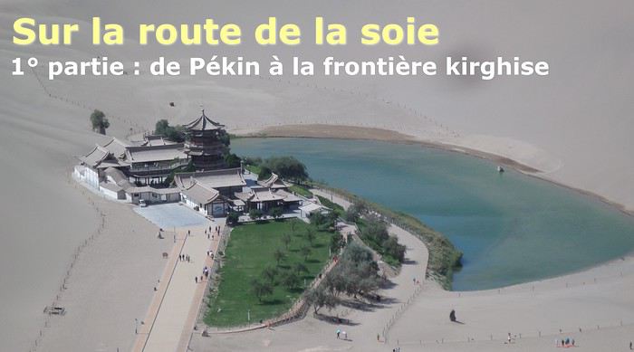
The Chinese Far West More than 30 years after my first trip to eastern China, I finally fulfilled an old dream: traveling solo from Beijing to the far west, discovering Xinjiang, the Uyghur people and the oppression they endure, the oases of Turpan and Kashgar, the Taklamakan Desert, the end of the Great Wall... The route was covered by train.
MENU PART 1: CHINA
1- Beijing (Jiankou) : the authentic Great Wall, without tourists 2- Cycling in Beijing, the best way to get around 3- Beijing : departure for the far west 4- Jiayuguan : getting by without English 5- Jiayuguan : scams and heritage 6- Dunhuang : abundance in the middle of the desert 7- Turpan : the Uyghurs under heavy surveillance 8- Kashgar : love at first sight for the old city 9- Kashgar : China’s recipe for controlling the populace 10- Tashkurgan : what on earth was I thinking going there! Kyrgyz border: a surreal epic Photo album from the 80s, contributions from other travelers (page 2)
1- JIANKOU Finding the authentic Great Wall, without tourists or a guide Friday, August 24, 2018 Thirty years later, I didn’t feel like revisiting the Great Wall at Badaling or any other overcrowded site. I chose to explore it at Jiankou, in its wildest, most authentic, and unrestored section, starting from a lost village deep in a valley—though it wasn’t *that* lost, since it had everything for communication.
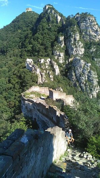
No need to pay for a taxi to get there—by timing it right, you can take the bus for just a few yuan. You have to get off at Xizhazi, the bus terminus. Be careful, there are only two buses a day in each direction. At the Xizhazi bus stop, I met a young couple who’d arrived with zero information about what to expect. We hiked the three of us toward the restored section of Mutianyu.
Still, be cautious With GPS and a topographic map (OpenTopoMap), you can set off without a problem or guide. The trail up to Jiankou is easy and well-marked. The trails down are too. But be careful—once you’re on the Wall, it’s real mountain hiking, with easy but dangerous climbing sections (over sheer drops). Not for amateurs or those afraid of heights! But what a reward. The Wall all to yourself, where it’s at its most daring. Truly mesmerizing.
More photos...
2- BEIJING The best way to get around the capital Sunday, August 26 The best way to explore the city is still by bike. Most are in a bike-share system, but you need to use an app—WeChat, the app that does everything, like monitoring your every move. No way I was installing that.
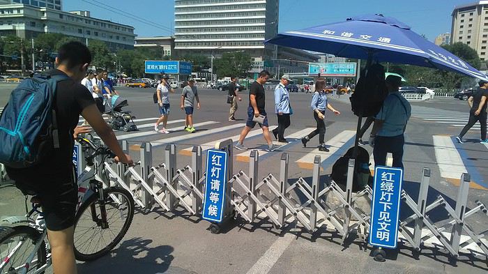
I found one at a rental shop near the hostel. The key is to quickly learn local traffic customs to minimize risks. Bike lanes are wide along the avenues.
But you still have to: - Watch out for anything parked on the bike paths—the most annoying are people napping or talking on the phone in their cars - Keep an eye on everything coming the wrong way—the list is long - The worst is right turns on red, which in Chinese traffic rules seem to have priority Once you get the hang of it, it’s fine. The city is huge but flat, so you can just wing it.
3- BEIJING By train to the far west Sunday, August 26 Beijing West Station is the size and operates like an airport. With your e-ticket from the agency, you first have to pick up your ticket at the special "English" counter, after passing through security. With your ticket in hand, you have to exit and enter through the boarding waiting area—not the platform—after a second security check.
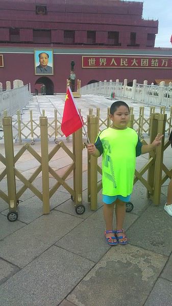 Then you find the right hall and wait for the sign to finally access the platform. In the end, it works pretty well given the incredible number of passengers to manage. Everywhere in Beijing, I saw that the Chinese have mastered crowd flow management.
Nice surprise: second-class carriages are clean, air-conditioned, and bright. Perfect, since I was in for 20 hours. One uniformed attendant per carriage, mobile meal service—luxury! Small downside: no luggage space. Hauling your suitcase up to the top bunk is quite a workout. I was in the middle, so it wasn’t too bad. The landscape, though, whether rural or urban, is pretty bleak. That should change once we leave the eastern plains.
Of course, I got my first police visit, with a thorough passport check and bag search. I was warned—going to the Chinese far west exposes you to this kind of hassle. But they were polite and respectful.
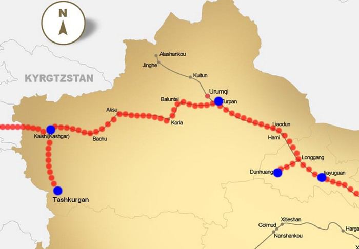 The Chinese Far West
4- JIAYUGUAN Getting by without English Monday, August 27 At the gates of two deserts (Gobi and Taklamakan) and at the foot of the Tibetan highlands, the Great Wall ends at Jiayuguan. Here, I found the deeper China I’d somewhat rediscovered during my bike ride, even if now everyone gets around on electric bikes and I’m no longer stared at like an alien.
Prices are nothing like Beijing: you can find a full meal for 2 €, and my bike cost 7 € for two days. Plus, few people speak English—neither the owner of the HI hostel where I stayed, nor the ticket sellers at the sites, let alone the servers at the small eateries where I ate. Everything is written in Chinese. So I had to use the little Chinese I know to communicate about essentials. It makes the locals laugh to see a European trying to speak their language, but it earns respect. With Google Translate’s help, I managed.
Rant: With their avenues blocked for construction for kilometers without warning, and new roads not yet on maps, I must’ve taken 15 km of detours. More photos...
5- JIAYUGUAN Scams and heritage Tuesday, August 28 The Great Wall doesn’t exactly end at the fort I visited yesterday but 10 km further, at the entrance to a river gorge at the foot of the mountains. All that’s left is a badly damaged tower (more like a mound of earth) and a section of clay wall, similar to the one I biked yesterday.
This morning, I hopped on my bike, determined to venture into the desert to see this highly symbolic site. First, you access it via a wide, brand-new road with not a soul in sight. Just before the site, I came across a grand welcome gate, very period-style, but it’s actually the inevitable toll booth.
Behind the gate, the road continues straight to the site, which you can see in the distance—at least 2 km away—the remains of the tower and wall. I had to leave my bike here. Fine. I went to the ticket counter and asked the price: 120 yuan! I couldn’t believe it—over 15 € for a simple mound of earth.
I showed my displeasure to the attendant, who couldn’t care less, and immediately turned back. 120 yuan—that’s the price for a new road, a fancy gate planted 2 km before the site just to force you to take a shuttle, and employees with nothing to do all day... Now I understand why I didn’t meet anyone!
Heritage China is a bit pricey Generally, sites are expensive for the country’s standard of living, but travelers are supposed to have money, so why hold back? I even gave up on the Forbidden City—reservations required days in advance (or on the black market at an impossible price). I prefer to keep the memory of my first visit, when entry must’ve cost a few dozen cents, and there were only a handful of visitors.
This morning, I took a taxi to see remarkable tombs of common people from the 3rd to 6th centuries. They’re small vaulted caves made of painted bricks, depicting scenes of daily life. Very pretty and moving. But even here, though the price was more reasonable, I was left wanting—only one of the 16 tombs is open to visitors, and it’s apparently not the most beautiful.
The authentic China—at least what’s left of it... Wandering the impersonal avenues of the city, you stumble upon a market. There, you still find traditional China—small shops with questionable hygiene, Go players, musicians, and even a dental prosthetist. The last refuge for those untouched by modernity. More photos...
6- DUNHUANG Abundance in the middle of the desert Wednesday, August 29 Well, I thought the landscape would be less bleak as I headed west. Nope. The only distraction in this expanse of dark, clayey sand is the forests of pylons and wind turbines, plus wild camels racing each other.
 However, Dunhuang, the gateway to the Taklamakan, is by far the most pleasant Chinese city I know. There’s a real city center you can explore on foot. It’s hot but not unbearable, with a light, dry breeze. Much nicer than Beijing. The Han Chinese are still the majority, but the Muslim Uyghurs are more numerous, and the muezzin’s call to prayer echoes around the mosque.
The most surprising thing is the abundance and diversity of fruits and vegetables. You wonder how it all grows here. Well-irrigated, the desert sands are very fertile. Here, raisins have subtle, mysterious flavors, and the lamb really tastes like lamb.
Today, I visited the must-see Mingshashan, a dune complex next to which Pila is a molehill. The Basque Country, but covered in sand... More photos...
7- TURPAN The Uyghurs under heavy surveillance Friday, August 31 Surveillance cameras everywhere in the city, armed police stationed at intersections, in front of public buildings, at the entrance and inside tourist sites, police stations on every corner, patrols on foot or by car, khaki uniforms even for middle schoolers... here, the Han Chinese are in the minority, and you can feel it. Turpan feels like a city under siege.
To enter the youth hostel where I stayed, there’s even a security gate, and the receptionist (a Han, like everyone in tourism) wears a bulletproof vest! Reassuring. Still, you don’t feel particularly threatened here, especially as a European. The troublemakers are the Chinese, not the Uyghurs. Generally, China is a very safe country for visitors.
Smile, you’re on camera! I was biking on an avenue when the car in front of me got flashed for driving slowly. I quickly understood why when I got flashed too.
Here, the official time is Beijing time, but it gets dark two hours later. It’ll be even worse in Kashgar. Trickier to manage: everything is displayed in Chinese and Arabic. Nothing in English. Choosing a menu is a shot in the dark. Apart from a few young Chinese, no one here speaks English, and my Chinese doesn’t seem very understandable...
Mogao, the end of the road for the Han Yesterday, near Dunhuang, I went to Mogao, a complex of decorated caves with Buddha sculptures and paintings. Stunning, but so crowded! Luckily, here in Turpan, Chinese tourists barely venture out. So I visited a Silk Road ghost town with only a handful of other visitors and under a howling wind.
The modern Chinese city is swallowing up the old Uyghur neighborhoods—only a museum-like district remains in the center, and pockets of resistance on the outskirts are doomed to disappear soon. More photos...
8- KASHGAR A (relative) love at first sight for the old city Sunday, September 2 After three overnight trains, here I am in the far west of China, nearly 4,000 km from the capital. Despite the omnipresent police and an old city preserved UNESCO-style, Kashgar is my Chinese love at first sight.
Finally, Chinese... well, sort of, because we’re in Uyghur territory here—a Turkic people with nothing culturally in common with the Han, the eastern Chinese. It started badly yesterday at Turfan station, where after three security gate passes, at least five passport checks, and a bag search, three adorable policewomen confiscated my antibacterial lotion because it had a flammable logo...
Then came the welcoming committee of armed cops at Kashgar station. Once all that was over, they left me alone—except you still have to go through security checks like everyone else to enter the old city, the bazaar, the livestock market... The further west you go, the more the siege mentality is evident. Luckily, the border isn’t far...
Despite the inevitable destruction-reconstruction, the city center has been well preserved. Thankfully, because it’s a very original style, a mix of local and colonial. I love it, even if it’s a bit too artificial, sanitized, and watered-down, and rather empty of residents. On the Silk Road, the city was famous for its great food. And it still is—rarely have I seen such richness and abundance of food! And not just scorpions or snakes. More photos...
9- KASHGAR China’s recipe for controlling the populace Saturday, September 1 Xinjiang, along with Tibet, is a "sensitive" area of rebellion in the eyes of Chinese authorities. As a result, the state has these regions and their populations under total control. Tourists also feel the consequences, even if they’re not at risk of re-education camps.
 - Putting barbed wire and anti-ramming barriers around sensitive sites (schools, big hotels, government buildings...)
- Installing traffic surveillance gates with cameras and photo flashes (for all vehicles passing, including bikes) throughout the city and even in the countryside
- Posting uniformed guards with tasers, batons, or huge baseball bats every 100 meters
- Training the Han population (ethnic Chinese) in self-defense with sticks, preferably in the morning on the street. Men and women of all ages
- Starting school with the national anthem, doing military exercises, and receiving political indoctrination, all neatly lined up in the courtyard. (The dream school for any teacher)
- Placing a snitch in uniform (a pseudo-guard) in public gathering places, like youth hostels. Mine spends the day loafing around the courtyard
- Putting Chinese flags everywhere on the streets to remind everyone who’s in charge
- Installing security gates at every entrance to areas frequented by tourists (thanks for that) but not just there
- Never photographing cops, or else! I tried, but it’s not easy...
- Putting barbed wire and anti-ramming barriers around sensitive sites (schools, big hotels, government buildings...)
- Installing traffic surveillance gates with cameras and photo flashes (for all vehicles passing, including bikes) throughout the city and even in the countryside
- Posting uniformed guards with tasers, batons, or huge baseball bats every 100 meters
- Training the Han population (ethnic Chinese) in self-defense with sticks, preferably in the morning on the street. Men and women of all ages
- Starting school with the national anthem, doing military exercises, and receiving political indoctrination, all neatly lined up in the courtyard. (The dream school for any teacher)
- Placing a snitch in uniform (a pseudo-guard) in public gathering places, like youth hostels. Mine spends the day loafing around the courtyard
- Putting Chinese flags everywhere on the streets to remind everyone who’s in charge
- Installing security gates at every entrance to areas frequented by tourists (thanks for that) but not just there
- Never photographing cops, or else! I tried, but it’s not easy...
With all that, you can stroll around safely Not much crime! As for the amount the Chinese state spends to maintain such a system, it’s staggering! A third of the Han living in Xinjiang work in security. Today, I wandered freely around old Kashgar, which is quite large after all. More photos...
10- TASHKURGAN What on earth was I thinking going there! Wednesday, September 5 First, there’s the taxi—pretty crappy, with a driver who doesn’t speak a word of English and won’t stop smoking. Over six hours in that... shared with a completely out-of-it American.
Then there are all the checkpoints along the way. I won’t go on—you know the drill by now.
After that, there’s Tashkurgan—a town with nothing to see, nothing to do. Deserted as soon as night falls. There’s this huge youth hostel and a few lost Chinese tapping away on their smartphones, chain-smoking. This lost American-European crowd, swapping tips on how to enter Pakistan or Tajikistan.
Luckily, there’s the Chinese Pamir Highway, lined with peaks over 7,000m. There’s the feeling of no longer being in China, with a population whose features are Middle Eastern. And these Tajik women with their stunning hairstyles and vibrant costumes. There’s the fact of having reached the westernmost Chinese city, far from crowds and tourist sites. A sort of end of the world. More photos...
11- KYRGYZ BORDER A surreal epic Thursday, September 6 The road from Kashgar to the Kyrgyzstan border is a little over 200 km and passes through beautiful landscapes of colorful, desert-like mountains with acrobatic folds. That’s the bucolic part of the trip.
 Yesterday, I managed to gather four people to rent a minibus to reach the border more easily: a Spaniard and an Argentine I’d already met in Turpan, and two New Zealanders who responded to the ad left at the hostel.
Absurdity and paranoia of Chinese authorities The highlight was crossing the town of Wuqia, 50 km past Kashgar. After tallying up with my fellow sufferers, we must’ve passed about ten checkpoints with: - Passport checks: 14 times, sometimes by two cops side by side - Bag checks: 4 times - Smartphone checks: 2 times, with deletion of "non-compliant" photos, and registration of your IMEI in the exit log!... Absurd and surreal at the same time, since my camera stayed in my bag, my apps are in French, and my photos have been online for ages...
With all that, we arrived just as the last checkpoint before the no man’s land marking the border between the two countries was on lunch break. And bam! Another 1.5-hour wait, alongside truckers who were much more used to this than we were.
What to think? The cops themselves aren’t fooled. They play the role they’re asked to, but sometimes you can coax a smile out of them—they realize how ridiculous the situation is.
What’s the point? That’s the big question my companions and I were tempted to answer with "to piss people off." To show you your place isn’t here, but with the other tourists, over there in the east, in Shanghai, Xi’an, or Guangzhou.
As for you, a traveler from a democratic country, you really experience this as aggression, humiliation, a violation of your private space. And yet, I’m respected, they speak to me properly. Today, I better understand what a Palestinian or a citizen of an occupied country might feel daily. A unique experience! Thanks, China.
And to top it off, the cherry on the cake! It’s still this glowing button you press to rate your passage after clearing the last obstacle before the exit stamp. I was so surprised it turned off before I could react. The Spaniard, with great humor and irony, had time to vote "excellent." In the end, he wasn’t wrong—you can hardly do better!
PS: I ditched my buddies at the border. They didn’t want to pay for a taxi to continue. So I took a direct taxi to Osh. The first 100 km are fabulous. I couldn’t take many photos, but I’ll be back on Monday to go to Tajikistan.
More photos...
The rest of the Silk Road, Part 2, in these travel journals: Kyrgyzstan, Tajikistan, Uzbekistan.
The Chinese Far West More than 30 years after my first trip to eastern China, I finally fulfilled an old dream: traveling solo from Beijing to the far west, discovering Xinjiang, the Uyghur people and the oppression they endure, the oases of Turpan and Kashgar, the Taklamakan Desert, the end of the Great Wall... The route was covered by train.
MENU PART 1: CHINA
1- Beijing (Jiankou) : the authentic Great Wall, without tourists 2- Cycling in Beijing, the best way to get around 3- Beijing : departure for the far west 4- Jiayuguan : getting by without English 5- Jiayuguan : scams and heritage 6- Dunhuang : abundance in the middle of the desert 7- Turpan : the Uyghurs under heavy surveillance 8- Kashgar : love at first sight for the old city 9- Kashgar : China’s recipe for controlling the populace 10- Tashkurgan : what on earth was I thinking going there! Kyrgyz border: a surreal epic Photo album from the 80s, contributions from other travelers (page 2)
1- JIANKOU Finding the authentic Great Wall, without tourists or a guide Friday, August 24, 2018 Thirty years later, I didn’t feel like revisiting the Great Wall at Badaling or any other overcrowded site. I chose to explore it at Jiankou, in its wildest, most authentic, and unrestored section, starting from a lost village deep in a valley—though it wasn’t *that* lost, since it had everything for communication.
No need to pay for a taxi to get there—by timing it right, you can take the bus for just a few yuan. You have to get off at Xizhazi, the bus terminus. Be careful, there are only two buses a day in each direction. At the Xizhazi bus stop, I met a young couple who’d arrived with zero information about what to expect. We hiked the three of us toward the restored section of Mutianyu.
Still, be cautious With GPS and a topographic map (OpenTopoMap), you can set off without a problem or guide. The trail up to Jiankou is easy and well-marked. The trails down are too. But be careful—once you’re on the Wall, it’s real mountain hiking, with easy but dangerous climbing sections (over sheer drops). Not for amateurs or those afraid of heights! But what a reward. The Wall all to yourself, where it’s at its most daring. Truly mesmerizing.
More photos...
2- BEIJING The best way to get around the capital Sunday, August 26 The best way to explore the city is still by bike. Most are in a bike-share system, but you need to use an app—WeChat, the app that does everything, like monitoring your every move. No way I was installing that.
I found one at a rental shop near the hostel. The key is to quickly learn local traffic customs to minimize risks. Bike lanes are wide along the avenues.
But you still have to: - Watch out for anything parked on the bike paths—the most annoying are people napping or talking on the phone in their cars - Keep an eye on everything coming the wrong way—the list is long - The worst is right turns on red, which in Chinese traffic rules seem to have priority Once you get the hang of it, it’s fine. The city is huge but flat, so you can just wing it.
3- BEIJING By train to the far west Sunday, August 26 Beijing West Station is the size and operates like an airport. With your e-ticket from the agency, you first have to pick up your ticket at the special "English" counter, after passing through security. With your ticket in hand, you have to exit and enter through the boarding waiting area—not the platform—after a second security check.
Then you find the right hall and wait for the sign to finally access the platform. In the end, it works pretty well given the incredible number of passengers to manage. Everywhere in Beijing, I saw that the Chinese have mastered crowd flow management.Nice surprise: second-class carriages are clean, air-conditioned, and bright. Perfect, since I was in for 20 hours. One uniformed attendant per carriage, mobile meal service—luxury! Small downside: no luggage space. Hauling your suitcase up to the top bunk is quite a workout. I was in the middle, so it wasn’t too bad. The landscape, though, whether rural or urban, is pretty bleak. That should change once we leave the eastern plains.
Of course, I got my first police visit, with a thorough passport check and bag search. I was warned—going to the Chinese far west exposes you to this kind of hassle. But they were polite and respectful.
The Chinese Far West4- JIAYUGUAN Getting by without English Monday, August 27 At the gates of two deserts (Gobi and Taklamakan) and at the foot of the Tibetan highlands, the Great Wall ends at Jiayuguan. Here, I found the deeper China I’d somewhat rediscovered during my bike ride, even if now everyone gets around on electric bikes and I’m no longer stared at like an alien.
Prices are nothing like Beijing: you can find a full meal for 2 €, and my bike cost 7 € for two days. Plus, few people speak English—neither the owner of the HI hostel where I stayed, nor the ticket sellers at the sites, let alone the servers at the small eateries where I ate. Everything is written in Chinese. So I had to use the little Chinese I know to communicate about essentials. It makes the locals laugh to see a European trying to speak their language, but it earns respect. With Google Translate’s help, I managed.
Rant: With their avenues blocked for construction for kilometers without warning, and new roads not yet on maps, I must’ve taken 15 km of detours. More photos...
5- JIAYUGUAN Scams and heritage Tuesday, August 28 The Great Wall doesn’t exactly end at the fort I visited yesterday but 10 km further, at the entrance to a river gorge at the foot of the mountains. All that’s left is a badly damaged tower (more like a mound of earth) and a section of clay wall, similar to the one I biked yesterday.
This morning, I hopped on my bike, determined to venture into the desert to see this highly symbolic site. First, you access it via a wide, brand-new road with not a soul in sight. Just before the site, I came across a grand welcome gate, very period-style, but it’s actually the inevitable toll booth.
Behind the gate, the road continues straight to the site, which you can see in the distance—at least 2 km away—the remains of the tower and wall. I had to leave my bike here. Fine. I went to the ticket counter and asked the price: 120 yuan! I couldn’t believe it—over 15 € for a simple mound of earth.
I showed my displeasure to the attendant, who couldn’t care less, and immediately turned back. 120 yuan—that’s the price for a new road, a fancy gate planted 2 km before the site just to force you to take a shuttle, and employees with nothing to do all day... Now I understand why I didn’t meet anyone!
Heritage China is a bit pricey Generally, sites are expensive for the country’s standard of living, but travelers are supposed to have money, so why hold back? I even gave up on the Forbidden City—reservations required days in advance (or on the black market at an impossible price). I prefer to keep the memory of my first visit, when entry must’ve cost a few dozen cents, and there were only a handful of visitors.
This morning, I took a taxi to see remarkable tombs of common people from the 3rd to 6th centuries. They’re small vaulted caves made of painted bricks, depicting scenes of daily life. Very pretty and moving. But even here, though the price was more reasonable, I was left wanting—only one of the 16 tombs is open to visitors, and it’s apparently not the most beautiful.
The authentic China—at least what’s left of it... Wandering the impersonal avenues of the city, you stumble upon a market. There, you still find traditional China—small shops with questionable hygiene, Go players, musicians, and even a dental prosthetist. The last refuge for those untouched by modernity. More photos...
6- DUNHUANG Abundance in the middle of the desert Wednesday, August 29 Well, I thought the landscape would be less bleak as I headed west. Nope. The only distraction in this expanse of dark, clayey sand is the forests of pylons and wind turbines, plus wild camels racing each other.
However, Dunhuang, the gateway to the Taklamakan, is by far the most pleasant Chinese city I know. There’s a real city center you can explore on foot. It’s hot but not unbearable, with a light, dry breeze. Much nicer than Beijing. The Han Chinese are still the majority, but the Muslim Uyghurs are more numerous, and the muezzin’s call to prayer echoes around the mosque.The most surprising thing is the abundance and diversity of fruits and vegetables. You wonder how it all grows here. Well-irrigated, the desert sands are very fertile. Here, raisins have subtle, mysterious flavors, and the lamb really tastes like lamb.
Today, I visited the must-see Mingshashan, a dune complex next to which Pila is a molehill. The Basque Country, but covered in sand... More photos...
7- TURPAN The Uyghurs under heavy surveillance Friday, August 31 Surveillance cameras everywhere in the city, armed police stationed at intersections, in front of public buildings, at the entrance and inside tourist sites, police stations on every corner, patrols on foot or by car, khaki uniforms even for middle schoolers... here, the Han Chinese are in the minority, and you can feel it. Turpan feels like a city under siege.
To enter the youth hostel where I stayed, there’s even a security gate, and the receptionist (a Han, like everyone in tourism) wears a bulletproof vest! Reassuring. Still, you don’t feel particularly threatened here, especially as a European. The troublemakers are the Chinese, not the Uyghurs. Generally, China is a very safe country for visitors.
Smile, you’re on camera! I was biking on an avenue when the car in front of me got flashed for driving slowly. I quickly understood why when I got flashed too.
Here, the official time is Beijing time, but it gets dark two hours later. It’ll be even worse in Kashgar. Trickier to manage: everything is displayed in Chinese and Arabic. Nothing in English. Choosing a menu is a shot in the dark. Apart from a few young Chinese, no one here speaks English, and my Chinese doesn’t seem very understandable...
Mogao, the end of the road for the Han Yesterday, near Dunhuang, I went to Mogao, a complex of decorated caves with Buddha sculptures and paintings. Stunning, but so crowded! Luckily, here in Turpan, Chinese tourists barely venture out. So I visited a Silk Road ghost town with only a handful of other visitors and under a howling wind.
The modern Chinese city is swallowing up the old Uyghur neighborhoods—only a museum-like district remains in the center, and pockets of resistance on the outskirts are doomed to disappear soon. More photos...
8- KASHGAR A (relative) love at first sight for the old city Sunday, September 2 After three overnight trains, here I am in the far west of China, nearly 4,000 km from the capital. Despite the omnipresent police and an old city preserved UNESCO-style, Kashgar is my Chinese love at first sight.
Finally, Chinese... well, sort of, because we’re in Uyghur territory here—a Turkic people with nothing culturally in common with the Han, the eastern Chinese. It started badly yesterday at Turfan station, where after three security gate passes, at least five passport checks, and a bag search, three adorable policewomen confiscated my antibacterial lotion because it had a flammable logo...
Then came the welcoming committee of armed cops at Kashgar station. Once all that was over, they left me alone—except you still have to go through security checks like everyone else to enter the old city, the bazaar, the livestock market... The further west you go, the more the siege mentality is evident. Luckily, the border isn’t far...
Despite the inevitable destruction-reconstruction, the city center has been well preserved. Thankfully, because it’s a very original style, a mix of local and colonial. I love it, even if it’s a bit too artificial, sanitized, and watered-down, and rather empty of residents. On the Silk Road, the city was famous for its great food. And it still is—rarely have I seen such richness and abundance of food! And not just scorpions or snakes. More photos...
9- KASHGAR China’s recipe for controlling the populace Saturday, September 1 Xinjiang, along with Tibet, is a "sensitive" area of rebellion in the eyes of Chinese authorities. As a result, the state has these regions and their populations under total control. Tourists also feel the consequences, even if they’re not at risk of re-education camps.
- Putting barbed wire and anti-ramming barriers around sensitive sites (schools, big hotels, government buildings...)
- Installing traffic surveillance gates with cameras and photo flashes (for all vehicles passing, including bikes) throughout the city and even in the countryside
- Posting uniformed guards with tasers, batons, or huge baseball bats every 100 meters
- Training the Han population (ethnic Chinese) in self-defense with sticks, preferably in the morning on the street. Men and women of all ages
- Starting school with the national anthem, doing military exercises, and receiving political indoctrination, all neatly lined up in the courtyard. (The dream school for any teacher)
- Placing a snitch in uniform (a pseudo-guard) in public gathering places, like youth hostels. Mine spends the day loafing around the courtyard
- Putting Chinese flags everywhere on the streets to remind everyone who’s in charge
- Installing security gates at every entrance to areas frequented by tourists (thanks for that) but not just there
- Never photographing cops, or else! I tried, but it’s not easy...With all that, you can stroll around safely Not much crime! As for the amount the Chinese state spends to maintain such a system, it’s staggering! A third of the Han living in Xinjiang work in security. Today, I wandered freely around old Kashgar, which is quite large after all. More photos...
10- TASHKURGAN What on earth was I thinking going there! Wednesday, September 5 First, there’s the taxi—pretty crappy, with a driver who doesn’t speak a word of English and won’t stop smoking. Over six hours in that... shared with a completely out-of-it American.
Then there are all the checkpoints along the way. I won’t go on—you know the drill by now.
After that, there’s Tashkurgan—a town with nothing to see, nothing to do. Deserted as soon as night falls. There’s this huge youth hostel and a few lost Chinese tapping away on their smartphones, chain-smoking. This lost American-European crowd, swapping tips on how to enter Pakistan or Tajikistan.
Luckily, there’s the Chinese Pamir Highway, lined with peaks over 7,000m. There’s the feeling of no longer being in China, with a population whose features are Middle Eastern. And these Tajik women with their stunning hairstyles and vibrant costumes. There’s the fact of having reached the westernmost Chinese city, far from crowds and tourist sites. A sort of end of the world. More photos...
11- KYRGYZ BORDER A surreal epic Thursday, September 6 The road from Kashgar to the Kyrgyzstan border is a little over 200 km and passes through beautiful landscapes of colorful, desert-like mountains with acrobatic folds. That’s the bucolic part of the trip.
Yesterday, I managed to gather four people to rent a minibus to reach the border more easily: a Spaniard and an Argentine I’d already met in Turpan, and two New Zealanders who responded to the ad left at the hostel.Absurdity and paranoia of Chinese authorities The highlight was crossing the town of Wuqia, 50 km past Kashgar. After tallying up with my fellow sufferers, we must’ve passed about ten checkpoints with: - Passport checks: 14 times, sometimes by two cops side by side - Bag checks: 4 times - Smartphone checks: 2 times, with deletion of "non-compliant" photos, and registration of your IMEI in the exit log!... Absurd and surreal at the same time, since my camera stayed in my bag, my apps are in French, and my photos have been online for ages...
With all that, we arrived just as the last checkpoint before the no man’s land marking the border between the two countries was on lunch break. And bam! Another 1.5-hour wait, alongside truckers who were much more used to this than we were.
What to think? The cops themselves aren’t fooled. They play the role they’re asked to, but sometimes you can coax a smile out of them—they realize how ridiculous the situation is.
What’s the point? That’s the big question my companions and I were tempted to answer with "to piss people off." To show you your place isn’t here, but with the other tourists, over there in the east, in Shanghai, Xi’an, or Guangzhou.
As for you, a traveler from a democratic country, you really experience this as aggression, humiliation, a violation of your private space. And yet, I’m respected, they speak to me properly. Today, I better understand what a Palestinian or a citizen of an occupied country might feel daily. A unique experience! Thanks, China.
And to top it off, the cherry on the cake! It’s still this glowing button you press to rate your passage after clearing the last obstacle before the exit stamp. I was so surprised it turned off before I could react. The Spaniard, with great humor and irony, had time to vote "excellent." In the end, he wasn’t wrong—you can hardly do better!
PS: I ditched my buddies at the border. They didn’t want to pay for a taxi to continue. So I took a direct taxi to Osh. The first 100 km are fabulous. I couldn’t take many photos, but I’ll be back on Monday to go to Tajikistan.
More photos...
The rest of the Silk Road, Part 2, in these travel journals: Kyrgyzstan, Tajikistan, Uzbekistan.
Les tours du monde peuvent aussi être gastronomiques avec la découverte de produits English translation pending
Mulhouse Parc des Expositions :
Les tours du monde peuvent aussi être gastronomiques
Les Bahamas et
avec la découverte de produits régionaux venus de toute la planète.
Tout au long des trois jours de FestiVitas, une quinzaine de conférences dédiées à l'Afrique sont inscrites au programme.
Au-delà de ce continent, ce sont des offices du tourisme du monde entier (et particulièrement d'Asie et d'Amérique du Sud) qui seront à Mulhouse, pour permettre d'effectuer un tour du monde en quelques heures.
On notera la présence, pour la première fois, des offices du tourisme des Bahamas et des Seychelles et d'un coup de projecteur sur les destinations (Valence, Zadar...) desservies depuis quelques mois par les vols en partance de l'EuroAirport de Bâle Mulhouse.
Le tourisme de proximité n'est pas oublié avec 70 exposants présentant des idées de sorties régionales.
La pêche à l'honneur
Le salon se présente aussi par une déclinaison d'activités. Une quinzaine d'exposants permettront de découvrir des sports d'extérieur comme le canoë-kayak, le parachutisme, la voile etc. On annonce aussi un mur d'escalade et un practice de golf.
La grosse nouveauté, toutefois, sera la réalisation d'un espace de 1 000 m 2 entièrement consacré à la pêche de loisirs avec une trentaine d'exposants, des simulateurs de pêche, des bassins avec des poissons et diverses expositions et animations.
Bière et vins en vedette
Côté gastronomie, c'est la bière qui sera à l'honneur cette année. La brasserie de Lutterbach créera une bière spéciale (on l'annonce ambrée et au goût d'agrumes) pour le salon. L'offre de vins a été renforcée avec une cinquantaine d'exposants et des nouveautés venues du Roussillon, du Bordelais et du Languedoc. Plusieurs sommeliers seront présents, dont Frédéric Voné qui proposera des ateliers du goût. Des apéritifs commentés autour du champagne (sur réservation) sont aussi au programme.
Restaurants gastronomiques
Les deux pôles de FestiVitas se retrouvent aussi lorsque la gastronomie permet de voyager. La présentation de spécialités culinaires éthiopiennes et sénégalaises est attendue, ainsi que des produits typiques d'Italie, de Grèce ou de Belgique.
Deux restaurants gastronomiques proposeront leurs menus tout au long de FestiVitas qui, pour cette nouvelle édition, voit une nouveauté avec l'ouverture d'un bar à vins et tapas.
Ph.P. Parc des expositions, 120, rue Lefebvre, Mulhouse. Salon FestiVitas : vendredi 31 janvier et samedi 1 er février, de 10 h à 20 h (fermeture voyages à 20 h, fermeture secteur vins et saveurs à 21 h).Dimanche 2 février, accès de 10 h à 17 h 30 (fermeture de tous les secteurs à 18 h 30).Tarif : 6 € (comprenant un verre de dégustation), gratuit pour les moins de 15 ans.
Les tours du monde peuvent aussi être gastronomiques
Les Bahamas et
avec la découverte de produits régionaux venus de toute la planète.
Tout au long des trois jours de FestiVitas, une quinzaine de conférences dédiées à l'Afrique sont inscrites au programme.
Au-delà de ce continent, ce sont des offices du tourisme du monde entier (et particulièrement d'Asie et d'Amérique du Sud) qui seront à Mulhouse, pour permettre d'effectuer un tour du monde en quelques heures.
On notera la présence, pour la première fois, des offices du tourisme des Bahamas et des Seychelles et d'un coup de projecteur sur les destinations (Valence, Zadar...) desservies depuis quelques mois par les vols en partance de l'EuroAirport de Bâle Mulhouse.
Le tourisme de proximité n'est pas oublié avec 70 exposants présentant des idées de sorties régionales.
La pêche à l'honneur
Le salon se présente aussi par une déclinaison d'activités. Une quinzaine d'exposants permettront de découvrir des sports d'extérieur comme le canoë-kayak, le parachutisme, la voile etc. On annonce aussi un mur d'escalade et un practice de golf.
La grosse nouveauté, toutefois, sera la réalisation d'un espace de 1 000 m 2 entièrement consacré à la pêche de loisirs avec une trentaine d'exposants, des simulateurs de pêche, des bassins avec des poissons et diverses expositions et animations.
Bière et vins en vedette
Côté gastronomie, c'est la bière qui sera à l'honneur cette année. La brasserie de Lutterbach créera une bière spéciale (on l'annonce ambrée et au goût d'agrumes) pour le salon. L'offre de vins a été renforcée avec une cinquantaine d'exposants et des nouveautés venues du Roussillon, du Bordelais et du Languedoc. Plusieurs sommeliers seront présents, dont Frédéric Voné qui proposera des ateliers du goût. Des apéritifs commentés autour du champagne (sur réservation) sont aussi au programme.
Restaurants gastronomiques
Les deux pôles de FestiVitas se retrouvent aussi lorsque la gastronomie permet de voyager. La présentation de spécialités culinaires éthiopiennes et sénégalaises est attendue, ainsi que des produits typiques d'Italie, de Grèce ou de Belgique.
Deux restaurants gastronomiques proposeront leurs menus tout au long de FestiVitas qui, pour cette nouvelle édition, voit une nouveauté avec l'ouverture d'un bar à vins et tapas.
Ph.P. Parc des expositions, 120, rue Lefebvre, Mulhouse. Salon FestiVitas : vendredi 31 janvier et samedi 1 er février, de 10 h à 20 h (fermeture voyages à 20 h, fermeture secteur vins et saveurs à 21 h).Dimanche 2 février, accès de 10 h à 17 h 30 (fermeture de tous les secteurs à 18 h 30).Tarif : 6 € (comprenant un verre de dégustation), gratuit pour les moins de 15 ans.
Road trip 16 jours Los Angeles - Las Vegas - San Francisco en septembre English translation pending
Bonjour à tous,
Avec une amie (27 &29ans), nous partons 16 jours à deux aux États-Unis pour réaliser un RoadTrip Los Angeles/Las Vegas/San Francisco (+ tous les lieux/parc sur la route) du vendredi 20 septembre 2019 au samedi 05 octobre 2019. Notre avion atterrira à L.A. et nous décollerons San Francisco. Pour le moment, seul nos billets d'avion sont réservés et achetés.
Nous avons commencé un plan de voyage et aimerions vous le partager pour savoir si cela était faisable dans le temps impartit. Évidemment, comme tout le monde, nous voudrions voir le plus de choses possibles et nous nous attendons à ce que ce voyage ne soit pas de tout repos ! :)
Jour 1 : 15h00 : Arrivée à Los Angeles. Récupération des valises, de la voiture de location et direction Santa Monica ou alentours pour nous installer à notre hôtel. Visite des alentours.
Jour 2 : Visite de Venice et de Santa Barbara (Beverly Hills si le temps ?).
Jour 3 : Visite de Hollywood (Bld, Theatre, OUE Skyspace, Signe Hollywood, Observatoire, ...)
Jour 4 : Visite WarnerBros Studio en début de matinée puis direction Malibu vers 12h, visiter (2H-3H) et ensuite direction Santa Barbara où nous passerions la nuit. Cela nous permettra d'avoir un peu roulé le long de la côte des USA.
Jour 5 : Départ vers 8h30 pour Palm Springs et arrivée vers 11h30 (Visite + Téléphérique). 15H Départ vers Kingmann (ou alentours) où nous passerions la nuit.
Jour 6 : Route 66 vers Grand Canyon. Visite Grand Canyon. Puis repise de la route pour arriver au Monument Valley en soirée où nous passerions la nuit.
Jour 7 : Monument Valley, Forrest Gump Point, Valey of Gods. Arrivée à Page pour passer la nuit.
Jour 8 : Antelope Canyon, Lake Powel et Horseshoe Bend. Toujours à Page pour passer la nuit.
Jour 9 : Départ de Page pour la Valley of Fire et arrivée à Las Vegas fin d’après-midi.
Jour 10 : Las Vegas
Jour 11 : Death Valey - BadWater. Arrivée à LonePile pour passer la nuit.
Jour 12 : Départ pour Yosemite par la Tioga Road. Arrivée fin d’après-midi au Half-Dome Village. Jour 13 : Yosemite : Randonnée et "escalade" du Half Dome (Si nous avons le permis).
Jour 14 : Départ matinée pour SF en passant par Tuolumne Gros (Sequoia Géant) et la Silicon Valey.
Jour 15 : San Francisco
Jour 16 : Visite Alcatraz + SF. Départ pour l'aéroport à 14h00.
Pour plus de facilité dans nos déplacements. Nous allons louer une voiture, une Ford Mustang Cabriolet, du premier au dernier jour du séjours (Prise et remise à l'aéroport).
Pour le moment, le plus gros questionnement est le jour 6 & 7 où nous ne savons pas trop s’il est mieux de rester loger près du grand Canyon et de partir pour Monument Valley le lendemain matin. Ou s’il vaut mieux partir fin d’après-midi du GC pour arriver à Monument Valley en soirée et en profiter le lendemain matin.
Pensez-vous qu'il s'agisse d'un itinéraire réalisable et avantageux pour en voir le plus ?
Merci à vous, 🙂 Jérémy
Avec une amie (27 &29ans), nous partons 16 jours à deux aux États-Unis pour réaliser un RoadTrip Los Angeles/Las Vegas/San Francisco (+ tous les lieux/parc sur la route) du vendredi 20 septembre 2019 au samedi 05 octobre 2019. Notre avion atterrira à L.A. et nous décollerons San Francisco. Pour le moment, seul nos billets d'avion sont réservés et achetés.
Nous avons commencé un plan de voyage et aimerions vous le partager pour savoir si cela était faisable dans le temps impartit. Évidemment, comme tout le monde, nous voudrions voir le plus de choses possibles et nous nous attendons à ce que ce voyage ne soit pas de tout repos ! :)
Jour 1 : 15h00 : Arrivée à Los Angeles. Récupération des valises, de la voiture de location et direction Santa Monica ou alentours pour nous installer à notre hôtel. Visite des alentours.
Jour 2 : Visite de Venice et de Santa Barbara (Beverly Hills si le temps ?).
Jour 3 : Visite de Hollywood (Bld, Theatre, OUE Skyspace, Signe Hollywood, Observatoire, ...)
Jour 4 : Visite WarnerBros Studio en début de matinée puis direction Malibu vers 12h, visiter (2H-3H) et ensuite direction Santa Barbara où nous passerions la nuit. Cela nous permettra d'avoir un peu roulé le long de la côte des USA.
Jour 5 : Départ vers 8h30 pour Palm Springs et arrivée vers 11h30 (Visite + Téléphérique). 15H Départ vers Kingmann (ou alentours) où nous passerions la nuit.
Jour 6 : Route 66 vers Grand Canyon. Visite Grand Canyon. Puis repise de la route pour arriver au Monument Valley en soirée où nous passerions la nuit.
Jour 7 : Monument Valley, Forrest Gump Point, Valey of Gods. Arrivée à Page pour passer la nuit.
Jour 8 : Antelope Canyon, Lake Powel et Horseshoe Bend. Toujours à Page pour passer la nuit.
Jour 9 : Départ de Page pour la Valley of Fire et arrivée à Las Vegas fin d’après-midi.
Jour 10 : Las Vegas
Jour 11 : Death Valey - BadWater. Arrivée à LonePile pour passer la nuit.
Jour 12 : Départ pour Yosemite par la Tioga Road. Arrivée fin d’après-midi au Half-Dome Village. Jour 13 : Yosemite : Randonnée et "escalade" du Half Dome (Si nous avons le permis).
Jour 14 : Départ matinée pour SF en passant par Tuolumne Gros (Sequoia Géant) et la Silicon Valey.
Jour 15 : San Francisco
Jour 16 : Visite Alcatraz + SF. Départ pour l'aéroport à 14h00.
Pour plus de facilité dans nos déplacements. Nous allons louer une voiture, une Ford Mustang Cabriolet, du premier au dernier jour du séjours (Prise et remise à l'aéroport).
Pour le moment, le plus gros questionnement est le jour 6 & 7 où nous ne savons pas trop s’il est mieux de rester loger près du grand Canyon et de partir pour Monument Valley le lendemain matin. Ou s’il vaut mieux partir fin d’après-midi du GC pour arriver à Monument Valley en soirée et en profiter le lendemain matin.
Pensez-vous qu'il s'agisse d'un itinéraire réalisable et avantageux pour en voir le plus ?
Merci à vous, 🙂 Jérémy